

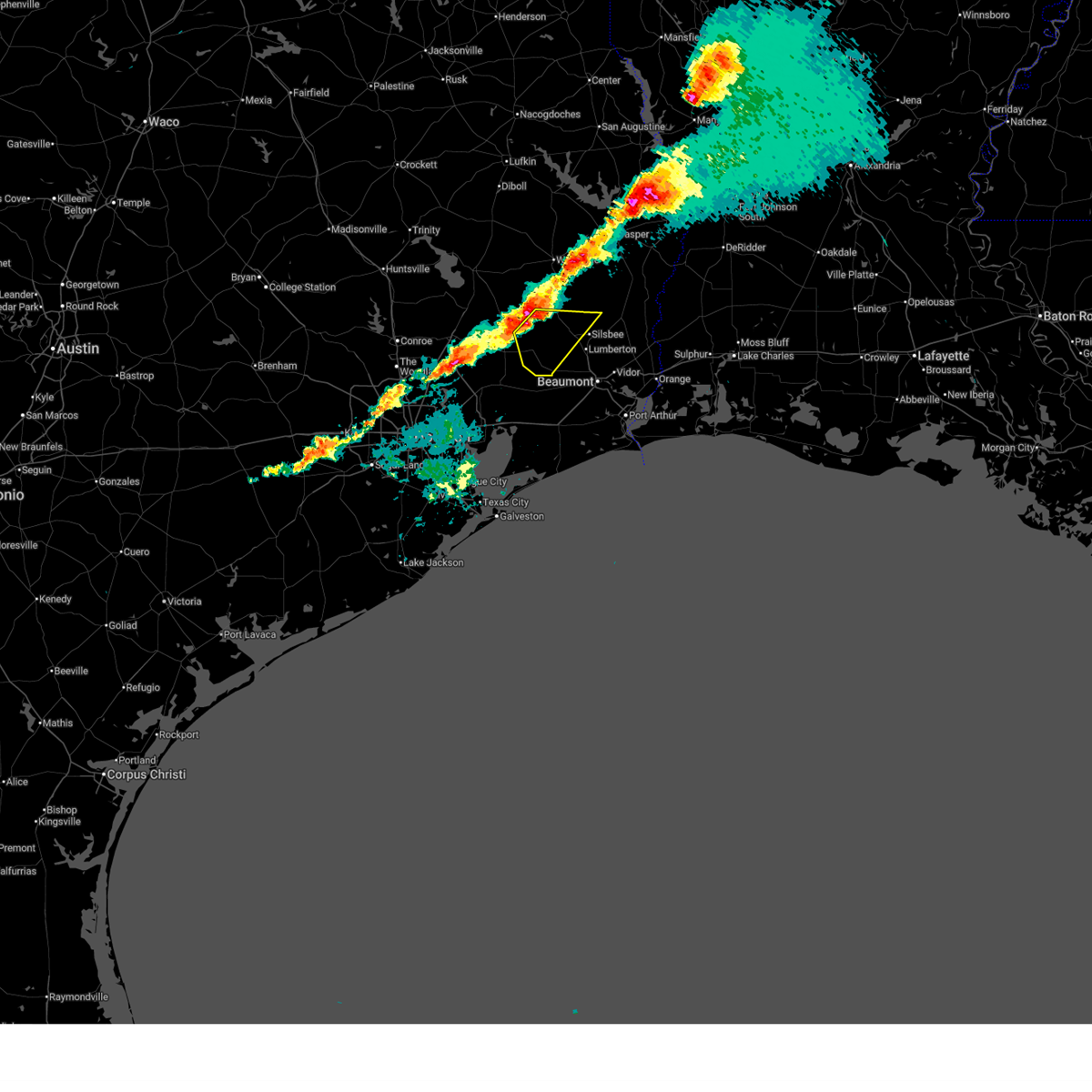
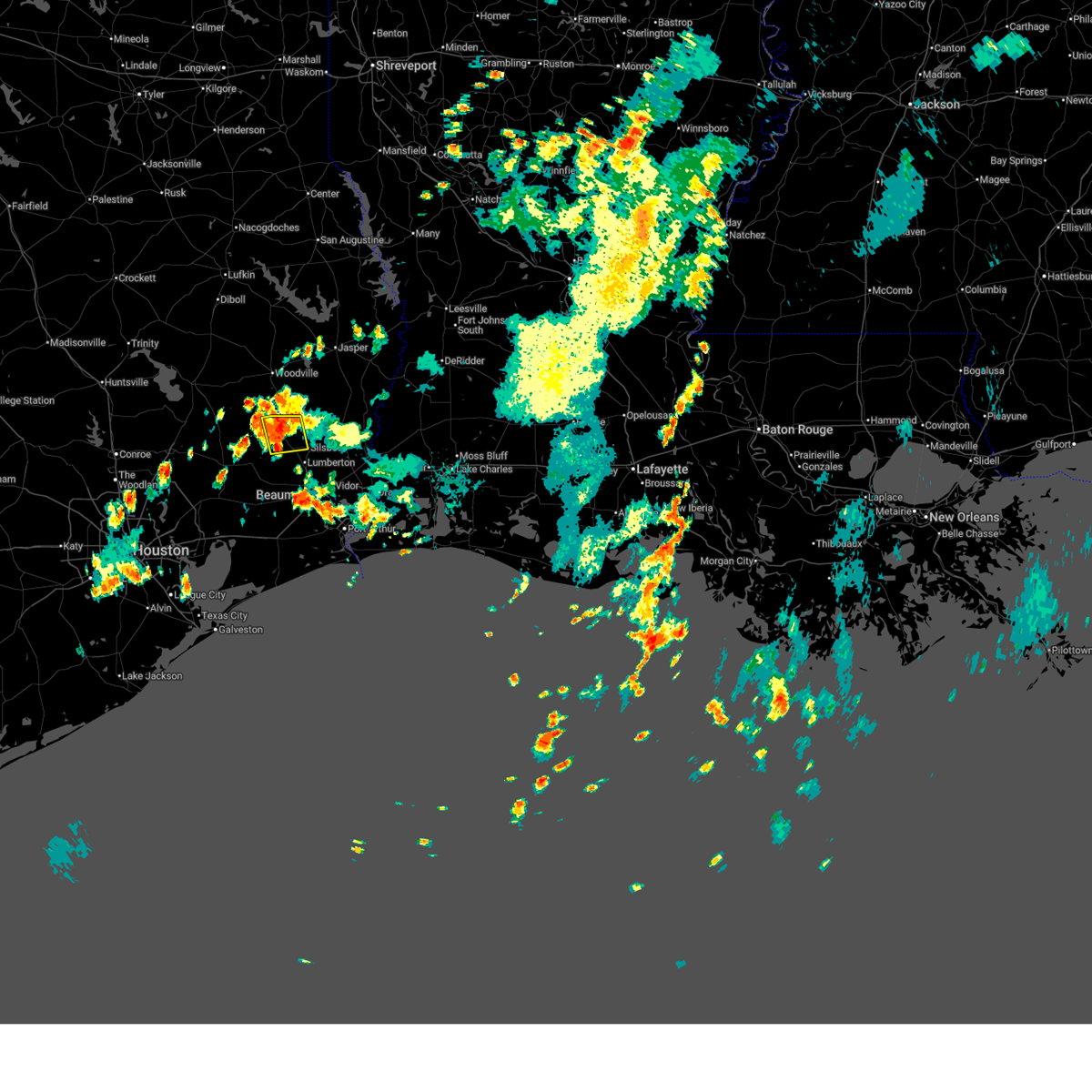
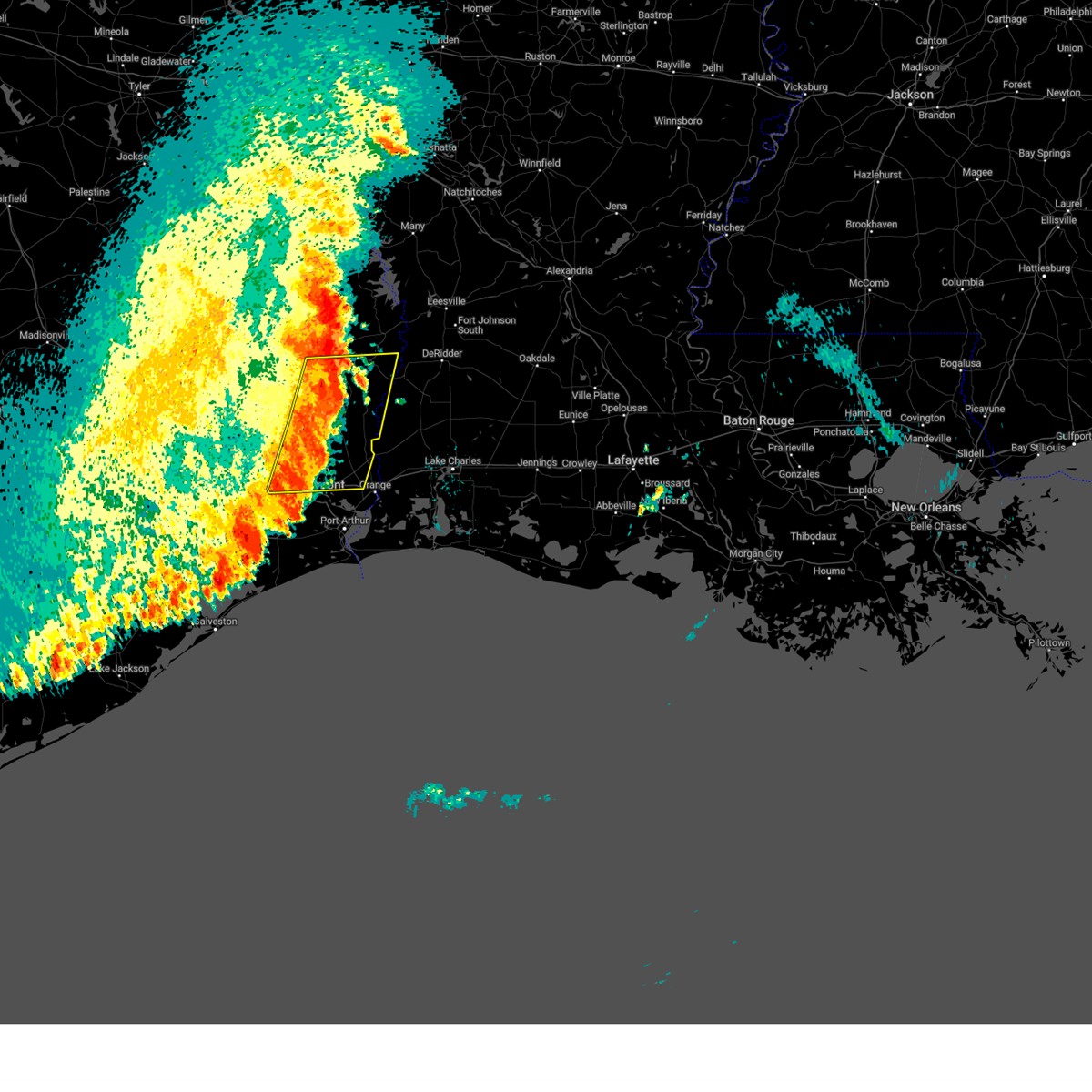
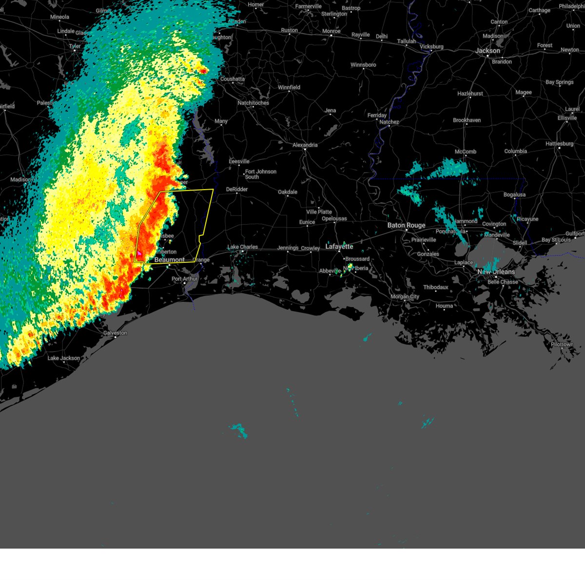
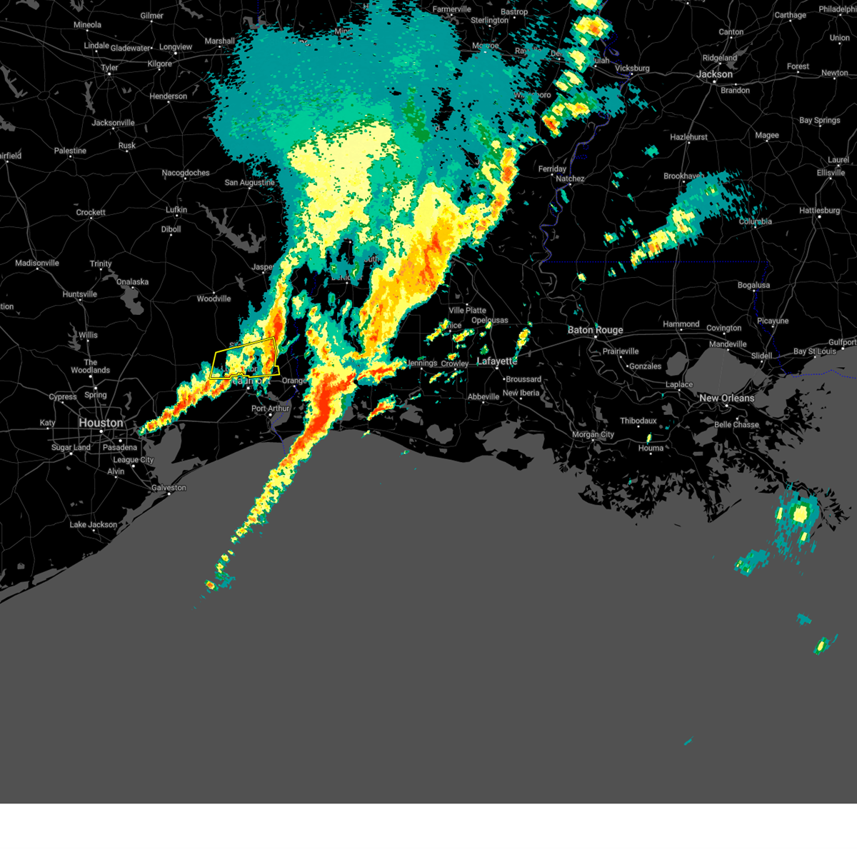
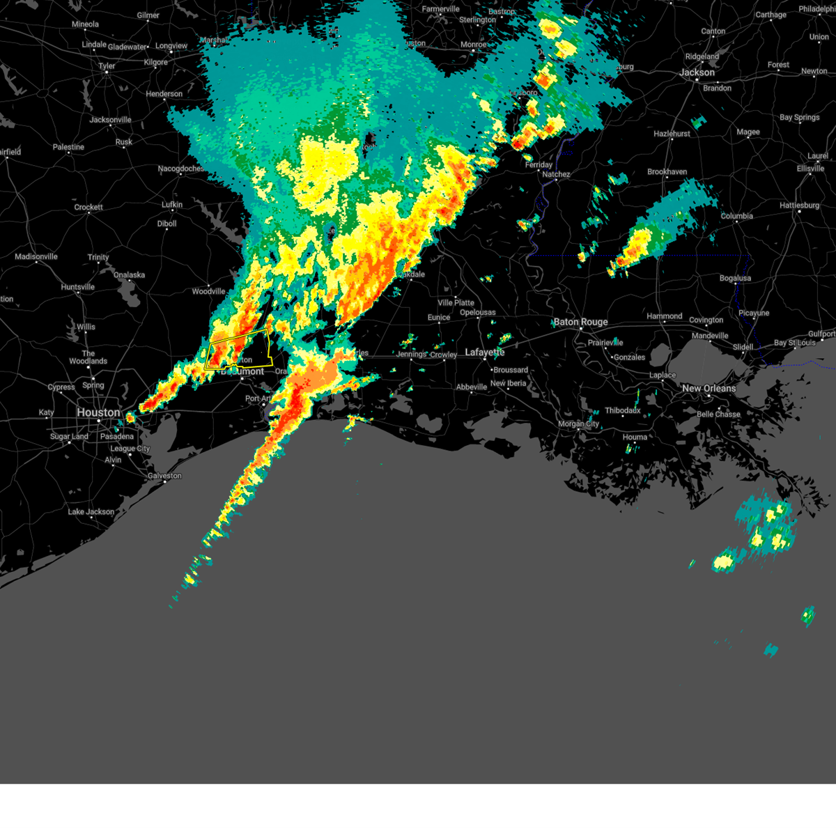
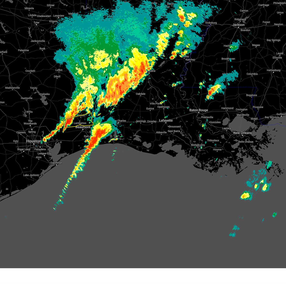
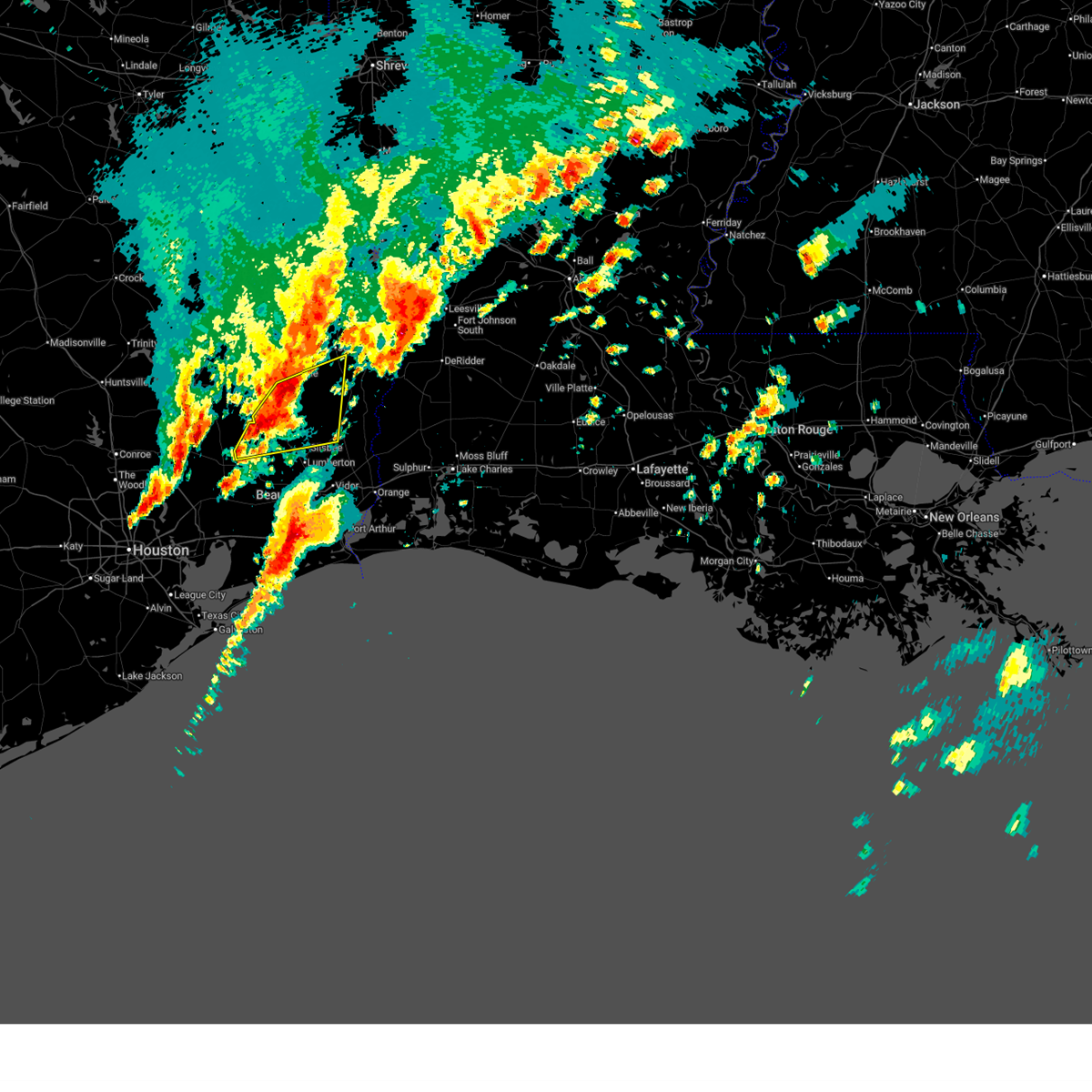
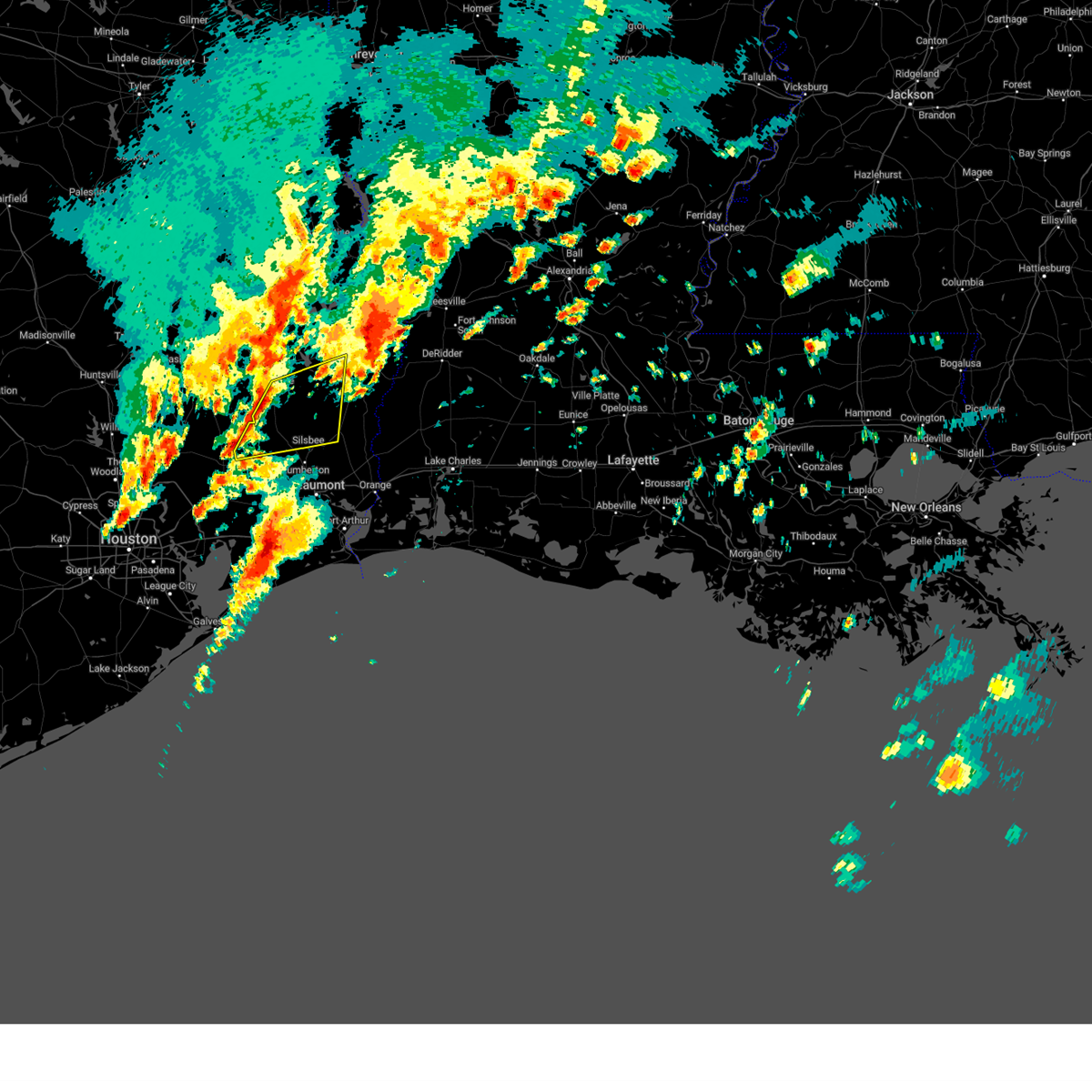
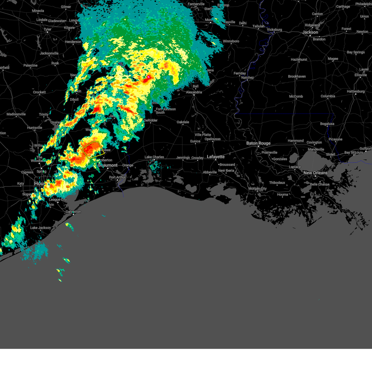
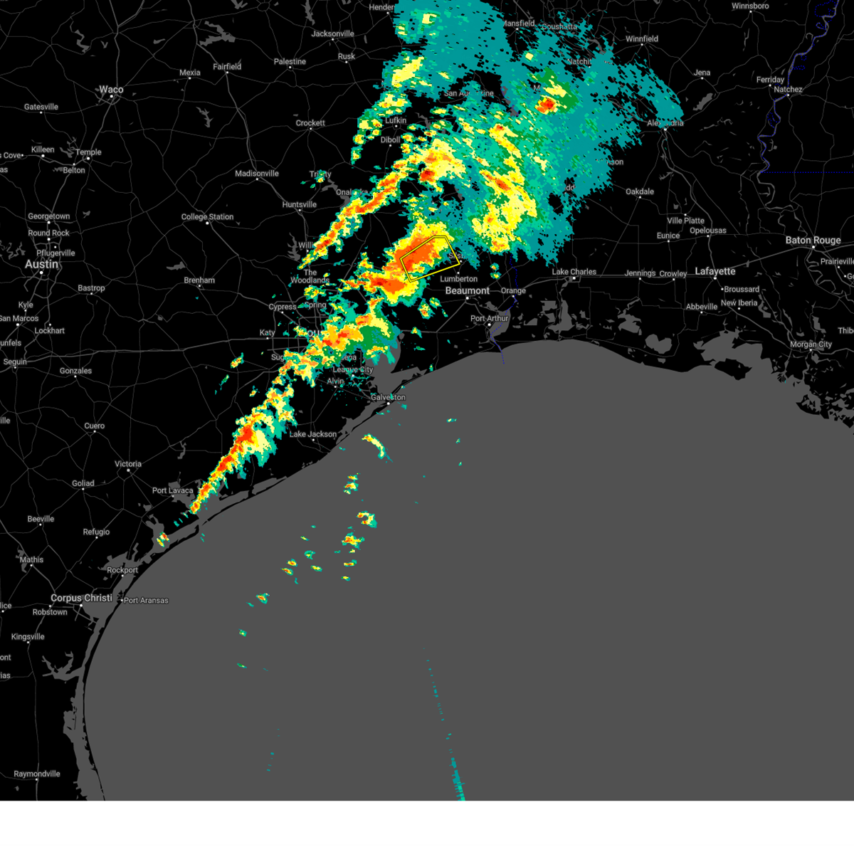
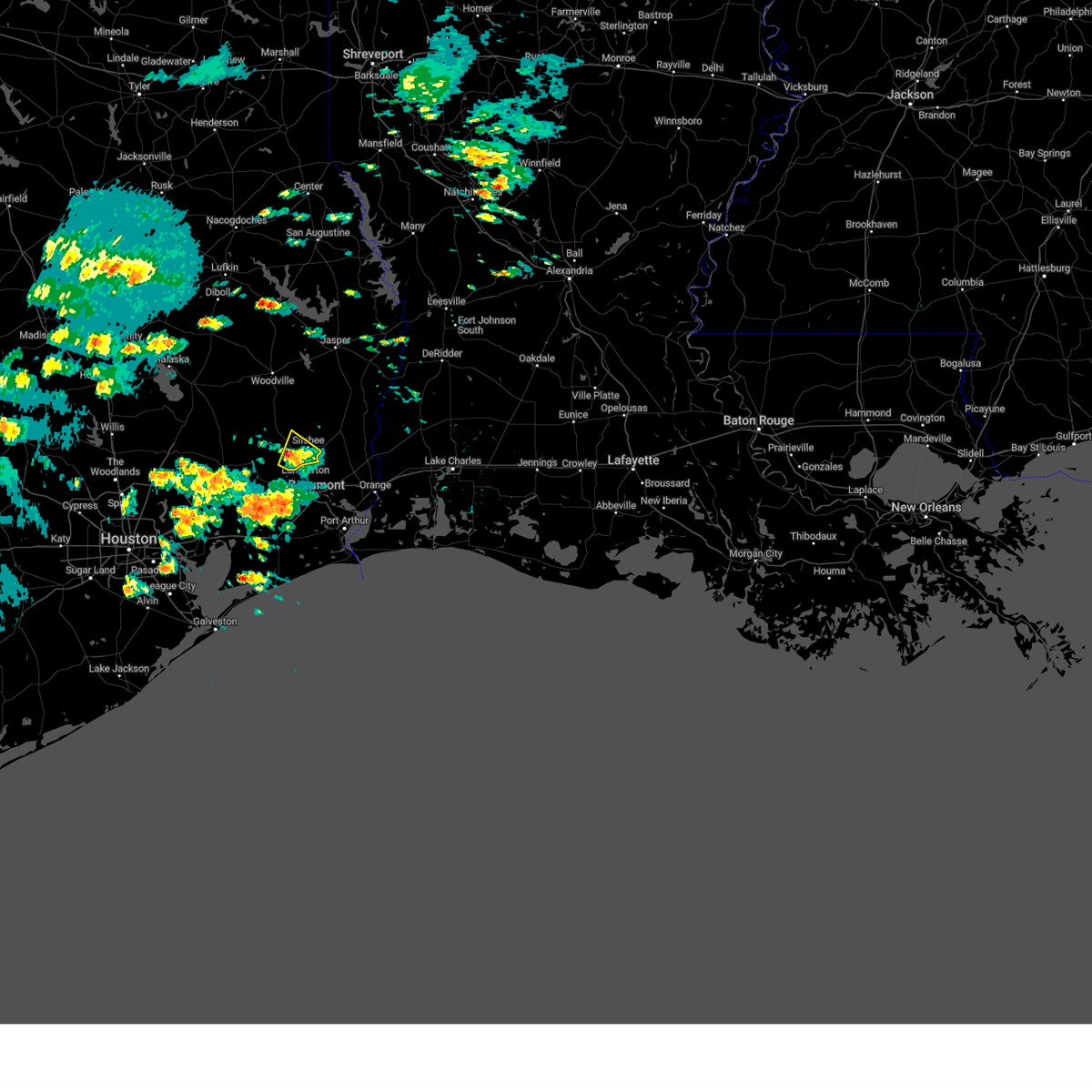
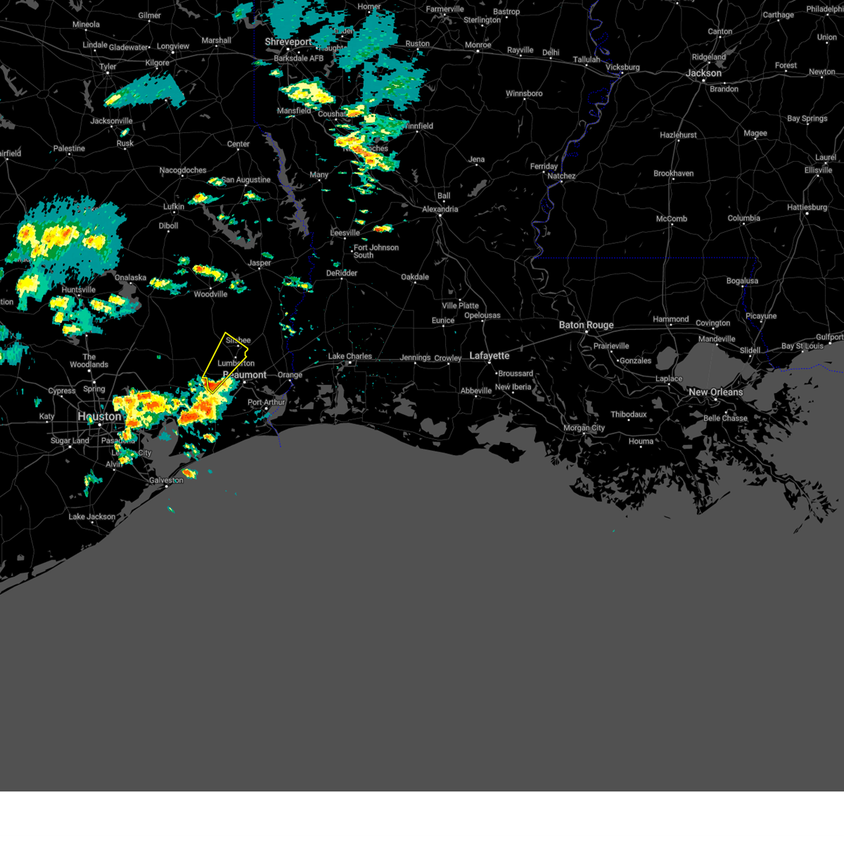
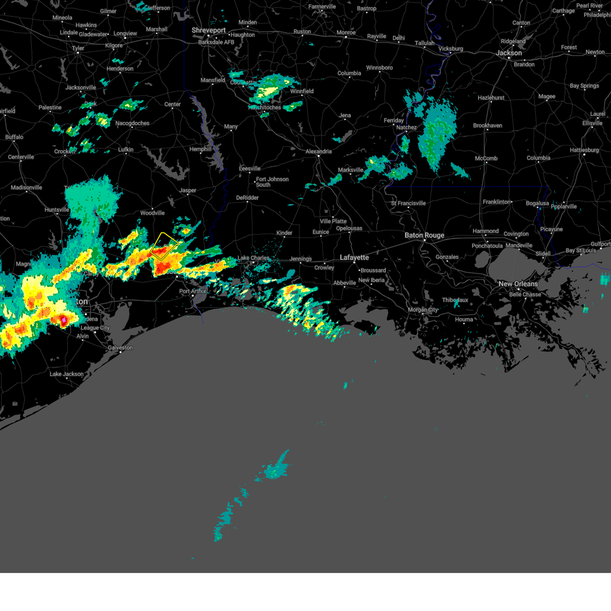
Hail Map for Silsbee, TX
The Silsbee, TX area has had 2 reports of on-the-ground hail by trained spotters, and has been under severe weather warnings 18 times during the past 12 months. Doppler radar has detected hail at or near Silsbee, TX on 60 occasions, including 2 occasions during the past year.
| Name: | Silsbee, TX |
| Where Located: | 31.7 miles WNW of Beaumont, TX |
| Map: | Google Map for Silsbee, TX |
| Population: | 6611 |
| Housing Units: | 2790 |
| More Info: | Search Google for Silsbee, TX |
2
The Top Recent Hail Date for Silsbee, TX is Tuesday, October 28, 2025 (9th out of 60)

Hail and Wind Damage Spotted near Silsbee, TX
| Date / Time | Report Details |
|---|---|
| 3/15/2026 8:37 PM CDT |
 The storm which prompted the warning has weakened below severe limits, and no longer poses an immediate threat to life or property. therefore, the warning will be allowed to expire. a tornado watch remains in effect until midnight cdt for southeastern texas. The storm which prompted the warning has weakened below severe limits, and no longer poses an immediate threat to life or property. therefore, the warning will be allowed to expire. a tornado watch remains in effect until midnight cdt for southeastern texas.
|
| 3/15/2026 8:31 PM CDT |
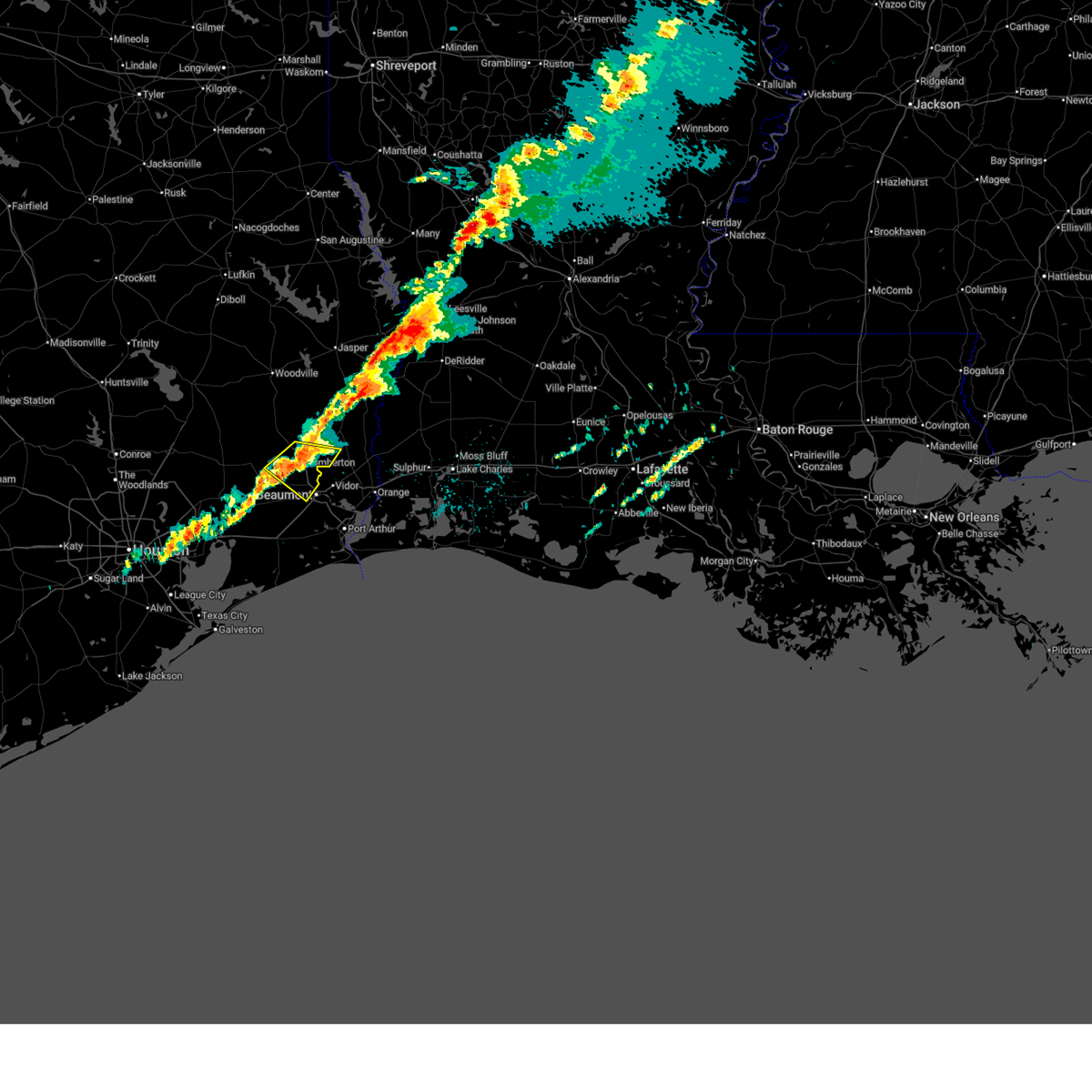
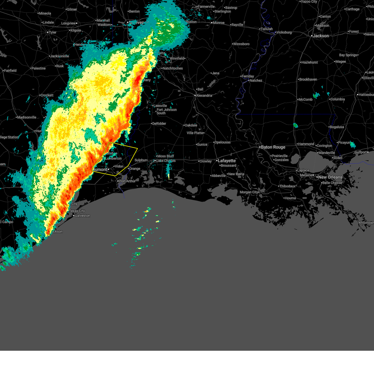
 At 831 pm cdt, a severe thunderstorm was located over lumberton, moving southeast at 40 mph (radar indicated). Hazards include quarter size hail. Damage to vehicles is expected. Locations impacted include, beaumont, lumberton, silsbee, kountze, evadale, bevil oaks, and weiss bluff. At 831 pm cdt, a severe thunderstorm was located over lumberton, moving southeast at 40 mph (radar indicated). Hazards include quarter size hail. Damage to vehicles is expected. Locations impacted include, beaumont, lumberton, silsbee, kountze, evadale, bevil oaks, and weiss bluff.
|
| 3/15/2026 8:08 PM CDT |
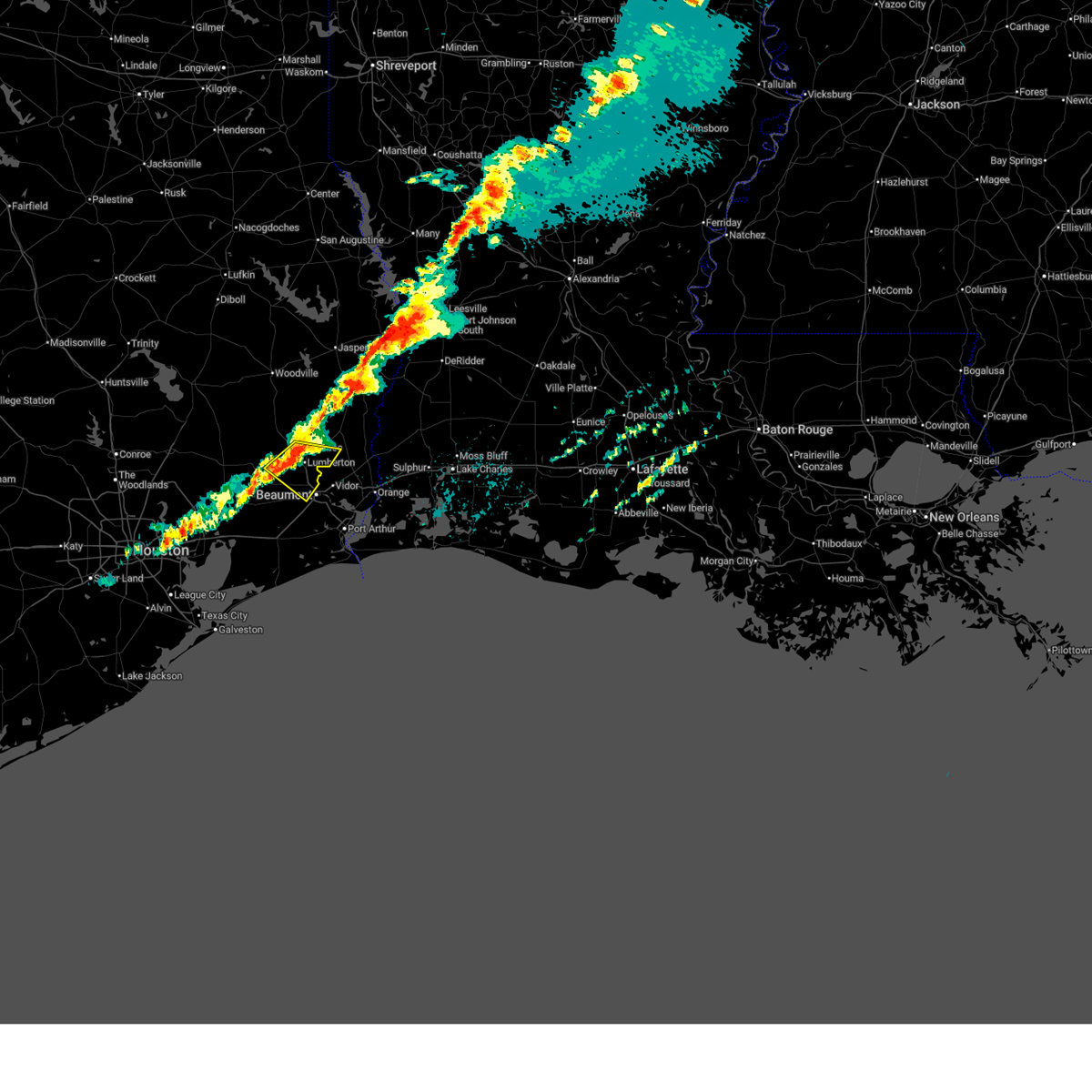
 Svrlch the national weather service in lake charles has issued a * severe thunderstorm warning for, north central jefferson county in southeastern texas, central hardin county in southeastern texas, south central jasper county in southeastern texas, * until 845 pm cdt. * at 808 pm cdt, a severe thunderstorm was located over honey island, or near saratoga, moving southeast at 40 mph (radar indicated). Hazards include 60 mph wind gusts and quarter size hail. Hail damage to vehicles is expected. Expect wind damage to roofs, siding, and trees. Svrlch the national weather service in lake charles has issued a * severe thunderstorm warning for, north central jefferson county in southeastern texas, central hardin county in southeastern texas, south central jasper county in southeastern texas, * until 845 pm cdt. * at 808 pm cdt, a severe thunderstorm was located over honey island, or near saratoga, moving southeast at 40 mph (radar indicated). Hazards include 60 mph wind gusts and quarter size hail. Hail damage to vehicles is expected. Expect wind damage to roofs, siding, and trees.
|
| 3/15/2026 8:03 PM CDT |
 the severe thunderstorm warning has been cancelled and is no longer in effect the severe thunderstorm warning has been cancelled and is no longer in effect
|
| 3/15/2026 8:03 PM CDT |
 At 803 pm cdt, a severe thunderstorm was located near honey island, or near saratoga, moving southeast at 35 mph (radar indicated). Hazards include 60 mph wind gusts and quarter size hail. Hail damage to vehicles is expected. expect wind damage to roofs, siding, and trees. Locations impacted include, silsbee, kountze, sour lake, saratoga, thicket, batson, and honey island. At 803 pm cdt, a severe thunderstorm was located near honey island, or near saratoga, moving southeast at 35 mph (radar indicated). Hazards include 60 mph wind gusts and quarter size hail. Hail damage to vehicles is expected. expect wind damage to roofs, siding, and trees. Locations impacted include, silsbee, kountze, sour lake, saratoga, thicket, batson, and honey island.
|
| 3/15/2026 7:51 PM CDT |
 At 751 pm cdt, a severe thunderstorm was located near thicket, moving southeast at 40 mph (radar indicated). Hazards include ping pong ball size hail and 60 mph wind gusts. People and animals outdoors will be injured. expect hail damage to roofs, siding, windows, and vehicles. expect wind damage to roofs, siding, and trees. Locations impacted include, silsbee, kountze, sour lake, saratoga, thicket, wildwood, batson, votaw, honey island, and village mills. At 751 pm cdt, a severe thunderstorm was located near thicket, moving southeast at 40 mph (radar indicated). Hazards include ping pong ball size hail and 60 mph wind gusts. People and animals outdoors will be injured. expect hail damage to roofs, siding, windows, and vehicles. expect wind damage to roofs, siding, and trees. Locations impacted include, silsbee, kountze, sour lake, saratoga, thicket, wildwood, batson, votaw, honey island, and village mills.
|
| 3/15/2026 7:34 PM CDT |
 Svrlch the national weather service in lake charles has issued a * severe thunderstorm warning for, south central tyler county in southeastern texas, hardin county in southeastern texas, * until 815 pm cdt. * at 734 pm cdt, a severe thunderstorm was located near votaw, or 10 miles northwest of thicket, moving southeast at 35 mph (radar indicated). Hazards include 60 mph wind gusts and quarter size hail. Hail damage to vehicles is expected. Expect wind damage to roofs, siding, and trees. Svrlch the national weather service in lake charles has issued a * severe thunderstorm warning for, south central tyler county in southeastern texas, hardin county in southeastern texas, * until 815 pm cdt. * at 734 pm cdt, a severe thunderstorm was located near votaw, or 10 miles northwest of thicket, moving southeast at 35 mph (radar indicated). Hazards include 60 mph wind gusts and quarter size hail. Hail damage to vehicles is expected. Expect wind damage to roofs, siding, and trees.
|
| 2/14/2026 7:36 PM CST |
 At 736 pm cst, severe thunderstorms were located along a line extending from near old salem to near pine forest to near china, moving southeast at 40 mph (radar indicated). Hazards include 70 mph wind gusts. Expect considerable tree damage. damage is likely to mobile homes, roofs, and outbuildings. Locations impacted include, beaumont, orange, nederland, port neches, lumberton, vidor, bridge city, silsbee, deweyville, evadale, central gardens, starks, mauriceville, buna, bevil oaks, china, rose city, pine forest, lakeview, and weiss bluff. At 736 pm cst, severe thunderstorms were located along a line extending from near old salem to near pine forest to near china, moving southeast at 40 mph (radar indicated). Hazards include 70 mph wind gusts. Expect considerable tree damage. damage is likely to mobile homes, roofs, and outbuildings. Locations impacted include, beaumont, orange, nederland, port neches, lumberton, vidor, bridge city, silsbee, deweyville, evadale, central gardens, starks, mauriceville, buna, bevil oaks, china, rose city, pine forest, lakeview, and weiss bluff.
|
| 2/14/2026 7:27 PM CST | Vfd reports tree on a home and downed powerlines. exact location not known... time estimated by rada in hardin county TX, 0.2 miles SSE of Silsbee, TX |
| 2/14/2026 7:21 PM CST |
 Svrlch the national weather service in lake charles has issued a * severe thunderstorm warning for, southwestern beauregard parish in southwestern louisiana, northwestern calcasieu parish in southwestern louisiana, northern jefferson county in southeastern texas, southwestern newton county in southeastern texas, eastern hardin county in southeastern texas, orange county in southeastern texas, southeastern jasper county in southeastern texas, * until 800 pm cst. * at 721 pm cst, severe thunderstorms were located along a line extending from 7 miles southwest of call to near lumberton to near sour lake, moving southeast at 40 mph (radar indicated). Hazards include 60 mph wind gusts. expect damage to roofs, siding, and trees Svrlch the national weather service in lake charles has issued a * severe thunderstorm warning for, southwestern beauregard parish in southwestern louisiana, northwestern calcasieu parish in southwestern louisiana, northern jefferson county in southeastern texas, southwestern newton county in southeastern texas, eastern hardin county in southeastern texas, orange county in southeastern texas, southeastern jasper county in southeastern texas, * until 800 pm cst. * at 721 pm cst, severe thunderstorms were located along a line extending from 7 miles southwest of call to near lumberton to near sour lake, moving southeast at 40 mph (radar indicated). Hazards include 60 mph wind gusts. expect damage to roofs, siding, and trees
|
| 2/14/2026 6:52 PM CST |
 the severe thunderstorm warning has been cancelled and is no longer in effect the severe thunderstorm warning has been cancelled and is no longer in effect
|
| 2/14/2026 6:29 PM CST |
 Svrlch the national weather service in lake charles has issued a * severe thunderstorm warning for, northwestern jefferson county in southeastern texas, hardin county in southeastern texas, southeastern jasper county in southeastern texas, * until 715 pm cst. * at 629 pm cst, severe thunderstorms were located along a line extending from near votaw to near dayton lakes to near lake houston dam, moving southeast at 25 mph (radar indicated). Hazards include 60 mph wind gusts. expect damage to roofs, siding, and trees Svrlch the national weather service in lake charles has issued a * severe thunderstorm warning for, northwestern jefferson county in southeastern texas, hardin county in southeastern texas, southeastern jasper county in southeastern texas, * until 715 pm cst. * at 629 pm cst, severe thunderstorms were located along a line extending from near votaw to near dayton lakes to near lake houston dam, moving southeast at 25 mph (radar indicated). Hazards include 60 mph wind gusts. expect damage to roofs, siding, and trees
|
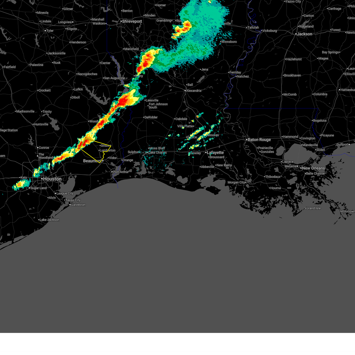
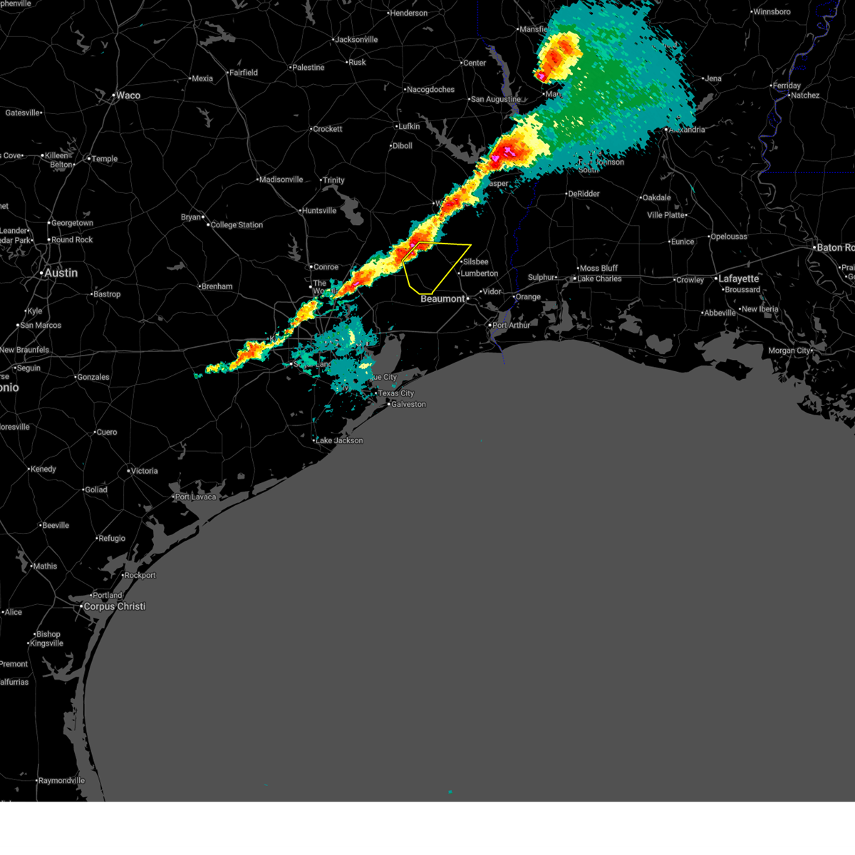
| 10/28/2025 5:46 PM CDT | At 545 pm cdt, a severe thunderstorm was located over lumberton, moving southeast at 35 mph (radar indicated). Hazards include 60 mph wind gusts and quarter size hail. Hail damage to vehicles is expected. expect wind damage to roofs, siding, and trees. Locations impacted include, beaumont, lumberton, silsbee, lakeview, and weiss bluff. |
| 10/28/2025 5:33 PM CDT | At 532 pm cdt, a severe thunderstorm was located over kountze, moving southeast at 35 mph (radar indicated). Hazards include 60 mph wind gusts and quarter size hail. Hail damage to vehicles is expected. expect wind damage to roofs, siding, and trees. Locations impacted include, beaumont, lumberton, silsbee, kountze, evadale, lakeview, and weiss bluff. |
| 10/28/2025 5:23 PM CDT | Svrlch the national weather service in lake charles has issued a * severe thunderstorm warning for, eastern hardin county in southeastern texas, northwestern orange county in southeastern texas, south central jasper county in southeastern texas, * until 600 pm cdt. * at 522 pm cdt, a severe thunderstorm was located near kountze, moving southeast at 35 mph (radar indicated). Hazards include 60 mph wind gusts and quarter size hail. Hail damage to vehicles is expected. Expect wind damage to roofs, siding, and trees. |
| 10/25/2025 10:25 PM CDT | Svrlch the national weather service in lake charles has issued a * severe thunderstorm warning for, southwestern beauregard parish in southwestern louisiana, western calcasieu parish in southwestern louisiana, southwestern newton county in southeastern texas, northeastern hardin county in southeastern texas, northern orange county in southeastern texas, southeastern jasper county in southeastern texas, * until 1100 pm cdt. * at 1025 pm cdt, a severe thunderstorm was located over evadale, moving east at 40 mph (radar indicated). Hazards include 60 mph wind gusts and penny size hail. expect damage to roofs, siding, and trees |
| 10/25/2025 5:38 AM CDT | Svrlch the national weather service in lake charles has issued a * severe thunderstorm warning for, western beauregard parish in southwestern louisiana, northwestern calcasieu parish in southwestern louisiana, southeastern tyler county in southeastern texas, newton county in southeastern texas, northeastern hardin county in southeastern texas, jasper county in southeastern texas, * until 645 am cdt. * at 537 am cdt, severe thunderstorms were located along a line extending from near town bluff to near buna to near pine forest, moving east at 30 mph (radar indicated). Hazards include 60 mph wind gusts. expect damage to roofs, siding, and trees |
| 10/25/2025 5:17 AM CDT | At 517 am cdt, severe thunderstorms were located along a line extending from 6 miles northeast of woodville to near caney head to near bevil oaks, moving east at 35 mph (radar indicated). Hazards include 60 mph wind gusts. Expect damage to roofs, siding, and trees. Locations impacted include, lumberton, jasper, silsbee, woodville, kirbyville, kountze, sour lake, colmesneil, chester, evadale, rockland, warren, town bluff, ebenezer, fred, buna, bevil oaks, weiss bluff, gist, and spurger. |
| 10/25/2025 4:39 AM CDT | Svrlch the national weather service in lake charles has issued a * severe thunderstorm warning for, tyler county in southeastern texas, hardin county in southeastern texas, jasper county in southeastern texas, * until 545 am cdt. * at 439 am cdt, severe thunderstorms were located along a line extending from near alabama-coushatta reservation to near honey island to near anahuac, moving east at 35 mph (radar indicated). Hazards include 60 mph wind gusts. expect damage to roofs, siding, and trees |
| 6/16/2025 3:38 PM CDT |
 The storm which prompted the warning has weakened below severe limits, and no longer poses an immediate threat to life or property. therefore, the warning will be allowed to expire. however heavy rain is still occurring with this thunderstorm. The storm which prompted the warning has weakened below severe limits, and no longer poses an immediate threat to life or property. therefore, the warning will be allowed to expire. however heavy rain is still occurring with this thunderstorm.
|
| 6/16/2025 3:13 PM CDT |
 Svrlch the national weather service in lake charles has issued a * severe thunderstorm warning for, northeastern hardin county in southeastern texas, * until 345 pm cdt. * at 312 pm cdt, a severe thunderstorm was located near village mills, or near kountze, moving east at 15 mph (radar indicated). Hazards include 60 mph wind gusts and quarter size hail. Hail damage to vehicles is expected. Expect wind damage to roofs, siding, and trees. Svrlch the national weather service in lake charles has issued a * severe thunderstorm warning for, northeastern hardin county in southeastern texas, * until 345 pm cdt. * at 312 pm cdt, a severe thunderstorm was located near village mills, or near kountze, moving east at 15 mph (radar indicated). Hazards include 60 mph wind gusts and quarter size hail. Hail damage to vehicles is expected. Expect wind damage to roofs, siding, and trees.
|
| 5/27/2025 1:45 AM CDT |
 At 145 am cdt, severe thunderstorms were located along a line extending from near jamestown to near buna to near lakeview, moving east at 50 mph (radar indicated). Hazards include 60 mph wind gusts and penny size hail. Expect damage to roofs, siding, and trees. Locations impacted include, beaumont, orange, lumberton, vidor, silsbee, newton, kirbyville, kountze, sour lake, deweyville, evadale, town bluff, call, fred, bon weir, mauriceville, buna, bevil oaks, rose city, and pine forest. At 145 am cdt, severe thunderstorms were located along a line extending from near jamestown to near buna to near lakeview, moving east at 50 mph (radar indicated). Hazards include 60 mph wind gusts and penny size hail. Expect damage to roofs, siding, and trees. Locations impacted include, beaumont, orange, lumberton, vidor, silsbee, newton, kirbyville, kountze, sour lake, deweyville, evadale, town bluff, call, fred, bon weir, mauriceville, buna, bevil oaks, rose city, and pine forest.
|
| 5/27/2025 1:27 AM CDT |
 Svrlch the national weather service in lake charles has issued a * severe thunderstorm warning for, southwestern beauregard parish in southwestern louisiana, northwestern jefferson county in southeastern texas, southeastern tyler county in southeastern texas, southern newton county in southeastern texas, hardin county in southeastern texas, northern orange county in southeastern texas, jasper county in southeastern texas, * until 215 am cdt. * at 127 am cdt, severe thunderstorms were located along a line extending from 6 miles southwest of jasper to near kountze to sour lake, moving east at 50 mph (radar indicated). Hazards include 60 mph wind gusts and penny size hail. expect damage to roofs, siding, and trees Svrlch the national weather service in lake charles has issued a * severe thunderstorm warning for, southwestern beauregard parish in southwestern louisiana, northwestern jefferson county in southeastern texas, southeastern tyler county in southeastern texas, southern newton county in southeastern texas, hardin county in southeastern texas, northern orange county in southeastern texas, jasper county in southeastern texas, * until 215 am cdt. * at 127 am cdt, severe thunderstorms were located along a line extending from 6 miles southwest of jasper to near kountze to sour lake, moving east at 50 mph (radar indicated). Hazards include 60 mph wind gusts and penny size hail. expect damage to roofs, siding, and trees
|
| 12/28/2024 4:52 PM CST |
 the severe thunderstorm warning has been cancelled and is no longer in effect the severe thunderstorm warning has been cancelled and is no longer in effect
|
| 12/28/2024 4:34 PM CST |
 At 434 pm cst, a severe thunderstorm was located 7 miles north of sour lake, moving east at 30 mph (radar indicated). Hazards include 60 mph wind gusts and nickel size hail. Expect damage to roofs, siding, and trees. Locations impacted include, weiss bluff, gist, lakeview, mauriceville, lumberton, evadale, pine forest, silsbee, bevil oaks, and kountze. At 434 pm cst, a severe thunderstorm was located 7 miles north of sour lake, moving east at 30 mph (radar indicated). Hazards include 60 mph wind gusts and nickel size hail. Expect damage to roofs, siding, and trees. Locations impacted include, weiss bluff, gist, lakeview, mauriceville, lumberton, evadale, pine forest, silsbee, bevil oaks, and kountze.
|
| 12/28/2024 4:14 PM CST |
 Svrlch the national weather service in lake charles has issued a * severe thunderstorm warning for, southern hardin county in southeastern texas, northwestern orange county in southeastern texas, southeastern jasper county in southeastern texas, * until 515 pm cst. * at 414 pm cst, a severe thunderstorm was located near saratoga, moving east at 30 mph (radar indicated). Hazards include 70 mph wind gusts and nickel size hail. Expect considerable tree damage. Damage is likely to mobile homes, roofs, and outbuildings. Svrlch the national weather service in lake charles has issued a * severe thunderstorm warning for, southern hardin county in southeastern texas, northwestern orange county in southeastern texas, southeastern jasper county in southeastern texas, * until 515 pm cst. * at 414 pm cst, a severe thunderstorm was located near saratoga, moving east at 30 mph (radar indicated). Hazards include 70 mph wind gusts and nickel size hail. Expect considerable tree damage. Damage is likely to mobile homes, roofs, and outbuildings.
|
| 12/28/2024 3:16 PM CST |
 At 316 pm cst, severe thunderstorms were located along a line extending from 7 miles east of woodville to near honey island, moving east at 20 mph (radar indicated). Hazards include 60 mph wind gusts and nickel size hail. Expect damage to roofs, siding, and trees. locations impacted include, caney head, kountze, honey island, ivanhoe, fred, magnolia springs, mt. Union, wildwood, spurger, warren, hillister, town bluff, village mills, thicket, and silsbee. At 316 pm cst, severe thunderstorms were located along a line extending from 7 miles east of woodville to near honey island, moving east at 20 mph (radar indicated). Hazards include 60 mph wind gusts and nickel size hail. Expect damage to roofs, siding, and trees. locations impacted include, caney head, kountze, honey island, ivanhoe, fred, magnolia springs, mt. Union, wildwood, spurger, warren, hillister, town bluff, village mills, thicket, and silsbee.
|
| 12/28/2024 3:01 PM CST |
 Svrlch the national weather service in lake charles has issued a * severe thunderstorm warning for, southeastern tyler county in southeastern texas, northern hardin county in southeastern texas, southeastern jasper county in southeastern texas, * until 400 pm cst. * at 301 pm cst, severe thunderstorms were located along a line extending from near woodville to thicket, moving northeast at 60 mph (radar indicated). Hazards include 60 mph wind gusts and nickel size hail. expect damage to roofs, siding, and trees Svrlch the national weather service in lake charles has issued a * severe thunderstorm warning for, southeastern tyler county in southeastern texas, northern hardin county in southeastern texas, southeastern jasper county in southeastern texas, * until 400 pm cst. * at 301 pm cst, severe thunderstorms were located along a line extending from near woodville to thicket, moving northeast at 60 mph (radar indicated). Hazards include 60 mph wind gusts and nickel size hail. expect damage to roofs, siding, and trees
|
| 12/26/2024 4:33 PM CST |
 At 432 pm cst, a severe thunderstorm was located near honey island, or near saratoga, moving northeast at 20 mph (radar indicated). Hazards include 60 mph wind gusts. Expect damage to roofs, siding, and trees. Locations impacted include, saratoga, kountze, village mills, honey island, and silsbee. At 432 pm cst, a severe thunderstorm was located near honey island, or near saratoga, moving northeast at 20 mph (radar indicated). Hazards include 60 mph wind gusts. Expect damage to roofs, siding, and trees. Locations impacted include, saratoga, kountze, village mills, honey island, and silsbee.
|
| 12/26/2024 4:24 PM CST |
 Svrlch the national weather service in lake charles has issued a * severe thunderstorm warning for, central hardin county in southeastern texas, * until 515 pm cst. * at 423 pm cst, a severe thunderstorm was located near saratoga, moving northeast at 20 mph (radar indicated). Hazards include 60 mph wind gusts and penny size hail. expect damage to roofs, siding, and trees Svrlch the national weather service in lake charles has issued a * severe thunderstorm warning for, central hardin county in southeastern texas, * until 515 pm cst. * at 423 pm cst, a severe thunderstorm was located near saratoga, moving northeast at 20 mph (radar indicated). Hazards include 60 mph wind gusts and penny size hail. expect damage to roofs, siding, and trees
|
| 12/26/2024 11:38 AM CST |
 the severe thunderstorm warning has been cancelled and is no longer in effect the severe thunderstorm warning has been cancelled and is no longer in effect
|
| 12/26/2024 11:32 AM CST |
 At 1131 am cst, a severe thunderstorm was located near kountze, moving north at 45 mph (radar indicated). Hazards include 60 mph wind gusts and quarter size hail. Hail damage to vehicles is expected. expect wind damage to roofs, siding, and trees. Locations impacted include, silsbee, lumberton, and kountze. At 1131 am cst, a severe thunderstorm was located near kountze, moving north at 45 mph (radar indicated). Hazards include 60 mph wind gusts and quarter size hail. Hail damage to vehicles is expected. expect wind damage to roofs, siding, and trees. Locations impacted include, silsbee, lumberton, and kountze.
|
| 12/26/2024 11:32 AM CST |
 the severe thunderstorm warning has been cancelled and is no longer in effect the severe thunderstorm warning has been cancelled and is no longer in effect
|
| 12/26/2024 11:10 AM CST |
 Svrlch the national weather service in lake charles has issued a * severe thunderstorm warning for, northwestern jefferson county in southeastern texas, eastern hardin county in southeastern texas, * until noon cst. * at 1110 am cst, a severe thunderstorm was located over nome, moving northeast at 35 mph (radar indicated). Hazards include 60 mph wind gusts and quarter size hail. Hail damage to vehicles is expected. Expect wind damage to roofs, siding, and trees. Svrlch the national weather service in lake charles has issued a * severe thunderstorm warning for, northwestern jefferson county in southeastern texas, eastern hardin county in southeastern texas, * until noon cst. * at 1110 am cst, a severe thunderstorm was located over nome, moving northeast at 35 mph (radar indicated). Hazards include 60 mph wind gusts and quarter size hail. Hail damage to vehicles is expected. Expect wind damage to roofs, siding, and trees.
|
| 5/30/2024 8:40 PM CDT |
 The storms which prompted the warning have weakened below severe limits, and no longer pose an immediate threat to life or property. therefore, the warning will be allowed to expire. a severe thunderstorm watch remains in effect until 1100 pm cdt for southwestern and west central louisiana, and southeastern texas. The storms which prompted the warning have weakened below severe limits, and no longer pose an immediate threat to life or property. therefore, the warning will be allowed to expire. a severe thunderstorm watch remains in effect until 1100 pm cdt for southwestern and west central louisiana, and southeastern texas.
|
| 5/30/2024 8:11 PM CDT |
 Svrlch the national weather service in lake charles has issued a * severe thunderstorm warning for, western beauregard parish in southwestern louisiana, southwestern vernon parish in west central louisiana, northwestern jefferson county in southeastern texas, southern tyler county in southeastern texas, newton county in southeastern texas, hardin county in southeastern texas, northwestern orange county in southeastern texas, jasper county in southeastern texas, * until 845 pm cdt. * at 811 pm cdt, severe thunderstorms were located along a line extending from near newton to near fred to near honey island, moving south at 45 mph (radar indicated). Hazards include 60 mph wind gusts and nickel size hail. expect damage to roofs, siding, and trees Svrlch the national weather service in lake charles has issued a * severe thunderstorm warning for, western beauregard parish in southwestern louisiana, southwestern vernon parish in west central louisiana, northwestern jefferson county in southeastern texas, southern tyler county in southeastern texas, newton county in southeastern texas, hardin county in southeastern texas, northwestern orange county in southeastern texas, jasper county in southeastern texas, * until 845 pm cdt. * at 811 pm cdt, severe thunderstorms were located along a line extending from near newton to near fred to near honey island, moving south at 45 mph (radar indicated). Hazards include 60 mph wind gusts and nickel size hail. expect damage to roofs, siding, and trees
|
| 5/29/2024 9:01 PM CDT | Widespread power outages reported east of silsbee in association with thunderstorm passag in hardin county TX, 2.9 miles W of Silsbee, TX |
| 5/29/2024 8:51 PM CDT |
 Svrlch the national weather service in lake charles has issued a * severe thunderstorm warning for, southwestern newton county in southeastern texas, eastern hardin county in southeastern texas, northwestern orange county in southeastern texas, southeastern jasper county in southeastern texas, * until 930 pm cdt. * at 850 pm cdt, a severe thunderstorm was located over silsbee, moving east at 15 mph (radar indicated). Hazards include 60 mph wind gusts and quarter size hail. Hail damage to vehicles is expected. Expect wind damage to roofs, siding, and trees. Svrlch the national weather service in lake charles has issued a * severe thunderstorm warning for, southwestern newton county in southeastern texas, eastern hardin county in southeastern texas, northwestern orange county in southeastern texas, southeastern jasper county in southeastern texas, * until 930 pm cdt. * at 850 pm cdt, a severe thunderstorm was located over silsbee, moving east at 15 mph (radar indicated). Hazards include 60 mph wind gusts and quarter size hail. Hail damage to vehicles is expected. Expect wind damage to roofs, siding, and trees.
|
| 5/29/2024 8:45 PM CDT | Emergency manager reports trees down in and north of silsbee. time estimated by rada in hardin county TX, 1 miles SSW of Silsbee, TX |
| 5/28/2024 2:07 PM CDT |
 the severe thunderstorm warning has been cancelled and is no longer in effect the severe thunderstorm warning has been cancelled and is no longer in effect
|
| 5/28/2024 2:07 PM CDT |
 At 207 pm cdt, severe thunderstorms were located along a line extending from near buna to near pine forest to near nome, moving southeast at 35 mph (radar indicated). Hazards include 60 mph wind gusts and quarter size hail. Hail damage to vehicles is expected. expect wind damage to roofs, siding, and trees. Locations impacted include, beaumont, port arthur, orange, nederland, groves, port neches, lumberton, vidor, bridge city, silsbee, west orange, sour lake, deweyville, evadale, central gardens, mauriceville, buna, bevil oaks, rose city, and pine forest. At 207 pm cdt, severe thunderstorms were located along a line extending from near buna to near pine forest to near nome, moving southeast at 35 mph (radar indicated). Hazards include 60 mph wind gusts and quarter size hail. Hail damage to vehicles is expected. expect wind damage to roofs, siding, and trees. Locations impacted include, beaumont, port arthur, orange, nederland, groves, port neches, lumberton, vidor, bridge city, silsbee, west orange, sour lake, deweyville, evadale, central gardens, mauriceville, buna, bevil oaks, rose city, and pine forest.
|
| 5/28/2024 1:37 PM CDT |
 Svrlch the national weather service in lake charles has issued a * severe thunderstorm warning for, jefferson county in southeastern texas, southeastern tyler county in southeastern texas, southwestern newton county in southeastern texas, hardin county in southeastern texas, orange county in southeastern texas, southeastern jasper county in southeastern texas, * until 215 pm cdt. * at 136 pm cdt, severe thunderstorms were located along a line extending from 6 miles southwest of spurger to near kountze to hardin, moving southeast at 35 mph (radar indicated). Hazards include 60 mph wind gusts and quarter size hail. Hail damage to vehicles is expected. Expect wind damage to roofs, siding, and trees. Svrlch the national weather service in lake charles has issued a * severe thunderstorm warning for, jefferson county in southeastern texas, southeastern tyler county in southeastern texas, southwestern newton county in southeastern texas, hardin county in southeastern texas, orange county in southeastern texas, southeastern jasper county in southeastern texas, * until 215 pm cdt. * at 136 pm cdt, severe thunderstorms were located along a line extending from 6 miles southwest of spurger to near kountze to hardin, moving southeast at 35 mph (radar indicated). Hazards include 60 mph wind gusts and quarter size hail. Hail damage to vehicles is expected. Expect wind damage to roofs, siding, and trees.
|
| 5/16/2024 7:34 PM CDT | Fire department working power lines down between kountze and silsbe in hardin county TX, 5.6 miles SE of Silsbee, TX |
| 5/16/2024 7:29 PM CDT |
 The storm which prompted the warning has moved out of the area. therefore, the warning will be allowed to expire. a tornado watch remains in effect until 1000 pm cdt for southeastern texas. The storm which prompted the warning has moved out of the area. therefore, the warning will be allowed to expire. a tornado watch remains in effect until 1000 pm cdt for southeastern texas.
|
| 5/16/2024 6:56 PM CDT |
 Svrlch the national weather service in lake charles has issued a * severe thunderstorm warning for, central hardin county in southeastern texas, * until 730 pm cdt. * at 656 pm cdt, a severe thunderstorm was located near lumberton, moving east at 60 mph (radar indicated). Hazards include 60 mph wind gusts and quarter size hail. Hail damage to vehicles is expected. Expect wind damage to roofs, siding, and trees. Svrlch the national weather service in lake charles has issued a * severe thunderstorm warning for, central hardin county in southeastern texas, * until 730 pm cdt. * at 656 pm cdt, a severe thunderstorm was located near lumberton, moving east at 60 mph (radar indicated). Hazards include 60 mph wind gusts and quarter size hail. Hail damage to vehicles is expected. Expect wind damage to roofs, siding, and trees.
|
| 5/13/2024 3:18 PM CDT |
 Svrlch the national weather service in lake charles has issued a * severe thunderstorm warning for, eastern hardin county in southeastern texas, northwestern orange county in southeastern texas, southeastern jasper county in southeastern texas, * until 400 pm cdt. * at 318 pm cdt, a severe thunderstorm was located over silsbee, moving northeast at 25 mph (radar indicated). Hazards include 60 mph wind gusts and quarter size hail. Hail damage to vehicles is expected. Expect wind damage to roofs, siding, and trees. Svrlch the national weather service in lake charles has issued a * severe thunderstorm warning for, eastern hardin county in southeastern texas, northwestern orange county in southeastern texas, southeastern jasper county in southeastern texas, * until 400 pm cdt. * at 318 pm cdt, a severe thunderstorm was located over silsbee, moving northeast at 25 mph (radar indicated). Hazards include 60 mph wind gusts and quarter size hail. Hail damage to vehicles is expected. Expect wind damage to roofs, siding, and trees.
|
| 5/3/2024 5:14 AM CDT |
 At 514 am cdt, a severe thunderstorm was located over evadale, moving east at 30 mph (emergency management). Hazards include quarter size hail. Damage to vehicles is expected. Locations impacted include, silsbee, buna, and evadale. At 514 am cdt, a severe thunderstorm was located over evadale, moving east at 30 mph (emergency management). Hazards include quarter size hail. Damage to vehicles is expected. Locations impacted include, silsbee, buna, and evadale.
|
| 5/3/2024 4:53 AM CDT |
 Svrlch the national weather service in lake charles has issued a * severe thunderstorm warning for, northeastern hardin county in southeastern texas, southeastern jasper county in southeastern texas, * until 530 am cdt. * at 453 am cdt, a severe thunderstorm was located near kountze, moving east at 30 mph (radar indicated). Hazards include quarter size hail. damage to vehicles is expected Svrlch the national weather service in lake charles has issued a * severe thunderstorm warning for, northeastern hardin county in southeastern texas, southeastern jasper county in southeastern texas, * until 530 am cdt. * at 453 am cdt, a severe thunderstorm was located near kountze, moving east at 30 mph (radar indicated). Hazards include quarter size hail. damage to vehicles is expected
|
| 5/3/2024 4:20 AM CDT |
 Svrlch the national weather service in lake charles has issued a * severe thunderstorm warning for, central hardin county in southeastern texas, * until 445 am cdt. * at 420 am cdt, a severe thunderstorm was located near saratoga, moving east at 30 mph (radar indicated). Hazards include quarter size hail. damage to vehicles is expected Svrlch the national weather service in lake charles has issued a * severe thunderstorm warning for, central hardin county in southeastern texas, * until 445 am cdt. * at 420 am cdt, a severe thunderstorm was located near saratoga, moving east at 30 mph (radar indicated). Hazards include quarter size hail. damage to vehicles is expected
|
| 5/2/2024 8:30 AM CDT |
 the severe thunderstorm warning has been cancelled and is no longer in effect the severe thunderstorm warning has been cancelled and is no longer in effect
|
| 5/2/2024 8:18 AM CDT |
 At 818 am cdt, a severe thunderstorm was located over weiss bluff, or near evadale, moving east at 30 mph (radar indicated). Hazards include 60 mph wind gusts and quarter size hail. Hail damage to vehicles is expected. expect wind damage to roofs, siding, and trees. Locations impacted include, beaumont, orange, lumberton, vidor, bridge city, silsbee, evadale, mauriceville, buna, bevil oaks, rose city, pine forest, lakeview, caney head, weiss bluff, gist, orangefield, wrights settlement, and devils pocket. At 818 am cdt, a severe thunderstorm was located over weiss bluff, or near evadale, moving east at 30 mph (radar indicated). Hazards include 60 mph wind gusts and quarter size hail. Hail damage to vehicles is expected. expect wind damage to roofs, siding, and trees. Locations impacted include, beaumont, orange, lumberton, vidor, bridge city, silsbee, evadale, mauriceville, buna, bevil oaks, rose city, pine forest, lakeview, caney head, weiss bluff, gist, orangefield, wrights settlement, and devils pocket.
|
| 5/2/2024 8:06 AM CDT |
 The tornado threat has diminished and the tornado warning has been cancelled. however, large hail and damaging winds remain likely and a severe thunderstorm warning remains in effect for the area. however small hail, gusty winds and heavy rain are still possible with this thunderstorm. remember, a severe thunderstorm warning still remains in effect for hardin county. The tornado threat has diminished and the tornado warning has been cancelled. however, large hail and damaging winds remain likely and a severe thunderstorm warning remains in effect for the area. however small hail, gusty winds and heavy rain are still possible with this thunderstorm. remember, a severe thunderstorm warning still remains in effect for hardin county.
|
| 5/2/2024 8:00 AM CDT |
 At 800 am cdt, a severe squall line capable of producing both tornadoes and extensive straight line wind damage was located near lumberton, moving east at 30 mph (radar indicated rotation). Hazards include tornado and half dollar size hail. Flying debris will be dangerous to those caught without shelter. mobile homes will be damaged or destroyed. damage to roofs, windows, and vehicles will occur. tree damage is likely. These dangerous storms will be near, beaumont, lumberton, silsbee, and bevil oaks around 805 am cdt. At 800 am cdt, a severe squall line capable of producing both tornadoes and extensive straight line wind damage was located near lumberton, moving east at 30 mph (radar indicated rotation). Hazards include tornado and half dollar size hail. Flying debris will be dangerous to those caught without shelter. mobile homes will be damaged or destroyed. damage to roofs, windows, and vehicles will occur. tree damage is likely. These dangerous storms will be near, beaumont, lumberton, silsbee, and bevil oaks around 805 am cdt.
|
| 5/2/2024 7:57 AM CDT |
 At 757 am cdt, a severe thunderstorm was located near kountze, moving east at 30 mph (radar indicated). Hazards include 60 mph wind gusts and half dollar size hail. Hail damage to vehicles is expected. expect wind damage to roofs, siding, and trees. Locations impacted include, beaumont, orange, lumberton, vidor, bridge city, silsbee, kountze, evadale, saratoga, wildwood, mauriceville, buna, bevil oaks, rose city, pine forest, lakeview, weiss bluff, gist, batson, and wrights settlement. At 757 am cdt, a severe thunderstorm was located near kountze, moving east at 30 mph (radar indicated). Hazards include 60 mph wind gusts and half dollar size hail. Hail damage to vehicles is expected. expect wind damage to roofs, siding, and trees. Locations impacted include, beaumont, orange, lumberton, vidor, bridge city, silsbee, kountze, evadale, saratoga, wildwood, mauriceville, buna, bevil oaks, rose city, pine forest, lakeview, weiss bluff, gist, batson, and wrights settlement.
|
| 5/2/2024 7:50 AM CDT |
 Torlch the national weather service in lake charles has issued a * tornado warning for, northern jefferson county in southeastern texas, southeastern hardin county in southeastern texas, * until 815 am cdt. * at 750 am cdt, severe thunderstorms capable of producing both tornadoes and extensive straight line wind damage were located 7 miles southwest of kountze, moving east at 30 mph (radar indicated rotation). Hazards include tornado and half dollar size hail. Flying debris will be dangerous to those caught without shelter. mobile homes will be damaged or destroyed. damage to roofs, windows, and vehicles will occur. tree damage is likely. these dangerous storms will be near, lumberton around 755 am cdt. Silsbee and bevil oaks around 800 am cdt. Torlch the national weather service in lake charles has issued a * tornado warning for, northern jefferson county in southeastern texas, southeastern hardin county in southeastern texas, * until 815 am cdt. * at 750 am cdt, severe thunderstorms capable of producing both tornadoes and extensive straight line wind damage were located 7 miles southwest of kountze, moving east at 30 mph (radar indicated rotation). Hazards include tornado and half dollar size hail. Flying debris will be dangerous to those caught without shelter. mobile homes will be damaged or destroyed. damage to roofs, windows, and vehicles will occur. tree damage is likely. these dangerous storms will be near, lumberton around 755 am cdt. Silsbee and bevil oaks around 800 am cdt.
|
| 5/2/2024 7:44 AM CDT |
 The storms which prompted the warning have moved out of the area. therefore, the warning will be allowed to expire. The storms which prompted the warning have moved out of the area. therefore, the warning will be allowed to expire.
|
| 5/2/2024 7:43 AM CDT |
 Svrlch the national weather service in lake charles has issued a * severe thunderstorm warning for, north central jefferson county in southeastern texas, southwestern newton county in southeastern texas, hardin county in southeastern texas, orange county in southeastern texas, southeastern jasper county in southeastern texas, * until 845 am cdt. * at 742 am cdt, a severe thunderstorm was located near kountze, moving east at 30 mph (radar indicated). Hazards include 60 mph wind gusts and half dollar size hail. Hail damage to vehicles is expected. Expect wind damage to roofs, siding, and trees. Svrlch the national weather service in lake charles has issued a * severe thunderstorm warning for, north central jefferson county in southeastern texas, southwestern newton county in southeastern texas, hardin county in southeastern texas, orange county in southeastern texas, southeastern jasper county in southeastern texas, * until 845 am cdt. * at 742 am cdt, a severe thunderstorm was located near kountze, moving east at 30 mph (radar indicated). Hazards include 60 mph wind gusts and half dollar size hail. Hail damage to vehicles is expected. Expect wind damage to roofs, siding, and trees.
|
| 5/2/2024 7:30 AM CDT |
 At 730 am cdt, severe thunderstorms were located along a line extending from near village mills to near saratoga to batson, moving east at 30 mph (radar indicated). Hazards include ping pong ball size hail and 60 mph wind gusts. People and animals outdoors will be injured. expect hail damage to roofs, siding, windows, and vehicles. expect wind damage to roofs, siding, and trees. Locations impacted include, lumberton, silsbee, kountze, sour lake, saratoga, fred, wildwood, warren, thicket, bevil oaks, caney head, votaw, honey island, batson, and village mills. At 730 am cdt, severe thunderstorms were located along a line extending from near village mills to near saratoga to batson, moving east at 30 mph (radar indicated). Hazards include ping pong ball size hail and 60 mph wind gusts. People and animals outdoors will be injured. expect hail damage to roofs, siding, windows, and vehicles. expect wind damage to roofs, siding, and trees. Locations impacted include, lumberton, silsbee, kountze, sour lake, saratoga, fred, wildwood, warren, thicket, bevil oaks, caney head, votaw, honey island, batson, and village mills.
|
| 5/2/2024 7:15 AM CDT |
 At 715 am cdt, severe thunderstorms were located along a line extending from near wildwood to near thicket to 7 miles north of hardin, moving east at 25 mph (radar indicated). Hazards include 60 mph wind gusts and half dollar size hail. Hail damage to vehicles is expected. expect wind damage to roofs, siding, and trees. Locations impacted include, lumberton, silsbee, kountze, sour lake, saratoga, fred, wildwood, warren, thicket, bevil oaks, caney head, votaw, honey island, batson, and village mills. At 715 am cdt, severe thunderstorms were located along a line extending from near wildwood to near thicket to 7 miles north of hardin, moving east at 25 mph (radar indicated). Hazards include 60 mph wind gusts and half dollar size hail. Hail damage to vehicles is expected. expect wind damage to roofs, siding, and trees. Locations impacted include, lumberton, silsbee, kountze, sour lake, saratoga, fred, wildwood, warren, thicket, bevil oaks, caney head, votaw, honey island, batson, and village mills.
|
| 5/2/2024 6:39 AM CDT |
 Svrlch the national weather service in lake charles has issued a * severe thunderstorm warning for, southern tyler county in southeastern texas, hardin county in southeastern texas, * until 745 am cdt. * at 638 am cdt, severe thunderstorms were located along a line extending from 6 miles south of alabama-coushatta reservation to 7 miles southwest of votaw to 8 miles northeast of plum grove, moving east at 30 mph (radar indicated). Hazards include 60 mph wind gusts and half dollar size hail. Hail damage to vehicles is expected. Expect wind damage to roofs, siding, and trees. Svrlch the national weather service in lake charles has issued a * severe thunderstorm warning for, southern tyler county in southeastern texas, hardin county in southeastern texas, * until 745 am cdt. * at 638 am cdt, severe thunderstorms were located along a line extending from 6 miles south of alabama-coushatta reservation to 7 miles southwest of votaw to 8 miles northeast of plum grove, moving east at 30 mph (radar indicated). Hazards include 60 mph wind gusts and half dollar size hail. Hail damage to vehicles is expected. Expect wind damage to roofs, siding, and trees.
|
| 5/2/2024 5:43 AM CDT |
 At 543 am cdt, severe thunderstorms were located along a line extending from near silsbee to near lumberton to near bevil oaks, moving east at 50 mph (radar indicated). Hazards include 60 mph wind gusts and half dollar size hail. Hail damage to vehicles is expected. expect wind damage to roofs, siding, and trees. Locations impacted include, lumberton, silsbee, sour lake, and bevil oaks. At 543 am cdt, severe thunderstorms were located along a line extending from near silsbee to near lumberton to near bevil oaks, moving east at 50 mph (radar indicated). Hazards include 60 mph wind gusts and half dollar size hail. Hail damage to vehicles is expected. expect wind damage to roofs, siding, and trees. Locations impacted include, lumberton, silsbee, sour lake, and bevil oaks.
|
| 5/2/2024 5:18 AM CDT |
 At 518 am cdt, a severe thunderstorm was located 7 miles southeast of batson, or 7 miles south of saratoga, moving east at 35 mph (radar indicated). Hazards include 60 mph wind gusts and half dollar size hail. Hail damage to vehicles is expected. expect wind damage to roofs, siding, and trees. Locations impacted include, lumberton, silsbee, kountze, sour lake, saratoga, bevil oaks, and caney head. At 518 am cdt, a severe thunderstorm was located 7 miles southeast of batson, or 7 miles south of saratoga, moving east at 35 mph (radar indicated). Hazards include 60 mph wind gusts and half dollar size hail. Hail damage to vehicles is expected. expect wind damage to roofs, siding, and trees. Locations impacted include, lumberton, silsbee, kountze, sour lake, saratoga, bevil oaks, and caney head.
|
| 5/2/2024 5:06 AM CDT |
 Svrlch the national weather service in lake charles has issued a * severe thunderstorm warning for, hardin county in southeastern texas, * until 600 am cdt. * at 505 am cdt, a severe thunderstorm was located near batson, or 8 miles southwest of saratoga, moving east at 45 mph (radar indicated). Hazards include ping pong ball size hail and 60 mph wind gusts. People and animals outdoors will be injured. expect hail damage to roofs, siding, windows, and vehicles. Expect wind damage to roofs, siding, and trees. Svrlch the national weather service in lake charles has issued a * severe thunderstorm warning for, hardin county in southeastern texas, * until 600 am cdt. * at 505 am cdt, a severe thunderstorm was located near batson, or 8 miles southwest of saratoga, moving east at 45 mph (radar indicated). Hazards include ping pong ball size hail and 60 mph wind gusts. People and animals outdoors will be injured. expect hail damage to roofs, siding, windows, and vehicles. Expect wind damage to roofs, siding, and trees.
|
| 4/10/2024 6:00 AM CDT |
 the severe thunderstorm warning has been cancelled and is no longer in effect the severe thunderstorm warning has been cancelled and is no longer in effect
|
| 4/10/2024 5:20 AM CDT |
 the severe thunderstorm warning has been cancelled and is no longer in effect the severe thunderstorm warning has been cancelled and is no longer in effect
|
| 4/10/2024 5:19 AM CDT |
 Svrlch the national weather service in lake charles has issued a * severe thunderstorm warning for, west central calcasieu parish in southwestern louisiana, northwestern jefferson county in southeastern texas, southeastern tyler county in southeastern texas, southwestern newton county in southeastern texas, hardin county in southeastern texas, northern orange county in southeastern texas, southeastern jasper county in southeastern texas, * until 615 am cdt. * at 518 am cdt, severe thunderstorms were located along a line extending from village mills to near kountze to near nome, moving east at 35 mph (radar indicated). Hazards include 60 mph wind gusts. expect damage to roofs, siding, and trees Svrlch the national weather service in lake charles has issued a * severe thunderstorm warning for, west central calcasieu parish in southwestern louisiana, northwestern jefferson county in southeastern texas, southeastern tyler county in southeastern texas, southwestern newton county in southeastern texas, hardin county in southeastern texas, northern orange county in southeastern texas, southeastern jasper county in southeastern texas, * until 615 am cdt. * at 518 am cdt, severe thunderstorms were located along a line extending from village mills to near kountze to near nome, moving east at 35 mph (radar indicated). Hazards include 60 mph wind gusts. expect damage to roofs, siding, and trees
|
| 4/10/2024 5:03 AM CDT |
 At 503 am cdt, severe thunderstorms were located along a line extending from near wildwood to near honey island to devers, moving east at 40 mph (radar indicated). Hazards include 60 mph wind gusts. Expect damage to roofs, siding, and trees. Locations impacted include, beaumont, lumberton, silsbee, kountze, sour lake, nome, saratoga, hamshire, wildwood, thicket, bevil oaks, china, votaw, honey island, batson, and village mills. At 503 am cdt, severe thunderstorms were located along a line extending from near wildwood to near honey island to devers, moving east at 40 mph (radar indicated). Hazards include 60 mph wind gusts. Expect damage to roofs, siding, and trees. Locations impacted include, beaumont, lumberton, silsbee, kountze, sour lake, nome, saratoga, hamshire, wildwood, thicket, bevil oaks, china, votaw, honey island, batson, and village mills.
|
| 4/10/2024 4:36 AM CDT |
 Svrlch the national weather service in lake charles has issued a * severe thunderstorm warning for, northwestern jefferson county in southeastern texas, south central tyler county in southeastern texas, hardin county in southeastern texas, * until 530 am cdt. * at 436 am cdt, severe thunderstorms were located along a line extending from 9 miles west of votaw to near hardin to near mont belvieu, moving east at 35 mph (radar indicated). Hazards include 60 mph wind gusts. expect damage to roofs, siding, and trees Svrlch the national weather service in lake charles has issued a * severe thunderstorm warning for, northwestern jefferson county in southeastern texas, south central tyler county in southeastern texas, hardin county in southeastern texas, * until 530 am cdt. * at 436 am cdt, severe thunderstorms were located along a line extending from 9 miles west of votaw to near hardin to near mont belvieu, moving east at 35 mph (radar indicated). Hazards include 60 mph wind gusts. expect damage to roofs, siding, and trees
|
| 3/15/2024 4:58 PM CDT |
 The storm which prompted the warning has moved out of the area. therefore, the warning will be allowed to expire. a severe thunderstorm watch remains in effect until 800 pm cdt for southeastern texas. The storm which prompted the warning has moved out of the area. therefore, the warning will be allowed to expire. a severe thunderstorm watch remains in effect until 800 pm cdt for southeastern texas.
|
| 3/15/2024 4:40 PM CDT |
 At 440 pm cdt, a severe thunderstorm was located over bevil oaks, or near lumberton, moving east at 15 mph (radar indicated). Hazards include two inch hail and 60 mph wind gusts. People and animals outdoors will be injured. expect hail damage to roofs, siding, windows, and vehicles. expect wind damage to roofs, siding, and trees. Locations impacted include, beaumont, lumberton, vidor, silsbee, bevil oaks, pine forest, and lakeview. At 440 pm cdt, a severe thunderstorm was located over bevil oaks, or near lumberton, moving east at 15 mph (radar indicated). Hazards include two inch hail and 60 mph wind gusts. People and animals outdoors will be injured. expect hail damage to roofs, siding, windows, and vehicles. expect wind damage to roofs, siding, and trees. Locations impacted include, beaumont, lumberton, vidor, silsbee, bevil oaks, pine forest, and lakeview.
|
| 3/15/2024 4:36 PM CDT |
 At 435 pm cdt, a severe thunderstorm was located over bevil oaks, or near sour lake, moving east at 10 mph (radar indicated). Hazards include golf ball size hail and 60 mph wind gusts. People and animals outdoors will be injured. expect hail damage to roofs, siding, windows, and vehicles. expect wind damage to roofs, siding, and trees. Locations impacted include, beaumont, lumberton, vidor, silsbee, bevil oaks, pine forest, and lakeview. At 435 pm cdt, a severe thunderstorm was located over bevil oaks, or near sour lake, moving east at 10 mph (radar indicated). Hazards include golf ball size hail and 60 mph wind gusts. People and animals outdoors will be injured. expect hail damage to roofs, siding, windows, and vehicles. expect wind damage to roofs, siding, and trees. Locations impacted include, beaumont, lumberton, vidor, silsbee, bevil oaks, pine forest, and lakeview.
|
| 3/15/2024 4:30 PM CDT |
 At 430 pm cdt, a severe thunderstorm was located over bevil oaks, or near sour lake, moving east at 10 mph (radar indicated). Hazards include 60 mph wind gusts and half dollar size hail. Hail damage to vehicles is expected. expect wind damage to roofs, siding, and trees. Locations impacted include, beaumont, lumberton, vidor, silsbee, kountze, sour lake, bevil oaks, pine forest, and lakeview. At 430 pm cdt, a severe thunderstorm was located over bevil oaks, or near sour lake, moving east at 10 mph (radar indicated). Hazards include 60 mph wind gusts and half dollar size hail. Hail damage to vehicles is expected. expect wind damage to roofs, siding, and trees. Locations impacted include, beaumont, lumberton, vidor, silsbee, kountze, sour lake, bevil oaks, pine forest, and lakeview.
|
| 3/15/2024 4:21 PM CDT |
 Svrlch the national weather service in lake charles has issued a * severe thunderstorm warning for, northeastern hardin county in southeastern texas, * until 445 pm cdt. * at 421 pm cdt, a severe thunderstorm was located over kountze, moving northeast at 20 mph (radar indicated). Hazards include 60 mph wind gusts and quarter size hail. Hail damage to vehicles is expected. Expect wind damage to roofs, siding, and trees. Svrlch the national weather service in lake charles has issued a * severe thunderstorm warning for, northeastern hardin county in southeastern texas, * until 445 pm cdt. * at 421 pm cdt, a severe thunderstorm was located over kountze, moving northeast at 20 mph (radar indicated). Hazards include 60 mph wind gusts and quarter size hail. Hail damage to vehicles is expected. Expect wind damage to roofs, siding, and trees.
|
| 3/15/2024 4:11 PM CDT |
 Svrlch the national weather service in lake charles has issued a * severe thunderstorm warning for, northwestern jefferson county in southeastern texas, southeastern hardin county in southeastern texas, northwestern orange county in southeastern texas, * until 500 pm cdt. * at 411 pm cdt, a severe thunderstorm was located near bevil oaks, or near sour lake, moving northeast at 20 mph (radar indicated). Hazards include 60 mph wind gusts and quarter size hail. Hail damage to vehicles is expected. Expect wind damage to roofs, siding, and trees. Svrlch the national weather service in lake charles has issued a * severe thunderstorm warning for, northwestern jefferson county in southeastern texas, southeastern hardin county in southeastern texas, northwestern orange county in southeastern texas, * until 500 pm cdt. * at 411 pm cdt, a severe thunderstorm was located near bevil oaks, or near sour lake, moving northeast at 20 mph (radar indicated). Hazards include 60 mph wind gusts and quarter size hail. Hail damage to vehicles is expected. Expect wind damage to roofs, siding, and trees.
|
| 1/8/2024 4:40 PM CST |
 The severe thunderstorm warning for southeastern tyler, eastern hardin and southeastern jasper counties will expire at 445 pm cst, the storm which prompted the warning has moved out of the area. therefore, the warning will be allowed to expire. however small hail, gusty winds and heavy rain are still possible with this thunderstorm. a tornado watch remains in effect until 900 pm cst for southeastern texas. to report severe weather, contact your nearest law enforcement agency. they will relay your report to the national weather service lake charles. &&. The severe thunderstorm warning for southeastern tyler, eastern hardin and southeastern jasper counties will expire at 445 pm cst, the storm which prompted the warning has moved out of the area. therefore, the warning will be allowed to expire. however small hail, gusty winds and heavy rain are still possible with this thunderstorm. a tornado watch remains in effect until 900 pm cst for southeastern texas. to report severe weather, contact your nearest law enforcement agency. they will relay your report to the national weather service lake charles. &&.
|
| 1/8/2024 4:18 PM CST |
 At 417 pm cst, a severe thunderstorm was located over kountze, moving northeast at 55 mph (radar indicated). Hazards include 60 mph wind gusts and half dollar size hail. Hail damage to vehicles is expected. expect wind damage to roofs, siding, and trees. locations impacted include, lumberton, silsbee, kountze, buna, evadale, fred, and caney head. hail threat, radar indicated max hail size, 1. 25 in wind threat, radar indicated max wind gust, 60 mph. At 417 pm cst, a severe thunderstorm was located over kountze, moving northeast at 55 mph (radar indicated). Hazards include 60 mph wind gusts and half dollar size hail. Hail damage to vehicles is expected. expect wind damage to roofs, siding, and trees. locations impacted include, lumberton, silsbee, kountze, buna, evadale, fred, and caney head. hail threat, radar indicated max hail size, 1. 25 in wind threat, radar indicated max wind gust, 60 mph.
|
| 1/8/2024 4:04 PM CST |
 At 404 pm cst, a severe thunderstorm was located near saratoga, moving northeast at 50 mph (radar indicated). Hazards include 60 mph wind gusts and half dollar size hail. Hail damage to vehicles is expected. Expect wind damage to roofs, siding, and trees. At 404 pm cst, a severe thunderstorm was located near saratoga, moving northeast at 50 mph (radar indicated). Hazards include 60 mph wind gusts and half dollar size hail. Hail damage to vehicles is expected. Expect wind damage to roofs, siding, and trees.
|
| 9/8/2023 2:20 PM CDT | Severe thunderstorm wind gusts downed a large tree on the northwest side of silsbe in hardin county TX, 1.1 miles SE of Silsbee, TX |
| 9/8/2023 1:41 PM CDT |
 At 141 pm cdt, severe thunderstorms were located along a line extending from near chester to near wrights settlement, moving south at 30 mph (radar indicated). Hazards include 60 mph wind gusts and penny size hail. expect damage to roofs, siding, and trees At 141 pm cdt, severe thunderstorms were located along a line extending from near chester to near wrights settlement, moving south at 30 mph (radar indicated). Hazards include 60 mph wind gusts and penny size hail. expect damage to roofs, siding, and trees
|
| 6/10/2023 8:41 PM CDT |
 At 840 pm cdt, a severe thunderstorm was located near lakeview, or near beaumont, moving southeast at 40 mph (radar indicated). Hazards include tennis ball size hail and 70 mph wind gusts. People and animals outdoors will be injured. expect hail damage to roofs, siding, windows, and vehicles. expect considerable tree damage. Wind damage is also likely to mobile homes, roofs, and outbuildings. At 840 pm cdt, a severe thunderstorm was located near lakeview, or near beaumont, moving southeast at 40 mph (radar indicated). Hazards include tennis ball size hail and 70 mph wind gusts. People and animals outdoors will be injured. expect hail damage to roofs, siding, windows, and vehicles. expect considerable tree damage. Wind damage is also likely to mobile homes, roofs, and outbuildings.
|
| 6/10/2023 8:34 PM CDT |
 At 833 pm cdt, a severe thunderstorm was located near caney head, or 7 miles south of fred, moving southeast at 15 mph (radar indicated). Hazards include 70 mph wind gusts and ping pong ball size hail. People and animals outdoors will be injured. expect hail damage to roofs, siding, windows, and vehicles. expect considerable tree damage. wind damage is also likely to mobile homes, roofs, and outbuildings. locations impacted include, lumberton, silsbee, kountze, evadale, caney head and weiss bluff. thunderstorm damage threat, considerable hail threat, radar indicated max hail size, 1. 50 in wind threat, radar indicated max wind gust, 70 mph. At 833 pm cdt, a severe thunderstorm was located near caney head, or 7 miles south of fred, moving southeast at 15 mph (radar indicated). Hazards include 70 mph wind gusts and ping pong ball size hail. People and animals outdoors will be injured. expect hail damage to roofs, siding, windows, and vehicles. expect considerable tree damage. wind damage is also likely to mobile homes, roofs, and outbuildings. locations impacted include, lumberton, silsbee, kountze, evadale, caney head and weiss bluff. thunderstorm damage threat, considerable hail threat, radar indicated max hail size, 1. 50 in wind threat, radar indicated max wind gust, 70 mph.
|
| 6/10/2023 8:27 PM CDT |
 At 827 pm cdt, a severe thunderstorm was located near caney head, or near fred, moving southeast at 15 mph (radar indicated). Hazards include 70 mph wind gusts and ping pong ball size hail. People and animals outdoors will be injured. expect hail damage to roofs, siding, windows, and vehicles. expect considerable tree damage. Wind damage is also likely to mobile homes, roofs, and outbuildings. At 827 pm cdt, a severe thunderstorm was located near caney head, or near fred, moving southeast at 15 mph (radar indicated). Hazards include 70 mph wind gusts and ping pong ball size hail. People and animals outdoors will be injured. expect hail damage to roofs, siding, windows, and vehicles. expect considerable tree damage. Wind damage is also likely to mobile homes, roofs, and outbuildings.
|
| 6/10/2023 8:11 PM CDT |
 At 811 pm cdt, a severe thunderstorm was located near village mills, or near kountze, moving south at 30 mph (radar indicated). Hazards include golf ball size hail and 60 mph wind gusts. People and animals outdoors will be injured. expect hail damage to roofs, siding, windows, and vehicles. Expect wind damage to roofs, siding, and trees. At 811 pm cdt, a severe thunderstorm was located near village mills, or near kountze, moving south at 30 mph (radar indicated). Hazards include golf ball size hail and 60 mph wind gusts. People and animals outdoors will be injured. expect hail damage to roofs, siding, windows, and vehicles. Expect wind damage to roofs, siding, and trees.
|
| 5/8/2023 2:57 PM CDT |
 At 257 pm cdt, a severe thunderstorm capable of producing a tornado was located 7 miles north of sour lake, moving east at 15 mph (radar indicated rotation). Hazards include tornado. Flying debris will be dangerous to those caught without shelter. mobile homes will be damaged or destroyed. damage to roofs, windows, and vehicles will occur. tree damage is likely. This dangerous storm will be near, lumberton around 330 pm cdt. At 257 pm cdt, a severe thunderstorm capable of producing a tornado was located 7 miles north of sour lake, moving east at 15 mph (radar indicated rotation). Hazards include tornado. Flying debris will be dangerous to those caught without shelter. mobile homes will be damaged or destroyed. damage to roofs, windows, and vehicles will occur. tree damage is likely. This dangerous storm will be near, lumberton around 330 pm cdt.
|
| 4/27/2023 12:51 AM CDT |
 At 1250 am cdt, a severe thunderstorm was located over devils pocket, or near deweyville, moving east at 45 mph (radar indicated). Hazards include 60 mph wind gusts and half dollar size hail. Hail damage to vehicles is expected. expect wind damage to roofs, siding, and trees. locations impacted include, silsbee, kirbyville, call, buna, evadale, fred, caney head, wrights settlement, devils pocket, trout creek, bancroft and old salem. hail threat, radar indicated max hail size, 1. 25 in wind threat, radar indicated max wind gust, 60 mph. At 1250 am cdt, a severe thunderstorm was located over devils pocket, or near deweyville, moving east at 45 mph (radar indicated). Hazards include 60 mph wind gusts and half dollar size hail. Hail damage to vehicles is expected. expect wind damage to roofs, siding, and trees. locations impacted include, silsbee, kirbyville, call, buna, evadale, fred, caney head, wrights settlement, devils pocket, trout creek, bancroft and old salem. hail threat, radar indicated max hail size, 1. 25 in wind threat, radar indicated max wind gust, 60 mph.
|
| 4/27/2023 12:33 AM CDT |
 At 1233 am cdt, a severe thunderstorm was located near caney head, or 7 miles northwest of buna, moving east at 35 mph (radar indicated). Hazards include 60 mph wind gusts and half dollar size hail. Hail damage to vehicles is expected. Expect wind damage to roofs, siding, and trees. At 1233 am cdt, a severe thunderstorm was located near caney head, or 7 miles northwest of buna, moving east at 35 mph (radar indicated). Hazards include 60 mph wind gusts and half dollar size hail. Hail damage to vehicles is expected. Expect wind damage to roofs, siding, and trees.
|
| 4/27/2023 12:09 AM CDT |
 At 1208 am cdt, a severe thunderstorm was located near village mills, or near wildwood, moving southeast at 40 mph (radar indicated). Hazards include 70 mph wind gusts and half dollar size hail. Hail damage to vehicles is expected. expect considerable tree damage. wind damage is also likely to mobile homes, roofs, and outbuildings. locations impacted include, lumberton, silsbee, woodville, kountze, fred, wildwood, warren, caney head, mt. union, spurger, village mills, ivanhoe and hillister. thunderstorm damage threat, considerable hail threat, radar indicated max hail size, 1. 25 in wind threat, radar indicated max wind gust, 70 mph. At 1208 am cdt, a severe thunderstorm was located near village mills, or near wildwood, moving southeast at 40 mph (radar indicated). Hazards include 70 mph wind gusts and half dollar size hail. Hail damage to vehicles is expected. expect considerable tree damage. wind damage is also likely to mobile homes, roofs, and outbuildings. locations impacted include, lumberton, silsbee, woodville, kountze, fred, wildwood, warren, caney head, mt. union, spurger, village mills, ivanhoe and hillister. thunderstorm damage threat, considerable hail threat, radar indicated max hail size, 1. 25 in wind threat, radar indicated max wind gust, 70 mph.
|
| 4/26/2023 11:52 PM CDT |
 At 1151 pm cdt, a severe thunderstorm was located near warren, moving southeast at 40 mph (radar indicated). Hazards include 60 mph wind gusts and half dollar size hail. Hail damage to vehicles is expected. Expect wind damage to roofs, siding, and trees. At 1151 pm cdt, a severe thunderstorm was located near warren, moving southeast at 40 mph (radar indicated). Hazards include 60 mph wind gusts and half dollar size hail. Hail damage to vehicles is expected. Expect wind damage to roofs, siding, and trees.
|
| 4/15/2023 6:37 PM CDT |
 At 637 pm cdt, a severe thunderstorm was located near bevil oaks, or near lumberton, moving east at 10 mph (radar indicated). Hazards include ping pong ball size hail and 60 mph wind gusts. People and animals outdoors will be injured. expect hail damage to roofs, siding, windows, and vehicles. expect wind damage to roofs, siding, and trees. locations impacted include, beaumont, lumberton, silsbee, sour lake, bevil oaks, rose city, pine forest, lakeview and weiss bluff. hail threat, radar indicated max hail size, 1. 50 in wind threat, radar indicated max wind gust, 60 mph. At 637 pm cdt, a severe thunderstorm was located near bevil oaks, or near lumberton, moving east at 10 mph (radar indicated). Hazards include ping pong ball size hail and 60 mph wind gusts. People and animals outdoors will be injured. expect hail damage to roofs, siding, windows, and vehicles. expect wind damage to roofs, siding, and trees. locations impacted include, beaumont, lumberton, silsbee, sour lake, bevil oaks, rose city, pine forest, lakeview and weiss bluff. hail threat, radar indicated max hail size, 1. 50 in wind threat, radar indicated max wind gust, 60 mph.
|
| 4/15/2023 6:12 PM CDT |
 At 612 pm cdt, a severe thunderstorm was located near bevil oaks, or near lumberton, moving east at 10 mph (radar indicated). Hazards include 60 mph wind gusts and half dollar size hail. Hail damage to vehicles is expected. Expect wind damage to roofs, siding, and trees. At 612 pm cdt, a severe thunderstorm was located near bevil oaks, or near lumberton, moving east at 10 mph (radar indicated). Hazards include 60 mph wind gusts and half dollar size hail. Hail damage to vehicles is expected. Expect wind damage to roofs, siding, and trees.
|
| 4/15/2023 5:37 PM CDT |
 At 537 pm cdt, a severe thunderstorm was located 7 miles west of lumberton, moving east at 15 mph (radar indicated). Hazards include 60 mph wind gusts and half dollar size hail. Hail damage to vehicles is expected. expect wind damage to roofs, siding, and trees. locations impacted include, beaumont, lumberton, silsbee, kountze, bevil oaks and lakeview. hail threat, radar indicated max hail size, 1. 25 in wind threat, radar indicated max wind gust, 60 mph. At 537 pm cdt, a severe thunderstorm was located 7 miles west of lumberton, moving east at 15 mph (radar indicated). Hazards include 60 mph wind gusts and half dollar size hail. Hail damage to vehicles is expected. expect wind damage to roofs, siding, and trees. locations impacted include, beaumont, lumberton, silsbee, kountze, bevil oaks and lakeview. hail threat, radar indicated max hail size, 1. 25 in wind threat, radar indicated max wind gust, 60 mph.
|
| 4/15/2023 5:17 PM CDT |
 At 517 pm cdt, a severe thunderstorm was located 7 miles east of saratoga, moving east at 10 mph (radar indicated). Hazards include 60 mph wind gusts and quarter size hail. Hail damage to vehicles is expected. Expect wind damage to roofs, siding, and trees. At 517 pm cdt, a severe thunderstorm was located 7 miles east of saratoga, moving east at 10 mph (radar indicated). Hazards include 60 mph wind gusts and quarter size hail. Hail damage to vehicles is expected. Expect wind damage to roofs, siding, and trees.
|
| 3/17/2023 2:22 AM CDT |
 The severe thunderstorm warning for hardin county will expire at 230 am cdt, the storm which prompted the warning has weakened below severe limits, and no longer poses an immediate threat to life or property. therefore, the warning will be allowed to expire. however gusty winds are still possible with this thunderstorm. The severe thunderstorm warning for hardin county will expire at 230 am cdt, the storm which prompted the warning has weakened below severe limits, and no longer poses an immediate threat to life or property. therefore, the warning will be allowed to expire. however gusty winds are still possible with this thunderstorm.
|
| 3/17/2023 2:08 AM CDT |
 At 208 am cdt, a severe thunderstorm was located over saratoga, moving east at 35 mph (radar indicated). Hazards include 60 mph wind gusts. Expect damage to roofs, siding, and trees. Locations impacted include, lumberton, silsbee, kountze, saratoga, thicket, bevil oaks, batson, honey island, village mills and caney head. At 208 am cdt, a severe thunderstorm was located over saratoga, moving east at 35 mph (radar indicated). Hazards include 60 mph wind gusts. Expect damage to roofs, siding, and trees. Locations impacted include, lumberton, silsbee, kountze, saratoga, thicket, bevil oaks, batson, honey island, village mills and caney head.
|
| 3/17/2023 1:52 AM CDT |
 At 152 am cdt, a severe thunderstorm was located near thicket, moving east at 35 mph (radar indicated). Hazards include 60 mph wind gusts. expect damage to roofs, siding, and trees At 152 am cdt, a severe thunderstorm was located near thicket, moving east at 35 mph (radar indicated). Hazards include 60 mph wind gusts. expect damage to roofs, siding, and trees
|
| 1/24/2023 3:41 PM CST |
 At 341 pm cst, severe thunderstorms were located along a line extending from 6 miles west of lumberton to near beaumont to near stowell, moving northeast at 50 mph (radar indicated). Hazards include 60 mph wind gusts. Expect damage to roofs, siding, and trees. Locations impacted include, beaumont, port arthur, nederland, groves, port neches, lumberton, vidor, bridge city, silsbee, sour lake, nome, hamshire, evadale, central gardens, bevil oaks, china, rose city, pine forest, lakeview and weiss bluff. At 341 pm cst, severe thunderstorms were located along a line extending from 6 miles west of lumberton to near beaumont to near stowell, moving northeast at 50 mph (radar indicated). Hazards include 60 mph wind gusts. Expect damage to roofs, siding, and trees. Locations impacted include, beaumont, port arthur, nederland, groves, port neches, lumberton, vidor, bridge city, silsbee, sour lake, nome, hamshire, evadale, central gardens, bevil oaks, china, rose city, pine forest, lakeview and weiss bluff.
|
| 1/24/2023 3:19 PM CST |
 At 318 pm cst, severe thunderstorms were located along a line extending from near daisetta to 6 miles southeast of devers to 9 miles north of bolivar peninsula, moving northeast at 45 mph (radar indicated). Hazards include 60 mph wind gusts and penny size hail. expect damage to roofs, siding, and trees At 318 pm cst, severe thunderstorms were located along a line extending from near daisetta to 6 miles southeast of devers to 9 miles north of bolivar peninsula, moving northeast at 45 mph (radar indicated). Hazards include 60 mph wind gusts and penny size hail. expect damage to roofs, siding, and trees
|
| 10/25/2022 2:12 AM CDT |
 At 211 am cdt, severe thunderstorms were located along a line extending from near mt. union to 6 miles northwest of buna to near weiss bluff, moving east at 40 mph (radar indicated). Hazards include 60 mph wind gusts and nickel size hail. expect damage to roofs, siding, and trees At 211 am cdt, severe thunderstorms were located along a line extending from near mt. union to 6 miles northwest of buna to near weiss bluff, moving east at 40 mph (radar indicated). Hazards include 60 mph wind gusts and nickel size hail. expect damage to roofs, siding, and trees
|
| 3/22/2022 9:11 AM CDT |
 The severe thunderstorm warning for north central jefferson, southwestern newton, southeastern hardin, northwestern orange and southeastern jasper counties will expire at 915 am cdt, the storm which prompted the warning has weakened below severe limits, and no longer poses an immediate threat to life or property. therefore, the warning will be allowed to expire. however gusty winds and heavy rain are still possible with this thunderstorm. a tornado watch remains in effect until 200 pm cdt for southwestern louisiana, and southeastern texas. The severe thunderstorm warning for north central jefferson, southwestern newton, southeastern hardin, northwestern orange and southeastern jasper counties will expire at 915 am cdt, the storm which prompted the warning has weakened below severe limits, and no longer poses an immediate threat to life or property. therefore, the warning will be allowed to expire. however gusty winds and heavy rain are still possible with this thunderstorm. a tornado watch remains in effect until 200 pm cdt for southwestern louisiana, and southeastern texas.
|
| 3/22/2022 8:58 AM CDT |
 At 858 am cdt, a severe thunderstorm was located near weiss bluff, or near evadale, moving northeast at 60 mph (radar indicated). Hazards include 60 mph wind gusts and penny size hail. Expect damage to roofs, siding, and trees. Locations impacted include, beaumont, lumberton, vidor, silsbee, deweyville, evadale, mauriceville, buna, bevil oaks, china, rose city, pine forest, lakeview, weiss bluff, gist, hartburg, forest heights, wrights settlement and devils pocket. At 858 am cdt, a severe thunderstorm was located near weiss bluff, or near evadale, moving northeast at 60 mph (radar indicated). Hazards include 60 mph wind gusts and penny size hail. Expect damage to roofs, siding, and trees. Locations impacted include, beaumont, lumberton, vidor, silsbee, deweyville, evadale, mauriceville, buna, bevil oaks, china, rose city, pine forest, lakeview, weiss bluff, gist, hartburg, forest heights, wrights settlement and devils pocket.
|
| 3/22/2022 8:39 AM CDT |
 At 839 am cdt, a severe thunderstorm was located over bevil oaks, or near sour lake, moving northeast at 60 mph (radar indicated). Hazards include 60 mph wind gusts and penny size hail. expect damage to roofs, siding, and trees At 839 am cdt, a severe thunderstorm was located over bevil oaks, or near sour lake, moving northeast at 60 mph (radar indicated). Hazards include 60 mph wind gusts and penny size hail. expect damage to roofs, siding, and trees
|
| 5/11/2021 7:04 PM CDT |
 At 704 pm cdt, severe thunderstorms were located along a line extending from near warren to near honey island to near batson, moving east at 15 mph (radar indicated). Hazards include 60 mph wind gusts and quarter size hail. Hail damage to vehicles is expected. expect wind damage to roofs, siding, and trees. Locations impacted include, silsbee, kountze, saratoga, wildwood, batson, caney head, honey island and village mills. At 704 pm cdt, severe thunderstorms were located along a line extending from near warren to near honey island to near batson, moving east at 15 mph (radar indicated). Hazards include 60 mph wind gusts and quarter size hail. Hail damage to vehicles is expected. expect wind damage to roofs, siding, and trees. Locations impacted include, silsbee, kountze, saratoga, wildwood, batson, caney head, honey island and village mills.
|
| 5/11/2021 6:27 PM CDT |
 At 626 pm cdt, severe thunderstorms were located along a line extending from 7 miles south of alabama-coushatta reservation to 11 miles southwest of votaw to near plum grove, moving east at 35 mph (radar indicated). Hazards include 60 mph wind gusts and quarter size hail. Hail damage to vehicles is expected. Expect wind damage to roofs, siding, and trees. At 626 pm cdt, severe thunderstorms were located along a line extending from 7 miles south of alabama-coushatta reservation to 11 miles southwest of votaw to near plum grove, moving east at 35 mph (radar indicated). Hazards include 60 mph wind gusts and quarter size hail. Hail damage to vehicles is expected. Expect wind damage to roofs, siding, and trees.
|
| 5/4/2021 2:40 PM CDT |
 The severe thunderstorm warning for southeastern hardin and southeastern jasper counties will expire at 245 pm cdt, the storm which prompted the warning has weakened below severe limits, and no longer poses an immediate threat to life or property. therefore, the warning will be allowed to expire. however small hail and gusty winds are still possible with this thunderstorm. a severe thunderstorm watch remains in effect until 300 pm cdt for southeastern texas. The severe thunderstorm warning for southeastern hardin and southeastern jasper counties will expire at 245 pm cdt, the storm which prompted the warning has weakened below severe limits, and no longer poses an immediate threat to life or property. therefore, the warning will be allowed to expire. however small hail and gusty winds are still possible with this thunderstorm. a severe thunderstorm watch remains in effect until 300 pm cdt for southeastern texas.
|
| 5/4/2021 2:09 PM CDT |
 At 209 pm cdt, a severe thunderstorm was located over lumberton, moving east at 50 mph (radar indicated). Hazards include 60 mph wind gusts and quarter size hail. Hail damage to vehicles is expected. Expect wind damage to roofs, siding, and trees. At 209 pm cdt, a severe thunderstorm was located over lumberton, moving east at 50 mph (radar indicated). Hazards include 60 mph wind gusts and quarter size hail. Hail damage to vehicles is expected. Expect wind damage to roofs, siding, and trees.
|
| 12/13/2020 3:34 PM CST |
 At 334 pm cst, severe thunderstorms were located along a line extending from near evadale to near china, moving northeast at 50 mph (radar indicated). Hazards include 60 mph wind gusts. expect damage to roofs, siding, and trees At 334 pm cst, severe thunderstorms were located along a line extending from near evadale to near china, moving northeast at 50 mph (radar indicated). Hazards include 60 mph wind gusts. expect damage to roofs, siding, and trees
|
| 8/28/2020 4:21 PM CDT |
 The severe thunderstorm warning for north central jefferson and southeastern hardin counties will expire at 430 pm cdt, the storm which prompted the warning has weakened below severe limits, and has exited the warned area. therefore, the warning will be allowed to expire. however heavy rain is still possible with this thunderstorm. The severe thunderstorm warning for north central jefferson and southeastern hardin counties will expire at 430 pm cdt, the storm which prompted the warning has weakened below severe limits, and has exited the warned area. therefore, the warning will be allowed to expire. however heavy rain is still possible with this thunderstorm.
|
| 8/28/2020 4:16 PM CDT |
 At 416 pm cdt, a severe thunderstorm was located over bevil oaks, or near beaumont, moving east at 15 mph (radar indicated). Hazards include 60 mph wind gusts and penny size hail. Expect damage to roofs, siding, and trees. Locations impacted include, beaumont, lumberton, silsbee and bevil oaks. At 416 pm cdt, a severe thunderstorm was located over bevil oaks, or near beaumont, moving east at 15 mph (radar indicated). Hazards include 60 mph wind gusts and penny size hail. Expect damage to roofs, siding, and trees. Locations impacted include, beaumont, lumberton, silsbee and bevil oaks.
|
| 8/28/2020 4:00 PM CDT |
 At 400 pm cdt, a severe thunderstorm was located over bevil oaks, or near sour lake, moving east at 15 mph (radar indicated). Hazards include 60 mph wind gusts and penny size hail. Expect damage to roofs, siding, and trees. Locations impacted include, beaumont, lumberton, silsbee, sour lake, bevil oaks and china. At 400 pm cdt, a severe thunderstorm was located over bevil oaks, or near sour lake, moving east at 15 mph (radar indicated). Hazards include 60 mph wind gusts and penny size hail. Expect damage to roofs, siding, and trees. Locations impacted include, beaumont, lumberton, silsbee, sour lake, bevil oaks and china.
|
| 8/28/2020 3:49 PM CDT |
 At 348 pm cdt, a severe thunderstorm was located near sour lake, moving east at 15 mph (radar indicated). Hazards include 60 mph wind gusts and penny size hail. Expect damage to roofs, siding, and trees. locations impacted include, beaumont, lumberton, silsbee, sour lake, nome, bevil oaks and china. This includes interstate 10 in texas between mile markers 854 and 839. At 348 pm cdt, a severe thunderstorm was located near sour lake, moving east at 15 mph (radar indicated). Hazards include 60 mph wind gusts and penny size hail. Expect damage to roofs, siding, and trees. locations impacted include, beaumont, lumberton, silsbee, sour lake, nome, bevil oaks and china. This includes interstate 10 in texas between mile markers 854 and 839.
|
| 8/28/2020 3:32 PM CDT |
 At 331 pm cdt, a severe thunderstorm was located over sour lake, moving east at 15 mph (radar indicated). Hazards include 60 mph wind gusts and penny size hail. expect damage to roofs, siding, and trees At 331 pm cdt, a severe thunderstorm was located over sour lake, moving east at 15 mph (radar indicated). Hazards include 60 mph wind gusts and penny size hail. expect damage to roofs, siding, and trees
|
| 8/26/2020 1:26 PM CDT |
 The severe thunderstorm warning for northwestern cameron, southwestern beauregard and western calcasieu parishes, northern jefferson, southwestern newton, southeastern hardin, orange and southeastern jasper counties will expire at 130 pm cdt, the line of storms which prompted the warning have weakened below severe limits, and no longer pose an immediate threat to life or property. therefore, the warning will be allowed to expire. however gusty winds are still possible with this line of thunderstorms. The severe thunderstorm warning for northwestern cameron, southwestern beauregard and western calcasieu parishes, northern jefferson, southwestern newton, southeastern hardin, orange and southeastern jasper counties will expire at 130 pm cdt, the line of storms which prompted the warning have weakened below severe limits, and no longer pose an immediate threat to life or property. therefore, the warning will be allowed to expire. however gusty winds are still possible with this line of thunderstorms.
|
| 8/26/2020 1:03 PM CDT |
 At 101 pm cdt, a line of severe thunderstorms were located along a line extending from near de quincy to near forest heights to groves, moving northwest at 45 mph (radar indicated). Hazards include 60 mph wind gusts. Expect damage to roofs, siding, and trees. locations impacted include, beaumont, port arthur, sulphur, orange, nederland, groves, port neches, lumberton, vidor and bridge city. this includes the following highways, interstate 10 in texas between mile markers 880 and 847. Interstate 10 in louisiana between mile markers 1 and 19. At 101 pm cdt, a line of severe thunderstorms were located along a line extending from near de quincy to near forest heights to groves, moving northwest at 45 mph (radar indicated). Hazards include 60 mph wind gusts. Expect damage to roofs, siding, and trees. locations impacted include, beaumont, port arthur, sulphur, orange, nederland, groves, port neches, lumberton, vidor and bridge city. this includes the following highways, interstate 10 in texas between mile markers 880 and 847. Interstate 10 in louisiana between mile markers 1 and 19.
|
| 8/26/2020 12:30 PM CDT |
 At 1229 pm cdt, severe thunderstorms were located along a line extending from lebleu settlement to near sabine national wildlife, moving west at 45 mph (radar indicated). Hazards include 60 mph wind gusts. expect damage to roofs, siding, and trees At 1229 pm cdt, severe thunderstorms were located along a line extending from lebleu settlement to near sabine national wildlife, moving west at 45 mph (radar indicated). Hazards include 60 mph wind gusts. expect damage to roofs, siding, and trees
|
| 5/28/2020 1:29 PM CDT |
 At 129 pm cdt, a severe thunderstorm was located near china, or near sour lake, moving northeast at 15 mph (radar indicated). Hazards include 60 mph wind gusts and quarter size hail. Hail damage to vehicles is expected. Expect wind damage to roofs, siding, and trees. At 129 pm cdt, a severe thunderstorm was located near china, or near sour lake, moving northeast at 15 mph (radar indicated). Hazards include 60 mph wind gusts and quarter size hail. Hail damage to vehicles is expected. Expect wind damage to roofs, siding, and trees.
|
| 5/28/2020 1:17 PM CDT |
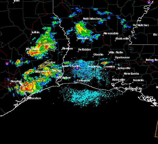 At 116 pm cdt, a severe thunderstorm was located 7 miles east of saratoga, moving northeast at 10 mph (radar indicated). Hazards include 60 mph wind gusts and quarter size hail. Hail damage to vehicles is expected. Expect wind damage to roofs, siding, and trees. At 116 pm cdt, a severe thunderstorm was located 7 miles east of saratoga, moving northeast at 10 mph (radar indicated). Hazards include 60 mph wind gusts and quarter size hail. Hail damage to vehicles is expected. Expect wind damage to roofs, siding, and trees.
|
| 5/28/2020 12:24 PM CDT |
 At 1223 pm cdt, a severe thunderstorm was located near china, or near sour lake, moving northeast at 15 mph (radar indicated). Hazards include 60 mph wind gusts and quarter size hail. Hail damage to vehicles is expected. Expect wind damage to roofs, siding, and trees. At 1223 pm cdt, a severe thunderstorm was located near china, or near sour lake, moving northeast at 15 mph (radar indicated). Hazards include 60 mph wind gusts and quarter size hail. Hail damage to vehicles is expected. Expect wind damage to roofs, siding, and trees.
|
| 5/5/2020 9:15 PM CDT |
 At 915 pm cdt, a severe thunderstorm was located near wildwood, moving southeast at 40 mph (radar indicated). Hazards include quarter size hail. Damage to vehicles is expected. Locations impacted include, silsbee, kountze, warren, wildwood, caney head and village mills. At 915 pm cdt, a severe thunderstorm was located near wildwood, moving southeast at 40 mph (radar indicated). Hazards include quarter size hail. Damage to vehicles is expected. Locations impacted include, silsbee, kountze, warren, wildwood, caney head and village mills.
|
| 5/5/2020 8:59 PM CDT |
 The national weather service in lake charles has issued a * severe thunderstorm warning for. southwestern tyler county in southeastern texas. northeastern hardin county in southeastern texas. until 930 pm cdt. At 859 pm cdt, a severe thunderstorm was located 7 miles southeast. The national weather service in lake charles has issued a * severe thunderstorm warning for. southwestern tyler county in southeastern texas. northeastern hardin county in southeastern texas. until 930 pm cdt. At 859 pm cdt, a severe thunderstorm was located 7 miles southeast.
|
| 4/19/2020 5:02 PM CDT |
 At 502 pm cdt, a severe thunderstorm was located near caney head, or near silsbee, moving east at 60 mph (radar indicated). Hazards include 70 mph wind gusts and quarter size hail. Hail damage to vehicles is expected. expect considerable tree damage. Wind damage is also likely to mobile homes, roofs, and outbuildings. At 502 pm cdt, a severe thunderstorm was located near caney head, or near silsbee, moving east at 60 mph (radar indicated). Hazards include 70 mph wind gusts and quarter size hail. Hail damage to vehicles is expected. expect considerable tree damage. Wind damage is also likely to mobile homes, roofs, and outbuildings.
|
| 1/11/2020 1:57 AM CST |
 At 155 am cst, severe thunderstorms were located along a line extending from near pineland to magnolia springs to near gilchrist, moving east at 35 mph (radar indicated. at 1:40 am cst a wind gust to 59 mph was reported by local media at pinewood, texas). Hazards include 60 mph wind gusts. Expect damage to roofs, siding, and trees. locations impacted include, beaumont, port arthur, lumberton, jasper, silsbee, kirbyville, kountze, sour lake, nome, evadale, town bluff, hamshire, fred, buna, bevil oaks, china, rose city, pine forest, browndell and lakeview. This includes interstate 10 in texas between mile markers 860 and 832. At 155 am cst, severe thunderstorms were located along a line extending from near pineland to magnolia springs to near gilchrist, moving east at 35 mph (radar indicated. at 1:40 am cst a wind gust to 59 mph was reported by local media at pinewood, texas). Hazards include 60 mph wind gusts. Expect damage to roofs, siding, and trees. locations impacted include, beaumont, port arthur, lumberton, jasper, silsbee, kirbyville, kountze, sour lake, nome, evadale, town bluff, hamshire, fred, buna, bevil oaks, china, rose city, pine forest, browndell and lakeview. This includes interstate 10 in texas between mile markers 860 and 832.
|
| 1/11/2020 1:31 AM CST |
 At 130 am cst, severe thunderstorms were located along a line extending from 9 miles west of pineland to near spurger to near crystal beach, moving east at 35 mph (radar indicated). Hazards include 60 mph wind gusts. expect damage to roofs, siding, and trees At 130 am cst, severe thunderstorms were located along a line extending from 9 miles west of pineland to near spurger to near crystal beach, moving east at 35 mph (radar indicated). Hazards include 60 mph wind gusts. expect damage to roofs, siding, and trees
|
| 1/11/2020 1:09 AM CST |
 At 109 am cst, severe thunderstorms were located along a line extending from 7 miles east of colmesneil to warren to near batson to 6 miles east of old river-winfree, moving east at 40 mph (radar indicated). Hazards include 60 mph wind gusts. expect damage to roofs, siding, and trees At 109 am cst, severe thunderstorms were located along a line extending from 7 miles east of colmesneil to warren to near batson to 6 miles east of old river-winfree, moving east at 40 mph (radar indicated). Hazards include 60 mph wind gusts. expect damage to roofs, siding, and trees
|
| 10/29/2019 4:21 PM CDT | Public pictures of trees snapped on fm 418 near silsbee with additional reports of trees down on fm 418 between silsbee and kountze. time estimated by rada in hardin county TX, 3 miles SE of Silsbee, TX |
| 5/9/2019 9:07 PM CDT |
 At 907 pm cdt, a severe thunderstorm was located near kountze, moving northeast at 15 mph (radar indicated). Hazards include golf ball size hail and 60 mph wind gusts. People and animals outdoors will be injured. expect hail damage to roofs, siding, windows, and vehicles. Expect wind damage to roofs, siding, and trees. At 907 pm cdt, a severe thunderstorm was located near kountze, moving northeast at 15 mph (radar indicated). Hazards include golf ball size hail and 60 mph wind gusts. People and animals outdoors will be injured. expect hail damage to roofs, siding, windows, and vehicles. Expect wind damage to roofs, siding, and trees.
|
| 4/18/2019 6:15 AM CDT |
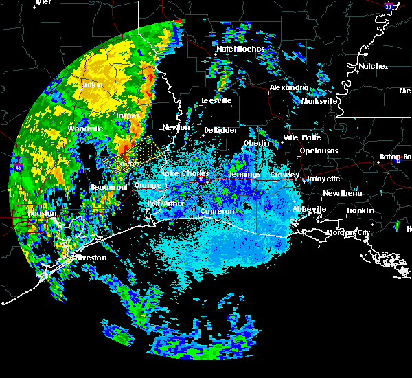 At 615 am cdt, a severe thunderstorm was located near caney head, or 7 miles north of silsbee, moving northeast at 40 mph (radar indicated). Hazards include 60 mph wind gusts and quarter size hail. Hail damage to vehicles is expected. Expect wind damage to roofs, siding, and trees. At 615 am cdt, a severe thunderstorm was located near caney head, or 7 miles north of silsbee, moving northeast at 40 mph (radar indicated). Hazards include 60 mph wind gusts and quarter size hail. Hail damage to vehicles is expected. Expect wind damage to roofs, siding, and trees.
|
| 4/18/2019 5:37 AM CDT |
 At 537 am cdt, a severe thunderstorm was located near batson, or 8 miles southwest of saratoga, moving northeast at 60 mph (radar indicated). Hazards include 60 mph wind gusts and quarter size hail. Hail damage to vehicles is expected. Expect wind damage to roofs, siding, and trees. At 537 am cdt, a severe thunderstorm was located near batson, or 8 miles southwest of saratoga, moving northeast at 60 mph (radar indicated). Hazards include 60 mph wind gusts and quarter size hail. Hail damage to vehicles is expected. Expect wind damage to roofs, siding, and trees.
|
| 4/7/2019 2:10 PM CDT |
 At 210 pm cdt, severe thunderstorms were located along a line extending from near wildwood to near lumberton to 19 miles south of sabine pass, moving northeast at 50 mph (radar indicated). Hazards include 60 mph wind gusts and quarter size hail. Hail damage to vehicles is expected. Expect wind damage to roofs, siding, and trees. At 210 pm cdt, severe thunderstorms were located along a line extending from near wildwood to near lumberton to 19 miles south of sabine pass, moving northeast at 50 mph (radar indicated). Hazards include 60 mph wind gusts and quarter size hail. Hail damage to vehicles is expected. Expect wind damage to roofs, siding, and trees.
|
| 4/7/2019 1:56 PM CDT |
 At 155 pm cdt, severe thunderstorms were located along a line extending from 7 miles east of shepherd to near saratoga to 11 miles east of high island, moving northeast at 55 mph (radar indicated). Hazards include 60 mph wind gusts and quarter size hail. Hail damage to vehicles is expected. expect wind damage to roofs, siding, and trees. Locations impacted include, beaumont, port arthur, nederland, groves, port neches, lumberton, vidor, bridge city, silsbee, woodville, kountze, sour lake, nome, central gardens, warren, thicket, saratoga, hamshire, fred and wildwood. At 155 pm cdt, severe thunderstorms were located along a line extending from 7 miles east of shepherd to near saratoga to 11 miles east of high island, moving northeast at 55 mph (radar indicated). Hazards include 60 mph wind gusts and quarter size hail. Hail damage to vehicles is expected. expect wind damage to roofs, siding, and trees. Locations impacted include, beaumont, port arthur, nederland, groves, port neches, lumberton, vidor, bridge city, silsbee, woodville, kountze, sour lake, nome, central gardens, warren, thicket, saratoga, hamshire, fred and wildwood.
|
| 4/7/2019 1:37 PM CDT |
 At 137 pm cdt, severe thunderstorms were located along a line extending from near cleveland to daisetta to 13 miles southeast of gilchrist, moving northeast at 55 mph (radar indicated). Hazards include 60 mph wind gusts and quarter size hail. Hail damage to vehicles is expected. Expect wind damage to roofs, siding, and trees. At 137 pm cdt, severe thunderstorms were located along a line extending from near cleveland to daisetta to 13 miles southeast of gilchrist, moving northeast at 55 mph (radar indicated). Hazards include 60 mph wind gusts and quarter size hail. Hail damage to vehicles is expected. Expect wind damage to roofs, siding, and trees.
|
| 4/4/2019 2:44 AM CDT | Golf Ball sized hail reported 7.8 miles S of Silsbee, TX, public posted photo of golf ball sized hail. |
| 4/4/2019 2:40 AM CDT | Quarter sized hail reported 3 miles SSE of Silsbee, TX, public posted photo of quarter size hail to social media. |
| 4/4/2019 2:37 AM CDT |
 At 237 am cdt, a severe thunderstorm was located near caney head, or 7 miles north of silsbee, moving northeast at 40 mph (radar indicated). Hazards include quarter size hail. damage to vehicles is expected At 237 am cdt, a severe thunderstorm was located near caney head, or 7 miles north of silsbee, moving northeast at 40 mph (radar indicated). Hazards include quarter size hail. damage to vehicles is expected
|
| 2/26/2019 5:59 PM CST |
 At 558 pm cst, a severe thunderstorm was located over caney head, or near fred, moving east at 35 mph (radar indicated). Hazards include quarter size hail. damage to vehicles is expected At 558 pm cst, a severe thunderstorm was located over caney head, or near fred, moving east at 35 mph (radar indicated). Hazards include quarter size hail. damage to vehicles is expected
|
| 11/7/2018 8:45 PM CST |
 At 845 pm cst, a severe thunderstorm was located over saratoga, moving east at 20 mph (radar indicated). Hazards include 60 mph wind gusts and quarter size hail. Hail damage to vehicles is expected. Expect wind damage to roofs, siding, and trees. At 845 pm cst, a severe thunderstorm was located over saratoga, moving east at 20 mph (radar indicated). Hazards include 60 mph wind gusts and quarter size hail. Hail damage to vehicles is expected. Expect wind damage to roofs, siding, and trees.
|
| 10/31/2018 7:55 PM CDT |
 The tornado warning for northeastern hardin county will expire at 800 pm cdt, the tornadic thunderstorm which prompted the warning has weakened. moved out of the warned area. therefore, the warning will be allowed to expire. a tornado watch remains in effect until 1000 pm cdt for southeastern texas. The tornado warning for northeastern hardin county will expire at 800 pm cdt, the tornadic thunderstorm which prompted the warning has weakened. moved out of the warned area. therefore, the warning will be allowed to expire. a tornado watch remains in effect until 1000 pm cdt for southeastern texas.
|
| 10/31/2018 7:30 PM CDT |
 At 729 pm cdt, severe thunderstorms were located along a line extending from near caney head to sour lake, moving east at 25 mph (radar indicated). Hazards include 60 mph wind gusts and nickel size hail. expect damage to roofs, siding, and trees At 729 pm cdt, severe thunderstorms were located along a line extending from near caney head to sour lake, moving east at 25 mph (radar indicated). Hazards include 60 mph wind gusts and nickel size hail. expect damage to roofs, siding, and trees
|
| 10/31/2018 7:11 PM CDT |
 At 711 pm cdt, a severe thunderstorm capable of producing a tornado was located near kountze, moving north at 15 mph (radar indicated rotation). Hazards include tornado. Flying debris will be dangerous to those caught without shelter. mobile homes will be damaged or destroyed. damage to roofs, windows, and vehicles will occur. tree damage is likely. This dangerous storm will be near, silsbee around 735 pm cdt. At 711 pm cdt, a severe thunderstorm capable of producing a tornado was located near kountze, moving north at 15 mph (radar indicated rotation). Hazards include tornado. Flying debris will be dangerous to those caught without shelter. mobile homes will be damaged or destroyed. damage to roofs, windows, and vehicles will occur. tree damage is likely. This dangerous storm will be near, silsbee around 735 pm cdt.
|
| 5/26/2018 7:00 PM CDT |
 At 637 pm cdt, severe thunderstorms were located along a line extending from 6 miles southwest of wildwood to silsbee, moving southwest at 15 mph (radar indicated). Hazards include 60 mph wind gusts and quarter size hail. Hail damage to vehicles is expected. Expect wind damage to roofs, siding, and trees. At 637 pm cdt, severe thunderstorms were located along a line extending from 6 miles southwest of wildwood to silsbee, moving southwest at 15 mph (radar indicated). Hazards include 60 mph wind gusts and quarter size hail. Hail damage to vehicles is expected. Expect wind damage to roofs, siding, and trees.
|
| 5/26/2018 6:37 PM CDT |
 At 637 pm cdt, severe thunderstorms were located along a line extending from 6 miles southwest of wildwood to silsbee, moving southwest at 15 mph (radar indicated). Hazards include 60 mph wind gusts and quarter size hail. Hail damage to vehicles is expected. Expect wind damage to roofs, siding, and trees. At 637 pm cdt, severe thunderstorms were located along a line extending from 6 miles southwest of wildwood to silsbee, moving southwest at 15 mph (radar indicated). Hazards include 60 mph wind gusts and quarter size hail. Hail damage to vehicles is expected. Expect wind damage to roofs, siding, and trees.
|
| 4/7/2018 2:47 AM CDT |
 At 246 am cdt, a severe thunderstorm was located near evadale, moving east at 60 mph (radar indicated). Hazards include 60 mph wind gusts and nickel size hail. expect damage to roofs, siding, and trees At 246 am cdt, a severe thunderstorm was located near evadale, moving east at 60 mph (radar indicated). Hazards include 60 mph wind gusts and nickel size hail. expect damage to roofs, siding, and trees
|
| 3/18/2018 8:56 PM CDT |
 At 856 pm cdt, severe thunderstorms were located along a line extending from 6 miles southwest of alabama-coushatta reservation to 7 miles southeast of shepherd, moving east at 50 mph. these are very dangerous storms (radar indicated). Hazards include 80 mph wind gusts and quarter size hail. Flying debris will be dangerous to those caught without shelter. mobile homes will be heavily damaged. expect considerable damage to roofs, windows, and vehicles. Extensive tree damage and power outages are likely. At 856 pm cdt, severe thunderstorms were located along a line extending from 6 miles southwest of alabama-coushatta reservation to 7 miles southeast of shepherd, moving east at 50 mph. these are very dangerous storms (radar indicated). Hazards include 80 mph wind gusts and quarter size hail. Flying debris will be dangerous to those caught without shelter. mobile homes will be heavily damaged. expect considerable damage to roofs, windows, and vehicles. Extensive tree damage and power outages are likely.
|
| 8/27/2017 10:43 AM CDT |
 At 1043 am cdt, a severe thunderstorm capable of producing a tornado was located over silsbee, moving northwest at 20 mph (radar indicated rotation). Hazards include tornado. Flying debris will be dangerous to those caught without shelter. mobile homes will be damaged or destroyed. damage to roofs, windows, and vehicles will occur. tree damage is likely. this dangerous storm will be near, kountze around 1105 am cdt. Caney head around 1110 am cdt. At 1043 am cdt, a severe thunderstorm capable of producing a tornado was located over silsbee, moving northwest at 20 mph (radar indicated rotation). Hazards include tornado. Flying debris will be dangerous to those caught without shelter. mobile homes will be damaged or destroyed. damage to roofs, windows, and vehicles will occur. tree damage is likely. this dangerous storm will be near, kountze around 1105 am cdt. Caney head around 1110 am cdt.
|
| 8/27/2017 10:15 AM CDT |
 At 1015 am cdt, a severe thunderstorm capable of producing a tornado was located over weiss bluff, or near evadale, moving northwest at 30 mph (radar indicated rotation). Hazards include tornado. Flying debris will be dangerous to those caught without shelter. mobile homes will be damaged or destroyed. damage to roofs, windows, and vehicles will occur. tree damage is likely. this dangerous storm will be near, lumberton around 1020 am cdt. evadale around 1025 am cdt. silsbee around 1040 am cdt. Caney head around 1045 am cdt. At 1015 am cdt, a severe thunderstorm capable of producing a tornado was located over weiss bluff, or near evadale, moving northwest at 30 mph (radar indicated rotation). Hazards include tornado. Flying debris will be dangerous to those caught without shelter. mobile homes will be damaged or destroyed. damage to roofs, windows, and vehicles will occur. tree damage is likely. this dangerous storm will be near, lumberton around 1020 am cdt. evadale around 1025 am cdt. silsbee around 1040 am cdt. Caney head around 1045 am cdt.
|
| 8/27/2017 9:43 AM CDT |
 At 943 am cdt, a severe thunderstorm capable of producing a tornado was located over lakeview, or near lumberton, moving northwest at 30 mph (radar indicated rotation). Hazards include tornado. Flying debris will be dangerous to those caught without shelter. mobile homes will be damaged or destroyed. damage to roofs, windows, and vehicles will occur. tree damage is likely. this dangerous storm will be near, lumberton and evadale around 955 am cdt. silsbee and kountze around 1010 am cdt. Caney head around 1015 am cdt. At 943 am cdt, a severe thunderstorm capable of producing a tornado was located over lakeview, or near lumberton, moving northwest at 30 mph (radar indicated rotation). Hazards include tornado. Flying debris will be dangerous to those caught without shelter. mobile homes will be damaged or destroyed. damage to roofs, windows, and vehicles will occur. tree damage is likely. this dangerous storm will be near, lumberton and evadale around 955 am cdt. silsbee and kountze around 1010 am cdt. Caney head around 1015 am cdt.
|
| 8/27/2017 9:18 AM CDT |
 At 918 am cdt, a severe thunderstorm capable of producing a tornado was located over rose city, or near vidor, moving northwest at 30 mph (radar indicated rotation). Hazards include tornado. Flying debris will be dangerous to those caught without shelter. mobile homes will be damaged or destroyed. damage to roofs, windows, and vehicles will occur. tree damage is likely. this dangerous storm will be near, pine forest around 925 am cdt. lakeview around 935 am cdt. weiss bluff around 940 am cdt. Beaumont and lumberton around 945 am cdt. At 918 am cdt, a severe thunderstorm capable of producing a tornado was located over rose city, or near vidor, moving northwest at 30 mph (radar indicated rotation). Hazards include tornado. Flying debris will be dangerous to those caught without shelter. mobile homes will be damaged or destroyed. damage to roofs, windows, and vehicles will occur. tree damage is likely. this dangerous storm will be near, pine forest around 925 am cdt. lakeview around 935 am cdt. weiss bluff around 940 am cdt. Beaumont and lumberton around 945 am cdt.
|
| 5/20/2017 7:15 PM CDT |
 At 714 pm cdt, severe thunderstorms were located along a line extending from 6 miles west of fred to 6 miles southwest of wildwood, moving east at 15 mph (radar indicated). Hazards include quarter size hail. damage to vehicles is expected At 714 pm cdt, severe thunderstorms were located along a line extending from 6 miles west of fred to 6 miles southwest of wildwood, moving east at 15 mph (radar indicated). Hazards include quarter size hail. damage to vehicles is expected
|
| 5/3/2017 7:57 AM CDT |
 At 756 am cdt, a severe thunderstorm capable of producing a tornado was located near caney head, or near silsbee, moving east at 20 mph (radar indicated rotation). Hazards include tornado and golf ball size hail. Flying debris will be dangerous to those caught without shelter. mobile homes will be damaged or destroyed. damage to roofs, windows, and vehicles will occur. tree damage is likely. this dangerous storm will be near, evadale around 810 am cdt. Buna around 830 am cdt. At 756 am cdt, a severe thunderstorm capable of producing a tornado was located near caney head, or near silsbee, moving east at 20 mph (radar indicated rotation). Hazards include tornado and golf ball size hail. Flying debris will be dangerous to those caught without shelter. mobile homes will be damaged or destroyed. damage to roofs, windows, and vehicles will occur. tree damage is likely. this dangerous storm will be near, evadale around 810 am cdt. Buna around 830 am cdt.
|
| 5/3/2017 7:44 AM CDT |
 At 744 am cdt, a severe thunderstorm capable of producing a tornado was located near silsbee, moving east at 25 mph (radar indicated rotation). Hazards include tornado and half dollar size hail. Flying debris will be dangerous to those caught without shelter. mobile homes will be damaged or destroyed. damage to roofs, windows, and vehicles will occur. tree damage is likely. this dangerous storm will be near, caney head around 750 am cdt. evadale around 805 am cdt. Buna around 820 am cdt. At 744 am cdt, a severe thunderstorm capable of producing a tornado was located near silsbee, moving east at 25 mph (radar indicated rotation). Hazards include tornado and half dollar size hail. Flying debris will be dangerous to those caught without shelter. mobile homes will be damaged or destroyed. damage to roofs, windows, and vehicles will occur. tree damage is likely. this dangerous storm will be near, caney head around 750 am cdt. evadale around 805 am cdt. Buna around 820 am cdt.
|
| 5/3/2017 7:14 AM CDT |
 At 714 am cdt, a severe thunderstorm was located over kountze, moving northeast at 25 mph (radar indicated). Hazards include 60 mph wind gusts and quarter size hail. Hail damage to vehicles is expected. Expect wind damage to roofs, siding, and trees. At 714 am cdt, a severe thunderstorm was located over kountze, moving northeast at 25 mph (radar indicated). Hazards include 60 mph wind gusts and quarter size hail. Hail damage to vehicles is expected. Expect wind damage to roofs, siding, and trees.
|
| 5/3/2017 6:26 AM CDT |
 At 625 am cdt, severe thunderstorms were located along a line extending from near thicket to near kountze, moving north at 40 mph (radar indicated). Hazards include 60 mph wind gusts and quarter size hail. Hail damage to vehicles is expected. Expect wind damage to roofs, siding, and trees. At 625 am cdt, severe thunderstorms were located along a line extending from near thicket to near kountze, moving north at 40 mph (radar indicated). Hazards include 60 mph wind gusts and quarter size hail. Hail damage to vehicles is expected. Expect wind damage to roofs, siding, and trees.
|
| 3/29/2017 4:36 PM CDT |
 The severe thunderstorm warning for jefferson, southeastern hardin and western orange counties will expire at 445 pm cdt, the storms which prompted the warning have weakened below severe limits, and no longer pose an immediate threat to life or property. therefore the warning will be allowed to expire. however gusty winds are still possible with these thunderstorms. a tornado watch remains in effect until 900 pm cdt for southeastern texas. The severe thunderstorm warning for jefferson, southeastern hardin and western orange counties will expire at 445 pm cdt, the storms which prompted the warning have weakened below severe limits, and no longer pose an immediate threat to life or property. therefore the warning will be allowed to expire. however gusty winds are still possible with these thunderstorms. a tornado watch remains in effect until 900 pm cdt for southeastern texas.
|
| 3/29/2017 4:20 PM CDT |
 At 420 pm cdt, severe thunderstorms were located along a line extending from 8 miles northwest of bevil oaks to near china to near hamshire, moving northeast at 30 mph (radar indicated). Hazards include 60 mph wind gusts and nickel size hail. Expect damage to roofs, siding, and trees. locations impacted include, beaumont, port arthur, nederland, lumberton, silsbee, sour lake, nome, hamshire, central gardens, bevil oaks, china, rose city, pine forest, lakeview, port acres, fannett, la belle and southeast texas regional airport. A tornado watch remains in effect until 900 pm cdt for southeastern texas. At 420 pm cdt, severe thunderstorms were located along a line extending from 8 miles northwest of bevil oaks to near china to near hamshire, moving northeast at 30 mph (radar indicated). Hazards include 60 mph wind gusts and nickel size hail. Expect damage to roofs, siding, and trees. locations impacted include, beaumont, port arthur, nederland, lumberton, silsbee, sour lake, nome, hamshire, central gardens, bevil oaks, china, rose city, pine forest, lakeview, port acres, fannett, la belle and southeast texas regional airport. A tornado watch remains in effect until 900 pm cdt for southeastern texas.
|
| 3/29/2017 3:50 PM CDT |
 At 350 pm cdt, severe thunderstorms were located along a line extending from 6 miles northeast of daisetta to 7 miles southwest of nome to 7 miles east of anahuac, moving northeast at 30 mph (radar indicated). Hazards include 60 mph wind gusts and quarter size hail. Hail damage to vehicles is expected. Expect wind damage to roofs, siding, and trees. At 350 pm cdt, severe thunderstorms were located along a line extending from 6 miles northeast of daisetta to 7 miles southwest of nome to 7 miles east of anahuac, moving northeast at 30 mph (radar indicated). Hazards include 60 mph wind gusts and quarter size hail. Hail damage to vehicles is expected. Expect wind damage to roofs, siding, and trees.
|
| 3/25/2017 12:37 AM CDT |
 The severe thunderstorm warning for southeastern tyler, northeastern hardin and southeastern jasper counties will expire at 1245 am cdt, the storms which prompted the warning have weakened below severe limits, and have exited the warned area. therefore the warning will be allowed to expire. however gusty winds are still possible with these thunderstorms. a tornado watch remains in effect until 400 am cdt for southeastern texas. The severe thunderstorm warning for southeastern tyler, northeastern hardin and southeastern jasper counties will expire at 1245 am cdt, the storms which prompted the warning have weakened below severe limits, and have exited the warned area. therefore the warning will be allowed to expire. however gusty winds are still possible with these thunderstorms. a tornado watch remains in effect until 400 am cdt for southeastern texas.
|
| 3/25/2017 12:17 AM CDT |
 At 1216 am cdt, severe thunderstorms were located along a line extending from near fred to lumberton, moving east at 45 mph (radar indicated). Hazards include 60 mph wind gusts. Expect damage to roofs, siding, and trees. locations impacted include, silsbee, buna, evadale, fred and caney head. A tornado watch remains in effect until 400 am cdt for southeastern texas. At 1216 am cdt, severe thunderstorms were located along a line extending from near fred to lumberton, moving east at 45 mph (radar indicated). Hazards include 60 mph wind gusts. Expect damage to roofs, siding, and trees. locations impacted include, silsbee, buna, evadale, fred and caney head. A tornado watch remains in effect until 400 am cdt for southeastern texas.
|
| 3/25/2017 12:00 AM CDT |
 At 1200 am cdt, severe thunderstorms were located along a line extending from 6 miles west of fred to 6 miles north of sour lake, moving east at 40 mph (radar indicated). Hazards include 60 mph wind gusts. Expect damage to roofs, siding, and trees. locations impacted include, beaumont, lumberton, silsbee, kountze, buna, evadale, fred, caney head, weiss bluff and village mills. A tornado watch remains in effect until 400 am cdt for southeastern texas. At 1200 am cdt, severe thunderstorms were located along a line extending from 6 miles west of fred to 6 miles north of sour lake, moving east at 40 mph (radar indicated). Hazards include 60 mph wind gusts. Expect damage to roofs, siding, and trees. locations impacted include, beaumont, lumberton, silsbee, kountze, buna, evadale, fred, caney head, weiss bluff and village mills. A tornado watch remains in effect until 400 am cdt for southeastern texas.
|
| 3/24/2017 11:40 PM CDT |
 At 1140 pm cdt, severe thunderstorms were located along a line extending from near wildwood to near daisetta, moving northeast at 40 mph (radar indicated). Hazards include 60 mph wind gusts. expect damage to roofs, siding, and trees At 1140 pm cdt, severe thunderstorms were located along a line extending from near wildwood to near daisetta, moving northeast at 40 mph (radar indicated). Hazards include 60 mph wind gusts. expect damage to roofs, siding, and trees
|
| 1/20/2017 8:38 PM CST |
 The severe thunderstorm warning for northern jefferson, southeastern hardin and western orange counties will expire at 845 pm cst, the storm which prompted the warning has moved out of the area. therefore the warning will be allowed to expire. a tornado watch remains in effect until 200 am cst for southeastern texas. The severe thunderstorm warning for northern jefferson, southeastern hardin and western orange counties will expire at 845 pm cst, the storm which prompted the warning has moved out of the area. therefore the warning will be allowed to expire. a tornado watch remains in effect until 200 am cst for southeastern texas.
|
| 1/20/2017 8:08 PM CST |
 At 807 pm cst, a severe thunderstorm was located over beaumont, moving northeast at 45 mph (radar indicated). Hazards include 60 mph wind gusts and quarter size hail. Hail damage to vehicles is expected. Expect wind damage to roofs, siding, and trees. At 807 pm cst, a severe thunderstorm was located over beaumont, moving northeast at 45 mph (radar indicated). Hazards include 60 mph wind gusts and quarter size hail. Hail damage to vehicles is expected. Expect wind damage to roofs, siding, and trees.
|
| 1/20/2017 7:57 PM CST |
 At 757 pm cst, a severe thunderstorm was located near gist, or near evadale, moving northeast at 45 mph (radar indicated). Hazards include 60 mph wind gusts and quarter size hail. Hail damage to vehicles is expected. expect wind damage to roofs, siding, and trees. Locations impacted include, buna, evadale, weiss bluff, hartburg and gist. At 757 pm cst, a severe thunderstorm was located near gist, or near evadale, moving northeast at 45 mph (radar indicated). Hazards include 60 mph wind gusts and quarter size hail. Hail damage to vehicles is expected. expect wind damage to roofs, siding, and trees. Locations impacted include, buna, evadale, weiss bluff, hartburg and gist.
|
| 1/20/2017 7:40 PM CST |
 At 740 pm cst, a severe thunderstorm was located over lakeview, or 7 miles southeast of lumberton, moving northeast at 40 mph (radar indicated). Hazards include 60 mph wind gusts and quarter size hail. Hail damage to vehicles is expected. Expect wind damage to roofs, siding, and trees. At 740 pm cst, a severe thunderstorm was located over lakeview, or 7 miles southeast of lumberton, moving northeast at 40 mph (radar indicated). Hazards include 60 mph wind gusts and quarter size hail. Hail damage to vehicles is expected. Expect wind damage to roofs, siding, and trees.
|
| 1/20/2017 7:35 PM CST |
 At 735 pm cst, a severe thunderstorm was located near lakeview, or near beaumont, moving northeast at 40 mph (radar indicated). Hazards include 60 mph wind gusts and quarter size hail. Hail damage to vehicles is expected. expect wind damage to roofs, siding, and trees. locations impacted include, beaumont, lumberton, vidor, silsbee, bevil oaks, rose city, pine forest and lakeview. A tornado watch remains in effect until 200 am cst for southeastern texas. At 735 pm cst, a severe thunderstorm was located near lakeview, or near beaumont, moving northeast at 40 mph (radar indicated). Hazards include 60 mph wind gusts and quarter size hail. Hail damage to vehicles is expected. expect wind damage to roofs, siding, and trees. locations impacted include, beaumont, lumberton, vidor, silsbee, bevil oaks, rose city, pine forest and lakeview. A tornado watch remains in effect until 200 am cst for southeastern texas.
|
| 1/20/2017 7:16 PM CST |
 At 716 pm cst, a severe thunderstorm was located near china, or 8 miles east of nome, moving northeast at 45 mph (radar indicated). Hazards include 60 mph wind gusts and quarter size hail. Hail damage to vehicles is expected. Expect wind damage to roofs, siding, and trees. At 716 pm cst, a severe thunderstorm was located near china, or 8 miles east of nome, moving northeast at 45 mph (radar indicated). Hazards include 60 mph wind gusts and quarter size hail. Hail damage to vehicles is expected. Expect wind damage to roofs, siding, and trees.
|
| 1/2/2017 9:57 AM CST |
 At 957 am cst, severe thunderstorms were located along a line extending from near fields to near starks to near smith point, moving east at 45 mph (radar indicated). Hazards include 70 mph wind gusts. Expect considerable tree damage. Damage is likely to mobile homes, roofs, and outbuildings. At 957 am cst, severe thunderstorms were located along a line extending from near fields to near starks to near smith point, moving east at 45 mph (radar indicated). Hazards include 70 mph wind gusts. Expect considerable tree damage. Damage is likely to mobile homes, roofs, and outbuildings.
|
| 1/2/2017 9:07 AM CST |
 At 906 am cst, severe thunderstorms were located along a line extending from near jasper to 7 miles southwest of kountze, moving east at 40 mph (radar indicated). Hazards include 70 mph wind gusts and nickel size hail. Expect considerable tree damage. Damage is likely to mobile homes, roofs, and outbuildings. At 906 am cst, severe thunderstorms were located along a line extending from near jasper to 7 miles southwest of kountze, moving east at 40 mph (radar indicated). Hazards include 70 mph wind gusts and nickel size hail. Expect considerable tree damage. Damage is likely to mobile homes, roofs, and outbuildings.
|
| 5/27/2016 4:04 PM CDT |
 At 403 pm cdt, severe thunderstorms were located along a line extending from near burkeville to near devers, moving southeast at 15 mph (radar indicated). Hazards include 60 mph wind gusts and nickel size hail. Expect damage to roofs. siding. and trees. Locations impacted include, beaumont, lumberton, vidor, jasper, silsbee, newton, kirbyville, kountze, sour lake, thicket, fred, saratoga, bon weir, buna, burkeville, evadale, call, bevil oaks, china and rose city. At 403 pm cdt, severe thunderstorms were located along a line extending from near burkeville to near devers, moving southeast at 15 mph (radar indicated). Hazards include 60 mph wind gusts and nickel size hail. Expect damage to roofs. siding. and trees. Locations impacted include, beaumont, lumberton, vidor, jasper, silsbee, newton, kirbyville, kountze, sour lake, thicket, fred, saratoga, bon weir, buna, burkeville, evadale, call, bevil oaks, china and rose city.
|
| 5/27/2016 3:23 PM CDT |
 At 323 pm cdt, severe thunderstorms were located along a line extending from near mayflower to near daisetta, moving southeast at 15 mph (radar indicated). Hazards include 60 mph wind gusts. Expect damage to roofs. siding. And trees. At 323 pm cdt, severe thunderstorms were located along a line extending from near mayflower to near daisetta, moving southeast at 15 mph (radar indicated). Hazards include 60 mph wind gusts. Expect damage to roofs. siding. And trees.
|
| 5/26/2016 7:23 PM CDT |
 At 721 pm cdt, severe thunderstorms were located along a line extending from near shepherd to 9 miles northwest of dayton lakes to 7 miles south of plum grove, moving east at 25 mph (radar indicated). Hazards include 60 mph wind gusts and quarter size hail. Hail damage to vehicles is expected. Expect wind damage to roofs, siding, and trees. At 721 pm cdt, severe thunderstorms were located along a line extending from near shepherd to 9 miles northwest of dayton lakes to 7 miles south of plum grove, moving east at 25 mph (radar indicated). Hazards include 60 mph wind gusts and quarter size hail. Hail damage to vehicles is expected. Expect wind damage to roofs, siding, and trees.
|
| 4/27/2016 6:42 AM CDT |
 At 639 am cdt, severe thunderstorms were located along a line extending from hemphill to near jamestown to near kirbyville to 6 miles west of old salem to 6 miles southeast of buna to wrights settlement to near gist to near vidor to 6 miles east of high island, moving east at 45 mph (radar indicated). Hazards include 60 mph wind gusts and penny size hail. Expect damage to roofs. siding. and trees. Locations impacted include, beaumont, port arthur, orange, nederland, groves, port neches, lumberton, vidor, bridge city, jasper, silsbee, west orange, newton, kirbyville, nome, deweyville, fred, bon weir, hamshire and burkeville. At 639 am cdt, severe thunderstorms were located along a line extending from hemphill to near jamestown to near kirbyville to 6 miles west of old salem to 6 miles southeast of buna to wrights settlement to near gist to near vidor to 6 miles east of high island, moving east at 45 mph (radar indicated). Hazards include 60 mph wind gusts and penny size hail. Expect damage to roofs. siding. and trees. Locations impacted include, beaumont, port arthur, orange, nederland, groves, port neches, lumberton, vidor, bridge city, jasper, silsbee, west orange, newton, kirbyville, nome, deweyville, fred, bon weir, hamshire and burkeville.
|
| 4/27/2016 6:15 AM CDT |
 At 614 am cdt, severe thunderstorms were located along a line extending from 6 miles south of macune to 6 miles west of jasper to near spurger to caney head to 7 miles east of kountze to 8 miles northwest of evadale to silsbee to near lumberton to bevil oaks to near winnie to 7 miles southeast of anahuac, moving east at 45 mph (radar indicated). Hazards include 60 mph wind gusts. Expect damage to roofs. siding. And trees. At 614 am cdt, severe thunderstorms were located along a line extending from 6 miles south of macune to 6 miles west of jasper to near spurger to caney head to 7 miles east of kountze to 8 miles northwest of evadale to silsbee to near lumberton to bevil oaks to near winnie to 7 miles southeast of anahuac, moving east at 45 mph (radar indicated). Hazards include 60 mph wind gusts. Expect damage to roofs. siding. And trees.
|
| 4/27/2016 5:49 AM CDT |
 At 547 am cdt, severe thunderstorms were located along a line extending from 9 miles north of chester to near warren to near saratoga to daisetta to near la porte, moving east at 50 mph (radar indicated). Hazards include 60 mph wind gusts and penny size hail. Expect damage to roofs. siding. and trees. Locations impacted include, beaumont, lumberton, silsbee, woodville, kountze, sour lake, colmesneil, nome, chester, thicket, fred, saratoga, ebenezer, rockland, town bluff, warren, wildwood, bevil oaks, china and lakeview. At 547 am cdt, severe thunderstorms were located along a line extending from 9 miles north of chester to near warren to near saratoga to daisetta to near la porte, moving east at 50 mph (radar indicated). Hazards include 60 mph wind gusts and penny size hail. Expect damage to roofs. siding. and trees. Locations impacted include, beaumont, lumberton, silsbee, woodville, kountze, sour lake, colmesneil, nome, chester, thicket, fred, saratoga, ebenezer, rockland, town bluff, warren, wildwood, bevil oaks, china and lakeview.
|
| 4/27/2016 5:17 AM CDT |
 At 516 am cdt, severe thunderstorms were located along a line extending from 8 miles east of groveton to near goodrich to 8 miles east of cleveland to near plum grove to brays oaks, moving east at 50 mph (radar indicated). Hazards include 60 mph wind gusts and penny size hail. Expect damage to roofs. siding. And trees. At 516 am cdt, severe thunderstorms were located along a line extending from 8 miles east of groveton to near goodrich to 8 miles east of cleveland to near plum grove to brays oaks, moving east at 50 mph (radar indicated). Hazards include 60 mph wind gusts and penny size hail. Expect damage to roofs. siding. And trees.
|
| 3/18/2016 4:28 PM CDT |
 At 427 pm cdt, a severe thunderstorm was located near pine forest, or near vidor, moving north at 15 mph (radar indicated). Hazards include 60 mph wind gusts and quarter size hail. Hail damage to vehicles is expected. Expect wind damage to roofs, siding and trees. At 427 pm cdt, a severe thunderstorm was located near pine forest, or near vidor, moving north at 15 mph (radar indicated). Hazards include 60 mph wind gusts and quarter size hail. Hail damage to vehicles is expected. Expect wind damage to roofs, siding and trees.
|
| 1/8/2016 7:41 PM CST |
 At 741 pm cst, a severe thunderstorm capable of producing a tornado was located near bevil oaks, or near lumberton, moving northeast at 25 mph (radar indicated rotation). Hazards include tornado. Flying debris will be dangerous to those caught without shelter. mobile homes will be damaged or destroyed. damage to roofs, windows and vehicles will occur. tree damage is likely. this dangerous storm will be near, lumberton around 755 pm cst. Silsbee around 810 pm cst. At 741 pm cst, a severe thunderstorm capable of producing a tornado was located near bevil oaks, or near lumberton, moving northeast at 25 mph (radar indicated rotation). Hazards include tornado. Flying debris will be dangerous to those caught without shelter. mobile homes will be damaged or destroyed. damage to roofs, windows and vehicles will occur. tree damage is likely. this dangerous storm will be near, lumberton around 755 pm cst. Silsbee around 810 pm cst.
|
| 1/8/2016 7:02 PM CST |
 The national weather service in lake charles has issued a * severe thunderstorm warning for. northwestern jefferson county in southeastern texas. southeastern hardin county in southeastern texas. until 800 pm cst * at 702 pm cst. A severe thunderstorm was located near daisetta. The national weather service in lake charles has issued a * severe thunderstorm warning for. northwestern jefferson county in southeastern texas. southeastern hardin county in southeastern texas. until 800 pm cst * at 702 pm cst. A severe thunderstorm was located near daisetta.
|
| 1/8/2016 7:00 PM CST |
 At 659 pm cst, a severe thunderstorm was located near silsbee, moving northeast at 45 mph (radar indicated). Hazards include 60 mph wind gusts and quarter size hail. Hail damage to vehicles is expected. Expect wind damage to roofs, siding and trees. At 659 pm cst, a severe thunderstorm was located near silsbee, moving northeast at 45 mph (radar indicated). Hazards include 60 mph wind gusts and quarter size hail. Hail damage to vehicles is expected. Expect wind damage to roofs, siding and trees.
|
| 1/8/2016 5:59 PM CST |
 At 558 pm cst, a severe thunderstorm was located near nome, moving north at 25 mph (radar indicated). Hazards include 60 mph wind gusts and quarter size hail. Hail damage to vehicles is expected. Expect wind damage to roofs, siding and trees. At 558 pm cst, a severe thunderstorm was located near nome, moving north at 25 mph (radar indicated). Hazards include 60 mph wind gusts and quarter size hail. Hail damage to vehicles is expected. Expect wind damage to roofs, siding and trees.
|
| 10/31/2015 6:00 AM CDT |
 The national weather service in lake charles has issued a * severe thunderstorm warning for. southeastern tyler county in southeastern texas. eastern hardin county in southeastern texas. southeastern jasper county in southeastern texas. Southwestern newton county in southeastern texas. The national weather service in lake charles has issued a * severe thunderstorm warning for. southeastern tyler county in southeastern texas. eastern hardin county in southeastern texas. southeastern jasper county in southeastern texas. Southwestern newton county in southeastern texas.
|
| 10/31/2015 5:34 AM CDT |
 At 532 am cdt, a severe thunderstorm capable of producing a tornado was located near kountze, moving northeast at 30 mph. this tornado will cross highway 69 near or just south of kountze (radar indicated rotation). Hazards include tornado. Flying debris will be dangerous to those caught without shelter. mobile homes will be damaged or destroyed. damage to roofs, windows and vehicles will occur. tree damage is likely. this dangerous storm will be near, silsbee around 540 am cdt. evadale around 550 am cdt. Buna around 600 am cdt. At 532 am cdt, a severe thunderstorm capable of producing a tornado was located near kountze, moving northeast at 30 mph. this tornado will cross highway 69 near or just south of kountze (radar indicated rotation). Hazards include tornado. Flying debris will be dangerous to those caught without shelter. mobile homes will be damaged or destroyed. damage to roofs, windows and vehicles will occur. tree damage is likely. this dangerous storm will be near, silsbee around 540 am cdt. evadale around 550 am cdt. Buna around 600 am cdt.
|
| 10/31/2015 5:27 AM CDT |
 At 527 am cdt, a severe thunderstorm capable of producing a tornado was located near kountze, moving northeast at 30 mph (radar indicated rotation). Hazards include tornado. Flying debris will be dangerous to those caught without shelter. mobile homes will be damaged or destroyed. damage to roofs, windows and vehicles will occur. tree damage is likely. this dangerous storm will be near, lumberton around 535 am cdt. silsbee around 540 am cdt. evadale around 550 am cdt. Buna around 600 am cdt. At 527 am cdt, a severe thunderstorm capable of producing a tornado was located near kountze, moving northeast at 30 mph (radar indicated rotation). Hazards include tornado. Flying debris will be dangerous to those caught without shelter. mobile homes will be damaged or destroyed. damage to roofs, windows and vehicles will occur. tree damage is likely. this dangerous storm will be near, lumberton around 535 am cdt. silsbee around 540 am cdt. evadale around 550 am cdt. Buna around 600 am cdt.
|
| 10/31/2015 5:12 AM CDT |
 At 511 am cdt, severe thunderstorms were located along a line extending from honey island to 7 miles east of saratoga to near sour lake, moving northeast at 30 mph (radar indicated). Hazards include 60 mph wind gusts and penny size hail. Expect damage to roofs. Siding and trees. At 511 am cdt, severe thunderstorms were located along a line extending from honey island to 7 miles east of saratoga to near sour lake, moving northeast at 30 mph (radar indicated). Hazards include 60 mph wind gusts and penny size hail. Expect damage to roofs. Siding and trees.
|
| 10/31/2015 4:56 AM CDT |
 At 455 am cdt, severe thunderstorms were located along a line extending from near honey island to near devers, moving northeast at 10 mph (radar indicated). Hazards include 60 mph wind gusts and penny size hail. Expect damage to roofs. siding and trees. locations impacted include, beaumont, lumberton, silsbee, kountze, sour lake, saratoga, batson, caney head and honey island. A tornado watch remains in effect until 1000 am cdt for southeastern texas. At 455 am cdt, severe thunderstorms were located along a line extending from near honey island to near devers, moving northeast at 10 mph (radar indicated). Hazards include 60 mph wind gusts and penny size hail. Expect damage to roofs. siding and trees. locations impacted include, beaumont, lumberton, silsbee, kountze, sour lake, saratoga, batson, caney head and honey island. A tornado watch remains in effect until 1000 am cdt for southeastern texas.
|
| 10/31/2015 4:32 AM CDT |
 The national weather service in lake charles has issued a * severe thunderstorm warning for. hardin county in southeastern texas. until 515 am cdt * at 431 am cdt. severe thunderstorms were located along a line extending from near saratoga to near devers. Moving northeast at. The national weather service in lake charles has issued a * severe thunderstorm warning for. hardin county in southeastern texas. until 515 am cdt * at 431 am cdt. severe thunderstorms were located along a line extending from near saratoga to near devers. Moving northeast at.
|
| 5/27/2015 5:44 AM CDT | At 543 am cdt, doppler radar indicated a line of severe thunderstorms capable of producing quarter size hail and damaging winds in excess of 60 mph. these storms were located along a line extending from 8 miles west of rosepine to near singer to evadale, moving southeast at 30 mph. locations impacted include, beaumont, lumberton, silsbee, newton, kirbyville, kountze, sour lake, merryville, saratoga, bon weir, buna, burkeville, evadale, call, toledo bend dam, gist, caney head, old salem, trout creek and junction. |
| 5/27/2015 5:44 AM CDT | At 543 am cdt, doppler radar indicated a line of severe thunderstorms capable of producing quarter size hail and damaging winds in excess of 60 mph. these storms were located along a line extending from 8 miles west of rosepine to near singer to evadale, moving southeast at 30 mph. locations impacted include, beaumont, lumberton, silsbee, newton, kirbyville, kountze, sour lake, merryville, saratoga, bon weir, buna, burkeville, evadale, call, toledo bend dam, gist, caney head, old salem, trout creek and junction. |
| 5/27/2015 5:30 AM CDT | At 530 am cdt, doppler radar indicated a line of severe thunderstorms capable of producing quarter size hail and damaging winds in excess of 60 mph. these storms were located along a line extending from near bancroft to near weiss bluff to near cove, and moving southeast at 30 mph. |
| 5/27/2015 5:30 AM CDT | At 530 am cdt, doppler radar indicated a line of severe thunderstorms capable of producing quarter size hail and damaging winds in excess of 60 mph. these storms were located along a line extending from near bancroft to near weiss bluff to near cove, and moving southeast at 30 mph. |
| 5/27/2015 4:53 AM CDT | At 453 am cdt, doppler radar indicated a line of severe thunderstorms capable of producing quarter size hail and damaging winds in excess of 60 mph. these storms were located along a line extending from near mayflower to near roganville to wildwood, and moving southeast at 35 mph. |
| 5/27/2015 4:53 AM CDT | At 453 am cdt, doppler radar indicated a line of severe thunderstorms capable of producing quarter size hail and damaging winds in excess of 60 mph. these storms were located along a line extending from near mayflower to near roganville to wildwood, and moving southeast at 35 mph. |
| 5/25/2015 10:19 PM CDT | At 1018 pm cdt, doppler radar indicated a line of severe thunderstorms capable of producing quarter size hail and damaging winds in excess of 60 mph. these storms were located along a line extending from near de ridder to near lunita to nome. these storms were nearly stationary. |
| 5/25/2015 10:19 PM CDT | At 1018 pm cdt, doppler radar indicated a line of severe thunderstorms capable of producing quarter size hail and damaging winds in excess of 60 mph. these storms were located along a line extending from near de ridder to near lunita to nome. these storms were nearly stationary. |
| 5/25/2015 9:37 PM CDT | At 937 pm cdt, doppler radar indicated a severe thunderstorm capable of producing quarter size hail and damaging winds in excess of 60 mph. this storm was located near warren, moving north at 15 mph. locations impacted include, silsbee, kountze, thicket, wildwood, saratoga, votaw, village mills, batson, honey island and caney head. a tornado watch remains in effect until 200 am cdt for southeastern texas. |
| 5/25/2015 8:55 PM CDT | At 855 pm cdt, doppler radar indicated a severe thunderstorm capable of producing quarter size hail and damaging winds in excess of 60 mph. this storm was located near honey island, or near kountze, and moving north at 15 mph. |
| 5/25/2015 8:46 PM CDT | At 846 pm cdt, doppler radar indicated a severe thunderstorm capable of producing quarter size hail and damaging winds in excess of 60 mph. this storm was located over kountze, moving northeast at 15 mph. locations impacted include, silsbee, kountze, thicket, wildwood, votaw, village mills, honey island and caney head. a tornado watch remains in effect until 200 am cdt for southeastern texas. |
| 5/25/2015 8:32 PM CDT | At 832 pm cdt, doppler radar indicated a severe thunderstorm capable of producing quarter size hail and damaging winds in excess of 60 mph. this storm was located near honey island, or near kountze, and moving northeast at 15 mph. |
| 4/27/2015 6:18 AM CDT | At 617 am cdt, doppler radar indicated a line of severe thunderstorms capable of producing quarter size hail and damaging winds in excess of 60 mph. these storms were located along a line extending from near harrisburg to buna to bevil oaks, moving east at 50 mph. locations impacted include, beaumont, lumberton, jasper, silsbee, newton, kirbyville, deweyville, bon weir, buna, burkeville, evadale, call, toledo bend dam, mauriceville, pine forest, browndell, lakeview, roganville, gist and mayflower. a tornado watch remains in effect until 900 am cdt for southeastern texas. a tornado watch also remains in effect until 100 pm cdt for southwestern louisiana and southeastern texas. |
| 4/27/2015 5:53 AM CDT | At 553 am cdt, doppler radar indicated a line of severe thunderstorms capable of producing quarter size hail and damaging winds in excess of 60 mph. these storms were located along a line extending from ebenezer to near kountze to 6 miles east of daisetta, and moving east at 50 mph. |
| 4/27/2015 5:27 AM CDT | At 526 am cdt, doppler radar indicated a line of severe thunderstorms capable of producing quarter size hail and damaging winds in excess of 60 mph. these storms were located along a line extending from near chester to 7 miles southeast of alabama-coushatta reservation to near batson, moving east at 45 mph. locations impacted include, jasper, silsbee, woodville, kountze, colmesneil, chester, thicket, fred, saratoga, ebenezer, rockland, town bluff, warren, wildwood, browndell, votaw, village mills, caney head, spurger and mt. union. a tornado watch remains in effect until 900 am cdt for southeastern texas. |
| 4/27/2015 4:59 AM CDT | At 458 am cdt, doppler radar indicated a line of severe thunderstorms capable of producing quarter size hail and damaging winds in excess of 60 mph. these storms were located along a line extending from lufkin to near seven oaks to near kingwood, and moving east at 35 mph. |
| 1/1/0001 12:00 AM | Kbmt-tv reported tree blown down on a house with people trapped inside on hwy 96 near silsbee in hardin county TX, 3 miles S of Silsbee, TX |
Hail Maps for Silsbee, TX
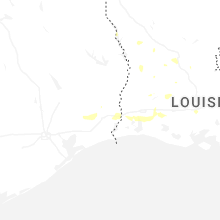
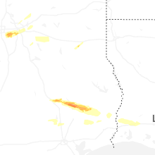


Connect with Interactive Hail Maps