

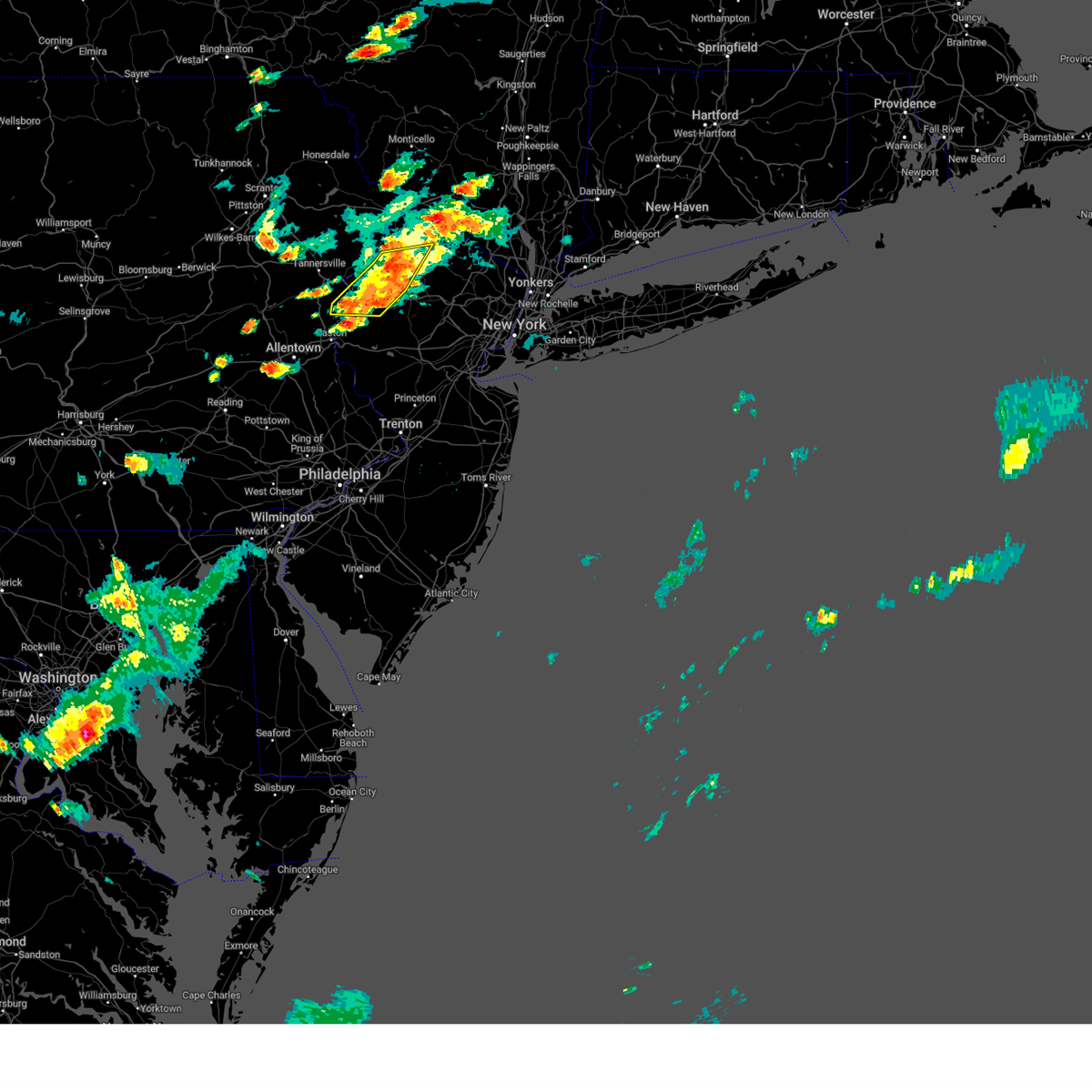
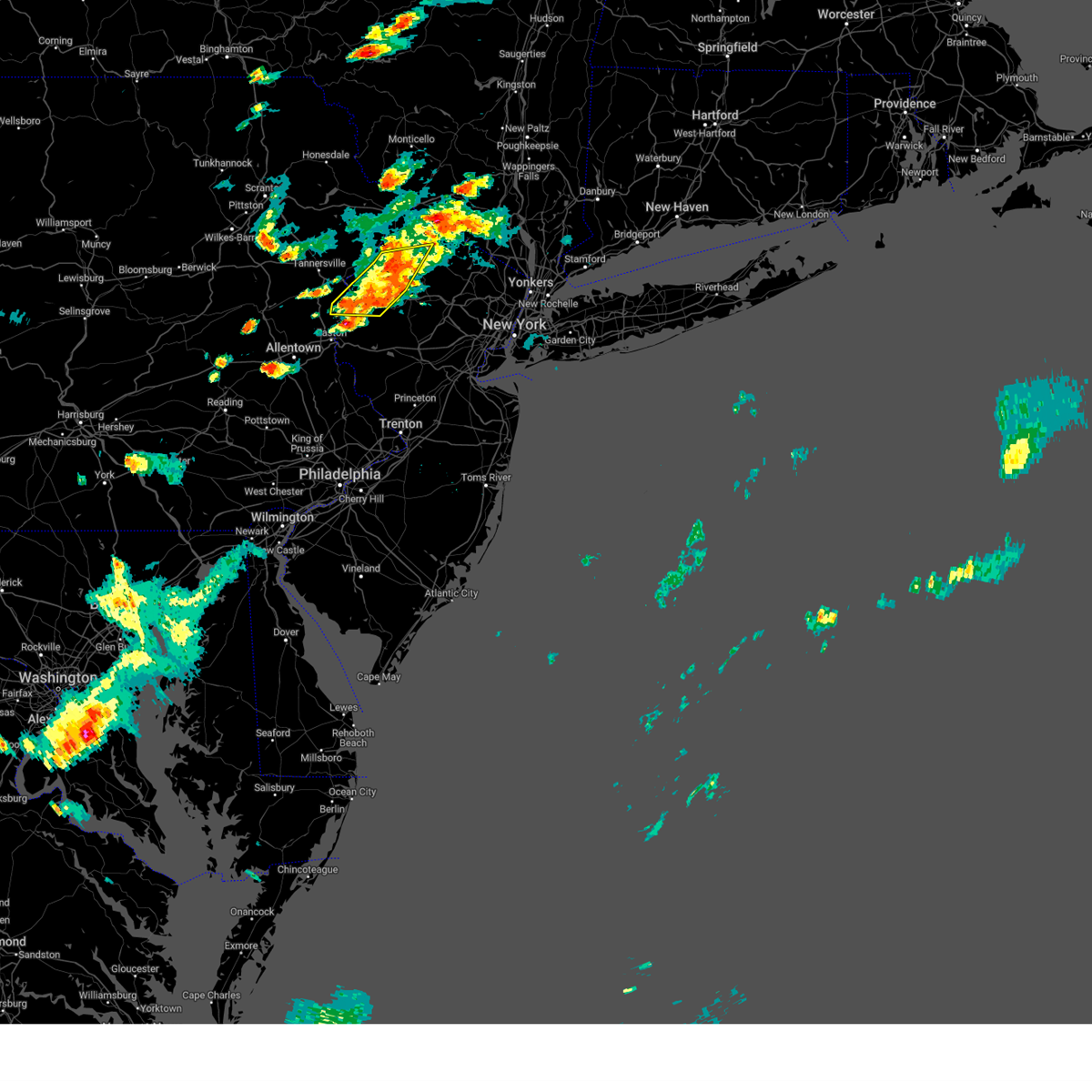
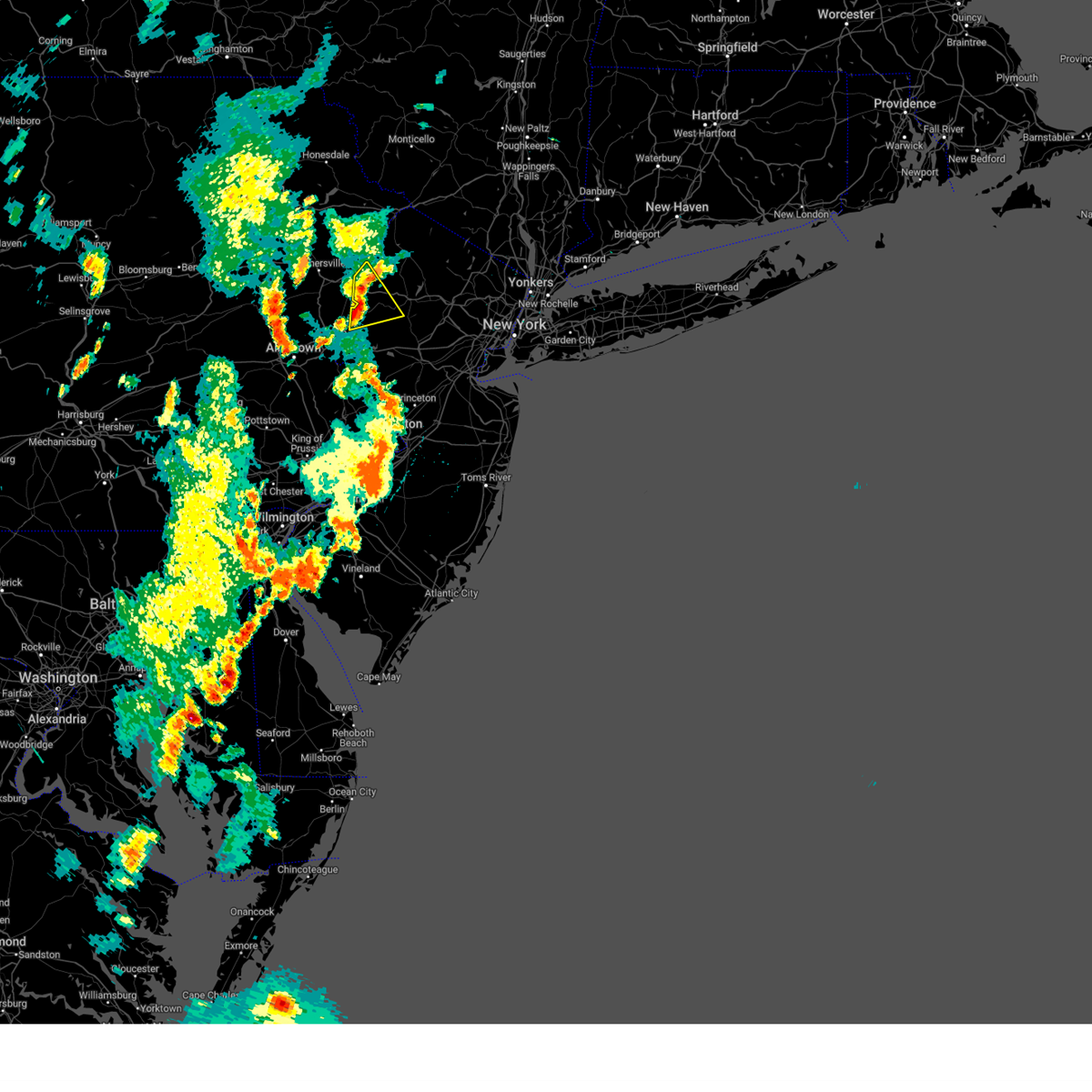
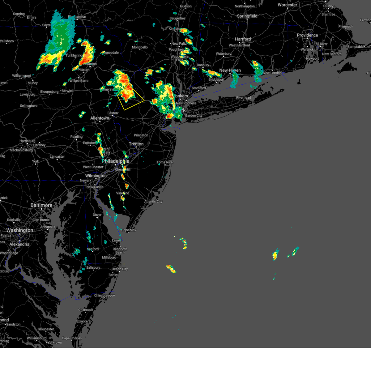
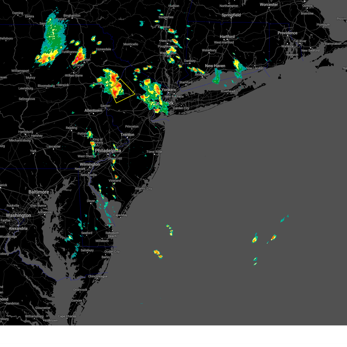
Hail Map for Silver Lake, NJ
The Silver Lake, NJ area has had 0 reports of on-the-ground hail by trained spotters, and has been under severe weather warnings 70 times during the past 12 months. Doppler radar has detected hail at or near Silver Lake, NJ on 40 occasions, including 1 occasion during the past year.
| Name: | Silver Lake, NJ |
| Where Located: | 11.7 miles WNW of Brooklyn, NY |
| Map: | Google Map for Silver Lake, NJ |
| Population: | 4243 |
| Housing Units: | 1733 |
| More Info: | Search Google for Silver Lake, NJ |
1
The Top Recent Hail Date for Silver Lake, NJ is Saturday, September 9, 2023 (8th out of 40)

Hail and Wind Damage Spotted near Silver Lake, NJ
| Date / Time | Report Details |
|---|---|
| 9/9/2023 5:14 PM EDT |
 At 514 pm edt, a severe thunderstorm was located over blairstown, or 13 miles west of newton, moving north at 10 mph (radar indicated). Hazards include ping pong ball size hail and 60 mph wind gusts. People and animals outdoors will be injured. expect hail damage to roofs, siding, windows, and vehicles. wind damage to roofs, siding, trees, and power lines is possible. locations impacted include, east stroudsburg, blairstown, hope, columbia, delaware water gap, stroudsburg, portland, hidden lake, shawnee and arlington heights. this includes the following highways, interstate 80 in pennsylvania between mile markers 312 and 314. interstate 80 in new jersey between mile markers 0 and 16. hail threat, radar indicated max hail size, 1. 50 in wind threat, radar indicated max wind gust, 60 mph. At 514 pm edt, a severe thunderstorm was located over blairstown, or 13 miles west of newton, moving north at 10 mph (radar indicated). Hazards include ping pong ball size hail and 60 mph wind gusts. People and animals outdoors will be injured. expect hail damage to roofs, siding, windows, and vehicles. wind damage to roofs, siding, trees, and power lines is possible. locations impacted include, east stroudsburg, blairstown, hope, columbia, delaware water gap, stroudsburg, portland, hidden lake, shawnee and arlington heights. this includes the following highways, interstate 80 in pennsylvania between mile markers 312 and 314. interstate 80 in new jersey between mile markers 0 and 16. hail threat, radar indicated max hail size, 1. 50 in wind threat, radar indicated max wind gust, 60 mph.
|
| 9/9/2023 4:57 PM EDT |
 At 457 pm edt, a severe thunderstorm was located over hope, or 15 miles southwest of newton, moving north at 5 mph (radar indicated). Hazards include 60 mph wind gusts and quarter size hail. Minor damage to vehicles is possible. Wind damage to roofs, siding, trees, and power lines is possible. At 457 pm edt, a severe thunderstorm was located over hope, or 15 miles southwest of newton, moving north at 5 mph (radar indicated). Hazards include 60 mph wind gusts and quarter size hail. Minor damage to vehicles is possible. Wind damage to roofs, siding, trees, and power lines is possible.
|
| 9/8/2023 3:04 PM EDT |
 At 304 pm edt, a severe thunderstorm was located over clark, or near linden, moving north at 20 mph (radar indicated). Hazards include 60 mph wind gusts and quarter size hail. Minor hail damage to vehicles is possible. expect wind damage to trees and power lines. this severe thunderstorm will be near, union around 310 pm edt. millburn around 315 pm edt. orange around 320 pm edt. bloomfield and caldwell around 335 pm edt. hail threat, radar indicated max hail size, 1. 00 in wind threat, radar indicated max wind gust, 60 mph. At 304 pm edt, a severe thunderstorm was located over clark, or near linden, moving north at 20 mph (radar indicated). Hazards include 60 mph wind gusts and quarter size hail. Minor hail damage to vehicles is possible. expect wind damage to trees and power lines. this severe thunderstorm will be near, union around 310 pm edt. millburn around 315 pm edt. orange around 320 pm edt. bloomfield and caldwell around 335 pm edt. hail threat, radar indicated max hail size, 1. 00 in wind threat, radar indicated max wind gust, 60 mph.
|
| 9/7/2023 2:52 PM EDT |
 At 251 pm edt, a severe thunderstorm was located near delaware water gap, or 16 miles southeast of mount pocono, moving northeast at 10 mph (radar indicated). Hazards include 60 mph wind gusts and quarter size hail. Minor damage to vehicles is possible. Wind damage to roofs, siding, trees, and power lines is possible. At 251 pm edt, a severe thunderstorm was located near delaware water gap, or 16 miles southeast of mount pocono, moving northeast at 10 mph (radar indicated). Hazards include 60 mph wind gusts and quarter size hail. Minor damage to vehicles is possible. Wind damage to roofs, siding, trees, and power lines is possible.
|
| 8/13/2023 2:40 AM EDT |
 The severe thunderstorm warning for hudson, eastern passaic, union, central bergen, essex, richmond, kings and new york (manhattan) counties will expire at 245 am edt, the storms which prompted the warning have moved out of the area. therefore, the warning will be allowed to expire. The severe thunderstorm warning for hudson, eastern passaic, union, central bergen, essex, richmond, kings and new york (manhattan) counties will expire at 245 am edt, the storms which prompted the warning have moved out of the area. therefore, the warning will be allowed to expire.
|
| 8/13/2023 2:11 AM EDT |
 At 211 am edt, severe thunderstorms were located along a line extending from near morris plains to linden to west freehold, moving east at 50 mph (radar indicated). Hazards include 60 mph wind gusts. Expect damage to trees and power lines. these severe storms will be near, newark and elizabeth around 215 am edt. jersey city and bloomfield around 220 am edt. paterson and flatbush around 225 am edt. hackensack and ridgewood around 230 am edt. hail threat, radar indicated max hail size, <. 75 in wind threat, radar indicated max wind gust, 60 mph. At 211 am edt, severe thunderstorms were located along a line extending from near morris plains to linden to west freehold, moving east at 50 mph (radar indicated). Hazards include 60 mph wind gusts. Expect damage to trees and power lines. these severe storms will be near, newark and elizabeth around 215 am edt. jersey city and bloomfield around 220 am edt. paterson and flatbush around 225 am edt. hackensack and ridgewood around 230 am edt. hail threat, radar indicated max hail size, <. 75 in wind threat, radar indicated max wind gust, 60 mph.
|
| 8/13/2023 1:38 AM EDT |
 At 138 am edt, severe thunderstorms were located along a line extending from near califon to belle mead to near bordentown, moving east at 40 mph (radar indicated). Hazards include 60 mph wind gusts and penny size hail. Expect damage to trees and power lines. severe thunderstorms will be near, plainfield around 155 am edt. clark around 200 am edt. linden and summit around 205 am edt. elizabeth and huguenot around 210 am edt. newark and bayonne around 215 am edt. bloomfield and harrison around 220 am edt. jersey city and paterson around 225 am edt. flatbush and ridgefield around 230 am edt. Hackensack and ridgewood around 235 am edt. At 138 am edt, severe thunderstorms were located along a line extending from near califon to belle mead to near bordentown, moving east at 40 mph (radar indicated). Hazards include 60 mph wind gusts and penny size hail. Expect damage to trees and power lines. severe thunderstorms will be near, plainfield around 155 am edt. clark around 200 am edt. linden and summit around 205 am edt. elizabeth and huguenot around 210 am edt. newark and bayonne around 215 am edt. bloomfield and harrison around 220 am edt. jersey city and paterson around 225 am edt. flatbush and ridgefield around 230 am edt. Hackensack and ridgewood around 235 am edt.
|
| 8/7/2023 8:07 PM EDT |
 The severe thunderstorm warning for warren, east central carbon, monroe and northampton counties will expire at 815 pm edt, the storms which prompted the warning have weakened below severe limits, and no longer pose an immediate threat to life or property. therefore, the warning will be allowed to expire. a tornado watch remains in effect until 1100 pm edt for northwestern new jersey, and eastern and northeastern pennsylvania. The severe thunderstorm warning for warren, east central carbon, monroe and northampton counties will expire at 815 pm edt, the storms which prompted the warning have weakened below severe limits, and no longer pose an immediate threat to life or property. therefore, the warning will be allowed to expire. a tornado watch remains in effect until 1100 pm edt for northwestern new jersey, and eastern and northeastern pennsylvania.
|
| 8/7/2023 7:45 PM EDT |
 At 744 pm edt, severe thunderstorms were located along a line extending from pocono pines to near pen argyl to old orchard, moving northeast at 35 mph (radar indicated). Hazards include 60 mph wind gusts and penny size hail. Damage to roofs, siding, trees, and power lines is possible. locations impacted include, easton, mount pocono, bethlehem, forks, east stroudsburg, wilson, washington, blairstown, nazareth, bangor, pen argyl, wind gap, bath, belvidere, harmony, oxford, hope, belfast, west easton and tatamy. this includes the following highways, interstate 80 in pennsylvania between mile markers 292 and 314. interstate 80 in new jersey between mile markers 0 and 14. interstate 380 in pennsylvania between mile markers 0 and 5. hail threat, radar indicated max hail size, 0. 75 in wind threat, radar indicated max wind gust, 60 mph. At 744 pm edt, severe thunderstorms were located along a line extending from pocono pines to near pen argyl to old orchard, moving northeast at 35 mph (radar indicated). Hazards include 60 mph wind gusts and penny size hail. Damage to roofs, siding, trees, and power lines is possible. locations impacted include, easton, mount pocono, bethlehem, forks, east stroudsburg, wilson, washington, blairstown, nazareth, bangor, pen argyl, wind gap, bath, belvidere, harmony, oxford, hope, belfast, west easton and tatamy. this includes the following highways, interstate 80 in pennsylvania between mile markers 292 and 314. interstate 80 in new jersey between mile markers 0 and 14. interstate 380 in pennsylvania between mile markers 0 and 5. hail threat, radar indicated max hail size, 0. 75 in wind threat, radar indicated max wind gust, 60 mph.
|
| 8/7/2023 7:27 PM EDT |
 At 727 pm edt, severe thunderstorms were located along a line extending from lake harmony to kunkletown to near lehigh university, moving northeast at 20 mph (radar indicated). Hazards include 60 mph wind gusts and penny size hail. damage to roofs, siding, trees, and power lines is possible At 727 pm edt, severe thunderstorms were located along a line extending from lake harmony to kunkletown to near lehigh university, moving northeast at 20 mph (radar indicated). Hazards include 60 mph wind gusts and penny size hail. damage to roofs, siding, trees, and power lines is possible
|
| 7/25/2023 3:26 PM EDT |
 The severe thunderstorm warning for hudson, eastern passaic, union, south central bergen, essex, richmond and kings counties will expire at 330 pm edt, the storms which prompted the warning have moved out of the area. therefore, the warning will be allowed to expire. however heavy rain is still possible with these thunderstorms. a severe thunderstorm watch remains in effect until 800 pm edt for northeastern new jersey, and southeastern new york. The severe thunderstorm warning for hudson, eastern passaic, union, south central bergen, essex, richmond and kings counties will expire at 330 pm edt, the storms which prompted the warning have moved out of the area. therefore, the warning will be allowed to expire. however heavy rain is still possible with these thunderstorms. a severe thunderstorm watch remains in effect until 800 pm edt for northeastern new jersey, and southeastern new york.
|
| 7/25/2023 2:58 PM EDT |
 At 258 pm edt, severe thunderstorms were located along a line extending from east hanover to colonia, moving northeast at 25 mph (radar indicated). Hazards include 60 mph wind gusts and penny size hail. Expect damage to trees and power lines. these severe storms will be near, orange and caldwell around 310 pm edt. elizabeth and bloomfield around 315 pm edt. newark and todt hill around 320 pm edt. paterson and passaic around 325 pm edt. the verrazano narrows bridge and bay ridge around 330 pm edt. jersey city and ridgewood around 335 pm edt. hoboken and secaucus around 340 pm edt. hail threat, radar indicated max hail size, 0. 75 in wind threat, radar indicated max wind gust, 60 mph. At 258 pm edt, severe thunderstorms were located along a line extending from east hanover to colonia, moving northeast at 25 mph (radar indicated). Hazards include 60 mph wind gusts and penny size hail. Expect damage to trees and power lines. these severe storms will be near, orange and caldwell around 310 pm edt. elizabeth and bloomfield around 315 pm edt. newark and todt hill around 320 pm edt. paterson and passaic around 325 pm edt. the verrazano narrows bridge and bay ridge around 330 pm edt. jersey city and ridgewood around 335 pm edt. hoboken and secaucus around 340 pm edt. hail threat, radar indicated max hail size, 0. 75 in wind threat, radar indicated max wind gust, 60 mph.
|
| 7/25/2023 2:41 PM EDT |
 The severe thunderstorm warning for northeastern hunterdon, morris, sussex, northeastern warren, northern somerset and east central monroe counties will expire at 245 pm edt, the storms which prompted the warning have moved out of the area. therefore, the warning will be allowed to expire. a severe thunderstorm watch remains in effect until 800 pm edt for northern and northwestern new jersey, and northeastern pennsylvania. remember, a severe thunderstorm warning still remains in effect for portions of morris, sussex, and somerset counties until 3:30 pm edt. The severe thunderstorm warning for northeastern hunterdon, morris, sussex, northeastern warren, northern somerset and east central monroe counties will expire at 245 pm edt, the storms which prompted the warning have moved out of the area. therefore, the warning will be allowed to expire. a severe thunderstorm watch remains in effect until 800 pm edt for northern and northwestern new jersey, and northeastern pennsylvania. remember, a severe thunderstorm warning still remains in effect for portions of morris, sussex, and somerset counties until 3:30 pm edt.
|
| 7/25/2023 2:34 PM EDT |
 At 234 pm edt, severe thunderstorms were located along a line extending from near morristown to society hill, moving northeast at 25 mph (radar indicated). Hazards include 60 mph wind gusts and penny size hail. Expect damage to trees and power lines. severe thunderstorms will be near, plainfield around 245 pm edt. summit around 250 pm edt. millburn around 255 pm edt. clark around 300 pm edt. linden and orange around 305 pm edt. huguenot around 310 pm edt. elizabeth and bloomfield around 315 pm edt. newark and lyndhurst around 320 pm edt. paterson and passaic around 325 pm edt. jersey city and hoboken around 330 pm edt. hail threat, radar indicated max hail size, 0. 75 in wind threat, radar indicated max wind gust, 60 mph. At 234 pm edt, severe thunderstorms were located along a line extending from near morristown to society hill, moving northeast at 25 mph (radar indicated). Hazards include 60 mph wind gusts and penny size hail. Expect damage to trees and power lines. severe thunderstorms will be near, plainfield around 245 pm edt. summit around 250 pm edt. millburn around 255 pm edt. clark around 300 pm edt. linden and orange around 305 pm edt. huguenot around 310 pm edt. elizabeth and bloomfield around 315 pm edt. newark and lyndhurst around 320 pm edt. paterson and passaic around 325 pm edt. jersey city and hoboken around 330 pm edt. hail threat, radar indicated max hail size, 0. 75 in wind threat, radar indicated max wind gust, 60 mph.
|
| 7/25/2023 2:06 PM EDT |
 At 206 pm edt, severe thunderstorms were located along a line extending from echo lake to hackettstown to near white house station, moving east at 40 mph (radar indicated). Hazards include 60 mph wind gusts and penny size hail. damage to roofs, siding, trees, and power lines is possible At 206 pm edt, severe thunderstorms were located along a line extending from echo lake to hackettstown to near white house station, moving east at 40 mph (radar indicated). Hazards include 60 mph wind gusts and penny size hail. damage to roofs, siding, trees, and power lines is possible
|
| 7/14/2023 10:10 PM EDT |
 At 1009 pm edt, a severe thunderstorm was located near millington, or near summit, moving east at 25 mph (radar indicated). Hazards include 60 mph wind gusts. Expect damage to roofs, siding, trees, and power lines. this severe thunderstorm will be near, summit around 1020 pm edt. millburn and clark around 1025 pm edt. union around 1030 pm edt. linden and orange around 1035 pm edt. elizabeth and bloomfield around 1040 pm edt. newark around 1045 pm edt. other locations that could be impacted by this severe thunderstorm include fanwood, mountainside, rahway, roselle park, livingston, glen ridge, belleville, irvington, berkeley heights and hillside. hail threat, radar indicated max hail size, <. 75 in wind threat, radar indicated max wind gust, 60 mph. At 1009 pm edt, a severe thunderstorm was located near millington, or near summit, moving east at 25 mph (radar indicated). Hazards include 60 mph wind gusts. Expect damage to roofs, siding, trees, and power lines. this severe thunderstorm will be near, summit around 1020 pm edt. millburn and clark around 1025 pm edt. union around 1030 pm edt. linden and orange around 1035 pm edt. elizabeth and bloomfield around 1040 pm edt. newark around 1045 pm edt. other locations that could be impacted by this severe thunderstorm include fanwood, mountainside, rahway, roselle park, livingston, glen ridge, belleville, irvington, berkeley heights and hillside. hail threat, radar indicated max hail size, <. 75 in wind threat, radar indicated max wind gust, 60 mph.
|
| 7/14/2023 7:23 PM EDT |
 At 723 pm edt, severe thunderstorms were located along a line extending from near newton to near belvidere, moving east at 20 mph (law enforcement). Hazards include 60 mph wind gusts and half dollar size hail. Minor damage to vehicles is possible. wind damage to roofs, siding, trees, and power lines is possible. locations impacted include, newton, hackettstown, blairstown, bangor, franklin, hamburg, belvidere, oxford, hope, east bangor, branchville, andover, great meadows-vienna, allamuchy-panther valley, greendell, five points, columbia, crandon lakes, lake mohawk and portland. this includes interstate 80 in new jersey between mile markers 3 and 23. hail threat, radar indicated max hail size, 1. 25 in wind threat, observed max wind gust, 60 mph. At 723 pm edt, severe thunderstorms were located along a line extending from near newton to near belvidere, moving east at 20 mph (law enforcement). Hazards include 60 mph wind gusts and half dollar size hail. Minor damage to vehicles is possible. wind damage to roofs, siding, trees, and power lines is possible. locations impacted include, newton, hackettstown, blairstown, bangor, franklin, hamburg, belvidere, oxford, hope, east bangor, branchville, andover, great meadows-vienna, allamuchy-panther valley, greendell, five points, columbia, crandon lakes, lake mohawk and portland. this includes interstate 80 in new jersey between mile markers 3 and 23. hail threat, radar indicated max hail size, 1. 25 in wind threat, observed max wind gust, 60 mph.
|
| 7/14/2023 7:01 PM EDT |
 At 701 pm edt, a severe thunderstorm was located over blairstown, or 12 miles west of newton, moving east at 15 mph. this storm has a history of producing wind damage in east stroudsburg (radar indicated). Hazards include ping pong ball size hail and 60 mph wind gusts. People and animals outdoors will be injured. expect hail damage to roofs, siding, windows, and vehicles. wind damage to roofs, siding, trees, and power lines is possible. locations impacted include, east stroudsburg, blairstown, hope, flatbrookville, echo lake, werry lake, millbrook, delaware water gap, stroudsburg, hidden lake and shawnee. this includes the following highways, interstate 80 in pennsylvania between mile markers 312 and 314. interstate 80 in new jersey between mile markers 0 and 2, and between mile markers 7 and 12. hail threat, radar indicated max hail size, 1. 50 in wind threat, observed max wind gust, 60 mph. At 701 pm edt, a severe thunderstorm was located over blairstown, or 12 miles west of newton, moving east at 15 mph. this storm has a history of producing wind damage in east stroudsburg (radar indicated). Hazards include ping pong ball size hail and 60 mph wind gusts. People and animals outdoors will be injured. expect hail damage to roofs, siding, windows, and vehicles. wind damage to roofs, siding, trees, and power lines is possible. locations impacted include, east stroudsburg, blairstown, hope, flatbrookville, echo lake, werry lake, millbrook, delaware water gap, stroudsburg, hidden lake and shawnee. this includes the following highways, interstate 80 in pennsylvania between mile markers 312 and 314. interstate 80 in new jersey between mile markers 0 and 2, and between mile markers 7 and 12. hail threat, radar indicated max hail size, 1. 50 in wind threat, observed max wind gust, 60 mph.
|
| 7/14/2023 7:00 PM EDT |
 At 659 pm edt, severe thunderstorms were located along a line extending from near echo lake to east bangor, moving east at 20 mph. this storm has a history of producing wind damage in east stroudsburg (law enforcement). Hazards include 60 mph wind gusts and half dollar size hail. Minor damage to vehicles is possible. wind damage to roofs, siding, trees, and power lines is possible. locations impacted include, newton, east stroudsburg, hackettstown, blairstown, bangor, franklin, pen argyl, hamburg, belvidere, oxford, hope, east bangor, branchville, andover, werry lake, greendell, millbrook, delaware water gap, crandon lakes and great meadows-vienna. this includes the following highways, interstate 80 in pennsylvania between mile markers 313 and 314. interstate 80 in new jersey between mile markers 0 and 23. hail threat, radar indicated max hail size, 1. 25 in wind threat, observed max wind gust, 60 mph. At 659 pm edt, severe thunderstorms were located along a line extending from near echo lake to east bangor, moving east at 20 mph. this storm has a history of producing wind damage in east stroudsburg (law enforcement). Hazards include 60 mph wind gusts and half dollar size hail. Minor damage to vehicles is possible. wind damage to roofs, siding, trees, and power lines is possible. locations impacted include, newton, east stroudsburg, hackettstown, blairstown, bangor, franklin, pen argyl, hamburg, belvidere, oxford, hope, east bangor, branchville, andover, werry lake, greendell, millbrook, delaware water gap, crandon lakes and great meadows-vienna. this includes the following highways, interstate 80 in pennsylvania between mile markers 313 and 314. interstate 80 in new jersey between mile markers 0 and 23. hail threat, radar indicated max hail size, 1. 25 in wind threat, observed max wind gust, 60 mph.
|
| 7/14/2023 6:54 PM EDT |
 At 653 pm edt, a severe thunderstorm was located near blairstown, or 14 miles west of newton, moving east at 15 mph (radar indicated). Hazards include ping pong ball size hail and 60 mph wind gusts. People and animals outdoors will be injured. expect hail damage to roofs, siding, windows, and vehicles. wind damage to roofs, siding, trees, and power lines is possible. locations impacted include, east stroudsburg, blairstown, hope, flatbrookville, echo lake, werry lake, millbrook, delaware water gap, stroudsburg, marshalls creek, hidden lake and shawnee. this includes the following highways, interstate 80 in pennsylvania between mile markers 311 and 314. interstate 80 in new jersey between mile markers 0 and 2, and between mile markers 7 and 12. hail threat, radar indicated max hail size, 1. 50 in wind threat, radar indicated max wind gust, 60 mph. At 653 pm edt, a severe thunderstorm was located near blairstown, or 14 miles west of newton, moving east at 15 mph (radar indicated). Hazards include ping pong ball size hail and 60 mph wind gusts. People and animals outdoors will be injured. expect hail damage to roofs, siding, windows, and vehicles. wind damage to roofs, siding, trees, and power lines is possible. locations impacted include, east stroudsburg, blairstown, hope, flatbrookville, echo lake, werry lake, millbrook, delaware water gap, stroudsburg, marshalls creek, hidden lake and shawnee. this includes the following highways, interstate 80 in pennsylvania between mile markers 311 and 314. interstate 80 in new jersey between mile markers 0 and 2, and between mile markers 7 and 12. hail threat, radar indicated max hail size, 1. 50 in wind threat, radar indicated max wind gust, 60 mph.
|
| 7/14/2023 6:52 PM EDT |
 At 651 pm edt, severe thunderstorms were located along a line extending from near echo lake to bangor, moving east at 20 mph (radar indicated). Hazards include 60 mph wind gusts and half dollar size hail. Minor damage to vehicles is possible. Wind damage to roofs, siding, trees, and power lines is possible. At 651 pm edt, severe thunderstorms were located along a line extending from near echo lake to bangor, moving east at 20 mph (radar indicated). Hazards include 60 mph wind gusts and half dollar size hail. Minor damage to vehicles is possible. Wind damage to roofs, siding, trees, and power lines is possible.
|
| 7/14/2023 6:37 PM EDT |
 At 637 pm edt, a severe thunderstorm was located near echo lake, or 14 miles southeast of mount pocono, moving east at 15 mph (radar indicated). Hazards include ping pong ball size hail and 60 mph wind gusts. People and animals outdoors will be injured. expect hail damage to roofs, siding, windows, and vehicles. wind damage to roofs, siding, trees, and power lines is possible. locations impacted include, east stroudsburg, blairstown, hope, flatbrookville, henryville, werry lake, analomink, millbrook, delaware water gap, alpine mountain, echo lake, stroudsburg, arlington heights, shawnee, marshalls creek and hidden lake. this includes the following highways, interstate 80 in pennsylvania between mile markers 307 and 314. interstate 80 in new jersey between mile markers 0 and 2, and between mile markers 7 and 12. hail threat, radar indicated max hail size, 1. 50 in wind threat, radar indicated max wind gust, 60 mph. At 637 pm edt, a severe thunderstorm was located near echo lake, or 14 miles southeast of mount pocono, moving east at 15 mph (radar indicated). Hazards include ping pong ball size hail and 60 mph wind gusts. People and animals outdoors will be injured. expect hail damage to roofs, siding, windows, and vehicles. wind damage to roofs, siding, trees, and power lines is possible. locations impacted include, east stroudsburg, blairstown, hope, flatbrookville, henryville, werry lake, analomink, millbrook, delaware water gap, alpine mountain, echo lake, stroudsburg, arlington heights, shawnee, marshalls creek and hidden lake. this includes the following highways, interstate 80 in pennsylvania between mile markers 307 and 314. interstate 80 in new jersey between mile markers 0 and 2, and between mile markers 7 and 12. hail threat, radar indicated max hail size, 1. 50 in wind threat, radar indicated max wind gust, 60 mph.
|
| 7/14/2023 6:26 PM EDT |
 At 626 pm edt, a severe thunderstorm was located over east stroudsburg, or 11 miles southeast of mount pocono, moving east at 15 mph (radar indicated). Hazards include 60 mph wind gusts and quarter size hail. Minor damage to vehicles is possible. Wind damage to roofs, siding, trees, and power lines is possible. At 626 pm edt, a severe thunderstorm was located over east stroudsburg, or 11 miles southeast of mount pocono, moving east at 15 mph (radar indicated). Hazards include 60 mph wind gusts and quarter size hail. Minor damage to vehicles is possible. Wind damage to roofs, siding, trees, and power lines is possible.
|
| 7/2/2023 11:27 PM EDT |
 At 1127 pm edt, severe thunderstorms were located along a line extending from madison to near edison, moving east at 35 mph (radar indicated). Hazards include 60 mph wind gusts. Expect damage to trees and power lines. severe thunderstorms will be near, summit around 1130 pm edt. millburn around 1135 pm edt. clark and union around 1140 pm edt. linden and orange around 1145 pm edt. newark and elizabeth around 1150 pm edt. todt hill and port richmond around 1155 pm edt. bayonne and lyndhurst around 1200 am edt. jersey city and hoboken around 1205 am edt. ridgefield and battery park around 1210 am edt. hail threat, radar indicated max hail size, <. 75 in wind threat, radar indicated max wind gust, 60 mph. At 1127 pm edt, severe thunderstorms were located along a line extending from madison to near edison, moving east at 35 mph (radar indicated). Hazards include 60 mph wind gusts. Expect damage to trees and power lines. severe thunderstorms will be near, summit around 1130 pm edt. millburn around 1135 pm edt. clark and union around 1140 pm edt. linden and orange around 1145 pm edt. newark and elizabeth around 1150 pm edt. todt hill and port richmond around 1155 pm edt. bayonne and lyndhurst around 1200 am edt. jersey city and hoboken around 1205 am edt. ridgefield and battery park around 1210 am edt. hail threat, radar indicated max hail size, <. 75 in wind threat, radar indicated max wind gust, 60 mph.
|
| 6/27/2023 5:34 PM EDT |
 At 533 pm edt, a severe thunderstorm was located over hope, or 16 miles southwest of newton, moving northeast at 20 mph (radar indicated). Hazards include 60 mph wind gusts and quarter size hail. Minor damage to vehicles is possible. wind damage to roofs, siding, trees, and power lines is possible. locations impacted include, hackettstown, washington, blairstown, belvidere, oxford, hope, great meadows-vienna, brass castle, beatyestown, allamuchy-panther valley and beattyestown. This includes interstate 80 in new jersey between mile markers 6 and 18. At 533 pm edt, a severe thunderstorm was located over hope, or 16 miles southwest of newton, moving northeast at 20 mph (radar indicated). Hazards include 60 mph wind gusts and quarter size hail. Minor damage to vehicles is possible. wind damage to roofs, siding, trees, and power lines is possible. locations impacted include, hackettstown, washington, blairstown, belvidere, oxford, hope, great meadows-vienna, brass castle, beatyestown, allamuchy-panther valley and beattyestown. This includes interstate 80 in new jersey between mile markers 6 and 18.
|
| 6/27/2023 5:01 PM EDT |
 At 501 pm edt, a severe thunderstorm was located over belvidere, or 10 miles northeast of easton, moving northeast at 20 mph (radar indicated). Hazards include 60 mph wind gusts and quarter size hail. Minor damage to vehicles is possible. Wind damage to roofs, siding, trees, and power lines is possible. At 501 pm edt, a severe thunderstorm was located over belvidere, or 10 miles northeast of easton, moving northeast at 20 mph (radar indicated). Hazards include 60 mph wind gusts and quarter size hail. Minor damage to vehicles is possible. Wind damage to roofs, siding, trees, and power lines is possible.
|
| 6/26/2023 3:40 PM EDT |
 The severe thunderstorm warning for west central sussex, northwestern warren, east central monroe and northeastern northampton counties will expire at 345 pm edt, the storm which prompted the warning has weakened below severe limits, and no longer poses an immediate threat to life or property. therefore, the warning will be allowed to expire. a severe thunderstorm watch remains in effect until 900 pm edt for northwestern new jersey, and eastern and northeastern pennsylvania. remember, a severe thunderstorm warning still remains in effect for monroe county and northern northampton county until 430 pm edt. The severe thunderstorm warning for west central sussex, northwestern warren, east central monroe and northeastern northampton counties will expire at 345 pm edt, the storm which prompted the warning has weakened below severe limits, and no longer poses an immediate threat to life or property. therefore, the warning will be allowed to expire. a severe thunderstorm watch remains in effect until 900 pm edt for northwestern new jersey, and eastern and northeastern pennsylvania. remember, a severe thunderstorm warning still remains in effect for monroe county and northern northampton county until 430 pm edt.
|
| 6/26/2023 3:33 PM EDT |
 At 332 pm edt, a severe thunderstorm was located over perth amboy, moving northeast at 35 mph (radar indicated). Hazards include 60 mph wind gusts and quarter size hail. Minor hail damage to vehicles is possible. Expect wind damage to trees and power lines. At 332 pm edt, a severe thunderstorm was located over perth amboy, moving northeast at 35 mph (radar indicated). Hazards include 60 mph wind gusts and quarter size hail. Minor hail damage to vehicles is possible. Expect wind damage to trees and power lines.
|
| 6/26/2023 3:28 PM EDT |
 The tornado warning for central warren and northeastern northampton counties will expire at 330 pm edt, the storm which prompted the warning has weakened, and no longer appears capable of producing a tornado. therefore, the warning will be allowed to expire. a severe thunderstorm watch remains in effect until 900 pm edt for northwestern new jersey, and eastern and northeastern pennsylvania. remember, a severe thunderstorm warning still remains in effect for northwestern warren and northeastern northampton counties until 345 pm edt. The tornado warning for central warren and northeastern northampton counties will expire at 330 pm edt, the storm which prompted the warning has weakened, and no longer appears capable of producing a tornado. therefore, the warning will be allowed to expire. a severe thunderstorm watch remains in effect until 900 pm edt for northwestern new jersey, and eastern and northeastern pennsylvania. remember, a severe thunderstorm warning still remains in effect for northwestern warren and northeastern northampton counties until 345 pm edt.
|
| 6/26/2023 3:27 PM EDT |
 The severe thunderstorm warning for hunterdon, southwestern morris, central warren and northwestern somerset counties will expire at 330 pm edt, the storm which prompted the warning has moved out of the area. therefore, the warning will be allowed to expire. a severe thunderstorm watch remains in effect until 900 pm edt for central, northern and northwestern new jersey. remember, a tornado warning still remains in effect for eastern hunterdon and western somerset counties. The severe thunderstorm warning for hunterdon, southwestern morris, central warren and northwestern somerset counties will expire at 330 pm edt, the storm which prompted the warning has moved out of the area. therefore, the warning will be allowed to expire. a severe thunderstorm watch remains in effect until 900 pm edt for central, northern and northwestern new jersey. remember, a tornado warning still remains in effect for eastern hunterdon and western somerset counties.
|
| 6/26/2023 3:15 PM EDT |
 At 314 pm edt, a severe thunderstorm capable of producing a tornado was located near columbia, or 16 miles northeast of easton, moving northeast at 30 mph (radar indicated rotation). Hazards include tornado and quarter size hail. Flying debris will be dangerous to those caught without shelter. mobile homes will be damaged or destroyed. damage to roofs, windows, and vehicles will occur. tree damage is likely. locations impacted include, belvidere, hope, delaware water gap, columbia and portland. This includes interstate 80 in new jersey between mile markers 0 and 12. At 314 pm edt, a severe thunderstorm capable of producing a tornado was located near columbia, or 16 miles northeast of easton, moving northeast at 30 mph (radar indicated rotation). Hazards include tornado and quarter size hail. Flying debris will be dangerous to those caught without shelter. mobile homes will be damaged or destroyed. damage to roofs, windows, and vehicles will occur. tree damage is likely. locations impacted include, belvidere, hope, delaware water gap, columbia and portland. This includes interstate 80 in new jersey between mile markers 0 and 12.
|
| 6/26/2023 3:12 PM EDT |
 At 312 pm edt, a severe thunderstorm was located over columbia, or 16 miles northeast of easton, moving northeast at 30 mph (radar indicated). Hazards include 60 mph wind gusts and quarter size hail. Minor damage to vehicles is possible. wind damage to roofs, siding, trees, and power lines is possible. locations impacted include, blairstown, belvidere, hope, east bangor, flatbrookville, werry lake, millbrook, delaware water gap, columbia, echo lake, five points, portland, shawnee, marshalls creek and hidden lake. this includes the following highways, interstate 80 in pennsylvania near mile marker 314. Interstate 80 in new jersey between mile markers 0 and 12. At 312 pm edt, a severe thunderstorm was located over columbia, or 16 miles northeast of easton, moving northeast at 30 mph (radar indicated). Hazards include 60 mph wind gusts and quarter size hail. Minor damage to vehicles is possible. wind damage to roofs, siding, trees, and power lines is possible. locations impacted include, blairstown, belvidere, hope, east bangor, flatbrookville, werry lake, millbrook, delaware water gap, columbia, echo lake, five points, portland, shawnee, marshalls creek and hidden lake. this includes the following highways, interstate 80 in pennsylvania near mile marker 314. Interstate 80 in new jersey between mile markers 0 and 12.
|
| 6/26/2023 3:08 PM EDT |
 At 308 pm edt, a severe thunderstorm was located over high bridge, or 14 miles northwest of somerville, moving north at 35 mph (radar indicated). Hazards include 60 mph wind gusts and quarter size hail. Minor damage to vehicles is possible. wind damage to roofs, siding, trees, and power lines is possible. locations impacted include, hackettstown, washington, mendham, flemington, high bridge, clinton, peapack and gladstone, oxford, hope, glen gardner, chester, hampton, lebanon, califon, far hills, brass castle, long valley, great meadows-vienna, succasunna and pleasant valley. this includes the following highways, interstate 78 in new jersey between mile markers 10 and 31. interstate 80 in new jersey between mile markers 10 and 14. interstate 287 in new jersey between mile markers 21 and 23. hail threat, radar indicated max hail size, 1. 00 in wind threat, radar indicated max wind gust, 60 mph. At 308 pm edt, a severe thunderstorm was located over high bridge, or 14 miles northwest of somerville, moving north at 35 mph (radar indicated). Hazards include 60 mph wind gusts and quarter size hail. Minor damage to vehicles is possible. wind damage to roofs, siding, trees, and power lines is possible. locations impacted include, hackettstown, washington, mendham, flemington, high bridge, clinton, peapack and gladstone, oxford, hope, glen gardner, chester, hampton, lebanon, califon, far hills, brass castle, long valley, great meadows-vienna, succasunna and pleasant valley. this includes the following highways, interstate 78 in new jersey between mile markers 10 and 31. interstate 80 in new jersey between mile markers 10 and 14. interstate 287 in new jersey between mile markers 21 and 23. hail threat, radar indicated max hail size, 1. 00 in wind threat, radar indicated max wind gust, 60 mph.
|
| 6/26/2023 3:02 PM EDT |
 At 301 pm edt, a severe thunderstorm capable of producing a tornado was located over belvidere, or 10 miles northeast of easton, moving north at 25 mph (radar indicated rotation). Hazards include tornado and quarter size hail. Flying debris will be dangerous to those caught without shelter. mobile homes will be damaged or destroyed. damage to roofs, windows, and vehicles will occur. Tree damage is likely. At 301 pm edt, a severe thunderstorm capable of producing a tornado was located over belvidere, or 10 miles northeast of easton, moving north at 25 mph (radar indicated rotation). Hazards include tornado and quarter size hail. Flying debris will be dangerous to those caught without shelter. mobile homes will be damaged or destroyed. damage to roofs, windows, and vehicles will occur. Tree damage is likely.
|
| 6/26/2023 2:58 PM EDT |
 At 258 pm edt, a severe thunderstorm was located over roxburg, or 10 miles northeast of easton, moving northeast at 30 mph (radar indicated). Hazards include 60 mph wind gusts and quarter size hail. Minor damage to vehicles is possible. Wind damage to roofs, siding, trees, and power lines is possible. At 258 pm edt, a severe thunderstorm was located over roxburg, or 10 miles northeast of easton, moving northeast at 30 mph (radar indicated). Hazards include 60 mph wind gusts and quarter size hail. Minor damage to vehicles is possible. Wind damage to roofs, siding, trees, and power lines is possible.
|
| 6/26/2023 2:49 PM EDT |
 At 249 pm edt, a severe thunderstorm was located near sand brook, or 16 miles west of somerville, moving north at 35 mph (radar indicated). Hazards include 60 mph wind gusts and quarter size hail. Minor damage to vehicles is possible. Wind damage to roofs, siding, trees, and power lines is possible. At 249 pm edt, a severe thunderstorm was located near sand brook, or 16 miles west of somerville, moving north at 35 mph (radar indicated). Hazards include 60 mph wind gusts and quarter size hail. Minor damage to vehicles is possible. Wind damage to roofs, siding, trees, and power lines is possible.
|
| 6/26/2023 10:27 AM EDT |
 The severe thunderstorm warning for west central morris, southwestern sussex and warren counties will expire at 1030 am edt, the storm which prompted the warning has weakened below severe limits, and no longer poses an immediate threat to life or property. therefore, the warning will be allowed to expire. however gusty winds and heavy rain are still possible with this thunderstorm. The severe thunderstorm warning for west central morris, southwestern sussex and warren counties will expire at 1030 am edt, the storm which prompted the warning has weakened below severe limits, and no longer poses an immediate threat to life or property. therefore, the warning will be allowed to expire. however gusty winds and heavy rain are still possible with this thunderstorm.
|
| 6/26/2023 10:15 AM EDT |
 At 1014 am edt, a severe thunderstorm was located over blairstown, or 12 miles west of newton, moving northeast at 30 mph (radar indicated). Hazards include 60 mph wind gusts and quarter size hail. Minor damage to vehicles is possible. wind damage to roofs, siding, trees, and power lines is possible. locations impacted include, hopatcong, hackettstown, blairstown, mount arlington, stanhope, netcong, oxford, hope, andover, great meadows-vienna, flatbrookville, allamuchy-panther valley, greendell, millbrook, five points, budd lake, beatyestown and beattyestown. this includes interstate 80 in new jersey between mile markers 5 and 30. hail threat, radar indicated max hail size, 1. 00 in wind threat, radar indicated max wind gust, 60 mph. At 1014 am edt, a severe thunderstorm was located over blairstown, or 12 miles west of newton, moving northeast at 30 mph (radar indicated). Hazards include 60 mph wind gusts and quarter size hail. Minor damage to vehicles is possible. wind damage to roofs, siding, trees, and power lines is possible. locations impacted include, hopatcong, hackettstown, blairstown, mount arlington, stanhope, netcong, oxford, hope, andover, great meadows-vienna, flatbrookville, allamuchy-panther valley, greendell, millbrook, five points, budd lake, beatyestown and beattyestown. this includes interstate 80 in new jersey between mile markers 5 and 30. hail threat, radar indicated max hail size, 1. 00 in wind threat, radar indicated max wind gust, 60 mph.
|
| 6/26/2023 9:47 AM EDT |
 At 947 am edt, a severe thunderstorm was located over belvidere, or 12 miles northeast of easton, moving northeast at 25 mph (radar indicated). Hazards include 60 mph wind gusts and quarter size hail. Minor damage to vehicles is possible. Wind damage to roofs, siding, trees, and power lines is possible. At 947 am edt, a severe thunderstorm was located over belvidere, or 12 miles northeast of easton, moving northeast at 25 mph (radar indicated). Hazards include 60 mph wind gusts and quarter size hail. Minor damage to vehicles is possible. Wind damage to roofs, siding, trees, and power lines is possible.
|
| 4/22/2023 6:33 PM EDT |
 At 633 pm edt, severe thunderstorms were located along a line extending from near lackawaxen to near belvidere, moving northeast at 45 mph (radar indicated). Hazards include 60 mph wind gusts and penny size hail. Damage to roofs, siding, trees, and power lines is possible. locations impacted include, easton, newton, montague, east stroudsburg, washington, blairstown, bangor, belvidere, harmony, oxford, alpha, hope, east bangor, riegelsville, brass castle, werry lake, greendell, millbrook, delaware water gap and skytop. this includes the following highways, interstate 78 in pennsylvania near mile marker 76. interstate 78 in new jersey between mile markers 0 and 5. interstate 80 in pennsylvania between mile markers 309 and 314. interstate 80 in new jersey between mile markers 0 and 21. hail threat, radar indicated max hail size, 0. 75 in wind threat, radar indicated max wind gust, 60 mph. At 633 pm edt, severe thunderstorms were located along a line extending from near lackawaxen to near belvidere, moving northeast at 45 mph (radar indicated). Hazards include 60 mph wind gusts and penny size hail. Damage to roofs, siding, trees, and power lines is possible. locations impacted include, easton, newton, montague, east stroudsburg, washington, blairstown, bangor, belvidere, harmony, oxford, alpha, hope, east bangor, riegelsville, brass castle, werry lake, greendell, millbrook, delaware water gap and skytop. this includes the following highways, interstate 78 in pennsylvania near mile marker 76. interstate 78 in new jersey between mile markers 0 and 5. interstate 80 in pennsylvania between mile markers 309 and 314. interstate 80 in new jersey between mile markers 0 and 21. hail threat, radar indicated max hail size, 0. 75 in wind threat, radar indicated max wind gust, 60 mph.
|
| 4/22/2023 6:11 PM EDT |
 At 610 pm edt, severe thunderstorms were located along a line extending from near skytop to old orchard, moving northeast at 45 mph (radar indicated). Hazards include 60 mph wind gusts and penny size hail. damage to roofs, siding, trees, and power lines is possible At 610 pm edt, severe thunderstorms were located along a line extending from near skytop to old orchard, moving northeast at 45 mph (radar indicated). Hazards include 60 mph wind gusts and penny size hail. damage to roofs, siding, trees, and power lines is possible
|
| 4/22/2023 4:52 PM EDT |
 At 452 pm edt, a severe thunderstorm was located over riegelsville, or near easton, moving north at 45 mph (radar indicated). Hazards include 60 mph wind gusts and quarter size hail. Minor damage to vehicles is possible. Wind damage to roofs, siding, trees, and power lines is possible. At 452 pm edt, a severe thunderstorm was located over riegelsville, or near easton, moving north at 45 mph (radar indicated). Hazards include 60 mph wind gusts and quarter size hail. Minor damage to vehicles is possible. Wind damage to roofs, siding, trees, and power lines is possible.
|
| 8/9/2022 6:29 PM EDT |
 At 628 pm edt, severe thunderstorms were located along a line extending from ridgewood to union, moving east at 25 mph (radar indicated). Hazards include 60 mph wind gusts and quarter size hail. Minor hail damage to vehicles is possible. Expect wind damage to trees and power lines. At 628 pm edt, severe thunderstorms were located along a line extending from ridgewood to union, moving east at 25 mph (radar indicated). Hazards include 60 mph wind gusts and quarter size hail. Minor hail damage to vehicles is possible. Expect wind damage to trees and power lines.
|
| 7/25/2022 1:12 PM EDT |
 The severe thunderstorm warning for hudson, southeastern bergen, southeastern essex, queens, bronx and new york (manhattan) counties will expire at 115 pm edt, the storm which prompted the warning has weakened below severe limits, and has exited the warned area. therefore, the warning will be allowed to expire. however gusty winds are still possible with this thunderstorm. a severe thunderstorm watch remains in effect until 800 pm edt for northeastern new jersey, and southeastern new york. The severe thunderstorm warning for hudson, southeastern bergen, southeastern essex, queens, bronx and new york (manhattan) counties will expire at 115 pm edt, the storm which prompted the warning has weakened below severe limits, and has exited the warned area. therefore, the warning will be allowed to expire. however gusty winds are still possible with this thunderstorm. a severe thunderstorm watch remains in effect until 800 pm edt for northeastern new jersey, and southeastern new york.
|
| 7/25/2022 12:49 PM EDT |
 At 1248 pm edt, a severe thunderstorm was located over teterboro, or over ridgefield, moving east at 35 mph (radar indicated). Hazards include 60 mph wind gusts and penny size hail. Expect damage to trees and power lines. this severe storm will be near, bergenfield and midtown manhattan around 1255 pm edt. mott haven and rfk bridge around 100 pm edt. east tremont and laguardia airport around 105 pm edt. hail threat, radar indicated max hail size, 0. 75 in wind threat, radar indicated max wind gust, 60 mph. At 1248 pm edt, a severe thunderstorm was located over teterboro, or over ridgefield, moving east at 35 mph (radar indicated). Hazards include 60 mph wind gusts and penny size hail. Expect damage to trees and power lines. this severe storm will be near, bergenfield and midtown manhattan around 1255 pm edt. mott haven and rfk bridge around 100 pm edt. east tremont and laguardia airport around 105 pm edt. hail threat, radar indicated max hail size, 0. 75 in wind threat, radar indicated max wind gust, 60 mph.
|
| 7/25/2022 12:25 PM EDT |
 At 1225 pm edt, a severe thunderstorm was located over east hanover, or near caldwell, moving east at 35 mph (radar indicated). Hazards include 60 mph wind gusts and penny size hail. Expect damage to trees and power lines. this severe thunderstorm will be near, orange and caldwell around 1230 pm edt. newark around 1235 pm edt. paterson and bloomfield around 1240 pm edt. passaic and lyndhurst around 1245 pm edt. hoboken and hackensack around 1250 pm edt. bergenfield and ridgefield around 1255 pm edt. mott haven and rfk bridge around 100 pm edt. east tremont and laguardia airport around 105 pm edt. hail threat, radar indicated max hail size, 0. 75 in wind threat, radar indicated max wind gust, 60 mph. At 1225 pm edt, a severe thunderstorm was located over east hanover, or near caldwell, moving east at 35 mph (radar indicated). Hazards include 60 mph wind gusts and penny size hail. Expect damage to trees and power lines. this severe thunderstorm will be near, orange and caldwell around 1230 pm edt. newark around 1235 pm edt. paterson and bloomfield around 1240 pm edt. passaic and lyndhurst around 1245 pm edt. hoboken and hackensack around 1250 pm edt. bergenfield and ridgefield around 1255 pm edt. mott haven and rfk bridge around 100 pm edt. east tremont and laguardia airport around 105 pm edt. hail threat, radar indicated max hail size, 0. 75 in wind threat, radar indicated max wind gust, 60 mph.
|
| 7/21/2022 12:32 PM EDT |
 At 1232 pm edt, a severe thunderstorm was located over bloomfield, moving northeast at 25 mph (radar indicated). Hazards include 60 mph wind gusts and quarter size hail. Minor hail damage to vehicles is possible. expect wind damage to trees and power lines. this severe thunderstorm will be near, lyndhurst and rutherford around 1240 pm edt. paterson and passaic around 1245 pm edt. teterboro around 1250 pm edt. hackensack and paramus around 1255 pm edt. fort lee and oradell around 100 pm edt. bergenfield and englewood around 105 pm edt. riverdale around 110 pm edt. Yonkers and co-op city around 115 pm edt. At 1232 pm edt, a severe thunderstorm was located over bloomfield, moving northeast at 25 mph (radar indicated). Hazards include 60 mph wind gusts and quarter size hail. Minor hail damage to vehicles is possible. expect wind damage to trees and power lines. this severe thunderstorm will be near, lyndhurst and rutherford around 1240 pm edt. paterson and passaic around 1245 pm edt. teterboro around 1250 pm edt. hackensack and paramus around 1255 pm edt. fort lee and oradell around 100 pm edt. bergenfield and englewood around 105 pm edt. riverdale around 110 pm edt. Yonkers and co-op city around 115 pm edt.
|
| 7/18/2022 2:41 PM EDT |
 At 241 pm edt, a severe thunderstorm was located over rutherford, moving east at 30 mph (radar indicated). Hazards include 60 mph wind gusts and penny size hail. Expect damage to trees and power lines. this severe thunderstorm will be near, secaucus around 245 pm edt. union city and teterboro around 250 pm edt. hackensack and ridgefield around 255 pm edt. bergenfield and harlem around 300 pm edt. mott haven and rfk bridge around 305 pm edt. flushing and east tremont around 310 pm edt. yonkers and throgs neck bridge around 315 pm edt. new rochelle and bayside around 320 pm edt. hail threat, radar indicated max hail size, 0. 75 in wind threat, radar indicated max wind gust, 60 mph. At 241 pm edt, a severe thunderstorm was located over rutherford, moving east at 30 mph (radar indicated). Hazards include 60 mph wind gusts and penny size hail. Expect damage to trees and power lines. this severe thunderstorm will be near, secaucus around 245 pm edt. union city and teterboro around 250 pm edt. hackensack and ridgefield around 255 pm edt. bergenfield and harlem around 300 pm edt. mott haven and rfk bridge around 305 pm edt. flushing and east tremont around 310 pm edt. yonkers and throgs neck bridge around 315 pm edt. new rochelle and bayside around 320 pm edt. hail threat, radar indicated max hail size, 0. 75 in wind threat, radar indicated max wind gust, 60 mph.
|
| 7/12/2022 6:08 PM EDT |
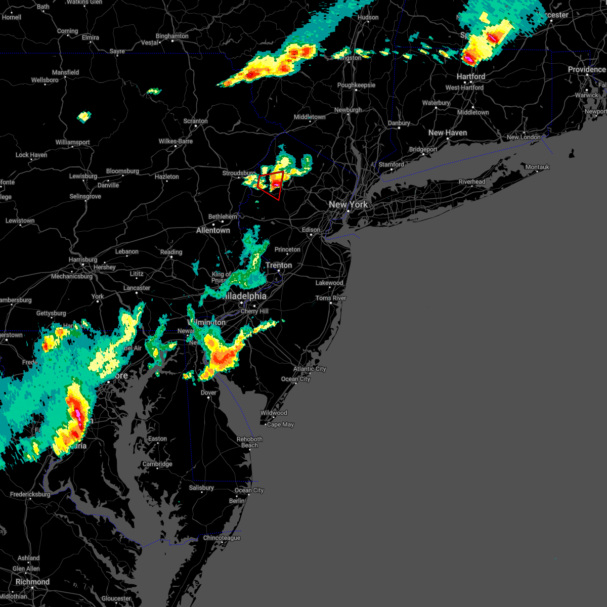 The tornado warning for west central morris, southwestern sussex and northeastern warren counties will expire at 615 pm edt, the tornado threat has diminished and the tornado warning will be allowed to expire. however, large hail and damaging winds remain likely and a severe thunderstorm warning remains in effect for the area. a severe thunderstorm watch remains in effect until 1000 pm edt for northern and northwestern new jersey. The tornado warning for west central morris, southwestern sussex and northeastern warren counties will expire at 615 pm edt, the tornado threat has diminished and the tornado warning will be allowed to expire. however, large hail and damaging winds remain likely and a severe thunderstorm warning remains in effect for the area. a severe thunderstorm watch remains in effect until 1000 pm edt for northern and northwestern new jersey.
|
| 7/12/2022 6:00 PM EDT |
 At 600 pm edt, a severe thunderstorm capable of producing a tornado was located near allamuchy-panther valley, or 11 miles southwest of newton, moving east at 35 mph (radar indicated rotation). Hazards include tornado and golf ball size hail. Flying debris will be dangerous to those caught without shelter. mobile homes will be damaged or destroyed. damage to roofs, windows, and vehicles will occur. tree damage is likely. locations impacted include, hackettstown, hope, andover, great meadows-vienna, allamuchy-panther valley, greendell, budd lake and beatyestown. This includes interstate 80 in new jersey between mile markers 11 and 24. At 600 pm edt, a severe thunderstorm capable of producing a tornado was located near allamuchy-panther valley, or 11 miles southwest of newton, moving east at 35 mph (radar indicated rotation). Hazards include tornado and golf ball size hail. Flying debris will be dangerous to those caught without shelter. mobile homes will be damaged or destroyed. damage to roofs, windows, and vehicles will occur. tree damage is likely. locations impacted include, hackettstown, hope, andover, great meadows-vienna, allamuchy-panther valley, greendell, budd lake and beatyestown. This includes interstate 80 in new jersey between mile markers 11 and 24.
|
| 7/12/2022 5:59 PM EDT |
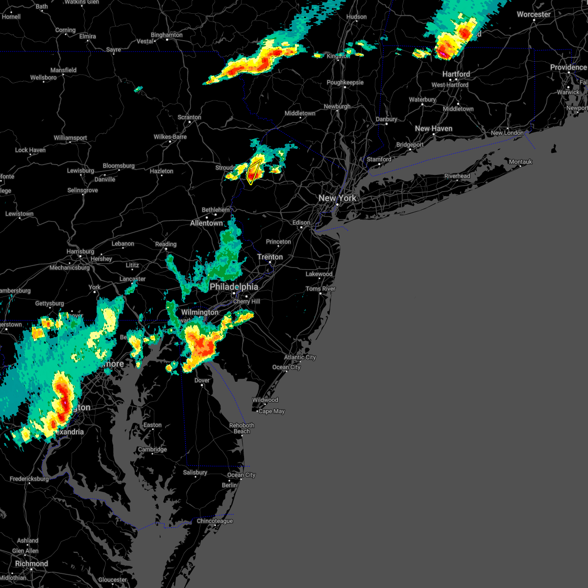 At 558 pm edt, a severe thunderstorm was located over hope, or 12 miles southwest of newton, moving east at 35 mph (radar indicated). Hazards include ping pong ball size hail and 60 mph wind gusts. People and animals outdoors will be injured. expect hail damage to roofs, siding, windows, and vehicles. wind damage to roofs, siding, trees, and power lines is possible. locations impacted include, blairstown and hope. This includes interstate 80 in new jersey between mile markers 9 and 12. At 558 pm edt, a severe thunderstorm was located over hope, or 12 miles southwest of newton, moving east at 35 mph (radar indicated). Hazards include ping pong ball size hail and 60 mph wind gusts. People and animals outdoors will be injured. expect hail damage to roofs, siding, windows, and vehicles. wind damage to roofs, siding, trees, and power lines is possible. locations impacted include, blairstown and hope. This includes interstate 80 in new jersey between mile markers 9 and 12.
|
| 7/12/2022 5:46 PM EDT |
 At 546 pm edt, a severe thunderstorm capable of producing a tornado was located over columbia, or 18 miles northeast of easton, moving east at 35 mph (radar indicated rotation). Hazards include tornado and ping pong ball size hail. Flying debris will be dangerous to those caught without shelter. mobile homes will be damaged or destroyed. damage to roofs, windows, and vehicles will occur. Tree damage is likely. At 546 pm edt, a severe thunderstorm capable of producing a tornado was located over columbia, or 18 miles northeast of easton, moving east at 35 mph (radar indicated rotation). Hazards include tornado and ping pong ball size hail. Flying debris will be dangerous to those caught without shelter. mobile homes will be damaged or destroyed. damage to roofs, windows, and vehicles will occur. Tree damage is likely.
|
| 7/12/2022 5:46 PM EDT |
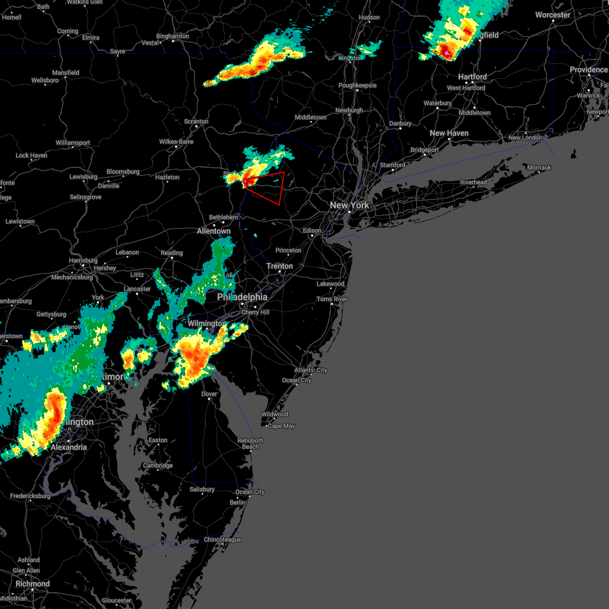 At 546 pm edt, a severe thunderstorm capable of producing a tornado was located over columbia, or 18 miles northeast of easton, moving east at 35 mph (radar indicated rotation). Hazards include tornado and ping pong ball size hail. Flying debris will be dangerous to those caught without shelter. mobile homes will be damaged or destroyed. damage to roofs, windows, and vehicles will occur. Tree damage is likely. At 546 pm edt, a severe thunderstorm capable of producing a tornado was located over columbia, or 18 miles northeast of easton, moving east at 35 mph (radar indicated rotation). Hazards include tornado and ping pong ball size hail. Flying debris will be dangerous to those caught without shelter. mobile homes will be damaged or destroyed. damage to roofs, windows, and vehicles will occur. Tree damage is likely.
|
| 7/12/2022 5:45 PM EDT |
 At 545 pm edt, a severe thunderstorm was located over columbia, or 17 miles southeast of mount pocono, moving east at 35 mph (radar indicated). Hazards include ping pong ball size hail and 60 mph wind gusts. People and animals outdoors will be injured. expect hail damage to roofs, siding, windows, and vehicles. wind damage to roofs, siding, trees, and power lines is possible. locations impacted include, east stroudsburg, blairstown, belvidere, oxford, hope, east bangor, flatbrookville, stormville, werry lake, millbrook, delaware water gap, columbia, echo lake, five points, crandon lakes, stroudsburg, portland, arlington heights, shawnee and marshalls creek. this includes the following highways, interstate 80 in pennsylvania between mile markers 307 and 314. Interstate 80 in new jersey between mile markers 0 and 12. At 545 pm edt, a severe thunderstorm was located over columbia, or 17 miles southeast of mount pocono, moving east at 35 mph (radar indicated). Hazards include ping pong ball size hail and 60 mph wind gusts. People and animals outdoors will be injured. expect hail damage to roofs, siding, windows, and vehicles. wind damage to roofs, siding, trees, and power lines is possible. locations impacted include, east stroudsburg, blairstown, belvidere, oxford, hope, east bangor, flatbrookville, stormville, werry lake, millbrook, delaware water gap, columbia, echo lake, five points, crandon lakes, stroudsburg, portland, arlington heights, shawnee and marshalls creek. this includes the following highways, interstate 80 in pennsylvania between mile markers 307 and 314. Interstate 80 in new jersey between mile markers 0 and 12.
|
| 7/12/2022 5:36 PM EDT |
 At 535 pm edt, a severe thunderstorm was located over stormville, or 12 miles south of mount pocono, moving east at 35 mph (radar indicated). Hazards include 60 mph wind gusts and half dollar size hail. Minor damage to vehicles is possible. wind damage to roofs, siding, trees, and power lines is possible. locations impacted include, east stroudsburg, blairstown, bangor, pen argyl, wind gap, belvidere, oxford, hope, east bangor, stormville, henryville, brodheadsville, werry lake, gilbert, millbrook, delaware water gap, tannersville, rossland, kresgeville and sun valley. this includes the following highways, interstate 80 in pennsylvania between mile markers 300 and 314. interstate 80 in new jersey between mile markers 0 and 12. hail threat, radar indicated max hail size, 1. 25 in wind threat, radar indicated max wind gust, 60 mph. At 535 pm edt, a severe thunderstorm was located over stormville, or 12 miles south of mount pocono, moving east at 35 mph (radar indicated). Hazards include 60 mph wind gusts and half dollar size hail. Minor damage to vehicles is possible. wind damage to roofs, siding, trees, and power lines is possible. locations impacted include, east stroudsburg, blairstown, bangor, pen argyl, wind gap, belvidere, oxford, hope, east bangor, stormville, henryville, brodheadsville, werry lake, gilbert, millbrook, delaware water gap, tannersville, rossland, kresgeville and sun valley. this includes the following highways, interstate 80 in pennsylvania between mile markers 300 and 314. interstate 80 in new jersey between mile markers 0 and 12. hail threat, radar indicated max hail size, 1. 25 in wind threat, radar indicated max wind gust, 60 mph.
|
| 7/12/2022 5:25 PM EDT |
 At 525 pm edt, a severe thunderstorm was located over gilbert, or 12 miles south of mount pocono, moving east at 30 mph (radar indicated). Hazards include 60 mph wind gusts and half dollar size hail. Minor damage to vehicles is possible. Wind damage to roofs, siding, trees, and power lines is possible. At 525 pm edt, a severe thunderstorm was located over gilbert, or 12 miles south of mount pocono, moving east at 30 mph (radar indicated). Hazards include 60 mph wind gusts and half dollar size hail. Minor damage to vehicles is possible. Wind damage to roofs, siding, trees, and power lines is possible.
|
| 5/27/2022 5:23 PM EDT |
 At 523 pm edt, a severe thunderstorm was located over jersey city, moving northeast at 35 mph (radar indicated). Hazards include 60 mph wind gusts and penny size hail. Expect damage to trees and power lines. this severe storm will be near, midtown manhattan around 530 pm edt. ridgefield and jackson heights around 535 pm edt. flushing and mott haven around 540 pm edt. hail threat, radar indicated max hail size, 0. 75 in wind threat, radar indicated max wind gust, 60 mph. At 523 pm edt, a severe thunderstorm was located over jersey city, moving northeast at 35 mph (radar indicated). Hazards include 60 mph wind gusts and penny size hail. Expect damage to trees and power lines. this severe storm will be near, midtown manhattan around 530 pm edt. ridgefield and jackson heights around 535 pm edt. flushing and mott haven around 540 pm edt. hail threat, radar indicated max hail size, 0. 75 in wind threat, radar indicated max wind gust, 60 mph.
|
| 5/27/2022 4:59 PM EDT |
 At 459 pm edt, a severe thunderstorm was located over carteret, or near huguenot, moving northeast at 35 mph (radar indicated). Hazards include 60 mph wind gusts and penny size hail. Expect damage to trees and power lines. this severe thunderstorm will be near, oakwood around 505 pm edt. elizabeth and todt hill around 510 pm edt. newark and bayonne around 515 pm edt. jersey city and flatbush around 520 pm edt. hoboken and lyndhurst around 525 pm edt. rutherford and secaucus around 530 pm edt. ridgefield and jackson heights around 535 pm edt. flushing and mott haven around 540 pm edt. hail threat, radar indicated max hail size, 0. 75 in wind threat, radar indicated max wind gust, 60 mph. At 459 pm edt, a severe thunderstorm was located over carteret, or near huguenot, moving northeast at 35 mph (radar indicated). Hazards include 60 mph wind gusts and penny size hail. Expect damage to trees and power lines. this severe thunderstorm will be near, oakwood around 505 pm edt. elizabeth and todt hill around 510 pm edt. newark and bayonne around 515 pm edt. jersey city and flatbush around 520 pm edt. hoboken and lyndhurst around 525 pm edt. rutherford and secaucus around 530 pm edt. ridgefield and jackson heights around 535 pm edt. flushing and mott haven around 540 pm edt. hail threat, radar indicated max hail size, 0. 75 in wind threat, radar indicated max wind gust, 60 mph.
|
| 5/22/2022 8:38 PM EDT |
 The severe thunderstorm warning for southern fairfield, hudson, eastern passaic, northwestern union, bergen, essex, southern westchester, bronx, rockland and new york (manhattan) counties will expire at 845 pm edt, the storms which prompted the warning have moved out of the area. therefore, the warning will be allowed to expire. The severe thunderstorm warning for southern fairfield, hudson, eastern passaic, northwestern union, bergen, essex, southern westchester, bronx, rockland and new york (manhattan) counties will expire at 845 pm edt, the storms which prompted the warning have moved out of the area. therefore, the warning will be allowed to expire.
|
| 5/22/2022 8:17 PM EDT |
 At 817 pm edt, severe thunderstorms were located along a line extending from near greenwich to harrison to upper west side, moving northeast at 25 mph (radar indicated). Hazards include 60 mph wind gusts and quarter size hail. Minor hail damage to vehicles is possible. expect wind damage to trees and power lines. these severe storms will be near, white plains and harrison around 820 pm edt. port chester around 825 pm edt. greenwich and bedford around 830 pm edt. throgs neck bridge around 835 pm edt. yonkers and stamford around 840 pm edt. new rochelle around 845 pm edt. rye around 900 pm edt. hail threat, radar indicated max hail size, 1. 00 in wind threat, radar indicated max wind gust, 60 mph. At 817 pm edt, severe thunderstorms were located along a line extending from near greenwich to harrison to upper west side, moving northeast at 25 mph (radar indicated). Hazards include 60 mph wind gusts and quarter size hail. Minor hail damage to vehicles is possible. expect wind damage to trees and power lines. these severe storms will be near, white plains and harrison around 820 pm edt. port chester around 825 pm edt. greenwich and bedford around 830 pm edt. throgs neck bridge around 835 pm edt. yonkers and stamford around 840 pm edt. new rochelle around 845 pm edt. rye around 900 pm edt. hail threat, radar indicated max hail size, 1. 00 in wind threat, radar indicated max wind gust, 60 mph.
|
| 5/22/2022 7:40 PM EDT |
 At 739 pm edt, severe thunderstorms were located along a line extending from paterson to near caldwell to near east hanover, moving northeast at 25 mph (radar indicated). Hazards include 60 mph wind gusts and quarter size hail. Minor hail damage to vehicles is possible. expect wind damage to trees and power lines. severe thunderstorms will be near, paterson and wayne around 745 pm edt. paramus and ridgewood around 755 pm edt. kearny and oradell around 800 pm edt. passaic and lyndhurst around 805 pm edt. union city around 810 pm edt. bergenfield and ridgefield around 815 pm edt. hackensack and orangeburg around 820 pm edt. dobbs ferry and nyack around 825 pm edt. mott haven and tarrytown around 830 pm edt. east tremont and riverdale around 835 pm edt. hawthorne around 840 pm edt. yonkers and new rochelle around 845 pm edt. hail threat, radar indicated max hail size, 1. 00 in wind threat, radar indicated max wind gust, 60 mph. At 739 pm edt, severe thunderstorms were located along a line extending from paterson to near caldwell to near east hanover, moving northeast at 25 mph (radar indicated). Hazards include 60 mph wind gusts and quarter size hail. Minor hail damage to vehicles is possible. expect wind damage to trees and power lines. severe thunderstorms will be near, paterson and wayne around 745 pm edt. paramus and ridgewood around 755 pm edt. kearny and oradell around 800 pm edt. passaic and lyndhurst around 805 pm edt. union city around 810 pm edt. bergenfield and ridgefield around 815 pm edt. hackensack and orangeburg around 820 pm edt. dobbs ferry and nyack around 825 pm edt. mott haven and tarrytown around 830 pm edt. east tremont and riverdale around 835 pm edt. hawthorne around 840 pm edt. yonkers and new rochelle around 845 pm edt. hail threat, radar indicated max hail size, 1. 00 in wind threat, radar indicated max wind gust, 60 mph.
|
| 3/31/2022 9:23 PM EDT |
 The severe thunderstorm warning for central morris, hunterdon, central sussex, warren, north central bucks and southeastern northampton counties will expire at 930 pm edt, the storms which prompted the warning have weakened below severe limits, and no longer pose an immediate threat to life or property. therefore, the warning will be allowed to expire. however, gusty winds are still possible with these thunderstorms. a severe thunderstorm watch remains in effect until midnight edt for northern and northwestern new jersey, and eastern and southeastern pennsylvania. The severe thunderstorm warning for central morris, hunterdon, central sussex, warren, north central bucks and southeastern northampton counties will expire at 930 pm edt, the storms which prompted the warning have weakened below severe limits, and no longer pose an immediate threat to life or property. therefore, the warning will be allowed to expire. however, gusty winds are still possible with these thunderstorms. a severe thunderstorm watch remains in effect until midnight edt for northern and northwestern new jersey, and eastern and southeastern pennsylvania.
|
| 3/31/2022 9:11 PM EDT |
 At 910 pm edt, severe thunderstorms were located along a line extending from fishkill to near succasunna, moving east at 60 mph (radar indicated). Hazards include 60 mph wind gusts and penny size hail. Damage to roofs, siding, trees, and power lines is possible. locations impacted include, easton, newton, bethlehem, dover, hopatcong, forks, hackettstown, wilson, wharton, washington, rockaway, hellertown, mount arlington, franklin, mendham, high bridge, stanhope, hamburg, netcong and clinton. this includes the following highways, interstate 78 in pennsylvania between mile markers 65 and 76. interstate 78 in new jersey between mile markers 0 and 25. interstate 80 in new jersey between mile markers 11 and 38. hail threat, radar indicated max hail size, 0. 75 in wind threat, radar indicated max wind gust, 60 mph. At 910 pm edt, severe thunderstorms were located along a line extending from fishkill to near succasunna, moving east at 60 mph (radar indicated). Hazards include 60 mph wind gusts and penny size hail. Damage to roofs, siding, trees, and power lines is possible. locations impacted include, easton, newton, bethlehem, dover, hopatcong, forks, hackettstown, wilson, wharton, washington, rockaway, hellertown, mount arlington, franklin, mendham, high bridge, stanhope, hamburg, netcong and clinton. this includes the following highways, interstate 78 in pennsylvania between mile markers 65 and 76. interstate 78 in new jersey between mile markers 0 and 25. interstate 80 in new jersey between mile markers 11 and 38. hail threat, radar indicated max hail size, 0. 75 in wind threat, radar indicated max wind gust, 60 mph.
|
| 3/31/2022 8:40 PM EDT |
 At 839 pm edt, severe thunderstorms were located along a line extending from near unionville to near old orchard, moving east at 60 mph (radar indicated). Hazards include 60 mph wind gusts and penny size hail. damage to roofs, siding, trees, and power lines is possible At 839 pm edt, severe thunderstorms were located along a line extending from near unionville to near old orchard, moving east at 60 mph (radar indicated). Hazards include 60 mph wind gusts and penny size hail. damage to roofs, siding, trees, and power lines is possible
|
| 3/31/2022 8:29 PM EDT |
 At 828 pm edt, severe thunderstorms were located along a line extending from adhesively to millbrook, moving northeast at 50 mph (radar indicated). Hazards include 60 mph wind gusts. Damage to roofs, siding, trees, and power lines is possible. locations impacted include, easton, montague, forks, east stroudsburg, wilson, blairstown, nazareth, bangor, pen argyl, wind gap, bath, belvidere, belfast, west easton, tatamy, east bangor, branchville, steuben, glendon and stormville. this includes the following highways, interstate 78 in pennsylvania between mile markers 72 and 73. interstate 80 in pennsylvania between mile markers 310 and 314. interstate 80 in new jersey between mile markers 0 and 12. hail threat, radar indicated max hail size, <. 75 in wind threat, radar indicated max wind gust, 60 mph. At 828 pm edt, severe thunderstorms were located along a line extending from adhesively to millbrook, moving northeast at 50 mph (radar indicated). Hazards include 60 mph wind gusts. Damage to roofs, siding, trees, and power lines is possible. locations impacted include, easton, montague, forks, east stroudsburg, wilson, blairstown, nazareth, bangor, pen argyl, wind gap, bath, belvidere, belfast, west easton, tatamy, east bangor, branchville, steuben, glendon and stormville. this includes the following highways, interstate 78 in pennsylvania between mile markers 72 and 73. interstate 80 in pennsylvania between mile markers 310 and 314. interstate 80 in new jersey between mile markers 0 and 12. hail threat, radar indicated max hail size, <. 75 in wind threat, radar indicated max wind gust, 60 mph.
|
| 3/31/2022 8:04 PM EDT |
 At 803 pm edt, severe thunderstorms were located along a line extending from near pecks pond to kresgeville, moving northeast at 75 mph (radar indicated). Hazards include 60 mph wind gusts. damage to roofs, siding, trees, and power lines is possible At 803 pm edt, severe thunderstorms were located along a line extending from near pecks pond to kresgeville, moving northeast at 75 mph (radar indicated). Hazards include 60 mph wind gusts. damage to roofs, siding, trees, and power lines is possible
|
| 3/7/2022 8:52 PM EST |
 At 852 pm est, severe thunderstorms were located along a line extending from near warwick to near peapack and gladstone to near white house station to dublin, moving east at 60 mph (radar indicated). Hazards include 70 mph wind gusts. Expect considerable tree damage. damage is likely to mobile homes, roofs, and outbuildings. severe thunderstorms will be near, warwick and greenwood lake around 855 pm est. ringwood and sloatsburg around 900 pm est. suffern around 905 pm est. plainfield and summit around 910 pm est. new city and millburn around 915 pm est. newark and elizabeth around 920 pm est. jersey city and bayonne around 925 pm est. hoboken and the verrazano narrows bridge around 930 pm est. stamford and flatbush around 935 pm est. jamaica and new canaan around 940 pm est. norwalk and valley stream around 945 pm est. thunderstorm damage threat, considerable hail threat, radar indicated max hail size, <. 75 in wind threat, radar indicated max wind gust, 70 mph. At 852 pm est, severe thunderstorms were located along a line extending from near warwick to near peapack and gladstone to near white house station to dublin, moving east at 60 mph (radar indicated). Hazards include 70 mph wind gusts. Expect considerable tree damage. damage is likely to mobile homes, roofs, and outbuildings. severe thunderstorms will be near, warwick and greenwood lake around 855 pm est. ringwood and sloatsburg around 900 pm est. suffern around 905 pm est. plainfield and summit around 910 pm est. new city and millburn around 915 pm est. newark and elizabeth around 920 pm est. jersey city and bayonne around 925 pm est. hoboken and the verrazano narrows bridge around 930 pm est. stamford and flatbush around 935 pm est. jamaica and new canaan around 940 pm est. norwalk and valley stream around 945 pm est. thunderstorm damage threat, considerable hail threat, radar indicated max hail size, <. 75 in wind threat, radar indicated max wind gust, 70 mph.
|
| 3/7/2022 8:46 PM EST |
 At 844 pm est, severe showers and embedded thunderstorms were located along a line extending from near vernon valley to near clinton to royersford, moving east at 50 mph. this line has a history of producing areas of wind damage (trained weather spotters). Hazards include 70 mph wind gusts. Expect considerable tree damage. damage is likely to mobile homes, roofs, and outbuildings. locations impacted include, easton, morristown, somerville, newton, bridgewater, pottstown, dover, lansdale, madison, hopatcong, florham park, east hanover, lincoln park, kinnelon, hackettstown, quakertown, perkasie, doylestown, byram and boonton. this includes the following highways, northeast extension between mile markers 25 and 45. interstate 78 in new jersey between mile markers 0 and 37. interstate 80 in new jersey between mile markers 12 and 47. interstate 287 in new jersey between mile markers 16 and 54. thunderstorm damage threat, considerable hail threat, radar indicated max hail size, <. 75 in wind threat, radar indicated max wind gust, 70 mph. At 844 pm est, severe showers and embedded thunderstorms were located along a line extending from near vernon valley to near clinton to royersford, moving east at 50 mph. this line has a history of producing areas of wind damage (trained weather spotters). Hazards include 70 mph wind gusts. Expect considerable tree damage. damage is likely to mobile homes, roofs, and outbuildings. locations impacted include, easton, morristown, somerville, newton, bridgewater, pottstown, dover, lansdale, madison, hopatcong, florham park, east hanover, lincoln park, kinnelon, hackettstown, quakertown, perkasie, doylestown, byram and boonton. this includes the following highways, northeast extension between mile markers 25 and 45. interstate 78 in new jersey between mile markers 0 and 37. interstate 80 in new jersey between mile markers 12 and 47. interstate 287 in new jersey between mile markers 16 and 54. thunderstorm damage threat, considerable hail threat, radar indicated max hail size, <. 75 in wind threat, radar indicated max wind gust, 70 mph.
|
| 3/7/2022 8:29 PM EST |
 At 826 pm est, severe showers and embedded thunderstorms were located along a line extending from near milford to alpha to near new morgan, moving east at 55 mph. this line has had a history of producing areas of wind damage (trained weather spotters. a 66 mph wind gust was measured in forks township in northampton county). Hazards include 70 mph wind gusts. Expect considerable tree damage. damage is likely to mobile homes, roofs, and outbuildings. locations impacted include, allentown, reading, easton, morristown, somerville, newton, montague, bethlehem, bridgewater, pottstown, dover, lansdale, madison, hopatcong, forks, florham park, emmaus, east hanover, lincoln park and wyomissing. this includes the following highways, pennsylvania turnpike between mile markers 295 and 303. northeast extension between mile markers 26 and 57. interstate 78 in pennsylvania between mile markers 54 and 76. interstate 78 in new jersey between mile markers 0 and 37. interstate 80 in pennsylvania between mile markers 310 and 314. interstate 80 in new jersey between mile markers 0 and 47. interstate 287 in new jersey between mile markers 16 and 54. interstate 176 in pennsylvania between mile markers 1 and 11. thunderstorm damage threat, considerable hail threat, radar indicated max hail size, <. 75 in wind threat, radar indicated max wind gust, 70 mph. At 826 pm est, severe showers and embedded thunderstorms were located along a line extending from near milford to alpha to near new morgan, moving east at 55 mph. this line has had a history of producing areas of wind damage (trained weather spotters. a 66 mph wind gust was measured in forks township in northampton county). Hazards include 70 mph wind gusts. Expect considerable tree damage. damage is likely to mobile homes, roofs, and outbuildings. locations impacted include, allentown, reading, easton, morristown, somerville, newton, montague, bethlehem, bridgewater, pottstown, dover, lansdale, madison, hopatcong, forks, florham park, emmaus, east hanover, lincoln park and wyomissing. this includes the following highways, pennsylvania turnpike between mile markers 295 and 303. northeast extension between mile markers 26 and 57. interstate 78 in pennsylvania between mile markers 54 and 76. interstate 78 in new jersey between mile markers 0 and 37. interstate 80 in pennsylvania between mile markers 310 and 314. interstate 80 in new jersey between mile markers 0 and 47. interstate 287 in new jersey between mile markers 16 and 54. interstate 176 in pennsylvania between mile markers 1 and 11. thunderstorm damage threat, considerable hail threat, radar indicated max hail size, <. 75 in wind threat, radar indicated max wind gust, 70 mph.
|
| 3/7/2022 8:11 PM EST |
 At 810 pm est, severe showers and embedded thunderstorms were located along a line extending from blooming grove to near northampton to near denver, moving east at 55 mph (public). Hazards include 60 mph wind gusts. a 59 mph wind gust was reported in lehighton pennsylvania. Damage to roofs, siding, trees, and power lines is possible. locations impacted include, allentown, reading, easton, morristown, somerville, newton, montague, bethlehem, bridgewater, pottstown, dover, lansdale, madison, hopatcong, forks, florham park, emmaus, east hanover, lincoln park and wyomissing. this includes the following highways, pennsylvania turnpike between mile markers 295 and 303. northeast extension between mile markers 26 and 57. interstate 78 in pennsylvania between mile markers 54 and 76. interstate 78 in new jersey between mile markers 0 and 37. interstate 80 in pennsylvania between mile markers 308 and 314. interstate 80 in new jersey between mile markers 0 and 47. interstate 287 in new jersey between mile markers 16 and 54. interstate 176 in pennsylvania between mile markers 1 and 11. hail threat, radar indicated max hail size, <. 75 in wind threat, radar indicated max wind gust, 60 mph. At 810 pm est, severe showers and embedded thunderstorms were located along a line extending from blooming grove to near northampton to near denver, moving east at 55 mph (public). Hazards include 60 mph wind gusts. a 59 mph wind gust was reported in lehighton pennsylvania. Damage to roofs, siding, trees, and power lines is possible. locations impacted include, allentown, reading, easton, morristown, somerville, newton, montague, bethlehem, bridgewater, pottstown, dover, lansdale, madison, hopatcong, forks, florham park, emmaus, east hanover, lincoln park and wyomissing. this includes the following highways, pennsylvania turnpike between mile markers 295 and 303. northeast extension between mile markers 26 and 57. interstate 78 in pennsylvania between mile markers 54 and 76. interstate 78 in new jersey between mile markers 0 and 37. interstate 80 in pennsylvania between mile markers 308 and 314. interstate 80 in new jersey between mile markers 0 and 47. interstate 287 in new jersey between mile markers 16 and 54. interstate 176 in pennsylvania between mile markers 1 and 11. hail threat, radar indicated max hail size, <. 75 in wind threat, radar indicated max wind gust, 60 mph.
|
| 3/7/2022 8:05 PM EST |
 At 803 pm est, severe showers and embedded thunderstorms were located along a line extending from near hawley to kunkletown to wernersville, moving east at 50 mph. this line has had a history of producing areas of wind damage (radar indicated). Hazards include 60 mph wind gusts. damage to roofs, siding, trees, and power lines is possible At 803 pm est, severe showers and embedded thunderstorms were located along a line extending from near hawley to kunkletown to wernersville, moving east at 50 mph. this line has had a history of producing areas of wind damage (radar indicated). Hazards include 60 mph wind gusts. damage to roofs, siding, trees, and power lines is possible
|
| 11/13/2021 2:28 PM EST |
 The severe thunderstorm warning for hudson, eastern passaic, union, central bergen, essex, queens, richmond, bronx, kings and new york (manhattan) counties will expire at 230 pm est, the storm which prompted the warning has moved out of the area. therefore, the warning will be allowed to expire. a severe thunderstorm watch remains in effect until 700 pm est for northeastern new jersey, and southeastern new york. The severe thunderstorm warning for hudson, eastern passaic, union, central bergen, essex, queens, richmond, bronx, kings and new york (manhattan) counties will expire at 230 pm est, the storm which prompted the warning has moved out of the area. therefore, the warning will be allowed to expire. a severe thunderstorm watch remains in effect until 700 pm est for northeastern new jersey, and southeastern new york.
|
| 11/13/2021 1:48 PM EST |
 At 148 pm est, a severe thunderstorm was located over sayreville, or near perth amboy, moving northeast at 50 mph (radar indicated). Hazards include 60 mph wind gusts and quarter size hail. Minor hail damage to vehicles is possible. expect wind damage to trees and power lines. this severe thunderstorm will be near, huguenot and clark around 155 pm est. linden and oakwood around 200 pm est. elizabeth and todt hill around 205 pm est. newark and bayonne around 210 pm est. jersey city and hoboken around 215 pm est. passaic and rutherford around 220 pm est. mott haven and hackensack around 225 pm est. east tremont and bergenfield around 230 pm est. hail threat, radar indicated max hail size, 1. 00 in wind threat, radar indicated max wind gust, 60 mph. At 148 pm est, a severe thunderstorm was located over sayreville, or near perth amboy, moving northeast at 50 mph (radar indicated). Hazards include 60 mph wind gusts and quarter size hail. Minor hail damage to vehicles is possible. expect wind damage to trees and power lines. this severe thunderstorm will be near, huguenot and clark around 155 pm est. linden and oakwood around 200 pm est. elizabeth and todt hill around 205 pm est. newark and bayonne around 210 pm est. jersey city and hoboken around 215 pm est. passaic and rutherford around 220 pm est. mott haven and hackensack around 225 pm est. east tremont and bergenfield around 230 pm est. hail threat, radar indicated max hail size, 1. 00 in wind threat, radar indicated max wind gust, 60 mph.
|
| 9/1/2021 8:15 PM EDT |
 At 814 pm edt, a severe thunderstorm was located over harrison, moving northeast at 20 mph (radar indicated). Hazards include 60 mph wind gusts. Expect damage to trees and power lines. this severe thunderstorm will be near, jersey city and kearny around 820 pm edt. hoboken and lyndhurst around 830 pm edt. rutherford and secaucus around 835 pm edt. ridgefield and teterboro around 845 pm edt. hackensack and fort lee around 855 pm edt. Bergenfield and paramus around 900 pm edt. At 814 pm edt, a severe thunderstorm was located over harrison, moving northeast at 20 mph (radar indicated). Hazards include 60 mph wind gusts. Expect damage to trees and power lines. this severe thunderstorm will be near, jersey city and kearny around 820 pm edt. hoboken and lyndhurst around 830 pm edt. rutherford and secaucus around 835 pm edt. ridgefield and teterboro around 845 pm edt. hackensack and fort lee around 855 pm edt. Bergenfield and paramus around 900 pm edt.
|
| 8/27/2021 2:49 PM EDT |
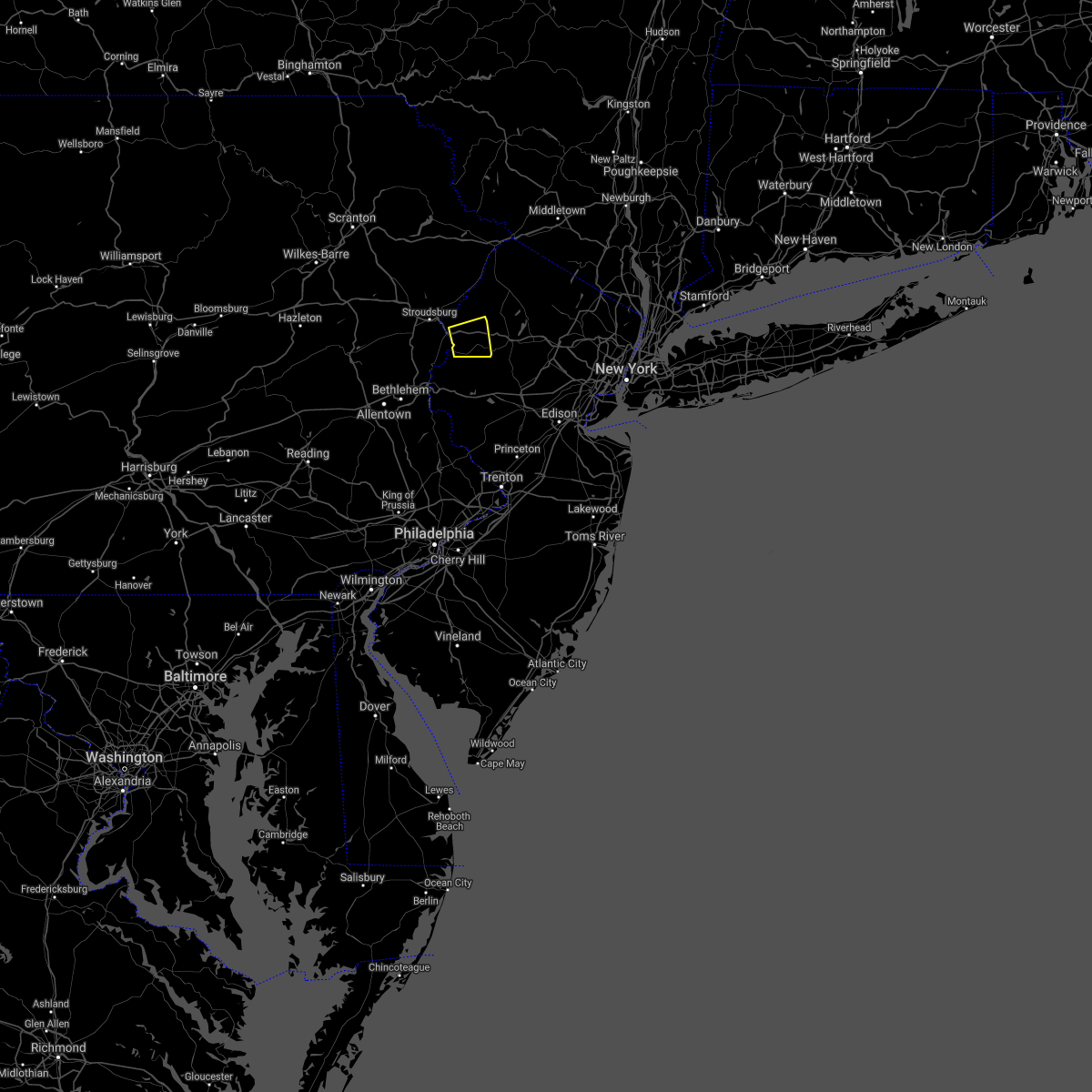 At 249 pm edt, a severe thunderstorm was located over great meadows-vienna, or 14 miles southwest of newton, moving east at 10 mph (radar indicated). Hazards include 60 mph wind gusts. Damage to roofs, siding, trees, and power lines is possible. locations impacted include, hackettstown, oxford, hope, great meadows-vienna, beatyestown, allamuchy-panther valley and beattyestown. this includes interstate 80 in new jersey between mile markers 6 and 18. hail threat, radar indicated max hail size, <. 75 in wind threat, radar indicated max wind gust, 60 mph. At 249 pm edt, a severe thunderstorm was located over great meadows-vienna, or 14 miles southwest of newton, moving east at 10 mph (radar indicated). Hazards include 60 mph wind gusts. Damage to roofs, siding, trees, and power lines is possible. locations impacted include, hackettstown, oxford, hope, great meadows-vienna, beatyestown, allamuchy-panther valley and beattyestown. this includes interstate 80 in new jersey between mile markers 6 and 18. hail threat, radar indicated max hail size, <. 75 in wind threat, radar indicated max wind gust, 60 mph.
|
| 8/27/2021 2:38 PM EDT |
 At 238 pm edt, a severe thunderstorm was located over hope, or 15 miles southwest of newton, moving east at 5 mph (radar indicated). Hazards include 60 mph wind gusts. damage to roofs, siding, trees, and power lines is possible At 238 pm edt, a severe thunderstorm was located over hope, or 15 miles southwest of newton, moving east at 5 mph (radar indicated). Hazards include 60 mph wind gusts. damage to roofs, siding, trees, and power lines is possible
|
| 8/12/2021 4:01 PM EDT |
 At 359 pm edt, severe thunderstorms were located along a line extending from shohola to hainesville to bushkill, moving east at 50 mph (law enforcement). Hazards include 60 mph wind gusts. Damage to roofs, siding, trees, and power lines is possible. locations impacted include, newton, montague, hopatcong, blairstown, franklin, stanhope, hamburg, ogdensburg, sussex, hope, branchville, andover, high point, lake mohawk, werry lake, greendell, millbrook, delaware water gap, vernon valley and pellettown. people at the new jersey state fair should seek safe shelter immediately! this includes the following highways, interstate 80 in pennsylvania near mile marker 314. interstate 80 in new jersey between mile markers 0 and 24. hail threat, radar indicated max hail size, <. 75 in wind threat, observed max wind gust, 60 mph. At 359 pm edt, severe thunderstorms were located along a line extending from shohola to hainesville to bushkill, moving east at 50 mph (law enforcement). Hazards include 60 mph wind gusts. Damage to roofs, siding, trees, and power lines is possible. locations impacted include, newton, montague, hopatcong, blairstown, franklin, stanhope, hamburg, ogdensburg, sussex, hope, branchville, andover, high point, lake mohawk, werry lake, greendell, millbrook, delaware water gap, vernon valley and pellettown. people at the new jersey state fair should seek safe shelter immediately! this includes the following highways, interstate 80 in pennsylvania near mile marker 314. interstate 80 in new jersey between mile markers 0 and 24. hail threat, radar indicated max hail size, <. 75 in wind threat, observed max wind gust, 60 mph.
|
| 8/12/2021 3:33 PM EDT |
 At 333 pm edt, severe thunderstorms were located along a line extending from ledgerdale to near canadensis to mcmichael, moving east at 50 mph (law enforcement. at around 3:25 pm, downed trees were reported in tobyhanna. these storms have a history of producing wind damage). Hazards include 60 mph wind gusts. damage to roofs, siding, trees, and power lines is possible At 333 pm edt, severe thunderstorms were located along a line extending from ledgerdale to near canadensis to mcmichael, moving east at 50 mph (law enforcement. at around 3:25 pm, downed trees were reported in tobyhanna. these storms have a history of producing wind damage). Hazards include 60 mph wind gusts. damage to roofs, siding, trees, and power lines is possible
|
| 8/11/2021 7:46 PM EDT |
 At 745 pm edt, a severe thunderstorm was located over florham park, or near morristown, moving east at 30 mph (radar indicated). Hazards include 60 mph wind gusts. Expect damage to trees and power lines. this severe thunderstorm will be near, millburn and fairfield around 755 pm edt. caldwell around 800 pm edt. orange around 805 pm edt. newark and bloomfield around 810 pm edt. passaic and lyndhurst around 815 pm edt. secaucus and teterboro around 820 pm edt. hoboken and hackensack around 825 pm edt. hail threat, radar indicated max hail size, <. 75 in wind threat, radar indicated max wind gust, 60 mph. At 745 pm edt, a severe thunderstorm was located over florham park, or near morristown, moving east at 30 mph (radar indicated). Hazards include 60 mph wind gusts. Expect damage to trees and power lines. this severe thunderstorm will be near, millburn and fairfield around 755 pm edt. caldwell around 800 pm edt. orange around 805 pm edt. newark and bloomfield around 810 pm edt. passaic and lyndhurst around 815 pm edt. secaucus and teterboro around 820 pm edt. hoboken and hackensack around 825 pm edt. hail threat, radar indicated max hail size, <. 75 in wind threat, radar indicated max wind gust, 60 mph.
|
| 8/11/2021 7:04 PM EDT |
 At 704 pm edt, a severe thunderstorm was located over budd lake, or 14 miles south of newton, moving east at 20 mph (radar indicated). Hazards include 60 mph wind gusts and penny size hail. damage to roofs, siding, trees, and power lines is possible At 704 pm edt, a severe thunderstorm was located over budd lake, or 14 miles south of newton, moving east at 20 mph (radar indicated). Hazards include 60 mph wind gusts and penny size hail. damage to roofs, siding, trees, and power lines is possible
|
| 7/29/2021 5:20 PM EDT |
 At 519 pm edt, severe thunderstorms were located along a line extending from columbia to erwinna, moving east at 30 mph (radar indicated). Hazards include 60 mph wind gusts. Damage to roofs, siding, trees, and power lines is possible. locations impacted include, easton, newton, bethlehem, forks, hackettstown, quakertown, wilson, washington, blairstown, bangor, flemington, tinicum, high bridge, stanhope, netcong, clinton, belvidere, harmony, oxford and alpha. this includes the following highways, interstate 78 in pennsylvania between mile markers 69 and 76. interstate 78 in new jersey between mile markers 0 and 29. Interstate 80 in new jersey between mile markers 2 and 27. At 519 pm edt, severe thunderstorms were located along a line extending from columbia to erwinna, moving east at 30 mph (radar indicated). Hazards include 60 mph wind gusts. Damage to roofs, siding, trees, and power lines is possible. locations impacted include, easton, newton, bethlehem, forks, hackettstown, quakertown, wilson, washington, blairstown, bangor, flemington, tinicum, high bridge, stanhope, netcong, clinton, belvidere, harmony, oxford and alpha. this includes the following highways, interstate 78 in pennsylvania between mile markers 69 and 76. interstate 78 in new jersey between mile markers 0 and 29. Interstate 80 in new jersey between mile markers 2 and 27.
|
| 7/29/2021 5:03 PM EDT |
 At 502 pm edt, severe thunderstorms were located along a line extending from near stormville to near pleasant valley, moving east at 30 mph (radar indicated). Hazards include 60 mph wind gusts. damage to roofs, siding, trees, and power lines is possible At 502 pm edt, severe thunderstorms were located along a line extending from near stormville to near pleasant valley, moving east at 30 mph (radar indicated). Hazards include 60 mph wind gusts. damage to roofs, siding, trees, and power lines is possible
|
| 7/27/2021 5:38 PM EDT |
 At 537 pm edt, a severe thunderstorm was located over sterling, or 14 miles north of mount pocono, moving southeast at 40 mph (radar indicated). Hazards include 60 mph wind gusts and penny size hail. damage to roofs, siding, trees, and power lines is possible At 537 pm edt, a severe thunderstorm was located over sterling, or 14 miles north of mount pocono, moving southeast at 40 mph (radar indicated). Hazards include 60 mph wind gusts and penny size hail. damage to roofs, siding, trees, and power lines is possible
|
| 7/17/2021 2:42 PM EDT |
 At 241 pm edt, a severe thunderstorm was located over kearny, or over harrison, moving northeast at 20 mph (public). Hazards include 60 mph wind gusts and quarter size hail. Minor hail damage to vehicles is possible. expect wind damage to trees and power lines. this severe thunderstorm will be near, jersey city around 245 pm edt. soho around 250 pm edt. hoboken, lyndhurst, rutherford, secaucus, union city and east village around 255 pm edt. midtown manhattan, teterboro and upper west side around 305 pm edt. ridgefield around 310 pm edt. hackensack, harlem and fort lee around 315 pm edt. paramus and englewood around 320 pm edt. Bergenfield and oradell around 325 pm edt. At 241 pm edt, a severe thunderstorm was located over kearny, or over harrison, moving northeast at 20 mph (public). Hazards include 60 mph wind gusts and quarter size hail. Minor hail damage to vehicles is possible. expect wind damage to trees and power lines. this severe thunderstorm will be near, jersey city around 245 pm edt. soho around 250 pm edt. hoboken, lyndhurst, rutherford, secaucus, union city and east village around 255 pm edt. midtown manhattan, teterboro and upper west side around 305 pm edt. ridgefield around 310 pm edt. hackensack, harlem and fort lee around 315 pm edt. paramus and englewood around 320 pm edt. Bergenfield and oradell around 325 pm edt.
|
| 7/8/2021 6:52 PM EDT |
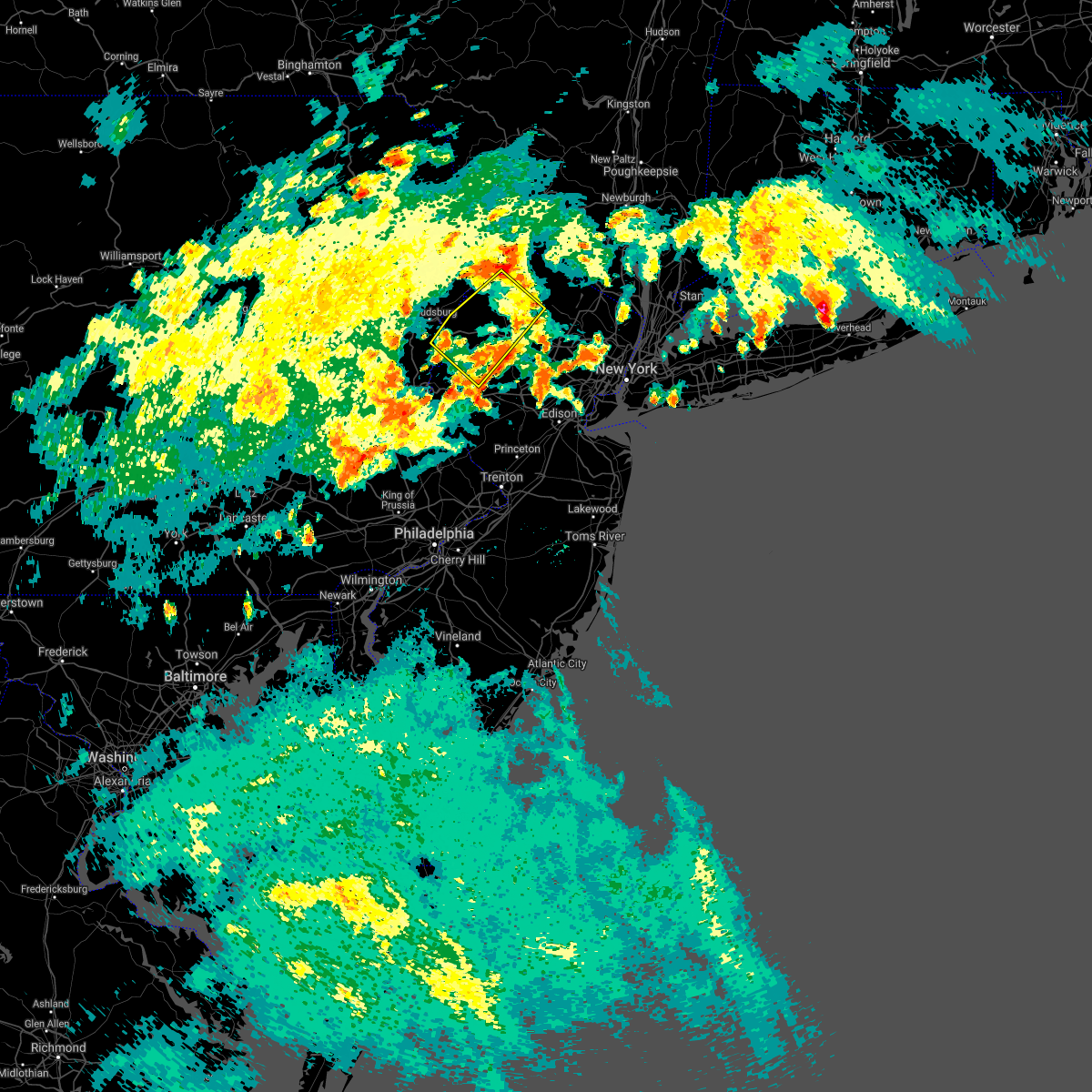 The severe thunderstorm warning for northern hunterdon, northwestern morris, southwestern sussex, warren and northeastern northampton counties will expire at 700 pm edt, the severe thunderstorm which prompted the warning has weakened. therefore, the warning will be allowed to expire. a severe thunderstorm watch remains in effect until 900 pm edt for northern and northwestern new jersey, and eastern pennsylvania. The severe thunderstorm warning for northern hunterdon, northwestern morris, southwestern sussex, warren and northeastern northampton counties will expire at 700 pm edt, the severe thunderstorm which prompted the warning has weakened. therefore, the warning will be allowed to expire. a severe thunderstorm watch remains in effect until 900 pm edt for northern and northwestern new jersey, and eastern pennsylvania.
|
| 7/8/2021 6:40 PM EDT |
 At 637 pm edt, a severe thunderstorm was located over allamuchy-panther valley, or 10 miles southwest of newton, moving northeast at 25 mph (radar indicated). Hazards include 60 mph wind gusts and quarter size hail. Minor damage to vehicles is possible. wind damage to roofs, siding, trees, and power lines is possible. locations impacted include, newton, hopatcong, hackettstown, washington, blairstown, mount arlington, franklin, stanhope, netcong, belvidere, oxford, ogdensburg, hope, glen gardner, hampton, east bangor, branchville, andover, brass castle and lake mohawk. This includes interstate 80 in new jersey between mile markers 2 and 28. At 637 pm edt, a severe thunderstorm was located over allamuchy-panther valley, or 10 miles southwest of newton, moving northeast at 25 mph (radar indicated). Hazards include 60 mph wind gusts and quarter size hail. Minor damage to vehicles is possible. wind damage to roofs, siding, trees, and power lines is possible. locations impacted include, newton, hopatcong, hackettstown, washington, blairstown, mount arlington, franklin, stanhope, netcong, belvidere, oxford, ogdensburg, hope, glen gardner, hampton, east bangor, branchville, andover, brass castle and lake mohawk. This includes interstate 80 in new jersey between mile markers 2 and 28.
|
| 7/8/2021 6:40 PM EDT |
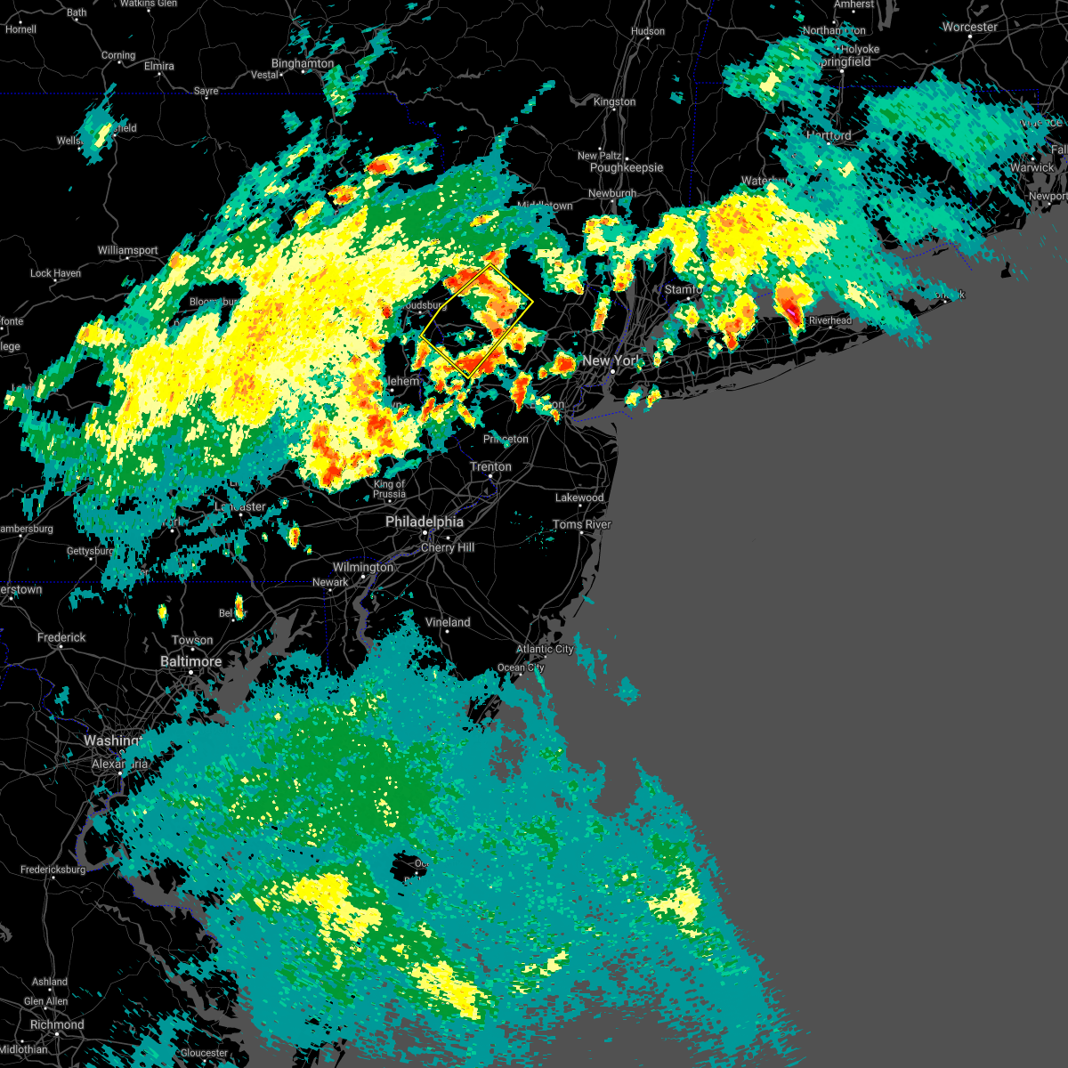 At 637 pm edt, a severe thunderstorm was located over allamuchy-panther valley, or 10 miles southwest of newton, moving northeast at 25 mph (radar indicated). Hazards include 60 mph wind gusts and quarter size hail. Minor damage to vehicles is possible. wind damage to roofs, siding, trees, and power lines is possible. locations impacted include, newton, hopatcong, hackettstown, washington, blairstown, mount arlington, franklin, stanhope, netcong, belvidere, oxford, ogdensburg, hope, glen gardner, hampton, east bangor, branchville, andover, brass castle and lake mohawk. This includes interstate 80 in new jersey between mile markers 2 and 28. At 637 pm edt, a severe thunderstorm was located over allamuchy-panther valley, or 10 miles southwest of newton, moving northeast at 25 mph (radar indicated). Hazards include 60 mph wind gusts and quarter size hail. Minor damage to vehicles is possible. wind damage to roofs, siding, trees, and power lines is possible. locations impacted include, newton, hopatcong, hackettstown, washington, blairstown, mount arlington, franklin, stanhope, netcong, belvidere, oxford, ogdensburg, hope, glen gardner, hampton, east bangor, branchville, andover, brass castle and lake mohawk. This includes interstate 80 in new jersey between mile markers 2 and 28.
|
| 7/8/2021 6:16 PM EDT |
 At 616 pm edt, a severe thunderstorm was located over oxford, or 16 miles northeast of easton, moving northeast at 25 mph (radar indicated). Hazards include 60 mph wind gusts and quarter size hail. Minor damage to vehicles is possible. Wind damage to roofs, siding, trees, and power lines is possible. At 616 pm edt, a severe thunderstorm was located over oxford, or 16 miles northeast of easton, moving northeast at 25 mph (radar indicated). Hazards include 60 mph wind gusts and quarter size hail. Minor damage to vehicles is possible. Wind damage to roofs, siding, trees, and power lines is possible.
|
| 7/8/2021 3:08 PM EDT |
 The severe thunderstorm warning for hunterdon, southwestern morris, central warren and northwestern somerset counties will expire at 315 pm edt, the storm which prompted the warning has moved out of the area. therefore, the warning will be allowed to expire. a severe thunderstorm watch remains in effect until 900 pm edt for northern and northwestern new jersey, and eastern and southeastern pennsylvania. to report severe weather, contact your nearest law enforcement agency. they will relay your report to the national weather service mount holly nj. The severe thunderstorm warning for hunterdon, southwestern morris, central warren and northwestern somerset counties will expire at 315 pm edt, the storm which prompted the warning has moved out of the area. therefore, the warning will be allowed to expire. a severe thunderstorm watch remains in effect until 900 pm edt for northern and northwestern new jersey, and eastern and southeastern pennsylvania. to report severe weather, contact your nearest law enforcement agency. they will relay your report to the national weather service mount holly nj.
|
| 7/8/2021 2:29 PM EDT |
 At 229 pm edt, a severe thunderstorm was located near bloomsbury, or 11 miles east of easton, moving northeast at 25 mph (radar indicated). Hazards include 60 mph wind gusts and quarter size hail. Minor damage to vehicles is possible. Wind damage to roofs, siding, trees, and power lines is possible. At 229 pm edt, a severe thunderstorm was located near bloomsbury, or 11 miles east of easton, moving northeast at 25 mph (radar indicated). Hazards include 60 mph wind gusts and quarter size hail. Minor damage to vehicles is possible. Wind damage to roofs, siding, trees, and power lines is possible.
|
| 7/6/2021 6:04 PM EDT |
 At 603 pm edt, severe thunderstorms were located along a line extending from bloomingdale to near morristown to near belfast, moving east at 45 mph (radar indicated). Hazards include 70 mph wind gusts and quarter size hail. Minor damage to vehicles is possible. expect considerable tree damage. wind damage is also likely to mobile homes, roofs, and outbuildings. locations impacted include, easton, dover, hopatcong, forks, kinnelon, hackettstown, boonton, wilson, butler, wharton, washington, rockaway, nazareth, bangor, mount arlington, mountain lakes, stanhope, pen argyl, netcong and wind gap. This includes interstate 80 in new jersey between mile markers 11 and 42. At 603 pm edt, severe thunderstorms were located along a line extending from bloomingdale to near morristown to near belfast, moving east at 45 mph (radar indicated). Hazards include 70 mph wind gusts and quarter size hail. Minor damage to vehicles is possible. expect considerable tree damage. wind damage is also likely to mobile homes, roofs, and outbuildings. locations impacted include, easton, dover, hopatcong, forks, kinnelon, hackettstown, boonton, wilson, butler, wharton, washington, rockaway, nazareth, bangor, mount arlington, mountain lakes, stanhope, pen argyl, netcong and wind gap. This includes interstate 80 in new jersey between mile markers 11 and 42.
|
| 7/6/2021 6:02 PM EDT |
 At 601 pm edt, severe thunderstorms were located along a line extending from upper greenwood lake to kinnelon to near morristown to long valley, moving east at 45 mph. this line of storms has a history of producing wind damage in east stroudsburg, pennsylvania (public). Hazards include 70 mph wind gusts and quarter size hail. Minor damage to vehicles is possible. expect considerable tree damage. wind damage is also likely to mobile homes, roofs, and outbuildings. locations impacted include, morristown, dover, madison, hopatcong, florham park, east hanover, lincoln park, bound brook, kinnelon, hackettstown, chatham, boonton, butler, wharton, rockaway, morris plains, mount arlington, mendham, mountain lakes and stanhope. this includes the following highways, interstate 78 in new jersey between mile markers 26 and 42. interstate 80 in new jersey between mile markers 11 and 47. Interstate 287 in new jersey between mile markers 19 and 54. At 601 pm edt, severe thunderstorms were located along a line extending from upper greenwood lake to kinnelon to near morristown to long valley, moving east at 45 mph. this line of storms has a history of producing wind damage in east stroudsburg, pennsylvania (public). Hazards include 70 mph wind gusts and quarter size hail. Minor damage to vehicles is possible. expect considerable tree damage. wind damage is also likely to mobile homes, roofs, and outbuildings. locations impacted include, morristown, dover, madison, hopatcong, florham park, east hanover, lincoln park, bound brook, kinnelon, hackettstown, chatham, boonton, butler, wharton, rockaway, morris plains, mount arlington, mendham, mountain lakes and stanhope. this includes the following highways, interstate 78 in new jersey between mile markers 26 and 42. interstate 80 in new jersey between mile markers 11 and 47. Interstate 287 in new jersey between mile markers 19 and 54.
|
| 7/6/2021 5:53 PM EDT |
 At 549 pm edt, severe thunderstorms were located along a line extending from near vernon valley to near lake telemark to near chester, moving east at 55 mph (radar indicated). Hazards include 70 mph wind gusts. Expect considerable tree damage. damage is likely to mobile homes, outbuildings. severe thunderstorms will be near, bloomingdale around 555 pm edt. wayne, ringwood, pompton lakes, fairfield and greenwood lake around 600 pm edt. sloatsburg and hawthorne around 605 pm edt. paterson, paramus, summit, and caldwell around 610 pm edt. bloomfield and hackensack around 615 pm edt. newark, ridgefield, harlem and riverdale around 620 pm edt. jersey city, yonkers, bayonne, and secaucus around 625 pm edt. Flatbush, flushing, hoboken, coney island, crown heights, the throgs neck bridge and midtown manhattan around 630 pm edt. At 549 pm edt, severe thunderstorms were located along a line extending from near vernon valley to near lake telemark to near chester, moving east at 55 mph (radar indicated). Hazards include 70 mph wind gusts. Expect considerable tree damage. damage is likely to mobile homes, outbuildings. severe thunderstorms will be near, bloomingdale around 555 pm edt. wayne, ringwood, pompton lakes, fairfield and greenwood lake around 600 pm edt. sloatsburg and hawthorne around 605 pm edt. paterson, paramus, summit, and caldwell around 610 pm edt. bloomfield and hackensack around 615 pm edt. newark, ridgefield, harlem and riverdale around 620 pm edt. jersey city, yonkers, bayonne, and secaucus around 625 pm edt. Flatbush, flushing, hoboken, coney island, crown heights, the throgs neck bridge and midtown manhattan around 630 pm edt.
|
| 7/6/2021 5:50 PM EDT |
 At 550 pm edt, severe thunderstorms were located along a line extending from near highland lake to budd lake to near kunkletown, moving east at 45 mph (radar indicated). Hazards include 70 mph wind gusts and quarter size hail. Minor damage to vehicles is possible. expect considerable tree damage. wind damage is also likely to mobile homes, roofs, and outbuildings. locations impacted include, easton, newton, dover, hopatcong, forks, kinnelon, east stroudsburg, hackettstown, boonton, wilson, butler, wharton, washington, rockaway, blairstown, nazareth, bangor, mount arlington, franklin and jim thorpe. this includes the following highways, northeast extension between mile markers 79 and 86. interstate 80 in pennsylvania between mile markers 305 and 314. Interstate 80 in new jersey between mile markers 0 and 42. At 550 pm edt, severe thunderstorms were located along a line extending from near highland lake to budd lake to near kunkletown, moving east at 45 mph (radar indicated). Hazards include 70 mph wind gusts and quarter size hail. Minor damage to vehicles is possible. expect considerable tree damage. wind damage is also likely to mobile homes, roofs, and outbuildings. locations impacted include, easton, newton, dover, hopatcong, forks, kinnelon, east stroudsburg, hackettstown, boonton, wilson, butler, wharton, washington, rockaway, blairstown, nazareth, bangor, mount arlington, franklin and jim thorpe. this includes the following highways, northeast extension between mile markers 79 and 86. interstate 80 in pennsylvania between mile markers 305 and 314. Interstate 80 in new jersey between mile markers 0 and 42.
|
| 7/6/2021 5:46 PM EDT |
 At 546 pm edt, severe thunderstorms were located along a line extending from near sussex to near lake telemark to budd lake to near hope, moving east at 45 mph (radar indicated). Hazards include 70 mph wind gusts and quarter size hail. Minor damage to vehicles is possible. expect considerable tree damage. Wind damage is also likely to mobile homes, roofs, and outbuildings. At 546 pm edt, severe thunderstorms were located along a line extending from near sussex to near lake telemark to budd lake to near hope, moving east at 45 mph (radar indicated). Hazards include 70 mph wind gusts and quarter size hail. Minor damage to vehicles is possible. expect considerable tree damage. Wind damage is also likely to mobile homes, roofs, and outbuildings.
|
| 7/6/2021 5:15 PM EDT |
 At 515 pm edt, severe thunderstorms were located along a line extending from near dingmans ferry to east stroudsburg to sun valley, moving east at 40 mph (radar indicated). Hazards include 70 mph wind gusts and quarter size hail. Minor damage to vehicles is possible. expect considerable tree damage. Wind damage is also likely to mobile homes, roofs, and outbuildings. At 515 pm edt, severe thunderstorms were located along a line extending from near dingmans ferry to east stroudsburg to sun valley, moving east at 40 mph (radar indicated). Hazards include 70 mph wind gusts and quarter size hail. Minor damage to vehicles is possible. expect considerable tree damage. Wind damage is also likely to mobile homes, roofs, and outbuildings.
|
| 7/2/2021 7:17 PM EDT |
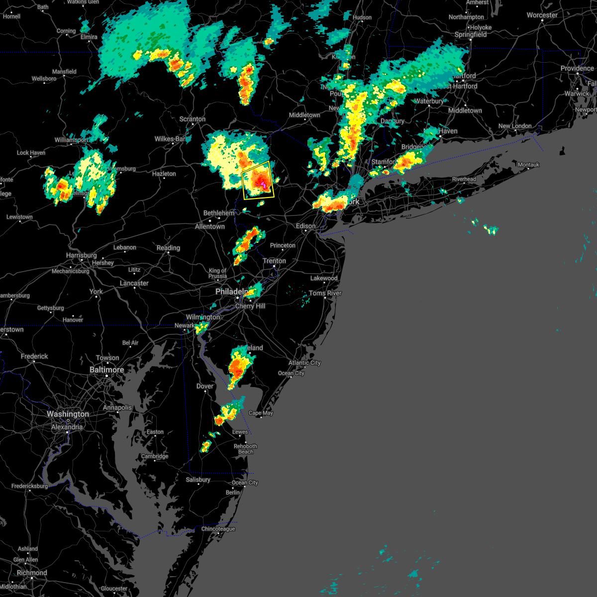 At 712 pm edt, a severe thunderstorm was located over hope, or 15 miles southwest of newton, moving east at 20 mph (radar indicated. in addition, there have been multiple reports of downed trees over southern monroe county from around bartonsville to stroudsburg). Hazards include 60 mph wind gusts and penny size hail. Damage to roofs, siding, trees, and power lines is possible. locations impacted include, hackettstown, blairstown, belvidere, oxford, hope, great meadows-vienna, allamuchy-panther valley, greendell, five points, columbia, beatyestown, long valley, portland and beattyestown. This includes interstate 80 in new jersey between mile markers 3 and 21. At 712 pm edt, a severe thunderstorm was located over hope, or 15 miles southwest of newton, moving east at 20 mph (radar indicated. in addition, there have been multiple reports of downed trees over southern monroe county from around bartonsville to stroudsburg). Hazards include 60 mph wind gusts and penny size hail. Damage to roofs, siding, trees, and power lines is possible. locations impacted include, hackettstown, blairstown, belvidere, oxford, hope, great meadows-vienna, allamuchy-panther valley, greendell, five points, columbia, beatyestown, long valley, portland and beattyestown. This includes interstate 80 in new jersey between mile markers 3 and 21.
|
| 7/2/2021 7:17 PM EDT |
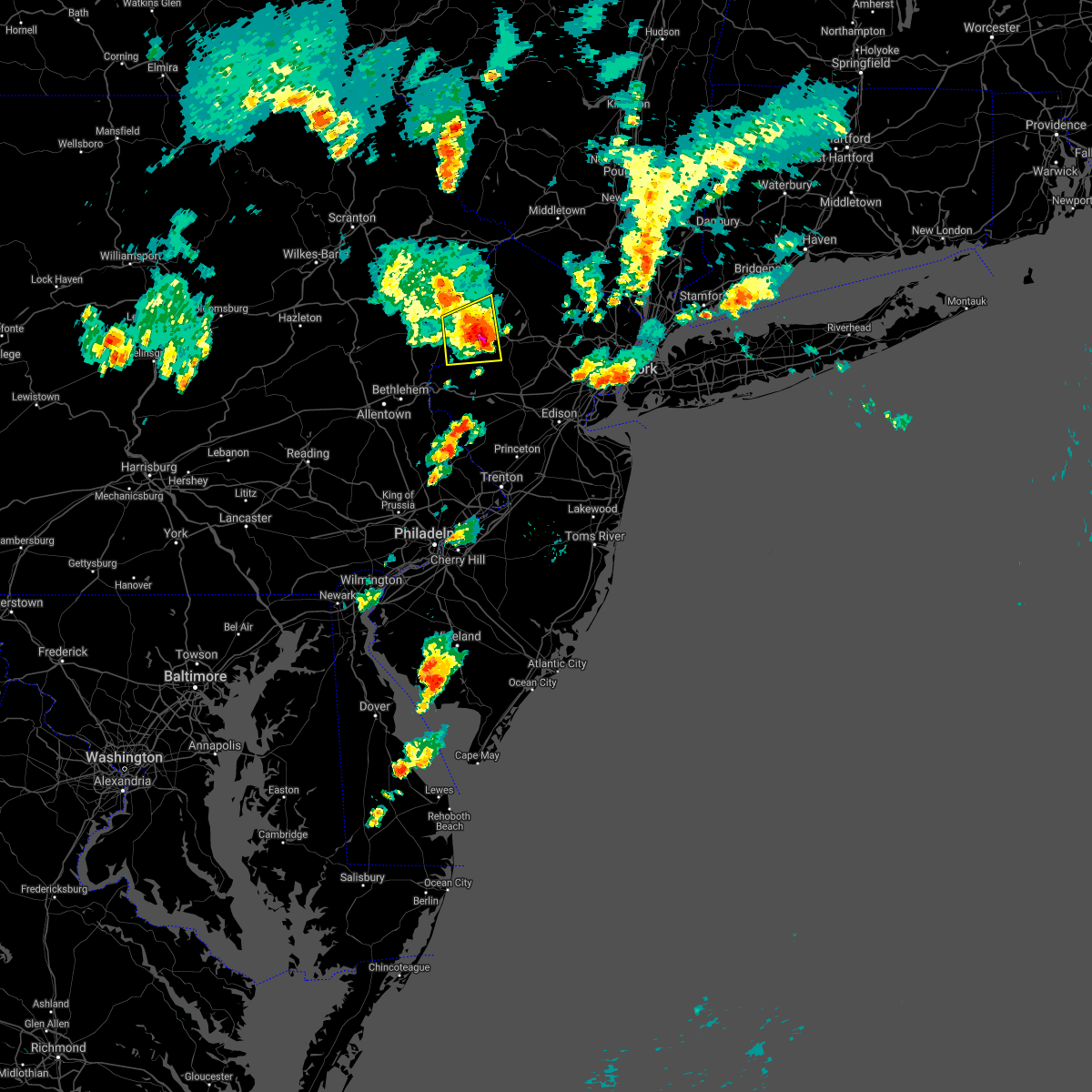 At 712 pm edt, a severe thunderstorm was located over hope, or 15 miles southwest of newton, moving east at 20 mph (radar indicated. in addition, there have been multiple reports of downed trees over southern monroe county from around bartonsville to stroudsburg). Hazards include 60 mph wind gusts and penny size hail. Damage to roofs, siding, trees, and power lines is possible. locations impacted include, hackettstown, blairstown, belvidere, oxford, hope, great meadows-vienna, allamuchy-panther valley, greendell, five points, columbia, beatyestown, long valley, portland and beattyestown. This includes interstate 80 in new jersey between mile markers 3 and 21. At 712 pm edt, a severe thunderstorm was located over hope, or 15 miles southwest of newton, moving east at 20 mph (radar indicated. in addition, there have been multiple reports of downed trees over southern monroe county from around bartonsville to stroudsburg). Hazards include 60 mph wind gusts and penny size hail. Damage to roofs, siding, trees, and power lines is possible. locations impacted include, hackettstown, blairstown, belvidere, oxford, hope, great meadows-vienna, allamuchy-panther valley, greendell, five points, columbia, beatyestown, long valley, portland and beattyestown. This includes interstate 80 in new jersey between mile markers 3 and 21.
|
| 7/2/2021 6:53 PM EDT |
 At 653 pm edt, a severe thunderstorm was located over east bangor, or 14 miles north of easton, moving east at 15 mph (radar indicated). Hazards include 60 mph wind gusts and penny size hail. damage to roofs, siding, trees, and power lines is possible At 653 pm edt, a severe thunderstorm was located over east bangor, or 14 miles north of easton, moving east at 15 mph (radar indicated). Hazards include 60 mph wind gusts and penny size hail. damage to roofs, siding, trees, and power lines is possible
|
| 6/30/2021 9:39 PM EDT |
 At 938 pm edt, severe thunderstorms were located along a line extending from soho to near sayreville, moving east at 35 mph (radar indicated). Hazards include 60 mph wind gusts and quarter size hail. Minor hail damage to vehicles is possible. Expect wind damage to trees and power lines. At 938 pm edt, severe thunderstorms were located along a line extending from soho to near sayreville, moving east at 35 mph (radar indicated). Hazards include 60 mph wind gusts and quarter size hail. Minor hail damage to vehicles is possible. Expect wind damage to trees and power lines.
|
| 6/21/2021 8:42 PM EDT |
 At 842 pm edt, severe thunderstorms were located along a line extending from near hainesville to near oxford, moving northeast at 35 mph (law enforcement. several reports of wind damage have been received from northampton county). Hazards include 60 mph wind gusts. Damage to roofs, siding, trees, and power lines is possible. locations impacted include, newton, montague, hopatcong, hackettstown, washington, blairstown, mount arlington, franklin, stanhope, hamburg, netcong, oxford, ogdensburg, sussex, hope, branchville, andover, high point, lake mohawk and greendell. This includes interstate 80 in new jersey between mile markers 0 and 30. At 842 pm edt, severe thunderstorms were located along a line extending from near hainesville to near oxford, moving northeast at 35 mph (law enforcement. several reports of wind damage have been received from northampton county). Hazards include 60 mph wind gusts. Damage to roofs, siding, trees, and power lines is possible. locations impacted include, newton, montague, hopatcong, hackettstown, washington, blairstown, mount arlington, franklin, stanhope, hamburg, netcong, oxford, ogdensburg, sussex, hope, branchville, andover, high point, lake mohawk and greendell. This includes interstate 80 in new jersey between mile markers 0 and 30.
|
| 6/21/2021 8:30 PM EDT |
 At 830 pm edt, severe thunderstorms were located along a line extending from near lackawaxen to roxburg, moving northeast at 35 mph (law enforcement). Hazards include 60 mph wind gusts. Damage to roofs, siding, trees, and power lines is possible. locations impacted include, easton, newton, montague, hopatcong, east stroudsburg, hackettstown, washington, blairstown, mount arlington, franklin, stanhope, hamburg, netcong, belvidere, harmony, oxford, ogdensburg, alpha, sussex and hope. this includes the following highways, interstate 78 in new jersey between mile markers 0 and 4. interstate 80 in pennsylvania between mile markers 313 and 314. Interstate 80 in new jersey between mile markers 0 and 30. At 830 pm edt, severe thunderstorms were located along a line extending from near lackawaxen to roxburg, moving northeast at 35 mph (law enforcement). Hazards include 60 mph wind gusts. Damage to roofs, siding, trees, and power lines is possible. locations impacted include, easton, newton, montague, hopatcong, east stroudsburg, hackettstown, washington, blairstown, mount arlington, franklin, stanhope, hamburg, netcong, belvidere, harmony, oxford, ogdensburg, alpha, sussex and hope. this includes the following highways, interstate 78 in new jersey between mile markers 0 and 4. interstate 80 in pennsylvania between mile markers 313 and 314. Interstate 80 in new jersey between mile markers 0 and 30.
|
| 6/21/2021 8:13 PM EDT |
 At 812 pm edt, severe thunderstorms were located along a line extending from paupack to near bangor, moving northeast at 45 mph (law enforcement). Hazards include 60 mph wind gusts. damage to roofs, siding, trees, and power lines is possible At 812 pm edt, severe thunderstorms were located along a line extending from paupack to near bangor, moving northeast at 45 mph (law enforcement). Hazards include 60 mph wind gusts. damage to roofs, siding, trees, and power lines is possible
|
| 6/8/2021 3:29 PM EDT |
 At 327 pm edt, severe thunderstorms were located along a line extending from teterboro to edison, moving east at 25 mph (radar indicated). Hazards include 60 mph wind gusts and quarter size hail. Minor hail damage to vehicles is possible. expect wind damage to trees and power lines. severe thunderstorms will be near, hoboken and lyndhurst around 335 pm edt. midtown manhattan and upper west side around 340 pm edt. harlem and long island city around 345 pm edt. mott haven and rfk bridge around 350 pm edt. huguenot and laguardia airport around 355 pm edt. flushing and throgs neck bridge around 400 pm edt. bayside around 405 pm edt. coney island around 415 pm edt. This includes the following new york state covid tent sites staten island omh, and beverly road in brooklyn. At 327 pm edt, severe thunderstorms were located along a line extending from teterboro to edison, moving east at 25 mph (radar indicated). Hazards include 60 mph wind gusts and quarter size hail. Minor hail damage to vehicles is possible. expect wind damage to trees and power lines. severe thunderstorms will be near, hoboken and lyndhurst around 335 pm edt. midtown manhattan and upper west side around 340 pm edt. harlem and long island city around 345 pm edt. mott haven and rfk bridge around 350 pm edt. huguenot and laguardia airport around 355 pm edt. flushing and throgs neck bridge around 400 pm edt. bayside around 405 pm edt. coney island around 415 pm edt. This includes the following new york state covid tent sites staten island omh, and beverly road in brooklyn.
|
| 6/4/2021 3:32 PM EDT |
 At 332 pm edt, severe thunderstorms were located along a line extending from near ramsey to millington, moving east at 30 mph (radar indicated). Hazards include 60 mph wind gusts and penny size hail. Expect damage to trees and power lines. these severe storms will be near, ridgewood and hawthorne around 335 pm edt. paramus around 340 pm edt. oradell around 345 pm edt. bergenfield and millburn around 350 pm edt. union around 355 pm edt. elizabeth and linden around 400 pm edt. newark around 405 pm edt. bayonne around 410 pm edt. Jersey city around 415 pm edt. At 332 pm edt, severe thunderstorms were located along a line extending from near ramsey to millington, moving east at 30 mph (radar indicated). Hazards include 60 mph wind gusts and penny size hail. Expect damage to trees and power lines. these severe storms will be near, ridgewood and hawthorne around 335 pm edt. paramus around 340 pm edt. oradell around 345 pm edt. bergenfield and millburn around 350 pm edt. union around 355 pm edt. elizabeth and linden around 400 pm edt. newark around 405 pm edt. bayonne around 410 pm edt. Jersey city around 415 pm edt.
|
| 6/4/2021 3:10 PM EDT |
 At 309 pm edt, severe thunderstorms were located along a line extending from bloomingdale to near peapack and gladstone, moving east at 30 mph (radar indicated). Hazards include 60 mph wind gusts and penny size hail. Expect damage to trees and power lines. severe thunderstorms will be near, pompton lakes and bloomingdale around 315 pm edt. wayne around 320 pm edt. paterson and hawthorne around 330 pm edt. ridgewood around 335 pm edt. plainfield and paramus around 340 pm edt. bergenfield and summit around 345 pm edt. englewood and clark around 350 pm edt. union around 355 pm edt. Newark and elizabeth around 400 pm edt. At 309 pm edt, severe thunderstorms were located along a line extending from bloomingdale to near peapack and gladstone, moving east at 30 mph (radar indicated). Hazards include 60 mph wind gusts and penny size hail. Expect damage to trees and power lines. severe thunderstorms will be near, pompton lakes and bloomingdale around 315 pm edt. wayne around 320 pm edt. paterson and hawthorne around 330 pm edt. ridgewood around 335 pm edt. plainfield and paramus around 340 pm edt. bergenfield and summit around 345 pm edt. englewood and clark around 350 pm edt. union around 355 pm edt. Newark and elizabeth around 400 pm edt.
|
| 6/4/2021 2:22 PM EDT |
 The severe thunderstorm warning for southwestern sussex, warren, southeastern monroe and northeastern northampton counties will expire at 230 pm edt, the storm which prompted the warning has weakened below severe limits, and has exited the warned area. therefore, the warning will be allowed to expire. however gusty winds and heavy rain are still possible with this thunderstorm. The severe thunderstorm warning for southwestern sussex, warren, southeastern monroe and northeastern northampton counties will expire at 230 pm edt, the storm which prompted the warning has weakened below severe limits, and has exited the warned area. therefore, the warning will be allowed to expire. however gusty winds and heavy rain are still possible with this thunderstorm.
|
| 6/4/2021 2:08 PM EDT |
 At 207 pm edt, a severe thunderstorm was located over hope, or 15 miles southwest of newton, moving east at 40 mph (radar indicated). Hazards include 60 mph wind gusts and penny size hail. Damage to roofs, siding, trees, and power lines is possible. locations impacted include, hackettstown, blairstown, bangor, pen argyl, belvidere, oxford, hope, east bangor, andover, great meadows-vienna, allamuchy-panther valley, greendell, millbrook, delaware water gap, columbia, beatyestown, roseto, portland, beattyestown and hidden lake. This includes interstate 80 in new jersey between mile markers 0 and 24. At 207 pm edt, a severe thunderstorm was located over hope, or 15 miles southwest of newton, moving east at 40 mph (radar indicated). Hazards include 60 mph wind gusts and penny size hail. Damage to roofs, siding, trees, and power lines is possible. locations impacted include, hackettstown, blairstown, bangor, pen argyl, belvidere, oxford, hope, east bangor, andover, great meadows-vienna, allamuchy-panther valley, greendell, millbrook, delaware water gap, columbia, beatyestown, roseto, portland, beattyestown and hidden lake. This includes interstate 80 in new jersey between mile markers 0 and 24.
|
| 6/4/2021 1:49 PM EDT |
 At 148 pm edt, a severe thunderstorm was located over stormville, or 15 miles north of easton, moving east at 40 mph (radar indicated). Hazards include 60 mph wind gusts and penny size hail. damage to roofs, siding, trees, and power lines is possible At 148 pm edt, a severe thunderstorm was located over stormville, or 15 miles north of easton, moving east at 40 mph (radar indicated). Hazards include 60 mph wind gusts and penny size hail. damage to roofs, siding, trees, and power lines is possible
|
| 5/26/2021 6:41 PM EDT |
 At 611 pm edt, severe thunderstorms were located along a line extending from succasunna-kenvil to lawrenceville, moving east at 40 mph (radar indicated). Hazards include 60 mph wind gusts. Expect damage to trees and power lines. severe thunderstorms will be near, fairfield around 640 pm edt. caldwell around 645 pm edt. bloomfield around 650 pm edt. paterson and passaic around 655 pm edt. paramus and teterboro around 700 pm edt. hackensack and ridgefield around 705 pm edt. bergenfield and fort lee around 710 pm edt. This includes the following new york state covid tent site staten island omh. At 611 pm edt, severe thunderstorms were located along a line extending from succasunna-kenvil to lawrenceville, moving east at 40 mph (radar indicated). Hazards include 60 mph wind gusts. Expect damage to trees and power lines. severe thunderstorms will be near, fairfield around 640 pm edt. caldwell around 645 pm edt. bloomfield around 650 pm edt. paterson and passaic around 655 pm edt. paramus and teterboro around 700 pm edt. hackensack and ridgefield around 705 pm edt. bergenfield and fort lee around 710 pm edt. This includes the following new york state covid tent site staten island omh.
|
| 5/26/2021 6:41 PM EDT |
 At 641 pm edt, severe thunderstorms were located along a line extending from fairfield to near tottenville, moving northeast at 55 mph (radar indicated). Hazards include 60 mph wind gusts. Expect damage to trees and power lines. these severe storms will be near, caldwell and fairfield around 645 pm edt. paterson and passaic around 650 pm edt. hackensack and paramus around 655 pm edt. bergenfield around 700 pm edt. This includes the following new york state covid tent site staten island omh. At 641 pm edt, severe thunderstorms were located along a line extending from fairfield to near tottenville, moving northeast at 55 mph (radar indicated). Hazards include 60 mph wind gusts. Expect damage to trees and power lines. these severe storms will be near, caldwell and fairfield around 645 pm edt. paterson and passaic around 650 pm edt. hackensack and paramus around 655 pm edt. bergenfield around 700 pm edt. This includes the following new york state covid tent site staten island omh.
|
| 5/26/2021 6:12 PM EDT |
 At 611 pm edt, severe thunderstorms were located along a line extending from succasunna-kenvil to lawrenceville, moving east at 40 mph (radar indicated). Hazards include 60 mph wind gusts. Expect damage to trees and power lines. severe thunderstorms will be near, fairfield around 640 pm edt. caldwell around 645 pm edt. bloomfield around 650 pm edt. paterson and passaic around 655 pm edt. paramus and teterboro around 700 pm edt. hackensack and ridgefield around 705 pm edt. bergenfield and fort lee around 710 pm edt. This includes the following new york state covid tent site staten island omh. At 611 pm edt, severe thunderstorms were located along a line extending from succasunna-kenvil to lawrenceville, moving east at 40 mph (radar indicated). Hazards include 60 mph wind gusts. Expect damage to trees and power lines. severe thunderstorms will be near, fairfield around 640 pm edt. caldwell around 645 pm edt. bloomfield around 650 pm edt. paterson and passaic around 655 pm edt. paramus and teterboro around 700 pm edt. hackensack and ridgefield around 705 pm edt. bergenfield and fort lee around 710 pm edt. This includes the following new york state covid tent site staten island omh.
|
| 4/21/2021 2:12 PM EDT |
 At 211 pm edt, a severe thunderstorm was located over passaic, moving east at 40 mph (radar indicated). Hazards include 60 mph wind gusts. Expect damage to trees and power lines. this severe thunderstorm will be near, lyndhurst and rutherford around 215 pm edt. hoboken and hackensack around 220 pm edt. bergenfield and ridgefield around 225 pm edt. mott haven and rfk bridge around 230 pm edt. yonkers and flushing around 235 pm edt. new rochelle and throgs neck bridge around 240 pm edt. great neck and sands point around 245 pm edt. Garden city and mineola around 250 pm edt. At 211 pm edt, a severe thunderstorm was located over passaic, moving east at 40 mph (radar indicated). Hazards include 60 mph wind gusts. Expect damage to trees and power lines. this severe thunderstorm will be near, lyndhurst and rutherford around 215 pm edt. hoboken and hackensack around 220 pm edt. bergenfield and ridgefield around 225 pm edt. mott haven and rfk bridge around 230 pm edt. yonkers and flushing around 235 pm edt. new rochelle and throgs neck bridge around 240 pm edt. great neck and sands point around 245 pm edt. Garden city and mineola around 250 pm edt.
|
| 4/21/2021 1:41 PM EDT |
 The national weather service in upton ny has issued a * severe thunderstorm warning for. hudson county in northeastern new jersey. passaic county in northeastern new jersey. union county in northeastern new jersey. Bergen county in northeastern new jersey. The national weather service in upton ny has issued a * severe thunderstorm warning for. hudson county in northeastern new jersey. passaic county in northeastern new jersey. union county in northeastern new jersey. Bergen county in northeastern new jersey.
|
| 4/21/2021 1:41 PM EDT |
 At 141 pm edt, severe thunderstorms were located along a line extending from near unionville to near cloverhill, moving east at 35 mph (radar indicated). Hazards include 60 mph wind gusts. Expect damage to trees and power lines. severe thunderstorms will be near, warwick and florida around 150 pm edt. goshen around 155 pm edt. chester around 200 pm edt. monroe around 205 pm edt. harriman around 210 pm edt. plainfield around 220 pm edt. west point and new windsor around 225 pm edt. clark around 230 pm edt. linden around 240 pm edt. Bayonne around 245 pm edt. At 141 pm edt, severe thunderstorms were located along a line extending from near unionville to near cloverhill, moving east at 35 mph (radar indicated). Hazards include 60 mph wind gusts. Expect damage to trees and power lines. severe thunderstorms will be near, warwick and florida around 150 pm edt. goshen around 155 pm edt. chester around 200 pm edt. monroe around 205 pm edt. harriman around 210 pm edt. plainfield around 220 pm edt. west point and new windsor around 225 pm edt. clark around 230 pm edt. linden around 240 pm edt. Bayonne around 245 pm edt.
|
| 4/21/2021 1:11 PM EDT |
 The severe thunderstorm warning for warren and eastern northampton counties will expire at 115 pm edt, the severe thunderstorm which prompted the warning has weakened. therefore, the warning will be allowed to expire. however small hail and gusty winds are still possible with this thunderstorm. a severe thunderstorm watch remains in effect until 600 pm edt for northern and northwestern new jersey, and eastern pennsylvania. The severe thunderstorm warning for warren and eastern northampton counties will expire at 115 pm edt, the severe thunderstorm which prompted the warning has weakened. therefore, the warning will be allowed to expire. however small hail and gusty winds are still possible with this thunderstorm. a severe thunderstorm watch remains in effect until 600 pm edt for northern and northwestern new jersey, and eastern pennsylvania.
|
| 4/21/2021 1:02 PM EDT |
 At 102 pm edt, a severe thunderstorm was located over great meadows-vienna, or 13 miles southwest of newton, moving northeast at 40 mph (trained weather spotters). Hazards include 60 mph wind gusts and quarter size hail. Minor damage to vehicles is possible. wind damage to roofs, siding, trees, and power lines is possible. locations impacted include, easton, washington, blairstown, belvidere, harmony, oxford, alpha, hope, hampton, west easton, bloomsbury, glendon, great meadows-vienna, brass castle, pleasant valley, roxburg, columbia, beatyestown, phillipsburg and portland. this includes the following highways, interstate 78 in pennsylvania between mile markers 75 and 76. interstate 78 in new jersey between mile markers 0 and 7. Interstate 80 in new jersey between mile markers 3 and 16. At 102 pm edt, a severe thunderstorm was located over great meadows-vienna, or 13 miles southwest of newton, moving northeast at 40 mph (trained weather spotters). Hazards include 60 mph wind gusts and quarter size hail. Minor damage to vehicles is possible. wind damage to roofs, siding, trees, and power lines is possible. locations impacted include, easton, washington, blairstown, belvidere, harmony, oxford, alpha, hope, hampton, west easton, bloomsbury, glendon, great meadows-vienna, brass castle, pleasant valley, roxburg, columbia, beatyestown, phillipsburg and portland. this includes the following highways, interstate 78 in pennsylvania between mile markers 75 and 76. interstate 78 in new jersey between mile markers 0 and 7. Interstate 80 in new jersey between mile markers 3 and 16.
|
| 4/21/2021 12:51 PM EDT |
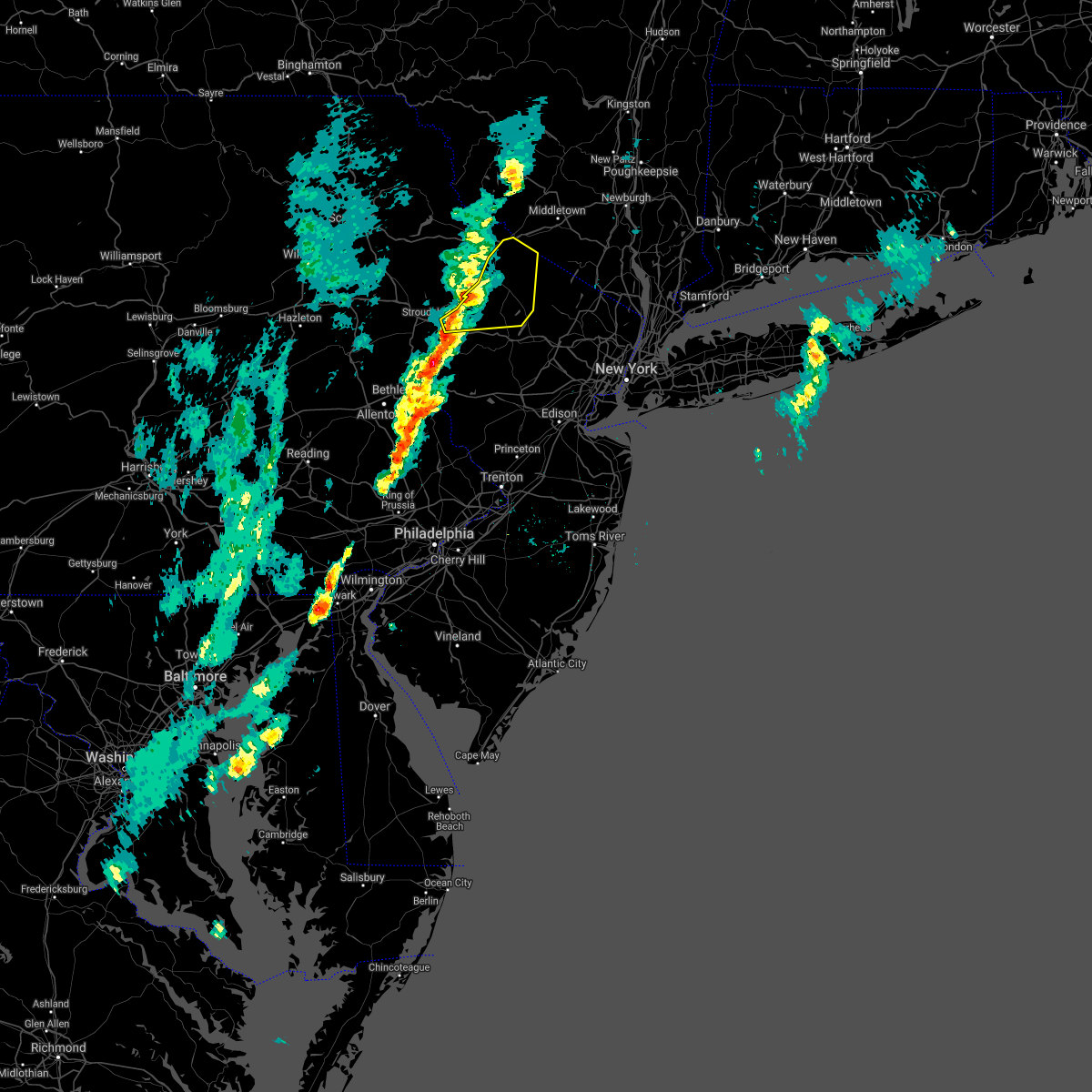 At 1251 pm edt, a severe thunderstorm was located over flatbrookville, or 9 miles west of newton, moving northeast at 35 mph (radar indicated). Hazards include 60 mph wind gusts and quarter size hail. Minor damage to vehicles is possible. Wind damage to roofs, siding, trees, and power lines is possible. At 1251 pm edt, a severe thunderstorm was located over flatbrookville, or 9 miles west of newton, moving northeast at 35 mph (radar indicated). Hazards include 60 mph wind gusts and quarter size hail. Minor damage to vehicles is possible. Wind damage to roofs, siding, trees, and power lines is possible.
|
| 4/21/2021 12:25 PM EDT |
 At 1225 pm edt, a severe thunderstorm was located over nazareth, or near easton, moving east at 40 mph (radar indicated). Hazards include 60 mph wind gusts and quarter size hail. Minor damage to vehicles is possible. Wind damage to roofs, siding, trees, and power lines is possible. At 1225 pm edt, a severe thunderstorm was located over nazareth, or near easton, moving east at 40 mph (radar indicated). Hazards include 60 mph wind gusts and quarter size hail. Minor damage to vehicles is possible. Wind damage to roofs, siding, trees, and power lines is possible.
|
| 3/28/2021 7:14 PM EDT |
 At 712 pm edt, a strong gust front with heavy downpours and possibly a thunderstorm was located along a line extending from rockaway to near martinsville to near levittown, moving east at 40 mph (radar indicated). Hazards include 60 mph wind gusts. Expect damage to trees and power lines. gust front with heavy downpours and possibly a thunderstorm will be near, plainfield around 725 pm edt. summit and millburn around 730 pm edt. orange and clark around 735 pm edt. elizabeth and passaic around 740 pm edt. newark and lyndhurst around 745 pm edt. jersey city and bayonne around 750 pm edt. the verrazano narrows bridge and midtown manhattan around 755 pm edt. Flatbush and coney island around 800 pm edt. At 712 pm edt, a strong gust front with heavy downpours and possibly a thunderstorm was located along a line extending from rockaway to near martinsville to near levittown, moving east at 40 mph (radar indicated). Hazards include 60 mph wind gusts. Expect damage to trees and power lines. gust front with heavy downpours and possibly a thunderstorm will be near, plainfield around 725 pm edt. summit and millburn around 730 pm edt. orange and clark around 735 pm edt. elizabeth and passaic around 740 pm edt. newark and lyndhurst around 745 pm edt. jersey city and bayonne around 750 pm edt. the verrazano narrows bridge and midtown manhattan around 755 pm edt. Flatbush and coney island around 800 pm edt.
|
| 11/15/2020 8:31 PM EST |
 At 830 pm est, severe thunderstorms were located along a line extending from near myers corner to peekskill to near hackensack to union city to near east brunswick, moving east at 55 mph (radar indicated). Hazards include 60 mph wind gusts. Expect damage to trees and power lines. these severe storms will be near, peekskill and harlem around 835 pm est. flushing and mott haven around 840 pm est. jamaica and yonkers around 845 pm est. new rochelle and white plains around 850 pm est. ridgefield around 855 pm est. Rockaway beach around 905 pm est. At 830 pm est, severe thunderstorms were located along a line extending from near myers corner to peekskill to near hackensack to union city to near east brunswick, moving east at 55 mph (radar indicated). Hazards include 60 mph wind gusts. Expect damage to trees and power lines. these severe storms will be near, peekskill and harlem around 835 pm est. flushing and mott haven around 840 pm est. jamaica and yonkers around 845 pm est. new rochelle and white plains around 850 pm est. ridgefield around 855 pm est. Rockaway beach around 905 pm est.
|
| 11/15/2020 7:57 PM EST |
 At 757 pm est, severe thunderstorms were located along a line extending from 6 miles northwest of wallkill to near franklin to chester to near bridgewater to near doylestown, moving east at 55 mph (radar indicated). Hazards include 60 mph wind gusts. Expect damage to trees and power lines. severe thunderstorms will be near, west milford around 800 pm est. upper greenwood lake around 805 pm est. plainfield and ringwood around 810 pm est. summit and millburn around 815 pm est. orange and monsey around 820 pm est. newark and paterson around 825 pm est. jersey city and passaic around 830 pm est. hoboken and hackensack around 835 pm est. mott haven and nanuet around 840 pm est. yonkers and east tremont around 845 pm est. new rochelle and white plains around 850 pm est. Todt hill and port richmond around 855 pm est. At 757 pm est, severe thunderstorms were located along a line extending from 6 miles northwest of wallkill to near franklin to chester to near bridgewater to near doylestown, moving east at 55 mph (radar indicated). Hazards include 60 mph wind gusts. Expect damage to trees and power lines. severe thunderstorms will be near, west milford around 800 pm est. upper greenwood lake around 805 pm est. plainfield and ringwood around 810 pm est. summit and millburn around 815 pm est. orange and monsey around 820 pm est. newark and paterson around 825 pm est. jersey city and passaic around 830 pm est. hoboken and hackensack around 835 pm est. mott haven and nanuet around 840 pm est. yonkers and east tremont around 845 pm est. new rochelle and white plains around 850 pm est. Todt hill and port richmond around 855 pm est.
|
| 11/15/2020 7:20 PM EST |
 At 718 pm est, intense showers and embedded severe thunderstorms were located along a line extending from near dingmans ferry to harmony to near ottsville to near pottstown, moving east at 60 mph. this line may contain little or no lightning. do not wait until you hear thunder before taking cover (radar indicated). Hazards include 60 mph wind gusts. Damage to roofs, siding, trees, and power lines is possible. locations impacted include, easton, newton, montague, bethlehem, pottstown, dover, phoenixville, lansdale, west norriton, hopatcong, forks, east norriton, east stroudsburg, hackettstown, quakertown, perkasie, doylestown, byram, wilson and hatboro. this includes the following highways, pennsylvania turnpike between mile markers 342 and 347. northeast extension between mile markers 23 and 48. interstate 78 in pennsylvania between mile markers 62 and 76. interstate 78 in new jersey between mile markers 0 and 25. interstate 80 in pennsylvania between mile markers 309 and 314. Interstate 80 in new jersey between mile markers 0 and 38. At 718 pm est, intense showers and embedded severe thunderstorms were located along a line extending from near dingmans ferry to harmony to near ottsville to near pottstown, moving east at 60 mph. this line may contain little or no lightning. do not wait until you hear thunder before taking cover (radar indicated). Hazards include 60 mph wind gusts. Damage to roofs, siding, trees, and power lines is possible. locations impacted include, easton, newton, montague, bethlehem, pottstown, dover, phoenixville, lansdale, west norriton, hopatcong, forks, east norriton, east stroudsburg, hackettstown, quakertown, perkasie, doylestown, byram, wilson and hatboro. this includes the following highways, pennsylvania turnpike between mile markers 342 and 347. northeast extension between mile markers 23 and 48. interstate 78 in pennsylvania between mile markers 62 and 76. interstate 78 in new jersey between mile markers 0 and 25. interstate 80 in pennsylvania between mile markers 309 and 314. Interstate 80 in new jersey between mile markers 0 and 38.
|
| 11/15/2020 6:44 PM EST |
 At 643 pm est, intense showers and some embedded severe thunderstorms were located along a line extending from near sterling to near jordan valley to near fleetwood to near terre hill, moving northeast at 70 mph. this line may contain little or no lightning. do not wait until you hear thunder before taking cover (radar indicated). Hazards include 60 mph wind gusts. damage to roofs, siding, trees, and power lines is possible At 643 pm est, intense showers and some embedded severe thunderstorms were located along a line extending from near sterling to near jordan valley to near fleetwood to near terre hill, moving northeast at 70 mph. this line may contain little or no lightning. do not wait until you hear thunder before taking cover (radar indicated). Hazards include 60 mph wind gusts. damage to roofs, siding, trees, and power lines is possible
|
| 8/27/2020 7:34 PM EDT |
 At 734 pm edt, a severe thunderstorm was located over wayne, moving east at 45 mph (radar indicated). Hazards include 60 mph wind gusts and penny size hail. Expect damage to trees and power lines. this severe thunderstorm will be near, paterson and bloomfield around 740 pm edt. passaic and paramus around 745 pm edt. hackensack and bergenfield around 750 pm edt. ridgefield and union city around 755 pm edt. new york and yonkers around 800 pm edt. new rochelle and laguardia airport around 805 pm edt. throgs neck bridge and jamaica around 810 pm edt. Little neck around 815 pm edt. At 734 pm edt, a severe thunderstorm was located over wayne, moving east at 45 mph (radar indicated). Hazards include 60 mph wind gusts and penny size hail. Expect damage to trees and power lines. this severe thunderstorm will be near, paterson and bloomfield around 740 pm edt. passaic and paramus around 745 pm edt. hackensack and bergenfield around 750 pm edt. ridgefield and union city around 755 pm edt. new york and yonkers around 800 pm edt. new rochelle and laguardia airport around 805 pm edt. throgs neck bridge and jamaica around 810 pm edt. Little neck around 815 pm edt.
|
| 8/25/2020 6:23 PM EDT |
 At 622 pm edt, severe thunderstorms were located along a line extending from throgs neck bridge to near orange, moving south at 20 mph (radar indicated). Hazards include 60 mph wind gusts and penny size hail. Expect damage to trees and power lines. these severe storms will be near, throgs neck bridge and rfk bridge around 625 pm edt. newark and laguardia airport around 630 pm edt. great neck and flushing around 635 pm edt. elizabeth and clark around 640 pm edt. Bayonne and forest hills around 645 pm edt. At 622 pm edt, severe thunderstorms were located along a line extending from throgs neck bridge to near orange, moving south at 20 mph (radar indicated). Hazards include 60 mph wind gusts and penny size hail. Expect damage to trees and power lines. these severe storms will be near, throgs neck bridge and rfk bridge around 625 pm edt. newark and laguardia airport around 630 pm edt. great neck and flushing around 635 pm edt. elizabeth and clark around 640 pm edt. Bayonne and forest hills around 645 pm edt.
|
| 8/25/2020 6:00 PM EDT |
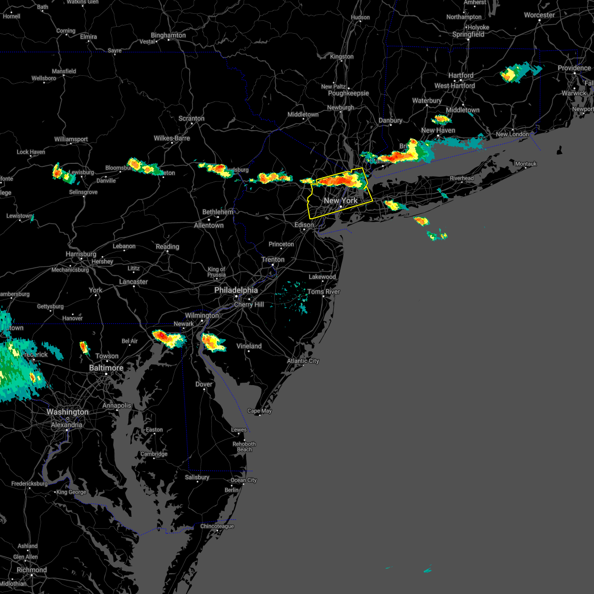 At 559 pm edt, severe thunderstorms were located along a line extending from bronxville to caldwell, moving south at 20 mph (radar indicated). Hazards include 60 mph wind gusts and penny size hail. Expect damage to trees and power lines. severe thunderstorms will be near, new rochelle and riverdale around 605 pm edt. bloomfield and cardinal spellman hs around 610 pm edt. millburn and orange around 615 pm edt. summit and mott haven around 620 pm edt. newark and harrison around 625 pm edt. great neck and flushing around 630 pm edt. elizabeth and little neck around 635 pm edt. Bayonne and clark around 640 pm edt. At 559 pm edt, severe thunderstorms were located along a line extending from bronxville to caldwell, moving south at 20 mph (radar indicated). Hazards include 60 mph wind gusts and penny size hail. Expect damage to trees and power lines. severe thunderstorms will be near, new rochelle and riverdale around 605 pm edt. bloomfield and cardinal spellman hs around 610 pm edt. millburn and orange around 615 pm edt. summit and mott haven around 620 pm edt. newark and harrison around 625 pm edt. great neck and flushing around 630 pm edt. elizabeth and little neck around 635 pm edt. Bayonne and clark around 640 pm edt.
|
| 8/25/2020 5:57 PM EDT |
 The national weather service in mount holly nj has issued a * severe thunderstorm warning for. warren county in northwestern new jersey. central monroe county in northeastern pennsylvania. northeastern northampton county in eastern pennsylvania. Until 645 pm edt. The national weather service in mount holly nj has issued a * severe thunderstorm warning for. warren county in northwestern new jersey. central monroe county in northeastern pennsylvania. northeastern northampton county in eastern pennsylvania. Until 645 pm edt.
|
| 8/25/2020 5:57 PM EDT |
 At 557 pm edt, a severe thunderstorm was located over reeders, or near mount pocono, moving southeast at 35 mph (radar indicated). Hazards include 60 mph wind gusts. damage to roofs, siding, trees, and power lines is possible At 557 pm edt, a severe thunderstorm was located over reeders, or near mount pocono, moving southeast at 35 mph (radar indicated). Hazards include 60 mph wind gusts. damage to roofs, siding, trees, and power lines is possible
|
| 8/24/2020 4:52 PM EDT |
 At 451 pm edt, a severe thunderstorm was located over gilbert, or 15 miles south of mount pocono, moving east at 30 mph (radar indicated). Hazards include 60 mph wind gusts and quarter size hail. Minor damage to vehicles is possible. wind damage to roofs, siding, trees, and power lines is possible. locations impacted include, east stroudsburg, blairstown, bangor, pen argyl, wind gap, belvidere, oxford, hope, east bangor, stormville, brodheadsville, kunkletown, werry lake, gilbert, millbrook, delaware water gap, tannersville, rossland, kresgeville and sun valley. this includes the following highways, interstate 80 in pennsylvania between mile markers 301 and 314. Interstate 80 in new jersey between mile markers 0 and 13. At 451 pm edt, a severe thunderstorm was located over gilbert, or 15 miles south of mount pocono, moving east at 30 mph (radar indicated). Hazards include 60 mph wind gusts and quarter size hail. Minor damage to vehicles is possible. wind damage to roofs, siding, trees, and power lines is possible. locations impacted include, east stroudsburg, blairstown, bangor, pen argyl, wind gap, belvidere, oxford, hope, east bangor, stormville, brodheadsville, kunkletown, werry lake, gilbert, millbrook, delaware water gap, tannersville, rossland, kresgeville and sun valley. this includes the following highways, interstate 80 in pennsylvania between mile markers 301 and 314. Interstate 80 in new jersey between mile markers 0 and 13.
|
| 8/24/2020 4:38 PM EDT |
 At 437 pm edt, a severe thunderstorm was located over mcmichael, or 10 miles south of mount pocono, moving east at 35 mph (radar indicated). Hazards include 60 mph wind gusts and quarter size hail. Minor damage to vehicles is possible. Wind damage to roofs, siding, trees, and power lines is possible. At 437 pm edt, a severe thunderstorm was located over mcmichael, or 10 miles south of mount pocono, moving east at 35 mph (radar indicated). Hazards include 60 mph wind gusts and quarter size hail. Minor damage to vehicles is possible. Wind damage to roofs, siding, trees, and power lines is possible.
|
| 8/18/2020 1:38 AM EDT |
 At 137 am edt, severe thunderstorms were located along a line extending from branchville to beatyestown to ferndale, moving east at 30 mph (radar indicated). Hazards include 60 mph wind gusts. damage to roofs, siding, trees, and power lines is possible At 137 am edt, severe thunderstorms were located along a line extending from branchville to beatyestown to ferndale, moving east at 30 mph (radar indicated). Hazards include 60 mph wind gusts. damage to roofs, siding, trees, and power lines is possible
|
| 8/18/2020 1:35 AM EDT |
 At 135 am edt, severe thunderstorms were located along a line extending from near lake mohawk to hackettstown to pleasant valley, moving east at 30 mph (radar indicated). Hazards include 60 mph wind gusts and penny size hail. Damage to roofs, siding, trees, and power lines is possible. locations impacted include, newton, hopatcong, hackettstown, washington, mount arlington, franklin, high bridge, stanhope, hamburg, netcong, clinton, belvidere, harmony, oxford, ogdensburg, hope, glen gardner, hampton, lebanon and califon. this includes the following highways, interstate 78 in new jersey between mile markers 15 and 22. Interstate 80 in new jersey between mile markers 11 and 30. At 135 am edt, severe thunderstorms were located along a line extending from near lake mohawk to hackettstown to pleasant valley, moving east at 30 mph (radar indicated). Hazards include 60 mph wind gusts and penny size hail. Damage to roofs, siding, trees, and power lines is possible. locations impacted include, newton, hopatcong, hackettstown, washington, mount arlington, franklin, high bridge, stanhope, hamburg, netcong, clinton, belvidere, harmony, oxford, ogdensburg, hope, glen gardner, hampton, lebanon and califon. this includes the following highways, interstate 78 in new jersey between mile markers 15 and 22. Interstate 80 in new jersey between mile markers 11 and 30.
|
| 8/18/2020 1:09 AM EDT |
 At 109 am edt, severe thunderstorms were located along a line extending from flatbrookville to near columbia to belfast, moving east at 30 mph (radar indicated). Hazards include 60 mph wind gusts and penny size hail. Damage to roofs, siding, trees, and power lines is possible. locations impacted include, newton, hopatcong, hackettstown, washington, blairstown, bangor, mount arlington, franklin, high bridge, stanhope, pen argyl, hamburg, netcong, wind gap, clinton, belvidere, harmony, oxford, ogdensburg and sussex. this includes the following highways, interstate 78 in new jersey between mile markers 15 and 22. interstate 80 in pennsylvania near mile marker 314. Interstate 80 in new jersey between mile markers 0 and 30. At 109 am edt, severe thunderstorms were located along a line extending from flatbrookville to near columbia to belfast, moving east at 30 mph (radar indicated). Hazards include 60 mph wind gusts and penny size hail. Damage to roofs, siding, trees, and power lines is possible. locations impacted include, newton, hopatcong, hackettstown, washington, blairstown, bangor, mount arlington, franklin, high bridge, stanhope, pen argyl, hamburg, netcong, wind gap, clinton, belvidere, harmony, oxford, ogdensburg and sussex. this includes the following highways, interstate 78 in new jersey between mile markers 15 and 22. interstate 80 in pennsylvania near mile marker 314. Interstate 80 in new jersey between mile markers 0 and 30.
|
| 8/18/2020 1:02 AM EDT |
 At 102 am edt, severe thunderstorms were located along a line extending from bushkill to near columbia to near belfast, moving east at 30 mph (radar indicated). Hazards include 60 mph wind gusts and penny size hail. Damage to roofs, siding, trees, and power lines is possible. locations impacted include, newton, mount pocono, hopatcong, east stroudsburg, hackettstown, washington, blairstown, bangor, mount arlington, franklin, high bridge, stanhope, pen argyl, hamburg, netcong, wind gap, clinton, belvidere, harmony and oxford. this includes the following highways, interstate 78 in new jersey between mile markers 15 and 22. interstate 80 in pennsylvania between mile markers 296 and 314. interstate 80 in new jersey between mile markers 0 and 30. Interstate 380 in pennsylvania between mile markers 0 and 5. At 102 am edt, severe thunderstorms were located along a line extending from bushkill to near columbia to near belfast, moving east at 30 mph (radar indicated). Hazards include 60 mph wind gusts and penny size hail. Damage to roofs, siding, trees, and power lines is possible. locations impacted include, newton, mount pocono, hopatcong, east stroudsburg, hackettstown, washington, blairstown, bangor, mount arlington, franklin, high bridge, stanhope, pen argyl, hamburg, netcong, wind gap, clinton, belvidere, harmony and oxford. this includes the following highways, interstate 78 in new jersey between mile markers 15 and 22. interstate 80 in pennsylvania between mile markers 296 and 314. interstate 80 in new jersey between mile markers 0 and 30. Interstate 380 in pennsylvania between mile markers 0 and 5.
|
| 8/18/2020 12:39 AM EDT |
 The national weather service in mount holly nj has issued a * severe thunderstorm warning for. western morris county in northern new jersey. northeastern hunterdon county in northwestern new jersey. sussex county in northwestern new jersey. Warren county in northwestern new jersey. The national weather service in mount holly nj has issued a * severe thunderstorm warning for. western morris county in northern new jersey. northeastern hunterdon county in northwestern new jersey. sussex county in northwestern new jersey. Warren county in northwestern new jersey.
|
| 8/18/2020 12:39 AM EDT |
 At 1238 am edt, severe thunderstorms were located along a line extending from near skytop to near reeders to near rossland, moving east at 30 mph (radar indicated). Hazards include 60 mph wind gusts and penny size hail. damage to roofs, siding, trees, and power lines is possible At 1238 am edt, severe thunderstorms were located along a line extending from near skytop to near reeders to near rossland, moving east at 30 mph (radar indicated). Hazards include 60 mph wind gusts and penny size hail. damage to roofs, siding, trees, and power lines is possible
|
| 7/22/2020 7:02 PM EDT |
 At 702 pm edt, severe thunderstorms were located along a line extending from paramus to rutherford to near jersey city to huguenot, moving east at 45 mph (radar indicated). Hazards include 60 mph wind gusts and quarter size hail. Minor hail damage to vehicles is possible. expect wind damage to trees and power lines. these severe storms will be near, bergenfield and ridgefield around 710 pm edt. new york and midtown manhattan around 715 pm edt. east tremont and laguardia airport around 720 pm edt. Flushing and rockaway beach around 725 pm edt. At 702 pm edt, severe thunderstorms were located along a line extending from paramus to rutherford to near jersey city to huguenot, moving east at 45 mph (radar indicated). Hazards include 60 mph wind gusts and quarter size hail. Minor hail damage to vehicles is possible. expect wind damage to trees and power lines. these severe storms will be near, bergenfield and ridgefield around 710 pm edt. new york and midtown manhattan around 715 pm edt. east tremont and laguardia airport around 720 pm edt. Flushing and rockaway beach around 725 pm edt.
|
| 7/22/2020 6:30 PM EDT |
 At 630 pm edt, severe thunderstorms were located along a line extending from lake telemark to near morristown to near martinsville to millstone, moving east at 45 mph (radar indicated). Hazards include 60 mph wind gusts and quarter size hail. Minor hail damage to vehicles is possible. expect wind damage to trees and power lines. severe thunderstorms will be near, plainfield around 640 pm edt. summit and millburn around 645 pm edt. wayne and linden around 650 pm edt. elizabeth and bloomfield around 655 pm edt. newark and paterson around 700 pm edt. jersey city and hackensack around 705 pm edt. hoboken and bergenfield around 710 pm edt. New york and coney island around 715 pm edt. At 630 pm edt, severe thunderstorms were located along a line extending from lake telemark to near morristown to near martinsville to millstone, moving east at 45 mph (radar indicated). Hazards include 60 mph wind gusts and quarter size hail. Minor hail damage to vehicles is possible. expect wind damage to trees and power lines. severe thunderstorms will be near, plainfield around 640 pm edt. summit and millburn around 645 pm edt. wayne and linden around 650 pm edt. elizabeth and bloomfield around 655 pm edt. newark and paterson around 700 pm edt. jersey city and hackensack around 705 pm edt. hoboken and bergenfield around 710 pm edt. New york and coney island around 715 pm edt.
|
| 7/22/2020 6:21 PM EDT |
 At 621 pm edt, a severe thunderstorm was located over plainfield, moving northeast at 25 mph (radar indicated). Hazards include 60 mph wind gusts and quarter size hail. Minor hail damage to vehicles is possible. expect wind damage to trees and power lines. this severe thunderstorm will be near, clark around 635 pm edt. linden and summit around 640 pm edt. millburn and union around 645 pm edt. elizabeth around 650 pm edt. port richmond around 655 pm edt. Newark and jersey city around 700 pm edt. At 621 pm edt, a severe thunderstorm was located over plainfield, moving northeast at 25 mph (radar indicated). Hazards include 60 mph wind gusts and quarter size hail. Minor hail damage to vehicles is possible. expect wind damage to trees and power lines. this severe thunderstorm will be near, clark around 635 pm edt. linden and summit around 640 pm edt. millburn and union around 645 pm edt. elizabeth around 650 pm edt. port richmond around 655 pm edt. Newark and jersey city around 700 pm edt.
|
| 7/22/2020 6:06 PM EDT |
 The severe thunderstorm warning for west central morris, northwestern hunterdon, southwestern sussex, warren, north central bucks, east central monroe and eastern northampton counties will expire at 615 pm edt, the storm which prompted the warning has weakened below severe limits, and has exited the warned area. therefore, the warning will be allowed to expire. however gusty winds and heavy rain are still possible with this thunderstorm. a severe thunderstorm watch remains in effect until 1000 pm edt for northern and northwestern new jersey, and eastern, southeastern and northeastern pennsylvania. The severe thunderstorm warning for west central morris, northwestern hunterdon, southwestern sussex, warren, north central bucks, east central monroe and eastern northampton counties will expire at 615 pm edt, the storm which prompted the warning has weakened below severe limits, and has exited the warned area. therefore, the warning will be allowed to expire. however gusty winds and heavy rain are still possible with this thunderstorm. a severe thunderstorm watch remains in effect until 1000 pm edt for northern and northwestern new jersey, and eastern, southeastern and northeastern pennsylvania.
|
| 7/22/2020 6:04 PM EDT |
 At 604 pm edt, severe thunderstorms were located along a line extending from near andover to near clinton, moving east at 25 mph (radar indicated). Hazards include 60 mph wind gusts and penny size hail. damage to roofs, siding, trees, and power lines is possible At 604 pm edt, severe thunderstorms were located along a line extending from near andover to near clinton, moving east at 25 mph (radar indicated). Hazards include 60 mph wind gusts and penny size hail. damage to roofs, siding, trees, and power lines is possible
|
| 7/22/2020 5:16 PM EDT |
 At 515 pm edt, a severe thunderstorm was located near oxford, or 17 miles southwest of newton, moving northeast at 15 mph (radar indicated). Hazards include 70 mph wind gusts and penny size hail. Expect considerable tree damage. Damage is likely to mobile homes, roofs, and outbuildings. At 515 pm edt, a severe thunderstorm was located near oxford, or 17 miles southwest of newton, moving northeast at 15 mph (radar indicated). Hazards include 70 mph wind gusts and penny size hail. Expect considerable tree damage. Damage is likely to mobile homes, roofs, and outbuildings.
|
| 7/6/2020 4:58 PM EDT |
 The severe thunderstorm warning for hudson, eastern passaic, south central bergen, essex, richmond, kings and new york (manhattan) counties will expire at 500 pm edt, the storms which prompted the warning have weakened below severe limits, and no longer pose an immediate threat to life or property. therefore, the warning will be allowed to expire. however heavy rain is still possible with these thunderstorms. a severe thunderstorm watch remains in effect until 1100 pm edt for northeastern new jersey. to report severe weather, contact your nearest law enforcement agency. they will relay your report to the national weather service upton ny. The severe thunderstorm warning for hudson, eastern passaic, south central bergen, essex, richmond, kings and new york (manhattan) counties will expire at 500 pm edt, the storms which prompted the warning have weakened below severe limits, and no longer pose an immediate threat to life or property. therefore, the warning will be allowed to expire. however heavy rain is still possible with these thunderstorms. a severe thunderstorm watch remains in effect until 1100 pm edt for northeastern new jersey. to report severe weather, contact your nearest law enforcement agency. they will relay your report to the national weather service upton ny.
|
| 7/6/2020 3:59 PM EDT |
 At 358 pm edt, severe thunderstorms were located along a line extending from near paterson to upper west side, moving south at 5 mph (radar indicated). Hazards include ping pong ball size hail and 60 mph wind gusts. People and animals outdoors will be injured. expect hail damage to roofs, siding, windows, and vehicles. expect wind damage to trees and power lines. severe thunderstorms will be near, new york and midtown manhattan around 405 pm edt. secaucus around 415 pm edt. union city around 420 pm edt. hoboken around 435 pm edt. east village around 440 pm edt. soho around 445 pm edt. kearny and lower east side around 450 pm edt. passaic around 455 pm edt. Newark and jersey city around 500 pm edt. At 358 pm edt, severe thunderstorms were located along a line extending from near paterson to upper west side, moving south at 5 mph (radar indicated). Hazards include ping pong ball size hail and 60 mph wind gusts. People and animals outdoors will be injured. expect hail damage to roofs, siding, windows, and vehicles. expect wind damage to trees and power lines. severe thunderstorms will be near, new york and midtown manhattan around 405 pm edt. secaucus around 415 pm edt. union city around 420 pm edt. hoboken around 435 pm edt. east village around 440 pm edt. soho around 445 pm edt. kearny and lower east side around 450 pm edt. passaic around 455 pm edt. Newark and jersey city around 500 pm edt.
|
| 7/3/2020 7:51 PM EDT |
 At 751 pm edt, a severe thunderstorm was located over kearny, or over harrison, moving southeast at 50 mph (radar indicated). Hazards include quarter size hail. Minor damage to vehicles is possible. this severe thunderstorm will be near, jersey city and hoboken around 755 pm edt. bayonne and todt hill around 800 pm edt. verrazano-narrows bridge and flatbush around 805 pm edt. coney island and arturo toscanini ps around 810 pm edt. Rockaway beach around 815 pm edt. At 751 pm edt, a severe thunderstorm was located over kearny, or over harrison, moving southeast at 50 mph (radar indicated). Hazards include quarter size hail. Minor damage to vehicles is possible. this severe thunderstorm will be near, jersey city and hoboken around 755 pm edt. bayonne and todt hill around 800 pm edt. verrazano-narrows bridge and flatbush around 805 pm edt. coney island and arturo toscanini ps around 810 pm edt. Rockaway beach around 815 pm edt.
|
| 6/28/2020 6:47 PM EDT |
 At 646 pm edt, a severe thunderstorm was located over bloomfield, moving east at 25 mph (radar indicated). Hazards include 60 mph wind gusts and quarter size hail. Hail damage to vehicles is possible. expect wind damage to trees and power lines. this severe thunderstorm will be near, secaucus and teterboro around 650 pm edt. new york and hoboken around 655 pm edt. Mott haven and east tremont around 700 pm edt. At 646 pm edt, a severe thunderstorm was located over bloomfield, moving east at 25 mph (radar indicated). Hazards include 60 mph wind gusts and quarter size hail. Hail damage to vehicles is possible. expect wind damage to trees and power lines. this severe thunderstorm will be near, secaucus and teterboro around 650 pm edt. new york and hoboken around 655 pm edt. Mott haven and east tremont around 700 pm edt.
|
| 6/28/2020 5:33 PM EDT |
 At 533 pm edt, a severe thunderstorm was located over belvidere, or 13 miles northeast of easton, moving southeast at 20 mph (radar indicated). Hazards include 60 mph wind gusts and penny size hail. Damage to roofs, siding, trees, and power lines is possible. locations impacted include, hackettstown, washington, high bridge, belvidere, oxford, hope, glen gardner, hampton, lebanon, califon, great meadows-vienna, brass castle, allamuchy-panther valley, pleasant valley, long valley, roxburg, columbia, budd lake, beatyestown and portland. this includes the following highways, interstate 78 in new jersey between mile markers 21 and 22. Interstate 80 in new jersey between mile markers 2 and 14. At 533 pm edt, a severe thunderstorm was located over belvidere, or 13 miles northeast of easton, moving southeast at 20 mph (radar indicated). Hazards include 60 mph wind gusts and penny size hail. Damage to roofs, siding, trees, and power lines is possible. locations impacted include, hackettstown, washington, high bridge, belvidere, oxford, hope, glen gardner, hampton, lebanon, califon, great meadows-vienna, brass castle, allamuchy-panther valley, pleasant valley, long valley, roxburg, columbia, budd lake, beatyestown and portland. this includes the following highways, interstate 78 in new jersey between mile markers 21 and 22. Interstate 80 in new jersey between mile markers 2 and 14.
|
| 6/28/2020 5:14 PM EDT |
 At 514 pm edt, a severe thunderstorm was located near east bangor, or 14 miles north of easton, moving east at 20 mph (radar indicated). Hazards include 60 mph wind gusts and quarter size hail. Minor damage to vehicles is possible. Wind damage to roofs, siding, trees, and power lines is possible. At 514 pm edt, a severe thunderstorm was located near east bangor, or 14 miles north of easton, moving east at 20 mph (radar indicated). Hazards include 60 mph wind gusts and quarter size hail. Minor damage to vehicles is possible. Wind damage to roofs, siding, trees, and power lines is possible.
|
| 6/28/2020 2:02 PM EDT |
 At 201 pm edt, a severe thunderstorm was located near columbia, or 17 miles northeast of easton, moving east at 25 mph (radar indicated). Hazards include 60 mph wind gusts and quarter size hail. Minor damage to vehicles is possible. Wind damage to roofs, siding, trees, and power lines is possible. At 201 pm edt, a severe thunderstorm was located near columbia, or 17 miles northeast of easton, moving east at 25 mph (radar indicated). Hazards include 60 mph wind gusts and quarter size hail. Minor damage to vehicles is possible. Wind damage to roofs, siding, trees, and power lines is possible.
|
| 6/3/2020 8:27 PM EDT |
 The severe thunderstorm warning for passaic, northern union, western bergen and essex counties will expire at 830 pm edt, the storms which prompted the warning have weakened below severe limits, and no longer pose an immediate threat to life or property. therefore, the warning will be allowed to expire. The severe thunderstorm warning for passaic, northern union, western bergen and essex counties will expire at 830 pm edt, the storms which prompted the warning have weakened below severe limits, and no longer pose an immediate threat to life or property. therefore, the warning will be allowed to expire.
|
| 6/3/2020 8:13 PM EDT |
 At 813 pm edt, severe thunderstorms were located along a line extending from near pompton lakes to boonton to succasunna-kenvil, moving southeast at 55 mph (radar indicated). Hazards include 60 mph wind gusts. Expect damage to trees and power lines. these severe storms will be near, wayne and caldwell around 820 pm edt. paterson and bloomfield around 825 pm edt. passaic and hackensack around 830 pm edt. Lyndhurst and rutherford around 835 pm edt. At 813 pm edt, severe thunderstorms were located along a line extending from near pompton lakes to boonton to succasunna-kenvil, moving southeast at 55 mph (radar indicated). Hazards include 60 mph wind gusts. Expect damage to trees and power lines. these severe storms will be near, wayne and caldwell around 820 pm edt. paterson and bloomfield around 825 pm edt. passaic and hackensack around 830 pm edt. Lyndhurst and rutherford around 835 pm edt.
|
| 6/3/2020 7:48 PM EDT |
 At 748 pm edt, severe thunderstorms were located along a line extending from unionville to pellettown to near five points, moving southeast at 50 mph (radar indicated). Hazards include 60 mph wind gusts. Expect damage to trees and power lines. severe thunderstorms will be near, upper greenwood lake around 800 pm edt. west milford around 805 pm edt. ringwood and bloomingdale around 810 pm edt. pompton lakes around 815 pm edt. wayne and caldwell around 820 pm edt. paterson and bloomfield around 825 pm edt. Passaic and hackensack around 830 pm edt. At 748 pm edt, severe thunderstorms were located along a line extending from unionville to pellettown to near five points, moving southeast at 50 mph (radar indicated). Hazards include 60 mph wind gusts. Expect damage to trees and power lines. severe thunderstorms will be near, upper greenwood lake around 800 pm edt. west milford around 805 pm edt. ringwood and bloomingdale around 810 pm edt. pompton lakes around 815 pm edt. wayne and caldwell around 820 pm edt. paterson and bloomfield around 825 pm edt. Passaic and hackensack around 830 pm edt.
|
| 6/3/2020 11:04 AM EDT |
 At 1103 am edt, severe thunderstorms were located along a line extending from nuremburg to near friedensburg to fort indiantown gap, moving east at 75 mph (radar indicated). Hazards include 60 mph wind gusts and penny size hail. damage to roofs, siding, trees, and power lines is possible At 1103 am edt, severe thunderstorms were located along a line extending from nuremburg to near friedensburg to fort indiantown gap, moving east at 75 mph (radar indicated). Hazards include 60 mph wind gusts and penny size hail. damage to roofs, siding, trees, and power lines is possible
|
| 4/21/2020 1:56 PM EDT |
 At 154 pm edt, severe thunderstorms were located along a line extending from near pompton lakes to near skillman, moving east at 35 mph (radar indicated). Hazards include 60 mph wind gusts and quarter size hail. Minor hail damage to vehicles is possible. Expect wind damage to trees and power lines. At 154 pm edt, severe thunderstorms were located along a line extending from near pompton lakes to near skillman, moving east at 35 mph (radar indicated). Hazards include 60 mph wind gusts and quarter size hail. Minor hail damage to vehicles is possible. Expect wind damage to trees and power lines.
|
| 4/9/2020 2:00 PM EDT |
 At 200 pm edt, severe thunderstorms were located along a line extending from rfk bridge to keansburg, moving east at 65 mph (radar indicated). Hazards include 70 mph wind gusts and quarter size hail. Minor hail damage to vehicles is possible. expect considerable tree damage. wind damage is also likely to mobile homes, roofs, and outbuildings. these severe storms will be near, jamaica and clearview expressway around 205 pm edt. coney island and arturo toscanini ps around 210 pm edt. rockaway beach around 215 pm edt. Valley stream and lynbrook around 225 pm edt. At 200 pm edt, severe thunderstorms were located along a line extending from rfk bridge to keansburg, moving east at 65 mph (radar indicated). Hazards include 70 mph wind gusts and quarter size hail. Minor hail damage to vehicles is possible. expect considerable tree damage. wind damage is also likely to mobile homes, roofs, and outbuildings. these severe storms will be near, jamaica and clearview expressway around 205 pm edt. coney island and arturo toscanini ps around 210 pm edt. rockaway beach around 215 pm edt. Valley stream and lynbrook around 225 pm edt.
|
| 4/9/2020 1:34 PM EDT |
 At 133 pm edt, severe thunderstorms were located along a line extending from summit to kingston, moving east at 65 mph (radar indicated). Hazards include 60 mph wind gusts and quarter size hail. Minor hail damage to vehicles is possible. expect wind damage to trees and power lines. severe thunderstorms will be near, elizabeth and linden around 140 pm edt. newark and bayonne around 145 pm edt. jersey city and hoboken around 150 pm edt. midtown manhattan and long island city around 155 pm edt. huguenot and forest hills around 200 pm edt. clearview expressway around 205 pm edt. Rockaway beach and coney island around 210 pm edt. At 133 pm edt, severe thunderstorms were located along a line extending from summit to kingston, moving east at 65 mph (radar indicated). Hazards include 60 mph wind gusts and quarter size hail. Minor hail damage to vehicles is possible. expect wind damage to trees and power lines. severe thunderstorms will be near, elizabeth and linden around 140 pm edt. newark and bayonne around 145 pm edt. jersey city and hoboken around 150 pm edt. midtown manhattan and long island city around 155 pm edt. huguenot and forest hills around 200 pm edt. clearview expressway around 205 pm edt. Rockaway beach and coney island around 210 pm edt.
|
| 3/3/2020 9:09 PM EST |
 At 908 pm est, severe thunderstorms were located along a line extending from great meadows-vienna to chalfont to fair hill, moving southeast at 40 mph (radar indicated). Hazards include 60 mph wind gusts. damage to roofs, siding, trees, and power lines is possible At 908 pm est, severe thunderstorms were located along a line extending from great meadows-vienna to chalfont to fair hill, moving southeast at 40 mph (radar indicated). Hazards include 60 mph wind gusts. damage to roofs, siding, trees, and power lines is possible
|
| 11/1/2019 12:28 AM EDT |
 At 1226 am edt, showers and possible thunderstorms were located along a line extending from near goshen to near boonton to society hill, moving northeast at 50 mph (radar indicated). Hazards include 60 mph wind gusts. Expect damage to trees and power lines. severe thunderstorms will be near, goshen and chester around 1230 am edt. wayne and pompton lakes around 1235 am edt. paterson and linden around 1240 am edt. elizabeth and newburgh around 1245 am edt. newark and bayonne around 1250 am edt. jersey city and secaucus around 1255 am edt. hoboken and tarrytown around 100 am edt. new york and white plains around 105 am edt. flushing and laguardia airport around 110 am edt. mount kisco and great neck around 115 am edt. sherman and bedford around 120 am edt. Stamford and glen cove around 125 am edt. At 1226 am edt, showers and possible thunderstorms were located along a line extending from near goshen to near boonton to society hill, moving northeast at 50 mph (radar indicated). Hazards include 60 mph wind gusts. Expect damage to trees and power lines. severe thunderstorms will be near, goshen and chester around 1230 am edt. wayne and pompton lakes around 1235 am edt. paterson and linden around 1240 am edt. elizabeth and newburgh around 1245 am edt. newark and bayonne around 1250 am edt. jersey city and secaucus around 1255 am edt. hoboken and tarrytown around 100 am edt. new york and white plains around 105 am edt. flushing and laguardia airport around 110 am edt. mount kisco and great neck around 115 am edt. sherman and bedford around 120 am edt. Stamford and glen cove around 125 am edt.
|
| 10/31/2019 11:35 PM EDT |
 At 1134 pm edt, severe thunderstorms were located along a line extending from five points to near pleasant valley, moving northeast at 50 mph (radar indicated). Hazards include 60 mph wind gusts. Damage to roofs, siding, trees, and power lines is possible. locations impacted include, port jervis, newton, montague, hopatcong, hackettstown, washington, blairstown, mount arlington, franklin, stanhope, hamburg, netcong, belvidere, oxford, ogdensburg, alpha, sussex, hope, hampton and bloomsbury. this includes the following highways, interstate 78 in new jersey between mile markers 3 and 7. Interstate 80 in new jersey between mile markers 6 and 25. At 1134 pm edt, severe thunderstorms were located along a line extending from five points to near pleasant valley, moving northeast at 50 mph (radar indicated). Hazards include 60 mph wind gusts. Damage to roofs, siding, trees, and power lines is possible. locations impacted include, port jervis, newton, montague, hopatcong, hackettstown, washington, blairstown, mount arlington, franklin, stanhope, hamburg, netcong, belvidere, oxford, ogdensburg, alpha, sussex, hope, hampton and bloomsbury. this includes the following highways, interstate 78 in new jersey between mile markers 3 and 7. Interstate 80 in new jersey between mile markers 6 and 25.
|
| 10/31/2019 10:43 PM EDT |
 At 1043 pm edt, severe thunderstorms were located along a line extending from near werry lake to near hellertown, moving northeast at 65 mph (radar indicated). Hazards include 60 mph wind gusts. damage to roofs, siding, trees, and power lines is possible At 1043 pm edt, severe thunderstorms were located along a line extending from near werry lake to near hellertown, moving northeast at 65 mph (radar indicated). Hazards include 60 mph wind gusts. damage to roofs, siding, trees, and power lines is possible
|
| 8/22/2019 7:24 PM EDT |
 The severe thunderstorm warning for warren and northeastern northampton counties will expire at 730 pm edt, the storm which prompted the warning has moved out of the area. therefore, the warning will be allowed to expire. however gusty winds are still possible with this thunderstorm. to report severe weather, contact your nearest law enforcement agency. they will relay your report to the national weather service mount holly nj. The severe thunderstorm warning for warren and northeastern northampton counties will expire at 730 pm edt, the storm which prompted the warning has moved out of the area. therefore, the warning will be allowed to expire. however gusty winds are still possible with this thunderstorm. to report severe weather, contact your nearest law enforcement agency. they will relay your report to the national weather service mount holly nj.
|
| 8/22/2019 7:05 PM EDT |
 A severe thunderstorm warning remains in effect until 730 pm edt for warren and northeastern northampton counties. at 704 pm edt, a severe thunderstorm was located over columbia, or 17 miles north of easton, moving east at 40 mph. hazard. 60 mph wind gusts and penny size hail. source. Radar indicated. A severe thunderstorm warning remains in effect until 730 pm edt for warren and northeastern northampton counties. at 704 pm edt, a severe thunderstorm was located over columbia, or 17 miles north of easton, moving east at 40 mph. hazard. 60 mph wind gusts and penny size hail. source. Radar indicated.
|
| 8/22/2019 6:43 PM EDT |
 At 643 pm edt, a severe thunderstorm was located over saylorsburg, or 13 miles south of mount pocono, moving east at 40 mph (radar indicated). Hazards include 60 mph wind gusts and penny size hail. damage to roofs, siding, trees, and power lines is possible At 643 pm edt, a severe thunderstorm was located over saylorsburg, or 13 miles south of mount pocono, moving east at 40 mph (radar indicated). Hazards include 60 mph wind gusts and penny size hail. damage to roofs, siding, trees, and power lines is possible
|
| 8/18/2019 7:07 PM EDT |
 A severe thunderstorm warning remains in effect until 745 pm edt for morris. northeastern hunterdon. sussex. central warren. north central somerset and northeastern northampton counties. At 707 pm edt, severe thunderstorms were located along a line extending from near highland lake to near lake mohawk to near hackettstown, moving east at 40 mph. A severe thunderstorm warning remains in effect until 745 pm edt for morris. northeastern hunterdon. sussex. central warren. north central somerset and northeastern northampton counties. At 707 pm edt, severe thunderstorms were located along a line extending from near highland lake to near lake mohawk to near hackettstown, moving east at 40 mph.
|
| 8/18/2019 6:40 PM EDT |
 The national weather service in mount holly nj has issued a * severe thunderstorm warning for. morris county in northern new jersey. northeastern hunterdon county in northwestern new jersey. sussex county in northwestern new jersey. Warren county in northwestern new jersey. The national weather service in mount holly nj has issued a * severe thunderstorm warning for. morris county in northern new jersey. northeastern hunterdon county in northwestern new jersey. sussex county in northwestern new jersey. Warren county in northwestern new jersey.
|
| 8/8/2019 8:15 PM EDT |
 At 815 pm edt, a severe thunderstorm was located over newark, moving east at 30 mph (radar indicated). Hazards include 60 mph wind gusts. Expect damage to trees and power lines. this severe storm will be near, bayonne and rutherford around 820 pm edt. jersey city and secaucus around 825 pm edt. Hoboken and union city around 830 pm edt. At 815 pm edt, a severe thunderstorm was located over newark, moving east at 30 mph (radar indicated). Hazards include 60 mph wind gusts. Expect damage to trees and power lines. this severe storm will be near, bayonne and rutherford around 820 pm edt. jersey city and secaucus around 825 pm edt. Hoboken and union city around 830 pm edt.
|
| 8/8/2019 7:59 PM EDT |
 At 759 pm edt, a severe thunderstorm was located over millburn, moving east at 40 mph (radar indicated). Hazards include 60 mph wind gusts. Expect damage to trees and power lines. this severe thunderstorm will be near, orange around 805 pm edt. bloomfield around 810 pm edt. newark and elizabeth around 815 pm edt. bayonne and lyndhurst around 820 pm edt. jersey city and secaucus around 825 pm edt. Hoboken and union city around 830 pm edt. At 759 pm edt, a severe thunderstorm was located over millburn, moving east at 40 mph (radar indicated). Hazards include 60 mph wind gusts. Expect damage to trees and power lines. this severe thunderstorm will be near, orange around 805 pm edt. bloomfield around 810 pm edt. newark and elizabeth around 815 pm edt. bayonne and lyndhurst around 820 pm edt. jersey city and secaucus around 825 pm edt. Hoboken and union city around 830 pm edt.
|
| 8/8/2019 7:51 PM EDT |
 At 751 pm edt, a severe thunderstorm was located over port richmond, or over elizabeth, moving southeast at 45 mph (radar indicated). Hazards include 60 mph wind gusts and penny size hail. Expect damage to trees and power lines. this severe storm will be near, todt hill and huguenot around 755 pm edt. Tompkinsville and oakwood around 800 pm edt. At 751 pm edt, a severe thunderstorm was located over port richmond, or over elizabeth, moving southeast at 45 mph (radar indicated). Hazards include 60 mph wind gusts and penny size hail. Expect damage to trees and power lines. this severe storm will be near, todt hill and huguenot around 755 pm edt. Tompkinsville and oakwood around 800 pm edt.
|
| 8/8/2019 7:19 PM EDT |
 At 718 pm edt, a severe thunderstorm was located over victory gardens, or near morristown, moving southeast at 40 mph (radar indicated). Hazards include 60 mph wind gusts and penny size hail. Expect damage to trees and power lines. this severe thunderstorm will be near, summit and caldwell around 735 pm edt. orange and millburn around 740 pm edt. clark and union around 745 pm edt. newark and elizabeth around 750 pm edt. jersey city and bayonne around 755 pm edt. Huguenot and tompkinsville around 800 pm edt. At 718 pm edt, a severe thunderstorm was located over victory gardens, or near morristown, moving southeast at 40 mph (radar indicated). Hazards include 60 mph wind gusts and penny size hail. Expect damage to trees and power lines. this severe thunderstorm will be near, summit and caldwell around 735 pm edt. orange and millburn around 740 pm edt. clark and union around 745 pm edt. newark and elizabeth around 750 pm edt. jersey city and bayonne around 755 pm edt. Huguenot and tompkinsville around 800 pm edt.
|
| 8/7/2019 4:53 PM EDT |
 The severe thunderstorm warning for southwestern morris, northeastern hunterdon, southwestern sussex, warren, northwestern somerset, east central monroe and northeastern northampton counties will expire at 500 pm edt, the storms which prompted the warning have weakened below severe limits, and no longer pose an immediate threat to life or property. therefore, the warning will be allowed to expire. however gusty winds are still possible with these thunderstorms. a severe thunderstorm watch remains in effect until 900 pm edt for northern and northwestern new jersey, and eastern and northeastern pennsylvania. The severe thunderstorm warning for southwestern morris, northeastern hunterdon, southwestern sussex, warren, northwestern somerset, east central monroe and northeastern northampton counties will expire at 500 pm edt, the storms which prompted the warning have weakened below severe limits, and no longer pose an immediate threat to life or property. therefore, the warning will be allowed to expire. however gusty winds are still possible with these thunderstorms. a severe thunderstorm watch remains in effect until 900 pm edt for northern and northwestern new jersey, and eastern and northeastern pennsylvania.
|
| 8/7/2019 4:46 PM EDT |
 At 445 pm edt, severe thunderstorms were located along a line extending from near echo lake to near califon, moving northeast at 30 mph (radar indicated). Hazards include 60 mph wind gusts and penny size hail. Damage to roofs, siding, trees, and power lines is possible. locations impacted include, hackettstown, washington, blairstown, mendham, high bridge, clinton, belvidere, peapack and gladstone, oxford, hope, glen gardner, chester, hampton, lebanon, califon, far hills, bloomsbury, brass castle, werry lake and greendell. This includes interstate 287 in new jersey between mile markers 22 and 26. At 445 pm edt, severe thunderstorms were located along a line extending from near echo lake to near califon, moving northeast at 30 mph (radar indicated). Hazards include 60 mph wind gusts and penny size hail. Damage to roofs, siding, trees, and power lines is possible. locations impacted include, hackettstown, washington, blairstown, mendham, high bridge, clinton, belvidere, peapack and gladstone, oxford, hope, glen gardner, chester, hampton, lebanon, califon, far hills, bloomsbury, brass castle, werry lake and greendell. This includes interstate 287 in new jersey between mile markers 22 and 26.
|
| 8/7/2019 4:14 PM EDT |
 At 413 pm edt, severe thunderstorms were located along a line extending from near pen argyl to near bloomsbury, moving northeast at 30 mph (radar indicated). Hazards include 60 mph wind gusts and penny size hail. damage to roofs, siding, trees, and power lines is possible At 413 pm edt, severe thunderstorms were located along a line extending from near pen argyl to near bloomsbury, moving northeast at 30 mph (radar indicated). Hazards include 60 mph wind gusts and penny size hail. damage to roofs, siding, trees, and power lines is possible
|
| 8/7/2019 3:09 PM EDT |
 A severe thunderstorm warning remains in effect until 345 pm edt for hudson. eastern passaic. southeastern bergen and essex counties. at 308 pm edt, a severe thunderstorm was located over harrison, moving northeast at 20 mph. hazard. 60 mph wind gusts and quarter size hail. A severe thunderstorm warning remains in effect until 345 pm edt for hudson. eastern passaic. southeastern bergen and essex counties. at 308 pm edt, a severe thunderstorm was located over harrison, moving northeast at 20 mph. hazard. 60 mph wind gusts and quarter size hail.
|
| 8/7/2019 2:56 PM EDT |
 At 256 pm edt, a severe thunderstorm was located over union, or over orange, moving northeast at 20 mph (radar indicated). Hazards include 60 mph wind gusts and quarter size hail. Minor hail damage to vehicles is possible. expect wind damage to trees and power lines. this severe thunderstorm will be near, elizabeth around 300 pm edt. orange and caldwell around 305 pm edt. newark and bayonne around 310 pm edt. bloomfield and harrison around 315 pm edt. kearny around 320 pm edt. jersey city and lyndhurst around 325 pm edt. passaic and hoboken around 330 pm edt. union city around 335 pm edt. teterboro around 340 pm edt. Hackensack and bergenfield around 345 pm edt. At 256 pm edt, a severe thunderstorm was located over union, or over orange, moving northeast at 20 mph (radar indicated). Hazards include 60 mph wind gusts and quarter size hail. Minor hail damage to vehicles is possible. expect wind damage to trees and power lines. this severe thunderstorm will be near, elizabeth around 300 pm edt. orange and caldwell around 305 pm edt. newark and bayonne around 310 pm edt. bloomfield and harrison around 315 pm edt. kearny around 320 pm edt. jersey city and lyndhurst around 325 pm edt. passaic and hoboken around 330 pm edt. union city around 335 pm edt. teterboro around 340 pm edt. Hackensack and bergenfield around 345 pm edt.
|
| 8/7/2019 2:35 PM EDT |
 At 235 pm edt, a severe thunderstorm was located over summit, moving east at 20 mph (radar indicated). Hazards include 60 mph wind gusts and quarter size hail. Minor hail damage to vehicles is possible. expect wind damage to trees and power lines. this severe storm will be near, summit around 240 pm edt. clark around 245 pm edt. millburn around 250 pm edt. union around 255 pm edt. Newark and elizabeth around 300 pm edt. At 235 pm edt, a severe thunderstorm was located over summit, moving east at 20 mph (radar indicated). Hazards include 60 mph wind gusts and quarter size hail. Minor hail damage to vehicles is possible. expect wind damage to trees and power lines. this severe storm will be near, summit around 240 pm edt. clark around 245 pm edt. millburn around 250 pm edt. union around 255 pm edt. Newark and elizabeth around 300 pm edt.
|
| 8/7/2019 2:18 PM EDT |
 At 217 pm edt, a severe thunderstorm was located over millington, or near morristown, moving east at 25 mph (radar indicated). Hazards include 60 mph wind gusts and quarter size hail. Minor hail damage to vehicles is possible. expect wind damage to trees and power lines. this severe thunderstorm will be near, plainfield around 230 pm edt. summit around 245 pm edt. millburn and clark around 250 pm edt. Newark and elizabeth around 300 pm edt. At 217 pm edt, a severe thunderstorm was located over millington, or near morristown, moving east at 25 mph (radar indicated). Hazards include 60 mph wind gusts and quarter size hail. Minor hail damage to vehicles is possible. expect wind damage to trees and power lines. this severe thunderstorm will be near, plainfield around 230 pm edt. summit around 245 pm edt. millburn and clark around 250 pm edt. Newark and elizabeth around 300 pm edt.
|
| 7/31/2019 5:12 PM EDT |
 At 512 pm edt, severe thunderstorms were located along a line extending from near lake mohawk to columbia, moving east at 15 mph (radar indicated). Hazards include 60 mph wind gusts and penny size hail. Damage to roofs, siding, trees, and power lines is possible. Locations impacted include, newton, dover, hopatcong, east stroudsburg, hackettstown, wharton, washington, blairstown, bangor, mount arlington, stanhope, netcong, belvidere, oxford, ogdensburg, hope, east bangor, branchville, andover and brass castle. At 512 pm edt, severe thunderstorms were located along a line extending from near lake mohawk to columbia, moving east at 15 mph (radar indicated). Hazards include 60 mph wind gusts and penny size hail. Damage to roofs, siding, trees, and power lines is possible. Locations impacted include, newton, dover, hopatcong, east stroudsburg, hackettstown, wharton, washington, blairstown, bangor, mount arlington, stanhope, netcong, belvidere, oxford, ogdensburg, hope, east bangor, branchville, andover and brass castle.
|
| 7/31/2019 4:52 PM EDT |
 At 451 pm edt, severe thunderstorms were located along a line extending from newton to near east stroudsburg, moving east at 15 mph (radar indicated). Hazards include 60 mph wind gusts and penny size hail. damage to roofs, siding, trees, and power lines is possible At 451 pm edt, severe thunderstorms were located along a line extending from newton to near east stroudsburg, moving east at 15 mph (radar indicated). Hazards include 60 mph wind gusts and penny size hail. damage to roofs, siding, trees, and power lines is possible
|
| 7/22/2019 5:58 PM EDT |
 The severe thunderstorm warning for hudson, eastern passaic, bergen, northeastern essex, westchester, bronx, rockland and new york (manhattan) counties will expire at 600 pm edt, the storms which prompted the warning have weakened below severe limits, and no longer pose an immediate threat to life or property. therefore, the warning will be allowed to expire. however flash flooding is still expected from the training thunderstorm activity. a severe thunderstorm watch remains in effect until 1000 pm edt for southern connecticut, northeastern new jersey, and southeastern new york. The severe thunderstorm warning for hudson, eastern passaic, bergen, northeastern essex, westchester, bronx, rockland and new york (manhattan) counties will expire at 600 pm edt, the storms which prompted the warning have weakened below severe limits, and no longer pose an immediate threat to life or property. therefore, the warning will be allowed to expire. however flash flooding is still expected from the training thunderstorm activity. a severe thunderstorm watch remains in effect until 1000 pm edt for southern connecticut, northeastern new jersey, and southeastern new york.
|
| 7/22/2019 5:16 PM EDT |
 At 516 pm edt, severe thunderstorms were located along a line extending from wayne to lyndhurst, moving northeast at 30 mph (radar indicated). Hazards include 60 mph wind gusts and quarter size hail. Minor hail damage to vehicles is possible. expect wind damage to trees and power lines. severe thunderstorms will be near, paterson and secaucus around 520 pm edt. ridgefield and hawthorne around 525 pm edt. hackensack and paramus around 530 pm edt. bergenfield and harlem around 535 pm edt. east tremont and riverdale around 540 pm edt. monsey and co-op city around 545 pm edt. yonkers and nanuet around 550 pm edt. new rochelle and new city around 555 pm edt. White plains and port chester around 600 pm edt. At 516 pm edt, severe thunderstorms were located along a line extending from wayne to lyndhurst, moving northeast at 30 mph (radar indicated). Hazards include 60 mph wind gusts and quarter size hail. Minor hail damage to vehicles is possible. expect wind damage to trees and power lines. severe thunderstorms will be near, paterson and secaucus around 520 pm edt. ridgefield and hawthorne around 525 pm edt. hackensack and paramus around 530 pm edt. bergenfield and harlem around 535 pm edt. east tremont and riverdale around 540 pm edt. monsey and co-op city around 545 pm edt. yonkers and nanuet around 550 pm edt. new rochelle and new city around 555 pm edt. White plains and port chester around 600 pm edt.
|
| 7/22/2019 5:07 PM EDT |
 At 506 pm edt, severe thunderstorms were located along a line extending from near lake telemark to beatyestown, moving east at 30 mph (law enforcement. several reports of trees and wires down have been received from mansfield township and blairstown township as these storms passed). Hazards include 60 mph wind gusts and penny size hail. Damage to roofs, siding, trees, and power lines is possible. Locations impacted include, port jervis, newton, montague, hopatcong, hackettstown, washington, blairstown, mount arlington, franklin, stanhope, hamburg, netcong, belvidere, harmony, oxford, ogdensburg, alpha, sussex, hope and milford. At 506 pm edt, severe thunderstorms were located along a line extending from near lake telemark to beatyestown, moving east at 30 mph (law enforcement. several reports of trees and wires down have been received from mansfield township and blairstown township as these storms passed). Hazards include 60 mph wind gusts and penny size hail. Damage to roofs, siding, trees, and power lines is possible. Locations impacted include, port jervis, newton, montague, hopatcong, hackettstown, washington, blairstown, mount arlington, franklin, stanhope, hamburg, netcong, belvidere, harmony, oxford, ogdensburg, alpha, sussex, hope and milford.
|
| 7/22/2019 4:43 PM EDT |
 At 443 pm edt, severe thunderstorms were located along a line extending from near franklin to allamuchy-panther valley, moving northeast at 35 mph (radar indicated). Hazards include 60 mph wind gusts and penny size hail. Damage to roofs, siding, trees, and power lines is possible. Locations impacted include, port jervis, newton, montague, hopatcong, hackettstown, washington, blairstown, mount arlington, franklin, stanhope, hamburg, netcong, belvidere, harmony, oxford, ogdensburg, alpha, sussex, hope and milford. At 443 pm edt, severe thunderstorms were located along a line extending from near franklin to allamuchy-panther valley, moving northeast at 35 mph (radar indicated). Hazards include 60 mph wind gusts and penny size hail. Damage to roofs, siding, trees, and power lines is possible. Locations impacted include, port jervis, newton, montague, hopatcong, hackettstown, washington, blairstown, mount arlington, franklin, stanhope, hamburg, netcong, belvidere, harmony, oxford, ogdensburg, alpha, sussex, hope and milford.
|
| 7/22/2019 4:24 PM EDT |
 At 424 pm edt, severe thunderstorms were located along a line extending from andover to oxford, moving northeast at 35 mph (radar indicated). Hazards include 60 mph wind gusts and penny size hail. damage to roofs, siding, trees, and power lines is possible At 424 pm edt, severe thunderstorms were located along a line extending from andover to oxford, moving northeast at 35 mph (radar indicated). Hazards include 60 mph wind gusts and penny size hail. damage to roofs, siding, trees, and power lines is possible
|
| 7/22/2019 2:49 PM EDT |
 At 249 pm edt, severe thunderstorms were located along a line extending from near unionville to great meadows-vienna, moving east at 20 mph (radar indicated). Hazards include 60 mph wind gusts and half dollar size hail. Minor damage to vehicles is possible. wind damage to roofs, siding, trees, and power lines is possible. Locations impacted include, port jervis, newton, montague, dover, hopatcong, hackettstown, wharton, rockaway, mount arlington, franklin, mendham, stanhope, hamburg, netcong, oxford, ogdensburg, sussex, hope, chester and victory gardens. At 249 pm edt, severe thunderstorms were located along a line extending from near unionville to great meadows-vienna, moving east at 20 mph (radar indicated). Hazards include 60 mph wind gusts and half dollar size hail. Minor damage to vehicles is possible. wind damage to roofs, siding, trees, and power lines is possible. Locations impacted include, port jervis, newton, montague, dover, hopatcong, hackettstown, wharton, rockaway, mount arlington, franklin, mendham, stanhope, hamburg, netcong, oxford, ogdensburg, sussex, hope, chester and victory gardens.
|
| 7/22/2019 2:35 PM EDT |
 At 234 pm edt, severe thunderstorms were located along a line extending from near high point to near oxford, moving east at 20 mph (radar indicated). Hazards include 60 mph wind gusts and penny size hail. damage to roofs, siding, trees, and power lines is possible At 234 pm edt, severe thunderstorms were located along a line extending from near high point to near oxford, moving east at 20 mph (radar indicated). Hazards include 60 mph wind gusts and penny size hail. damage to roofs, siding, trees, and power lines is possible
|
| 7/17/2019 7:33 PM EDT |
 At 733 pm edt, severe thunderstorms were located along a line extending from florida to lake telemark to near clinton, moving east at 50 mph (radar indicated). Hazards include 60 mph wind gusts. Expect damage to trees and power lines. these severe storms will be near, pompton lakes and caldwell around 745 pm edt. wayne around 750 pm edt. paterson and passaic around 755 pm edt. Plainfield and hackensack around 800 pm edt. At 733 pm edt, severe thunderstorms were located along a line extending from florida to lake telemark to near clinton, moving east at 50 mph (radar indicated). Hazards include 60 mph wind gusts. Expect damage to trees and power lines. these severe storms will be near, pompton lakes and caldwell around 745 pm edt. wayne around 750 pm edt. paterson and passaic around 755 pm edt. Plainfield and hackensack around 800 pm edt.
|
| 7/17/2019 7:19 PM EDT |
 The national weather service in upton ny has issued a * severe thunderstorm warning for. southern fairfield county in southern connecticut. hudson county in northeastern new jersey. passaic county in northeastern new jersey. Union county in northeastern new jersey. The national weather service in upton ny has issued a * severe thunderstorm warning for. southern fairfield county in southern connecticut. hudson county in northeastern new jersey. passaic county in northeastern new jersey. Union county in northeastern new jersey.
|
| 7/17/2019 7:19 PM EDT |
 At 718 pm edt, severe thunderstorms were located along a line extending from near unionville to near stanhope to ferndale, moving east at 50 mph (radar indicated). Hazards include 60 mph wind gusts. Expect damage to trees and power lines. severe thunderstorms will be near, pompton lakes and caldwell around 745 pm edt. wayne around 750 pm edt. paterson and passaic around 755 pm edt. Plainfield and hackensack around 800 pm edt. At 718 pm edt, severe thunderstorms were located along a line extending from near unionville to near stanhope to ferndale, moving east at 50 mph (radar indicated). Hazards include 60 mph wind gusts. Expect damage to trees and power lines. severe thunderstorms will be near, pompton lakes and caldwell around 745 pm edt. wayne around 750 pm edt. paterson and passaic around 755 pm edt. Plainfield and hackensack around 800 pm edt.
|
| 7/17/2019 7:00 PM EDT |
 At 659 pm edt, severe thunderstorms were located along a line extending from hamburg to ogdensburg to near stanhope, moving east at 40 mph (radar indicated). Hazards include 60 mph wind gusts and penny size hail. Damage to roofs, siding, trees, and power lines is possible. Locations impacted include, newton, dover, hopatcong, kinnelon, hackettstown, butler, wharton, rockaway, mount arlington, franklin, mountain lakes, stanhope, riverdale, hamburg, netcong, ogdensburg, sussex, victory gardens, branchville and andover. At 659 pm edt, severe thunderstorms were located along a line extending from hamburg to ogdensburg to near stanhope, moving east at 40 mph (radar indicated). Hazards include 60 mph wind gusts and penny size hail. Damage to roofs, siding, trees, and power lines is possible. Locations impacted include, newton, dover, hopatcong, kinnelon, hackettstown, butler, wharton, rockaway, mount arlington, franklin, mountain lakes, stanhope, riverdale, hamburg, netcong, ogdensburg, sussex, victory gardens, branchville and andover.
|
| 7/17/2019 6:39 PM EDT |
 At 639 pm edt, severe thunderstorms were located along a line extending from branchville to near five points to near hope, moving east at 40 mph (radar indicated). Hazards include 60 mph wind gusts and penny size hail. damage to roofs, siding, trees, and power lines is possible At 639 pm edt, severe thunderstorms were located along a line extending from branchville to near five points to near hope, moving east at 40 mph (radar indicated). Hazards include 60 mph wind gusts and penny size hail. damage to roofs, siding, trees, and power lines is possible
|
| 7/6/2019 7:13 PM EDT |
 At 713 pm edt, severe thunderstorms were located along a line extending from near greendell to tatamy to adamstown, moving southeast at 25 mph (radar indicated). Hazards include 60 mph wind gusts. Damage to roofs, siding, trees, and power lines is possible. Locations impacted include, allentown, reading, easton, bethlehem, pottstown, dover, hopatcong, forks, emmaus, wyomissing, hackettstown, quakertown, wilson, wharton, washington, rockaway, blairstown, hellertown, nazareth and morris plains. At 713 pm edt, severe thunderstorms were located along a line extending from near greendell to tatamy to adamstown, moving southeast at 25 mph (radar indicated). Hazards include 60 mph wind gusts. Damage to roofs, siding, trees, and power lines is possible. Locations impacted include, allentown, reading, easton, bethlehem, pottstown, dover, hopatcong, forks, emmaus, wyomissing, hackettstown, quakertown, wilson, wharton, washington, rockaway, blairstown, hellertown, nazareth and morris plains.
|
| 7/6/2019 6:55 PM EDT |
 The severe thunderstorm warning for sussex, warren, berks, lehigh, southeastern carbon, monroe and northampton counties will expire at 700 pm edt, the storms which prompted the warning continue to move to the southeast. a new severe thunderstorm warning is in effect for these counties until 8:00 pm edt. to report severe weather, contact your nearest law enforcement agency. they will relay your report to the national weather service mount holly nj. The severe thunderstorm warning for sussex, warren, berks, lehigh, southeastern carbon, monroe and northampton counties will expire at 700 pm edt, the storms which prompted the warning continue to move to the southeast. a new severe thunderstorm warning is in effect for these counties until 8:00 pm edt. to report severe weather, contact your nearest law enforcement agency. they will relay your report to the national weather service mount holly nj.
|
| 7/6/2019 6:53 PM EDT |
 At 653 pm edt, severe thunderstorms were located along a line extending from near unionville to near nazareth to near cornwall, moving southeast at 25 mph (radar indicated). Hazards include 60 mph wind gusts. damage to roofs, siding, trees, and power lines is possible At 653 pm edt, severe thunderstorms were located along a line extending from near unionville to near nazareth to near cornwall, moving southeast at 25 mph (radar indicated). Hazards include 60 mph wind gusts. damage to roofs, siding, trees, and power lines is possible
|
| 7/6/2019 6:22 PM EDT |
 At 622 pm edt, severe thunderstorms were located along a line extending from near matamoras to beltzville state park to near palmyra, moving southeast at 30 mph (radar indicated). Hazards include 60 mph wind gusts. damage to roofs, siding, trees, and power lines is possible At 622 pm edt, severe thunderstorms were located along a line extending from near matamoras to beltzville state park to near palmyra, moving southeast at 30 mph (radar indicated). Hazards include 60 mph wind gusts. damage to roofs, siding, trees, and power lines is possible
|
| 7/6/2019 5:05 PM EDT |
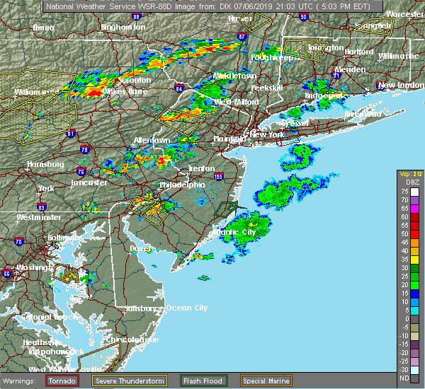 At 504 pm edt, a severe thunderstorm was located over greendell, or near newton, moving southeast at 15 mph (radar indicated). Hazards include 60 mph wind gusts and penny size hail. Damage to roofs, siding, trees, and power lines is possible. Locations impacted include, dover, hopatcong, hackettstown, wharton, blairstown, mount arlington, stanhope, netcong, chester, andover, allamuchy-panther valley, succasunna, succasunna-kenvil, greendell, budd lake, lake mohawk and great meadows-vienna. At 504 pm edt, a severe thunderstorm was located over greendell, or near newton, moving southeast at 15 mph (radar indicated). Hazards include 60 mph wind gusts and penny size hail. Damage to roofs, siding, trees, and power lines is possible. Locations impacted include, dover, hopatcong, hackettstown, wharton, blairstown, mount arlington, stanhope, netcong, chester, andover, allamuchy-panther valley, succasunna, succasunna-kenvil, greendell, budd lake, lake mohawk and great meadows-vienna.
|
| 7/6/2019 4:41 PM EDT |
 At 441 pm edt, a severe thunderstorm was located over blairstown, or 12 miles southwest of newton, moving southeast at 10 mph (radar indicated). Hazards include 60 mph wind gusts and nickel size hail. damage to roofs, siding, trees, and power lines is possible At 441 pm edt, a severe thunderstorm was located over blairstown, or 12 miles southwest of newton, moving southeast at 10 mph (radar indicated). Hazards include 60 mph wind gusts and nickel size hail. damage to roofs, siding, trees, and power lines is possible
|
| 6/29/2019 5:05 PM EDT |
 At 504 pm edt, a severe thunderstorm was located over secaucus, moving east at 35 mph (radar indicated). Hazards include 60 mph wind gusts and penny size hail. Expect damage to trees and power lines. This severe storm will be near, fort lee and englewood around 510 pm edt. At 504 pm edt, a severe thunderstorm was located over secaucus, moving east at 35 mph (radar indicated). Hazards include 60 mph wind gusts and penny size hail. Expect damage to trees and power lines. This severe storm will be near, fort lee and englewood around 510 pm edt.
|
| 6/29/2019 4:45 PM EDT |
 At 445 pm edt, a severe thunderstorm was located over rutherford, moving east at 15 mph (radar indicated). Hazards include 60 mph wind gusts and penny size hail. Expect damage to trees and power lines. this severe storm will be near, kearny around 450 pm edt. hackensack and teterboro around 455 pm edt. secaucus around 500 pm edt. jersey city and ridgefield around 505 pm edt. union city and englewood around 510 pm edt. Fort lee around 515 pm edt. At 445 pm edt, a severe thunderstorm was located over rutherford, moving east at 15 mph (radar indicated). Hazards include 60 mph wind gusts and penny size hail. Expect damage to trees and power lines. this severe storm will be near, kearny around 450 pm edt. hackensack and teterboro around 455 pm edt. secaucus around 500 pm edt. jersey city and ridgefield around 505 pm edt. union city and englewood around 510 pm edt. Fort lee around 515 pm edt.
|
| 6/29/2019 4:27 PM EDT |
 At 426 pm edt, a severe thunderstorm was located over bloomfield, moving east at 35 mph (radar indicated). Hazards include 60 mph wind gusts and penny size hail. Expect damage to trees and power lines. this severe thunderstorm will be near, paterson around 430 pm edt. bloomfield around 435 pm edt. passaic around 440 pm edt. harrison around 445 pm edt. lyndhurst and rutherford around 450 pm edt. hackensack and kearny around 455 pm edt. secaucus around 500 pm edt. jersey city and ridgefield around 505 pm edt. union city and englewood around 510 pm edt. Fort lee around 515 pm edt. At 426 pm edt, a severe thunderstorm was located over bloomfield, moving east at 35 mph (radar indicated). Hazards include 60 mph wind gusts and penny size hail. Expect damage to trees and power lines. this severe thunderstorm will be near, paterson around 430 pm edt. bloomfield around 435 pm edt. passaic around 440 pm edt. harrison around 445 pm edt. lyndhurst and rutherford around 450 pm edt. hackensack and kearny around 455 pm edt. secaucus around 500 pm edt. jersey city and ridgefield around 505 pm edt. union city and englewood around 510 pm edt. Fort lee around 515 pm edt.
|
| 6/29/2019 3:53 PM EDT |
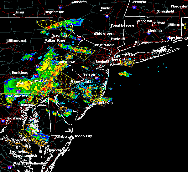 At 353 pm edt, a severe thunderstorm was located over andover, or over newton, moving east at 15 mph (radar indicated). Hazards include 60 mph wind gusts and quarter size hail. Minor damage to vehicles is possible. wind damage to roofs, siding, trees, and power lines is possible. Locations impacted include, newton, dover, hopatcong, hackettstown, wharton, rockaway, blairstown, mount arlington, stanhope, netcong, victory gardens, andover, lake mohawk, greendell, millbrook, green pond, flatbrookville, allamuchy-panther valley, succasunna and succasunna-kenvil. At 353 pm edt, a severe thunderstorm was located over andover, or over newton, moving east at 15 mph (radar indicated). Hazards include 60 mph wind gusts and quarter size hail. Minor damage to vehicles is possible. wind damage to roofs, siding, trees, and power lines is possible. Locations impacted include, newton, dover, hopatcong, hackettstown, wharton, rockaway, blairstown, mount arlington, stanhope, netcong, victory gardens, andover, lake mohawk, greendell, millbrook, green pond, flatbrookville, allamuchy-panther valley, succasunna and succasunna-kenvil.
|
| 6/29/2019 3:31 PM EDT |
 At 331 pm edt, a severe thunderstorm was located over greendell, or near newton, moving southeast at 20 mph (radar indicated). Hazards include 60 mph wind gusts and quarter size hail. Minor damage to vehicles is possible. Wind damage to roofs, siding, trees, and power lines is possible. At 331 pm edt, a severe thunderstorm was located over greendell, or near newton, moving southeast at 20 mph (radar indicated). Hazards include 60 mph wind gusts and quarter size hail. Minor damage to vehicles is possible. Wind damage to roofs, siding, trees, and power lines is possible.
|
| 6/2/2019 9:10 PM EDT |
 At 910 pm edt, severe thunderstorms were located along a line extending from near chatham to sayreville to near tinton falls, moving northeast at 75 mph (radar indicated). Hazards include 60 mph wind gusts. Expect damage to trees and power lines. severe thunderstorms will be near, summit and millburn around 915 pm edt. elizabeth and bloomfield around 920 pm edt. newark and jersey city around 925 pm edt. Paramus and ridgewood around 930 pm edt. At 910 pm edt, severe thunderstorms were located along a line extending from near chatham to sayreville to near tinton falls, moving northeast at 75 mph (radar indicated). Hazards include 60 mph wind gusts. Expect damage to trees and power lines. severe thunderstorms will be near, summit and millburn around 915 pm edt. elizabeth and bloomfield around 920 pm edt. newark and jersey city around 925 pm edt. Paramus and ridgewood around 930 pm edt.
|
| 5/29/2019 5:23 PM EDT |
 At 522 pm edt, severe thunderstorms were located along a line extending from near greendell to near birdsboro, moving east at 90 mph (radar indicated). Hazards include 60 mph wind gusts and quarter size hail. Minor damage to vehicles is possible. Wind damage to roofs, siding, trees, and power lines is possible. At 522 pm edt, severe thunderstorms were located along a line extending from near greendell to near birdsboro, moving east at 90 mph (radar indicated). Hazards include 60 mph wind gusts and quarter size hail. Minor damage to vehicles is possible. Wind damage to roofs, siding, trees, and power lines is possible.
|
| 5/29/2019 4:14 PM EDT |
 At 414 pm edt, a severe thunderstorm was located over greendell, or near newton, moving east at 45 mph (radar indicated). Hazards include 60 mph wind gusts and quarter size hail. Minor damage to vehicles is possible. wind damage to roofs, siding, trees, and power lines is possible. Locations impacted include, newton, hopatcong, east stroudsburg, hackettstown, blairstown, bangor, mount arlington, stanhope, netcong, hope, east bangor, andover, stormville, henryville, lake mohawk, werry lake, greendell, millbrook, delaware water gap and great meadows-vienna. At 414 pm edt, a severe thunderstorm was located over greendell, or near newton, moving east at 45 mph (radar indicated). Hazards include 60 mph wind gusts and quarter size hail. Minor damage to vehicles is possible. wind damage to roofs, siding, trees, and power lines is possible. Locations impacted include, newton, hopatcong, east stroudsburg, hackettstown, blairstown, bangor, mount arlington, stanhope, netcong, hope, east bangor, andover, stormville, henryville, lake mohawk, werry lake, greendell, millbrook, delaware water gap and great meadows-vienna.
|
| 5/29/2019 3:43 PM EDT |
 At 341 pm edt, a severe thunderstorm was located over scotrun, or near mount pocono, moving east at 45 mph (radar indicated). Hazards include 60 mph wind gusts and half dollar size hail. Minor damage to vehicles is possible. Wind damage to roofs, siding, trees, and power lines is possible. At 341 pm edt, a severe thunderstorm was located over scotrun, or near mount pocono, moving east at 45 mph (radar indicated). Hazards include 60 mph wind gusts and half dollar size hail. Minor damage to vehicles is possible. Wind damage to roofs, siding, trees, and power lines is possible.
|
| 5/28/2019 9:12 PM EDT |
 At 912 pm edt, a severe thunderstorm was located near succasunna-kenvil, or 7 miles northwest of morristown, moving southeast at 30 mph (radar indicated). Hazards include 60 mph wind gusts and quarter size hail. Minor damage to vehicles is possible. wind damage to roofs, siding, trees, and power lines is possible. Locations impacted include, morristown, newton, dover, madison, hopatcong, florham park, east hanover, lincoln park, kinnelon, hackettstown, chatham, boonton, butler, wharton, rockaway, blairstown, morris plains, mount arlington, franklin and mendham. At 912 pm edt, a severe thunderstorm was located near succasunna-kenvil, or 7 miles northwest of morristown, moving southeast at 30 mph (radar indicated). Hazards include 60 mph wind gusts and quarter size hail. Minor damage to vehicles is possible. wind damage to roofs, siding, trees, and power lines is possible. Locations impacted include, morristown, newton, dover, madison, hopatcong, florham park, east hanover, lincoln park, kinnelon, hackettstown, chatham, boonton, butler, wharton, rockaway, blairstown, morris plains, mount arlington, franklin and mendham.
|
| 5/28/2019 8:48 PM EDT |
 At 848 pm edt, a severe thunderstorm was located over morris plains, or near morristown, moving southeast at 30 mph (radar indicated). Hazards include 60 mph wind gusts and quarter size hail. Minor hail damage to vehicles is possible. expect wind damage to trees and power lines. this severe thunderstorm will be near, summit around 905 pm edt. millburn around 910 pm edt. orange and union around 915 pm edt. newark and elizabeth around 925 pm edt. kearny around 930 pm edt. jersey city and bayonne around 935 pm edt. east village and soho around 940 pm edt. The verrazano narrows bridge and bay ridge around 945 pm edt. At 848 pm edt, a severe thunderstorm was located over morris plains, or near morristown, moving southeast at 30 mph (radar indicated). Hazards include 60 mph wind gusts and quarter size hail. Minor hail damage to vehicles is possible. expect wind damage to trees and power lines. this severe thunderstorm will be near, summit around 905 pm edt. millburn around 910 pm edt. orange and union around 915 pm edt. newark and elizabeth around 925 pm edt. kearny around 930 pm edt. jersey city and bayonne around 935 pm edt. east village and soho around 940 pm edt. The verrazano narrows bridge and bay ridge around 945 pm edt.
|
| 5/28/2019 8:44 PM EDT |
 At 843 pm edt, a severe thunderstorm was located over allamuchy-panther valley, or 8 miles southwest of newton, moving southeast at 45 mph (radar indicated). Hazards include 60 mph wind gusts and half dollar size hail. Minor damage to vehicles is possible. Wind damage to roofs, siding, trees, and power lines is possible. At 843 pm edt, a severe thunderstorm was located over allamuchy-panther valley, or 8 miles southwest of newton, moving southeast at 45 mph (radar indicated). Hazards include 60 mph wind gusts and half dollar size hail. Minor damage to vehicles is possible. Wind damage to roofs, siding, trees, and power lines is possible.
|
| 5/28/2019 8:38 PM EDT |
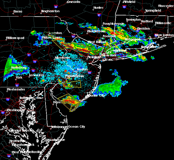 At 837 pm edt, a severe thunderstorm capable of producing a tornado was located over blairstown, or 14 miles west of newton, moving southeast at 35 mph (radar indicated rotation). Hazards include tornado and half dollar size hail. Flying debris will be dangerous to those caught without shelter. mobile homes will be damaged or destroyed. damage to roofs, windows, and vehicles will occur. tree damage is likely. Locations impacted include, blairstown and hope. At 837 pm edt, a severe thunderstorm capable of producing a tornado was located over blairstown, or 14 miles west of newton, moving southeast at 35 mph (radar indicated rotation). Hazards include tornado and half dollar size hail. Flying debris will be dangerous to those caught without shelter. mobile homes will be damaged or destroyed. damage to roofs, windows, and vehicles will occur. tree damage is likely. Locations impacted include, blairstown and hope.
|
| 5/28/2019 8:23 PM EDT |
 At 822 pm edt, a severe thunderstorm capable of producing a tornado was located over analomink, or 10 miles east of mount pocono, moving southeast at 35 mph (radar indicated rotation). Hazards include tornado and half dollar size hail. Flying debris will be dangerous to those caught without shelter. mobile homes will be damaged or destroyed. damage to roofs, windows, and vehicles will occur. Tree damage is likely. At 822 pm edt, a severe thunderstorm capable of producing a tornado was located over analomink, or 10 miles east of mount pocono, moving southeast at 35 mph (radar indicated rotation). Hazards include tornado and half dollar size hail. Flying debris will be dangerous to those caught without shelter. mobile homes will be damaged or destroyed. damage to roofs, windows, and vehicles will occur. Tree damage is likely.
|
| 5/23/2019 10:25 PM EDT |
 The tornado warning for southwestern sussex, central warren and eastern northampton counties will expire at 1030 pm edt, the storm which prompted the warning has weakened below severe limits, and has exited the warned area. therefore, the warning will be allowed to expire. to report severe weather, contact your nearest law enforcement agency. they will relay your report to the national weather service mount holly nj. The tornado warning for southwestern sussex, central warren and eastern northampton counties will expire at 1030 pm edt, the storm which prompted the warning has weakened below severe limits, and has exited the warned area. therefore, the warning will be allowed to expire. to report severe weather, contact your nearest law enforcement agency. they will relay your report to the national weather service mount holly nj.
|
| 5/23/2019 10:16 PM EDT |
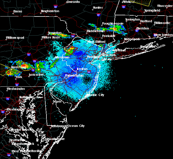 At 1015 pm edt, a severe thunderstorm capable of producing a tornado was located over hope, or 15 miles southwest of newton, moving southeast at 60 mph (radar indicated rotation). Hazards include tornado and quarter size hail. Flying debris will be dangerous to those caught without shelter. mobile homes will be damaged or destroyed. damage to roofs, windows, and vehicles will occur. tree damage is likely. Locations impacted include, hackettstown, blairstown, oxford, hope, andover, great meadows-vienna, allamuchy-panther valley, greendell, columbia, beatyestown and portland. At 1015 pm edt, a severe thunderstorm capable of producing a tornado was located over hope, or 15 miles southwest of newton, moving southeast at 60 mph (radar indicated rotation). Hazards include tornado and quarter size hail. Flying debris will be dangerous to those caught without shelter. mobile homes will be damaged or destroyed. damage to roofs, windows, and vehicles will occur. tree damage is likely. Locations impacted include, hackettstown, blairstown, oxford, hope, andover, great meadows-vienna, allamuchy-panther valley, greendell, columbia, beatyestown and portland.
|
| 5/23/2019 9:59 PM EDT |
 At 959 pm edt, a severe thunderstorm capable of producing a tornado was located near reeders, or 10 miles south of mount pocono, moving east at 65 mph (radar indicated rotation). Hazards include tornado and quarter size hail. Flying debris will be dangerous to those caught without shelter. mobile homes will be damaged or destroyed. damage to roofs, windows, and vehicles will occur. Tree damage is likely. At 959 pm edt, a severe thunderstorm capable of producing a tornado was located near reeders, or 10 miles south of mount pocono, moving east at 65 mph (radar indicated rotation). Hazards include tornado and quarter size hail. Flying debris will be dangerous to those caught without shelter. mobile homes will be damaged or destroyed. damage to roofs, windows, and vehicles will occur. Tree damage is likely.
|
| 5/23/2019 9:59 PM EDT |
 The national weather service in mount holly nj has issued a * tornado warning for. southwestern sussex county in northwestern new jersey. warren county in northwestern new jersey. central monroe county in northeastern pennsylvania. Northeastern northampton county in eastern pennsylvania. The national weather service in mount holly nj has issued a * tornado warning for. southwestern sussex county in northwestern new jersey. warren county in northwestern new jersey. central monroe county in northeastern pennsylvania. Northeastern northampton county in eastern pennsylvania.
|
| 5/19/2019 11:41 PM EDT |
 At 1140 pm edt, a severe thunderstorm was located over hope, or 17 miles southwest of newton, moving east at 55 mph (radar indicated). Hazards include 60 mph wind gusts and quarter size hail. Minor damage to vehicles is possible. Wind damage to roofs, siding, trees, and power lines is possible. At 1140 pm edt, a severe thunderstorm was located over hope, or 17 miles southwest of newton, moving east at 55 mph (radar indicated). Hazards include 60 mph wind gusts and quarter size hail. Minor damage to vehicles is possible. Wind damage to roofs, siding, trees, and power lines is possible.
|
| 5/19/2019 7:52 PM EDT |
 At 752 pm edt, severe thunderstorms were located along a line extending from milford to dingmans ferry to near columbia, moving east at 35 mph (radar indicated). Hazards include 60 mph wind gusts and quarter size hail. Minor damage to vehicles is possible. Wind damage to roofs, siding, trees, and power lines is possible. At 752 pm edt, severe thunderstorms were located along a line extending from milford to dingmans ferry to near columbia, moving east at 35 mph (radar indicated). Hazards include 60 mph wind gusts and quarter size hail. Minor damage to vehicles is possible. Wind damage to roofs, siding, trees, and power lines is possible.
|
| 4/15/2019 4:29 AM EDT |
 At 429 am edt, severe thunderstorms were located along a line extending from near monsey to lyndhurst to perth amboy, moving northeast at 55 mph (radar indicated). Hazards include 60 mph wind gusts. Expect damage to trees and power lines. these severe storms will be near, hackensack and ridgefield around 435 am edt. elizabeth and bergenfield around 440 am edt. Jersey city and bayonne around 445 am edt. At 429 am edt, severe thunderstorms were located along a line extending from near monsey to lyndhurst to perth amboy, moving northeast at 55 mph (radar indicated). Hazards include 60 mph wind gusts. Expect damage to trees and power lines. these severe storms will be near, hackensack and ridgefield around 435 am edt. elizabeth and bergenfield around 440 am edt. Jersey city and bayonne around 445 am edt.
|
| 4/15/2019 4:08 AM EDT |
 At 407 am edt, severe thunderstorms were located along a line extending from near boonton to near plainfield to plainsboro center, moving northeast at 55 mph (radar indicated). Hazards include 60 mph wind gusts. Expect damage to trees and power lines. severe thunderstorms will be near, clark and fairfield around 410 am edt. wayne and summit around 415 am edt. newark and elizabeth around 420 am edt. jersey city and bloomfield around 425 am edt. passaic and lyndhurst around 430 am edt. hackensack and linden around 435 am edt. bergenfield and todt hill around 440 am edt. Bayonne and norwood around 445 am edt. At 407 am edt, severe thunderstorms were located along a line extending from near boonton to near plainfield to plainsboro center, moving northeast at 55 mph (radar indicated). Hazards include 60 mph wind gusts. Expect damage to trees and power lines. severe thunderstorms will be near, clark and fairfield around 410 am edt. wayne and summit around 415 am edt. newark and elizabeth around 420 am edt. jersey city and bloomfield around 425 am edt. passaic and lyndhurst around 430 am edt. hackensack and linden around 435 am edt. bergenfield and todt hill around 440 am edt. Bayonne and norwood around 445 am edt.
|
| 10/2/2018 7:55 PM EDT |
 At 754 pm edt, a severe thunderstorm was located over blairstown, or 12 miles west of newton, moving east at 25 mph (radar indicated). Hazards include 60 mph wind gusts. Damage to roofs, siding, trees, and power lines is possible. locations impacted include, blairstown, hope, millbrook and allamuchy-panther valley. A tornado watch remains in effect until midnight edt for northwestern new jersey. At 754 pm edt, a severe thunderstorm was located over blairstown, or 12 miles west of newton, moving east at 25 mph (radar indicated). Hazards include 60 mph wind gusts. Damage to roofs, siding, trees, and power lines is possible. locations impacted include, blairstown, hope, millbrook and allamuchy-panther valley. A tornado watch remains in effect until midnight edt for northwestern new jersey.
|
| 10/2/2018 7:22 PM EDT |
 At 721 pm edt, a severe thunderstorm was located over east stroudsburg, or 10 miles southeast of mount pocono, moving east at 25 mph (radar indicated). Hazards include 60 mph wind gusts. damage to roofs, siding, trees, and power lines is possible At 721 pm edt, a severe thunderstorm was located over east stroudsburg, or 10 miles southeast of mount pocono, moving east at 25 mph (radar indicated). Hazards include 60 mph wind gusts. damage to roofs, siding, trees, and power lines is possible
|
| 9/17/2018 4:35 PM EDT |
 At 434 pm edt, a severe thunderstorm was located near middlesex, or near plainfield, moving northeast at 25 mph (radar indicated). Hazards include 60 mph wind gusts. Expect damage to trees and power lines. this severe thunderstorm will be near, plainfield around 440 pm edt. summit around 500 pm edt. millburn and union around 505 pm edt. Bloomfield and orange around 515 pm edt. At 434 pm edt, a severe thunderstorm was located near middlesex, or near plainfield, moving northeast at 25 mph (radar indicated). Hazards include 60 mph wind gusts. Expect damage to trees and power lines. this severe thunderstorm will be near, plainfield around 440 pm edt. summit around 500 pm edt. millburn and union around 505 pm edt. Bloomfield and orange around 515 pm edt.
|
| 8/17/2018 8:17 PM EDT |
 At 816 pm edt, severe thunderstorms were located along a line extending from blairstown to beatyestown to milford, moving northeast at 40 mph (radar indicated). Hazards include 60 mph wind gusts. damage to roofs, siding, trees, and power lines is possible At 816 pm edt, severe thunderstorms were located along a line extending from blairstown to beatyestown to milford, moving northeast at 40 mph (radar indicated). Hazards include 60 mph wind gusts. damage to roofs, siding, trees, and power lines is possible
|
| 8/17/2018 6:56 PM EDT |
 The severe thunderstorm warning for western sussex, northern warren and east central monroe counties will expire at 700 pm edt, the storm which prompted the warning has weakened below severe limits, and no longer poses an immediate threat to life or property. therefore, the warning will be allowed to expire. however gusty winds and heavy rain are still possible with this thunderstorm. a severe thunderstorm watch remains in effect until 1100 pm edt for northwestern new jersey, and eastern and northeastern pennsylvania. to report severe weather, contact your nearest law enforcement agency. they will relay your report to the national weather service in mount holly nj. The severe thunderstorm warning for western sussex, northern warren and east central monroe counties will expire at 700 pm edt, the storm which prompted the warning has weakened below severe limits, and no longer poses an immediate threat to life or property. therefore, the warning will be allowed to expire. however gusty winds and heavy rain are still possible with this thunderstorm. a severe thunderstorm watch remains in effect until 1100 pm edt for northwestern new jersey, and eastern and northeastern pennsylvania. to report severe weather, contact your nearest law enforcement agency. they will relay your report to the national weather service in mount holly nj.
|
| 8/17/2018 6:41 PM EDT |
 At 621 pm edt, a severe thunderstorm was located over east bangor, or 14 miles north of easton, moving northeast at 40 mph (public. several reports of wind damage have been received from northampton county during the past 20 minutes). Hazards include 70 mph wind gusts and nickel size hail. Expect considerable tree damage. Damage is likely to mobile homes, roofs, and outbuildings. At 621 pm edt, a severe thunderstorm was located over east bangor, or 14 miles north of easton, moving northeast at 40 mph (public. several reports of wind damage have been received from northampton county during the past 20 minutes). Hazards include 70 mph wind gusts and nickel size hail. Expect considerable tree damage. Damage is likely to mobile homes, roofs, and outbuildings.
|
| 8/17/2018 6:41 PM EDT |
 A severe thunderstorm warning remains in effect until 700 pm edt for western sussex. northern warren and east central monroe counties. at 640 pm edt, a severe thunderstorm was located over blairstown, or 13 miles west of newton, moving northeast at 40 mph. hazard. 70 mph wind gusts and penny size hail. A severe thunderstorm warning remains in effect until 700 pm edt for western sussex. northern warren and east central monroe counties. at 640 pm edt, a severe thunderstorm was located over blairstown, or 13 miles west of newton, moving northeast at 40 mph. hazard. 70 mph wind gusts and penny size hail.
|
| 8/17/2018 6:22 PM EDT |
 At 621 pm edt, a severe thunderstorm was located over east bangor, or 14 miles north of easton, moving northeast at 40 mph (public. several reports of wind damage have been received from northampton county during the past 20 minutes). Hazards include 70 mph wind gusts and nickel size hail. Expect considerable tree damage. Damage is likely to mobile homes, roofs, and outbuildings. At 621 pm edt, a severe thunderstorm was located over east bangor, or 14 miles north of easton, moving northeast at 40 mph (public. several reports of wind damage have been received from northampton county during the past 20 minutes). Hazards include 70 mph wind gusts and nickel size hail. Expect considerable tree damage. Damage is likely to mobile homes, roofs, and outbuildings.
|
| 7/4/2018 2:38 PM EDT |
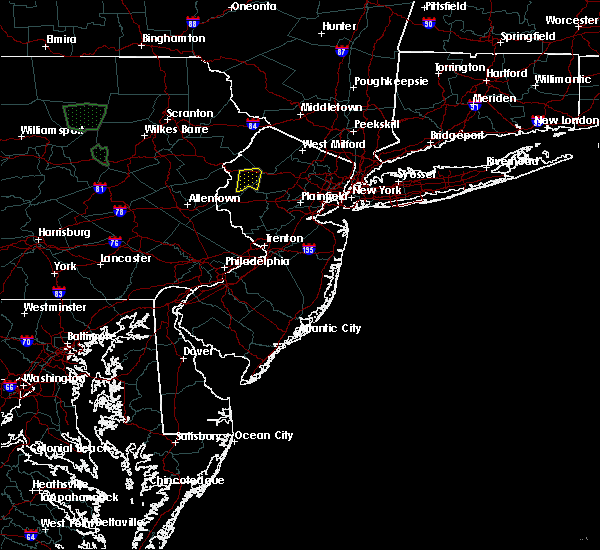 The severe thunderstorm warning for west central morris and east central warren counties will expire at 245 pm edt, the storm which prompted the warning has weakened below severe limits, and no longer poses an immediate threat to life or property. therefore, the warning will be allowed to expire. however gusty winds and heavy rain are still possible with this thunderstorm. The severe thunderstorm warning for west central morris and east central warren counties will expire at 245 pm edt, the storm which prompted the warning has weakened below severe limits, and no longer poses an immediate threat to life or property. therefore, the warning will be allowed to expire. however gusty winds and heavy rain are still possible with this thunderstorm.
|
| 7/4/2018 2:21 PM EDT |
 At 220 pm edt, a severe thunderstorm was located over great meadows-vienna, or 15 miles southwest of newton, and is nearly stationary (radar indicated). Hazards include 60 mph wind gusts and penny size hail. Damage to roofs, siding, trees, and power lines is possible. Locations impacted include, hackettstown, washington, oxford, hope, great meadows-vienna, allamuchy-panther valley, beatyestown, brass castle, long valley and beattyestown. At 220 pm edt, a severe thunderstorm was located over great meadows-vienna, or 15 miles southwest of newton, and is nearly stationary (radar indicated). Hazards include 60 mph wind gusts and penny size hail. Damage to roofs, siding, trees, and power lines is possible. Locations impacted include, hackettstown, washington, oxford, hope, great meadows-vienna, allamuchy-panther valley, beatyestown, brass castle, long valley and beattyestown.
|
| 7/4/2018 1:57 PM EDT |
 At 157 pm edt, a severe thunderstorm was located over hackettstown, or 12 miles south of newton, and is nearly stationary (radar indicated). Hazards include 60 mph wind gusts and penny size hail. damage to roofs, siding, trees, and power lines is possible At 157 pm edt, a severe thunderstorm was located over hackettstown, or 12 miles south of newton, and is nearly stationary (radar indicated). Hazards include 60 mph wind gusts and penny size hail. damage to roofs, siding, trees, and power lines is possible
|
| 7/3/2018 1:55 PM EDT |
 The severe thunderstorm warning for hudson, northeastern union and southeastern essex counties will expire at 200 pm edt, the storm which prompted the warning has moved out of the area. therefore, the warning will be allowed to expire. remember, a severe thunderstorm warning still remains in effect for union county. The severe thunderstorm warning for hudson, northeastern union and southeastern essex counties will expire at 200 pm edt, the storm which prompted the warning has moved out of the area. therefore, the warning will be allowed to expire. remember, a severe thunderstorm warning still remains in effect for union county.
|
| 7/3/2018 1:21 PM EDT |
 At 121 pm edt, a severe thunderstorm was located over union, or over elizabeth, and is nearly stationary (radar indicated). Hazards include 60 mph wind gusts. Expect damage to trees and power lines. This severe thunderstorm will be near, union around 135 pm edt. At 121 pm edt, a severe thunderstorm was located over union, or over elizabeth, and is nearly stationary (radar indicated). Hazards include 60 mph wind gusts. Expect damage to trees and power lines. This severe thunderstorm will be near, union around 135 pm edt.
|
| 6/18/2018 7:15 PM EDT |
 At 712 pm edt, severe thunderstorms were located along a line extending from near blairstown in new jersey to near northampton in pennsylvania , moving east at 35 mph (radar indicated). Hazards include 60 mph wind gusts. Damage to roofs, siding, trees, and power lines is possible. Locations impacted include, allentown, easton, newton, bethlehem, hopatcong, forks, northampton, hackettstown, wilson, washington, blairstown, hellertown, nazareth, bangor, mount arlington, slatington, stanhope, pen argyl, netcong and wind gap. At 712 pm edt, severe thunderstorms were located along a line extending from near blairstown in new jersey to near northampton in pennsylvania , moving east at 35 mph (radar indicated). Hazards include 60 mph wind gusts. Damage to roofs, siding, trees, and power lines is possible. Locations impacted include, allentown, easton, newton, bethlehem, hopatcong, forks, northampton, hackettstown, wilson, washington, blairstown, hellertown, nazareth, bangor, mount arlington, slatington, stanhope, pen argyl, netcong and wind gap.
|
| 6/18/2018 6:48 PM EDT |
 At 647 pm edt, severe thunderstorms were located along a line extending from near alpine mountain to near new mahoning, moving east at 35 mph (radar indicated). Hazards include 60 mph wind gusts. damage to roofs, siding, trees, and power lines is possible At 647 pm edt, severe thunderstorms were located along a line extending from near alpine mountain to near new mahoning, moving east at 35 mph (radar indicated). Hazards include 60 mph wind gusts. damage to roofs, siding, trees, and power lines is possible
|
| 6/13/2018 11:41 PM EDT |
 The severe thunderstorm warning for northern warren, southeastern monroe and northeastern northampton counties will expire at 1145 pm edt, the storms which prompted the warning have moved out of the area. therefore, the warning will be allowed to expire. however gusty winds and heavy rain are still possible with these thunderstorms. The severe thunderstorm warning for northern warren, southeastern monroe and northeastern northampton counties will expire at 1145 pm edt, the storms which prompted the warning have moved out of the area. therefore, the warning will be allowed to expire. however gusty winds and heavy rain are still possible with these thunderstorms.
|
| 6/13/2018 11:27 PM EDT |
 At 1127 pm edt, a severe thunderstorm was located over belvidere, or 12 miles northeast of easton, moving east at 45 mph (radar indicated). Hazards include 60 mph wind gusts and penny size hail. damage to roofs, siding, trees, and power lines is possible At 1127 pm edt, a severe thunderstorm was located over belvidere, or 12 miles northeast of easton, moving east at 45 mph (radar indicated). Hazards include 60 mph wind gusts and penny size hail. damage to roofs, siding, trees, and power lines is possible
|
| 6/13/2018 11:13 PM EDT |
 At 1112 pm edt, severe thunderstorms were located along a line extending from near echo lake to columbia to rossland, moving southeast at 50 mph (radar indicated). Hazards include 70 mph wind gusts and penny size hail. Expect considerable tree damage. damage is likely to mobile homes, roofs, and outbuildings. Locations impacted include, east stroudsburg, blairstown, bangor, pen argyl, wind gap, belvidere, hope, belfast, east bangor, stormville, brodheadsville, kunkletown, werry lake, gilbert, millbrook, delaware water gap, rossland, saylorsburg, columbia and echo lake. At 1112 pm edt, severe thunderstorms were located along a line extending from near echo lake to columbia to rossland, moving southeast at 50 mph (radar indicated). Hazards include 70 mph wind gusts and penny size hail. Expect considerable tree damage. damage is likely to mobile homes, roofs, and outbuildings. Locations impacted include, east stroudsburg, blairstown, bangor, pen argyl, wind gap, belvidere, hope, belfast, east bangor, stormville, brodheadsville, kunkletown, werry lake, gilbert, millbrook, delaware water gap, rossland, saylorsburg, columbia and echo lake.
|
| 6/13/2018 10:56 PM EDT |
 At 1054 pm edt, severe thunderstorms were located along a line extending from near analomink to jonas, moving southeast at 40 mph (radar indicated). Hazards include 70 mph wind gusts and penny size hail. Expect considerable tree damage. Damage is likely to mobile homes, roofs, and outbuildings. At 1054 pm edt, severe thunderstorms were located along a line extending from near analomink to jonas, moving southeast at 40 mph (radar indicated). Hazards include 70 mph wind gusts and penny size hail. Expect considerable tree damage. Damage is likely to mobile homes, roofs, and outbuildings.
|
| 5/15/2018 5:19 PM EDT |
 At 516 pm edt, severe thunderstorms were located along a line extending from near tolland to plainville to near hamden to stamford to kearny to near white house station, moving east at 50 mph (trained weather spotters and automated surface observations, with numerous reports of wind damage). Hazards include 70 mph wind gusts and nickel size hail. Expect considerable tree damage. damage is likely to mobile homes, roofs, and outbuildings. Locations impacted include, newark, jersey city, jamaica, yonkers, paterson, bridgeport, new haven, elizabeth, stamford, flatbush, waterbury, norwalk, danbury, new rochelle and flushing. At 516 pm edt, severe thunderstorms were located along a line extending from near tolland to plainville to near hamden to stamford to kearny to near white house station, moving east at 50 mph (trained weather spotters and automated surface observations, with numerous reports of wind damage). Hazards include 70 mph wind gusts and nickel size hail. Expect considerable tree damage. damage is likely to mobile homes, roofs, and outbuildings. Locations impacted include, newark, jersey city, jamaica, yonkers, paterson, bridgeport, new haven, elizabeth, stamford, flatbush, waterbury, norwalk, danbury, new rochelle and flushing.
|
| 5/15/2018 4:51 PM EDT |
 At 448 pm edt, severe thunderstorms were located along a line extending from near windsor locks to sherman to danbury to near pomona to boonton to near bloomsbury, moving east at 45 mph (mesonet observations and trained weather spotters. the new york state mesonet site at beacon reported winds of 78 mph at 420 pm). Hazards include 70 mph wind gusts and quarter size hail. Minor hail damage to vehicles is possible. expect considerable tree damage. Wind damage is also likely to mobile homes, roofs, and outbuildings. At 448 pm edt, severe thunderstorms were located along a line extending from near windsor locks to sherman to danbury to near pomona to boonton to near bloomsbury, moving east at 45 mph (mesonet observations and trained weather spotters. the new york state mesonet site at beacon reported winds of 78 mph at 420 pm). Hazards include 70 mph wind gusts and quarter size hail. Minor hail damage to vehicles is possible. expect considerable tree damage. Wind damage is also likely to mobile homes, roofs, and outbuildings.
|
| 5/15/2018 4:38 PM EDT |
 At 437 pm edt, severe thunderstorms were located along a line extending from lake carmel to near west point to victory gardens to washington to near coffeetown, moving east at 45 mph. these are very dangerous storms (the new york state mesonet site at beacon reported winds of 78 mph at 420 pm). Hazards include 80 mph wind gusts and penny size hail. Flying debris will be dangerous to those caught without shelter. mobile homes will be heavily damaged. expect considerable damage to roofs, windows, and vehicles. extensive tree damage and power outages are likely. Locations impacted include, yonkers, paterson, stamford, waterbury, danbury, passaic, white plains, wayne, bloomfield, hackensack, shelton, new city, naugatuck, orange and newburgh. At 437 pm edt, severe thunderstorms were located along a line extending from lake carmel to near west point to victory gardens to washington to near coffeetown, moving east at 45 mph. these are very dangerous storms (the new york state mesonet site at beacon reported winds of 78 mph at 420 pm). Hazards include 80 mph wind gusts and penny size hail. Flying debris will be dangerous to those caught without shelter. mobile homes will be heavily damaged. expect considerable damage to roofs, windows, and vehicles. extensive tree damage and power outages are likely. Locations impacted include, yonkers, paterson, stamford, waterbury, danbury, passaic, white plains, wayne, bloomfield, hackensack, shelton, new city, naugatuck, orange and newburgh.
|
| 5/15/2018 4:16 PM EDT |
 At 414 pm edt, a line of severe thunderstorms were located from near newton in sussex county new jersey southwest to near womelsdorf in berks county pennsylvania. the storms were moving east at 65 mph (radar indicated). Hazards include 70 mph wind gusts and quarter size hail. Minor damage to vehicles is possible. expect considerable tree damage. wind damage is also likely to mobile homes, roofs, and outbuildings. Locations impacted include, allentown, reading, easton, port jervis, newton, montague, bethlehem, dover, hopatcong, forks, emmaus, wyomissing, kinnelon, northampton, hackettstown, boonton, wilson, butler, wharton and washington. At 414 pm edt, a line of severe thunderstorms were located from near newton in sussex county new jersey southwest to near womelsdorf in berks county pennsylvania. the storms were moving east at 65 mph (radar indicated). Hazards include 70 mph wind gusts and quarter size hail. Minor damage to vehicles is possible. expect considerable tree damage. wind damage is also likely to mobile homes, roofs, and outbuildings. Locations impacted include, allentown, reading, easton, port jervis, newton, montague, bethlehem, dover, hopatcong, forks, emmaus, wyomissing, kinnelon, northampton, hackettstown, boonton, wilson, butler, wharton and washington.
|
| 5/15/2018 4:06 PM EDT |
 At 405 pm edt, severe thunderstorms were located along a line extending from near wallkill to near high point to near dingmans ferry to stormville to near tamaqua, moving east at 110 mph (radar indicated). Hazards include 70 mph wind gusts and quarter size hail. Minor hail damage to vehicles is possible. expect considerable tree damage. wind damage is also likely to mobile homes, roofs, and outbuildings. Locations that could be impacted include, yonkers, paterson, stamford, waterbury, danbury, passaic, white plains, wayne, bloomfield, hackensack, shelton, new city, naugatuck, orange and newburgh. At 405 pm edt, severe thunderstorms were located along a line extending from near wallkill to near high point to near dingmans ferry to stormville to near tamaqua, moving east at 110 mph (radar indicated). Hazards include 70 mph wind gusts and quarter size hail. Minor hail damage to vehicles is possible. expect considerable tree damage. wind damage is also likely to mobile homes, roofs, and outbuildings. Locations that could be impacted include, yonkers, paterson, stamford, waterbury, danbury, passaic, white plains, wayne, bloomfield, hackensack, shelton, new city, naugatuck, orange and newburgh.
|
| 5/15/2018 3:46 PM EDT |
 At 344 pm edt, an area of severe thunderstorms were moving east from the southern poconos and schuylkill county. th storms are moving east at around 65 mph (radar indicated). Hazards include 70 mph wind gusts and quarter size hail. Minor damage to vehicles is possible. expect considerable tree damage. Wind damage is also likely to mobile homes, roofs, and outbuildings. At 344 pm edt, an area of severe thunderstorms were moving east from the southern poconos and schuylkill county. th storms are moving east at around 65 mph (radar indicated). Hazards include 70 mph wind gusts and quarter size hail. Minor damage to vehicles is possible. expect considerable tree damage. Wind damage is also likely to mobile homes, roofs, and outbuildings.
|
| 5/15/2018 3:34 PM EDT |
 At 331 pm edt, severe thunderstorms were located along a line extending from hazel to near lava to new boston-morea, moving east at 70 mph (radar indicated). Hazards include 70 mph wind gusts and quarter size hail. Minor hail damage to vehicles is possible. expect considerable tree damage. wind damage is also likely to mobile homes, roofs, and outbuildings. severe thunderstorms will be near, howells around 350 pm edt. montgomery around 400 pm edt. walden around 405 pm edt. newburgh and new windsor around 410 pm edt. fahnestock state park around 420 pm edt. lake carmel around 425 pm edt. brookfield and new fairfield around 435 pm edt. danbury and newtown around 440 pm edt. summit and southbury around 450 pm edt. waterbury and naugatuck around 455 pm edt. Bloomfield and rutherford around 500 pm edt. At 331 pm edt, severe thunderstorms were located along a line extending from hazel to near lava to new boston-morea, moving east at 70 mph (radar indicated). Hazards include 70 mph wind gusts and quarter size hail. Minor hail damage to vehicles is possible. expect considerable tree damage. wind damage is also likely to mobile homes, roofs, and outbuildings. severe thunderstorms will be near, howells around 350 pm edt. montgomery around 400 pm edt. walden around 405 pm edt. newburgh and new windsor around 410 pm edt. fahnestock state park around 420 pm edt. lake carmel around 425 pm edt. brookfield and new fairfield around 435 pm edt. danbury and newtown around 440 pm edt. summit and southbury around 450 pm edt. waterbury and naugatuck around 455 pm edt. Bloomfield and rutherford around 500 pm edt.
|
| 5/10/2018 8:56 PM EDT |
 At 856 pm edt, a severe thunderstorm was located over chatham, or over summit, moving east at 30 mph (radar indicated). Hazards include 60 mph wind gusts and quarter size hail. Minor hail damage to vehicles is possible. expect wind damage to trees and power lines. this severe thunderstorm will be near, millburn around 905 pm edt. orange and union around 910 pm edt. elizabeth around 915 pm edt. newark and harrison around 920 pm edt. bayonne and kearny around 925 pm edt. jersey city and secaucus around 930 pm edt. Hoboken and union city around 935 pm edt. At 856 pm edt, a severe thunderstorm was located over chatham, or over summit, moving east at 30 mph (radar indicated). Hazards include 60 mph wind gusts and quarter size hail. Minor hail damage to vehicles is possible. expect wind damage to trees and power lines. this severe thunderstorm will be near, millburn around 905 pm edt. orange and union around 910 pm edt. elizabeth around 915 pm edt. newark and harrison around 920 pm edt. bayonne and kearny around 925 pm edt. jersey city and secaucus around 930 pm edt. Hoboken and union city around 935 pm edt.
|
| 9/5/2017 6:26 PM EDT |
 At 625 pm edt, severe thunderstorms were located along a line extending from pen argyl to springtown to perkasie, moving east at 45 mph (doppler radar and trained weather spotters. these storms have produced wind damage across berks and upper portions of montgomery county). Hazards include 60 mph wind gusts and penny size hail. Expect damage to trees and power lines. severe thunderstorms will be near, bangor, pen argyl, wind gap, belfast and east bangor around 630 pm edt. ferndale, riegelsville, glendon and revere around 635 pm edt. tinicum, belvidere, alpha, milford, pipersville, columbia, ottsville and gardenville around 640 pm edt. byram, oxford, frenchtown, bloomsbury, lumberville and erwinna around 645 pm edt. hope, stockton, sergeantsville and great meadows-vienna around 650 pm edt. hackettstown, clinton, glen gardner, hampton, sand brook, annandale and allamuchy-panther valley around 655 pm edt. flemington, high bridge, lebanon and greendell around 700 pm edt. stanhope, netcong, califon, andover, cloverhill, white house station and budd lake around 705 pm edt. Other locations impacted by these severe thunderstorms include coopersburg, portland, sellersville, raritan, beattyestown, bernardsville, richlandtown, stockertown, silverdale and eastlawn gardens. At 625 pm edt, severe thunderstorms were located along a line extending from pen argyl to springtown to perkasie, moving east at 45 mph (doppler radar and trained weather spotters. these storms have produced wind damage across berks and upper portions of montgomery county). Hazards include 60 mph wind gusts and penny size hail. Expect damage to trees and power lines. severe thunderstorms will be near, bangor, pen argyl, wind gap, belfast and east bangor around 630 pm edt. ferndale, riegelsville, glendon and revere around 635 pm edt. tinicum, belvidere, alpha, milford, pipersville, columbia, ottsville and gardenville around 640 pm edt. byram, oxford, frenchtown, bloomsbury, lumberville and erwinna around 645 pm edt. hope, stockton, sergeantsville and great meadows-vienna around 650 pm edt. hackettstown, clinton, glen gardner, hampton, sand brook, annandale and allamuchy-panther valley around 655 pm edt. flemington, high bridge, lebanon and greendell around 700 pm edt. stanhope, netcong, califon, andover, cloverhill, white house station and budd lake around 705 pm edt. Other locations impacted by these severe thunderstorms include coopersburg, portland, sellersville, raritan, beattyestown, bernardsville, richlandtown, stockertown, silverdale and eastlawn gardens.
|
| 8/22/2017 8:58 PM EDT |
 At 858 pm edt, severe thunderstorms were located along a line extending from near echo lake to rossland, moving east at 30 mph (radar indicated). Hazards include 60 mph wind gusts and nickel size hail. expect damage to trees and power lines At 858 pm edt, severe thunderstorms were located along a line extending from near echo lake to rossland, moving east at 30 mph (radar indicated). Hazards include 60 mph wind gusts and nickel size hail. expect damage to trees and power lines
|
| 8/22/2017 8:37 PM EDT |
 At 837 pm edt, a severe thunderstorm was located near delaware water gap, or 17 miles southeast of mount pocono, moving east at 40 mph (radar indicated). Hazards include 60 mph wind gusts and quarter size hail. Minor damage to vehicles is possible. expect damage to trees and power lines. Locations impacted include, newton, east stroudsburg, blairstown, branchville, andover, flatbrookville, stormville, werry lake, greendell, millbrook, delaware water gap, five points, columbia, crandon lakes, echo lake, stroudsburg, portland, arlington heights, shawnee and marshalls creek. At 837 pm edt, a severe thunderstorm was located near delaware water gap, or 17 miles southeast of mount pocono, moving east at 40 mph (radar indicated). Hazards include 60 mph wind gusts and quarter size hail. Minor damage to vehicles is possible. expect damage to trees and power lines. Locations impacted include, newton, east stroudsburg, blairstown, branchville, andover, flatbrookville, stormville, werry lake, greendell, millbrook, delaware water gap, five points, columbia, crandon lakes, echo lake, stroudsburg, portland, arlington heights, shawnee and marshalls creek.
|
| 8/22/2017 8:15 PM EDT |
 At 815 pm edt, a severe thunderstorm capable of producing a tornado was located over gilbert, or 14 miles south of mount pocono, moving east at 40 mph (radar indicated rotation). Hazards include tornado. Flying debris will be dangerous to those caught without shelter. mobile homes will be damaged or destroyed. damage to roofs, windows, and vehicles will occur. tree damage is likely. this dangerous storm will be near, saylorsburg around 820 pm edt. bangor, pen argyl and stormville around 830 pm edt. east bangor around 835 pm edt. east stroudsburg, delaware water gap, delaware water gap and columbia around 840 pm edt. blairstown, hope, echo lake and werry lake around 845 pm edt. Other locations impacted by this tornadic thunderstorm include portland, marshalls creek, arlington heights, roseto, hidden lake, merwinsburg, stroudsburg, effort, bartonsville and shawnee. At 815 pm edt, a severe thunderstorm capable of producing a tornado was located over gilbert, or 14 miles south of mount pocono, moving east at 40 mph (radar indicated rotation). Hazards include tornado. Flying debris will be dangerous to those caught without shelter. mobile homes will be damaged or destroyed. damage to roofs, windows, and vehicles will occur. tree damage is likely. this dangerous storm will be near, saylorsburg around 820 pm edt. bangor, pen argyl and stormville around 830 pm edt. east bangor around 835 pm edt. east stroudsburg, delaware water gap, delaware water gap and columbia around 840 pm edt. blairstown, hope, echo lake and werry lake around 845 pm edt. Other locations impacted by this tornadic thunderstorm include portland, marshalls creek, arlington heights, roseto, hidden lake, merwinsburg, stroudsburg, effort, bartonsville and shawnee.
|
| 8/22/2017 8:12 PM EDT |
 At 812 pm edt, a severe thunderstorm was located over brodheadsville, or 13 miles south of mount pocono, moving east at 40 mph (radar indicated). Hazards include 60 mph wind gusts and quarter size hail. Minor damage to vehicles is possible. Expect damage to trees and power lines. At 812 pm edt, a severe thunderstorm was located over brodheadsville, or 13 miles south of mount pocono, moving east at 40 mph (radar indicated). Hazards include 60 mph wind gusts and quarter size hail. Minor damage to vehicles is possible. Expect damage to trees and power lines.
|
| 8/2/2017 2:08 PM EDT |
 The severe thunderstorm warning for eastern passaic, bergen and essex counties will expire at 215 pm edt, the severe thunderstorm which prompted the warning has weakened. therefore, the warning will be allowed to expire. heavy rain and lightning strikes can still be expected with the thunderstorms in the area. The severe thunderstorm warning for eastern passaic, bergen and essex counties will expire at 215 pm edt, the severe thunderstorm which prompted the warning has weakened. therefore, the warning will be allowed to expire. heavy rain and lightning strikes can still be expected with the thunderstorms in the area.
|
| 8/2/2017 1:54 PM EDT |
 At 153 pm edt, a severe thunderstorm has redeveloped over caldwell, moving northeast at 10 mph (radar indicated). Hazards include 60 mph wind gusts and quarter size hail. Hail damage to vehicles is expected. expect wind damage to roofs, siding, and trees. Locations impacted include, paterson, passaic, wayne, bloomfield, hackensack, orange, bergenfield, paramus, ridgewood, rutherford, ramsey, caldwell, hawthorne, oradell and fairfield. At 153 pm edt, a severe thunderstorm has redeveloped over caldwell, moving northeast at 10 mph (radar indicated). Hazards include 60 mph wind gusts and quarter size hail. Hail damage to vehicles is expected. expect wind damage to roofs, siding, and trees. Locations impacted include, paterson, passaic, wayne, bloomfield, hackensack, orange, bergenfield, paramus, ridgewood, rutherford, ramsey, caldwell, hawthorne, oradell and fairfield.
|
| 8/2/2017 1:20 PM EDT |
 At 120 pm edt, a severe thunderstorm was located over caldwell, moving northeast at 15 mph (radar indicated). Hazards include 60 mph wind gusts and quarter size hail. Hail damage to vehicles is expected. Expect wind damage to roofs, siding, and trees. At 120 pm edt, a severe thunderstorm was located over caldwell, moving northeast at 15 mph (radar indicated). Hazards include 60 mph wind gusts and quarter size hail. Hail damage to vehicles is expected. Expect wind damage to roofs, siding, and trees.
|
| 7/20/2017 6:50 PM EDT |
 At 649 pm edt, severe thunderstorms were located along a line extending from matamoras to near greendell to near stormville, moving southeast at 35 mph (radar indicated). Hazards include 60 mph wind gusts. Expect damage to trees and power lines. these severe storms will be near, newton and five points around 655 pm edt. greendell, high point and allamuchy-panther valley around 700 pm edt. hackettstown, andover and lake mohawk around 705 pm edt. hopatcong, stanhope and sussex around 710 pm edt. mount arlington, hamburg, netcong, belvidere, hope, vernon valley and budd lake around 715 pm edt. oxford, chester, succasunna-kenvil, succasunna and highland lake around 720 pm edt. dover, wharton, washington, rockaway, victory gardens, brass castle, pleasant valley and great meadows-vienna around 725 pm edt. morris plains, mendham, glen gardner, hampton, califon, upper greenwood lake, beatyestown and long valley around 730 pm edt. Other locations impacted by these severe thunderstorms include portland, white meadow lake, beattyestown, stroudsburg, shawnee, roseto, bernardsville and arlington heights. At 649 pm edt, severe thunderstorms were located along a line extending from matamoras to near greendell to near stormville, moving southeast at 35 mph (radar indicated). Hazards include 60 mph wind gusts. Expect damage to trees and power lines. these severe storms will be near, newton and five points around 655 pm edt. greendell, high point and allamuchy-panther valley around 700 pm edt. hackettstown, andover and lake mohawk around 705 pm edt. hopatcong, stanhope and sussex around 710 pm edt. mount arlington, hamburg, netcong, belvidere, hope, vernon valley and budd lake around 715 pm edt. oxford, chester, succasunna-kenvil, succasunna and highland lake around 720 pm edt. dover, wharton, washington, rockaway, victory gardens, brass castle, pleasant valley and great meadows-vienna around 725 pm edt. morris plains, mendham, glen gardner, hampton, califon, upper greenwood lake, beatyestown and long valley around 730 pm edt. Other locations impacted by these severe thunderstorms include portland, white meadow lake, beattyestown, stroudsburg, shawnee, roseto, bernardsville and arlington heights.
|
| 7/20/2017 6:24 PM EDT |
 At 623 pm edt, severe thunderstorms were located along a line extending from shohola to near werry lake to pocono pines, moving southeast at 35 mph (radar indicated). Hazards include 60 mph wind gusts. Expect damage to trees and power lines. severe thunderstorms will be near, werry lake and echo lake around 635 pm edt. millbrook, flatbrookville and paradise valley around 640 pm edt. port jervis, blairstown, milford, five points, analomink and hernyville around 645 pm edt. montague around 650 pm edt. newton, east stroudsburg, high point and stormville around 655 pm edt. bangor, pen argyl, delaware water gap, andover, greendell, delaware water gap and allamuchy-panther valley around 700 pm edt. hackettstown, east bangor, columbia and lake mohawk around 705 pm edt. hopatcong, stanhope and sussex around 710 pm edt. Other locations impacted by these severe thunderstorms include portland, cresco, marshalls creek, arlington heights, roseto, white meadow lake, hidden lake, beattyestown, stroudsburg and bartonsville. At 623 pm edt, severe thunderstorms were located along a line extending from shohola to near werry lake to pocono pines, moving southeast at 35 mph (radar indicated). Hazards include 60 mph wind gusts. Expect damage to trees and power lines. severe thunderstorms will be near, werry lake and echo lake around 635 pm edt. millbrook, flatbrookville and paradise valley around 640 pm edt. port jervis, blairstown, milford, five points, analomink and hernyville around 645 pm edt. montague around 650 pm edt. newton, east stroudsburg, high point and stormville around 655 pm edt. bangor, pen argyl, delaware water gap, andover, greendell, delaware water gap and allamuchy-panther valley around 700 pm edt. hackettstown, east bangor, columbia and lake mohawk around 705 pm edt. hopatcong, stanhope and sussex around 710 pm edt. Other locations impacted by these severe thunderstorms include portland, cresco, marshalls creek, arlington heights, roseto, white meadow lake, hidden lake, beattyestown, stroudsburg and bartonsville.
|
| 7/1/2017 5:50 PM EDT |
 At 549 pm edt, severe thunderstorms were located along a line extending from great meadows-vienna to near flemington to near washington crossing, moving northeast at 35 mph (radar indicated). Hazards include 60 mph wind gusts and penny size hail. expect damage to trees and power lines At 549 pm edt, severe thunderstorms were located along a line extending from great meadows-vienna to near flemington to near washington crossing, moving northeast at 35 mph (radar indicated). Hazards include 60 mph wind gusts and penny size hail. expect damage to trees and power lines
|
| 6/19/2017 5:36 PM EDT |
 The severe thunderstorm warning for hudson, eastern passaic, union, bergen, essex, southern westchester, richmond, bronx, new york and rockland counties will expire at 545 pm edt, the storms which prompted the warning have moved out of the warned area. therefore, the warning will be allowed to expire. a severe thunderstorm watch remains in effect until 800 pm edt for northeastern new jersey, and southeastern new york. The severe thunderstorm warning for hudson, eastern passaic, union, bergen, essex, southern westchester, richmond, bronx, new york and rockland counties will expire at 545 pm edt, the storms which prompted the warning have moved out of the warned area. therefore, the warning will be allowed to expire. a severe thunderstorm watch remains in effect until 800 pm edt for northeastern new jersey, and southeastern new york.
|
| 6/19/2017 5:01 PM EDT |
 At 500 pm edt, severe thunderstorms were located along a line extending from millstone to bound brook to society hill to near edison to near new brunswick, moving northeast at 45 mph (radar indicated). Hazards include 60 mph wind gusts. Expect damage to roofs, siding, and trees. severe thunderstorms will be near, plainfield around 505 pm edt. clark around 510 pm edt. elizabeth and linden around 515 pm edt. newark and jersey city around 520 pm edt. passaic and hoboken around 525 pm edt. paterson and hackensack around 530 pm edt. wayne and bergenfield around 535 pm edt. yonkers and tappan around 540 pm edt. White plains and new city around 545 pm edt. At 500 pm edt, severe thunderstorms were located along a line extending from millstone to bound brook to society hill to near edison to near new brunswick, moving northeast at 45 mph (radar indicated). Hazards include 60 mph wind gusts. Expect damage to roofs, siding, and trees. severe thunderstorms will be near, plainfield around 505 pm edt. clark around 510 pm edt. elizabeth and linden around 515 pm edt. newark and jersey city around 520 pm edt. passaic and hoboken around 525 pm edt. paterson and hackensack around 530 pm edt. wayne and bergenfield around 535 pm edt. yonkers and tappan around 540 pm edt. White plains and new city around 545 pm edt.
|
| 6/19/2017 4:35 PM EDT |
 At 435 pm edt, a severe thunderstorm was located over newark, moving northeast at 45 mph (radar indicated). Hazards include 60 mph wind gusts and penny size hail. Expect damage to roofs, siding, and trees. this severe thunderstorm will be near, jersey city around 440 pm edt. hoboken and lyndhurst around 445 pm edt. hackensack and ridgefield around 450 pm edt. flushing and mott haven around 455 pm edt. east tremont and throgs neck bridge around 500 pm edt. yonkers and co-op city around 505 pm edt. new rochelle and dobbs ferry around 510 pm edt. white plains and glen cove around 515 pm edt. Bayville around 520 pm edt. At 435 pm edt, a severe thunderstorm was located over newark, moving northeast at 45 mph (radar indicated). Hazards include 60 mph wind gusts and penny size hail. Expect damage to roofs, siding, and trees. this severe thunderstorm will be near, jersey city around 440 pm edt. hoboken and lyndhurst around 445 pm edt. hackensack and ridgefield around 450 pm edt. flushing and mott haven around 455 pm edt. east tremont and throgs neck bridge around 500 pm edt. yonkers and co-op city around 505 pm edt. new rochelle and dobbs ferry around 510 pm edt. white plains and glen cove around 515 pm edt. Bayville around 520 pm edt.
|
| 6/19/2017 4:14 PM EDT |
 At 413 pm edt, severe thunderstorms were located along a line extending from near flatbrookville to near newton to near allamuchy-panther valley, moving northeast at 60 mph (radar indicated). Hazards include 60 mph wind gusts. Expect damage to trees and power lines. these severe storms will be near, branchville and lake mohawk around 420 pm edt. montague, wharton, ogdensburg, hainesville and pellettown around 425 pm edt. port jervis, franklin, hamburg, sussex, high point, highland lake and vernon valley around 430 pm edt. Other locations impacted by these severe thunderstorms include beattyestown. At 413 pm edt, severe thunderstorms were located along a line extending from near flatbrookville to near newton to near allamuchy-panther valley, moving northeast at 60 mph (radar indicated). Hazards include 60 mph wind gusts. Expect damage to trees and power lines. these severe storms will be near, branchville and lake mohawk around 420 pm edt. montague, wharton, ogdensburg, hainesville and pellettown around 425 pm edt. port jervis, franklin, hamburg, sussex, high point, highland lake and vernon valley around 430 pm edt. Other locations impacted by these severe thunderstorms include beattyestown.
|
| 6/19/2017 3:53 PM EDT |
 At 352 pm edt, severe thunderstorms were located along a line extending from near alpine mountain to near east bangor to easton, moving northeast at 55 mph (radar indicated). Hazards include 60 mph wind gusts. Expect damage to trees and power lines. severe thunderstorms will be near, delaware water gap, columbia and echo lake around 355 pm edt. hope, werry lake, flatbrookville and millbrook around 400 pm edt. washington, blairstown, oxford and brass castle around 405 pm edt. greendell and crandon lakes around 410 pm edt. newton, hackettstown, andover, hainesville, beatyestown, allamuchy-panther valley, great meadows-vienna and five points around 415 pm edt. montague, branchville and lake mohawk around 420 pm edt. port jervis, stanhope, netcong, ogdensburg, high point, budd lake, pellettown and succasunna-kenvil around 425 pm edt. hopatcong, wharton, mount arlington, franklin, hamburg, sussex, highland lake and vernon valley around 430 pm edt. Other locations impacted by these severe thunderstorms include shawnee, portland, marshalls creek, hidden lake and beattyestown. At 352 pm edt, severe thunderstorms were located along a line extending from near alpine mountain to near east bangor to easton, moving northeast at 55 mph (radar indicated). Hazards include 60 mph wind gusts. Expect damage to trees and power lines. severe thunderstorms will be near, delaware water gap, columbia and echo lake around 355 pm edt. hope, werry lake, flatbrookville and millbrook around 400 pm edt. washington, blairstown, oxford and brass castle around 405 pm edt. greendell and crandon lakes around 410 pm edt. newton, hackettstown, andover, hainesville, beatyestown, allamuchy-panther valley, great meadows-vienna and five points around 415 pm edt. montague, branchville and lake mohawk around 420 pm edt. port jervis, stanhope, netcong, ogdensburg, high point, budd lake, pellettown and succasunna-kenvil around 425 pm edt. hopatcong, wharton, mount arlington, franklin, hamburg, sussex, highland lake and vernon valley around 430 pm edt. Other locations impacted by these severe thunderstorms include shawnee, portland, marshalls creek, hidden lake and beattyestown.
|
| 6/19/2017 3:15 PM EDT |
 At 314 pm edt, severe thunderstorms were located along a line extending from near echo lake to blairstown to near hope, moving northeast at 40 mph (radar indicated). Hazards include 60 mph wind gusts. Expect damage to trees and power lines. these severe storms will be near, millbrook and flatbrookville around 320 pm edt. five points around 330 pm edt. crandon lakes around 335 pm edt. branchville around 340 pm edt. Other locations impacted by these severe thunderstorms include shawnee, hidden lake and portland. At 314 pm edt, severe thunderstorms were located along a line extending from near echo lake to blairstown to near hope, moving northeast at 40 mph (radar indicated). Hazards include 60 mph wind gusts. Expect damage to trees and power lines. these severe storms will be near, millbrook and flatbrookville around 320 pm edt. five points around 330 pm edt. crandon lakes around 335 pm edt. branchville around 340 pm edt. Other locations impacted by these severe thunderstorms include shawnee, hidden lake and portland.
|
| 6/19/2017 2:57 PM EDT |
 At 256 pm edt, severe thunderstorms were located along a line extending from near delaware water gap to near east bangor to near bangor, moving northeast at 40 mph (radar indicated). Hazards include 60 mph wind gusts in a few locations. Expect damage to trees and power lines. severe thunderstorms will be near, delaware water gap and delaware water gap around 300 pm edt. columbia around 310 pm edt. werry lake and echo lake around 315 pm edt. blairstown and flatbrookville around 320 pm edt. millbrook around 330 pm edt. crandon lakes and five points around 335 pm edt. branchville around 340 pm edt. Other locations impacted by these severe thunderstorms include shawnee, portland, roseto and hidden lake. At 256 pm edt, severe thunderstorms were located along a line extending from near delaware water gap to near east bangor to near bangor, moving northeast at 40 mph (radar indicated). Hazards include 60 mph wind gusts in a few locations. Expect damage to trees and power lines. severe thunderstorms will be near, delaware water gap and delaware water gap around 300 pm edt. columbia around 310 pm edt. werry lake and echo lake around 315 pm edt. blairstown and flatbrookville around 320 pm edt. millbrook around 330 pm edt. crandon lakes and five points around 335 pm edt. branchville around 340 pm edt. Other locations impacted by these severe thunderstorms include shawnee, portland, roseto and hidden lake.
|
| 2/25/2017 4:54 PM EST |
 At 453 pm est, severe thunderstorms were located along a line extending from near werry lake to millbrook to pleasant valley to alpha to ottsville, moving northeast at 80 mph (radar indicated). Hazards include 60 mph wind gusts and penny size hail. Expect damage to roofs, siding, and trees. severe thunderstorms will be near, crandon lakes, five points, flatbrookville and millbrook around 500 pm est. hackettstown, clinton, branchville, annandale, hainesville and pellettown around 505 pm est. montague, high bridge, stanhope, netcong, sussex, lebanon, allamuchy-panther valley, beatyestown, great meadows-vienna and high point around 510 pm est. port jervis, hopatcong, peapack and gladstone, far hills, lake mohawk, long valley and greendell around 515 pm est. newton, mendham, chester, andover and succasunna around 520 pm est. dover, wharton, rockaway, morris plains, mount arlington, ogdensburg, victory gardens, highland lake and succasunna-kenvil around 525 pm est. boonton, franklin, mountain lakes, hamburg, lake telemark, upper greenwood lake, green pond and parsippany around 530 pm est. kinnelon, butler, riverdale, vernon valley and pequannock township around 535 pm est. Other locations impacted by these severe thunderstorms include white meadow lake, hidden lake, beattyestown and bernardsville. At 453 pm est, severe thunderstorms were located along a line extending from near werry lake to millbrook to pleasant valley to alpha to ottsville, moving northeast at 80 mph (radar indicated). Hazards include 60 mph wind gusts and penny size hail. Expect damage to roofs, siding, and trees. severe thunderstorms will be near, crandon lakes, five points, flatbrookville and millbrook around 500 pm est. hackettstown, clinton, branchville, annandale, hainesville and pellettown around 505 pm est. montague, high bridge, stanhope, netcong, sussex, lebanon, allamuchy-panther valley, beatyestown, great meadows-vienna and high point around 510 pm est. port jervis, hopatcong, peapack and gladstone, far hills, lake mohawk, long valley and greendell around 515 pm est. newton, mendham, chester, andover and succasunna around 520 pm est. dover, wharton, rockaway, morris plains, mount arlington, ogdensburg, victory gardens, highland lake and succasunna-kenvil around 525 pm est. boonton, franklin, mountain lakes, hamburg, lake telemark, upper greenwood lake, green pond and parsippany around 530 pm est. kinnelon, butler, riverdale, vernon valley and pequannock township around 535 pm est. Other locations impacted by these severe thunderstorms include white meadow lake, hidden lake, beattyestown and bernardsville.
|
| 2/25/2017 4:41 PM EST |
 At 441 pm est, severe thunderstorms were located along a line extending from near stormville to near belfast to pleasant valley to paoli, moving northeast at 70 mph (radar indicated). Hazards include 60 mph wind gusts and nickel size hail. Expect damage to roofs, siding, and trees. these severe storms will be near, hellertown, bangor, pen argyl, wind gap, ferndale, belfast, tatamy, east bangor, riegelsville and springtown around 445 pm est. easton, forks, east norriton, wilson, collegeville, trappe, belvidere, alpha, west easton and milford around 450 pm est. lansdale, ambler, blairstown, harmony, hope, bloomsbury and great meadows-vienna around 455 pm est. doylestown, souderton, washington, chalfont, hatfield, oxford, dublin, glen gardner, hampton and brass castle around 500 pm est. Other locations impacted by these severe thunderstorms include churchville, stockertown, evansburg, malvern, west goshen, fort washington, bridgeport, blue bell, maple glen and eagleville. At 441 pm est, severe thunderstorms were located along a line extending from near stormville to near belfast to pleasant valley to paoli, moving northeast at 70 mph (radar indicated). Hazards include 60 mph wind gusts and nickel size hail. Expect damage to roofs, siding, and trees. these severe storms will be near, hellertown, bangor, pen argyl, wind gap, ferndale, belfast, tatamy, east bangor, riegelsville and springtown around 445 pm est. easton, forks, east norriton, wilson, collegeville, trappe, belvidere, alpha, west easton and milford around 450 pm est. lansdale, ambler, blairstown, harmony, hope, bloomsbury and great meadows-vienna around 455 pm est. doylestown, souderton, washington, chalfont, hatfield, oxford, dublin, glen gardner, hampton and brass castle around 500 pm est. Other locations impacted by these severe thunderstorms include churchville, stockertown, evansburg, malvern, west goshen, fort washington, bridgeport, blue bell, maple glen and eagleville.
|
| 2/25/2017 4:17 PM EST |
 At 416 pm est, severe thunderstorms were located along a line extending from claussville to near topton to pottstown to near kennett square, moving northeast at 55 mph (radar indicated). Hazards include 60 mph wind gusts and nickel size hail. Expect damage to roofs, siding, and trees. severe thunderstorms will be near, royersford, trappe, topton, bally, bechtelsville, ancient oaks, claussville, coffeetown, gilbertsville and schnecksville around 420 pm est. allentown, emmaus, east greenville, schwenksville, green lane, spring mount and lionville around 425 pm est. westtown, northampton, souderton, hatfield, lehigh university, beersville, cheyney, gradyville, geryville and lionville-marchwood around 430 pm est. bethlehem, quakertown, perkasie, hellertown, bath, steuben, paoli, newtown square, valley forge and springtown around 435 pm est. west norriton, forks, wilson, bedminster, nazareth, dublin, belfast, west easton, tatamy and riegelsville around 440 pm est. easton, norristown, east norriton, conshohocken, narberth, tinicum, pen argyl, wind gap, alpha and ferndale around 445 pm est. byram, ambler, bangor, harmony, frenchtown, milford, east bangor, bloomsbury, stockton and erwinna around 450 pm est. washington, jenkintown, high bridge, belvidere, rockledge, oxford, abington, glen gardner, hampton and brass castle around 455 pm est. Other locations impacted by these severe thunderstorms include boyertown, churchville, pottsgrove, hokendauqua, thorndale, stockertown, evansburg, malvern, west goshen and fort washington. At 416 pm est, severe thunderstorms were located along a line extending from claussville to near topton to pottstown to near kennett square, moving northeast at 55 mph (radar indicated). Hazards include 60 mph wind gusts and nickel size hail. Expect damage to roofs, siding, and trees. severe thunderstorms will be near, royersford, trappe, topton, bally, bechtelsville, ancient oaks, claussville, coffeetown, gilbertsville and schnecksville around 420 pm est. allentown, emmaus, east greenville, schwenksville, green lane, spring mount and lionville around 425 pm est. westtown, northampton, souderton, hatfield, lehigh university, beersville, cheyney, gradyville, geryville and lionville-marchwood around 430 pm est. bethlehem, quakertown, perkasie, hellertown, bath, steuben, paoli, newtown square, valley forge and springtown around 435 pm est. west norriton, forks, wilson, bedminster, nazareth, dublin, belfast, west easton, tatamy and riegelsville around 440 pm est. easton, norristown, east norriton, conshohocken, narberth, tinicum, pen argyl, wind gap, alpha and ferndale around 445 pm est. byram, ambler, bangor, harmony, frenchtown, milford, east bangor, bloomsbury, stockton and erwinna around 450 pm est. washington, jenkintown, high bridge, belvidere, rockledge, oxford, abington, glen gardner, hampton and brass castle around 455 pm est. Other locations impacted by these severe thunderstorms include boyertown, churchville, pottsgrove, hokendauqua, thorndale, stockertown, evansburg, malvern, west goshen and fort washington.
|
| 8/13/2016 11:51 PM EDT |
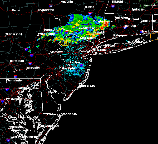 The severe thunderstorm warning for northeastern warren and southwestern sussex counties will expire at midnight edt, the storm which prompted the warning has weakened below severe limits, and no longer pose an immediate threat to life or property. therefore the warning will be allowed to expire. however gusty winds are still possible with this thunderstorm. to report severe weather, contact your nearest law enforcement agency. they will relay your report to the national weather service mount holly nj. The severe thunderstorm warning for northeastern warren and southwestern sussex counties will expire at midnight edt, the storm which prompted the warning has weakened below severe limits, and no longer pose an immediate threat to life or property. therefore the warning will be allowed to expire. however gusty winds are still possible with this thunderstorm. to report severe weather, contact your nearest law enforcement agency. they will relay your report to the national weather service mount holly nj.
|
| 8/13/2016 11:42 PM EDT |
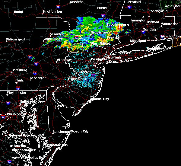 At 1141 pm edt, a severe thunderstorm was located over blairstown, or 11 miles west of newton, moving east at 25 mph (radar indicated). Hazards include 60 mph wind gusts and penny size hail. Expect damage to roofs. siding. and trees. Locations impacted include, newton, hopatcong, blairstown, stanhope, netcong, hope, branchville, andover, millbrook, greendell, crandon lakes, pellettown, flatbrookville, five points, allamuchy-panther valley and lake mohawk. At 1141 pm edt, a severe thunderstorm was located over blairstown, or 11 miles west of newton, moving east at 25 mph (radar indicated). Hazards include 60 mph wind gusts and penny size hail. Expect damage to roofs. siding. and trees. Locations impacted include, newton, hopatcong, blairstown, stanhope, netcong, hope, branchville, andover, millbrook, greendell, crandon lakes, pellettown, flatbrookville, five points, allamuchy-panther valley and lake mohawk.
|
| 8/13/2016 11:26 PM EDT |
 At 1125 pm edt, a severe thunderstorm was located over delaware water gap, or 16 miles southeast of mount pocono, moving east at 25 mph (radar indicated). Hazards include 60 mph wind gusts and penny size hail. Expect damage to roofs. siding. and trees. Locations impacted include, newton, mount pocono, hopatcong, east stroudsburg, hackettstown, tobyhanna, blairstown, bangor, stanhope, pen argyl, netcong, hope, east bangor, branchville, andover, greendell, great meadows-vienna, tannersville, mountainhome and reeders. At 1125 pm edt, a severe thunderstorm was located over delaware water gap, or 16 miles southeast of mount pocono, moving east at 25 mph (radar indicated). Hazards include 60 mph wind gusts and penny size hail. Expect damage to roofs. siding. and trees. Locations impacted include, newton, mount pocono, hopatcong, east stroudsburg, hackettstown, tobyhanna, blairstown, bangor, stanhope, pen argyl, netcong, hope, east bangor, branchville, andover, greendell, great meadows-vienna, tannersville, mountainhome and reeders.
|
| 8/13/2016 11:15 PM EDT |
 At 1114 pm edt, a severe thunderstorm was located over east stroudsburg, or 13 miles southeast of mount pocono, moving east at 25 mph (radar indicated). Hazards include 60 mph wind gusts and quarter size hail. Hail damage to vehicles is expected. Expect wind damage to roofs, siding, and trees. At 1114 pm edt, a severe thunderstorm was located over east stroudsburg, or 13 miles southeast of mount pocono, moving east at 25 mph (radar indicated). Hazards include 60 mph wind gusts and quarter size hail. Hail damage to vehicles is expected. Expect wind damage to roofs, siding, and trees.
|
| 7/25/2016 5:43 PM EDT |
 The severe thunderstorm warning for southeastern essex. hudson. kings. queens. richmond. new york and bronx counties will expire at 545 pm edt. the severe thunderstorm which prompted the warning has weakened. therefore. the warning will be allowed to expire. A severe thunderstorm watch remains in effect until 800 pm edt for. The severe thunderstorm warning for southeastern essex. hudson. kings. queens. richmond. new york and bronx counties will expire at 545 pm edt. the severe thunderstorm which prompted the warning has weakened. therefore. the warning will be allowed to expire. A severe thunderstorm watch remains in effect until 800 pm edt for.
|
| 7/25/2016 5:12 PM EDT |
 At 512 pm edt, a severe thunderstorm was located over bayonne, moving east at 20 mph (radar indicated). Hazards include 60 mph wind gusts. Expect damage to roofs. siding. and trees. this severe thunderstorm will be near, tompkinsville around 515 pm edt. jersey city, secaucus and verrazano-narrows bridge around 520 pm edt. hoboken, union city and bay ridge around 525 pm edt. battery park, soho, park slope and bensonhurst around 530 pm edt. brooklyn heights, lower east side, east village and upper west side around 535 pm edt. new york, crown heights, midtown manhattan, flatbush and central park around 540 pm edt. rfk bridge, flushing, laguardia airport, mott haven, forest hills, long island city, ozone park, jackson heights, canarsie and astoria around 545 pm edt. Other locations impacted by this severe thunderstorm include west shore express, lincoln center, woodside, east orange, greenwich village, weehawken, east newark, north bergen, grasmere and greenpoint. At 512 pm edt, a severe thunderstorm was located over bayonne, moving east at 20 mph (radar indicated). Hazards include 60 mph wind gusts. Expect damage to roofs. siding. and trees. this severe thunderstorm will be near, tompkinsville around 515 pm edt. jersey city, secaucus and verrazano-narrows bridge around 520 pm edt. hoboken, union city and bay ridge around 525 pm edt. battery park, soho, park slope and bensonhurst around 530 pm edt. brooklyn heights, lower east side, east village and upper west side around 535 pm edt. new york, crown heights, midtown manhattan, flatbush and central park around 540 pm edt. rfk bridge, flushing, laguardia airport, mott haven, forest hills, long island city, ozone park, jackson heights, canarsie and astoria around 545 pm edt. Other locations impacted by this severe thunderstorm include west shore express, lincoln center, woodside, east orange, greenwich village, weehawken, east newark, north bergen, grasmere and greenpoint.
|
| 7/25/2016 4:34 PM EDT |
 At 433 pm edt, severe thunderstorms were located along a line extending from bangor to springtown to near bechtelsville, moving east at 35 mph (radar indicated). Hazards include 60 mph wind gusts and quarter size hail. frequent lightning is occurring. Hail damage to vehicles is expected. Expect wind damage to roofs, siding, and trees. At 433 pm edt, severe thunderstorms were located along a line extending from bangor to springtown to near bechtelsville, moving east at 35 mph (radar indicated). Hazards include 60 mph wind gusts and quarter size hail. frequent lightning is occurring. Hail damage to vehicles is expected. Expect wind damage to roofs, siding, and trees.
|
| 7/25/2016 4:27 PM EDT |
 At 426 pm edt, a severe thunderstorm was located near bangor, or 8 miles north of easton, moving east at 25 mph (radar indicated). Hazards include 60 mph wind gusts and quarter size hail. Hail damage to vehicles is expected. expect wind damage to roofs, siding, and trees. Locations impacted include, easton, forks, northampton, east stroudsburg, hackettstown, wilson, washington, blairstown, nazareth, bangor, high bridge, pen argyl, wind gap, bath, belvidere, harmony, oxford, hope, glen gardner and belfast. At 426 pm edt, a severe thunderstorm was located near bangor, or 8 miles north of easton, moving east at 25 mph (radar indicated). Hazards include 60 mph wind gusts and quarter size hail. Hail damage to vehicles is expected. expect wind damage to roofs, siding, and trees. Locations impacted include, easton, forks, northampton, east stroudsburg, hackettstown, wilson, washington, blairstown, nazareth, bangor, high bridge, pen argyl, wind gap, bath, belvidere, harmony, oxford, hope, glen gardner and belfast.
|
| 7/25/2016 3:52 PM EDT |
 At 351 pm edt, a severe thunderstorm was located over danielsville, or 10 miles east of lehighton, moving east at 40 mph (radar indicated). Hazards include 60 mph wind gusts and nickel size hail. Expect damage to roofs. siding. And trees. At 351 pm edt, a severe thunderstorm was located over danielsville, or 10 miles east of lehighton, moving east at 40 mph (radar indicated). Hazards include 60 mph wind gusts and nickel size hail. Expect damage to roofs. siding. And trees.
|
| 7/14/2016 4:04 PM EDT |
 At 403 pm edt, a severe thunderstorm was located over newark, moving east at 35 mph (radar indicated. at 345 pm...a tree was reported down at north avenue in union county). Hazards include 60 mph wind gusts. Expect damage to roofs. siding. and trees. Locations impacted include, new york, newark, jersey city, paterson, elizabeth, passaic, bayonne, wayne, hoboken, plainfield, bloomfield, hackensack, linden, bergenfield, paramus, summit, lyndhurst, millburn, rutherford and secaucus. At 403 pm edt, a severe thunderstorm was located over newark, moving east at 35 mph (radar indicated. at 345 pm...a tree was reported down at north avenue in union county). Hazards include 60 mph wind gusts. Expect damage to roofs. siding. and trees. Locations impacted include, new york, newark, jersey city, paterson, elizabeth, passaic, bayonne, wayne, hoboken, plainfield, bloomfield, hackensack, linden, bergenfield, paramus, summit, lyndhurst, millburn, rutherford and secaucus.
|
| 7/14/2016 3:34 PM EDT |
 At 332 pm edt, a severe thunderstorm was located near morristown, moving east at 35 mph (radar indicated). Hazards include 60 mph wind gusts. Expect damage to roofs. siding. And trees. At 332 pm edt, a severe thunderstorm was located near morristown, moving east at 35 mph (radar indicated). Hazards include 60 mph wind gusts. Expect damage to roofs. siding. And trees.
|
| 7/14/2016 2:59 PM EDT |
 At 258 pm edt, a severe thunderstorm was located over oxford, or 16 miles northeast of easton, moving east at 30 mph (radar indicated). Hazards include 60 mph wind gusts. Expect damage to roofs. siding. and trees. Locations impacted include, hackettstown, washington, blairstown, belvidere, harmony, oxford, hope, bloomsbury, millbrook, pleasant valley, great meadows-vienna, roxburg, beatyestown, brass castle, allamuchy-panther valley, phillipsburg and beattyestown. At 258 pm edt, a severe thunderstorm was located over oxford, or 16 miles northeast of easton, moving east at 30 mph (radar indicated). Hazards include 60 mph wind gusts. Expect damage to roofs. siding. and trees. Locations impacted include, hackettstown, washington, blairstown, belvidere, harmony, oxford, hope, bloomsbury, millbrook, pleasant valley, great meadows-vienna, roxburg, beatyestown, brass castle, allamuchy-panther valley, phillipsburg and beattyestown.
|
| 7/14/2016 2:49 PM EDT |
 At 248 pm edt, a severe thunderstorm was located over belvidere, or 12 miles northeast of easton, moving east at 30 mph (radar indicated). Hazards include 60 mph wind gusts. Expect damage to roofs. siding. and trees. Locations impacted include, hackettstown, washington, blairstown, bangor, pen argyl, belvidere, harmony, oxford, alpha, hope, east bangor, bloomsbury, millbrook, columbia, pleasant valley, great meadows-vienna, roxburg, beatyestown, brass castle and allamuchy-panther valley. At 248 pm edt, a severe thunderstorm was located over belvidere, or 12 miles northeast of easton, moving east at 30 mph (radar indicated). Hazards include 60 mph wind gusts. Expect damage to roofs. siding. and trees. Locations impacted include, hackettstown, washington, blairstown, bangor, pen argyl, belvidere, harmony, oxford, alpha, hope, east bangor, bloomsbury, millbrook, columbia, pleasant valley, great meadows-vienna, roxburg, beatyestown, brass castle and allamuchy-panther valley.
|
| 7/14/2016 2:29 PM EDT |
 At 229 pm edt, a severe thunderstorm was located over wind gap, or 9 miles north of easton, moving east at 30 mph (radar indicated). Hazards include 60 mph wind gusts. Expect damage to roofs. siding. And trees. At 229 pm edt, a severe thunderstorm was located over wind gap, or 9 miles north of easton, moving east at 30 mph (radar indicated). Hazards include 60 mph wind gusts. Expect damage to roofs. siding. And trees.
|
| 7/1/2016 8:57 PM EDT |
 At 856 pm edt, a severe thunderstorm was located over passaic, moving east at 25 mph (radar indicated). Hazards include 60 mph wind gusts and quarter size hail. Hail damage to vehicles is expected. expect wind damage to roofs, siding, and trees. this severe storm will be near, passaic around 900 pm edt. lyndhurst and rutherford around 905 pm edt. hackensack, secaucus and teterboro around 910 pm edt. hoboken, ridgefield, union city, fort lee and englewood around 915 pm edt. other locations impacted by this severe thunderstorm include glen ridge, montclair, north arlington, little falls, clifton, bogota, nutley, elmwood park, maywood and teaneck. A tornado watch remains in effect until 1000 pm edt for northeastern new jersey, and southeastern new york. At 856 pm edt, a severe thunderstorm was located over passaic, moving east at 25 mph (radar indicated). Hazards include 60 mph wind gusts and quarter size hail. Hail damage to vehicles is expected. expect wind damage to roofs, siding, and trees. this severe storm will be near, passaic around 900 pm edt. lyndhurst and rutherford around 905 pm edt. hackensack, secaucus and teterboro around 910 pm edt. hoboken, ridgefield, union city, fort lee and englewood around 915 pm edt. other locations impacted by this severe thunderstorm include glen ridge, montclair, north arlington, little falls, clifton, bogota, nutley, elmwood park, maywood and teaneck. A tornado watch remains in effect until 1000 pm edt for northeastern new jersey, and southeastern new york.
|
| 7/1/2016 8:31 PM EDT |
 At 831 pm edt, a severe thunderstorm was located over boonton, or near caldwell, moving east at 25 mph (radar indicated). Hazards include 60 mph wind gusts and quarter size hail. Hail damage to vehicles is expected. expect wind damage to roofs, siding, and trees. this severe thunderstorm will be near, fairfield around 840 pm edt. wayne and caldwell around 845 pm edt. paterson, bloomfield and orange around 855 pm edt. passaic around 900 pm edt. lyndhurst, rutherford and harrison around 905 pm edt. hackensack, kearny and teterboro around 910 pm edt. jersey city, hoboken, secaucus, ridgefield, union city, fort lee and englewood around 915 pm edt. other locations impacted by this severe thunderstorm include glen ridge, montclair, north arlington, little falls, clifton, bogota, nutley, elmwood park, maywood and east newark. A tornado watch remains in effect until 1000 pm edt for northeastern new jersey, and southeastern new york. At 831 pm edt, a severe thunderstorm was located over boonton, or near caldwell, moving east at 25 mph (radar indicated). Hazards include 60 mph wind gusts and quarter size hail. Hail damage to vehicles is expected. expect wind damage to roofs, siding, and trees. this severe thunderstorm will be near, fairfield around 840 pm edt. wayne and caldwell around 845 pm edt. paterson, bloomfield and orange around 855 pm edt. passaic around 900 pm edt. lyndhurst, rutherford and harrison around 905 pm edt. hackensack, kearny and teterboro around 910 pm edt. jersey city, hoboken, secaucus, ridgefield, union city, fort lee and englewood around 915 pm edt. other locations impacted by this severe thunderstorm include glen ridge, montclair, north arlington, little falls, clifton, bogota, nutley, elmwood park, maywood and east newark. A tornado watch remains in effect until 1000 pm edt for northeastern new jersey, and southeastern new york.
|
| 7/1/2016 5:40 PM EDT |
 The severe thunderstorm warning for essex, central union, eastern passaic, hudson, bergen, new york and southern westchester counties will expire at 545 pm edt, the storm which prompted the warning is weakening and exiting the warned area. therefore, the warning will be allowed to expire. a tornado watch remains in effect until 1000 pm edt for northeastern new jersey, and southeastern new york. to report severe weather, contact your nearest law enforcement agency. they will relay your report to the national weather service upton ny. The severe thunderstorm warning for essex, central union, eastern passaic, hudson, bergen, new york and southern westchester counties will expire at 545 pm edt, the storm which prompted the warning is weakening and exiting the warned area. therefore, the warning will be allowed to expire. a tornado watch remains in effect until 1000 pm edt for northeastern new jersey, and southeastern new york. to report severe weather, contact your nearest law enforcement agency. they will relay your report to the national weather service upton ny.
|
| 7/1/2016 5:02 PM EDT |
 At 502 pm edt, a severe thunderstorm was located over summit, moving east at 30 mph (radar indicated). Hazards include 60 mph wind gusts. Expect damage to roofs. siding. and trees. this severe thunderstorm will be near, millburn around 505 pm edt. union around 510 pm edt. elizabeth, caldwell and orange around 515 pm edt. newark around 520 pm edt. bayonne, bloomfield and harrison around 525 pm edt. passaic, lyndhurst and kearny around 530 pm edt. jersey city, rutherford and secaucus around 535 pm edt. hoboken, hackensack, union city and teterboro around 540 pm edt. other locations impacted by this severe thunderstorm include springfield, montclair, hillside, livingston, clifton, bogota, nutley, elmwood park, berkeley heights and cranford. A tornado watch remains in effect until 1000 pm edt for northeastern new jersey, and southeastern new york. At 502 pm edt, a severe thunderstorm was located over summit, moving east at 30 mph (radar indicated). Hazards include 60 mph wind gusts. Expect damage to roofs. siding. and trees. this severe thunderstorm will be near, millburn around 505 pm edt. union around 510 pm edt. elizabeth, caldwell and orange around 515 pm edt. newark around 520 pm edt. bayonne, bloomfield and harrison around 525 pm edt. passaic, lyndhurst and kearny around 530 pm edt. jersey city, rutherford and secaucus around 535 pm edt. hoboken, hackensack, union city and teterboro around 540 pm edt. other locations impacted by this severe thunderstorm include springfield, montclair, hillside, livingston, clifton, bogota, nutley, elmwood park, berkeley heights and cranford. A tornado watch remains in effect until 1000 pm edt for northeastern new jersey, and southeastern new york.
|
| 7/1/2016 3:45 PM EDT |
 At 344 pm edt, a severe thunderstorm was located over orange, moving northeast at 35 mph (radar indicated). Hazards include 60 mph wind gusts. Expect damage to roofs. siding. and trees. this severe storm will be near, lyndhurst, secaucus and union city around 350 pm edt. passaic and rutherford around 355 pm edt. paterson, ridgefield and teterboro around 400 pm edt. hackensack, fort lee and hawthorne around 405 pm edt. other locations impacted by this severe thunderstorm include springfield, montclair, hillside, livingston, clifton, bogota, franklin lakes, nutley, elmwood park and teaneck. A tornado watch remains in effect until 1000 pm edt for northeastern new jersey, and southeastern new york. At 344 pm edt, a severe thunderstorm was located over orange, moving northeast at 35 mph (radar indicated). Hazards include 60 mph wind gusts. Expect damage to roofs. siding. and trees. this severe storm will be near, lyndhurst, secaucus and union city around 350 pm edt. passaic and rutherford around 355 pm edt. paterson, ridgefield and teterboro around 400 pm edt. hackensack, fort lee and hawthorne around 405 pm edt. other locations impacted by this severe thunderstorm include springfield, montclair, hillside, livingston, clifton, bogota, franklin lakes, nutley, elmwood park and teaneck. A tornado watch remains in effect until 1000 pm edt for northeastern new jersey, and southeastern new york.
|
| 7/1/2016 3:18 PM EDT |
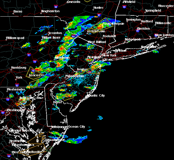 At 318 pm edt, a severe thunderstorm was located over colonia, or over plainfield, moving northeast at 35 mph (radar indicated). Hazards include 60 mph wind gusts and quarter size hail. Hail damage to vehicles is expected. expect wind damage to roofs, siding, and trees. this severe thunderstorm will be near, linden and summit around 330 pm edt. elizabeth, millburn, union and port richmond around 335 pm edt. newark, bayonne and orange around 340 pm edt. jersey city, harrison, caldwell and kearny around 345 pm edt. hoboken, bloomfield and lyndhurst around 350 pm edt. passaic, rutherford, secaucus and union city around 355 pm edt. paterson, ridgefield and teterboro around 400 pm edt. hackensack, fort lee, hawthorne and morningside heights around 405 pm edt. other locations impacted by this severe thunderstorm include springfield, montclair, hillside, livingston, clifton, bogota, roselle, franklin lakes, nutley and elmwood park. A tornado watch remains in effect until 1000 pm edt for northeastern new jersey, and southeastern new york. At 318 pm edt, a severe thunderstorm was located over colonia, or over plainfield, moving northeast at 35 mph (radar indicated). Hazards include 60 mph wind gusts and quarter size hail. Hail damage to vehicles is expected. expect wind damage to roofs, siding, and trees. this severe thunderstorm will be near, linden and summit around 330 pm edt. elizabeth, millburn, union and port richmond around 335 pm edt. newark, bayonne and orange around 340 pm edt. jersey city, harrison, caldwell and kearny around 345 pm edt. hoboken, bloomfield and lyndhurst around 350 pm edt. passaic, rutherford, secaucus and union city around 355 pm edt. paterson, ridgefield and teterboro around 400 pm edt. hackensack, fort lee, hawthorne and morningside heights around 405 pm edt. other locations impacted by this severe thunderstorm include springfield, montclair, hillside, livingston, clifton, bogota, roselle, franklin lakes, nutley and elmwood park. A tornado watch remains in effect until 1000 pm edt for northeastern new jersey, and southeastern new york.
|
| 6/28/2016 10:06 PM EDT |
 The severe thunderstorm warning for essex, union, hudson, south central bergen and richmond counties will expire at 1015 pm edt, the severe thunderstorm which prompted the warning has weakened. therefore, the warning will be allowed to expire. The severe thunderstorm warning for essex, union, hudson, south central bergen and richmond counties will expire at 1015 pm edt, the severe thunderstorm which prompted the warning has weakened. therefore, the warning will be allowed to expire.
|
| 6/28/2016 9:31 PM EDT |
 At 931 pm edt, a severe thunderstorm was located over chatham, or over summit, moving east at 20 mph (radar indicated). Hazards include 60 mph wind gusts. Expect damage to roofs. siding. and trees. this severe thunderstorm will be near, summit around 940 pm edt. clark around 945 pm edt. millburn around 950 pm edt. union around 955 pm edt. linden and caldwell around 1000 pm edt. orange around 1005 pm edt. elizabeth around 1010 pm edt. newark, jersey city, bayonne, hoboken, bloomfield, lyndhurst, rutherford, secaucus, harrison and union city around 1015 pm edt. Other locations impacted by this severe thunderstorm include new providence, springfield, glen ridge, montclair, north arlington, hillside, livingston, bogota, roselle and nutley. At 931 pm edt, a severe thunderstorm was located over chatham, or over summit, moving east at 20 mph (radar indicated). Hazards include 60 mph wind gusts. Expect damage to roofs. siding. and trees. this severe thunderstorm will be near, summit around 940 pm edt. clark around 945 pm edt. millburn around 950 pm edt. union around 955 pm edt. linden and caldwell around 1000 pm edt. orange around 1005 pm edt. elizabeth around 1010 pm edt. newark, jersey city, bayonne, hoboken, bloomfield, lyndhurst, rutherford, secaucus, harrison and union city around 1015 pm edt. Other locations impacted by this severe thunderstorm include new providence, springfield, glen ridge, montclair, north arlington, hillside, livingston, bogota, roselle and nutley.
|
| 6/5/2016 6:40 PM EDT |
 The severe thunderstorm warning for essex, union, eastern passaic, hudson, east central bergen, rockland and southeastern orange counties will expire at 645 pm edt, the storms which prompted the warning are moving out of the warned area. therefore, the warning will be allowed to expire. The severe thunderstorm warning for essex, union, eastern passaic, hudson, east central bergen, rockland and southeastern orange counties will expire at 645 pm edt, the storms which prompted the warning are moving out of the warned area. therefore, the warning will be allowed to expire.
|
| 6/5/2016 6:15 PM EDT |
 At 614 pm edt, severe thunderstorms were located along a line extending from near pomona to near paterson to middlesex, moving east at 45 mph (radar indicated). Hazards include 60 mph wind gusts. Expect damage to roofs. siding. and trees. these severe storms will be near, paterson, passaic, bloomfield, ridgewood, lyndhurst, rutherford, suffern, monsey, nanuet and hawthorne around 620 pm edt. hackensack, paramus, secaucus, haverstraw, new city, oradell and teterboro around 625 pm edt. bergenfield, ridgefield, nyack, fort lee, englewood, union and upper nyack around 630 pm edt. elizabeth and linden around 635 pm edt. bayonne around 640 pm edt. Other locations impacted by these severe thunderstorms include west haverstraw, upper saddle river, wyckoff, springfield, montclair, spring valley, hillside, clifton, montvale and bogota. At 614 pm edt, severe thunderstorms were located along a line extending from near pomona to near paterson to middlesex, moving east at 45 mph (radar indicated). Hazards include 60 mph wind gusts. Expect damage to roofs. siding. and trees. these severe storms will be near, paterson, passaic, bloomfield, ridgewood, lyndhurst, rutherford, suffern, monsey, nanuet and hawthorne around 620 pm edt. hackensack, paramus, secaucus, haverstraw, new city, oradell and teterboro around 625 pm edt. bergenfield, ridgefield, nyack, fort lee, englewood, union and upper nyack around 630 pm edt. elizabeth and linden around 635 pm edt. bayonne around 640 pm edt. Other locations impacted by these severe thunderstorms include west haverstraw, upper saddle river, wyckoff, springfield, montclair, spring valley, hillside, clifton, montvale and bogota.
|
| 6/5/2016 5:47 PM EDT |
 At 545 pm edt, severe thunderstorms were located along a line extending from near franklin to near califon, moving east at 45 mph (radar indicated). Hazards include 60 mph wind gusts. Expect damage to roofs. siding. and trees. severe thunderstorms will be near, west milford and upper greenwood lake around 555 pm edt. bloomingdale and poughkeepsie-- newburgh around 600 pm edt. ringwood and pompton lakes around 605 pm edt. plainfield and sloatsburg around 610 pm edt. ridgewood, summit, millburn, ramsey and suffern around 615 pm edt. monsey, clark, union, pomona and colonia around 620 pm edt. elizabeth, linden, haverstraw, nanuet, new city, orange and pearl river around 625 pm edt. newark, harrison, nyack, tappan, kearny, norwood, upper nyack and orangeburg around 630 pm edt. Other locations impacted by these severe thunderstorms include west haverstraw, upper saddle river, wyckoff, springfield, montclair, spring valley, hillside, clifton, montvale and bogota. At 545 pm edt, severe thunderstorms were located along a line extending from near franklin to near califon, moving east at 45 mph (radar indicated). Hazards include 60 mph wind gusts. Expect damage to roofs. siding. and trees. severe thunderstorms will be near, west milford and upper greenwood lake around 555 pm edt. bloomingdale and poughkeepsie-- newburgh around 600 pm edt. ringwood and pompton lakes around 605 pm edt. plainfield and sloatsburg around 610 pm edt. ridgewood, summit, millburn, ramsey and suffern around 615 pm edt. monsey, clark, union, pomona and colonia around 620 pm edt. elizabeth, linden, haverstraw, nanuet, new city, orange and pearl river around 625 pm edt. newark, harrison, nyack, tappan, kearny, norwood, upper nyack and orangeburg around 630 pm edt. Other locations impacted by these severe thunderstorms include west haverstraw, upper saddle river, wyckoff, springfield, montclair, spring valley, hillside, clifton, montvale and bogota.
|
| 6/5/2016 5:30 PM EDT |
 At 529 pm edt, severe thunderstorms were located along a line extending from near newton to washington, moving east at 50 mph (radar indicated). Hazards include 60 mph wind gusts. Expect damage to roofs. siding. and trees. Locations impacted include, newton, dover, hopatcong, hackettstown, wharton, washington, rockaway, blairstown, mount arlington, franklin, mendham, stanhope, hamburg, netcong, oxford, ogdensburg, hope, chester, victory gardens and andover. At 529 pm edt, severe thunderstorms were located along a line extending from near newton to washington, moving east at 50 mph (radar indicated). Hazards include 60 mph wind gusts. Expect damage to roofs. siding. and trees. Locations impacted include, newton, dover, hopatcong, hackettstown, wharton, washington, rockaway, blairstown, mount arlington, franklin, mendham, stanhope, hamburg, netcong, oxford, ogdensburg, hope, chester, victory gardens and andover.
|
| 6/5/2016 5:06 PM EDT |
 At 505 pm edt, severe thunderstorms were located along a line extending from delaware water gap to tatamy, moving east at 40 mph (radar indicated). Hazards include 60 mph wind gusts. Expect damage to roofs. siding. And trees. At 505 pm edt, severe thunderstorms were located along a line extending from delaware water gap to tatamy, moving east at 40 mph (radar indicated). Hazards include 60 mph wind gusts. Expect damage to roofs. siding. And trees.
|
| 2/25/2016 12:27 AM EST | The severe thunderstorm warning for western new haven, fairfield, union, essex, hudson, eastern passaic, bergen, eastern orange, kings, queens, richmond, rockland, westchester, new york, bronx, central nassau and putnam counties will expire at 1230 am est, the storms which prompted the warning have moved out of the warned area. therefore the warning will be allowed to expire. |
| 2/25/2016 12:27 AM EST | The severe thunderstorm warning for western new haven, fairfield, union, essex, hudson, eastern passaic, bergen, eastern orange, kings, queens, richmond, rockland, westchester, new york, bronx, central nassau and putnam counties will expire at 1230 am est, the storms which prompted the warning have moved out of the warned area. therefore the warning will be allowed to expire. |
| 2/25/2016 12:27 AM EST | The severe thunderstorm warning for western new haven, fairfield, union, essex, hudson, eastern passaic, bergen, eastern orange, kings, queens, richmond, rockland, westchester, new york, bronx, central nassau and putnam counties will expire at 1230 am est, the storms which prompted the warning have moved out of the warned area. therefore the warning will be allowed to expire. |
| 2/25/2016 12:00 AM EST |
 At 1159 pm est, doppler radar indicated a line of severe thunderstorms capable of producing damaging winds in excess of 60 mph. these storms were located along a line extending from near myers corner to near new city to lyndhurst, moving northeast at 50 mph. these severe storms will be near, peekskill around 1205 am est. ridgewood, yorktown heights and riverdale around 1210 am est. yonkers, dobbs ferry, tappan, mahopac, bronxville, norwood and pearl river around 1215 am est. white plains, tarrytown, nyack, brewster, north tarrytown, lake carmel, nanuet, carmel, upper nyack and orangeburg around 1220 am est. new york--newark and hawthorne around 1225 am est. mount kisco, pawling and new fairfield around 1230 am est. other locations impacted by these severe thunderstorms include west hempstead, thomaston, west haverstraw, pleasantville, springfield, mount vernon, montclair, spring valley, hillside and washington heights. At 1159 pm est, doppler radar indicated a line of severe thunderstorms capable of producing damaging winds in excess of 60 mph. these storms were located along a line extending from near myers corner to near new city to lyndhurst, moving northeast at 50 mph. these severe storms will be near, peekskill around 1205 am est. ridgewood, yorktown heights and riverdale around 1210 am est. yonkers, dobbs ferry, tappan, mahopac, bronxville, norwood and pearl river around 1215 am est. white plains, tarrytown, nyack, brewster, north tarrytown, lake carmel, nanuet, carmel, upper nyack and orangeburg around 1220 am est. new york--newark and hawthorne around 1225 am est. mount kisco, pawling and new fairfield around 1230 am est. other locations impacted by these severe thunderstorms include west hempstead, thomaston, west haverstraw, pleasantville, springfield, mount vernon, montclair, spring valley, hillside and washington heights.
|
| 2/24/2016 11:26 PM EST |
 At 1122 pm est, doppler radar indicated a line of severe thunderstorms capable of producing damaging winds in excess of 60 mph. this line extending across the lower hudson valley of new york through portions of new york city and portions of northeast new jersey. it was moving northeast at 40 mph. * severe thunderstorms will be near, bergenfield, and riverdale around 1130 pm est. yonkers, tappan, norwood and orangeburg around 1135 pm est. new rochelle, tarrytown, dobbs ferry, nyack, bronxville and upper nyack around 1140 pm est. north tarrytown and scarsdale around 1145 pm est. white plains, perth amboy, harrison, hawthorne and colonia around 1150 pm est. port chester around 1155 pm est. linden, greenwich and carteret around 1200 am est. bedford and port richmond around 1205 am est. other locations impacted by these severe thunderstorms include west hempstead, thomaston, west haverstraw, pleasantville, springfield, mount vernon, montclair, spring valley, hillside and washington heights. At 1122 pm est, doppler radar indicated a line of severe thunderstorms capable of producing damaging winds in excess of 60 mph. this line extending across the lower hudson valley of new york through portions of new york city and portions of northeast new jersey. it was moving northeast at 40 mph. * severe thunderstorms will be near, bergenfield, and riverdale around 1130 pm est. yonkers, tappan, norwood and orangeburg around 1135 pm est. new rochelle, tarrytown, dobbs ferry, nyack, bronxville and upper nyack around 1140 pm est. north tarrytown and scarsdale around 1145 pm est. white plains, perth amboy, harrison, hawthorne and colonia around 1150 pm est. port chester around 1155 pm est. linden, greenwich and carteret around 1200 am est. bedford and port richmond around 1205 am est. other locations impacted by these severe thunderstorms include west hempstead, thomaston, west haverstraw, pleasantville, springfield, mount vernon, montclair, spring valley, hillside and washington heights.
|
| 2/24/2016 10:57 PM EST |
 At 1055 pm est, doppler radar indicated thunderstorms capable of producing damaging winds in excess of 60 mph. the storms were moving northeast and will continue to impact the warning area. At 1055 pm est, doppler radar indicated thunderstorms capable of producing damaging winds in excess of 60 mph. the storms were moving northeast and will continue to impact the warning area.
|
| 2/24/2016 10:28 PM EST |
 At 1024 pm est, doppler radar indicated a line of thunderstorms, with additional thunderstorms developing in central new jersey capable of producing damaging winds in excess of 60 mph. this activity is moving northeast at 40 to 50 mph and will impact much of northeast new jersey and the new york city metropolitan area. other locations impacted by this severe thunderstorm include upper saddle river, wyckoff, springfield, mount vernon, montclair, hillside, washington heights, clifton, montvale and bogota. expect strong winds and heavy downpours. At 1024 pm est, doppler radar indicated a line of thunderstorms, with additional thunderstorms developing in central new jersey capable of producing damaging winds in excess of 60 mph. this activity is moving northeast at 40 to 50 mph and will impact much of northeast new jersey and the new york city metropolitan area. other locations impacted by this severe thunderstorm include upper saddle river, wyckoff, springfield, mount vernon, montclair, hillside, washington heights, clifton, montvale and bogota. expect strong winds and heavy downpours.
|
| 2/16/2016 1:28 PM EST |
 At 127 pm est, doppler radar indicated a severe thunderstorm capable of producing damaging winds in excess of 60 mph. this storm was located over flatbrookville, or 12 miles west of newton, moving northeast at 50 mph. locations impacted include, morristown, newton, dover, madison, hopatcong, florham park, east hanover, lincoln park, kinnelon, hackettstown, boonton, butler, wharton, rockaway, blairstown, morris plains, mount arlington, franklin, mendham and mountain lakes. At 127 pm est, doppler radar indicated a severe thunderstorm capable of producing damaging winds in excess of 60 mph. this storm was located over flatbrookville, or 12 miles west of newton, moving northeast at 50 mph. locations impacted include, morristown, newton, dover, madison, hopatcong, florham park, east hanover, lincoln park, kinnelon, hackettstown, boonton, butler, wharton, rockaway, blairstown, morris plains, mount arlington, franklin, mendham and mountain lakes.
|
| 2/16/2016 1:21 PM EST |
 At 117 pm est, doppler radar indicated a line of heavy showers, some containing strong gusty winds in excess of 60mph, just east of the delaware river. this line was moving east at 45 mph, and will be moving through the northern part of new jersey through the mid afternoon hours. At 117 pm est, doppler radar indicated a line of heavy showers, some containing strong gusty winds in excess of 60mph, just east of the delaware river. this line was moving east at 45 mph, and will be moving through the northern part of new jersey through the mid afternoon hours.
|
| 10/9/2015 3:46 PM EDT |
 At 345 pm edt, doppler radar indicated a line of severe thunderstorms capable of producing damaging winds in excess of 60 mph. these storms were located along a line extending from analomink to snyders, moving east at 35 mph. locations impacted include, allentown, lehighton, bethlehem, northampton, east stroudsburg, blairstown, nazareth, palmerton, bangor, jim thorpe, slatington, pen argyl, nesquehoning, wind gap, bath, weatherly, walnutport, hope, belfast and tatamy. At 345 pm edt, doppler radar indicated a line of severe thunderstorms capable of producing damaging winds in excess of 60 mph. these storms were located along a line extending from analomink to snyders, moving east at 35 mph. locations impacted include, allentown, lehighton, bethlehem, northampton, east stroudsburg, blairstown, nazareth, palmerton, bangor, jim thorpe, slatington, pen argyl, nesquehoning, wind gap, bath, weatherly, walnutport, hope, belfast and tatamy.
|
| 10/9/2015 3:17 PM EDT |
 At 316 pm edt, doppler radar indicated a line of severe thunderstorms capable of producing damaging winds in excess of 60 mph. these storms were located along a line extending from near pocono pines to locust lake state park, and moving east at 35 mph. At 316 pm edt, doppler radar indicated a line of severe thunderstorms capable of producing damaging winds in excess of 60 mph. these storms were located along a line extending from near pocono pines to locust lake state park, and moving east at 35 mph.
|
| 6/30/2015 6:57 PM EDT |
 At 657 pm edt, doppler radar indicated a severe thunderstorm capable of producing quarter size hail and damaging winds in excess of 60 mph. this storm was located near echo lake, or 16 miles west of newton, moving northeast at 25 mph. locations impacted include, east stroudsburg, blairstown, east bangor, millbrook, greendell, columbia, echo lake, werry lake, flatbrookville, delaware water gap, allamuchy-panther valley, stroudsburg, portland, hidden lake, shawnee, marshalls creek and arlington heights. At 657 pm edt, doppler radar indicated a severe thunderstorm capable of producing quarter size hail and damaging winds in excess of 60 mph. this storm was located near echo lake, or 16 miles west of newton, moving northeast at 25 mph. locations impacted include, east stroudsburg, blairstown, east bangor, millbrook, greendell, columbia, echo lake, werry lake, flatbrookville, delaware water gap, allamuchy-panther valley, stroudsburg, portland, hidden lake, shawnee, marshalls creek and arlington heights.
|
| 6/30/2015 6:28 PM EDT |
 At 627 pm edt, doppler radar indicated a severe thunderstorm capable of producing quarter size hail and damaging winds in excess of 60 mph. this storm was located over stormville, or 14 miles south of mount pocono, and moving northeast at 25 mph. At 627 pm edt, doppler radar indicated a severe thunderstorm capable of producing quarter size hail and damaging winds in excess of 60 mph. this storm was located over stormville, or 14 miles south of mount pocono, and moving northeast at 25 mph.
|
| 6/30/2015 3:36 PM EDT |
 At 335 pm edt, doppler radar indicated a severe thunderstorm capable of producing large hail up to ping pong ball size and destructive winds in excess of 70 mph. this storm was located over columbia, or 17 miles northeast of easton. trees and wires have been reported down with this storm. this severe storm will be near, hope and great meadows-vienna around 340 pm edt. allamuchy-panther valley around 345 pm edt. other locations impacted by this severe thunderstorm include beattyestown. At 335 pm edt, doppler radar indicated a severe thunderstorm capable of producing large hail up to ping pong ball size and destructive winds in excess of 70 mph. this storm was located over columbia, or 17 miles northeast of easton. trees and wires have been reported down with this storm. this severe storm will be near, hope and great meadows-vienna around 340 pm edt. allamuchy-panther valley around 345 pm edt. other locations impacted by this severe thunderstorm include beattyestown.
|
| 6/30/2015 3:14 PM EDT |
 At 313 pm edt, doppler radar indicated a severe thunderstorm capable of producing large hail up to ping pong ball size and destructive winds in excess of 70 mph. this storm was located near harmony, or 7 miles north of easton, moving northeast at 35 mph. this severe storm will be near, belvidere around 325 pm edt. oxford around 330 pm edt. hope and great meadows-vienna around 340 pm edt. allamuchy-panther valley around 345 pm edt. other locations impacted by this severe thunderstorm include palmer heights, freemansburg, beattyestown, phillipsburg, eastlawn gardens and stockertown. At 313 pm edt, doppler radar indicated a severe thunderstorm capable of producing large hail up to ping pong ball size and destructive winds in excess of 70 mph. this storm was located near harmony, or 7 miles north of easton, moving northeast at 35 mph. this severe storm will be near, belvidere around 325 pm edt. oxford around 330 pm edt. hope and great meadows-vienna around 340 pm edt. allamuchy-panther valley around 345 pm edt. other locations impacted by this severe thunderstorm include palmer heights, freemansburg, beattyestown, phillipsburg, eastlawn gardens and stockertown.
|
| 6/30/2015 3:00 PM EDT |
 At 258 pm edt, doppler radar indicated a severe thunderstorm capable of producing large hail up to ping pong ball size and destructive winds in excess of 70 mph. this storm was located over nazareth, or near easton, and moving northeast at 35 mph. numerous wires and trees have been reported down along the path of this storm along with a funnel cloud. * this severe thunderstorm will be near, alpha and belfast around 305 pm edt. harmony around 315 pm edt. roxburg around 320 pm edt. belvidere around 325 pm edt. oxford around 330 pm edt. hope and great meadows-vienna around 340 pm edt. blairstown and allamuchy-panther valley around 345 pm edt. other locations impacted by this severe thunderstorm include palmer heights, phillipsburg, eastlawn gardens, stockertown, freemansburg, beattyestown, fountain hill and portland. At 258 pm edt, doppler radar indicated a severe thunderstorm capable of producing large hail up to ping pong ball size and destructive winds in excess of 70 mph. this storm was located over nazareth, or near easton, and moving northeast at 35 mph. numerous wires and trees have been reported down along the path of this storm along with a funnel cloud. * this severe thunderstorm will be near, alpha and belfast around 305 pm edt. harmony around 315 pm edt. roxburg around 320 pm edt. belvidere around 325 pm edt. oxford around 330 pm edt. hope and great meadows-vienna around 340 pm edt. blairstown and allamuchy-panther valley around 345 pm edt. other locations impacted by this severe thunderstorm include palmer heights, phillipsburg, eastlawn gardens, stockertown, freemansburg, beattyestown, fountain hill and portland.
|
| 6/23/2015 2:45 PM EDT |
 At 244 pm edt, doppler radar indicated a line of severe thunderstorms capable of producing damaging winds in excess of 60 mph. these storms were located along a line extending from near hainesville to bushkill to near great meadows-vienna, moving east at 65 mph. locations impacted include, newton, montague, dover, hopatcong, hackettstown, wharton, rockaway, blairstown, mount arlington, franklin, mountain lakes, stanhope, hamburg, netcong, belvidere, oxford, ogdensburg, sussex, hope and victory gardens. At 244 pm edt, doppler radar indicated a line of severe thunderstorms capable of producing damaging winds in excess of 60 mph. these storms were located along a line extending from near hainesville to bushkill to near great meadows-vienna, moving east at 65 mph. locations impacted include, newton, montague, dover, hopatcong, hackettstown, wharton, rockaway, blairstown, mount arlington, franklin, mountain lakes, stanhope, hamburg, netcong, belvidere, oxford, ogdensburg, sussex, hope and victory gardens.
|
| 6/23/2015 2:29 PM EDT |
 At 228 pm edt, doppler radar indicated a developing line of severe thunderstorms capable of producing damaging winds in excess of 60 mph. these storms were located along a line extending from near skytop to analomink to east bangor, and moving east at 75 mph. At 228 pm edt, doppler radar indicated a developing line of severe thunderstorms capable of producing damaging winds in excess of 60 mph. these storms were located along a line extending from near skytop to analomink to east bangor, and moving east at 75 mph.
|
| 6/12/2015 7:51 PM EDT |
 At 750 pm edt, doppler radar indicated a severe thunderstorm capable of producing damaging winds in excess of 60 mph. this storm was located over oxford, or 17 miles northeast of easton, moving northeast at 35 mph. locations impacted include, washington, oxford, hope, pleasant valley, brass castle and great meadows-vienna. At 750 pm edt, doppler radar indicated a severe thunderstorm capable of producing damaging winds in excess of 60 mph. this storm was located over oxford, or 17 miles northeast of easton, moving northeast at 35 mph. locations impacted include, washington, oxford, hope, pleasant valley, brass castle and great meadows-vienna.
|
| 6/12/2015 7:27 PM EDT |
 The national weather service in mount holly nj has issued a * severe thunderstorm warning for. southwestern warren county in northwestern new jersey. southeastern northampton county in eastern pennsylvania. until 800 pm edt * at 726 pm edt. Doppler radar indicated a severe thunderstorm. The national weather service in mount holly nj has issued a * severe thunderstorm warning for. southwestern warren county in northwestern new jersey. southeastern northampton county in eastern pennsylvania. until 800 pm edt * at 726 pm edt. Doppler radar indicated a severe thunderstorm.
|
| 6/12/2015 6:23 PM EDT |
 The national weather service in mount holly nj has issued a * severe thunderstorm warning for. northern warren county in northwestern new jersey. sussex county in northwestern new jersey. until 730 pm edt * at 622 pm edt. Doppler radar indicated a severe thunderstorm. The national weather service in mount holly nj has issued a * severe thunderstorm warning for. northern warren county in northwestern new jersey. sussex county in northwestern new jersey. until 730 pm edt * at 622 pm edt. Doppler radar indicated a severe thunderstorm.
|
| 6/12/2015 5:41 PM EDT |
 At 540 pm edt, doppler radar indicated a severe thunderstorm capable of producing damaging winds in excess of 60 mph. this storm was located over tatamy, or near easton, and moving northeast at 35 mph. At 540 pm edt, doppler radar indicated a severe thunderstorm capable of producing damaging winds in excess of 60 mph. this storm was located over tatamy, or near easton, and moving northeast at 35 mph.
|
| 5/31/2015 1:00 PM EDT | At 1259 pm edt, doppler radar indicated a severe thunderstorm capable of producing quarter size hail and damaging winds in excess of 60 mph. this storm was located over forks, or over easton, and moving northeast at 20 mph. there are other potentially severe storms in southern warren county and southwest northampton county. |
| 5/31/2015 1:00 PM EDT | At 1259 pm edt, doppler radar indicated a severe thunderstorm capable of producing quarter size hail and damaging winds in excess of 60 mph. this storm was located over forks, or over easton, and moving northeast at 20 mph. there are other potentially severe storms in southern warren county and southwest northampton county. |
| 5/16/2015 6:10 PM EDT | At 610 pm edt, doppler radar indicated a severe thunderstorm capable of producing quarter size hail and damaging winds in excess of 60 mph. this storm was located over greendell, or near newton, and moving southeast at 30 mph. * this severe thunderstorm will be near, hopatcong and hackettstown around 615 pm edt. stanhope and beatyestown around 620 pm edt. mount arlington, netcong, budd lake and long valley around 625 pm edt. succasunna and succasunna-kenvil around 630 pm edt. dover, wharton, chester and victory gardens around 635 pm edt. mendham around 640 pm edt. morris plains and peapack and gladstone around 645 pm edt. morristown and far hills around 650 pm edt. other locations impacted by this severe thunderstorm include white meadow lake, bernardsville, beattyestown and hanover township. |
| 5/16/2015 5:55 PM EDT | At 554 pm edt, doppler radar indicated a severe thunderstorm capable of producing quarter size hail and damaging winds in excess of 60 mph. this storm was located over five points, or near newton, moving southeast at 25 mph. this severe storm will be near, newton and greendell around 605 pm edt. andover around 610 pm edt. lake mohawk around 615 pm edt. other locations impacted by this severe thunderstorm include hidden lake. |
| 5/16/2015 5:55 PM EDT | At 554 pm edt, doppler radar indicated a severe thunderstorm capable of producing quarter size hail and damaging winds in excess of 60 mph. this storm was located over five points, or near newton, moving southeast at 25 mph. this severe storm will be near, newton and greendell around 605 pm edt. andover around 610 pm edt. lake mohawk around 615 pm edt. other locations impacted by this severe thunderstorm include hidden lake. |
| 5/16/2015 5:26 PM EDT | At 525 pm edt, doppler radar indicated a severe thunderstorm capable of producing quarter size hail and damaging winds in excess of 60 mph. this storm was located near bushkill, or 13 miles northwest of newton, and moving southeast at 25 mph. * this severe thunderstorm will be near, flatbrookville and millbrook around 535 pm edt. crandon lakes around 540 pm edt. branchville and five points around 545 pm edt. newton and greendell around 600 pm edt. andover around 605 pm edt. lake mohawk around 610 pm edt. other locations impacted by this severe thunderstorm include hidden lake. |
| 5/16/2015 5:26 PM EDT | At 525 pm edt, doppler radar indicated a severe thunderstorm capable of producing quarter size hail and damaging winds in excess of 60 mph. this storm was located near bushkill, or 13 miles northwest of newton, and moving southeast at 25 mph. * this severe thunderstorm will be near, flatbrookville and millbrook around 535 pm edt. crandon lakes around 540 pm edt. branchville and five points around 545 pm edt. newton and greendell around 600 pm edt. andover around 605 pm edt. lake mohawk around 610 pm edt. other locations impacted by this severe thunderstorm include hidden lake. |
Hail Maps for Silver Lake, NJ


Connect with Interactive Hail Maps