

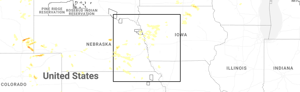
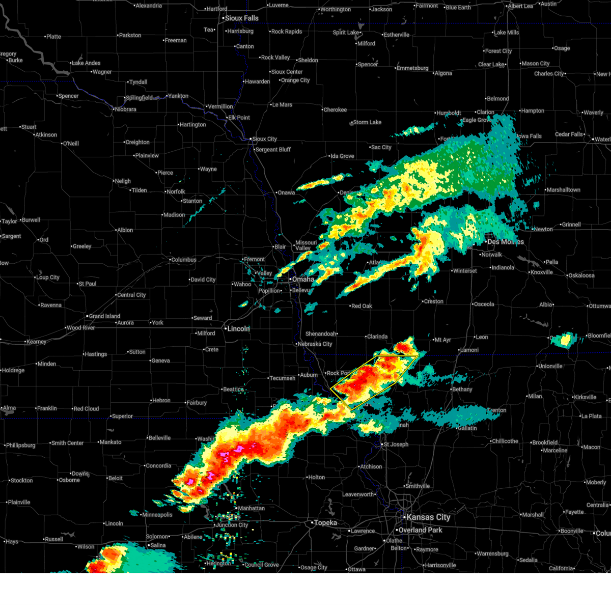
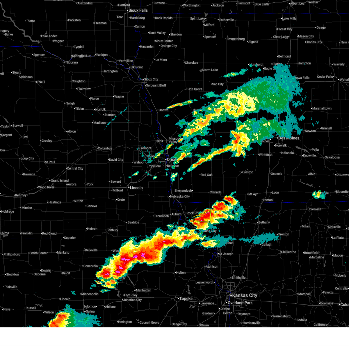
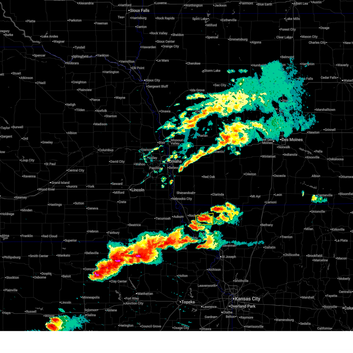
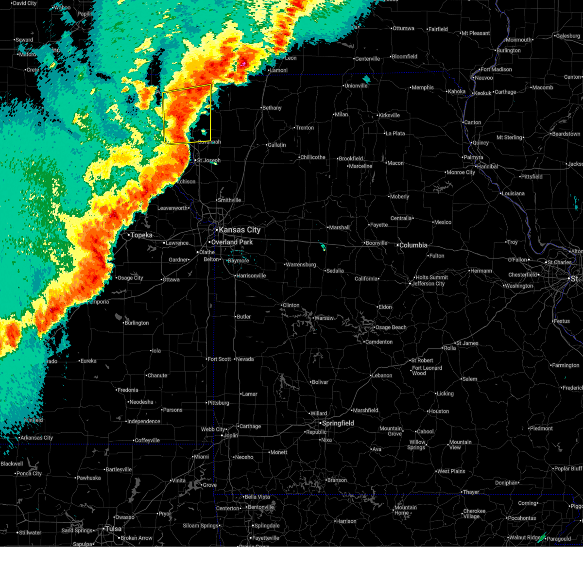
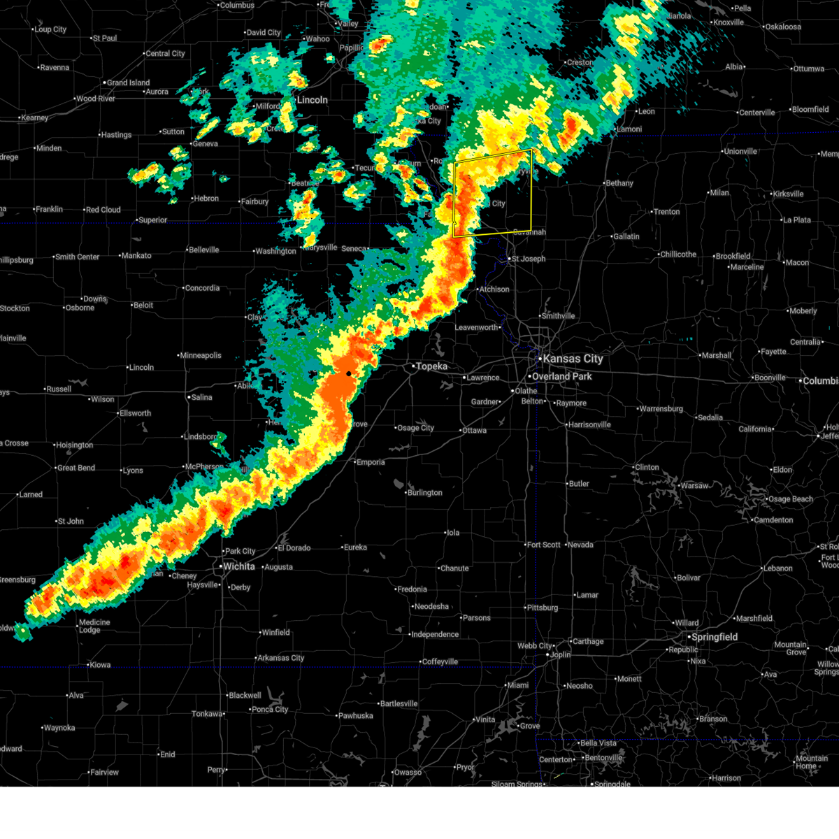
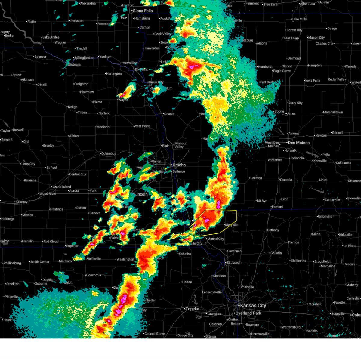
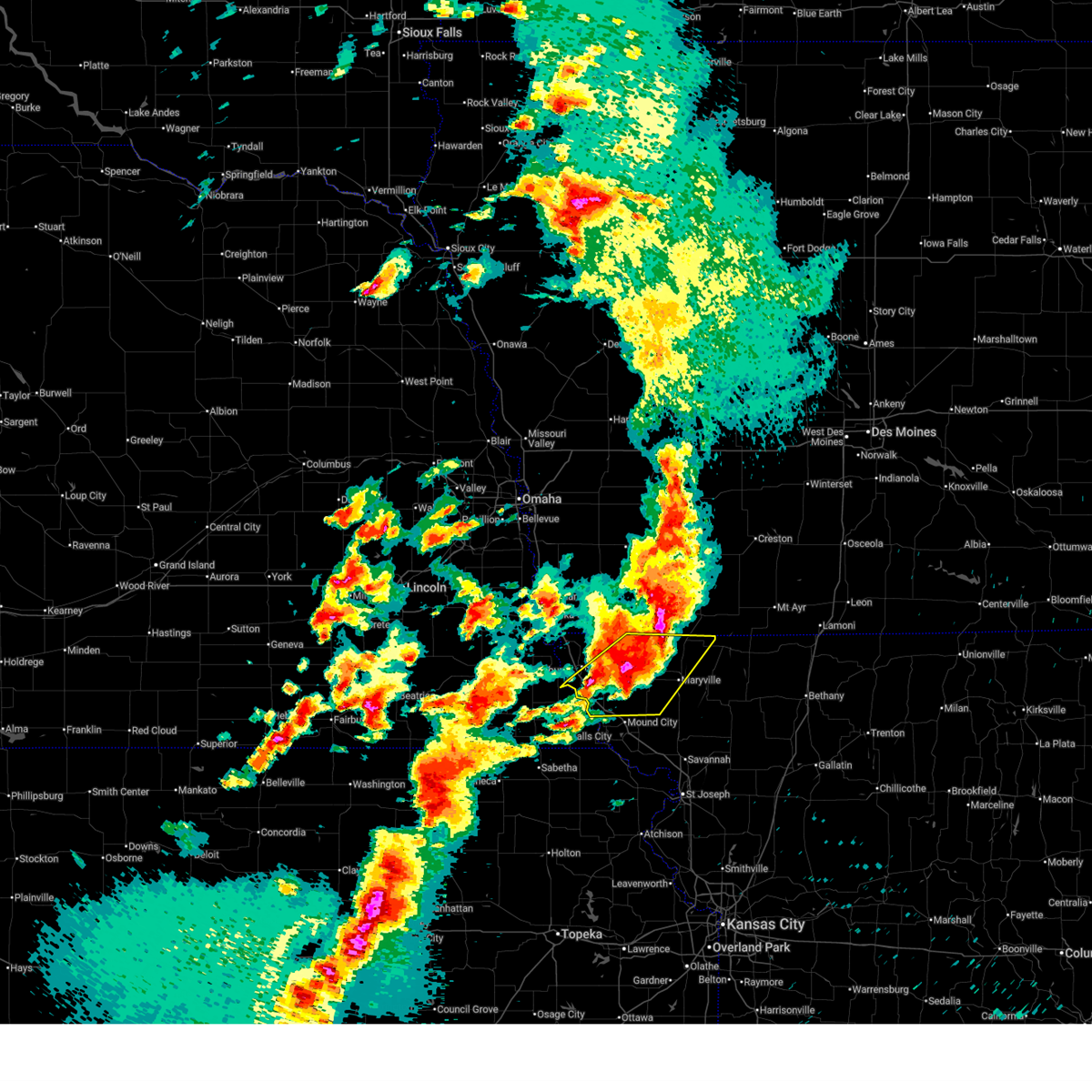
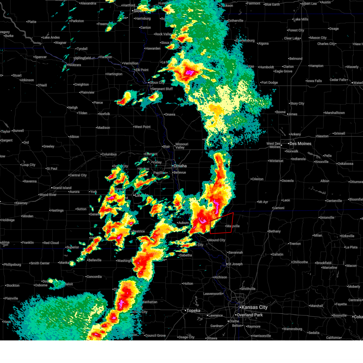
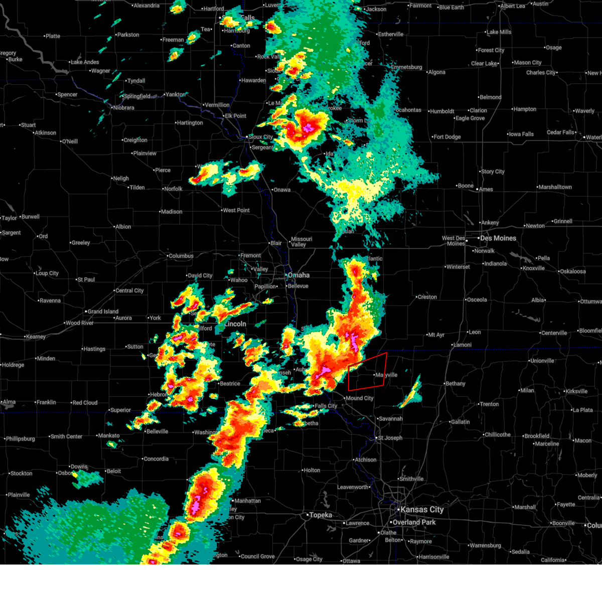
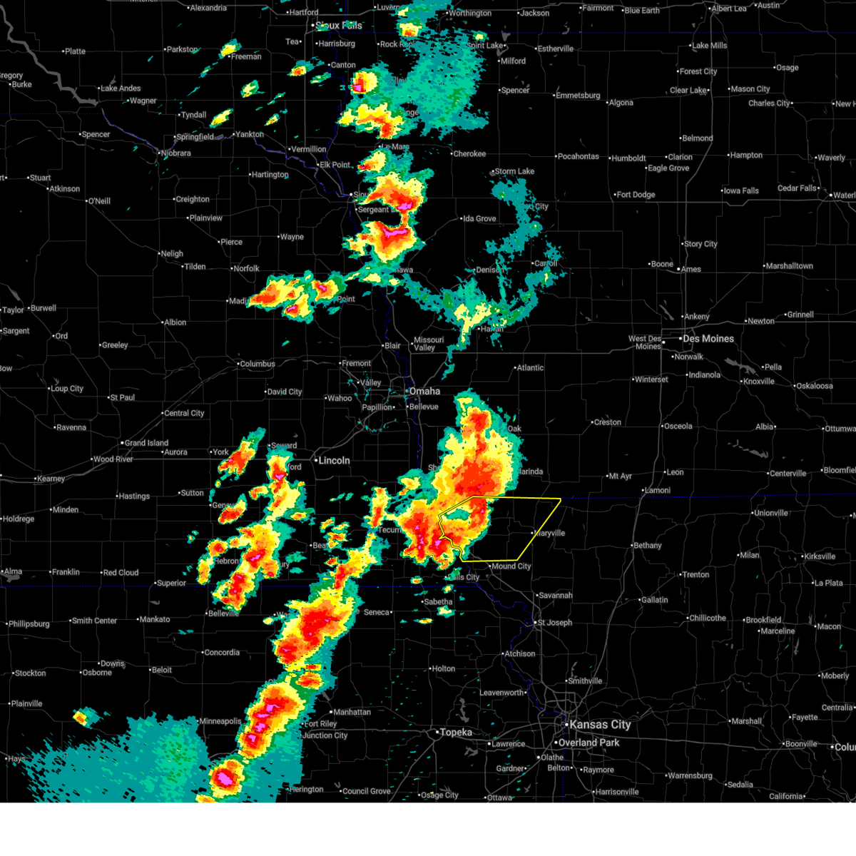
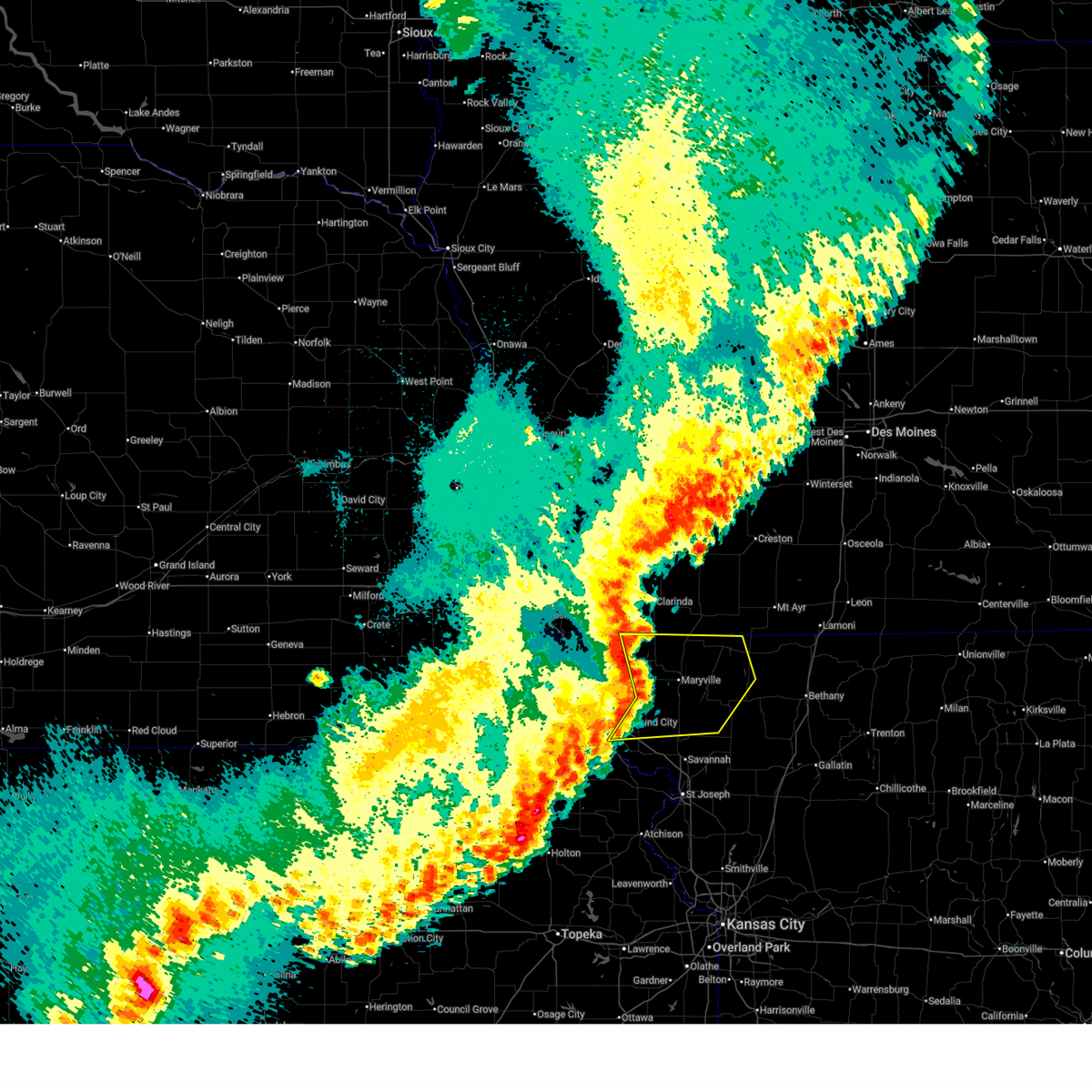
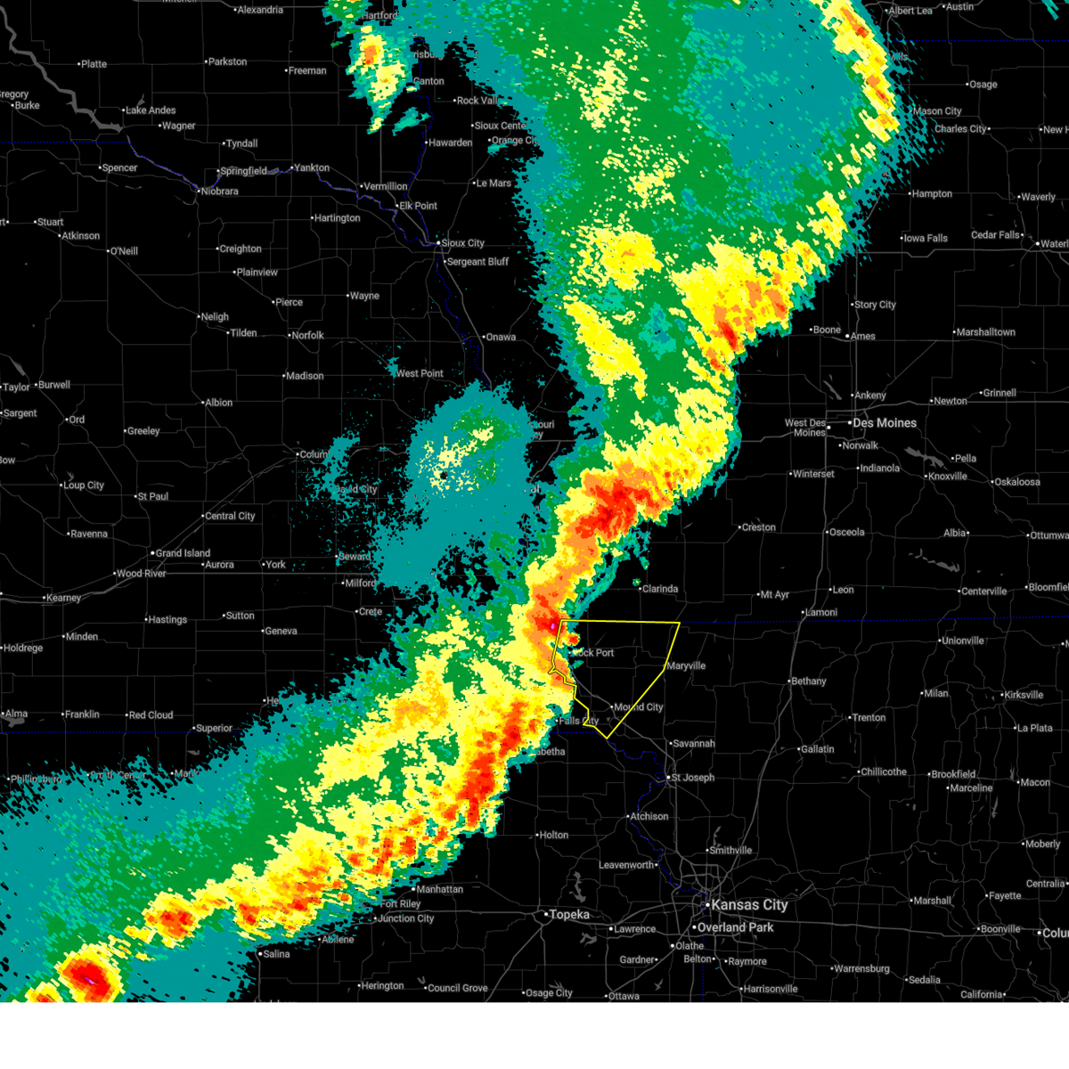
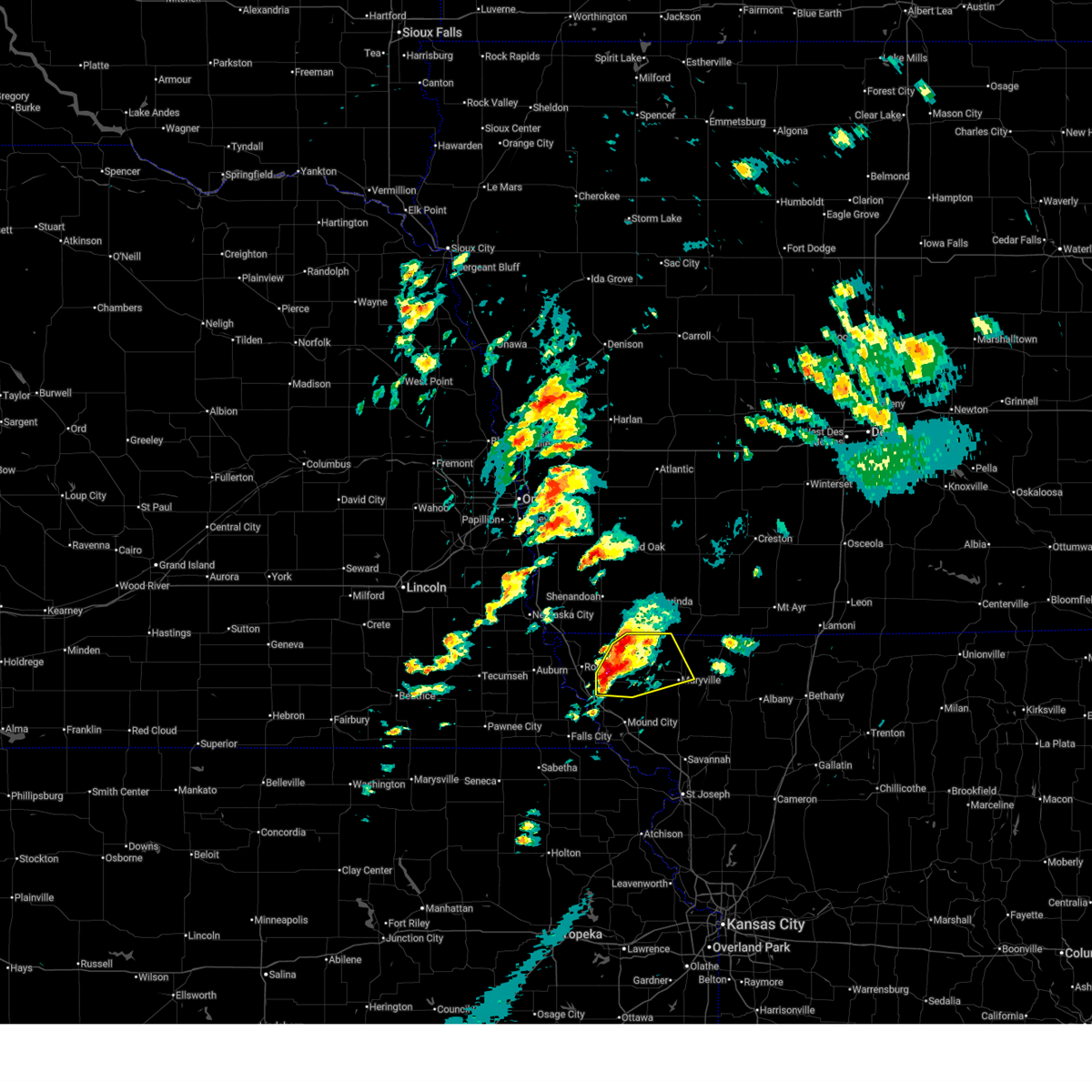
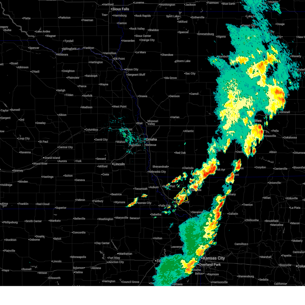
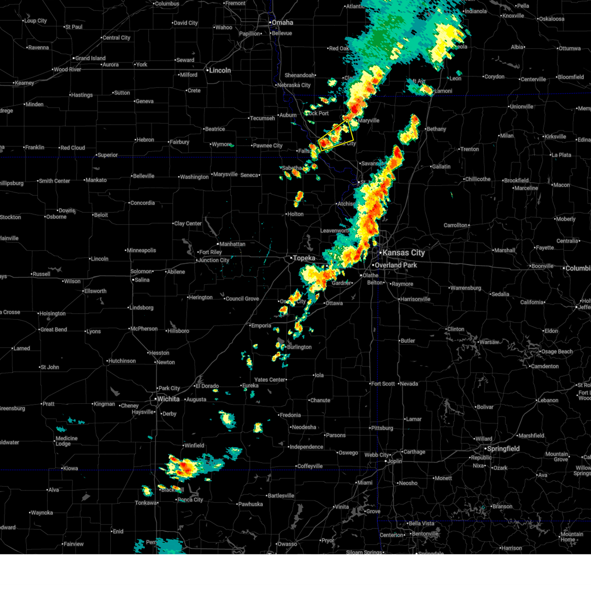
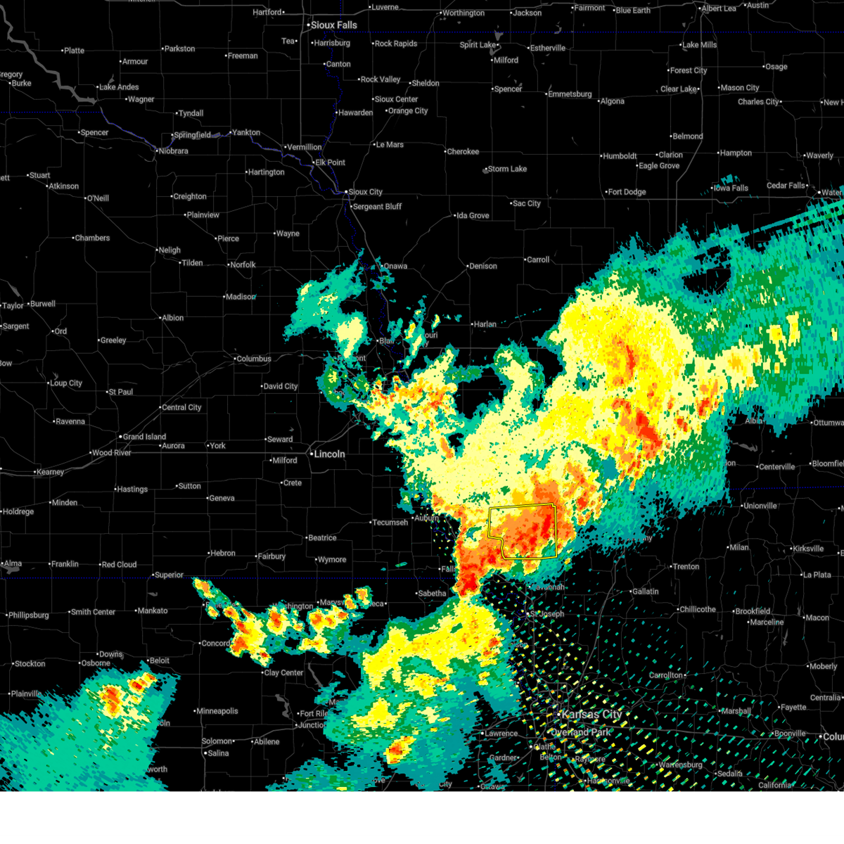
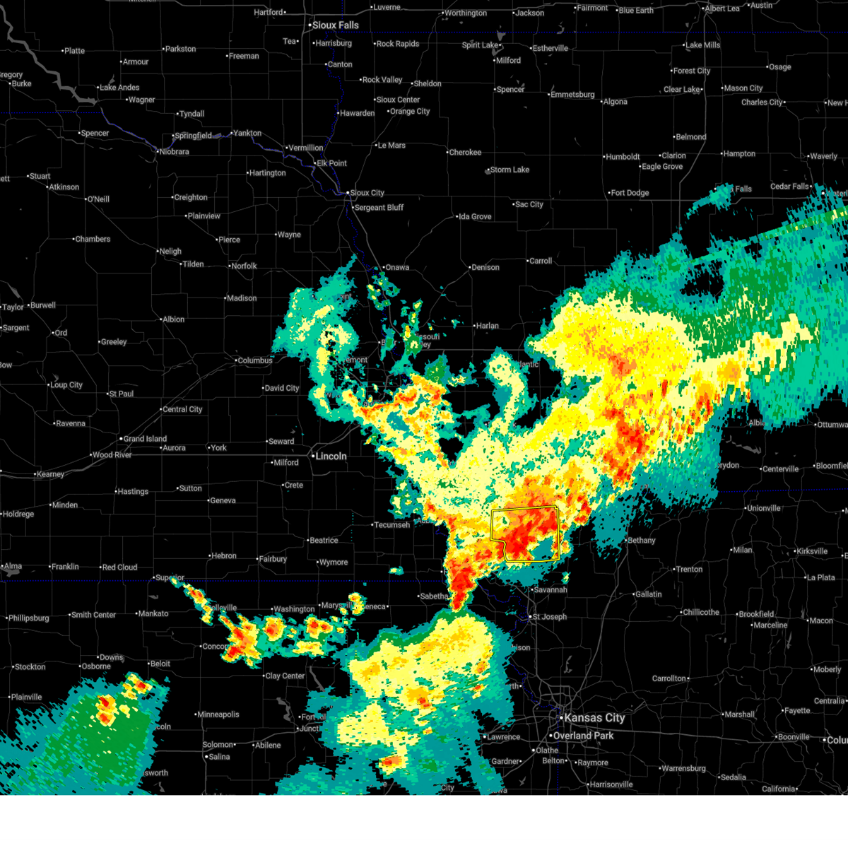
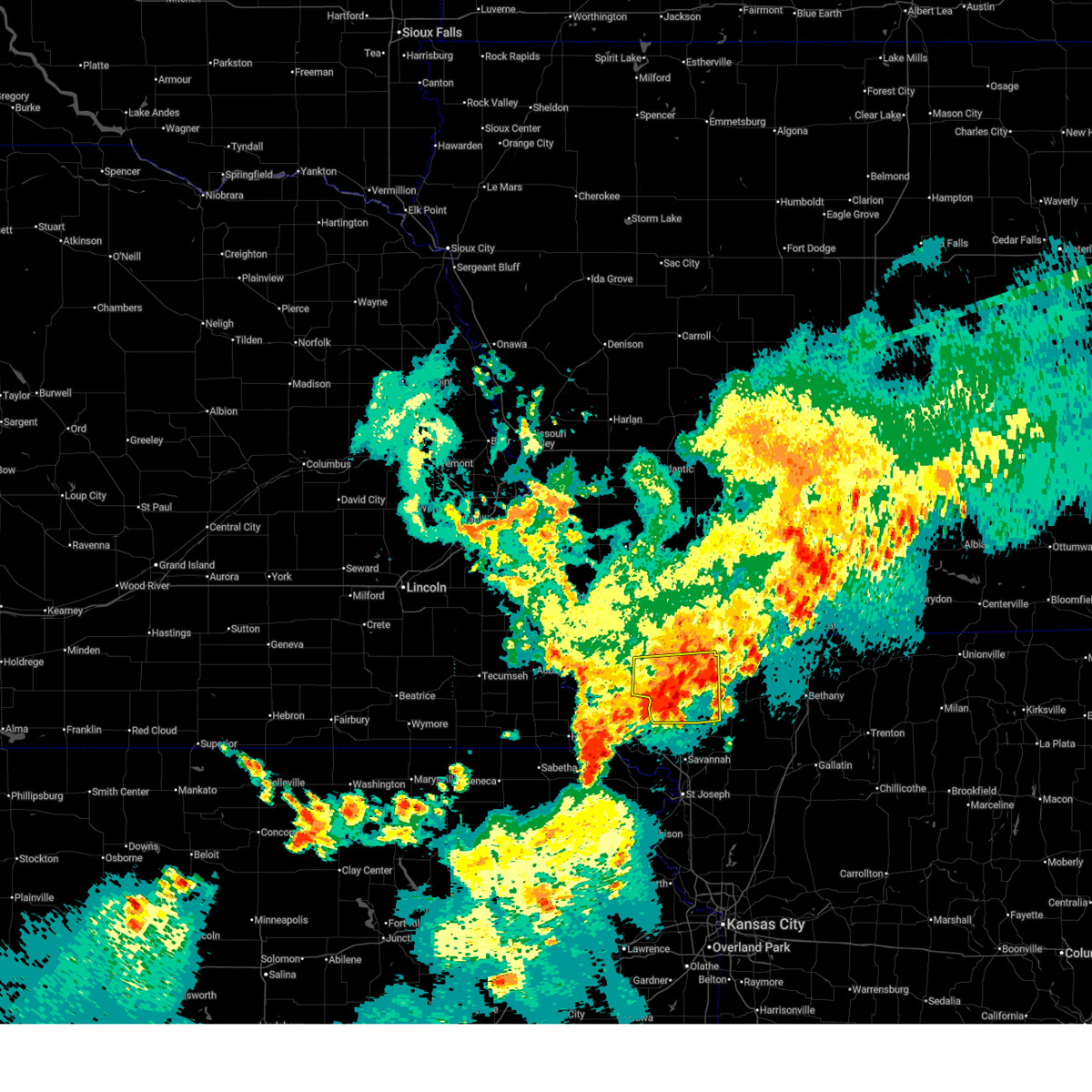
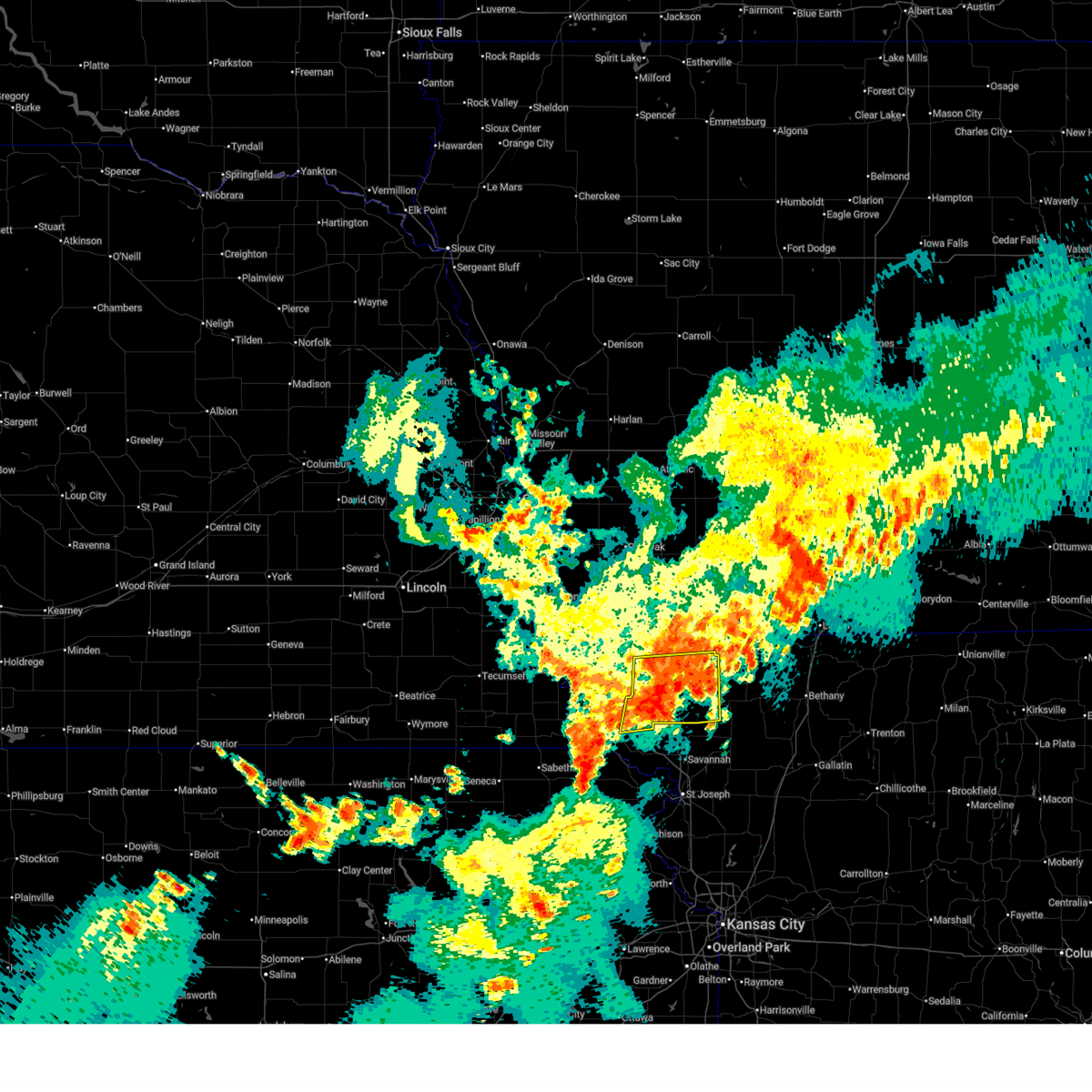
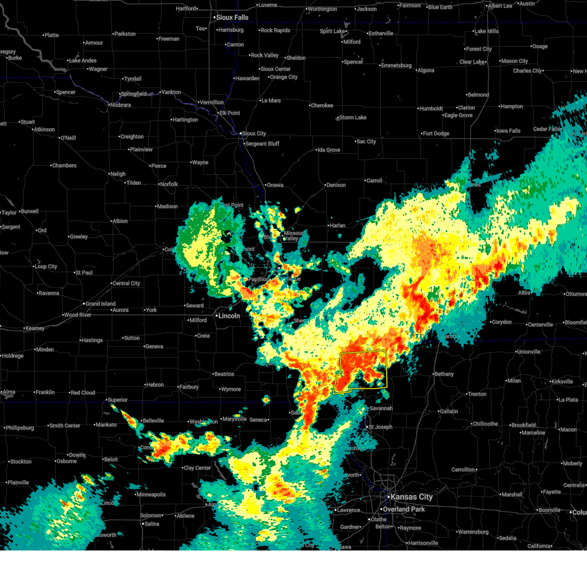
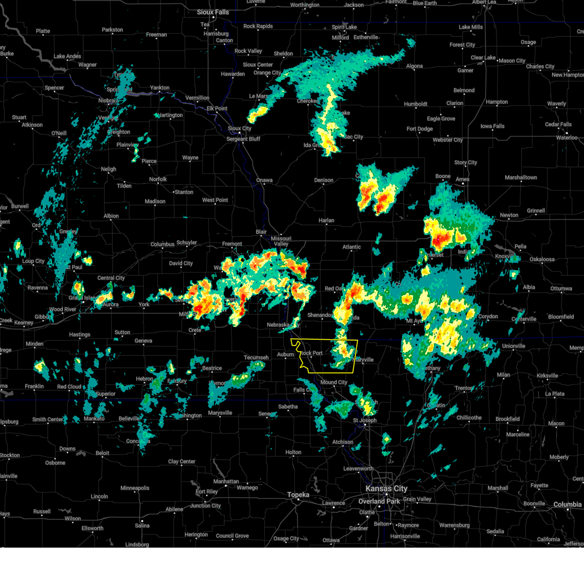
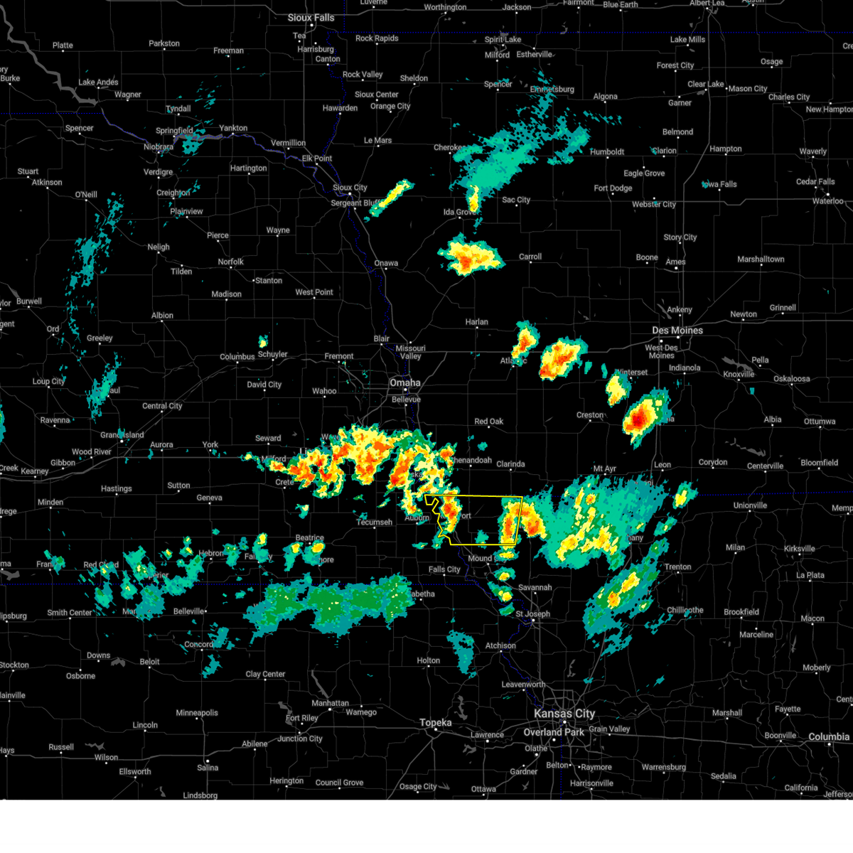
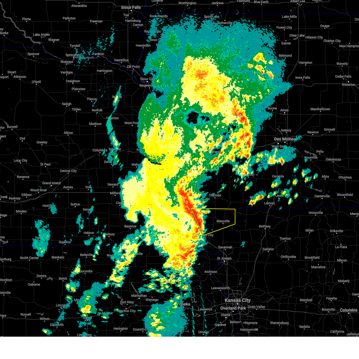
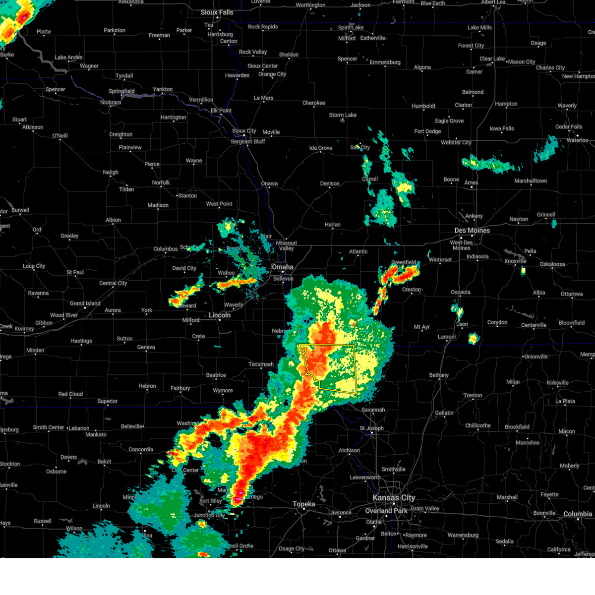
Hail Map for Skidmore, MO
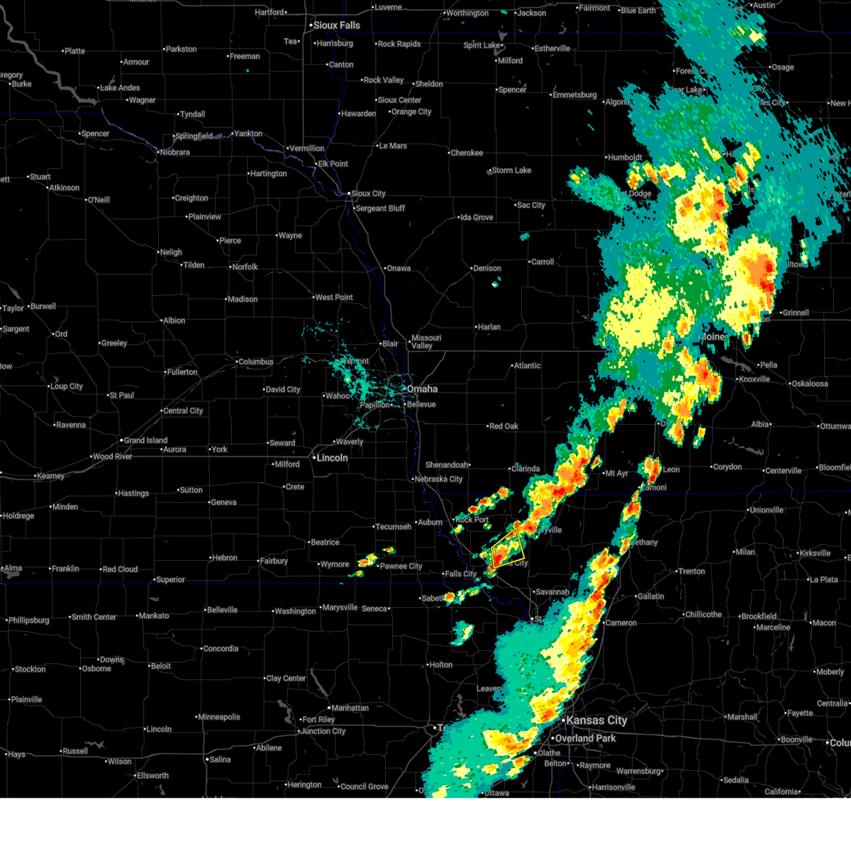
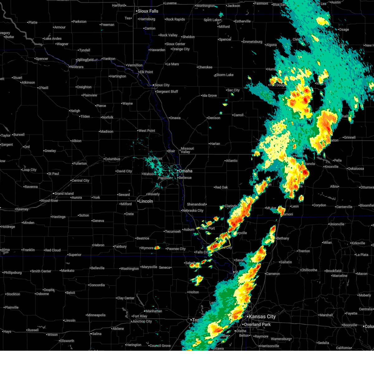
The Skidmore, MO area has had 8 reports of on-the-ground hail by trained spotters, and has been under severe weather warnings 22 times during the past 12 months. Doppler radar has detected hail at or near Skidmore, MO on 90 occasions, including 8 occasions during the past year.
| Name: | Skidmore, MO |
| Where Located: | 80.9 miles SSE of Omaha, NE |
| Map: | Google Map for Skidmore, MO |
| Population: | 284 |
| Housing Units: | 172 |
| More Info: | Search Google for Skidmore, MO |
3
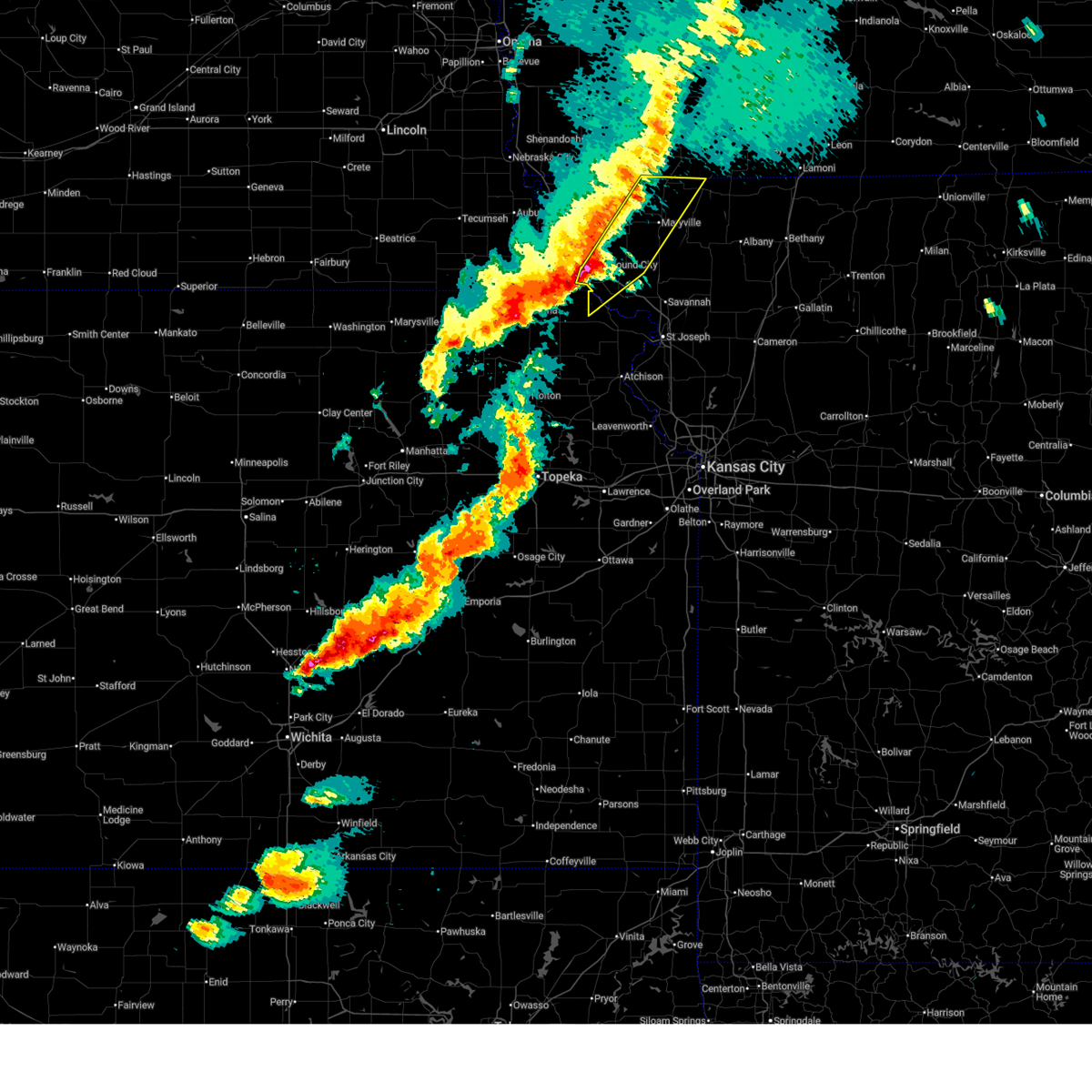
The Top Recent Hail Date for Skidmore, MO is Wednesday, July 8, 2026 (17th out of 90)
Hail and Wind Damage Spotted near Skidmore, MO
| Date / Time | Report Details |
|---|---|
| 7/3/2026 11:50 PM CDT |
 Svreax the national weather service in pleasant hill has issued a * severe thunderstorm warning for, doniphan county in northeastern kansas, northeastern buchanan county in northwestern missouri, southern gentry county in northwestern missouri, southeastern atchison county in northwestern missouri, holt county in northwestern missouri, southern nodaway county in northwestern missouri, andrew county in northwestern missouri, western dekalb county in northwestern missouri, * until 1230 am cdt. * at 1150 pm cdt, severe thunderstorms were located along a line extending from 7 miles east of hopkins to near fillmore to near highland, moving east at 45 mph (radar indicated). Hazards include 60 mph wind gusts and nickel size hail. expect damage to roofs, siding, and trees Svreax the national weather service in pleasant hill has issued a * severe thunderstorm warning for, doniphan county in northeastern kansas, northeastern buchanan county in northwestern missouri, southern gentry county in northwestern missouri, southeastern atchison county in northwestern missouri, holt county in northwestern missouri, southern nodaway county in northwestern missouri, andrew county in northwestern missouri, western dekalb county in northwestern missouri, * until 1230 am cdt. * at 1150 pm cdt, severe thunderstorms were located along a line extending from 7 miles east of hopkins to near fillmore to near highland, moving east at 45 mph (radar indicated). Hazards include 60 mph wind gusts and nickel size hail. expect damage to roofs, siding, and trees
|
| 6/13/2026 6:39 PM CDT |
 At 639 pm cdt, severe thunderstorms were located along a line extending from near athelstan to 6 miles northeast of maryville to near skidmore, moving east at 15 mph (radar indicated). Hazards include 60 mph wind gusts and quarter size hail. Hail damage to vehicles is expected. expect wind damage to roofs, siding, and trees. locations impacted include, maryville, mound city, burlington junction, hopkins, ravenwood, maitland, skidmore, sheridan, parnell, graham, pickering, arkoe, and quitman. This includes interstate 29 between mile markers 80 and 90. At 639 pm cdt, severe thunderstorms were located along a line extending from near athelstan to 6 miles northeast of maryville to near skidmore, moving east at 15 mph (radar indicated). Hazards include 60 mph wind gusts and quarter size hail. Hail damage to vehicles is expected. expect wind damage to roofs, siding, and trees. locations impacted include, maryville, mound city, burlington junction, hopkins, ravenwood, maitland, skidmore, sheridan, parnell, graham, pickering, arkoe, and quitman. This includes interstate 29 between mile markers 80 and 90.
|
| 6/13/2026 6:29 PM CDT |
 At 629 pm cdt, severe thunderstorms were located along a line extending from 7 miles west of athelstan to near maryville to near skidmore, moving east at 25 mph (radar indicated). Hazards include 60 mph wind gusts and quarter size hail. Hail damage to vehicles is expected. expect wind damage to roofs, siding, and trees. locations impacted include, maryville, mound city, burlington junction, hopkins, ravenwood, maitland, skidmore, sheridan, parnell, graham, pickering, arkoe, and quitman. This includes interstate 29 between mile markers 80 and 90. At 629 pm cdt, severe thunderstorms were located along a line extending from 7 miles west of athelstan to near maryville to near skidmore, moving east at 25 mph (radar indicated). Hazards include 60 mph wind gusts and quarter size hail. Hail damage to vehicles is expected. expect wind damage to roofs, siding, and trees. locations impacted include, maryville, mound city, burlington junction, hopkins, ravenwood, maitland, skidmore, sheridan, parnell, graham, pickering, arkoe, and quitman. This includes interstate 29 between mile markers 80 and 90.
|
| 6/13/2026 6:17 PM CDT |
 Svreax the national weather service in pleasant hill has issued a * severe thunderstorm warning for, northwestern worth county in northwestern missouri, southeastern atchison county in northwestern missouri, northeastern holt county in northwestern missouri, nodaway county in northwestern missouri, * until 700 pm cdt. * at 616 pm cdt, severe thunderstorms were located along a line extending from near hopkins to near burlington junction to near craig, moving east at 15 mph (radar indicated). Hazards include 60 mph wind gusts and quarter size hail. Hail damage to vehicles is expected. Expect wind damage to roofs, siding, and trees. Svreax the national weather service in pleasant hill has issued a * severe thunderstorm warning for, northwestern worth county in northwestern missouri, southeastern atchison county in northwestern missouri, northeastern holt county in northwestern missouri, nodaway county in northwestern missouri, * until 700 pm cdt. * at 616 pm cdt, severe thunderstorms were located along a line extending from near hopkins to near burlington junction to near craig, moving east at 15 mph (radar indicated). Hazards include 60 mph wind gusts and quarter size hail. Hail damage to vehicles is expected. Expect wind damage to roofs, siding, and trees.
|
| 6/13/2026 6:10 PM CDT |
 At 610 pm cdt, a severe thunderstorm was located near skidmore, or 13 miles west of maryville, moving east at 15 mph (radar indicated). Hazards include 60 mph wind gusts and quarter size hail. Hail damage to vehicles is expected. expect wind damage to roofs, siding, and trees. Locations impacted include, skidmore and quitman. At 610 pm cdt, a severe thunderstorm was located near skidmore, or 13 miles west of maryville, moving east at 15 mph (radar indicated). Hazards include 60 mph wind gusts and quarter size hail. Hail damage to vehicles is expected. expect wind damage to roofs, siding, and trees. Locations impacted include, skidmore and quitman.
|
| 6/13/2026 5:57 PM CDT |
 At 557 pm cdt, a severe thunderstorm was located 7 miles northwest of skidmore, or 11 miles southeast of tarkio, moving east at 15 mph (radar indicated). Hazards include 60 mph wind gusts and quarter size hail. Hail damage to vehicles is expected. expect wind damage to roofs, siding, and trees. Locations impacted include, burlington junction, skidmore, and quitman. At 557 pm cdt, a severe thunderstorm was located 7 miles northwest of skidmore, or 11 miles southeast of tarkio, moving east at 15 mph (radar indicated). Hazards include 60 mph wind gusts and quarter size hail. Hail damage to vehicles is expected. expect wind damage to roofs, siding, and trees. Locations impacted include, burlington junction, skidmore, and quitman.
|
| 5/18/2026 8:10 PM CDT |
 At 810 pm cdt, a severe thunderstorm was located near skidmore, or near maryville, moving northeast at 35 mph (radar indicated). Hazards include 60 mph wind gusts and quarter size hail. Hail damage to vehicles is expected. expect wind damage to roofs, siding, and trees. locations impacted include, maryville, savannah, mound city, oregon, ravenwood, maitland, skidmore, forest city, fillmore, barnard, conception junction, bolckow, graham, pickering, rosendale, guilford, clyde, arkoe, rea, and quitman. This includes interstate 29 between mile markers 62 and 84. At 810 pm cdt, a severe thunderstorm was located near skidmore, or near maryville, moving northeast at 35 mph (radar indicated). Hazards include 60 mph wind gusts and quarter size hail. Hail damage to vehicles is expected. expect wind damage to roofs, siding, and trees. locations impacted include, maryville, savannah, mound city, oregon, ravenwood, maitland, skidmore, forest city, fillmore, barnard, conception junction, bolckow, graham, pickering, rosendale, guilford, clyde, arkoe, rea, and quitman. This includes interstate 29 between mile markers 62 and 84.
|
| 5/18/2026 8:01 PM CDT |
 Svreax the national weather service in pleasant hill has issued a * severe thunderstorm warning for, northwestern doniphan county in northeastern kansas, southeastern atchison county in northwestern missouri, holt county in northwestern missouri, nodaway county in northwestern missouri, northern andrew county in northwestern missouri, * until 845 pm cdt. * at 800 pm cdt, a severe thunderstorm was located over skidmore, or 11 miles northeast of mound city, moving northeast at 35 mph (radar indicated). Hazards include 60 mph wind gusts and quarter size hail. Hail damage to vehicles is expected. Expect wind damage to roofs, siding, and trees. Svreax the national weather service in pleasant hill has issued a * severe thunderstorm warning for, northwestern doniphan county in northeastern kansas, southeastern atchison county in northwestern missouri, holt county in northwestern missouri, nodaway county in northwestern missouri, northern andrew county in northwestern missouri, * until 845 pm cdt. * at 800 pm cdt, a severe thunderstorm was located over skidmore, or 11 miles northeast of mound city, moving northeast at 35 mph (radar indicated). Hazards include 60 mph wind gusts and quarter size hail. Hail damage to vehicles is expected. Expect wind damage to roofs, siding, and trees.
|
| 5/18/2026 6:06 PM CDT |
 Svreax the national weather service in pleasant hill has issued a * severe thunderstorm warning for, eastern atchison county in northwestern missouri, northern holt county in northwestern missouri, nodaway county in northwestern missouri, * until 645 pm cdt. * at 605 pm cdt, severe thunderstorms were located along a line extending from hopkins to 6 miles northwest of craig, moving east at 25 mph (emergency management). Hazards include golf ball size hail and 70 mph wind gusts. People and animals outdoors will be injured. expect hail damage to roofs, siding, windows, and vehicles. expect considerable tree damage. Wind damage is also likely to mobile homes, roofs, and outbuildings. Svreax the national weather service in pleasant hill has issued a * severe thunderstorm warning for, eastern atchison county in northwestern missouri, northern holt county in northwestern missouri, nodaway county in northwestern missouri, * until 645 pm cdt. * at 605 pm cdt, severe thunderstorms were located along a line extending from hopkins to 6 miles northwest of craig, moving east at 25 mph (emergency management). Hazards include golf ball size hail and 70 mph wind gusts. People and animals outdoors will be injured. expect hail damage to roofs, siding, windows, and vehicles. expect considerable tree damage. Wind damage is also likely to mobile homes, roofs, and outbuildings.
|
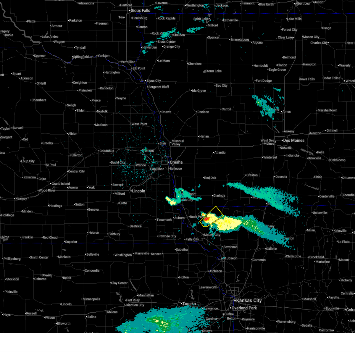
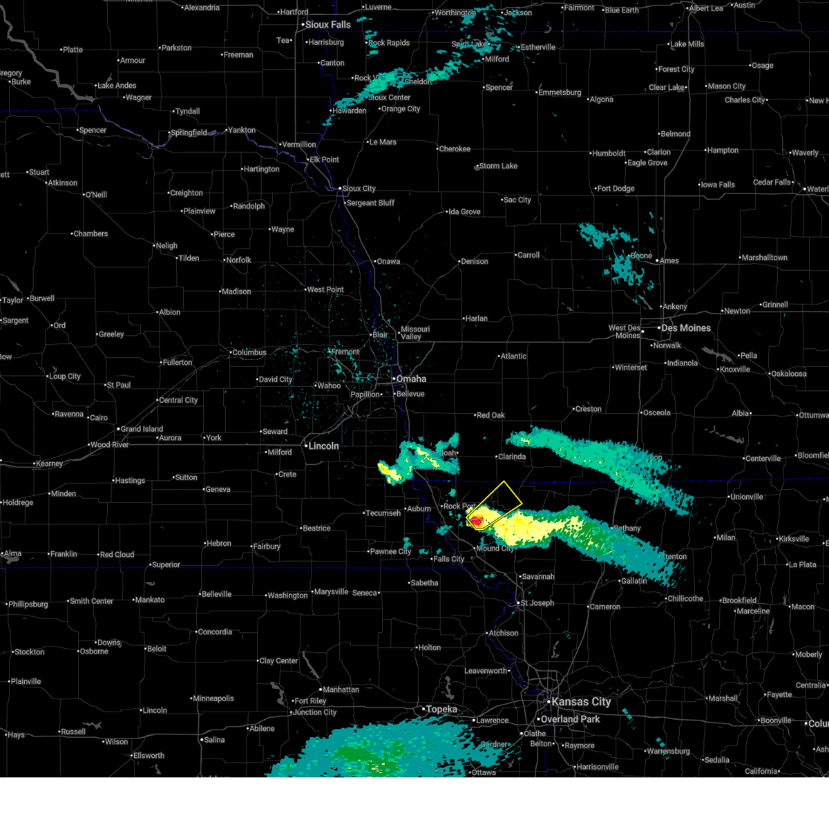
| 5/18/2026 5:58 PM CDT | Golf Ball sized hail reported 4.4 miles SSE of Skidmore, MO, em relayed spotter reported golf ball sized hail. |
| 5/18/2026 5:56 PM CDT |
 At 556 pm cdt, severe thunderstorms were located along a line extending from near shambaugh to near fairfax, moving northeast at 40 mph (radar indicated). Hazards include two inch hail and 70 mph wind gusts. People and animals outdoors will be injured. expect hail damage to roofs, siding, windows, and vehicles. expect considerable tree damage. wind damage is also likely to mobile homes, roofs, and outbuildings. locations impacted include, maryville, tarkio, rock port, fairfax, burlington junction, hopkins, maitland, skidmore, craig, braddyville, blanchard, graham, clearmont, elmo, pickering, quitman, corning, and indian cave state park. This includes interstate 29 between mile markers 88 and 109. At 556 pm cdt, severe thunderstorms were located along a line extending from near shambaugh to near fairfax, moving northeast at 40 mph (radar indicated). Hazards include two inch hail and 70 mph wind gusts. People and animals outdoors will be injured. expect hail damage to roofs, siding, windows, and vehicles. expect considerable tree damage. wind damage is also likely to mobile homes, roofs, and outbuildings. locations impacted include, maryville, tarkio, rock port, fairfax, burlington junction, hopkins, maitland, skidmore, craig, braddyville, blanchard, graham, clearmont, elmo, pickering, quitman, corning, and indian cave state park. This includes interstate 29 between mile markers 88 and 109.
|
| 5/18/2026 5:54 PM CDT |
 At 553 pm cdt, a severe thunderstorm capable of producing a tornado was located near skidmore, or 13 miles north of mound city, moving northeast at 45 mph (radar indicated rotation). Hazards include tornado and two inch hail. Flying debris will be dangerous to those caught without shelter. mobile homes will be damaged or destroyed. damage to roofs, windows, and vehicles will occur. tree damage is likely. Locations impacted include, maryville, burlington junction, skidmore, pickering, arkoe, and quitman. At 553 pm cdt, a severe thunderstorm capable of producing a tornado was located near skidmore, or 13 miles north of mound city, moving northeast at 45 mph (radar indicated rotation). Hazards include tornado and two inch hail. Flying debris will be dangerous to those caught without shelter. mobile homes will be damaged or destroyed. damage to roofs, windows, and vehicles will occur. tree damage is likely. Locations impacted include, maryville, burlington junction, skidmore, pickering, arkoe, and quitman.
|
| 5/18/2026 5:41 PM CDT |
 Toreax the national weather service in pleasant hill has issued a * tornado warning for, northeastern holt county in northwestern missouri, central nodaway county in northwestern missouri, * until 630 pm cdt. * at 540 pm cdt, a dangerous tornado was located near fairfax, or 11 miles north of mound city, moving east at 45 mph. this is a particularly dangerous situation. take cover now! (radar indicated rotation). Hazards include damaging tornado. You are in a life-threatening situation. flying debris may be deadly to those caught without shelter. mobile homes will be destroyed. Considerable damage to homes, businesses, and vehicles is likely and complete destruction is possible. Toreax the national weather service in pleasant hill has issued a * tornado warning for, northeastern holt county in northwestern missouri, central nodaway county in northwestern missouri, * until 630 pm cdt. * at 540 pm cdt, a dangerous tornado was located near fairfax, or 11 miles north of mound city, moving east at 45 mph. this is a particularly dangerous situation. take cover now! (radar indicated rotation). Hazards include damaging tornado. You are in a life-threatening situation. flying debris may be deadly to those caught without shelter. mobile homes will be destroyed. Considerable damage to homes, businesses, and vehicles is likely and complete destruction is possible.
|
| 5/18/2026 5:22 PM CDT |
 Svreax the national weather service in pleasant hill has issued a * severe thunderstorm warning for, atchison county in northwestern missouri, northern holt county in northwestern missouri, northwestern nodaway county in northwestern missouri, * until 615 pm cdt. * at 522 pm cdt, severe thunderstorms were located along a line extending from blanchard to near shubert, moving east at 45 mph (automated weather station). Hazards include two inch hail and 70 mph wind gusts. People and animals outdoors will be injured. expect hail damage to roofs, siding, windows, and vehicles. expect considerable tree damage. Wind damage is also likely to mobile homes, roofs, and outbuildings. Svreax the national weather service in pleasant hill has issued a * severe thunderstorm warning for, atchison county in northwestern missouri, northern holt county in northwestern missouri, northwestern nodaway county in northwestern missouri, * until 615 pm cdt. * at 522 pm cdt, severe thunderstorms were located along a line extending from blanchard to near shubert, moving east at 45 mph (automated weather station). Hazards include two inch hail and 70 mph wind gusts. People and animals outdoors will be injured. expect hail damage to roofs, siding, windows, and vehicles. expect considerable tree damage. Wind damage is also likely to mobile homes, roofs, and outbuildings.
|
| 5/17/2026 10:54 PM CDT |
 At 1054 pm cdt, severe thunderstorms were located along a line extending from 8 miles south of corning to skidmore to near hiawatha, moving east at 60 mph (automated weather station). Hazards include 60 mph wind gusts and penny size hail. Expect damage to roofs, siding, and trees. locations impacted include, maryville, mound city, burlington junction, hopkins, maitland, skidmore, blanchard, graham, clearmont, elmo, pickering, quitman, and fortescue. This includes interstate 29 between mile markers 78 and 85. At 1054 pm cdt, severe thunderstorms were located along a line extending from 8 miles south of corning to skidmore to near hiawatha, moving east at 60 mph (automated weather station). Hazards include 60 mph wind gusts and penny size hail. Expect damage to roofs, siding, and trees. locations impacted include, maryville, mound city, burlington junction, hopkins, maitland, skidmore, blanchard, graham, clearmont, elmo, pickering, quitman, and fortescue. This includes interstate 29 between mile markers 78 and 85.
|
| 5/17/2026 10:53 PM CDT |
 Svreax the national weather service in pleasant hill has issued a * severe thunderstorm warning for, western worth county in northwestern missouri, northwestern gentry county in northwestern missouri, northeastern atchison county in northwestern missouri, northeastern holt county in northwestern missouri, nodaway county in northwestern missouri, northern andrew county in northwestern missouri, * until 1145 pm cdt. * at 1053 pm cdt, severe thunderstorms were located along a line extending from near braddyville to near skidmore to near forest city, moving east at 45 mph (automated weather station). Hazards include 60 mph wind gusts and penny size hail. expect damage to roofs, siding, and trees Svreax the national weather service in pleasant hill has issued a * severe thunderstorm warning for, western worth county in northwestern missouri, northwestern gentry county in northwestern missouri, northeastern atchison county in northwestern missouri, northeastern holt county in northwestern missouri, nodaway county in northwestern missouri, northern andrew county in northwestern missouri, * until 1145 pm cdt. * at 1053 pm cdt, severe thunderstorms were located along a line extending from near braddyville to near skidmore to near forest city, moving east at 45 mph (automated weather station). Hazards include 60 mph wind gusts and penny size hail. expect damage to roofs, siding, and trees
|
| 5/17/2026 10:19 PM CDT |
 Svreax the national weather service in pleasant hill has issued a * severe thunderstorm warning for, atchison county in northwestern missouri, holt county in northwestern missouri, western nodaway county in northwestern missouri, * until 1115 pm cdt. * at 1019 pm cdt, severe thunderstorms were located along a line extending from 7 miles west of coin to near falls city to near corning, moving northeast at 60 mph (radar indicated). Hazards include 60 mph wind gusts and penny size hail. expect damage to roofs, siding, and trees Svreax the national weather service in pleasant hill has issued a * severe thunderstorm warning for, atchison county in northwestern missouri, holt county in northwestern missouri, western nodaway county in northwestern missouri, * until 1115 pm cdt. * at 1019 pm cdt, severe thunderstorms were located along a line extending from 7 miles west of coin to near falls city to near corning, moving northeast at 60 mph (radar indicated). Hazards include 60 mph wind gusts and penny size hail. expect damage to roofs, siding, and trees
|
| 4/23/2026 7:17 PM CDT |
 At 717 pm cdt, severe thunderstorms were located along a line extending from near hopkins to white cloud, moving east at 25 mph (radar indicated). Hazards include 60 mph wind gusts and quarter size hail. Hail damage to vehicles is expected. expect wind damage to roofs, siding, and trees. locations impacted include, maryville, mound city, oregon, burlington junction, hopkins, maitland, skidmore, forest city, white cloud, sheridan, graham, clearmont, pickering, big lake, arkoe, quitman, fortescue, bigelow, iowa point, and iowa reservation of kansas and nebraska. This includes interstate 29 between mile markers 73 and 90. At 717 pm cdt, severe thunderstorms were located along a line extending from near hopkins to white cloud, moving east at 25 mph (radar indicated). Hazards include 60 mph wind gusts and quarter size hail. Hail damage to vehicles is expected. expect wind damage to roofs, siding, and trees. locations impacted include, maryville, mound city, oregon, burlington junction, hopkins, maitland, skidmore, forest city, white cloud, sheridan, graham, clearmont, pickering, big lake, arkoe, quitman, fortescue, bigelow, iowa point, and iowa reservation of kansas and nebraska. This includes interstate 29 between mile markers 73 and 90.
|
| 4/23/2026 7:04 PM CDT |
 At 704 pm cdt, severe thunderstorms were located along a line extending from hopkins to near rulo, moving east at 25 mph (radar indicated). Hazards include ping pong ball size hail and 60 mph wind gusts. People and animals outdoors will be injured. expect hail damage to roofs, siding, windows, and vehicles. expect wind damage to roofs, siding, and trees. locations impacted include, maryville, mound city, oregon, burlington junction, hopkins, maitland, skidmore, forest city, craig, white cloud, braddyville, sheridan, graham, clearmont, elmo, pickering, big lake, arkoe, quitman, and fortescue. This includes interstate 29 between mile markers 73 and 98. At 704 pm cdt, severe thunderstorms were located along a line extending from hopkins to near rulo, moving east at 25 mph (radar indicated). Hazards include ping pong ball size hail and 60 mph wind gusts. People and animals outdoors will be injured. expect hail damage to roofs, siding, windows, and vehicles. expect wind damage to roofs, siding, and trees. locations impacted include, maryville, mound city, oregon, burlington junction, hopkins, maitland, skidmore, forest city, craig, white cloud, braddyville, sheridan, graham, clearmont, elmo, pickering, big lake, arkoe, quitman, and fortescue. This includes interstate 29 between mile markers 73 and 98.
|
| 4/11/2026 9:23 PM CDT |
 the severe thunderstorm warning has been cancelled and is no longer in effect the severe thunderstorm warning has been cancelled and is no longer in effect
|
| 4/11/2026 9:09 PM CDT |
 Svreax the national weather service in pleasant hill has issued a * severe thunderstorm warning for, southeastern atchison county in northwestern missouri, northwestern nodaway county in northwestern missouri, * until 1000 pm cdt. * at 909 pm cdt, a severe thunderstorm was located 7 miles west of skidmore, or 11 miles north of mound city, moving northeast at 30 mph (radar indicated). Hazards include 60 mph wind gusts and penny size hail. expect damage to roofs, siding, and trees Svreax the national weather service in pleasant hill has issued a * severe thunderstorm warning for, southeastern atchison county in northwestern missouri, northwestern nodaway county in northwestern missouri, * until 1000 pm cdt. * at 909 pm cdt, a severe thunderstorm was located 7 miles west of skidmore, or 11 miles north of mound city, moving northeast at 30 mph (radar indicated). Hazards include 60 mph wind gusts and penny size hail. expect damage to roofs, siding, and trees
|
| 4/3/2026 4:14 PM CDT |
 the severe thunderstorm warning has been cancelled and is no longer in effect the severe thunderstorm warning has been cancelled and is no longer in effect
|
| 4/3/2026 3:42 PM CDT |
 Svreax the national weather service in pleasant hill has issued a * severe thunderstorm warning for, eastern atchison county in northwestern missouri, northwestern nodaway county in northwestern missouri, * until 430 pm cdt. * at 342 pm cdt, a severe thunderstorm was located near fairfax, or near tarkio, moving northeast at 35 mph (radar indicated). Hazards include ping pong ball size hail and 60 mph wind gusts. People and animals outdoors will be injured. expect hail damage to roofs, siding, windows, and vehicles. Expect wind damage to roofs, siding, and trees. Svreax the national weather service in pleasant hill has issued a * severe thunderstorm warning for, eastern atchison county in northwestern missouri, northwestern nodaway county in northwestern missouri, * until 430 pm cdt. * at 342 pm cdt, a severe thunderstorm was located near fairfax, or near tarkio, moving northeast at 35 mph (radar indicated). Hazards include ping pong ball size hail and 60 mph wind gusts. People and animals outdoors will be injured. expect hail damage to roofs, siding, windows, and vehicles. Expect wind damage to roofs, siding, and trees.
|
| 6/26/2025 5:55 PM CDT |
 The storm which prompted the warning has weakened below severe limits, and no longer poses an immediate threat to life or property. therefore, the warning will be allowed to expire. however, gusty winds to 50 mph and heavy rain are still possible with this thunderstorm. a severe thunderstorm watch remains in effect until 900 pm cdt for northwestern missouri. The storm which prompted the warning has weakened below severe limits, and no longer poses an immediate threat to life or property. therefore, the warning will be allowed to expire. however, gusty winds to 50 mph and heavy rain are still possible with this thunderstorm. a severe thunderstorm watch remains in effect until 900 pm cdt for northwestern missouri.
|
| 6/26/2025 5:44 PM CDT |
 At 544 pm cdt, a severe thunderstorm was located near maitland, or 8 miles east of mound city, moving east at 30 mph (radar indicated). Hazards include 60 mph wind gusts. Expect damage to roofs, siding, and trees. Locations impacted include, maitland, skidmore, and graham. At 544 pm cdt, a severe thunderstorm was located near maitland, or 8 miles east of mound city, moving east at 30 mph (radar indicated). Hazards include 60 mph wind gusts. Expect damage to roofs, siding, and trees. Locations impacted include, maitland, skidmore, and graham.
|
| 6/26/2025 5:27 PM CDT |
 At 527 pm cdt, a severe thunderstorm was located near mound city, moving northeast at 20 mph (radar indicated). Hazards include 60 mph wind gusts and penny size hail. Expect damage to roofs, siding, and trees. locations impacted include, mound city, maitland, skidmore, and graham. This includes interstate 29 between mile markers 81 and 86. At 527 pm cdt, a severe thunderstorm was located near mound city, moving northeast at 20 mph (radar indicated). Hazards include 60 mph wind gusts and penny size hail. Expect damage to roofs, siding, and trees. locations impacted include, mound city, maitland, skidmore, and graham. This includes interstate 29 between mile markers 81 and 86.
|
| 6/26/2025 5:20 PM CDT |
 Svreax the national weather service in pleasant hill has issued a * severe thunderstorm warning for, southwestern nodaway county in northwestern missouri, northeastern holt county in northwestern missouri, * until 600 pm cdt. * at 519 pm cdt, a severe thunderstorm was located over mound city, moving northeast at 20 mph (radar indicated). Hazards include 60 mph wind gusts and penny size hail. expect damage to roofs, siding, and trees Svreax the national weather service in pleasant hill has issued a * severe thunderstorm warning for, southwestern nodaway county in northwestern missouri, northeastern holt county in northwestern missouri, * until 600 pm cdt. * at 519 pm cdt, a severe thunderstorm was located over mound city, moving northeast at 20 mph (radar indicated). Hazards include 60 mph wind gusts and penny size hail. expect damage to roofs, siding, and trees
|
| 6/23/2025 7:59 PM CDT |
 the severe thunderstorm warning has been cancelled and is no longer in effect the severe thunderstorm warning has been cancelled and is no longer in effect
|
| 6/23/2025 7:47 PM CDT |
 the severe thunderstorm warning has been cancelled and is no longer in effect the severe thunderstorm warning has been cancelled and is no longer in effect
|
| 6/23/2025 7:47 PM CDT |
 At 746 pm cdt, a severe thunderstorm was located near maryville, moving east at 35 mph (radar indicated). Hazards include 60 mph wind gusts. Expect damage to roofs, siding, and trees. Locations impacted include, maryville, burlington junction, ravenwood, skidmore, barnard, conception junction, parnell, graham, pickering, guilford, clyde, arkoe, quitman, and conception. At 746 pm cdt, a severe thunderstorm was located near maryville, moving east at 35 mph (radar indicated). Hazards include 60 mph wind gusts. Expect damage to roofs, siding, and trees. Locations impacted include, maryville, burlington junction, ravenwood, skidmore, barnard, conception junction, parnell, graham, pickering, guilford, clyde, arkoe, quitman, and conception.
|
| 6/23/2025 7:41 PM CDT |
 At 741 pm cdt, a severe thunderstorm was located near maryville, moving east at 35 mph (radar indicated). Hazards include 60 mph wind gusts and penny size hail. Expect damage to roofs, siding, and trees. locations impacted include, maryville, mound city, burlington junction, ravenwood, maitland, skidmore, barnard, conception junction, parnell, graham, pickering, guilford, clyde, arkoe, quitman, and conception. This includes interstate 29 between mile markers 81 and 85. At 741 pm cdt, a severe thunderstorm was located near maryville, moving east at 35 mph (radar indicated). Hazards include 60 mph wind gusts and penny size hail. Expect damage to roofs, siding, and trees. locations impacted include, maryville, mound city, burlington junction, ravenwood, maitland, skidmore, barnard, conception junction, parnell, graham, pickering, guilford, clyde, arkoe, quitman, and conception. This includes interstate 29 between mile markers 81 and 85.
|
| 6/23/2025 7:35 PM CDT |
 Svreax the national weather service in pleasant hill has issued a * severe thunderstorm warning for, nodaway county in northwestern missouri, northeastern holt county in northwestern missouri, * until 815 pm cdt. * at 735 pm cdt, a severe thunderstorm was located near skidmore, or 7 miles southwest of maryville, moving east at 35 mph (radar indicated). Hazards include 60 mph wind gusts and nickel size hail. expect damage to roofs, siding, and trees Svreax the national weather service in pleasant hill has issued a * severe thunderstorm warning for, nodaway county in northwestern missouri, northeastern holt county in northwestern missouri, * until 815 pm cdt. * at 735 pm cdt, a severe thunderstorm was located near skidmore, or 7 miles southwest of maryville, moving east at 35 mph (radar indicated). Hazards include 60 mph wind gusts and nickel size hail. expect damage to roofs, siding, and trees
|
| 3/14/2025 4:51 PM CDT |
 The storm which prompted the warning has moved out of the area. therefore, the warning will be allowed to expire. however, gusty winds are still expected. a severe thunderstorm watch remains in effect until 700 pm cdt for northwestern missouri. The storm which prompted the warning has moved out of the area. therefore, the warning will be allowed to expire. however, gusty winds are still expected. a severe thunderstorm watch remains in effect until 700 pm cdt for northwestern missouri.
|
| 3/14/2025 4:15 PM CDT |
 Svreax the national weather service in pleasant hill has issued a * severe thunderstorm warning for, atchison county in northwestern missouri, northwestern nodaway county in northwestern missouri, * until 500 pm cdt. * at 414 pm cdt, a cluster of severe thunderstorms were located near rock port, or 9 miles west of tarkio, moving north at 65 mph (radar indicated). Hazards include 70 mph wind gusts and penny size hail. Expect considerable tree damage. Damage is likely to mobile homes, roofs, and outbuildings. Svreax the national weather service in pleasant hill has issued a * severe thunderstorm warning for, atchison county in northwestern missouri, northwestern nodaway county in northwestern missouri, * until 500 pm cdt. * at 414 pm cdt, a cluster of severe thunderstorms were located near rock port, or 9 miles west of tarkio, moving north at 65 mph (radar indicated). Hazards include 70 mph wind gusts and penny size hail. Expect considerable tree damage. Damage is likely to mobile homes, roofs, and outbuildings.
|
| 10/30/2024 1:47 PM CDT | Multiple power poles down near route 46 and route 113. time estimated from rada in nodaway county MO, 4.7 miles SSW of Skidmore, MO |
| 10/30/2024 1:43 PM CDT | Multiple trees and buildings damaged along route ab. time estimated from rada in nodaway county MO, 8.5 miles SSW of Skidmore, MO |
| 10/30/2024 1:39 PM CDT | Several reports of wires down and power outages in western nodaway county... primarily north of skidmore and west of maryville. time estimated from rada in nodaway county MO, 3.7 miles SSW of Skidmore, MO |
| 10/30/2024 1:27 PM CDT |
 Svreax the national weather service in pleasant hill has issued a * severe thunderstorm warning for, eastern atchison county in northwestern missouri, north central holt county in northwestern missouri, nodaway county in northwestern missouri, * until 200 pm cdt. * at 127 pm cdt, a severe thunderstorm was located 7 miles west of burlington junction, or 9 miles east of tarkio, moving northeast at 75 mph (radar indicated). Hazards include 70 mph wind gusts and quarter size hail. Hail damage to vehicles is expected. expect considerable tree damage. Wind damage is also likely to mobile homes, roofs, and outbuildings. Svreax the national weather service in pleasant hill has issued a * severe thunderstorm warning for, eastern atchison county in northwestern missouri, north central holt county in northwestern missouri, nodaway county in northwestern missouri, * until 200 pm cdt. * at 127 pm cdt, a severe thunderstorm was located 7 miles west of burlington junction, or 9 miles east of tarkio, moving northeast at 75 mph (radar indicated). Hazards include 70 mph wind gusts and quarter size hail. Hail damage to vehicles is expected. expect considerable tree damage. Wind damage is also likely to mobile homes, roofs, and outbuildings.
|
| 8/14/2024 9:46 PM CDT | Svreax the national weather service in pleasant hill has issued a * severe thunderstorm warning for, southwestern worth county in northwestern missouri, northwestern gentry county in northwestern missouri, northeastern holt county in northwestern missouri, southern nodaway county in northwestern missouri, * until 1030 pm cdt. * at 945 pm cdt, severe thunderstorms were located along a line extending from near maryville to 8 miles east of maitland to 3 miles south of forest city, moving east at 30 mph (radar indicated). Hazards include 60 mph wind gusts. expect damage to roofs, siding, and trees |
| 8/14/2024 9:28 PM CDT |
 At 928 pm cdt, severe thunderstorms were located along a line extending from 4 miles west of bedford to near maryville to 3 miles south of maitland, moving east at 40 mph (radar indicated). Hazards include 60 mph wind gusts and penny size hail. Expect damage to roofs, siding, and trees. Locations impacted include, maryville, burlington junction, hopkins, ravenwood, maitland, skidmore, craig, braddyville, and blanchard. At 928 pm cdt, severe thunderstorms were located along a line extending from 4 miles west of bedford to near maryville to 3 miles south of maitland, moving east at 40 mph (radar indicated). Hazards include 60 mph wind gusts and penny size hail. Expect damage to roofs, siding, and trees. Locations impacted include, maryville, burlington junction, hopkins, ravenwood, maitland, skidmore, craig, braddyville, and blanchard.
|
| 8/14/2024 9:09 PM CDT |
 Svreax the national weather service in pleasant hill has issued a * severe thunderstorm warning for, northwestern worth county in northwestern missouri, eastern atchison county in northwestern missouri, northern holt county in northwestern missouri, nodaway county in northwestern missouri, * until 945 pm cdt. * at 909 pm cdt, severe thunderstorms were located along a line extending from near shambaugh to 3 miles south of burlington junction to 3 miles northwest of mound city, moving east at 40 mph (radar indicated). Hazards include 60 mph wind gusts and penny size hail. expect damage to roofs, siding, and trees Svreax the national weather service in pleasant hill has issued a * severe thunderstorm warning for, northwestern worth county in northwestern missouri, eastern atchison county in northwestern missouri, northern holt county in northwestern missouri, nodaway county in northwestern missouri, * until 945 pm cdt. * at 909 pm cdt, severe thunderstorms were located along a line extending from near shambaugh to 3 miles south of burlington junction to 3 miles northwest of mound city, moving east at 40 mph (radar indicated). Hazards include 60 mph wind gusts and penny size hail. expect damage to roofs, siding, and trees
|
| 8/14/2024 9:02 PM CDT |
 At 902 pm cdt, a severe thunderstorm was located near burlington junction, moving east at 45 mph (radar indicated). Hazards include 60 mph wind gusts and penny size hail. Expect damage to roofs, siding, and trees. Locations impacted include, tarkio, rock port, fairfax, burlington junction, maitland, skidmore, craig, and blanchard. At 902 pm cdt, a severe thunderstorm was located near burlington junction, moving east at 45 mph (radar indicated). Hazards include 60 mph wind gusts and penny size hail. Expect damage to roofs, siding, and trees. Locations impacted include, tarkio, rock port, fairfax, burlington junction, maitland, skidmore, craig, and blanchard.
|
| 8/14/2024 8:44 PM CDT |
 Svreax the national weather service in pleasant hill has issued a * severe thunderstorm warning for, atchison county in northwestern missouri, northern holt county in northwestern missouri, western nodaway county in northwestern missouri, * until 915 pm cdt. * at 843 pm cdt, a severe thunderstorm was located over tarkio, moving east at 40 mph (radar indicated). Hazards include 60 mph wind gusts and penny size hail. expect damage to roofs, siding, and trees Svreax the national weather service in pleasant hill has issued a * severe thunderstorm warning for, atchison county in northwestern missouri, northern holt county in northwestern missouri, western nodaway county in northwestern missouri, * until 915 pm cdt. * at 843 pm cdt, a severe thunderstorm was located over tarkio, moving east at 40 mph (radar indicated). Hazards include 60 mph wind gusts and penny size hail. expect damage to roofs, siding, and trees
|
| 6/28/2024 9:37 PM CDT |
 The storm which prompted the warning has weakened below severe limits, and no longer appears capable of producing a tornado. therefore, the warning will be allowed to expire. however, gusty winds are still possible with this thunderstorm. a tornado watch remains in effect until 1100 pm cdt for northwestern missouri. The storm which prompted the warning has weakened below severe limits, and no longer appears capable of producing a tornado. therefore, the warning will be allowed to expire. however, gusty winds are still possible with this thunderstorm. a tornado watch remains in effect until 1100 pm cdt for northwestern missouri.
|
| 6/28/2024 9:11 PM CDT |
 Toreax the national weather service in pleasant hill has issued a * tornado warning for, southeastern atchison county in northwestern missouri, northwestern holt county in northwestern missouri, west central nodaway county in northwestern missouri, * until 945 pm cdt. * at 910 pm cdt, a severe thunderstorm capable of producing a tornado was located near fairfax, or 13 miles south of tarkio, moving northeast at 40 mph (radar indicated rotation). Hazards include tornado. Flying debris will be dangerous to those caught without shelter. mobile homes will be damaged or destroyed. damage to roofs, windows, and vehicles will occur. Tree damage is likely. Toreax the national weather service in pleasant hill has issued a * tornado warning for, southeastern atchison county in northwestern missouri, northwestern holt county in northwestern missouri, west central nodaway county in northwestern missouri, * until 945 pm cdt. * at 910 pm cdt, a severe thunderstorm capable of producing a tornado was located near fairfax, or 13 miles south of tarkio, moving northeast at 40 mph (radar indicated rotation). Hazards include tornado. Flying debris will be dangerous to those caught without shelter. mobile homes will be damaged or destroyed. damage to roofs, windows, and vehicles will occur. Tree damage is likely.
|
| 6/15/2024 9:05 PM CDT |
 At 904 pm cdt, severe thunderstorms were located along a line extending from near bedford to 7 miles south of hopkins to near maryville, moving northeast at 40 mph (radar indicated). Hazards include 60 mph wind gusts. Expect damage to roofs, siding, and trees. Locations impacted include, maryville, burlington junction, hopkins, ravenwood, skidmore, braddyville, parnell, clearmont, pickering, and quitman. At 904 pm cdt, severe thunderstorms were located along a line extending from near bedford to 7 miles south of hopkins to near maryville, moving northeast at 40 mph (radar indicated). Hazards include 60 mph wind gusts. Expect damage to roofs, siding, and trees. Locations impacted include, maryville, burlington junction, hopkins, ravenwood, skidmore, braddyville, parnell, clearmont, pickering, and quitman.
|
| 6/15/2024 8:55 PM CDT |
 At 854 pm cdt, severe thunderstorms were located along a line extending from 6 miles northwest of bedford to near maryville to near skidmore, moving northeast at 40 mph (radar indicated). Hazards include 60 mph wind gusts. Expect damage to roofs, siding, and trees. Locations impacted include, maryville, burlington junction, hopkins, ravenwood, skidmore, braddyville, conception junction, parnell, clearmont, pickering, clyde, arkoe, and quitman. At 854 pm cdt, severe thunderstorms were located along a line extending from 6 miles northwest of bedford to near maryville to near skidmore, moving northeast at 40 mph (radar indicated). Hazards include 60 mph wind gusts. Expect damage to roofs, siding, and trees. Locations impacted include, maryville, burlington junction, hopkins, ravenwood, skidmore, braddyville, conception junction, parnell, clearmont, pickering, clyde, arkoe, and quitman.
|
| 6/15/2024 8:55 PM CDT |
 the severe thunderstorm warning has been cancelled and is no longer in effect the severe thunderstorm warning has been cancelled and is no longer in effect
|
| 6/15/2024 8:45 PM CDT |
 At 844 pm cdt, severe thunderstorms were located along a line extending from near shambaugh to near maryville to near maitland, moving east at 35 mph (public). Hazards include 60 mph wind gusts and penny size hail. Expect damage to roofs, siding, and trees. Locations impacted include, maryville, burlington junction, hopkins, ravenwood, maitland, skidmore, braddyville, conception junction, parnell, graham, clearmont, elmo, pickering, clyde, arkoe, quitman, and conception. At 844 pm cdt, severe thunderstorms were located along a line extending from near shambaugh to near maryville to near maitland, moving east at 35 mph (public). Hazards include 60 mph wind gusts and penny size hail. Expect damage to roofs, siding, and trees. Locations impacted include, maryville, burlington junction, hopkins, ravenwood, maitland, skidmore, braddyville, conception junction, parnell, graham, clearmont, elmo, pickering, clyde, arkoe, quitman, and conception.
|
| 6/15/2024 8:45 PM CDT |
 the severe thunderstorm warning has been cancelled and is no longer in effect the severe thunderstorm warning has been cancelled and is no longer in effect
|
| 6/15/2024 8:28 PM CDT |
 Svreax the national weather service in pleasant hill has issued a * severe thunderstorm warning for, eastern atchison county in northwestern missouri, northern holt county in northwestern missouri, nodaway county in northwestern missouri, * until 915 pm cdt. * at 828 pm cdt, severe thunderstorms were located along a line extending from near clarinda to near burlington junction to 8 miles northeast of craig, moving northeast at 40 mph (radar indicated). Hazards include 60 mph wind gusts and penny size hail. expect damage to roofs, siding, and trees Svreax the national weather service in pleasant hill has issued a * severe thunderstorm warning for, eastern atchison county in northwestern missouri, northern holt county in northwestern missouri, nodaway county in northwestern missouri, * until 915 pm cdt. * at 828 pm cdt, severe thunderstorms were located along a line extending from near clarinda to near burlington junction to 8 miles northeast of craig, moving northeast at 40 mph (radar indicated). Hazards include 60 mph wind gusts and penny size hail. expect damage to roofs, siding, and trees
|
| 6/15/2024 8:12 PM CDT |
 At 812 pm cdt, severe thunderstorms were located along a line extending from near farragut to 7 miles northwest of skidmore to highland, moving northeast at 45 mph (trained weather spotters). Hazards include 60 mph wind gusts and penny size hail. Expect damage to roofs, siding, and trees. locations impacted include, tarkio, mound city, rock port, fairfax, burlington junction, maitland, skidmore, craig, graham, clearmont, elmo, big lake, westboro, quitman, fortescue, bigelow, and corning. This includes interstate 29 between mile markers 80 and 112. At 812 pm cdt, severe thunderstorms were located along a line extending from near farragut to 7 miles northwest of skidmore to highland, moving northeast at 45 mph (trained weather spotters). Hazards include 60 mph wind gusts and penny size hail. Expect damage to roofs, siding, and trees. locations impacted include, tarkio, mound city, rock port, fairfax, burlington junction, maitland, skidmore, craig, graham, clearmont, elmo, big lake, westboro, quitman, fortescue, bigelow, and corning. This includes interstate 29 between mile markers 80 and 112.
|
| 6/15/2024 7:49 PM CDT |
 At 749 pm cdt, severe thunderstorms were located along a line extending from near nebraska city to 7 miles west of craig to near powhattan, moving northeast at 40 mph (trained weather spotters). Hazards include 70 mph wind gusts and penny size hail. Expect considerable tree damage. damage is likely to mobile homes, roofs, and outbuildings. locations impacted include, tarkio, mound city, rock port, fairfax, burlington junction, maitland, skidmore, craig, graham, clearmont, elmo, big lake, westboro, watson, quitman, fortescue, bigelow, corning, phelps city, and brownville state recreation area. This includes interstate 29 between mile markers 80 and 123. At 749 pm cdt, severe thunderstorms were located along a line extending from near nebraska city to 7 miles west of craig to near powhattan, moving northeast at 40 mph (trained weather spotters). Hazards include 70 mph wind gusts and penny size hail. Expect considerable tree damage. damage is likely to mobile homes, roofs, and outbuildings. locations impacted include, tarkio, mound city, rock port, fairfax, burlington junction, maitland, skidmore, craig, graham, clearmont, elmo, big lake, westboro, watson, quitman, fortescue, bigelow, corning, phelps city, and brownville state recreation area. This includes interstate 29 between mile markers 80 and 123.
|
| 6/15/2024 7:35 PM CDT |
 Svreax the national weather service in pleasant hill has issued a * severe thunderstorm warning for, atchison county in northwestern missouri, northern holt county in northwestern missouri, western nodaway county in northwestern missouri, * until 830 pm cdt. * at 734 pm cdt, severe thunderstorms were located along a line extending from near lorton to near verdon to near kickapoo reservation, moving northeast at 45 mph (radar indicated). Hazards include 60 mph wind gusts and quarter size hail. Hail damage to vehicles is expected. Expect wind damage to roofs, siding, and trees. Svreax the national weather service in pleasant hill has issued a * severe thunderstorm warning for, atchison county in northwestern missouri, northern holt county in northwestern missouri, western nodaway county in northwestern missouri, * until 830 pm cdt. * at 734 pm cdt, severe thunderstorms were located along a line extending from near lorton to near verdon to near kickapoo reservation, moving northeast at 45 mph (radar indicated). Hazards include 60 mph wind gusts and quarter size hail. Hail damage to vehicles is expected. Expect wind damage to roofs, siding, and trees.
|
| 6/4/2024 6:01 PM CDT |
 At 600 pm cdt, severe thunderstorms were located along a line extending from near braddyville to skidmore to near mound city, moving east at 55 mph (radar indicated). Hazards include 60 mph wind gusts and nickel size hail. Expect damage to roofs, siding, and trees. locations impacted include, maryville, mound city, burlington junction, hopkins, maitland, skidmore, braddyville, graham, clearmont, elmo, pickering, quitman, and bigelow. This includes interstate 29 between mile markers 81 and 90. At 600 pm cdt, severe thunderstorms were located along a line extending from near braddyville to skidmore to near mound city, moving east at 55 mph (radar indicated). Hazards include 60 mph wind gusts and nickel size hail. Expect damage to roofs, siding, and trees. locations impacted include, maryville, mound city, burlington junction, hopkins, maitland, skidmore, braddyville, graham, clearmont, elmo, pickering, quitman, and bigelow. This includes interstate 29 between mile markers 81 and 90.
|
| 6/4/2024 5:52 PM CDT |
 At 551 pm cdt, severe thunderstorms were located along a line extending from near college springs to 6 miles west of skidmore to near mound city, moving east at 30 mph (radar indicated). Hazards include 60 mph wind gusts and penny size hail. Expect damage to roofs, siding, and trees. locations impacted include, maryville, mound city, burlington junction, hopkins, maitland, skidmore, blanchard, graham, clearmont, elmo, pickering, quitman, and bigelow. This includes interstate 29 between mile markers 81 and 90. At 551 pm cdt, severe thunderstorms were located along a line extending from near college springs to 6 miles west of skidmore to near mound city, moving east at 30 mph (radar indicated). Hazards include 60 mph wind gusts and penny size hail. Expect damage to roofs, siding, and trees. locations impacted include, maryville, mound city, burlington junction, hopkins, maitland, skidmore, blanchard, graham, clearmont, elmo, pickering, quitman, and bigelow. This includes interstate 29 between mile markers 81 and 90.
|
| 6/4/2024 5:37 PM CDT |
 Svreax the national weather service in pleasant hill has issued a * severe thunderstorm warning for, eastern atchison county in northwestern missouri, northeastern holt county in northwestern missouri, western nodaway county in northwestern missouri, * until 615 pm cdt. * at 537 pm cdt, severe thunderstorms were located along a line extending from near blanchard to 7 miles southeast of fairfax to near craig, moving east at 55 mph (radar indicated). Hazards include 60 mph wind gusts and nickel size hail. expect damage to roofs, siding, and trees Svreax the national weather service in pleasant hill has issued a * severe thunderstorm warning for, eastern atchison county in northwestern missouri, northeastern holt county in northwestern missouri, western nodaway county in northwestern missouri, * until 615 pm cdt. * at 537 pm cdt, severe thunderstorms were located along a line extending from near blanchard to 7 miles southeast of fairfax to near craig, moving east at 55 mph (radar indicated). Hazards include 60 mph wind gusts and nickel size hail. expect damage to roofs, siding, and trees
|
| 5/26/2024 12:44 AM CDT |
 the severe thunderstorm warning has been cancelled and is no longer in effect the severe thunderstorm warning has been cancelled and is no longer in effect
|
| 5/26/2024 12:23 AM CDT |
 Svreax the national weather service in pleasant hill has issued a * severe thunderstorm warning for, nodaway county in northwestern missouri, * until 100 am cdt. * at 1223 am cdt, a severe thunderstorm was located near burlington junction, or 12 miles west of maryville, moving east at 30 mph (radar indicated). Hazards include 60 mph wind gusts and nickel size hail. expect damage to roofs, siding, and trees Svreax the national weather service in pleasant hill has issued a * severe thunderstorm warning for, nodaway county in northwestern missouri, * until 100 am cdt. * at 1223 am cdt, a severe thunderstorm was located near burlington junction, or 12 miles west of maryville, moving east at 30 mph (radar indicated). Hazards include 60 mph wind gusts and nickel size hail. expect damage to roofs, siding, and trees
|
| 5/25/2024 11:18 PM CDT |
 Svreax the national weather service in pleasant hill has issued a * severe thunderstorm warning for, doniphan county in northeastern kansas, northern atchison county in northeastern kansas, central buchanan county in northwestern missouri, southeastern atchison county in northwestern missouri, holt county in northwestern missouri, southwestern nodaway county in northwestern missouri, andrew county in northwestern missouri, * until 1215 am cdt. * at 1117 pm cdt, severe thunderstorms were located along a line extending from 6 miles southeast of nemaha to near hiawatha to near muscotah, moving east at 50 mph (radar indicated). Hazards include 60 mph wind gusts and penny size hail. expect damage to roofs, siding, and trees Svreax the national weather service in pleasant hill has issued a * severe thunderstorm warning for, doniphan county in northeastern kansas, northern atchison county in northeastern kansas, central buchanan county in northwestern missouri, southeastern atchison county in northwestern missouri, holt county in northwestern missouri, southwestern nodaway county in northwestern missouri, andrew county in northwestern missouri, * until 1215 am cdt. * at 1117 pm cdt, severe thunderstorms were located along a line extending from 6 miles southeast of nemaha to near hiawatha to near muscotah, moving east at 50 mph (radar indicated). Hazards include 60 mph wind gusts and penny size hail. expect damage to roofs, siding, and trees
|
| 5/24/2024 4:24 AM CDT |
 Svreax the national weather service in pleasant hill has issued a * severe thunderstorm warning for, worth county in northwestern missouri, gentry county in northwestern missouri, nodaway county in northwestern missouri, northern andrew county in northwestern missouri, * until 515 am cdt. * at 423 am cdt, severe thunderstorms were located along a line extending from 7 miles north of athelstan to near maryville to 8 miles east of maitland, moving east at 45 mph (radar indicated). Hazards include 60 mph wind gusts. expect damage to roofs, siding, and trees Svreax the national weather service in pleasant hill has issued a * severe thunderstorm warning for, worth county in northwestern missouri, gentry county in northwestern missouri, nodaway county in northwestern missouri, northern andrew county in northwestern missouri, * until 515 am cdt. * at 423 am cdt, severe thunderstorms were located along a line extending from 7 miles north of athelstan to near maryville to 8 miles east of maitland, moving east at 45 mph (radar indicated). Hazards include 60 mph wind gusts. expect damage to roofs, siding, and trees
|
| 5/24/2024 4:00 AM CDT |
 At 400 am cdt, severe thunderstorms were located along a line extending from near blanchard to 6 miles west of skidmore to near white cloud, moving east at 45 mph (radar indicated). Hazards include 60 mph wind gusts. Expect damage to roofs, siding, and trees. locations impacted include, maryville, tarkio, mound city, rock port, fairfax, burlington junction, hopkins, maitland, skidmore, craig, graham, clearmont, elmo, pickering, big lake, westboro, arkoe, quitman, fortescue, and bigelow. This includes interstate 29 between mile markers 76 and 113. At 400 am cdt, severe thunderstorms were located along a line extending from near blanchard to 6 miles west of skidmore to near white cloud, moving east at 45 mph (radar indicated). Hazards include 60 mph wind gusts. Expect damage to roofs, siding, and trees. locations impacted include, maryville, tarkio, mound city, rock port, fairfax, burlington junction, hopkins, maitland, skidmore, craig, graham, clearmont, elmo, pickering, big lake, westboro, arkoe, quitman, fortescue, and bigelow. This includes interstate 29 between mile markers 76 and 113.
|
| 5/24/2024 3:16 AM CDT |
 Svreax the national weather service in pleasant hill has issued a * severe thunderstorm warning for, atchison county in northwestern missouri, holt county in northwestern missouri, nodaway county in northwestern missouri, * until 415 am cdt. * at 315 am cdt, severe thunderstorms were located along a line extending from near nebraska city to near auburn to near du bois, moving east at 50 mph (radar indicated). Hazards include 60 mph wind gusts. expect damage to roofs, siding, and trees Svreax the national weather service in pleasant hill has issued a * severe thunderstorm warning for, atchison county in northwestern missouri, holt county in northwestern missouri, nodaway county in northwestern missouri, * until 415 am cdt. * at 315 am cdt, severe thunderstorms were located along a line extending from near nebraska city to near auburn to near du bois, moving east at 50 mph (radar indicated). Hazards include 60 mph wind gusts. expect damage to roofs, siding, and trees
|
| 4/30/2024 6:26 PM CDT | Baseball sized hail reported 8.1 miles WNW of Skidmore, MO, public reported baseball-sized hail on social media. |
| 4/30/2024 6:22 PM CDT |
 At 622 pm cdt, a severe thunderstorm was located near maryville, moving east at 40 mph. another severe thunderstorm was developing just east of fairfax (emergency management. quarter size hail was reported in skidmore at 612 pm). Hazards include ping pong ball size hail and 60 mph wind gusts. People and animals outdoors will be injured. expect hail damage to roofs, siding, windows, and vehicles. expect wind damage to roofs, siding, and trees. Locations impacted include, maryville, maitland, skidmore, barnard, graham, guilford, arkoe, and quitman. At 622 pm cdt, a severe thunderstorm was located near maryville, moving east at 40 mph. another severe thunderstorm was developing just east of fairfax (emergency management. quarter size hail was reported in skidmore at 612 pm). Hazards include ping pong ball size hail and 60 mph wind gusts. People and animals outdoors will be injured. expect hail damage to roofs, siding, windows, and vehicles. expect wind damage to roofs, siding, and trees. Locations impacted include, maryville, maitland, skidmore, barnard, graham, guilford, arkoe, and quitman.
|
| 4/30/2024 6:12 PM CDT | Quarter sized hail reported 0.1 miles SSE of Skidmore, MO, emergency manager reported quarter sized hail. |
| 4/30/2024 6:08 PM CDT |
 At 607 pm cdt, a severe thunderstorm was located over skidmore, or 11 miles northeast of mound city, moving east at 35 mph (radar indicated). Hazards include golf ball size hail and 60 mph wind gusts. People and animals outdoors will be injured. expect hail damage to roofs, siding, windows, and vehicles. expect wind damage to roofs, siding, and trees. Locations impacted include, maryville, maitland, skidmore, barnard, graham, guilford, arkoe, and quitman. At 607 pm cdt, a severe thunderstorm was located over skidmore, or 11 miles northeast of mound city, moving east at 35 mph (radar indicated). Hazards include golf ball size hail and 60 mph wind gusts. People and animals outdoors will be injured. expect hail damage to roofs, siding, windows, and vehicles. expect wind damage to roofs, siding, and trees. Locations impacted include, maryville, maitland, skidmore, barnard, graham, guilford, arkoe, and quitman.
|
| 4/30/2024 5:53 PM CDT |
 Svreax the national weather service in pleasant hill has issued a * severe thunderstorm warning for, southeastern atchison county in northwestern missouri, northeastern holt county in northwestern missouri, southern nodaway county in northwestern missouri, * until 645 pm cdt. * at 552 pm cdt, a severe thunderstorm was located near craig, or 8 miles north of mound city, moving east at 40 mph (emergency management. golf ball size hail was reported on interstate 29 at mile marker 99 when this storm passed). Hazards include two inch hail and 70 mph wind gusts. People and animals outdoors will be injured. expect hail damage to roofs, siding, windows, and vehicles. expect considerable tree damage. Wind damage is also likely to mobile homes, roofs, and outbuildings. Svreax the national weather service in pleasant hill has issued a * severe thunderstorm warning for, southeastern atchison county in northwestern missouri, northeastern holt county in northwestern missouri, southern nodaway county in northwestern missouri, * until 645 pm cdt. * at 552 pm cdt, a severe thunderstorm was located near craig, or 8 miles north of mound city, moving east at 40 mph (emergency management. golf ball size hail was reported on interstate 29 at mile marker 99 when this storm passed). Hazards include two inch hail and 70 mph wind gusts. People and animals outdoors will be injured. expect hail damage to roofs, siding, windows, and vehicles. expect considerable tree damage. Wind damage is also likely to mobile homes, roofs, and outbuildings.
|
| 4/30/2024 5:39 PM CDT |
 At 538 pm cdt, a severe thunderstorm was located near craig, or 13 miles northwest of mound city, moving east at 50 mph. this is a destructive storm for northern holt county (radar indicated). Hazards include baseball size hail and 60 mph wind gusts. People and animals outdoors will be severely injured. expect shattered windows, extensive damage to roofs, siding, and vehicles. locations impacted include, mound city, fairfax, burlington junction, maitland, skidmore, craig, graham, quitman, corning, and indian cave state park. This includes interstate 29 between mile markers 86 and 107. At 538 pm cdt, a severe thunderstorm was located near craig, or 13 miles northwest of mound city, moving east at 50 mph. this is a destructive storm for northern holt county (radar indicated). Hazards include baseball size hail and 60 mph wind gusts. People and animals outdoors will be severely injured. expect shattered windows, extensive damage to roofs, siding, and vehicles. locations impacted include, mound city, fairfax, burlington junction, maitland, skidmore, craig, graham, quitman, corning, and indian cave state park. This includes interstate 29 between mile markers 86 and 107.
|
| 4/30/2024 5:30 PM CDT |
 At 530 pm cdt, severe thunderstorms were located along a line extending from fairfax to near shubert, moving east at 45 mph (radar indicated). Hazards include two inch hail and 60 mph wind gusts. People and animals outdoors will be injured. expect hail damage to roofs, siding, windows, and vehicles. expect wind damage to roofs, siding, and trees. locations impacted include, mound city, fairfax, burlington junction, maitland, skidmore, craig, graham, quitman, corning, and indian cave state park. This includes interstate 29 between mile markers 86 and 107. At 530 pm cdt, severe thunderstorms were located along a line extending from fairfax to near shubert, moving east at 45 mph (radar indicated). Hazards include two inch hail and 60 mph wind gusts. People and animals outdoors will be injured. expect hail damage to roofs, siding, windows, and vehicles. expect wind damage to roofs, siding, and trees. locations impacted include, mound city, fairfax, burlington junction, maitland, skidmore, craig, graham, quitman, corning, and indian cave state park. This includes interstate 29 between mile markers 86 and 107.
|
| 4/30/2024 5:06 PM CDT |
 Svreax the national weather service in pleasant hill has issued a * severe thunderstorm warning for, southern atchison county in northwestern missouri, northern holt county in northwestern missouri, southwestern nodaway county in northwestern missouri, * until 600 pm cdt. * at 506 pm cdt, a severe thunderstorm was located near nemaha, or 12 miles southeast of auburn, moving east at 35 mph (radar indicated). Hazards include ping pong ball size hail and 60 mph wind gusts. People and animals outdoors will be injured. expect hail damage to roofs, siding, windows, and vehicles. Expect wind damage to roofs, siding, and trees. Svreax the national weather service in pleasant hill has issued a * severe thunderstorm warning for, southern atchison county in northwestern missouri, northern holt county in northwestern missouri, southwestern nodaway county in northwestern missouri, * until 600 pm cdt. * at 506 pm cdt, a severe thunderstorm was located near nemaha, or 12 miles southeast of auburn, moving east at 35 mph (radar indicated). Hazards include ping pong ball size hail and 60 mph wind gusts. People and animals outdoors will be injured. expect hail damage to roofs, siding, windows, and vehicles. Expect wind damage to roofs, siding, and trees.
|
| 4/27/2024 3:22 PM CDT |
 At 321 pm cdt, a severe thunderstorm was located near skidmore, or 7 miles west of maryville, moving northeast at 40 mph (radar indicated). Hazards include 60 mph wind gusts and quarter size hail. Hail damage to vehicles is expected. expect wind damage to roofs, siding, and trees. Locations impacted include, maryville, burlington junction, skidmore, pickering, and quitman. At 321 pm cdt, a severe thunderstorm was located near skidmore, or 7 miles west of maryville, moving northeast at 40 mph (radar indicated). Hazards include 60 mph wind gusts and quarter size hail. Hail damage to vehicles is expected. expect wind damage to roofs, siding, and trees. Locations impacted include, maryville, burlington junction, skidmore, pickering, and quitman.
|
| 4/27/2024 3:05 PM CDT |
 Svreax the national weather service in pleasant hill has issued a * severe thunderstorm warning for, southeastern atchison county in northwestern missouri, northwestern holt county in northwestern missouri, northern nodaway county in northwestern missouri, * until 330 pm cdt. * at 305 pm cdt, a severe thunderstorm was located near skidmore, or 11 miles north of mound city, moving northeast at 40 mph (radar indicated). Hazards include 60 mph wind gusts and quarter size hail. Hail damage to vehicles is expected. Expect wind damage to roofs, siding, and trees. Svreax the national weather service in pleasant hill has issued a * severe thunderstorm warning for, southeastern atchison county in northwestern missouri, northwestern holt county in northwestern missouri, northern nodaway county in northwestern missouri, * until 330 pm cdt. * at 305 pm cdt, a severe thunderstorm was located near skidmore, or 11 miles north of mound city, moving northeast at 40 mph (radar indicated). Hazards include 60 mph wind gusts and quarter size hail. Hail damage to vehicles is expected. Expect wind damage to roofs, siding, and trees.
|
| 4/27/2024 2:59 PM CDT |
 At 259 pm cdt, a severe thunderstorm capable of producing a tornado was located near maitland, or 11 miles southwest of maryville, moving northeast at 30 mph (radar indicated rotation). Hazards include tornado and golf ball size hail. Flying debris will be dangerous to those caught without shelter. mobile homes will be damaged or destroyed. damage to roofs, windows, and vehicles will occur. tree damage is likely. Locations impacted include, maitland, barnard, and graham. At 259 pm cdt, a severe thunderstorm capable of producing a tornado was located near maitland, or 11 miles southwest of maryville, moving northeast at 30 mph (radar indicated rotation). Hazards include tornado and golf ball size hail. Flying debris will be dangerous to those caught without shelter. mobile homes will be damaged or destroyed. damage to roofs, windows, and vehicles will occur. tree damage is likely. Locations impacted include, maitland, barnard, and graham.
|
| 4/27/2024 2:51 PM CDT |
 At 251 pm cdt, a severe thunderstorm capable of producing a tornado was located over maitland, or 8 miles east of mound city, moving northeast at 30 mph (radar indicated rotation). Hazards include tornado and ping pong ball size hail. Flying debris will be dangerous to those caught without shelter. mobile homes will be damaged or destroyed. damage to roofs, windows, and vehicles will occur. tree damage is likely. Locations impacted include, maitland, skidmore, barnard, and graham. At 251 pm cdt, a severe thunderstorm capable of producing a tornado was located over maitland, or 8 miles east of mound city, moving northeast at 30 mph (radar indicated rotation). Hazards include tornado and ping pong ball size hail. Flying debris will be dangerous to those caught without shelter. mobile homes will be damaged or destroyed. damage to roofs, windows, and vehicles will occur. tree damage is likely. Locations impacted include, maitland, skidmore, barnard, and graham.
|
| 4/27/2024 2:47 PM CDT |
 the severe thunderstorm warning has been cancelled and is no longer in effect the severe thunderstorm warning has been cancelled and is no longer in effect
|
| 4/27/2024 2:37 PM CDT |
 Toreax the national weather service in pleasant hill has issued a * tornado warning for, northeastern holt county in northwestern missouri, southwestern nodaway county in northwestern missouri, northwestern andrew county in northwestern missouri, * until 315 pm cdt. * at 237 pm cdt, a severe thunderstorm capable of producing a tornado was located near mound city, moving northeast at 30 mph (radar indicated rotation). Hazards include tornado and quarter size hail. Flying debris will be dangerous to those caught without shelter. mobile homes will be damaged or destroyed. damage to roofs, windows, and vehicles will occur. Tree damage is likely. Toreax the national weather service in pleasant hill has issued a * tornado warning for, northeastern holt county in northwestern missouri, southwestern nodaway county in northwestern missouri, northwestern andrew county in northwestern missouri, * until 315 pm cdt. * at 237 pm cdt, a severe thunderstorm capable of producing a tornado was located near mound city, moving northeast at 30 mph (radar indicated rotation). Hazards include tornado and quarter size hail. Flying debris will be dangerous to those caught without shelter. mobile homes will be damaged or destroyed. damage to roofs, windows, and vehicles will occur. Tree damage is likely.
|
| 4/27/2024 2:24 PM CDT |
 Svreax the national weather service in pleasant hill has issued a * severe thunderstorm warning for, southeastern atchison county in northwestern missouri, northwestern holt county in northwestern missouri, west central nodaway county in northwestern missouri, * until 315 pm cdt. * at 224 pm cdt, a severe thunderstorm was located near craig, or 11 miles northeast of falls city, moving northeast at 30 mph (radar indicated). Hazards include 60 mph wind gusts and quarter size hail. Hail damage to vehicles is expected. Expect wind damage to roofs, siding, and trees. Svreax the national weather service in pleasant hill has issued a * severe thunderstorm warning for, southeastern atchison county in northwestern missouri, northwestern holt county in northwestern missouri, west central nodaway county in northwestern missouri, * until 315 pm cdt. * at 224 pm cdt, a severe thunderstorm was located near craig, or 11 miles northeast of falls city, moving northeast at 30 mph (radar indicated). Hazards include 60 mph wind gusts and quarter size hail. Hail damage to vehicles is expected. Expect wind damage to roofs, siding, and trees.
|
| 4/27/2024 2:19 PM CDT |
 Svreax the national weather service in pleasant hill has issued a * severe thunderstorm warning for, southeastern atchison county in northwestern missouri, northern nodaway county in northwestern missouri, * until 300 pm cdt. * at 219 pm cdt, a severe thunderstorm was located near skidmore, or 13 miles southeast of tarkio, moving northeast at 30 mph (radar indicated). Hazards include 60 mph wind gusts and quarter size hail. Hail damage to vehicles is expected. Expect wind damage to roofs, siding, and trees. Svreax the national weather service in pleasant hill has issued a * severe thunderstorm warning for, southeastern atchison county in northwestern missouri, northern nodaway county in northwestern missouri, * until 300 pm cdt. * at 219 pm cdt, a severe thunderstorm was located near skidmore, or 13 miles southeast of tarkio, moving northeast at 30 mph (radar indicated). Hazards include 60 mph wind gusts and quarter size hail. Hail damage to vehicles is expected. Expect wind damage to roofs, siding, and trees.
|
| 4/26/2024 6:17 PM CDT |
 At 616 pm cdt, a confirmed tornado was located over skidmore, or 11 miles west of maryville, moving northeast at 50 mph (law enforcement confirmed tornado). Hazards include damaging tornado and ping pong ball size hail. Flying debris will be dangerous to those caught without shelter. mobile homes will be damaged or destroyed. damage to roofs, windows, and vehicles will occur. tree damage is likely. Locations impacted include, maryville, burlington junction, maitland, skidmore, and quitman. At 616 pm cdt, a confirmed tornado was located over skidmore, or 11 miles west of maryville, moving northeast at 50 mph (law enforcement confirmed tornado). Hazards include damaging tornado and ping pong ball size hail. Flying debris will be dangerous to those caught without shelter. mobile homes will be damaged or destroyed. damage to roofs, windows, and vehicles will occur. tree damage is likely. Locations impacted include, maryville, burlington junction, maitland, skidmore, and quitman.
|
| 4/26/2024 6:17 PM CDT |
 the tornado warning has been cancelled and is no longer in effect the tornado warning has been cancelled and is no longer in effect
|
| 4/26/2024 6:04 PM CDT |
 Toreax the national weather service in pleasant hill has issued a * tornado warning for, southeastern atchison county in northwestern missouri, northeastern holt county in northwestern missouri, western nodaway county in northwestern missouri, * until 630 pm cdt. * at 604 pm cdt, a severe thunderstorm capable of producing a tornado was located near mound city, moving northeast at 55 mph (radar indicated rotation). Hazards include tornado and ping pong ball size hail. Flying debris will be dangerous to those caught without shelter. mobile homes will be damaged or destroyed. damage to roofs, windows, and vehicles will occur. Tree damage is likely. Toreax the national weather service in pleasant hill has issued a * tornado warning for, southeastern atchison county in northwestern missouri, northeastern holt county in northwestern missouri, western nodaway county in northwestern missouri, * until 630 pm cdt. * at 604 pm cdt, a severe thunderstorm capable of producing a tornado was located near mound city, moving northeast at 55 mph (radar indicated rotation). Hazards include tornado and ping pong ball size hail. Flying debris will be dangerous to those caught without shelter. mobile homes will be damaged or destroyed. damage to roofs, windows, and vehicles will occur. Tree damage is likely.
|
| 4/26/2024 5:52 PM CDT |
 Svreax the national weather service in pleasant hill has issued a * severe thunderstorm warning for, western nodaway county in northwestern missouri, * until 645 pm cdt. * at 552 pm cdt, a severe thunderstorm was located 9 miles northwest of skidmore, or 9 miles southeast of tarkio, moving northeast at 50 mph (radar indicated). Hazards include 60 mph wind gusts and half dollar size hail. Hail damage to vehicles is expected. Expect wind damage to roofs, siding, and trees. Svreax the national weather service in pleasant hill has issued a * severe thunderstorm warning for, western nodaway county in northwestern missouri, * until 645 pm cdt. * at 552 pm cdt, a severe thunderstorm was located 9 miles northwest of skidmore, or 9 miles southeast of tarkio, moving northeast at 50 mph (radar indicated). Hazards include 60 mph wind gusts and half dollar size hail. Hail damage to vehicles is expected. Expect wind damage to roofs, siding, and trees.
|
| 4/16/2024 8:56 AM CDT |
 The storms which prompted the warning have moved out of the area. therefore, the warning will be allowed to expire. The storms which prompted the warning have moved out of the area. therefore, the warning will be allowed to expire.
|
| 4/16/2024 8:45 AM CDT |
 At 844 am cdt, severe thunderstorms were located along a line extending from near burlington junction to near fillmore, moving northeast at 55 mph (radar indicated). Hazards include 60 mph wind gusts. Expect damage to roofs, siding, and trees. locations impacted include, maryville, oregon, burlington junction, hopkins, maitland, skidmore, fillmore, braddyville, barnard, graham, clearmont, pickering, arkoe, and quitman. This includes interstate 29 between mile markers 66 and 82. At 844 am cdt, severe thunderstorms were located along a line extending from near burlington junction to near fillmore, moving northeast at 55 mph (radar indicated). Hazards include 60 mph wind gusts. Expect damage to roofs, siding, and trees. locations impacted include, maryville, oregon, burlington junction, hopkins, maitland, skidmore, fillmore, braddyville, barnard, graham, clearmont, pickering, arkoe, and quitman. This includes interstate 29 between mile markers 66 and 82.
|
| 4/16/2024 8:45 AM CDT |
 the severe thunderstorm warning has been cancelled and is no longer in effect the severe thunderstorm warning has been cancelled and is no longer in effect
|
| 4/16/2024 8:37 AM CDT |
 At 837 am cdt, severe thunderstorms were located along a line extending from near skidmore to near fillmore, moving northeast at 55 mph (radar indicated). Hazards include 60 mph wind gusts. Expect damage to roofs, siding, and trees. locations impacted include, maryville, atchison, mound city, highland, troy, oregon, effingham, burlington junction, hopkins, maitland, lancaster, skidmore, forest city, fillmore, white cloud, muscotah, braddyville, denton, blanchard, and barnard. This includes interstate 29 between mile markers 62 and 90. At 837 am cdt, severe thunderstorms were located along a line extending from near skidmore to near fillmore, moving northeast at 55 mph (radar indicated). Hazards include 60 mph wind gusts. Expect damage to roofs, siding, and trees. locations impacted include, maryville, atchison, mound city, highland, troy, oregon, effingham, burlington junction, hopkins, maitland, lancaster, skidmore, forest city, fillmore, white cloud, muscotah, braddyville, denton, blanchard, and barnard. This includes interstate 29 between mile markers 62 and 90.
|
| 4/16/2024 8:36 AM CDT | Power lines down and power outages in the skidmore area. time estimated from rada in nodaway county MO, 0.6 miles N of Skidmore, MO |
| 4/16/2024 8:13 AM CDT |
 Svreax the national weather service in pleasant hill has issued a * severe thunderstorm warning for, doniphan county in northeastern kansas, atchison county in northeastern kansas, eastern atchison county in northwestern missouri, holt county in northwestern missouri, nodaway county in northwestern missouri, northwestern andrew county in northwestern missouri, * until 900 am cdt. * at 813 am cdt, severe thunderstorms were located along a line extending from rulo to highland, moving northeast at 55 mph (radar indicated). Hazards include 60 mph wind gusts. expect damage to roofs, siding, and trees Svreax the national weather service in pleasant hill has issued a * severe thunderstorm warning for, doniphan county in northeastern kansas, atchison county in northeastern kansas, eastern atchison county in northwestern missouri, holt county in northwestern missouri, nodaway county in northwestern missouri, northwestern andrew county in northwestern missouri, * until 900 am cdt. * at 813 am cdt, severe thunderstorms were located along a line extending from rulo to highland, moving northeast at 55 mph (radar indicated). Hazards include 60 mph wind gusts. expect damage to roofs, siding, and trees
|
| 3/13/2024 10:20 PM CDT |
 The storm which prompted the warning has weakened below severe limits, and no longer poses an immediate threat to life or property. therefore, the warning will be allowed to expire. however, small hail, gusty winds and heavy rain are still possible with this thunderstorm. a tornado watch remains in effect until 100 am cdt for northwestern missouri. The storm which prompted the warning has weakened below severe limits, and no longer poses an immediate threat to life or property. therefore, the warning will be allowed to expire. however, small hail, gusty winds and heavy rain are still possible with this thunderstorm. a tornado watch remains in effect until 100 am cdt for northwestern missouri.
|
| 3/13/2024 9:59 PM CDT |
 Svreax the national weather service in pleasant hill has issued a * severe thunderstorm warning for, northeastern holt county in northwestern missouri, central nodaway county in northwestern missouri, * until 1030 pm cdt. * at 959 pm cdt, a severe thunderstorm was located near maitland, or 10 miles southwest of maryville, moving north at 35 mph (radar indicated). Hazards include 60 mph wind gusts and quarter size hail. Hail damage to vehicles is expected. Expect wind damage to roofs, siding, and trees. Svreax the national weather service in pleasant hill has issued a * severe thunderstorm warning for, northeastern holt county in northwestern missouri, central nodaway county in northwestern missouri, * until 1030 pm cdt. * at 959 pm cdt, a severe thunderstorm was located near maitland, or 10 miles southwest of maryville, moving north at 35 mph (radar indicated). Hazards include 60 mph wind gusts and quarter size hail. Hail damage to vehicles is expected. Expect wind damage to roofs, siding, and trees.
|
| 3/13/2024 9:51 PM CDT |
 the severe thunderstorm warning has been cancelled and is no longer in effect the severe thunderstorm warning has been cancelled and is no longer in effect
|
| 3/13/2024 9:51 PM CDT |
 At 950 pm cdt, a severe thunderstorm was located over maitland, or 7 miles northeast of mound city, moving north at 40 mph (radar indicated). Hazards include 60 mph wind gusts and quarter size hail. Hail damage to vehicles is expected. expect wind damage to roofs, siding, and trees. locations impacted include, mound city, maitland, skidmore, graham, and bigelow. This includes interstate 29 between mile markers 77 and 90. At 950 pm cdt, a severe thunderstorm was located over maitland, or 7 miles northeast of mound city, moving north at 40 mph (radar indicated). Hazards include 60 mph wind gusts and quarter size hail. Hail damage to vehicles is expected. expect wind damage to roofs, siding, and trees. locations impacted include, mound city, maitland, skidmore, graham, and bigelow. This includes interstate 29 between mile markers 77 and 90.
|
| 3/13/2024 9:33 PM CDT |
 Svreax the national weather service in pleasant hill has issued a * severe thunderstorm warning for, northwestern doniphan county in northeastern kansas, southeastern atchison county in northwestern missouri, holt county in northwestern missouri, southwestern nodaway county in northwestern missouri, northwestern andrew county in northwestern missouri, * until 1000 pm cdt. * at 932 pm cdt, a severe thunderstorm was located over oregon, or 10 miles southeast of mound city, moving north at 50 mph (radar indicated). Hazards include 60 mph wind gusts and quarter size hail. Hail damage to vehicles is expected. Expect wind damage to roofs, siding, and trees. Svreax the national weather service in pleasant hill has issued a * severe thunderstorm warning for, northwestern doniphan county in northeastern kansas, southeastern atchison county in northwestern missouri, holt county in northwestern missouri, southwestern nodaway county in northwestern missouri, northwestern andrew county in northwestern missouri, * until 1000 pm cdt. * at 932 pm cdt, a severe thunderstorm was located over oregon, or 10 miles southeast of mound city, moving north at 50 mph (radar indicated). Hazards include 60 mph wind gusts and quarter size hail. Hail damage to vehicles is expected. Expect wind damage to roofs, siding, and trees.
|
| 8/6/2023 12:19 AM CDT |
 At 1218 am cdt, a severe thunderstorm was located near maitland, or near mound city, moving east at 35 mph (radar indicated). Hazards include 60 mph wind gusts and penny size hail. Expect damage to roofs, siding, and trees. locations impacted include, mound city, oregon, maitland, skidmore, forest city, graham, big lake, quitman, fortescue, bigelow and iowa reservation of kansas and nebraska. this includes interstate 29 between mile markers 71 and 91. hail threat, radar indicated max hail size, 0. 75 in wind threat, radar indicated max wind gust, 60 mph. At 1218 am cdt, a severe thunderstorm was located near maitland, or near mound city, moving east at 35 mph (radar indicated). Hazards include 60 mph wind gusts and penny size hail. Expect damage to roofs, siding, and trees. locations impacted include, mound city, oregon, maitland, skidmore, forest city, graham, big lake, quitman, fortescue, bigelow and iowa reservation of kansas and nebraska. this includes interstate 29 between mile markers 71 and 91. hail threat, radar indicated max hail size, 0. 75 in wind threat, radar indicated max wind gust, 60 mph.
|
| 8/6/2023 12:08 AM CDT |
 At 1208 am cdt, a severe thunderstorm was located near mound city, moving east at 35 mph (radar indicated). Hazards include 60 mph wind gusts and penny size hail. Expect damage to roofs, siding, and trees. locations impacted include, mound city, oregon, maitland, skidmore, forest city, craig, graham, big lake, quitman, fortescue, bigelow and iowa reservation of kansas and nebraska. this includes interstate 29 between mile markers 71 and 96. hail threat, radar indicated max hail size, 0. 75 in wind threat, radar indicated max wind gust, 60 mph. At 1208 am cdt, a severe thunderstorm was located near mound city, moving east at 35 mph (radar indicated). Hazards include 60 mph wind gusts and penny size hail. Expect damage to roofs, siding, and trees. locations impacted include, mound city, oregon, maitland, skidmore, forest city, craig, graham, big lake, quitman, fortescue, bigelow and iowa reservation of kansas and nebraska. this includes interstate 29 between mile markers 71 and 96. hail threat, radar indicated max hail size, 0. 75 in wind threat, radar indicated max wind gust, 60 mph.
|
| 8/5/2023 11:49 PM CDT |
 At 1149 pm cdt, a severe thunderstorm was located near craig, or 10 miles northeast of falls city, moving east at 35 mph (radar indicated). Hazards include 60 mph wind gusts and quarter size hail. Hail damage to vehicles is expected. Expect wind damage to roofs, siding, and trees. At 1149 pm cdt, a severe thunderstorm was located near craig, or 10 miles northeast of falls city, moving east at 35 mph (radar indicated). Hazards include 60 mph wind gusts and quarter size hail. Hail damage to vehicles is expected. Expect wind damage to roofs, siding, and trees.
|
| 7/29/2023 10:17 AM CDT |
 At 1017 am cdt, severe thunderstorms were located along a line extending from near skidmore to 9 miles northeast of fillmore to near denton, moving east at 55 mph (radar indicated). Hazards include 60 mph wind gusts and nickel size hail. Expect damage to roofs, siding, and trees. locations impacted include, st. joseph, maryville, atchison, savannah, wathena, elwood, mound city, highland, troy, country club villa, country club, oregon, burlington junction, maitland, amazonia, rushville, skidmore, forest city, fillmore and white cloud. this includes the following highways, interstate 29 between mile markers 43 and 85. interstate 229 between mile markers 0 and 14. hail threat, radar indicated max hail size, 0. 88 in wind threat, radar indicated max wind gust, 60 mph. At 1017 am cdt, severe thunderstorms were located along a line extending from near skidmore to 9 miles northeast of fillmore to near denton, moving east at 55 mph (radar indicated). Hazards include 60 mph wind gusts and nickel size hail. Expect damage to roofs, siding, and trees. locations impacted include, st. joseph, maryville, atchison, savannah, wathena, elwood, mound city, highland, troy, country club villa, country club, oregon, burlington junction, maitland, amazonia, rushville, skidmore, forest city, fillmore and white cloud. this includes the following highways, interstate 29 between mile markers 43 and 85. interstate 229 between mile markers 0 and 14. hail threat, radar indicated max hail size, 0. 88 in wind threat, radar indicated max wind gust, 60 mph.
|
| 7/29/2023 9:56 AM CDT |
 At 955 am cdt, severe thunderstorms were located along a line extending from near tarkio to near mound city to near hiawatha, moving east at 45 mph (radar indicated). Hazards include 60 mph wind gusts and nickel size hail. expect damage to roofs, siding, and trees At 955 am cdt, severe thunderstorms were located along a line extending from near tarkio to near mound city to near hiawatha, moving east at 45 mph (radar indicated). Hazards include 60 mph wind gusts and nickel size hail. expect damage to roofs, siding, and trees
|
| 7/24/2023 6:12 AM CDT |
 The severe thunderstorm warning for northwestern doniphan, atchison, holt, western nodaway and northwestern andrew counties will expire at 615 am cdt, the storms which prompted the warning have weakened below severe limits, and no longer pose an immediate threat to life or property. therefore, the warning will be allowed to expire. however small hail and gusty winds are still possible with these thunderstorms. a severe thunderstorm watch remains in effect until 900 am cdt for northwestern missouri. a severe thunderstorm watch also remains in effect until noon cdt for northeastern kansas, and northwestern missouri. The severe thunderstorm warning for northwestern doniphan, atchison, holt, western nodaway and northwestern andrew counties will expire at 615 am cdt, the storms which prompted the warning have weakened below severe limits, and no longer pose an immediate threat to life or property. therefore, the warning will be allowed to expire. however small hail and gusty winds are still possible with these thunderstorms. a severe thunderstorm watch remains in effect until 900 am cdt for northwestern missouri. a severe thunderstorm watch also remains in effect until noon cdt for northeastern kansas, and northwestern missouri.
|
| 7/24/2023 6:07 AM CDT |
 At 604 am cdt, severe thunderstorms were located along a line extending from 6 miles south of blanchard to near white cloud, moving southeast at 35 mph (radar indicated). Hazards include 60 mph wind gusts and nickel size hail. Expect damage to roofs, siding, and trees. locations impacted include, tarkio, mound city, rock port, oregon, fairfax, burlington junction, maitland, skidmore, forest city, craig, white cloud, graham, clearmont, elmo, big lake, westboro, watson, quitman, fortescue and bigelow. this includes interstate 29 between mile markers 68 and 122. hail threat, radar indicated max hail size, 0. 88 in wind threat, radar indicated max wind gust, 60 mph. At 604 am cdt, severe thunderstorms were located along a line extending from 6 miles south of blanchard to near white cloud, moving southeast at 35 mph (radar indicated). Hazards include 60 mph wind gusts and nickel size hail. Expect damage to roofs, siding, and trees. locations impacted include, tarkio, mound city, rock port, oregon, fairfax, burlington junction, maitland, skidmore, forest city, craig, white cloud, graham, clearmont, elmo, big lake, westboro, watson, quitman, fortescue and bigelow. this includes interstate 29 between mile markers 68 and 122. hail threat, radar indicated max hail size, 0. 88 in wind threat, radar indicated max wind gust, 60 mph.
|
| 7/24/2023 5:58 AM CDT |
 At 558 am cdt, severe thunderstorms were located along a line extending from near blanchard to near rulo, moving southeast at 35 mph (radar indicated). Hazards include 60 mph wind gusts and nickel size hail. Expect damage to roofs, siding, and trees. locations impacted include, tarkio, mound city, rock port, oregon, fairfax, burlington junction, maitland, skidmore, forest city, craig, white cloud, graham, clearmont, elmo, big lake, westboro, watson, quitman, fortescue and bigelow. this includes interstate 29 between mile markers 68 and 122. hail threat, radar indicated max hail size, 0. 88 in wind threat, radar indicated max wind gust, 60 mph. At 558 am cdt, severe thunderstorms were located along a line extending from near blanchard to near rulo, moving southeast at 35 mph (radar indicated). Hazards include 60 mph wind gusts and nickel size hail. Expect damage to roofs, siding, and trees. locations impacted include, tarkio, mound city, rock port, oregon, fairfax, burlington junction, maitland, skidmore, forest city, craig, white cloud, graham, clearmont, elmo, big lake, westboro, watson, quitman, fortescue and bigelow. this includes interstate 29 between mile markers 68 and 122. hail threat, radar indicated max hail size, 0. 88 in wind threat, radar indicated max wind gust, 60 mph.
|
| 7/24/2023 5:50 AM CDT |
 At 549 am cdt, severe thunderstorms were located along a line extending from 8 miles west of blanchard to near rulo, moving southeast at 35 mph (radar indicated). Hazards include 60 mph wind gusts and half dollar size hail. Hail damage to vehicles is expected. expect wind damage to roofs, siding, and trees. locations impacted include, tarkio, mound city, rock port, oregon, fairfax, burlington junction, maitland, skidmore, forest city, craig, white cloud, graham, clearmont, elmo, big lake, westboro, watson, quitman, fortescue and bigelow. this includes interstate 29 between mile markers 68 and 123. hail threat, radar indicated max hail size, 1. 25 in wind threat, radar indicated max wind gust, 60 mph. At 549 am cdt, severe thunderstorms were located along a line extending from 8 miles west of blanchard to near rulo, moving southeast at 35 mph (radar indicated). Hazards include 60 mph wind gusts and half dollar size hail. Hail damage to vehicles is expected. expect wind damage to roofs, siding, and trees. locations impacted include, tarkio, mound city, rock port, oregon, fairfax, burlington junction, maitland, skidmore, forest city, craig, white cloud, graham, clearmont, elmo, big lake, westboro, watson, quitman, fortescue and bigelow. this includes interstate 29 between mile markers 68 and 123. hail threat, radar indicated max hail size, 1. 25 in wind threat, radar indicated max wind gust, 60 mph.
|
| 7/24/2023 5:38 AM CDT |
 At 538 am cdt, severe thunderstorms were located along a line extending from 6 miles north of tarkio to near rulo, moving southeast at 35 mph (radar indicated). Hazards include 60 mph wind gusts and half dollar size hail. Hail damage to vehicles is expected. Expect wind damage to roofs, siding, and trees. At 538 am cdt, severe thunderstorms were located along a line extending from 6 miles north of tarkio to near rulo, moving southeast at 35 mph (radar indicated). Hazards include 60 mph wind gusts and half dollar size hail. Hail damage to vehicles is expected. Expect wind damage to roofs, siding, and trees.
|
| 7/17/2023 9:44 AM CDT |
 At 944 am cdt, a severe thunderstorm was located over burlington junction, or 11 miles northwest of maryville, moving southeast at 40 mph (radar indicated). Hazards include quarter size hail. damage to vehicles is expected At 944 am cdt, a severe thunderstorm was located over burlington junction, or 11 miles northwest of maryville, moving southeast at 40 mph (radar indicated). Hazards include quarter size hail. damage to vehicles is expected
|
| 6/29/2023 7:33 AM CDT |
 At 732 am cdt, severe thunderstorms were located along a line extending from maryville to 12 miles east of maitland to near fillmore, moving east at 45 mph (trained weather spotters). Hazards include 60 mph wind gusts and nickel size hail. Expect damage to roofs, siding, and trees. locations impacted include, maryville, savannah, bethany, albany, stanberry, mound city, king city, grant city, oregon, ravenwood, union star, pattonsburg, maitland, new hampton, skidmore, forest city, fillmore, barnard, altamont and conception junction. this includes the following highways, interstate 35 in missouri between mile markers 65 and 100. interstate 29 between mile markers 66 and 89. hail threat, radar indicated max hail size, 0. 88 in wind threat, observed max wind gust, 60 mph. At 732 am cdt, severe thunderstorms were located along a line extending from maryville to 12 miles east of maitland to near fillmore, moving east at 45 mph (trained weather spotters). Hazards include 60 mph wind gusts and nickel size hail. Expect damage to roofs, siding, and trees. locations impacted include, maryville, savannah, bethany, albany, stanberry, mound city, king city, grant city, oregon, ravenwood, union star, pattonsburg, maitland, new hampton, skidmore, forest city, fillmore, barnard, altamont and conception junction. this includes the following highways, interstate 35 in missouri between mile markers 65 and 100. interstate 29 between mile markers 66 and 89. hail threat, radar indicated max hail size, 0. 88 in wind threat, observed max wind gust, 60 mph.
|
| 6/29/2023 7:31 AM CDT |
 At 731 am cdt, severe thunderstorms were located along a line extending from maryville to 11 miles southwest of ravenwood to 6 miles northeast of fillmore, moving east at 45 mph (trained weather spotters). Hazards include 60 mph wind gusts and nickel size hail. Expect damage to roofs, siding, and trees. locations impacted include, maryville, savannah, bethany, albany, stanberry, mound city, king city, grant city, oregon, ravenwood, union star, pattonsburg, maitland, new hampton, skidmore, forest city, fillmore, barnard, altamont and conception junction. this includes the following highways, interstate 35 in missouri between mile markers 65 and 100. interstate 29 between mile markers 66 and 89. hail threat, radar indicated max hail size, 0. 88 in wind threat, radar indicated max wind gust, 60 mph. At 731 am cdt, severe thunderstorms were located along a line extending from maryville to 11 miles southwest of ravenwood to 6 miles northeast of fillmore, moving east at 45 mph (trained weather spotters). Hazards include 60 mph wind gusts and nickel size hail. Expect damage to roofs, siding, and trees. locations impacted include, maryville, savannah, bethany, albany, stanberry, mound city, king city, grant city, oregon, ravenwood, union star, pattonsburg, maitland, new hampton, skidmore, forest city, fillmore, barnard, altamont and conception junction. this includes the following highways, interstate 35 in missouri between mile markers 65 and 100. interstate 29 between mile markers 66 and 89. hail threat, radar indicated max hail size, 0. 88 in wind threat, radar indicated max wind gust, 60 mph.
|
| 6/29/2023 7:29 AM CDT |
 At 729 am cdt, severe thunderstorms were located along a line extending from maryville to 11 miles southwest of ravenwood to 6 miles northeast of fillmore, moving east at 45 mph (radar indicated). Hazards include 60 mph wind gusts and nickel size hail. expect damage to roofs, siding, and trees At 729 am cdt, severe thunderstorms were located along a line extending from maryville to 11 miles southwest of ravenwood to 6 miles northeast of fillmore, moving east at 45 mph (radar indicated). Hazards include 60 mph wind gusts and nickel size hail. expect damage to roofs, siding, and trees
|
| 6/29/2023 7:24 AM CDT | 6 to 8 inch diameter limbs down and corn flattene in nodaway county MO, 5.1 miles SE of Skidmore, MO |
| 6/29/2023 7:21 AM CDT |
 At 720 am cdt, a severe thunderstorm was located near maitland, or 13 miles east of mound city, moving east at 40 mph (radar indicated). Hazards include 60 mph wind gusts and quarter size hail. Hail damage to vehicles is expected. expect wind damage to roofs, siding, and trees. locations impacted include, maryville, savannah, mound city, oregon, ravenwood, maitland, skidmore, forest city, craig, fillmore, white cloud, barnard, conception junction, bolckow, graham, big lake, rosendale, guilford, clyde and arkoe. this includes interstate 29 between mile markers 63 and 95. hail threat, radar indicated max hail size, 1. 00 in wind threat, radar indicated max wind gust, 60 mph. At 720 am cdt, a severe thunderstorm was located near maitland, or 13 miles east of mound city, moving east at 40 mph (radar indicated). Hazards include 60 mph wind gusts and quarter size hail. Hail damage to vehicles is expected. expect wind damage to roofs, siding, and trees. locations impacted include, maryville, savannah, mound city, oregon, ravenwood, maitland, skidmore, forest city, craig, fillmore, white cloud, barnard, conception junction, bolckow, graham, big lake, rosendale, guilford, clyde and arkoe. this includes interstate 29 between mile markers 63 and 95. hail threat, radar indicated max hail size, 1. 00 in wind threat, radar indicated max wind gust, 60 mph.
|
| 6/29/2023 7:09 AM CDT |
 At 708 am cdt, a severe thunderstorm was located near maitland, or near mound city, moving east at 45 mph (radar indicated). Hazards include 60 mph wind gusts and half dollar size hail. Hail damage to vehicles is expected. expect wind damage to roofs, siding, and trees. locations impacted include, maryville, savannah, mound city, oregon, fairfax, ravenwood, maitland, amazonia, skidmore, forest city, craig, fillmore, white cloud, barnard, conception junction, bolckow, graham, big lake, rosendale and cosby. this includes the following highways, interstate 29 between mile markers 55 and 103, and near mile marker 109. interstate 229 near mile marker 14. hail threat, radar indicated max hail size, 1. 25 in wind threat, radar indicated max wind gust, 60 mph. At 708 am cdt, a severe thunderstorm was located near maitland, or near mound city, moving east at 45 mph (radar indicated). Hazards include 60 mph wind gusts and half dollar size hail. Hail damage to vehicles is expected. expect wind damage to roofs, siding, and trees. locations impacted include, maryville, savannah, mound city, oregon, fairfax, ravenwood, maitland, amazonia, skidmore, forest city, craig, fillmore, white cloud, barnard, conception junction, bolckow, graham, big lake, rosendale and cosby. this includes the following highways, interstate 29 between mile markers 55 and 103, and near mile marker 109. interstate 229 near mile marker 14. hail threat, radar indicated max hail size, 1. 25 in wind threat, radar indicated max wind gust, 60 mph.
|
| 6/29/2023 6:45 AM CDT |
 At 645 am cdt, a severe thunderstorm was located near craig, or 10 miles northeast of falls city, moving east at 45 mph (radar indicated). Hazards include 60 mph wind gusts and half dollar size hail. Hail damage to vehicles is expected. Expect wind damage to roofs, siding, and trees. At 645 am cdt, a severe thunderstorm was located near craig, or 10 miles northeast of falls city, moving east at 45 mph (radar indicated). Hazards include 60 mph wind gusts and half dollar size hail. Hail damage to vehicles is expected. Expect wind damage to roofs, siding, and trees.
|
| 5/7/2023 10:44 PM CDT |
 At 1043 pm cdt, a severe thunderstorm was located over maitland, or 9 miles east of mound city, moving east at 50 mph (radar indicated). Hazards include 70 mph wind gusts and half dollar size hail. Hail damage to vehicles is expected. expect considerable tree damage. Wind damage is also likely to mobile homes, roofs, and outbuildings. At 1043 pm cdt, a severe thunderstorm was located over maitland, or 9 miles east of mound city, moving east at 50 mph (radar indicated). Hazards include 70 mph wind gusts and half dollar size hail. Hail damage to vehicles is expected. expect considerable tree damage. Wind damage is also likely to mobile homes, roofs, and outbuildings.
|
| 5/6/2023 4:47 PM CDT | Golf Ball sized hail reported 0.1 miles SSE of Skidmore, MO, report from mping: golf ball (1.75 in.). |
| 5/6/2023 4:46 PM CDT |
 At 445 pm cdt, a severe thunderstorm was located near skidmore, or near maryville, moving east at 35 mph (spotter reported quarter sized hail in skidmore). Hazards include ping pong ball size hail and 60 mph wind gusts. People and animals outdoors will be injured. expect hail damage to roofs, siding, windows, and vehicles. expect wind damage to roofs, siding, and trees. locations impacted include, maryville, skidmore, pickering and arkoe. hail threat, observed max hail size, 1. 50 in wind threat, radar indicated max wind gust, 60 mph. At 445 pm cdt, a severe thunderstorm was located near skidmore, or near maryville, moving east at 35 mph (spotter reported quarter sized hail in skidmore). Hazards include ping pong ball size hail and 60 mph wind gusts. People and animals outdoors will be injured. expect hail damage to roofs, siding, windows, and vehicles. expect wind damage to roofs, siding, and trees. locations impacted include, maryville, skidmore, pickering and arkoe. hail threat, observed max hail size, 1. 50 in wind threat, radar indicated max wind gust, 60 mph.
|
| 5/6/2023 4:38 PM CDT | Quarter sized hail reported 0.1 miles SSE of Skidmore, MO, report from mping: quarter (1.00 in.). |
| 5/6/2023 4:36 PM CDT |
 At 435 pm cdt, a severe thunderstorm was located over skidmore, or 12 miles northeast of mound city, moving northeast at 35 mph (radar indicated). Hazards include ping pong ball size hail and 60 mph wind gusts. People and animals outdoors will be injured. expect hail damage to roofs, siding, windows, and vehicles. Expect wind damage to roofs, siding, and trees. At 435 pm cdt, a severe thunderstorm was located over skidmore, or 12 miles northeast of mound city, moving northeast at 35 mph (radar indicated). Hazards include ping pong ball size hail and 60 mph wind gusts. People and animals outdoors will be injured. expect hail damage to roofs, siding, windows, and vehicles. Expect wind damage to roofs, siding, and trees.
|
| 4/19/2023 9:10 PM CDT |
 At 909 pm cdt, a severe thunderstorm was located near burlington junction, or 13 miles east of tarkio, moving northeast at 45 mph (radar indicated). Hazards include 60 mph wind gusts and quarter size hail. Hail damage to vehicles is expected. expect wind damage to roofs, siding, and trees. locations impacted include, maryville, tarkio, burlington junction, hopkins, ravenwood, skidmore, braddyville, barnard, conception junction, clearmont, elmo, pickering, clyde, arkoe and quitman. hail threat, radar indicated max hail size, 1. 00 in wind threat, radar indicated max wind gust, 60 mph. At 909 pm cdt, a severe thunderstorm was located near burlington junction, or 13 miles east of tarkio, moving northeast at 45 mph (radar indicated). Hazards include 60 mph wind gusts and quarter size hail. Hail damage to vehicles is expected. expect wind damage to roofs, siding, and trees. locations impacted include, maryville, tarkio, burlington junction, hopkins, ravenwood, skidmore, braddyville, barnard, conception junction, clearmont, elmo, pickering, clyde, arkoe and quitman. hail threat, radar indicated max hail size, 1. 00 in wind threat, radar indicated max wind gust, 60 mph.
|
| 4/19/2023 8:53 PM CDT |
 At 853 pm cdt, a severe thunderstorm was located near fairfax, or 9 miles southeast of tarkio, moving northeast at 45 mph (radar indicated). Hazards include 60 mph wind gusts and quarter size hail. Hail damage to vehicles is expected. Expect wind damage to roofs, siding, and trees. At 853 pm cdt, a severe thunderstorm was located near fairfax, or 9 miles southeast of tarkio, moving northeast at 45 mph (radar indicated). Hazards include 60 mph wind gusts and quarter size hail. Hail damage to vehicles is expected. Expect wind damage to roofs, siding, and trees.
|
| 4/19/2023 8:39 PM CDT |
 At 839 pm cdt, a severe thunderstorm was located over craig, or 9 miles northwest of mound city, moving northeast at 35 mph (radar indicated). Hazards include 60 mph wind gusts and quarter size hail. Hail damage to vehicles is expected. expect wind damage to roofs, siding, and trees. locations impacted include, mound city, fairfax, burlington junction, maitland, skidmore, craig, elmo, big lake, quitman, bigelow, corning and indian cave state park. this includes interstate 29 between mile markers 84 and 106. hail threat, radar indicated max hail size, 1. 00 in wind threat, radar indicated max wind gust, 60 mph. At 839 pm cdt, a severe thunderstorm was located over craig, or 9 miles northwest of mound city, moving northeast at 35 mph (radar indicated). Hazards include 60 mph wind gusts and quarter size hail. Hail damage to vehicles is expected. expect wind damage to roofs, siding, and trees. locations impacted include, mound city, fairfax, burlington junction, maitland, skidmore, craig, elmo, big lake, quitman, bigelow, corning and indian cave state park. this includes interstate 29 between mile markers 84 and 106. hail threat, radar indicated max hail size, 1. 00 in wind threat, radar indicated max wind gust, 60 mph.
|
| 4/19/2023 8:25 PM CDT |
 At 824 pm cdt, a severe thunderstorm was located near falls city, moving northeast at 35 mph (radar indicated). Hazards include 60 mph wind gusts and quarter size hail. Hail damage to vehicles is expected. Expect wind damage to roofs, siding, and trees. At 824 pm cdt, a severe thunderstorm was located near falls city, moving northeast at 35 mph (radar indicated). Hazards include 60 mph wind gusts and quarter size hail. Hail damage to vehicles is expected. Expect wind damage to roofs, siding, and trees.
|
| 4/4/2023 8:23 PM CDT |
 At 822 pm cdt, severe thunderstorms were located along a line extending from near maryville to 7 miles south of maitland, moving northeast at 40 mph (radar indicated). Hazards include 60 mph wind gusts and half dollar size hail. Hail damage to vehicles is expected. expect wind damage to roofs, siding, and trees. locations impacted include, oregon, maitland, skidmore, forest city and graham. this includes interstate 29 between mile markers 67 and 78. hail threat, radar indicated max hail size, 1. 25 in wind threat, radar indicated max wind gust, 60 mph. At 822 pm cdt, severe thunderstorms were located along a line extending from near maryville to 7 miles south of maitland, moving northeast at 40 mph (radar indicated). Hazards include 60 mph wind gusts and half dollar size hail. Hail damage to vehicles is expected. expect wind damage to roofs, siding, and trees. locations impacted include, oregon, maitland, skidmore, forest city and graham. this includes interstate 29 between mile markers 67 and 78. hail threat, radar indicated max hail size, 1. 25 in wind threat, radar indicated max wind gust, 60 mph.
|
| 4/4/2023 8:00 PM CDT |
 At 800 pm cdt, severe thunderstorms were located along a line extending from near maitland to white cloud, moving northeast at 40 mph (radar indicated). Hazards include 60 mph wind gusts and half dollar size hail. Hail damage to vehicles is expected. expect wind damage to roofs, siding, and trees. locations impacted include, mound city, oregon, maitland, skidmore, forest city, white cloud, graham, fortescue, bigelow, iowa point and iowa reservation of kansas and nebraska. this includes interstate 29 between mile markers 67 and 86. hail threat, radar indicated max hail size, 1. 25 in wind threat, radar indicated max wind gust, 60 mph. At 800 pm cdt, severe thunderstorms were located along a line extending from near maitland to white cloud, moving northeast at 40 mph (radar indicated). Hazards include 60 mph wind gusts and half dollar size hail. Hail damage to vehicles is expected. expect wind damage to roofs, siding, and trees. locations impacted include, mound city, oregon, maitland, skidmore, forest city, white cloud, graham, fortescue, bigelow, iowa point and iowa reservation of kansas and nebraska. this includes interstate 29 between mile markers 67 and 86. hail threat, radar indicated max hail size, 1. 25 in wind threat, radar indicated max wind gust, 60 mph.
|
| 4/4/2023 7:41 PM CDT |
 At 741 pm cdt, severe thunderstorms were located along a line extending from near rulo to hiawatha, moving northeast at 40 mph (radar indicated). Hazards include 60 mph wind gusts and half dollar size hail. Hail damage to vehicles is expected. Expect wind damage to roofs, siding, and trees. At 741 pm cdt, severe thunderstorms were located along a line extending from near rulo to hiawatha, moving northeast at 40 mph (radar indicated). Hazards include 60 mph wind gusts and half dollar size hail. Hail damage to vehicles is expected. Expect wind damage to roofs, siding, and trees.
|
| 4/4/2023 6:40 PM CDT |
 At 640 pm cdt, a severe thunderstorm was located near maitland, or 10 miles southwest of maryville, moving northeast at 60 mph (law enforcement). Hazards include 60 mph wind gusts and half dollar size hail. Hail damage to vehicles is expected. expect wind damage to roofs, siding, and trees. locations impacted include, maryville, ravenwood, skidmore, graham and arkoe. hail threat, observed max hail size, 1. 25 in wind threat, radar indicated max wind gust, 60 mph. At 640 pm cdt, a severe thunderstorm was located near maitland, or 10 miles southwest of maryville, moving northeast at 60 mph (law enforcement). Hazards include 60 mph wind gusts and half dollar size hail. Hail damage to vehicles is expected. expect wind damage to roofs, siding, and trees. locations impacted include, maryville, ravenwood, skidmore, graham and arkoe. hail threat, observed max hail size, 1. 25 in wind threat, radar indicated max wind gust, 60 mph.
|
| 4/4/2023 6:25 PM CDT |
 At 625 pm cdt, a severe thunderstorm was located over oregon, or 10 miles southeast of mound city, moving northeast at 60 mph (law enforcement). Hazards include 60 mph wind gusts and half dollar size hail. Hail damage to vehicles is expected. expect wind damage to roofs, siding, and trees. locations impacted include, maryville, oregon, ravenwood, maitland, skidmore, forest city, fillmore, barnard, graham, arkoe and quitman. this includes interstate 29 between mile markers 67 and 81. hail threat, observed max hail size, 1. 25 in wind threat, radar indicated max wind gust, 60 mph. At 625 pm cdt, a severe thunderstorm was located over oregon, or 10 miles southeast of mound city, moving northeast at 60 mph (law enforcement). Hazards include 60 mph wind gusts and half dollar size hail. Hail damage to vehicles is expected. expect wind damage to roofs, siding, and trees. locations impacted include, maryville, oregon, ravenwood, maitland, skidmore, forest city, fillmore, barnard, graham, arkoe and quitman. this includes interstate 29 between mile markers 67 and 81. hail threat, observed max hail size, 1. 25 in wind threat, radar indicated max wind gust, 60 mph.
|
| 4/4/2023 6:15 PM CDT |
 At 615 pm cdt, a severe thunderstorm was located near highland, moving northeast at 60 mph (radar indicated). Hazards include 60 mph wind gusts and half dollar size hail. Hail damage to vehicles is expected. expect wind damage to roofs, siding, and trees. locations impacted include, maryville, mound city, highland, oregon, ravenwood, maitland, skidmore, forest city, fillmore, white cloud, barnard, graham, arkoe, quitman, iowa point and fanning. this includes interstate 29 between mile markers 66 and 83. hail threat, radar indicated max hail size, 1. 25 in wind threat, radar indicated max wind gust, 60 mph. At 615 pm cdt, a severe thunderstorm was located near highland, moving northeast at 60 mph (radar indicated). Hazards include 60 mph wind gusts and half dollar size hail. Hail damage to vehicles is expected. expect wind damage to roofs, siding, and trees. locations impacted include, maryville, mound city, highland, oregon, ravenwood, maitland, skidmore, forest city, fillmore, white cloud, barnard, graham, arkoe, quitman, iowa point and fanning. this includes interstate 29 between mile markers 66 and 83. hail threat, radar indicated max hail size, 1. 25 in wind threat, radar indicated max wind gust, 60 mph.
|
| 4/4/2023 6:02 PM CDT |
 At 602 pm cdt, a severe thunderstorm was located near denton, or 10 miles east of horton, moving northeast at 60 mph (radar indicated). Hazards include 60 mph wind gusts and half dollar size hail. Hail damage to vehicles is expected. Expect wind damage to roofs, siding, and trees. At 602 pm cdt, a severe thunderstorm was located near denton, or 10 miles east of horton, moving northeast at 60 mph (radar indicated). Hazards include 60 mph wind gusts and half dollar size hail. Hail damage to vehicles is expected. Expect wind damage to roofs, siding, and trees.
|
| 4/4/2023 4:56 PM CDT |
 At 456 pm cdt, a severe thunderstorm was located over hopkins, or 7 miles southwest of bedford, moving northeast at 70 mph (trained weather spotters). Hazards include 60 mph wind gusts and quarter size hail. Hail damage to vehicles is expected. expect wind damage to roofs, siding, and trees. locations impacted include, maryville, burlington junction, hopkins, skidmore, braddyville, clearmont, pickering and quitman. hail threat, observed max hail size, 1. 00 in wind threat, radar indicated max wind gust, 60 mph. At 456 pm cdt, a severe thunderstorm was located over hopkins, or 7 miles southwest of bedford, moving northeast at 70 mph (trained weather spotters). Hazards include 60 mph wind gusts and quarter size hail. Hail damage to vehicles is expected. expect wind damage to roofs, siding, and trees. locations impacted include, maryville, burlington junction, hopkins, skidmore, braddyville, clearmont, pickering and quitman. hail threat, observed max hail size, 1. 00 in wind threat, radar indicated max wind gust, 60 mph.
|
| 4/4/2023 4:44 PM CDT |
 At 444 pm cdt, a severe thunderstorm was located near burlington junction, or 9 miles northwest of maryville, moving northeast at 70 mph (radar indicated). Hazards include 60 mph wind gusts and quarter size hail. Hail damage to vehicles is expected. Expect wind damage to roofs, siding, and trees. At 444 pm cdt, a severe thunderstorm was located near burlington junction, or 9 miles northwest of maryville, moving northeast at 70 mph (radar indicated). Hazards include 60 mph wind gusts and quarter size hail. Hail damage to vehicles is expected. Expect wind damage to roofs, siding, and trees.
|
| 4/4/2023 4:20 PM CDT |
 At 420 pm cdt, a severe thunderstorm was located over mound city, moving northeast at 65 mph (radar indicated). Hazards include 60 mph wind gusts and quarter size hail. Hail damage to vehicles is expected. Expect wind damage to roofs, siding, and trees. At 420 pm cdt, a severe thunderstorm was located over mound city, moving northeast at 65 mph (radar indicated). Hazards include 60 mph wind gusts and quarter size hail. Hail damage to vehicles is expected. Expect wind damage to roofs, siding, and trees.
|
| 7/7/2022 2:34 AM CDT |
 At 234 am cdt, severe thunderstorms were located along a line extending from near villisca to near ravenwood to near dearborn, moving northeast at 50 mph (radar indicated). Hazards include 60 mph wind gusts and quarter size hail. Hail damage to vehicles is expected. expect wind damage to roofs, siding, and trees. locations impacted include, st. joseph, maryville, savannah, albany, wathena, elwood, stanberry, maysville, highland, troy, country club villa, country club, king city, grant city, oregon, stewartsville, burlington junction, hopkins, ravenwood and union star. this includes the following highways, interstate 29 between mile markers 44 and 79. interstate 229 between mile markers 2 and 14. hail threat, radar indicated max hail size, 1. 00 in wind threat, radar indicated max wind gust, 60 mph. At 234 am cdt, severe thunderstorms were located along a line extending from near villisca to near ravenwood to near dearborn, moving northeast at 50 mph (radar indicated). Hazards include 60 mph wind gusts and quarter size hail. Hail damage to vehicles is expected. expect wind damage to roofs, siding, and trees. locations impacted include, st. joseph, maryville, savannah, albany, wathena, elwood, stanberry, maysville, highland, troy, country club villa, country club, king city, grant city, oregon, stewartsville, burlington junction, hopkins, ravenwood and union star. this includes the following highways, interstate 29 between mile markers 44 and 79. interstate 229 between mile markers 2 and 14. hail threat, radar indicated max hail size, 1. 00 in wind threat, radar indicated max wind gust, 60 mph.
|
| 7/7/2022 2:07 AM CDT |
 At 206 am cdt, severe thunderstorms were located along a line extending from near shenandoah to near skidmore to near nortonville, moving northeast at 50 mph (radar indicated). Hazards include 60 mph wind gusts and nickel size hail. expect damage to roofs, siding, and trees At 206 am cdt, severe thunderstorms were located along a line extending from near shenandoah to near skidmore to near nortonville, moving northeast at 50 mph (radar indicated). Hazards include 60 mph wind gusts and nickel size hail. expect damage to roofs, siding, and trees
|
| 6/17/2022 12:38 AM CDT |
 The severe thunderstorm warning for northwestern doniphan, eastern atchison, holt, nodaway and northwestern andrew counties will expire at 1245 am cdt, the storms which prompted the warning have weakened below severe limits, or have exited the warned area. therefore, the warning will be allowed to expire. however gusty winds and heavy rain are still possible with these thunderstorms. a severe thunderstorm watch remains in effect until 400 am cdt for northeastern kansas, and northwestern missouri. The severe thunderstorm warning for northwestern doniphan, eastern atchison, holt, nodaway and northwestern andrew counties will expire at 1245 am cdt, the storms which prompted the warning have weakened below severe limits, or have exited the warned area. therefore, the warning will be allowed to expire. however gusty winds and heavy rain are still possible with these thunderstorms. a severe thunderstorm watch remains in effect until 400 am cdt for northeastern kansas, and northwestern missouri.
|
| 6/16/2022 11:57 PM CDT |
 At 1156 pm cdt, severe thunderstorms were located along a line extending from 6 miles north of tarkio to craig to salem, moving southeast at 30 mph (radar indicated). Hazards include 60 mph wind gusts and penny size hail. expect damage to roofs, siding, and trees At 1156 pm cdt, severe thunderstorms were located along a line extending from 6 miles north of tarkio to craig to salem, moving southeast at 30 mph (radar indicated). Hazards include 60 mph wind gusts and penny size hail. expect damage to roofs, siding, and trees
|
| 6/7/2022 11:55 PM CDT |
 At 1154 pm cdt, severe thunderstorms were located along a line extending from near burlington junction to near maryville to near fillmore, moving east at 35 mph (radar indicated). Hazards include 60 mph wind gusts and penny size hail. Expect damage to roofs, siding, and trees. locations impacted include, maryville, savannah, oregon, burlington junction, hopkins, ravenwood, maitland, skidmore, forest city, fillmore, barnard, conception junction, sheridan, parnell, bolckow, graham, clearmont, elmo, pickering and rosendale. this includes interstate 29 between mile markers 64 and 80. hail threat, radar indicated max hail size, 0. 75 in wind threat, radar indicated max wind gust, 60 mph. At 1154 pm cdt, severe thunderstorms were located along a line extending from near burlington junction to near maryville to near fillmore, moving east at 35 mph (radar indicated). Hazards include 60 mph wind gusts and penny size hail. Expect damage to roofs, siding, and trees. locations impacted include, maryville, savannah, oregon, burlington junction, hopkins, ravenwood, maitland, skidmore, forest city, fillmore, barnard, conception junction, sheridan, parnell, bolckow, graham, clearmont, elmo, pickering and rosendale. this includes interstate 29 between mile markers 64 and 80. hail threat, radar indicated max hail size, 0. 75 in wind threat, radar indicated max wind gust, 60 mph.
|
| 6/7/2022 11:32 PM CDT |
 At 1132 pm cdt, severe thunderstorms were located along a line extending from 6 miles southwest of blanchard to near skidmore to near mound city, moving east at 35 mph (radar indicated). Hazards include 60 mph wind gusts and penny size hail. expect damage to roofs, siding, and trees At 1132 pm cdt, severe thunderstorms were located along a line extending from 6 miles southwest of blanchard to near skidmore to near mound city, moving east at 35 mph (radar indicated). Hazards include 60 mph wind gusts and penny size hail. expect damage to roofs, siding, and trees
|
| 5/20/2022 2:59 AM CDT |
 At 259 am cdt, a severe thunderstorm was located near maitland, or 11 miles southwest of maryville, moving east at 35 mph (radar indicated). Hazards include quarter size hail. damage to vehicles is expected At 259 am cdt, a severe thunderstorm was located near maitland, or 11 miles southwest of maryville, moving east at 35 mph (radar indicated). Hazards include quarter size hail. damage to vehicles is expected
|
| 4/23/2022 5:29 PM CDT |
 The severe thunderstorm warning for southeastern atchison, northwestern holt and northwestern nodaway counties will expire at 530 pm cdt, the storm which prompted the warning has weakened below severe limits, and has exited the warned area. therefore, the warning will be allowed to expire. however small hail, gusty winds and heavy rain are still possible with this thunderstorm. a severe thunderstorm watch remains in effect until 1000 pm cdt for northwestern missouri. The severe thunderstorm warning for southeastern atchison, northwestern holt and northwestern nodaway counties will expire at 530 pm cdt, the storm which prompted the warning has weakened below severe limits, and has exited the warned area. therefore, the warning will be allowed to expire. however small hail, gusty winds and heavy rain are still possible with this thunderstorm. a severe thunderstorm watch remains in effect until 1000 pm cdt for northwestern missouri.
|
| 4/23/2022 5:19 PM CDT |
 At 518 pm cdt, a severe thunderstorm was located 7 miles northwest of skidmore, or 11 miles southeast of tarkio, moving northeast at 70 mph (radar indicated). Hazards include 60 mph wind gusts and penny size hail. Expect damage to roofs, siding, and trees. locations impacted include, mound city, burlington junction, skidmore, craig, clearmont, elmo, big lake, quitman and bigelow. this includes interstate 29 between mile markers 85 and 94. hail threat, radar indicated max hail size, 0. 75 in wind threat, radar indicated max wind gust, 60 mph. At 518 pm cdt, a severe thunderstorm was located 7 miles northwest of skidmore, or 11 miles southeast of tarkio, moving northeast at 70 mph (radar indicated). Hazards include 60 mph wind gusts and penny size hail. Expect damage to roofs, siding, and trees. locations impacted include, mound city, burlington junction, skidmore, craig, clearmont, elmo, big lake, quitman and bigelow. this includes interstate 29 between mile markers 85 and 94. hail threat, radar indicated max hail size, 0. 75 in wind threat, radar indicated max wind gust, 60 mph.
|
| 4/23/2022 5:06 PM CDT |
 At 505 pm cdt, severe thunderstorms were located along a line extending from near burlington junction to 7 miles northwest of skidmore to near craig, moving northeast at 45 mph (radar indicated). Hazards include 60 mph wind gusts and penny size hail. Expect damage to roofs, siding, and trees. locations impacted include, mound city, fairfax, burlington junction, skidmore, craig, clearmont, elmo, big lake, quitman, blanchard, bigelow and corning. this includes interstate 29 between mile markers 85 and 99. hail threat, radar indicated max hail size, 0. 75 in wind threat, radar indicated max wind gust, 60 mph. At 505 pm cdt, severe thunderstorms were located along a line extending from near burlington junction to 7 miles northwest of skidmore to near craig, moving northeast at 45 mph (radar indicated). Hazards include 60 mph wind gusts and penny size hail. Expect damage to roofs, siding, and trees. locations impacted include, mound city, fairfax, burlington junction, skidmore, craig, clearmont, elmo, big lake, quitman, blanchard, bigelow and corning. this includes interstate 29 between mile markers 85 and 99. hail threat, radar indicated max hail size, 0. 75 in wind threat, radar indicated max wind gust, 60 mph.
|
| 4/23/2022 4:50 PM CDT |
 At 449 pm cdt, a severe thunderstorm was located near craig, or 11 miles northwest of mound city, moving northeast at 45 mph (radar indicated). Hazards include 60 mph wind gusts and quarter size hail. Hail damage to vehicles is expected. Expect wind damage to roofs, siding, and trees. At 449 pm cdt, a severe thunderstorm was located near craig, or 11 miles northwest of mound city, moving northeast at 45 mph (radar indicated). Hazards include 60 mph wind gusts and quarter size hail. Hail damage to vehicles is expected. Expect wind damage to roofs, siding, and trees.
|
| 8/31/2021 7:49 AM CDT |
 At 749 am cdt, severe thunderstorms were located along a line extending from 6 miles east of fairfax to near craig to near humboldt, moving southeast at 45 mph (radar indicated). Hazards include 60 mph wind gusts and penny size hail. Expect damage to roofs, siding, and trees. locations impacted include, tarkio, rock port, fairfax, burlington junction, skidmore, craig, clearmont, elmo, braddyville, quitman, corning and indian cave state park. this includes interstate 29 between mile markers 86 and 109. hail threat, radar indicated max hail size, 0. 75 in wind threat, radar indicated max wind gust, 60 mph. At 749 am cdt, severe thunderstorms were located along a line extending from 6 miles east of fairfax to near craig to near humboldt, moving southeast at 45 mph (radar indicated). Hazards include 60 mph wind gusts and penny size hail. Expect damage to roofs, siding, and trees. locations impacted include, tarkio, rock port, fairfax, burlington junction, skidmore, craig, clearmont, elmo, braddyville, quitman, corning and indian cave state park. this includes interstate 29 between mile markers 86 and 109. hail threat, radar indicated max hail size, 0. 75 in wind threat, radar indicated max wind gust, 60 mph.
|
| 8/31/2021 7:16 AM CDT |
 At 716 am cdt, severe thunderstorms were located along a line extending from near riverton to near peru to near tecumseh, moving southeast at 40 mph (radar indicated). Hazards include 60 mph wind gusts and penny size hail. expect damage to roofs, siding, and trees At 716 am cdt, severe thunderstorms were located along a line extending from near riverton to near peru to near tecumseh, moving southeast at 40 mph (radar indicated). Hazards include 60 mph wind gusts and penny size hail. expect damage to roofs, siding, and trees
|
| 8/20/2021 8:11 PM CDT |
 At 811 pm cdt, severe thunderstorms were located along a line extending from 6 miles north of tarkio to near fairfax to near falls city, moving east at 55 mph (radar indicated). Hazards include 60 mph wind gusts and nickel size hail. Expect damage to roofs, siding, and trees. locations impacted include, mound city, oregon, fairfax, maitland, skidmore, forest city, craig, white cloud, graham, big lake, quitman, fortescue, bigelow, corning and indian cave state park. this includes interstate 29 between mile markers 71 and 106. hail threat, radar indicated max hail size, 0. 88 in wind threat, radar indicated max wind gust, 60 mph. At 811 pm cdt, severe thunderstorms were located along a line extending from 6 miles north of tarkio to near fairfax to near falls city, moving east at 55 mph (radar indicated). Hazards include 60 mph wind gusts and nickel size hail. Expect damage to roofs, siding, and trees. locations impacted include, mound city, oregon, fairfax, maitland, skidmore, forest city, craig, white cloud, graham, big lake, quitman, fortescue, bigelow, corning and indian cave state park. this includes interstate 29 between mile markers 71 and 106. hail threat, radar indicated max hail size, 0. 88 in wind threat, radar indicated max wind gust, 60 mph.
|
| 8/20/2021 7:51 PM CDT |
 At 750 pm cdt, severe thunderstorms were located along a line extending from peru to shubert to 6 miles northeast of bern, moving east at 45 mph (radar indicated). Hazards include 60 mph wind gusts and nickel size hail. Expect damage to roofs, siding, and trees. locations impacted include, tarkio, mound city, rock port, oregon, fairfax, maitland, skidmore, forest city, craig, white cloud, graham, big lake, quitman, fortescue, bigelow, corning, phelps city and indian cave state park. this includes interstate 29 between mile markers 71 and 114. hail threat, radar indicated max hail size, 0. 88 in wind threat, radar indicated max wind gust, 60 mph. At 750 pm cdt, severe thunderstorms were located along a line extending from peru to shubert to 6 miles northeast of bern, moving east at 45 mph (radar indicated). Hazards include 60 mph wind gusts and nickel size hail. Expect damage to roofs, siding, and trees. locations impacted include, tarkio, mound city, rock port, oregon, fairfax, maitland, skidmore, forest city, craig, white cloud, graham, big lake, quitman, fortescue, bigelow, corning, phelps city and indian cave state park. this includes interstate 29 between mile markers 71 and 114. hail threat, radar indicated max hail size, 0. 88 in wind threat, radar indicated max wind gust, 60 mph.
|
| 8/20/2021 7:39 PM CDT |
 At 739 pm cdt, severe thunderstorms were located along a line extending from near johnson to near humboldt to near bern, moving east at 55 mph (radar indicated). Hazards include 60 mph wind gusts and nickel size hail. expect damage to roofs, siding, and trees At 739 pm cdt, severe thunderstorms were located along a line extending from near johnson to near humboldt to near bern, moving east at 55 mph (radar indicated). Hazards include 60 mph wind gusts and nickel size hail. expect damage to roofs, siding, and trees
|
| 7/30/2021 10:47 PM CDT |
 At 1047 pm cdt, severe thunderstorms were located along a line extending from near grant city to near ravenwood to near burlington junction, moving southeast at 30 mph (radar indicated). Hazards include 60 mph wind gusts and quarter size hail. Hail damage to vehicles is expected. expect wind damage to roofs, siding, and trees. Locations impacted include, maryville, grant city, burlington junction, hopkins, ravenwood, skidmore, irena, conception junction, sheridan, parnell, clearmont, elmo, pickering, braddyville, clyde, gentry, arkoe, worth, allendale and quitman. At 1047 pm cdt, severe thunderstorms were located along a line extending from near grant city to near ravenwood to near burlington junction, moving southeast at 30 mph (radar indicated). Hazards include 60 mph wind gusts and quarter size hail. Hail damage to vehicles is expected. expect wind damage to roofs, siding, and trees. Locations impacted include, maryville, grant city, burlington junction, hopkins, ravenwood, skidmore, irena, conception junction, sheridan, parnell, clearmont, elmo, pickering, braddyville, clyde, gentry, arkoe, worth, allendale and quitman.
|
| 7/30/2021 10:38 PM CDT |
 At 1037 pm cdt, severe thunderstorms were located along a line extending from athelstan to 6 miles northeast of maryville to 7 miles south of blanchard, moving southeast at 30 mph (radar indicated). Hazards include 60 mph wind gusts and quarter size hail. Hail damage to vehicles is expected. expect wind damage to roofs, siding, and trees. Locations impacted include, maryville, grant city, burlington junction, hopkins, ravenwood, skidmore, irena, conception junction, sheridan, parnell, clearmont, elmo, pickering, braddyville, westboro, clyde, gentry, arkoe, worth and allendale. At 1037 pm cdt, severe thunderstorms were located along a line extending from athelstan to 6 miles northeast of maryville to 7 miles south of blanchard, moving southeast at 30 mph (radar indicated). Hazards include 60 mph wind gusts and quarter size hail. Hail damage to vehicles is expected. expect wind damage to roofs, siding, and trees. Locations impacted include, maryville, grant city, burlington junction, hopkins, ravenwood, skidmore, irena, conception junction, sheridan, parnell, clearmont, elmo, pickering, braddyville, westboro, clyde, gentry, arkoe, worth and allendale.
|
| 7/30/2021 10:05 PM CDT |
 At 1004 pm cdt, severe thunderstorms were located along a line extending from near bedford to braddyville to 6 miles southeast of farragut, moving southeast at 30 mph (radar indicated). Hazards include 60 mph wind gusts and quarter size hail. Hail damage to vehicles is expected. Expect wind damage to roofs, siding, and trees. At 1004 pm cdt, severe thunderstorms were located along a line extending from near bedford to braddyville to 6 miles southeast of farragut, moving southeast at 30 mph (radar indicated). Hazards include 60 mph wind gusts and quarter size hail. Hail damage to vehicles is expected. Expect wind damage to roofs, siding, and trees.
|
| 7/10/2021 2:05 AM CDT |
 At 205 am cdt, severe thunderstorms were located along a line extending from irena to near troy, moving southeast at 45 mph (radar indicated). Hazards include 70 mph wind gusts and penny size hail. Expect considerable tree damage. damage is likely to mobile homes, roofs, and outbuildings. Locations impacted include, maryville, savannah, albany, stanberry, mound city, maysville, country club villa, country club, king city, grant city, oregon, burlington junction, hopkins, ravenwood, union star, maitland, amazonia, skidmore, forest city and fillmore. At 205 am cdt, severe thunderstorms were located along a line extending from irena to near troy, moving southeast at 45 mph (radar indicated). Hazards include 70 mph wind gusts and penny size hail. Expect considerable tree damage. damage is likely to mobile homes, roofs, and outbuildings. Locations impacted include, maryville, savannah, albany, stanberry, mound city, maysville, country club villa, country club, king city, grant city, oregon, burlington junction, hopkins, ravenwood, union star, maitland, amazonia, skidmore, forest city and fillmore.
|
| 7/10/2021 1:40 AM CDT |
 At 139 am cdt, severe thunderstorms were located along a line extending from near athelstan to hiawatha, moving southeast at 45 mph (radar indicated). Hazards include 70 mph wind gusts and penny size hail. Expect considerable tree damage. Damage is likely to mobile homes, roofs, and outbuildings. At 139 am cdt, severe thunderstorms were located along a line extending from near athelstan to hiawatha, moving southeast at 45 mph (radar indicated). Hazards include 70 mph wind gusts and penny size hail. Expect considerable tree damage. Damage is likely to mobile homes, roofs, and outbuildings.
|
| 7/10/2021 1:11 AM CDT |
 At 110 am cdt, severe thunderstorms were located along a line extending from 9 miles north of bedford to 7 miles northeast of braddyville to near hamburg, moving southeast at 40 mph. trained weather spotters and automated gauges have reported 70 mph winds and damage from this storm (trained weather spotters). Hazards include 70 mph wind gusts and penny size hail. Expect considerable tree damage. damage is likely to mobile homes, roofs, and outbuildings. Locations impacted include, maryville, tarkio, rock port, fairfax, burlington junction, hopkins, ravenwood, maitland, skidmore, craig, irena, athelstan, sheridan, parnell, graham, clearmont, elmo, pickering, westboro and watson. At 110 am cdt, severe thunderstorms were located along a line extending from 9 miles north of bedford to 7 miles northeast of braddyville to near hamburg, moving southeast at 40 mph. trained weather spotters and automated gauges have reported 70 mph winds and damage from this storm (trained weather spotters). Hazards include 70 mph wind gusts and penny size hail. Expect considerable tree damage. damage is likely to mobile homes, roofs, and outbuildings. Locations impacted include, maryville, tarkio, rock port, fairfax, burlington junction, hopkins, ravenwood, maitland, skidmore, craig, irena, athelstan, sheridan, parnell, graham, clearmont, elmo, pickering, westboro and watson.
|
| 7/10/2021 12:53 AM CDT |
 At 1253 am cdt, severe thunderstorms were located along a line extending from 6 miles southwest of corning to near clarinda to near murray, moving south at 40 mph (radar indicated). Hazards include 70 mph wind gusts and penny size hail. Expect considerable tree damage. Damage is likely to mobile homes, roofs, and outbuildings. At 1253 am cdt, severe thunderstorms were located along a line extending from 6 miles southwest of corning to near clarinda to near murray, moving south at 40 mph (radar indicated). Hazards include 70 mph wind gusts and penny size hail. Expect considerable tree damage. Damage is likely to mobile homes, roofs, and outbuildings.
|
| 6/24/2021 7:36 PM CDT |
 The severe thunderstorm warning for northeastern holt and southwestern nodaway counties will expire at 745 pm cdt, the storm which prompted the warning has weakened below severe limits, and has exited the warned area. therefore, the warning will be allowed to expire. however gusty winds are still possible with this thunderstorm. a tornado watch remains in effect until 1000 pm cdt for northwestern missouri. The severe thunderstorm warning for northeastern holt and southwestern nodaway counties will expire at 745 pm cdt, the storm which prompted the warning has weakened below severe limits, and has exited the warned area. therefore, the warning will be allowed to expire. however gusty winds are still possible with this thunderstorm. a tornado watch remains in effect until 1000 pm cdt for northwestern missouri.
|
| 6/24/2021 7:20 PM CDT |
 At 719 pm cdt, a severe thunderstorm was located near maitland, or 11 miles southwest of maryville, moving east at 25 mph (radar indicated). Hazards include 60 mph wind gusts and nickel size hail. Expect damage to roofs, siding, and trees. Locations impacted include, maitland, skidmore and graham. At 719 pm cdt, a severe thunderstorm was located near maitland, or 11 miles southwest of maryville, moving east at 25 mph (radar indicated). Hazards include 60 mph wind gusts and nickel size hail. Expect damage to roofs, siding, and trees. Locations impacted include, maitland, skidmore and graham.
|
| 6/24/2021 7:07 PM CDT |
 At 706 pm cdt, a severe thunderstorm was located over maitland, or 7 miles northeast of mound city, moving northeast at 30 mph (radar indicated). Hazards include 60 mph wind gusts and quarter size hail. Hail damage to vehicles is expected. expect wind damage to roofs, siding, and trees. Locations impacted include, mound city, fairfax, burlington junction, maitland, skidmore, craig, graham, big lake, quitman, bigelow, corning and indian cave state park. At 706 pm cdt, a severe thunderstorm was located over maitland, or 7 miles northeast of mound city, moving northeast at 30 mph (radar indicated). Hazards include 60 mph wind gusts and quarter size hail. Hail damage to vehicles is expected. expect wind damage to roofs, siding, and trees. Locations impacted include, mound city, fairfax, burlington junction, maitland, skidmore, craig, graham, big lake, quitman, bigelow, corning and indian cave state park.
|
| 6/24/2021 6:53 PM CDT |
 At 653 pm cdt, a severe thunderstorm was located 7 miles northeast of craig, or 8 miles north of mound city, moving east at 25 mph (radar indicated). Hazards include 60 mph wind gusts and nickel size hail. expect damage to roofs, siding, and trees At 653 pm cdt, a severe thunderstorm was located 7 miles northeast of craig, or 8 miles north of mound city, moving east at 25 mph (radar indicated). Hazards include 60 mph wind gusts and nickel size hail. expect damage to roofs, siding, and trees
|
| 6/24/2021 4:30 AM CDT |
 At 429 am cdt, severe thunderstorms were located along a line extending from 6 miles northeast of braddyville to 7 miles northeast of craig to near humboldt, moving east at 45 mph (radar indicated). Hazards include 60 mph wind gusts and half dollar size hail. Hail damage to vehicles is expected. expect wind damage to roofs, siding, and trees. Locations impacted include, tarkio, mound city, rock port, fairfax, burlington junction, maitland, skidmore, craig, graham, clearmont, elmo, big lake, westboro, quitman, bigelow, corning, phelps city and indian cave state park. At 429 am cdt, severe thunderstorms were located along a line extending from 6 miles northeast of braddyville to 7 miles northeast of craig to near humboldt, moving east at 45 mph (radar indicated). Hazards include 60 mph wind gusts and half dollar size hail. Hail damage to vehicles is expected. expect wind damage to roofs, siding, and trees. Locations impacted include, tarkio, mound city, rock port, fairfax, burlington junction, maitland, skidmore, craig, graham, clearmont, elmo, big lake, westboro, quitman, bigelow, corning, phelps city and indian cave state park.
|
| 6/24/2021 4:14 AM CDT |
 At 414 am cdt, severe thunderstorms were located along a line extending from near coin to near fairfax to near table rock, moving southeast at 45 mph (radar indicated). Hazards include 60 mph wind gusts and penny size hail. expect damage to roofs, siding, and trees At 414 am cdt, severe thunderstorms were located along a line extending from near coin to near fairfax to near table rock, moving southeast at 45 mph (radar indicated). Hazards include 60 mph wind gusts and penny size hail. expect damage to roofs, siding, and trees
|
| 10/12/2020 12:08 AM CDT |
 At 1207 am cdt, severe thunderstorms were located along a line extending from 8 miles east of lenox to near fillmore, moving east at 50 mph (radar indicated). Hazards include 60 mph wind gusts. Expect damage to roofs, siding, and trees. locations impacted include, st. Joseph, maryville, savannah, wathena, elwood, stanberry, mound city, highland, troy, country club villa, country club, grant city, oregon, burlington junction, hopkins, ravenwood, maitland, amazonia, skidmore and forest city. At 1207 am cdt, severe thunderstorms were located along a line extending from 8 miles east of lenox to near fillmore, moving east at 50 mph (radar indicated). Hazards include 60 mph wind gusts. Expect damage to roofs, siding, and trees. locations impacted include, st. Joseph, maryville, savannah, wathena, elwood, stanberry, mound city, highland, troy, country club villa, country club, grant city, oregon, burlington junction, hopkins, ravenwood, maitland, amazonia, skidmore and forest city.
|
| 10/11/2020 11:36 PM CDT |
 At 1135 pm cdt, severe thunderstorms were located along a line extending from 7 miles southeast of villisca to 6 miles northeast of reserve, moving east at 50 mph (radar indicated). Hazards include 70 mph wind gusts. Expect considerable tree damage. Damage is likely to mobile homes, roofs, and outbuildings. At 1135 pm cdt, severe thunderstorms were located along a line extending from 7 miles southeast of villisca to 6 miles northeast of reserve, moving east at 50 mph (radar indicated). Hazards include 70 mph wind gusts. Expect considerable tree damage. Damage is likely to mobile homes, roofs, and outbuildings.
|
| 7/9/2020 3:06 AM CDT |
 The severe thunderstorm warning for atchison, holt, nodaway and western andrew counties will expire at 315 am cdt, the storms which prompted the warning have weakened below severe limits, and no longer pose an immediate threat to life or property. therefore, the warning will be allowed to expire. however gusty winds are still possible with these thunderstorms. a severe thunderstorm watch remains in effect until 1000 am cdt for northeastern kansas, and northwestern missouri. The severe thunderstorm warning for atchison, holt, nodaway and western andrew counties will expire at 315 am cdt, the storms which prompted the warning have weakened below severe limits, and no longer pose an immediate threat to life or property. therefore, the warning will be allowed to expire. however gusty winds are still possible with these thunderstorms. a severe thunderstorm watch remains in effect until 1000 am cdt for northeastern kansas, and northwestern missouri.
|
| 7/9/2020 2:40 AM CDT |
 At 240 am cdt, severe thunderstorms were located along a line extending from craig to near willis to near hoyt, moving east at 55 mph (radar indicated). Hazards include 60 mph wind gusts. expect damage to roofs, siding, and trees At 240 am cdt, severe thunderstorms were located along a line extending from craig to near willis to near hoyt, moving east at 55 mph (radar indicated). Hazards include 60 mph wind gusts. expect damage to roofs, siding, and trees
|
| 7/9/2020 2:09 AM CDT |
 At 209 am cdt, severe thunderstorms were located along a line extending from near auburn to near oneida to 7 miles south of onaga, moving east at 55 mph (radar indicated). Hazards include 60 mph wind gusts. expect damage to roofs, siding, and trees At 209 am cdt, severe thunderstorms were located along a line extending from near auburn to near oneida to 7 miles south of onaga, moving east at 55 mph (radar indicated). Hazards include 60 mph wind gusts. expect damage to roofs, siding, and trees
|
| 6/9/2020 8:21 PM CDT |
 At 821 pm cdt, a severe thunderstorm was located near maitland, or near mound city, moving north at 25 mph (radar indicated). Hazards include 60 mph wind gusts and half dollar size hail. Hail damage to vehicles is expected. expect wind damage to roofs, siding, and trees. Locations impacted include, mound city, maitland, skidmore, graham and quitman. At 821 pm cdt, a severe thunderstorm was located near maitland, or near mound city, moving north at 25 mph (radar indicated). Hazards include 60 mph wind gusts and half dollar size hail. Hail damage to vehicles is expected. expect wind damage to roofs, siding, and trees. Locations impacted include, mound city, maitland, skidmore, graham and quitman.
|
| 6/9/2020 7:59 PM CDT |
 The national weather service in pleasant hill has issued a * severe thunderstorm warning for. southeastern atchison county in northwestern missouri. northeastern holt county in northwestern missouri. southwestern nodaway county in northwestern missouri. Until 845 pm cdt. The national weather service in pleasant hill has issued a * severe thunderstorm warning for. southeastern atchison county in northwestern missouri. northeastern holt county in northwestern missouri. southwestern nodaway county in northwestern missouri. Until 845 pm cdt.
|
| 6/5/2020 1:57 AM CDT |
 The national weather service in pleasant hill has issued a * severe thunderstorm warning for. northwestern doniphan county in northeastern kansas. southeastern atchison county in northwestern missouri. holt county in northwestern missouri. Nodaway county in northwestern missouri. The national weather service in pleasant hill has issued a * severe thunderstorm warning for. northwestern doniphan county in northeastern kansas. southeastern atchison county in northwestern missouri. holt county in northwestern missouri. Nodaway county in northwestern missouri.
|
| 6/5/2020 1:46 AM CDT |
 At 146 am cdt, a severe thunderstorm was located 7 miles southeast of tarkio, moving east at 35 mph (radar indicated). Hazards include 60 mph wind gusts and quarter size hail. Hail damage to vehicles is expected. expect wind damage to roofs, siding, and trees. Locations impacted include, tarkio, fairfax, burlington junction, maitland, skidmore, graham, clearmont, elmo, westboro, quitman and corning. At 146 am cdt, a severe thunderstorm was located 7 miles southeast of tarkio, moving east at 35 mph (radar indicated). Hazards include 60 mph wind gusts and quarter size hail. Hail damage to vehicles is expected. expect wind damage to roofs, siding, and trees. Locations impacted include, tarkio, fairfax, burlington junction, maitland, skidmore, graham, clearmont, elmo, westboro, quitman and corning.
|
| 6/5/2020 1:26 AM CDT |
 At 126 am cdt, a severe thunderstorm was located near rockport, or near tarkio, moving east at 40 mph (radar indicated). Hazards include 60 mph wind gusts and quarter size hail. Hail damage to vehicles is expected. Expect wind damage to roofs, siding, and trees. At 126 am cdt, a severe thunderstorm was located near rockport, or near tarkio, moving east at 40 mph (radar indicated). Hazards include 60 mph wind gusts and quarter size hail. Hail damage to vehicles is expected. Expect wind damage to roofs, siding, and trees.
|
| 5/14/2020 8:08 PM CDT |
 At 808 pm cdt, a severe thunderstorm was located near maryville, moving east at 25 mph (radar indicated). Hazards include 60 mph wind gusts and quarter size hail. Hail damage to vehicles is expected. Expect wind damage to roofs, siding, and trees. At 808 pm cdt, a severe thunderstorm was located near maryville, moving east at 25 mph (radar indicated). Hazards include 60 mph wind gusts and quarter size hail. Hail damage to vehicles is expected. Expect wind damage to roofs, siding, and trees.
|
| 3/19/2020 7:25 PM CDT | Quarter sized hail reported 8.7 miles WNW of Skidmore, MO |
| 3/19/2020 7:21 PM CDT |
 At 720 pm cdt, a severe thunderstorm was located near maitland, or 11 miles southwest of maryville, moving northeast at 50 mph (radar indicated). Hazards include golf ball size hail and 60 mph wind gusts. People and animals outdoors will be injured. expect hail damage to roofs, siding, windows, and vehicles. expect wind damage to roofs, siding, and trees. Locations impacted include, maryville, skidmore, graham and arkoe. At 720 pm cdt, a severe thunderstorm was located near maitland, or 11 miles southwest of maryville, moving northeast at 50 mph (radar indicated). Hazards include golf ball size hail and 60 mph wind gusts. People and animals outdoors will be injured. expect hail damage to roofs, siding, windows, and vehicles. expect wind damage to roofs, siding, and trees. Locations impacted include, maryville, skidmore, graham and arkoe.
|
| 3/19/2020 7:13 PM CDT |
 At 712 pm cdt, a severe thunderstorm was located near maitland, or near mound city, moving northeast at 45 mph. at 705 pm emergency management reported ping pong ball sized hail in mound city (radar indicated). Hazards include golf ball size hail and 60 mph wind gusts. People and animals outdoors will be injured. expect hail damage to roofs, siding, windows, and vehicles. expect wind damage to roofs, siding, and trees. Locations impacted include, maryville, burlington junction, maitland, skidmore, graham, arkoe and quitman. At 712 pm cdt, a severe thunderstorm was located near maitland, or near mound city, moving northeast at 45 mph. at 705 pm emergency management reported ping pong ball sized hail in mound city (radar indicated). Hazards include golf ball size hail and 60 mph wind gusts. People and animals outdoors will be injured. expect hail damage to roofs, siding, windows, and vehicles. expect wind damage to roofs, siding, and trees. Locations impacted include, maryville, burlington junction, maitland, skidmore, graham, arkoe and quitman.
|
| 3/19/2020 6:58 PM CDT |
 At 657 pm cdt, a severe thunderstorm was located near mound city, moving northeast at 55 mph. a second storm is located east of fairfax, and is moving northeast at 50 mph. this storm is also capable of producing quarter to golf ball sized hail (radar indicated). Hazards include golf ball size hail and 60 mph wind gusts. People and animals outdoors will be injured. expect hail damage to roofs, siding, windows, and vehicles. Expect wind damage to roofs, siding, and trees. At 657 pm cdt, a severe thunderstorm was located near mound city, moving northeast at 55 mph. a second storm is located east of fairfax, and is moving northeast at 50 mph. this storm is also capable of producing quarter to golf ball sized hail (radar indicated). Hazards include golf ball size hail and 60 mph wind gusts. People and animals outdoors will be injured. expect hail damage to roofs, siding, windows, and vehicles. Expect wind damage to roofs, siding, and trees.
|
| 3/19/2020 6:39 PM CDT |
 At 639 pm cdt, a severe thunderstorm was located near craig, or near mound city, moving northeast at 35 mph (radar indicated). Hazards include 60 mph wind gusts and half dollar size hail. Hail damage to vehicles is expected. expect wind damage to roofs, siding, and trees. Locations impacted include, mound city, maitland, skidmore, craig, graham, big lake, quitman, fortescue and bigelow. At 639 pm cdt, a severe thunderstorm was located near craig, or near mound city, moving northeast at 35 mph (radar indicated). Hazards include 60 mph wind gusts and half dollar size hail. Hail damage to vehicles is expected. expect wind damage to roofs, siding, and trees. Locations impacted include, mound city, maitland, skidmore, craig, graham, big lake, quitman, fortescue and bigelow.
|
| 3/19/2020 6:24 PM CDT |
 At 623 pm cdt, a severe thunderstorm was located 7 miles northwest of white cloud, or 10 miles east of falls city, moving northeast at 55 mph (radar indicated). Hazards include 60 mph wind gusts and quarter size hail. Hail damage to vehicles is expected. Expect wind damage to roofs, siding, and trees. At 623 pm cdt, a severe thunderstorm was located 7 miles northwest of white cloud, or 10 miles east of falls city, moving northeast at 55 mph (radar indicated). Hazards include 60 mph wind gusts and quarter size hail. Hail damage to vehicles is expected. Expect wind damage to roofs, siding, and trees.
|
| 6/21/2019 8:14 AM CDT |
 At 814 am cdt, a severe thunderstorm was located near tarkio, moving northeast at 60 mph (radar indicated). Hazards include 60 mph wind gusts. expect damage to roofs, siding, and trees At 814 am cdt, a severe thunderstorm was located near tarkio, moving northeast at 60 mph (radar indicated). Hazards include 60 mph wind gusts. expect damage to roofs, siding, and trees
|
| 5/28/2019 10:42 PM CDT |
 The severe thunderstorm warning for north central doniphan, southeastern atchison, holt, southwestern nodaway and northwestern andrew counties will expire at 1045 pm cdt, the storms which prompted the warning have moved out of the area. therefore, the warning will be allowed to expire. a severe thunderstorm watch remains in effect until 400 am cdt for northeastern kansas, and northwestern missouri. remember, a severe thunderstorm warning still remains in effect for northern andrew county and southern nodaway county. The severe thunderstorm warning for north central doniphan, southeastern atchison, holt, southwestern nodaway and northwestern andrew counties will expire at 1045 pm cdt, the storms which prompted the warning have moved out of the area. therefore, the warning will be allowed to expire. a severe thunderstorm watch remains in effect until 400 am cdt for northeastern kansas, and northwestern missouri. remember, a severe thunderstorm warning still remains in effect for northern andrew county and southern nodaway county.
|
| 5/28/2019 10:27 PM CDT |
 At 1027 pm cdt, severe thunderstorms were located along a line extending from 7 miles southeast of tarkio to near maitland to highland, moving northeast at 55 mph (radar indicated). Hazards include 60 mph wind gusts and quarter size hail. Hail damage to vehicles is expected. expect wind damage to roofs, siding, and trees. Locations impacted include, mound city, oregon, maitland, skidmore, forest city, fillmore, graham, quitman, bigelow and iowa point. At 1027 pm cdt, severe thunderstorms were located along a line extending from 7 miles southeast of tarkio to near maitland to highland, moving northeast at 55 mph (radar indicated). Hazards include 60 mph wind gusts and quarter size hail. Hail damage to vehicles is expected. expect wind damage to roofs, siding, and trees. Locations impacted include, mound city, oregon, maitland, skidmore, forest city, fillmore, graham, quitman, bigelow and iowa point.
|
| 5/28/2019 10:02 PM CDT |
 At 1001 pm cdt, severe thunderstorms were located along a line extending from near shubert to 6 miles east of falls city to near powhattan, moving northeast at 55 mph (radar indicated). Hazards include 60 mph wind gusts and quarter size hail. Hail damage to vehicles is expected. Expect wind damage to roofs, siding, and trees. At 1001 pm cdt, severe thunderstorms were located along a line extending from near shubert to 6 miles east of falls city to near powhattan, moving northeast at 55 mph (radar indicated). Hazards include 60 mph wind gusts and quarter size hail. Hail damage to vehicles is expected. Expect wind damage to roofs, siding, and trees.
|
| 5/28/2019 4:07 PM CDT |
 The severe thunderstorm warning for southeastern atchison, northern holt and west central nodaway counties will expire at 415 pm cdt, the storm which prompted the warning has weakened below severe limits, and no longer poses an immediate threat to life or property. therefore, the warning will be allowed to expire. however gusty winds are still possible with this thunderstorm. a severe thunderstorm watch remains in effect until 1000 pm cdt for northwestern missouri. remember, a severe thunderstorm warning still remains in effect for central holt county until 430 pm cdt. The severe thunderstorm warning for southeastern atchison, northern holt and west central nodaway counties will expire at 415 pm cdt, the storm which prompted the warning has weakened below severe limits, and no longer poses an immediate threat to life or property. therefore, the warning will be allowed to expire. however gusty winds are still possible with this thunderstorm. a severe thunderstorm watch remains in effect until 1000 pm cdt for northwestern missouri. remember, a severe thunderstorm warning still remains in effect for central holt county until 430 pm cdt.
|
| 5/28/2019 3:36 PM CDT |
 At 335 pm cdt, a severe thunderstorm was located near falls city, moving northeast at 40 mph (radar indicated). Hazards include ping pong ball size hail and 60 mph wind gusts. People and animals outdoors will be injured. expect hail damage to roofs, siding, windows, and vehicles. Expect wind damage to roofs, siding, and trees. At 335 pm cdt, a severe thunderstorm was located near falls city, moving northeast at 40 mph (radar indicated). Hazards include ping pong ball size hail and 60 mph wind gusts. People and animals outdoors will be injured. expect hail damage to roofs, siding, windows, and vehicles. Expect wind damage to roofs, siding, and trees.
|
| 5/28/2019 3:23 PM CDT |
 At 323 pm cdt, severe thunderstorms were located along a line extending from skidmore to 9 miles northeast of fillmore to near union star, moving northeast at 75 mph (radar indicated). Hazards include 60 mph wind gusts and quarter size hail. Hail damage to vehicles is expected. expect wind damage to roofs, siding, and trees. Locations impacted include, maryville, savannah, stanberry, mound city, country club villa, country club, king city, oregon, union star, maitland, amazonia, skidmore, forest city, fillmore, barnard, conception junction, bolckow, graham, big lake and rosendale. At 323 pm cdt, severe thunderstorms were located along a line extending from skidmore to 9 miles northeast of fillmore to near union star, moving northeast at 75 mph (radar indicated). Hazards include 60 mph wind gusts and quarter size hail. Hail damage to vehicles is expected. expect wind damage to roofs, siding, and trees. Locations impacted include, maryville, savannah, stanberry, mound city, country club villa, country club, king city, oregon, union star, maitland, amazonia, skidmore, forest city, fillmore, barnard, conception junction, bolckow, graham, big lake and rosendale.
|
| 5/28/2019 3:07 PM CDT |
 At 307 pm cdt, severe thunderstorms were located along a line extending from 6 miles southwest of mound city to near oregon to near wathena, moving northeast at 70 mph (radar indicated). Hazards include 60 mph wind gusts and quarter size hail. Hail damage to vehicles is expected. Expect wind damage to roofs, siding, and trees. At 307 pm cdt, severe thunderstorms were located along a line extending from 6 miles southwest of mound city to near oregon to near wathena, moving northeast at 70 mph (radar indicated). Hazards include 60 mph wind gusts and quarter size hail. Hail damage to vehicles is expected. Expect wind damage to roofs, siding, and trees.
|
| 5/24/2019 5:05 AM CDT |
 At 505 am cdt, a severe thunderstorm was located 7 miles west of skidmore, or 12 miles north of mound city, moving northeast at 60 mph (radar indicated). Hazards include 60 mph wind gusts and quarter size hail. Hail damage to vehicles is expected. Expect wind damage to roofs, siding, and trees. At 505 am cdt, a severe thunderstorm was located 7 miles west of skidmore, or 12 miles north of mound city, moving northeast at 60 mph (radar indicated). Hazards include 60 mph wind gusts and quarter size hail. Hail damage to vehicles is expected. Expect wind damage to roofs, siding, and trees.
|
| 9/20/2018 10:07 PM CDT |
 At 1007 pm cdt, severe thunderstorms were located along a line extending from 7 miles southeast of hopkins to near oregon, moving east at 40 mph (radar indicated). Hazards include 60 mph wind gusts. Expect damage to roofs, siding, and trees. locations impacted include, maryville, mound city, oregon, burlington junction, hopkins, maitland, skidmore, fillmore, barnard, graham, clearmont, elmo, pickering, braddyville, arkoe and quitman. This includes interstate 29 between mile markers 70 and 84. At 1007 pm cdt, severe thunderstorms were located along a line extending from 7 miles southeast of hopkins to near oregon, moving east at 40 mph (radar indicated). Hazards include 60 mph wind gusts. Expect damage to roofs, siding, and trees. locations impacted include, maryville, mound city, oregon, burlington junction, hopkins, maitland, skidmore, fillmore, barnard, graham, clearmont, elmo, pickering, braddyville, arkoe and quitman. This includes interstate 29 between mile markers 70 and 84.
|
| 9/20/2018 9:55 PM CDT |
 At 955 pm cdt, severe thunderstorms were located along a line extending from near hopkins to near white cloud, moving east at 40 mph (radar indicated). Hazards include 60 mph wind gusts. Expect damage to roofs, siding, and trees. locations impacted include, maryville, mound city, highland, oregon, burlington junction, hopkins, maitland, skidmore, forest city, fillmore, white cloud, barnard, graham, clearmont, elmo, pickering, big lake, braddyville, arkoe and quitman. This includes interstate 29 between mile markers 67 and 91. At 955 pm cdt, severe thunderstorms were located along a line extending from near hopkins to near white cloud, moving east at 40 mph (radar indicated). Hazards include 60 mph wind gusts. Expect damage to roofs, siding, and trees. locations impacted include, maryville, mound city, highland, oregon, burlington junction, hopkins, maitland, skidmore, forest city, fillmore, white cloud, barnard, graham, clearmont, elmo, pickering, big lake, braddyville, arkoe and quitman. This includes interstate 29 between mile markers 67 and 91.
|
| 9/20/2018 9:38 PM CDT |
 The national weather service in pleasant hill has issued a * severe thunderstorm warning for. northwestern doniphan county in northeastern kansas. eastern atchison county in northwestern missouri. holt county in northwestern missouri. Nodaway county in northwestern missouri. The national weather service in pleasant hill has issued a * severe thunderstorm warning for. northwestern doniphan county in northeastern kansas. eastern atchison county in northwestern missouri. holt county in northwestern missouri. Nodaway county in northwestern missouri.
|
| 9/20/2018 9:38 PM CDT |
 At 938 pm cdt, severe thunderstorms were located along a line extending from near braddyville to near reserve, moving east at 40 mph (radar indicated). Hazards include 60 mph wind gusts. expect damage to roofs, siding, and trees At 938 pm cdt, severe thunderstorms were located along a line extending from near braddyville to near reserve, moving east at 40 mph (radar indicated). Hazards include 60 mph wind gusts. expect damage to roofs, siding, and trees
|
| 8/6/2018 7:00 PM CDT |
 At 700 pm cdt, a severe thunderstorm was located near blanchard, or 11 miles northeast of tarkio, moving east at 40 mph (radar indicated). Hazards include 60 mph wind gusts and half dollar size hail. Hail damage to vehicles is expected. Expect wind damage to roofs, siding, and trees. At 700 pm cdt, a severe thunderstorm was located near blanchard, or 11 miles northeast of tarkio, moving east at 40 mph (radar indicated). Hazards include 60 mph wind gusts and half dollar size hail. Hail damage to vehicles is expected. Expect wind damage to roofs, siding, and trees.
|
| 6/11/2018 8:58 PM CDT |
 At 857 pm cdt, severe thunderstorms were located along a line extending from irena to near maryville to near craig, moving southeast at 35 mph (radar indicated). Hazards include 70 mph wind gusts and quarter size hail. Hail damage to vehicles is expected. expect considerable tree damage. Wind damage is also likely to mobile homes, roofs, and outbuildings. At 857 pm cdt, severe thunderstorms were located along a line extending from irena to near maryville to near craig, moving southeast at 35 mph (radar indicated). Hazards include 70 mph wind gusts and quarter size hail. Hail damage to vehicles is expected. expect considerable tree damage. Wind damage is also likely to mobile homes, roofs, and outbuildings.
|
| 6/11/2018 8:49 PM CDT |
 At 848 pm cdt, severe thunderstorms were located along a line extending from near bedford to 6 miles southwest of craig, moving southeast at 30 mph (radar indicated). Hazards include 70 mph wind gusts and half dollar size hail. Hail damage to vehicles is expected. expect considerable tree damage. wind damage is also likely to mobile homes, roofs, and outbuildings. locations impacted include, maryville, tarkio, mound city, rock port, fairfax, burlington junction, hopkins, maitland, skidmore, craig, rockport, graham, clearmont, elmo, pickering, quitman, corning, phelps city and indian cave state park. This includes interstate 29 between mile markers 85 and 111. At 848 pm cdt, severe thunderstorms were located along a line extending from near bedford to 6 miles southwest of craig, moving southeast at 30 mph (radar indicated). Hazards include 70 mph wind gusts and half dollar size hail. Hail damage to vehicles is expected. expect considerable tree damage. wind damage is also likely to mobile homes, roofs, and outbuildings. locations impacted include, maryville, tarkio, mound city, rock port, fairfax, burlington junction, hopkins, maitland, skidmore, craig, rockport, graham, clearmont, elmo, pickering, quitman, corning, phelps city and indian cave state park. This includes interstate 29 between mile markers 85 and 111.
|
| 6/11/2018 8:38 PM CDT |
 At 837 pm cdt, severe thunderstorms were located along a line extending from near bedford to 6 miles north of falls city, moving southeast at 30 mph (radar indicated). Hazards include 70 mph wind gusts and ping pong ball size hail. People and animals outdoors will be injured. expect hail damage to roofs, siding, windows, and vehicles. expect considerable tree damage. wind damage is also likely to mobile homes, roofs, and outbuildings. locations impacted include, maryville, tarkio, mound city, rock port, fairfax, burlington junction, hopkins, maitland, skidmore, craig, rockport, graham, clearmont, elmo, pickering, westboro, watson, quitman, corning and phelps city. This includes interstate 29 between mile markers 85 and 116. At 837 pm cdt, severe thunderstorms were located along a line extending from near bedford to 6 miles north of falls city, moving southeast at 30 mph (radar indicated). Hazards include 70 mph wind gusts and ping pong ball size hail. People and animals outdoors will be injured. expect hail damage to roofs, siding, windows, and vehicles. expect considerable tree damage. wind damage is also likely to mobile homes, roofs, and outbuildings. locations impacted include, maryville, tarkio, mound city, rock port, fairfax, burlington junction, hopkins, maitland, skidmore, craig, rockport, graham, clearmont, elmo, pickering, westboro, watson, quitman, corning and phelps city. This includes interstate 29 between mile markers 85 and 116.
|
| 6/11/2018 8:14 PM CDT |
 At 813 pm cdt, severe thunderstorms were located along a line extending from near clarinda to near stella, moving southeast at 35 mph (radar indicated). Hazards include 70 mph wind gusts and ping pong ball size hail. People and animals outdoors will be injured. expect hail damage to roofs, siding, windows, and vehicles. expect considerable tree damage. Wind damage is also likely to mobile homes, roofs, and outbuildings. At 813 pm cdt, severe thunderstorms were located along a line extending from near clarinda to near stella, moving southeast at 35 mph (radar indicated). Hazards include 70 mph wind gusts and ping pong ball size hail. People and animals outdoors will be injured. expect hail damage to roofs, siding, windows, and vehicles. expect considerable tree damage. Wind damage is also likely to mobile homes, roofs, and outbuildings.
|
| 5/2/2018 7:50 PM CDT |
 At 749 pm cdt, severe thunderstorms were located along a line extending from near burlington junction to near skidmore to near maitland to 6 miles south of fillmore to 7 miles north of atchison to 7 miles northeast of nortonville, moving northeast at 50 mph (trained weather spotters reported 65 mph winds west of st. joseph). Hazards include 70 mph wind gusts and quarter size hail. Hail damage to vehicles is expected. expect considerable tree damage. wind damage is also likely to mobile homes, roofs, and outbuildings. locations impacted include, st. joseph, maryville, atchison, savannah, tarkio, wathena, elwood, mound city, highland, troy, country club, oregon, fairfax, effingham, burlington junction, hopkins, maitland, amazonia, rushville and lancaster. this includes the following highways, interstate 29 between mile markers 54 and 94. interstate 229 between mile markers 5 and 14. A tornado watch remains in effect until 100 am cdt for northeastern kansas, and northwestern and west central missouri. At 749 pm cdt, severe thunderstorms were located along a line extending from near burlington junction to near skidmore to near maitland to 6 miles south of fillmore to 7 miles north of atchison to 7 miles northeast of nortonville, moving northeast at 50 mph (trained weather spotters reported 65 mph winds west of st. joseph). Hazards include 70 mph wind gusts and quarter size hail. Hail damage to vehicles is expected. expect considerable tree damage. wind damage is also likely to mobile homes, roofs, and outbuildings. locations impacted include, st. joseph, maryville, atchison, savannah, tarkio, wathena, elwood, mound city, highland, troy, country club, oregon, fairfax, effingham, burlington junction, hopkins, maitland, amazonia, rushville and lancaster. this includes the following highways, interstate 29 between mile markers 54 and 94. interstate 229 between mile markers 5 and 14. A tornado watch remains in effect until 100 am cdt for northeastern kansas, and northwestern and west central missouri.
|
| 5/2/2018 7:27 PM CDT |
 At 727 pm cdt, severe thunderstorms were located along a line extending from near fairfax to mound city to near forest city to near denton to near effingham, moving northeast at 50 mph (radar indicated). Hazards include 70 mph wind gusts and quarter size hail. Hail damage to vehicles is expected. expect considerable tree damage. Wind damage is also likely to mobile homes, roofs, and outbuildings. At 727 pm cdt, severe thunderstorms were located along a line extending from near fairfax to mound city to near forest city to near denton to near effingham, moving northeast at 50 mph (radar indicated). Hazards include 70 mph wind gusts and quarter size hail. Hail damage to vehicles is expected. expect considerable tree damage. Wind damage is also likely to mobile homes, roofs, and outbuildings.
|
| 5/2/2018 7:27 PM CDT |
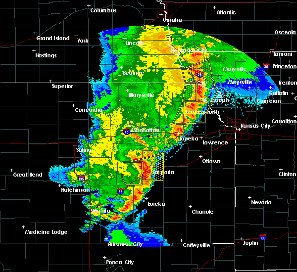 At 727 pm cdt, severe thunderstorms were located along a line extending from near fairfax to mound city to near forest city to near denton to near effingham, moving northeast at 50 mph (radar indicated). Hazards include 70 mph wind gusts and quarter size hail. Hail damage to vehicles is expected. expect considerable tree damage. Wind damage is also likely to mobile homes, roofs, and outbuildings. At 727 pm cdt, severe thunderstorms were located along a line extending from near fairfax to mound city to near forest city to near denton to near effingham, moving northeast at 50 mph (radar indicated). Hazards include 70 mph wind gusts and quarter size hail. Hail damage to vehicles is expected. expect considerable tree damage. Wind damage is also likely to mobile homes, roofs, and outbuildings.
|
| 5/2/2018 7:07 PM CDT |
 At 706 pm cdt, severe thunderstorms were located along a line extending from 7 miles southwest of craig to near hiawatha to everest to 6 miles north of valley falls to near denison to near hoyt, moving northeast at 45 mph (radar indicated). Hazards include 60 mph wind gusts and quarter size hail. Hail damage to vehicles is expected. expect wind damage to roofs, siding, and trees. locations impacted include, atchison, mound city, highland, troy, oregon, effingham, maitland, lancaster, skidmore, forest city, craig, white cloud, muscotah, denton, doniphan, big lake, severance, farmington, huron and leona. this includes interstate 29 between mile markers 67 and 102. A tornado watch remains in effect until 100 am cdt for northeastern kansas, and northwestern and west central missouri. At 706 pm cdt, severe thunderstorms were located along a line extending from 7 miles southwest of craig to near hiawatha to everest to 6 miles north of valley falls to near denison to near hoyt, moving northeast at 45 mph (radar indicated). Hazards include 60 mph wind gusts and quarter size hail. Hail damage to vehicles is expected. expect wind damage to roofs, siding, and trees. locations impacted include, atchison, mound city, highland, troy, oregon, effingham, maitland, lancaster, skidmore, forest city, craig, white cloud, muscotah, denton, doniphan, big lake, severance, farmington, huron and leona. this includes interstate 29 between mile markers 67 and 102. A tornado watch remains in effect until 100 am cdt for northeastern kansas, and northwestern and west central missouri.
|
| 5/2/2018 6:49 PM CDT |
 At 648 pm cdt, severe thunderstorms were located along a line extending from near falls city to near powhattan to near netawaka to mayetta to near potawatomi reservation to near willard, moving northeast at 45 mph (radar indicated). Hazards include 60 mph wind gusts and quarter size hail. Hail damage to vehicles is expected. Expect wind damage to roofs, siding, and trees. At 648 pm cdt, severe thunderstorms were located along a line extending from near falls city to near powhattan to near netawaka to mayetta to near potawatomi reservation to near willard, moving northeast at 45 mph (radar indicated). Hazards include 60 mph wind gusts and quarter size hail. Hail damage to vehicles is expected. Expect wind damage to roofs, siding, and trees.
|
| 4/13/2018 6:50 PM CDT |
 At 649 pm cdt, a severe thunderstorm was located near skidmore, or 13 miles southeast of tarkio, moving northeast at 40 mph (radar indicated). Hazards include 60 mph wind gusts and quarter size hail. Hail damage to vehicles is expected. expect wind damage to roofs, siding, and trees. locations impacted include, burlington junction, hopkins, skidmore, clearmont, elmo and quitman. A tornado watch remains in effect until 900 pm cdt for northwestern missouri. At 649 pm cdt, a severe thunderstorm was located near skidmore, or 13 miles southeast of tarkio, moving northeast at 40 mph (radar indicated). Hazards include 60 mph wind gusts and quarter size hail. Hail damage to vehicles is expected. expect wind damage to roofs, siding, and trees. locations impacted include, burlington junction, hopkins, skidmore, clearmont, elmo and quitman. A tornado watch remains in effect until 900 pm cdt for northwestern missouri.
|
| 4/13/2018 6:39 PM CDT |
 At 638 pm cdt, a severe thunderstorm was located 7 miles northeast of craig, or 8 miles north of mound city, moving northeast at 50 mph. this warning replaces the severe thunderstorm warning that was already in effect (radar indicated). Hazards include 60 mph wind gusts and half dollar size hail. Hail damage to vehicles is expected. Expect wind damage to roofs, siding, and trees. At 638 pm cdt, a severe thunderstorm was located 7 miles northeast of craig, or 8 miles north of mound city, moving northeast at 50 mph. this warning replaces the severe thunderstorm warning that was already in effect (radar indicated). Hazards include 60 mph wind gusts and half dollar size hail. Hail damage to vehicles is expected. Expect wind damage to roofs, siding, and trees.
|
| 4/13/2018 6:13 PM CDT |
 At 613 pm cdt, a severe thunderstorm was located 8 miles east of falls city, moving northeast at 45 mph (radar indicated). Hazards include ping pong ball size hail and 60 mph wind gusts. People and animals outdoors will be injured. expect hail damage to roofs, siding, windows, and vehicles. Expect wind damage to roofs, siding, and trees. At 613 pm cdt, a severe thunderstorm was located 8 miles east of falls city, moving northeast at 45 mph (radar indicated). Hazards include ping pong ball size hail and 60 mph wind gusts. People and animals outdoors will be injured. expect hail damage to roofs, siding, windows, and vehicles. Expect wind damage to roofs, siding, and trees.
|
| 10/21/2017 4:52 PM CDT |
 The severe thunderstorm warning for southeastern atchison, north central holt and west central nodaway counties will expire at 500 pm cdt, the storm which prompted the warning has weakened below severe limits, and no longer poses an immediate threat to life or property. therefore the warning will be allowed to expire. however gusty winds are still possible with this thunderstorm. a severe thunderstorm watch remains in effect until 1000 pm cdt for northwestern missouri. The severe thunderstorm warning for southeastern atchison, north central holt and west central nodaway counties will expire at 500 pm cdt, the storm which prompted the warning has weakened below severe limits, and no longer poses an immediate threat to life or property. therefore the warning will be allowed to expire. however gusty winds are still possible with this thunderstorm. a severe thunderstorm watch remains in effect until 1000 pm cdt for northwestern missouri.
|
| 10/21/2017 4:39 PM CDT |
 At 439 pm cdt, a severe thunderstorm was located near fairfax, or 10 miles north of mound city, moving northeast at 45 mph (radar indicated). Hazards include 60 mph wind gusts and quarter size hail. Hail damage to vehicles is expected. expect wind damage to roofs, siding, and trees. Locations impacted include, skidmore and quitman. At 439 pm cdt, a severe thunderstorm was located near fairfax, or 10 miles north of mound city, moving northeast at 45 mph (radar indicated). Hazards include 60 mph wind gusts and quarter size hail. Hail damage to vehicles is expected. expect wind damage to roofs, siding, and trees. Locations impacted include, skidmore and quitman.
|
| 10/21/2017 4:30 PM CDT |
 At 430 pm cdt, a severe thunderstorm was located over craig, or 9 miles northwest of mound city, moving northeast at 45 mph (radar indicated). Hazards include 60 mph wind gusts and quarter size hail. Hail damage to vehicles is expected. Expect wind damage to roofs, siding, and trees. At 430 pm cdt, a severe thunderstorm was located over craig, or 9 miles northwest of mound city, moving northeast at 45 mph (radar indicated). Hazards include 60 mph wind gusts and quarter size hail. Hail damage to vehicles is expected. Expect wind damage to roofs, siding, and trees.
|
| 6/28/2017 3:16 PM CDT |
 At 816 pm cdt, a severe thunderstorm was located near new hampton, or 8 miles northeast of albany, moving east at 25 mph (radar indicated). Hazards include 60 mph wind gusts and half dollar size hail. Hail damage to vehicles is expected. expect wind damage to roofs, siding, and trees. locations impacted include, maryville, trenton, bethany, albany, stanberry, princeton, burlington junction, ridgeway, ravenwood, gilman city, new hampton, skidmore, spickard, galt, conception junction, parnell, pickering, darlington, mount moriah and clyde. this includes interstate 35 in missouri between mile markers 84 and 103. A tornado watch remains in effect until 1000 pm cdt for north central and northwestern missouri. At 816 pm cdt, a severe thunderstorm was located near new hampton, or 8 miles northeast of albany, moving east at 25 mph (radar indicated). Hazards include 60 mph wind gusts and half dollar size hail. Hail damage to vehicles is expected. expect wind damage to roofs, siding, and trees. locations impacted include, maryville, trenton, bethany, albany, stanberry, princeton, burlington junction, ridgeway, ravenwood, gilman city, new hampton, skidmore, spickard, galt, conception junction, parnell, pickering, darlington, mount moriah and clyde. this includes interstate 35 in missouri between mile markers 84 and 103. A tornado watch remains in effect until 1000 pm cdt for north central and northwestern missouri.
|
| 6/28/2017 12:25 PM CDT |
 At 525 pm cdt, a severe thunderstorm was located near skidmore, or 9 miles west of maryville, moving east at 40 mph (radar indicated). Hazards include ping pong ball size hail and 60 mph wind gusts. People and animals outdoors will be injured. expect hail damage to roofs, siding, windows, and vehicles. Expect wind damage to roofs, siding, and trees. At 525 pm cdt, a severe thunderstorm was located near skidmore, or 9 miles west of maryville, moving east at 40 mph (radar indicated). Hazards include ping pong ball size hail and 60 mph wind gusts. People and animals outdoors will be injured. expect hail damage to roofs, siding, windows, and vehicles. Expect wind damage to roofs, siding, and trees.
|
| 6/16/2017 10:25 PM CDT |
 At 1024 pm cdt, a severe thunderstorm was located near oregon, or 7 miles southeast of mound city, moving southeast at 40 mph. this is a very dangerous storm (radar indicated). Hazards include 80 mph wind gusts. Flying debris will be dangerous to those caught without shelter. mobile homes will be heavily damaged. expect considerable damage to roofs, windows, and vehicles. extensive tree damage and power outages are likely. locations impacted include, mound city, oregon, maitland, skidmore, forest city, craig, fillmore, bolckow, graham, big lake, rosendale, rea, fortescue, bigelow, corning and indian cave state park. This includes interstate 29 between mile markers 67 and 101. At 1024 pm cdt, a severe thunderstorm was located near oregon, or 7 miles southeast of mound city, moving southeast at 40 mph. this is a very dangerous storm (radar indicated). Hazards include 80 mph wind gusts. Flying debris will be dangerous to those caught without shelter. mobile homes will be heavily damaged. expect considerable damage to roofs, windows, and vehicles. extensive tree damage and power outages are likely. locations impacted include, mound city, oregon, maitland, skidmore, forest city, craig, fillmore, bolckow, graham, big lake, rosendale, rea, fortescue, bigelow, corning and indian cave state park. This includes interstate 29 between mile markers 67 and 101.
|
| 6/16/2017 9:48 PM CDT |
 At 948 pm cdt, severe thunderstorms were located along a line extending from 6 miles northwest of ravenwood to 6 miles east of fairfax, moving southeast at 45 mph (radar indicated). Hazards include 70 mph wind gusts and quarter size hail. Hail damage to vehicles is expected. expect considerable tree damage. wind damage is also likely to mobile homes, roofs, and outbuildings. locations impacted include, maryville, tarkio, rock port, fairfax, burlington junction, hopkins, skidmore, rockport, clearmont, elmo, pickering, westboro, watson, quitman and phelps city. This includes interstate 29 between mile markers 99 and 117. At 948 pm cdt, severe thunderstorms were located along a line extending from 6 miles northwest of ravenwood to 6 miles east of fairfax, moving southeast at 45 mph (radar indicated). Hazards include 70 mph wind gusts and quarter size hail. Hail damage to vehicles is expected. expect considerable tree damage. wind damage is also likely to mobile homes, roofs, and outbuildings. locations impacted include, maryville, tarkio, rock port, fairfax, burlington junction, hopkins, skidmore, rockport, clearmont, elmo, pickering, westboro, watson, quitman and phelps city. This includes interstate 29 between mile markers 99 and 117.
|
| 6/16/2017 9:44 PM CDT |
 At 943 pm cdt, severe thunderstorms were located along a line extending from near burlington junction to 6 miles southwest of fairfax, moving southeast at 45 mph (radar indicated). Hazards include 70 mph wind gusts. Expect considerable tree damage. Damage is likely to mobile homes, roofs, and outbuildings. At 943 pm cdt, severe thunderstorms were located along a line extending from near burlington junction to 6 miles southwest of fairfax, moving southeast at 45 mph (radar indicated). Hazards include 70 mph wind gusts. Expect considerable tree damage. Damage is likely to mobile homes, roofs, and outbuildings.
|
| 6/16/2017 9:26 PM CDT |
 At 926 pm cdt, severe thunderstorms were located along a line extending from near braddyville to near rock port, moving southeast at 55 mph. these are very dangerous storms (radar indicated). Hazards include 80 mph wind gusts and quarter size hail. Flying debris will be dangerous to those caught without shelter. mobile homes will be heavily damaged. expect considerable damage to roofs, windows, and vehicles. extensive tree damage and power outages are likely. locations impacted include, maryville, tarkio, rock port, fairfax, burlington junction, hopkins, skidmore, rockport, clearmont, elmo, pickering, westboro, watson, quitman, phelps city and indian cave state park. This includes interstate 29 between mile markers 99 and 123. At 926 pm cdt, severe thunderstorms were located along a line extending from near braddyville to near rock port, moving southeast at 55 mph. these are very dangerous storms (radar indicated). Hazards include 80 mph wind gusts and quarter size hail. Flying debris will be dangerous to those caught without shelter. mobile homes will be heavily damaged. expect considerable damage to roofs, windows, and vehicles. extensive tree damage and power outages are likely. locations impacted include, maryville, tarkio, rock port, fairfax, burlington junction, hopkins, skidmore, rockport, clearmont, elmo, pickering, westboro, watson, quitman, phelps city and indian cave state park. This includes interstate 29 between mile markers 99 and 123.
|
| 6/16/2017 9:12 PM CDT |
 At 911 pm cdt, severe thunderstorms were located along a line extending from near blanchard to near peru, moving southeast at 45 mph. these are very dangerous storms (radar indicated). Hazards include 80 mph wind gusts and quarter size hail. Flying debris will be dangerous to those caught without shelter. mobile homes will be heavily damaged. expect considerable damage to roofs, windows, and vehicles. Extensive tree damage and power outages are likely. At 911 pm cdt, severe thunderstorms were located along a line extending from near blanchard to near peru, moving southeast at 45 mph. these are very dangerous storms (radar indicated). Hazards include 80 mph wind gusts and quarter size hail. Flying debris will be dangerous to those caught without shelter. mobile homes will be heavily damaged. expect considerable damage to roofs, windows, and vehicles. Extensive tree damage and power outages are likely.
|
| 6/15/2017 9:35 PM CDT |
 At 933 pm cdt, a severe thunderstorm was located near burlington junction, or 10 miles east of tarkio, moving southeast at 30 mph (radar indicated). Hazards include quarter size hail. damage to vehicles is expected At 933 pm cdt, a severe thunderstorm was located near burlington junction, or 10 miles east of tarkio, moving southeast at 30 mph (radar indicated). Hazards include quarter size hail. damage to vehicles is expected
|
| 4/9/2017 11:53 PM CDT |
 At 1152 pm cdt, a severe thunderstorm was located near falls city, moving east at 45 mph (radar indicated). Hazards include quarter size hail. damage to vehicles is expected At 1152 pm cdt, a severe thunderstorm was located near falls city, moving east at 45 mph (radar indicated). Hazards include quarter size hail. damage to vehicles is expected
|
| 3/6/2017 6:22 PM CST |
 At 622 pm cst, a severe thunderstorm capable of producing a tornado was located over skidmore, or 9 miles west of maryville, moving east at 90 mph (radar indicated rotation). Hazards include tornado. Flying debris will be dangerous to those caught without shelter. mobile homes will be damaged or destroyed. damage to roofs, windows, and vehicles will occur. Tree damage is likely. At 622 pm cst, a severe thunderstorm capable of producing a tornado was located over skidmore, or 9 miles west of maryville, moving east at 90 mph (radar indicated rotation). Hazards include tornado. Flying debris will be dangerous to those caught without shelter. mobile homes will be damaged or destroyed. damage to roofs, windows, and vehicles will occur. Tree damage is likely.
|
| 3/6/2017 6:12 PM CST |
 At 612 pm cst, a severe thunderstorm capable of producing a tornado was located near mound city, moving east at 55 mph (radar indicated rotation). Hazards include tornado and quarter size hail. Flying debris will be dangerous to those caught without shelter. mobile homes will be damaged or destroyed. damage to roofs, windows, and vehicles will occur. Tree damage is likely. At 612 pm cst, a severe thunderstorm capable of producing a tornado was located near mound city, moving east at 55 mph (radar indicated rotation). Hazards include tornado and quarter size hail. Flying debris will be dangerous to those caught without shelter. mobile homes will be damaged or destroyed. damage to roofs, windows, and vehicles will occur. Tree damage is likely.
|
| 3/6/2017 5:59 PM CST |
 At 558 pm cst, a severe thunderstorm was located 7 miles west of craig, or 11 miles north of falls city, moving east northeast at 45 mph (radar indicated). Hazards include 60 mph wind gusts and quarter size hail. Hail damage to vehicles is expected. Expect wind damage to roofs, siding, and trees. At 558 pm cst, a severe thunderstorm was located 7 miles west of craig, or 11 miles north of falls city, moving east northeast at 45 mph (radar indicated). Hazards include 60 mph wind gusts and quarter size hail. Hail damage to vehicles is expected. Expect wind damage to roofs, siding, and trees.
|
| 8/24/2016 12:56 AM CDT |
 The severe thunderstorm warning for atchison, northern andrew, northwestern gentry, western worth, nodaway and holt counties will expire at 100 am cdt, the storms which prompted the warning have weakened below severe limits, and no longer pose an immediate threat to life or property. therefore the warning will be allowed to expire. however gusty winds and heavy rain are still possible with these thunderstorms. to report severe weather, contact your nearest law enforcement agency. they will relay your report to the national weather service pleasant hill. The severe thunderstorm warning for atchison, northern andrew, northwestern gentry, western worth, nodaway and holt counties will expire at 100 am cdt, the storms which prompted the warning have weakened below severe limits, and no longer pose an immediate threat to life or property. therefore the warning will be allowed to expire. however gusty winds and heavy rain are still possible with these thunderstorms. to report severe weather, contact your nearest law enforcement agency. they will relay your report to the national weather service pleasant hill.
|
| 8/24/2016 12:15 AM CDT |
 At 1214 am cdt, severe thunderstorms were located along a line extending from 11 miles north of bedford to near tarkio to near auburn, moving south at 40 mph (radar indicated). Hazards include 60 mph wind gusts. Expect damage to roofs. siding. And trees. At 1214 am cdt, severe thunderstorms were located along a line extending from 11 miles north of bedford to near tarkio to near auburn, moving south at 40 mph (radar indicated). Hazards include 60 mph wind gusts. Expect damage to roofs. siding. And trees.
|
| 7/7/2016 3:58 AM CDT |
 At 358 am cdt, severe thunderstorms were located along a line extending from hopkins to near maryville to 12 miles east of maitland to near savannah, moving east at 50 mph (radar indicated). Hazards include 70 mph wind gusts. Expect considerable tree damage. Damage is likely to mobile homes, roofs, and outbuildings. At 358 am cdt, severe thunderstorms were located along a line extending from hopkins to near maryville to 12 miles east of maitland to near savannah, moving east at 50 mph (radar indicated). Hazards include 70 mph wind gusts. Expect considerable tree damage. Damage is likely to mobile homes, roofs, and outbuildings.
|
| 7/7/2016 3:44 AM CDT |
 At 343 am cdt, severe thunderstorms were located along a line extending from near burlington junction to skidmore to 6 miles north of fillmore to oregon, moving east at 60 mph. this storm has a history of producing wind damage in fairfax (radar indicated). Hazards include 70 mph wind gusts. Expect considerable tree damage. damage is likely to mobile homes, roofs, and outbuildings. locations impacted include, maryville, savannah, burlington junction, hopkins, ravenwood, maitland, skidmore, fillmore, barnard, conception junction, parnell, bolckow, graham, clearmont, elmo, pickering, rosendale, guilford, clyde and arkoe. This includes interstate 29 between mile markers 64 and 77. At 343 am cdt, severe thunderstorms were located along a line extending from near burlington junction to skidmore to 6 miles north of fillmore to oregon, moving east at 60 mph. this storm has a history of producing wind damage in fairfax (radar indicated). Hazards include 70 mph wind gusts. Expect considerable tree damage. damage is likely to mobile homes, roofs, and outbuildings. locations impacted include, maryville, savannah, burlington junction, hopkins, ravenwood, maitland, skidmore, fillmore, barnard, conception junction, parnell, bolckow, graham, clearmont, elmo, pickering, rosendale, guilford, clyde and arkoe. This includes interstate 29 between mile markers 64 and 77.
|
| 7/7/2016 3:29 AM CDT |
 At 328 am cdt, severe thunderstorms were located along a line extending from near blanchard to near fairfax to near mound city to near white cloud, moving east at 60 mph. this storm has a history of producing high winds in the rockport area (radar indicated). Hazards include 70 mph wind gusts. Expect considerable tree damage. Damage is likely to mobile homes, roofs, and outbuildings. At 328 am cdt, severe thunderstorms were located along a line extending from near blanchard to near fairfax to near mound city to near white cloud, moving east at 60 mph. this storm has a history of producing high winds in the rockport area (radar indicated). Hazards include 70 mph wind gusts. Expect considerable tree damage. Damage is likely to mobile homes, roofs, and outbuildings.
|
| 5/26/2016 1:58 PM CDT |
 At 158 pm cdt, severe thunderstorms were located along a line extending from near fairfax to near maryville, moving northeast at 30 mph (radar indicated). Hazards include golf ball size hail and 60 mph wind gusts. People and animals outdoors will be injured. expect hail damage to roofs, siding, windows, and vehicles. expect wind damage to roofs, siding, and trees. Locations impacted include, maryville, fairfax, burlington junction, hopkins, ravenwood, skidmore, athelstan, conception junction, sheridan, parnell, clearmont, elmo, pickering, braddyville, clyde, arkoe, quitman, blanchard and conception. At 158 pm cdt, severe thunderstorms were located along a line extending from near fairfax to near maryville, moving northeast at 30 mph (radar indicated). Hazards include golf ball size hail and 60 mph wind gusts. People and animals outdoors will be injured. expect hail damage to roofs, siding, windows, and vehicles. expect wind damage to roofs, siding, and trees. Locations impacted include, maryville, fairfax, burlington junction, hopkins, ravenwood, skidmore, athelstan, conception junction, sheridan, parnell, clearmont, elmo, pickering, braddyville, clyde, arkoe, quitman, blanchard and conception.
|
| 5/26/2016 1:48 PM CDT |
 At 148 pm cdt, severe thunderstorms were located along a line extending from near fairfax to 7 miles south of maryville, moving northeast at 30 mph (radar indicated). Hazards include golf ball size hail and 60 mph wind gusts. People and animals outdoors will be injured. expect hail damage to roofs, siding, windows, and vehicles. Expect wind damage to roofs, siding, and trees. At 148 pm cdt, severe thunderstorms were located along a line extending from near fairfax to 7 miles south of maryville, moving northeast at 30 mph (radar indicated). Hazards include golf ball size hail and 60 mph wind gusts. People and animals outdoors will be injured. expect hail damage to roofs, siding, windows, and vehicles. Expect wind damage to roofs, siding, and trees.
|
| 3/23/2016 6:33 PM CDT |
 At 632 pm cdt, a severe thunderstorm was located over skidmore, or 9 miles west of maryville, moving northeast at 45 mph (radar indicated). Hazards include 60 mph wind gusts and quarter size hail. Hail damage to vehicles is expected. expect wind damage to roofs, siding, and trees. locations impacted include, maryville, burlington junction, hopkins, skidmore, sheridan, graham, clearmont, elmo, pickering, braddyville and quitman. A tornado watch remains in effect until 1000 pm cdt for northwestern missouri. At 632 pm cdt, a severe thunderstorm was located over skidmore, or 9 miles west of maryville, moving northeast at 45 mph (radar indicated). Hazards include 60 mph wind gusts and quarter size hail. Hail damage to vehicles is expected. expect wind damage to roofs, siding, and trees. locations impacted include, maryville, burlington junction, hopkins, skidmore, sheridan, graham, clearmont, elmo, pickering, braddyville and quitman. A tornado watch remains in effect until 1000 pm cdt for northwestern missouri.
|
| 3/23/2016 6:31 PM CDT | Quarter sized hail reported 0.1 miles SSE of Skidmore, MO |
| 3/23/2016 6:29 PM CDT |
 At 629 pm cdt, a severe thunderstorm was located over skidmore, or 11 miles southwest of maryville, moving northeast at 85 mph (radar indicated). Hazards include 60 mph wind gusts and quarter size hail. Hail damage to vehicles is expected. Expect wind damage to roofs, siding, and trees. At 629 pm cdt, a severe thunderstorm was located over skidmore, or 11 miles southwest of maryville, moving northeast at 85 mph (radar indicated). Hazards include 60 mph wind gusts and quarter size hail. Hail damage to vehicles is expected. Expect wind damage to roofs, siding, and trees.
|
| 9/8/2015 3:39 AM CDT |
 At 338 am cdt, severe thunderstorms were located along a line extending from near blanchard to 7 miles west of burlington junction to fairfax, moving southeast at 40 mph (radar indicated). Hazards include 60 mph wind gusts. Expect damage to roofs. Siding and trees. At 338 am cdt, severe thunderstorms were located along a line extending from near blanchard to 7 miles west of burlington junction to fairfax, moving southeast at 40 mph (radar indicated). Hazards include 60 mph wind gusts. Expect damage to roofs. Siding and trees.
|
| 6/11/2015 5:03 PM CDT |
 At 500 pm cdt, a severe thunderstorm capable of producing a tornado was located near maryville, and moving east at 25 mph. a second rotating severe thunderstorm just south of skidmore is moving east at 25 mph (radar indicated rotation). Hazards include tornado. Flying debris will be dangerous to those caught without shelter. mobile homes will be damaged or destroyed. damage to roofs, windows and vehicles will occur. tree damage is likely. locations impacted include, barnard, arkoe and guilford. This will impact i-29 between mile markers 82 and 89. At 500 pm cdt, a severe thunderstorm capable of producing a tornado was located near maryville, and moving east at 25 mph. a second rotating severe thunderstorm just south of skidmore is moving east at 25 mph (radar indicated rotation). Hazards include tornado. Flying debris will be dangerous to those caught without shelter. mobile homes will be damaged or destroyed. damage to roofs, windows and vehicles will occur. tree damage is likely. locations impacted include, barnard, arkoe and guilford. This will impact i-29 between mile markers 82 and 89.
|
| 6/11/2015 4:47 PM CDT |
 At 445 pm cdt, a severe thunderstorm capable of producing a tornado was located near mound city, and moving east at 35 mph (radar indicated rotation). Hazards include tornado. Flying debris will be dangerous to those caught without shelter. mobile homes will be damaged or destroyed. damage to roofs, windows and vehicles will occur. Tree damage is likely. At 445 pm cdt, a severe thunderstorm capable of producing a tornado was located near mound city, and moving east at 35 mph (radar indicated rotation). Hazards include tornado. Flying debris will be dangerous to those caught without shelter. mobile homes will be damaged or destroyed. damage to roofs, windows and vehicles will occur. Tree damage is likely.
|
| 6/4/2015 8:38 AM CDT | At 807 am, the public reported a 60.00 mph wind gust 10 miles southwest of rockport. at 835 am cdt, severe thunderstorms were located along a line extending from 8 miles west of burlington junction to 5 miles east of reserve, and moving east at 30 mph (radar indicated). Hazards include 60 mph wind gusts and quarter size hail. Hail damage to vehicles is expected. expect wind damage to roofs, siding and trees. locations impacted include, mound city, burlington junction, white cloud, skidmore, maitland, forest city, oregon, big lake, bigelow, elmo, fortescue, clearmont, quitman, iowa point and graham. This will impact i-29 between mile markers 72 and 94. |
| 6/4/2015 8:38 AM CDT | At 807 am, the public reported a 60.00 mph wind gust 10 miles southwest of rockport. at 835 am cdt, severe thunderstorms were located along a line extending from 8 miles west of burlington junction to 5 miles east of reserve, and moving east at 30 mph (radar indicated). Hazards include 60 mph wind gusts and quarter size hail. Hail damage to vehicles is expected. expect wind damage to roofs, siding and trees. locations impacted include, mound city, burlington junction, white cloud, skidmore, maitland, forest city, oregon, big lake, bigelow, elmo, fortescue, clearmont, quitman, iowa point and graham. This will impact i-29 between mile markers 72 and 94. |
| 6/4/2015 8:24 AM CDT | At 822 am cdt, severe thunderstorms were located along a line extending from 8 miles north of tarkio to falls city, and moving east at 30 mph. at 807 am, the public reported a 60 mph wind gust 11 miles southwest of rockport (radar indicated). Hazards include 60 mph wind gusts and quarter size hail. Hail damage to vehicles is expected. Expect wind damage to roofs, siding and trees. |
| 6/4/2015 8:24 AM CDT | At 822 am cdt, severe thunderstorms were located along a line extending from 8 miles north of tarkio to falls city, and moving east at 30 mph. at 807 am, the public reported a 60 mph wind gust 11 miles southwest of rockport (radar indicated). Hazards include 60 mph wind gusts and quarter size hail. Hail damage to vehicles is expected. Expect wind damage to roofs, siding and trees. |
| 6/3/2014 10:00 PM CDT | Baseball sized hail reported 0.1 miles SSE of Skidmore, MO, also power outages widespread in the county... multiple trees down... and widespread flash flooding. |
Hail Maps for Skidmore, MO
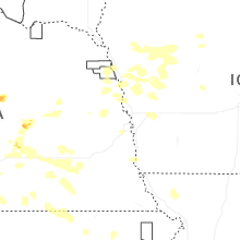
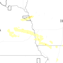
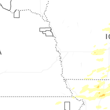

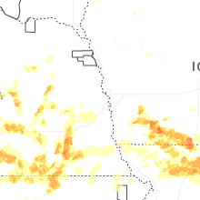

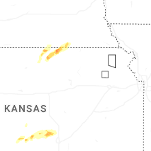
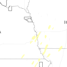
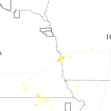


Connect with Interactive Hail Maps