

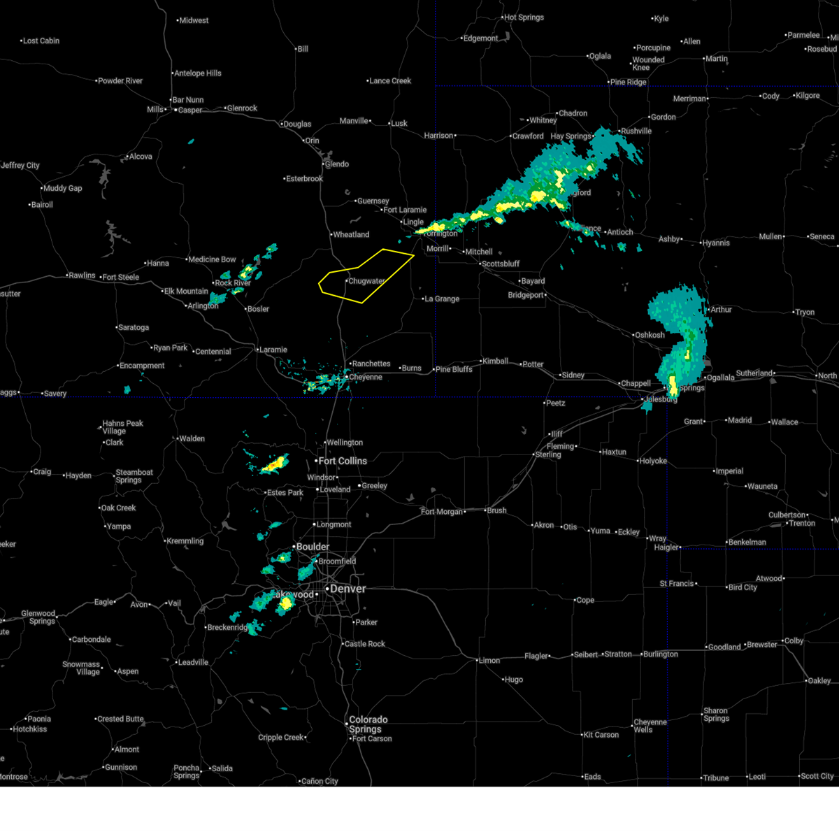
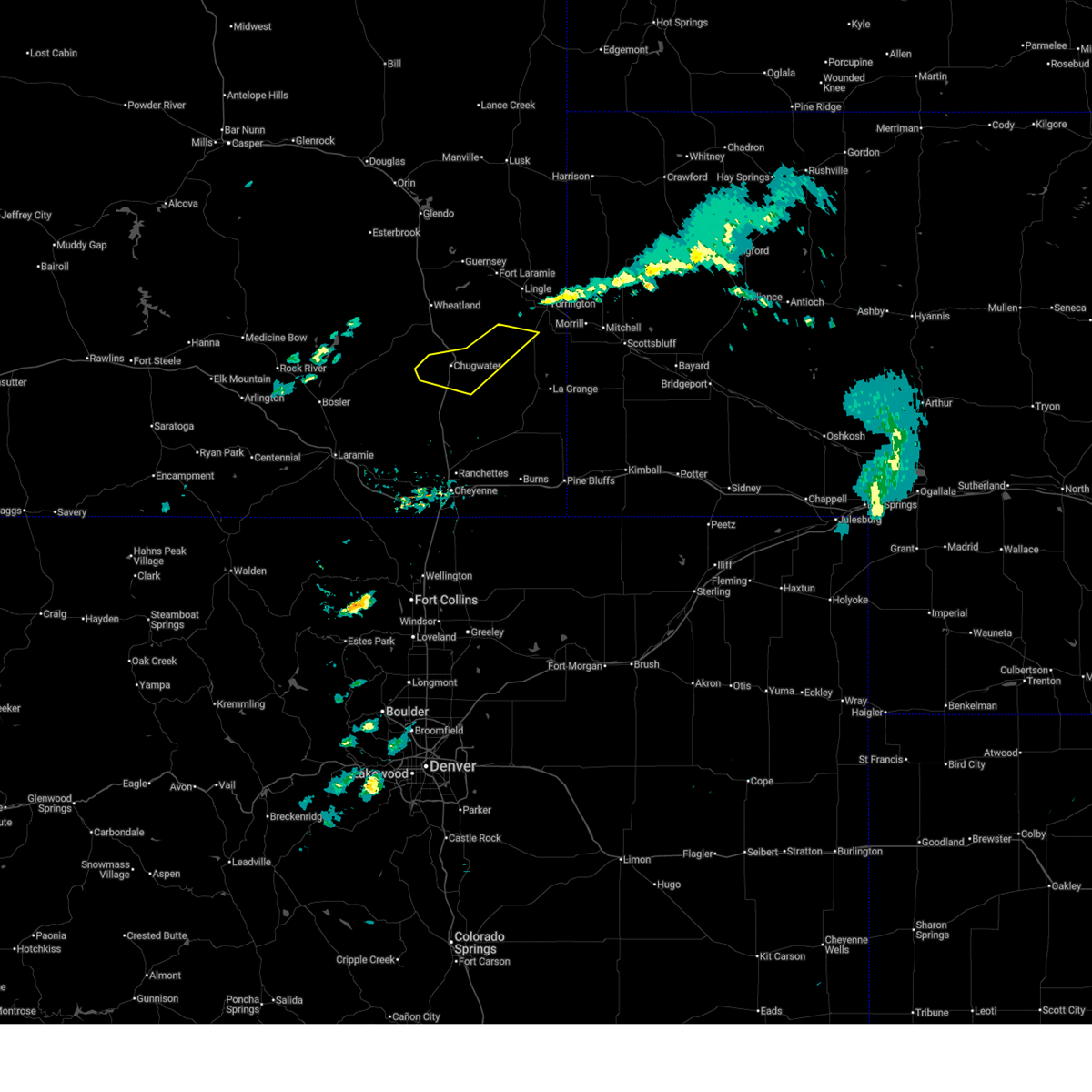
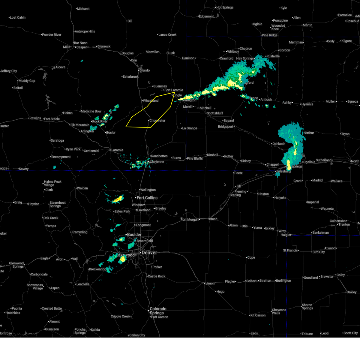
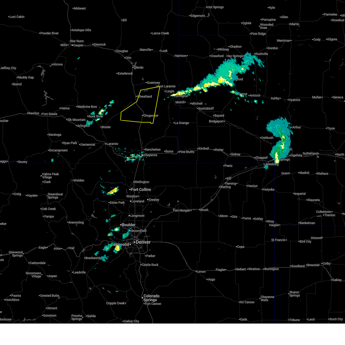
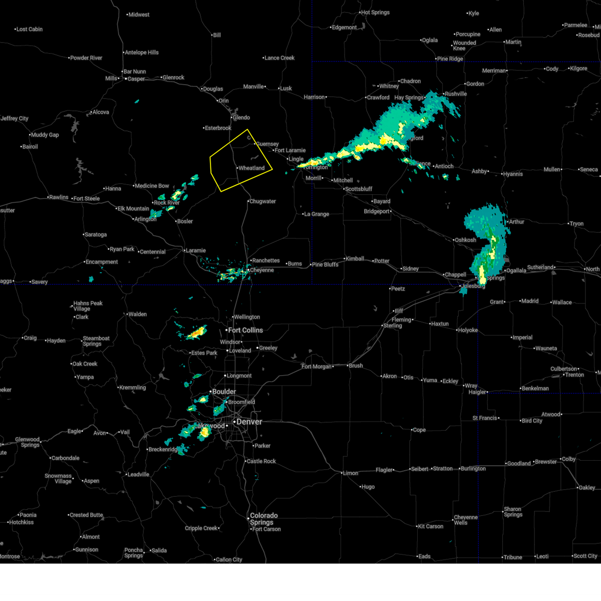
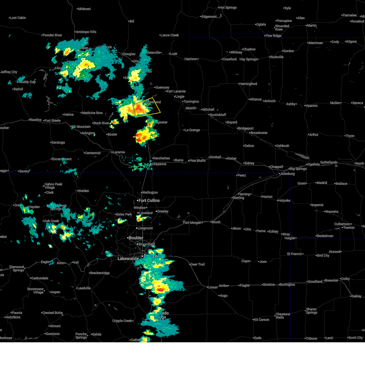
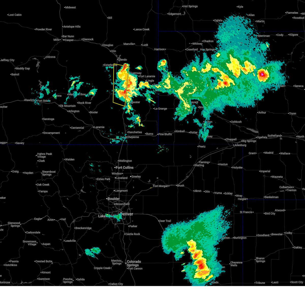
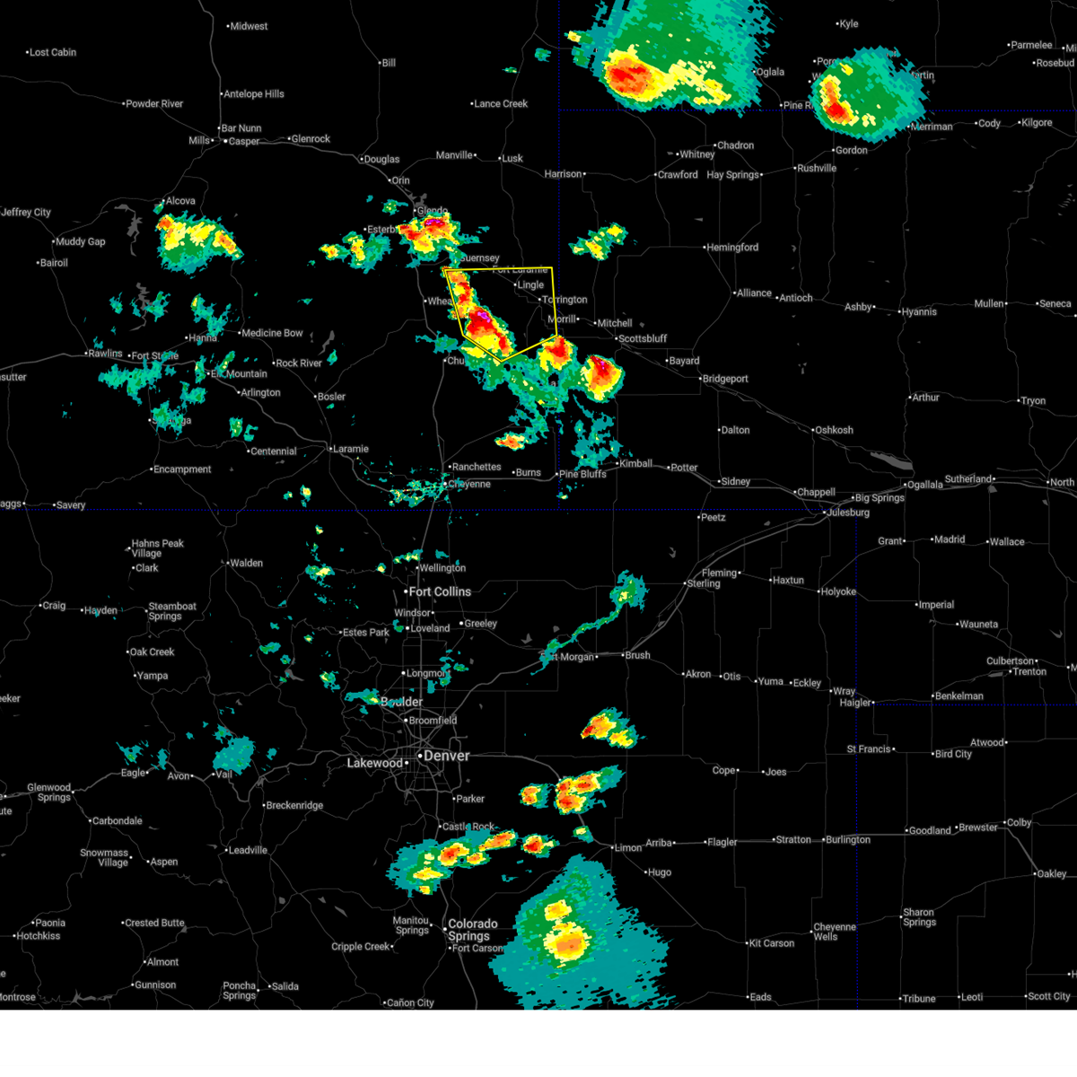
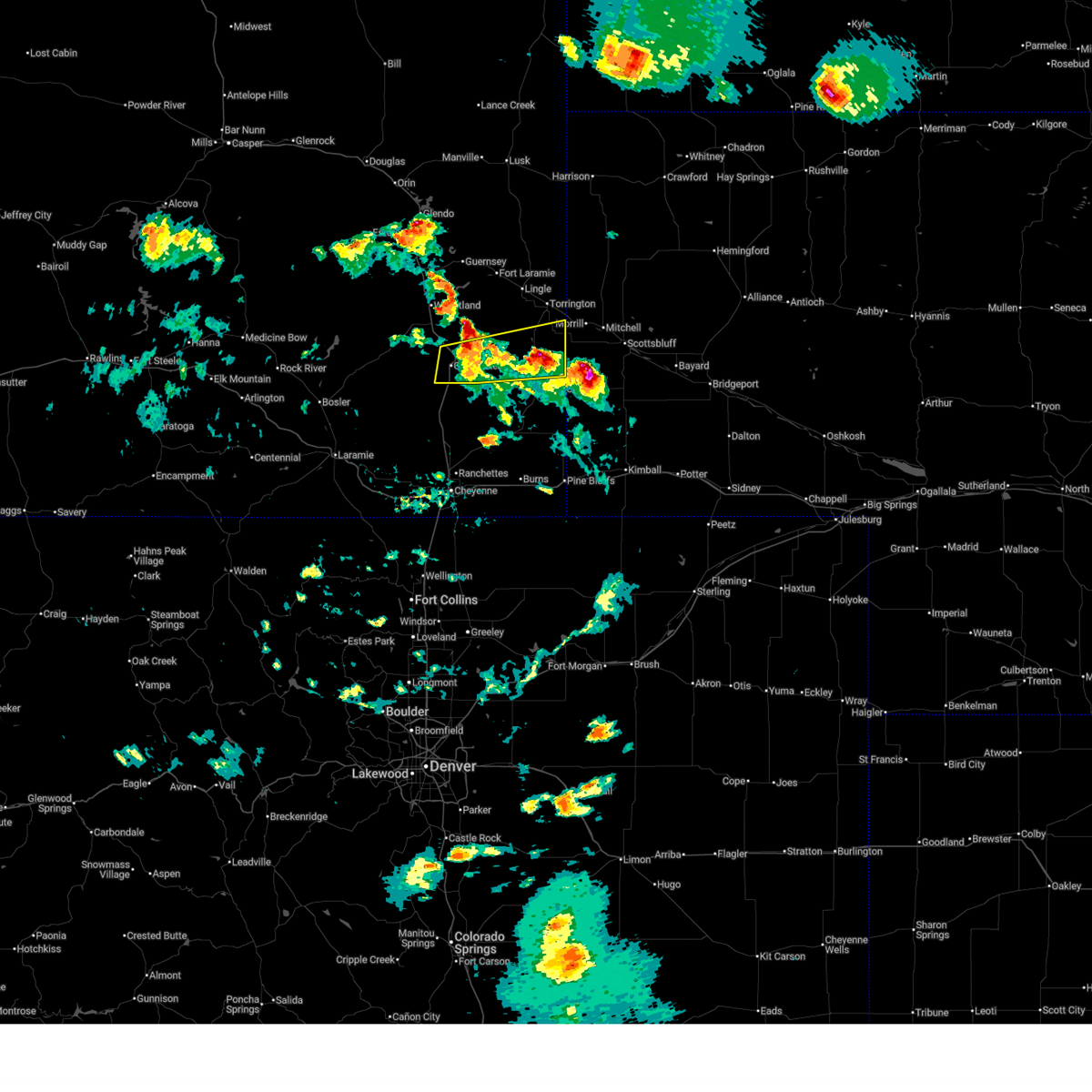
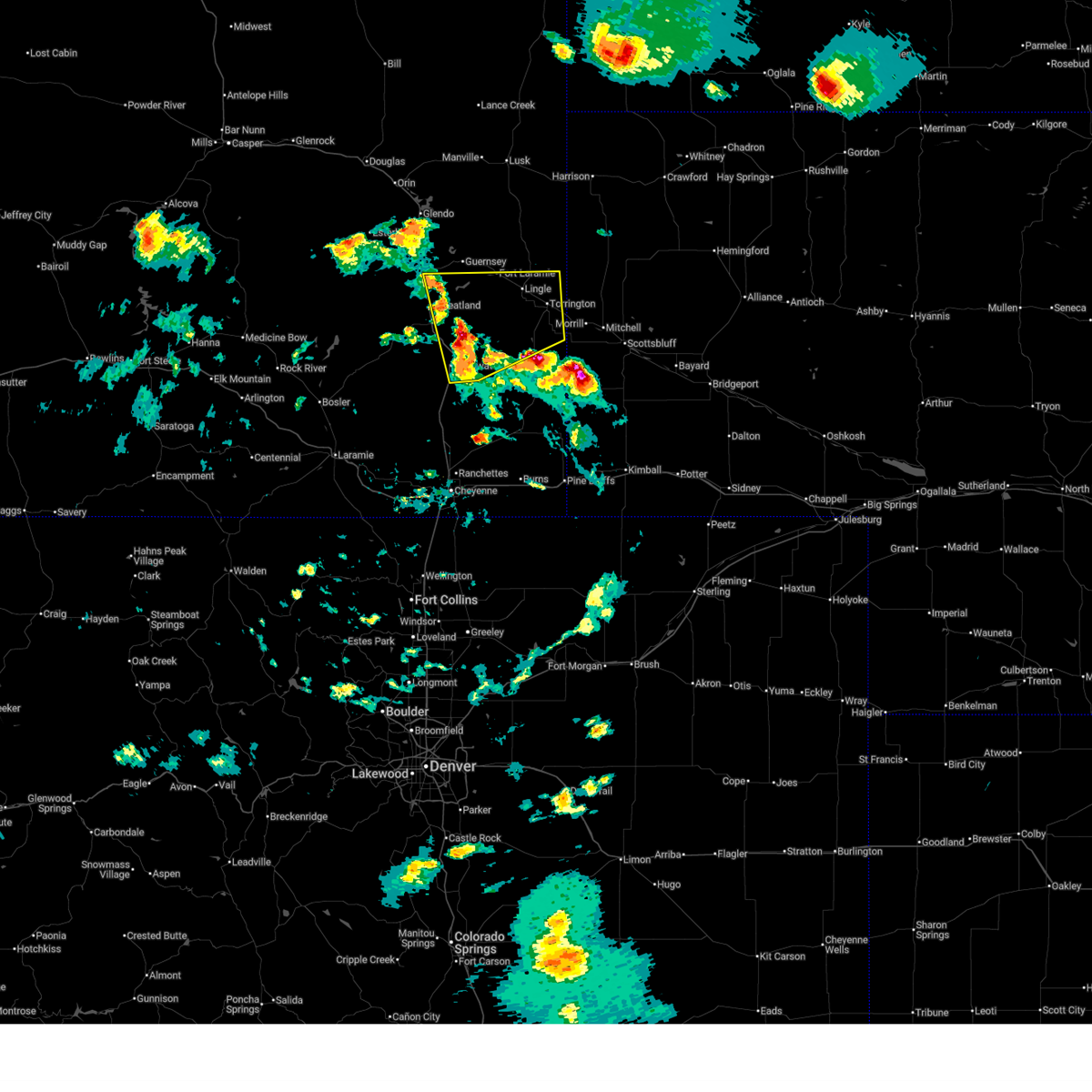
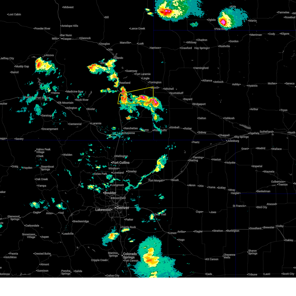
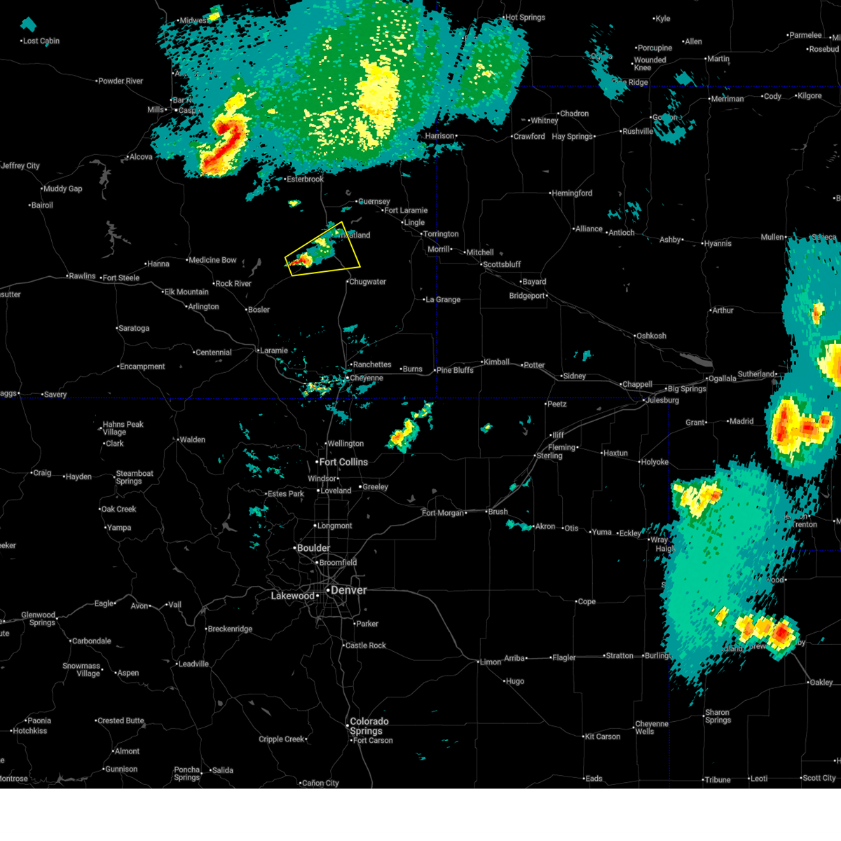
Hail Map for Slater, WY
The Slater, WY area has had 0 reports of on-the-ground hail by trained spotters, and has been under severe weather warnings 51 times during the past 12 months. Doppler radar has detected hail at or near Slater, WY on 126 occasions, including 10 occasions during the past year.
| Name: | Slater, WY |
| Where Located: | 59.6 miles W of Scottsbluff, NE |
| Map: | Google Map for Slater, WY |
| Population: | 80 |
| Housing Units: | 43 |
| More Info: | Search Google for Slater, WY |
1
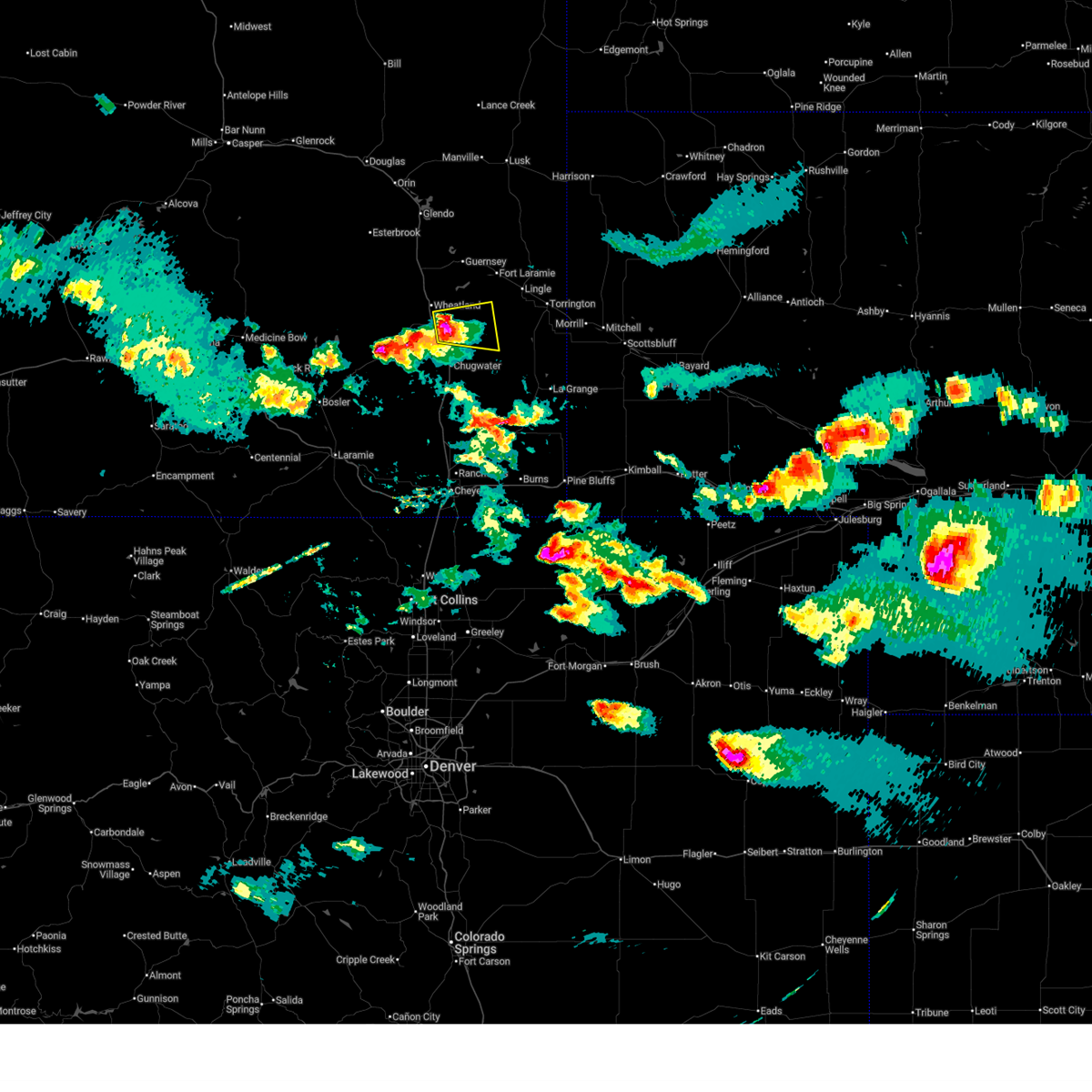
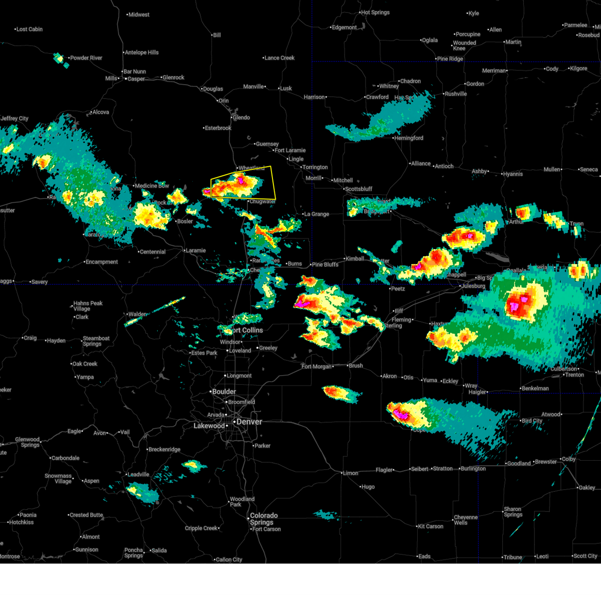
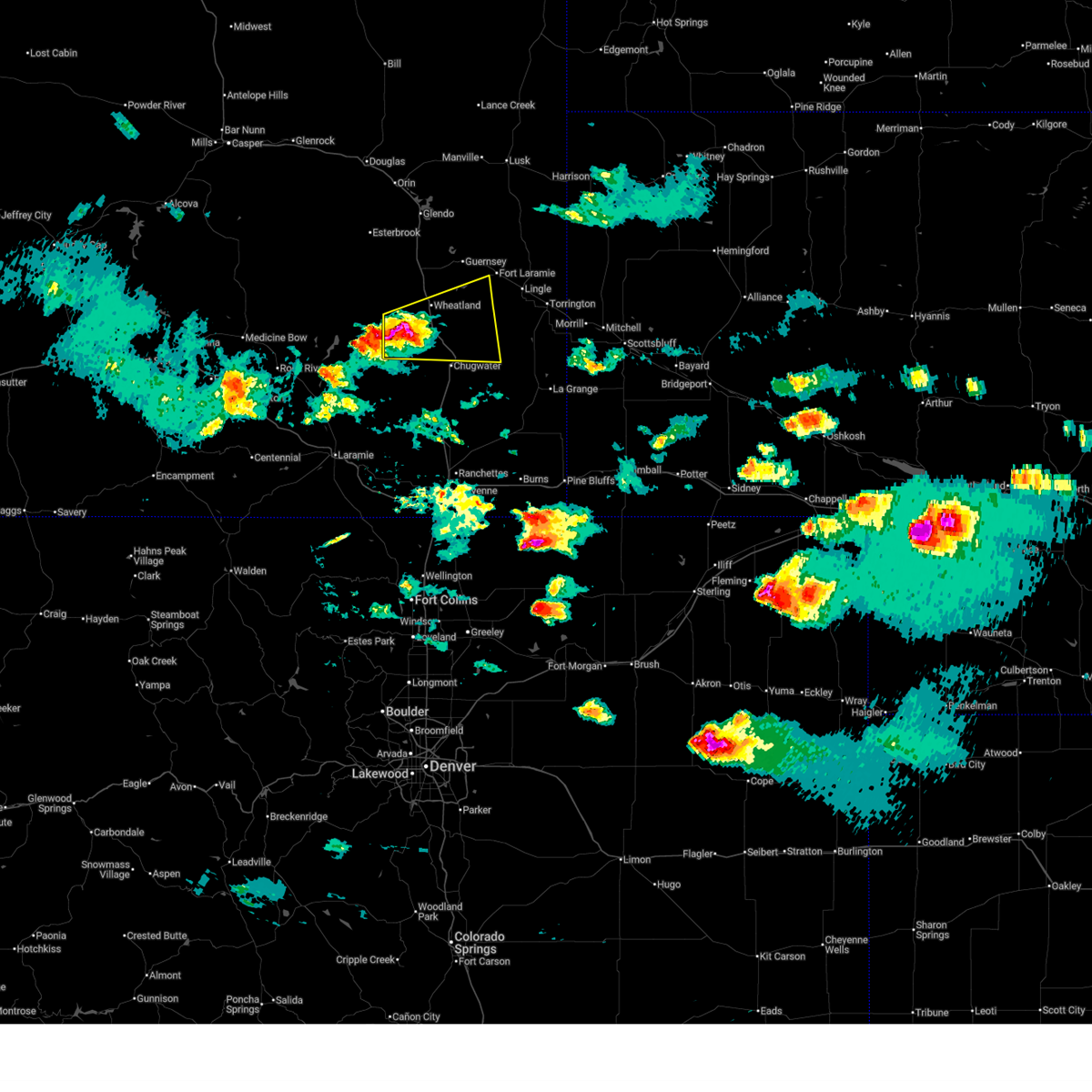
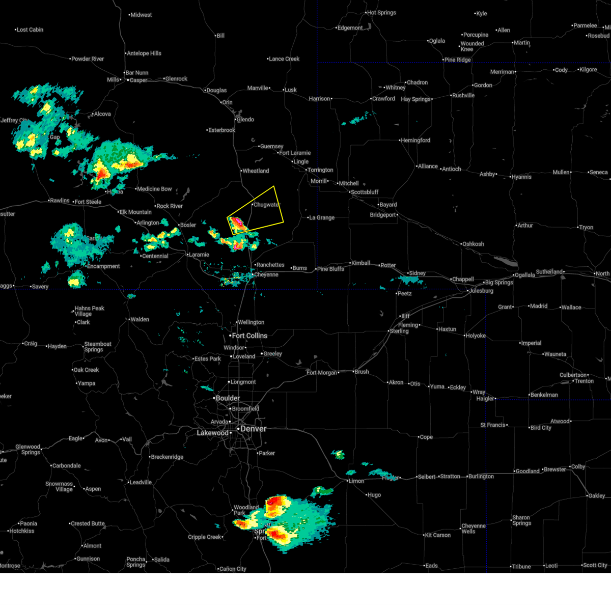
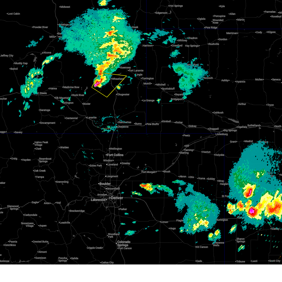
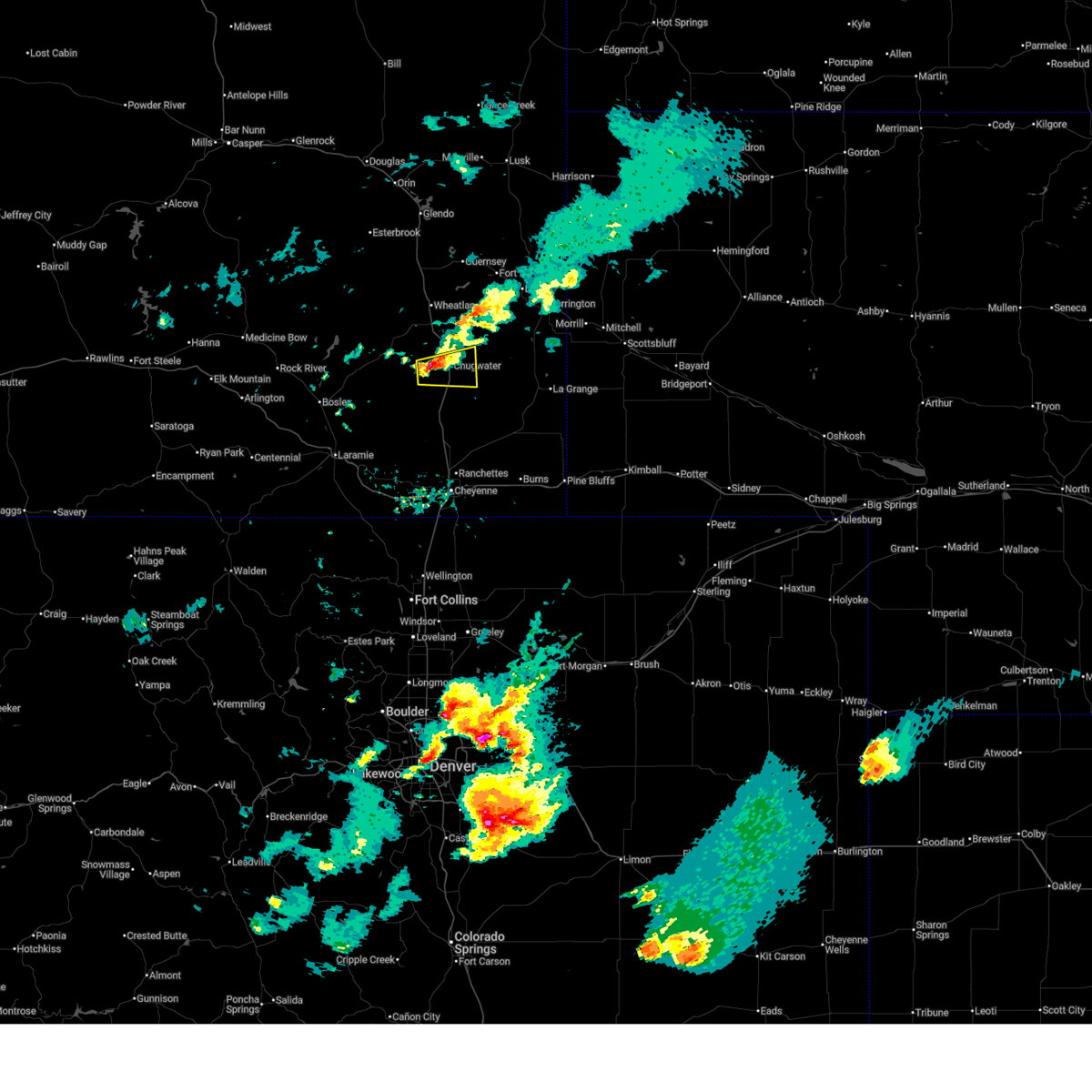
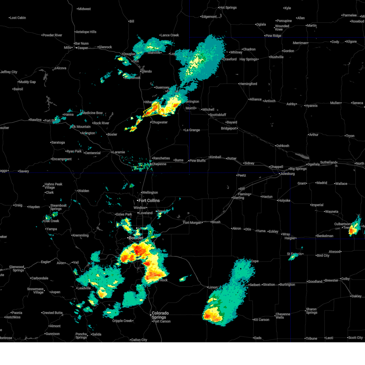
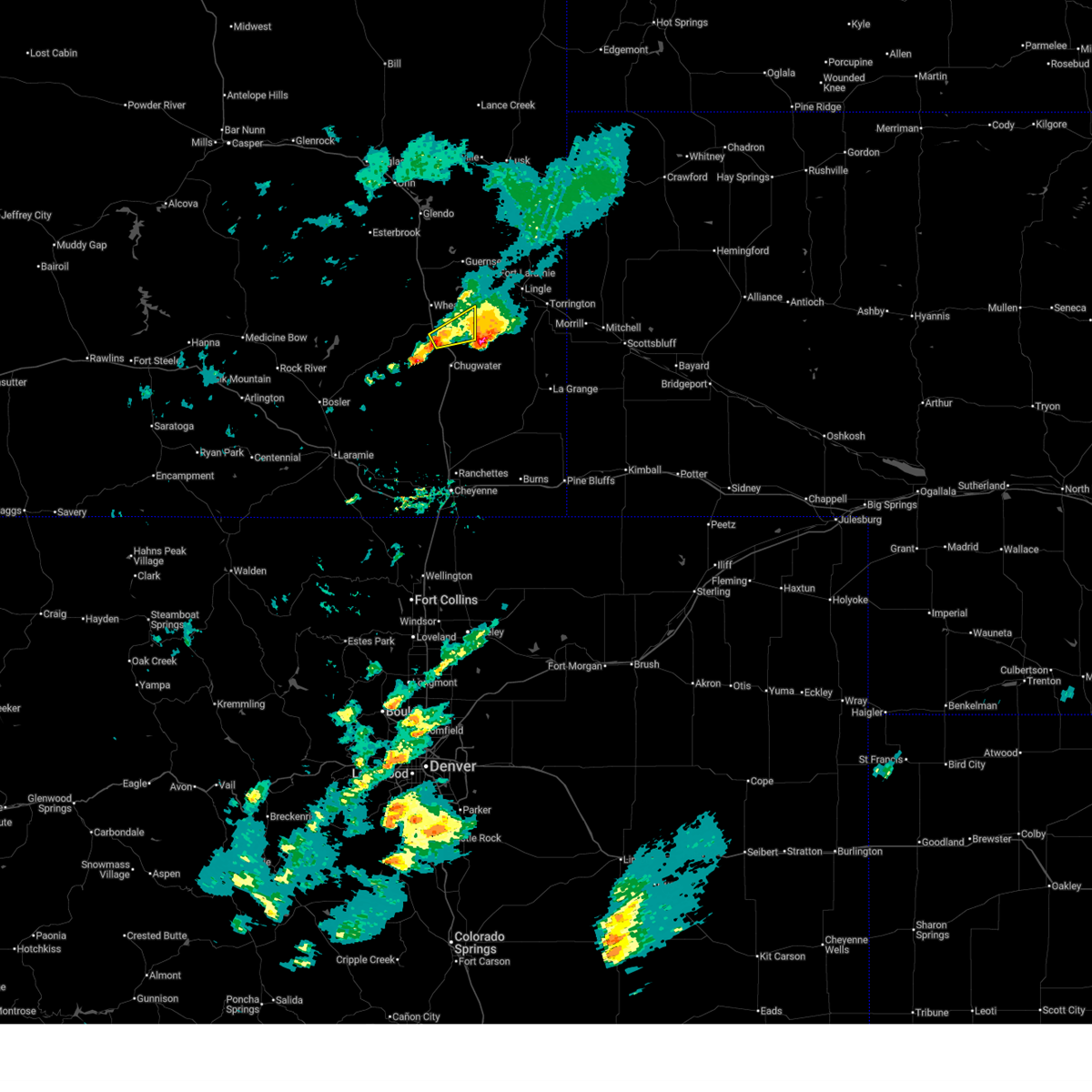
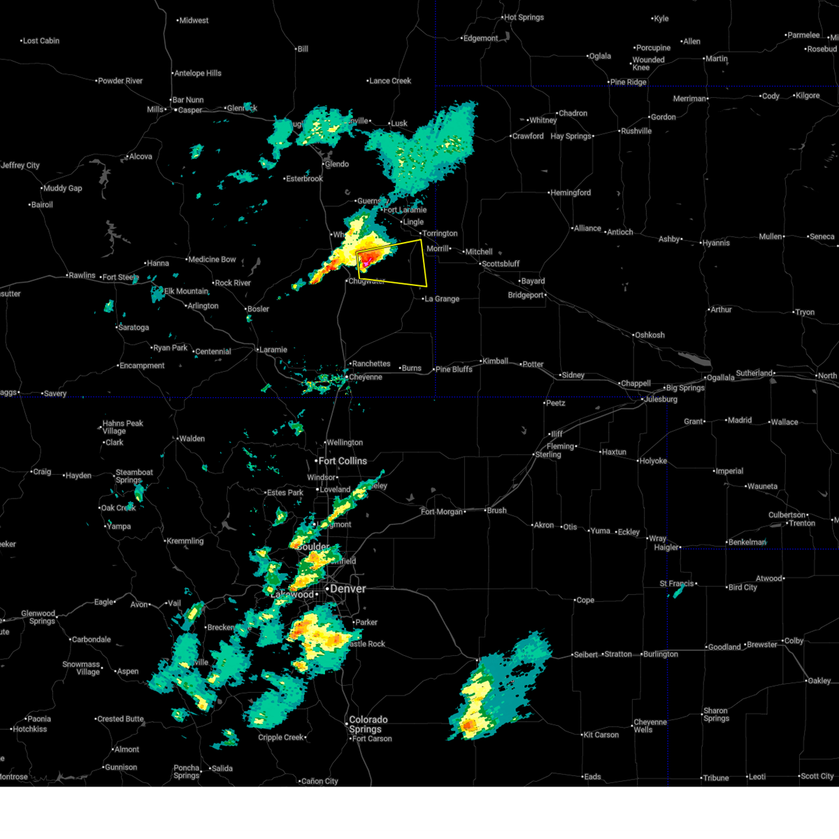
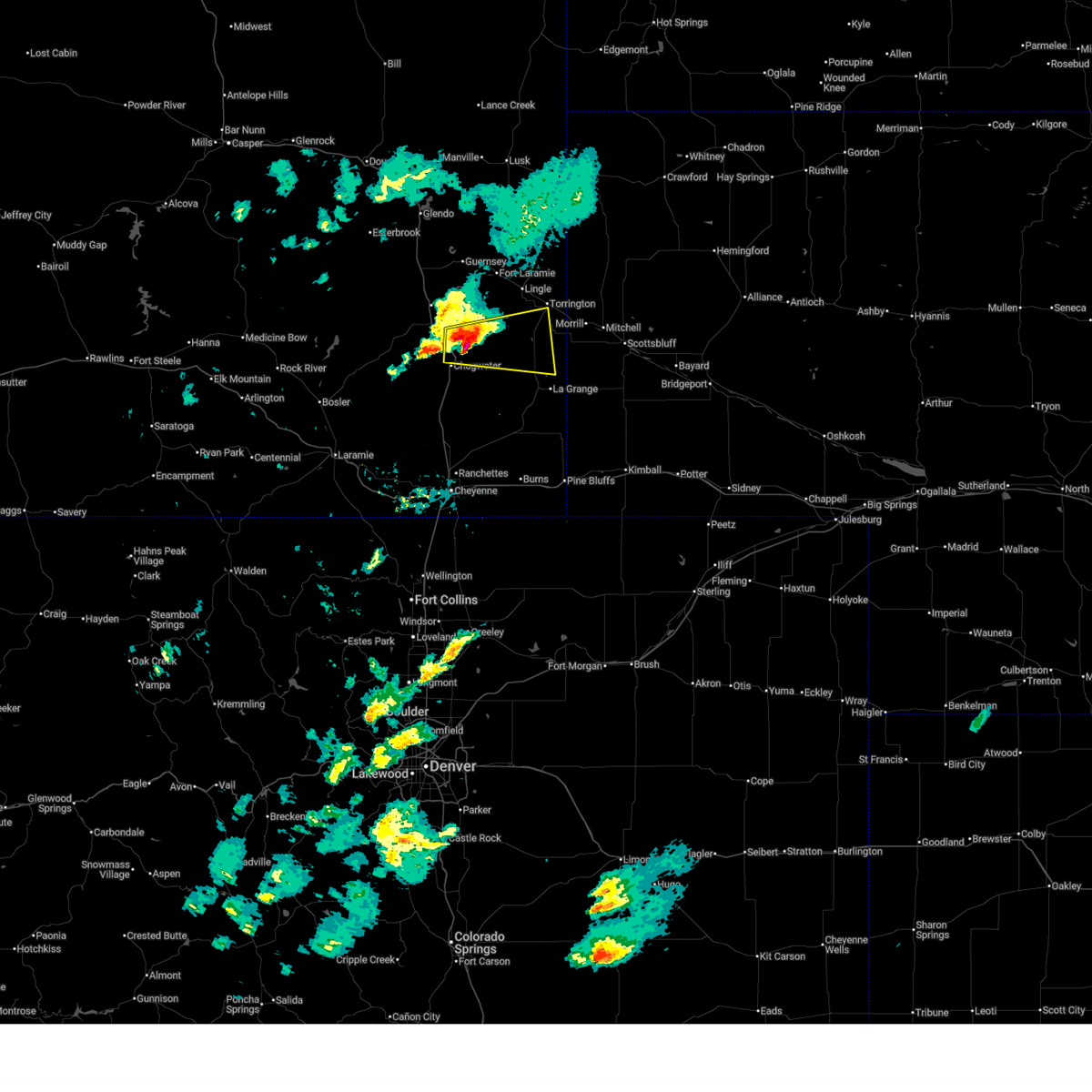
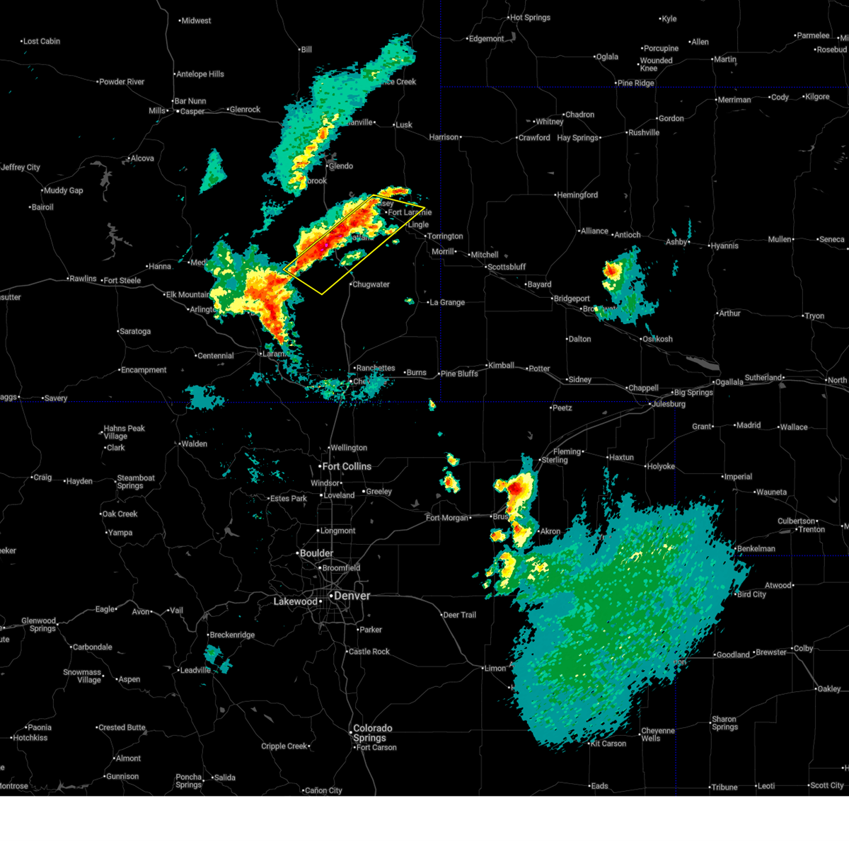
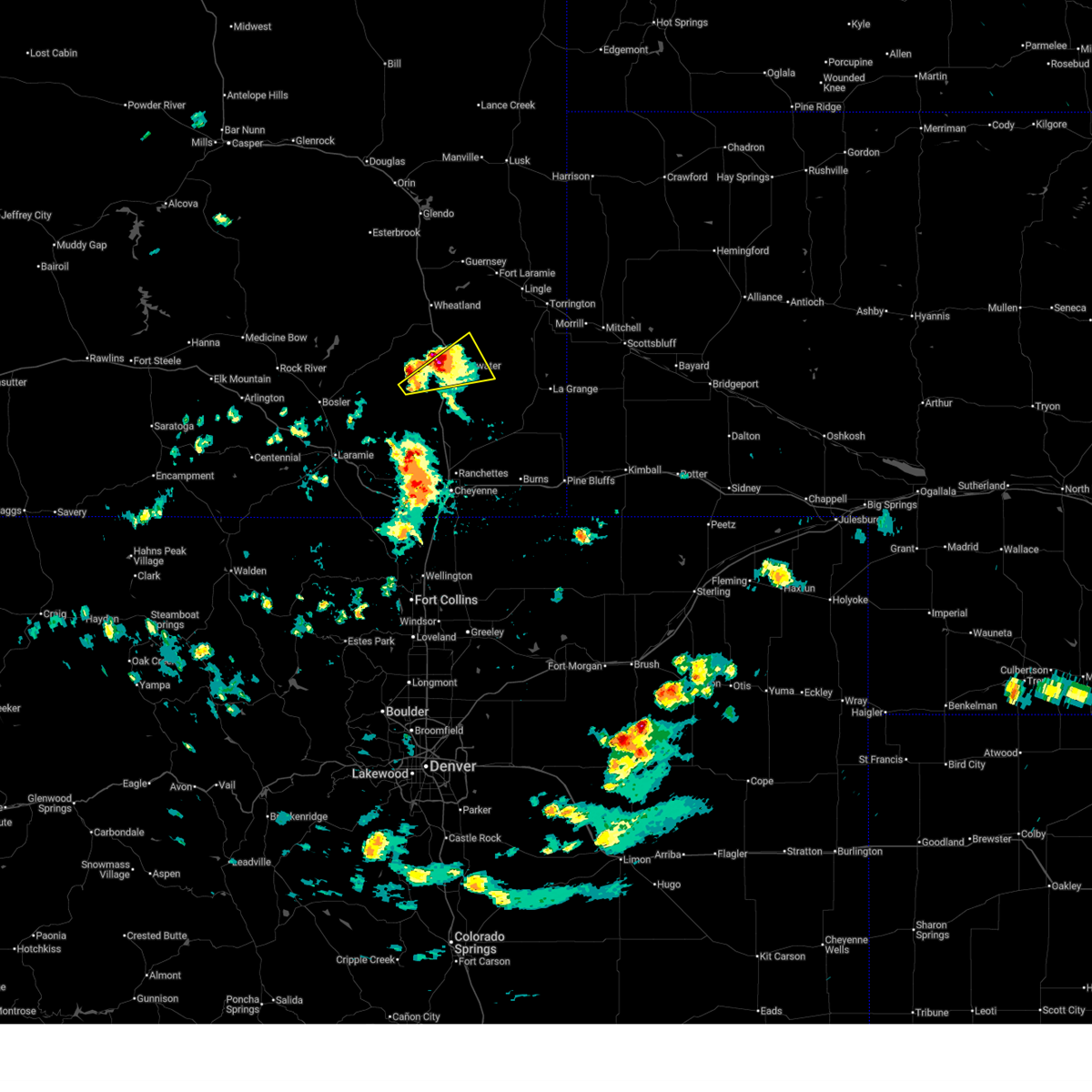
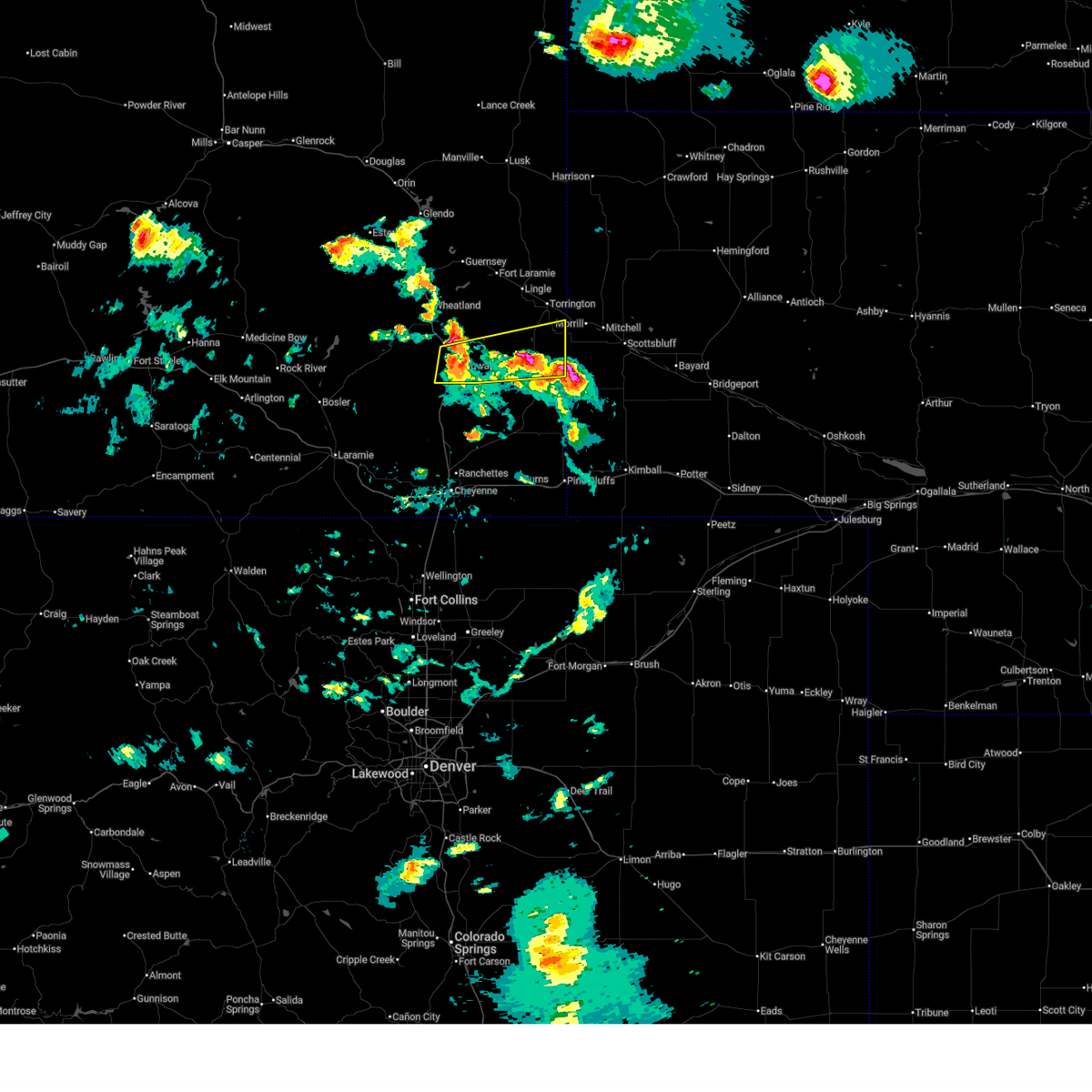
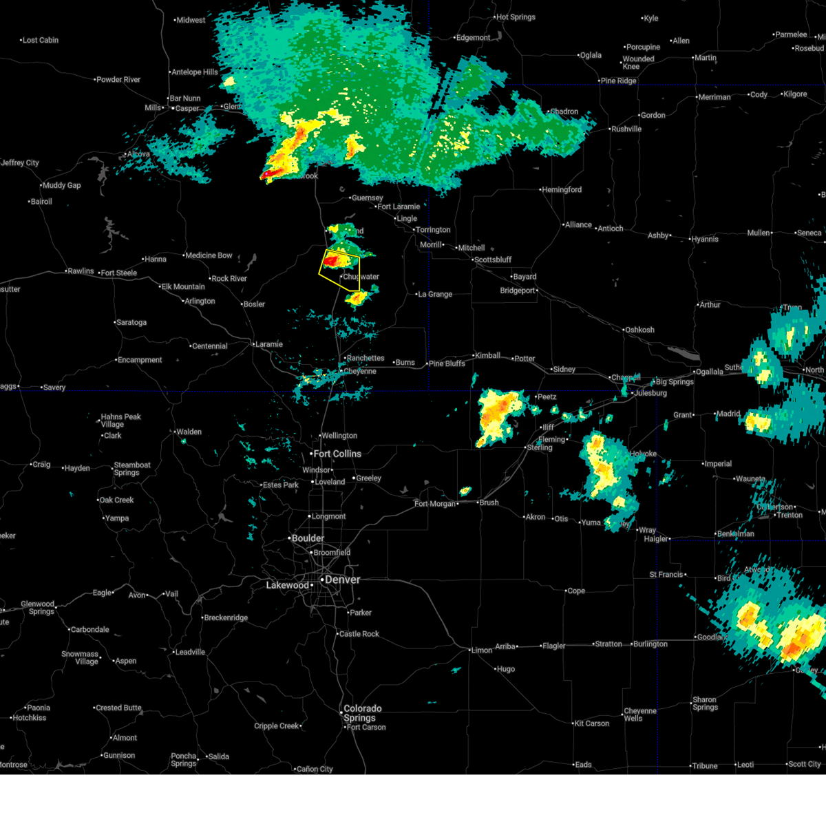
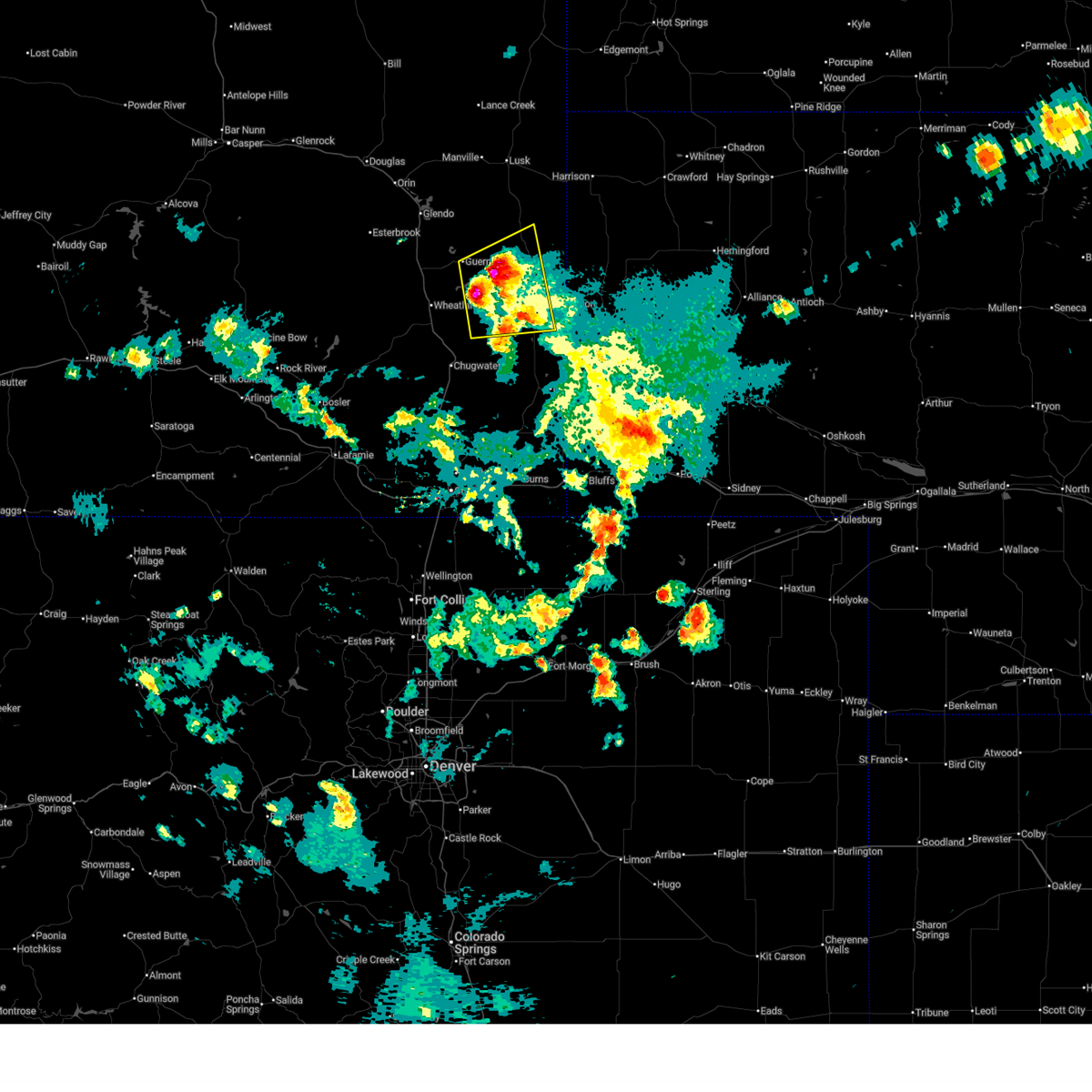
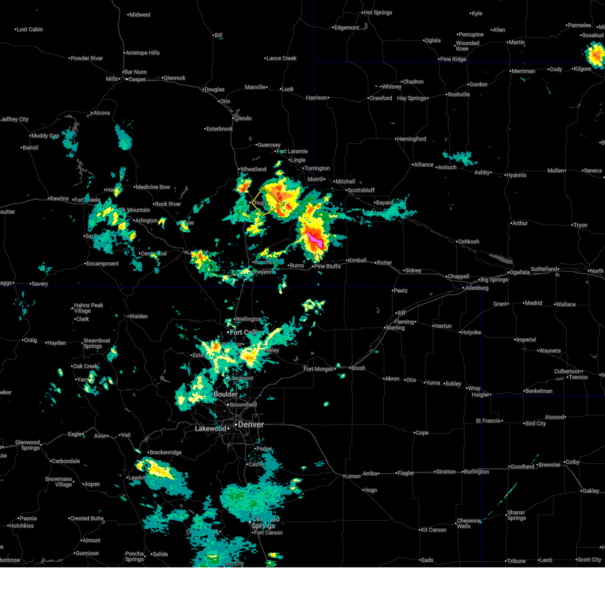
The Top Recent Hail Date for Slater, WY is Monday, June 8, 2026 (18th out of 126)

Hail and Wind Damage Spotted near Slater, WY
| Date / Time | Report Details |
|---|---|
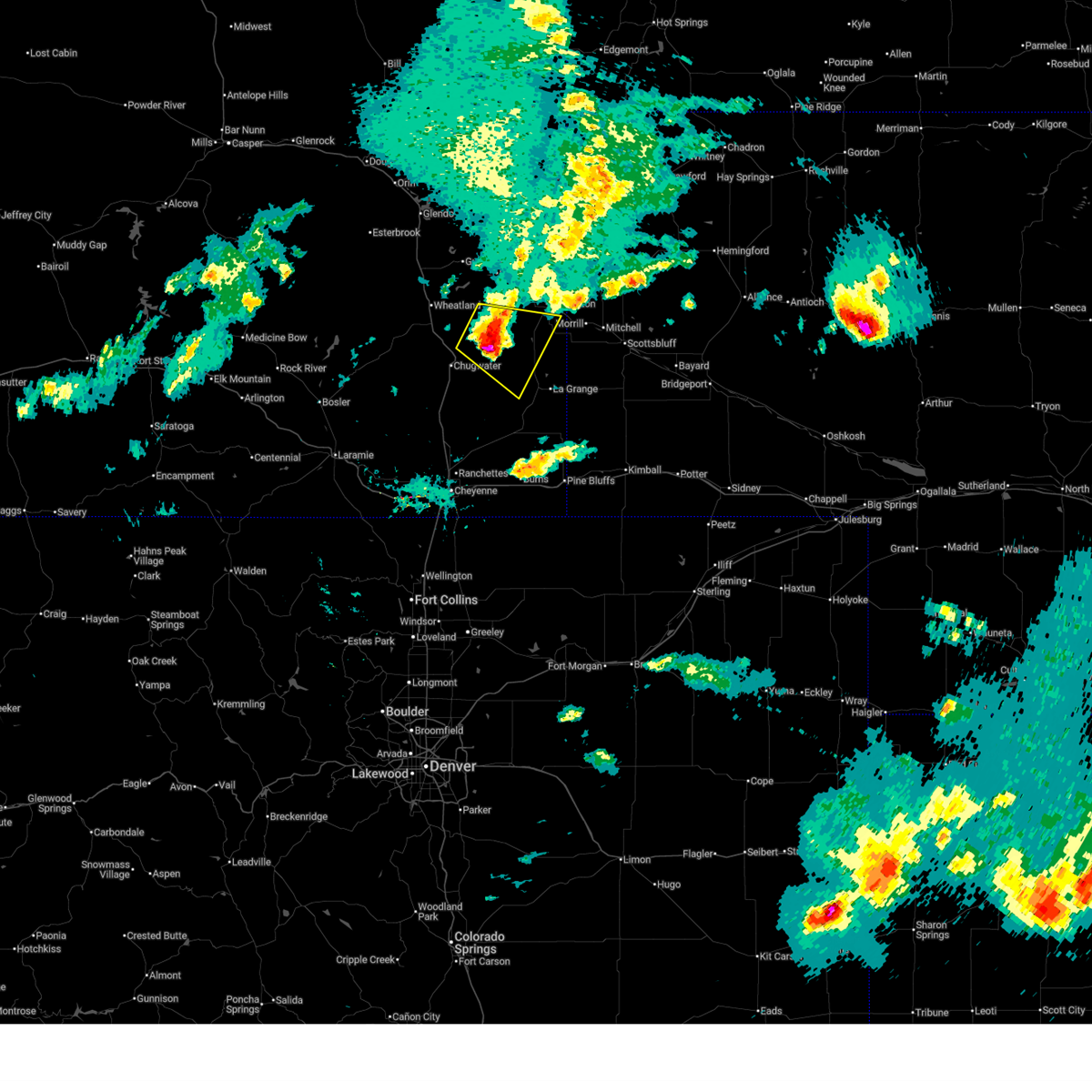
| 6/25/2026 5:30 PM MDT |
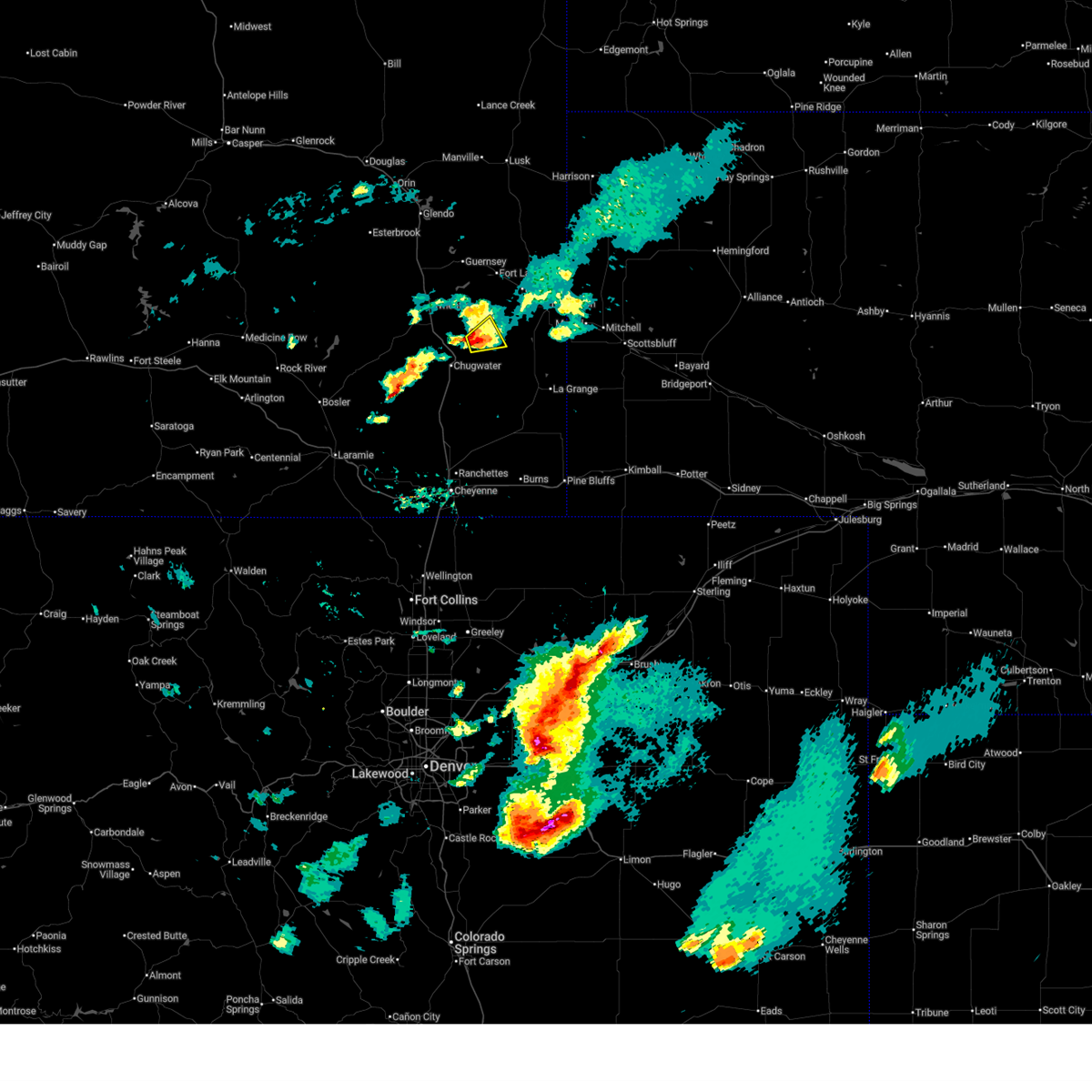
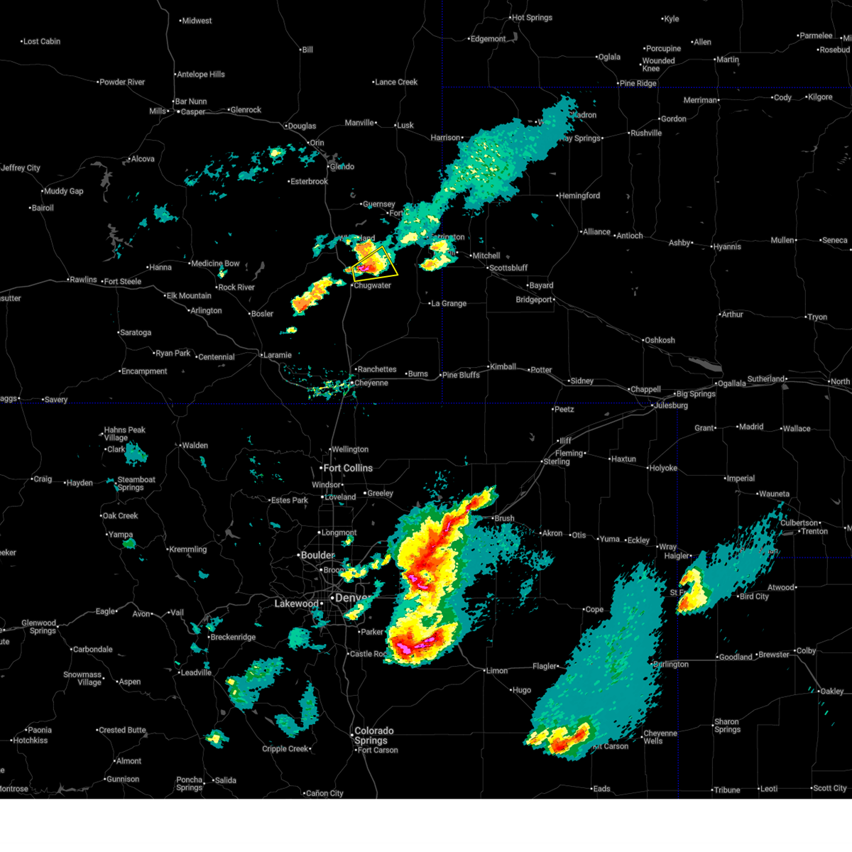
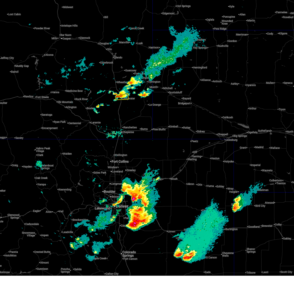
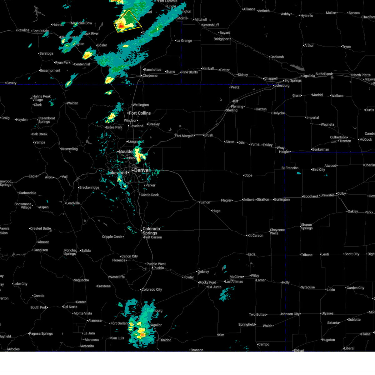
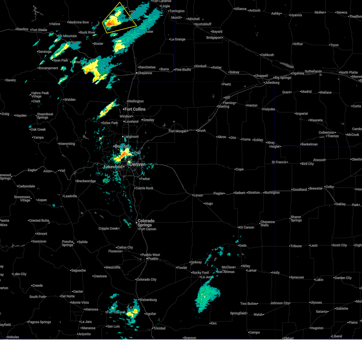
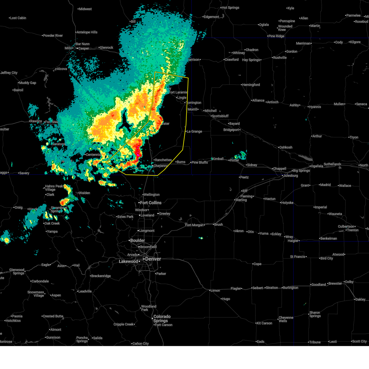 At 529 pm mdt, severe thunderstorms were located along a line extending from near pine ridge estates to 9 miles northeast of slater to 12 miles southeast of chugwater to near rocking star ranch to near ames monument, moving southeast at 45 mph (radar indicated). Hazards include 70 mph wind gusts and quarter size hail. Hail damage to vehicles is expected. expect considerable tree damage. wind damage is also likely to mobile homes, roofs, and outbuildings. locations impacted include, cheyenne, laramie, torrington, guernsey, lingle, happy valley, fort laramie, chugwater, federal, yoder, table mountain ranches, willadsen estates, rocking star ranch, hartville, silver sage estates, granite canon, fox farm-college, cheyenne regional airport, southern hills estates, and torrington municipal airport. this includes the following highways, interstate 25 in wyoming between mile markers 0 and 65. Interstate 80 in wyoming between mile markers 315 and 379. At 529 pm mdt, severe thunderstorms were located along a line extending from near pine ridge estates to 9 miles northeast of slater to 12 miles southeast of chugwater to near rocking star ranch to near ames monument, moving southeast at 45 mph (radar indicated). Hazards include 70 mph wind gusts and quarter size hail. Hail damage to vehicles is expected. expect considerable tree damage. wind damage is also likely to mobile homes, roofs, and outbuildings. locations impacted include, cheyenne, laramie, torrington, guernsey, lingle, happy valley, fort laramie, chugwater, federal, yoder, table mountain ranches, willadsen estates, rocking star ranch, hartville, silver sage estates, granite canon, fox farm-college, cheyenne regional airport, southern hills estates, and torrington municipal airport. this includes the following highways, interstate 25 in wyoming between mile markers 0 and 65. Interstate 80 in wyoming between mile markers 315 and 379.
|
| 6/25/2026 5:06 PM MDT |
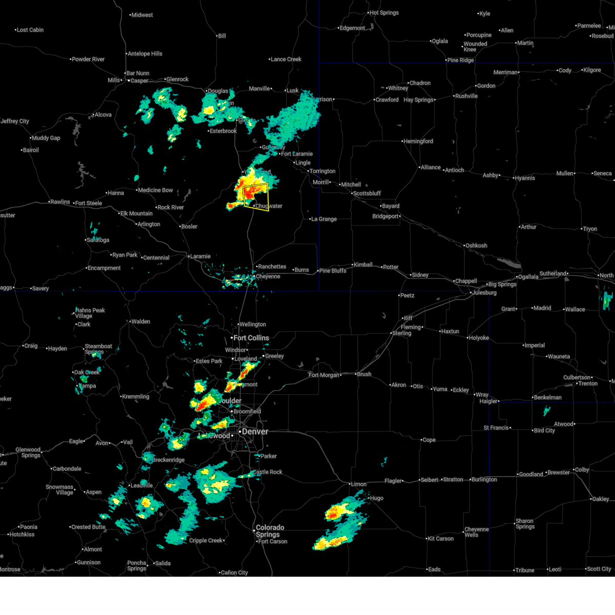
 Svrcys the national weather service in cheyenne has issued a * severe thunderstorm warning for, southeastern albany county in southeastern wyoming, goshen county in southeastern wyoming, laramie county in southeastern wyoming, platte county in southeastern wyoming, * until 600 pm mdt. * at 505 pm mdt, severe thunderstorms were located along a line extending from near two moon campground to near lakeview north to 7 miles west of chugwater to 8 miles northwest of horse creek to nine mile, moving southeast at 45 mph (radar indicated, and surface observations over 60 mph in albany county). Hazards include 70 mph wind gusts and penny size hail. Expect considerable tree damage. Damage is likely to mobile homes, roofs, and outbuildings. Svrcys the national weather service in cheyenne has issued a * severe thunderstorm warning for, southeastern albany county in southeastern wyoming, goshen county in southeastern wyoming, laramie county in southeastern wyoming, platte county in southeastern wyoming, * until 600 pm mdt. * at 505 pm mdt, severe thunderstorms were located along a line extending from near two moon campground to near lakeview north to 7 miles west of chugwater to 8 miles northwest of horse creek to nine mile, moving southeast at 45 mph (radar indicated, and surface observations over 60 mph in albany county). Hazards include 70 mph wind gusts and penny size hail. Expect considerable tree damage. Damage is likely to mobile homes, roofs, and outbuildings.
|
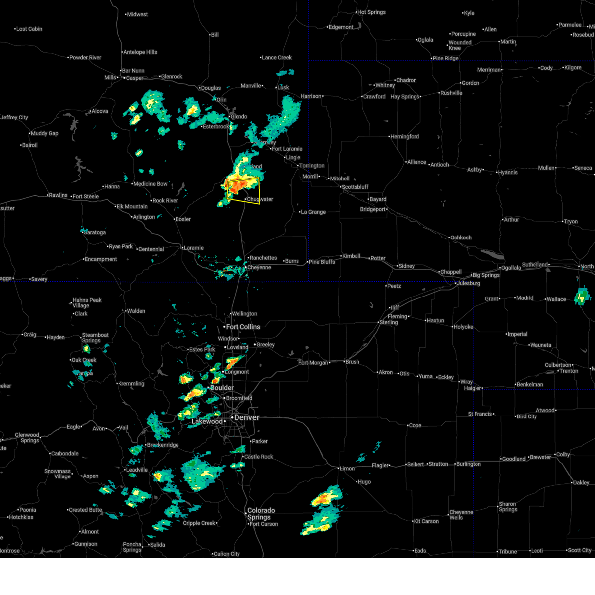
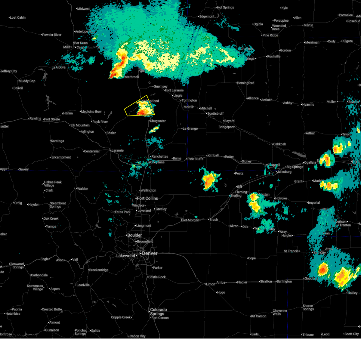
| 6/25/2026 4:42 PM MDT |
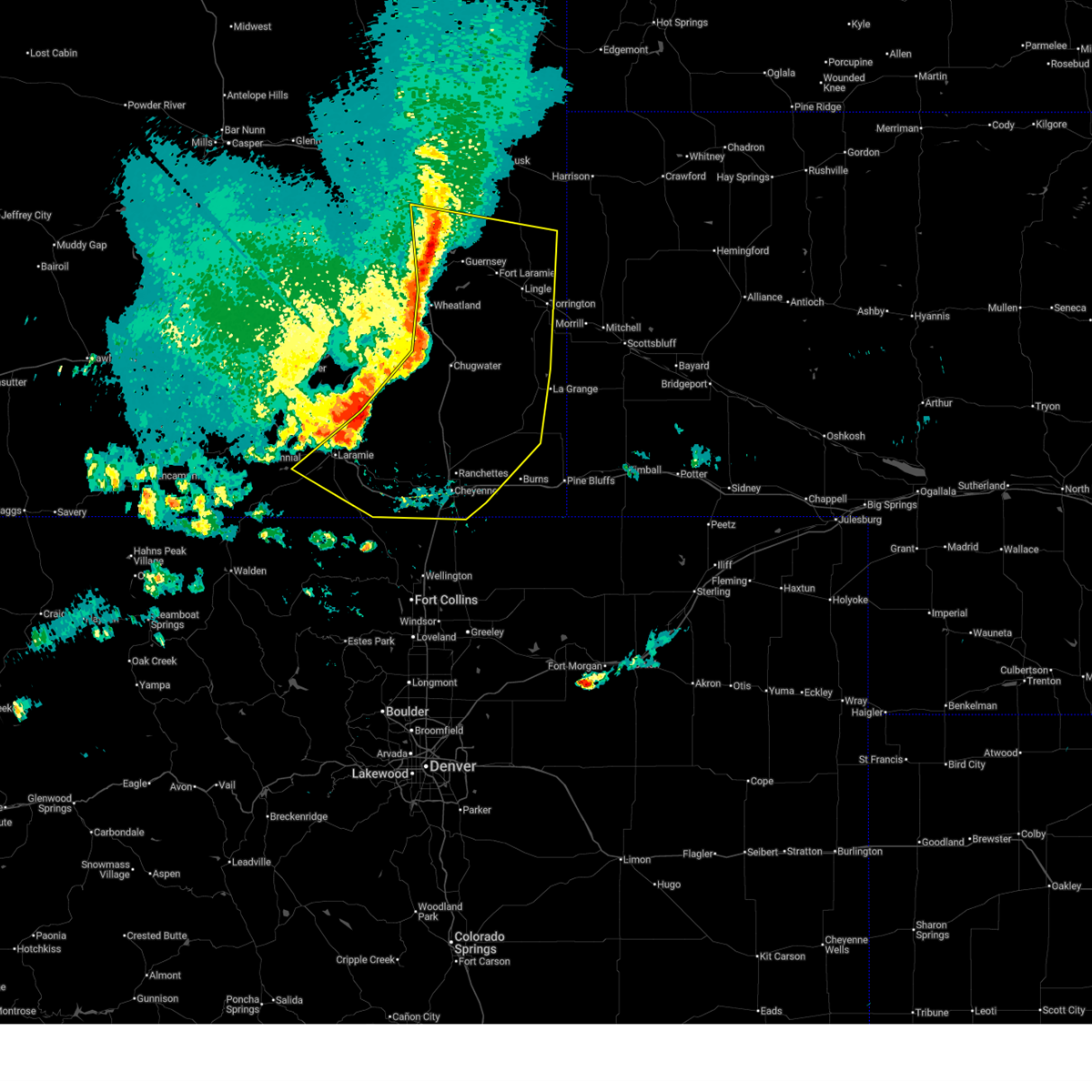
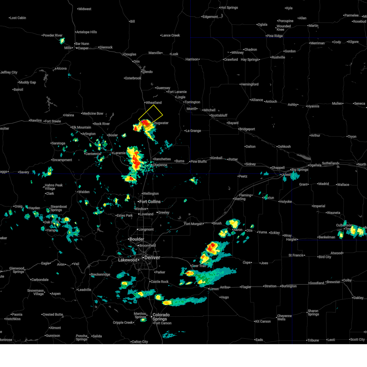
 At 441 pm mdt, severe thunderstorms were located along a line extending from glendo to near dwyer junction to 7 miles southwest of westview circle to flying x ranch to near bosler to 7 miles northeast of north fork campground, moving east at 50 mph (60 mph gusts have been reported throughout carbon and northern albany counties.). Hazards include 60 mph wind gusts and penny size hail. Expect damage to roofs, siding, and trees. locations impacted include, laramie, wheatland, guernsey, west laramie, rock river, chugwater, glendo, antelope buttes, hartville, orin, nine mile, rogers canyon, chugcreek, bordeaux, sibley peak, wheatland reservoir number 3, laramie regional airport, bennett hill campground, arlington, and university of wyoming war memorial stadium. this includes the following highways, interstate 25 in wyoming between mile markers 54 and 135. Interstate 80 in wyoming between mile markers 273 and 316. At 441 pm mdt, severe thunderstorms were located along a line extending from glendo to near dwyer junction to 7 miles southwest of westview circle to flying x ranch to near bosler to 7 miles northeast of north fork campground, moving east at 50 mph (60 mph gusts have been reported throughout carbon and northern albany counties.). Hazards include 60 mph wind gusts and penny size hail. Expect damage to roofs, siding, and trees. locations impacted include, laramie, wheatland, guernsey, west laramie, rock river, chugwater, glendo, antelope buttes, hartville, orin, nine mile, rogers canyon, chugcreek, bordeaux, sibley peak, wheatland reservoir number 3, laramie regional airport, bennett hill campground, arlington, and university of wyoming war memorial stadium. this includes the following highways, interstate 25 in wyoming between mile markers 54 and 135. Interstate 80 in wyoming between mile markers 273 and 316.
|
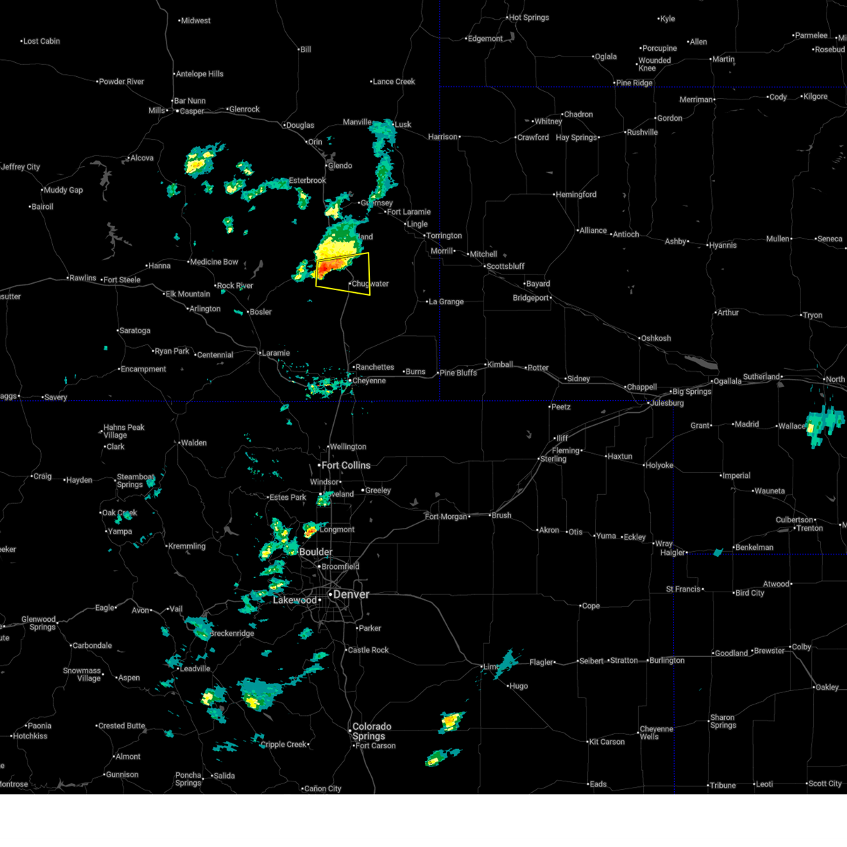
| 6/25/2026 4:15 PM MDT |
 Svrcys the national weather service in cheyenne has issued a * severe thunderstorm warning for, southwestern niobrara county in east central wyoming, east central carbon county in south central wyoming, southeastern albany county in southeastern wyoming, northwestern goshen county in southeastern wyoming, northwestern laramie county in southeastern wyoming, platte county in southeastern wyoming, southeastern converse county in east central wyoming, * until 515 pm mdt. * at 414 pm mdt, severe thunderstorms were located along a line extending from 10 miles southeast of laprele reservoir to near windy peak to garrett to 6 miles northwest of wheatland reservoir number 3 to near mcfadden to 6 miles northwest of bow river campground, moving east at 50 mph (surface observations of 60 mph wind gusts throughout carbon and albany counties). Hazards include 60 mph wind gusts and penny size hail. expect damage to roofs, siding, and trees Svrcys the national weather service in cheyenne has issued a * severe thunderstorm warning for, southwestern niobrara county in east central wyoming, east central carbon county in south central wyoming, southeastern albany county in southeastern wyoming, northwestern goshen county in southeastern wyoming, northwestern laramie county in southeastern wyoming, platte county in southeastern wyoming, southeastern converse county in east central wyoming, * until 515 pm mdt. * at 414 pm mdt, severe thunderstorms were located along a line extending from 10 miles southeast of laprele reservoir to near windy peak to garrett to 6 miles northwest of wheatland reservoir number 3 to near mcfadden to 6 miles northwest of bow river campground, moving east at 50 mph (surface observations of 60 mph wind gusts throughout carbon and albany counties). Hazards include 60 mph wind gusts and penny size hail. expect damage to roofs, siding, and trees
|
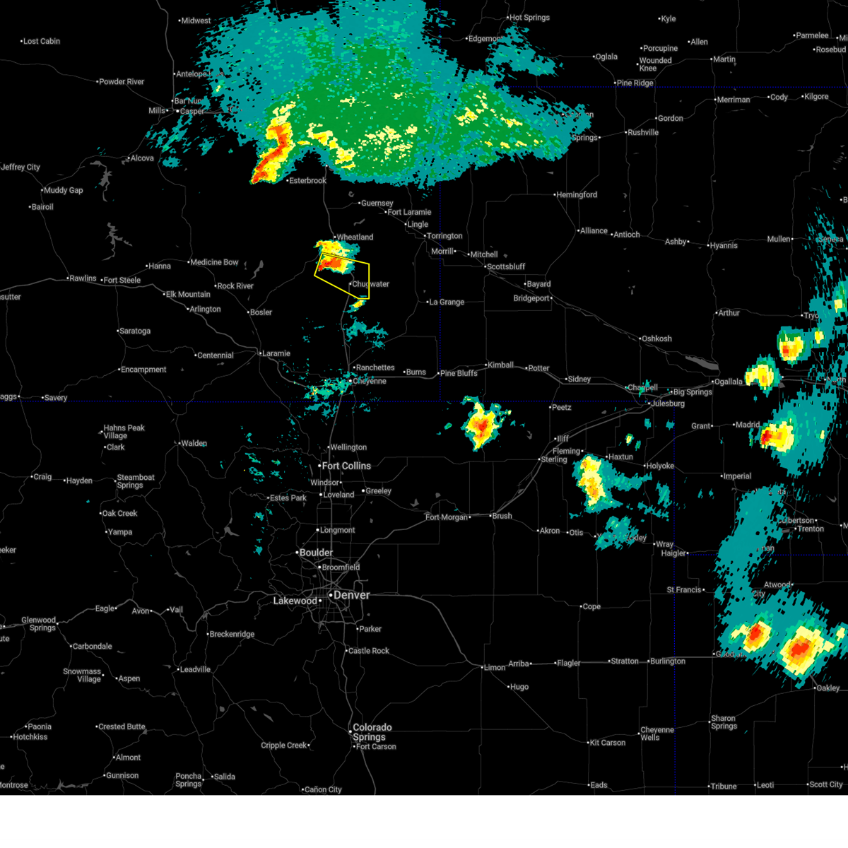
| 6/24/2026 7:36 PM MDT |
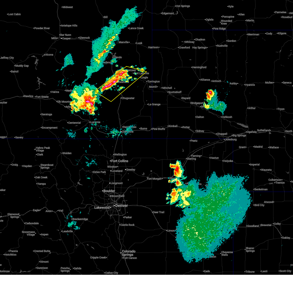
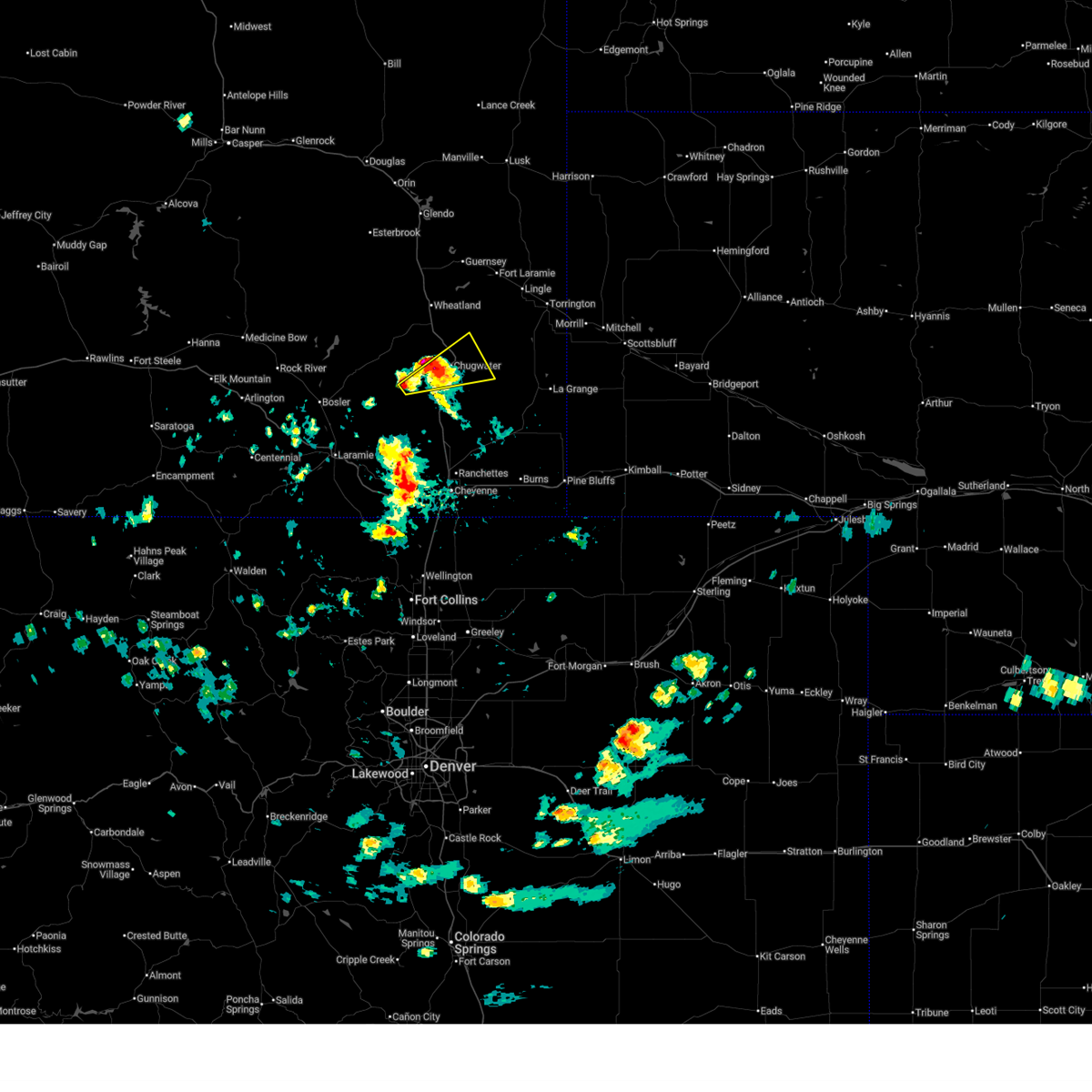
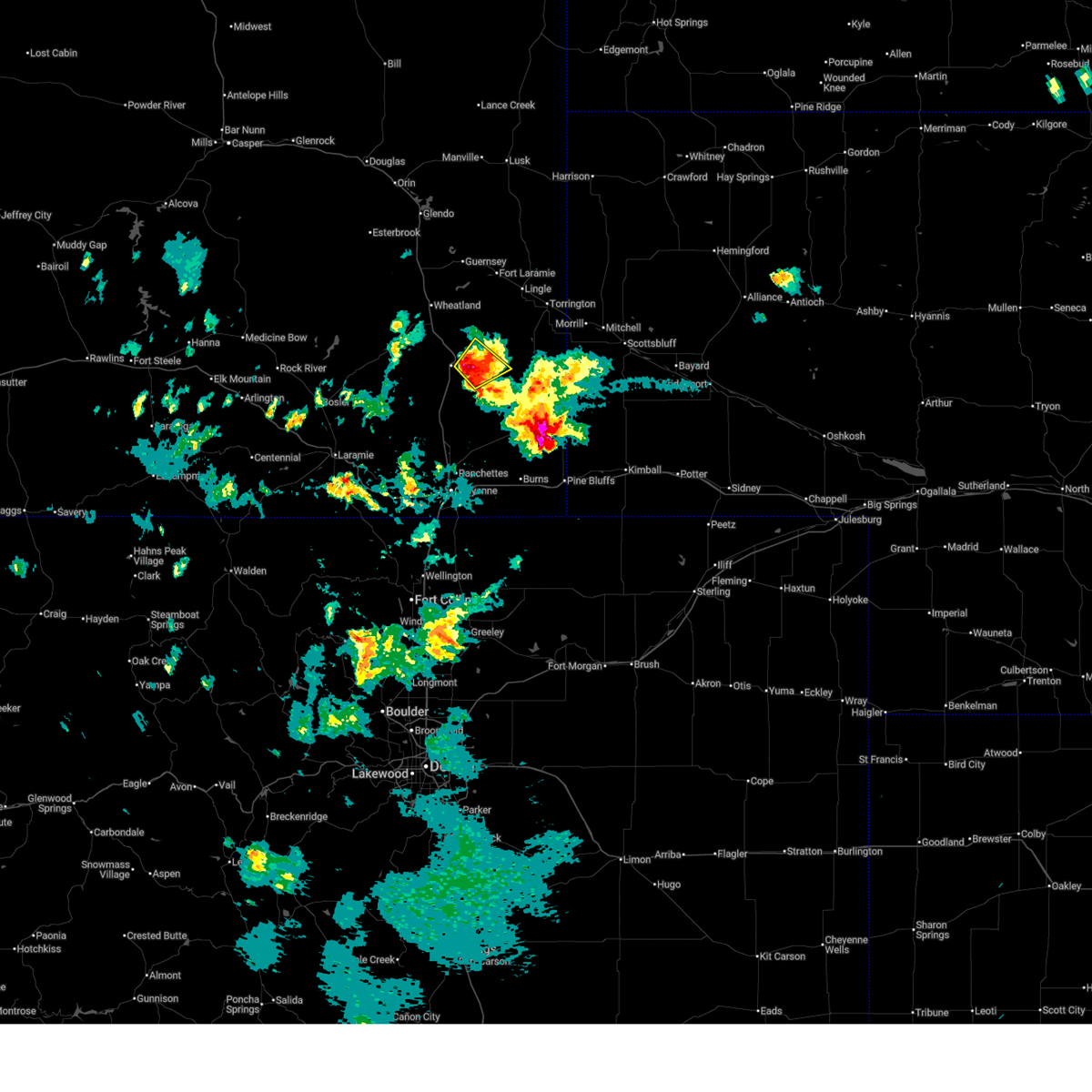
 At 736 pm mdt, a severe thunderstorm was located 11 miles east of sybille canyon, or 21 miles southwest of wheatland, moving southeast at 20 mph (radar indicated). Hazards include ping pong ball size hail and 60 mph wind gusts. People and animals outdoors will be injured. expect hail damage to roofs, siding, windows, and vehicles. expect wind damage to roofs, siding, and trees. locations impacted include, slater. This includes interstate 25 in wyoming between mile markers 68 and 70. At 736 pm mdt, a severe thunderstorm was located 11 miles east of sybille canyon, or 21 miles southwest of wheatland, moving southeast at 20 mph (radar indicated). Hazards include ping pong ball size hail and 60 mph wind gusts. People and animals outdoors will be injured. expect hail damage to roofs, siding, windows, and vehicles. expect wind damage to roofs, siding, and trees. locations impacted include, slater. This includes interstate 25 in wyoming between mile markers 68 and 70.
|
| 6/24/2026 7:36 PM MDT |
 the severe thunderstorm warning has been cancelled and is no longer in effect the severe thunderstorm warning has been cancelled and is no longer in effect
|
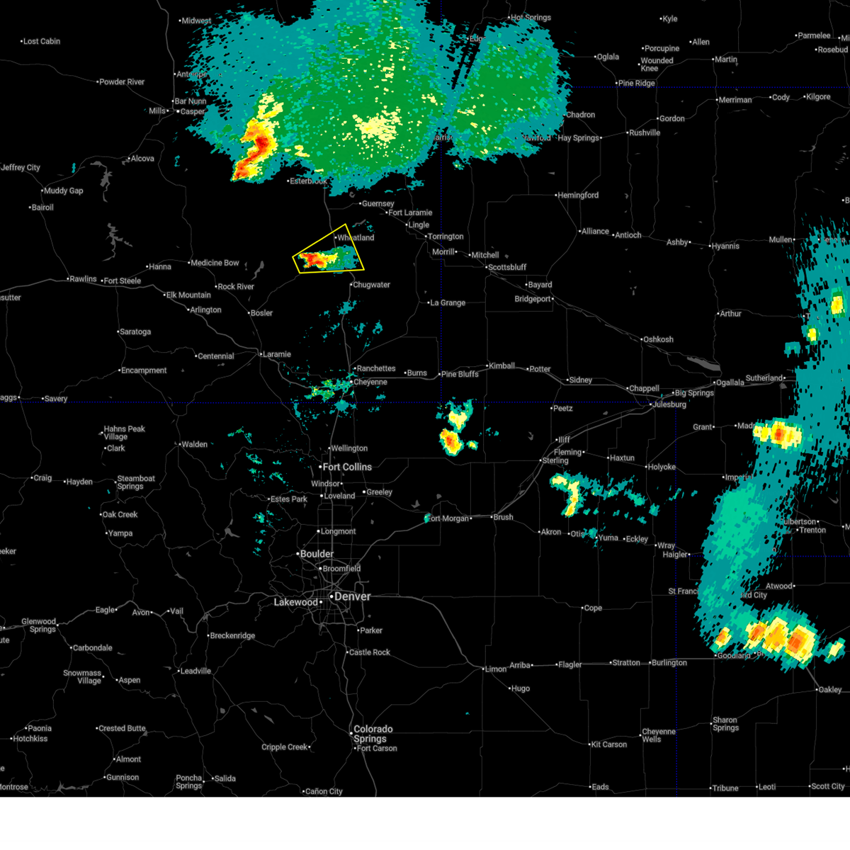
| 6/24/2026 7:16 PM MDT |
 At 716 pm mdt, a severe thunderstorm was located near slater, or 9 miles southeast of wheatland, moving east at 30 mph (radar indicated). Hazards include golf ball size hail and 60 mph wind gusts. People and animals outdoors will be injured. expect hail damage to roofs, siding, windows, and vehicles. expect wind damage to roofs, siding, and trees. locations impacted include, slater and antelope gap. This includes interstate 25 in wyoming between mile markers 65 and 68. At 716 pm mdt, a severe thunderstorm was located near slater, or 9 miles southeast of wheatland, moving east at 30 mph (radar indicated). Hazards include golf ball size hail and 60 mph wind gusts. People and animals outdoors will be injured. expect hail damage to roofs, siding, windows, and vehicles. expect wind damage to roofs, siding, and trees. locations impacted include, slater and antelope gap. This includes interstate 25 in wyoming between mile markers 65 and 68.
|
| 6/24/2026 7:14 PM MDT |
 Svrcys the national weather service in cheyenne has issued a * severe thunderstorm warning for, northeastern albany county in southeastern wyoming, southwestern platte county in southeastern wyoming, * until 800 pm mdt. * at 714 pm mdt, a severe thunderstorm was located near flying x ranch, or 22 miles southwest of wheatland, moving east at 15 mph (radar indicated). Hazards include ping pong ball size hail and 60 mph wind gusts. People and animals outdoors will be injured. expect hail damage to roofs, siding, windows, and vehicles. Expect wind damage to roofs, siding, and trees. Svrcys the national weather service in cheyenne has issued a * severe thunderstorm warning for, northeastern albany county in southeastern wyoming, southwestern platte county in southeastern wyoming, * until 800 pm mdt. * at 714 pm mdt, a severe thunderstorm was located near flying x ranch, or 22 miles southwest of wheatland, moving east at 15 mph (radar indicated). Hazards include ping pong ball size hail and 60 mph wind gusts. People and animals outdoors will be injured. expect hail damage to roofs, siding, windows, and vehicles. Expect wind damage to roofs, siding, and trees.
|
| 6/24/2026 7:07 PM MDT |
 At 707 pm mdt, a severe thunderstorm was located over bordeaux, or 8 miles south of wheatland, moving east at 35 mph (radar indicated). Hazards include golf ball size hail and 60 mph wind gusts. People and animals outdoors will be injured. expect hail damage to roofs, siding, windows, and vehicles. expect wind damage to roofs, siding, and trees. locations impacted include, slater, bordeaux, and antelope gap. This includes interstate 25 in wyoming between mile markers 58 and 76. At 707 pm mdt, a severe thunderstorm was located over bordeaux, or 8 miles south of wheatland, moving east at 35 mph (radar indicated). Hazards include golf ball size hail and 60 mph wind gusts. People and animals outdoors will be injured. expect hail damage to roofs, siding, windows, and vehicles. expect wind damage to roofs, siding, and trees. locations impacted include, slater, bordeaux, and antelope gap. This includes interstate 25 in wyoming between mile markers 58 and 76.
|
| 6/24/2026 6:51 PM MDT |
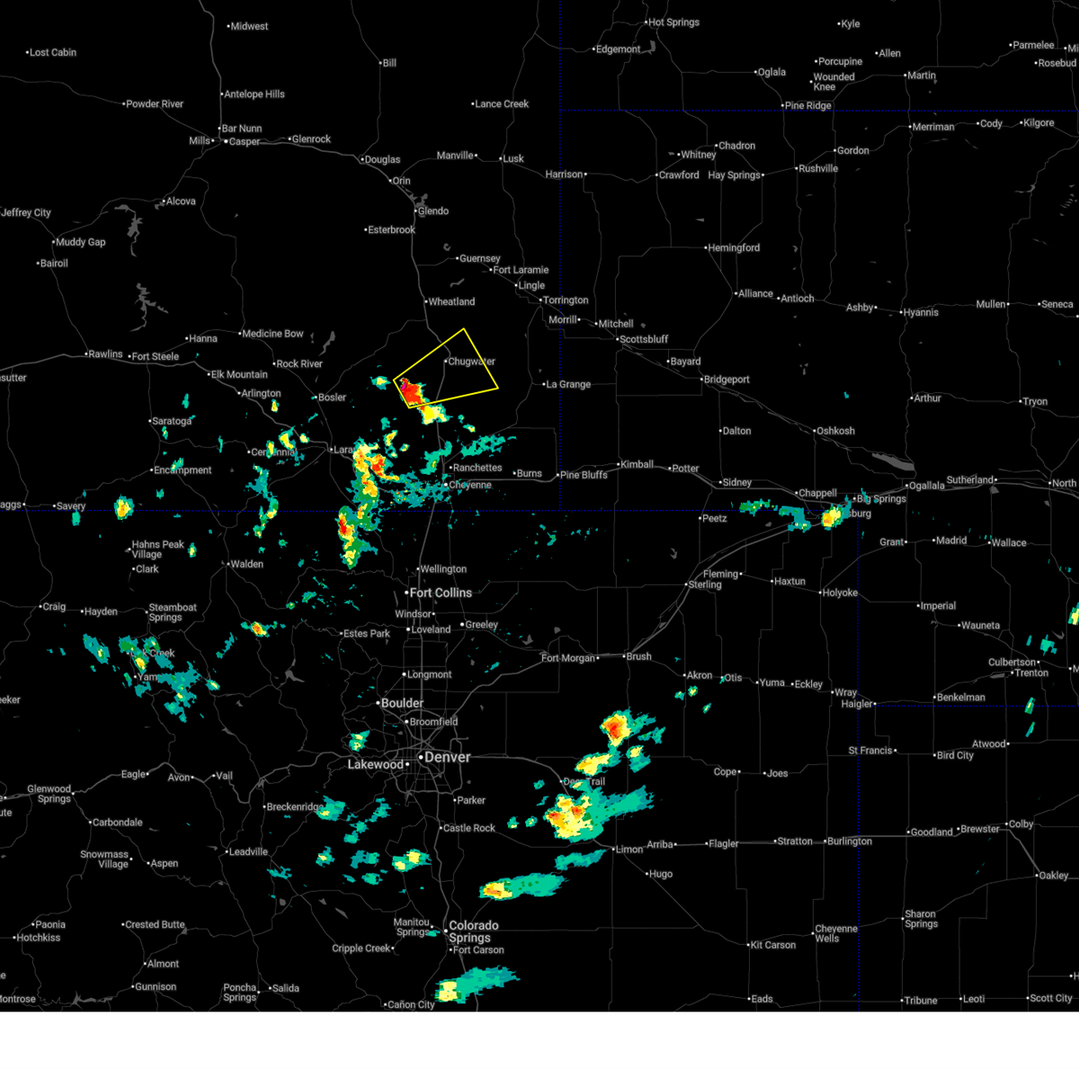
 Svrcys the national weather service in cheyenne has issued a * severe thunderstorm warning for, southwestern goshen county in southeastern wyoming, southern platte county in southeastern wyoming, * until 745 pm mdt. * at 650 pm mdt, a severe thunderstorm was located 7 miles west of bordeaux, or 10 miles southwest of wheatland, moving east at 30 mph (radar indicated). Hazards include two inch hail and 60 mph wind gusts. People and animals outdoors will be injured. expect hail damage to roofs, siding, windows, and vehicles. Expect wind damage to roofs, siding, and trees. Svrcys the national weather service in cheyenne has issued a * severe thunderstorm warning for, southwestern goshen county in southeastern wyoming, southern platte county in southeastern wyoming, * until 745 pm mdt. * at 650 pm mdt, a severe thunderstorm was located 7 miles west of bordeaux, or 10 miles southwest of wheatland, moving east at 30 mph (radar indicated). Hazards include two inch hail and 60 mph wind gusts. People and animals outdoors will be injured. expect hail damage to roofs, siding, windows, and vehicles. Expect wind damage to roofs, siding, and trees.
|
| 6/23/2026 4:53 PM MDT |
 Svrcys the national weather service in cheyenne has issued a * severe thunderstorm warning for, southwestern goshen county in southeastern wyoming, northwestern laramie county in southeastern wyoming, southeastern platte county in southeastern wyoming, * until 530 pm mdt. * at 453 pm mdt, a severe thunderstorm was located 14 miles northwest of whitaker, or 31 miles south of wheatland, moving east at 40 mph (radar indicated). Hazards include quarter size hail. damage to vehicles is expected Svrcys the national weather service in cheyenne has issued a * severe thunderstorm warning for, southwestern goshen county in southeastern wyoming, northwestern laramie county in southeastern wyoming, southeastern platte county in southeastern wyoming, * until 530 pm mdt. * at 453 pm mdt, a severe thunderstorm was located 14 miles northwest of whitaker, or 31 miles south of wheatland, moving east at 40 mph (radar indicated). Hazards include quarter size hail. damage to vehicles is expected
|
| 6/20/2026 6:28 PM MDT |
 At 628 pm mdt, a severe thunderstorm was located 11 miles east of slater, or 24 miles southeast of wheatland, moving east at 30 mph (radar indicated). Hazards include 60 mph wind gusts and half dollar size hail. Hail damage to vehicles is expected. expect wind damage to roofs, siding, and trees. Locations impacted include, yoder, huntley, southern hills estates, veteran, hawk springs, and slater. At 628 pm mdt, a severe thunderstorm was located 11 miles east of slater, or 24 miles southeast of wheatland, moving east at 30 mph (radar indicated). Hazards include 60 mph wind gusts and half dollar size hail. Hail damage to vehicles is expected. expect wind damage to roofs, siding, and trees. Locations impacted include, yoder, huntley, southern hills estates, veteran, hawk springs, and slater.
|
| 6/20/2026 6:01 PM MDT |
 Svrcys the national weather service in cheyenne has issued a * severe thunderstorm warning for, southern goshen county in southeastern wyoming, southeastern platte county in southeastern wyoming, * until 645 pm mdt. * at 601 pm mdt, a severe thunderstorm was located near slater, or 12 miles southeast of wheatland, moving east at 45 mph (radar indicated). Hazards include 60 mph wind gusts and penny size hail. expect damage to roofs, siding, and trees Svrcys the national weather service in cheyenne has issued a * severe thunderstorm warning for, southern goshen county in southeastern wyoming, southeastern platte county in southeastern wyoming, * until 645 pm mdt. * at 601 pm mdt, a severe thunderstorm was located near slater, or 12 miles southeast of wheatland, moving east at 45 mph (radar indicated). Hazards include 60 mph wind gusts and penny size hail. expect damage to roofs, siding, and trees
|
| 6/20/2026 5:44 PM MDT |
 At 544 pm mdt, a severe thunderstorm was located 8 miles south of westview circle, or 11 miles southwest of wheatland, moving east at 45 mph (radar indicated). Hazards include 60 mph wind gusts and quarter size hail. Hail damage to vehicles is expected. expect wind damage to roofs, siding, and trees. locations impacted include, wheatland, phifer airfield, chugcreek, lakeview north, bordeaux, westview circle, y-o ranch, grayrocks reservoir, slater, platte county fairgrounds, and antelope gap. This includes interstate 25 in wyoming between mile markers 65 and 86. At 544 pm mdt, a severe thunderstorm was located 8 miles south of westview circle, or 11 miles southwest of wheatland, moving east at 45 mph (radar indicated). Hazards include 60 mph wind gusts and quarter size hail. Hail damage to vehicles is expected. expect wind damage to roofs, siding, and trees. locations impacted include, wheatland, phifer airfield, chugcreek, lakeview north, bordeaux, westview circle, y-o ranch, grayrocks reservoir, slater, platte county fairgrounds, and antelope gap. This includes interstate 25 in wyoming between mile markers 65 and 86.
|
| 6/20/2026 5:25 PM MDT |
 Svrcys the national weather service in cheyenne has issued a * severe thunderstorm warning for, east central albany county in southeastern wyoming, west central goshen county in southeastern wyoming, southern platte county in southeastern wyoming, * until 615 pm mdt. * at 524 pm mdt, a severe thunderstorm was located near flying x ranch, or 19 miles southwest of wheatland, moving southeast at 25 mph (radar indicated). Hazards include ping pong ball size hail and 60 mph wind gusts. People and animals outdoors will be injured. expect hail damage to roofs, siding, windows, and vehicles. Expect wind damage to roofs, siding, and trees. Svrcys the national weather service in cheyenne has issued a * severe thunderstorm warning for, east central albany county in southeastern wyoming, west central goshen county in southeastern wyoming, southern platte county in southeastern wyoming, * until 615 pm mdt. * at 524 pm mdt, a severe thunderstorm was located near flying x ranch, or 19 miles southwest of wheatland, moving southeast at 25 mph (radar indicated). Hazards include ping pong ball size hail and 60 mph wind gusts. People and animals outdoors will be injured. expect hail damage to roofs, siding, windows, and vehicles. Expect wind damage to roofs, siding, and trees.
|
| 6/8/2026 5:04 PM MDT |
 At 504 pm mdt, a severe thunderstorm was located 7 miles east of slater, or 21 miles southeast of wheatland, moving northeast at 20 mph (radar indicated). Hazards include quarter size hail. Damage to vehicles is expected. Locations impacted include, slater. At 504 pm mdt, a severe thunderstorm was located 7 miles east of slater, or 21 miles southeast of wheatland, moving northeast at 20 mph (radar indicated). Hazards include quarter size hail. Damage to vehicles is expected. Locations impacted include, slater.
|
| 6/8/2026 4:52 PM MDT |
 Svrcys the national weather service in cheyenne has issued a * severe thunderstorm warning for, west central goshen county in southeastern wyoming, southeastern platte county in southeastern wyoming, * until 515 pm mdt. * at 452 pm mdt, a severe thunderstorm was located near slater, or 19 miles southeast of wheatland, moving northeast at 20 mph (radar indicated). Hazards include quarter size hail. damage to vehicles is expected Svrcys the national weather service in cheyenne has issued a * severe thunderstorm warning for, west central goshen county in southeastern wyoming, southeastern platte county in southeastern wyoming, * until 515 pm mdt. * at 452 pm mdt, a severe thunderstorm was located near slater, or 19 miles southeast of wheatland, moving northeast at 20 mph (radar indicated). Hazards include quarter size hail. damage to vehicles is expected
|
| 6/8/2026 4:29 PM MDT |
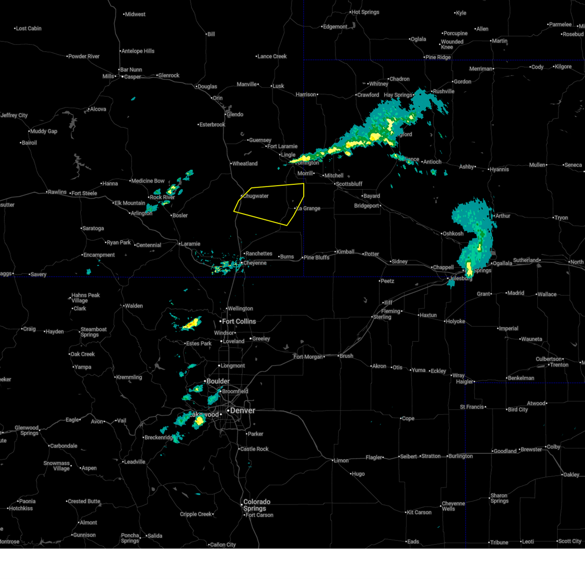
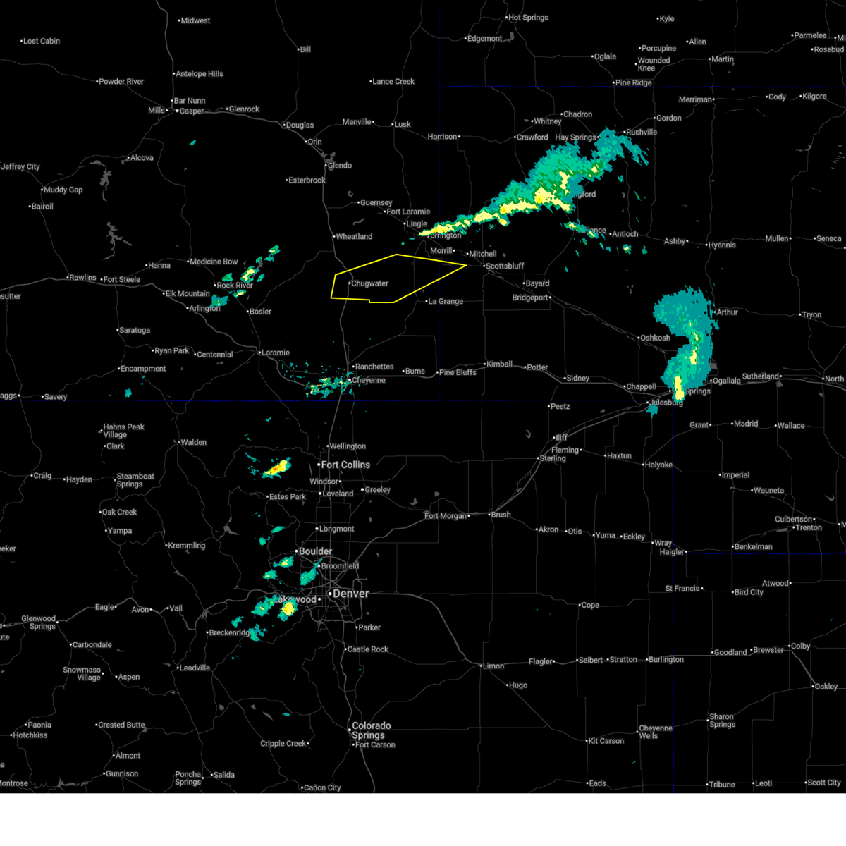
 At 429 pm mdt, a severe thunderstorm was located near chugwater, or 19 miles south of wheatland, moving northeast at 25 mph (radar indicated). Hazards include 60 mph wind gusts and quarter size hail. Hail damage to vehicles is expected. expect wind damage to roofs, siding, and trees. locations impacted include, chugwater and slater. This includes interstate 25 in wyoming between mile markers 54 and 60. At 429 pm mdt, a severe thunderstorm was located near chugwater, or 19 miles south of wheatland, moving northeast at 25 mph (radar indicated). Hazards include 60 mph wind gusts and quarter size hail. Hail damage to vehicles is expected. expect wind damage to roofs, siding, and trees. locations impacted include, chugwater and slater. This includes interstate 25 in wyoming between mile markers 54 and 60.
|
| 6/8/2026 4:15 PM MDT |
 Svrcys the national weather service in cheyenne has issued a * severe thunderstorm warning for, southeastern platte county in southeastern wyoming, * until 500 pm mdt. * at 414 pm mdt, a severe thunderstorm was located near chugwater, or 22 miles south of wheatland, moving east at 15 mph (radar indicated). Hazards include 60 mph wind gusts and quarter size hail. Hail damage to vehicles is expected. Expect wind damage to roofs, siding, and trees. Svrcys the national weather service in cheyenne has issued a * severe thunderstorm warning for, southeastern platte county in southeastern wyoming, * until 500 pm mdt. * at 414 pm mdt, a severe thunderstorm was located near chugwater, or 22 miles south of wheatland, moving east at 15 mph (radar indicated). Hazards include 60 mph wind gusts and quarter size hail. Hail damage to vehicles is expected. Expect wind damage to roofs, siding, and trees.
|
| 6/8/2026 3:31 PM MDT |
 At 331 pm mdt, a severe thunderstorm was located near slater, or 13 miles south of wheatland, moving northeast at 25 mph (radar indicated). Hazards include 60 mph wind gusts and quarter size hail. Hail damage to vehicles is expected. expect wind damage to roofs, siding, and trees. locations impacted include, slater. This includes interstate 25 in wyoming between mile markers 64 and 70. At 331 pm mdt, a severe thunderstorm was located near slater, or 13 miles south of wheatland, moving northeast at 25 mph (radar indicated). Hazards include 60 mph wind gusts and quarter size hail. Hail damage to vehicles is expected. expect wind damage to roofs, siding, and trees. locations impacted include, slater. This includes interstate 25 in wyoming between mile markers 64 and 70.
|
| 6/8/2026 3:08 PM MDT |
 Svrcys the national weather service in cheyenne has issued a * severe thunderstorm warning for, southeastern platte county in southeastern wyoming, * until 345 pm mdt. * at 307 pm mdt, a severe thunderstorm was located near slater, or 12 miles south of wheatland, moving northeast at 25 mph (radar indicated). Hazards include 60 mph wind gusts and quarter size hail. Hail damage to vehicles is expected. Expect wind damage to roofs, siding, and trees. Svrcys the national weather service in cheyenne has issued a * severe thunderstorm warning for, southeastern platte county in southeastern wyoming, * until 345 pm mdt. * at 307 pm mdt, a severe thunderstorm was located near slater, or 12 miles south of wheatland, moving northeast at 25 mph (radar indicated). Hazards include 60 mph wind gusts and quarter size hail. Hail damage to vehicles is expected. Expect wind damage to roofs, siding, and trees.
|
| 6/8/2026 2:55 PM MDT |
 At 255 pm mdt, a severe thunderstorm was located 10 miles east of slater, or 23 miles southeast of wheatland, moving east at 25 mph (radar indicated). Hazards include ping pong ball size hail and 60 mph wind gusts. People and animals outdoors will be injured. expect hail damage to roofs, siding, windows, and vehicles. expect wind damage to roofs, siding, and trees. Locations impacted include, yoder, veteran, hawk springs, southern hills estates, and slater. At 255 pm mdt, a severe thunderstorm was located 10 miles east of slater, or 23 miles southeast of wheatland, moving east at 25 mph (radar indicated). Hazards include ping pong ball size hail and 60 mph wind gusts. People and animals outdoors will be injured. expect hail damage to roofs, siding, windows, and vehicles. expect wind damage to roofs, siding, and trees. Locations impacted include, yoder, veteran, hawk springs, southern hills estates, and slater.
|
| 6/8/2026 2:41 PM MDT |
 Svrcys the national weather service in cheyenne has issued a * severe thunderstorm warning for, southern goshen county in southeastern wyoming, southeastern platte county in southeastern wyoming, * until 330 pm mdt. * at 240 pm mdt, a severe thunderstorm was located near slater, or 19 miles southeast of wheatland, moving east at 35 mph (radar indicated). Hazards include ping pong ball size hail and 60 mph wind gusts. People and animals outdoors will be injured. expect hail damage to roofs, siding, windows, and vehicles. Expect wind damage to roofs, siding, and trees. Svrcys the national weather service in cheyenne has issued a * severe thunderstorm warning for, southern goshen county in southeastern wyoming, southeastern platte county in southeastern wyoming, * until 330 pm mdt. * at 240 pm mdt, a severe thunderstorm was located near slater, or 19 miles southeast of wheatland, moving east at 35 mph (radar indicated). Hazards include ping pong ball size hail and 60 mph wind gusts. People and animals outdoors will be injured. expect hail damage to roofs, siding, windows, and vehicles. Expect wind damage to roofs, siding, and trees.
|
| 6/8/2026 2:29 PM MDT |
 At 228 pm mdt, a severe thunderstorm was located near slater, or 16 miles southeast of wheatland, moving east at 25 mph (radar indicated). Hazards include 60 mph wind gusts and half dollar size hail. Hail damage to vehicles is expected. expect wind damage to roofs, siding, and trees. locations impacted include, chugwater and slater. This includes interstate 25 in wyoming between mile markers 54 and 70. At 228 pm mdt, a severe thunderstorm was located near slater, or 16 miles southeast of wheatland, moving east at 25 mph (radar indicated). Hazards include 60 mph wind gusts and half dollar size hail. Hail damage to vehicles is expected. expect wind damage to roofs, siding, and trees. locations impacted include, chugwater and slater. This includes interstate 25 in wyoming between mile markers 54 and 70.
|
| 6/8/2026 2:14 PM MDT |
 At 214 pm mdt, a severe thunderstorm was located near chugwater, or 17 miles south of wheatland, moving east at 20 mph (radar indicated). Hazards include 60 mph wind gusts and half dollar size hail. Hail damage to vehicles is expected. expect wind damage to roofs, siding, and trees. locations impacted include, chugwater and slater. This includes interstate 25 in wyoming between mile markers 53 and 70. At 214 pm mdt, a severe thunderstorm was located near chugwater, or 17 miles south of wheatland, moving east at 20 mph (radar indicated). Hazards include 60 mph wind gusts and half dollar size hail. Hail damage to vehicles is expected. expect wind damage to roofs, siding, and trees. locations impacted include, chugwater and slater. This includes interstate 25 in wyoming between mile markers 53 and 70.
|
| 6/8/2026 1:55 PM MDT |
 Svrcys the national weather service in cheyenne has issued a * severe thunderstorm warning for, southeastern platte county in southeastern wyoming, * until 245 pm mdt. * at 155 pm mdt, a severe thunderstorm was located 9 miles northwest of chugwater, or 16 miles south of wheatland, moving east at 20 mph (radar indicated). Hazards include ping pong ball size hail and 60 mph wind gusts. People and animals outdoors will be injured. expect hail damage to roofs, siding, windows, and vehicles. Expect wind damage to roofs, siding, and trees. Svrcys the national weather service in cheyenne has issued a * severe thunderstorm warning for, southeastern platte county in southeastern wyoming, * until 245 pm mdt. * at 155 pm mdt, a severe thunderstorm was located 9 miles northwest of chugwater, or 16 miles south of wheatland, moving east at 20 mph (radar indicated). Hazards include ping pong ball size hail and 60 mph wind gusts. People and animals outdoors will be injured. expect hail damage to roofs, siding, windows, and vehicles. Expect wind damage to roofs, siding, and trees.
|
| 6/2/2026 2:52 PM MDT |
 At 251 pm mdt, a severe thunderstorm was located near the albany- platte county line, west of chugwater, moving northeast at 20 mph (radar indicated). Hazards include 60 mph wind gusts and quarter size hail. Hail damage to vehicles is expected. expect wind damage to roofs, siding, and trees. locations impacted include, bordeaux, westview circle, and slater. This includes interstate 25 in wyoming between mile markers 63 and 73. At 251 pm mdt, a severe thunderstorm was located near the albany- platte county line, west of chugwater, moving northeast at 20 mph (radar indicated). Hazards include 60 mph wind gusts and quarter size hail. Hail damage to vehicles is expected. expect wind damage to roofs, siding, and trees. locations impacted include, bordeaux, westview circle, and slater. This includes interstate 25 in wyoming between mile markers 63 and 73.
|
| 6/2/2026 2:24 PM MDT |
 Svrcys the national weather service in cheyenne has issued a * severe thunderstorm warning for, northeastern albany county in southeastern wyoming, southwestern platte county in southeastern wyoming, * until 315 pm mdt. * at 223 pm mdt, a severe thunderstorm was located near the albany- platte county line, west of chugwater, moving northeast at 20 mph (radar indicated). Hazards include 60 mph wind gusts and quarter size hail. Hail damage to vehicles is expected. Expect wind damage to roofs, siding, and trees. Svrcys the national weather service in cheyenne has issued a * severe thunderstorm warning for, northeastern albany county in southeastern wyoming, southwestern platte county in southeastern wyoming, * until 315 pm mdt. * at 223 pm mdt, a severe thunderstorm was located near the albany- platte county line, west of chugwater, moving northeast at 20 mph (radar indicated). Hazards include 60 mph wind gusts and quarter size hail. Hail damage to vehicles is expected. Expect wind damage to roofs, siding, and trees.
|
| 6/1/2026 5:15 PM MDT |
 At 515 pm mdt, a severe thunderstorm was located 9 miles southeast of chugwater, or 29 miles southeast of wheatland, moving east at 35 mph (radar indicated). Hazards include 60 mph wind gusts and quarter size hail. Hail damage to vehicles is expected. expect wind damage to roofs, siding, and trees. locations impacted include, la grange, hawk springs reservoir, meriden rest area, hawk springs state recreation area, hawk springs, wycross, and hawk springs campground. This includes interstate 25 in wyoming between mile markers 44 and 52. At 515 pm mdt, a severe thunderstorm was located 9 miles southeast of chugwater, or 29 miles southeast of wheatland, moving east at 35 mph (radar indicated). Hazards include 60 mph wind gusts and quarter size hail. Hail damage to vehicles is expected. expect wind damage to roofs, siding, and trees. locations impacted include, la grange, hawk springs reservoir, meriden rest area, hawk springs state recreation area, hawk springs, wycross, and hawk springs campground. This includes interstate 25 in wyoming between mile markers 44 and 52.
|
| 6/1/2026 4:31 PM MDT |
 Svrcys the national weather service in cheyenne has issued a * severe thunderstorm warning for, southern goshen county in southeastern wyoming, northern laramie county in southeastern wyoming, southeastern platte county in southeastern wyoming, * until 530 pm mdt. * at 431 pm mdt, a severe thunderstorm was located near chugwater, or 27 miles south of wheatland, moving east at 25 mph (radar indicated). Hazards include 60 mph wind gusts and half dollar size hail. Hail damage to vehicles is expected. Expect wind damage to roofs, siding, and trees. Svrcys the national weather service in cheyenne has issued a * severe thunderstorm warning for, southern goshen county in southeastern wyoming, northern laramie county in southeastern wyoming, southeastern platte county in southeastern wyoming, * until 530 pm mdt. * at 431 pm mdt, a severe thunderstorm was located near chugwater, or 27 miles south of wheatland, moving east at 25 mph (radar indicated). Hazards include 60 mph wind gusts and half dollar size hail. Hail damage to vehicles is expected. Expect wind damage to roofs, siding, and trees.
|
| 6/1/2026 4:21 PM MDT |
 The storms which prompted the warning have weakened below severe limits, and no longer pose an immediate threat to life or property. therefore, the warning will be allowed to expire. however, small hail and heavy rain are still possible with these thunderstorms. a severe thunderstorm watch remains in effect until 800 pm mdt for the panhandle of nebraska, and southeastern wyoming. remember, a severe thunderstorm warning still remains in effect for much of scotts bluff and southern sioux counties. The storms which prompted the warning have weakened below severe limits, and no longer pose an immediate threat to life or property. therefore, the warning will be allowed to expire. however, small hail and heavy rain are still possible with these thunderstorms. a severe thunderstorm watch remains in effect until 800 pm mdt for the panhandle of nebraska, and southeastern wyoming. remember, a severe thunderstorm warning still remains in effect for much of scotts bluff and southern sioux counties.
|
| 6/1/2026 3:41 PM MDT |
 The storms which prompted the warning have moved out of the area. therefore, the warning will be allowed to expire. however, small hail, gusty winds and heavy rain are still possible with these thunderstorms. a severe thunderstorm watch remains in effect until 800 pm mdt for southeastern wyoming. remember, a severe thunderstorm warning still remains in effect for portions of platte and goshen counties until 430 pm. The storms which prompted the warning have moved out of the area. therefore, the warning will be allowed to expire. however, small hail, gusty winds and heavy rain are still possible with these thunderstorms. a severe thunderstorm watch remains in effect until 800 pm mdt for southeastern wyoming. remember, a severe thunderstorm warning still remains in effect for portions of platte and goshen counties until 430 pm.
|
| 6/1/2026 3:39 PM MDT |
 Svrcys the national weather service in cheyenne has issued a * severe thunderstorm warning for, west central scotts bluff county in the panhandle of nebraska, southern goshen county in southeastern wyoming, southeastern platte county in southeastern wyoming, * until 430 pm mdt. * at 339 pm mdt, severe thunderstorms were located along a line extending from near yoder to chugwater, moving east at 25 mph (radar indicated). Hazards include 60 mph wind gusts and quarter size hail. Hail damage to vehicles is expected. Expect wind damage to roofs, siding, and trees. Svrcys the national weather service in cheyenne has issued a * severe thunderstorm warning for, west central scotts bluff county in the panhandle of nebraska, southern goshen county in southeastern wyoming, southeastern platte county in southeastern wyoming, * until 430 pm mdt. * at 339 pm mdt, severe thunderstorms were located along a line extending from near yoder to chugwater, moving east at 25 mph (radar indicated). Hazards include 60 mph wind gusts and quarter size hail. Hail damage to vehicles is expected. Expect wind damage to roofs, siding, and trees.
|
| 6/1/2026 3:20 PM MDT |
 At 320 pm mdt, severe thunderstorms were located along a line extending from 7 miles southwest of veteran to 6 miles west of chugwater, moving east at 20 mph (radar indicated). Hazards include 60 mph wind gusts and quarter size hail. Hail damage to vehicles is expected. expect wind damage to roofs, siding, and trees. locations impacted include, chugwater, yoder, and slater. This includes interstate 25 in wyoming between mile markers 47 and 61. At 320 pm mdt, severe thunderstorms were located along a line extending from 7 miles southwest of veteran to 6 miles west of chugwater, moving east at 20 mph (radar indicated). Hazards include 60 mph wind gusts and quarter size hail. Hail damage to vehicles is expected. expect wind damage to roofs, siding, and trees. locations impacted include, chugwater, yoder, and slater. This includes interstate 25 in wyoming between mile markers 47 and 61.
|
| 6/1/2026 2:54 PM MDT |
 Svrcys the national weather service in cheyenne has issued a * severe thunderstorm warning for, southwestern goshen county in southeastern wyoming, northwestern laramie county in southeastern wyoming, southeastern platte county in southeastern wyoming, * until 345 pm mdt. * at 253 pm mdt, severe thunderstorms were located along a line extending from 6 miles east of slater to 13 miles west of chugwater, moving east at 25 mph (radar indicated). Hazards include 60 mph wind gusts and quarter size hail. Hail damage to vehicles is expected. Expect wind damage to roofs, siding, and trees. Svrcys the national weather service in cheyenne has issued a * severe thunderstorm warning for, southwestern goshen county in southeastern wyoming, northwestern laramie county in southeastern wyoming, southeastern platte county in southeastern wyoming, * until 345 pm mdt. * at 253 pm mdt, severe thunderstorms were located along a line extending from 6 miles east of slater to 13 miles west of chugwater, moving east at 25 mph (radar indicated). Hazards include 60 mph wind gusts and quarter size hail. Hail damage to vehicles is expected. Expect wind damage to roofs, siding, and trees.
|
| 6/1/2026 2:36 PM MDT |
 At 235 pm mdt, severe thunderstorms were located along a line from west of torrington to near chugwater, moving east at 25 mph (radar indicated). Hazards include 60 mph wind gusts and half dollar size hail. Hail damage to vehicles is expected. expect wind damage to roofs, siding, and trees. locations impacted include, lingle, chugwater, slater, and veteran. This includes interstate 25 in wyoming between mile markers 48 and 70. At 235 pm mdt, severe thunderstorms were located along a line from west of torrington to near chugwater, moving east at 25 mph (radar indicated). Hazards include 60 mph wind gusts and half dollar size hail. Hail damage to vehicles is expected. expect wind damage to roofs, siding, and trees. locations impacted include, lingle, chugwater, slater, and veteran. This includes interstate 25 in wyoming between mile markers 48 and 70.
|
| 6/1/2026 2:13 PM MDT |
 Svrcys the national weather service in cheyenne has issued a * severe thunderstorm warning for, west central goshen county in southeastern wyoming, southern platte county in southeastern wyoming, * until 300 pm mdt. * at 212 pm mdt, severe thunderstorms were located along a line from east of wheatland towards west of chugwater, moving east at 20 mph (radar indicated). Hazards include 60 mph wind gusts and half dollar size hail. Hail damage to vehicles is expected. Expect wind damage to roofs, siding, and trees. Svrcys the national weather service in cheyenne has issued a * severe thunderstorm warning for, west central goshen county in southeastern wyoming, southern platte county in southeastern wyoming, * until 300 pm mdt. * at 212 pm mdt, severe thunderstorms were located along a line from east of wheatland towards west of chugwater, moving east at 20 mph (radar indicated). Hazards include 60 mph wind gusts and half dollar size hail. Hail damage to vehicles is expected. Expect wind damage to roofs, siding, and trees.
|
| 6/1/2026 1:54 PM MDT |
 At 153 pm mdt, severe thunderstorms were located along a line from east of wheatland towards west of chugwater, moving east at 20 mph (radar indicated). Hazards include 60 mph wind gusts and half dollar size hail. Hail damage to vehicles is expected. expect wind damage to roofs, siding, and trees. locations impacted include, chugwater, bordeaux, slater, grayrocks reservoir, chugcreek, y-o ranch, fort laramie national historic site, and antelope gap. This includes interstate 25 in wyoming between mile markers 47 and 73. At 153 pm mdt, severe thunderstorms were located along a line from east of wheatland towards west of chugwater, moving east at 20 mph (radar indicated). Hazards include 60 mph wind gusts and half dollar size hail. Hail damage to vehicles is expected. expect wind damage to roofs, siding, and trees. locations impacted include, chugwater, bordeaux, slater, grayrocks reservoir, chugcreek, y-o ranch, fort laramie national historic site, and antelope gap. This includes interstate 25 in wyoming between mile markers 47 and 73.
|
| 6/1/2026 1:28 PM MDT |
 The storm which prompted the warning has moved out of the area. therefore, the warning will be allowed to expire. however, hail, gusty winds and heavy rain are still possible with this thunderstorm. a severe thunderstorm watch remains in effect until 800 pm mdt for southeastern wyoming. a severe thunderstorm warning still remains in effect for platte and goshen counties. The storm which prompted the warning has moved out of the area. therefore, the warning will be allowed to expire. however, hail, gusty winds and heavy rain are still possible with this thunderstorm. a severe thunderstorm watch remains in effect until 800 pm mdt for southeastern wyoming. a severe thunderstorm warning still remains in effect for platte and goshen counties.
|
| 6/1/2026 1:26 PM MDT |
 Svrcys the national weather service in cheyenne has issued a * severe thunderstorm warning for, southwestern goshen county in southeastern wyoming, southern platte county in southeastern wyoming, * until 215 pm mdt. * at 125 pm mdt, severe thunderstorms were located along a line extending from near bordeaux to 11 miles east of sybille canyon, moving east at 15 mph (trained weather spotters). Hazards include 60 mph wind gusts and half dollar size hail. Hail damage to vehicles is expected. Expect wind damage to roofs, siding, and trees. Svrcys the national weather service in cheyenne has issued a * severe thunderstorm warning for, southwestern goshen county in southeastern wyoming, southern platte county in southeastern wyoming, * until 215 pm mdt. * at 125 pm mdt, severe thunderstorms were located along a line extending from near bordeaux to 11 miles east of sybille canyon, moving east at 15 mph (trained weather spotters). Hazards include 60 mph wind gusts and half dollar size hail. Hail damage to vehicles is expected. Expect wind damage to roofs, siding, and trees.
|
| 6/1/2026 12:47 PM MDT |
 Svrcys the national weather service in cheyenne has issued a * severe thunderstorm warning for, west central goshen county in southeastern wyoming, central platte county in southeastern wyoming, * until 130 pm mdt. * at 1247 pm mdt, a severe thunderstorm was located over westview circle, or near wheatland, moving northeast at 30 mph (radar indicated). Hazards include 60 mph wind gusts and half dollar size hail. Hail damage to vehicles is expected. Expect wind damage to roofs, siding, and trees. Svrcys the national weather service in cheyenne has issued a * severe thunderstorm warning for, west central goshen county in southeastern wyoming, central platte county in southeastern wyoming, * until 130 pm mdt. * at 1247 pm mdt, a severe thunderstorm was located over westview circle, or near wheatland, moving northeast at 30 mph (radar indicated). Hazards include 60 mph wind gusts and half dollar size hail. Hail damage to vehicles is expected. Expect wind damage to roofs, siding, and trees.
|
| 8/28/2025 2:42 PM MDT |
 the severe thunderstorm warning has been cancelled and is no longer in effect the severe thunderstorm warning has been cancelled and is no longer in effect
|
| 8/28/2025 2:12 PM MDT |
 Svrcys the national weather service in cheyenne has issued a * severe thunderstorm warning for, west central goshen county in southeastern wyoming, east central platte county in southeastern wyoming, * until 300 pm mdt. * at 211 pm mdt, a severe thunderstorm was located near grayrocks reservoir, or 10 miles east of wheatland, moving southeast at 20 mph (radar indicated). Hazards include 60 mph wind gusts and quarter size hail. Hail damage to vehicles is expected. Expect wind damage to roofs, siding, and trees. Svrcys the national weather service in cheyenne has issued a * severe thunderstorm warning for, west central goshen county in southeastern wyoming, east central platte county in southeastern wyoming, * until 300 pm mdt. * at 211 pm mdt, a severe thunderstorm was located near grayrocks reservoir, or 10 miles east of wheatland, moving southeast at 20 mph (radar indicated). Hazards include 60 mph wind gusts and quarter size hail. Hail damage to vehicles is expected. Expect wind damage to roofs, siding, and trees.
|
| 8/1/2025 3:28 PM MDT |
 the severe thunderstorm warning has been cancelled and is no longer in effect the severe thunderstorm warning has been cancelled and is no longer in effect
|
| 8/1/2025 3:08 PM MDT |
 Svrcys the national weather service in cheyenne has issued a * severe thunderstorm warning for, southwestern goshen county in southeastern wyoming, southern platte county in southeastern wyoming, * until 400 pm mdt. * at 308 pm mdt, a severe thunderstorm was located near bordeaux, or 9 miles southwest of wheatland, moving east at 25 mph (radar indicated). Hazards include 60 mph wind gusts and quarter size hail. Hail damage to vehicles is expected. Expect wind damage to roofs, siding, and trees. Svrcys the national weather service in cheyenne has issued a * severe thunderstorm warning for, southwestern goshen county in southeastern wyoming, southern platte county in southeastern wyoming, * until 400 pm mdt. * at 308 pm mdt, a severe thunderstorm was located near bordeaux, or 9 miles southwest of wheatland, moving east at 25 mph (radar indicated). Hazards include 60 mph wind gusts and quarter size hail. Hail damage to vehicles is expected. Expect wind damage to roofs, siding, and trees.
|
| 7/29/2025 11:24 PM MDT |
 The storms which prompted the warning have weakened below severe limits, and no longer pose an immediate threat to life or property. therefore, the warning will be allowed to expire. however, small hail, gusty winds and heavy rain are still possible with these thunderstorms. a severe thunderstorm watch remains in effect until midnight mdt for southeastern wyoming. The storms which prompted the warning have weakened below severe limits, and no longer pose an immediate threat to life or property. therefore, the warning will be allowed to expire. however, small hail, gusty winds and heavy rain are still possible with these thunderstorms. a severe thunderstorm watch remains in effect until midnight mdt for southeastern wyoming.
|
| 7/29/2025 11:01 PM MDT |
 At 1100 pm mdt, severe thunderstorms were located along a line extending from 8 miles southwest of lingle to 10 miles northwest of horse creek, moving south at 40 mph (radar indicated). Hazards include 60 mph wind gusts and quarter size hail. Hail damage to vehicles is expected. expect wind damage to roofs, siding, and trees. Locations impacted include, chugwater, slater, north crow campground, horse creek, and veteran. At 1100 pm mdt, severe thunderstorms were located along a line extending from 8 miles southwest of lingle to 10 miles northwest of horse creek, moving south at 40 mph (radar indicated). Hazards include 60 mph wind gusts and quarter size hail. Hail damage to vehicles is expected. expect wind damage to roofs, siding, and trees. Locations impacted include, chugwater, slater, north crow campground, horse creek, and veteran.
|
| 7/29/2025 10:45 PM MDT |
 The storms which prompted the warning have moved out of the area. therefore, the warning will be allowed to expire. a new severe thunderstorm warning has been issued. however, small hail, gusty winds and heavy rain are still possible with these thunderstorms. a severe thunderstorm watch remains in effect until midnight mdt for southeastern wyoming. The storms which prompted the warning have moved out of the area. therefore, the warning will be allowed to expire. a new severe thunderstorm warning has been issued. however, small hail, gusty winds and heavy rain are still possible with these thunderstorms. a severe thunderstorm watch remains in effect until midnight mdt for southeastern wyoming.
|
| 7/29/2025 10:43 PM MDT |
 Svrcys the national weather service in cheyenne has issued a * severe thunderstorm warning for, east central albany county in southeastern wyoming, southwestern goshen county in southeastern wyoming, northwestern laramie county in southeastern wyoming, southern platte county in southeastern wyoming, * until 1130 pm mdt. * at 1042 pm mdt, severe thunderstorms were located along a line extending from fort laramie to 6 miles southeast of sybille canyon, moving south at 40 mph (radar indicated). Hazards include 60 mph wind gusts and half dollar size hail. Hail damage to vehicles is expected. Expect wind damage to roofs, siding, and trees. Svrcys the national weather service in cheyenne has issued a * severe thunderstorm warning for, east central albany county in southeastern wyoming, southwestern goshen county in southeastern wyoming, northwestern laramie county in southeastern wyoming, southern platte county in southeastern wyoming, * until 1130 pm mdt. * at 1042 pm mdt, severe thunderstorms were located along a line extending from fort laramie to 6 miles southeast of sybille canyon, moving south at 40 mph (radar indicated). Hazards include 60 mph wind gusts and half dollar size hail. Hail damage to vehicles is expected. Expect wind damage to roofs, siding, and trees.
|
| 7/29/2025 10:18 PM MDT |
 At 1018 pm mdt, severe thunderstorms were located along a line extending from 8 miles east of flying x ranch to fort laramie national historic site, moving east at 15 mph (radar indicated). Hazards include 60 mph wind gusts and quarter size hail. Hail damage to vehicles is expected. expect wind damage to roofs, siding, and trees. Locations impacted include, wheatland, guernsey, lingle, fort laramie, chugcreek, lakeview north, bordeaux, y-o ranch, register cliff state historic site, pine ridge estates, phifer airfield, flying x ranch, fort laramie national historic site, slater, grayrocks reservoir, westview circle, platte county fairgrounds, and antelope gap. At 1018 pm mdt, severe thunderstorms were located along a line extending from 8 miles east of flying x ranch to fort laramie national historic site, moving east at 15 mph (radar indicated). Hazards include 60 mph wind gusts and quarter size hail. Hail damage to vehicles is expected. expect wind damage to roofs, siding, and trees. Locations impacted include, wheatland, guernsey, lingle, fort laramie, chugcreek, lakeview north, bordeaux, y-o ranch, register cliff state historic site, pine ridge estates, phifer airfield, flying x ranch, fort laramie national historic site, slater, grayrocks reservoir, westview circle, platte county fairgrounds, and antelope gap.
|
| 7/29/2025 9:56 PM MDT |
 Svrcys the national weather service in cheyenne has issued a * severe thunderstorm warning for, northeastern albany county in southeastern wyoming, west central goshen county in southeastern wyoming, southern platte county in southeastern wyoming, * until 1045 pm mdt. * at 955 pm mdt, severe thunderstorms were located along a line extending from near flying x ranch to near register cliff state historic site, moving east at 15 mph (radar indicated). Hazards include 60 mph wind gusts and half dollar size hail. Hail damage to vehicles is expected. Expect wind damage to roofs, siding, and trees. Svrcys the national weather service in cheyenne has issued a * severe thunderstorm warning for, northeastern albany county in southeastern wyoming, west central goshen county in southeastern wyoming, southern platte county in southeastern wyoming, * until 1045 pm mdt. * at 955 pm mdt, severe thunderstorms were located along a line extending from near flying x ranch to near register cliff state historic site, moving east at 15 mph (radar indicated). Hazards include 60 mph wind gusts and half dollar size hail. Hail damage to vehicles is expected. Expect wind damage to roofs, siding, and trees.
|
| 7/6/2025 3:29 PM MDT |
 The storm which prompted the warning has weakened below severe limits, and no longer poses an immediate threat to life or property. therefore, the warning will be allowed to expire. however, small hail and gusty winds are still possible with this thunderstorm. a severe thunderstorm watch remains in effect until 800 pm mdt for southeastern wyoming. The storm which prompted the warning has weakened below severe limits, and no longer poses an immediate threat to life or property. therefore, the warning will be allowed to expire. however, small hail and gusty winds are still possible with this thunderstorm. a severe thunderstorm watch remains in effect until 800 pm mdt for southeastern wyoming.
|
| 7/6/2025 3:21 PM MDT |
 At 320 pm mdt, a severe thunderstorm was located over slater, or 14 miles southeast of wheatland, moving northeast at 25 mph (radar indicated). Hazards include ping pong ball size hail and 60 mph wind gusts. People and animals outdoors will be injured. expect hail damage to roofs, siding, windows, and vehicles. expect wind damage to roofs, siding, and trees. objects. minor hail damage to vegetation is possible. strong cross winds will be hazardous to light weight or high profile vehicles, including campers and tractor trailers. Locations impacted include, chugwater and slater. At 320 pm mdt, a severe thunderstorm was located over slater, or 14 miles southeast of wheatland, moving northeast at 25 mph (radar indicated). Hazards include ping pong ball size hail and 60 mph wind gusts. People and animals outdoors will be injured. expect hail damage to roofs, siding, windows, and vehicles. expect wind damage to roofs, siding, and trees. objects. minor hail damage to vegetation is possible. strong cross winds will be hazardous to light weight or high profile vehicles, including campers and tractor trailers. Locations impacted include, chugwater and slater.
|
| 7/6/2025 3:09 PM MDT |
 A severe thunderstorm watch remains in effect until 800 pm mdt for southeastern wyoming. A severe thunderstorm watch remains in effect until 800 pm mdt for southeastern wyoming.
|
| 7/6/2025 3:03 PM MDT |
 Svrcys the national weather service in cheyenne has issued a * severe thunderstorm warning for, southwestern goshen county in southeastern wyoming, southeastern platte county in southeastern wyoming, * until 330 pm mdt. * at 303 pm mdt, a severe thunderstorm was located near chugwater, or 17 miles south of wheatland, moving northeast at 25 mph (radar indicated). Hazards include 60 mph wind gusts and half dollar size hail. Hail damage to vehicles is expected. Expect wind damage to roofs, siding, and trees. Svrcys the national weather service in cheyenne has issued a * severe thunderstorm warning for, southwestern goshen county in southeastern wyoming, southeastern platte county in southeastern wyoming, * until 330 pm mdt. * at 303 pm mdt, a severe thunderstorm was located near chugwater, or 17 miles south of wheatland, moving northeast at 25 mph (radar indicated). Hazards include 60 mph wind gusts and half dollar size hail. Hail damage to vehicles is expected. Expect wind damage to roofs, siding, and trees.
|
| 7/6/2025 2:56 PM MDT |
 At 256 pm mdt, a severe thunderstorm was located near chugwater, or 22 miles south of wheatland, moving northeast at 25 mph (radar indicated). Hazards include 60 mph wind gusts and quarter size hail. Hail damage to vehicles is expected. expect wind damage to roofs, siding, and trees. Locations impacted include, chugwater and slater. At 256 pm mdt, a severe thunderstorm was located near chugwater, or 22 miles south of wheatland, moving northeast at 25 mph (radar indicated). Hazards include 60 mph wind gusts and quarter size hail. Hail damage to vehicles is expected. expect wind damage to roofs, siding, and trees. Locations impacted include, chugwater and slater.
|
| 7/6/2025 2:36 PM MDT |
 Svrcys the national weather service in cheyenne has issued a * severe thunderstorm warning for, southwestern goshen county in southeastern wyoming, northwestern laramie county in southeastern wyoming, southeastern platte county in southeastern wyoming, * until 315 pm mdt. * at 235 pm mdt, a severe thunderstorm was located 14 miles southwest of chugwater, or 30 miles south of wheatland, moving northeast at 20 mph (radar indicated). Hazards include 60 mph wind gusts and half dollar size hail. Hail damage to vehicles is expected. Expect wind damage to roofs, siding, and trees. Svrcys the national weather service in cheyenne has issued a * severe thunderstorm warning for, southwestern goshen county in southeastern wyoming, northwestern laramie county in southeastern wyoming, southeastern platte county in southeastern wyoming, * until 315 pm mdt. * at 235 pm mdt, a severe thunderstorm was located 14 miles southwest of chugwater, or 30 miles south of wheatland, moving northeast at 20 mph (radar indicated). Hazards include 60 mph wind gusts and half dollar size hail. Hail damage to vehicles is expected. Expect wind damage to roofs, siding, and trees.
|
| 6/29/2025 8:31 PM MDT |
 The storms which prompted the warning have weakened below severe limits, and have exited the warned area. therefore, the warning has been allowed to expire. however, small hail, gusty winds and heavy rain are still possible with these thunderstorms. a severe thunderstorm watch remains in effect until 900 pm mdt for southeastern wyoming. The storms which prompted the warning have weakened below severe limits, and have exited the warned area. therefore, the warning has been allowed to expire. however, small hail, gusty winds and heavy rain are still possible with these thunderstorms. a severe thunderstorm watch remains in effect until 900 pm mdt for southeastern wyoming.
|
| 6/29/2025 8:15 PM MDT |
 the severe thunderstorm warning has been cancelled and is no longer in effect the severe thunderstorm warning has been cancelled and is no longer in effect
|
| 6/29/2025 8:15 PM MDT |
 At 815 pm mdt, severe thunderstorms were located along a line extending from 6 miles north of dwyer junction to 6 miles northwest of chugwater, moving east at 30 mph (radar indicated). Hazards include 60 mph wind gusts and penny size hail. Expect damage to roofs, siding, and trees. Locations impacted include, wheatland, chugwater, chugcreek, lakeview north, bordeaux, westview circle, y-o ranch, sandy cove campground, guernsey state park, phifer airfield, dwyer junction, slater, grayrocks reservoir, platte county fairgrounds, and antelope gap. At 815 pm mdt, severe thunderstorms were located along a line extending from 6 miles north of dwyer junction to 6 miles northwest of chugwater, moving east at 30 mph (radar indicated). Hazards include 60 mph wind gusts and penny size hail. Expect damage to roofs, siding, and trees. Locations impacted include, wheatland, chugwater, chugcreek, lakeview north, bordeaux, westview circle, y-o ranch, sandy cove campground, guernsey state park, phifer airfield, dwyer junction, slater, grayrocks reservoir, platte county fairgrounds, and antelope gap.
|
| 6/29/2025 7:57 PM MDT |
 At 757 pm mdt, severe thunderstorms were located along a line extending from 7 miles east of esterbrook campground to 9 miles east of sybille canyon, moving east at 40 mph (radar indicated). Hazards include 60 mph wind gusts and quarter size hail. Hail damage to vehicles is expected. expect wind damage to roofs, siding, and trees. Locations impacted include, wheatland, chugwater, chugcreek, lakeview north, bordeaux, westview circle, y-o ranch, sandy cove campground, guernsey state park, phifer airfield, dwyer junction, flying x ranch, harris park, slater, grayrocks reservoir, platte county fairgrounds, and antelope gap. At 757 pm mdt, severe thunderstorms were located along a line extending from 7 miles east of esterbrook campground to 9 miles east of sybille canyon, moving east at 40 mph (radar indicated). Hazards include 60 mph wind gusts and quarter size hail. Hail damage to vehicles is expected. expect wind damage to roofs, siding, and trees. Locations impacted include, wheatland, chugwater, chugcreek, lakeview north, bordeaux, westview circle, y-o ranch, sandy cove campground, guernsey state park, phifer airfield, dwyer junction, flying x ranch, harris park, slater, grayrocks reservoir, platte county fairgrounds, and antelope gap.
|
| 6/29/2025 7:41 PM MDT |
 Svrcys the national weather service in cheyenne has issued a * severe thunderstorm warning for, northeastern albany county in southeastern wyoming, central platte county in southeastern wyoming, south central converse county in east central wyoming, * until 830 pm mdt. * at 741 pm mdt, severe thunderstorms were located along a line extending from esterbrook campground to near flying x ranch, moving southeast at 35 mph (radar indicated). Hazards include 60 mph wind gusts and quarter size hail. Hail damage to vehicles is expected. Expect wind damage to roofs, siding, and trees. Svrcys the national weather service in cheyenne has issued a * severe thunderstorm warning for, northeastern albany county in southeastern wyoming, central platte county in southeastern wyoming, south central converse county in east central wyoming, * until 830 pm mdt. * at 741 pm mdt, severe thunderstorms were located along a line extending from esterbrook campground to near flying x ranch, moving southeast at 35 mph (radar indicated). Hazards include 60 mph wind gusts and quarter size hail. Hail damage to vehicles is expected. Expect wind damage to roofs, siding, and trees.
|
| 6/29/2025 5:58 PM MDT |
 At 558 pm mdt, severe thunderstorms were located along a line extending from near grayrocks reservoir to near hawk springs, moving east at 35 mph (radar indicated). Hazards include golf ball size hail and 60 mph wind gusts. People and animals outdoors will be injured. expect hail damage to roofs, siding, windows, and vehicles. expect wind damage to roofs, siding, and trees. Locations impacted include, torrington, lingle, fort laramie, yoder, huntley, fort laramie national historic site, grayrocks reservoir, southern hills estates, torrington municipal airport, veteran, slater, and goshen county fairgrounds. At 558 pm mdt, severe thunderstorms were located along a line extending from near grayrocks reservoir to near hawk springs, moving east at 35 mph (radar indicated). Hazards include golf ball size hail and 60 mph wind gusts. People and animals outdoors will be injured. expect hail damage to roofs, siding, windows, and vehicles. expect wind damage to roofs, siding, and trees. Locations impacted include, torrington, lingle, fort laramie, yoder, huntley, fort laramie national historic site, grayrocks reservoir, southern hills estates, torrington municipal airport, veteran, slater, and goshen county fairgrounds.
|
| 6/29/2025 5:39 PM MDT |
 The storm which prompted the warning has moved out of the area. therefore, the warning will be allowed to expire. a severe thunderstorm watch remains in effect until 900 pm mdt for southeastern wyoming. remember, a severe thunderstorm warning still remains in effect for central goshen county and southeastern platte county in southeast wyoming until 630 pm mdt. The storm which prompted the warning has moved out of the area. therefore, the warning will be allowed to expire. a severe thunderstorm watch remains in effect until 900 pm mdt for southeastern wyoming. remember, a severe thunderstorm warning still remains in effect for central goshen county and southeastern platte county in southeast wyoming until 630 pm mdt.
|
| 6/29/2025 5:36 PM MDT |
 Svrcys the national weather service in cheyenne has issued a * severe thunderstorm warning for, central goshen county in southeastern wyoming, southeastern platte county in southeastern wyoming, * until 630 pm mdt. * at 536 pm mdt, a severe thunderstorm was located near slater, or 17 miles southeast of wheatland, moving east at 30 mph (radar indicated). Hazards include 60 mph wind gusts and half dollar size hail. Hail damage to vehicles is expected. Expect wind damage to roofs, siding, and trees. Svrcys the national weather service in cheyenne has issued a * severe thunderstorm warning for, central goshen county in southeastern wyoming, southeastern platte county in southeastern wyoming, * until 630 pm mdt. * at 536 pm mdt, a severe thunderstorm was located near slater, or 17 miles southeast of wheatland, moving east at 30 mph (radar indicated). Hazards include 60 mph wind gusts and half dollar size hail. Hail damage to vehicles is expected. Expect wind damage to roofs, siding, and trees.
|
| 6/29/2025 5:27 PM MDT |
 At 527 pm mdt, a severe thunderstorm was located over hawk springs, or 21 miles south of torrington, moving east at 25 mph (radar indicated). Hazards include ping pong ball size hail and 60 mph wind gusts. People and animals outdoors will be injured. expect hail damage to roofs, siding, windows, and vehicles. expect wind damage to roofs, siding, and trees. Locations impacted include, chugwater, yoder, huntley, hawk springs reservoir, hawk springs state recreation area, hawk springs, slater, and hawk springs campground. At 527 pm mdt, a severe thunderstorm was located over hawk springs, or 21 miles south of torrington, moving east at 25 mph (radar indicated). Hazards include ping pong ball size hail and 60 mph wind gusts. People and animals outdoors will be injured. expect hail damage to roofs, siding, windows, and vehicles. expect wind damage to roofs, siding, and trees. Locations impacted include, chugwater, yoder, huntley, hawk springs reservoir, hawk springs state recreation area, hawk springs, slater, and hawk springs campground.
|
| 6/29/2025 5:27 PM MDT |
 the severe thunderstorm warning has been cancelled and is no longer in effect the severe thunderstorm warning has been cancelled and is no longer in effect
|
| 6/29/2025 5:08 PM MDT |
 At 507 pm mdt, a severe thunderstorm was located over hawk springs state recreation area, or 23 miles south of torrington, moving east at 25 mph (radar indicated). Hazards include ping pong ball size hail and 60 mph wind gusts. People and animals outdoors will be injured. expect hail damage to roofs, siding, windows, and vehicles. expect wind damage to roofs, siding, and trees. Locations impacted include, chugwater, yoder, huntley, hawk springs reservoir, hawk springs state recreation area, hawk springs, wycross, slater, and hawk springs campground. At 507 pm mdt, a severe thunderstorm was located over hawk springs state recreation area, or 23 miles south of torrington, moving east at 25 mph (radar indicated). Hazards include ping pong ball size hail and 60 mph wind gusts. People and animals outdoors will be injured. expect hail damage to roofs, siding, windows, and vehicles. expect wind damage to roofs, siding, and trees. Locations impacted include, chugwater, yoder, huntley, hawk springs reservoir, hawk springs state recreation area, hawk springs, wycross, slater, and hawk springs campground.
|
| 6/29/2025 4:42 PM MDT |
 Svrcys the national weather service in cheyenne has issued a * severe thunderstorm warning for, southern goshen county in southeastern wyoming, northwestern laramie county in southeastern wyoming, southern platte county in southeastern wyoming, * until 545 pm mdt. * at 442 pm mdt, a severe thunderstorm was located 10 miles east of chugwater, or 26 miles southeast of wheatland, moving east at 15 mph (radar indicated). Hazards include 60 mph wind gusts and quarter size hail. Hail damage to vehicles is expected. Expect wind damage to roofs, siding, and trees. Svrcys the national weather service in cheyenne has issued a * severe thunderstorm warning for, southern goshen county in southeastern wyoming, northwestern laramie county in southeastern wyoming, southern platte county in southeastern wyoming, * until 545 pm mdt. * at 442 pm mdt, a severe thunderstorm was located 10 miles east of chugwater, or 26 miles southeast of wheatland, moving east at 15 mph (radar indicated). Hazards include 60 mph wind gusts and quarter size hail. Hail damage to vehicles is expected. Expect wind damage to roofs, siding, and trees.
|
| 6/16/2025 11:13 PM MDT |
 The storm which prompted the warning has weakened below severe limits, and no longer poses an immediate threat to life or property. therefore, the warning will be allowed to expire. however, small hail and gusty winds are still possible with this thunderstorm. The storm which prompted the warning has weakened below severe limits, and no longer poses an immediate threat to life or property. therefore, the warning will be allowed to expire. however, small hail and gusty winds are still possible with this thunderstorm.
|
| 6/16/2025 10:48 PM MDT |
 At 1047 pm mdt, a severe thunderstorm was located near chugwater, or 18 miles south of wheatland, moving east at 30 mph (radar indicated). Hazards include 60 mph wind gusts and quarter size hail. Hail damage to vehicles is expected. expect wind damage to roofs, siding, and trees. Locations impacted include, chugwater and slater. At 1047 pm mdt, a severe thunderstorm was located near chugwater, or 18 miles south of wheatland, moving east at 30 mph (radar indicated). Hazards include 60 mph wind gusts and quarter size hail. Hail damage to vehicles is expected. expect wind damage to roofs, siding, and trees. Locations impacted include, chugwater and slater.
|
| 6/16/2025 10:31 PM MDT |
 The storm which prompted the warning has moved out of the area. therefore, the warning has been allowed to expire. however, hail is still possible with this thunderstorm. a severe thunderstorm warning has been re-issued for the area. The storm which prompted the warning has moved out of the area. therefore, the warning has been allowed to expire. however, hail is still possible with this thunderstorm. a severe thunderstorm warning has been re-issued for the area.
|
| 6/16/2025 10:29 PM MDT |
 Svrcys the national weather service in cheyenne has issued a * severe thunderstorm warning for, southeastern platte county in southeastern wyoming, * until 1115 pm mdt. * at 1028 pm mdt, a severe thunderstorm was located 8 miles southwest of bordeaux, or 15 miles south of wheatland, moving east at 30 mph (radar indicated). Hazards include 60 mph wind gusts and quarter size hail. Hail damage to vehicles is expected. Expect wind damage to roofs, siding, and trees. Svrcys the national weather service in cheyenne has issued a * severe thunderstorm warning for, southeastern platte county in southeastern wyoming, * until 1115 pm mdt. * at 1028 pm mdt, a severe thunderstorm was located 8 miles southwest of bordeaux, or 15 miles south of wheatland, moving east at 30 mph (radar indicated). Hazards include 60 mph wind gusts and quarter size hail. Hail damage to vehicles is expected. Expect wind damage to roofs, siding, and trees.
|
| 6/16/2025 10:06 PM MDT |
 At 1005 pm mdt, a severe thunderstorm was located over bordeaux, or 7 miles south of wheatland, moving east at 40 mph (radar indicated). Hazards include 60 mph wind gusts and quarter size hail. Hail damage to vehicles is expected. expect wind damage to roofs, siding, and trees. Locations impacted include, wheatland, phifer airfield, chugcreek, lakeview north, bordeaux, y-o ranch, slater, westview circle, platte county fairgrounds, and antelope gap. At 1005 pm mdt, a severe thunderstorm was located over bordeaux, or 7 miles south of wheatland, moving east at 40 mph (radar indicated). Hazards include 60 mph wind gusts and quarter size hail. Hail damage to vehicles is expected. expect wind damage to roofs, siding, and trees. Locations impacted include, wheatland, phifer airfield, chugcreek, lakeview north, bordeaux, y-o ranch, slater, westview circle, platte county fairgrounds, and antelope gap.
|
| 6/16/2025 9:48 PM MDT |
 Svrcys the national weather service in cheyenne has issued a * severe thunderstorm warning for, northeastern albany county in southeastern wyoming, southern platte county in southeastern wyoming, * until 1030 pm mdt. * at 947 pm mdt, a severe thunderstorm was located 7 miles east of flying x ranch, or 17 miles southwest of wheatland, moving east at 40 mph (radar indicated). Hazards include 60 mph wind gusts and half dollar size hail. Hail damage to vehicles is expected. Expect wind damage to roofs, siding, and trees. Svrcys the national weather service in cheyenne has issued a * severe thunderstorm warning for, northeastern albany county in southeastern wyoming, southern platte county in southeastern wyoming, * until 1030 pm mdt. * at 947 pm mdt, a severe thunderstorm was located 7 miles east of flying x ranch, or 17 miles southwest of wheatland, moving east at 40 mph (radar indicated). Hazards include 60 mph wind gusts and half dollar size hail. Hail damage to vehicles is expected. Expect wind damage to roofs, siding, and trees.
|
| 6/12/2025 5:14 PM MDT |
 At 514 pm mdt, a severe thunderstorm was located near veteran, or 14 miles west of torrington, moving east at 25 mph (radar indicated). Hazards include ping pong ball size hail. People and animals outdoors will be injured. expect damage to roofs, siding, windows, and vehicles. Locations impacted include, torrington, guernsey, lingle, fort laramie, yoder, huntley, register cliff state historic site, southern hills estates, pine ridge estates, oregon trail ruts state historic site, fort laramie national historic site, grayrocks reservoir, veteran, hwy 85 at dry rawhide creek, and goshen county fairgrounds. At 514 pm mdt, a severe thunderstorm was located near veteran, or 14 miles west of torrington, moving east at 25 mph (radar indicated). Hazards include ping pong ball size hail. People and animals outdoors will be injured. expect damage to roofs, siding, windows, and vehicles. Locations impacted include, torrington, guernsey, lingle, fort laramie, yoder, huntley, register cliff state historic site, southern hills estates, pine ridge estates, oregon trail ruts state historic site, fort laramie national historic site, grayrocks reservoir, veteran, hwy 85 at dry rawhide creek, and goshen county fairgrounds.
|
| 6/12/2025 5:04 PM MDT |
 Svrcys the national weather service in cheyenne has issued a * severe thunderstorm warning for, central goshen county in southeastern wyoming, east central platte county in southeastern wyoming, * until 545 pm mdt. * at 504 pm mdt, a severe thunderstorm was located 8 miles northwest of veteran, or 17 miles west of torrington, moving east at 25 mph (radar indicated). Hazards include half dollar size hail. damage to vehicles is expected Svrcys the national weather service in cheyenne has issued a * severe thunderstorm warning for, central goshen county in southeastern wyoming, east central platte county in southeastern wyoming, * until 545 pm mdt. * at 504 pm mdt, a severe thunderstorm was located 8 miles northwest of veteran, or 17 miles west of torrington, moving east at 25 mph (radar indicated). Hazards include half dollar size hail. damage to vehicles is expected
|
| 6/12/2025 4:47 PM MDT |
 Svrcys the national weather service in cheyenne has issued a * severe thunderstorm warning for, west central goshen county in southeastern wyoming, southeastern platte county in southeastern wyoming, * until 530 pm mdt. * at 446 pm mdt, a severe thunderstorm was located near slater, or 11 miles southeast of wheatland, moving northeast at 15 mph (radar indicated). Hazards include quarter size hail. damage to vehicles is expected Svrcys the national weather service in cheyenne has issued a * severe thunderstorm warning for, west central goshen county in southeastern wyoming, southeastern platte county in southeastern wyoming, * until 530 pm mdt. * at 446 pm mdt, a severe thunderstorm was located near slater, or 11 miles southeast of wheatland, moving northeast at 15 mph (radar indicated). Hazards include quarter size hail. damage to vehicles is expected
|
| 6/12/2025 4:20 PM MDT |
 The storm which prompted the warning has moved out of the area. therefore, the warning will be allowed to expire. a severe thunderstorm watch remains in effect until 1100 pm mdt for southeastern wyoming. The storm which prompted the warning has moved out of the area. therefore, the warning will be allowed to expire. a severe thunderstorm watch remains in effect until 1100 pm mdt for southeastern wyoming.
|
| 6/12/2025 4:05 PM MDT |
 At 405 pm mdt, a severe thunderstorm was located 9 miles east of chugwater, or 26 miles southeast of wheatland, moving northeast at 5 mph (radar indicated). Hazards include two inch hail. People and animals outdoors will be injured. expect damage to roofs, siding, windows, and vehicles. Locations impacted include, slater. At 405 pm mdt, a severe thunderstorm was located 9 miles east of chugwater, or 26 miles southeast of wheatland, moving northeast at 5 mph (radar indicated). Hazards include two inch hail. People and animals outdoors will be injured. expect damage to roofs, siding, windows, and vehicles. Locations impacted include, slater.
|
| 6/12/2025 4:01 PM MDT |
 At 401 pm mdt, a severe thunderstorm was located 9 miles east of chugwater, or 26 miles southeast of wheatland, moving northeast at 20 mph (radar indicated). Hazards include golf ball size hail. People and animals outdoors will be injured. expect damage to roofs, siding, windows, and vehicles. Locations impacted include, slater. At 401 pm mdt, a severe thunderstorm was located 9 miles east of chugwater, or 26 miles southeast of wheatland, moving northeast at 20 mph (radar indicated). Hazards include golf ball size hail. People and animals outdoors will be injured. expect damage to roofs, siding, windows, and vehicles. Locations impacted include, slater.
|
| 6/12/2025 3:49 PM MDT |
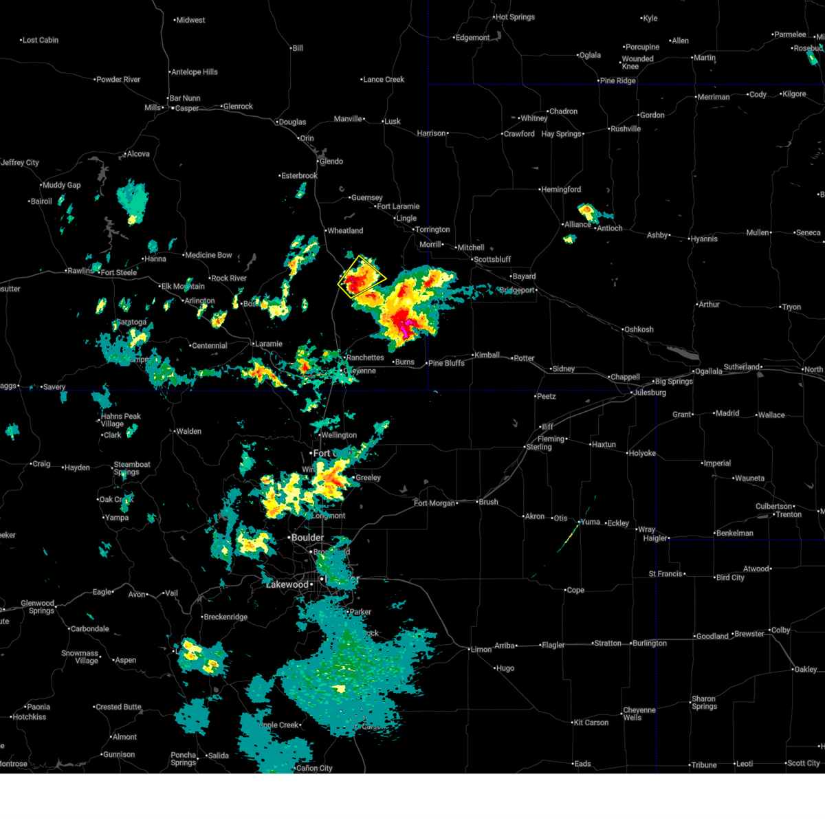 Svrcys the national weather service in cheyenne has issued a * severe thunderstorm warning for, southwestern goshen county in southeastern wyoming, northern laramie county in southeastern wyoming, southeastern platte county in southeastern wyoming, * until 430 pm mdt. * at 348 pm mdt, a severe thunderstorm was located 7 miles southeast of chugwater, or 28 miles southeast of wheatland, moving northeast at 5 mph (radar indicated). Hazards include ping pong ball size hail. People and animals outdoors will be injured. Expect damage to roofs, siding, windows, and vehicles. Svrcys the national weather service in cheyenne has issued a * severe thunderstorm warning for, southwestern goshen county in southeastern wyoming, northern laramie county in southeastern wyoming, southeastern platte county in southeastern wyoming, * until 430 pm mdt. * at 348 pm mdt, a severe thunderstorm was located 7 miles southeast of chugwater, or 28 miles southeast of wheatland, moving northeast at 5 mph (radar indicated). Hazards include ping pong ball size hail. People and animals outdoors will be injured. Expect damage to roofs, siding, windows, and vehicles.
|
| 6/2/2025 4:55 PM MDT |
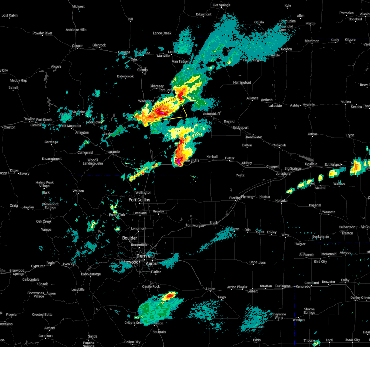 At 455 pm mdt, a severe thunderstorm was located near slater, or 16 miles southeast of wheatland, and is nearly stationary (radar indicated). Hazards include 60 mph wind gusts and half dollar size hail. Hail damage to vehicles is expected. expect wind damage to roofs, siding, and trees. Locations impacted include, lingle, yoder, slater, and veteran. At 455 pm mdt, a severe thunderstorm was located near slater, or 16 miles southeast of wheatland, and is nearly stationary (radar indicated). Hazards include 60 mph wind gusts and half dollar size hail. Hail damage to vehicles is expected. expect wind damage to roofs, siding, and trees. Locations impacted include, lingle, yoder, slater, and veteran.
|
| 6/2/2025 4:50 PM MDT |
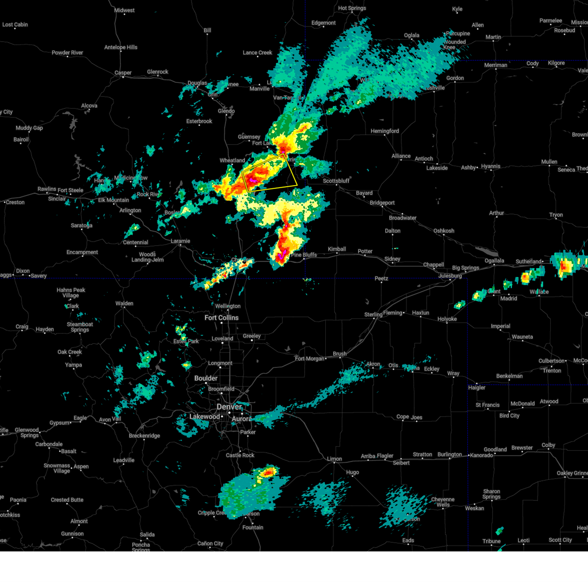 Svrcys the national weather service in cheyenne has issued a * severe thunderstorm warning for, central goshen county in southeastern wyoming, southeastern platte county in southeastern wyoming, * until 530 pm mdt. * at 450 pm mdt, a severe thunderstorm was located near slater, or 16 miles southeast of wheatland, moving east at 35 mph (radar indicated). Hazards include 60 mph wind gusts and half dollar size hail. Hail damage to vehicles is expected. Expect wind damage to roofs, siding, and trees. Svrcys the national weather service in cheyenne has issued a * severe thunderstorm warning for, central goshen county in southeastern wyoming, southeastern platte county in southeastern wyoming, * until 530 pm mdt. * at 450 pm mdt, a severe thunderstorm was located near slater, or 16 miles southeast of wheatland, moving east at 35 mph (radar indicated). Hazards include 60 mph wind gusts and half dollar size hail. Hail damage to vehicles is expected. Expect wind damage to roofs, siding, and trees.
|
| 5/18/2025 4:12 PM MDT |
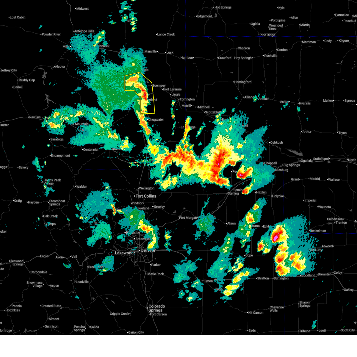 The storms which prompted the warning have weakened below severe limits, and no longer pose an immediate threat to life or property. therefore, the warning will be allowed to expire. however, small hail and gusty winds are still possible with these thunderstorms. The storms which prompted the warning have weakened below severe limits, and no longer pose an immediate threat to life or property. therefore, the warning will be allowed to expire. however, small hail and gusty winds are still possible with these thunderstorms.
|
| 5/18/2025 3:54 PM MDT |
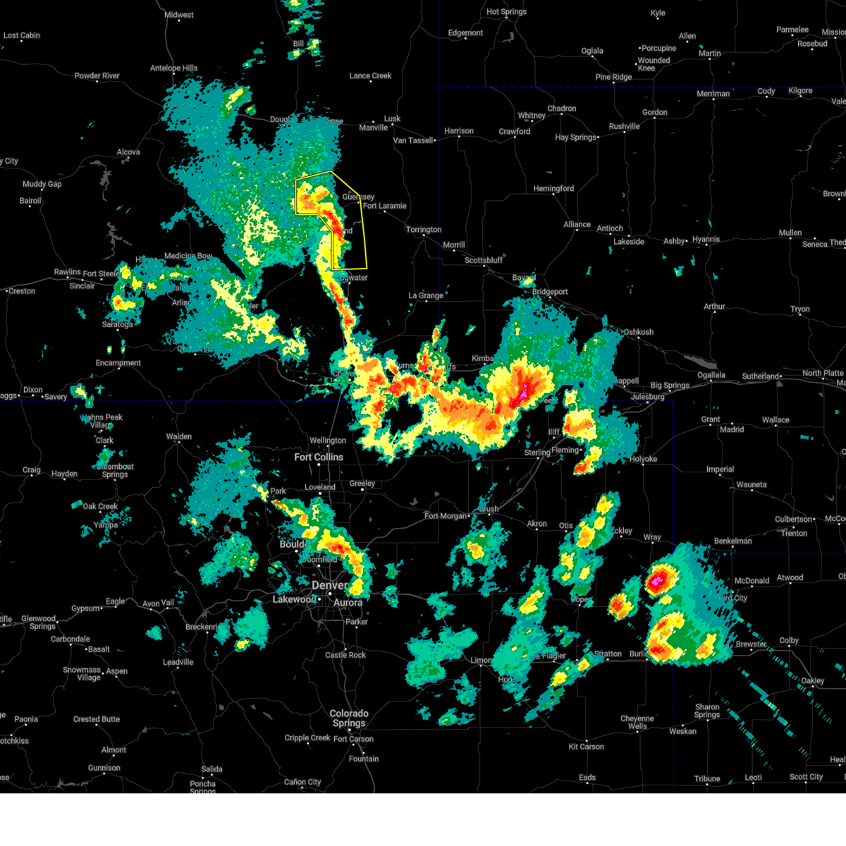 At 354 pm mdt, severe thunderstorms were located along a line extending from near dwyer junction to near lakeview north to near bordeaux, moving northeast at 25 mph (radar indicated). Hazards include 60 mph wind gusts and quarter size hail. Hail damage to vehicles is expected. expect wind damage to roofs, siding, and trees. Locations impacted include, wheatland, guernsey, chugcreek, lakeview north, sibley peak, bordeaux, y-o ranch, sandy cove campground, guernsey state park, phifer airfield, oregon trail ruts state historic site, dwyer junction, slater, grayrocks reservoir, platte county fairgrounds, antelope gap, and cassa. At 354 pm mdt, severe thunderstorms were located along a line extending from near dwyer junction to near lakeview north to near bordeaux, moving northeast at 25 mph (radar indicated). Hazards include 60 mph wind gusts and quarter size hail. Hail damage to vehicles is expected. expect wind damage to roofs, siding, and trees. Locations impacted include, wheatland, guernsey, chugcreek, lakeview north, sibley peak, bordeaux, y-o ranch, sandy cove campground, guernsey state park, phifer airfield, oregon trail ruts state historic site, dwyer junction, slater, grayrocks reservoir, platte county fairgrounds, antelope gap, and cassa.
|
| 5/18/2025 3:28 PM MDT |
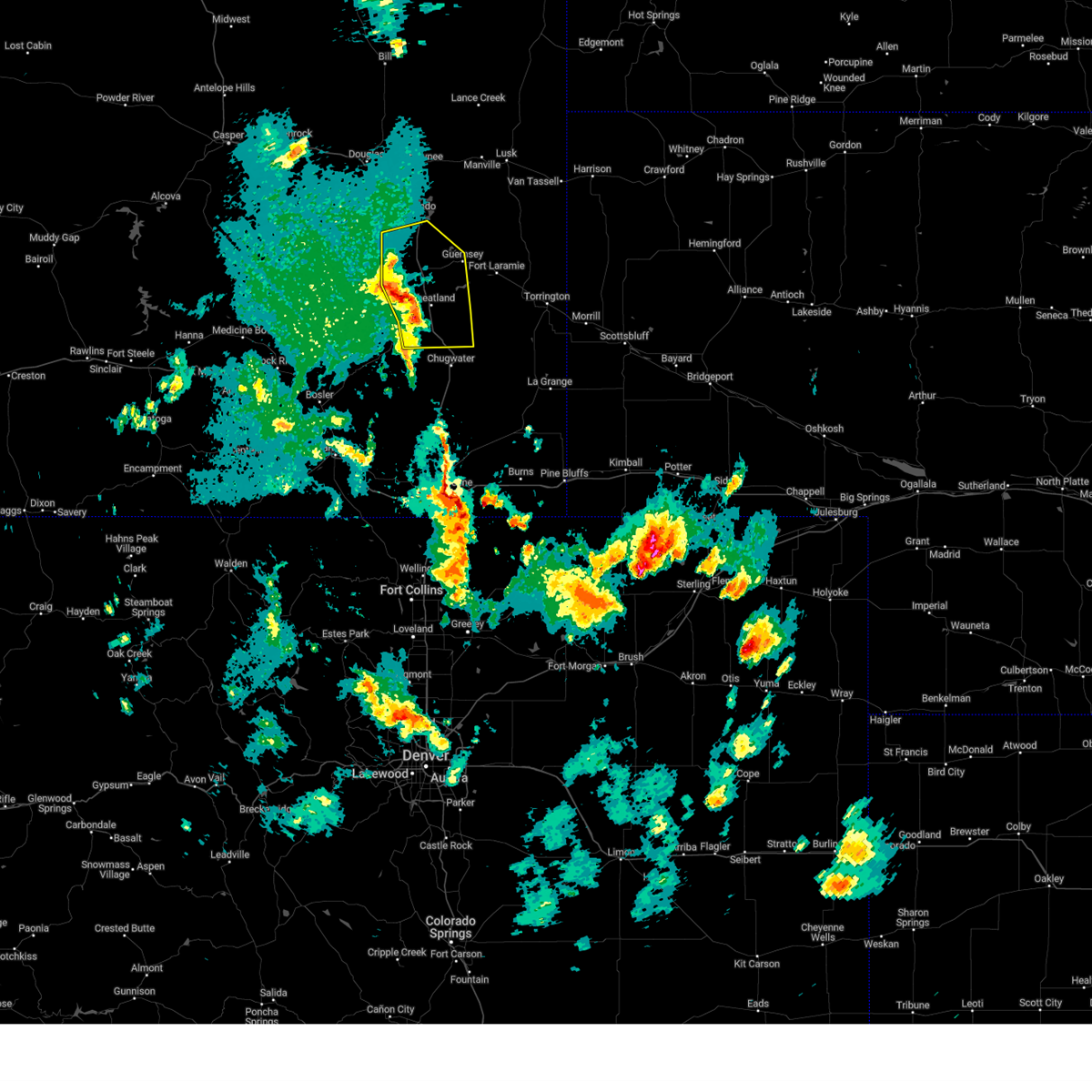 Svrcys the national weather service in cheyenne has issued a * severe thunderstorm warning for, central platte county in southeastern wyoming, * until 415 pm mdt. * at 328 pm mdt, severe thunderstorms were located along a line extending from 9 miles west of dwyer junction to westview circle to 10 miles southwest of bordeaux, moving northeast at 30 mph (radar indicated). Hazards include 60 mph wind gusts and quarter size hail. Hail damage to vehicles is expected. Expect wind damage to roofs, siding, and trees. Svrcys the national weather service in cheyenne has issued a * severe thunderstorm warning for, central platte county in southeastern wyoming, * until 415 pm mdt. * at 328 pm mdt, severe thunderstorms were located along a line extending from 9 miles west of dwyer junction to westview circle to 10 miles southwest of bordeaux, moving northeast at 30 mph (radar indicated). Hazards include 60 mph wind gusts and quarter size hail. Hail damage to vehicles is expected. Expect wind damage to roofs, siding, and trees.
|
| 9/15/2024 5:45 PM MDT |
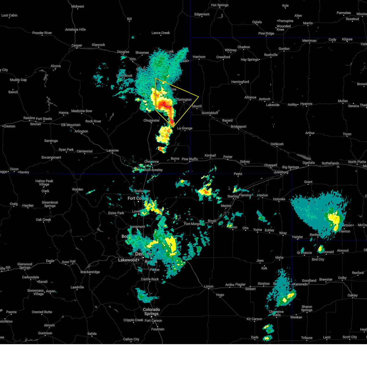 Svrcys the national weather service in cheyenne has issued a * severe thunderstorm warning for, northwestern scotts bluff county in the panhandle of nebraska, southwestern sioux county in the panhandle of nebraska, central goshen county in southeastern wyoming, east central platte county in southeastern wyoming, * until 630 pm mdt. * at 545 pm mdt, a severe thunderstorm was located 7 miles northwest of veteran, or 18 miles west of torrington, moving north at 25 mph (radar indicated). Hazards include 60 mph wind gusts and quarter size hail. Hail damage to vehicles is expected. Expect wind damage to roofs, siding, and trees. Svrcys the national weather service in cheyenne has issued a * severe thunderstorm warning for, northwestern scotts bluff county in the panhandle of nebraska, southwestern sioux county in the panhandle of nebraska, central goshen county in southeastern wyoming, east central platte county in southeastern wyoming, * until 630 pm mdt. * at 545 pm mdt, a severe thunderstorm was located 7 miles northwest of veteran, or 18 miles west of torrington, moving north at 25 mph (radar indicated). Hazards include 60 mph wind gusts and quarter size hail. Hail damage to vehicles is expected. Expect wind damage to roofs, siding, and trees.
|
| 9/15/2024 5:32 PM MDT |
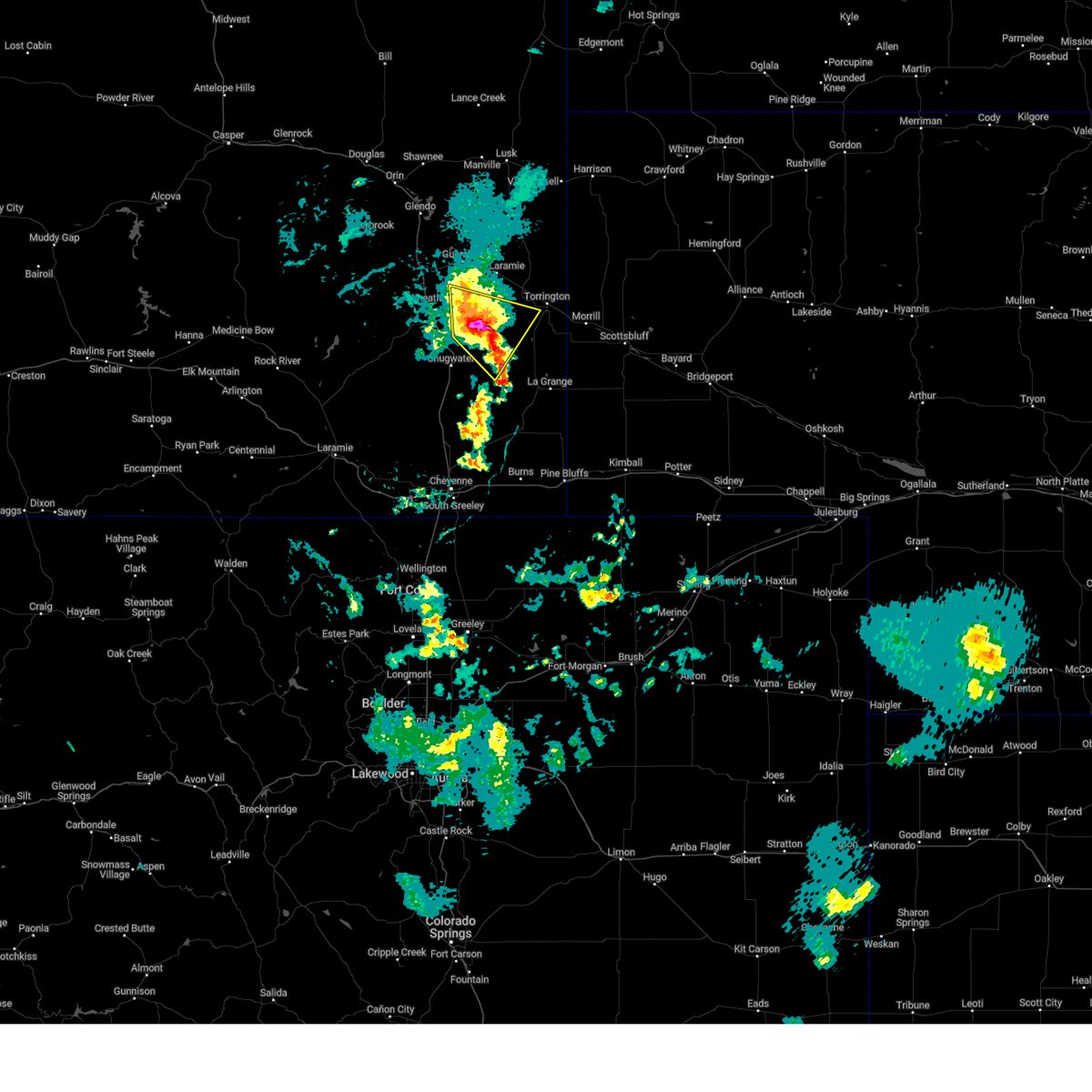 At 532 pm mdt, a severe thunderstorm was located 9 miles southeast of grayrocks reservoir, or 18 miles east of wheatland, moving north at 15 mph (radar indicated). Hazards include two inch hail and 60 mph wind gusts. People and animals outdoors will be injured. expect hail damage to roofs, siding, windows, and vehicles. expect wind damage to roofs, siding, and trees. Locations impacted include, veteran, slater, grayrocks reservoir, and antelope gap. At 532 pm mdt, a severe thunderstorm was located 9 miles southeast of grayrocks reservoir, or 18 miles east of wheatland, moving north at 15 mph (radar indicated). Hazards include two inch hail and 60 mph wind gusts. People and animals outdoors will be injured. expect hail damage to roofs, siding, windows, and vehicles. expect wind damage to roofs, siding, and trees. Locations impacted include, veteran, slater, grayrocks reservoir, and antelope gap.
|
| 9/15/2024 5:28 PM MDT |
 At 527 pm mdt, a severe thunderstorm was located 9 miles southeast of grayrocks reservoir, or 17 miles east of wheatland, moving north at 15 mph (radar indicated). Hazards include two inch hail and 60 mph wind gusts. People and animals outdoors will be injured. expect hail damage to roofs, siding, windows, and vehicles. expect wind damage to roofs, siding, and trees. Locations impacted include, slater, veteran, grayrocks reservoir, and antelope gap. At 527 pm mdt, a severe thunderstorm was located 9 miles southeast of grayrocks reservoir, or 17 miles east of wheatland, moving north at 15 mph (radar indicated). Hazards include two inch hail and 60 mph wind gusts. People and animals outdoors will be injured. expect hail damage to roofs, siding, windows, and vehicles. expect wind damage to roofs, siding, and trees. Locations impacted include, slater, veteran, grayrocks reservoir, and antelope gap.
|
| 9/15/2024 5:15 PM MDT |
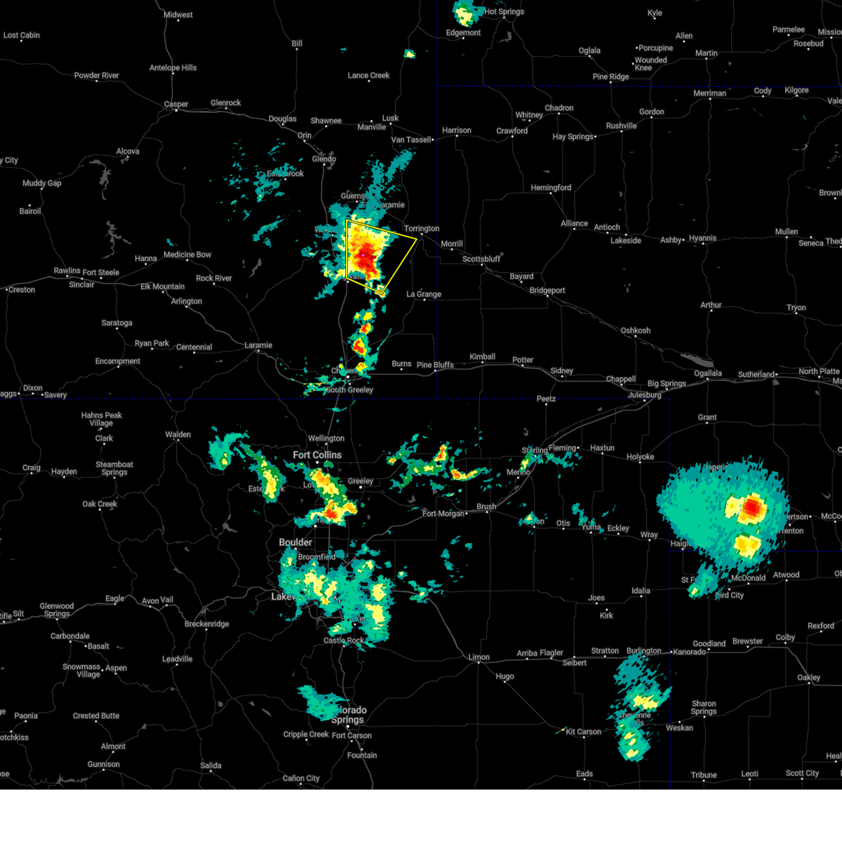 Svrcys the national weather service in cheyenne has issued a * severe thunderstorm warning for, southwestern goshen county in southeastern wyoming, southeastern platte county in southeastern wyoming, * until 545 pm mdt. * at 514 pm mdt, a severe thunderstorm was located 11 miles northeast of slater, or 17 miles east of wheatland, moving north at 15 mph (radar indicated). Hazards include 60 mph wind gusts and quarter size hail. Hail damage to vehicles is expected. Expect wind damage to roofs, siding, and trees. Svrcys the national weather service in cheyenne has issued a * severe thunderstorm warning for, southwestern goshen county in southeastern wyoming, southeastern platte county in southeastern wyoming, * until 545 pm mdt. * at 514 pm mdt, a severe thunderstorm was located 11 miles northeast of slater, or 17 miles east of wheatland, moving north at 15 mph (radar indicated). Hazards include 60 mph wind gusts and quarter size hail. Hail damage to vehicles is expected. Expect wind damage to roofs, siding, and trees.
|
| 9/15/2024 4:46 PM MDT |
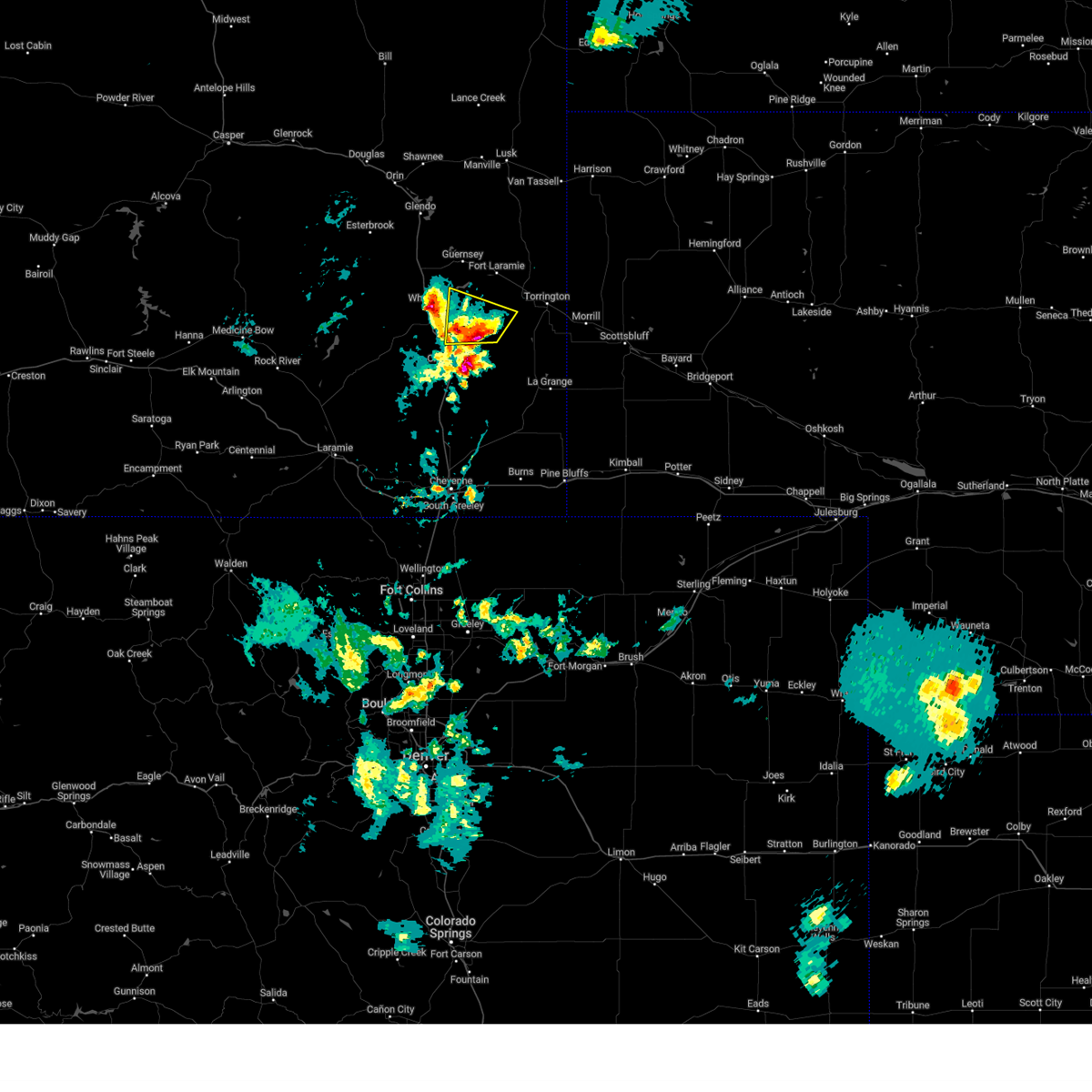 Svrcys the national weather service in cheyenne has issued a * severe thunderstorm warning for, west central goshen county in southeastern wyoming, southeastern platte county in southeastern wyoming, * until 515 pm mdt. * at 446 pm mdt, a severe thunderstorm was located near slater, or 17 miles southeast of wheatland, moving north at 25 mph (radar indicated). Hazards include 60 mph wind gusts and quarter size hail. Hail damage to vehicles is expected. Expect wind damage to roofs, siding, and trees. Svrcys the national weather service in cheyenne has issued a * severe thunderstorm warning for, west central goshen county in southeastern wyoming, southeastern platte county in southeastern wyoming, * until 515 pm mdt. * at 446 pm mdt, a severe thunderstorm was located near slater, or 17 miles southeast of wheatland, moving north at 25 mph (radar indicated). Hazards include 60 mph wind gusts and quarter size hail. Hail damage to vehicles is expected. Expect wind damage to roofs, siding, and trees.
|
| 9/15/2024 4:41 PM MDT |
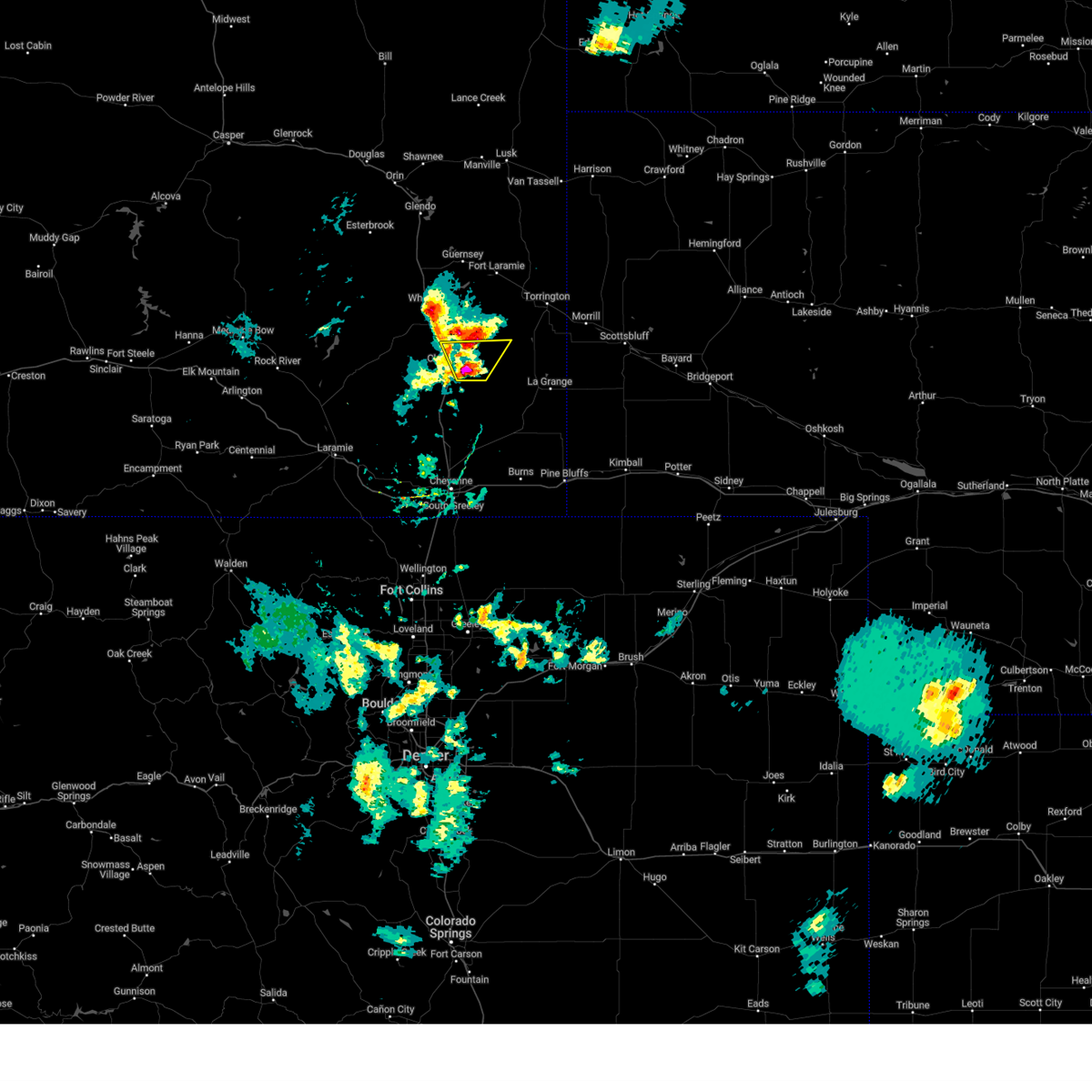 Svrcys the national weather service in cheyenne has issued a * severe thunderstorm warning for, southwestern goshen county in southeastern wyoming, southeastern platte county in southeastern wyoming, * until 515 pm mdt. * at 441 pm mdt, a severe thunderstorm was located near chugwater, or 25 miles southeast of wheatland, moving north at 20 mph (radar indicated). Hazards include 60 mph wind gusts and half dollar size hail. Hail damage to vehicles is expected. Expect wind damage to roofs, siding, and trees. Svrcys the national weather service in cheyenne has issued a * severe thunderstorm warning for, southwestern goshen county in southeastern wyoming, southeastern platte county in southeastern wyoming, * until 515 pm mdt. * at 441 pm mdt, a severe thunderstorm was located near chugwater, or 25 miles southeast of wheatland, moving north at 20 mph (radar indicated). Hazards include 60 mph wind gusts and half dollar size hail. Hail damage to vehicles is expected. Expect wind damage to roofs, siding, and trees.
|
| 9/15/2024 4:31 PM MDT |
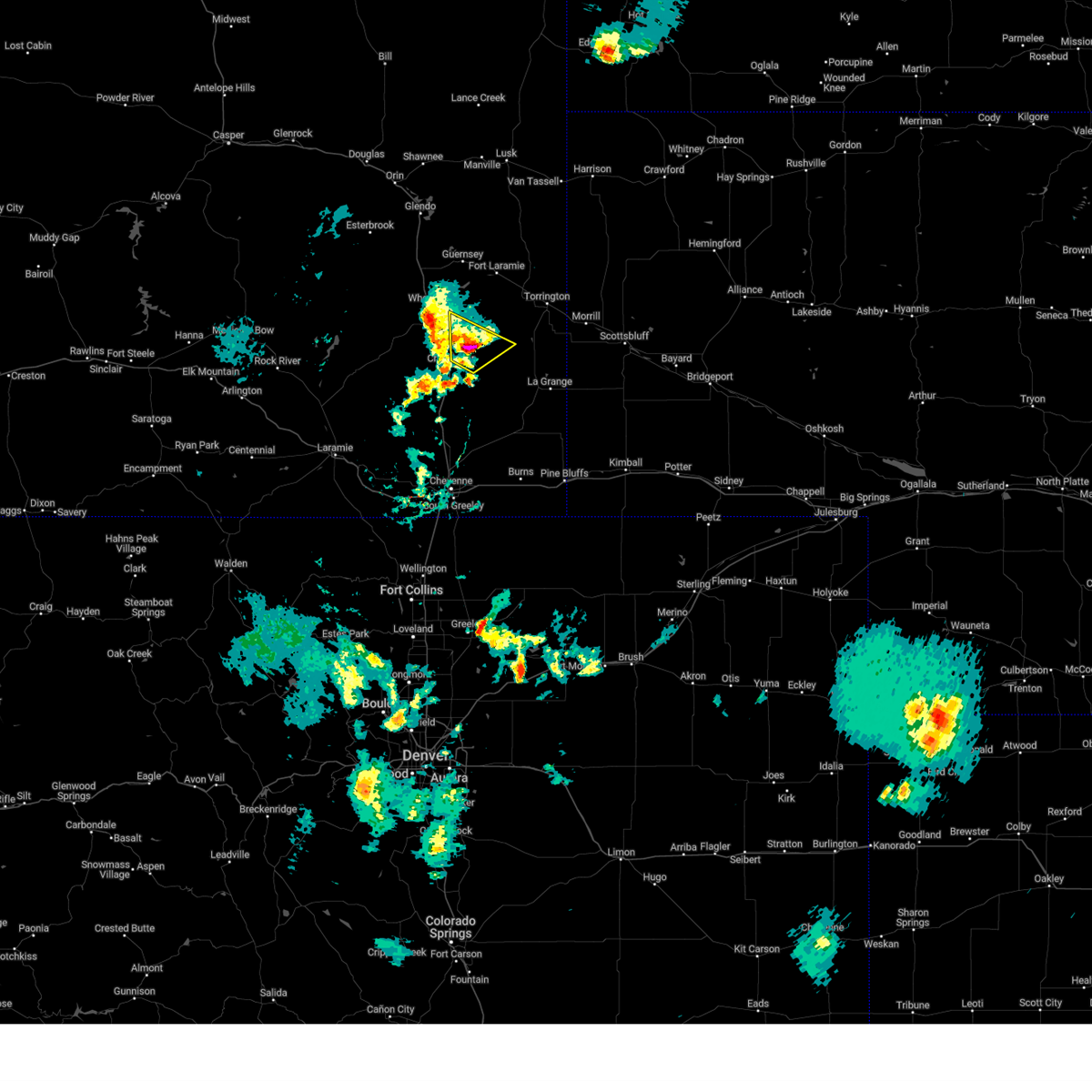 At 431 pm mdt, a severe thunderstorm was located 8 miles southeast of slater, or 22 miles southeast of wheatland, moving northeast at 10 mph (radar indicated). Hazards include 60 mph wind gusts and half dollar size hail. Hail damage to vehicles is expected. expect wind damage to roofs, siding, and trees. weakened. Locations impacted include, slater. At 431 pm mdt, a severe thunderstorm was located 8 miles southeast of slater, or 22 miles southeast of wheatland, moving northeast at 10 mph (radar indicated). Hazards include 60 mph wind gusts and half dollar size hail. Hail damage to vehicles is expected. expect wind damage to roofs, siding, and trees. weakened. Locations impacted include, slater.
|
| 9/15/2024 4:30 PM MDT |
 At 430 pm mdt, a severe thunderstorm was located near wheatland, moving northwest at 20 mph (radar indicated). Hazards include 60 mph wind gusts and quarter size hail. Hail damage to vehicles is expected. expect wind damage to roofs, siding, and trees. Locations impacted include, wheatland, phifer airfield, chugcreek, bordeaux, y-o ranch, slater, and platte county fairgrounds. At 430 pm mdt, a severe thunderstorm was located near wheatland, moving northwest at 20 mph (radar indicated). Hazards include 60 mph wind gusts and quarter size hail. Hail damage to vehicles is expected. expect wind damage to roofs, siding, and trees. Locations impacted include, wheatland, phifer airfield, chugcreek, bordeaux, y-o ranch, slater, and platte county fairgrounds.
|
| 9/15/2024 4:15 PM MDT |
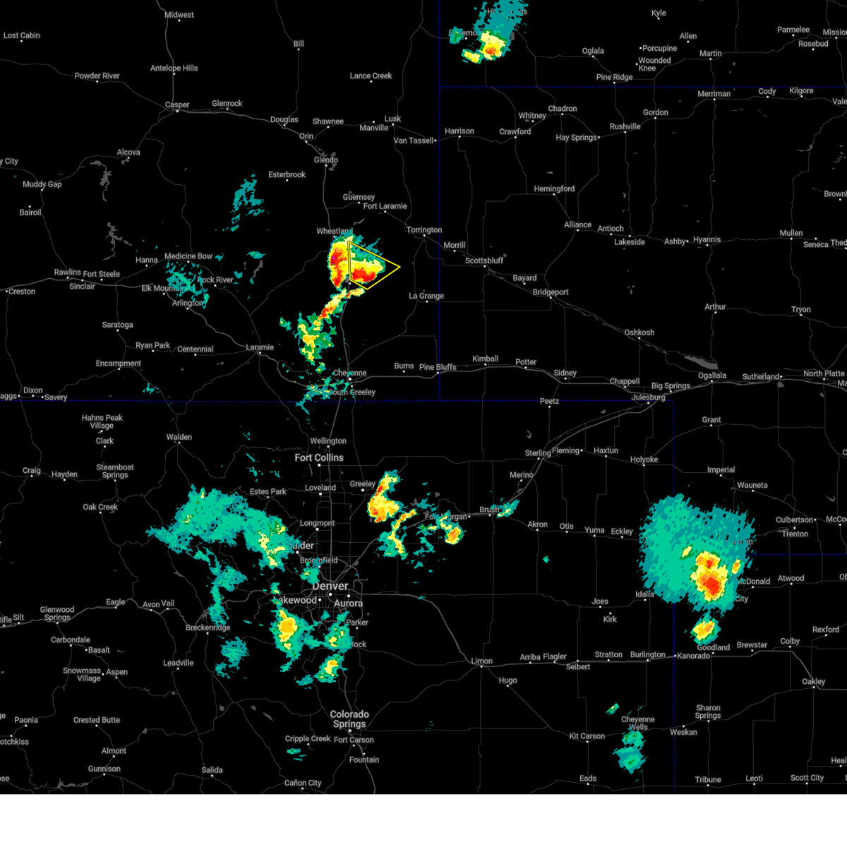 Svrcys the national weather service in cheyenne has issued a * severe thunderstorm warning for, southwestern goshen county in southeastern wyoming, southeastern platte county in southeastern wyoming, * until 445 pm mdt. * at 415 pm mdt, a severe thunderstorm was located 8 miles east of chugwater, or 23 miles southeast of wheatland, moving northeast at 10 mph (radar indicated). Hazards include 60 mph wind gusts and quarter size hail. Hail damage to vehicles is expected. Expect wind damage to roofs, siding, and trees. Svrcys the national weather service in cheyenne has issued a * severe thunderstorm warning for, southwestern goshen county in southeastern wyoming, southeastern platte county in southeastern wyoming, * until 445 pm mdt. * at 415 pm mdt, a severe thunderstorm was located 8 miles east of chugwater, or 23 miles southeast of wheatland, moving northeast at 10 mph (radar indicated). Hazards include 60 mph wind gusts and quarter size hail. Hail damage to vehicles is expected. Expect wind damage to roofs, siding, and trees.
|
| 9/15/2024 4:13 PM MDT |
 Svrcys the national weather service in cheyenne has issued a * severe thunderstorm warning for, southwestern platte county in southeastern wyoming, * until 445 pm mdt. * at 413 pm mdt, a severe thunderstorm was located over bordeaux, or 8 miles south of wheatland, moving northwest at 20 mph (radar indicated). Hazards include 60 mph wind gusts and quarter size hail. Hail damage to vehicles is expected. Expect wind damage to roofs, siding, and trees. Svrcys the national weather service in cheyenne has issued a * severe thunderstorm warning for, southwestern platte county in southeastern wyoming, * until 445 pm mdt. * at 413 pm mdt, a severe thunderstorm was located over bordeaux, or 8 miles south of wheatland, moving northwest at 20 mph (radar indicated). Hazards include 60 mph wind gusts and quarter size hail. Hail damage to vehicles is expected. Expect wind damage to roofs, siding, and trees.
|
| 9/15/2024 3:55 PM MDT |
 At 354 pm mdt, a severe thunderstorm was located near slater, or 20 miles southeast of wheatland, moving north at 25 mph (radar indicated). Hazards include 60 mph wind gusts and quarter size hail. Hail damage to vehicles is expected. expect wind damage to roofs, siding, and trees. Locations impacted include, chugwater, slater, and bordeaux. At 354 pm mdt, a severe thunderstorm was located near slater, or 20 miles southeast of wheatland, moving north at 25 mph (radar indicated). Hazards include 60 mph wind gusts and quarter size hail. Hail damage to vehicles is expected. expect wind damage to roofs, siding, and trees. Locations impacted include, chugwater, slater, and bordeaux.
|
| 9/15/2024 3:55 PM MDT |
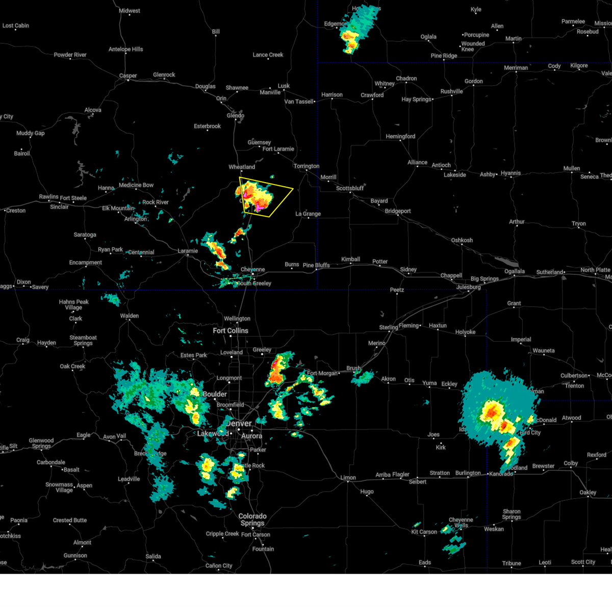 the severe thunderstorm warning has been cancelled and is no longer in effect the severe thunderstorm warning has been cancelled and is no longer in effect
|
| 9/15/2024 3:39 PM MDT |
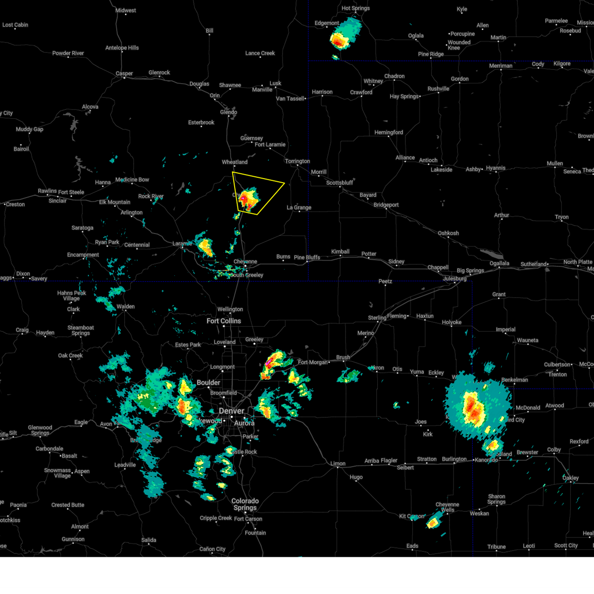 Svrcys the national weather service in cheyenne has issued a * severe thunderstorm warning for, southwestern goshen county in southeastern wyoming, northern laramie county in southeastern wyoming, southeastern platte county in southeastern wyoming, * until 415 pm mdt. * at 338 pm mdt, a severe thunderstorm was located near chugwater, or 25 miles southeast of wheatland, moving north at 25 mph (radar indicated). Hazards include 60 mph wind gusts and quarter size hail. Hail damage to vehicles is expected. Expect wind damage to roofs, siding, and trees. Svrcys the national weather service in cheyenne has issued a * severe thunderstorm warning for, southwestern goshen county in southeastern wyoming, northern laramie county in southeastern wyoming, southeastern platte county in southeastern wyoming, * until 415 pm mdt. * at 338 pm mdt, a severe thunderstorm was located near chugwater, or 25 miles southeast of wheatland, moving north at 25 mph (radar indicated). Hazards include 60 mph wind gusts and quarter size hail. Hail damage to vehicles is expected. Expect wind damage to roofs, siding, and trees.
|
| 9/4/2024 2:55 PM MDT |
 The storms which prompted the warning have weakened below severe limits, and no longer pose an immediate threat to life or property. therefore, the warning will be allowed to expire. however, small hail and gusty winds are still possible with these thunderstorms. to report severe weather, contact your nearest law enforcement agency. they will relay your report to the national weather service cheyenne. The storms which prompted the warning have weakened below severe limits, and no longer pose an immediate threat to life or property. therefore, the warning will be allowed to expire. however, small hail and gusty winds are still possible with these thunderstorms. to report severe weather, contact your nearest law enforcement agency. they will relay your report to the national weather service cheyenne.
|
| 9/4/2024 2:46 PM MDT |
 At 246 pm mdt, severe thunderstorms were located along a line extending from near lakeview north to near bordeaux, moving east at 25 mph (radar indicated). Hazards include 60 mph wind gusts and penny size hail. Expect damage to roofs, siding, and trees. Locations impacted include, wheatland, chugwater, phifer airfield, chugcreek, lakeview north, bordeaux, y-o ranch, slater, grayrocks reservoir, platte county fairgrounds, and antelope gap. At 246 pm mdt, severe thunderstorms were located along a line extending from near lakeview north to near bordeaux, moving east at 25 mph (radar indicated). Hazards include 60 mph wind gusts and penny size hail. Expect damage to roofs, siding, and trees. Locations impacted include, wheatland, chugwater, phifer airfield, chugcreek, lakeview north, bordeaux, y-o ranch, slater, grayrocks reservoir, platte county fairgrounds, and antelope gap.
|
| 9/4/2024 2:18 PM MDT |
 Svrcys the national weather service in cheyenne has issued a * severe thunderstorm warning for, southern platte county in southeastern wyoming, * until 300 pm mdt. * at 218 pm mdt, severe thunderstorms were located along a line extending from 6 miles southwest of dwyer junction to 9 miles west of bordeaux, moving east at 25 mph (radar indicated). Hazards include 60 mph wind gusts and penny size hail. expect damage to roofs, siding, and trees Svrcys the national weather service in cheyenne has issued a * severe thunderstorm warning for, southern platte county in southeastern wyoming, * until 300 pm mdt. * at 218 pm mdt, severe thunderstorms were located along a line extending from 6 miles southwest of dwyer junction to 9 miles west of bordeaux, moving east at 25 mph (radar indicated). Hazards include 60 mph wind gusts and penny size hail. expect damage to roofs, siding, and trees
|
| 8/2/2024 4:07 PM MDT |
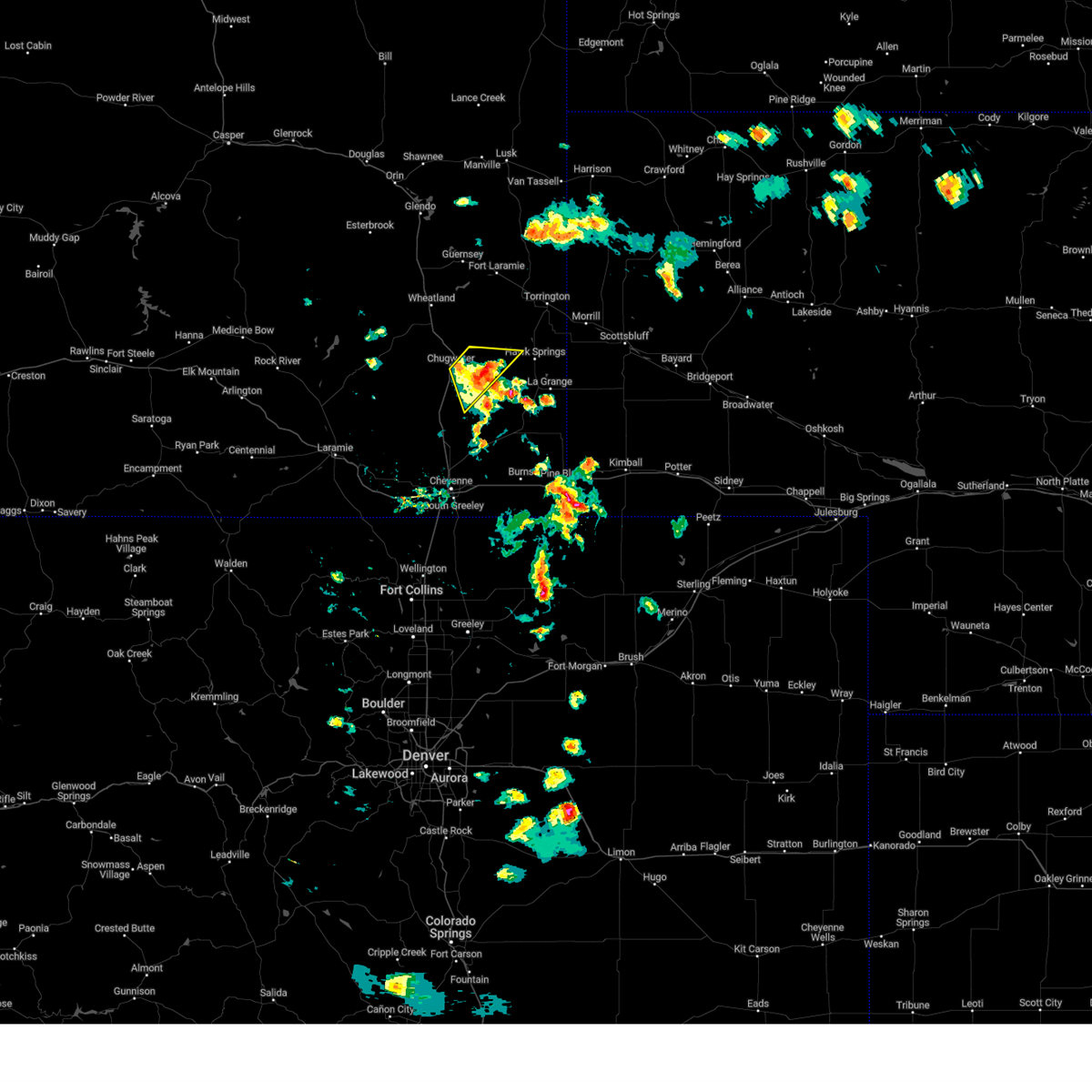 the severe thunderstorm warning has been cancelled and is no longer in effect the severe thunderstorm warning has been cancelled and is no longer in effect
|
| 8/2/2024 3:54 PM MDT |
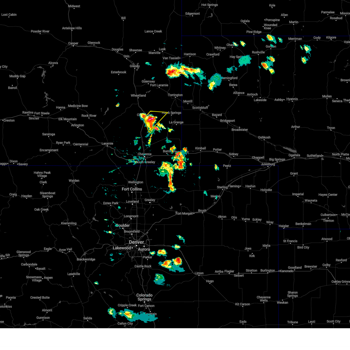 At 354 pm mdt, a severe thunderstorm was located 7 miles east of chugwater, or 27 miles southeast of wheatland, moving southeast at 15 mph (radar indicated). Hazards include 60 mph wind gusts and quarter size hail. Hail damage to vehicles is expected. expect wind damage to roofs, siding, and trees. This severe thunderstorm will remain over mainly rural areas of southwestern goshen, northern laramie and southeastern platte counties. At 354 pm mdt, a severe thunderstorm was located 7 miles east of chugwater, or 27 miles southeast of wheatland, moving southeast at 15 mph (radar indicated). Hazards include 60 mph wind gusts and quarter size hail. Hail damage to vehicles is expected. expect wind damage to roofs, siding, and trees. This severe thunderstorm will remain over mainly rural areas of southwestern goshen, northern laramie and southeastern platte counties.
|
| 8/2/2024 3:33 PM MDT |
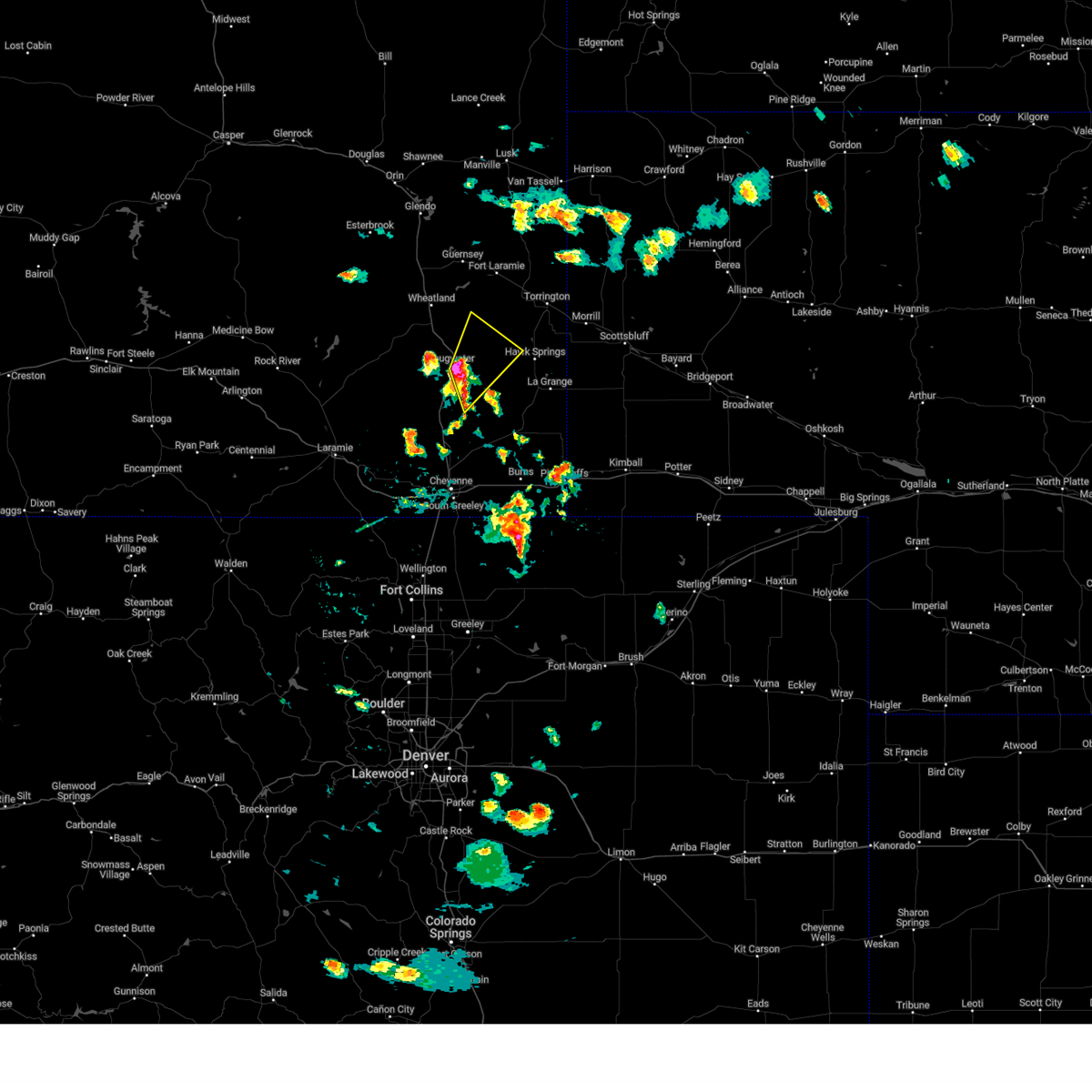 Svrcys the national weather service in cheyenne has issued a * severe thunderstorm warning for, southwestern goshen county in southeastern wyoming, northern laramie county in southeastern wyoming, southeastern platte county in southeastern wyoming, * until 430 pm mdt. * at 333 pm mdt, a severe thunderstorm was located near chugwater, or 22 miles southeast of wheatland, moving northeast at 15 mph (radar indicated). Hazards include 60 mph wind gusts and quarter size hail. Hail damage to vehicles is expected. expect wind damage to roofs, siding, and trees. This severe thunderstorm will be near, slater around 340 pm mdt. Svrcys the national weather service in cheyenne has issued a * severe thunderstorm warning for, southwestern goshen county in southeastern wyoming, northern laramie county in southeastern wyoming, southeastern platte county in southeastern wyoming, * until 430 pm mdt. * at 333 pm mdt, a severe thunderstorm was located near chugwater, or 22 miles southeast of wheatland, moving northeast at 15 mph (radar indicated). Hazards include 60 mph wind gusts and quarter size hail. Hail damage to vehicles is expected. expect wind damage to roofs, siding, and trees. This severe thunderstorm will be near, slater around 340 pm mdt.
|
| 7/27/2024 6:14 PM MDT |
 The storms which prompted the warning have moved out of the area. therefore, the warning will be allowed to expire. however, gusty winds and heavy rain are still possible with these thunderstorms. remember, a severe thunderstorm warning still remains in effect for converse, niobrara, goshen, sioux, and scotts bluff counties until 645 pm. The storms which prompted the warning have moved out of the area. therefore, the warning will be allowed to expire. however, gusty winds and heavy rain are still possible with these thunderstorms. remember, a severe thunderstorm warning still remains in effect for converse, niobrara, goshen, sioux, and scotts bluff counties until 645 pm.
|
| 7/27/2024 5:35 PM MDT |
 the severe thunderstorm warning has been cancelled and is no longer in effect the severe thunderstorm warning has been cancelled and is no longer in effect
|
| 7/27/2024 5:33 PM MDT |
 Svrcys the national weather service in cheyenne has issued a * severe thunderstorm warning for, western scotts bluff county in the panhandle of nebraska, southwestern sioux county in the panhandle of nebraska, southern goshen county in southeastern wyoming, east central platte county in southeastern wyoming, * until 615 pm mdt. * at 532 pm mdt, severe thunderstorms were located along a line extending from chugcreek to 6 miles west of veteran to 6 miles west of wycross, moving northeast at 35 mph (radar indicated). Hazards include 60 mph wind gusts. expect damage to roofs, siding, and trees Svrcys the national weather service in cheyenne has issued a * severe thunderstorm warning for, western scotts bluff county in the panhandle of nebraska, southwestern sioux county in the panhandle of nebraska, southern goshen county in southeastern wyoming, east central platte county in southeastern wyoming, * until 615 pm mdt. * at 532 pm mdt, severe thunderstorms were located along a line extending from chugcreek to 6 miles west of veteran to 6 miles west of wycross, moving northeast at 35 mph (radar indicated). Hazards include 60 mph wind gusts. expect damage to roofs, siding, and trees
|
| 7/27/2024 5:20 PM MDT |
 At 519 pm mdt, severe thunderstorms were located along a line extending from 8 miles southwest of bordeaux to near slater to 13 miles southeast of chugwater, moving east at 20 mph (public. at 516pm, a wind gust of 70 mph was reported at bordeaux along interstate 25). Hazards include 70 mph wind gusts and penny size hail. Expect considerable tree damage. damage is likely to mobile homes, roofs, and outbuildings. Locations impacted include, wheatland, chugwater, phifer airfield, chugcreek, bordeaux, westview circle, y-o ranch, slater, lakeview north, platte county fairgrounds, and antelope gap. At 519 pm mdt, severe thunderstorms were located along a line extending from 8 miles southwest of bordeaux to near slater to 13 miles southeast of chugwater, moving east at 20 mph (public. at 516pm, a wind gust of 70 mph was reported at bordeaux along interstate 25). Hazards include 70 mph wind gusts and penny size hail. Expect considerable tree damage. damage is likely to mobile homes, roofs, and outbuildings. Locations impacted include, wheatland, chugwater, phifer airfield, chugcreek, bordeaux, westview circle, y-o ranch, slater, lakeview north, platte county fairgrounds, and antelope gap.
|
| 7/27/2024 5:05 PM MDT |
 Svrcys the national weather service in cheyenne has issued a * severe thunderstorm warning for, southwestern goshen county in southeastern wyoming, northern laramie county in southeastern wyoming, southern platte county in southeastern wyoming, * until 600 pm mdt. * at 505 pm mdt, severe thunderstorms were located along a line extending from 10 miles east of flying x ranch to near chugwater to 12 miles northeast of whitaker, moving northeast at 20 mph (radar indicated). Hazards include 60 mph wind gusts and penny size hail. expect damage to roofs, siding, and trees Svrcys the national weather service in cheyenne has issued a * severe thunderstorm warning for, southwestern goshen county in southeastern wyoming, northern laramie county in southeastern wyoming, southern platte county in southeastern wyoming, * until 600 pm mdt. * at 505 pm mdt, severe thunderstorms were located along a line extending from 10 miles east of flying x ranch to near chugwater to 12 miles northeast of whitaker, moving northeast at 20 mph (radar indicated). Hazards include 60 mph wind gusts and penny size hail. expect damage to roofs, siding, and trees
|
| 7/20/2024 4:27 PM MDT |
 At 427 pm mdt, a severe thunderstorm was located 11 miles southwest of veteran, or 23 miles southwest of torrington, moving south at 25 mph (radar indicated). Hazards include 60 mph wind gusts and quarter size hail. Hail damage to vehicles is expected. expect wind damage to roofs, siding, and trees. Locations impacted include, yoder, veteran, hawk springs, and slater. At 427 pm mdt, a severe thunderstorm was located 11 miles southwest of veteran, or 23 miles southwest of torrington, moving south at 25 mph (radar indicated). Hazards include 60 mph wind gusts and quarter size hail. Hail damage to vehicles is expected. expect wind damage to roofs, siding, and trees. Locations impacted include, yoder, veteran, hawk springs, and slater.
|
| 7/20/2024 4:12 PM MDT |
 At 411 pm mdt, a severe thunderstorm was located 8 miles west of veteran, or 21 miles southwest of torrington, moving south at 25 mph (radar indicated). Hazards include 60 mph wind gusts and quarter size hail. Hail damage to vehicles is expected. expect wind damage to roofs, siding, and trees. Locations impacted include, yoder, veteran, hawk springs, and slater. At 411 pm mdt, a severe thunderstorm was located 8 miles west of veteran, or 21 miles southwest of torrington, moving south at 25 mph (radar indicated). Hazards include 60 mph wind gusts and quarter size hail. Hail damage to vehicles is expected. expect wind damage to roofs, siding, and trees. Locations impacted include, yoder, veteran, hawk springs, and slater.
|
| 7/20/2024 3:59 PM MDT |
 Svrcys the national weather service in cheyenne has issued a * severe thunderstorm warning for, southern goshen county in southeastern wyoming, southeastern platte county in southeastern wyoming, * until 445 pm mdt. * at 359 pm mdt, a severe thunderstorm was located 10 miles west of veteran, or 19 miles east of wheatland, moving south at 25 mph (radar indicated). Hazards include 60 mph wind gusts and penny size hail. expect damage to roofs, siding, and trees Svrcys the national weather service in cheyenne has issued a * severe thunderstorm warning for, southern goshen county in southeastern wyoming, southeastern platte county in southeastern wyoming, * until 445 pm mdt. * at 359 pm mdt, a severe thunderstorm was located 10 miles west of veteran, or 19 miles east of wheatland, moving south at 25 mph (radar indicated). Hazards include 60 mph wind gusts and penny size hail. expect damage to roofs, siding, and trees
|
| 7/19/2024 5:55 PM MDT |
 Svrcys the national weather service in cheyenne has issued a * severe thunderstorm warning for, southwestern goshen county in southeastern wyoming, north central laramie county in southeastern wyoming, southeastern platte county in southeastern wyoming, * until 645 pm mdt. * at 555 pm mdt, a severe thunderstorm was located over chugwater, or 19 miles south of wheatland, moving south at 30 mph (radar indicated). Hazards include 60 mph wind gusts and penny size hail. expect damage to roofs, siding, and trees Svrcys the national weather service in cheyenne has issued a * severe thunderstorm warning for, southwestern goshen county in southeastern wyoming, north central laramie county in southeastern wyoming, southeastern platte county in southeastern wyoming, * until 645 pm mdt. * at 555 pm mdt, a severe thunderstorm was located over chugwater, or 19 miles south of wheatland, moving south at 30 mph (radar indicated). Hazards include 60 mph wind gusts and penny size hail. expect damage to roofs, siding, and trees
|
| 7/15/2024 7:36 PM MDT |
 the severe thunderstorm warning has been cancelled and is no longer in effect the severe thunderstorm warning has been cancelled and is no longer in effect
|
| 7/15/2024 7:03 PM MDT |
 Svrcys the national weather service in cheyenne has issued a * severe thunderstorm warning for, southwestern goshen county in southeastern wyoming, north central laramie county in southeastern wyoming, southeastern platte county in southeastern wyoming, * until 800 pm mdt. * at 703 pm mdt, severe thunderstorms were located along a line extending from lakeview north to 13 miles northeast of whitaker, moving east at 35 mph (radar and highway weather observations). Hazards include 70 mph wind gusts. Expect considerable tree damage. Damage is likely to mobile homes, roofs, and outbuildings. Svrcys the national weather service in cheyenne has issued a * severe thunderstorm warning for, southwestern goshen county in southeastern wyoming, north central laramie county in southeastern wyoming, southeastern platte county in southeastern wyoming, * until 800 pm mdt. * at 703 pm mdt, severe thunderstorms were located along a line extending from lakeview north to 13 miles northeast of whitaker, moving east at 35 mph (radar and highway weather observations). Hazards include 70 mph wind gusts. Expect considerable tree damage. Damage is likely to mobile homes, roofs, and outbuildings.
|
| 6/20/2024 3:04 PM MDT |
 the severe thunderstorm warning has been cancelled and is no longer in effect the severe thunderstorm warning has been cancelled and is no longer in effect
|
| 6/20/2024 3:00 PM MDT |
 the severe thunderstorm warning has been cancelled and is no longer in effect the severe thunderstorm warning has been cancelled and is no longer in effect
|
| 6/20/2024 2:40 PM MDT |
 At 240 pm mdt, a severe thunderstorm was located 9 miles west of veteran, or 21 miles southeast of wheatland, moving east at 25 mph (trained weather spotters. this storm has a history of producing large amounts of quarter to golf ball sized hail). Hazards include tennis ball size hail and 60 mph wind gusts. People and animals outdoors will be injured. expect hail damage to roofs, siding, windows, and vehicles. expect wind damage to roofs, siding, and trees. Locations impacted include, slater and veteran. At 240 pm mdt, a severe thunderstorm was located 9 miles west of veteran, or 21 miles southeast of wheatland, moving east at 25 mph (trained weather spotters. this storm has a history of producing large amounts of quarter to golf ball sized hail). Hazards include tennis ball size hail and 60 mph wind gusts. People and animals outdoors will be injured. expect hail damage to roofs, siding, windows, and vehicles. expect wind damage to roofs, siding, and trees. Locations impacted include, slater and veteran.
|
| 6/20/2024 2:28 PM MDT |
 Svrcys the national weather service in cheyenne has issued a * severe thunderstorm warning for, central platte county in southeastern wyoming, * until 315 pm mdt. * at 228 pm mdt, a severe thunderstorm was located over y-o ranch, or over wheatland, moving north at 25 mph (radar indicated). Hazards include 60 mph wind gusts and quarter size hail. Hail damage to vehicles is expected. Expect wind damage to roofs, siding, and trees. Svrcys the national weather service in cheyenne has issued a * severe thunderstorm warning for, central platte county in southeastern wyoming, * until 315 pm mdt. * at 228 pm mdt, a severe thunderstorm was located over y-o ranch, or over wheatland, moving north at 25 mph (radar indicated). Hazards include 60 mph wind gusts and quarter size hail. Hail damage to vehicles is expected. Expect wind damage to roofs, siding, and trees.
|
| 6/20/2024 2:26 PM MDT |
 Svrcys the national weather service in cheyenne has issued a * severe thunderstorm warning for, southwestern goshen county in southeastern wyoming, southeastern platte county in southeastern wyoming, * until 315 pm mdt. * at 225 pm mdt, a severe thunderstorm was located over slater, or 15 miles southeast of wheatland, moving east at 15 mph (trained weather spotters. golf ball sized hail was reported along interstate 25 north of chugwater with this storm). Hazards include tennis ball size hail and 60 mph wind gusts. People and animals outdoors will be injured. expect hail damage to roofs, siding, windows, and vehicles. Expect wind damage to roofs, siding, and trees. Svrcys the national weather service in cheyenne has issued a * severe thunderstorm warning for, southwestern goshen county in southeastern wyoming, southeastern platte county in southeastern wyoming, * until 315 pm mdt. * at 225 pm mdt, a severe thunderstorm was located over slater, or 15 miles southeast of wheatland, moving east at 15 mph (trained weather spotters. golf ball sized hail was reported along interstate 25 north of chugwater with this storm). Hazards include tennis ball size hail and 60 mph wind gusts. People and animals outdoors will be injured. expect hail damage to roofs, siding, windows, and vehicles. Expect wind damage to roofs, siding, and trees.
|
| 6/20/2024 2:12 PM MDT |
 At 211 pm mdt, a severe thunderstorm was located near slater, or 15 miles southeast of wheatland, moving east at 10 mph (radar indicated). Hazards include tennis ball size hail and 60 mph wind gusts. People and animals outdoors will be injured. expect hail damage to roofs, siding, windows, and vehicles. expect wind damage to roofs, siding, and trees. Locations impacted include, chugwater, slater, and bordeaux. At 211 pm mdt, a severe thunderstorm was located near slater, or 15 miles southeast of wheatland, moving east at 10 mph (radar indicated). Hazards include tennis ball size hail and 60 mph wind gusts. People and animals outdoors will be injured. expect hail damage to roofs, siding, windows, and vehicles. expect wind damage to roofs, siding, and trees. Locations impacted include, chugwater, slater, and bordeaux.
|
| 6/20/2024 1:58 PM MDT |
 At 158 pm mdt, a severe thunderstorm was located near chugwater, or 16 miles south of wheatland, moving northeast at 10 mph (radar indicated). Hazards include two inch hail and 60 mph wind gusts. People and animals outdoors will be injured. expect hail damage to roofs, siding, windows, and vehicles. expect wind damage to roofs, siding, and trees. Locations impacted include, chugwater, slater, and bordeaux. At 158 pm mdt, a severe thunderstorm was located near chugwater, or 16 miles south of wheatland, moving northeast at 10 mph (radar indicated). Hazards include two inch hail and 60 mph wind gusts. People and animals outdoors will be injured. expect hail damage to roofs, siding, windows, and vehicles. expect wind damage to roofs, siding, and trees. Locations impacted include, chugwater, slater, and bordeaux.
|
| 6/20/2024 1:50 PM MDT |
 Svrcys the national weather service in cheyenne has issued a * severe thunderstorm warning for, southeastern platte county in southeastern wyoming, * until 230 pm mdt. * at 150 pm mdt, a severe thunderstorm was located 7 miles northwest of chugwater, or 17 miles south of wheatland, moving northeast at 10 mph (radar indicated). Hazards include ping pong ball size hail and 60 mph wind gusts. People and animals outdoors will be injured. expect hail damage to roofs, siding, windows, and vehicles. Expect wind damage to roofs, siding, and trees. Svrcys the national weather service in cheyenne has issued a * severe thunderstorm warning for, southeastern platte county in southeastern wyoming, * until 230 pm mdt. * at 150 pm mdt, a severe thunderstorm was located 7 miles northwest of chugwater, or 17 miles south of wheatland, moving northeast at 10 mph (radar indicated). Hazards include ping pong ball size hail and 60 mph wind gusts. People and animals outdoors will be injured. expect hail damage to roofs, siding, windows, and vehicles. Expect wind damage to roofs, siding, and trees.
|
| 8/7/2023 3:48 PM MDT |
 At 348 pm mdt, a severe thunderstorm was located 10 miles east of slater, or 24 miles southeast of wheatland, moving east at 40 mph (radar indicated). Hazards include 60 mph wind gusts and quarter size hail. Hail damage to vehicles is expected. Expect wind damage to roofs, siding, and trees. At 348 pm mdt, a severe thunderstorm was located 10 miles east of slater, or 24 miles southeast of wheatland, moving east at 40 mph (radar indicated). Hazards include 60 mph wind gusts and quarter size hail. Hail damage to vehicles is expected. Expect wind damage to roofs, siding, and trees.
|
| 8/7/2023 3:33 PM MDT |
 At 333 pm mdt, a severe thunderstorm was located over slater, or 14 miles southeast of wheatland, moving southeast at 30 mph (radar indicated). Hazards include 60 mph wind gusts and quarter size hail. Hail damage to vehicles is expected. expect wind damage to roofs, siding, and trees. locations impacted include, slater. this includes interstate 25 in wyoming between mile markers 59 and 61. hail threat, radar indicated max hail size, 1. 00 in wind threat, radar indicated max wind gust, 60 mph. At 333 pm mdt, a severe thunderstorm was located over slater, or 14 miles southeast of wheatland, moving southeast at 30 mph (radar indicated). Hazards include 60 mph wind gusts and quarter size hail. Hail damage to vehicles is expected. expect wind damage to roofs, siding, and trees. locations impacted include, slater. this includes interstate 25 in wyoming between mile markers 59 and 61. hail threat, radar indicated max hail size, 1. 00 in wind threat, radar indicated max wind gust, 60 mph.
|
| 8/7/2023 3:13 PM MDT |
 At 313 pm mdt, a severe thunderstorm was located over bordeaux, or near wheatland, moving southeast at 20 mph (radar indicated). Hazards include 60 mph wind gusts and quarter size hail. Hail damage to vehicles is expected. Expect wind damage to roofs, siding, and trees. At 313 pm mdt, a severe thunderstorm was located over bordeaux, or near wheatland, moving southeast at 20 mph (radar indicated). Hazards include 60 mph wind gusts and quarter size hail. Hail damage to vehicles is expected. Expect wind damage to roofs, siding, and trees.
|
| 8/3/2023 7:35 PM MDT |
 The severe thunderstorm warning for east central platte county will expire at 745 pm mdt, the storm which prompted the warning has weakened below severe limits, and no longer poses an immediate threat to life or property. therefore, the warning will be allowed to expire. however small hail, gusty winds and heavy rain are still possible with this thunderstorm. to report severe weather, contact your nearest law enforcement agency. they will relay your report to the national weather service cheyenne. The severe thunderstorm warning for east central platte county will expire at 745 pm mdt, the storm which prompted the warning has weakened below severe limits, and no longer poses an immediate threat to life or property. therefore, the warning will be allowed to expire. however small hail, gusty winds and heavy rain are still possible with this thunderstorm. to report severe weather, contact your nearest law enforcement agency. they will relay your report to the national weather service cheyenne.
|
| 8/3/2023 7:13 PM MDT |
 At 713 pm mdt, a severe thunderstorm was located near y-o ranch, or near wheatland, moving northeast at 25 mph (radar indicated). Hazards include 60 mph wind gusts and penny size hail. Expect damage to roofs, siding, and trees. locations impacted include, wheatland, chugcreek, lakeview north, y-o ranch and slater. this includes interstate 25 in wyoming between mile markers 73 and 81. hail threat, radar indicated max hail size, 0. 75 in wind threat, radar indicated max wind gust, 60 mph. At 713 pm mdt, a severe thunderstorm was located near y-o ranch, or near wheatland, moving northeast at 25 mph (radar indicated). Hazards include 60 mph wind gusts and penny size hail. Expect damage to roofs, siding, and trees. locations impacted include, wheatland, chugcreek, lakeview north, y-o ranch and slater. this includes interstate 25 in wyoming between mile markers 73 and 81. hail threat, radar indicated max hail size, 0. 75 in wind threat, radar indicated max wind gust, 60 mph.
|
| 8/3/2023 6:59 PM MDT |
 At 659 pm mdt, a severe thunderstorm was located over bordeaux, or 7 miles south of wheatland, moving northeast at 25 mph (radar indicated). Hazards include 60 mph wind gusts and penny size hail. expect damage to roofs, siding, and trees At 659 pm mdt, a severe thunderstorm was located over bordeaux, or 7 miles south of wheatland, moving northeast at 25 mph (radar indicated). Hazards include 60 mph wind gusts and penny size hail. expect damage to roofs, siding, and trees
|
| 7/26/2023 6:50 PM MDT |
 At 648 pm mdt, outflow winds from severe thunderstorms were located along a line extending from 9 miles southwest of veteran to 11 miles northwest of meriden rest area to 12 miles west of gun barrel to north cheyenne, moving east at 50 mph (weather stations along i-25 reported 60 to 70 mph winds with these storms). Hazards include 60 mph wind gusts. Expect damage to roofs, siding, and trees. locations impacted include, wheatland, guernsey, fort laramie, chugwater, chugcreek, lakeview north, bordeaux, y-o ranch, fort laramie national historic site, whitaker, slater, grayrocks reservoir, guernsey campground, meriden rest area, veteran, ranchettes and hartville. this includes interstate 25 in wyoming between mile markers 19 and 101. hail threat, radar indicated max hail size, <. 75 in wind threat, observed max wind gust, 60 mph. At 648 pm mdt, outflow winds from severe thunderstorms were located along a line extending from 9 miles southwest of veteran to 11 miles northwest of meriden rest area to 12 miles west of gun barrel to north cheyenne, moving east at 50 mph (weather stations along i-25 reported 60 to 70 mph winds with these storms). Hazards include 60 mph wind gusts. Expect damage to roofs, siding, and trees. locations impacted include, wheatland, guernsey, fort laramie, chugwater, chugcreek, lakeview north, bordeaux, y-o ranch, fort laramie national historic site, whitaker, slater, grayrocks reservoir, guernsey campground, meriden rest area, veteran, ranchettes and hartville. this includes interstate 25 in wyoming between mile markers 19 and 101. hail threat, radar indicated max hail size, <. 75 in wind threat, observed max wind gust, 60 mph.
|
| 7/26/2023 6:26 PM MDT |
 At 625 pm mdt, severe thunderstorms were located along a line extending from near bordeaux to near chugwater to 9 miles north of whitaker to near federal, moving east at 50 mph (60 mph wind gusts have been reported along i-25). Hazards include 60 mph wind gusts. expect damage to roofs, siding, and trees At 625 pm mdt, severe thunderstorms were located along a line extending from near bordeaux to near chugwater to 9 miles north of whitaker to near federal, moving east at 50 mph (60 mph wind gusts have been reported along i-25). Hazards include 60 mph wind gusts. expect damage to roofs, siding, and trees
|
| 7/19/2023 5:37 PM MDT |
 At 536 pm mdt, a severe thunderstorm was located near grayrocks reservoir, or 17 miles east of wheatland, moving south at 40 mph (radar indicated). Hazards include ping pong ball size hail and 60 mph wind gusts. People and animals outdoors will be injured. expect hail damage to roofs, siding, windows, and vehicles. Expect wind damage to roofs, siding, and trees. At 536 pm mdt, a severe thunderstorm was located near grayrocks reservoir, or 17 miles east of wheatland, moving south at 40 mph (radar indicated). Hazards include ping pong ball size hail and 60 mph wind gusts. People and animals outdoors will be injured. expect hail damage to roofs, siding, windows, and vehicles. Expect wind damage to roofs, siding, and trees.
|
| 7/19/2023 4:24 PM MDT |
 At 423 pm mdt, a severe thunderstorm was located over chugcreek, or near wheatland, moving southeast at 20 mph (radar indicated). Hazards include 60 mph wind gusts and quarter size hail. Hail damage to vehicles is expected. expect wind damage to roofs, siding, and trees. locations impacted include, wheatland, chugcreek, lakeview north, bordeaux, y-o ranch and slater. this includes interstate 25 in wyoming between mile markers 70 and 82. hail threat, radar indicated max hail size, 1. 00 in wind threat, radar indicated max wind gust, 60 mph. At 423 pm mdt, a severe thunderstorm was located over chugcreek, or near wheatland, moving southeast at 20 mph (radar indicated). Hazards include 60 mph wind gusts and quarter size hail. Hail damage to vehicles is expected. expect wind damage to roofs, siding, and trees. locations impacted include, wheatland, chugcreek, lakeview north, bordeaux, y-o ranch and slater. this includes interstate 25 in wyoming between mile markers 70 and 82. hail threat, radar indicated max hail size, 1. 00 in wind threat, radar indicated max wind gust, 60 mph.
|
| 7/19/2023 4:09 PM MDT |
 At 408 pm mdt, a severe thunderstorm was located over lakeview north, or near wheatland, moving southeast at 20 mph (radar indicated). Hazards include 60 mph wind gusts and half dollar size hail. Hail damage to vehicles is expected. Expect wind damage to roofs, siding, and trees. At 408 pm mdt, a severe thunderstorm was located over lakeview north, or near wheatland, moving southeast at 20 mph (radar indicated). Hazards include 60 mph wind gusts and half dollar size hail. Hail damage to vehicles is expected. Expect wind damage to roofs, siding, and trees.
|
| 7/19/2023 3:29 PM MDT |
 At 328 pm mdt, a severe thunderstorm was located 9 miles east of chugwater, or 24 miles southeast of wheatland, moving northeast at 25 mph (radar indicated). Hazards include golf ball size hail. People and animals outdoors will be injured. expect damage to roofs, siding, windows, and vehicles. locations impacted include, slater. thunderstorm damage threat, considerable hail threat, radar indicated max hail size, 1. 75 in wind threat, radar indicated max wind gust, <50 mph. At 328 pm mdt, a severe thunderstorm was located 9 miles east of chugwater, or 24 miles southeast of wheatland, moving northeast at 25 mph (radar indicated). Hazards include golf ball size hail. People and animals outdoors will be injured. expect damage to roofs, siding, windows, and vehicles. locations impacted include, slater. thunderstorm damage threat, considerable hail threat, radar indicated max hail size, 1. 75 in wind threat, radar indicated max wind gust, <50 mph.
|
| 7/19/2023 3:14 PM MDT |
 At 314 pm mdt, a severe thunderstorm was located near chugwater, or 24 miles southeast of wheatland, moving northeast at 25 mph (radar indicated). Hazards include two inch hail. People and animals outdoors will be injured. Expect damage to roofs, siding, windows, and vehicles. At 314 pm mdt, a severe thunderstorm was located near chugwater, or 24 miles southeast of wheatland, moving northeast at 25 mph (radar indicated). Hazards include two inch hail. People and animals outdoors will be injured. Expect damage to roofs, siding, windows, and vehicles.
|
| 7/19/2023 2:55 PM MDT |
 At 255 pm mdt, a severe thunderstorm was located over chugwater, or 23 miles south of wheatland, moving northeast at 25 mph (radar indicated). Hazards include ping pong ball size hail. People and animals outdoors will be injured. expect damage to roofs, siding, windows, and vehicles. locations impacted include, chugwater and slater. this includes interstate 25 in wyoming between mile markers 43 and 61. hail threat, radar indicated max hail size, 1. 50 in wind threat, radar indicated max wind gust, <50 mph. At 255 pm mdt, a severe thunderstorm was located over chugwater, or 23 miles south of wheatland, moving northeast at 25 mph (radar indicated). Hazards include ping pong ball size hail. People and animals outdoors will be injured. expect damage to roofs, siding, windows, and vehicles. locations impacted include, chugwater and slater. this includes interstate 25 in wyoming between mile markers 43 and 61. hail threat, radar indicated max hail size, 1. 50 in wind threat, radar indicated max wind gust, <50 mph.
|
| 7/19/2023 2:41 PM MDT |
 At 240 pm mdt, a severe thunderstorm was located 8 miles southwest of chugwater, or 25 miles south of wheatland, moving northeast at 25 mph (radar indicated). Hazards include ping pong ball size hail. People and animals outdoors will be injured. Expect damage to roofs, siding, windows, and vehicles. At 240 pm mdt, a severe thunderstorm was located 8 miles southwest of chugwater, or 25 miles south of wheatland, moving northeast at 25 mph (radar indicated). Hazards include ping pong ball size hail. People and animals outdoors will be injured. Expect damage to roofs, siding, windows, and vehicles.
|
| 7/14/2023 3:12 PM MDT |
 At 311 pm mdt, a severe thunderstorm was located over slater, or 15 miles southeast of wheatland, moving southeast at 30 mph (radar indicated). Hazards include quarter size hail. Damage to vehicles is expected. locations impacted include, chugwater and slater. this includes interstate 25 in wyoming between mile markers 56 and 66. hail threat, radar indicated max hail size, 1. 00 in wind threat, radar indicated max wind gust, <50 mph. At 311 pm mdt, a severe thunderstorm was located over slater, or 15 miles southeast of wheatland, moving southeast at 30 mph (radar indicated). Hazards include quarter size hail. Damage to vehicles is expected. locations impacted include, chugwater and slater. this includes interstate 25 in wyoming between mile markers 56 and 66. hail threat, radar indicated max hail size, 1. 00 in wind threat, radar indicated max wind gust, <50 mph.
|
| 7/14/2023 2:58 PM MDT |
 At 257 pm mdt, a severe thunderstorm was located over bordeaux, or 8 miles south of wheatland, moving southeast at 25 mph (radar indicated). Hazards include quarter size hail. Damage to vehicles is expected. locations impacted include, chugwater, slater and bordeaux. this includes interstate 25 in wyoming between mile markers 50 and 73. hail threat, radar indicated max hail size, 1. 00 in wind threat, radar indicated max wind gust, <50 mph. At 257 pm mdt, a severe thunderstorm was located over bordeaux, or 8 miles south of wheatland, moving southeast at 25 mph (radar indicated). Hazards include quarter size hail. Damage to vehicles is expected. locations impacted include, chugwater, slater and bordeaux. this includes interstate 25 in wyoming between mile markers 50 and 73. hail threat, radar indicated max hail size, 1. 00 in wind threat, radar indicated max wind gust, <50 mph.
|
| 7/14/2023 2:48 PM MDT |
 At 248 pm mdt, a severe thunderstorm was located near bordeaux, or near wheatland, moving southeast at 25 mph (radar indicated). Hazards include quarter size hail. damage to vehicles is expected At 248 pm mdt, a severe thunderstorm was located near bordeaux, or near wheatland, moving southeast at 25 mph (radar indicated). Hazards include quarter size hail. damage to vehicles is expected
|
| 7/3/2023 7:15 PM MDT |
 At 715 pm mdt, severe thunderstorms were located along a line extending from 11 miles northwest of glendo to near two moon campground to near grayrocks reservoir to 9 miles east of slater, moving northeast at 30 mph (trained weather spotters. these storms have a history of producing 60 to 70 mph wind gusts). Hazards include 70 mph wind gusts and quarter size hail. Hail damage to vehicles is expected. expect considerable tree damage. Wind damage is also likely to mobile homes, roofs, and outbuildings. At 715 pm mdt, severe thunderstorms were located along a line extending from 11 miles northwest of glendo to near two moon campground to near grayrocks reservoir to 9 miles east of slater, moving northeast at 30 mph (trained weather spotters. these storms have a history of producing 60 to 70 mph wind gusts). Hazards include 70 mph wind gusts and quarter size hail. Hail damage to vehicles is expected. expect considerable tree damage. Wind damage is also likely to mobile homes, roofs, and outbuildings.
|
| 7/3/2023 6:49 PM MDT |
 At 649 pm mdt, severe thunderstorms were located along a line extending from near esterbrook to y-o ranch to 6 miles south of chugwater, moving east at 40 mph (trained weather spotters. a highway observation at bordeaux along interstate 25 between chugwater and wheatland recorded a wind gust to 59 mph at 642 pm mdt). Hazards include 70 mph wind gusts and quarter size hail. Hail damage to vehicles is expected. expect considerable tree damage. wind damage is also likely to mobile homes, roofs, and outbuildings. locations impacted include, wheatland, guernsey, rock river, chugwater, glendo, bosler, chugcreek, esterbrook, lakeview north, sibley peak, bordeaux, friend park campground, iron mountain, slater, guernsey campground, westview circle, y-o ranch, curtis gulch campground, two moon campground and laramie peak. this includes the following highways, interstate 25 in wyoming between mile markers 37 and 131. interstate 80 in wyoming between mile markers 282 and 284. thunderstorm damage threat, considerable hail threat, radar indicated max hail size, 1. 00 in wind threat, radar indicated max wind gust, 70 mph. At 649 pm mdt, severe thunderstorms were located along a line extending from near esterbrook to y-o ranch to 6 miles south of chugwater, moving east at 40 mph (trained weather spotters. a highway observation at bordeaux along interstate 25 between chugwater and wheatland recorded a wind gust to 59 mph at 642 pm mdt). Hazards include 70 mph wind gusts and quarter size hail. Hail damage to vehicles is expected. expect considerable tree damage. wind damage is also likely to mobile homes, roofs, and outbuildings. locations impacted include, wheatland, guernsey, rock river, chugwater, glendo, bosler, chugcreek, esterbrook, lakeview north, sibley peak, bordeaux, friend park campground, iron mountain, slater, guernsey campground, westview circle, y-o ranch, curtis gulch campground, two moon campground and laramie peak. this includes the following highways, interstate 25 in wyoming between mile markers 37 and 131. interstate 80 in wyoming between mile markers 282 and 284. thunderstorm damage threat, considerable hail threat, radar indicated max hail size, 1. 00 in wind threat, radar indicated max wind gust, 70 mph.
|
| 7/3/2023 6:21 PM MDT |
 At 621 pm mdt, severe thunderstorms were located along a line extending from near campbell creek campground to 8 miles southwest of westview circle to 11 miles southwest of chugwater, moving east at 40 mph (radar indicated). Hazards include 70 mph wind gusts. Expect considerable tree damage. Damage is likely to mobile homes, roofs, and outbuildings. At 621 pm mdt, severe thunderstorms were located along a line extending from near campbell creek campground to 8 miles southwest of westview circle to 11 miles southwest of chugwater, moving east at 40 mph (radar indicated). Hazards include 70 mph wind gusts. Expect considerable tree damage. Damage is likely to mobile homes, roofs, and outbuildings.
|
| 6/29/2023 4:42 PM MDT |
 At 442 pm mdt, a severe thunderstorm was located 9 miles northwest of meriden rest area, or 32 miles southwest of torrington, moving northeast at 25 mph (radar indicated). Hazards include golf ball size hail and 60 mph wind gusts. People and animals outdoors will be injured. expect hail damage to roofs, siding, windows, and vehicles. expect wind damage to roofs, siding, and trees. this severe storm will be near, la grange around 510 pm mdt. Hawk springs recreation area, hawk springs campground and hawk springs around 515 pm mdt. At 442 pm mdt, a severe thunderstorm was located 9 miles northwest of meriden rest area, or 32 miles southwest of torrington, moving northeast at 25 mph (radar indicated). Hazards include golf ball size hail and 60 mph wind gusts. People and animals outdoors will be injured. expect hail damage to roofs, siding, windows, and vehicles. expect wind damage to roofs, siding, and trees. this severe storm will be near, la grange around 510 pm mdt. Hawk springs recreation area, hawk springs campground and hawk springs around 515 pm mdt.
|
| 6/29/2023 4:22 PM MDT |
 At 421 pm mdt, a severe thunderstorm was located 14 miles southeast of chugwater, or 32 miles north of cheyenne, moving east at 30 mph (radar indicated). Hazards include two inch hail and 60 mph wind gusts. People and animals outdoors will be injured. expect hail damage to roofs, siding, windows, and vehicles. expect wind damage to roofs, siding, and trees. this severe storm will be near, meriden rest area around 455 pm mdt. hawk springs campground and hawk springs recreation area around 505 pm mdt. la grange around 510 pm mdt. This includes interstate 25 in wyoming between mile markers 29 and 58. At 421 pm mdt, a severe thunderstorm was located 14 miles southeast of chugwater, or 32 miles north of cheyenne, moving east at 30 mph (radar indicated). Hazards include two inch hail and 60 mph wind gusts. People and animals outdoors will be injured. expect hail damage to roofs, siding, windows, and vehicles. expect wind damage to roofs, siding, and trees. this severe storm will be near, meriden rest area around 455 pm mdt. hawk springs campground and hawk springs recreation area around 505 pm mdt. la grange around 510 pm mdt. This includes interstate 25 in wyoming between mile markers 29 and 58.
|
| 6/29/2023 4:04 PM MDT |
 At 403 pm mdt, a severe thunderstorm was located 10 miles southeast of chugwater, or 31 miles southeast of wheatland, moving east at 30 mph (radar indicated). Hazards include two inch hail and 60 mph wind gusts. People and animals outdoors will be injured. expect hail damage to roofs, siding, windows, and vehicles. expect wind damage to roofs, siding, and trees. this severe thunderstorm will remain over mainly rural areas of northwestern laramie and southeastern platte counties. This includes interstate 25 in wyoming between mile markers 34 and 59. At 403 pm mdt, a severe thunderstorm was located 10 miles southeast of chugwater, or 31 miles southeast of wheatland, moving east at 30 mph (radar indicated). Hazards include two inch hail and 60 mph wind gusts. People and animals outdoors will be injured. expect hail damage to roofs, siding, windows, and vehicles. expect wind damage to roofs, siding, and trees. this severe thunderstorm will remain over mainly rural areas of northwestern laramie and southeastern platte counties. This includes interstate 25 in wyoming between mile markers 34 and 59.
|
| 6/29/2023 4:01 PM MDT |
 At 401 pm mdt, a severe thunderstorm was located 9 miles south of chugwater, or 31 miles south of wheatland, moving northeast at 30 mph (radar indicated). Hazards include two inch hail and 60 mph wind gusts. People and animals outdoors will be injured. expect hail damage to roofs, siding, windows, and vehicles. Expect wind damage to roofs, siding, and trees. At 401 pm mdt, a severe thunderstorm was located 9 miles south of chugwater, or 31 miles south of wheatland, moving northeast at 30 mph (radar indicated). Hazards include two inch hail and 60 mph wind gusts. People and animals outdoors will be injured. expect hail damage to roofs, siding, windows, and vehicles. Expect wind damage to roofs, siding, and trees.
|
| 6/29/2023 3:34 PM MDT |
 At 333 pm mdt, a severe thunderstorm was located 11 miles south of chugwater, or 31 miles south of wheatland, moving east at 30 mph (radar indicated). Hazards include golf ball size hail and 60 mph wind gusts. People and animals outdoors will be injured. expect hail damage to roofs, siding, windows, and vehicles. expect wind damage to roofs, siding, and trees. this severe thunderstorm will remain over mainly rural areas of northwestern laramie and southeastern platte counties. This includes interstate 25 in wyoming between mile markers 34 and 62. At 333 pm mdt, a severe thunderstorm was located 11 miles south of chugwater, or 31 miles south of wheatland, moving east at 30 mph (radar indicated). Hazards include golf ball size hail and 60 mph wind gusts. People and animals outdoors will be injured. expect hail damage to roofs, siding, windows, and vehicles. expect wind damage to roofs, siding, and trees. this severe thunderstorm will remain over mainly rural areas of northwestern laramie and southeastern platte counties. This includes interstate 25 in wyoming between mile markers 34 and 62.
|
| 6/29/2023 3:11 PM MDT |
 At 311 pm mdt, a severe thunderstorm was located near iron mountain, or 31 miles northeast of laramie, moving east at 30 mph (radar indicated). Hazards include golf ball size hail and 60 mph wind gusts. People and animals outdoors will be injured. expect hail damage to roofs, siding, windows, and vehicles. expect wind damage to roofs, siding, and trees. this severe thunderstorm will be near, chugwater around 350 pm mdt. This includes interstate 25 in wyoming between mile markers 34 and 62. At 311 pm mdt, a severe thunderstorm was located near iron mountain, or 31 miles northeast of laramie, moving east at 30 mph (radar indicated). Hazards include golf ball size hail and 60 mph wind gusts. People and animals outdoors will be injured. expect hail damage to roofs, siding, windows, and vehicles. expect wind damage to roofs, siding, and trees. this severe thunderstorm will be near, chugwater around 350 pm mdt. This includes interstate 25 in wyoming between mile markers 34 and 62.
|
| 6/28/2023 4:40 PM MDT |
 The severe thunderstorm warning for southeastern platte county will expire at 445 pm mdt, the storm which prompted the warning has weakened below severe limits, and no longer poses an immediate threat to life or property. therefore, the warning will be allowed to expire. however small hail, gusty winds and heavy rain are still possible with this thunderstorm. a severe thunderstorm watch remains in effect until 900 pm mdt for southeastern wyoming. to report severe weather, contact your nearest law enforcement agency. they will relay your report to the national weather service cheyenne. The severe thunderstorm warning for southeastern platte county will expire at 445 pm mdt, the storm which prompted the warning has weakened below severe limits, and no longer poses an immediate threat to life or property. therefore, the warning will be allowed to expire. however small hail, gusty winds and heavy rain are still possible with this thunderstorm. a severe thunderstorm watch remains in effect until 900 pm mdt for southeastern wyoming. to report severe weather, contact your nearest law enforcement agency. they will relay your report to the national weather service cheyenne.
|
| 6/28/2023 4:25 PM MDT |
 At 425 pm mdt, a severe thunderstorm was located 7 miles west of chugwater, or 19 miles south of wheatland, moving east at 25 mph (radar indicated). Hazards include two inch hail and 60 mph wind gusts. People and animals outdoors will be injured. expect hail damage to roofs, siding, windows, and vehicles. expect wind damage to roofs, siding, and trees. locations impacted include, chugwater and slater. this includes interstate 25 in wyoming between mile markers 48 and 65. thunderstorm damage threat, considerable hail threat, radar indicated max hail size, 2. 00 in wind threat, radar indicated max wind gust, 60 mph. At 425 pm mdt, a severe thunderstorm was located 7 miles west of chugwater, or 19 miles south of wheatland, moving east at 25 mph (radar indicated). Hazards include two inch hail and 60 mph wind gusts. People and animals outdoors will be injured. expect hail damage to roofs, siding, windows, and vehicles. expect wind damage to roofs, siding, and trees. locations impacted include, chugwater and slater. this includes interstate 25 in wyoming between mile markers 48 and 65. thunderstorm damage threat, considerable hail threat, radar indicated max hail size, 2. 00 in wind threat, radar indicated max wind gust, 60 mph.
|
| 6/28/2023 4:07 PM MDT |
 At 407 pm mdt, a severe thunderstorm was located 13 miles west of chugwater, or 21 miles south of wheatland, moving east at 25 mph (radar indicated). Hazards include ping pong ball size hail and 60 mph wind gusts. People and animals outdoors will be injured. expect hail damage to roofs, siding, windows, and vehicles. Expect wind damage to roofs, siding, and trees. At 407 pm mdt, a severe thunderstorm was located 13 miles west of chugwater, or 21 miles south of wheatland, moving east at 25 mph (radar indicated). Hazards include ping pong ball size hail and 60 mph wind gusts. People and animals outdoors will be injured. expect hail damage to roofs, siding, windows, and vehicles. Expect wind damage to roofs, siding, and trees.
|
| 6/23/2023 7:22 PM MDT |
 At 720 pm mdt, a severe thunderstorm was located near jay em, or 16 miles southeast of lusk, moving northeast at 35 mph (this storm has produced golf-ball sized hail stones near fort laramie, wy). Hazards include two inch hail and 60 mph wind gusts. People and animals outdoors will be injured. expect hail damage to roofs, siding, windows, and vehicles. expect wind damage to roofs, siding, and trees. locations impacted include, lingle, fort laramie, veteran, fort laramie national historic site, slater and hwy 85 at dry rawhide creek. time, mot, loc 0120z 209deg 101kt 4255 10432 thunderstorm damage threat, considerable hail threat, observed max hail size, 2. 00 in wind threat, radar indicated max wind gust, 60 mph. At 720 pm mdt, a severe thunderstorm was located near jay em, or 16 miles southeast of lusk, moving northeast at 35 mph (this storm has produced golf-ball sized hail stones near fort laramie, wy). Hazards include two inch hail and 60 mph wind gusts. People and animals outdoors will be injured. expect hail damage to roofs, siding, windows, and vehicles. expect wind damage to roofs, siding, and trees. locations impacted include, lingle, fort laramie, veteran, fort laramie national historic site, slater and hwy 85 at dry rawhide creek. time, mot, loc 0120z 209deg 101kt 4255 10432 thunderstorm damage threat, considerable hail threat, observed max hail size, 2. 00 in wind threat, radar indicated max wind gust, 60 mph.
|
| 6/23/2023 7:10 PM MDT |
 At 710 pm mdt, a severe thunderstorm was located near fort laramie, or 22 miles northwest of torrington, moving northeast at 35 mph (radar indicated). Hazards include ping pong ball size hail and 60 mph wind gusts. People and animals outdoors will be injured. expect hail damage to roofs, siding, windows, and vehicles. Expect wind damage to roofs, siding, and trees. At 710 pm mdt, a severe thunderstorm was located near fort laramie, or 22 miles northwest of torrington, moving northeast at 35 mph (radar indicated). Hazards include ping pong ball size hail and 60 mph wind gusts. People and animals outdoors will be injured. expect hail damage to roofs, siding, windows, and vehicles. Expect wind damage to roofs, siding, and trees.
|
| 6/23/2023 7:09 PM MDT |
 At 709 pm mdt, a severe thunderstorm was located near fort laramie, or 23 miles northwest of torrington, moving northeast at 115 mph (radar indicated). Hazards include ping pong ball size hail and 60 mph wind gusts. People and animals outdoors will be injured. expect hail damage to roofs, siding, windows, and vehicles. Expect wind damage to roofs, siding, and trees. At 709 pm mdt, a severe thunderstorm was located near fort laramie, or 23 miles northwest of torrington, moving northeast at 115 mph (radar indicated). Hazards include ping pong ball size hail and 60 mph wind gusts. People and animals outdoors will be injured. expect hail damage to roofs, siding, windows, and vehicles. Expect wind damage to roofs, siding, and trees.
|
| 6/23/2023 5:33 PM MDT |
 At 532 pm mdt, a confirmed tornado was located 10 miles west of veteran, or 22 miles southeast of wheatland, moving northeast at 20 mph (public confirmed tornado). Hazards include damaging tornado and tennis ball size hail. Flying debris will be dangerous to those caught without shelter. mobile homes will be damaged or destroyed. damage to roofs, windows, and vehicles will occur. tree damage is likely. Locations impacted include, slater. At 532 pm mdt, a confirmed tornado was located 10 miles west of veteran, or 22 miles southeast of wheatland, moving northeast at 20 mph (public confirmed tornado). Hazards include damaging tornado and tennis ball size hail. Flying debris will be dangerous to those caught without shelter. mobile homes will be damaged or destroyed. damage to roofs, windows, and vehicles will occur. tree damage is likely. Locations impacted include, slater.
|
| 6/23/2023 5:24 PM MDT |
 At 523 pm mdt, a severe thunderstorm capable of producing a tornado was located 8 miles east of slater, or 20 miles southeast of wheatland, moving northeast at 20 mph (radar indicated rotation). Hazards include tornado and tennis ball size hail. Flying debris will be dangerous to those caught without shelter. mobile homes will be damaged or destroyed. damage to roofs, windows, and vehicles will occur. tree damage is likely. Locations impacted include, slater. At 523 pm mdt, a severe thunderstorm capable of producing a tornado was located 8 miles east of slater, or 20 miles southeast of wheatland, moving northeast at 20 mph (radar indicated rotation). Hazards include tornado and tennis ball size hail. Flying debris will be dangerous to those caught without shelter. mobile homes will be damaged or destroyed. damage to roofs, windows, and vehicles will occur. tree damage is likely. Locations impacted include, slater.
|
| 6/23/2023 5:13 PM MDT |
 At 512 pm mdt, a confirmed tornado was located near slater, or 18 miles southeast of wheatland, moving northeast at 20 mph (public confirmed tornado). Hazards include damaging tornado and golf ball size hail. Flying debris will be dangerous to those caught without shelter. mobile homes will be damaged or destroyed. damage to roofs, windows, and vehicles will occur. tree damage is likely. this tornadic thunderstorm will remain over mainly rural areas of southwestern goshen and southeastern platte counties. This includes interstate 25 in wyoming between mile markers 56 and 65. At 512 pm mdt, a confirmed tornado was located near slater, or 18 miles southeast of wheatland, moving northeast at 20 mph (public confirmed tornado). Hazards include damaging tornado and golf ball size hail. Flying debris will be dangerous to those caught without shelter. mobile homes will be damaged or destroyed. damage to roofs, windows, and vehicles will occur. tree damage is likely. this tornadic thunderstorm will remain over mainly rural areas of southwestern goshen and southeastern platte counties. This includes interstate 25 in wyoming between mile markers 56 and 65.
|
| 6/23/2023 4:58 PM MDT |
 At 458 pm mdt, a severe thunderstorm was located 8 miles northeast of slater, or 17 miles southeast of wheatland, moving northeast at 55 mph (radar indicated). Hazards include golf ball size hail and 60 mph wind gusts. People and animals outdoors will be injured. expect hail damage to roofs, siding, windows, and vehicles. Expect wind damage to roofs, siding, and trees. At 458 pm mdt, a severe thunderstorm was located 8 miles northeast of slater, or 17 miles southeast of wheatland, moving northeast at 55 mph (radar indicated). Hazards include golf ball size hail and 60 mph wind gusts. People and animals outdoors will be injured. expect hail damage to roofs, siding, windows, and vehicles. Expect wind damage to roofs, siding, and trees.
|
| 6/23/2023 4:15 PM MDT |
 At 414 pm mdt, a severe thunderstorm was located near bordeaux, or 12 miles south of wheatland, moving northeast at 20 mph (radar indicated). Hazards include golf ball size hail and 60 mph wind gusts. People and animals outdoors will be injured. expect hail damage to roofs, siding, windows, and vehicles. Expect wind damage to roofs, siding, and trees. At 414 pm mdt, a severe thunderstorm was located near bordeaux, or 12 miles south of wheatland, moving northeast at 20 mph (radar indicated). Hazards include golf ball size hail and 60 mph wind gusts. People and animals outdoors will be injured. expect hail damage to roofs, siding, windows, and vehicles. Expect wind damage to roofs, siding, and trees.
|
| 6/23/2023 4:02 PM MDT |
 At 402 pm mdt, a severe thunderstorm was located over chugcreek, or near wheatland, moving northeast at 65 mph (radar indicated). Hazards include ping pong ball size hail and 60 mph wind gusts. People and animals outdoors will be injured. expect hail damage to roofs, siding, windows, and vehicles. expect wind damage to roofs, siding, and trees. locations impacted include, wheatland, guernsey, lingle, fort laramie, chugcreek, lakeview north, bordeaux, westview circle, y-o ranch, fort laramie national historic site, slater, grayrocks reservoir and guernsey campground. This includes interstate 25 in wyoming between mile markers 63 and 106. At 402 pm mdt, a severe thunderstorm was located over chugcreek, or near wheatland, moving northeast at 65 mph (radar indicated). Hazards include ping pong ball size hail and 60 mph wind gusts. People and animals outdoors will be injured. expect hail damage to roofs, siding, windows, and vehicles. expect wind damage to roofs, siding, and trees. locations impacted include, wheatland, guernsey, lingle, fort laramie, chugcreek, lakeview north, bordeaux, westview circle, y-o ranch, fort laramie national historic site, slater, grayrocks reservoir and guernsey campground. This includes interstate 25 in wyoming between mile markers 63 and 106.
|
| 6/23/2023 3:52 PM MDT |
 At 352 pm mdt, a severe thunderstorm was located over bordeaux, or 7 miles south of wheatland, moving northeast at 65 mph (radar indicated). Hazards include ping pong ball size hail and 60 mph wind gusts. People and animals outdoors will be injured. expect hail damage to roofs, siding, windows, and vehicles. Expect wind damage to roofs, siding, and trees. At 352 pm mdt, a severe thunderstorm was located over bordeaux, or 7 miles south of wheatland, moving northeast at 65 mph (radar indicated). Hazards include ping pong ball size hail and 60 mph wind gusts. People and animals outdoors will be injured. expect hail damage to roofs, siding, windows, and vehicles. Expect wind damage to roofs, siding, and trees.
|
| 6/22/2023 4:43 PM MDT |
 At 442 pm mdt, a severe thunderstorm was located near chugwater, or 26 miles south of wheatland, moving northeast at 20 mph (radar indicated). Hazards include ping pong ball size hail and 60 mph wind gusts. People and animals outdoors will be injured. expect hail damage to roofs, siding, windows, and vehicles. Expect wind damage to roofs, siding, and trees. At 442 pm mdt, a severe thunderstorm was located near chugwater, or 26 miles south of wheatland, moving northeast at 20 mph (radar indicated). Hazards include ping pong ball size hail and 60 mph wind gusts. People and animals outdoors will be injured. expect hail damage to roofs, siding, windows, and vehicles. Expect wind damage to roofs, siding, and trees.
|
| 6/21/2023 8:43 PM MDT |
 The severe thunderstorm warning for southwestern goshen, northwestern laramie and southeastern platte counties will expire at 845 pm mdt, the storms which prompted the warning have weakened below severe limits, and no longer pose an immediate threat to life or property. therefore, the warning will be allowed to expire. however small hail, gusty winds and heavy rain are still possible with these thunderstorms. The severe thunderstorm warning for southwestern goshen, northwestern laramie and southeastern platte counties will expire at 845 pm mdt, the storms which prompted the warning have weakened below severe limits, and no longer pose an immediate threat to life or property. therefore, the warning will be allowed to expire. however small hail, gusty winds and heavy rain are still possible with these thunderstorms.
|
| 6/21/2023 8:27 PM MDT |
 At 826 pm mdt, severe thunderstorms were located along a line extending from near slater to 13 miles southeast of bordeaux to near chugwater, moving northeast at 40 mph (radar indicated). Hazards include 60 mph wind gusts and quarter size hail. Hail damage to vehicles is expected. expect wind damage to roofs, siding, and trees. locations impacted include, chugwater and slater. this includes interstate 25 in wyoming between mile markers 48 and 64. hail threat, radar indicated max hail size, 1. 00 in wind threat, radar indicated max wind gust, 60 mph. At 826 pm mdt, severe thunderstorms were located along a line extending from near slater to 13 miles southeast of bordeaux to near chugwater, moving northeast at 40 mph (radar indicated). Hazards include 60 mph wind gusts and quarter size hail. Hail damage to vehicles is expected. expect wind damage to roofs, siding, and trees. locations impacted include, chugwater and slater. this includes interstate 25 in wyoming between mile markers 48 and 64. hail threat, radar indicated max hail size, 1. 00 in wind threat, radar indicated max wind gust, 60 mph.
|
| 6/21/2023 8:11 PM MDT |
 At 811 pm mdt, severe thunderstorms were located along a line extending from 10 miles south of bordeaux to near chugwater to 15 miles south of slater to 15 miles northeast of iron mountain, moving northeast at 40 mph (radar indicated). Hazards include 60 mph wind gusts and quarter size hail. Hail damage to vehicles is expected. Expect wind damage to roofs, siding, and trees. At 811 pm mdt, severe thunderstorms were located along a line extending from 10 miles south of bordeaux to near chugwater to 15 miles south of slater to 15 miles northeast of iron mountain, moving northeast at 40 mph (radar indicated). Hazards include 60 mph wind gusts and quarter size hail. Hail damage to vehicles is expected. Expect wind damage to roofs, siding, and trees.
|
| 6/21/2023 6:11 PM MDT |
 The severe thunderstorm warning for southeastern platte county will expire at 615 pm mdt, the storm which prompted the warning has weakened below severe limits, and no longer poses an immediate threat to life or property. therefore, the warning will be allowed to expire. however gusty winds are still possible with this thunderstorm. a tornado watch remains in effect until 800 pm mdt for southeastern wyoming. The severe thunderstorm warning for southeastern platte county will expire at 615 pm mdt, the storm which prompted the warning has weakened below severe limits, and no longer poses an immediate threat to life or property. therefore, the warning will be allowed to expire. however gusty winds are still possible with this thunderstorm. a tornado watch remains in effect until 800 pm mdt for southeastern wyoming.
|
| 6/21/2023 5:36 PM MDT |
 At 535 pm mdt, a severe thunderstorm was located over y-o ranch, or near wheatland, moving east at 20 mph (radar indicated). Hazards include ping pong ball size hail and 60 mph wind gusts. People and animals outdoors will be injured. expect hail damage to roofs, siding, windows, and vehicles. Expect wind damage to roofs, siding, and trees. At 535 pm mdt, a severe thunderstorm was located over y-o ranch, or near wheatland, moving east at 20 mph (radar indicated). Hazards include ping pong ball size hail and 60 mph wind gusts. People and animals outdoors will be injured. expect hail damage to roofs, siding, windows, and vehicles. Expect wind damage to roofs, siding, and trees.
|
| 5/27/2023 5:38 PM MDT |
 At 538 pm mdt, severe thunderstorms were located along a line extending from 10 miles south of jay em to lingle to 9 miles east of slater, moving east at 25 mph (radar indicated). Hazards include 60 mph wind gusts and half dollar size hail. Hail damage to vehicles is expected. expect wind damage to roofs, siding, and trees. locations impacted include, torrington, lingle, fort laramie, yoder, veteran, slater and hwy 85 at dry rawhide creek. hail threat, radar indicated max hail size, 1. 25 in wind threat, radar indicated max wind gust, 60 mph. At 538 pm mdt, severe thunderstorms were located along a line extending from 10 miles south of jay em to lingle to 9 miles east of slater, moving east at 25 mph (radar indicated). Hazards include 60 mph wind gusts and half dollar size hail. Hail damage to vehicles is expected. expect wind damage to roofs, siding, and trees. locations impacted include, torrington, lingle, fort laramie, yoder, veteran, slater and hwy 85 at dry rawhide creek. hail threat, radar indicated max hail size, 1. 25 in wind threat, radar indicated max wind gust, 60 mph.
|
| 5/27/2023 5:21 PM MDT |
 At 521 pm mdt, severe thunderstorms were located along a line extending from 7 miles northeast of fort laramie to 6 miles southwest of lingle to 6 miles east of chugwater, moving northeast at 25 mph (radar indicated). Hazards include half dollar size hail. damage to vehicles is expected At 521 pm mdt, severe thunderstorms were located along a line extending from 7 miles northeast of fort laramie to 6 miles southwest of lingle to 6 miles east of chugwater, moving northeast at 25 mph (radar indicated). Hazards include half dollar size hail. damage to vehicles is expected
|
| 5/27/2023 3:25 PM MDT |
 At 324 pm mdt, a severe thunderstorm was located over chugcreek, or over wheatland, moving northeast at 15 mph (emergency management. ping pong ball sized hail was reported in wheatland with this storm). Hazards include ping pong ball size hail. People and animals outdoors will be injured. expect damage to roofs, siding, windows, and vehicles. locations impacted include, wheatland, chugcreek, lakeview north, bordeaux, y-o ranch, grayrocks reservoir and slater. This includes interstate 25 in wyoming between mile markers 70 and 84. At 324 pm mdt, a severe thunderstorm was located over chugcreek, or over wheatland, moving northeast at 15 mph (emergency management. ping pong ball sized hail was reported in wheatland with this storm). Hazards include ping pong ball size hail. People and animals outdoors will be injured. expect damage to roofs, siding, windows, and vehicles. locations impacted include, wheatland, chugcreek, lakeview north, bordeaux, y-o ranch, grayrocks reservoir and slater. This includes interstate 25 in wyoming between mile markers 70 and 84.
|
| 5/27/2023 3:11 PM MDT |
 At 311 pm mdt, a severe thunderstorm was located over wheatland, moving northeast at 15 mph (radar indicated). Hazards include half dollar size hail. damage to vehicles is expected At 311 pm mdt, a severe thunderstorm was located over wheatland, moving northeast at 15 mph (radar indicated). Hazards include half dollar size hail. damage to vehicles is expected
|
| 5/27/2023 3:05 PM MDT |
 At 304 pm mdt, a severe thunderstorm was located near wheatland, moving northeast at 10 mph (trained weather spotters. quarter sized hail was reported 8 miles southwest of wheatland with this storm). Hazards include half dollar size hail. Damage to vehicles is expected. locations impacted include, wheatland, chugcreek, lakeview north, bordeaux, westview circle, y-o ranch and slater. This includes interstate 25 in wyoming between mile markers 66 and 84. At 304 pm mdt, a severe thunderstorm was located near wheatland, moving northeast at 10 mph (trained weather spotters. quarter sized hail was reported 8 miles southwest of wheatland with this storm). Hazards include half dollar size hail. Damage to vehicles is expected. locations impacted include, wheatland, chugcreek, lakeview north, bordeaux, westview circle, y-o ranch and slater. This includes interstate 25 in wyoming between mile markers 66 and 84.
|
| 5/27/2023 2:32 PM MDT |
 At 231 pm mdt, a severe thunderstorm was located near bordeaux, or 8 miles southwest of wheatland, moving northeast at 10 mph (radar indicated). Hazards include quarter size hail. damage to vehicles is expected At 231 pm mdt, a severe thunderstorm was located near bordeaux, or 8 miles southwest of wheatland, moving northeast at 10 mph (radar indicated). Hazards include quarter size hail. damage to vehicles is expected
|
| 7/27/2022 8:42 PM MDT |
 The severe thunderstorm warning for southwestern goshen and southeastern platte counties will expire at 845 pm mdt, the storm which prompted the warning has moved out of the area. therefore, the warning will be allowed to expire. however gusty winds and heavy rain are still possible with this thunderstorm. The severe thunderstorm warning for southwestern goshen and southeastern platte counties will expire at 845 pm mdt, the storm which prompted the warning has moved out of the area. therefore, the warning will be allowed to expire. however gusty winds and heavy rain are still possible with this thunderstorm.
|
| 7/27/2022 8:40 PM MDT |
 At 838 pm mdt, a severe thunderstorm was located 7 miles east of chugwater, or 23 miles southeast of wheatland, moving southeast at 40 mph (radar indicated. at 822 pm mdt, bordeaux wydot sensor reported 68 mph winds). Hazards include 70 mph wind gusts and quarter size hail. Hail damage to vehicles is expected. expect considerable tree damage. Wind damage is also likely to mobile homes, roofs, and outbuildings. At 838 pm mdt, a severe thunderstorm was located 7 miles east of chugwater, or 23 miles southeast of wheatland, moving southeast at 40 mph (radar indicated. at 822 pm mdt, bordeaux wydot sensor reported 68 mph winds). Hazards include 70 mph wind gusts and quarter size hail. Hail damage to vehicles is expected. expect considerable tree damage. Wind damage is also likely to mobile homes, roofs, and outbuildings.
|
| 7/27/2022 8:20 PM MDT |
 At 820 pm mdt, a severe thunderstorm was located near slater, or 10 miles southeast of wheatland, moving southeast at 30 mph (radar indicated). Hazards include 60 mph wind gusts and quarter size hail. Hail damage to vehicles is expected. expect wind damage to roofs, siding, and trees. locations impacted include, wheatland, chugwater, slater, chugcreek, bordeaux and y-o ranch. this includes interstate 25 in wyoming between mile markers 51 and 79. hail threat, radar indicated max hail size, 1. 00 in wind threat, radar indicated max wind gust, 60 mph. At 820 pm mdt, a severe thunderstorm was located near slater, or 10 miles southeast of wheatland, moving southeast at 30 mph (radar indicated). Hazards include 60 mph wind gusts and quarter size hail. Hail damage to vehicles is expected. expect wind damage to roofs, siding, and trees. locations impacted include, wheatland, chugwater, slater, chugcreek, bordeaux and y-o ranch. this includes interstate 25 in wyoming between mile markers 51 and 79. hail threat, radar indicated max hail size, 1. 00 in wind threat, radar indicated max wind gust, 60 mph.
|
| 7/27/2022 8:03 PM MDT |
 At 803 pm mdt, a severe thunderstorm was located over y-o ranch, or over wheatland, moving southeast at 30 mph (radar indicated). Hazards include 60 mph wind gusts and quarter size hail. Hail damage to vehicles is expected. Expect wind damage to roofs, siding, and trees. At 803 pm mdt, a severe thunderstorm was located over y-o ranch, or over wheatland, moving southeast at 30 mph (radar indicated). Hazards include 60 mph wind gusts and quarter size hail. Hail damage to vehicles is expected. Expect wind damage to roofs, siding, and trees.
|
| 7/7/2022 4:10 PM MDT |
 The severe thunderstorm warning for southwestern goshen, north central laramie and southeastern platte counties will expire at 415 pm mdt, the storm which prompted the warning has weakened below severe limits, and no longer poses an immediate threat to life or property. therefore, the warning will be allowed to expire. however heavy rain is still possible with this thunderstorm. The severe thunderstorm warning for southwestern goshen, north central laramie and southeastern platte counties will expire at 415 pm mdt, the storm which prompted the warning has weakened below severe limits, and no longer poses an immediate threat to life or property. therefore, the warning will be allowed to expire. however heavy rain is still possible with this thunderstorm.
|
| 7/7/2022 3:33 PM MDT |
 At 331 pm mdt, a cluster of severe thunderstorms were located near chugwater, moving southeast at 15 mph (radar indicated). Hazards include quarter size hail and large accumulations of small hail. Damage to vehicles is expected. Accumulation of hail could make for hazardous travel conditions. At 331 pm mdt, a cluster of severe thunderstorms were located near chugwater, moving southeast at 15 mph (radar indicated). Hazards include quarter size hail and large accumulations of small hail. Damage to vehicles is expected. Accumulation of hail could make for hazardous travel conditions.
|
| 7/9/2021 10:30 PM MDT |
 At 1029 pm mdt, severe thunderstorms were located along a line extending from 7 miles east of chugcreek to 7 miles west of bordeaux, moving southeast at 40 mph (radar indicated). Hazards include ping pong ball size hail and 60 mph wind gusts. People and animals outdoors will be injured. expect hail damage to roofs, siding, windows, and vehicles. expect wind damage to roofs, siding, and trees. locations impacted include, wheatland, chugwater, chugcreek, lakeview north, bordeaux, westview circle, y-o ranch, grayrocks reservoir and slater. This includes interstate 25 in wyoming between mile markers 53 and 84. At 1029 pm mdt, severe thunderstorms were located along a line extending from 7 miles east of chugcreek to 7 miles west of bordeaux, moving southeast at 40 mph (radar indicated). Hazards include ping pong ball size hail and 60 mph wind gusts. People and animals outdoors will be injured. expect hail damage to roofs, siding, windows, and vehicles. expect wind damage to roofs, siding, and trees. locations impacted include, wheatland, chugwater, chugcreek, lakeview north, bordeaux, westview circle, y-o ranch, grayrocks reservoir and slater. This includes interstate 25 in wyoming between mile markers 53 and 84.
|
| 7/9/2021 10:19 PM MDT |
 At 1018 pm mdt, severe thunderstorms were located along a line extending from near lakeview north to 6 miles west of westview circle, moving southeast at 35 mph (radar indicated). Hazards include 60 mph wind gusts and quarter size hail. Hail damage to vehicles is expected. Expect wind damage to roofs, siding, and trees. At 1018 pm mdt, severe thunderstorms were located along a line extending from near lakeview north to 6 miles west of westview circle, moving southeast at 35 mph (radar indicated). Hazards include 60 mph wind gusts and quarter size hail. Hail damage to vehicles is expected. Expect wind damage to roofs, siding, and trees.
|
| 6/6/2021 7:09 PM MDT |
 The severe thunderstorm warning for west central goshen and southeastern platte counties will expire at 715 pm mdt, the storm which prompted the warning has weakened below severe limits, and no longer poses an immediate threat to life or property. therefore, the warning will be allowed to expire. however heavy rain is still possible with this thunderstorm. to report severe weather, contact your nearest law enforcement agency. they will relay your report to the national weather service cheyenne. The severe thunderstorm warning for west central goshen and southeastern platte counties will expire at 715 pm mdt, the storm which prompted the warning has weakened below severe limits, and no longer poses an immediate threat to life or property. therefore, the warning will be allowed to expire. however heavy rain is still possible with this thunderstorm. to report severe weather, contact your nearest law enforcement agency. they will relay your report to the national weather service cheyenne.
|
| 6/6/2021 6:37 PM MDT |
 At 637 pm mdt, a severe thunderstorm was located over chugwater, or 21 miles southeast of wheatland, moving northeast at 25 mph (radar indicated). Hazards include 60 mph wind gusts and half dollar size hail. Hail damage to vehicles is expected. Expect wind damage to roofs, siding, and trees. At 637 pm mdt, a severe thunderstorm was located over chugwater, or 21 miles southeast of wheatland, moving northeast at 25 mph (radar indicated). Hazards include 60 mph wind gusts and half dollar size hail. Hail damage to vehicles is expected. Expect wind damage to roofs, siding, and trees.
|
| 6/6/2021 6:27 PM MDT |
 At 627 pm mdt, a severe thunderstorm was located near chugwater, or 24 miles south of wheatland, moving northeast at 25 mph (radar indicated). Hazards include golf ball size hail and 60 mph wind gusts. People and animals outdoors will be injured. expect hail damage to roofs, siding, windows, and vehicles. expect wind damage to roofs, siding, and trees. locations impacted include, chugwater. This includes interstate 25 in wyoming between mile markers 43 and 57, and near mile marker 61. At 627 pm mdt, a severe thunderstorm was located near chugwater, or 24 miles south of wheatland, moving northeast at 25 mph (radar indicated). Hazards include golf ball size hail and 60 mph wind gusts. People and animals outdoors will be injured. expect hail damage to roofs, siding, windows, and vehicles. expect wind damage to roofs, siding, and trees. locations impacted include, chugwater. This includes interstate 25 in wyoming between mile markers 43 and 57, and near mile marker 61.
|
| 6/6/2021 6:11 PM MDT |
 At 610 pm mdt, a severe thunderstorm was located 11 miles southwest of chugwater, or 29 miles south of wheatland, moving northeast at 25 mph (radar indicated). Hazards include 60 mph wind gusts and quarter size hail. Hail damage to vehicles is expected. Expect wind damage to roofs, siding, and trees. At 610 pm mdt, a severe thunderstorm was located 11 miles southwest of chugwater, or 29 miles south of wheatland, moving northeast at 25 mph (radar indicated). Hazards include 60 mph wind gusts and quarter size hail. Hail damage to vehicles is expected. Expect wind damage to roofs, siding, and trees.
|
| 8/5/2020 5:37 PM MDT |
 The severe thunderstorm warning for west central goshen and east central platte counties will expire at 545 pm mdt, the storm which prompted the warning has weakened below severe limits, and no longer poses an immediate threat to life or property. therefore, the warning will be allowed to expire. however small hail, gusty winds and heavy rain are still possible with this thunderstorm. a severe thunderstorm watch remains in effect until 900 pm mdt for southeastern wyoming. The severe thunderstorm warning for west central goshen and east central platte counties will expire at 545 pm mdt, the storm which prompted the warning has weakened below severe limits, and no longer poses an immediate threat to life or property. therefore, the warning will be allowed to expire. however small hail, gusty winds and heavy rain are still possible with this thunderstorm. a severe thunderstorm watch remains in effect until 900 pm mdt for southeastern wyoming.
|
| 8/5/2020 5:24 PM MDT |
 At 523 pm mdt, a severe thunderstorm was located near y-o ranch, or near wheatland, moving east at 15 mph (radar indicated). Hazards include 60 mph wind gusts and quarter size hail. Hail damage to vehicles is expected. expect wind damage to roofs, siding, and trees. this severe storm will be near, slater around 530 pm mdt. This includes interstate 25 in wyoming between mile markers 71 and 76. At 523 pm mdt, a severe thunderstorm was located near y-o ranch, or near wheatland, moving east at 15 mph (radar indicated). Hazards include 60 mph wind gusts and quarter size hail. Hail damage to vehicles is expected. expect wind damage to roofs, siding, and trees. this severe storm will be near, slater around 530 pm mdt. This includes interstate 25 in wyoming between mile markers 71 and 76.
|
| 8/5/2020 5:01 PM MDT |
 At 501 pm mdt, severe thunderstorms were located along a line extending from lakeview north to 6 miles west of chugwater, moving northeast at 35 mph (radar indicated). Hazards include 60 mph wind gusts and quarter size hail. Hail damage to vehicles is expected. expect wind damage to roofs, siding, and trees. severe thunderstorms will be near, wheatland, lakeview north, chugcreek and y-o ranch around 505 pm mdt. grayrocks reservoir around 520 pm mdt. fort laramie national historic site around 535 pm mdt. fort laramie around 540 pm mdt. This includes interstate 25 in wyoming between mile markers 53 and 82. At 501 pm mdt, severe thunderstorms were located along a line extending from lakeview north to 6 miles west of chugwater, moving northeast at 35 mph (radar indicated). Hazards include 60 mph wind gusts and quarter size hail. Hail damage to vehicles is expected. expect wind damage to roofs, siding, and trees. severe thunderstorms will be near, wheatland, lakeview north, chugcreek and y-o ranch around 505 pm mdt. grayrocks reservoir around 520 pm mdt. fort laramie national historic site around 535 pm mdt. fort laramie around 540 pm mdt. This includes interstate 25 in wyoming between mile markers 53 and 82.
|
| 7/21/2020 6:15 PM MDT |
 At 615 pm mdt, a severe thunderstorm was located 10 miles southwest of chugwater, or 26 miles south of wheatland, moving south at 20 mph (radar indicated). Hazards include golf ball size hail and 60 mph wind gusts. People and animals outdoors will be injured. expect hail damage to roofs, siding, windows, and vehicles. expect wind damage to roofs, siding, and trees. locations impacted include, chugwater, slater and iron mountain. This includes interstate 25 in wyoming between mile markers 37 and 69. At 615 pm mdt, a severe thunderstorm was located 10 miles southwest of chugwater, or 26 miles south of wheatland, moving south at 20 mph (radar indicated). Hazards include golf ball size hail and 60 mph wind gusts. People and animals outdoors will be injured. expect hail damage to roofs, siding, windows, and vehicles. expect wind damage to roofs, siding, and trees. locations impacted include, chugwater, slater and iron mountain. This includes interstate 25 in wyoming between mile markers 37 and 69.
|
| 7/21/2020 5:58 PM MDT |
 At 557 pm mdt, a severe thunderstorm was located over slater, or 16 miles southeast of wheatland, moving north at 25 mph (radar indicated). Hazards include ping pong ball size hail and 60 mph wind gusts. People and animals outdoors will be injured. expect hail damage to roofs, siding, windows, and vehicles. Expect wind damage to roofs, siding, and trees. At 557 pm mdt, a severe thunderstorm was located over slater, or 16 miles southeast of wheatland, moving north at 25 mph (radar indicated). Hazards include ping pong ball size hail and 60 mph wind gusts. People and animals outdoors will be injured. expect hail damage to roofs, siding, windows, and vehicles. Expect wind damage to roofs, siding, and trees.
|
| 7/21/2020 5:53 PM MDT |
 At 553 pm mdt, a severe thunderstorm was located 11 miles southwest of bordeaux, or 17 miles south of wheatland, moving southeast at 15 mph (radar indicated). Hazards include ping pong ball size hail and 60 mph wind gusts. People and animals outdoors will be injured. expect hail damage to roofs, siding, windows, and vehicles. expect wind damage to roofs, siding, and trees. locations impacted include, slater. This includes interstate 25 in wyoming between mile markers 64 and 71. At 553 pm mdt, a severe thunderstorm was located 11 miles southwest of bordeaux, or 17 miles south of wheatland, moving southeast at 15 mph (radar indicated). Hazards include ping pong ball size hail and 60 mph wind gusts. People and animals outdoors will be injured. expect hail damage to roofs, siding, windows, and vehicles. expect wind damage to roofs, siding, and trees. locations impacted include, slater. This includes interstate 25 in wyoming between mile markers 64 and 71.
|
| 7/21/2020 5:49 PM MDT |
 At 549 pm mdt, a severe thunderstorm was located 16 miles southwest of bordeaux, or 21 miles southwest of wheatland, moving south at 15 mph (radar indicated). Hazards include ping pong ball size hail and 60 mph wind gusts. People and animals outdoors will be injured. expect hail damage to roofs, siding, windows, and vehicles. Expect wind damage to roofs, siding, and trees. At 549 pm mdt, a severe thunderstorm was located 16 miles southwest of bordeaux, or 21 miles southwest of wheatland, moving south at 15 mph (radar indicated). Hazards include ping pong ball size hail and 60 mph wind gusts. People and animals outdoors will be injured. expect hail damage to roofs, siding, windows, and vehicles. Expect wind damage to roofs, siding, and trees.
|
| 7/21/2020 5:22 PM MDT |
 At 521 pm mdt, a severe thunderstorm was located 9 miles southwest of westview circle, or 12 miles southwest of wheatland, moving southeast at 15 mph (radar indicated). Hazards include ping pong ball size hail and 60 mph wind gusts. People and animals outdoors will be injured. expect hail damage to roofs, siding, windows, and vehicles. Expect wind damage to roofs, siding, and trees. At 521 pm mdt, a severe thunderstorm was located 9 miles southwest of westview circle, or 12 miles southwest of wheatland, moving southeast at 15 mph (radar indicated). Hazards include ping pong ball size hail and 60 mph wind gusts. People and animals outdoors will be injured. expect hail damage to roofs, siding, windows, and vehicles. Expect wind damage to roofs, siding, and trees.
|
| 7/20/2020 7:36 PM MDT |
 At 736 pm mdt, a severe thunderstorm was located 11 miles east of chugwater, or 28 miles southeast of wheatland, moving southeast at 25 mph (radar indicated). Hazards include 60 mph wind gusts and quarter size hail. Hail damage to vehicles is expected. expect wind damage to roofs, siding, and trees. This severe thunderstorm will remain over mainly rural areas of southwestern goshen, northeastern laramie and southeastern platte counties. At 736 pm mdt, a severe thunderstorm was located 11 miles east of chugwater, or 28 miles southeast of wheatland, moving southeast at 25 mph (radar indicated). Hazards include 60 mph wind gusts and quarter size hail. Hail damage to vehicles is expected. expect wind damage to roofs, siding, and trees. This severe thunderstorm will remain over mainly rural areas of southwestern goshen, northeastern laramie and southeastern platte counties.
|
| 7/20/2020 7:22 PM MDT |
 At 722 pm mdt, a severe thunderstorm was located 9 miles east of slater, or 23 miles southeast of wheatland, moving southeast at 30 mph (radar indicated). Hazards include 60 mph wind gusts and quarter size hail. Hail damage to vehicles is expected. expect wind damage to roofs, siding, and trees. This severe thunderstorm will remain over mainly rural areas of southwestern goshen, northeastern laramie and southeastern platte counties. At 722 pm mdt, a severe thunderstorm was located 9 miles east of slater, or 23 miles southeast of wheatland, moving southeast at 30 mph (radar indicated). Hazards include 60 mph wind gusts and quarter size hail. Hail damage to vehicles is expected. expect wind damage to roofs, siding, and trees. This severe thunderstorm will remain over mainly rural areas of southwestern goshen, northeastern laramie and southeastern platte counties.
|
| 6/6/2020 4:42 PM MDT |
 The severe thunderstorm warning for northeastern albany, platte and southern converse counties will expire at 445 pm mdt, the storms which prompted the warning have moved out of the area. therefore, the warning will be allowed to expire. however gusty winds are still possible with these thunderstorms. a severe thunderstorm watch remains in effect until 800 pm mdt for south central, southeastern and east central wyoming. The severe thunderstorm warning for northeastern albany, platte and southern converse counties will expire at 445 pm mdt, the storms which prompted the warning have moved out of the area. therefore, the warning will be allowed to expire. however gusty winds are still possible with these thunderstorms. a severe thunderstorm watch remains in effect until 800 pm mdt for south central, southeastern and east central wyoming.
|
| 6/6/2020 4:33 PM MDT |
 At 429 pm mdt, an area of strong winds located along a line of storms extending from 16 miles north of douglas to lakeview north, moving northeast at 60 mph (douglas wyoming automated weather station reported at gust of 71 mph at 429 pm). Hazards include 60 mph wind gusts. Expect damage to roofs, siding, and trees. locations impacted include, douglas, wheatland, glenrock, glendo, esterbrook, chugcreek, lakeview north, sibley peak, bordeaux, westview circle, y-o ranch, friend park campground, curtis gulch campground, laramie peak, esterbrook campground, laprele reservoir, windy peak, deer creek, boxelder and garrett. This includes interstate 25 in wyoming between mile markers 70 and 166. At 429 pm mdt, an area of strong winds located along a line of storms extending from 16 miles north of douglas to lakeview north, moving northeast at 60 mph (douglas wyoming automated weather station reported at gust of 71 mph at 429 pm). Hazards include 60 mph wind gusts. Expect damage to roofs, siding, and trees. locations impacted include, douglas, wheatland, glenrock, glendo, esterbrook, chugcreek, lakeview north, sibley peak, bordeaux, westview circle, y-o ranch, friend park campground, curtis gulch campground, laramie peak, esterbrook campground, laprele reservoir, windy peak, deer creek, boxelder and garrett. This includes interstate 25 in wyoming between mile markers 70 and 166.
|
| 6/6/2020 4:12 PM MDT |
 At 410 pm mdt, severe thunderstorms were located along a line extending from near laprele reservoir to 9 miles southeast of garrett, moving northeast at 65 mph. at 406 pm mdt, deer creek wydot sensor along interstate 25 reported 60 mph wind gust (wydot road sensor). Hazards include 70 mph wind gusts. Expect considerable tree damage. damage is likely to mobile homes, roofs, and outbuildings. locations impacted include, douglas, wheatland, glenrock, glendo, esterbrook, chugcreek, lakeview north, sibley peak, bordeaux, westview circle, y-o ranch, friend park campground, curtis gulch campground, laramie peak, esterbrook campground, laprele reservoir, windy peak, deer creek, boxelder and garrett. This includes interstate 25 in wyoming between mile markers 70 and 166. At 410 pm mdt, severe thunderstorms were located along a line extending from near laprele reservoir to 9 miles southeast of garrett, moving northeast at 65 mph. at 406 pm mdt, deer creek wydot sensor along interstate 25 reported 60 mph wind gust (wydot road sensor). Hazards include 70 mph wind gusts. Expect considerable tree damage. damage is likely to mobile homes, roofs, and outbuildings. locations impacted include, douglas, wheatland, glenrock, glendo, esterbrook, chugcreek, lakeview north, sibley peak, bordeaux, westview circle, y-o ranch, friend park campground, curtis gulch campground, laramie peak, esterbrook campground, laprele reservoir, windy peak, deer creek, boxelder and garrett. This includes interstate 25 in wyoming between mile markers 70 and 166.
|
| 6/6/2020 3:40 PM MDT |
 At 339 pm mdt, severe thunderstorms were located along a line extending from near little medicine school to 9 miles east of rock river, moving northeast at 65 mph (radar indicated). Hazards include 70 mph wind gusts. Expect considerable tree damage. Damage is likely to mobile homes, roofs, and outbuildings. At 339 pm mdt, severe thunderstorms were located along a line extending from near little medicine school to 9 miles east of rock river, moving northeast at 65 mph (radar indicated). Hazards include 70 mph wind gusts. Expect considerable tree damage. Damage is likely to mobile homes, roofs, and outbuildings.
|
| 9/20/2019 3:03 PM MDT |
 At 302 pm mdt, a severe thunderstorm was located 11 miles east of chugwater, or 28 miles southeast of wheatland, moving northeast at 25 mph (radar indicated). Hazards include 60 mph wind gusts and half dollar size hail. Hail damage to vehicles is expected. expect wind damage to roofs, siding, and trees. Locations impacted include, slater. At 302 pm mdt, a severe thunderstorm was located 11 miles east of chugwater, or 28 miles southeast of wheatland, moving northeast at 25 mph (radar indicated). Hazards include 60 mph wind gusts and half dollar size hail. Hail damage to vehicles is expected. expect wind damage to roofs, siding, and trees. Locations impacted include, slater.
|
| 9/20/2019 2:42 PM MDT |
 At 242 pm mdt, a severe thunderstorm was located 8 miles southeast of chugwater, or 29 miles southeast of wheatland, moving northeast at 25 mph (radar indicated). Hazards include 60 mph wind gusts and half dollar size hail. Hail damage to vehicles is expected. Expect wind damage to roofs, siding, and trees. At 242 pm mdt, a severe thunderstorm was located 8 miles southeast of chugwater, or 29 miles southeast of wheatland, moving northeast at 25 mph (radar indicated). Hazards include 60 mph wind gusts and half dollar size hail. Hail damage to vehicles is expected. Expect wind damage to roofs, siding, and trees.
|
| 9/11/2019 12:45 PM MDT |
 At 1245 pm mdt, a severe thunderstorm was located 10 miles east of slater, or 22 miles southeast of wheatland, moving northeast at 40 mph (radar indicated). Hazards include 60 mph wind gusts and quarter size hail. Hail damage to vehicles is expected. expect wind damage to roofs, siding, and trees. Locations impacted include, yoder, huntley, veteran and slater. At 1245 pm mdt, a severe thunderstorm was located 10 miles east of slater, or 22 miles southeast of wheatland, moving northeast at 40 mph (radar indicated). Hazards include 60 mph wind gusts and quarter size hail. Hail damage to vehicles is expected. expect wind damage to roofs, siding, and trees. Locations impacted include, yoder, huntley, veteran and slater.
|
| 9/11/2019 12:29 PM MDT |
 At 1228 pm mdt, a severe thunderstorm was located near chugwater, or 22 miles southeast of wheatland, moving northeast at 40 mph (radar indicated). Hazards include 60 mph wind gusts and quarter size hail. Hail damage to vehicles is expected. Expect wind damage to roofs, siding, and trees. At 1228 pm mdt, a severe thunderstorm was located near chugwater, or 22 miles southeast of wheatland, moving northeast at 40 mph (radar indicated). Hazards include 60 mph wind gusts and quarter size hail. Hail damage to vehicles is expected. Expect wind damage to roofs, siding, and trees.
|
| 9/10/2019 4:58 PM MDT |
 At 457 pm mdt, a confirmed tornado was located 2 miles east of chugwater, or 24 miles southeast of wheatland, moving northeast at 15 mph (emergency management confirmed tornado). Hazards include damaging tornado and ping pong ball size hail. Flying debris will be dangerous to those caught without shelter. mobile homes will be damaged or destroyed. damage to roofs, windows, and vehicles will occur. tree damage is likely. This tornadic thunderstorm will remain over mainly rural areas of southwestern goshen and southeastern platte counties. At 457 pm mdt, a confirmed tornado was located 2 miles east of chugwater, or 24 miles southeast of wheatland, moving northeast at 15 mph (emergency management confirmed tornado). Hazards include damaging tornado and ping pong ball size hail. Flying debris will be dangerous to those caught without shelter. mobile homes will be damaged or destroyed. damage to roofs, windows, and vehicles will occur. tree damage is likely. This tornadic thunderstorm will remain over mainly rural areas of southwestern goshen and southeastern platte counties.
|
| 9/10/2019 4:48 PM MDT |
 At 447 pm mdt, a severe thunderstorm was located 7 miles east of chugwater, or 25 miles southeast of wheatland, moving northeast at 30 mph (radar indicated). Hazards include 60 mph wind gusts and half dollar size hail. Hail damage to vehicles is expected. Expect wind damage to roofs, siding, and trees. At 447 pm mdt, a severe thunderstorm was located 7 miles east of chugwater, or 25 miles southeast of wheatland, moving northeast at 30 mph (radar indicated). Hazards include 60 mph wind gusts and half dollar size hail. Hail damage to vehicles is expected. Expect wind damage to roofs, siding, and trees.
|
| 8/23/2019 5:23 PM MDT |
 The severe thunderstorm warning for southwestern goshen, central laramie and southeastern platte counties will expire at 530 pm mdt, the storms which prompted the warning have weakened below severe limits, and no longer pose an immediate threat to life or property. therefore, the warning will be allowed to expire. however gusty winds are still possible with these thunderstorms. a severe thunderstorm watch remains in effect until 1000 pm mdt for southeastern wyoming. The severe thunderstorm warning for southwestern goshen, central laramie and southeastern platte counties will expire at 530 pm mdt, the storms which prompted the warning have weakened below severe limits, and no longer pose an immediate threat to life or property. therefore, the warning will be allowed to expire. however gusty winds are still possible with these thunderstorms. a severe thunderstorm watch remains in effect until 1000 pm mdt for southeastern wyoming.
|
| 8/23/2019 5:09 PM MDT |
 At 506 pm mdt, severe thunderstorms were located along a line extending from 7 miles southeast of chugwater to 11 miles east of whitaker to 7 miles northeast of ranchettes to 7 miles southwest of hillsdale, moving northeast at 25 mph (trained weather spotters). Hazards include golf ball size hail and 60 mph wind gusts. People and animals outdoors will be injured. expect hail damage to roofs, siding, windows, and vehicles. expect wind damage to roofs, siding, and trees. locations impacted include, cheyenne, burns, chugwater, hillsdale, ranchettes, north cheyenne, whitaker and slater. this includes the following highways, interstate 25 in wyoming between mile markers 21 and 60. Interstate 80 in wyoming between mile markers 365 and 385. At 506 pm mdt, severe thunderstorms were located along a line extending from 7 miles southeast of chugwater to 11 miles east of whitaker to 7 miles northeast of ranchettes to 7 miles southwest of hillsdale, moving northeast at 25 mph (trained weather spotters). Hazards include golf ball size hail and 60 mph wind gusts. People and animals outdoors will be injured. expect hail damage to roofs, siding, windows, and vehicles. expect wind damage to roofs, siding, and trees. locations impacted include, cheyenne, burns, chugwater, hillsdale, ranchettes, north cheyenne, whitaker and slater. this includes the following highways, interstate 25 in wyoming between mile markers 21 and 60. Interstate 80 in wyoming between mile markers 365 and 385.
|
| 8/23/2019 5:00 PM MDT |
 At 453 pm mdt, severe thunderstorms were located along a line extending from 7 miles south of chugwater to 7 miles east of whitaker to near ranchettes to 7 miles southeast of cheyenne, moving northeast at 25 mph (radar indicated). Hazards include 60 mph wind gusts and quarter size hail. Hail damage to vehicles is expected. Expect wind damage to roofs, siding, and trees. At 453 pm mdt, severe thunderstorms were located along a line extending from 7 miles south of chugwater to 7 miles east of whitaker to near ranchettes to 7 miles southeast of cheyenne, moving northeast at 25 mph (radar indicated). Hazards include 60 mph wind gusts and quarter size hail. Hail damage to vehicles is expected. Expect wind damage to roofs, siding, and trees.
|
| 8/23/2019 4:54 PM MDT |
 At 453 pm mdt, severe thunderstorms were located along a line extending from 7 miles south of chugwater to 7 miles east of whitaker to near ranchettes to 7 miles southeast of cheyenne, moving northeast at 25 mph (radar indicated). Hazards include 60 mph wind gusts and quarter size hail. Hail damage to vehicles is expected. Expect wind damage to roofs, siding, and trees. At 453 pm mdt, severe thunderstorms were located along a line extending from 7 miles south of chugwater to 7 miles east of whitaker to near ranchettes to 7 miles southeast of cheyenne, moving northeast at 25 mph (radar indicated). Hazards include 60 mph wind gusts and quarter size hail. Hail damage to vehicles is expected. Expect wind damage to roofs, siding, and trees.
|
| 8/20/2019 10:07 PM MDT |
 At 1006 pm mdt, severe thunderstorms were located along a line extending from near chadron campground to near whitaker, moving northeast at 10 mph (radar indicated). Hazards include 70 mph wind gusts and quarter size hail. Hail damage to vehicles is expected. expect considerable tree damage. Wind damage is also likely to mobile homes, roofs, and outbuildings. At 1006 pm mdt, severe thunderstorms were located along a line extending from near chadron campground to near whitaker, moving northeast at 10 mph (radar indicated). Hazards include 70 mph wind gusts and quarter size hail. Hail damage to vehicles is expected. expect considerable tree damage. Wind damage is also likely to mobile homes, roofs, and outbuildings.
|
| 8/20/2019 7:35 PM MDT |
 The severe thunderstorm warning for northeastern albany and central platte counties will expire at 745 pm mdt, the storms which prompted the warning have weakened below severe limits, and no longer pose an immediate threat to life or property. therefore, the warning will be allowed to expire. a severe thunderstorm watch remains in effect until 1100 pm mdt for southeastern wyoming. to report severe weather, contact your nearest law enforcement agency. they will relay your report to the national weather service cheyenne. The severe thunderstorm warning for northeastern albany and central platte counties will expire at 745 pm mdt, the storms which prompted the warning have weakened below severe limits, and no longer pose an immediate threat to life or property. therefore, the warning will be allowed to expire. a severe thunderstorm watch remains in effect until 1100 pm mdt for southeastern wyoming. to report severe weather, contact your nearest law enforcement agency. they will relay your report to the national weather service cheyenne.
|
| 8/20/2019 6:57 PM MDT |
 At 656 pm mdt, severe thunderstorms were located along a line extending from 11 miles east of harris park to 10 miles southwest of bordeaux, moving east at 15 mph (trained weather spotters). Hazards include ping pong ball size hail. People and animals outdoors will be injured. Expect damage to roofs, siding, windows, and vehicles. At 656 pm mdt, severe thunderstorms were located along a line extending from 11 miles east of harris park to 10 miles southwest of bordeaux, moving east at 15 mph (trained weather spotters). Hazards include ping pong ball size hail. People and animals outdoors will be injured. Expect damage to roofs, siding, windows, and vehicles.
|
| 8/20/2019 6:27 PM MDT |
 The national weather service in cheyenne has issued a * severe thunderstorm warning for. southern platte county in southeastern wyoming. until 700 pm mdt. At 627 pm mdt, a severe thunderstorm was located near bordeaux, or 8 miles southeast of wheatland, moving northeast at 20 mph. The national weather service in cheyenne has issued a * severe thunderstorm warning for. southern platte county in southeastern wyoming. until 700 pm mdt. At 627 pm mdt, a severe thunderstorm was located near bordeaux, or 8 miles southeast of wheatland, moving northeast at 20 mph.
|
| 8/20/2019 6:04 PM MDT |
 At 604 pm mdt, a severe thunderstorm was located near bordeaux, or 10 miles south of wheatland, moving northeast at 20 mph (radar indicated). Hazards include ping pong ball size hail. People and animals outdoors will be injured. Expect damage to roofs, siding, windows, and vehicles. At 604 pm mdt, a severe thunderstorm was located near bordeaux, or 10 miles south of wheatland, moving northeast at 20 mph (radar indicated). Hazards include ping pong ball size hail. People and animals outdoors will be injured. Expect damage to roofs, siding, windows, and vehicles.
|
| 8/15/2019 11:45 PM MDT |
 At 1145 pm mdt, a severe thunderstorm was located 9 miles north of lakeview north, or 13 miles north of wheatland, moving southeast at 45 mph (radar indicated). Hazards include golf ball size hail and 60 mph wind gusts. People and animals outdoors will be injured. expect hail damage to roofs, siding, windows, and vehicles. Expect wind damage to roofs, siding, and trees. At 1145 pm mdt, a severe thunderstorm was located 9 miles north of lakeview north, or 13 miles north of wheatland, moving southeast at 45 mph (radar indicated). Hazards include golf ball size hail and 60 mph wind gusts. People and animals outdoors will be injured. expect hail damage to roofs, siding, windows, and vehicles. Expect wind damage to roofs, siding, and trees.
|
| 8/7/2019 3:59 PM MDT |
 The national weather service in cheyenne has issued a * severe thunderstorm warning for. southwestern goshen county in southeastern wyoming. southeastern platte county in southeastern wyoming. until 430 pm mdt. At 359 pm mdt, a severe thunderstorm was located near slater, or 18. The national weather service in cheyenne has issued a * severe thunderstorm warning for. southwestern goshen county in southeastern wyoming. southeastern platte county in southeastern wyoming. until 430 pm mdt. At 359 pm mdt, a severe thunderstorm was located near slater, or 18.
|
| 8/7/2019 3:50 PM MDT |
 At 350 pm mdt, a severe thunderstorm was located near chugwater, or 17 miles south of wheatland, moving east at 20 mph. this is a very dangerous storm! large to extremely large hail is likely, seek shelter immediately! (radar indicated). Hazards include baseball size hail and 60 mph wind gusts. People and animals outdoors will be severely injured. expect shattered windows, extensive damage to roofs, siding, and vehicles. locations impacted include, chugwater and slater. This includes interstate 25 in wyoming between mile markers 51 and 66. At 350 pm mdt, a severe thunderstorm was located near chugwater, or 17 miles south of wheatland, moving east at 20 mph. this is a very dangerous storm! large to extremely large hail is likely, seek shelter immediately! (radar indicated). Hazards include baseball size hail and 60 mph wind gusts. People and animals outdoors will be severely injured. expect shattered windows, extensive damage to roofs, siding, and vehicles. locations impacted include, chugwater and slater. This includes interstate 25 in wyoming between mile markers 51 and 66.
|
| 8/7/2019 3:42 PM MDT |
 At 342 pm mdt, a severe thunderstorm was located near chugwater, or 15 miles south of wheatland, moving east at 20 mph (radar indicated). Hazards include ping pong ball size hail and 60 mph wind gusts. People and animals outdoors will be injured. expect hail damage to roofs, siding, windows, and vehicles. expect wind damage to roofs, siding, and trees. locations impacted include, chugwater and slater. This includes interstate 25 in wyoming between mile markers 48 and 69. At 342 pm mdt, a severe thunderstorm was located near chugwater, or 15 miles south of wheatland, moving east at 20 mph (radar indicated). Hazards include ping pong ball size hail and 60 mph wind gusts. People and animals outdoors will be injured. expect hail damage to roofs, siding, windows, and vehicles. expect wind damage to roofs, siding, and trees. locations impacted include, chugwater and slater. This includes interstate 25 in wyoming between mile markers 48 and 69.
|
| 8/7/2019 3:34 PM MDT |
 At 334 pm mdt, a severe thunderstorm was located 7 miles south of bordeaux, or 14 miles south of wheatland, moving east at 20 mph (radar indicated). Hazards include 60 mph wind gusts and quarter size hail. Hail damage to vehicles is expected. Expect wind damage to roofs, siding, and trees. At 334 pm mdt, a severe thunderstorm was located 7 miles south of bordeaux, or 14 miles south of wheatland, moving east at 20 mph (radar indicated). Hazards include 60 mph wind gusts and quarter size hail. Hail damage to vehicles is expected. Expect wind damage to roofs, siding, and trees.
|
| 8/7/2019 3:21 PM MDT |
 At 320 pm mdt, a severe thunderstorm was located over slater, or 13 miles southeast of wheatland, moving east at 30 mph. at 3:10 storm chasers reported quarter sized hail near wheatland (trained weather spotters). Hazards include 60 mph wind gusts and quarter size hail. Hail damage to vehicles is expected. expect wind damage to roofs, siding, and trees. locations impacted include, bordeaux and slater. This includes interstate 25 in wyoming between mile markers 59 and 72. At 320 pm mdt, a severe thunderstorm was located over slater, or 13 miles southeast of wheatland, moving east at 30 mph. at 3:10 storm chasers reported quarter sized hail near wheatland (trained weather spotters). Hazards include 60 mph wind gusts and quarter size hail. Hail damage to vehicles is expected. expect wind damage to roofs, siding, and trees. locations impacted include, bordeaux and slater. This includes interstate 25 in wyoming between mile markers 59 and 72.
|
| 8/7/2019 3:05 PM MDT |
 At 304 pm mdt, a severe thunderstorm was located over bordeaux, or 9 miles south of wheatland, moving east at 30 mph. at 2:58pm trained spotters reported quarter sized hail 8 mile southwest of wheatland (trained weather spotters). Hazards include 60 mph wind gusts and quarter size hail. Hail damage to vehicles is expected. Expect wind damage to roofs, siding, and trees. At 304 pm mdt, a severe thunderstorm was located over bordeaux, or 9 miles south of wheatland, moving east at 30 mph. at 2:58pm trained spotters reported quarter sized hail 8 mile southwest of wheatland (trained weather spotters). Hazards include 60 mph wind gusts and quarter size hail. Hail damage to vehicles is expected. Expect wind damage to roofs, siding, and trees.
|
| 8/3/2019 5:43 PM MDT |
 At 542 pm mdt, a severe thunderstorm was located 10 miles southeast of chugwater, or 30 miles southeast of wheatland, moving southeast at 20 mph. at 5:40 public safety officials reported 60 mph winds north of chugwater (law enforcement). Hazards include 60 mph wind gusts and quarter size hail. Hail damage to vehicles is expected. expect wind damage to roofs, siding, and trees. locations impacted include, chugwater and slater. This includes interstate 25 in wyoming between mile markers 49 and 60. At 542 pm mdt, a severe thunderstorm was located 10 miles southeast of chugwater, or 30 miles southeast of wheatland, moving southeast at 20 mph. at 5:40 public safety officials reported 60 mph winds north of chugwater (law enforcement). Hazards include 60 mph wind gusts and quarter size hail. Hail damage to vehicles is expected. expect wind damage to roofs, siding, and trees. locations impacted include, chugwater and slater. This includes interstate 25 in wyoming between mile markers 49 and 60.
|
| 8/3/2019 5:10 PM MDT |
 At 510 pm mdt, a severe thunderstorm was located over chugwater, or 20 miles southeast of wheatland, moving southeast at 20 mph (radar indicated). Hazards include ping pong ball size hail and 60 mph wind gusts. People and animals outdoors will be injured. expect hail damage to roofs, siding, windows, and vehicles. Expect wind damage to roofs, siding, and trees. At 510 pm mdt, a severe thunderstorm was located over chugwater, or 20 miles southeast of wheatland, moving southeast at 20 mph (radar indicated). Hazards include ping pong ball size hail and 60 mph wind gusts. People and animals outdoors will be injured. expect hail damage to roofs, siding, windows, and vehicles. Expect wind damage to roofs, siding, and trees.
|
| 8/3/2019 3:42 PM MDT |
 At 341 pm mdt, a severe thunderstorm was located over westview circle, or near wheatland, moving southeast at 20 mph. this storm has a history pf producing large hail. seek shelter indoors and away from windows (radar indicated). Hazards include quarter size hail. damage to vehicles is expected At 341 pm mdt, a severe thunderstorm was located over westview circle, or near wheatland, moving southeast at 20 mph. this storm has a history pf producing large hail. seek shelter indoors and away from windows (radar indicated). Hazards include quarter size hail. damage to vehicles is expected
|
| 7/26/2019 5:45 PM MDT |
 At 544 pm mdt, a severe thunderstorm was located near chugwater, or 23 miles south of wheatland, moving northeast at 10 mph (radar indicated). Hazards include ping pong ball size hail and 60 mph wind gusts. People and animals outdoors will be injured. expect hail damage to roofs, siding, windows, and vehicles. Expect wind damage to roofs, siding, and trees. At 544 pm mdt, a severe thunderstorm was located near chugwater, or 23 miles south of wheatland, moving northeast at 10 mph (radar indicated). Hazards include ping pong ball size hail and 60 mph wind gusts. People and animals outdoors will be injured. expect hail damage to roofs, siding, windows, and vehicles. Expect wind damage to roofs, siding, and trees.
|
| 7/26/2019 5:16 PM MDT |
 At 516 pm mdt, a severe thunderstorm was located 10 miles southwest of chugwater, or 29 miles south of wheatland, moving northeast at 20 mph (radar indicated). Hazards include ping pong ball size hail and 60 mph wind gusts. People and animals outdoors will be injured. expect hail damage to roofs, siding, windows, and vehicles. Expect wind damage to roofs, siding, and trees. At 516 pm mdt, a severe thunderstorm was located 10 miles southwest of chugwater, or 29 miles south of wheatland, moving northeast at 20 mph (radar indicated). Hazards include ping pong ball size hail and 60 mph wind gusts. People and animals outdoors will be injured. expect hail damage to roofs, siding, windows, and vehicles. Expect wind damage to roofs, siding, and trees.
|
| 7/7/2019 8:06 PM MDT |
 The severe thunderstorm warning for southwestern goshen and southeastern platte counties will expire at 815 pm mdt, the storm which prompted the warning has weakened below severe limits, and no longer poses an immediate threat to life or property. therefore, the warning will be allowed to expire. The severe thunderstorm warning for southwestern goshen and southeastern platte counties will expire at 815 pm mdt, the storm which prompted the warning has weakened below severe limits, and no longer poses an immediate threat to life or property. therefore, the warning will be allowed to expire.
|
| 7/7/2019 8:01 PM MDT |
 At 801 pm mdt, a severe thunderstorm was located near chugwater, or 24 miles southeast of wheatland, moving east at 15 mph (radar indicated). Hazards include 60 mph wind gusts and quarter size hail. Hail damage to vehicles is expected. expect wind damage to roofs, siding, and trees. locations impacted include, chugwater and slater. This includes interstate 25 in wyoming between mile markers 54 and 59. At 801 pm mdt, a severe thunderstorm was located near chugwater, or 24 miles southeast of wheatland, moving east at 15 mph (radar indicated). Hazards include 60 mph wind gusts and quarter size hail. Hail damage to vehicles is expected. expect wind damage to roofs, siding, and trees. locations impacted include, chugwater and slater. This includes interstate 25 in wyoming between mile markers 54 and 59.
|
| 7/7/2019 7:49 PM MDT |
 The national weather service in cheyenne has issued a * severe thunderstorm warning for. southwestern goshen county in southeastern wyoming. northwestern laramie county in southeastern wyoming. southeastern platte county in southeastern wyoming. Until 815 pm mdt. The national weather service in cheyenne has issued a * severe thunderstorm warning for. southwestern goshen county in southeastern wyoming. northwestern laramie county in southeastern wyoming. southeastern platte county in southeastern wyoming. Until 815 pm mdt.
|
| 7/6/2019 7:46 PM MDT |
 At 746 pm mdt, severe thunderstorms were located along a line extending from 6 miles east of slater to 10 miles north of whitaker, moving east at 30 mph (radar indicated). Hazards include 70 mph wind gusts and half dollar size hail. Hail damage to vehicles is expected. expect considerable tree damage. wind damage is also likely to mobile homes, roofs, and outbuildings. locations impacted include, chugwater and slater. This includes interstate 25 in wyoming between mile markers 41 and 67. At 746 pm mdt, severe thunderstorms were located along a line extending from 6 miles east of slater to 10 miles north of whitaker, moving east at 30 mph (radar indicated). Hazards include 70 mph wind gusts and half dollar size hail. Hail damage to vehicles is expected. expect considerable tree damage. wind damage is also likely to mobile homes, roofs, and outbuildings. locations impacted include, chugwater and slater. This includes interstate 25 in wyoming between mile markers 41 and 67.
|
| 7/6/2019 7:28 PM MDT |
 At 727 pm mdt, a severe thunderstorm was located near chugwater, or 22 miles south of wheatland, moving east at 30 mph (radar indicated). Hazards include 70 mph wind gusts and nickel size hail. Expect considerable tree damage. Damage is likely to mobile homes, roofs, and outbuildings. At 727 pm mdt, a severe thunderstorm was located near chugwater, or 22 miles south of wheatland, moving east at 30 mph (radar indicated). Hazards include 70 mph wind gusts and nickel size hail. Expect considerable tree damage. Damage is likely to mobile homes, roofs, and outbuildings.
|
| 7/3/2019 3:57 PM MDT |
 A severe thunderstorm warning remains in effect until 430 pm mdt for southwestern goshen county. at 357 pm mdt, a severe thunderstorm was located 12 miles southwest of veteran, or 23 miles southwest of torrington, moving east at 20 mph. hazard. 60 mph wind gusts and quarter size hail. A severe thunderstorm warning remains in effect until 430 pm mdt for southwestern goshen county. at 357 pm mdt, a severe thunderstorm was located 12 miles southwest of veteran, or 23 miles southwest of torrington, moving east at 20 mph. hazard. 60 mph wind gusts and quarter size hail.
|
| 7/3/2019 3:41 PM MDT |
 At 340 pm mdt, a severe thunderstorm was located 10 miles southeast of slater, or 24 miles southeast of wheatland, moving east at 20 mph (radar indicated). Hazards include 60 mph wind gusts and quarter size hail. Hail damage to vehicles is expected. expect wind damage to roofs, siding, and trees. locations impacted include, chugwater, veteran and slater. This includes interstate 25 in wyoming between mile markers 47 and 52, and between mile markers 57 and 58. At 340 pm mdt, a severe thunderstorm was located 10 miles southeast of slater, or 24 miles southeast of wheatland, moving east at 20 mph (radar indicated). Hazards include 60 mph wind gusts and quarter size hail. Hail damage to vehicles is expected. expect wind damage to roofs, siding, and trees. locations impacted include, chugwater, veteran and slater. This includes interstate 25 in wyoming between mile markers 47 and 52, and between mile markers 57 and 58.
|
| 7/3/2019 3:23 PM MDT |
 At 323 pm mdt, a severe thunderstorm was located 8 miles east of slater, or 21 miles southeast of wheatland, moving east at 20 mph (radar indicated). Hazards include 60 mph wind gusts and quarter size hail. Hail damage to vehicles is expected. Expect wind damage to roofs, siding, and trees. At 323 pm mdt, a severe thunderstorm was located 8 miles east of slater, or 21 miles southeast of wheatland, moving east at 20 mph (radar indicated). Hazards include 60 mph wind gusts and quarter size hail. Hail damage to vehicles is expected. Expect wind damage to roofs, siding, and trees.
|
| 7/3/2019 3:11 PM MDT |
 At 309 pm mdt, a severe thunderstorm was located 3`miles east of slater, or 18 miles southeast of wheatland, moving east at 20 mph (radar indicated). Hazards include 60 mph wind gusts and quarter size hail. Hail damage to vehicles is expected. expect wind damage to roofs, siding, and trees. locations impacted include, chugwater and slater. This includes interstate 25 in wyoming between mile markers 54 and 61. At 309 pm mdt, a severe thunderstorm was located 3`miles east of slater, or 18 miles southeast of wheatland, moving east at 20 mph (radar indicated). Hazards include 60 mph wind gusts and quarter size hail. Hail damage to vehicles is expected. expect wind damage to roofs, siding, and trees. locations impacted include, chugwater and slater. This includes interstate 25 in wyoming between mile markers 54 and 61.
|
| 7/3/2019 2:48 PM MDT |
 At 248 pm mdt, a severe thunderstorm was located near slater, or 11 miles southeast of wheatland, moving east at 20 mph (radar indicated). Hazards include 60 mph wind gusts and quarter size hail. Hail damage to vehicles is expected. expect wind damage to roofs, siding, and trees. locations impacted include, wheatland, bordeaux, westview circle and slater. This includes interstate 25 in wyoming between mile markers 62 and 78. At 248 pm mdt, a severe thunderstorm was located near slater, or 11 miles southeast of wheatland, moving east at 20 mph (radar indicated). Hazards include 60 mph wind gusts and quarter size hail. Hail damage to vehicles is expected. expect wind damage to roofs, siding, and trees. locations impacted include, wheatland, bordeaux, westview circle and slater. This includes interstate 25 in wyoming between mile markers 62 and 78.
|
| 7/3/2019 2:46 PM MDT |
 At 246 pm mdt, a severe thunderstorm was located over slater, or 12 miles southeast of wheatland, moving east at 20 mph (radar indicated). Hazards include 60 mph wind gusts and quarter size hail. Hail damage to vehicles is expected. Expect wind damage to roofs, siding, and trees. At 246 pm mdt, a severe thunderstorm was located over slater, or 12 miles southeast of wheatland, moving east at 20 mph (radar indicated). Hazards include 60 mph wind gusts and quarter size hail. Hail damage to vehicles is expected. Expect wind damage to roofs, siding, and trees.
|
| 7/3/2019 2:36 PM MDT |
 At 235 pm mdt, a severe thunderstorm was located near bordeaux and south towards chugwater, or 9 miles south of wheatland, moving east at 20 mph (radar indicated). Hazards include 60 mph wind gusts and quarter size hail. Hail damage to vehicles is expected. expect wind damage to roofs, siding, and trees. locations impacted include, wheatland, bordeaux, westview circle and slater. This includes interstate 25 in wyoming between mile markers 62 and 78. At 235 pm mdt, a severe thunderstorm was located near bordeaux and south towards chugwater, or 9 miles south of wheatland, moving east at 20 mph (radar indicated). Hazards include 60 mph wind gusts and quarter size hail. Hail damage to vehicles is expected. expect wind damage to roofs, siding, and trees. locations impacted include, wheatland, bordeaux, westview circle and slater. This includes interstate 25 in wyoming between mile markers 62 and 78.
|
| 7/3/2019 2:28 PM MDT |
 At 227 pm mdt, a severe thunderstorm was located near bordeaux, or 9 miles south of wheatland, moving east at 15 to 20 mph (radar indicated). Hazards include 60 mph wind gusts and quarter size hail. Hail damage to vehicles is expected. expect wind damage to roofs, siding, and trees. locations impacted include, wheatland, bordeaux, westview circle and slater. This includes interstate 25 in wyoming between mile markers 62 and 78. At 227 pm mdt, a severe thunderstorm was located near bordeaux, or 9 miles south of wheatland, moving east at 15 to 20 mph (radar indicated). Hazards include 60 mph wind gusts and quarter size hail. Hail damage to vehicles is expected. expect wind damage to roofs, siding, and trees. locations impacted include, wheatland, bordeaux, westview circle and slater. This includes interstate 25 in wyoming between mile markers 62 and 78.
|
| 7/3/2019 2:09 PM MDT |
 At 209 pm mdt, a severe thunderstorm was located 8 miles west of bordeaux, or 11 miles southwest of wheatland, moving northeast at 15 to 20 mph (radar indicated). Hazards include 60 mph wind gusts and quarter size hail. Hail damage to vehicles is expected. expect wind damage to roofs, siding, and trees. locations impacted include, wheatland, bordeaux, westview circle and slater. This includes interstate 25 in wyoming between mile markers 62 and 78. At 209 pm mdt, a severe thunderstorm was located 8 miles west of bordeaux, or 11 miles southwest of wheatland, moving northeast at 15 to 20 mph (radar indicated). Hazards include 60 mph wind gusts and quarter size hail. Hail damage to vehicles is expected. expect wind damage to roofs, siding, and trees. locations impacted include, wheatland, bordeaux, westview circle and slater. This includes interstate 25 in wyoming between mile markers 62 and 78.
|
| 7/3/2019 2:04 PM MDT |
 At 204 pm mdt, a severe thunderstorm was located 9 miles west of bordeaux, or 12 miles southwest of wheatland, moving northeast at 10 mph (radar indicated). Hazards include 60 mph wind gusts and quarter size hail. Hail damage to vehicles is expected. Expect wind damage to roofs, siding, and trees. At 204 pm mdt, a severe thunderstorm was located 9 miles west of bordeaux, or 12 miles southwest of wheatland, moving northeast at 10 mph (radar indicated). Hazards include 60 mph wind gusts and quarter size hail. Hail damage to vehicles is expected. Expect wind damage to roofs, siding, and trees.
|
| 6/30/2019 6:22 PM MDT |
 At 622 pm mdt, a severe thunderstorm was located over bordeaux, or near wheatland, moving north at 30 mph (radar indicated). Hazards include 60 mph wind gusts and nickel size hail. expect damage to roofs, siding, and trees At 622 pm mdt, a severe thunderstorm was located over bordeaux, or near wheatland, moving north at 30 mph (radar indicated). Hazards include 60 mph wind gusts and nickel size hail. expect damage to roofs, siding, and trees
|
| 6/16/2019 3:52 PM MDT |
 The severe thunderstorm warning for southeastern platte county will expire at 400 pm mdt, the storm which prompted the warning has weakened below severe limits, and no longer poses an immediate threat to life or property. therefore, the warning will be allowed to expire. however gusty winds are still possible with this thunderstorm. The severe thunderstorm warning for southeastern platte county will expire at 400 pm mdt, the storm which prompted the warning has weakened below severe limits, and no longer poses an immediate threat to life or property. therefore, the warning will be allowed to expire. however gusty winds are still possible with this thunderstorm.
|
| 6/16/2019 3:44 PM MDT |
 At 343 pm mdt, a severe thunderstorm was located near slater, or 21 miles southeast of wheatland, moving northeast at 20 mph (radar indicated). Hazards include 60 mph wind gusts and quarter size hail. Hail damage to vehicles is expected. expect wind damage to roofs, siding, and trees. Locations impacted include, slater. At 343 pm mdt, a severe thunderstorm was located near slater, or 21 miles southeast of wheatland, moving northeast at 20 mph (radar indicated). Hazards include 60 mph wind gusts and quarter size hail. Hail damage to vehicles is expected. expect wind damage to roofs, siding, and trees. Locations impacted include, slater.
|
| 6/16/2019 3:38 PM MDT |
 At 338 pm mdt, a severe thunderstorm was located near chugwater, or 20 miles southeast of wheatland, moving northeast at 15 mph (radar indicated). Hazards include golf ball size hail and 70 mph wind gusts. People and animals outdoors will be injured. expect hail damage to roofs, siding, windows, and vehicles. expect considerable tree damage. wind damage is also likely to mobile homes, roofs, and outbuildings. locations impacted include, chugwater and slater. This includes interstate 25 in wyoming between mile markers 53 and 59. At 338 pm mdt, a severe thunderstorm was located near chugwater, or 20 miles southeast of wheatland, moving northeast at 15 mph (radar indicated). Hazards include golf ball size hail and 70 mph wind gusts. People and animals outdoors will be injured. expect hail damage to roofs, siding, windows, and vehicles. expect considerable tree damage. wind damage is also likely to mobile homes, roofs, and outbuildings. locations impacted include, chugwater and slater. This includes interstate 25 in wyoming between mile markers 53 and 59.
|
| 6/16/2019 3:26 PM MDT |
 At 326 pm mdt, a severe thunderstorm was located over chugwater, or 22 miles southeast of wheatland, moving northeast at 15 mph (emergency management). Hazards include golf ball size hail and 60 mph wind gusts. People and animals outdoors will be injured. expect hail damage to roofs, siding, windows, and vehicles. expect wind damage to roofs, siding, and trees. locations impacted include, chugwater and slater. This includes interstate 25 in wyoming between mile markers 52 and 62. At 326 pm mdt, a severe thunderstorm was located over chugwater, or 22 miles southeast of wheatland, moving northeast at 15 mph (emergency management). Hazards include golf ball size hail and 60 mph wind gusts. People and animals outdoors will be injured. expect hail damage to roofs, siding, windows, and vehicles. expect wind damage to roofs, siding, and trees. locations impacted include, chugwater and slater. This includes interstate 25 in wyoming between mile markers 52 and 62.
|
| 6/16/2019 3:25 PM MDT |
 At 324 pm mdt, a severe thunderstorm was located over chugwater, or 22 miles south of wheatland, moving northeast at 15 mph (radar indicated). Hazards include golf ball size hail and 60 mph wind gusts. People and animals outdoors will be injured. expect hail damage to roofs, siding, windows, and vehicles. Expect wind damage to roofs, siding, and trees. At 324 pm mdt, a severe thunderstorm was located over chugwater, or 22 miles south of wheatland, moving northeast at 15 mph (radar indicated). Hazards include golf ball size hail and 60 mph wind gusts. People and animals outdoors will be injured. expect hail damage to roofs, siding, windows, and vehicles. Expect wind damage to roofs, siding, and trees.
|
| 6/2/2019 4:54 PM MDT |
 The severe thunderstorm warning for west central goshen and southeastern platte counties will expire at 500 pm mdt, the storm which prompted the warning has weakened below severe limits, and no longer poses an immediate threat to life or property. therefore, the warning will be allowed to expire. a severe thunderstorm watch remains in effect until 800 pm mdt for southeastern wyoming. The severe thunderstorm warning for west central goshen and southeastern platte counties will expire at 500 pm mdt, the storm which prompted the warning has weakened below severe limits, and no longer poses an immediate threat to life or property. therefore, the warning will be allowed to expire. a severe thunderstorm watch remains in effect until 800 pm mdt for southeastern wyoming.
|
| 6/2/2019 4:46 PM MDT |
 At 446 pm mdt, a severe thunderstorm was located near y-o ranch, or 8 miles southeast of wheatland, moving east at 30 mph (radar indicated). Hazards include 60 mph wind gusts and nickel size hail. Expect damage to roofs, siding, and trees. locations impacted include, wheatland, slater, chugcreek, bordeaux and y-o ranch. This includes interstate 25 in wyoming between mile markers 65 and 77. At 446 pm mdt, a severe thunderstorm was located near y-o ranch, or 8 miles southeast of wheatland, moving east at 30 mph (radar indicated). Hazards include 60 mph wind gusts and nickel size hail. Expect damage to roofs, siding, and trees. locations impacted include, wheatland, slater, chugcreek, bordeaux and y-o ranch. This includes interstate 25 in wyoming between mile markers 65 and 77.
|
| 6/2/2019 4:31 PM MDT |
 At 431 pm mdt, a severe thunderstorm was located over bordeaux, or near wheatland, moving east at 30 mph (radar indicated). Hazards include 60 mph wind gusts and quarter size hail. Hail damage to vehicles is expected. Expect wind damage to roofs, siding, and trees. At 431 pm mdt, a severe thunderstorm was located over bordeaux, or near wheatland, moving east at 30 mph (radar indicated). Hazards include 60 mph wind gusts and quarter size hail. Hail damage to vehicles is expected. Expect wind damage to roofs, siding, and trees.
|
| 5/26/2019 7:07 PM MDT |
 The severe thunderstorm warning for southwestern goshen, northern laramie and southeastern platte counties will expire at 715 pm mdt, the storm which prompted the warning has weakened below severe limits, and no longer poses an immediate threat to life or property. therefore, the warning will be allowed to expire. however gusty winds are still possible with this thunderstorm. to report severe weather, contact your nearest law enforcement agency. they will relay your report to the national weather service cheyenne. The severe thunderstorm warning for southwestern goshen, northern laramie and southeastern platte counties will expire at 715 pm mdt, the storm which prompted the warning has weakened below severe limits, and no longer poses an immediate threat to life or property. therefore, the warning will be allowed to expire. however gusty winds are still possible with this thunderstorm. to report severe weather, contact your nearest law enforcement agency. they will relay your report to the national weather service cheyenne.
|
| 5/26/2019 6:59 PM MDT |
 At 645 pm mdt, a severe thunderstorm was located over chugwater, or 20 miles southeast of wheatland, moving southeast at 10 mph (radar indicated). Hazards include ping pong ball size hail and 60 mph wind gusts. People and animals outdoors will be injured. expect hail damage to roofs, siding, windows, and vehicles. Expect wind damage to roofs, siding, and trees. At 645 pm mdt, a severe thunderstorm was located over chugwater, or 20 miles southeast of wheatland, moving southeast at 10 mph (radar indicated). Hazards include ping pong ball size hail and 60 mph wind gusts. People and animals outdoors will be injured. expect hail damage to roofs, siding, windows, and vehicles. Expect wind damage to roofs, siding, and trees.
|
| 5/26/2019 6:47 PM MDT |
 At 647 pm mdt, a severe thunderstorm was located over chugwater, or 21 miles south of wheatland, moving southeast at 15 mph (law enforcement). Hazards include golf ball size hail and 60 mph wind gusts. People and animals outdoors will be injured. expect hail damage to roofs, siding, windows, and vehicles. expect wind damage to roofs, siding, and trees. locations impacted include, chugwater and slater. This includes interstate 25 in wyoming between mile markers 53 and 62. At 647 pm mdt, a severe thunderstorm was located over chugwater, or 21 miles south of wheatland, moving southeast at 15 mph (law enforcement). Hazards include golf ball size hail and 60 mph wind gusts. People and animals outdoors will be injured. expect hail damage to roofs, siding, windows, and vehicles. expect wind damage to roofs, siding, and trees. locations impacted include, chugwater and slater. This includes interstate 25 in wyoming between mile markers 53 and 62.
|
| 5/26/2019 6:45 PM MDT |
 At 645 pm mdt, a severe thunderstorm was located over chugwater, or 20 miles southeast of wheatland, moving southeast at 10 mph (radar indicated). Hazards include ping pong ball size hail and 60 mph wind gusts. People and animals outdoors will be injured. expect hail damage to roofs, siding, windows, and vehicles. Expect wind damage to roofs, siding, and trees. At 645 pm mdt, a severe thunderstorm was located over chugwater, or 20 miles southeast of wheatland, moving southeast at 10 mph (radar indicated). Hazards include ping pong ball size hail and 60 mph wind gusts. People and animals outdoors will be injured. expect hail damage to roofs, siding, windows, and vehicles. Expect wind damage to roofs, siding, and trees.
|
| 5/26/2019 6:33 PM MDT |
 At 631 pm mdt, platte county dispatch reported golf ball size hail in slater. a severe thunderstorm was located near chugwater, or 18 miles south of wheatland, moving southeast at 15 mph (law enforcement). Hazards include golf ball size hail and 60 mph wind gusts. People and animals outdoors will be injured. expect hail damage to roofs, siding, windows, and vehicles. expect wind damage to roofs, siding, and trees. locations impacted include, chugwater and slater. This includes interstate 25 in wyoming between mile markers 53 and 63. At 631 pm mdt, platte county dispatch reported golf ball size hail in slater. a severe thunderstorm was located near chugwater, or 18 miles south of wheatland, moving southeast at 15 mph (law enforcement). Hazards include golf ball size hail and 60 mph wind gusts. People and animals outdoors will be injured. expect hail damage to roofs, siding, windows, and vehicles. expect wind damage to roofs, siding, and trees. locations impacted include, chugwater and slater. This includes interstate 25 in wyoming between mile markers 53 and 63.
|
| 5/26/2019 6:31 PM MDT |
 At 630 pm mdt, a severe thunderstorm was located near chugwater, or 17 miles south of wheatland, moving southeast at 15 mph (radar indicated). Hazards include ping pong ball size hail and 60 mph wind gusts. People and animals outdoors will be injured. expect hail damage to roofs, siding, windows, and vehicles. expect wind damage to roofs, siding, and trees. locations impacted include, chugwater and slater. This includes interstate 25 in wyoming between mile markers 53 and 63. At 630 pm mdt, a severe thunderstorm was located near chugwater, or 17 miles south of wheatland, moving southeast at 15 mph (radar indicated). Hazards include ping pong ball size hail and 60 mph wind gusts. People and animals outdoors will be injured. expect hail damage to roofs, siding, windows, and vehicles. expect wind damage to roofs, siding, and trees. locations impacted include, chugwater and slater. This includes interstate 25 in wyoming between mile markers 53 and 63.
|
| 5/26/2019 6:24 PM MDT |
 At 624 pm mdt, a severe thunderstorm was located near chugwater, or 18 miles south of wheatland, moving south at 15 mph (radar indicated). Hazards include ping pong ball size hail and 60 mph wind gusts. People and animals outdoors will be injured. expect hail damage to roofs, siding, windows, and vehicles. expect wind damage to roofs, siding, and trees. locations impacted include, slater. This includes interstate 25 in wyoming between mile markers 60 and 66. At 624 pm mdt, a severe thunderstorm was located near chugwater, or 18 miles south of wheatland, moving south at 15 mph (radar indicated). Hazards include ping pong ball size hail and 60 mph wind gusts. People and animals outdoors will be injured. expect hail damage to roofs, siding, windows, and vehicles. expect wind damage to roofs, siding, and trees. locations impacted include, slater. This includes interstate 25 in wyoming between mile markers 60 and 66.
|
| 5/26/2019 6:23 PM MDT |
 At 623 pm mdt, a severe thunderstorm was located near slater, or 15 miles south of wheatland, moving southeast at 15 mph (radar indicated). Hazards include ping pong ball size hail and 60 mph wind gusts. People and animals outdoors will be injured. expect hail damage to roofs, siding, windows, and vehicles. expect wind damage to roofs, siding, and trees. locations impacted include, chugwater and slater. This includes interstate 25 in wyoming between mile markers 53 and 66. At 623 pm mdt, a severe thunderstorm was located near slater, or 15 miles south of wheatland, moving southeast at 15 mph (radar indicated). Hazards include ping pong ball size hail and 60 mph wind gusts. People and animals outdoors will be injured. expect hail damage to roofs, siding, windows, and vehicles. expect wind damage to roofs, siding, and trees. locations impacted include, chugwater and slater. This includes interstate 25 in wyoming between mile markers 53 and 66.
|
| 5/26/2019 6:16 PM MDT |
 At 616 pm mdt, a severe thunderstorm was located near slater, or 15 miles south of wheatland, moving south at 15 mph (radar indicated). Hazards include ping pong ball size hail and 60 mph wind gusts. People and animals outdoors will be injured. expect hail damage to roofs, siding, windows, and vehicles. expect wind damage to roofs, siding, and trees. locations impacted include, slater. This includes interstate 25 in wyoming between mile markers 60 and 68. At 616 pm mdt, a severe thunderstorm was located near slater, or 15 miles south of wheatland, moving south at 15 mph (radar indicated). Hazards include ping pong ball size hail and 60 mph wind gusts. People and animals outdoors will be injured. expect hail damage to roofs, siding, windows, and vehicles. expect wind damage to roofs, siding, and trees. locations impacted include, slater. This includes interstate 25 in wyoming between mile markers 60 and 68.
|
| 5/26/2019 6:12 PM MDT |
 At 611 pm mdt, a severe thunderstorm was located near slater, or 12 miles south of wheatland, moving south at 15 mph (radar indicated). Hazards include 60 mph wind gusts and half dollar size hail. Hail damage to vehicles is expected. Expect wind damage to roofs, siding, and trees. At 611 pm mdt, a severe thunderstorm was located near slater, or 12 miles south of wheatland, moving south at 15 mph (radar indicated). Hazards include 60 mph wind gusts and half dollar size hail. Hail damage to vehicles is expected. Expect wind damage to roofs, siding, and trees.
|
| 5/26/2019 6:10 PM MDT |
 At 610 pm mdt, a severe thunderstorm was located near slater, or 13 miles south of wheatland, moving south at 15 mph (radar indicated). Hazards include 60 mph wind gusts and quarter size hail. Hail damage to vehicles is expected. expect wind damage to roofs, siding, and trees. locations impacted include, slater. This includes interstate 25 in wyoming between mile markers 60 and 70. At 610 pm mdt, a severe thunderstorm was located near slater, or 13 miles south of wheatland, moving south at 15 mph (radar indicated). Hazards include 60 mph wind gusts and quarter size hail. Hail damage to vehicles is expected. expect wind damage to roofs, siding, and trees. locations impacted include, slater. This includes interstate 25 in wyoming between mile markers 60 and 70.
|
| 5/26/2019 6:07 PM MDT |
 At 606 pm mdt, a severe thunderstorm was located near slater, or 11 miles southeast of wheatland, moving southeast at 15 mph (radar indicated). Hazards include 60 mph wind gusts and quarter size hail. Hail damage to vehicles is expected. expect wind damage to roofs, siding, and trees. locations impacted include, slater. This includes interstate 25 in wyoming between mile markers 65 and 68. At 606 pm mdt, a severe thunderstorm was located near slater, or 11 miles southeast of wheatland, moving southeast at 15 mph (radar indicated). Hazards include 60 mph wind gusts and quarter size hail. Hail damage to vehicles is expected. expect wind damage to roofs, siding, and trees. locations impacted include, slater. This includes interstate 25 in wyoming between mile markers 65 and 68.
|
| 5/26/2019 6:04 PM MDT |
 At 603 pm mdt, a severe thunderstorm was located near bordeaux, or 11 miles south of wheatland, moving south at 15 mph (radar indicated). Hazards include 60 mph wind gusts and quarter size hail. Hail damage to vehicles is expected. expect wind damage to roofs, siding, and trees. locations impacted include, bordeaux and slater. This includes interstate 25 in wyoming between mile markers 60 and 72. At 603 pm mdt, a severe thunderstorm was located near bordeaux, or 11 miles south of wheatland, moving south at 15 mph (radar indicated). Hazards include 60 mph wind gusts and quarter size hail. Hail damage to vehicles is expected. expect wind damage to roofs, siding, and trees. locations impacted include, bordeaux and slater. This includes interstate 25 in wyoming between mile markers 60 and 72.
|
| 5/26/2019 5:51 PM MDT |
 At 551 pm mdt, a severe thunderstorm was located over chugcreek, or near wheatland, moving southeast at 5 mph (public). Hazards include 60 mph wind gusts and quarter size hail. Hail damage to vehicles is expected. expect wind damage to roofs, siding, and trees. locations impacted include, bordeaux and slater. This includes interstate 25 in wyoming between mile markers 70 and 73. At 551 pm mdt, a severe thunderstorm was located over chugcreek, or near wheatland, moving southeast at 5 mph (public). Hazards include 60 mph wind gusts and quarter size hail. Hail damage to vehicles is expected. expect wind damage to roofs, siding, and trees. locations impacted include, bordeaux and slater. This includes interstate 25 in wyoming between mile markers 70 and 73.
|
| 5/26/2019 5:50 PM MDT |
 At 550 pm mdt, a severe thunderstorm was located near y-o ranch, or 8 miles southeast of wheatland, moving southeast at 15 mph (radar indicated). Hazards include 60 mph wind gusts and quarter size hail. Hail damage to vehicles is expected. expect wind damage to roofs, siding, and trees. locations impacted include, slater. This includes interstate 25 in wyoming between mile markers 65 and 68. At 550 pm mdt, a severe thunderstorm was located near y-o ranch, or 8 miles southeast of wheatland, moving southeast at 15 mph (radar indicated). Hazards include 60 mph wind gusts and quarter size hail. Hail damage to vehicles is expected. expect wind damage to roofs, siding, and trees. locations impacted include, slater. This includes interstate 25 in wyoming between mile markers 65 and 68.
|
| 5/26/2019 5:49 PM MDT |
 At 549 pm mdt, a severe thunderstorm was located over bordeaux, or 7 miles southeast of wheatland, moving south at 15 mph (radar indicated). Hazards include 60 mph wind gusts and quarter size hail. Hail damage to vehicles is expected. Expect wind damage to roofs, siding, and trees. At 549 pm mdt, a severe thunderstorm was located over bordeaux, or 7 miles southeast of wheatland, moving south at 15 mph (radar indicated). Hazards include 60 mph wind gusts and quarter size hail. Hail damage to vehicles is expected. Expect wind damage to roofs, siding, and trees.
|
| 5/26/2019 5:41 PM MDT |
 At 540 pm mdt, a severe thunderstorm was located over chugcreek, or near wheatland, moving southeast at 5 mph (public). Hazards include 60 mph wind gusts and quarter size hail. Hail damage to vehicles is expected. expect wind damage to roofs, siding, and trees. locations impacted include, wheatland, chugcreek, bordeaux, y-o ranch and slater. This includes interstate 25 in wyoming between mile markers 70 and 73. At 540 pm mdt, a severe thunderstorm was located over chugcreek, or near wheatland, moving southeast at 5 mph (public). Hazards include 60 mph wind gusts and quarter size hail. Hail damage to vehicles is expected. expect wind damage to roofs, siding, and trees. locations impacted include, wheatland, chugcreek, bordeaux, y-o ranch and slater. This includes interstate 25 in wyoming between mile markers 70 and 73.
|
| 5/26/2019 5:29 PM MDT |
 The national weather service in cheyenne has issued a * severe thunderstorm warning for. southeastern platte county in southeastern wyoming. until 615 pm mdt. At 529 pm mdt, a severe thunderstorm was located over chugcreek, or near wheatland, moving southeast at 15 mph. The national weather service in cheyenne has issued a * severe thunderstorm warning for. southeastern platte county in southeastern wyoming. until 615 pm mdt. At 529 pm mdt, a severe thunderstorm was located over chugcreek, or near wheatland, moving southeast at 15 mph.
|
| 5/26/2019 5:15 PM MDT |
 At 505 pm mdt, the public reported quarter size hail in wheatland. a severe thunderstorm was located over lakeview north, or near wheatland, moving southeast at 5 mph (public). Hazards include 60 mph wind gusts and quarter size hail. Hail damage to vehicles is expected. Expect wind damage to roofs, siding, and trees. At 505 pm mdt, the public reported quarter size hail in wheatland. a severe thunderstorm was located over lakeview north, or near wheatland, moving southeast at 5 mph (public). Hazards include 60 mph wind gusts and quarter size hail. Hail damage to vehicles is expected. Expect wind damage to roofs, siding, and trees.
|
| 5/16/2019 8:03 PM MDT |
 At 802 pm mdt, a severe thunderstorm was located 7 miles east of chugwater, or 25 miles southeast of wheatland, moving north at 25 mph (radar indicated). Hazards include quarter size hail. Damage to vehicles is expected. Locations impacted include, slater. At 802 pm mdt, a severe thunderstorm was located 7 miles east of chugwater, or 25 miles southeast of wheatland, moving north at 25 mph (radar indicated). Hazards include quarter size hail. Damage to vehicles is expected. Locations impacted include, slater.
|
| 5/16/2019 7:56 PM MDT |
 At 755 pm mdt, a severe thunderstorm was located 8 miles southeast of chugwater, or 28 miles southeast of wheatland, moving north at 25 mph (radar indicated). Hazards include quarter size hail. Damage to vehicles is expected. locations impacted include, chugwater and slater. This includes interstate 25 in wyoming between mile markers 57 and 60. At 755 pm mdt, a severe thunderstorm was located 8 miles southeast of chugwater, or 28 miles southeast of wheatland, moving north at 25 mph (radar indicated). Hazards include quarter size hail. Damage to vehicles is expected. locations impacted include, chugwater and slater. This includes interstate 25 in wyoming between mile markers 57 and 60.
|
| 5/16/2019 7:49 PM MDT |
 At 749 pm mdt, a severe thunderstorm was located 9 miles southeast of chugwater, or 30 miles southeast of wheatland, moving north at 25 mph (radar indicated). Hazards include quarter size hail. damage to vehicles is expected At 749 pm mdt, a severe thunderstorm was located 9 miles southeast of chugwater, or 30 miles southeast of wheatland, moving north at 25 mph (radar indicated). Hazards include quarter size hail. damage to vehicles is expected
|
| 8/7/2018 8:52 PM MDT |
 The severe thunderstorm warning for southwestern goshen and southeastern platte counties will expire at 900 pm mdt, the storm which prompted the warning has weakened below severe limits, and no longer poses an immediate threat to life or property. therefore, the warning will be allowed to expire. however small hail and gusty winds are still possible with this thunderstorm. The severe thunderstorm warning for southwestern goshen and southeastern platte counties will expire at 900 pm mdt, the storm which prompted the warning has weakened below severe limits, and no longer poses an immediate threat to life or property. therefore, the warning will be allowed to expire. however small hail and gusty winds are still possible with this thunderstorm.
|
| 8/7/2018 8:28 PM MDT |
 At 828 pm mdt, a severe thunderstorm was located 7 miles east of slater, or 18 miles southeast of wheatland, moving east at 15 mph (radar indicated). Hazards include ping pong ball size hail and 60 mph wind gusts. People and animals outdoors will be injured. expect hail damage to roofs, siding, windows, and vehicles. Expect wind damage to roofs, siding, and trees. At 828 pm mdt, a severe thunderstorm was located 7 miles east of slater, or 18 miles southeast of wheatland, moving east at 15 mph (radar indicated). Hazards include ping pong ball size hail and 60 mph wind gusts. People and animals outdoors will be injured. expect hail damage to roofs, siding, windows, and vehicles. Expect wind damage to roofs, siding, and trees.
|
| 8/7/2018 7:55 PM MDT |
 At 755 pm mdt, a severe thunderstorm was located near chugwater, or 18 miles south of wheatland, moving east at 20 mph (radar indicated). Hazards include 60 mph wind gusts and quarter size hail. Hail damage to vehicles is expected. Expect wind damage to roofs, siding, and trees. At 755 pm mdt, a severe thunderstorm was located near chugwater, or 18 miles south of wheatland, moving east at 20 mph (radar indicated). Hazards include 60 mph wind gusts and quarter size hail. Hail damage to vehicles is expected. Expect wind damage to roofs, siding, and trees.
|
| 7/29/2018 3:29 PM MDT |
 At 329 pm mdt, a severe thunderstorm was located 14 miles southeast of garrett, or 20 miles west of wheatland, moving southeast at 30 mph (radar indicated). Hazards include 60 mph wind gusts and quarter size hail. Hail damage to vehicles is expected. Expect wind damage to roofs, siding, and trees. At 329 pm mdt, a severe thunderstorm was located 14 miles southeast of garrett, or 20 miles west of wheatland, moving southeast at 30 mph (radar indicated). Hazards include 60 mph wind gusts and quarter size hail. Hail damage to vehicles is expected. Expect wind damage to roofs, siding, and trees.
|
| 7/29/2018 2:11 PM MDT |
 The national weather service in cheyenne has issued a * severe thunderstorm warning for. southwestern goshen county in southeastern wyoming. north central laramie county in southeastern wyoming. southeastern platte county in southeastern wyoming. Until 300 pm mdt. The national weather service in cheyenne has issued a * severe thunderstorm warning for. southwestern goshen county in southeastern wyoming. north central laramie county in southeastern wyoming. southeastern platte county in southeastern wyoming. Until 300 pm mdt.
|
| 7/29/2018 2:03 PM MDT |
 At 203 pm mdt, a severe thunderstorm was located near chugwater, or 17 miles south of wheatland, moving southeast at 40 mph (radar indicated). Hazards include golf ball size hail and 60 mph wind gusts. People and animals outdoors will be injured. expect hail damage to roofs, siding, windows, and vehicles. expect wind damage to roofs, siding, and trees. locations impacted include, chugwater and slater. this includes interstate 25 in wyoming between mile markers 51 and 66. A tornado watch remains in effect until 900 pm mdt for southeastern wyoming. At 203 pm mdt, a severe thunderstorm was located near chugwater, or 17 miles south of wheatland, moving southeast at 40 mph (radar indicated). Hazards include golf ball size hail and 60 mph wind gusts. People and animals outdoors will be injured. expect hail damage to roofs, siding, windows, and vehicles. expect wind damage to roofs, siding, and trees. locations impacted include, chugwater and slater. this includes interstate 25 in wyoming between mile markers 51 and 66. A tornado watch remains in effect until 900 pm mdt for southeastern wyoming.
|
| 7/29/2018 1:56 PM MDT |
 At 156 pm mdt, a severe thunderstorm was located near bordeaux, or 10 miles south of wheatland, moving east at 20 mph (radar indicated). Hazards include golf ball size hail and 60 mph wind gusts. People and animals outdoors will be injured. expect hail damage to roofs, siding, windows, and vehicles. expect wind damage to roofs, siding, and trees. locations impacted include, chugwater, bordeaux and slater. this includes interstate 25 in wyoming between mile markers 51 and 74. A tornado watch remains in effect until 900 pm mdt for southeastern wyoming. At 156 pm mdt, a severe thunderstorm was located near bordeaux, or 10 miles south of wheatland, moving east at 20 mph (radar indicated). Hazards include golf ball size hail and 60 mph wind gusts. People and animals outdoors will be injured. expect hail damage to roofs, siding, windows, and vehicles. expect wind damage to roofs, siding, and trees. locations impacted include, chugwater, bordeaux and slater. this includes interstate 25 in wyoming between mile markers 51 and 74. A tornado watch remains in effect until 900 pm mdt for southeastern wyoming.
|
| 7/29/2018 1:40 PM MDT |
 At 140 pm mdt, a severe thunderstorm was located near bordeaux, or 7 miles southwest of wheatland, moving southeast at 25 mph (radar indicated). Hazards include two inch hail and 60 mph wind gusts. People and animals outdoors will be injured. expect hail damage to roofs, siding, windows, and vehicles. expect wind damage to roofs, siding, and trees. locations impacted include, wheatland, chugwater, slater, bordeaux, y-o ranch and chugcreek. this includes interstate 25 in wyoming between mile markers 51 and 78. A tornado watch remains in effect until 900 pm mdt for southeastern wyoming. At 140 pm mdt, a severe thunderstorm was located near bordeaux, or 7 miles southwest of wheatland, moving southeast at 25 mph (radar indicated). Hazards include two inch hail and 60 mph wind gusts. People and animals outdoors will be injured. expect hail damage to roofs, siding, windows, and vehicles. expect wind damage to roofs, siding, and trees. locations impacted include, wheatland, chugwater, slater, bordeaux, y-o ranch and chugcreek. this includes interstate 25 in wyoming between mile markers 51 and 78. A tornado watch remains in effect until 900 pm mdt for southeastern wyoming.
|
| 7/29/2018 1:28 PM MDT |
 At 128 pm mdt, a severe thunderstorm was located near westview circle, or near wheatland, moving east at 20 mph (radar indicated). Hazards include 60 mph wind gusts and quarter size hail. Hail damage to vehicles is expected. Expect wind damage to roofs, siding, and trees. At 128 pm mdt, a severe thunderstorm was located near westview circle, or near wheatland, moving east at 20 mph (radar indicated). Hazards include 60 mph wind gusts and quarter size hail. Hail damage to vehicles is expected. Expect wind damage to roofs, siding, and trees.
|
| 7/28/2018 6:01 PM MDT |
 At 543 pm mdt, a severe thunderstorm was located near y-o ranch, or 8 miles southeast of wheatland, moving southeast at 25 mph (radar indicated). Hazards include 60 mph wind gusts and quarter size hail. Hail damage to vehicles is expected. Expect wind damage to roofs, siding, and trees. At 543 pm mdt, a severe thunderstorm was located near y-o ranch, or 8 miles southeast of wheatland, moving southeast at 25 mph (radar indicated). Hazards include 60 mph wind gusts and quarter size hail. Hail damage to vehicles is expected. Expect wind damage to roofs, siding, and trees.
|
| 7/28/2018 5:43 PM MDT |
 At 543 pm mdt, a severe thunderstorm was located near y-o ranch, or 8 miles southeast of wheatland, moving southeast at 25 mph (radar indicated). Hazards include 60 mph wind gusts and quarter size hail. Hail damage to vehicles is expected. Expect wind damage to roofs, siding, and trees. At 543 pm mdt, a severe thunderstorm was located near y-o ranch, or 8 miles southeast of wheatland, moving southeast at 25 mph (radar indicated). Hazards include 60 mph wind gusts and quarter size hail. Hail damage to vehicles is expected. Expect wind damage to roofs, siding, and trees.
|
| 7/28/2018 5:37 PM MDT |
 At 536 pm mdt, a severe thunderstorm capable of producing a tornado was located near y-o ranch, or near wheatland, moving southeast at 25 mph (weather spotters reported a funnel cloud). Hazards include tornado and quarter size hail. Flying debris will be dangerous to those caught without shelter. mobile homes will be damaged or destroyed. damage to roofs, windows, and vehicles will occur. tree damage is likely. this dangerous storm will be near, slater around 545 pm mdt. This includes interstate 25 in wyoming between mile markers 67 and 81. At 536 pm mdt, a severe thunderstorm capable of producing a tornado was located near y-o ranch, or near wheatland, moving southeast at 25 mph (weather spotters reported a funnel cloud). Hazards include tornado and quarter size hail. Flying debris will be dangerous to those caught without shelter. mobile homes will be damaged or destroyed. damage to roofs, windows, and vehicles will occur. tree damage is likely. this dangerous storm will be near, slater around 545 pm mdt. This includes interstate 25 in wyoming between mile markers 67 and 81.
|
| 7/28/2018 5:24 PM MDT |
 At 523 pm mdt, a severe thunderstorm capable of producing a tornado was located over wheatland, moving southeast at 25 mph (radar indicated rotation). Hazards include tornado and quarter size hail. Flying debris will be dangerous to those caught without shelter. mobile homes will be damaged or destroyed. damage to roofs, windows, and vehicles will occur. tree damage is likely. this dangerous storm will be near, wheatland now! bordeaux around 540 pm mdt. slater around 545 pm mdt. Persons in wheatland should seek shelter immediately! this includes interstate 25 in wyoming between mile markers 67 and 86. At 523 pm mdt, a severe thunderstorm capable of producing a tornado was located over wheatland, moving southeast at 25 mph (radar indicated rotation). Hazards include tornado and quarter size hail. Flying debris will be dangerous to those caught without shelter. mobile homes will be damaged or destroyed. damage to roofs, windows, and vehicles will occur. tree damage is likely. this dangerous storm will be near, wheatland now! bordeaux around 540 pm mdt. slater around 545 pm mdt. Persons in wheatland should seek shelter immediately! this includes interstate 25 in wyoming between mile markers 67 and 86.
|
| 7/28/2018 5:07 PM MDT |
 At 506 pm mdt, a severe thunderstorm capable of producing a tornado was located near lakeview north, or 8 miles north of wheatland, moving southeast at 25 mph (radar indicated rotation. this storm has a history of producing tornadoes. a new tornado may form at any time!). Hazards include tornado and quarter size hail. Flying debris will be dangerous to those caught without shelter. mobile homes will be damaged or destroyed. damage to roofs, windows, and vehicles will occur. tree damage is likely. this dangerous storm will be near, westview circle around 515 pm mdt. lakeview north around 520 pm mdt. wheatland and chugcreek around 525 pm mdt. y-o ranch around 530 pm mdt. bordeaux around 540 pm mdt. slater around 545 pm mdt. This includes interstate 25 in wyoming between mile markers 67 and 91. At 506 pm mdt, a severe thunderstorm capable of producing a tornado was located near lakeview north, or 8 miles north of wheatland, moving southeast at 25 mph (radar indicated rotation. this storm has a history of producing tornadoes. a new tornado may form at any time!). Hazards include tornado and quarter size hail. Flying debris will be dangerous to those caught without shelter. mobile homes will be damaged or destroyed. damage to roofs, windows, and vehicles will occur. tree damage is likely. this dangerous storm will be near, westview circle around 515 pm mdt. lakeview north around 520 pm mdt. wheatland and chugcreek around 525 pm mdt. y-o ranch around 530 pm mdt. bordeaux around 540 pm mdt. slater around 545 pm mdt. This includes interstate 25 in wyoming between mile markers 67 and 91.
|
| 7/28/2018 4:53 PM MDT |
 At 453 pm mdt, a severe thunderstorm capable of producing a tornado was located 10 miles northwest of lakeview north, or 12 miles northwest of wheatland, moving southeast at 25 mph (radar indicated rotation. this storm has a history of producing tornadoes. a new tornado may form at any time!). Hazards include tornado and quarter size hail. Flying debris will be dangerous to those caught without shelter. mobile homes will be damaged or destroyed. damage to roofs, windows, and vehicles will occur. tree damage is likely. this dangerous storm will be near, lakeview north and westview circle around 515 pm mdt. wheatland around 520 pm mdt. y-o ranch and chugcreek around 525 pm mdt. bordeaux around 535 pm mdt. slater around 540 pm mdt. this includes interstate 25 in wyoming between mile markers 67 and 105. This replaces the tornado warning which was previously in effect for the warned area. At 453 pm mdt, a severe thunderstorm capable of producing a tornado was located 10 miles northwest of lakeview north, or 12 miles northwest of wheatland, moving southeast at 25 mph (radar indicated rotation. this storm has a history of producing tornadoes. a new tornado may form at any time!). Hazards include tornado and quarter size hail. Flying debris will be dangerous to those caught without shelter. mobile homes will be damaged or destroyed. damage to roofs, windows, and vehicles will occur. tree damage is likely. this dangerous storm will be near, lakeview north and westview circle around 515 pm mdt. wheatland around 520 pm mdt. y-o ranch and chugcreek around 525 pm mdt. bordeaux around 535 pm mdt. slater around 540 pm mdt. this includes interstate 25 in wyoming between mile markers 67 and 105. This replaces the tornado warning which was previously in effect for the warned area.
|
| 7/28/2018 3:27 PM MDT |
 At 326 pm mdt, a severe thunderstorm capable of producing a tornado was located 10 miles east of slater, or 23 miles southeast of wheatland, moving southeast at 20 mph (radar indicated rotation). Hazards include tornado and half dollar size hail. Flying debris will be dangerous to those caught without shelter. mobile homes will be damaged or destroyed. damage to roofs, windows, and vehicles will occur. tree damage is likely. This tornadic thunderstorm will remain over mainly rural areas of southwestern goshen and southeastern platte counties. At 326 pm mdt, a severe thunderstorm capable of producing a tornado was located 10 miles east of slater, or 23 miles southeast of wheatland, moving southeast at 20 mph (radar indicated rotation). Hazards include tornado and half dollar size hail. Flying debris will be dangerous to those caught without shelter. mobile homes will be damaged or destroyed. damage to roofs, windows, and vehicles will occur. tree damage is likely. This tornadic thunderstorm will remain over mainly rural areas of southwestern goshen and southeastern platte counties.
|
| 7/27/2018 7:09 PM MDT |
 At 709 pm mdt, a severe thunderstorm was located 13 miles west of westview circle, or 19 miles west of wheatland, moving southeast at 35 mph (radar indicated). Hazards include 60 mph wind gusts and quarter size hail. Hail damage to vehicles is expected. Expect wind damage to roofs, siding, and trees. At 709 pm mdt, a severe thunderstorm was located 13 miles west of westview circle, or 19 miles west of wheatland, moving southeast at 35 mph (radar indicated). Hazards include 60 mph wind gusts and quarter size hail. Hail damage to vehicles is expected. Expect wind damage to roofs, siding, and trees.
|
| 7/17/2018 3:53 PM MDT |
 At 352 pm mdt, a severe thunderstorm was located over lakeview north, or over wheatland, moving southeast at 15 mph (radar indicated). Hazards include 60 mph wind gusts and quarter size hail. Hail damage to vehicles is expected. Expect wind damage to roofs, siding, and trees. At 352 pm mdt, a severe thunderstorm was located over lakeview north, or over wheatland, moving southeast at 15 mph (radar indicated). Hazards include 60 mph wind gusts and quarter size hail. Hail damage to vehicles is expected. Expect wind damage to roofs, siding, and trees.
|
| 7/17/2018 3:05 PM MDT |
 At 305 pm mdt, a severe thunderstorm was located near y-o ranch, or 8 miles southeast of wheatland, moving northeast at 25 mph (radar indicated). Hazards include 60 mph wind gusts and quarter size hail. Hail damage to vehicles is expected. expect wind damage to roofs, siding, and trees. Locations impacted include, y-o ranch, chugcreek and slater. At 305 pm mdt, a severe thunderstorm was located near y-o ranch, or 8 miles southeast of wheatland, moving northeast at 25 mph (radar indicated). Hazards include 60 mph wind gusts and quarter size hail. Hail damage to vehicles is expected. expect wind damage to roofs, siding, and trees. Locations impacted include, y-o ranch, chugcreek and slater.
|
| 7/17/2018 2:51 PM MDT |
 At 251 pm mdt, a severe thunderstorm was located near bordeaux, or 7 miles southeast of wheatland, moving northeast at 25 mph (radar indicated). Hazards include 60 mph wind gusts and quarter size hail. Hail damage to vehicles is expected. expect wind damage to roofs, siding, and trees. locations impacted include, bordeaux, y-o ranch, chugcreek and slater. This includes interstate 25 in wyoming between mile markers 67 and 77. At 251 pm mdt, a severe thunderstorm was located near bordeaux, or 7 miles southeast of wheatland, moving northeast at 25 mph (radar indicated). Hazards include 60 mph wind gusts and quarter size hail. Hail damage to vehicles is expected. expect wind damage to roofs, siding, and trees. locations impacted include, bordeaux, y-o ranch, chugcreek and slater. This includes interstate 25 in wyoming between mile markers 67 and 77.
|
| 7/17/2018 2:43 PM MDT |
 At 242 pm mdt, a severe thunderstorm was located over bordeaux, or 9 miles south of wheatland, moving northeast at 25 mph (radar indicated). Hazards include 60 mph wind gusts and half dollar size hail. Hail damage to vehicles is expected. Expect wind damage to roofs, siding, and trees. At 242 pm mdt, a severe thunderstorm was located over bordeaux, or 9 miles south of wheatland, moving northeast at 25 mph (radar indicated). Hazards include 60 mph wind gusts and half dollar size hail. Hail damage to vehicles is expected. Expect wind damage to roofs, siding, and trees.
|
| 7/17/2018 2:35 PM MDT |
 At 235 pm mdt, a severe thunderstorm was located near bordeaux, or 12 miles south of wheatland, moving northeast at 25 mph (radar indicated). Hazards include 60 mph wind gusts and quarter size hail. Hail damage to vehicles is expected. expect wind damage to roofs, siding, and trees. locations impacted include, bordeaux, y-o ranch, slater and chugcreek. This includes interstate 25 in wyoming between mile markers 64 and 77. At 235 pm mdt, a severe thunderstorm was located near bordeaux, or 12 miles south of wheatland, moving northeast at 25 mph (radar indicated). Hazards include 60 mph wind gusts and quarter size hail. Hail damage to vehicles is expected. expect wind damage to roofs, siding, and trees. locations impacted include, bordeaux, y-o ranch, slater and chugcreek. This includes interstate 25 in wyoming between mile markers 64 and 77.
|
| 7/17/2018 2:22 PM MDT |
 At 222 pm mdt, a severe thunderstorm was located 7 miles southwest of bordeaux, or 13 miles south of wheatland, moving northeast at 30 mph (radar indicated). Hazards include ping pong ball size hail and 60 mph wind gusts. People and animals outdoors will be injured. expect hail damage to roofs, siding, windows, and vehicles. expect wind damage to roofs, siding, and trees. locations impacted include, bordeaux, y-o ranch, slater and chugcreek. This includes interstate 25 in wyoming between mile markers 64 and 76. At 222 pm mdt, a severe thunderstorm was located 7 miles southwest of bordeaux, or 13 miles south of wheatland, moving northeast at 30 mph (radar indicated). Hazards include ping pong ball size hail and 60 mph wind gusts. People and animals outdoors will be injured. expect hail damage to roofs, siding, windows, and vehicles. expect wind damage to roofs, siding, and trees. locations impacted include, bordeaux, y-o ranch, slater and chugcreek. This includes interstate 25 in wyoming between mile markers 64 and 76.
|
| 7/17/2018 2:18 PM MDT |
 At 218 pm mdt, a severe thunderstorm was located 9 miles southwest of bordeaux, or 15 miles southwest of wheatland, moving northeast at 30 mph (radar indicated). Hazards include 60 mph wind gusts and quarter size hail. Hail damage to vehicles is expected. Expect wind damage to roofs, siding, and trees. At 218 pm mdt, a severe thunderstorm was located 9 miles southwest of bordeaux, or 15 miles southwest of wheatland, moving northeast at 30 mph (radar indicated). Hazards include 60 mph wind gusts and quarter size hail. Hail damage to vehicles is expected. Expect wind damage to roofs, siding, and trees.
|
| 6/19/2018 2:30 PM MDT |
 At 230 pm mdt, a confirmed tornado was located 8 miles southwest of bordeaux, or 15 miles south of wheatland, moving east at 35 mph (law enforcement confirmed tornado). Hazards include damaging tornado and quarter size hail. Flying debris will be dangerous to those caught without shelter. mobile homes will be damaged or destroyed. damage to roofs, windows, and vehicles will occur. tree damage is likely. the tornado will be near, slater around 235 pm mdt. chugwater around 250 pm mdt. This includes interstate 25 in wyoming between mile markers 51 and 70. At 230 pm mdt, a confirmed tornado was located 8 miles southwest of bordeaux, or 15 miles south of wheatland, moving east at 35 mph (law enforcement confirmed tornado). Hazards include damaging tornado and quarter size hail. Flying debris will be dangerous to those caught without shelter. mobile homes will be damaged or destroyed. damage to roofs, windows, and vehicles will occur. tree damage is likely. the tornado will be near, slater around 235 pm mdt. chugwater around 250 pm mdt. This includes interstate 25 in wyoming between mile markers 51 and 70.
|
| 6/19/2018 1:40 PM MDT |
 At 140 pm mdt, a severe thunderstorm was located 7 miles north of iron mountain, or 29 miles south of wheatland, moving northeast at 20 mph (radar indicated). Hazards include 60 mph wind gusts and quarter size hail. Hail damage to vehicles is expected. expect wind damage to roofs, siding, and trees. locations impacted include, slater. This includes interstate 25 in wyoming between mile markers 63 and 66. At 140 pm mdt, a severe thunderstorm was located 7 miles north of iron mountain, or 29 miles south of wheatland, moving northeast at 20 mph (radar indicated). Hazards include 60 mph wind gusts and quarter size hail. Hail damage to vehicles is expected. expect wind damage to roofs, siding, and trees. locations impacted include, slater. This includes interstate 25 in wyoming between mile markers 63 and 66.
|
| 6/19/2018 1:24 PM MDT |
 At 123 pm mdt, a severe thunderstorm was located 9 miles northeast of iron mountain, or 27 miles south of wheatland, moving northeast at 25 mph (radar indicated). Hazards include 60 mph wind gusts and quarter size hail. Hail damage to vehicles is expected. Expect wind damage to roofs, siding, and trees. At 123 pm mdt, a severe thunderstorm was located 9 miles northeast of iron mountain, or 27 miles south of wheatland, moving northeast at 25 mph (radar indicated). Hazards include 60 mph wind gusts and quarter size hail. Hail damage to vehicles is expected. Expect wind damage to roofs, siding, and trees.
|
| 6/18/2018 5:20 PM MDT |
 At 520 pm mdt, a severe thunderstorm was located near slater, or 18 miles southeast of wheatland, moving east at 30 mph (radar indicated). Hazards include 60 mph wind gusts and half dollar size hail. Hail damage to vehicles is expected. Expect wind damage to roofs, siding, and trees. At 520 pm mdt, a severe thunderstorm was located near slater, or 18 miles southeast of wheatland, moving east at 30 mph (radar indicated). Hazards include 60 mph wind gusts and half dollar size hail. Hail damage to vehicles is expected. Expect wind damage to roofs, siding, and trees.
|
| 5/21/2018 4:31 PM MDT |
 At 431 pm mdt, a severe thunderstorm was located 7 miles north of slater, or 10 miles southeast of wheatland, moving northeast at 25 mph (radar indicated). Hazards include quarter size hail. Damage to vehicles is expected. locations impacted include, grayrocks reservoir and slater. This includes interstate 25 in wyoming between mile markers 58 and 67. At 431 pm mdt, a severe thunderstorm was located 7 miles north of slater, or 10 miles southeast of wheatland, moving northeast at 25 mph (radar indicated). Hazards include quarter size hail. Damage to vehicles is expected. locations impacted include, grayrocks reservoir and slater. This includes interstate 25 in wyoming between mile markers 58 and 67.
|
| 5/21/2018 4:25 PM MDT |
 At 425 pm mdt, a severe thunderstorm was located near bordeaux, or near wheatland, moving northeast at 25 mph (radar indicated). Hazards include quarter size hail. damage to vehicles is expected At 425 pm mdt, a severe thunderstorm was located near bordeaux, or near wheatland, moving northeast at 25 mph (radar indicated). Hazards include quarter size hail. damage to vehicles is expected
|
| 5/21/2018 4:21 PM MDT |
 At 421 pm mdt, a severe thunderstorm was located near bordeaux, or 9 miles southeast of wheatland, moving northeast at 30 mph (radar indicated). Hazards include quarter size hail. Damage to vehicles is expected. locations impacted include, chugwater, grayrocks reservoir and slater. This includes interstate 25 in wyoming between mile markers 50 and 69. At 421 pm mdt, a severe thunderstorm was located near bordeaux, or 9 miles southeast of wheatland, moving northeast at 30 mph (radar indicated). Hazards include quarter size hail. Damage to vehicles is expected. locations impacted include, chugwater, grayrocks reservoir and slater. This includes interstate 25 in wyoming between mile markers 50 and 69.
|
| 5/21/2018 4:05 PM MDT |
 The national weather service in cheyenne has issued a * severe thunderstorm warning for. southwestern goshen county in southeastern wyoming. north central laramie county in southeastern wyoming. southeastern platte county in southeastern wyoming. Until 445 pm mdt. The national weather service in cheyenne has issued a * severe thunderstorm warning for. southwestern goshen county in southeastern wyoming. north central laramie county in southeastern wyoming. southeastern platte county in southeastern wyoming. Until 445 pm mdt.
|
| 5/11/2018 4:42 PM MDT |
 At 442 pm mdt, a severe thunderstorm was located 8 miles southeast of chugwater, or 29 miles southeast of wheatland, moving east at 30 mph (radar indicated). Hazards include 60 mph wind gusts and quarter size hail. Hail damage to vehicles is expected. expect wind damage to roofs, siding, and trees. locations impacted include, chugwater and slater. This includes interstate 25 in wyoming between mile markers 41 and 57. At 442 pm mdt, a severe thunderstorm was located 8 miles southeast of chugwater, or 29 miles southeast of wheatland, moving east at 30 mph (radar indicated). Hazards include 60 mph wind gusts and quarter size hail. Hail damage to vehicles is expected. expect wind damage to roofs, siding, and trees. locations impacted include, chugwater and slater. This includes interstate 25 in wyoming between mile markers 41 and 57.
|
| 5/11/2018 4:33 PM MDT |
 At 433 pm mdt, a severe thunderstorm was located south of chugwater aloing interstate 25, or 28 miles south of wheatland, moving northeast at 25 mph (radar indicated). Hazards include 60 mph wind gusts and quarter size hail. Hail damage to vehicles is expected. Expect wind damage to roofs, siding, and trees. At 433 pm mdt, a severe thunderstorm was located south of chugwater aloing interstate 25, or 28 miles south of wheatland, moving northeast at 25 mph (radar indicated). Hazards include 60 mph wind gusts and quarter size hail. Hail damage to vehicles is expected. Expect wind damage to roofs, siding, and trees.
|
| 5/11/2018 3:51 PM MDT |
 At 350 pm mdt, a severe thunderstorm was located 8 miles southeast of chugwater, or 30 miles southeast of wheatland, moving northeast at 15 mph (radar indicated). Hazards include 60 mph wind gusts and quarter size hail. Hail damage to vehicles is expected. expect wind damage to roofs, siding, and trees. locations impacted include, chugwater. This includes interstate 25 in wyoming between mile markers 56 and 59. At 350 pm mdt, a severe thunderstorm was located 8 miles southeast of chugwater, or 30 miles southeast of wheatland, moving northeast at 15 mph (radar indicated). Hazards include 60 mph wind gusts and quarter size hail. Hail damage to vehicles is expected. expect wind damage to roofs, siding, and trees. locations impacted include, chugwater. This includes interstate 25 in wyoming between mile markers 56 and 59.
|
| 5/11/2018 3:36 PM MDT |
 At 336 pm mdt, a severe thunderstorm was located 9 miles south of chugwater, or 30 miles south of wheatland, moving north at 20 mph (radar indicated). Hazards include 60 mph wind gusts and half dollar size hail. Hail damage to vehicles is expected. Expect wind damage to roofs, siding, and trees. At 336 pm mdt, a severe thunderstorm was located 9 miles south of chugwater, or 30 miles south of wheatland, moving north at 20 mph (radar indicated). Hazards include 60 mph wind gusts and half dollar size hail. Hail damage to vehicles is expected. Expect wind damage to roofs, siding, and trees.
|
| 5/11/2018 3:01 PM MDT |
 At 301 pm mdt, a severe thunderstorm was located 9 miles west of chugwater, or 18 miles south of wheatland, moving northeast at 30 mph (radar indicated). Hazards include 60 mph wind gusts and quarter size hail. Hail damage to vehicles is expected. expect wind damage to roofs, siding, and trees. locations impacted include, slater. This includes interstate 25 in wyoming between mile markers 60 and 68. At 301 pm mdt, a severe thunderstorm was located 9 miles west of chugwater, or 18 miles south of wheatland, moving northeast at 30 mph (radar indicated). Hazards include 60 mph wind gusts and quarter size hail. Hail damage to vehicles is expected. expect wind damage to roofs, siding, and trees. locations impacted include, slater. This includes interstate 25 in wyoming between mile markers 60 and 68.
|
| 5/11/2018 2:54 PM MDT |
 At 254 pm mdt, a severe thunderstorm was located near slater, or 15 miles south of wheatland, moving northeast at 30 mph (radar indicated). Hazards include 60 mph wind gusts and quarter size hail. Hail damage to vehicles is expected. expect wind damage to roofs, siding, and trees. locations impacted include, slater. This includes interstate 25 in wyoming between mile markers 58 and 68. At 254 pm mdt, a severe thunderstorm was located near slater, or 15 miles south of wheatland, moving northeast at 30 mph (radar indicated). Hazards include 60 mph wind gusts and quarter size hail. Hail damage to vehicles is expected. expect wind damage to roofs, siding, and trees. locations impacted include, slater. This includes interstate 25 in wyoming between mile markers 58 and 68.
|
| 5/11/2018 2:38 PM MDT |
 At 237 pm mdt, a severe thunderstorm was located 8 miles west of chugwater, or 17 miles south of wheatland, moving northeast at 35 mph (radar indicated). Hazards include 60 mph wind gusts and half dollar size hail. Hail damage to vehicles is expected. Expect wind damage to roofs, siding, and trees. At 237 pm mdt, a severe thunderstorm was located 8 miles west of chugwater, or 17 miles south of wheatland, moving northeast at 35 mph (radar indicated). Hazards include 60 mph wind gusts and half dollar size hail. Hail damage to vehicles is expected. Expect wind damage to roofs, siding, and trees.
|
| 5/10/2018 3:09 PM MDT |
 The severe thunderstorm warning for northwestern laramie and southeastern platte counties will expire at 315 pm mdt, the storm which prompted the warning has weakened below severe limits, and no longer poses an immediate threat to life or property. therefore the warning will be allowed to expire. however gusty winds are still possible with this thunderstorm. remember, a severe thunderstorm warning still remains in effect for central laramie county until 345 pm mdt. a severe thunderstorm watch also remains in effect until 700 pm mdt for southeastern wyoming. The severe thunderstorm warning for northwestern laramie and southeastern platte counties will expire at 315 pm mdt, the storm which prompted the warning has weakened below severe limits, and no longer poses an immediate threat to life or property. therefore the warning will be allowed to expire. however gusty winds are still possible with this thunderstorm. remember, a severe thunderstorm warning still remains in effect for central laramie county until 345 pm mdt. a severe thunderstorm watch also remains in effect until 700 pm mdt for southeastern wyoming.
|
| 5/10/2018 2:47 PM MDT |
 At 247 pm mdt, a severe thunderstorm was located 10 miles south of chugwater, or 31 miles south of wheatland, moving east at 25 mph (radar indicated). Hazards include 60 mph wind gusts. Expect damage to roofs, siding, and trees. locations impacted include, chugwater and slater. This includes interstate 25 in wyoming between mile markers 35 and 59. At 247 pm mdt, a severe thunderstorm was located 10 miles south of chugwater, or 31 miles south of wheatland, moving east at 25 mph (radar indicated). Hazards include 60 mph wind gusts. Expect damage to roofs, siding, and trees. locations impacted include, chugwater and slater. This includes interstate 25 in wyoming between mile markers 35 and 59.
|
| 5/10/2018 2:28 PM MDT |
 At 228 pm mdt, a severe thunderstorm was located 11 miles east of iron mountain, or 31 miles south of wheatland, moving east at 25 mph (radar indicated). Hazards include 60 mph wind gusts. expect damage to roofs, siding, and trees At 228 pm mdt, a severe thunderstorm was located 11 miles east of iron mountain, or 31 miles south of wheatland, moving east at 25 mph (radar indicated). Hazards include 60 mph wind gusts. expect damage to roofs, siding, and trees
|
| 8/5/2017 8:20 PM MDT |
 At 820 pm mdt, a severe thunderstorm was located over chugwater, or 22 miles south of wheatland, moving east at 40 mph (radar indicated). Hazards include 60 mph wind gusts and half dollar size hail. Hail damage to vehicles is expected. Expect wind damage to roofs, siding, and trees. At 820 pm mdt, a severe thunderstorm was located over chugwater, or 22 miles south of wheatland, moving east at 40 mph (radar indicated). Hazards include 60 mph wind gusts and half dollar size hail. Hail damage to vehicles is expected. Expect wind damage to roofs, siding, and trees.
|
| 6/27/2017 12:21 PM MDT |
 At 619 pm mdt, a severe thunderstorm was located 8 miles north of whitaker, or 26 miles north of cheyenne, moving northeast at 35 mph (radar indicated). Hazards include 60 mph wind gusts. Expect damage to roofs, siding, and trees. this severe thunderstorm will remain over mainly rural areas of southern goshen, laramie and southeastern platte counties, including the following locations: fox farm-college and south greeley high. the outflow boundary producing wind gusts up to 60 mph will pass through gun barrel at 620 pm, through albin at 635 pm. through burns at 625 pm. through pine bluffs at 635 pm. this includes the following highways, interstate 25 in wyoming between mile markers 1 and 59. Interstate 80 in wyoming between mile markers 349 and 401. At 619 pm mdt, a severe thunderstorm was located 8 miles north of whitaker, or 26 miles north of cheyenne, moving northeast at 35 mph (radar indicated). Hazards include 60 mph wind gusts. Expect damage to roofs, siding, and trees. this severe thunderstorm will remain over mainly rural areas of southern goshen, laramie and southeastern platte counties, including the following locations: fox farm-college and south greeley high. the outflow boundary producing wind gusts up to 60 mph will pass through gun barrel at 620 pm, through albin at 635 pm. through burns at 625 pm. through pine bluffs at 635 pm. this includes the following highways, interstate 25 in wyoming between mile markers 1 and 59. Interstate 80 in wyoming between mile markers 349 and 401.
|
| 6/27/2017 12:04 PM MDT |
 At 603 pm mdt, a severe thunderstorm was located near whitaker, or 20 miles north of cheyenne, moving east at 40 mph (radar indicated. at 602 pm mdt...a 60 mph wind gust was reported at the cheyenne airport). Hazards include 60 mph wind gusts. Expect damage to roofs, siding, and trees. this severe thunderstorm will be near, gun barrel around 650 pm mdt. meriden rest area around 655 pm mdt. other locations impacted by this severe thunderstorm include fox farm-college and south greeley high. this includes the following highways, interstate 25 in wyoming between mile markers 1 and 59. Interstate 80 in wyoming between mile markers 349 and 401. At 603 pm mdt, a severe thunderstorm was located near whitaker, or 20 miles north of cheyenne, moving east at 40 mph (radar indicated. at 602 pm mdt...a 60 mph wind gust was reported at the cheyenne airport). Hazards include 60 mph wind gusts. Expect damage to roofs, siding, and trees. this severe thunderstorm will be near, gun barrel around 650 pm mdt. meriden rest area around 655 pm mdt. other locations impacted by this severe thunderstorm include fox farm-college and south greeley high. this includes the following highways, interstate 25 in wyoming between mile markers 1 and 59. Interstate 80 in wyoming between mile markers 349 and 401.
|
| 6/12/2017 3:13 PM MDT |
 At 313 pm mdt, a severe thunderstorm capable of producing a tornado was located near bordeaux, or near wheatland, moving north at 20 mph (radar indicated rotation). Hazards include tornado and golf ball size hail. Flying debris will be dangerous to those caught without shelter. mobile homes will be damaged or destroyed. damage to roofs, windows, and vehicles will occur. tree damage is likely. this dangerous storm will be near, wheatland, chugcreek, y-o ranch and lakeview north around 330 pm mdt. This includes interstate 25 in wyoming between mile markers 72 and 86. At 313 pm mdt, a severe thunderstorm capable of producing a tornado was located near bordeaux, or near wheatland, moving north at 20 mph (radar indicated rotation). Hazards include tornado and golf ball size hail. Flying debris will be dangerous to those caught without shelter. mobile homes will be damaged or destroyed. damage to roofs, windows, and vehicles will occur. tree damage is likely. this dangerous storm will be near, wheatland, chugcreek, y-o ranch and lakeview north around 330 pm mdt. This includes interstate 25 in wyoming between mile markers 72 and 86.
|
| 6/12/2017 2:55 PM MDT |
 At 255 pm mdt, a severe thunderstorm capable of producing a tornado was located near bordeaux, or 10 miles south of wheatland, moving north at 20 mph (radar indicated rotation). Hazards include tornado and golf ball size hail. Flying debris will be dangerous to those caught without shelter. mobile homes will be damaged or destroyed. damage to roofs, windows, and vehicles will occur. tree damage is likely. this dangerous storm will be near, slater around 305 pm mdt. bordeaux around 310 pm mdt. westview circle around 325 pm mdt. wheatland, y-o ranch, chugcreek and lakeview north around 330 pm mdt. This includes interstate 25 in wyoming between mile markers 67 and 86. At 255 pm mdt, a severe thunderstorm capable of producing a tornado was located near bordeaux, or 10 miles south of wheatland, moving north at 20 mph (radar indicated rotation). Hazards include tornado and golf ball size hail. Flying debris will be dangerous to those caught without shelter. mobile homes will be damaged or destroyed. damage to roofs, windows, and vehicles will occur. tree damage is likely. this dangerous storm will be near, slater around 305 pm mdt. bordeaux around 310 pm mdt. westview circle around 325 pm mdt. wheatland, y-o ranch, chugcreek and lakeview north around 330 pm mdt. This includes interstate 25 in wyoming between mile markers 67 and 86.
|
| 6/12/2017 2:17 PM MDT |
 At 217 pm mdt, a severe thunderstorm was located 13 miles southwest of bordeaux, or 20 miles south of wheatland, moving north at 25 mph (radar indicated). Hazards include two inch hail and 60 mph wind gusts. People and animals outdoors will be injured. expect hail damage to roofs, siding, windows, and vehicles. expect wind damage to roofs, siding, and trees. locations impacted include, bordeaux and slater. this includes interstate 25 in wyoming between mile markers 70 and 73. A tornado watch remains in effect until 800 pm mdt for southeastern wyoming. At 217 pm mdt, a severe thunderstorm was located 13 miles southwest of bordeaux, or 20 miles south of wheatland, moving north at 25 mph (radar indicated). Hazards include two inch hail and 60 mph wind gusts. People and animals outdoors will be injured. expect hail damage to roofs, siding, windows, and vehicles. expect wind damage to roofs, siding, and trees. locations impacted include, bordeaux and slater. this includes interstate 25 in wyoming between mile markers 70 and 73. A tornado watch remains in effect until 800 pm mdt for southeastern wyoming.
|
| 6/12/2017 2:05 PM MDT |
 At 205 pm mdt, a severe thunderstorm was located 12 miles northeast of iron mountain, or 25 miles south of wheatland, moving north at 20 mph (radar indicated). Hazards include golf ball size hail and 60 mph wind gusts. People and animals outdoors will be injured. expect hail damage to roofs, siding, windows, and vehicles. Expect wind damage to roofs, siding, and trees. At 205 pm mdt, a severe thunderstorm was located 12 miles northeast of iron mountain, or 25 miles south of wheatland, moving north at 20 mph (radar indicated). Hazards include golf ball size hail and 60 mph wind gusts. People and animals outdoors will be injured. expect hail damage to roofs, siding, windows, and vehicles. Expect wind damage to roofs, siding, and trees.
|
| 8/2/2016 1:52 PM MDT |
 The severe thunderstorm warning for western goshen, southern platte and north central laramie counties will expire at 200 pm mdt, the storm which prompted the warning has weakened below severe limits, and no longer pose an immediate threat to life or property. therefore the warning will be allowed to expire. to report severe weather, contact your nearest law enforcement agency. they will relay your report to the national weather service cheyenne. The severe thunderstorm warning for western goshen, southern platte and north central laramie counties will expire at 200 pm mdt, the storm which prompted the warning has weakened below severe limits, and no longer pose an immediate threat to life or property. therefore the warning will be allowed to expire. to report severe weather, contact your nearest law enforcement agency. they will relay your report to the national weather service cheyenne.
|
| 8/2/2016 1:48 PM MDT |
 At 147 pm mdt, a severe thunderstorm was located 11 miles west of chugwater, or 20 miles south of wheatland, moving northeast at 20 mph (radar indicated). Hazards include 60 mph wind gusts and quarter size hail. Hail damage to vehicles is expected. expect wind damage to roofs, siding, and trees. locations impacted include, chugwater and slater. This includes interstate 25 in wyoming between mile markers 46 and 70. At 147 pm mdt, a severe thunderstorm was located 11 miles west of chugwater, or 20 miles south of wheatland, moving northeast at 20 mph (radar indicated). Hazards include 60 mph wind gusts and quarter size hail. Hail damage to vehicles is expected. expect wind damage to roofs, siding, and trees. locations impacted include, chugwater and slater. This includes interstate 25 in wyoming between mile markers 46 and 70.
|
| 8/2/2016 1:33 PM MDT |
 At 132 pm mdt, a severe thunderstorm was located 12 miles north of iron mountain, or 25 miles southwest of wheatland, moving northeast at 20 mph (radar indicated). Hazards include 60 mph wind gusts and quarter size hail. Hail damage to vehicles is expected. Expect wind damage to roofs, siding, and trees. At 132 pm mdt, a severe thunderstorm was located 12 miles north of iron mountain, or 25 miles southwest of wheatland, moving northeast at 20 mph (radar indicated). Hazards include 60 mph wind gusts and quarter size hail. Hail damage to vehicles is expected. Expect wind damage to roofs, siding, and trees.
|
| 7/24/2016 2:05 PM MDT |
 At 205 pm mdt, a severe thunderstorm was located near whitaker, or 16 miles northwest of cheyenne, moving northeast at 35 mph (radar indicated). Hazards include quarter size hail. Damage to vehicles is expected. this severe storm will be near, whitaker around 210 pm mdt. This includes interstate 25 in wyoming between mile markers 23 and 63. At 205 pm mdt, a severe thunderstorm was located near whitaker, or 16 miles northwest of cheyenne, moving northeast at 35 mph (radar indicated). Hazards include quarter size hail. Damage to vehicles is expected. this severe storm will be near, whitaker around 210 pm mdt. This includes interstate 25 in wyoming between mile markers 23 and 63.
|
| 7/24/2016 1:42 PM MDT |
 At 141 pm mdt, a severe thunderstorm was located near whitaker, or 15 miles north of cheyenne, moving northeast at 30 mph (public. at 140 pm mdt...golf ball size hail was reported 10 miles north of cheyenne). Hazards include golf ball size hail. People and animals outdoors will be injured. expect damage to roofs, siding, windows, and vehicles. this severe thunderstorm will remain over mainly rural areas of southwestern goshen, southeastern platte and north central laramie counties. This includes interstate 25 in wyoming between mile markers 23 and 63. At 141 pm mdt, a severe thunderstorm was located near whitaker, or 15 miles north of cheyenne, moving northeast at 30 mph (public. at 140 pm mdt...golf ball size hail was reported 10 miles north of cheyenne). Hazards include golf ball size hail. People and animals outdoors will be injured. expect damage to roofs, siding, windows, and vehicles. this severe thunderstorm will remain over mainly rural areas of southwestern goshen, southeastern platte and north central laramie counties. This includes interstate 25 in wyoming between mile markers 23 and 63.
|
| 7/24/2016 1:33 PM MDT |
 At 133 pm mdt, a severe thunderstorm was located near whitaker, or 12 miles north of cheyenne, moving north at 35 mph (radar indicated). Hazards include quarter size hail. Damage to vehicles is expected. this severe thunderstorm will be near, whitaker around 140 pm mdt. chugwater around 220 pm mdt. This includes interstate 25 in wyoming between mile markers 19 and 63. At 133 pm mdt, a severe thunderstorm was located near whitaker, or 12 miles north of cheyenne, moving north at 35 mph (radar indicated). Hazards include quarter size hail. Damage to vehicles is expected. this severe thunderstorm will be near, whitaker around 140 pm mdt. chugwater around 220 pm mdt. This includes interstate 25 in wyoming between mile markers 19 and 63.
|
| 6/28/2016 4:31 PM MDT |
 At 430 pm mdt, a severe thunderstorm was located 9 miles east of chugwater, or 25 miles southeast of wheatland, moving east at 20 mph (radar indicated). Hazards include 60 mph wind gusts and half dollar size hail. Hail damage to vehicles is expected. expect wind damage to roofs, siding, and trees. This severe thunderstorm will be near, hawk springs around 515 pm mdt. At 430 pm mdt, a severe thunderstorm was located 9 miles east of chugwater, or 25 miles southeast of wheatland, moving east at 20 mph (radar indicated). Hazards include 60 mph wind gusts and half dollar size hail. Hail damage to vehicles is expected. expect wind damage to roofs, siding, and trees. This severe thunderstorm will be near, hawk springs around 515 pm mdt.
|
| 6/24/2016 6:26 PM MDT |
 The severe thunderstorm warning for southwestern goshen, southeastern platte and north central laramie counties will expire at 630 pm mdt, the storms which prompted the warning have weakened below severe limits, and no longer pose an immediate threat to life or property. therefore the warning will be allowed to expire. however gusty winds are still possible with these thunderstorms. The severe thunderstorm warning for southwestern goshen, southeastern platte and north central laramie counties will expire at 630 pm mdt, the storms which prompted the warning have weakened below severe limits, and no longer pose an immediate threat to life or property. therefore the warning will be allowed to expire. however gusty winds are still possible with these thunderstorms.
|
| 6/24/2016 6:15 PM MDT |
 At 615 pm mdt, severe thunderstorms were located along a line extending from 8 miles east of slater to 13 miles northwest of gun barrel, moving northeast at 40 mph (radar indicated). Hazards include 60 mph wind gusts. Expect damage to roofs. siding. and trees. locations impacted include, chugwater and slater. This includes interstate 25 in wyoming between mile markers 56 and 61. At 615 pm mdt, severe thunderstorms were located along a line extending from 8 miles east of slater to 13 miles northwest of gun barrel, moving northeast at 40 mph (radar indicated). Hazards include 60 mph wind gusts. Expect damage to roofs. siding. and trees. locations impacted include, chugwater and slater. This includes interstate 25 in wyoming between mile markers 56 and 61.
|
| 6/24/2016 5:54 PM MDT |
 At 553 pm mdt, severe thunderstorms were located along a line extending from near slater to 9 miles north of whitaker, moving northeast at 40 mph (radar indicated. these storms have a history of producing wind gusts between 60 and 70 mph). Hazards include 70 mph wind gusts. Expect considerable tree damage. Damage is likely to mobile homes, roofs, and outbuildings. At 553 pm mdt, severe thunderstorms were located along a line extending from near slater to 9 miles north of whitaker, moving northeast at 40 mph (radar indicated. these storms have a history of producing wind gusts between 60 and 70 mph). Hazards include 70 mph wind gusts. Expect considerable tree damage. Damage is likely to mobile homes, roofs, and outbuildings.
|
| 6/13/2016 1:48 PM MDT |
 At 147 pm mdt, a severe thunderstorm was located over westview circle, or near wheatland, moving east at 20 mph (radar indicated). Hazards include 60 mph wind gusts and quarter size hail. Hail damage to vehicles is expected. expect wind damage to roofs, siding, and trees. locations impacted include, wheatland, chugcreek, bordeaux, lakeview north, westview circle, y-o ranch and slater. This includes interstate 25 in wyoming between mile markers 66 and 86. At 147 pm mdt, a severe thunderstorm was located over westview circle, or near wheatland, moving east at 20 mph (radar indicated). Hazards include 60 mph wind gusts and quarter size hail. Hail damage to vehicles is expected. expect wind damage to roofs, siding, and trees. locations impacted include, wheatland, chugcreek, bordeaux, lakeview north, westview circle, y-o ranch and slater. This includes interstate 25 in wyoming between mile markers 66 and 86.
|
| 6/13/2016 1:28 PM MDT |
 At 128 pm mdt, a severe thunderstorm was located near westview circle, or 10 miles west of wheatland, moving east at 20 mph (radar indicated). Hazards include 60 mph wind gusts and quarter size hail. Hail damage to vehicles is expected. Expect wind damage to roofs, siding, and trees. At 128 pm mdt, a severe thunderstorm was located near westview circle, or 10 miles west of wheatland, moving east at 20 mph (radar indicated). Hazards include 60 mph wind gusts and quarter size hail. Hail damage to vehicles is expected. Expect wind damage to roofs, siding, and trees.
|
| 6/12/2016 2:32 PM MDT |
 At 231 pm mdt, a severe thunderstorm was located 12 miles southwest of bordeaux, or 18 miles south of wheatland, moving north at 25 mph (radar indicated). Hazards include golf ball size hail and 60 mph wind gusts. People and animals outdoors will be injured. expect hail damage to roofs, siding, windows, and vehicles. expect wind damage to roofs, siding, and trees. locations impacted include, bordeaux and slater. This includes interstate 25 in wyoming between mile markers 61 and 73. At 231 pm mdt, a severe thunderstorm was located 12 miles southwest of bordeaux, or 18 miles south of wheatland, moving north at 25 mph (radar indicated). Hazards include golf ball size hail and 60 mph wind gusts. People and animals outdoors will be injured. expect hail damage to roofs, siding, windows, and vehicles. expect wind damage to roofs, siding, and trees. locations impacted include, bordeaux and slater. This includes interstate 25 in wyoming between mile markers 61 and 73.
|
| 6/12/2016 2:17 PM MDT |
 At 216 pm mdt, a severe thunderstorm was located 10 miles west of chugwater, or 21 miles south of wheatland, moving north at 30 mph (radar indicated). Hazards include 60 mph wind gusts and half dollar size hail. Hail damage to vehicles is expected. Expect wind damage to roofs, siding, and trees. At 216 pm mdt, a severe thunderstorm was located 10 miles west of chugwater, or 21 miles south of wheatland, moving north at 30 mph (radar indicated). Hazards include 60 mph wind gusts and half dollar size hail. Hail damage to vehicles is expected. Expect wind damage to roofs, siding, and trees.
|
| 6/7/2016 5:24 PM MDT |
 At 523 pm mdt, another severe thunderstorm was developing near westview circle, or 7 miles southwest of wheatland, moving south at 5 mph (radar indicated). Hazards include 60 mph wind gusts and quarter size hail. Hail damage to vehicles is possible. expect wind damage to roofs, siding, and trees. locations impacted include, wheatland, bordeaux and slater. This includes interstate 25 in wyoming between mile markers 64 and 78. At 523 pm mdt, another severe thunderstorm was developing near westview circle, or 7 miles southwest of wheatland, moving south at 5 mph (radar indicated). Hazards include 60 mph wind gusts and quarter size hail. Hail damage to vehicles is possible. expect wind damage to roofs, siding, and trees. locations impacted include, wheatland, bordeaux and slater. This includes interstate 25 in wyoming between mile markers 64 and 78.
|
| 6/7/2016 5:07 PM MDT |
 At 506 pm mdt, a severe thunderstorm was located near bordeaux, or near wheatland, moving south at 15 mph (radar indicated). Hazards include 60 mph wind gusts and quarter size hail. Hail damage to vehicles is expected. Expect wind damage to roofs, siding, and trees. At 506 pm mdt, a severe thunderstorm was located near bordeaux, or near wheatland, moving south at 15 mph (radar indicated). Hazards include 60 mph wind gusts and quarter size hail. Hail damage to vehicles is expected. Expect wind damage to roofs, siding, and trees.
|
| 6/25/2015 4:25 PM MDT |
 At 425 pm mdt, a severe thunderstorm was located near chugcreek, or 7 miles east of wheatland, moving southeast at 30 mph (radar indicated). Hazards include quarter size hail and 60 mph wind gusts. Hail damage to vehicles is expected. expect wind damage to roofs, siding and trees. Locations impacted include, y-o ranch and slater. At 425 pm mdt, a severe thunderstorm was located near chugcreek, or 7 miles east of wheatland, moving southeast at 30 mph (radar indicated). Hazards include quarter size hail and 60 mph wind gusts. Hail damage to vehicles is expected. expect wind damage to roofs, siding and trees. Locations impacted include, y-o ranch and slater.
|
| 6/25/2015 4:07 PM MDT |
 At 406 pm mdt, a severe thunderstorm was located over lakeview north, or near wheatland, moving southeast at 25 mph (radar indicated). Hazards include quarter size hail and 60 mph wind gusts. Hail damage to vehicles is expected. Expect wind damage to roofs, siding and trees. At 406 pm mdt, a severe thunderstorm was located over lakeview north, or near wheatland, moving southeast at 25 mph (radar indicated). Hazards include quarter size hail and 60 mph wind gusts. Hail damage to vehicles is expected. Expect wind damage to roofs, siding and trees.
|
| 6/14/2015 5:16 PM MDT |
 At 515 pm mdt, trained weather spotters reported a severe thunderstorm producing large damaging hail up to golf ball size. this storm was located over chugwater, or 22 miles south of wheatland, and moving southeast at 15 mph. * this severe thunderstorm will remain over mainly rural areas of northern laramie, southwestern goshen and southeastern platte counties. this includes interstate 25 in wyoming between mile markers 44 and 61. this replaces the earlier warning for southeast platte county. At 515 pm mdt, trained weather spotters reported a severe thunderstorm producing large damaging hail up to golf ball size. this storm was located over chugwater, or 22 miles south of wheatland, and moving southeast at 15 mph. * this severe thunderstorm will remain over mainly rural areas of northern laramie, southwestern goshen and southeastern platte counties. this includes interstate 25 in wyoming between mile markers 44 and 61. this replaces the earlier warning for southeast platte county.
|
| 6/14/2015 5:01 PM MDT |
 At 501 pm mdt, a severe thunderstorm was located one mile north of chugwater, or 20 miles south of wheatland, moving southeast at 20 mph (radar indicated). Hazards include half dollar size hail. Damage to vehicles is expected. this severe storm will be near, chugwater around 505 pm mdt. This includes interstate 25 in wyoming between mile markers 48 and 65. At 501 pm mdt, a severe thunderstorm was located one mile north of chugwater, or 20 miles south of wheatland, moving southeast at 20 mph (radar indicated). Hazards include half dollar size hail. Damage to vehicles is expected. this severe storm will be near, chugwater around 505 pm mdt. This includes interstate 25 in wyoming between mile markers 48 and 65.
|
| 6/14/2015 4:45 PM MDT |
 At 443 pm mdt, trained weather spotters reported a severe thunderstorm producing large damaging hail up to two inches in diameter. this storm was located near slater, or 15 miles south of wheatland, and moving southeast at 25 mph. * this severe thunderstorm will be near, chugwater around 500 pm mdt. this includes interstate 25 in wyoming between mile markers 48 and 69. this replaces the earlier warning in effect for central platte and southwest goshen counties. At 443 pm mdt, trained weather spotters reported a severe thunderstorm producing large damaging hail up to two inches in diameter. this storm was located near slater, or 15 miles south of wheatland, and moving southeast at 25 mph. * this severe thunderstorm will be near, chugwater around 500 pm mdt. this includes interstate 25 in wyoming between mile markers 48 and 69. this replaces the earlier warning in effect for central platte and southwest goshen counties.
|
| 6/14/2015 4:35 PM MDT |
 At 434 pm mdt, a severe thunderstorm was located near slater, or 12 miles southeast of wheatland, moving southeast at 25 mph (trained weather spotters). Hazards include two inch hail. People and animals outdoors will be injured. expect damage to roofs, siding, windows and vehicles. this severe storm will be near, slater around 440 pm mdt. chugwater around 445 pm mdt. this includes interstate 25 in wyoming between mile markers 50 and 72. This storm has a history of producing two inch diameter hail at exit 73 along interstate 25. At 434 pm mdt, a severe thunderstorm was located near slater, or 12 miles southeast of wheatland, moving southeast at 25 mph (trained weather spotters). Hazards include two inch hail. People and animals outdoors will be injured. expect damage to roofs, siding, windows and vehicles. this severe storm will be near, slater around 440 pm mdt. chugwater around 445 pm mdt. this includes interstate 25 in wyoming between mile markers 50 and 72. This storm has a history of producing two inch diameter hail at exit 73 along interstate 25.
|
| 6/14/2015 4:22 PM MDT |
 At 422 pm mdt, doppler radar indicated a severe thunderstorm capable of producing large destructive hail up to baseball size. this storm was located over bordeaux, or 7 miles south of wheatland, and moving southeast at 20 mph. * this severe thunderstorm will be near, slater around 425 pm mdt. chugwater around 445 pm mdt. this includes interstate 25 in wyoming between mile markers 50 and 76. this replaces the earlier severe thunderstorm warning in effect for platte county. At 422 pm mdt, doppler radar indicated a severe thunderstorm capable of producing large destructive hail up to baseball size. this storm was located over bordeaux, or 7 miles south of wheatland, and moving southeast at 20 mph. * this severe thunderstorm will be near, slater around 425 pm mdt. chugwater around 445 pm mdt. this includes interstate 25 in wyoming between mile markers 50 and 76. this replaces the earlier severe thunderstorm warning in effect for platte county.
|
| 7/12/2013 3:45 PM MDT | Eight power poles were damaged...of which 4 were snapped off on the top half. the damage was near highway 313...about 1 mile east of the platte and goshen county lin in goshen county WY, 19.5 miles NW of Slater, WY |
| 7/12/2013 3:30 PM MDT | Farmer reported 16 power poles snappe in goshen county WY, 13.8 miles NW of Slater, WY |
| 7/12/2013 3:30 PM MDT | Farmers reported 16 power poles snappe in goshen county WY, 13.8 miles NW of Slater, WY |
| 7/12/2013 3:30 AM MDT | Farmers noticed after very heavy rain notice 16 rea poles were snappe in goshen county WY, 13.8 miles NW of Slater, WY |
| 6/7/2012 3:45 PM MDT | Winds were sustained at 59 mp in platte county WY, 8.2 miles SE of Slater, WY |
| 4/24/2012 1:30 PM MDT | Storm damage reported in platte county WY, 8.2 miles SE of Slater, WY |
| 1/1/0001 12:00 AM | Storm damage reported in platte county WY, 8.2 miles SE of Slater, WY |
| 1/1/0001 12:00 AM | Sustained at 32 mph in platte county WY, 8.2 miles SE of Slater, WY |
Hail Maps for Slater, WY
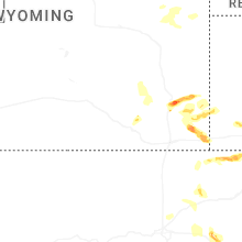
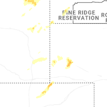
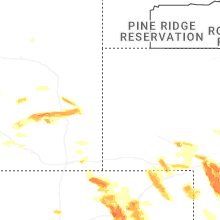
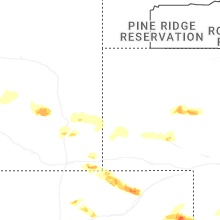
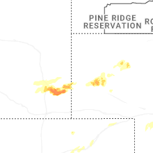
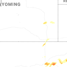
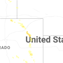
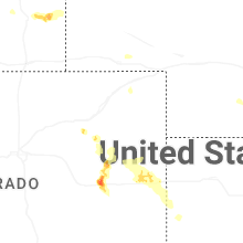
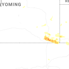
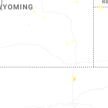
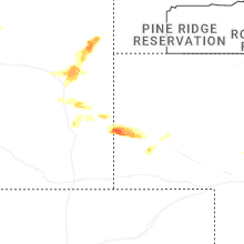
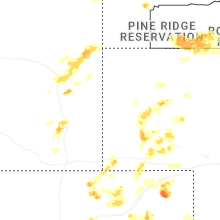
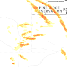
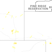
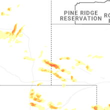
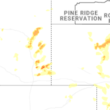
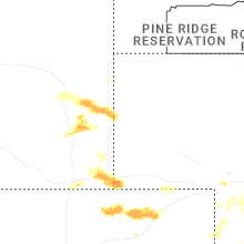
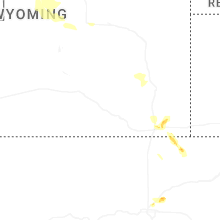


Connect with Interactive Hail Maps