

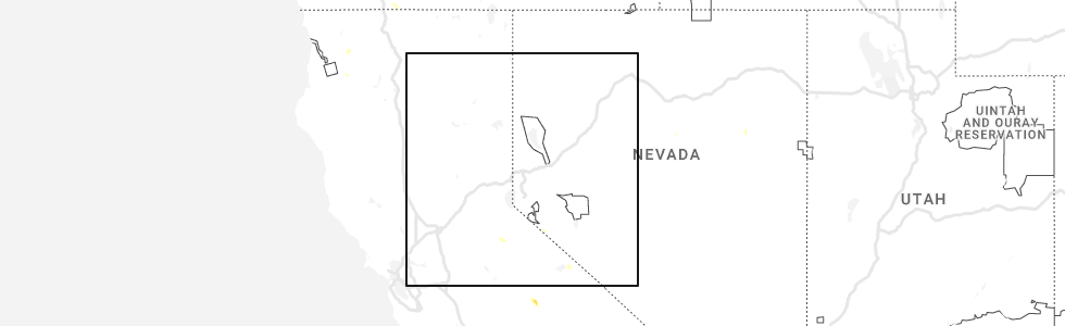
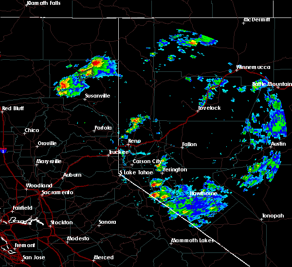
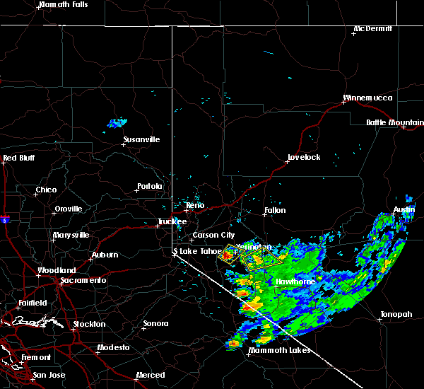
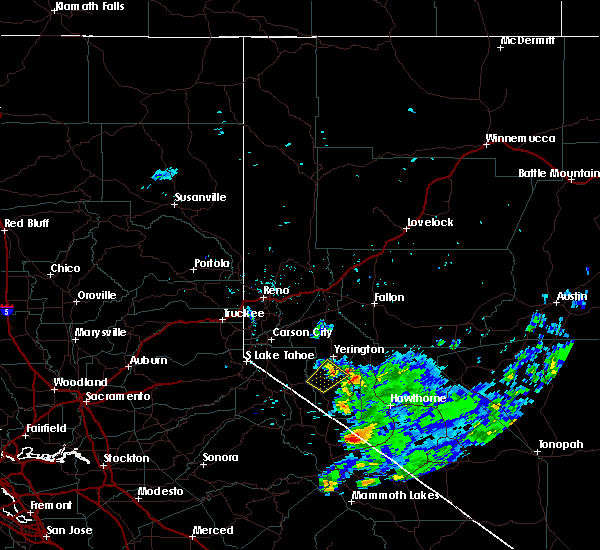
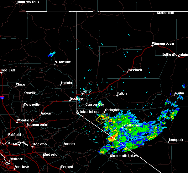
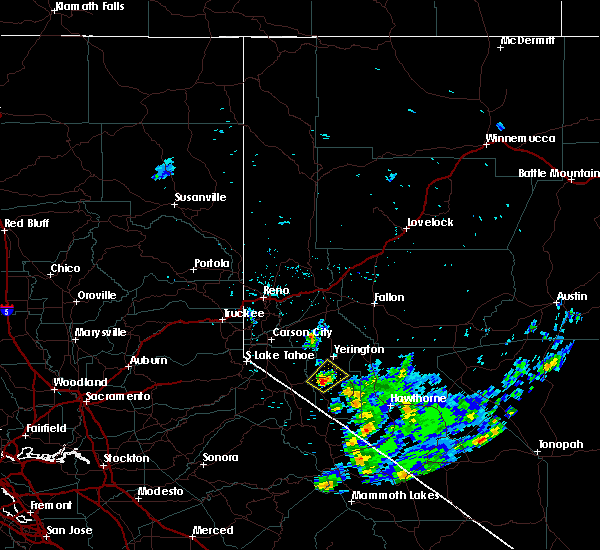
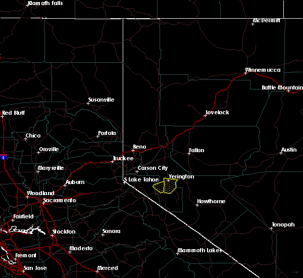
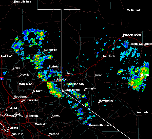
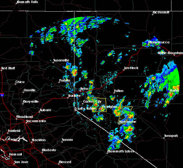
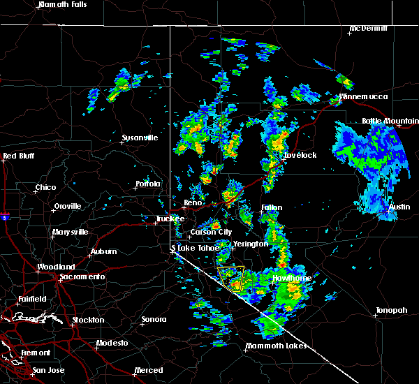
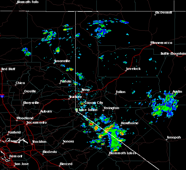
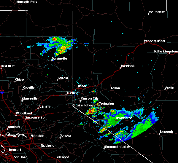
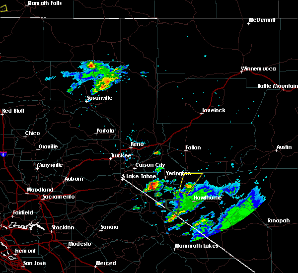
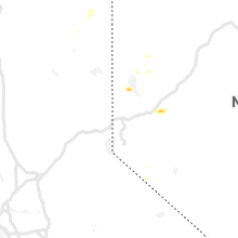
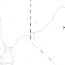
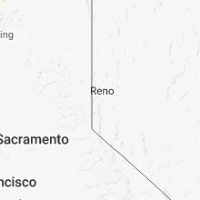
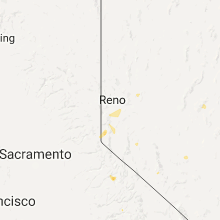
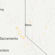
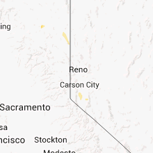
Hail Map for Smith Valley, NV
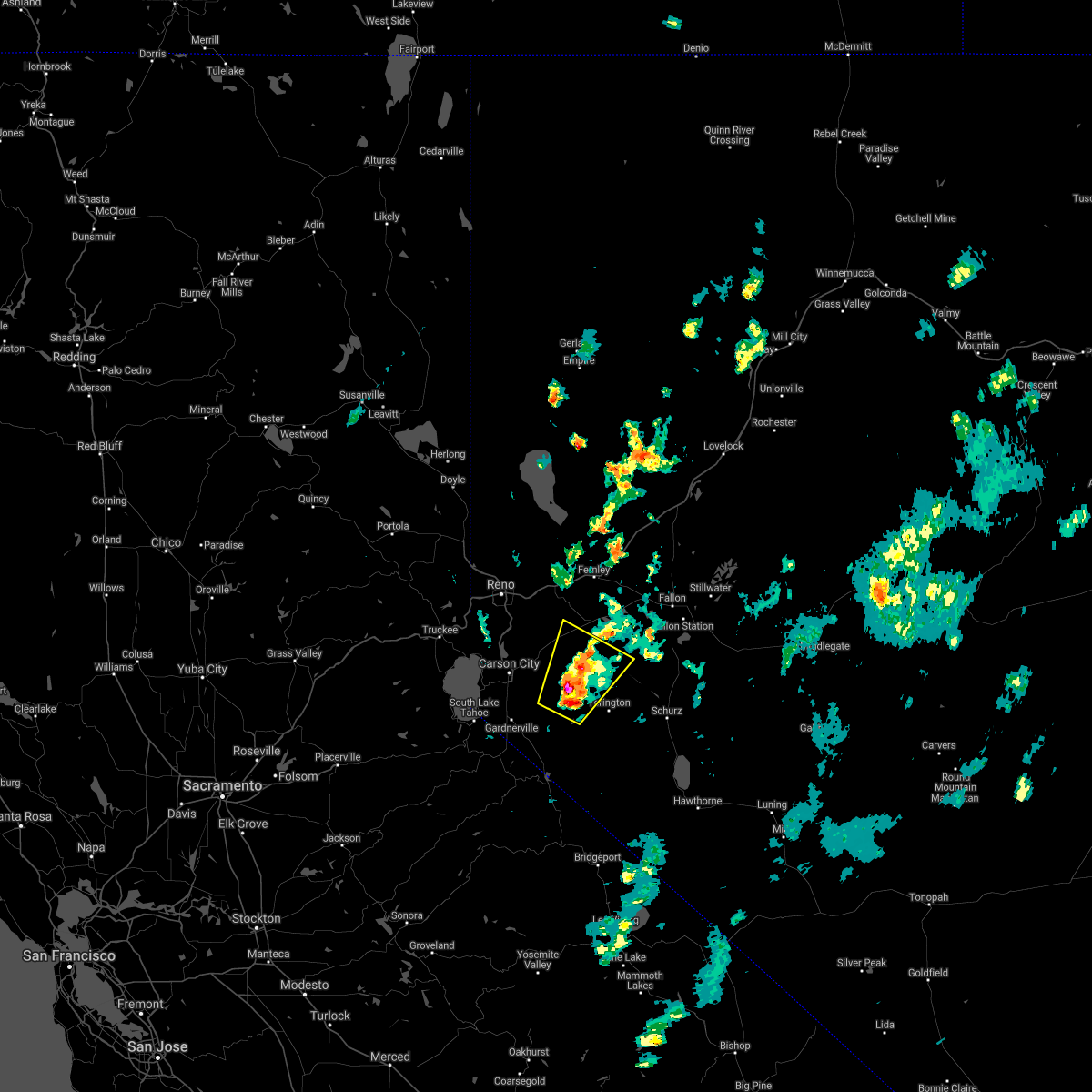
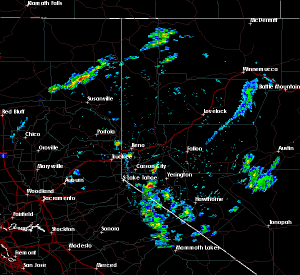
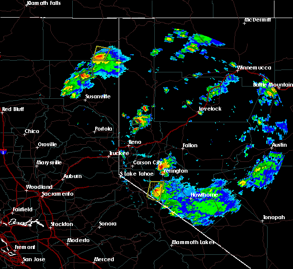
The Smith Valley, NV area has had 2 reports of on-the-ground hail by trained spotters, and has been under severe weather warnings 0 times during the past 12 months. Doppler radar has detected hail at or near Smith Valley, NV on 13 occasions, including 1 occasion during the past year.
| Name: | Smith Valley, NV |
| Where Located: | 58 miles SSE of Reno, NV |
| Map: | Google Map for Smith Valley, NV |
| Population: | 1603 |
| Housing Units: | 800 |
| More Info: | Search Google for Smith Valley, NV |
0
The Top Recent Hail Date for Smith Valley, NV is Monday, June 5, 2023 (7th out of 13)
Hail and Wind Damage Spotted near Smith Valley, NV
| Date / Time | Report Details |
|---|---|
| 8/18/2020 5:21 PM PDT |
 At 519 pm pdt, a severe thunderstorm was located 12 miles northwest of weed heights, or 19 miles east of carson city, moving northeast at 15 mph (radar indicated). Hazards include 60 mph wind gusts and quarter size hail. Hail damage to vehicles is expected. Expect wind damage to roofs, siding, fencing and trees. At 519 pm pdt, a severe thunderstorm was located 12 miles northwest of weed heights, or 19 miles east of carson city, moving northeast at 15 mph (radar indicated). Hazards include 60 mph wind gusts and quarter size hail. Hail damage to vehicles is expected. Expect wind damage to roofs, siding, fencing and trees.
|
| 8/11/2020 12:34 PM PDT |
 At 1234 pm pdt, a severe thunderstorm was located near smith, or 12 miles northeast of topaz lake, and is nearly stationary (radar indicated). Hazards include 60 mph wind gusts and quarter size hail. Hail damage to vehicles is expected. Expect wind damage to roofs, siding, fencing and trees. At 1234 pm pdt, a severe thunderstorm was located near smith, or 12 miles northeast of topaz lake, and is nearly stationary (radar indicated). Hazards include 60 mph wind gusts and quarter size hail. Hail damage to vehicles is expected. Expect wind damage to roofs, siding, fencing and trees.
|
| 6/24/2020 4:47 PM PDT |
 At 418 pm pdt, a severe thunderstorm was located near wellington, in smith valley (radar indicated). Hazards include 60 mph wind gusts and half dollar size hail. Hail damage to vehicles is possible. Winds may damage siding, fencing, roof and trees. At 418 pm pdt, a severe thunderstorm was located near wellington, in smith valley (radar indicated). Hazards include 60 mph wind gusts and half dollar size hail. Hail damage to vehicles is possible. Winds may damage siding, fencing, roof and trees.
|
| 6/24/2020 4:47 PM PDT |
 At 444 pm pdt, a severe thunderstorm was located near wellington, or 13 miles east of topaz lake, and is nearly stationary (radar indicated). Hazards include 60 mph wind gusts and half dollar size hail. Torrential rain is occurring with this storm. blinding downpours are impacting nv338 south of smith valley. strong outflow winds and hail are expected. Locations impacted include, smith valley along nv 338 south of wellington. At 444 pm pdt, a severe thunderstorm was located near wellington, or 13 miles east of topaz lake, and is nearly stationary (radar indicated). Hazards include 60 mph wind gusts and half dollar size hail. Torrential rain is occurring with this storm. blinding downpours are impacting nv338 south of smith valley. strong outflow winds and hail are expected. Locations impacted include, smith valley along nv 338 south of wellington.
|
| 6/24/2020 4:19 PM PDT |
 At 418 pm pdt, a severe thunderstorm was located near wellington, in smith valley (radar indicated). Hazards include 60 mph wind gusts and half dollar size hail. Hail damage to vehicles is possible. Winds may damage siding, fencing, roof and trees. At 418 pm pdt, a severe thunderstorm was located near wellington, in smith valley (radar indicated). Hazards include 60 mph wind gusts and half dollar size hail. Hail damage to vehicles is possible. Winds may damage siding, fencing, roof and trees.
|
| 7/31/2018 4:21 PM PDT |
 At 421 pm pdt, a severe thunderstorm was located near mason moving northeast at 10 mph (radar indicated). Hazards include 60 mph wind gusts and quarter size hail. Hail damage to vehicles is expected. Expect wind damage to roofs, siding, fencing and trees. At 421 pm pdt, a severe thunderstorm was located near mason moving northeast at 10 mph (radar indicated). Hazards include 60 mph wind gusts and quarter size hail. Hail damage to vehicles is expected. Expect wind damage to roofs, siding, fencing and trees.
|
| 7/31/2018 3:52 PM PDT |
 The severe thunderstorm warning for douglas and south central lyon counties will expire at 400 pm pdt, the storm which prompted the warning has weakened below severe limits, and no longer poses an immediate threat to life or property. however gusty winds are still possible with this thunderstorm in the mason valley area. The severe thunderstorm warning for douglas and south central lyon counties will expire at 400 pm pdt, the storm which prompted the warning has weakened below severe limits, and no longer poses an immediate threat to life or property. however gusty winds are still possible with this thunderstorm in the mason valley area.
|
| 7/31/2018 3:41 PM PDT |
 At 340 pm pdt, a severe thunderstorm was located near smith, or 17 miles east of topaz lake, and is nearly stationary (radar indicated). Hazards include 60 mph wind gusts and quarter size hail. Hail damage to vehicles is expected. expect wind damage to roofs, siding, fencing and trees. Locations impacted include, mason, smith, wellington, junction nv 339 and nv 208, smith valley and junction nv 338 and nv 829. At 340 pm pdt, a severe thunderstorm was located near smith, or 17 miles east of topaz lake, and is nearly stationary (radar indicated). Hazards include 60 mph wind gusts and quarter size hail. Hail damage to vehicles is expected. expect wind damage to roofs, siding, fencing and trees. Locations impacted include, mason, smith, wellington, junction nv 339 and nv 208, smith valley and junction nv 338 and nv 829.
|
| 7/31/2018 3:24 PM PDT |
 At 324 pm pdt, a severe thunderstorm was located near smith, or 16 miles east of topaz lake, moving northeast at 5 mph (radar indicated). Hazards include 60 mph wind gusts and quarter size hail. Hail damage to vehicles is expected. Expect wind damage to roofs, siding, fencing and trees. At 324 pm pdt, a severe thunderstorm was located near smith, or 16 miles east of topaz lake, moving northeast at 5 mph (radar indicated). Hazards include 60 mph wind gusts and quarter size hail. Hail damage to vehicles is expected. Expect wind damage to roofs, siding, fencing and trees.
|
| 5/16/2018 11:50 AM PDT |
 The severe thunderstorm warning for central lyon county will expire at noon pdt, the storm which prompted the warning has weakened below severe limits, and no longer poses an immediate threat to life or property. therefore the warning will be allowed to expire. however gusty winds and heavy rain are still possible with this thunderstorm. to report severe weather, contact your nearest law enforcement agency. they will relay your report to the national weather service reno nevada. The severe thunderstorm warning for central lyon county will expire at noon pdt, the storm which prompted the warning has weakened below severe limits, and no longer poses an immediate threat to life or property. therefore the warning will be allowed to expire. however gusty winds and heavy rain are still possible with this thunderstorm. to report severe weather, contact your nearest law enforcement agency. they will relay your report to the national weather service reno nevada.
|
| 5/16/2018 11:41 AM PDT |
 At 1140 am pdt, doppler radar indicated a severe thunderstorm capable of producing damaging winds in excess of 60 mph. this storm was located near smith, or 18 miles northeast of topaz lake, moving northwest at 10 mph. penny size hail may also accompany the damaging winds. locations impacted include, smith and smith valley. At 1140 am pdt, doppler radar indicated a severe thunderstorm capable of producing damaging winds in excess of 60 mph. this storm was located near smith, or 18 miles northeast of topaz lake, moving northwest at 10 mph. penny size hail may also accompany the damaging winds. locations impacted include, smith and smith valley.
|
| 5/16/2018 11:06 AM PDT |
 At 1106 am pdt, doppler radar indicated a severe thunderstorm capable of producing quarter size hail and damaging winds in excess of 60 mph. this storm was located 7 miles southeast of smith, or 18 miles east of topaz lake, and moving northwest at 10 mph. At 1106 am pdt, doppler radar indicated a severe thunderstorm capable of producing quarter size hail and damaging winds in excess of 60 mph. this storm was located 7 miles southeast of smith, or 18 miles east of topaz lake, and moving northwest at 10 mph.
|
| 9/12/2017 3:22 PM PDT |
 At 319 pm pdt, a severe thunderstorm was located over wellington, or 7 miles east of topaz lake, moving north at 10 mph (radar indicated). Hazards include quarter size hail. damage to vehicles is expected At 319 pm pdt, a severe thunderstorm was located over wellington, or 7 miles east of topaz lake, moving north at 10 mph (radar indicated). Hazards include quarter size hail. damage to vehicles is expected
|
| 7/24/2017 2:01 PM PDT |
 At 200 pm pdt, a severe thunderstorm was located over weed heights, or 29 miles northeast of topaz lake, moving north at 30 mph (radar indicated). Hazards include 60 mph wind gusts and penny size hail. Expect damage to roofs, siding, fencing, and trees. Dust storms resulting in serious accidents. At 200 pm pdt, a severe thunderstorm was located over weed heights, or 29 miles northeast of topaz lake, moving north at 30 mph (radar indicated). Hazards include 60 mph wind gusts and penny size hail. Expect damage to roofs, siding, fencing, and trees. Dust storms resulting in serious accidents.
|
| 7/22/2015 2:00 PM PDT |
 At 158 pm pdt, doppler radar indicated a severe thunderstorm capable of producing quarter size hail and damaging winds in excess of 60 mph. this storm was located 14 miles north of bridgeport reservoir, or 18 miles north of bridgeport, and moving north at 15 mph. * heavy rain associated with this storm may cause minor rock or mud slides to occur along and near route 338. At 158 pm pdt, doppler radar indicated a severe thunderstorm capable of producing quarter size hail and damaging winds in excess of 60 mph. this storm was located 14 miles north of bridgeport reservoir, or 18 miles north of bridgeport, and moving north at 15 mph. * heavy rain associated with this storm may cause minor rock or mud slides to occur along and near route 338.
|
| 7/6/2015 2:31 PM PDT |
 At 230 pm pdt, doppler radar indicated a severe thunderstorm capable of producing quarter size hail, torrential rainfall and damaging winds in excess of 60 mph. this storm was located over coleville, and moving north at 10 mph. At 230 pm pdt, doppler radar indicated a severe thunderstorm capable of producing quarter size hail, torrential rainfall and damaging winds in excess of 60 mph. this storm was located over coleville, and moving north at 10 mph.
|
| 7/5/2015 5:38 PM PDT |
 At 536 pm pdt, doppler radar indicated a severe thunderstorm capable of producing quarter size hail and damaging winds in excess of 60 mph. this storm was over artesia lake, moving northeast at 15 mph. heavy rain is also occurring with this storm. locations impacted include, yerington, smith, weed heights, mason, yerington municipal airport, smith valley and artesia lake. At 536 pm pdt, doppler radar indicated a severe thunderstorm capable of producing quarter size hail and damaging winds in excess of 60 mph. this storm was over artesia lake, moving northeast at 15 mph. heavy rain is also occurring with this storm. locations impacted include, yerington, smith, weed heights, mason, yerington municipal airport, smith valley and artesia lake.
|
| 7/5/2015 5:35 PM PDT | Quarter sized hail reported 1.3 miles SE of Smith Valley, NV, broadcast media reporting one inch hail in smith valley near artesia lane. |
| 7/5/2015 5:35 PM PDT | Quarter sized hail reported 7 miles SSE of Smith Valley, NV, broadcast media reporting one inch hail in smith valley near artesia lane. reissued for location update. |
| 7/5/2015 5:18 PM PDT |
 At 518 pm pdt, doppler radar indicated a severe thunderstorm capable of producing quarter size hail and damaging winds in excess of 60 mph. this storm was located near smith, or 17 miles northeast of topaz lake, and moving northeast at 15 mph. At 518 pm pdt, doppler radar indicated a severe thunderstorm capable of producing quarter size hail and damaging winds in excess of 60 mph. this storm was located near smith, or 17 miles northeast of topaz lake, and moving northeast at 15 mph.
|
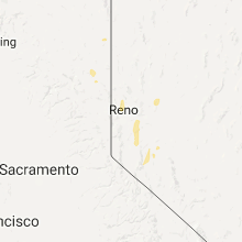
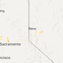
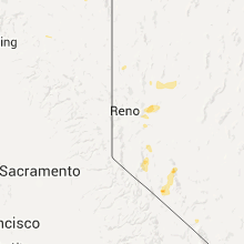
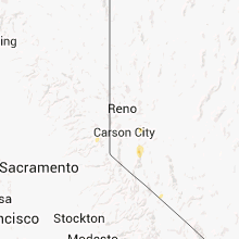
Hail Maps for Smith Valley, NV


Connect with Interactive Hail Maps