

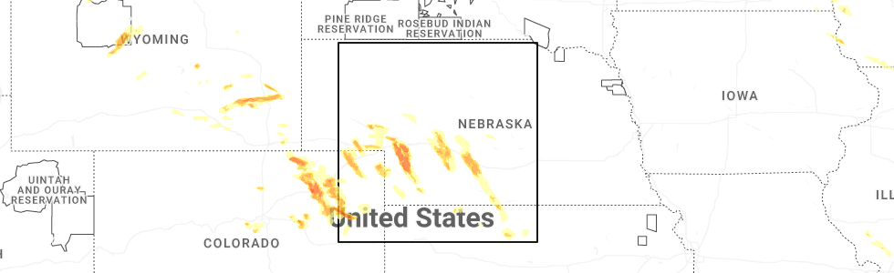
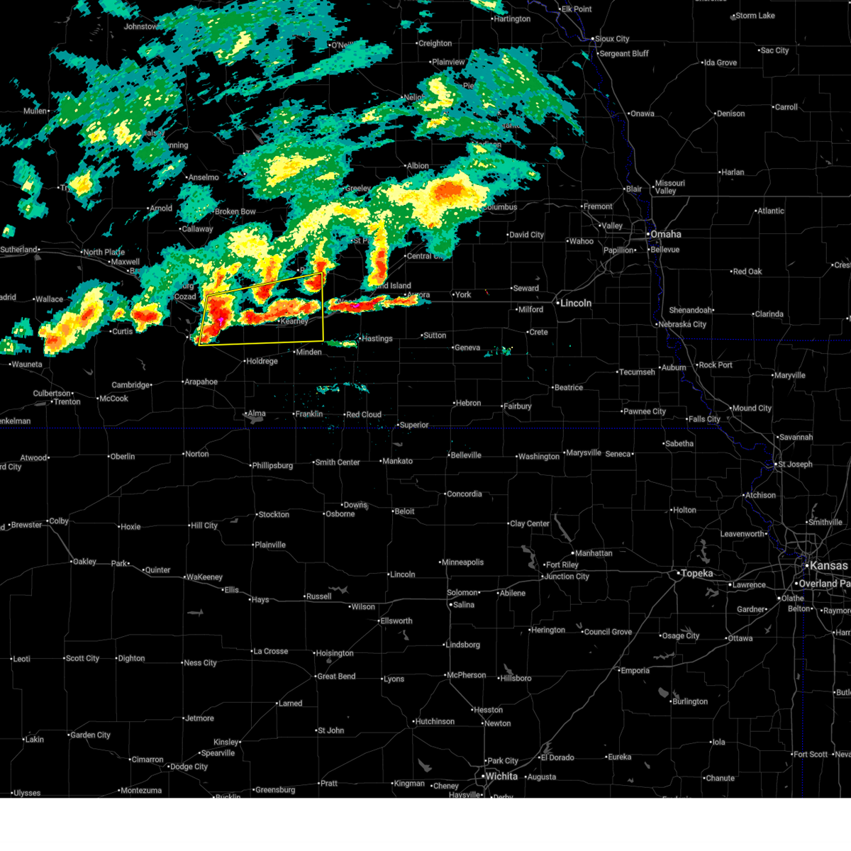
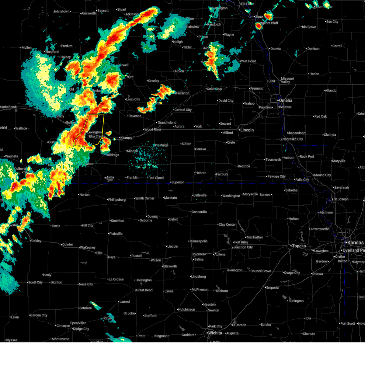
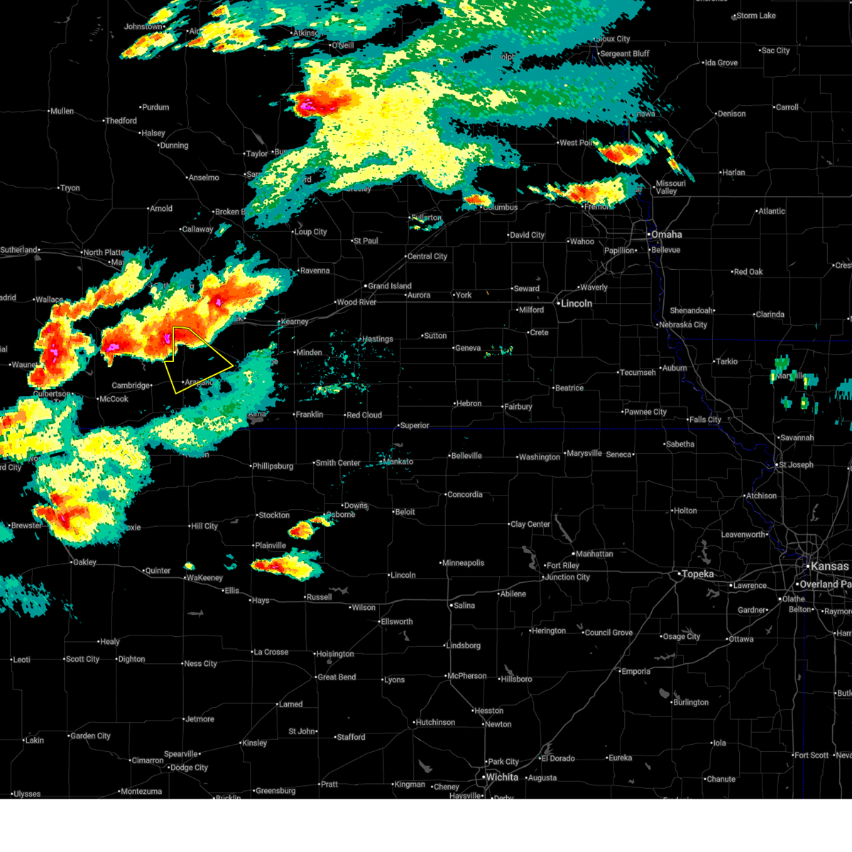
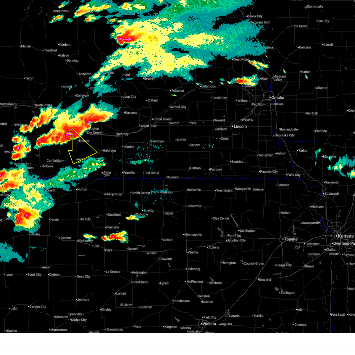
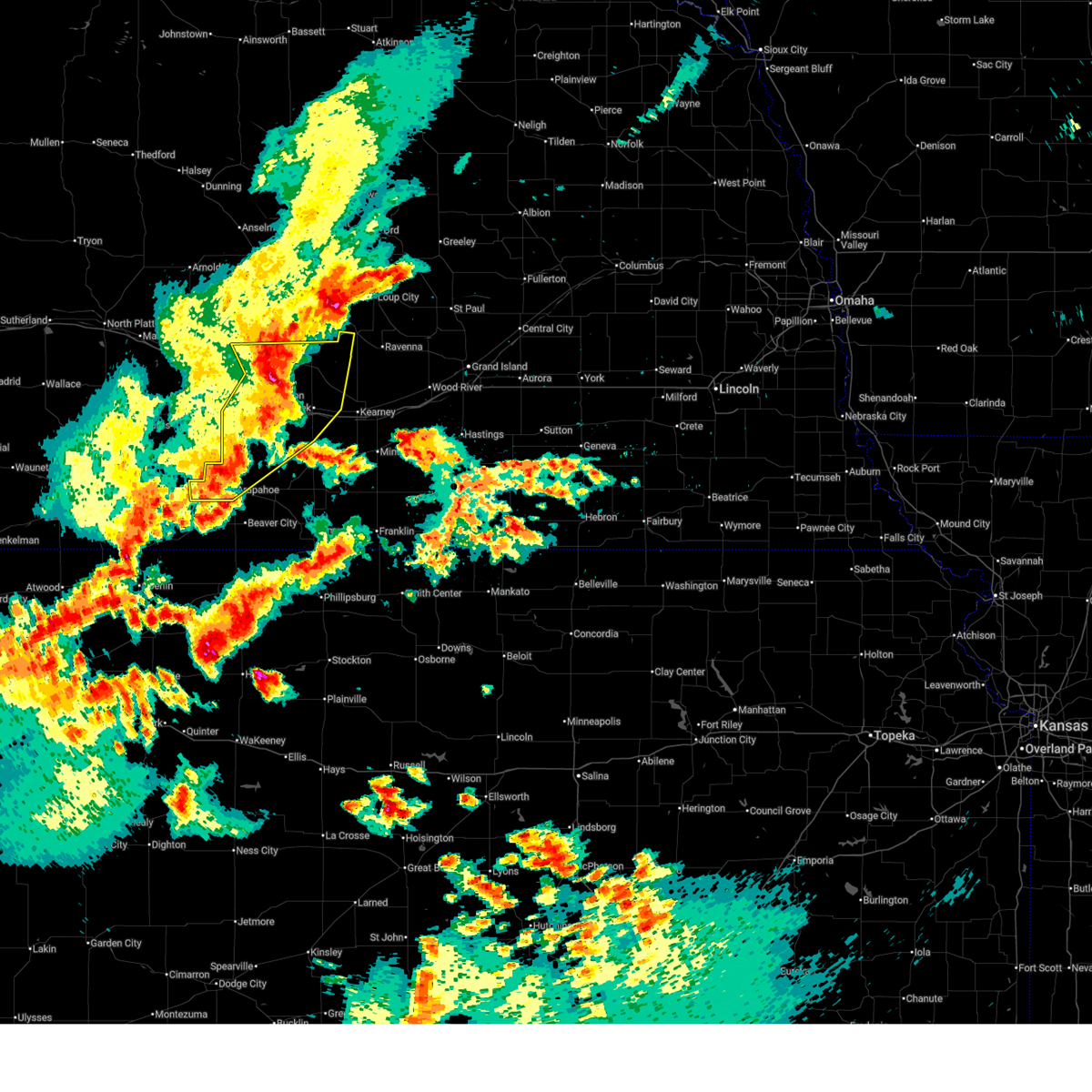
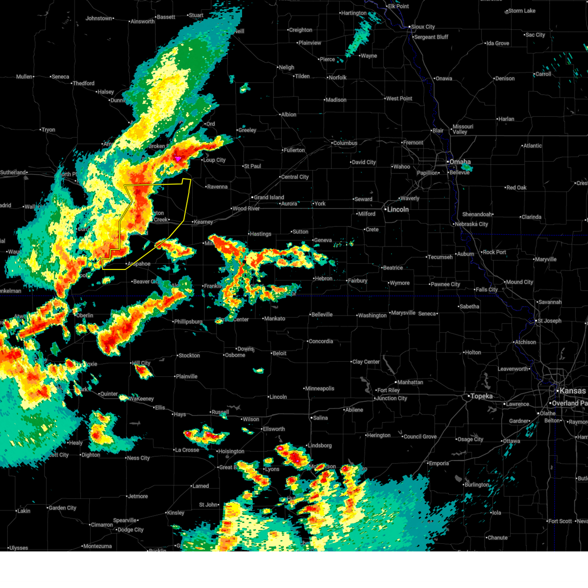
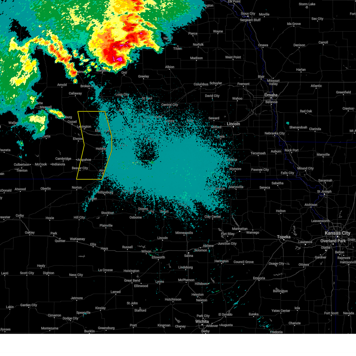
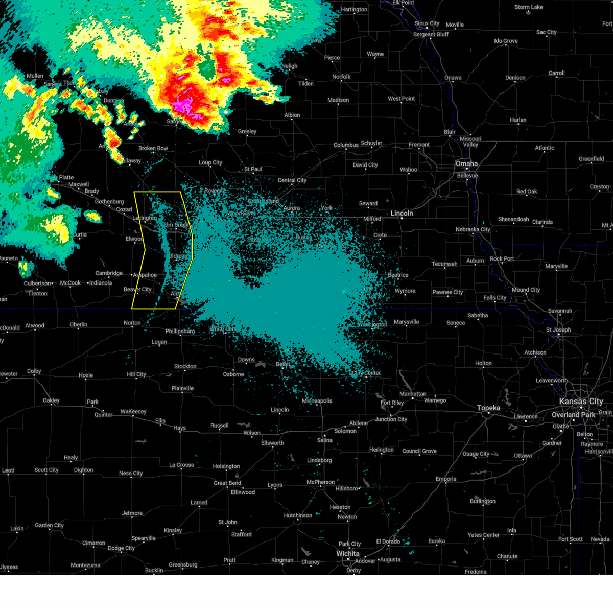
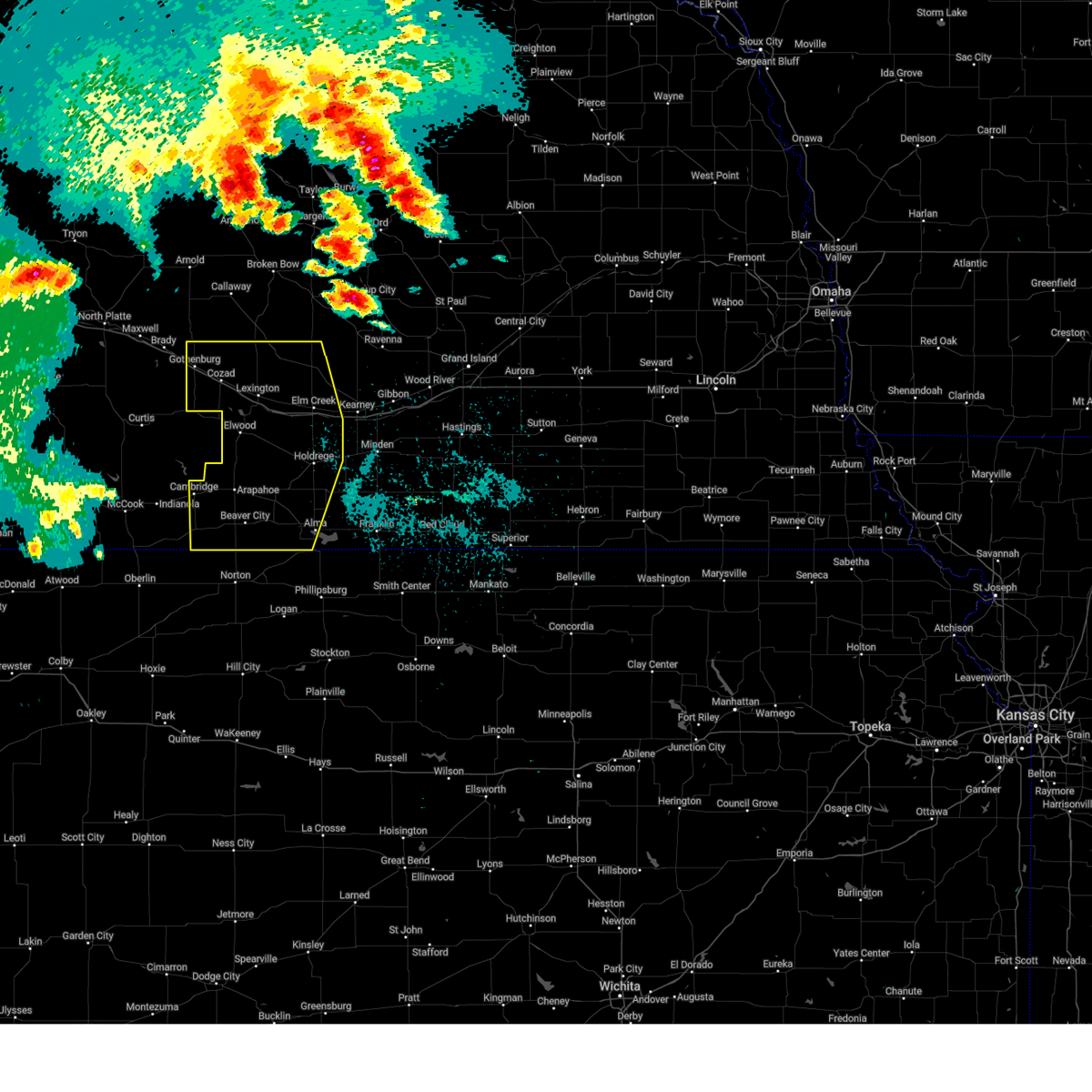
Hail Map for Smithfield, NE
The Smithfield, NE area has had 2 reports of on-the-ground hail by trained spotters, and has been under severe weather warnings 20 times during the past 12 months. Doppler radar has detected hail at or near Smithfield, NE on 104 occasions, including 8 occasions during the past year.
| Name: | Smithfield, NE |
| Where Located: | 66.2 miles SE of North Platte, NE |
| Map: | Google Map for Smithfield, NE |
| Population: | 54 |
| Housing Units: | 34 |
| More Info: | Search Google for Smithfield, NE |
1
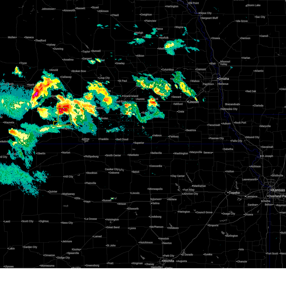
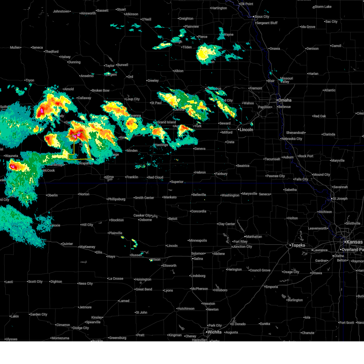
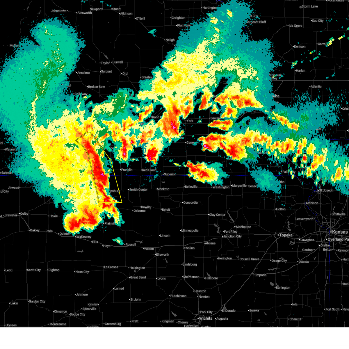
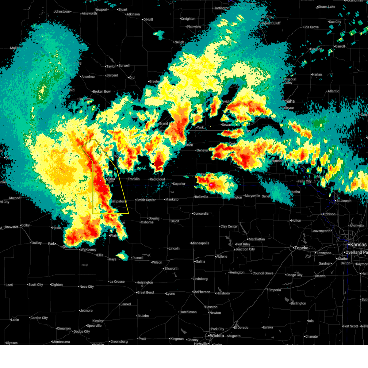
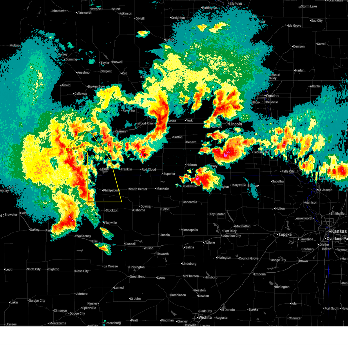
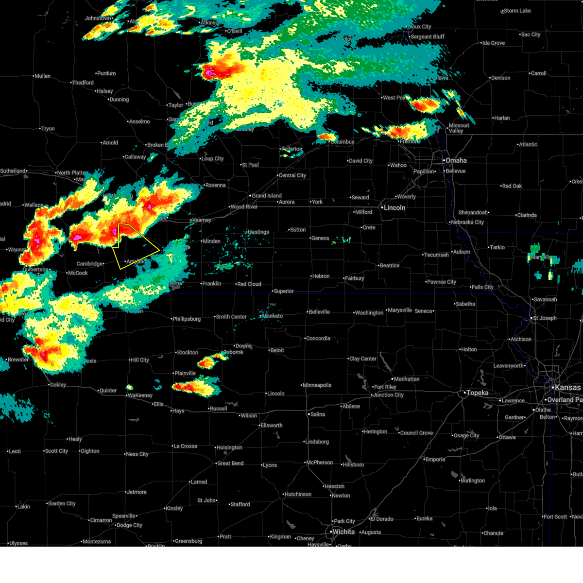
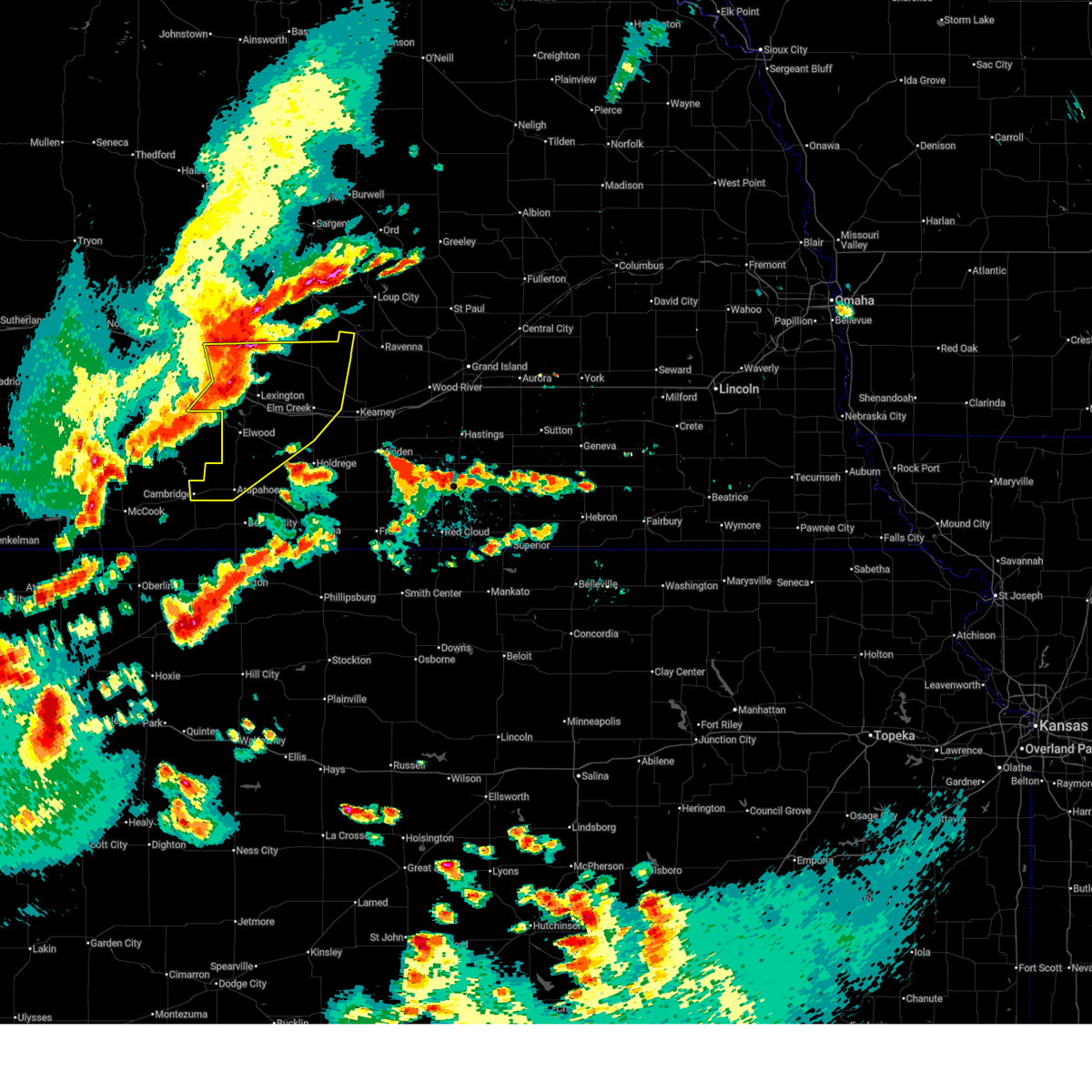
The Top Recent Hail Date for Smithfield, NE is Wednesday, June 24, 2026 (40th out of 104)
Hail and Wind Damage Spotted near Smithfield, NE
| Date / Time | Report Details |
|---|---|
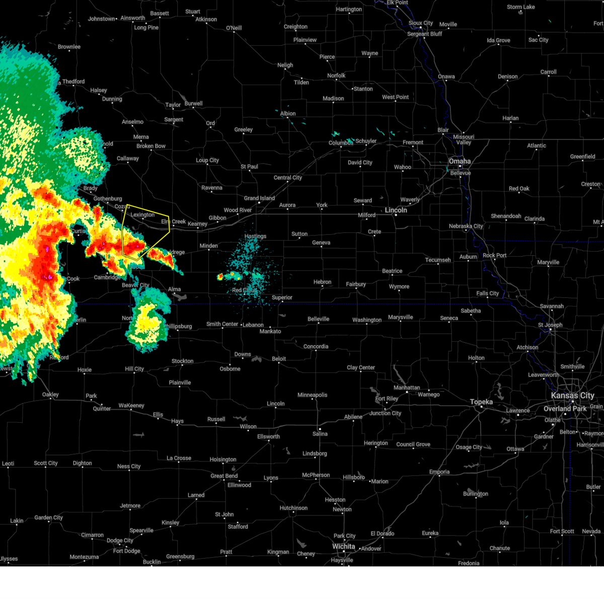
| 6/24/2026 10:12 PM CDT |
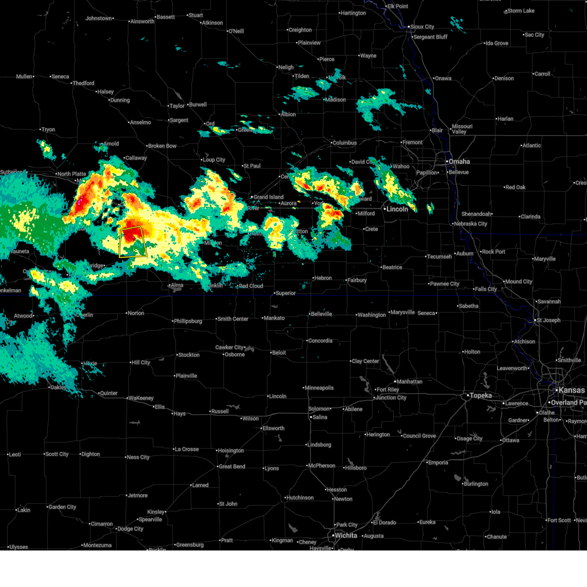 At 1011 pm cdt, severe thunderstorms were located along a line extending from near bertrand to 9 miles south of elwood, moving south at 30 mph (radar indicated. in addition, quarter size hail was recently reported in elwood). Hazards include 60 mph wind gusts and quarter size hail. Hail damage to vehicles is expected. expect wind damage to roofs, siding, and trees. Locations impacted include, elwood and smithfield. At 1011 pm cdt, severe thunderstorms were located along a line extending from near bertrand to 9 miles south of elwood, moving south at 30 mph (radar indicated. in addition, quarter size hail was recently reported in elwood). Hazards include 60 mph wind gusts and quarter size hail. Hail damage to vehicles is expected. expect wind damage to roofs, siding, and trees. Locations impacted include, elwood and smithfield.
|
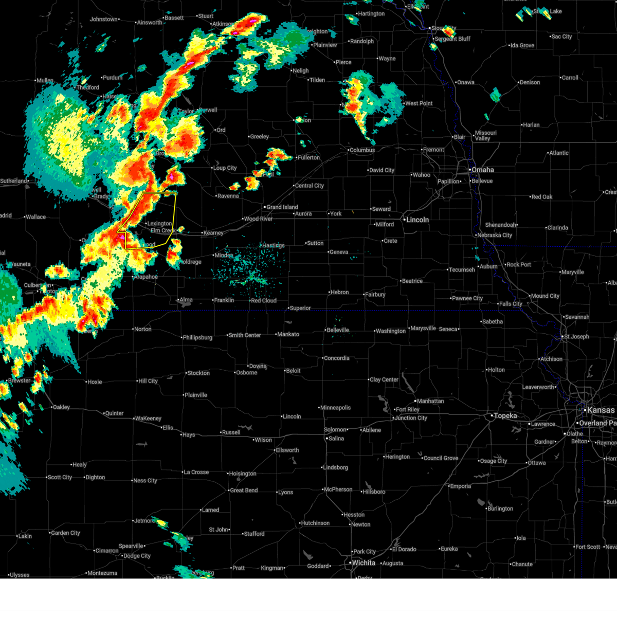
| 6/24/2026 9:57 PM CDT |
 At 956 pm cdt, severe thunderstorms were located along a line extending from near smithfield to near elwood, moving southeast at 30 mph (radar indicated). Hazards include 70 mph wind gusts and half dollar size hail. Hail damage to vehicles is expected. expect considerable tree damage. wind damage is also likely to mobile homes, roofs, and outbuildings. Locations impacted include, elwood, smithfield, and johnson lake. At 956 pm cdt, severe thunderstorms were located along a line extending from near smithfield to near elwood, moving southeast at 30 mph (radar indicated). Hazards include 70 mph wind gusts and half dollar size hail. Hail damage to vehicles is expected. expect considerable tree damage. wind damage is also likely to mobile homes, roofs, and outbuildings. Locations impacted include, elwood, smithfield, and johnson lake.
|
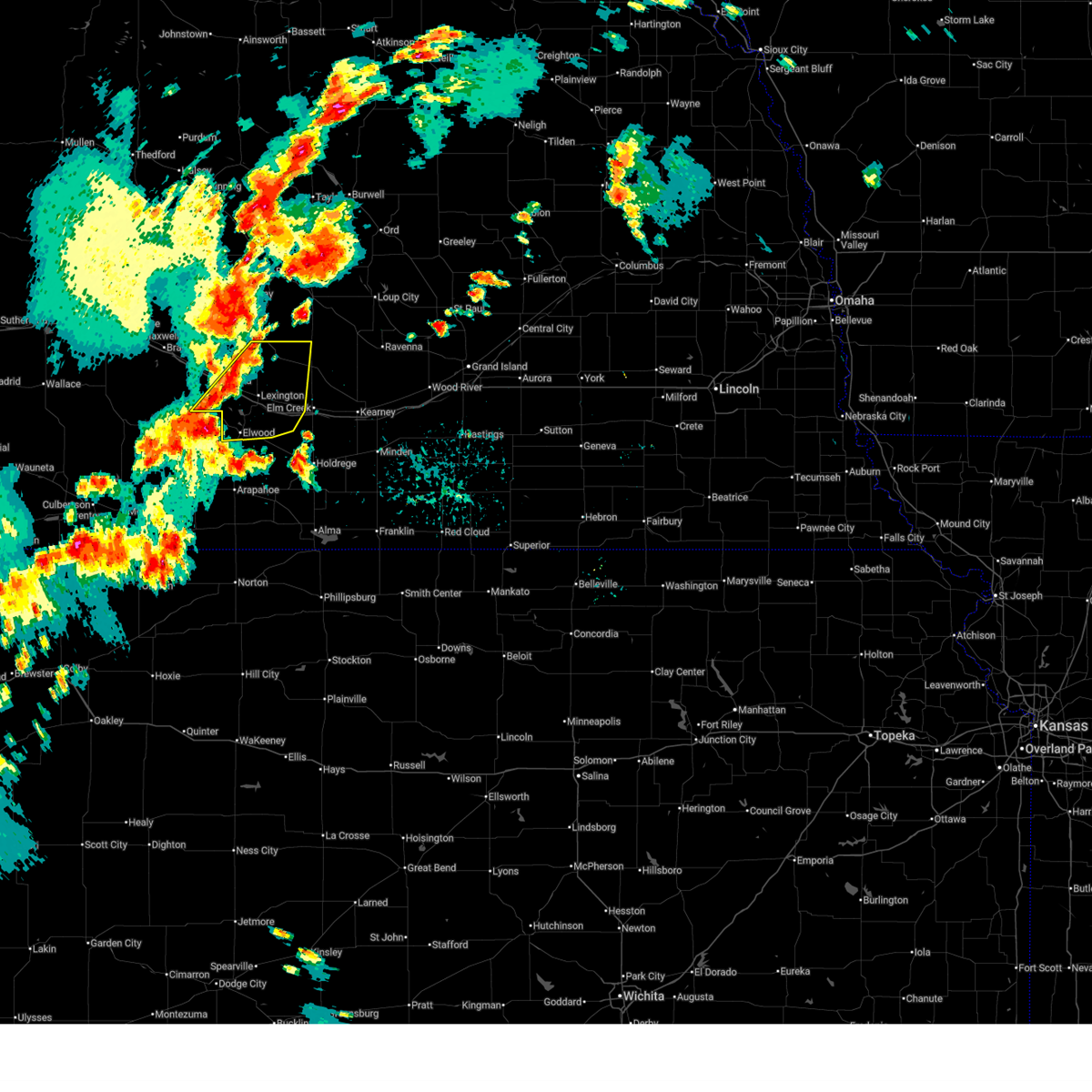
| 6/24/2026 9:38 PM CDT |
 Svrgid the national weather service in hastings has issued a * severe thunderstorm warning for, gosper county in south central nebraska, south central dawson county in south central nebraska, * until 1030 pm cdt. * at 937 pm cdt, severe thunderstorms were located along a line extending from near johnson lake to eustis, moving southeast at 30 mph (radar indicated). Hazards include 70 mph wind gusts and half dollar size hail. Hail damage to vehicles is expected. expect considerable tree damage. wind damage is also likely to mobile homes, roofs, and outbuildings. severe thunderstorms will be near, elwood around 945 pm cdt. smithfield around 950 pm cdt. This includes interstate 80 between mile markers 232 and 234. Svrgid the national weather service in hastings has issued a * severe thunderstorm warning for, gosper county in south central nebraska, south central dawson county in south central nebraska, * until 1030 pm cdt. * at 937 pm cdt, severe thunderstorms were located along a line extending from near johnson lake to eustis, moving southeast at 30 mph (radar indicated). Hazards include 70 mph wind gusts and half dollar size hail. Hail damage to vehicles is expected. expect considerable tree damage. wind damage is also likely to mobile homes, roofs, and outbuildings. severe thunderstorms will be near, elwood around 945 pm cdt. smithfield around 950 pm cdt. This includes interstate 80 between mile markers 232 and 234.
|
| 6/11/2026 2:36 AM CDT |
 Svrgid the national weather service in hastings has issued a * severe thunderstorm warning for, northern phelps county in south central nebraska, northwestern adams county in south central nebraska, northern kearney county in south central nebraska, northeastern gosper county in south central nebraska, buffalo county in south central nebraska, southeastern dawson county in south central nebraska, southwestern hall county in south central nebraska, * until 315 am cdt. * at 236 am cdt, a severe thunderstorm was located near overton, or 15 miles east of lexington, moving east at 55 mph (radar indicated). Hazards include ping pong ball size hail and 60 mph wind gusts. People and animals outdoors will be injured. expect hail damage to roofs, siding, windows, and vehicles. Expect wind damage to roofs, siding, and trees. Svrgid the national weather service in hastings has issued a * severe thunderstorm warning for, northern phelps county in south central nebraska, northwestern adams county in south central nebraska, northern kearney county in south central nebraska, northeastern gosper county in south central nebraska, buffalo county in south central nebraska, southeastern dawson county in south central nebraska, southwestern hall county in south central nebraska, * until 315 am cdt. * at 236 am cdt, a severe thunderstorm was located near overton, or 15 miles east of lexington, moving east at 55 mph (radar indicated). Hazards include ping pong ball size hail and 60 mph wind gusts. People and animals outdoors will be injured. expect hail damage to roofs, siding, windows, and vehicles. Expect wind damage to roofs, siding, and trees.
|
| 5/30/2026 7:34 PM CDT |
 Svrgid the national weather service in hastings has issued a * severe thunderstorm warning for, northwestern phelps county in south central nebraska, northeastern gosper county in south central nebraska, northwestern buffalo county in south central nebraska, eastern dawson county in south central nebraska, * until 815 pm cdt. * at 734 pm cdt, a severe thunderstorm was located near johnson lake, or 7 miles south of lexington, moving northeast at 50 mph (automated weather station). Hazards include 60 mph wind gusts and quarter size hail. Hail damage to vehicles is expected. expect wind damage to roofs, siding, and trees. this severe thunderstorm will be near, lexington around 740 pm cdt. other locations in the path of this severe thunderstorm include sumner and eddyville. This includes interstate 80 between mile markers 230 and 250. Svrgid the national weather service in hastings has issued a * severe thunderstorm warning for, northwestern phelps county in south central nebraska, northeastern gosper county in south central nebraska, northwestern buffalo county in south central nebraska, eastern dawson county in south central nebraska, * until 815 pm cdt. * at 734 pm cdt, a severe thunderstorm was located near johnson lake, or 7 miles south of lexington, moving northeast at 50 mph (automated weather station). Hazards include 60 mph wind gusts and quarter size hail. Hail damage to vehicles is expected. expect wind damage to roofs, siding, and trees. this severe thunderstorm will be near, lexington around 740 pm cdt. other locations in the path of this severe thunderstorm include sumner and eddyville. This includes interstate 80 between mile markers 230 and 250.
|
| 5/29/2026 11:36 PM CDT |
 At 1136 pm cdt, severe thunderstorms were located along a line extending from near smithfield to loomis to near oxford, moving northeast at 35 mph (radar indicated). Hazards include 60 mph wind gusts and quarter size hail. Hail damage to vehicles is expected. expect wind damage to roofs, siding, and trees. these severe storms will be near, holdrege, loomis, and atlanta around 1140 pm cdt. overton around 1150 pm cdt. This includes interstate 80 between mile markers 245 and 253. At 1136 pm cdt, severe thunderstorms were located along a line extending from near smithfield to loomis to near oxford, moving northeast at 35 mph (radar indicated). Hazards include 60 mph wind gusts and quarter size hail. Hail damage to vehicles is expected. expect wind damage to roofs, siding, and trees. these severe storms will be near, holdrege, loomis, and atlanta around 1140 pm cdt. overton around 1150 pm cdt. This includes interstate 80 between mile markers 245 and 253.
|
| 5/29/2026 11:18 PM CDT |
 Svrgid the national weather service in hastings has issued a * severe thunderstorm warning for, phelps county in south central nebraska, southeastern gosper county in south central nebraska, southeastern dawson county in south central nebraska, northeastern furnas county in south central nebraska, northwestern harlan county in south central nebraska, * until midnight cdt. * at 1118 pm cdt, severe thunderstorms were located along a line extending from near elwood to 8 miles west of atlanta to stamford, moving northeast at 35 mph (automated weather station). Hazards include 60 mph wind gusts and quarter size hail. Hail damage to vehicles is expected. expect wind damage to roofs, siding, and trees. severe thunderstorms will be near, bertrand, loomis, atlanta, and smithfield around 1125 pm cdt. holdrege around 1135 pm cdt. other locations in the path of these severe thunderstorms include overton and ragan. This includes interstate 80 between mile markers 245 and 253. Svrgid the national weather service in hastings has issued a * severe thunderstorm warning for, phelps county in south central nebraska, southeastern gosper county in south central nebraska, southeastern dawson county in south central nebraska, northeastern furnas county in south central nebraska, northwestern harlan county in south central nebraska, * until midnight cdt. * at 1118 pm cdt, severe thunderstorms were located along a line extending from near elwood to 8 miles west of atlanta to stamford, moving northeast at 35 mph (automated weather station). Hazards include 60 mph wind gusts and quarter size hail. Hail damage to vehicles is expected. expect wind damage to roofs, siding, and trees. severe thunderstorms will be near, bertrand, loomis, atlanta, and smithfield around 1125 pm cdt. holdrege around 1135 pm cdt. other locations in the path of these severe thunderstorms include overton and ragan. This includes interstate 80 between mile markers 245 and 253.
|
| 5/16/2026 9:40 PM CDT |
 At 940 pm cdt, severe thunderstorms were located along a line extending from near bertrand to near huntley to near kirwin, moving northeast at 40 mph (radar indicated). Hazards include 60 mph wind gusts and penny size hail. Expect damage to roofs, siding, and trees. these severe storms will be near, holdrege, bertrand, loomis, agra, republican city, atlanta, huntley, ragan, and harlan county dam around 945 pm cdt. Kensington and naponee around 950 pm cdt. At 940 pm cdt, severe thunderstorms were located along a line extending from near bertrand to near huntley to near kirwin, moving northeast at 40 mph (radar indicated). Hazards include 60 mph wind gusts and penny size hail. Expect damage to roofs, siding, and trees. these severe storms will be near, holdrege, bertrand, loomis, agra, republican city, atlanta, huntley, ragan, and harlan county dam around 945 pm cdt. Kensington and naponee around 950 pm cdt.
|
| 5/16/2026 9:31 PM CDT |
 At 931 pm cdt, severe thunderstorms were located along a line extending from near smithfield to orleans to glade, moving northeast at 40 mph (automated weather station). Hazards include 60 mph wind gusts and nickel size hail. Expect damage to roofs, siding, and trees. these severe storms will be near, alma, bertrand, and atlanta around 935 pm cdt. loomis, agra, kirwin, republican city, huntley, and harlan county dam around 940 pm cdt. holdrege and ragan around 945 pm cdt. Kensington and naponee around 950 pm cdt. At 931 pm cdt, severe thunderstorms were located along a line extending from near smithfield to orleans to glade, moving northeast at 40 mph (automated weather station). Hazards include 60 mph wind gusts and nickel size hail. Expect damage to roofs, siding, and trees. these severe storms will be near, alma, bertrand, and atlanta around 935 pm cdt. loomis, agra, kirwin, republican city, huntley, and harlan county dam around 940 pm cdt. holdrege and ragan around 945 pm cdt. Kensington and naponee around 950 pm cdt.
|
| 5/16/2026 9:12 PM CDT |
 Svrgid the national weather service in hastings has issued a * severe thunderstorm warning for, southwestern smith county in north central kansas, phillips county in north central kansas, southwestern franklin county in south central nebraska, western phelps county in south central nebraska, central gosper county in south central nebraska, harlan county in south central nebraska, * until 1000 pm cdt. * at 912 pm cdt, severe thunderstorms were located along a line extending from 8 miles north of arapahoe to near stamford to near speed, moving northeast at 40 mph (automated weather station). Hazards include 60 mph wind gusts and quarter size hail. Hail damage to vehicles is expected. expect wind damage to roofs, siding, and trees. severe thunderstorms will be near, oxford, stamford, long island, and speed around 915 pm cdt. phillipsburg, orleans, glade, and woodruff around 920 pm cdt. alma around 925 pm cdt. bertrand around 930 pm cdt. Other locations in the path of these severe thunderstorms include atlanta, huntley, loomis, agra, kirwin, republican city, harlan county dam, holdrege, kensington, naponee and ragan. Svrgid the national weather service in hastings has issued a * severe thunderstorm warning for, southwestern smith county in north central kansas, phillips county in north central kansas, southwestern franklin county in south central nebraska, western phelps county in south central nebraska, central gosper county in south central nebraska, harlan county in south central nebraska, * until 1000 pm cdt. * at 912 pm cdt, severe thunderstorms were located along a line extending from 8 miles north of arapahoe to near stamford to near speed, moving northeast at 40 mph (automated weather station). Hazards include 60 mph wind gusts and quarter size hail. Hail damage to vehicles is expected. expect wind damage to roofs, siding, and trees. severe thunderstorms will be near, oxford, stamford, long island, and speed around 915 pm cdt. phillipsburg, orleans, glade, and woodruff around 920 pm cdt. alma around 925 pm cdt. bertrand around 930 pm cdt. Other locations in the path of these severe thunderstorms include atlanta, huntley, loomis, agra, kirwin, republican city, harlan county dam, holdrege, kensington, naponee and ragan.
|
| 7/23/2025 6:37 PM CDT |
 Svrgid the national weather service in hastings has issued a * severe thunderstorm warning for, northern phelps county in south central nebraska, northwestern kearney county in south central nebraska, northeastern gosper county in south central nebraska, buffalo county in south central nebraska, sherman county in central nebraska, eastern dawson county in south central nebraska, * until 715 pm cdt. * at 636 pm cdt, severe thunderstorms were located along a line extending from mason city to near overton to near smithfield, moving east at 40 mph (radar indicated). Hazards include 60 mph wind gusts and quarter size hail. Hail damage to vehicles is expected. expect wind damage to roofs, siding, and trees. severe thunderstorms will be near, elm creek, overton, and miller around 640 pm cdt. litchfield and amherst around 645 pm cdt. loup city, odessa, pleasanton, and hazard around 655 pm cdt. other locations in the path of these severe thunderstorms include riverdale, sherman reservoir dam, kearney and poole. This includes interstate 80 between mile markers 239 and 282. Svrgid the national weather service in hastings has issued a * severe thunderstorm warning for, northern phelps county in south central nebraska, northwestern kearney county in south central nebraska, northeastern gosper county in south central nebraska, buffalo county in south central nebraska, sherman county in central nebraska, eastern dawson county in south central nebraska, * until 715 pm cdt. * at 636 pm cdt, severe thunderstorms were located along a line extending from mason city to near overton to near smithfield, moving east at 40 mph (radar indicated). Hazards include 60 mph wind gusts and quarter size hail. Hail damage to vehicles is expected. expect wind damage to roofs, siding, and trees. severe thunderstorms will be near, elm creek, overton, and miller around 640 pm cdt. litchfield and amherst around 645 pm cdt. loup city, odessa, pleasanton, and hazard around 655 pm cdt. other locations in the path of these severe thunderstorms include riverdale, sherman reservoir dam, kearney and poole. This includes interstate 80 between mile markers 239 and 282.
|
| 7/23/2025 6:22 PM CDT |
 At 622 pm cdt, severe thunderstorms were located along a line extending from near eustis to near lexington to near eddyville, moving east at 20 mph (radar indicated). Hazards include 60 mph wind gusts and quarter size hail. Hail damage to vehicles is expected. expect wind damage to roofs, siding, and trees. these severe storms will be near, lexington, eddyville, and johnson lake around 625 pm cdt. sumner around 630 pm cdt. This includes interstate 80 between mile markers 232 and 254. At 622 pm cdt, severe thunderstorms were located along a line extending from near eustis to near lexington to near eddyville, moving east at 20 mph (radar indicated). Hazards include 60 mph wind gusts and quarter size hail. Hail damage to vehicles is expected. expect wind damage to roofs, siding, and trees. these severe storms will be near, lexington, eddyville, and johnson lake around 625 pm cdt. sumner around 630 pm cdt. This includes interstate 80 between mile markers 232 and 254.
|
| 7/23/2025 6:11 PM CDT |
 At 611 pm cdt, severe thunderstorms were located along a line extending from eustis to 6 miles northwest of lexington to near oconto, moving northeast at 35 mph (radar indicated). Hazards include golf ball size hail and 60 mph wind gusts. People and animals outdoors will be injured. expect hail damage to roofs, siding, windows, and vehicles. expect wind damage to roofs, siding, and trees. these severe storms will be near, lexington and eddyville around 615 pm cdt. johnson lake around 620 pm cdt. sumner around 635 pm cdt. This includes interstate 80 between mile markers 225 and 254. At 611 pm cdt, severe thunderstorms were located along a line extending from eustis to 6 miles northwest of lexington to near oconto, moving northeast at 35 mph (radar indicated). Hazards include golf ball size hail and 60 mph wind gusts. People and animals outdoors will be injured. expect hail damage to roofs, siding, windows, and vehicles. expect wind damage to roofs, siding, and trees. these severe storms will be near, lexington and eddyville around 615 pm cdt. johnson lake around 620 pm cdt. sumner around 635 pm cdt. This includes interstate 80 between mile markers 225 and 254.
|
| 7/23/2025 6:04 PM CDT |
 Svrgid the national weather service in hastings has issued a * severe thunderstorm warning for, northwestern phelps county in south central nebraska, northeastern gosper county in south central nebraska, northwestern buffalo county in south central nebraska, dawson county in south central nebraska, * until 645 pm cdt. * at 604 pm cdt, severe thunderstorms were located along a line extending from eustis to near cozad to 6 miles south of oconto, moving northeast at 30 mph (radar indicated). Hazards include 60 mph wind gusts and quarter size hail. Hail damage to vehicles is expected. expect wind damage to roofs, siding, and trees. severe thunderstorms will be near, eddyville around 615 pm cdt. lexington and johnson lake around 620 pm cdt. This includes interstate 80 between mile markers 221 and 254. Svrgid the national weather service in hastings has issued a * severe thunderstorm warning for, northwestern phelps county in south central nebraska, northeastern gosper county in south central nebraska, northwestern buffalo county in south central nebraska, dawson county in south central nebraska, * until 645 pm cdt. * at 604 pm cdt, severe thunderstorms were located along a line extending from eustis to near cozad to 6 miles south of oconto, moving northeast at 30 mph (radar indicated). Hazards include 60 mph wind gusts and quarter size hail. Hail damage to vehicles is expected. expect wind damage to roofs, siding, and trees. severe thunderstorms will be near, eddyville around 615 pm cdt. lexington and johnson lake around 620 pm cdt. This includes interstate 80 between mile markers 221 and 254.
|
| 7/19/2025 7:09 PM CDT |
 the severe thunderstorm warning has been cancelled and is no longer in effect the severe thunderstorm warning has been cancelled and is no longer in effect
|
| 7/19/2025 7:09 PM CDT |
 At 709 pm cdt, a severe thunderstorm was located near elwood, or 17 miles southwest of lexington, moving southeast at 30 mph (radar indicated). Hazards include two inch hail and 60 mph wind gusts. People and animals outdoors will be injured. expect hail damage to roofs, siding, windows, and vehicles. expect wind damage to roofs, siding, and trees. This severe storm will be near, elwood around 715 pm cdt. At 709 pm cdt, a severe thunderstorm was located near elwood, or 17 miles southwest of lexington, moving southeast at 30 mph (radar indicated). Hazards include two inch hail and 60 mph wind gusts. People and animals outdoors will be injured. expect hail damage to roofs, siding, windows, and vehicles. expect wind damage to roofs, siding, and trees. This severe storm will be near, elwood around 715 pm cdt.
|
| 7/19/2025 6:53 PM CDT |
 Svrgid the national weather service in hastings has issued a * severe thunderstorm warning for, southwestern phelps county in south central nebraska, gosper county in south central nebraska, south central dawson county in south central nebraska, northeastern furnas county in south central nebraska, * until 730 pm cdt. * at 652 pm cdt, a severe thunderstorm was located over eustis, or 16 miles southwest of lexington, moving southeast at 40 mph. this is a destructive storm for gosper county (radar indicated). Hazards include baseball size hail and 60 mph wind gusts. People and animals outdoors will be severely injured. expect shattered windows, extensive damage to roofs, siding, and vehicles. This severe thunderstorm will be near, elwood around 700 pm cdt. Svrgid the national weather service in hastings has issued a * severe thunderstorm warning for, southwestern phelps county in south central nebraska, gosper county in south central nebraska, south central dawson county in south central nebraska, northeastern furnas county in south central nebraska, * until 730 pm cdt. * at 652 pm cdt, a severe thunderstorm was located over eustis, or 16 miles southwest of lexington, moving southeast at 40 mph. this is a destructive storm for gosper county (radar indicated). Hazards include baseball size hail and 60 mph wind gusts. People and animals outdoors will be severely injured. expect shattered windows, extensive damage to roofs, siding, and vehicles. This severe thunderstorm will be near, elwood around 700 pm cdt.
|
| 6/30/2025 2:26 AM CDT |
 At 224 am cdt, severe thunderstorms were located along a line extending from near eddyville to near overton to near smithfield to 6 miles northwest of holbrook, moving east at 35 mph (at 215 am...the automated weather station at lexington recorded a wind gust of 67 mph). Hazards include 70 mph wind gusts and nickel size hail. Expect considerable tree damage. damage is likely to mobile homes, roofs, and outbuildings. these severe storms will be near, bertrand, overton, sumner, and smithfield around 230 am cdt. arapahoe, elm creek, and miller around 235 am cdt. odessa, loomis, and amherst around 245 am cdt. This includes interstate 80 between mile markers 228 and 264. At 224 am cdt, severe thunderstorms were located along a line extending from near eddyville to near overton to near smithfield to 6 miles northwest of holbrook, moving east at 35 mph (at 215 am...the automated weather station at lexington recorded a wind gust of 67 mph). Hazards include 70 mph wind gusts and nickel size hail. Expect considerable tree damage. damage is likely to mobile homes, roofs, and outbuildings. these severe storms will be near, bertrand, overton, sumner, and smithfield around 230 am cdt. arapahoe, elm creek, and miller around 235 am cdt. odessa, loomis, and amherst around 245 am cdt. This includes interstate 80 between mile markers 228 and 264.
|
| 6/30/2025 2:17 AM CDT |
 At 217 am cdt, severe thunderstorms were located along a line extending from near eddyville to 6 miles northwest of overton to near smithfield to 6 miles east of medicine creek reservoir state recreation area, moving east at 35 mph (radar indicated). Hazards include 60 mph wind gusts and nickel size hail. Expect damage to roofs, siding, and trees. these severe storms will be near, overton, sumner, eddyville, and smithfield around 220 am cdt. bertrand and holbrook around 225 am cdt. arapahoe and miller around 230 am cdt. elm creek around 235 am cdt. loomis and amherst around 240 am cdt. odessa around 245 am cdt. This includes interstate 80 between mile markers 228 and 264. At 217 am cdt, severe thunderstorms were located along a line extending from near eddyville to 6 miles northwest of overton to near smithfield to 6 miles east of medicine creek reservoir state recreation area, moving east at 35 mph (radar indicated). Hazards include 60 mph wind gusts and nickel size hail. Expect damage to roofs, siding, and trees. these severe storms will be near, overton, sumner, eddyville, and smithfield around 220 am cdt. bertrand and holbrook around 225 am cdt. arapahoe and miller around 230 am cdt. elm creek around 235 am cdt. loomis and amherst around 240 am cdt. odessa around 245 am cdt. This includes interstate 80 between mile markers 228 and 264.
|
| 6/30/2025 1:55 AM CDT |
 Svrgid the national weather service in hastings has issued a * severe thunderstorm warning for, northwestern phelps county in south central nebraska, gosper county in south central nebraska, western buffalo county in south central nebraska, southwestern sherman county in central nebraska, dawson county in south central nebraska, northwestern furnas county in south central nebraska, * until 245 am cdt. * at 154 am cdt, severe thunderstorms were located along a line extending from near oconto to 6 miles northwest of lexington to eustis to near stockville, moving east at 35 mph (radar indicated). Hazards include 60 mph wind gusts and nickel size hail. Expect damage to roofs, siding, and trees. severe thunderstorms will be near, lexington, eddyville, and johnson lake around 200 am cdt. elwood around 205 am cdt. other locations in the path of these severe thunderstorms include sumner, overton, smithfield, miller, elm creek and bertrand. This includes interstate 80 between mile markers 219 and 264. Svrgid the national weather service in hastings has issued a * severe thunderstorm warning for, northwestern phelps county in south central nebraska, gosper county in south central nebraska, western buffalo county in south central nebraska, southwestern sherman county in central nebraska, dawson county in south central nebraska, northwestern furnas county in south central nebraska, * until 245 am cdt. * at 154 am cdt, severe thunderstorms were located along a line extending from near oconto to 6 miles northwest of lexington to eustis to near stockville, moving east at 35 mph (radar indicated). Hazards include 60 mph wind gusts and nickel size hail. Expect damage to roofs, siding, and trees. severe thunderstorms will be near, lexington, eddyville, and johnson lake around 200 am cdt. elwood around 205 am cdt. other locations in the path of these severe thunderstorms include sumner, overton, smithfield, miller, elm creek and bertrand. This includes interstate 80 between mile markers 219 and 264.
|
| 5/14/2025 10:28 PM CDT |
 The storms which prompted the warning have weakened below severe limits, and no longer pose an immediate threat to life or property. therefore, the warning will be allowed to expire. however, gusty winds around 50 mph are still possible. a severe thunderstorm watch remains in effect until 300 am cdt for south central nebraska. The storms which prompted the warning have weakened below severe limits, and no longer pose an immediate threat to life or property. therefore, the warning will be allowed to expire. however, gusty winds around 50 mph are still possible. a severe thunderstorm watch remains in effect until 300 am cdt for south central nebraska.
|
| 5/14/2025 10:15 PM CDT |
 At 1013 pm cdt, outflow from strong thunderstorms over southwest nebraska was located along a line extending from 8 miles north of oconto to 8 miles northeast of loomis to 6 miles west of long island, moving east at 55 mph (automated weather station. widespread wind gusts of 50 to 60 mph have been reported with this outflow, along with reduced visibility to one quarter mile, or less, from blowing dust). Hazards include 60 mph wind gusts. Expect damage to roofs, siding, and trees. these severe winds will be near, holdrege, alma, elm creek, odessa, orleans, sumner, funk, miller, and ragan around 1020 pm cdt. amherst and huntley around 1025 pm cdt. This includes interstate 80 between mile markers 234 and 267. At 1013 pm cdt, outflow from strong thunderstorms over southwest nebraska was located along a line extending from 8 miles north of oconto to 8 miles northeast of loomis to 6 miles west of long island, moving east at 55 mph (automated weather station. widespread wind gusts of 50 to 60 mph have been reported with this outflow, along with reduced visibility to one quarter mile, or less, from blowing dust). Hazards include 60 mph wind gusts. Expect damage to roofs, siding, and trees. these severe winds will be near, holdrege, alma, elm creek, odessa, orleans, sumner, funk, miller, and ragan around 1020 pm cdt. amherst and huntley around 1025 pm cdt. This includes interstate 80 between mile markers 234 and 267.
|
| 5/14/2025 9:27 PM CDT |
 Svrgid the national weather service in hastings has issued a * severe thunderstorm warning for, phelps county in south central nebraska, gosper county in south central nebraska, western buffalo county in south central nebraska, dawson county in south central nebraska, furnas county in south central nebraska, harlan county in south central nebraska, * until 1030 pm cdt. * at 924 pm cdt, outflow from strong thunderstorms over southwest nebraska was located along a line extending from 9 miles northeast of north platte airport to 6 miles east of stockville to 6 miles southwest of danbury, moving east at 55 mph (automated weather station. widespread wind gusts of 50 to 70 mph have been reported with this outflow, along with reduced visibility to one half mile, or less, from blowing dust). Hazards include 70 mph wind gusts. Expect considerable tree damage. damage is likely to mobile homes, roofs, and outbuildings. rapid reduction in visibility due to blowing dust. severe winds will be near, cambridge around 930 pm cdt. gothenburg around 935 pm cdt. cozad, elwood, holbrook, wilsonville, and willow island around 940 pm cdt. other locations in the path of these severe thunderstorms include arapahoe, hendley, johnson lake, smithfield, lexington, bertrand, beaver city, edison, oxford, hollinger, overton, loomis, stamford and eddyville. This includes interstate 80 between mile markers 209 and 267. Svrgid the national weather service in hastings has issued a * severe thunderstorm warning for, phelps county in south central nebraska, gosper county in south central nebraska, western buffalo county in south central nebraska, dawson county in south central nebraska, furnas county in south central nebraska, harlan county in south central nebraska, * until 1030 pm cdt. * at 924 pm cdt, outflow from strong thunderstorms over southwest nebraska was located along a line extending from 9 miles northeast of north platte airport to 6 miles east of stockville to 6 miles southwest of danbury, moving east at 55 mph (automated weather station. widespread wind gusts of 50 to 70 mph have been reported with this outflow, along with reduced visibility to one half mile, or less, from blowing dust). Hazards include 70 mph wind gusts. Expect considerable tree damage. damage is likely to mobile homes, roofs, and outbuildings. rapid reduction in visibility due to blowing dust. severe winds will be near, cambridge around 930 pm cdt. gothenburg around 935 pm cdt. cozad, elwood, holbrook, wilsonville, and willow island around 940 pm cdt. other locations in the path of these severe thunderstorms include arapahoe, hendley, johnson lake, smithfield, lexington, bertrand, beaver city, edison, oxford, hollinger, overton, loomis, stamford and eddyville. This includes interstate 80 between mile markers 209 and 267.
|
| 8/14/2024 12:14 AM CDT |
 At 1214 am cdt, severe thunderstorms were located along a line extending from near lexington to near bertrand to hollinger, moving east at 55 mph (radar indicated). Hazards include 60 mph wind gusts and penny size hail. Expect damage to roofs, siding, and trees. these severe storms will be near, oxford, overton, loomis, stamford, and atlanta around 1220 am cdt. holdrege, elm creek, and orleans around 1225 am cdt. funk around 1230 am cdt. odessa, amherst, huntley, and ragan around 1235 am cdt. This includes interstate 80 between mile markers 236 and 267. At 1214 am cdt, severe thunderstorms were located along a line extending from near lexington to near bertrand to hollinger, moving east at 55 mph (radar indicated). Hazards include 60 mph wind gusts and penny size hail. Expect damage to roofs, siding, and trees. these severe storms will be near, oxford, overton, loomis, stamford, and atlanta around 1220 am cdt. holdrege, elm creek, and orleans around 1225 am cdt. funk around 1230 am cdt. odessa, amherst, huntley, and ragan around 1235 am cdt. This includes interstate 80 between mile markers 236 and 267.
|
| 8/14/2024 12:06 AM CDT |
 At 1206 am cdt, severe thunderstorms were located along a line extending from lexington to near bertrand to 7 miles south of beaver city, moving east at 55 mph (radar indicated). Hazards include 60 mph wind gusts and quarter size hail. Hail damage to vehicles is expected. expect wind damage to roofs, siding, and trees. these severe storms will be near, oxford, bertrand, beaver city, and hollinger around 1210 am cdt. This includes interstate 80 between mile markers 219 and 242. At 1206 am cdt, severe thunderstorms were located along a line extending from lexington to near bertrand to 7 miles south of beaver city, moving east at 55 mph (radar indicated). Hazards include 60 mph wind gusts and quarter size hail. Hail damage to vehicles is expected. expect wind damage to roofs, siding, and trees. these severe storms will be near, oxford, bertrand, beaver city, and hollinger around 1210 am cdt. This includes interstate 80 between mile markers 219 and 242.
|
| 8/13/2024 11:54 PM CDT |
 Svrgid the national weather service in hastings has issued a * severe thunderstorm warning for, phelps county in south central nebraska, gosper county in south central nebraska, western buffalo county in south central nebraska, dawson county in south central nebraska, furnas county in south central nebraska, harlan county in south central nebraska, * until 1245 am cdt. * at 1154 pm cdt, severe thunderstorms were located along a line extending from near cozad to 9 miles north of arapahoe to near hendley, moving east at 55 mph (radar indicated). Hazards include ping pong ball size hail and 60 mph wind gusts. People and animals outdoors will be injured. expect hail damage to roofs, siding, windows, and vehicles. expect wind damage to roofs, siding, and trees. severe thunderstorms will be near, lexington, arapahoe, elwood, beaver city, edison, smithfield, hendley, and johnson lake around 1200 am cdt. bertrand and hollinger around 1205 am cdt. oxford around 1210 am cdt. other locations in the path of these severe thunderstorms include overton, loomis, stamford, atlanta, holdrege, elm creek, orleans, odessa, amherst, funk, huntley and ragan. This includes interstate 80 between mile markers 217 and 267. Svrgid the national weather service in hastings has issued a * severe thunderstorm warning for, phelps county in south central nebraska, gosper county in south central nebraska, western buffalo county in south central nebraska, dawson county in south central nebraska, furnas county in south central nebraska, harlan county in south central nebraska, * until 1245 am cdt. * at 1154 pm cdt, severe thunderstorms were located along a line extending from near cozad to 9 miles north of arapahoe to near hendley, moving east at 55 mph (radar indicated). Hazards include ping pong ball size hail and 60 mph wind gusts. People and animals outdoors will be injured. expect hail damage to roofs, siding, windows, and vehicles. expect wind damage to roofs, siding, and trees. severe thunderstorms will be near, lexington, arapahoe, elwood, beaver city, edison, smithfield, hendley, and johnson lake around 1200 am cdt. bertrand and hollinger around 1205 am cdt. oxford around 1210 am cdt. other locations in the path of these severe thunderstorms include overton, loomis, stamford, atlanta, holdrege, elm creek, orleans, odessa, amherst, funk, huntley and ragan. This includes interstate 80 between mile markers 217 and 267.
|
| 8/13/2024 11:43 PM CDT |
 At 1143 pm cdt, severe thunderstorms were located along a line extending from 7 miles north of eustis to 11 miles north of holbrook to near lebanon, moving east at 65 mph (radar indicated). Hazards include 60 mph wind gusts and quarter size hail. Hail damage to vehicles is expected. expect wind damage to roofs, siding, and trees. these severe storms will be near, arapahoe, elwood, holbrook, wilsonville, hendley, and johnson lake around 1150 pm cdt. lexington, beaver city, edison, and smithfield around 1155 pm cdt. bertrand and hollinger around 1200 am cdt. oxford around 1205 am cdt. other locations impacted by these severe thunderstorms include farnam. This includes interstate 80 between mile markers 219 and 242. At 1143 pm cdt, severe thunderstorms were located along a line extending from 7 miles north of eustis to 11 miles north of holbrook to near lebanon, moving east at 65 mph (radar indicated). Hazards include 60 mph wind gusts and quarter size hail. Hail damage to vehicles is expected. expect wind damage to roofs, siding, and trees. these severe storms will be near, arapahoe, elwood, holbrook, wilsonville, hendley, and johnson lake around 1150 pm cdt. lexington, beaver city, edison, and smithfield around 1155 pm cdt. bertrand and hollinger around 1200 am cdt. oxford around 1205 am cdt. other locations impacted by these severe thunderstorms include farnam. This includes interstate 80 between mile markers 219 and 242.
|
| 8/13/2024 11:32 PM CDT |
 Svrgid the national weather service in hastings has issued a * severe thunderstorm warning for, gosper county in south central nebraska, southwestern dawson county in south central nebraska, furnas county in south central nebraska, * until 1215 am cdt. * at 1132 pm cdt, severe thunderstorms were located along a line extending from near moorefield to near medicine creek reservoir state recreation area to 6 miles east of oberlin, moving east at 55 mph (radar indicated). Hazards include 70 mph wind gusts and penny size hail. Expect considerable tree damage. damage is likely to mobile homes, roofs, and outbuildings. severe thunderstorms will be near, cambridge around 1135 pm cdt. holbrook and wilsonville around 1140 pm cdt. arapahoe and hendley around 1145 pm cdt. elwood around 1150 pm cdt. other locations in the path of these severe thunderstorms include beaver city, edison, johnson lake, lexington, smithfield, hollinger, oxford and bertrand. This includes interstate 80 between mile markers 220 and 242. Svrgid the national weather service in hastings has issued a * severe thunderstorm warning for, gosper county in south central nebraska, southwestern dawson county in south central nebraska, furnas county in south central nebraska, * until 1215 am cdt. * at 1132 pm cdt, severe thunderstorms were located along a line extending from near moorefield to near medicine creek reservoir state recreation area to 6 miles east of oberlin, moving east at 55 mph (radar indicated). Hazards include 70 mph wind gusts and penny size hail. Expect considerable tree damage. damage is likely to mobile homes, roofs, and outbuildings. severe thunderstorms will be near, cambridge around 1135 pm cdt. holbrook and wilsonville around 1140 pm cdt. arapahoe and hendley around 1145 pm cdt. elwood around 1150 pm cdt. other locations in the path of these severe thunderstorms include beaver city, edison, johnson lake, lexington, smithfield, hollinger, oxford and bertrand. This includes interstate 80 between mile markers 220 and 242.
|
| 8/13/2024 11:22 PM CDT |
 Svrgid the national weather service in hastings has issued a * severe thunderstorm warning for, gosper county in south central nebraska, southwestern dawson county in south central nebraska, furnas county in south central nebraska, * until midnight cdt. * at 1121 pm cdt, severe thunderstorms were located along a line extending from 7 miles north of curtis to 8 miles north of indianola to near oberlin, moving east at 55 mph (radar indicated). Hazards include 60 mph wind gusts and penny size hail. Expect damage to roofs, siding, and trees. severe thunderstorms will be near, cambridge around 1130 pm cdt. holbrook and wilsonville around 1140 pm cdt. other locations in the path of these severe thunderstorms include hendley, arapahoe and elwood. This includes interstate 80 between mile markers 220 and 242. Svrgid the national weather service in hastings has issued a * severe thunderstorm warning for, gosper county in south central nebraska, southwestern dawson county in south central nebraska, furnas county in south central nebraska, * until midnight cdt. * at 1121 pm cdt, severe thunderstorms were located along a line extending from 7 miles north of curtis to 8 miles north of indianola to near oberlin, moving east at 55 mph (radar indicated). Hazards include 60 mph wind gusts and penny size hail. Expect damage to roofs, siding, and trees. severe thunderstorms will be near, cambridge around 1130 pm cdt. holbrook and wilsonville around 1140 pm cdt. other locations in the path of these severe thunderstorms include hendley, arapahoe and elwood. This includes interstate 80 between mile markers 220 and 242.
|
| 8/13/2024 10:59 PM CDT |
 Svrgid the national weather service in hastings has issued a * severe thunderstorm warning for, northwestern phelps county in south central nebraska, gosper county in south central nebraska, southeastern dawson county in south central nebraska, * until 1145 pm cdt. * at 1059 pm cdt, a severe thunderstorm was located near elwood, or 15 miles south of lexington, moving northeast at 30 mph (radar indicated). Hazards include 60 mph wind gusts and quarter size hail. Hail damage to vehicles is expected. expect wind damage to roofs, siding, and trees. this severe thunderstorm will be near, smithfield around 1105 pm cdt. other locations in the path of this severe thunderstorm include lexington. This includes interstate 80 between mile markers 225 and 254. Svrgid the national weather service in hastings has issued a * severe thunderstorm warning for, northwestern phelps county in south central nebraska, gosper county in south central nebraska, southeastern dawson county in south central nebraska, * until 1145 pm cdt. * at 1059 pm cdt, a severe thunderstorm was located near elwood, or 15 miles south of lexington, moving northeast at 30 mph (radar indicated). Hazards include 60 mph wind gusts and quarter size hail. Hail damage to vehicles is expected. expect wind damage to roofs, siding, and trees. this severe thunderstorm will be near, smithfield around 1105 pm cdt. other locations in the path of this severe thunderstorm include lexington. This includes interstate 80 between mile markers 225 and 254.
|
| 7/6/2024 2:39 PM CDT |
 Svrgid the national weather service in hastings has issued a * severe thunderstorm warning for, northwestern phelps county in south central nebraska, northeastern gosper county in south central nebraska, southwestern buffalo county in south central nebraska, southeastern dawson county in south central nebraska, * until 330 pm cdt. * at 239 pm cdt, severe thunderstorms were located along a line extending from 6 miles southwest of overton to near smithfield, moving east at 25 mph (radar indicated). Hazards include golf ball size hail and 60 mph wind gusts. People and animals outdoors will be injured. expect hail damage to roofs, siding, windows, and vehicles. expect wind damage to roofs, siding, and trees. severe thunderstorms will be near, bertrand, overton, and smithfield around 245 pm cdt. other locations in the path of these severe thunderstorms include elm creek. This includes interstate 80 between mile markers 240 and 261. Svrgid the national weather service in hastings has issued a * severe thunderstorm warning for, northwestern phelps county in south central nebraska, northeastern gosper county in south central nebraska, southwestern buffalo county in south central nebraska, southeastern dawson county in south central nebraska, * until 330 pm cdt. * at 239 pm cdt, severe thunderstorms were located along a line extending from 6 miles southwest of overton to near smithfield, moving east at 25 mph (radar indicated). Hazards include golf ball size hail and 60 mph wind gusts. People and animals outdoors will be injured. expect hail damage to roofs, siding, windows, and vehicles. expect wind damage to roofs, siding, and trees. severe thunderstorms will be near, bertrand, overton, and smithfield around 245 pm cdt. other locations in the path of these severe thunderstorms include elm creek. This includes interstate 80 between mile markers 240 and 261.
|
| 7/1/2024 6:15 PM CDT |
 At 615 pm cdt, a severe thunderstorm was located 7 miles north of oxford, or 16 miles west of holdrege, moving northeast at 30 mph (radar indicated). Hazards include 60 mph wind gusts and quarter size hail. Hail damage to vehicles is expected. expect wind damage to roofs, siding, and trees. Locations impacted include, holdrege, oxford, bertrand, loomis, funk, atlanta, smithfield, and ragan. At 615 pm cdt, a severe thunderstorm was located 7 miles north of oxford, or 16 miles west of holdrege, moving northeast at 30 mph (radar indicated). Hazards include 60 mph wind gusts and quarter size hail. Hail damage to vehicles is expected. expect wind damage to roofs, siding, and trees. Locations impacted include, holdrege, oxford, bertrand, loomis, funk, atlanta, smithfield, and ragan.
|
| 7/1/2024 6:09 PM CDT |
 Svrgid the national weather service in hastings has issued a * severe thunderstorm warning for, phelps county in south central nebraska, southeastern gosper county in south central nebraska, northeastern furnas county in south central nebraska, northern harlan county in south central nebraska, * until 700 pm cdt. * at 609 pm cdt, a severe thunderstorm was located near edison, or 18 miles west of holdrege, moving northeast at 30 mph (radar indicated). Hazards include 60 mph wind gusts and penny size hail. expect damage to roofs, siding, and trees Svrgid the national weather service in hastings has issued a * severe thunderstorm warning for, phelps county in south central nebraska, southeastern gosper county in south central nebraska, northeastern furnas county in south central nebraska, northern harlan county in south central nebraska, * until 700 pm cdt. * at 609 pm cdt, a severe thunderstorm was located near edison, or 18 miles west of holdrege, moving northeast at 30 mph (radar indicated). Hazards include 60 mph wind gusts and penny size hail. expect damage to roofs, siding, and trees
|
| 6/29/2024 2:36 AM CDT |
 At 236 am cdt, a severe thunderstorm was located near bertrand, or 12 miles southeast of lexington, moving southeast at 30 mph (trained weather spotters). Hazards include ping pong ball size hail and 60 mph wind gusts. People and animals outdoors will be injured. expect hail damage to roofs, siding, windows, and vehicles. expect wind damage to roofs, siding, and trees. this severe storm will be near, loomis around 255 am cdt. This includes interstate 80 between mile markers 234 and 254. At 236 am cdt, a severe thunderstorm was located near bertrand, or 12 miles southeast of lexington, moving southeast at 30 mph (trained weather spotters). Hazards include ping pong ball size hail and 60 mph wind gusts. People and animals outdoors will be injured. expect hail damage to roofs, siding, windows, and vehicles. expect wind damage to roofs, siding, and trees. this severe storm will be near, loomis around 255 am cdt. This includes interstate 80 between mile markers 234 and 254.
|
| 6/29/2024 2:31 AM CDT |
 At 231 am cdt, a severe thunderstorm was located near smithfield, or 10 miles southeast of lexington, moving southeast at 30 mph (trained weather spotters). Hazards include two inch hail and 60 mph wind gusts. People and animals outdoors will be injured. expect hail damage to roofs, siding, windows, and vehicles. expect wind damage to roofs, siding, and trees. this severe storm will be near, loomis around 255 am cdt. This includes interstate 80 between mile markers 234 and 254. At 231 am cdt, a severe thunderstorm was located near smithfield, or 10 miles southeast of lexington, moving southeast at 30 mph (trained weather spotters). Hazards include two inch hail and 60 mph wind gusts. People and animals outdoors will be injured. expect hail damage to roofs, siding, windows, and vehicles. expect wind damage to roofs, siding, and trees. this severe storm will be near, loomis around 255 am cdt. This includes interstate 80 between mile markers 234 and 254.
|
| 6/29/2024 2:18 AM CDT |
 At 216 am cdt, a severe thunderstorm was located near johnson lake, or near lexington, moving southeast at 30 mph. this is a destructive storm (trained weather spotters. around 200 am cdt, baseball size hail was reported in cozad). Hazards include baseball size hail and 60 mph wind gusts. People and animals outdoors will be severely injured. expect shattered windows, extensive damage to roofs, siding, and vehicles. this severe storm will be near, lexington around 220 am cdt. loomis around 255 am cdt. This includes interstate 80 between mile markers 229 and 254. At 216 am cdt, a severe thunderstorm was located near johnson lake, or near lexington, moving southeast at 30 mph. this is a destructive storm (trained weather spotters. around 200 am cdt, baseball size hail was reported in cozad). Hazards include baseball size hail and 60 mph wind gusts. People and animals outdoors will be severely injured. expect shattered windows, extensive damage to roofs, siding, and vehicles. this severe storm will be near, lexington around 220 am cdt. loomis around 255 am cdt. This includes interstate 80 between mile markers 229 and 254.
|
| 6/29/2024 2:14 AM CDT |
 Svrgid the national weather service in hastings has issued a * severe thunderstorm warning for, western phelps county in south central nebraska, northeastern gosper county in south central nebraska, southeastern dawson county in south central nebraska, * until 300 am cdt. * at 213 am cdt, a severe thunderstorm was located near johnson lake, or near lexington, moving southeast at 30 mph (trained weather spotters. this storm has produced hail up to tennis ball size in gothenburg and cozad). Hazards include tennis ball size hail and 60 mph wind gusts. People and animals outdoors will be injured. expect hail damage to roofs, siding, windows, and vehicles. expect wind damage to roofs, siding, and trees. this severe thunderstorm will be near, lexington around 220 am cdt. This includes interstate 80 between mile markers 229 and 254. Svrgid the national weather service in hastings has issued a * severe thunderstorm warning for, western phelps county in south central nebraska, northeastern gosper county in south central nebraska, southeastern dawson county in south central nebraska, * until 300 am cdt. * at 213 am cdt, a severe thunderstorm was located near johnson lake, or near lexington, moving southeast at 30 mph (trained weather spotters. this storm has produced hail up to tennis ball size in gothenburg and cozad). Hazards include tennis ball size hail and 60 mph wind gusts. People and animals outdoors will be injured. expect hail damage to roofs, siding, windows, and vehicles. expect wind damage to roofs, siding, and trees. this severe thunderstorm will be near, lexington around 220 am cdt. This includes interstate 80 between mile markers 229 and 254.
|
| 6/2/2024 8:28 PM CDT |
 At 828 pm cdt, severe thunderstorms were located along a line extending from near smithfield to 6 miles northeast of edison to near wilsonville, moving east at 60 mph (radar indicated). Hazards include 70 mph wind gusts and penny size hail. Expect considerable tree damage. damage is likely to mobile homes, roofs, and outbuildings. these severe storms will be near, oxford, beaver city, loomis, edison, atlanta, and hollinger around 835 pm cdt. holdrege around 840 pm cdt. stamford around 845 pm cdt. Funk around 850 pm cdt. At 828 pm cdt, severe thunderstorms were located along a line extending from near smithfield to 6 miles northeast of edison to near wilsonville, moving east at 60 mph (radar indicated). Hazards include 70 mph wind gusts and penny size hail. Expect considerable tree damage. damage is likely to mobile homes, roofs, and outbuildings. these severe storms will be near, oxford, beaver city, loomis, edison, atlanta, and hollinger around 835 pm cdt. holdrege around 840 pm cdt. stamford around 845 pm cdt. Funk around 850 pm cdt.
|
| 6/2/2024 8:15 PM CDT |
 Svrgid the national weather service in hastings has issued a * severe thunderstorm warning for, phelps county in south central nebraska, gosper county in south central nebraska, furnas county in south central nebraska, northwestern harlan county in south central nebraska, * until 900 pm cdt. * at 815 pm cdt, severe thunderstorms were located along a line extending from near eustis to 8 miles north of holbrook to near danbury, moving east at 50 mph (radar indicated). Hazards include 70 mph wind gusts and penny size hail. Expect considerable tree damage. damage is likely to mobile homes, roofs, and outbuildings. severe thunderstorms will be near, cambridge, elwood, holbrook, and johnson lake around 820 pm cdt. arapahoe and smithfield around 825 pm cdt. wilsonville around 830 pm cdt. bertrand, edison, and hendley around 835 pm cdt. Other locations in the path of these severe thunderstorms include loomis, oxford, beaver city, holdrege, atlanta and hollinger. Svrgid the national weather service in hastings has issued a * severe thunderstorm warning for, phelps county in south central nebraska, gosper county in south central nebraska, furnas county in south central nebraska, northwestern harlan county in south central nebraska, * until 900 pm cdt. * at 815 pm cdt, severe thunderstorms were located along a line extending from near eustis to 8 miles north of holbrook to near danbury, moving east at 50 mph (radar indicated). Hazards include 70 mph wind gusts and penny size hail. Expect considerable tree damage. damage is likely to mobile homes, roofs, and outbuildings. severe thunderstorms will be near, cambridge, elwood, holbrook, and johnson lake around 820 pm cdt. arapahoe and smithfield around 825 pm cdt. wilsonville around 830 pm cdt. bertrand, edison, and hendley around 835 pm cdt. Other locations in the path of these severe thunderstorms include loomis, oxford, beaver city, holdrege, atlanta and hollinger.
|
| 6/2/2024 7:27 PM CDT |
 Svrgid the national weather service in hastings has issued a * severe thunderstorm warning for, northwestern phelps county in south central nebraska, northeastern gosper county in south central nebraska, dawson county in south central nebraska, * until 815 pm cdt. * at 725 pm cdt, severe thunderstorms were located along a line extending from 8 miles south of gandy to near curtis, moving east at 55 mph. these are destructive storms for northwestern phelps, northeastern gosper, and dawson counties! (radar indicated). Hazards include 80 mph wind gusts and ping pong ball size hail. Flying debris will be dangerous to those caught without shelter. mobile homes will be heavily damaged. expect considerable damage to roofs, windows, and vehicles. extensive tree damage and power outages are likely. severe thunderstorms will be near, gothenburg around 745 pm cdt. other locations in the path of these severe thunderstorms include willow island, cozad and lexington. This includes interstate 80 between mile markers 209 and 254. Svrgid the national weather service in hastings has issued a * severe thunderstorm warning for, northwestern phelps county in south central nebraska, northeastern gosper county in south central nebraska, dawson county in south central nebraska, * until 815 pm cdt. * at 725 pm cdt, severe thunderstorms were located along a line extending from 8 miles south of gandy to near curtis, moving east at 55 mph. these are destructive storms for northwestern phelps, northeastern gosper, and dawson counties! (radar indicated). Hazards include 80 mph wind gusts and ping pong ball size hail. Flying debris will be dangerous to those caught without shelter. mobile homes will be heavily damaged. expect considerable damage to roofs, windows, and vehicles. extensive tree damage and power outages are likely. severe thunderstorms will be near, gothenburg around 745 pm cdt. other locations in the path of these severe thunderstorms include willow island, cozad and lexington. This includes interstate 80 between mile markers 209 and 254.
|
| 5/23/2024 11:20 PM CDT |
 Svrgid the national weather service in hastings has issued a * severe thunderstorm warning for, northwestern smith county in north central kansas, northern phillips county in north central kansas, franklin county in south central nebraska, phelps county in south central nebraska, kearney county in south central nebraska, gosper county in south central nebraska, buffalo county in south central nebraska, southern sherman county in central nebraska, eastern dawson county in south central nebraska, eastern furnas county in south central nebraska, harlan county in south central nebraska, * until midnight cdt. * at 1120 pm cdt, severe thunderstorms were located along a line extending from near miller to loomis to near long island, moving northeast at 45 mph (radar indicated). Hazards include 70 mph wind gusts and quarter size hail. Hail damage to vehicles is expected. expect considerable tree damage. wind damage is also likely to mobile homes, roofs, and outbuildings. severe thunderstorms will be near, holdrege, elm creek, orleans, loomis, amherst, long island, atlanta, and woodruff around 1125 pm cdt. alma and odessa around 1130 pm cdt. hazard, huntley, and ragan around 1135 pm cdt. pleasanton, funk, and riverdale around 1140 pm cdt. other locations in the path of these severe thunderstorms include kearney, wilcox, republican city and axtell. This includes interstate 80 between mile markers 233 and 290. Svrgid the national weather service in hastings has issued a * severe thunderstorm warning for, northwestern smith county in north central kansas, northern phillips county in north central kansas, franklin county in south central nebraska, phelps county in south central nebraska, kearney county in south central nebraska, gosper county in south central nebraska, buffalo county in south central nebraska, southern sherman county in central nebraska, eastern dawson county in south central nebraska, eastern furnas county in south central nebraska, harlan county in south central nebraska, * until midnight cdt. * at 1120 pm cdt, severe thunderstorms were located along a line extending from near miller to loomis to near long island, moving northeast at 45 mph (radar indicated). Hazards include 70 mph wind gusts and quarter size hail. Hail damage to vehicles is expected. expect considerable tree damage. wind damage is also likely to mobile homes, roofs, and outbuildings. severe thunderstorms will be near, holdrege, elm creek, orleans, loomis, amherst, long island, atlanta, and woodruff around 1125 pm cdt. alma and odessa around 1130 pm cdt. hazard, huntley, and ragan around 1135 pm cdt. pleasanton, funk, and riverdale around 1140 pm cdt. other locations in the path of these severe thunderstorms include kearney, wilcox, republican city and axtell. This includes interstate 80 between mile markers 233 and 290.
|
| 5/21/2024 3:13 AM CDT |
 The storms which prompted the warning have weakened below severe limits, and no longer pose an immediate threat to life or property. therefore, the warning will be allowed to expire. however, gusty winds around 50 mph and heavy rain are still possible with these thunderstorms. a severe thunderstorm watch remains in effect until 700 am cdt for north central kansas, and south central nebraska. to report severe weather, contact your nearest law enforcement agency. they will relay your report to the national weather service hastings. The storms which prompted the warning have weakened below severe limits, and no longer pose an immediate threat to life or property. therefore, the warning will be allowed to expire. however, gusty winds around 50 mph and heavy rain are still possible with these thunderstorms. a severe thunderstorm watch remains in effect until 700 am cdt for north central kansas, and south central nebraska. to report severe weather, contact your nearest law enforcement agency. they will relay your report to the national weather service hastings.
|
| 5/21/2024 3:04 AM CDT |
 At 304 am cdt, severe thunderstorms were located along a line extending from near johnson lake to 6 miles south of bertrand to 7 miles south of hollinger, moving east at 45 mph (radar indicated). Hazards include 60 mph wind gusts and quarter size hail. Hail damage to vehicles is expected. expect wind damage to roofs, siding, and trees. These severe storms will be near, oxford, bertrand, loomis, stamford, and atlanta around 310 am cdt. At 304 am cdt, severe thunderstorms were located along a line extending from near johnson lake to 6 miles south of bertrand to 7 miles south of hollinger, moving east at 45 mph (radar indicated). Hazards include 60 mph wind gusts and quarter size hail. Hail damage to vehicles is expected. expect wind damage to roofs, siding, and trees. These severe storms will be near, oxford, bertrand, loomis, stamford, and atlanta around 310 am cdt.
|
| 5/21/2024 2:53 AM CDT |
 At 253 am cdt, severe thunderstorms were located along a line extending from near johnson lake to 9 miles north of edison to near hendley, moving east at 50 mph (radar indicated). Hazards include 60 mph wind gusts and quarter size hail. Hail damage to vehicles is expected. expect wind damage to roofs, siding, and trees. these severe storms will be near, oxford, bertrand, beaver city, edison, smithfield, and hollinger around 300 am cdt. loomis around 305 am cdt. Stamford and atlanta around 310 am cdt. At 253 am cdt, severe thunderstorms were located along a line extending from near johnson lake to 9 miles north of edison to near hendley, moving east at 50 mph (radar indicated). Hazards include 60 mph wind gusts and quarter size hail. Hail damage to vehicles is expected. expect wind damage to roofs, siding, and trees. these severe storms will be near, oxford, bertrand, beaver city, edison, smithfield, and hollinger around 300 am cdt. loomis around 305 am cdt. Stamford and atlanta around 310 am cdt.
|
| 5/21/2024 2:22 AM CDT |
 Svrgid the national weather service in hastings has issued a * severe thunderstorm warning for, western phelps county in south central nebraska, gosper county in south central nebraska, furnas county in south central nebraska, western harlan county in south central nebraska, * until 315 am cdt. * at 222 am cdt, severe thunderstorms were located along a line extending from 9 miles southeast of moorefield to near medicine creek reservoir state recreation area to near danbury, moving east at 45 mph (radar indicated). Hazards include 60 mph wind gusts and quarter size hail. Hail damage to vehicles is expected. expect wind damage to roofs, siding, and trees. severe thunderstorms will be near, cambridge around 225 am cdt. holbrook and wilsonville around 230 am cdt. arapahoe, elwood, and hendley around 240 am cdt. Other locations in the path of these severe thunderstorms include johnson lake, beaver city, edison, smithfield, bertrand, hollinger, oxford, loomis, stamford and atlanta. Svrgid the national weather service in hastings has issued a * severe thunderstorm warning for, western phelps county in south central nebraska, gosper county in south central nebraska, furnas county in south central nebraska, western harlan county in south central nebraska, * until 315 am cdt. * at 222 am cdt, severe thunderstorms were located along a line extending from 9 miles southeast of moorefield to near medicine creek reservoir state recreation area to near danbury, moving east at 45 mph (radar indicated). Hazards include 60 mph wind gusts and quarter size hail. Hail damage to vehicles is expected. expect wind damage to roofs, siding, and trees. severe thunderstorms will be near, cambridge around 225 am cdt. holbrook and wilsonville around 230 am cdt. arapahoe, elwood, and hendley around 240 am cdt. Other locations in the path of these severe thunderstorms include johnson lake, beaver city, edison, smithfield, bertrand, hollinger, oxford, loomis, stamford and atlanta.
|
| 5/6/2024 1:05 PM CDT |
 the severe thunderstorm warning has been cancelled and is no longer in effect the severe thunderstorm warning has been cancelled and is no longer in effect
|
| 5/6/2024 12:57 PM CDT |
 At 1257 pm cdt, severe thunderstorms were located along a line extending from 6 miles north of oxford to near hollinger, moving northeast at 30 mph (radar indicated). Hazards include 60 mph wind gusts and quarter size hail. Hail damage to vehicles is expected. expect wind damage to roofs, siding, and trees. These severe storms will be near, oxford around 105 pm cdt. At 1257 pm cdt, severe thunderstorms were located along a line extending from 6 miles north of oxford to near hollinger, moving northeast at 30 mph (radar indicated). Hazards include 60 mph wind gusts and quarter size hail. Hail damage to vehicles is expected. expect wind damage to roofs, siding, and trees. These severe storms will be near, oxford around 105 pm cdt.
|
| 5/6/2024 12:53 PM CDT |
 At 1253 pm cdt, severe thunderstorms were located along a line extending from near edison to near hollinger, moving northeast at 30 mph (public. at 12:35 pm up to half dollar size hail was reported in beaver city, ne). Hazards include 60 mph wind gusts and half dollar size hail. Hail damage to vehicles is expected. expect wind damage to roofs, siding, and trees. These severe storms will be near, oxford around 100 pm cdt. At 1253 pm cdt, severe thunderstorms were located along a line extending from near edison to near hollinger, moving northeast at 30 mph (public. at 12:35 pm up to half dollar size hail was reported in beaver city, ne). Hazards include 60 mph wind gusts and half dollar size hail. Hail damage to vehicles is expected. expect wind damage to roofs, siding, and trees. These severe storms will be near, oxford around 100 pm cdt.
|
| 5/6/2024 12:40 PM CDT |
 Svrgid the national weather service in hastings has issued a * severe thunderstorm warning for, western phelps county in south central nebraska, southeastern gosper county in south central nebraska, eastern furnas county in south central nebraska, western harlan county in south central nebraska, * until 130 pm cdt. * at 1239 pm cdt, severe thunderstorms were located along a line extending from near edison to beaver city, moving northeast at 30 mph. this warning will replace the previous warning in effect for furnas county (radar indicated). Hazards include 60 mph wind gusts and half dollar size hail. Hail damage to vehicles is expected. expect wind damage to roofs, siding, and trees. severe thunderstorms will be near, edison and hollinger around 1245 pm cdt. Other locations in the path of these severe thunderstorms include oxford and bertrand. Svrgid the national weather service in hastings has issued a * severe thunderstorm warning for, western phelps county in south central nebraska, southeastern gosper county in south central nebraska, eastern furnas county in south central nebraska, western harlan county in south central nebraska, * until 130 pm cdt. * at 1239 pm cdt, severe thunderstorms were located along a line extending from near edison to beaver city, moving northeast at 30 mph. this warning will replace the previous warning in effect for furnas county (radar indicated). Hazards include 60 mph wind gusts and half dollar size hail. Hail damage to vehicles is expected. expect wind damage to roofs, siding, and trees. severe thunderstorms will be near, edison and hollinger around 1245 pm cdt. Other locations in the path of these severe thunderstorms include oxford and bertrand.
|
| 5/3/2024 8:34 PM CDT | Hen Egg sized hail reported 0.8 miles SW of Smithfield, NE, report on social media of 2 inch hail near smithfield. time estimated from radar. |
| 5/3/2024 8:28 PM CDT |
 Svrgid the national weather service in hastings has issued a * severe thunderstorm warning for, phelps county in south central nebraska, gosper county in south central nebraska, northeastern furnas county in south central nebraska, harlan county in south central nebraska, * until 915 pm cdt. * at 828 pm cdt, a severe thunderstorm was located 8 miles northeast of arapahoe, or 22 miles west of holdrege, moving east at 35 mph (radar indicated). Hazards include golf ball size hail and 60 mph wind gusts. People and animals outdoors will be injured. expect hail damage to roofs, siding, windows, and vehicles. Expect wind damage to roofs, siding, and trees. Svrgid the national weather service in hastings has issued a * severe thunderstorm warning for, phelps county in south central nebraska, gosper county in south central nebraska, northeastern furnas county in south central nebraska, harlan county in south central nebraska, * until 915 pm cdt. * at 828 pm cdt, a severe thunderstorm was located 8 miles northeast of arapahoe, or 22 miles west of holdrege, moving east at 35 mph (radar indicated). Hazards include golf ball size hail and 60 mph wind gusts. People and animals outdoors will be injured. expect hail damage to roofs, siding, windows, and vehicles. Expect wind damage to roofs, siding, and trees.
|
| 5/3/2024 8:16 PM CDT |
 At 816 pm cdt, severe thunderstorms were located along a line extending from near gothenburg to near eustis to 6 miles west of medicine creek reservoir state recreation area, moving east at 40 mph (trained weather spotters). Hazards include golf ball size hail was reported near eustis and 60 mph wind gusts. People and animals outdoors will be injured. expect hail damage to roofs, siding, windows, and vehicles. expect wind damage to roofs, siding, and trees. these severe storms will be near, gothenburg, elwood, and willow island around 820 pm cdt. cozad around 825 pm cdt. smithfield and johnson lake around 830 pm cdt. bertrand and holbrook around 840 pm cdt. lexington around 845 pm cdt. arapahoe around 850 pm cdt. other locations impacted by these severe thunderstorms include farnam. This includes interstate 80 between mile markers 209 and 247. At 816 pm cdt, severe thunderstorms were located along a line extending from near gothenburg to near eustis to 6 miles west of medicine creek reservoir state recreation area, moving east at 40 mph (trained weather spotters). Hazards include golf ball size hail was reported near eustis and 60 mph wind gusts. People and animals outdoors will be injured. expect hail damage to roofs, siding, windows, and vehicles. expect wind damage to roofs, siding, and trees. these severe storms will be near, gothenburg, elwood, and willow island around 820 pm cdt. cozad around 825 pm cdt. smithfield and johnson lake around 830 pm cdt. bertrand and holbrook around 840 pm cdt. lexington around 845 pm cdt. arapahoe around 850 pm cdt. other locations impacted by these severe thunderstorms include farnam. This includes interstate 80 between mile markers 209 and 247.
|
| 5/3/2024 7:55 PM CDT |
 Svrgid the national weather service in hastings has issued a * severe thunderstorm warning for, gosper county in south central nebraska, southwestern dawson county in south central nebraska, furnas county in south central nebraska, * until 845 pm cdt. * at 755 pm cdt, severe thunderstorms were located along a line extending from 8 miles north of moorefield to 9 miles northeast of medicine creek reservoir state recreation area to 7 miles northwest of indianola, moving east at 35 mph (radar indicated). Hazards include ping pong ball size hail and 60 mph wind gusts. People and animals outdoors will be injured. expect hail damage to roofs, siding, windows, and vehicles. expect wind damage to roofs, siding, and trees. severe thunderstorms will be near, cambridge and elwood around 815 pm cdt. other locations in the path of these severe thunderstorms include holbrook, johnson lake, smithfield, arapahoe and bertrand. This includes interstate 80 between mile markers 209 and 247. Svrgid the national weather service in hastings has issued a * severe thunderstorm warning for, gosper county in south central nebraska, southwestern dawson county in south central nebraska, furnas county in south central nebraska, * until 845 pm cdt. * at 755 pm cdt, severe thunderstorms were located along a line extending from 8 miles north of moorefield to 9 miles northeast of medicine creek reservoir state recreation area to 7 miles northwest of indianola, moving east at 35 mph (radar indicated). Hazards include ping pong ball size hail and 60 mph wind gusts. People and animals outdoors will be injured. expect hail damage to roofs, siding, windows, and vehicles. expect wind damage to roofs, siding, and trees. severe thunderstorms will be near, cambridge and elwood around 815 pm cdt. other locations in the path of these severe thunderstorms include holbrook, johnson lake, smithfield, arapahoe and bertrand. This includes interstate 80 between mile markers 209 and 247.
|
| 5/3/2024 7:17 PM CDT |
 Svrgid the national weather service in hastings has issued a * severe thunderstorm warning for, gosper county in south central nebraska, dawson county in south central nebraska, * until 800 pm cdt. * at 717 pm cdt, severe thunderstorms were located along a line extending from 7 miles south of maxwell to near moorefield to 15 miles east of hayes center, moving east at 55 mph (radar indicated). Hazards include 60 mph wind gusts and quarter size hail. Hail damage to vehicles is expected. expect wind damage to roofs, siding, and trees. severe thunderstorms will be near, gothenburg around 735 pm cdt. other locations in the path of these severe thunderstorms include willow island, cozad and johnson lake. This includes interstate 80 between mile markers 209 and 248. Svrgid the national weather service in hastings has issued a * severe thunderstorm warning for, gosper county in south central nebraska, dawson county in south central nebraska, * until 800 pm cdt. * at 717 pm cdt, severe thunderstorms were located along a line extending from 7 miles south of maxwell to near moorefield to 15 miles east of hayes center, moving east at 55 mph (radar indicated). Hazards include 60 mph wind gusts and quarter size hail. Hail damage to vehicles is expected. expect wind damage to roofs, siding, and trees. severe thunderstorms will be near, gothenburg around 735 pm cdt. other locations in the path of these severe thunderstorms include willow island, cozad and johnson lake. This includes interstate 80 between mile markers 209 and 248.
|
| 4/16/2024 1:25 AM CDT |
 At 124 am cdt, severe thunderstorms were located along a line extending from 6 miles west of elwood to smithfield to 8 miles southwest of elm creek, moving north at 40 mph (radar indicated). Hazards include 60 mph wind gusts. Expect damage to roofs, siding, and trees. these severe storms will be near, elwood, overton, and johnson lake around 130 am cdt. lexington around 135 am cdt. cozad around 145 am cdt. This includes interstate 80 between mile markers 219 and 253. At 124 am cdt, severe thunderstorms were located along a line extending from 6 miles west of elwood to smithfield to 8 miles southwest of elm creek, moving north at 40 mph (radar indicated). Hazards include 60 mph wind gusts. Expect damage to roofs, siding, and trees. these severe storms will be near, elwood, overton, and johnson lake around 130 am cdt. lexington around 135 am cdt. cozad around 145 am cdt. This includes interstate 80 between mile markers 219 and 253.
|
| 4/16/2024 1:14 AM CDT |
 Svrgid the national weather service in hastings has issued a * severe thunderstorm warning for, northwestern phelps county in south central nebraska, gosper county in south central nebraska, southern dawson county in south central nebraska, * until 145 am cdt. * at 114 am cdt, severe thunderstorms were located along a line extending from 8 miles southwest of elwood to near loomis, moving north at 35 mph (radar indicated). Hazards include 60 mph wind gusts and penny size hail. expect damage to roofs, siding, and trees Svrgid the national weather service in hastings has issued a * severe thunderstorm warning for, northwestern phelps county in south central nebraska, gosper county in south central nebraska, southern dawson county in south central nebraska, * until 145 am cdt. * at 114 am cdt, severe thunderstorms were located along a line extending from 8 miles southwest of elwood to near loomis, moving north at 35 mph (radar indicated). Hazards include 60 mph wind gusts and penny size hail. expect damage to roofs, siding, and trees
|
| 4/16/2024 1:08 AM CDT |
 the severe thunderstorm warning has been cancelled and is no longer in effect the severe thunderstorm warning has been cancelled and is no longer in effect
|
| 4/16/2024 1:08 AM CDT |
 At 107 am cdt, severe thunderstorms were located along a line extending from near loomis to 9 miles north of arapahoe, moving north at 60 mph (radar indicated). Hazards include 60 mph wind gusts and quarter size hail. Hail damage to vehicles is expected. expect wind damage to roofs, siding, and trees. Locations impacted include, arapahoe, bertrand, elwood, loomis, smithfield, and johnson lake. At 107 am cdt, severe thunderstorms were located along a line extending from near loomis to 9 miles north of arapahoe, moving north at 60 mph (radar indicated). Hazards include 60 mph wind gusts and quarter size hail. Hail damage to vehicles is expected. expect wind damage to roofs, siding, and trees. Locations impacted include, arapahoe, bertrand, elwood, loomis, smithfield, and johnson lake.
|
| 4/16/2024 1:01 AM CDT |
 At 1259 am cdt, severe thunderstorms were located along a line extending from near atlanta to near arapahoe, moving north at 55 mph (trained weather spotters. at 1255 am cdt, quarter to half dollar size hail and 60 mph winds were reported in edison). Hazards include 60 mph wind gusts and quarter size hail. Hail damage to vehicles is expected. expect wind damage to roofs, siding, and trees. Locations impacted include, arapahoe, oxford, bertrand, elwood, loomis, edison, atlanta, smithfield, and johnson lake. At 1259 am cdt, severe thunderstorms were located along a line extending from near atlanta to near arapahoe, moving north at 55 mph (trained weather spotters. at 1255 am cdt, quarter to half dollar size hail and 60 mph winds were reported in edison). Hazards include 60 mph wind gusts and quarter size hail. Hail damage to vehicles is expected. expect wind damage to roofs, siding, and trees. Locations impacted include, arapahoe, oxford, bertrand, elwood, loomis, edison, atlanta, smithfield, and johnson lake.
|
| 4/16/2024 12:49 AM CDT |
 Svrgid the national weather service in hastings has issued a * severe thunderstorm warning for, western phelps county in south central nebraska, gosper county in south central nebraska, eastern furnas county in south central nebraska, northwestern harlan county in south central nebraska, * until 115 am cdt. * at 1248 am cdt, severe thunderstorms were located along a line extending from near oxford to near beaver city, moving north at 55 mph (radar indicated). Hazards include 60 mph wind gusts and quarter size hail. Hail damage to vehicles is expected. Expect wind damage to roofs, siding, and trees. Svrgid the national weather service in hastings has issued a * severe thunderstorm warning for, western phelps county in south central nebraska, gosper county in south central nebraska, eastern furnas county in south central nebraska, northwestern harlan county in south central nebraska, * until 115 am cdt. * at 1248 am cdt, severe thunderstorms were located along a line extending from near oxford to near beaver city, moving north at 55 mph (radar indicated). Hazards include 60 mph wind gusts and quarter size hail. Hail damage to vehicles is expected. Expect wind damage to roofs, siding, and trees.
|
| 4/6/2024 3:29 PM CDT |
 Svrgid the national weather service in hastings has issued a * severe thunderstorm warning for, franklin county in south central nebraska, phelps county in south central nebraska, kearney county in south central nebraska, northeastern gosper county in south central nebraska, buffalo county in south central nebraska, southwestern sherman county in central nebraska, dawson county in south central nebraska, northeastern harlan county in south central nebraska, * until 415 pm cdt. * at 329 pm cdt, severe thunderstorms were located along a line extending from 13 miles northeast of gothenburg to overton to near franklin, moving north at 65 mph (automated weather station). Hazards include 70 mph wind gusts. Expect considerable tree damage. damage is likely to mobile homes, roofs, and outbuildings. severe thunderstorms will be near, elm creek, axtell, odessa, hildreth, sumner, upland, and eddyville around 335 pm cdt. kearney, minden, amherst, and miller around 340 pm cdt. riverdale around 345 pm cdt. other locations in the path of these severe thunderstorms include gibbon, pleasanton, litchfield, hazard and poole. This includes interstate 80 between mile markers 224 and 292. Svrgid the national weather service in hastings has issued a * severe thunderstorm warning for, franklin county in south central nebraska, phelps county in south central nebraska, kearney county in south central nebraska, northeastern gosper county in south central nebraska, buffalo county in south central nebraska, southwestern sherman county in central nebraska, dawson county in south central nebraska, northeastern harlan county in south central nebraska, * until 415 pm cdt. * at 329 pm cdt, severe thunderstorms were located along a line extending from 13 miles northeast of gothenburg to overton to near franklin, moving north at 65 mph (automated weather station). Hazards include 70 mph wind gusts. Expect considerable tree damage. damage is likely to mobile homes, roofs, and outbuildings. severe thunderstorms will be near, elm creek, axtell, odessa, hildreth, sumner, upland, and eddyville around 335 pm cdt. kearney, minden, amherst, and miller around 340 pm cdt. riverdale around 345 pm cdt. other locations in the path of these severe thunderstorms include gibbon, pleasanton, litchfield, hazard and poole. This includes interstate 80 between mile markers 224 and 292.
|
| 4/6/2024 3:19 PM CDT |
 At 319 pm cdt, severe thunderstorms were located along a line extending from 9 miles east of brady to 7 miles south of overton to near bloomington, moving north at 55 mph (radar indicated). Hazards include 70 mph wind gusts. Expect considerable tree damage. damage is likely to mobile homes, roofs, and outbuildings. these severe storms will be near, overton, hildreth, wilcox, and funk around 325 pm cdt. elm creek and axtell around 330 pm cdt. odessa, sumner, and eddyville around 335 pm cdt. minden and miller around 340 pm cdt. kearney and amherst around 345 pm cdt. This includes interstate 80 between mile markers 209 and 274. At 319 pm cdt, severe thunderstorms were located along a line extending from 9 miles east of brady to 7 miles south of overton to near bloomington, moving north at 55 mph (radar indicated). Hazards include 70 mph wind gusts. Expect considerable tree damage. damage is likely to mobile homes, roofs, and outbuildings. these severe storms will be near, overton, hildreth, wilcox, and funk around 325 pm cdt. elm creek and axtell around 330 pm cdt. odessa, sumner, and eddyville around 335 pm cdt. minden and miller around 340 pm cdt. kearney and amherst around 345 pm cdt. This includes interstate 80 between mile markers 209 and 274.
|
| 4/6/2024 3:19 PM CDT |
 the severe thunderstorm warning has been cancelled and is no longer in effect the severe thunderstorm warning has been cancelled and is no longer in effect
|
| 4/6/2024 3:07 PM CDT |
 At 307 pm cdt, severe thunderstorms were located along a line extending from near gothenburg to near bertrand to near bloomington, moving north at 60 mph (radar indicated). Hazards include 70 mph wind gusts. Expect considerable tree damage. damage is likely to mobile homes, roofs, and outbuildings. these severe storms will be near, lexington, holdrege, cozad, overton, wilcox, funk, and ragan around 315 pm cdt. elm creek, axtell, and hildreth around 325 pm cdt. eddyville around 330 pm cdt. odessa and sumner around 335 pm cdt. other locations impacted by these severe thunderstorms include farnam. This includes interstate 80 between mile markers 209 and 274. At 307 pm cdt, severe thunderstorms were located along a line extending from near gothenburg to near bertrand to near bloomington, moving north at 60 mph (radar indicated). Hazards include 70 mph wind gusts. Expect considerable tree damage. damage is likely to mobile homes, roofs, and outbuildings. these severe storms will be near, lexington, holdrege, cozad, overton, wilcox, funk, and ragan around 315 pm cdt. elm creek, axtell, and hildreth around 325 pm cdt. eddyville around 330 pm cdt. odessa and sumner around 335 pm cdt. other locations impacted by these severe thunderstorms include farnam. This includes interstate 80 between mile markers 209 and 274.
|
| 4/6/2024 2:53 PM CDT |
 Svrgid the national weather service in hastings has issued a * severe thunderstorm warning for, northwestern smith county in north central kansas, northeastern phillips county in north central kansas, franklin county in south central nebraska, phelps county in south central nebraska, kearney county in south central nebraska, gosper county in south central nebraska, southwestern buffalo county in south central nebraska, dawson county in south central nebraska, northeastern furnas county in south central nebraska, harlan county in south central nebraska, * until 330 pm cdt. * at 252 pm cdt, severe thunderstorms were located along a line extending from 9 miles northwest of eustis to near kensington, moving north at 55 mph (radar indicated). Hazards include 70 mph wind gusts. Expect considerable tree damage. damage is likely to mobile homes, roofs, and outbuildings. severe thunderstorms will be near, alma, elwood, orleans, republican city, and harlan county dam around 255 pm cdt. gothenburg, bertrand, atlanta, naponee, smithfield, huntley, willow island, and johnson lake around 300 pm cdt. cozad, loomis, bloomington, and ragan around 305 pm cdt. lexington, holdrege, and franklin around 310 pm cdt. other locations in the path of these severe thunderstorms include wilcox, funk, overton, hildreth and axtell. This includes interstate 80 between mile markers 209 and 274. Svrgid the national weather service in hastings has issued a * severe thunderstorm warning for, northwestern smith county in north central kansas, northeastern phillips county in north central kansas, franklin county in south central nebraska, phelps county in south central nebraska, kearney county in south central nebraska, gosper county in south central nebraska, southwestern buffalo county in south central nebraska, dawson county in south central nebraska, northeastern furnas county in south central nebraska, harlan county in south central nebraska, * until 330 pm cdt. * at 252 pm cdt, severe thunderstorms were located along a line extending from 9 miles northwest of eustis to near kensington, moving north at 55 mph (radar indicated). Hazards include 70 mph wind gusts. Expect considerable tree damage. damage is likely to mobile homes, roofs, and outbuildings. severe thunderstorms will be near, alma, elwood, orleans, republican city, and harlan county dam around 255 pm cdt. gothenburg, bertrand, atlanta, naponee, smithfield, huntley, willow island, and johnson lake around 300 pm cdt. cozad, loomis, bloomington, and ragan around 305 pm cdt. lexington, holdrege, and franklin around 310 pm cdt. other locations in the path of these severe thunderstorms include wilcox, funk, overton, hildreth and axtell. This includes interstate 80 between mile markers 209 and 274.
|
| 3/24/2024 4:38 PM CDT |
 The storm which prompted the warning has weakened below severe limits, and no longer poses an immediate threat to life or property. therefore, the warning will be allowed to expire. however, small hail is still possible with this thunderstorm. The storm which prompted the warning has weakened below severe limits, and no longer poses an immediate threat to life or property. therefore, the warning will be allowed to expire. however, small hail is still possible with this thunderstorm.
|
| 3/24/2024 4:27 PM CDT |
 At 427 pm cdt, a severe thunderstorm was located near johnson lake, or 8 miles south of lexington, moving north at 25 mph (radar indicated). Hazards include 60 mph wind gusts and quarter size hail. Hail damage to vehicles is expected. expect wind damage to roofs, siding, and trees. locations impacted include, lexington, bertrand, elwood, overton, smithfield, and johnson lake. This includes interstate 80 between mile markers 232 and 249. At 427 pm cdt, a severe thunderstorm was located near johnson lake, or 8 miles south of lexington, moving north at 25 mph (radar indicated). Hazards include 60 mph wind gusts and quarter size hail. Hail damage to vehicles is expected. expect wind damage to roofs, siding, and trees. locations impacted include, lexington, bertrand, elwood, overton, smithfield, and johnson lake. This includes interstate 80 between mile markers 232 and 249.
|
| 3/24/2024 4:08 PM CDT |
 Svrgid the national weather service in hastings has issued a * severe thunderstorm warning for, northwestern phelps county in south central nebraska, northeastern gosper county in south central nebraska, southeastern dawson county in south central nebraska, * until 445 pm cdt. * at 408 pm cdt, a severe thunderstorm was located over smithfield, or 15 miles south of lexington, moving north at 30 mph (radar indicated). Hazards include 60 mph wind gusts and quarter size hail. Hail damage to vehicles is expected. Expect wind damage to roofs, siding, and trees. Svrgid the national weather service in hastings has issued a * severe thunderstorm warning for, northwestern phelps county in south central nebraska, northeastern gosper county in south central nebraska, southeastern dawson county in south central nebraska, * until 445 pm cdt. * at 408 pm cdt, a severe thunderstorm was located over smithfield, or 15 miles south of lexington, moving north at 30 mph (radar indicated). Hazards include 60 mph wind gusts and quarter size hail. Hail damage to vehicles is expected. Expect wind damage to roofs, siding, and trees.
|
| 10/3/2023 5:01 PM CDT |
 At 501 pm cdt, severe thunderstorms were located along a line extending from 7 miles southwest of bertrand to near huntley to near phillipsburg, moving northeast at 55 mph (radar indicated). Hazards include golf ball size hail and 70 mph wind gusts. People and animals outdoors will be injured. expect hail damage to roofs, siding, windows, and vehicles. expect considerable tree damage. wind damage is also likely to mobile homes, roofs, and outbuildings. these severe storms will be near, holdrege, alma, bertrand, loomis, republican city, atlanta, smithfield, huntley, ragan, and harlan county dam around 505 pm cdt. wilcox around 510 pm cdt. funk and naponee around 515 pm cdt. Axtell around 520 pm cdt. At 501 pm cdt, severe thunderstorms were located along a line extending from 7 miles southwest of bertrand to near huntley to near phillipsburg, moving northeast at 55 mph (radar indicated). Hazards include golf ball size hail and 70 mph wind gusts. People and animals outdoors will be injured. expect hail damage to roofs, siding, windows, and vehicles. expect considerable tree damage. wind damage is also likely to mobile homes, roofs, and outbuildings. these severe storms will be near, holdrege, alma, bertrand, loomis, republican city, atlanta, smithfield, huntley, ragan, and harlan county dam around 505 pm cdt. wilcox around 510 pm cdt. funk and naponee around 515 pm cdt. Axtell around 520 pm cdt.
|
| 10/3/2023 4:49 PM CDT |
 At 449 pm cdt, severe thunderstorms were located along a line extending from near arapahoe to orleans to speed, moving northeast at 55 mph (radar indicated). Hazards include golf ball size hail and 70 mph wind gusts. People and animals outdoors will be injured. expect hail damage to roofs, siding, windows, and vehicles. expect considerable tree damage. wind damage is also likely to mobile homes, roofs, and outbuildings. severe thunderstorms will be near, phillipsburg, alma, huntley, and woodruff around 455 pm cdt. bertrand, atlanta, and ragan around 500 pm cdt. Holdrege, loomis, republican city, smithfield, and harlan county dam around 505 pm cdt. At 449 pm cdt, severe thunderstorms were located along a line extending from near arapahoe to orleans to speed, moving northeast at 55 mph (radar indicated). Hazards include golf ball size hail and 70 mph wind gusts. People and animals outdoors will be injured. expect hail damage to roofs, siding, windows, and vehicles. expect considerable tree damage. wind damage is also likely to mobile homes, roofs, and outbuildings. severe thunderstorms will be near, phillipsburg, alma, huntley, and woodruff around 455 pm cdt. bertrand, atlanta, and ragan around 500 pm cdt. Holdrege, loomis, republican city, smithfield, and harlan county dam around 505 pm cdt.
|
| 10/3/2023 3:39 PM CDT |
 At 338 pm cdt, severe thunderstorms were located along a line extending from 7 miles southeast of lexington to 8 miles north of arapahoe, moving northeast at 40 mph (radar indicated). Hazards include 60 mph wind gusts and half dollar size hail. Hail damage to vehicles is expected. expect wind damage to roofs, siding, and trees. these severe storms will be near, overton and smithfield around 345 pm cdt. this includes interstate 80 between mile markers 229 and 253. hail threat, radar indicated max hail size, 1. 25 in wind threat, radar indicated max wind gust, 60 mph. At 338 pm cdt, severe thunderstorms were located along a line extending from 7 miles southeast of lexington to 8 miles north of arapahoe, moving northeast at 40 mph (radar indicated). Hazards include 60 mph wind gusts and half dollar size hail. Hail damage to vehicles is expected. expect wind damage to roofs, siding, and trees. these severe storms will be near, overton and smithfield around 345 pm cdt. this includes interstate 80 between mile markers 229 and 253. hail threat, radar indicated max hail size, 1. 25 in wind threat, radar indicated max wind gust, 60 mph.
|
| 10/3/2023 3:27 PM CDT |
 At 327 pm cdt, severe thunderstorms were located along a line extending from near smithfield to near arapahoe, moving northeast at 40 mph (radar indicated). Hazards include 60 mph wind gusts and half dollar size hail. Hail damage to vehicles is expected. expect wind damage to roofs, siding, and trees. severe thunderstorms will be near, smithfield around 335 pm cdt. overton around 345 pm cdt. this includes interstate 80 between mile markers 229 and 253. hail threat, radar indicated max hail size, 1. 25 in wind threat, radar indicated max wind gust, 60 mph. At 327 pm cdt, severe thunderstorms were located along a line extending from near smithfield to near arapahoe, moving northeast at 40 mph (radar indicated). Hazards include 60 mph wind gusts and half dollar size hail. Hail damage to vehicles is expected. expect wind damage to roofs, siding, and trees. severe thunderstorms will be near, smithfield around 335 pm cdt. overton around 345 pm cdt. this includes interstate 80 between mile markers 229 and 253. hail threat, radar indicated max hail size, 1. 25 in wind threat, radar indicated max wind gust, 60 mph.
|
| 10/3/2023 3:16 PM CDT |
 At 316 pm cdt, severe thunderstorms were located along a line extending from near holbrook to near elwood, moving northeast at 45 mph (radar indicated). Hazards include 60 mph wind gusts and half dollar size hail. Hail damage to vehicles is expected. expect wind damage to roofs, siding, and trees. these severe storms will be near, elwood and smithfield around 320 pm cdt. hail threat, radar indicated max hail size, 1. 25 in wind threat, radar indicated max wind gust, 60 mph. At 316 pm cdt, severe thunderstorms were located along a line extending from near holbrook to near elwood, moving northeast at 45 mph (radar indicated). Hazards include 60 mph wind gusts and half dollar size hail. Hail damage to vehicles is expected. expect wind damage to roofs, siding, and trees. these severe storms will be near, elwood and smithfield around 320 pm cdt. hail threat, radar indicated max hail size, 1. 25 in wind threat, radar indicated max wind gust, 60 mph.
|
| 10/3/2023 3:09 PM CDT |
 At 309 pm cdt, severe thunderstorms were located along a line extending from near cambridge to 6 miles south of elwood, moving northeast at 45 mph (radar indicated). Hazards include 60 mph wind gusts and quarter size hail. Hail damage to vehicles is expected. expect wind damage to roofs, siding, and trees. these severe storms will be near, elwood, holbrook, and smithfield around 315 pm cdt. hail threat, radar indicated max hail size, 1. 00 in wind threat, radar indicated max wind gust, 60 mph. At 309 pm cdt, severe thunderstorms were located along a line extending from near cambridge to 6 miles south of elwood, moving northeast at 45 mph (radar indicated). Hazards include 60 mph wind gusts and quarter size hail. Hail damage to vehicles is expected. expect wind damage to roofs, siding, and trees. these severe storms will be near, elwood, holbrook, and smithfield around 315 pm cdt. hail threat, radar indicated max hail size, 1. 00 in wind threat, radar indicated max wind gust, 60 mph.
|
| 10/3/2023 2:55 PM CDT |
 At 255 pm cdt, a severe thunderstorm was located over holbrook, or 33 miles east of mccook, moving northeast at 40 mph (radar indicated). Hazards include 60 mph wind gusts and quarter size hail. Hail damage to vehicles is expected. expect wind damage to roofs, siding, and trees. this severe thunderstorm will be near, elwood around 315 pm cdt. hail threat, radar indicated max hail size, 1. 00 in wind threat, radar indicated max wind gust, 60 mph. At 255 pm cdt, a severe thunderstorm was located over holbrook, or 33 miles east of mccook, moving northeast at 40 mph (radar indicated). Hazards include 60 mph wind gusts and quarter size hail. Hail damage to vehicles is expected. expect wind damage to roofs, siding, and trees. this severe thunderstorm will be near, elwood around 315 pm cdt. hail threat, radar indicated max hail size, 1. 00 in wind threat, radar indicated max wind gust, 60 mph.
|
| 9/21/2023 8:37 PM CDT |
 The severe thunderstorm warning for western phelps and southeastern gosper counties will expire at 845 pm cdt, the storm which prompted the warning has weakened below severe limits, and no longer poses an immediate threat to life or property. therefore, the warning will be allowed to expire. however, gusty winds are still possible with this thunderstorm. a tornado watch remains in effect until 1000 pm cdt for south central nebraska. The severe thunderstorm warning for western phelps and southeastern gosper counties will expire at 845 pm cdt, the storm which prompted the warning has weakened below severe limits, and no longer poses an immediate threat to life or property. therefore, the warning will be allowed to expire. however, gusty winds are still possible with this thunderstorm. a tornado watch remains in effect until 1000 pm cdt for south central nebraska.
|
| 9/21/2023 8:12 PM CDT |
 At 812 pm cdt, a severe thunderstorm was located near bertrand, or 12 miles west of holdrege, moving east at 10 mph (radar indicated). Hazards include 60 mph wind gusts and quarter size hail. Hail damage to vehicles is expected. expect wind damage to roofs, siding, and trees. locations impacted include, bertrand, loomis, atlanta, and smithfield. hail threat, radar indicated max hail size, 1. 00 in wind threat, radar indicated max wind gust, 60 mph. At 812 pm cdt, a severe thunderstorm was located near bertrand, or 12 miles west of holdrege, moving east at 10 mph (radar indicated). Hazards include 60 mph wind gusts and quarter size hail. Hail damage to vehicles is expected. expect wind damage to roofs, siding, and trees. locations impacted include, bertrand, loomis, atlanta, and smithfield. hail threat, radar indicated max hail size, 1. 00 in wind threat, radar indicated max wind gust, 60 mph.
|
| 9/21/2023 8:05 PM CDT |
 At 805 pm cdt, a severe thunderstorm was located near bertrand, or 18 miles west of holdrege, moving east at 5 mph (radar indicated). Hazards include 60 mph wind gusts. Expect damage to roofs, siding, and trees. locations impacted include, smithfield. hail threat, radar indicated max hail size, <. 75 in wind threat, radar indicated max wind gust, 60 mph. At 805 pm cdt, a severe thunderstorm was located near bertrand, or 18 miles west of holdrege, moving east at 5 mph (radar indicated). Hazards include 60 mph wind gusts. Expect damage to roofs, siding, and trees. locations impacted include, smithfield. hail threat, radar indicated max hail size, <. 75 in wind threat, radar indicated max wind gust, 60 mph.
|
| 9/21/2023 8:05 PM CDT |
 At 805 pm cdt, a severe thunderstorm was located near bertrand, or 13 miles west of holdrege, moving east at 10 mph (radar indicated). Hazards include 60 mph wind gusts. Expect damage to roofs, siding, and trees. locations impacted include, bertrand, loomis, atlanta, and smithfield. hail threat, radar indicated max hail size, <. 75 in wind threat, radar indicated max wind gust, 60 mph. At 805 pm cdt, a severe thunderstorm was located near bertrand, or 13 miles west of holdrege, moving east at 10 mph (radar indicated). Hazards include 60 mph wind gusts. Expect damage to roofs, siding, and trees. locations impacted include, bertrand, loomis, atlanta, and smithfield. hail threat, radar indicated max hail size, <. 75 in wind threat, radar indicated max wind gust, 60 mph.
|
| 9/21/2023 7:56 PM CDT |
 At 756 pm cdt, a severe thunderstorm was located near bertrand, or 14 miles west of holdrege, moving east at 10 mph (radar indicated). Hazards include 60 mph wind gusts and penny size hail. expect damage to roofs, siding, and trees At 756 pm cdt, a severe thunderstorm was located near bertrand, or 14 miles west of holdrege, moving east at 10 mph (radar indicated). Hazards include 60 mph wind gusts and penny size hail. expect damage to roofs, siding, and trees
|
| 9/21/2023 7:48 PM CDT |
 At 748 pm cdt, a severe thunderstorm was located near smithfield, or 19 miles west of holdrege, and is nearly stationary (radar indicated). Hazards include 60 mph wind gusts and penny size hail. Expect damage to roofs, siding, and trees. locations impacted include, elwood and smithfield. hail threat, radar indicated max hail size, 0. 75 in wind threat, radar indicated max wind gust, 60 mph. At 748 pm cdt, a severe thunderstorm was located near smithfield, or 19 miles west of holdrege, and is nearly stationary (radar indicated). Hazards include 60 mph wind gusts and penny size hail. Expect damage to roofs, siding, and trees. locations impacted include, elwood and smithfield. hail threat, radar indicated max hail size, 0. 75 in wind threat, radar indicated max wind gust, 60 mph.
|
| 9/21/2023 7:23 PM CDT |
 At 723 pm cdt, a severe thunderstorm was located 8 miles south of smithfield, or 21 miles west of holdrege, moving east at 5 mph (radar indicated). Hazards include 60 mph wind gusts and quarter size hail. Hail damage to vehicles is expected. expect wind damage to roofs, siding, and trees. This severe thunderstorm will remain over mainly rural areas of eastern gosper county. At 723 pm cdt, a severe thunderstorm was located 8 miles south of smithfield, or 21 miles west of holdrege, moving east at 5 mph (radar indicated). Hazards include 60 mph wind gusts and quarter size hail. Hail damage to vehicles is expected. expect wind damage to roofs, siding, and trees. This severe thunderstorm will remain over mainly rural areas of eastern gosper county.
|
| 8/4/2023 9:22 PM CDT |
 At 921 pm cdt, severe thunderstorms were located along a line extending from 9 miles southwest of eddyville to near elwood to near cambridge to 8 miles east of oberlin, moving east at 50 mph (radar indicated). Hazards include 60 mph wind gusts. Expect damage to roofs, siding, and trees. locations impacted include, lexington, cozad, cambridge, arapahoe, elwood, holbrook, eddyville, wilsonville, smithfield, hendley and johnson lake. this includes interstate 80 between mile markers 222 and 243. hail threat, radar indicated max hail size, <. 75 in wind threat, radar indicated max wind gust, 60 mph. At 921 pm cdt, severe thunderstorms were located along a line extending from 9 miles southwest of eddyville to near elwood to near cambridge to 8 miles east of oberlin, moving east at 50 mph (radar indicated). Hazards include 60 mph wind gusts. Expect damage to roofs, siding, and trees. locations impacted include, lexington, cozad, cambridge, arapahoe, elwood, holbrook, eddyville, wilsonville, smithfield, hendley and johnson lake. this includes interstate 80 between mile markers 222 and 243. hail threat, radar indicated max hail size, <. 75 in wind threat, radar indicated max wind gust, 60 mph.
|
| 8/4/2023 8:56 PM CDT |
 At 855 pm cdt, severe thunderstorms were located along a line extending from 12 miles northeast of brady to 7 miles northeast of stockville to 8 miles north of herndon, moving east at 45 mph (radar indicated). Hazards include 60 mph wind gusts. Expect damage to roofs, siding, and trees. locations impacted include, lexington, cozad, gothenburg, cambridge, arapahoe, elwood, holbrook, eddyville, wilsonville, smithfield, hendley, willow island, johnson lake and farnam. this includes interstate 80 between mile markers 209 and 243. hail threat, radar indicated max hail size, <. 75 in wind threat, radar indicated max wind gust, 60 mph. At 855 pm cdt, severe thunderstorms were located along a line extending from 12 miles northeast of brady to 7 miles northeast of stockville to 8 miles north of herndon, moving east at 45 mph (radar indicated). Hazards include 60 mph wind gusts. Expect damage to roofs, siding, and trees. locations impacted include, lexington, cozad, gothenburg, cambridge, arapahoe, elwood, holbrook, eddyville, wilsonville, smithfield, hendley, willow island, johnson lake and farnam. this includes interstate 80 between mile markers 209 and 243. hail threat, radar indicated max hail size, <. 75 in wind threat, radar indicated max wind gust, 60 mph.
|
| 8/4/2023 8:33 PM CDT |
 At 832 pm cdt, severe thunderstorms were located along a line extending from 8 miles north of maxwell to curtis to 8 miles south of trenton, moving east at 45 mph (radar indicated). Hazards include 60 mph wind gusts. expect damage to roofs, siding, and trees At 832 pm cdt, severe thunderstorms were located along a line extending from 8 miles north of maxwell to curtis to 8 miles south of trenton, moving east at 45 mph (radar indicated). Hazards include 60 mph wind gusts. expect damage to roofs, siding, and trees
|
| 7/29/2023 4:44 AM CDT |
 At 443 am cdt, severe thunderstorms were located along a line extending from 7 miles northeast of mason city to 6 miles east of oconto to near gothenburg, moving southeast at 45 mph (automated weather stations have measured wind gusts around 60 mph). Hazards include 60 mph wind gusts and quarter size hail. Hail damage to vehicles is expected. expect wind damage to roofs, siding, and trees. severe thunderstorms will be near, eddyville around 450 am cdt. litchfield around 455 am cdt. sumner around 500 am cdt. other locations in the path of these severe thunderstorms include miller, hazard, lexington, ravenna, rockville, johnson lake, amherst, riverdale and smithfield. this includes interstate 80 between mile markers 209 and 260. hail threat, radar indicated max hail size, 1. 00 in wind threat, observed max wind gust, 60 mph. At 443 am cdt, severe thunderstorms were located along a line extending from 7 miles northeast of mason city to 6 miles east of oconto to near gothenburg, moving southeast at 45 mph (automated weather stations have measured wind gusts around 60 mph). Hazards include 60 mph wind gusts and quarter size hail. Hail damage to vehicles is expected. expect wind damage to roofs, siding, and trees. severe thunderstorms will be near, eddyville around 450 am cdt. litchfield around 455 am cdt. sumner around 500 am cdt. other locations in the path of these severe thunderstorms include miller, hazard, lexington, ravenna, rockville, johnson lake, amherst, riverdale and smithfield. this includes interstate 80 between mile markers 209 and 260. hail threat, radar indicated max hail size, 1. 00 in wind threat, observed max wind gust, 60 mph.
|
| 7/14/2023 11:24 AM CDT |
 At 1123 am cdt, severe thunderstorms were located along a line extending from near bertrand to stamford to 7 miles northwest of almena, moving southeast at 45 mph (radar indicated). Hazards include 70 mph wind gusts and ping pong ball size hail, with the largest hail mainly confined to southeastern furnas county. People and animals outdoors will be injured. expect hail damage to roofs, siding, windows, and vehicles. expect considerable tree damage. wind damage is also likely to mobile homes, roofs, and outbuildings. these severe storms will be near, orleans around 1130 am cdt. holdrege, alma and woodruff around 1140 am cdt. prairie view around 1145 am cdt. ragan and harlan county dam around 1150 am cdt. huntley around 1155 am cdt. thunderstorm damage threat, considerable hail threat, radar indicated max hail size, 1. 50 in wind threat, observed max wind gust, 70 mph. At 1123 am cdt, severe thunderstorms were located along a line extending from near bertrand to stamford to 7 miles northwest of almena, moving southeast at 45 mph (radar indicated). Hazards include 70 mph wind gusts and ping pong ball size hail, with the largest hail mainly confined to southeastern furnas county. People and animals outdoors will be injured. expect hail damage to roofs, siding, windows, and vehicles. expect considerable tree damage. wind damage is also likely to mobile homes, roofs, and outbuildings. these severe storms will be near, orleans around 1130 am cdt. holdrege, alma and woodruff around 1140 am cdt. prairie view around 1145 am cdt. ragan and harlan county dam around 1150 am cdt. huntley around 1155 am cdt. thunderstorm damage threat, considerable hail threat, radar indicated max hail size, 1. 50 in wind threat, observed max wind gust, 70 mph.
|
| 7/14/2023 11:10 AM CDT |
 At 1109 am cdt, severe thunderstorms were located along a line extending from near smithfield to near hollinger to 10 miles south of hendley, moving southeast at 50 mph (radar indicated). Hazards include golf ball size hail and 70 mph wind gusts, with the main threat for the largest hail over central and south central furnas county. People and animals outdoors will be injured. expect hail damage to roofs, siding, windows, and vehicles. expect considerable tree damage. wind damage is also likely to mobile homes, roofs, and outbuildings. severe thunderstorms will be near, oxford and hollinger around 1115 am cdt. stamford around 1120 am cdt. loomis around 1125 am cdt. other locations in the path of these severe thunderstorms include orleans, atlanta, holdrege, alma, woodruff, prairie view, ragan, harlan county dam, logan and huntley. thunderstorm damage threat, considerable hail threat, radar indicated max hail size, 1. 75 in wind threat, observed max wind gust, 70 mph. At 1109 am cdt, severe thunderstorms were located along a line extending from near smithfield to near hollinger to 10 miles south of hendley, moving southeast at 50 mph (radar indicated). Hazards include golf ball size hail and 70 mph wind gusts, with the main threat for the largest hail over central and south central furnas county. People and animals outdoors will be injured. expect hail damage to roofs, siding, windows, and vehicles. expect considerable tree damage. wind damage is also likely to mobile homes, roofs, and outbuildings. severe thunderstorms will be near, oxford and hollinger around 1115 am cdt. stamford around 1120 am cdt. loomis around 1125 am cdt. other locations in the path of these severe thunderstorms include orleans, atlanta, holdrege, alma, woodruff, prairie view, ragan, harlan county dam, logan and huntley. thunderstorm damage threat, considerable hail threat, radar indicated max hail size, 1. 75 in wind threat, observed max wind gust, 70 mph.
|
| 7/10/2023 8:26 PM CDT |
 At 826 pm cdt, a severe thunderstorm was located near bertrand, or 14 miles south of lexington, moving south at 20 mph (radar indicated). Hazards include ping pong ball size hail and 60 mph wind gusts. People and animals outdoors will be injured. expect hail damage to roofs, siding, windows, and vehicles. expect wind damage to roofs, siding, and trees. locations impacted include, bertrand, loomis and smithfield. hail threat, radar indicated max hail size, 1. 50 in wind threat, radar indicated max wind gust, 60 mph. At 826 pm cdt, a severe thunderstorm was located near bertrand, or 14 miles south of lexington, moving south at 20 mph (radar indicated). Hazards include ping pong ball size hail and 60 mph wind gusts. People and animals outdoors will be injured. expect hail damage to roofs, siding, windows, and vehicles. expect wind damage to roofs, siding, and trees. locations impacted include, bertrand, loomis and smithfield. hail threat, radar indicated max hail size, 1. 50 in wind threat, radar indicated max wind gust, 60 mph.
|
| 7/10/2023 8:17 PM CDT | Storm damage reported in gosper county NE, 3.3 miles SW of Smithfield, NE |
| 7/10/2023 8:14 PM CDT |
 At 814 pm cdt, a severe thunderstorm was located 7 miles northeast of smithfield, or 8 miles southeast of lexington, moving south at 15 mph (radar indicated). Hazards include 60 mph wind gusts and quarter size hail. Hail damage to vehicles is expected. Expect wind damage to roofs, siding, and trees. At 814 pm cdt, a severe thunderstorm was located 7 miles northeast of smithfield, or 8 miles southeast of lexington, moving south at 15 mph (radar indicated). Hazards include 60 mph wind gusts and quarter size hail. Hail damage to vehicles is expected. Expect wind damage to roofs, siding, and trees.
|
| 6/9/2023 4:23 PM CDT |
 The severe thunderstorm warning for eastern gosper county will expire at 430 pm cdt, the storm which prompted the warning has weakened below severe limits, and no longer poses an immediate threat to life or property. therefore, the warning will be allowed to expire. however heavy rain is still possible with this thunderstorm. to report severe weather, contact your nearest law enforcement agency. they will relay your report to the national weather service hastings. The severe thunderstorm warning for eastern gosper county will expire at 430 pm cdt, the storm which prompted the warning has weakened below severe limits, and no longer poses an immediate threat to life or property. therefore, the warning will be allowed to expire. however heavy rain is still possible with this thunderstorm. to report severe weather, contact your nearest law enforcement agency. they will relay your report to the national weather service hastings.
|
| 6/9/2023 4:15 PM CDT |
 At 415 pm cdt, a severe thunderstorm was located near smithfield, or 17 miles south of lexington, moving northeast at 15 mph (radar indicated). Hazards include 60 mph wind gusts and quarter size hail. Hail damage to vehicles is expected. expect wind damage to roofs, siding, and trees. locations impacted include, bertrand, elwood and smithfield. hail threat, radar indicated max hail size, 1. 00 in wind threat, radar indicated max wind gust, 60 mph. At 415 pm cdt, a severe thunderstorm was located near smithfield, or 17 miles south of lexington, moving northeast at 15 mph (radar indicated). Hazards include 60 mph wind gusts and quarter size hail. Hail damage to vehicles is expected. expect wind damage to roofs, siding, and trees. locations impacted include, bertrand, elwood and smithfield. hail threat, radar indicated max hail size, 1. 00 in wind threat, radar indicated max wind gust, 60 mph.
|
| 6/9/2023 4:00 PM CDT |
 At 400 pm cdt, a severe thunderstorm was located near smithfield, or 20 miles south of lexington, moving northeast at 15 mph (radar indicated). Hazards include 60 mph wind gusts and quarter size hail. Hail damage to vehicles is expected. Expect wind damage to roofs, siding, and trees. At 400 pm cdt, a severe thunderstorm was located near smithfield, or 20 miles south of lexington, moving northeast at 15 mph (radar indicated). Hazards include 60 mph wind gusts and quarter size hail. Hail damage to vehicles is expected. Expect wind damage to roofs, siding, and trees.
|
| 5/9/2023 8:10 AM CDT |
 At 810 am cdt, a cluster of severe thunderstorms were located along a line extending from near bertrand to near edison to near hendley, moving east at 35 mph. the most intense part of the cluster is near arapahoe (radar indicated). Hazards include 60 mph wind gusts and quarter size hail. Hail damage to vehicles is expected. expect wind damage to roofs, siding, and trees. these severe storms will be near, bertrand around 815 am cdt. loomis around 820 am cdt. oxford around 825 am cdt. stamford and atlanta around 840 am cdt. orleans around 850 am cdt. ragan around 855 am cdt. alma and huntley around 900 am cdt. hail threat, radar indicated max hail size, 1. 00 in wind threat, radar indicated max wind gust, 60 mph. At 810 am cdt, a cluster of severe thunderstorms were located along a line extending from near bertrand to near edison to near hendley, moving east at 35 mph. the most intense part of the cluster is near arapahoe (radar indicated). Hazards include 60 mph wind gusts and quarter size hail. Hail damage to vehicles is expected. expect wind damage to roofs, siding, and trees. these severe storms will be near, bertrand around 815 am cdt. loomis around 820 am cdt. oxford around 825 am cdt. stamford and atlanta around 840 am cdt. orleans around 850 am cdt. ragan around 855 am cdt. alma and huntley around 900 am cdt. hail threat, radar indicated max hail size, 1. 00 in wind threat, radar indicated max wind gust, 60 mph.
|
| 5/9/2023 7:58 AM CDT |
 At 758 am cdt, severe thunderstorms were located along a line extending from near smithfield to arapahoe to near hendley, moving east at 35 mph (radar indicated). Hazards include 60 mph wind gusts and quarter size hail. Hail damage to vehicles is expected. expect wind damage to roofs, siding, and trees. severe thunderstorms will be near, bertrand and smithfield around 805 am cdt. edison around 810 am cdt. loomis around 815 am cdt. other locations in the path of these severe thunderstorms include oxford, hollinger, stamford, atlanta, funk, orleans and ragan. hail threat, radar indicated max hail size, 1. 00 in wind threat, radar indicated max wind gust, 60 mph. At 758 am cdt, severe thunderstorms were located along a line extending from near smithfield to arapahoe to near hendley, moving east at 35 mph (radar indicated). Hazards include 60 mph wind gusts and quarter size hail. Hail damage to vehicles is expected. expect wind damage to roofs, siding, and trees. severe thunderstorms will be near, bertrand and smithfield around 805 am cdt. edison around 810 am cdt. loomis around 815 am cdt. other locations in the path of these severe thunderstorms include oxford, hollinger, stamford, atlanta, funk, orleans and ragan. hail threat, radar indicated max hail size, 1. 00 in wind threat, radar indicated max wind gust, 60 mph.
|
| 5/6/2023 6:17 PM CDT |
 At 617 pm cdt, a severe thunderstorm was located over smithfield, or 15 miles south of lexington, moving east at 40 mph (radar indicated). Hazards include ping pong ball size hail and 60 mph wind gusts. People and animals outdoors will be injured. expect hail damage to roofs, siding, windows, and vehicles. expect wind damage to roofs, siding, and trees. this severe storm will be near, bertrand around 630 pm cdt. loomis around 635 pm cdt. holdrege around 645 pm cdt. hail threat, radar indicated max hail size, 1. 50 in wind threat, radar indicated max wind gust, 60 mph. At 617 pm cdt, a severe thunderstorm was located over smithfield, or 15 miles south of lexington, moving east at 40 mph (radar indicated). Hazards include ping pong ball size hail and 60 mph wind gusts. People and animals outdoors will be injured. expect hail damage to roofs, siding, windows, and vehicles. expect wind damage to roofs, siding, and trees. this severe storm will be near, bertrand around 630 pm cdt. loomis around 635 pm cdt. holdrege around 645 pm cdt. hail threat, radar indicated max hail size, 1. 50 in wind threat, radar indicated max wind gust, 60 mph.
|
| 5/6/2023 6:08 PM CDT |
 At 608 pm cdt, a severe thunderstorm was located near elwood, or 17 miles southwest of lexington, moving east at 40 mph (radar indicated). Hazards include 60 mph wind gusts and quarter size hail. Hail damage to vehicles is expected. expect wind damage to roofs, siding, and trees. this severe thunderstorm will be near, smithfield around 620 pm cdt. Other locations in the path of this severe thunderstorm include bertrand, loomis and holdrege. At 608 pm cdt, a severe thunderstorm was located near elwood, or 17 miles southwest of lexington, moving east at 40 mph (radar indicated). Hazards include 60 mph wind gusts and quarter size hail. Hail damage to vehicles is expected. expect wind damage to roofs, siding, and trees. this severe thunderstorm will be near, smithfield around 620 pm cdt. Other locations in the path of this severe thunderstorm include bertrand, loomis and holdrege.
|
| 5/5/2023 11:15 PM CDT |
 At 1115 pm cdt, severe thunderstorms were located along a line extending from near oconto to near smithfield to 10 miles north of holbrook, moving east at 45 mph (radar indicated). Hazards include 60 mph wind gusts and quarter size hail. Hail damage to vehicles is expected. expect wind damage to roofs, siding, and trees. these severe storms will be near, eddyville around 1120 pm cdt. overton around 1130 pm cdt. elm creek around 1140 pm cdt. bertrand around 1145 pm cdt. odessa around 1150 pm cdt. riverdale around 1200 am cdt. This includes interstate 80 between mile markers 237 and 269. At 1115 pm cdt, severe thunderstorms were located along a line extending from near oconto to near smithfield to 10 miles north of holbrook, moving east at 45 mph (radar indicated). Hazards include 60 mph wind gusts and quarter size hail. Hail damage to vehicles is expected. expect wind damage to roofs, siding, and trees. these severe storms will be near, eddyville around 1120 pm cdt. overton around 1130 pm cdt. elm creek around 1140 pm cdt. bertrand around 1145 pm cdt. odessa around 1150 pm cdt. riverdale around 1200 am cdt. This includes interstate 80 between mile markers 237 and 269.
|
| 5/5/2023 11:14 PM CDT |
 At 1114 pm cdt, severe thunderstorms were located along a line extending from near berwyn to near lexington to 8 miles south of elwood, moving east at 45 mph (radar indicated). Hazards include 60 mph wind gusts and quarter size hail. Hail damage to vehicles is expected. expect wind damage to roofs, siding, and trees. these severe thunderstorms will remain over mainly rural areas of northeastern gosper and central dawson counties. This includes interstate 80 between mile markers 228 and 244. At 1114 pm cdt, severe thunderstorms were located along a line extending from near berwyn to near lexington to 8 miles south of elwood, moving east at 45 mph (radar indicated). Hazards include 60 mph wind gusts and quarter size hail. Hail damage to vehicles is expected. expect wind damage to roofs, siding, and trees. these severe thunderstorms will remain over mainly rural areas of northeastern gosper and central dawson counties. This includes interstate 80 between mile markers 228 and 244.
|
| 5/5/2023 11:10 PM CDT |
 At 1110 pm cdt, severe thunderstorms were located along a line extending from near oconto to near johnson lake to 9 miles northeast of medicine creek reservoir state recreation area, moving east at 40 mph (radar indicated). Hazards include 60 mph wind gusts and quarter size hail. Hail damage to vehicles is expected. expect wind damage to roofs, siding, and trees. severe thunderstorms will be near, eddyville and smithfield around 1115 pm cdt. overton around 1130 pm cdt. other locations in the path of these severe thunderstorms include elm creek, bertrand, odessa, loomis, atlanta and holdrege. This includes interstate 80 between mile markers 237 and 269. At 1110 pm cdt, severe thunderstorms were located along a line extending from near oconto to near johnson lake to 9 miles northeast of medicine creek reservoir state recreation area, moving east at 40 mph (radar indicated). Hazards include 60 mph wind gusts and quarter size hail. Hail damage to vehicles is expected. expect wind damage to roofs, siding, and trees. severe thunderstorms will be near, eddyville and smithfield around 1115 pm cdt. overton around 1130 pm cdt. other locations in the path of these severe thunderstorms include elm creek, bertrand, odessa, loomis, atlanta and holdrege. This includes interstate 80 between mile markers 237 and 269.
|
| 5/5/2023 11:06 PM CDT |
 At 1106 pm cdt, severe thunderstorms were located along a line extending from 6 miles south of broken bow to near lexington to 10 miles north of holbrook, moving east at 45 mph (an automated weather station reported a 58 mph wind gust near johnson lake). Hazards include 60 mph wind gusts and quarter size hail. Hail damage to vehicles is expected. expect wind damage to roofs, siding, and trees. these severe storms will be near, elwood around 1120 pm cdt. smithfield around 1125 pm cdt. This includes interstate 80 between mile markers 218 and 244. At 1106 pm cdt, severe thunderstorms were located along a line extending from 6 miles south of broken bow to near lexington to 10 miles north of holbrook, moving east at 45 mph (an automated weather station reported a 58 mph wind gust near johnson lake). Hazards include 60 mph wind gusts and quarter size hail. Hail damage to vehicles is expected. expect wind damage to roofs, siding, and trees. these severe storms will be near, elwood around 1120 pm cdt. smithfield around 1125 pm cdt. This includes interstate 80 between mile markers 218 and 244.
|
| 5/5/2023 10:52 PM CDT |
 At 1052 pm cdt, severe thunderstorms were located along a line extending from near callaway to near cozad to near medicine creek reservoir state recreation area, moving east at 40 mph (radar indicated). Hazards include 60 mph wind gusts and quarter size hail. Hail damage to vehicles is expected. expect wind damage to roofs, siding, and trees. severe thunderstorms will be near, lexington around 1105 pm cdt. other locations in the path of these severe thunderstorms include elwood and smithfield. this includes interstate 80 between mile markers 218 and 244. hail threat, radar indicated max hail size, 1. 00 in wind threat, radar indicated max wind gust, 60 mph. At 1052 pm cdt, severe thunderstorms were located along a line extending from near callaway to near cozad to near medicine creek reservoir state recreation area, moving east at 40 mph (radar indicated). Hazards include 60 mph wind gusts and quarter size hail. Hail damage to vehicles is expected. expect wind damage to roofs, siding, and trees. severe thunderstorms will be near, lexington around 1105 pm cdt. other locations in the path of these severe thunderstorms include elwood and smithfield. this includes interstate 80 between mile markers 218 and 244. hail threat, radar indicated max hail size, 1. 00 in wind threat, radar indicated max wind gust, 60 mph.
|
| 5/5/2023 7:13 PM CDT |
 At 713 pm cdt, a severe thunderstorm was located 8 miles north of holbrook, or 27 miles southwest of lexington, moving northeast at 20 mph (trained weather spotters reported quarter to golf ball size hail in rural gosper county ). Hazards include golf ball size hail and 60 mph wind gusts. People and animals outdoors will be injured. expect hail damage to roofs, siding, windows, and vehicles. expect wind damage to roofs, siding, and trees. locations impacted include, bertrand, elwood and smithfield. thunderstorm damage threat, considerable hail threat, observed max hail size, 1. 75 in wind threat, radar indicated max wind gust, 60 mph. At 713 pm cdt, a severe thunderstorm was located 8 miles north of holbrook, or 27 miles southwest of lexington, moving northeast at 20 mph (trained weather spotters reported quarter to golf ball size hail in rural gosper county ). Hazards include golf ball size hail and 60 mph wind gusts. People and animals outdoors will be injured. expect hail damage to roofs, siding, windows, and vehicles. expect wind damage to roofs, siding, and trees. locations impacted include, bertrand, elwood and smithfield. thunderstorm damage threat, considerable hail threat, observed max hail size, 1. 75 in wind threat, radar indicated max wind gust, 60 mph.
|
| 5/5/2023 7:05 PM CDT |
 At 705 pm cdt, a severe thunderstorm was located 7 miles north of holbrook, or 28 miles southwest of lexington, moving northeast at 20 mph (radar indicated). Hazards include 60 mph wind gusts and half dollar size hail. Hail damage to vehicles is expected. Expect wind damage to roofs, siding, and trees. At 705 pm cdt, a severe thunderstorm was located 7 miles north of holbrook, or 28 miles southwest of lexington, moving northeast at 20 mph (radar indicated). Hazards include 60 mph wind gusts and half dollar size hail. Hail damage to vehicles is expected. Expect wind damage to roofs, siding, and trees.
|
| 7/28/2022 1:02 AM CDT |
 At 101 am cdt, severe thunderstorms were located along a line extending from near overton to 6 miles southwest of elwood to near medicine creek reservoir state recreation area to 14 miles north of mccook, moving southeast at 45 mph (radar indicated). Hazards include 60 mph wind gusts and quarter size hail. Hail damage to vehicles is expected. expect wind damage to roofs, siding, and trees. locations impacted include, lexington, bertrand, elwood, overton, loomis, smithfield and johnson lake. this includes interstate 80 between mile markers 228 and 252. hail threat, radar indicated max hail size, 1. 00 in wind threat, radar indicated max wind gust, 60 mph. At 101 am cdt, severe thunderstorms were located along a line extending from near overton to 6 miles southwest of elwood to near medicine creek reservoir state recreation area to 14 miles north of mccook, moving southeast at 45 mph (radar indicated). Hazards include 60 mph wind gusts and quarter size hail. Hail damage to vehicles is expected. expect wind damage to roofs, siding, and trees. locations impacted include, lexington, bertrand, elwood, overton, loomis, smithfield and johnson lake. this includes interstate 80 between mile markers 228 and 252. hail threat, radar indicated max hail size, 1. 00 in wind threat, radar indicated max wind gust, 60 mph.
|
| 7/28/2022 12:45 AM CDT |
 At 1245 am cdt, severe thunderstorms were located along a line extending from 7 miles southwest of sumner to near eustis to near stockville to 6 miles south of wellfleet, moving east at 45 mph (radar indicated). Hazards include 60 mph wind gusts and quarter size hail. Hail damage to vehicles is expected. expect wind damage to roofs, siding, and trees. locations impacted include, lexington, cozad, bertrand, elwood, overton, smithfield, willow island, johnson lake and farnam. this includes interstate 80 between mile markers 215 and 252. hail threat, radar indicated max hail size, 1. 00 in wind threat, radar indicated max wind gust, 60 mph. At 1245 am cdt, severe thunderstorms were located along a line extending from 7 miles southwest of sumner to near eustis to near stockville to 6 miles south of wellfleet, moving east at 45 mph (radar indicated). Hazards include 60 mph wind gusts and quarter size hail. Hail damage to vehicles is expected. expect wind damage to roofs, siding, and trees. locations impacted include, lexington, cozad, bertrand, elwood, overton, smithfield, willow island, johnson lake and farnam. this includes interstate 80 between mile markers 215 and 252. hail threat, radar indicated max hail size, 1. 00 in wind threat, radar indicated max wind gust, 60 mph.
|
| 7/28/2022 12:30 AM CDT |
 At 1228 am cdt, severe thunderstorms were located along a line extending from near eddyville to 11 miles southwest of willow island to moorefield to near wellfleet, moving southeast at 45 mph (radar indicated). Hazards include 60 mph wind gusts. expect damage to roofs, siding, and trees At 1228 am cdt, severe thunderstorms were located along a line extending from near eddyville to 11 miles southwest of willow island to moorefield to near wellfleet, moving southeast at 45 mph (radar indicated). Hazards include 60 mph wind gusts. expect damage to roofs, siding, and trees
|
| 7/23/2022 3:53 PM CDT |
 At 352 pm cdt, a severe thunderstorm was located near elwood, or 17 miles southwest of lexington, moving northeast at 30 mph (radar indicated). Hazards include 60 mph wind gusts and nickel size hail. Expect damage to roofs, siding, and trees. locations impacted include, elwood, smithfield and johnson lake. hail threat, radar indicated max hail size, 0. 88 in wind threat, radar indicated max wind gust, 60 mph. At 352 pm cdt, a severe thunderstorm was located near elwood, or 17 miles southwest of lexington, moving northeast at 30 mph (radar indicated). Hazards include 60 mph wind gusts and nickel size hail. Expect damage to roofs, siding, and trees. locations impacted include, elwood, smithfield and johnson lake. hail threat, radar indicated max hail size, 0. 88 in wind threat, radar indicated max wind gust, 60 mph.
|
| 7/23/2022 3:39 PM CDT |
 At 339 pm cdt, a severe thunderstorm was located 10 miles southwest of elwood, or 24 miles southwest of lexington, moving east at 25 mph (trained weather spotters reported nickel size hail and 70 mph wind). Hazards include 70 mph wind gusts and quarter size hail. Hail damage to vehicles is expected. expect considerable tree damage. Wind damage is also likely to mobile homes, roofs, and outbuildings. At 339 pm cdt, a severe thunderstorm was located 10 miles southwest of elwood, or 24 miles southwest of lexington, moving east at 25 mph (trained weather spotters reported nickel size hail and 70 mph wind). Hazards include 70 mph wind gusts and quarter size hail. Hail damage to vehicles is expected. expect considerable tree damage. Wind damage is also likely to mobile homes, roofs, and outbuildings.
|
| 6/24/2022 11:41 PM CDT |
 The severe thunderstorm warning for phelps, southwestern buffalo, gosper, southeastern dawson, furnas and harlan counties will expire at 1145 pm cdt, the storms which prompted the warning have moved out of the area. therefore, this particular warning will be allowed to expire. however, a new severe thunderstorm warning has been issued until midnight cdt for portions of franklin, phelps, kearney, buffalo and harlan counties. The severe thunderstorm warning for phelps, southwestern buffalo, gosper, southeastern dawson, furnas and harlan counties will expire at 1145 pm cdt, the storms which prompted the warning have moved out of the area. therefore, this particular warning will be allowed to expire. however, a new severe thunderstorm warning has been issued until midnight cdt for portions of franklin, phelps, kearney, buffalo and harlan counties.
|
| 6/24/2022 11:24 PM CDT |
 At 1123 pm cdt, severe thunderstorms were located along a line extending from near overton to near holdrege to near long island, moving east at 55 mph (radar indicated. in addition, a 63 mph wind was measured at 1118 pm cdt by a weather station 6 miles west-northwest of atlanta). Hazards include 60 mph wind gusts and penny size hail. Expect damage to roofs, siding, and trees. these severe storms will be near, holdrege and ragan around 1130 pm cdt. alma, elm creek and funk around 1135 pm cdt. odessa around 1140 pm cdt. republican city around 1145 pm cdt. this includes interstate 80 between mile markers 232 and 265. hail threat, radar indicated max hail size, 0. 75 in wind threat, observed max wind gust, 60 mph. At 1123 pm cdt, severe thunderstorms were located along a line extending from near overton to near holdrege to near long island, moving east at 55 mph (radar indicated. in addition, a 63 mph wind was measured at 1118 pm cdt by a weather station 6 miles west-northwest of atlanta). Hazards include 60 mph wind gusts and penny size hail. Expect damage to roofs, siding, and trees. these severe storms will be near, holdrege and ragan around 1130 pm cdt. alma, elm creek and funk around 1135 pm cdt. odessa around 1140 pm cdt. republican city around 1145 pm cdt. this includes interstate 80 between mile markers 232 and 265. hail threat, radar indicated max hail size, 0. 75 in wind threat, observed max wind gust, 60 mph.
|
| 6/24/2022 11:11 PM CDT |
 At 1110 pm cdt, severe thunderstorms were located along a line extending from near lexington to 7 miles north of oxford to 8 miles northwest of almena, moving east at 45 mph (radar indicated. in addition, a trained spotter reported 63 mph winds between cambridge and holbrook at 1054 pm cdt). Hazards include 60 mph wind gusts and penny size hail. Expect damage to roofs, siding, and trees. these severe storms will be near, oxford around 1115 pm cdt. overton, loomis and atlanta around 1125 pm cdt. holdrege around 1130 pm cdt. elm creek around 1135 pm cdt. funk and ragan around 1140 pm cdt. alma and odessa around 1145 pm cdt. republican city around 1155 pm cdt. this includes interstate 80 between mile markers 231 and 265. hail threat, radar indicated max hail size, 0. 75 in wind threat, observed max wind gust, 60 mph. At 1110 pm cdt, severe thunderstorms were located along a line extending from near lexington to 7 miles north of oxford to 8 miles northwest of almena, moving east at 45 mph (radar indicated. in addition, a trained spotter reported 63 mph winds between cambridge and holbrook at 1054 pm cdt). Hazards include 60 mph wind gusts and penny size hail. Expect damage to roofs, siding, and trees. these severe storms will be near, oxford around 1115 pm cdt. overton, loomis and atlanta around 1125 pm cdt. holdrege around 1130 pm cdt. elm creek around 1135 pm cdt. funk and ragan around 1140 pm cdt. alma and odessa around 1145 pm cdt. republican city around 1155 pm cdt. this includes interstate 80 between mile markers 231 and 265. hail threat, radar indicated max hail size, 0. 75 in wind threat, observed max wind gust, 60 mph.
|
| 6/24/2022 10:56 PM CDT |
 At 1055 pm cdt, severe thunderstorms were located along a line extending from near johnson lake to near arapahoe to 10 miles south of hendley, moving east at 45 mph (radar indicated). Hazards include 60 mph wind gusts and penny size hail. Expect damage to roofs, siding, and trees. severe thunderstorms will be near, edison around 1100 pm cdt. lexington around 1105 pm cdt. oxford around 1110 pm cdt. overton, loomis and atlanta around 1120 pm cdt. holdrege around 1130 pm cdt. elm creek and ragan around 1135 pm cdt. alma, odessa and funk around 1140 pm cdt. republican city around 1145 pm cdt. other locations impacted by these severe thunderstorms include farnam. this includes interstate 80 between mile markers 231 and 265. hail threat, radar indicated max hail size, 0. 75 in wind threat, radar indicated max wind gust, 60 mph. At 1055 pm cdt, severe thunderstorms were located along a line extending from near johnson lake to near arapahoe to 10 miles south of hendley, moving east at 45 mph (radar indicated). Hazards include 60 mph wind gusts and penny size hail. Expect damage to roofs, siding, and trees. severe thunderstorms will be near, edison around 1100 pm cdt. lexington around 1105 pm cdt. oxford around 1110 pm cdt. overton, loomis and atlanta around 1120 pm cdt. holdrege around 1130 pm cdt. elm creek and ragan around 1135 pm cdt. alma, odessa and funk around 1140 pm cdt. republican city around 1145 pm cdt. other locations impacted by these severe thunderstorms include farnam. this includes interstate 80 between mile markers 231 and 265. hail threat, radar indicated max hail size, 0. 75 in wind threat, radar indicated max wind gust, 60 mph.
|
| 6/15/2022 12:51 AM CDT |
 At 1251 am cdt, a severe thunderstorm was located 9 miles north of holdrege, moving east at 45 mph (radar indicated). Hazards include 60 mph wind gusts and half dollar size hail. Hail damage to vehicles is expected. expect wind damage to roofs, siding, and trees. this severe thunderstorm will remain over mainly rural areas of phelps and gosper counties. hail threat, radar indicated max hail size, 1. 25 in wind threat, radar indicated max wind gust, 60 mph. At 1251 am cdt, a severe thunderstorm was located 9 miles north of holdrege, moving east at 45 mph (radar indicated). Hazards include 60 mph wind gusts and half dollar size hail. Hail damage to vehicles is expected. expect wind damage to roofs, siding, and trees. this severe thunderstorm will remain over mainly rural areas of phelps and gosper counties. hail threat, radar indicated max hail size, 1. 25 in wind threat, radar indicated max wind gust, 60 mph.
|
| 6/15/2022 12:27 AM CDT |
 At 1227 am cdt, severe thunderstorms were located along a line extending from 6 miles northeast of smithfield to 8 miles north of edison to holbrook, moving east at 35 mph (radar indicated). Hazards include 60 mph wind gusts and half dollar size hail. Hail damage to vehicles is expected. expect wind damage to roofs, siding, and trees. severe thunderstorms will be near, smithfield around 1230 am cdt. bertrand around 1240 am cdt. edison around 1245 am cdt. other locations in the path of these severe thunderstorms include loomis, holdrege, funk and atlanta. hail threat, radar indicated max hail size, 1. 25 in wind threat, radar indicated max wind gust, 60 mph. At 1227 am cdt, severe thunderstorms were located along a line extending from 6 miles northeast of smithfield to 8 miles north of edison to holbrook, moving east at 35 mph (radar indicated). Hazards include 60 mph wind gusts and half dollar size hail. Hail damage to vehicles is expected. expect wind damage to roofs, siding, and trees. severe thunderstorms will be near, smithfield around 1230 am cdt. bertrand around 1240 am cdt. edison around 1245 am cdt. other locations in the path of these severe thunderstorms include loomis, holdrege, funk and atlanta. hail threat, radar indicated max hail size, 1. 25 in wind threat, radar indicated max wind gust, 60 mph.
|
| 6/15/2022 12:06 AM CDT |
 At 1205 am cdt, a severe thunderstorm was located near elwood, or 19 miles southwest of lexington, moving east at 50 mph (radar indicated). Hazards include 60 mph wind gusts and quarter size hail. Hail damage to vehicles is expected. expect wind damage to roofs, siding, and trees. locations impacted include, bertrand, elwood, overton, loomis, smithfield and johnson lake. this includes interstate 80 between mile markers 235 and 254. hail threat, radar indicated max hail size, 1. 00 in wind threat, radar indicated max wind gust, 60 mph. At 1205 am cdt, a severe thunderstorm was located near elwood, or 19 miles southwest of lexington, moving east at 50 mph (radar indicated). Hazards include 60 mph wind gusts and quarter size hail. Hail damage to vehicles is expected. expect wind damage to roofs, siding, and trees. locations impacted include, bertrand, elwood, overton, loomis, smithfield and johnson lake. this includes interstate 80 between mile markers 235 and 254. hail threat, radar indicated max hail size, 1. 00 in wind threat, radar indicated max wind gust, 60 mph.
|
| 6/14/2022 11:44 PM CDT |
 At 1144 pm cdt, a severe thunderstorm was located over elwood, or 11 miles south of lexington, moving northeast at 45 mph (radar indicated). Hazards include quarter size hail. damage to vehicles is expected At 1144 pm cdt, a severe thunderstorm was located over elwood, or 11 miles south of lexington, moving northeast at 45 mph (radar indicated). Hazards include quarter size hail. damage to vehicles is expected
|
| 6/14/2022 11:18 PM CDT |
 At 1117 pm cdt, a severe thunderstorm was located near elwood, or 17 miles south of lexington, moving northeast at 40 mph (radar indicated). Hazards include quarter size hail. Damage to vehicles is expected. this severe storm will be near, smithfield around 1125 pm cdt. bertrand around 1130 pm cdt. this includes interstate 80 between mile markers 236 and 253. hail threat, radar indicated max hail size, 1. 00 in wind threat, radar indicated max wind gust, <50 mph. At 1117 pm cdt, a severe thunderstorm was located near elwood, or 17 miles south of lexington, moving northeast at 40 mph (radar indicated). Hazards include quarter size hail. Damage to vehicles is expected. this severe storm will be near, smithfield around 1125 pm cdt. bertrand around 1130 pm cdt. this includes interstate 80 between mile markers 236 and 253. hail threat, radar indicated max hail size, 1. 00 in wind threat, radar indicated max wind gust, <50 mph.
|
| 6/14/2022 11:08 PM CDT |
 At 1107 pm cdt, a severe thunderstorm was located 7 miles southwest of elwood, or 22 miles southwest of lexington, moving northeast at 40 mph (radar indicated). Hazards include quarter size hail. Damage to vehicles is expected. this severe thunderstorm will be near, elwood around 1120 pm cdt. smithfield around 1125 pm cdt. other locations in the path of this severe thunderstorm include bertrand and overton. this includes interstate 80 between mile markers 233 and 253. hail threat, radar indicated max hail size, 1. 00 in wind threat, radar indicated max wind gust, <50 mph. At 1107 pm cdt, a severe thunderstorm was located 7 miles southwest of elwood, or 22 miles southwest of lexington, moving northeast at 40 mph (radar indicated). Hazards include quarter size hail. Damage to vehicles is expected. this severe thunderstorm will be near, elwood around 1120 pm cdt. smithfield around 1125 pm cdt. other locations in the path of this severe thunderstorm include bertrand and overton. this includes interstate 80 between mile markers 233 and 253. hail threat, radar indicated max hail size, 1. 00 in wind threat, radar indicated max wind gust, <50 mph.
|
| 6/14/2022 10:41 PM CDT |
 At 1040 pm cdt, severe thunderstorms were located along a line extending from 6 miles southwest of kearney to near smithfield, moving northeast at 45 mph (radar indicated). Hazards include quarter size hail. Damage to vehicles is expected. these severe storms will be near, odessa around 1045 pm cdt. kearney and riverdale around 1050 pm cdt. elm creek around 1115 pm cdt. this includes interstate 80 between mile markers 255 and 281. hail threat, radar indicated max hail size, 1. 00 in wind threat, radar indicated max wind gust, <50 mph. At 1040 pm cdt, severe thunderstorms were located along a line extending from 6 miles southwest of kearney to near smithfield, moving northeast at 45 mph (radar indicated). Hazards include quarter size hail. Damage to vehicles is expected. these severe storms will be near, odessa around 1045 pm cdt. kearney and riverdale around 1050 pm cdt. elm creek around 1115 pm cdt. this includes interstate 80 between mile markers 255 and 281. hail threat, radar indicated max hail size, 1. 00 in wind threat, radar indicated max wind gust, <50 mph.
|
| 6/14/2022 10:31 PM CDT |
 At 1030 pm cdt, severe thunderstorms were located along a line extending from 7 miles north of funk to 9 miles north of arapahoe, moving northeast at 40 mph (radar indicated). Hazards include quarter size hail. Damage to vehicles is expected. severe thunderstorms will be near, odessa around 1040 pm cdt. bertrand around 1045 pm cdt. kearney and riverdale around 1050 pm cdt. other locations in the path of these severe thunderstorms include elm creek. this includes interstate 80 between mile markers 255 and 281. hail threat, radar indicated max hail size, 1. 00 in wind threat, radar indicated max wind gust, <50 mph. At 1030 pm cdt, severe thunderstorms were located along a line extending from 7 miles north of funk to 9 miles north of arapahoe, moving northeast at 40 mph (radar indicated). Hazards include quarter size hail. Damage to vehicles is expected. severe thunderstorms will be near, odessa around 1040 pm cdt. bertrand around 1045 pm cdt. kearney and riverdale around 1050 pm cdt. other locations in the path of these severe thunderstorms include elm creek. this includes interstate 80 between mile markers 255 and 281. hail threat, radar indicated max hail size, 1. 00 in wind threat, radar indicated max wind gust, <50 mph.
|
| 6/5/2022 8:55 PM CDT |
 At 855 pm cdt, a severe thunderstorm was located 8 miles northeast of loomis, or 10 miles north of holdrege, moving southeast at 20 mph (radar indicated). Hazards include ping pong ball size hail and 60 mph wind gusts. People and animals outdoors will be injured. expect hail damage to roofs, siding, windows, and vehicles. expect wind damage to roofs, siding, and trees. This severe thunderstorm will remain over mainly rural areas of northwestern phelps and east central gosper counties. At 855 pm cdt, a severe thunderstorm was located 8 miles northeast of loomis, or 10 miles north of holdrege, moving southeast at 20 mph (radar indicated). Hazards include ping pong ball size hail and 60 mph wind gusts. People and animals outdoors will be injured. expect hail damage to roofs, siding, windows, and vehicles. expect wind damage to roofs, siding, and trees. This severe thunderstorm will remain over mainly rural areas of northwestern phelps and east central gosper counties.
|
| 6/5/2022 8:36 PM CDT |
 At 835 pm cdt, a severe thunderstorm was located near overton, or 14 miles southeast of lexington, moving southeast at 25 mph (radar indicated). Hazards include golf ball size hail and 60 mph wind gusts. People and animals outdoors will be injured. expect hail damage to roofs, siding, windows, and vehicles. expect wind damage to roofs, siding, and trees. this severe storm will be near, elm creek around 845 pm cdt. This includes interstate 80 between mile markers 238 and 267. At 835 pm cdt, a severe thunderstorm was located near overton, or 14 miles southeast of lexington, moving southeast at 25 mph (radar indicated). Hazards include golf ball size hail and 60 mph wind gusts. People and animals outdoors will be injured. expect hail damage to roofs, siding, windows, and vehicles. expect wind damage to roofs, siding, and trees. this severe storm will be near, elm creek around 845 pm cdt. This includes interstate 80 between mile markers 238 and 267.
|
| 6/5/2022 8:23 PM CDT |
 At 822 pm cdt, a severe thunderstorm was located near overton, or 8 miles east of lexington, moving southeast at 20 mph (trained weather spotters). Hazards include golf ball size hail and 60 mph wind gusts. People and animals outdoors will be injured. expect hail damage to roofs, siding, windows, and vehicles. expect wind damage to roofs, siding, and trees. this severe thunderstorm will be near, overton around 830 pm cdt. other locations in the path of this severe thunderstorm include elm creek and odessa. This includes interstate 80 between mile markers 231 and 266. At 822 pm cdt, a severe thunderstorm was located near overton, or 8 miles east of lexington, moving southeast at 20 mph (trained weather spotters). Hazards include golf ball size hail and 60 mph wind gusts. People and animals outdoors will be injured. expect hail damage to roofs, siding, windows, and vehicles. expect wind damage to roofs, siding, and trees. this severe thunderstorm will be near, overton around 830 pm cdt. other locations in the path of this severe thunderstorm include elm creek and odessa. This includes interstate 80 between mile markers 231 and 266.
|
| 5/12/2022 1:40 PM CDT |
 At 140 pm cdt, a severe thunderstorm was located near johnson lake, or 7 miles south of lexington, moving northeast at 45 mph (radar indicated). Hazards include 60 mph wind gusts and half dollar size hail. Hail damage to vehicles is expected. expect wind damage to roofs, siding, and trees. this severe storm will be near, lexington around 150 pm cdt. overton around 155 pm cdt. this includes interstate 80 between mile markers 224 and 251. hail threat, radar indicated max hail size, 1. 25 in wind threat, radar indicated max wind gust, 60 mph. At 140 pm cdt, a severe thunderstorm was located near johnson lake, or 7 miles south of lexington, moving northeast at 45 mph (radar indicated). Hazards include 60 mph wind gusts and half dollar size hail. Hail damage to vehicles is expected. expect wind damage to roofs, siding, and trees. this severe storm will be near, lexington around 150 pm cdt. overton around 155 pm cdt. this includes interstate 80 between mile markers 224 and 251. hail threat, radar indicated max hail size, 1. 25 in wind threat, radar indicated max wind gust, 60 mph.
|
| 5/12/2022 1:22 PM CDT |
 At 122 pm cdt, a severe thunderstorm was located near elwood, or 20 miles south of lexington, moving northeast at 45 mph (radar indicated). Hazards include 60 mph wind gusts and quarter size hail. Hail damage to vehicles is expected. expect wind damage to roofs, siding, and trees. this severe thunderstorm will be near, elwood around 130 pm cdt. smithfield around 135 pm cdt. johnson lake around 140 pm cdt. other locations in the path of this severe thunderstorm include lexington and overton. this includes interstate 80 between mile markers 224 and 251. hail threat, radar indicated max hail size, 1. 00 in wind threat, radar indicated max wind gust, 60 mph. At 122 pm cdt, a severe thunderstorm was located near elwood, or 20 miles south of lexington, moving northeast at 45 mph (radar indicated). Hazards include 60 mph wind gusts and quarter size hail. Hail damage to vehicles is expected. expect wind damage to roofs, siding, and trees. this severe thunderstorm will be near, elwood around 130 pm cdt. smithfield around 135 pm cdt. johnson lake around 140 pm cdt. other locations in the path of this severe thunderstorm include lexington and overton. this includes interstate 80 between mile markers 224 and 251. hail threat, radar indicated max hail size, 1. 00 in wind threat, radar indicated max wind gust, 60 mph.
|
| 4/29/2022 5:00 PM CDT |
 At 500 pm cdt, severe thunderstorms were located along a line extending from eddyville to 6 miles northeast of smithfield to near edison, moving east at 40 mph (radar indicated). Hazards include 60 mph wind gusts and quarter size hail. Hail damage to vehicles is expected. expect wind damage to roofs, siding, and trees. severe thunderstorms will be near, overton and sumner around 510 pm cdt. oxford around 515 pm cdt. miller around 520 pm cdt. other locations in the path of these severe thunderstorms include elm creek, odessa and huntley. this includes interstate 80 between mile markers 237 and 266. hail threat, radar indicated max hail size, 1. 00 in wind threat, radar indicated max wind gust, 60 mph. At 500 pm cdt, severe thunderstorms were located along a line extending from eddyville to 6 miles northeast of smithfield to near edison, moving east at 40 mph (radar indicated). Hazards include 60 mph wind gusts and quarter size hail. Hail damage to vehicles is expected. expect wind damage to roofs, siding, and trees. severe thunderstorms will be near, overton and sumner around 510 pm cdt. oxford around 515 pm cdt. miller around 520 pm cdt. other locations in the path of these severe thunderstorms include elm creek, odessa and huntley. this includes interstate 80 between mile markers 237 and 266. hail threat, radar indicated max hail size, 1. 00 in wind threat, radar indicated max wind gust, 60 mph.
|
| 4/29/2022 4:49 PM CDT |
 At 448 pm cdt, severe thunderstorms were located along a line extending from near eddyville to near johnson lake to 7 miles south of elwood, moving east at 35 mph (radar indicated. several observed wind gusts of 50 to 55 mph have been observed within this line of thunderstorms). Hazards include 60 mph wind gusts and quarter size hail. Hail damage to vehicles is expected. expect wind damage to roofs, siding, and trees. locations impacted include, lexington, cozad, bertrand, elwood, overton, loomis, eddyville, smithfield and johnson lake. this includes interstate 80 between mile markers 223 and 249. hail threat, radar indicated max hail size, 1. 00 in wind threat, radar indicated max wind gust, 60 mph. At 448 pm cdt, severe thunderstorms were located along a line extending from near eddyville to near johnson lake to 7 miles south of elwood, moving east at 35 mph (radar indicated. several observed wind gusts of 50 to 55 mph have been observed within this line of thunderstorms). Hazards include 60 mph wind gusts and quarter size hail. Hail damage to vehicles is expected. expect wind damage to roofs, siding, and trees. locations impacted include, lexington, cozad, bertrand, elwood, overton, loomis, eddyville, smithfield and johnson lake. this includes interstate 80 between mile markers 223 and 249. hail threat, radar indicated max hail size, 1. 00 in wind threat, radar indicated max wind gust, 60 mph.
|
| 4/29/2022 4:18 PM CDT |
 At 418 pm cdt, severe thunderstorms were located along a line extending from 11 miles north of gothenburg to 10 miles northeast of medicine creek reservoir state recreation area, moving east at 35 mph (radar indicated). Hazards include 60 mph wind gusts and quarter size hail. Hail damage to vehicles is expected. Expect wind damage to roofs, siding, and trees. At 418 pm cdt, severe thunderstorms were located along a line extending from 11 miles north of gothenburg to 10 miles northeast of medicine creek reservoir state recreation area, moving east at 35 mph (radar indicated). Hazards include 60 mph wind gusts and quarter size hail. Hail damage to vehicles is expected. Expect wind damage to roofs, siding, and trees.
|
| 7/9/2021 10:17 PM CDT |
 At 1017 pm cdt, severe thunderstorms were located along a line extending from 6 miles southwest of pleasanton to near loomis to near atlanta to 6 miles north of edison, moving southeast at 60 mph (radar indicated). Hazards include 70 mph wind gusts and half dollar size hail. Hail damage to vehicles is expected. expect considerable tree damage. wind damage is also likely to mobile homes, roofs, and outbuildings. severe thunderstorms will be near, holdrege and atlanta around 1020 pm cdt. oxford, funk and riverdale around 1025 pm cdt. kearney and ragan around 1030 pm cdt. gibbon, wilcox and huntley around 1035 pm cdt. other locations in the path of these severe thunderstorms include orleans, hildreth, republican city, alma, naponee, heartwell, bloomington and harlan county dam. This includes interstate 80 between mile markers 242 and 292. At 1017 pm cdt, severe thunderstorms were located along a line extending from 6 miles southwest of pleasanton to near loomis to near atlanta to 6 miles north of edison, moving southeast at 60 mph (radar indicated). Hazards include 70 mph wind gusts and half dollar size hail. Hail damage to vehicles is expected. expect considerable tree damage. wind damage is also likely to mobile homes, roofs, and outbuildings. severe thunderstorms will be near, holdrege and atlanta around 1020 pm cdt. oxford, funk and riverdale around 1025 pm cdt. kearney and ragan around 1030 pm cdt. gibbon, wilcox and huntley around 1035 pm cdt. other locations in the path of these severe thunderstorms include orleans, hildreth, republican city, alma, naponee, heartwell, bloomington and harlan county dam. This includes interstate 80 between mile markers 242 and 292.
|
| 7/9/2021 9:54 PM CDT |
 At 953 pm cdt, severe thunderstorms were located along a line extending from 6 miles north of miller to near lexington to near elwood to near eustis, moving east at 70 mph (radar indicated). Hazards include 70 mph wind gusts and half dollar size hail. Hail damage to vehicles is expected. expect considerable tree damage. wind damage is also likely to mobile homes, roofs, and outbuildings. severe thunderstorms will be near, overton around 1005 pm cdt. elm creek and bertrand around 1010 pm cdt. other locations in the path of these severe thunderstorms include odessa, amherst, loomis, riverdale and kearney. This includes interstate 80 between mile markers 218 and 271. At 953 pm cdt, severe thunderstorms were located along a line extending from 6 miles north of miller to near lexington to near elwood to near eustis, moving east at 70 mph (radar indicated). Hazards include 70 mph wind gusts and half dollar size hail. Hail damage to vehicles is expected. expect considerable tree damage. wind damage is also likely to mobile homes, roofs, and outbuildings. severe thunderstorms will be near, overton around 1005 pm cdt. elm creek and bertrand around 1010 pm cdt. other locations in the path of these severe thunderstorms include odessa, amherst, loomis, riverdale and kearney. This includes interstate 80 between mile markers 218 and 271.
|
| 7/6/2021 2:20 PM CDT |
 At 219 pm cdt, severe thunderstorms were located along a line extending from 6 miles northeast of loomis to near smithfield, moving south at 10 mph (radar indicated). Hazards include 60 mph wind gusts and quarter size hail. Hail damage to vehicles is expected. expect wind damage to roofs, siding, and trees. locations impacted include, bertrand, loomis, atlanta and smithfield. The main threat for large hail appears to be confined to a small portion of the warning, centered roughly 5 miles south-southwest of smithfield. At 219 pm cdt, severe thunderstorms were located along a line extending from 6 miles northeast of loomis to near smithfield, moving south at 10 mph (radar indicated). Hazards include 60 mph wind gusts and quarter size hail. Hail damage to vehicles is expected. expect wind damage to roofs, siding, and trees. locations impacted include, bertrand, loomis, atlanta and smithfield. The main threat for large hail appears to be confined to a small portion of the warning, centered roughly 5 miles south-southwest of smithfield.
|
| 7/6/2021 1:57 PM CDT |
 At 157 pm cdt, severe thunderstorms were located along a line extending from 8 miles north of bertrand to near smithfield, moving southeast at 15 mph (radar indicated). Hazards include 60 mph wind gusts and quarter size hail. Hail damage to vehicles is expected. Expect wind damage to roofs, siding, and trees. At 157 pm cdt, severe thunderstorms were located along a line extending from 8 miles north of bertrand to near smithfield, moving southeast at 15 mph (radar indicated). Hazards include 60 mph wind gusts and quarter size hail. Hail damage to vehicles is expected. Expect wind damage to roofs, siding, and trees.
|
| 7/6/2021 1:45 PM CDT |
 At 144 pm cdt, severe thunderstorms were located along a line extending from near lexington to near elwood, moving southeast at 20 mph (radar indicated). Hazards include 60 mph wind gusts and quarter size hail. Hail damage to vehicles is expected. expect wind damage to roofs, siding, and trees. locations impacted include, smithfield and bertrand. This includes interstate 80 between mile markers 235 and 251. At 144 pm cdt, severe thunderstorms were located along a line extending from near lexington to near elwood, moving southeast at 20 mph (radar indicated). Hazards include 60 mph wind gusts and quarter size hail. Hail damage to vehicles is expected. expect wind damage to roofs, siding, and trees. locations impacted include, smithfield and bertrand. This includes interstate 80 between mile markers 235 and 251.
|
| 7/6/2021 1:27 PM CDT |
 At 127 pm cdt, a severe thunderstorm was located near johnson lake, or 7 miles south of lexington, moving southeast at 20 mph (radar indicated). Hazards include 60 mph wind gusts and quarter size hail. Hail damage to vehicles is expected. expect wind damage to roofs, siding, and trees. this severe thunderstorm will be near, smithfield around 140 pm cdt. other locations in the path of this severe thunderstorm include bertrand. This includes interstate 80 between mile markers 234 and 251. At 127 pm cdt, a severe thunderstorm was located near johnson lake, or 7 miles south of lexington, moving southeast at 20 mph (radar indicated). Hazards include 60 mph wind gusts and quarter size hail. Hail damage to vehicles is expected. expect wind damage to roofs, siding, and trees. this severe thunderstorm will be near, smithfield around 140 pm cdt. other locations in the path of this severe thunderstorm include bertrand. This includes interstate 80 between mile markers 234 and 251.
|
| 5/23/2021 11:36 PM CDT |
 At 1135 pm cdt, severe thunderstorms were located along a line extending from 8 miles southwest of oconto to near johnson lake to near elwood to near medicine creek reservoir state recreation area, moving east at 35 mph (radar indicated). Hazards include 60 mph wind gusts. Expect damage to roofs, siding, and trees. locations impacted include, johnson lake, lexington, elwood, smithfield, eddyville, bertrand, overton and sumner. This includes interstate 80 between mile markers 209 and 252. At 1135 pm cdt, severe thunderstorms were located along a line extending from 8 miles southwest of oconto to near johnson lake to near elwood to near medicine creek reservoir state recreation area, moving east at 35 mph (radar indicated). Hazards include 60 mph wind gusts. Expect damage to roofs, siding, and trees. locations impacted include, johnson lake, lexington, elwood, smithfield, eddyville, bertrand, overton and sumner. This includes interstate 80 between mile markers 209 and 252.
|
| 5/23/2021 11:08 PM CDT |
 At 1108 pm cdt, severe thunderstorms were located along a line extending from near gothenburg to 6 miles northwest of eustis to 6 miles north of medicine creek reservoir state recreation area to 6 miles northwest of indianola, moving east at 35 mph (radar indicated). Hazards include 60 mph wind gusts. Expect damage to roofs, siding, and trees. severe thunderstorms will be near, gothenburg around 1115 pm cdt. other locations in the path of these severe thunderstorms include johnson lake, elwood, lexington, eddyville and smithfield. This includes interstate 80 between mile markers 209 and 252. At 1108 pm cdt, severe thunderstorms were located along a line extending from near gothenburg to 6 miles northwest of eustis to 6 miles north of medicine creek reservoir state recreation area to 6 miles northwest of indianola, moving east at 35 mph (radar indicated). Hazards include 60 mph wind gusts. Expect damage to roofs, siding, and trees. severe thunderstorms will be near, gothenburg around 1115 pm cdt. other locations in the path of these severe thunderstorms include johnson lake, elwood, lexington, eddyville and smithfield. This includes interstate 80 between mile markers 209 and 252.
|
| 4/27/2021 11:48 PM CDT |
 At 1148 pm cdt, a severe thunderstorm was located over elwood, or 14 miles southwest of lexington, moving northeast at 45 mph (radar indicated). Hazards include 60 mph wind gusts and penny size hail. expect damage to roofs, siding, and trees At 1148 pm cdt, a severe thunderstorm was located over elwood, or 14 miles southwest of lexington, moving northeast at 45 mph (radar indicated). Hazards include 60 mph wind gusts and penny size hail. expect damage to roofs, siding, and trees
|
| 7/13/2020 10:53 PM CDT |
 The severe thunderstorm warning for phelps, northwestern kearney, western buffalo, gosper and eastern dawson counties will expire at 1100 pm cdt, the storms which prompted the warning have weakened below severe limits, and no longer pose an immediate threat to life or property. therefore, the warning will be allowed to expire. however gusty winds are still possible with these thunderstorms. a severe thunderstorm watch remains in effect until 300 am cdt for south central nebraska. The severe thunderstorm warning for phelps, northwestern kearney, western buffalo, gosper and eastern dawson counties will expire at 1100 pm cdt, the storms which prompted the warning have weakened below severe limits, and no longer pose an immediate threat to life or property. therefore, the warning will be allowed to expire. however gusty winds are still possible with these thunderstorms. a severe thunderstorm watch remains in effect until 300 am cdt for south central nebraska.
|
| 7/13/2020 10:20 PM CDT |
 At 955 pm cdt, severe thunderstorms were located along a line extending from near oconto to near lexington to near elwood to 11 miles north of arapahoe, moving east at 50 mph (radar indicated). Hazards include 60 mph wind gusts and penny size hail. expect damage to roofs, siding, and trees At 955 pm cdt, severe thunderstorms were located along a line extending from near oconto to near lexington to near elwood to 11 miles north of arapahoe, moving east at 50 mph (radar indicated). Hazards include 60 mph wind gusts and penny size hail. expect damage to roofs, siding, and trees
|
| 7/13/2020 9:56 PM CDT |
 At 955 pm cdt, severe thunderstorms were located along a line extending from near oconto to near lexington to near elwood to 11 miles north of arapahoe, moving east at 50 mph (radar indicated). Hazards include 60 mph wind gusts and penny size hail. expect damage to roofs, siding, and trees At 955 pm cdt, severe thunderstorms were located along a line extending from near oconto to near lexington to near elwood to 11 miles north of arapahoe, moving east at 50 mph (radar indicated). Hazards include 60 mph wind gusts and penny size hail. expect damage to roofs, siding, and trees
|
| 7/13/2020 9:44 PM CDT |
 At 939 pm cdt, severe thunderstorms were located along a line extending from 11 miles southwest of callaway to 6 miles north of eustis to near medicine creek reservoir state recreation area, moving east at 35 mph (radar indicated). Hazards include 70 mph wind gusts and penny size hail. Expect considerable tree damage. damage is likely to mobile homes, roofs, and outbuildings. locations impacted include, lexington, cozad, gothenburg, elwood, smithfield, willow island, johnson lake and farnam. this includes interstate 80 between mile markers 209 and 242. this thunderstorm produced wind gusts to 87 mph earlier at the north platte airport and is still capable of producing wind gusts to around 70 mph. The strongest bowing portion of this storm will likely hit between the elwood, johnson lake, and lexington area. At 939 pm cdt, severe thunderstorms were located along a line extending from 11 miles southwest of callaway to 6 miles north of eustis to near medicine creek reservoir state recreation area, moving east at 35 mph (radar indicated). Hazards include 70 mph wind gusts and penny size hail. Expect considerable tree damage. damage is likely to mobile homes, roofs, and outbuildings. locations impacted include, lexington, cozad, gothenburg, elwood, smithfield, willow island, johnson lake and farnam. this includes interstate 80 between mile markers 209 and 242. this thunderstorm produced wind gusts to 87 mph earlier at the north platte airport and is still capable of producing wind gusts to around 70 mph. The strongest bowing portion of this storm will likely hit between the elwood, johnson lake, and lexington area.
|
| 7/13/2020 9:13 PM CDT |
 At 912 pm cdt, severe thunderstorms were located along a line extending from 11 miles northeast of maxwell to 7 miles northeast of moorefield to 10 miles north of mccook, moving east at 35 mph. these are very dangerous storms (radar indicated). Hazards include 80 mph wind gusts and quarter size hail. Flying debris will be dangerous to those caught without shelter. mobile homes will be heavily damaged. expect considerable damage to roofs, windows, and vehicles. Extensive tree damage and power outages are likely. At 912 pm cdt, severe thunderstorms were located along a line extending from 11 miles northeast of maxwell to 7 miles northeast of moorefield to 10 miles north of mccook, moving east at 35 mph. these are very dangerous storms (radar indicated). Hazards include 80 mph wind gusts and quarter size hail. Flying debris will be dangerous to those caught without shelter. mobile homes will be heavily damaged. expect considerable damage to roofs, windows, and vehicles. Extensive tree damage and power outages are likely.
|
| 7/8/2020 10:01 PM CDT |
 At 1001 pm cdt, severe thunderstorms were located along a line extending from near johnson lake to near smithfield to 8 miles north of edison to near arapahoe to near wilsonville, moving east at 50 mph (radar indicated). Hazards include 70 mph wind gusts and penny size hail. Expect considerable tree damage. Damage is likely to mobile homes, roofs, and outbuildings. At 1001 pm cdt, severe thunderstorms were located along a line extending from near johnson lake to near smithfield to 8 miles north of edison to near arapahoe to near wilsonville, moving east at 50 mph (radar indicated). Hazards include 70 mph wind gusts and penny size hail. Expect considerable tree damage. Damage is likely to mobile homes, roofs, and outbuildings.
|
| 7/8/2020 9:35 PM CDT |
 The national weather service in hastings has issued a * severe thunderstorm warning for. western phelps county in south central nebraska. gosper county in south central nebraska. furnas county in south central nebraska. Until 1015 pm cdt. The national weather service in hastings has issued a * severe thunderstorm warning for. western phelps county in south central nebraska. gosper county in south central nebraska. furnas county in south central nebraska. Until 1015 pm cdt.
|
| 7/2/2020 7:38 PM CDT |
 At 736 pm cdt, severe thunderstorms were located along a line extending from near stockville to near bartley to 8 miles northwest of morland, moving east at 40 mph (trained weather spotters. at 733 pm cdt, 60 mph wind gusts were reported in indianola). Hazards include 60 mph wind gusts and quarter size hail. Hail damage to vehicles is expected. expect wind damage to roofs, siding, and trees. Locations impacted include, cambridge, arapahoe, elwood, beaver city, holbrook, edison, wilsonville, smithfield, hendley, hollinger and johnson lake. At 736 pm cdt, severe thunderstorms were located along a line extending from near stockville to near bartley to 8 miles northwest of morland, moving east at 40 mph (trained weather spotters. at 733 pm cdt, 60 mph wind gusts were reported in indianola). Hazards include 60 mph wind gusts and quarter size hail. Hail damage to vehicles is expected. expect wind damage to roofs, siding, and trees. Locations impacted include, cambridge, arapahoe, elwood, beaver city, holbrook, edison, wilsonville, smithfield, hendley, hollinger and johnson lake.
|
| 7/2/2020 7:21 PM CDT |
 At 720 pm cdt, severe thunderstorms were located along a line extending from near curtis to near indianola to near hoxie, moving east at 40 mph (trained weather spotters). Hazards include 60 mph wind gusts and nickel size hail. expect damage to roofs, siding, and trees At 720 pm cdt, severe thunderstorms were located along a line extending from near curtis to near indianola to near hoxie, moving east at 40 mph (trained weather spotters). Hazards include 60 mph wind gusts and nickel size hail. expect damage to roofs, siding, and trees
|
| 6/21/2020 6:44 PM CDT |
 At 643 pm cdt, a severe thunderstorm was located over johnson lake, or 8 miles southwest of lexington, moving east at 20 mph (trained weather spotters). Hazards include quarter size hail. Damage to vehicles is expected. locations impacted include, lexington, bertrand, elwood, smithfield and johnson lake. This includes interstate 80 between mile markers 234 and 244. At 643 pm cdt, a severe thunderstorm was located over johnson lake, or 8 miles southwest of lexington, moving east at 20 mph (trained weather spotters). Hazards include quarter size hail. Damage to vehicles is expected. locations impacted include, lexington, bertrand, elwood, smithfield and johnson lake. This includes interstate 80 between mile markers 234 and 244.
|
| 6/21/2020 6:33 PM CDT |
 At 633 pm cdt, a severe thunderstorm was located over johnson lake, or 10 miles southwest of lexington, moving east at 20 mph (radar indicated). Hazards include quarter size hail. damage to vehicles is expected At 633 pm cdt, a severe thunderstorm was located over johnson lake, or 10 miles southwest of lexington, moving east at 20 mph (radar indicated). Hazards include quarter size hail. damage to vehicles is expected
|
| 6/6/2020 9:12 AM CDT |
 The severe thunderstorm warning for gosper county will expire at 915 am cdt, the storm which prompted the warning has weakened below severe limits, and no longer poses an immediate threat to life or property. therefore, the warning will be allowed to expire. The severe thunderstorm warning for gosper county will expire at 915 am cdt, the storm which prompted the warning has weakened below severe limits, and no longer poses an immediate threat to life or property. therefore, the warning will be allowed to expire.
|
| 6/6/2020 9:00 AM CDT |
 At 900 am cdt, a severe thunderstorm was located near smithfield, or 20 miles south of lexington, moving north at 30 mph (radar indicated). Hazards include quarter size hail. Damage to vehicles is expected. Locations impacted include, elwood and smithfield. At 900 am cdt, a severe thunderstorm was located near smithfield, or 20 miles south of lexington, moving north at 30 mph (radar indicated). Hazards include quarter size hail. Damage to vehicles is expected. Locations impacted include, elwood and smithfield.
|
| 6/6/2020 8:49 AM CDT |
 At 849 am cdt, a severe thunderstorm was located 10 miles north of arapahoe, or 23 miles west of holdrege, moving north at 30 mph (radar indicated). Hazards include quarter size hail. Damage to vehicles is expected. Locations impacted include, bertrand, elwood and smithfield. At 849 am cdt, a severe thunderstorm was located 10 miles north of arapahoe, or 23 miles west of holdrege, moving north at 30 mph (radar indicated). Hazards include quarter size hail. Damage to vehicles is expected. Locations impacted include, bertrand, elwood and smithfield.
|
| 6/6/2020 8:39 AM CDT |
 At 839 am cdt, a severe thunderstorm was located near arapahoe, or 25 miles west of holdrege, moving north at 30 mph (radar indicated). Hazards include quarter size hail. damage to vehicles is expected At 839 am cdt, a severe thunderstorm was located near arapahoe, or 25 miles west of holdrege, moving north at 30 mph (radar indicated). Hazards include quarter size hail. damage to vehicles is expected
|
| 6/4/2020 7:41 PM CDT |
 The severe thunderstorm warning for gosper and dawson counties will expire at 745 pm cdt, the storms which prompted the warning have weakened below severe limits, and no longer pose an immediate threat to life or property. therefore, the warning will be allowed to expire. however gusty winds are still possible with these thunderstorms. a severe thunderstorm watch remains in effect until 200 am cdt for south central nebraska. The severe thunderstorm warning for gosper and dawson counties will expire at 745 pm cdt, the storms which prompted the warning have weakened below severe limits, and no longer pose an immediate threat to life or property. therefore, the warning will be allowed to expire. however gusty winds are still possible with these thunderstorms. a severe thunderstorm watch remains in effect until 200 am cdt for south central nebraska.
|
| 6/4/2020 7:32 PM CDT |
 At 731 pm cdt, severe thunderstorms were located along a line extending from eddyville to near lexington to near elwood, moving east at 35 mph (radar indicated). Hazards include 60 mph wind gusts and quarter size hail. Hail damage to vehicles is expected. expect wind damage to roofs, siding, and trees. locations impacted include, lexington, cozad, gothenburg, bertrand, elwood, overton, sumner, eddyville, smithfield, willow island, johnson lake and farnam. This includes interstate 80 between mile markers 209 and 254. At 731 pm cdt, severe thunderstorms were located along a line extending from eddyville to near lexington to near elwood, moving east at 35 mph (radar indicated). Hazards include 60 mph wind gusts and quarter size hail. Hail damage to vehicles is expected. expect wind damage to roofs, siding, and trees. locations impacted include, lexington, cozad, gothenburg, bertrand, elwood, overton, sumner, eddyville, smithfield, willow island, johnson lake and farnam. This includes interstate 80 between mile markers 209 and 254.
|
| 6/4/2020 7:16 PM CDT |
 At 715 pm cdt, severe thunderstorms were located along a line extending from 9 miles southwest of oconto to near cozad to 6 miles south of eustis, moving east at 40 mph (radar indicated). Hazards include 60 mph wind gusts and quarter size hail. Hail damage to vehicles is expected. expect wind damage to roofs, siding, and trees. locations impacted include, lexington, cozad, gothenburg, bertrand, elwood, overton, sumner, eddyville, smithfield, willow island, johnson lake and farnam. This includes interstate 80 between mile markers 209 and 254. At 715 pm cdt, severe thunderstorms were located along a line extending from 9 miles southwest of oconto to near cozad to 6 miles south of eustis, moving east at 40 mph (radar indicated). Hazards include 60 mph wind gusts and quarter size hail. Hail damage to vehicles is expected. expect wind damage to roofs, siding, and trees. locations impacted include, lexington, cozad, gothenburg, bertrand, elwood, overton, sumner, eddyville, smithfield, willow island, johnson lake and farnam. This includes interstate 80 between mile markers 209 and 254.
|
| 6/4/2020 7:10 PM CDT |
 At 710 pm cdt, severe thunderstorms were located along a line extending from 9 miles north of willow island to near cozad to 6 miles southwest of eustis, moving east at 40 mph (radar indicated). Hazards include 60 mph wind gusts and blowing dust. Expect damage to roofs, siding, and trees. locations impacted include, lexington, cozad, gothenburg, bertrand, elwood, overton, sumner, eddyville, smithfield, willow island, johnson lake and farnam. This includes interstate 80 between mile markers 209 and 254. At 710 pm cdt, severe thunderstorms were located along a line extending from 9 miles north of willow island to near cozad to 6 miles southwest of eustis, moving east at 40 mph (radar indicated). Hazards include 60 mph wind gusts and blowing dust. Expect damage to roofs, siding, and trees. locations impacted include, lexington, cozad, gothenburg, bertrand, elwood, overton, sumner, eddyville, smithfield, willow island, johnson lake and farnam. This includes interstate 80 between mile markers 209 and 254.
|
| 6/4/2020 7:02 PM CDT |
 At 702 pm cdt, severe thunderstorms were located along a line extending from 6 miles north of gothenburg to near willow island to 10 miles southwest of eustis, moving east at 40 mph (radar indicated). Hazards include 70 mph wind gusts. Expect considerable tree damage. damage is likely to mobile homes, roofs, and outbuildings. locations impacted include, lexington, cozad, gothenburg, bertrand, elwood, overton, sumner, eddyville, smithfield, willow island, johnson lake and farnam. This includes interstate 80 between mile markers 209 and 254. At 702 pm cdt, severe thunderstorms were located along a line extending from 6 miles north of gothenburg to near willow island to 10 miles southwest of eustis, moving east at 40 mph (radar indicated). Hazards include 70 mph wind gusts. Expect considerable tree damage. damage is likely to mobile homes, roofs, and outbuildings. locations impacted include, lexington, cozad, gothenburg, bertrand, elwood, overton, sumner, eddyville, smithfield, willow island, johnson lake and farnam. This includes interstate 80 between mile markers 209 and 254.
|
| 6/4/2020 6:42 PM CDT |
 At 641 pm cdt, severe thunderstorms were located along a line extending from brady to 9 miles north of moorefield to near curtis, moving east at 35 mph (radar indicated). Hazards include 70 mph wind gusts and blowing dust. Expect considerable tree damage. Damage is likely to mobile homes, roofs, and outbuildings. At 641 pm cdt, severe thunderstorms were located along a line extending from brady to 9 miles north of moorefield to near curtis, moving east at 35 mph (radar indicated). Hazards include 70 mph wind gusts and blowing dust. Expect considerable tree damage. Damage is likely to mobile homes, roofs, and outbuildings.
|
| 6/2/2020 9:39 PM CDT |
 At 939 pm cdt, severe thunderstorms were located along a line extending from near elwood to 7 miles north of holbrook, moving east at 15 mph (radar indicated). Hazards include 60 mph wind gusts and quarter size hail. Hail damage to vehicles is expected. Expect wind damage to roofs, siding, and trees. At 939 pm cdt, severe thunderstorms were located along a line extending from near elwood to 7 miles north of holbrook, moving east at 15 mph (radar indicated). Hazards include 60 mph wind gusts and quarter size hail. Hail damage to vehicles is expected. Expect wind damage to roofs, siding, and trees.
|
| 9/19/2019 5:39 PM CDT |
 The severe thunderstorm warning for northeastern gosper and south central dawson counties will expire at 545 pm cdt, the storm which prompted the warning has weakened below severe limits, and no longer poses an immediate threat to life or property. therefore, the warning will be allowed to expire. to report severe weather, contact your nearest law enforcement agency. they will relay your report to the national weather service hastings. The severe thunderstorm warning for northeastern gosper and south central dawson counties will expire at 545 pm cdt, the storm which prompted the warning has weakened below severe limits, and no longer poses an immediate threat to life or property. therefore, the warning will be allowed to expire. to report severe weather, contact your nearest law enforcement agency. they will relay your report to the national weather service hastings.
|
| 9/19/2019 5:32 PM CDT |
 At 531 pm cdt, a severe thunderstorm was located near johnson lake, or 11 miles southwest of lexington, moving north at 15 mph (radar indicated). Hazards include 60 mph wind gusts. Expect damage to roofs, siding, and trees. locations impacted include, elwood, smithfield and johnson lake. This includes interstate 80 between mile markers 236 and 240. At 531 pm cdt, a severe thunderstorm was located near johnson lake, or 11 miles southwest of lexington, moving north at 15 mph (radar indicated). Hazards include 60 mph wind gusts. Expect damage to roofs, siding, and trees. locations impacted include, elwood, smithfield and johnson lake. This includes interstate 80 between mile markers 236 and 240.
|
| 9/19/2019 5:20 PM CDT |
 At 520 pm cdt, a severe thunderstorm was located over elwood, or 13 miles southwest of lexington, moving north at 10 mph (radar indicated). Hazards include 60 mph wind gusts and quarter size hail. Hail damage to vehicles is expected. Expect wind damage to roofs, siding, and trees. At 520 pm cdt, a severe thunderstorm was located over elwood, or 13 miles southwest of lexington, moving north at 10 mph (radar indicated). Hazards include 60 mph wind gusts and quarter size hail. Hail damage to vehicles is expected. Expect wind damage to roofs, siding, and trees.
|
| 9/11/2019 11:44 PM CDT |
 At 1144 pm cdt, severe thunderstorms were located along a line extending from 6 miles south of oconto to 6 miles west of lexington to near elwood to near holbrook, moving east at 30 mph (radar indicated). Hazards include 60 mph wind gusts. expect damage to roofs, siding, and trees At 1144 pm cdt, severe thunderstorms were located along a line extending from 6 miles south of oconto to 6 miles west of lexington to near elwood to near holbrook, moving east at 30 mph (radar indicated). Hazards include 60 mph wind gusts. expect damage to roofs, siding, and trees
|
| 8/12/2019 12:05 AM CDT |
 At 1205 am cdt, a severe thunderstorm was located near lexington, moving east at 45 mph (radar indicated). Hazards include 70 mph wind gusts. Expect considerable tree damage. Damage is likely to mobile homes, roofs, and outbuildings. At 1205 am cdt, a severe thunderstorm was located near lexington, moving east at 45 mph (radar indicated). Hazards include 70 mph wind gusts. Expect considerable tree damage. Damage is likely to mobile homes, roofs, and outbuildings.
|
| 7/8/2019 5:00 PM CDT |
 At 500 pm cdt, severe thunderstorms were located along a line extending from 11 miles south of eddyville to near lexington to near elwood, moving northeast at 25 mph (radar indicated). Hazards include 60 mph wind gusts. Expect damage to roofs, siding, and trees. locations impacted include, lexington, elwood, smithfield and johnson lake. This includes interstate 80 between mile markers 228 and 243. At 500 pm cdt, severe thunderstorms were located along a line extending from 11 miles south of eddyville to near lexington to near elwood, moving northeast at 25 mph (radar indicated). Hazards include 60 mph wind gusts. Expect damage to roofs, siding, and trees. locations impacted include, lexington, elwood, smithfield and johnson lake. This includes interstate 80 between mile markers 228 and 243.
|
| 7/8/2019 4:43 PM CDT |
 At 442 pm cdt, severe thunderstorms were located along a line extending from near lexington to 6 miles west of elwood, moving east at 15 mph (radar indicated. this line of storms has a history of producing wind gusts between 60 and 65 mph). Hazards include 70 mph wind gusts. Expect considerable tree damage. Damage is likely to mobile homes, roofs, and outbuildings. At 442 pm cdt, severe thunderstorms were located along a line extending from near lexington to 6 miles west of elwood, moving east at 15 mph (radar indicated. this line of storms has a history of producing wind gusts between 60 and 65 mph). Hazards include 70 mph wind gusts. Expect considerable tree damage. Damage is likely to mobile homes, roofs, and outbuildings.
|
| 7/5/2019 1:04 AM CDT |
 At 104 am cdt, a severe thunderstorm was located 9 miles southwest of elwood, or 23 miles southwest of lexington, moving east at 10 mph (radar indicated). Hazards include 60 mph wind gusts and quarter size hail. Hail damage to vehicles is expected. expect wind damage to roofs, siding, and trees. Locations impacted include, bertrand, elwood and smithfield. At 104 am cdt, a severe thunderstorm was located 9 miles southwest of elwood, or 23 miles southwest of lexington, moving east at 10 mph (radar indicated). Hazards include 60 mph wind gusts and quarter size hail. Hail damage to vehicles is expected. expect wind damage to roofs, siding, and trees. Locations impacted include, bertrand, elwood and smithfield.
|
| 7/5/2019 12:46 AM CDT |
 At 1245 am cdt, a severe thunderstorm was located 9 miles southwest of bertrand, or 20 miles west of holdrege, and is nearly stationary (radar indicated). Hazards include two inch hail and 60 mph wind gusts. People and animals outdoors will be injured. expect hail damage to roofs, siding, windows, and vehicles. expect wind damage to roofs, siding, and trees. Locations impacted include, oxford, bertrand, elwood and smithfield. At 1245 am cdt, a severe thunderstorm was located 9 miles southwest of bertrand, or 20 miles west of holdrege, and is nearly stationary (radar indicated). Hazards include two inch hail and 60 mph wind gusts. People and animals outdoors will be injured. expect hail damage to roofs, siding, windows, and vehicles. expect wind damage to roofs, siding, and trees. Locations impacted include, oxford, bertrand, elwood and smithfield.
|
| 7/5/2019 12:33 AM CDT |
 At 1232 am cdt, a severe thunderstorm was located 9 miles south of smithfield, or 21 miles west of holdrege, and is nearly stationary (radar indicated). Hazards include golf ball size hail and 60 mph wind gusts. People and animals outdoors will be injured. expect hail damage to roofs, siding, windows, and vehicles. expect wind damage to roofs, siding, and trees. Locations impacted include, arapahoe, oxford, bertrand, elwood, holbrook, edison and smithfield. At 1232 am cdt, a severe thunderstorm was located 9 miles south of smithfield, or 21 miles west of holdrege, and is nearly stationary (radar indicated). Hazards include golf ball size hail and 60 mph wind gusts. People and animals outdoors will be injured. expect hail damage to roofs, siding, windows, and vehicles. expect wind damage to roofs, siding, and trees. Locations impacted include, arapahoe, oxford, bertrand, elwood, holbrook, edison and smithfield.
|
| 7/5/2019 12:28 AM CDT |
 The severe thunderstorm warning for phelps, northwestern kearney, southwestern buffalo and gosper counties will expire at 1230 am cdt, the storms which prompted the warning have weakened below severe limits, and no longer pose an immediate threat to life or property. therefore, the warning will be allowed to expire. a severe thunderstorm watch remains in effect until 500 am cdt for south central nebraska. remember, a severe thunderstorm warning still remains in effect for portions of gosper county until 115 am cdt. The severe thunderstorm warning for phelps, northwestern kearney, southwestern buffalo and gosper counties will expire at 1230 am cdt, the storms which prompted the warning have weakened below severe limits, and no longer pose an immediate threat to life or property. therefore, the warning will be allowed to expire. a severe thunderstorm watch remains in effect until 500 am cdt for south central nebraska. remember, a severe thunderstorm warning still remains in effect for portions of gosper county until 115 am cdt.
|
| 7/5/2019 12:23 AM CDT |
 At 1222 am cdt, a severe thunderstorm was located 9 miles south of smithfield, or 22 miles west of holdrege, and is nearly stationary (radar indicated). Hazards include 60 mph wind gusts and quarter size hail. Hail damage to vehicles is expected. Expect wind damage to roofs, siding, and trees. At 1222 am cdt, a severe thunderstorm was located 9 miles south of smithfield, or 22 miles west of holdrege, and is nearly stationary (radar indicated). Hazards include 60 mph wind gusts and quarter size hail. Hail damage to vehicles is expected. Expect wind damage to roofs, siding, and trees.
|
| 7/5/2019 12:03 AM CDT |
 At 1202 am cdt, severe thunderstorms were located along a line extending from 7 miles southwest of smithfield to 7 miles south of kearney, and are nearly stationary (radar indicated). Hazards include 60 mph wind gusts and quarter size hail. Hail damage to vehicles is expected. expect wind damage to roofs, siding, and trees. locations impacted include, kearney, holdrege, bertrand, axtell, elwood, odessa, loomis, funk and smithfield. This includes interstate 80 between mile markers 256 and 279. At 1202 am cdt, severe thunderstorms were located along a line extending from 7 miles southwest of smithfield to 7 miles south of kearney, and are nearly stationary (radar indicated). Hazards include 60 mph wind gusts and quarter size hail. Hail damage to vehicles is expected. expect wind damage to roofs, siding, and trees. locations impacted include, kearney, holdrege, bertrand, axtell, elwood, odessa, loomis, funk and smithfield. This includes interstate 80 between mile markers 256 and 279.
|
| 7/4/2019 11:39 PM CDT |
 The national weather service in hastings has issued a * severe thunderstorm warning for. phelps county in south central nebraska. northwestern kearney county in south central nebraska. southwestern buffalo county in south central nebraska. Gosper county in south central nebraska. The national weather service in hastings has issued a * severe thunderstorm warning for. phelps county in south central nebraska. northwestern kearney county in south central nebraska. southwestern buffalo county in south central nebraska. Gosper county in south central nebraska.
|
| 6/20/2019 11:49 PM CDT |
 At 1134 pm cdt, severe thunderstorms were located along a line extending from near bertrand to near hollinger to near prairie view, moving east at 45 mph (radar indicated). Hazards include 70 mph wind gusts and quarter size hail. Hail damage to vehicles is expected. expect considerable tree damage. Wind damage is also likely to mobile homes, roofs, and outbuildings. At 1134 pm cdt, severe thunderstorms were located along a line extending from near bertrand to near hollinger to near prairie view, moving east at 45 mph (radar indicated). Hazards include 70 mph wind gusts and quarter size hail. Hail damage to vehicles is expected. expect considerable tree damage. Wind damage is also likely to mobile homes, roofs, and outbuildings.
|
| 6/20/2019 11:34 PM CDT |
 At 1134 pm cdt, severe thunderstorms were located along a line extending from near bertrand to near hollinger to near prairie view, moving east at 45 mph (radar indicated). Hazards include 70 mph wind gusts and quarter size hail. Hail damage to vehicles is expected. expect considerable tree damage. Wind damage is also likely to mobile homes, roofs, and outbuildings. At 1134 pm cdt, severe thunderstorms were located along a line extending from near bertrand to near hollinger to near prairie view, moving east at 45 mph (radar indicated). Hazards include 70 mph wind gusts and quarter size hail. Hail damage to vehicles is expected. expect considerable tree damage. Wind damage is also likely to mobile homes, roofs, and outbuildings.
|
| 6/20/2019 11:15 PM CDT |
 At 1114 pm cdt, severe thunderstorms were located along a line extending from 7 miles southwest of smithfield to near holbrook to 7 miles southeast of wilsonville, moving east at 35 mph (radar indicated). Hazards include 70 mph wind gusts and ping pong ball size hail. People and animals outdoors will be injured. expect hail damage to roofs, siding, windows, and vehicles. expect considerable tree damage. wind damage is also likely to mobile homes, roofs, and outbuildings. Locations impacted include, cambridge, arapahoe, beaver city, holbrook, edison, wilsonville, smithfield, hendley and hollinger. At 1114 pm cdt, severe thunderstorms were located along a line extending from 7 miles southwest of smithfield to near holbrook to 7 miles southeast of wilsonville, moving east at 35 mph (radar indicated). Hazards include 70 mph wind gusts and ping pong ball size hail. People and animals outdoors will be injured. expect hail damage to roofs, siding, windows, and vehicles. expect considerable tree damage. wind damage is also likely to mobile homes, roofs, and outbuildings. Locations impacted include, cambridge, arapahoe, beaver city, holbrook, edison, wilsonville, smithfield, hendley and hollinger.
|
| 6/20/2019 11:00 PM CDT |
 At 1059 pm cdt, severe thunderstorms were located along a line extending from 9 miles north of arapahoe to 6 miles southeast of bartley to near lebanon, moving northeast at 30 mph (radar indicated). Hazards include 70 mph wind gusts and ping pong ball size hail. People and animals outdoors will be injured. expect hail damage to roofs, siding, windows, and vehicles. expect considerable tree damage. Wind damage is also likely to mobile homes, roofs, and outbuildings. At 1059 pm cdt, severe thunderstorms were located along a line extending from 9 miles north of arapahoe to 6 miles southeast of bartley to near lebanon, moving northeast at 30 mph (radar indicated). Hazards include 70 mph wind gusts and ping pong ball size hail. People and animals outdoors will be injured. expect hail damage to roofs, siding, windows, and vehicles. expect considerable tree damage. Wind damage is also likely to mobile homes, roofs, and outbuildings.
|
| 6/3/2019 11:23 PM CDT |
 At 1122 pm cdt, severe thunderstorms were located along a line extending from overton to holdrege to near huntley to near woodruff, moving east at 50 mph (radar indicated. at 1115pm a wind gust of 67 mph was reported north of oxford, ne). Hazards include 70 mph wind gusts and penny size hail. Expect considerable tree damage. damage is likely to mobile homes, roofs, and outbuildings. Locations impacted include, holdrege, minden, alma, franklin, oxford, bertrand, axtell, elwood, orleans, loomis, hildreth, wilcox, campbell, funk, stamford, republican city, upland, atlanta, naponee and bloomington. At 1122 pm cdt, severe thunderstorms were located along a line extending from overton to holdrege to near huntley to near woodruff, moving east at 50 mph (radar indicated. at 1115pm a wind gust of 67 mph was reported north of oxford, ne). Hazards include 70 mph wind gusts and penny size hail. Expect considerable tree damage. damage is likely to mobile homes, roofs, and outbuildings. Locations impacted include, holdrege, minden, alma, franklin, oxford, bertrand, axtell, elwood, orleans, loomis, hildreth, wilcox, campbell, funk, stamford, republican city, upland, atlanta, naponee and bloomington.
|
| 6/3/2019 11:00 PM CDT |
 At 1059 pm cdt, severe thunderstorms were located along a line extending from 6 miles north of eustis to 8 miles southwest of smithfield to near oxford to near stamford, moving east at 40 mph (radar indicated. at 1050pm damaging wind gusts estimated around 70 mph were reported near edison, ne in furnas county). Hazards include 70 mph wind gusts and penny size hail. Expect considerable tree damage. damage is likely to mobile homes, roofs, and outbuildings. locations impacted include, lexington, cozad, gothenburg, cambridge, arapahoe, oxford, elwood, beaver city, holbrook, edison, wilsonville, smithfield, hendley, hollinger, willow island, johnson lake and farnam. This includes interstate 80 between mile markers 209 and 242. At 1059 pm cdt, severe thunderstorms were located along a line extending from 6 miles north of eustis to 8 miles southwest of smithfield to near oxford to near stamford, moving east at 40 mph (radar indicated. at 1050pm damaging wind gusts estimated around 70 mph were reported near edison, ne in furnas county). Hazards include 70 mph wind gusts and penny size hail. Expect considerable tree damage. damage is likely to mobile homes, roofs, and outbuildings. locations impacted include, lexington, cozad, gothenburg, cambridge, arapahoe, oxford, elwood, beaver city, holbrook, edison, wilsonville, smithfield, hendley, hollinger, willow island, johnson lake and farnam. This includes interstate 80 between mile markers 209 and 242.
|
| 6/3/2019 10:57 PM CDT |
 At 1056 pm cdt, severe thunderstorms were located along a line extending from near eustis to 10 miles south of smithfield to near oxford to near stamford, moving east at 50 mph (radar indicated. at 1050pm damaging wind gusts estimated around 70 mph were reported near edison, ne in furnas county). Hazards include 70 mph wind gusts and penny size hail. Expect considerable tree damage. Damage is likely to mobile homes, roofs, and outbuildings. At 1056 pm cdt, severe thunderstorms were located along a line extending from near eustis to 10 miles south of smithfield to near oxford to near stamford, moving east at 50 mph (radar indicated. at 1050pm damaging wind gusts estimated around 70 mph were reported near edison, ne in furnas county). Hazards include 70 mph wind gusts and penny size hail. Expect considerable tree damage. Damage is likely to mobile homes, roofs, and outbuildings.
|
| 6/3/2019 10:43 PM CDT |
 At 1043 pm cdt, severe thunderstorms were located along a line extending from 8 miles northwest of eustis to 8 miles north of holbrook to near arapahoe to near beaver city, moving east at 50 mph (radar indicated). Hazards include 60 mph wind gusts and penny size hail. Expect damage to roofs, siding, and trees. locations impacted include, lexington, cozad, gothenburg, cambridge, arapahoe, oxford, elwood, beaver city, holbrook, edison, wilsonville, smithfield, hendley, hollinger, willow island, johnson lake and farnam. This includes interstate 80 between mile markers 209 and 242. At 1043 pm cdt, severe thunderstorms were located along a line extending from 8 miles northwest of eustis to 8 miles north of holbrook to near arapahoe to near beaver city, moving east at 50 mph (radar indicated). Hazards include 60 mph wind gusts and penny size hail. Expect damage to roofs, siding, and trees. locations impacted include, lexington, cozad, gothenburg, cambridge, arapahoe, oxford, elwood, beaver city, holbrook, edison, wilsonville, smithfield, hendley, hollinger, willow island, johnson lake and farnam. This includes interstate 80 between mile markers 209 and 242.
|
| 6/3/2019 10:22 PM CDT |
 At 1022 pm cdt, severe thunderstorms were located along a line extending from near curtis to 8 miles north of indianola to near lebanon, moving east at 35 mph (radar indicated). Hazards include 60 mph wind gusts and penny size hail. expect damage to roofs, siding, and trees At 1022 pm cdt, severe thunderstorms were located along a line extending from near curtis to 8 miles north of indianola to near lebanon, moving east at 35 mph (radar indicated). Hazards include 60 mph wind gusts and penny size hail. expect damage to roofs, siding, and trees
|
| 5/17/2019 4:13 PM CDT |
 At 412 pm cdt, severe thunderstorms were located along a line extending from near eddyville to near lexington to near smithfield, moving northeast at 45 mph (radar indicated). Hazards include ping pong ball size hail and 60 mph wind gusts. People and animals outdoors will be injured. expect hail damage to roofs, siding, windows, and vehicles. expect wind damage to roofs, siding, and trees. locations impacted include, lexington, bertrand, overton, sumner, eddyville and smithfield. this includes interstate 80 between mile markers 235 and 251. A tornado watch remains in effect until 1000 pm cdt for south central nebraska. At 412 pm cdt, severe thunderstorms were located along a line extending from near eddyville to near lexington to near smithfield, moving northeast at 45 mph (radar indicated). Hazards include ping pong ball size hail and 60 mph wind gusts. People and animals outdoors will be injured. expect hail damage to roofs, siding, windows, and vehicles. expect wind damage to roofs, siding, and trees. locations impacted include, lexington, bertrand, overton, sumner, eddyville and smithfield. this includes interstate 80 between mile markers 235 and 251. A tornado watch remains in effect until 1000 pm cdt for south central nebraska.
|
| 5/17/2019 4:00 PM CDT |
 At 359 pm cdt, severe thunderstorms were located along a line extending from 8 miles southwest of eddyville to lexington to 6 miles southwest of bertrand, moving east at 35 mph. at 353pm cdt, a trained weather spotter reported quarter size hail in lexington (radar indicated). Hazards include 60 mph wind gusts and quarter size hail. Hail damage to vehicles is expected. expect wind damage to roofs, siding, and trees. locations impacted include, lexington, bertrand, overton, sumner, eddyville, smithfield and johnson lake. this includes interstate 80 between mile markers 231 and 251. A tornado watch remains in effect until 1000 pm cdt for south central nebraska. At 359 pm cdt, severe thunderstorms were located along a line extending from 8 miles southwest of eddyville to lexington to 6 miles southwest of bertrand, moving east at 35 mph. at 353pm cdt, a trained weather spotter reported quarter size hail in lexington (radar indicated). Hazards include 60 mph wind gusts and quarter size hail. Hail damage to vehicles is expected. expect wind damage to roofs, siding, and trees. locations impacted include, lexington, bertrand, overton, sumner, eddyville, smithfield and johnson lake. this includes interstate 80 between mile markers 231 and 251. A tornado watch remains in effect until 1000 pm cdt for south central nebraska.
|
| 5/17/2019 3:47 PM CDT |
 At 347 pm cdt, severe thunderstorms were located along a line extending from 6 miles northwest of lexington to johnson lake to 6 miles northeast of arapahoe, moving northeast at 35 mph (radar indicated). Hazards include 60 mph wind gusts and quarter size hail. Hail damage to vehicles is expected. Expect wind damage to roofs, siding, and trees. At 347 pm cdt, severe thunderstorms were located along a line extending from 6 miles northwest of lexington to johnson lake to 6 miles northeast of arapahoe, moving northeast at 35 mph (radar indicated). Hazards include 60 mph wind gusts and quarter size hail. Hail damage to vehicles is expected. Expect wind damage to roofs, siding, and trees.
|
| 7/29/2018 9:49 PM CDT |
 At 949 pm cdt, a severe thunderstorm was located near smithfield, or 17 miles south of lexington, moving southeast at 25 mph (radar indicated). Hazards include 60 mph wind gusts and half dollar size hail. Hail damage to vehicles is expected. expect wind damage to roofs, siding, and trees. Locations impacted include, bertrand, elwood and smithfield. At 949 pm cdt, a severe thunderstorm was located near smithfield, or 17 miles south of lexington, moving southeast at 25 mph (radar indicated). Hazards include 60 mph wind gusts and half dollar size hail. Hail damage to vehicles is expected. expect wind damage to roofs, siding, and trees. Locations impacted include, bertrand, elwood and smithfield.
|
| 7/29/2018 9:39 PM CDT |
 At 939 pm cdt, severe thunderstorms were located along a line extending from 7 miles northeast of smithfield to near eustis, moving southeast at 20 mph (radar indicated). Hazards include 60 mph wind gusts and quarter size hail. Hail damage to vehicles is expected. expect wind damage to roofs, siding, and trees. Locations impacted include, elwood, smithfield and johnson lake. At 939 pm cdt, severe thunderstorms were located along a line extending from 7 miles northeast of smithfield to near eustis, moving southeast at 20 mph (radar indicated). Hazards include 60 mph wind gusts and quarter size hail. Hail damage to vehicles is expected. expect wind damage to roofs, siding, and trees. Locations impacted include, elwood, smithfield and johnson lake.
|
| 7/29/2018 9:38 PM CDT |
 At 938 pm cdt, a severe thunderstorm was located near smithfield, or 12 miles south of lexington, moving south at 25 mph (radar indicated). Hazards include 60 mph wind gusts and quarter size hail. Hail damage to vehicles is expected. Expect wind damage to roofs, siding, and trees. At 938 pm cdt, a severe thunderstorm was located near smithfield, or 12 miles south of lexington, moving south at 25 mph (radar indicated). Hazards include 60 mph wind gusts and quarter size hail. Hail damage to vehicles is expected. Expect wind damage to roofs, siding, and trees.
|
| 7/29/2018 9:33 PM CDT |
 At 933 pm cdt, severe thunderstorms were located along a line extending from 7 miles southwest of overton to near eustis, moving south at 25 mph (radar indicated). Hazards include 60 mph wind gusts and quarter size hail. Hail damage to vehicles is expected. expect wind damage to roofs, siding, and trees. locations impacted include, lexington, elwood, overton, smithfield, johnson lake and farnam. This includes interstate 80 between mile markers 232 and 254. At 933 pm cdt, severe thunderstorms were located along a line extending from 7 miles southwest of overton to near eustis, moving south at 25 mph (radar indicated). Hazards include 60 mph wind gusts and quarter size hail. Hail damage to vehicles is expected. expect wind damage to roofs, siding, and trees. locations impacted include, lexington, elwood, overton, smithfield, johnson lake and farnam. This includes interstate 80 between mile markers 232 and 254.
|
| 7/29/2018 9:20 PM CDT |
 At 920 pm cdt, severe thunderstorms were located along a line extending from near lexington to 7 miles northwest of eustis, moving south at 25 mph (radar indicated). Hazards include 60 mph wind gusts and quarter size hail. Hail damage to vehicles is expected. expect wind damage to roofs, siding, and trees. locations impacted include, lexington, cozad, elwood, overton, smithfield, johnson lake and farnam. This includes interstate 80 between mile markers 219 and 254. At 920 pm cdt, severe thunderstorms were located along a line extending from near lexington to 7 miles northwest of eustis, moving south at 25 mph (radar indicated). Hazards include 60 mph wind gusts and quarter size hail. Hail damage to vehicles is expected. expect wind damage to roofs, siding, and trees. locations impacted include, lexington, cozad, elwood, overton, smithfield, johnson lake and farnam. This includes interstate 80 between mile markers 219 and 254.
|
| 7/29/2018 9:11 PM CDT |
 At 910 pm cdt, severe thunderstorms were located along a line extending from near lexington to 10 miles southwest of willow island, moving south at 25 mph (radar indicated). Hazards include 60 mph wind gusts and quarter size hail. Hail damage to vehicles is expected. expect wind damage to roofs, siding, and trees. locations impacted include, lexington, cozad, elwood, overton, smithfield, johnson lake and farnam. This includes interstate 80 between mile markers 219 and 254. At 910 pm cdt, severe thunderstorms were located along a line extending from near lexington to 10 miles southwest of willow island, moving south at 25 mph (radar indicated). Hazards include 60 mph wind gusts and quarter size hail. Hail damage to vehicles is expected. expect wind damage to roofs, siding, and trees. locations impacted include, lexington, cozad, elwood, overton, smithfield, johnson lake and farnam. This includes interstate 80 between mile markers 219 and 254.
|
| 7/29/2018 8:57 PM CDT |
 At 857 pm cdt, a severe thunderstorm was located near cozad, or 10 miles northwest of lexington, moving southeast at 20 mph (radar indicated). Hazards include 60 mph wind gusts and quarter size hail. Hail damage to vehicles is expected. Expect wind damage to roofs, siding, and trees. At 857 pm cdt, a severe thunderstorm was located near cozad, or 10 miles northwest of lexington, moving southeast at 20 mph (radar indicated). Hazards include 60 mph wind gusts and quarter size hail. Hail damage to vehicles is expected. Expect wind damage to roofs, siding, and trees.
|
| 6/19/2018 9:27 PM CDT |
 The national weather service in hastings has issued a * severe thunderstorm warning for. gosper county in south central nebraska. until 1000 pm cdt. At 926 pm cdt, a severe thunderstorm was located 7 miles south of elwood, or 20 miles south of lexington, moving east at 35 mph. The national weather service in hastings has issued a * severe thunderstorm warning for. gosper county in south central nebraska. until 1000 pm cdt. At 926 pm cdt, a severe thunderstorm was located 7 miles south of elwood, or 20 miles south of lexington, moving east at 35 mph.
|
| 6/19/2018 9:05 PM CDT |
 At 837 pm cdt, a severe thunderstorm was located near medicine creek reservoir state recreation area, or 18 miles southeast of curtis, moving east at 35 mph (radar indicated). Hazards include 70 mph wind gusts. this storm has a history of producing 58 to 70 mph winds in mccook. Expect considerable tree damage. Damage is likely to mobile homes, roofs, and outbuildings. At 837 pm cdt, a severe thunderstorm was located near medicine creek reservoir state recreation area, or 18 miles southeast of curtis, moving east at 35 mph (radar indicated). Hazards include 70 mph wind gusts. this storm has a history of producing 58 to 70 mph winds in mccook. Expect considerable tree damage. Damage is likely to mobile homes, roofs, and outbuildings.
|
| 6/19/2018 8:37 PM CDT |
 At 837 pm cdt, a severe thunderstorm was located near medicine creek reservoir state recreation area, or 18 miles southeast of curtis, moving east at 35 mph (radar indicated). Hazards include 70 mph wind gusts. this storm has a history of producing 58 to 70 mph winds in mccook. Expect considerable tree damage. Damage is likely to mobile homes, roofs, and outbuildings. At 837 pm cdt, a severe thunderstorm was located near medicine creek reservoir state recreation area, or 18 miles southeast of curtis, moving east at 35 mph (radar indicated). Hazards include 70 mph wind gusts. this storm has a history of producing 58 to 70 mph winds in mccook. Expect considerable tree damage. Damage is likely to mobile homes, roofs, and outbuildings.
|
| 6/19/2018 4:35 PM CDT |
 At 435 pm cdt, a severe thunderstorm was located over edison, or 25 miles southwest of holdrege, moving northeast at 15 mph (radar indicated). Hazards include 60 mph wind gusts and half dollar size hail. Hail damage to vehicles is expected. expect wind damage to roofs, siding, and trees. This severe thunderstorm will remain over mainly rural areas of gosper and furnas counties. At 435 pm cdt, a severe thunderstorm was located over edison, or 25 miles southwest of holdrege, moving northeast at 15 mph (radar indicated). Hazards include 60 mph wind gusts and half dollar size hail. Hail damage to vehicles is expected. expect wind damage to roofs, siding, and trees. This severe thunderstorm will remain over mainly rural areas of gosper and furnas counties.
|
| 6/19/2018 4:13 PM CDT |
 At 413 pm cdt, severe thunderstorms were located along a line extending from 8 miles northeast of edison to near wilsonville, moving north at 15 mph (radar indicated). Hazards include golf ball size hail and 60 mph wind gusts. People and animals outdoors will be injured. expect hail damage to roofs, siding, windows, and vehicles. expect wind damage to roofs, siding, and trees. severe thunderstorms will be near, cambridge around 450 pm cdt. Smithfield around 500 pm cdt. At 413 pm cdt, severe thunderstorms were located along a line extending from 8 miles northeast of edison to near wilsonville, moving north at 15 mph (radar indicated). Hazards include golf ball size hail and 60 mph wind gusts. People and animals outdoors will be injured. expect hail damage to roofs, siding, windows, and vehicles. expect wind damage to roofs, siding, and trees. severe thunderstorms will be near, cambridge around 450 pm cdt. Smithfield around 500 pm cdt.
|
| 6/1/2018 10:58 PM CDT |
 At 1058 pm cdt, severe thunderstorms were located along a line extending from 7 miles south of miller to near overton to near smithfield, moving northeast at 25 mph (radar indicated). Hazards include ping pong ball size hail and 60 mph wind gusts. People and animals outdoors will be injured. expect hail damage to roofs, siding, windows, and vehicles. Expect wind damage to roofs, siding, and trees. At 1058 pm cdt, severe thunderstorms were located along a line extending from 7 miles south of miller to near overton to near smithfield, moving northeast at 25 mph (radar indicated). Hazards include ping pong ball size hail and 60 mph wind gusts. People and animals outdoors will be injured. expect hail damage to roofs, siding, windows, and vehicles. Expect wind damage to roofs, siding, and trees.
|
| 6/1/2018 10:50 PM CDT |
 At 1050 pm cdt, a severe thunderstorm was located near smithfield, or 12 miles south of lexington, moving northeast at 40 mph (radar indicated). Hazards include 60 mph wind gusts and half dollar size hail. Hail damage to vehicles is expected. Expect wind damage to roofs, siding, and trees. At 1050 pm cdt, a severe thunderstorm was located near smithfield, or 12 miles south of lexington, moving northeast at 40 mph (radar indicated). Hazards include 60 mph wind gusts and half dollar size hail. Hail damage to vehicles is expected. Expect wind damage to roofs, siding, and trees.
|
| 5/11/2018 12:30 AM CDT |
 At 1227 am cdt, severe thunderstorms were located along a line extending from near dannebrog to heartwell to near hildreth to near huntley, moving southeast at 40 mph (trained weather spotters. numerous reports continue to come in from trained spotters and automated observing equipment indicating fairly widespread 60 to 70 mph winds associated with the leading gust front and then with the thunderstorms back behind the gust front. gustnadoes have also been reported along the gust front, which are comparable to very strong dust devils). Hazards include 70 mph wind gusts and penny size hail. Expect considerable tree damage. damage is likely to mobile homes, roofs, and outbuildings. locations impacted include, kearney, holdrege, minden, st. paul, gibbon, ravenna, wood river, shelton, loup city, kenesaw, cairo, bertrand, axtell, loomis, hildreth, wilcox, pleasanton, dannebrog, wolbach and elba. This includes interstate 80 between mile markers 264 and 304. At 1227 am cdt, severe thunderstorms were located along a line extending from near dannebrog to heartwell to near hildreth to near huntley, moving southeast at 40 mph (trained weather spotters. numerous reports continue to come in from trained spotters and automated observing equipment indicating fairly widespread 60 to 70 mph winds associated with the leading gust front and then with the thunderstorms back behind the gust front. gustnadoes have also been reported along the gust front, which are comparable to very strong dust devils). Hazards include 70 mph wind gusts and penny size hail. Expect considerable tree damage. damage is likely to mobile homes, roofs, and outbuildings. locations impacted include, kearney, holdrege, minden, st. paul, gibbon, ravenna, wood river, shelton, loup city, kenesaw, cairo, bertrand, axtell, loomis, hildreth, wilcox, pleasanton, dannebrog, wolbach and elba. This includes interstate 80 between mile markers 264 and 304.
|
| 5/11/2018 12:24 AM CDT |
 At 1219 am cdt, severe thunderstorms were located along a line extending from near sherman reservoir dam to near ravenna to near riverdale to lexington, moving east at 40 mph (trained weather spotters. numerous reports continue to come in from trained spotters and automated observing equipment indicating fairly widespread 60 to 70 mph winds associated with the leading gust front and then with the thunderstorms back behind the gust front. gustnadoes have also been reported along the gust front, which are comparable to very strong dust devils). Hazards include 70 mph wind gusts and penny size hail. Expect considerable tree damage. damage is likely to mobile homes, roofs, and outbuildings. locations impacted include, kearney, lexington, ravenna, loup city, elm creek, bertrand, elwood, overton, odessa, pleasanton, litchfield, amherst, sumner, ashton, riverdale, miller, rockville, eddyville, hazard and smithfield. This includes interstate 80 between mile markers 225 and 281. At 1219 am cdt, severe thunderstorms were located along a line extending from near sherman reservoir dam to near ravenna to near riverdale to lexington, moving east at 40 mph (trained weather spotters. numerous reports continue to come in from trained spotters and automated observing equipment indicating fairly widespread 60 to 70 mph winds associated with the leading gust front and then with the thunderstorms back behind the gust front. gustnadoes have also been reported along the gust front, which are comparable to very strong dust devils). Hazards include 70 mph wind gusts and penny size hail. Expect considerable tree damage. damage is likely to mobile homes, roofs, and outbuildings. locations impacted include, kearney, lexington, ravenna, loup city, elm creek, bertrand, elwood, overton, odessa, pleasanton, litchfield, amherst, sumner, ashton, riverdale, miller, rockville, eddyville, hazard and smithfield. This includes interstate 80 between mile markers 225 and 281.
|
| 5/11/2018 12:06 AM CDT |
 At 1204 am cdt, severe thunderstorms were located along a line extending from near rockville to near kearney to near oxford, moving southeast at 30 mph (trained weather spotters reported damaging wind gusts along the outflow ahead of the thunderstorms). Hazards include 70 mph wind gusts. Expect considerable tree damage. Damage is likely to mobile homes, roofs, and outbuildings. At 1204 am cdt, severe thunderstorms were located along a line extending from near rockville to near kearney to near oxford, moving southeast at 30 mph (trained weather spotters reported damaging wind gusts along the outflow ahead of the thunderstorms). Hazards include 70 mph wind gusts. Expect considerable tree damage. Damage is likely to mobile homes, roofs, and outbuildings.
|
| 5/10/2018 11:44 PM CDT |
 At 1143 pm cdt, severe thunderstorms were located along a line extending from litchfield to near overton to 7 miles southwest of eustis, moving east at 20 mph (trained weather spotters and automated weather observing equipment ). Hazards include 70 mph wind gusts. Expect considerable tree damage. Damage is likely to mobile homes, roofs, and outbuildings. At 1143 pm cdt, severe thunderstorms were located along a line extending from litchfield to near overton to 7 miles southwest of eustis, moving east at 20 mph (trained weather spotters and automated weather observing equipment ). Hazards include 70 mph wind gusts. Expect considerable tree damage. Damage is likely to mobile homes, roofs, and outbuildings.
|
| 10/1/2017 9:28 PM CDT |
 At 927 pm cdt, a severe thunderstorm was located near bertrand, or 11 miles northwest of holdrege, moving east at 55 mph (radar indicated). Hazards include 60 mph wind gusts and quarter size hail. Hail damage to vehicles is expected. expect wind damage to roofs, siding, and trees. locations impacted include, holdrege, bertrand, loomis, funk and smithfield. A tornado watch remains in effect until 1100 pm cdt for south central nebraska. At 927 pm cdt, a severe thunderstorm was located near bertrand, or 11 miles northwest of holdrege, moving east at 55 mph (radar indicated). Hazards include 60 mph wind gusts and quarter size hail. Hail damage to vehicles is expected. expect wind damage to roofs, siding, and trees. locations impacted include, holdrege, bertrand, loomis, funk and smithfield. A tornado watch remains in effect until 1100 pm cdt for south central nebraska.
|
| 10/1/2017 9:14 PM CDT |
 At 914 pm cdt, a severe thunderstorm was located near smithfield, or 18 miles south of lexington, moving east at 45 mph (radar indicated). Hazards include ping pong ball size hail and 60 mph wind gusts. People and animals outdoors will be injured. expect hail damage to roofs, siding, windows, and vehicles. expect wind damage to roofs, siding, and trees. locations impacted include, holdrege, bertrand, elwood, loomis, funk and smithfield. A tornado watch remains in effect until 1100 pm cdt for south central nebraska. At 914 pm cdt, a severe thunderstorm was located near smithfield, or 18 miles south of lexington, moving east at 45 mph (radar indicated). Hazards include ping pong ball size hail and 60 mph wind gusts. People and animals outdoors will be injured. expect hail damage to roofs, siding, windows, and vehicles. expect wind damage to roofs, siding, and trees. locations impacted include, holdrege, bertrand, elwood, loomis, funk and smithfield. A tornado watch remains in effect until 1100 pm cdt for south central nebraska.
|
| 10/1/2017 8:58 PM CDT |
 At 858 pm cdt, a severe thunderstorm was located 10 miles southwest of elwood, or 23 miles southwest of lexington, moving east at 50 mph (radar indicated). Hazards include 60 mph wind gusts and quarter size hail. Hail damage to vehicles is expected. Expect wind damage to roofs, siding, and trees. At 858 pm cdt, a severe thunderstorm was located 10 miles southwest of elwood, or 23 miles southwest of lexington, moving east at 50 mph (radar indicated). Hazards include 60 mph wind gusts and quarter size hail. Hail damage to vehicles is expected. Expect wind damage to roofs, siding, and trees.
|
| 8/27/2017 4:28 AM CDT |
 At 428 am cdt, severe thunderstorms were located along a line extending from near gibbon to near minden to 8 miles south of overton, moving southeast at 70 mph (radar indicated. at 419 am...winds of 58 mph were measured in kearney). Hazards include 70 mph wind gusts. Expect considerable tree damage. damage is likely to mobile homes, roofs, and outbuildings. these severe storms will be near, minden, kenesaw and heartwell around 435 am cdt. funk and norman around 440 am cdt. roseland and holstein around 445 am cdt. Wilcox and ayr around 450 am cdt. At 428 am cdt, severe thunderstorms were located along a line extending from near gibbon to near minden to 8 miles south of overton, moving southeast at 70 mph (radar indicated. at 419 am...winds of 58 mph were measured in kearney). Hazards include 70 mph wind gusts. Expect considerable tree damage. damage is likely to mobile homes, roofs, and outbuildings. these severe storms will be near, minden, kenesaw and heartwell around 435 am cdt. funk and norman around 440 am cdt. roseland and holstein around 445 am cdt. Wilcox and ayr around 450 am cdt.
|
| 8/27/2017 4:11 AM CDT |
 At 410 am cdt, severe thunderstorms were located along a line extending from near poole to near amherst to near lexington, moving southeast at 60 mph (radar indicated. emergency management reported powerlines down in parts of buffalo county). Hazards include 70 mph wind gusts and quarter size hail. Hail damage to vehicles is expected. expect considerable tree damage. wind damage is also likely to mobile homes, roofs, and outbuildings. severe thunderstorms will be near, smithfield around 425 am cdt. bertrand, axtell and funk around 430 am cdt. loomis around 435 am cdt. kenesaw, wilcox and heartwell around 440 am cdt. atlanta around 445 am cdt. holstein and norman around 450 am cdt. Roseland around 455 am cdt. At 410 am cdt, severe thunderstorms were located along a line extending from near poole to near amherst to near lexington, moving southeast at 60 mph (radar indicated. emergency management reported powerlines down in parts of buffalo county). Hazards include 70 mph wind gusts and quarter size hail. Hail damage to vehicles is expected. expect considerable tree damage. wind damage is also likely to mobile homes, roofs, and outbuildings. severe thunderstorms will be near, smithfield around 425 am cdt. bertrand, axtell and funk around 430 am cdt. loomis around 435 am cdt. kenesaw, wilcox and heartwell around 440 am cdt. atlanta around 445 am cdt. holstein and norman around 450 am cdt. Roseland around 455 am cdt.
|
| 8/16/2017 4:56 PM CDT |
 At 456 pm cdt, severe thunderstorms were located along a line extending from smithfield to hollinger to 11 miles northwest of norton, moving southeast at 30 mph (radar indicated). Hazards include 70 mph wind gusts. Expect considerable tree damage. Damage is likely to mobile homes, roofs, and outbuildings. At 456 pm cdt, severe thunderstorms were located along a line extending from smithfield to hollinger to 11 miles northwest of norton, moving southeast at 30 mph (radar indicated). Hazards include 70 mph wind gusts. Expect considerable tree damage. Damage is likely to mobile homes, roofs, and outbuildings.
|
| 8/16/2017 4:56 PM CDT |
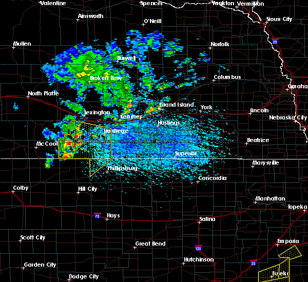 At 456 pm cdt, severe thunderstorms were located along a line extending from smithfield to hollinger to 11 miles northwest of norton, moving southeast at 30 mph (radar indicated). Hazards include 70 mph wind gusts. Expect considerable tree damage. Damage is likely to mobile homes, roofs, and outbuildings. At 456 pm cdt, severe thunderstorms were located along a line extending from smithfield to hollinger to 11 miles northwest of norton, moving southeast at 30 mph (radar indicated). Hazards include 70 mph wind gusts. Expect considerable tree damage. Damage is likely to mobile homes, roofs, and outbuildings.
|
| 8/9/2017 4:31 PM CDT |
 At 430 pm cdt, a severe thunderstorm was located near elwood, or 17 miles south of lexington, moving southeast at 20 mph (radar indicated). Hazards include 60 mph wind gusts and penny size hail. Expect damage to roofs, siding, and trees. Locations impacted include, bertrand, elwood and smithfield. At 430 pm cdt, a severe thunderstorm was located near elwood, or 17 miles south of lexington, moving southeast at 20 mph (radar indicated). Hazards include 60 mph wind gusts and penny size hail. Expect damage to roofs, siding, and trees. Locations impacted include, bertrand, elwood and smithfield.
|
| 8/9/2017 4:15 PM CDT |
 At 415 pm cdt, a severe thunderstorm was located near elwood, or 16 miles southwest of lexington, moving southeast at 20 mph (radar indicated). Hazards include 60 mph wind gusts and quarter size hail. Hail damage to vehicles is expected. Expect wind damage to roofs, siding, and trees. At 415 pm cdt, a severe thunderstorm was located near elwood, or 16 miles southwest of lexington, moving southeast at 20 mph (radar indicated). Hazards include 60 mph wind gusts and quarter size hail. Hail damage to vehicles is expected. Expect wind damage to roofs, siding, and trees.
|
| 7/2/2017 9:21 PM CDT |
 At 920 pm cdt, severe thunderstorms were located along a line extending from near eustis to 13 miles east of stockville to near holbrook to near medicine creek reservoir state recreation area, moving south at 40 mph (at 9:18 pm cdt...a 72 mph wind gust was reported 2 miles north northeast of cambridge). Hazards include 70 mph wind gusts and ping pong ball size hail. People and animals outdoors will be injured. expect hail damage to roofs, siding, windows, and vehicles. expect considerable tree damage. wind damage is also likely to mobile homes, roofs, and outbuildings. Locations impacted include, cambridge, arapahoe, elwood, beaver city, holbrook, edison, wilsonville, smithfield, hendley, hollinger and johnson lake. At 920 pm cdt, severe thunderstorms were located along a line extending from near eustis to 13 miles east of stockville to near holbrook to near medicine creek reservoir state recreation area, moving south at 40 mph (at 9:18 pm cdt...a 72 mph wind gust was reported 2 miles north northeast of cambridge). Hazards include 70 mph wind gusts and ping pong ball size hail. People and animals outdoors will be injured. expect hail damage to roofs, siding, windows, and vehicles. expect considerable tree damage. wind damage is also likely to mobile homes, roofs, and outbuildings. Locations impacted include, cambridge, arapahoe, elwood, beaver city, holbrook, edison, wilsonville, smithfield, hendley, hollinger and johnson lake.
|
| 7/2/2017 9:09 PM CDT |
 At 909 pm cdt, severe thunderstorms were located along a line extending from near eustis to 13 miles east of stockville to 12 miles northwest of holbrook to medicine creek reservoir state recreation area, moving south at 30 mph (radar indicated). Hazards include 70 mph wind gusts and ping pong ball size hail. People and animals outdoors will be injured. expect hail damage to roofs, siding, windows, and vehicles. expect considerable tree damage. Wind damage is also likely to mobile homes, roofs, and outbuildings. At 909 pm cdt, severe thunderstorms were located along a line extending from near eustis to 13 miles east of stockville to 12 miles northwest of holbrook to medicine creek reservoir state recreation area, moving south at 30 mph (radar indicated). Hazards include 70 mph wind gusts and ping pong ball size hail. People and animals outdoors will be injured. expect hail damage to roofs, siding, windows, and vehicles. expect considerable tree damage. Wind damage is also likely to mobile homes, roofs, and outbuildings.
|
| 6/27/2017 5:30 PM CDT |
 At 1030 pm cdt, severe thunderstorms were located along a line extending from near pleasanton to near elm creek to near bertrand to 8 miles southwest of loomis, moving east at 55 mph (radar indicated). Hazards include 70 mph wind gusts and nickel size hail. Expect considerable tree damage. damage is likely to mobile homes, roofs, and outbuildings. locations impacted include, kearney, lexington, holdrege, elm creek, bertrand, axtell, elwood, overton, odessa, loomis, wilcox, amherst, sumner, funk, riverdale, miller, atlanta and smithfield. This includes interstate 80 between mile markers 236 and 281. At 1030 pm cdt, severe thunderstorms were located along a line extending from near pleasanton to near elm creek to near bertrand to 8 miles southwest of loomis, moving east at 55 mph (radar indicated). Hazards include 70 mph wind gusts and nickel size hail. Expect considerable tree damage. damage is likely to mobile homes, roofs, and outbuildings. locations impacted include, kearney, lexington, holdrege, elm creek, bertrand, axtell, elwood, overton, odessa, loomis, wilcox, amherst, sumner, funk, riverdale, miller, atlanta and smithfield. This includes interstate 80 between mile markers 236 and 281.
|
| 6/27/2017 5:06 PM CDT |
 At 1005 pm cdt, severe thunderstorms were located along a line extending from near sumner to near johnson lake to 6 miles southwest of elwood to near holbrook, moving east at 55 mph (radar indicated). Hazards include 60 mph wind gusts and nickel size hail. expect damage to roofs, siding, and trees At 1005 pm cdt, severe thunderstorms were located along a line extending from near sumner to near johnson lake to 6 miles southwest of elwood to near holbrook, moving east at 55 mph (radar indicated). Hazards include 60 mph wind gusts and nickel size hail. expect damage to roofs, siding, and trees
|
| 6/27/2017 5:02 PM CDT |
 At 1001 pm cdt, severe thunderstorms were located along a line extending from near cozad to near eustis to 9 miles east of medicine creek reservoir state recreation area, moving east at 50 mph (an automated weather station at lexington reported a 61 mph wind gust at 9:55 pm cdt). Hazards include 60 mph wind gusts and nickel size hail. Expect damage to roofs, siding, and trees. locations impacted include, lexington, cozad, gothenburg, elwood, smithfield, willow island, johnson lake and farnam. This includes interstate 80 between mile markers 209 and 242. At 1001 pm cdt, severe thunderstorms were located along a line extending from near cozad to near eustis to 9 miles east of medicine creek reservoir state recreation area, moving east at 50 mph (an automated weather station at lexington reported a 61 mph wind gust at 9:55 pm cdt). Hazards include 60 mph wind gusts and nickel size hail. Expect damage to roofs, siding, and trees. locations impacted include, lexington, cozad, gothenburg, elwood, smithfield, willow island, johnson lake and farnam. This includes interstate 80 between mile markers 209 and 242.
|
| 6/27/2017 4:40 PM CDT |
 At 940 pm cdt, severe thunderstorms were located along a line extending from 7 miles southwest of gothenburg to near moorefield to 6 miles west of medicine creek reservoir state recreation area, moving east at 50 mph (radar indicated). Hazards include 60 mph wind gusts and nickel size hail. expect damage to roofs, siding, and trees At 940 pm cdt, severe thunderstorms were located along a line extending from 7 miles southwest of gothenburg to near moorefield to 6 miles west of medicine creek reservoir state recreation area, moving east at 50 mph (radar indicated). Hazards include 60 mph wind gusts and nickel size hail. expect damage to roofs, siding, and trees
|
| 4/9/2017 5:25 PM CDT |
 At 524 pm cdt, severe thunderstorms were located along a line extending from cozad to near smithfield to near edison, moving east at 45 mph (trained weather spotters. there have been several reports of 60 to 70 mph winds associated with this line of thunderstorms). Hazards include 70 mph wind gusts. Expect considerable tree damage. Damage is likely to mobile homes, roofs, and outbuildings. At 524 pm cdt, severe thunderstorms were located along a line extending from cozad to near smithfield to near edison, moving east at 45 mph (trained weather spotters. there have been several reports of 60 to 70 mph winds associated with this line of thunderstorms). Hazards include 70 mph wind gusts. Expect considerable tree damage. Damage is likely to mobile homes, roofs, and outbuildings.
|
| 4/9/2017 5:19 PM CDT |
 At 516 pm cdt, severe thunderstorms were located along a line extending from willow island to near arapahoe to near hendley, moving east at 40 mph (trained weather spotters. at 513 pm cdt...a storm chaser measured a wind gust of 72 mph at a location 8 miles southwest of elwood). Hazards include 70 mph wind gusts. Expect considerable tree damage. damage is likely to mobile homes, roofs, and outbuildings. locations impacted include, lexington, cozad, gothenburg, arapahoe, oxford, elwood, holbrook, edison, smithfield, willow island, johnson lake and farnam. This includes interstate 80 between mile markers 209 and 241. At 516 pm cdt, severe thunderstorms were located along a line extending from willow island to near arapahoe to near hendley, moving east at 40 mph (trained weather spotters. at 513 pm cdt...a storm chaser measured a wind gust of 72 mph at a location 8 miles southwest of elwood). Hazards include 70 mph wind gusts. Expect considerable tree damage. damage is likely to mobile homes, roofs, and outbuildings. locations impacted include, lexington, cozad, gothenburg, arapahoe, oxford, elwood, holbrook, edison, smithfield, willow island, johnson lake and farnam. This includes interstate 80 between mile markers 209 and 241.
|
| 4/9/2017 4:58 PM CDT |
 At 454 pm cdt, severe thunderstorms were located along a line extending from 8 miles southwest of gothenburg to near cambridge to 7 miles southwest of danbury, moving east at 40 mph (trained weather spotters. at 449 pm cdt trained weather spotters measured a 64 mph wind gust in cambridge along the thunderstorm gust front). Hazards include 60 mph wind gusts. Expect damage to roofs, siding, and trees. locations impacted include, lexington, cozad, gothenburg, cambridge, arapahoe, elwood, beaver city, holbrook, edison, wilsonville, smithfield, hendley, hollinger, willow island, johnson lake and farnam. this includes interstate 80 between mile markers 209 and 241. The strongest winds are occurring out ahead of the broken line of thunderstorms in association with a strong gust front. At 454 pm cdt, severe thunderstorms were located along a line extending from 8 miles southwest of gothenburg to near cambridge to 7 miles southwest of danbury, moving east at 40 mph (trained weather spotters. at 449 pm cdt trained weather spotters measured a 64 mph wind gust in cambridge along the thunderstorm gust front). Hazards include 60 mph wind gusts. Expect damage to roofs, siding, and trees. locations impacted include, lexington, cozad, gothenburg, cambridge, arapahoe, elwood, beaver city, holbrook, edison, wilsonville, smithfield, hendley, hollinger, willow island, johnson lake and farnam. this includes interstate 80 between mile markers 209 and 241. The strongest winds are occurring out ahead of the broken line of thunderstorms in association with a strong gust front.
|
| 4/9/2017 4:37 PM CDT |
 At 436 pm cdt, severe thunderstorms were located along a line extending from 11 miles northwest of moorefield to near bartley to near herndon, moving east at 40 mph (trained weather spotters). Hazards include 60 mph wind gusts. expect damage to roofs, siding, and trees At 436 pm cdt, severe thunderstorms were located along a line extending from 11 miles northwest of moorefield to near bartley to near herndon, moving east at 40 mph (trained weather spotters). Hazards include 60 mph wind gusts. expect damage to roofs, siding, and trees
|
| 3/23/2017 11:53 PM CDT |
 The severe thunderstorm warning for northern smith, northern phillips, webster, franklin, phelps, adams, kearney, gosper, furnas and harlan counties will expire at midnight cdt, the storms which prompted the warning have weakened below severe limits, and no longer pose an immediate threat to life or property. therefore, the warning will be allowed to expire. however gusty winds sustained at 25 to 35 mph with gusts to 45 to 55 mph are expected through 4 am. The severe thunderstorm warning for northern smith, northern phillips, webster, franklin, phelps, adams, kearney, gosper, furnas and harlan counties will expire at midnight cdt, the storms which prompted the warning have weakened below severe limits, and no longer pose an immediate threat to life or property. therefore, the warning will be allowed to expire. however gusty winds sustained at 25 to 35 mph with gusts to 45 to 55 mph are expected through 4 am.
|
| 3/23/2017 11:13 PM CDT |
 At 1113 pm cdt, severe thunderstorms were located along a line extending from indianola to near long island to naponee to 7 miles north of lebanon, moving northeast at 70 mph (radar indicated). Hazards include 70 mph wind gusts. Expect considerable tree damage. Damage is likely to mobile homes, roofs, and outbuildings. At 1113 pm cdt, severe thunderstorms were located along a line extending from indianola to near long island to naponee to 7 miles north of lebanon, moving northeast at 70 mph (radar indicated). Hazards include 70 mph wind gusts. Expect considerable tree damage. Damage is likely to mobile homes, roofs, and outbuildings.
|
| 3/23/2017 9:43 PM CDT |
 At 940 pm cdt, severe thunderstorms were located along a line extending from elm creek to near upland to near athol, moving east at 70 mph (emergency management). Hazards include 70 mph wind gusts. Expect considerable tree damage. damage is likely to mobile homes, roofs, and outbuildings. several locations outside of rainfall have reported blowing dust reducing visibility to less than a quarter mile. stop signs and trees have been blown over. power lines are down in arapahoe. locations impacted include, kearney, hastings, holdrege, phillipsburg, minden, gibbon, smith center, ravenna, wood river, alma, shelton, arapahoe, red cloud, franklin, blue hill, elm creek, kenesaw, oxford, juniata and bertrand. This includes interstate 80 between mile markers 240 and 306. At 940 pm cdt, severe thunderstorms were located along a line extending from elm creek to near upland to near athol, moving east at 70 mph (emergency management). Hazards include 70 mph wind gusts. Expect considerable tree damage. damage is likely to mobile homes, roofs, and outbuildings. several locations outside of rainfall have reported blowing dust reducing visibility to less than a quarter mile. stop signs and trees have been blown over. power lines are down in arapahoe. locations impacted include, kearney, hastings, holdrege, phillipsburg, minden, gibbon, smith center, ravenna, wood river, alma, shelton, arapahoe, red cloud, franklin, blue hill, elm creek, kenesaw, oxford, juniata and bertrand. This includes interstate 80 between mile markers 240 and 306.
|
| 3/23/2017 9:25 PM CDT |
 At 924 pm cdt, severe thunderstorms were located along a line extending from near smithfield to 7 miles southwest of hildreth to near kirwin, moving northeast at 70 mph (emergency management). Hazards include 70 mph wind gusts. Expect considerable tree damage. Damage is likely to mobile homes, roofs, and outbuildings. At 924 pm cdt, severe thunderstorms were located along a line extending from near smithfield to 7 miles southwest of hildreth to near kirwin, moving northeast at 70 mph (emergency management). Hazards include 70 mph wind gusts. Expect considerable tree damage. Damage is likely to mobile homes, roofs, and outbuildings.
|
| 9/5/2016 9:58 PM CDT |
 At 950 pm cdt, a severe thunderstorm was located near smithfield, or 8 miles south of lexington, moving east at 30 mph (radar indicated). Hazards include 60 mph wind gusts and quarter size hail. Hail damage to vehicles is expected. expect wind damage to roofs, siding, and trees. locations impacted include, smithfield. This includes interstate 80 between mile markers 236 and 243. At 950 pm cdt, a severe thunderstorm was located near smithfield, or 8 miles south of lexington, moving east at 30 mph (radar indicated). Hazards include 60 mph wind gusts and quarter size hail. Hail damage to vehicles is expected. expect wind damage to roofs, siding, and trees. locations impacted include, smithfield. This includes interstate 80 between mile markers 236 and 243.
|
| 9/5/2016 9:51 PM CDT |
 At 950 pm cdt, a severe thunderstorm was located near smithfield, or 8 miles south of lexington, moving east at 30 mph (radar indicated). Hazards include 60 mph wind gusts and quarter size hail. Hail damage to vehicles is expected. expect wind damage to roofs, siding, and trees. locations impacted include, smithfield. This includes interstate 80 between mile markers 236 and 243. At 950 pm cdt, a severe thunderstorm was located near smithfield, or 8 miles south of lexington, moving east at 30 mph (radar indicated). Hazards include 60 mph wind gusts and quarter size hail. Hail damage to vehicles is expected. expect wind damage to roofs, siding, and trees. locations impacted include, smithfield. This includes interstate 80 between mile markers 236 and 243.
|
| 9/5/2016 9:36 PM CDT |
 At 935 pm cdt, a severe thunderstorm was located over elwood, or 12 miles southwest of lexington, moving east at 30 mph (radar indicated). Hazards include golf ball size hail and 60 mph wind gusts. People and animals outdoors will be injured. expect hail damage to roofs, siding, windows, and vehicles. expect wind damage to roofs, siding, and trees. locations impacted include, elwood, smithfield and johnson lake. This includes interstate 80 between mile markers 228 and 243. At 935 pm cdt, a severe thunderstorm was located over elwood, or 12 miles southwest of lexington, moving east at 30 mph (radar indicated). Hazards include golf ball size hail and 60 mph wind gusts. People and animals outdoors will be injured. expect hail damage to roofs, siding, windows, and vehicles. expect wind damage to roofs, siding, and trees. locations impacted include, elwood, smithfield and johnson lake. This includes interstate 80 between mile markers 228 and 243.
|
| 9/5/2016 9:30 PM CDT |
 At 929 pm cdt, a severe thunderstorm was located over elwood, or 12 miles southwest of lexington, moving east at 45 mph (radar indicated). Hazards include 60 mph wind gusts and quarter size hail. Hail damage to vehicles is expected. expect wind damage to roofs, siding, and trees. locations impacted include, elwood, smithfield and johnson lake. This includes interstate 80 between mile markers 228 and 243. At 929 pm cdt, a severe thunderstorm was located over elwood, or 12 miles southwest of lexington, moving east at 45 mph (radar indicated). Hazards include 60 mph wind gusts and quarter size hail. Hail damage to vehicles is expected. expect wind damage to roofs, siding, and trees. locations impacted include, elwood, smithfield and johnson lake. This includes interstate 80 between mile markers 228 and 243.
|
| 9/5/2016 9:15 PM CDT |
 At 914 pm cdt, a severe thunderstorm was located near eustis, or 21 miles southwest of lexington, moving northeast at 35 mph (radar indicated). Hazards include 60 mph wind gusts and quarter size hail. Hail damage to vehicles is expected. Expect wind damage to roofs, siding, and trees. At 914 pm cdt, a severe thunderstorm was located near eustis, or 21 miles southwest of lexington, moving northeast at 35 mph (radar indicated). Hazards include 60 mph wind gusts and quarter size hail. Hail damage to vehicles is expected. Expect wind damage to roofs, siding, and trees.
|
| 8/12/2016 2:08 AM CDT |
 The severe thunderstorm warning for eastern dawson, western buffalo, northeastern gosper and northwestern phelps counties will expire at 215 am cdt, the storms which prompted the warning have weakened below severe limits, and no longer pose an immediate threat to life or property. therefore, the warning will be allowed to expire. however gusty winds and heavy rain are still possible with these thunderstorms. The severe thunderstorm warning for eastern dawson, western buffalo, northeastern gosper and northwestern phelps counties will expire at 215 am cdt, the storms which prompted the warning have weakened below severe limits, and no longer pose an immediate threat to life or property. therefore, the warning will be allowed to expire. however gusty winds and heavy rain are still possible with these thunderstorms.
|
| 8/12/2016 1:55 AM CDT |
 At 155 am cdt, severe thunderstorms were located along a line extending from eddyville to near overton to near bertrand, moving east at 35 mph (radar indicated). Hazards include 60 mph wind gusts. Expect damage to roofs. siding. and trees. locations impacted include, lexington, elm creek, bertrand, overton, loomis, amherst, sumner, miller, eddyville, smithfield and johnson lake. This includes interstate 80 between mile markers 231 and 262. At 155 am cdt, severe thunderstorms were located along a line extending from eddyville to near overton to near bertrand, moving east at 35 mph (radar indicated). Hazards include 60 mph wind gusts. Expect damage to roofs. siding. and trees. locations impacted include, lexington, elm creek, bertrand, overton, loomis, amherst, sumner, miller, eddyville, smithfield and johnson lake. This includes interstate 80 between mile markers 231 and 262.
|
| 8/12/2016 1:41 AM CDT |
 At 140 am cdt, severe thunderstorms were located along a line extending from 7 miles southwest of oconto to near lexington to near smithfield, moving east at 30 mph (radar indicated). Hazards include 60 mph wind gusts. Expect damage to roofs. siding. And trees. At 140 am cdt, severe thunderstorms were located along a line extending from 7 miles southwest of oconto to near lexington to near smithfield, moving east at 30 mph (radar indicated). Hazards include 60 mph wind gusts. Expect damage to roofs. siding. And trees.
|
| 7/27/2016 1:29 AM CDT |
 At 129 am cdt, severe thunderstorms were located along a line extending from near farwell to near shelton to near oxford, moving southeast at 45 mph (radar indicated). Hazards include 70 mph wind gusts. Expect considerable tree damage. Damage is likely to mobile homes, roofs, and outbuildings. At 129 am cdt, severe thunderstorms were located along a line extending from near farwell to near shelton to near oxford, moving southeast at 45 mph (radar indicated). Hazards include 70 mph wind gusts. Expect considerable tree damage. Damage is likely to mobile homes, roofs, and outbuildings.
|
| 7/6/2016 11:12 PM CDT |
 At 1112 pm cdt, severe thunderstorms were located along a line extending from 6 miles northeast of loomis to near funk to near ragan to huntley to near woodruff, moving east at 60 mph (radar indicated). Hazards include 60 mph wind gusts and penny size hail. Expect damage to roofs. siding. and trees. Locations impacted include, holdrege, minden, alma, arapahoe, franklin, oxford, bertrand, axtell, elwood, beaver city, orleans, loomis, hildreth, wilcox, funk, stamford, republican city, upland, edison and atlanta. At 1112 pm cdt, severe thunderstorms were located along a line extending from 6 miles northeast of loomis to near funk to near ragan to huntley to near woodruff, moving east at 60 mph (radar indicated). Hazards include 60 mph wind gusts and penny size hail. Expect damage to roofs. siding. and trees. Locations impacted include, holdrege, minden, alma, arapahoe, franklin, oxford, bertrand, axtell, elwood, beaver city, orleans, loomis, hildreth, wilcox, funk, stamford, republican city, upland, edison and atlanta.
|
| 7/6/2016 10:41 PM CDT |
 At 1040 pm cdt, severe thunderstorms were located along a line extending from 8 miles southwest of elwood to 6 miles north of arapahoe to near edison to beaver city to 9 miles southeast of wilsonville, moving east at 60 mph (radar indicated). Hazards include 70 mph wind gusts and penny size hail. Expect considerable tree damage. Damage is likely to mobile homes, roofs, and outbuildings. At 1040 pm cdt, severe thunderstorms were located along a line extending from 8 miles southwest of elwood to 6 miles north of arapahoe to near edison to beaver city to 9 miles southeast of wilsonville, moving east at 60 mph (radar indicated). Hazards include 70 mph wind gusts and penny size hail. Expect considerable tree damage. Damage is likely to mobile homes, roofs, and outbuildings.
|
| 6/28/2016 11:57 PM CDT | The severe thunderstorm warning for gosper, phelps, furnas and western harlan counties will expire at midnight cdt, the storms which prompted the warning have weakened below severe limits, and no longer pose an immediate threat to life or property. therefore the warning will be allowed to expire. however gusty winds are still possible with these thunderstorms. a severe thunderstorm watch remains in effect until 400 am cdt for north central kansas, and south central nebraska. |
| 6/28/2016 11:21 PM CDT |
 At 1121 pm cdt, severe thunderstorms were located along a line extending from 8 miles west of johnson lake to 10 miles north of holbrook to 6 miles southwest of cambridge, moving east at 60 mph (radar indicated). Hazards include 60 mph wind gusts. Expect damage to roofs. siding. And trees. At 1121 pm cdt, severe thunderstorms were located along a line extending from 8 miles west of johnson lake to 10 miles north of holbrook to 6 miles southwest of cambridge, moving east at 60 mph (radar indicated). Hazards include 60 mph wind gusts. Expect damage to roofs. siding. And trees.
|
| 6/17/2016 8:01 PM CDT |
 At 800 pm cdt, severe thunderstorms were located along a line extending from 9 miles north of lexington to near elm creek, moving northeast at 15 mph. these are very dangerous storms (radar indicated). Hazards include 80 mph wind gusts. Flying debris will be dangerous to those caught without shelter. mobile homes will be heavily damaged. expect considerable damage to roofs, windows, and vehicles. extensive tree damage and power outages are likely. Locations impacted include, lexington, cozad, elm creek, bertrand, elwood, overton, loomis, amherst, sumner, miller, eddyville, smithfield and johnson lake. At 800 pm cdt, severe thunderstorms were located along a line extending from 9 miles north of lexington to near elm creek, moving northeast at 15 mph. these are very dangerous storms (radar indicated). Hazards include 80 mph wind gusts. Flying debris will be dangerous to those caught without shelter. mobile homes will be heavily damaged. expect considerable damage to roofs, windows, and vehicles. extensive tree damage and power outages are likely. Locations impacted include, lexington, cozad, elm creek, bertrand, elwood, overton, loomis, amherst, sumner, miller, eddyville, smithfield and johnson lake.
|
| 6/17/2016 7:41 PM CDT |
 At 741 pm cdt, severe thunderstorms were located along a line extending from 6 miles northwest of lexington to near elm creek, moving northeast at 15 mph (radar indicated). Hazards include 70 mph wind gusts. Expect considerable tree damage. Damage is likely to mobile homes, roofs, and outbuildings. At 741 pm cdt, severe thunderstorms were located along a line extending from 6 miles northwest of lexington to near elm creek, moving northeast at 15 mph (radar indicated). Hazards include 70 mph wind gusts. Expect considerable tree damage. Damage is likely to mobile homes, roofs, and outbuildings.
|
| 5/30/2016 9:08 PM CDT |
 At 908 pm cdt, severe thunderstorms were located along a line extending from near overton to 7 miles southwest of loomis to 9 miles south of hollinger, moving east at 45 mph (radar indicated). Hazards include 60 mph wind gusts. Expect damage to roofs. siding. and trees. Locations impacted include, holdrege, alma, cambridge, arapahoe, oxford, bertrand, elwood, beaver city, orleans, loomis, holbrook, funk, stamford, republican city, edison, atlanta, wilsonville, smithfield, huntley and ragan. At 908 pm cdt, severe thunderstorms were located along a line extending from near overton to 7 miles southwest of loomis to 9 miles south of hollinger, moving east at 45 mph (radar indicated). Hazards include 60 mph wind gusts. Expect damage to roofs. siding. and trees. Locations impacted include, holdrege, alma, cambridge, arapahoe, oxford, bertrand, elwood, beaver city, orleans, loomis, holbrook, funk, stamford, republican city, edison, atlanta, wilsonville, smithfield, huntley and ragan.
|
| 5/30/2016 8:55 PM CDT |
 At 854 pm cdt, severe thunderstorms were located along a line extending from near smithfield to 9 miles north of edison to 7 miles southeast of hendley, moving east at 40 mph. this warning replaces the previous warning for gosper and furnas counties expiring at 9pm (radar indicated). Hazards include 60 mph wind gusts. Expect damage to roofs. siding. And trees. At 854 pm cdt, severe thunderstorms were located along a line extending from near smithfield to 9 miles north of edison to 7 miles southeast of hendley, moving east at 40 mph. this warning replaces the previous warning for gosper and furnas counties expiring at 9pm (radar indicated). Hazards include 60 mph wind gusts. Expect damage to roofs. siding. And trees.
|
| 5/30/2016 8:21 PM CDT |
 At 820 pm cdt, severe thunderstorms were located along a line extending from 11 miles southwest of cozad to 12 miles north of cambridge to 15 miles west of wilsonville, moving east at 40 mph (radar indicated). Hazards include 60 mph wind gusts. Expect damage to roofs. siding. And trees. At 820 pm cdt, severe thunderstorms were located along a line extending from 11 miles southwest of cozad to 12 miles north of cambridge to 15 miles west of wilsonville, moving east at 40 mph (radar indicated). Hazards include 60 mph wind gusts. Expect damage to roofs. siding. And trees.
|
| 5/25/2016 9:22 PM CDT |
 At 922 pm cdt, severe thunderstorms were located along a line extending from 6 miles south of overton to loomis to near atlanta to 6 miles north of edison, moving east at 40 mph (radar indicated). Hazards include 60 mph wind gusts and quarter size hail. Hail damage to vehicles is expected. expect wind damage to roofs, siding, and trees. Locations impacted include, holdrege, oxford, bertrand, loomis, funk, edison, atlanta, smithfield and ragan. At 922 pm cdt, severe thunderstorms were located along a line extending from 6 miles south of overton to loomis to near atlanta to 6 miles north of edison, moving east at 40 mph (radar indicated). Hazards include 60 mph wind gusts and quarter size hail. Hail damage to vehicles is expected. expect wind damage to roofs, siding, and trees. Locations impacted include, holdrege, oxford, bertrand, loomis, funk, edison, atlanta, smithfield and ragan.
|
| 5/25/2016 9:11 PM CDT |
 At 910 pm cdt, severe thunderstorms were located along a line extending from 7 miles southeast of lexington to near smithfield to 7 miles southwest of bertrand to holbrook, moving east at 40 mph (radar indicated). Hazards include 60 mph wind gusts and quarter size hail. Hail damage to vehicles is expected. Expect wind damage to roofs, siding, and trees. At 910 pm cdt, severe thunderstorms were located along a line extending from 7 miles southeast of lexington to near smithfield to 7 miles southwest of bertrand to holbrook, moving east at 40 mph (radar indicated). Hazards include 60 mph wind gusts and quarter size hail. Hail damage to vehicles is expected. Expect wind damage to roofs, siding, and trees.
|
| 5/25/2016 9:01 PM CDT | Measured with a handheld device in gosper county NE, 4 miles S of Smithfield, NE |
| 5/25/2016 9:01 PM CDT |
 At 900 pm cdt, severe thunderstorms were located along a line extending from johnson lake to near elwood to near holbrook, moving east at 35 mph (radar indicated). Hazards include 60 mph wind gusts and quarter size hail. Hail damage to vehicles is expected. expect wind damage to roofs, siding, and trees. Locations impacted include, cambridge, arapahoe, oxford, elwood, holbrook, edison, smithfield and johnson lake. At 900 pm cdt, severe thunderstorms were located along a line extending from johnson lake to near elwood to near holbrook, moving east at 35 mph (radar indicated). Hazards include 60 mph wind gusts and quarter size hail. Hail damage to vehicles is expected. expect wind damage to roofs, siding, and trees. Locations impacted include, cambridge, arapahoe, oxford, elwood, holbrook, edison, smithfield and johnson lake.
|
| 5/25/2016 8:47 PM CDT |
 At 847 pm cdt, severe thunderstorms were located along a line extending from 7 miles west of johnson lake to 10 miles west of elwood to 11 miles northwest of cambridge, moving east at 30 mph (radar indicated). Hazards include 60 mph wind gusts and quarter size hail. Hail damage to vehicles is expected. expect wind damage to roofs, siding, and trees. Locations impacted include, cambridge, arapahoe, oxford, elwood, holbrook, edison, smithfield and johnson lake. At 847 pm cdt, severe thunderstorms were located along a line extending from 7 miles west of johnson lake to 10 miles west of elwood to 11 miles northwest of cambridge, moving east at 30 mph (radar indicated). Hazards include 60 mph wind gusts and quarter size hail. Hail damage to vehicles is expected. expect wind damage to roofs, siding, and trees. Locations impacted include, cambridge, arapahoe, oxford, elwood, holbrook, edison, smithfield and johnson lake.
|
| 5/25/2016 8:36 PM CDT |
 At 836 pm cdt, severe thunderstorms were located along a line extending from 13 miles southwest of cozad to 15 miles north of cambridge to 26 miles west of holbrook, moving east at 35 mph (radar indicated). Hazards include 60 mph wind gusts and quarter size hail. Hail damage to vehicles is expected. Expect wind damage to roofs, siding, and trees. At 836 pm cdt, severe thunderstorms were located along a line extending from 13 miles southwest of cozad to 15 miles north of cambridge to 26 miles west of holbrook, moving east at 35 mph (radar indicated). Hazards include 60 mph wind gusts and quarter size hail. Hail damage to vehicles is expected. Expect wind damage to roofs, siding, and trees.
|
| 9/9/2015 4:19 PM CDT |
 At 418 pm cdt, a severe thunderstorm was located over elwood, or 12 miles south of lexington, moving northeast at 30 mph. a second severe thunderstorm was located 5 miles northwest of cambridge and was tracking east southeast at 20 mph. this storm has a history of producing golfball size hail (radar indicated). Hazards include golf ball size hail and 60 mph wind gusts. People and animals outdoors will be injured. expect hail damage to roofs, siding, windows and vehicles. expect wind damage to roofs, siding and trees. Locations impacted include, cambridge, arapahoe, bertrand, elwood, holbrook, smithfield and johnson lake. At 418 pm cdt, a severe thunderstorm was located over elwood, or 12 miles south of lexington, moving northeast at 30 mph. a second severe thunderstorm was located 5 miles northwest of cambridge and was tracking east southeast at 20 mph. this storm has a history of producing golfball size hail (radar indicated). Hazards include golf ball size hail and 60 mph wind gusts. People and animals outdoors will be injured. expect hail damage to roofs, siding, windows and vehicles. expect wind damage to roofs, siding and trees. Locations impacted include, cambridge, arapahoe, bertrand, elwood, holbrook, smithfield and johnson lake.
|
| 9/9/2015 4:12 PM CDT |
 At 412 pm cdt, a severe thunderstorm was located over elwood, or 15 miles southwest of lexington, moving northeast at 30 mph (radar indicated). Hazards include 60 mph wind gusts and quarter size hail. Hail damage to vehicles is expected. Expect wind damage to roofs, siding and trees. At 412 pm cdt, a severe thunderstorm was located over elwood, or 15 miles southwest of lexington, moving northeast at 30 mph (radar indicated). Hazards include 60 mph wind gusts and quarter size hail. Hail damage to vehicles is expected. Expect wind damage to roofs, siding and trees.
|
| 8/4/2015 4:01 PM CDT |
 At 400 pm cdt, severe thunderstorms were located along a line extending from near overton to near oxford, moving east at 40 mph (trained weather spotters). Hazards include 60 mph wind gusts and penny size hail. Expect damage to roofs. siding and trees. Locations impacted include, holdrege, oxford, bertrand, loomis, funk, edison, atlanta, smithfield and ragan. At 400 pm cdt, severe thunderstorms were located along a line extending from near overton to near oxford, moving east at 40 mph (trained weather spotters). Hazards include 60 mph wind gusts and penny size hail. Expect damage to roofs. siding and trees. Locations impacted include, holdrege, oxford, bertrand, loomis, funk, edison, atlanta, smithfield and ragan.
|
| 8/4/2015 3:38 PM CDT |
 At 338 pm cdt, severe thunderstorms were located along a line extending from near johnson lake to near arapahoe, moving east at 35 mph (trained weather spotters). Hazards include 60 mph wind gusts and penny size hail. Expect damage to roofs. Siding and trees. At 338 pm cdt, severe thunderstorms were located along a line extending from near johnson lake to near arapahoe, moving east at 35 mph (trained weather spotters). Hazards include 60 mph wind gusts and penny size hail. Expect damage to roofs. Siding and trees.
|
| 8/4/2015 3:31 PM CDT |
 At 331 pm cdt, severe thunderstorms were located along a line extending from near johnson lake to 9 miles south of elwood to near cambridge, moving southeast at 35 mph (radar indicated). Hazards include 60 mph wind gusts and penny size hail. Expect damage to roofs. siding and trees. these severe storms will be near, lexington around 340 pm cdt. hendley around 345 pm cdt. other locations impacted by these severe thunderstorms include farnam. This includes interstate 80 between mile markers 224 and 246. At 331 pm cdt, severe thunderstorms were located along a line extending from near johnson lake to 9 miles south of elwood to near cambridge, moving southeast at 35 mph (radar indicated). Hazards include 60 mph wind gusts and penny size hail. Expect damage to roofs. siding and trees. these severe storms will be near, lexington around 340 pm cdt. hendley around 345 pm cdt. other locations impacted by these severe thunderstorms include farnam. This includes interstate 80 between mile markers 224 and 246.
|
| 8/4/2015 3:13 PM CDT |
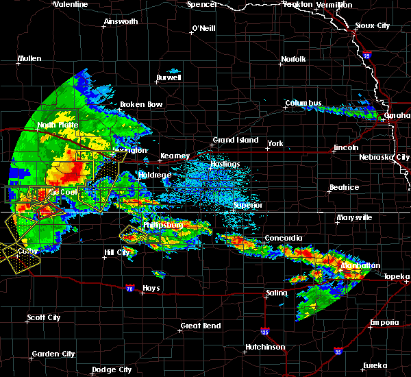 At 313 pm cdt, severe thunderstorms were located along a line extending from near eustis to 8 miles east of orafino to near medicine creek reservoir state recreation area, moving east at 40 mph (radar indicated). Hazards include 60 mph wind gusts and penny size hail. Expect damage to roofs. siding and trees. these severe storms will be near, johnson lake around 325 pm cdt. elwood and holbrook around 330 pm cdt. lexington and arapahoe around 335 pm cdt. smithfield around 340 pm cdt. edison around 345 pm cdt. other locations impacted by these severe thunderstorms include farnam. This includes interstate 80 between mile markers 224 and 246. At 313 pm cdt, severe thunderstorms were located along a line extending from near eustis to 8 miles east of orafino to near medicine creek reservoir state recreation area, moving east at 40 mph (radar indicated). Hazards include 60 mph wind gusts and penny size hail. Expect damage to roofs. siding and trees. these severe storms will be near, johnson lake around 325 pm cdt. elwood and holbrook around 330 pm cdt. lexington and arapahoe around 335 pm cdt. smithfield around 340 pm cdt. edison around 345 pm cdt. other locations impacted by these severe thunderstorms include farnam. This includes interstate 80 between mile markers 224 and 246.
|
| 8/4/2015 2:55 PM CDT |
 At 255 pm cdt, severe thunderstorms were located along a line extending from 8 miles northwest of eustis to near freedom, moving southeast at 35 mph (radar indicated). Hazards include 60 mph wind gusts. Expect damage to roofs. siding and trees. severe thunderstorms will be near, cambridge around 315 pm cdt. elwood and johnson lake around 325 pm cdt. holbrook around 330 pm cdt. smithfield and hendley around 340 pm cdt. beaver city around 345 pm cdt. other locations impacted by these severe thunderstorms include farnam. This includes interstate 80 between mile markers 224 and 246. At 255 pm cdt, severe thunderstorms were located along a line extending from 8 miles northwest of eustis to near freedom, moving southeast at 35 mph (radar indicated). Hazards include 60 mph wind gusts. Expect damage to roofs. siding and trees. severe thunderstorms will be near, cambridge around 315 pm cdt. elwood and johnson lake around 325 pm cdt. holbrook around 330 pm cdt. smithfield and hendley around 340 pm cdt. beaver city around 345 pm cdt. other locations impacted by these severe thunderstorms include farnam. This includes interstate 80 between mile markers 224 and 246.
|
| 6/10/2015 7:58 PM CDT |
 At 758 pm cdt, severe thunderstorms were located along a line extending from arapahoe to near hollinger, moving northeast at 30 mph (radar indicated). Hazards include quarter size hail. Damage to vehicles is expected. Locations impacted include, arapahoe, oxford, elwood, beaver city, holbrook, edison, smithfield and hollinger. At 758 pm cdt, severe thunderstorms were located along a line extending from arapahoe to near hollinger, moving northeast at 30 mph (radar indicated). Hazards include quarter size hail. Damage to vehicles is expected. Locations impacted include, arapahoe, oxford, elwood, beaver city, holbrook, edison, smithfield and hollinger.
|
| 6/10/2015 7:48 PM CDT |
 At 748 pm cdt, severe thunderstorms were located along a line extending from near arapahoe to hendley, moving northeast at 35 mph (radar indicated). Hazards include quarter size hail. damage to vehicles is expected At 748 pm cdt, severe thunderstorms were located along a line extending from near arapahoe to hendley, moving northeast at 35 mph (radar indicated). Hazards include quarter size hail. damage to vehicles is expected
|
| 6/6/2015 1:14 AM CDT | At 114 am cdt, severe thunderstorms were located along a line extending from near elwood to near bertrand to 7 miles north of oxford, moving northeast at 40 mph (radar indicated). Hazards include 60 mph wind gusts. Expect damage to roofs. siding and trees. Locations impacted include, oxford, bertrand, elwood and smithfield. |
| 6/6/2015 12:59 AM CDT | At 1258 am cdt, severe thunderstorms were located along a line extending from 9 miles southwest of elwood to 7 miles northeast of arapahoe to near edison, moving northeast at 40 mph (radar indicated). Hazards include 60 mph wind gusts and dime to penny size hail. Expect damage to roofs. Siding and trees. |
| 5/16/2015 12:36 AM CDT | The severe thunderstorm warning for southeastern gosper and eastern furnas counties will expire at 1245 am cdt, the storms which prompted the warning have weakened below severe limits, and no longer poses an immediate threat to life or property. therefore the warning will be allowed to expire. however small hail and gusty winds are still possible with these thunderstorms. |
| 5/16/2015 12:26 AM CDT | At 1226 am cdt, severe thunderstorms were located along a line extending from 9 miles south of elwood to beaver city, moving northeast at 45 mph (radar indicated). Hazards include quarter size hail. Damage to vehicles is expected. locations impacted include, arapahoe, oxford, bertrand, beaver city, edison, smithfield and hollinger. 1. 00in. |
| 5/15/2015 11:56 PM CDT | At 1156 pm cdt, a severe thunderstorm was located near wilsonville, or 15 miles northwest of norton, moving northeast at 50 mph (radar indicated). Hazards include 60 mph wind gusts and half dollar size hail. Hail damage to vehicles is expected. Expect wind damage to roofs, siding and trees. |
| 6/23/2013 1:19 AM CDT | Downed power line with adjacent tree on fire. one inch hail also being reporte in gosper county NE, 3.2 miles W of Smithfield, NE |
| 6/23/2013 1:08 AM CDT | Quarter sized hail reported 2.8 miles ESE of Smithfield, NE, deputy sheriff reports 1 inch hail and heavy rain. |
| 1/1/0001 12:00 AM | Storm damage reported in gosper county NE, 2.2 miles W of Smithfield, NE |
Hail Maps for Smithfield, NE
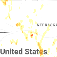
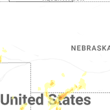

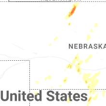
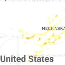
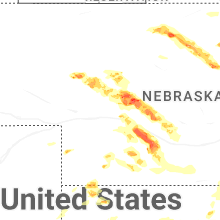
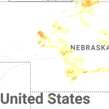
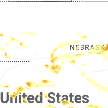


Connect with Interactive Hail Maps