

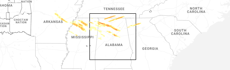
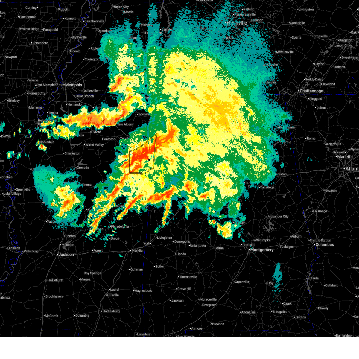
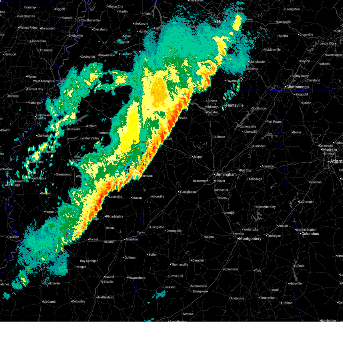
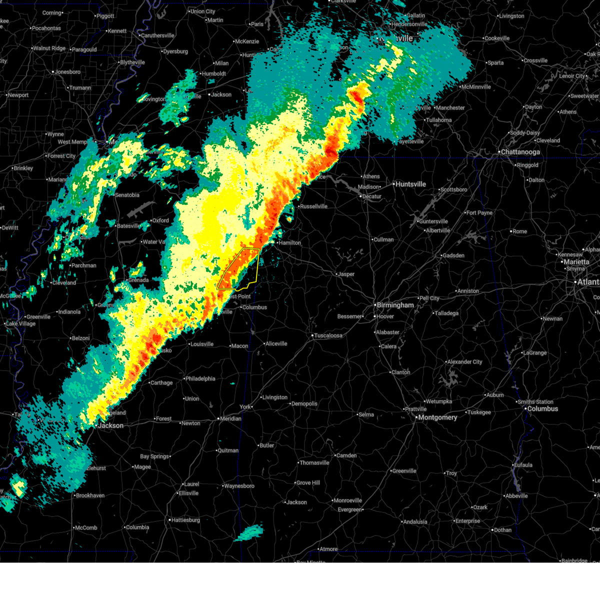
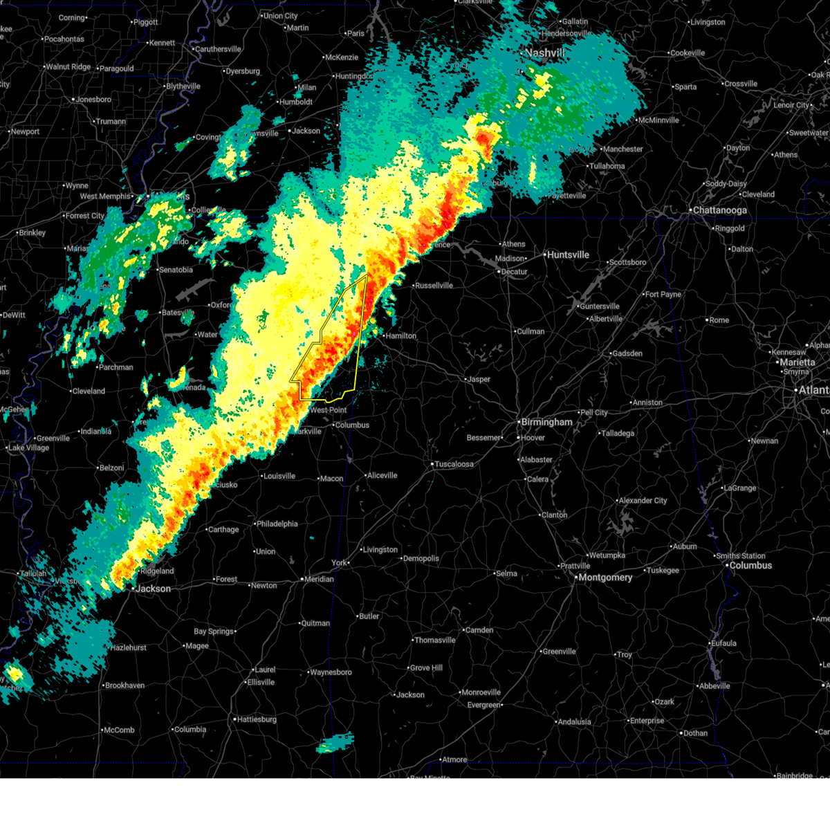
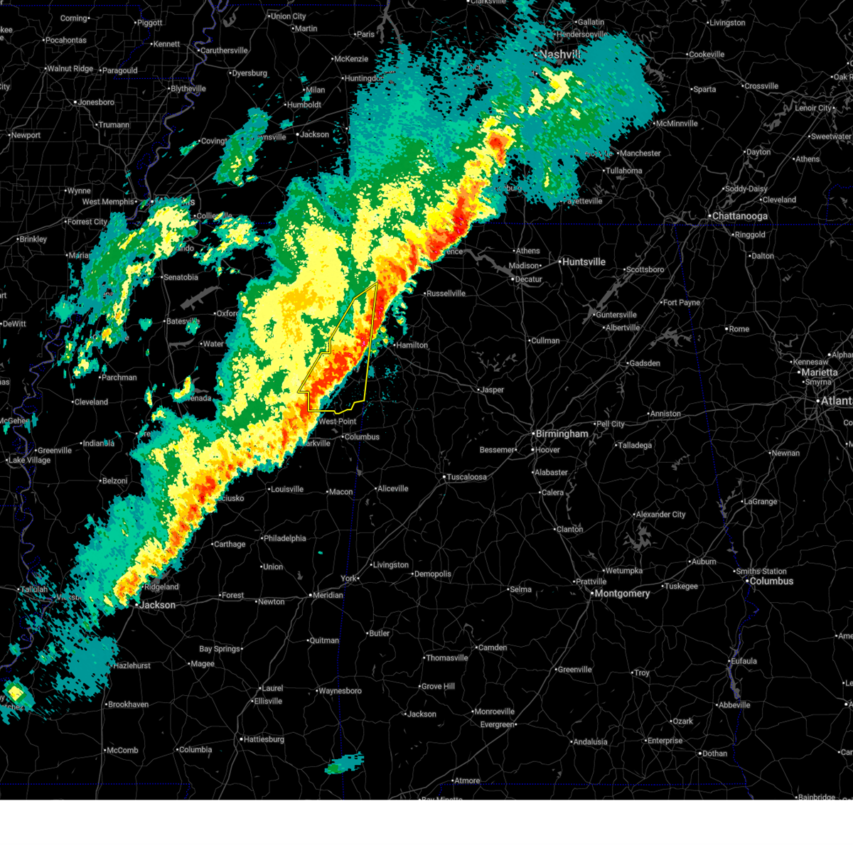
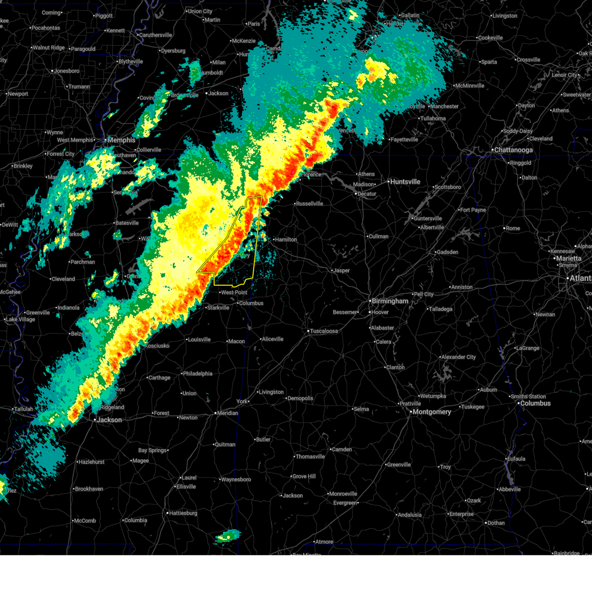
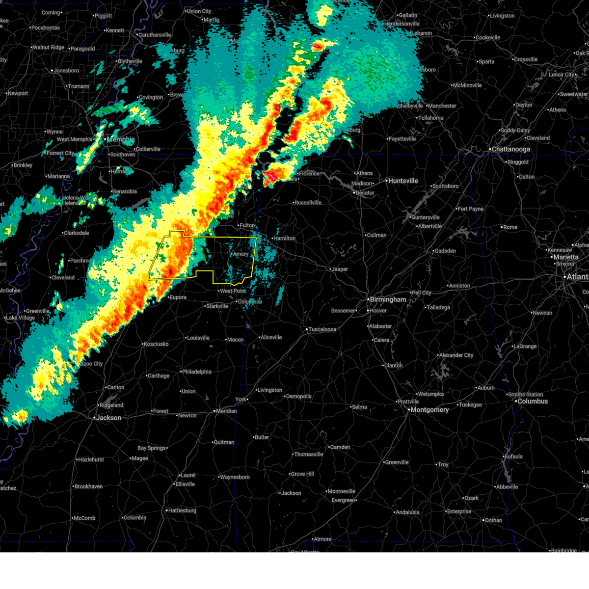
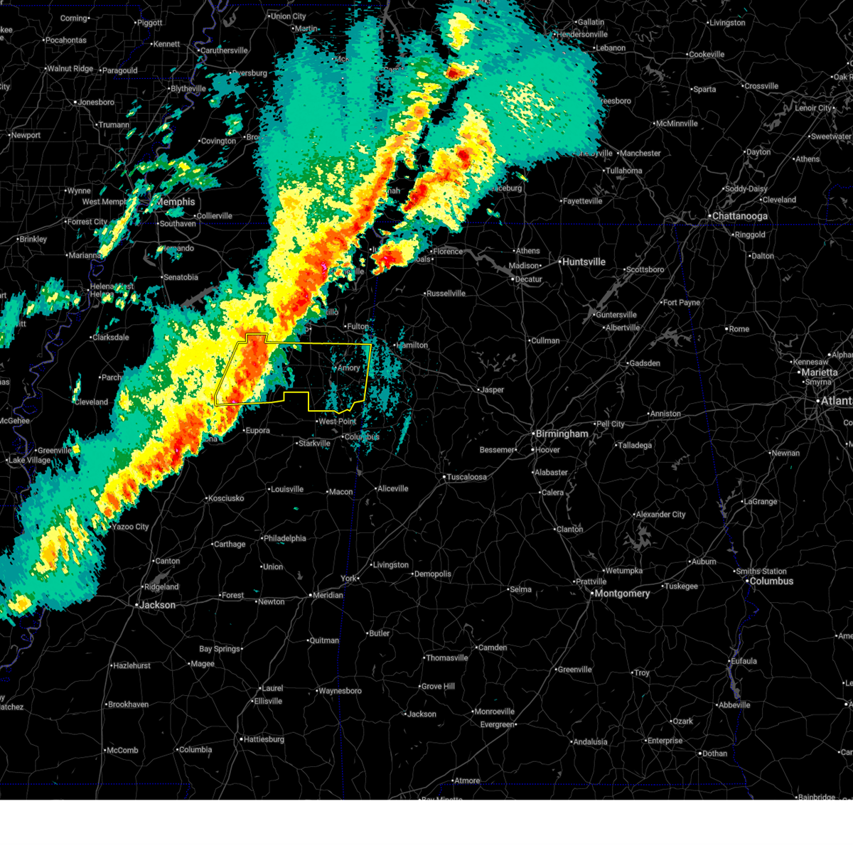
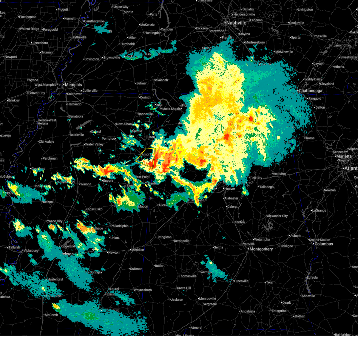
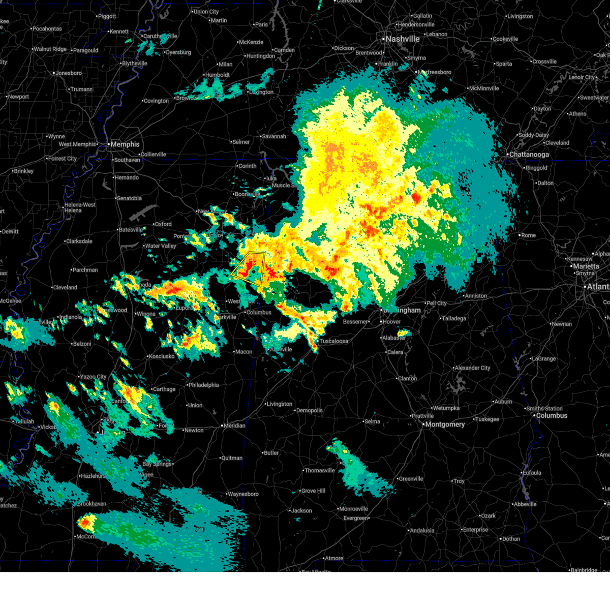
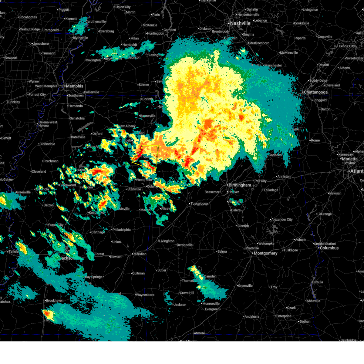
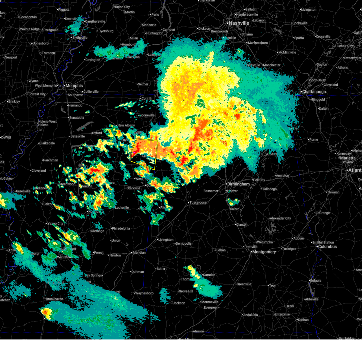
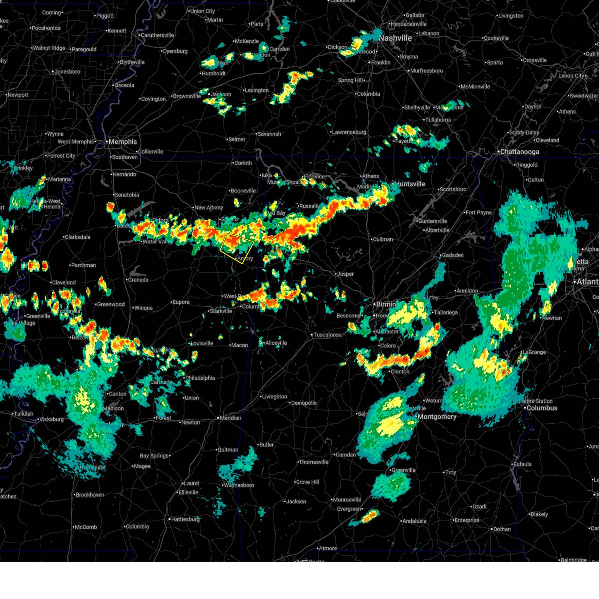
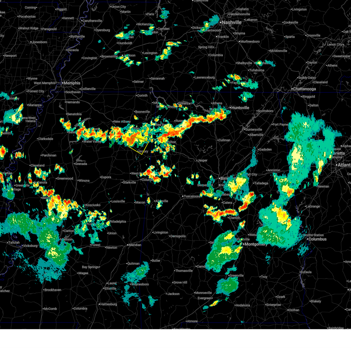
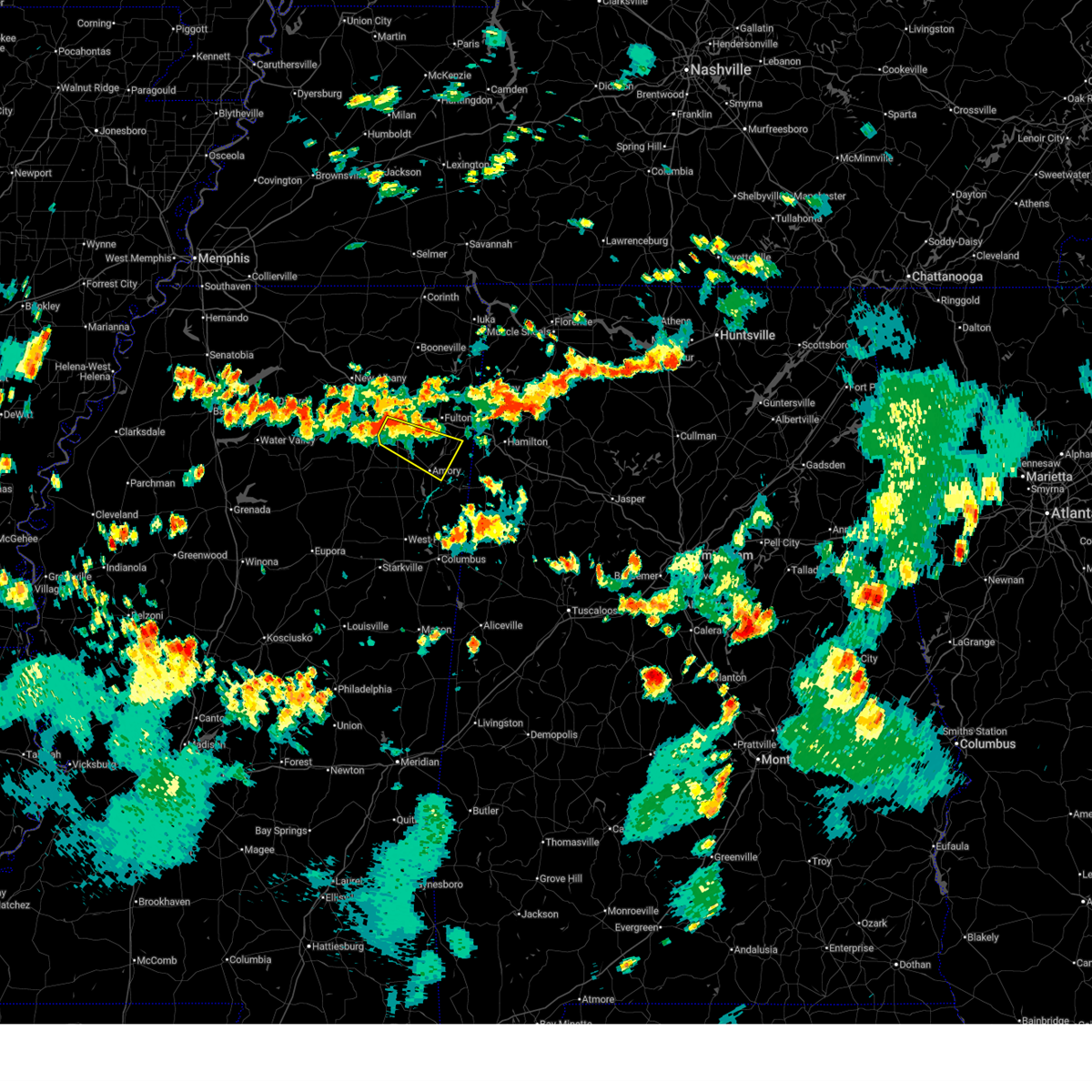
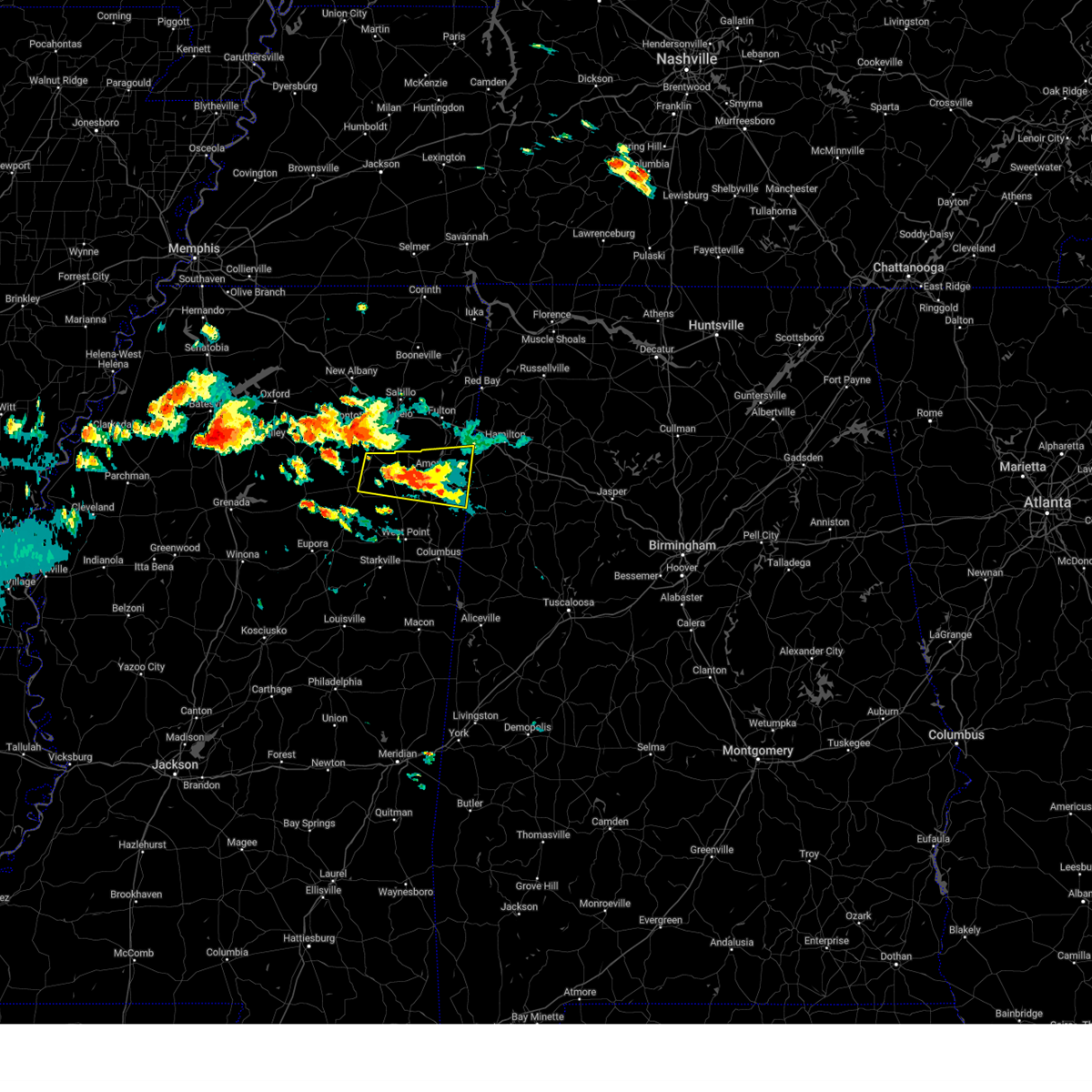
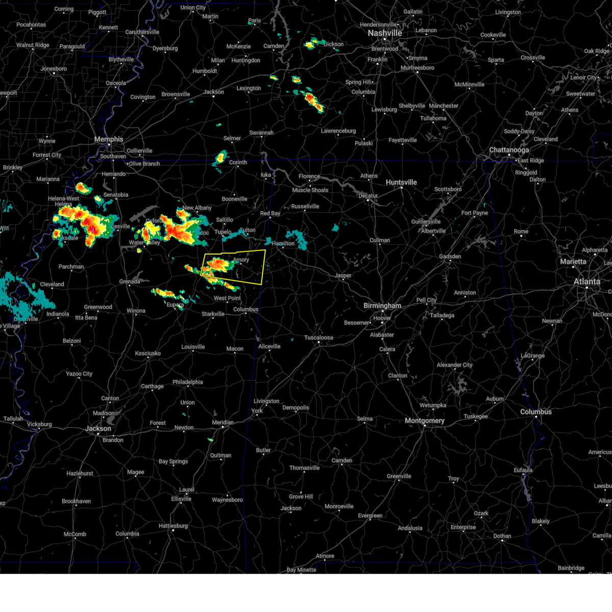
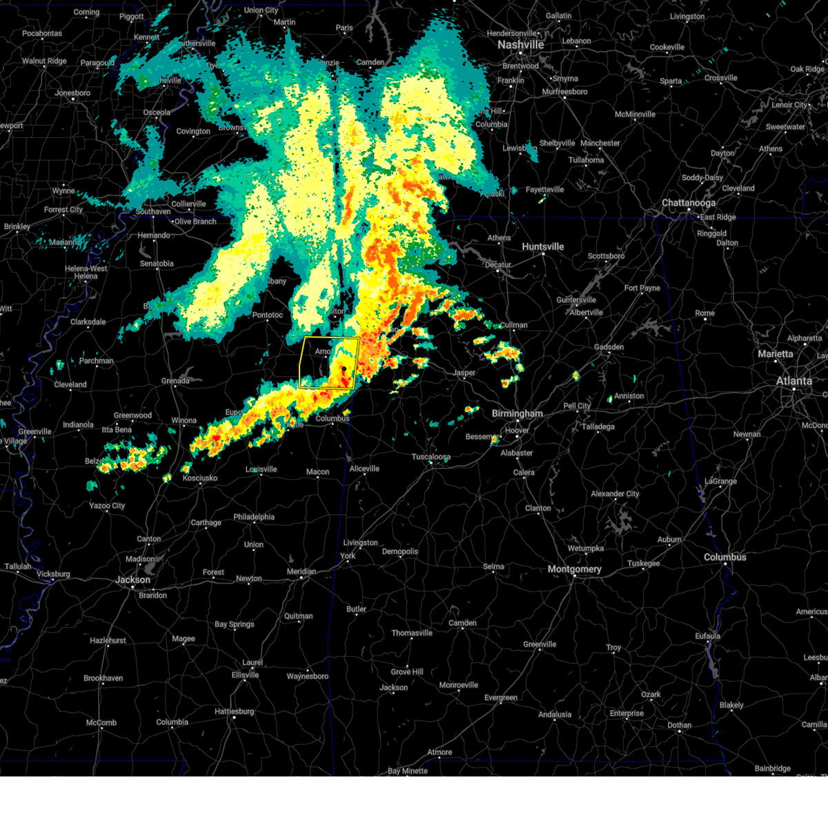
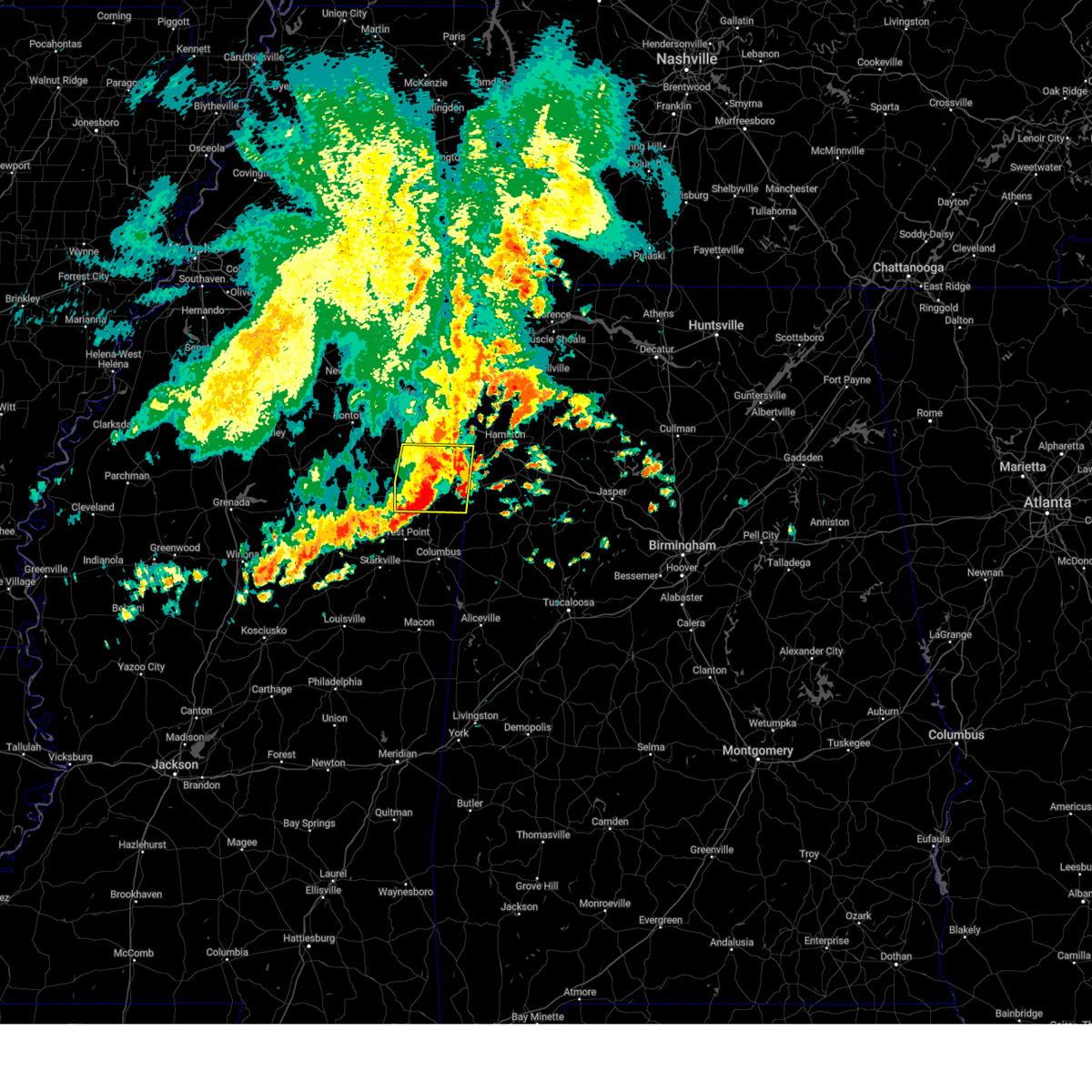
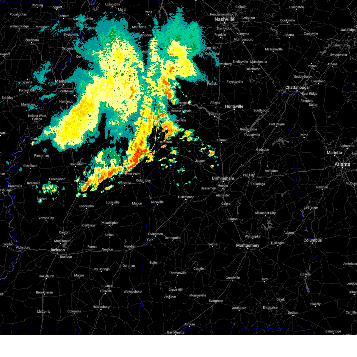
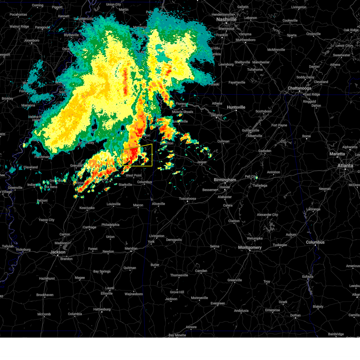
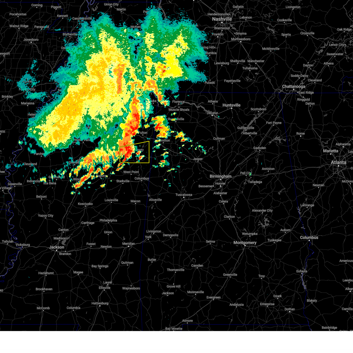
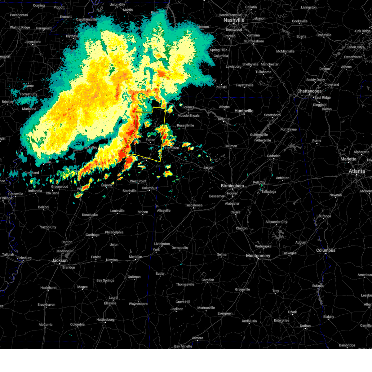
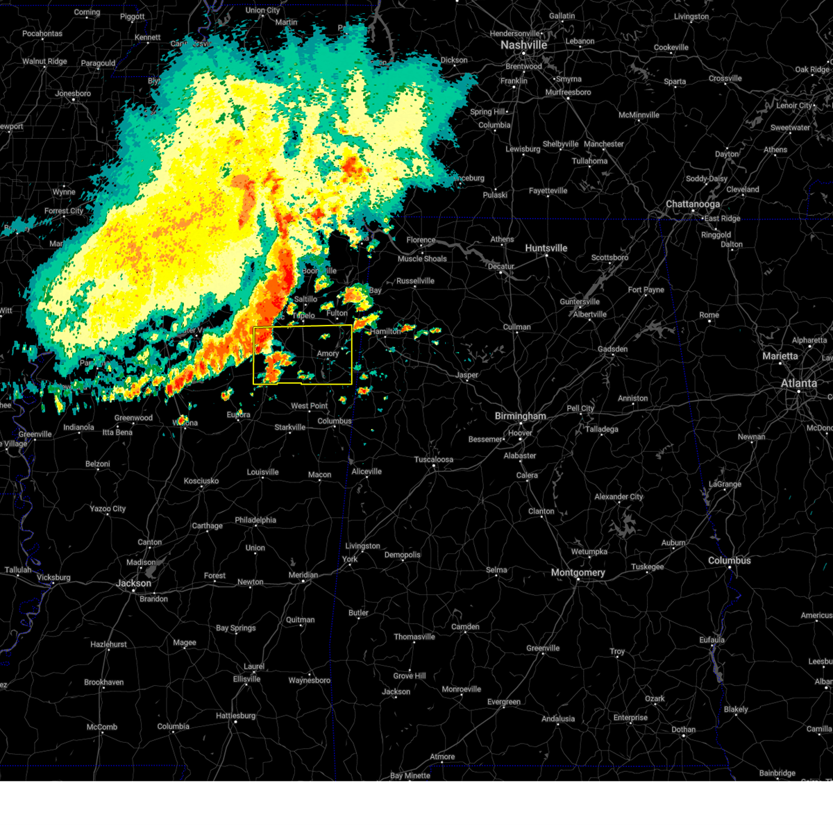
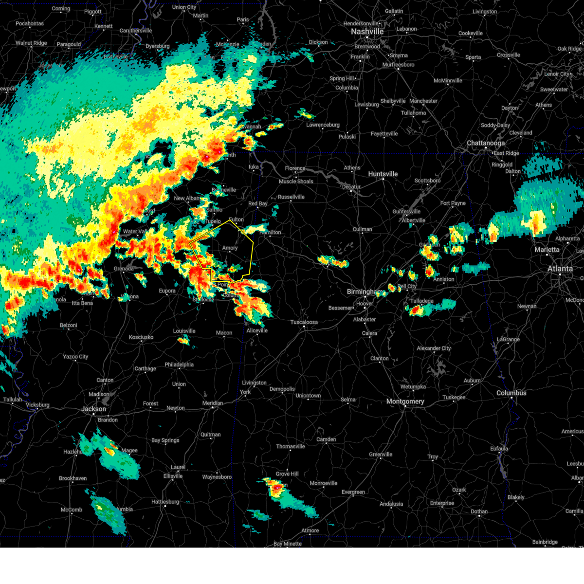
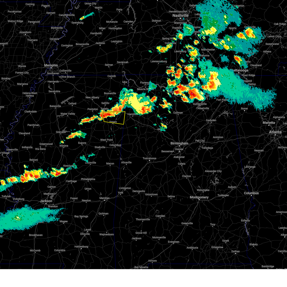
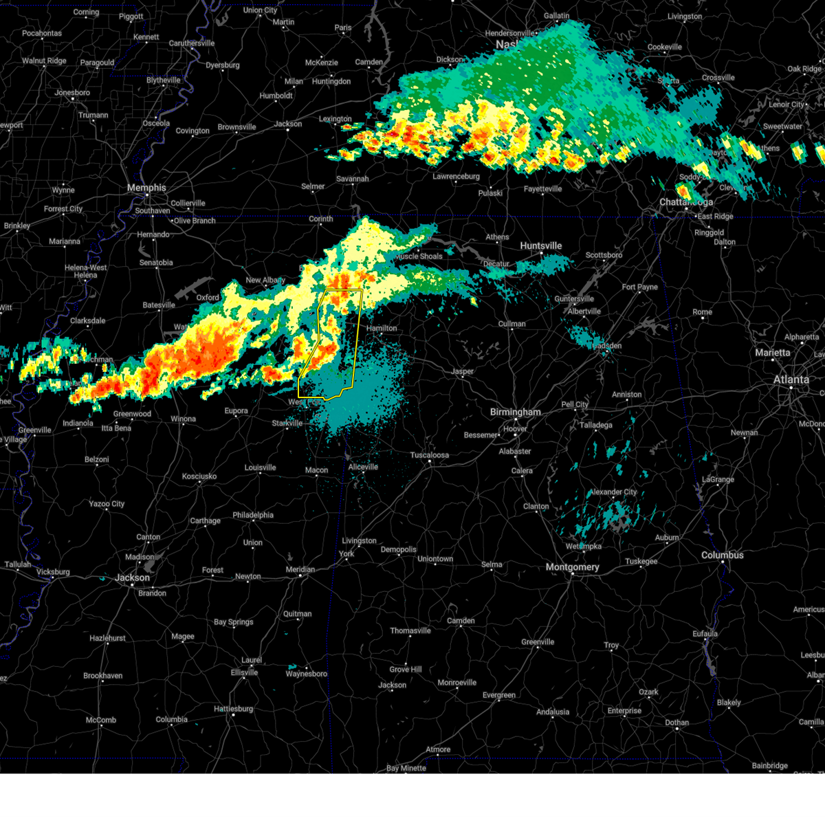
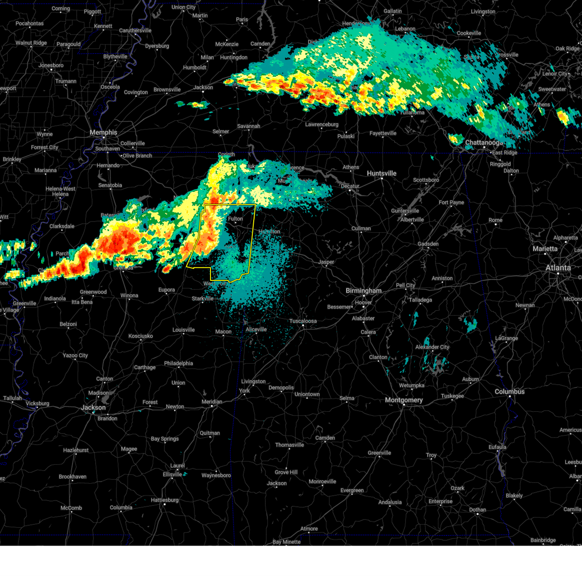
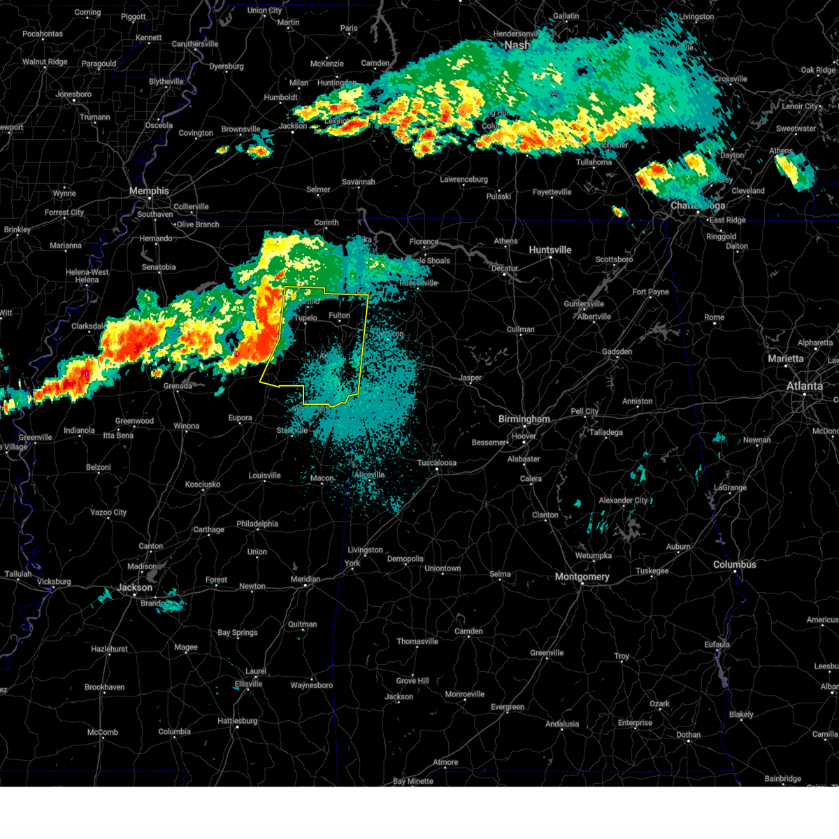
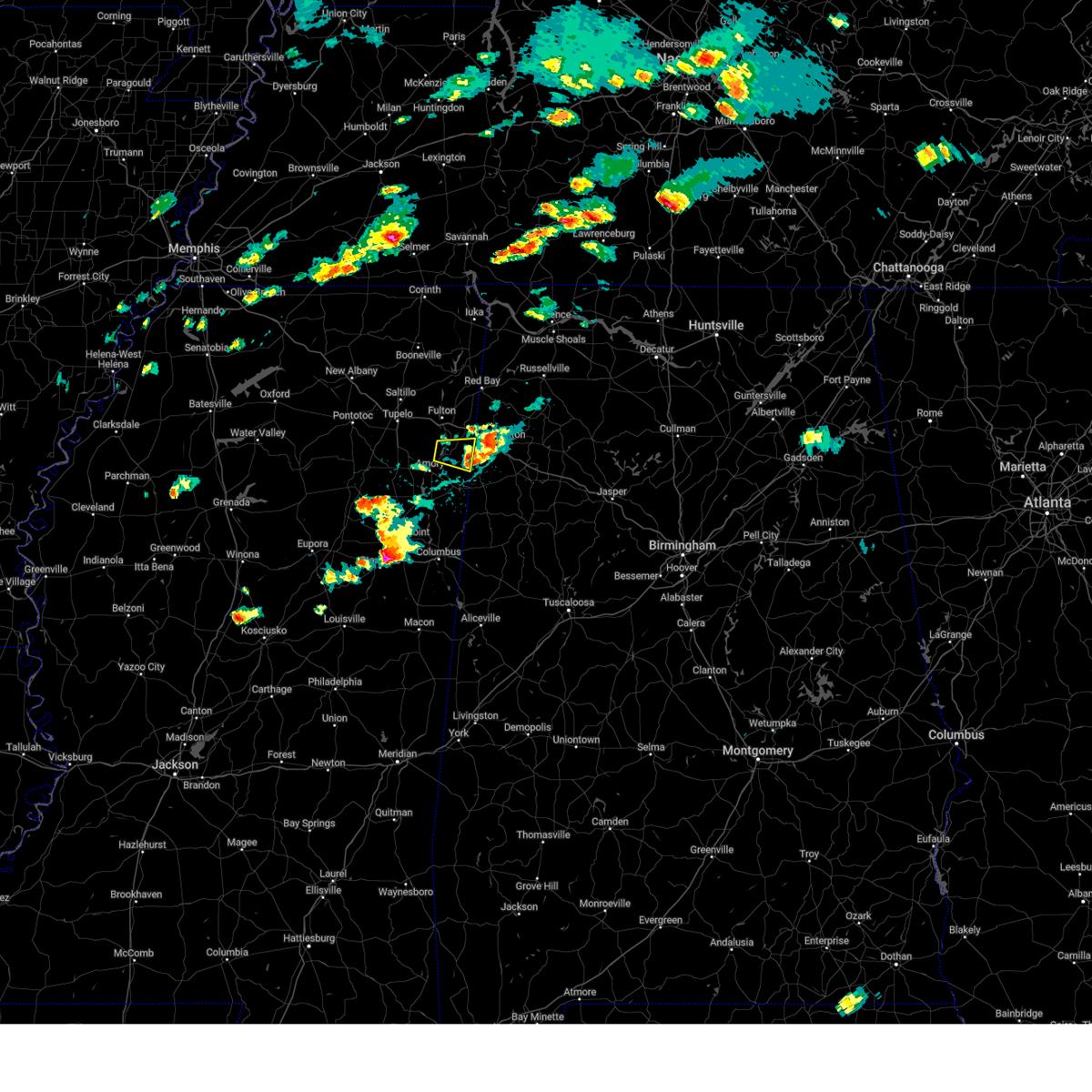
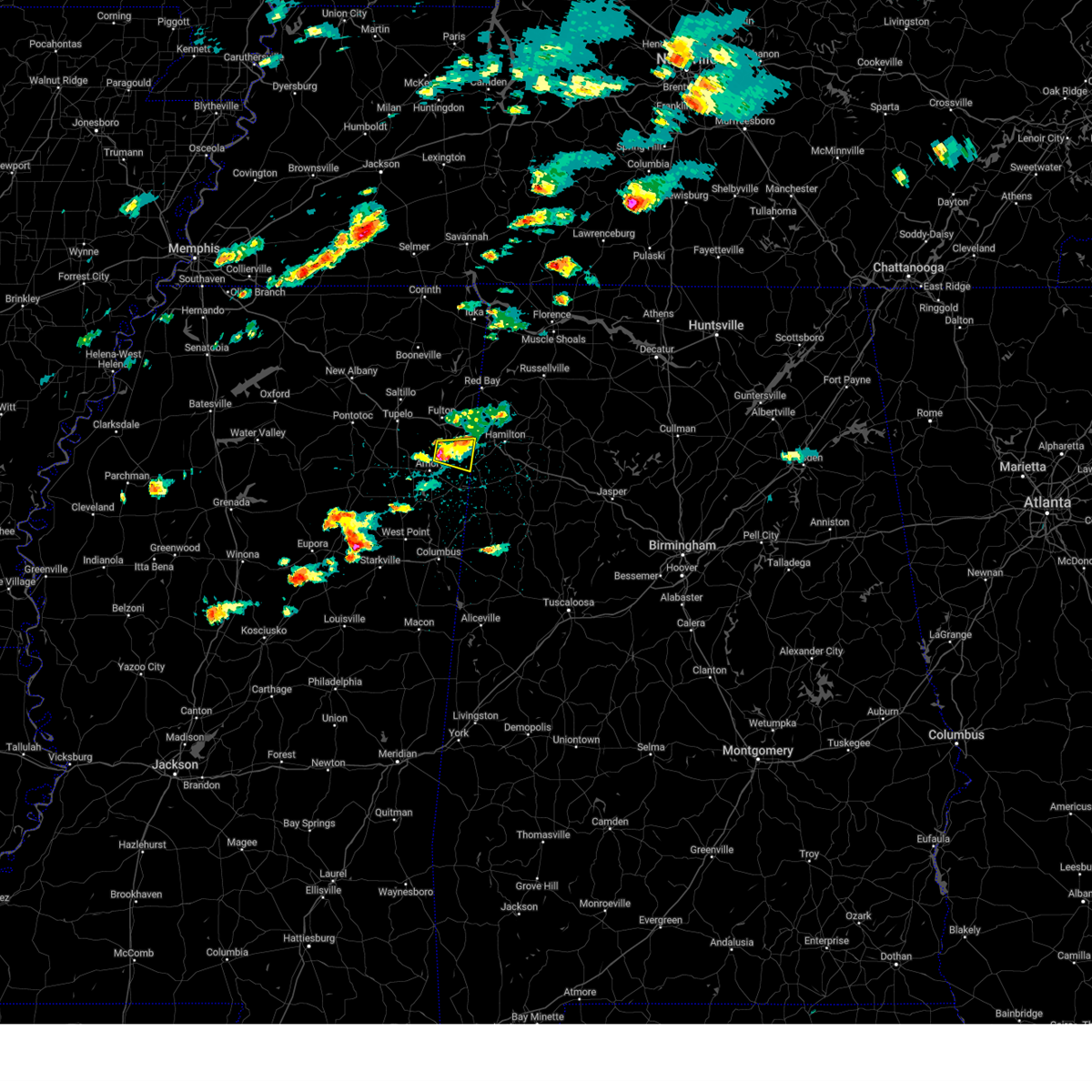
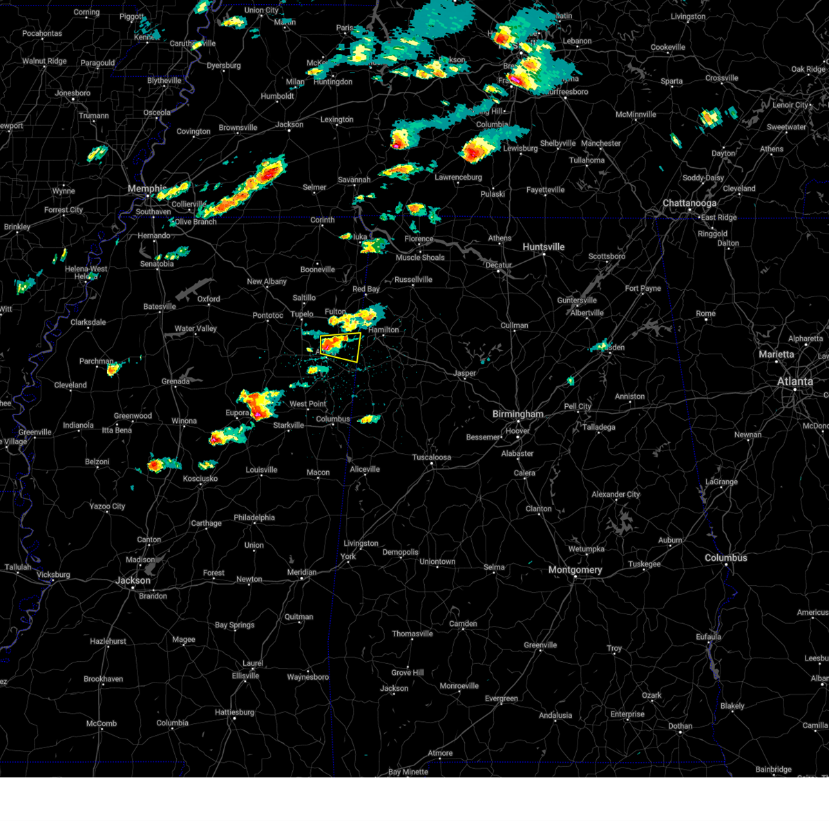
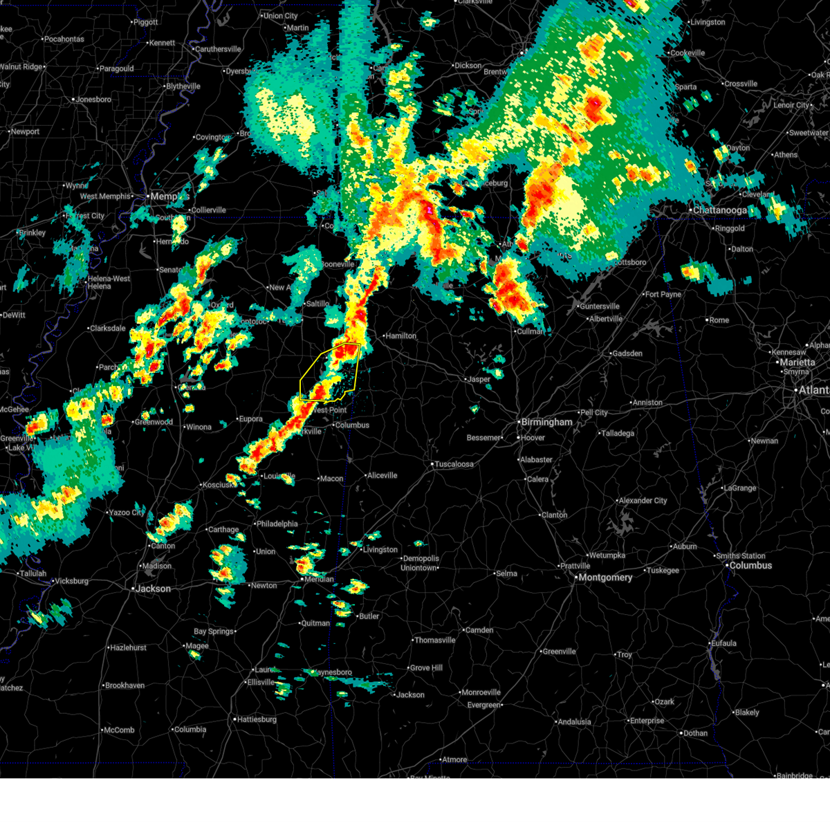
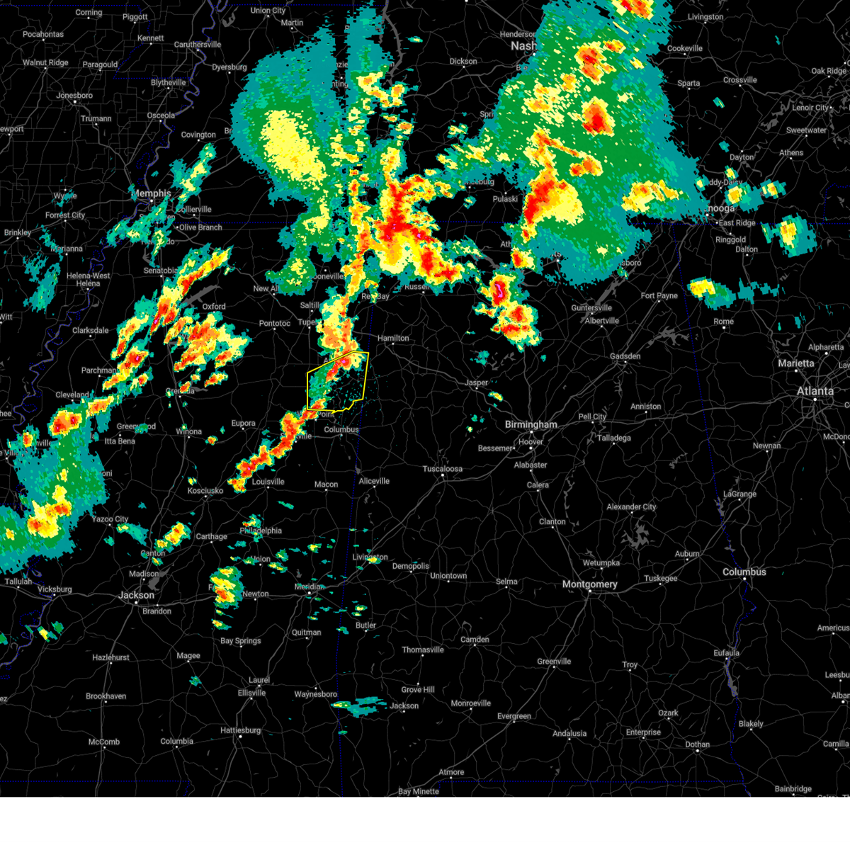
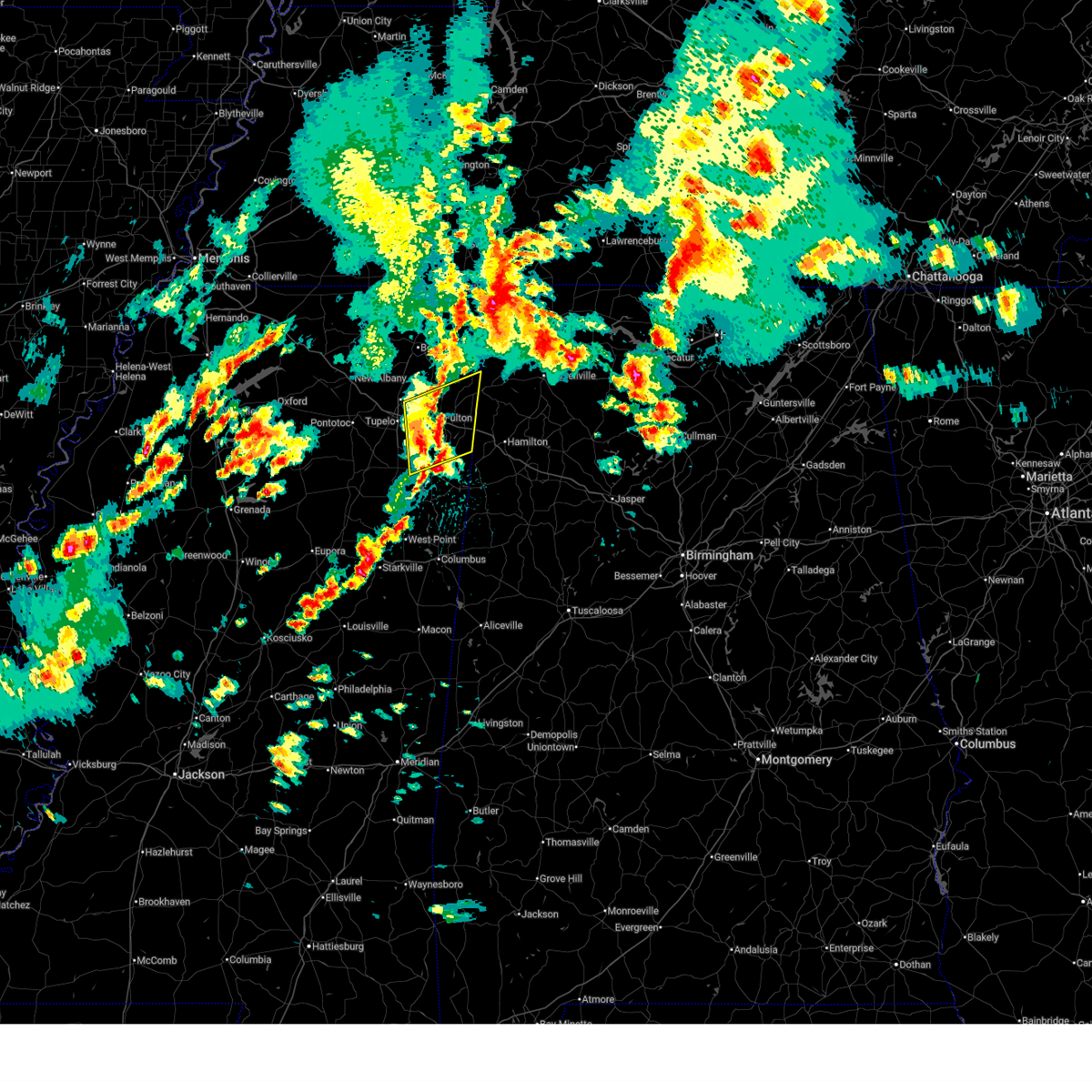
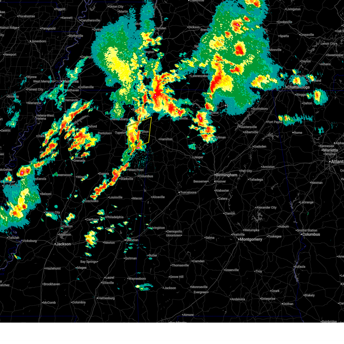
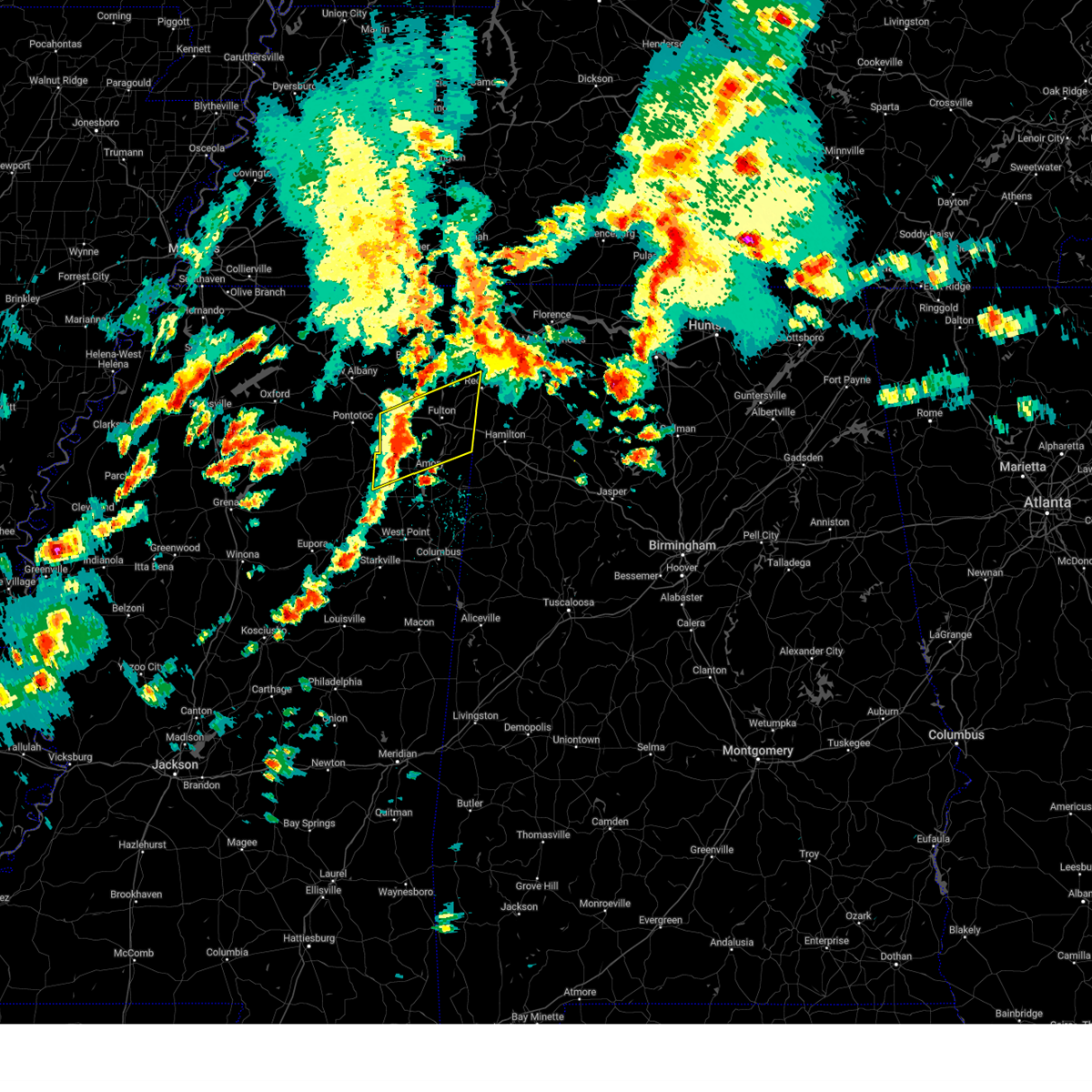
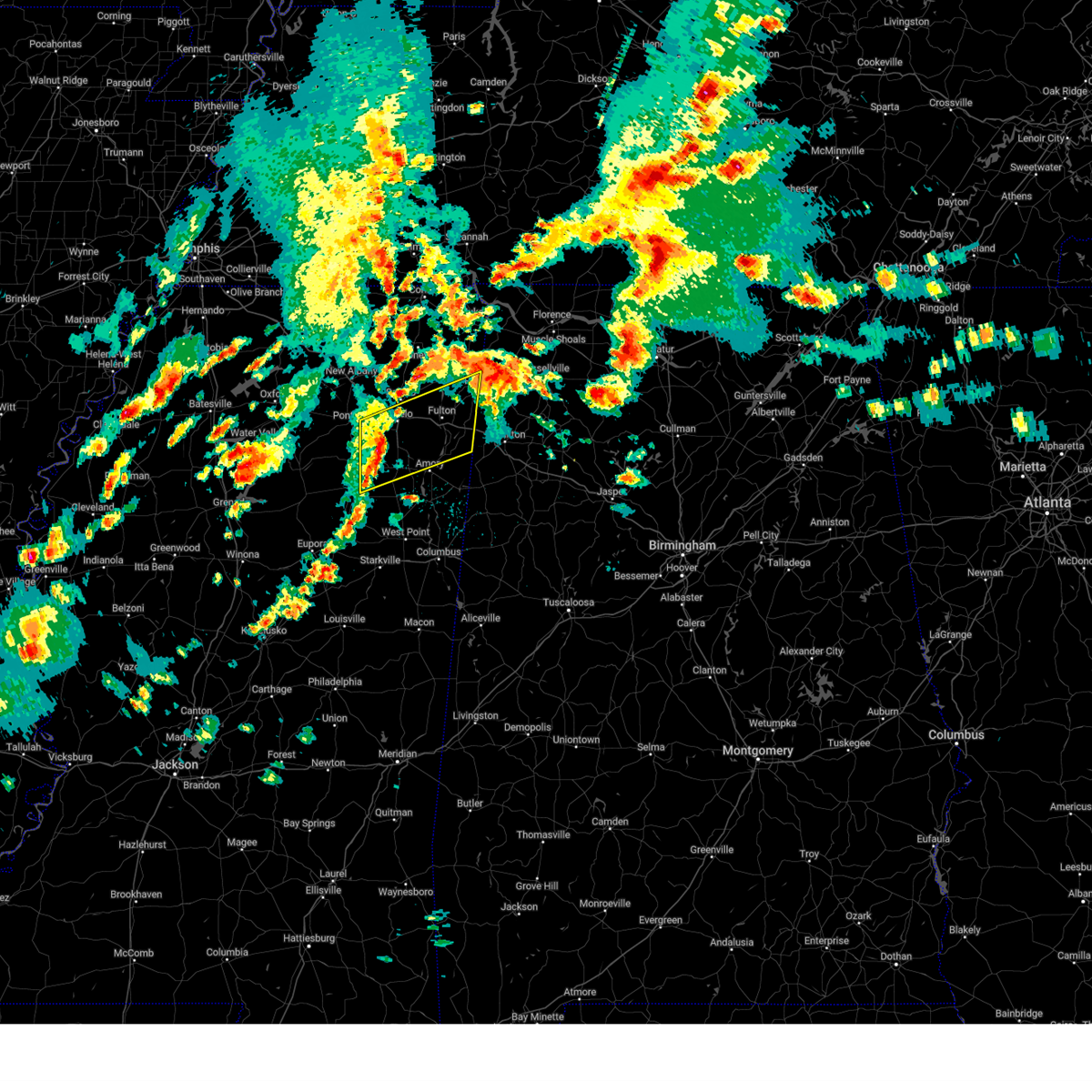
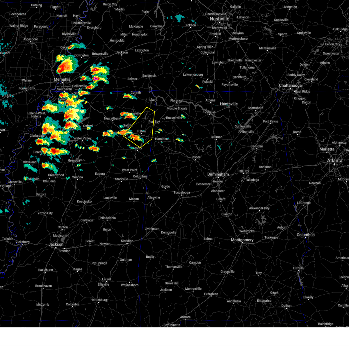
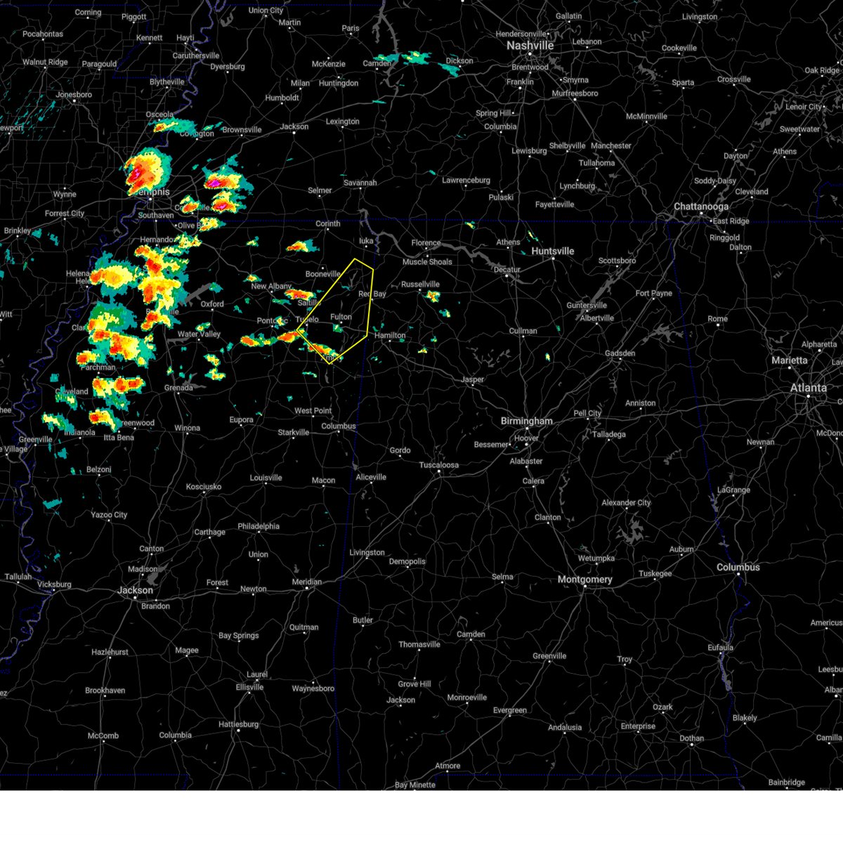
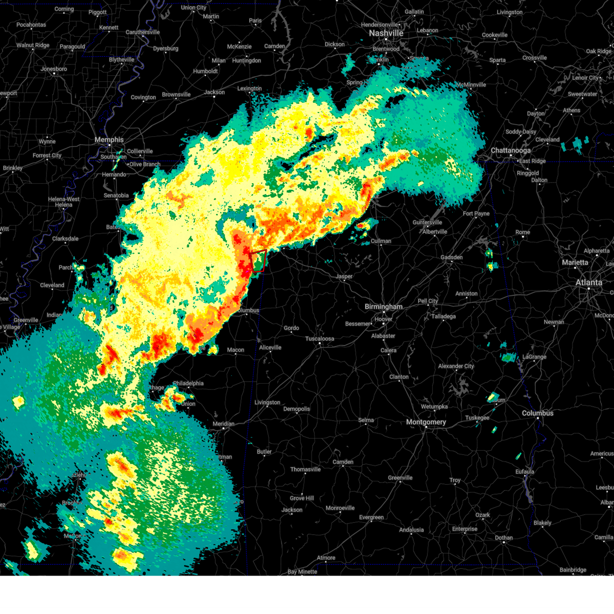
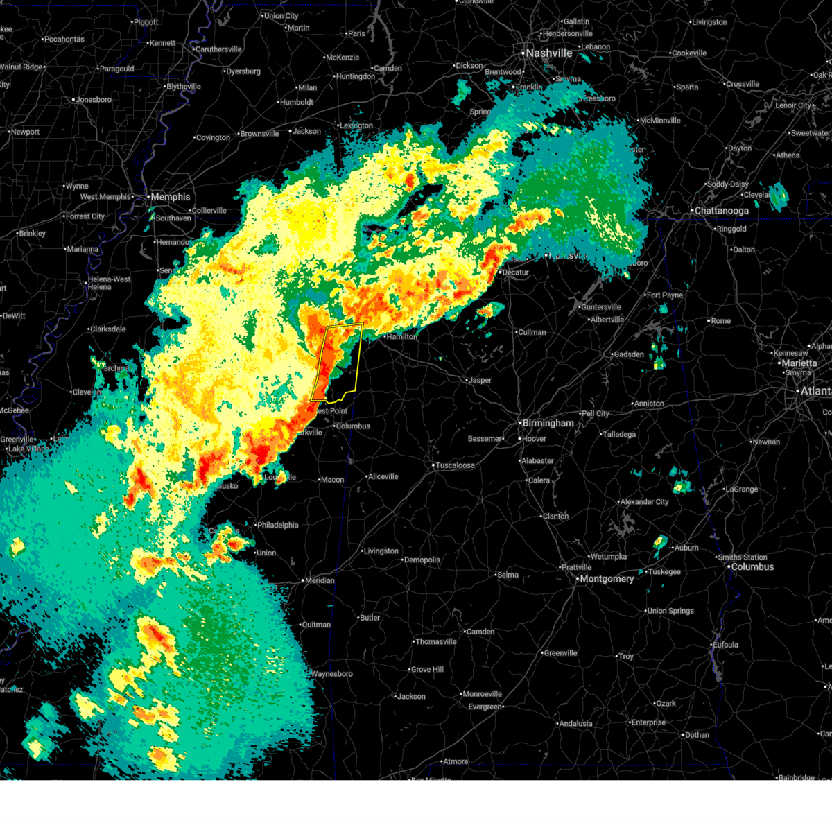
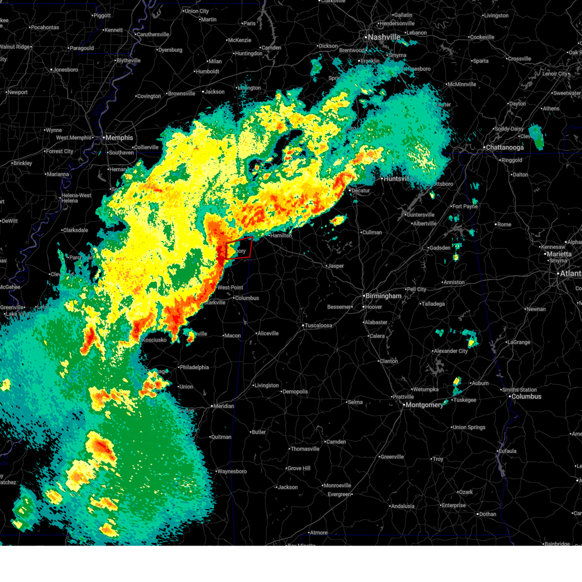
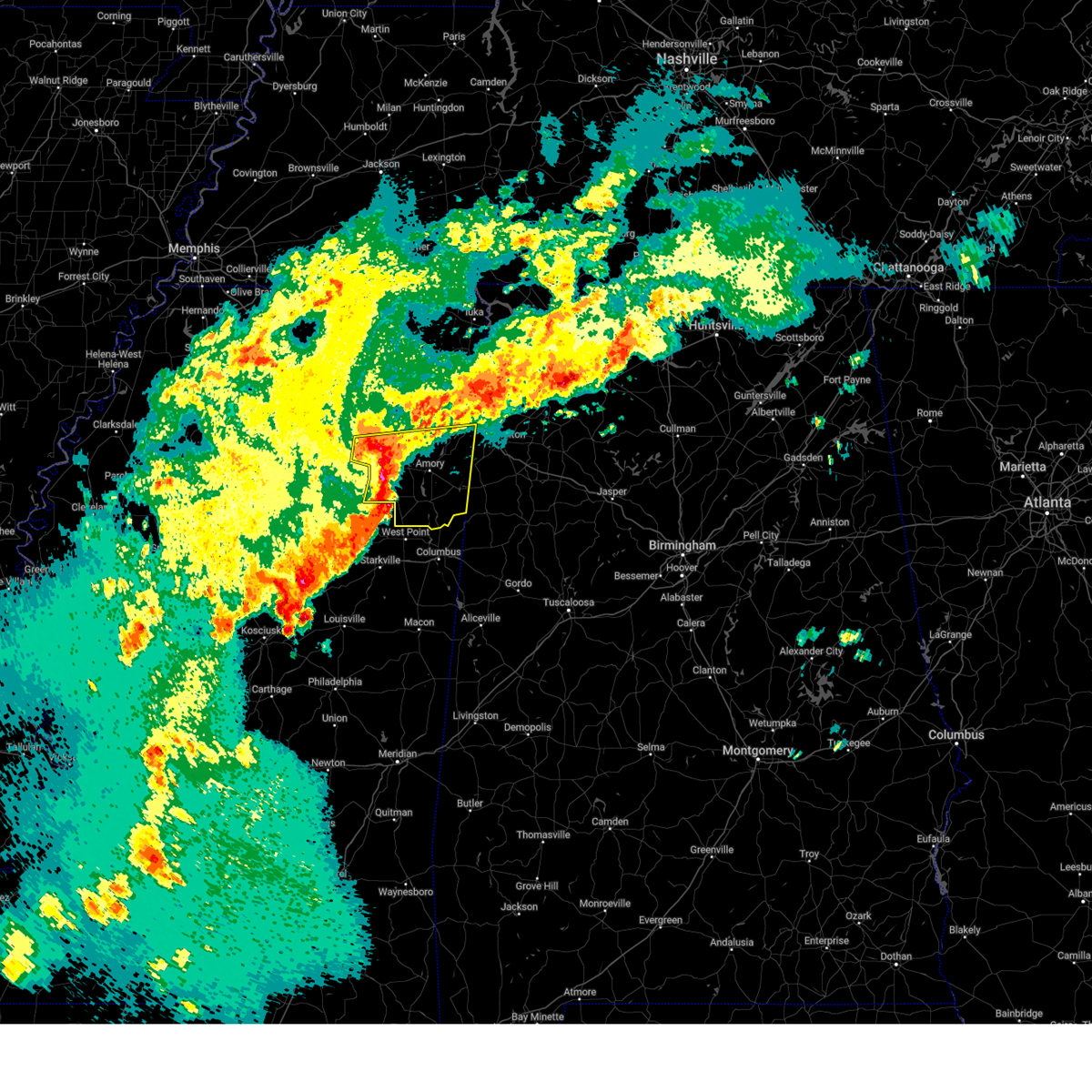
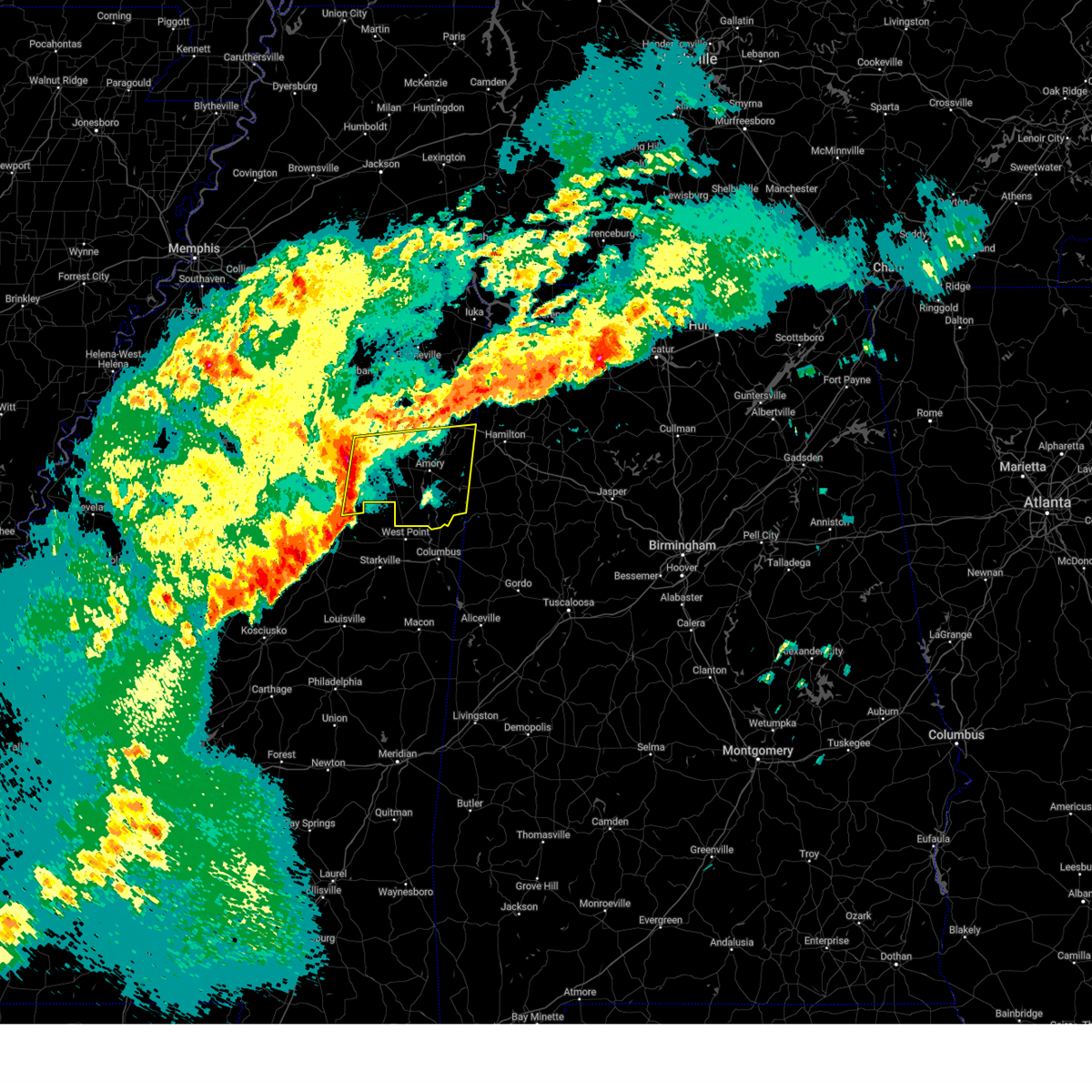
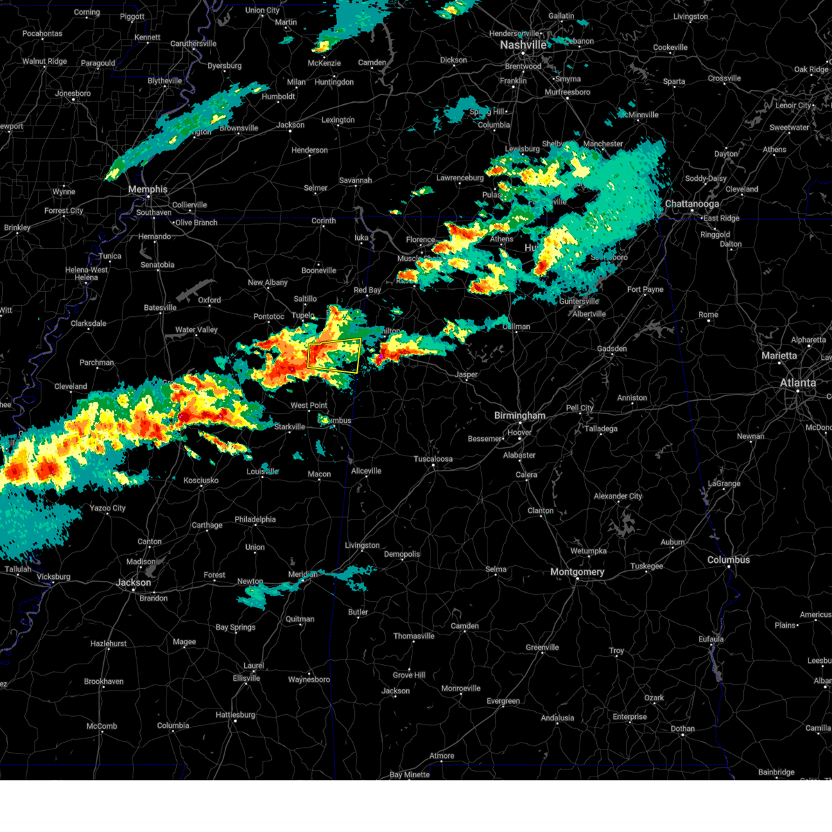
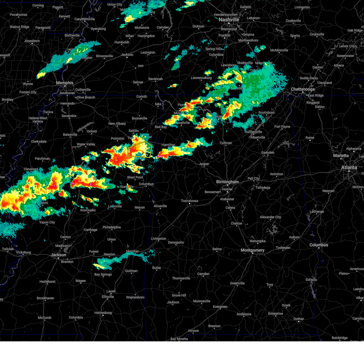
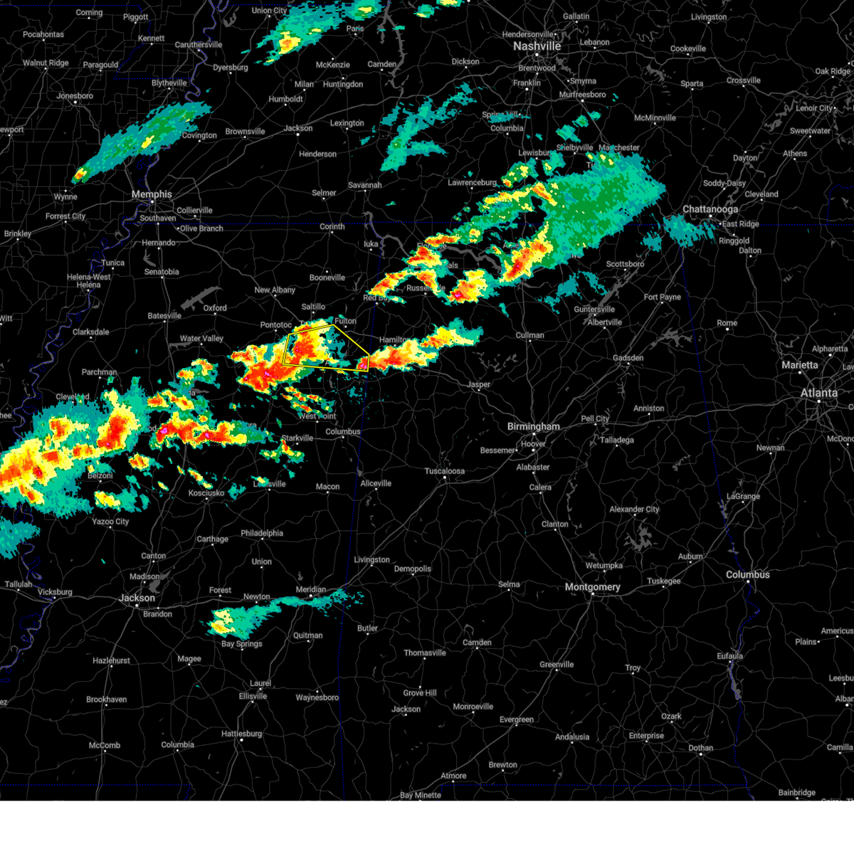
Hail Map for Smithville, MS
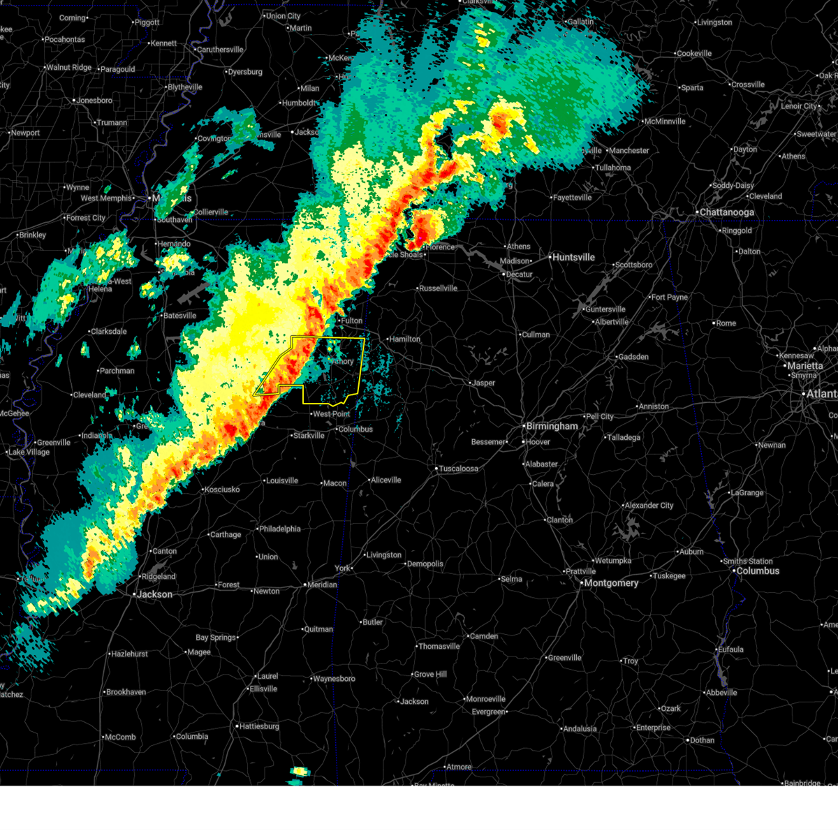
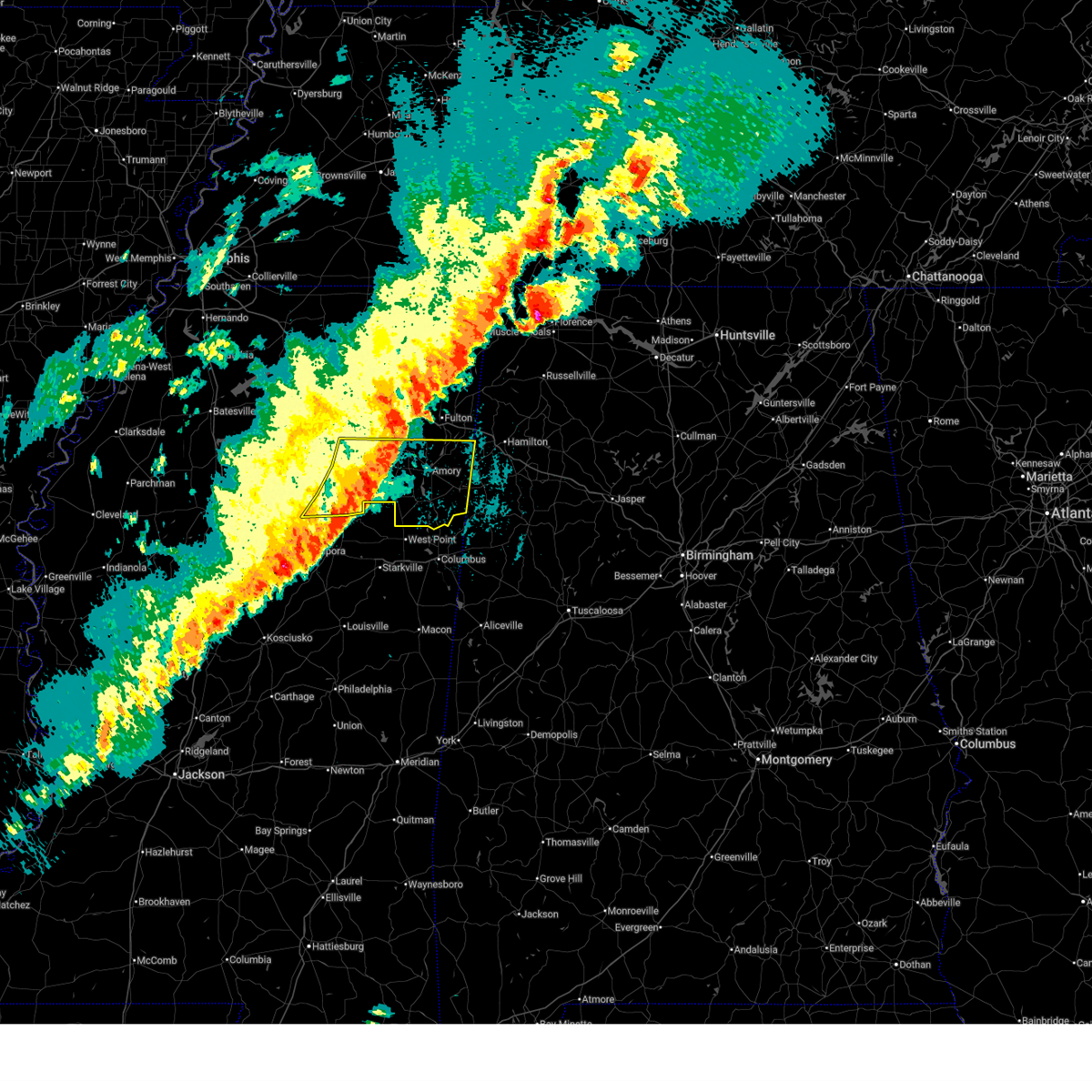
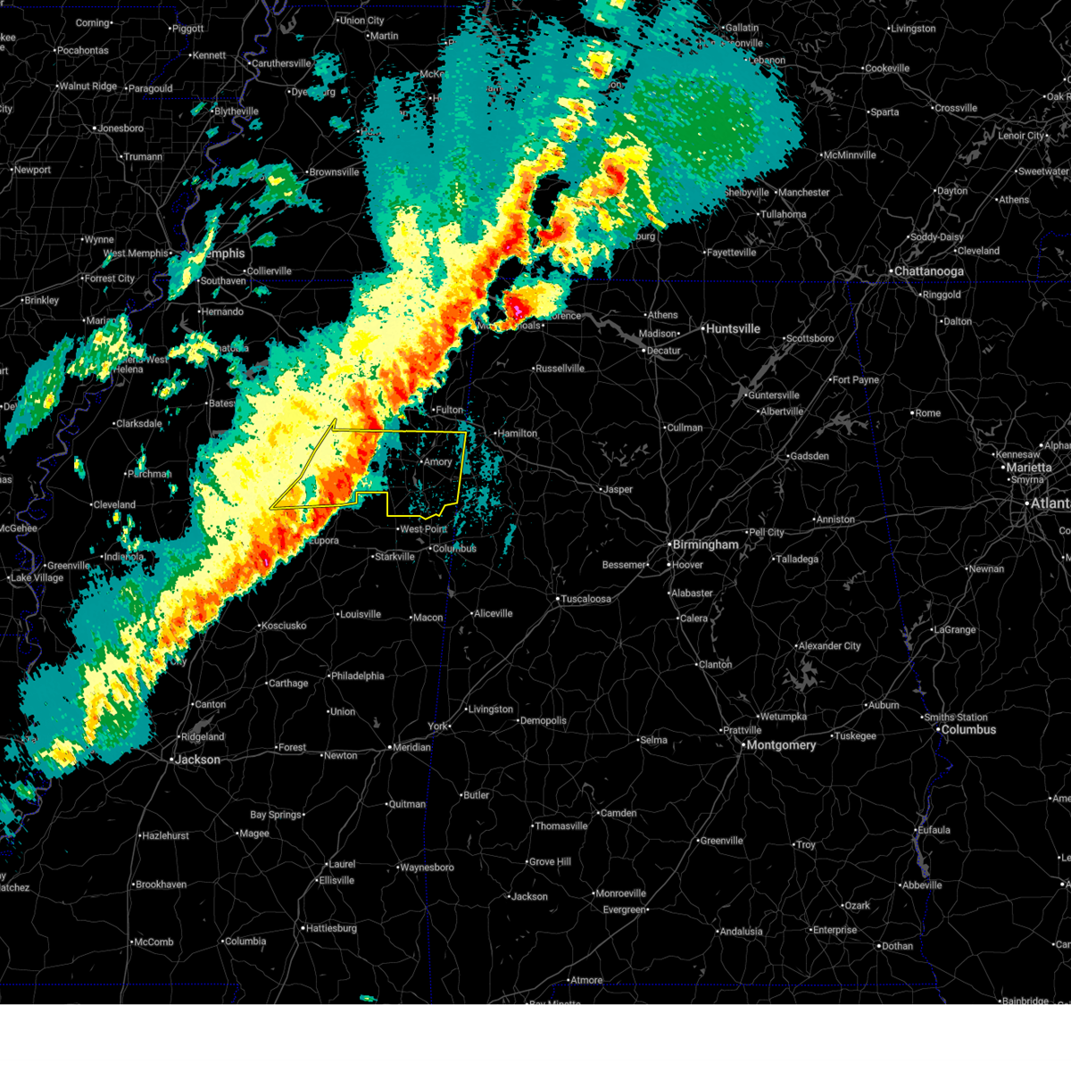
The Smithville, MS area has had 4 reports of on-the-ground hail by trained spotters, and has been under severe weather warnings 30 times during the past 12 months. Doppler radar has detected hail at or near Smithville, MS on 77 occasions, including 6 occasions during the past year.
| Name: | Smithville, MS |
| Where Located: | 48 miles NNE of Starkville, MS |
| Map: | Google Map for Smithville, MS |
| Population: | 942 |
| Housing Units: | 428 |
| More Info: | Search Google for Smithville, MS |
5
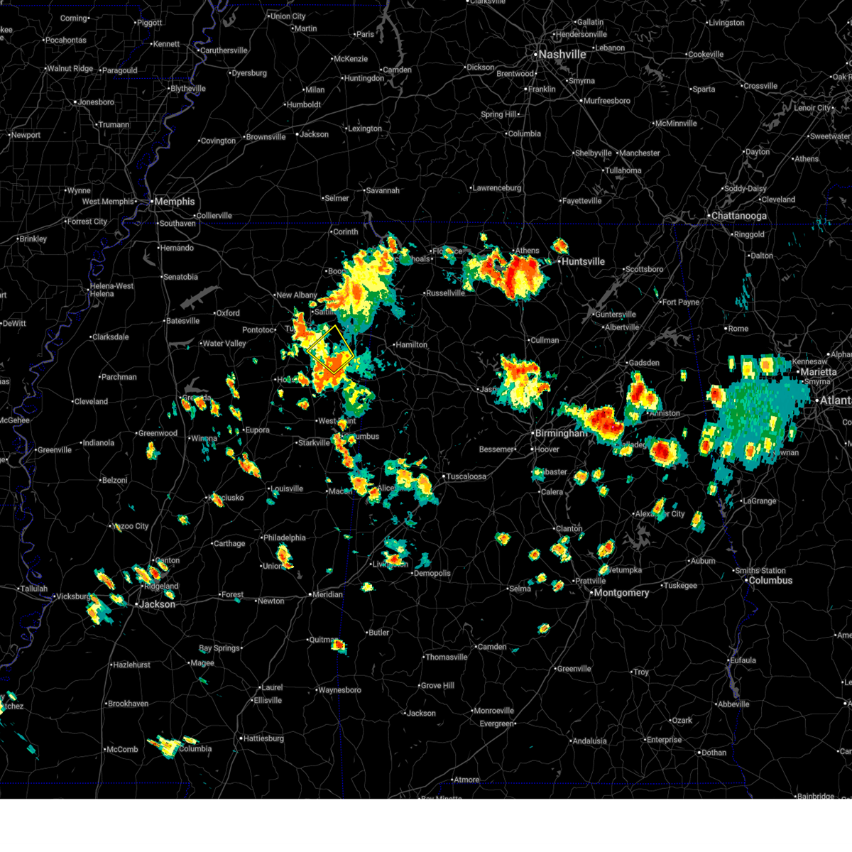
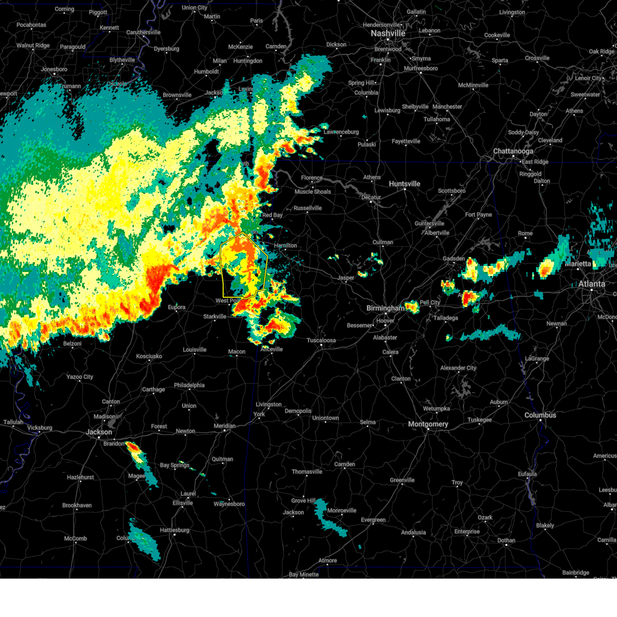
The Top Recent Hail Date for Smithville, MS is Thursday, February 26, 2026 (4th out of 77)
Hail and Wind Damage Spotted near Smithville, MS
| Date / Time | Report Details |
|---|---|
| 7/1/2026 4:43 PM CDT |
 Svrmeg the national weather service in memphis has issued a * severe thunderstorm warning for, southwestern itawamba county in northeastern mississippi, southeastern lee county in northeastern mississippi, north central monroe county in northeastern mississippi, * until 515 pm cdt. * at 442 pm cdt, a severe thunderstorm was located near smithville, or near amory, moving northwest at 5 mph (radar indicated). Hazards include 60 mph wind gusts. expect damage to roofs, siding, and trees Svrmeg the national weather service in memphis has issued a * severe thunderstorm warning for, southwestern itawamba county in northeastern mississippi, southeastern lee county in northeastern mississippi, north central monroe county in northeastern mississippi, * until 515 pm cdt. * at 442 pm cdt, a severe thunderstorm was located near smithville, or near amory, moving northwest at 5 mph (radar indicated). Hazards include 60 mph wind gusts. expect damage to roofs, siding, and trees
|
| 4/29/2026 12:25 AM CDT |
 the severe thunderstorm warning has been cancelled and is no longer in effect the severe thunderstorm warning has been cancelled and is no longer in effect
|
| 4/29/2026 12:25 AM CDT |
 At 1225 am cdt, a severe thunderstorm was located over detroit, or 8 miles northwest of sulligent, moving southeast at 45 mph (radar indicated). Hazards include 60 mph wind gusts. Expect damage to roofs, siding, and trees. Locations impacted include, amory, smithville, nettleton, hatley, gattman, sipsey fork, quincy, turon, splunge, wise gap, bigbee, greenwood springs, and parham. At 1225 am cdt, a severe thunderstorm was located over detroit, or 8 miles northwest of sulligent, moving southeast at 45 mph (radar indicated). Hazards include 60 mph wind gusts. Expect damage to roofs, siding, and trees. Locations impacted include, amory, smithville, nettleton, hatley, gattman, sipsey fork, quincy, turon, splunge, wise gap, bigbee, greenwood springs, and parham.
|
| 4/29/2026 12:06 AM CDT |
 Svrmeg the national weather service in memphis has issued a * severe thunderstorm warning for, southern itawamba county in northeastern mississippi, southeastern lee county in northeastern mississippi, northeastern monroe county in northeastern mississippi, * until 1245 am cdt. * at 1206 am cdt, a severe thunderstorm was located over new salem, or 9 miles south of fulton, moving southeast at 45 mph (radar indicated). Hazards include 60 mph wind gusts. expect damage to roofs, siding, and trees Svrmeg the national weather service in memphis has issued a * severe thunderstorm warning for, southern itawamba county in northeastern mississippi, southeastern lee county in northeastern mississippi, northeastern monroe county in northeastern mississippi, * until 1245 am cdt. * at 1206 am cdt, a severe thunderstorm was located over new salem, or 9 miles south of fulton, moving southeast at 45 mph (radar indicated). Hazards include 60 mph wind gusts. expect damage to roofs, siding, and trees
|
| 4/28/2026 11:07 PM CDT |
 Svrmeg the national weather service in memphis has issued a * severe thunderstorm warning for, southern itawamba county in northeastern mississippi, monroe county in northeastern mississippi, * until midnight cdt. * at 1107 pm cdt, severe thunderstorms were located along a line extending from 6 miles northwest of detroit to near amory to near prairie, moving southeast at 45 mph (radar indicated). Hazards include 60 mph wind gusts. expect damage to roofs, siding, and trees Svrmeg the national weather service in memphis has issued a * severe thunderstorm warning for, southern itawamba county in northeastern mississippi, monroe county in northeastern mississippi, * until midnight cdt. * at 1107 pm cdt, severe thunderstorms were located along a line extending from 6 miles northwest of detroit to near amory to near prairie, moving southeast at 45 mph (radar indicated). Hazards include 60 mph wind gusts. expect damage to roofs, siding, and trees
|
| 4/28/2026 10:57 PM CDT |
 At 1057 pm cdt, severe thunderstorms were located along a line extending from 6 miles east of tremont to near trebloc, moving east at 60 mph (radar indicated). Hazards include 60 mph wind gusts. Expect damage to roofs, siding, and trees. locations impacted include, amory, aberdeen, fulton, houston, okolona, shannon, smithville, tremont, prairie, new salem, new wren, trebloc, evergreen, clay, nettleton, hatley, gattman, eastman, abney, and quincy. This includes interstate 22 in mississipppi between mile markers 101 and 117. At 1057 pm cdt, severe thunderstorms were located along a line extending from 6 miles east of tremont to near trebloc, moving east at 60 mph (radar indicated). Hazards include 60 mph wind gusts. Expect damage to roofs, siding, and trees. locations impacted include, amory, aberdeen, fulton, houston, okolona, shannon, smithville, tremont, prairie, new salem, new wren, trebloc, evergreen, clay, nettleton, hatley, gattman, eastman, abney, and quincy. This includes interstate 22 in mississipppi between mile markers 101 and 117.
|
| 4/28/2026 10:45 PM CDT |
 At 1044 pm cdt, severe thunderstorms were located along a line extending from near fulton to near houston, moving southeast at 55 mph (radar indicated). Hazards include 60 mph wind gusts. Expect damage to roofs, siding, and trees. locations impacted include, tupelo, amory, aberdeen, fulton, houston, verona, okolona, tombigbee state park, shannon, plantersville, mantachie, smithville, tremont, prairie, fairview, new salem, new wren, trebloc, evergreen, and pyland. This includes interstate 22 in mississipppi between mile markers 91 and 117. At 1044 pm cdt, severe thunderstorms were located along a line extending from near fulton to near houston, moving southeast at 55 mph (radar indicated). Hazards include 60 mph wind gusts. Expect damage to roofs, siding, and trees. locations impacted include, tupelo, amory, aberdeen, fulton, houston, verona, okolona, tombigbee state park, shannon, plantersville, mantachie, smithville, tremont, prairie, fairview, new salem, new wren, trebloc, evergreen, and pyland. This includes interstate 22 in mississipppi between mile markers 91 and 117.
|
| 4/28/2026 10:30 PM CDT |
 Svrmeg the national weather service in memphis has issued a * severe thunderstorm warning for, chickasaw county in northeastern mississippi, southeastern pontotoc county in northeastern mississippi, itawamba county in northeastern mississippi, lee county in northeastern mississippi, monroe county in northeastern mississippi, * until 1115 pm cdt. * at 1030 pm cdt, severe thunderstorms were located along a line extending from near mantachie to near houston, moving east at 60 mph (radar indicated). Hazards include 60 mph wind gusts. expect damage to roofs, siding, and trees Svrmeg the national weather service in memphis has issued a * severe thunderstorm warning for, chickasaw county in northeastern mississippi, southeastern pontotoc county in northeastern mississippi, itawamba county in northeastern mississippi, lee county in northeastern mississippi, monroe county in northeastern mississippi, * until 1115 pm cdt. * at 1030 pm cdt, severe thunderstorms were located along a line extending from near mantachie to near houston, moving east at 60 mph (radar indicated). Hazards include 60 mph wind gusts. expect damage to roofs, siding, and trees
|
| 3/15/2026 11:17 PM CDT |
 the severe thunderstorm warning has been cancelled and is no longer in effect the severe thunderstorm warning has been cancelled and is no longer in effect
|
| 3/15/2026 11:07 PM CDT |
 the severe thunderstorm warning has been cancelled and is no longer in effect the severe thunderstorm warning has been cancelled and is no longer in effect
|
| 3/15/2026 11:07 PM CDT |
 At 1107 pm cdt, severe thunderstorms were located along a line extending from near russellville to near hackleburg to near sulligent to near caledonia, moving east at 55 mph (radar indicated). Hazards include 60 mph wind gusts. Expect damage to roofs, siding, and trees. Locations impacted include, amory, aberdeen, smithville, hatley, gattman, binford, sipsey fork, new hamilton, becker, quincy, splunge, wise gap, athens, strong, east aberdeen, muldon, greenwood springs, and parham. At 1107 pm cdt, severe thunderstorms were located along a line extending from near russellville to near hackleburg to near sulligent to near caledonia, moving east at 55 mph (radar indicated). Hazards include 60 mph wind gusts. Expect damage to roofs, siding, and trees. Locations impacted include, amory, aberdeen, smithville, hatley, gattman, binford, sipsey fork, new hamilton, becker, quincy, splunge, wise gap, athens, strong, east aberdeen, muldon, greenwood springs, and parham.
|
| 3/15/2026 10:57 PM CDT |
 At 1056 pm cdt, severe thunderstorms were located along a line extending from near belgreen to near weston to 8 miles southwest of detroit to 7 miles south of aberdeen, moving east at 45 mph (radar indicated). Hazards include 60 mph wind gusts and nickel size hail. Expect damage to roofs, siding, and trees. locations impacted include, amory, aberdeen, fulton, smithville, tremont, prairie, fairview, new salem, new wren, evergreen, clay, nettleton, hatley, gattman, abney, eastman, quincy, turon, wise gap, and wren. This includes interstate 22 in mississipppi between mile markers 100 and 117. At 1056 pm cdt, severe thunderstorms were located along a line extending from near belgreen to near weston to 8 miles southwest of detroit to 7 miles south of aberdeen, moving east at 45 mph (radar indicated). Hazards include 60 mph wind gusts and nickel size hail. Expect damage to roofs, siding, and trees. locations impacted include, amory, aberdeen, fulton, smithville, tremont, prairie, fairview, new salem, new wren, evergreen, clay, nettleton, hatley, gattman, abney, eastman, quincy, turon, wise gap, and wren. This includes interstate 22 in mississipppi between mile markers 100 and 117.
|
| 3/15/2026 10:57 PM CDT |
 the severe thunderstorm warning has been cancelled and is no longer in effect the severe thunderstorm warning has been cancelled and is no longer in effect
|
| 3/15/2026 10:50 PM CDT |
 the severe thunderstorm warning has been cancelled and is no longer in effect the severe thunderstorm warning has been cancelled and is no longer in effect
|
| 3/15/2026 10:50 PM CDT |
 At 1049 pm cdt, severe thunderstorms were located along a line extending from 7 miles northeast of red bay to near tremont to 8 miles southeast of amory to 7 miles southeast of prairie, moving east at 45 mph (radar indicated). Hazards include 60 mph wind gusts and nickel size hail. Expect damage to roofs, siding, and trees. locations impacted include, amory, aberdeen, fulton, red bay, belmont, smithville, tremont, prairie, fairview, new salem, new wren, evergreen, clay, nettleton, hatley, golden, gattman, abney, eastman, and quincy. This includes interstate 22 in mississipppi between mile markers 100 and 117. At 1049 pm cdt, severe thunderstorms were located along a line extending from 7 miles northeast of red bay to near tremont to 8 miles southeast of amory to 7 miles southeast of prairie, moving east at 45 mph (radar indicated). Hazards include 60 mph wind gusts and nickel size hail. Expect damage to roofs, siding, and trees. locations impacted include, amory, aberdeen, fulton, red bay, belmont, smithville, tremont, prairie, fairview, new salem, new wren, evergreen, clay, nettleton, hatley, golden, gattman, abney, eastman, and quincy. This includes interstate 22 in mississipppi between mile markers 100 and 117.
|
| 3/15/2026 10:38 PM CDT |
 Svrmeg the national weather service in memphis has issued a * severe thunderstorm warning for, southeastern chickasaw county in northeastern mississippi, itawamba county in northeastern mississippi, southeastern lee county in northeastern mississippi, monroe county in northeastern mississippi, southeastern tishomingo county in northeastern mississippi, * until 1145 pm cdt. * at 1038 pm cdt, severe thunderstorms were located along a line extending from near belmont to new salem to near amory to near pala alto, moving east at 45 mph (radar indicated). Hazards include 60 mph wind gusts and nickel size hail. expect damage to roofs, siding, and trees Svrmeg the national weather service in memphis has issued a * severe thunderstorm warning for, southeastern chickasaw county in northeastern mississippi, itawamba county in northeastern mississippi, southeastern lee county in northeastern mississippi, monroe county in northeastern mississippi, southeastern tishomingo county in northeastern mississippi, * until 1145 pm cdt. * at 1038 pm cdt, severe thunderstorms were located along a line extending from near belmont to new salem to near amory to near pala alto, moving east at 45 mph (radar indicated). Hazards include 60 mph wind gusts and nickel size hail. expect damage to roofs, siding, and trees
|
| 3/15/2026 10:21 PM CDT |
 the severe thunderstorm warning has been cancelled and is no longer in effect the severe thunderstorm warning has been cancelled and is no longer in effect
|
| 3/15/2026 10:21 PM CDT |
 At 1020 pm cdt, severe thunderstorms were located along a line extending from near evergreen to near new wren to near montpelier, moving east at 40 mph (radar indicated). Hazards include 60 mph wind gusts and nickel size hail. Expect damage to roofs, siding, and trees. Locations impacted include, amory, aberdeen, houston, okolona, shannon, smithville, prairie, new salem, new wren, trebloc, nettleton, hatley, woodland, gattman, quincy, turon, egypt, wise gap, wren, and strong. At 1020 pm cdt, severe thunderstorms were located along a line extending from near evergreen to near new wren to near montpelier, moving east at 40 mph (radar indicated). Hazards include 60 mph wind gusts and nickel size hail. Expect damage to roofs, siding, and trees. Locations impacted include, amory, aberdeen, houston, okolona, shannon, smithville, prairie, new salem, new wren, trebloc, nettleton, hatley, woodland, gattman, quincy, turon, egypt, wise gap, wren, and strong.
|
| 3/15/2026 10:14 PM CDT |
 At 1013 pm cdt, severe thunderstorms were located along a line extending from near verona to okolona to near montpelier, moving east at 45 mph (trained weather spotters). Hazards include 70 mph wind gusts and nickel size hail. Expect considerable tree damage. damage is likely to mobile homes, roofs, and outbuildings. Locations impacted include, amory, aberdeen, houston, okolona, shannon, vardaman, smithville, prairie, pyland, new salem, new wren, trebloc, houlka, nettleton, new houlka, algoma, hatley, woodland, gattman, and thorn. At 1013 pm cdt, severe thunderstorms were located along a line extending from near verona to okolona to near montpelier, moving east at 45 mph (trained weather spotters). Hazards include 70 mph wind gusts and nickel size hail. Expect considerable tree damage. damage is likely to mobile homes, roofs, and outbuildings. Locations impacted include, amory, aberdeen, houston, okolona, shannon, vardaman, smithville, prairie, pyland, new salem, new wren, trebloc, houlka, nettleton, new houlka, algoma, hatley, woodland, gattman, and thorn.
|
| 3/15/2026 10:05 PM CDT |
 At 1005 pm cdt, severe thunderstorms were located along a line extending from near troy to 6 miles west of okolona to mantee, moving east at 65 mph (trained weather spotters). Hazards include 70 mph wind gusts and nickel size hail. Expect considerable tree damage. damage is likely to mobile homes, roofs, and outbuildings. Locations impacted include, amory, aberdeen, houston, okolona, calhoun city, shannon, vardaman, derma, smithville, slate springs, prairie, pyland, new salem, new wren, trebloc, houlka, nettleton, new houlka, algoma, and hatley. At 1005 pm cdt, severe thunderstorms were located along a line extending from near troy to 6 miles west of okolona to mantee, moving east at 65 mph (trained weather spotters). Hazards include 70 mph wind gusts and nickel size hail. Expect considerable tree damage. damage is likely to mobile homes, roofs, and outbuildings. Locations impacted include, amory, aberdeen, houston, okolona, calhoun city, shannon, vardaman, derma, smithville, slate springs, prairie, pyland, new salem, new wren, trebloc, houlka, nettleton, new houlka, algoma, and hatley.
|
| 3/15/2026 9:57 PM CDT |
 Svrmeg the national weather service in memphis has issued a * severe thunderstorm warning for, chickasaw county in northeastern mississippi, calhoun county in northeastern mississippi, southern pontotoc county in northeastern mississippi, southern itawamba county in northeastern mississippi, southern lee county in northeastern mississippi, monroe county in northeastern mississippi, * until 1045 pm cdt. * at 957 pm cdt, severe thunderstorms were located along a line extending from near pontotoc to 7 miles west of mantee, moving east at 50 mph (radar indicated). Hazards include 70 mph wind gusts and nickel size hail. Expect considerable tree damage. Damage is likely to mobile homes, roofs, and outbuildings. Svrmeg the national weather service in memphis has issued a * severe thunderstorm warning for, chickasaw county in northeastern mississippi, calhoun county in northeastern mississippi, southern pontotoc county in northeastern mississippi, southern itawamba county in northeastern mississippi, southern lee county in northeastern mississippi, monroe county in northeastern mississippi, * until 1045 pm cdt. * at 957 pm cdt, severe thunderstorms were located along a line extending from near pontotoc to 7 miles west of mantee, moving east at 50 mph (radar indicated). Hazards include 70 mph wind gusts and nickel size hail. Expect considerable tree damage. Damage is likely to mobile homes, roofs, and outbuildings.
|
| 3/15/2026 9:48 PM CDT |
 Svrmeg the national weather service in memphis has issued a * severe thunderstorm warning for, chickasaw county in northeastern mississippi, calhoun county in northeastern mississippi, southern pontotoc county in northeastern mississippi, southern itawamba county in northeastern mississippi, southern lee county in northeastern mississippi, monroe county in northeastern mississippi, * until 1045 pm cdt. * at 947 pm cdt, severe thunderstorms were located along a line extending from near pontotoc to near slate springs, moving east at 50 mph (radar indicated). Hazards include 60 mph wind gusts and nickel size hail. expect damage to roofs, siding, and trees Svrmeg the national weather service in memphis has issued a * severe thunderstorm warning for, chickasaw county in northeastern mississippi, calhoun county in northeastern mississippi, southern pontotoc county in northeastern mississippi, southern itawamba county in northeastern mississippi, southern lee county in northeastern mississippi, monroe county in northeastern mississippi, * until 1045 pm cdt. * at 947 pm cdt, severe thunderstorms were located along a line extending from near pontotoc to near slate springs, moving east at 50 mph (radar indicated). Hazards include 60 mph wind gusts and nickel size hail. expect damage to roofs, siding, and trees
|
| 3/9/2026 6:29 PM CDT |
 The storm which prompted the warning has moved out of the area. therefore, the warning will be allowed to expire. a severe thunderstorm watch remains in effect until 700 pm cdt for northeastern mississippi. The storm which prompted the warning has moved out of the area. therefore, the warning will be allowed to expire. a severe thunderstorm watch remains in effect until 700 pm cdt for northeastern mississippi.
|
| 3/9/2026 6:17 PM CDT |
 At 617 pm cdt, a severe thunderstorm was located 10 miles northwest of bedford, or 10 miles southeast of amory, moving east at 45 mph (radar indicated). Hazards include 60 mph wind gusts and quarter size hail. Hail damage to vehicles is expected. expect wind damage to roofs, siding, and trees. Locations impacted include, amory, smithville, hatley, gattman, sipsey fork, becker, quincy, greenwood springs, splunge, wise gap, athens, and parham. At 617 pm cdt, a severe thunderstorm was located 10 miles northwest of bedford, or 10 miles southeast of amory, moving east at 45 mph (radar indicated). Hazards include 60 mph wind gusts and quarter size hail. Hail damage to vehicles is expected. expect wind damage to roofs, siding, and trees. Locations impacted include, amory, smithville, hatley, gattman, sipsey fork, becker, quincy, greenwood springs, splunge, wise gap, athens, and parham.
|
| 3/9/2026 6:17 PM CDT |
 the severe thunderstorm warning has been cancelled and is no longer in effect the severe thunderstorm warning has been cancelled and is no longer in effect
|
| 3/9/2026 6:12 PM CDT |
 At 612 pm cdt, a severe thunderstorm was located 8 miles east of amory, moving east at 45 mph (radar indicated). Hazards include 60 mph wind gusts and half dollar size hail. Hail damage to vehicles is expected. expect wind damage to roofs, siding, and trees. Locations impacted include, amory, aberdeen, smithville, new salem, hatley, gattman, sipsey fork, becker, quincy, cardsville, turon, splunge, wise gap, athens, greenwood springs, and parham. At 612 pm cdt, a severe thunderstorm was located 8 miles east of amory, moving east at 45 mph (radar indicated). Hazards include 60 mph wind gusts and half dollar size hail. Hail damage to vehicles is expected. expect wind damage to roofs, siding, and trees. Locations impacted include, amory, aberdeen, smithville, new salem, hatley, gattman, sipsey fork, becker, quincy, cardsville, turon, splunge, wise gap, athens, greenwood springs, and parham.
|
| 3/9/2026 6:03 PM CDT |
 the severe thunderstorm warning has been cancelled and is no longer in effect the severe thunderstorm warning has been cancelled and is no longer in effect
|
| 3/9/2026 6:03 PM CDT |
 At 603 pm cdt, a severe thunderstorm was located over amory, moving east at 50 mph (radar indicated). Hazards include ping pong ball size hail and 60 mph wind gusts. People and animals outdoors will be injured. expect hail damage to roofs, siding, windows, and vehicles. expect wind damage to roofs, siding, and trees. Locations impacted include, amory, aberdeen, smithville, new wren, new salem, hatley, gattman, sipsey fork, becker, quincy, cardsville, turon, splunge, wise gap, athens, wren, bigbee, greenwood springs, jacinto, and parham. At 603 pm cdt, a severe thunderstorm was located over amory, moving east at 50 mph (radar indicated). Hazards include ping pong ball size hail and 60 mph wind gusts. People and animals outdoors will be injured. expect hail damage to roofs, siding, windows, and vehicles. expect wind damage to roofs, siding, and trees. Locations impacted include, amory, aberdeen, smithville, new wren, new salem, hatley, gattman, sipsey fork, becker, quincy, cardsville, turon, splunge, wise gap, athens, wren, bigbee, greenwood springs, jacinto, and parham.
|
| 3/9/2026 5:51 PM CDT |
 At 551 pm cdt, a severe thunderstorm was located near new wren, or near amory, moving east at 50 mph (radar indicated). Hazards include golf ball size hail and 60 mph wind gusts. People and animals outdoors will be injured. expect hail damage to roofs, siding, windows, and vehicles. expect wind damage to roofs, siding, and trees. locations impacted include, amory, aberdeen, fulton, shannon, smithville, tremont, new salem, new wren, evergreen, nettleton, hatley, gattman, abney, quincy, turon, mooreville, wise gap, ballardsville, wren, and sipsey fork. This includes interstate 22 in mississipppi between mile markers 101 and 117. At 551 pm cdt, a severe thunderstorm was located near new wren, or near amory, moving east at 50 mph (radar indicated). Hazards include golf ball size hail and 60 mph wind gusts. People and animals outdoors will be injured. expect hail damage to roofs, siding, windows, and vehicles. expect wind damage to roofs, siding, and trees. locations impacted include, amory, aberdeen, fulton, shannon, smithville, tremont, new salem, new wren, evergreen, nettleton, hatley, gattman, abney, quincy, turon, mooreville, wise gap, ballardsville, wren, and sipsey fork. This includes interstate 22 in mississipppi between mile markers 101 and 117.
|
| 3/9/2026 5:48 PM CDT |
 Svrmeg the national weather service in memphis has issued a * severe thunderstorm warning for, southern itawamba county in northeastern mississippi, southeastern lee county in northeastern mississippi, monroe county in northeastern mississippi, * until 630 pm cdt. * at 548 pm cdt, a severe thunderstorm was located near new wren, or near okolona, moving southeast at 50 mph (radar indicated). Hazards include ping pong ball size hail and 60 mph wind gusts. People and animals outdoors will be injured. expect hail damage to roofs, siding, windows, and vehicles. Expect wind damage to roofs, siding, and trees. Svrmeg the national weather service in memphis has issued a * severe thunderstorm warning for, southern itawamba county in northeastern mississippi, southeastern lee county in northeastern mississippi, monroe county in northeastern mississippi, * until 630 pm cdt. * at 548 pm cdt, a severe thunderstorm was located near new wren, or near okolona, moving southeast at 50 mph (radar indicated). Hazards include ping pong ball size hail and 60 mph wind gusts. People and animals outdoors will be injured. expect hail damage to roofs, siding, windows, and vehicles. Expect wind damage to roofs, siding, and trees.
|
| 6/14/2025 6:29 PM CDT |
 the severe thunderstorm warning has been cancelled and is no longer in effect the severe thunderstorm warning has been cancelled and is no longer in effect
|
| 6/14/2025 6:20 PM CDT |
 At 620 pm cdt, a severe thunderstorm was located near evergreen, or 8 miles southeast of tombigbee state park, moving east at 40 mph (radar indicated). Hazards include 60 mph wind gusts and penny size hail. Expect damage to roofs, siding, and trees. Locations impacted include, amory, smithville, new salem, evergreen, nettleton, hatley, bigbee, cardsville, turon, jacinto, and richmond. At 620 pm cdt, a severe thunderstorm was located near evergreen, or 8 miles southeast of tombigbee state park, moving east at 40 mph (radar indicated). Hazards include 60 mph wind gusts and penny size hail. Expect damage to roofs, siding, and trees. Locations impacted include, amory, smithville, new salem, evergreen, nettleton, hatley, bigbee, cardsville, turon, jacinto, and richmond.
|
| 6/14/2025 6:03 PM CDT |
 Svrmeg the national weather service in memphis has issued a * severe thunderstorm warning for, southwestern itawamba county in northeastern mississippi, southern lee county in northeastern mississippi, northwestern monroe county in northeastern mississippi, * until 645 pm cdt. * at 603 pm cdt, a severe thunderstorm was located over verona, moving southeast at 40 mph (radar indicated). Hazards include 60 mph wind gusts and penny size hail. expect damage to roofs, siding, and trees Svrmeg the national weather service in memphis has issued a * severe thunderstorm warning for, southwestern itawamba county in northeastern mississippi, southern lee county in northeastern mississippi, northwestern monroe county in northeastern mississippi, * until 645 pm cdt. * at 603 pm cdt, a severe thunderstorm was located over verona, moving southeast at 40 mph (radar indicated). Hazards include 60 mph wind gusts and penny size hail. expect damage to roofs, siding, and trees
|
| 6/13/2025 3:15 PM CDT |
 Svrmeg the national weather service in memphis has issued a * severe thunderstorm warning for, southeastern itawamba county in northeastern mississippi, north central monroe county in northeastern mississippi, * until 345 pm cdt. * at 315 pm cdt, a severe thunderstorm was located near new salem, or 11 miles northeast of amory, moving northeast at 25 mph (radar indicated). Hazards include 60 mph wind gusts and quarter size hail. Hail damage to vehicles is expected. Expect wind damage to roofs, siding, and trees. Svrmeg the national weather service in memphis has issued a * severe thunderstorm warning for, southeastern itawamba county in northeastern mississippi, north central monroe county in northeastern mississippi, * until 345 pm cdt. * at 315 pm cdt, a severe thunderstorm was located near new salem, or 11 miles northeast of amory, moving northeast at 25 mph (radar indicated). Hazards include 60 mph wind gusts and quarter size hail. Hail damage to vehicles is expected. Expect wind damage to roofs, siding, and trees.
|
| 6/8/2025 12:35 AM CDT |
 Svrmeg the national weather service in memphis has issued a * severe thunderstorm warning for, east central chickasaw county in northeastern mississippi, southwestern itawamba county in northeastern mississippi, monroe county in northeastern mississippi, * until 115 am cdt. * at 1235 am cdt, a severe thunderstorm was located over new wren, or 7 miles west of amory, moving southeast at 30 mph (radar indicated). Hazards include 60 mph wind gusts and quarter size hail. Hail damage to vehicles is expected. Expect wind damage to roofs, siding, and trees. Svrmeg the national weather service in memphis has issued a * severe thunderstorm warning for, east central chickasaw county in northeastern mississippi, southwestern itawamba county in northeastern mississippi, monroe county in northeastern mississippi, * until 115 am cdt. * at 1235 am cdt, a severe thunderstorm was located over new wren, or 7 miles west of amory, moving southeast at 30 mph (radar indicated). Hazards include 60 mph wind gusts and quarter size hail. Hail damage to vehicles is expected. Expect wind damage to roofs, siding, and trees.
|
| 6/8/2025 12:09 AM CDT |
 Svrmeg the national weather service in memphis has issued a * severe thunderstorm warning for, northeastern monroe county in northeastern mississippi, * until 100 am cdt. * at 1209 am cdt, a severe thunderstorm was located near amory, moving east at 30 mph (radar indicated). Hazards include 60 mph wind gusts and quarter size hail. Hail damage to vehicles is expected. Expect wind damage to roofs, siding, and trees. Svrmeg the national weather service in memphis has issued a * severe thunderstorm warning for, northeastern monroe county in northeastern mississippi, * until 100 am cdt. * at 1209 am cdt, a severe thunderstorm was located near amory, moving east at 30 mph (radar indicated). Hazards include 60 mph wind gusts and quarter size hail. Hail damage to vehicles is expected. Expect wind damage to roofs, siding, and trees.
|
| 6/7/2025 11:46 PM CDT |
 The storm which prompted the warning has weakened below severe limits, and no longer poses an immediate threat to life or property. therefore, the warning has been allowed to expire. a severe thunderstorm watch remains in effect until 200 am cdt for northeastern mississippi. The storm which prompted the warning has weakened below severe limits, and no longer poses an immediate threat to life or property. therefore, the warning has been allowed to expire. a severe thunderstorm watch remains in effect until 200 am cdt for northeastern mississippi.
|
| 6/7/2025 11:07 PM CDT |
 Svrmeg the national weather service in memphis has issued a * severe thunderstorm warning for, northeastern chickasaw county in northeastern mississippi, southwestern itawamba county in northeastern mississippi, monroe county in northeastern mississippi, * until 1145 pm cdt. * at 1107 pm cdt, a severe thunderstorm was located over okolona, moving east at 40 mph (radar indicated). Hazards include 60 mph wind gusts and quarter size hail. Hail damage to vehicles is expected. Expect wind damage to roofs, siding, and trees. Svrmeg the national weather service in memphis has issued a * severe thunderstorm warning for, northeastern chickasaw county in northeastern mississippi, southwestern itawamba county in northeastern mississippi, monroe county in northeastern mississippi, * until 1145 pm cdt. * at 1107 pm cdt, a severe thunderstorm was located over okolona, moving east at 40 mph (radar indicated). Hazards include 60 mph wind gusts and quarter size hail. Hail damage to vehicles is expected. Expect wind damage to roofs, siding, and trees.
|
| 6/7/2025 12:54 PM CDT |
 At 1254 pm cdt, a severe thunderstorm was located over detroit, or 11 miles northwest of sulligent, moving east at 40 mph (broadcast media. at 1230 pm, trees down on homes in amory). Hazards include 70 mph wind gusts and nickel size hail. Expect considerable tree damage. damage is likely to mobile homes, roofs, and outbuildings. Locations impacted include, amory, aberdeen, shannon, smithville, prairie, new wren, nettleton, hatley, gattman, sipsey fork, becker, quincy, turon, splunge, wise gap, athens, wren, east aberdeen, bigbee, and greenwood springs. At 1254 pm cdt, a severe thunderstorm was located over detroit, or 11 miles northwest of sulligent, moving east at 40 mph (broadcast media. at 1230 pm, trees down on homes in amory). Hazards include 70 mph wind gusts and nickel size hail. Expect considerable tree damage. damage is likely to mobile homes, roofs, and outbuildings. Locations impacted include, amory, aberdeen, shannon, smithville, prairie, new wren, nettleton, hatley, gattman, sipsey fork, becker, quincy, turon, splunge, wise gap, athens, wren, east aberdeen, bigbee, and greenwood springs.
|
| 6/7/2025 12:43 PM CDT |
 At 1243 pm cdt, a severe thunderstorm was located near smithville, or 8 miles east of amory, moving east at 40 mph (radar indicated). Hazards include 70 mph wind gusts and nickel size hail. Expect considerable tree damage. damage is likely to mobile homes, roofs, and outbuildings. Locations impacted include, amory, aberdeen, shannon, smithville, prairie, new wren, nettleton, hatley, gattman, sipsey fork, becker, quincy, turon, splunge, wise gap, athens, wren, east aberdeen, bigbee, and greenwood springs. At 1243 pm cdt, a severe thunderstorm was located near smithville, or 8 miles east of amory, moving east at 40 mph (radar indicated). Hazards include 70 mph wind gusts and nickel size hail. Expect considerable tree damage. damage is likely to mobile homes, roofs, and outbuildings. Locations impacted include, amory, aberdeen, shannon, smithville, prairie, new wren, nettleton, hatley, gattman, sipsey fork, becker, quincy, turon, splunge, wise gap, athens, wren, east aberdeen, bigbee, and greenwood springs.
|
| 6/7/2025 12:35 PM CDT | Minor roof damage reported to a home on williams young roa in monroe county MS, 2.7 miles N of Smithville, MS |
| 6/7/2025 12:34 PM CDT | Trees and power lines dow in monroe county MS, 0.7 miles NNW of Smithville, MS |
| 6/7/2025 12:34 PM CDT |
 At 1234 pm cdt, severe thunderstorms were located along a line extending from near burton to near sandy springs to near evergreen, moving east at 20 mph (radar indicated). Hazards include 70 mph wind gusts and nickel size hail. Expect considerable tree damage. damage is likely to mobile homes, roofs, and outbuildings. Locations impacted include, fulton, red bay, iuka, tishomingo state park, belmont, shannon, mantachie, smithville, tremont, tishomingo, fairview, burton, new salem, midway, sandy springs, evergreen, clay, nettleton, marietta, and golden. At 1234 pm cdt, severe thunderstorms were located along a line extending from near burton to near sandy springs to near evergreen, moving east at 20 mph (radar indicated). Hazards include 70 mph wind gusts and nickel size hail. Expect considerable tree damage. damage is likely to mobile homes, roofs, and outbuildings. Locations impacted include, fulton, red bay, iuka, tishomingo state park, belmont, shannon, mantachie, smithville, tremont, tishomingo, fairview, burton, new salem, midway, sandy springs, evergreen, clay, nettleton, marietta, and golden.
|
| 6/7/2025 12:34 PM CDT |
 the severe thunderstorm warning has been cancelled and is no longer in effect the severe thunderstorm warning has been cancelled and is no longer in effect
|
| 6/7/2025 12:29 PM CDT |
 Svrmeg the national weather service in memphis has issued a * severe thunderstorm warning for, southwestern itawamba county in northeastern mississippi, southeastern lee county in northeastern mississippi, monroe county in northeastern mississippi, * until 115 pm cdt. * at 1228 pm cdt, a severe thunderstorm was located over amory, moving east at 40 mph. this is a destructive storm for new wren and amory (radar indicated). Hazards include 80 mph wind gusts and nickel size hail. Flying debris will be dangerous to those caught without shelter. mobile homes will be heavily damaged. expect considerable damage to roofs, windows, and vehicles. Extensive tree damage and power outages are likely. Svrmeg the national weather service in memphis has issued a * severe thunderstorm warning for, southwestern itawamba county in northeastern mississippi, southeastern lee county in northeastern mississippi, monroe county in northeastern mississippi, * until 115 pm cdt. * at 1228 pm cdt, a severe thunderstorm was located over amory, moving east at 40 mph. this is a destructive storm for new wren and amory (radar indicated). Hazards include 80 mph wind gusts and nickel size hail. Flying debris will be dangerous to those caught without shelter. mobile homes will be heavily damaged. expect considerable damage to roofs, windows, and vehicles. Extensive tree damage and power outages are likely.
|
| 6/7/2025 12:26 PM CDT |
 At 1226 pm cdt, a severe thunderstorm was located near new wren, or near amory, moving east at 40 mph. this is a destructive storm for new wren and amory! (radar indicated). Hazards include 80 mph wind gusts and nickel size hail. Flying debris will be dangerous to those caught without shelter. mobile homes will be heavily damaged. expect considerable damage to roofs, windows, and vehicles. extensive tree damage and power outages are likely. Locations impacted include, amory, aberdeen, okolona, shannon, smithville, new salem, new wren, trebloc, prairie, nettleton, hatley, quincy, turon, egypt, wise gap, wren, mccondy, leotis, buena vista, and becker. At 1226 pm cdt, a severe thunderstorm was located near new wren, or near amory, moving east at 40 mph. this is a destructive storm for new wren and amory! (radar indicated). Hazards include 80 mph wind gusts and nickel size hail. Flying debris will be dangerous to those caught without shelter. mobile homes will be heavily damaged. expect considerable damage to roofs, windows, and vehicles. extensive tree damage and power outages are likely. Locations impacted include, amory, aberdeen, okolona, shannon, smithville, new salem, new wren, trebloc, prairie, nettleton, hatley, quincy, turon, egypt, wise gap, wren, mccondy, leotis, buena vista, and becker.
|
| 6/7/2025 12:23 PM CDT |
 At 1223 pm cdt, a severe thunderstorm was located over new wren, or 7 miles west of amory, moving east at 40 mph (radar indicated). Hazards include 70 mph wind gusts and nickel size hail. Expect considerable tree damage. damage is likely to mobile homes, roofs, and outbuildings. Locations impacted include, amory, aberdeen, okolona, shannon, smithville, new salem, new wren, trebloc, prairie, nettleton, hatley, quincy, turon, egypt, wise gap, wren, mccondy, leotis, buena vista, and becker. At 1223 pm cdt, a severe thunderstorm was located over new wren, or 7 miles west of amory, moving east at 40 mph (radar indicated). Hazards include 70 mph wind gusts and nickel size hail. Expect considerable tree damage. damage is likely to mobile homes, roofs, and outbuildings. Locations impacted include, amory, aberdeen, okolona, shannon, smithville, new salem, new wren, trebloc, prairie, nettleton, hatley, quincy, turon, egypt, wise gap, wren, mccondy, leotis, buena vista, and becker.
|
| 6/7/2025 12:23 PM CDT |
 the severe thunderstorm warning has been cancelled and is no longer in effect the severe thunderstorm warning has been cancelled and is no longer in effect
|
| 6/7/2025 12:12 PM CDT |
 Svrmeg the national weather service in memphis has issued a * severe thunderstorm warning for, southeastern pontotoc county in northeastern mississippi, itawamba county in northeastern mississippi, lee county in northeastern mississippi, northern monroe county in northeastern mississippi, tishomingo county in northeastern mississippi, prentiss county in northeastern mississippi, * until 100 pm cdt. * at 1212 pm cdt, severe thunderstorms were located along a line extending from near hinkle to baldwyn to near troy, moving east at 40 mph (radar indicated). Hazards include 70 mph wind gusts and nickel size hail. Expect considerable tree damage. Damage is likely to mobile homes, roofs, and outbuildings. Svrmeg the national weather service in memphis has issued a * severe thunderstorm warning for, southeastern pontotoc county in northeastern mississippi, itawamba county in northeastern mississippi, lee county in northeastern mississippi, northern monroe county in northeastern mississippi, tishomingo county in northeastern mississippi, prentiss county in northeastern mississippi, * until 100 pm cdt. * at 1212 pm cdt, severe thunderstorms were located along a line extending from near hinkle to baldwyn to near troy, moving east at 40 mph (radar indicated). Hazards include 70 mph wind gusts and nickel size hail. Expect considerable tree damage. Damage is likely to mobile homes, roofs, and outbuildings.
|
| 6/7/2025 12:03 PM CDT |
 Svrmeg the national weather service in memphis has issued a * severe thunderstorm warning for, chickasaw county in northeastern mississippi, southeastern pontotoc county in northeastern mississippi, southwestern itawamba county in northeastern mississippi, southern lee county in northeastern mississippi, monroe county in northeastern mississippi, * until 1245 pm cdt. * at 1203 pm cdt, a severe thunderstorm was located near houlka, or near houston, moving east at 40 mph (radar indicated). Hazards include 60 mph wind gusts and nickel size hail. expect damage to roofs, siding, and trees Svrmeg the national weather service in memphis has issued a * severe thunderstorm warning for, chickasaw county in northeastern mississippi, southeastern pontotoc county in northeastern mississippi, southwestern itawamba county in northeastern mississippi, southern lee county in northeastern mississippi, monroe county in northeastern mississippi, * until 1245 pm cdt. * at 1203 pm cdt, a severe thunderstorm was located near houlka, or near houston, moving east at 40 mph (radar indicated). Hazards include 60 mph wind gusts and nickel size hail. expect damage to roofs, siding, and trees
|
| 5/25/2025 7:45 PM CDT |
 The storm which prompted the warning has weakened below severe limits, and no longer poses an immediate threat to life or property. therefore, the warning has been allowed to expire. a severe thunderstorm watch remains in effect until 900 pm cdt for northeastern mississippi. The storm which prompted the warning has weakened below severe limits, and no longer poses an immediate threat to life or property. therefore, the warning has been allowed to expire. a severe thunderstorm watch remains in effect until 900 pm cdt for northeastern mississippi.
|
| 5/25/2025 7:25 PM CDT |
 the severe thunderstorm warning has been cancelled and is no longer in effect the severe thunderstorm warning has been cancelled and is no longer in effect
|
| 5/25/2025 7:25 PM CDT |
 At 725 pm cdt, a severe thunderstorm was located near amory, moving northeast at 45 mph (radar indicated). Hazards include 60 mph wind gusts and quarter size hail. Hail damage to vehicles is expected. expect wind damage to roofs, siding, and trees. Locations impacted include, abney, quincy, aberdeen, smithville, turon, egypt, mooreville, prairie, wise gap, shannon, ballardsville, wren, strong, plantersville, nettleton, new salem, muldon, okolona, gattman, and leotis. At 725 pm cdt, a severe thunderstorm was located near amory, moving northeast at 45 mph (radar indicated). Hazards include 60 mph wind gusts and quarter size hail. Hail damage to vehicles is expected. expect wind damage to roofs, siding, and trees. Locations impacted include, abney, quincy, aberdeen, smithville, turon, egypt, mooreville, prairie, wise gap, shannon, ballardsville, wren, strong, plantersville, nettleton, new salem, muldon, okolona, gattman, and leotis.
|
| 5/25/2025 6:59 PM CDT |
 Svrmeg the national weather service in memphis has issued a * severe thunderstorm warning for, eastern chickasaw county in northeastern mississippi, southeastern pontotoc county in northeastern mississippi, southwestern itawamba county in northeastern mississippi, southern lee county in northeastern mississippi, monroe county in northeastern mississippi, * until 745 pm cdt. * at 659 pm cdt, a severe thunderstorm was located 7 miles south of okolona, moving northeast at 45 mph (radar indicated). Hazards include 60 mph wind gusts and quarter size hail. Hail damage to vehicles is expected. Expect wind damage to roofs, siding, and trees. Svrmeg the national weather service in memphis has issued a * severe thunderstorm warning for, eastern chickasaw county in northeastern mississippi, southeastern pontotoc county in northeastern mississippi, southwestern itawamba county in northeastern mississippi, southern lee county in northeastern mississippi, monroe county in northeastern mississippi, * until 745 pm cdt. * at 659 pm cdt, a severe thunderstorm was located 7 miles south of okolona, moving northeast at 45 mph (radar indicated). Hazards include 60 mph wind gusts and quarter size hail. Hail damage to vehicles is expected. Expect wind damage to roofs, siding, and trees.
|
| 5/20/2025 8:21 PM CDT |
 The storm which prompted the warning has moved out of the area. therefore, the warning will be allowed to expire. a tornado watch remains in effect until 900 pm cdt for northeastern mississippi. The storm which prompted the warning has moved out of the area. therefore, the warning will be allowed to expire. a tornado watch remains in effect until 900 pm cdt for northeastern mississippi.
|
| 5/20/2025 7:57 PM CDT |
 the severe thunderstorm warning has been cancelled and is no longer in effect the severe thunderstorm warning has been cancelled and is no longer in effect
|
| 5/20/2025 7:57 PM CDT |
 At 756 pm cdt, a severe thunderstorm was located near smithville, or 9 miles north of amory, moving east at 45 mph (trained weather spotters). Hazards include 60 mph wind gusts and quarter size hail. Hail damage to vehicles is expected. expect wind damage to roofs, siding, and trees. Locations impacted include, abney, cardsville, new salem, smithville, turon, tilden, tremont, jacinto, parham, cadamy, and amory. At 756 pm cdt, a severe thunderstorm was located near smithville, or 9 miles north of amory, moving east at 45 mph (trained weather spotters). Hazards include 60 mph wind gusts and quarter size hail. Hail damage to vehicles is expected. expect wind damage to roofs, siding, and trees. Locations impacted include, abney, cardsville, new salem, smithville, turon, tilden, tremont, jacinto, parham, cadamy, and amory.
|
| 5/20/2025 7:52 PM CDT |
 At 751 pm cdt, a severe thunderstorm was located near evergreen, or 9 miles north of amory, moving east at 50 mph (trained weather spotters. at 743pm quarter sized hail was reported south of shannon, ms). Hazards include 60 mph wind gusts and quarter size hail. Hail damage to vehicles is expected. expect wind damage to roofs, siding, and trees. Locations impacted include, abney, cardsville, smithville, turon, tilden, shannon, plantersville, nettleton, bigbee, new salem, tremont, verona, jacinto, parham, cadamy, old union, evergreen, richmond, amory, and fulton. At 751 pm cdt, a severe thunderstorm was located near evergreen, or 9 miles north of amory, moving east at 50 mph (trained weather spotters. at 743pm quarter sized hail was reported south of shannon, ms). Hazards include 60 mph wind gusts and quarter size hail. Hail damage to vehicles is expected. expect wind damage to roofs, siding, and trees. Locations impacted include, abney, cardsville, smithville, turon, tilden, shannon, plantersville, nettleton, bigbee, new salem, tremont, verona, jacinto, parham, cadamy, old union, evergreen, richmond, amory, and fulton.
|
| 5/20/2025 7:39 PM CDT |
 Svrmeg the national weather service in memphis has issued a * severe thunderstorm warning for, southern itawamba county in northeastern mississippi, southeastern lee county in northeastern mississippi, northern monroe county in northeastern mississippi, * until 830 pm cdt. * at 739 pm cdt, a severe thunderstorm was located over shannon, or near verona, moving east at 40 mph (radar indicated). Hazards include 60 mph wind gusts and half dollar size hail. Hail damage to vehicles is expected. Expect wind damage to roofs, siding, and trees. Svrmeg the national weather service in memphis has issued a * severe thunderstorm warning for, southern itawamba county in northeastern mississippi, southeastern lee county in northeastern mississippi, northern monroe county in northeastern mississippi, * until 830 pm cdt. * at 739 pm cdt, a severe thunderstorm was located over shannon, or near verona, moving east at 40 mph (radar indicated). Hazards include 60 mph wind gusts and half dollar size hail. Hail damage to vehicles is expected. Expect wind damage to roofs, siding, and trees.
|
| 5/17/2025 2:26 AM CDT |
 At 226 am cdt, severe thunderstorms were located along a line extending from near mantachie to near smithville to near aberdeen, moving east at 45 mph (radar indicated). Hazards include 60 mph wind gusts and penny size hail. Expect damage to roofs, siding, and trees. Locations impacted include, fulton, abney, eastman, quincy, aberdeen, smithville, turon, prairie, wise gap, ballardsville, wren, strong, fairview, new salem, muldon, gattman, clay, sandy springs, binford, and mantachie. At 226 am cdt, severe thunderstorms were located along a line extending from near mantachie to near smithville to near aberdeen, moving east at 45 mph (radar indicated). Hazards include 60 mph wind gusts and penny size hail. Expect damage to roofs, siding, and trees. Locations impacted include, fulton, abney, eastman, quincy, aberdeen, smithville, turon, prairie, wise gap, ballardsville, wren, strong, fairview, new salem, muldon, gattman, clay, sandy springs, binford, and mantachie.
|
| 5/17/2025 2:26 AM CDT |
 the severe thunderstorm warning has been cancelled and is no longer in effect the severe thunderstorm warning has been cancelled and is no longer in effect
|
| 5/17/2025 2:10 AM CDT |
 At 209 am cdt, severe thunderstorms were located along a line extending from near saltillo to 7 miles southeast of shannon to near trebloc, moving east at 50 mph (radar indicated). Hazards include 60 mph wind gusts and penny size hail. Expect damage to roofs, siding, and trees. Locations impacted include, abney, eastman, aberdeen, smithville, mooreville, prairie, wise gap, shannon, ballardsville, strong, plantersville, fairview, mccondy, nettleton, muldon, okolona, leotis, pratts friendship, buena vista, and beech springs. At 209 am cdt, severe thunderstorms were located along a line extending from near saltillo to 7 miles southeast of shannon to near trebloc, moving east at 50 mph (radar indicated). Hazards include 60 mph wind gusts and penny size hail. Expect damage to roofs, siding, and trees. Locations impacted include, abney, eastman, aberdeen, smithville, mooreville, prairie, wise gap, shannon, ballardsville, strong, plantersville, fairview, mccondy, nettleton, muldon, okolona, leotis, pratts friendship, buena vista, and beech springs.
|
| 5/17/2025 2:10 AM CDT |
 the severe thunderstorm warning has been cancelled and is no longer in effect the severe thunderstorm warning has been cancelled and is no longer in effect
|
| 5/17/2025 1:52 AM CDT |
 Svrmeg the national weather service in memphis has issued a * severe thunderstorm warning for, chickasaw county in northeastern mississippi, southeastern union county in northeastern mississippi, eastern pontotoc county in northeastern mississippi, itawamba county in northeastern mississippi, lee county in northeastern mississippi, monroe county in northeastern mississippi, * until 245 am cdt. * at 151 am cdt, severe thunderstorms were located along a line extending from near new harmony to near troy to houston, moving east at 60 mph (radar indicated). Hazards include 70 mph wind gusts and quarter size hail. Hail damage to vehicles is expected. expect considerable tree damage. Wind damage is also likely to mobile homes, roofs, and outbuildings. Svrmeg the national weather service in memphis has issued a * severe thunderstorm warning for, chickasaw county in northeastern mississippi, southeastern union county in northeastern mississippi, eastern pontotoc county in northeastern mississippi, itawamba county in northeastern mississippi, lee county in northeastern mississippi, monroe county in northeastern mississippi, * until 245 am cdt. * at 151 am cdt, severe thunderstorms were located along a line extending from near new harmony to near troy to houston, moving east at 60 mph (radar indicated). Hazards include 70 mph wind gusts and quarter size hail. Hail damage to vehicles is expected. expect considerable tree damage. Wind damage is also likely to mobile homes, roofs, and outbuildings.
|
| 5/8/2025 4:10 PM CDT |
 The storm which prompted the warning has moved out of the area. therefore, the warning will be allowed to expire. a severe thunderstorm watch remains in effect until 800 pm cdt for northeastern mississippi. The storm which prompted the warning has moved out of the area. therefore, the warning will be allowed to expire. a severe thunderstorm watch remains in effect until 800 pm cdt for northeastern mississippi.
|
| 5/8/2025 3:43 PM CDT |
 At 343 pm cdt, a severe thunderstorm was located over smithville, or 8 miles northeast of amory, moving east at 30 mph (radar indicated). Hazards include 60 mph wind gusts and quarter size hail. Hail damage to vehicles is expected. expect wind damage to roofs, siding, and trees. Locations impacted include, new salem, smithville, turon, and parham. At 343 pm cdt, a severe thunderstorm was located over smithville, or 8 miles northeast of amory, moving east at 30 mph (radar indicated). Hazards include 60 mph wind gusts and quarter size hail. Hail damage to vehicles is expected. expect wind damage to roofs, siding, and trees. Locations impacted include, new salem, smithville, turon, and parham.
|
| 5/8/2025 3:31 PM CDT |
 Svrmeg the national weather service in memphis has issued a * severe thunderstorm warning for, southern itawamba county in northeastern mississippi, northeastern monroe county in northeastern mississippi, * until 415 pm cdt. * at 331 pm cdt, a severe thunderstorm was located near smithville, or near amory, moving east at 30 mph (radar indicated). Hazards include 60 mph wind gusts and quarter size hail. Hail damage to vehicles is expected. Expect wind damage to roofs, siding, and trees. Svrmeg the national weather service in memphis has issued a * severe thunderstorm warning for, southern itawamba county in northeastern mississippi, northeastern monroe county in northeastern mississippi, * until 415 pm cdt. * at 331 pm cdt, a severe thunderstorm was located near smithville, or near amory, moving east at 30 mph (radar indicated). Hazards include 60 mph wind gusts and quarter size hail. Hail damage to vehicles is expected. Expect wind damage to roofs, siding, and trees.
|
| 5/2/2025 2:31 PM CDT |
 At 231 pm cdt, a severe thunderstorm was located near aberdeen, moving northeast at 25 mph (radar indicated). Hazards include 60 mph wind gusts and half dollar size hail. Hail damage to vehicles is expected. expect wind damage to roofs, siding, and trees. Locations impacted include, binford, sipsey fork, new hamilton, becker, quincy, aberdeen, prairie, splunge, wise gap, athens, strong, amory, hatley, east aberdeen, muldon, greenwood springs, gattman, parham, bigbee, and smithville. At 231 pm cdt, a severe thunderstorm was located near aberdeen, moving northeast at 25 mph (radar indicated). Hazards include 60 mph wind gusts and half dollar size hail. Hail damage to vehicles is expected. expect wind damage to roofs, siding, and trees. Locations impacted include, binford, sipsey fork, new hamilton, becker, quincy, aberdeen, prairie, splunge, wise gap, athens, strong, amory, hatley, east aberdeen, muldon, greenwood springs, gattman, parham, bigbee, and smithville.
|
| 5/2/2025 2:17 PM CDT | Half Dollar sized hail reported 2.9 miles WNW of Smithville, MS |
| 5/2/2025 2:15 PM CDT |
 the severe thunderstorm warning has been cancelled and is no longer in effect the severe thunderstorm warning has been cancelled and is no longer in effect
|
| 5/2/2025 2:15 PM CDT |
 At 215 pm cdt, a severe thunderstorm was located 7 miles southeast of prairie, or 8 miles north of west point, moving northeast at 35 mph (radar indicated). Hazards include 60 mph wind gusts and half dollar size hail. Hail damage to vehicles is expected. expect wind damage to roofs, siding, and trees. Locations impacted include, binford, sipsey fork, new hamilton, becker, quincy, aberdeen, prairie, new wren, splunge, wise gap, athens, wren, strong, amory, hatley, east aberdeen, muldon, greenwood springs, gattman, and parham. At 215 pm cdt, a severe thunderstorm was located 7 miles southeast of prairie, or 8 miles north of west point, moving northeast at 35 mph (radar indicated). Hazards include 60 mph wind gusts and half dollar size hail. Hail damage to vehicles is expected. expect wind damage to roofs, siding, and trees. Locations impacted include, binford, sipsey fork, new hamilton, becker, quincy, aberdeen, prairie, new wren, splunge, wise gap, athens, wren, strong, amory, hatley, east aberdeen, muldon, greenwood springs, gattman, and parham.
|
| 5/2/2025 2:10 PM CDT |
 the severe thunderstorm warning has been cancelled and is no longer in effect the severe thunderstorm warning has been cancelled and is no longer in effect
|
| 5/2/2025 2:10 PM CDT |
 At 210 pm cdt, a severe thunderstorm was located over evergreen, or near tombigbee state park, moving northeast at 25 mph (radar indicated). Hazards include 60 mph wind gusts and quarter size hail. Hail damage to vehicles is expected. expect wind damage to roofs, siding, and trees. Locations impacted include, fulton, abney, eastman, smithville, turon, mooreville, belmont, eggville, ballardsville, wren, fairview, nettleton, new salem, golden, clay, sandy springs, skyline, mantachie, cardsville, and tilden. At 210 pm cdt, a severe thunderstorm was located over evergreen, or near tombigbee state park, moving northeast at 25 mph (radar indicated). Hazards include 60 mph wind gusts and quarter size hail. Hail damage to vehicles is expected. expect wind damage to roofs, siding, and trees. Locations impacted include, fulton, abney, eastman, smithville, turon, mooreville, belmont, eggville, ballardsville, wren, fairview, nettleton, new salem, golden, clay, sandy springs, skyline, mantachie, cardsville, and tilden.
|
| 5/2/2025 2:08 PM CDT |
 Svrmeg the national weather service in memphis has issued a * severe thunderstorm warning for, east central chickasaw county in northeastern mississippi, monroe county in northeastern mississippi, * until 315 pm cdt. * at 208 pm cdt, a severe thunderstorm was located near west point, moving northeast at 35 mph (radar indicated). Hazards include 60 mph wind gusts and quarter size hail. Hail damage to vehicles is expected. Expect wind damage to roofs, siding, and trees. Svrmeg the national weather service in memphis has issued a * severe thunderstorm warning for, east central chickasaw county in northeastern mississippi, monroe county in northeastern mississippi, * until 315 pm cdt. * at 208 pm cdt, a severe thunderstorm was located near west point, moving northeast at 35 mph (radar indicated). Hazards include 60 mph wind gusts and quarter size hail. Hail damage to vehicles is expected. Expect wind damage to roofs, siding, and trees.
|
| 5/2/2025 1:52 PM CDT |
 At 151 pm cdt, a severe thunderstorm was located near plantersville, or near tombigbee state park, moving northeast at 35 mph (radar indicated). Hazards include 60 mph wind gusts and quarter size hail. Hail damage to vehicles is expected. expect wind damage to roofs, siding, and trees. Locations impacted include, fulton, abney, eastman, smithville, turon, mooreville, belmont, eggville, shannon, ballardsville, wren, plantersville, fairview, nettleton, new salem, okolona, leotis, flowerdale, old union, and golden. At 151 pm cdt, a severe thunderstorm was located near plantersville, or near tombigbee state park, moving northeast at 35 mph (radar indicated). Hazards include 60 mph wind gusts and quarter size hail. Hail damage to vehicles is expected. expect wind damage to roofs, siding, and trees. Locations impacted include, fulton, abney, eastman, smithville, turon, mooreville, belmont, eggville, shannon, ballardsville, wren, plantersville, fairview, nettleton, new salem, okolona, leotis, flowerdale, old union, and golden.
|
| 5/2/2025 1:47 PM CDT |
 the severe thunderstorm warning has been cancelled and is no longer in effect the severe thunderstorm warning has been cancelled and is no longer in effect
|
| 5/2/2025 1:47 PM CDT |
 At 147 pm cdt, a severe thunderstorm was located over shannon, or near verona, moving northeast at 40 mph (radar indicated). Hazards include 60 mph wind gusts and quarter size hail. Hail damage to vehicles is expected. expect wind damage to roofs, siding, and trees. Locations impacted include, fulton, abney, eastman, smithville, turon, mooreville, belmont, eggville, shannon, ballardsville, wren, plantersville, fairview, nettleton, new salem, okolona, leotis, flowerdale, old union, and golden. At 147 pm cdt, a severe thunderstorm was located over shannon, or near verona, moving northeast at 40 mph (radar indicated). Hazards include 60 mph wind gusts and quarter size hail. Hail damage to vehicles is expected. expect wind damage to roofs, siding, and trees. Locations impacted include, fulton, abney, eastman, smithville, turon, mooreville, belmont, eggville, shannon, ballardsville, wren, plantersville, fairview, nettleton, new salem, okolona, leotis, flowerdale, old union, and golden.
|
| 5/2/2025 1:35 PM CDT |
 Svrmeg the national weather service in memphis has issued a * severe thunderstorm warning for, northeastern chickasaw county in northeastern mississippi, southeastern pontotoc county in northeastern mississippi, itawamba county in northeastern mississippi, lee county in northeastern mississippi, northwestern monroe county in northeastern mississippi, south central tishomingo county in northeastern mississippi, * until 230 pm cdt. * at 135 pm cdt, a severe thunderstorm was located near shannon, or near okolona, moving northeast at 35 mph (radar indicated). Hazards include 60 mph wind gusts and quarter size hail. Hail damage to vehicles is expected. Expect wind damage to roofs, siding, and trees. Svrmeg the national weather service in memphis has issued a * severe thunderstorm warning for, northeastern chickasaw county in northeastern mississippi, southeastern pontotoc county in northeastern mississippi, itawamba county in northeastern mississippi, lee county in northeastern mississippi, northwestern monroe county in northeastern mississippi, south central tishomingo county in northeastern mississippi, * until 230 pm cdt. * at 135 pm cdt, a severe thunderstorm was located near shannon, or near okolona, moving northeast at 35 mph (radar indicated). Hazards include 60 mph wind gusts and quarter size hail. Hail damage to vehicles is expected. Expect wind damage to roofs, siding, and trees.
|
| 4/2/2025 3:34 PM CDT |
 At 334 pm cdt, a severe thunderstorm was located near evergreen, or near fulton, moving northeast at 50 mph (radar indicated). Hazards include 60 mph wind gusts and half dollar size hail. Hail damage to vehicles is expected. expect wind damage to roofs, siding, and trees. Locations impacted include, fulton, abney, eastman, thrasher, smithville, turon, dennis, mooreville, belmont, paden, eggville, ballardsville, kirkville, carter branch, plantersville, fairview, burton, new salem, neil, and golden. At 334 pm cdt, a severe thunderstorm was located near evergreen, or near fulton, moving northeast at 50 mph (radar indicated). Hazards include 60 mph wind gusts and half dollar size hail. Hail damage to vehicles is expected. expect wind damage to roofs, siding, and trees. Locations impacted include, fulton, abney, eastman, thrasher, smithville, turon, dennis, mooreville, belmont, paden, eggville, ballardsville, kirkville, carter branch, plantersville, fairview, burton, new salem, neil, and golden.
|
| 4/2/2025 3:25 PM CDT |
 Svrmeg the national weather service in memphis has issued a * severe thunderstorm warning for, itawamba county in northeastern mississippi, southern lee county in northeastern mississippi, north central monroe county in northeastern mississippi, southern tishomingo county in northeastern mississippi, southeastern prentiss county in northeastern mississippi, * until 430 pm cdt. * at 325 pm cdt, a severe thunderstorm was located near evergreen, or 8 miles southeast of tombigbee state park, moving northeast at 50 mph (radar indicated). Hazards include 60 mph wind gusts and half dollar size hail. Hail damage to vehicles is expected. Expect wind damage to roofs, siding, and trees. Svrmeg the national weather service in memphis has issued a * severe thunderstorm warning for, itawamba county in northeastern mississippi, southern lee county in northeastern mississippi, north central monroe county in northeastern mississippi, southern tishomingo county in northeastern mississippi, southeastern prentiss county in northeastern mississippi, * until 430 pm cdt. * at 325 pm cdt, a severe thunderstorm was located near evergreen, or 8 miles southeast of tombigbee state park, moving northeast at 50 mph (radar indicated). Hazards include 60 mph wind gusts and half dollar size hail. Hail damage to vehicles is expected. Expect wind damage to roofs, siding, and trees.
|
| 3/31/2025 6:07 AM CDT |
 the tornado warning has been cancelled and is no longer in effect the tornado warning has been cancelled and is no longer in effect
|
| 3/31/2025 6:01 AM CDT |
 At 601 am cdt, a severe squall line capable of producing both tornadoes and extensive straight line wind damage was located 7 miles southeast of smithville, or 9 miles east of amory, moving east at 45 mph (radar indicated rotation). Hazards include tornado. Flying debris will be dangerous to those caught without shelter. mobile homes will be damaged or destroyed. damage to roofs, windows, and vehicles will occur. tree damage is likely. Locations impacted include, splunge, parham, sipsey fork, turon, and smithville. At 601 am cdt, a severe squall line capable of producing both tornadoes and extensive straight line wind damage was located 7 miles southeast of smithville, or 9 miles east of amory, moving east at 45 mph (radar indicated rotation). Hazards include tornado. Flying debris will be dangerous to those caught without shelter. mobile homes will be damaged or destroyed. damage to roofs, windows, and vehicles will occur. tree damage is likely. Locations impacted include, splunge, parham, sipsey fork, turon, and smithville.
|
| 3/31/2025 5:55 AM CDT |
 At 554 am cdt, a severe squall line capable of producing both tornadoes and extensive straight line wind damage was located near amory, moving east at 45 mph (radar indicated rotation). Hazards include tornado. Flying debris will be dangerous to those caught without shelter. mobile homes will be damaged or destroyed. damage to roofs, windows, and vehicles will occur. tree damage is likely. Locations impacted include, splunge, parham, sipsey fork, quincy, smithville, and hatley. At 554 am cdt, a severe squall line capable of producing both tornadoes and extensive straight line wind damage was located near amory, moving east at 45 mph (radar indicated rotation). Hazards include tornado. Flying debris will be dangerous to those caught without shelter. mobile homes will be damaged or destroyed. damage to roofs, windows, and vehicles will occur. tree damage is likely. Locations impacted include, splunge, parham, sipsey fork, quincy, smithville, and hatley.
|
| 3/31/2025 5:52 AM CDT |
 the severe thunderstorm warning has been cancelled and is no longer in effect the severe thunderstorm warning has been cancelled and is no longer in effect
|
| 3/31/2025 5:52 AM CDT |
 At 552 am cdt, severe thunderstorms were located along a line extending from smithville to near kolola springs, moving east at 45 mph (radar indicated). Hazards include 60 mph wind gusts and quarter size hail. Hail damage to vehicles is expected. expect wind damage to roofs, siding, and trees. Locations impacted include, abney, quincy, aberdeen, smithville, turon, wise gap, strong, new salem, gattman, binford, sipsey fork, new hamilton, becker, cardsville, tilden, splunge, athens, amory, hatley, and east aberdeen. At 552 am cdt, severe thunderstorms were located along a line extending from smithville to near kolola springs, moving east at 45 mph (radar indicated). Hazards include 60 mph wind gusts and quarter size hail. Hail damage to vehicles is expected. expect wind damage to roofs, siding, and trees. Locations impacted include, abney, quincy, aberdeen, smithville, turon, wise gap, strong, new salem, gattman, binford, sipsey fork, new hamilton, becker, cardsville, tilden, splunge, athens, amory, hatley, and east aberdeen.
|
| 3/31/2025 5:48 AM CDT |
 Tormeg the national weather service in memphis has issued a * tornado warning for, southeastern itawamba county in northeastern mississippi, northeastern monroe county in northeastern mississippi, * until 630 am cdt. * at 548 am cdt, severe thunderstorms capable of producing both tornadoes and extensive straight line wind damage were located over amory, moving east at 45 mph (radar indicated rotation). Hazards include tornado. Flying debris will be dangerous to those caught without shelter. mobile homes will be damaged or destroyed. damage to roofs, windows, and vehicles will occur. Tree damage is likely. Tormeg the national weather service in memphis has issued a * tornado warning for, southeastern itawamba county in northeastern mississippi, northeastern monroe county in northeastern mississippi, * until 630 am cdt. * at 548 am cdt, severe thunderstorms capable of producing both tornadoes and extensive straight line wind damage were located over amory, moving east at 45 mph (radar indicated rotation). Hazards include tornado. Flying debris will be dangerous to those caught without shelter. mobile homes will be damaged or destroyed. damage to roofs, windows, and vehicles will occur. Tree damage is likely.
|
| 3/31/2025 5:26 AM CDT |
 At 526 am cdt, severe thunderstorms were located along a line extending from near okolona to pala alto, moving east at 45 mph (radar indicated). Hazards include 60 mph wind gusts and quarter size hail. Hail damage to vehicles is expected. expect wind damage to roofs, siding, and trees. Locations impacted include, abney, quincy, aberdeen, smithville, turon, egypt, prairie, wise gap, shannon, wren, strong, mccondy, nettleton, new salem, muldon, okolona, gattman, leotis, old union, and buena vista. At 526 am cdt, severe thunderstorms were located along a line extending from near okolona to pala alto, moving east at 45 mph (radar indicated). Hazards include 60 mph wind gusts and quarter size hail. Hail damage to vehicles is expected. expect wind damage to roofs, siding, and trees. Locations impacted include, abney, quincy, aberdeen, smithville, turon, egypt, prairie, wise gap, shannon, wren, strong, mccondy, nettleton, new salem, muldon, okolona, gattman, leotis, old union, and buena vista.
|
| 3/31/2025 5:10 AM CDT |
 Svrmeg the national weather service in memphis has issued a * severe thunderstorm warning for, chickasaw county in northeastern mississippi, southeastern pontotoc county in northeastern mississippi, southern itawamba county in northeastern mississippi, southern lee county in northeastern mississippi, monroe county in northeastern mississippi, * until 615 am cdt. * at 510 am cdt, severe thunderstorms were located along a line extending from near houlka to near montpelier, moving east at 45 mph (radar indicated). Hazards include 60 mph wind gusts and quarter size hail. Hail damage to vehicles is expected. Expect wind damage to roofs, siding, and trees. Svrmeg the national weather service in memphis has issued a * severe thunderstorm warning for, chickasaw county in northeastern mississippi, southeastern pontotoc county in northeastern mississippi, southern itawamba county in northeastern mississippi, southern lee county in northeastern mississippi, monroe county in northeastern mississippi, * until 615 am cdt. * at 510 am cdt, severe thunderstorms were located along a line extending from near houlka to near montpelier, moving east at 45 mph (radar indicated). Hazards include 60 mph wind gusts and quarter size hail. Hail damage to vehicles is expected. Expect wind damage to roofs, siding, and trees.
|
| 3/23/2025 8:46 PM CDT |
 Svrmeg the national weather service in memphis has issued a * severe thunderstorm warning for, southern itawamba county in northeastern mississippi, northern monroe county in northeastern mississippi, * until 930 pm cdt. * at 846 pm cdt, a severe thunderstorm was located near new wren, or near amory, moving east at 30 mph (radar indicated). Hazards include 60 mph wind gusts and quarter size hail. Hail damage to vehicles is expected. Expect wind damage to roofs, siding, and trees. Svrmeg the national weather service in memphis has issued a * severe thunderstorm warning for, southern itawamba county in northeastern mississippi, northern monroe county in northeastern mississippi, * until 930 pm cdt. * at 846 pm cdt, a severe thunderstorm was located near new wren, or near amory, moving east at 30 mph (radar indicated). Hazards include 60 mph wind gusts and quarter size hail. Hail damage to vehicles is expected. Expect wind damage to roofs, siding, and trees.
|
| 3/23/2025 8:30 PM CDT |
 the severe thunderstorm warning has been cancelled and is no longer in effect the severe thunderstorm warning has been cancelled and is no longer in effect
|
| 3/23/2025 8:30 PM CDT |
 At 830 pm cdt, a severe thunderstorm was located over shannon, or near okolona, moving east at 35 mph (radar indicated). Hazards include 60 mph wind gusts and quarter size hail. Hail damage to vehicles is expected. expect wind damage to roofs, siding, and trees. Locations impacted include, abney, cardsville, smithville, shannon, amory, hatley, nettleton, bigbee, new salem, okolona, leotis, jacinto, old union, evergreen, and richmond. At 830 pm cdt, a severe thunderstorm was located over shannon, or near okolona, moving east at 35 mph (radar indicated). Hazards include 60 mph wind gusts and quarter size hail. Hail damage to vehicles is expected. expect wind damage to roofs, siding, and trees. Locations impacted include, abney, cardsville, smithville, shannon, amory, hatley, nettleton, bigbee, new salem, okolona, leotis, jacinto, old union, evergreen, and richmond.
|
| 3/23/2025 8:17 PM CDT |
 At 816 pm cdt, a severe thunderstorm was located near shannon, or 7 miles north of okolona, moving east at 35 mph. another severe thunderstorm is located east of hatley, also moving east at 35 mph (radar indicated). Hazards include 60 mph wind gusts and quarter size hail. Hail damage to vehicles is expected. expect wind damage to roofs, siding, and trees. Locations impacted include, abney, smithville, turon, mooreville, shannon, ballardsville, plantersville, nettleton, new salem, okolona, leotis, old union, george p cossar state park, skyline, cardsville, palmetto, splunge, amory, troy, and hatley. At 816 pm cdt, a severe thunderstorm was located near shannon, or 7 miles north of okolona, moving east at 35 mph. another severe thunderstorm is located east of hatley, also moving east at 35 mph (radar indicated). Hazards include 60 mph wind gusts and quarter size hail. Hail damage to vehicles is expected. expect wind damage to roofs, siding, and trees. Locations impacted include, abney, smithville, turon, mooreville, shannon, ballardsville, plantersville, nettleton, new salem, okolona, leotis, old union, george p cossar state park, skyline, cardsville, palmetto, splunge, amory, troy, and hatley.
|
| 3/23/2025 7:57 PM CDT |
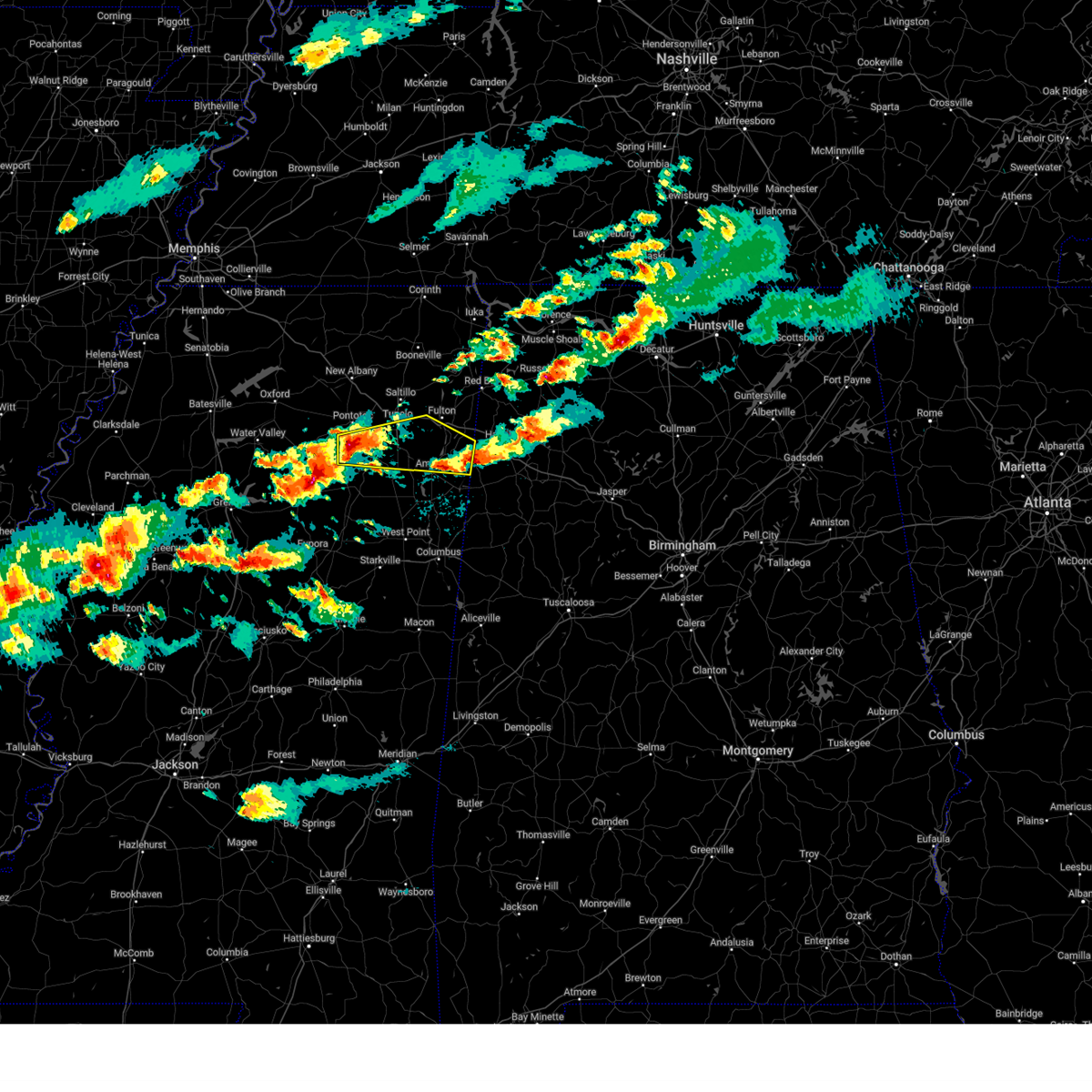 Svrmeg the national weather service in memphis has issued a * severe thunderstorm warning for, northeastern chickasaw county in northeastern mississippi, southeastern pontotoc county in northeastern mississippi, southern itawamba county in northeastern mississippi, southern lee county in northeastern mississippi, northern monroe county in northeastern mississippi, * until 845 pm cdt. * at 757 pm cdt, a severe thunderstorm was located near houlka, or 9 miles south of pontotoc, moving east at 40 mph (radar indicated). Hazards include 60 mph wind gusts and quarter size hail. Hail damage to vehicles is expected. Expect wind damage to roofs, siding, and trees. Svrmeg the national weather service in memphis has issued a * severe thunderstorm warning for, northeastern chickasaw county in northeastern mississippi, southeastern pontotoc county in northeastern mississippi, southern itawamba county in northeastern mississippi, southern lee county in northeastern mississippi, northern monroe county in northeastern mississippi, * until 845 pm cdt. * at 757 pm cdt, a severe thunderstorm was located near houlka, or 9 miles south of pontotoc, moving east at 40 mph (radar indicated). Hazards include 60 mph wind gusts and quarter size hail. Hail damage to vehicles is expected. Expect wind damage to roofs, siding, and trees.
|
| 3/23/2025 7:36 PM CDT |
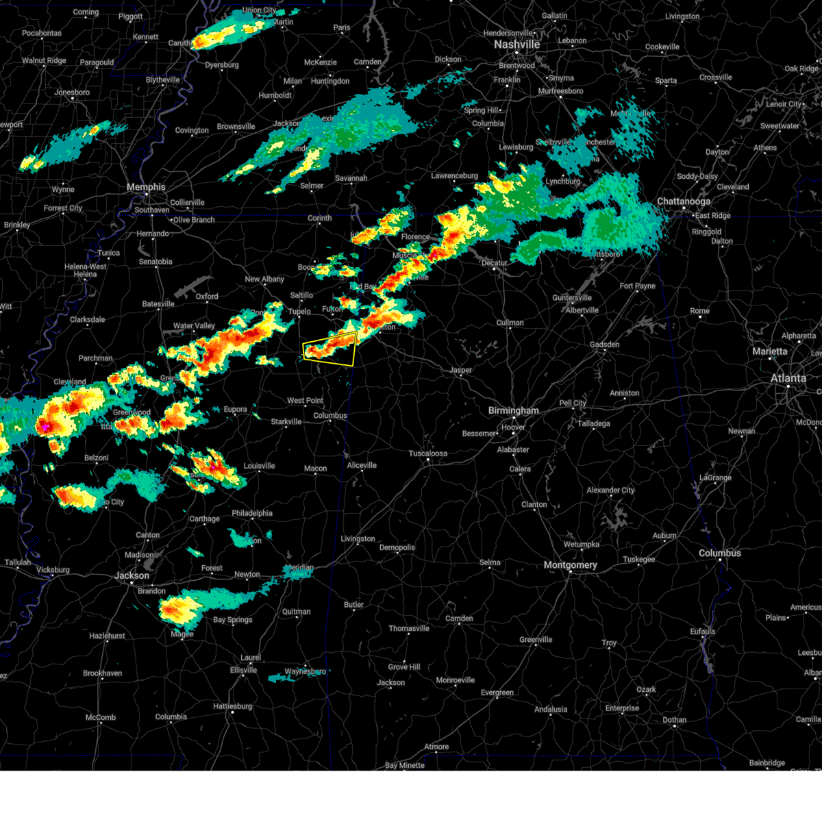 At 735 pm cdt, a severe thunderstorm was located over smithville, or near amory, moving east at 35 mph (radar indicated). Hazards include 60 mph wind gusts and quarter size hail. Hail damage to vehicles is expected. expect wind damage to roofs, siding, and trees. Locations impacted include, sipsey fork, becker, smithville, turon, new wren, splunge, wren, amory, hatley, bigbee, parham, quincy, and nettleton. At 735 pm cdt, a severe thunderstorm was located over smithville, or near amory, moving east at 35 mph (radar indicated). Hazards include 60 mph wind gusts and quarter size hail. Hail damage to vehicles is expected. expect wind damage to roofs, siding, and trees. Locations impacted include, sipsey fork, becker, smithville, turon, new wren, splunge, wren, amory, hatley, bigbee, parham, quincy, and nettleton.
|
| 3/23/2025 7:20 PM CDT |
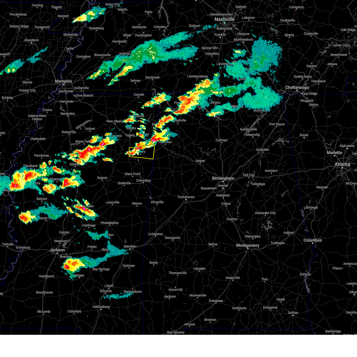 Svrmeg the national weather service in memphis has issued a * severe thunderstorm warning for, southern itawamba county in northeastern mississippi, northern monroe county in northeastern mississippi, * until 800 pm cdt. * at 720 pm cdt, a severe thunderstorm was located near amory, moving east at 35 mph (broadcast media). Hazards include 60 mph wind gusts and half dollar size hail. Hail damage to vehicles is expected. Expect wind damage to roofs, siding, and trees. Svrmeg the national weather service in memphis has issued a * severe thunderstorm warning for, southern itawamba county in northeastern mississippi, northern monroe county in northeastern mississippi, * until 800 pm cdt. * at 720 pm cdt, a severe thunderstorm was located near amory, moving east at 35 mph (broadcast media). Hazards include 60 mph wind gusts and half dollar size hail. Hail damage to vehicles is expected. Expect wind damage to roofs, siding, and trees.
|
| 3/15/2025 5:02 PM CDT |
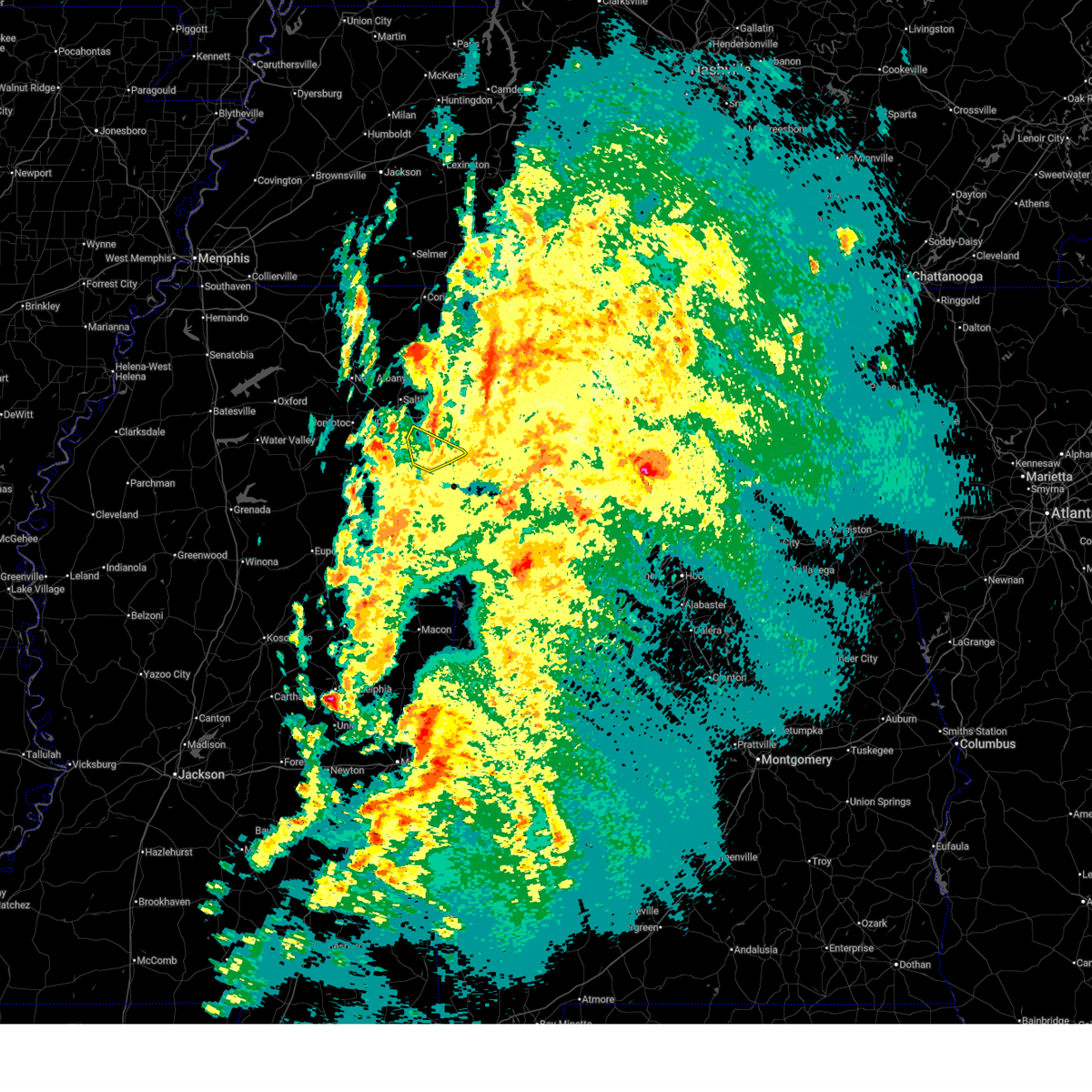 The storm which prompted the warning has moved out of the area. therefore, the warning has been allowed to expire. a tornado watch remains in effect until 600 pm cdt for northeastern mississippi. The storm which prompted the warning has moved out of the area. therefore, the warning has been allowed to expire. a tornado watch remains in effect until 600 pm cdt for northeastern mississippi.
|
| 3/15/2025 4:52 PM CDT |
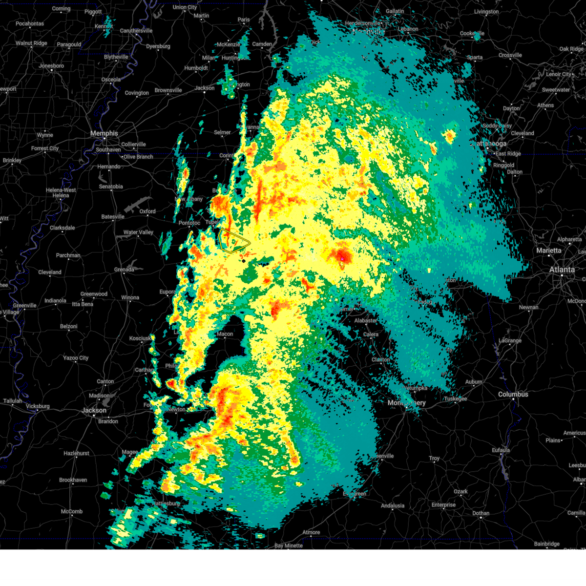 At 452 pm cdt, a severe thunderstorm was located near evergreen, or 8 miles north of amory, moving northeast at 45 mph (radar indicated). Hazards include 60 mph wind gusts and penny size hail. Expect damage to roofs, siding, and trees. Locations impacted include, bigbee, smithville, turon, jacinto, amory, evergreen, richmond, and nettleton. At 452 pm cdt, a severe thunderstorm was located near evergreen, or 8 miles north of amory, moving northeast at 45 mph (radar indicated). Hazards include 60 mph wind gusts and penny size hail. Expect damage to roofs, siding, and trees. Locations impacted include, bigbee, smithville, turon, jacinto, amory, evergreen, richmond, and nettleton.
|
| 3/15/2025 4:42 PM CDT |
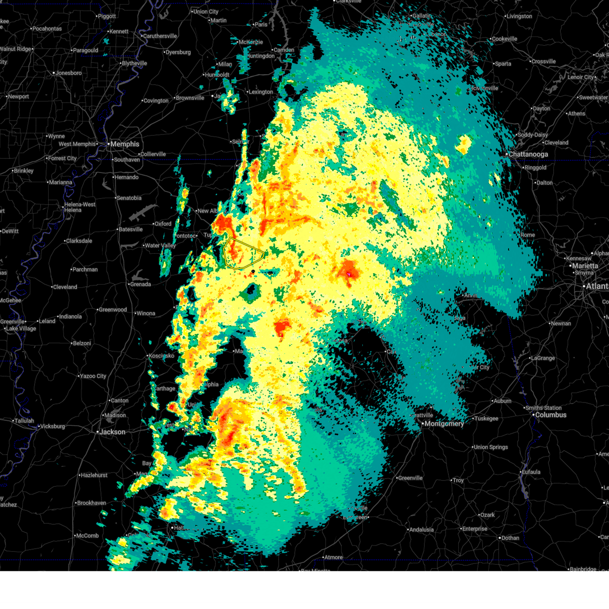 At 442 pm cdt, a severe thunderstorm was located near new wren, or near amory, moving northeast at 40 mph (radar indicated). Hazards include 60 mph wind gusts and penny size hail. Expect damage to roofs, siding, and trees. Locations impacted include, becker, cardsville, smithville, turon, new wren, wren, amory, hatley, nettleton, bigbee, jacinto, parham, evergreen, richmond, and shannon. At 442 pm cdt, a severe thunderstorm was located near new wren, or near amory, moving northeast at 40 mph (radar indicated). Hazards include 60 mph wind gusts and penny size hail. Expect damage to roofs, siding, and trees. Locations impacted include, becker, cardsville, smithville, turon, new wren, wren, amory, hatley, nettleton, bigbee, jacinto, parham, evergreen, richmond, and shannon.
|
| 3/15/2025 4:42 PM CDT |
 the severe thunderstorm warning has been cancelled and is no longer in effect the severe thunderstorm warning has been cancelled and is no longer in effect
|
| 3/15/2025 4:36 PM CDT |
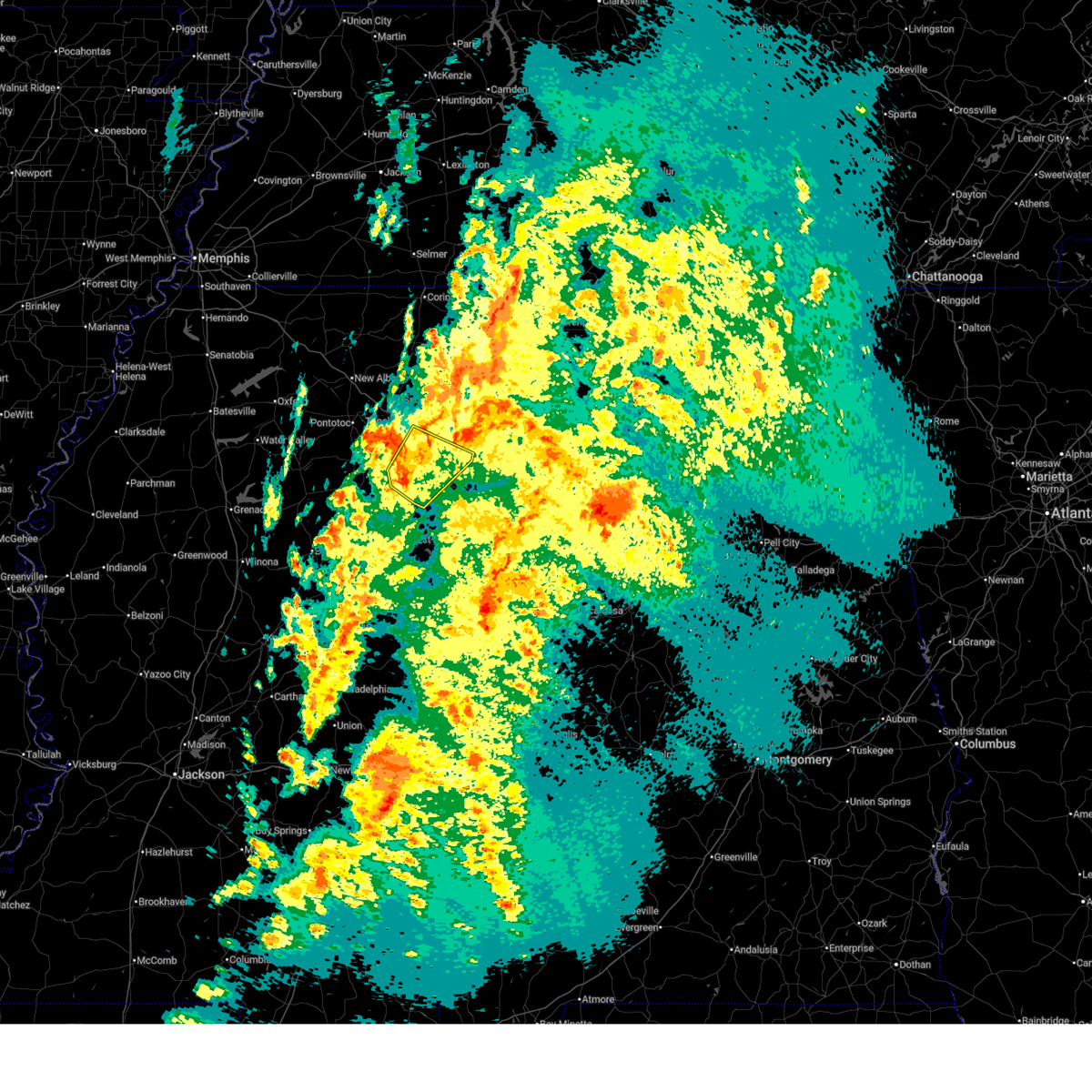 At 436 pm cdt, a severe thunderstorm was located near new wren, or near amory, moving northeast at 45 mph (radar indicated). Hazards include 60 mph wind gusts and penny size hail. Expect damage to roofs, siding, and trees. Locations impacted include, becker, aberdeen, cardsville, smithville, turon, egypt, new wren, wren, amory, hatley, nettleton, east aberdeen, bigbee, okolona, jacinto, parham, evergreen, richmond, and shannon. At 436 pm cdt, a severe thunderstorm was located near new wren, or near amory, moving northeast at 45 mph (radar indicated). Hazards include 60 mph wind gusts and penny size hail. Expect damage to roofs, siding, and trees. Locations impacted include, becker, aberdeen, cardsville, smithville, turon, egypt, new wren, wren, amory, hatley, nettleton, east aberdeen, bigbee, okolona, jacinto, parham, evergreen, richmond, and shannon.
|
| 3/15/2025 4:12 PM CDT |
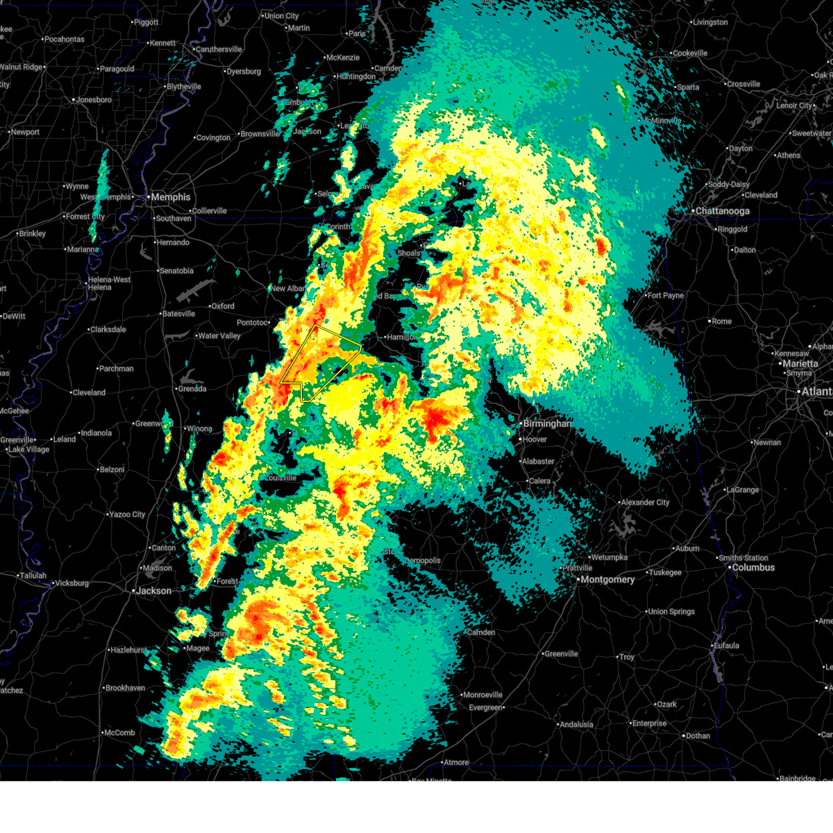 Svrmeg the national weather service in memphis has issued a * severe thunderstorm warning for, southeastern chickasaw county in northeastern mississippi, southwestern itawamba county in northeastern mississippi, southeastern lee county in northeastern mississippi, monroe county in northeastern mississippi, * until 500 pm cdt. * at 412 pm cdt, a severe thunderstorm was located near trebloc, or 12 miles west of aberdeen, moving northeast at 45 mph (radar indicated). Hazards include 60 mph wind gusts and penny size hail. expect damage to roofs, siding, and trees Svrmeg the national weather service in memphis has issued a * severe thunderstorm warning for, southeastern chickasaw county in northeastern mississippi, southwestern itawamba county in northeastern mississippi, southeastern lee county in northeastern mississippi, monroe county in northeastern mississippi, * until 500 pm cdt. * at 412 pm cdt, a severe thunderstorm was located near trebloc, or 12 miles west of aberdeen, moving northeast at 45 mph (radar indicated). Hazards include 60 mph wind gusts and penny size hail. expect damage to roofs, siding, and trees
|
| 3/15/2025 2:29 PM CDT |
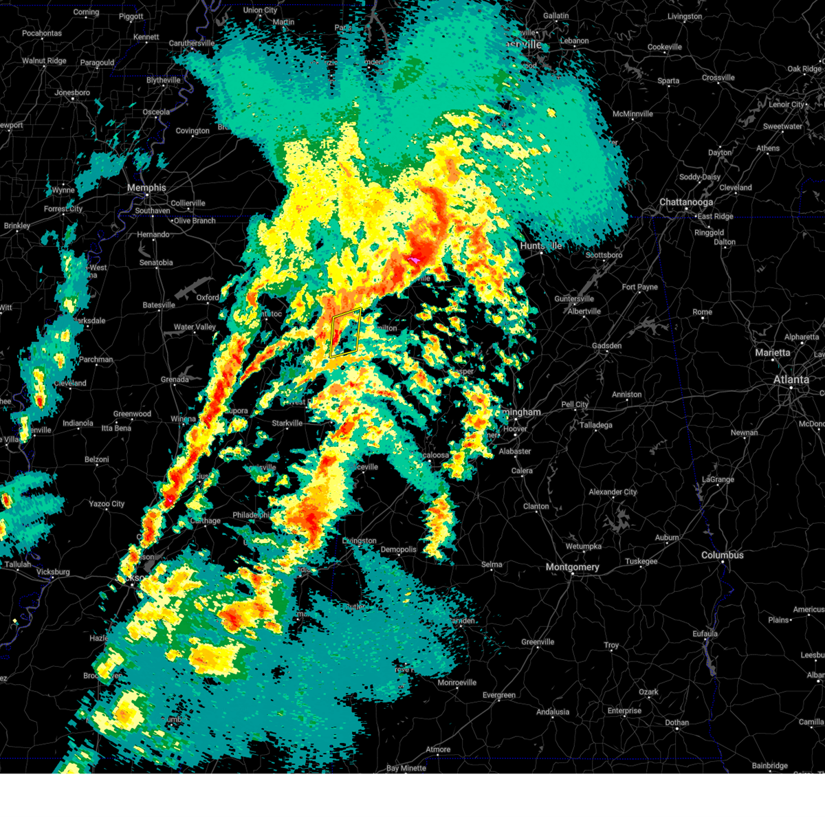 Svrmeg the national weather service in memphis has issued a * severe thunderstorm warning for, southeastern itawamba county in northeastern mississippi, northeastern monroe county in northeastern mississippi, * until 300 pm cdt. * at 229 pm cdt, a severe thunderstorm was located near new salem, or 11 miles southeast of fulton, moving northeast at 35 mph (radar indicated). Hazards include 60 mph wind gusts and penny size hail. expect damage to roofs, siding, and trees Svrmeg the national weather service in memphis has issued a * severe thunderstorm warning for, southeastern itawamba county in northeastern mississippi, northeastern monroe county in northeastern mississippi, * until 300 pm cdt. * at 229 pm cdt, a severe thunderstorm was located near new salem, or 11 miles southeast of fulton, moving northeast at 35 mph (radar indicated). Hazards include 60 mph wind gusts and penny size hail. expect damage to roofs, siding, and trees
|
| 3/15/2025 1:40 PM CDT |
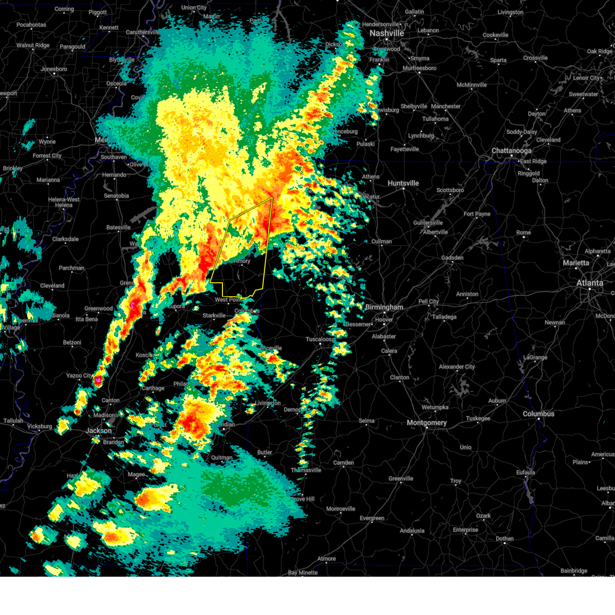 The storm which prompted the warning has moved out of the area. therefore, the warning will be allowed to expire. a tornado watch remains in effect until 600 pm cdt for northeastern mississippi. to report severe weather, contact your nearest law enforcement agency. they will relay your report to the national weather service memphis. remember, a tornado warning still remains in effect for itawamba county until 2 pm cdt. The storm which prompted the warning has moved out of the area. therefore, the warning will be allowed to expire. a tornado watch remains in effect until 600 pm cdt for northeastern mississippi. to report severe weather, contact your nearest law enforcement agency. they will relay your report to the national weather service memphis. remember, a tornado warning still remains in effect for itawamba county until 2 pm cdt.
|
| 3/15/2025 1:22 PM CDT |
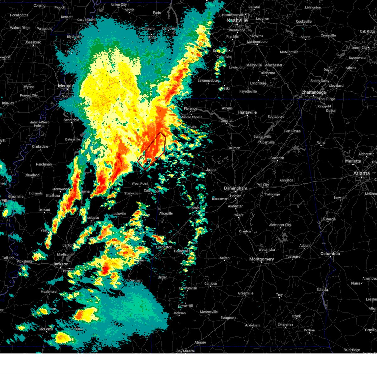 At 121 pm cdt, a confirmed tornado was located near amory, moving northeast at 55 mph (weather spotters confirmed tornado). Hazards include damaging tornado and quarter size hail. Flying debris will be dangerous to those caught without shelter. mobile homes will be damaged or destroyed. damage to roofs, windows, and vehicles will occur. tree damage is likely. Locations impacted include, fulton, clay, abney, eastman, becker, cardsville, smithville, turon, tilden, new wren, wren, amory, hatley, fairview, nettleton, bigbee, new salem, bounds crossroads, tremont, and jacinto. At 121 pm cdt, a confirmed tornado was located near amory, moving northeast at 55 mph (weather spotters confirmed tornado). Hazards include damaging tornado and quarter size hail. Flying debris will be dangerous to those caught without shelter. mobile homes will be damaged or destroyed. damage to roofs, windows, and vehicles will occur. tree damage is likely. Locations impacted include, fulton, clay, abney, eastman, becker, cardsville, smithville, turon, tilden, new wren, wren, amory, hatley, fairview, nettleton, bigbee, new salem, bounds crossroads, tremont, and jacinto.
|
| 3/15/2025 1:19 PM CDT |
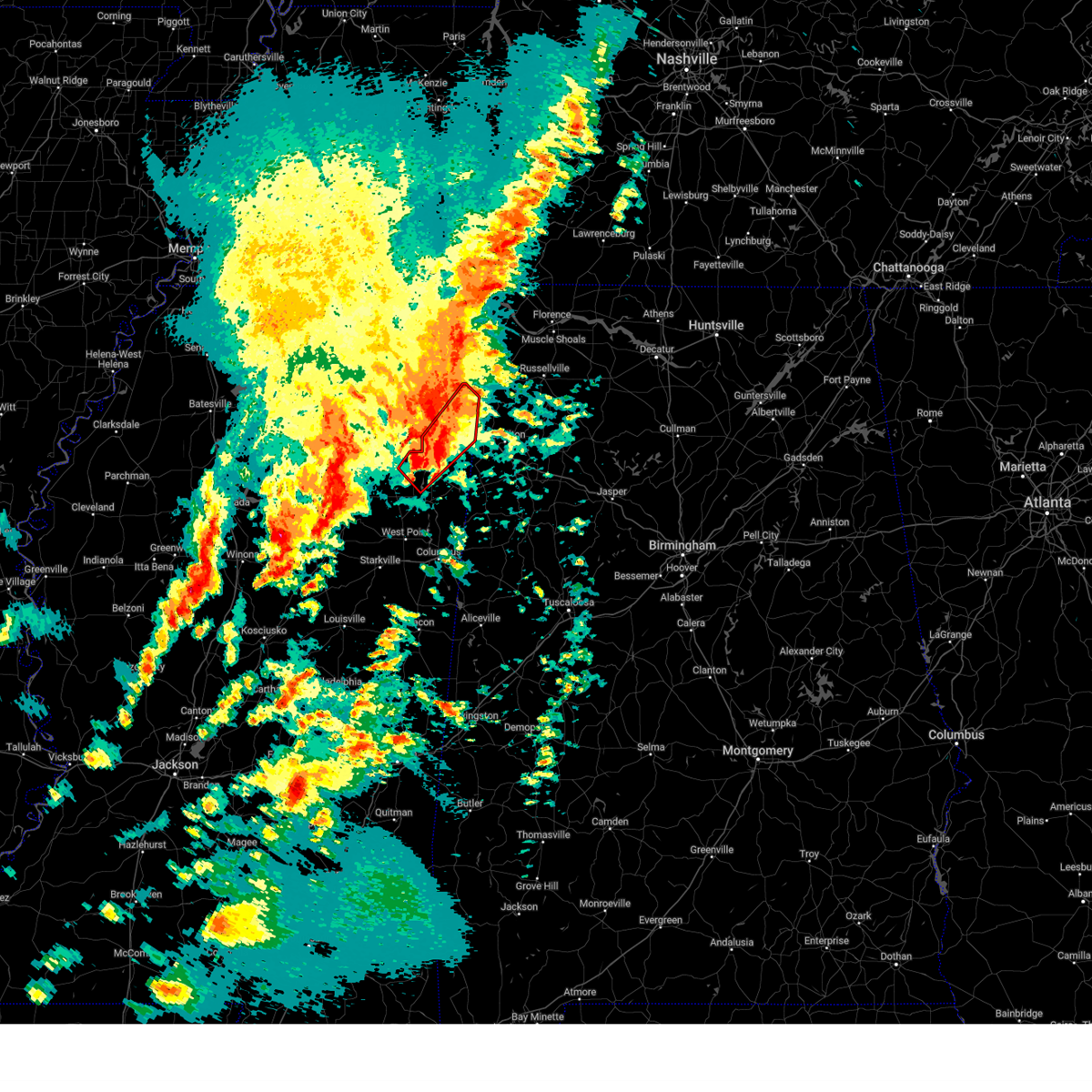 Tormeg the national weather service in memphis has issued a * tornado warning for, itawamba county in northeastern mississippi, northwestern monroe county in northeastern mississippi, * until 200 pm cdt. * at 119 pm cdt, a severe thunderstorm capable of producing a tornado was located near new wren, or near amory, moving northeast at 55 mph (radar indicated rotation). Hazards include tornado and quarter size hail. Flying debris will be dangerous to those caught without shelter. mobile homes will be damaged or destroyed. damage to roofs, windows, and vehicles will occur. Tree damage is likely. Tormeg the national weather service in memphis has issued a * tornado warning for, itawamba county in northeastern mississippi, northwestern monroe county in northeastern mississippi, * until 200 pm cdt. * at 119 pm cdt, a severe thunderstorm capable of producing a tornado was located near new wren, or near amory, moving northeast at 55 mph (radar indicated rotation). Hazards include tornado and quarter size hail. Flying debris will be dangerous to those caught without shelter. mobile homes will be damaged or destroyed. damage to roofs, windows, and vehicles will occur. Tree damage is likely.
|
| 3/15/2025 1:06 PM CDT |
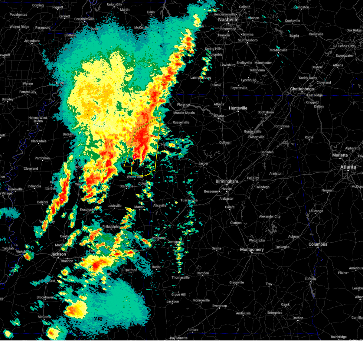 Svrmeg the national weather service in memphis has issued a * severe thunderstorm warning for, eastern chickasaw county in northeastern mississippi, itawamba county in northeastern mississippi, eastern lee county in northeastern mississippi, monroe county in northeastern mississippi, southern tishomingo county in northeastern mississippi, southeastern prentiss county in northeastern mississippi, * until 145 pm cdt. * at 106 pm cdt, a severe thunderstorm was located near smithville, or near amory, moving northeast at 40 mph (radar indicated). Hazards include 60 mph wind gusts and quarter size hail. Hail damage to vehicles is expected. Expect wind damage to roofs, siding, and trees. Svrmeg the national weather service in memphis has issued a * severe thunderstorm warning for, eastern chickasaw county in northeastern mississippi, itawamba county in northeastern mississippi, eastern lee county in northeastern mississippi, monroe county in northeastern mississippi, southern tishomingo county in northeastern mississippi, southeastern prentiss county in northeastern mississippi, * until 145 pm cdt. * at 106 pm cdt, a severe thunderstorm was located near smithville, or near amory, moving northeast at 40 mph (radar indicated). Hazards include 60 mph wind gusts and quarter size hail. Hail damage to vehicles is expected. Expect wind damage to roofs, siding, and trees.
|
| 3/15/2025 2:46 AM CDT |
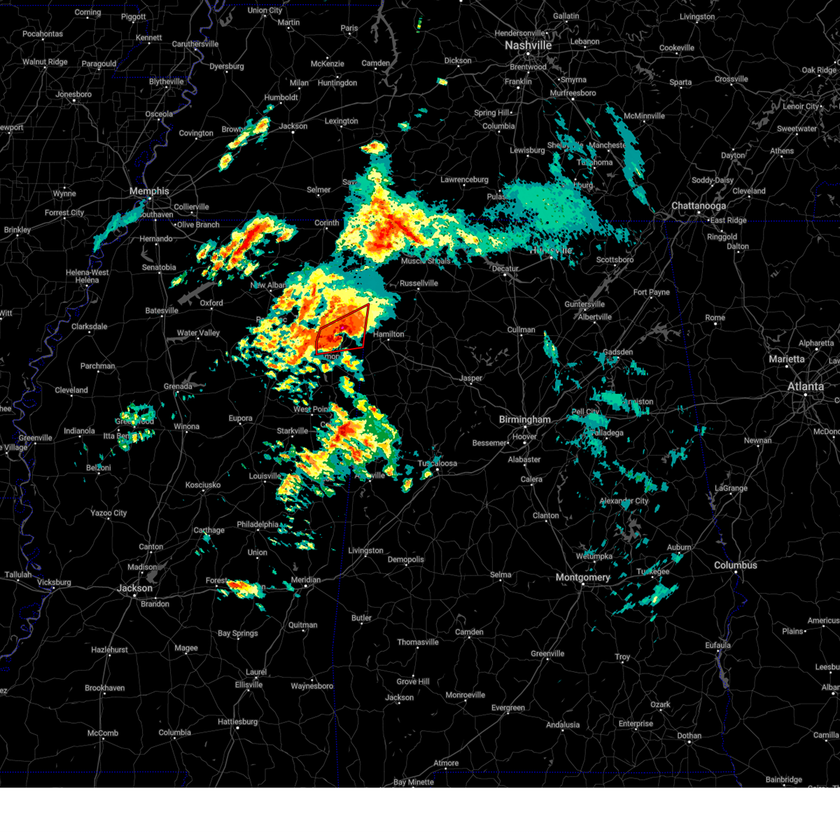 At 245 am cdt, a severe thunderstorm capable of producing a tornado was located near new salem, or 8 miles south of fulton, moving northeast at 45 mph (radar indicated rotation). Hazards include tornado and quarter size hail. Flying debris will be dangerous to those caught without shelter. mobile homes will be damaged or destroyed. damage to roofs, windows, and vehicles will occur. tree damage is likely. Locations impacted include, fulton, clay, abney, eastman, cardsville, smithville, turon, tilden, new salem, bounds crossroads, tremont, jacinto, cadamy, evergreen, richmond, and nettleton. At 245 am cdt, a severe thunderstorm capable of producing a tornado was located near new salem, or 8 miles south of fulton, moving northeast at 45 mph (radar indicated rotation). Hazards include tornado and quarter size hail. Flying debris will be dangerous to those caught without shelter. mobile homes will be damaged or destroyed. damage to roofs, windows, and vehicles will occur. tree damage is likely. Locations impacted include, fulton, clay, abney, eastman, cardsville, smithville, turon, tilden, new salem, bounds crossroads, tremont, jacinto, cadamy, evergreen, richmond, and nettleton.
|
| 3/15/2025 2:29 AM CDT |
 At 228 am cdt, a severe thunderstorm capable of producing a tornado was located near shannon, or 8 miles northwest of amory, moving northeast at 40 mph (radar indicated rotation). Hazards include tornado and half dollar size hail. Flying debris will be dangerous to those caught without shelter. mobile homes will be damaged or destroyed. damage to roofs, windows, and vehicles will occur. tree damage is likely. Locations impacted include, fulton, clay, abney, eastman, cardsville, smithville, turon, tilden, new wren, shannon, wren, amory, hatley, nettleton, bigbee, new salem, bounds crossroads, tremont, jacinto, and parham. At 228 am cdt, a severe thunderstorm capable of producing a tornado was located near shannon, or 8 miles northwest of amory, moving northeast at 40 mph (radar indicated rotation). Hazards include tornado and half dollar size hail. Flying debris will be dangerous to those caught without shelter. mobile homes will be damaged or destroyed. damage to roofs, windows, and vehicles will occur. tree damage is likely. Locations impacted include, fulton, clay, abney, eastman, cardsville, smithville, turon, tilden, new wren, shannon, wren, amory, hatley, nettleton, bigbee, new salem, bounds crossroads, tremont, jacinto, and parham.
|
| 3/15/2025 2:29 AM CDT |
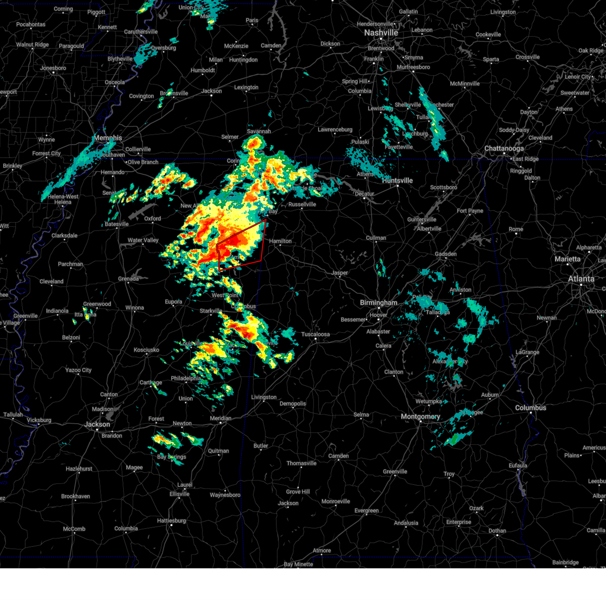 the tornado warning has been cancelled and is no longer in effect the tornado warning has been cancelled and is no longer in effect
|
| 3/15/2025 2:10 AM CDT |
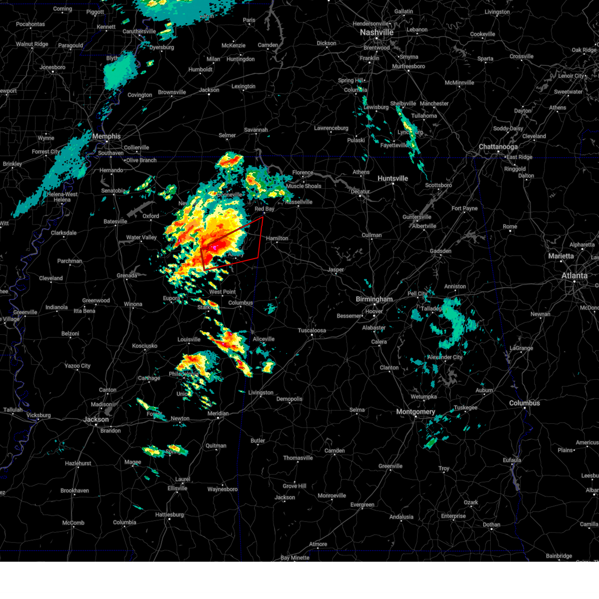 Tormeg the national weather service in memphis has issued a * tornado warning for, northeastern chickasaw county in northeastern mississippi, southern itawamba county in northeastern mississippi, southern lee county in northeastern mississippi, northern monroe county in northeastern mississippi, * until 300 am cdt. * at 210 am cdt, a severe thunderstorm capable of producing a tornado was located over okolona, moving northeast at 45 mph (radar indicated rotation). Hazards include tornado and half dollar size hail. Flying debris will be dangerous to those caught without shelter. mobile homes will be damaged or destroyed. damage to roofs, windows, and vehicles will occur. Tree damage is likely. Tormeg the national weather service in memphis has issued a * tornado warning for, northeastern chickasaw county in northeastern mississippi, southern itawamba county in northeastern mississippi, southern lee county in northeastern mississippi, northern monroe county in northeastern mississippi, * until 300 am cdt. * at 210 am cdt, a severe thunderstorm capable of producing a tornado was located over okolona, moving northeast at 45 mph (radar indicated rotation). Hazards include tornado and half dollar size hail. Flying debris will be dangerous to those caught without shelter. mobile homes will be damaged or destroyed. damage to roofs, windows, and vehicles will occur. Tree damage is likely.
|
| 2/15/2025 10:58 PM CST |
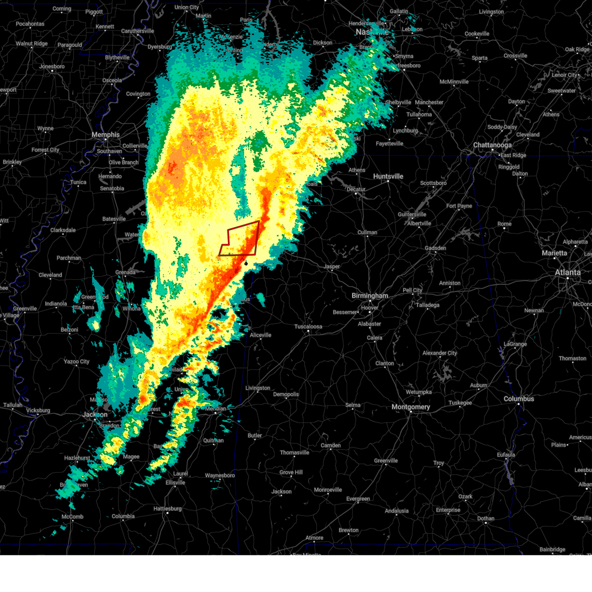 The storm which prompted the warning has moved out of the area. therefore, the warning will be allowed to expire. a tornado watch remains in effect until 400 am cst for northeastern mississippi. The storm which prompted the warning has moved out of the area. therefore, the warning will be allowed to expire. a tornado watch remains in effect until 400 am cst for northeastern mississippi.
|
| 2/15/2025 10:58 PM CST |
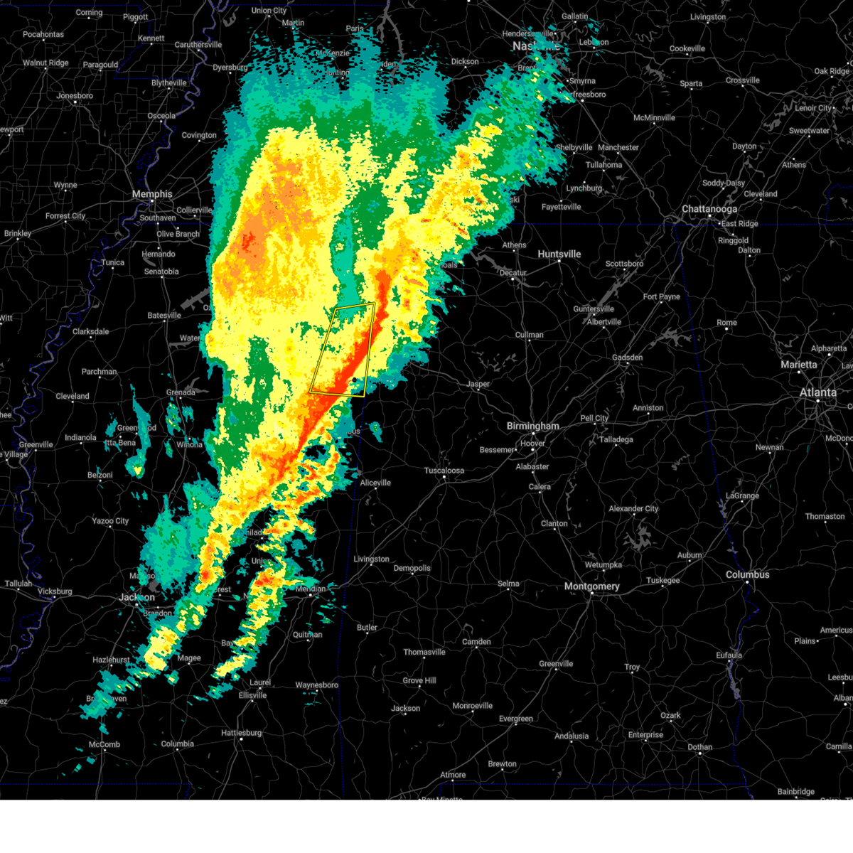 The storm which prompted the warning has weakened below severe limits, and has exited the warned area. therefore, the warning will be allowed to expire. a tornado watch remains in effect until 400 am cst for northeastern mississippi. The storm which prompted the warning has weakened below severe limits, and has exited the warned area. therefore, the warning will be allowed to expire. a tornado watch remains in effect until 400 am cst for northeastern mississippi.
|
| 2/15/2025 10:49 PM CST |
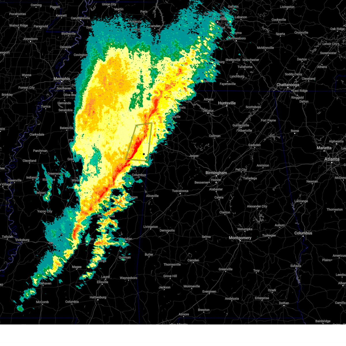 the severe thunderstorm warning has been cancelled and is no longer in effect the severe thunderstorm warning has been cancelled and is no longer in effect
|
| 2/15/2025 10:49 PM CST |
 At 1049 pm cst, a severe thunderstorm was located near detroit, or 13 miles west of hamilton, moving east at 50 mph (radar indicated). Hazards include 60 mph wind gusts and quarter size hail. Hail damage to vehicles is expected. expect wind damage to roofs, siding, and trees. Locations impacted include, amory, aberdeen, fulton, mantachie, smithville, tremont, fairview, new salem, new wren, evergreen, clay, hatley, gattman, abney, eastman, quincy, turon, wise gap, ballardsville, and wren. At 1049 pm cst, a severe thunderstorm was located near detroit, or 13 miles west of hamilton, moving east at 50 mph (radar indicated). Hazards include 60 mph wind gusts and quarter size hail. Hail damage to vehicles is expected. expect wind damage to roofs, siding, and trees. Locations impacted include, amory, aberdeen, fulton, mantachie, smithville, tremont, fairview, new salem, new wren, evergreen, clay, hatley, gattman, abney, eastman, quincy, turon, wise gap, ballardsville, and wren.
|
| 2/15/2025 10:38 PM CST |
 At 1037 pm cst, a severe thunderstorm was located over smithville, or 9 miles northeast of amory, moving east at 50 mph (radar indicated). Hazards include 60 mph wind gusts and quarter size hail. Hail damage to vehicles is expected. expect wind damage to roofs, siding, and trees. Locations impacted include, tupelo, amory, aberdeen, fulton, verona, okolona, tombigbee state park, saltillo, shannon, plantersville, mantachie, smithville, tremont, fairview, new salem, new wren, trebloc, evergreen, clay, and nettleton. At 1037 pm cst, a severe thunderstorm was located over smithville, or 9 miles northeast of amory, moving east at 50 mph (radar indicated). Hazards include 60 mph wind gusts and quarter size hail. Hail damage to vehicles is expected. expect wind damage to roofs, siding, and trees. Locations impacted include, tupelo, amory, aberdeen, fulton, verona, okolona, tombigbee state park, saltillo, shannon, plantersville, mantachie, smithville, tremont, fairview, new salem, new wren, trebloc, evergreen, clay, and nettleton.
|
| 2/15/2025 10:38 PM CST |
 the severe thunderstorm warning has been cancelled and is no longer in effect the severe thunderstorm warning has been cancelled and is no longer in effect
|
| 2/15/2025 10:37 PM CST |
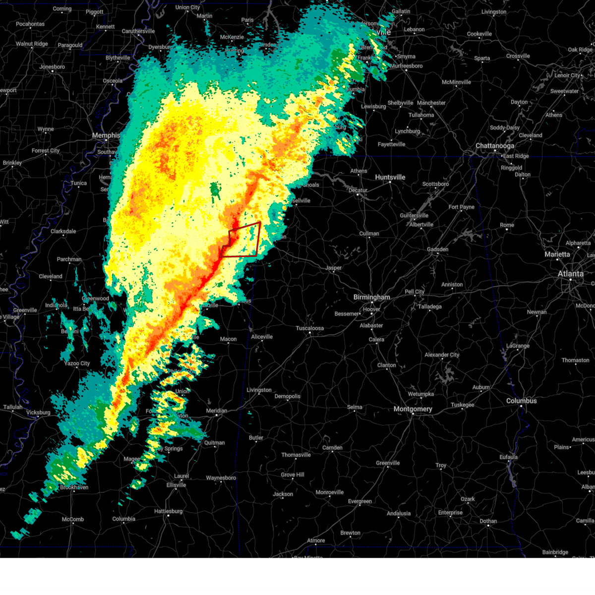 At 1036 pm cst, a severe thunderstorm capable of producing a tornado was located near fulton, moving northeast at 55 mph (radar indicated rotation). Hazards include tornado and quarter size hail. Flying debris will be dangerous to those caught without shelter. mobile homes will be damaged or destroyed. damage to roofs, windows, and vehicles will occur. tree damage is likely. Locations impacted include, amory, fulton, smithville, tremont, new salem, evergreen, clay, nettleton, hatley, abney, cardsville, turon, tilden, ballardsville, bigbee, jacinto, parham, and cadamy. At 1036 pm cst, a severe thunderstorm capable of producing a tornado was located near fulton, moving northeast at 55 mph (radar indicated rotation). Hazards include tornado and quarter size hail. Flying debris will be dangerous to those caught without shelter. mobile homes will be damaged or destroyed. damage to roofs, windows, and vehicles will occur. tree damage is likely. Locations impacted include, amory, fulton, smithville, tremont, new salem, evergreen, clay, nettleton, hatley, abney, cardsville, turon, tilden, ballardsville, bigbee, jacinto, parham, and cadamy.
|
| 2/15/2025 10:37 PM CST |
 the tornado warning has been cancelled and is no longer in effect the tornado warning has been cancelled and is no longer in effect
|
| 2/15/2025 10:24 PM CST |
 the tornado warning has been cancelled and is no longer in effect the tornado warning has been cancelled and is no longer in effect
|
| 2/15/2025 10:24 PM CST |
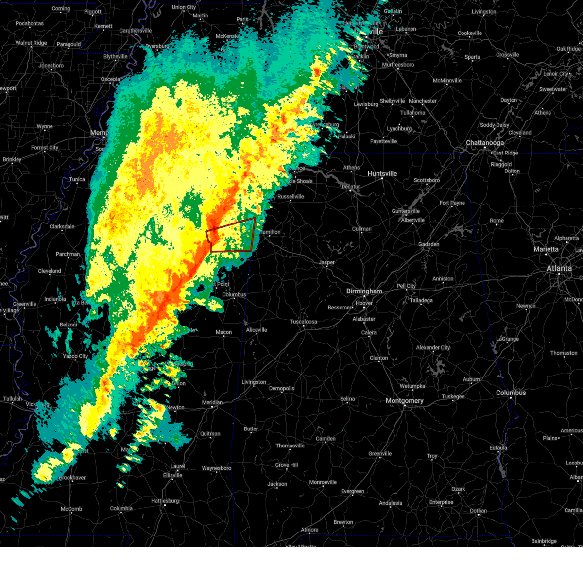 At 1024 pm cst, a severe thunderstorm capable of producing a tornado was located near shannon, or 7 miles southeast of verona, moving east at 55 mph (radar indicated rotation). Hazards include tornado and quarter size hail. Flying debris will be dangerous to those caught without shelter. mobile homes will be damaged or destroyed. damage to roofs, windows, and vehicles will occur. tree damage is likely. Locations impacted include, amory, fulton, verona, shannon, plantersville, smithville, tremont, new salem, evergreen, clay, nettleton, abney, cardsville, turon, tilden, ballardsville, bigbee, jacinto, parham, and cadamy. At 1024 pm cst, a severe thunderstorm capable of producing a tornado was located near shannon, or 7 miles southeast of verona, moving east at 55 mph (radar indicated rotation). Hazards include tornado and quarter size hail. Flying debris will be dangerous to those caught without shelter. mobile homes will be damaged or destroyed. damage to roofs, windows, and vehicles will occur. tree damage is likely. Locations impacted include, amory, fulton, verona, shannon, plantersville, smithville, tremont, new salem, evergreen, clay, nettleton, abney, cardsville, turon, tilden, ballardsville, bigbee, jacinto, parham, and cadamy.
|
| 2/15/2025 10:17 PM CST |
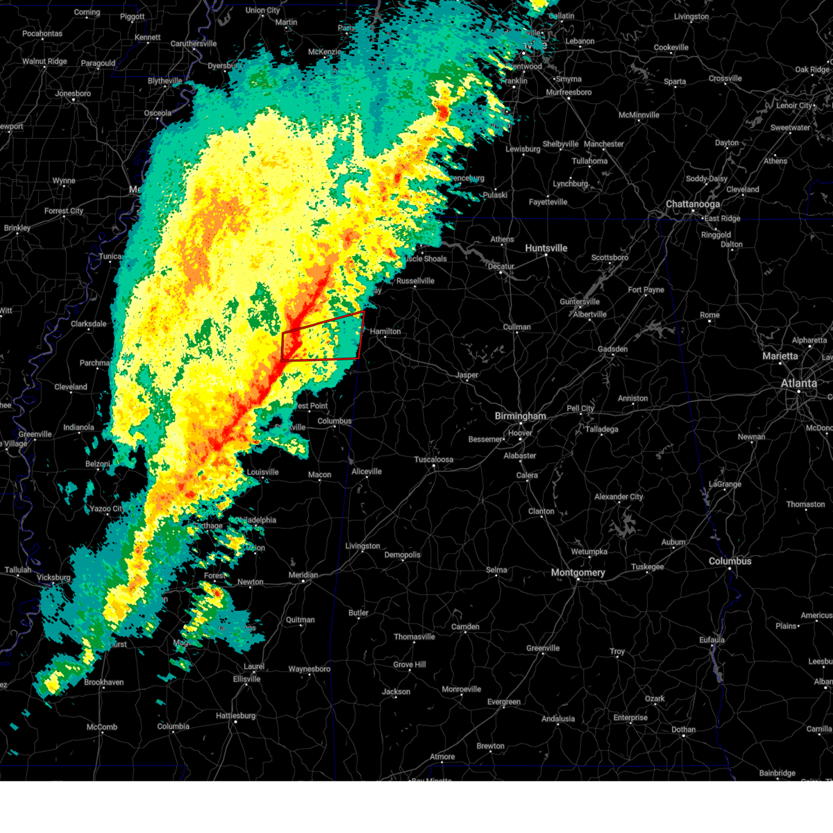 At 1017 pm cst, a severe thunderstorm capable of producing a tornado was located near shannon, or near okolona, moving east at 40 mph (radar indicated rotation). Hazards include tornado and quarter size hail. Flying debris will be dangerous to those caught without shelter. mobile homes will be damaged or destroyed. damage to roofs, windows, and vehicles will occur. tree damage is likely. Locations impacted include, amory, fulton, verona, okolona, shannon, plantersville, smithville, tremont, new salem, evergreen, clay, nettleton, hatley, abney, turon, ballardsville, leotis, old union, cardsville, and tilden. At 1017 pm cst, a severe thunderstorm capable of producing a tornado was located near shannon, or near okolona, moving east at 40 mph (radar indicated rotation). Hazards include tornado and quarter size hail. Flying debris will be dangerous to those caught without shelter. mobile homes will be damaged or destroyed. damage to roofs, windows, and vehicles will occur. tree damage is likely. Locations impacted include, amory, fulton, verona, okolona, shannon, plantersville, smithville, tremont, new salem, evergreen, clay, nettleton, hatley, abney, turon, ballardsville, leotis, old union, cardsville, and tilden.
|
| 2/15/2025 10:15 PM CST |
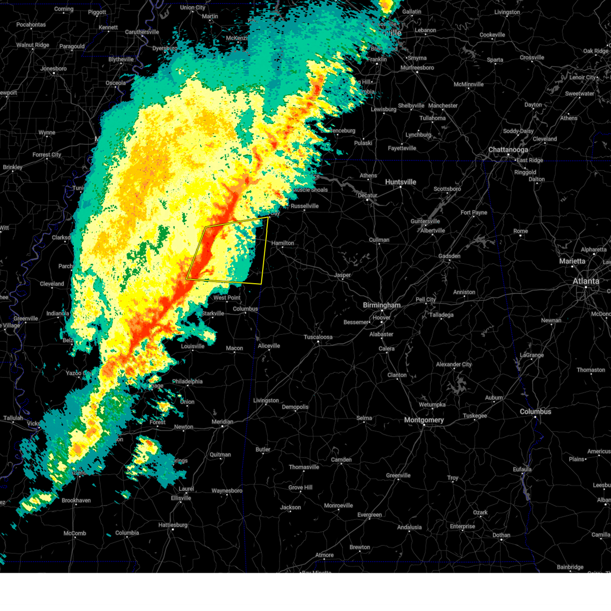 At 1015 pm cst, a severe thunderstorm was located near shannon, or near okolona, moving east at 50 mph (radar indicated). Hazards include 60 mph wind gusts and quarter size hail. Hail damage to vehicles is expected. expect wind damage to roofs, siding, and trees. Locations impacted include, tupelo, amory, aberdeen, fulton, houston, verona, okolona, trace state park, tombigbee state park, saltillo, shannon, plantersville, mantachie, smithville, tremont, fairview, troy, new salem, new wren, and trebloc. At 1015 pm cst, a severe thunderstorm was located near shannon, or near okolona, moving east at 50 mph (radar indicated). Hazards include 60 mph wind gusts and quarter size hail. Hail damage to vehicles is expected. expect wind damage to roofs, siding, and trees. Locations impacted include, tupelo, amory, aberdeen, fulton, houston, verona, okolona, trace state park, tombigbee state park, saltillo, shannon, plantersville, mantachie, smithville, tremont, fairview, troy, new salem, new wren, and trebloc.
|
| 2/15/2025 10:11 PM CST |
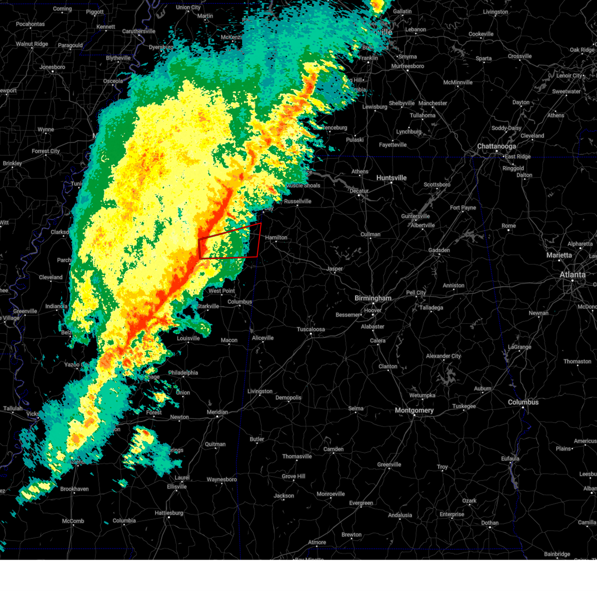 Tormeg the national weather service in memphis has issued a * tornado warning for, northeastern chickasaw county in northeastern mississippi, southeastern pontotoc county in northeastern mississippi, southern itawamba county in northeastern mississippi, southern lee county in northeastern mississippi, northern monroe county in northeastern mississippi, * until 1100 pm cst. * at 1010 pm cst, a severe thunderstorm capable of producing a tornado was located near troy, or 7 miles northwest of okolona, moving east at 55 mph (radar indicated rotation). Hazards include tornado. Flying debris will be dangerous to those caught without shelter. mobile homes will be damaged or destroyed. damage to roofs, windows, and vehicles will occur. Tree damage is likely. Tormeg the national weather service in memphis has issued a * tornado warning for, northeastern chickasaw county in northeastern mississippi, southeastern pontotoc county in northeastern mississippi, southern itawamba county in northeastern mississippi, southern lee county in northeastern mississippi, northern monroe county in northeastern mississippi, * until 1100 pm cst. * at 1010 pm cst, a severe thunderstorm capable of producing a tornado was located near troy, or 7 miles northwest of okolona, moving east at 55 mph (radar indicated rotation). Hazards include tornado. Flying debris will be dangerous to those caught without shelter. mobile homes will be damaged or destroyed. damage to roofs, windows, and vehicles will occur. Tree damage is likely.
|
| 2/15/2025 10:09 PM CST |
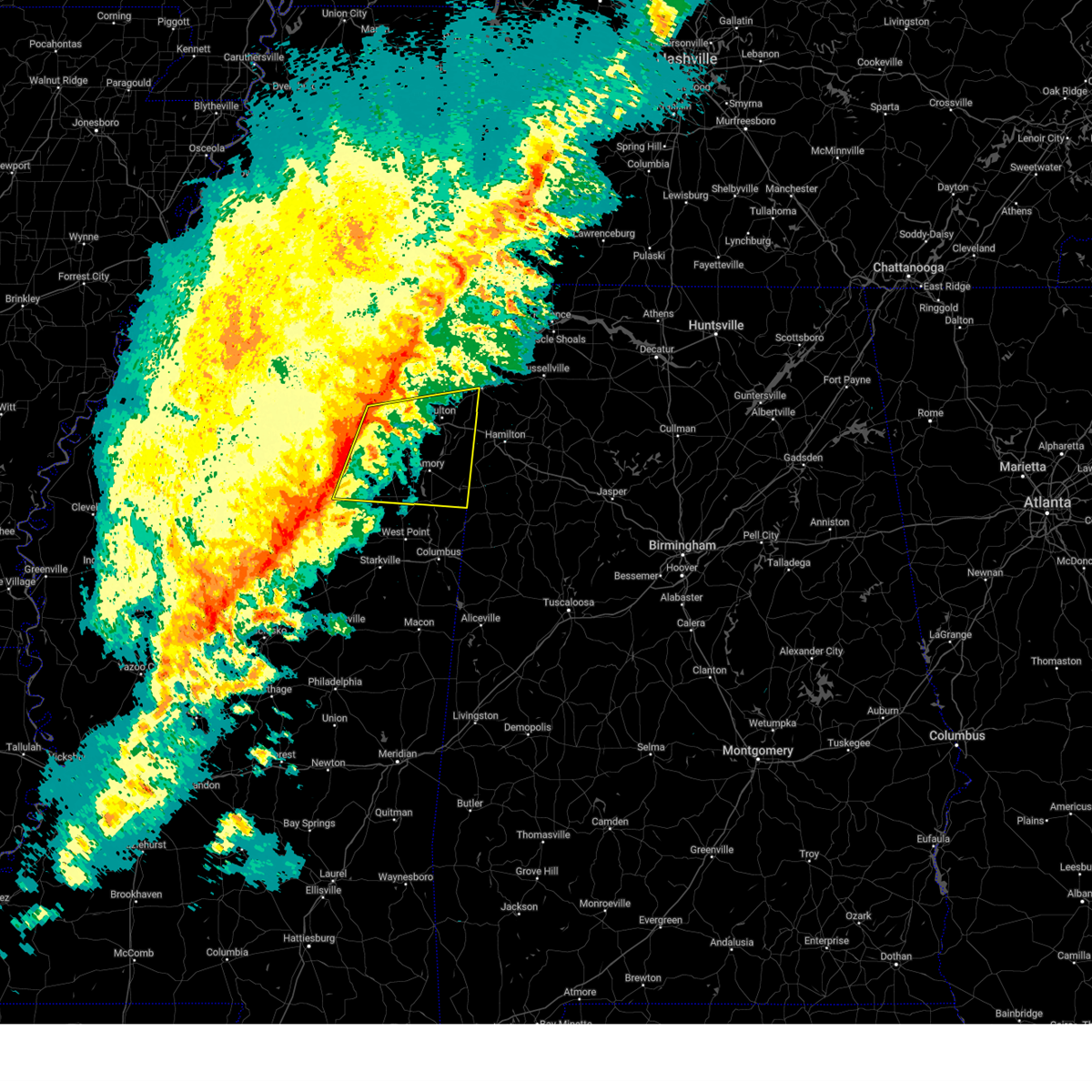 Svrmeg the national weather service in memphis has issued a * severe thunderstorm warning for, chickasaw county in northeastern mississippi, eastern pontotoc county in northeastern mississippi, itawamba county in northeastern mississippi, lee county in northeastern mississippi, monroe county in northeastern mississippi, * until 1100 pm cst. * at 1008 pm cst, a severe thunderstorm was located near okolona, moving east at 50 mph (radar indicated). Hazards include 60 mph wind gusts and nickel size hail. expect damage to roofs, siding, and trees Svrmeg the national weather service in memphis has issued a * severe thunderstorm warning for, chickasaw county in northeastern mississippi, eastern pontotoc county in northeastern mississippi, itawamba county in northeastern mississippi, lee county in northeastern mississippi, monroe county in northeastern mississippi, * until 1100 pm cst. * at 1008 pm cst, a severe thunderstorm was located near okolona, moving east at 50 mph (radar indicated). Hazards include 60 mph wind gusts and nickel size hail. expect damage to roofs, siding, and trees
|
| 12/28/2024 9:46 PM CST |
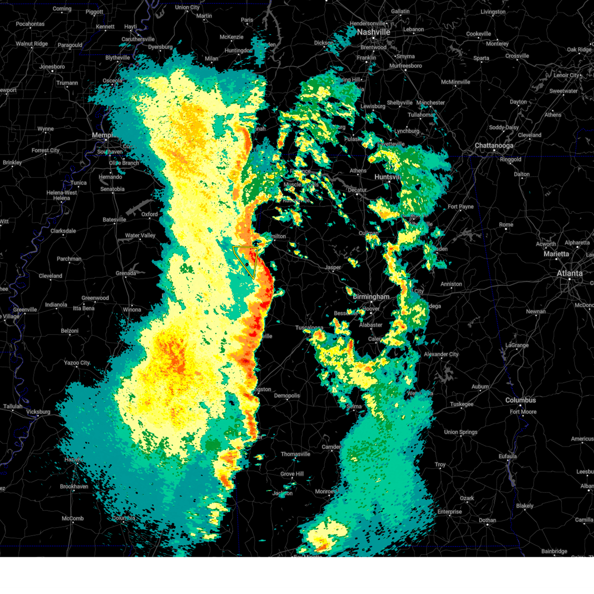 the severe thunderstorm warning has been cancelled and is no longer in effect the severe thunderstorm warning has been cancelled and is no longer in effect
|
| 12/28/2024 9:38 PM CST |
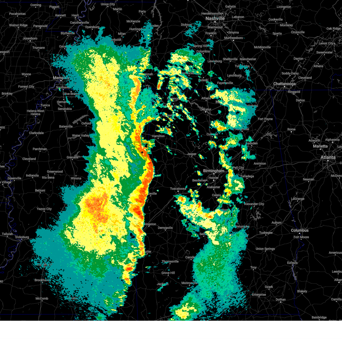 At 937 pm cst, a severe thunderstorm was located near sulligent, moving northeast at 55 mph (radar indicated). Hazards include 60 mph wind gusts and quarter size hail. Hail damage to vehicles is expected. expect wind damage to roofs, siding, and trees. Locations impacted include, amory, smithville, hatley, gattman, sipsey fork, quincy, greenwood springs, splunge, wise gap, athens, and parham. At 937 pm cst, a severe thunderstorm was located near sulligent, moving northeast at 55 mph (radar indicated). Hazards include 60 mph wind gusts and quarter size hail. Hail damage to vehicles is expected. expect wind damage to roofs, siding, and trees. Locations impacted include, amory, smithville, hatley, gattman, sipsey fork, quincy, greenwood springs, splunge, wise gap, athens, and parham.
|
| 12/28/2024 9:22 PM CST |
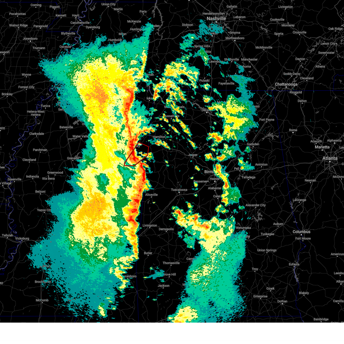 the tornado warning has been cancelled and is no longer in effect the tornado warning has been cancelled and is no longer in effect
|
| 12/28/2024 9:19 PM CST |
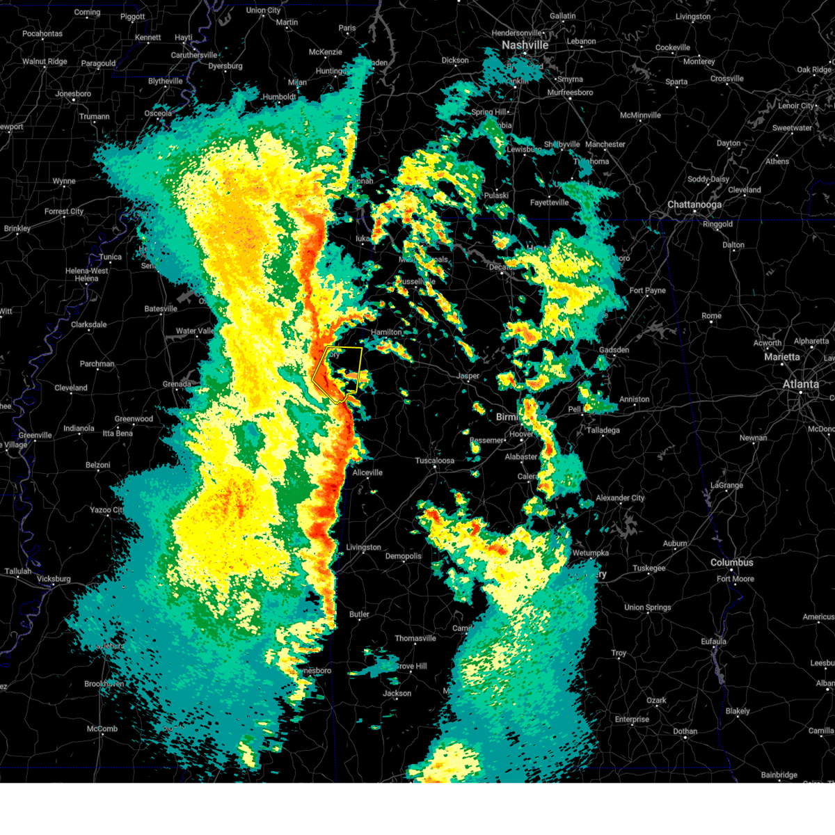 Svrmeg the national weather service in memphis has issued a * severe thunderstorm warning for, monroe county in northeastern mississippi, * until 1000 pm cst. * at 919 pm cst, a severe thunderstorm was located 7 miles east of aberdeen, moving northeast at 55 mph (radar indicated). Hazards include 60 mph wind gusts and quarter size hail. Hail damage to vehicles is expected. Expect wind damage to roofs, siding, and trees. Svrmeg the national weather service in memphis has issued a * severe thunderstorm warning for, monroe county in northeastern mississippi, * until 1000 pm cst. * at 919 pm cst, a severe thunderstorm was located 7 miles east of aberdeen, moving northeast at 55 mph (radar indicated). Hazards include 60 mph wind gusts and quarter size hail. Hail damage to vehicles is expected. Expect wind damage to roofs, siding, and trees.
|
| 12/28/2024 9:08 PM CST |
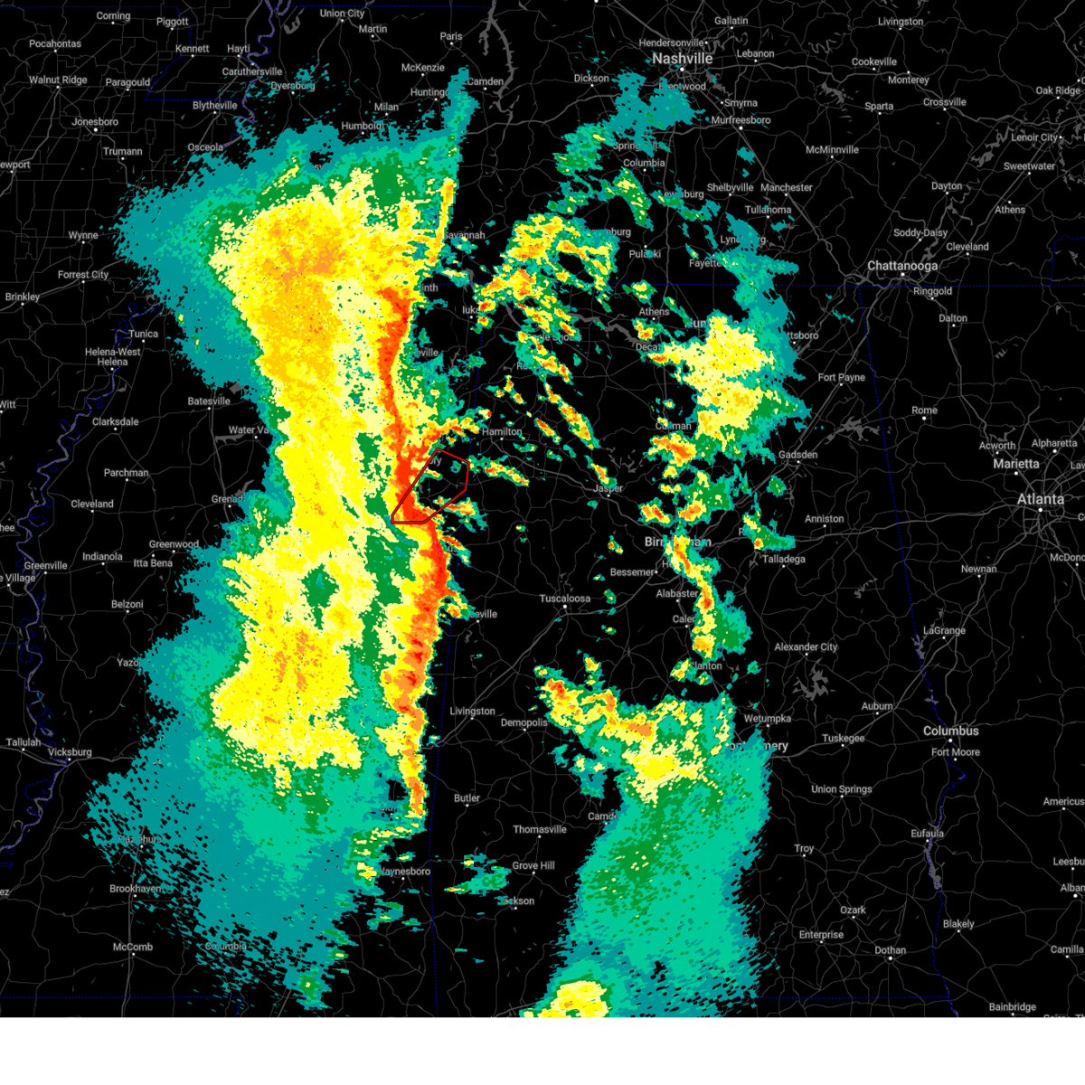 Tormeg the national weather service in memphis has issued a * tornado warning for, central monroe county in northeastern mississippi, * until 1000 pm cst. * at 908 pm cst, a severe thunderstorm capable of producing a tornado was located near west point, moving northeast at 40 mph (radar indicated rotation). Hazards include tornado. Flying debris will be dangerous to those caught without shelter. mobile homes will be damaged or destroyed. damage to roofs, windows, and vehicles will occur. Tree damage is likely. Tormeg the national weather service in memphis has issued a * tornado warning for, central monroe county in northeastern mississippi, * until 1000 pm cst. * at 908 pm cst, a severe thunderstorm capable of producing a tornado was located near west point, moving northeast at 40 mph (radar indicated rotation). Hazards include tornado. Flying debris will be dangerous to those caught without shelter. mobile homes will be damaged or destroyed. damage to roofs, windows, and vehicles will occur. Tree damage is likely.
|
| 9/24/2024 4:22 PM CDT |
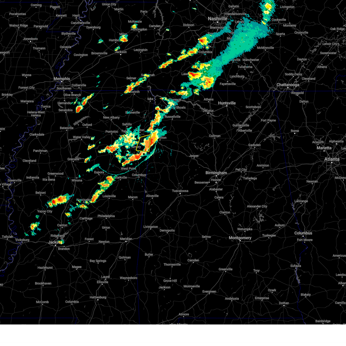 The storm which prompted the warning has moved out of the area. therefore, the warning will be allowed to expire. The storm which prompted the warning has moved out of the area. therefore, the warning will be allowed to expire.
|
| 9/24/2024 4:13 PM CDT |
 At 413 pm cdt, a severe thunderstorm was located near detroit, or 13 miles west of hamilton, moving east at 25 mph (radar indicated). Hazards include 60 mph wind gusts and quarter size hail. Hail damage to vehicles is expected. expect wind damage to roofs, siding, and trees. Locations impacted include, amory, smithville, tremont, new salem, hatley, sipsey fork, cardsville, turon, tilden, splunge, parham, and cadamy. At 413 pm cdt, a severe thunderstorm was located near detroit, or 13 miles west of hamilton, moving east at 25 mph (radar indicated). Hazards include 60 mph wind gusts and quarter size hail. Hail damage to vehicles is expected. expect wind damage to roofs, siding, and trees. Locations impacted include, amory, smithville, tremont, new salem, hatley, sipsey fork, cardsville, turon, tilden, splunge, parham, and cadamy.
|
| 9/24/2024 4:00 PM CDT |
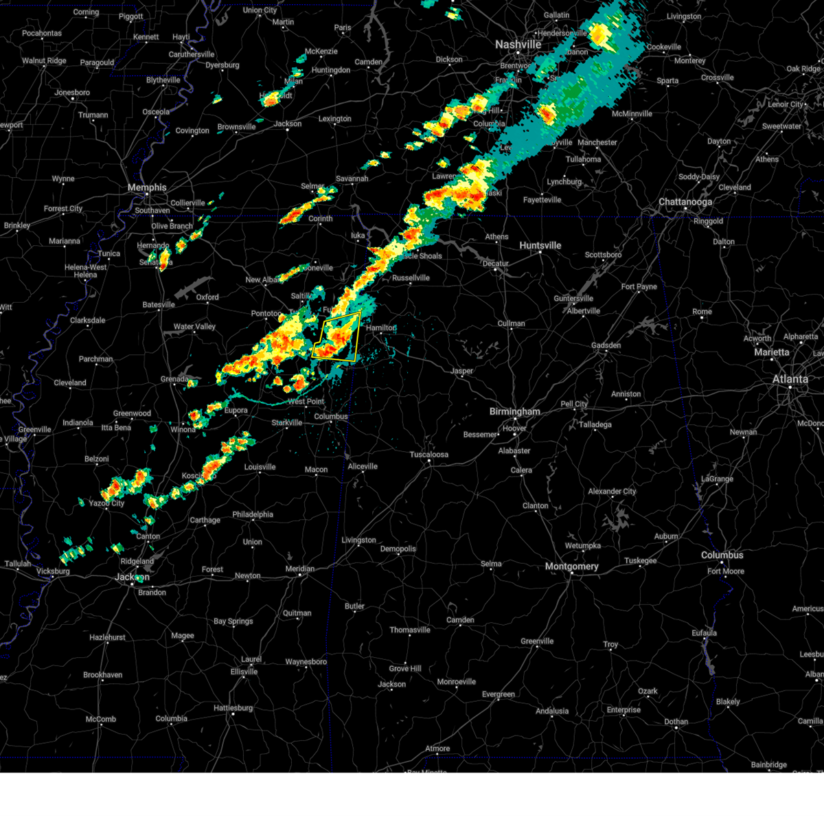 the severe thunderstorm warning has been cancelled and is no longer in effect the severe thunderstorm warning has been cancelled and is no longer in effect
|
| 9/24/2024 4:00 PM CDT |
 At 400 pm cdt, a severe thunderstorm was located near new salem, or 13 miles southeast of fulton, moving east at 40 mph (radar indicated). Hazards include 60 mph wind gusts and quarter size hail. Hail damage to vehicles is expected. expect wind damage to roofs, siding, and trees. Locations impacted include, amory, fulton, smithville, tremont, new salem, hatley, abney, sipsey fork, cardsville, turon, tilden, splunge, wren, bigbee, jacinto, parham, and cadamy. At 400 pm cdt, a severe thunderstorm was located near new salem, or 13 miles southeast of fulton, moving east at 40 mph (radar indicated). Hazards include 60 mph wind gusts and quarter size hail. Hail damage to vehicles is expected. expect wind damage to roofs, siding, and trees. Locations impacted include, amory, fulton, smithville, tremont, new salem, hatley, abney, sipsey fork, cardsville, turon, tilden, splunge, wren, bigbee, jacinto, parham, and cadamy.
|
| 9/24/2024 3:52 PM CDT | Quarter sized hail reported 0.7 miles NNW of Smithville, MS, trained spotter reported 1 inch hail just south of smithville. |
| 9/24/2024 3:42 PM CDT |
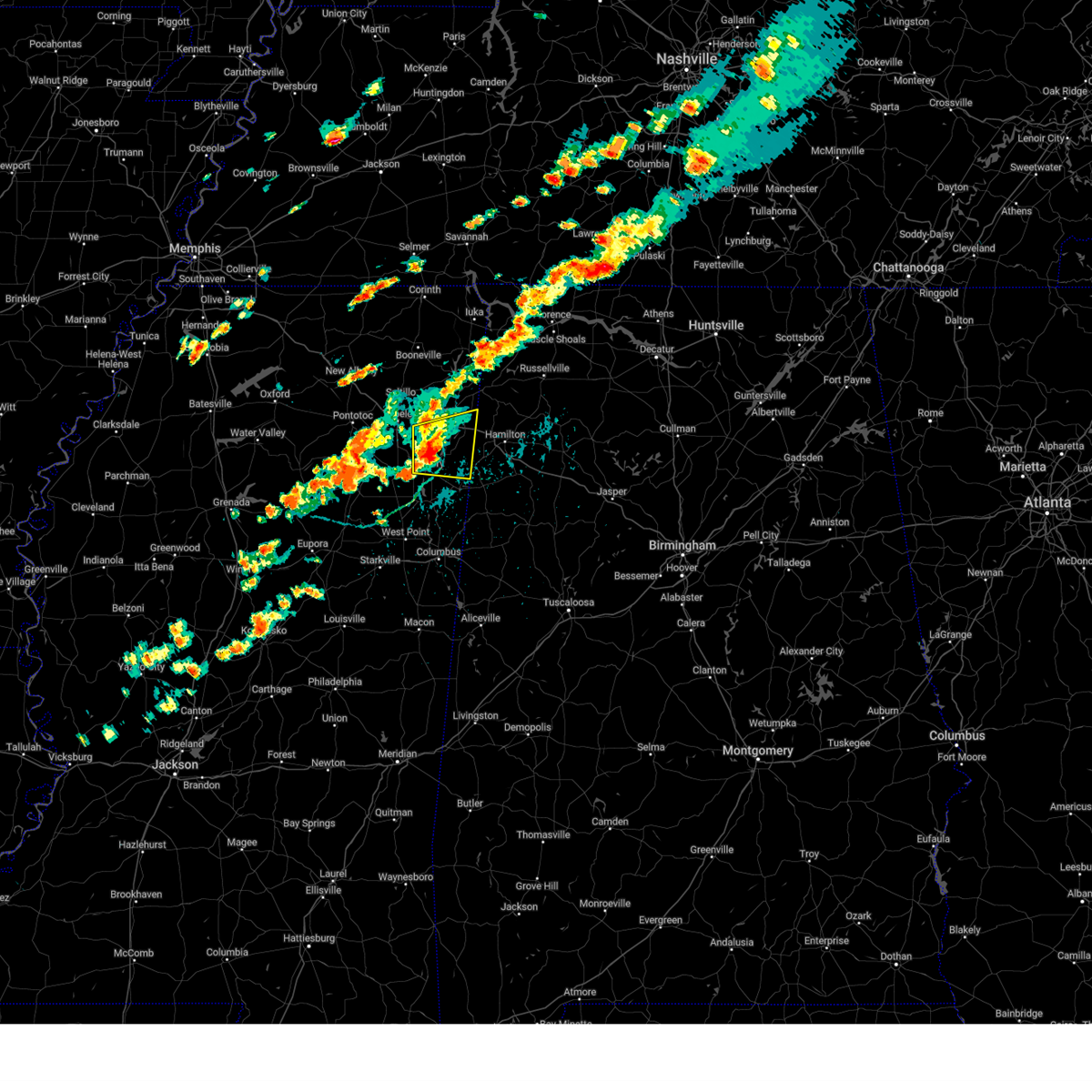 Svrmeg the national weather service in memphis has issued a * severe thunderstorm warning for, southern itawamba county in northeastern mississippi, southeastern lee county in northeastern mississippi, northeastern monroe county in northeastern mississippi, * until 430 pm cdt. * at 342 pm cdt, a severe thunderstorm was located near smithville, or near amory, moving east at 40 mph (radar indicated). Hazards include 60 mph wind gusts and quarter size hail. Hail damage to vehicles is expected. Expect wind damage to roofs, siding, and trees. Svrmeg the national weather service in memphis has issued a * severe thunderstorm warning for, southern itawamba county in northeastern mississippi, southeastern lee county in northeastern mississippi, northeastern monroe county in northeastern mississippi, * until 430 pm cdt. * at 342 pm cdt, a severe thunderstorm was located near smithville, or near amory, moving east at 40 mph (radar indicated). Hazards include 60 mph wind gusts and quarter size hail. Hail damage to vehicles is expected. Expect wind damage to roofs, siding, and trees.
|
| 6/26/2024 2:23 PM CDT |
 the severe thunderstorm warning has been cancelled and is no longer in effect the severe thunderstorm warning has been cancelled and is no longer in effect
|
| 6/26/2024 2:19 PM CDT |
 At 219 pm cdt, a severe thunderstorm was located near smithville, or 7 miles north of amory, moving northeast at 20 mph (radar indicated). Hazards include 60 mph wind gusts and quarter size hail. Hail damage to vehicles is expected. expect wind damage to roofs, siding, and trees. Locations impacted include, amory, fulton, smithville, tremont, new salem, evergreen, clay, nettleton, hatley, abney, cardsville, turon, tilden, bigbee, jacinto, and cadamy. At 219 pm cdt, a severe thunderstorm was located near smithville, or 7 miles north of amory, moving northeast at 20 mph (radar indicated). Hazards include 60 mph wind gusts and quarter size hail. Hail damage to vehicles is expected. expect wind damage to roofs, siding, and trees. Locations impacted include, amory, fulton, smithville, tremont, new salem, evergreen, clay, nettleton, hatley, abney, cardsville, turon, tilden, bigbee, jacinto, and cadamy.
|
| 6/26/2024 2:03 PM CDT |
 Svrmeg the national weather service in memphis has issued a * severe thunderstorm warning for, southern itawamba county in northeastern mississippi, northwestern monroe county in northeastern mississippi, * until 245 pm cdt. * at 203 pm cdt, a severe thunderstorm was located near amory, moving northeast at 20 mph (radar indicated). Hazards include 60 mph wind gusts and quarter size hail. Hail damage to vehicles is expected. Expect wind damage to roofs, siding, and trees. Svrmeg the national weather service in memphis has issued a * severe thunderstorm warning for, southern itawamba county in northeastern mississippi, northwestern monroe county in northeastern mississippi, * until 245 pm cdt. * at 203 pm cdt, a severe thunderstorm was located near amory, moving northeast at 20 mph (radar indicated). Hazards include 60 mph wind gusts and quarter size hail. Hail damage to vehicles is expected. Expect wind damage to roofs, siding, and trees.
|
| 6/9/2024 6:37 PM CDT |
 The storm which prompted the warning has weakened below severe limits, and no longer poses an immediate threat to life or property. therefore, the warning will be allowed to expire. a severe thunderstorm watch remains in effect until 1000 pm cdt for northeastern mississippi. The storm which prompted the warning has weakened below severe limits, and no longer poses an immediate threat to life or property. therefore, the warning will be allowed to expire. a severe thunderstorm watch remains in effect until 1000 pm cdt for northeastern mississippi.
|
| 6/9/2024 6:32 PM CDT |
 At 632 pm cdt, a severe thunderstorm was located over amory, moving southeast at 35 mph (radar indicated). Hazards include 60 mph wind gusts and quarter size hail. Hail damage to vehicles is expected. expect wind damage to roofs, siding, and trees. Locations impacted include, amory, shannon, smithville, nettleton, hatley, becker, and bigbee. At 632 pm cdt, a severe thunderstorm was located over amory, moving southeast at 35 mph (radar indicated). Hazards include 60 mph wind gusts and quarter size hail. Hail damage to vehicles is expected. expect wind damage to roofs, siding, and trees. Locations impacted include, amory, shannon, smithville, nettleton, hatley, becker, and bigbee.
|
| 6/9/2024 6:21 PM CDT |
 the severe thunderstorm warning has been cancelled and is no longer in effect the severe thunderstorm warning has been cancelled and is no longer in effect
|
| 6/9/2024 6:21 PM CDT |
 At 621 pm cdt, a severe thunderstorm was located near new wren, or near amory, moving southeast at 35 mph (radar indicated). Hazards include 60 mph wind gusts and quarter size hail. Hail damage to vehicles is expected. expect wind damage to roofs, siding, and trees. Locations impacted include, amory, verona, shannon, plantersville, smithville, nettleton, hatley, becker, bigbee, and old union. At 621 pm cdt, a severe thunderstorm was located near new wren, or near amory, moving southeast at 35 mph (radar indicated). Hazards include 60 mph wind gusts and quarter size hail. Hail damage to vehicles is expected. expect wind damage to roofs, siding, and trees. Locations impacted include, amory, verona, shannon, plantersville, smithville, nettleton, hatley, becker, bigbee, and old union.
|
| 6/9/2024 6:09 PM CDT |
 Svrmeg the national weather service in memphis has issued a * severe thunderstorm warning for, northeastern chickasaw county in northeastern mississippi, southwestern itawamba county in northeastern mississippi, southern lee county in northeastern mississippi, northwestern monroe county in northeastern mississippi, * until 645 pm cdt. * at 609 pm cdt, a severe thunderstorm was located over shannon, or near verona, moving southeast at 35 mph (radar indicated). Hazards include ping pong ball size hail and 60 mph wind gusts. People and animals outdoors will be injured. expect hail damage to roofs, siding, windows, and vehicles. Expect wind damage to roofs, siding, and trees. Svrmeg the national weather service in memphis has issued a * severe thunderstorm warning for, northeastern chickasaw county in northeastern mississippi, southwestern itawamba county in northeastern mississippi, southern lee county in northeastern mississippi, northwestern monroe county in northeastern mississippi, * until 645 pm cdt. * at 609 pm cdt, a severe thunderstorm was located over shannon, or near verona, moving southeast at 35 mph (radar indicated). Hazards include ping pong ball size hail and 60 mph wind gusts. People and animals outdoors will be injured. expect hail damage to roofs, siding, windows, and vehicles. Expect wind damage to roofs, siding, and trees.
|
| 5/24/2024 3:46 PM CDT |
 At 346 pm cdt, a severe thunderstorm was located over okolona, moving southeast at 30 mph (public). Hazards include ping pong ball size hail and 60 mph wind gusts. People and animals outdoors will be injured. expect hail damage to roofs, siding, windows, and vehicles. expect wind damage to roofs, siding, and trees. Locations impacted include, amory, verona, okolona, shannon, smithville, new wren, nettleton, hatley, becker, wren, bigbee, leotis, and old union. At 346 pm cdt, a severe thunderstorm was located over okolona, moving southeast at 30 mph (public). Hazards include ping pong ball size hail and 60 mph wind gusts. People and animals outdoors will be injured. expect hail damage to roofs, siding, windows, and vehicles. expect wind damage to roofs, siding, and trees. Locations impacted include, amory, verona, okolona, shannon, smithville, new wren, nettleton, hatley, becker, wren, bigbee, leotis, and old union.
|
| 5/24/2024 3:46 PM CDT |
 the severe thunderstorm warning has been cancelled and is no longer in effect the severe thunderstorm warning has been cancelled and is no longer in effect
|
| 5/24/2024 3:36 PM CDT |
 At 335 pm cdt, a severe thunderstorm was located near shannon, or near verona, moving east at 35 mph (public. at 335 pm cdt, half-dollar sized hail was reported troy, ms). Hazards include ping pong ball size hail and 60 mph wind gusts. People and animals outdoors will be injured. expect hail damage to roofs, siding, windows, and vehicles. expect wind damage to roofs, siding, and trees. Locations impacted include, tupelo, amory, verona, okolona, tombigbee state park, shannon, plantersville, smithville, new salem, new wren, troy, furrs, evergreen, nettleton, hatley, wren, leotis, old union, becker, and cardsville. At 335 pm cdt, a severe thunderstorm was located near shannon, or near verona, moving east at 35 mph (public. at 335 pm cdt, half-dollar sized hail was reported troy, ms). Hazards include ping pong ball size hail and 60 mph wind gusts. People and animals outdoors will be injured. expect hail damage to roofs, siding, windows, and vehicles. expect wind damage to roofs, siding, and trees. Locations impacted include, tupelo, amory, verona, okolona, tombigbee state park, shannon, plantersville, smithville, new salem, new wren, troy, furrs, evergreen, nettleton, hatley, wren, leotis, old union, becker, and cardsville.
|
| 5/24/2024 3:18 PM CDT |
 Svrmeg the national weather service in memphis has issued a * severe thunderstorm warning for, northeastern chickasaw county in northeastern mississippi, eastern pontotoc county in northeastern mississippi, southwestern itawamba county in northeastern mississippi, southern lee county in northeastern mississippi, northwestern monroe county in northeastern mississippi, * until 400 pm cdt. * at 318 pm cdt, a severe thunderstorm was located over troy, or 7 miles south of trace state park, moving east at 35 mph (radar indicated). Hazards include ping pong ball size hail and 60 mph wind gusts. People and animals outdoors will be injured. expect hail damage to roofs, siding, windows, and vehicles. Expect wind damage to roofs, siding, and trees. Svrmeg the national weather service in memphis has issued a * severe thunderstorm warning for, northeastern chickasaw county in northeastern mississippi, eastern pontotoc county in northeastern mississippi, southwestern itawamba county in northeastern mississippi, southern lee county in northeastern mississippi, northwestern monroe county in northeastern mississippi, * until 400 pm cdt. * at 318 pm cdt, a severe thunderstorm was located over troy, or 7 miles south of trace state park, moving east at 35 mph (radar indicated). Hazards include ping pong ball size hail and 60 mph wind gusts. People and animals outdoors will be injured. expect hail damage to roofs, siding, windows, and vehicles. Expect wind damage to roofs, siding, and trees.
|
| 3/15/2024 5:03 AM CDT |
 The storms which prompted the warning have moved out of the area. therefore, the warning has been allowed to expire. The storms which prompted the warning have moved out of the area. therefore, the warning has been allowed to expire.
|
| 3/15/2024 4:41 AM CDT |
 Svrmeg the national weather service in memphis has issued a * severe thunderstorm warning for, southeastern itawamba county in northeastern mississippi, northeastern monroe county in northeastern mississippi, * until 500 am cdt. * at 441 am cdt, severe thunderstorms were located along a line extending from near fulton to 6 miles east of aberdeen, moving east at 35 mph (radar indicated). Hazards include 60 mph wind gusts. expect damage to roofs, siding, and trees Svrmeg the national weather service in memphis has issued a * severe thunderstorm warning for, southeastern itawamba county in northeastern mississippi, northeastern monroe county in northeastern mississippi, * until 500 am cdt. * at 441 am cdt, severe thunderstorms were located along a line extending from near fulton to 6 miles east of aberdeen, moving east at 35 mph (radar indicated). Hazards include 60 mph wind gusts. expect damage to roofs, siding, and trees
|
| 3/15/2024 4:03 AM CDT |
 Svrmeg the national weather service in memphis has issued a * severe thunderstorm warning for, northeastern chickasaw county in northeastern mississippi, southeastern pontotoc county in northeastern mississippi, itawamba county in northeastern mississippi, lee county in northeastern mississippi, monroe county in northeastern mississippi, * until 445 am cdt. * at 403 am cdt, severe thunderstorms were located along a line extending from near blair to near verona to near trebloc, moving east at 25 mph (radar indicated). Hazards include 60 mph wind gusts and nickel size hail. expect damage to roofs, siding, and trees Svrmeg the national weather service in memphis has issued a * severe thunderstorm warning for, northeastern chickasaw county in northeastern mississippi, southeastern pontotoc county in northeastern mississippi, itawamba county in northeastern mississippi, lee county in northeastern mississippi, monroe county in northeastern mississippi, * until 445 am cdt. * at 403 am cdt, severe thunderstorms were located along a line extending from near blair to near verona to near trebloc, moving east at 25 mph (radar indicated). Hazards include 60 mph wind gusts and nickel size hail. expect damage to roofs, siding, and trees
|
| 3/14/2024 7:10 PM CDT |
 The storm which prompted the warning has moved out of the area. therefore, the warning will be allowed to expire. The storm which prompted the warning has moved out of the area. therefore, the warning will be allowed to expire.
|
| 3/14/2024 6:54 PM CDT |
 At 654 pm cdt, a severe thunderstorm was located near detroit, or 10 miles west of hamilton, moving northeast at 40 mph (radar indicated). Hazards include 60 mph wind gusts and quarter size hail. Hail damage to vehicles is expected. expect wind damage to roofs, siding, and trees. Locations impacted include, amory, smithville, tremont, new salem, hatley, sipsey fork, becker, quincy, cardsville, turon, tilden, splunge, wise gap, athens, bigbee, greenwood springs, jacinto, parham, cadamy, and bounds crossroads. At 654 pm cdt, a severe thunderstorm was located near detroit, or 10 miles west of hamilton, moving northeast at 40 mph (radar indicated). Hazards include 60 mph wind gusts and quarter size hail. Hail damage to vehicles is expected. expect wind damage to roofs, siding, and trees. Locations impacted include, amory, smithville, tremont, new salem, hatley, sipsey fork, becker, quincy, cardsville, turon, tilden, splunge, wise gap, athens, bigbee, greenwood springs, jacinto, parham, cadamy, and bounds crossroads.
|
| 3/14/2024 6:35 PM CDT |
 Svrmeg the national weather service in memphis has issued a * severe thunderstorm warning for, southeastern itawamba county in northeastern mississippi, northeastern monroe county in northeastern mississippi, * until 715 pm cdt. * at 634 pm cdt, a severe thunderstorm was located 7 miles southeast of smithville, or 8 miles east of amory, moving northeast at 40 mph (radar indicated). Hazards include 60 mph wind gusts and quarter size hail. Hail damage to vehicles is expected. Expect wind damage to roofs, siding, and trees. Svrmeg the national weather service in memphis has issued a * severe thunderstorm warning for, southeastern itawamba county in northeastern mississippi, northeastern monroe county in northeastern mississippi, * until 715 pm cdt. * at 634 pm cdt, a severe thunderstorm was located 7 miles southeast of smithville, or 8 miles east of amory, moving northeast at 40 mph (radar indicated). Hazards include 60 mph wind gusts and quarter size hail. Hail damage to vehicles is expected. Expect wind damage to roofs, siding, and trees.
|
| 12/9/2023 7:29 PM CST |
 At 729 pm cst, a severe thunderstorm was located near amory, moving east at 50 mph (radar indicated). Hazards include 60 mph wind gusts and half dollar size hail. Hail damage to vehicles is expected. Expect wind damage to roofs, siding, and trees. At 729 pm cst, a severe thunderstorm was located near amory, moving east at 50 mph (radar indicated). Hazards include 60 mph wind gusts and half dollar size hail. Hail damage to vehicles is expected. Expect wind damage to roofs, siding, and trees.
|
| 12/9/2023 7:20 PM CST |
 At 719 pm cst, a severe thunderstorm was located near amory, moving northeast at 50 mph (trained weather spotters). Hazards include golf ball size hail and 60 mph wind gusts. People and animals outdoors will be injured. expect hail damage to roofs, siding, windows, and vehicles. expect wind damage to roofs, siding, and trees. locations impacted include, amory, aberdeen, smithville, prairie, new wren, nettleton, hatley, becker, quincy, cardsville, wise gap, athens, wren, east aberdeen, bigbee, greenwood springs, jacinto, and parham. thunderstorm damage threat, considerable hail threat, radar indicated max hail size, 1. 75 in wind threat, radar indicated max wind gust, 60 mph. At 719 pm cst, a severe thunderstorm was located near amory, moving northeast at 50 mph (trained weather spotters). Hazards include golf ball size hail and 60 mph wind gusts. People and animals outdoors will be injured. expect hail damage to roofs, siding, windows, and vehicles. expect wind damage to roofs, siding, and trees. locations impacted include, amory, aberdeen, smithville, prairie, new wren, nettleton, hatley, becker, quincy, cardsville, wise gap, athens, wren, east aberdeen, bigbee, greenwood springs, jacinto, and parham. thunderstorm damage threat, considerable hail threat, radar indicated max hail size, 1. 75 in wind threat, radar indicated max wind gust, 60 mph.
|
| 12/9/2023 7:05 PM CST |
 At 705 pm cst, a severe thunderstorm was located near okolona, moving northeast at 50 mph (trained weather spotters). Hazards include two inch hail and 60 mph wind gusts. People and animals outdoors will be injured. expect hail damage to roofs, siding, windows, and vehicles. expect wind damage to roofs, siding, and trees. locations impacted include, amory, aberdeen, okolona, shannon, smithville, prairie, new wren, trebloc, nettleton, hatley, quincy, egypt, wise gap, wren, mccondy, leotis, buena vista, becker, cardsville, and athens. thunderstorm damage threat, considerable hail threat, radar indicated max hail size, 2. 00 in wind threat, radar indicated max wind gust, 60 mph. At 705 pm cst, a severe thunderstorm was located near okolona, moving northeast at 50 mph (trained weather spotters). Hazards include two inch hail and 60 mph wind gusts. People and animals outdoors will be injured. expect hail damage to roofs, siding, windows, and vehicles. expect wind damage to roofs, siding, and trees. locations impacted include, amory, aberdeen, okolona, shannon, smithville, prairie, new wren, trebloc, nettleton, hatley, quincy, egypt, wise gap, wren, mccondy, leotis, buena vista, becker, cardsville, and athens. thunderstorm damage threat, considerable hail threat, radar indicated max hail size, 2. 00 in wind threat, radar indicated max wind gust, 60 mph.
|
| 12/9/2023 6:52 PM CST |
 At 651 pm cst, a severe thunderstorm was located near houston, moving northeast at 50 mph (trained weather spotters). Hazards include ping pong ball size hail and 60 mph wind gusts. People and animals outdoors will be injured. expect hail damage to roofs, siding, windows, and vehicles. expect wind damage to roofs, siding, and trees. locations impacted include, amory, aberdeen, houston, okolona, shannon, smithville, prairie, new wren, trebloc, nettleton, hatley, quincy, egypt, wise gap, wren, mccondy, leotis, buena vista, sparta, and becker. hail threat, radar indicated max hail size, 1. 50 in wind threat, radar indicated max wind gust, 60 mph. At 651 pm cst, a severe thunderstorm was located near houston, moving northeast at 50 mph (trained weather spotters). Hazards include ping pong ball size hail and 60 mph wind gusts. People and animals outdoors will be injured. expect hail damage to roofs, siding, windows, and vehicles. expect wind damage to roofs, siding, and trees. locations impacted include, amory, aberdeen, houston, okolona, shannon, smithville, prairie, new wren, trebloc, nettleton, hatley, quincy, egypt, wise gap, wren, mccondy, leotis, buena vista, sparta, and becker. hail threat, radar indicated max hail size, 1. 50 in wind threat, radar indicated max wind gust, 60 mph.
|
| 12/9/2023 6:45 PM CST |
 At 644 pm cst, a severe thunderstorm was located near houston, moving northeast at 50 mph (radar indicated). Hazards include 60 mph wind gusts and quarter size hail. Hail damage to vehicles is expected. Expect wind damage to roofs, siding, and trees. At 644 pm cst, a severe thunderstorm was located near houston, moving northeast at 50 mph (radar indicated). Hazards include 60 mph wind gusts and quarter size hail. Hail damage to vehicles is expected. Expect wind damage to roofs, siding, and trees.
|
| 9/6/2023 5:27 PM CDT |
 At 526 pm cdt, a severe thunderstorm was located over fulton, moving southeast at 30 mph (radar indicated). Hazards include 60 mph wind gusts. Expect damage to roofs, siding, and trees. locations impacted include, fulton, tombigbee state park, mantachie, smithville, tremont, fairview, new salem, evergreen, clay, abney, eastman, turon, mooreville, eggville, ballardsville, sipsey fork, cardsville, tilden, splunge and unity. hail threat, radar indicated max hail size, <. 75 in wind threat, radar indicated max wind gust, 60 mph. At 526 pm cdt, a severe thunderstorm was located over fulton, moving southeast at 30 mph (radar indicated). Hazards include 60 mph wind gusts. Expect damage to roofs, siding, and trees. locations impacted include, fulton, tombigbee state park, mantachie, smithville, tremont, fairview, new salem, evergreen, clay, abney, eastman, turon, mooreville, eggville, ballardsville, sipsey fork, cardsville, tilden, splunge and unity. hail threat, radar indicated max hail size, <. 75 in wind threat, radar indicated max wind gust, 60 mph.
|
| 9/6/2023 5:07 PM CDT |
 At 507 pm cdt, a severe thunderstorm was located over mantachie, or near fulton, moving southeast at 40 mph (radar indicated). Hazards include 60 mph wind gusts. expect damage to roofs, siding, and trees At 507 pm cdt, a severe thunderstorm was located over mantachie, or near fulton, moving southeast at 40 mph (radar indicated). Hazards include 60 mph wind gusts. expect damage to roofs, siding, and trees
|
| 8/7/2023 2:12 PM CDT |
 The severe thunderstorm warning for southeastern itawamba and northern monroe counties will expire at 215 pm cdt, the storms which prompted the warning have moved out of the area. therefore, the warning will be allowed to expire. to report severe weather, contact your nearest law enforcement agency. they will relay your report to the national weather service memphis. The severe thunderstorm warning for southeastern itawamba and northern monroe counties will expire at 215 pm cdt, the storms which prompted the warning have moved out of the area. therefore, the warning will be allowed to expire. to report severe weather, contact your nearest law enforcement agency. they will relay your report to the national weather service memphis.
|
| 8/7/2023 1:58 PM CDT |
 At 158 pm cdt, severe thunderstorms were located along a line extending from near weston to near new salem to near amory, moving east at 40 mph (public). Hazards include 60 mph wind gusts. Expect damage to roofs, siding, and trees. locations impacted include, amory, aberdeen, smithville, tremont, new salem, hatley, gattman, sipsey fork, becker, quincy, turon, splunge, wise gap, athens, greenwood springs, parham and cadamy. hail threat, radar indicated max hail size, <. 75 in wind threat, radar indicated max wind gust, 60 mph. At 158 pm cdt, severe thunderstorms were located along a line extending from near weston to near new salem to near amory, moving east at 40 mph (public). Hazards include 60 mph wind gusts. Expect damage to roofs, siding, and trees. locations impacted include, amory, aberdeen, smithville, tremont, new salem, hatley, gattman, sipsey fork, becker, quincy, turon, splunge, wise gap, athens, greenwood springs, parham and cadamy. hail threat, radar indicated max hail size, <. 75 in wind threat, radar indicated max wind gust, 60 mph.
|
| 8/7/2023 1:49 PM CDT |
 At 148 pm cdt, severe thunderstorms were located along a line extending from near tremont to near smithville to near new wren, moving east at 40 mph (public). Hazards include 60 mph wind gusts. Expect damage to roofs, siding, and trees. locations impacted include, amory, aberdeen, fulton, smithville, tremont, new salem, new wren, evergreen, clay, nettleton, hatley, gattman, abney, quincy, turon, wise gap, wren, sipsey fork, becker and cardsville. hail threat, radar indicated max hail size, <. 75 in wind threat, radar indicated max wind gust, 60 mph. At 148 pm cdt, severe thunderstorms were located along a line extending from near tremont to near smithville to near new wren, moving east at 40 mph (public). Hazards include 60 mph wind gusts. Expect damage to roofs, siding, and trees. locations impacted include, amory, aberdeen, fulton, smithville, tremont, new salem, new wren, evergreen, clay, nettleton, hatley, gattman, abney, quincy, turon, wise gap, wren, sipsey fork, becker and cardsville. hail threat, radar indicated max hail size, <. 75 in wind threat, radar indicated max wind gust, 60 mph.
|
| 8/7/2023 1:39 PM CDT |
 At 139 pm cdt, severe thunderstorms were located along a line extending from tremont to near evergreen to near new wren, moving east at 40 mph (public). Hazards include 60 mph wind gusts and penny size hail. expect damage to roofs, siding, and trees At 139 pm cdt, severe thunderstorms were located along a line extending from tremont to near evergreen to near new wren, moving east at 40 mph (public). Hazards include 60 mph wind gusts and penny size hail. expect damage to roofs, siding, and trees
|
| 8/7/2023 1:21 PM CDT |
 At 121 pm cdt, severe thunderstorms were located along a line extending from 6 miles west of littleville to 7 miles northeast of tremont to near new wren, moving east at 60 mph (public). Hazards include 60 mph wind gusts. Expect damage to roofs, siding, and trees. locations impacted include, tupelo, amory, fulton, verona, okolona, tombigbee state park, shannon, plantersville, mantachie, smithville, tremont, fairview, new salem, houlka, evergreen, clay, nettleton, new houlka, hatley and abney. hail threat, radar indicated max hail size, <. 75 in wind threat, radar indicated max wind gust, 60 mph. At 121 pm cdt, severe thunderstorms were located along a line extending from 6 miles west of littleville to 7 miles northeast of tremont to near new wren, moving east at 60 mph (public). Hazards include 60 mph wind gusts. Expect damage to roofs, siding, and trees. locations impacted include, tupelo, amory, fulton, verona, okolona, tombigbee state park, shannon, plantersville, mantachie, smithville, tremont, fairview, new salem, houlka, evergreen, clay, nettleton, new houlka, hatley and abney. hail threat, radar indicated max hail size, <. 75 in wind threat, radar indicated max wind gust, 60 mph.
|
| 8/7/2023 12:59 PM CDT |
 At 1259 pm cdt, severe thunderstorms were located along a line extending from near tishomingo state park to mantachie to 6 miles east of houlka, moving east at 55 mph (radar indicated). Hazards include 60 mph wind gusts and penny size hail. expect damage to roofs, siding, and trees At 1259 pm cdt, severe thunderstorms were located along a line extending from near tishomingo state park to mantachie to 6 miles east of houlka, moving east at 55 mph (radar indicated). Hazards include 60 mph wind gusts and penny size hail. expect damage to roofs, siding, and trees
|
| 8/6/2023 1:33 PM CDT |
 At 133 pm cdt, severe thunderstorms were located along a line extending from near sandy springs to near tremont to near bedford, moving east at 35 mph (broadcast media). Hazards include 60 mph wind gusts. Expect damage to roofs, siding, and trees. locations impacted include, fulton, red bay, tishomingo state park, belmont, mantachie, smithville, tremont, tishomingo, fairview, burton, new salem, sandy springs, clay, hatley, marietta, golden, paden, gattman, abney and eastman. hail threat, radar indicated max hail size, <. 75 in wind threat, observed max wind gust, 60 mph. At 133 pm cdt, severe thunderstorms were located along a line extending from near sandy springs to near tremont to near bedford, moving east at 35 mph (broadcast media). Hazards include 60 mph wind gusts. Expect damage to roofs, siding, and trees. locations impacted include, fulton, red bay, tishomingo state park, belmont, mantachie, smithville, tremont, tishomingo, fairview, burton, new salem, sandy springs, clay, hatley, marietta, golden, paden, gattman, abney and eastman. hail threat, radar indicated max hail size, <. 75 in wind threat, observed max wind gust, 60 mph.
|
| 8/6/2023 1:20 PM CDT | Pole barn destroye in monroe county MS, 0.2 miles ESE of Smithville, MS |
| 8/6/2023 1:20 PM CDT | Power lines down in the road near smithville road and spring stree in monroe county MS, 0.7 miles NNW of Smithville, MS |
| 8/6/2023 1:15 PM CDT | Trees down across highway 25 between smithville and amor in monroe county MS, 3.2 miles NE of Smithville, MS |
| 8/6/2023 1:11 PM CDT |
 At 111 pm cdt, severe thunderstorms were located along a line extending from pratts friendship to near smithville to near caledonia, moving east at 35 mph (broadcast media). Hazards include 60 mph wind gusts. expect damage to roofs, siding, and trees At 111 pm cdt, severe thunderstorms were located along a line extending from pratts friendship to near smithville to near caledonia, moving east at 35 mph (broadcast media). Hazards include 60 mph wind gusts. expect damage to roofs, siding, and trees
|
| 8/6/2023 1:07 PM CDT |
 At 106 pm cdt, severe thunderstorms were located along a line extending from near guntown to near evergreen to near kolola springs, moving east at 40 mph (radar indicated). Hazards include 60 mph wind gusts. Expect damage to roofs, siding, and trees. locations impacted include, tupelo, amory, aberdeen, verona, tombigbee state park, saltillo, guntown, shannon, plantersville, smithville, new salem, new wren, evergreen, nettleton, sherman, hatley, gattman, abney, mooreville and wise gap. hail threat, radar indicated max hail size, <. 75 in wind threat, radar indicated max wind gust, 60 mph. At 106 pm cdt, severe thunderstorms were located along a line extending from near guntown to near evergreen to near kolola springs, moving east at 40 mph (radar indicated). Hazards include 60 mph wind gusts. Expect damage to roofs, siding, and trees. locations impacted include, tupelo, amory, aberdeen, verona, tombigbee state park, saltillo, guntown, shannon, plantersville, smithville, new salem, new wren, evergreen, nettleton, sherman, hatley, gattman, abney, mooreville and wise gap. hail threat, radar indicated max hail size, <. 75 in wind threat, radar indicated max wind gust, 60 mph.
|
| 8/6/2023 12:42 PM CDT |
 At 1242 pm cdt, severe thunderstorms were located along a line extending from near pontotoc to okolona to 6 miles northeast of west point, moving east at 35 mph (radar indicated). Hazards include 60 mph wind gusts and quarter size hail. Hail damage to vehicles is expected. Expect wind damage to roofs, siding, and trees. At 1242 pm cdt, severe thunderstorms were located along a line extending from near pontotoc to okolona to 6 miles northeast of west point, moving east at 35 mph (radar indicated). Hazards include 60 mph wind gusts and quarter size hail. Hail damage to vehicles is expected. Expect wind damage to roofs, siding, and trees.
|
| 7/18/2023 7:37 PM CDT |
 At 737 pm cdt, severe thunderstorms were located along a line extending from near leedy to near new harmony, moving southeast at 55 mph (radar indicated). Hazards include 60 mph wind gusts and penny size hail. expect damage to roofs, siding, and trees At 737 pm cdt, severe thunderstorms were located along a line extending from near leedy to near new harmony, moving southeast at 55 mph (radar indicated). Hazards include 60 mph wind gusts and penny size hail. expect damage to roofs, siding, and trees
|
| 7/14/2023 2:06 PM CDT |
 The severe thunderstorm warning for eastern chickasaw, itawamba, lee, monroe, tishomingo, prentiss and southeastern alcorn counties will expire at 215 pm cdt, the storms which prompted the warning have weakened below severe limits, and no longer pose an immediate threat to life or property. therefore, the warning will be allowed to expire. The severe thunderstorm warning for eastern chickasaw, itawamba, lee, monroe, tishomingo, prentiss and southeastern alcorn counties will expire at 215 pm cdt, the storms which prompted the warning have weakened below severe limits, and no longer pose an immediate threat to life or property. therefore, the warning will be allowed to expire.
|
| 7/14/2023 1:31 PM CDT |
 At 131 pm cdt, severe thunderstorms were located along a line extending from near thrashers to near pratts friendship to near houston, moving east at 35 mph (radar indicated). Hazards include 60 mph wind gusts. expect damage to roofs, siding, and trees At 131 pm cdt, severe thunderstorms were located along a line extending from near thrashers to near pratts friendship to near houston, moving east at 35 mph (radar indicated). Hazards include 60 mph wind gusts. expect damage to roofs, siding, and trees
|
| 6/25/2023 9:22 PM CDT |
 The severe thunderstorm warning for itawamba, lee, northeastern monroe, southwestern tishomingo and southeastern prentiss counties will expire at 930 pm cdt, the storm which prompted the warning has weakened below severe limits, and has exited the warned area. therefore, the warning will be allowed to expire. a severe thunderstorm watch remains in effect until 200 am cdt for northeastern mississippi. The severe thunderstorm warning for itawamba, lee, northeastern monroe, southwestern tishomingo and southeastern prentiss counties will expire at 930 pm cdt, the storm which prompted the warning has weakened below severe limits, and has exited the warned area. therefore, the warning will be allowed to expire. a severe thunderstorm watch remains in effect until 200 am cdt for northeastern mississippi.
|
| 6/25/2023 8:41 PM CDT |
 At 840 pm cdt, a severe thunderstorm was located near mantachie, or 9 miles north of tombigbee state park, moving southeast at 55 mph (radar indicated). Hazards include 70 mph wind gusts. Expect considerable tree damage. Damage is likely to mobile homes, roofs, and outbuildings. At 840 pm cdt, a severe thunderstorm was located near mantachie, or 9 miles north of tombigbee state park, moving southeast at 55 mph (radar indicated). Hazards include 70 mph wind gusts. Expect considerable tree damage. Damage is likely to mobile homes, roofs, and outbuildings.
|
| 6/16/2023 5:06 PM CDT |
 At 506 pm cdt, a severe thunderstorm was located near detroit, or 10 miles northwest of sulligent, moving southeast at 30 mph (radar indicated). Hazards include 60 mph wind gusts and half dollar size hail. Hail damage to vehicles is expected. Expect wind damage to roofs, siding, and trees. At 506 pm cdt, a severe thunderstorm was located near detroit, or 10 miles northwest of sulligent, moving southeast at 30 mph (radar indicated). Hazards include 60 mph wind gusts and half dollar size hail. Hail damage to vehicles is expected. Expect wind damage to roofs, siding, and trees.
|
| 6/16/2023 4:58 PM CDT |
 At 458 pm cdt, a severe thunderstorm was located over new wren, or near okolona, moving east at 15 mph (radar indicated). Hazards include 60 mph wind gusts and quarter size hail. Hail damage to vehicles is expected. expect wind damage to roofs, siding, and trees. locations impacted include, amory, smithville, new wren, nettleton, hatley, becker, bigbee and wren. hail threat, radar indicated max hail size, 1. 00 in wind threat, radar indicated max wind gust, 60 mph. At 458 pm cdt, a severe thunderstorm was located over new wren, or near okolona, moving east at 15 mph (radar indicated). Hazards include 60 mph wind gusts and quarter size hail. Hail damage to vehicles is expected. expect wind damage to roofs, siding, and trees. locations impacted include, amory, smithville, new wren, nettleton, hatley, becker, bigbee and wren. hail threat, radar indicated max hail size, 1. 00 in wind threat, radar indicated max wind gust, 60 mph.
|
| 6/16/2023 4:33 PM CDT |
 At 433 pm cdt, a severe thunderstorm was located near okolona, moving east at 15 mph (radar indicated). Hazards include 60 mph wind gusts and quarter size hail. Hail damage to vehicles is expected. Expect wind damage to roofs, siding, and trees. At 433 pm cdt, a severe thunderstorm was located near okolona, moving east at 15 mph (radar indicated). Hazards include 60 mph wind gusts and quarter size hail. Hail damage to vehicles is expected. Expect wind damage to roofs, siding, and trees.
|
| 6/11/2023 9:37 PM CDT |
 The severe thunderstorm warning for monroe county will expire at 945 pm cdt, the storm which prompted the warning has weakened below severe limits, and no longer poses an immediate threat to life or property. therefore, the warning will be allowed to expire. a severe thunderstorm watch remains in effect until 1000 pm cdt for northeastern mississippi. The severe thunderstorm warning for monroe county will expire at 945 pm cdt, the storm which prompted the warning has weakened below severe limits, and no longer poses an immediate threat to life or property. therefore, the warning will be allowed to expire. a severe thunderstorm watch remains in effect until 1000 pm cdt for northeastern mississippi.
|
| 6/11/2023 9:29 PM CDT |
 At 929 pm cdt, a severe thunderstorm was located 9 miles southeast of amory, moving southeast at 45 mph (radar indicated). Hazards include 60 mph wind gusts and quarter size hail. Hail damage to vehicles is expected. expect wind damage to roofs, siding, and trees. locations impacted include, amory, aberdeen, smithville, prairie, hatley, gattman, binford, sipsey fork, new hamilton, becker, quincy, splunge, wise gap, athens, east aberdeen, bigbee, greenwood springs and parham. hail threat, radar indicated max hail size, 1. 00 in wind threat, radar indicated max wind gust, 60 mph. At 929 pm cdt, a severe thunderstorm was located 9 miles southeast of amory, moving southeast at 45 mph (radar indicated). Hazards include 60 mph wind gusts and quarter size hail. Hail damage to vehicles is expected. expect wind damage to roofs, siding, and trees. locations impacted include, amory, aberdeen, smithville, prairie, hatley, gattman, binford, sipsey fork, new hamilton, becker, quincy, splunge, wise gap, athens, east aberdeen, bigbee, greenwood springs and parham. hail threat, radar indicated max hail size, 1. 00 in wind threat, radar indicated max wind gust, 60 mph.
|
| 6/11/2023 9:11 PM CDT |
 At 911 pm cdt, a severe thunderstorm was located over new wren, or near amory, moving southeast at 45 mph (radar indicated). Hazards include 60 mph wind gusts and nickel size hail. expect damage to roofs, siding, and trees At 911 pm cdt, a severe thunderstorm was located over new wren, or near amory, moving southeast at 45 mph (radar indicated). Hazards include 60 mph wind gusts and nickel size hail. expect damage to roofs, siding, and trees
|
| 6/11/2023 8:44 PM CDT |
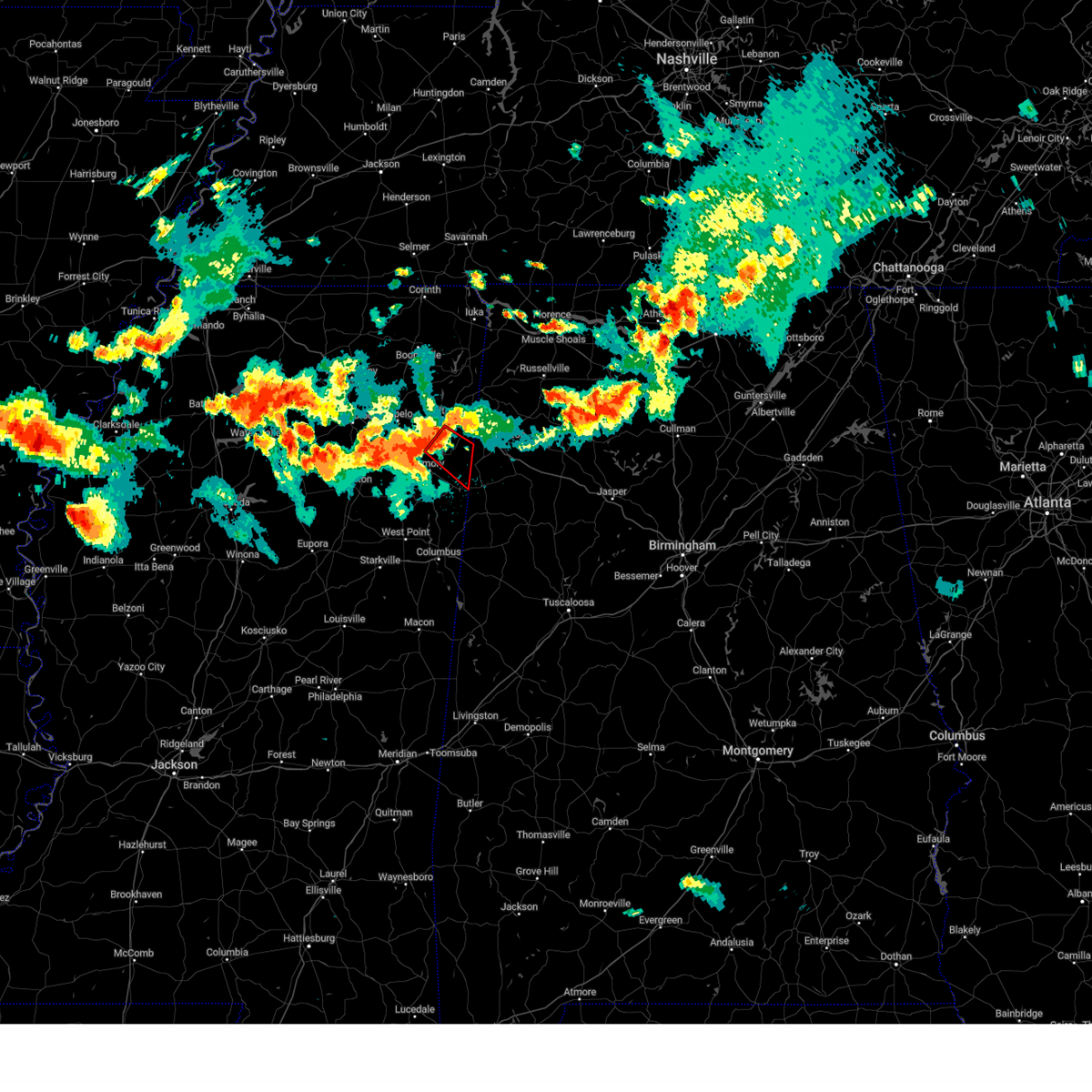 At 844 pm cdt, a severe thunderstorm capable of producing a tornado was located near new salem, or 9 miles south of fulton, moving southeast at 40 mph (radar indicated rotation). Hazards include tornado. Flying debris will be dangerous to those caught without shelter. mobile homes will be damaged or destroyed. damage to roofs, windows, and vehicles will occur. Tree damage is likely. At 844 pm cdt, a severe thunderstorm capable of producing a tornado was located near new salem, or 9 miles south of fulton, moving southeast at 40 mph (radar indicated rotation). Hazards include tornado. Flying debris will be dangerous to those caught without shelter. mobile homes will be damaged or destroyed. damage to roofs, windows, and vehicles will occur. Tree damage is likely.
|
| 6/11/2023 8:35 PM CDT |
 At 835 pm cdt, a severe thunderstorm was located over shannon, or near verona, moving southeast at 35 mph (radar indicated). Hazards include 60 mph wind gusts and quarter size hail. Hail damage to vehicles is expected. Expect wind damage to roofs, siding, and trees. At 835 pm cdt, a severe thunderstorm was located over shannon, or near verona, moving southeast at 35 mph (radar indicated). Hazards include 60 mph wind gusts and quarter size hail. Hail damage to vehicles is expected. Expect wind damage to roofs, siding, and trees.
|
| 3/24/2023 11:05 PM CDT |
 At 1103 pm cdt, a confirmed large and destructive tornado was located over smithville, or 8 miles northeast of amory, moving northeast at 60 mph. tornado emergency for the city of smithville and southeast itawamba county in mississippi. this is a particularly dangerous situation. take cover now! (radar confirmed tornado). Hazards include deadly tornado. You are in a life-threatening situation. flying debris may be deadly to those caught without shelter. mobile homes will be destroyed. considerable damage to homes, businesses, and vehicles is likely and complete destruction is possible. Locations impacted include, amory, smithville, new salem, hatley, cardsville, turon, parham and cadamy. At 1103 pm cdt, a confirmed large and destructive tornado was located over smithville, or 8 miles northeast of amory, moving northeast at 60 mph. tornado emergency for the city of smithville and southeast itawamba county in mississippi. this is a particularly dangerous situation. take cover now! (radar confirmed tornado). Hazards include deadly tornado. You are in a life-threatening situation. flying debris may be deadly to those caught without shelter. mobile homes will be destroyed. considerable damage to homes, businesses, and vehicles is likely and complete destruction is possible. Locations impacted include, amory, smithville, new salem, hatley, cardsville, turon, parham and cadamy.
|
| 3/24/2023 10:58 PM CDT |
 At 1057 pm cdt, a confirmed large and destructive tornado was located near amory, moving northeast at 65 mph. tornado emergency for amory and smithville. this is a particularly dangerous situation. take cover now! (radar confirmed tornado). Hazards include deadly tornado. You are in a life-threatening situation. flying debris may be deadly to those caught without shelter. mobile homes will be destroyed. considerable damage to homes, businesses, and vehicles is likely and complete destruction is possible. Locations impacted include, amory, smithville, new wren, new salem, nettleton, hatley, sipsey fork, becker, quincy, turon, splunge, wren, bigbee, parham and cadamy. At 1057 pm cdt, a confirmed large and destructive tornado was located near amory, moving northeast at 65 mph. tornado emergency for amory and smithville. this is a particularly dangerous situation. take cover now! (radar confirmed tornado). Hazards include deadly tornado. You are in a life-threatening situation. flying debris may be deadly to those caught without shelter. mobile homes will be destroyed. considerable damage to homes, businesses, and vehicles is likely and complete destruction is possible. Locations impacted include, amory, smithville, new wren, new salem, nettleton, hatley, sipsey fork, becker, quincy, turon, splunge, wren, bigbee, parham and cadamy.
|
| 3/24/2023 10:55 PM CDT |
 At 1054 pm cdt, a confirmed large and destructive tornado was located over amory, moving northeast at 70 mph. tornado emergency for amory and hatley. this is a particularly dangerous situation. take cover now! (radar confirmed tornado). Hazards include deadly tornado. You are in a life-threatening situation. flying debris may be deadly to those caught without shelter. mobile homes will be destroyed. considerable damage to homes, businesses, and vehicles is likely and complete destruction is possible. Locations impacted include, amory, aberdeen, smithville, prairie, new wren, new salem, hatley, gattman, sipsey fork, becker, quincy, turon, splunge, wise gap, athens, wren, east aberdeen, bigbee, greenwood springs and parham. At 1054 pm cdt, a confirmed large and destructive tornado was located over amory, moving northeast at 70 mph. tornado emergency for amory and hatley. this is a particularly dangerous situation. take cover now! (radar confirmed tornado). Hazards include deadly tornado. You are in a life-threatening situation. flying debris may be deadly to those caught without shelter. mobile homes will be destroyed. considerable damage to homes, businesses, and vehicles is likely and complete destruction is possible. Locations impacted include, amory, aberdeen, smithville, prairie, new wren, new salem, hatley, gattman, sipsey fork, becker, quincy, turon, splunge, wise gap, athens, wren, east aberdeen, bigbee, greenwood springs and parham.
|
| 3/24/2023 10:50 PM CDT |
 At 1048 pm cdt, a confirmed large and destructive tornado was located over new wren, or near amory, moving northeast at 65 mph. tornado emergency for new wren and amory. this is a particularly dangerous situation. take cover now! (radar confirmed tornado). Hazards include deadly tornado. You are in a life-threatening situation. flying debris may be deadly to those caught without shelter. mobile homes will be destroyed. considerable damage to homes, businesses, and vehicles is likely and complete destruction is possible. Locations impacted include, amory, aberdeen, smithville, prairie, new wren, new salem, hatley, gattman, sipsey fork, becker, quincy, turon, splunge, wise gap, athens, wren, east aberdeen, bigbee, greenwood springs and parham. At 1048 pm cdt, a confirmed large and destructive tornado was located over new wren, or near amory, moving northeast at 65 mph. tornado emergency for new wren and amory. this is a particularly dangerous situation. take cover now! (radar confirmed tornado). Hazards include deadly tornado. You are in a life-threatening situation. flying debris may be deadly to those caught without shelter. mobile homes will be destroyed. considerable damage to homes, businesses, and vehicles is likely and complete destruction is possible. Locations impacted include, amory, aberdeen, smithville, prairie, new wren, new salem, hatley, gattman, sipsey fork, becker, quincy, turon, splunge, wise gap, athens, wren, east aberdeen, bigbee, greenwood springs and parham.
|
| 3/24/2023 10:46 PM CDT |
 At 1046 pm cdt, a confirmed large and extremely dangerous tornado was located over new wren, or 8 miles southeast of okolona, moving northeast at 60 mph. this is a particularly dangerous situation. take cover now! (radar confirmed tornado). Hazards include damaging tornado. You are in a life-threatening situation. flying debris may be deadly to those caught without shelter. mobile homes will be destroyed. considerable damage to homes, businesses, and vehicles is likely and complete destruction is possible. Locations impacted include, amory, aberdeen, okolona, smithville, prairie, new salem, new wren, hatley, gattman, quincy, turon, egypt, wise gap, wren, mccondy, buena vista, sipsey fork, becker, splunge and athens. At 1046 pm cdt, a confirmed large and extremely dangerous tornado was located over new wren, or 8 miles southeast of okolona, moving northeast at 60 mph. this is a particularly dangerous situation. take cover now! (radar confirmed tornado). Hazards include damaging tornado. You are in a life-threatening situation. flying debris may be deadly to those caught without shelter. mobile homes will be destroyed. considerable damage to homes, businesses, and vehicles is likely and complete destruction is possible. Locations impacted include, amory, aberdeen, okolona, smithville, prairie, new salem, new wren, hatley, gattman, quincy, turon, egypt, wise gap, wren, mccondy, buena vista, sipsey fork, becker, splunge and athens.
|
| 3/24/2023 10:43 PM CDT |
 At 1043 pm cdt, a confirmed large and extremely dangerous tornado was located near new wren, or 7 miles northwest of aberdeen, moving east at 65 mph. this is a particularly dangerous situation. take cover now! (radar confirmed tornado). Hazards include damaging tornado. You are in a life-threatening situation. flying debris may be deadly to those caught without shelter. mobile homes will be destroyed. considerable damage to homes, businesses, and vehicles is likely and complete destruction is possible. Locations impacted include, amory, aberdeen, okolona, smithville, prairie, new salem, new wren, hatley, gattman, quincy, turon, egypt, wise gap, wren, mccondy, buena vista, sipsey fork, becker, splunge and athens. At 1043 pm cdt, a confirmed large and extremely dangerous tornado was located near new wren, or 7 miles northwest of aberdeen, moving east at 65 mph. this is a particularly dangerous situation. take cover now! (radar confirmed tornado). Hazards include damaging tornado. You are in a life-threatening situation. flying debris may be deadly to those caught without shelter. mobile homes will be destroyed. considerable damage to homes, businesses, and vehicles is likely and complete destruction is possible. Locations impacted include, amory, aberdeen, okolona, smithville, prairie, new salem, new wren, hatley, gattman, quincy, turon, egypt, wise gap, wren, mccondy, buena vista, sipsey fork, becker, splunge and athens.
|
| 3/24/2023 10:41 PM CDT |
 At 1041 pm cdt, a large and extremely dangerous tornado was located near new wren, or 8 miles northwest of aberdeen, moving northeast at 65 mph. this is a particularly dangerous situation. take cover now! (radar indicated rotation). Hazards include damaging tornado. You are in a life-threatening situation. flying debris may be deadly to those caught without shelter. mobile homes will be destroyed. considerable damage to homes, businesses, and vehicles is likely and complete destruction is possible. Locations impacted include, amory, aberdeen, okolona, smithville, prairie, new salem, new wren, hatley, gattman, quincy, turon, egypt, wise gap, wren, mccondy, buena vista, sipsey fork, becker, splunge and athens. At 1041 pm cdt, a large and extremely dangerous tornado was located near new wren, or 8 miles northwest of aberdeen, moving northeast at 65 mph. this is a particularly dangerous situation. take cover now! (radar indicated rotation). Hazards include damaging tornado. You are in a life-threatening situation. flying debris may be deadly to those caught without shelter. mobile homes will be destroyed. considerable damage to homes, businesses, and vehicles is likely and complete destruction is possible. Locations impacted include, amory, aberdeen, okolona, smithville, prairie, new salem, new wren, hatley, gattman, quincy, turon, egypt, wise gap, wren, mccondy, buena vista, sipsey fork, becker, splunge and athens.
|
| 3/24/2023 10:37 PM CDT |
 At 1037 pm cdt, a severe thunderstorm capable of producing a tornado was located near trebloc, or 9 miles south of okolona, moving east at 65 mph (radar indicated rotation). Hazards include tornado. Flying debris will be dangerous to those caught without shelter. mobile homes will be damaged or destroyed. damage to roofs, windows, and vehicles will occur. Tree damage is likely. At 1037 pm cdt, a severe thunderstorm capable of producing a tornado was located near trebloc, or 9 miles south of okolona, moving east at 65 mph (radar indicated rotation). Hazards include tornado. Flying debris will be dangerous to those caught without shelter. mobile homes will be damaged or destroyed. damage to roofs, windows, and vehicles will occur. Tree damage is likely.
|
| 3/24/2023 10:29 PM CDT |
 At 1028 pm cdt, a severe thunderstorm was located over trebloc, or 7 miles southeast of houston, moving east at 55 mph (radar indicated). Hazards include 60 mph wind gusts and nickel size hail. expect damage to roofs, siding, and trees At 1028 pm cdt, a severe thunderstorm was located over trebloc, or 7 miles southeast of houston, moving east at 55 mph (radar indicated). Hazards include 60 mph wind gusts and nickel size hail. expect damage to roofs, siding, and trees
|
| 2/16/2023 4:00 PM CST | Hwy 25s tree damage on itawamba/monroe county lin in itawamba county MS, 5.7 miles WSW of Smithville, MS |
| 2/16/2023 3:53 PM CST |
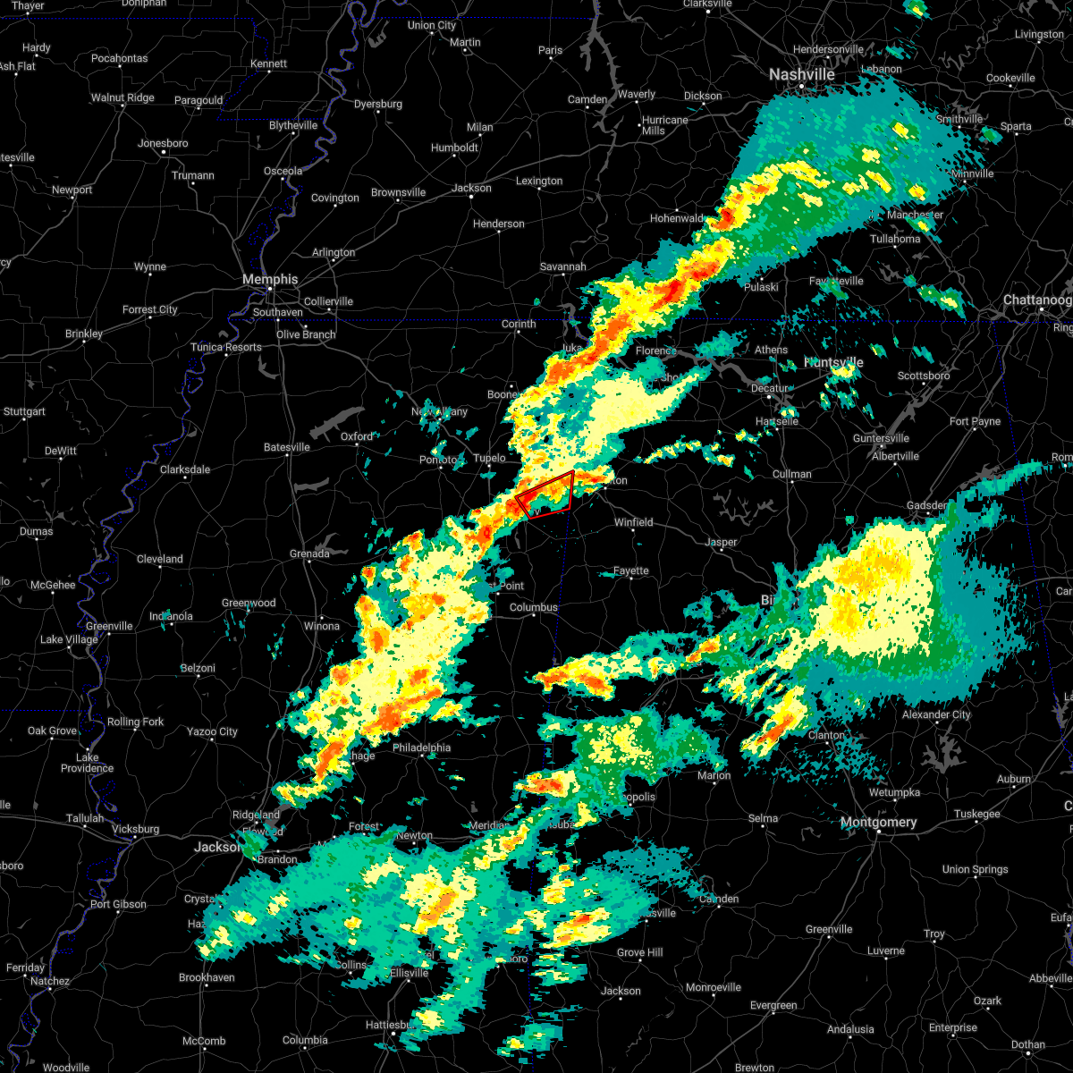 At 353 pm cst, a confirmed tornado was located near smithville, or near amory, moving east at 20 mph (weather spotters confirmed tornado). Hazards include damaging tornado. Flying debris will be dangerous to those caught without shelter. mobile homes will be damaged or destroyed. damage to roofs, windows, and vehicles will occur. tree damage is likely. Locations impacted include, smithville, new salem, cadamy and turon. At 353 pm cst, a confirmed tornado was located near smithville, or near amory, moving east at 20 mph (weather spotters confirmed tornado). Hazards include damaging tornado. Flying debris will be dangerous to those caught without shelter. mobile homes will be damaged or destroyed. damage to roofs, windows, and vehicles will occur. tree damage is likely. Locations impacted include, smithville, new salem, cadamy and turon.
|
| 2/16/2023 3:45 PM CST |
 At 345 pm cst, a severe thunderstorm capable of producing a tornado was located over amory, moving east at 20 mph (radar indicated rotation). Hazards include tornado. Flying debris will be dangerous to those caught without shelter. mobile homes will be damaged or destroyed. damage to roofs, windows, and vehicles will occur. Tree damage is likely. At 345 pm cst, a severe thunderstorm capable of producing a tornado was located over amory, moving east at 20 mph (radar indicated rotation). Hazards include tornado. Flying debris will be dangerous to those caught without shelter. mobile homes will be damaged or destroyed. damage to roofs, windows, and vehicles will occur. Tree damage is likely.
|
| 1/3/2023 10:32 AM CST |
 At 1032 am cst, severe thunderstorms were located along a line extending from belmont to near tremont to near new salem, moving east at 40 mph (radar indicated). Hazards include 60 mph wind gusts. Expect damage to roofs, siding, and trees. Locations impacted include, amory, fulton, belmont, shannon, mantachie, smithville, tremont, fairview, new salem, sandy springs, evergreen, clay, nettleton, golden, abney, eastman, turon, ballardsville, cardsville and tilden. At 1032 am cst, severe thunderstorms were located along a line extending from belmont to near tremont to near new salem, moving east at 40 mph (radar indicated). Hazards include 60 mph wind gusts. Expect damage to roofs, siding, and trees. Locations impacted include, amory, fulton, belmont, shannon, mantachie, smithville, tremont, fairview, new salem, sandy springs, evergreen, clay, nettleton, golden, abney, eastman, turon, ballardsville, cardsville and tilden.
|
| 1/3/2023 9:59 AM CST |
 At 959 am cst, severe thunderstorms were located along a line extending from near pratts friendship to near tombigbee state park to near okolona, moving east at 45 mph (radar indicated). Hazards include 60 mph wind gusts. expect damage to roofs, siding, and trees At 959 am cst, severe thunderstorms were located along a line extending from near pratts friendship to near tombigbee state park to near okolona, moving east at 45 mph (radar indicated). Hazards include 60 mph wind gusts. expect damage to roofs, siding, and trees
|
| 11/29/2022 11:07 PM CST |
 At 1106 pm cst, severe thunderstorms were located along a line extending from near evergreen to near prairie, moving east at 65 mph (radar indicated). Hazards include 60 mph wind gusts. Expect damage to roofs, siding, and trees. locations impacted include, amory, aberdeen, smithville, prairie, new wren, hatley, gattman, binford, sipsey fork, new hamilton, becker, quincy, turon, splunge, wise gap, athens, wren, strong, east aberdeen and bigbee. hail threat, radar indicated max hail size, <. 75 in wind threat, radar indicated max wind gust, 60 mph. At 1106 pm cst, severe thunderstorms were located along a line extending from near evergreen to near prairie, moving east at 65 mph (radar indicated). Hazards include 60 mph wind gusts. Expect damage to roofs, siding, and trees. locations impacted include, amory, aberdeen, smithville, prairie, new wren, hatley, gattman, binford, sipsey fork, new hamilton, becker, quincy, turon, splunge, wise gap, athens, wren, strong, east aberdeen and bigbee. hail threat, radar indicated max hail size, <. 75 in wind threat, radar indicated max wind gust, 60 mph.
|
| 11/29/2022 10:56 PM CST |
 At 1056 pm cst, severe thunderstorms were located along a line extending from near shannon to near pala alto, moving east at 55 mph (radar indicated). Hazards include 60 mph wind gusts. expect damage to roofs, siding, and trees At 1056 pm cst, severe thunderstorms were located along a line extending from near shannon to near pala alto, moving east at 55 mph (radar indicated). Hazards include 60 mph wind gusts. expect damage to roofs, siding, and trees
|
| 7/9/2022 5:10 PM CDT |
 The severe thunderstorm warning for southern itawamba, southeastern lee and north central monroe counties will expire at 515 pm cdt, the storm which prompted the warning has weakened below severe limits, and no longer poses an immediate threat to life or property. therefore, the warning will be allowed to expire. a severe thunderstorm watch remains in effect until 1000 pm cdt for northeastern mississippi. The severe thunderstorm warning for southern itawamba, southeastern lee and north central monroe counties will expire at 515 pm cdt, the storm which prompted the warning has weakened below severe limits, and no longer poses an immediate threat to life or property. therefore, the warning will be allowed to expire. a severe thunderstorm watch remains in effect until 1000 pm cdt for northeastern mississippi.
|
| 7/9/2022 4:51 PM CDT |
 At 451 pm cdt, a severe thunderstorm was located near tombigbee state park, moving southeast at 45 mph (radar indicated). Hazards include 60 mph wind gusts. expect damage to roofs, siding, and trees At 451 pm cdt, a severe thunderstorm was located near tombigbee state park, moving southeast at 45 mph (radar indicated). Hazards include 60 mph wind gusts. expect damage to roofs, siding, and trees
|
| 7/9/2022 4:32 PM CDT |
 At 431 pm cdt, a severe thunderstorm was located near smithville, or 10 miles east of amory, moving southeast at 20 mph (radar indicated). Hazards include 60 mph wind gusts. expect damage to roofs, siding, and trees At 431 pm cdt, a severe thunderstorm was located near smithville, or 10 miles east of amory, moving southeast at 20 mph (radar indicated). Hazards include 60 mph wind gusts. expect damage to roofs, siding, and trees
|
| 7/9/2022 4:18 PM CDT | Large tree branch fell on a vehicl in monroe county MS, 0.4 miles WSW of Smithville, MS |
| 7/9/2022 3:55 PM CDT |
 At 355 pm cdt, a severe thunderstorm was located near shannon, or near tombigbee state park, moving southeast at 30 mph (radar indicated). Hazards include 60 mph wind gusts. expect damage to roofs, siding, and trees At 355 pm cdt, a severe thunderstorm was located near shannon, or near tombigbee state park, moving southeast at 30 mph (radar indicated). Hazards include 60 mph wind gusts. expect damage to roofs, siding, and trees
|
| 5/25/2022 3:13 PM CDT |
 At 313 pm cdt, severe thunderstorms were located along a line extending from near mantachie to near fulton to near new salem, moving northeast at 70 mph (radar indicated). Hazards include 60 mph wind gusts. Expect damage to roofs, siding, and trees. locations impacted include, tupelo, fulton, red bay, tishomingo state park, belmont, mantachie, smithville, tremont, tishomingo, fairview, burton, new salem, sandy springs, clay, marietta, golden, paden, abney, eastman and thrasher. hail threat, radar indicated max hail size, <. 75 in wind threat, radar indicated max wind gust, 60 mph. At 313 pm cdt, severe thunderstorms were located along a line extending from near mantachie to near fulton to near new salem, moving northeast at 70 mph (radar indicated). Hazards include 60 mph wind gusts. Expect damage to roofs, siding, and trees. locations impacted include, tupelo, fulton, red bay, tishomingo state park, belmont, mantachie, smithville, tremont, tishomingo, fairview, burton, new salem, sandy springs, clay, marietta, golden, paden, abney, eastman and thrasher. hail threat, radar indicated max hail size, <. 75 in wind threat, radar indicated max wind gust, 60 mph.
|
| 5/25/2022 3:04 PM CDT |
 At 304 pm cdt, a severe thunderstorm was located near amory, moving northeast at 40 mph (radar indicated). Hazards include 60 mph wind gusts. Expect damage to roofs, siding, and trees. locations impacted include, amory, hatley, gattman, becker, quincy, bigbee, greenwood springs, wise gap, athens and wren. hail threat, radar indicated max hail size, <. 75 in wind threat, radar indicated max wind gust, 60 mph. At 304 pm cdt, a severe thunderstorm was located near amory, moving northeast at 40 mph (radar indicated). Hazards include 60 mph wind gusts. Expect damage to roofs, siding, and trees. locations impacted include, amory, hatley, gattman, becker, quincy, bigbee, greenwood springs, wise gap, athens and wren. hail threat, radar indicated max hail size, <. 75 in wind threat, radar indicated max wind gust, 60 mph.
|
| 5/25/2022 3:03 PM CDT |
 At 303 pm cdt, severe thunderstorms were located along a line extending from near tombigbee state park to near evergreen to near smithville, moving northeast at 60 mph (radar indicated). Hazards include 60 mph wind gusts. expect damage to roofs, siding, and trees At 303 pm cdt, severe thunderstorms were located along a line extending from near tombigbee state park to near evergreen to near smithville, moving northeast at 60 mph (radar indicated). Hazards include 60 mph wind gusts. expect damage to roofs, siding, and trees
|
| 5/25/2022 2:52 PM CDT |
 At 252 pm cdt, a severe thunderstorm was located near aberdeen, moving northeast at 40 mph (radar indicated). Hazards include 60 mph wind gusts. Expect damage to roofs, siding, and trees. locations impacted include, amory, aberdeen, hatley, gattman, binford, becker, quincy, wise gap, athens, wren, east aberdeen, bigbee and greenwood springs. hail threat, radar indicated max hail size, <. 75 in wind threat, radar indicated max wind gust, 60 mph. At 252 pm cdt, a severe thunderstorm was located near aberdeen, moving northeast at 40 mph (radar indicated). Hazards include 60 mph wind gusts. Expect damage to roofs, siding, and trees. locations impacted include, amory, aberdeen, hatley, gattman, binford, becker, quincy, wise gap, athens, wren, east aberdeen, bigbee and greenwood springs. hail threat, radar indicated max hail size, <. 75 in wind threat, radar indicated max wind gust, 60 mph.
|
| 5/25/2022 2:28 PM CDT |
 At 228 pm cdt, a severe thunderstorm was located near pala alto, or 9 miles northwest of west point, moving northeast at 40 mph (radar indicated). Hazards include 60 mph wind gusts. expect damage to roofs, siding, and trees At 228 pm cdt, a severe thunderstorm was located near pala alto, or 9 miles northwest of west point, moving northeast at 40 mph (radar indicated). Hazards include 60 mph wind gusts. expect damage to roofs, siding, and trees
|
| 4/13/2022 8:57 PM CDT |
 At 857 pm cdt, a severe thunderstorm was located 7 miles southeast of amory, moving northeast at 35 mph (radar indicated). Hazards include 60 mph wind gusts. Expect damage to roofs, siding, and trees. Locations impacted include, amory, aberdeen, smithville, hatley, gattman, binford, sipsey fork, new hamilton, becker, quincy, splunge, wise gap, athens, east aberdeen, greenwood springs and parham. At 857 pm cdt, a severe thunderstorm was located 7 miles southeast of amory, moving northeast at 35 mph (radar indicated). Hazards include 60 mph wind gusts. Expect damage to roofs, siding, and trees. Locations impacted include, amory, aberdeen, smithville, hatley, gattman, binford, sipsey fork, new hamilton, becker, quincy, splunge, wise gap, athens, east aberdeen, greenwood springs and parham.
|
| 4/13/2022 8:55 PM CDT |
 At 855 pm cdt, a severe thunderstorm was located 7 miles southeast of amory, moving northeast at 35 mph (radar indicated). Hazards include 60 mph wind gusts. expect damage to roofs, siding, and trees At 855 pm cdt, a severe thunderstorm was located 7 miles southeast of amory, moving northeast at 35 mph (radar indicated). Hazards include 60 mph wind gusts. expect damage to roofs, siding, and trees
|
| 4/13/2022 8:46 PM CDT |
 At 845 pm cdt, severe thunderstorms were located along a line extending from weston to near bent oak, moving southeast at 60 mph (radar indicated). Hazards include 60 mph wind gusts. Expect damage to roofs, siding, and trees. locations impacted include, amory, aberdeen, smithville, prairie, new wren, hatley, gattman, binford, sipsey fork, new hamilton, becker, quincy, splunge, wise gap, athens, wren, strong, east aberdeen, bigbee and muldon. hail threat, radar indicated max hail size, <. 75 in wind threat, radar indicated max wind gust, 60 mph. At 845 pm cdt, severe thunderstorms were located along a line extending from weston to near bent oak, moving southeast at 60 mph (radar indicated). Hazards include 60 mph wind gusts. Expect damage to roofs, siding, and trees. locations impacted include, amory, aberdeen, smithville, prairie, new wren, hatley, gattman, binford, sipsey fork, new hamilton, becker, quincy, splunge, wise gap, athens, wren, strong, east aberdeen, bigbee and muldon. hail threat, radar indicated max hail size, <. 75 in wind threat, radar indicated max wind gust, 60 mph.
|
| 4/13/2022 8:34 PM CDT |
 At 833 pm cdt, severe thunderstorms were located along a line extending from near tremont to near west point, moving southeast at 60 mph (radar indicated). Hazards include 60 mph wind gusts. Expect damage to roofs, siding, and trees. locations impacted include, amory, aberdeen, fulton, mantachie, smithville, tremont, prairie, fairview, new salem, sandy springs, new wren, evergreen, clay, nettleton, hatley, gattman, abney, eastman, quincy and turon. hail threat, radar indicated max hail size, <. 75 in wind threat, radar indicated max wind gust, 60 mph. At 833 pm cdt, severe thunderstorms were located along a line extending from near tremont to near west point, moving southeast at 60 mph (radar indicated). Hazards include 60 mph wind gusts. Expect damage to roofs, siding, and trees. locations impacted include, amory, aberdeen, fulton, mantachie, smithville, tremont, prairie, fairview, new salem, sandy springs, new wren, evergreen, clay, nettleton, hatley, gattman, abney, eastman, quincy and turon. hail threat, radar indicated max hail size, <. 75 in wind threat, radar indicated max wind gust, 60 mph.
|
| 4/13/2022 8:15 PM CDT |
 At 814 pm cdt, severe thunderstorms were located along a line extending from near sandy springs to near montpelier, moving southeast at 60 mph (radar indicated). Hazards include 60 mph wind gusts. expect damage to roofs, siding, and trees At 814 pm cdt, severe thunderstorms were located along a line extending from near sandy springs to near montpelier, moving southeast at 60 mph (radar indicated). Hazards include 60 mph wind gusts. expect damage to roofs, siding, and trees
|
| 3/30/2022 7:42 PM CDT |
 At 742 pm cdt, severe thunderstorms were located along a line extending from near red bay to near kolola springs, moving northeast at 60 mph (radar indicated). Hazards include 60 mph wind gusts. Expect damage to roofs, siding, and trees. Locations impacted include, amory, aberdeen, fulton, smithville, tremont, fairview, new salem, clay, hatley, gattman, eastman, quincy, turon, wise gap, sipsey fork, new hamilton, becker, cardsville, tilden and splunge. At 742 pm cdt, severe thunderstorms were located along a line extending from near red bay to near kolola springs, moving northeast at 60 mph (radar indicated). Hazards include 60 mph wind gusts. Expect damage to roofs, siding, and trees. Locations impacted include, amory, aberdeen, fulton, smithville, tremont, fairview, new salem, clay, hatley, gattman, eastman, quincy, turon, wise gap, sipsey fork, new hamilton, becker, cardsville, tilden and splunge.
|
| 3/30/2022 7:36 PM CDT |
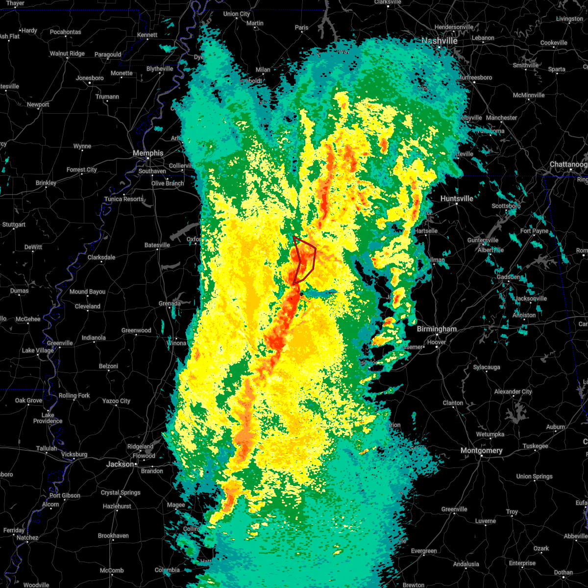 At 735 pm cdt, a severe thunderstorm producing a tornado was located near tremont, or 7 miles east of fulton, moving northeast at 60 mph (radar indicated rotation). Hazards include tornado and 60 mph wind gusts. Flying debris will be dangerous to those caught without shelter. mobile homes will be damaged or destroyed. damage to roofs, windows, and vehicles will occur. tree damage is likely. Locations impacted include, smithville, tremont, fairview, new salem, clay, eastman, turon, bounds crossroads and cadamy. At 735 pm cdt, a severe thunderstorm producing a tornado was located near tremont, or 7 miles east of fulton, moving northeast at 60 mph (radar indicated rotation). Hazards include tornado and 60 mph wind gusts. Flying debris will be dangerous to those caught without shelter. mobile homes will be damaged or destroyed. damage to roofs, windows, and vehicles will occur. tree damage is likely. Locations impacted include, smithville, tremont, fairview, new salem, clay, eastman, turon, bounds crossroads and cadamy.
|
| 3/30/2022 7:22 PM CDT |
 At 721 pm cdt, severe thunderstorms were located along a line extending from near new salem to sessums, moving northeast at 60 mph (radar indicated). Hazards include 60 mph wind gusts. expect damage to roofs, siding, and trees At 721 pm cdt, severe thunderstorms were located along a line extending from near new salem to sessums, moving northeast at 60 mph (radar indicated). Hazards include 60 mph wind gusts. expect damage to roofs, siding, and trees
|
| 3/30/2022 7:11 PM CDT |
 At 711 pm cdt, a severe thunderstorm producing a tornado was located near amory, moving northeast at 60 mph (radar indicated rotation). Hazards include tornado. Flying debris will be dangerous to those caught without shelter. mobile homes will be damaged or destroyed. damage to roofs, windows, and vehicles will occur. Tree damage is likely. At 711 pm cdt, a severe thunderstorm producing a tornado was located near amory, moving northeast at 60 mph (radar indicated rotation). Hazards include tornado. Flying debris will be dangerous to those caught without shelter. mobile homes will be damaged or destroyed. damage to roofs, windows, and vehicles will occur. Tree damage is likely.
|
| 3/30/2022 7:07 PM CDT |
 At 707 pm cdt, severe thunderstorms were located along a line extending from near sandy springs to near smithville to 6 miles north of west point, moving northeast at 45 mph (radar indicated). Hazards include 70 mph wind gusts. Expect considerable tree damage. damage is likely to mobile homes, roofs, and outbuildings. Locations impacted include, amory, aberdeen, fulton, tombigbee state park, shannon, mantachie, smithville, tremont, prairie, fairview, new salem, sandy springs, new wren, evergreen, clay, nettleton, hatley, gattman, abney and eastman. At 707 pm cdt, severe thunderstorms were located along a line extending from near sandy springs to near smithville to 6 miles north of west point, moving northeast at 45 mph (radar indicated). Hazards include 70 mph wind gusts. Expect considerable tree damage. damage is likely to mobile homes, roofs, and outbuildings. Locations impacted include, amory, aberdeen, fulton, tombigbee state park, shannon, mantachie, smithville, tremont, prairie, fairview, new salem, sandy springs, new wren, evergreen, clay, nettleton, hatley, gattman, abney and eastman.
|
| 3/30/2022 6:37 PM CDT |
 At 636 pm cdt, severe thunderstorms were located along a line extending from near saltillo to near shannon to griffith, moving northeast at 55 mph (radar indicated). Hazards include 60 mph wind gusts. expect damage to roofs, siding, and trees At 636 pm cdt, severe thunderstorms were located along a line extending from near saltillo to near shannon to griffith, moving northeast at 55 mph (radar indicated). Hazards include 60 mph wind gusts. expect damage to roofs, siding, and trees
|
| 3/22/2022 3:47 PM CDT |
 At 347 pm cdt, severe thunderstorms were located along a line extending from near new salem to near detroit to bedford, moving northeast at 55 mph (radar indicated). Hazards include 60 mph wind gusts. Expect damage to roofs, siding, and trees. Locations impacted include, smithville, gattman, sipsey fork, quincy, turon, greenwood springs, splunge, wise gap, athens and parham. At 347 pm cdt, severe thunderstorms were located along a line extending from near new salem to near detroit to bedford, moving northeast at 55 mph (radar indicated). Hazards include 60 mph wind gusts. Expect damage to roofs, siding, and trees. Locations impacted include, smithville, gattman, sipsey fork, quincy, turon, greenwood springs, splunge, wise gap, athens and parham.
|
| 3/22/2022 3:40 PM CDT |
 At 339 pm cdt, severe thunderstorms were located along a line extending from smithville to 9 miles northwest of bedford to near caledonia, moving northeast at 55 mph (radar indicated). Hazards include 60 mph wind gusts. expect damage to roofs, siding, and trees At 339 pm cdt, severe thunderstorms were located along a line extending from smithville to 9 miles northwest of bedford to near caledonia, moving northeast at 55 mph (radar indicated). Hazards include 60 mph wind gusts. expect damage to roofs, siding, and trees
|
| 3/22/2022 3:15 PM CDT |
 At 315 pm cdt, a tornado producing storm was located 7 miles northwest of kolola springs, or 7 miles northwest of columbus afb, moving northeast at 55 mph (radar confirmed tornado). Hazards include damaging tornado. Flying debris will be dangerous to those caught without shelter. mobile homes will be damaged or destroyed. damage to roofs, windows, and vehicles will occur. Tree damage is likely. At 315 pm cdt, a tornado producing storm was located 7 miles northwest of kolola springs, or 7 miles northwest of columbus afb, moving northeast at 55 mph (radar confirmed tornado). Hazards include damaging tornado. Flying debris will be dangerous to those caught without shelter. mobile homes will be damaged or destroyed. damage to roofs, windows, and vehicles will occur. Tree damage is likely.
|
| 3/22/2022 2:55 PM CDT |
 The severe thunderstorm warning for chickasaw, western itawamba, lee and monroe counties will expire at 300 pm cdt, the storms which prompted the warning have moved out of the area. therefore, the warning will be allowed to expire. a tornado watch remains in effect until 700 pm cdt for northeastern mississippi. The severe thunderstorm warning for chickasaw, western itawamba, lee and monroe counties will expire at 300 pm cdt, the storms which prompted the warning have moved out of the area. therefore, the warning will be allowed to expire. a tornado watch remains in effect until 700 pm cdt for northeastern mississippi.
|
| 3/22/2022 2:55 PM CDT |
 At 252 pm cdt, severe thunderstorms were located along a line extending from near okolona to near prairie to near griffith, moving northeast at 40 mph (radar indicated). Hazards include 60 mph wind gusts. expect damage to roofs, siding, and trees At 252 pm cdt, severe thunderstorms were located along a line extending from near okolona to near prairie to near griffith, moving northeast at 40 mph (radar indicated). Hazards include 60 mph wind gusts. expect damage to roofs, siding, and trees
|
| 3/22/2022 2:23 PM CDT |
 At 222 pm cdt, severe thunderstorms were located along a line extending from near pyland to near cumberland to 6 miles southeast of reform, moving northeast at 55 mph (radar indicated). Hazards include 60 mph wind gusts. expect damage to roofs, siding, and trees At 222 pm cdt, severe thunderstorms were located along a line extending from near pyland to near cumberland to 6 miles southeast of reform, moving northeast at 55 mph (radar indicated). Hazards include 60 mph wind gusts. expect damage to roofs, siding, and trees
|
| 12/29/2021 5:46 PM CST |
 At 545 pm cst, a severe thunderstorm was located over smithville, or 7 miles northeast of amory, moving east at 65 mph (radar indicated). Hazards include 70 mph wind gusts. Expect considerable tree damage. damage is likely to mobile homes, roofs, and outbuildings. locations impacted include, amory, aberdeen, smithville, new wren, hatley, gattman, sipsey fork, becker, quincy, turon, splunge, wise gap, athens, wren, bigbee, greenwood springs and parham. thunderstorm damage threat, considerable hail threat, radar indicated max hail size, <. 75 in wind threat, radar indicated max wind gust, 70 mph. At 545 pm cst, a severe thunderstorm was located over smithville, or 7 miles northeast of amory, moving east at 65 mph (radar indicated). Hazards include 70 mph wind gusts. Expect considerable tree damage. damage is likely to mobile homes, roofs, and outbuildings. locations impacted include, amory, aberdeen, smithville, new wren, hatley, gattman, sipsey fork, becker, quincy, turon, splunge, wise gap, athens, wren, bigbee, greenwood springs and parham. thunderstorm damage threat, considerable hail threat, radar indicated max hail size, <. 75 in wind threat, radar indicated max wind gust, 70 mph.
|
| 12/29/2021 5:29 PM CST |
 At 528 pm cst, a severe thunderstorm was located near okolona, moving east at 65 mph (radar indicated). Hazards include 70 mph wind gusts. Expect considerable tree damage. Damage is likely to mobile homes, roofs, and outbuildings. At 528 pm cst, a severe thunderstorm was located near okolona, moving east at 65 mph (radar indicated). Hazards include 70 mph wind gusts. Expect considerable tree damage. Damage is likely to mobile homes, roofs, and outbuildings.
|
| 6/13/2021 12:46 PM CDT |
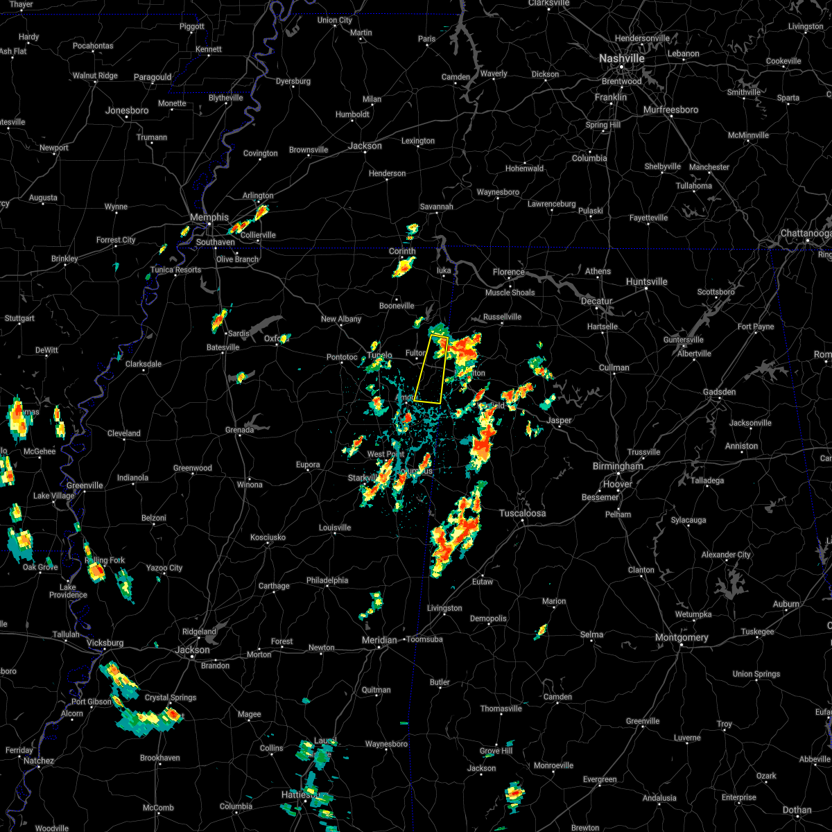 At 1246 pm cdt, a severe thunderstorm was located near fairview, or 8 miles southwest of red bay, moving south at 45 mph (radar indicated). Hazards include quarter size hail. damage to vehicles is expected At 1246 pm cdt, a severe thunderstorm was located near fairview, or 8 miles southwest of red bay, moving south at 45 mph (radar indicated). Hazards include quarter size hail. damage to vehicles is expected
|
| 5/9/2021 8:04 PM CDT |
 At 804 pm cdt, a severe thunderstorm was located near amory, moving southeast at 65 mph (radar indicated). Hazards include 60 mph wind gusts. Expect damage to roofs, siding, and trees. Locations impacted include, tupelo, amory, aberdeen, fulton, verona, okolona, tombigbee state park, shannon, plantersville, mantachie, smithville, tremont, prairie, fairview, new salem, new wren, houlka, evergreen, clay and nettleton. At 804 pm cdt, a severe thunderstorm was located near amory, moving southeast at 65 mph (radar indicated). Hazards include 60 mph wind gusts. Expect damage to roofs, siding, and trees. Locations impacted include, tupelo, amory, aberdeen, fulton, verona, okolona, tombigbee state park, shannon, plantersville, mantachie, smithville, tremont, prairie, fairview, new salem, new wren, houlka, evergreen, clay and nettleton.
|
| 5/9/2021 7:28 PM CDT |
 At 724 pm cdt, a severe thunderstorm was located over pontotoc, moving southeast at 45 mph (radar indicated). Hazards include 60 mph wind gusts and quarter size hail. Hail damage to vehicles is expected. Expect wind damage to roofs, siding, and trees. At 724 pm cdt, a severe thunderstorm was located over pontotoc, moving southeast at 45 mph (radar indicated). Hazards include 60 mph wind gusts and quarter size hail. Hail damage to vehicles is expected. Expect wind damage to roofs, siding, and trees.
|
| 5/6/2021 7:13 PM CDT |
 The severe thunderstorm warning for chickasaw, southeastern calhoun and monroe counties will expire at 715 pm cdt, the storms which prompted the warning have moved out of the area. therefore, the warning will be allowed to expire. The severe thunderstorm warning for chickasaw, southeastern calhoun and monroe counties will expire at 715 pm cdt, the storms which prompted the warning have moved out of the area. therefore, the warning will be allowed to expire.
|
| 5/6/2021 6:55 PM CDT |
 At 654 pm cdt, severe thunderstorms were located along a line extending from 6 miles south of vardaman to bedford, moving south at 35 mph (radar indicated). Hazards include 60 mph wind gusts. Expect damage to roofs, siding, and trees. Locations impacted include, amory, aberdeen, houston, okolona, calhoun city, vardaman, derma, prairie, pyland, new wren, trebloc, houlka, new houlka, hatley, woodland, gattman, quincy, thorn, egypt and reid. At 654 pm cdt, severe thunderstorms were located along a line extending from 6 miles south of vardaman to bedford, moving south at 35 mph (radar indicated). Hazards include 60 mph wind gusts. Expect damage to roofs, siding, and trees. Locations impacted include, amory, aberdeen, houston, okolona, calhoun city, vardaman, derma, prairie, pyland, new wren, trebloc, houlka, new houlka, hatley, woodland, gattman, quincy, thorn, egypt and reid.
|
| 5/6/2021 6:25 PM CDT |
 At 624 pm cdt, severe thunderstorms were located along a line extending from 6 miles northeast of bruce to near detroit, moving south at 35 mph (radar indicated). Hazards include 60 mph wind gusts. expect damage to roofs, siding, and trees At 624 pm cdt, severe thunderstorms were located along a line extending from 6 miles northeast of bruce to near detroit, moving south at 35 mph (radar indicated). Hazards include 60 mph wind gusts. expect damage to roofs, siding, and trees
|
| 5/6/2021 6:02 PM CDT |
 At 559 pm cdt, severe thunderstorms were located along a line extending from near haleyville to near amory to 6 miles west of houlka, moving southeast at 70 mph (radar indicated). Hazards include 60 mph wind gusts. Expect damage to roofs, siding, and trees. wind gust of 60 mph reported at the tupelo airport. Locations impacted include, tupelo, oxford, amory, pontotoc, aberdeen, fulton, houston, water valley, verona, okolona, trace state park, holly springs national forest, tombigbee state park, saltillo, guntown, bruce, calhoun city, shannon, vardaman and plantersville. At 559 pm cdt, severe thunderstorms were located along a line extending from near haleyville to near amory to 6 miles west of houlka, moving southeast at 70 mph (radar indicated). Hazards include 60 mph wind gusts. Expect damage to roofs, siding, and trees. wind gust of 60 mph reported at the tupelo airport. Locations impacted include, tupelo, oxford, amory, pontotoc, aberdeen, fulton, houston, water valley, verona, okolona, trace state park, holly springs national forest, tombigbee state park, saltillo, guntown, bruce, calhoun city, shannon, vardaman and plantersville.
|
| 5/6/2021 5:24 PM CDT |
 At 523 pm cdt, severe thunderstorms were located along a line extending from near cherokee to near keownville to near harmontown, moving southeast at 70 mph (radar indicated). Hazards include 60 mph wind gusts. expect damage to roofs, siding, and trees At 523 pm cdt, severe thunderstorms were located along a line extending from near cherokee to near keownville to near harmontown, moving southeast at 70 mph (radar indicated). Hazards include 60 mph wind gusts. expect damage to roofs, siding, and trees
|
| 5/4/2021 4:12 PM CDT |
 At 412 pm cdt, a severe thunderstorm was located near detroit, or 12 miles east of amory, moving east at 40 mph (radar indicated). Hazards include 60 mph wind gusts. Expect damage to roofs, siding, and trees. Locations impacted include, amory, aberdeen, smithville, hatley, gattman, sipsey fork, becker, quincy, turon, splunge, wise gap, athens, east aberdeen, bigbee, greenwood springs and parham. At 412 pm cdt, a severe thunderstorm was located near detroit, or 12 miles east of amory, moving east at 40 mph (radar indicated). Hazards include 60 mph wind gusts. Expect damage to roofs, siding, and trees. Locations impacted include, amory, aberdeen, smithville, hatley, gattman, sipsey fork, becker, quincy, turon, splunge, wise gap, athens, east aberdeen, bigbee, greenwood springs and parham.
|
| 5/4/2021 3:33 PM CDT |
 At 332 pm cdt, a severe thunderstorm was located over okolona, moving east at 40 mph (radar indicated). Hazards include 60 mph wind gusts. expect damage to roofs, siding, and trees At 332 pm cdt, a severe thunderstorm was located over okolona, moving east at 40 mph (radar indicated). Hazards include 60 mph wind gusts. expect damage to roofs, siding, and trees
|
| 4/9/2021 9:51 PM CDT |
 The severe thunderstorm warning for itawamba, southern lee and monroe counties will expire at 1000 pm cdt, the storms which prompted the warning have moved out of the area. therefore, the warning will be allowed to expire. a severe thunderstorm watch remains in effect until 1100 pm cdt for northeastern mississippi. The severe thunderstorm warning for itawamba, southern lee and monroe counties will expire at 1000 pm cdt, the storms which prompted the warning have moved out of the area. therefore, the warning will be allowed to expire. a severe thunderstorm watch remains in effect until 1100 pm cdt for northeastern mississippi.
|
| 4/9/2021 9:09 PM CDT |
 At 909 pm cdt, severe thunderstorms were located along a line extending from near verona to near new wren to near pala alto, moving east at 50 mph. these are very dangerous storms (radar indicated). Hazards include 80 mph wind gusts. Flying debris will be dangerous to those caught without shelter. mobile homes will be heavily damaged. expect considerable damage to roofs, windows, and vehicles. Extensive tree damage and power outages are likely. At 909 pm cdt, severe thunderstorms were located along a line extending from near verona to near new wren to near pala alto, moving east at 50 mph. these are very dangerous storms (radar indicated). Hazards include 80 mph wind gusts. Flying debris will be dangerous to those caught without shelter. mobile homes will be heavily damaged. expect considerable damage to roofs, windows, and vehicles. Extensive tree damage and power outages are likely.
|
| 4/9/2021 8:58 PM CDT |
 At 858 pm cdt, a severe thunderstorm was located near prairie, or near aberdeen, moving east at 50 mph. this is a very dangerous storm (radar indicated). Hazards include 90 mph wind gusts. You are in a life-threatening situation. flying debris may be deadly to those caught without shelter. mobile homes will be heavily damaged or destroyed. homes and businesses will have substantial roof and window damage. expect extensive tree damage and power outages. Locations impacted include, amory, aberdeen, houston, okolona, smithville, prairie, pyland, new wren, trebloc, hatley, woodland, quincy, egypt, wren, strong, mccondy, muldon, buena vista, sparta and binford. At 858 pm cdt, a severe thunderstorm was located near prairie, or near aberdeen, moving east at 50 mph. this is a very dangerous storm (radar indicated). Hazards include 90 mph wind gusts. You are in a life-threatening situation. flying debris may be deadly to those caught without shelter. mobile homes will be heavily damaged or destroyed. homes and businesses will have substantial roof and window damage. expect extensive tree damage and power outages. Locations impacted include, amory, aberdeen, houston, okolona, smithville, prairie, pyland, new wren, trebloc, hatley, woodland, quincy, egypt, wren, strong, mccondy, muldon, buena vista, sparta and binford.
|
| 4/9/2021 8:46 PM CDT |
 At 845 pm cdt, a severe thunderstorm was located over trebloc, or 9 miles northeast of montpelier, moving east at 50 mph (radar indicated). Hazards include 70 mph wind gusts. Expect considerable tree damage. damage is likely to mobile homes, roofs, and outbuildings. Locations impacted include, amory, aberdeen, houston, okolona, smithville, prairie, pyland, new wren, trebloc, hatley, woodland, quincy, egypt, wren, strong, mccondy, muldon, buena vista, sparta and binford. At 845 pm cdt, a severe thunderstorm was located over trebloc, or 9 miles northeast of montpelier, moving east at 50 mph (radar indicated). Hazards include 70 mph wind gusts. Expect considerable tree damage. damage is likely to mobile homes, roofs, and outbuildings. Locations impacted include, amory, aberdeen, houston, okolona, smithville, prairie, pyland, new wren, trebloc, hatley, woodland, quincy, egypt, wren, strong, mccondy, muldon, buena vista, sparta and binford.
|
| 4/9/2021 8:38 PM CDT |
 The national weather service in memphis has issued a * severe thunderstorm warning for. central chickasaw county in northeastern mississippi. monroe county in northeastern mississippi. until 930 pm cdt. At 838 pm cdt, a severe thunderstorm was located near montpelier,. The national weather service in memphis has issued a * severe thunderstorm warning for. central chickasaw county in northeastern mississippi. monroe county in northeastern mississippi. until 930 pm cdt. At 838 pm cdt, a severe thunderstorm was located near montpelier,.
|
| 3/31/2021 1:24 AM CDT |
 At 124 am cdt, a severe thunderstorm was located over new wren, or near okolona, moving east at 35 mph (radar indicated). Hazards include 60 mph wind gusts. expect damage to roofs, siding, and trees At 124 am cdt, a severe thunderstorm was located over new wren, or near okolona, moving east at 35 mph (radar indicated). Hazards include 60 mph wind gusts. expect damage to roofs, siding, and trees
|
| 3/28/2021 2:30 AM CDT |
 At 230 am cdt, a severe thunderstorm was located near evergreen, or near tombigbee state park, moving east at 60 mph (radar indicated). Hazards include 60 mph wind gusts. expect damage to roofs, siding, and trees At 230 am cdt, a severe thunderstorm was located near evergreen, or near tombigbee state park, moving east at 60 mph (radar indicated). Hazards include 60 mph wind gusts. expect damage to roofs, siding, and trees
|
| 3/28/2021 2:23 AM CDT |
 At 222 am cdt, a severe thunderstorm was located near fulton, moving east at 60 mph (radar indicated). Hazards include 60 mph wind gusts. Expect damage to roofs, siding, and trees. Locations impacted include, tupelo, fulton, verona, tombigbee state park, shannon, plantersville, smithville, tremont, new salem, evergreen, clay, nettleton, abney, turon, ballardsville, old union, cardsville, tilden, palmetto and bissell. At 222 am cdt, a severe thunderstorm was located near fulton, moving east at 60 mph (radar indicated). Hazards include 60 mph wind gusts. Expect damage to roofs, siding, and trees. Locations impacted include, tupelo, fulton, verona, tombigbee state park, shannon, plantersville, smithville, tremont, new salem, evergreen, clay, nettleton, abney, turon, ballardsville, old union, cardsville, tilden, palmetto and bissell.
|
| 3/28/2021 1:47 AM CDT |
 At 147 am cdt, a severe thunderstorm was located 7 miles north of houlka, or 7 miles south of pontotoc, moving east at 60 mph (radar indicated). Hazards include 60 mph wind gusts. expect damage to roofs, siding, and trees At 147 am cdt, a severe thunderstorm was located 7 miles north of houlka, or 7 miles south of pontotoc, moving east at 60 mph (radar indicated). Hazards include 60 mph wind gusts. expect damage to roofs, siding, and trees
|
| 3/17/2021 7:46 PM CDT |
 At 746 pm cdt, a severe thunderstorm was located over new wren, or 8 miles southeast of okolona, moving northeast at 35 mph (radar indicated). Hazards include 60 mph wind gusts. Expect damage to roofs, siding, and trees. Locations impacted include, amory, aberdeen, fulton, verona, shannon, smithville, tremont, new salem, new wren, evergreen, nettleton, hatley, gattman, abney, quincy, turon, wise gap, wren, old union and sipsey fork. At 746 pm cdt, a severe thunderstorm was located over new wren, or 8 miles southeast of okolona, moving northeast at 35 mph (radar indicated). Hazards include 60 mph wind gusts. Expect damage to roofs, siding, and trees. Locations impacted include, amory, aberdeen, fulton, verona, shannon, smithville, tremont, new salem, new wren, evergreen, nettleton, hatley, gattman, abney, quincy, turon, wise gap, wren, old union and sipsey fork.
|
| 3/17/2021 7:44 PM CDT |
 At 744 pm cdt, a severe thunderstorm was located over plantersville, or near verona, moving northeast at 55 mph (radar indicated). Hazards include 60 mph wind gusts. expect damage to roofs, siding, and trees At 744 pm cdt, a severe thunderstorm was located over plantersville, or near verona, moving northeast at 55 mph (radar indicated). Hazards include 60 mph wind gusts. expect damage to roofs, siding, and trees
|
| 3/17/2021 7:17 PM CDT |
 At 717 pm cdt, a severe thunderstorm was located over trebloc, or 7 miles southeast of houston, moving northeast at 35 mph (radar indicated). Hazards include 60 mph wind gusts. expect damage to roofs, siding, and trees At 717 pm cdt, a severe thunderstorm was located over trebloc, or 7 miles southeast of houston, moving northeast at 35 mph (radar indicated). Hazards include 60 mph wind gusts. expect damage to roofs, siding, and trees
|
| 3/17/2021 6:28 PM CDT |
 At 628 pm cdt, a severe thunderstorm was located near evergreen, or 8 miles north of amory, moving northeast at 35 mph (radar indicated). Hazards include 60 mph wind gusts and quarter size hail. Hail damage to vehicles is expected. Expect wind damage to roofs, siding, and trees. At 628 pm cdt, a severe thunderstorm was located near evergreen, or 8 miles north of amory, moving northeast at 35 mph (radar indicated). Hazards include 60 mph wind gusts and quarter size hail. Hail damage to vehicles is expected. Expect wind damage to roofs, siding, and trees.
|
| 8/31/2020 8:12 PM CDT |
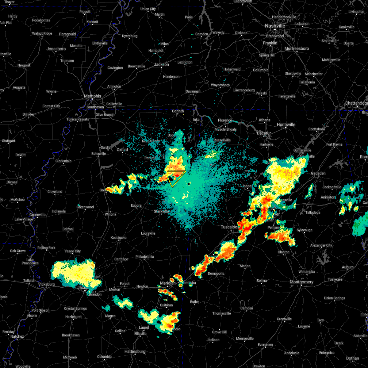 The severe thunderstorm warning for northwestern monroe county will expire at 815 pm cdt, the storm which prompted the warning has weakened below severe limits, and no longer poses an immediate threat to life or property. therefore, the warning will be allowed to expire. The severe thunderstorm warning for northwestern monroe county will expire at 815 pm cdt, the storm which prompted the warning has weakened below severe limits, and no longer poses an immediate threat to life or property. therefore, the warning will be allowed to expire.
|
| 8/31/2020 8:07 PM CDT |
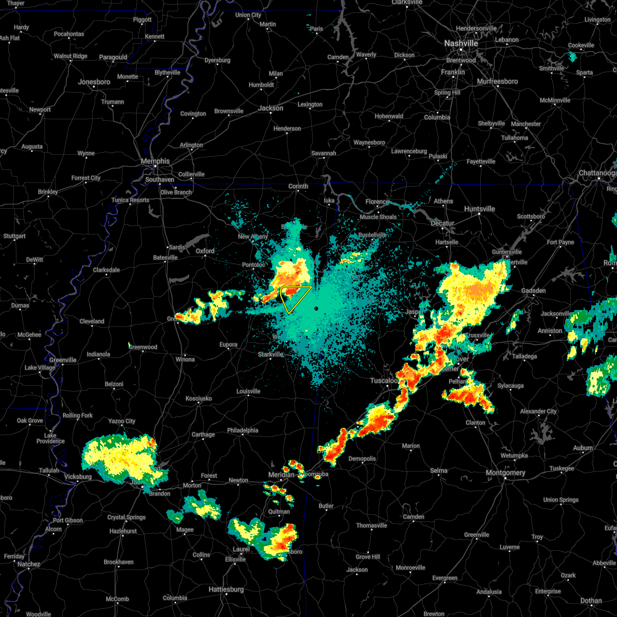 At 807 pm cdt, a severe thunderstorm was located over new wren, or near amory, moving southeast at 20 mph (radar indicated). Hazards include 60 mph wind gusts and quarter size hail. Hail damage to vehicles is expected. expect wind damage to roofs, siding, and trees. Locations impacted include, amory, smithville, new wren, nettleton, wren and bigbee. At 807 pm cdt, a severe thunderstorm was located over new wren, or near amory, moving southeast at 20 mph (radar indicated). Hazards include 60 mph wind gusts and quarter size hail. Hail damage to vehicles is expected. expect wind damage to roofs, siding, and trees. Locations impacted include, amory, smithville, new wren, nettleton, wren and bigbee.
|
| 8/31/2020 8:06 PM CDT |
 At 806 pm cdt, a severe thunderstorm was located over new wren, or near amory, moving southeast at 20 mph (radar indicated). Hazards include 60 mph wind gusts and quarter size hail. Hail damage to vehicles is expected. expect wind damage to roofs, siding, and trees. Locations impacted include, amory, smithville, new wren, nettleton, wren and bigbee. At 806 pm cdt, a severe thunderstorm was located over new wren, or near amory, moving southeast at 20 mph (radar indicated). Hazards include 60 mph wind gusts and quarter size hail. Hail damage to vehicles is expected. expect wind damage to roofs, siding, and trees. Locations impacted include, amory, smithville, new wren, nettleton, wren and bigbee.
|
| 8/31/2020 7:57 PM CDT |
 A severe thunderstorm warning remains in effect until 815 pm cdt for northeastern chickasaw. southwestern itawamba. southeastern lee and northwestern monroe counties. at 757 pm cdt, a severe thunderstorm was located near new wren, or 7 miles east of okolona, moving southeast at 25 mph. hazard. 60 mph wind gusts and quarter size hail. A severe thunderstorm warning remains in effect until 815 pm cdt for northeastern chickasaw. southwestern itawamba. southeastern lee and northwestern monroe counties. at 757 pm cdt, a severe thunderstorm was located near new wren, or 7 miles east of okolona, moving southeast at 25 mph. hazard. 60 mph wind gusts and quarter size hail.
|
| 8/31/2020 7:37 PM CDT |
 At 737 pm cdt, a severe thunderstorm was located over shannon, or near verona, moving southeast at 25 mph (radar indicated). Hazards include golf ball size hail and 60 mph wind gusts. People and animals outdoors will be injured. expect hail damage to roofs, siding, windows, and vehicles. expect wind damage to roofs, siding, and trees. Locations impacted include, tupelo, amory, verona, okolona, tombigbee state park, shannon, plantersville, smithville, new wren, new salem, evergreen, nettleton, cardsville, palmetto, bissell, wren, bigbee, leotis, jacinto and flowerdale. At 737 pm cdt, a severe thunderstorm was located over shannon, or near verona, moving southeast at 25 mph (radar indicated). Hazards include golf ball size hail and 60 mph wind gusts. People and animals outdoors will be injured. expect hail damage to roofs, siding, windows, and vehicles. expect wind damage to roofs, siding, and trees. Locations impacted include, tupelo, amory, verona, okolona, tombigbee state park, shannon, plantersville, smithville, new wren, new salem, evergreen, nettleton, cardsville, palmetto, bissell, wren, bigbee, leotis, jacinto and flowerdale.
|
| 8/31/2020 7:25 PM CDT |
 At 725 pm cdt, a severe thunderstorm was located near verona, moving southeast at 20 mph (radar indicated). Hazards include golf ball size hail and 60 mph wind gusts. People and animals outdoors will be injured. expect hail damage to roofs, siding, windows, and vehicles. Expect wind damage to roofs, siding, and trees. At 725 pm cdt, a severe thunderstorm was located near verona, moving southeast at 20 mph (radar indicated). Hazards include golf ball size hail and 60 mph wind gusts. People and animals outdoors will be injured. expect hail damage to roofs, siding, windows, and vehicles. Expect wind damage to roofs, siding, and trees.
|
| 8/28/2020 3:40 PM CDT |
 At 340 pm cdt, a severe thunderstorm was located near amory, moving northeast at 45 mph (radar indicated). Hazards include 60 mph wind gusts. expect damage to roofs, siding, and trees At 340 pm cdt, a severe thunderstorm was located near amory, moving northeast at 45 mph (radar indicated). Hazards include 60 mph wind gusts. expect damage to roofs, siding, and trees
|
| 6/5/2020 4:38 PM CDT |
 The severe thunderstorm warning for southeastern chickasaw, southeastern itawamba and monroe counties will expire at 445 pm cdt, the storms which prompted the warning have weakened below severe limits, and have exited the warned area. therefore, the warning will be allowed to expire. however gusty winds and heavy rain are still possible with these thunderstorms. a severe thunderstorm watch remains in effect until 600 pm cdt for northeastern mississippi. The severe thunderstorm warning for southeastern chickasaw, southeastern itawamba and monroe counties will expire at 445 pm cdt, the storms which prompted the warning have weakened below severe limits, and have exited the warned area. therefore, the warning will be allowed to expire. however gusty winds and heavy rain are still possible with these thunderstorms. a severe thunderstorm watch remains in effect until 600 pm cdt for northeastern mississippi.
|
| 6/5/2020 4:26 PM CDT |
 At 426 pm cdt, severe thunderstorms were located along a line extending from near sulligent to near kolola springs to near griffith, moving southeast at 40 mph (radar indicated). Hazards include 60 mph wind gusts and penny size hail. Expect damage to roofs, siding, and trees. Locations impacted include, amory, aberdeen, smithville, tremont, prairie, new salem, new wren, trebloc, hatley, woodland, gattman, quincy, turon, egypt, wise gap, wren, strong, mccondy, muldon and buena vista. At 426 pm cdt, severe thunderstorms were located along a line extending from near sulligent to near kolola springs to near griffith, moving southeast at 40 mph (radar indicated). Hazards include 60 mph wind gusts and penny size hail. Expect damage to roofs, siding, and trees. Locations impacted include, amory, aberdeen, smithville, tremont, prairie, new salem, new wren, trebloc, hatley, woodland, gattman, quincy, turon, egypt, wise gap, wren, strong, mccondy, muldon and buena vista.
|
| 6/5/2020 4:01 PM CDT |
 A severe thunderstorm warning remains in effect until 445 pm cdt for chickasaw. southern itawamba. southern lee and monroe counties. At 400 pm cdt, severe thunderstorms were located along a line extending from near new salem to near new wren to near houston, moving southeast at 40 mph. A severe thunderstorm warning remains in effect until 445 pm cdt for chickasaw. southern itawamba. southern lee and monroe counties. At 400 pm cdt, severe thunderstorms were located along a line extending from near new salem to near new wren to near houston, moving southeast at 40 mph.
|
| 6/5/2020 3:45 PM CDT |
 At 345 pm cdt, severe thunderstorms were located along a line extending from near fulton to near new wren to near houston, moving southeast at 45 mph (radar indicated). Hazards include 60 mph wind gusts and penny size hail. Expect damage to roofs, siding, and trees. Locations impacted include, tupelo, amory, pontotoc, aberdeen, fulton, houston, verona, okolona, trace state park, tombigbee state park, saltillo, shannon, plantersville, mantachie, smithville, tremont, prairie, troy, new salem and new wren. At 345 pm cdt, severe thunderstorms were located along a line extending from near fulton to near new wren to near houston, moving southeast at 45 mph (radar indicated). Hazards include 60 mph wind gusts and penny size hail. Expect damage to roofs, siding, and trees. Locations impacted include, tupelo, amory, pontotoc, aberdeen, fulton, houston, verona, okolona, trace state park, tombigbee state park, saltillo, shannon, plantersville, mantachie, smithville, tremont, prairie, troy, new salem and new wren.
|
| 6/5/2020 3:24 PM CDT |
 At 324 pm cdt, severe thunderstorms were located along a line extending from near pratts friendship to near houlka, moving southeast at 40 mph (radar indicated). Hazards include 60 mph wind gusts. expect damage to roofs, siding, and trees At 324 pm cdt, severe thunderstorms were located along a line extending from near pratts friendship to near houlka, moving southeast at 40 mph (radar indicated). Hazards include 60 mph wind gusts. expect damage to roofs, siding, and trees
|
| 4/12/2020 10:58 PM CDT |
 At 1057 pm cdt, severe thunderstorms were located along a line extending from 6 miles southeast of somerville to 6 miles north of ripley to near trebloc, moving northeast at 75 mph (radar indicated). Hazards include 60 mph wind gusts. expect damage to roofs, siding, and trees At 1057 pm cdt, severe thunderstorms were located along a line extending from 6 miles southeast of somerville to 6 miles north of ripley to near trebloc, moving northeast at 75 mph (radar indicated). Hazards include 60 mph wind gusts. expect damage to roofs, siding, and trees
|
| 4/12/2020 3:28 PM CDT |
 At 328 pm cdt, a severe thunderstorm was located near shannon, or 9 miles northwest of amory, moving east at 55 mph (radar indicated). Hazards include 60 mph wind gusts. expect damage to roofs, siding, and trees At 328 pm cdt, a severe thunderstorm was located near shannon, or 9 miles northwest of amory, moving east at 55 mph (radar indicated). Hazards include 60 mph wind gusts. expect damage to roofs, siding, and trees
|
| 4/12/2020 3:22 PM CDT |
 At 322 pm cdt, a severe thunderstorm was located near okolona, moving east at 55 mph (radar indicated). Hazards include 60 mph wind gusts. Expect damage to roofs, siding, and trees. Locations impacted include, amory, okolona, shannon, smithville, tremont, new wren, new salem, nettleton, hatley, cardsville, turon, tilden, egypt, wren, bigbee, leotis, jacinto, parham, cadamy and buena vista. At 322 pm cdt, a severe thunderstorm was located near okolona, moving east at 55 mph (radar indicated). Hazards include 60 mph wind gusts. Expect damage to roofs, siding, and trees. Locations impacted include, amory, okolona, shannon, smithville, tremont, new wren, new salem, nettleton, hatley, cardsville, turon, tilden, egypt, wren, bigbee, leotis, jacinto, parham, cadamy and buena vista.
|
| 4/12/2020 3:07 PM CDT |
 At 307 pm cdt, a severe thunderstorm was located near houston, moving east at 55 mph (radar indicated). Hazards include 60 mph wind gusts. expect damage to roofs, siding, and trees At 307 pm cdt, a severe thunderstorm was located near houston, moving east at 55 mph (radar indicated). Hazards include 60 mph wind gusts. expect damage to roofs, siding, and trees
|
| 2/10/2020 3:11 AM CST |
 At 311 am cst, a severe thunderstorm was located near shannon, or near verona, moving northeast at 50 mph (radar indicated). Hazards include quarter size hail. damage to vehicles is expected At 311 am cst, a severe thunderstorm was located near shannon, or near verona, moving northeast at 50 mph (radar indicated). Hazards include quarter size hail. damage to vehicles is expected
|
| 2/5/2020 4:35 PM CST |
 At 435 pm cst, a severe thunderstorm was located near houlka, or 10 miles south of pontotoc, moving east at 55 mph (radar indicated). Hazards include 60 mph wind gusts and penny size hail. Expect damage to roofs, siding, and trees. Locations impacted include, tupelo, amory, pontotoc, houston, verona, okolona, trace state park, tombigbee state park, saltillo, guntown, shannon, vardaman, plantersville, mantachie, smithville, pratts friendship, randolph, troy, furrs and houlka. At 435 pm cst, a severe thunderstorm was located near houlka, or 10 miles south of pontotoc, moving east at 55 mph (radar indicated). Hazards include 60 mph wind gusts and penny size hail. Expect damage to roofs, siding, and trees. Locations impacted include, tupelo, amory, pontotoc, houston, verona, okolona, trace state park, tombigbee state park, saltillo, guntown, shannon, vardaman, plantersville, mantachie, smithville, pratts friendship, randolph, troy, furrs and houlka.
|
| 2/5/2020 4:15 PM CST |
 At 415 pm cst, a severe thunderstorm was located near bruce, or 15 miles west of houston, moving northeast at 75 mph (radar indicated). Hazards include 60 mph wind gusts. expect damage to roofs, siding, and trees At 415 pm cst, a severe thunderstorm was located near bruce, or 15 miles west of houston, moving northeast at 75 mph (radar indicated). Hazards include 60 mph wind gusts. expect damage to roofs, siding, and trees
|
| 1/11/2020 8:28 AM CST |
 The severe thunderstorm warning for southern itawamba, southeastern lee and northern monroe counties will expire at 830 am cst, the storm which prompted the warning has weakened below severe limits, and no longer poses an immediate threat to life or property. therefore, the warning will be allowed to expire. a tornado watch remains in effect until 1000 am cst for northeastern mississippi. The severe thunderstorm warning for southern itawamba, southeastern lee and northern monroe counties will expire at 830 am cst, the storm which prompted the warning has weakened below severe limits, and no longer poses an immediate threat to life or property. therefore, the warning will be allowed to expire. a tornado watch remains in effect until 1000 am cst for northeastern mississippi.
|
| 1/11/2020 7:40 AM CST |
 At 740 am cst, a severe thunderstorm was located near evergreen, or near amory, moving east at 50 mph (radar indicated). Hazards include 60 mph wind gusts. expect damage to roofs, siding, and trees At 740 am cst, a severe thunderstorm was located near evergreen, or near amory, moving east at 50 mph (radar indicated). Hazards include 60 mph wind gusts. expect damage to roofs, siding, and trees
|
| 1/11/2020 7:37 AM CST |
 At 737 am cst, severe thunderstorms were located along a line extending from near tishomingo to near prairie, moving east at 50 mph (radar indicated). Hazards include 60 mph wind gusts. Expect damage to roofs, siding, and trees. Locations impacted include, amory, aberdeen, fulton, red bay, okolona, tishomingo state park, belmont, shannon, mantachie, smithville, tremont, tishomingo, prairie, fairview, new salem, new wren, trebloc, evergreen, clay and nettleton. At 737 am cst, severe thunderstorms were located along a line extending from near tishomingo to near prairie, moving east at 50 mph (radar indicated). Hazards include 60 mph wind gusts. Expect damage to roofs, siding, and trees. Locations impacted include, amory, aberdeen, fulton, red bay, okolona, tishomingo state park, belmont, shannon, mantachie, smithville, tremont, tishomingo, prairie, fairview, new salem, new wren, trebloc, evergreen, clay and nettleton.
|
| 1/11/2020 7:31 AM CST |
 At 731 am cst, severe thunderstorms were located along a line extending from near burton to near trebloc, moving east at 30 mph (radar indicated). Hazards include 60 mph wind gusts. Expect damage to roofs, siding, and trees. Locations impacted include, tupelo, amory, aberdeen, fulton, red bay, verona, okolona, tombigbee state park, tishomingo state park, belmont, shannon, plantersville, mantachie, smithville, tremont, prairie, fairview, new salem, sandy springs and new wren. At 731 am cst, severe thunderstorms were located along a line extending from near burton to near trebloc, moving east at 30 mph (radar indicated). Hazards include 60 mph wind gusts. Expect damage to roofs, siding, and trees. Locations impacted include, tupelo, amory, aberdeen, fulton, red bay, verona, okolona, tombigbee state park, tishomingo state park, belmont, shannon, plantersville, mantachie, smithville, tremont, prairie, fairview, new salem, sandy springs and new wren.
|
| 1/11/2020 7:21 AM CST |
 At 721 am cst, severe thunderstorms were located along a line extending from near belmont to prairie, moving east at 50 mph (radar indicated). Hazards include 60 mph wind gusts. Expect damage to roofs, siding, and trees. Locations impacted include, tupelo, amory, aberdeen, fulton, red bay, verona, okolona, tombigbee state park, tishomingo state park, belmont, shannon, plantersville, mantachie, smithville, tremont, prairie, fairview, new salem, sandy springs and new wren. At 721 am cst, severe thunderstorms were located along a line extending from near belmont to prairie, moving east at 50 mph (radar indicated). Hazards include 60 mph wind gusts. Expect damage to roofs, siding, and trees. Locations impacted include, tupelo, amory, aberdeen, fulton, red bay, verona, okolona, tombigbee state park, tishomingo state park, belmont, shannon, plantersville, mantachie, smithville, tremont, prairie, fairview, new salem, sandy springs and new wren.
|
| 1/11/2020 7:08 AM CST |
 At 707 am cst, severe thunderstorms were located along a line extending from 8 miles east of wheeler to near trebloc, moving east at 50 mph (radar indicated). Hazards include 60 mph wind gusts. expect damage to roofs, siding, and trees At 707 am cst, severe thunderstorms were located along a line extending from 8 miles east of wheeler to near trebloc, moving east at 50 mph (radar indicated). Hazards include 60 mph wind gusts. expect damage to roofs, siding, and trees
|
| 12/29/2019 5:15 PM CST |
 At 515 pm cst, a severe thunderstorm was located 9 miles east of aberdeen, moving northeast at 55 mph (radar indicated). Hazards include 60 mph wind gusts. Expect damage to roofs, siding, and trees. Locations impacted include, amory, aberdeen, smithville, hatley, gattman, sipsey fork, new hamilton, becker, quincy, splunge, wise gap, athens, east aberdeen, bigbee, greenwood springs and parham. At 515 pm cst, a severe thunderstorm was located 9 miles east of aberdeen, moving northeast at 55 mph (radar indicated). Hazards include 60 mph wind gusts. Expect damage to roofs, siding, and trees. Locations impacted include, amory, aberdeen, smithville, hatley, gattman, sipsey fork, new hamilton, becker, quincy, splunge, wise gap, athens, east aberdeen, bigbee, greenwood springs and parham.
|
| 12/29/2019 5:05 PM CST |
 At 505 pm cst, a severe thunderstorm was located near aberdeen, moving northeast at 70 mph (radar indicated). Hazards include 60 mph wind gusts. Expect damage to roofs, siding, and trees. Locations impacted include, amory, aberdeen, smithville, new wren, nettleton, hatley, gattman, binford, sipsey fork, new hamilton, becker, quincy, splunge, wise gap, athens, wren, strong, east aberdeen, bigbee and greenwood springs. At 505 pm cst, a severe thunderstorm was located near aberdeen, moving northeast at 70 mph (radar indicated). Hazards include 60 mph wind gusts. Expect damage to roofs, siding, and trees. Locations impacted include, amory, aberdeen, smithville, new wren, nettleton, hatley, gattman, binford, sipsey fork, new hamilton, becker, quincy, splunge, wise gap, athens, wren, strong, east aberdeen, bigbee and greenwood springs.
|
| 12/29/2019 4:59 PM CST |
 At 459 pm cst, a severe thunderstorm was located 7 miles south of aberdeen, moving northeast at 70 mph (radar indicated). Hazards include 60 mph wind gusts. Expect damage to roofs, siding, and trees. Locations impacted include, amory, aberdeen, smithville, prairie, new wren, nettleton, hatley, gattman, binford, sipsey fork, new hamilton, becker, quincy, splunge, wise gap, athens, wren, strong, east aberdeen and bigbee. At 459 pm cst, a severe thunderstorm was located 7 miles south of aberdeen, moving northeast at 70 mph (radar indicated). Hazards include 60 mph wind gusts. Expect damage to roofs, siding, and trees. Locations impacted include, amory, aberdeen, smithville, prairie, new wren, nettleton, hatley, gattman, binford, sipsey fork, new hamilton, becker, quincy, splunge, wise gap, athens, wren, strong, east aberdeen and bigbee.
|
| 12/29/2019 4:52 PM CST |
 At 451 pm cst, a severe thunderstorm was located near west point, moving northeast at 75 mph (radar indicated). Hazards include 60 mph wind gusts. expect damage to roofs, siding, and trees At 451 pm cst, a severe thunderstorm was located near west point, moving northeast at 75 mph (radar indicated). Hazards include 60 mph wind gusts. expect damage to roofs, siding, and trees
|
| 12/16/2019 5:02 PM CST |
 At 501 pm cst, a severe thunderstorm was located near detroit, or 10 miles west of hamilton, moving east at 55 mph (radar indicated). Hazards include 60 mph wind gusts. Expect damage to roofs, siding, and trees. Locations impacted include, amory, aberdeen, smithville, prairie, hatley, gattman, binford, sipsey fork, new hamilton, becker, quincy, turon, splunge, wise gap, athens, strong, east aberdeen, muldon, greenwood springs and parham. At 501 pm cst, a severe thunderstorm was located near detroit, or 10 miles west of hamilton, moving east at 55 mph (radar indicated). Hazards include 60 mph wind gusts. Expect damage to roofs, siding, and trees. Locations impacted include, amory, aberdeen, smithville, prairie, hatley, gattman, binford, sipsey fork, new hamilton, becker, quincy, turon, splunge, wise gap, athens, strong, east aberdeen, muldon, greenwood springs and parham.
|
| 12/16/2019 4:25 PM CST |
 At 424 pm cst, a severe thunderstorm was located over okolona, moving east at 55 mph (radar indicated). Hazards include 60 mph wind gusts. expect damage to roofs, siding, and trees At 424 pm cst, a severe thunderstorm was located over okolona, moving east at 55 mph (radar indicated). Hazards include 60 mph wind gusts. expect damage to roofs, siding, and trees
|
| 12/16/2019 4:03 PM CST |
 At 403 pm cst, a severe thunderstorm was located near tombigbee state park, moving east at 50 mph (radar indicated). Hazards include 60 mph wind gusts. Expect damage to roofs, siding, and trees. Locations impacted include, tupelo, amory, fulton, houston, verona, okolona, trace state park, tombigbee state park, saltillo, shannon, plantersville, mantachie, smithville, fairview, troy, new salem, new wren, trebloc, furrs and houlka. At 403 pm cst, a severe thunderstorm was located near tombigbee state park, moving east at 50 mph (radar indicated). Hazards include 60 mph wind gusts. Expect damage to roofs, siding, and trees. Locations impacted include, tupelo, amory, fulton, houston, verona, okolona, trace state park, tombigbee state park, saltillo, shannon, plantersville, mantachie, smithville, fairview, troy, new salem, new wren, trebloc, furrs and houlka.
|
| 12/16/2019 3:42 PM CST |
 At 342 pm cst, a severe thunderstorm was located over trace state park, moving east at 50 mph (radar indicated). Hazards include 60 mph wind gusts. expect damage to roofs, siding, and trees At 342 pm cst, a severe thunderstorm was located over trace state park, moving east at 50 mph (radar indicated). Hazards include 60 mph wind gusts. expect damage to roofs, siding, and trees
|
| 7/22/2019 6:31 PM CDT |
 At 631 pm cdt, a severe thunderstorm was located over okolona, moving east at 35 mph (radar indicated). Hazards include 60 mph wind gusts. expect damage to roofs, siding, and trees At 631 pm cdt, a severe thunderstorm was located over okolona, moving east at 35 mph (radar indicated). Hazards include 60 mph wind gusts. expect damage to roofs, siding, and trees
|
| 6/27/2019 12:10 PM CDT |
 At 1210 pm cdt, a severe thunderstorm was located near evergreen, or 8 miles northwest of amory, moving southeast at 55 mph (radar indicated). Hazards include 60 mph wind gusts. expect damage to roofs, siding, and trees At 1210 pm cdt, a severe thunderstorm was located near evergreen, or 8 miles northwest of amory, moving southeast at 55 mph (radar indicated). Hazards include 60 mph wind gusts. expect damage to roofs, siding, and trees
|
| 6/20/2019 1:21 AM CDT |
 At 121 am cdt, severe thunderstorms were located along a line extending from new salem to near caledonia, moving east at 65 mph (radar indicated). Hazards include 60 mph wind gusts. expect damage to roofs, siding, and trees At 121 am cdt, severe thunderstorms were located along a line extending from new salem to near caledonia, moving east at 65 mph (radar indicated). Hazards include 60 mph wind gusts. expect damage to roofs, siding, and trees
|
| 4/14/2019 12:22 AM CDT |
 The severe thunderstorm warning for south central itawamba and monroe counties will expire at 1230 am cdt, the storms which prompted the warning have moved out of the area. therefore, the warning will be allowed to expire. however gusty winds and heavy rain are still possible with these thunderstorms. a tornado watch remains in effect until 300 am cdt for northeastern mississippi. The severe thunderstorm warning for south central itawamba and monroe counties will expire at 1230 am cdt, the storms which prompted the warning have moved out of the area. therefore, the warning will be allowed to expire. however gusty winds and heavy rain are still possible with these thunderstorms. a tornado watch remains in effect until 300 am cdt for northeastern mississippi.
|
| 4/14/2019 12:10 AM CDT |
 At 1209 am cdt, severe thunderstorms were located along a line extending from near new salem to 9 miles southeast of amory to near columbus afb, moving east at 30 mph (radar indicated). Hazards include 60 mph wind gusts. Expect damage to roofs, siding, and trees. locations impacted include, amory, aberdeen, smithville, hatley, gattman, binford, sipsey fork, new hamilton, becker, quincy, turon, splunge, wise gap, athens, strong, east aberdeen, greenwood springs and parham. A tornado watch remains in effect until 300 am cdt for northeastern mississippi. At 1209 am cdt, severe thunderstorms were located along a line extending from near new salem to 9 miles southeast of amory to near columbus afb, moving east at 30 mph (radar indicated). Hazards include 60 mph wind gusts. Expect damage to roofs, siding, and trees. locations impacted include, amory, aberdeen, smithville, hatley, gattman, binford, sipsey fork, new hamilton, becker, quincy, turon, splunge, wise gap, athens, strong, east aberdeen, greenwood springs and parham. A tornado watch remains in effect until 300 am cdt for northeastern mississippi.
|
| 4/13/2019 11:48 PM CDT |
 At 1148 pm cdt, severe thunderstorms were located along a line extending from near smithville to west point, moving east at 30 mph (radar indicated). Hazards include 60 mph wind gusts. expect damage to roofs, siding, and trees At 1148 pm cdt, severe thunderstorms were located along a line extending from near smithville to west point, moving east at 30 mph (radar indicated). Hazards include 60 mph wind gusts. expect damage to roofs, siding, and trees
|
| 4/13/2019 11:31 PM CDT |
 At 1130 pm cdt, a confirmed large and extremely dangerous tornado was located near detroit, or 10 miles northwest of sulligent, moving northeast at 55 mph. this is a particularly dangerous situation. take cover now! (radar confirmed tornado). Hazards include damaging tornado. You are in a life-threatening situation. flying debris may be deadly to those caught without shelter. mobile homes will be destroyed. considerable damage to homes, businesses, and vehicles is likely and complete destruction is possible. Locations impacted include, amory, smithville, new salem, hatley, gattman, sipsey fork, quincy, cardsville, turon, splunge, wise gap, athens, greenwood springs and parham. At 1130 pm cdt, a confirmed large and extremely dangerous tornado was located near detroit, or 10 miles northwest of sulligent, moving northeast at 55 mph. this is a particularly dangerous situation. take cover now! (radar confirmed tornado). Hazards include damaging tornado. You are in a life-threatening situation. flying debris may be deadly to those caught without shelter. mobile homes will be destroyed. considerable damage to homes, businesses, and vehicles is likely and complete destruction is possible. Locations impacted include, amory, smithville, new salem, hatley, gattman, sipsey fork, quincy, cardsville, turon, splunge, wise gap, athens, greenwood springs and parham.
|
| 4/13/2019 11:24 PM CDT |
 At 1124 pm cdt, doppler radar indicated a severe thunderstorm producing a tornado was located 9 miles southeast of amory, moving north at 35 mph (radar indicated rotation). Hazards include tornado. Flying debris will be dangerous to those caught without shelter. mobile homes will be damaged or destroyed. damage to roofs, windows, and vehicles will occur. tree damage is likely. Locations impacted include, amory, aberdeen, smithville, new salem, hatley, gattman, sipsey fork, quincy, cardsville, turon, splunge, wise gap, athens, greenwood springs and parham. At 1124 pm cdt, doppler radar indicated a severe thunderstorm producing a tornado was located 9 miles southeast of amory, moving north at 35 mph (radar indicated rotation). Hazards include tornado. Flying debris will be dangerous to those caught without shelter. mobile homes will be damaged or destroyed. damage to roofs, windows, and vehicles will occur. tree damage is likely. Locations impacted include, amory, aberdeen, smithville, new salem, hatley, gattman, sipsey fork, quincy, cardsville, turon, splunge, wise gap, athens, greenwood springs and parham.
|
| 4/13/2019 11:14 PM CDT |
 At 1114 pm cdt, a confirmed large and extremely dangerous tornado was located 8 miles northwest of caledonia, or 8 miles east of aberdeen, moving north at 35 mph. this is a particularly dangerous situation. take cover now! (radar confirmed tornado). Hazards include damaging tornado. You are in a life-threatening situation. flying debris may be deadly to those caught without shelter. mobile homes will be destroyed. considerable damage to homes, businesses, and vehicles is likely and complete destruction is possible. Locations impacted include, amory, smithville, new salem, hatley, gattman, sipsey fork, new hamilton, quincy, cardsville, turon, splunge, wise gap, athens, greenwood springs and parham. At 1114 pm cdt, a confirmed large and extremely dangerous tornado was located 8 miles northwest of caledonia, or 8 miles east of aberdeen, moving north at 35 mph. this is a particularly dangerous situation. take cover now! (radar confirmed tornado). Hazards include damaging tornado. You are in a life-threatening situation. flying debris may be deadly to those caught without shelter. mobile homes will be destroyed. considerable damage to homes, businesses, and vehicles is likely and complete destruction is possible. Locations impacted include, amory, smithville, new salem, hatley, gattman, sipsey fork, new hamilton, quincy, cardsville, turon, splunge, wise gap, athens, greenwood springs and parham.
|
| 4/13/2019 11:09 PM CDT |
 At 1109 pm cdt, a confirmed large and extremely dangerous tornado was located 7 miles north of kolola springs, or 8 miles north of columbus afb, moving north at 50 mph. this is a particularly dangerous situation. take cover now! (radar confirmed tornado). Hazards include damaging tornado. You are in a life-threatening situation. flying debris may be deadly to those caught without shelter. mobile homes will be destroyed. considerable damage to homes, businesses, and vehicles is likely and complete destruction is possible. Locations impacted include, amory, smithville, new salem, hatley, gattman, sipsey fork, new hamilton, quincy, cardsville, turon, splunge, wise gap, athens, greenwood springs and parham. At 1109 pm cdt, a confirmed large and extremely dangerous tornado was located 7 miles north of kolola springs, or 8 miles north of columbus afb, moving north at 50 mph. this is a particularly dangerous situation. take cover now! (radar confirmed tornado). Hazards include damaging tornado. You are in a life-threatening situation. flying debris may be deadly to those caught without shelter. mobile homes will be destroyed. considerable damage to homes, businesses, and vehicles is likely and complete destruction is possible. Locations impacted include, amory, smithville, new salem, hatley, gattman, sipsey fork, new hamilton, quincy, cardsville, turon, splunge, wise gap, athens, greenwood springs and parham.
|
| 4/7/2019 2:55 PM CDT |
 The severe thunderstorm warning for southeastern itawamba and northern monroe counties will expire at 300 pm cdt, the storm which prompted the warning has weakened below severe limits, and no longer poses an immediate threat to life or property. therefore, the warning will be allowed to expire. pea size hail and wind gusts to 40 mph may still occur, with minor tree damage possible over northeast monroe and southeast itawamba counties. The severe thunderstorm warning for southeastern itawamba and northern monroe counties will expire at 300 pm cdt, the storm which prompted the warning has weakened below severe limits, and no longer poses an immediate threat to life or property. therefore, the warning will be allowed to expire. pea size hail and wind gusts to 40 mph may still occur, with minor tree damage possible over northeast monroe and southeast itawamba counties.
|
| 4/7/2019 2:27 PM CDT |
 At 227 pm cdt, a severe thunderstorm was located near aberdeen, moving northeast at 40 mph (radar indicated). Hazards include 60 mph wind gusts and quarter size hail. Hail damage to vehicles is expected. Expect wind damage to roofs, siding, and trees. At 227 pm cdt, a severe thunderstorm was located near aberdeen, moving northeast at 40 mph (radar indicated). Hazards include 60 mph wind gusts and quarter size hail. Hail damage to vehicles is expected. Expect wind damage to roofs, siding, and trees.
|
| 3/9/2019 5:58 PM CST |
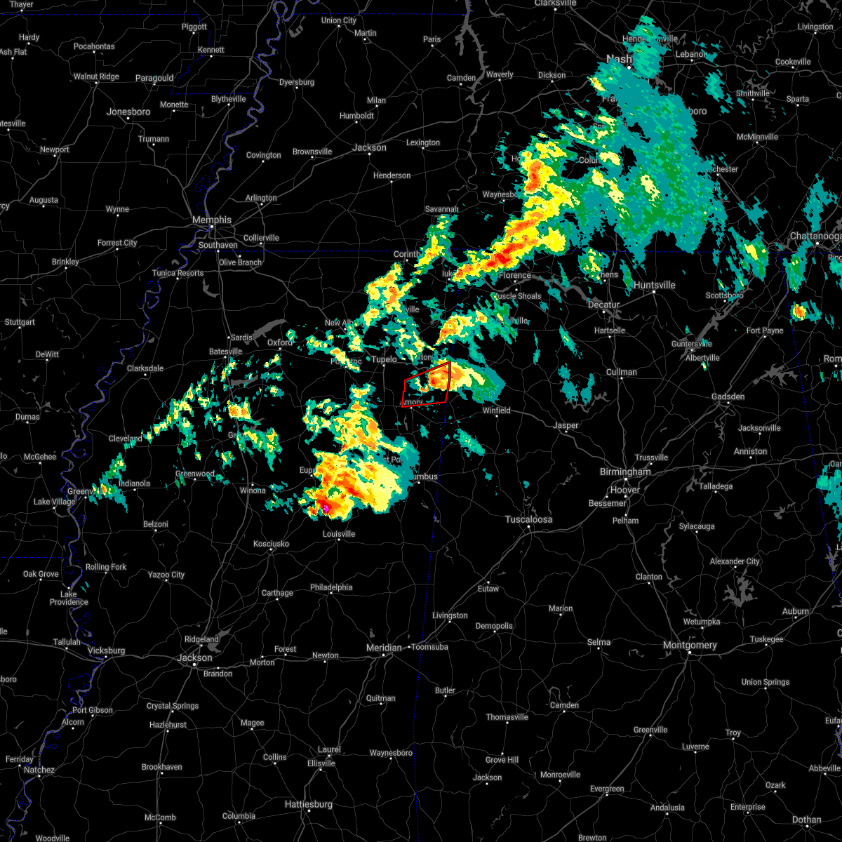 The tornado warning for southern itawamba and northeastern monroe counties will expire at 600 pm cst, the storm which prompted the warning has weakened below severe limits, and no longer appears capable of producing a tornado. therefore, the warning will be allowed to expire. however small hail and gusty winds are still possible with this thunderstorm. a tornado watch remains in effect until 900 pm cst for northeastern mississippi. The tornado warning for southern itawamba and northeastern monroe counties will expire at 600 pm cst, the storm which prompted the warning has weakened below severe limits, and no longer appears capable of producing a tornado. therefore, the warning will be allowed to expire. however small hail and gusty winds are still possible with this thunderstorm. a tornado watch remains in effect until 900 pm cst for northeastern mississippi.
|
| 3/9/2019 5:41 PM CST |
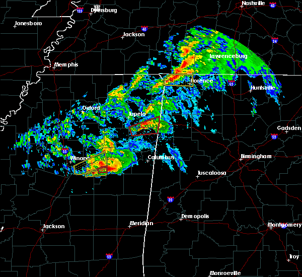 At 541 pm cst, doppler radar indicated a severe thunderstorm producing a tornado was located near smithville, or near amory, moving east at 55 mph (radar indicated rotation). Hazards include tornado. Flying debris will be dangerous to those caught without shelter. mobile homes will be damaged or destroyed. damage to roofs, windows, and vehicles will occur. tree damage is likely. Locations impacted include, amory, smithville, tremont, new salem, evergreen, bigbee, cardsville, turon, tilden, jacinto, cadamy and parham. At 541 pm cst, doppler radar indicated a severe thunderstorm producing a tornado was located near smithville, or near amory, moving east at 55 mph (radar indicated rotation). Hazards include tornado. Flying debris will be dangerous to those caught without shelter. mobile homes will be damaged or destroyed. damage to roofs, windows, and vehicles will occur. tree damage is likely. Locations impacted include, amory, smithville, tremont, new salem, evergreen, bigbee, cardsville, turon, tilden, jacinto, cadamy and parham.
|
| 3/9/2019 5:33 PM CST |
 At 531 pm cst, radar-indicated tornado located near new wren, or near amory, moving east at 55 mph (radar indicated rotation). Hazards include tornado and quarter size hail. Flying debris will be dangerous to those caught without shelter. mobile homes will be damaged or destroyed. damage to roofs, windows, and vehicles will occur. tree damage is likely. Locations impacted include, amory, shannon, smithville, tremont, new wren, new salem, evergreen, nettleton, hatley, cardsville, turon, tilden, wren, bigbee, jacinto, parham and cadamy. At 531 pm cst, radar-indicated tornado located near new wren, or near amory, moving east at 55 mph (radar indicated rotation). Hazards include tornado and quarter size hail. Flying debris will be dangerous to those caught without shelter. mobile homes will be damaged or destroyed. damage to roofs, windows, and vehicles will occur. tree damage is likely. Locations impacted include, amory, shannon, smithville, tremont, new wren, new salem, evergreen, nettleton, hatley, cardsville, turon, tilden, wren, bigbee, jacinto, parham and cadamy.
|
| 3/9/2019 5:11 PM CST |
 At 511 pm cst, doppler radar indicated a severe thunderstorm producing a tornado was located 7 miles northeast of houston, moving east at 55 mph (radar indicated rotation). Hazards include tornado and quarter size hail. Flying debris will be dangerous to those caught without shelter. mobile homes will be damaged or destroyed. damage to roofs, windows, and vehicles will occur. Tree damage is likely. At 511 pm cst, doppler radar indicated a severe thunderstorm producing a tornado was located 7 miles northeast of houston, moving east at 55 mph (radar indicated rotation). Hazards include tornado and quarter size hail. Flying debris will be dangerous to those caught without shelter. mobile homes will be damaged or destroyed. damage to roofs, windows, and vehicles will occur. Tree damage is likely.
|
| 2/23/2019 4:34 PM CST |
 At 434 pm cst, a severe thunderstorm was located near amory, moving east at 60 mph (radar indicated). Hazards include 60 mph wind gusts. Expect damage to roofs, siding, and trees. locations impacted include, amory, aberdeen, smithville, prairie, new salem, new wren, nettleton, hatley, gattman, quincy, turon, wise gap, wren, strong, muldon, binford, sipsey fork, new hamilton, becker and cardsville. A tornado watch remains in effect until 800 pm cst for northeastern mississippi. At 434 pm cst, a severe thunderstorm was located near amory, moving east at 60 mph (radar indicated). Hazards include 60 mph wind gusts. Expect damage to roofs, siding, and trees. locations impacted include, amory, aberdeen, smithville, prairie, new salem, new wren, nettleton, hatley, gattman, quincy, turon, wise gap, wren, strong, muldon, binford, sipsey fork, new hamilton, becker and cardsville. A tornado watch remains in effect until 800 pm cst for northeastern mississippi.
|
| 2/23/2019 4:32 PM CST |
 At 432 pm cst, doppler radar indicated a severe thunderstorm producing a tornado was located near amory, moving northeast at 65 mph (radar indicated rotation). Hazards include tornado. Flying debris will be dangerous to those caught without shelter. mobile homes will be damaged or destroyed. damage to roofs, windows, and vehicles will occur. tree damage is likely. Locations impacted include, amory, smithville, new salem, hatley, sipsey fork, becker, quincy, cardsville, turon, splunge, bigbee, jacinto and parham. At 432 pm cst, doppler radar indicated a severe thunderstorm producing a tornado was located near amory, moving northeast at 65 mph (radar indicated rotation). Hazards include tornado. Flying debris will be dangerous to those caught without shelter. mobile homes will be damaged or destroyed. damage to roofs, windows, and vehicles will occur. tree damage is likely. Locations impacted include, amory, smithville, new salem, hatley, sipsey fork, becker, quincy, cardsville, turon, splunge, bigbee, jacinto and parham.
|
| 2/23/2019 4:22 PM CST |
 At 422 pm cst, doppler radar indicated a severe thunderstorm producing a tornado was located near new wren, or near aberdeen, moving northeast at 65 mph (radar indicated rotation). Hazards include tornado. Flying debris will be dangerous to those caught without shelter. mobile homes will be damaged or destroyed. damage to roofs, windows, and vehicles will occur. Tree damage is likely. At 422 pm cst, doppler radar indicated a severe thunderstorm producing a tornado was located near new wren, or near aberdeen, moving northeast at 65 mph (radar indicated rotation). Hazards include tornado. Flying debris will be dangerous to those caught without shelter. mobile homes will be damaged or destroyed. damage to roofs, windows, and vehicles will occur. Tree damage is likely.
|
| 2/23/2019 4:19 PM CST |
 At 418 pm cst, a severe thunderstorm was located over prairie, or near aberdeen, moving east at 60 mph (radar indicated). Hazards include 60 mph wind gusts. Expect damage to roofs, siding, and trees. locations impacted include, amory, aberdeen, okolona, shannon, smithville, prairie, new salem, new wren, nettleton, hatley, gattman, quincy, turon, egypt, wise gap, wren, strong, muldon, leotis and old union. A tornado watch remains in effect until 800 pm cst for northeastern mississippi. At 418 pm cst, a severe thunderstorm was located over prairie, or near aberdeen, moving east at 60 mph (radar indicated). Hazards include 60 mph wind gusts. Expect damage to roofs, siding, and trees. locations impacted include, amory, aberdeen, okolona, shannon, smithville, prairie, new salem, new wren, nettleton, hatley, gattman, quincy, turon, egypt, wise gap, wren, strong, muldon, leotis and old union. A tornado watch remains in effect until 800 pm cst for northeastern mississippi.
|
| 2/23/2019 4:13 PM CST |
 At 413 pm cst, a severe thunderstorm was located near prairie, or 10 miles west of aberdeen, moving northeast at 55 mph (radar indicated). Hazards include 60 mph wind gusts. expect damage to roofs, siding, and trees At 413 pm cst, a severe thunderstorm was located near prairie, or 10 miles west of aberdeen, moving northeast at 55 mph (radar indicated). Hazards include 60 mph wind gusts. expect damage to roofs, siding, and trees
|
| 12/31/2018 1:07 PM CST |
 At 107 pm cst, a severe thunderstorm was located over new wren, or near okolona, moving northeast at 70 mph (radar indicated). Hazards include 60 mph wind gusts. Expect damage to roofs, siding, and trees. locations impacted include, amory, smithville, tremont, new wren, new salem, nettleton, hatley, becker, cardsville, turon, tilden, splunge, wren, bigbee, jacinto, parham and cadamy. A tornado watch remains in effect until 700 pm cst for northeastern mississippi. At 107 pm cst, a severe thunderstorm was located over new wren, or near okolona, moving northeast at 70 mph (radar indicated). Hazards include 60 mph wind gusts. Expect damage to roofs, siding, and trees. locations impacted include, amory, smithville, tremont, new wren, new salem, nettleton, hatley, becker, cardsville, turon, tilden, splunge, wren, bigbee, jacinto, parham and cadamy. A tornado watch remains in effect until 700 pm cst for northeastern mississippi.
|
| 12/31/2018 12:59 PM CST |
 At 1259 pm cst, a severe thunderstorm was located near trebloc, or 9 miles south of okolona, moving northeast at 60 mph (radar indicated). Hazards include 60 mph wind gusts. expect damage to roofs, siding, and trees At 1259 pm cst, a severe thunderstorm was located near trebloc, or 9 miles south of okolona, moving northeast at 60 mph (radar indicated). Hazards include 60 mph wind gusts. expect damage to roofs, siding, and trees
|
| 7/6/2018 4:20 PM CDT | Several trees down in smithvill in monroe county MS, 0.2 miles ESE of Smithville, MS |
| 7/6/2018 3:39 PM CDT | Several trees down in smithville. one very large old oak tree uproote in monroe county MS, 0.2 miles ESE of Smithville, MS |
| 6/23/2018 6:22 AM CDT |
 At 622 am cdt, a severe thunderstorm was located near okolona, moving east at 40 mph (radar indicated). Hazards include 60 mph wind gusts. expect damage to roofs, siding, and trees At 622 am cdt, a severe thunderstorm was located near okolona, moving east at 40 mph (radar indicated). Hazards include 60 mph wind gusts. expect damage to roofs, siding, and trees
|
| 6/22/2018 12:02 AM CDT |
 At 1201 am cdt, severe thunderstorms were located along a line extending from near detroit to amory to 6 miles northeast of houston, moving southeast at 40 mph (radar indicated). Hazards include 60 mph wind gusts. Expect damage to roofs, siding, and trees. Locations impacted include, amory, aberdeen, okolona, shannon, smithville, new salem, new wren, houlka, nettleton, new houlka, hatley, gattman, quincy, turon, egypt, wise gap, wren, thelma, leotis and new hamilton. At 1201 am cdt, severe thunderstorms were located along a line extending from near detroit to amory to 6 miles northeast of houston, moving southeast at 40 mph (radar indicated). Hazards include 60 mph wind gusts. Expect damage to roofs, siding, and trees. Locations impacted include, amory, aberdeen, okolona, shannon, smithville, new salem, new wren, houlka, nettleton, new houlka, hatley, gattman, quincy, turon, egypt, wise gap, wren, thelma, leotis and new hamilton.
|
| 6/21/2018 11:48 PM CDT |
 At 1148 pm cdt, severe thunderstorms were located along a line extending from near fulton, to 7 miles east of shannon, to 6 miles northeast of houston, moving southeast at 40 mph (radar indicated). Hazards include 60 mph wind gusts. Expect damage to roofs, siding, and trees. Locations impacted include, tupelo, amory, aberdeen, fulton, verona, okolona, tombigbee state park, shannon, plantersville, mantachie, smithville, tremont, prairie, fairview, new salem, new wren, houlka, evergreen, clay and nettleton. At 1148 pm cdt, severe thunderstorms were located along a line extending from near fulton, to 7 miles east of shannon, to 6 miles northeast of houston, moving southeast at 40 mph (radar indicated). Hazards include 60 mph wind gusts. Expect damage to roofs, siding, and trees. Locations impacted include, tupelo, amory, aberdeen, fulton, verona, okolona, tombigbee state park, shannon, plantersville, mantachie, smithville, tremont, prairie, fairview, new salem, new wren, houlka, evergreen, clay and nettleton.
|
| 6/21/2018 11:30 PM CDT |
 At 1129 pm cdt, severe thunderstorms were located along a line extending from near mantachie to near houlka, moving southeast at 40 mph (radar indicated). Hazards include 60 mph wind gusts. expect damage to roofs, siding, and trees At 1129 pm cdt, severe thunderstorms were located along a line extending from near mantachie to near houlka, moving southeast at 40 mph (radar indicated). Hazards include 60 mph wind gusts. expect damage to roofs, siding, and trees
|
| 6/21/2018 11:12 PM CDT |
 At 1112 pm cdt, a severe thunderstorm was located over new salem, or near fulton, moving southeast at 35 mph (radar indicated). Hazards include 60 mph wind gusts. Expect damage to roofs, siding, and trees. Locations impacted include, fulton, smithville, tremont, new salem, evergreen, abney, sipsey fork, cardsville, turon, tilden, splunge, ballardsville, dorsey, jacinto, parham and cadamy. At 1112 pm cdt, a severe thunderstorm was located over new salem, or near fulton, moving southeast at 35 mph (radar indicated). Hazards include 60 mph wind gusts. Expect damage to roofs, siding, and trees. Locations impacted include, fulton, smithville, tremont, new salem, evergreen, abney, sipsey fork, cardsville, turon, tilden, splunge, ballardsville, dorsey, jacinto, parham and cadamy.
|
| 6/21/2018 10:53 PM CDT |
 At 1052 pm cdt, a severe thunderstorm was located near evergreen, or near fulton, moving southeast at 35 mph (radar indicated). Hazards include 60 mph wind gusts. expect damage to roofs, siding, and trees At 1052 pm cdt, a severe thunderstorm was located near evergreen, or near fulton, moving southeast at 35 mph (radar indicated). Hazards include 60 mph wind gusts. expect damage to roofs, siding, and trees
|
| 5/19/2018 4:30 PM CDT |
 At 430 pm cdt, a severe thunderstorm was located over sulligent, moving east at 35 mph (radar indicated). Hazards include 60 mph wind gusts and quarter size hail. Hail damage to vehicles is expected. expect wind damage to roofs, siding, and trees. Locations impacted include, amory, smithville, hatley, gattman, new hamilton, sipsey fork, becker, quincy, splunge, wise gap, athens, greenwood springs and parham. At 430 pm cdt, a severe thunderstorm was located over sulligent, moving east at 35 mph (radar indicated). Hazards include 60 mph wind gusts and quarter size hail. Hail damage to vehicles is expected. expect wind damage to roofs, siding, and trees. Locations impacted include, amory, smithville, hatley, gattman, new hamilton, sipsey fork, becker, quincy, splunge, wise gap, athens, greenwood springs and parham.
|
| 5/19/2018 4:10 PM CDT |
 At 410 pm cdt, a severe thunderstorm was located 8 miles east of amory, moving east at 35 mph (radar indicated). Hazards include 60 mph wind gusts and quarter size hail. Hail damage to vehicles is expected. Expect wind damage to roofs, siding, and trees. At 410 pm cdt, a severe thunderstorm was located 8 miles east of amory, moving east at 35 mph (radar indicated). Hazards include 60 mph wind gusts and quarter size hail. Hail damage to vehicles is expected. Expect wind damage to roofs, siding, and trees.
|
| 4/14/2018 6:39 AM CDT |
 At 639 am cdt, a severe thunderstorm was located over fulton, moving east at 30 mph (radar indicated). Hazards include 60 mph wind gusts. expect damage to roofs, siding, and trees At 639 am cdt, a severe thunderstorm was located over fulton, moving east at 30 mph (radar indicated). Hazards include 60 mph wind gusts. expect damage to roofs, siding, and trees
|
| 4/3/2018 9:20 PM CDT | Tree down along highway 25 in monroe county MS, 0.8 miles SSE of Smithville, MS |
| 4/3/2018 9:07 PM CDT |
 At 907 pm cdt, severe thunderstorms were located along a line extending from near evergreen to near okolona to near montpelier, moving east at 60 mph (radar indicated). Hazards include 60 mph wind gusts. Expect damage to roofs, siding, and trees. Locations impacted include, tupelo, amory, aberdeen, houston, verona, okolona, tombigbee state park, shannon, plantersville, smithville, prairie, troy, new salem, new wren, trebloc, furrs, houlka, evergreen, nettleton and new houlka. At 907 pm cdt, severe thunderstorms were located along a line extending from near evergreen to near okolona to near montpelier, moving east at 60 mph (radar indicated). Hazards include 60 mph wind gusts. Expect damage to roofs, siding, and trees. Locations impacted include, tupelo, amory, aberdeen, houston, verona, okolona, tombigbee state park, shannon, plantersville, smithville, prairie, troy, new salem, new wren, trebloc, furrs, houlka, evergreen, nettleton and new houlka.
|
| 4/3/2018 8:50 PM CDT |
 At 850 pm cdt, severe thunderstorms were located along a line extending from 6 miles south of pontotoc to near houston to near clarkson, moving east at 55 mph (radar indicated). Hazards include 60 mph wind gusts. expect damage to roofs, siding, and trees At 850 pm cdt, severe thunderstorms were located along a line extending from 6 miles south of pontotoc to near houston to near clarkson, moving east at 55 mph (radar indicated). Hazards include 60 mph wind gusts. expect damage to roofs, siding, and trees
|
| 3/28/2018 9:33 PM CDT |
 At 932 pm cdt, a severe thunderstorm was located near aberdeen, moving northeast at 60 mph (radar indicated). Hazards include 60 mph wind gusts and quarter size hail. Hail damage to vehicles is expected. expect wind damage to roofs, siding, and trees. locations impacted include, amory, aberdeen, smithville, prairie, new wren, hatley, gattman, new hamilton, binford, sipsey fork, becker, quincy, splunge, wise gap, athens, wren, strong, east aberdeen, bigbee and muldon. A tornado watch remains in effect until 1100 pm cdt for northeastern mississippi. At 932 pm cdt, a severe thunderstorm was located near aberdeen, moving northeast at 60 mph (radar indicated). Hazards include 60 mph wind gusts and quarter size hail. Hail damage to vehicles is expected. expect wind damage to roofs, siding, and trees. locations impacted include, amory, aberdeen, smithville, prairie, new wren, hatley, gattman, new hamilton, binford, sipsey fork, becker, quincy, splunge, wise gap, athens, wren, strong, east aberdeen, bigbee and muldon. A tornado watch remains in effect until 1100 pm cdt for northeastern mississippi.
|
| 3/28/2018 9:10 PM CDT |
 At 909 pm cdt, a severe thunderstorm was located over griffith, or near montpelier, moving northeast at 55 mph (radar indicated). Hazards include 70 mph wind gusts and quarter size hail. Hail damage to vehicles is expected. expect considerable tree damage. Wind damage is also likely to mobile homes, roofs, and outbuildings. At 909 pm cdt, a severe thunderstorm was located over griffith, or near montpelier, moving northeast at 55 mph (radar indicated). Hazards include 70 mph wind gusts and quarter size hail. Hail damage to vehicles is expected. expect considerable tree damage. Wind damage is also likely to mobile homes, roofs, and outbuildings.
|
| 5/28/2017 1:38 AM CDT |
 At 138 am cdt, a severe thunderstorm was located near evergreen, or 9 miles northwest of amory, moving southeast at 25 mph (radar indicated). Hazards include 60 mph wind gusts. expect damage to roofs, siding, and trees At 138 am cdt, a severe thunderstorm was located near evergreen, or 9 miles northwest of amory, moving southeast at 25 mph (radar indicated). Hazards include 60 mph wind gusts. expect damage to roofs, siding, and trees
|
| 5/28/2017 12:56 AM CDT |
 At 1256 am cdt, a severe thunderstorm was located near fulton, moving southeast at 65 mph (radar indicated). Hazards include 70 mph wind gusts. Expect considerable tree damage. Damage is likely to mobile homes, roofs, and outbuildings. At 1256 am cdt, a severe thunderstorm was located near fulton, moving southeast at 65 mph (radar indicated). Hazards include 70 mph wind gusts. Expect considerable tree damage. Damage is likely to mobile homes, roofs, and outbuildings.
|
| 4/22/2017 2:45 PM CDT |
 At 245 pm cdt, a severe thunderstorm was located near houston, moving northeast at 45 mph (radar indicated). Hazards include 60 mph wind gusts and half dollar size hail. Hail damage to vehicles is expected. Expect wind damage to roofs, siding, and trees. At 245 pm cdt, a severe thunderstorm was located near houston, moving northeast at 45 mph (radar indicated). Hazards include 60 mph wind gusts and half dollar size hail. Hail damage to vehicles is expected. Expect wind damage to roofs, siding, and trees.
|
| 3/9/2017 7:22 PM CST |
 At 722 pm cst, a severe thunderstorm was located near smithville, or near amory, moving east at 60 mph (trained weather spotters reported golfball size hail within the past few minutes in amory). Hazards include golf ball size hail and 60 mph wind gusts. People and animals outdoors will be injured. expect hail damage to roofs, siding, windows, and vehicles. expect wind damage to roofs, siding, and trees. Locations impacted include, amory, smithville, hatley, parham and turon. At 722 pm cst, a severe thunderstorm was located near smithville, or near amory, moving east at 60 mph (trained weather spotters reported golfball size hail within the past few minutes in amory). Hazards include golf ball size hail and 60 mph wind gusts. People and animals outdoors will be injured. expect hail damage to roofs, siding, windows, and vehicles. expect wind damage to roofs, siding, and trees. Locations impacted include, amory, smithville, hatley, parham and turon.
|
| 3/9/2017 7:15 PM CST |
 At 715 pm cst, a severe thunderstorm was located over new wren, or near amory, moving east at 45 mph (radar indicated). Hazards include 60 mph wind gusts and half dollar size hail. Hail damage to vehicles is expected. Expect wind damage to roofs, siding, and trees. At 715 pm cst, a severe thunderstorm was located over new wren, or near amory, moving east at 45 mph (radar indicated). Hazards include 60 mph wind gusts and half dollar size hail. Hail damage to vehicles is expected. Expect wind damage to roofs, siding, and trees.
|
| 3/9/2017 6:35 PM CST | Quarter sized hail reported 0.2 miles ESE of Smithville, MS, one inch hail between new salem and smithville. |
| 3/1/2017 1:12 PM CST |
 The severe thunderstorm warning for northeastern chickasaw, southern itawamba, southeastern lee and northern monroe counties will expire at 115 pm cst, the storm which prompted the warning has weakened below severe limits, and has exited the warned area. therefore, the warning will be allowed to expire. a tornado watch remains in effect until 600 pm cst for northeastern mississippi. The severe thunderstorm warning for northeastern chickasaw, southern itawamba, southeastern lee and northern monroe counties will expire at 115 pm cst, the storm which prompted the warning has weakened below severe limits, and has exited the warned area. therefore, the warning will be allowed to expire. a tornado watch remains in effect until 600 pm cst for northeastern mississippi.
|
| 3/1/2017 12:36 PM CST |
 At 1236 pm cst, a severe thunderstorm was located near new wren, or near okolona, moving east at 40 mph (radar indicated). Hazards include 60 mph wind gusts. expect damage to roofs, siding, and trees At 1236 pm cst, a severe thunderstorm was located near new wren, or near okolona, moving east at 40 mph (radar indicated). Hazards include 60 mph wind gusts. expect damage to roofs, siding, and trees
|
| 12/18/2016 1:03 AM CST |
 At 102 am cst, a severe thunderstorm was located near amory, moving northeast at 65 mph (radar indicated). Hazards include 60 mph wind gusts. Expect damage to roofs, siding, and trees. locations impacted include, amory, aberdeen, smithville, prairie, new wren, new salem, hatley, gattman, parham, athens, bigbee, quincy, becker, wise gap, sipsey fork, greenwood springs, wren, turon, splunge and east aberdeen. A tornado watch remains in effect until 300 am cst for northeastern mississippi. At 102 am cst, a severe thunderstorm was located near amory, moving northeast at 65 mph (radar indicated). Hazards include 60 mph wind gusts. Expect damage to roofs, siding, and trees. locations impacted include, amory, aberdeen, smithville, prairie, new wren, new salem, hatley, gattman, parham, athens, bigbee, quincy, becker, wise gap, sipsey fork, greenwood springs, wren, turon, splunge and east aberdeen. A tornado watch remains in effect until 300 am cst for northeastern mississippi.
|
| 12/18/2016 12:59 AM CST |
 At 1258 am cst, a severe thunderstorm was located near smithville, or near amory, moving northeast at 55 mph (radar indicated). Hazards include 60 mph wind gusts. Expect damage to roofs, siding, and trees. locations impacted include, amory, aberdeen, houston, okolona, smithville, new wren, trebloc, prairie, new salem, nettleton, hatley, woodland, gattman, athens, sparta, becker, mc condy, leotis, wren and splunge. A tornado watch remains in effect until 300 am cst for northeastern mississippi. At 1258 am cst, a severe thunderstorm was located near smithville, or near amory, moving northeast at 55 mph (radar indicated). Hazards include 60 mph wind gusts. Expect damage to roofs, siding, and trees. locations impacted include, amory, aberdeen, houston, okolona, smithville, new wren, trebloc, prairie, new salem, nettleton, hatley, woodland, gattman, athens, sparta, becker, mc condy, leotis, wren and splunge. A tornado watch remains in effect until 300 am cst for northeastern mississippi.
|
| 12/18/2016 12:27 AM CST |
 At 1227 am cst, a severe thunderstorm was located near houston, moving northeast at 55 mph (radar indicated). Hazards include 60 mph wind gusts. expect damage to roofs, siding, and trees At 1227 am cst, a severe thunderstorm was located near houston, moving northeast at 55 mph (radar indicated). Hazards include 60 mph wind gusts. expect damage to roofs, siding, and trees
|
| 11/29/2016 6:16 PM CST |
 At 616 pm cst, a severe thunderstorm was located near prairie, or 11 miles west of aberdeen, moving northeast at 45 mph (trained weather spotters). Hazards include golf ball size hail and 60 mph wind gusts. People and animals outdoors will be injured. expect hail damage to roofs, siding, windows, and vehicles. expect wind damage to roofs, siding, and trees. locations impacted include, amory, aberdeen, smithville, prairie, hatley, gattman, parham, athens, quincy, becker, binford, wise gap, muldon, greenwood springs and east aberdeen. A tornado watch remains in effect until 1100 pm cst for northeastern mississippi. At 616 pm cst, a severe thunderstorm was located near prairie, or 11 miles west of aberdeen, moving northeast at 45 mph (trained weather spotters). Hazards include golf ball size hail and 60 mph wind gusts. People and animals outdoors will be injured. expect hail damage to roofs, siding, windows, and vehicles. expect wind damage to roofs, siding, and trees. locations impacted include, amory, aberdeen, smithville, prairie, hatley, gattman, parham, athens, quincy, becker, binford, wise gap, muldon, greenwood springs and east aberdeen. A tornado watch remains in effect until 1100 pm cst for northeastern mississippi.
|
| 11/29/2016 6:01 PM CST |
 At 601 pm cst, a severe thunderstorm was located over montpelier, moving northeast at 45 mph (radar indicated). Hazards include 60 mph wind gusts and quarter size hail. Hail damage to vehicles is expected. Expect wind damage to roofs, siding, and trees. At 601 pm cst, a severe thunderstorm was located over montpelier, moving northeast at 45 mph (radar indicated). Hazards include 60 mph wind gusts and quarter size hail. Hail damage to vehicles is expected. Expect wind damage to roofs, siding, and trees.
|
| 11/28/2016 4:56 PM CST |
 At 456 pm cst, a severe thunderstorm was located over tremont, or 8 miles east of fulton, moving northeast at 55 mph (radar indicated). Hazards include 60 mph wind gusts. Expect damage to roofs. siding. and trees. Locations impacted include, smithville, new salem, turon, cardsville and cadamy. At 456 pm cst, a severe thunderstorm was located over tremont, or 8 miles east of fulton, moving northeast at 55 mph (radar indicated). Hazards include 60 mph wind gusts. Expect damage to roofs. siding. and trees. Locations impacted include, smithville, new salem, turon, cardsville and cadamy.
|
| 11/28/2016 4:45 PM CST | Multiple trees down between amory and smithvill in monroe county MS, 2.8 miles NE of Smithville, MS |
| 11/28/2016 4:43 PM CST |
 At 443 pm cst, a severe thunderstorm was located near evergreen, or 8 miles south of fulton, moving northeast at 55 mph (radar indicated). Hazards include 60 mph wind gusts. Expect damage to roofs. siding. And trees. At 443 pm cst, a severe thunderstorm was located near evergreen, or 8 miles south of fulton, moving northeast at 55 mph (radar indicated). Hazards include 60 mph wind gusts. Expect damage to roofs. siding. And trees.
|
| 6/17/2016 1:31 PM CDT |
 At 130 pm cdt, a severe thunderstorm was located near new salem, or 9 miles south of fulton, moving south at 40 mph (radar indicated). Hazards include 70 mph wind gusts and quarter size hail. Hail damage to vehicles is expected. expect considerable tree damage. Wind damage is also likely to mobile homes, roofs, and outbuildings. At 130 pm cdt, a severe thunderstorm was located near new salem, or 9 miles south of fulton, moving south at 40 mph (radar indicated). Hazards include 70 mph wind gusts and quarter size hail. Hail damage to vehicles is expected. expect considerable tree damage. Wind damage is also likely to mobile homes, roofs, and outbuildings.
|
| 4/29/2016 4:08 PM CDT |
 The tornado warning for northeastern monroe county will expire at 415 pm cdt, the storm which prompted the warning has weakened below severe limits and exited the warned area. therefore the warning will be allowed to expire. The tornado warning for northeastern monroe county will expire at 415 pm cdt, the storm which prompted the warning has weakened below severe limits and exited the warned area. therefore the warning will be allowed to expire.
|
| 4/29/2016 3:42 PM CDT |
 At 342 pm cdt, a severe thunderstorm producing a tornado was located near amory, moving east at 50 mph (radar indicated rotation). Hazards include tornado. Flying debris will be dangerous to those caught without shelter. mobile homes will be damaged or destroyed. damage to roofs, windows, and vehicles will occur. tree damage is likely. This tornadic thunderstorm will remain over mainly rural areas of northeastern monroe county, including the following locations, sipsey fork, parham, greenwood springs, athens, bigbee, hatley, gattman, quincy, becker and splunge. At 342 pm cdt, a severe thunderstorm producing a tornado was located near amory, moving east at 50 mph (radar indicated rotation). Hazards include tornado. Flying debris will be dangerous to those caught without shelter. mobile homes will be damaged or destroyed. damage to roofs, windows, and vehicles will occur. tree damage is likely. This tornadic thunderstorm will remain over mainly rural areas of northeastern monroe county, including the following locations, sipsey fork, parham, greenwood springs, athens, bigbee, hatley, gattman, quincy, becker and splunge.
|
| 4/29/2016 3:31 PM CDT |
 At 330 pm cdt, a severe thunderstorm producing a tornado was located over new wren, or near amory, moving east at 50 mph (radar indicated rotation). Hazards include tornado and quarter size hail. Flying debris will be dangerous to those caught without shelter. mobile homes will be damaged or destroyed. damage to roofs, windows, and vehicles will occur. tree damage is likely. this dangerous storm will be near, amory around 340 pm cdt. Other locations impacted by this tornadic thunderstorm include sipsey fork, parham, greenwood springs, athens, bigbee, hatley, wren, gattman, quincy and becker. At 330 pm cdt, a severe thunderstorm producing a tornado was located over new wren, or near amory, moving east at 50 mph (radar indicated rotation). Hazards include tornado and quarter size hail. Flying debris will be dangerous to those caught without shelter. mobile homes will be damaged or destroyed. damage to roofs, windows, and vehicles will occur. tree damage is likely. this dangerous storm will be near, amory around 340 pm cdt. Other locations impacted by this tornadic thunderstorm include sipsey fork, parham, greenwood springs, athens, bigbee, hatley, wren, gattman, quincy and becker.
|
| 4/29/2016 3:03 PM CDT |
 At 302 pm cdt, a severe thunderstorm was located 7 miles northeast of houston, moving east at 40 mph (radar indicated). Hazards include 70 mph wind gusts. Expect considerable tree damage. Damage is likely to mobile homes, roofs, and outbuildings. At 302 pm cdt, a severe thunderstorm was located 7 miles northeast of houston, moving east at 40 mph (radar indicated). Hazards include 70 mph wind gusts. Expect considerable tree damage. Damage is likely to mobile homes, roofs, and outbuildings.
|
| 3/31/2016 6:26 PM CDT |
 At 626 pm cdt, a severe thunderstorm was located over amory, moving northeast at 55 mph (radar indicated). Hazards include 60 mph wind gusts and half dollar size hail. Hail damage to vehicles is expected. expect wind damage to roofs, siding, and trees. locations impacted include, amory, aberdeen, smithville, new wren, nettleton, hatley, gattman, parham, athens, bigbee, quincy, becker, wise gap, sipsey fork, greenwood springs, wren and splunge. A tornado watch remains in effect until 1000 pm cdt for northeastern mississippi. At 626 pm cdt, a severe thunderstorm was located over amory, moving northeast at 55 mph (radar indicated). Hazards include 60 mph wind gusts and half dollar size hail. Hail damage to vehicles is expected. expect wind damage to roofs, siding, and trees. locations impacted include, amory, aberdeen, smithville, new wren, nettleton, hatley, gattman, parham, athens, bigbee, quincy, becker, wise gap, sipsey fork, greenwood springs, wren and splunge. A tornado watch remains in effect until 1000 pm cdt for northeastern mississippi.
|
| 3/31/2016 6:10 PM CDT |
 At 609 pm cdt, a severe thunderstorm was located over prairie, or near aberdeen, moving northeast at 45 mph (radar indicated). Hazards include golf ball size hail and 60 mph wind gusts. People and animals outdoors will be injured. expect hail damage to roofs, siding, windows, and vehicles. expect wind damage to roofs, siding, and trees. locations impacted include, amory, aberdeen, smithville, prairie, new wren, nettleton, hatley, gattman, parham, athens, bigbee, strong, new hamilton, quincy, becker, binford, wise gap, muldon, sipsey fork and greenwood springs. A tornado watch remains in effect until 1000 pm cdt for northeastern mississippi. At 609 pm cdt, a severe thunderstorm was located over prairie, or near aberdeen, moving northeast at 45 mph (radar indicated). Hazards include golf ball size hail and 60 mph wind gusts. People and animals outdoors will be injured. expect hail damage to roofs, siding, windows, and vehicles. expect wind damage to roofs, siding, and trees. locations impacted include, amory, aberdeen, smithville, prairie, new wren, nettleton, hatley, gattman, parham, athens, bigbee, strong, new hamilton, quincy, becker, binford, wise gap, muldon, sipsey fork and greenwood springs. A tornado watch remains in effect until 1000 pm cdt for northeastern mississippi.
|
| 3/31/2016 5:53 PM CDT |
 At 553 pm cdt, a severe thunderstorm was located over pala alto, or 9 miles northwest of west point, moving northeast at 55 mph (radar indicated). Hazards include golf ball size hail and 60 mph wind gusts. People and animals outdoors will be injured. expect hail damage to roofs, siding, windows, and vehicles. Expect wind damage to roofs, siding, and trees. At 553 pm cdt, a severe thunderstorm was located over pala alto, or 9 miles northwest of west point, moving northeast at 55 mph (radar indicated). Hazards include golf ball size hail and 60 mph wind gusts. People and animals outdoors will be injured. expect hail damage to roofs, siding, windows, and vehicles. Expect wind damage to roofs, siding, and trees.
|
| 12/25/2015 7:56 AM CST |
 The severe thunderstorm warning for southeastern itawamba and northeastern monroe counties will expire at 800 am cst, the severe thunderstorm which prompted the warning has weakened. therefore the warning will be allowed to expire. The severe thunderstorm warning for southeastern itawamba and northeastern monroe counties will expire at 800 am cst, the severe thunderstorm which prompted the warning has weakened. therefore the warning will be allowed to expire.
|
| 12/25/2015 7:43 AM CST |
 At 743 am cst, a severe thunderstorm was located near detroit, or 14 miles west of hamilton, moving northeast at 55 mph (radar indicated). Hazards include 60 mph wind gusts and penny size hail. Expect damage to roofs. siding and trees. Locations impacted include, amory, smithville, tremont, new salem, hatley, gattman, parham, athens, quincy, wise gap, sipsey fork, greenwood springs, turon, cadamy and splunge. At 743 am cst, a severe thunderstorm was located near detroit, or 14 miles west of hamilton, moving northeast at 55 mph (radar indicated). Hazards include 60 mph wind gusts and penny size hail. Expect damage to roofs. siding and trees. Locations impacted include, amory, smithville, tremont, new salem, hatley, gattman, parham, athens, quincy, wise gap, sipsey fork, greenwood springs, turon, cadamy and splunge.
|
| 12/25/2015 7:15 AM CST |
 At 715 am cst, a severe thunderstorm was located near new wren, or near aberdeen, moving northeast at 55 mph (radar indicated). Hazards include 60 mph wind gusts and penny size hail. Expect damage to roofs. Siding and trees. At 715 am cst, a severe thunderstorm was located near new wren, or near aberdeen, moving northeast at 55 mph (radar indicated). Hazards include 60 mph wind gusts and penny size hail. Expect damage to roofs. Siding and trees.
|
| 8/7/2015 10:23 AM CDT |
 At 1022 am cdt, a severe thunderstorm was located near houlka, or 8 miles northeast of houston, moving southeast at 55 mph (emergency management. at 10 am...lafayette county emergency management reported trees down near oxford). Hazards include 60 mph wind gusts. Expect damage to roofs. Siding and trees. At 1022 am cdt, a severe thunderstorm was located near houlka, or 8 miles northeast of houston, moving southeast at 55 mph (emergency management. at 10 am...lafayette county emergency management reported trees down near oxford). Hazards include 60 mph wind gusts. Expect damage to roofs. Siding and trees.
|
| 7/14/2015 6:57 PM CDT |
 At 656 pm cdt, a severe thunderstorm was located over amory, moving southeast at 40 mph (radar indicated). Hazards include 60 mph wind gusts. Expect damage to roofs. Siding and trees. At 656 pm cdt, a severe thunderstorm was located over amory, moving southeast at 40 mph (radar indicated). Hazards include 60 mph wind gusts. Expect damage to roofs. Siding and trees.
|
| 7/14/2015 6:45 PM CDT |
 At 645 pm cdt, a severe thunderstorm was located near new salem, or 11 miles southeast of fulton, moving southeast at 45 mph (trained weather spotters). Hazards include 60 mph wind gusts. Expect damage to roofs. siding and trees. Locations impacted include, tupelo, amory, aberdeen, fulton, verona, okolona, tombigbee state park, shannon, plantersville, smithville, tremont, new wren, evergreen, prairie, new salem, clay, nettleton, hatley, gattman and eastman. At 645 pm cdt, a severe thunderstorm was located near new salem, or 11 miles southeast of fulton, moving southeast at 45 mph (trained weather spotters). Hazards include 60 mph wind gusts. Expect damage to roofs. siding and trees. Locations impacted include, tupelo, amory, aberdeen, fulton, verona, okolona, tombigbee state park, shannon, plantersville, smithville, tremont, new wren, evergreen, prairie, new salem, clay, nettleton, hatley, gattman and eastman.
|
| 7/14/2015 6:10 PM CDT |
 At 609 pm cdt, a severe thunderstorm was located over pratts friendship, or near baldwyn, moving southeast at 45 mph (radar indicated). Hazards include 60 mph wind gusts. Expect damage to roofs. Siding and trees. At 609 pm cdt, a severe thunderstorm was located over pratts friendship, or near baldwyn, moving southeast at 45 mph (radar indicated). Hazards include 60 mph wind gusts. Expect damage to roofs. Siding and trees.
|
| 6/24/2015 12:02 AM CDT |
 At 1202 am cdt, a severe thunderstorm was located near new salem, or 9 miles southeast of fulton, moving south at 50 mph (radar indicated). Hazards include 60 mph wind gusts. Expect damage to roofs. Siding and trees. At 1202 am cdt, a severe thunderstorm was located near new salem, or 9 miles southeast of fulton, moving south at 50 mph (radar indicated). Hazards include 60 mph wind gusts. Expect damage to roofs. Siding and trees.
|
| 5/27/2015 4:26 PM CDT | The severe thunderstorm warning for itawamba, northern monroe, southeastern prentiss, eastern lee and south central tishomingo counties will expire at 430 pm cdt, the storm which prompted the warning has moved out of the area. therefore the warning will be allowed to expire. |
| 5/27/2015 3:45 PM CDT | At 344 pm cdt, a severe thunderstorm was located near amory, moving east at 45 mph (radar indicated). Hazards include 60 mph wind gusts and quarter size hail. Hail damage to vehicles is expected. Expect wind damage to roofs, siding and trees. |
| 5/25/2015 9:26 AM CDT | The severe thunderstorm warning for southern itawamba and eastern monroe counties will expire at 930 am cdt, the storms which prompted the warning have moved out of the area. therefore the warning will be allowed to expire. to report severe weather, contact your nearest law enforcement agency. they will relay your report to the national weather service memphis. |
| 5/25/2015 9:05 AM CDT | At 904 am cdt, severe thunderstorms were located along a line extending from near new salem to near detroit, moving northeast at 45 mph (radar indicated). Hazards include 60 mph wind gusts. Expect damage to roofs. siding and trees. Locations impacted include, amory, smithville, tremont, new salem, hatley, gattman, tilden, jacinto, parham, athens, bigbee, new hamilton, quincy, becker, wise gap, cardsville, sipsey fork, greenwood springs, turon and cadamy. |
| 5/25/2015 9:00 AM CDT | At 900 am cdt, a severe thunderstorm producing a tornado was located near smithville, or near amory, moving northeast at 45 mph (radar indicated rotation). Hazards include tornado and quarter size hail. Flying debris will be dangerous to those caught without shelter. mobile homes will be damaged or destroyed. damage to roofs, windows and vehicles will occur. tree damage is likely. this dangerous storm will be near, new salem around 910 am cdt. tremont around 915 am cdt. Other locations impacted by this tornadic thunderstorm include bounds crossroads, tilden, turon, cardsville and cadamy. |
| 5/25/2015 8:50 AM CDT | At 850 am cdt, a severe thunderstorm producing a tornado was located over new wren, or near amory, moving northeast at 30 mph (radar indicated rotation). Hazards include tornado and quarter size hail. Flying debris will be dangerous to those caught without shelter. mobile homes will be damaged or destroyed. damage to roofs, windows and vehicles will occur. tree damage is likely. this dangerous storm will be near, amory around 905 am cdt. smithville and new salem around 915 am cdt. Other locations impacted by this tornadic thunderstorm include tilden, cardsville, jacinto, parham, bigbee, hatley, bounds crossroads, wren, turon and cadamy. |
| 5/25/2015 8:41 AM CDT | At 841 am cdt, severe thunderstorms were located along a line extending from near new wren to near amory to 8 miles northwest of caledonia, moving northeast at 50 mph (radar indicated). Hazards include 60 mph wind gusts. Expect damage to roofs. Siding and trees. |
| 5/25/2015 8:35 AM CDT | At 835 am cdt, a severe thunderstorm producing a tornado was located near prairie, or 8 miles northwest of aberdeen, moving northeast at 45 mph (radar indicated rotation). Hazards include tornado and quarter size hail. Flying debris will be dangerous to those caught without shelter. mobile homes will be damaged or destroyed. damage to roofs, windows and vehicles will occur. tree damage is likely. this dangerous storm will be near, new wren around 845 am cdt. amory around 855 am cdt. smithville around 900 am cdt. new salem around 910 am cdt. tremont around 915 am cdt. Other locations impacted by this tornadic thunderstorm include egypt, tilden, cardsville, jacinto, parham, bigbee, hatley, bounds crossroads, wren and turon. |
| 5/25/2015 8:25 AM CDT | At 825 am cdt, severe thunderstorms were located along a line extending from 6 miles northeast of trebloc to near prairie to near west point, moving northeast at 50 mph (radar indicated). Hazards include 60 mph wind gusts. Expect damage to roofs. siding and trees. Locations impacted include, amory, aberdeen, columbus afb, smithville, new wren, trebloc, prairie, hatley, gattman, athens, strong, new hamilton, sparta, becker, mc condy, muldon, wren, splunge, parham and bigbee. |
| 5/25/2015 8:00 AM CDT | At 759 am cdt, severe thunderstorms were located along a line extending from near montpelier to near starkville, moving northeast at 40 mph (radar indicated). Hazards include 60 mph wind gusts. Expect damage to roofs. Siding and trees. |
| 5/20/2015 5:16 PM CDT | Quarter sized hail reported 2 miles N of Smithville, MS, public reports of quarter and dime sized hail near smithville... reports via social media |
| 4/20/2015 12:21 AM CDT | At 1221 am cdt, a severe thunderstorm was located near amory, moving northeast at 55 mph (radar indicated). Hazards include 60 mph wind gusts. Expect damage to roofs. Siding and trees. |
| 8/6/2013 3:00 PM CDT | Trees down across the county road between smithville and hatle in monroe county MS, 0.2 miles ESE of Smithville, MS |
| 1/1/0001 12:00 AM | Multiple trees down in smithville in monroe county MS, 0.2 miles ESE of Smithville, MS |
| 1/1/0001 12:00 AM | Several trees down over northern monroe count in monroe county MS, 0.2 miles ESE of Smithville, MS |
Hail Maps for Smithville, MS
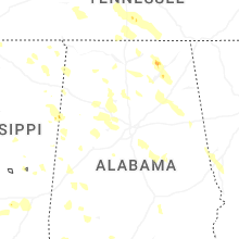

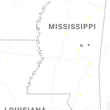


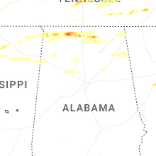
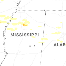


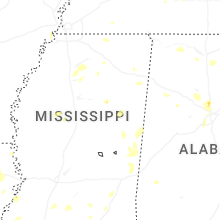


Connect with Interactive Hail Maps