

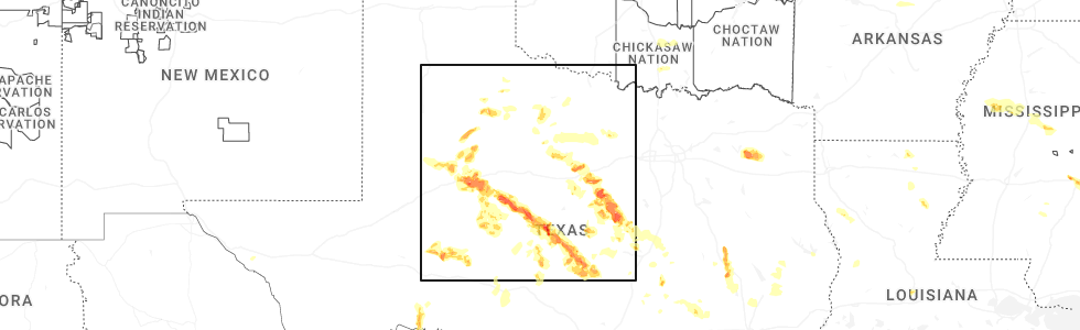
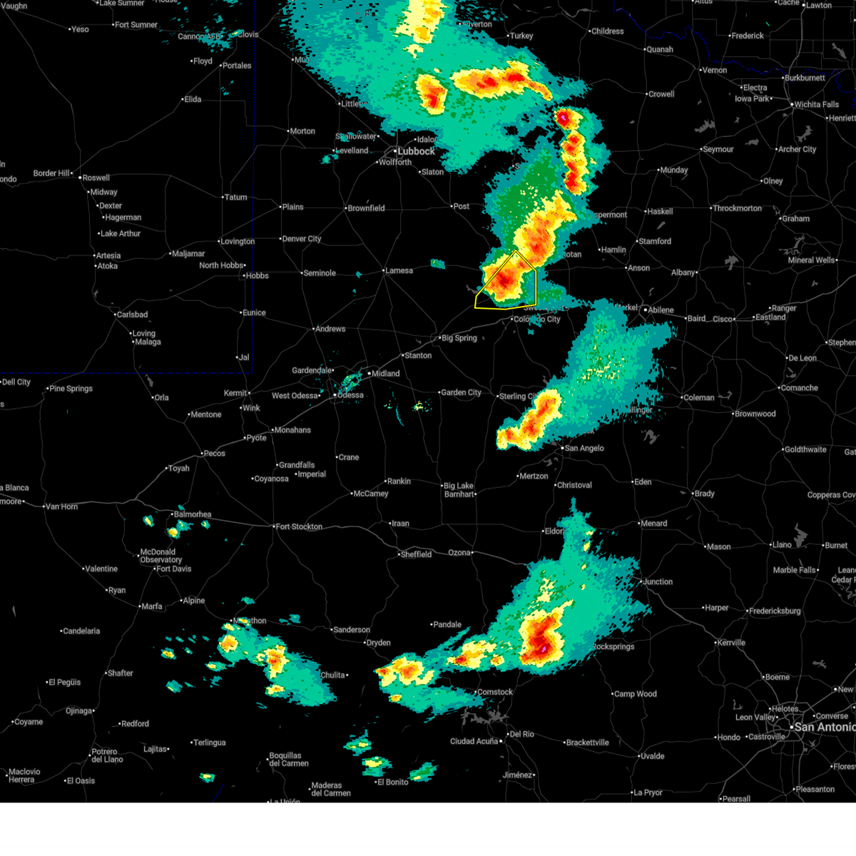
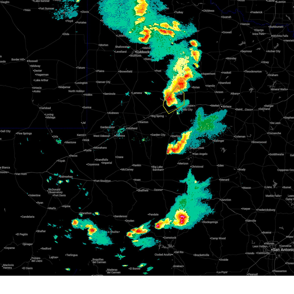
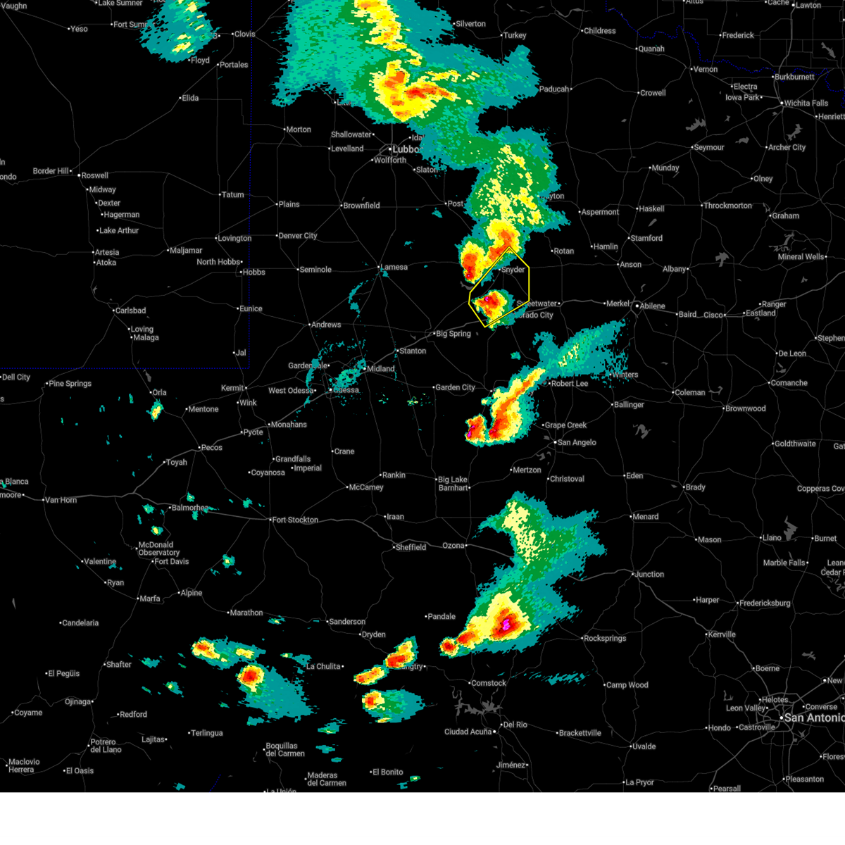
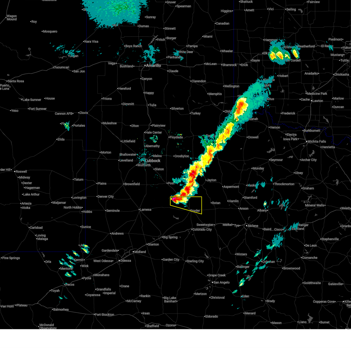
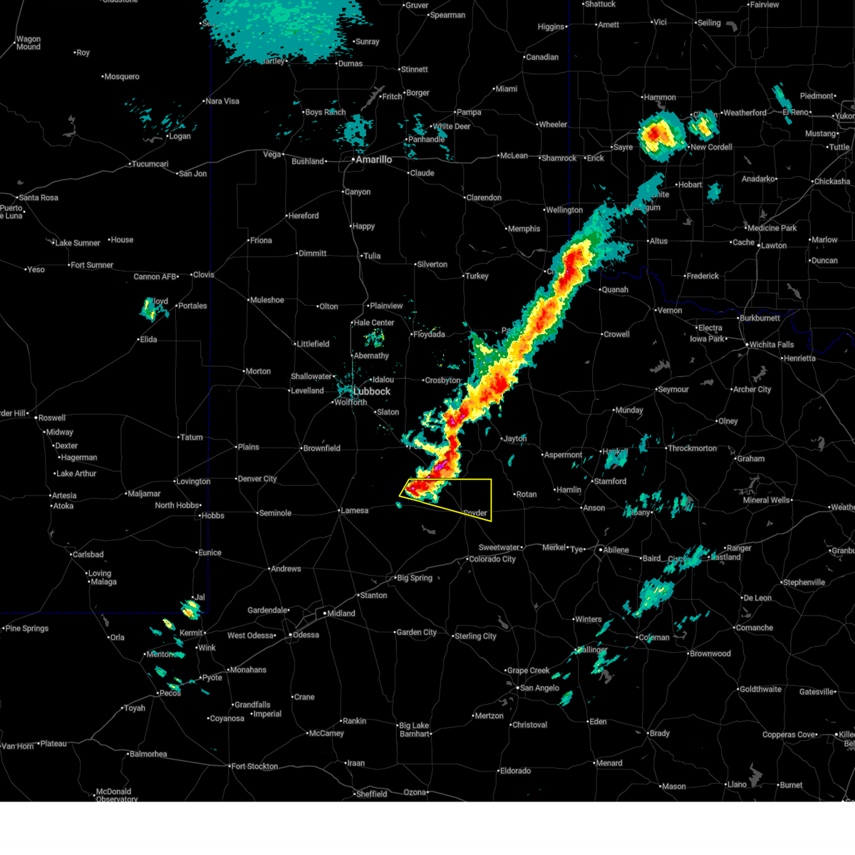
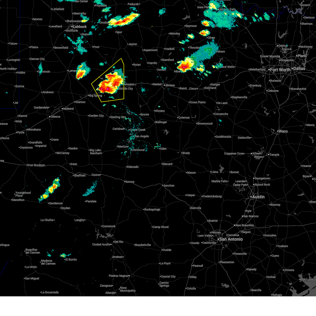
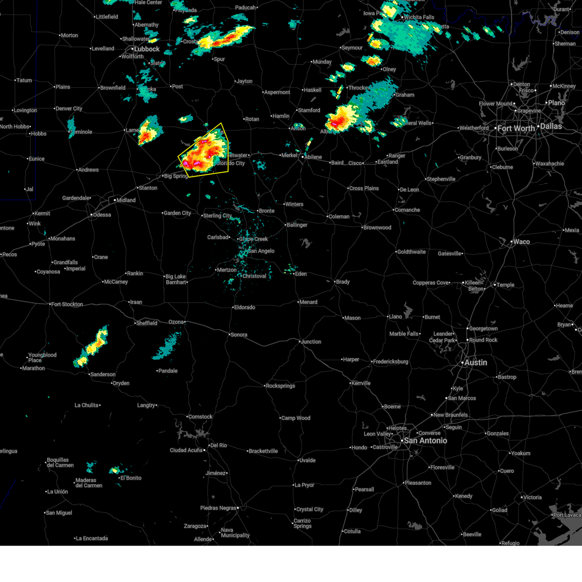
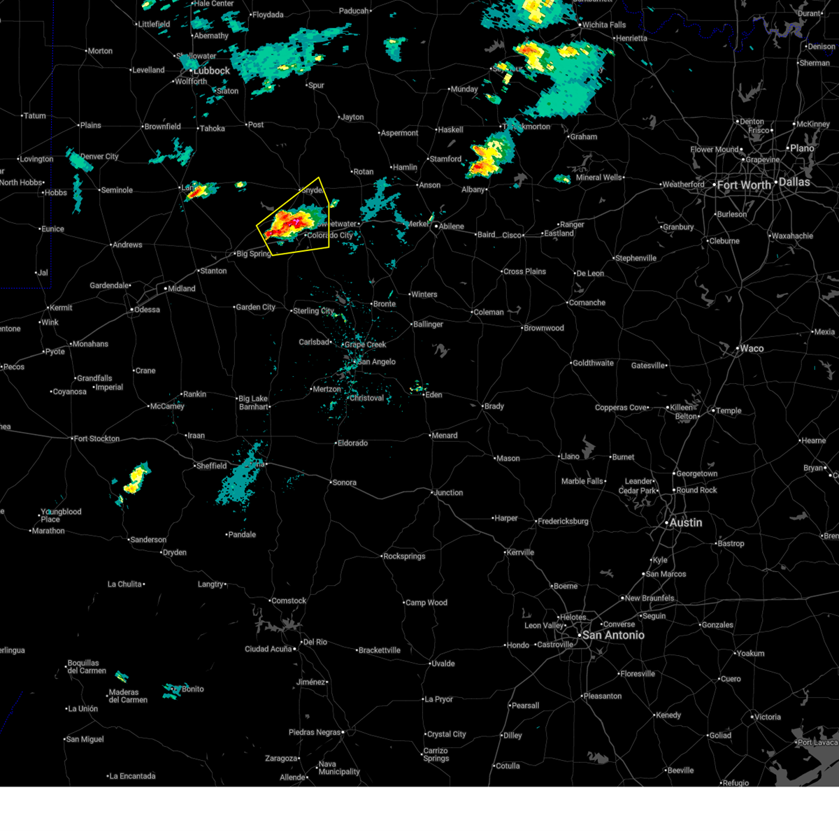
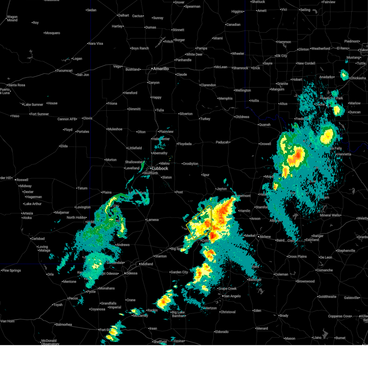
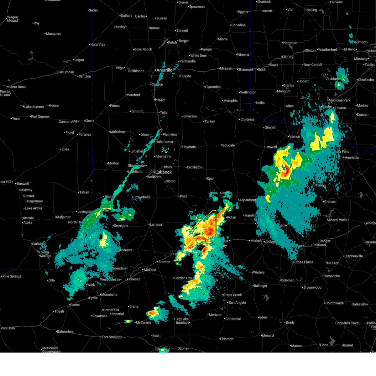
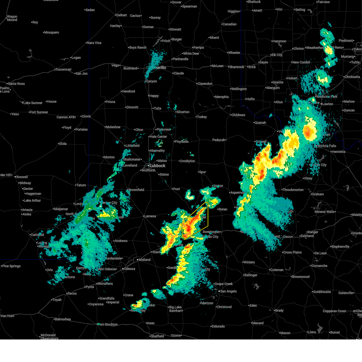
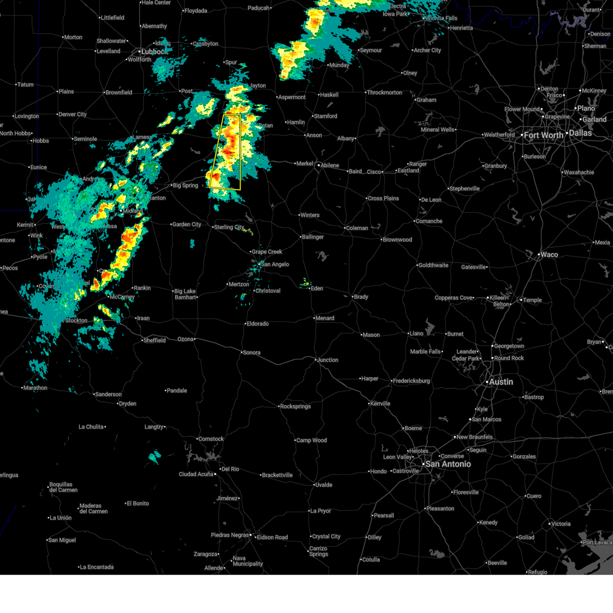
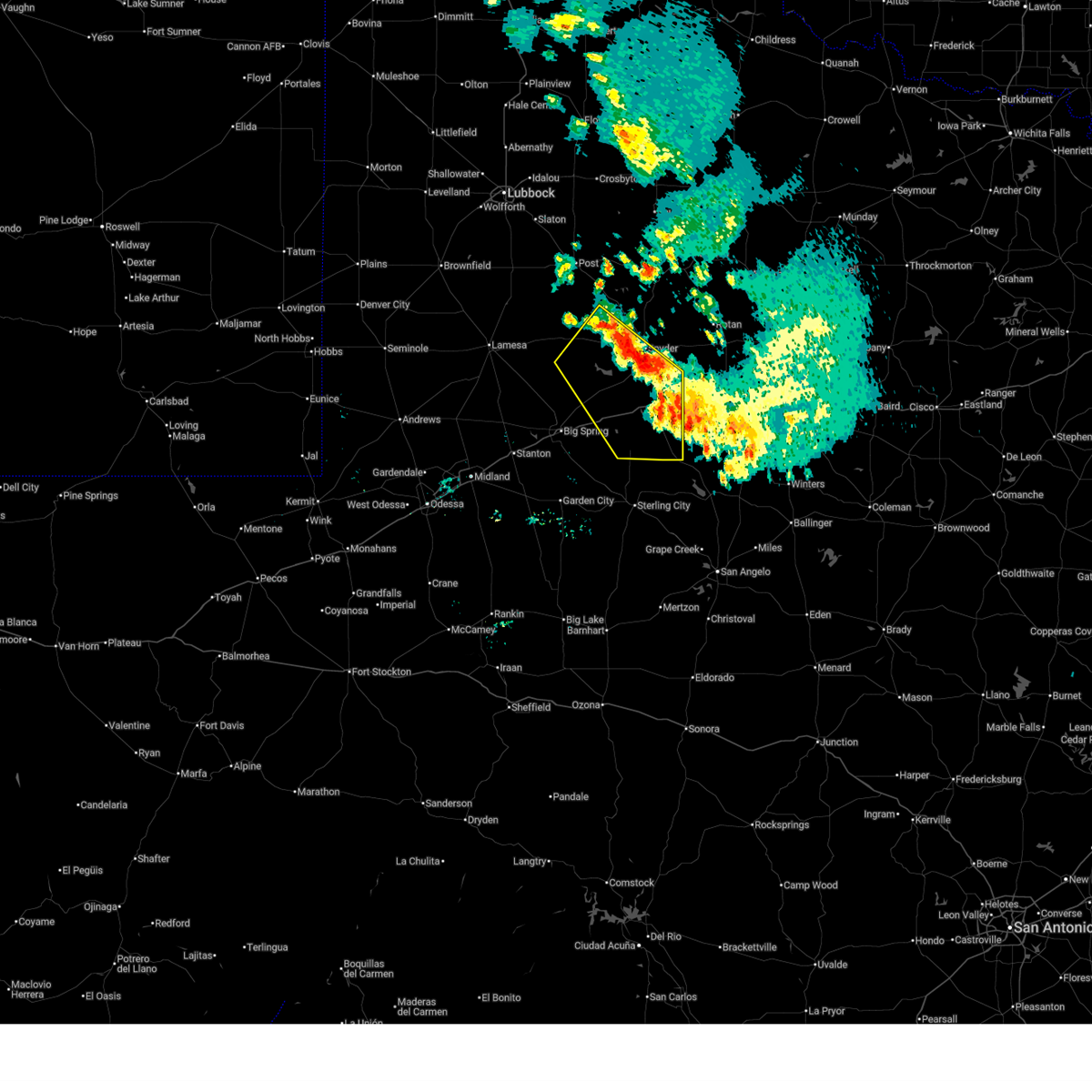
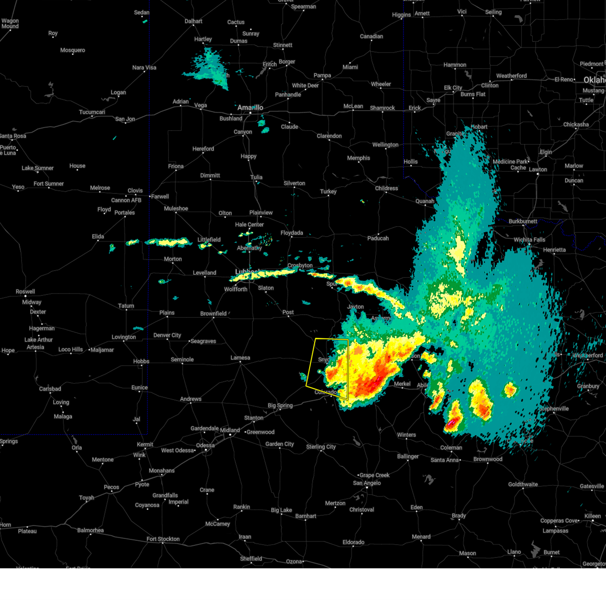
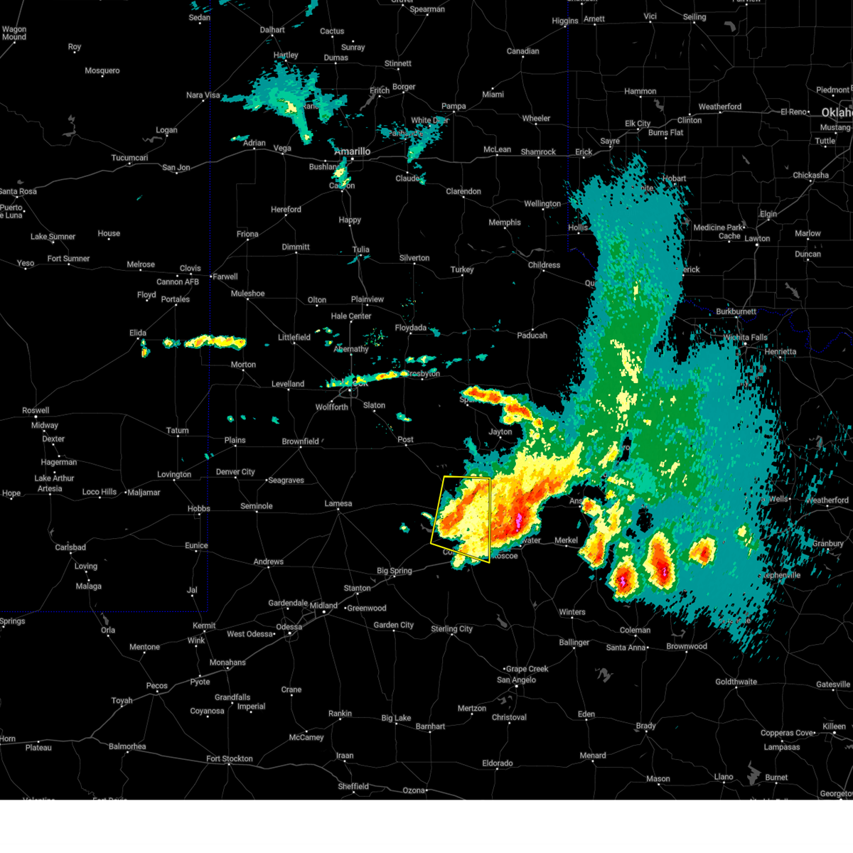
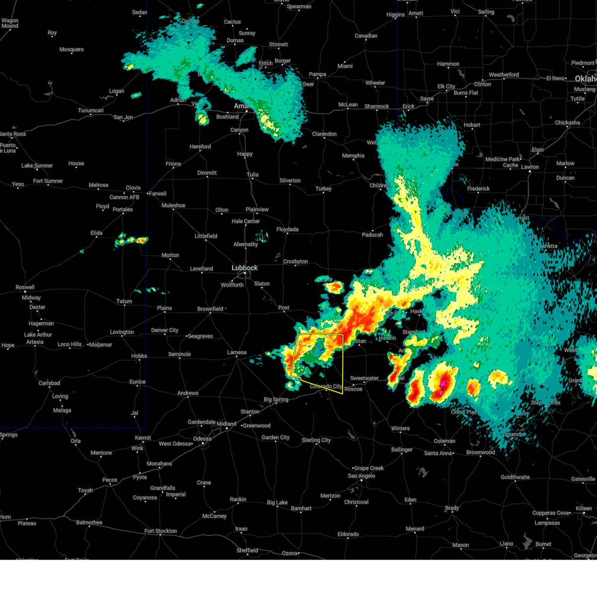
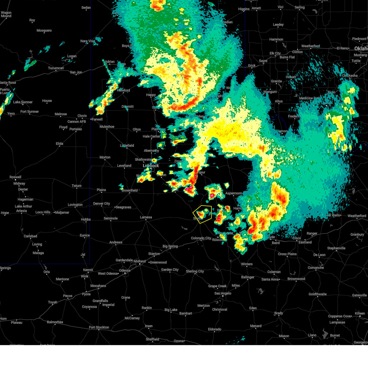
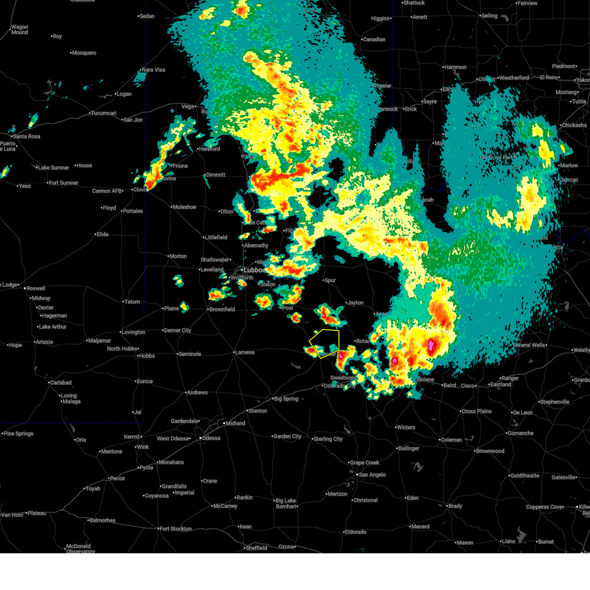
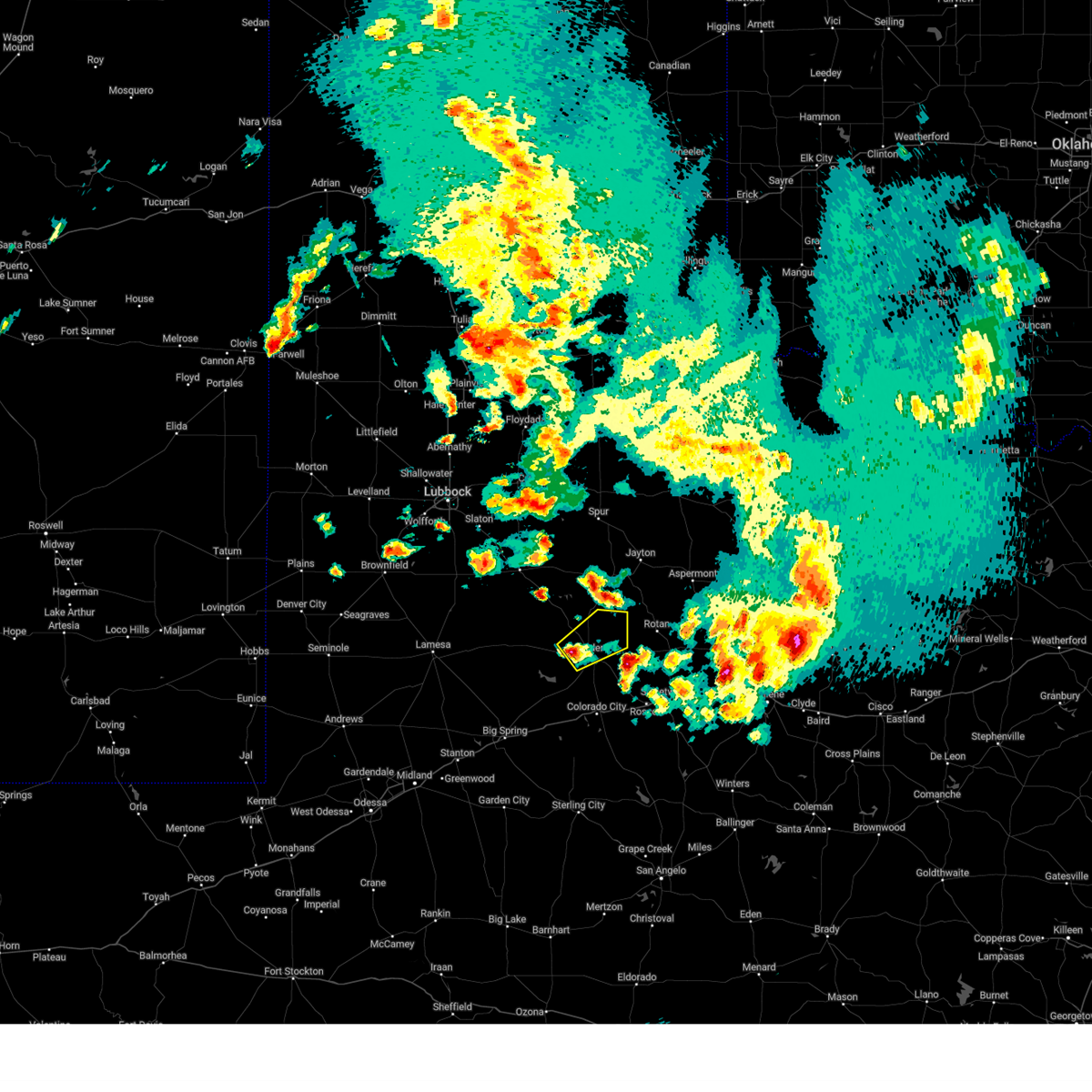
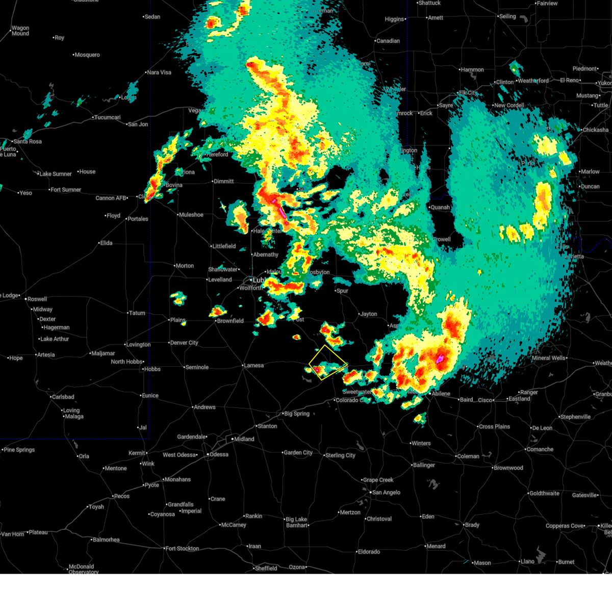
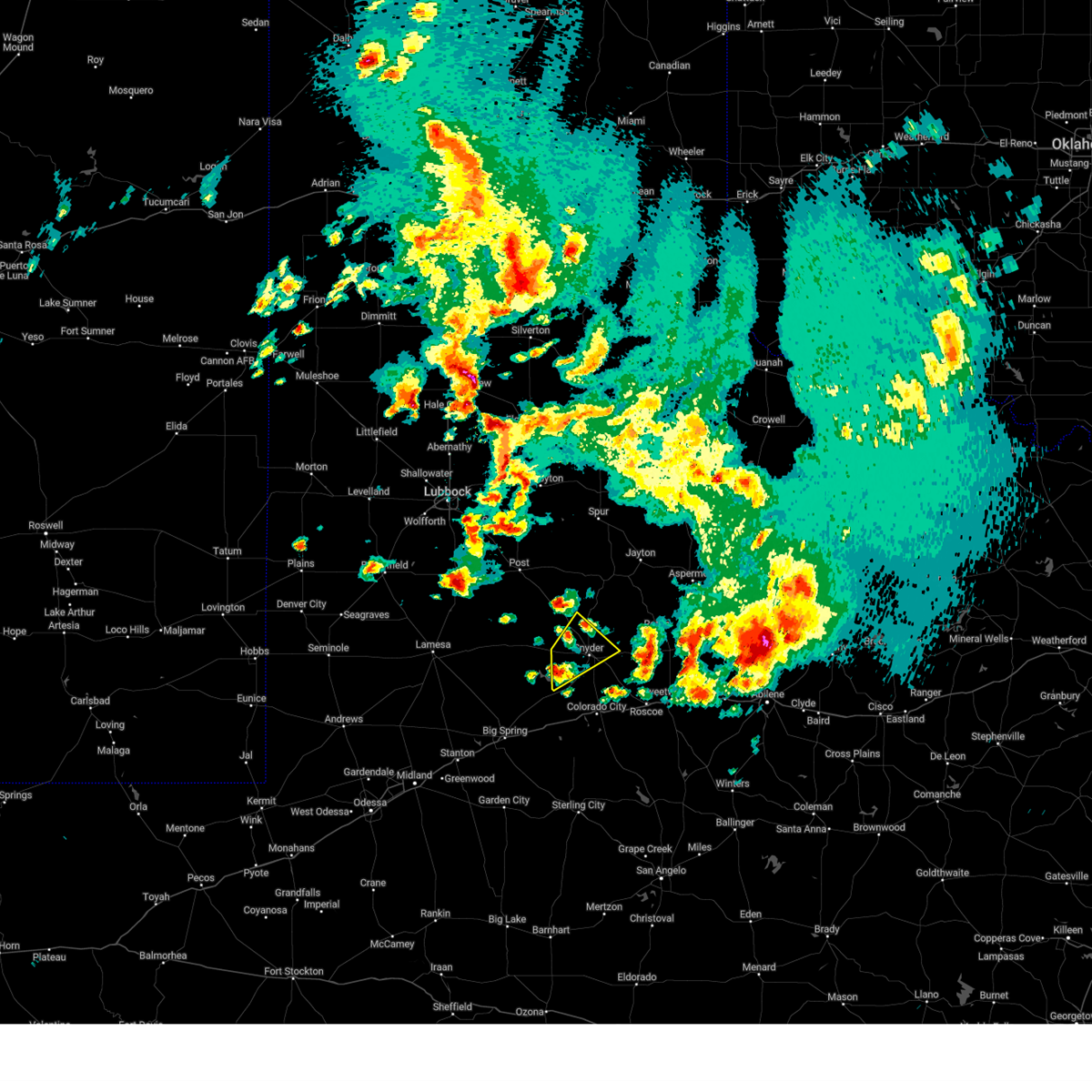
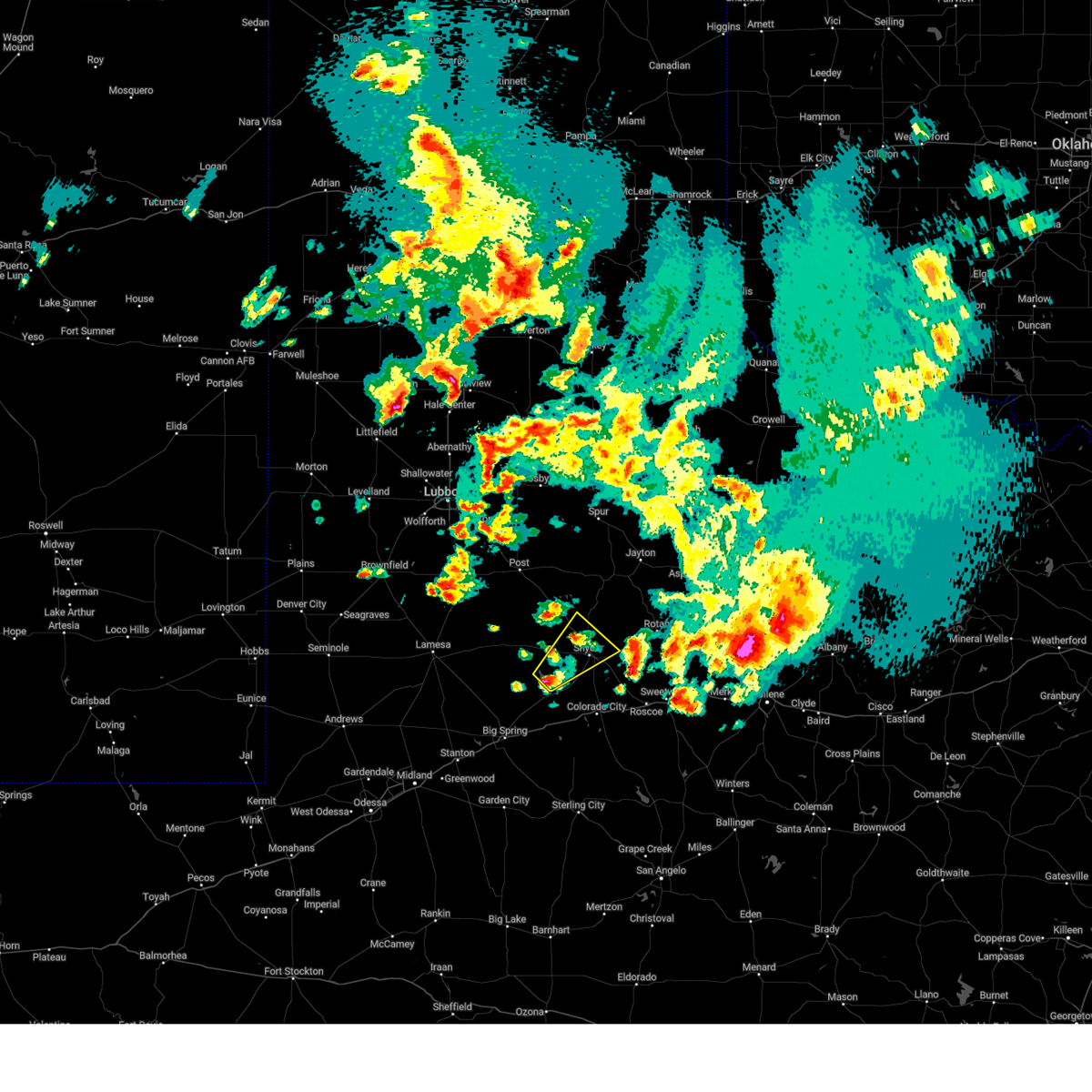
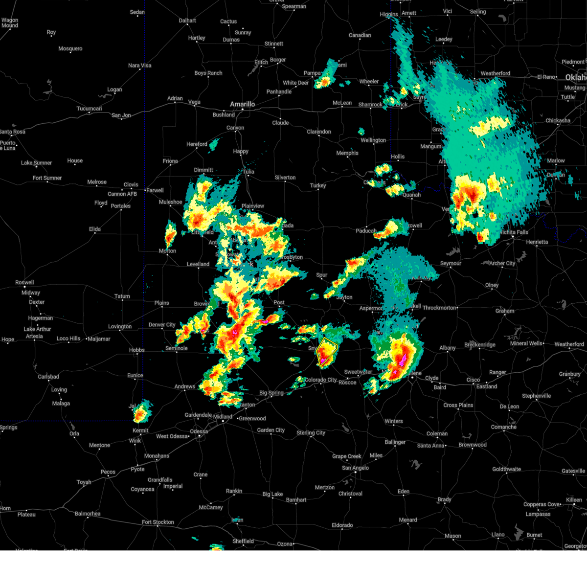
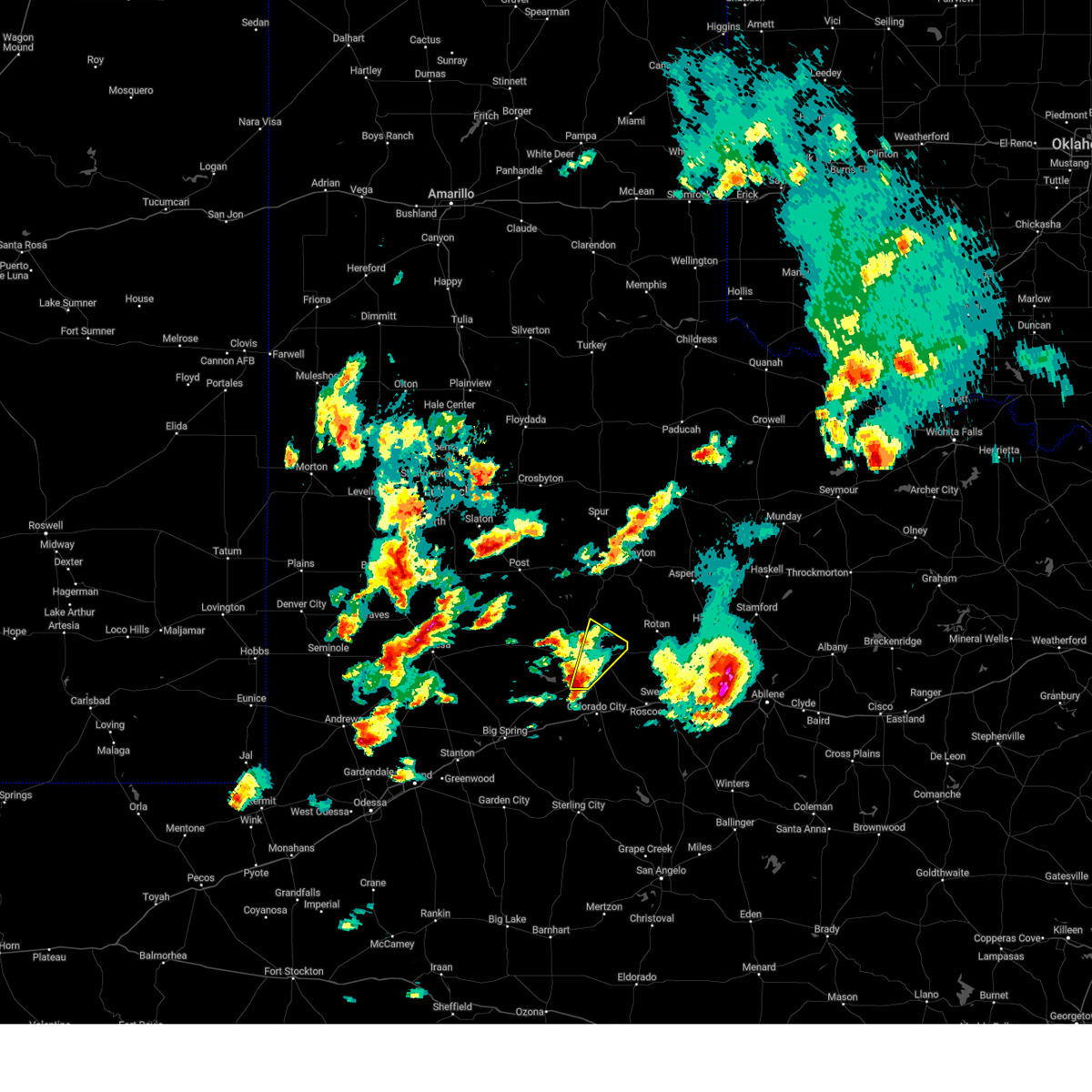
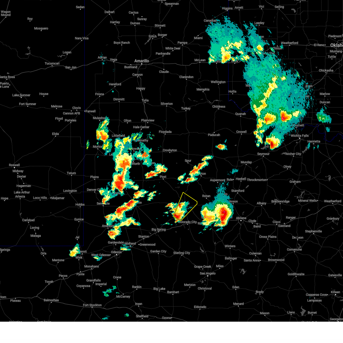
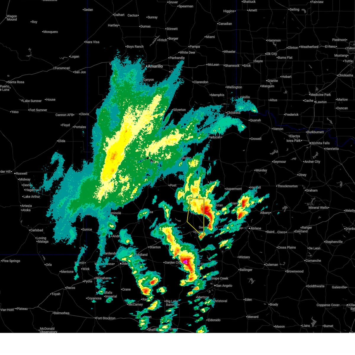
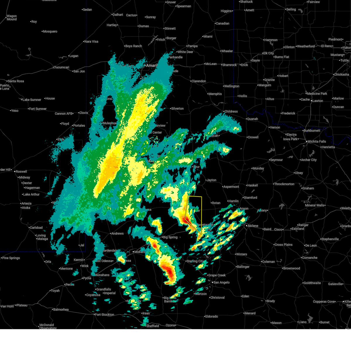
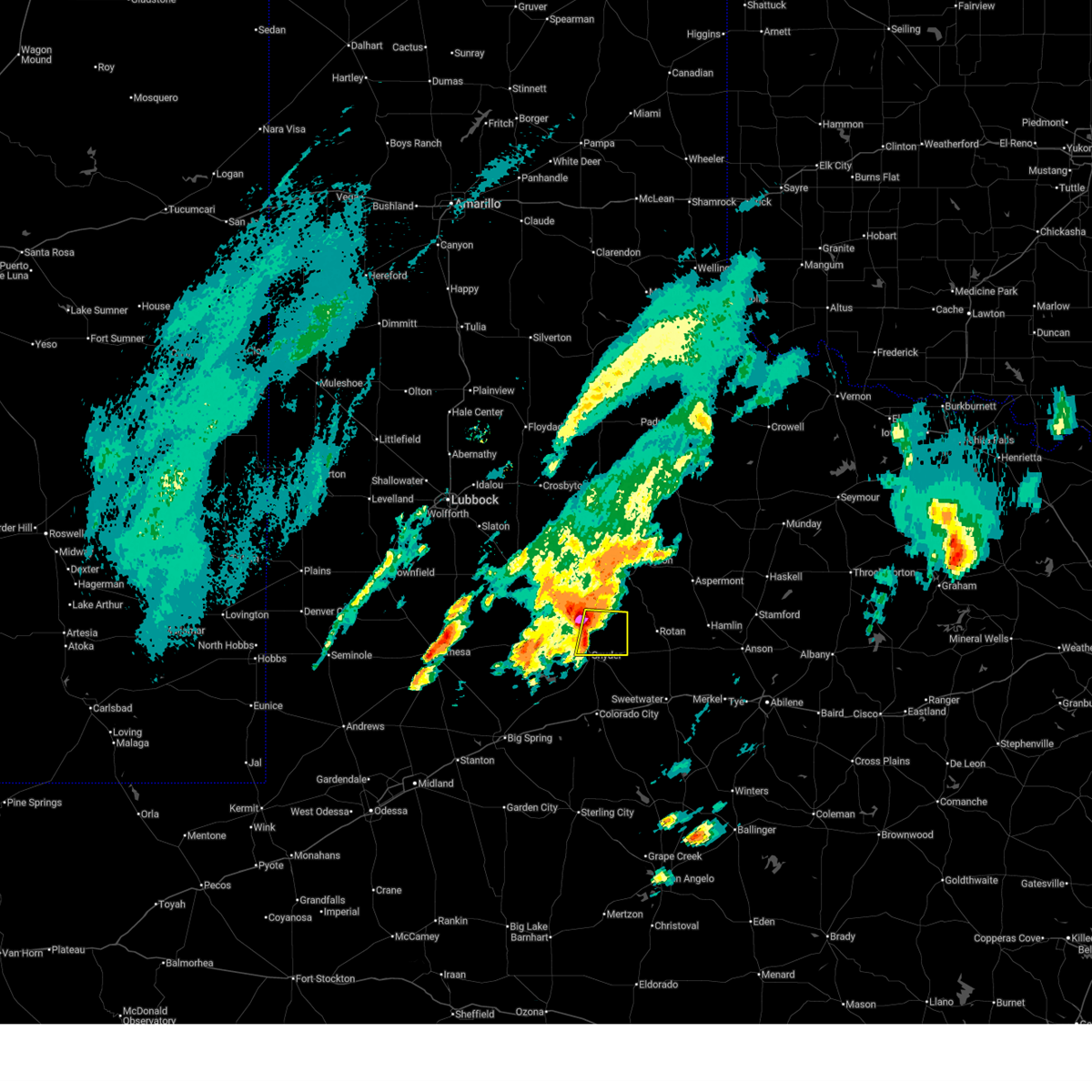
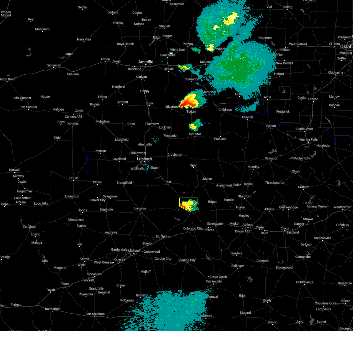
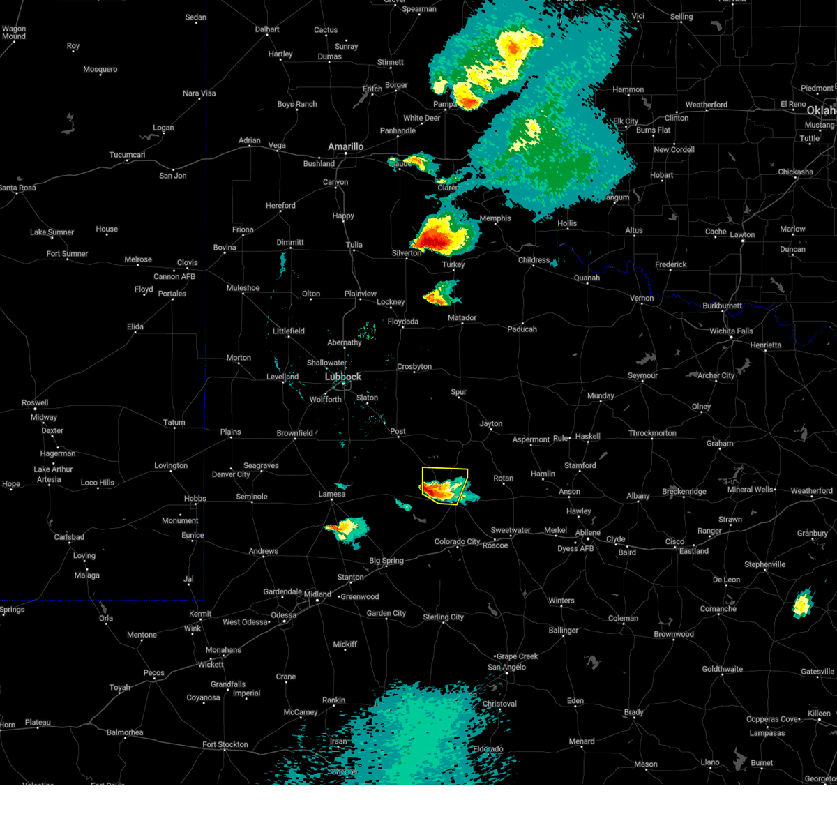
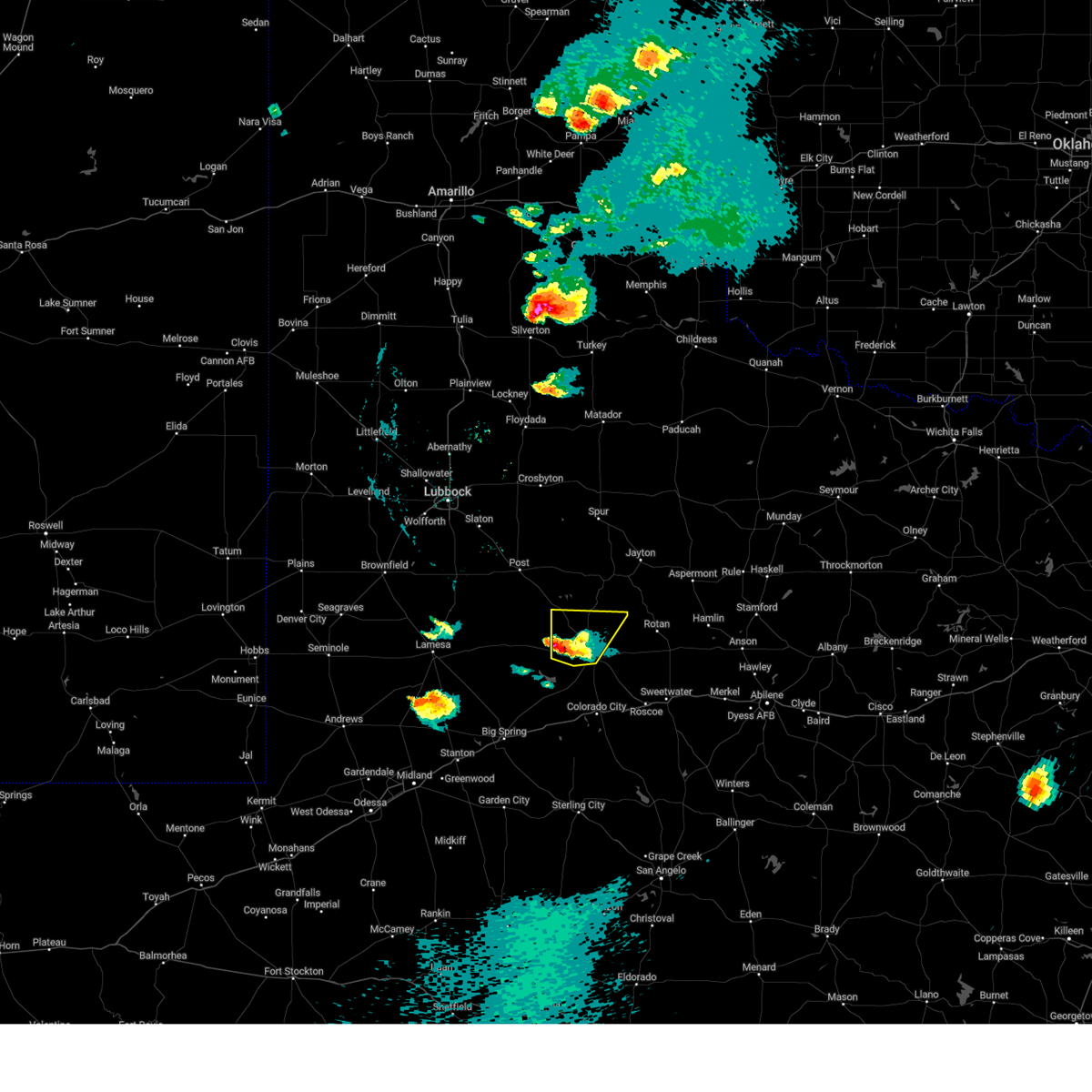
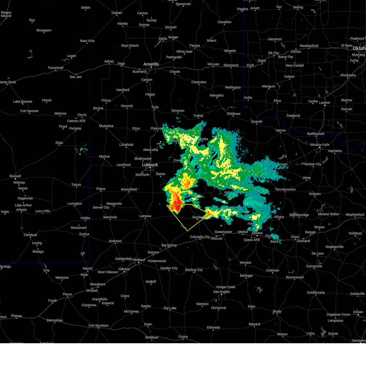
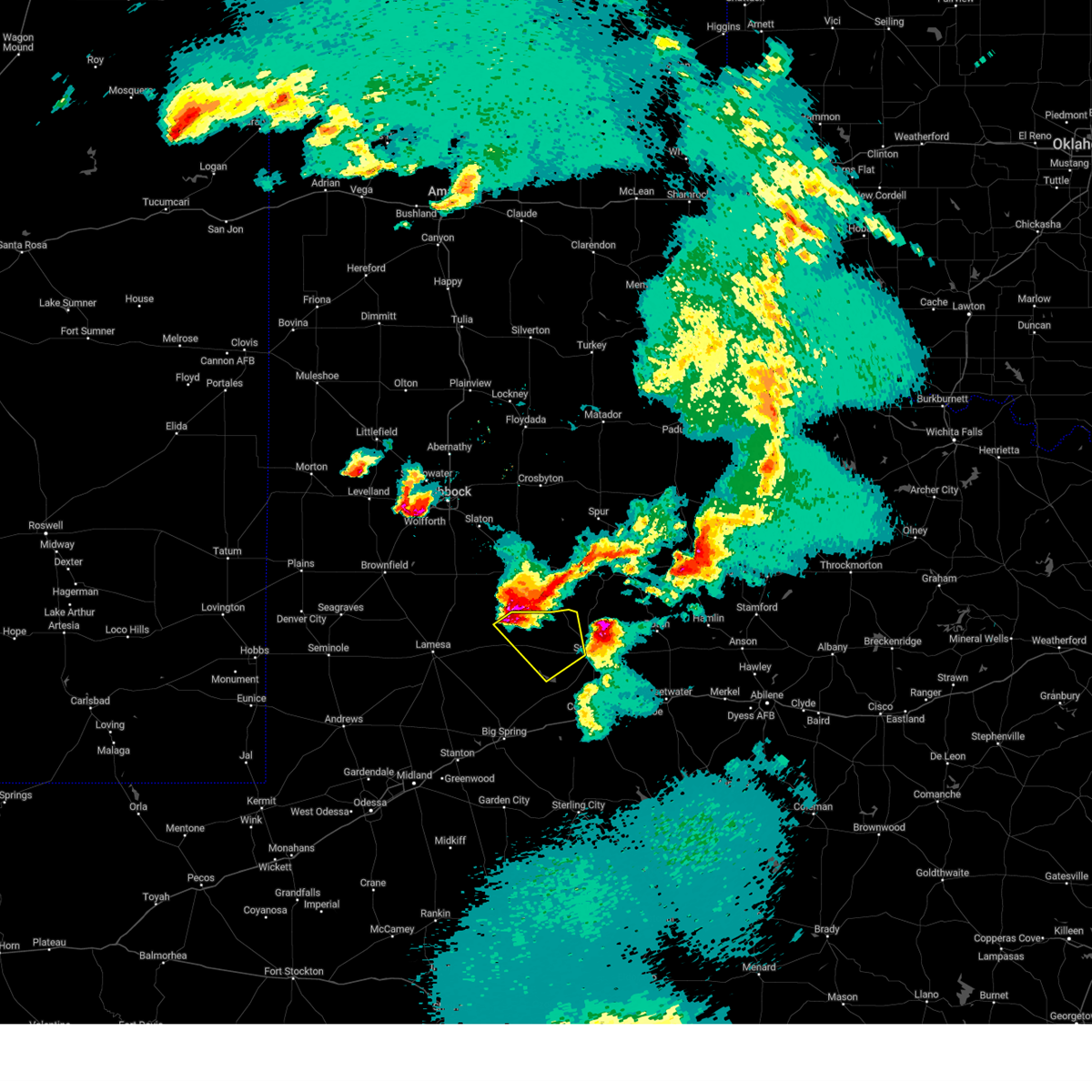
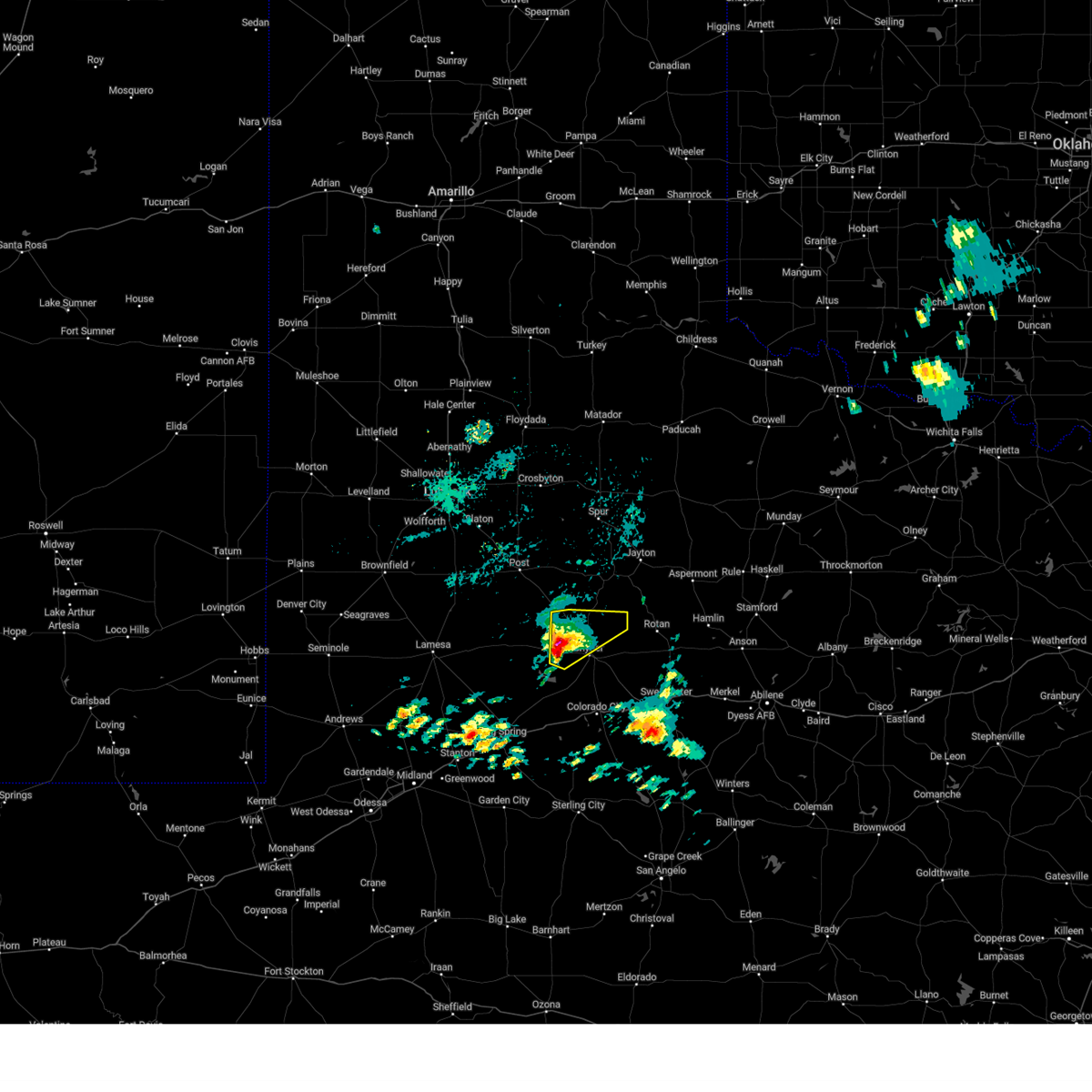
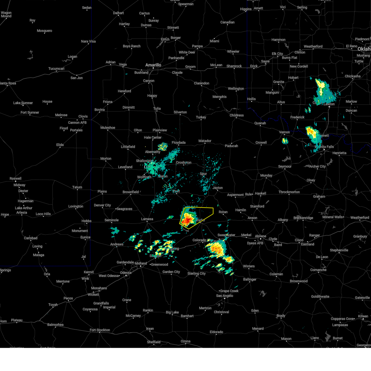
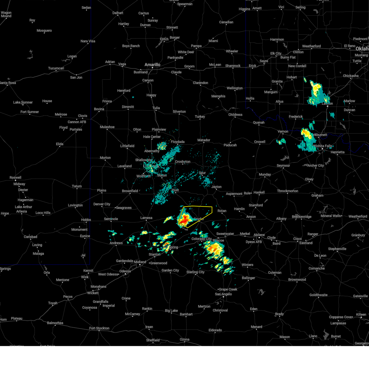
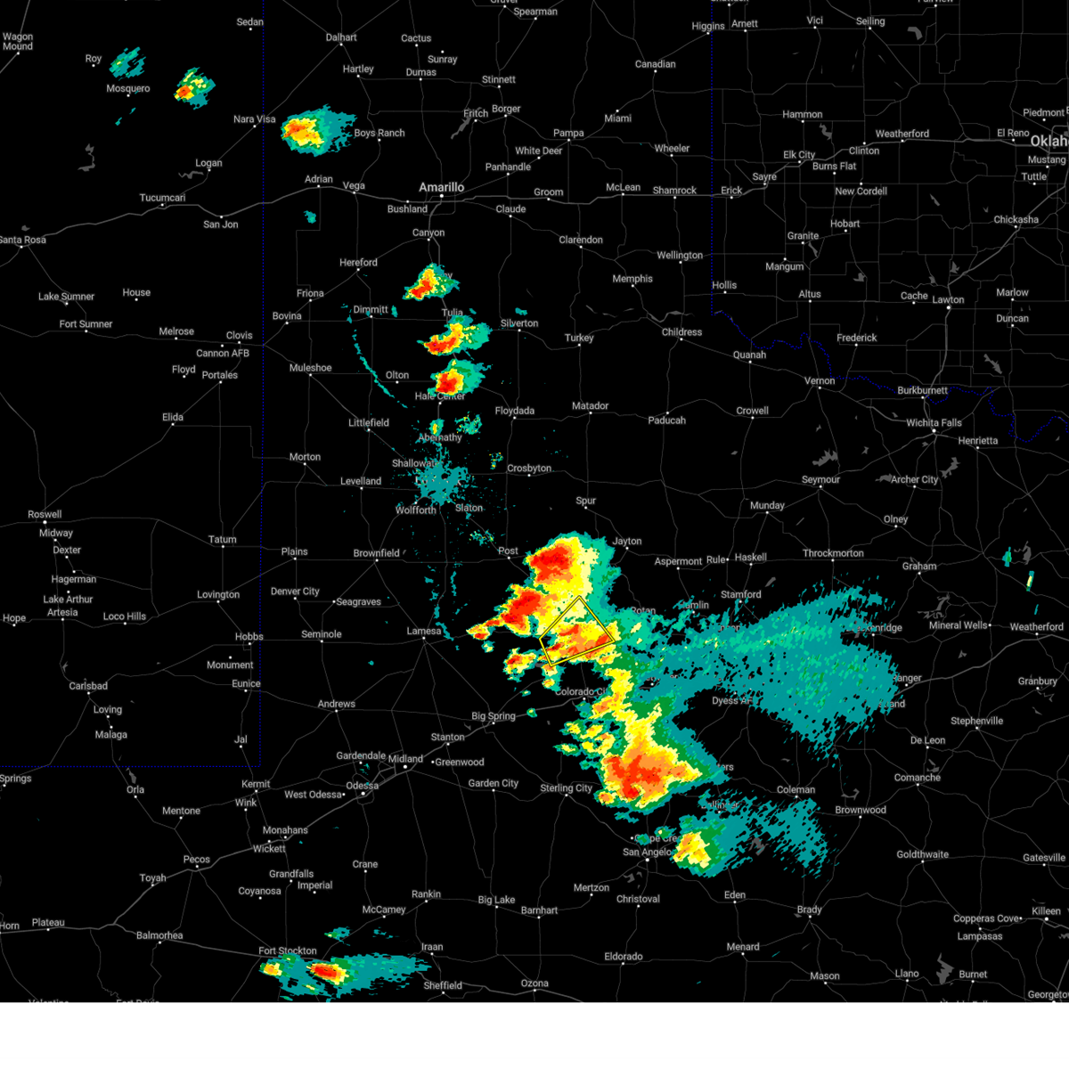
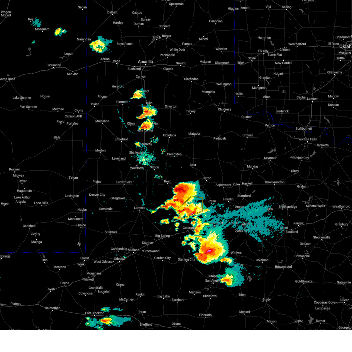
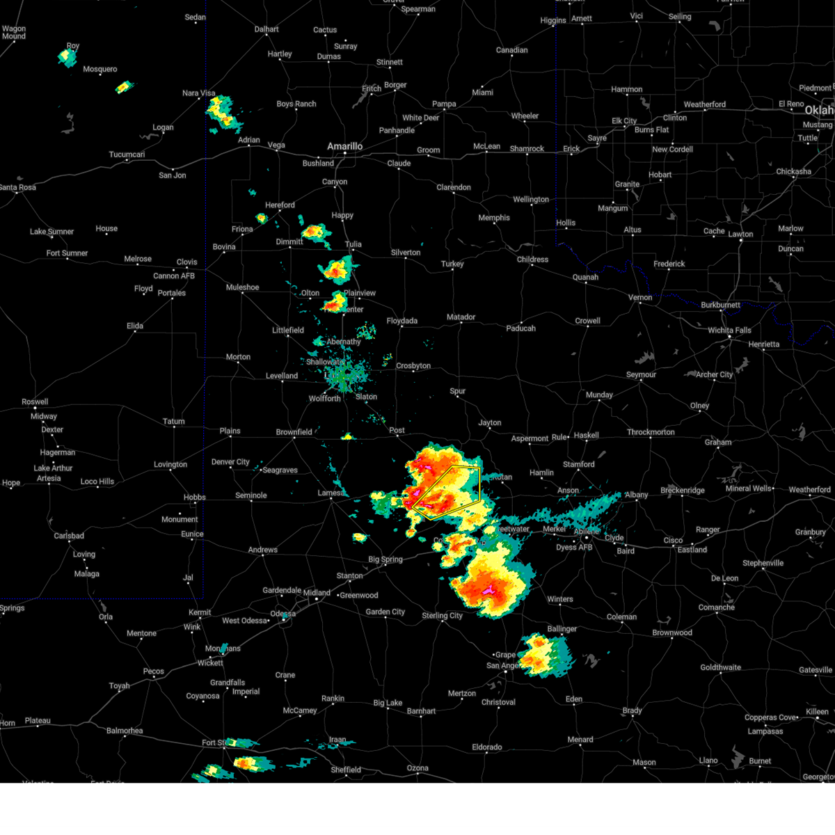
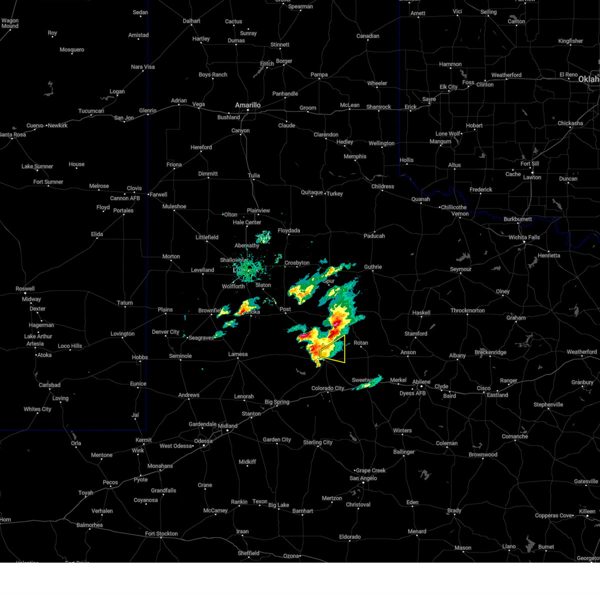
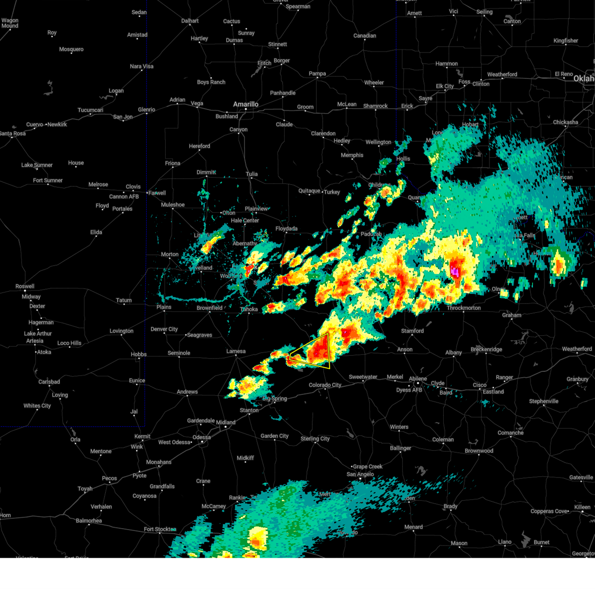
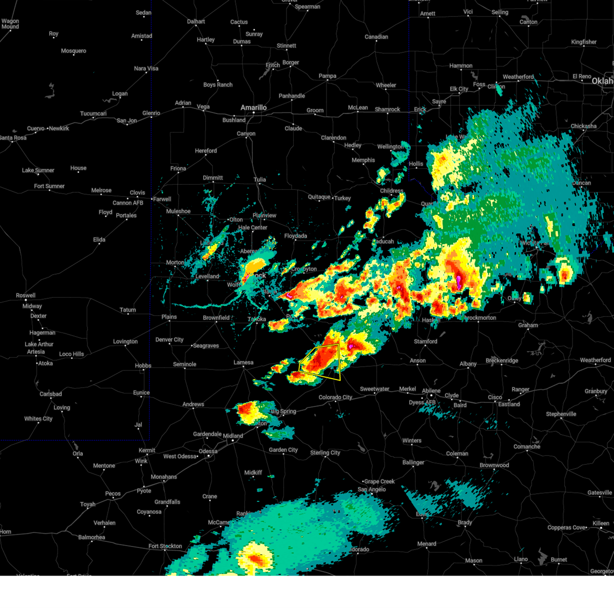
Hail Map for Snyder, TX
The Snyder, TX area has had 60 reports of on-the-ground hail by trained spotters, and has been under severe weather warnings 22 times during the past 12 months. Doppler radar has detected hail at or near Snyder, TX on 124 occasions, including 5 occasions during the past year.
| Name: | Snyder, TX |
| Where Located: | 70.5 miles WNW of Abilene, TX |
| Map: | Google Map for Snyder, TX |
| Population: | 11202 |
| Housing Units: | 4787 |
| More Info: | Search Google for Snyder, TX |
1
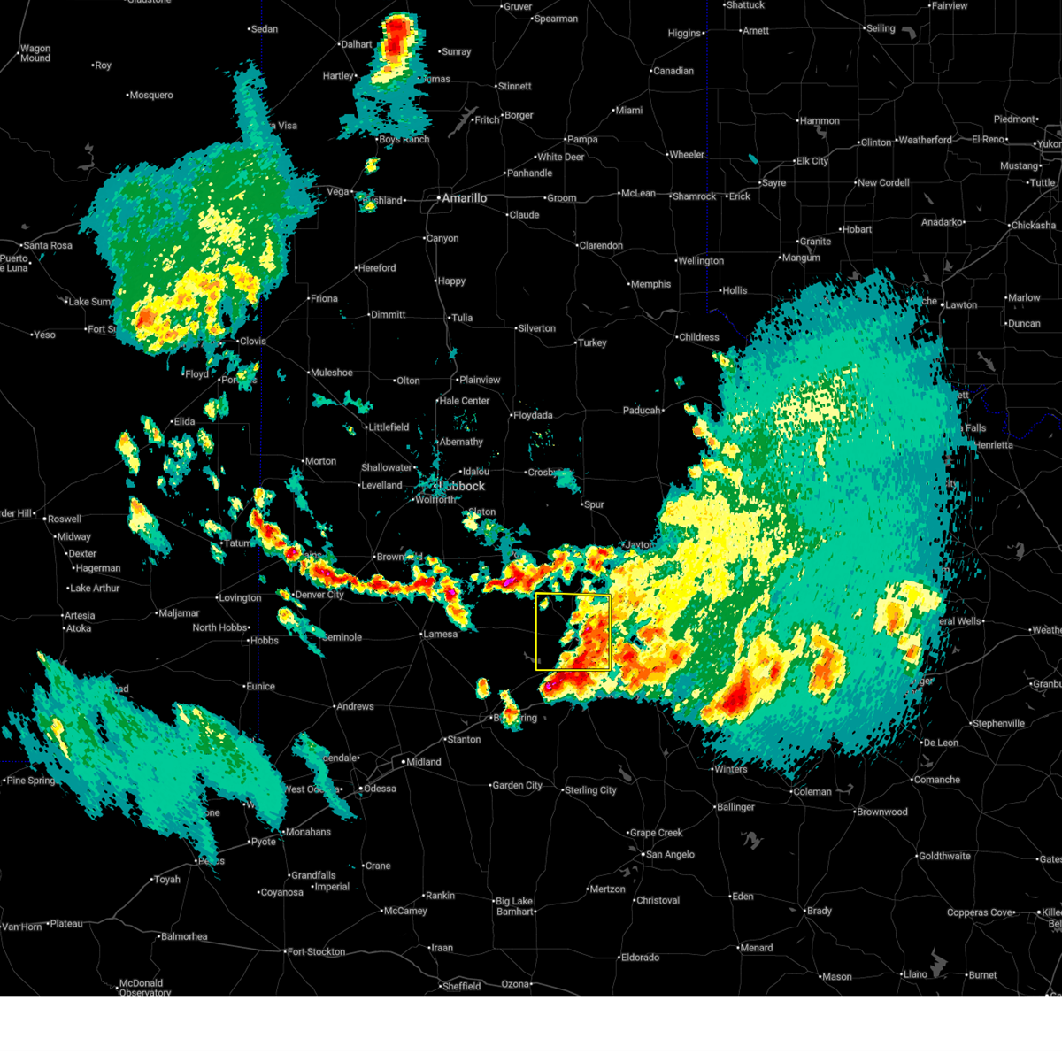
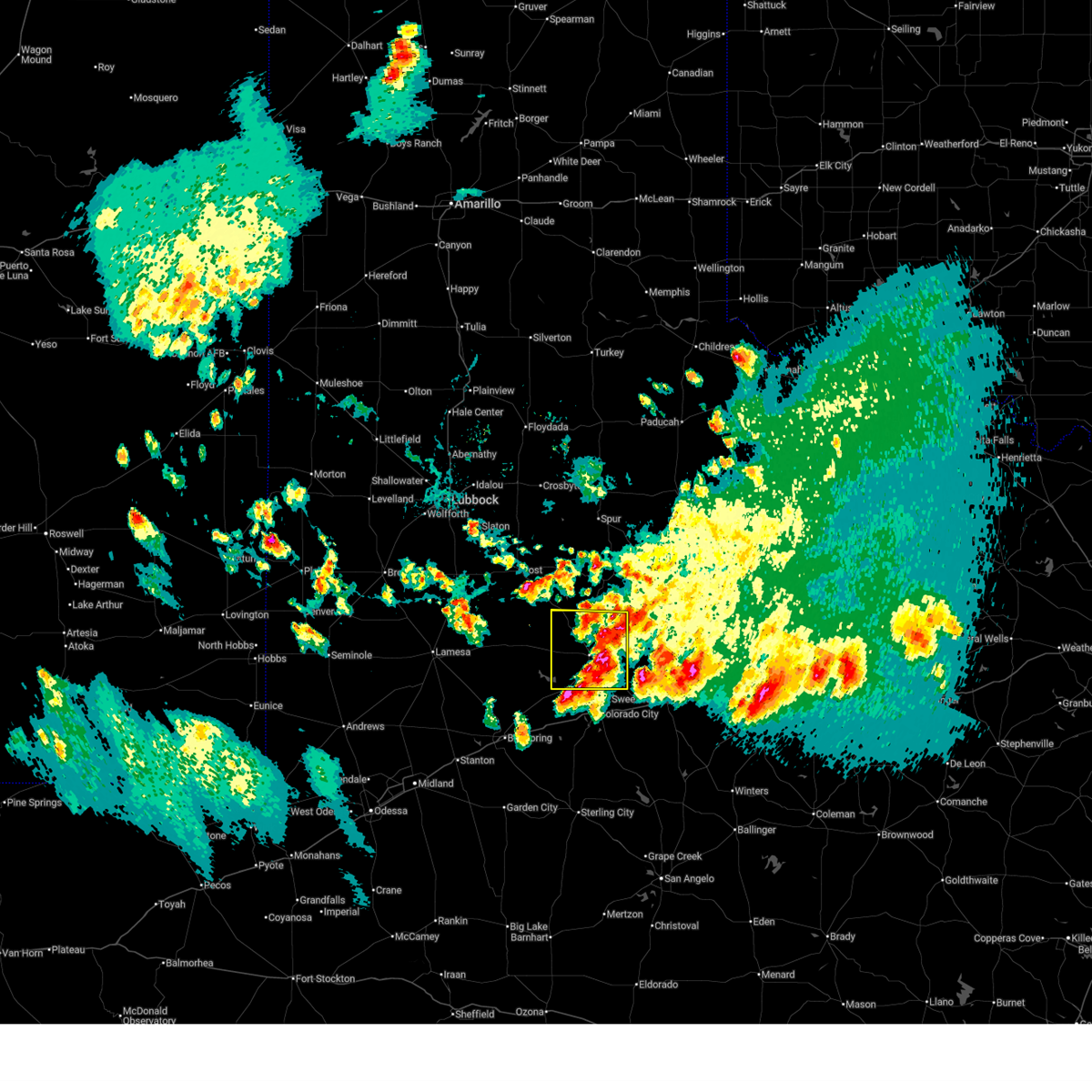
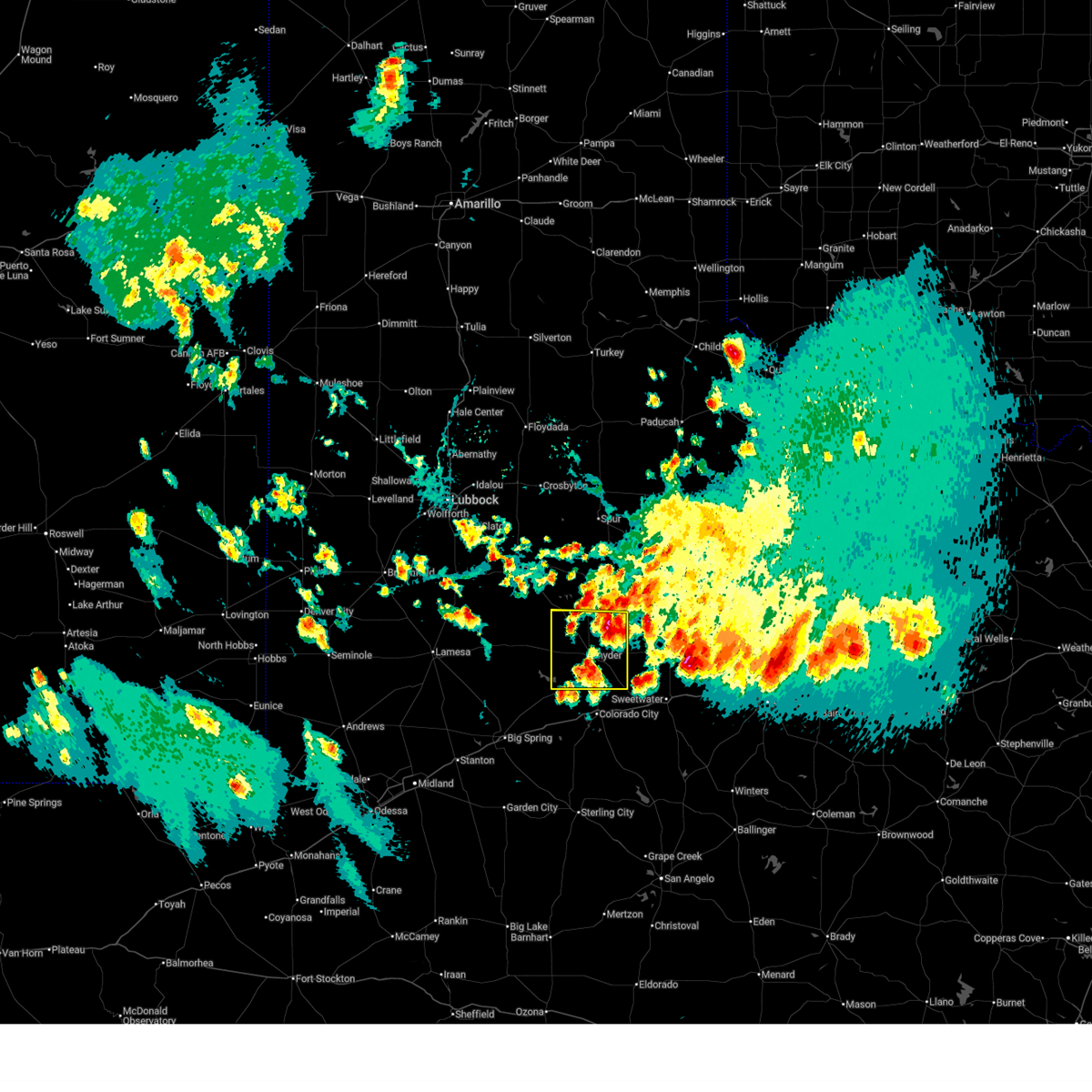
The Top Recent Hail Date for Snyder, TX is Sunday, May 10, 2026 (6th out of 124)
Hail and Wind Damage Spotted near Snyder, TX
| Date / Time | Report Details |
|---|---|
| 7/5/2026 7:27 PM CDT |
 At 725 pm cdt, a severe thunderstorm was located near snyder, moving east at 10 mph (emergency management. at 7:24 pm, emergency management reported broken tree limbs, downed power poles, and damage to a car port in snyder at 26th st and avenue o). Hazards include 60 mph wind gusts and quarter size hail. Hail damage to vehicles is expected. expect wind damage to roofs, siding, and trees. Locations impacted include, snyder, fluvanna, inadale, j b thomas reservoir, dunn, randalls corner, hermleigh, winston field, ira, and knapp. At 725 pm cdt, a severe thunderstorm was located near snyder, moving east at 10 mph (emergency management. at 7:24 pm, emergency management reported broken tree limbs, downed power poles, and damage to a car port in snyder at 26th st and avenue o). Hazards include 60 mph wind gusts and quarter size hail. Hail damage to vehicles is expected. expect wind damage to roofs, siding, and trees. Locations impacted include, snyder, fluvanna, inadale, j b thomas reservoir, dunn, randalls corner, hermleigh, winston field, ira, and knapp.
|
| 7/5/2026 7:10 PM CDT | Reports of trees and power lines down as well as damage to car ports within a 3 block radius of 26th street and ave o in snyde in scurry county TX, 0.2 miles SSE of Snyder, TX |
| 7/5/2026 7:09 PM CDT |
 At 709 pm cdt, a severe thunderstorm was located near snyder, moving northeast at 10 mph (radar indicated). Hazards include 60 mph wind gusts and quarter size hail. Hail damage to vehicles is expected. expect wind damage to roofs, siding, and trees. Locations impacted include, snyder, fluvanna, inadale, j b thomas reservoir, dunn, randalls corner, hermleigh, winston field, ira, and knapp. At 709 pm cdt, a severe thunderstorm was located near snyder, moving northeast at 10 mph (radar indicated). Hazards include 60 mph wind gusts and quarter size hail. Hail damage to vehicles is expected. expect wind damage to roofs, siding, and trees. Locations impacted include, snyder, fluvanna, inadale, j b thomas reservoir, dunn, randalls corner, hermleigh, winston field, ira, and knapp.
|
| 7/5/2026 6:49 PM CDT |
 Svrmaf the national weather service in midland has issued a * severe thunderstorm warning for, scurry county in western texas, * until 745 pm cdt. * at 649 pm cdt, a severe thunderstorm was located 7 miles northeast of snyder, moving northeast at 10 mph (radar indicated). Hazards include 60 mph wind gusts and quarter size hail. Hail damage to vehicles is expected. Expect wind damage to roofs, siding, and trees. Svrmaf the national weather service in midland has issued a * severe thunderstorm warning for, scurry county in western texas, * until 745 pm cdt. * at 649 pm cdt, a severe thunderstorm was located 7 miles northeast of snyder, moving northeast at 10 mph (radar indicated). Hazards include 60 mph wind gusts and quarter size hail. Hail damage to vehicles is expected. Expect wind damage to roofs, siding, and trees.
|
| 5/22/2026 7:23 PM CDT |
 At 722 pm cdt, a severe thunderstorm was located over snyder, moving northeast at 30 mph (law enforcement). Hazards include 60 mph wind gusts and half dollar size hail. Hail damage to vehicles is expected. expect wind damage to roofs, siding, and trees. Locations impacted include, snyder, colorado city airport, inadale, dunn, hermleigh, winston field, ira, and cuthbert. At 722 pm cdt, a severe thunderstorm was located over snyder, moving northeast at 30 mph (law enforcement). Hazards include 60 mph wind gusts and half dollar size hail. Hail damage to vehicles is expected. expect wind damage to roofs, siding, and trees. Locations impacted include, snyder, colorado city airport, inadale, dunn, hermleigh, winston field, ira, and cuthbert.
|
| 5/22/2026 7:20 PM CDT | Half Dollar sized hail reported 0.7 miles ESE of Snyder, TX, fire department reported hail slightly larger than quarters falling over the east side of snyder. |
| 5/22/2026 7:11 PM CDT |
 At 711 pm cdt, a severe thunderstorm was located 8 miles southwest of snyder, moving east at 15 mph (radar indicated). Hazards include golf ball size hail and 60 mph wind gusts. People and animals outdoors will be injured. expect hail damage to roofs, siding, windows, and vehicles. expect wind damage to roofs, siding, and trees. locations impacted include, snyder, colorado city, colorado city airport, inadale, lake colorado city, westbrook, dunn, hermleigh, winston field, ira, cuthbert, and buford. This includes interstate 20 between mile markers 204 and 218. At 711 pm cdt, a severe thunderstorm was located 8 miles southwest of snyder, moving east at 15 mph (radar indicated). Hazards include golf ball size hail and 60 mph wind gusts. People and animals outdoors will be injured. expect hail damage to roofs, siding, windows, and vehicles. expect wind damage to roofs, siding, and trees. locations impacted include, snyder, colorado city, colorado city airport, inadale, lake colorado city, westbrook, dunn, hermleigh, winston field, ira, cuthbert, and buford. This includes interstate 20 between mile markers 204 and 218.
|
| 5/22/2026 6:45 PM CDT |
 Svrmaf the national weather service in midland has issued a * severe thunderstorm warning for, southeastern scurry county in western texas, northern mitchell county in western texas, * until 745 pm cdt. * at 645 pm cdt, a severe thunderstorm was located near colorado city airport, or 10 miles northwest of colorado city, moving northeast at 20 mph (radar indicated). Hazards include 60 mph wind gusts and quarter size hail. Hail damage to vehicles is expected. Expect wind damage to roofs, siding, and trees. Svrmaf the national weather service in midland has issued a * severe thunderstorm warning for, southeastern scurry county in western texas, northern mitchell county in western texas, * until 745 pm cdt. * at 645 pm cdt, a severe thunderstorm was located near colorado city airport, or 10 miles northwest of colorado city, moving northeast at 20 mph (radar indicated). Hazards include 60 mph wind gusts and quarter size hail. Hail damage to vehicles is expected. Expect wind damage to roofs, siding, and trees.
|
| 5/15/2026 8:10 PM CDT |
 At 809 pm cdt, a severe thunderstorm was located near fluvanna, or 12 miles south of lake alan henry, moving east at 40 mph (radar indicated). Hazards include 60 mph wind gusts and half dollar size hail. Hail damage to vehicles is expected. expect wind damage to roofs, siding, and trees. Locations impacted include, snyder and fluvanna. At 809 pm cdt, a severe thunderstorm was located near fluvanna, or 12 miles south of lake alan henry, moving east at 40 mph (radar indicated). Hazards include 60 mph wind gusts and half dollar size hail. Hail damage to vehicles is expected. expect wind damage to roofs, siding, and trees. Locations impacted include, snyder and fluvanna.
|
| 5/15/2026 7:59 PM CDT |
 Svrmaf the national weather service in midland has issued a * severe thunderstorm warning for, northern scurry county in western texas, northeastern borden county in western texas, * until 900 pm cdt. * at 759 pm cdt, a severe thunderstorm was located over fluvanna, or 12 miles southwest of lake alan henry, moving east at 40 mph (radar indicated). Hazards include 60 mph wind gusts and quarter size hail. Hail damage to vehicles is expected. Expect wind damage to roofs, siding, and trees. Svrmaf the national weather service in midland has issued a * severe thunderstorm warning for, northern scurry county in western texas, northeastern borden county in western texas, * until 900 pm cdt. * at 759 pm cdt, a severe thunderstorm was located over fluvanna, or 12 miles southwest of lake alan henry, moving east at 40 mph (radar indicated). Hazards include 60 mph wind gusts and quarter size hail. Hail damage to vehicles is expected. Expect wind damage to roofs, siding, and trees.
|
| 5/10/2026 3:27 PM CDT |
 At 327 pm cdt, a severe thunderstorm was located near loraine, or near colorado city, moving east at 30 mph (trained weather spotters). Hazards include tennis ball size hail and 60 mph wind gusts. People and animals outdoors will be injured. expect hail damage to roofs, siding, windows, and vehicles. expect wind damage to roofs, siding, and trees. locations impacted include, big spring, snyder, colorado city, coahoma, loraine, fluvanna, sand springs, colorado city airport, j b thomas reservoir, lake colorado city, lake colorado city state park, inadale, champion creek reservoir, luther, westbrook, vincent, randalls corner, hermleigh, winston field, and cuthbert. This includes interstate 20 between mile markers 179 and 228. At 327 pm cdt, a severe thunderstorm was located near loraine, or near colorado city, moving east at 30 mph (trained weather spotters). Hazards include tennis ball size hail and 60 mph wind gusts. People and animals outdoors will be injured. expect hail damage to roofs, siding, windows, and vehicles. expect wind damage to roofs, siding, and trees. locations impacted include, big spring, snyder, colorado city, coahoma, loraine, fluvanna, sand springs, colorado city airport, j b thomas reservoir, lake colorado city, lake colorado city state park, inadale, champion creek reservoir, luther, westbrook, vincent, randalls corner, hermleigh, winston field, and cuthbert. This includes interstate 20 between mile markers 179 and 228.
|
| 5/10/2026 3:10 PM CDT |
 Svrmaf the national weather service in midland has issued a * severe thunderstorm warning for, scurry county in western texas, mitchell county in western texas, eastern borden county in western texas, howard county in western texas, * until 400 pm cdt. * at 310 pm cdt, a severe thunderstorm was located over colorado city airport, or near colorado city, moving east at 30 mph (radar indicated). Hazards include 60 mph wind gusts and half dollar size hail. Hail damage to vehicles is expected. Expect wind damage to roofs, siding, and trees. Svrmaf the national weather service in midland has issued a * severe thunderstorm warning for, scurry county in western texas, mitchell county in western texas, eastern borden county in western texas, howard county in western texas, * until 400 pm cdt. * at 310 pm cdt, a severe thunderstorm was located over colorado city airport, or near colorado city, moving east at 30 mph (radar indicated). Hazards include 60 mph wind gusts and half dollar size hail. Hail damage to vehicles is expected. Expect wind damage to roofs, siding, and trees.
|
| 5/10/2026 2:52 PM CDT |
 At 252 pm cdt, a severe thunderstorm was located near inadale, or 10 miles northeast of colorado city, moving east at 25 mph (emergency management). Hazards include ping pong ball size hail and 60 mph wind gusts. People and animals outdoors will be injured. expect hail damage to roofs, siding, windows, and vehicles. expect wind damage to roofs, siding, and trees. locations impacted include, snyder, colorado city, loraine, colorado city airport, j b thomas reservoir, lake colorado city, lake colorado city state park, inadale, champion creek reservoir, westbrook, vincent, randalls corner, hermleigh, winston field, cuthbert, knapp, buford, dunn, and ira. This includes interstate 20 between mile markers 190 and 228. At 252 pm cdt, a severe thunderstorm was located near inadale, or 10 miles northeast of colorado city, moving east at 25 mph (emergency management). Hazards include ping pong ball size hail and 60 mph wind gusts. People and animals outdoors will be injured. expect hail damage to roofs, siding, windows, and vehicles. expect wind damage to roofs, siding, and trees. locations impacted include, snyder, colorado city, loraine, colorado city airport, j b thomas reservoir, lake colorado city, lake colorado city state park, inadale, champion creek reservoir, westbrook, vincent, randalls corner, hermleigh, winston field, cuthbert, knapp, buford, dunn, and ira. This includes interstate 20 between mile markers 190 and 228.
|
| 5/10/2026 2:40 PM CDT | Ping Pong Ball sized hail reported 0.9 miles S of Snyder, TX, report of ping pong ball size hail on the northeast side of snyder. time was estimated by radar. |
| 5/10/2026 2:37 PM CDT | Golf Ball sized hail reported 1.4 miles ENE of Snyder, TX, delayed public report relayed by media of golf ball size hail from the west side of snyder. time was estimated by radar. |
| 5/10/2026 2:25 PM CDT |
 Svrmaf the national weather service in midland has issued a * severe thunderstorm warning for, scurry county in western texas, mitchell county in western texas, southeastern borden county in western texas, northeastern howard county in western texas, * until 315 pm cdt. * at 225 pm cdt, a severe thunderstorm was located over colorado city airport, or near colorado city, moving east at 25 mph (public). Hazards include ping pong ball size hail and 60 mph wind gusts. People and animals outdoors will be injured. expect hail damage to roofs, siding, windows, and vehicles. Expect wind damage to roofs, siding, and trees. Svrmaf the national weather service in midland has issued a * severe thunderstorm warning for, scurry county in western texas, mitchell county in western texas, southeastern borden county in western texas, northeastern howard county in western texas, * until 315 pm cdt. * at 225 pm cdt, a severe thunderstorm was located over colorado city airport, or near colorado city, moving east at 25 mph (public). Hazards include ping pong ball size hail and 60 mph wind gusts. People and animals outdoors will be injured. expect hail damage to roofs, siding, windows, and vehicles. Expect wind damage to roofs, siding, and trees.
|
| 5/10/2026 2:13 PM CDT |
 At 213 pm cdt, a severe thunderstorm was located near inadale, or 10 miles northeast of colorado city, moving east at 25 mph (radar indicated). Hazards include 60 mph wind gusts and quarter size hail. Hail damage to vehicles is expected. expect wind damage to roofs, siding, and trees. locations impacted include, snyder, colorado city, loraine, colorado city airport, lake colorado city, lake colorado city state park, inadale, champion creek reservoir, westbrook, vincent, hermleigh, cuthbert, buford, dunn, and ira. This includes interstate 20 between mile markers 196 and 228. At 213 pm cdt, a severe thunderstorm was located near inadale, or 10 miles northeast of colorado city, moving east at 25 mph (radar indicated). Hazards include 60 mph wind gusts and quarter size hail. Hail damage to vehicles is expected. expect wind damage to roofs, siding, and trees. locations impacted include, snyder, colorado city, loraine, colorado city airport, lake colorado city, lake colorado city state park, inadale, champion creek reservoir, westbrook, vincent, hermleigh, cuthbert, buford, dunn, and ira. This includes interstate 20 between mile markers 196 and 228.
|
| 5/10/2026 1:46 PM CDT |
 Svrmaf the national weather service in midland has issued a * severe thunderstorm warning for, southern scurry county in western texas, northern mitchell county in western texas, northeastern howard county in western texas, * until 230 pm cdt. * at 146 pm cdt, a severe thunderstorm was located over colorado city airport, or 7 miles northwest of colorado city, moving east at 25 mph (radar indicated). Hazards include 60 mph wind gusts and quarter size hail. Hail damage to vehicles is expected. Expect wind damage to roofs, siding, and trees. Svrmaf the national weather service in midland has issued a * severe thunderstorm warning for, southern scurry county in western texas, northern mitchell county in western texas, northeastern howard county in western texas, * until 230 pm cdt. * at 146 pm cdt, a severe thunderstorm was located over colorado city airport, or 7 miles northwest of colorado city, moving east at 25 mph (radar indicated). Hazards include 60 mph wind gusts and quarter size hail. Hail damage to vehicles is expected. Expect wind damage to roofs, siding, and trees.
|
| 4/1/2026 9:12 PM CDT |
 The storm which prompted the warning has moved out of the area. therefore, the warning will be allowed to expire. however, gusty winds are still possible with this thunderstorm. a severe thunderstorm watch remains in effect until 200 am cdt for western texas. The storm which prompted the warning has moved out of the area. therefore, the warning will be allowed to expire. however, gusty winds are still possible with this thunderstorm. a severe thunderstorm watch remains in effect until 200 am cdt for western texas.
|
| 4/1/2026 8:49 PM CDT |
 At 849 pm cdt, a severe thunderstorm was located 8 miles northwest of inadale, or 10 miles southeast of snyder, moving northeast at 60 mph (radar indicated). Hazards include 60 mph wind gusts and nickel size hail. Expect damage to roofs, siding, and trees. Locations impacted include, snyder, colorado city airport, dunn, hermleigh, winston field, ira, cuthbert, knapp, and randalls corner. At 849 pm cdt, a severe thunderstorm was located 8 miles northwest of inadale, or 10 miles southeast of snyder, moving northeast at 60 mph (radar indicated). Hazards include 60 mph wind gusts and nickel size hail. Expect damage to roofs, siding, and trees. Locations impacted include, snyder, colorado city airport, dunn, hermleigh, winston field, ira, cuthbert, knapp, and randalls corner.
|
| 4/1/2026 8:33 PM CDT |
 Svrmaf the national weather service in midland has issued a * severe thunderstorm warning for, northwestern mitchell county in western texas, scurry county in western texas, * until 915 pm cdt. * at 833 pm cdt, a severe thunderstorm was located 8 miles northwest of colorado city airport, or 12 miles southwest of snyder, moving northeast at 55 mph (radar indicated). Hazards include 60 mph wind gusts and nickel size hail. expect damage to roofs, siding, and trees Svrmaf the national weather service in midland has issued a * severe thunderstorm warning for, northwestern mitchell county in western texas, scurry county in western texas, * until 915 pm cdt. * at 833 pm cdt, a severe thunderstorm was located 8 miles northwest of colorado city airport, or 12 miles southwest of snyder, moving northeast at 55 mph (radar indicated). Hazards include 60 mph wind gusts and nickel size hail. expect damage to roofs, siding, and trees
|
| 4/1/2026 8:09 PM CDT | Roof damag in scurry county TX, 0.9 miles NE of Snyder, TX |
| 4/1/2026 7:08 PM CDT |
 Svrmaf the national weather service in midland has issued a * severe thunderstorm warning for, northeastern mitchell county in western texas, eastern scurry county in western texas, * until 745 pm cdt. * at 707 pm cdt, severe thunderstorms were located along a line extending from 13 miles south of clairemont to lake colorado city state park, moving northeast at 40 mph (radar indicated). Hazards include 70 mph wind gusts and penny size hail. Expect considerable tree damage. Damage is likely to mobile homes, roofs, and outbuildings. Svrmaf the national weather service in midland has issued a * severe thunderstorm warning for, northeastern mitchell county in western texas, eastern scurry county in western texas, * until 745 pm cdt. * at 707 pm cdt, severe thunderstorms were located along a line extending from 13 miles south of clairemont to lake colorado city state park, moving northeast at 40 mph (radar indicated). Hazards include 70 mph wind gusts and penny size hail. Expect considerable tree damage. Damage is likely to mobile homes, roofs, and outbuildings.
|
| 4/1/2026 6:57 PM CDT | Storm damage reported in scurry county TX, 2.8 miles W of Snyder, TX |
| 4/1/2026 6:50 PM CDT | Storm damage reported in scurry county TX, 3.5 miles NNE of Snyder, TX |
| 10/23/2025 8:51 PM CDT | The storm which prompted the warning has weakened below severe limits, and no longer poses an immediate threat to life or property. therefore, the warning will be allowed to expire. however, gusty winds are still possible with this thunderstorm. |
| 10/23/2025 8:39 PM CDT | At 838 pm cdt, a severe thunderstorm was located near snyder, moving east at 20 mph (radar indicated). Hazards include 60 mph wind gusts and penny size hail. Expect damage to roofs, siding, and trees. Locations impacted include, snyder, ira, winston field, hermleigh, and randalls corner. |
| 10/23/2025 8:39 PM CDT | the severe thunderstorm warning has been cancelled and is no longer in effect |
| 10/23/2025 8:16 PM CDT | Svrmaf the national weather service in midland has issued a * severe thunderstorm warning for, northern mitchell county in western texas, southern scurry county in western texas, * until 900 pm cdt. * at 816 pm cdt, a severe thunderstorm was located near j b thomas reservoir, or 10 miles southwest of snyder, moving east at 20 mph (radar indicated). Hazards include 60 mph wind gusts and quarter size hail. Hail damage to vehicles is expected. Expect wind damage to roofs, siding, and trees. |
| 7/9/2025 2:16 AM CDT |
 Svrmaf the national weather service in midland has issued a * severe thunderstorm warning for, mitchell county in western texas, southern scurry county in western texas, eastern borden county in western texas, northeastern howard county in western texas, * until 315 am cdt. * at 216 am cdt, severe thunderstorms were located along a line extending from near fluvanna to loraine, moving southwest at 25 mph (radar indicated). Hazards include 70 mph wind gusts and penny size hail. Expect considerable tree damage. Damage is likely to mobile homes, roofs, and outbuildings. Svrmaf the national weather service in midland has issued a * severe thunderstorm warning for, mitchell county in western texas, southern scurry county in western texas, eastern borden county in western texas, northeastern howard county in western texas, * until 315 am cdt. * at 216 am cdt, severe thunderstorms were located along a line extending from near fluvanna to loraine, moving southwest at 25 mph (radar indicated). Hazards include 70 mph wind gusts and penny size hail. Expect considerable tree damage. Damage is likely to mobile homes, roofs, and outbuildings.
|
| 7/9/2025 2:07 AM CDT | Per west texas mesonet 3 miles east of snyde in scurry county TX, 2.2 miles W of Snyder, TX |
| 7/9/2025 2:07 AM CDT | Per west texas mesonet 3 miles southwest of snyde in scurry county TX, 3.2 miles ENE of Snyder, TX |
| 7/9/2025 2:07 AM CDT | Trees... power lines down in snyder. a few roofs blown of in scurry county TX, 0.9 miles NE of Snyder, TX |
| 6/30/2025 3:44 PM CDT | Multiple large tree limbs down... along with roof damage to a buildin in scurry county TX, 18.4 miles SE of Snyder, TX |
| 6/10/2025 2:59 AM CDT | Mesonet station 37 snyder 3 in scurry county TX, 2.8 miles W of Snyder, TX |
| 6/9/2025 12:30 AM CDT |
 the severe thunderstorm warning has been cancelled and is no longer in effect the severe thunderstorm warning has been cancelled and is no longer in effect
|
| 6/9/2025 12:14 AM CDT |
 At 1213 am cdt, severe thunderstorms were located along a line extending from 12 miles southeast of clairemont to near snyder, moving east at 45 mph (radar indicated). Hazards include 60 mph wind gusts. Expect damage to roofs, siding, and trees. locations impacted include, snyder, colorado city, loraine, colorado city airport, inadale, j b thomas reservoir, hermleigh, randalls corner, winston field, knapp, cuthbert, buford, dunn, and ira. This includes interstate 20 between mile markers 216 and 228. At 1213 am cdt, severe thunderstorms were located along a line extending from 12 miles southeast of clairemont to near snyder, moving east at 45 mph (radar indicated). Hazards include 60 mph wind gusts. Expect damage to roofs, siding, and trees. locations impacted include, snyder, colorado city, loraine, colorado city airport, inadale, j b thomas reservoir, hermleigh, randalls corner, winston field, knapp, cuthbert, buford, dunn, and ira. This includes interstate 20 between mile markers 216 and 228.
|
| 6/9/2025 12:14 AM CDT |
 the severe thunderstorm warning has been cancelled and is no longer in effect the severe thunderstorm warning has been cancelled and is no longer in effect
|
| 6/8/2025 11:47 PM CDT |
 Svrmaf the national weather service in midland has issued a * severe thunderstorm warning for, northern mitchell county in western texas, scurry county in western texas, eastern borden county in western texas, * until 1245 am cdt. * at 1147 pm cdt, severe thunderstorms were located along a line extending from 7 miles southeast of lake alan henry to near j b thomas reservoir, moving east at 45 mph (gail mesonet recorded a wind gust of 67 mph). Hazards include 60 mph wind gusts. expect damage to roofs, siding, and trees Svrmaf the national weather service in midland has issued a * severe thunderstorm warning for, northern mitchell county in western texas, scurry county in western texas, eastern borden county in western texas, * until 1245 am cdt. * at 1147 pm cdt, severe thunderstorms were located along a line extending from 7 miles southeast of lake alan henry to near j b thomas reservoir, moving east at 45 mph (gail mesonet recorded a wind gust of 67 mph). Hazards include 60 mph wind gusts. expect damage to roofs, siding, and trees
|
| 5/25/2025 10:21 PM CDT |
 the severe thunderstorm warning has been cancelled and is no longer in effect the severe thunderstorm warning has been cancelled and is no longer in effect
|
| 5/25/2025 10:08 PM CDT |
 At 1008 pm cdt, a severe thunderstorm was located near snyder, moving northeast at 25 mph (radar indicated). Hazards include 60 mph wind gusts and quarter size hail. Hail damage to vehicles is expected. expect wind damage to roofs, siding, and trees. Locations impacted include, snyder. At 1008 pm cdt, a severe thunderstorm was located near snyder, moving northeast at 25 mph (radar indicated). Hazards include 60 mph wind gusts and quarter size hail. Hail damage to vehicles is expected. expect wind damage to roofs, siding, and trees. Locations impacted include, snyder.
|
| 5/25/2025 9:55 PM CDT |
 Svrmaf the national weather service in midland has issued a * severe thunderstorm warning for, central scurry county in western texas, * until 1100 pm cdt. * at 954 pm cdt, a severe thunderstorm was located near snyder, moving northeast at 25 mph (radar indicated). Hazards include 60 mph wind gusts and quarter size hail. Hail damage to vehicles is expected. Expect wind damage to roofs, siding, and trees. Svrmaf the national weather service in midland has issued a * severe thunderstorm warning for, central scurry county in western texas, * until 1100 pm cdt. * at 954 pm cdt, a severe thunderstorm was located near snyder, moving northeast at 25 mph (radar indicated). Hazards include 60 mph wind gusts and quarter size hail. Hail damage to vehicles is expected. Expect wind damage to roofs, siding, and trees.
|
| 5/25/2025 9:46 PM CDT |
 At 946 pm cdt, a severe thunderstorm was located near snyder, moving northeast at 20 mph (radar indicated). Hazards include 60 mph wind gusts and quarter size hail. Hail damage to vehicles is expected. expect wind damage to roofs, siding, and trees. Locations impacted include, snyder, randalls corner, and winston field. At 946 pm cdt, a severe thunderstorm was located near snyder, moving northeast at 20 mph (radar indicated). Hazards include 60 mph wind gusts and quarter size hail. Hail damage to vehicles is expected. expect wind damage to roofs, siding, and trees. Locations impacted include, snyder, randalls corner, and winston field.
|
| 5/25/2025 9:26 PM CDT |
 At 926 pm cdt, a severe thunderstorm was located near j b thomas reservoir, or 11 miles west of snyder, moving northeast at 20 mph (radar indicated). Hazards include 60 mph wind gusts and quarter size hail. Hail damage to vehicles is expected. expect wind damage to roofs, siding, and trees. Locations impacted include, snyder, j b thomas reservoir, winston field, knapp, and randalls corner. At 926 pm cdt, a severe thunderstorm was located near j b thomas reservoir, or 11 miles west of snyder, moving northeast at 20 mph (radar indicated). Hazards include 60 mph wind gusts and quarter size hail. Hail damage to vehicles is expected. expect wind damage to roofs, siding, and trees. Locations impacted include, snyder, j b thomas reservoir, winston field, knapp, and randalls corner.
|
| 5/25/2025 9:26 PM CDT |
 the severe thunderstorm warning has been cancelled and is no longer in effect the severe thunderstorm warning has been cancelled and is no longer in effect
|
| 5/25/2025 9:14 PM CDT |
 Svrmaf the national weather service in midland has issued a * severe thunderstorm warning for, scurry county in western texas, southeastern borden county in western texas, * until 1000 pm cdt. * at 914 pm cdt, a severe thunderstorm was located over j b thomas reservoir, or 16 miles southwest of snyder, moving northeast at 25 mph (radar indicated). Hazards include 60 mph wind gusts and half dollar size hail. Hail damage to vehicles is expected. Expect wind damage to roofs, siding, and trees. Svrmaf the national weather service in midland has issued a * severe thunderstorm warning for, scurry county in western texas, southeastern borden county in western texas, * until 1000 pm cdt. * at 914 pm cdt, a severe thunderstorm was located over j b thomas reservoir, or 16 miles southwest of snyder, moving northeast at 25 mph (radar indicated). Hazards include 60 mph wind gusts and half dollar size hail. Hail damage to vehicles is expected. Expect wind damage to roofs, siding, and trees.
|
| 4/30/2025 1:14 AM CDT |
 At 114 am cdt, a severe thunderstorm was located near snyder, moving northeast at 30 mph (radar indicated). Hazards include 60 mph wind gusts and half dollar size hail. Hail damage to vehicles is expected. expect wind damage to roofs, siding, and trees. Locations impacted include, snyder and hermleigh. At 114 am cdt, a severe thunderstorm was located near snyder, moving northeast at 30 mph (radar indicated). Hazards include 60 mph wind gusts and half dollar size hail. Hail damage to vehicles is expected. expect wind damage to roofs, siding, and trees. Locations impacted include, snyder and hermleigh.
|
| 4/30/2025 1:06 AM CDT | Quarter sized hail reported 2.7 miles NNE of Snyder, TX |
| 4/30/2025 1:05 AM CDT |
 the severe thunderstorm warning has been cancelled and is no longer in effect the severe thunderstorm warning has been cancelled and is no longer in effect
|
| 4/30/2025 1:05 AM CDT |
 At 105 am cdt, a severe thunderstorm was located 8 miles south of snyder, moving east at 30 mph (radar indicated). Hazards include 60 mph wind gusts and half dollar size hail. Hail damage to vehicles is expected. expect wind damage to roofs, siding, and trees. Locations impacted include, snyder, ira, winston field, and dunn. At 105 am cdt, a severe thunderstorm was located 8 miles south of snyder, moving east at 30 mph (radar indicated). Hazards include 60 mph wind gusts and half dollar size hail. Hail damage to vehicles is expected. expect wind damage to roofs, siding, and trees. Locations impacted include, snyder, ira, winston field, and dunn.
|
| 4/30/2025 12:50 AM CDT |
 Svrmaf the national weather service in midland has issued a * severe thunderstorm warning for, north central mitchell county in western texas, central scurry county in western texas, * until 130 am cdt. * at 1249 am cdt, a severe thunderstorm was located 7 miles east of j b thomas reservoir, or 12 miles southwest of snyder, moving northeast at 30 mph (radar indicated). Hazards include 60 mph wind gusts and half dollar size hail. Hail damage to vehicles is expected. Expect wind damage to roofs, siding, and trees. Svrmaf the national weather service in midland has issued a * severe thunderstorm warning for, north central mitchell county in western texas, central scurry county in western texas, * until 130 am cdt. * at 1249 am cdt, a severe thunderstorm was located 7 miles east of j b thomas reservoir, or 12 miles southwest of snyder, moving northeast at 30 mph (radar indicated). Hazards include 60 mph wind gusts and half dollar size hail. Hail damage to vehicles is expected. Expect wind damage to roofs, siding, and trees.
|
| 4/4/2025 11:37 PM CDT |
 the severe thunderstorm warning has been cancelled and is no longer in effect the severe thunderstorm warning has been cancelled and is no longer in effect
|
| 4/4/2025 11:13 PM CDT |
 Svrmaf the national weather service in midland has issued a * severe thunderstorm warning for, scurry county in western texas, northeastern mitchell county in western texas, * until midnight cdt. * at 1113 pm cdt, a severe thunderstorm was located near snyder, moving northeast at 60 mph (radar indicated). Hazards include 60 mph wind gusts and half dollar size hail. Hail damage to vehicles is expected. Expect wind damage to roofs, siding, and trees. Svrmaf the national weather service in midland has issued a * severe thunderstorm warning for, scurry county in western texas, northeastern mitchell county in western texas, * until midnight cdt. * at 1113 pm cdt, a severe thunderstorm was located near snyder, moving northeast at 60 mph (radar indicated). Hazards include 60 mph wind gusts and half dollar size hail. Hail damage to vehicles is expected. Expect wind damage to roofs, siding, and trees.
|
| 4/3/2025 4:00 AM CDT |
 Svrmaf the national weather service in midland has issued a * severe thunderstorm warning for, northeastern scurry county in western texas, * until 415 am cdt. * at 400 am cdt, a severe thunderstorm was located 14 miles south of clairemont, or 17 miles east of lake alan henry, moving east at 55 mph (radar indicated). Hazards include 60 mph wind gusts and half dollar size hail. Hail damage to vehicles is expected. Expect wind damage to roofs, siding, and trees. Svrmaf the national weather service in midland has issued a * severe thunderstorm warning for, northeastern scurry county in western texas, * until 415 am cdt. * at 400 am cdt, a severe thunderstorm was located 14 miles south of clairemont, or 17 miles east of lake alan henry, moving east at 55 mph (radar indicated). Hazards include 60 mph wind gusts and half dollar size hail. Hail damage to vehicles is expected. Expect wind damage to roofs, siding, and trees.
|
| 3/4/2025 11:28 AM CST | Report from mping: trees uprooted or snapped; roof blown of in scurry county TX, 2.7 miles ENE of Snyder, TX |
| 7/20/2024 2:52 PM CDT | Mesonet station 93 snyder 3ssw scurry count in scurry county TX, 2.9 miles NNE of Snyder, TX |
| 7/7/2024 9:11 PM CDT | Storm damage reported in scurry county TX, 2.8 miles W of Snyder, TX |
| 6/11/2024 6:19 AM CDT |
 the severe thunderstorm warning has been cancelled and is no longer in effect the severe thunderstorm warning has been cancelled and is no longer in effect
|
| 6/11/2024 6:05 AM CDT |
 At 605 am cdt, a severe thunderstorm was located near j b thomas reservoir, or 16 miles northwest of colorado city, moving southeast at 25 mph (radar indicated). Hazards include 60 mph wind gusts and quarter size hail. Hail damage to vehicles is expected. expect wind damage to roofs, siding, and trees. locations impacted include, snyder, colorado city, loraine, colorado city airport, j b thomas reservoir, lake colorado city, lake colorado city state park, inadale, champion creek reservoir, westbrook, hermleigh, randalls corner, winston field, cuthbert, knapp, buford, dunn, and ira. This includes interstate 20 between mile markers 199 and 227. At 605 am cdt, a severe thunderstorm was located near j b thomas reservoir, or 16 miles northwest of colorado city, moving southeast at 25 mph (radar indicated). Hazards include 60 mph wind gusts and quarter size hail. Hail damage to vehicles is expected. expect wind damage to roofs, siding, and trees. locations impacted include, snyder, colorado city, loraine, colorado city airport, j b thomas reservoir, lake colorado city, lake colorado city state park, inadale, champion creek reservoir, westbrook, hermleigh, randalls corner, winston field, cuthbert, knapp, buford, dunn, and ira. This includes interstate 20 between mile markers 199 and 227.
|
| 6/11/2024 6:05 AM CDT |
 the severe thunderstorm warning has been cancelled and is no longer in effect the severe thunderstorm warning has been cancelled and is no longer in effect
|
| 6/11/2024 5:40 AM CDT |
 Svrmaf the national weather service in midland has issued a * severe thunderstorm warning for, mitchell county in western texas, southern scurry county in western texas, southeastern borden county in western texas, northeastern howard county in western texas, * until 645 am cdt. * at 539 am cdt, a severe thunderstorm was located near j b thomas reservoir, or 16 miles southeast of gail, moving southeast at 30 mph (radar indicated). Hazards include ping pong ball size hail and 60 mph wind gusts. People and animals outdoors will be injured. expect hail damage to roofs, siding, windows, and vehicles. Expect wind damage to roofs, siding, and trees. Svrmaf the national weather service in midland has issued a * severe thunderstorm warning for, mitchell county in western texas, southern scurry county in western texas, southeastern borden county in western texas, northeastern howard county in western texas, * until 645 am cdt. * at 539 am cdt, a severe thunderstorm was located near j b thomas reservoir, or 16 miles southeast of gail, moving southeast at 30 mph (radar indicated). Hazards include ping pong ball size hail and 60 mph wind gusts. People and animals outdoors will be injured. expect hail damage to roofs, siding, windows, and vehicles. Expect wind damage to roofs, siding, and trees.
|
| 6/2/2024 8:59 PM CDT |
 At 859 pm cdt, a severe thunderstorm was located 7 miles southeast of fluvanna, or 10 miles northwest of snyder, moving northeast at 10 mph (radar indicated). Hazards include 60 mph wind gusts and quarter size hail. Hail damage to vehicles is expected. expect wind damage to roofs, siding, and trees. Locations impacted include, snyder. At 859 pm cdt, a severe thunderstorm was located 7 miles southeast of fluvanna, or 10 miles northwest of snyder, moving northeast at 10 mph (radar indicated). Hazards include 60 mph wind gusts and quarter size hail. Hail damage to vehicles is expected. expect wind damage to roofs, siding, and trees. Locations impacted include, snyder.
|
| 6/2/2024 8:34 PM CDT |
 At 833 pm cdt, a severe thunderstorm was located 7 miles southeast of fluvanna, or 11 miles northwest of snyder, moving northeast at 10 mph (radar indicated). Hazards include 60 mph wind gusts and quarter size hail. Hail damage to vehicles is expected. expect wind damage to roofs, siding, and trees. Locations impacted include, snyder, fluvanna, and randalls corner. At 833 pm cdt, a severe thunderstorm was located 7 miles southeast of fluvanna, or 11 miles northwest of snyder, moving northeast at 10 mph (radar indicated). Hazards include 60 mph wind gusts and quarter size hail. Hail damage to vehicles is expected. expect wind damage to roofs, siding, and trees. Locations impacted include, snyder, fluvanna, and randalls corner.
|
| 6/2/2024 8:13 PM CDT |
 Svrmaf the national weather service in midland has issued a * severe thunderstorm warning for, northern scurry county in western texas, * until 915 pm cdt. * at 812 pm cdt, a severe thunderstorm was located 9 miles south of fluvanna, or 11 miles west of snyder, moving northeast at 10 mph (radar indicated). Hazards include 60 mph wind gusts and quarter size hail. Hail damage to vehicles is expected. Expect wind damage to roofs, siding, and trees. Svrmaf the national weather service in midland has issued a * severe thunderstorm warning for, northern scurry county in western texas, * until 915 pm cdt. * at 812 pm cdt, a severe thunderstorm was located 9 miles south of fluvanna, or 11 miles west of snyder, moving northeast at 10 mph (radar indicated). Hazards include 60 mph wind gusts and quarter size hail. Hail damage to vehicles is expected. Expect wind damage to roofs, siding, and trees.
|
| 6/1/2024 12:32 AM CDT |
 At 1232 am cdt, severe thunderstorms were located along a line extending from near lake alan henry to 6 miles west of fluvanna to near gail, moving southeast at 30 mph (gail mesonet reported a 60 mph wind gust at 1220 am cdt). Hazards include 60 mph wind gusts and penny size hail. Expect damage to roofs, siding, and trees. Locations impacted include, snyder, gail, fluvanna, j b thomas reservoir, dunn, randalls corner, ira, winston field, and knapp. At 1232 am cdt, severe thunderstorms were located along a line extending from near lake alan henry to 6 miles west of fluvanna to near gail, moving southeast at 30 mph (gail mesonet reported a 60 mph wind gust at 1220 am cdt). Hazards include 60 mph wind gusts and penny size hail. Expect damage to roofs, siding, and trees. Locations impacted include, snyder, gail, fluvanna, j b thomas reservoir, dunn, randalls corner, ira, winston field, and knapp.
|
| 5/31/2024 11:59 PM CDT |
 Svrmaf the national weather service in midland has issued a * severe thunderstorm warning for, scurry county in western texas, borden county in western texas, * until 100 am cdt. * at 1159 pm cdt, severe thunderstorms were located along a line extending from 6 miles east of post to 11 miles southeast of grassland to 11 miles southeast of o'donnell, moving southeast at 25 mph (radar indicated). Hazards include 60 mph wind gusts and quarter size hail. Hail damage to vehicles is expected. Expect wind damage to roofs, siding, and trees. Svrmaf the national weather service in midland has issued a * severe thunderstorm warning for, scurry county in western texas, borden county in western texas, * until 100 am cdt. * at 1159 pm cdt, severe thunderstorms were located along a line extending from 6 miles east of post to 11 miles southeast of grassland to 11 miles southeast of o'donnell, moving southeast at 25 mph (radar indicated). Hazards include 60 mph wind gusts and quarter size hail. Hail damage to vehicles is expected. Expect wind damage to roofs, siding, and trees.
|
| 5/29/2024 4:58 AM CDT |
 the severe thunderstorm warning has been cancelled and is no longer in effect the severe thunderstorm warning has been cancelled and is no longer in effect
|
| 5/29/2024 4:15 AM CDT |
 Svrmaf the national weather service in midland has issued a * severe thunderstorm warning for, scurry county in western texas, * until 515 am cdt. * at 414 am cdt, a severe thunderstorm was located near snyder, moving southeast at 35 mph (fluvanna mesonet measured 58 mph wind gusts with this storm). Hazards include 60 mph wind gusts and quarter size hail. Hail damage to vehicles is expected. Expect wind damage to roofs, siding, and trees. Svrmaf the national weather service in midland has issued a * severe thunderstorm warning for, scurry county in western texas, * until 515 am cdt. * at 414 am cdt, a severe thunderstorm was located near snyder, moving southeast at 35 mph (fluvanna mesonet measured 58 mph wind gusts with this storm). Hazards include 60 mph wind gusts and quarter size hail. Hail damage to vehicles is expected. Expect wind damage to roofs, siding, and trees.
|
| 5/29/2024 3:48 AM CDT |
 At 347 am cdt, a severe thunderstorm was located 10 miles southeast of grassland, or 12 miles southwest of post, moving southeast at 35 mph (grahm mesonet in garza county measured 52mph gust after 70+ mph winds occured at tahoka). Hazards include 60 mph wind gusts and quarter size hail. Hail damage to vehicles is expected. expect wind damage to roofs, siding, and trees. Locations impacted include, snyder, fluvanna, j b thomas reservoir, winston field, knapp, and randalls corner. At 347 am cdt, a severe thunderstorm was located 10 miles southeast of grassland, or 12 miles southwest of post, moving southeast at 35 mph (grahm mesonet in garza county measured 52mph gust after 70+ mph winds occured at tahoka). Hazards include 60 mph wind gusts and quarter size hail. Hail damage to vehicles is expected. expect wind damage to roofs, siding, and trees. Locations impacted include, snyder, fluvanna, j b thomas reservoir, winston field, knapp, and randalls corner.
|
| 5/29/2024 3:22 AM CDT |
 Svrmaf the national weather service in midland has issued a * severe thunderstorm warning for, northwestern scurry county in western texas, borden county in western texas, * until 415 am cdt. * at 321 am cdt, a severe thunderstorm was located near tahoka, moving southeast at 35 mph (intense winds were measured by the tahoka mesonet with reports of power outages in tahoka). Hazards include 70 mph wind gusts and quarter size hail. Hail damage to vehicles is expected. expect considerable tree damage. Wind damage is also likely to mobile homes, roofs, and outbuildings. Svrmaf the national weather service in midland has issued a * severe thunderstorm warning for, northwestern scurry county in western texas, borden county in western texas, * until 415 am cdt. * at 321 am cdt, a severe thunderstorm was located near tahoka, moving southeast at 35 mph (intense winds were measured by the tahoka mesonet with reports of power outages in tahoka). Hazards include 70 mph wind gusts and quarter size hail. Hail damage to vehicles is expected. expect considerable tree damage. Wind damage is also likely to mobile homes, roofs, and outbuildings.
|
| 5/28/2024 7:22 PM CDT |
 Svrmaf the national weather service in midland has issued a * severe thunderstorm warning for, northwestern scurry county in western texas, northeastern borden county in western texas, * until 800 pm cdt. * at 722 pm cdt, a severe thunderstorm was located 8 miles northeast of gail, moving southeast at 35 mph (public). Hazards include tennis ball size hail and 70 mph wind gusts. People and animals outdoors will be injured. expect hail damage to roofs, siding, windows, and vehicles. expect considerable tree damage. Wind damage is also likely to mobile homes, roofs, and outbuildings. Svrmaf the national weather service in midland has issued a * severe thunderstorm warning for, northwestern scurry county in western texas, northeastern borden county in western texas, * until 800 pm cdt. * at 722 pm cdt, a severe thunderstorm was located 8 miles northeast of gail, moving southeast at 35 mph (public). Hazards include tennis ball size hail and 70 mph wind gusts. People and animals outdoors will be injured. expect hail damage to roofs, siding, windows, and vehicles. expect considerable tree damage. Wind damage is also likely to mobile homes, roofs, and outbuildings.
|
| 5/28/2024 6:46 PM CDT |
 At 646 pm cdt, a severe thunderstorm was located 9 miles north of j b thomas reservoir, or 11 miles west of snyder, moving northeast at 45 mph (law enforcement. golf ball size hail was reported at 6:40 pm cdt with this storm). Hazards include golf ball size hail and 60 mph wind gusts. People and animals outdoors will be injured. expect hail damage to roofs, siding, windows, and vehicles. expect wind damage to roofs, siding, and trees. Locations impacted include, snyder, j b thomas reservoir, hermleigh, randalls corner, ira, winston field, and knapp. At 646 pm cdt, a severe thunderstorm was located 9 miles north of j b thomas reservoir, or 11 miles west of snyder, moving northeast at 45 mph (law enforcement. golf ball size hail was reported at 6:40 pm cdt with this storm). Hazards include golf ball size hail and 60 mph wind gusts. People and animals outdoors will be injured. expect hail damage to roofs, siding, windows, and vehicles. expect wind damage to roofs, siding, and trees. Locations impacted include, snyder, j b thomas reservoir, hermleigh, randalls corner, ira, winston field, and knapp.
|
| 5/28/2024 6:39 PM CDT |
 Svrmaf the national weather service in midland has issued a * severe thunderstorm warning for, scurry county in western texas, southeastern borden county in western texas, * until 730 pm cdt. * at 639 pm cdt, a severe thunderstorm was located near j b thomas reservoir, or 16 miles southeast of gail, moving northeast at 40 mph (radar indicated). Hazards include 60 mph wind gusts and quarter size hail. Hail damage to vehicles is expected. Expect wind damage to roofs, siding, and trees. Svrmaf the national weather service in midland has issued a * severe thunderstorm warning for, scurry county in western texas, southeastern borden county in western texas, * until 730 pm cdt. * at 639 pm cdt, a severe thunderstorm was located near j b thomas reservoir, or 16 miles southeast of gail, moving northeast at 40 mph (radar indicated). Hazards include 60 mph wind gusts and quarter size hail. Hail damage to vehicles is expected. Expect wind damage to roofs, siding, and trees.
|
| 5/16/2024 1:15 PM CDT |
 the severe thunderstorm warning has been cancelled and is no longer in effect the severe thunderstorm warning has been cancelled and is no longer in effect
|
| 5/16/2024 12:54 PM CDT |
 At 1253 pm cdt, a severe thunderstorm was located near snyder, moving east at 30 mph (trained weather spotters reported golf-ball size hail in snyder at 1252 pm cdt). Hazards include golf ball size hail and 60 mph wind gusts. People and animals outdoors will be injured. expect hail damage to roofs, siding, windows, and vehicles. expect wind damage to roofs, siding, and trees. Locations impacted include, snyder and hermleigh. At 1253 pm cdt, a severe thunderstorm was located near snyder, moving east at 30 mph (trained weather spotters reported golf-ball size hail in snyder at 1252 pm cdt). Hazards include golf ball size hail and 60 mph wind gusts. People and animals outdoors will be injured. expect hail damage to roofs, siding, windows, and vehicles. expect wind damage to roofs, siding, and trees. Locations impacted include, snyder and hermleigh.
|
| 5/16/2024 12:43 PM CDT | Golf Ball sized hail reported 0.9 miles NE of Snyder, TX |
| 5/16/2024 12:40 PM CDT | Quarter sized hail reported 1.4 miles ENE of Snyder, TX, report from mping: quarter (1.00 in.). |
| 5/16/2024 12:38 PM CDT |
 At 1238 pm cdt, a severe thunderstorm was located over snyder, moving northeast at 45 mph (radar indicated). Hazards include ping pong ball size hail and 60 mph wind gusts. People and animals outdoors will be injured. expect hail damage to roofs, siding, windows, and vehicles. expect wind damage to roofs, siding, and trees. Locations impacted include, snyder, winston field, hermleigh, and randalls corner. At 1238 pm cdt, a severe thunderstorm was located over snyder, moving northeast at 45 mph (radar indicated). Hazards include ping pong ball size hail and 60 mph wind gusts. People and animals outdoors will be injured. expect hail damage to roofs, siding, windows, and vehicles. expect wind damage to roofs, siding, and trees. Locations impacted include, snyder, winston field, hermleigh, and randalls corner.
|
| 5/16/2024 12:23 PM CDT |
 Svrmaf the national weather service in midland has issued a * severe thunderstorm warning for, scurry county in western texas, * until 130 pm cdt. * at 1223 pm cdt, a severe thunderstorm was located near j b thomas reservoir, or 13 miles southwest of snyder, moving northeast at 30 mph (radar indicated). Hazards include 60 mph wind gusts and half dollar size hail. Hail damage to vehicles is expected. Expect wind damage to roofs, siding, and trees. Svrmaf the national weather service in midland has issued a * severe thunderstorm warning for, scurry county in western texas, * until 130 pm cdt. * at 1223 pm cdt, a severe thunderstorm was located near j b thomas reservoir, or 13 miles southwest of snyder, moving northeast at 30 mph (radar indicated). Hazards include 60 mph wind gusts and half dollar size hail. Hail damage to vehicles is expected. Expect wind damage to roofs, siding, and trees.
|
| 5/4/2024 1:38 PM CDT |
 At 138 pm cdt, a severe thunderstorm was located near snyder, moving east at 20 mph (radar indicated). Hazards include 60 mph wind gusts and quarter size hail. Hail damage to vehicles is expected. expect wind damage to roofs, siding, and trees. Locations impacted include, snyder, hermleigh, and winston field. At 138 pm cdt, a severe thunderstorm was located near snyder, moving east at 20 mph (radar indicated). Hazards include 60 mph wind gusts and quarter size hail. Hail damage to vehicles is expected. expect wind damage to roofs, siding, and trees. Locations impacted include, snyder, hermleigh, and winston field.
|
| 5/4/2024 1:18 PM CDT | Ping Pong Ball sized hail reported 4.9 miles E of Snyder, TX |
| 5/4/2024 1:17 PM CDT | Hen Egg sized hail reported 7.7 miles E of Snyder, TX |
| 5/4/2024 1:12 PM CDT | Grapefruit sized hail reported 8.3 miles E of Snyder, TX, time estimated based upon radar. |
| 5/4/2024 1:09 PM CDT |
 Svrmaf the national weather service in midland has issued a * severe thunderstorm warning for, central scurry county in western texas, * until 215 pm cdt. * at 109 pm cdt, a severe thunderstorm was located near snyder, moving east at 20 mph (emergency management reported golf ball sized hail near randall's corner). Hazards include golf ball size hail and 60 mph wind gusts. People and animals outdoors will be injured. expect hail damage to roofs, siding, windows, and vehicles. Expect wind damage to roofs, siding, and trees. Svrmaf the national weather service in midland has issued a * severe thunderstorm warning for, central scurry county in western texas, * until 215 pm cdt. * at 109 pm cdt, a severe thunderstorm was located near snyder, moving east at 20 mph (emergency management reported golf ball sized hail near randall's corner). Hazards include golf ball size hail and 60 mph wind gusts. People and animals outdoors will be injured. expect hail damage to roofs, siding, windows, and vehicles. Expect wind damage to roofs, siding, and trees.
|
| 5/4/2024 1:06 PM CDT | Golf Ball sized hail reported 8.3 miles E of Snyder, TX |
| 5/4/2024 1:04 PM CDT |
 At 104 pm cdt, a severe thunderstorm was located 7 miles northwest of snyder, moving east at 15 mph (emergency management). Hazards include golf ball size hail and 60 mph wind gusts. People and animals outdoors will be injured. expect hail damage to roofs, siding, windows, and vehicles. expect wind damage to roofs, siding, and trees. Locations impacted include, snyder and randalls corner. At 104 pm cdt, a severe thunderstorm was located 7 miles northwest of snyder, moving east at 15 mph (emergency management). Hazards include golf ball size hail and 60 mph wind gusts. People and animals outdoors will be injured. expect hail damage to roofs, siding, windows, and vehicles. expect wind damage to roofs, siding, and trees. Locations impacted include, snyder and randalls corner.
|
| 5/4/2024 12:52 PM CDT |
 the severe thunderstorm warning has been cancelled and is no longer in effect the severe thunderstorm warning has been cancelled and is no longer in effect
|
| 5/4/2024 12:52 PM CDT |
 At 1252 pm cdt, a severe thunderstorm was located 7 miles southeast of fluvanna, or 11 miles northwest of snyder, moving northeast at 20 mph (radar indicated). Hazards include ping pong ball size hail and 60 mph wind gusts. People and animals outdoors will be injured. expect hail damage to roofs, siding, windows, and vehicles. expect wind damage to roofs, siding, and trees. Locations impacted include, snyder, fluvanna, and randalls corner. At 1252 pm cdt, a severe thunderstorm was located 7 miles southeast of fluvanna, or 11 miles northwest of snyder, moving northeast at 20 mph (radar indicated). Hazards include ping pong ball size hail and 60 mph wind gusts. People and animals outdoors will be injured. expect hail damage to roofs, siding, windows, and vehicles. expect wind damage to roofs, siding, and trees. Locations impacted include, snyder, fluvanna, and randalls corner.
|
| 5/4/2024 12:37 PM CDT |
 At 1237 pm cdt, a severe thunderstorm was located 8 miles south of fluvanna, or 12 miles west of snyder, moving northeast at 20 mph (radar indicated). Hazards include ping pong ball size hail and 60 mph wind gusts. People and animals outdoors will be injured. expect hail damage to roofs, siding, windows, and vehicles. expect wind damage to roofs, siding, and trees. Locations impacted include, snyder, fluvanna, knapp, and randalls corner. At 1237 pm cdt, a severe thunderstorm was located 8 miles south of fluvanna, or 12 miles west of snyder, moving northeast at 20 mph (radar indicated). Hazards include ping pong ball size hail and 60 mph wind gusts. People and animals outdoors will be injured. expect hail damage to roofs, siding, windows, and vehicles. expect wind damage to roofs, siding, and trees. Locations impacted include, snyder, fluvanna, knapp, and randalls corner.
|
| 5/4/2024 12:31 PM CDT |
 Svrmaf the national weather service in midland has issued a * severe thunderstorm warning for, northern scurry county in western texas, northeastern borden county in western texas, * until 130 pm cdt. * at 1230 pm cdt, a severe thunderstorm was located 10 miles south of fluvanna, or 13 miles west of snyder, moving northeast at 20 mph (radar indicated). Hazards include 60 mph wind gusts and quarter size hail. Hail damage to vehicles is expected. Expect wind damage to roofs, siding, and trees. Svrmaf the national weather service in midland has issued a * severe thunderstorm warning for, northern scurry county in western texas, northeastern borden county in western texas, * until 130 pm cdt. * at 1230 pm cdt, a severe thunderstorm was located 10 miles south of fluvanna, or 13 miles west of snyder, moving northeast at 20 mph (radar indicated). Hazards include 60 mph wind gusts and quarter size hail. Hail damage to vehicles is expected. Expect wind damage to roofs, siding, and trees.
|
| 5/3/2024 4:33 PM CDT |
 At 433 pm cdt, a severe thunderstorm was located near snyder, moving northeast at 30 mph (radar indicated). Hazards include 60 mph wind gusts and quarter size hail. Hail damage to vehicles is expected. expect wind damage to roofs, siding, and trees. Locations impacted include, snyder, winston field, knapp, and randalls corner. At 433 pm cdt, a severe thunderstorm was located near snyder, moving northeast at 30 mph (radar indicated). Hazards include 60 mph wind gusts and quarter size hail. Hail damage to vehicles is expected. expect wind damage to roofs, siding, and trees. Locations impacted include, snyder, winston field, knapp, and randalls corner.
|
| 5/3/2024 4:20 PM CDT |
 At 419 pm cdt, a severe thunderstorm was located over snyder, moving northeast at 30 mph (radar indicated). Hazards include 60 mph wind gusts and quarter size hail. Hail damage to vehicles is expected. expect wind damage to roofs, siding, and trees. Locations impacted include, snyder, winston field, knapp, and randalls corner. At 419 pm cdt, a severe thunderstorm was located over snyder, moving northeast at 30 mph (radar indicated). Hazards include 60 mph wind gusts and quarter size hail. Hail damage to vehicles is expected. expect wind damage to roofs, siding, and trees. Locations impacted include, snyder, winston field, knapp, and randalls corner.
|
| 5/3/2024 4:20 PM CDT |
 the severe thunderstorm warning has been cancelled and is no longer in effect the severe thunderstorm warning has been cancelled and is no longer in effect
|
| 5/3/2024 3:58 PM CDT |
 Svrmaf the national weather service in midland has issued a * severe thunderstorm warning for, central scurry county in western texas, east central borden county in western texas, * until 500 pm cdt. * at 357 pm cdt, a severe thunderstorm was located 7 miles northeast of j b thomas reservoir, or 10 miles west of snyder, moving northeast at 25 mph (radar indicated). Hazards include 60 mph wind gusts and half dollar size hail. Hail damage to vehicles is expected. Expect wind damage to roofs, siding, and trees. Svrmaf the national weather service in midland has issued a * severe thunderstorm warning for, central scurry county in western texas, east central borden county in western texas, * until 500 pm cdt. * at 357 pm cdt, a severe thunderstorm was located 7 miles northeast of j b thomas reservoir, or 10 miles west of snyder, moving northeast at 25 mph (radar indicated). Hazards include 60 mph wind gusts and half dollar size hail. Hail damage to vehicles is expected. Expect wind damage to roofs, siding, and trees.
|
| 5/3/2024 3:45 PM CDT | Baseball sized hail reported 18.4 miles SE of Snyder, TX |
| 5/3/2024 3:25 PM CDT |
 At 325 pm cdt, a severe thunderstorm was located 8 miles northeast of j b thomas reservoir, or 9 miles southwest of snyder, moving northeast at 20 mph (radar indicated). Hazards include 60 mph wind gusts and half dollar size hail. Hail damage to vehicles is expected. expect wind damage to roofs, siding, and trees. Locations impacted include, snyder, j b thomas reservoir, dunn, hermleigh, randalls corner, ira, winston field, and knapp. At 325 pm cdt, a severe thunderstorm was located 8 miles northeast of j b thomas reservoir, or 9 miles southwest of snyder, moving northeast at 20 mph (radar indicated). Hazards include 60 mph wind gusts and half dollar size hail. Hail damage to vehicles is expected. expect wind damage to roofs, siding, and trees. Locations impacted include, snyder, j b thomas reservoir, dunn, hermleigh, randalls corner, ira, winston field, and knapp.
|
| 5/3/2024 3:25 PM CDT |
 the severe thunderstorm warning has been cancelled and is no longer in effect the severe thunderstorm warning has been cancelled and is no longer in effect
|
| 5/3/2024 3:06 PM CDT |
 At 306 pm cdt, a severe thunderstorm was located over j b thomas reservoir, or 15 miles southwest of snyder, moving northeast at 30 mph (radar indicated). Hazards include 60 mph wind gusts and half dollar size hail. Hail damage to vehicles is expected. expect wind damage to roofs, siding, and trees. Locations impacted include, snyder, j b thomas reservoir, dunn, hermleigh, randalls corner, ira, winston field, cuthbert, and knapp. At 306 pm cdt, a severe thunderstorm was located over j b thomas reservoir, or 15 miles southwest of snyder, moving northeast at 30 mph (radar indicated). Hazards include 60 mph wind gusts and half dollar size hail. Hail damage to vehicles is expected. expect wind damage to roofs, siding, and trees. Locations impacted include, snyder, j b thomas reservoir, dunn, hermleigh, randalls corner, ira, winston field, cuthbert, and knapp.
|
| 5/3/2024 3:06 PM CDT |
 the severe thunderstorm warning has been cancelled and is no longer in effect the severe thunderstorm warning has been cancelled and is no longer in effect
|
| 5/3/2024 2:46 PM CDT |
 Svrmaf the national weather service in midland has issued a * severe thunderstorm warning for, northwestern mitchell county in western texas, southern scurry county in western texas, northeastern howard county in western texas, * until 345 pm cdt. * at 246 pm cdt, a severe thunderstorm was located 9 miles south of j b thomas reservoir, or 15 miles west of colorado city, moving northeast at 20 mph (radar indicated). Hazards include 60 mph wind gusts and half dollar size hail. Hail damage to vehicles is expected. Expect wind damage to roofs, siding, and trees. Svrmaf the national weather service in midland has issued a * severe thunderstorm warning for, northwestern mitchell county in western texas, southern scurry county in western texas, northeastern howard county in western texas, * until 345 pm cdt. * at 246 pm cdt, a severe thunderstorm was located 9 miles south of j b thomas reservoir, or 15 miles west of colorado city, moving northeast at 20 mph (radar indicated). Hazards include 60 mph wind gusts and half dollar size hail. Hail damage to vehicles is expected. Expect wind damage to roofs, siding, and trees.
|
| 4/8/2024 7:28 PM CDT | Half Dollar sized hail reported 4.7 miles SSE of Snyder, TX, report from mping: half dollar (1.25 in.). |
| 4/8/2024 7:25 PM CDT |
 Svrmaf the national weather service in midland has issued a * severe thunderstorm warning for, northeastern scurry county in western texas, * until 800 pm cdt. * at 725 pm cdt, a severe thunderstorm was located near snyder, moving east at 30 mph (emergency management). Hazards include 60 mph wind gusts and quarter size hail. Hail damage to vehicles is expected. Expect wind damage to roofs, siding, and trees. Svrmaf the national weather service in midland has issued a * severe thunderstorm warning for, northeastern scurry county in western texas, * until 800 pm cdt. * at 725 pm cdt, a severe thunderstorm was located near snyder, moving east at 30 mph (emergency management). Hazards include 60 mph wind gusts and quarter size hail. Hail damage to vehicles is expected. Expect wind damage to roofs, siding, and trees.
|
| 4/8/2024 7:24 PM CDT | Ping Pong Ball sized hail reported 3.7 miles ESE of Snyder, TX |
| 4/8/2024 7:19 PM CDT | Quarter sized hail reported 7.2 miles E of Snyder, TX |
| 4/8/2024 7:05 PM CDT | Quarter sized hail reported 10.1 miles E of Snyder, TX, storm chaser reported 1.1 inch hail. |
| 10/4/2023 6:24 PM CDT |
 At 623 pm cdt, a severe thunderstorm was located near hobbs, or 16 miles east of snyder, moving east at 30 mph. emergency management hazard, 70 mph wind gusts and half dollar size hail (mesonet). Hail damage to vehicles is expected. expect considerable tree damage. wind damage is also likely to mobile homes, roofs, and outbuildings. locations impacted include, snyder and winston field. thunderstorm damage threat, considerable hail threat, radar indicated max hail size, 1. 25 in wind threat, observed max wind gust, 70 mph. At 623 pm cdt, a severe thunderstorm was located near hobbs, or 16 miles east of snyder, moving east at 30 mph. emergency management hazard, 70 mph wind gusts and half dollar size hail (mesonet). Hail damage to vehicles is expected. expect considerable tree damage. wind damage is also likely to mobile homes, roofs, and outbuildings. locations impacted include, snyder and winston field. thunderstorm damage threat, considerable hail threat, radar indicated max hail size, 1. 25 in wind threat, observed max wind gust, 70 mph.
|
| 10/4/2023 6:10 PM CDT | Mesonet station 37 snyder 3 in scurry county TX, 2.8 miles W of Snyder, TX |
| 10/4/2023 6:06 PM CDT |
 At 606 pm cdt, a severe thunderstorm was located 8 miles west of hobbs, or 11 miles east of snyder, moving east at 35 mph (mesonet observed). Hazards include 70 mph wind gusts and ping pong ball size hail. People and animals outdoors will be injured. expect hail damage to roofs, siding, windows, and vehicles. expect considerable tree damage. Wind damage is also likely to mobile homes, roofs, and outbuildings. At 606 pm cdt, a severe thunderstorm was located 8 miles west of hobbs, or 11 miles east of snyder, moving east at 35 mph (mesonet observed). Hazards include 70 mph wind gusts and ping pong ball size hail. People and animals outdoors will be injured. expect hail damage to roofs, siding, windows, and vehicles. expect considerable tree damage. Wind damage is also likely to mobile homes, roofs, and outbuildings.
|
| 10/4/2023 5:57 PM CDT |
 At 556 pm cdt, a severe thunderstorm was located near snyder, moving east at 30 mph (radar indicated). Hazards include 70 mph wind gusts and ping pong ball size hail. People and animals outdoors will be injured. expect hail damage to roofs, siding, windows, and vehicles. expect considerable tree damage. wind damage is also likely to mobile homes, roofs, and outbuildings. locations impacted include, snyder, randalls corner, and winston field. thunderstorm damage threat, considerable hail threat, radar indicated max hail size, 1. 50 in wind threat, radar indicated max wind gust, 70 mph. At 556 pm cdt, a severe thunderstorm was located near snyder, moving east at 30 mph (radar indicated). Hazards include 70 mph wind gusts and ping pong ball size hail. People and animals outdoors will be injured. expect hail damage to roofs, siding, windows, and vehicles. expect considerable tree damage. wind damage is also likely to mobile homes, roofs, and outbuildings. locations impacted include, snyder, randalls corner, and winston field. thunderstorm damage threat, considerable hail threat, radar indicated max hail size, 1. 50 in wind threat, radar indicated max wind gust, 70 mph.
|
| 10/4/2023 5:55 PM CDT | Mesonet station 37 snyder 3 in scurry county TX, 2.8 miles W of Snyder, TX |
| 10/4/2023 5:46 PM CDT |
 At 546 pm cdt, a severe thunderstorm was located 7 miles northwest of snyder, moving east at 30 mph (radar indicated). Hazards include 70 mph wind gusts and half dollar size hail. Hail damage to vehicles is expected. expect considerable tree damage. wind damage is also likely to mobile homes, roofs, and outbuildings. locations impacted include, snyder, fluvanna, winston field, and randalls corner. thunderstorm damage threat, considerable hail threat, radar indicated max hail size, 1. 25 in wind threat, radar indicated max wind gust, 70 mph. At 546 pm cdt, a severe thunderstorm was located 7 miles northwest of snyder, moving east at 30 mph (radar indicated). Hazards include 70 mph wind gusts and half dollar size hail. Hail damage to vehicles is expected. expect considerable tree damage. wind damage is also likely to mobile homes, roofs, and outbuildings. locations impacted include, snyder, fluvanna, winston field, and randalls corner. thunderstorm damage threat, considerable hail threat, radar indicated max hail size, 1. 25 in wind threat, radar indicated max wind gust, 70 mph.
|
| 10/4/2023 5:28 PM CDT |
 At 528 pm cdt, a severe thunderstorm was located near fluvanna, or 14 miles northwest of snyder, moving east at 30 mph (radar indicated). Hazards include 60 mph wind gusts and half dollar size hail. Hail damage to vehicles is expected. Expect wind damage to roofs, siding, and trees. At 528 pm cdt, a severe thunderstorm was located near fluvanna, or 14 miles northwest of snyder, moving east at 30 mph (radar indicated). Hazards include 60 mph wind gusts and half dollar size hail. Hail damage to vehicles is expected. Expect wind damage to roofs, siding, and trees.
|
| 10/3/2023 9:30 PM CDT |
 At 929 pm cdt, a severe thunderstorm was located 8 miles east of fluvanna, or 11 miles northwest of snyder, moving east at 20 mph (radar indicated). Hazards include 60 mph wind gusts and quarter size hail. Hail damage to vehicles is expected. Expect wind damage to roofs, siding, and trees. At 929 pm cdt, a severe thunderstorm was located 8 miles east of fluvanna, or 11 miles northwest of snyder, moving east at 20 mph (radar indicated). Hazards include 60 mph wind gusts and quarter size hail. Hail damage to vehicles is expected. Expect wind damage to roofs, siding, and trees.
|
| 10/3/2023 7:15 PM CDT |
 At 715 pm cdt, a severe thunderstorm was located near snyder, moving east at 30 mph (radar indicated). Hazards include ping pong ball size hail and 60 mph wind gusts. People and animals outdoors will be injured. expect hail damage to roofs, siding, windows, and vehicles. expect wind damage to roofs, siding, and trees. locations impacted include, snyder, hermleigh, and winston field. hail threat, radar indicated max hail size, 1. 50 in wind threat, radar indicated max wind gust, 60 mph. At 715 pm cdt, a severe thunderstorm was located near snyder, moving east at 30 mph (radar indicated). Hazards include ping pong ball size hail and 60 mph wind gusts. People and animals outdoors will be injured. expect hail damage to roofs, siding, windows, and vehicles. expect wind damage to roofs, siding, and trees. locations impacted include, snyder, hermleigh, and winston field. hail threat, radar indicated max hail size, 1. 50 in wind threat, radar indicated max wind gust, 60 mph.
|
| 10/3/2023 7:03 PM CDT | 9 power poles down at hwy 84 and cr 258. time estimated from rada in scurry county TX, 4.7 miles SSE of Snyder, TX |
| 10/3/2023 6:59 PM CDT | 11 power poles reported down between cr242 and cr264 along fm1611. time estimated from rada in scurry county TX, 3.4 miles ESE of Snyder, TX |
| 10/3/2023 6:58 PM CDT |
 At 658 pm cdt, a severe thunderstorm was located near snyder, moving east at 35 mph (radar indicated). Hazards include golf ball size hail and 70 mph wind gusts. People and animals outdoors will be injured. expect hail damage to roofs, siding, windows, and vehicles. expect considerable tree damage. Wind damage is also likely to mobile homes, roofs, and outbuildings. At 658 pm cdt, a severe thunderstorm was located near snyder, moving east at 35 mph (radar indicated). Hazards include golf ball size hail and 70 mph wind gusts. People and animals outdoors will be injured. expect hail damage to roofs, siding, windows, and vehicles. expect considerable tree damage. Wind damage is also likely to mobile homes, roofs, and outbuildings.
|
| 10/3/2023 6:32 PM CDT |
 At 632 pm cdt, a severe thunderstorm was located 10 miles south of fluvanna, or 14 miles east of gail, moving east at 30 mph (radar indicated). Hazards include two inch hail and 70 mph wind gusts. People and animals outdoors will be injured. expect hail damage to roofs, siding, windows, and vehicles. expect considerable tree damage. wind damage is also likely to mobile homes, roofs, and outbuildings. locations impacted include, snyder, dunn, winston field, ira, knapp, and randalls corner. thunderstorm damage threat, considerable hail threat, radar indicated max hail size, 2. 00 in wind threat, radar indicated max wind gust, 70 mph. At 632 pm cdt, a severe thunderstorm was located 10 miles south of fluvanna, or 14 miles east of gail, moving east at 30 mph (radar indicated). Hazards include two inch hail and 70 mph wind gusts. People and animals outdoors will be injured. expect hail damage to roofs, siding, windows, and vehicles. expect considerable tree damage. wind damage is also likely to mobile homes, roofs, and outbuildings. locations impacted include, snyder, dunn, winston field, ira, knapp, and randalls corner. thunderstorm damage threat, considerable hail threat, radar indicated max hail size, 2. 00 in wind threat, radar indicated max wind gust, 70 mph.
|
| 10/3/2023 6:12 PM CDT |
 At 612 pm cdt, a severe thunderstorm was located near gail, moving east at 20 mph (radar indicated). Hazards include two inch hail and 70 mph wind gusts. People and animals outdoors will be injured. expect hail damage to roofs, siding, windows, and vehicles. expect considerable tree damage. wind damage is also likely to mobile homes, roofs, and outbuildings. locations impacted include, snyder, gail, fluvanna, j b thomas reservoir, dunn, randalls corner, winston field, ira, and knapp. thunderstorm damage threat, considerable hail threat, radar indicated max hail size, 2. 00 in wind threat, radar indicated max wind gust, 70 mph. At 612 pm cdt, a severe thunderstorm was located near gail, moving east at 20 mph (radar indicated). Hazards include two inch hail and 70 mph wind gusts. People and animals outdoors will be injured. expect hail damage to roofs, siding, windows, and vehicles. expect considerable tree damage. wind damage is also likely to mobile homes, roofs, and outbuildings. locations impacted include, snyder, gail, fluvanna, j b thomas reservoir, dunn, randalls corner, winston field, ira, and knapp. thunderstorm damage threat, considerable hail threat, radar indicated max hail size, 2. 00 in wind threat, radar indicated max wind gust, 70 mph.
|
| 10/3/2023 6:01 PM CDT |
 At 600 pm cdt, a severe thunderstorm was located near gail, moving east at 25 mph (gail mesonet reported a 73 mph wind gust at 554 pm cdt). Hazards include 70 mph wind gusts and ping pong ball size hail. People and animals outdoors will be injured. expect hail damage to roofs, siding, windows, and vehicles. expect considerable tree damage. wind damage is also likely to mobile homes, roofs, and outbuildings. locations impacted include, snyder, gail, fluvanna, j b thomas reservoir, dunn, randalls corner, winston field, ira, and knapp. thunderstorm damage threat, considerable hail threat, radar indicated max hail size, 1. 50 in wind threat, observed max wind gust, 70 mph. At 600 pm cdt, a severe thunderstorm was located near gail, moving east at 25 mph (gail mesonet reported a 73 mph wind gust at 554 pm cdt). Hazards include 70 mph wind gusts and ping pong ball size hail. People and animals outdoors will be injured. expect hail damage to roofs, siding, windows, and vehicles. expect considerable tree damage. wind damage is also likely to mobile homes, roofs, and outbuildings. locations impacted include, snyder, gail, fluvanna, j b thomas reservoir, dunn, randalls corner, winston field, ira, and knapp. thunderstorm damage threat, considerable hail threat, radar indicated max hail size, 1. 50 in wind threat, observed max wind gust, 70 mph.
|
| 10/3/2023 5:58 PM CDT |
 At 558 pm cdt, a severe thunderstorm was located near gail, moving east at 30 mph (radar indicated). Hazards include 60 mph wind gusts and half dollar size hail. Hail damage to vehicles is expected. Expect wind damage to roofs, siding, and trees. At 558 pm cdt, a severe thunderstorm was located near gail, moving east at 30 mph (radar indicated). Hazards include 60 mph wind gusts and half dollar size hail. Hail damage to vehicles is expected. Expect wind damage to roofs, siding, and trees.
|
| 10/3/2023 4:15 AM CDT |
 At 415 am cdt, a severe thunderstorm was located near fluvanna, or 13 miles south of lake alan henry, moving east at 20 mph (radar indicated). Hazards include 70 mph wind gusts and penny size hail. Expect considerable tree damage. Damage is likely to mobile homes, roofs, and outbuildings. At 415 am cdt, a severe thunderstorm was located near fluvanna, or 13 miles south of lake alan henry, moving east at 20 mph (radar indicated). Hazards include 70 mph wind gusts and penny size hail. Expect considerable tree damage. Damage is likely to mobile homes, roofs, and outbuildings.
|
| 9/16/2023 5:24 AM CDT |
 At 523 am cdt, severe thunderstorms were located along a line extending from 8 miles southeast of snyder to 7 miles southwest of lake colorado city state park, moving southeast at 40 mph (colorado city mesonet reported a wind gust of 76 mph). Hazards include 70 mph wind gusts and penny size hail. Expect considerable tree damage. Damage is likely to mobile homes, roofs, and outbuildings. At 523 am cdt, severe thunderstorms were located along a line extending from 8 miles southeast of snyder to 7 miles southwest of lake colorado city state park, moving southeast at 40 mph (colorado city mesonet reported a wind gust of 76 mph). Hazards include 70 mph wind gusts and penny size hail. Expect considerable tree damage. Damage is likely to mobile homes, roofs, and outbuildings.
|
| 9/16/2023 5:17 AM CDT |
 At 516 am cdt, severe thunderstorms were located along a line extending from 7 miles northwest of inadale to near lake colorado city, moving east at 35 mph (snyder awos observed at wind gust of 64 mph at 515 am cdt). Hazards include 60 mph wind gusts and quarter size hail. Hail damage to vehicles is expected. expect wind damage to roofs, siding, and trees. locations impacted include, snyder, colorado city, loraine, colorado city airport, lake colorado city, inadale, champion creek reservoir, lake colorado city state park, j b thomas reservoir, hermleigh, randalls corner, winston field, cuthbert, knapp, buford, dunn, and ira. this includes interstate 20 between mile markers 208 and 228. hail threat, radar indicated max hail size, 1. 00 in wind threat, observed max wind gust, 60 mph. At 516 am cdt, severe thunderstorms were located along a line extending from 7 miles northwest of inadale to near lake colorado city, moving east at 35 mph (snyder awos observed at wind gust of 64 mph at 515 am cdt). Hazards include 60 mph wind gusts and quarter size hail. Hail damage to vehicles is expected. expect wind damage to roofs, siding, and trees. locations impacted include, snyder, colorado city, loraine, colorado city airport, lake colorado city, inadale, champion creek reservoir, lake colorado city state park, j b thomas reservoir, hermleigh, randalls corner, winston field, cuthbert, knapp, buford, dunn, and ira. this includes interstate 20 between mile markers 208 and 228. hail threat, radar indicated max hail size, 1. 00 in wind threat, observed max wind gust, 60 mph.
|
| 9/16/2023 4:53 AM CDT |
 At 452 am cdt, severe thunderstorms were located along a line extending from near snyder to near j b thomas reservoir, moving east at 45 mph (radar indicated). Hazards include 70 mph wind gusts and quarter size hail. Hail damage to vehicles is expected. expect considerable tree damage. wind damage is also likely to mobile homes, roofs, and outbuildings. locations impacted include, snyder, colorado city, loraine, colorado city airport, j b thomas reservoir, lake colorado city, lake colorado city state park, inadale, champion creek reservoir, westbrook, vincent, hermleigh, randalls corner, winston field, cuthbert, knapp, buford, dunn, and ira. this includes interstate 20 between mile markers 208 and 228. thunderstorm damage threat, considerable hail threat, radar indicated max hail size, 1. 00 in wind threat, radar indicated max wind gust, 70 mph. At 452 am cdt, severe thunderstorms were located along a line extending from near snyder to near j b thomas reservoir, moving east at 45 mph (radar indicated). Hazards include 70 mph wind gusts and quarter size hail. Hail damage to vehicles is expected. expect considerable tree damage. wind damage is also likely to mobile homes, roofs, and outbuildings. locations impacted include, snyder, colorado city, loraine, colorado city airport, j b thomas reservoir, lake colorado city, lake colorado city state park, inadale, champion creek reservoir, westbrook, vincent, hermleigh, randalls corner, winston field, cuthbert, knapp, buford, dunn, and ira. this includes interstate 20 between mile markers 208 and 228. thunderstorm damage threat, considerable hail threat, radar indicated max hail size, 1. 00 in wind threat, radar indicated max wind gust, 70 mph.
|
| 9/16/2023 4:26 AM CDT |
 At 425 am cdt, severe thunderstorms were located along a line extending from 6 miles south of fluvanna to 11 miles north of luther, moving east at 45 mph (radar indicated). Hazards include 70 mph wind gusts and quarter size hail. Hail damage to vehicles is expected. expect considerable tree damage. Wind damage is also likely to mobile homes, roofs, and outbuildings. At 425 am cdt, severe thunderstorms were located along a line extending from 6 miles south of fluvanna to 11 miles north of luther, moving east at 45 mph (radar indicated). Hazards include 70 mph wind gusts and quarter size hail. Hail damage to vehicles is expected. expect considerable tree damage. Wind damage is also likely to mobile homes, roofs, and outbuildings.
|
| 8/10/2023 6:10 PM CDT |
 At 609 pm cdt, a severe thunderstorm was located near snyder, moving north at 15 mph (radar indicated. a mesonet east of snyder recorded a 68 mph wind gust at 6 pm cdt). Hazards include 70 mph wind gusts and quarter size hail. Hail damage to vehicles is expected. expect considerable tree damage. wind damage is also likely to mobile homes, roofs, and outbuildings. locations impacted include, snyder and hermleigh. thunderstorm damage threat, considerable hail threat, radar indicated max hail size, 1. 00 in wind threat, observed max wind gust, 70 mph. At 609 pm cdt, a severe thunderstorm was located near snyder, moving north at 15 mph (radar indicated. a mesonet east of snyder recorded a 68 mph wind gust at 6 pm cdt). Hazards include 70 mph wind gusts and quarter size hail. Hail damage to vehicles is expected. expect considerable tree damage. wind damage is also likely to mobile homes, roofs, and outbuildings. locations impacted include, snyder and hermleigh. thunderstorm damage threat, considerable hail threat, radar indicated max hail size, 1. 00 in wind threat, observed max wind gust, 70 mph.
|
| 8/10/2023 6:00 PM CDT | Mesonet station syst2 3.1 e snyde in scurry county TX, 2.8 miles W of Snyder, TX |
| 8/10/2023 5:56 PM CDT |
 At 556 pm cdt, a severe thunderstorm was located near snyder, moving north at 15 mph (radar indicated). Hazards include 70 mph wind gusts and quarter size hail. Hail damage to vehicles is expected. expect considerable tree damage. Wind damage is also likely to mobile homes, roofs, and outbuildings. At 556 pm cdt, a severe thunderstorm was located near snyder, moving north at 15 mph (radar indicated). Hazards include 70 mph wind gusts and quarter size hail. Hail damage to vehicles is expected. expect considerable tree damage. Wind damage is also likely to mobile homes, roofs, and outbuildings.
|
| 7/16/2023 4:13 AM CDT |
 At 412 am cdt, severe outflow winds are pusing through portions of scurry, mitchell, and howard counties counties, moving southeast at 40 mph (snyder mesonet measured 60 mph wind gust). Hazards include 60 mph wind gusts. Expect damage to roofs, siding, and trees. locations impacted include, big spring, snyder, colorado city, coahoma, loraine, forsan, sand springs, lake colorado city, lake colorado city state park, inadale, colorado city airport, j b thomas reservoir, champion creek reservoir, westbrook, cuthbert, dunn, big spring mcmahon-wrinkle airpark, elbow, vincent and hermleigh. this includes interstate 20 between mile markers 174 and 228. hail threat, radar indicated max hail size, <. 75 in wind threat, observed max wind gust, 60 mph. At 412 am cdt, severe outflow winds are pusing through portions of scurry, mitchell, and howard counties counties, moving southeast at 40 mph (snyder mesonet measured 60 mph wind gust). Hazards include 60 mph wind gusts. Expect damage to roofs, siding, and trees. locations impacted include, big spring, snyder, colorado city, coahoma, loraine, forsan, sand springs, lake colorado city, lake colorado city state park, inadale, colorado city airport, j b thomas reservoir, champion creek reservoir, westbrook, cuthbert, dunn, big spring mcmahon-wrinkle airpark, elbow, vincent and hermleigh. this includes interstate 20 between mile markers 174 and 228. hail threat, radar indicated max hail size, <. 75 in wind threat, observed max wind gust, 60 mph.
|
| 7/16/2023 3:49 AM CDT | Snyder 3e mesonet measured 60 mph wind gus in scurry county TX, 2.8 miles W of Snyder, TX |
| 7/16/2023 3:28 AM CDT |
 At 327 am cdt, severe outflow located near gail, snyder, and big spring moving southeast at 40 mph (fluvanna mesonet measured 61 mpg gust). Hazards include 60 mph wind gusts. expect damage to roofs, siding, and trees At 327 am cdt, severe outflow located near gail, snyder, and big spring moving southeast at 40 mph (fluvanna mesonet measured 61 mpg gust). Hazards include 60 mph wind gusts. expect damage to roofs, siding, and trees
|
| 7/10/2023 6:14 PM CDT | Em reporting getting dispatched for an empty 18 wheeler blown over on hwy 84 and hwy 180. estimated winds speeds of 60+mp in scurry county TX, 1.7 miles WNW of Snyder, TX |
| 6/30/2023 8:56 PM CDT | Storm damage reported in scurry county TX, 2.8 miles W of Snyder, TX |
| 6/21/2023 11:29 PM CDT |
 At 1128 pm cdt, a severe thunderstorm was located near loraine, or 9 miles northeast of colorado city, moving south at 35 mph (weather station observed). Hazards include 60 mph wind gusts and quarter size hail. Hail damage to vehicles is expected. Expect wind damage to roofs, siding, and trees. At 1128 pm cdt, a severe thunderstorm was located near loraine, or 9 miles northeast of colorado city, moving south at 35 mph (weather station observed). Hazards include 60 mph wind gusts and quarter size hail. Hail damage to vehicles is expected. Expect wind damage to roofs, siding, and trees.
|
| 6/21/2023 10:50 PM CDT |
 At 1050 pm cdt, a severe thunderstorm was located near snyder, moving south at 30 mph (radar indicated). Hazards include 70 mph wind gusts and quarter size hail. Hail damage to vehicles is expected. expect considerable tree damage. wind damage is also likely to mobile homes, roofs, and outbuildings. locations impacted include, snyder, inadale, dunn, hermleigh, randalls corner, winston field and ira. thunderstorm damage threat, considerable hail threat, radar indicated max hail size, 1. 00 in wind threat, radar indicated max wind gust, 70 mph. At 1050 pm cdt, a severe thunderstorm was located near snyder, moving south at 30 mph (radar indicated). Hazards include 70 mph wind gusts and quarter size hail. Hail damage to vehicles is expected. expect considerable tree damage. wind damage is also likely to mobile homes, roofs, and outbuildings. locations impacted include, snyder, inadale, dunn, hermleigh, randalls corner, winston field and ira. thunderstorm damage threat, considerable hail threat, radar indicated max hail size, 1. 00 in wind threat, radar indicated max wind gust, 70 mph.
|
| 6/21/2023 10:26 PM CDT |
 At 1026 pm cdt, a severe thunderstorm was located 15 miles southeast of lake alan henry, moving south at 30 mph (radar indicated). Hazards include 70 mph wind gusts and quarter size hail. Hail damage to vehicles is expected. expect considerable tree damage. Wind damage is also likely to mobile homes, roofs, and outbuildings. At 1026 pm cdt, a severe thunderstorm was located 15 miles southeast of lake alan henry, moving south at 30 mph (radar indicated). Hazards include 70 mph wind gusts and quarter size hail. Hail damage to vehicles is expected. expect considerable tree damage. Wind damage is also likely to mobile homes, roofs, and outbuildings.
|
| 6/17/2023 5:39 PM CDT | Golf Ball sized hail reported 32.8 miles SSW of Snyder, TX |
| 6/2/2023 7:06 PM CDT |
 At 705 pm cdt, a severe thunderstorm was located near colorado city airport, or 12 miles south of snyder, moving east at 30 mph (snyder awos measured a gust of 60 mph at 6:55 pm cdt). Hazards include 60 mph wind gusts and quarter size hail. Hail damage to vehicles is expected. expect wind damage to roofs, siding, and trees. locations impacted include, snyder, colorado city, loraine, colorado city airport, lake colorado city, lake colorado city state park, inadale, champion creek reservoir, westbrook, hermleigh, randalls corner, winston field, cuthbert, buford, dunn and ira. this includes interstate 20 between mile markers 206 and 228. hail threat, radar indicated max hail size, 1. 00 in wind threat, observed max wind gust, 60 mph. At 705 pm cdt, a severe thunderstorm was located near colorado city airport, or 12 miles south of snyder, moving east at 30 mph (snyder awos measured a gust of 60 mph at 6:55 pm cdt). Hazards include 60 mph wind gusts and quarter size hail. Hail damage to vehicles is expected. expect wind damage to roofs, siding, and trees. locations impacted include, snyder, colorado city, loraine, colorado city airport, lake colorado city, lake colorado city state park, inadale, champion creek reservoir, westbrook, hermleigh, randalls corner, winston field, cuthbert, buford, dunn and ira. this includes interstate 20 between mile markers 206 and 228. hail threat, radar indicated max hail size, 1. 00 in wind threat, observed max wind gust, 60 mph.
|
| 6/2/2023 6:55 PM CDT | Asos station ksnk snyder winsto in scurry county TX, 2.7 miles ENE of Snyder, TX |
| 6/2/2023 6:43 PM CDT |
 At 642 pm cdt, a severe thunderstorm was located over j b thomas reservoir, or 19 miles southwest of snyder, moving east at 30 mph (radar indicated). Hazards include 60 mph wind gusts and quarter size hail. Hail damage to vehicles is expected. Expect wind damage to roofs, siding, and trees. At 642 pm cdt, a severe thunderstorm was located over j b thomas reservoir, or 19 miles southwest of snyder, moving east at 30 mph (radar indicated). Hazards include 60 mph wind gusts and quarter size hail. Hail damage to vehicles is expected. Expect wind damage to roofs, siding, and trees.
|
| 5/23/2023 8:35 PM CDT |
 At 835 pm cdt, severe thunderstorms were located along a line extending from 8 miles west of inadale to near lake colorado city, moving east at 40 mph (radar indicated). Hazards include 60 mph wind gusts and quarter size hail. Hail damage to vehicles is expected. expect wind damage to roofs, siding, and trees. locations impacted include, snyder, colorado city, loraine, colorado city airport, lake colorado city, lake colorado city state park, inadale, champion creek reservoir, westbrook, hermleigh, cuthbert, buford, dunn, ira and winston field. this includes interstate 20 between mile markers 203 and 228. hail threat, radar indicated max hail size, 1. 00 in wind threat, radar indicated max wind gust, 60 mph. At 835 pm cdt, severe thunderstorms were located along a line extending from 8 miles west of inadale to near lake colorado city, moving east at 40 mph (radar indicated). Hazards include 60 mph wind gusts and quarter size hail. Hail damage to vehicles is expected. expect wind damage to roofs, siding, and trees. locations impacted include, snyder, colorado city, loraine, colorado city airport, lake colorado city, lake colorado city state park, inadale, champion creek reservoir, westbrook, hermleigh, cuthbert, buford, dunn, ira and winston field. this includes interstate 20 between mile markers 203 and 228. hail threat, radar indicated max hail size, 1. 00 in wind threat, radar indicated max wind gust, 60 mph.
|
| 5/23/2023 8:22 PM CDT |
 At 821 pm cdt, severe thunderstorms were located along a line extending from 8 miles southwest of snyder to 8 miles east of coahoma, moving east at 25 mph (radar indicated). Hazards include 60 mph wind gusts and quarter size hail. Hail damage to vehicles is expected. expect wind damage to roofs, siding, and trees. locations impacted include, snyder, colorado city, loraine, colorado city airport, j b thomas reservoir, lake colorado city, lake colorado city state park, inadale, champion creek reservoir, westbrook, vincent, hermleigh, winston field, cuthbert, knapp, buford, dunn and ira. this includes interstate 20 between mile markers 196 and 228. hail threat, radar indicated max hail size, 1. 00 in wind threat, radar indicated max wind gust, 60 mph. At 821 pm cdt, severe thunderstorms were located along a line extending from 8 miles southwest of snyder to 8 miles east of coahoma, moving east at 25 mph (radar indicated). Hazards include 60 mph wind gusts and quarter size hail. Hail damage to vehicles is expected. expect wind damage to roofs, siding, and trees. locations impacted include, snyder, colorado city, loraine, colorado city airport, j b thomas reservoir, lake colorado city, lake colorado city state park, inadale, champion creek reservoir, westbrook, vincent, hermleigh, winston field, cuthbert, knapp, buford, dunn and ira. this includes interstate 20 between mile markers 196 and 228. hail threat, radar indicated max hail size, 1. 00 in wind threat, radar indicated max wind gust, 60 mph.
|
| 5/23/2023 8:20 PM CDT |
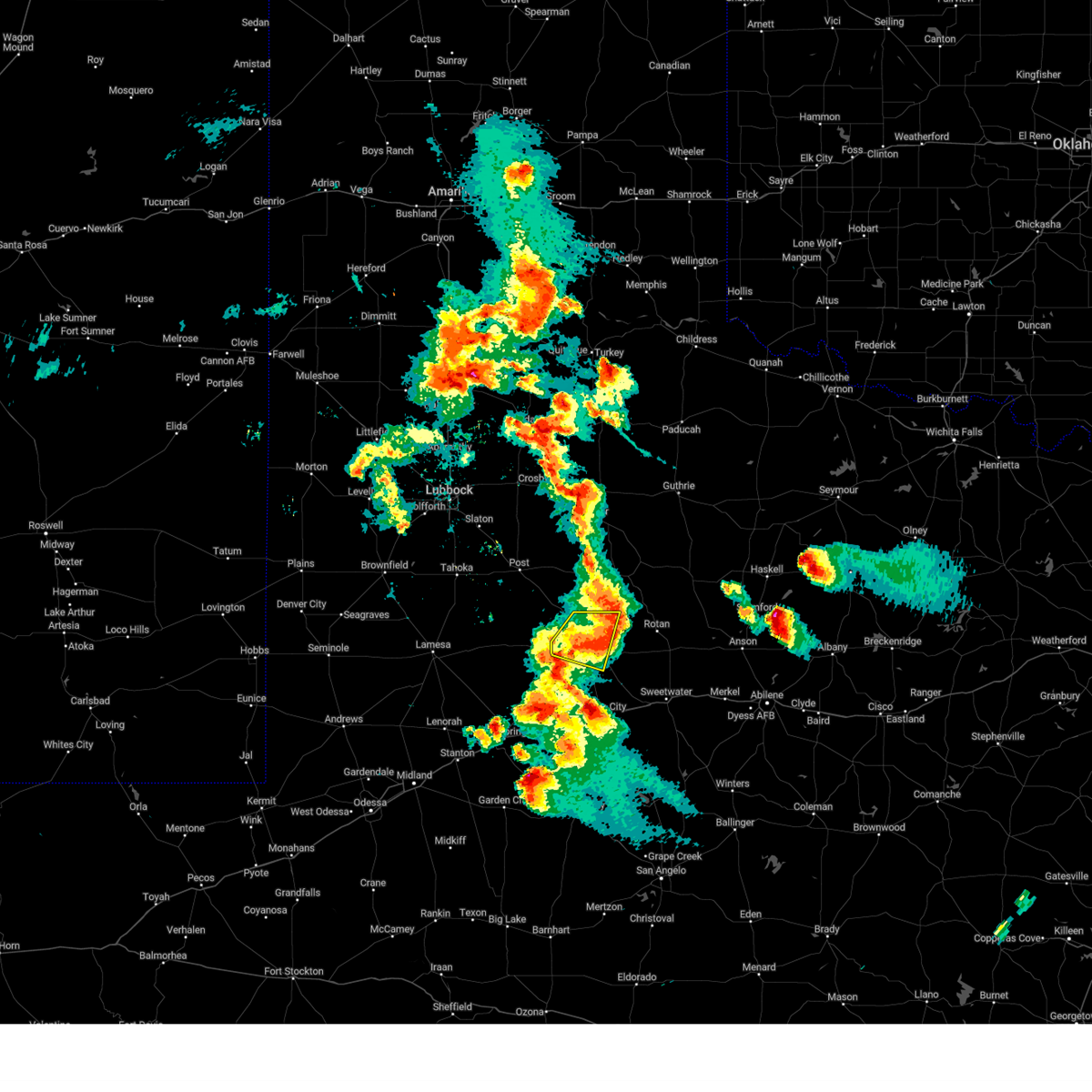 At 818 pm cdt, a severe thunderstorm was located near snyder, moving east at 25 mph (fluvanna mesonet reported a 61 mph gust). Hazards include 60 mph wind gusts and quarter size hail. Hail damage to vehicles is expected. expect wind damage to roofs, siding, and trees. locations impacted include, snyder, randalls corner and winston field. hail threat, radar indicated max hail size, 1. 00 in wind threat, observed max wind gust, 60 mph. At 818 pm cdt, a severe thunderstorm was located near snyder, moving east at 25 mph (fluvanna mesonet reported a 61 mph gust). Hazards include 60 mph wind gusts and quarter size hail. Hail damage to vehicles is expected. expect wind damage to roofs, siding, and trees. locations impacted include, snyder, randalls corner and winston field. hail threat, radar indicated max hail size, 1. 00 in wind threat, observed max wind gust, 60 mph.
|
| 5/23/2023 8:12 PM CDT |
 At 812 pm cdt, a severe thunderstorm was located 8 miles west of hobbs, or 11 miles northeast of snyder, moving east at 40 mph (radar indicated). Hazards include 60 mph wind gusts and quarter size hail. Hail damage to vehicles is expected. Expect wind damage to roofs, siding, and trees. At 812 pm cdt, a severe thunderstorm was located 8 miles west of hobbs, or 11 miles northeast of snyder, moving east at 40 mph (radar indicated). Hazards include 60 mph wind gusts and quarter size hail. Hail damage to vehicles is expected. Expect wind damage to roofs, siding, and trees.
|
| 5/23/2023 8:05 PM CDT |
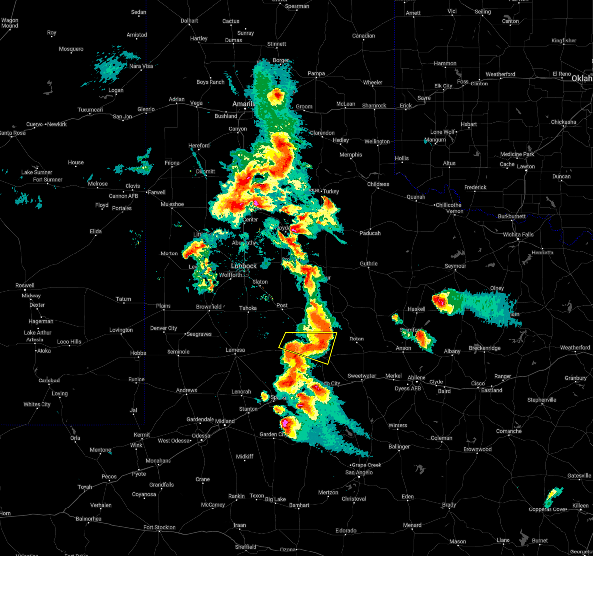 At 804 pm cdt, a severe thunderstorm was located 7 miles southeast of fluvanna, or 10 miles northwest of snyder, moving east at 25 mph (fluvanna mesonet continues to record gusts between 50-60 mph). Hazards include 60 mph wind gusts and quarter size hail. Hail damage to vehicles is expected. expect wind damage to roofs, siding, and trees. locations impacted include, snyder, fluvanna, winston field and randalls corner. hail threat, radar indicated max hail size, 1. 00 in wind threat, observed max wind gust, 60 mph. At 804 pm cdt, a severe thunderstorm was located 7 miles southeast of fluvanna, or 10 miles northwest of snyder, moving east at 25 mph (fluvanna mesonet continues to record gusts between 50-60 mph). Hazards include 60 mph wind gusts and quarter size hail. Hail damage to vehicles is expected. expect wind damage to roofs, siding, and trees. locations impacted include, snyder, fluvanna, winston field and randalls corner. hail threat, radar indicated max hail size, 1. 00 in wind threat, observed max wind gust, 60 mph.
|
| 5/23/2023 8:01 PM CDT |
 At 801 pm cdt, severe thunderstorms were located along a line extending from near j b thomas reservoir to near coahoma, moving east at 30 mph (radar indicated). Hazards include ping pong ball size hail and 60 mph wind gusts. People and animals outdoors will be injured. expect hail damage to roofs, siding, windows, and vehicles. expect wind damage to roofs, siding, and trees. locations impacted include, snyder, colorado city, coahoma, loraine, colorado city airport, j b thomas reservoir, lake colorado city, lake colorado city state park, inadale, champion creek reservoir, luther, westbrook, vincent, hermleigh, winston field, cuthbert, knapp, buford, dunn and ira. this includes interstate 20 between mile markers 189 and 228. hail threat, radar indicated max hail size, 1. 50 in wind threat, radar indicated max wind gust, 60 mph. At 801 pm cdt, severe thunderstorms were located along a line extending from near j b thomas reservoir to near coahoma, moving east at 30 mph (radar indicated). Hazards include ping pong ball size hail and 60 mph wind gusts. People and animals outdoors will be injured. expect hail damage to roofs, siding, windows, and vehicles. expect wind damage to roofs, siding, and trees. locations impacted include, snyder, colorado city, coahoma, loraine, colorado city airport, j b thomas reservoir, lake colorado city, lake colorado city state park, inadale, champion creek reservoir, luther, westbrook, vincent, hermleigh, winston field, cuthbert, knapp, buford, dunn and ira. this includes interstate 20 between mile markers 189 and 228. hail threat, radar indicated max hail size, 1. 50 in wind threat, radar indicated max wind gust, 60 mph.
|
| 5/23/2023 7:42 PM CDT |
 At 742 pm cdt, severe thunderstorms were located along a line extending from 8 miles northwest of j b thomas reservoir to near luther, moving east at 30 mph (radar indicated). Hazards include 60 mph wind gusts and quarter size hail. Hail damage to vehicles is expected. Expect wind damage to roofs, siding, and trees. At 742 pm cdt, severe thunderstorms were located along a line extending from 8 miles northwest of j b thomas reservoir to near luther, moving east at 30 mph (radar indicated). Hazards include 60 mph wind gusts and quarter size hail. Hail damage to vehicles is expected. Expect wind damage to roofs, siding, and trees.
|
| 5/23/2023 7:39 PM CDT |
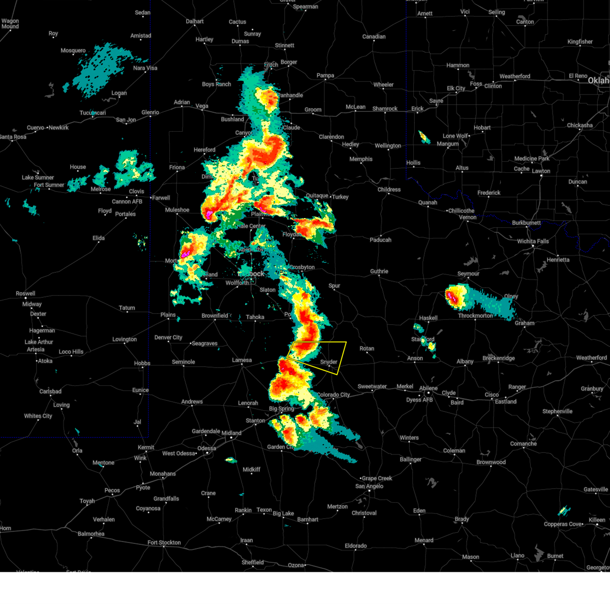 At 738 pm cdt, a severe thunderstorm was located over fluvanna, or 12 miles southwest of lake alan henry, moving east at 25 mph (the fluvanna mesonet reported a 61 mph wind gust at 728 pm cdt). Hazards include 60 mph wind gusts and quarter size hail. Hail damage to vehicles is expected. expect wind damage to roofs, siding, and trees. locations impacted include, snyder, fluvanna, winston field and randalls corner. hail threat, radar indicated max hail size, 1. 00 in wind threat, observed max wind gust, 60 mph. At 738 pm cdt, a severe thunderstorm was located over fluvanna, or 12 miles southwest of lake alan henry, moving east at 25 mph (the fluvanna mesonet reported a 61 mph wind gust at 728 pm cdt). Hazards include 60 mph wind gusts and quarter size hail. Hail damage to vehicles is expected. expect wind damage to roofs, siding, and trees. locations impacted include, snyder, fluvanna, winston field and randalls corner. hail threat, radar indicated max hail size, 1. 00 in wind threat, observed max wind gust, 60 mph.
|
| 5/23/2023 7:25 PM CDT |
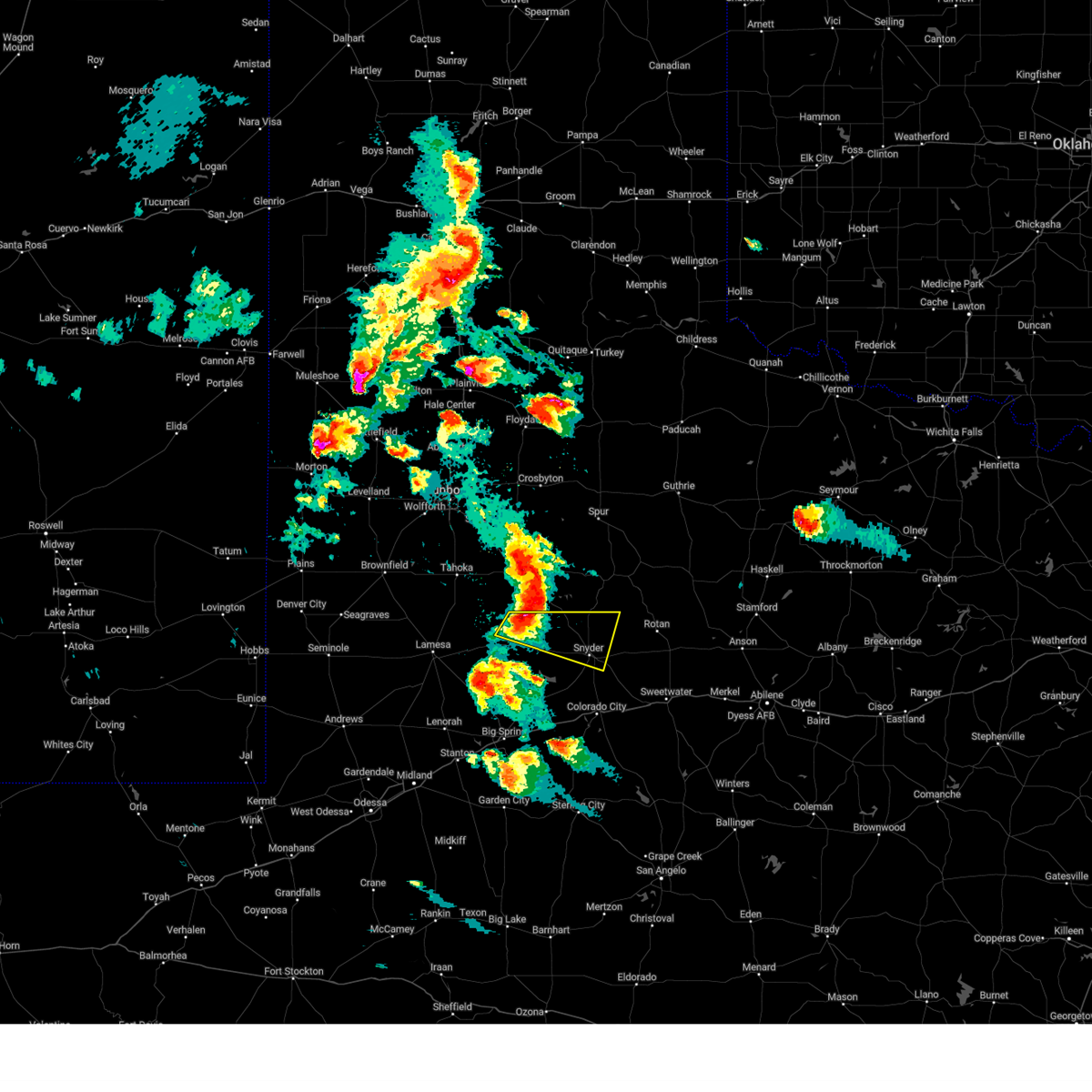 At 725 pm cdt, a severe thunderstorm was located 7 miles west of fluvanna, or 13 miles northeast of gail, moving east at 25 mph (radar indicated). Hazards include 60 mph wind gusts and quarter size hail. Hail damage to vehicles is expected. Expect wind damage to roofs, siding, and trees. At 725 pm cdt, a severe thunderstorm was located 7 miles west of fluvanna, or 13 miles northeast of gail, moving east at 25 mph (radar indicated). Hazards include 60 mph wind gusts and quarter size hail. Hail damage to vehicles is expected. Expect wind damage to roofs, siding, and trees.
|
| 5/22/2023 9:27 PM CDT |
 At 927 pm cdt, a severe thunderstorm was located 7 miles east of snyder, moving east at 35 mph (radar indicated). Hazards include 60 mph wind gusts and quarter size hail. Hail damage to vehicles is expected. Expect wind damage to roofs, siding, and trees. At 927 pm cdt, a severe thunderstorm was located 7 miles east of snyder, moving east at 35 mph (radar indicated). Hazards include 60 mph wind gusts and quarter size hail. Hail damage to vehicles is expected. Expect wind damage to roofs, siding, and trees.
|
| 5/22/2023 9:17 PM CDT | Storm damage reported in scurry county TX, 2.8 miles W of Snyder, TX |
| 5/18/2023 4:03 PM CDT | Quarter sized hail reported 18.4 miles SE of Snyder, TX, social media report showing hail up to about quarter size in fluvanna. time estimated by radar. |
| 5/7/2023 4:06 PM CDT |
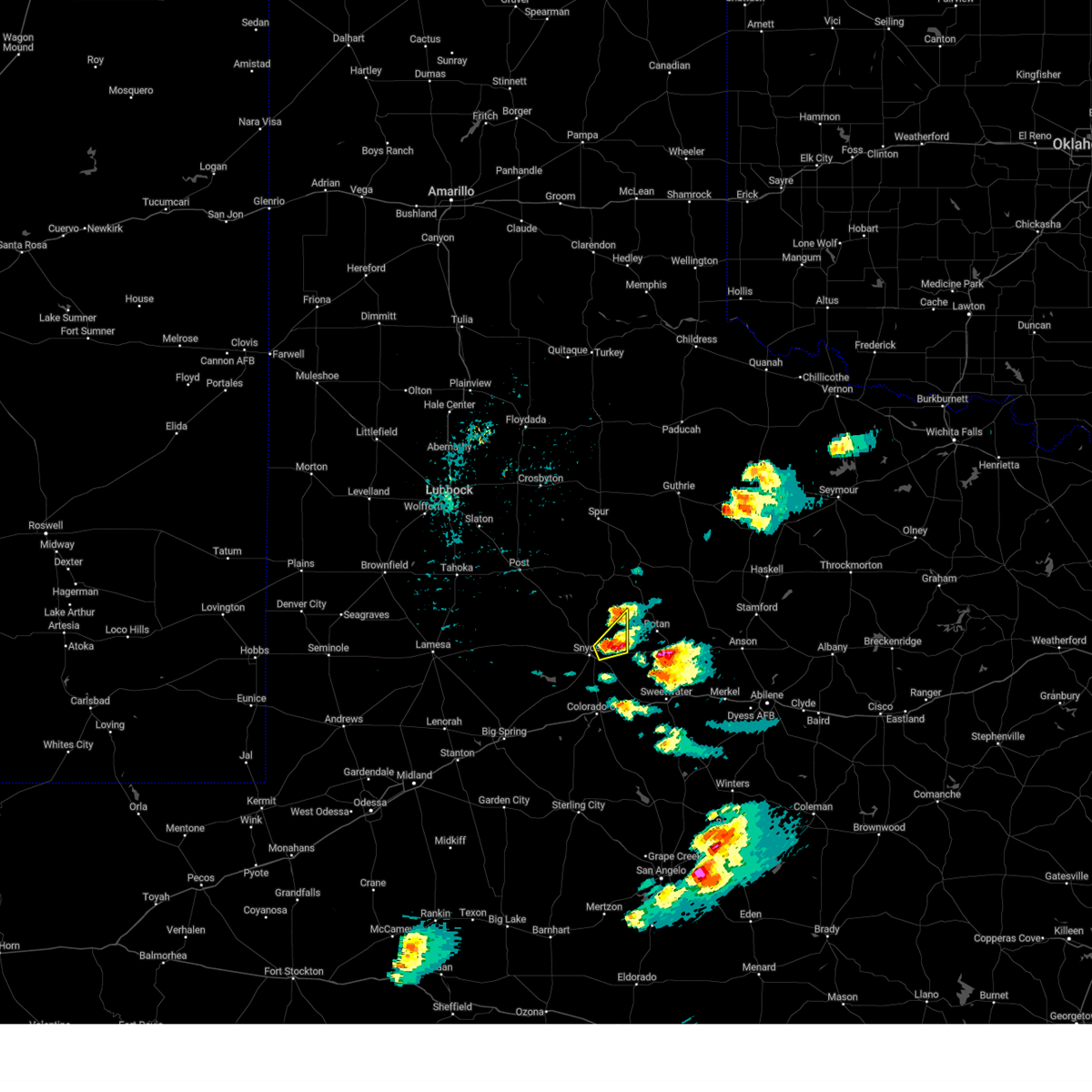 At 406 pm cdt, a severe thunderstorm was located 8 miles west of hobbs, or 11 miles east of snyder, moving northeast at 15 mph (radar indicated). Hazards include 60 mph wind gusts and quarter size hail. Hail damage to vehicles is expected. expect wind damage to roofs, siding, and trees. this severe thunderstorm will remain over mainly rural areas of northeastern scurry county. hail threat, radar indicated max hail size, 1. 00 in wind threat, radar indicated max wind gust, 60 mph. At 406 pm cdt, a severe thunderstorm was located 8 miles west of hobbs, or 11 miles east of snyder, moving northeast at 15 mph (radar indicated). Hazards include 60 mph wind gusts and quarter size hail. Hail damage to vehicles is expected. expect wind damage to roofs, siding, and trees. this severe thunderstorm will remain over mainly rural areas of northeastern scurry county. hail threat, radar indicated max hail size, 1. 00 in wind threat, radar indicated max wind gust, 60 mph.
|
| 4/25/2023 9:47 PM CDT |
 At 947 pm cdt, a severe thunderstorm was located near snyder, moving southeast at 30 mph (radar indicated). Hazards include 60 mph wind gusts and quarter size hail. Hail damage to vehicles is expected. expect wind damage to roofs, siding, and trees. locations impacted include, snyder, inadale, hermleigh and winston field. hail threat, radar indicated max hail size, 1. 00 in wind threat, radar indicated max wind gust, 60 mph. At 947 pm cdt, a severe thunderstorm was located near snyder, moving southeast at 30 mph (radar indicated). Hazards include 60 mph wind gusts and quarter size hail. Hail damage to vehicles is expected. expect wind damage to roofs, siding, and trees. locations impacted include, snyder, inadale, hermleigh and winston field. hail threat, radar indicated max hail size, 1. 00 in wind threat, radar indicated max wind gust, 60 mph.
|
| 4/25/2023 9:29 PM CDT |
 At 929 pm cdt, a severe thunderstorm was located near snyder, moving southeast at 35 mph (radar indicated). Hazards include 60 mph wind gusts and half dollar size hail. Hail damage to vehicles is expected. Expect wind damage to roofs, siding, and trees. At 929 pm cdt, a severe thunderstorm was located near snyder, moving southeast at 35 mph (radar indicated). Hazards include 60 mph wind gusts and half dollar size hail. Hail damage to vehicles is expected. Expect wind damage to roofs, siding, and trees.
|
| 4/25/2023 9:25 PM CDT | Golf Ball sized hail reported 5 miles SSE of Snyder, TX, hail observed near us84 and cr258. |
| 4/25/2023 8:59 PM CDT |
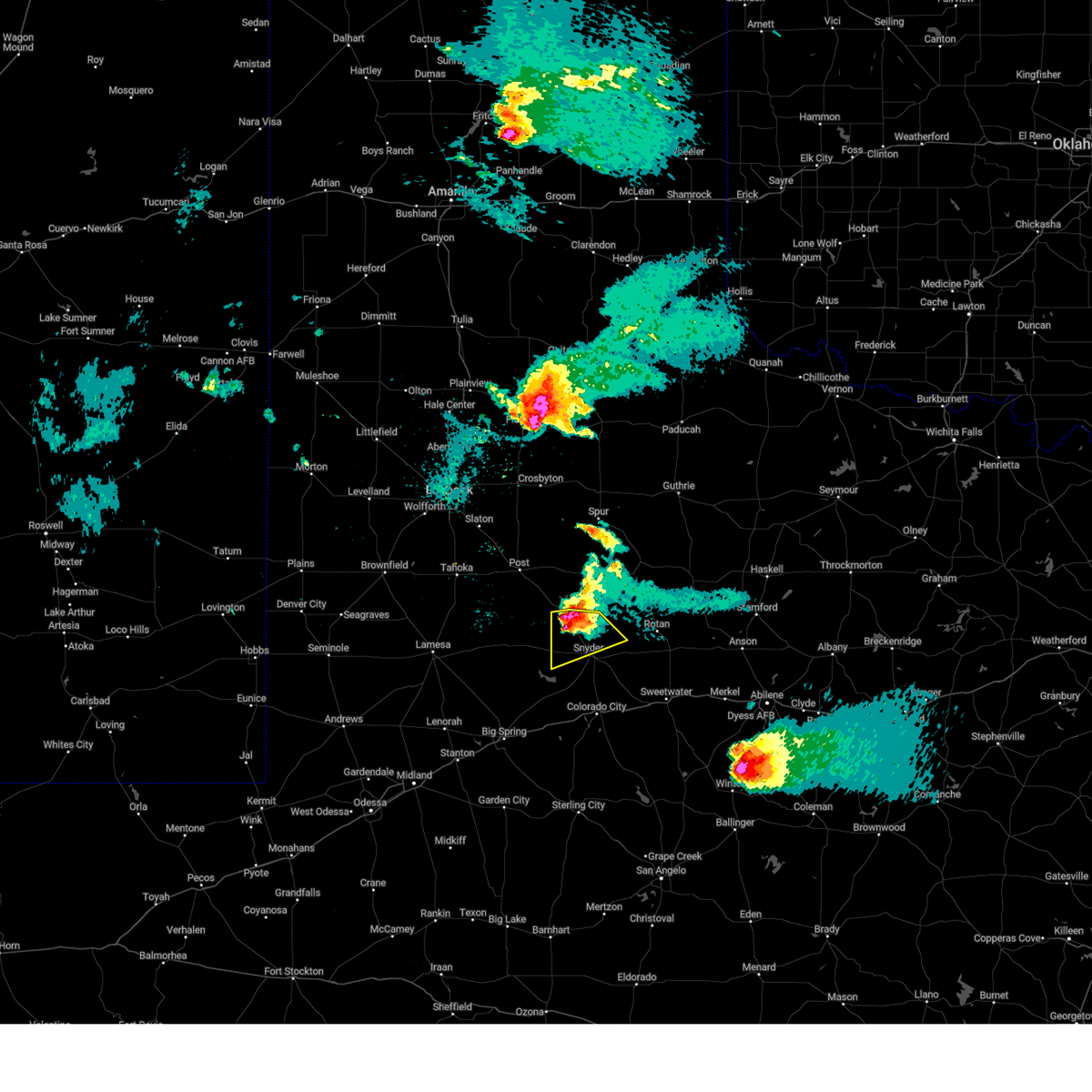 At 858 pm cdt, a severe thunderstorm was located near fluvanna, or 12 miles northwest of snyder, moving southeast at 30 mph (radar indicated). Hazards include 60 mph wind gusts and half dollar size hail. Hail damage to vehicles is expected. expect wind damage to roofs, siding, and trees. locations impacted include, snyder, fluvanna and randalls corner. hail threat, radar indicated max hail size, 1. 25 in wind threat, radar indicated max wind gust, 60 mph. At 858 pm cdt, a severe thunderstorm was located near fluvanna, or 12 miles northwest of snyder, moving southeast at 30 mph (radar indicated). Hazards include 60 mph wind gusts and half dollar size hail. Hail damage to vehicles is expected. expect wind damage to roofs, siding, and trees. locations impacted include, snyder, fluvanna and randalls corner. hail threat, radar indicated max hail size, 1. 25 in wind threat, radar indicated max wind gust, 60 mph.
|
| 4/25/2023 8:26 PM CDT |
 At 826 pm cdt, a severe thunderstorm was located over justiceburg, or 9 miles west of lake alan henry, moving southeast at 30 mph (radar indicated). Hazards include 60 mph wind gusts and half dollar size hail. Hail damage to vehicles is expected. Expect wind damage to roofs, siding, and trees. At 826 pm cdt, a severe thunderstorm was located over justiceburg, or 9 miles west of lake alan henry, moving southeast at 30 mph (radar indicated). Hazards include 60 mph wind gusts and half dollar size hail. Hail damage to vehicles is expected. Expect wind damage to roofs, siding, and trees.
|
| 2/26/2023 7:31 PM CST | Mesonet station 37 snyder 3 in scurry county TX, 2.8 miles W of Snyder, TX |
| 2/26/2023 7:31 PM CST |
 At 730 pm cst, severe thunderstorms were located along a line extending from 9 miles south of clairemont to near j b thomas reservoir, moving east at 60 mph (radar indicated). Hazards include 60 mph wind gusts and penny size hail. Expect damage to roofs, siding, and trees. locations impacted include, snyder, colorado city airport, inadale, dunn, hermleigh, winston field, ira, cuthbert and buford. hail threat, radar indicated max hail size, 0. 75 in wind threat, radar indicated max wind gust, 60 mph. At 730 pm cst, severe thunderstorms were located along a line extending from 9 miles south of clairemont to near j b thomas reservoir, moving east at 60 mph (radar indicated). Hazards include 60 mph wind gusts and penny size hail. Expect damage to roofs, siding, and trees. locations impacted include, snyder, colorado city airport, inadale, dunn, hermleigh, winston field, ira, cuthbert and buford. hail threat, radar indicated max hail size, 0. 75 in wind threat, radar indicated max wind gust, 60 mph.
|
| 2/26/2023 7:18 PM CST |
 At 717 pm cst, severe thunderstorms were located along a line extending from 13 miles east of lake alan henry to 9 miles east of luther, moving east at 60 mph (radar indicated). Hazards include 60 mph wind gusts and penny size hail. expect damage to roofs, siding, and trees At 717 pm cst, severe thunderstorms were located along a line extending from 13 miles east of lake alan henry to 9 miles east of luther, moving east at 60 mph (radar indicated). Hazards include 60 mph wind gusts and penny size hail. expect damage to roofs, siding, and trees
|
| 8/29/2022 8:24 PM CDT |
 At 824 pm cdt, severe thunderstorms were located along a line extending from 7 miles east of snyder to near ackerly, moving southeast at 45 mph (radar indicated). Hazards include 60 mph wind gusts and penny size hail. Expect damage to roofs, siding, and trees. locations impacted include, snyder, lamesa, ackerly, gail, fluvanna, lamesa municipal airport, j b thomas reservoir, los ybanez, sparenberg, randalls corner, arvana, winston field, knapp, hancock, tenmile, vealmoor and key. hail threat, radar indicated max hail size, 0. 75 in wind threat, radar indicated max wind gust, 60 mph. At 824 pm cdt, severe thunderstorms were located along a line extending from 7 miles east of snyder to near ackerly, moving southeast at 45 mph (radar indicated). Hazards include 60 mph wind gusts and penny size hail. Expect damage to roofs, siding, and trees. locations impacted include, snyder, lamesa, ackerly, gail, fluvanna, lamesa municipal airport, j b thomas reservoir, los ybanez, sparenberg, randalls corner, arvana, winston field, knapp, hancock, tenmile, vealmoor and key. hail threat, radar indicated max hail size, 0. 75 in wind threat, radar indicated max wind gust, 60 mph.
|
| 8/29/2022 7:47 PM CDT |
 At 744 pm cdt, severe thunderstorms were located along a line extending from near lake alan henry to 8 miles north of lamesa municipal airport, moving southeast at 35 mph (grasslands in garza county measured a wind gust of 64 mph at 740 pm cdt). Hazards include 60 mph wind gusts and penny size hail. expect damage to roofs, siding, and trees At 744 pm cdt, severe thunderstorms were located along a line extending from near lake alan henry to 8 miles north of lamesa municipal airport, moving southeast at 35 mph (grasslands in garza county measured a wind gust of 64 mph at 740 pm cdt). Hazards include 60 mph wind gusts and penny size hail. expect damage to roofs, siding, and trees
|
| 5/10/2022 9:34 PM CDT |
 At 933 pm cdt, a strong thunderstorm capable of producing damaging winds was located near snyder, moving northeast at 40 mph (the west texas mesonet 3 miles east of snyder reported a 62 mph wind gust). Hazards include 60 mph wind gusts and penny size hail. Expect damage to roofs, siding, and trees. locations impacted include, snyder, fluvanna, inadale, j b thomas reservoir, dunn, hermleigh, randalls corner, ira, winston field and knapp. hail threat, radar indicated max hail size, 0. 75 in wind threat, observed max wind gust, 60 mph. At 933 pm cdt, a strong thunderstorm capable of producing damaging winds was located near snyder, moving northeast at 40 mph (the west texas mesonet 3 miles east of snyder reported a 62 mph wind gust). Hazards include 60 mph wind gusts and penny size hail. Expect damage to roofs, siding, and trees. locations impacted include, snyder, fluvanna, inadale, j b thomas reservoir, dunn, hermleigh, randalls corner, ira, winston field and knapp. hail threat, radar indicated max hail size, 0. 75 in wind threat, observed max wind gust, 60 mph.
|
| 5/10/2022 9:00 PM CDT | Storm damage reported in scurry county TX, 2.8 miles W of Snyder, TX |
| 5/10/2022 8:58 PM CDT |
 At 858 pm cdt, severe thunderstorms were located along a line extending from near gail to near j b thomas reservoir to loraine, moving northeast at 50 mph (a 61 mph wind gust was recently reported at gail with these storms). Hazards include 60 mph wind gusts and penny size hail. expect damage to roofs, siding, and trees At 858 pm cdt, severe thunderstorms were located along a line extending from near gail to near j b thomas reservoir to loraine, moving northeast at 50 mph (a 61 mph wind gust was recently reported at gail with these storms). Hazards include 60 mph wind gusts and penny size hail. expect damage to roofs, siding, and trees
|
| 5/10/2022 8:37 PM CDT |
 At 836 pm cdt, a strong outflow boundary was located along a line extending from 9 miles east of lamesa municipal airport to 7 miles northwest of j b thomas reservoir to near colorado city airport, moving northeast at 60 mph (a 61 mph wind gust was reported in big spring). Hazards include 60 mph wind gusts. Expect damage to roofs, siding, and trees. locations impacted include, snyder, lamesa, colorado city, ackerly, gail, loraine, lake colorado city, lake colorado city state park, inadale, luther, fluvanna, colorado city airport, j b thomas reservoir, lamesa municipal airport, champion creek reservoir, westbrook, los ybanez, patricia, arvana and hancock. this includes interstate 20 between mile markers 190 and 228. hail threat, radar indicated max hail size, <. 75 in wind threat, observed max wind gust, 60 mph. At 836 pm cdt, a strong outflow boundary was located along a line extending from 9 miles east of lamesa municipal airport to 7 miles northwest of j b thomas reservoir to near colorado city airport, moving northeast at 60 mph (a 61 mph wind gust was reported in big spring). Hazards include 60 mph wind gusts. Expect damage to roofs, siding, and trees. locations impacted include, snyder, lamesa, colorado city, ackerly, gail, loraine, lake colorado city, lake colorado city state park, inadale, luther, fluvanna, colorado city airport, j b thomas reservoir, lamesa municipal airport, champion creek reservoir, westbrook, los ybanez, patricia, arvana and hancock. this includes interstate 20 between mile markers 190 and 228. hail threat, radar indicated max hail size, <. 75 in wind threat, observed max wind gust, 60 mph.
|
| 5/10/2022 8:07 PM CDT |
 At 806 pm cdt, an outflow boundary associated with thunderstorms was located along a line extending from 9 miles northwest of lenorah to near big spring to 11 miles east of forsan, moving northeast at 65 mph (a 61 mph wind gust was reported in big spring). Hazards include 60 mph wind gusts. expect damage to roofs, siding, and trees At 806 pm cdt, an outflow boundary associated with thunderstorms was located along a line extending from 9 miles northwest of lenorah to near big spring to 11 miles east of forsan, moving northeast at 65 mph (a 61 mph wind gust was reported in big spring). Hazards include 60 mph wind gusts. expect damage to roofs, siding, and trees
|
| 5/4/2022 6:54 PM CDT |
 At 653 pm cdt, a severe thunderstorm was located 9 miles east of snyder, moving northeast at 20 mph. at 6:46 pm cdt, spotter reported golf ball size hail along us hwy 84 between snyder and hermleigh (trained weather spotters). Hazards include golf ball size hail and 60 mph wind gusts. People and animals outdoors will be injured. expect hail damage to roofs, siding, windows, and vehicles. Expect wind damage to roofs, siding, and trees. At 653 pm cdt, a severe thunderstorm was located 9 miles east of snyder, moving northeast at 20 mph. at 6:46 pm cdt, spotter reported golf ball size hail along us hwy 84 between snyder and hermleigh (trained weather spotters). Hazards include golf ball size hail and 60 mph wind gusts. People and animals outdoors will be injured. expect hail damage to roofs, siding, windows, and vehicles. Expect wind damage to roofs, siding, and trees.
|
| 5/4/2022 6:46 PM CDT | Golf Ball sized hail reported 5.5 miles WNW of Snyder, TX, golf ball sized hail observed on us84 between hermleigh and snyder. |
| 5/4/2022 6:46 PM CDT |
 At 646 pm cdt, a severe thunderstorm was located near snyder, moving northeast at 20 mph (radar indicated). Hazards include 60 mph wind gusts and half dollar size hail. Hail damage to vehicles is expected. Expect wind damage to roofs, siding, and trees. At 646 pm cdt, a severe thunderstorm was located near snyder, moving northeast at 20 mph (radar indicated). Hazards include 60 mph wind gusts and half dollar size hail. Hail damage to vehicles is expected. Expect wind damage to roofs, siding, and trees.
|
| 5/1/2022 8:04 PM CDT |
 At 803 pm cdt, a severe thunderstorm was located near hobbs, or 15 miles east of snyder, moving east at 15 mph (radar indicated). Hazards include two inch hail and 70 mph wind gusts. People and animals outdoors will be injured. expect hail damage to roofs, siding, windows, and vehicles. expect considerable tree damage. wind damage is also likely to mobile homes, roofs, and outbuildings. Locations impacted include, snyder, inadale, dunn and hermleigh. At 803 pm cdt, a severe thunderstorm was located near hobbs, or 15 miles east of snyder, moving east at 15 mph (radar indicated). Hazards include two inch hail and 70 mph wind gusts. People and animals outdoors will be injured. expect hail damage to roofs, siding, windows, and vehicles. expect considerable tree damage. wind damage is also likely to mobile homes, roofs, and outbuildings. Locations impacted include, snyder, inadale, dunn and hermleigh.
|
| 5/1/2022 7:54 PM CDT |
 At 753 pm cdt, a severe thunderstorm was located 9 miles southwest of hobbs, or 12 miles east of snyder, moving east at 15 mph (radar indicated). Hazards include two inch hail and 70 mph wind gusts. People and animals outdoors will be injured. expect hail damage to roofs, siding, windows, and vehicles. expect considerable tree damage. wind damage is also likely to mobile homes, roofs, and outbuildings. Locations impacted include, snyder, inadale, dunn, winston field, hermleigh and randalls corner. At 753 pm cdt, a severe thunderstorm was located 9 miles southwest of hobbs, or 12 miles east of snyder, moving east at 15 mph (radar indicated). Hazards include two inch hail and 70 mph wind gusts. People and animals outdoors will be injured. expect hail damage to roofs, siding, windows, and vehicles. expect considerable tree damage. wind damage is also likely to mobile homes, roofs, and outbuildings. Locations impacted include, snyder, inadale, dunn, winston field, hermleigh and randalls corner.
|
| 5/1/2022 7:44 PM CDT |
 At 743 pm cdt, a severe thunderstorm was located 9 miles east of snyder, moving east at 15 mph. this is a destructive storm for eastern scurry county including snyder (radar indicated). Hazards include 80 mph wind gusts and baseball size hail. Flying debris will be dangerous to those caught without shelter. mobile homes will be heavily damaged. expect considerable damage to roofs, windows, and vehicles. Extensive tree damage and power outages are likely. At 743 pm cdt, a severe thunderstorm was located 9 miles east of snyder, moving east at 15 mph. this is a destructive storm for eastern scurry county including snyder (radar indicated). Hazards include 80 mph wind gusts and baseball size hail. Flying debris will be dangerous to those caught without shelter. mobile homes will be heavily damaged. expect considerable damage to roofs, windows, and vehicles. Extensive tree damage and power outages are likely.
|
| 5/1/2022 7:31 PM CDT |
 At 730 pm cdt, a confirmed tornado was located near snyder, moving east at 15 mph (emergency management confirmed tornado, brief touchdown). Hazards include damaging tornado and tennis ball size hail. Flying debris will be dangerous to those caught without shelter. mobile homes will be damaged or destroyed. damage to roofs, windows, and vehicles will occur. tree damage is likely. the tornado will be near, snyder and hermleigh. Other locations impacted by this tornadic thunderstorm include hermleigh. At 730 pm cdt, a confirmed tornado was located near snyder, moving east at 15 mph (emergency management confirmed tornado, brief touchdown). Hazards include damaging tornado and tennis ball size hail. Flying debris will be dangerous to those caught without shelter. mobile homes will be damaged or destroyed. damage to roofs, windows, and vehicles will occur. tree damage is likely. the tornado will be near, snyder and hermleigh. Other locations impacted by this tornadic thunderstorm include hermleigh.
|
| 5/1/2022 7:27 PM CDT |
 At 726 pm cdt, a severe thunderstorm was located 9 miles north of inadale, or 11 miles east of snyder, moving east at 20 mph (public and law enforcement report ping pong size hail in the city of snyder). Hazards include tennis ball size hail and 70 mph wind gusts. People and animals outdoors will be injured. expect hail damage to roofs, siding, windows, and vehicles. expect considerable tree damage. wind damage is also likely to mobile homes, roofs, and outbuildings. Locations impacted include, snyder, dunn, ira, winston field, hermleigh and randalls corner. At 726 pm cdt, a severe thunderstorm was located 9 miles north of inadale, or 11 miles east of snyder, moving east at 20 mph (public and law enforcement report ping pong size hail in the city of snyder). Hazards include tennis ball size hail and 70 mph wind gusts. People and animals outdoors will be injured. expect hail damage to roofs, siding, windows, and vehicles. expect considerable tree damage. wind damage is also likely to mobile homes, roofs, and outbuildings. Locations impacted include, snyder, dunn, ira, winston field, hermleigh and randalls corner.
|
| 5/1/2022 7:11 PM CDT |
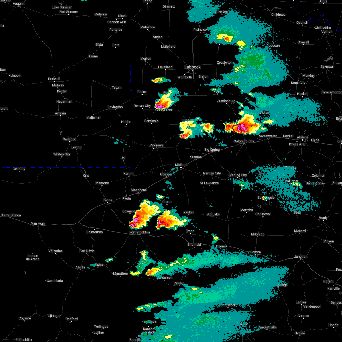 The tornado warning for southwestern scurry county will expire at 715 pm cdt, the storm which prompted the warning has weakened below severe limits, and has exited the warned area. therefore, the warning will be allowed to expire. however large hail and gusty winds are still possible with this thunderstorm. a tornado watch remains in effect until 1000 pm cdt for western texas. The tornado warning for southwestern scurry county will expire at 715 pm cdt, the storm which prompted the warning has weakened below severe limits, and has exited the warned area. therefore, the warning will be allowed to expire. however large hail and gusty winds are still possible with this thunderstorm. a tornado watch remains in effect until 1000 pm cdt for western texas.
|
| 5/1/2022 7:02 PM CDT |
 At 702 pm cdt, a severe thunderstorm was located near snyder, moving east at 20 mph. this is a destructive storm for scurry county including snyder (public reports of ping pong size hail in the city of snyder). Hazards include 80 mph wind gusts and softball size hail. Flying debris will be dangerous to those caught without shelter. mobile homes will be heavily damaged. expect considerable damage to roofs, windows, and vehicles. extensive tree damage and power outages are likely. Locations impacted include, snyder, dunn, ira, winston field, hermleigh and randalls corner. At 702 pm cdt, a severe thunderstorm was located near snyder, moving east at 20 mph. this is a destructive storm for scurry county including snyder (public reports of ping pong size hail in the city of snyder). Hazards include 80 mph wind gusts and softball size hail. Flying debris will be dangerous to those caught without shelter. mobile homes will be heavily damaged. expect considerable damage to roofs, windows, and vehicles. extensive tree damage and power outages are likely. Locations impacted include, snyder, dunn, ira, winston field, hermleigh and randalls corner.
|
| 5/1/2022 6:55 PM CDT |
 At 655 pm cdt, a severe thunderstorm was located near snyder, moving east at 20 mph. this is a destructive storm for scurry county including snyder (public reports ping pong size hail in the city of snyder). Hazards include 80 mph wind gusts and three inch hail. Flying debris will be dangerous to those caught without shelter. mobile homes will be heavily damaged. expect considerable damage to roofs, windows, and vehicles. extensive tree damage and power outages are likely. Locations impacted include, snyder, dunn, ira, winston field, hermleigh and randalls corner. At 655 pm cdt, a severe thunderstorm was located near snyder, moving east at 20 mph. this is a destructive storm for scurry county including snyder (public reports ping pong size hail in the city of snyder). Hazards include 80 mph wind gusts and three inch hail. Flying debris will be dangerous to those caught without shelter. mobile homes will be heavily damaged. expect considerable damage to roofs, windows, and vehicles. extensive tree damage and power outages are likely. Locations impacted include, snyder, dunn, ira, winston field, hermleigh and randalls corner.
|
| 5/1/2022 6:54 PM CDT | Ping Pong Ball sized hail reported 0.9 miles NE of Snyder, TX |
| 5/1/2022 6:47 PM CDT |
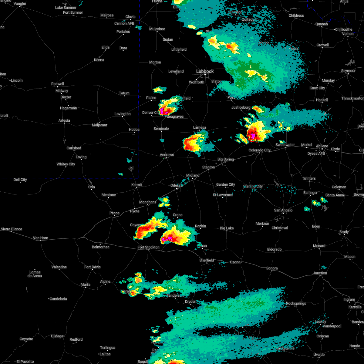 At 647 pm cdt, a severe thunderstorm capable of producing a tornado was located 8 miles southwest of snyder, moving east at 15 mph (radar indicated rotation. spotters on the ground confirm rotating wall cloud). Hazards include tornado and three inch hail. Flying debris will be dangerous to those caught without shelter. mobile homes will be damaged or destroyed. damage to roofs, windows, and vehicles will occur. tree damage is likely. Locations impacted include, snyder, ira and winston field. At 647 pm cdt, a severe thunderstorm capable of producing a tornado was located 8 miles southwest of snyder, moving east at 15 mph (radar indicated rotation. spotters on the ground confirm rotating wall cloud). Hazards include tornado and three inch hail. Flying debris will be dangerous to those caught without shelter. mobile homes will be damaged or destroyed. damage to roofs, windows, and vehicles will occur. tree damage is likely. Locations impacted include, snyder, ira and winston field.
|
| 5/1/2022 6:39 PM CDT |
 At 638 pm cdt, a severe thunderstorm was located near snyder, moving east at 20 mph. this is a destructive storm for scurry county including snyder (radar indicated). Hazards include 80 mph wind gusts and three inch hail. Flying debris will be dangerous to those caught without shelter. mobile homes will be heavily damaged. expect considerable damage to roofs, windows, and vehicles. Extensive tree damage and power outages are likely. At 638 pm cdt, a severe thunderstorm was located near snyder, moving east at 20 mph. this is a destructive storm for scurry county including snyder (radar indicated). Hazards include 80 mph wind gusts and three inch hail. Flying debris will be dangerous to those caught without shelter. mobile homes will be heavily damaged. expect considerable damage to roofs, windows, and vehicles. Extensive tree damage and power outages are likely.
|
| 5/1/2022 6:25 PM CDT |
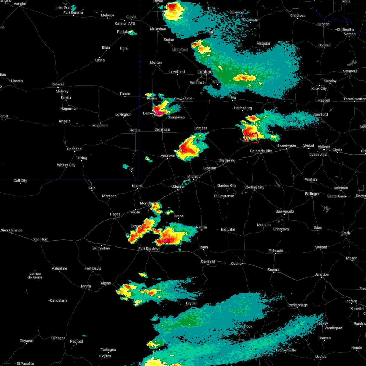 At 625 pm cdt, a severe thunderstorm capable of producing a tornado was located near j b thomas reservoir, or 12 miles southwest of snyder, moving east at 15 mph (radar indicated rotation). Hazards include tornado and hail up to three inches in diameter. Flying debris will be dangerous to those caught without shelter. mobile homes will be damaged or destroyed. damage to roofs, windows, and vehicles will occur. tree damage is likely. This tornadic thunderstorm will remain over mainly rural areas of southwestern scurry county, including the following locations, ira, winston field and knapp. At 625 pm cdt, a severe thunderstorm capable of producing a tornado was located near j b thomas reservoir, or 12 miles southwest of snyder, moving east at 15 mph (radar indicated rotation). Hazards include tornado and hail up to three inches in diameter. Flying debris will be dangerous to those caught without shelter. mobile homes will be damaged or destroyed. damage to roofs, windows, and vehicles will occur. tree damage is likely. This tornadic thunderstorm will remain over mainly rural areas of southwestern scurry county, including the following locations, ira, winston field and knapp.
|
| 9/30/2021 2:35 PM CDT | Snyder awos measured 61 mph wind gus in scurry county TX, 2.6 miles NE of Snyder, TX |
| 9/30/2021 2:32 PM CDT |
 At 231 pm cdt, severe thunderstorms were located along a line extending from 6 miles southwest of snyder to 6 miles southwest of champion creek reservoir, moving northeast at 25 mph (radar indicated). Hazards include 60 mph wind gusts and quarter size hail. Hail damage to vehicles is expected. expect wind damage to roofs, siding, and trees. locations impacted include, snyder, colorado city, loraine, colorado city airport, lake colorado city, lake colorado city state park, inadale, champion creek reservoir, j b thomas reservoir, westbrook, hermleigh, randalls corner, winston field, knapp, cuthbert, buford, dunn and ira. this includes interstate 20 between mile markers 207 and 228. hail threat, radar indicated max hail size, 1. 00 in wind threat, radar indicated max wind gust, 60 mph. At 231 pm cdt, severe thunderstorms were located along a line extending from 6 miles southwest of snyder to 6 miles southwest of champion creek reservoir, moving northeast at 25 mph (radar indicated). Hazards include 60 mph wind gusts and quarter size hail. Hail damage to vehicles is expected. expect wind damage to roofs, siding, and trees. locations impacted include, snyder, colorado city, loraine, colorado city airport, lake colorado city, lake colorado city state park, inadale, champion creek reservoir, j b thomas reservoir, westbrook, hermleigh, randalls corner, winston field, knapp, cuthbert, buford, dunn and ira. this includes interstate 20 between mile markers 207 and 228. hail threat, radar indicated max hail size, 1. 00 in wind threat, radar indicated max wind gust, 60 mph.
|
| 9/30/2021 2:05 PM CDT | Quarter sized hail reported 2.6 miles NE of Snyder, TX, report of quarter size hail. |
| 9/30/2021 2:05 PM CDT | Downed power lines and tree limbs. same time and location as previous report of quarter size hai in scurry county TX, 2.6 miles NE of Snyder, TX |
| 9/30/2021 1:59 PM CDT |
 At 159 pm cdt, severe thunderstorms were located along a line extending from 8 miles southwest of j b thomas reservoir to 17 miles southwest of lake colorado city state park, moving northeast at 25 mph (radar indicated). Hazards include 60 mph wind gusts and quarter size hail. Hail damage to vehicles is expected. Expect wind damage to roofs, siding, and trees. At 159 pm cdt, severe thunderstorms were located along a line extending from 8 miles southwest of j b thomas reservoir to 17 miles southwest of lake colorado city state park, moving northeast at 25 mph (radar indicated). Hazards include 60 mph wind gusts and quarter size hail. Hail damage to vehicles is expected. Expect wind damage to roofs, siding, and trees.
|
| 6/26/2021 9:16 PM CDT |
 At 916 pm cdt, a severe thunderstorm was located 7 miles southeast of snyder, moving northeast at 40 mph (radar indicated). Hazards include 60 mph wind gusts. expect damage to roofs, siding, and trees At 916 pm cdt, a severe thunderstorm was located 7 miles southeast of snyder, moving northeast at 40 mph (radar indicated). Hazards include 60 mph wind gusts. expect damage to roofs, siding, and trees
|
| 6/7/2021 1:55 AM CDT |
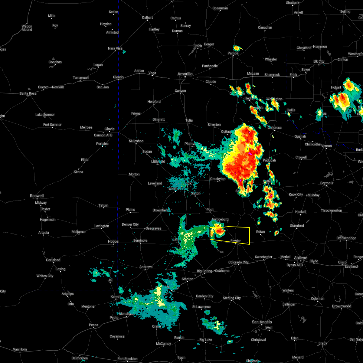 At 155 am cdt, a severe thunderstorm was located near fluvanna, or 12 miles southwest of lake alan henry, moving east at 20 mph (radar indicated). Hazards include 60 mph wind gusts and quarter size hail. Hail damage to vehicles is expected. expect wind damage to roofs, siding, and trees. Locations impacted include, snyder and fluvanna. At 155 am cdt, a severe thunderstorm was located near fluvanna, or 12 miles southwest of lake alan henry, moving east at 20 mph (radar indicated). Hazards include 60 mph wind gusts and quarter size hail. Hail damage to vehicles is expected. expect wind damage to roofs, siding, and trees. Locations impacted include, snyder and fluvanna.
|
| 6/7/2021 1:26 AM CDT |
 At 126 am cdt, a severe thunderstorm was located 9 miles west of fluvanna, or 11 miles northeast of gail, moving east at 30 mph (radar indicated). Hazards include 60 mph wind gusts and quarter size hail. Hail damage to vehicles is expected. Expect wind damage to roofs, siding, and trees. At 126 am cdt, a severe thunderstorm was located 9 miles west of fluvanna, or 11 miles northeast of gail, moving east at 30 mph (radar indicated). Hazards include 60 mph wind gusts and quarter size hail. Hail damage to vehicles is expected. Expect wind damage to roofs, siding, and trees.
|
| 5/25/2021 8:30 PM CDT | Quarter sized hail reported 1.4 miles ENE of Snyder, TX |
| 5/25/2021 8:17 PM CDT |
 At 817 pm cdt, a severe thunderstorm was located 7 miles northeast of snyder, moving northeast at 30 mph (radar indicated). Hazards include 60 mph wind gusts and half dollar size hail. Hail damage to vehicles is expected. expect wind damage to roofs, siding, and trees. Locations impacted include, snyder, gail, fluvanna, j b thomas reservoir, inadale, luther, hermleigh, randalls corner, winston field, knapp, dunn, knott, ira and vealmoor. At 817 pm cdt, a severe thunderstorm was located 7 miles northeast of snyder, moving northeast at 30 mph (radar indicated). Hazards include 60 mph wind gusts and half dollar size hail. Hail damage to vehicles is expected. expect wind damage to roofs, siding, and trees. Locations impacted include, snyder, gail, fluvanna, j b thomas reservoir, inadale, luther, hermleigh, randalls corner, winston field, knapp, dunn, knott, ira and vealmoor.
|
| 5/25/2021 7:44 PM CDT |
 At 743 pm cdt, severe thunderstorms located near j b thomas reservoir, or 10 miles southwest of snyder, moving northeast at 30 mph (radar indicated). Hazards include 60 mph wind gusts and half dollar size hail. Hail damage to vehicles is expected. Expect wind damage to roofs, siding, and trees. At 743 pm cdt, severe thunderstorms located near j b thomas reservoir, or 10 miles southwest of snyder, moving northeast at 30 mph (radar indicated). Hazards include 60 mph wind gusts and half dollar size hail. Hail damage to vehicles is expected. Expect wind damage to roofs, siding, and trees.
|
| 5/25/2021 7:37 PM CDT | Quarter sized hail reported 14.7 miles NE of Snyder, TX |
| 5/25/2021 7:25 PM CDT | Hen Egg sized hail reported 6 miles SE of Snyder, TX, em relayed report of broken car windshield due to hail at 1611 and hwy 84. |
| 5/25/2021 6:55 PM CDT |
 At 654 pm cdt, a severe thunderstorm was located 9 miles south of fluvanna, or 14 miles east of gail, moving northeast at 15 mph (radar indicated). Hazards include tennis ball size hail and 60 mph wind gusts. People and animals outdoors will be injured. expect hail damage to roofs, siding, windows, and vehicles. expect wind damage to roofs, siding, and trees. Locations impacted include, snyder, gail, fluvanna, j b thomas reservoir, randalls corner, ira, winston field and knapp. At 654 pm cdt, a severe thunderstorm was located 9 miles south of fluvanna, or 14 miles east of gail, moving northeast at 15 mph (radar indicated). Hazards include tennis ball size hail and 60 mph wind gusts. People and animals outdoors will be injured. expect hail damage to roofs, siding, windows, and vehicles. expect wind damage to roofs, siding, and trees. Locations impacted include, snyder, gail, fluvanna, j b thomas reservoir, randalls corner, ira, winston field and knapp.
|
| 5/25/2021 6:33 PM CDT |
 At 632 pm cdt, a severe thunderstorm was located 10 miles east of gail, moving northeast at 15 mph (radar indicated). Hazards include ping pong ball size hail and 60 mph wind gusts. People and animals outdoors will be injured. expect hail damage to roofs, siding, windows, and vehicles. Expect wind damage to roofs, siding, and trees. At 632 pm cdt, a severe thunderstorm was located 10 miles east of gail, moving northeast at 15 mph (radar indicated). Hazards include ping pong ball size hail and 60 mph wind gusts. People and animals outdoors will be injured. expect hail damage to roofs, siding, windows, and vehicles. Expect wind damage to roofs, siding, and trees.
|
| 5/18/2021 9:38 PM CDT |
 At 937 pm cdt, a severe thunderstorm was located 7 miles west of colorado city airport, or 12 miles northwest of colorado city, moving southeast at 25 mph (radar indicated). Hazards include golf ball size hail and 60 mph wind gusts. People and animals outdoors will be injured. expect hail damage to roofs, siding, windows, and vehicles. Expect wind damage to roofs, siding, and trees. At 937 pm cdt, a severe thunderstorm was located 7 miles west of colorado city airport, or 12 miles northwest of colorado city, moving southeast at 25 mph (radar indicated). Hazards include golf ball size hail and 60 mph wind gusts. People and animals outdoors will be injured. expect hail damage to roofs, siding, windows, and vehicles. Expect wind damage to roofs, siding, and trees.
|
| 5/18/2021 9:32 PM CDT | Golf Ball sized hail reported 14.1 miles NNE of Snyder, TX |
| 5/17/2021 6:05 PM CDT | 5 snapped power poles fm1606 and fm1610 all damage laying to the nort in scurry county TX, 9.3 miles NE of Snyder, TX |
| 5/17/2021 5:54 PM CDT | Mesonet reported gust of 60 mp in scurry county TX, 3.5 miles NNE of Snyder, TX |
| 5/17/2021 5:49 PM CDT | Report of tree down near lake jb thoma in scurry county TX, 18 miles ENE of Snyder, TX |
| 5/17/2021 5:43 PM CDT | Photo of down trees... likely due to a heat burs in scurry county TX, 8.6 miles NE of Snyder, TX |
| 5/16/2021 9:01 PM CDT |
 A severe thunderstorm warning remains in effect until 945 pm cdt for scurry county. at 900 pm cdt, a severe thunderstorm was located 8 miles east of snyder, moving east at 40 mph. storm has a history of three inch hail or greater in the town of snyder. This is a very dangerous storm. A severe thunderstorm warning remains in effect until 945 pm cdt for scurry county. at 900 pm cdt, a severe thunderstorm was located 8 miles east of snyder, moving east at 40 mph. storm has a history of three inch hail or greater in the town of snyder. This is a very dangerous storm.
|
| 5/16/2021 8:54 PM CDT | Grapefruit sized hail reported 1.7 miles WNW of Snyder, TX, photo of softball sized hail. |
| 5/16/2021 8:53 PM CDT |
 At 853 pm cdt, a severe thunderstorm was located over snyder, moving northeast at 35 mph. this is a very dangerous storm (trained weather spotters). Hazards include three inch hail and 60 mph wind gusts. People and animals outdoors will be severely injured. expect shattered windows, extensive damage to roofs, siding, and vehicles. Locations impacted include, snyder, j b thomas reservoir, dunn, hermleigh, randalls corner, ira, winston field and knapp. At 853 pm cdt, a severe thunderstorm was located over snyder, moving northeast at 35 mph. this is a very dangerous storm (trained weather spotters). Hazards include three inch hail and 60 mph wind gusts. People and animals outdoors will be severely injured. expect shattered windows, extensive damage to roofs, siding, and vehicles. Locations impacted include, snyder, j b thomas reservoir, dunn, hermleigh, randalls corner, ira, winston field and knapp.
|
| 5/16/2021 8:50 PM CDT | Tea Cup sized hail reported 0.9 miles NE of Snyder, TX, multiple reports of golf ball to baseball sized hail in snyder. photo of hail up to 3.5 inches. broken windows on homes and damage to trees. |
| 5/16/2021 8:48 PM CDT |
 At 848 pm cdt, a severe thunderstorm was located over snyder, moving northeast at 35 mph (radar indicated). Hazards include golf ball size hail and 60 mph wind gusts. People and animals outdoors will be injured. expect hail damage to roofs, siding, windows, and vehicles. expect wind damage to roofs, siding, and trees. Locations impacted include, snyder, j b thomas reservoir, dunn, hermleigh, randalls corner, ira, winston field and knapp. At 848 pm cdt, a severe thunderstorm was located over snyder, moving northeast at 35 mph (radar indicated). Hazards include golf ball size hail and 60 mph wind gusts. People and animals outdoors will be injured. expect hail damage to roofs, siding, windows, and vehicles. expect wind damage to roofs, siding, and trees. Locations impacted include, snyder, j b thomas reservoir, dunn, hermleigh, randalls corner, ira, winston field and knapp.
|
| 5/16/2021 8:40 PM CDT |
 At 840 pm cdt, a severe thunderstorm was located 7 miles southwest of snyder, moving northeast at 35 mph (radar indicated). Hazards include 60 mph wind gusts and half dollar size hail. Hail damage to vehicles is expected. Expect wind damage to roofs, siding, and trees. At 840 pm cdt, a severe thunderstorm was located 7 miles southwest of snyder, moving northeast at 35 mph (radar indicated). Hazards include 60 mph wind gusts and half dollar size hail. Hail damage to vehicles is expected. Expect wind damage to roofs, siding, and trees.
|
| 5/3/2021 8:38 PM CDT |
 At 837 pm cdt, a severe thunderstorm was located 8 miles southeast of snyder, moving east at 40 mph (radar indicated). Hazards include 60 mph wind gusts and half dollar size hail. Hail damage to vehicles is expected. expect wind damage to roofs, siding, and trees. Locations impacted include, snyder, inadale, dunn, winston field and hermleigh. At 837 pm cdt, a severe thunderstorm was located 8 miles southeast of snyder, moving east at 40 mph (radar indicated). Hazards include 60 mph wind gusts and half dollar size hail. Hail damage to vehicles is expected. expect wind damage to roofs, siding, and trees. Locations impacted include, snyder, inadale, dunn, winston field and hermleigh.
|
| 5/3/2021 8:06 PM CDT |
 At 805 pm cdt, a severe thunderstorm was located near j b thomas reservoir, or 16 miles southeast of gail, moving east at 40 mph (radar indicated). Hazards include golf ball size hail and 60 mph wind gusts. People and animals outdoors will be injured. expect hail damage to roofs, siding, windows, and vehicles. Expect wind damage to roofs, siding, and trees. At 805 pm cdt, a severe thunderstorm was located near j b thomas reservoir, or 16 miles southeast of gail, moving east at 40 mph (radar indicated). Hazards include golf ball size hail and 60 mph wind gusts. People and animals outdoors will be injured. expect hail damage to roofs, siding, windows, and vehicles. Expect wind damage to roofs, siding, and trees.
|
| 5/3/2021 7:39 PM CDT |
 At 738 pm cdt, a severe thunderstorm was located over fluvanna, or 12 miles south of lake alan henry, moving east at 35 mph. at 715 pm cdt, trained spotter reported damage from large hail including broken windows about 9 miles nw of fluvanna (trained weather spotters). Hazards include tennis ball size hail and 60 mph wind gusts. People and animals outdoors will be injured. expect hail damage to roofs, siding, windows, and vehicles. expect wind damage to roofs, siding, and trees. Locations impacted include, snyder, fluvanna and randalls corner. At 738 pm cdt, a severe thunderstorm was located over fluvanna, or 12 miles south of lake alan henry, moving east at 35 mph. at 715 pm cdt, trained spotter reported damage from large hail including broken windows about 9 miles nw of fluvanna (trained weather spotters). Hazards include tennis ball size hail and 60 mph wind gusts. People and animals outdoors will be injured. expect hail damage to roofs, siding, windows, and vehicles. expect wind damage to roofs, siding, and trees. Locations impacted include, snyder, fluvanna and randalls corner.
|
| 5/3/2021 7:30 PM CDT |
 At 729 pm cdt, a severe thunderstorm was located near fluvanna, or 14 miles southwest of lake alan henry, moving east at 35 mph (radar indicated). Hazards include golf ball size hail and 60 mph wind gusts. People and animals outdoors will be injured. expect hail damage to roofs, siding, windows, and vehicles. Expect wind damage to roofs, siding, and trees. At 729 pm cdt, a severe thunderstorm was located near fluvanna, or 14 miles southwest of lake alan henry, moving east at 35 mph (radar indicated). Hazards include golf ball size hail and 60 mph wind gusts. People and animals outdoors will be injured. expect hail damage to roofs, siding, windows, and vehicles. Expect wind damage to roofs, siding, and trees.
|
| 5/3/2021 6:16 PM CDT |
 At 616 pm cdt, a severe thunderstorm was located near dunn, or 10 miles south of snyder, moving east at 30 mph (radar indicated). Hazards include two inch hail and 60 mph wind gusts. People and animals outdoors will be injured. expect hail damage to roofs, siding, windows, and vehicles. expect wind damage to roofs, siding, and trees. locations impacted include, snyder, loraine, colorado city airport, inadale, j b thomas reservoir, dunn, hermleigh, ira, winston field, cuthbert, knapp and buford. This includes interstate 20 between mile markers 225 and 226. At 616 pm cdt, a severe thunderstorm was located near dunn, or 10 miles south of snyder, moving east at 30 mph (radar indicated). Hazards include two inch hail and 60 mph wind gusts. People and animals outdoors will be injured. expect hail damage to roofs, siding, windows, and vehicles. expect wind damage to roofs, siding, and trees. locations impacted include, snyder, loraine, colorado city airport, inadale, j b thomas reservoir, dunn, hermleigh, ira, winston field, cuthbert, knapp and buford. This includes interstate 20 between mile markers 225 and 226.
|
| 5/3/2021 6:07 PM CDT | Quarter sized hail reported 10.9 miles NNE of Snyder, TX, photo of quarter sized hail in ira received on twitter |
| 5/3/2021 5:57 PM CDT |
 The national weather service in midland has issued a * severe thunderstorm warning for. southern scurry county in western texas. northern mitchell county in western texas. until 645 pm cdt. At 557 pm cdt, a severe thunderstorm was located near j b thomas. The national weather service in midland has issued a * severe thunderstorm warning for. southern scurry county in western texas. northern mitchell county in western texas. until 645 pm cdt. At 557 pm cdt, a severe thunderstorm was located near j b thomas.
|
| 4/27/2021 8:10 PM CDT |
 At 810 pm cdt, a confirmed tornado was located 7 miles northwest of inadale, or 11 miles southeast of snyder, moving east at 20 mph (weather spotters confirmed tornado). Hazards include damaging tornado and quarter size hail. Flying debris will be dangerous to those caught without shelter. mobile homes will be damaged or destroyed. damage to roofs, windows, and vehicles will occur. tree damage is likely. Locations impacted include, snyder, hermleigh and dunn. At 810 pm cdt, a confirmed tornado was located 7 miles northwest of inadale, or 11 miles southeast of snyder, moving east at 20 mph (weather spotters confirmed tornado). Hazards include damaging tornado and quarter size hail. Flying debris will be dangerous to those caught without shelter. mobile homes will be damaged or destroyed. damage to roofs, windows, and vehicles will occur. tree damage is likely. Locations impacted include, snyder, hermleigh and dunn.
|
| 4/27/2021 7:58 PM CDT |
 At 757 pm cdt, a confirmed tornado was located 9 miles northeast of colorado city airport, or 9 miles southeast of snyder, moving east at 20 mph (weather spotters confirmed tornado). Hazards include damaging tornado and half dollar size hail. Flying debris will be dangerous to those caught without shelter. mobile homes will be damaged or destroyed. damage to roofs, windows, and vehicles will occur. tree damage is likely. This tornadic thunderstorm will remain over mainly rural areas of southeastern scurry county, including the following locations, hermleigh and dunn. At 757 pm cdt, a confirmed tornado was located 9 miles northeast of colorado city airport, or 9 miles southeast of snyder, moving east at 20 mph (weather spotters confirmed tornado). Hazards include damaging tornado and half dollar size hail. Flying debris will be dangerous to those caught without shelter. mobile homes will be damaged or destroyed. damage to roofs, windows, and vehicles will occur. tree damage is likely. This tornadic thunderstorm will remain over mainly rural areas of southeastern scurry county, including the following locations, hermleigh and dunn.
|
| 3/13/2021 7:39 PM CDT |
 At 639 pm cst, severe thunderstorms were located along a line extending from 11 miles southeast of clairemont to 6 miles north of inadale to near lake colorado city, moving northeast at 45 mph (trained weather spotters). Hazards include ping pong ball size hail and 60 mph wind gusts. People and animals outdoors will be injured. expect hail damage to roofs, siding, windows, and vehicles. expect wind damage to roofs, siding, and trees. locations impacted include, snyder, colorado city, loraine, colorado city airport, lake colorado city, lake colorado city state park, inadale, champion creek reservoir, westbrook, hermleigh, randalls corner, winston field, cuthbert, buford, dunn and ira. This includes interstate 20 between mile markers 199 and 225. At 639 pm cst, severe thunderstorms were located along a line extending from 11 miles southeast of clairemont to 6 miles north of inadale to near lake colorado city, moving northeast at 45 mph (trained weather spotters). Hazards include ping pong ball size hail and 60 mph wind gusts. People and animals outdoors will be injured. expect hail damage to roofs, siding, windows, and vehicles. expect wind damage to roofs, siding, and trees. locations impacted include, snyder, colorado city, loraine, colorado city airport, lake colorado city, lake colorado city state park, inadale, champion creek reservoir, westbrook, hermleigh, randalls corner, winston field, cuthbert, buford, dunn and ira. This includes interstate 20 between mile markers 199 and 225.
|
| 3/13/2021 7:23 PM CDT |
 At 622 pm cst, severe thunderstorms were located along a line extending from 14 miles northwest of hobbs to 6 miles east of colorado city airport to 9 miles southwest of lake colorado city state park, moving northeast at 45 mph (trained weather spotters). Hazards include ping pong ball size hail and 60 mph wind gusts. People and animals outdoors will be injured. expect hail damage to roofs, siding, windows, and vehicles. expect wind damage to roofs, siding, and trees. locations impacted include, snyder, colorado city, loraine, colorado city airport, j b thomas reservoir, lake colorado city, lake colorado city state park, inadale, champion creek reservoir, westbrook, hermleigh, randalls corner, winston field, knapp, cuthbert, buford, dunn and ira. This includes interstate 20 between mile markers 194 and 225. At 622 pm cst, severe thunderstorms were located along a line extending from 14 miles northwest of hobbs to 6 miles east of colorado city airport to 9 miles southwest of lake colorado city state park, moving northeast at 45 mph (trained weather spotters). Hazards include ping pong ball size hail and 60 mph wind gusts. People and animals outdoors will be injured. expect hail damage to roofs, siding, windows, and vehicles. expect wind damage to roofs, siding, and trees. locations impacted include, snyder, colorado city, loraine, colorado city airport, j b thomas reservoir, lake colorado city, lake colorado city state park, inadale, champion creek reservoir, westbrook, hermleigh, randalls corner, winston field, knapp, cuthbert, buford, dunn and ira. This includes interstate 20 between mile markers 194 and 225.
|
| 3/13/2021 7:12 PM CDT |
 At 612 pm cst, severe thunderstorms were located along a line extending from 9 miles north of snyder to near colorado city airport to 13 miles southeast of coahoma, moving northeast at 45 mph (trained weather spotters). Hazards include 70 mph wind gusts and ping pong ball size hail. People and animals outdoors will be injured. expect hail damage to roofs, siding, windows, and vehicles. expect considerable tree damage. Wind damage is also likely to mobile homes, roofs, and outbuildings. At 612 pm cst, severe thunderstorms were located along a line extending from 9 miles north of snyder to near colorado city airport to 13 miles southeast of coahoma, moving northeast at 45 mph (trained weather spotters). Hazards include 70 mph wind gusts and ping pong ball size hail. People and animals outdoors will be injured. expect hail damage to roofs, siding, windows, and vehicles. expect considerable tree damage. Wind damage is also likely to mobile homes, roofs, and outbuildings.
|
| 3/13/2021 5:46 PM CST |
 At 546 pm cst, severe thunderstorms were located along a line extending from near j b thomas reservoir to 11 miles northeast of coahoma to near forsan, moving northeast at 45 mph (trained weather spotters). Hazards include tennis ball size hail and 70 mph wind gusts. People and animals outdoors will be injured. expect hail damage to roofs, siding, windows, and vehicles. expect considerable tree damage. wind damage is also likely to mobile homes, roofs, and outbuildings. locations impacted include, big spring, snyder, colorado city, coahoma, forsan, sand springs, colorado city airport, j b thomas reservoir, lake colorado city, lake colorado city state park, westbrook, vincent, randalls corner, winston field, knapp, cuthbert, buford, big spring country club, dunn and ira. This includes interstate 20 between mile markers 178 and 218. At 546 pm cst, severe thunderstorms were located along a line extending from near j b thomas reservoir to 11 miles northeast of coahoma to near forsan, moving northeast at 45 mph (trained weather spotters). Hazards include tennis ball size hail and 70 mph wind gusts. People and animals outdoors will be injured. expect hail damage to roofs, siding, windows, and vehicles. expect considerable tree damage. wind damage is also likely to mobile homes, roofs, and outbuildings. locations impacted include, big spring, snyder, colorado city, coahoma, forsan, sand springs, colorado city airport, j b thomas reservoir, lake colorado city, lake colorado city state park, westbrook, vincent, randalls corner, winston field, knapp, cuthbert, buford, big spring country club, dunn and ira. This includes interstate 20 between mile markers 178 and 218.
|
| 3/13/2021 5:34 PM CST |
 At 534 pm cst, severe thunderstorms were located along a line extending from near j b thomas reservoir to near coahoma to near forsan, moving northeast at 45 mph (radar indicated). Hazards include golf ball size hail and 70 mph wind gusts. People and animals outdoors will be injured. expect hail damage to roofs, siding, windows, and vehicles. expect considerable tree damage. wind damage is also likely to mobile homes, roofs, and outbuildings. locations impacted include, big spring, snyder, colorado city, coahoma, forsan, sand springs, colorado city airport, j b thomas reservoir, lake colorado city, lake colorado city state park, luther, westbrook, vincent, randalls corner, winston field, knapp, cuthbert, buford, big spring country club and dunn. This includes interstate 20 between mile markers 176 and 218. At 534 pm cst, severe thunderstorms were located along a line extending from near j b thomas reservoir to near coahoma to near forsan, moving northeast at 45 mph (radar indicated). Hazards include golf ball size hail and 70 mph wind gusts. People and animals outdoors will be injured. expect hail damage to roofs, siding, windows, and vehicles. expect considerable tree damage. wind damage is also likely to mobile homes, roofs, and outbuildings. locations impacted include, big spring, snyder, colorado city, coahoma, forsan, sand springs, colorado city airport, j b thomas reservoir, lake colorado city, lake colorado city state park, luther, westbrook, vincent, randalls corner, winston field, knapp, cuthbert, buford, big spring country club and dunn. This includes interstate 20 between mile markers 176 and 218.
|
| 3/13/2021 5:29 PM CST |
 At 529 pm cst, severe thunderstorms were located along a line extending from 8 miles southwest of j b thomas reservoir to coahoma to 7 miles southwest of forsan, moving northeast at 45 mph (radar indicated). Hazards include 70 mph wind gusts and quarter size hail. Hail damage to vehicles is expected. expect considerable tree damage. Wind damage is also likely to mobile homes, roofs, and outbuildings. At 529 pm cst, severe thunderstorms were located along a line extending from 8 miles southwest of j b thomas reservoir to coahoma to 7 miles southwest of forsan, moving northeast at 45 mph (radar indicated). Hazards include 70 mph wind gusts and quarter size hail. Hail damage to vehicles is expected. expect considerable tree damage. Wind damage is also likely to mobile homes, roofs, and outbuildings.
|
| 8/31/2020 4:55 PM CDT | Barn door was blown in. estimated peak wind speed around 60 mp in scurry county TX, 2.5 miles ENE of Snyder, TX |
| 8/2/2020 8:15 PM CDT | Storm damage reported in scurry county TX, 2.6 miles NE of Snyder, TX |
| 8/1/2020 5:12 PM CDT |
 At 512 pm cdt, a severe thunderstorm was located over j b thomas reservoir, or 16 miles southwest of snyder, moving south at 30 mph (radar indicated). Hazards include 60 mph wind gusts and quarter size hail. Hail damage to vehicles is expected. expect wind damage to roofs, siding, and trees. Locations impacted include, snyder, j b thomas reservoir, winston field, ira, knapp and randalls corner. At 512 pm cdt, a severe thunderstorm was located over j b thomas reservoir, or 16 miles southwest of snyder, moving south at 30 mph (radar indicated). Hazards include 60 mph wind gusts and quarter size hail. Hail damage to vehicles is expected. expect wind damage to roofs, siding, and trees. Locations impacted include, snyder, j b thomas reservoir, winston field, ira, knapp and randalls corner.
|
| 8/1/2020 4:40 PM CDT |
 At 440 pm cdt, a severe thunderstorm was located near fluvanna, or 9 miles south of lake alan henry, moving south at 20 mph (radar indicated). Hazards include 60 mph wind gusts and quarter size hail. Hail damage to vehicles is expected. Expect wind damage to roofs, siding, and trees. At 440 pm cdt, a severe thunderstorm was located near fluvanna, or 9 miles south of lake alan henry, moving south at 20 mph (radar indicated). Hazards include 60 mph wind gusts and quarter size hail. Hail damage to vehicles is expected. Expect wind damage to roofs, siding, and trees.
|
| 6/23/2020 2:10 AM CDT | Snyder 3e mesonet in scurry county TX, 2.8 miles W of Snyder, TX |
| 6/23/2020 1:55 AM CDT |
 At 152 am cdt, a line of severe thunderstorms was located 11 miles southwest of lake colorado city state park, or 18 miles southwest of colorado city, moving southeast at 50 mph (radar indicated). Hazards include 70 mph wind gusts. Expect considerable tree damage. Damage is likely to mobile homes, roofs, and outbuildings. At 152 am cdt, a line of severe thunderstorms was located 11 miles southwest of lake colorado city state park, or 18 miles southwest of colorado city, moving southeast at 50 mph (radar indicated). Hazards include 70 mph wind gusts. Expect considerable tree damage. Damage is likely to mobile homes, roofs, and outbuildings.
|
| 6/23/2020 12:57 AM CDT |
 At 1256 am cdt, a severe thunderstorm was located near ackerly, moving southeast at 50 mph. this is a very dangerous storm (radar indicated). Hazards include 80 mph wind gusts and penny size hail. Flying debris will be dangerous to those caught without shelter. mobile homes will be heavily damaged. expect considerable damage to roofs, windows, and vehicles. Extensive tree damage and power outages are likely. At 1256 am cdt, a severe thunderstorm was located near ackerly, moving southeast at 50 mph. this is a very dangerous storm (radar indicated). Hazards include 80 mph wind gusts and penny size hail. Flying debris will be dangerous to those caught without shelter. mobile homes will be heavily damaged. expect considerable damage to roofs, windows, and vehicles. Extensive tree damage and power outages are likely.
|
| 6/23/2020 12:30 AM CDT |
 At 1228 am cdt, severe thunderstorms were located along a line extending from near spur to 11 miles west of welch, moving southeast at 50 mph. these are very dangerous storms (a 62 mph wind gust was reported at the welch mesonet with the outflow boundary. stronger winds are also being reported to the north with sustained over 40 mph). Hazards include 80 mph wind gusts and quarter size hail. Flying debris will be dangerous to those caught without shelter. mobile homes will be heavily damaged. expect considerable damage to roofs, windows, and vehicles. extensive tree damage and power outages are likely. Locations impacted include, snyder, lamesa, seminole, seagraves, ackerly, gail, seagraves airport, gaines county airport, welch, fluvanna, j b thomas reservoir, lamesa municipal airport, los ybanez, patricia, arvana, hancock, mckenzie lake, dunn, gaines county park and loop. At 1228 am cdt, severe thunderstorms were located along a line extending from near spur to 11 miles west of welch, moving southeast at 50 mph. these are very dangerous storms (a 62 mph wind gust was reported at the welch mesonet with the outflow boundary. stronger winds are also being reported to the north with sustained over 40 mph). Hazards include 80 mph wind gusts and quarter size hail. Flying debris will be dangerous to those caught without shelter. mobile homes will be heavily damaged. expect considerable damage to roofs, windows, and vehicles. extensive tree damage and power outages are likely. Locations impacted include, snyder, lamesa, seminole, seagraves, ackerly, gail, seagraves airport, gaines county airport, welch, fluvanna, j b thomas reservoir, lamesa municipal airport, los ybanez, patricia, arvana, hancock, mckenzie lake, dunn, gaines county park and loop.
|
| 6/22/2020 11:58 PM CDT |
 At 1155 pm cdt, severe thunderstorms were located along a line extending from near crosbyton to near plains, moving southeast at 50 mph. this storm has a history of wind damage across areas to the northwest. these are very dangerous storms (radar indicated). Hazards include 80 mph wind gusts and quarter size hail. Flying debris will be dangerous to those caught without shelter. mobile homes will be heavily damaged. expect considerable damage to roofs, windows, and vehicles. Extensive tree damage and power outages are likely. At 1155 pm cdt, severe thunderstorms were located along a line extending from near crosbyton to near plains, moving southeast at 50 mph. this storm has a history of wind damage across areas to the northwest. these are very dangerous storms (radar indicated). Hazards include 80 mph wind gusts and quarter size hail. Flying debris will be dangerous to those caught without shelter. mobile homes will be heavily damaged. expect considerable damage to roofs, windows, and vehicles. Extensive tree damage and power outages are likely.
|
| 6/17/2020 9:46 PM CDT |
 At 946 pm cdt, severe thunderstorms were located along a line extending from 12 miles north of snyder to 6 miles southeast of gail to 6 miles southeast of lamesa, moving southeast at 30 mph (radar indicated). Hazards include 60 mph wind gusts and nickel size hail. Expect damage to roofs, siding, and trees. Locations impacted include, snyder, gail, fluvanna, j b thomas reservoir, lamesa municipal airport, sparenberg, randalls corner, arvana, winston field, hancock, knapp and key. At 946 pm cdt, severe thunderstorms were located along a line extending from 12 miles north of snyder to 6 miles southeast of gail to 6 miles southeast of lamesa, moving southeast at 30 mph (radar indicated). Hazards include 60 mph wind gusts and nickel size hail. Expect damage to roofs, siding, and trees. Locations impacted include, snyder, gail, fluvanna, j b thomas reservoir, lamesa municipal airport, sparenberg, randalls corner, arvana, winston field, hancock, knapp and key.
|
| 6/17/2020 9:27 PM CDT |
 At 927 pm cdt, severe thunderstorms were located along a line extending from 6 miles southeast of lake alan henry to gail to near lamesa, moving southeast at 20 mph (radar indicated). Hazards include 70 mph wind gusts and nickel size hail. Expect considerable tree damage. Damage is likely to mobile homes, roofs, and outbuildings. At 927 pm cdt, severe thunderstorms were located along a line extending from 6 miles southeast of lake alan henry to gail to near lamesa, moving southeast at 20 mph (radar indicated). Hazards include 70 mph wind gusts and nickel size hail. Expect considerable tree damage. Damage is likely to mobile homes, roofs, and outbuildings.
|
| 6/4/2020 11:47 PM CDT |
 At 1146 pm cdt, a severe thunderstorm was located 8 miles east of luther, or 17 miles northeast of big spring, moving southeast at 35 mph (radar indicated). Hazards include 70 mph wind gusts and quarter size hail. Hail damage to vehicles is expected. expect considerable tree damage. wind damage is also likely to mobile homes, roofs, and outbuildings. locations impacted include, snyder, lamesa, colorado city, ackerly, loraine, colorado city airport, j b thomas reservoir, inadale, luther, los ybanez, sparenberg, vincent, hermleigh, randalls corner, winston field, knapp, cuthbert, buford, dunn and tenmile. This includes interstate 20 between mile markers 216 and 217, and between mile markers 224 and 226. At 1146 pm cdt, a severe thunderstorm was located 8 miles east of luther, or 17 miles northeast of big spring, moving southeast at 35 mph (radar indicated). Hazards include 70 mph wind gusts and quarter size hail. Hail damage to vehicles is expected. expect considerable tree damage. wind damage is also likely to mobile homes, roofs, and outbuildings. locations impacted include, snyder, lamesa, colorado city, ackerly, loraine, colorado city airport, j b thomas reservoir, inadale, luther, los ybanez, sparenberg, vincent, hermleigh, randalls corner, winston field, knapp, cuthbert, buford, dunn and tenmile. This includes interstate 20 between mile markers 216 and 217, and between mile markers 224 and 226.
|
| 6/4/2020 11:31 PM CDT |
 At 1130 pm cdt, a severe thunderstorm was located 1 miles east of gail, moving south at 25 mph (radar indicated). Hazards include 70 mph wind gusts and quarter size hail. Hail damage to vehicles is expected. expect considerable tree damage. Wind damage is also likely to mobile homes, roofs, and outbuildings. At 1130 pm cdt, a severe thunderstorm was located 1 miles east of gail, moving south at 25 mph (radar indicated). Hazards include 70 mph wind gusts and quarter size hail. Hail damage to vehicles is expected. expect considerable tree damage. Wind damage is also likely to mobile homes, roofs, and outbuildings.
|
| 6/4/2020 11:20 PM CDT |
 At 1119 pm cdt, a severe thunderstorm was located near gail, moving south at 25 mph. this is a very dangerous storm (radar indicated). Hazards include 85 mph wind gusts and half dollar size hail. Flying debris will be dangerous to those caught without shelter. mobile homes will be heavily damaged. expect considerable damage to roofs, windows, and vehicles. Extensive tree damage and power outages are likely. At 1119 pm cdt, a severe thunderstorm was located near gail, moving south at 25 mph. this is a very dangerous storm (radar indicated). Hazards include 85 mph wind gusts and half dollar size hail. Flying debris will be dangerous to those caught without shelter. mobile homes will be heavily damaged. expect considerable damage to roofs, windows, and vehicles. Extensive tree damage and power outages are likely.
|
| 5/24/2020 7:17 PM CDT |
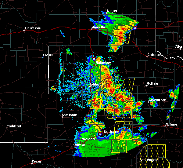 At 717 pm cdt, a severe thunderstorm was located near fluvanna, or 7 miles south of lake alan henry, moving north at 25 mph (radar indicated). Hazards include 60 mph wind gusts and quarter size hail. Hail damage to vehicles is expected. expect wind damage to roofs, siding, and trees. Locations impacted include, snyder, fluvanna, randalls corner and winston field. At 717 pm cdt, a severe thunderstorm was located near fluvanna, or 7 miles south of lake alan henry, moving north at 25 mph (radar indicated). Hazards include 60 mph wind gusts and quarter size hail. Hail damage to vehicles is expected. expect wind damage to roofs, siding, and trees. Locations impacted include, snyder, fluvanna, randalls corner and winston field.
|
| 5/24/2020 6:39 PM CDT |
 At 638 pm cdt, a severe thunderstorm was located near snyder, moving north at 25 mph (radar indicated). Hazards include 60 mph wind gusts and quarter size hail. Hail damage to vehicles is expected. Expect wind damage to roofs, siding, and trees. At 638 pm cdt, a severe thunderstorm was located near snyder, moving north at 25 mph (radar indicated). Hazards include 60 mph wind gusts and quarter size hail. Hail damage to vehicles is expected. Expect wind damage to roofs, siding, and trees.
|
| 5/24/2020 6:28 PM CDT | Quarter sized hail reported 13.6 miles SE of Snyder, TX, quarter size hail at intersection of fm612 and us84 |
| 5/24/2020 6:08 PM CDT |
 At 606 pm cdt, a severe thunderstorm was located 8 miles west of snyder along highway 180, moving north at 20 mph (radar indicated). Hazards include 60 mph wind gusts and quarter size hail. Hail damage to vehicles is expected. expect wind damage to roofs, siding, and trees. Locations impacted include, fluvanna, j b thomas reservoir, randalls corner, winston field, ira and knapp. At 606 pm cdt, a severe thunderstorm was located 8 miles west of snyder along highway 180, moving north at 20 mph (radar indicated). Hazards include 60 mph wind gusts and quarter size hail. Hail damage to vehicles is expected. expect wind damage to roofs, siding, and trees. Locations impacted include, fluvanna, j b thomas reservoir, randalls corner, winston field, ira and knapp.
|
| 5/24/2020 5:40 PM CDT |
 At 539 pm cdt, a severe thunderstorm was located near j b thomas reservoir, or 12 miles southwest of snyder, moving north at 15 mph (radar indicated). Hazards include 60 mph wind gusts and quarter size hail. Hail damage to vehicles is expected. Expect wind damage to roofs, siding, and trees. At 539 pm cdt, a severe thunderstorm was located near j b thomas reservoir, or 12 miles southwest of snyder, moving north at 15 mph (radar indicated). Hazards include 60 mph wind gusts and quarter size hail. Hail damage to vehicles is expected. Expect wind damage to roofs, siding, and trees.
|
| 5/20/2020 5:38 PM CDT |
 At 537 pm cdt, a severe thunderstorm was located near j b thomas reservoir, or 12 miles southwest of snyder, moving northeast at 20 mph (radar indicated). Hazards include ping pong ball size hail and 60 mph wind gusts. People and animals outdoors will be injured. expect hail damage to roofs, siding, windows, and vehicles. expect wind damage to roofs, siding, and trees. Locations impacted include, snyder, j b thomas reservoir, dunn, vincent, randalls corner, winston field, ira, knapp and cuthbert. At 537 pm cdt, a severe thunderstorm was located near j b thomas reservoir, or 12 miles southwest of snyder, moving northeast at 20 mph (radar indicated). Hazards include ping pong ball size hail and 60 mph wind gusts. People and animals outdoors will be injured. expect hail damage to roofs, siding, windows, and vehicles. expect wind damage to roofs, siding, and trees. Locations impacted include, snyder, j b thomas reservoir, dunn, vincent, randalls corner, winston field, ira, knapp and cuthbert.
|
| 5/20/2020 5:16 PM CDT |
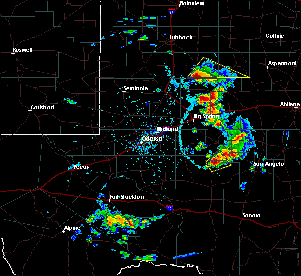 At 515 pm cdt, a severe thunderstorm was located near j b thomas reservoir, or 19 miles northwest of colorado city, moving northeast at 15 mph (radar indicated). Hazards include ping pong ball size hail and 60 mph wind gusts. People and animals outdoors will be injured. expect hail damage to roofs, siding, windows, and vehicles. Expect wind damage to roofs, siding, and trees. At 515 pm cdt, a severe thunderstorm was located near j b thomas reservoir, or 19 miles northwest of colorado city, moving northeast at 15 mph (radar indicated). Hazards include ping pong ball size hail and 60 mph wind gusts. People and animals outdoors will be injured. expect hail damage to roofs, siding, windows, and vehicles. Expect wind damage to roofs, siding, and trees.
|
| 5/13/2020 8:25 PM CDT |
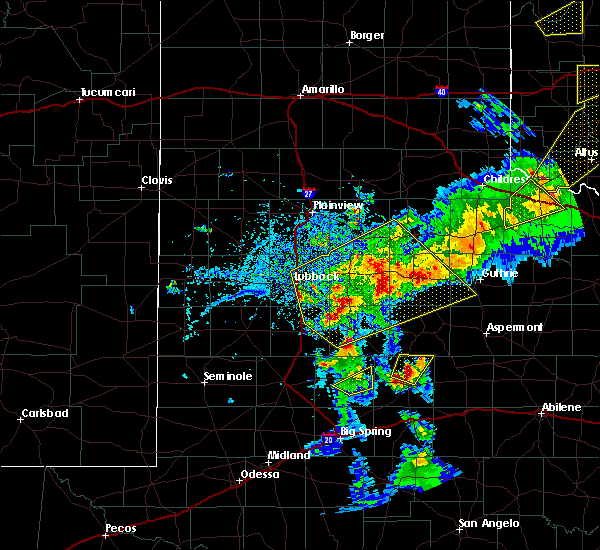 At 825 pm cdt, a severe thunderstorm was located 9 miles north of snyder, moving northeast at 25 mph (radar indicated). Hazards include ping pong ball size hail and 60 mph wind gusts. People and animals outdoors will be injured. expect hail damage to roofs, siding, windows, and vehicles. expect wind damage to roofs, siding, and trees. Locations impacted include, snyder. At 825 pm cdt, a severe thunderstorm was located 9 miles north of snyder, moving northeast at 25 mph (radar indicated). Hazards include ping pong ball size hail and 60 mph wind gusts. People and animals outdoors will be injured. expect hail damage to roofs, siding, windows, and vehicles. expect wind damage to roofs, siding, and trees. Locations impacted include, snyder.
|
| 5/13/2020 8:19 PM CDT | Ping Pong Ball sized hail reported 5.7 miles S of Snyder, TX |
| 5/13/2020 8:15 PM CDT |
 At 815 pm cdt, a severe thunderstorm was located near snyder, moving northeast at 30 mph (radar indicated). Hazards include 60 mph wind gusts and quarter size hail. Hail damage to vehicles is expected. Expect wind damage to roofs, siding, and trees. At 815 pm cdt, a severe thunderstorm was located near snyder, moving northeast at 30 mph (radar indicated). Hazards include 60 mph wind gusts and quarter size hail. Hail damage to vehicles is expected. Expect wind damage to roofs, siding, and trees.
|
| 5/13/2020 8:13 PM CDT | Quarter sized hail reported 5.9 miles SSE of Snyder, TX |
| 4/12/2020 1:54 AM CDT |
 At 154 am cdt, severe thunderstorms were located along a line extending from 8 miles west of hobbs to 11 miles southeast of forsan, moving east at 45 mph (radar indicated). Hazards include golf ball size hail and 60 mph wind gusts. People and animals outdoors will be injured. expect hail damage to roofs, siding, windows, and vehicles. expect wind damage to roofs, siding, and trees. locations impacted include, big spring, snyder, colorado city, coahoma, loraine, forsan, sand springs, lake colorado city, lake colorado city state park, inadale, colorado city airport, j b thomas reservoir, champion creek reservoir, westbrook, cuthbert, dunn, elbow, vincent, hermleigh and randalls corner. This includes interstate 20 between mile markers 178 and 228. At 154 am cdt, severe thunderstorms were located along a line extending from 8 miles west of hobbs to 11 miles southeast of forsan, moving east at 45 mph (radar indicated). Hazards include golf ball size hail and 60 mph wind gusts. People and animals outdoors will be injured. expect hail damage to roofs, siding, windows, and vehicles. expect wind damage to roofs, siding, and trees. locations impacted include, big spring, snyder, colorado city, coahoma, loraine, forsan, sand springs, lake colorado city, lake colorado city state park, inadale, colorado city airport, j b thomas reservoir, champion creek reservoir, westbrook, cuthbert, dunn, elbow, vincent, hermleigh and randalls corner. This includes interstate 20 between mile markers 178 and 228.
|
| 4/12/2020 1:34 AM CDT |
 At 134 am cdt, severe thunderstorms were located along a line extending from 9 miles west of snyder to 9 miles southeast of lomax, moving east at 25 mph (radar indicated). Hazards include 60 mph wind gusts and quarter size hail. Hail damage to vehicles is expected. Expect wind damage to roofs, siding, and trees. At 134 am cdt, severe thunderstorms were located along a line extending from 9 miles west of snyder to 9 miles southeast of lomax, moving east at 25 mph (radar indicated). Hazards include 60 mph wind gusts and quarter size hail. Hail damage to vehicles is expected. Expect wind damage to roofs, siding, and trees.
|
| 6/21/2019 7:51 PM CDT |
 At 750 pm cdt, a severe thunderstorm was located near gail, moving northeast at 35 mph (radar indicated). Hazards include two inch hail and 60 mph wind gusts. People and animals outdoors will be injured. expect hail damage to roofs, siding, windows, and vehicles. expect wind damage to roofs, siding, and trees. this severe storm will be near, fluvanna around 815 pm cdt. Other locations impacted by this severe thunderstorm include dermott, winston field, randalls corner, union and arah. At 750 pm cdt, a severe thunderstorm was located near gail, moving northeast at 35 mph (radar indicated). Hazards include two inch hail and 60 mph wind gusts. People and animals outdoors will be injured. expect hail damage to roofs, siding, windows, and vehicles. expect wind damage to roofs, siding, and trees. this severe storm will be near, fluvanna around 815 pm cdt. Other locations impacted by this severe thunderstorm include dermott, winston field, randalls corner, union and arah.
|
| 6/21/2019 7:45 PM CDT |
 At 745 pm cdt, a severe thunderstorm was located near gail, moving northeast at 30 mph (radar indicated). Hazards include 60 mph wind gusts and quarter size hail. Hail damage to vehicles is expected. expect wind damage to roofs, siding, and trees. this severe thunderstorm will be near, fluvanna around 810 pm cdt. Other locations impacted by this severe thunderstorm include dermott, winston field, randalls corner, union and arah. At 745 pm cdt, a severe thunderstorm was located near gail, moving northeast at 30 mph (radar indicated). Hazards include 60 mph wind gusts and quarter size hail. Hail damage to vehicles is expected. expect wind damage to roofs, siding, and trees. this severe thunderstorm will be near, fluvanna around 810 pm cdt. Other locations impacted by this severe thunderstorm include dermott, winston field, randalls corner, union and arah.
|
| 6/21/2019 5:45 PM CDT | Ping Pong Ball sized hail reported 11.5 miles SSW of Snyder, TX |
| 6/21/2019 5:41 PM CDT |
 At 541 pm cdt, a severe thunderstorm was located 8 miles northeast of snyder, moving north at 15 mph (radar indicated). Hazards include 60 mph wind gusts and quarter size hail. Hail damage to vehicles is expected. expect wind damage to roofs, siding, and trees. This severe thunderstorm will remain over mainly rural areas of northeastern scurry county, including the following locations, hudd. At 541 pm cdt, a severe thunderstorm was located 8 miles northeast of snyder, moving north at 15 mph (radar indicated). Hazards include 60 mph wind gusts and quarter size hail. Hail damage to vehicles is expected. expect wind damage to roofs, siding, and trees. This severe thunderstorm will remain over mainly rural areas of northeastern scurry county, including the following locations, hudd.
|
| 6/19/2019 6:12 PM CDT |
 At 611 pm cdt, a severe thunderstorm was located two miles south of snyder, moving northeast at 35 mph (radar indicated). Hazards include 60 mph wind gusts and quarter size hail. Hail damage to vehicles is expected. Expect wind damage to roofs, siding, and trees. At 611 pm cdt, a severe thunderstorm was located two miles south of snyder, moving northeast at 35 mph (radar indicated). Hazards include 60 mph wind gusts and quarter size hail. Hail damage to vehicles is expected. Expect wind damage to roofs, siding, and trees.
|
| 6/18/2019 8:28 PM CDT |
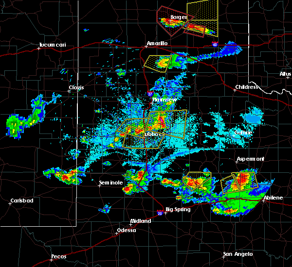 At 828 pm cdt, a severe thunderstorm was located 7 miles north of snyder, moving northeast at 30 mph (radar indicated). Hazards include 60 mph wind gusts and nickel size hail. Expect damage to roofs, siding, and trees. Locations impacted include, snyder, randalls corner and winston field. At 828 pm cdt, a severe thunderstorm was located 7 miles north of snyder, moving northeast at 30 mph (radar indicated). Hazards include 60 mph wind gusts and nickel size hail. Expect damage to roofs, siding, and trees. Locations impacted include, snyder, randalls corner and winston field.
|
| 6/18/2019 8:15 PM CDT |
 At 814 pm cdt, a severe thunderstorm was located 9 miles southeast of fluvanna, or 9 miles northwest of snyder, moving northeast at 25 mph (radar indicated). Hazards include ping pong ball size hail and 60 mph wind gusts. People and animals outdoors will be injured. expect hail damage to roofs, siding, windows, and vehicles. Expect wind damage to roofs, siding, and trees. At 814 pm cdt, a severe thunderstorm was located 9 miles southeast of fluvanna, or 9 miles northwest of snyder, moving northeast at 25 mph (radar indicated). Hazards include ping pong ball size hail and 60 mph wind gusts. People and animals outdoors will be injured. expect hail damage to roofs, siding, windows, and vehicles. Expect wind damage to roofs, siding, and trees.
|
| 6/18/2019 7:34 PM CDT |
 At 733 pm cdt, a severe thunderstorm was located 7 miles southeast of snyder, moving northeast at 40 mph (radar indicated). Hazards include 60 mph wind gusts and quarter size hail. Hail damage to vehicles is expected. expect wind damage to roofs, siding, and trees. locations impacted include, snyder, colorado city, loraine, colorado city airport, lake colorado city, lake colorado city state park, inadale, champion creek reservoir, j b thomas reservoir, westbrook, hermleigh, randalls corner, winston field, cuthbert, knapp, buford, dunn and ira. This includes interstate 20 between mile markers 203 and 228. At 733 pm cdt, a severe thunderstorm was located 7 miles southeast of snyder, moving northeast at 40 mph (radar indicated). Hazards include 60 mph wind gusts and quarter size hail. Hail damage to vehicles is expected. expect wind damage to roofs, siding, and trees. locations impacted include, snyder, colorado city, loraine, colorado city airport, lake colorado city, lake colorado city state park, inadale, champion creek reservoir, j b thomas reservoir, westbrook, hermleigh, randalls corner, winston field, cuthbert, knapp, buford, dunn and ira. This includes interstate 20 between mile markers 203 and 228.
|
| 6/18/2019 7:29 PM CDT |
 At 710 pm cdt, a severe thunderstorm was located near colorado city airport, or 11 miles northwest of colorado city, moving northeast at 40 mph. very strong winds are imminent across northeast mitchell and southeast scurry counties. heavy blowing dust is likely in impacted areas. this is a very dangerous storm (public). Hazards include 80 mph wind gusts and quarter size hail. Flying debris will be dangerous to those caught without shelter. mobile homes will be heavily damaged. expect considerable damage to roofs, windows, and vehicles. extensive tree damage and power outages are likely. locations impacted include, snyder, colorado city, loraine, colorado city airport, lake colorado city, lake colorado city state park, inadale, champion creek reservoir, j b thomas reservoir, westbrook, hermleigh, randalls corner, winston field, cuthbert, knapp, buford, dunn and ira. This includes interstate 20 between mile markers 203 and 228. At 710 pm cdt, a severe thunderstorm was located near colorado city airport, or 11 miles northwest of colorado city, moving northeast at 40 mph. very strong winds are imminent across northeast mitchell and southeast scurry counties. heavy blowing dust is likely in impacted areas. this is a very dangerous storm (public). Hazards include 80 mph wind gusts and quarter size hail. Flying debris will be dangerous to those caught without shelter. mobile homes will be heavily damaged. expect considerable damage to roofs, windows, and vehicles. extensive tree damage and power outages are likely. locations impacted include, snyder, colorado city, loraine, colorado city airport, lake colorado city, lake colorado city state park, inadale, champion creek reservoir, j b thomas reservoir, westbrook, hermleigh, randalls corner, winston field, cuthbert, knapp, buford, dunn and ira. This includes interstate 20 between mile markers 203 and 228.
|
| 6/18/2019 7:14 PM CDT | Golf Ball sized hail reported 4 miles N of Snyder, TX |
| 6/18/2019 7:11 PM CDT |
 At 710 pm cdt, a severe thunderstorm was located near colorado city airport, or 11 miles northwest of colorado city, moving northeast at 40 mph. very strong winds are imminent across northeast mitchell and southeast scurry counties. heavy blowing dust is likely in impacted areas. this is a very dangerous storm (public). Hazards include 80 mph wind gusts and quarter size hail. Flying debris will be dangerous to those caught without shelter. mobile homes will be heavily damaged. expect considerable damage to roofs, windows, and vehicles. extensive tree damage and power outages are likely. locations impacted include, snyder, colorado city, loraine, colorado city airport, lake colorado city, lake colorado city state park, inadale, champion creek reservoir, j b thomas reservoir, westbrook, hermleigh, randalls corner, winston field, cuthbert, knapp, buford, dunn and ira. This includes interstate 20 between mile markers 203 and 228. At 710 pm cdt, a severe thunderstorm was located near colorado city airport, or 11 miles northwest of colorado city, moving northeast at 40 mph. very strong winds are imminent across northeast mitchell and southeast scurry counties. heavy blowing dust is likely in impacted areas. this is a very dangerous storm (public). Hazards include 80 mph wind gusts and quarter size hail. Flying debris will be dangerous to those caught without shelter. mobile homes will be heavily damaged. expect considerable damage to roofs, windows, and vehicles. extensive tree damage and power outages are likely. locations impacted include, snyder, colorado city, loraine, colorado city airport, lake colorado city, lake colorado city state park, inadale, champion creek reservoir, j b thomas reservoir, westbrook, hermleigh, randalls corner, winston field, cuthbert, knapp, buford, dunn and ira. This includes interstate 20 between mile markers 203 and 228.
|
| 6/18/2019 7:05 PM CDT | Golf Ball sized hail reported 10.9 miles NNE of Snyder, TX |
| 6/18/2019 7:03 PM CDT |
 At 703 pm cdt, a severe thunderstorm was located 8 miles west of colorado city airport, or 12 miles northwest of colorado city, moving northeast at 40 mph. reports of heavy blowing dust across southern scurry county at 702 pm cdt (public). Hazards include 70 mph wind gusts and half dollar size hail. Hail damage to vehicles is expected. expect considerable tree damage. wind damage is also likely to mobile homes, roofs, and outbuildings. locations impacted include, snyder, colorado city, loraine, colorado city airport, lake colorado city, lake colorado city state park, inadale, champion creek reservoir, j b thomas reservoir, westbrook, hermleigh, randalls corner, winston field, cuthbert, knapp, buford, dunn and ira. This includes interstate 20 between mile markers 203 and 228. At 703 pm cdt, a severe thunderstorm was located 8 miles west of colorado city airport, or 12 miles northwest of colorado city, moving northeast at 40 mph. reports of heavy blowing dust across southern scurry county at 702 pm cdt (public). Hazards include 70 mph wind gusts and half dollar size hail. Hail damage to vehicles is expected. expect considerable tree damage. wind damage is also likely to mobile homes, roofs, and outbuildings. locations impacted include, snyder, colorado city, loraine, colorado city airport, lake colorado city, lake colorado city state park, inadale, champion creek reservoir, j b thomas reservoir, westbrook, hermleigh, randalls corner, winston field, cuthbert, knapp, buford, dunn and ira. This includes interstate 20 between mile markers 203 and 228.
|
| 6/18/2019 6:54 PM CDT |
 At 653 pm cdt, a severe thunderstorm was located 12 miles northeast of coahoma, or 16 miles west of colorado city, moving northeast at 40 mph. this storm has had a history of producing ping pong ball sized hail (radar indicated). Hazards include ping pong ball size hail and 60 mph wind gusts. People and animals outdoors will be injured. expect hail damage to roofs, siding, windows, and vehicles. Expect wind damage to roofs, siding, and trees. At 653 pm cdt, a severe thunderstorm was located 12 miles northeast of coahoma, or 16 miles west of colorado city, moving northeast at 40 mph. this storm has had a history of producing ping pong ball sized hail (radar indicated). Hazards include ping pong ball size hail and 60 mph wind gusts. People and animals outdoors will be injured. expect hail damage to roofs, siding, windows, and vehicles. Expect wind damage to roofs, siding, and trees.
|
| 6/5/2019 8:59 PM CDT |
 At 859 pm cdt, severe thunderstorms were located along a line extending from 8 miles northeast of snyder to 13 miles east of forsan, moving southeast at 55 mph (radar indicated). Hazards include 70 mph wind gusts and quarter size hail. Hail damage to vehicles is expected. expect considerable tree damage. wind damage is also likely to mobile homes, roofs, and outbuildings. locations impacted include, snyder, colorado city, loraine, fluvanna, colorado city airport, j b thomas reservoir, lake colorado city, lake colorado city state park, inadale, champion creek reservoir, westbrook, hermleigh, randalls corner, winston field, cuthbert, knapp, buford, dunn and ira. This includes interstate 20 between mile markers 197 and 228. At 859 pm cdt, severe thunderstorms were located along a line extending from 8 miles northeast of snyder to 13 miles east of forsan, moving southeast at 55 mph (radar indicated). Hazards include 70 mph wind gusts and quarter size hail. Hail damage to vehicles is expected. expect considerable tree damage. wind damage is also likely to mobile homes, roofs, and outbuildings. locations impacted include, snyder, colorado city, loraine, fluvanna, colorado city airport, j b thomas reservoir, lake colorado city, lake colorado city state park, inadale, champion creek reservoir, westbrook, hermleigh, randalls corner, winston field, cuthbert, knapp, buford, dunn and ira. This includes interstate 20 between mile markers 197 and 228.
|
| 6/5/2019 8:39 PM CDT |
 The severe thunderstorm warning for glasscock, mitchell, scurry, northeastern midland, borden, howard and southeastern martin counties will expire at 845 pm cdt, the storms which prompted the warning have moved out of the area. therefore, the warning will be allowed to expire. however small hail, gusty winds and heavy rain are still possible with these thunderstorms. The severe thunderstorm warning for glasscock, mitchell, scurry, northeastern midland, borden, howard and southeastern martin counties will expire at 845 pm cdt, the storms which prompted the warning have moved out of the area. therefore, the warning will be allowed to expire. however small hail, gusty winds and heavy rain are still possible with these thunderstorms.
|
| 6/5/2019 8:38 PM CDT |
 At 837 pm cdt, severe thunderstorms were located along a line extending from 6 miles northeast of fluvanna to near sand springs, moving southeast at 55 mph (radar indicated). Hazards include 70 mph wind gusts and quarter size hail. Hail damage to vehicles is expected. expect considerable tree damage. Wind damage is also likely to mobile homes, roofs, and outbuildings. At 837 pm cdt, severe thunderstorms were located along a line extending from 6 miles northeast of fluvanna to near sand springs, moving southeast at 55 mph (radar indicated). Hazards include 70 mph wind gusts and quarter size hail. Hail damage to vehicles is expected. expect considerable tree damage. Wind damage is also likely to mobile homes, roofs, and outbuildings.
|
| 6/5/2019 8:30 PM CDT |
 At 829 pm cdt, severe thunderstorms were located along a line extending from 7 miles northwest of snyder to near garden city, moving southeast at 55 mph (radar indicated). Hazards include 70 mph wind gusts and quarter size hail. Hail damage to vehicles is expected. expect considerable tree damage. wind damage is also likely to mobile homes, roofs, and outbuildings. locations impacted include, big spring, snyder, colorado city, garden city, gail, stanton, coahoma, loraine, forsan, sand springs, lomax, lake colorado city, lake colorado city state park, inadale, luther, fluvanna, colorado city airport, j b thomas reservoir, champion creek reservoir and westbrook. This includes interstate 20 between mile markers 158 and 228. At 829 pm cdt, severe thunderstorms were located along a line extending from 7 miles northwest of snyder to near garden city, moving southeast at 55 mph (radar indicated). Hazards include 70 mph wind gusts and quarter size hail. Hail damage to vehicles is expected. expect considerable tree damage. wind damage is also likely to mobile homes, roofs, and outbuildings. locations impacted include, big spring, snyder, colorado city, garden city, gail, stanton, coahoma, loraine, forsan, sand springs, lomax, lake colorado city, lake colorado city state park, inadale, luther, fluvanna, colorado city airport, j b thomas reservoir, champion creek reservoir and westbrook. This includes interstate 20 between mile markers 158 and 228.
|
| 6/5/2019 8:15 PM CDT |
 At 814 pm cdt, severe thunderstorms were located along a line extending from near fluvanna to 8 miles northwest of garden city, moving southeast at 70 mph (radar indicated). Hazards include 70 mph wind gusts and quarter size hail. Hail damage to vehicles is expected. expect considerable tree damage. wind damage is also likely to mobile homes, roofs, and outbuildings. locations impacted include, big spring, snyder, colorado city, ackerly, greenwood, garden city, gail, stanton, coahoma, loraine, forsan, sand springs, lomax, lake colorado city, lake colorado city state park, inadale, luther, fluvanna, colorado city airport and j b thomas reservoir. This includes interstate 20 between mile markers 146 and 228. At 814 pm cdt, severe thunderstorms were located along a line extending from near fluvanna to 8 miles northwest of garden city, moving southeast at 70 mph (radar indicated). Hazards include 70 mph wind gusts and quarter size hail. Hail damage to vehicles is expected. expect considerable tree damage. wind damage is also likely to mobile homes, roofs, and outbuildings. locations impacted include, big spring, snyder, colorado city, ackerly, greenwood, garden city, gail, stanton, coahoma, loraine, forsan, sand springs, lomax, lake colorado city, lake colorado city state park, inadale, luther, fluvanna, colorado city airport and j b thomas reservoir. This includes interstate 20 between mile markers 146 and 228.
|
| 6/5/2019 7:47 PM CDT |
 At 747 pm cdt, severe thunderstorms were located along a line extending from 10 miles southeast of grassland to 8 miles west of stanton, moving southeast at 70 mph (radar indicated). Hazards include 60 mph wind gusts and quarter size hail. Hail damage to vehicles is expected. Expect wind damage to roofs, siding, and trees. At 747 pm cdt, severe thunderstorms were located along a line extending from 10 miles southeast of grassland to 8 miles west of stanton, moving southeast at 70 mph (radar indicated). Hazards include 60 mph wind gusts and quarter size hail. Hail damage to vehicles is expected. Expect wind damage to roofs, siding, and trees.
|
| 5/31/2019 2:55 AM CDT | Storm damage reported in scurry county TX, 1.7 miles NE of Snyder, TX |
| 5/29/2019 9:08 AM CDT |
 At 907 am cdt, a severe thunderstorm was located near j b thomas reservoir, or 15 miles northwest of colorado city, moving northeast at 50 mph (radar indicated). Hazards include 60 mph wind gusts and quarter size hail. Hail damage to vehicles is expected. expect wind damage to roofs, siding, and trees. locations impacted include, snyder, colorado city, loraine, colorado city airport, j b thomas reservoir, lake colorado city, lake colorado city state park, inadale, westbrook, hermleigh, randalls corner, winston field, cuthbert, knapp, buford, dunn and ira. This includes interstate 20 between mile markers 197 and 228. At 907 am cdt, a severe thunderstorm was located near j b thomas reservoir, or 15 miles northwest of colorado city, moving northeast at 50 mph (radar indicated). Hazards include 60 mph wind gusts and quarter size hail. Hail damage to vehicles is expected. expect wind damage to roofs, siding, and trees. locations impacted include, snyder, colorado city, loraine, colorado city airport, j b thomas reservoir, lake colorado city, lake colorado city state park, inadale, westbrook, hermleigh, randalls corner, winston field, cuthbert, knapp, buford, dunn and ira. This includes interstate 20 between mile markers 197 and 228.
|
| 5/29/2019 8:37 AM CDT |
 At 837 am cdt, a severe thunderstorm was located near luther, or 8 miles north of big spring, moving northeast at 55 mph (radar indicated). Hazards include 60 mph wind gusts and quarter size hail. Hail damage to vehicles is expected. Expect wind damage to roofs, siding, and trees. At 837 am cdt, a severe thunderstorm was located near luther, or 8 miles north of big spring, moving northeast at 55 mph (radar indicated). Hazards include 60 mph wind gusts and quarter size hail. Hail damage to vehicles is expected. Expect wind damage to roofs, siding, and trees.
|
| 5/20/2019 11:14 PM CDT |
 At 1113 pm cdt, severe thunderstorms were located along a line extending from near fluvanna to near j b thomas reservoir to 11 miles northeast of coahoma, moving northeast at 65 mph (automated weather instruments. at 1105 pm cdt, a west texas mesonet site measured a 60 mph wind gust 3 miles west northwest of fluvanna). Hazards include 70 mph wind gusts and ping pong ball size hail. People and animals outdoors will be injured. expect hail damage to roofs, siding, windows, and vehicles. expect considerable tree damage. wind damage is also likely to mobile homes, roofs, and outbuildings. locations impacted include, big spring, snyder, colorado city, gail, coahoma, loraine, forsan, sand springs, lomax, lake colorado city, lake colorado city state park, inadale, luther, fluvanna, colorado city airport, j b thomas reservoir, champion creek reservoir, westbrook, cuthbert and dunn. This includes interstate 20 between mile markers 166 and 228. At 1113 pm cdt, severe thunderstorms were located along a line extending from near fluvanna to near j b thomas reservoir to 11 miles northeast of coahoma, moving northeast at 65 mph (automated weather instruments. at 1105 pm cdt, a west texas mesonet site measured a 60 mph wind gust 3 miles west northwest of fluvanna). Hazards include 70 mph wind gusts and ping pong ball size hail. People and animals outdoors will be injured. expect hail damage to roofs, siding, windows, and vehicles. expect considerable tree damage. wind damage is also likely to mobile homes, roofs, and outbuildings. locations impacted include, big spring, snyder, colorado city, gail, coahoma, loraine, forsan, sand springs, lomax, lake colorado city, lake colorado city state park, inadale, luther, fluvanna, colorado city airport, j b thomas reservoir, champion creek reservoir, westbrook, cuthbert and dunn. This includes interstate 20 between mile markers 166 and 228.
|
| 5/20/2019 10:45 PM CDT |
 At 1045 pm cdt, severe thunderstorms were located along a line extending from 6 miles southwest of gail to near luther to 8 miles west of big spring, moving northeast at 65 mph (radar indicated). Hazards include 70 mph wind gusts and ping pong ball size hail. People and animals outdoors will be injured. expect hail damage to roofs, siding, windows, and vehicles. expect considerable tree damage. Wind damage is also likely to mobile homes, roofs, and outbuildings. At 1045 pm cdt, severe thunderstorms were located along a line extending from 6 miles southwest of gail to near luther to 8 miles west of big spring, moving northeast at 65 mph (radar indicated). Hazards include 70 mph wind gusts and ping pong ball size hail. People and animals outdoors will be injured. expect hail damage to roofs, siding, windows, and vehicles. expect considerable tree damage. Wind damage is also likely to mobile homes, roofs, and outbuildings.
|
| 5/20/2019 9:53 PM CDT |
 At 951 pm cdt, severe thunderstorms were located along a line extending from 8 miles southwest of hobbs to 6 miles west of snyder to near j b thomas reservoir, moving northeast at 45 mph (trained weather spotters. at 949 pm cdt, trained spotters reported 2 inch diameter hail in hermleigh). Hazards include two inch hail and 60 mph wind gusts. People and animals outdoors will be injured. expect hail damage to roofs, siding, windows, and vehicles. expect wind damage to roofs, siding, and trees. Locations impacted include, snyder, fluvanna, j b thomas reservoir, dunn, hermleigh, randalls corner, winston field, ira and knapp. At 951 pm cdt, severe thunderstorms were located along a line extending from 8 miles southwest of hobbs to 6 miles west of snyder to near j b thomas reservoir, moving northeast at 45 mph (trained weather spotters. at 949 pm cdt, trained spotters reported 2 inch diameter hail in hermleigh). Hazards include two inch hail and 60 mph wind gusts. People and animals outdoors will be injured. expect hail damage to roofs, siding, windows, and vehicles. expect wind damage to roofs, siding, and trees. Locations impacted include, snyder, fluvanna, j b thomas reservoir, dunn, hermleigh, randalls corner, winston field, ira and knapp.
|
| 5/20/2019 9:42 PM CDT | Quarter sized hail reported 1.2 miles WNW of Snyder, TX |
| 5/20/2019 9:14 PM CDT |
 At 914 pm cdt, severe thunderstorms were located along a line extending from 7 miles west of colorado city airport to 9 miles east of luther to 12 miles east of lenorah, moving northeast at 40 mph (radar indicated). Hazards include two inch hail and 60 mph wind gusts. People and animals outdoors will be injured. expect hail damage to roofs, siding, windows, and vehicles. Expect wind damage to roofs, siding, and trees. At 914 pm cdt, severe thunderstorms were located along a line extending from 7 miles west of colorado city airport to 9 miles east of luther to 12 miles east of lenorah, moving northeast at 40 mph (radar indicated). Hazards include two inch hail and 60 mph wind gusts. People and animals outdoors will be injured. expect hail damage to roofs, siding, windows, and vehicles. Expect wind damage to roofs, siding, and trees.
|
| 5/20/2019 8:28 PM CDT |
 At 828 pm cdt, a severe thunderstorm was located over snyder, moving northeast at 35 mph (radar indicated). Hazards include 60 mph wind gusts and half dollar size hail. Hail damage to vehicles is expected. Expect wind damage to roofs, siding, and trees. At 828 pm cdt, a severe thunderstorm was located over snyder, moving northeast at 35 mph (radar indicated). Hazards include 60 mph wind gusts and half dollar size hail. Hail damage to vehicles is expected. Expect wind damage to roofs, siding, and trees.
|
| 5/20/2019 7:34 PM CDT |
 At 733 pm cdt, a severe thunderstorm was located near coahoma, or 14 miles northeast of big spring, moving northeast at 45 mph (emergency management. at 729 pm cdt, emergency management reported golf ball size hail falling at coahoma high school). Hazards include two inch hail and 60 mph wind gusts. People and animals outdoors will be injured. expect hail damage to roofs, siding, windows, and vehicles. expect wind damage to roofs, siding, and trees. locations impacted include, big spring, snyder, colorado city, coahoma, loraine, forsan, sand springs, lomax, lake colorado city, lake colorado city state park, inadale, luther, colorado city airport, j b thomas reservoir, champion creek reservoir, westbrook, cuthbert, dunn, big spring mcmahon-wrinkle airpark and elbow. This includes interstate 20 between mile markers 164 and 228. At 733 pm cdt, a severe thunderstorm was located near coahoma, or 14 miles northeast of big spring, moving northeast at 45 mph (emergency management. at 729 pm cdt, emergency management reported golf ball size hail falling at coahoma high school). Hazards include two inch hail and 60 mph wind gusts. People and animals outdoors will be injured. expect hail damage to roofs, siding, windows, and vehicles. expect wind damage to roofs, siding, and trees. locations impacted include, big spring, snyder, colorado city, coahoma, loraine, forsan, sand springs, lomax, lake colorado city, lake colorado city state park, inadale, luther, colorado city airport, j b thomas reservoir, champion creek reservoir, westbrook, cuthbert, dunn, big spring mcmahon-wrinkle airpark and elbow. This includes interstate 20 between mile markers 164 and 228.
|
| 5/20/2019 7:12 PM CDT |
 At 712 pm cdt, a severe thunderstorm was located over big spring, moving northeast at 60 mph (radar indicated). Hazards include two inch hail and 60 mph wind gusts. People and animals outdoors will be injured. expect hail damage to roofs, siding, windows, and vehicles. Expect wind damage to roofs, siding, and trees. At 712 pm cdt, a severe thunderstorm was located over big spring, moving northeast at 60 mph (radar indicated). Hazards include two inch hail and 60 mph wind gusts. People and animals outdoors will be injured. expect hail damage to roofs, siding, windows, and vehicles. Expect wind damage to roofs, siding, and trees.
|
| 5/18/2019 5:41 AM CDT |
 At 540 am cdt, a severe thunderstorm was located near snyder, moving northeast at 45 mph (radar indicated). Hazards include 60 mph wind gusts and quarter size hail. Hail damage to vehicles is expected. expect wind damage to roofs, siding, and trees. locations impacted include, snyder, colorado city, coahoma, forsan, sand springs, colorado city airport, lake colorado city, lake colorado city state park, westbrook, cuthbert, buford, dunn and ira. This includes interstate 20 between mile markers 181 and 217. At 540 am cdt, a severe thunderstorm was located near snyder, moving northeast at 45 mph (radar indicated). Hazards include 60 mph wind gusts and quarter size hail. Hail damage to vehicles is expected. expect wind damage to roofs, siding, and trees. locations impacted include, snyder, colorado city, coahoma, forsan, sand springs, colorado city airport, lake colorado city, lake colorado city state park, westbrook, cuthbert, buford, dunn and ira. This includes interstate 20 between mile markers 181 and 217.
|
| 5/18/2019 4:57 AM CDT |
 The national weather service in midland has issued a * severe thunderstorm warning for. northern glasscock county in western texas. western mitchell county in western texas. scurry county in western texas. Eastern borden county in western texas. The national weather service in midland has issued a * severe thunderstorm warning for. northern glasscock county in western texas. western mitchell county in western texas. scurry county in western texas. Eastern borden county in western texas.
|
| 5/8/2019 3:32 AM CDT |
 At 332 am cdt, a severe thunderstorm was located 9 miles northeast of snyder, moving northeast at 35 mph (radar indicated). Hazards include 60 mph wind gusts and quarter size hail. Hail damage to vehicles is expected. expect wind damage to roofs, siding, and trees. Locations impacted include, snyder, j b thomas reservoir, winston field, knapp and randalls corner. At 332 am cdt, a severe thunderstorm was located 9 miles northeast of snyder, moving northeast at 35 mph (radar indicated). Hazards include 60 mph wind gusts and quarter size hail. Hail damage to vehicles is expected. expect wind damage to roofs, siding, and trees. Locations impacted include, snyder, j b thomas reservoir, winston field, knapp and randalls corner.
|
| 5/8/2019 2:53 AM CDT |
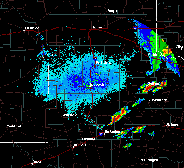 At 253 am cdt, a severe thunderstorm was located near j b thomas reservoir, or 13 miles west of snyder, moving northeast at 40 mph (radar indicated). Hazards include 60 mph wind gusts and quarter size hail. Hail damage to vehicles is expected. Expect wind damage to roofs, siding, and trees. At 253 am cdt, a severe thunderstorm was located near j b thomas reservoir, or 13 miles west of snyder, moving northeast at 40 mph (radar indicated). Hazards include 60 mph wind gusts and quarter size hail. Hail damage to vehicles is expected. Expect wind damage to roofs, siding, and trees.
|
| 4/30/2019 5:20 PM CDT | Golf Ball sized hail reported 33.5 miles SW of Snyder, TX, reported along state highway 70 south of jayton. |
| 3/13/2019 12:21 AM CDT |
 The severe thunderstorm warning for mitchell and scurry counties will expire at 1230 am cdt, the storms which prompted the warning are moving out of the area. therefore, the warning will be allowed to expire. a tornado watch remains in effect until 500 am cdt for western texas. The severe thunderstorm warning for mitchell and scurry counties will expire at 1230 am cdt, the storms which prompted the warning are moving out of the area. therefore, the warning will be allowed to expire. a tornado watch remains in effect until 500 am cdt for western texas.
|
| 3/13/2019 12:11 AM CDT |
 At 1211 am cdt, severe thunderstorms were located along a line extending from 12 miles southeast of lake alan henry to near colorado city airport to 12 miles southwest of lake colorado city state park, moving east at 55 mph (radar indicated). Hazards include 60 mph wind gusts and penny size hail. Expect damage to roofs, siding, and trees. locations impacted include, snyder, colorado city, loraine, fluvanna, colorado city airport, lake colorado city, lake colorado city state park, inadale, champion creek reservoir, j b thomas reservoir, westbrook, hermleigh, randalls corner, winston field, cuthbert, knapp, buford, dunn and ira. this includes interstate 20 between mile markers 199 and 228. A tornado watch remains in effect until 500 am cdt for western texas. At 1211 am cdt, severe thunderstorms were located along a line extending from 12 miles southeast of lake alan henry to near colorado city airport to 12 miles southwest of lake colorado city state park, moving east at 55 mph (radar indicated). Hazards include 60 mph wind gusts and penny size hail. Expect damage to roofs, siding, and trees. locations impacted include, snyder, colorado city, loraine, fluvanna, colorado city airport, lake colorado city, lake colorado city state park, inadale, champion creek reservoir, j b thomas reservoir, westbrook, hermleigh, randalls corner, winston field, cuthbert, knapp, buford, dunn and ira. this includes interstate 20 between mile markers 199 and 228. A tornado watch remains in effect until 500 am cdt for western texas.
|
| 3/12/2019 11:37 PM CDT |
 At 1136 pm cdt, severe thunderstorms were located along a line extending from 11 miles northwest of gail to near luther to forsan, moving east at 55 mph (radar indicated). Hazards include 70 mph wind gusts and penny size hail. Expect considerable tree damage. Damage is likely to mobile homes, roofs, and outbuildings. At 1136 pm cdt, severe thunderstorms were located along a line extending from 11 miles northwest of gail to near luther to forsan, moving east at 55 mph (radar indicated). Hazards include 70 mph wind gusts and penny size hail. Expect considerable tree damage. Damage is likely to mobile homes, roofs, and outbuildings.
|
| 12/26/2018 3:00 PM CST | There was a tin roof blown off a local business... a couple of trees were blown over... and an 18 wheeler about 15 miles south of snyder on highway 84 was blown over. t in scurry county TX, 0.9 miles NE of Snyder, TX |
| 12/26/2018 2:58 PM CST |
 At 258 pm cst, severe thunderstorms were located along a line extending from 6 miles west of hobbs to 6 miles southwest of robert lee to 12 miles south of mertzon, moving east at 55 mph (radar indicated). Hazards include 70 mph wind gusts. Expect considerable tree damage. damage is likely to mobile homes, roofs, and outbuildings. locations impacted include, big spring, snyder, colorado city, big lake, garden city, gail, coahoma, loraine, forsan, sand springs, lake colorado city, lake colorado city state park, inadale, luther, fluvanna, colorado city airport, j b thomas reservoir, reagan county airport, champion creek reservoir and westbrook. this includes interstate 20 between mile markers 177 and 228. Time, mot, loc 2058z 276deg 109kt 3279 10071 3182 10054 3109 10079. At 258 pm cst, severe thunderstorms were located along a line extending from 6 miles west of hobbs to 6 miles southwest of robert lee to 12 miles south of mertzon, moving east at 55 mph (radar indicated). Hazards include 70 mph wind gusts. Expect considerable tree damage. damage is likely to mobile homes, roofs, and outbuildings. locations impacted include, big spring, snyder, colorado city, big lake, garden city, gail, coahoma, loraine, forsan, sand springs, lake colorado city, lake colorado city state park, inadale, luther, fluvanna, colorado city airport, j b thomas reservoir, reagan county airport, champion creek reservoir and westbrook. this includes interstate 20 between mile markers 177 and 228. Time, mot, loc 2058z 276deg 109kt 3279 10071 3182 10054 3109 10079.
|
| 12/26/2018 2:33 PM CST |
 At 232 pm cst, severe thunderstorms were located along a line extending from 8 miles northwest of gail to 7 miles northeast of garden city to 8 miles west of reagan county airport, moving east at 55 mph. at 215 pm, a 70 mph wind gust was reported in big spring (radar indicated). Hazards include 70 mph wind gusts. Expect considerable tree damage. Damage is likely to mobile homes, roofs, and outbuildings. At 232 pm cst, severe thunderstorms were located along a line extending from 8 miles northwest of gail to 7 miles northeast of garden city to 8 miles west of reagan county airport, moving east at 55 mph. at 215 pm, a 70 mph wind gust was reported in big spring (radar indicated). Hazards include 70 mph wind gusts. Expect considerable tree damage. Damage is likely to mobile homes, roofs, and outbuildings.
|
| 7/15/2018 3:28 PM CDT | Storm damage reported in scurry county TX, 3.5 miles NNE of Snyder, TX |
| 6/8/2018 12:09 AM CDT |
 At 1209 am cdt, a severe thunderstorm was located near inadale, or 11 miles north of colorado city, moving southeast at 20 mph. this is a very dangerous storm (trained weather spotters). Hazards include 80 mph wind gusts and quarter size hail. Flying debris will be dangerous to those caught without shelter. mobile homes will be heavily damaged. expect considerable damage to roofs, windows, and vehicles. extensive tree damage and power outages are likely. locations impacted include, snyder, colorado city, loraine, colorado city airport, inadale, dunn, hermleigh, cuthbert and buford. This includes interstate 20 between mile markers 214 and 228. At 1209 am cdt, a severe thunderstorm was located near inadale, or 11 miles north of colorado city, moving southeast at 20 mph. this is a very dangerous storm (trained weather spotters). Hazards include 80 mph wind gusts and quarter size hail. Flying debris will be dangerous to those caught without shelter. mobile homes will be heavily damaged. expect considerable damage to roofs, windows, and vehicles. extensive tree damage and power outages are likely. locations impacted include, snyder, colorado city, loraine, colorado city airport, inadale, dunn, hermleigh, cuthbert and buford. This includes interstate 20 between mile markers 214 and 228.
|
| 6/7/2018 11:51 PM CDT |
 At 1151 pm cdt, a severe thunderstorm was located 7 miles southeast of snyder, moving southeast at 15 mph. this is a very dangerous storm (radar indicated). Hazards include 80 mph wind gusts and quarter size hail. Flying debris will be dangerous to those caught without shelter. mobile homes will be heavily damaged. expect considerable damage to roofs, windows, and vehicles. Extensive tree damage and power outages are likely. At 1151 pm cdt, a severe thunderstorm was located 7 miles southeast of snyder, moving southeast at 15 mph. this is a very dangerous storm (radar indicated). Hazards include 80 mph wind gusts and quarter size hail. Flying debris will be dangerous to those caught without shelter. mobile homes will be heavily damaged. expect considerable damage to roofs, windows, and vehicles. Extensive tree damage and power outages are likely.
|
| 6/7/2018 11:45 PM CDT | Measured on the west texas mesonet in scurry county TX, 3.5 miles NNE of Snyder, TX |
| 6/7/2018 11:45 PM CDT | Mesured on the west texas mesonet in scurry county TX, 2.8 miles W of Snyder, TX |
| 6/7/2018 11:50 AM CDT | 18-wheeler blown over south of snyder on hwy 208 in scurry county TX, 3 miles NNW of Snyder, TX |
| 6/1/2018 8:11 PM CDT |
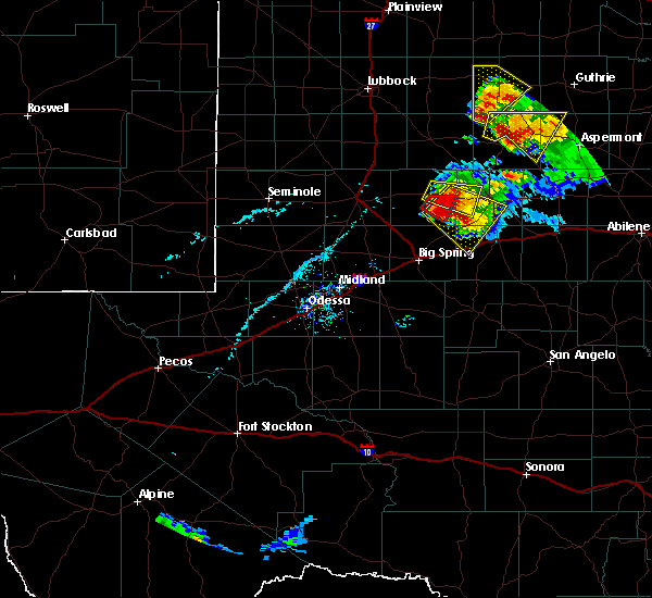 At 811 pm cdt, a severe thunderstorm was located 7 miles northwest of j b thomas reservoir, or 13 miles southeast of gail, moving southeast at 15 mph. this is a very dangerous storm (radar indicated). Hazards include 80 mph wind gusts and three inch hail. Flying debris will be dangerous to those caught without shelter. mobile homes will be heavily damaged. expect considerable damage to roofs, windows, and vehicles. Extensive tree damage and power outages are likely. At 811 pm cdt, a severe thunderstorm was located 7 miles northwest of j b thomas reservoir, or 13 miles southeast of gail, moving southeast at 15 mph. this is a very dangerous storm (radar indicated). Hazards include 80 mph wind gusts and three inch hail. Flying debris will be dangerous to those caught without shelter. mobile homes will be heavily damaged. expect considerable damage to roofs, windows, and vehicles. Extensive tree damage and power outages are likely.
|
| 5/17/2018 8:09 PM CDT | Dime size hail reported in scurry county TX, 9.9 miles SW of Snyder, TX |
| 5/17/2018 7:24 PM CDT | Storm damage reported in scurry county TX, 14.7 miles S of Snyder, TX |
| 5/15/2018 6:15 PM CDT |
 At 613 pm cdt, a severe thunderstorm was located near snyder, moving east at 20 mph (radar indicated). Hazards include 60 mph wind gusts and quarter size hail. Hail damage to vehicles is expected. expect wind damage to roofs, siding, and trees. Locations impacted include, snyder, inadale, j b thomas reservoir, dunn, hermleigh, winston field, ira and knapp. At 613 pm cdt, a severe thunderstorm was located near snyder, moving east at 20 mph (radar indicated). Hazards include 60 mph wind gusts and quarter size hail. Hail damage to vehicles is expected. expect wind damage to roofs, siding, and trees. Locations impacted include, snyder, inadale, j b thomas reservoir, dunn, hermleigh, winston field, ira and knapp.
|
| 5/15/2018 6:00 PM CDT | Golf Ball sized hail reported 0.9 miles NE of Snyder, TX |
| 5/15/2018 5:52 PM CDT |
 At 551 pm cdt, a severe thunderstorm was located near j b thomas reservoir, or 10 miles southwest of snyder, moving east at 10 mph (radar indicated). Hazards include 60 mph wind gusts and quarter size hail. Hail damage to vehicles is expected. Expect wind damage to roofs, siding, and trees. At 551 pm cdt, a severe thunderstorm was located near j b thomas reservoir, or 10 miles southwest of snyder, moving east at 10 mph (radar indicated). Hazards include 60 mph wind gusts and quarter size hail. Hail damage to vehicles is expected. Expect wind damage to roofs, siding, and trees.
|
| 5/14/2018 3:55 PM CDT | Storm damage reported in scurry county TX, 2.6 miles NE of Snyder, TX |
| 5/12/2018 6:45 PM CDT |
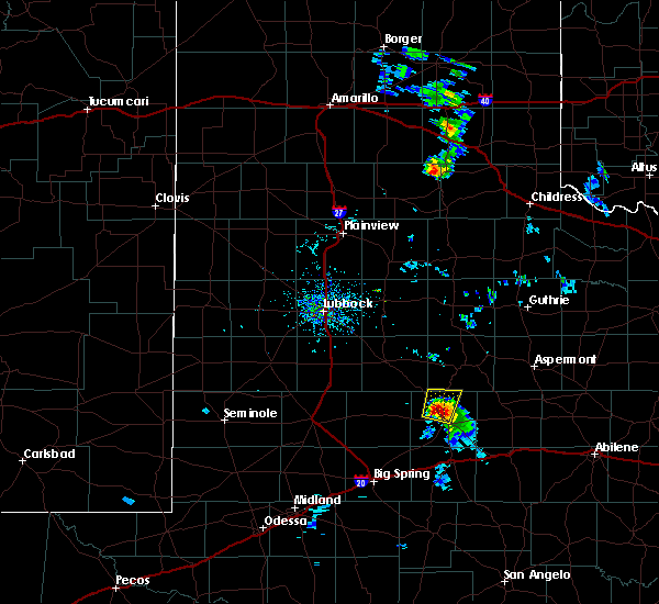 At 645 pm cdt, a severe thunderstorm was located near snyder, moving north at 25 mph (radar indicated). Hazards include 60 mph wind gusts and quarter size hail. Hail damage to vehicles is expected. Expect wind damage to roofs, siding, and trees. At 645 pm cdt, a severe thunderstorm was located near snyder, moving north at 25 mph (radar indicated). Hazards include 60 mph wind gusts and quarter size hail. Hail damage to vehicles is expected. Expect wind damage to roofs, siding, and trees.
|
| 8/16/2017 6:55 PM CDT |
 At 655 pm cdt, a severe thunderstorm was located 7 miles east of snyder, moving south at 10 mph (public). Hazards include 60 mph wind gusts and nickel size hail. Expect damage to roofs, siding, and trees. Locations impacted include, snyder, hermleigh, us-180 near the fisher- scurry county line, winston field, midway, union and hudd. At 655 pm cdt, a severe thunderstorm was located 7 miles east of snyder, moving south at 10 mph (public). Hazards include 60 mph wind gusts and nickel size hail. Expect damage to roofs, siding, and trees. Locations impacted include, snyder, hermleigh, us-180 near the fisher- scurry county line, winston field, midway, union and hudd.
|
| 8/16/2017 6:51 PM CDT |
 At 650 pm cdt, a severe thunderstorm was located 8 miles northeast of snyder, moving southeast at 15 mph (radar indicated). Hazards include 60 mph wind gusts and quarter size hail. Hail damage to vehicles is expected. expect wind damage to roofs, siding, and trees. Locations impacted include, snyder, hermleigh, us-180 near the fisher- scurry county line, winston field, midway, union and hudd. At 650 pm cdt, a severe thunderstorm was located 8 miles northeast of snyder, moving southeast at 15 mph (radar indicated). Hazards include 60 mph wind gusts and quarter size hail. Hail damage to vehicles is expected. expect wind damage to roofs, siding, and trees. Locations impacted include, snyder, hermleigh, us-180 near the fisher- scurry county line, winston field, midway, union and hudd.
|
| 8/16/2017 6:50 PM CDT | 50 to 60 mph winds reported with nickel hai in scurry county TX, 12.6 miles SW of Snyder, TX |
| 8/16/2017 6:23 PM CDT |
 At 622 pm cdt, a severe thunderstorm was located 13 miles northeast of snyder, moving south at 10 mph (radar indicated). Hazards include 60 mph wind gusts and quarter size hail. Hail damage to vehicles is expected. Expect wind damage to roofs, siding, and trees. At 622 pm cdt, a severe thunderstorm was located 13 miles northeast of snyder, moving south at 10 mph (radar indicated). Hazards include 60 mph wind gusts and quarter size hail. Hail damage to vehicles is expected. Expect wind damage to roofs, siding, and trees.
|
| 7/4/2017 11:30 PM CDT | Storm damage reported in scurry county TX, 2.8 miles W of Snyder, TX |
| 6/15/2017 7:55 PM CDT |
 At 755 pm cdt, a severe thunderstorm was located over hermleigh, or 9 miles southeast of snyder, moving southeast at 30 mph (radar indicated). Hazards include 60 mph wind gusts and penny size hail. Expect damage to roofs, siding, and trees. locations impacted include, snyder, china grove, valley view, loraine, hermleigh, inadale, us- 84 near the nolan-fisher county line, i-20 near the nolan- mitchell county line, randalls corner, us-180 near the fisher- scurry county line, winston field, union, buford, dunn and midway. This includes interstate 20 between mile markers 221 and 228. At 755 pm cdt, a severe thunderstorm was located over hermleigh, or 9 miles southeast of snyder, moving southeast at 30 mph (radar indicated). Hazards include 60 mph wind gusts and penny size hail. Expect damage to roofs, siding, and trees. locations impacted include, snyder, china grove, valley view, loraine, hermleigh, inadale, us- 84 near the nolan-fisher county line, i-20 near the nolan- mitchell county line, randalls corner, us-180 near the fisher- scurry county line, winston field, union, buford, dunn and midway. This includes interstate 20 between mile markers 221 and 228.
|
| 6/15/2017 7:42 PM CDT |
 At 741 pm cdt, a severe thunderstorm was located over snyder, moving southeast at 30 mph (radar indicated). Hazards include 60 mph wind gusts and penny size hail. expect damage to roofs, siding, and trees At 741 pm cdt, a severe thunderstorm was located over snyder, moving southeast at 30 mph (radar indicated). Hazards include 60 mph wind gusts and penny size hail. expect damage to roofs, siding, and trees
|
| 6/15/2017 7:30 PM CDT | Storm damage reported in scurry county TX, 2.8 miles W of Snyder, TX |
| 6/14/2017 6:53 PM CDT |
 At 653 pm cdt, a severe thunderstorm was located 7 miles northwest of knapp, or 14 miles east of gail, moving east at 10 mph (radar indicated). Hazards include tennis ball size hail and 60 mph wind gusts. People and animals outdoors will be injured. expect hail damage to roofs, siding, windows, and vehicles. Expect wind damage to roofs, siding, and trees. At 653 pm cdt, a severe thunderstorm was located 7 miles northwest of knapp, or 14 miles east of gail, moving east at 10 mph (radar indicated). Hazards include tennis ball size hail and 60 mph wind gusts. People and animals outdoors will be injured. expect hail damage to roofs, siding, windows, and vehicles. Expect wind damage to roofs, siding, and trees.
|
| 6/14/2017 6:23 PM CDT |
 At 623 pm cdt, a severe thunderstorm was located near fluvanna, or 13 miles east of gail, moving east at 25 mph (radar indicated). Hazards include 60 mph wind gusts and half dollar size hail. Hail damage to vehicles is expected. expect wind damage to roofs, siding, and trees. Locations impacted include, snyder, gail, fluvanna, winston field, randalls corner and union. At 623 pm cdt, a severe thunderstorm was located near fluvanna, or 13 miles east of gail, moving east at 25 mph (radar indicated). Hazards include 60 mph wind gusts and half dollar size hail. Hail damage to vehicles is expected. expect wind damage to roofs, siding, and trees. Locations impacted include, snyder, gail, fluvanna, winston field, randalls corner and union.
|
| 6/14/2017 5:55 PM CDT |
 At 555 pm cdt, a severe thunderstorm was located over gail, moving east at 30 mph (radar indicated). Hazards include ping pong ball size hail and 60 mph wind gusts. People and animals outdoors will be injured. expect hail damage to roofs, siding, windows, and vehicles. Expect wind damage to roofs, siding, and trees. At 555 pm cdt, a severe thunderstorm was located over gail, moving east at 30 mph (radar indicated). Hazards include ping pong ball size hail and 60 mph wind gusts. People and animals outdoors will be injured. expect hail damage to roofs, siding, windows, and vehicles. Expect wind damage to roofs, siding, and trees.
|
| 5/22/2017 6:18 PM CDT | Ping Pong Ball sized hail reported 28.2 miles SW of Snyder, TX |
| 5/22/2017 5:52 PM CDT | Hen Egg sized hail reported 28.9 miles SSW of Snyder, TX |
| 5/22/2017 5:27 PM CDT | Ping Pong Ball sized hail reported 33.5 miles SSW of Snyder, TX |
| 5/16/2017 10:59 PM CDT |
 At 1058 pm cdt, severe thunderstorms were located along a line extending from near girard to 7 miles north of stiles, moving northeast at 70 mph (trained weather spotters and nws employees). Hazards include golf ball size hail and 60 mph wind gusts. People and animals outdoors will be injured. expect hail damage to roofs, siding, windows, and vehicles. expect wind damage to roofs, siding, and trees. locations impacted include, snyder, colorado city, big lake, rankin, garden city, china grove, valley view, loraine, westbrook, bigby corner, lake colorado city, lake colorado city state park, inadale, best, saint lawrence, colorado city airport, lees, stiles, hermleigh and j b thomas reservoir. This includes interstate 20 between mile markers 198 and 228. At 1058 pm cdt, severe thunderstorms were located along a line extending from near girard to 7 miles north of stiles, moving northeast at 70 mph (trained weather spotters and nws employees). Hazards include golf ball size hail and 60 mph wind gusts. People and animals outdoors will be injured. expect hail damage to roofs, siding, windows, and vehicles. expect wind damage to roofs, siding, and trees. locations impacted include, snyder, colorado city, big lake, rankin, garden city, china grove, valley view, loraine, westbrook, bigby corner, lake colorado city, lake colorado city state park, inadale, best, saint lawrence, colorado city airport, lees, stiles, hermleigh and j b thomas reservoir. This includes interstate 20 between mile markers 198 and 228.
|
| 5/16/2017 10:30 PM CDT |
 At 1029 pm cdt, severe thunderstorms were located along a line extending from lake alan henry to near rankin, moving east at 50 mph (trained weather spotters and nws employees). Hazards include golf ball size hail and 60 mph wind gusts. People and animals outdoors will be injured. expect hail damage to roofs, siding, windows, and vehicles. Expect wind damage to roofs, siding, and trees. At 1029 pm cdt, severe thunderstorms were located along a line extending from lake alan henry to near rankin, moving east at 50 mph (trained weather spotters and nws employees). Hazards include golf ball size hail and 60 mph wind gusts. People and animals outdoors will be injured. expect hail damage to roofs, siding, windows, and vehicles. Expect wind damage to roofs, siding, and trees.
|
| 5/16/2017 10:14 PM CDT |
 At 1014 pm cdt, severe thunderstorms were located along a line extending from near fluvanna to 10 miles north of luther, moving east at 30 mph (radar indicated). Hazards include golf ball size hail and 60 mph wind gusts. People and animals outdoors will be injured. expect hail damage to roofs, siding, windows, and vehicles. expect wind damage to roofs, siding, and trees. Locations impacted include, snyder, fluvanna, hermleigh, j b thomas reservoir, knapp, randalls corner, us-180 near the fisher- scurry county line, ira, winston field, midway, union and hudd. At 1014 pm cdt, severe thunderstorms were located along a line extending from near fluvanna to 10 miles north of luther, moving east at 30 mph (radar indicated). Hazards include golf ball size hail and 60 mph wind gusts. People and animals outdoors will be injured. expect hail damage to roofs, siding, windows, and vehicles. expect wind damage to roofs, siding, and trees. Locations impacted include, snyder, fluvanna, hermleigh, j b thomas reservoir, knapp, randalls corner, us-180 near the fisher- scurry county line, ira, winston field, midway, union and hudd.
|
| 5/16/2017 9:50 PM CDT |
 At 950 pm cdt, severe thunderstorms were located along a line extending from 9 miles southwest of justiceburg to 8 miles north of vealmoor, moving northeast at 45 mph (radar indicated). Hazards include golf ball size hail and 60 mph wind gusts. People and animals outdoors will be injured. expect hail damage to roofs, siding, windows, and vehicles. Expect wind damage to roofs, siding, and trees. At 950 pm cdt, severe thunderstorms were located along a line extending from 9 miles southwest of justiceburg to 8 miles north of vealmoor, moving northeast at 45 mph (radar indicated). Hazards include golf ball size hail and 60 mph wind gusts. People and animals outdoors will be injured. expect hail damage to roofs, siding, windows, and vehicles. Expect wind damage to roofs, siding, and trees.
|
| 5/16/2017 8:14 PM CDT |
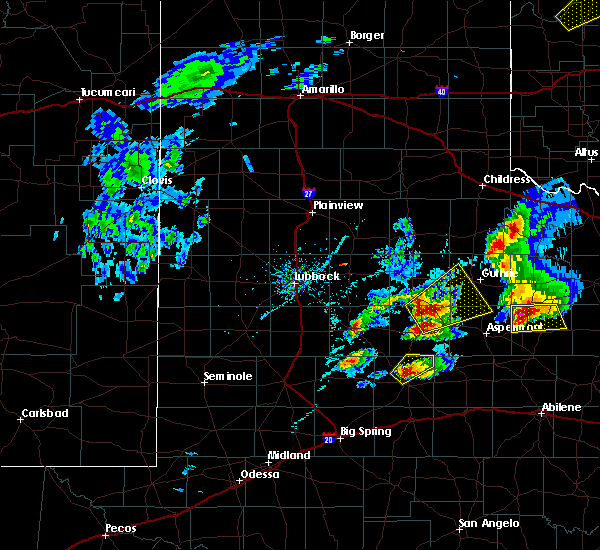 At 814 pm cdt, a severe thunderstorm was located 8 miles north of snyder, moving northeast at 40 mph (radar indicated). Hazards include 60 mph wind gusts and quarter size hail. Hail damage to vehicles is expected. Expect wind damage to roofs, siding, and trees. At 814 pm cdt, a severe thunderstorm was located 8 miles north of snyder, moving northeast at 40 mph (radar indicated). Hazards include 60 mph wind gusts and quarter size hail. Hail damage to vehicles is expected. Expect wind damage to roofs, siding, and trees.
|
| 3/28/2017 9:14 PM CDT |
 At 912 pm cdt, a severe thunderstorm was located near colorado city and is northeast at 30 mph (public). Hazards include ping pong ball size hail and 60 mph wind gusts. People and animals outdoors will be injured. expect hail damage to roofs, siding, windows, and vehicles. expect wind damage to roofs, siding, and trees. locations impacted include, snyder, colorado city, china grove, valley view, loraine, westbrook, colorado city airport, hermleigh, lake colorado city, lake colorado city state park, inadale, champion creek reservoir, cuthbert, buford, dunn, ira and midway. This includes interstate 20 between mile markers 205 and 228. At 912 pm cdt, a severe thunderstorm was located near colorado city and is northeast at 30 mph (public). Hazards include ping pong ball size hail and 60 mph wind gusts. People and animals outdoors will be injured. expect hail damage to roofs, siding, windows, and vehicles. expect wind damage to roofs, siding, and trees. locations impacted include, snyder, colorado city, china grove, valley view, loraine, westbrook, colorado city airport, hermleigh, lake colorado city, lake colorado city state park, inadale, champion creek reservoir, cuthbert, buford, dunn, ira and midway. This includes interstate 20 between mile markers 205 and 228.
|
| 3/28/2017 8:59 PM CDT |
 At 859 pm cdt, a severe thunderstorm was located over colorado city, moving northeast at 30 mph (radar indicated). Hazards include 60 mph wind gusts and quarter size hail. Hail damage to vehicles is expected. Expect wind damage to roofs, siding, and trees. At 859 pm cdt, a severe thunderstorm was located over colorado city, moving northeast at 30 mph (radar indicated). Hazards include 60 mph wind gusts and quarter size hail. Hail damage to vehicles is expected. Expect wind damage to roofs, siding, and trees.
|
| 3/28/2017 8:40 PM CDT | Thunderstorm wind gust recorded at snyder mesone in scurry county TX, 2.8 miles W of Snyder, TX |
| 3/28/2017 4:22 PM CDT |
 At 422 pm cdt, a severe thunderstorm was located 7 miles northwest of hobbs, or 15 miles northeast of snyder, moving northeast at 30 mph (trained weather spotters). Hazards include 60 mph wind gusts and quarter size hail. Hail damage to vehicles is expected. expect wind damage to roofs, siding, and trees. Locations impacted include, snyder, hermleigh, randalls corner, us-180 near the fisher- scurry county line, ira, winston field, midway, union and hudd. At 422 pm cdt, a severe thunderstorm was located 7 miles northwest of hobbs, or 15 miles northeast of snyder, moving northeast at 30 mph (trained weather spotters). Hazards include 60 mph wind gusts and quarter size hail. Hail damage to vehicles is expected. expect wind damage to roofs, siding, and trees. Locations impacted include, snyder, hermleigh, randalls corner, us-180 near the fisher- scurry county line, ira, winston field, midway, union and hudd.
|
| 3/28/2017 3:55 PM CDT |
 At 355 pm cdt, a severe thunderstorm was located near snyder, moving northeast at 30 mph (trained weather spotters). Hazards include golf ball size hail and 60 mph wind gusts. People and animals outdoors will be injured. expect hail damage to roofs, siding, windows, and vehicles. Expect wind damage to roofs, siding, and trees. At 355 pm cdt, a severe thunderstorm was located near snyder, moving northeast at 30 mph (trained weather spotters). Hazards include golf ball size hail and 60 mph wind gusts. People and animals outdoors will be injured. expect hail damage to roofs, siding, windows, and vehicles. Expect wind damage to roofs, siding, and trees.
|
| 3/28/2017 3:50 PM CDT | Golf Ball sized hail reported 2.2 miles NNW of Snyder, TX |
| 3/28/2017 3:28 PM CDT | Half Dollar sized hail reported 10.9 miles NNE of Snyder, TX |
| 3/28/2017 3:27 PM CDT |
 At 327 pm cdt, a severe thunderstorm was located 7 miles north of colorado city airport, or 10 miles south of snyder, moving northeast at 25 mph (radar indicated). Hazards include golf ball size hail and 60 mph wind gusts. People and animals outdoors will be injured. expect hail damage to roofs, siding, windows, and vehicles. Expect wind damage to roofs, siding, and trees. At 327 pm cdt, a severe thunderstorm was located 7 miles north of colorado city airport, or 10 miles south of snyder, moving northeast at 25 mph (radar indicated). Hazards include golf ball size hail and 60 mph wind gusts. People and animals outdoors will be injured. expect hail damage to roofs, siding, windows, and vehicles. Expect wind damage to roofs, siding, and trees.
|
| 3/28/2017 2:24 PM CDT |
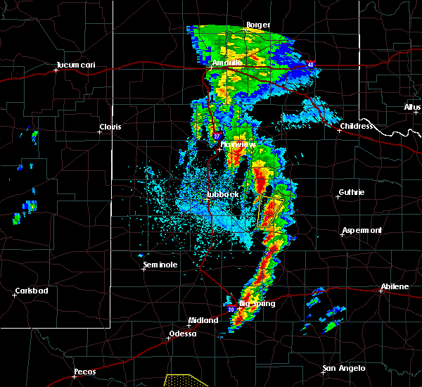 At 224 pm cdt, a severe thunderstorm was located near j b thomas reservoir, or 17 miles southeast of gail, moving northeast at 45 mph (radar indicated). Hazards include 60 mph wind gusts and half dollar size hail. Hail damage to vehicles is expected. Expect wind damage to roofs, siding, and trees. At 224 pm cdt, a severe thunderstorm was located near j b thomas reservoir, or 17 miles southeast of gail, moving northeast at 45 mph (radar indicated). Hazards include 60 mph wind gusts and half dollar size hail. Hail damage to vehicles is expected. Expect wind damage to roofs, siding, and trees.
|
| 1/1/2017 9:56 PM CST |
 At 956 pm cst, severe thunderstorms were located along a line extending from 10 miles southwest of justiceburg to 7 miles southwest of j b thomas reservoir to forsan, moving east at 55 mph (radar indicated). Hazards include 60 mph wind gusts and penny size hail. Expect damage to roofs, siding, and trees. locations impacted include, snyder, coahoma, westbrook, forsan, sand springs, fluvanna, colorado city airport, j b thomas reservoir, knapp, lake colorado city, lake colorado city state park, vincent, randalls corner, arah, dermott, winston field, cuthbert, union, ira and midway. This includes interstate 20 between mile markers 184 and 213. At 956 pm cst, severe thunderstorms were located along a line extending from 10 miles southwest of justiceburg to 7 miles southwest of j b thomas reservoir to forsan, moving east at 55 mph (radar indicated). Hazards include 60 mph wind gusts and penny size hail. Expect damage to roofs, siding, and trees. locations impacted include, snyder, coahoma, westbrook, forsan, sand springs, fluvanna, colorado city airport, j b thomas reservoir, knapp, lake colorado city, lake colorado city state park, vincent, randalls corner, arah, dermott, winston field, cuthbert, union, ira and midway. This includes interstate 20 between mile markers 184 and 213.
|
| 1/1/2017 9:40 PM CST |
 At 938 pm cst, severe thunderstorms were located along a line extending from 12 miles east of o`donnell to vealmoor to lomax, moving east at 50 mph (59 mph gust at the lomax mesonet site in southwestern howard county). Hazards include 60 mph wind gusts and penny size hail. Expect damage to roofs, siding, and trees. locations impacted include, big spring, snyder, gail, coahoma, westbrook, forsan, sand springs, lomax, lake colorado city, lake colorado city state park, vealmoor, luther, elbow, fluvanna, colorado city airport, south haven, j b thomas reservoir, knapp, mesquite and cuthbert. This includes interstate 20 between mile markers 164 and 213. At 938 pm cst, severe thunderstorms were located along a line extending from 12 miles east of o`donnell to vealmoor to lomax, moving east at 50 mph (59 mph gust at the lomax mesonet site in southwestern howard county). Hazards include 60 mph wind gusts and penny size hail. Expect damage to roofs, siding, and trees. locations impacted include, big spring, snyder, gail, coahoma, westbrook, forsan, sand springs, lomax, lake colorado city, lake colorado city state park, vealmoor, luther, elbow, fluvanna, colorado city airport, south haven, j b thomas reservoir, knapp, mesquite and cuthbert. This includes interstate 20 between mile markers 164 and 213.
|
| 1/1/2017 9:24 PM CST |
 At 923 pm cst, severe thunderstorms were located along a line extending from near o`donnell to ackerly to stanton, moving east at 50 mph (radar indicated). Hazards include 60 mph wind gusts and penny size hail. expect damage to roofs, siding, and trees At 923 pm cst, severe thunderstorms were located along a line extending from near o`donnell to ackerly to stanton, moving east at 50 mph (radar indicated). Hazards include 60 mph wind gusts and penny size hail. expect damage to roofs, siding, and trees
|
| 11/2/2016 8:40 PM CDT | West texas mesonet measured at 59 mph gus in scurry county TX, 3.5 miles NNE of Snyder, TX |
| 10/6/2016 7:08 PM CDT |
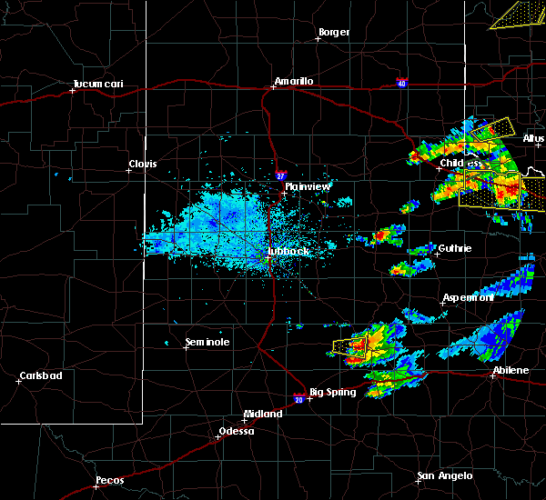 The severe thunderstorm warning for east central borden and west central scurry counties will expire at 715 pm cdt, the storm which prompted the warning has weakened below severe limits, and no longer pose an immediate threat to life or property. therefore the warning will be allowed to expire. however small hail and gusty winds are still possible with this thunderstorm. to report severe weather, contact your nearest law enforcement agency. they will relay your report to the national weather service midland. The severe thunderstorm warning for east central borden and west central scurry counties will expire at 715 pm cdt, the storm which prompted the warning has weakened below severe limits, and no longer pose an immediate threat to life or property. therefore the warning will be allowed to expire. however small hail and gusty winds are still possible with this thunderstorm. to report severe weather, contact your nearest law enforcement agency. they will relay your report to the national weather service midland.
|
| 10/6/2016 6:41 PM CDT |
 At 641 pm cdt, a severe thunderstorm was located near knapp, or 10 miles west of snyder, moving east at 15 mph (radar indicated). Hazards include 60 mph wind gusts and quarter size hail. Hail damage to vehicles is expected. expect wind damage to roofs, siding, and trees. Locations impacted include, union, arah, winston field and randalls corner. At 641 pm cdt, a severe thunderstorm was located near knapp, or 10 miles west of snyder, moving east at 15 mph (radar indicated). Hazards include 60 mph wind gusts and quarter size hail. Hail damage to vehicles is expected. expect wind damage to roofs, siding, and trees. Locations impacted include, union, arah, winston field and randalls corner.
|
| 10/6/2016 6:21 PM CDT |
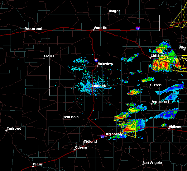 At 621 pm cdt, a severe thunderstorm was located 7 miles northwest of knapp, or 15 miles east of gail, moving east at 15 mph (radar indicated). Hazards include ping pong ball size hail and 60 mph wind gusts. People and animals outdoors will be injured. expect hail damage to roofs, siding, windows, and vehicles. Expect wind damage to roofs, siding, and trees. At 621 pm cdt, a severe thunderstorm was located 7 miles northwest of knapp, or 15 miles east of gail, moving east at 15 mph (radar indicated). Hazards include ping pong ball size hail and 60 mph wind gusts. People and animals outdoors will be injured. expect hail damage to roofs, siding, windows, and vehicles. Expect wind damage to roofs, siding, and trees.
|
| 10/6/2016 6:04 PM CDT |
 At 604 pm cdt, a severe thunderstorm was located over colorado city airport, or near colorado city, moving northeast at 10 mph (radar indicated). Hazards include golf ball size hail and 60 mph wind gusts. People and animals outdoors will be injured. expect hail damage to roofs, siding, windows, and vehicles. expect wind damage to roofs, siding, and trees. locations impacted include, snyder, china grove, valley view, hermleigh, colorado city airport, cuthbert, dunn, ira and buford. This includes interstate 20 near mile marker 214. At 604 pm cdt, a severe thunderstorm was located over colorado city airport, or near colorado city, moving northeast at 10 mph (radar indicated). Hazards include golf ball size hail and 60 mph wind gusts. People and animals outdoors will be injured. expect hail damage to roofs, siding, windows, and vehicles. expect wind damage to roofs, siding, and trees. locations impacted include, snyder, china grove, valley view, hermleigh, colorado city airport, cuthbert, dunn, ira and buford. This includes interstate 20 near mile marker 214.
|
| 10/6/2016 5:51 PM CDT |
 At 551 pm cdt, a severe thunderstorm was located near colorado city airport, or near colorado city, and is nearly stationary (radar indicated). Hazards include 60 mph wind gusts and half dollar size hail. Hail damage to vehicles is expected. expect wind damage to roofs, siding, and trees. locations impacted include, snyder, china grove, valley view, hermleigh, colorado city airport, cuthbert, dunn, ira and buford. This includes interstate 20 near mile marker 214. At 551 pm cdt, a severe thunderstorm was located near colorado city airport, or near colorado city, and is nearly stationary (radar indicated). Hazards include 60 mph wind gusts and half dollar size hail. Hail damage to vehicles is expected. expect wind damage to roofs, siding, and trees. locations impacted include, snyder, china grove, valley view, hermleigh, colorado city airport, cuthbert, dunn, ira and buford. This includes interstate 20 near mile marker 214.
|
| 10/6/2016 5:29 PM CDT |
 At 529 pm cdt, a severe thunderstorm was located over colorado city airport, or 8 miles northwest of colorado city, moving northeast at 10 mph (radar indicated). Hazards include 60 mph wind gusts and half dollar size hail. Hail damage to vehicles is expected. Expect wind damage to roofs, siding, and trees. At 529 pm cdt, a severe thunderstorm was located over colorado city airport, or 8 miles northwest of colorado city, moving northeast at 10 mph (radar indicated). Hazards include 60 mph wind gusts and half dollar size hail. Hail damage to vehicles is expected. Expect wind damage to roofs, siding, and trees.
|
| 9/17/2016 8:25 PM CDT |
 At 825 pm cdt, a severe thunderstorm was located near snyder, moving northeast at 25 mph (radar indicated). Hazards include 60 mph wind gusts and half dollar size hail. Hail damage to vehicles is expected. expect wind damage to roofs, siding, and trees. locations impacted include, snyder, china grove, fluvanna, hermleigh, knapp, j b thomas reservoir, colorado city airport, cuthbert, dunn, winston field, ira, union, randalls corner, dermott, arah and vincent. This includes interstate 20 near mile marker 195. At 825 pm cdt, a severe thunderstorm was located near snyder, moving northeast at 25 mph (radar indicated). Hazards include 60 mph wind gusts and half dollar size hail. Hail damage to vehicles is expected. expect wind damage to roofs, siding, and trees. locations impacted include, snyder, china grove, fluvanna, hermleigh, knapp, j b thomas reservoir, colorado city airport, cuthbert, dunn, winston field, ira, union, randalls corner, dermott, arah and vincent. This includes interstate 20 near mile marker 195.
|
| 9/17/2016 7:45 PM CDT |
 At 745 pm cdt, a severe thunderstorm was located near j b thomas reservoir, or 21 miles southeast of gail, moving northeast at 30 mph (radar indicated). Hazards include 60 mph wind gusts and half dollar size hail. Hail damage to vehicles is expected. Expect wind damage to roofs, siding, and trees. At 745 pm cdt, a severe thunderstorm was located near j b thomas reservoir, or 21 miles southeast of gail, moving northeast at 30 mph (radar indicated). Hazards include 60 mph wind gusts and half dollar size hail. Hail damage to vehicles is expected. Expect wind damage to roofs, siding, and trees.
|
| 9/16/2016 5:19 PM CDT |
 At 518 pm cdt, a severe thunderstorm was located near hermleigh, or 8 miles east of snyder, moving southeast at 35 mph. at 501 pm cdt, a gust of 81 mph occurred 3 miles south southwest of snyder. this is a very dangerous storm (radar indicated). Hazards include 80 mph wind gusts and golf ball size hail. Flying debris will be dangerous to those caught without shelter. mobile homes will be heavily damaged. expect considerable damage to roofs, windows, and vehicles. extensive tree damage and power outages are likely. locations impacted include, snyder, colorado city, china grove, valley view, loraine, hermleigh, inadale, colorado city airport, dunn, us-84 near the nolan-fisher county line, ira, i-20 near the nolan-mitchell county line and buford. This includes interstate 20 between mile markers 217 and 228. At 518 pm cdt, a severe thunderstorm was located near hermleigh, or 8 miles east of snyder, moving southeast at 35 mph. at 501 pm cdt, a gust of 81 mph occurred 3 miles south southwest of snyder. this is a very dangerous storm (radar indicated). Hazards include 80 mph wind gusts and golf ball size hail. Flying debris will be dangerous to those caught without shelter. mobile homes will be heavily damaged. expect considerable damage to roofs, windows, and vehicles. extensive tree damage and power outages are likely. locations impacted include, snyder, colorado city, china grove, valley view, loraine, hermleigh, inadale, colorado city airport, dunn, us-84 near the nolan-fisher county line, ira, i-20 near the nolan-mitchell county line and buford. This includes interstate 20 between mile markers 217 and 228.
|
| 9/16/2016 5:05 PM CDT | Storm damage reported in scurry county TX, 2.8 miles W of Snyder, TX |
| 9/16/2016 5:03 PM CDT |
 At 501 pm cdt, a severe thunderstorm was located over snyder, moving southeast at 35 mph. received a report of half dollar to golf ball sized hail and a 61 mph wind gust in snyder (radar indicated). Hazards include golf ball size hail and 70 mph wind gusts. People and animals outdoors will be injured. expect hail damage to roofs, siding, windows, and vehicles. expect considerable tree damage. wind damage is also likely to mobile homes, roofs, and outbuildings. locations impacted include, snyder, colorado city, china grove, valley view, loraine, hermleigh, colorado city airport, inadale, dunn, us-84 near the nolan-fisher county line, winston field, ira, i-20 near the nolan-mitchell county line, union, randalls corner and buford. This includes interstate 20 between mile markers 217 and 228. At 501 pm cdt, a severe thunderstorm was located over snyder, moving southeast at 35 mph. received a report of half dollar to golf ball sized hail and a 61 mph wind gust in snyder (radar indicated). Hazards include golf ball size hail and 70 mph wind gusts. People and animals outdoors will be injured. expect hail damage to roofs, siding, windows, and vehicles. expect considerable tree damage. wind damage is also likely to mobile homes, roofs, and outbuildings. locations impacted include, snyder, colorado city, china grove, valley view, loraine, hermleigh, colorado city airport, inadale, dunn, us-84 near the nolan-fisher county line, winston field, ira, i-20 near the nolan-mitchell county line, union, randalls corner and buford. This includes interstate 20 between mile markers 217 and 228.
|
| 9/16/2016 5:01 PM CDT | Storm damage reported in scurry county TX, 3.5 miles NNE of Snyder, TX |
| 9/16/2016 5:00 PM CDT | Roof blown off business... store filled with insulation and rain wate in scurry county TX, 0.9 miles NE of Snyder, TX |
| 9/16/2016 5:00 PM CDT | Golf Ball sized hail reported 0.9 miles NE of Snyder, TX, half dollar to ping pong ball size hail in snyder. |
| 9/16/2016 4:55 PM CDT | Storm damage reported in scurry county TX, 1.7 miles NE of Snyder, TX |
| 9/16/2016 4:55 PM CDT | Quarter sized hail reported 1.4 miles ENE of Snyder, TX |
| 9/16/2016 4:43 PM CDT |
 At 443 pm cdt, a severe thunderstorm was located near snyder, moving southeast at 45 mph (radar indicated). Hazards include tennis ball size hail and 70 mph wind gusts. People and animals outdoors will be injured. expect hail damage to roofs, siding, windows, and vehicles. expect considerable tree damage. Wind damage is also likely to mobile homes, roofs, and outbuildings. At 443 pm cdt, a severe thunderstorm was located near snyder, moving southeast at 45 mph (radar indicated). Hazards include tennis ball size hail and 70 mph wind gusts. People and animals outdoors will be injured. expect hail damage to roofs, siding, windows, and vehicles. expect considerable tree damage. Wind damage is also likely to mobile homes, roofs, and outbuildings.
|
| 9/16/2016 4:08 PM CDT |
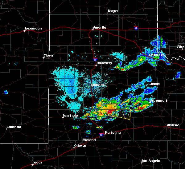 At 407 pm cdt, a severe thunderstorm was located 9 miles west of fluvanna, or 11 miles northeast of gail, moving east southeast at 30 mph (radar indicated). Hazards include 70 mph wind gusts and ping pong ball size hail. People and animals outdoors will be injured. expect hail damage to roofs, siding, windows, and vehicles. expect considerable tree damage. Wind damage is also likely to mobile homes, roofs, and outbuildings. At 407 pm cdt, a severe thunderstorm was located 9 miles west of fluvanna, or 11 miles northeast of gail, moving east southeast at 30 mph (radar indicated). Hazards include 70 mph wind gusts and ping pong ball size hail. People and animals outdoors will be injured. expect hail damage to roofs, siding, windows, and vehicles. expect considerable tree damage. Wind damage is also likely to mobile homes, roofs, and outbuildings.
|
| 5/31/2016 4:08 PM CDT |
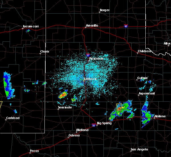 At 407 pm cdt, a severe thunderstorm was located near snyder, moving north at 15 mph (radar indicated). Hazards include 60 mph wind gusts and quarter size hail. Hail damage to vehicles is expected. expect wind damage to roofs, siding, and trees. This severe thunderstorm will remain over mainly rural areas of northeastern scurry county. At 407 pm cdt, a severe thunderstorm was located near snyder, moving north at 15 mph (radar indicated). Hazards include 60 mph wind gusts and quarter size hail. Hail damage to vehicles is expected. expect wind damage to roofs, siding, and trees. This severe thunderstorm will remain over mainly rural areas of northeastern scurry county.
|
| 5/31/2016 3:38 PM CDT |
 At 338 pm cdt, a severe thunderstorm was located over hermleigh, or 8 miles southeast of snyder, moving north at 15 mph (radar indicated). Hazards include 60 mph wind gusts and quarter size hail. Hail damage to vehicles is expected. Expect wind damage to roofs, siding, and trees. At 338 pm cdt, a severe thunderstorm was located over hermleigh, or 8 miles southeast of snyder, moving north at 15 mph (radar indicated). Hazards include 60 mph wind gusts and quarter size hail. Hail damage to vehicles is expected. Expect wind damage to roofs, siding, and trees.
|
| 5/30/2016 7:35 PM CDT | Hen Egg sized hail reported 5.1 miles SE of Snyder, TX, may be up to 2 1/2 inch hail. |
| 5/30/2016 7:34 PM CDT | Golf Ball sized hail reported 0.9 miles NE of Snyder, TX |
| 5/30/2016 7:33 PM CDT |
 At 731 pm cdt, a severe thunderstorm was located over lake j b thomas, or 14 miles southwest of snyder, moving northeast at 20 mph. a second severe storm was in synder, moving northeast at 20 mph (trained weather spotters). Hazards include ping pong ball size hail and 60 mph wind gusts. People and animals outdoors will be injured. expect hail damage to roofs, siding, windows, and vehicles. expect wind damage to roofs, siding, and trees. Locations impacted include, snyder, china grove, dunn, hermleigh, knapp, winston field, ira, union in scurry county, randalls corner, dermott, hudd, inadale, midway in scurry county, arah, lake j b thomas. At 731 pm cdt, a severe thunderstorm was located over lake j b thomas, or 14 miles southwest of snyder, moving northeast at 20 mph. a second severe storm was in synder, moving northeast at 20 mph (trained weather spotters). Hazards include ping pong ball size hail and 60 mph wind gusts. People and animals outdoors will be injured. expect hail damage to roofs, siding, windows, and vehicles. expect wind damage to roofs, siding, and trees. Locations impacted include, snyder, china grove, dunn, hermleigh, knapp, winston field, ira, union in scurry county, randalls corner, dermott, hudd, inadale, midway in scurry county, arah, lake j b thomas.
|
| 5/30/2016 7:27 PM CDT | Ping Pong Ball sized hail reported 1.4 miles ENE of Snyder, TX, quarter to ping pong hail. |
| 5/30/2016 7:27 PM CDT |
 At 727 pm cdt, a severe thunderstorm was located over lake j b thomas, or 16 miles southwest of snyder, moving northeast at 20 mph (radar indicated). Hazards include 60 mph wind gusts and quarter size hail. Hail damage to vehicles is expected. Expect wind damage to roofs, siding, and trees. At 727 pm cdt, a severe thunderstorm was located over lake j b thomas, or 16 miles southwest of snyder, moving northeast at 20 mph (radar indicated). Hazards include 60 mph wind gusts and quarter size hail. Hail damage to vehicles is expected. Expect wind damage to roofs, siding, and trees.
|
| 5/30/2016 6:55 PM CDT | Ping Pong Ball sized hail reported 1.4 miles ENE of Snyder, TX, half dollar to ping pong hail fm 1607 |
| 5/28/2016 10:39 PM CDT |
 At 1039 pm cdt, a severe thunderstorm was located over dunn, or 8 miles south of snyder, moving southeast at 30 mph (radar indicated). Hazards include tennis ball size hail and 60 mph wind gusts. People and animals outdoors will be injured. expect hail damage to roofs, siding, windows, and vehicles. Expect wind damage to roofs, siding, and trees. At 1039 pm cdt, a severe thunderstorm was located over dunn, or 8 miles south of snyder, moving southeast at 30 mph (radar indicated). Hazards include tennis ball size hail and 60 mph wind gusts. People and animals outdoors will be injured. expect hail damage to roofs, siding, windows, and vehicles. Expect wind damage to roofs, siding, and trees.
|
| 5/28/2016 10:35 PM CDT | Winston field awos measured thunderstorm wind gust of 53 knots in scurry county TX, 2.6 miles NE of Snyder, TX |
| 5/28/2016 10:32 PM CDT |
 At 1032 pm cdt, a severe thunderstorm was located 7 miles northeast of snyder, moving east at 30 mph (radar indicated). Hazards include two inch hail and 60 mph wind gusts. People and animals outdoors will be injured. expect hail damage to roofs, siding, windows, and vehicles. expect wind damage to roofs, siding, and trees. Locations impacted include, snyder, dermott, hermleigh, hudd, winston field, midway in scurry county, union in scurry county, randalls corner and us- 180 near the fisher-scurry county line. At 1032 pm cdt, a severe thunderstorm was located 7 miles northeast of snyder, moving east at 30 mph (radar indicated). Hazards include two inch hail and 60 mph wind gusts. People and animals outdoors will be injured. expect hail damage to roofs, siding, windows, and vehicles. expect wind damage to roofs, siding, and trees. Locations impacted include, snyder, dermott, hermleigh, hudd, winston field, midway in scurry county, union in scurry county, randalls corner and us- 180 near the fisher-scurry county line.
|
| 5/28/2016 10:12 PM CDT |
 At 1011 pm cdt, a severe thunderstorm was located over union in scurry county, or near snyder, moving east at 25 mph (radar indicated). Hazards include 60 mph wind gusts and quarter size hail. Hail damage to vehicles is expected. Expect wind damage to roofs, siding, and trees. At 1011 pm cdt, a severe thunderstorm was located over union in scurry county, or near snyder, moving east at 25 mph (radar indicated). Hazards include 60 mph wind gusts and quarter size hail. Hail damage to vehicles is expected. Expect wind damage to roofs, siding, and trees.
|
| 5/9/2016 3:57 AM CDT | The severe thunderstorm warning for northeastern howard, southern scurry and northern mitchell counties will expire at 400 am cdt, the storm which prompted the warning has weakened below severe limits, and no longer pose an immediate threat to life or property. therefore the warning will be allowed to expire. however gusty winds are still possible with this thunderstorm. to report severe weather, contact your nearest law enforcement agency. they will relay your report to the national weather service midland. |
| 5/9/2016 3:43 AM CDT | At 343 am cdt, a severe thunderstorm was located near cuthbert, or 14 miles northwest of colorado city, moving northeast at 55 mph (radar indicated). Hazards include 60 mph wind gusts and quarter size hail. Hail damage to vehicles is expected. expect wind damage to roofs, siding, and trees. locations impacted include, big spring, snyder, colorado city, china grove, coahoma, valley view, westbrook, cuthbert, dunn, hermleigh, winston field, colorado city airport, ira, lake j b thomas, midway in howard county, sand springs, inadale, midway in scurry county, vincent and buford. This includes interstate 20 between mile markers 180 and 203, and between mile markers 209 and 213, and near mile marker 216. |
| 5/9/2016 3:21 AM CDT | At 320 am cdt, a severe thunderstorm was located near sand springs, or 8 miles northeast of big spring, moving northeast at 45 mph (radar indicated). Hazards include 60 mph wind gusts and quarter size hail. Hail damage to vehicles is expected. Expect wind damage to roofs, siding, and trees. |
| 4/19/2016 9:33 PM CDT |
 At 932 pm cdt, a severe thunderstorm was located 10 miles east of dermott, or 11 miles north of snyder, moving southeast at 25 mph (radar indicated). Hazards include 60 mph wind gusts and half dollar size hail. Hail damage to vehicles is expected. Expect wind damage to roofs, siding, and trees. At 932 pm cdt, a severe thunderstorm was located 10 miles east of dermott, or 11 miles north of snyder, moving southeast at 25 mph (radar indicated). Hazards include 60 mph wind gusts and half dollar size hail. Hail damage to vehicles is expected. Expect wind damage to roofs, siding, and trees.
|
| 4/19/2016 9:23 PM CDT | Quarter sized hail reported 11.8 miles SSE of Snyder, TX, wagon wheel dude ranch east of dermott. very strong winds. |
| 4/19/2016 8:18 PM CDT | Golf Ball sized hail reported 30.7 miles SSW of Snyder, TX, on hwy 380. some a little bigger than golf ball size. time estimated from radar. |
| 4/16/2016 8:41 PM CDT |
 At 840 pm cdt, a severe thunderstorm was located over buford, or 7 miles north of colorado city, moving northeast at 25 mph (radar indicated). Hazards include 60 mph wind gusts and quarter size hail. Hail damage to vehicles is expected. Expect wind damage to roofs, siding, and trees. At 840 pm cdt, a severe thunderstorm was located over buford, or 7 miles north of colorado city, moving northeast at 25 mph (radar indicated). Hazards include 60 mph wind gusts and quarter size hail. Hail damage to vehicles is expected. Expect wind damage to roofs, siding, and trees.
|
| 4/16/2016 8:17 PM CDT |
 At 816 pm cdt, a severe thunderstorm was located near inadale, or 13 miles northwest of roscoe, moving east at 20 mph (radar indicated). Hazards include 60 mph wind gusts and quarter size hail. Hail damage to vehicles is expected. expect wind damage to roofs, siding, and trees. locations impacted include, snyder, china grove, valley view, cuthbert, dunn, hermleigh, colorado city airport, winston field, inadale, ira, midway in scurry county, buford and union in scurry county. A tornado watch remains in effect until midnight cdt for western texas. At 816 pm cdt, a severe thunderstorm was located near inadale, or 13 miles northwest of roscoe, moving east at 20 mph (radar indicated). Hazards include 60 mph wind gusts and quarter size hail. Hail damage to vehicles is expected. expect wind damage to roofs, siding, and trees. locations impacted include, snyder, china grove, valley view, cuthbert, dunn, hermleigh, colorado city airport, winston field, inadale, ira, midway in scurry county, buford and union in scurry county. A tornado watch remains in effect until midnight cdt for western texas.
|
| 4/16/2016 7:33 PM CDT |
 At 731 pm cdt, a severe thunderstorm was located near dunn, or 10 miles northwest of colorado city, moving northeast at 25 mph (radar indicated). Hazards include golf ball size hail and 60 mph wind gusts. People and animals outdoors will be injured. expect hail damage to roofs, siding, windows, and vehicles. Expect wind damage to roofs, siding, and trees. At 731 pm cdt, a severe thunderstorm was located near dunn, or 10 miles northwest of colorado city, moving northeast at 25 mph (radar indicated). Hazards include golf ball size hail and 60 mph wind gusts. People and animals outdoors will be injured. expect hail damage to roofs, siding, windows, and vehicles. Expect wind damage to roofs, siding, and trees.
|
| 4/16/2016 7:20 PM CDT | Quarter sized hail reported 19.3 miles SE of Snyder, TX |
| 4/16/2016 7:05 PM CDT |
 At 703 pm cdt, a severe thunderstorm capable of producing a tornado was located 5 miles southeast of knapp, moving northeast at 25 mph (radar indicated rotation). Hazards include tornado and baseball size hail. Flying debris will be dangerous to those caught without shelter. mobile homes will be damaged or destroyed. damage to roofs, windows, and vehicles will occur. tree damage is likely. This tornadic thunderstorm will remain over mainly rural areas of southwestern scurry and north central mitchell counties. At 703 pm cdt, a severe thunderstorm capable of producing a tornado was located 5 miles southeast of knapp, moving northeast at 25 mph (radar indicated rotation). Hazards include tornado and baseball size hail. Flying debris will be dangerous to those caught without shelter. mobile homes will be damaged or destroyed. damage to roofs, windows, and vehicles will occur. tree damage is likely. This tornadic thunderstorm will remain over mainly rural areas of southwestern scurry and north central mitchell counties.
|
| 4/16/2016 6:43 PM CDT |
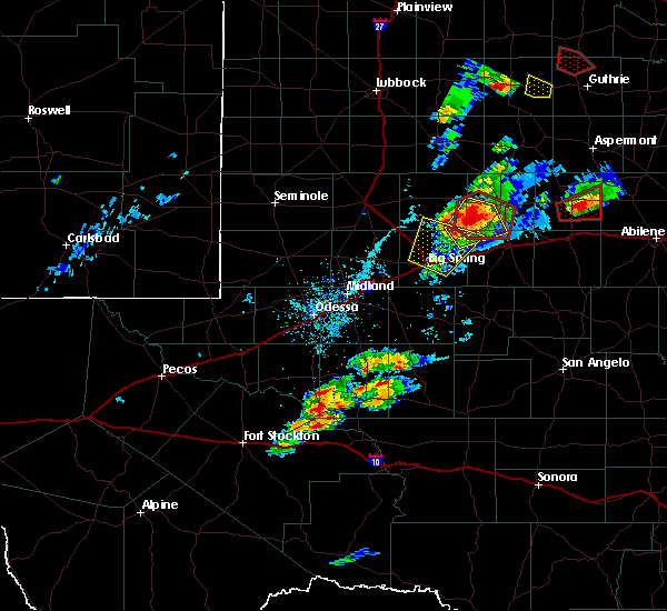 At 643 pm cdt, a severe thunderstorm capable of producing a tornado was located over lake j b thomas, or 15 miles southwest of snyder, moving northeast at 30 mph (radar indicated rotation). Hazards include tornado and baseball size hail. Flying debris will be dangerous to those caught without shelter. mobile homes will be damaged or destroyed. damage to roofs, windows, and vehicles will occur. tree damage is likely. this dangerous storm will be near, ira around 650 pm cdt. union in scurry county and randalls corner around 655 pm cdt. Snyder and winston field around 700 pm cdt. At 643 pm cdt, a severe thunderstorm capable of producing a tornado was located over lake j b thomas, or 15 miles southwest of snyder, moving northeast at 30 mph (radar indicated rotation). Hazards include tornado and baseball size hail. Flying debris will be dangerous to those caught without shelter. mobile homes will be damaged or destroyed. damage to roofs, windows, and vehicles will occur. tree damage is likely. this dangerous storm will be near, ira around 650 pm cdt. union in scurry county and randalls corner around 655 pm cdt. Snyder and winston field around 700 pm cdt.
|
| 6/13/2015 10:15 PM CDT | Storm damage reported in scurry county TX, 2.8 miles W of Snyder, TX |
| 5/30/2015 12:18 AM CDT | Also very heavy rain in scurry county TX, 0.9 miles NE of Snyder, TX |
| 5/29/2015 11:58 PM CDT | At 1153 pm cdt, severe thunderstorms were located along a line extending from winston field to lenorah to 12 miles east of andrews county airport to 9 miles northwest of frankel city, and moving south at 50 mph (radar indicated). Hazards include 70 mph wind gusts and quarter size hail. Hail damage to vehicles is expected. expect considerable tree damage. Wind damage is also likely to mobile homes, roofs and outbuildings. |
| 5/28/2015 5:11 PM CDT | The severe thunderstorm warning for northeastern borden and scurry counties will expire at 515 pm cdt/415 pm mdt/, the storm which prompted the warning has weakened below severe limits, and no longer poses an immediate threat to life or property. however, heavy rain is still possible with this thunderstorm. in addition, strong thunderstorms may redevelop, and a tornado watch remains in effect until 800 pm cdt. |
| 5/28/2015 4:49 PM CDT | At 445 pm cdt, a severe thunderstorm was located near fluvanna, and moving northeast at 20 mph (public). Hazards include 60 mph wind gusts and quarter size hail. Hail damage to vehicles is expected. expect wind damage to roofs, siding and trees. Locations impacted include, snyder, dermott, hermleigh, hudd, midway in scurry county and midway. |
| 5/28/2015 4:30 PM CDT | Quarter sized hail reported 16.1 miles ESE of Snyder, TX, hail lasted for 15 minutes between 430 and 445 pm |
| 5/28/2015 4:27 PM CDT | At 426 pm cdt, a severe thunderstorm was located 8 miles west of fluvanna, and moving northeast at 20 mph (radar indicated). Hazards include golf ball size hail and 60 mph wind gusts. People and animals outdoors will be injured. expect hail damage to roofs, siding, windows and vehicles. Expect wind damage to roofs, siding and trees. |
| 5/25/2015 9:34 AM CDT | At 928 am cdt, severe thunderstorms were located along a line extending from rotan to silver, and moving southeast at 35 mph. a roof was blown off a house from straight line winds in loraine between 9:05 am to 9:15 am (trained weather spotters). Hazards include 70 mph wind gusts. Expect considerable tree damage. damage is likely to mobile homes, roofs and outbuildings. Locations impacted include, loraine. |
| 5/25/2015 9:13 AM CDT | At 911 am cdt, severe thunderstorms were located along a line extending from hudd to 7 miles west of silver, and moving southeast at 25 mph (trained weather spotters). Hazards include 60 mph wind gusts. Expect damage to roofs. Siding and trees. |
| 5/25/2015 8:41 AM CDT | At 834 am cdt, a severe thunderstorm was located near lees, and moving east at 15 mph. trained spotters reported wind gusts to 60 mph near snyder airport and four miles northwest of snyder (trained weather spotters). Hazards include 60 mph wind gusts and nickel size hail. Hail damage to vehicles is expected. expect wind damage to roofs, siding and trees. Locations impacted include, colorado city, snyder, midway, midway in howard county, sand springs, coahoma, fluvanna, vincent, westbrook, lake colorado city, champion creek reservoir, cuthbert, colorado city airport, lake j b thomas, buford, ira, knapp, dunn, china grove and valley view. |
| 5/25/2015 8:30 AM CDT | Storm damage reported in scurry county TX, 3.8 miles SE of Snyder, TX |
| 5/25/2015 8:08 AM CDT | At 806 am cdt, severe thunderstorms was located near lomax, and moving east at 15 mph (radar indicated). Hazards include 60 mph wind gusts and quarter size hail. Hail damage to vehicles is expected. Expect wind damage to roofs, siding and trees. |
| 5/25/2015 7:28 AM CDT | At 724 am cdt, a severe thunderstorm was located near big spring, and moving northeast at 30 mph (radar indicated). Hazards include 60 mph wind gusts and quarter size hail. Hail damage to vehicles is expected. Expect wind damage to roofs, siding and trees. |
| 5/19/2015 2:25 AM CDT | Storm damage reported in scurry county TX, 2.8 miles W of Snyder, TX |
| 5/5/2015 4:58 PM CDT | At 453 pm cdt, a severe thunderstorm was located near snyder, and moving northeast at 25 mph. at 450 pm cdt, public reported quarter size hail 2 miles northwest of snyder (public). Hazards include 60 mph wind gusts and quarter size hail. Hail damage to vehicles is expected. expect wind damage to roofs, siding and trees. locations impacted include, midway in scurry county, midway and hudd. Possible. |
| 5/5/2015 4:50 PM CDT | Quarter sized hail reported 2.1 miles ESE of Snyder, TX |
| 5/5/2015 4:44 PM CDT | At 439 pm cdt, a severe thunderstorm was located near union in scurry county, and moving northeast at 25 mph (radar indicated). Hazards include 60 mph wind gusts and half dollar size hail. tornadoes can and do form from severe thunderstorms. Hail damage to vehicles is expected. Expect wind damage to roofs, siding and trees. |
| 5/5/2015 4:38 PM CDT | At 435 pm cdt, a severe thunderstorm was located near union, and moving northeast at 15 mph (radar indicated). Hazards include quarter size hail and 60 mph wind gusts. People and animals outdoors will be injured. expect hail damage to roofs, siding, windows and vehicles. expect wind damage to roofs, siding and trees. locations impacted include, snyder, union, union in scurry county, winston field, midway in scurry county and midway. 1. 75in. |
| 5/5/2015 4:26 PM CDT | At 421 pm cdt, a severe thunderstorm was located near union in scurry county, and moving northeast at 20 mph. at 415 pm cdt, nickel size hail was reported two and a half miles northwest of snyder on highway 84 (radar indicated). Hazards include golf ball size hail and 60 mph wind gusts. People and animals outdoors will be injured. expect hail damage to roofs, siding, windows and vehicles. expect wind damage to roofs, siding and trees. locations impacted include, snyder, midway in scurry county and midway. 1. 75in. |
| 5/5/2015 4:02 PM CDT | At 359 pm cdt, a severe thunderstorm was located near randalls corner, and moving east at 25 mph (radar indicated). Hazards include golf ball size hail and 60 mph wind gusts. People and animals outdoors will be injured. expect hail damage to roofs, siding, windows and vehicles. Expect wind damage to roofs, siding and trees. |
| 5/24/2014 1:05 PM CDT | West texas mesonet site at snyder measured 61 mph wind gust in scurry county TX, 2.8 miles W of Snyder, TX |
| 6/6/2013 12:10 AM CDT | Storm damage reported in scurry county TX, 2.8 miles W of Snyder, TX |
| 6/6/2013 12:05 AM CDT | Reported by west texas mesonet in scurry county TX, 2.8 miles W of Snyder, TX |
| 6/6/2013 12:00 AM CDT | Storm damage reported in scurry county TX, 5.1 miles SE of Snyder, TX |
| 5/23/2013 6:25 PM CDT | Storm damage reported in scurry county TX, 2.8 miles W of Snyder, TX |
| 5/23/2013 6:22 PM CDT | Storm damage reported in scurry county TX, 3.4 miles ESE of Snyder, TX |
| 5/15/2013 5:10 PM CDT | Storm damage reported in scurry county TX, 2.6 miles NE of Snyder, TX |
| 5/15/2013 5:00 PM CDT | Storm damage reported in scurry county TX, 2.8 miles W of Snyder, TX |
| 5/15/2013 4:35 PM CDT | Storm damage reported in scurry county TX, 2.6 miles NE of Snyder, TX |
| 5/7/2013 9:30 PM CDT | Quarter sized hail reported 5.4 miles E of Snyder, TX, reports of quater hail mixed with some smaller hail just west of snyder at fm 1609 and w 37th. hail covering roadway. |
| 10/22/2012 7:22 AM CDT | Quarter sized hail reported 0.9 miles NE of Snyder, TX |
| 6/4/2012 9:55 PM CDT | Measured by the texas tech university west texas mesonet in scurry county TX, 2.8 miles W of Snyder, TX |
| 4/30/2012 7:12 PM CDT | Ping Pong Ball sized hail reported 15.2 miles ESE of Snyder, TX |
| 4/30/2012 6:50 PM CDT | Tennis Ball sized hail reported 18.4 miles SE of Snyder, TX |
| 4/30/2012 6:41 PM CDT | Baseball sized hail reported 15.2 miles ESE of Snyder, TX |
| 4/30/2012 6:05 PM CDT | Quarter sized hail reported 18.4 miles SE of Snyder, TX |
| 1/1/0001 12:00 AM | Quarter sized hail reported 15.8 miles ESE of Snyder, TX, hail was almost covering ground. |
Hail Maps for Snyder, TX
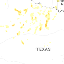
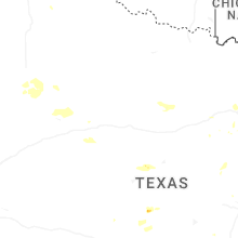
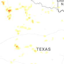
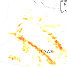
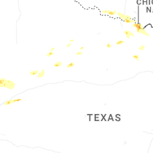
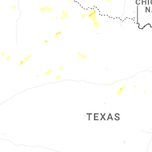
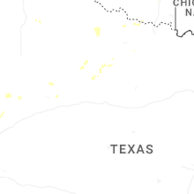

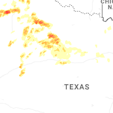
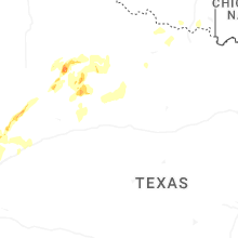


Connect with Interactive Hail Maps