

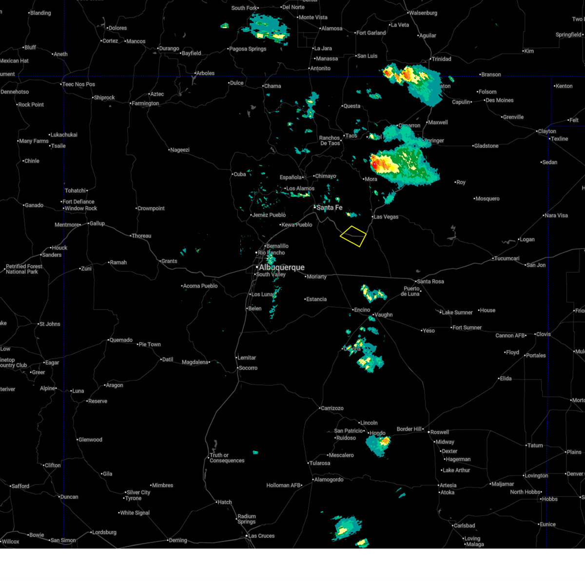
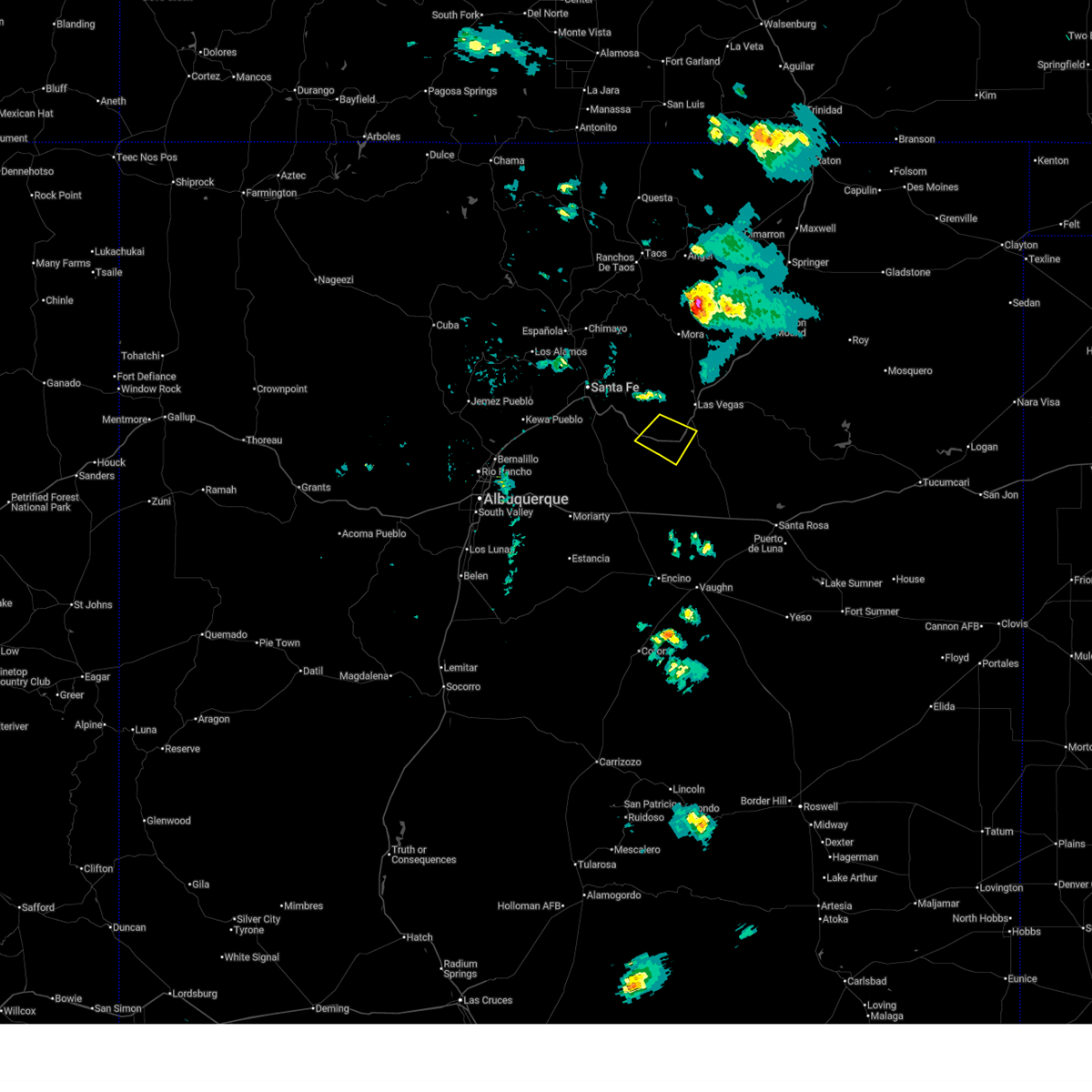
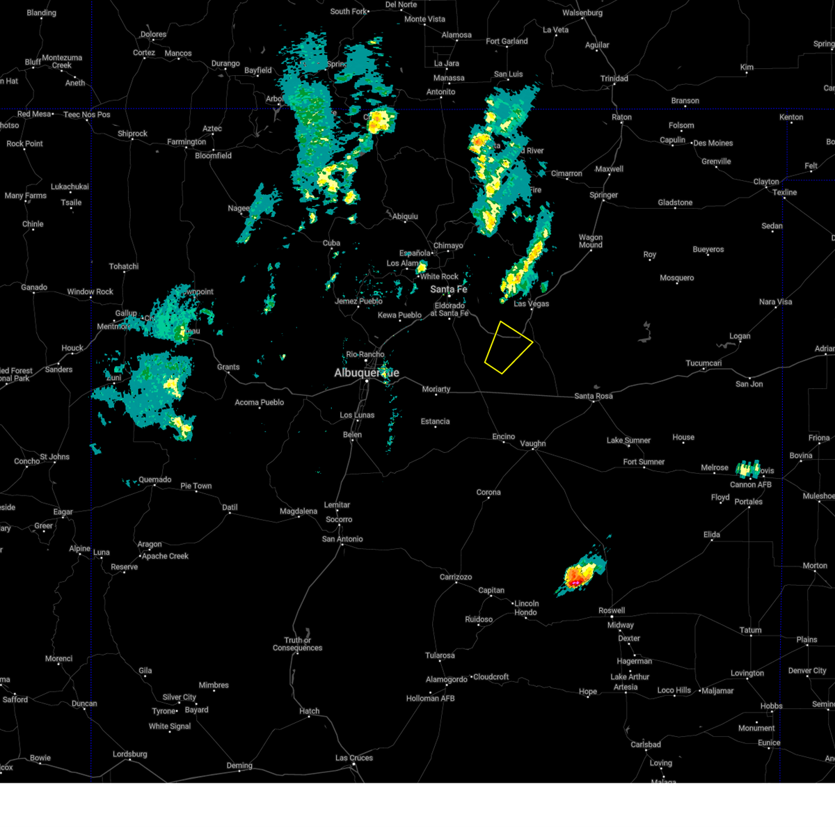
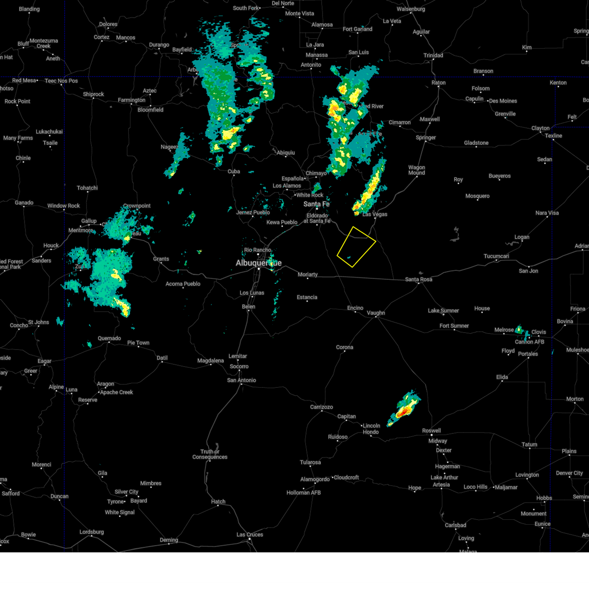
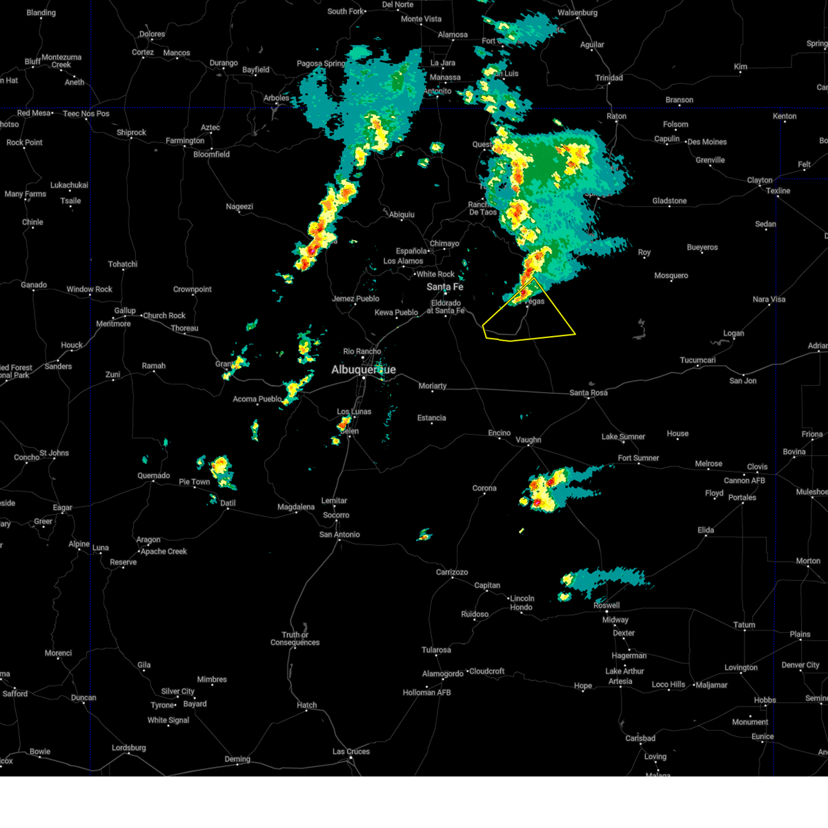
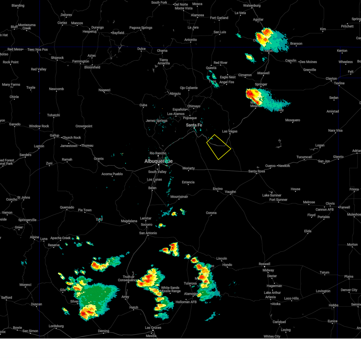
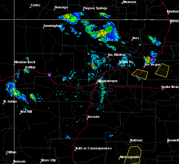
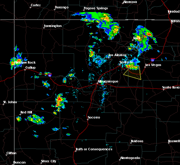
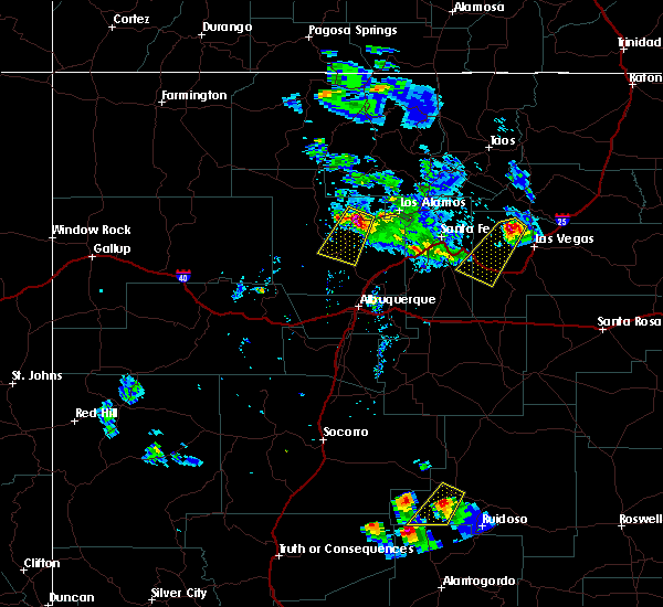
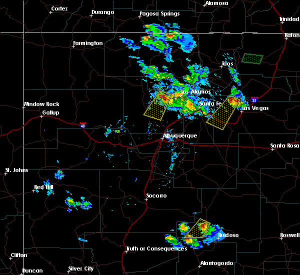
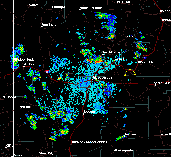
Hail Map for Soham, NM
The Soham, NM area has had 3 reports of on-the-ground hail by trained spotters, and has been under severe weather warnings 2 times during the past 12 months. Doppler radar has detected hail at or near Soham, NM on 19 occasions, including 1 occasion during the past year.
| Name: | Soham, NM |
| Where Located: | 68.6 miles S of Taos, NM |
| Map: | Google Map for Soham, NM |
| Population: | 210 |
| Housing Units: | 101 |
| More Info: | Search Google for Soham, NM |
5
The Top Recent Hail Date for Soham, NM is Friday, June 19, 2026 (1st out of 19)

Hail and Wind Damage Spotted near Soham, NM
| Date / Time | Report Details |
|---|---|
| 6/19/2026 3:08 PM MDT |
 At 308 pm mdt, a severe thunderstorm was located near ribera, or 22 miles southwest of las vegas, moving south at 30 mph (radar indicated). Hazards include golf ball size hail and 60 mph wind gusts. People and animals outdoors will be injured. expect hail damage to roofs, siding, windows, and vehicles. expect wind damage to roofs, siding, and trees. locations impacted include, ribera, san jose and sena. This includes interstate 25 between mile markers 316 and 332. At 308 pm mdt, a severe thunderstorm was located near ribera, or 22 miles southwest of las vegas, moving south at 30 mph (radar indicated). Hazards include golf ball size hail and 60 mph wind gusts. People and animals outdoors will be injured. expect hail damage to roofs, siding, windows, and vehicles. expect wind damage to roofs, siding, and trees. locations impacted include, ribera, san jose and sena. This includes interstate 25 between mile markers 316 and 332.
|
| 6/19/2026 2:58 PM MDT |
 Svrabq the national weather service in albuquerque has issued a * severe thunderstorm warning for, west central san miguel county in northeastern new mexico, * until 345 pm mdt. * at 258 pm mdt, a severe thunderstorm was located 6 miles north of ribera, or 17 miles southwest of las vegas, moving southeast at 15 mph (radar indicated). Hazards include 60 mph wind gusts and quarter size hail. Hail damage to vehicles is expected. Expect wind damage to roofs, siding, and trees. Svrabq the national weather service in albuquerque has issued a * severe thunderstorm warning for, west central san miguel county in northeastern new mexico, * until 345 pm mdt. * at 258 pm mdt, a severe thunderstorm was located 6 miles north of ribera, or 17 miles southwest of las vegas, moving southeast at 15 mph (radar indicated). Hazards include 60 mph wind gusts and quarter size hail. Hail damage to vehicles is expected. Expect wind damage to roofs, siding, and trees.
|
| 9/21/2024 3:07 PM MDT |
 At 307 pm mdt, a severe thunderstorm was located 7 miles south of ribera, or 27 miles southwest of las vegas, moving northeast at 25 mph (radar indicated). Hazards include 60 mph wind gusts and quarter size hail. Hail damage to vehicles is expected. expect wind damage to roofs, siding, and trees. locations impacted include, ribera, villanueva, villanueva state park, sena, san jose and chapelle. This includes interstate 25 between mile markers 318 and 331. At 307 pm mdt, a severe thunderstorm was located 7 miles south of ribera, or 27 miles southwest of las vegas, moving northeast at 25 mph (radar indicated). Hazards include 60 mph wind gusts and quarter size hail. Hail damage to vehicles is expected. expect wind damage to roofs, siding, and trees. locations impacted include, ribera, villanueva, villanueva state park, sena, san jose and chapelle. This includes interstate 25 between mile markers 318 and 331.
|
| 9/21/2024 2:53 PM MDT |
 Svrabq the national weather service in albuquerque has issued a * severe thunderstorm warning for, southwestern san miguel county in northeastern new mexico, * until 345 pm mdt. * at 253 pm mdt, a severe thunderstorm was located 13 miles southwest of ribera, or 31 miles northeast of moriarty, moving northeast at 25 mph (radar indicated). Hazards include 60 mph wind gusts and quarter size hail. Hail damage to vehicles is expected. Expect wind damage to roofs, siding, and trees. Svrabq the national weather service in albuquerque has issued a * severe thunderstorm warning for, southwestern san miguel county in northeastern new mexico, * until 345 pm mdt. * at 253 pm mdt, a severe thunderstorm was located 13 miles southwest of ribera, or 31 miles northeast of moriarty, moving northeast at 25 mph (radar indicated). Hazards include 60 mph wind gusts and quarter size hail. Hail damage to vehicles is expected. Expect wind damage to roofs, siding, and trees.
|
| 9/17/2024 1:38 PM MDT |
 At 138 pm mdt, a severe thunderstorm was located over romeroville, or 7 miles southwest of las vegas, moving northeast at 35 mph (radar indicated). Hazards include 60 mph wind gusts and quarter size hail. Hail damage to vehicles is expected. expect wind damage to roofs, siding, and trees. locations impacted include, las vegas, tecolote, storrie lake state park, ribera, romeroville, montezuma, chapelle, san geronimo, north san ysidro, and mineral hill. this includes the following highways, interstate 25 between mile markers 314 and 357. state road 104 between mile markers 1 and 13. state road 65 between mile markers 1 and 9. state road 283 between mile markers 1 and 12. State road 518 between mile markers 1 and 9. At 138 pm mdt, a severe thunderstorm was located over romeroville, or 7 miles southwest of las vegas, moving northeast at 35 mph (radar indicated). Hazards include 60 mph wind gusts and quarter size hail. Hail damage to vehicles is expected. expect wind damage to roofs, siding, and trees. locations impacted include, las vegas, tecolote, storrie lake state park, ribera, romeroville, montezuma, chapelle, san geronimo, north san ysidro, and mineral hill. this includes the following highways, interstate 25 between mile markers 314 and 357. state road 104 between mile markers 1 and 13. state road 65 between mile markers 1 and 9. state road 283 between mile markers 1 and 12. State road 518 between mile markers 1 and 9.
|
| 9/17/2024 1:04 PM MDT |
 Svrabq the national weather service in albuquerque has issued a * severe thunderstorm warning for, northwestern san miguel county in northeastern new mexico, * until 200 pm mdt. * at 103 pm mdt, a severe thunderstorm was located 10 miles west of ribera, or 28 miles southwest of las vegas, moving northeast at 35 mph (radar indicated). Hazards include 60 mph wind gusts and quarter size hail. Hail damage to vehicles is expected. Expect wind damage to roofs, siding, and trees. Svrabq the national weather service in albuquerque has issued a * severe thunderstorm warning for, northwestern san miguel county in northeastern new mexico, * until 200 pm mdt. * at 103 pm mdt, a severe thunderstorm was located 10 miles west of ribera, or 28 miles southwest of las vegas, moving northeast at 35 mph (radar indicated). Hazards include 60 mph wind gusts and quarter size hail. Hail damage to vehicles is expected. Expect wind damage to roofs, siding, and trees.
|
| 5/11/2024 3:44 PM MDT |
 At 342 pm mdt, a severe thunderstorm was located near ribera, or 18 miles southwest of las vegas, moving east at 30 mph (radar indicated). Hazards include 60 mph wind gusts and quarter size hail. Hail damage to vehicles is expected. expect wind damage to roofs, siding, and trees. locations impacted include, romeroville, tecolote, ribera, chapelle, south san ysidro, ojitos frios, san geronimo, los montoyas, north san ysidro, and san pablo. This includes state road 283 between mile markers 3 and 10 and i-25 between south san ysidro and tecolote. At 342 pm mdt, a severe thunderstorm was located near ribera, or 18 miles southwest of las vegas, moving east at 30 mph (radar indicated). Hazards include 60 mph wind gusts and quarter size hail. Hail damage to vehicles is expected. expect wind damage to roofs, siding, and trees. locations impacted include, romeroville, tecolote, ribera, chapelle, south san ysidro, ojitos frios, san geronimo, los montoyas, north san ysidro, and san pablo. This includes state road 283 between mile markers 3 and 10 and i-25 between south san ysidro and tecolote.
|
| 5/11/2024 3:44 PM MDT |
 the severe thunderstorm warning has been cancelled and is no longer in effect the severe thunderstorm warning has been cancelled and is no longer in effect
|
| 5/11/2024 3:26 PM MDT |
 Svrabq the national weather service in albuquerque has issued a * severe thunderstorm warning for, west central san miguel county in northeastern new mexico, southeastern santa fe county in north central new mexico, * until 430 pm mdt. * at 325 pm mdt, a severe thunderstorm was located near rowe, or 24 miles southeast of santa fe, moving northeast at 25 mph (radar indicated). Hazards include 60 mph wind gusts and quarter size hail. Hail damage to vehicles is expected. Expect wind damage to roofs, siding, and trees. Svrabq the national weather service in albuquerque has issued a * severe thunderstorm warning for, west central san miguel county in northeastern new mexico, southeastern santa fe county in north central new mexico, * until 430 pm mdt. * at 325 pm mdt, a severe thunderstorm was located near rowe, or 24 miles southeast of santa fe, moving northeast at 25 mph (radar indicated). Hazards include 60 mph wind gusts and quarter size hail. Hail damage to vehicles is expected. Expect wind damage to roofs, siding, and trees.
|
| 7/15/2023 3:55 PM MDT |
 At 354 pm mdt, a severe thunderstorm was located 8 miles southwest of ribera, or 28 miles southwest of las vegas, moving south at 15 mph (radar indicated). Hazards include golf ball size hail and 60 mph wind gusts. People and animals outdoors will be injured. expect hail damage to roofs, siding, windows, and vehicles. Expect wind damage to roofs, siding, and trees. At 354 pm mdt, a severe thunderstorm was located 8 miles southwest of ribera, or 28 miles southwest of las vegas, moving south at 15 mph (radar indicated). Hazards include golf ball size hail and 60 mph wind gusts. People and animals outdoors will be injured. expect hail damage to roofs, siding, windows, and vehicles. Expect wind damage to roofs, siding, and trees.
|
| 7/15/2023 3:48 PM MDT |
 At 348 pm mdt, a severe thunderstorm was located near ribera, or 24 miles southwest of las vegas, moving southeast at 15 mph (radar indicated). Hazards include 60 mph wind gusts and quarter size hail. Hail damage to vehicles is expected. expect wind damage to roofs, siding, and trees. locations impacted include, villanueva state park, ribera, villanueva, south san ysidro, sena and san jose. this includes interstate 25 between mile markers 314 and 329. hail threat, radar indicated max hail size, 1. 00 in wind threat, radar indicated max wind gust, 60 mph. At 348 pm mdt, a severe thunderstorm was located near ribera, or 24 miles southwest of las vegas, moving southeast at 15 mph (radar indicated). Hazards include 60 mph wind gusts and quarter size hail. Hail damage to vehicles is expected. expect wind damage to roofs, siding, and trees. locations impacted include, villanueva state park, ribera, villanueva, south san ysidro, sena and san jose. this includes interstate 25 between mile markers 314 and 329. hail threat, radar indicated max hail size, 1. 00 in wind threat, radar indicated max wind gust, 60 mph.
|
| 7/15/2023 3:34 PM MDT | Golf Ball sized hail reported 3 miles ESE of Soham, NM |
| 7/15/2023 3:34 PM MDT | Half Dollar sized hail reported 3 miles ESE of Soham, NM, corrects previous hail report from 2 se south san ysidro. enough hail fell to completely cover the ground to a depth of about 1 inch. |
| 7/15/2023 3:20 PM MDT |
 At 320 pm mdt, a severe thunderstorm was located near rowe, or 21 miles southwest of las vegas, moving southeast at 15 mph (radar indicated). Hazards include 60 mph wind gusts and quarter size hail. Hail damage to vehicles is expected. Expect wind damage to roofs, siding, and trees. At 320 pm mdt, a severe thunderstorm was located near rowe, or 21 miles southwest of las vegas, moving southeast at 15 mph (radar indicated). Hazards include 60 mph wind gusts and quarter size hail. Hail damage to vehicles is expected. Expect wind damage to roofs, siding, and trees.
|
| 7/15/2023 2:06 PM MDT |
 At 205 pm mdt, a severe thunderstorm was located 7 miles northwest of tecolote, or 11 miles southwest of las vegas, moving south at 15 mph (radar indicated). Hazards include 60 mph wind gusts and quarter size hail. Hail damage to vehicles is expected. Expect wind damage to roofs, siding, and trees. At 205 pm mdt, a severe thunderstorm was located 7 miles northwest of tecolote, or 11 miles southwest of las vegas, moving south at 15 mph (radar indicated). Hazards include 60 mph wind gusts and quarter size hail. Hail damage to vehicles is expected. Expect wind damage to roofs, siding, and trees.
|
| 6/6/2023 7:12 PM MDT |
 The severe thunderstorm warning for northwestern san miguel county will expire at 715 pm mdt, the storm that prompted the warning has weakened below severe limits, and no longer poses an immediate threat to life or property. therefore, the warning will be allowed to expire. however small hail is still possible with this thunderstorm. The severe thunderstorm warning for northwestern san miguel county will expire at 715 pm mdt, the storm that prompted the warning has weakened below severe limits, and no longer poses an immediate threat to life or property. therefore, the warning will be allowed to expire. however small hail is still possible with this thunderstorm.
|
| 6/6/2023 6:47 PM MDT |
 At 647 pm mdt, a severe thunderstorm was located over tecolote, or 9 miles south of las vegas, moving southeast at 20 mph (radar indicated). Hazards include ping pong ball size hail and 60 mph wind gusts. People and animals outdoors will be injured. expect hail damage to roofs, siding, windows, and vehicles. expect wind damage to roofs, siding, and trees. locations impacted include, montezuma, tecolote, el porvenir, chapelle, ojitos frios, san geronimo, north san ysidro, mineral hill, san pablo and san jose. this includes the following highways, interstate 25 between mile markers 317 and 339. state road 65 between mile markers 3 and 14. state road 283 between mile markers 2 and 12, and near mile marker 14. hail threat, observed max hail size, 1. 50 in wind threat, radar indicated max wind gust, 60 mph. At 647 pm mdt, a severe thunderstorm was located over tecolote, or 9 miles south of las vegas, moving southeast at 20 mph (radar indicated). Hazards include ping pong ball size hail and 60 mph wind gusts. People and animals outdoors will be injured. expect hail damage to roofs, siding, windows, and vehicles. expect wind damage to roofs, siding, and trees. locations impacted include, montezuma, tecolote, el porvenir, chapelle, ojitos frios, san geronimo, north san ysidro, mineral hill, san pablo and san jose. this includes the following highways, interstate 25 between mile markers 317 and 339. state road 65 between mile markers 3 and 14. state road 283 between mile markers 2 and 12, and near mile marker 14. hail threat, observed max hail size, 1. 50 in wind threat, radar indicated max wind gust, 60 mph.
|
| 6/6/2023 6:16 PM MDT |
 At 613 pm mdt, a severe thunderstorm was located 7 miles south of el porvenir, or 9 miles west of las vegas, and is nearly stationary (fire department. at 536 pm mdt, local fire department reported quarter size hail 1 mile west southwest of san geronimo). Hazards include 60 mph wind gusts and half dollar size hail. Hail damage to vehicles is expected. Expect wind damage to roofs, siding, and trees. At 613 pm mdt, a severe thunderstorm was located 7 miles south of el porvenir, or 9 miles west of las vegas, and is nearly stationary (fire department. at 536 pm mdt, local fire department reported quarter size hail 1 mile west southwest of san geronimo). Hazards include 60 mph wind gusts and half dollar size hail. Hail damage to vehicles is expected. Expect wind damage to roofs, siding, and trees.
|
| 6/6/2023 5:34 PM MDT |
 At 533 pm mdt, a severe thunderstorm was located 9 miles south of el porvenir, or 10 miles west of las vegas, moving east at 5 mph (radar indicated). Hazards include 60 mph wind gusts and half dollar size hail. Hail damage to vehicles is expected. Expect wind damage to roofs, siding, and trees. At 533 pm mdt, a severe thunderstorm was located 9 miles south of el porvenir, or 10 miles west of las vegas, moving east at 5 mph (radar indicated). Hazards include 60 mph wind gusts and half dollar size hail. Hail damage to vehicles is expected. Expect wind damage to roofs, siding, and trees.
|
| 5/31/2023 7:39 PM MDT |
 The severe thunderstorm warning for southwestern san miguel county will expire at 745 pm mdt, the storm which prompted the warning has weakened below severe limits, and no longer poses an immediate threat to life or property. therefore, the warning will be allowed to expire. however small hail, gusty winds and heavy rain are still possible with this thunderstorm. a severe thunderstorm watch remains in effect until 900 pm mdt for northeastern and east central new mexico. The severe thunderstorm warning for southwestern san miguel county will expire at 745 pm mdt, the storm which prompted the warning has weakened below severe limits, and no longer poses an immediate threat to life or property. therefore, the warning will be allowed to expire. however small hail, gusty winds and heavy rain are still possible with this thunderstorm. a severe thunderstorm watch remains in effect until 900 pm mdt for northeastern and east central new mexico.
|
| 5/31/2023 7:24 PM MDT |
 At 724 pm mdt, a severe thunderstorm was located near villanueva, or 26 miles southwest of las vegas, moving northeast at 20 mph (radar indicated). Hazards include 60 mph wind gusts and quarter size hail. Hail damage to vehicles is expected. expect wind damage to roofs, siding, and trees. locations impacted include, villanueva, villanueva state park, ribera, chapelle, sena, san pablo and san jose. this includes the following highways, interstate 25 between mile markers 318 and 333. highway 285 between mile markers 254 and 255. hail threat, radar indicated max hail size, 1. 00 in wind threat, radar indicated max wind gust, 60 mph. At 724 pm mdt, a severe thunderstorm was located near villanueva, or 26 miles southwest of las vegas, moving northeast at 20 mph (radar indicated). Hazards include 60 mph wind gusts and quarter size hail. Hail damage to vehicles is expected. expect wind damage to roofs, siding, and trees. locations impacted include, villanueva, villanueva state park, ribera, chapelle, sena, san pablo and san jose. this includes the following highways, interstate 25 between mile markers 318 and 333. highway 285 between mile markers 254 and 255. hail threat, radar indicated max hail size, 1. 00 in wind threat, radar indicated max wind gust, 60 mph.
|
| 5/31/2023 6:54 PM MDT |
 At 653 pm mdt, a severe thunderstorm was located 12 miles north of clines corners, or 25 miles northeast of moriarty, moving northeast at 25 mph (radar indicated). Hazards include 60 mph wind gusts and quarter size hail. Hail damage to vehicles is expected. Expect wind damage to roofs, siding, and trees. At 653 pm mdt, a severe thunderstorm was located 12 miles north of clines corners, or 25 miles northeast of moriarty, moving northeast at 25 mph (radar indicated). Hazards include 60 mph wind gusts and quarter size hail. Hail damage to vehicles is expected. Expect wind damage to roofs, siding, and trees.
|
| 5/28/2021 1:36 PM MDT | Quarter sized hail reported 3 miles ESE of Soham, NM |
| 7/31/2020 4:02 PM MDT |
 At 401 pm mdt, a severe thunderstorm was located near ribera, or 25 miles southwest of las vegas, moving south at 10 mph (trained weather spotters). Hazards include 60 mph wind gusts and quarter size hail. Hail damage to vehicles is expected. expect wind damage to roofs, siding, and trees. locations impacted include, villanueva state park, ribera, villanueva and sena. This includes interstate 25 between mile markers 318 and 330. At 401 pm mdt, a severe thunderstorm was located near ribera, or 25 miles southwest of las vegas, moving south at 10 mph (trained weather spotters). Hazards include 60 mph wind gusts and quarter size hail. Hail damage to vehicles is expected. expect wind damage to roofs, siding, and trees. locations impacted include, villanueva state park, ribera, villanueva and sena. This includes interstate 25 between mile markers 318 and 330.
|
| 7/31/2020 3:38 PM MDT |
 At 337 pm mdt, a severe thunderstorm was located over ribera, or 21 miles southwest of las vegas, moving south at 10 mph (radar indicated). Hazards include golf ball size hail and 60 mph wind gusts. People and animals outdoors will be injured. expect hail damage to roofs, siding, windows, and vehicles. Expect wind damage to roofs, siding, and trees. At 337 pm mdt, a severe thunderstorm was located over ribera, or 21 miles southwest of las vegas, moving south at 10 mph (radar indicated). Hazards include golf ball size hail and 60 mph wind gusts. People and animals outdoors will be injured. expect hail damage to roofs, siding, windows, and vehicles. Expect wind damage to roofs, siding, and trees.
|
| 7/31/2020 3:17 PM MDT |
 At 317 pm mdt, a severe thunderstorm was located near tecolote, or 12 miles southwest of las vegas, moving southwest at 10 mph (radar indicated). Hazards include 60 mph wind gusts and quarter size hail. Hail damage to vehicles is expected. expect wind damage to roofs, siding, and trees. locations impacted include, ribera, tecolote, los montoyas, chapelle and san agustin. This includes interstate 25 between mile markers 318 and 337. At 317 pm mdt, a severe thunderstorm was located near tecolote, or 12 miles southwest of las vegas, moving southwest at 10 mph (radar indicated). Hazards include 60 mph wind gusts and quarter size hail. Hail damage to vehicles is expected. expect wind damage to roofs, siding, and trees. locations impacted include, ribera, tecolote, los montoyas, chapelle and san agustin. This includes interstate 25 between mile markers 318 and 337.
|
| 7/31/2020 2:59 PM MDT |
 At 258 pm mdt, a severe thunderstorm was located over tecolote, or 9 miles southwest of las vegas, moving southwest at 10 mph (radar indicated). Hazards include ping pong ball size hail and 60 mph wind gusts. People and animals outdoors will be injured. expect hail damage to roofs, siding, windows, and vehicles. Expect wind damage to roofs, siding, and trees. At 258 pm mdt, a severe thunderstorm was located over tecolote, or 9 miles southwest of las vegas, moving southwest at 10 mph (radar indicated). Hazards include ping pong ball size hail and 60 mph wind gusts. People and animals outdoors will be injured. expect hail damage to roofs, siding, windows, and vehicles. Expect wind damage to roofs, siding, and trees.
|
| 6/17/2019 4:45 PM MDT |
 At 444 pm mdt, severe thunderstorms were located along a line extending from 6 miles north of upper colonias to near villanueva state park, moving northeast at 25 mph (radar indicated). Hazards include 60 mph wind gusts and quarter size hail. Hail damage to vehicles is expected. Expect wind damage to roofs, siding, and trees. At 444 pm mdt, severe thunderstorms were located along a line extending from 6 miles north of upper colonias to near villanueva state park, moving northeast at 25 mph (radar indicated). Hazards include 60 mph wind gusts and quarter size hail. Hail damage to vehicles is expected. Expect wind damage to roofs, siding, and trees.
|
| 6/17/2019 4:07 PM MDT |
 At 407 pm mdt, a severe thunderstorm was located over ribera, or 19 miles southwest of las vegas, moving northeast at 5 mph (trained weather spotters). Hazards include 60 mph wind gusts and quarter size hail. Hail damage to vehicles is expected. expect wind damage to roofs, siding, and trees. locations impacted include, villanueva, tecolote, villanueva state park, ribera, chapelle and sena. This includes interstate 25 between mile markers 321 and 335. At 407 pm mdt, a severe thunderstorm was located over ribera, or 19 miles southwest of las vegas, moving northeast at 5 mph (trained weather spotters). Hazards include 60 mph wind gusts and quarter size hail. Hail damage to vehicles is expected. expect wind damage to roofs, siding, and trees. locations impacted include, villanueva, tecolote, villanueva state park, ribera, chapelle and sena. This includes interstate 25 between mile markers 321 and 335.
|
| 6/17/2019 3:53 PM MDT |
 The national weather service in albuquerque has issued a * severe thunderstorm warning for. west central san miguel county in northeastern new mexico. until 445 pm mdt. At 353 pm mdt, a severe thunderstorm was located over ribera, or 21 miles southwest of las vegas, moving northeast at 5 mph. The national weather service in albuquerque has issued a * severe thunderstorm warning for. west central san miguel county in northeastern new mexico. until 445 pm mdt. At 353 pm mdt, a severe thunderstorm was located over ribera, or 21 miles southwest of las vegas, moving northeast at 5 mph.
|
| 8/9/2018 3:37 PM MDT |
 At 337 pm mdt, a severe thunderstorm was located 7 miles west of ribera, or 23 miles southwest of las vegas, moving south at 15 mph (radar indicated). Hazards include 60 mph wind gusts and quarter size hail. Hail damage to vehicles is expected. expect wind damage to roofs, siding, and trees. locations impacted include, pecos, ribera, rowe, sena, south san ysidro, north san ysidro and lower colonias. This includes interstate 25 between mile markers 305 and 327. At 337 pm mdt, a severe thunderstorm was located 7 miles west of ribera, or 23 miles southwest of las vegas, moving south at 15 mph (radar indicated). Hazards include 60 mph wind gusts and quarter size hail. Hail damage to vehicles is expected. expect wind damage to roofs, siding, and trees. locations impacted include, pecos, ribera, rowe, sena, south san ysidro, north san ysidro and lower colonias. This includes interstate 25 between mile markers 305 and 327.
|
| 8/9/2018 2:55 PM MDT |
 At 255 pm mdt, a severe thunderstorm was located near upper colonias, or 15 miles west of las vegas, moving south at 10 mph (radar indicated). Hazards include 60 mph wind gusts and half dollar size hail. Hail damage to vehicles is expected. Expect wind damage to roofs, siding, and trees. At 255 pm mdt, a severe thunderstorm was located near upper colonias, or 15 miles west of las vegas, moving south at 10 mph (radar indicated). Hazards include 60 mph wind gusts and half dollar size hail. Hail damage to vehicles is expected. Expect wind damage to roofs, siding, and trees.
|
| 7/31/2018 7:03 PM MDT |
 At 703 pm mdt, a severe thunderstorm was located near el porvenir, or 14 miles northwest of las vegas, moving southwest at 30 mph (radar indicated). Hazards include 60 mph wind gusts and half dollar size hail. Hail damage to vehicles is expected. expect wind damage to roofs, siding, and trees. locations impacted include, pecos, upper colonias, el porvenir, rowe, south san ysidro, san geronimo, north san ysidro, mineral hill, san pablo and lower colonias. This includes interstate 25 between mile markers 304 and 321. At 703 pm mdt, a severe thunderstorm was located near el porvenir, or 14 miles northwest of las vegas, moving southwest at 30 mph (radar indicated). Hazards include 60 mph wind gusts and half dollar size hail. Hail damage to vehicles is expected. expect wind damage to roofs, siding, and trees. locations impacted include, pecos, upper colonias, el porvenir, rowe, south san ysidro, san geronimo, north san ysidro, mineral hill, san pablo and lower colonias. This includes interstate 25 between mile markers 304 and 321.
|
| 7/31/2018 6:48 PM MDT |
 At 647 pm mdt, a severe thunderstorm was located near tierra monte, or 12 miles south of mora, moving southwest at 30 mph (radar indicated). Hazards include 60 mph wind gusts and half dollar size hail. Hail damage to vehicles is expected. Expect wind damage to roofs, siding, and trees. At 647 pm mdt, a severe thunderstorm was located near tierra monte, or 12 miles south of mora, moving southwest at 30 mph (radar indicated). Hazards include 60 mph wind gusts and half dollar size hail. Hail damage to vehicles is expected. Expect wind damage to roofs, siding, and trees.
|
| 10/4/2017 7:50 PM MDT |
 At 750 pm mdt, a severe thunderstorm was located over ribera, or 19 miles southwest of las vegas, moving east at 25 mph (radar indicated). Hazards include 60 mph wind gusts and quarter size hail. Hail damage to vehicles is expected. expect wind damage to roofs, siding, and trees. locations impacted include, ribera, villanueva, tecolote, chapelle and sena. This includes interstate 25 between mile markers 317 and 339. At 750 pm mdt, a severe thunderstorm was located over ribera, or 19 miles southwest of las vegas, moving east at 25 mph (radar indicated). Hazards include 60 mph wind gusts and quarter size hail. Hail damage to vehicles is expected. expect wind damage to roofs, siding, and trees. locations impacted include, ribera, villanueva, tecolote, chapelle and sena. This includes interstate 25 between mile markers 317 and 339.
|
| 10/4/2017 7:14 PM MDT |
 At 714 pm mdt, severe thunderstorms were located along a line extending from rowe to 9 miles southeast of lamy, moving east at 25 mph (radar indicated). Hazards include 60 mph wind gusts and quarter size hail. Hail damage to vehicles is expected. Expect wind damage to roofs, siding, and trees. At 714 pm mdt, severe thunderstorms were located along a line extending from rowe to 9 miles southeast of lamy, moving east at 25 mph (radar indicated). Hazards include 60 mph wind gusts and quarter size hail. Hail damage to vehicles is expected. Expect wind damage to roofs, siding, and trees.
|
| 7/1/2017 5:54 PM MDT |
 At 554 pm mdt, a severe thunderstorm was located near ribera, or 15 miles southwest of las vegas, moving east at 10 mph (radar indicated). Hazards include 60 mph wind gusts and quarter size hail. Hail damage to vehicles is expected. expect wind damage to roofs, siding, and trees. locations impacted include, tecolote, ribera, chapelle, sena, south san ysidro, ojitos frios, north san ysidro and san pablo. This includes interstate 25 between mile markers 315 and 338. At 554 pm mdt, a severe thunderstorm was located near ribera, or 15 miles southwest of las vegas, moving east at 10 mph (radar indicated). Hazards include 60 mph wind gusts and quarter size hail. Hail damage to vehicles is expected. expect wind damage to roofs, siding, and trees. locations impacted include, tecolote, ribera, chapelle, sena, south san ysidro, ojitos frios, north san ysidro and san pablo. This includes interstate 25 between mile markers 315 and 338.
|
| 7/1/2017 5:37 PM MDT |
 At 537 pm mdt, a severe thunderstorm was located near ribera, or 19 miles southwest of las vegas, moving east at 5 mph (radar indicated). Hazards include 60 mph wind gusts and quarter size hail. Hail damage to vehicles is expected. Expect wind damage to roofs, siding, and trees. At 537 pm mdt, a severe thunderstorm was located near ribera, or 19 miles southwest of las vegas, moving east at 5 mph (radar indicated). Hazards include 60 mph wind gusts and quarter size hail. Hail damage to vehicles is expected. Expect wind damage to roofs, siding, and trees.
|
| 6/25/2017 6:09 PM MDT |
 The severe thunderstorm warning for southwestern san miguel county will expire at 615 pm mdt, the storm which prompted the warning has moved out of the area. therefore the warning will be allowed to expire. however small hail, gusty winds and heavy rain are still possible with this thunderstorm. a severe thunderstorm watch remains in effect until 1000 pm mdt for northeastern and east central new mexico. The severe thunderstorm warning for southwestern san miguel county will expire at 615 pm mdt, the storm which prompted the warning has moved out of the area. therefore the warning will be allowed to expire. however small hail, gusty winds and heavy rain are still possible with this thunderstorm. a severe thunderstorm watch remains in effect until 1000 pm mdt for northeastern and east central new mexico.
|
| 6/25/2017 5:27 PM MDT |
 At 527 pm mdt, a severe thunderstorm was located near tecolote, or 15 miles south of las vegas, moving southeast at 25 mph (radar indicated). Hazards include two inch hail and 60 mph wind gusts. People and animals outdoors will be injured. expect hail damage to roofs, siding, windows, and vehicles. Expect wind damage to roofs, siding, and trees. At 527 pm mdt, a severe thunderstorm was located near tecolote, or 15 miles south of las vegas, moving southeast at 25 mph (radar indicated). Hazards include two inch hail and 60 mph wind gusts. People and animals outdoors will be injured. expect hail damage to roofs, siding, windows, and vehicles. Expect wind damage to roofs, siding, and trees.
|
| 6/25/2017 5:12 PM MDT |
 At 512 pm mdt, a severe thunderstorm was located near ribera, or 14 miles southwest of las vegas, moving south at 10 mph (radar indicated). Hazards include two inch hail and 60 mph wind gusts. People and animals outdoors will be injured. expect hail damage to roofs, siding, windows, and vehicles. expect wind damage to roofs, siding, and trees. locations impacted include, ribera, chapelle and sena. This includes interstate 25 between mile markers 318 and 334. At 512 pm mdt, a severe thunderstorm was located near ribera, or 14 miles southwest of las vegas, moving south at 10 mph (radar indicated). Hazards include two inch hail and 60 mph wind gusts. People and animals outdoors will be injured. expect hail damage to roofs, siding, windows, and vehicles. expect wind damage to roofs, siding, and trees. locations impacted include, ribera, chapelle and sena. This includes interstate 25 between mile markers 318 and 334.
|
| 6/25/2017 5:00 PM MDT |
 At 459 pm mdt, a severe thunderstorm was located 7 miles north of ribera, or 14 miles southwest of las vegas, moving south at 10 mph (radar indicated). Hazards include ping pong ball size hail and 60 mph wind gusts. People and animals outdoors will be injured. expect hail damage to roofs, siding, windows, and vehicles. expect wind damage to roofs, siding, and trees. locations impacted include, ribera, chapelle, sena, san pablo and north san ysidro. This includes interstate 25 between mile markers 318 and 334. At 459 pm mdt, a severe thunderstorm was located 7 miles north of ribera, or 14 miles southwest of las vegas, moving south at 10 mph (radar indicated). Hazards include ping pong ball size hail and 60 mph wind gusts. People and animals outdoors will be injured. expect hail damage to roofs, siding, windows, and vehicles. expect wind damage to roofs, siding, and trees. locations impacted include, ribera, chapelle, sena, san pablo and north san ysidro. This includes interstate 25 between mile markers 318 and 334.
|
| 6/25/2017 4:45 PM MDT |
 At 443 pm mdt, a severe thunderstorm was located 8 miles southeast of upper colonias, or 13 miles southwest of las vegas, moving south at 10 mph (radar indicated). Hazards include 60 mph wind gusts and half dollar size hail. Hail damage to vehicles is expected. Expect wind damage to roofs, siding, and trees. At 443 pm mdt, a severe thunderstorm was located 8 miles southeast of upper colonias, or 13 miles southwest of las vegas, moving south at 10 mph (radar indicated). Hazards include 60 mph wind gusts and half dollar size hail. Hail damage to vehicles is expected. Expect wind damage to roofs, siding, and trees.
|
| 6/23/2017 3:46 PM MDT |
 At 346 pm mdt, a severe thunderstorm was located near ribera, or 14 miles southwest of las vegas, moving southeast at 20 mph (radar indicated). Hazards include 60 mph wind gusts and quarter size hail. Hail damage to vehicles is expected. expect wind damage to roofs, siding, and trees. locations impacted include, tecolote and chapelle. This includes interstate 25 between mile markers 323 and 335. At 346 pm mdt, a severe thunderstorm was located near ribera, or 14 miles southwest of las vegas, moving southeast at 20 mph (radar indicated). Hazards include 60 mph wind gusts and quarter size hail. Hail damage to vehicles is expected. expect wind damage to roofs, siding, and trees. locations impacted include, tecolote and chapelle. This includes interstate 25 between mile markers 323 and 335.
|
| 6/23/2017 3:34 PM MDT |
 At 333 pm mdt, a severe thunderstorm was located 8 miles west of romeroville, or 9 miles west of las vegas, moving southeast at 10 mph (trained weather spotters). Hazards include golf ball size hail and 60 mph wind gusts. People and animals outdoors will be injured. expect hail damage to roofs, siding, windows, and vehicles. Expect wind damage to roofs, siding, and trees. At 333 pm mdt, a severe thunderstorm was located 8 miles west of romeroville, or 9 miles west of las vegas, moving southeast at 10 mph (trained weather spotters). Hazards include golf ball size hail and 60 mph wind gusts. People and animals outdoors will be injured. expect hail damage to roofs, siding, windows, and vehicles. Expect wind damage to roofs, siding, and trees.
|
| 5/9/2017 2:12 PM MDT |
 At 211 pm mdt, a severe thunderstorm was located near villanueva, or 27 miles southwest of las vegas, moving north at 20 mph (radar indicated). Hazards include 70 mph wind gusts and half dollar size hail. Hail damage to vehicles is expected. expect considerable tree damage. wind damage is also likely to mobile homes, roofs, and outbuildings. locations impacted include, villanueva, tecolote, villanueva state park, ribera, chapelle, sena, south san ysidro and north san ysidro. This includes interstate 25 between mile markers 313 and 335. At 211 pm mdt, a severe thunderstorm was located near villanueva, or 27 miles southwest of las vegas, moving north at 20 mph (radar indicated). Hazards include 70 mph wind gusts and half dollar size hail. Hail damage to vehicles is expected. expect considerable tree damage. wind damage is also likely to mobile homes, roofs, and outbuildings. locations impacted include, villanueva, tecolote, villanueva state park, ribera, chapelle, sena, south san ysidro and north san ysidro. This includes interstate 25 between mile markers 313 and 335.
|
| 5/9/2017 1:40 PM MDT |
 At 140 pm mdt, a severe thunderstorm was located 13 miles southwest of villanueva state park, or 34 miles east of moriarty, moving north at 40 mph (radar indicated). Hazards include 70 mph wind gusts and half dollar size hail. Hail damage to vehicles is expected. expect considerable tree damage. Wind damage is also likely to mobile homes, roofs, and outbuildings. At 140 pm mdt, a severe thunderstorm was located 13 miles southwest of villanueva state park, or 34 miles east of moriarty, moving north at 40 mph (radar indicated). Hazards include 70 mph wind gusts and half dollar size hail. Hail damage to vehicles is expected. expect considerable tree damage. Wind damage is also likely to mobile homes, roofs, and outbuildings.
|
| 8/15/2015 2:12 PM MDT |
 At 212 pm mdt, a severe thunderstorm was located over ribera, or 22 miles southwest of las vegas, moving south at 15 mph (radar indicated). Hazards include half dollar size hail and 60 mph wind gusts. Hail damage to vehicles is expected. Expect wind damage to roofs, siding and trees. At 212 pm mdt, a severe thunderstorm was located over ribera, or 22 miles southwest of las vegas, moving south at 15 mph (radar indicated). Hazards include half dollar size hail and 60 mph wind gusts. Hail damage to vehicles is expected. Expect wind damage to roofs, siding and trees.
|
Hail Maps for Soham, NM


Connect with Interactive Hail Maps