

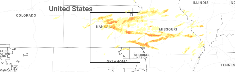
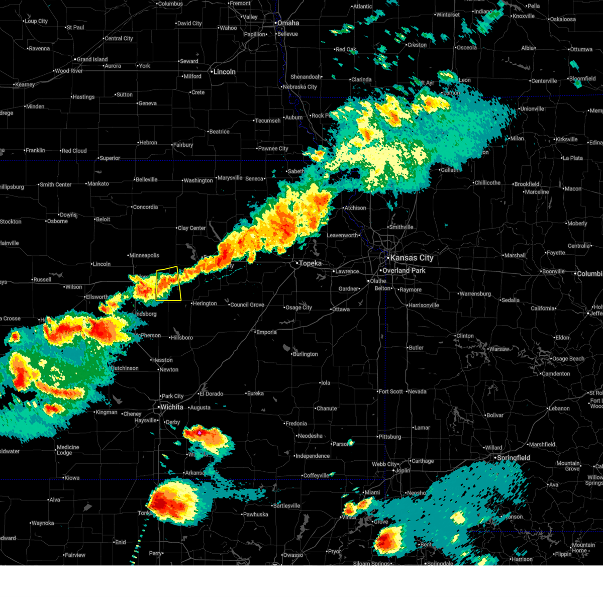
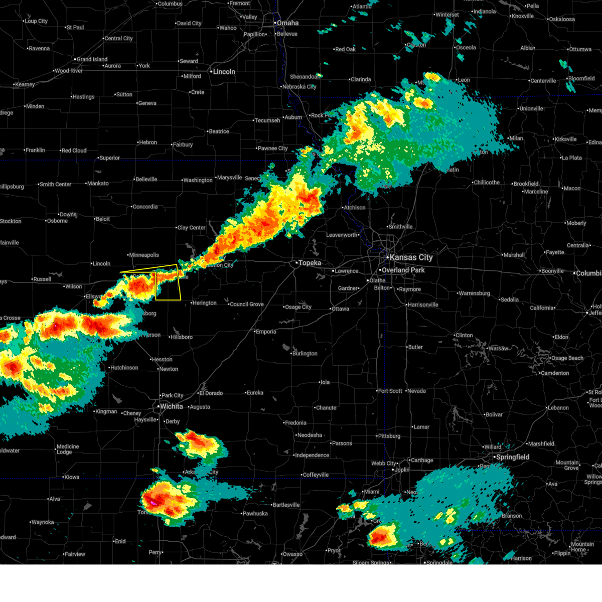
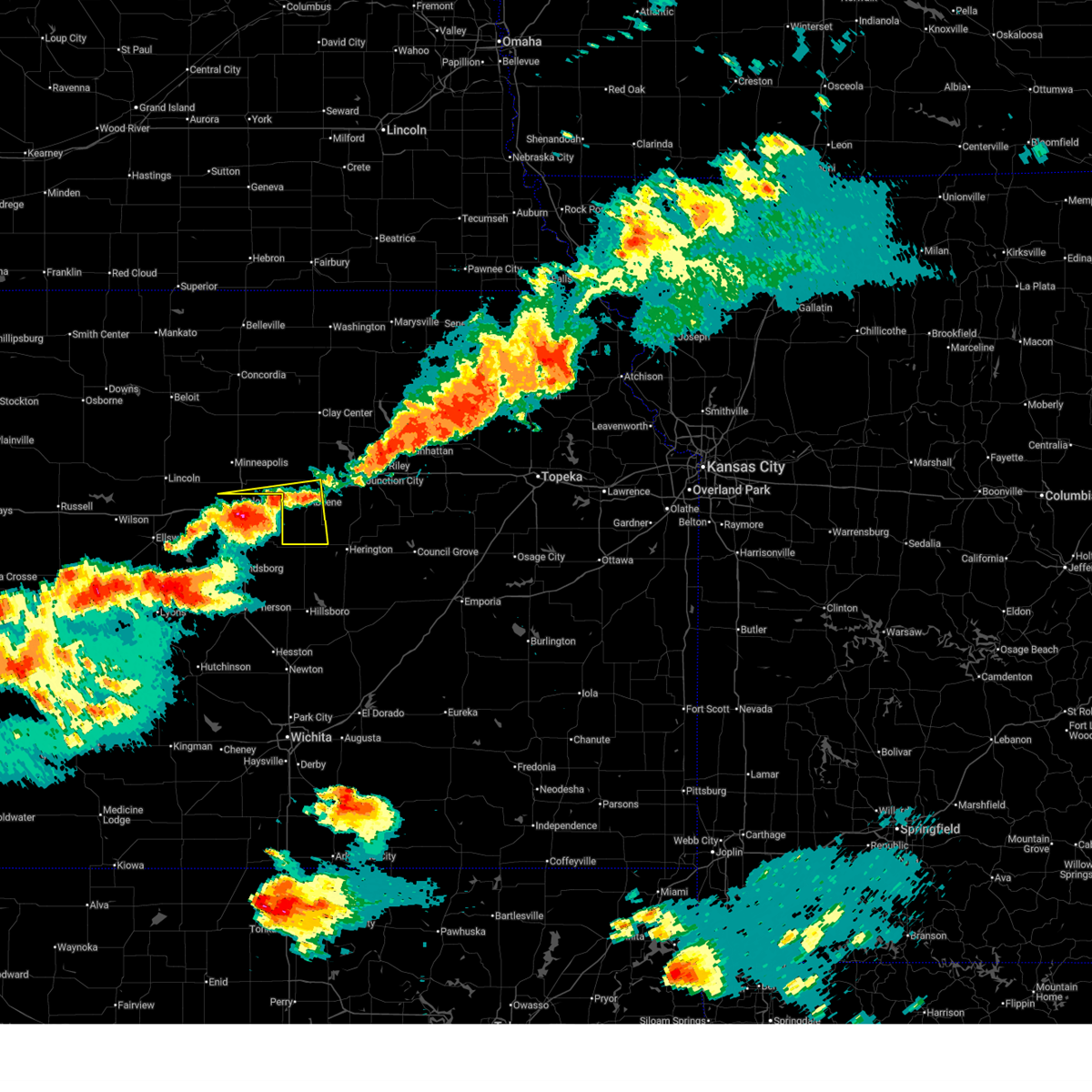
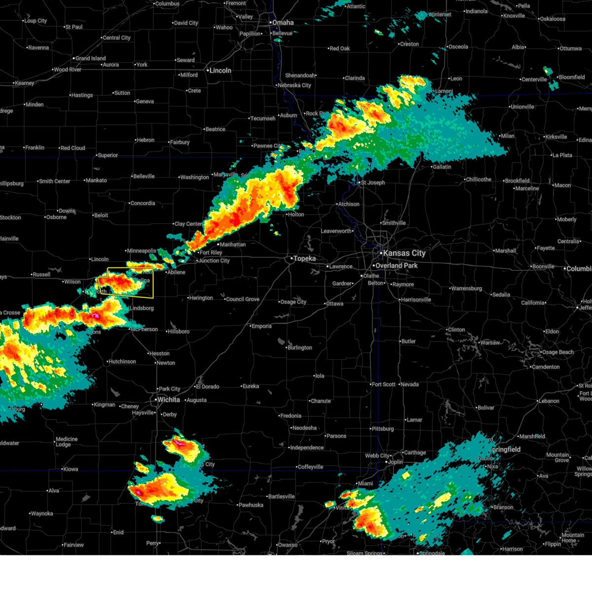
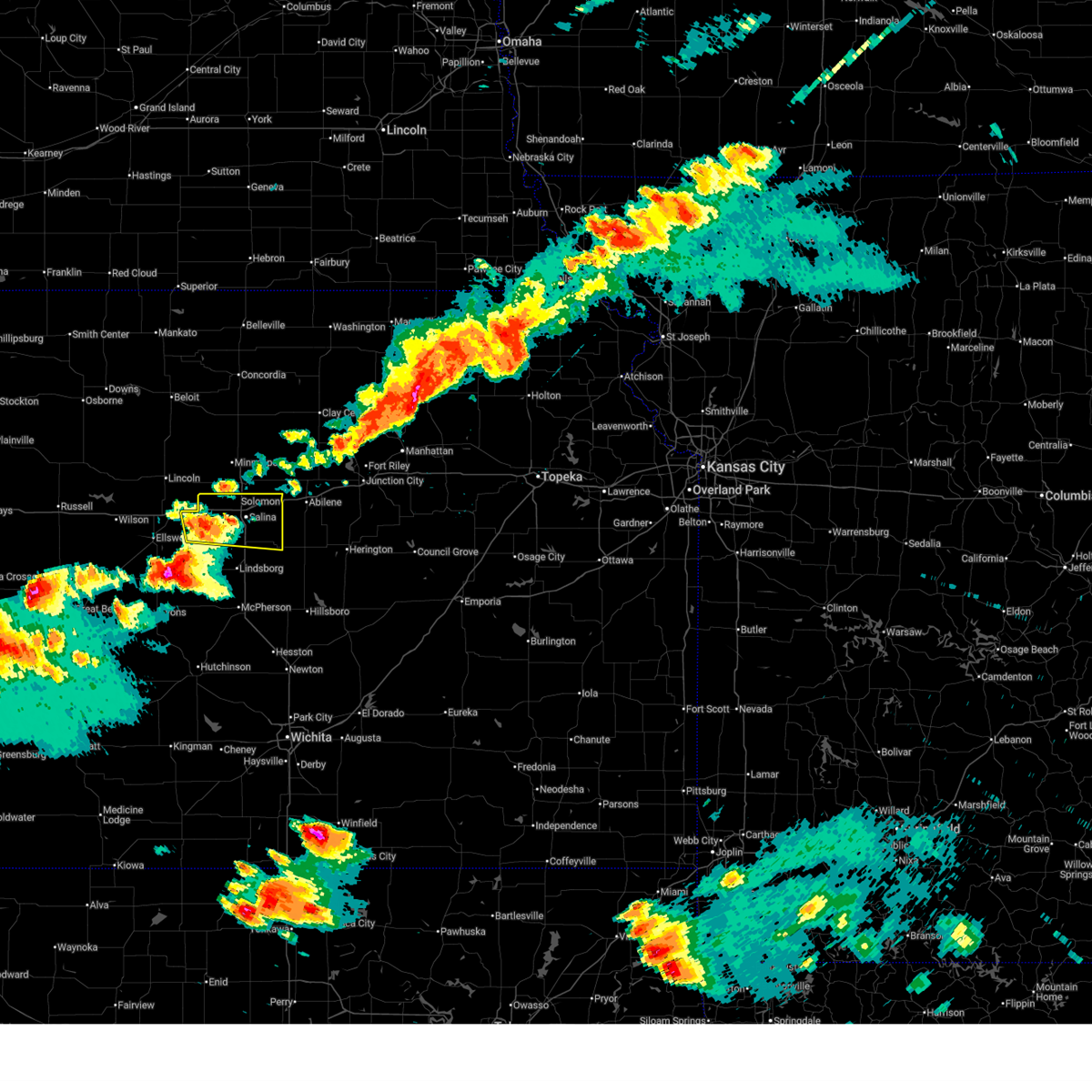
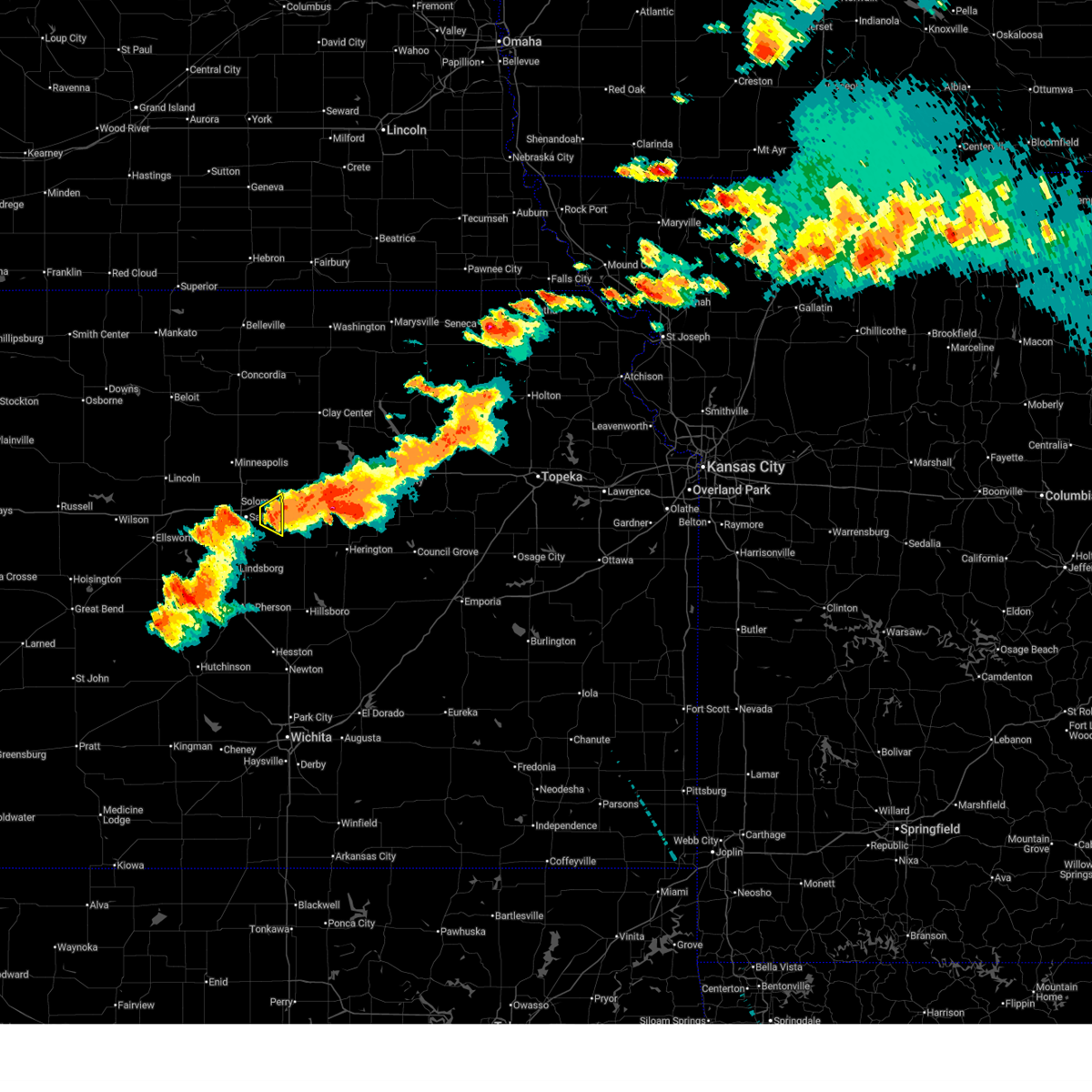
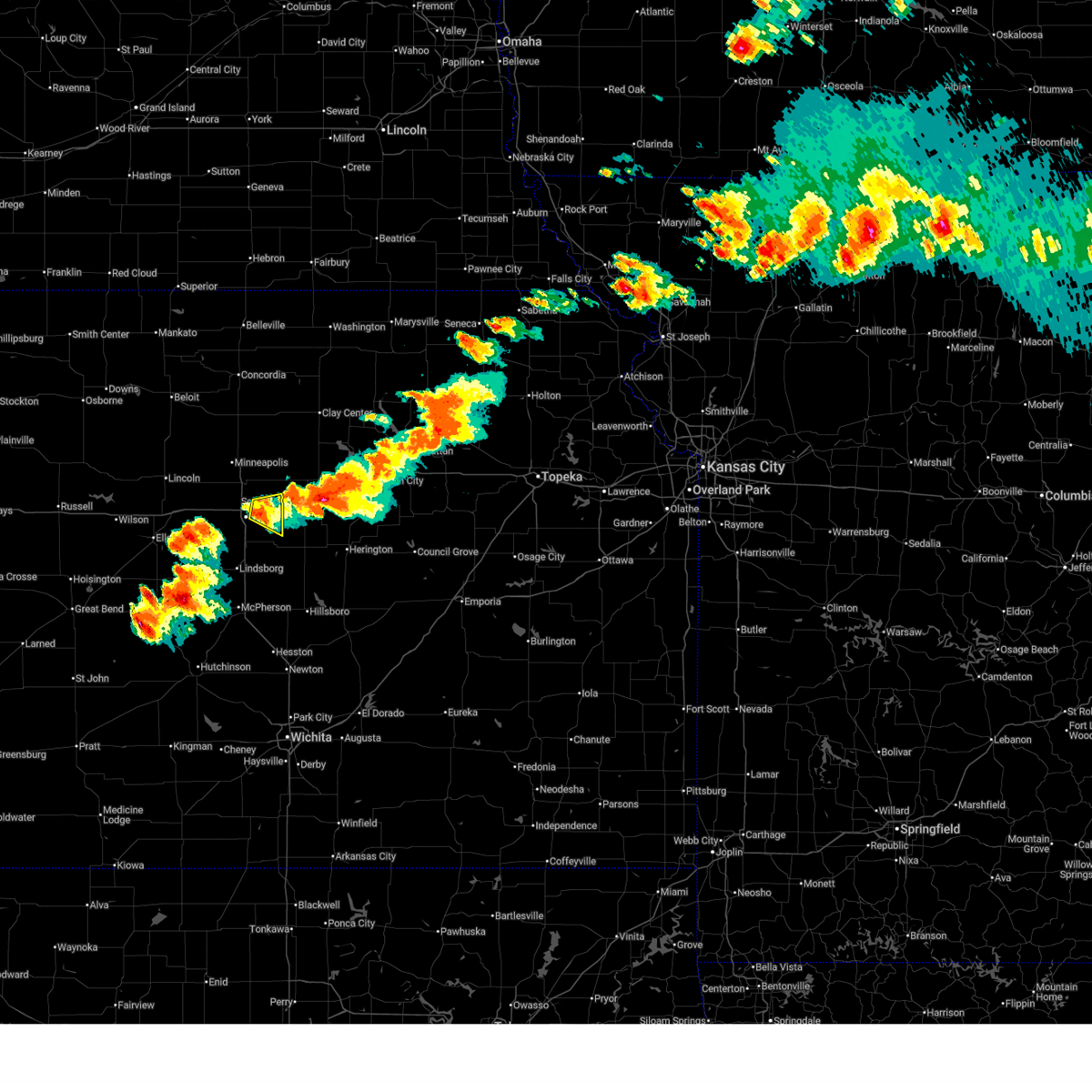
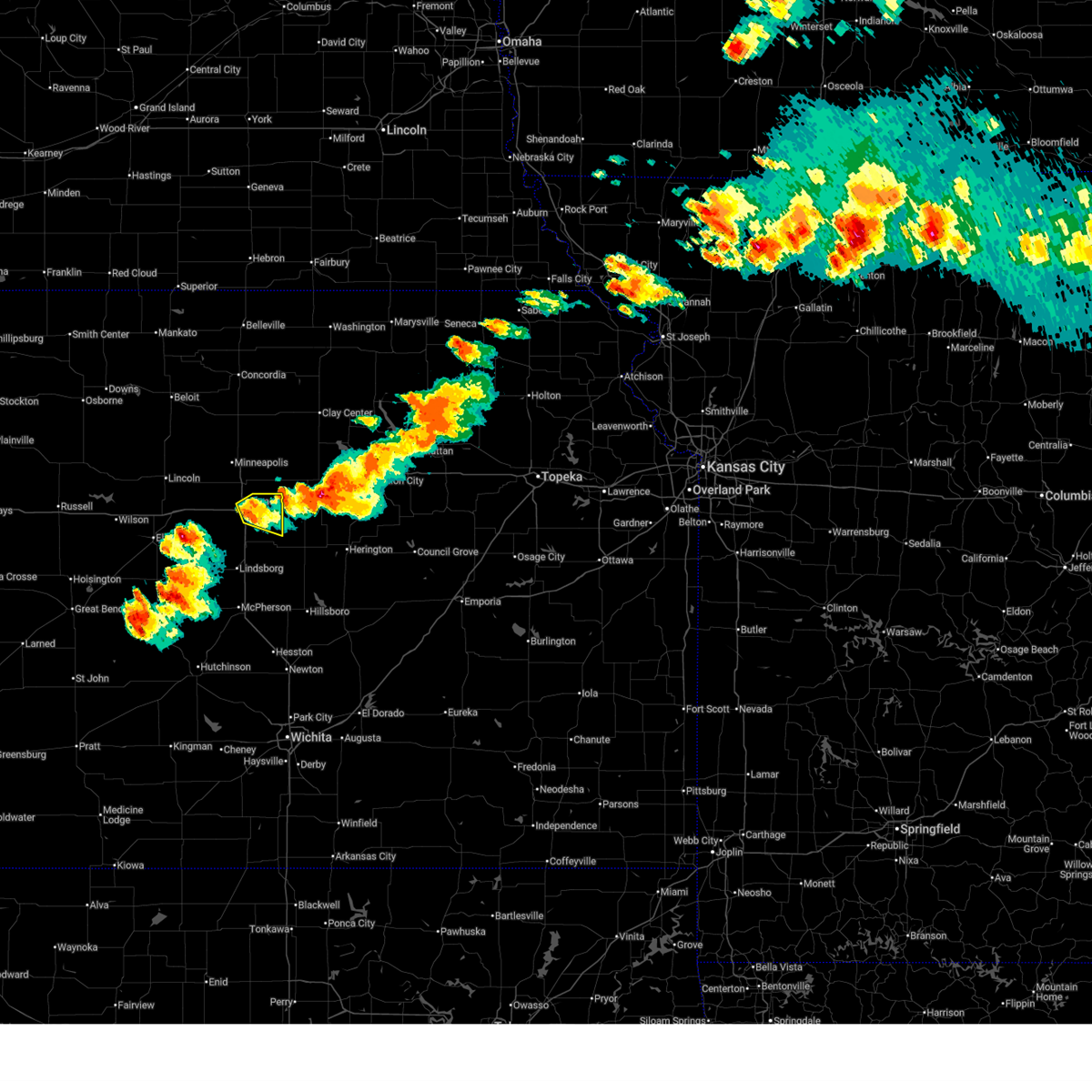
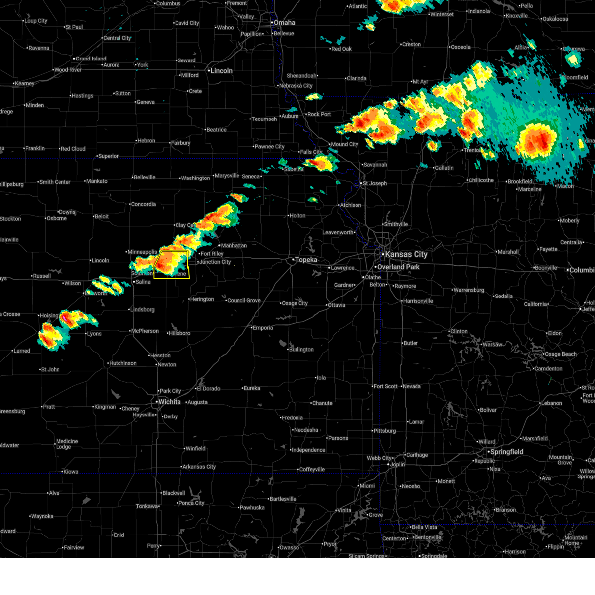
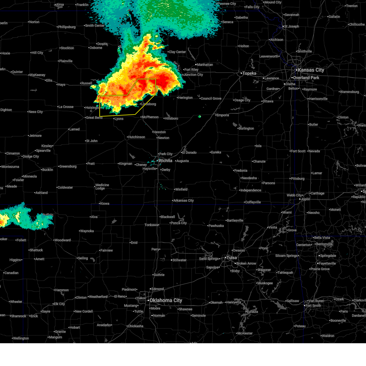
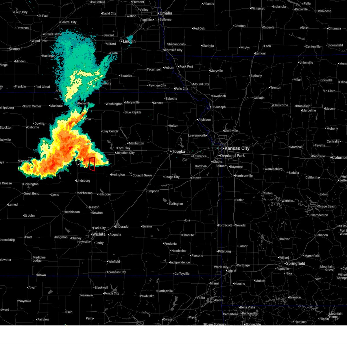
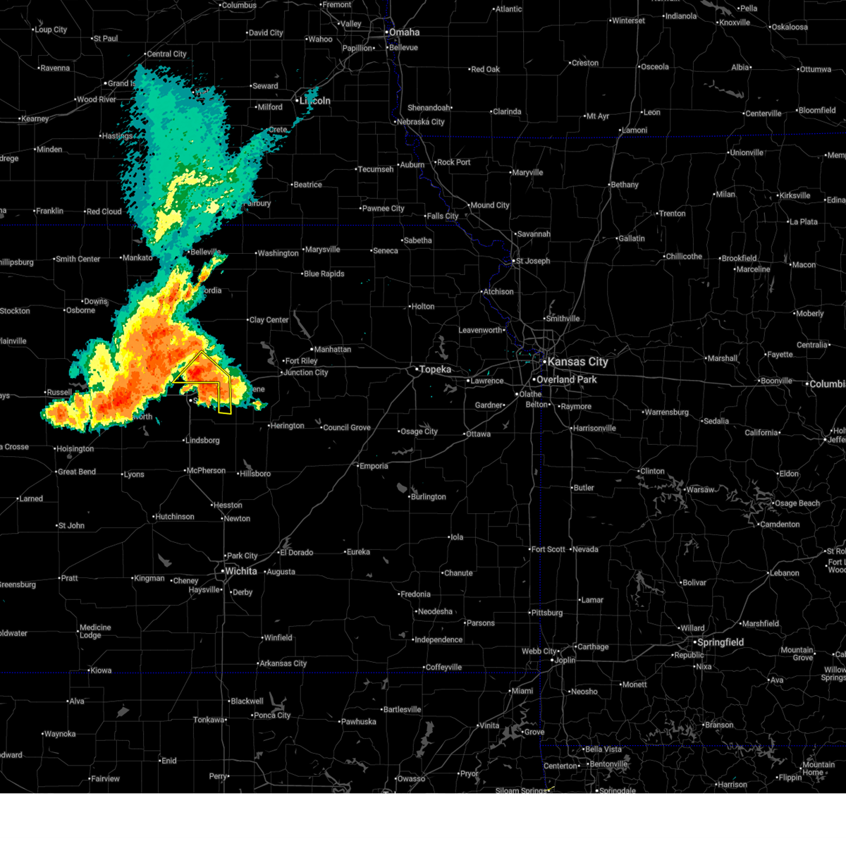
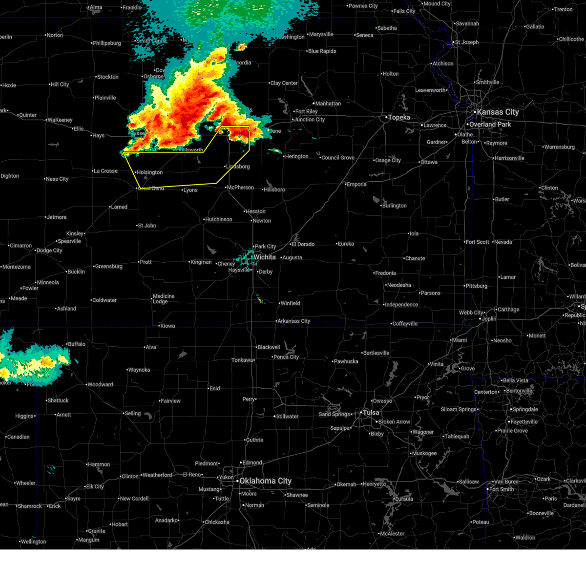
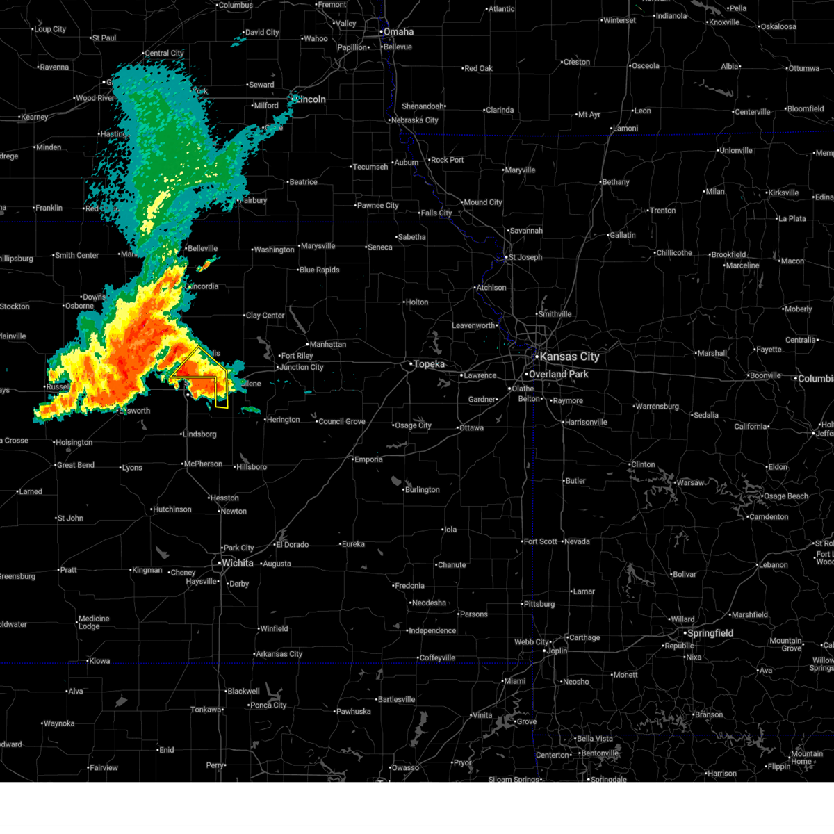
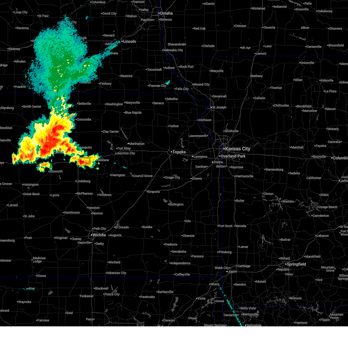
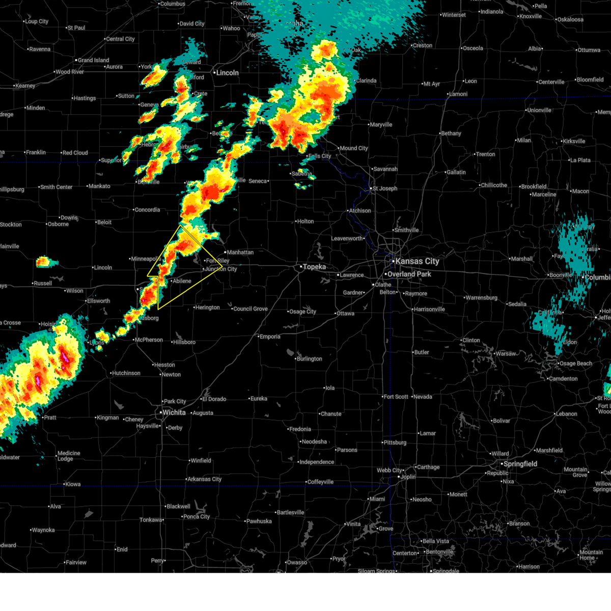
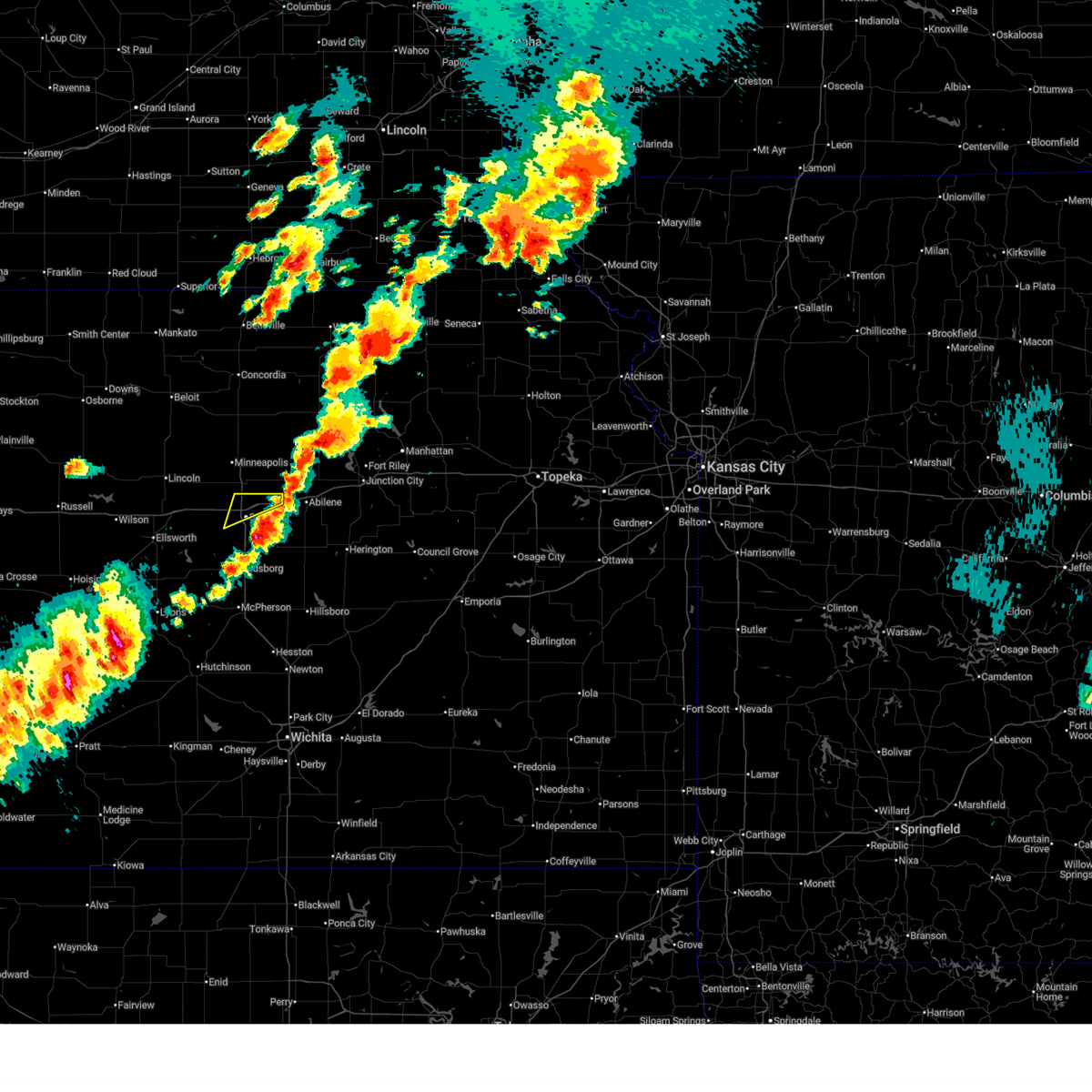
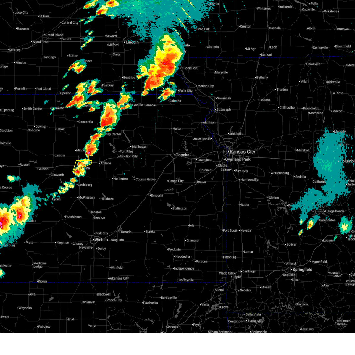
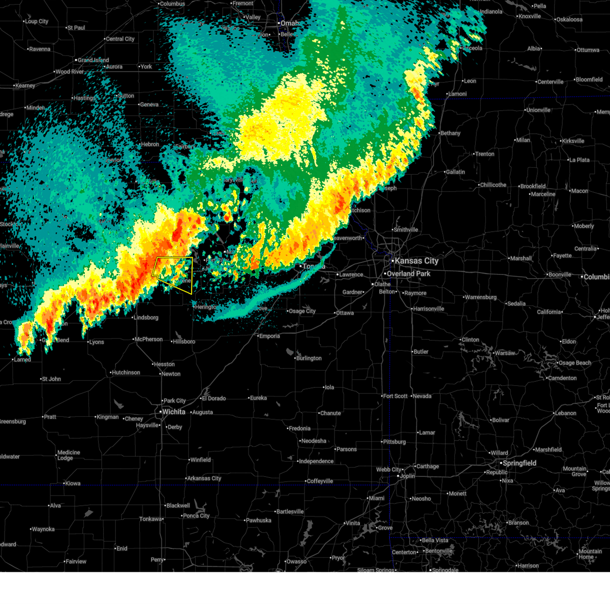
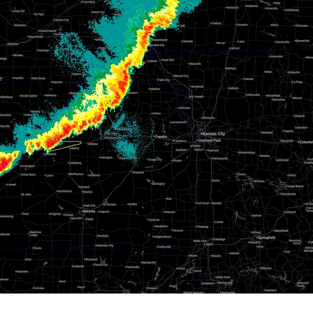
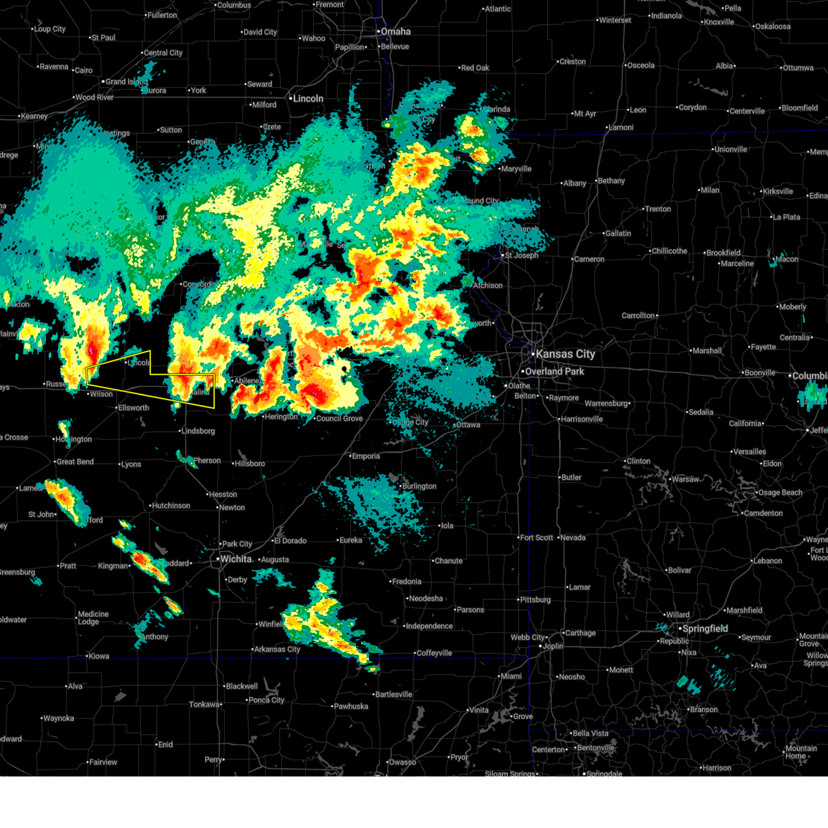
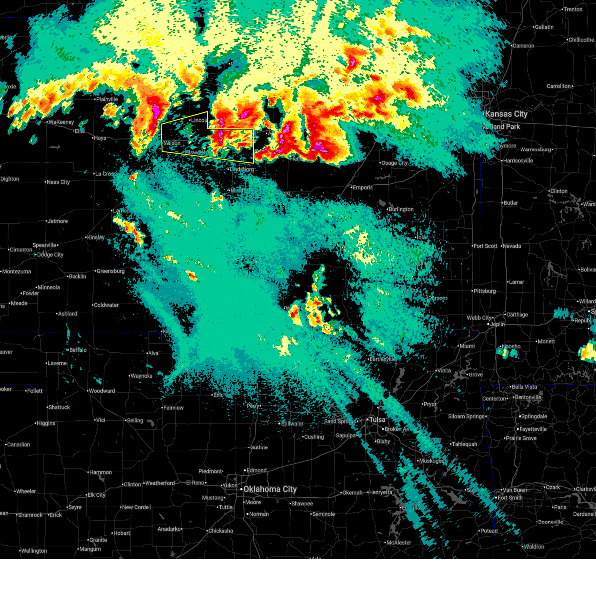
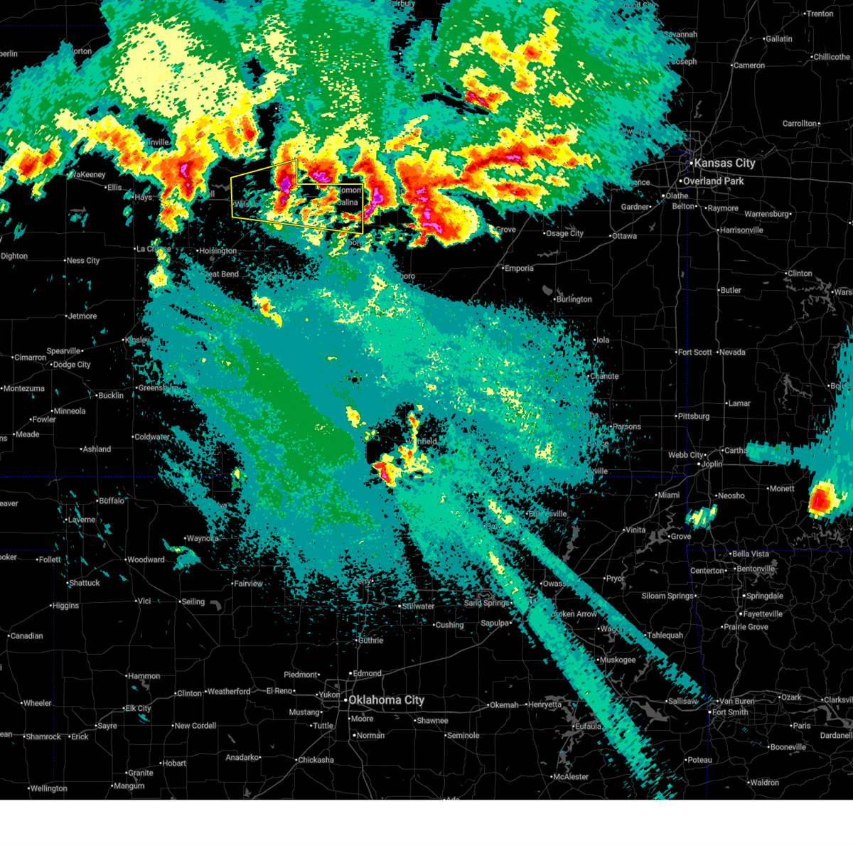
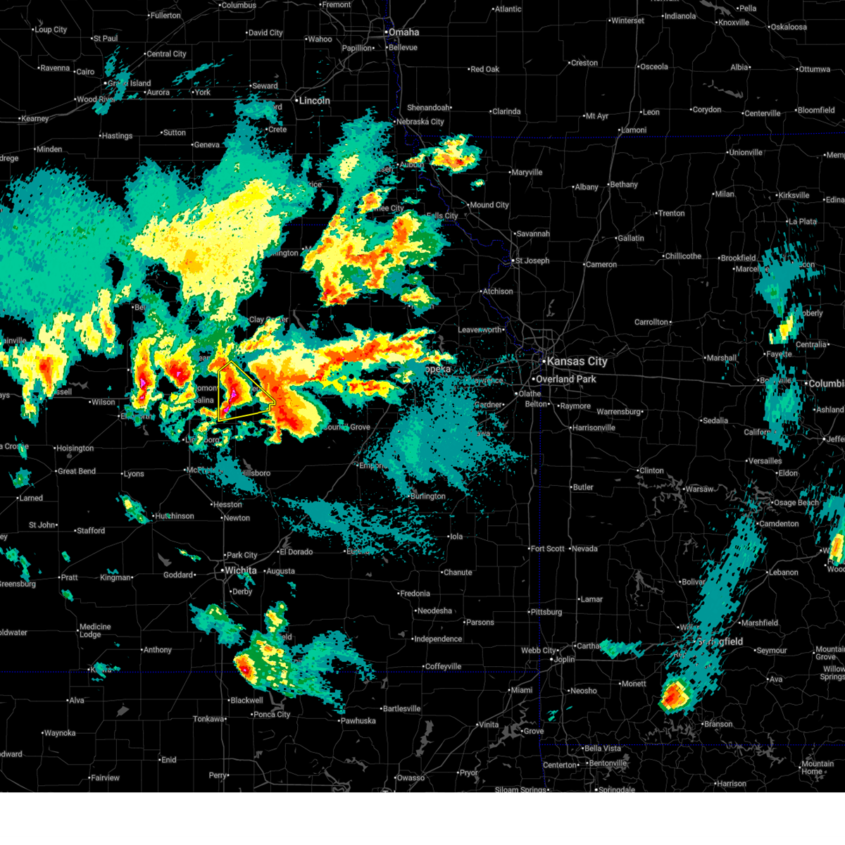
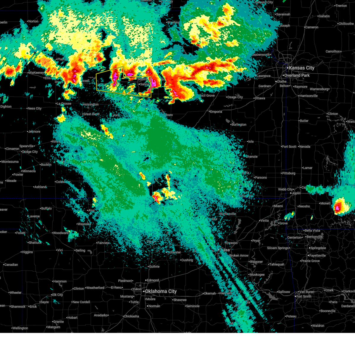
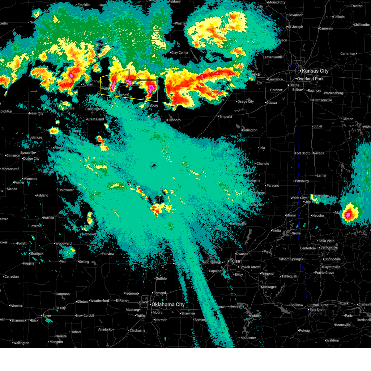
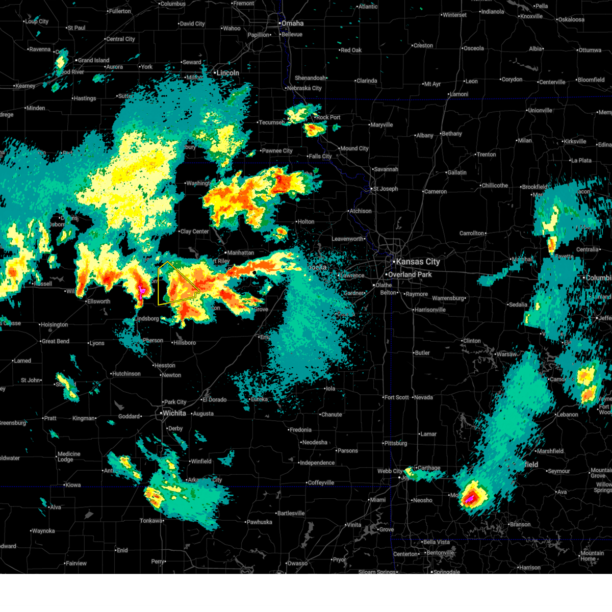
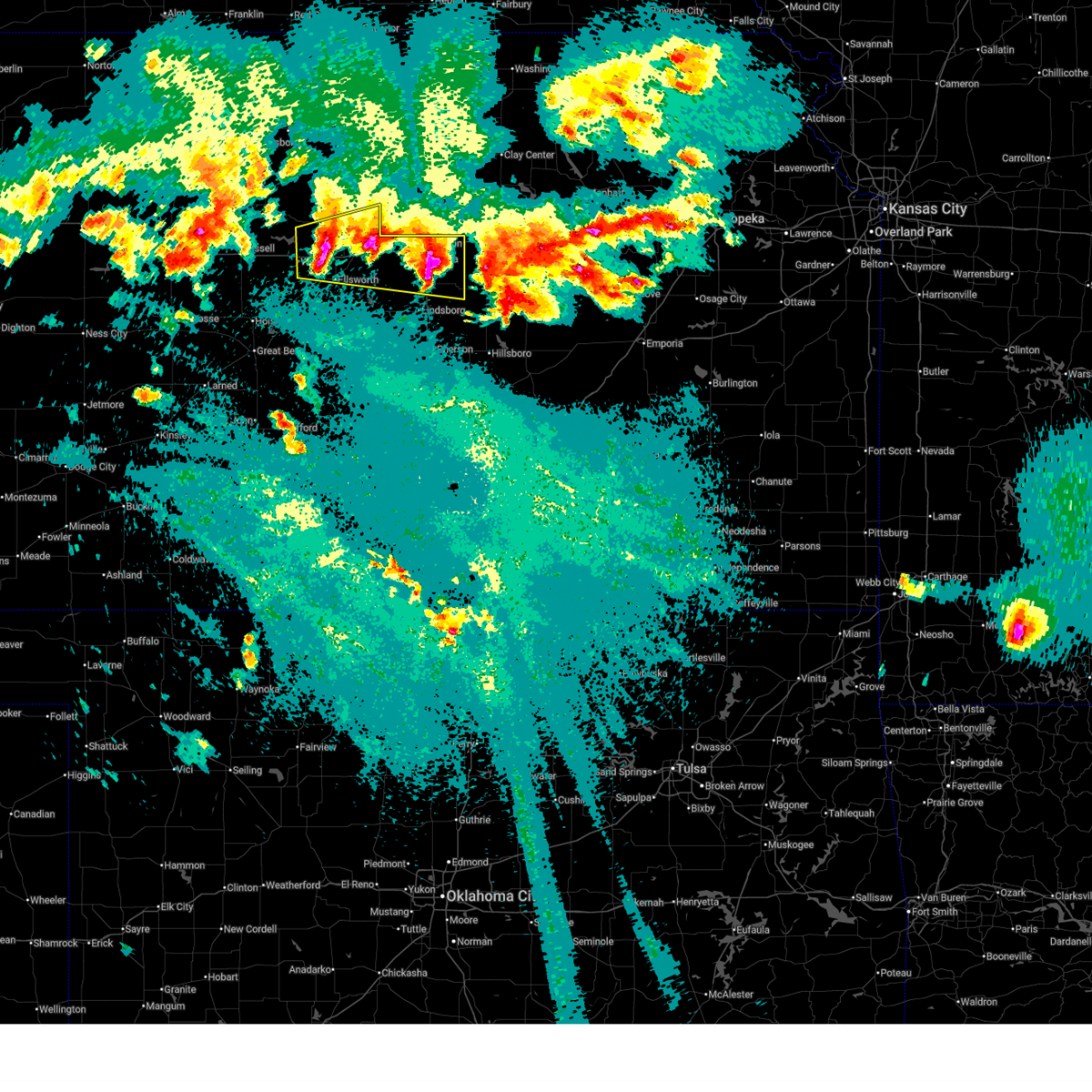
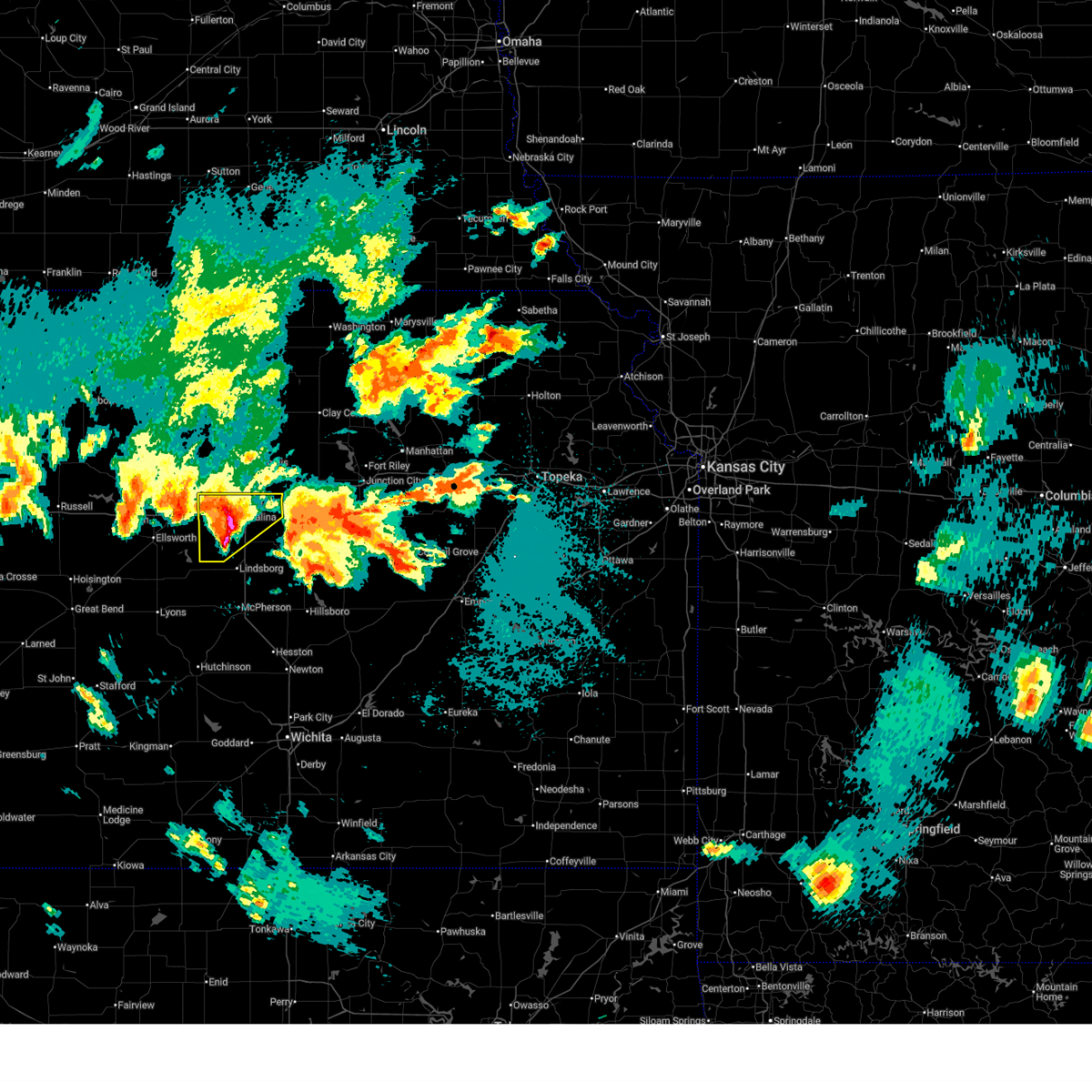
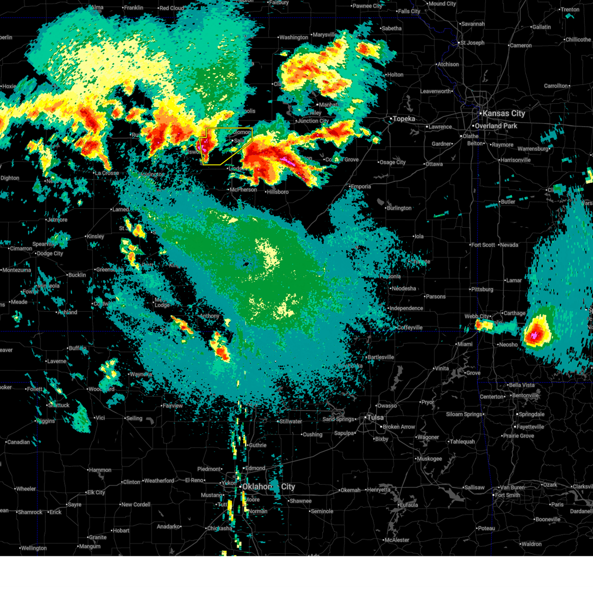
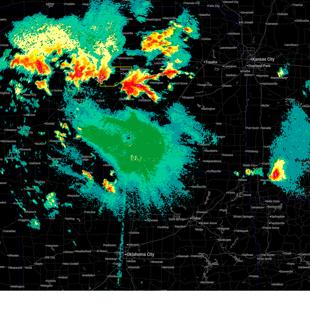
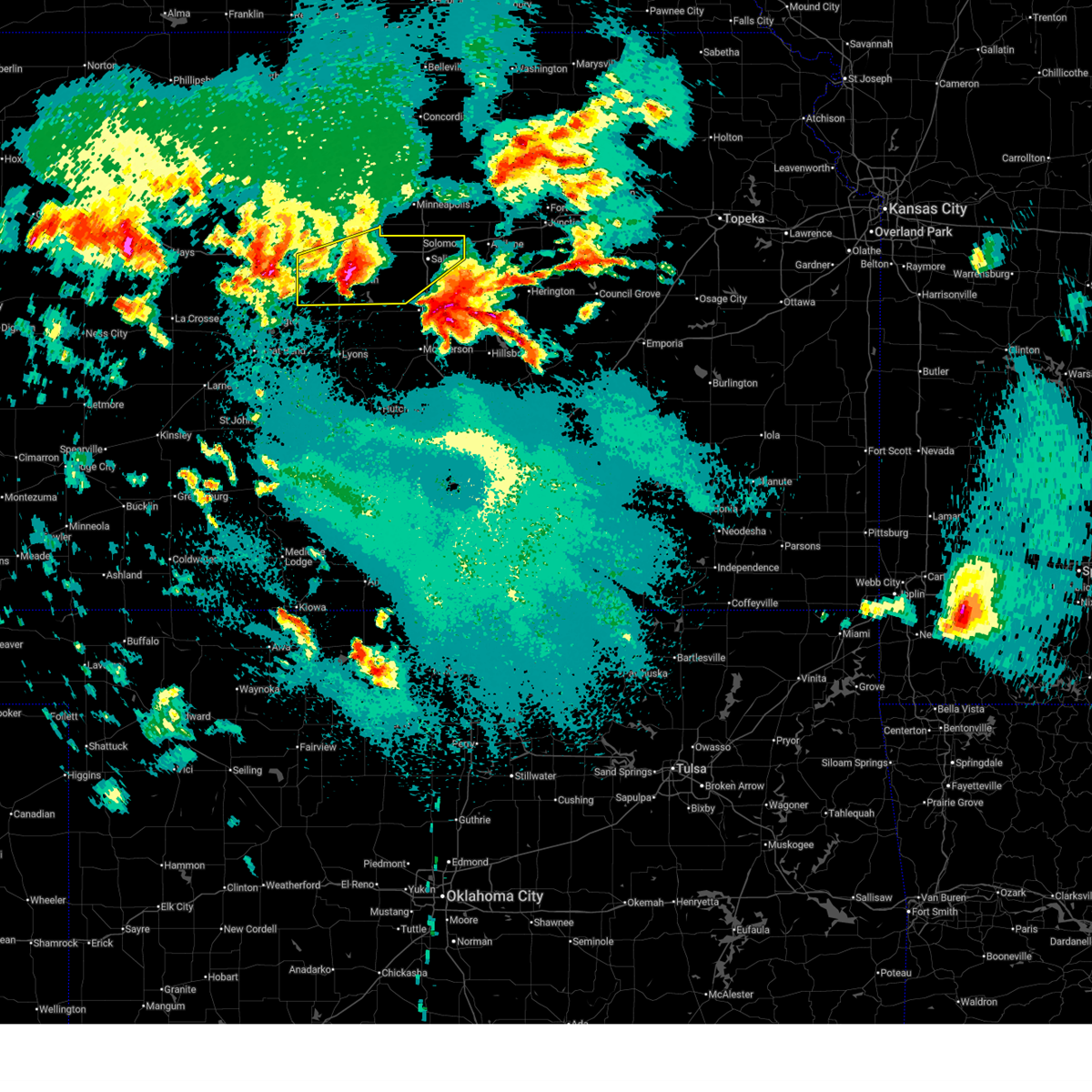
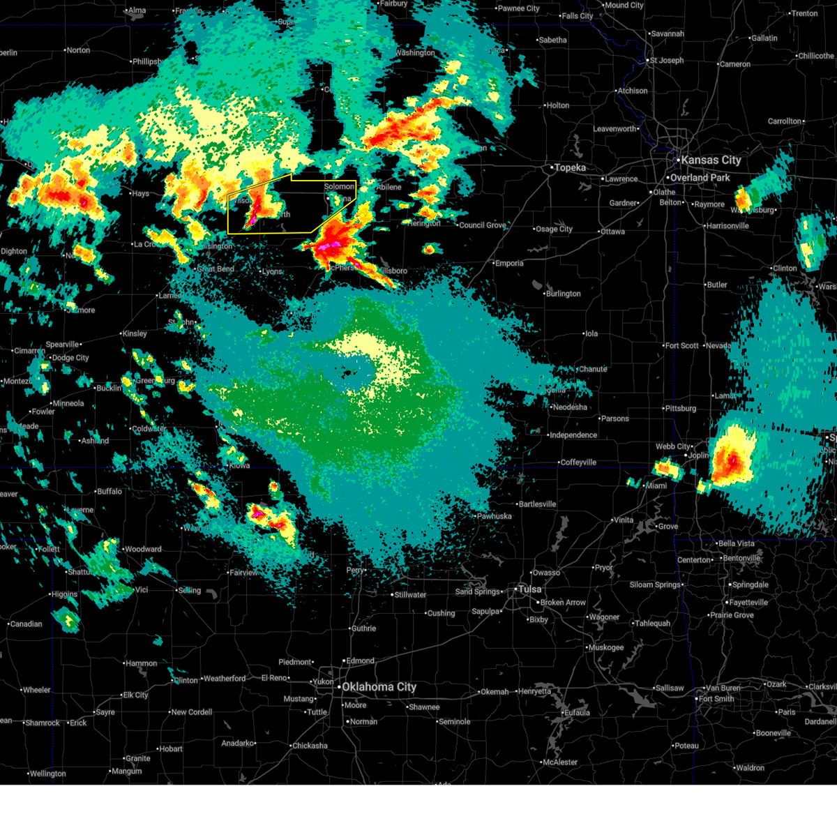
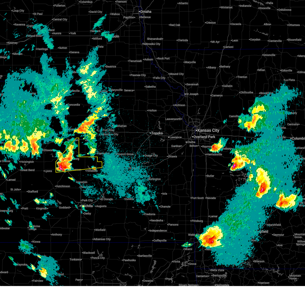
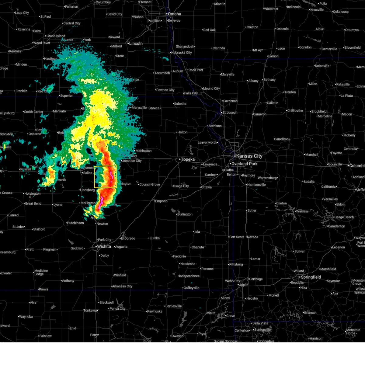
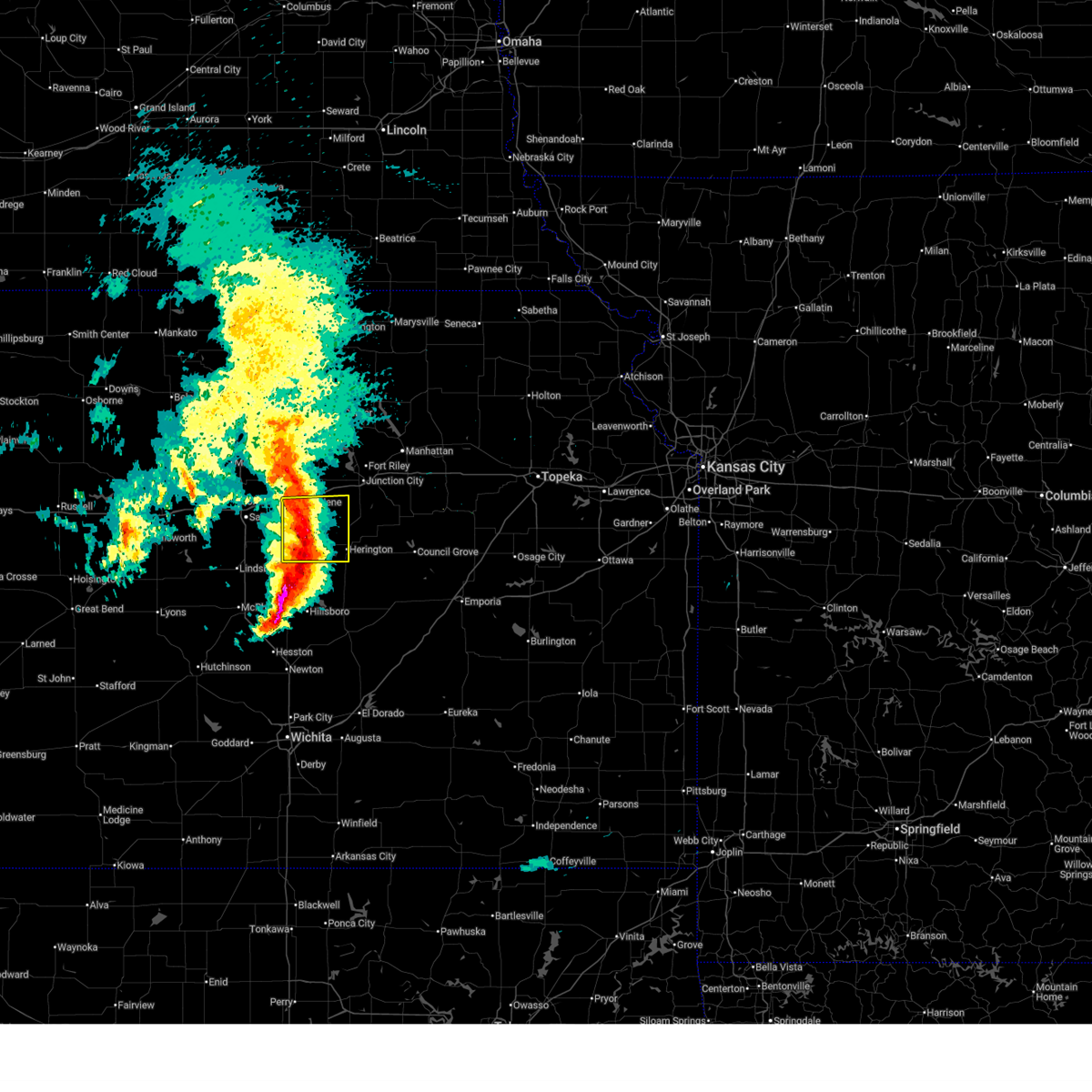
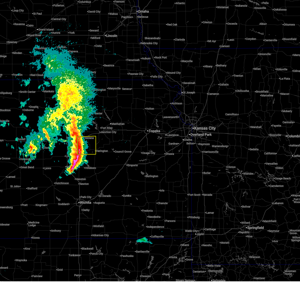
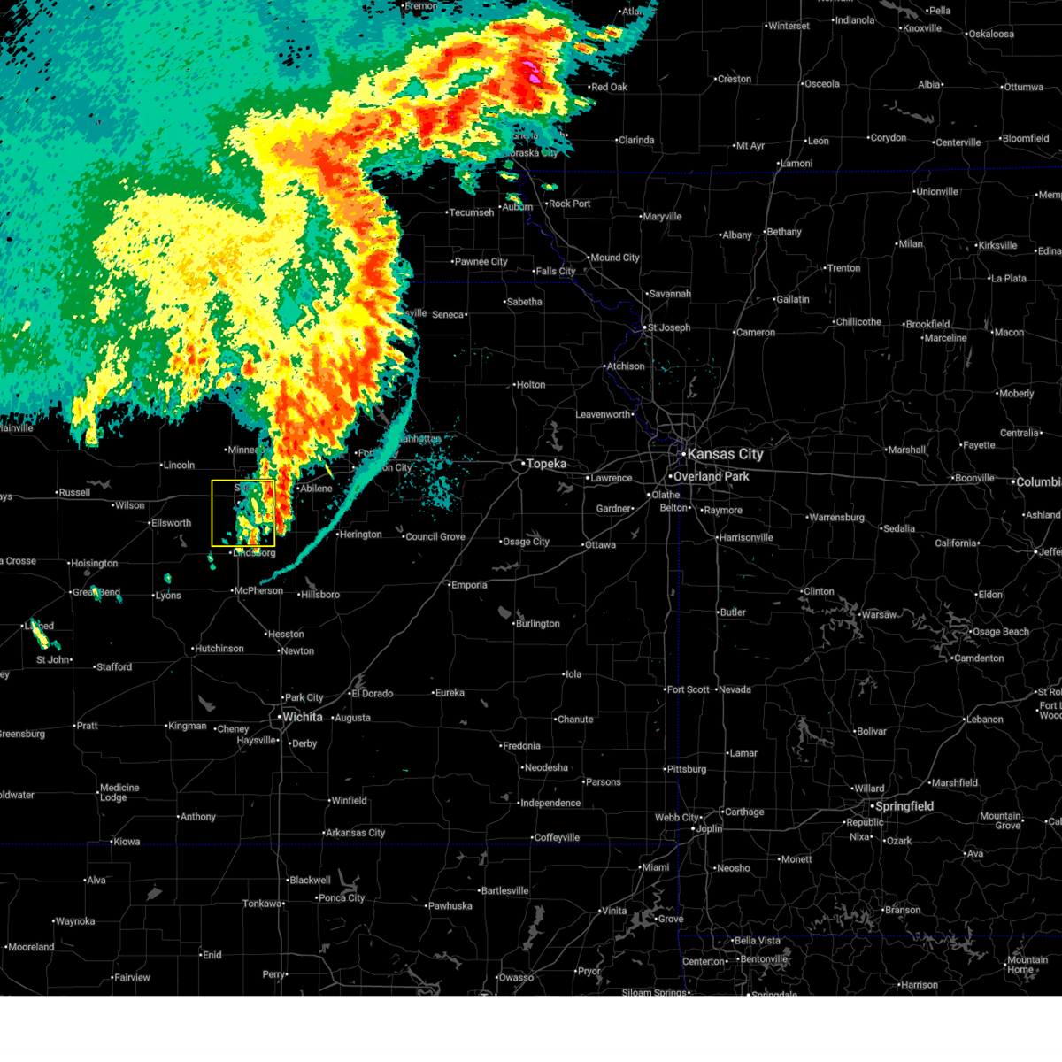
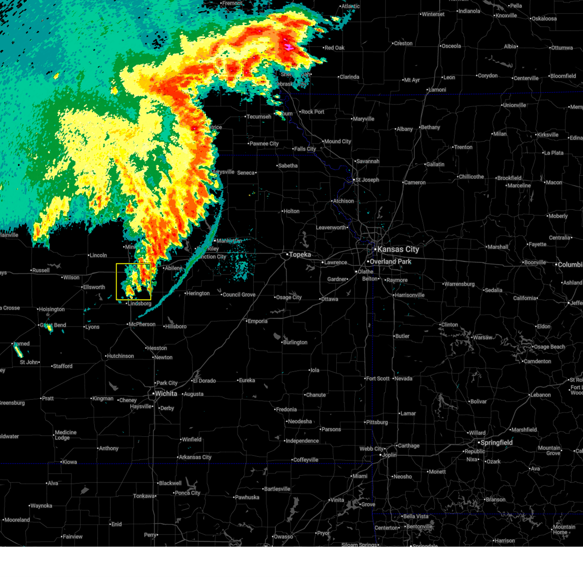
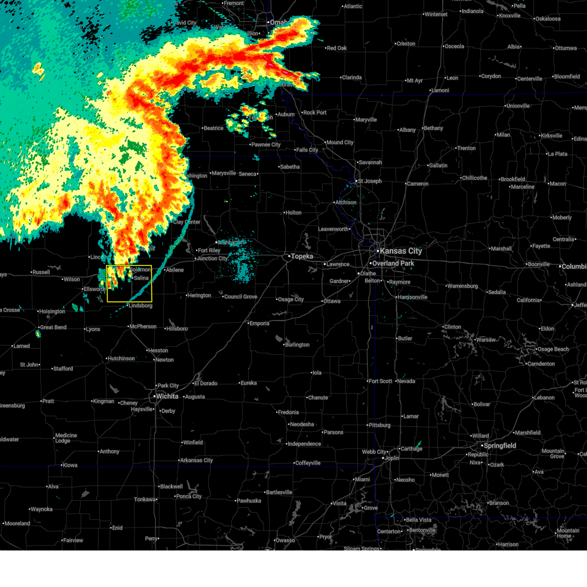
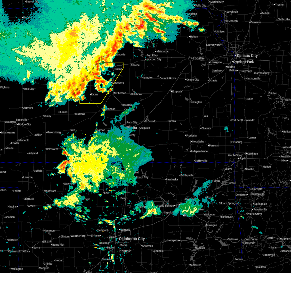
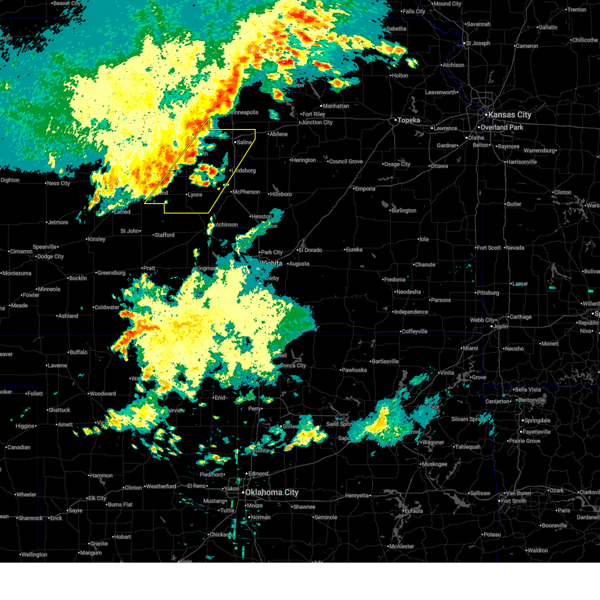
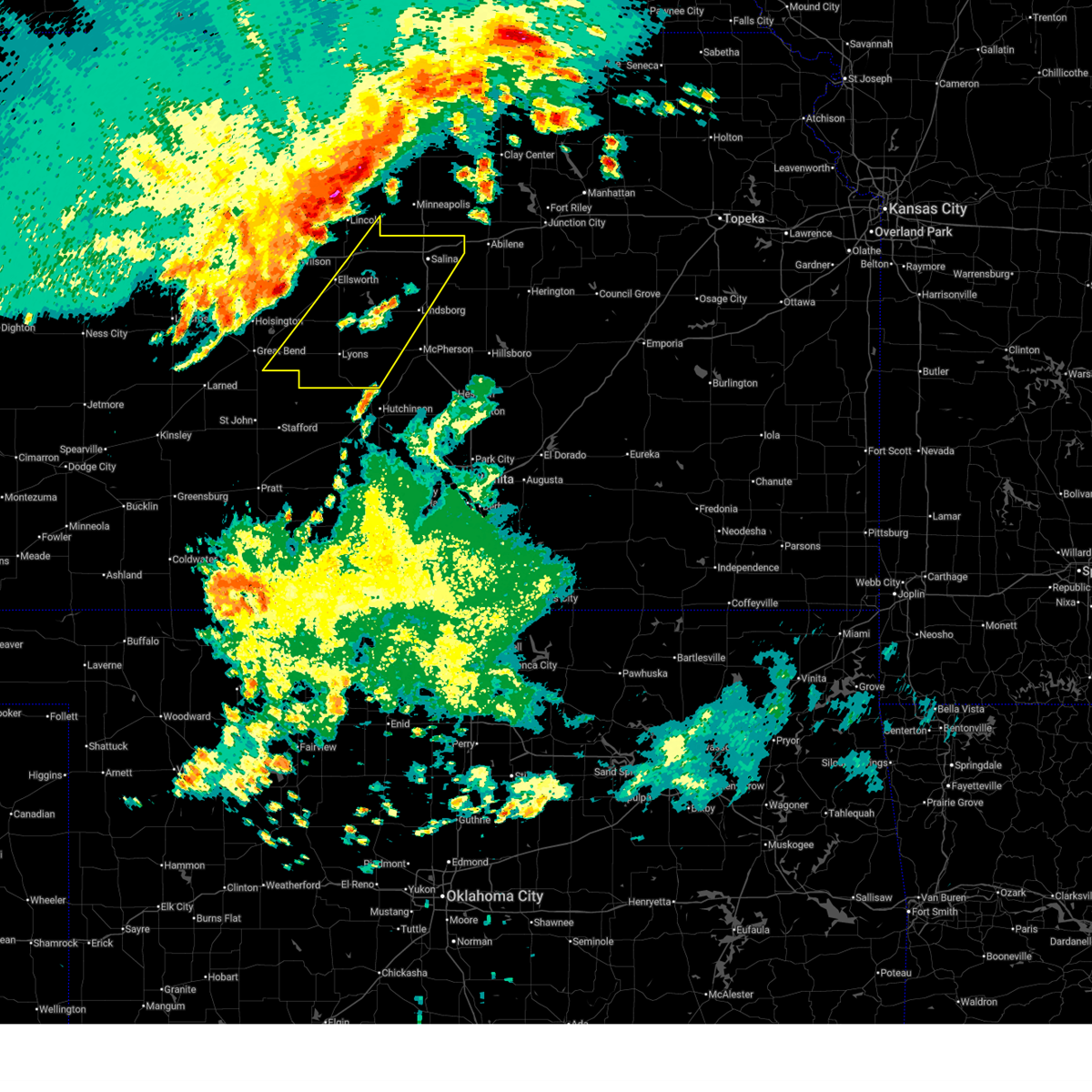
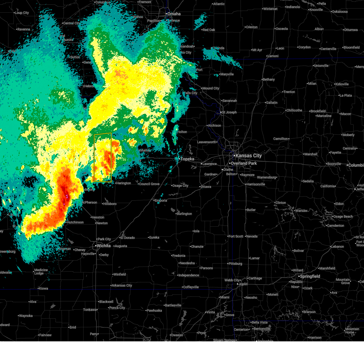
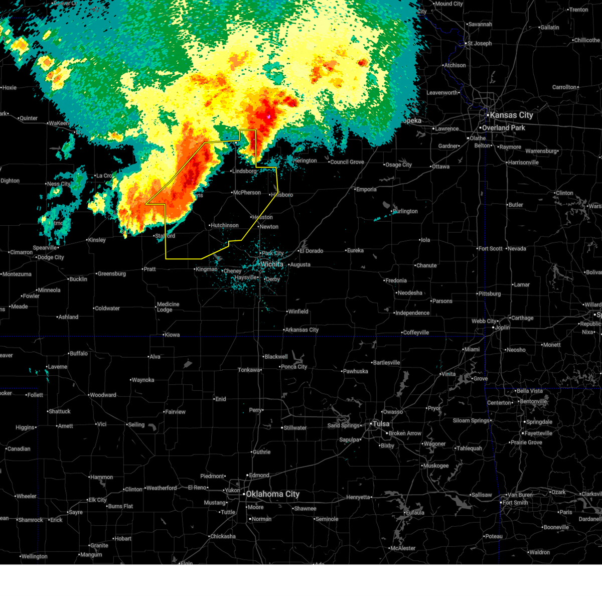
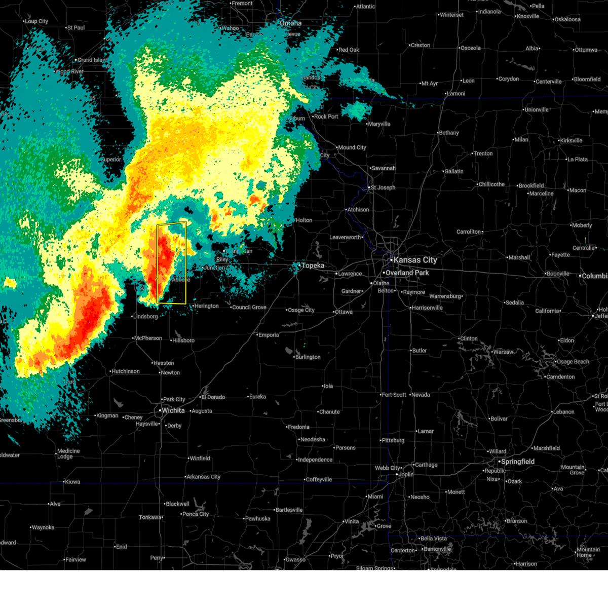
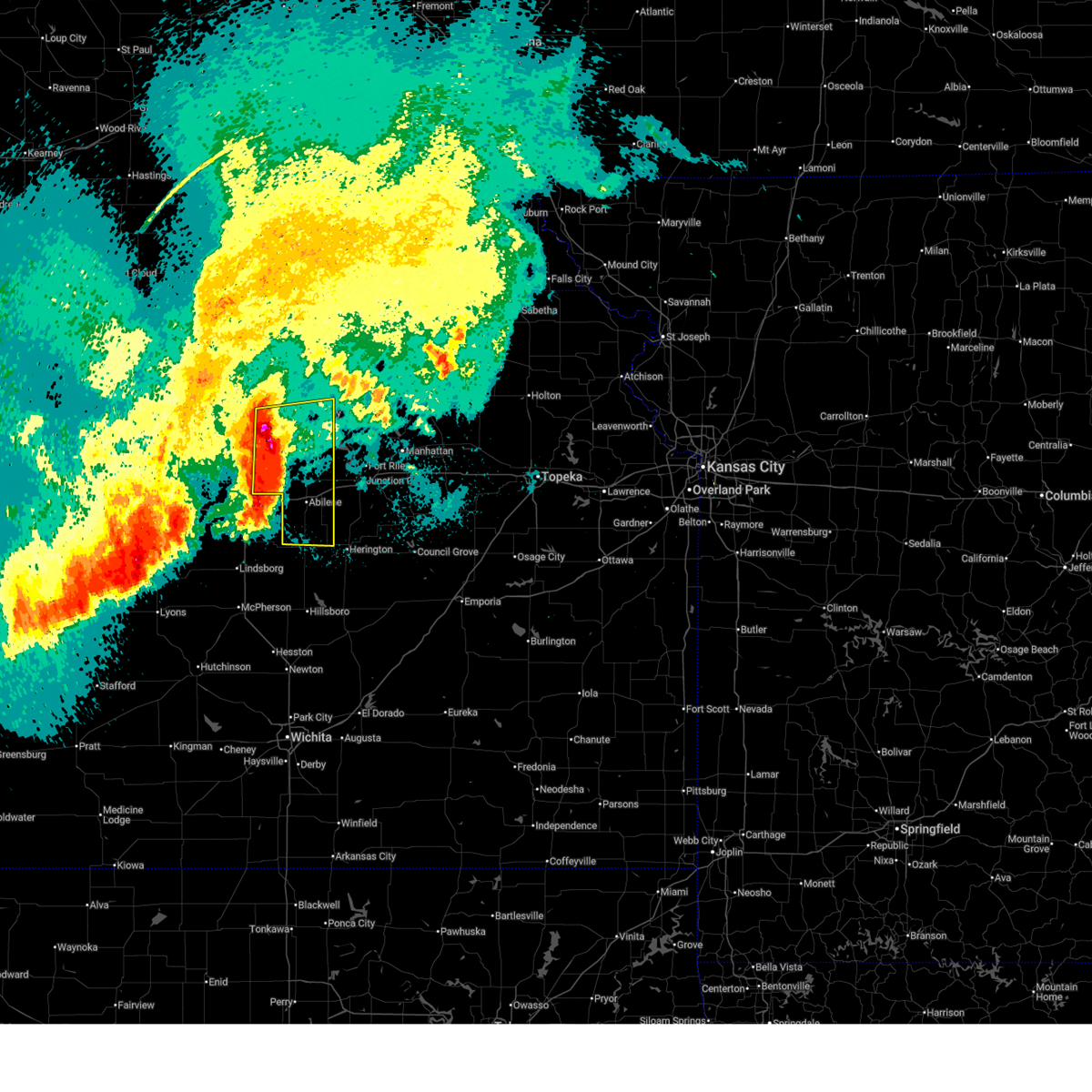
Hail Map for Solomon, KS
The Solomon, KS area has had 19 reports of on-the-ground hail by trained spotters, and has been under severe weather warnings 69 times during the past 12 months. Doppler radar has detected hail at or near Solomon, KS on 104 occasions, including 6 occasions during the past year.
| Name: | Solomon, KS |
| Where Located: | 47.1 miles WSW of Manhattan, KS |
| Map: | Google Map for Solomon, KS |
| Population: | 1095 |
| Housing Units: | 465 |
| More Info: | Search Google for Solomon, KS |
2
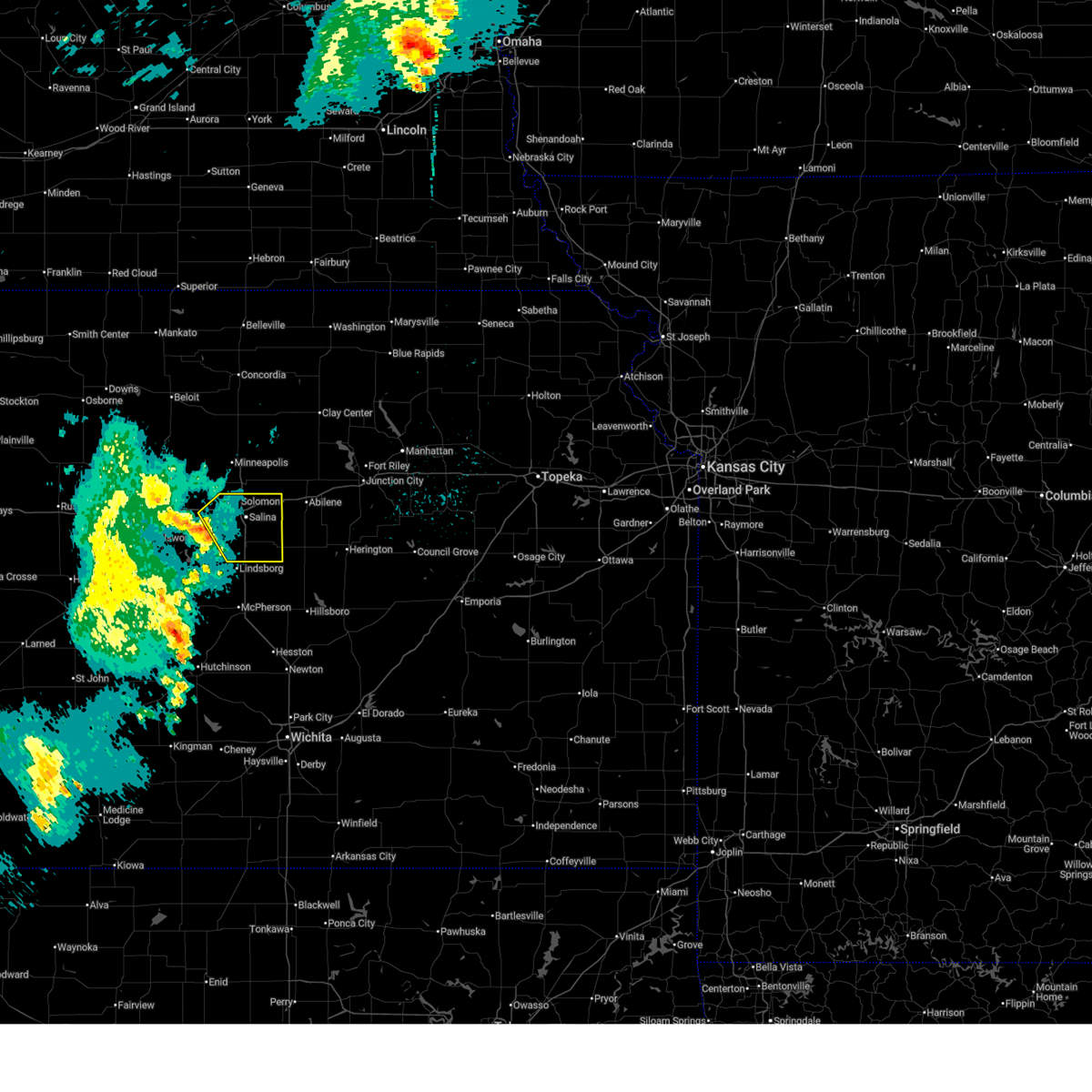
The Top Recent Hail Date for Solomon, KS is Sunday, April 26, 2026 (7th out of 104)
Hail and Wind Damage Spotted near Solomon, KS
| Date / Time | Report Details |
|---|---|
| 7/10/2026 2:01 AM CDT |
 At 201 am cdt, severe thunderstorms were located along a line extending from near longford to near chapman to near woodbine, moving northeast at 55 mph (radar indicated). Hazards include 60 mph wind gusts. Expect damage to roofs, siding, and trees. locations impacted include, abilene, herington, chapman, solomon, enterprise, hope, woodbine, carlton, moonlight, and talmage. This includes interstate 70 between mile markers 267 and 289. At 201 am cdt, severe thunderstorms were located along a line extending from near longford to near chapman to near woodbine, moving northeast at 55 mph (radar indicated). Hazards include 60 mph wind gusts. Expect damage to roofs, siding, and trees. locations impacted include, abilene, herington, chapman, solomon, enterprise, hope, woodbine, carlton, moonlight, and talmage. This includes interstate 70 between mile markers 267 and 289.
|
| 7/10/2026 1:47 AM CDT |
 Svrtop the national weather service in topeka has issued a * severe thunderstorm warning for, dickinson county in central kansas, southeastern ottawa county in north central kansas, southwestern clay county in north central kansas, * until 215 am cdt. * at 146 am cdt, severe thunderstorms were located along a line extending from 5 miles north of niles to 3 miles southeast of abilene to near hope, moving northeast at 55 mph (radar indicated). Hazards include 60 mph wind gusts and penny size hail. expect damage to roofs, siding, and trees Svrtop the national weather service in topeka has issued a * severe thunderstorm warning for, dickinson county in central kansas, southeastern ottawa county in north central kansas, southwestern clay county in north central kansas, * until 215 am cdt. * at 146 am cdt, severe thunderstorms were located along a line extending from 5 miles north of niles to 3 miles southeast of abilene to near hope, moving northeast at 55 mph (radar indicated). Hazards include 60 mph wind gusts and penny size hail. expect damage to roofs, siding, and trees
|
| 6/13/2026 7:40 PM CDT |
 The storm which prompted the warning has weakened below severe limits, and has exited the warned area. therefore, the warning will be allowed to expire. however, small hail, gusty winds and heavy rain are still possible with this thunderstorm. a tornado watch remains in effect until 1100 pm cdt for central kansas. The storm which prompted the warning has weakened below severe limits, and has exited the warned area. therefore, the warning will be allowed to expire. however, small hail, gusty winds and heavy rain are still possible with this thunderstorm. a tornado watch remains in effect until 1100 pm cdt for central kansas.
|
| 6/13/2026 7:25 PM CDT |
 At 725 pm cdt, a severe thunderstorm was located 6 miles north of carlton, moving east at 50 mph (trained weather spotters). Hazards include 60 mph wind gusts and quarter size hail. Hail damage to vehicles is expected. expect wind damage to roofs, siding, and trees. locations impacted include, abilene and enterprise. This includes interstate 70 between mile markers 268 and 280. At 725 pm cdt, a severe thunderstorm was located 6 miles north of carlton, moving east at 50 mph (trained weather spotters). Hazards include 60 mph wind gusts and quarter size hail. Hail damage to vehicles is expected. expect wind damage to roofs, siding, and trees. locations impacted include, abilene and enterprise. This includes interstate 70 between mile markers 268 and 280.
|
| 6/13/2026 7:15 PM CDT |
 At 714 pm cdt, a severe thunderstorm was located near new cambria, moving east at 45 mph (asos weather station. at 711 pm cdt...official observation station at salina airport reported a 58 mph wind gust). Hazards include 60 mph wind gusts and quarter size hail. Hail damage to vehicles is expected. expect wind damage to roofs, siding, and trees. locations impacted include, abilene, solomon, enterprise, and niles. This includes interstate 70 between mile markers 267 and 281. At 714 pm cdt, a severe thunderstorm was located near new cambria, moving east at 45 mph (asos weather station. at 711 pm cdt...official observation station at salina airport reported a 58 mph wind gust). Hazards include 60 mph wind gusts and quarter size hail. Hail damage to vehicles is expected. expect wind damage to roofs, siding, and trees. locations impacted include, abilene, solomon, enterprise, and niles. This includes interstate 70 between mile markers 267 and 281.
|
| 6/13/2026 7:14 PM CDT |
 At 713 pm cdt, a severe thunderstorm was located near new cambria, moving east at 45 mph (radar indicated). Hazards include 60 mph wind gusts and quarter size hail. Hail damage to vehicles is expected. expect wind damage to roofs, siding, and trees. locations impacted include, abilene, solomon, enterprise, and niles. This includes interstate 70 between mile markers 267 and 281. At 713 pm cdt, a severe thunderstorm was located near new cambria, moving east at 45 mph (radar indicated). Hazards include 60 mph wind gusts and quarter size hail. Hail damage to vehicles is expected. expect wind damage to roofs, siding, and trees. locations impacted include, abilene, solomon, enterprise, and niles. This includes interstate 70 between mile markers 267 and 281.
|
| 6/13/2026 7:12 PM CDT |
 At 712 pm cdt, a severe thunderstorm was located near new cambria, or near salina, moving east at 25 mph (radar indicated). Hazards include 60 mph wind gusts and quarter size hail. Hail damage to vehicles is expected. expect wind damage to roofs, siding, and trees. locations impacted include, salina, gypsum, brookville, smolan, new cambria, glendale, salina airport, and kipp. this includes the following highways, interstate 135 between mile markers 83 and 95. Interstate 70 between mile markers 236 and 266. At 712 pm cdt, a severe thunderstorm was located near new cambria, or near salina, moving east at 25 mph (radar indicated). Hazards include 60 mph wind gusts and quarter size hail. Hail damage to vehicles is expected. expect wind damage to roofs, siding, and trees. locations impacted include, salina, gypsum, brookville, smolan, new cambria, glendale, salina airport, and kipp. this includes the following highways, interstate 135 between mile markers 83 and 95. Interstate 70 between mile markers 236 and 266.
|
| 6/13/2026 7:03 PM CDT |
 At 702 pm cdt, a severe thunderstorm was located over salina, moving east at 25 mph (radar indicated). Hazards include ping pong ball size hail and 60 mph wind gusts. People and animals outdoors will be injured. expect hail damage to roofs, siding, windows, and vehicles. expect wind damage to roofs, siding, and trees. locations impacted include, salina, gypsum, brookville, smolan, new cambria, glendale, salina airport, and kipp. this includes the following highways, interstate 135 between mile markers 83 and 95. Interstate 70 between mile markers 236 and 266. At 702 pm cdt, a severe thunderstorm was located over salina, moving east at 25 mph (radar indicated). Hazards include ping pong ball size hail and 60 mph wind gusts. People and animals outdoors will be injured. expect hail damage to roofs, siding, windows, and vehicles. expect wind damage to roofs, siding, and trees. locations impacted include, salina, gypsum, brookville, smolan, new cambria, glendale, salina airport, and kipp. this includes the following highways, interstate 135 between mile markers 83 and 95. Interstate 70 between mile markers 236 and 266.
|
| 6/13/2026 7:03 PM CDT |
 Svrtop the national weather service in topeka has issued a * severe thunderstorm warning for, western dickinson county in central kansas, southeastern ottawa county in north central kansas, * until 745 pm cdt. * at 703 pm cdt, a severe thunderstorm was located near salina, moving east at 50 mph (radar indicated). Hazards include 60 mph wind gusts and quarter size hail. Hail damage to vehicles is expected. Expect wind damage to roofs, siding, and trees. Svrtop the national weather service in topeka has issued a * severe thunderstorm warning for, western dickinson county in central kansas, southeastern ottawa county in north central kansas, * until 745 pm cdt. * at 703 pm cdt, a severe thunderstorm was located near salina, moving east at 50 mph (radar indicated). Hazards include 60 mph wind gusts and quarter size hail. Hail damage to vehicles is expected. Expect wind damage to roofs, siding, and trees.
|
| 6/13/2026 6:55 PM CDT |
 At 655 pm cdt, a severe thunderstorm was located 6 miles west of salina, moving east at 25 mph (radar indicated). Hazards include 60 mph wind gusts and half dollar size hail. Hail damage to vehicles is expected. expect wind damage to roofs, siding, and trees. locations impacted include, salina, gypsum, brookville, smolan, new cambria, glendale, salina airport, and kipp. this includes the following highways, interstate 135 between mile markers 83 and 95. Interstate 70 between mile markers 236 and 266. At 655 pm cdt, a severe thunderstorm was located 6 miles west of salina, moving east at 25 mph (radar indicated). Hazards include 60 mph wind gusts and half dollar size hail. Hail damage to vehicles is expected. expect wind damage to roofs, siding, and trees. locations impacted include, salina, gypsum, brookville, smolan, new cambria, glendale, salina airport, and kipp. this includes the following highways, interstate 135 between mile markers 83 and 95. Interstate 70 between mile markers 236 and 266.
|
| 6/13/2026 6:45 PM CDT |
 Svrict the national weather service in wichita has issued a * severe thunderstorm warning for, northeastern ellsworth county in central kansas, saline county in central kansas, * until 745 pm cdt. * at 645 pm cdt, a severe thunderstorm was located over brookville, or 11 miles west of salina, moving east at 20 mph (radar indicated). Hazards include 60 mph wind gusts and quarter size hail. Hail damage to vehicles is expected. Expect wind damage to roofs, siding, and trees. Svrict the national weather service in wichita has issued a * severe thunderstorm warning for, northeastern ellsworth county in central kansas, saline county in central kansas, * until 745 pm cdt. * at 645 pm cdt, a severe thunderstorm was located over brookville, or 11 miles west of salina, moving east at 20 mph (radar indicated). Hazards include 60 mph wind gusts and quarter size hail. Hail damage to vehicles is expected. Expect wind damage to roofs, siding, and trees.
|
| 6/10/2026 7:42 PM CDT |
 At 742 pm cdt, a severe thunderstorm was located near new cambria, or 7 miles east of salina, moving east at 25 mph (radar indicated). Hazards include 60 mph wind gusts and half dollar size hail. Hail damage to vehicles is expected. expect wind damage to roofs, siding, and trees. locations impacted include, new cambria and kipp. This includes interstate 70 between mile markers 260 and 266. At 742 pm cdt, a severe thunderstorm was located near new cambria, or 7 miles east of salina, moving east at 25 mph (radar indicated). Hazards include 60 mph wind gusts and half dollar size hail. Hail damage to vehicles is expected. expect wind damage to roofs, siding, and trees. locations impacted include, new cambria and kipp. This includes interstate 70 between mile markers 260 and 266.
|
| 6/10/2026 7:30 PM CDT |
 At 730 pm cdt, a severe thunderstorm was located over new cambria, or 6 miles east of salina, moving east at 25 mph (radar indicated). Hazards include 60 mph wind gusts and half dollar size hail. Hail damage to vehicles is expected. expect wind damage to roofs, siding, and trees. locations impacted include, salina, new cambria, and kipp. This includes interstate 70 between mile markers 255 and 266. At 730 pm cdt, a severe thunderstorm was located over new cambria, or 6 miles east of salina, moving east at 25 mph (radar indicated). Hazards include 60 mph wind gusts and half dollar size hail. Hail damage to vehicles is expected. expect wind damage to roofs, siding, and trees. locations impacted include, salina, new cambria, and kipp. This includes interstate 70 between mile markers 255 and 266.
|
| 6/10/2026 7:22 PM CDT |
 At 721 pm cdt, a severe thunderstorm was located over salina, moving east at 25 mph (radar indicated). Hazards include 60 mph wind gusts and half dollar size hail. Hail damage to vehicles is expected. expect wind damage to roofs, siding, and trees. locations impacted include, salina, new cambria, and kipp. this includes the following highways, interstate 135 between mile markers 94 and 95. Interstate 70 between mile markers 250 and 266. At 721 pm cdt, a severe thunderstorm was located over salina, moving east at 25 mph (radar indicated). Hazards include 60 mph wind gusts and half dollar size hail. Hail damage to vehicles is expected. expect wind damage to roofs, siding, and trees. locations impacted include, salina, new cambria, and kipp. this includes the following highways, interstate 135 between mile markers 94 and 95. Interstate 70 between mile markers 250 and 266.
|
| 6/10/2026 6:35 PM CDT |
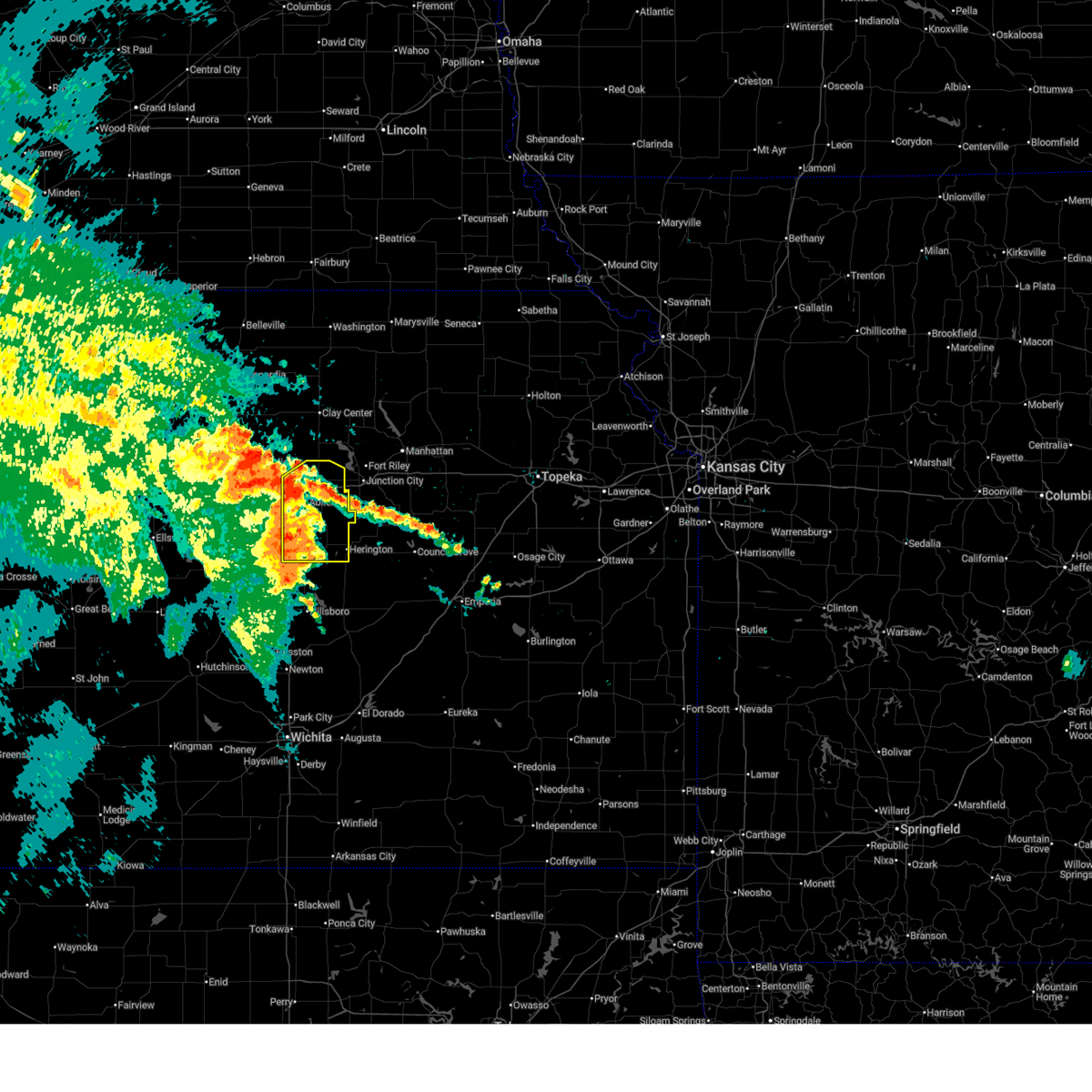
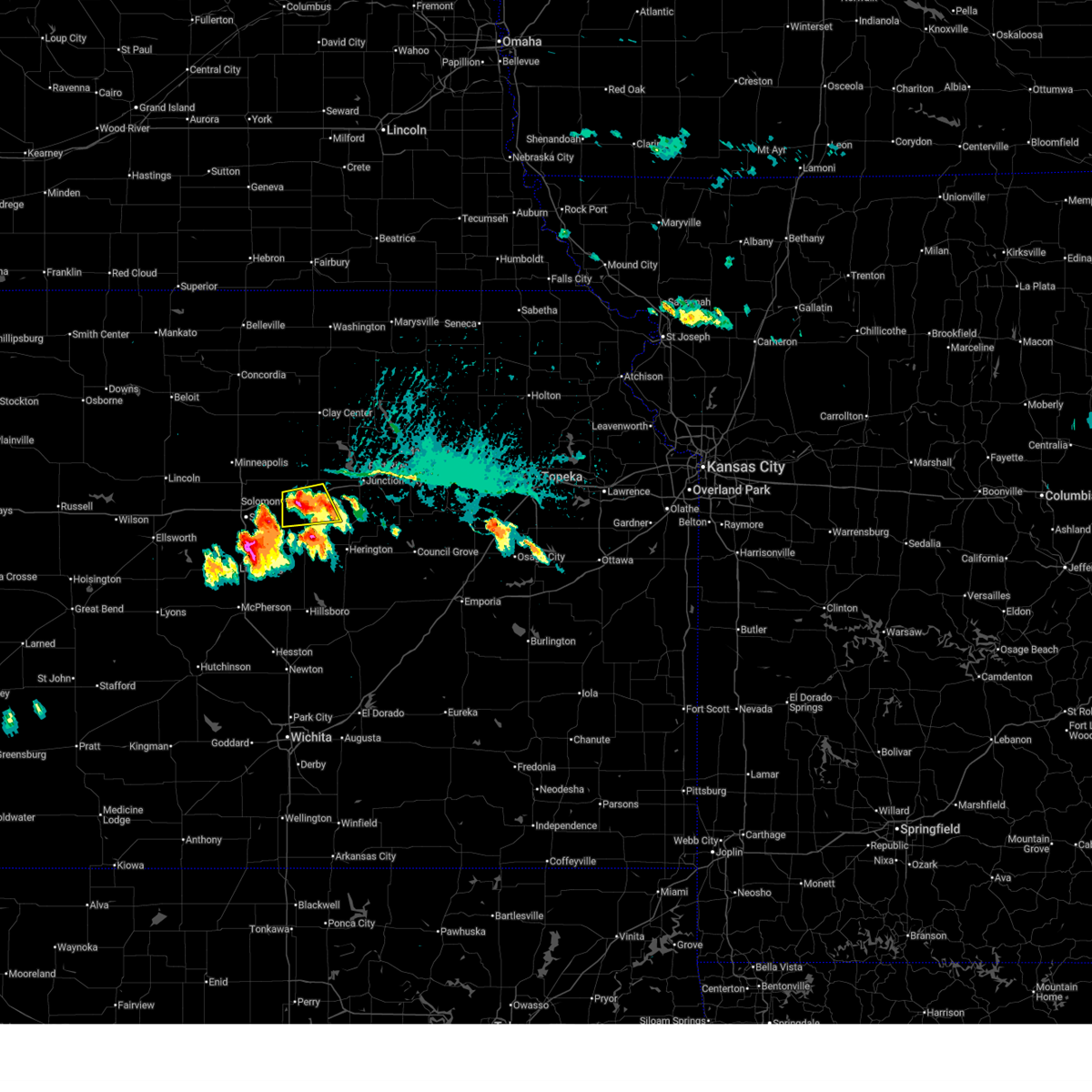
 Svrtop the national weather service in topeka has issued a * severe thunderstorm warning for, northern dickinson county in central kansas, * until 700 pm cdt. * at 634 pm cdt, a severe thunderstorm was located 4 miles north of solomon, moving east at 25 mph (radar indicated). Hazards include golf ball size hail and 60 mph wind gusts. People and animals outdoors will be injured. expect hail damage to roofs, siding, windows, and vehicles. Expect wind damage to roofs, siding, and trees. Svrtop the national weather service in topeka has issued a * severe thunderstorm warning for, northern dickinson county in central kansas, * until 700 pm cdt. * at 634 pm cdt, a severe thunderstorm was located 4 miles north of solomon, moving east at 25 mph (radar indicated). Hazards include golf ball size hail and 60 mph wind gusts. People and animals outdoors will be injured. expect hail damage to roofs, siding, windows, and vehicles. Expect wind damage to roofs, siding, and trees.
|
| 6/9/2026 10:52 PM CDT |
 Svrict the national weather service in wichita has issued a * severe thunderstorm warning for, saline county in central kansas, * until midnight cdt. * at 1052 pm cdt, a severe thunderstorm was located near brookville, or 8 miles west of salina, moving northeast at 20 mph (radar indicated). Hazards include 60 mph wind gusts. expect damage to roofs, siding, and trees Svrict the national weather service in wichita has issued a * severe thunderstorm warning for, saline county in central kansas, * until midnight cdt. * at 1052 pm cdt, a severe thunderstorm was located near brookville, or 8 miles west of salina, moving northeast at 20 mph (radar indicated). Hazards include 60 mph wind gusts. expect damage to roofs, siding, and trees
|
| 6/8/2026 9:53 PM CDT |
 Svrtop the national weather service in topeka has issued a * severe thunderstorm warning for, northern dickinson county in central kansas, geary county in east central kansas, southwestern riley county in northeastern kansas, southern clay county in north central kansas, * until 1045 pm cdt. * at 952 pm cdt, severe thunderstorms were located along a line extending from near wakefield to 4 miles northwest of abilene, moving southeast at 35 mph (radar indicated). Hazards include 70 mph wind gusts and quarter size hail. Hail damage to vehicles is expected. expect considerable tree damage. Wind damage is also likely to mobile homes, roofs, and outbuildings. Svrtop the national weather service in topeka has issued a * severe thunderstorm warning for, northern dickinson county in central kansas, geary county in east central kansas, southwestern riley county in northeastern kansas, southern clay county in north central kansas, * until 1045 pm cdt. * at 952 pm cdt, severe thunderstorms were located along a line extending from near wakefield to 4 miles northwest of abilene, moving southeast at 35 mph (radar indicated). Hazards include 70 mph wind gusts and quarter size hail. Hail damage to vehicles is expected. expect considerable tree damage. Wind damage is also likely to mobile homes, roofs, and outbuildings.
|
| 6/8/2026 9:32 PM CDT |
 At 932 pm cdt, a severe thunderstorm was located 5 miles southeast of solomon, moving east at 15 mph (radar indicated). Hazards include 70 mph wind gusts and ping pong ball size hail. People and animals outdoors will be injured. expect hail damage to roofs, siding, windows, and vehicles. expect considerable tree damage. wind damage is also likely to mobile homes, roofs, and outbuildings. locations impacted include, abilene, solomon, and enterprise. This includes interstate 70 between mile markers 267 and 281. At 932 pm cdt, a severe thunderstorm was located 5 miles southeast of solomon, moving east at 15 mph (radar indicated). Hazards include 70 mph wind gusts and ping pong ball size hail. People and animals outdoors will be injured. expect hail damage to roofs, siding, windows, and vehicles. expect considerable tree damage. wind damage is also likely to mobile homes, roofs, and outbuildings. locations impacted include, abilene, solomon, and enterprise. This includes interstate 70 between mile markers 267 and 281.
|
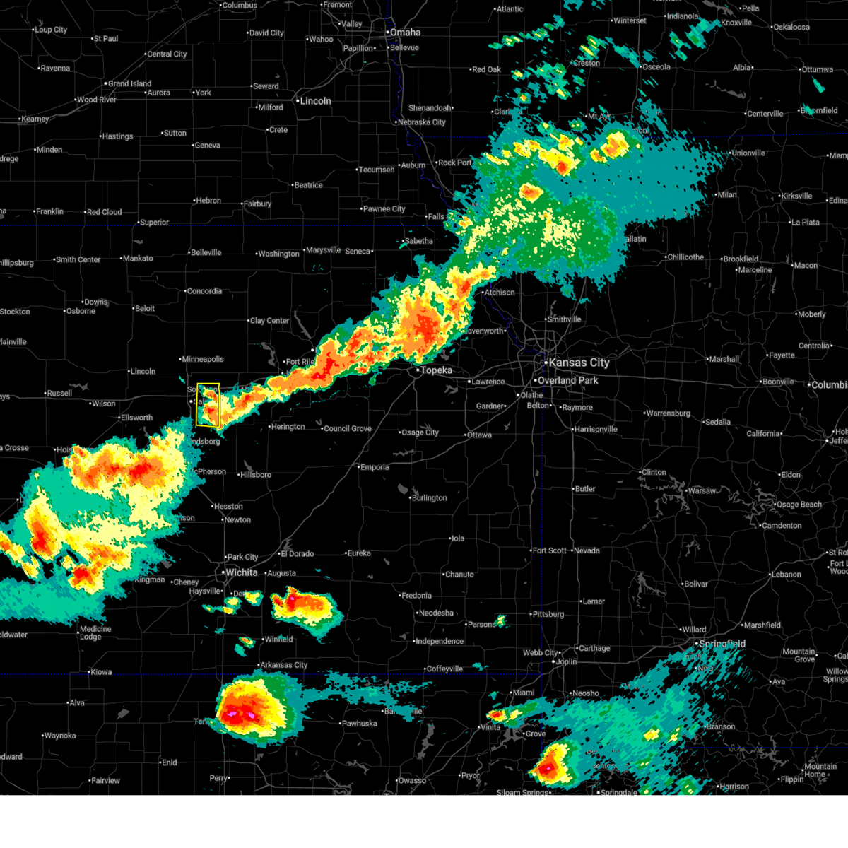
| 6/8/2026 9:20 PM CDT | Storm damage reported in dickinson county KS, 6.5 miles NNW of Solomon, KS |
| 6/8/2026 9:19 PM CDT |
 At 919 pm cdt, severe thunderstorms were located along a line extending from near new cambria to near marquette to near claflin, moving southeast at 30 mph (a 59 mph wind gust was measured at the salina airport at 913 pm). Hazards include 70 mph wind gusts and quarter size hail. Hail damage to vehicles is expected. expect considerable tree damage. wind damage is also likely to mobile homes, roofs, and outbuildings. locations impacted include, salina, lindsborg, kanopolis, marquette, little river, holyrood, assaria, gypsum, bushton, geneseo, brookville, smolan, lorraine, new cambria, falun, frederick, salina airport, bridgeport, kanopolis lake, and kanopolis state park. this includes the following highways, interstate 135 between mile markers 72 and 95. Interstate 70 between mile markers 243 and 266. At 919 pm cdt, severe thunderstorms were located along a line extending from near new cambria to near marquette to near claflin, moving southeast at 30 mph (a 59 mph wind gust was measured at the salina airport at 913 pm). Hazards include 70 mph wind gusts and quarter size hail. Hail damage to vehicles is expected. expect considerable tree damage. wind damage is also likely to mobile homes, roofs, and outbuildings. locations impacted include, salina, lindsborg, kanopolis, marquette, little river, holyrood, assaria, gypsum, bushton, geneseo, brookville, smolan, lorraine, new cambria, falun, frederick, salina airport, bridgeport, kanopolis lake, and kanopolis state park. this includes the following highways, interstate 135 between mile markers 72 and 95. Interstate 70 between mile markers 243 and 266.
|
| 6/8/2026 9:19 PM CDT |
 At 919 pm cdt, a severe thunderstorm was located 5 miles south of solomon, moving east at 15 mph (radar indicated). Hazards include two inch hail and 70 mph wind gusts. People and animals outdoors will be injured. expect hail damage to roofs, siding, windows, and vehicles. expect considerable tree damage. wind damage is also likely to mobile homes, roofs, and outbuildings. locations impacted include, abilene, solomon, and enterprise. This includes interstate 70 between mile markers 267 and 281. At 919 pm cdt, a severe thunderstorm was located 5 miles south of solomon, moving east at 15 mph (radar indicated). Hazards include two inch hail and 70 mph wind gusts. People and animals outdoors will be injured. expect hail damage to roofs, siding, windows, and vehicles. expect considerable tree damage. wind damage is also likely to mobile homes, roofs, and outbuildings. locations impacted include, abilene, solomon, and enterprise. This includes interstate 70 between mile markers 267 and 281.
|
| 6/8/2026 9:09 PM CDT |
 the severe thunderstorm warning has been cancelled and is no longer in effect the severe thunderstorm warning has been cancelled and is no longer in effect
|
| 6/8/2026 9:09 PM CDT |
 At 907 pm cdt, severe thunderstorms were located along a line extending from 5 miles northwest of new cambria to 8 miles northwest of marquette to 6 miles north of claflin, moving southeast at 30 mph. these are destructive storms for kanopolis lake, salina and other portions of northwest mcpherson, saline, ellsworth, rice, and barton counties (trained weather spotters measured a 76 mph wind gust at 905 pm, 9 miles north of brookville). Hazards include 80 mph wind gusts and quarter size hail. Flying debris will be dangerous to those caught without shelter. mobile homes will be heavily damaged. expect considerable damage to roofs, windows, and vehicles. extensive tree damage and power outages are likely. locations impacted include, salina, lindsborg, claflin, kanopolis, marquette, little river, holyrood, assaria, gypsum, bushton, geneseo, brookville, smolan, lorraine, new cambria, falun, frederick, salina airport, bridgeport, and kanopolis lake. this includes the following highways, interstate 135 between mile markers 72 and 95. Interstate 70 between mile markers 243 and 266. At 907 pm cdt, severe thunderstorms were located along a line extending from 5 miles northwest of new cambria to 8 miles northwest of marquette to 6 miles north of claflin, moving southeast at 30 mph. these are destructive storms for kanopolis lake, salina and other portions of northwest mcpherson, saline, ellsworth, rice, and barton counties (trained weather spotters measured a 76 mph wind gust at 905 pm, 9 miles north of brookville). Hazards include 80 mph wind gusts and quarter size hail. Flying debris will be dangerous to those caught without shelter. mobile homes will be heavily damaged. expect considerable damage to roofs, windows, and vehicles. extensive tree damage and power outages are likely. locations impacted include, salina, lindsborg, claflin, kanopolis, marquette, little river, holyrood, assaria, gypsum, bushton, geneseo, brookville, smolan, lorraine, new cambria, falun, frederick, salina airport, bridgeport, and kanopolis lake. this includes the following highways, interstate 135 between mile markers 72 and 95. Interstate 70 between mile markers 243 and 266.
|
| 6/8/2026 9:03 PM CDT |
 Svrtop the national weather service in topeka has issued a * severe thunderstorm warning for, west central dickinson county in central kansas, * until 1000 pm cdt. * at 902 pm cdt, a severe thunderstorm was located 4 miles southeast of new cambria, moving east at 15 mph (radar indicated). Hazards include tennis ball size hail and 60 mph wind gusts. People and animals outdoors will be injured. expect hail damage to roofs, siding, windows, and vehicles. Expect wind damage to roofs, siding, and trees. Svrtop the national weather service in topeka has issued a * severe thunderstorm warning for, west central dickinson county in central kansas, * until 1000 pm cdt. * at 902 pm cdt, a severe thunderstorm was located 4 miles southeast of new cambria, moving east at 15 mph (radar indicated). Hazards include tennis ball size hail and 60 mph wind gusts. People and animals outdoors will be injured. expect hail damage to roofs, siding, windows, and vehicles. Expect wind damage to roofs, siding, and trees.
|
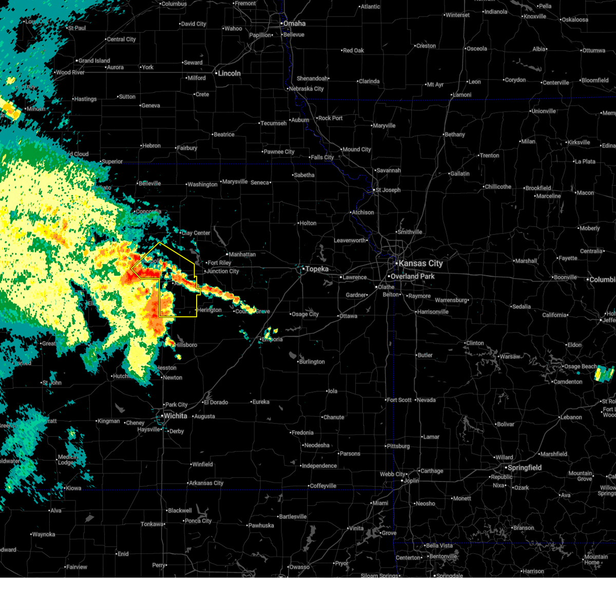
| 6/8/2026 8:55 PM CDT |
 Tortop the national weather service in topeka has issued a * tornado warning for, west central dickinson county in central kansas, * until 945 pm cdt. * at 855 pm cdt, a severe thunderstorm capable of producing a tornado was located near new cambria, moving east at 15 mph (radar indicated rotation. funnel clouds and a brief tornado have been reported with this storm in saline county). Hazards include tornado and hail up to two inches in diameter. Flying debris will be dangerous to those caught without shelter. mobile homes will be damaged or destroyed. damage to roofs, windows, and vehicles will occur. Tree damage is likely. Tortop the national weather service in topeka has issued a * tornado warning for, west central dickinson county in central kansas, * until 945 pm cdt. * at 855 pm cdt, a severe thunderstorm capable of producing a tornado was located near new cambria, moving east at 15 mph (radar indicated rotation. funnel clouds and a brief tornado have been reported with this storm in saline county). Hazards include tornado and hail up to two inches in diameter. Flying debris will be dangerous to those caught without shelter. mobile homes will be damaged or destroyed. damage to roofs, windows, and vehicles will occur. Tree damage is likely.
|
| 6/8/2026 8:53 PM CDT |
 At 852 pm cdt, a severe thunderstorm was located near new cambria, moving east at 15 mph (emergency management. at 8:50 pm, golf-ball size hail was reported in solomon). Hazards include golf ball size hail and 60 mph wind gusts. People and animals outdoors will be injured. expect hail damage to roofs, siding, windows, and vehicles. expect wind damage to roofs, siding, and trees. locations impacted include, solomon, bennington, culver, wells, and niles. This includes interstate 70 between mile markers 267 and 271. At 852 pm cdt, a severe thunderstorm was located near new cambria, moving east at 15 mph (emergency management. at 8:50 pm, golf-ball size hail was reported in solomon). Hazards include golf ball size hail and 60 mph wind gusts. People and animals outdoors will be injured. expect hail damage to roofs, siding, windows, and vehicles. expect wind damage to roofs, siding, and trees. locations impacted include, solomon, bennington, culver, wells, and niles. This includes interstate 70 between mile markers 267 and 271.
|
| 6/8/2026 8:51 PM CDT |
 At 851 pm cdt, a severe thunderstorm was located near new cambria, or 8 miles east of salina, moving east at 15 mph (trained weather spotters). Hazards include golf ball size hail and 60 mph wind gusts. People and animals outdoors will be injured. expect hail damage to roofs, siding, windows, and vehicles. expect wind damage to roofs, siding, and trees. locations impacted include, salina and new cambria. This includes interstate 70 between mile markers 252 and 266. At 851 pm cdt, a severe thunderstorm was located near new cambria, or 8 miles east of salina, moving east at 15 mph (trained weather spotters). Hazards include golf ball size hail and 60 mph wind gusts. People and animals outdoors will be injured. expect hail damage to roofs, siding, windows, and vehicles. expect wind damage to roofs, siding, and trees. locations impacted include, salina and new cambria. This includes interstate 70 between mile markers 252 and 266.
|
| 6/8/2026 8:50 PM CDT | Golf Ball sized hail reported 0.1 miles W of Solomon, KS |
| 6/8/2026 8:41 PM CDT |
 Svrict the national weather service in wichita has issued a * severe thunderstorm warning for, northwestern mcpherson county in central kansas, northern rice county in central kansas, southern ellsworth county in central kansas, southeastern russell county in central kansas, northeastern barton county in central kansas, saline county in central kansas, * until 1000 pm cdt. * at 840 pm cdt, severe thunderstorms were located along a line extending from near minneapolis to near kanopolis to near milberger, moving southeast at 30 mph (radar indicated). Hazards include 70 mph wind gusts and quarter size hail. Hail damage to vehicles is expected. expect considerable tree damage. Wind damage is also likely to mobile homes, roofs, and outbuildings. Svrict the national weather service in wichita has issued a * severe thunderstorm warning for, northwestern mcpherson county in central kansas, northern rice county in central kansas, southern ellsworth county in central kansas, southeastern russell county in central kansas, northeastern barton county in central kansas, saline county in central kansas, * until 1000 pm cdt. * at 840 pm cdt, severe thunderstorms were located along a line extending from near minneapolis to near kanopolis to near milberger, moving southeast at 30 mph (radar indicated). Hazards include 70 mph wind gusts and quarter size hail. Hail damage to vehicles is expected. expect considerable tree damage. Wind damage is also likely to mobile homes, roofs, and outbuildings.
|
| 6/8/2026 8:41 PM CDT |
 Svrtop the national weather service in topeka has issued a * severe thunderstorm warning for, west central dickinson county in central kansas, southeastern ottawa county in north central kansas, * until 930 pm cdt. * at 841 pm cdt, a severe thunderstorm was located over new cambria, moving east at 15 mph (radar indicated). Hazards include ping pong ball size hail and 60 mph wind gusts. People and animals outdoors will be injured. expect hail damage to roofs, siding, windows, and vehicles. Expect wind damage to roofs, siding, and trees. Svrtop the national weather service in topeka has issued a * severe thunderstorm warning for, west central dickinson county in central kansas, southeastern ottawa county in north central kansas, * until 930 pm cdt. * at 841 pm cdt, a severe thunderstorm was located over new cambria, moving east at 15 mph (radar indicated). Hazards include ping pong ball size hail and 60 mph wind gusts. People and animals outdoors will be injured. expect hail damage to roofs, siding, windows, and vehicles. Expect wind damage to roofs, siding, and trees.
|
| 6/8/2026 8:36 PM CDT |
 At 836 pm cdt, a severe thunderstorm was located over new cambria, or near salina, moving northeast at 10 mph (radar indicated). Hazards include golf ball size hail and 60 mph wind gusts. People and animals outdoors will be injured. expect hail damage to roofs, siding, windows, and vehicles. expect wind damage to roofs, siding, and trees. locations impacted include, salina and new cambria. This includes interstate 70 between mile markers 252 and 266. At 836 pm cdt, a severe thunderstorm was located over new cambria, or near salina, moving northeast at 10 mph (radar indicated). Hazards include golf ball size hail and 60 mph wind gusts. People and animals outdoors will be injured. expect hail damage to roofs, siding, windows, and vehicles. expect wind damage to roofs, siding, and trees. locations impacted include, salina and new cambria. This includes interstate 70 between mile markers 252 and 266.
|
| 6/8/2026 8:21 PM CDT |
 Svrict the national weather service in wichita has issued a * severe thunderstorm warning for, northeastern saline county in central kansas, * until 915 pm cdt. * at 820 pm cdt, a severe thunderstorm was located over new cambria, or 6 miles northeast of salina, moving northeast at 10 mph (radar indicated). Hazards include 60 mph wind gusts and half dollar size hail. Hail damage to vehicles is expected. Expect wind damage to roofs, siding, and trees. Svrict the national weather service in wichita has issued a * severe thunderstorm warning for, northeastern saline county in central kansas, * until 915 pm cdt. * at 820 pm cdt, a severe thunderstorm was located over new cambria, or 6 miles northeast of salina, moving northeast at 10 mph (radar indicated). Hazards include 60 mph wind gusts and half dollar size hail. Hail damage to vehicles is expected. Expect wind damage to roofs, siding, and trees.
|
| 5/18/2026 5:55 PM CDT |
 The severe thunderstorm which prompted the warning has moved out of the warned area. therefore, the warning will be allowed to expire. a tornado watch remains in effect until 800 pm cdt for central, north central, northeastern and east central kansas. remember, a severe thunderstorm warning still remains in effect for dickinson and geary counties. The severe thunderstorm which prompted the warning has moved out of the warned area. therefore, the warning will be allowed to expire. a tornado watch remains in effect until 800 pm cdt for central, north central, northeastern and east central kansas. remember, a severe thunderstorm warning still remains in effect for dickinson and geary counties.
|
| 5/18/2026 5:44 PM CDT |
 The storms which prompted the warning have moved out of the area. therefore, the warning will be allowed to expire. a tornado watch remains in effect until 800 pm cdt for central kansas. The storms which prompted the warning have moved out of the area. therefore, the warning will be allowed to expire. a tornado watch remains in effect until 800 pm cdt for central kansas.
|
| 5/18/2026 5:33 PM CDT |
 At 533 pm cdt, severe thunderstorms were located along a line extending from gypsum to lindsborg, moving northeast at 45 mph (radar indicated). Hazards include 60 mph wind gusts and quarter size hail. Hail damage to vehicles is expected. expect wind damage to roofs, siding, and trees. locations impacted include, assaria, gypsum, bridgeport, and kipp. this includes the following highways, interstate 135 between mile markers 77 and 86. Interstate 70 between mile markers 264 and 266. At 533 pm cdt, severe thunderstorms were located along a line extending from gypsum to lindsborg, moving northeast at 45 mph (radar indicated). Hazards include 60 mph wind gusts and quarter size hail. Hail damage to vehicles is expected. expect wind damage to roofs, siding, and trees. locations impacted include, assaria, gypsum, bridgeport, and kipp. this includes the following highways, interstate 135 between mile markers 77 and 86. Interstate 70 between mile markers 264 and 266.
|
| 5/18/2026 5:14 PM CDT |
 Svrict the national weather service in wichita has issued a * severe thunderstorm warning for, southeastern saline county in central kansas, * until 545 pm cdt. * at 514 pm cdt, a severe thunderstorm was located near gypsum, or 9 miles east of salina, moving northeast at 50 mph (radar indicated). Hazards include 60 mph wind gusts and half dollar size hail. Hail damage to vehicles is expected. Expect wind damage to roofs, siding, and trees. Svrict the national weather service in wichita has issued a * severe thunderstorm warning for, southeastern saline county in central kansas, * until 545 pm cdt. * at 514 pm cdt, a severe thunderstorm was located near gypsum, or 9 miles east of salina, moving northeast at 50 mph (radar indicated). Hazards include 60 mph wind gusts and half dollar size hail. Hail damage to vehicles is expected. Expect wind damage to roofs, siding, and trees.
|
| 5/18/2026 5:11 PM CDT |
 Svrtop the national weather service in topeka has issued a * severe thunderstorm warning for, dickinson county in central kansas, western geary county in east central kansas, southwestern riley county in northeastern kansas, southeastern ottawa county in north central kansas, southern clay county in north central kansas, * until 600 pm cdt. * at 511 pm cdt, a severe thunderstorm was located near solomon, moving northeast at 45 mph (radar indicated). Hazards include 60 mph wind gusts and half dollar size hail. Hail damage to vehicles is expected. Expect wind damage to roofs, siding, and trees. Svrtop the national weather service in topeka has issued a * severe thunderstorm warning for, dickinson county in central kansas, western geary county in east central kansas, southwestern riley county in northeastern kansas, southeastern ottawa county in north central kansas, southern clay county in north central kansas, * until 600 pm cdt. * at 511 pm cdt, a severe thunderstorm was located near solomon, moving northeast at 45 mph (radar indicated). Hazards include 60 mph wind gusts and half dollar size hail. Hail damage to vehicles is expected. Expect wind damage to roofs, siding, and trees.
|
| 5/18/2026 5:09 PM CDT |
 The storm which prompted the warning has moved out of the area. therefore, the warning will be allowed to expire. a tornado watch remains in effect until 800 pm cdt for central kansas. The storm which prompted the warning has moved out of the area. therefore, the warning will be allowed to expire. a tornado watch remains in effect until 800 pm cdt for central kansas.
|
| 5/18/2026 4:44 PM CDT |
 Svrict the national weather service in wichita has issued a * severe thunderstorm warning for, northeastern saline county in central kansas, * until 515 pm cdt. * at 444 pm cdt, a severe thunderstorm was located near salina, moving northeast at 65 mph (radar indicated). Hazards include 60 mph wind gusts and half dollar size hail. Hail damage to vehicles is expected. Expect wind damage to roofs, siding, and trees. Svrict the national weather service in wichita has issued a * severe thunderstorm warning for, northeastern saline county in central kansas, * until 515 pm cdt. * at 444 pm cdt, a severe thunderstorm was located near salina, moving northeast at 65 mph (radar indicated). Hazards include 60 mph wind gusts and half dollar size hail. Hail damage to vehicles is expected. Expect wind damage to roofs, siding, and trees.
|
| 5/18/2026 12:06 AM CDT |
 Svrtop the national weather service in topeka has issued a * severe thunderstorm warning for, northern dickinson county in central kansas, southeastern ottawa county in north central kansas, * until 1230 am cdt. * at 1206 am cdt, a severe thunderstorm was located near talmage, moving east at 45 mph (radar indicated). Hazards include 60 mph wind gusts. expect damage to roofs, siding, and trees Svrtop the national weather service in topeka has issued a * severe thunderstorm warning for, northern dickinson county in central kansas, southeastern ottawa county in north central kansas, * until 1230 am cdt. * at 1206 am cdt, a severe thunderstorm was located near talmage, moving east at 45 mph (radar indicated). Hazards include 60 mph wind gusts. expect damage to roofs, siding, and trees
|
| 5/17/2026 9:37 PM CDT |
 At 937 pm cdt, a severe thunderstorm was located 10 miles south of beverly, or 12 miles northeast of kanopolis, moving northeast at 40 mph (radar indicated). Hazards include 60 mph wind gusts and half dollar size hail. Hail damage to vehicles is expected. expect wind damage to roofs, siding, and trees. locations impacted include, beverly, glendale, and westfall. This includes interstate 70 between mile markers 223 and 261, and between mile markers 264 and 266. At 937 pm cdt, a severe thunderstorm was located 10 miles south of beverly, or 12 miles northeast of kanopolis, moving northeast at 40 mph (radar indicated). Hazards include 60 mph wind gusts and half dollar size hail. Hail damage to vehicles is expected. expect wind damage to roofs, siding, and trees. locations impacted include, beverly, glendale, and westfall. This includes interstate 70 between mile markers 223 and 261, and between mile markers 264 and 266.
|
| 5/17/2026 9:30 PM CDT |
 At 929 pm cdt, a severe thunderstorm was located 9 miles north of kanopolis, moving northeast at 40 mph (radar indicated). Hazards include 60 mph wind gusts and half dollar size hail. Hail damage to vehicles is expected. expect wind damage to roofs, siding, and trees. locations impacted include, wilson, beverly, glendale, and westfall. This includes interstate 70 between mile markers 206 and 252, between mile markers 254 and 261, and between mile markers 264 and 266. At 929 pm cdt, a severe thunderstorm was located 9 miles north of kanopolis, moving northeast at 40 mph (radar indicated). Hazards include 60 mph wind gusts and half dollar size hail. Hail damage to vehicles is expected. expect wind damage to roofs, siding, and trees. locations impacted include, wilson, beverly, glendale, and westfall. This includes interstate 70 between mile markers 206 and 252, between mile markers 254 and 261, and between mile markers 264 and 266.
|
| 5/17/2026 9:10 PM CDT |
 Svrict the national weather service in wichita has issued a * severe thunderstorm warning for, southeastern lincoln county in central kansas, northern ellsworth county in central kansas, northern saline county in central kansas, * until 1015 pm cdt. * at 909 pm cdt, a severe thunderstorm was located 8 miles south of wilson, moving east at 35 mph. a second severe thunderstorm was located near westfall, moving east at 35 mph (radar indicated). Hazards include two inch hail and 70 mph wind gusts. People and animals outdoors will be injured. expect hail damage to roofs, siding, windows, and vehicles. expect considerable tree damage. Wind damage is also likely to mobile homes, roofs, and outbuildings. Svrict the national weather service in wichita has issued a * severe thunderstorm warning for, southeastern lincoln county in central kansas, northern ellsworth county in central kansas, northern saline county in central kansas, * until 1015 pm cdt. * at 909 pm cdt, a severe thunderstorm was located 8 miles south of wilson, moving east at 35 mph. a second severe thunderstorm was located near westfall, moving east at 35 mph (radar indicated). Hazards include two inch hail and 70 mph wind gusts. People and animals outdoors will be injured. expect hail damage to roofs, siding, windows, and vehicles. expect considerable tree damage. Wind damage is also likely to mobile homes, roofs, and outbuildings.
|
| 4/27/2026 2:53 AM CDT |
 At 253 am cdt, a severe thunderstorm was located 6 miles north of gypsum, or 10 miles east of salina, moving northeast at 55 mph (radar indicated). Hazards include quarter size hail. Damage to vehicles is expected. locations impacted include, assaria, gypsum, new cambria, bridgeport, and kipp. this includes the following highways, interstate 135 near mile marker 78. Interstate 70 between mile markers 259 and 266. At 253 am cdt, a severe thunderstorm was located 6 miles north of gypsum, or 10 miles east of salina, moving northeast at 55 mph (radar indicated). Hazards include quarter size hail. Damage to vehicles is expected. locations impacted include, assaria, gypsum, new cambria, bridgeport, and kipp. this includes the following highways, interstate 135 near mile marker 78. Interstate 70 between mile markers 259 and 266.
|
| 4/27/2026 2:45 AM CDT |
 Svrict the national weather service in wichita has issued a * severe thunderstorm warning for, eastern saline county in central kansas, * until 330 am cdt. * at 245 am cdt, a severe thunderstorm was located near gypsum, or 8 miles southeast of salina, moving northeast at 55 mph (radar indicated). Hazards include quarter size hail. damage to vehicles is expected Svrict the national weather service in wichita has issued a * severe thunderstorm warning for, eastern saline county in central kansas, * until 330 am cdt. * at 245 am cdt, a severe thunderstorm was located near gypsum, or 8 miles southeast of salina, moving northeast at 55 mph (radar indicated). Hazards include quarter size hail. damage to vehicles is expected
|
| 4/27/2026 1:22 AM CDT |
 At 122 am cdt, severe thunderstorms were located along a line extending from bennington to salina, moving east at 45 mph (radar indicated). Hazards include quarter size hail. Damage to vehicles is expected. locations impacted include, salina, lincoln, sylvan grove, beverly, new cambria, glendale, westfall, salina airport, and kipp. this includes the following highways, interstate 135 between mile markers 88 and 95. Interstate 70 between mile markers 222 and 266. At 122 am cdt, severe thunderstorms were located along a line extending from bennington to salina, moving east at 45 mph (radar indicated). Hazards include quarter size hail. Damage to vehicles is expected. locations impacted include, salina, lincoln, sylvan grove, beverly, new cambria, glendale, westfall, salina airport, and kipp. this includes the following highways, interstate 135 between mile markers 88 and 95. Interstate 70 between mile markers 222 and 266.
|
| 4/27/2026 1:11 AM CDT |
 At 111 am cdt, severe thunderstorms were located along a line extending from near culver to 8 miles northeast of brookville, moving east at 50 mph (radar indicated). Hazards include quarter size hail. Damage to vehicles is expected. locations impacted include, salina, ellsworth, wilson, kanopolis, lincoln, assaria, gypsum, sylvan grove, brookville, smolan, beverly, new cambria, falun, glendale, westfall, salina airport, ellsworth airport, and kipp. this includes the following highways, interstate 135 between mile markers 81 and 95. Interstate 70 between mile markers 206 and 266. At 111 am cdt, severe thunderstorms were located along a line extending from near culver to 8 miles northeast of brookville, moving east at 50 mph (radar indicated). Hazards include quarter size hail. Damage to vehicles is expected. locations impacted include, salina, ellsworth, wilson, kanopolis, lincoln, assaria, gypsum, sylvan grove, brookville, smolan, beverly, new cambria, falun, glendale, westfall, salina airport, ellsworth airport, and kipp. this includes the following highways, interstate 135 between mile markers 81 and 95. Interstate 70 between mile markers 206 and 266.
|
| 4/27/2026 12:58 AM CDT |
 At 1257 am cdt, severe thunderstorms were located along a line extending from near beverly to 5 miles northwest of brookville, moving east at 45 mph (radar indicated). Hazards include golf ball size hail. People and animals outdoors will be injured. expect damage to roofs, siding, windows, and vehicles. locations impacted include, salina, ellsworth, wilson, kanopolis, lincoln, assaria, gypsum, sylvan grove, brookville, smolan, beverly, new cambria, falun, glendale, westfall, salina airport, ellsworth airport, and kipp. this includes the following highways, interstate 135 between mile markers 81 and 95. Interstate 70 between mile markers 206 and 266. At 1257 am cdt, severe thunderstorms were located along a line extending from near beverly to 5 miles northwest of brookville, moving east at 45 mph (radar indicated). Hazards include golf ball size hail. People and animals outdoors will be injured. expect damage to roofs, siding, windows, and vehicles. locations impacted include, salina, ellsworth, wilson, kanopolis, lincoln, assaria, gypsum, sylvan grove, brookville, smolan, beverly, new cambria, falun, glendale, westfall, salina airport, ellsworth airport, and kipp. this includes the following highways, interstate 135 between mile markers 81 and 95. Interstate 70 between mile markers 206 and 266.
|
| 4/27/2026 12:56 AM CDT |
 The severe thunderstorm which prompted the warning has has been replaced by another severe thunderstorm warning and therefore has been allowed to expire. a severe thunderstorm watch remains in effect until 400 am cdt for central and east central kansas. remember, a severe thunderstorm warning still remains in effect for dickinson county until 130am. The severe thunderstorm which prompted the warning has has been replaced by another severe thunderstorm warning and therefore has been allowed to expire. a severe thunderstorm watch remains in effect until 400 am cdt for central and east central kansas. remember, a severe thunderstorm warning still remains in effect for dickinson county until 130am.
|
| 4/27/2026 12:47 AM CDT |
 At 1247 am cdt, a severe thunderstorm was located 8 miles southwest of beverly, or 9 miles southeast of lincoln, moving east to northeast at 40 mph (radar indicated). Hazards include golf ball size hail. People and animals outdoors will be injured. expect damage to roofs, siding, windows, and vehicles. locations impacted include, salina, ellsworth, wilson, kanopolis, lincoln, assaria, gypsum, sylvan grove, brookville, smolan, beverly, new cambria, falun, glendale, westfall, salina airport, ellsworth airport, and kipp. this includes the following highways, interstate 135 between mile markers 81 and 95. Interstate 70 between mile markers 206 and 266. At 1247 am cdt, a severe thunderstorm was located 8 miles southwest of beverly, or 9 miles southeast of lincoln, moving east to northeast at 40 mph (radar indicated). Hazards include golf ball size hail. People and animals outdoors will be injured. expect damage to roofs, siding, windows, and vehicles. locations impacted include, salina, ellsworth, wilson, kanopolis, lincoln, assaria, gypsum, sylvan grove, brookville, smolan, beverly, new cambria, falun, glendale, westfall, salina airport, ellsworth airport, and kipp. this includes the following highways, interstate 135 between mile markers 81 and 95. Interstate 70 between mile markers 206 and 266.
|
| 4/27/2026 12:46 AM CDT | Quarter sized hail reported 0.1 miles W of Solomon, KS |
| 4/27/2026 12:40 AM CDT |
 At 1239 am cdt, a severe thunderstorm was located 6 miles southeast of new cambria, or 10 miles east of salina, moving east at 50 mph (trained weather spotters. numerous reports of large hail with this storm). Hazards include two inch hail. People and animals outdoors will be injured. expect damage to roofs, siding, windows, and vehicles. locations impacted include, salina, ellsworth, wilson, kanopolis, lincoln, assaria, gypsum, sylvan grove, brookville, smolan, beverly, new cambria, falun, glendale, westfall, salina airport, ellsworth airport, and kipp. this includes the following highways, interstate 135 between mile markers 81 and 95. Interstate 70 between mile markers 206 and 266. At 1239 am cdt, a severe thunderstorm was located 6 miles southeast of new cambria, or 10 miles east of salina, moving east at 50 mph (trained weather spotters. numerous reports of large hail with this storm). Hazards include two inch hail. People and animals outdoors will be injured. expect damage to roofs, siding, windows, and vehicles. locations impacted include, salina, ellsworth, wilson, kanopolis, lincoln, assaria, gypsum, sylvan grove, brookville, smolan, beverly, new cambria, falun, glendale, westfall, salina airport, ellsworth airport, and kipp. this includes the following highways, interstate 135 between mile markers 81 and 95. Interstate 70 between mile markers 206 and 266.
|
| 4/27/2026 12:37 AM CDT |
 Svrtop the national weather service in topeka has issued a * severe thunderstorm warning for, central dickinson county in central kansas, * until 100 am cdt. * at 1237 am cdt, a severe thunderstorm was located 4 miles southeast of new cambria, moving east at 50 mph (public). Hazards include two inch hail was reported around 1230am in salina. People and animals outdoors will be injured. Expect damage to roofs, siding, windows, and vehicles. Svrtop the national weather service in topeka has issued a * severe thunderstorm warning for, central dickinson county in central kansas, * until 100 am cdt. * at 1237 am cdt, a severe thunderstorm was located 4 miles southeast of new cambria, moving east at 50 mph (public). Hazards include two inch hail was reported around 1230am in salina. People and animals outdoors will be injured. Expect damage to roofs, siding, windows, and vehicles.
|
| 4/27/2026 12:33 AM CDT |
 Svrict the national weather service in wichita has issued a * severe thunderstorm warning for, southern lincoln county in central kansas, northern ellsworth county in central kansas, saline county in central kansas, * until 145 am cdt. * at 1232 am cdt, a severe thunderstorm was located near salina, moving east at 50 mph (trained weather spotters. this storm has a history of producing two inch diameter hail). Hazards include tennis ball size hail. People and animals outdoors will be injured. Expect damage to roofs, siding, windows, and vehicles. Svrict the national weather service in wichita has issued a * severe thunderstorm warning for, southern lincoln county in central kansas, northern ellsworth county in central kansas, saline county in central kansas, * until 145 am cdt. * at 1232 am cdt, a severe thunderstorm was located near salina, moving east at 50 mph (trained weather spotters. this storm has a history of producing two inch diameter hail). Hazards include tennis ball size hail. People and animals outdoors will be injured. Expect damage to roofs, siding, windows, and vehicles.
|
| 4/27/2026 12:21 AM CDT |
 At 1220 am cdt, a severe thunderstorm was located over smolan, or 6 miles southwest of salina, moving east to northeast at 50 mph (radar indicated. this storm has a history of producing large hail). Hazards include tennis ball size hail. People and animals outdoors will be injured. expect damage to roofs, siding, windows, and vehicles. locations impacted include, salina, brookville, smolan, new cambria, falun, glendale, and salina airport. this includes the following highways, interstate 135 between mile markers 83 and 95. Interstate 70 between mile markers 236 and 266. At 1220 am cdt, a severe thunderstorm was located over smolan, or 6 miles southwest of salina, moving east to northeast at 50 mph (radar indicated. this storm has a history of producing large hail). Hazards include tennis ball size hail. People and animals outdoors will be injured. expect damage to roofs, siding, windows, and vehicles. locations impacted include, salina, brookville, smolan, new cambria, falun, glendale, and salina airport. this includes the following highways, interstate 135 between mile markers 83 and 95. Interstate 70 between mile markers 236 and 266.
|
| 4/27/2026 12:14 AM CDT |
 the severe thunderstorm warning has been cancelled and is no longer in effect the severe thunderstorm warning has been cancelled and is no longer in effect
|
| 4/27/2026 12:14 AM CDT |
 At 1213 am cdt, a severe thunderstorm was located near brookville, or 12 miles southwest of salina, moving east at 40 mph (radar indicated. this storm has a history of producing large hail). Hazards include two inch hail. People and animals outdoors will be injured. expect damage to roofs, siding, windows, and vehicles. locations impacted include, salina, brookville, smolan, new cambria, falun, glendale, and salina airport. this includes the following highways, interstate 135 between mile markers 83 and 95. Interstate 70 between mile markers 236 and 266. At 1213 am cdt, a severe thunderstorm was located near brookville, or 12 miles southwest of salina, moving east at 40 mph (radar indicated. this storm has a history of producing large hail). Hazards include two inch hail. People and animals outdoors will be injured. expect damage to roofs, siding, windows, and vehicles. locations impacted include, salina, brookville, smolan, new cambria, falun, glendale, and salina airport. this includes the following highways, interstate 135 between mile markers 83 and 95. Interstate 70 between mile markers 236 and 266.
|
| 4/27/2026 12:06 AM CDT |
 At 1206 am cdt, a severe thunderstorm was located over brookville, or 14 miles west of salina, moving east at 45 mph (radar indicated. this storm has a history of producing large hail). Hazards include half dollar size hail. Damage to vehicles is expected. locations impacted include, salina, brookville, smolan, new cambria, falun, glendale, kanopolis lake, salina airport, and kanopolis state park. this includes the following highways, interstate 135 between mile markers 83 and 95. Interstate 70 between mile markers 228 and 266. At 1206 am cdt, a severe thunderstorm was located over brookville, or 14 miles west of salina, moving east at 45 mph (radar indicated. this storm has a history of producing large hail). Hazards include half dollar size hail. Damage to vehicles is expected. locations impacted include, salina, brookville, smolan, new cambria, falun, glendale, kanopolis lake, salina airport, and kanopolis state park. this includes the following highways, interstate 135 between mile markers 83 and 95. Interstate 70 between mile markers 228 and 266.
|
| 4/26/2026 11:54 PM CDT |
 At 1153 pm cdt, a severe thunderstorm was located 6 miles northeast of kanopolis, moving east to northeast at 50 mph (trained weather spotters reported ping pong ball size hail in ellsworth). Hazards include ping pong ball size hail. People and animals outdoors will be injured. expect damage to roofs, siding, windows, and vehicles. locations impacted include, salina, ellsworth, wilson, kanopolis, brookville, smolan, new cambria, falun, glendale, westfall, salina airport, ellsworth airport, kanopolis lake, and kanopolis state park. this includes the following highways, interstate 135 between mile markers 83 and 95. Interstate 70 between mile markers 206 and 266. At 1153 pm cdt, a severe thunderstorm was located 6 miles northeast of kanopolis, moving east to northeast at 50 mph (trained weather spotters reported ping pong ball size hail in ellsworth). Hazards include ping pong ball size hail. People and animals outdoors will be injured. expect damage to roofs, siding, windows, and vehicles. locations impacted include, salina, ellsworth, wilson, kanopolis, brookville, smolan, new cambria, falun, glendale, westfall, salina airport, ellsworth airport, kanopolis lake, and kanopolis state park. this includes the following highways, interstate 135 between mile markers 83 and 95. Interstate 70 between mile markers 206 and 266.
|
| 4/26/2026 11:43 PM CDT |
 Svrict the national weather service in wichita has issued a * severe thunderstorm warning for, southeastern lincoln county in central kansas, ellsworth county in central kansas, saline county in central kansas, * until 1245 am cdt. * at 1143 pm cdt, a severe thunderstorm was located over kanopolis, moving northeast at 45 mph (radar indicated). Hazards include quarter size hail. damage to vehicles is expected Svrict the national weather service in wichita has issued a * severe thunderstorm warning for, southeastern lincoln county in central kansas, ellsworth county in central kansas, saline county in central kansas, * until 1245 am cdt. * at 1143 pm cdt, a severe thunderstorm was located over kanopolis, moving northeast at 45 mph (radar indicated). Hazards include quarter size hail. damage to vehicles is expected
|
| 4/26/2026 11:23 PM CDT |
 At 1123 pm cdt, a severe thunderstorm was located 7 miles south of lindsborg, moving northeast at 55 mph (radar indicated). Hazards include golf ball size hail. People and animals outdoors will be injured. expect damage to roofs, siding, windows, and vehicles. locations impacted include, salina, mcpherson, lindsborg, galva, canton, marquette, assaria, gypsum, lincolnville, ramona, lehigh, windom, new cambria, tampa, durham, lost springs, mcpherson airport, roxbury, marion lake, and bridgeport. this includes the following highways, interstate 135 between mile markers 59 and 89. Interstate 70 between mile markers 260 and 266. At 1123 pm cdt, a severe thunderstorm was located 7 miles south of lindsborg, moving northeast at 55 mph (radar indicated). Hazards include golf ball size hail. People and animals outdoors will be injured. expect damage to roofs, siding, windows, and vehicles. locations impacted include, salina, mcpherson, lindsborg, galva, canton, marquette, assaria, gypsum, lincolnville, ramona, lehigh, windom, new cambria, tampa, durham, lost springs, mcpherson airport, roxbury, marion lake, and bridgeport. this includes the following highways, interstate 135 between mile markers 59 and 89. Interstate 70 between mile markers 260 and 266.
|
| 4/26/2026 12:53 PM CDT |
 At 1252 pm cdt, severe thunderstorms were located along a line extending from 5 miles south of enterprise to near ramona to near hillsboro, moving east at 35 mph (trained weather spotters reported quarter size hail 2 miles south of navarre). Hazards include 60 mph wind gusts and quarter size hail. Hail damage to vehicles is expected. expect wind damage to roofs, siding, and trees. locations impacted include, abilene, herington, solomon, enterprise, hope, woodbine, and carlton. This includes interstate 70 between mile markers 267 and 279. At 1252 pm cdt, severe thunderstorms were located along a line extending from 5 miles south of enterprise to near ramona to near hillsboro, moving east at 35 mph (trained weather spotters reported quarter size hail 2 miles south of navarre). Hazards include 60 mph wind gusts and quarter size hail. Hail damage to vehicles is expected. expect wind damage to roofs, siding, and trees. locations impacted include, abilene, herington, solomon, enterprise, hope, woodbine, and carlton. This includes interstate 70 between mile markers 267 and 279.
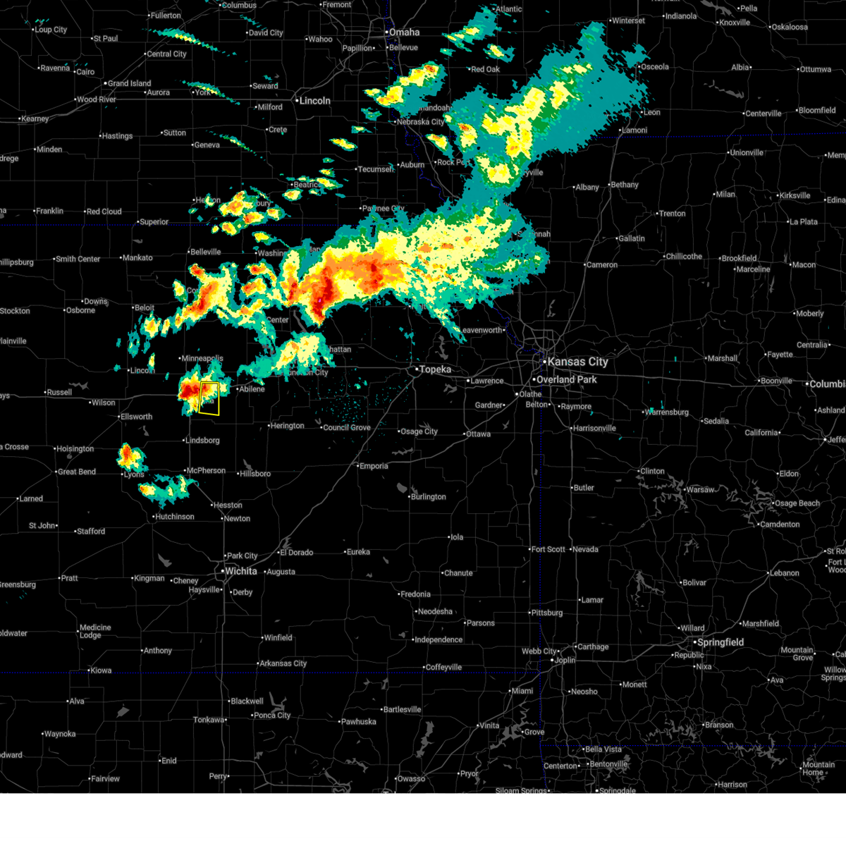
|
| 4/26/2026 12:38 PM CDT |
 At 1237 pm cdt, severe thunderstorms were located along a line extending from 5 miles south of abilene to 4 miles northwest of tampa to 4 miles southeast of canton, moving east at 35 mph (emergency management reported quarter size hail in carlton). Hazards include 70 mph wind gusts and quarter size hail. Hail damage to vehicles is expected. expect considerable tree damage. wind damage is also likely to mobile homes, roofs, and outbuildings. locations impacted include, abilene, herington, solomon, enterprise, hope, woodbine, and carlton. This includes interstate 70 between mile markers 267 and 279. At 1237 pm cdt, severe thunderstorms were located along a line extending from 5 miles south of abilene to 4 miles northwest of tampa to 4 miles southeast of canton, moving east at 35 mph (emergency management reported quarter size hail in carlton). Hazards include 70 mph wind gusts and quarter size hail. Hail damage to vehicles is expected. expect considerable tree damage. wind damage is also likely to mobile homes, roofs, and outbuildings. locations impacted include, abilene, herington, solomon, enterprise, hope, woodbine, and carlton. This includes interstate 70 between mile markers 267 and 279.
|
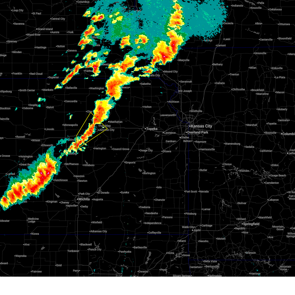
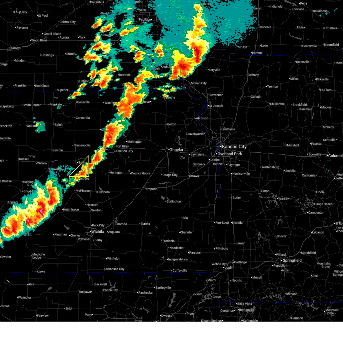
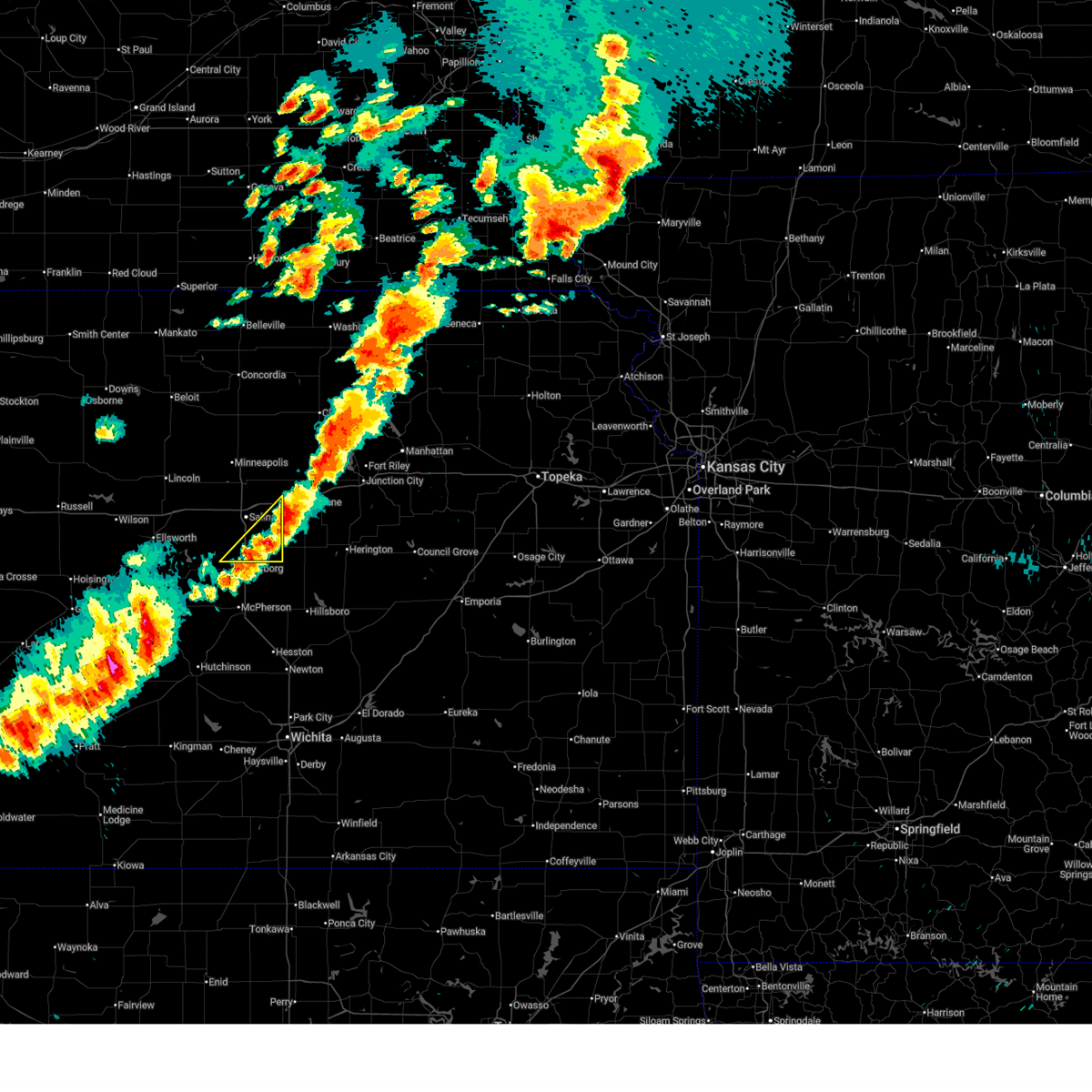
| 4/26/2026 12:26 PM CDT |
 Svrtop the national weather service in topeka has issued a * severe thunderstorm warning for, dickinson county in central kansas, * until 100 pm cdt. * at 1226 pm cdt, severe thunderstorms were located along a line extending from 3 miles south of solomon to 5 miles south of carlton to 3 miles southeast of galva, moving east at 35 mph (radar indicated). Hazards include 70 mph wind gusts and quarter size hail. Hail damage to vehicles is expected. expect considerable tree damage. Wind damage is also likely to mobile homes, roofs, and outbuildings. Svrtop the national weather service in topeka has issued a * severe thunderstorm warning for, dickinson county in central kansas, * until 100 pm cdt. * at 1226 pm cdt, severe thunderstorms were located along a line extending from 3 miles south of solomon to 5 miles south of carlton to 3 miles southeast of galva, moving east at 35 mph (radar indicated). Hazards include 70 mph wind gusts and quarter size hail. Hail damage to vehicles is expected. expect considerable tree damage. Wind damage is also likely to mobile homes, roofs, and outbuildings.
|
| 4/9/2026 8:58 PM CDT |
 Svrict the national weather service in wichita has issued a * severe thunderstorm warning for, northeastern saline county in central kansas, * until 1000 pm cdt. * at 857 pm cdt, a severe thunderstorm was located near salina, moving southeast at 35 mph (radar indicated). Hazards include 60 mph wind gusts and half dollar size hail. Hail damage to vehicles is expected. Expect wind damage to roofs, siding, and trees. Svrict the national weather service in wichita has issued a * severe thunderstorm warning for, northeastern saline county in central kansas, * until 1000 pm cdt. * at 857 pm cdt, a severe thunderstorm was located near salina, moving southeast at 35 mph (radar indicated). Hazards include 60 mph wind gusts and half dollar size hail. Hail damage to vehicles is expected. Expect wind damage to roofs, siding, and trees.
|
| 9/3/2025 5:35 PM CDT |
 At 534 pm cdt, a severe thunderstorm was located near abilene, moving southeast at 25 mph (trained weather spotters. at 5:29 pm, quarter size hail was reported 3 miles wnw of abilene). Hazards include golf ball size hail and 60 mph wind gusts. People and animals outdoors will be injured. expect hail damage to roofs, siding, windows, and vehicles. expect wind damage to roofs, siding, and trees. locations impacted include, abilene, solomon, and enterprise. This includes interstate 70 between mile markers 267 and 283. At 534 pm cdt, a severe thunderstorm was located near abilene, moving southeast at 25 mph (trained weather spotters. at 5:29 pm, quarter size hail was reported 3 miles wnw of abilene). Hazards include golf ball size hail and 60 mph wind gusts. People and animals outdoors will be injured. expect hail damage to roofs, siding, windows, and vehicles. expect wind damage to roofs, siding, and trees. locations impacted include, abilene, solomon, and enterprise. This includes interstate 70 between mile markers 267 and 283.
|
| 9/3/2025 5:31 PM CDT |
 At 531 pm cdt, a severe thunderstorm was located near abilene, moving southeast at 30 mph (trained weather spotters. at 5:29 pm, quarter size hail was reported 3 miles wnw of abilene). Hazards include ping pong ball size hail and 60 mph wind gusts. People and animals outdoors will be injured. expect hail damage to roofs, siding, windows, and vehicles. expect wind damage to roofs, siding, and trees. locations impacted include, abilene, solomon, enterprise, and moonlight. This includes interstate 70 between mile markers 267 and 283. At 531 pm cdt, a severe thunderstorm was located near abilene, moving southeast at 30 mph (trained weather spotters. at 5:29 pm, quarter size hail was reported 3 miles wnw of abilene). Hazards include ping pong ball size hail and 60 mph wind gusts. People and animals outdoors will be injured. expect hail damage to roofs, siding, windows, and vehicles. expect wind damage to roofs, siding, and trees. locations impacted include, abilene, solomon, enterprise, and moonlight. This includes interstate 70 between mile markers 267 and 283.
|
| 9/3/2025 5:31 PM CDT |
 the severe thunderstorm warning has been cancelled and is no longer in effect the severe thunderstorm warning has been cancelled and is no longer in effect
|
| 9/3/2025 5:18 PM CDT |
 Svrtop the national weather service in topeka has issued a * severe thunderstorm warning for, northern dickinson county in central kansas, southeastern ottawa county in north central kansas, * until 600 pm cdt. * at 518 pm cdt, a severe thunderstorm was located 4 miles west of talmage, moving southeast at 25 mph (radar indicated). Hazards include ping pong ball size hail and 60 mph wind gusts. People and animals outdoors will be injured. expect hail damage to roofs, siding, windows, and vehicles. Expect wind damage to roofs, siding, and trees. Svrtop the national weather service in topeka has issued a * severe thunderstorm warning for, northern dickinson county in central kansas, southeastern ottawa county in north central kansas, * until 600 pm cdt. * at 518 pm cdt, a severe thunderstorm was located 4 miles west of talmage, moving southeast at 25 mph (radar indicated). Hazards include ping pong ball size hail and 60 mph wind gusts. People and animals outdoors will be injured. expect hail damage to roofs, siding, windows, and vehicles. Expect wind damage to roofs, siding, and trees.
|
| 8/10/2025 2:25 AM CDT |
 the severe thunderstorm warning has been cancelled and is no longer in effect the severe thunderstorm warning has been cancelled and is no longer in effect
|
| 8/10/2025 2:11 AM CDT |
 At 211 am cdt, severe thunderstorms were located along a line extending from near talmage to near assaria, moving northeast at 35 mph (radar indicated). Hazards include 60 mph wind gusts. Expect damage to roofs, siding, and trees. locations impacted include, salina, assaria, gypsum, smolan, new cambria, falun, bridgeport, salina airport, and kipp. this includes the following highways, interstate 135 between mile markers 77 and 95. Interstate 70 between mile markers 243 and 266. At 211 am cdt, severe thunderstorms were located along a line extending from near talmage to near assaria, moving northeast at 35 mph (radar indicated). Hazards include 60 mph wind gusts. Expect damage to roofs, siding, and trees. locations impacted include, salina, assaria, gypsum, smolan, new cambria, falun, bridgeport, salina airport, and kipp. this includes the following highways, interstate 135 between mile markers 77 and 95. Interstate 70 between mile markers 243 and 266.
|
| 8/10/2025 1:44 AM CDT |
 Svrict the national weather service in wichita has issued a * severe thunderstorm warning for, saline county in central kansas, * until 245 am cdt. * at 144 am cdt, severe thunderstorms were located along a line extending from near solomon to near lindsborg, moving southeast at 40 mph (radar indicated). Hazards include 70 mph wind gusts. Expect considerable tree damage. Damage is likely to mobile homes, roofs, and outbuildings. Svrict the national weather service in wichita has issued a * severe thunderstorm warning for, saline county in central kansas, * until 245 am cdt. * at 144 am cdt, severe thunderstorms were located along a line extending from near solomon to near lindsborg, moving southeast at 40 mph (radar indicated). Hazards include 70 mph wind gusts. Expect considerable tree damage. Damage is likely to mobile homes, roofs, and outbuildings.
|
| 6/30/2025 5:47 AM CDT |
 the severe thunderstorm warning has been cancelled and is no longer in effect the severe thunderstorm warning has been cancelled and is no longer in effect
|
| 6/30/2025 5:30 AM CDT |
 At 529 am cdt, severe thunderstorms were located along a line extending from 7 miles south of beverly to 5 miles southwest of bushton, moving east at 35 mph (radar indicated). Hazards include 60 mph wind gusts. Expect damage to roofs, siding, and trees. locations impacted include, salina, lyons, lindsborg, ellsworth, sterling, ellinwood, kanopolis, marquette, little river, chase, assaria, bushton, geneseo, brookville, smolan, beverly, alden, lorraine, windom, and new cambria. this includes the following highways, interstate 135 between mile markers 74 and 95. Interstate 70 between mile markers 225 and 266. At 529 am cdt, severe thunderstorms were located along a line extending from 7 miles south of beverly to 5 miles southwest of bushton, moving east at 35 mph (radar indicated). Hazards include 60 mph wind gusts. Expect damage to roofs, siding, and trees. locations impacted include, salina, lyons, lindsborg, ellsworth, sterling, ellinwood, kanopolis, marquette, little river, chase, assaria, bushton, geneseo, brookville, smolan, beverly, alden, lorraine, windom, and new cambria. this includes the following highways, interstate 135 between mile markers 74 and 95. Interstate 70 between mile markers 225 and 266.
|
| 6/30/2025 5:09 AM CDT |
 Svrict the national weather service in wichita has issued a * severe thunderstorm warning for, northwestern mcpherson county in central kansas, southeastern lincoln county in central kansas, rice county in central kansas, ellsworth county in central kansas, southeastern barton county in central kansas, saline county in central kansas, * until 630 am cdt. * at 509 am cdt, severe thunderstorms were located along a line extending from near lincoln to 5 miles west of claflin, moving southeast at 35 mph (radar indicated). Hazards include 60 mph wind gusts. expect damage to roofs, siding, and trees Svrict the national weather service in wichita has issued a * severe thunderstorm warning for, northwestern mcpherson county in central kansas, southeastern lincoln county in central kansas, rice county in central kansas, ellsworth county in central kansas, southeastern barton county in central kansas, saline county in central kansas, * until 630 am cdt. * at 509 am cdt, severe thunderstorms were located along a line extending from near lincoln to 5 miles west of claflin, moving southeast at 35 mph (radar indicated). Hazards include 60 mph wind gusts. expect damage to roofs, siding, and trees
|
| 6/17/2025 3:21 AM CDT |
 The storms which prompted the warning have weakened below severe limits, and no longer pose an immediate threat to life or property. therefore, the warning will be allowed to expire. however, gusty winds are still possible with these thunderstorms. a severe thunderstorm watch remains in effect until 700 am cdt for central and north central kansas. The storms which prompted the warning have weakened below severe limits, and no longer pose an immediate threat to life or property. therefore, the warning will be allowed to expire. however, gusty winds are still possible with these thunderstorms. a severe thunderstorm watch remains in effect until 700 am cdt for central and north central kansas.
|
| 6/17/2025 2:59 AM CDT |
 At 258 am cdt, severe thunderstorms were located along a line extending from 8 miles southwest of brookville to near sterling to near st. john, moving southeast at 55 mph (asos weather station). Hazards include 70 mph wind gusts. Expect considerable tree damage. damage is likely to mobile homes, roofs, and outbuildings. locations impacted include, salina, hutchinson, mcpherson, lyons, hesston, lindsborg, hillsboro, south hutchinson, sterling, ellinwood, halstead, moundridge, inman, buhler, haven, nickerson, burrton, galva, canton, and pretty prairie. this includes the following highways, interstate 135 between mile markers 37 and 94. Interstate 70 between mile markers 256 and 266. At 258 am cdt, severe thunderstorms were located along a line extending from 8 miles southwest of brookville to near sterling to near st. john, moving southeast at 55 mph (asos weather station). Hazards include 70 mph wind gusts. Expect considerable tree damage. damage is likely to mobile homes, roofs, and outbuildings. locations impacted include, salina, hutchinson, mcpherson, lyons, hesston, lindsborg, hillsboro, south hutchinson, sterling, ellinwood, halstead, moundridge, inman, buhler, haven, nickerson, burrton, galva, canton, and pretty prairie. this includes the following highways, interstate 135 between mile markers 37 and 94. Interstate 70 between mile markers 256 and 266.
|
| 6/17/2025 2:54 AM CDT |
 At 254 am cdt, severe thunderstorms were located along a line extending from 8 miles southeast of idana to near abilene, moving east at 30 mph (radar indicated). Hazards include 70 mph wind gusts and quarter size hail. Hail damage to vehicles is expected. expect considerable tree damage. wind damage is also likely to mobile homes, roofs, and outbuildings. locations impacted include, abilene, clay center, chapman, solomon, enterprise, hope, manchester, longford, oak hill, moonlight, talmage, and idana. This includes interstate 70 between mile markers 267 and 285. At 254 am cdt, severe thunderstorms were located along a line extending from 8 miles southeast of idana to near abilene, moving east at 30 mph (radar indicated). Hazards include 70 mph wind gusts and quarter size hail. Hail damage to vehicles is expected. expect considerable tree damage. wind damage is also likely to mobile homes, roofs, and outbuildings. locations impacted include, abilene, clay center, chapman, solomon, enterprise, hope, manchester, longford, oak hill, moonlight, talmage, and idana. This includes interstate 70 between mile markers 267 and 285.
|
| 6/17/2025 2:54 AM CDT |
 the severe thunderstorm warning has been cancelled and is no longer in effect the severe thunderstorm warning has been cancelled and is no longer in effect
|
| 6/17/2025 2:45 AM CDT | Via social media. delayed report. downed tree of unknown diameter. power is also ou in dickinson county KS, 0.7 miles W of Solomon, KS |
| 6/17/2025 2:41 AM CDT |
 Svrict the national weather service in wichita has issued a * severe thunderstorm warning for, mcpherson county in central kansas, reno county in south central kansas, western harvey county in south central kansas, rice county in central kansas, ellsworth county in central kansas, northwestern marion county in central kansas, southern barton county in central kansas, saline county in central kansas, * until 345 am cdt. * at 240 am cdt, severe thunderstorms were located along a line extending from 7 miles east of kanopolis to near bushton to near pawnee rock, moving southeast at 45 mph (weather station observed). Hazards include 60 mph wind gusts. expect damage to roofs, siding, and trees Svrict the national weather service in wichita has issued a * severe thunderstorm warning for, mcpherson county in central kansas, reno county in south central kansas, western harvey county in south central kansas, rice county in central kansas, ellsworth county in central kansas, northwestern marion county in central kansas, southern barton county in central kansas, saline county in central kansas, * until 345 am cdt. * at 240 am cdt, severe thunderstorms were located along a line extending from 7 miles east of kanopolis to near bushton to near pawnee rock, moving southeast at 45 mph (weather station observed). Hazards include 60 mph wind gusts. expect damage to roofs, siding, and trees
|
| 6/17/2025 2:34 AM CDT |
 At 234 am cdt, severe thunderstorms were located along a line extending from oak hill to near solomon, moving east at 25 mph (radar indicated). Hazards include 70 mph wind gusts and half dollar size hail. Hail damage to vehicles is expected. expect considerable tree damage. wind damage is also likely to mobile homes, roofs, and outbuildings. locations impacted include, abilene, clay center, chapman, solomon, enterprise, miltonvale, hope, wells, manchester, longford, oak hill, niles, talmage, idana, and moonlight. This includes interstate 70 between mile markers 267 and 285. At 234 am cdt, severe thunderstorms were located along a line extending from oak hill to near solomon, moving east at 25 mph (radar indicated). Hazards include 70 mph wind gusts and half dollar size hail. Hail damage to vehicles is expected. expect considerable tree damage. wind damage is also likely to mobile homes, roofs, and outbuildings. locations impacted include, abilene, clay center, chapman, solomon, enterprise, miltonvale, hope, wells, manchester, longford, oak hill, niles, talmage, idana, and moonlight. This includes interstate 70 between mile markers 267 and 285.
|
| 6/17/2025 2:30 AM CDT |
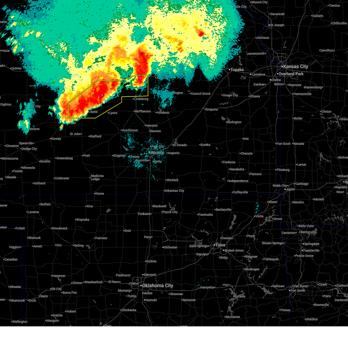 At 230 am cdt, severe thunderstorms were located along a line extending from near new cambria to 5 miles southwest of ellsworth to 5 miles southwest of great bend, moving southeast at 35 mph (radar indicated). Hazards include 70 mph wind gusts. Expect considerable tree damage. damage is likely to mobile homes, roofs, and outbuildings. locations impacted include, salina, great bend, ellsworth, hoisington, ellinwood, wilson, claflin, kanopolis, chase, holyrood, assaria, gypsum, bushton, geneseo, brookville, pawnee rock, smolan, albert, lorraine, and new cambria. this includes the following highways, interstate 135 between mile markers 78 and 95. Interstate 70 between mile markers 207 and 228, and between mile markers 237 and 266. At 230 am cdt, severe thunderstorms were located along a line extending from near new cambria to 5 miles southwest of ellsworth to 5 miles southwest of great bend, moving southeast at 35 mph (radar indicated). Hazards include 70 mph wind gusts. Expect considerable tree damage. damage is likely to mobile homes, roofs, and outbuildings. locations impacted include, salina, great bend, ellsworth, hoisington, ellinwood, wilson, claflin, kanopolis, chase, holyrood, assaria, gypsum, bushton, geneseo, brookville, pawnee rock, smolan, albert, lorraine, and new cambria. this includes the following highways, interstate 135 between mile markers 78 and 95. Interstate 70 between mile markers 207 and 228, and between mile markers 237 and 266.
|
| 6/17/2025 2:30 AM CDT |
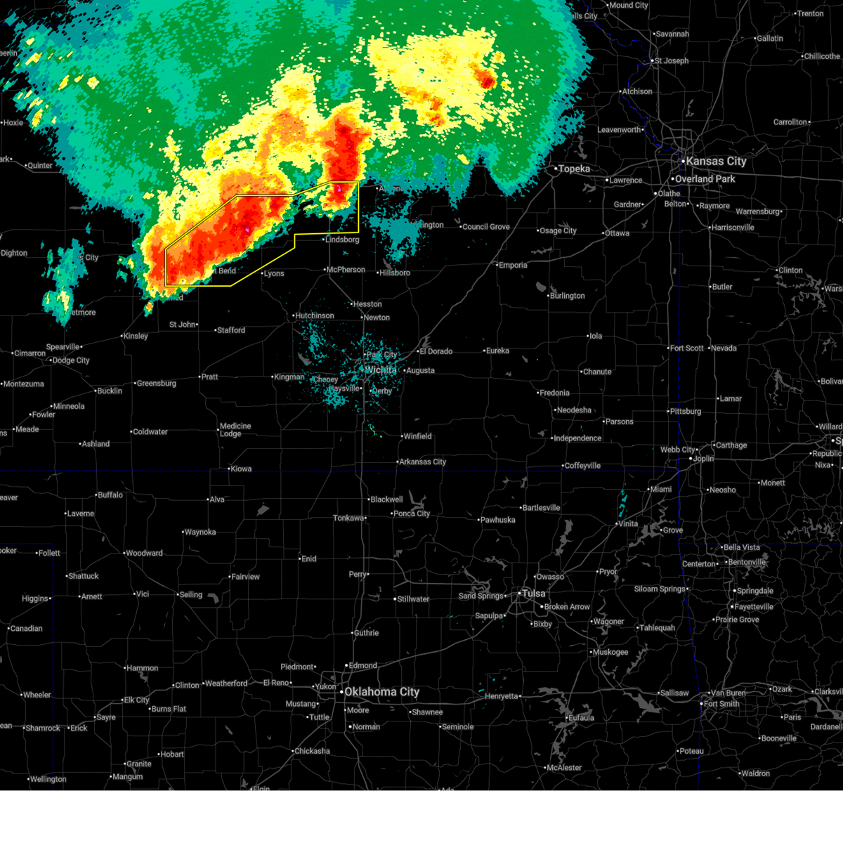 the severe thunderstorm warning has been cancelled and is no longer in effect the severe thunderstorm warning has been cancelled and is no longer in effect
|
| 6/17/2025 2:17 AM CDT |
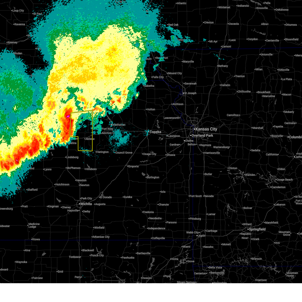 Svrtop the national weather service in topeka has issued a * severe thunderstorm warning for, dickinson county in central kansas, eastern ottawa county in north central kansas, southern clay county in north central kansas, southeastern cloud county in north central kansas, * until 330 am cdt. * at 217 am cdt, severe thunderstorms were located along a line extending from 5 miles south of miltonvale to near new cambria, moving east at 25 mph (radar indicated). Hazards include 70 mph wind gusts and half dollar size hail. Hail damage to vehicles is expected. expect considerable tree damage. Wind damage is also likely to mobile homes, roofs, and outbuildings. Svrtop the national weather service in topeka has issued a * severe thunderstorm warning for, dickinson county in central kansas, eastern ottawa county in north central kansas, southern clay county in north central kansas, southeastern cloud county in north central kansas, * until 330 am cdt. * at 217 am cdt, severe thunderstorms were located along a line extending from 5 miles south of miltonvale to near new cambria, moving east at 25 mph (radar indicated). Hazards include 70 mph wind gusts and half dollar size hail. Hail damage to vehicles is expected. expect considerable tree damage. Wind damage is also likely to mobile homes, roofs, and outbuildings.
|
| 6/17/2025 2:08 AM CDT |
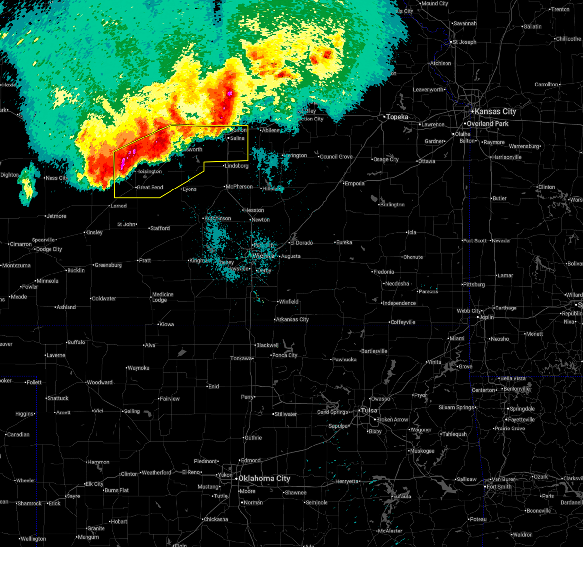 At 208 am cdt, severe thunderstorms were located along a line extending from near tescott to 6 miles south of milberger, moving southeast at 35 mph (radar indicated). Hazards include 70 mph wind gusts. Expect considerable tree damage. damage is likely to mobile homes, roofs, and outbuildings. locations impacted include, salina, great bend, ellsworth, hoisington, ellinwood, wilson, claflin, kanopolis, chase, holyrood, assaria, gypsum, bushton, geneseo, brookville, pawnee rock, smolan, dorrance, albert, and lorraine. this includes the following highways, interstate 135 between mile markers 78 and 95. Interstate 70 between mile markers 197 and 266. At 208 am cdt, severe thunderstorms were located along a line extending from near tescott to 6 miles south of milberger, moving southeast at 35 mph (radar indicated). Hazards include 70 mph wind gusts. Expect considerable tree damage. damage is likely to mobile homes, roofs, and outbuildings. locations impacted include, salina, great bend, ellsworth, hoisington, ellinwood, wilson, claflin, kanopolis, chase, holyrood, assaria, gypsum, bushton, geneseo, brookville, pawnee rock, smolan, dorrance, albert, and lorraine. this includes the following highways, interstate 135 between mile markers 78 and 95. Interstate 70 between mile markers 197 and 266.
|
| 6/17/2025 2:00 AM CDT |
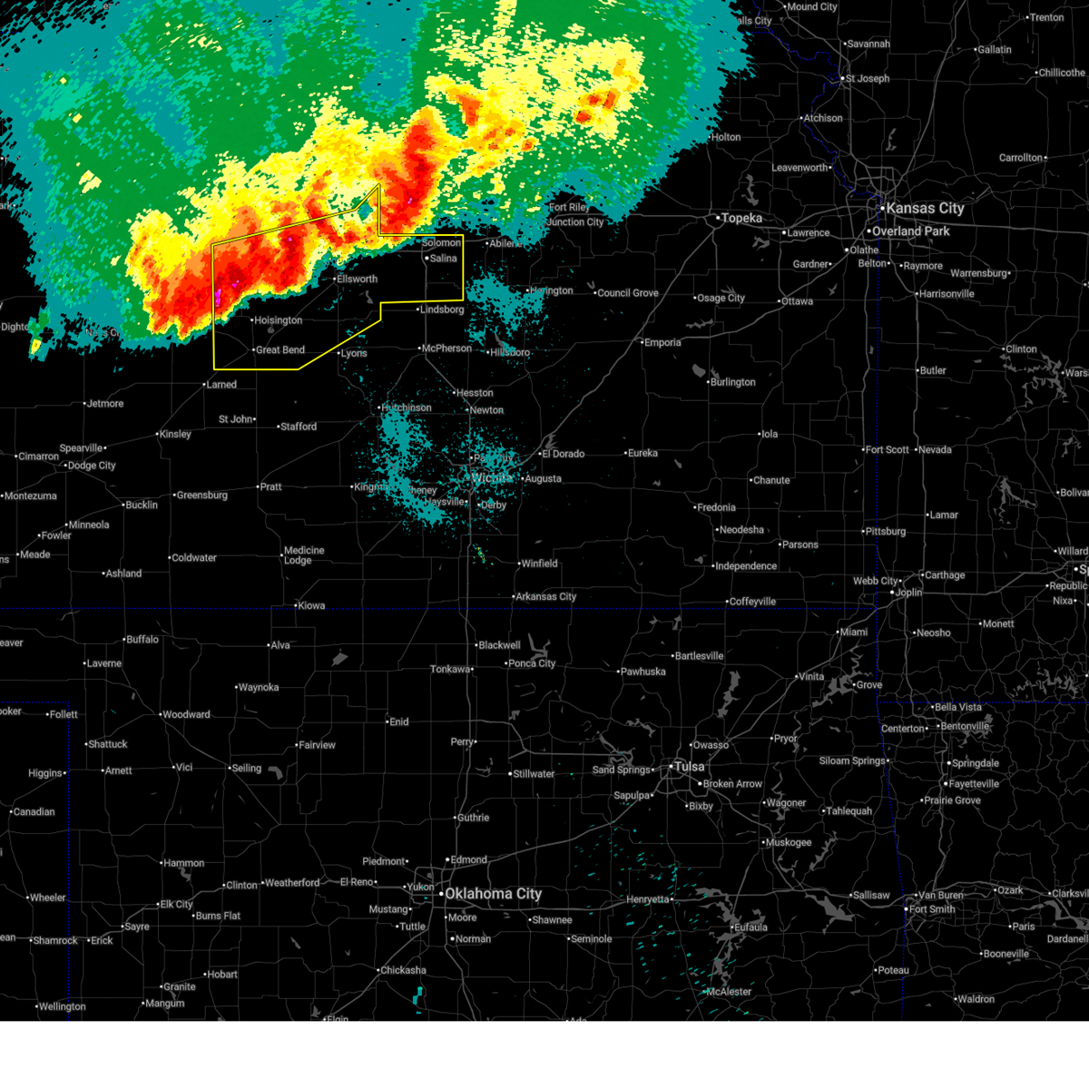 At 200 am cdt, severe thunderstorms were located along a line extending from near beverly to 5 miles southwest of milberger, moving southeast at 30 mph (radar indicated). Hazards include 70 mph wind gusts. Expect considerable tree damage. damage is likely to mobile homes, roofs, and outbuildings. locations impacted include, salina, great bend, russell, ellsworth, hoisington, ellinwood, wilson, claflin, kanopolis, lincoln, chase, holyrood, assaria, gypsum, gorham, bushton, sylvan grove, geneseo, brookville, and pawnee rock. this includes the following highways, interstate 135 between mile markers 78 and 95. Interstate 70 between mile markers 175 and 266. At 200 am cdt, severe thunderstorms were located along a line extending from near beverly to 5 miles southwest of milberger, moving southeast at 30 mph (radar indicated). Hazards include 70 mph wind gusts. Expect considerable tree damage. damage is likely to mobile homes, roofs, and outbuildings. locations impacted include, salina, great bend, russell, ellsworth, hoisington, ellinwood, wilson, claflin, kanopolis, lincoln, chase, holyrood, assaria, gypsum, gorham, bushton, sylvan grove, geneseo, brookville, and pawnee rock. this includes the following highways, interstate 135 between mile markers 78 and 95. Interstate 70 between mile markers 175 and 266.
|
| 6/17/2025 1:41 AM CDT |
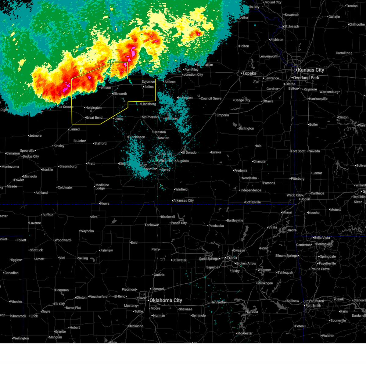 Svrict the national weather service in wichita has issued a * severe thunderstorm warning for, lincoln county in central kansas, northern rice county in central kansas, ellsworth county in central kansas, russell county in central kansas, barton county in central kansas, saline county in central kansas, * until 245 am cdt. * at 140 am cdt, severe thunderstorms were located along a line extending from near tescott to near milberger, moving southeast at 35 mph (several weather stations and trained weather spotter reports). Hazards include 70 mph wind gusts. Expect considerable tree damage. Damage is likely to mobile homes, roofs, and outbuildings. Svrict the national weather service in wichita has issued a * severe thunderstorm warning for, lincoln county in central kansas, northern rice county in central kansas, ellsworth county in central kansas, russell county in central kansas, barton county in central kansas, saline county in central kansas, * until 245 am cdt. * at 140 am cdt, severe thunderstorms were located along a line extending from near tescott to near milberger, moving southeast at 35 mph (several weather stations and trained weather spotter reports). Hazards include 70 mph wind gusts. Expect considerable tree damage. Damage is likely to mobile homes, roofs, and outbuildings.
|
| 5/18/2025 7:19 PM CDT |
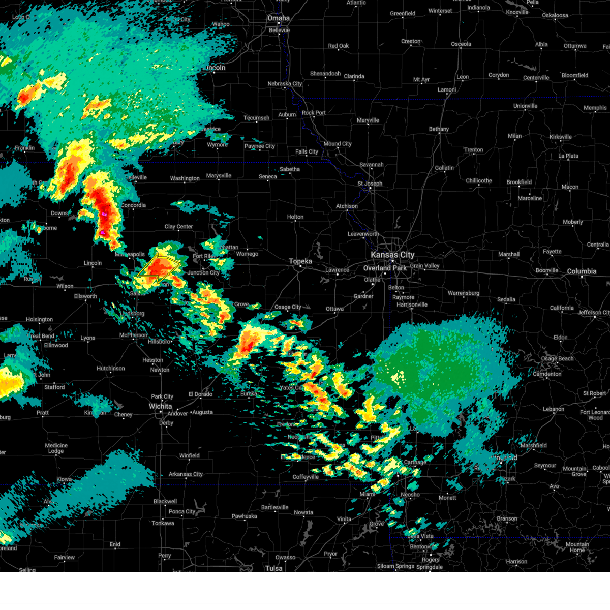 At 718 pm cdt, a severe thunderstorm was located over niles, moving northeast at 20 mph (radar indicated). Hazards include golf ball size hail. People and animals outdoors will be injured. expect damage to roofs, siding, windows, and vehicles. locations impacted include, solomon, manchester, niles, and talmage. This includes interstate 70 between mile markers 267 and 269. At 718 pm cdt, a severe thunderstorm was located over niles, moving northeast at 20 mph (radar indicated). Hazards include golf ball size hail. People and animals outdoors will be injured. expect damage to roofs, siding, windows, and vehicles. locations impacted include, solomon, manchester, niles, and talmage. This includes interstate 70 between mile markers 267 and 269.
|
| 5/18/2025 7:05 PM CDT |
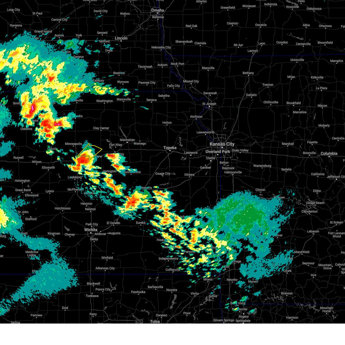 Svrtop the national weather service in topeka has issued a * severe thunderstorm warning for, northwestern dickinson county in central kansas, southeastern ottawa county in north central kansas, * until 730 pm cdt. * at 704 pm cdt, a severe thunderstorm was located near niles, moving northeast at 35 mph (emergency management reported golf ball sized hail in northern salina). Hazards include golf ball size hail. People and animals outdoors will be injured. Expect damage to roofs, siding, windows, and vehicles. Svrtop the national weather service in topeka has issued a * severe thunderstorm warning for, northwestern dickinson county in central kansas, southeastern ottawa county in north central kansas, * until 730 pm cdt. * at 704 pm cdt, a severe thunderstorm was located near niles, moving northeast at 35 mph (emergency management reported golf ball sized hail in northern salina). Hazards include golf ball size hail. People and animals outdoors will be injured. Expect damage to roofs, siding, windows, and vehicles.
|
| 5/18/2025 6:56 PM CDT |
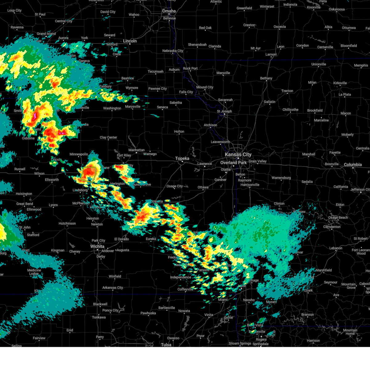 At 656 pm cdt, a severe thunderstorm was located over new cambria, or 7 miles northeast of salina, moving northeast at 30 mph (emergency management). Hazards include golf ball size hail. People and animals outdoors will be injured. expect damage to roofs, siding, windows, and vehicles. locations impacted include, salina, new cambria, kipp, and salina airport. this includes the following highways, interstate 135 between mile markers 88 and 93. Interstate 70 between mile markers 252 and 266. At 656 pm cdt, a severe thunderstorm was located over new cambria, or 7 miles northeast of salina, moving northeast at 30 mph (emergency management). Hazards include golf ball size hail. People and animals outdoors will be injured. expect damage to roofs, siding, windows, and vehicles. locations impacted include, salina, new cambria, kipp, and salina airport. this includes the following highways, interstate 135 between mile markers 88 and 93. Interstate 70 between mile markers 252 and 266.
|
| 5/18/2025 6:42 PM CDT |
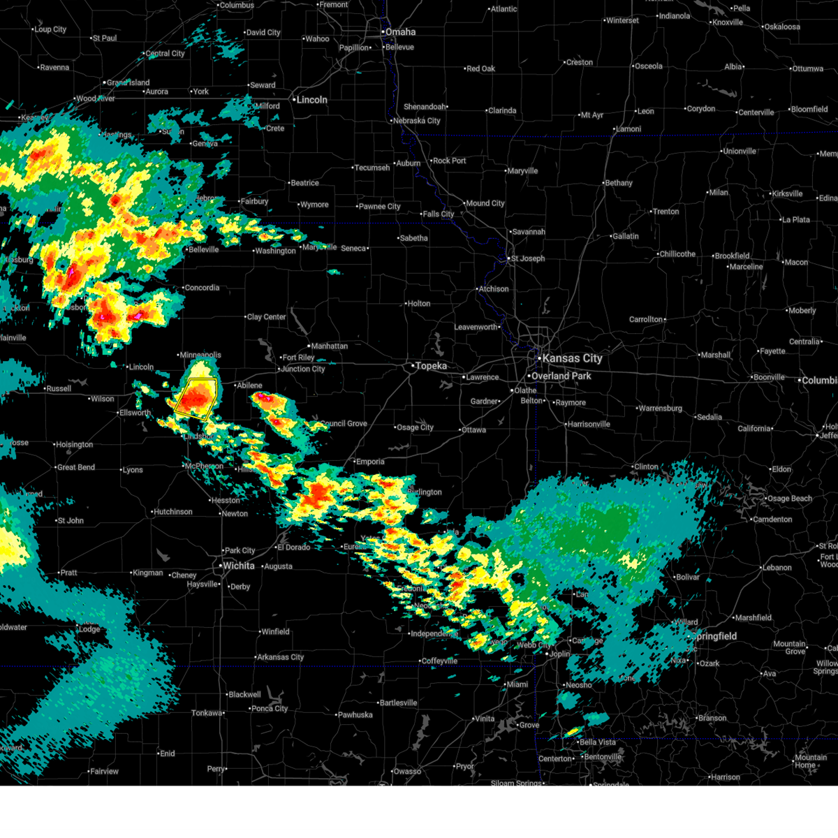 At 642 pm cdt, a severe thunderstorm was located near salina, moving northeast at 50 mph (radar indicated). Hazards include ping pong ball size hail. People and animals outdoors will be injured. expect damage to roofs, siding, windows, and vehicles. locations impacted include, salina, smolan, new cambria, kipp, and salina airport. this includes the following highways, interstate 135 between mile markers 85 and 95. Interstate 70 between mile markers 251 and 266. At 642 pm cdt, a severe thunderstorm was located near salina, moving northeast at 50 mph (radar indicated). Hazards include ping pong ball size hail. People and animals outdoors will be injured. expect damage to roofs, siding, windows, and vehicles. locations impacted include, salina, smolan, new cambria, kipp, and salina airport. this includes the following highways, interstate 135 between mile markers 85 and 95. Interstate 70 between mile markers 251 and 266.
|
| 5/18/2025 6:30 PM CDT |
 the severe thunderstorm warning has been cancelled and is no longer in effect the severe thunderstorm warning has been cancelled and is no longer in effect
|
| 5/18/2025 6:30 PM CDT |
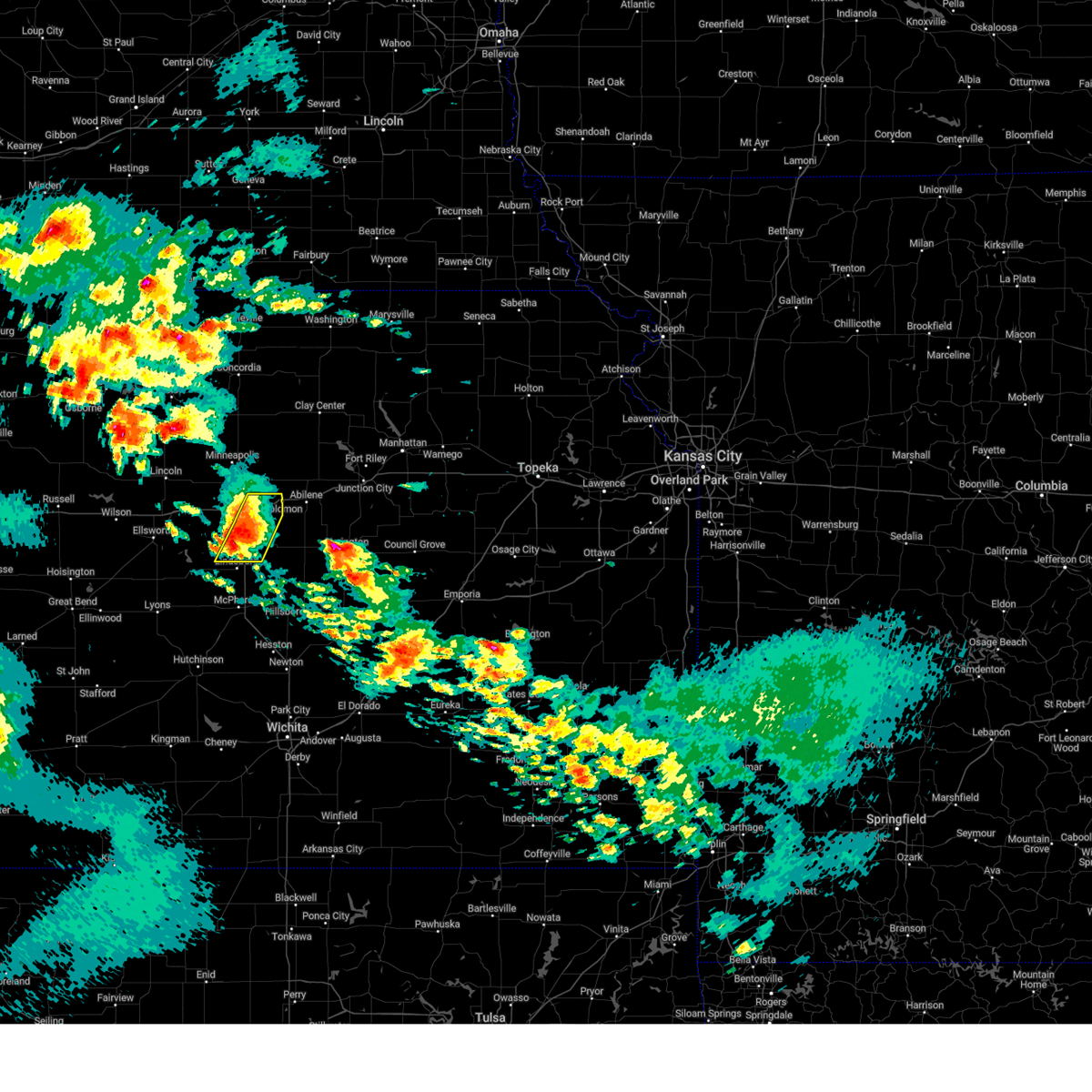 At 629 pm cdt, a severe thunderstorm was located over smolan, or 7 miles southwest of salina, moving northeast at 25 mph (radar indicated). Hazards include two inch hail. People and animals outdoors will be injured. expect damage to roofs, siding, windows, and vehicles. locations impacted include, salina, assaria, smolan, new cambria, falun, bridgeport, salina airport, and kipp. this includes the following highways, interstate 135 between mile markers 77 and 95. Interstate 70 between mile markers 251 and 266. At 629 pm cdt, a severe thunderstorm was located over smolan, or 7 miles southwest of salina, moving northeast at 25 mph (radar indicated). Hazards include two inch hail. People and animals outdoors will be injured. expect damage to roofs, siding, windows, and vehicles. locations impacted include, salina, assaria, smolan, new cambria, falun, bridgeport, salina airport, and kipp. this includes the following highways, interstate 135 between mile markers 77 and 95. Interstate 70 between mile markers 251 and 266.
|
| 5/18/2025 6:11 PM CDT |
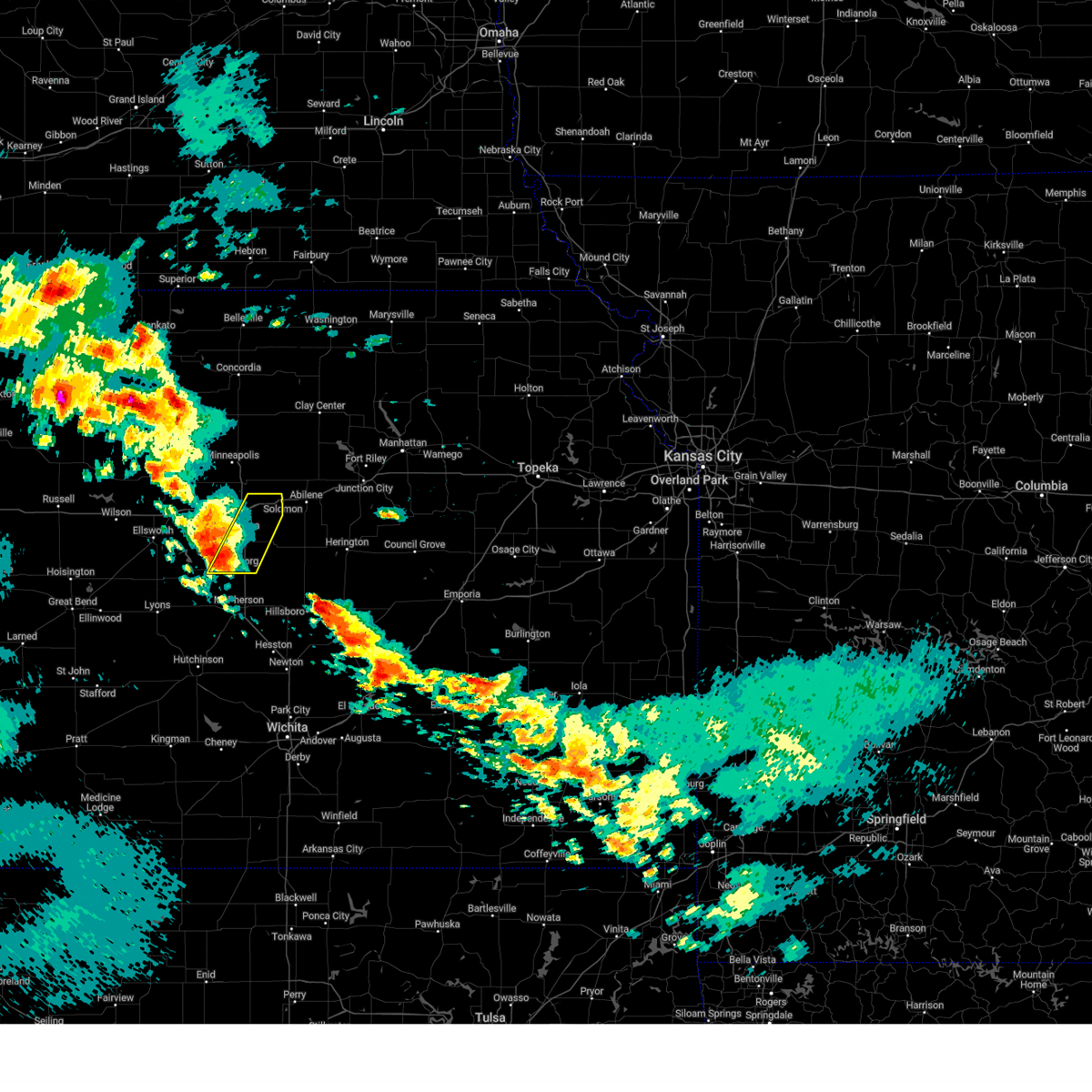 Svrict the national weather service in wichita has issued a * severe thunderstorm warning for, northwestern mcpherson county in central kansas, central saline county in central kansas, * until 715 pm cdt. * at 611 pm cdt, a severe thunderstorm was located 6 miles southwest of smolan, or 9 miles northwest of lindsborg, moving northeast at 50 mph (radar indicated). Hazards include golf ball size hail. People and animals outdoors will be injured. Expect damage to roofs, siding, windows, and vehicles. Svrict the national weather service in wichita has issued a * severe thunderstorm warning for, northwestern mcpherson county in central kansas, central saline county in central kansas, * until 715 pm cdt. * at 611 pm cdt, a severe thunderstorm was located 6 miles southwest of smolan, or 9 miles northwest of lindsborg, moving northeast at 50 mph (radar indicated). Hazards include golf ball size hail. People and animals outdoors will be injured. Expect damage to roofs, siding, windows, and vehicles.
|
| 4/28/2025 7:43 PM CDT |
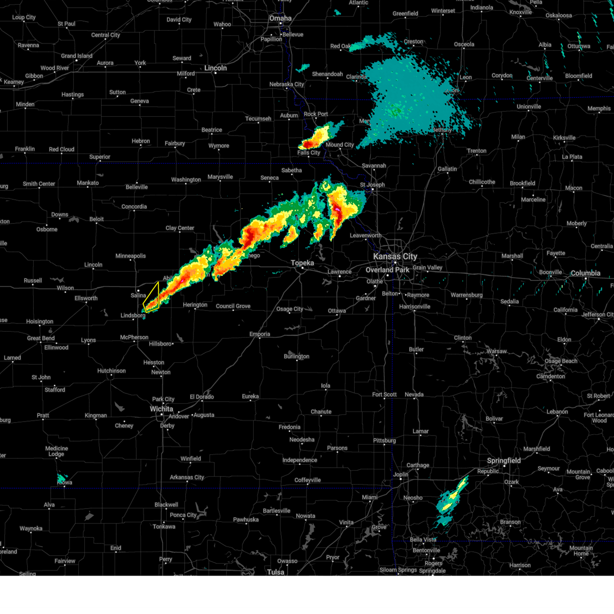 The storm which prompted the warning has weakened below severe limits, and will exit the warned area. therefore, the warning will be allowed to expire. The storm which prompted the warning has weakened below severe limits, and will exit the warned area. therefore, the warning will be allowed to expire.
|
| 4/28/2025 7:07 PM CDT |
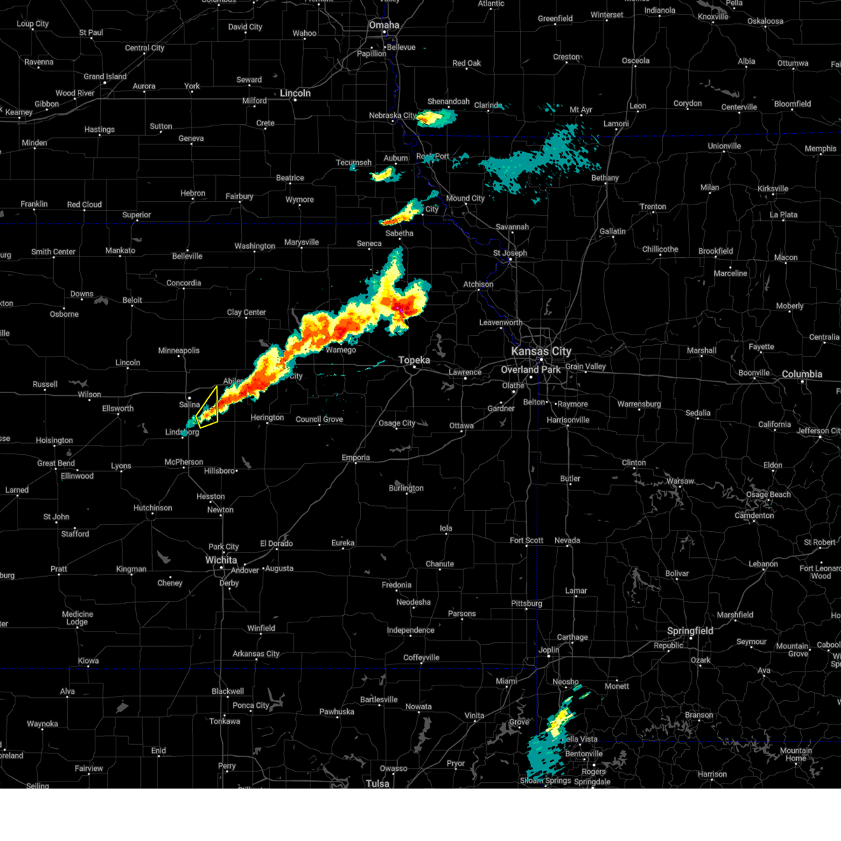 Svrict the national weather service in wichita has issued a * severe thunderstorm warning for, southeastern saline county in central kansas, * until 745 pm cdt. * at 707 pm cdt, a severe thunderstorm was located 6 miles northeast of gypsum, or 12 miles southwest of abilene, moving northeast at 35 mph (radar indicated). Hazards include 60 mph wind gusts and half dollar size hail. Hail damage to vehicles is expected. Expect wind damage to roofs, siding, and trees. Svrict the national weather service in wichita has issued a * severe thunderstorm warning for, southeastern saline county in central kansas, * until 745 pm cdt. * at 707 pm cdt, a severe thunderstorm was located 6 miles northeast of gypsum, or 12 miles southwest of abilene, moving northeast at 35 mph (radar indicated). Hazards include 60 mph wind gusts and half dollar size hail. Hail damage to vehicles is expected. Expect wind damage to roofs, siding, and trees.
|
| 4/28/2025 5:34 PM CDT |
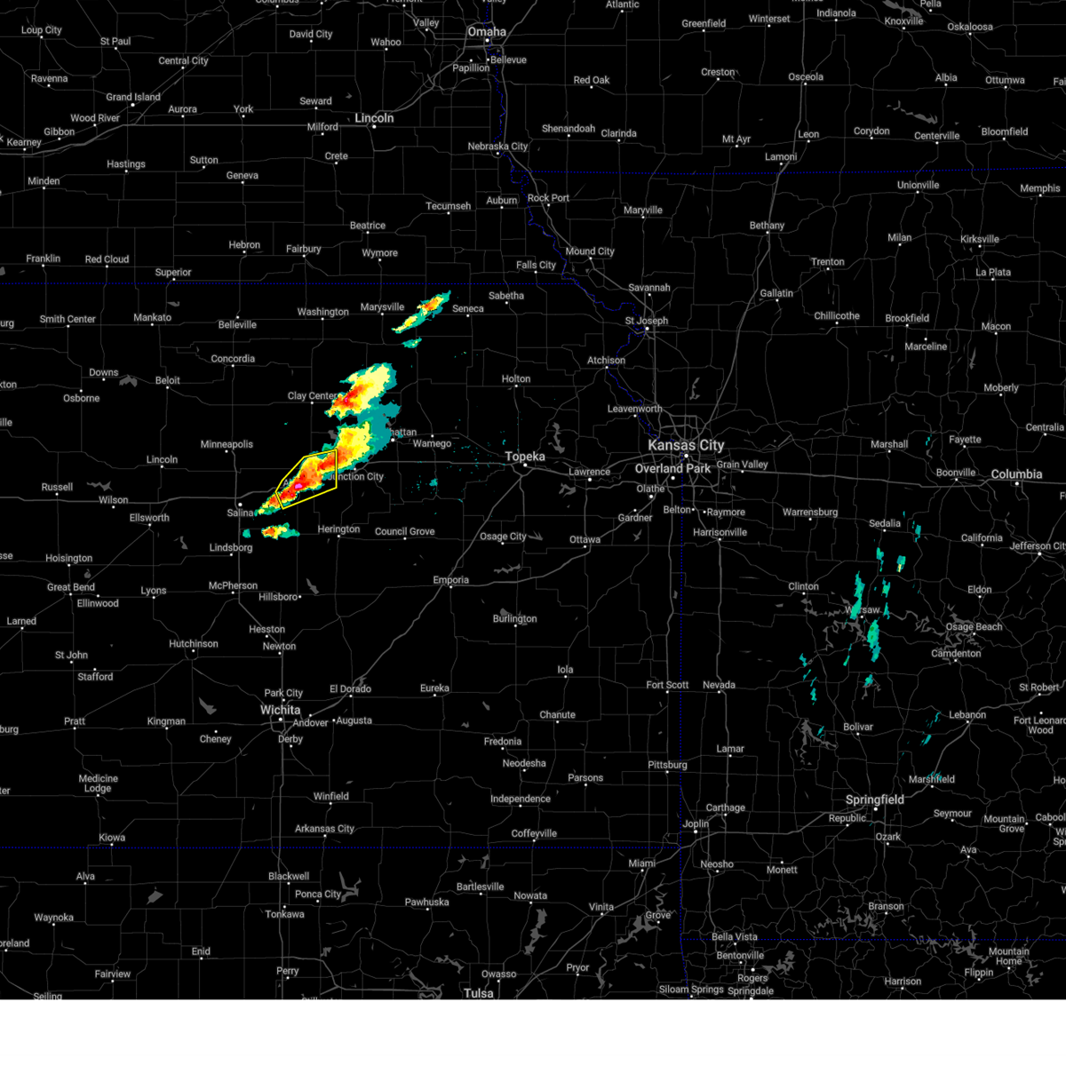 At 534 pm cdt, a severe thunderstorm was located near abilene, moving northeast at 40 mph (trained weather spotters). Hazards include two inch hail and 60 mph wind gusts. People and animals outdoors will be injured. expect hail damage to roofs, siding, windows, and vehicles. expect wind damage to roofs, siding, and trees. locations impacted include, enterprise, abilene, chapman, moonlight, and talmage. This includes interstate 70 between mile markers 268 and 289. At 534 pm cdt, a severe thunderstorm was located near abilene, moving northeast at 40 mph (trained weather spotters). Hazards include two inch hail and 60 mph wind gusts. People and animals outdoors will be injured. expect hail damage to roofs, siding, windows, and vehicles. expect wind damage to roofs, siding, and trees. locations impacted include, enterprise, abilene, chapman, moonlight, and talmage. This includes interstate 70 between mile markers 268 and 289.
|
| 4/28/2025 5:29 PM CDT |
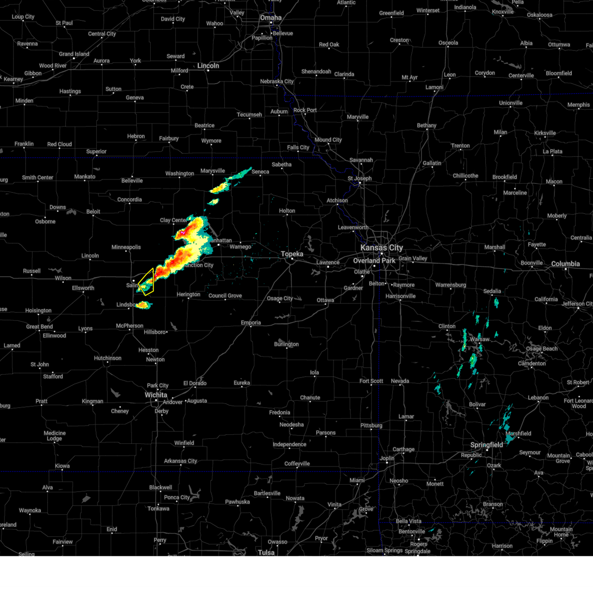 The storm which prompted the warning has moved out of the area. therefore, the warning will be allowed to expire. The storm which prompted the warning has moved out of the area. therefore, the warning will be allowed to expire.
|
| 4/28/2025 5:24 PM CDT |
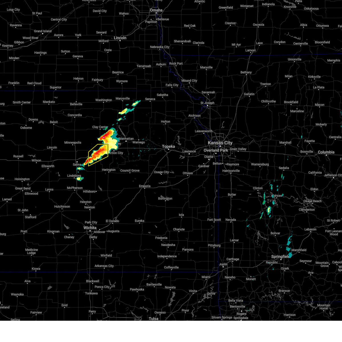 Svrtop the national weather service in topeka has issued a * severe thunderstorm warning for, northern dickinson county in central kansas, * until 600 pm cdt. * at 522 pm cdt, a severe thunderstorm was located 5 miles southeast of new cambria, moving northeast at 30 mph (trained weather spotters. at 5:15 pm cdt, spotters reported hail up to 2 inches in diameter 3 east of new cambria). Hazards include two inch hail and 60 mph wind gusts. People and animals outdoors will be injured. expect hail damage to roofs, siding, windows, and vehicles. Expect wind damage to roofs, siding, and trees. Svrtop the national weather service in topeka has issued a * severe thunderstorm warning for, northern dickinson county in central kansas, * until 600 pm cdt. * at 522 pm cdt, a severe thunderstorm was located 5 miles southeast of new cambria, moving northeast at 30 mph (trained weather spotters. at 5:15 pm cdt, spotters reported hail up to 2 inches in diameter 3 east of new cambria). Hazards include two inch hail and 60 mph wind gusts. People and animals outdoors will be injured. expect hail damage to roofs, siding, windows, and vehicles. Expect wind damage to roofs, siding, and trees.
|
| 4/28/2025 5:20 PM CDT |
 At 519 pm cdt, a severe thunderstorm was located near new cambria, or 8 miles east of salina, moving northeast at 25 mph (radar indicated). Hazards include 60 mph wind gusts and half dollar size hail. Hail damage to vehicles is expected. expect wind damage to roofs, siding, and trees. Locations impacted include, kipp. At 519 pm cdt, a severe thunderstorm was located near new cambria, or 8 miles east of salina, moving northeast at 25 mph (radar indicated). Hazards include 60 mph wind gusts and half dollar size hail. Hail damage to vehicles is expected. expect wind damage to roofs, siding, and trees. Locations impacted include, kipp.
|
| 4/28/2025 5:15 PM CDT |
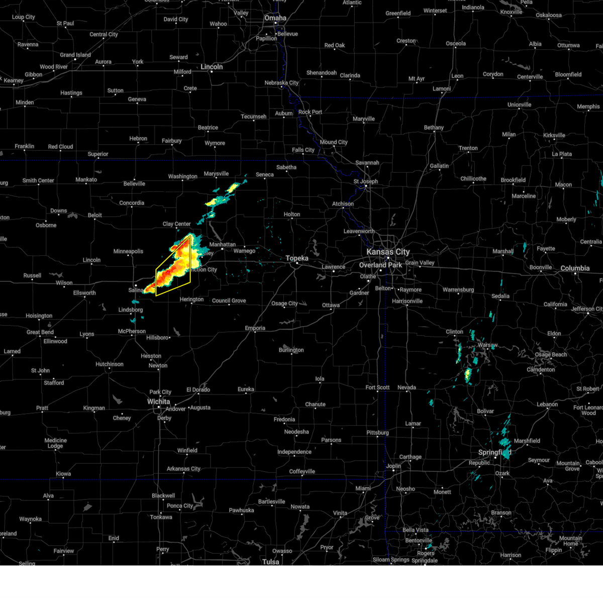 At 515 pm cdt, a severe thunderstorm was located over abilene, moving northeast at 30 mph (trained weather spotters). Hazards include ping pong ball size hail and 60 mph wind gusts. People and animals outdoors will be injured. expect hail damage to roofs, siding, windows, and vehicles. expect wind damage to roofs, siding, and trees. locations impacted include, wakefield, abilene, chapman, moonlight, talmage, solomon, and enterprise. This includes interstate 70 between mile markers 267 and 289. At 515 pm cdt, a severe thunderstorm was located over abilene, moving northeast at 30 mph (trained weather spotters). Hazards include ping pong ball size hail and 60 mph wind gusts. People and animals outdoors will be injured. expect hail damage to roofs, siding, windows, and vehicles. expect wind damage to roofs, siding, and trees. locations impacted include, wakefield, abilene, chapman, moonlight, talmage, solomon, and enterprise. This includes interstate 70 between mile markers 267 and 289.
|
| 4/28/2025 5:09 PM CDT |
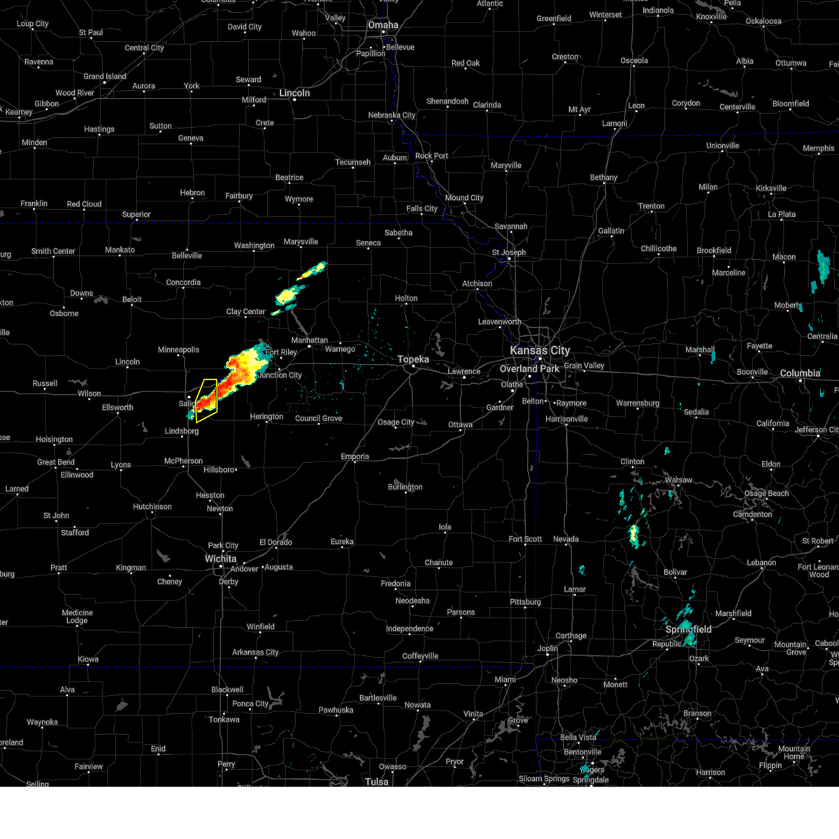 At 508 pm cdt, a severe thunderstorm was located just southeast of salina, moving northeast at 35 mph (radar indicated). Hazards include 60 mph wind gusts and half dollar size hail. Hail damage to vehicles is expected. expect wind damage to roofs, siding, and trees. Locations impacted include, new cambria and kipp. At 508 pm cdt, a severe thunderstorm was located just southeast of salina, moving northeast at 35 mph (radar indicated). Hazards include 60 mph wind gusts and half dollar size hail. Hail damage to vehicles is expected. expect wind damage to roofs, siding, and trees. Locations impacted include, new cambria and kipp.
|
| 4/28/2025 4:59 PM CDT |
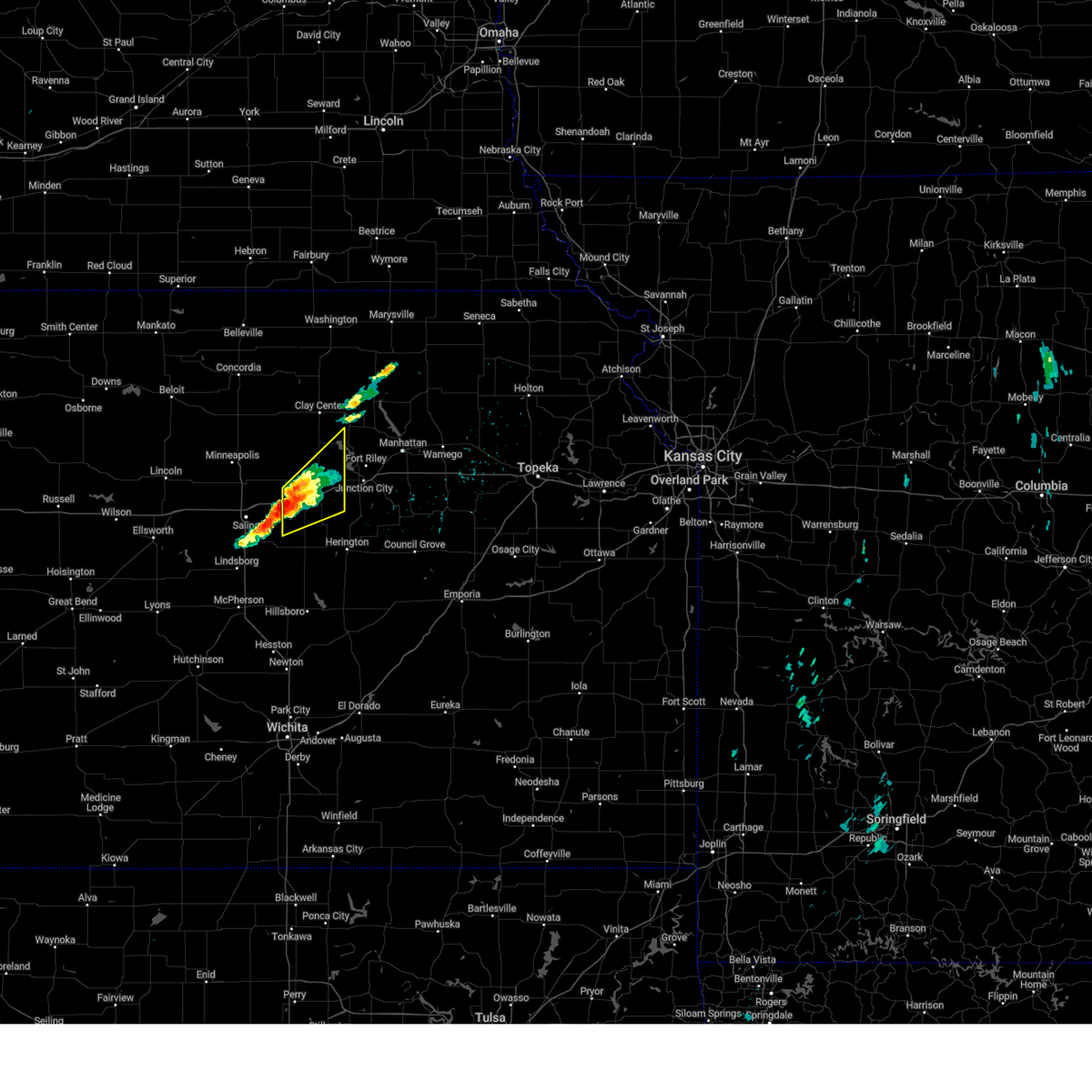 At 458 pm cdt, a severe thunderstorm was located near solomon, moving northeast at 35 mph (trained weather spotters. at 4:55 pm cdt, a spotter in solomon reported hail up to the size of ping pong balls). Hazards include ping pong ball size hail and 60 mph wind gusts. People and animals outdoors will be injured. expect hail damage to roofs, siding, windows, and vehicles. expect wind damage to roofs, siding, and trees. locations impacted include, wakefield, abilene, chapman, moonlight, talmage, solomon, and enterprise. This includes interstate 70 between mile markers 267 and 289. At 458 pm cdt, a severe thunderstorm was located near solomon, moving northeast at 35 mph (trained weather spotters. at 4:55 pm cdt, a spotter in solomon reported hail up to the size of ping pong balls). Hazards include ping pong ball size hail and 60 mph wind gusts. People and animals outdoors will be injured. expect hail damage to roofs, siding, windows, and vehicles. expect wind damage to roofs, siding, and trees. locations impacted include, wakefield, abilene, chapman, moonlight, talmage, solomon, and enterprise. This includes interstate 70 between mile markers 267 and 289.
|
| 4/28/2025 4:56 PM CDT | Ping Pong Ball sized hail reported 0.7 miles W of Solomon, KS |
| 4/28/2025 4:50 PM CDT |
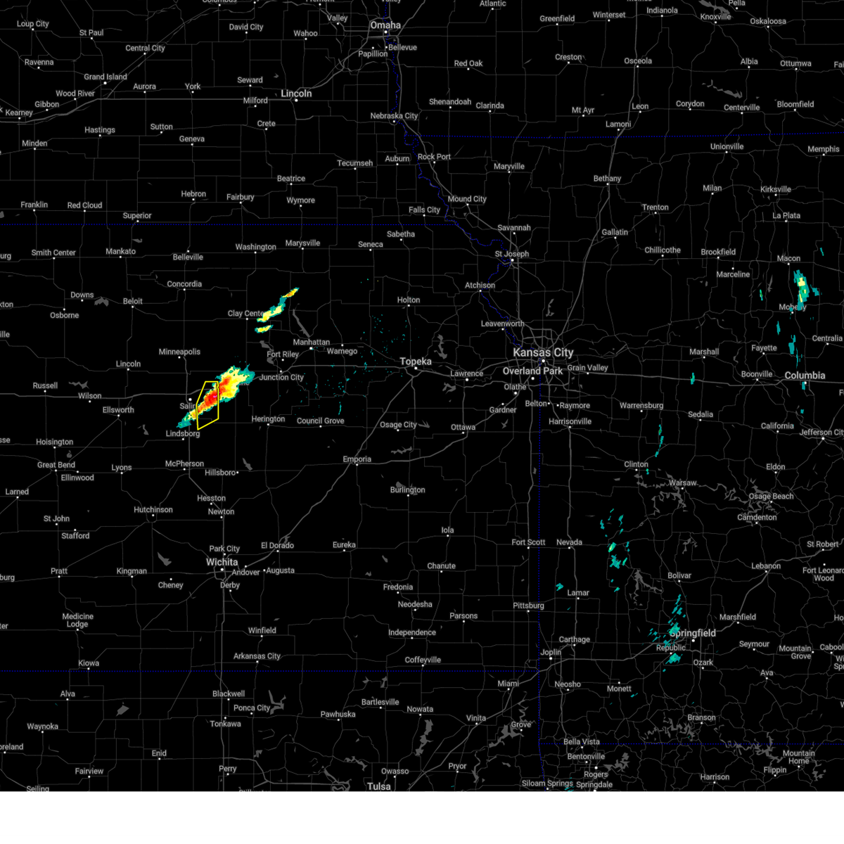 Svrict the national weather service in wichita has issued a * severe thunderstorm warning for, eastern saline county in central kansas, * until 530 pm cdt. * at 450 pm cdt, a severe thunderstorm was located near new cambria, or 9 miles east of salina, moving northeast at 25 mph (radar indicated). Hazards include 60 mph wind gusts and half dollar size hail. Hail damage to vehicles is expected. Expect wind damage to roofs, siding, and trees. Svrict the national weather service in wichita has issued a * severe thunderstorm warning for, eastern saline county in central kansas, * until 530 pm cdt. * at 450 pm cdt, a severe thunderstorm was located near new cambria, or 9 miles east of salina, moving northeast at 25 mph (radar indicated). Hazards include 60 mph wind gusts and half dollar size hail. Hail damage to vehicles is expected. Expect wind damage to roofs, siding, and trees.
|
| 4/28/2025 4:46 PM CDT |
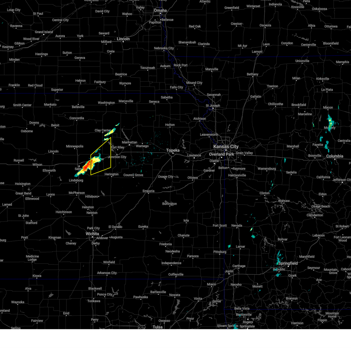 Svrtop the national weather service in topeka has issued a * severe thunderstorm warning for, dickinson county in central kansas, southeastern clay county in north central kansas, * until 530 pm cdt. * at 446 pm cdt, a severe thunderstorm was located 4 miles south of solomon, moving northeast at 50 mph (radar indicated). Hazards include ping pong ball size hail and 60 mph wind gusts. People and animals outdoors will be injured. expect hail damage to roofs, siding, windows, and vehicles. Expect wind damage to roofs, siding, and trees. Svrtop the national weather service in topeka has issued a * severe thunderstorm warning for, dickinson county in central kansas, southeastern clay county in north central kansas, * until 530 pm cdt. * at 446 pm cdt, a severe thunderstorm was located 4 miles south of solomon, moving northeast at 50 mph (radar indicated). Hazards include ping pong ball size hail and 60 mph wind gusts. People and animals outdoors will be injured. expect hail damage to roofs, siding, windows, and vehicles. Expect wind damage to roofs, siding, and trees.
|
| 4/22/2025 11:33 PM CDT |
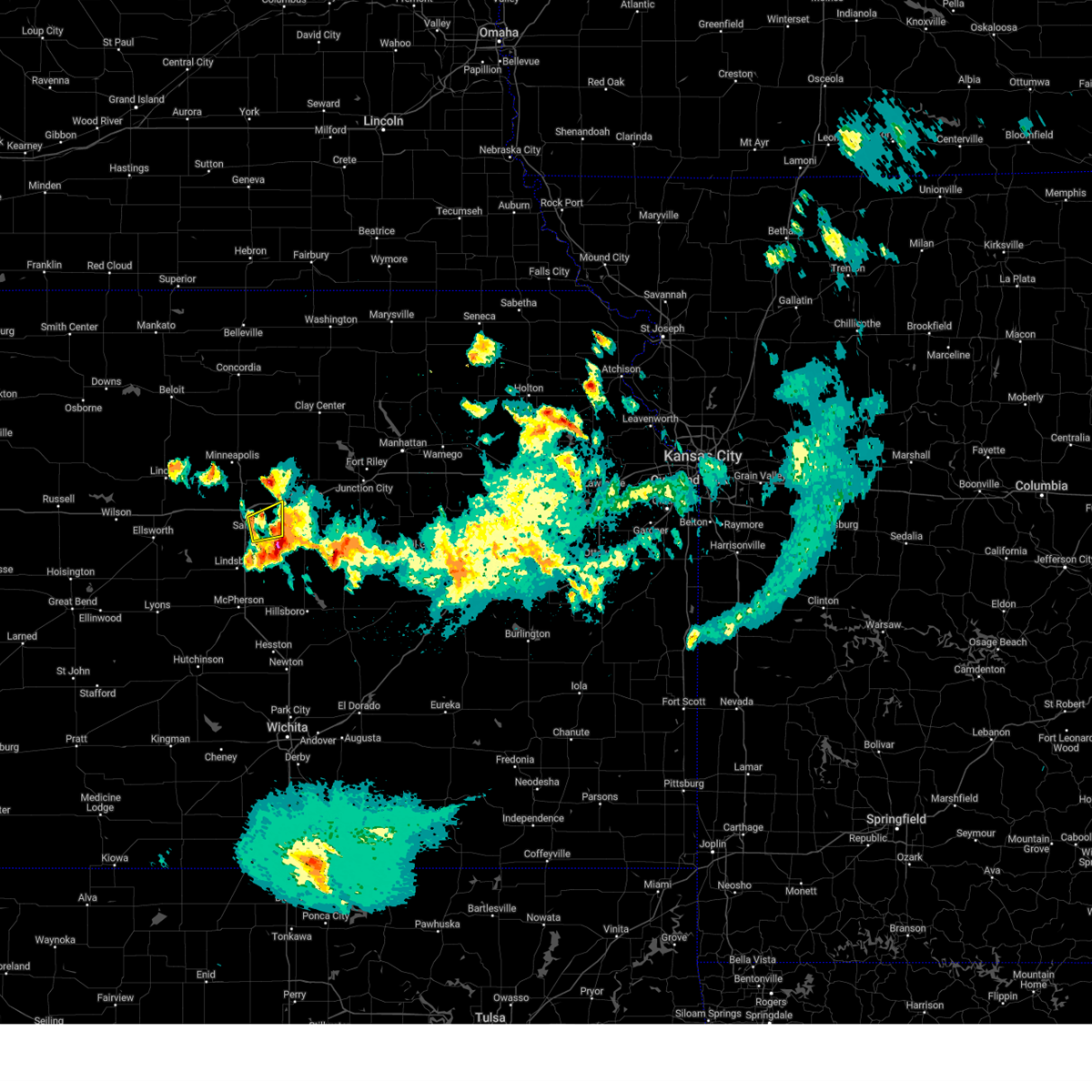 the severe thunderstorm warning has been cancelled and is no longer in effect the severe thunderstorm warning has been cancelled and is no longer in effect
|
| 4/22/2025 11:22 PM CDT |
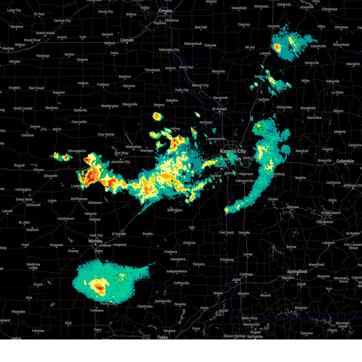 At 1121 pm cdt, a severe thunderstorm was located near new cambria, or 10 miles east of salina, moving east at 20 mph (radar indicated). Hazards include quarter size hail. Damage to vehicles is expected. Locations impacted include, kipp and salina. At 1121 pm cdt, a severe thunderstorm was located near new cambria, or 10 miles east of salina, moving east at 20 mph (radar indicated). Hazards include quarter size hail. Damage to vehicles is expected. Locations impacted include, kipp and salina.
|
| 4/22/2025 11:02 PM CDT |
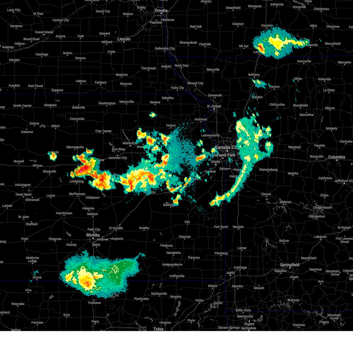 Svrict the national weather service in wichita has issued a * severe thunderstorm warning for, east central saline county in central kansas, * until midnight cdt. * at 1101 pm cdt, a severe thunderstorm was located near salina, moving east at 20 mph (radar indicated). Hazards include quarter size hail. damage to vehicles is expected Svrict the national weather service in wichita has issued a * severe thunderstorm warning for, east central saline county in central kansas, * until midnight cdt. * at 1101 pm cdt, a severe thunderstorm was located near salina, moving east at 20 mph (radar indicated). Hazards include quarter size hail. damage to vehicles is expected
|
| 4/22/2025 10:53 PM CDT |
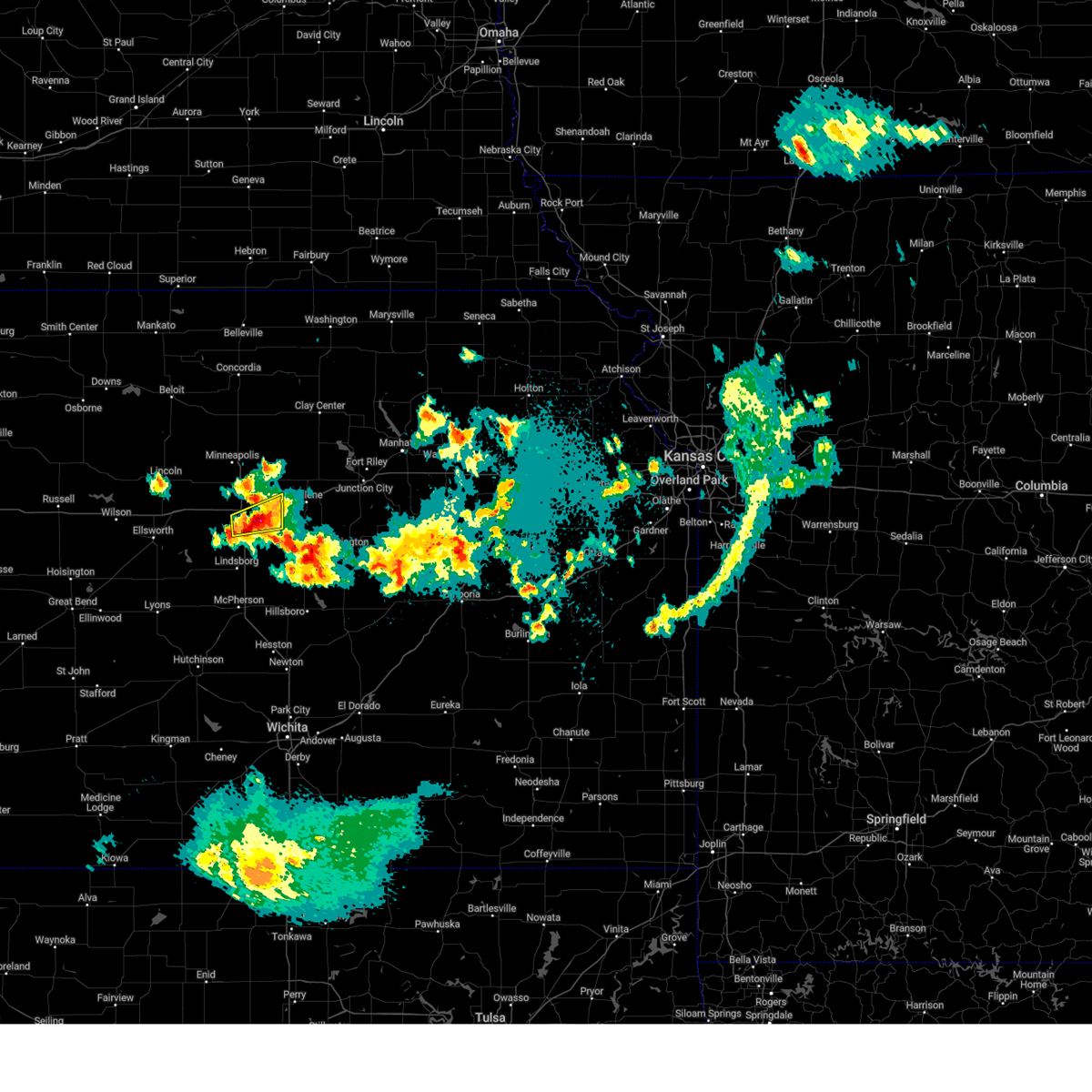 At 1052 pm cdt, a severe thunderstorm was located near salina, moving east at 15 mph (public reported ping pong ball size hail in southern salina at 1050 pm). Hazards include ping pong ball size hail. People and animals outdoors will be injured. expect damage to roofs, siding, windows, and vehicles. Locations impacted include, new cambria, kipp, salina airport, and salina. At 1052 pm cdt, a severe thunderstorm was located near salina, moving east at 15 mph (public reported ping pong ball size hail in southern salina at 1050 pm). Hazards include ping pong ball size hail. People and animals outdoors will be injured. expect damage to roofs, siding, windows, and vehicles. Locations impacted include, new cambria, kipp, salina airport, and salina.
|
| 4/22/2025 10:46 PM CDT |
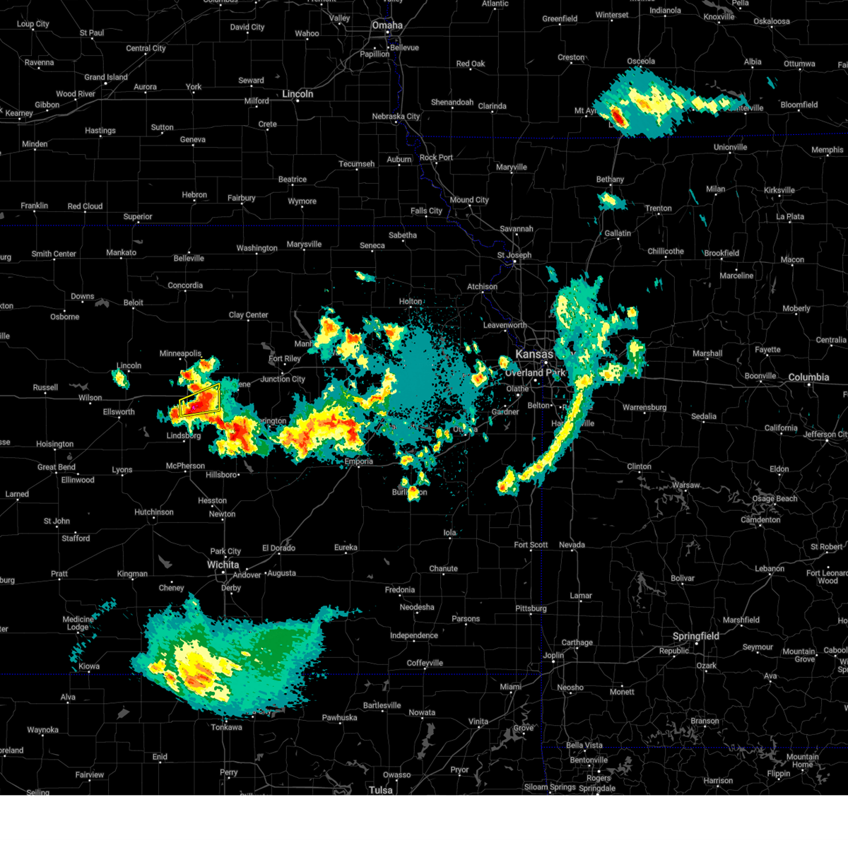 At 1046 pm cdt, a severe thunderstorm was located near salina, moving east at 15 mph (public reported half dollar size hail near the salina airport at 1042 pm). Hazards include ping pong ball size hail. People and animals outdoors will be injured. expect damage to roofs, siding, windows, and vehicles. Locations impacted include, new cambria, kipp, salina airport, and salina. At 1046 pm cdt, a severe thunderstorm was located near salina, moving east at 15 mph (public reported half dollar size hail near the salina airport at 1042 pm). Hazards include ping pong ball size hail. People and animals outdoors will be injured. expect damage to roofs, siding, windows, and vehicles. Locations impacted include, new cambria, kipp, salina airport, and salina.
|
| 4/22/2025 10:44 PM CDT |
 At 1044 pm cdt, a severe thunderstorm was located over salina, moving east at 15 mph (public reported quarter size hail on the south portion of salina at 1038 pm). Hazards include half dollar size hail. Damage to vehicles is expected. Locations impacted include, new cambria, kipp, salina airport, and salina. At 1044 pm cdt, a severe thunderstorm was located over salina, moving east at 15 mph (public reported quarter size hail on the south portion of salina at 1038 pm). Hazards include half dollar size hail. Damage to vehicles is expected. Locations impacted include, new cambria, kipp, salina airport, and salina.
|
| 4/22/2025 10:34 PM CDT |
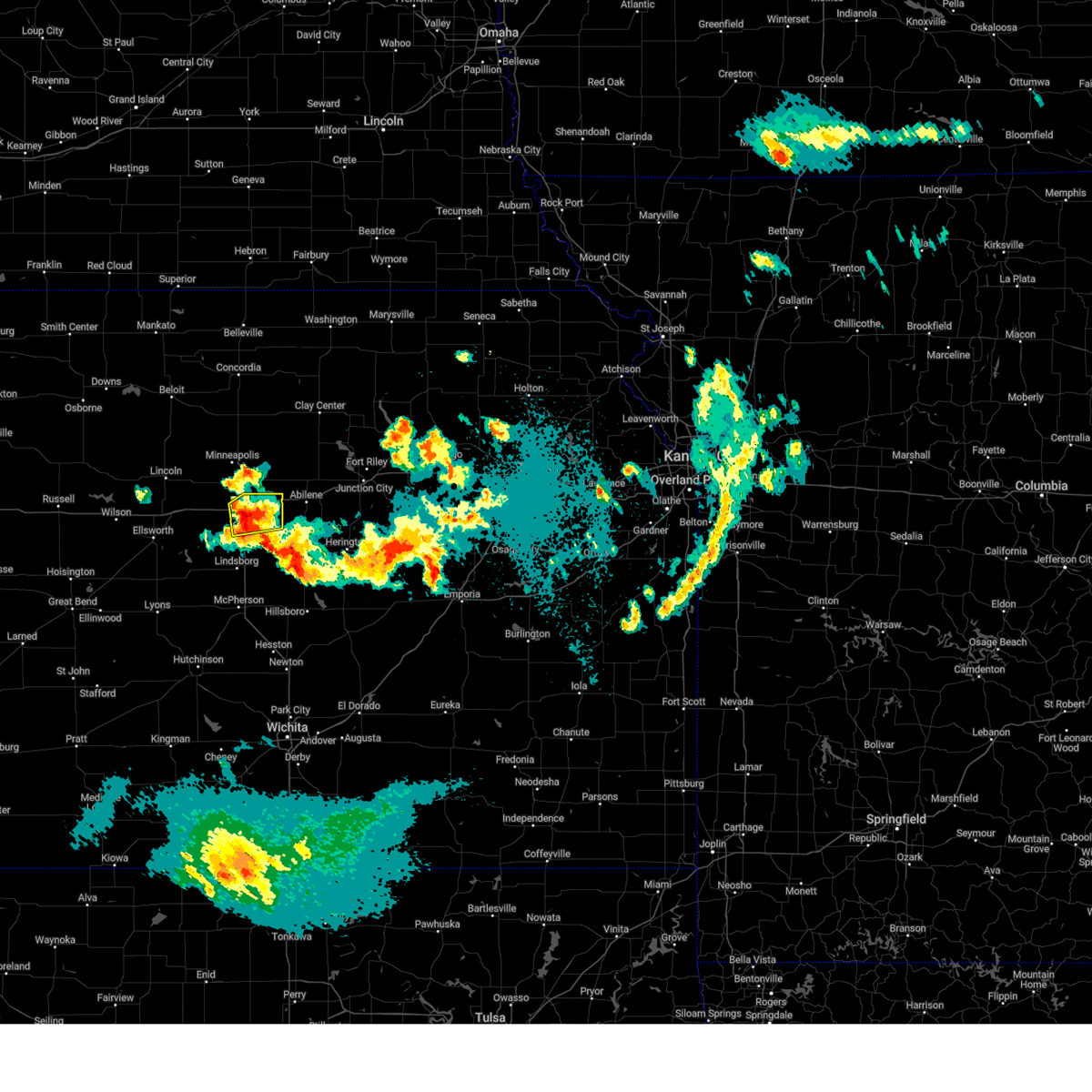 At 1034 pm cdt, a severe thunderstorm was located over salina, moving east at 20 mph (radar indicated). Hazards include quarter size hail. Damage to vehicles is expected. Locations impacted include, new cambria, kipp, salina airport, and salina. At 1034 pm cdt, a severe thunderstorm was located over salina, moving east at 20 mph (radar indicated). Hazards include quarter size hail. Damage to vehicles is expected. Locations impacted include, new cambria, kipp, salina airport, and salina.
|
| 4/22/2025 10:19 PM CDT |
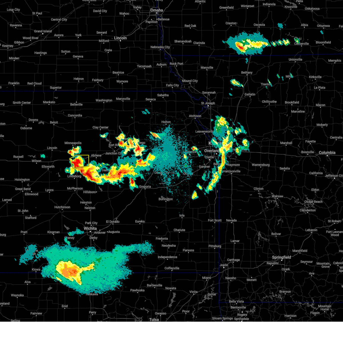 At 1019 pm cdt, a severe thunderstorm was located over salina, moving east at 25 mph (radar indicated). Hazards include quarter size hail. Damage to vehicles is expected. Locations impacted include, new cambria, kipp, salina airport, and salina. At 1019 pm cdt, a severe thunderstorm was located over salina, moving east at 25 mph (radar indicated). Hazards include quarter size hail. Damage to vehicles is expected. Locations impacted include, new cambria, kipp, salina airport, and salina.
|
| 4/22/2025 9:58 PM CDT |
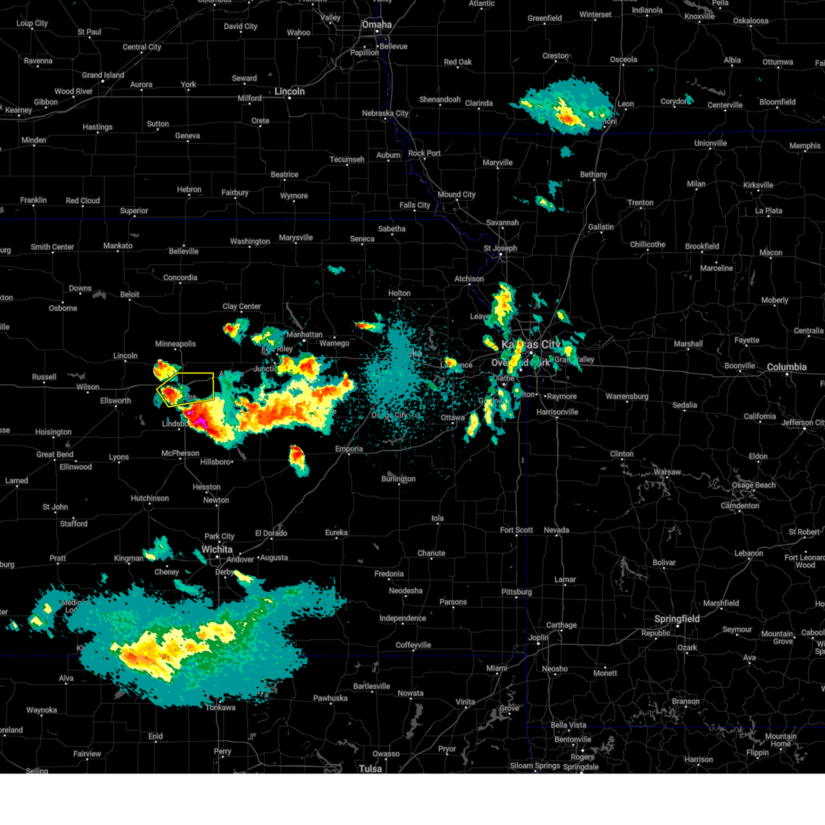 Svrict the national weather service in wichita has issued a * severe thunderstorm warning for, northern saline county in central kansas, * until 1100 pm cdt. * at 958 pm cdt, a severe thunderstorm was located 6 miles northeast of brookville, or 7 miles west of salina, moving east at 25 mph (radar indicated). Hazards include 60 mph wind gusts and half dollar size hail. Hail damage to vehicles is expected. Expect wind damage to roofs, siding, and trees. Svrict the national weather service in wichita has issued a * severe thunderstorm warning for, northern saline county in central kansas, * until 1100 pm cdt. * at 958 pm cdt, a severe thunderstorm was located 6 miles northeast of brookville, or 7 miles west of salina, moving east at 25 mph (radar indicated). Hazards include 60 mph wind gusts and half dollar size hail. Hail damage to vehicles is expected. Expect wind damage to roofs, siding, and trees.
|
| 4/22/2025 9:07 PM CDT |
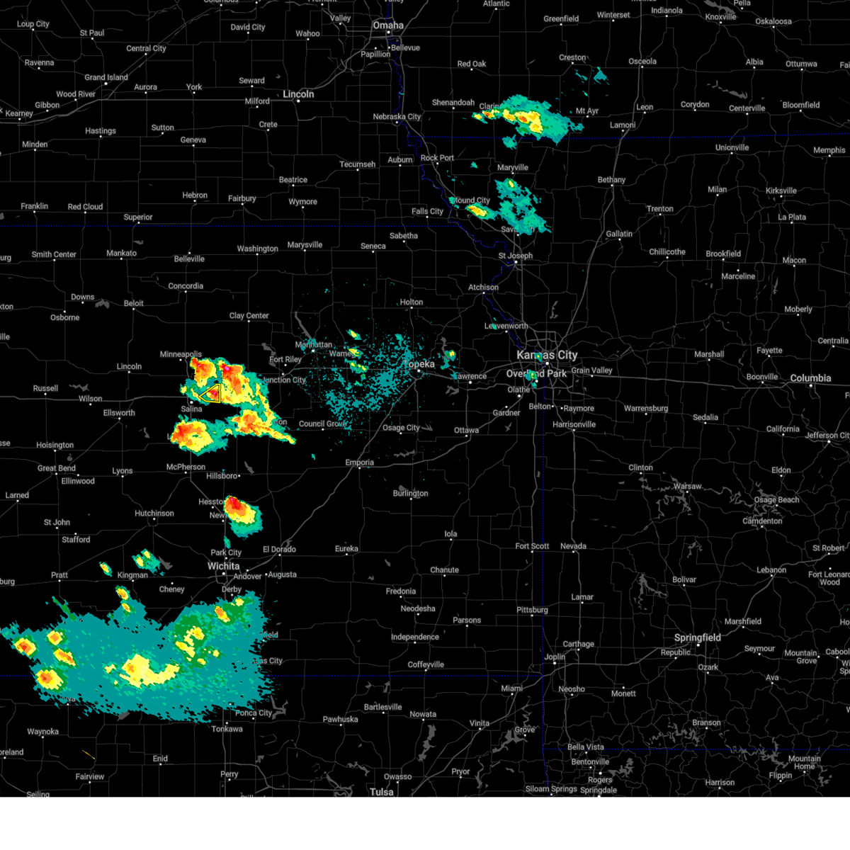 The storm which prompted the warning has weakened below severe limits, and no longer poses an immediate threat to life or property. therefore, the warning will be allowed to expire. however, small hail is still possible with this thunderstorm. a severe thunderstorm watch remains in effect until 100 am cdt for central kansas. to report severe weather, contact your nearest law enforcement agency. they will relay your report to the national weather service wichita. The storm which prompted the warning has weakened below severe limits, and no longer poses an immediate threat to life or property. therefore, the warning will be allowed to expire. however, small hail is still possible with this thunderstorm. a severe thunderstorm watch remains in effect until 100 am cdt for central kansas. to report severe weather, contact your nearest law enforcement agency. they will relay your report to the national weather service wichita.
|
| 4/22/2025 9:04 PM CDT |
 At 903 pm cdt, a severe thunderstorm was located over manchester, moving northeast at 25 mph. a second severe thunderstorm was located 7 miles west of solomon, moving to the northeast at 20 mph (radar indicated). Hazards include 60 mph wind gusts and quarter size hail. Hail damage to vehicles is expected. expect wind damage to roofs, siding, and trees. locations impacted include, solomon, manchester, abilene, niles, moonlight, and talmage. This includes interstate 70 between mile markers 267 and 277. At 903 pm cdt, a severe thunderstorm was located over manchester, moving northeast at 25 mph. a second severe thunderstorm was located 7 miles west of solomon, moving to the northeast at 20 mph (radar indicated). Hazards include 60 mph wind gusts and quarter size hail. Hail damage to vehicles is expected. expect wind damage to roofs, siding, and trees. locations impacted include, solomon, manchester, abilene, niles, moonlight, and talmage. This includes interstate 70 between mile markers 267 and 277.
|
| 4/22/2025 8:58 PM CDT |
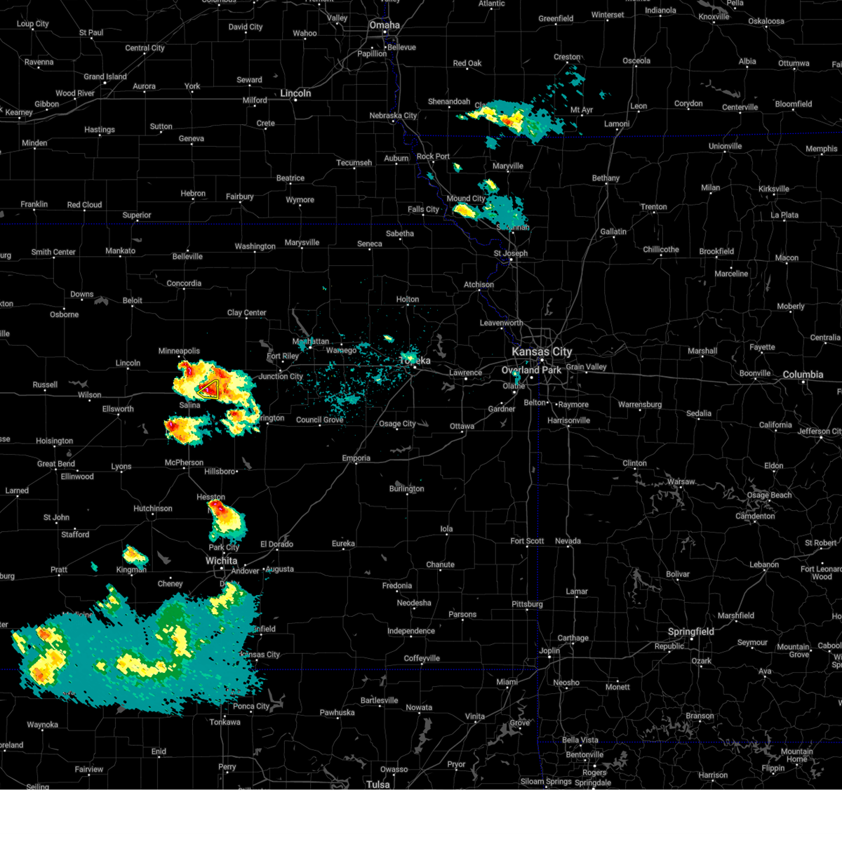 At 858 pm cdt, a severe thunderstorm was located over new cambria, or 9 miles northeast of salina, moving east at 5 mph (radar indicated). Hazards include 60 mph wind gusts and half dollar size hail. Hail damage to vehicles is expected. expect wind damage to roofs, siding, and trees. Locations impacted include, new cambria. At 858 pm cdt, a severe thunderstorm was located over new cambria, or 9 miles northeast of salina, moving east at 5 mph (radar indicated). Hazards include 60 mph wind gusts and half dollar size hail. Hail damage to vehicles is expected. expect wind damage to roofs, siding, and trees. Locations impacted include, new cambria.
|
| 4/22/2025 8:56 PM CDT |
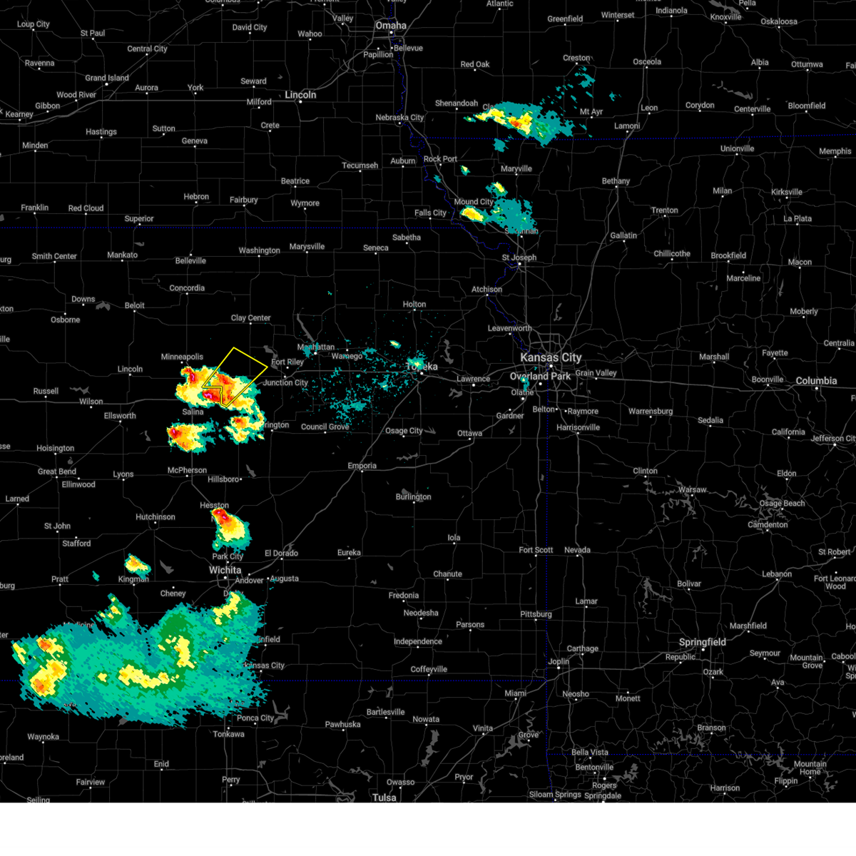 Svrtop the national weather service in topeka has issued a * severe thunderstorm warning for, northwestern dickinson county in central kansas, southeastern ottawa county in north central kansas, south central clay county in north central kansas, * until 930 pm cdt. * at 856 pm cdt, a severe thunderstorm was located near manchester, moving northeast at 25 mph (trained weather spotters). Hazards include 60 mph wind gusts and quarter size hail. Hail damage to vehicles is expected. Expect wind damage to roofs, siding, and trees. Svrtop the national weather service in topeka has issued a * severe thunderstorm warning for, northwestern dickinson county in central kansas, southeastern ottawa county in north central kansas, south central clay county in north central kansas, * until 930 pm cdt. * at 856 pm cdt, a severe thunderstorm was located near manchester, moving northeast at 25 mph (trained weather spotters). Hazards include 60 mph wind gusts and quarter size hail. Hail damage to vehicles is expected. Expect wind damage to roofs, siding, and trees.
|
| 4/22/2025 8:52 PM CDT |
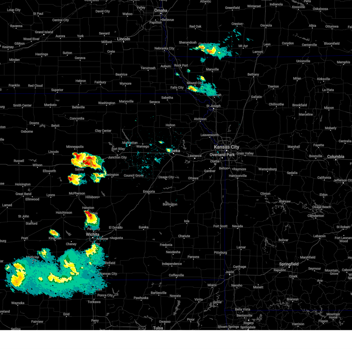 At 850 pm cdt, a severe thunderstorm was located over new cambria, or 9 miles northeast of salina, moving northeast at 10 mph (radar indicated). Hazards include golf ball size hail and 60 mph wind gusts. People and animals outdoors will be injured. expect hail damage to roofs, siding, windows, and vehicles. expect wind damage to roofs, siding, and trees. Locations impacted include, new cambria. At 850 pm cdt, a severe thunderstorm was located over new cambria, or 9 miles northeast of salina, moving northeast at 10 mph (radar indicated). Hazards include golf ball size hail and 60 mph wind gusts. People and animals outdoors will be injured. expect hail damage to roofs, siding, windows, and vehicles. expect wind damage to roofs, siding, and trees. Locations impacted include, new cambria.
|
| 4/22/2025 8:51 PM CDT |
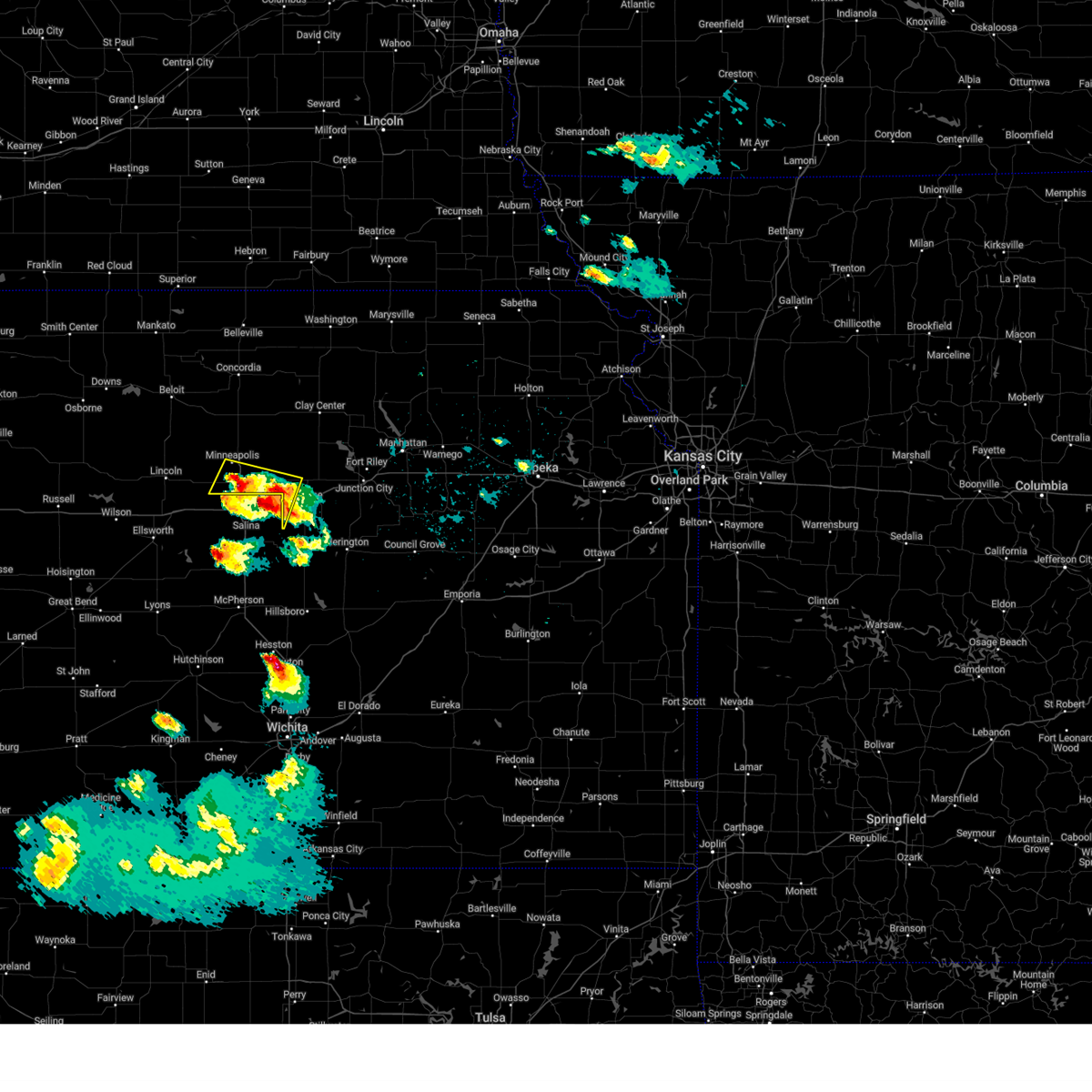 At 850 pm cdt, a severe thunderstorm was located near niles, moving northeast at 20 mph. a second severe thunderstorm was located 7 miles west of bennington, moving northeast at 20 mph (radar indicated). Hazards include 60 mph wind gusts and quarter size hail. Hail damage to vehicles is expected. expect wind damage to roofs, siding, and trees. locations impacted include, solomon, culver, niles, minneapolis, bennington, and talmage. This includes interstate 70 between mile markers 267 and 270. At 850 pm cdt, a severe thunderstorm was located near niles, moving northeast at 20 mph. a second severe thunderstorm was located 7 miles west of bennington, moving northeast at 20 mph (radar indicated). Hazards include 60 mph wind gusts and quarter size hail. Hail damage to vehicles is expected. expect wind damage to roofs, siding, and trees. locations impacted include, solomon, culver, niles, minneapolis, bennington, and talmage. This includes interstate 70 between mile markers 267 and 270.
|
| 4/22/2025 8:38 PM CDT |
 Svrtop the national weather service in topeka has issued a * severe thunderstorm warning for, northwestern dickinson county in central kansas, southern ottawa county in north central kansas, * until 900 pm cdt. * at 836 pm cdt, a severe thunderstorm was located near niles, moving northeast at 15 mph. a second severe thunderstorm was located 8 miles east of tescott, moving northeast at 20 mph (radar indicated). Hazards include 60 mph wind gusts and half dollar size hail. Hail damage to vehicles is expected. Expect wind damage to roofs, siding, and trees. Svrtop the national weather service in topeka has issued a * severe thunderstorm warning for, northwestern dickinson county in central kansas, southern ottawa county in north central kansas, * until 900 pm cdt. * at 836 pm cdt, a severe thunderstorm was located near niles, moving northeast at 15 mph. a second severe thunderstorm was located 8 miles east of tescott, moving northeast at 20 mph (radar indicated). Hazards include 60 mph wind gusts and half dollar size hail. Hail damage to vehicles is expected. Expect wind damage to roofs, siding, and trees.
|
| 4/22/2025 8:38 PM CDT |
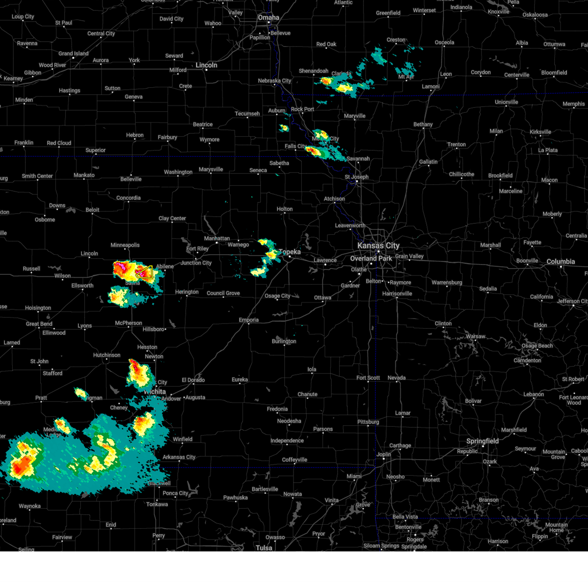 At 837 pm cdt, a severe thunderstorm was located over new cambria, or 8 miles northeast of salina, moving northeast at 10 mph (radar indicated). Hazards include two inch hail and 60 mph wind gusts. People and animals outdoors will be injured. expect hail damage to roofs, siding, windows, and vehicles. expect wind damage to roofs, siding, and trees. Locations impacted include, new cambria. At 837 pm cdt, a severe thunderstorm was located over new cambria, or 8 miles northeast of salina, moving northeast at 10 mph (radar indicated). Hazards include two inch hail and 60 mph wind gusts. People and animals outdoors will be injured. expect hail damage to roofs, siding, windows, and vehicles. expect wind damage to roofs, siding, and trees. Locations impacted include, new cambria.
|
| 4/22/2025 8:35 PM CDT |
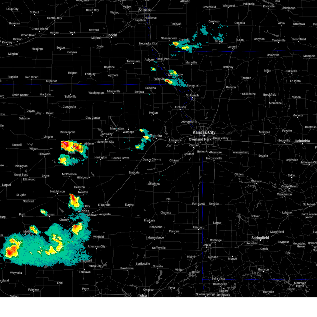 Svrict the national weather service in wichita has issued a * severe thunderstorm warning for, northeastern saline county in central kansas, * until 915 pm cdt. * at 834 pm cdt, a severe thunderstorm was located over new cambria, or 8 miles northeast of salina, moving east at 15 mph (radar indicated). Hazards include golf ball size hail and 60 mph wind gusts. People and animals outdoors will be injured. expect hail damage to roofs, siding, windows, and vehicles. Expect wind damage to roofs, siding, and trees. Svrict the national weather service in wichita has issued a * severe thunderstorm warning for, northeastern saline county in central kansas, * until 915 pm cdt. * at 834 pm cdt, a severe thunderstorm was located over new cambria, or 8 miles northeast of salina, moving east at 15 mph (radar indicated). Hazards include golf ball size hail and 60 mph wind gusts. People and animals outdoors will be injured. expect hail damage to roofs, siding, windows, and vehicles. Expect wind damage to roofs, siding, and trees.
|
| 4/2/2025 12:51 AM CDT |
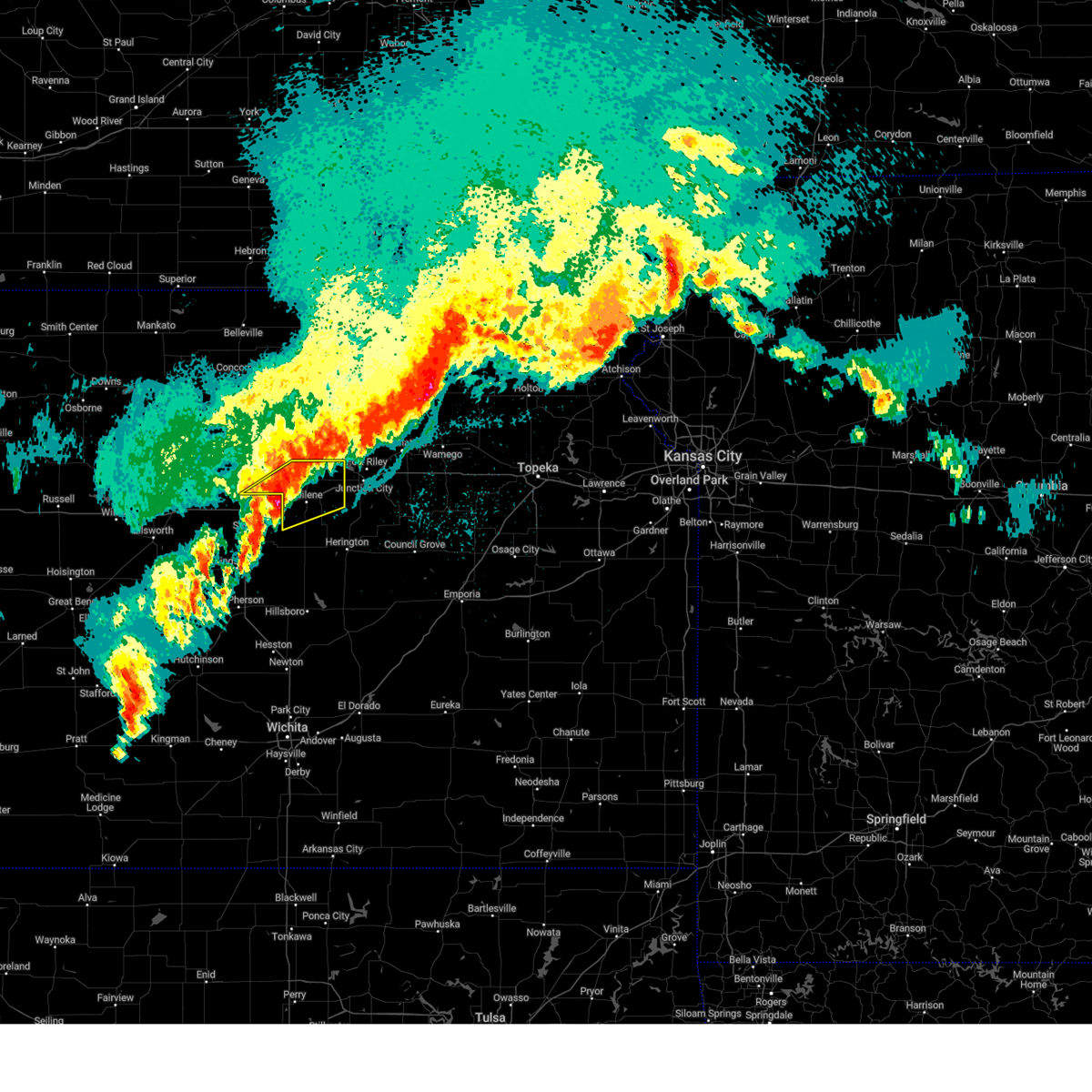 The storm which prompted the warning has weakened below severe limits, and no longer poses an immediate threat to life or property. therefore, the warning will be allowed to expire. however, small hail and gusty winds are still possible with this thunderstorm. a severe thunderstorm watch remains in effect until 300 am cdt for central, north central and east central kansas. The storm which prompted the warning has weakened below severe limits, and no longer poses an immediate threat to life or property. therefore, the warning will be allowed to expire. however, small hail and gusty winds are still possible with this thunderstorm. a severe thunderstorm watch remains in effect until 300 am cdt for central, north central and east central kansas.
|
| 4/2/2025 12:38 AM CDT |
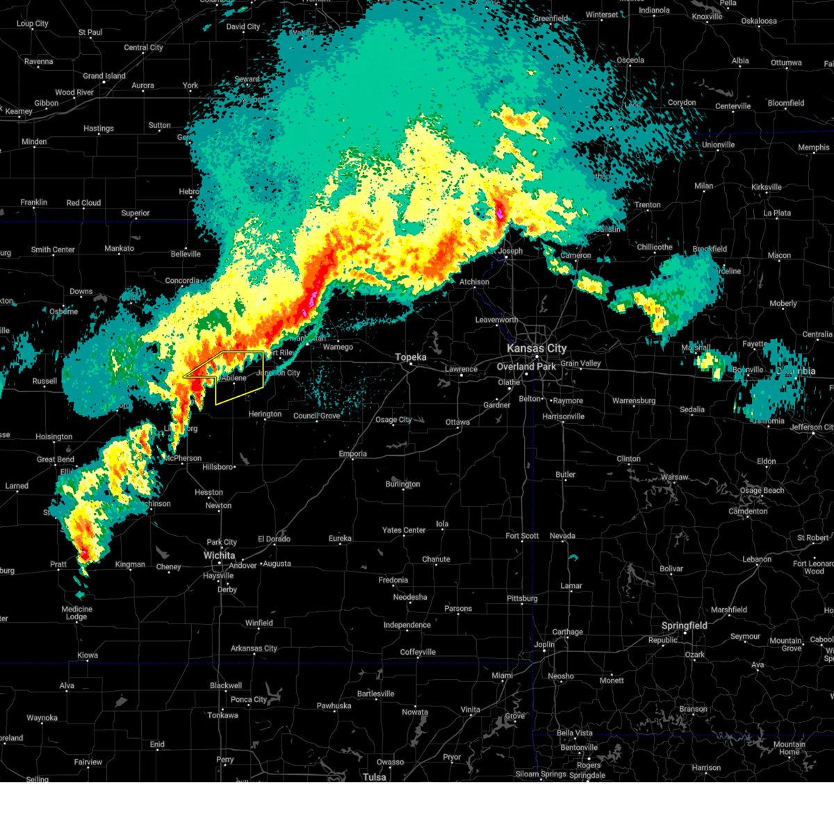 Svrtop the national weather service in topeka has issued a * severe thunderstorm warning for, northern dickinson county in central kansas, southeastern ottawa county in north central kansas, * until 100 am cdt. * at 1237 am cdt, a severe thunderstorm was located over new cambria, moving northeast at 55 mph (radar indicated). Hazards include 60 mph wind gusts and quarter size hail. Hail damage to vehicles is expected. Expect wind damage to roofs, siding, and trees. Svrtop the national weather service in topeka has issued a * severe thunderstorm warning for, northern dickinson county in central kansas, southeastern ottawa county in north central kansas, * until 100 am cdt. * at 1237 am cdt, a severe thunderstorm was located over new cambria, moving northeast at 55 mph (radar indicated). Hazards include 60 mph wind gusts and quarter size hail. Hail damage to vehicles is expected. Expect wind damage to roofs, siding, and trees.
|
| 4/2/2025 12:37 AM CDT |
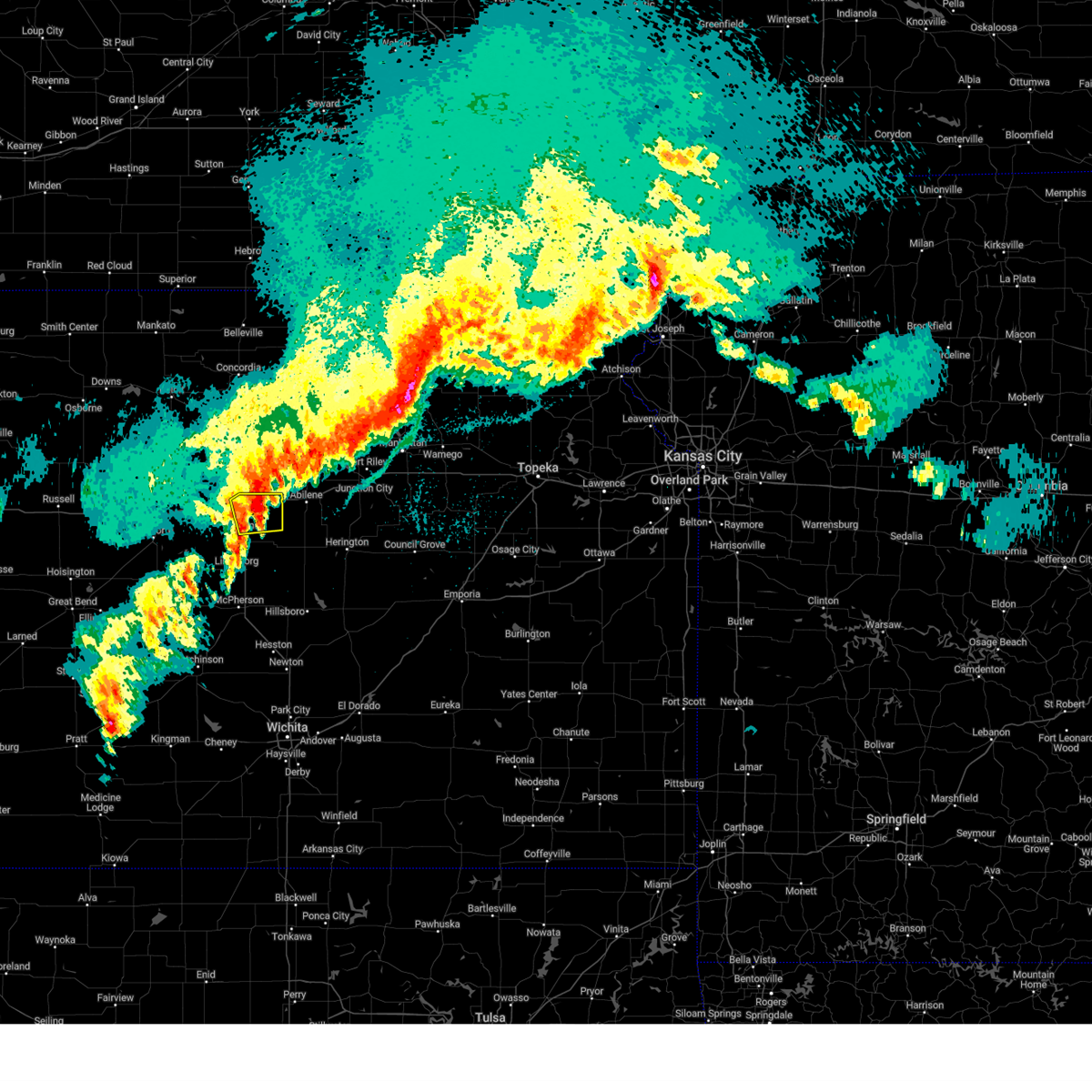 At 1237 am cdt, a severe thunderstorm was located over new cambria, or 9 miles northeast of salina, moving northeast at 55 mph (radar indicated). Hazards include ping pong ball size hail. People and animals outdoors will be injured. expect damage to roofs, siding, windows, and vehicles. Locations impacted include, new cambria, kipp, salina airport, and salina. At 1237 am cdt, a severe thunderstorm was located over new cambria, or 9 miles northeast of salina, moving northeast at 55 mph (radar indicated). Hazards include ping pong ball size hail. People and animals outdoors will be injured. expect damage to roofs, siding, windows, and vehicles. Locations impacted include, new cambria, kipp, salina airport, and salina.
|
| 4/2/2025 12:32 AM CDT |
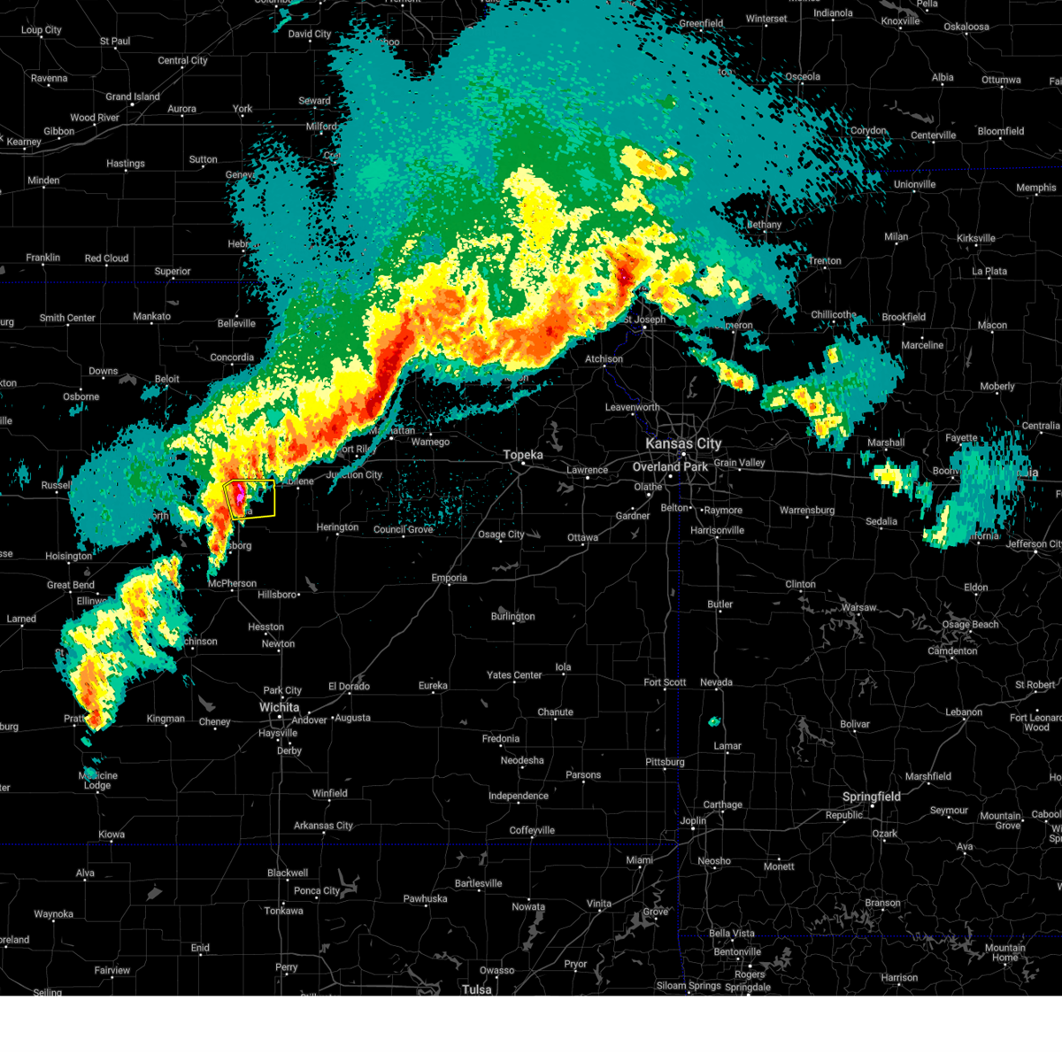 At 1232 am cdt, a severe thunderstorm was located near new cambria, or near salina, moving northeast at 55 mph (radar indicated). Hazards include 70 mph wind gusts and ping pong ball size hail. People and animals outdoors will be injured. expect hail damage to roofs, siding, windows, and vehicles. expect considerable tree damage. wind damage is also likely to mobile homes, roofs, and outbuildings. Locations impacted include, new cambria, kipp, salina airport, and salina. At 1232 am cdt, a severe thunderstorm was located near new cambria, or near salina, moving northeast at 55 mph (radar indicated). Hazards include 70 mph wind gusts and ping pong ball size hail. People and animals outdoors will be injured. expect hail damage to roofs, siding, windows, and vehicles. expect considerable tree damage. wind damage is also likely to mobile homes, roofs, and outbuildings. Locations impacted include, new cambria, kipp, salina airport, and salina.
|
| 4/2/2025 12:25 AM CDT |
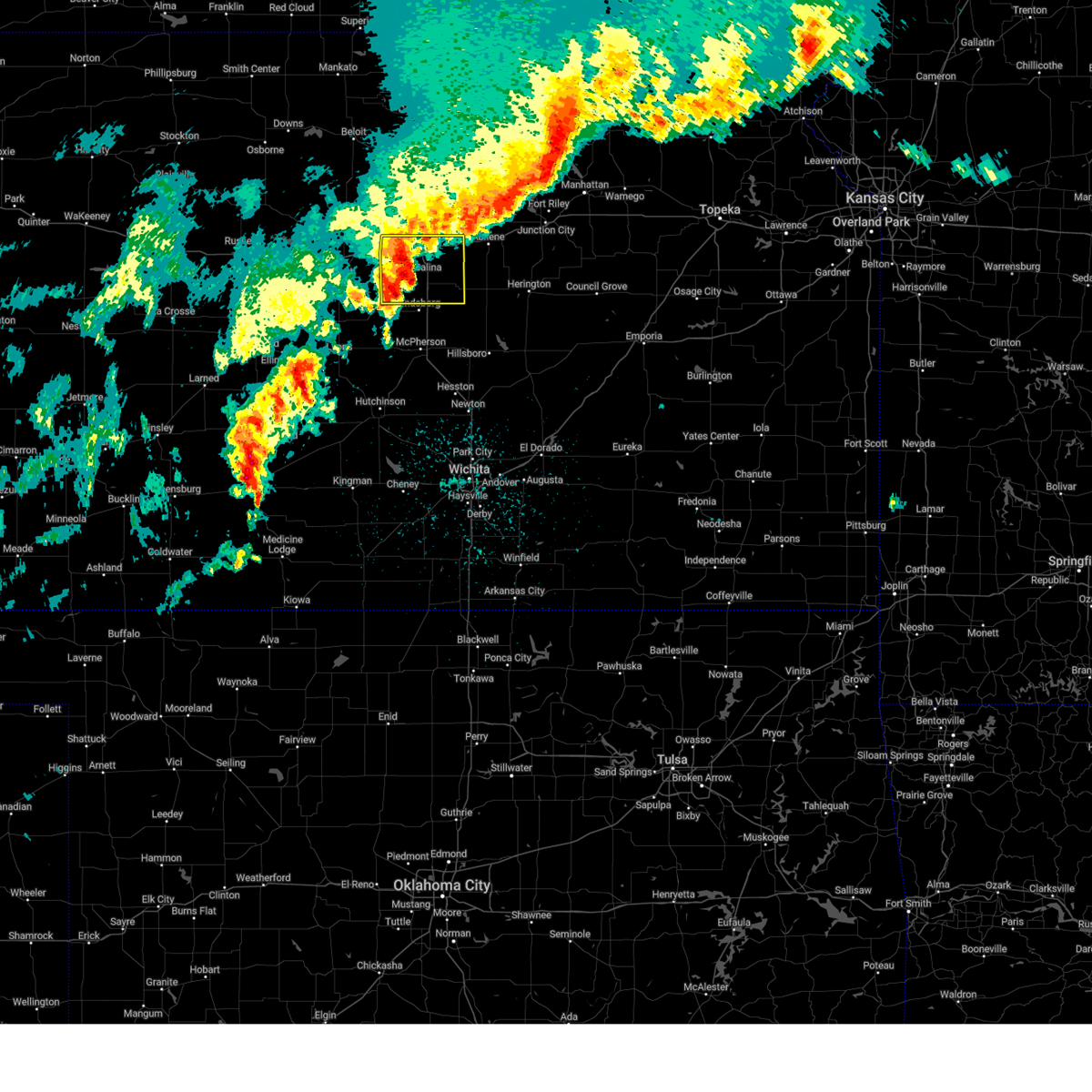 At 1225 am cdt, a severe thunderstorm was located over salina, moving northeast at 70 mph (radar indicated). Hazards include 70 mph wind gusts and quarter size hail. Hail damage to vehicles is expected. expect considerable tree damage. wind damage is also likely to mobile homes, roofs, and outbuildings. Locations impacted include, bridgeport, brookville, smolan, falun, new cambria, salina airport, salina, gypsum, kipp, assaria, and glendale. At 1225 am cdt, a severe thunderstorm was located over salina, moving northeast at 70 mph (radar indicated). Hazards include 70 mph wind gusts and quarter size hail. Hail damage to vehicles is expected. expect considerable tree damage. wind damage is also likely to mobile homes, roofs, and outbuildings. Locations impacted include, bridgeport, brookville, smolan, falun, new cambria, salina airport, salina, gypsum, kipp, assaria, and glendale.
|
| 4/2/2025 12:25 AM CDT |
 the severe thunderstorm warning has been cancelled and is no longer in effect the severe thunderstorm warning has been cancelled and is no longer in effect
|
| 4/2/2025 12:20 AM CDT |
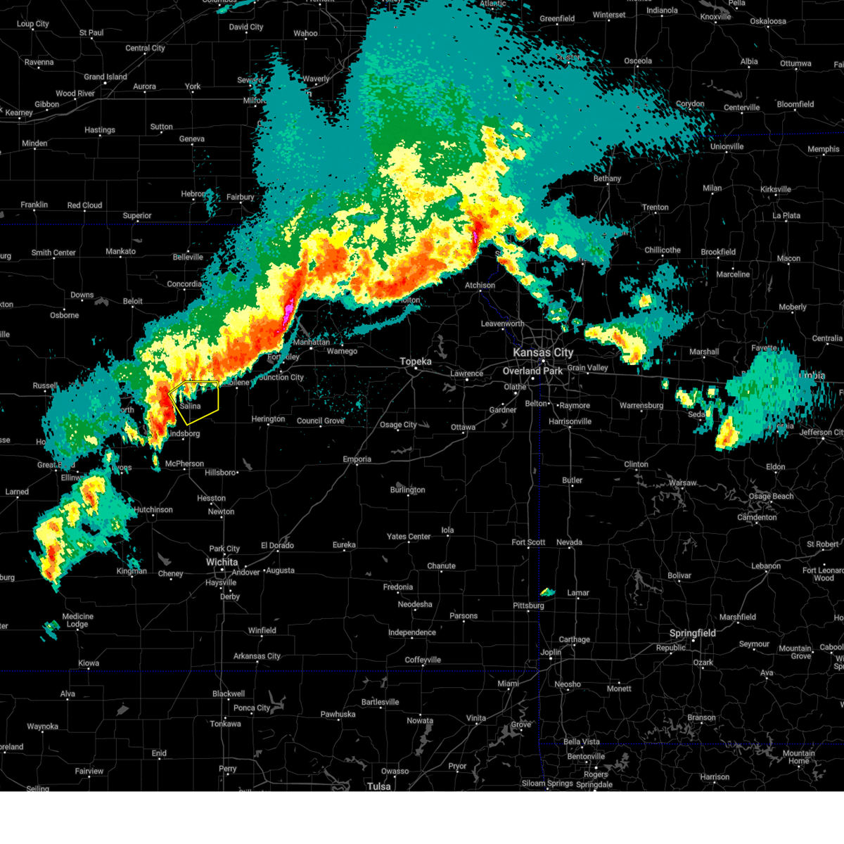 Svrict the national weather service in wichita has issued a * severe thunderstorm warning for, eastern saline county in central kansas, * until 1245 am cdt. * at 1220 am cdt, a severe thunderstorm was located near smolan, or 6 miles west of salina, moving northeast at 55 mph. this is a destructive storm for salina (radar indicated). Hazards include 80 mph wind gusts. Flying debris will be dangerous to those caught without shelter. mobile homes will be heavily damaged. expect considerable damage to roofs, windows, and vehicles. Extensive tree damage and power outages are likely. Svrict the national weather service in wichita has issued a * severe thunderstorm warning for, eastern saline county in central kansas, * until 1245 am cdt. * at 1220 am cdt, a severe thunderstorm was located near smolan, or 6 miles west of salina, moving northeast at 55 mph. this is a destructive storm for salina (radar indicated). Hazards include 80 mph wind gusts. Flying debris will be dangerous to those caught without shelter. mobile homes will be heavily damaged. expect considerable damage to roofs, windows, and vehicles. Extensive tree damage and power outages are likely.
|
| 4/1/2025 11:52 PM CDT |
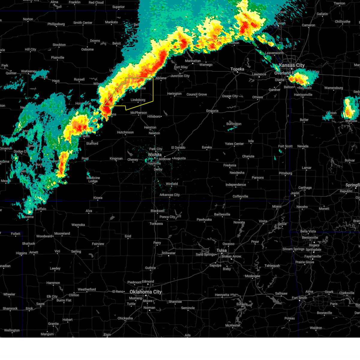 Svrict the national weather service in wichita has issued a * severe thunderstorm warning for, northern mcpherson county in central kansas, eastern ellsworth county in central kansas, saline county in central kansas, * until 1245 am cdt. * at 1152 pm cdt, a severe thunderstorm was located near geneseo, or 11 miles south of kanopolis, moving northeast at 65 mph (trained weather spotters). Hazards include ping pong ball size hail and 60 mph wind gusts. People and animals outdoors will be injured. expect hail damage to roofs, siding, windows, and vehicles. Expect wind damage to roofs, siding, and trees. Svrict the national weather service in wichita has issued a * severe thunderstorm warning for, northern mcpherson county in central kansas, eastern ellsworth county in central kansas, saline county in central kansas, * until 1245 am cdt. * at 1152 pm cdt, a severe thunderstorm was located near geneseo, or 11 miles south of kanopolis, moving northeast at 65 mph (trained weather spotters). Hazards include ping pong ball size hail and 60 mph wind gusts. People and animals outdoors will be injured. expect hail damage to roofs, siding, windows, and vehicles. Expect wind damage to roofs, siding, and trees.
|
| 4/1/2025 11:17 PM CDT |
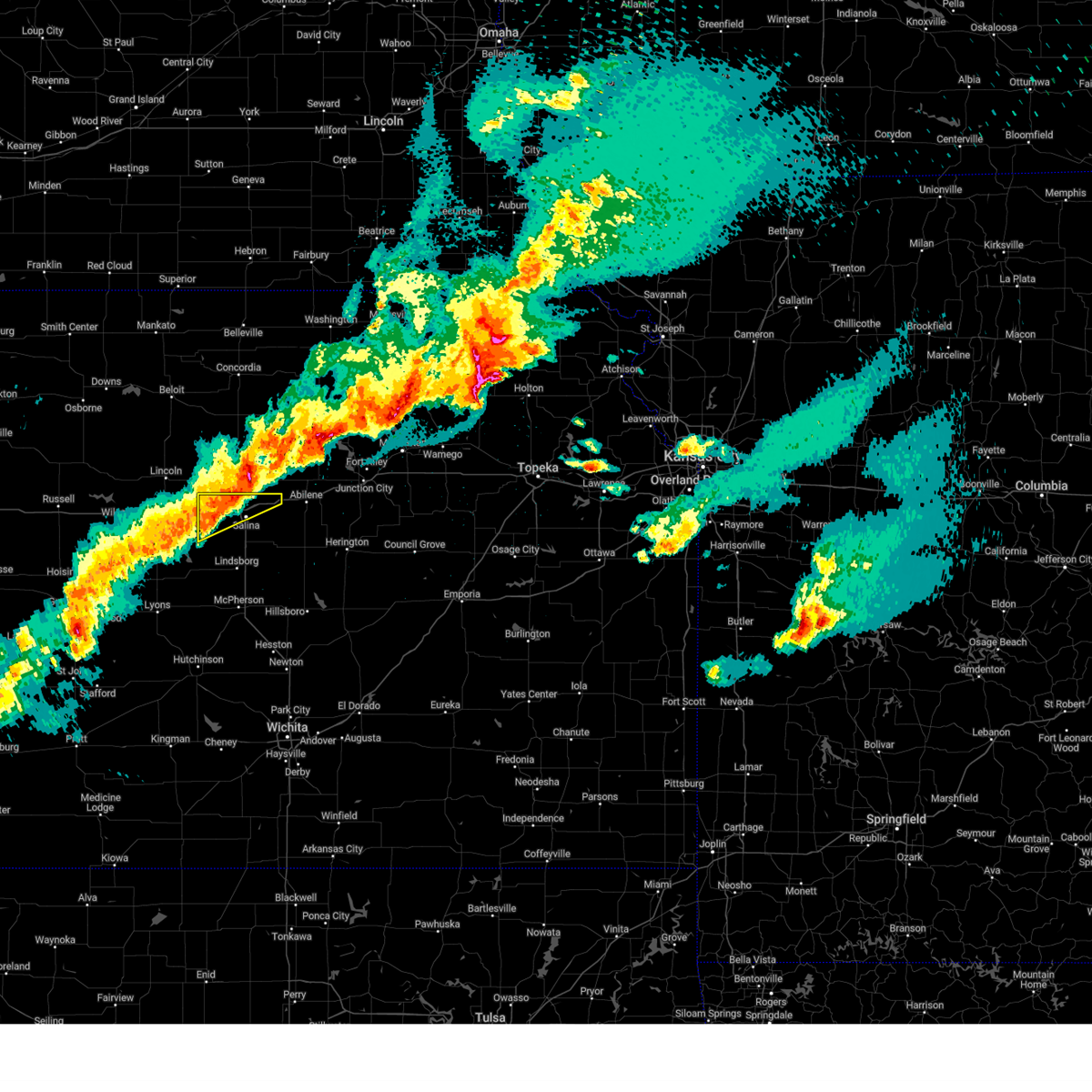 At 1116 pm cdt, a severe thunderstorm was located near culver, or 8 miles northwest of salina, moving northeast at 40 mph (radar indicated). Hazards include 60 mph wind gusts and quarter size hail. Hail damage to vehicles is expected. expect wind damage to roofs, siding, and trees. Locations impacted include, brookville, new cambria, glendale, and salina. At 1116 pm cdt, a severe thunderstorm was located near culver, or 8 miles northwest of salina, moving northeast at 40 mph (radar indicated). Hazards include 60 mph wind gusts and quarter size hail. Hail damage to vehicles is expected. expect wind damage to roofs, siding, and trees. Locations impacted include, brookville, new cambria, glendale, and salina.
|
| 4/1/2025 10:51 PM CDT |
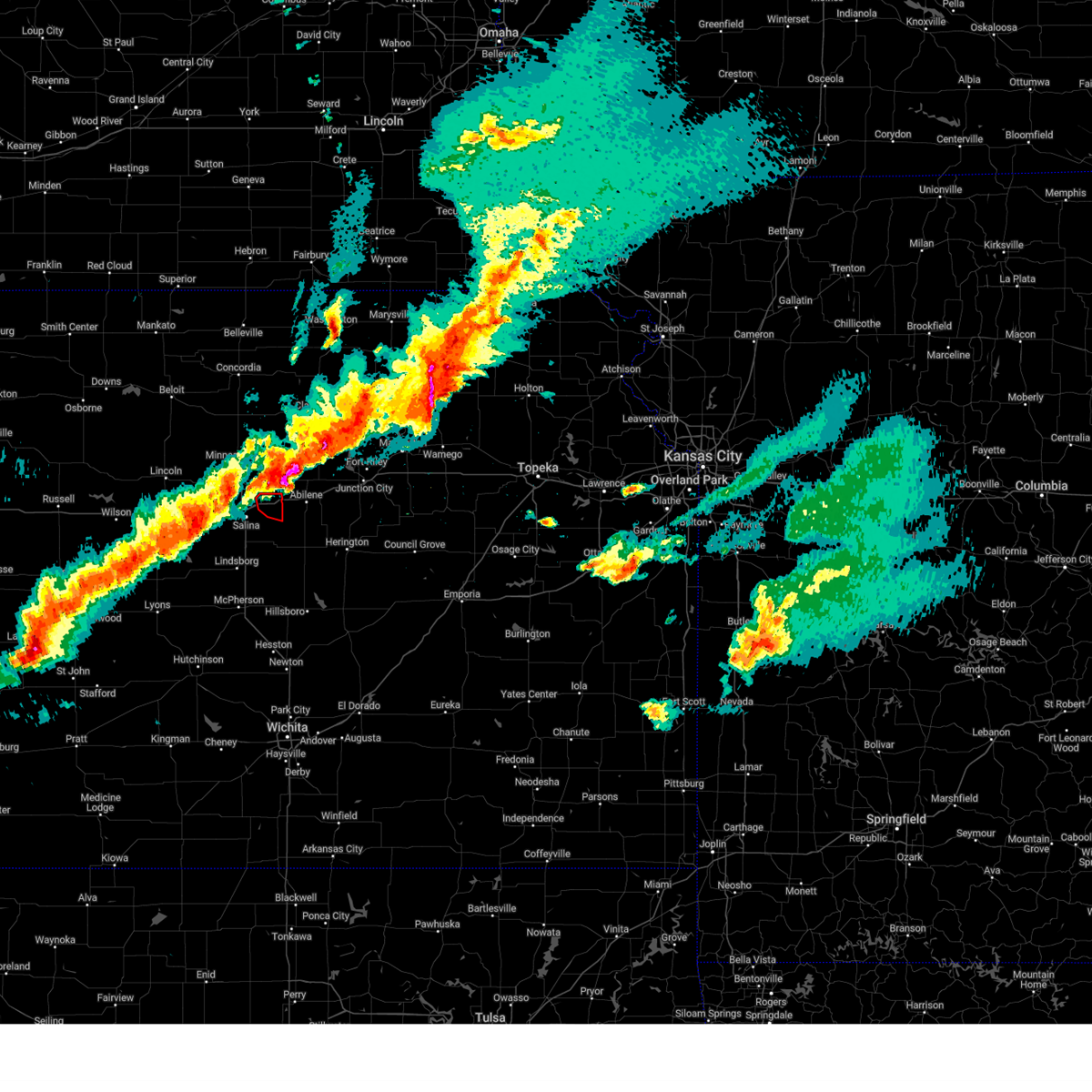 The storm which prompted the warning has moved out of the area. therefore, the warning will be allowed to expire. a severe thunderstorm watch remains in effect until 300 am cdt for central kansas. The storm which prompted the warning has moved out of the area. therefore, the warning will be allowed to expire. a severe thunderstorm watch remains in effect until 300 am cdt for central kansas.
|
| 4/1/2025 10:50 PM CDT |
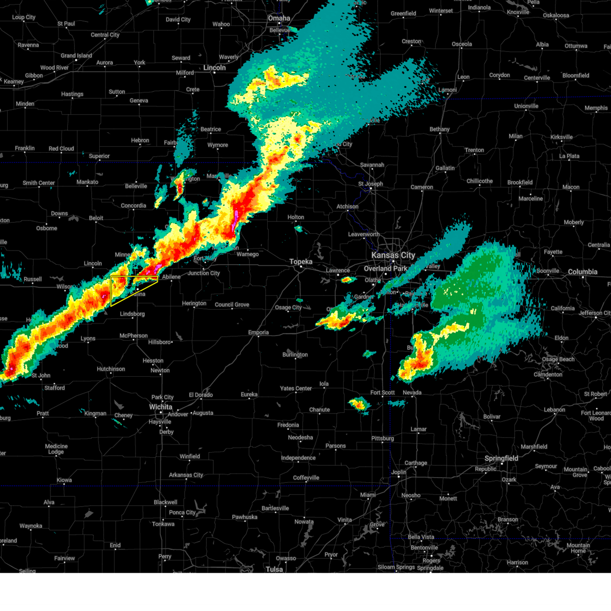 Svrict the national weather service in wichita has issued a * severe thunderstorm warning for, northern saline county in central kansas, * until 1145 pm cdt. * at 1049 pm cdt, a severe thunderstorm was located near brookville, or 12 miles northeast of kanopolis, moving northeast at 50 mph (radar indicated). Hazards include ping pong ball size hail and 60 mph wind gusts. People and animals outdoors will be injured. expect hail damage to roofs, siding, windows, and vehicles. Expect wind damage to roofs, siding, and trees. Svrict the national weather service in wichita has issued a * severe thunderstorm warning for, northern saline county in central kansas, * until 1145 pm cdt. * at 1049 pm cdt, a severe thunderstorm was located near brookville, or 12 miles northeast of kanopolis, moving northeast at 50 mph (radar indicated). Hazards include ping pong ball size hail and 60 mph wind gusts. People and animals outdoors will be injured. expect hail damage to roofs, siding, windows, and vehicles. Expect wind damage to roofs, siding, and trees.
|
| 4/1/2025 10:49 PM CDT | Ping Pong Ball sized hail reported 6.9 miles S of Solomon, KS, corrects previous hail report from 5 ssw manchester. corrects previous hail report from 5 ssw manchester. hail completed covered the roadway on k-18 - making the road s |
| 4/1/2025 10:43 PM CDT |
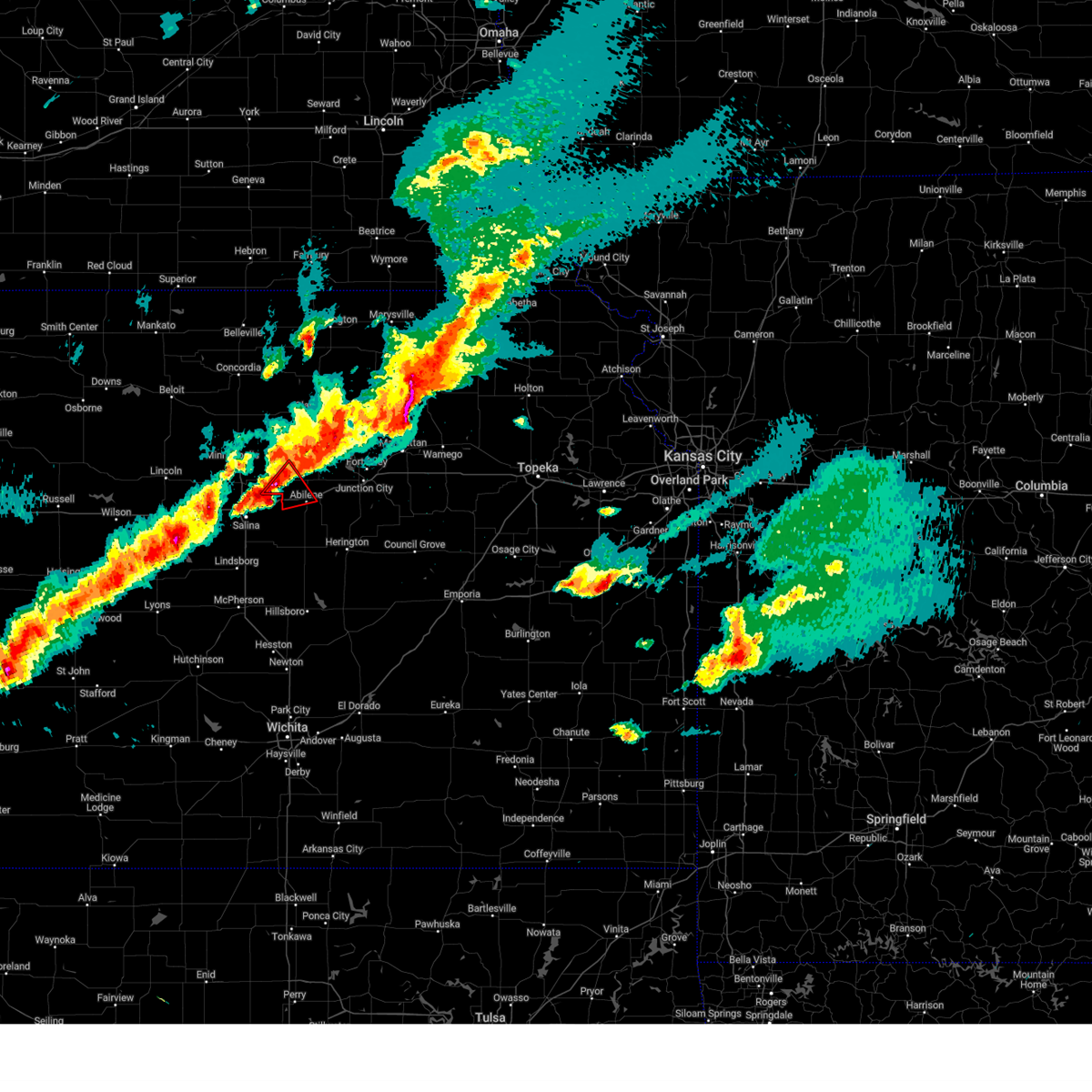 At 1043 pm cdt, a severe thunderstorm capable of producing a tornado was located near solomon, moving northeast at 45 mph (radar indicated rotation). Hazards include tornado and ping pong ball size hail. Flying debris will be dangerous to those caught without shelter. mobile homes will be damaged or destroyed. damage to roofs, windows, and vehicles will occur. tree damage is likely. locations impacted include, solomon, manchester, abilene, niles, and talmage. This includes interstate 70 between mile markers 267 and 278. At 1043 pm cdt, a severe thunderstorm capable of producing a tornado was located near solomon, moving northeast at 45 mph (radar indicated rotation). Hazards include tornado and ping pong ball size hail. Flying debris will be dangerous to those caught without shelter. mobile homes will be damaged or destroyed. damage to roofs, windows, and vehicles will occur. tree damage is likely. locations impacted include, solomon, manchester, abilene, niles, and talmage. This includes interstate 70 between mile markers 267 and 278.
|
| 4/1/2025 10:40 PM CDT |
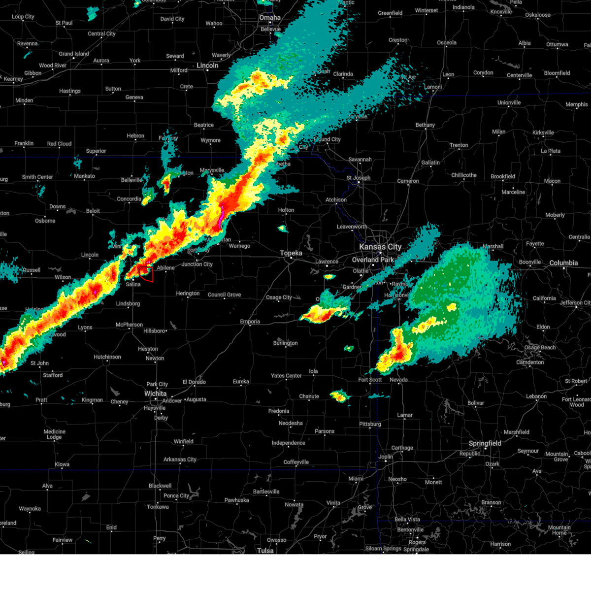 At 1039 pm cdt, a severe thunderstorm capable of producing a tornado was located 2 miles west of solomon, or 9 miles west of abilene, moving northeast at 40 mph (radar indicated rotation). Hazards include tornado and half dollar size hail. Flying debris will be dangerous to those caught without shelter. mobile homes will be damaged or destroyed. damage to roofs, windows, and vehicles will occur. tree damage is likely. Locations impacted include, new cambria. At 1039 pm cdt, a severe thunderstorm capable of producing a tornado was located 2 miles west of solomon, or 9 miles west of abilene, moving northeast at 40 mph (radar indicated rotation). Hazards include tornado and half dollar size hail. Flying debris will be dangerous to those caught without shelter. mobile homes will be damaged or destroyed. damage to roofs, windows, and vehicles will occur. tree damage is likely. Locations impacted include, new cambria.
|
| 4/1/2025 10:33 PM CDT |
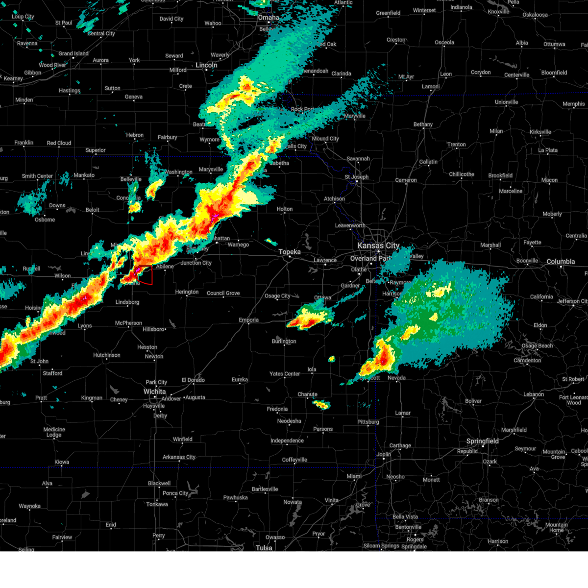 At 1033 pm cdt, a severe thunderstorm capable of producing a tornado was located near new cambria, or 10 miles northeast of salina, moving northeast at 45 mph (radar indicated rotation). Hazards include tornado and half dollar size hail. Flying debris will be dangerous to those caught without shelter. mobile homes will be damaged or destroyed. damage to roofs, windows, and vehicles will occur. tree damage is likely. Locations impacted include, new cambria. At 1033 pm cdt, a severe thunderstorm capable of producing a tornado was located near new cambria, or 10 miles northeast of salina, moving northeast at 45 mph (radar indicated rotation). Hazards include tornado and half dollar size hail. Flying debris will be dangerous to those caught without shelter. mobile homes will be damaged or destroyed. damage to roofs, windows, and vehicles will occur. tree damage is likely. Locations impacted include, new cambria.
|
| 4/1/2025 10:29 PM CDT |
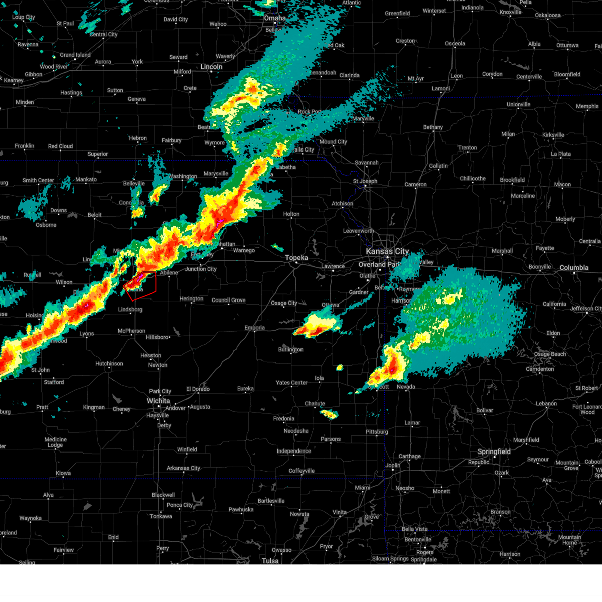 At 1028 pm cdt, a severe thunderstorm capable of producing a tornado was located near new cambria, or 6 miles northeast of salina, moving northeast at 40 mph (radar indicated rotation). Hazards include tornado and half dollar size hail. Flying debris will be dangerous to those caught without shelter. mobile homes will be damaged or destroyed. damage to roofs, windows, and vehicles will occur. tree damage is likely. This tornadic thunderstorm will remain over mainly rural areas of northeastern saline county, including the following locations, kipp and salina airport. At 1028 pm cdt, a severe thunderstorm capable of producing a tornado was located near new cambria, or 6 miles northeast of salina, moving northeast at 40 mph (radar indicated rotation). Hazards include tornado and half dollar size hail. Flying debris will be dangerous to those caught without shelter. mobile homes will be damaged or destroyed. damage to roofs, windows, and vehicles will occur. tree damage is likely. This tornadic thunderstorm will remain over mainly rural areas of northeastern saline county, including the following locations, kipp and salina airport.
|
| 4/1/2025 10:26 PM CDT |
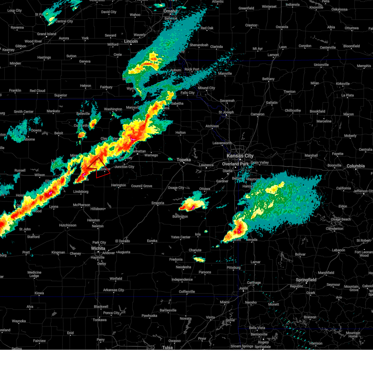 Tortop the national weather service in topeka has issued a * tornado warning for, northwestern dickinson county in central kansas, southeastern ottawa county in north central kansas, * until 1100 pm cdt. * at 1025 pm cdt, a confirmed tornado was located near new cambria, moving northeast at 45 mph (weather spotters confirmed tornado. at 1020 pm, storm spotters reported a tornado west of salina). Hazards include damaging tornado and ping pong ball size hail. Flying debris will be dangerous to those caught without shelter. mobile homes will be damaged or destroyed. damage to roofs, windows, and vehicles will occur. Tree damage is likely. Tortop the national weather service in topeka has issued a * tornado warning for, northwestern dickinson county in central kansas, southeastern ottawa county in north central kansas, * until 1100 pm cdt. * at 1025 pm cdt, a confirmed tornado was located near new cambria, moving northeast at 45 mph (weather spotters confirmed tornado. at 1020 pm, storm spotters reported a tornado west of salina). Hazards include damaging tornado and ping pong ball size hail. Flying debris will be dangerous to those caught without shelter. mobile homes will be damaged or destroyed. damage to roofs, windows, and vehicles will occur. Tree damage is likely.
|
| 4/1/2025 10:19 PM CDT |
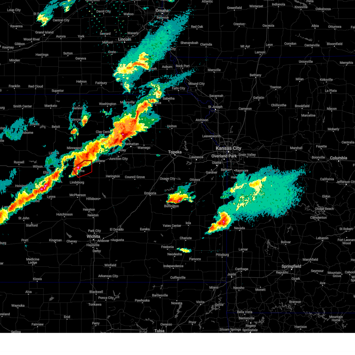 At 1018 pm cdt, a confirmed tornado was located near salina, moving northeast at 40 mph (weather spotters confirmed tornado). Hazards include damaging tornado and half dollar size hail. Flying debris will be dangerous to those caught without shelter. mobile homes will be damaged or destroyed. damage to roofs, windows, and vehicles will occur. tree damage is likely. this tornado will be near, salina and new cambria around 1025 pm cdt. Other locations impacted by this tornadic thunderstorm include kipp and salina airport. At 1018 pm cdt, a confirmed tornado was located near salina, moving northeast at 40 mph (weather spotters confirmed tornado). Hazards include damaging tornado and half dollar size hail. Flying debris will be dangerous to those caught without shelter. mobile homes will be damaged or destroyed. damage to roofs, windows, and vehicles will occur. tree damage is likely. this tornado will be near, salina and new cambria around 1025 pm cdt. Other locations impacted by this tornadic thunderstorm include kipp and salina airport.
|
| 4/1/2025 10:08 PM CDT |
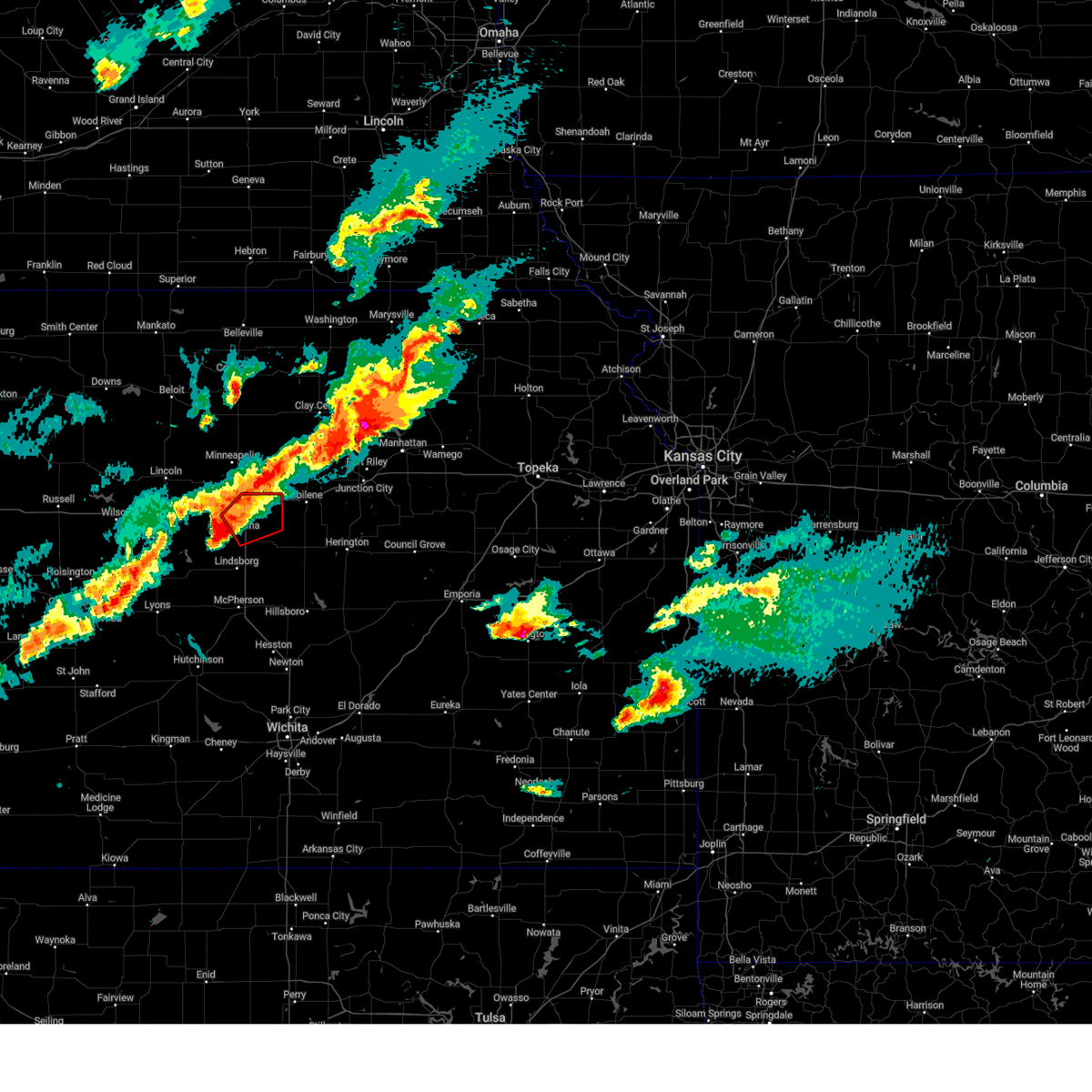 Torict the national weather service in wichita has issued a * tornado warning for, northeastern saline county in central kansas, * until 1100 pm cdt. * at 1007 pm cdt, a severe thunderstorm capable of producing a tornado was located near smolan, or 9 miles southwest of salina, moving northeast at 45 mph (radar indicated rotation). Hazards include tornado and half dollar size hail. Flying debris will be dangerous to those caught without shelter. mobile homes will be damaged or destroyed. damage to roofs, windows, and vehicles will occur. tree damage is likely. this dangerous storm will be near, smolan and salina around 1015 pm cdt. new cambria around 1025 pm cdt. other locations impacted by this tornadic thunderstorm include kipp and salina airport. this includes the following highways, interstate 135 between mile markers 84 and 95. Interstate 70 between mile markers 246 and 266. Torict the national weather service in wichita has issued a * tornado warning for, northeastern saline county in central kansas, * until 1100 pm cdt. * at 1007 pm cdt, a severe thunderstorm capable of producing a tornado was located near smolan, or 9 miles southwest of salina, moving northeast at 45 mph (radar indicated rotation). Hazards include tornado and half dollar size hail. Flying debris will be dangerous to those caught without shelter. mobile homes will be damaged or destroyed. damage to roofs, windows, and vehicles will occur. tree damage is likely. this dangerous storm will be near, smolan and salina around 1015 pm cdt. new cambria around 1025 pm cdt. other locations impacted by this tornadic thunderstorm include kipp and salina airport. this includes the following highways, interstate 135 between mile markers 84 and 95. Interstate 70 between mile markers 246 and 266.
|
| 4/1/2025 9:10 PM CDT | Storm damage reported in ottawa county KS, 7.8 miles SE of Solomon, KS |
| 4/1/2025 8:47 PM CDT |
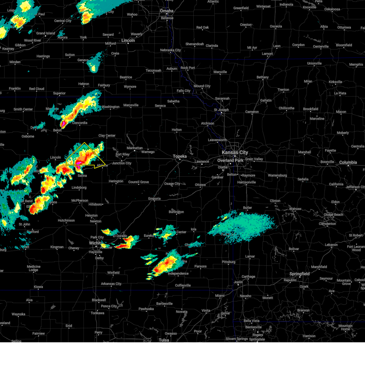 At 846 pm cdt, a severe thunderstorm was located 4 miles southeast of wells, moving northeast at 65 mph (radar indicated). Hazards include tennis ball size hail and 70 mph wind gusts. People and animals outdoors will be injured. expect hail damage to roofs, siding, windows, and vehicles. expect considerable tree damage. wind damage is also likely to mobile homes, roofs, and outbuildings. locations impacted include, culver, niles, minneapolis, tescott, talmage, solomon, manchester, wells, and bennington. This includes interstate 70 between mile markers 267 and 270. At 846 pm cdt, a severe thunderstorm was located 4 miles southeast of wells, moving northeast at 65 mph (radar indicated). Hazards include tennis ball size hail and 70 mph wind gusts. People and animals outdoors will be injured. expect hail damage to roofs, siding, windows, and vehicles. expect considerable tree damage. wind damage is also likely to mobile homes, roofs, and outbuildings. locations impacted include, culver, niles, minneapolis, tescott, talmage, solomon, manchester, wells, and bennington. This includes interstate 70 between mile markers 267 and 270.
|
| 4/1/2025 8:23 PM CDT |
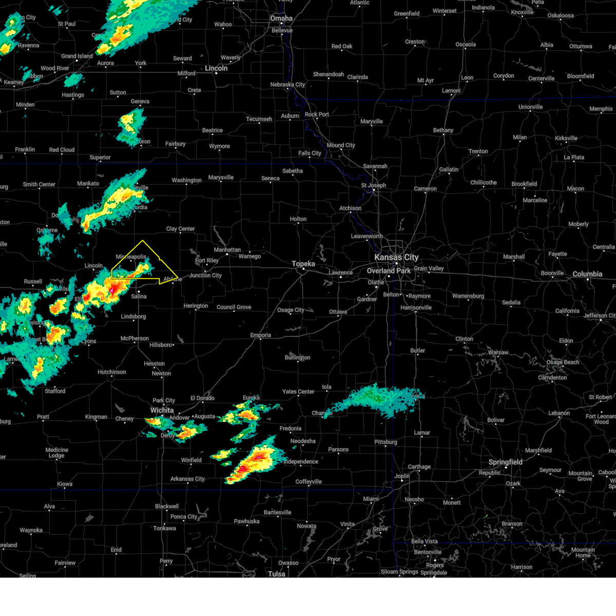 Svrtop the national weather service in topeka has issued a * severe thunderstorm warning for, northwestern dickinson county in central kansas, ottawa county in north central kansas, * until 900 pm cdt. * at 823 pm cdt, a severe thunderstorm was located 7 miles north of brookville, moving northeast at 65 mph (radar indicated). Hazards include ping pong ball size hail and 60 mph wind gusts. People and animals outdoors will be injured. expect hail damage to roofs, siding, windows, and vehicles. Expect wind damage to roofs, siding, and trees. Svrtop the national weather service in topeka has issued a * severe thunderstorm warning for, northwestern dickinson county in central kansas, ottawa county in north central kansas, * until 900 pm cdt. * at 823 pm cdt, a severe thunderstorm was located 7 miles north of brookville, moving northeast at 65 mph (radar indicated). Hazards include ping pong ball size hail and 60 mph wind gusts. People and animals outdoors will be injured. expect hail damage to roofs, siding, windows, and vehicles. Expect wind damage to roofs, siding, and trees.
|
| 9/20/2024 7:39 PM CDT |
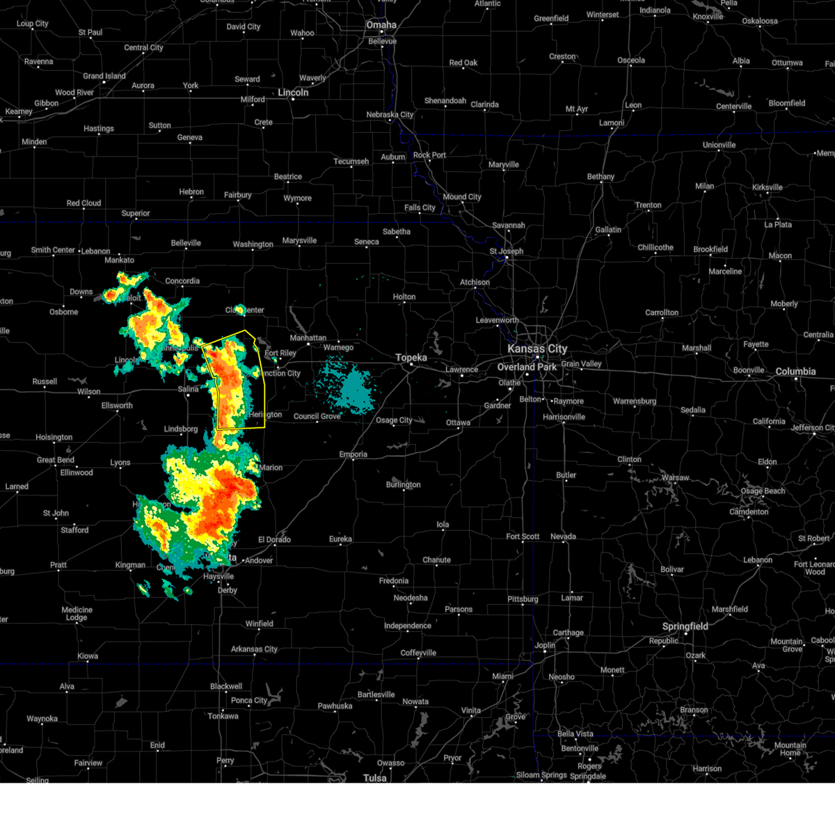 Svrtop the national weather service in topeka has issued a * severe thunderstorm warning for, dickinson county in central kansas, southeastern ottawa county in north central kansas, southern clay county in north central kansas, * until 815 pm cdt. * at 739 pm cdt, severe thunderstorms were located along a line extending from near longford to near abilene to 4 miles west of tampa, moving northeast at 40 mph (radar indicated). Hazards include 60 mph wind gusts. expect damage to roofs, siding, and trees Svrtop the national weather service in topeka has issued a * severe thunderstorm warning for, dickinson county in central kansas, southeastern ottawa county in north central kansas, southern clay county in north central kansas, * until 815 pm cdt. * at 739 pm cdt, severe thunderstorms were located along a line extending from near longford to near abilene to 4 miles west of tampa, moving northeast at 40 mph (radar indicated). Hazards include 60 mph wind gusts. expect damage to roofs, siding, and trees
|
| 9/20/2024 7:33 PM CDT |
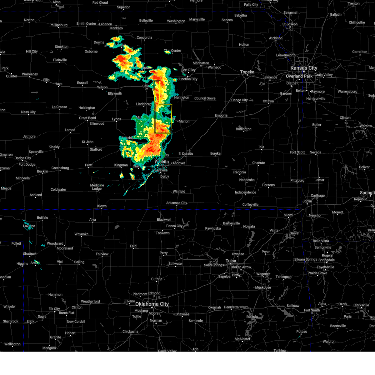 At 732 pm cdt, severe thunderstorms were located along a line extending from near talmage to 7 miles south of carlton to near lehigh, moving northeast at 35 mph (radar indicated). Hazards include 70 mph wind gusts. Expect considerable tree damage. damage is likely to mobile homes, roofs, and outbuildings. Locations impacted include, hillsboro, canton, goessel, gypsum, lehigh, tampa, durham, roxbury, kipp, and marion lake. At 732 pm cdt, severe thunderstorms were located along a line extending from near talmage to 7 miles south of carlton to near lehigh, moving northeast at 35 mph (radar indicated). Hazards include 70 mph wind gusts. Expect considerable tree damage. damage is likely to mobile homes, roofs, and outbuildings. Locations impacted include, hillsboro, canton, goessel, gypsum, lehigh, tampa, durham, roxbury, kipp, and marion lake.
|
| 9/20/2024 7:19 PM CDT |
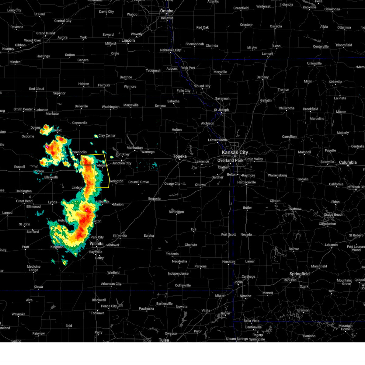 At 719 pm cdt, severe thunderstorms were located along a line extending from 4 miles northeast of bennington to 5 miles north of gypsum to 6 miles north of canton, moving east at 30 mph (radar indicated). Hazards include 70 mph wind gusts and penny size hail. Expect considerable tree damage. damage is likely to mobile homes, roofs, and outbuildings. locations impacted include, abilene, solomon, enterprise, bennington, hope, manchester, carlton, niles, and talmage. This includes interstate 70 between mile markers 267 and 279. At 719 pm cdt, severe thunderstorms were located along a line extending from 4 miles northeast of bennington to 5 miles north of gypsum to 6 miles north of canton, moving east at 30 mph (radar indicated). Hazards include 70 mph wind gusts and penny size hail. Expect considerable tree damage. damage is likely to mobile homes, roofs, and outbuildings. locations impacted include, abilene, solomon, enterprise, bennington, hope, manchester, carlton, niles, and talmage. This includes interstate 70 between mile markers 267 and 279.
|
| 9/20/2024 7:13 PM CDT |
 At 711 pm cdt, severe thunderstorms were located along a line extending from near bennington to 4 miles northwest of gypsum to 5 miles north of canton, moving east-northeast at 30 mph (radar indicated). Hazards include 70 mph wind gusts and penny size hail. Expect considerable tree damage. damage is likely to mobile homes, roofs, and outbuildings. locations impacted include, abilene, minneapolis, solomon, enterprise, bennington, hope, manchester, carlton, niles, and talmage. this includes interstate 70 between mile markers 267 and 279. At 7:04 pm cdt, the automated weather station at the salina, ks airport measured a 67 mph wind gust. At 711 pm cdt, severe thunderstorms were located along a line extending from near bennington to 4 miles northwest of gypsum to 5 miles north of canton, moving east-northeast at 30 mph (radar indicated). Hazards include 70 mph wind gusts and penny size hail. Expect considerable tree damage. damage is likely to mobile homes, roofs, and outbuildings. locations impacted include, abilene, minneapolis, solomon, enterprise, bennington, hope, manchester, carlton, niles, and talmage. this includes interstate 70 between mile markers 267 and 279. At 7:04 pm cdt, the automated weather station at the salina, ks airport measured a 67 mph wind gust.
|
| 9/20/2024 7:09 PM CDT |
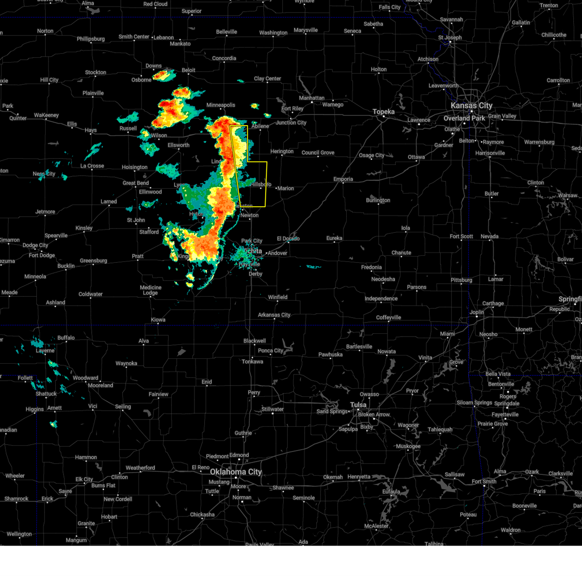 At 708 pm cdt, severe thunderstorms were located along a line extending from near new cambria to 7 miles north of galva to 5 miles northwest of moundridge, moving northeast at 40 mph (at 703 pm the salina airport reported a 67 mph wind gust). Hazards include 70 mph wind gusts. Expect considerable tree damage. damage is likely to mobile homes, roofs, and outbuildings. Locations impacted include, hillsboro, canton, goessel, gypsum, lehigh, new cambria, tampa, durham, roxbury, kipp, and marion lake. At 708 pm cdt, severe thunderstorms were located along a line extending from near new cambria to 7 miles north of galva to 5 miles northwest of moundridge, moving northeast at 40 mph (at 703 pm the salina airport reported a 67 mph wind gust). Hazards include 70 mph wind gusts. Expect considerable tree damage. damage is likely to mobile homes, roofs, and outbuildings. Locations impacted include, hillsboro, canton, goessel, gypsum, lehigh, new cambria, tampa, durham, roxbury, kipp, and marion lake.
|
| 9/20/2024 7:00 PM CDT |
 Svrtop the national weather service in topeka has issued a * severe thunderstorm warning for, western dickinson county in central kansas, southeastern ottawa county in north central kansas, * until 745 pm cdt. * at 659 pm cdt, severe thunderstorms were located along a line extending from near bennington to 3 miles northwest of gypsum to 5 miles west of moundridge, moving east at 35 mph (radar indicated). Hazards include 60 mph wind gusts and penny size hail. expect damage to roofs, siding, and trees Svrtop the national weather service in topeka has issued a * severe thunderstorm warning for, western dickinson county in central kansas, southeastern ottawa county in north central kansas, * until 745 pm cdt. * at 659 pm cdt, severe thunderstorms were located along a line extending from near bennington to 3 miles northwest of gypsum to 5 miles west of moundridge, moving east at 35 mph (radar indicated). Hazards include 60 mph wind gusts and penny size hail. expect damage to roofs, siding, and trees
|
| 9/20/2024 6:50 PM CDT |
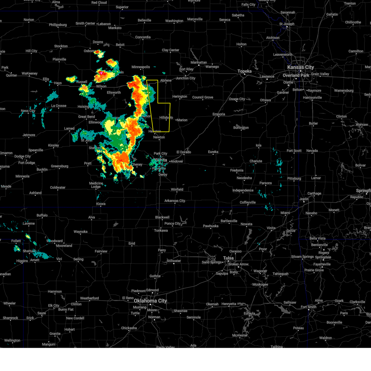 Svrict the national weather service in wichita has issued a * severe thunderstorm warning for, eastern mcpherson county in central kansas, western marion county in central kansas, eastern saline county in central kansas, * until 800 pm cdt. * at 650 pm cdt, severe thunderstorms were located along a line extending from 6 miles south of culver to 5 miles northwest of mcpherson to near inman, moving northeast at 35 mph (trained weather spotters reported 70 mph winds 2.5 miles west of inman at 649 pm). Hazards include 70 mph wind gusts. Expect considerable tree damage. Damage is likely to mobile homes, roofs, and outbuildings. Svrict the national weather service in wichita has issued a * severe thunderstorm warning for, eastern mcpherson county in central kansas, western marion county in central kansas, eastern saline county in central kansas, * until 800 pm cdt. * at 650 pm cdt, severe thunderstorms were located along a line extending from 6 miles south of culver to 5 miles northwest of mcpherson to near inman, moving northeast at 35 mph (trained weather spotters reported 70 mph winds 2.5 miles west of inman at 649 pm). Hazards include 70 mph wind gusts. Expect considerable tree damage. Damage is likely to mobile homes, roofs, and outbuildings.
|
| 7/31/2024 9:51 PM CDT |
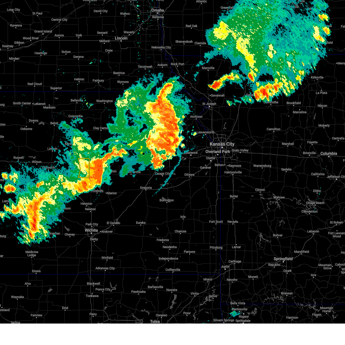 the severe thunderstorm warning has been cancelled and is no longer in effect the severe thunderstorm warning has been cancelled and is no longer in effect
|
| 7/31/2024 9:36 PM CDT |
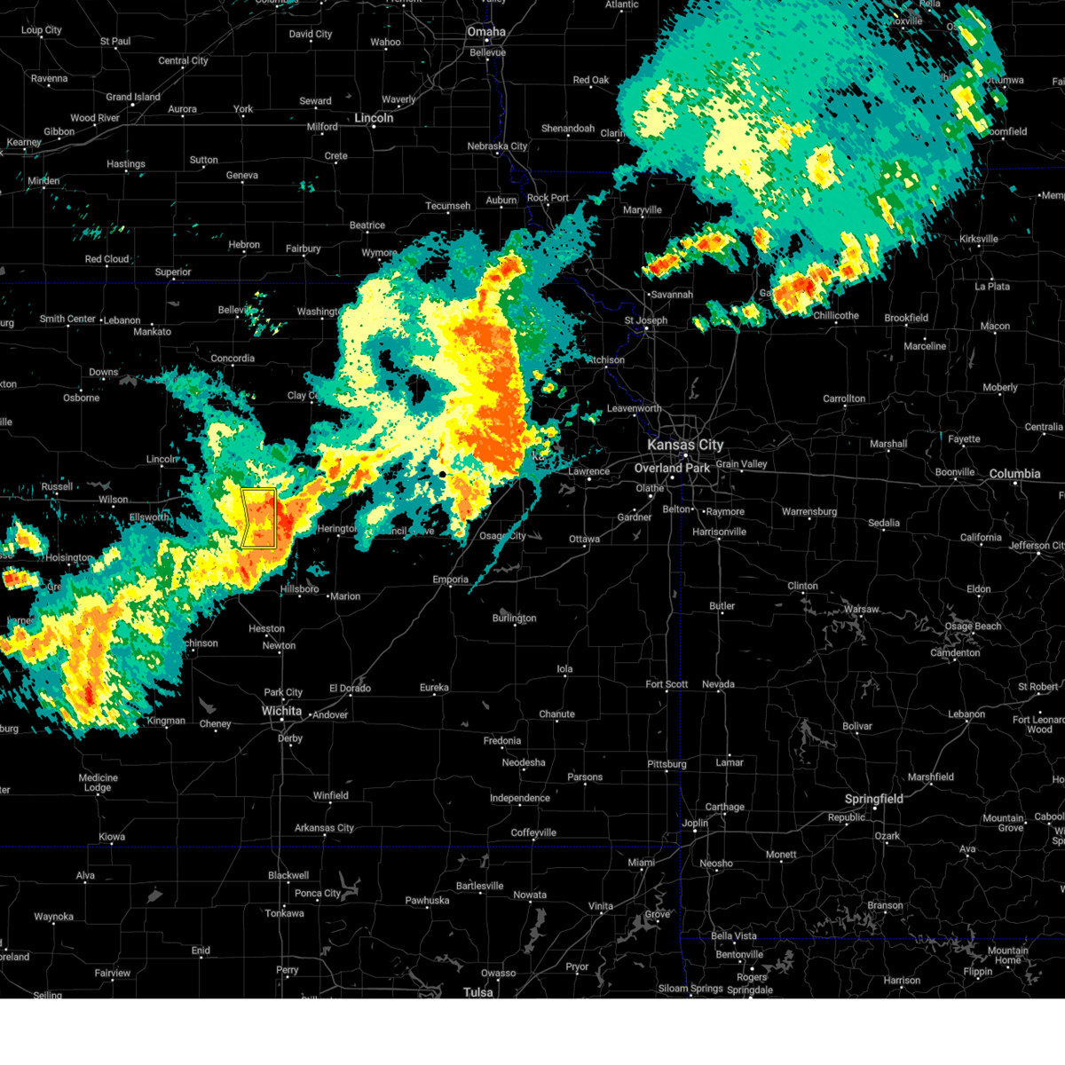 At 936 pm cdt, a severe thunderstorm was located near carlton, or 13 miles south of abilene, moving east at 55 mph (broadcast media). Hazards include 70 mph wind gusts. Expect considerable tree damage. damage is likely to mobile homes, roofs, and outbuildings. Locations impacted include, salina, gypsum, new cambria, and kipp. At 936 pm cdt, a severe thunderstorm was located near carlton, or 13 miles south of abilene, moving east at 55 mph (broadcast media). Hazards include 70 mph wind gusts. Expect considerable tree damage. damage is likely to mobile homes, roofs, and outbuildings. Locations impacted include, salina, gypsum, new cambria, and kipp.
|
| 7/31/2024 9:22 PM CDT |
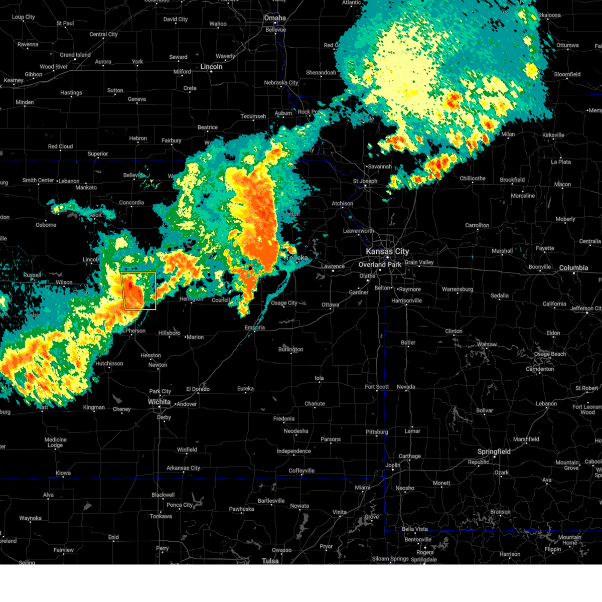 Svrict the national weather service in wichita has issued a * severe thunderstorm warning for, saline county in central kansas, * until 1015 pm cdt. * at 921 pm cdt, a severe thunderstorm was located 6 miles northwest of gypsum, or 6 miles southeast of salina, moving east at 55 mph (salina regional airport). Hazards include 70 mph wind gusts. Expect considerable tree damage. Damage is likely to mobile homes, roofs, and outbuildings. Svrict the national weather service in wichita has issued a * severe thunderstorm warning for, saline county in central kansas, * until 1015 pm cdt. * at 921 pm cdt, a severe thunderstorm was located 6 miles northwest of gypsum, or 6 miles southeast of salina, moving east at 55 mph (salina regional airport). Hazards include 70 mph wind gusts. Expect considerable tree damage. Damage is likely to mobile homes, roofs, and outbuildings.
|
| 7/31/2024 7:57 PM CDT |
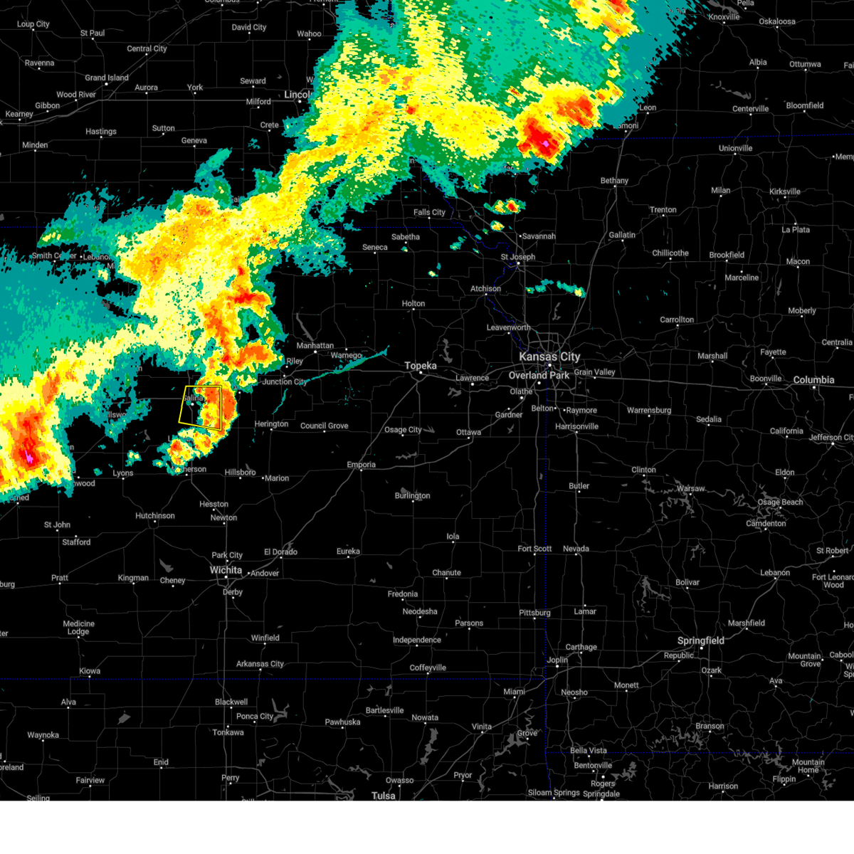 The storm which prompted the warning has moved out of the area. therefore, the warning will be allowed to expire. however, gusty winds are still possible with this thunderstorm. a severe thunderstorm watch remains in effect until 100 am cdt for central kansas. The storm which prompted the warning has moved out of the area. therefore, the warning will be allowed to expire. however, gusty winds are still possible with this thunderstorm. a severe thunderstorm watch remains in effect until 100 am cdt for central kansas.
|
| 7/31/2024 7:44 PM CDT |
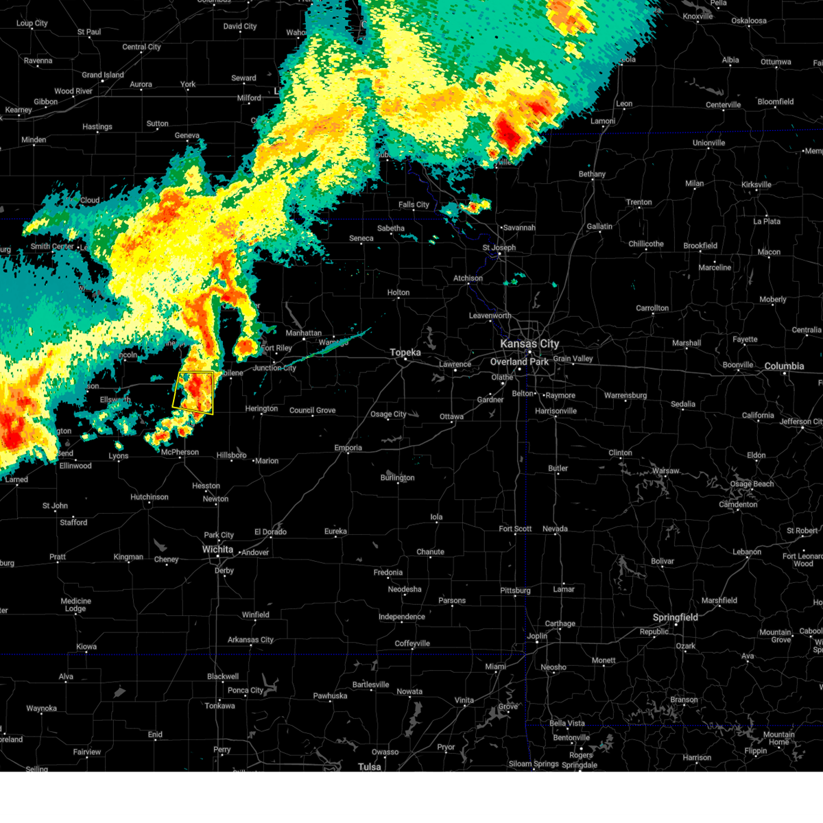 At 744 pm cdt, a severe thunderstorm was located near gypsum, or 8 miles east of salina, moving east at 30 mph (radar indicated). Hazards include 60 mph wind gusts. Expect damage to roofs, siding, and trees. Locations impacted include, salina, gypsum, smolan, new cambria, kipp, and salina airport. At 744 pm cdt, a severe thunderstorm was located near gypsum, or 8 miles east of salina, moving east at 30 mph (radar indicated). Hazards include 60 mph wind gusts. Expect damage to roofs, siding, and trees. Locations impacted include, salina, gypsum, smolan, new cambria, kipp, and salina airport.
|
| 7/31/2024 7:31 PM CDT |
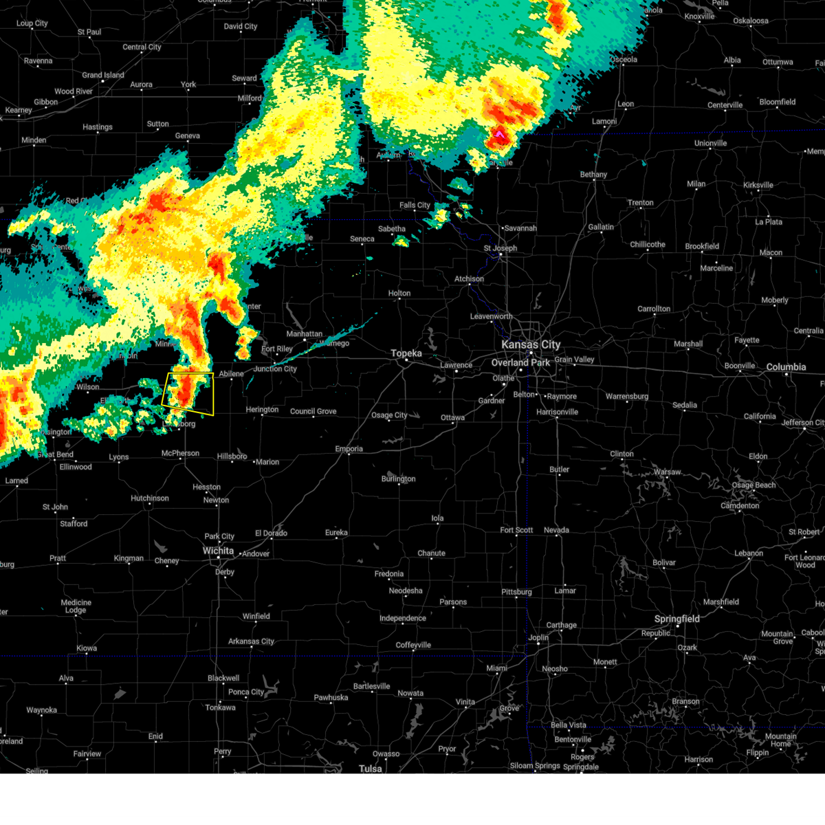 At 731 pm cdt, a severe thunderstorm was located near salina, moving east at 40 mph (salina regional airport). Hazards include 70 mph wind gusts and penny size hail. Expect considerable tree damage. damage is likely to mobile homes, roofs, and outbuildings. Locations impacted include, salina, gypsum, smolan, new cambria, kipp, and salina airport. At 731 pm cdt, a severe thunderstorm was located near salina, moving east at 40 mph (salina regional airport). Hazards include 70 mph wind gusts and penny size hail. Expect considerable tree damage. damage is likely to mobile homes, roofs, and outbuildings. Locations impacted include, salina, gypsum, smolan, new cambria, kipp, and salina airport.
|
| 7/31/2024 7:27 PM CDT |
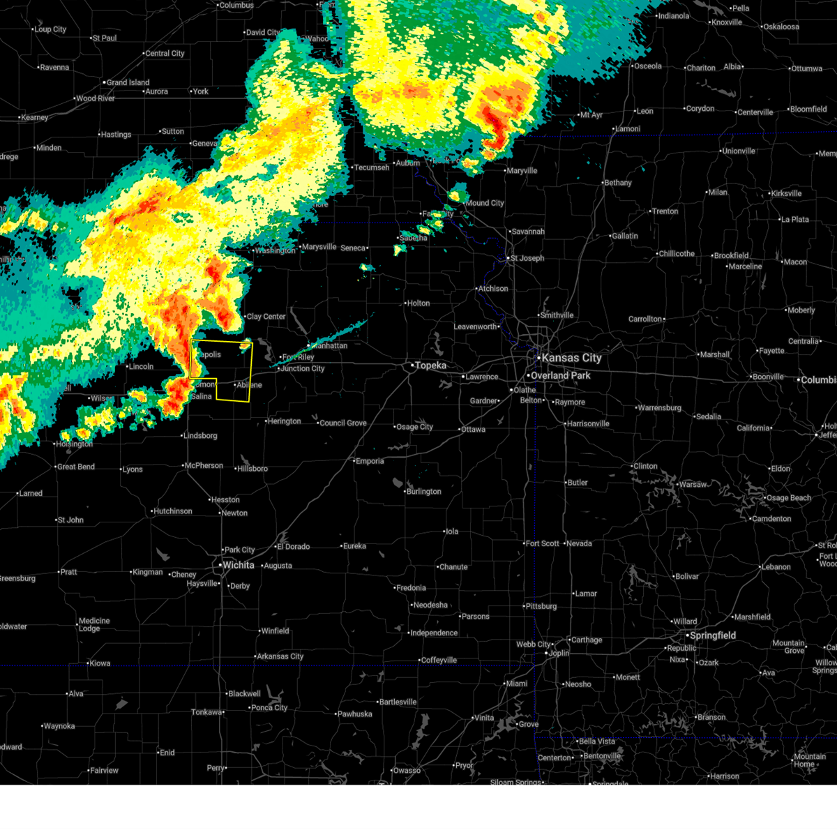 Svrtop the national weather service in topeka has issued a * severe thunderstorm warning for, northwestern dickinson county in central kansas, southeastern ottawa county in north central kansas, southwestern clay county in north central kansas, * until 815 pm cdt. * at 726 pm cdt, a severe thunderstorm was located over niles, moving east at 30 mph (radar indicated). Hazards include 60 mph wind gusts and quarter size hail. Hail damage to vehicles is expected. Expect wind damage to roofs, siding, and trees. Svrtop the national weather service in topeka has issued a * severe thunderstorm warning for, northwestern dickinson county in central kansas, southeastern ottawa county in north central kansas, southwestern clay county in north central kansas, * until 815 pm cdt. * at 726 pm cdt, a severe thunderstorm was located over niles, moving east at 30 mph (radar indicated). Hazards include 60 mph wind gusts and quarter size hail. Hail damage to vehicles is expected. Expect wind damage to roofs, siding, and trees.
|
| 7/31/2024 7:20 PM CDT |
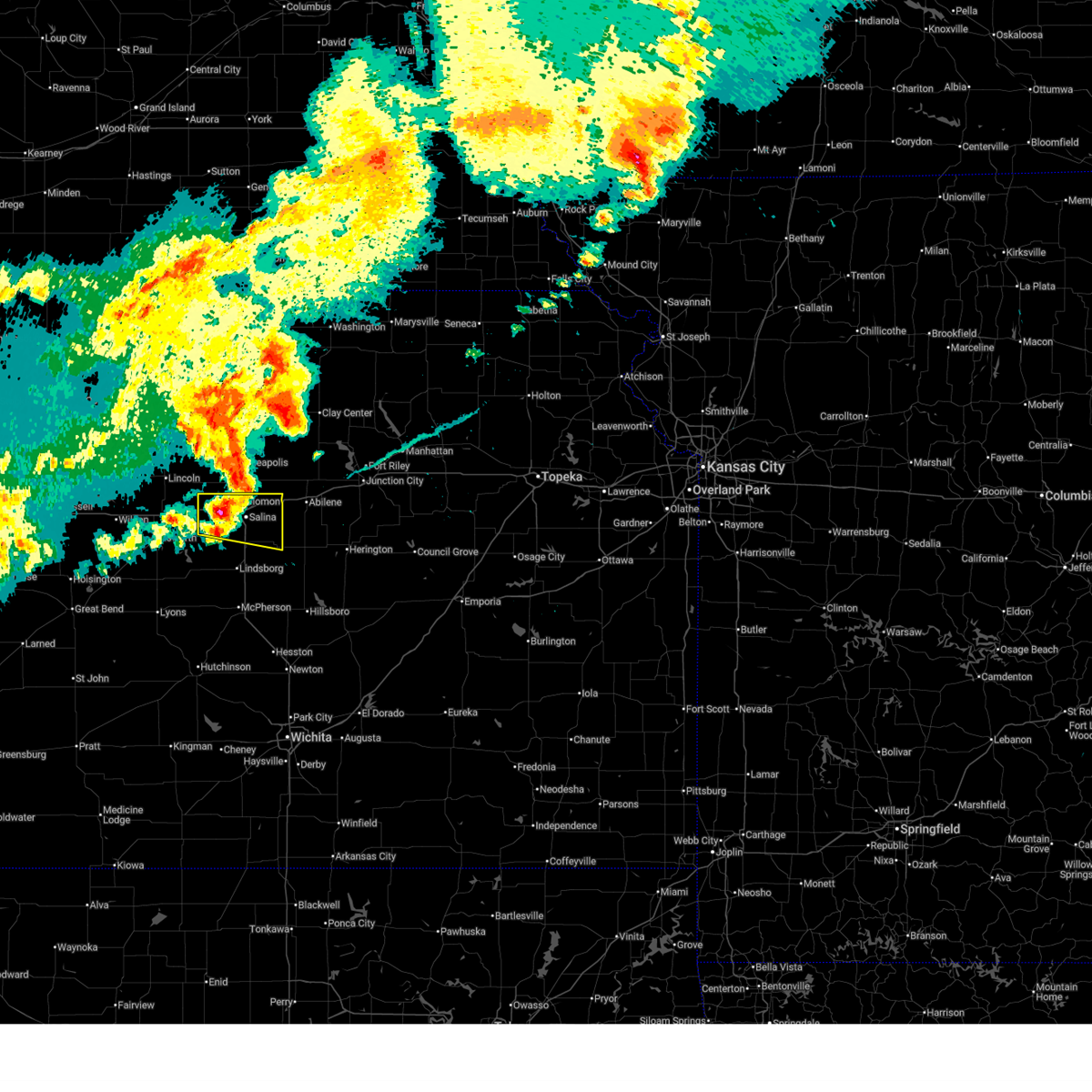 At 718 pm cdt, a severe thunderstorm was located near salina, moving east at 40 mph (asos. at 715 pm cdt, a 74 mph wind gust was reported at salina regional airport). Hazards include 70 mph wind gusts and penny size hail. Expect considerable tree damage. damage is likely to mobile homes, roofs, and outbuildings. Locations impacted include, salina, gypsum, brookville, smolan, new cambria, glendale, salina airport, and kipp. At 718 pm cdt, a severe thunderstorm was located near salina, moving east at 40 mph (asos. at 715 pm cdt, a 74 mph wind gust was reported at salina regional airport). Hazards include 70 mph wind gusts and penny size hail. Expect considerable tree damage. damage is likely to mobile homes, roofs, and outbuildings. Locations impacted include, salina, gypsum, brookville, smolan, new cambria, glendale, salina airport, and kipp.
|
| 7/31/2024 7:07 PM CDT |
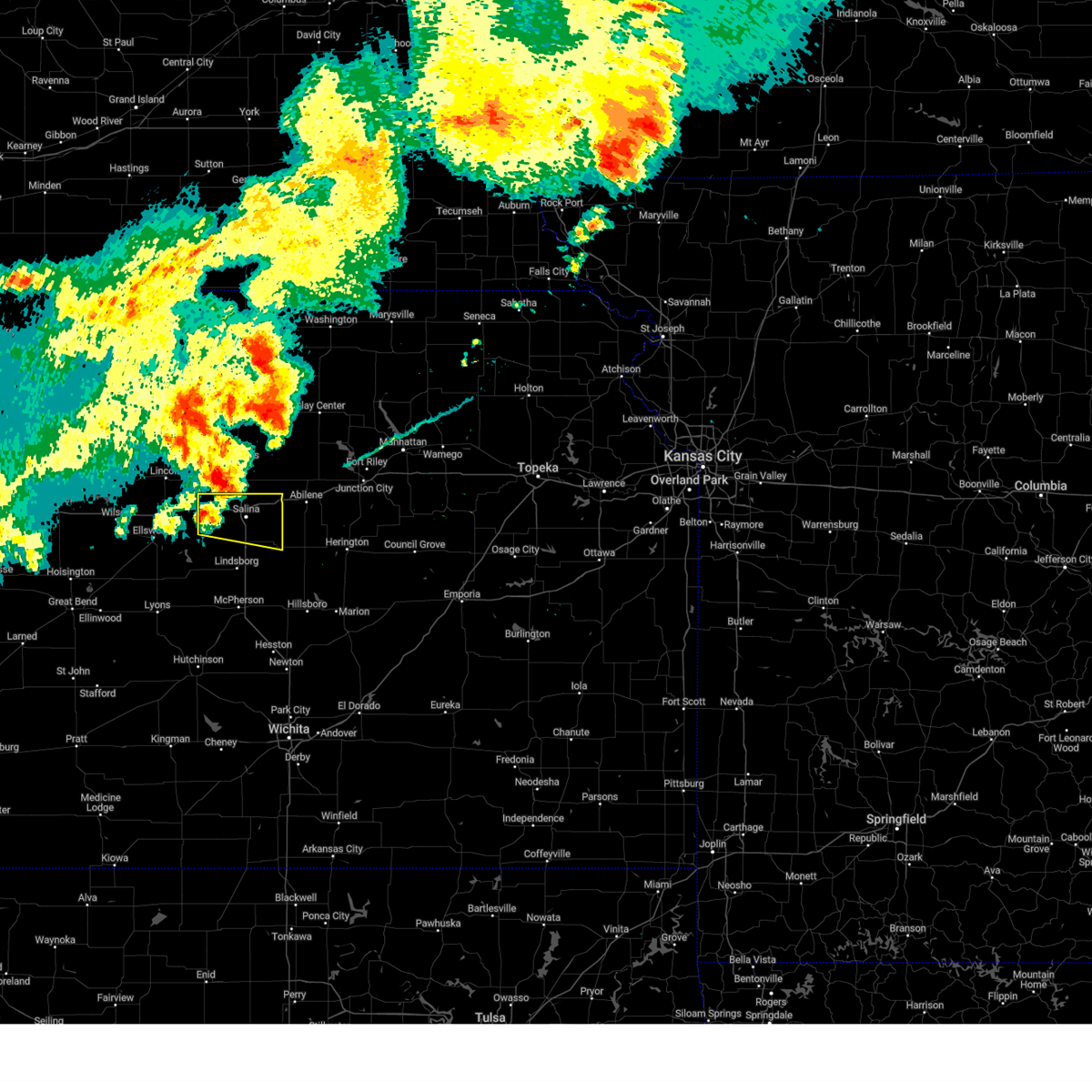 Svrict the national weather service in wichita has issued a * severe thunderstorm warning for, saline county in central kansas, * until 800 pm cdt. * at 706 pm cdt, a severe thunderstorm was located over culver, or 13 miles northwest of salina, moving southeast at 40 mph (radar indicated). Hazards include 60 mph wind gusts and penny size hail. expect damage to roofs, siding, and trees Svrict the national weather service in wichita has issued a * severe thunderstorm warning for, saline county in central kansas, * until 800 pm cdt. * at 706 pm cdt, a severe thunderstorm was located over culver, or 13 miles northwest of salina, moving southeast at 40 mph (radar indicated). Hazards include 60 mph wind gusts and penny size hail. expect damage to roofs, siding, and trees
|
| 7/16/2024 5:57 AM CDT |
 the severe thunderstorm warning has been cancelled and is no longer in effect the severe thunderstorm warning has been cancelled and is no longer in effect
|
| 7/16/2024 5:43 AM CDT |
 At 543 am cdt, a severe thunderstorm was located over solomon, or 9 miles west of abilene, moving east at 45 mph (radar indicated). Hazards include 60 mph wind gusts. Expect damage to roofs, siding, and trees. Locations impacted include, salina and new cambria. At 543 am cdt, a severe thunderstorm was located over solomon, or 9 miles west of abilene, moving east at 45 mph (radar indicated). Hazards include 60 mph wind gusts. Expect damage to roofs, siding, and trees. Locations impacted include, salina and new cambria.
|
| 7/16/2024 5:38 AM CDT |
 At 538 am cdt, severe thunderstorms were located along a line extending from 4 miles northwest of idana to 7 miles east of longford to 3 miles south of enterprise, moving east at 60 mph (radar indicated). Hazards include 70 mph wind gusts and quarter size hail. Hail damage to vehicles is expected. expect considerable tree damage. wind damage is also likely to mobile homes, roofs, and outbuildings. locations impacted include, junction city, abilene, clay center, minneapolis, chapman, solomon, wakefield, enterprise, bennington, miltonvale, milford, delphos, morganville, wells, manchester, longford, oak hill, niles, talmage, and idana. This includes interstate 70 between mile markers 267 and 297. At 538 am cdt, severe thunderstorms were located along a line extending from 4 miles northwest of idana to 7 miles east of longford to 3 miles south of enterprise, moving east at 60 mph (radar indicated). Hazards include 70 mph wind gusts and quarter size hail. Hail damage to vehicles is expected. expect considerable tree damage. wind damage is also likely to mobile homes, roofs, and outbuildings. locations impacted include, junction city, abilene, clay center, minneapolis, chapman, solomon, wakefield, enterprise, bennington, miltonvale, milford, delphos, morganville, wells, manchester, longford, oak hill, niles, talmage, and idana. This includes interstate 70 between mile markers 267 and 297.
|
| 7/16/2024 5:31 AM CDT |
 At 531 am cdt, a severe thunderstorm was located over solomon, or near abilene, moving east at 40 mph (radar indicated). Hazards include 60 mph wind gusts and penny size hail. Expect damage to roofs, siding, and trees. Locations impacted include, salina, new cambria, glendale, and salina airport. At 531 am cdt, a severe thunderstorm was located over solomon, or near abilene, moving east at 40 mph (radar indicated). Hazards include 60 mph wind gusts and penny size hail. Expect damage to roofs, siding, and trees. Locations impacted include, salina, new cambria, glendale, and salina airport.
|
| 7/16/2024 5:27 AM CDT |
 Svrtop the national weather service in topeka has issued a * severe thunderstorm warning for, dickinson county in central kansas, western geary county in east central kansas, southwestern riley county in northeastern kansas, northwestern morris county in east central kansas, ottawa county in north central kansas, clay county in north central kansas, southeastern cloud county in north central kansas, * until 600 am cdt. * at 525 am cdt, severe thunderstorms were located along a line extending from 4 miles west of miltonvale to 3 miles west of longford to 6 miles southeast of solomon, moving east at 60 mph (radar indicated. at 517 am, a 79 mph wind gust was observed at a local weather station 5 miles west of niles). Hazards include 70 mph wind gusts and penny size hail. Expect considerable tree damage. Damage is likely to mobile homes, roofs, and outbuildings. Svrtop the national weather service in topeka has issued a * severe thunderstorm warning for, dickinson county in central kansas, western geary county in east central kansas, southwestern riley county in northeastern kansas, northwestern morris county in east central kansas, ottawa county in north central kansas, clay county in north central kansas, southeastern cloud county in north central kansas, * until 600 am cdt. * at 525 am cdt, severe thunderstorms were located along a line extending from 4 miles west of miltonvale to 3 miles west of longford to 6 miles southeast of solomon, moving east at 60 mph (radar indicated. at 517 am, a 79 mph wind gust was observed at a local weather station 5 miles west of niles). Hazards include 70 mph wind gusts and penny size hail. Expect considerable tree damage. Damage is likely to mobile homes, roofs, and outbuildings.
|
| 7/16/2024 5:22 AM CDT |
 At 521 am cdt, a severe thunderstorm was located near solomon, or 11 miles west of abilene, moving east at 40 mph (radar indicated). Hazards include 60 mph wind gusts and penny size hail. Expect damage to roofs, siding, and trees. Locations impacted include, salina, assaria, gypsum, brookville, smolan, new cambria, falun, glendale, bridgeport, salina airport, and kipp. At 521 am cdt, a severe thunderstorm was located near solomon, or 11 miles west of abilene, moving east at 40 mph (radar indicated). Hazards include 60 mph wind gusts and penny size hail. Expect damage to roofs, siding, and trees. Locations impacted include, salina, assaria, gypsum, brookville, smolan, new cambria, falun, glendale, bridgeport, salina airport, and kipp.
|
| 7/16/2024 5:05 AM CDT |
 At 504 am cdt, a severe thunderstorm was located 6 miles north of salina, moving east at 40 mph (radar indicated). Hazards include 60 mph wind gusts and penny size hail. Expect damage to roofs, siding, and trees. Locations impacted include, salina, assaria, gypsum, brookville, smolan, new cambria, falun, glendale, bridgeport, salina airport, and kipp. At 504 am cdt, a severe thunderstorm was located 6 miles north of salina, moving east at 40 mph (radar indicated). Hazards include 60 mph wind gusts and penny size hail. Expect damage to roofs, siding, and trees. Locations impacted include, salina, assaria, gypsum, brookville, smolan, new cambria, falun, glendale, bridgeport, salina airport, and kipp.
|
| 7/16/2024 4:50 AM CDT |
 At 450 am cdt, a severe thunderstorm was located near culver, or 10 miles northwest of salina, moving east at 40 mph (radar indicated). Hazards include 70 mph wind gusts and penny size hail. Expect considerable tree damage. damage is likely to mobile homes, roofs, and outbuildings. Locations impacted include, salina, assaria, gypsum, brookville, smolan, new cambria, falun, glendale, bridgeport, salina airport, and kipp. At 450 am cdt, a severe thunderstorm was located near culver, or 10 miles northwest of salina, moving east at 40 mph (radar indicated). Hazards include 70 mph wind gusts and penny size hail. Expect considerable tree damage. damage is likely to mobile homes, roofs, and outbuildings. Locations impacted include, salina, assaria, gypsum, brookville, smolan, new cambria, falun, glendale, bridgeport, salina airport, and kipp.
|
| 7/16/2024 4:38 AM CDT |
 Svrict the national weather service in wichita has issued a * severe thunderstorm warning for, saline county in central kansas, * until 615 am cdt. * at 438 am cdt, a severe thunderstorm was located 6 miles northwest of brookville, or 15 miles northeast of kanopolis, moving east at 35 mph (radar indicated). Hazards include 70 mph wind gusts and penny size hail. Expect considerable tree damage. Damage is likely to mobile homes, roofs, and outbuildings. Svrict the national weather service in wichita has issued a * severe thunderstorm warning for, saline county in central kansas, * until 615 am cdt. * at 438 am cdt, a severe thunderstorm was located 6 miles northwest of brookville, or 15 miles northeast of kanopolis, moving east at 35 mph (radar indicated). Hazards include 70 mph wind gusts and penny size hail. Expect considerable tree damage. Damage is likely to mobile homes, roofs, and outbuildings.
|
| 7/4/2024 12:48 AM CDT |
 At 1248 am cdt, severe thunderstorms were located along a line extending from 7 miles southeast of idana to near talmage to near gypsum, moving east at 45 mph (radar indicated). Hazards include 70 mph wind gusts. Expect considerable tree damage. damage is likely to mobile homes, roofs, and outbuildings. locations impacted include, junction city, abilene, herington, grandview plaza, chapman, solomon, wakefield, riley, enterprise, milford, hope, woodbine, manchester, longford, carlton, oak hill, talmage, milford lake, and moonlight. This includes interstate 70 between mile markers 267 and 300. At 1248 am cdt, severe thunderstorms were located along a line extending from 7 miles southeast of idana to near talmage to near gypsum, moving east at 45 mph (radar indicated). Hazards include 70 mph wind gusts. Expect considerable tree damage. damage is likely to mobile homes, roofs, and outbuildings. locations impacted include, junction city, abilene, herington, grandview plaza, chapman, solomon, wakefield, riley, enterprise, milford, hope, woodbine, manchester, longford, carlton, oak hill, talmage, milford lake, and moonlight. This includes interstate 70 between mile markers 267 and 300.
|
| 7/4/2024 12:35 AM CDT |
 Svrtop the national weather service in topeka has issued a * severe thunderstorm warning for, dickinson county in central kansas, western geary county in east central kansas, southwestern riley county in northeastern kansas, eastern ottawa county in north central kansas, southern clay county in north central kansas, * until 115 am cdt. * at 1234 am cdt, severe thunderstorms were located along a line extending from 3 miles west of oak hill to 4 miles northeast of niles to 4 miles south of salina, moving east at 45 mph (at 12:28am, law enforcement reported 55 to 65mph winds in culver). Hazards include 70 mph wind gusts. Expect considerable tree damage. Damage is likely to mobile homes, roofs, and outbuildings. Svrtop the national weather service in topeka has issued a * severe thunderstorm warning for, dickinson county in central kansas, western geary county in east central kansas, southwestern riley county in northeastern kansas, eastern ottawa county in north central kansas, southern clay county in north central kansas, * until 115 am cdt. * at 1234 am cdt, severe thunderstorms were located along a line extending from 3 miles west of oak hill to 4 miles northeast of niles to 4 miles south of salina, moving east at 45 mph (at 12:28am, law enforcement reported 55 to 65mph winds in culver). Hazards include 70 mph wind gusts. Expect considerable tree damage. Damage is likely to mobile homes, roofs, and outbuildings.
|
| 7/4/2024 12:06 AM CDT |
 Svrict the national weather service in wichita has issued a * severe thunderstorm warning for, saline county in central kansas, * until 100 am cdt. * at 1206 am cdt, severe thunderstorms were located along a line extending from near ada to 10 miles south of beverly to 5 miles northeast of lorraine, moving east at 55 mph (radar indicated). Hazards include 70 mph wind gusts and penny size hail. Expect considerable tree damage. Damage is likely to mobile homes, roofs, and outbuildings. Svrict the national weather service in wichita has issued a * severe thunderstorm warning for, saline county in central kansas, * until 100 am cdt. * at 1206 am cdt, severe thunderstorms were located along a line extending from near ada to 10 miles south of beverly to 5 miles northeast of lorraine, moving east at 55 mph (radar indicated). Hazards include 70 mph wind gusts and penny size hail. Expect considerable tree damage. Damage is likely to mobile homes, roofs, and outbuildings.
|
| 6/26/2024 4:06 AM CDT |
 At 406 am cdt, severe thunderstorms were located along a line extending from 4 miles northeast of moonlight to solomon, moving southeast at 45 mph (radar indicated). Hazards include 60 mph wind gusts and penny size hail. Expect damage to roofs, siding, and trees. locations impacted include, abilene, herington, chapman, solomon, enterprise, hope, woodbine, manchester, carlton, niles, moonlight, and talmage. This includes interstate 70 between mile markers 267 and 289. At 406 am cdt, severe thunderstorms were located along a line extending from 4 miles northeast of moonlight to solomon, moving southeast at 45 mph (radar indicated). Hazards include 60 mph wind gusts and penny size hail. Expect damage to roofs, siding, and trees. locations impacted include, abilene, herington, chapman, solomon, enterprise, hope, woodbine, manchester, carlton, niles, moonlight, and talmage. This includes interstate 70 between mile markers 267 and 289.
|
| 6/26/2024 4:06 AM CDT |
 the severe thunderstorm warning has been cancelled and is no longer in effect the severe thunderstorm warning has been cancelled and is no longer in effect
|
| 6/26/2024 3:52 AM CDT |
 At 352 am cdt, severe thunderstorms were located along a line extending from 8 miles southwest of wakefield to 5 miles north of niles, moving southeast at 45 mph (radar indicated). Hazards include 60 mph wind gusts and penny size hail. Expect damage to roofs, siding, and trees. locations impacted include, abilene, herington, chapman, solomon, enterprise, hope, woodbine, manchester, longford, carlton, niles, talmage, and moonlight. This includes interstate 70 between mile markers 267 and 289. At 352 am cdt, severe thunderstorms were located along a line extending from 8 miles southwest of wakefield to 5 miles north of niles, moving southeast at 45 mph (radar indicated). Hazards include 60 mph wind gusts and penny size hail. Expect damage to roofs, siding, and trees. locations impacted include, abilene, herington, chapman, solomon, enterprise, hope, woodbine, manchester, longford, carlton, niles, talmage, and moonlight. This includes interstate 70 between mile markers 267 and 289.
|
| 6/26/2024 3:37 AM CDT |
 Svrtop the national weather service in topeka has issued a * severe thunderstorm warning for, dickinson county in central kansas, eastern ottawa county in north central kansas, southwestern clay county in north central kansas, * until 445 am cdt. * at 337 am cdt, severe thunderstorms were located along a line extending from 4 miles northeast of oak hill to near wells, moving southeast at 45 mph (radar indicated). Hazards include 60 mph wind gusts. expect damage to roofs, siding, and trees Svrtop the national weather service in topeka has issued a * severe thunderstorm warning for, dickinson county in central kansas, eastern ottawa county in north central kansas, southwestern clay county in north central kansas, * until 445 am cdt. * at 337 am cdt, severe thunderstorms were located along a line extending from 4 miles northeast of oak hill to near wells, moving southeast at 45 mph (radar indicated). Hazards include 60 mph wind gusts. expect damage to roofs, siding, and trees
|
| 6/18/2024 9:10 PM CDT |
 the severe thunderstorm warning has been cancelled and is no longer in effect the severe thunderstorm warning has been cancelled and is no longer in effect
|
| 6/18/2024 8:56 PM CDT |
 Svrict the national weather service in wichita has issued a * severe thunderstorm warning for, northeastern mcpherson county in central kansas, saline county in central kansas, * until 930 pm cdt. * at 855 pm cdt, severe thunderstorms were located along a line extending from near culver to near smolan to lindsborg, moving east at 35 mph (radar indicated). Hazards include 60 mph wind gusts. expect damage to roofs, siding, and trees Svrict the national weather service in wichita has issued a * severe thunderstorm warning for, northeastern mcpherson county in central kansas, saline county in central kansas, * until 930 pm cdt. * at 855 pm cdt, severe thunderstorms were located along a line extending from near culver to near smolan to lindsborg, moving east at 35 mph (radar indicated). Hazards include 60 mph wind gusts. expect damage to roofs, siding, and trees
|
| 6/15/2024 4:36 PM CDT | Power poles broken and trees down between granite and homestead roads. time estimated from rada in ottawa county KS, 11.1 miles SSE of Solomon, KS |
| 6/15/2024 4:34 PM CDT |
 At 434 pm cdt, a severe thunderstorm was located 6 miles southeast of wells, moving northeast at 35 mph (radar indicated). Hazards include 60 mph wind gusts and penny size hail. Expect damage to roofs, siding, and trees. locations impacted include, solomon, bennington, wells, manchester, longford, niles, and talmage. This includes interstate 70 between mile markers 267 and 269. At 434 pm cdt, a severe thunderstorm was located 6 miles southeast of wells, moving northeast at 35 mph (radar indicated). Hazards include 60 mph wind gusts and penny size hail. Expect damage to roofs, siding, and trees. locations impacted include, solomon, bennington, wells, manchester, longford, niles, and talmage. This includes interstate 70 between mile markers 267 and 269.
|
| 6/15/2024 4:33 PM CDT |
 the severe thunderstorm warning has been cancelled and is no longer in effect the severe thunderstorm warning has been cancelled and is no longer in effect
|
| 6/15/2024 4:22 PM CDT |
 At 422 pm cdt, a severe thunderstorm was located near new cambria, or near salina, moving northeast at 35 mph (radar indicated). Hazards include 70 mph wind gusts. Expect considerable tree damage. damage is likely to mobile homes, roofs, and outbuildings. Locations impacted include, salina and new cambria. At 422 pm cdt, a severe thunderstorm was located near new cambria, or near salina, moving northeast at 35 mph (radar indicated). Hazards include 70 mph wind gusts. Expect considerable tree damage. damage is likely to mobile homes, roofs, and outbuildings. Locations impacted include, salina and new cambria.
|
| 6/15/2024 4:14 PM CDT |
 Svrtop the national weather service in topeka has issued a * severe thunderstorm warning for, northwestern dickinson county in central kansas, eastern ottawa county in north central kansas, southwestern clay county in north central kansas, * until 500 pm cdt. * at 413 pm cdt, a severe thunderstorm was located over salina, moving northeast at 35 mph (radar indicated). Hazards include 70 mph wind gusts. Expect considerable tree damage. Damage is likely to mobile homes, roofs, and outbuildings. Svrtop the national weather service in topeka has issued a * severe thunderstorm warning for, northwestern dickinson county in central kansas, eastern ottawa county in north central kansas, southwestern clay county in north central kansas, * until 500 pm cdt. * at 413 pm cdt, a severe thunderstorm was located over salina, moving northeast at 35 mph (radar indicated). Hazards include 70 mph wind gusts. Expect considerable tree damage. Damage is likely to mobile homes, roofs, and outbuildings.
|
| 6/15/2024 4:09 PM CDT |
 Svrict the national weather service in wichita has issued a * severe thunderstorm warning for, central saline county in central kansas, * until 500 pm cdt. * at 409 pm cdt, a severe thunderstorm was located over salina, moving northeast at 35 mph (radar indicated). Hazards include 70 mph wind gusts. Expect considerable tree damage. Damage is likely to mobile homes, roofs, and outbuildings. Svrict the national weather service in wichita has issued a * severe thunderstorm warning for, central saline county in central kansas, * until 500 pm cdt. * at 409 pm cdt, a severe thunderstorm was located over salina, moving northeast at 35 mph (radar indicated). Hazards include 70 mph wind gusts. Expect considerable tree damage. Damage is likely to mobile homes, roofs, and outbuildings.
|
| 6/13/2024 8:24 PM CDT |
 The storm which prompted the warning has weakened below severe limits, and no longer poses an immediate threat to life or property. therefore, the warning will be allowed to expire. however, small hail and gusty winds are still possible with this thunderstorm. a severe thunderstorm watch remains in effect until 1100 pm cdt for central and north central kansas. remember, a severe thunderstorm warning still remains in effect for eastern ottawa county until 845 pm. The storm which prompted the warning has weakened below severe limits, and no longer poses an immediate threat to life or property. therefore, the warning will be allowed to expire. however, small hail and gusty winds are still possible with this thunderstorm. a severe thunderstorm watch remains in effect until 1100 pm cdt for central and north central kansas. remember, a severe thunderstorm warning still remains in effect for eastern ottawa county until 845 pm.
|
| 6/13/2024 7:54 PM CDT |
 At 754 pm cdt, a severe thunderstorm was located over solomon, moving southeast at 15 mph (trained weather spotter reported quarter size hail 4 miles north of niles). Hazards include 60 mph wind gusts and quarter size hail. Hail damage to vehicles is expected. expect wind damage to roofs, siding, and trees. locations impacted include, abilene, chapman, solomon, enterprise, niles, moonlight, and talmage. This includes interstate 70 between mile markers 267 and 286. At 754 pm cdt, a severe thunderstorm was located over solomon, moving southeast at 15 mph (trained weather spotter reported quarter size hail 4 miles north of niles). Hazards include 60 mph wind gusts and quarter size hail. Hail damage to vehicles is expected. expect wind damage to roofs, siding, and trees. locations impacted include, abilene, chapman, solomon, enterprise, niles, moonlight, and talmage. This includes interstate 70 between mile markers 267 and 286.
|
| 6/13/2024 7:51 PM CDT | Quarter sized hail reported 8.9 miles SSE of Solomon, KS |
| 6/13/2024 7:44 PM CDT |
 Svrtop the national weather service in topeka has issued a * severe thunderstorm warning for, central dickinson county in central kansas, southeastern ottawa county in north central kansas, * until 830 pm cdt. * at 743 pm cdt, a severe thunderstorm was located 4 miles southwest of talmage, moving east at 20 mph (radar indicated). Hazards include 60 mph wind gusts and quarter size hail. Hail damage to vehicles is expected. Expect wind damage to roofs, siding, and trees. Svrtop the national weather service in topeka has issued a * severe thunderstorm warning for, central dickinson county in central kansas, southeastern ottawa county in north central kansas, * until 830 pm cdt. * at 743 pm cdt, a severe thunderstorm was located 4 miles southwest of talmage, moving east at 20 mph (radar indicated). Hazards include 60 mph wind gusts and quarter size hail. Hail damage to vehicles is expected. Expect wind damage to roofs, siding, and trees.
|
| 6/13/2024 7:29 PM CDT |
 At 728 pm cdt, a severe thunderstorm was located over talmage, moving southeast at 15 mph (law enforcement reported quarter size hail 6 miles southwest of manchester at 726 pm ct). Hazards include 60 mph wind gusts and half dollar size hail. Hail damage to vehicles is expected. expect wind damage to roofs, siding, and trees. locations impacted include, abilene, solomon, enterprise, manchester, niles, moonlight, and talmage. This includes interstate 70 between mile markers 267 and 283. At 728 pm cdt, a severe thunderstorm was located over talmage, moving southeast at 15 mph (law enforcement reported quarter size hail 6 miles southwest of manchester at 726 pm ct). Hazards include 60 mph wind gusts and half dollar size hail. Hail damage to vehicles is expected. expect wind damage to roofs, siding, and trees. locations impacted include, abilene, solomon, enterprise, manchester, niles, moonlight, and talmage. This includes interstate 70 between mile markers 267 and 283.
|
| 6/13/2024 7:27 PM CDT |
 the severe thunderstorm warning has been cancelled and is no longer in effect the severe thunderstorm warning has been cancelled and is no longer in effect
|
| 6/13/2024 7:27 PM CDT |
 At 726 pm cdt, a severe thunderstorm was located over talmage, moving southeast at 15 mph (radar indicated). Hazards include 60 mph wind gusts and half dollar size hail. Hail damage to vehicles is expected. expect wind damage to roofs, siding, and trees. locations impacted include, abilene, solomon, enterprise, manchester, niles, moonlight, and talmage. This includes interstate 70 between mile markers 267 and 283. At 726 pm cdt, a severe thunderstorm was located over talmage, moving southeast at 15 mph (radar indicated). Hazards include 60 mph wind gusts and half dollar size hail. Hail damage to vehicles is expected. expect wind damage to roofs, siding, and trees. locations impacted include, abilene, solomon, enterprise, manchester, niles, moonlight, and talmage. This includes interstate 70 between mile markers 267 and 283.
|
| 6/13/2024 7:25 PM CDT | Quarter sized hail reported 7.6 miles S of Solomon, KS, 50 mph wind gusts with the hail. tree limbs down closer to bennington. |
| 6/13/2024 7:16 PM CDT | Ping Pong Ball sized hail reported 7.5 miles SSE of Solomon, KS |
| 6/13/2024 7:16 PM CDT |
 At 716 pm cdt, a severe thunderstorm was located near manchester, moving southeast at 15 mph (trained weather spotters reported ping pong ball size hail 9 west of talmage at 713 pm). Hazards include ping pong ball size hail and 60 mph wind gusts. People and animals outdoors will be injured. expect hail damage to roofs, siding, windows, and vehicles. expect wind damage to roofs, siding, and trees. locations impacted include, abilene, solomon, enterprise, manchester, longford, niles, moonlight, and talmage. This includes interstate 70 between mile markers 267 and 283. At 716 pm cdt, a severe thunderstorm was located near manchester, moving southeast at 15 mph (trained weather spotters reported ping pong ball size hail 9 west of talmage at 713 pm). Hazards include ping pong ball size hail and 60 mph wind gusts. People and animals outdoors will be injured. expect hail damage to roofs, siding, windows, and vehicles. expect wind damage to roofs, siding, and trees. locations impacted include, abilene, solomon, enterprise, manchester, longford, niles, moonlight, and talmage. This includes interstate 70 between mile markers 267 and 283.
|
| 6/13/2024 7:15 PM CDT |
 At 714 pm cdt, a severe thunderstorm was located near manchester, moving southeast at 15 mph (emergency management reported quarter size hail at 708 pm south of longford). Hazards include 60 mph wind gusts and quarter size hail. Hail damage to vehicles is expected. expect wind damage to roofs, siding, and trees. locations impacted include, abilene, solomon, enterprise, manchester, longford, niles, moonlight, and talmage. This includes interstate 70 between mile markers 267 and 283. At 714 pm cdt, a severe thunderstorm was located near manchester, moving southeast at 15 mph (emergency management reported quarter size hail at 708 pm south of longford). Hazards include 60 mph wind gusts and quarter size hail. Hail damage to vehicles is expected. expect wind damage to roofs, siding, and trees. locations impacted include, abilene, solomon, enterprise, manchester, longford, niles, moonlight, and talmage. This includes interstate 70 between mile markers 267 and 283.
|
| 6/13/2024 7:14 PM CDT |
 the severe thunderstorm warning has been cancelled and is no longer in effect the severe thunderstorm warning has been cancelled and is no longer in effect
|
| 6/13/2024 7:12 PM CDT | Half Dollar sized hail reported 7.6 miles S of Solomon, KS, report from mping: half dollar (1.25 in.). |
| 6/13/2024 7:02 PM CDT |
 At 701 pm cdt, a severe thunderstorm was located over niles, or 11 miles west of abilene, moving southeast at 30 mph (radar indicated). Hazards include 60 mph wind gusts and penny size hail. Expect damage to roofs, siding, and trees. Locations impacted include, new cambria. At 701 pm cdt, a severe thunderstorm was located over niles, or 11 miles west of abilene, moving southeast at 30 mph (radar indicated). Hazards include 60 mph wind gusts and penny size hail. Expect damage to roofs, siding, and trees. Locations impacted include, new cambria.
|
| 6/13/2024 6:55 PM CDT |
 Svrtop the national weather service in topeka has issued a * severe thunderstorm warning for, northwestern dickinson county in central kansas, southeastern ottawa county in north central kansas, southwestern clay county in north central kansas, * until 745 pm cdt. * at 654 pm cdt, a severe thunderstorm was located near manchester, moving southeast at 15 mph (radar indicated). Hazards include ping pong ball size hail and 60 mph wind gusts. People and animals outdoors will be injured. expect hail damage to roofs, siding, windows, and vehicles. Expect wind damage to roofs, siding, and trees. Svrtop the national weather service in topeka has issued a * severe thunderstorm warning for, northwestern dickinson county in central kansas, southeastern ottawa county in north central kansas, southwestern clay county in north central kansas, * until 745 pm cdt. * at 654 pm cdt, a severe thunderstorm was located near manchester, moving southeast at 15 mph (radar indicated). Hazards include ping pong ball size hail and 60 mph wind gusts. People and animals outdoors will be injured. expect hail damage to roofs, siding, windows, and vehicles. Expect wind damage to roofs, siding, and trees.
|
| 6/13/2024 6:44 PM CDT |
 Svrict the national weather service in wichita has issued a * severe thunderstorm warning for, northeastern saline county in central kansas, * until 745 pm cdt. * at 644 pm cdt, a severe thunderstorm was located near niles, or 10 miles northeast of salina, moving south at 10 mph (radar indicated). Hazards include 60 mph wind gusts and penny size hail. expect damage to roofs, siding, and trees Svrict the national weather service in wichita has issued a * severe thunderstorm warning for, northeastern saline county in central kansas, * until 745 pm cdt. * at 644 pm cdt, a severe thunderstorm was located near niles, or 10 miles northeast of salina, moving south at 10 mph (radar indicated). Hazards include 60 mph wind gusts and penny size hail. expect damage to roofs, siding, and trees
|
| 6/13/2024 6:39 PM CDT |
 At 638 pm cdt, a severe thunderstorm was located near longford, moving south at 20 mph (public). Hazards include ping pong ball size hail and 60 mph wind gusts. People and animals outdoors will be injured. expect hail damage to roofs, siding, windows, and vehicles. expect wind damage to roofs, siding, and trees. locations impacted include, abilene, solomon, enterprise, bennington, manchester, longford, niles, moonlight, and talmage. This includes interstate 70 between mile markers 267 and 282. At 638 pm cdt, a severe thunderstorm was located near longford, moving south at 20 mph (public). Hazards include ping pong ball size hail and 60 mph wind gusts. People and animals outdoors will be injured. expect hail damage to roofs, siding, windows, and vehicles. expect wind damage to roofs, siding, and trees. locations impacted include, abilene, solomon, enterprise, bennington, manchester, longford, niles, moonlight, and talmage. This includes interstate 70 between mile markers 267 and 282.
|
| 6/13/2024 6:37 PM CDT |
 At 637 pm cdt, a severe thunderstorm was located over longford, moving south at 20 mph (trained weather spotters). Hazards include 60 mph wind gusts and half dollar size hail. Hail damage to vehicles is expected. expect wind damage to roofs, siding, and trees. locations impacted include, abilene, solomon, enterprise, bennington, manchester, longford, niles, moonlight, and talmage. This includes interstate 70 between mile markers 267 and 282. At 637 pm cdt, a severe thunderstorm was located over longford, moving south at 20 mph (trained weather spotters). Hazards include 60 mph wind gusts and half dollar size hail. Hail damage to vehicles is expected. expect wind damage to roofs, siding, and trees. locations impacted include, abilene, solomon, enterprise, bennington, manchester, longford, niles, moonlight, and talmage. This includes interstate 70 between mile markers 267 and 282.
|
| 6/13/2024 6:26 PM CDT |
 At 625 pm cdt, a severe thunderstorm was located over niles, or 11 miles northeast of salina, moving southeast at 15 mph (radar indicated). Hazards include 60 mph wind gusts and quarter size hail. Hail damage to vehicles is expected. expect wind damage to roofs, siding, and trees. Locations impacted include, salina and new cambria. At 625 pm cdt, a severe thunderstorm was located over niles, or 11 miles northeast of salina, moving southeast at 15 mph (radar indicated). Hazards include 60 mph wind gusts and quarter size hail. Hail damage to vehicles is expected. expect wind damage to roofs, siding, and trees. Locations impacted include, salina and new cambria.
|
| 6/13/2024 6:17 PM CDT |
 Svrict the national weather service in wichita has issued a * severe thunderstorm warning for, northeastern saline county in central kansas, * until 645 pm cdt. * at 616 pm cdt, a severe thunderstorm was located near bennington, or 12 miles southeast of minneapolis, moving southeast at 15 mph (radar indicated). Hazards include 60 mph wind gusts and quarter size hail. Hail damage to vehicles is expected. Expect wind damage to roofs, siding, and trees. Svrict the national weather service in wichita has issued a * severe thunderstorm warning for, northeastern saline county in central kansas, * until 645 pm cdt. * at 616 pm cdt, a severe thunderstorm was located near bennington, or 12 miles southeast of minneapolis, moving southeast at 15 mph (radar indicated). Hazards include 60 mph wind gusts and quarter size hail. Hail damage to vehicles is expected. Expect wind damage to roofs, siding, and trees.
|
| 6/13/2024 6:12 PM CDT |
 Svrtop the national weather service in topeka has issued a * severe thunderstorm warning for, northwestern dickinson county in central kansas, southeastern ottawa county in north central kansas, southwestern clay county in north central kansas, * until 700 pm cdt. * at 611 pm cdt, a severe thunderstorm was located 6 miles north of niles, moving south at 15 mph (radar indicated). Hazards include 60 mph wind gusts and half dollar size hail. Hail damage to vehicles is expected. Expect wind damage to roofs, siding, and trees. Svrtop the national weather service in topeka has issued a * severe thunderstorm warning for, northwestern dickinson county in central kansas, southeastern ottawa county in north central kansas, southwestern clay county in north central kansas, * until 700 pm cdt. * at 611 pm cdt, a severe thunderstorm was located 6 miles north of niles, moving south at 15 mph (radar indicated). Hazards include 60 mph wind gusts and half dollar size hail. Hail damage to vehicles is expected. Expect wind damage to roofs, siding, and trees.
|
| 6/7/2024 11:11 PM CDT |
 At 1110 pm cdt, a severe thunderstorm was located 6 miles northwest of durham, or 11 miles northeast of canton, moving east at 45 mph (public). Hazards include 60 mph wind gusts. Expect damage to roofs, siding, and trees. Locations impacted include, salina, lindsborg, assaria, gypsum, smolan, new cambria, bridgeport, salina airport, roxbury, and kipp. At 1110 pm cdt, a severe thunderstorm was located 6 miles northwest of durham, or 11 miles northeast of canton, moving east at 45 mph (public). Hazards include 60 mph wind gusts. Expect damage to roofs, siding, and trees. Locations impacted include, salina, lindsborg, assaria, gypsum, smolan, new cambria, bridgeport, salina airport, roxbury, and kipp.
|
| 6/7/2024 11:11 PM CDT |
 the severe thunderstorm warning has been cancelled and is no longer in effect the severe thunderstorm warning has been cancelled and is no longer in effect
|
| 6/7/2024 11:09 PM CDT |
 At 1108 pm cdt, a severe thunderstorm was located 7 miles northeast of carlton, moving east at 50 mph (radar indicated). Hazards include 70 mph wind gusts and nickel size hail. Expect considerable tree damage. damage is likely to mobile homes, roofs, and outbuildings. locations impacted include, abilene, herington, chapman, solomon, enterprise, hope, woodbine, carlton, and moonlight. This includes interstate 70 between mile markers 267 and 289. At 1108 pm cdt, a severe thunderstorm was located 7 miles northeast of carlton, moving east at 50 mph (radar indicated). Hazards include 70 mph wind gusts and nickel size hail. Expect considerable tree damage. damage is likely to mobile homes, roofs, and outbuildings. locations impacted include, abilene, herington, chapman, solomon, enterprise, hope, woodbine, carlton, and moonlight. This includes interstate 70 between mile markers 267 and 289.
|
| 6/7/2024 11:00 PM CDT |
 At 1100 pm cdt, a severe thunderstorm was located 7 miles south of gypsum, or 13 miles east of lindsborg, moving east at 50 mph (radar indicated). Hazards include 60 mph wind gusts. Expect damage to roofs, siding, and trees. Locations impacted include, salina, lindsborg, marquette, little river, assaria, gypsum, geneseo, brookville, smolan, windom, new cambria, falun, glendale, frederick, salina airport, roxbury, bridgeport, and kipp. At 1100 pm cdt, a severe thunderstorm was located 7 miles south of gypsum, or 13 miles east of lindsborg, moving east at 50 mph (radar indicated). Hazards include 60 mph wind gusts. Expect damage to roofs, siding, and trees. Locations impacted include, salina, lindsborg, marquette, little river, assaria, gypsum, geneseo, brookville, smolan, windom, new cambria, falun, glendale, frederick, salina airport, roxbury, bridgeport, and kipp.
|
| 6/7/2024 10:57 PM CDT |
 Svrtop the national weather service in topeka has issued a * severe thunderstorm warning for, dickinson county in central kansas, * until 1130 pm cdt. * at 1056 pm cdt, a severe thunderstorm was located 5 miles north of gypsum, moving east at 50 mph (radar indicated). Hazards include 70 mph wind gusts and nickel size hail. Expect considerable tree damage. Damage is likely to mobile homes, roofs, and outbuildings. Svrtop the national weather service in topeka has issued a * severe thunderstorm warning for, dickinson county in central kansas, * until 1130 pm cdt. * at 1056 pm cdt, a severe thunderstorm was located 5 miles north of gypsum, moving east at 50 mph (radar indicated). Hazards include 70 mph wind gusts and nickel size hail. Expect considerable tree damage. Damage is likely to mobile homes, roofs, and outbuildings.
|
| 6/7/2024 10:23 PM CDT |
 Svrict the national weather service in wichita has issued a * severe thunderstorm warning for, northern mcpherson county in central kansas, northeastern rice county in central kansas, saline county in central kansas, * until 1130 pm cdt. * at 1022 pm cdt, a severe thunderstorm was located near brookville, or 12 miles northeast of kanopolis, moving east at 50 mph (radar indicated). Hazards include 70 mph wind gusts and penny size hail. Expect considerable tree damage. Damage is likely to mobile homes, roofs, and outbuildings. Svrict the national weather service in wichita has issued a * severe thunderstorm warning for, northern mcpherson county in central kansas, northeastern rice county in central kansas, saline county in central kansas, * until 1130 pm cdt. * at 1022 pm cdt, a severe thunderstorm was located near brookville, or 12 miles northeast of kanopolis, moving east at 50 mph (radar indicated). Hazards include 70 mph wind gusts and penny size hail. Expect considerable tree damage. Damage is likely to mobile homes, roofs, and outbuildings.
|
| 5/19/2024 6:45 PM CDT |
 At 645 pm cdt, severe thunderstorms were located along a line extending from near talmage to near enterprise to 4 miles west of hope, moving east at 25 mph (radar indicated). Hazards include 70 mph wind gusts and ping pong ball size hail. People and animals outdoors will be injured. expect hail damage to roofs, siding, windows, and vehicles. expect considerable tree damage. wind damage is also likely to mobile homes, roofs, and outbuildings. locations impacted include, abilene, chapman, solomon, enterprise, hope, woodbine, manchester, carlton, moonlight, and talmage. This includes interstate 70 between mile markers 267 and 289. At 645 pm cdt, severe thunderstorms were located along a line extending from near talmage to near enterprise to 4 miles west of hope, moving east at 25 mph (radar indicated). Hazards include 70 mph wind gusts and ping pong ball size hail. People and animals outdoors will be injured. expect hail damage to roofs, siding, windows, and vehicles. expect considerable tree damage. wind damage is also likely to mobile homes, roofs, and outbuildings. locations impacted include, abilene, chapman, solomon, enterprise, hope, woodbine, manchester, carlton, moonlight, and talmage. This includes interstate 70 between mile markers 267 and 289.
|
| 5/19/2024 6:45 PM CDT |
 the severe thunderstorm warning has been cancelled and is no longer in effect the severe thunderstorm warning has been cancelled and is no longer in effect
|
| 5/19/2024 6:39 PM CDT |
 The storms which prompted the warning have moved out of the area. therefore, the warning will be allowed to expire. a severe thunderstorm watch remains in effect until 1000 pm cdt for central kansas. The storms which prompted the warning have moved out of the area. therefore, the warning will be allowed to expire. a severe thunderstorm watch remains in effect until 1000 pm cdt for central kansas.
|
| 5/19/2024 6:38 PM CDT |
 At 638 pm cdt, severe thunderstorms were located along a line extending from near talmage to 3 miles southwest of enterprise to 6 miles west of hope, moving east at 25 mph (radar indicated). Hazards include 70 mph wind gusts and ping pong ball size hail. People and animals outdoors will be injured. expect hail damage to roofs, siding, windows, and vehicles. expect considerable tree damage. wind damage is also likely to mobile homes, roofs, and outbuildings. locations impacted include, abilene, chapman, solomon, enterprise, hope, woodbine, manchester, carlton, moonlight, and talmage. This includes interstate 70 between mile markers 267 and 289. At 638 pm cdt, severe thunderstorms were located along a line extending from near talmage to 3 miles southwest of enterprise to 6 miles west of hope, moving east at 25 mph (radar indicated). Hazards include 70 mph wind gusts and ping pong ball size hail. People and animals outdoors will be injured. expect hail damage to roofs, siding, windows, and vehicles. expect considerable tree damage. wind damage is also likely to mobile homes, roofs, and outbuildings. locations impacted include, abilene, chapman, solomon, enterprise, hope, woodbine, manchester, carlton, moonlight, and talmage. This includes interstate 70 between mile markers 267 and 289.
|
| 5/19/2024 6:28 PM CDT |
 At 627 pm cdt, severe thunderstorms were located along a line extending from 4 miles southwest of talmage to near abilene to 9 miles southeast of solomon, moving east at 30 mph. these are destructive storms for solomon and abilene (radar indicated). Hazards include 80 mph wind gusts and ping pong ball size hail. Flying debris will be dangerous to those caught without shelter. mobile homes will be heavily damaged. expect considerable damage to roofs, windows, and vehicles. extensive tree damage and power outages are likely. locations impacted include, abilene, solomon, enterprise, and niles. This includes interstate 70 between mile markers 267 and 279. At 627 pm cdt, severe thunderstorms were located along a line extending from 4 miles southwest of talmage to near abilene to 9 miles southeast of solomon, moving east at 30 mph. these are destructive storms for solomon and abilene (radar indicated). Hazards include 80 mph wind gusts and ping pong ball size hail. Flying debris will be dangerous to those caught without shelter. mobile homes will be heavily damaged. expect considerable damage to roofs, windows, and vehicles. extensive tree damage and power outages are likely. locations impacted include, abilene, solomon, enterprise, and niles. This includes interstate 70 between mile markers 267 and 279.
|
| 5/19/2024 6:24 PM CDT |
 Svrtop the national weather service in topeka has issued a * severe thunderstorm warning for, dickinson county in central kansas, southeastern ottawa county in north central kansas, * until 700 pm cdt. * at 624 pm cdt, severe thunderstorms were located along a line extending from near talmage to 5 miles southwest of abilene to near carlton, moving east at 25 mph (radar indicated). Hazards include 70 mph wind gusts and ping pong ball size hail. People and animals outdoors will be injured. expect hail damage to roofs, siding, windows, and vehicles. expect considerable tree damage. Wind damage is also likely to mobile homes, roofs, and outbuildings. Svrtop the national weather service in topeka has issued a * severe thunderstorm warning for, dickinson county in central kansas, southeastern ottawa county in north central kansas, * until 700 pm cdt. * at 624 pm cdt, severe thunderstorms were located along a line extending from near talmage to 5 miles southwest of abilene to near carlton, moving east at 25 mph (radar indicated). Hazards include 70 mph wind gusts and ping pong ball size hail. People and animals outdoors will be injured. expect hail damage to roofs, siding, windows, and vehicles. expect considerable tree damage. Wind damage is also likely to mobile homes, roofs, and outbuildings.
|
| 5/19/2024 6:23 PM CDT | Quarter sized hail reported 1.9 miles WNW of Solomon, KS |
| 5/19/2024 6:13 PM CDT |
 Svrict the national weather service in wichita has issued a * severe thunderstorm warning for, eastern saline county in central kansas, * until 645 pm cdt. * at 612 pm cdt, severe thunderstorms were located along a line extending from near niles to near new cambria to assaria, moving east at 30 mph. these are destructive storms for eastern saline county (radar indicated). Hazards include 100 mph wind gusts and golf ball size hail. You are in a life-threatening situation. flying debris may be deadly to those caught without shelter. mobile homes will be destroyed. expect considerable damage to homes and businesses. Expect extensive tree damage and power outages. Svrict the national weather service in wichita has issued a * severe thunderstorm warning for, eastern saline county in central kansas, * until 645 pm cdt. * at 612 pm cdt, severe thunderstorms were located along a line extending from near niles to near new cambria to assaria, moving east at 30 mph. these are destructive storms for eastern saline county (radar indicated). Hazards include 100 mph wind gusts and golf ball size hail. You are in a life-threatening situation. flying debris may be deadly to those caught without shelter. mobile homes will be destroyed. expect considerable damage to homes and businesses. Expect extensive tree damage and power outages.
|
| 5/19/2024 6:12 PM CDT |
 At 612 pm cdt, severe thunderstorms were located along a line extending from 5 miles northeast of niles to 5 miles south of solomon to near gypsum, moving east at 30 mph (radar indicated). Hazards include golf ball size hail and 70 mph wind gusts. People and animals outdoors will be injured. expect hail damage to roofs, siding, windows, and vehicles. expect considerable tree damage. wind damage is also likely to mobile homes, roofs, and outbuildings. locations impacted include, abilene, solomon, manchester, carlton, niles, and talmage. This includes interstate 70 between mile markers 267 and 277. At 612 pm cdt, severe thunderstorms were located along a line extending from 5 miles northeast of niles to 5 miles south of solomon to near gypsum, moving east at 30 mph (radar indicated). Hazards include golf ball size hail and 70 mph wind gusts. People and animals outdoors will be injured. expect hail damage to roofs, siding, windows, and vehicles. expect considerable tree damage. wind damage is also likely to mobile homes, roofs, and outbuildings. locations impacted include, abilene, solomon, manchester, carlton, niles, and talmage. This includes interstate 70 between mile markers 267 and 277.
|
| 5/19/2024 6:09 PM CDT |
 Svrtop the national weather service in topeka has issued a * severe thunderstorm warning for, northwestern dickinson county in central kansas, southeastern ottawa county in north central kansas, * until 645 pm cdt. * at 608 pm cdt, severe thunderstorms were located along a line extending from niles to 4 miles southwest of solomon to near gypsum, moving east at 30 mph. these are destructive storms for solomon and abilene (automated weather station at salina airport reported 100mph winds at 5:59pm). Hazards include 90 mph wind gusts and golf ball size hail. You are in a life-threatening situation. flying debris may be deadly to those caught without shelter. mobile homes will be heavily damaged or destroyed. homes and businesses will have substantial roof and window damage. Expect extensive tree damage and power outages. Svrtop the national weather service in topeka has issued a * severe thunderstorm warning for, northwestern dickinson county in central kansas, southeastern ottawa county in north central kansas, * until 645 pm cdt. * at 608 pm cdt, severe thunderstorms were located along a line extending from niles to 4 miles southwest of solomon to near gypsum, moving east at 30 mph. these are destructive storms for solomon and abilene (automated weather station at salina airport reported 100mph winds at 5:59pm). Hazards include 90 mph wind gusts and golf ball size hail. You are in a life-threatening situation. flying debris may be deadly to those caught without shelter. mobile homes will be heavily damaged or destroyed. homes and businesses will have substantial roof and window damage. Expect extensive tree damage and power outages.
|
| 5/19/2024 6:07 PM CDT |
 the severe thunderstorm warning has been cancelled and is no longer in effect the severe thunderstorm warning has been cancelled and is no longer in effect
|
| 5/19/2024 6:07 PM CDT |
 At 606 pm cdt, a severe thunderstorm was located near new cambria, or near salina, moving east at 25 mph. this is a destructive storm for eastern saline county (radar indicated). Hazards include 100 mph wind gusts and golf ball size hail. You are in a life-threatening situation. flying debris may be deadly to those caught without shelter. mobile homes will be destroyed. expect considerable damage to homes and businesses. expect extensive tree damage and power outages. Locations impacted include, salina, assaria, gypsum, brookville, smolan, new cambria, falun, glendale, salina airport, and kipp. At 606 pm cdt, a severe thunderstorm was located near new cambria, or near salina, moving east at 25 mph. this is a destructive storm for eastern saline county (radar indicated). Hazards include 100 mph wind gusts and golf ball size hail. You are in a life-threatening situation. flying debris may be deadly to those caught without shelter. mobile homes will be destroyed. expect considerable damage to homes and businesses. expect extensive tree damage and power outages. Locations impacted include, salina, assaria, gypsum, brookville, smolan, new cambria, falun, glendale, salina airport, and kipp.
|
| 5/19/2024 6:02 PM CDT |
 At 601 pm cdt, severe thunderstorms were located along a line extending from 3 miles east of bennington to 3 miles south of new cambria to near assaria, moving east at 25 mph (trained weather spotters. at 5:58pm, ping pong ball size hail was reported 5 miles south of bennington). Hazards include golf ball size hail and 70 mph wind gusts. People and animals outdoors will be injured. expect hail damage to roofs, siding, windows, and vehicles. expect considerable tree damage. wind damage is also likely to mobile homes, roofs, and outbuildings. locations impacted include, abilene, solomon, bennington, manchester, carlton, niles, and talmage. This includes interstate 70 between mile markers 267 and 277. At 601 pm cdt, severe thunderstorms were located along a line extending from 3 miles east of bennington to 3 miles south of new cambria to near assaria, moving east at 25 mph (trained weather spotters. at 5:58pm, ping pong ball size hail was reported 5 miles south of bennington). Hazards include golf ball size hail and 70 mph wind gusts. People and animals outdoors will be injured. expect hail damage to roofs, siding, windows, and vehicles. expect considerable tree damage. wind damage is also likely to mobile homes, roofs, and outbuildings. locations impacted include, abilene, solomon, bennington, manchester, carlton, niles, and talmage. This includes interstate 70 between mile markers 267 and 277.
|
| 5/19/2024 5:57 PM CDT |
 At 556 pm cdt, a severe thunderstorm was located near salina, moving east at 35 mph (radar indicated). Hazards include two inch hail and 70 mph wind gusts. People and animals outdoors will be injured. expect hail damage to roofs, siding, windows, and vehicles. expect considerable tree damage. wind damage is also likely to mobile homes, roofs, and outbuildings. Locations impacted include, salina, ellsworth, kanopolis, assaria, gypsum, brookville, smolan, new cambria, falun, glendale, salina airport, ellsworth airport, kanopolis state park, kipp, and kanopolis lake. At 556 pm cdt, a severe thunderstorm was located near salina, moving east at 35 mph (radar indicated). Hazards include two inch hail and 70 mph wind gusts. People and animals outdoors will be injured. expect hail damage to roofs, siding, windows, and vehicles. expect considerable tree damage. wind damage is also likely to mobile homes, roofs, and outbuildings. Locations impacted include, salina, ellsworth, kanopolis, assaria, gypsum, brookville, smolan, new cambria, falun, glendale, salina airport, ellsworth airport, kanopolis state park, kipp, and kanopolis lake.
|
| 5/19/2024 5:49 PM CDT |
 At 548 pm cdt, severe thunderstorms were located along a line extending from near bennington to near salina to 3 miles south of smolan, moving east at 30 mph (trained weather spotters. at 5:37pm, trained spotters reported ping-pong ball size hail and 60mph winds in culver). Hazards include 70 mph wind gusts and ping pong ball size hail. People and animals outdoors will be injured. expect hail damage to roofs, siding, windows, and vehicles. expect considerable tree damage. wind damage is also likely to mobile homes, roofs, and outbuildings. locations impacted include, abilene, solomon, bennington, culver, manchester, carlton, niles, and talmage. This includes interstate 70 between mile markers 267 and 277. At 548 pm cdt, severe thunderstorms were located along a line extending from near bennington to near salina to 3 miles south of smolan, moving east at 30 mph (trained weather spotters. at 5:37pm, trained spotters reported ping-pong ball size hail and 60mph winds in culver). Hazards include 70 mph wind gusts and ping pong ball size hail. People and animals outdoors will be injured. expect hail damage to roofs, siding, windows, and vehicles. expect considerable tree damage. wind damage is also likely to mobile homes, roofs, and outbuildings. locations impacted include, abilene, solomon, bennington, culver, manchester, carlton, niles, and talmage. This includes interstate 70 between mile markers 267 and 277.
|
| 5/19/2024 5:42 PM CDT |
 Svrtop the national weather service in topeka has issued a * severe thunderstorm warning for, western dickinson county in central kansas, southeastern ottawa county in north central kansas, * until 630 pm cdt. * at 542 pm cdt, severe thunderstorms were located along a line extending from 3 miles west of bennington to 4 miles northwest of salina to 5 miles southwest of smolan, moving east at 25 mph (radar indicated). Hazards include 70 mph wind gusts and ping pong ball size hail. People and animals outdoors will be injured. expect hail damage to roofs, siding, windows, and vehicles. expect considerable tree damage. Wind damage is also likely to mobile homes, roofs, and outbuildings. Svrtop the national weather service in topeka has issued a * severe thunderstorm warning for, western dickinson county in central kansas, southeastern ottawa county in north central kansas, * until 630 pm cdt. * at 542 pm cdt, severe thunderstorms were located along a line extending from 3 miles west of bennington to 4 miles northwest of salina to 5 miles southwest of smolan, moving east at 25 mph (radar indicated). Hazards include 70 mph wind gusts and ping pong ball size hail. People and animals outdoors will be injured. expect hail damage to roofs, siding, windows, and vehicles. expect considerable tree damage. Wind damage is also likely to mobile homes, roofs, and outbuildings.
|
| 5/19/2024 5:30 PM CDT |
 At 530 pm cdt, a severe thunderstorm was located near brookville, or 9 miles west of salina, moving east at 35 mph (radar indicated). Hazards include two inch hail and 70 mph wind gusts. People and animals outdoors will be injured. expect hail damage to roofs, siding, windows, and vehicles. expect considerable tree damage. wind damage is also likely to mobile homes, roofs, and outbuildings. Locations impacted include, salina, ellsworth, kanopolis, assaria, gypsum, brookville, smolan, new cambria, falun, glendale, salina airport, ellsworth airport, kanopolis state park, kipp, and kanopolis lake. At 530 pm cdt, a severe thunderstorm was located near brookville, or 9 miles west of salina, moving east at 35 mph (radar indicated). Hazards include two inch hail and 70 mph wind gusts. People and animals outdoors will be injured. expect hail damage to roofs, siding, windows, and vehicles. expect considerable tree damage. wind damage is also likely to mobile homes, roofs, and outbuildings. Locations impacted include, salina, ellsworth, kanopolis, assaria, gypsum, brookville, smolan, new cambria, falun, glendale, salina airport, ellsworth airport, kanopolis state park, kipp, and kanopolis lake.
|
| 5/19/2024 5:13 PM CDT |
 Svrict the national weather service in wichita has issued a * severe thunderstorm warning for, central ellsworth county in central kansas, saline county in central kansas, * until 615 pm cdt. * at 513 pm cdt, a severe thunderstorm was located 6 miles west of brookville, or 11 miles northeast of kanopolis, moving east at 35 mph (radar indicated). Hazards include two inch hail and 70 mph wind gusts. People and animals outdoors will be injured. expect hail damage to roofs, siding, windows, and vehicles. expect considerable tree damage. Wind damage is also likely to mobile homes, roofs, and outbuildings. Svrict the national weather service in wichita has issued a * severe thunderstorm warning for, central ellsworth county in central kansas, saline county in central kansas, * until 615 pm cdt. * at 513 pm cdt, a severe thunderstorm was located 6 miles west of brookville, or 11 miles northeast of kanopolis, moving east at 35 mph (radar indicated). Hazards include two inch hail and 70 mph wind gusts. People and animals outdoors will be injured. expect hail damage to roofs, siding, windows, and vehicles. expect considerable tree damage. Wind damage is also likely to mobile homes, roofs, and outbuildings.
|
| 5/6/2024 7:47 PM CDT |
 Tortop the national weather service in topeka has issued a * tornado warning for, northern dickinson county in central kansas, * until 815 pm cdt. * at 747 pm cdt, a severe thunderstorm capable of producing a tornado was located 7 miles south of solomon, moving northeast at 35 mph (radar indicated rotation). Hazards include tornado and ping pong ball size hail. Flying debris will be dangerous to those caught without shelter. mobile homes will be damaged or destroyed. damage to roofs, windows, and vehicles will occur. Tree damage is likely. Tortop the national weather service in topeka has issued a * tornado warning for, northern dickinson county in central kansas, * until 815 pm cdt. * at 747 pm cdt, a severe thunderstorm capable of producing a tornado was located 7 miles south of solomon, moving northeast at 35 mph (radar indicated rotation). Hazards include tornado and ping pong ball size hail. Flying debris will be dangerous to those caught without shelter. mobile homes will be damaged or destroyed. damage to roofs, windows, and vehicles will occur. Tree damage is likely.
|
| 5/6/2024 6:48 PM CDT |
 At 647 pm cdt, severe thunderstorms were located along a line extending from near manchester to 6 miles south of solomon to 6 miles northwest of durham, moving northeast at 50 mph (trained weather spotters. at 644 pm, spotters reported quarter-sized hail west of carlton). Hazards include 70 mph wind gusts and half dollar size hail. Hail damage to vehicles is expected. expect considerable tree damage. wind damage is also likely to mobile homes, roofs, and outbuildings. locations impacted include, abilene, solomon, enterprise, and carlton. This includes interstate 70 between mile markers 267 and 281. At 647 pm cdt, severe thunderstorms were located along a line extending from near manchester to 6 miles south of solomon to 6 miles northwest of durham, moving northeast at 50 mph (trained weather spotters. at 644 pm, spotters reported quarter-sized hail west of carlton). Hazards include 70 mph wind gusts and half dollar size hail. Hail damage to vehicles is expected. expect considerable tree damage. wind damage is also likely to mobile homes, roofs, and outbuildings. locations impacted include, abilene, solomon, enterprise, and carlton. This includes interstate 70 between mile markers 267 and 281.
|
| 5/6/2024 6:44 PM CDT |
 Tortop the national weather service in topeka has issued a * tornado warning for, northern dickinson county in central kansas, * until 715 pm cdt. * at 644 pm cdt, a severe thunderstorm capable of producing a tornado was located 7 miles south of solomon, moving northeast at 45 mph (radar indicated rotation). Hazards include tornado and quarter size hail. Flying debris will be dangerous to those caught without shelter. mobile homes will be damaged or destroyed. damage to roofs, windows, and vehicles will occur. Tree damage is likely. Tortop the national weather service in topeka has issued a * tornado warning for, northern dickinson county in central kansas, * until 715 pm cdt. * at 644 pm cdt, a severe thunderstorm capable of producing a tornado was located 7 miles south of solomon, moving northeast at 45 mph (radar indicated rotation). Hazards include tornado and quarter size hail. Flying debris will be dangerous to those caught without shelter. mobile homes will be damaged or destroyed. damage to roofs, windows, and vehicles will occur. Tree damage is likely.
|
| 5/6/2024 6:43 PM CDT |
 At 642 pm cdt, severe thunderstorms were located along a line extending from 7 miles southeast of new cambria to near gypsum to 8 miles southwest of carlton, moving northeast at 50 mph (radar indicated). Hazards include 70 mph wind gusts and nickel size hail. Expect considerable tree damage. damage is likely to mobile homes, roofs, and outbuildings. Locations impacted include, mcpherson, lindsborg, assaria, gypsum, bridgeport, roxbury, and kipp. At 642 pm cdt, severe thunderstorms were located along a line extending from 7 miles southeast of new cambria to near gypsum to 8 miles southwest of carlton, moving northeast at 50 mph (radar indicated). Hazards include 70 mph wind gusts and nickel size hail. Expect considerable tree damage. damage is likely to mobile homes, roofs, and outbuildings. Locations impacted include, mcpherson, lindsborg, assaria, gypsum, bridgeport, roxbury, and kipp.
|
| 5/6/2024 6:38 PM CDT |
 At 637 pm cdt, severe thunderstorms were located along a line extending from 8 miles south of new cambria to near gypsum to 11 miles north of canton, moving northeast at 50 mph (radar indicated). Hazards include 70 mph wind gusts and nickel size hail. Expect considerable tree damage. damage is likely to mobile homes, roofs, and outbuildings. Locations impacted include, mcpherson, lindsborg, galva, assaria, gypsum, smolan, bridgeport, roxbury, and kipp. At 637 pm cdt, severe thunderstorms were located along a line extending from 8 miles south of new cambria to near gypsum to 11 miles north of canton, moving northeast at 50 mph (radar indicated). Hazards include 70 mph wind gusts and nickel size hail. Expect considerable tree damage. damage is likely to mobile homes, roofs, and outbuildings. Locations impacted include, mcpherson, lindsborg, galva, assaria, gypsum, smolan, bridgeport, roxbury, and kipp.
|
| 5/6/2024 6:32 PM CDT |
 Svrtop the national weather service in topeka has issued a * severe thunderstorm warning for, western dickinson county in central kansas, * until 700 pm cdt. * at 632 pm cdt, severe thunderstorms were located along a line extending from niles to 3 miles west of gypsum to 3 miles northeast of galva, moving northeast at 50 mph (radar indicated). Hazards include 70 mph wind gusts and quarter size hail. Hail damage to vehicles is expected. expect considerable tree damage. Wind damage is also likely to mobile homes, roofs, and outbuildings. Svrtop the national weather service in topeka has issued a * severe thunderstorm warning for, western dickinson county in central kansas, * until 700 pm cdt. * at 632 pm cdt, severe thunderstorms were located along a line extending from niles to 3 miles west of gypsum to 3 miles northeast of galva, moving northeast at 50 mph (radar indicated). Hazards include 70 mph wind gusts and quarter size hail. Hail damage to vehicles is expected. expect considerable tree damage. Wind damage is also likely to mobile homes, roofs, and outbuildings.
|
| 5/6/2024 6:26 PM CDT |
 At 626 pm cdt, severe thunderstorms were located along a line extending from assaria to 5 miles east of lindsborg to 5 miles northwest of galva, moving northeast at 50 mph (trained weather spotters reported 57 mph winds on the mcpherson and saline county line at 624 pm). Hazards include 70 mph wind gusts and nickel size hail. Expect considerable tree damage. damage is likely to mobile homes, roofs, and outbuildings. Locations impacted include, mcpherson, lindsborg, galva, canton, marquette, assaria, gypsum, smolan, falun, bridgeport, roxbury, and kipp. At 626 pm cdt, severe thunderstorms were located along a line extending from assaria to 5 miles east of lindsborg to 5 miles northwest of galva, moving northeast at 50 mph (trained weather spotters reported 57 mph winds on the mcpherson and saline county line at 624 pm). Hazards include 70 mph wind gusts and nickel size hail. Expect considerable tree damage. damage is likely to mobile homes, roofs, and outbuildings. Locations impacted include, mcpherson, lindsborg, galva, canton, marquette, assaria, gypsum, smolan, falun, bridgeport, roxbury, and kipp.
|
| 5/6/2024 6:22 PM CDT |
 At 622 pm cdt, severe thunderstorms were located along a line extending from near assaria to near lindsborg to near mcpherson, moving northeast at 50 mph (radar indicated). Hazards include 70 mph wind gusts and nickel size hail. Expect considerable tree damage. damage is likely to mobile homes, roofs, and outbuildings. Locations impacted include, mcpherson, lindsborg, galva, canton, marquette, assaria, gypsum, smolan, falun, bridgeport, roxbury, and kipp. At 622 pm cdt, severe thunderstorms were located along a line extending from near assaria to near lindsborg to near mcpherson, moving northeast at 50 mph (radar indicated). Hazards include 70 mph wind gusts and nickel size hail. Expect considerable tree damage. damage is likely to mobile homes, roofs, and outbuildings. Locations impacted include, mcpherson, lindsborg, galva, canton, marquette, assaria, gypsum, smolan, falun, bridgeport, roxbury, and kipp.
|
| 5/6/2024 6:17 PM CDT |
 At 616 pm cdt, severe thunderstorms were located along a line extending from near lindsborg to mcpherson, moving northeast at 50 mph (radar indicated). Hazards include 70 mph wind gusts and nickel size hail. Expect considerable tree damage. damage is likely to mobile homes, roofs, and outbuildings. Locations impacted include, mcpherson, lindsborg, galva, canton, marquette, assaria, gypsum, smolan, falun, bridgeport, roxbury, and kipp. At 616 pm cdt, severe thunderstorms were located along a line extending from near lindsborg to mcpherson, moving northeast at 50 mph (radar indicated). Hazards include 70 mph wind gusts and nickel size hail. Expect considerable tree damage. damage is likely to mobile homes, roofs, and outbuildings. Locations impacted include, mcpherson, lindsborg, galva, canton, marquette, assaria, gypsum, smolan, falun, bridgeport, roxbury, and kipp.
|
| 5/6/2024 6:02 PM CDT |
 Svrict the national weather service in wichita has issued a * severe thunderstorm warning for, mcpherson county in central kansas, southeastern saline county in central kansas, * until 700 pm cdt. * at 601 pm cdt, severe thunderstorms were located along a line extending from 6 miles northeast of little river to near windom to 6 miles west of inman, moving northeast at 50 mph (radar indicated). Hazards include 70 mph wind gusts and nickel size hail. Expect considerable tree damage. Damage is likely to mobile homes, roofs, and outbuildings. Svrict the national weather service in wichita has issued a * severe thunderstorm warning for, mcpherson county in central kansas, southeastern saline county in central kansas, * until 700 pm cdt. * at 601 pm cdt, severe thunderstorms were located along a line extending from 6 miles northeast of little river to near windom to 6 miles west of inman, moving northeast at 50 mph (radar indicated). Hazards include 70 mph wind gusts and nickel size hail. Expect considerable tree damage. Damage is likely to mobile homes, roofs, and outbuildings.
|
| 4/6/2024 5:31 PM CDT |
 the severe thunderstorm warning has been cancelled and is no longer in effect the severe thunderstorm warning has been cancelled and is no longer in effect
|
| 4/6/2024 5:31 PM CDT |
 At 531 pm cdt, severe thunderstorms were located along a line extending from 6 miles north of morrowville to 4 miles northeast of morganville to near abilene, moving northeast at 40 mph (radar indicated). Hazards include 70 mph wind gusts and quarter size hail. Hail damage to vehicles is expected. expect considerable tree damage. wind damage is also likely to mobile homes, roofs, and outbuildings. locations impacted include, abilene, clay center, washington, chapman, solomon, wakefield, enterprise, clifton, linn, morganville, morrowville, green, palmer, haddam, manchester, narka, mahaska, longford, vining, and talmage. This includes interstate 70 between mile markers 267 and 289. At 531 pm cdt, severe thunderstorms were located along a line extending from 6 miles north of morrowville to 4 miles northeast of morganville to near abilene, moving northeast at 40 mph (radar indicated). Hazards include 70 mph wind gusts and quarter size hail. Hail damage to vehicles is expected. expect considerable tree damage. wind damage is also likely to mobile homes, roofs, and outbuildings. locations impacted include, abilene, clay center, washington, chapman, solomon, wakefield, enterprise, clifton, linn, morganville, morrowville, green, palmer, haddam, manchester, narka, mahaska, longford, vining, and talmage. This includes interstate 70 between mile markers 267 and 289.
|
| 4/6/2024 5:10 PM CDT |
 Svrtop the national weather service in topeka has issued a * severe thunderstorm warning for, northern dickinson county in central kansas, eastern ottawa county in north central kansas, eastern republic county in north central kansas, washington county in north central kansas, clay county in north central kansas, eastern cloud county in north central kansas, * until 545 pm cdt. * at 510 pm cdt, severe thunderstorms were located along a line extending from near munden to 5 miles south of vining to 4 miles southeast of new cambria, moving northeast at 55 mph (radar indicated). Hazards include 70 mph wind gusts and quarter size hail. Hail damage to vehicles is expected. expect considerable tree damage. Wind damage is also likely to mobile homes, roofs, and outbuildings. Svrtop the national weather service in topeka has issued a * severe thunderstorm warning for, northern dickinson county in central kansas, eastern ottawa county in north central kansas, eastern republic county in north central kansas, washington county in north central kansas, clay county in north central kansas, eastern cloud county in north central kansas, * until 545 pm cdt. * at 510 pm cdt, severe thunderstorms were located along a line extending from near munden to 5 miles south of vining to 4 miles southeast of new cambria, moving northeast at 55 mph (radar indicated). Hazards include 70 mph wind gusts and quarter size hail. Hail damage to vehicles is expected. expect considerable tree damage. Wind damage is also likely to mobile homes, roofs, and outbuildings.
|
| 3/13/2024 7:32 PM CDT |
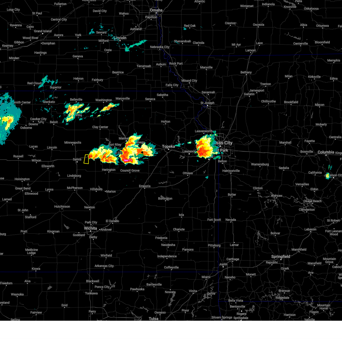 the severe thunderstorm warning has been cancelled and is no longer in effect the severe thunderstorm warning has been cancelled and is no longer in effect
|
| 3/13/2024 7:22 PM CDT | Quarter sized hail reported 2.3 miles NNE of Solomon, KS, mostly small hail... a few quarter sized. |
| 3/13/2024 7:19 PM CDT |
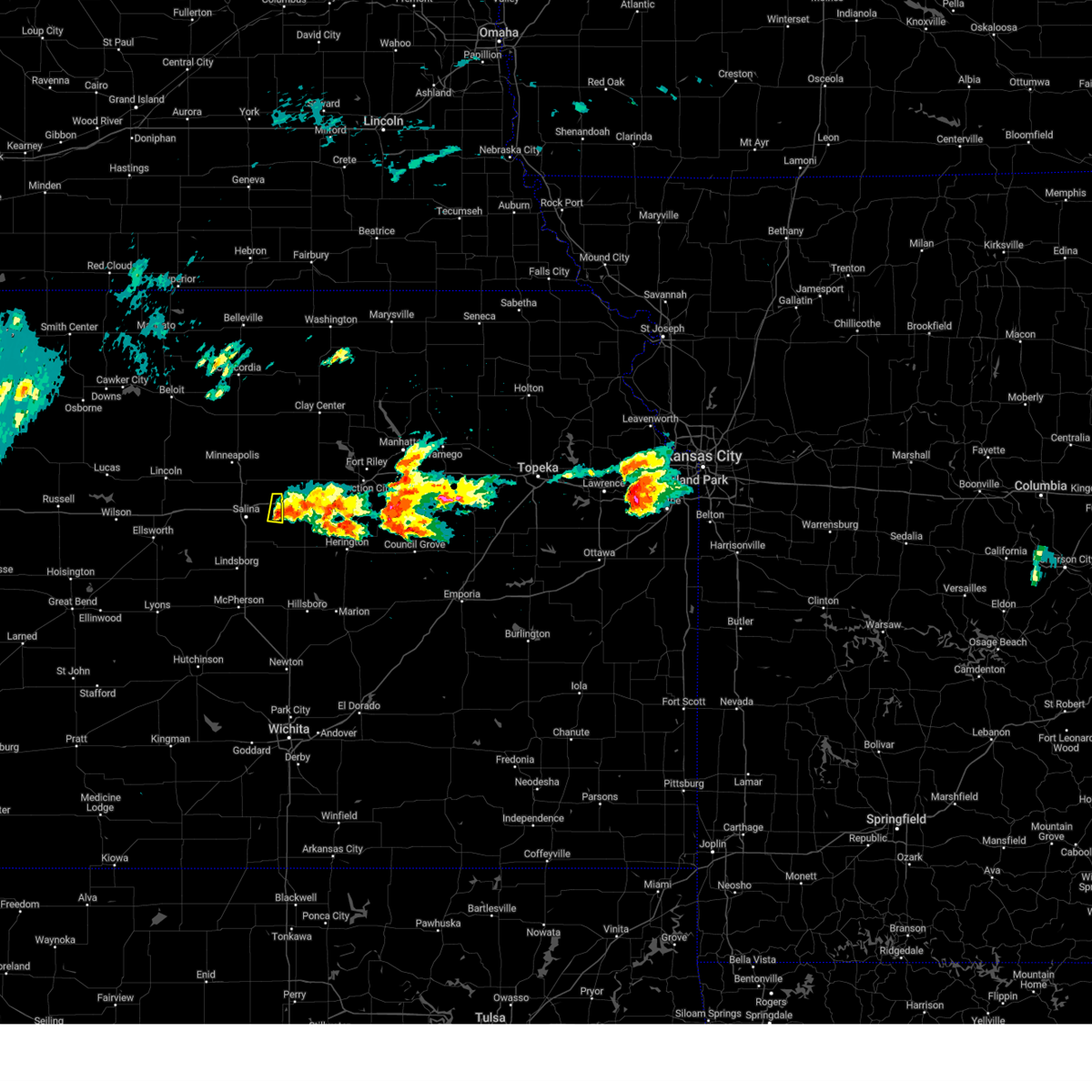 At 719 pm cdt, a severe thunderstorm was located over solomon, or 8 miles west of abilene, moving northeast at 35 mph (trained weather spotters). Hazards include 60 mph wind gusts and quarter size hail. Hail damage to vehicles is expected. expect wind damage to roofs, siding, and trees. This severe thunderstorm will remain over mainly rural areas of northeastern saline county. At 719 pm cdt, a severe thunderstorm was located over solomon, or 8 miles west of abilene, moving northeast at 35 mph (trained weather spotters). Hazards include 60 mph wind gusts and quarter size hail. Hail damage to vehicles is expected. expect wind damage to roofs, siding, and trees. This severe thunderstorm will remain over mainly rural areas of northeastern saline county.
|
| 3/13/2024 7:08 PM CDT |
 Svrict the national weather service in wichita has issued a * severe thunderstorm warning for, northeastern saline county in central kansas, * until 745 pm cdt. * at 707 pm cdt, a severe thunderstorm was located near new cambria, or 9 miles east of salina, moving north at 30 mph (trained weather spotters. at 701 pm cdt, quarter-sized hail was reported 4 miles northwest of gypsum). Hazards include 60 mph wind gusts and quarter size hail. Hail damage to vehicles is expected. Expect wind damage to roofs, siding, and trees. Svrict the national weather service in wichita has issued a * severe thunderstorm warning for, northeastern saline county in central kansas, * until 745 pm cdt. * at 707 pm cdt, a severe thunderstorm was located near new cambria, or 9 miles east of salina, moving north at 30 mph (trained weather spotters. at 701 pm cdt, quarter-sized hail was reported 4 miles northwest of gypsum). Hazards include 60 mph wind gusts and quarter size hail. Hail damage to vehicles is expected. Expect wind damage to roofs, siding, and trees.
|
| 3/13/2024 7:05 PM CDT |
 Svrict the national weather service in wichita has issued a * severe thunderstorm warning for, northeastern saline county in central kansas, * until 745 pm cdt. * at 704 pm cdt, a severe thunderstorm was located 6 miles southeast of new cambria, or 8 miles east of salina, moving north at 30 mph (radar indicated). Hazards include 60 mph wind gusts and quarter size hail. Hail damage to vehicles is expected. Expect wind damage to roofs, siding, and trees. Svrict the national weather service in wichita has issued a * severe thunderstorm warning for, northeastern saline county in central kansas, * until 745 pm cdt. * at 704 pm cdt, a severe thunderstorm was located 6 miles southeast of new cambria, or 8 miles east of salina, moving north at 30 mph (radar indicated). Hazards include 60 mph wind gusts and quarter size hail. Hail damage to vehicles is expected. Expect wind damage to roofs, siding, and trees.
|
| 7/14/2023 3:27 PM CDT |
 The severe thunderstorm warning for dickinson county will expire at 330 pm cdt, the storms which prompted the warning have weakened below severe limits, and no longer pose an immediate threat to life or property. therefore, the warning will be allowed to expire. however gusty winds are still possible with these thunderstorms. a severe thunderstorm watch remains in effect until 700 pm cdt for central and east central kansas. The severe thunderstorm warning for dickinson county will expire at 330 pm cdt, the storms which prompted the warning have weakened below severe limits, and no longer pose an immediate threat to life or property. therefore, the warning will be allowed to expire. however gusty winds are still possible with these thunderstorms. a severe thunderstorm watch remains in effect until 700 pm cdt for central and east central kansas.
|
| 7/14/2023 3:11 PM CDT |
 At 311 pm cdt, severe thunderstorms were located along a line extending from 3 miles east of enterprise to 4 miles northwest of ramona, moving east at 45 mph (radar indicated). Hazards include 60 mph wind gusts. Expect damage to roofs, siding, and trees. locations impacted include, abilene, herington, chapman, solomon, enterprise, hope, woodbine and carlton. this includes interstate 70 between mile markers 267 and 284. hail threat, radar indicated max hail size, <. 75 in wind threat, radar indicated max wind gust, 60 mph. At 311 pm cdt, severe thunderstorms were located along a line extending from 3 miles east of enterprise to 4 miles northwest of ramona, moving east at 45 mph (radar indicated). Hazards include 60 mph wind gusts. Expect damage to roofs, siding, and trees. locations impacted include, abilene, herington, chapman, solomon, enterprise, hope, woodbine and carlton. this includes interstate 70 between mile markers 267 and 284. hail threat, radar indicated max hail size, <. 75 in wind threat, radar indicated max wind gust, 60 mph.
|
| 7/14/2023 3:05 PM CDT |
 At 305 pm cdt, a severe thunderstorm was located 7 miles southeast of solomon, or 7 miles southwest of abilene, moving east at 25 mph (radar indicated). Hazards include 60 mph wind gusts. Expect damage to roofs, siding, and trees. locations impacted include, gypsum and kipp. hail threat, radar indicated max hail size, <. 75 in wind threat, radar indicated max wind gust, 60 mph. At 305 pm cdt, a severe thunderstorm was located 7 miles southeast of solomon, or 7 miles southwest of abilene, moving east at 25 mph (radar indicated). Hazards include 60 mph wind gusts. Expect damage to roofs, siding, and trees. locations impacted include, gypsum and kipp. hail threat, radar indicated max hail size, <. 75 in wind threat, radar indicated max wind gust, 60 mph.
|
| 7/14/2023 2:59 PM CDT |
 At 258 pm cdt, severe thunderstorms were located along a line extending from near abilene to 4 miles south of carlton, moving east at 50 mph (radar indicated). Hazards include 60 mph wind gusts. Expect damage to roofs, siding, and trees. locations impacted include, abilene, herington, chapman, solomon, enterprise, hope, woodbine, carlton and moonlight. this includes interstate 70 between mile markers 267 and 289. hail threat, radar indicated max hail size, <. 75 in wind threat, radar indicated max wind gust, 60 mph. At 258 pm cdt, severe thunderstorms were located along a line extending from near abilene to 4 miles south of carlton, moving east at 50 mph (radar indicated). Hazards include 60 mph wind gusts. Expect damage to roofs, siding, and trees. locations impacted include, abilene, herington, chapman, solomon, enterprise, hope, woodbine, carlton and moonlight. this includes interstate 70 between mile markers 267 and 289. hail threat, radar indicated max hail size, <. 75 in wind threat, radar indicated max wind gust, 60 mph.
|
| 7/14/2023 2:45 PM CDT |
 At 245 pm cdt, severe thunderstorms were located along a line extending from near solomon to 6 miles south of gypsum, moving east at 35 mph (radar indicated). Hazards include 60 mph wind gusts. expect damage to roofs, siding, and trees At 245 pm cdt, severe thunderstorms were located along a line extending from near solomon to 6 miles south of gypsum, moving east at 35 mph (radar indicated). Hazards include 60 mph wind gusts. expect damage to roofs, siding, and trees
|
| 7/14/2023 2:42 PM CDT |
 At 242 pm cdt, a severe thunderstorm was located near new cambria, or 7 miles east of salina, moving east at 25 mph (radar indicated). Hazards include 60 mph wind gusts. expect damage to roofs, siding, and trees At 242 pm cdt, a severe thunderstorm was located near new cambria, or 7 miles east of salina, moving east at 25 mph (radar indicated). Hazards include 60 mph wind gusts. expect damage to roofs, siding, and trees
|
| 7/14/2023 2:10 PM CDT |
 At 209 pm cdt, a severe thunderstorm was located 5 miles east of enterprise, moving east at 20 mph (radar indicated). Hazards include 60 mph wind gusts and quarter size hail. Hail damage to vehicles is expected. expect wind damage to roofs, siding, and trees. locations impacted include, junction city, abilene, grandview plaza, chapman, solomon, enterprise, white city, dwight, woodbine, parkerville, latimer, talmage and moonlight. this includes interstate 70 between mile markers 267 and 299. hail threat, radar indicated max hail size, 1. 00 in wind threat, radar indicated max wind gust, 60 mph. At 209 pm cdt, a severe thunderstorm was located 5 miles east of enterprise, moving east at 20 mph (radar indicated). Hazards include 60 mph wind gusts and quarter size hail. Hail damage to vehicles is expected. expect wind damage to roofs, siding, and trees. locations impacted include, junction city, abilene, grandview plaza, chapman, solomon, enterprise, white city, dwight, woodbine, parkerville, latimer, talmage and moonlight. this includes interstate 70 between mile markers 267 and 299. hail threat, radar indicated max hail size, 1. 00 in wind threat, radar indicated max wind gust, 60 mph.
|
| 7/14/2023 1:54 PM CDT |
 At 154 pm cdt, a severe thunderstorm was located near enterprise, moving east at 20 mph (radar indicated). Hazards include 60 mph wind gusts and quarter size hail. Hail damage to vehicles is expected. Expect wind damage to roofs, siding, and trees. At 154 pm cdt, a severe thunderstorm was located near enterprise, moving east at 20 mph (radar indicated). Hazards include 60 mph wind gusts and quarter size hail. Hail damage to vehicles is expected. Expect wind damage to roofs, siding, and trees.
|
| 7/4/2023 10:43 PM CDT |
 At 1043 pm cdt, severe thunderstorms were located along a line extending from near woodbine to near assaria to near lyons, moving east to southeast at 25 mph (radar indicated). Hazards include 60 mph wind gusts. expect damage to roofs, siding, and trees At 1043 pm cdt, severe thunderstorms were located along a line extending from near woodbine to near assaria to near lyons, moving east to southeast at 25 mph (radar indicated). Hazards include 60 mph wind gusts. expect damage to roofs, siding, and trees
|
| 7/4/2023 10:06 PM CDT |
 At 1006 pm cdt, a severe thunderstorm was located near talmage, moving east at 35 mph (radar indicated). Hazards include 60 mph wind gusts. expect damage to roofs, siding, and trees At 1006 pm cdt, a severe thunderstorm was located near talmage, moving east at 35 mph (radar indicated). Hazards include 60 mph wind gusts. expect damage to roofs, siding, and trees
|
| 5/9/2023 2:02 PM CDT |
 At 202 pm cdt, severe thunderstorms were located along a line extending from new cambria to near ellsworth to 9 miles northwest of claflin, moving east at 30 mph (radar indicated). Hazards include 60 mph wind gusts and nickel size hail. Expect damage to roofs, siding, and trees. locations impacted include, salina, ellsworth, wilson, claflin, kanopolis, holyrood, assaria, brookville, smolan, lorraine, new cambria, falun, glendale, susank, salina airport, ellsworth airport, kanopolis lake, kanopolis state park, kipp and odin. hail threat, radar indicated max hail size, 0. 88 in wind threat, radar indicated max wind gust, 60 mph. At 202 pm cdt, severe thunderstorms were located along a line extending from new cambria to near ellsworth to 9 miles northwest of claflin, moving east at 30 mph (radar indicated). Hazards include 60 mph wind gusts and nickel size hail. Expect damage to roofs, siding, and trees. locations impacted include, salina, ellsworth, wilson, claflin, kanopolis, holyrood, assaria, brookville, smolan, lorraine, new cambria, falun, glendale, susank, salina airport, ellsworth airport, kanopolis lake, kanopolis state park, kipp and odin. hail threat, radar indicated max hail size, 0. 88 in wind threat, radar indicated max wind gust, 60 mph.
|
| 5/9/2023 1:54 PM CDT |
 At 154 pm cdt, a severe thunderstorm was located 4 miles northwest of niles, moving east at 25 mph (radar indicated). Hazards include 60 mph wind gusts and quarter size hail. Hail damage to vehicles is expected. expect wind damage to roofs, siding, and trees. locations impacted include, abilene, solomon, bennington and niles. this includes interstate 70 between mile markers 267 and 280. hail threat, radar indicated max hail size, 1. 00 in wind threat, radar indicated max wind gust, 60 mph. At 154 pm cdt, a severe thunderstorm was located 4 miles northwest of niles, moving east at 25 mph (radar indicated). Hazards include 60 mph wind gusts and quarter size hail. Hail damage to vehicles is expected. expect wind damage to roofs, siding, and trees. locations impacted include, abilene, solomon, bennington and niles. this includes interstate 70 between mile markers 267 and 280. hail threat, radar indicated max hail size, 1. 00 in wind threat, radar indicated max wind gust, 60 mph.
|
| 5/9/2023 1:46 PM CDT |
 At 145 pm cdt, severe thunderstorms were located along a line extending from 6 miles south of culver to 5 miles southeast of wilson to 10 miles east of milberger, moving east at 45 mph. quarter sized hail has been reported with this storm (radar indicated). Hazards include 70 mph wind gusts and half dollar size hail. Hail damage to vehicles is expected. expect considerable tree damage. wind damage is also likely to mobile homes, roofs, and outbuildings. Locations impacted include, salina, ellsworth, wilson, claflin, kanopolis, holyrood, assaria, brookville, smolan, dorrance, lorraine, new cambria, milberger, falun, glendale, galatia, susank, westfall, salina airport and ellsworth airport. At 145 pm cdt, severe thunderstorms were located along a line extending from 6 miles south of culver to 5 miles southeast of wilson to 10 miles east of milberger, moving east at 45 mph. quarter sized hail has been reported with this storm (radar indicated). Hazards include 70 mph wind gusts and half dollar size hail. Hail damage to vehicles is expected. expect considerable tree damage. wind damage is also likely to mobile homes, roofs, and outbuildings. Locations impacted include, salina, ellsworth, wilson, claflin, kanopolis, holyrood, assaria, brookville, smolan, dorrance, lorraine, new cambria, milberger, falun, glendale, galatia, susank, westfall, salina airport and ellsworth airport.
|
| 5/9/2023 1:31 PM CDT |
 At 130 pm cdt, a severe thunderstorm was located near culver, moving east at 25 mph (radar indicated). Hazards include 60 mph wind gusts and quarter size hail. Hail damage to vehicles is expected. Expect wind damage to roofs, siding, and trees. At 130 pm cdt, a severe thunderstorm was located near culver, moving east at 25 mph (radar indicated). Hazards include 60 mph wind gusts and quarter size hail. Hail damage to vehicles is expected. Expect wind damage to roofs, siding, and trees.
|
| 5/9/2023 1:21 PM CDT |
 At 120 pm cdt, severe thunderstorms were located along a line extending from tescott to 7 miles northeast of ellsworth to near milberger, moving east at 35 mph (radar indicated). Hazards include 70 mph wind gusts and ping pong ball size hail. People and animals outdoors will be injured. expect hail damage to roofs, siding, windows, and vehicles. expect considerable tree damage. Wind damage is also likely to mobile homes, roofs, and outbuildings. At 120 pm cdt, severe thunderstorms were located along a line extending from tescott to 7 miles northeast of ellsworth to near milberger, moving east at 35 mph (radar indicated). Hazards include 70 mph wind gusts and ping pong ball size hail. People and animals outdoors will be injured. expect hail damage to roofs, siding, windows, and vehicles. expect considerable tree damage. Wind damage is also likely to mobile homes, roofs, and outbuildings.
|
| 4/20/2023 2:42 AM CDT |
 The severe thunderstorm warning for saline county will expire at 245 am cdt, the storm which prompted the warning has weakened below severe limits, and no longer poses an immediate threat to life or property. therefore, the warning will be allowed to expire. however gusty winds are still possible with this thunderstorm. a severe thunderstorm watch remains in effect until 700 am cdt for central kansas. The severe thunderstorm warning for saline county will expire at 245 am cdt, the storm which prompted the warning has weakened below severe limits, and no longer poses an immediate threat to life or property. therefore, the warning will be allowed to expire. however gusty winds are still possible with this thunderstorm. a severe thunderstorm watch remains in effect until 700 am cdt for central kansas.
|
| 4/20/2023 2:19 AM CDT |
 At 218 am cdt, a severe thunderstorm was located 6 miles northeast of brookville, or 9 miles west of salina, moving east at 40 mph (radar indicated). Hazards include 60 mph wind gusts and quarter size hail. Hail damage to vehicles is expected. expect wind damage to roofs, siding, and trees. locations impacted include, salina, brookville, smolan, new cambria, glendale, salina airport and kipp. hail threat, radar indicated max hail size, 1. 00 in wind threat, radar indicated max wind gust, 60 mph. At 218 am cdt, a severe thunderstorm was located 6 miles northeast of brookville, or 9 miles west of salina, moving east at 40 mph (radar indicated). Hazards include 60 mph wind gusts and quarter size hail. Hail damage to vehicles is expected. expect wind damage to roofs, siding, and trees. locations impacted include, salina, brookville, smolan, new cambria, glendale, salina airport and kipp. hail threat, radar indicated max hail size, 1. 00 in wind threat, radar indicated max wind gust, 60 mph.
|
| 4/20/2023 2:02 AM CDT |
 At 202 am cdt, a severe thunderstorm was located 7 miles northwest of brookville, or 11 miles northeast of kanopolis, moving northeast at 45 mph (radar indicated). Hazards include 60 mph wind gusts and half dollar size hail. Hail damage to vehicles is expected. Expect wind damage to roofs, siding, and trees. At 202 am cdt, a severe thunderstorm was located 7 miles northwest of brookville, or 11 miles northeast of kanopolis, moving northeast at 45 mph (radar indicated). Hazards include 60 mph wind gusts and half dollar size hail. Hail damage to vehicles is expected. Expect wind damage to roofs, siding, and trees.
|
| 7/28/2022 5:32 AM CDT |
 At 530 am cdt, severe thunderstorms were located along a line extending from near moonlight to enterprise to 6 miles northwest of hope, moving east at 40 mph (at 5:28 am...law enforcement in abilene estimated 60 mph wind gusts). Hazards include 60 mph wind gusts. Expect damage to roofs, siding, and trees. locations impacted include, abilene, chapman, solomon, enterprise and moonlight. this includes interstate 70 between mile markers 267 and 288. hail threat, radar indicated max hail size, 0. 75 in wind threat, radar indicated max wind gust, 60 mph. At 530 am cdt, severe thunderstorms were located along a line extending from near moonlight to enterprise to 6 miles northwest of hope, moving east at 40 mph (at 5:28 am...law enforcement in abilene estimated 60 mph wind gusts). Hazards include 60 mph wind gusts. Expect damage to roofs, siding, and trees. locations impacted include, abilene, chapman, solomon, enterprise and moonlight. this includes interstate 70 between mile markers 267 and 288. hail threat, radar indicated max hail size, 0. 75 in wind threat, radar indicated max wind gust, 60 mph.
|
| 7/28/2022 5:23 AM CDT |
 At 522 am cdt, severe thunderstorms were located along a line extending from near talmage to near abilene to 5 miles northeast of carlton, moving east at 40 mph (radar indicated). Hazards include 60 mph wind gusts and penny size hail. Expect damage to roofs, siding, and trees. locations impacted include, abilene, chapman, solomon, enterprise and moonlight. this includes interstate 70 between mile markers 267 and 288. hail threat, radar indicated max hail size, 0. 75 in wind threat, radar indicated max wind gust, 60 mph. At 522 am cdt, severe thunderstorms were located along a line extending from near talmage to near abilene to 5 miles northeast of carlton, moving east at 40 mph (radar indicated). Hazards include 60 mph wind gusts and penny size hail. Expect damage to roofs, siding, and trees. locations impacted include, abilene, chapman, solomon, enterprise and moonlight. this includes interstate 70 between mile markers 267 and 288. hail threat, radar indicated max hail size, 0. 75 in wind threat, radar indicated max wind gust, 60 mph.
|
| 7/28/2022 5:16 AM CDT |
 At 516 am cdt, a severe thunderstorm was located over solomon, moving east at 30 mph (radar indicated). Hazards include 60 mph wind gusts and penny size hail. expect damage to roofs, siding, and trees At 516 am cdt, a severe thunderstorm was located over solomon, moving east at 30 mph (radar indicated). Hazards include 60 mph wind gusts and penny size hail. expect damage to roofs, siding, and trees
|
| 6/21/2022 7:51 PM CDT |
 At 750 pm cdt, severe thunderstorms were located along a line extending from 5 miles west of longford to near enterprise to near herington, moving east at 30 mph (emergency management reported a tree down on the north side of abilene along interstate 70). Hazards include 70 mph wind gusts and quarter size hail. Hail damage to vehicles is expected. expect considerable tree damage. wind damage is also likely to mobile homes, roofs, and outbuildings. locations impacted include, abilene, herington, minneapolis, chapman, solomon, enterprise, bennington, hope, woodbine, wells, manchester, longford, carlton, niles, talmage and moonlight. this includes interstate 70 between mile markers 267 and 289. thunderstorm damage threat, considerable hail threat, radar indicated max hail size, 1. 00 in wind threat, observed max wind gust, 70 mph. At 750 pm cdt, severe thunderstorms were located along a line extending from 5 miles west of longford to near enterprise to near herington, moving east at 30 mph (emergency management reported a tree down on the north side of abilene along interstate 70). Hazards include 70 mph wind gusts and quarter size hail. Hail damage to vehicles is expected. expect considerable tree damage. wind damage is also likely to mobile homes, roofs, and outbuildings. locations impacted include, abilene, herington, minneapolis, chapman, solomon, enterprise, bennington, hope, woodbine, wells, manchester, longford, carlton, niles, talmage and moonlight. this includes interstate 70 between mile markers 267 and 289. thunderstorm damage threat, considerable hail threat, radar indicated max hail size, 1. 00 in wind threat, observed max wind gust, 70 mph.
|
| 6/21/2022 7:45 PM CDT |
 At 744 pm cdt, severe thunderstorms were located along a line extending from 4 miles northeast of wells to near abilene to 3 miles northeast of ramona, moving east at 30 mph (radar indicated). Hazards include 60 mph wind gusts and quarter size hail. Hail damage to vehicles is expected. Expect wind damage to roofs, siding, and trees. At 744 pm cdt, severe thunderstorms were located along a line extending from 4 miles northeast of wells to near abilene to 3 miles northeast of ramona, moving east at 30 mph (radar indicated). Hazards include 60 mph wind gusts and quarter size hail. Hail damage to vehicles is expected. Expect wind damage to roofs, siding, and trees.
|
| 6/21/2022 7:39 PM CDT | Social media photo of 6 inch tree limb down. time estimated rada in dickinson county KS, 0.1 miles W of Solomon, KS |
| 6/21/2022 7:30 PM CDT |
 At 729 pm cdt, severe thunderstorms were located along a line extending from near wells to near niles to 5 miles southwest of carlton, moving east at 25 mph (radar indicated). Hazards include 60 mph wind gusts and quarter size hail. Hail damage to vehicles is expected. Expect wind damage to roofs, siding, and trees. At 729 pm cdt, severe thunderstorms were located along a line extending from near wells to near niles to 5 miles southwest of carlton, moving east at 25 mph (radar indicated). Hazards include 60 mph wind gusts and quarter size hail. Hail damage to vehicles is expected. Expect wind damage to roofs, siding, and trees.
|
| 6/21/2022 7:03 PM CDT |
 At 703 pm cdt, a severe thunderstorm was located near brookville, or 11 miles southwest of salina, moving northeast at 25 mph (radar indicated). Hazards include 60 mph wind gusts and nickel size hail. expect damage to roofs, siding, and trees At 703 pm cdt, a severe thunderstorm was located near brookville, or 11 miles southwest of salina, moving northeast at 25 mph (radar indicated). Hazards include 60 mph wind gusts and nickel size hail. expect damage to roofs, siding, and trees
|
| 6/7/2022 11:50 PM CDT |
 The severe thunderstorm warning for lincoln, northern ellsworth, russell and northern saline counties will expire at midnight cdt, the storms which prompted the warning have weakened below severe limits, and no longer pose an immediate threat to life or property. therefore, the warning will be allowed to expire. however gusty winds and heavy rain are still possible with these thunderstorms. a severe thunderstorm watch remains in effect until 500 am cdt for central kansas. The severe thunderstorm warning for lincoln, northern ellsworth, russell and northern saline counties will expire at midnight cdt, the storms which prompted the warning have weakened below severe limits, and no longer pose an immediate threat to life or property. therefore, the warning will be allowed to expire. however gusty winds and heavy rain are still possible with these thunderstorms. a severe thunderstorm watch remains in effect until 500 am cdt for central kansas.
|
| 6/7/2022 11:40 PM CDT |
 The severe thunderstorm warning for northern dickinson, northwestern geary, southwestern riley, southern ottawa, west central pottawatomie and southern clay counties will expire at 1145 pm cdt, the storms which prompted the warning have moved out of the area. therefore, the warning will be allowed to expire. however gusty winds and heavy rain are still possible with these thunderstorms. a severe thunderstorm watch remains in effect until 500 am cdt for central, north central, northeastern and east central kansas. The severe thunderstorm warning for northern dickinson, northwestern geary, southwestern riley, southern ottawa, west central pottawatomie and southern clay counties will expire at 1145 pm cdt, the storms which prompted the warning have moved out of the area. therefore, the warning will be allowed to expire. however gusty winds and heavy rain are still possible with these thunderstorms. a severe thunderstorm watch remains in effect until 500 am cdt for central, north central, northeastern and east central kansas.
|
| 6/7/2022 11:25 PM CDT |
 At 1125 pm cdt, severe thunderstorms were located along a line extending from barnard to 5 miles northeast of lucas to 6 miles northeast of natoma, moving southeast at 50 mph (radar indicated). Hazards include 60 mph wind gusts and nickel size hail. Expect damage to roofs, siding, and trees. locations impacted include, russell, wilson, lincoln, lucas, gorham, sylvan grove, luray, dorrance, beverly, new cambria, barnard, milberger, glendale, bunker hill, paradise, waldo, ash grove, westfall, russell airport and wilson state park. hail threat, radar indicated max hail size, 0. 88 in wind threat, radar indicated max wind gust, 60 mph. At 1125 pm cdt, severe thunderstorms were located along a line extending from barnard to 5 miles northeast of lucas to 6 miles northeast of natoma, moving southeast at 50 mph (radar indicated). Hazards include 60 mph wind gusts and nickel size hail. Expect damage to roofs, siding, and trees. locations impacted include, russell, wilson, lincoln, lucas, gorham, sylvan grove, luray, dorrance, beverly, new cambria, barnard, milberger, glendale, bunker hill, paradise, waldo, ash grove, westfall, russell airport and wilson state park. hail threat, radar indicated max hail size, 0. 88 in wind threat, radar indicated max wind gust, 60 mph.
|
| 6/7/2022 11:23 PM CDT |
 At 1123 pm cdt, severe thunderstorms were located along a line extending from 5 miles east of olsburg to 3 miles northwest of milford lake to 3 miles northeast of culver, moving southeast at 45 mph (radar indicated). Hazards include 60 mph wind gusts and penny size hail. Expect damage to roofs, siding, and trees. locations impacted include, abilene, minneapolis, westmoreland, solomon, wakefield, riley, bennington, milford, tescott, culver, wells, manchester, longford, niles, talmage, milford lake, moonlight, keats and tuttle creek lake. this includes interstate 70 between mile markers 267 and 277. hail threat, radar indicated max hail size, 0. 75 in wind threat, radar indicated max wind gust, 60 mph. At 1123 pm cdt, severe thunderstorms were located along a line extending from 5 miles east of olsburg to 3 miles northwest of milford lake to 3 miles northeast of culver, moving southeast at 45 mph (radar indicated). Hazards include 60 mph wind gusts and penny size hail. Expect damage to roofs, siding, and trees. locations impacted include, abilene, minneapolis, westmoreland, solomon, wakefield, riley, bennington, milford, tescott, culver, wells, manchester, longford, niles, talmage, milford lake, moonlight, keats and tuttle creek lake. this includes interstate 70 between mile markers 267 and 277. hail threat, radar indicated max hail size, 0. 75 in wind threat, radar indicated max wind gust, 60 mph.
|
| 6/7/2022 11:19 PM CDT |
 At 1118 pm cdt, severe thunderstorms were located along a line extending from 5 miles northeast of olsburg to near wakefield to 4 miles north of culver, moving southeast at 50 mph (radar indicated). Hazards include 70 mph wind gusts and nickel size hail. Expect considerable tree damage. damage is likely to mobile homes, roofs, and outbuildings. locations impacted include, abilene, clay center, minneapolis, blue rapids, westmoreland, blaine, solomon, wakefield, riley, waterville, bennington, miltonvale, milford, leonardville, delphos, tescott, olsburg, randolph, green and culver. this includes interstate 70 between mile markers 267 and 277. thunderstorm damage threat, considerable hail threat, radar indicated max hail size, 0. 88 in wind threat, radar indicated max wind gust, 70 mph. At 1118 pm cdt, severe thunderstorms were located along a line extending from 5 miles northeast of olsburg to near wakefield to 4 miles north of culver, moving southeast at 50 mph (radar indicated). Hazards include 70 mph wind gusts and nickel size hail. Expect considerable tree damage. damage is likely to mobile homes, roofs, and outbuildings. locations impacted include, abilene, clay center, minneapolis, blue rapids, westmoreland, blaine, solomon, wakefield, riley, waterville, bennington, miltonvale, milford, leonardville, delphos, tescott, olsburg, randolph, green and culver. this includes interstate 70 between mile markers 267 and 277. thunderstorm damage threat, considerable hail threat, radar indicated max hail size, 0. 88 in wind threat, radar indicated max wind gust, 70 mph.
|
| 6/7/2022 11:02 PM CDT |
 At 1058 pm cdt, severe thunderstorms were located along a line extending from asherville to near codell, moving southeast at 45 mph (radar indicated). Hazards include 60 mph wind gusts and nickel size hail. expect damage to roofs, siding, and trees At 1058 pm cdt, severe thunderstorms were located along a line extending from asherville to near codell, moving southeast at 45 mph (radar indicated). Hazards include 60 mph wind gusts and nickel size hail. expect damage to roofs, siding, and trees
|
| 6/7/2022 10:54 PM CDT |
 At 1053 pm cdt, severe thunderstorms were located along a line extending from 3 miles north of waterville to miltonvale to 6 miles west of delphos, moving southeast at 45 mph (radar indicated). Hazards include 70 mph wind gusts and quarter size hail. Hail damage to vehicles is expected. expect considerable tree damage. Wind damage is also likely to mobile homes, roofs, and outbuildings. At 1053 pm cdt, severe thunderstorms were located along a line extending from 3 miles north of waterville to miltonvale to 6 miles west of delphos, moving southeast at 45 mph (radar indicated). Hazards include 70 mph wind gusts and quarter size hail. Hail damage to vehicles is expected. expect considerable tree damage. Wind damage is also likely to mobile homes, roofs, and outbuildings.
|
| 5/30/2022 11:06 PM CDT |
 The severe thunderstorm warning for saline county will expire at 1115 pm cdt, the storms which prompted the warning have weakened below severe limits, and no longer pose an immediate threat to life or property. therefore, the warning will be allowed to expire. however gusty winds and heavy rain are still possible with these thunderstorms. a severe thunderstorm watch remains in effect until 400 am cdt for central kansas. The severe thunderstorm warning for saline county will expire at 1115 pm cdt, the storms which prompted the warning have weakened below severe limits, and no longer pose an immediate threat to life or property. therefore, the warning will be allowed to expire. however gusty winds and heavy rain are still possible with these thunderstorms. a severe thunderstorm watch remains in effect until 400 am cdt for central kansas.
|
| 5/30/2022 10:34 PM CDT |
 At 1033 pm cdt, severe thunderstorms were located along a line extending from 5 miles east of new cambria to near smolan, moving east at 20 mph (radar indicated). Hazards include 60 mph wind gusts and quarter size hail. Hail damage to vehicles is expected. expect wind damage to roofs, siding, and trees. locations impacted include, salina, assaria, gypsum, brookville, smolan, new cambria, falun, bridgeport, salina airport and kipp. hail threat, radar indicated max hail size, 1. 00 in wind threat, radar indicated max wind gust, 60 mph. At 1033 pm cdt, severe thunderstorms were located along a line extending from 5 miles east of new cambria to near smolan, moving east at 20 mph (radar indicated). Hazards include 60 mph wind gusts and quarter size hail. Hail damage to vehicles is expected. expect wind damage to roofs, siding, and trees. locations impacted include, salina, assaria, gypsum, brookville, smolan, new cambria, falun, bridgeport, salina airport and kipp. hail threat, radar indicated max hail size, 1. 00 in wind threat, radar indicated max wind gust, 60 mph.
|
| 5/30/2022 10:28 PM CDT |
 At 1028 pm cdt, severe thunderstorms were located along a line extending from near riley to near abilene, moving east at 40 mph (radar indicated). Hazards include 60 mph wind gusts and quarter size hail. Hail damage to vehicles is expected. expect wind damage to roofs, siding, and trees. locations impacted include, junction city, abilene, ogden, grandview plaza, chapman, solomon, wakefield, riley, enterprise, milford, talmage, milford lake, moonlight, keats and tuttle creek lake. this includes interstate 70 between mile markers 267 and 303. hail threat, radar indicated max hail size, 1. 00 in wind threat, radar indicated max wind gust, 60 mph. At 1028 pm cdt, severe thunderstorms were located along a line extending from near riley to near abilene, moving east at 40 mph (radar indicated). Hazards include 60 mph wind gusts and quarter size hail. Hail damage to vehicles is expected. expect wind damage to roofs, siding, and trees. locations impacted include, junction city, abilene, ogden, grandview plaza, chapman, solomon, wakefield, riley, enterprise, milford, talmage, milford lake, moonlight, keats and tuttle creek lake. this includes interstate 70 between mile markers 267 and 303. hail threat, radar indicated max hail size, 1. 00 in wind threat, radar indicated max wind gust, 60 mph.
|
| 5/30/2022 10:12 PM CDT |
 At 1012 pm cdt, severe thunderstorms were located along a line extending from 4 miles northeast of wakefield to 3 miles southeast of solomon, moving east at 40 mph (radar indicated). Hazards include 60 mph wind gusts and quarter size hail. Hail damage to vehicles is expected. Expect wind damage to roofs, siding, and trees. At 1012 pm cdt, severe thunderstorms were located along a line extending from 4 miles northeast of wakefield to 3 miles southeast of solomon, moving east at 40 mph (radar indicated). Hazards include 60 mph wind gusts and quarter size hail. Hail damage to vehicles is expected. Expect wind damage to roofs, siding, and trees.
|
| 5/30/2022 10:10 PM CDT |
 At 1009 pm cdt, severe thunderstorms were located along a line extending from salina to near smolan, moving east at 25 mph (radar indicated). Hazards include 60 mph wind gusts and quarter size hail. Hail damage to vehicles is expected. Expect wind damage to roofs, siding, and trees. At 1009 pm cdt, severe thunderstorms were located along a line extending from salina to near smolan, moving east at 25 mph (radar indicated). Hazards include 60 mph wind gusts and quarter size hail. Hail damage to vehicles is expected. Expect wind damage to roofs, siding, and trees.
|
| 5/17/2022 10:52 PM CDT |
 At 1052 pm cdt, severe thunderstorms were located along a line extending from 7 miles south of wakefield to near ramona to 5 miles southwest of canton, moving east at 45 mph (radar indicated). Hazards include 60 mph wind gusts and nickel size hail. Expect damage to roofs, siding, and trees. locations impacted include, abilene, herington, chapman, solomon, enterprise, hope, woodbine, manchester, carlton, moonlight and talmage. this includes interstate 70 between mile markers 267 and 289. hail threat, radar indicated max hail size, 0. 88 in wind threat, radar indicated max wind gust, 60 mph. At 1052 pm cdt, severe thunderstorms were located along a line extending from 7 miles south of wakefield to near ramona to 5 miles southwest of canton, moving east at 45 mph (radar indicated). Hazards include 60 mph wind gusts and nickel size hail. Expect damage to roofs, siding, and trees. locations impacted include, abilene, herington, chapman, solomon, enterprise, hope, woodbine, manchester, carlton, moonlight and talmage. this includes interstate 70 between mile markers 267 and 289. hail threat, radar indicated max hail size, 0. 88 in wind threat, radar indicated max wind gust, 60 mph.
|
| 5/17/2022 10:38 PM CDT |
 At 1038 pm cdt, severe thunderstorms were located along a line extending from 6 miles south of solomon to 6 miles south of gypsum to near marquette, moving east at 45 mph (trained weather spotters have reported 60 mph winds in ellsworth). Hazards include 60 mph wind gusts and nickel size hail. Expect damage to roofs, siding, and trees. locations impacted include, mcpherson, lindsborg, galva, canton, marquette, little river, gypsum, bushton, geneseo, windom, frederick, roxbury, bridgeport, kipp and mcpherson airport. hail threat, radar indicated max hail size, 0. 88 in wind threat, observed max wind gust, 60 mph. At 1038 pm cdt, severe thunderstorms were located along a line extending from 6 miles south of solomon to 6 miles south of gypsum to near marquette, moving east at 45 mph (trained weather spotters have reported 60 mph winds in ellsworth). Hazards include 60 mph wind gusts and nickel size hail. Expect damage to roofs, siding, and trees. locations impacted include, mcpherson, lindsborg, galva, canton, marquette, little river, gypsum, bushton, geneseo, windom, frederick, roxbury, bridgeport, kipp and mcpherson airport. hail threat, radar indicated max hail size, 0. 88 in wind threat, observed max wind gust, 60 mph.
|
| 5/17/2022 10:34 PM CDT |
 At 1033 pm cdt, severe thunderstorms were located along a line extending from 3 miles east of longford to 4 miles south of carlton to 7 miles northwest of mcpherson, moving east at 40 mph (radar indicated). Hazards include 60 mph wind gusts and penny size hail. Expect damage to roofs, siding, and trees. locations impacted include, abilene, herington, chapman, solomon, enterprise, hope, woodbine, manchester, longford, carlton, moonlight and talmage. this includes interstate 70 between mile markers 267 and 289. hail threat, radar indicated max hail size, 0. 75 in wind threat, radar indicated max wind gust, 60 mph. At 1033 pm cdt, severe thunderstorms were located along a line extending from 3 miles east of longford to 4 miles south of carlton to 7 miles northwest of mcpherson, moving east at 40 mph (radar indicated). Hazards include 60 mph wind gusts and penny size hail. Expect damage to roofs, siding, and trees. locations impacted include, abilene, herington, chapman, solomon, enterprise, hope, woodbine, manchester, longford, carlton, moonlight and talmage. this includes interstate 70 between mile markers 267 and 289. hail threat, radar indicated max hail size, 0. 75 in wind threat, radar indicated max wind gust, 60 mph.
|
| 5/17/2022 10:33 PM CDT |
 At 1032 pm cdt, severe thunderstorms were located along a line extending from 6 miles south of solomon to 7 miles southwest of gypsum to near marquette, moving east at 45 mph (trained weather spotters have reported 60 mph in ellsworth). Hazards include 60 mph wind gusts and penny size hail. Expect damage to roofs, siding, and trees. locations impacted include, mcpherson, lindsborg, galva, canton, marquette, little river, holyrood, assaria, gypsum, bushton, geneseo, lorraine, windom, new cambria, falun, frederick, roxbury, bridgeport, kanopolis lake and kipp. hail threat, radar indicated max hail size, 0. 75 in wind threat, observed max wind gust, 60 mph. At 1032 pm cdt, severe thunderstorms were located along a line extending from 6 miles south of solomon to 7 miles southwest of gypsum to near marquette, moving east at 45 mph (trained weather spotters have reported 60 mph in ellsworth). Hazards include 60 mph wind gusts and penny size hail. Expect damage to roofs, siding, and trees. locations impacted include, mcpherson, lindsborg, galva, canton, marquette, little river, holyrood, assaria, gypsum, bushton, geneseo, lorraine, windom, new cambria, falun, frederick, roxbury, bridgeport, kanopolis lake and kipp. hail threat, radar indicated max hail size, 0. 75 in wind threat, observed max wind gust, 60 mph.
|
| 5/17/2022 10:23 PM CDT |
 At 1022 pm cdt, severe thunderstorms were located along a line extending from niles to near smolan to 9 miles northwest of marquette, moving east at 45 mph (61 mph winds have been reported at the ellsworth airport). Hazards include 60 mph wind gusts and penny size hail. Expect damage to roofs, siding, and trees. locations impacted include, salina, mcpherson, lindsborg, galva, canton, marquette, little river, holyrood, assaria, gypsum, bushton, geneseo, smolan, lorraine, windom, new cambria, falun, frederick, bridgeport and kanopolis lake. hail threat, radar indicated max hail size, 0. 75 in wind threat, observed max wind gust, 60 mph. At 1022 pm cdt, severe thunderstorms were located along a line extending from niles to near smolan to 9 miles northwest of marquette, moving east at 45 mph (61 mph winds have been reported at the ellsworth airport). Hazards include 60 mph wind gusts and penny size hail. Expect damage to roofs, siding, and trees. locations impacted include, salina, mcpherson, lindsborg, galva, canton, marquette, little river, holyrood, assaria, gypsum, bushton, geneseo, smolan, lorraine, windom, new cambria, falun, frederick, bridgeport and kanopolis lake. hail threat, radar indicated max hail size, 0. 75 in wind threat, observed max wind gust, 60 mph.
|
| 5/17/2022 10:18 PM CDT |
 At 1018 pm cdt, severe thunderstorms were located along a line extending from 5 miles west of oak hill to 4 miles north of gypsum to 6 miles southwest of marquette, moving east at 45 mph (radar indicated). Hazards include 60 mph wind gusts and nickel size hail. expect damage to roofs, siding, and trees At 1018 pm cdt, severe thunderstorms were located along a line extending from 5 miles west of oak hill to 4 miles north of gypsum to 6 miles southwest of marquette, moving east at 45 mph (radar indicated). Hazards include 60 mph wind gusts and nickel size hail. expect damage to roofs, siding, and trees
|
| 5/17/2022 10:04 PM CDT |
 At 1003 pm cdt, a severe thunderstorm was located over brookville, or 12 miles west of salina, moving southeast at 35 mph (trained weather spotters). Hazards include 70 mph wind gusts and nickel size hail. Expect considerable tree damage. damage is likely to mobile homes, roofs, and outbuildings. locations impacted include, salina, ellsworth, wilson, kanopolis, holyrood, assaria, gypsum, geneseo, brookville, smolan, lorraine, new cambria, falun, glendale, salina airport, ellsworth airport, bridgeport, kanopolis lake, kanopolis state park and kipp. thunderstorm damage threat, considerable hail threat, radar indicated max hail size, 0. 88 in wind threat, observed max wind gust, 70 mph. At 1003 pm cdt, a severe thunderstorm was located over brookville, or 12 miles west of salina, moving southeast at 35 mph (trained weather spotters). Hazards include 70 mph wind gusts and nickel size hail. Expect considerable tree damage. damage is likely to mobile homes, roofs, and outbuildings. locations impacted include, salina, ellsworth, wilson, kanopolis, holyrood, assaria, gypsum, geneseo, brookville, smolan, lorraine, new cambria, falun, glendale, salina airport, ellsworth airport, bridgeport, kanopolis lake, kanopolis state park and kipp. thunderstorm damage threat, considerable hail threat, radar indicated max hail size, 0. 88 in wind threat, observed max wind gust, 70 mph.
|
| 5/17/2022 10:02 PM CDT |
 At 1001 pm cdt, severe thunderstorms were located along a line extending from near culver to near brookville to 5 miles south of ellsworth, moving east at 45 mph (61 mph winds have been reported at the ellsworth airport). Hazards include 70 mph wind gusts and penny size hail. Expect considerable tree damage. Damage is likely to mobile homes, roofs, and outbuildings. At 1001 pm cdt, severe thunderstorms were located along a line extending from near culver to near brookville to 5 miles south of ellsworth, moving east at 45 mph (61 mph winds have been reported at the ellsworth airport). Hazards include 70 mph wind gusts and penny size hail. Expect considerable tree damage. Damage is likely to mobile homes, roofs, and outbuildings.
|
| 5/17/2022 9:48 PM CDT |
 At 947 pm cdt, a severe thunderstorm was located 7 miles northwest of brookville, or 11 miles northeast of kanopolis, moving southeast at 40 mph (61 mph winds have been reported at the ellsworth airport). Hazards include 70 mph wind gusts and nickel size hail. Expect considerable tree damage. damage is likely to mobile homes, roofs, and outbuildings. locations impacted include, salina, ellsworth, wilson, kanopolis, lincoln, holyrood, assaria, gypsum, sylvan grove, geneseo, brookville, smolan, beverly, lorraine, new cambria, falun, glendale, westfall, salina airport and ellsworth airport. thunderstorm damage threat, considerable hail threat, radar indicated max hail size, 0. 88 in wind threat, observed max wind gust, 70 mph. At 947 pm cdt, a severe thunderstorm was located 7 miles northwest of brookville, or 11 miles northeast of kanopolis, moving southeast at 40 mph (61 mph winds have been reported at the ellsworth airport). Hazards include 70 mph wind gusts and nickel size hail. Expect considerable tree damage. damage is likely to mobile homes, roofs, and outbuildings. locations impacted include, salina, ellsworth, wilson, kanopolis, lincoln, holyrood, assaria, gypsum, sylvan grove, geneseo, brookville, smolan, beverly, lorraine, new cambria, falun, glendale, westfall, salina airport and ellsworth airport. thunderstorm damage threat, considerable hail threat, radar indicated max hail size, 0. 88 in wind threat, observed max wind gust, 70 mph.
|
| 5/17/2022 9:33 PM CDT |
 At 932 pm cdt, a severe thunderstorm was located 8 miles south of lincoln, moving southeast at 40 mph (trained weather spotters have reported 60 mph winds in northern ellsworth county). Hazards include 70 mph wind gusts and nickel size hail. Expect considerable tree damage. damage is likely to mobile homes, roofs, and outbuildings. locations impacted include, salina, ellsworth, wilson, kanopolis, lincoln, holyrood, assaria, gypsum, sylvan grove, geneseo, brookville, smolan, beverly, lorraine, new cambria, falun, glendale, westfall, salina airport and ellsworth airport. thunderstorm damage threat, considerable hail threat, radar indicated max hail size, 0. 88 in wind threat, observed max wind gust, 70 mph. At 932 pm cdt, a severe thunderstorm was located 8 miles south of lincoln, moving southeast at 40 mph (trained weather spotters have reported 60 mph winds in northern ellsworth county). Hazards include 70 mph wind gusts and nickel size hail. Expect considerable tree damage. damage is likely to mobile homes, roofs, and outbuildings. locations impacted include, salina, ellsworth, wilson, kanopolis, lincoln, holyrood, assaria, gypsum, sylvan grove, geneseo, brookville, smolan, beverly, lorraine, new cambria, falun, glendale, westfall, salina airport and ellsworth airport. thunderstorm damage threat, considerable hail threat, radar indicated max hail size, 0. 88 in wind threat, observed max wind gust, 70 mph.
|
| 5/17/2022 9:22 PM CDT |
 At 921 pm cdt, a severe thunderstorm was located near lincoln, moving southeast at 35 mph (75 mph have been reported at the russell airport). Hazards include 70 mph wind gusts and nickel size hail. Expect considerable tree damage. Damage is likely to mobile homes, roofs, and outbuildings. At 921 pm cdt, a severe thunderstorm was located near lincoln, moving southeast at 35 mph (75 mph have been reported at the russell airport). Hazards include 70 mph wind gusts and nickel size hail. Expect considerable tree damage. Damage is likely to mobile homes, roofs, and outbuildings.
|
| 5/17/2022 9:16 PM CDT |
 At 914 pm cdt, a severe thunderstorm was located 6 miles northeast of sylvan grove, or 7 miles west of lincoln, moving southeast at 35 mph (75 mph winds have been reported at the russell airport). Hazards include 70 mph wind gusts and nickel size hail. Expect considerable tree damage. Damage is likely to mobile homes, roofs, and outbuildings. At 914 pm cdt, a severe thunderstorm was located 6 miles northeast of sylvan grove, or 7 miles west of lincoln, moving southeast at 35 mph (75 mph winds have been reported at the russell airport). Hazards include 70 mph wind gusts and nickel size hail. Expect considerable tree damage. Damage is likely to mobile homes, roofs, and outbuildings.
|
| 5/15/2022 7:13 AM CDT |
 At 712 am cdt, a severe thunderstorm was located near gypsum, or 8 miles southeast of salina, moving east at 35 mph (radar indicated). Hazards include 60 mph wind gusts and quarter size hail. Hail damage to vehicles is expected. Expect wind damage to roofs, siding, and trees. At 712 am cdt, a severe thunderstorm was located near gypsum, or 8 miles southeast of salina, moving east at 35 mph (radar indicated). Hazards include 60 mph wind gusts and quarter size hail. Hail damage to vehicles is expected. Expect wind damage to roofs, siding, and trees.
|
| 4/12/2022 10:18 PM CDT |
 At 1017 pm cdt, severe thunderstorms were located along a line extending from near enterprise to hutchinson, moving east at 20 mph (radar indicated). Hazards include 60 mph wind gusts and nickel size hail. Expect damage to roofs, siding, and trees. locations impacted include, hutchinson, mcpherson, lindsborg, south hutchinson, inman, buhler, galva, gypsum, willowbrook, mcpherson airport, roxbury, hutchinson airport, bridgeport and kipp. hail threat, radar indicated max hail size, 0. 88 in wind threat, radar indicated max wind gust, 60 mph. At 1017 pm cdt, severe thunderstorms were located along a line extending from near enterprise to hutchinson, moving east at 20 mph (radar indicated). Hazards include 60 mph wind gusts and nickel size hail. Expect damage to roofs, siding, and trees. locations impacted include, hutchinson, mcpherson, lindsborg, south hutchinson, inman, buhler, galva, gypsum, willowbrook, mcpherson airport, roxbury, hutchinson airport, bridgeport and kipp. hail threat, radar indicated max hail size, 0. 88 in wind threat, radar indicated max wind gust, 60 mph.
|
| 4/12/2022 9:59 PM CDT |
 At 959 pm cdt, severe thunderstorms were located along a line extending from 5 miles southwest of abilene to near south hutchinson, moving east at 20 mph (radar indicated). Hazards include 60 mph wind gusts and quarter size hail. Hail damage to vehicles is expected. expect wind damage to roofs, siding, and trees. locations impacted include, salina, hutchinson, mcpherson, lindsborg, south hutchinson, inman, buhler, nickerson, galva, assaria, gypsum, windom, new cambria, willowbrook, mcpherson airport, roxbury, hutchinson airport, bridgeport and kipp. hail threat, radar indicated max hail size, 1. 00 in wind threat, radar indicated max wind gust, 60 mph. At 959 pm cdt, severe thunderstorms were located along a line extending from 5 miles southwest of abilene to near south hutchinson, moving east at 20 mph (radar indicated). Hazards include 60 mph wind gusts and quarter size hail. Hail damage to vehicles is expected. expect wind damage to roofs, siding, and trees. locations impacted include, salina, hutchinson, mcpherson, lindsborg, south hutchinson, inman, buhler, nickerson, galva, assaria, gypsum, windom, new cambria, willowbrook, mcpherson airport, roxbury, hutchinson airport, bridgeport and kipp. hail threat, radar indicated max hail size, 1. 00 in wind threat, radar indicated max wind gust, 60 mph.
|
| 4/12/2022 9:30 PM CDT |
 At 929 pm cdt, severe thunderstorms were located along a line extending from near new cambria to 5 miles north of abbyville, moving east at 20 mph. this warning replaces the previous severe thunderstorm warnings that are in effect for the warned areas (radar indicated). Hazards include 60 mph wind gusts and quarter size hail. Hail damage to vehicles is expected. Expect wind damage to roofs, siding, and trees. At 929 pm cdt, severe thunderstorms were located along a line extending from near new cambria to 5 miles north of abbyville, moving east at 20 mph. this warning replaces the previous severe thunderstorm warnings that are in effect for the warned areas (radar indicated). Hazards include 60 mph wind gusts and quarter size hail. Hail damage to vehicles is expected. Expect wind damage to roofs, siding, and trees.
|
| 4/12/2022 9:29 PM CDT |
 At 929 pm cdt, severe thunderstorms were located along a line extending from solomon to 6 miles southeast of salina to lindsborg, moving east at 25 mph (radar indicated). Hazards include 60 mph wind gusts and quarter size hail. Hail damage to vehicles is expected. Expect wind damage to roofs, siding, and trees. At 929 pm cdt, severe thunderstorms were located along a line extending from solomon to 6 miles southeast of salina to lindsborg, moving east at 25 mph (radar indicated). Hazards include 60 mph wind gusts and quarter size hail. Hail damage to vehicles is expected. Expect wind damage to roofs, siding, and trees.
|
| 4/12/2022 8:48 PM CDT |
 At 848 pm cdt, severe thunderstorms were located along a line extending from near clay center to 4 miles east of oak hill to 4 miles north of salina, moving northeast at 60 mph (radar indicated). Hazards include 60 mph wind gusts and quarter size hail. Hail damage to vehicles is expected. expect wind damage to roofs, siding, and trees. locations impacted include, solomon, bennington, culver, wells, manchester, longford, oak hill, niles and talmage. this includes interstate 70 near mile marker 267. hail threat, radar indicated max hail size, 1. 00 in wind threat, radar indicated max wind gust, 60 mph. At 848 pm cdt, severe thunderstorms were located along a line extending from near clay center to 4 miles east of oak hill to 4 miles north of salina, moving northeast at 60 mph (radar indicated). Hazards include 60 mph wind gusts and quarter size hail. Hail damage to vehicles is expected. expect wind damage to roofs, siding, and trees. locations impacted include, solomon, bennington, culver, wells, manchester, longford, oak hill, niles and talmage. this includes interstate 70 near mile marker 267. hail threat, radar indicated max hail size, 1. 00 in wind threat, radar indicated max wind gust, 60 mph.
|
| 4/12/2022 8:26 PM CDT |
 At 825 pm cdt, severe thunderstorms were located along a line extending from 4 miles southwest of morganville to 3 miles northwest of oak hill to 3 miles southeast of culver, moving east at 35 mph (public. at 8:19pm, ping pong ball size hail was reported in minneapolis). Hazards include ping pong ball size hail and 60 mph wind gusts. People and animals outdoors will be injured. expect hail damage to roofs, siding, windows, and vehicles. Expect wind damage to roofs, siding, and trees. At 825 pm cdt, severe thunderstorms were located along a line extending from 4 miles southwest of morganville to 3 miles northwest of oak hill to 3 miles southeast of culver, moving east at 35 mph (public. at 8:19pm, ping pong ball size hail was reported in minneapolis). Hazards include ping pong ball size hail and 60 mph wind gusts. People and animals outdoors will be injured. expect hail damage to roofs, siding, windows, and vehicles. Expect wind damage to roofs, siding, and trees.
|
| 4/12/2022 8:08 PM CDT |
 At 807 pm cdt, severe thunderstorms were located along a line extending from 5 miles northeast of miltonvale to 7 miles west of oak hill to 5 miles southwest of culver, moving east at 35 mph (radar indicated). Hazards include 60 mph wind gusts and quarter size hail. Hail damage to vehicles is expected. expect wind damage to roofs, siding, and trees. locations impacted include, minneapolis, solomon, bennington, tescott, culver, wells, manchester, longford, oak hill, niles and talmage. this includes interstate 70 between mile markers 267 and 270. hail threat, radar indicated max hail size, 1. 00 in wind threat, radar indicated max wind gust, 60 mph. At 807 pm cdt, severe thunderstorms were located along a line extending from 5 miles northeast of miltonvale to 7 miles west of oak hill to 5 miles southwest of culver, moving east at 35 mph (radar indicated). Hazards include 60 mph wind gusts and quarter size hail. Hail damage to vehicles is expected. expect wind damage to roofs, siding, and trees. locations impacted include, minneapolis, solomon, bennington, tescott, culver, wells, manchester, longford, oak hill, niles and talmage. this includes interstate 70 between mile markers 267 and 270. hail threat, radar indicated max hail size, 1. 00 in wind threat, radar indicated max wind gust, 60 mph.
|
| 4/12/2022 7:43 PM CDT |
 At 742 pm cdt, severe thunderstorms were located along a line extending from 4 miles south of aurora to 7 miles east of delphos to 4 miles south of tescott, moving east at 35 mph (radar indicated). Hazards include 60 mph wind gusts and quarter size hail. Hail damage to vehicles is expected. Expect wind damage to roofs, siding, and trees. At 742 pm cdt, severe thunderstorms were located along a line extending from 4 miles south of aurora to 7 miles east of delphos to 4 miles south of tescott, moving east at 35 mph (radar indicated). Hazards include 60 mph wind gusts and quarter size hail. Hail damage to vehicles is expected. Expect wind damage to roofs, siding, and trees.
|
| 12/15/2021 3:21 PM CST |
 The severe thunderstorm warning for mcpherson and saline counties will expire at 330 pm cst, the line of storms which prompted the warning have moved out of the area. therefore, the warning will be allowed to expire. The severe thunderstorm warning for mcpherson and saline counties will expire at 330 pm cst, the line of storms which prompted the warning have moved out of the area. therefore, the warning will be allowed to expire.
|
| 12/15/2021 3:00 PM CST |
 At 259 pm cst, severe thunderstorms were located along a line extending from 3 miles northeast of niles to near gypsum to 7 miles east of lindsborg, moving northeast at 45 mph. these are destructive storms! (trained weather spotters. winds around salina have gusted over 80 mph). Hazards include 80 mph wind gusts. Flying debris will be dangerous to those caught without shelter. mobile homes will be heavily damaged. expect considerable damage to roofs, windows, and vehicles. Extensive tree damage and power outages are likely. At 259 pm cst, severe thunderstorms were located along a line extending from 3 miles northeast of niles to near gypsum to 7 miles east of lindsborg, moving northeast at 45 mph. these are destructive storms! (trained weather spotters. winds around salina have gusted over 80 mph). Hazards include 80 mph wind gusts. Flying debris will be dangerous to those caught without shelter. mobile homes will be heavily damaged. expect considerable damage to roofs, windows, and vehicles. Extensive tree damage and power outages are likely.
|
| 12/15/2021 3:00 PM CST |
 At 300 pm cst, severe thunderstorms were located along a line extending from near idana to 6 miles southeast of lindsborg, moving northeast at 55 mph (radar indicated). Hazards include 70 mph wind gusts. Expect considerable tree damage. damage is likely to mobile homes, roofs, and outbuildings. locations impacted include, salina, mcpherson, lindsborg, galva, canton, marquette, assaria, gypsum, smolan, new cambria, falun, salina airport, mcpherson airport, roxbury, bridgeport and kipp. thunderstorm damage threat, considerable hail threat, radar indicated max hail size, <. 75 in wind threat, radar indicated max wind gust, 70 mph. At 300 pm cst, severe thunderstorms were located along a line extending from near idana to 6 miles southeast of lindsborg, moving northeast at 55 mph (radar indicated). Hazards include 70 mph wind gusts. Expect considerable tree damage. damage is likely to mobile homes, roofs, and outbuildings. locations impacted include, salina, mcpherson, lindsborg, galva, canton, marquette, assaria, gypsum, smolan, new cambria, falun, salina airport, mcpherson airport, roxbury, bridgeport and kipp. thunderstorm damage threat, considerable hail threat, radar indicated max hail size, <. 75 in wind threat, radar indicated max wind gust, 70 mph.
|
| 12/15/2021 2:36 PM CST |
 At 235 pm cst, severe thunderstorms were located along a line extending from near delphos to windom, moving east at 55 mph (radar indicated). Hazards include 70 mph wind gusts. Expect considerable tree damage. damage is likely to mobile homes, roofs, and outbuildings. locations impacted include, salina, mcpherson, lindsborg, galva, canton, marquette, assaria, gypsum, brookville, smolan, windom, new cambria, falun, salina airport, mcpherson airport, roxbury, bridgeport and kipp. thunderstorm damage threat, considerable hail threat, radar indicated max hail size, <. 75 in wind threat, radar indicated max wind gust, 70 mph. At 235 pm cst, severe thunderstorms were located along a line extending from near delphos to windom, moving east at 55 mph (radar indicated). Hazards include 70 mph wind gusts. Expect considerable tree damage. damage is likely to mobile homes, roofs, and outbuildings. locations impacted include, salina, mcpherson, lindsborg, galva, canton, marquette, assaria, gypsum, brookville, smolan, windom, new cambria, falun, salina airport, mcpherson airport, roxbury, bridgeport and kipp. thunderstorm damage threat, considerable hail threat, radar indicated max hail size, <. 75 in wind threat, radar indicated max wind gust, 70 mph.
|
| 12/15/2021 2:12 PM CST |
 At 211 pm cst, severe thunderstorms were located along a line extending from 6 miles south of barnard to near alden, moving northeast at 55 mph (radar indicated). Hazards include 70 mph wind gusts. Expect considerable tree damage. Damage is likely to mobile homes, roofs, and outbuildings. At 211 pm cst, severe thunderstorms were located along a line extending from 6 miles south of barnard to near alden, moving northeast at 55 mph (radar indicated). Hazards include 70 mph wind gusts. Expect considerable tree damage. Damage is likely to mobile homes, roofs, and outbuildings.
|
| 8/20/2021 6:48 PM CDT |
 At 648 pm cdt, a severe thunderstorm was located near new cambria, or 9 miles east of salina, moving northeast at 30 mph (radar indicated). Hazards include 70 mph wind gusts and half dollar size hail. Hail damage to vehicles is expected. expect considerable tree damage. wind damage is also likely to mobile homes, roofs, and outbuildings. locations impacted include, salina, assaria, gypsum, smolan, new cambria, falun, bridgeport, salina airport and kipp. thunderstorm damage threat, considerable hail threat, radar indicated max hail size, 1. 25 in wind threat, radar indicated max wind gust, 70 mph. At 648 pm cdt, a severe thunderstorm was located near new cambria, or 9 miles east of salina, moving northeast at 30 mph (radar indicated). Hazards include 70 mph wind gusts and half dollar size hail. Hail damage to vehicles is expected. expect considerable tree damage. wind damage is also likely to mobile homes, roofs, and outbuildings. locations impacted include, salina, assaria, gypsum, smolan, new cambria, falun, bridgeport, salina airport and kipp. thunderstorm damage threat, considerable hail threat, radar indicated max hail size, 1. 25 in wind threat, radar indicated max wind gust, 70 mph.
|
| 8/20/2021 6:45 PM CDT |
 At 645 pm cdt, a severe thunderstorm was located near solomon, moving northeast at 35 mph (radar indicated). Hazards include 60 mph wind gusts and quarter size hail. Hail damage to vehicles is expected. Expect wind damage to roofs, siding, and trees. At 645 pm cdt, a severe thunderstorm was located near solomon, moving northeast at 35 mph (radar indicated). Hazards include 60 mph wind gusts and quarter size hail. Hail damage to vehicles is expected. Expect wind damage to roofs, siding, and trees.
|
| 8/20/2021 6:41 PM CDT |
 At 640 pm cdt, a severe thunderstorm was located near new cambria, or 6 miles east of salina, moving northeast at 30 mph. additional strong to severe storms were located across rice and mcpherson counties, also moving northeast (radar indicated). Hazards include 70 mph wind gusts and ping pong ball size hail. People and animals outdoors will be injured. expect hail damage to roofs, siding, windows, and vehicles. expect considerable tree damage. wind damage is also likely to mobile homes, roofs, and outbuildings. locations impacted include, salina, assaria, gypsum, brookville, smolan, new cambria, falun, glendale, bridgeport, salina airport and kipp. thunderstorm damage threat, considerable hail threat, radar indicated max hail size, 1. 50 in wind threat, radar indicated max wind gust, 70 mph. At 640 pm cdt, a severe thunderstorm was located near new cambria, or 6 miles east of salina, moving northeast at 30 mph. additional strong to severe storms were located across rice and mcpherson counties, also moving northeast (radar indicated). Hazards include 70 mph wind gusts and ping pong ball size hail. People and animals outdoors will be injured. expect hail damage to roofs, siding, windows, and vehicles. expect considerable tree damage. wind damage is also likely to mobile homes, roofs, and outbuildings. locations impacted include, salina, assaria, gypsum, brookville, smolan, new cambria, falun, glendale, bridgeport, salina airport and kipp. thunderstorm damage threat, considerable hail threat, radar indicated max hail size, 1. 50 in wind threat, radar indicated max wind gust, 70 mph.
|
| 8/20/2021 6:23 PM CDT |
 At 621 pm cdt, a broken line of strong to severe thunderstorms stretched from north to south across saline county, moving northeast at 30 mph (radar indicated). Hazards include 60 mph wind gusts and penny size hail. Expect damage to roofs, siding, and trees. locations impacted include, salina, assaria, gypsum, brookville, smolan, new cambria, falun, glendale, bridgeport, salina airport and kipp. hail threat, radar indicated max hail size, 0. 75 in wind threat, radar indicated max wind gust, 60 mph. At 621 pm cdt, a broken line of strong to severe thunderstorms stretched from north to south across saline county, moving northeast at 30 mph (radar indicated). Hazards include 60 mph wind gusts and penny size hail. Expect damage to roofs, siding, and trees. locations impacted include, salina, assaria, gypsum, brookville, smolan, new cambria, falun, glendale, bridgeport, salina airport and kipp. hail threat, radar indicated max hail size, 0. 75 in wind threat, radar indicated max wind gust, 60 mph.
|
| 8/20/2021 6:13 PM CDT |
 At 612 pm cdt, a severe thunderstorm was located 6 miles southwest of smolan, or 6 miles northwest of lindsborg, moving northeast at 30 mph. another severe storm was located north of salina, also moving northeast (radar indicated). Hazards include 60 mph wind gusts and penny size hail. expect damage to roofs, siding, and trees At 612 pm cdt, a severe thunderstorm was located 6 miles southwest of smolan, or 6 miles northwest of lindsborg, moving northeast at 30 mph. another severe storm was located north of salina, also moving northeast (radar indicated). Hazards include 60 mph wind gusts and penny size hail. expect damage to roofs, siding, and trees
|
| 8/7/2021 9:25 PM CDT |
 The severe thunderstorm warning for northern mcpherson, rice, southeastern ellsworth and saline counties will expire at 930 pm cdt, the storms which prompted the warning have weakened below severe limits, and no longer pose an immediate threat to life or property. therefore, the warning will be allowed to expire at 930 pm. however gusty winds and heavy rain are still possible with these thunderstorms. a severe thunderstorm watch remains in effect until 100 am cdt for central kansas. The severe thunderstorm warning for northern mcpherson, rice, southeastern ellsworth and saline counties will expire at 930 pm cdt, the storms which prompted the warning have weakened below severe limits, and no longer pose an immediate threat to life or property. therefore, the warning will be allowed to expire at 930 pm. however gusty winds and heavy rain are still possible with these thunderstorms. a severe thunderstorm watch remains in effect until 100 am cdt for central kansas.
|
| 8/7/2021 9:22 PM CDT |
 At 922 pm cdt, severe thunderstorms were located along a line extending from 6 miles south of clay center to 3 miles south of carlton, moving east at 50 mph (radar indicated). Hazards include 70 mph wind gusts. Expect considerable tree damage. damage is likely to mobile homes, roofs, and outbuildings. locations impacted include, junction city, abilene, herington, ogden, grandview plaza, chapman, solomon, wakefield, riley, enterprise, milford, hope, woodbine, manchester, longford, carlton, oak hill, latimer, niles and talmage. this includes interstate 70 between mile markers 267 and 304. thunderstorm damage threat, considerable hail threat, radar indicated max hail size, <. 75 in wind threat, radar indicated max wind gust, 70 mph. At 922 pm cdt, severe thunderstorms were located along a line extending from 6 miles south of clay center to 3 miles south of carlton, moving east at 50 mph (radar indicated). Hazards include 70 mph wind gusts. Expect considerable tree damage. damage is likely to mobile homes, roofs, and outbuildings. locations impacted include, junction city, abilene, herington, ogden, grandview plaza, chapman, solomon, wakefield, riley, enterprise, milford, hope, woodbine, manchester, longford, carlton, oak hill, latimer, niles and talmage. this includes interstate 70 between mile markers 267 and 304. thunderstorm damage threat, considerable hail threat, radar indicated max hail size, <. 75 in wind threat, radar indicated max wind gust, 70 mph.
|
| 8/7/2021 9:08 PM CDT |
 At 907 pm cdt, severe thunderstorms were located along a line extending from 3 miles northeast of oak hill to 5 miles southwest of gypsum, moving east at 50 mph (radar indicated). Hazards include 60 mph wind gusts. expect damage to roofs, siding, and trees At 907 pm cdt, severe thunderstorms were located along a line extending from 3 miles northeast of oak hill to 5 miles southwest of gypsum, moving east at 50 mph (radar indicated). Hazards include 60 mph wind gusts. expect damage to roofs, siding, and trees
|
| 8/7/2021 8:53 PM CDT |
 At 852 pm cdt, severe thunderstorms were located along a line extending from near culver to near lindsborg to lyons, moving east at 50 mph (radar indicated). Hazards include 70 mph wind gusts and nickel size hail. Expect considerable tree damage. damage is likely to mobile homes, roofs, and outbuildings. locations impacted include, salina, lyons, lindsborg, kanopolis, marquette, little river, chase, holyrood, assaria, gypsum, bushton, geneseo, brookville, smolan, lorraine, windom, new cambria, raymond, falun and glendale. thunderstorm damage threat, considerable hail threat, radar indicated max hail size, 0. 88 in wind threat, radar indicated max wind gust, 70 mph. At 852 pm cdt, severe thunderstorms were located along a line extending from near culver to near lindsborg to lyons, moving east at 50 mph (radar indicated). Hazards include 70 mph wind gusts and nickel size hail. Expect considerable tree damage. damage is likely to mobile homes, roofs, and outbuildings. locations impacted include, salina, lyons, lindsborg, kanopolis, marquette, little river, chase, holyrood, assaria, gypsum, bushton, geneseo, brookville, smolan, lorraine, windom, new cambria, raymond, falun and glendale. thunderstorm damage threat, considerable hail threat, radar indicated max hail size, 0. 88 in wind threat, radar indicated max wind gust, 70 mph.
|
| 8/7/2021 8:39 PM CDT |
 At 838 pm cdt, severe thunderstorms were located along a line extending from near ada to 10 miles east of kanopolis to 5 miles west of raymond, moving east at 45 mph (radar indicated). Hazards include 70 mph wind gusts and nickel size hail. Expect considerable tree damage. damage is likely to mobile homes, roofs, and outbuildings. locations impacted include, salina, great bend, lyons, lindsborg, ellsworth, ellinwood, claflin, kanopolis, lincoln, marquette, little river, chase, holyrood, assaria, gypsum, bushton, geneseo, brookville, smolan and beverly. thunderstorm damage threat, considerable hail threat, radar indicated max hail size, 0. 88 in wind threat, radar indicated max wind gust, 70 mph. At 838 pm cdt, severe thunderstorms were located along a line extending from near ada to 10 miles east of kanopolis to 5 miles west of raymond, moving east at 45 mph (radar indicated). Hazards include 70 mph wind gusts and nickel size hail. Expect considerable tree damage. damage is likely to mobile homes, roofs, and outbuildings. locations impacted include, salina, great bend, lyons, lindsborg, ellsworth, ellinwood, claflin, kanopolis, lincoln, marquette, little river, chase, holyrood, assaria, gypsum, bushton, geneseo, brookville, smolan and beverly. thunderstorm damage threat, considerable hail threat, radar indicated max hail size, 0. 88 in wind threat, radar indicated max wind gust, 70 mph.
|
| 8/7/2021 8:25 PM CDT |
 At 823 pm cdt, severe thunderstorms were located along a line extending from near barnard to near ellsworth to 6 miles south of great bend, moving east at 35 mph (radar indicated). Hazards include 70 mph wind gusts and nickel size hail. Expect considerable tree damage. Damage is likely to mobile homes, roofs, and outbuildings. At 823 pm cdt, severe thunderstorms were located along a line extending from near barnard to near ellsworth to 6 miles south of great bend, moving east at 35 mph (radar indicated). Hazards include 70 mph wind gusts and nickel size hail. Expect considerable tree damage. Damage is likely to mobile homes, roofs, and outbuildings.
|
| 6/25/2021 9:53 PM CDT |
 The severe thunderstorm warning for southwestern dickinson county will expire at 1000 pm cdt, the storm which prompted the warning has weakened below severe limits, and no longer poses an immediate threat to life or property. therefore, the warning will be allowed to expire. however gusty winds and heavy rain are still possible with this thunderstorm. a severe thunderstorm watch remains in effect until 1100 pm cdt for central kansas. The severe thunderstorm warning for southwestern dickinson county will expire at 1000 pm cdt, the storm which prompted the warning has weakened below severe limits, and no longer poses an immediate threat to life or property. therefore, the warning will be allowed to expire. however gusty winds and heavy rain are still possible with this thunderstorm. a severe thunderstorm watch remains in effect until 1100 pm cdt for central kansas.
|
| 6/25/2021 9:52 PM CDT |
 At 951 pm cdt, a severe thunderstorm was located 6 miles northwest of hope, moving northeast at 40 mph (trained weather spotters reported in carlton at 934 pm cdt). Hazards include 60 mph wind gusts. Expect damage to roofs, siding, and trees. Locations impacted include, abilene, solomon, enterprise, hope and carlton. At 951 pm cdt, a severe thunderstorm was located 6 miles northwest of hope, moving northeast at 40 mph (trained weather spotters reported in carlton at 934 pm cdt). Hazards include 60 mph wind gusts. Expect damage to roofs, siding, and trees. Locations impacted include, abilene, solomon, enterprise, hope and carlton.
|
| 6/25/2021 9:44 PM CDT |
 At 944 pm cdt, a severe thunderstorm was located 6 miles northeast of carlton, moving northeast at 40 mph (radar indicated). Hazards include 60 mph wind gusts and penny size hail. Expect damage to roofs, siding, and trees. Locations impacted include, abilene, solomon, enterprise, hope and carlton. At 944 pm cdt, a severe thunderstorm was located 6 miles northeast of carlton, moving northeast at 40 mph (radar indicated). Hazards include 60 mph wind gusts and penny size hail. Expect damage to roofs, siding, and trees. Locations impacted include, abilene, solomon, enterprise, hope and carlton.
|
| 6/25/2021 9:40 PM CDT |
 At 940 pm cdt, a severe thunderstorm was located over carlton, or 16 miles southwest of abilene, moving northeast at 40 mph (radar indicated). Hazards include 60 mph wind gusts and penny size hail. Expect damage to roofs, siding, and trees. This severe thunderstorm will remain over mainly rural areas of eastern saline county, including the following locations, bridgeport and kipp. At 940 pm cdt, a severe thunderstorm was located over carlton, or 16 miles southwest of abilene, moving northeast at 40 mph (radar indicated). Hazards include 60 mph wind gusts and penny size hail. Expect damage to roofs, siding, and trees. This severe thunderstorm will remain over mainly rural areas of eastern saline county, including the following locations, bridgeport and kipp.
|
| 6/25/2021 9:32 PM CDT |
 At 932 pm cdt, a severe thunderstorm was located near carlton, moving northeast at 40 mph (radar indicated). Hazards include 60 mph wind gusts and quarter size hail. Hail damage to vehicles is expected. expect wind damage to roofs, siding, and trees. Locations impacted include, abilene, solomon, enterprise, hope and carlton. At 932 pm cdt, a severe thunderstorm was located near carlton, moving northeast at 40 mph (radar indicated). Hazards include 60 mph wind gusts and quarter size hail. Hail damage to vehicles is expected. expect wind damage to roofs, siding, and trees. Locations impacted include, abilene, solomon, enterprise, hope and carlton.
|
| 6/25/2021 9:24 PM CDT |
 At 924 pm cdt, a severe thunderstorm was located near gypsum, moving northeast at 40 mph (radar indicated). Hazards include 60 mph wind gusts and penny size hail. expect damage to roofs, siding, and trees At 924 pm cdt, a severe thunderstorm was located near gypsum, moving northeast at 40 mph (radar indicated). Hazards include 60 mph wind gusts and penny size hail. expect damage to roofs, siding, and trees
|
| 6/25/2021 9:23 PM CDT |
 At 923 pm cdt, a severe thunderstorm was located near assaria, or 8 miles northeast of lindsborg, moving northeast at 40 mph (radar indicated). Hazards include 60 mph wind gusts and penny size hail. Expect damage to roofs, siding, and trees. this severe thunderstorm will be near, gypsum around 935 pm cdt. this includes the following highways, interstate 135 between mile markers 68 and 95. Interstate 70 between mile markers 246 and 266. At 923 pm cdt, a severe thunderstorm was located near assaria, or 8 miles northeast of lindsborg, moving northeast at 40 mph (radar indicated). Hazards include 60 mph wind gusts and penny size hail. Expect damage to roofs, siding, and trees. this severe thunderstorm will be near, gypsum around 935 pm cdt. this includes the following highways, interstate 135 between mile markers 68 and 95. Interstate 70 between mile markers 246 and 266.
|
| 6/25/2021 1:16 AM CDT |
 At 115 am cdt, a severe thunderstorm was located near culver, or 9 miles northwest of salina, moving east at 15 mph (radar indicated). Hazards include 60 mph wind gusts and quarter size hail. Hail damage to vehicles is expected. Expect wind damage to roofs, siding, and trees. At 115 am cdt, a severe thunderstorm was located near culver, or 9 miles northwest of salina, moving east at 15 mph (radar indicated). Hazards include 60 mph wind gusts and quarter size hail. Hail damage to vehicles is expected. Expect wind damage to roofs, siding, and trees.
|
| 5/26/2021 7:41 PM CDT |
 The severe thunderstorm warning for saline county will expire at 745 pm cdt, the storm which prompted the warning has weakened below severe limits, and no longer poses an immediate threat to life or property. therefore, the warning will be allowed to expire. however gusty winds are still possible with this thunderstorm. a tornado watch remains in effect until 900 pm cdt for central kansas. The severe thunderstorm warning for saline county will expire at 745 pm cdt, the storm which prompted the warning has weakened below severe limits, and no longer poses an immediate threat to life or property. therefore, the warning will be allowed to expire. however gusty winds are still possible with this thunderstorm. a tornado watch remains in effect until 900 pm cdt for central kansas.
|
| 5/26/2021 7:29 PM CDT |
 At 728 pm cdt, a severe thunderstorm was located over salina, moving northeast at 20 mph (radar indicated). Hazards include 60 mph wind gusts and nickel size hail. Expect damage to roofs, siding, and trees. Locations impacted include, new cambria. At 728 pm cdt, a severe thunderstorm was located over salina, moving northeast at 20 mph (radar indicated). Hazards include 60 mph wind gusts and nickel size hail. Expect damage to roofs, siding, and trees. Locations impacted include, new cambria.
|
| 5/26/2021 6:59 PM CDT |
 The national weather service in wichita has issued a * severe thunderstorm warning for. saline county in central kansas. until 745 pm cdt. At 659 pm cdt, a severe thunderstorm was located near brookville, or 10 miles southwest of salina, moving northeast at 20 mph. The national weather service in wichita has issued a * severe thunderstorm warning for. saline county in central kansas. until 745 pm cdt. At 659 pm cdt, a severe thunderstorm was located near brookville, or 10 miles southwest of salina, moving northeast at 20 mph.
|
| 5/8/2021 11:57 PM CDT |
 The severe thunderstorm warning for northeastern saline county will expire at midnight cdt, the storm which prompted the warning has weakened below severe limits, and no longer poses an immediate threat to life or property. therefore, the warning will be allowed to expire. however small hail, gusty winds and heavy rain are still possible with this thunderstorm. The severe thunderstorm warning for northeastern saline county will expire at midnight cdt, the storm which prompted the warning has weakened below severe limits, and no longer poses an immediate threat to life or property. therefore, the warning will be allowed to expire. however small hail, gusty winds and heavy rain are still possible with this thunderstorm.
|
| 5/8/2021 11:45 PM CDT |
 At 1127 pm cdt, a severe thunderstorm was located near smolan, or near salina, moving east at 35 mph (radar indicated). Hazards include 60 mph wind gusts and quarter size hail. Hail damage to vehicles is expected. expect wind damage to roofs, siding, and trees. Locations impacted include, salina, smolan, new cambria, kipp and salina airport. At 1127 pm cdt, a severe thunderstorm was located near smolan, or near salina, moving east at 35 mph (radar indicated). Hazards include 60 mph wind gusts and quarter size hail. Hail damage to vehicles is expected. expect wind damage to roofs, siding, and trees. Locations impacted include, salina, smolan, new cambria, kipp and salina airport.
|
| 5/8/2021 11:41 PM CDT |
 At 1130 pm cdt, a severe thunderstorm was located near enterprise, moving east at 30 mph (public). Hazards include 60 mph wind gusts and quarter size hail. Hail damage to vehicles is expected. expect wind damage to roofs, siding, and trees. locations impacted include, abilene, chapman, solomon, enterprise and woodbine. This includes interstate 70 between mile markers 267 and 289. At 1130 pm cdt, a severe thunderstorm was located near enterprise, moving east at 30 mph (public). Hazards include 60 mph wind gusts and quarter size hail. Hail damage to vehicles is expected. expect wind damage to roofs, siding, and trees. locations impacted include, abilene, chapman, solomon, enterprise and woodbine. This includes interstate 70 between mile markers 267 and 289.
|
| 5/8/2021 11:30 PM CDT |
 At 1130 pm cdt, a severe thunderstorm was located near enterprise, moving east at 30 mph (public). Hazards include 60 mph wind gusts and quarter size hail. Hail damage to vehicles is expected. expect wind damage to roofs, siding, and trees. locations impacted include, abilene, chapman, solomon, enterprise and woodbine. This includes interstate 70 between mile markers 267 and 289. At 1130 pm cdt, a severe thunderstorm was located near enterprise, moving east at 30 mph (public). Hazards include 60 mph wind gusts and quarter size hail. Hail damage to vehicles is expected. expect wind damage to roofs, siding, and trees. locations impacted include, abilene, chapman, solomon, enterprise and woodbine. This includes interstate 70 between mile markers 267 and 289.
|
| 5/8/2021 11:28 PM CDT |
 At 1127 pm cdt, a severe thunderstorm was located near smolan, or near salina, moving east at 35 mph (radar indicated). Hazards include 60 mph wind gusts and quarter size hail. Hail damage to vehicles is expected. expect wind damage to roofs, siding, and trees. Locations impacted include, salina, smolan, new cambria, kipp and salina airport. At 1127 pm cdt, a severe thunderstorm was located near smolan, or near salina, moving east at 35 mph (radar indicated). Hazards include 60 mph wind gusts and quarter size hail. Hail damage to vehicles is expected. expect wind damage to roofs, siding, and trees. Locations impacted include, salina, smolan, new cambria, kipp and salina airport.
|
| 5/8/2021 11:05 PM CDT |
 At 1101 pm cdt, a severe thunderstorm was located near new cambria, or near salina, moving east at 30 mph (radar indicated). Hazards include 60 mph wind gusts and half dollar size hail. Hail damage to vehicles is expected. Expect wind damage to roofs, siding, and trees. At 1101 pm cdt, a severe thunderstorm was located near new cambria, or near salina, moving east at 30 mph (radar indicated). Hazards include 60 mph wind gusts and half dollar size hail. Hail damage to vehicles is expected. Expect wind damage to roofs, siding, and trees.
|
| 5/8/2021 11:01 PM CDT |
 At 1101 pm cdt, a severe thunderstorm was located near new cambria, or near salina, moving east at 30 mph (radar indicated). Hazards include 60 mph wind gusts and half dollar size hail. Hail damage to vehicles is expected. Expect wind damage to roofs, siding, and trees. At 1101 pm cdt, a severe thunderstorm was located near new cambria, or near salina, moving east at 30 mph (radar indicated). Hazards include 60 mph wind gusts and half dollar size hail. Hail damage to vehicles is expected. Expect wind damage to roofs, siding, and trees.
|
| 5/8/2021 11:00 PM CDT |
 At 1100 pm cdt, a severe thunderstorm was located 5 miles southeast of new cambria, moving east at 30 mph (trained weather spotters). Hazards include ping pong ball size hail and 60 mph wind gusts. People and animals outdoors will be injured. expect hail damage to roofs, siding, windows, and vehicles. Expect wind damage to roofs, siding, and trees. At 1100 pm cdt, a severe thunderstorm was located 5 miles southeast of new cambria, moving east at 30 mph (trained weather spotters). Hazards include ping pong ball size hail and 60 mph wind gusts. People and animals outdoors will be injured. expect hail damage to roofs, siding, windows, and vehicles. Expect wind damage to roofs, siding, and trees.
|
| 5/8/2021 10:06 PM CDT |
 At 1006 pm cdt, a severe thunderstorm was located 6 miles northwest of brookville, or 14 miles northeast of kanopolis, moving east at 30 mph (radar indicated). Hazards include golf ball size hail and 60 mph wind gusts. People and animals outdoors will be injured. expect hail damage to roofs, siding, windows, and vehicles. Expect wind damage to roofs, siding, and trees. At 1006 pm cdt, a severe thunderstorm was located 6 miles northwest of brookville, or 14 miles northeast of kanopolis, moving east at 30 mph (radar indicated). Hazards include golf ball size hail and 60 mph wind gusts. People and animals outdoors will be injured. expect hail damage to roofs, siding, windows, and vehicles. Expect wind damage to roofs, siding, and trees.
|
| 5/8/2021 9:13 PM CDT |
 At 912 pm cdt, a severe thunderstorm was located near abilene, moving east at 45 mph (emergency management. at 912 pm cdt, emergency management reported quarter sized hail in abilene). Hazards include golf ball size hail and 70 mph wind gusts. People and animals outdoors will be injured. expect hail damage to roofs, siding, windows, and vehicles. expect considerable tree damage. wind damage is also likely to mobile homes, roofs, and outbuildings. this severe storm will be near, chapman around 925 pm cdt. This includes interstate 70 between mile markers 267 and 289. At 912 pm cdt, a severe thunderstorm was located near abilene, moving east at 45 mph (emergency management. at 912 pm cdt, emergency management reported quarter sized hail in abilene). Hazards include golf ball size hail and 70 mph wind gusts. People and animals outdoors will be injured. expect hail damage to roofs, siding, windows, and vehicles. expect considerable tree damage. wind damage is also likely to mobile homes, roofs, and outbuildings. this severe storm will be near, chapman around 925 pm cdt. This includes interstate 70 between mile markers 267 and 289.
|
| 5/8/2021 9:09 PM CDT |
 At 908 pm cdt, a severe thunderstorm was located 6 miles north of gypsum, or 12 miles east of salina, moving east at 40 mph (radar indicated). Hazards include 60 mph wind gusts and quarter size hail. Hail damage to vehicles is expected. expect wind damage to roofs, siding, and trees. Locations impacted include, salina, gypsum, new cambria and kipp. At 908 pm cdt, a severe thunderstorm was located 6 miles north of gypsum, or 12 miles east of salina, moving east at 40 mph (radar indicated). Hazards include 60 mph wind gusts and quarter size hail. Hail damage to vehicles is expected. expect wind damage to roofs, siding, and trees. Locations impacted include, salina, gypsum, new cambria and kipp.
|
| 5/8/2021 9:06 PM CDT |
 At 906 pm cdt, a severe thunderstorm was located near abilene, moving east at 40 mph (radar indicated). Hazards include golf ball size hail and 70 mph wind gusts. People and animals outdoors will be injured. expect hail damage to roofs, siding, windows, and vehicles. expect considerable tree damage. wind damage is also likely to mobile homes, roofs, and outbuildings. this severe storm will be near, enterprise around 920 pm cdt. chapman around 925 pm cdt. This includes interstate 70 between mile markers 267 and 289. At 906 pm cdt, a severe thunderstorm was located near abilene, moving east at 40 mph (radar indicated). Hazards include golf ball size hail and 70 mph wind gusts. People and animals outdoors will be injured. expect hail damage to roofs, siding, windows, and vehicles. expect considerable tree damage. wind damage is also likely to mobile homes, roofs, and outbuildings. this severe storm will be near, enterprise around 920 pm cdt. chapman around 925 pm cdt. This includes interstate 70 between mile markers 267 and 289.
|
| 5/8/2021 8:48 PM CDT |
 At 847 pm cdt, a severe thunderstorm was located near new cambria, moving east at 45 mph (trained weather spotters. spotters in saline county have reported hail with this storm as large as 2 inches in diameter). Hazards include golf ball size hail and 70 mph wind gusts. People and animals outdoors will be injured. expect hail damage to roofs, siding, windows, and vehicles. expect considerable tree damage. wind damage is also likely to mobile homes, roofs, and outbuildings. this severe thunderstorm will be near, solomon around 855 pm cdt. abilene around 905 pm cdt. enterprise around 915 pm cdt. chapman around 925 pm cdt. woodbine around 930 pm cdt. This includes interstate 70 between mile markers 267 and 289. At 847 pm cdt, a severe thunderstorm was located near new cambria, moving east at 45 mph (trained weather spotters. spotters in saline county have reported hail with this storm as large as 2 inches in diameter). Hazards include golf ball size hail and 70 mph wind gusts. People and animals outdoors will be injured. expect hail damage to roofs, siding, windows, and vehicles. expect considerable tree damage. wind damage is also likely to mobile homes, roofs, and outbuildings. this severe thunderstorm will be near, solomon around 855 pm cdt. abilene around 905 pm cdt. enterprise around 915 pm cdt. chapman around 925 pm cdt. woodbine around 930 pm cdt. This includes interstate 70 between mile markers 267 and 289.
|
| 5/8/2021 8:38 PM CDT |
 At 838 pm cdt, severe thunderstorms were located along a line extending from 6 miles southeast of culver to near smolan, moving east at 35 mph (radar indicated). Hazards include 60 mph wind gusts and quarter size hail. Hail damage to vehicles is expected. Expect wind damage to roofs, siding, and trees. At 838 pm cdt, severe thunderstorms were located along a line extending from 6 miles southeast of culver to near smolan, moving east at 35 mph (radar indicated). Hazards include 60 mph wind gusts and quarter size hail. Hail damage to vehicles is expected. Expect wind damage to roofs, siding, and trees.
|
| 7/30/2020 2:37 AM CDT |
 At 236 am cdt, severe thunderstorms were located along a line extending from 5 miles north of beverly to 7 miles south of brookville to 6 miles northeast of nickerson, moving east at 50 mph (radar indicated). Hazards include 60 mph wind gusts and penny size hail. expect damage to roofs, siding, and trees At 236 am cdt, severe thunderstorms were located along a line extending from 5 miles north of beverly to 7 miles south of brookville to 6 miles northeast of nickerson, moving east at 50 mph (radar indicated). Hazards include 60 mph wind gusts and penny size hail. expect damage to roofs, siding, and trees
|
| 7/20/2020 9:28 PM CDT |
 At 927 pm cdt, a severe thunderstorm was located over solomon, moving north at 15 mph (radar indicated). Hazards include 60 mph wind gusts and nickel size hail. Expect damage to roofs, siding, and trees. locations impacted include, abilene, solomon, niles and talmage. This includes interstate 70 between mile markers 267 and 274. At 927 pm cdt, a severe thunderstorm was located over solomon, moving north at 15 mph (radar indicated). Hazards include 60 mph wind gusts and nickel size hail. Expect damage to roofs, siding, and trees. locations impacted include, abilene, solomon, niles and talmage. This includes interstate 70 between mile markers 267 and 274.
|
| 7/20/2020 9:10 PM CDT |
 At 910 pm cdt, a severe thunderstorm was located 4 miles south of solomon, moving north at 15 mph (radar indicated). Hazards include 60 mph wind gusts and nickel size hail. expect damage to roofs, siding, and trees At 910 pm cdt, a severe thunderstorm was located 4 miles south of solomon, moving north at 15 mph (radar indicated). Hazards include 60 mph wind gusts and nickel size hail. expect damage to roofs, siding, and trees
|
| 7/9/2020 2:13 AM CDT |
 At 212 am cdt, severe thunderstorms were located along a line extending from 5 miles northeast of bern to 4 miles southwest of st. marys to 7 miles north of carlton, moving southeast at 50 mph (radar indicated). Hazards include 60 mph wind gusts. Expect damage to roofs, siding, and trees. locations impacted include, manhattan, junction city, abilene, wamego, hiawatha, sabetha, seneca, alma, westmoreland, blaine, st. marys, ogden, grandview plaza, chapman, solomon, enterprise, onaga, st. george, milford and centralia. This includes interstate 70 between mile markers 267 and 337. At 212 am cdt, severe thunderstorms were located along a line extending from 5 miles northeast of bern to 4 miles southwest of st. marys to 7 miles north of carlton, moving southeast at 50 mph (radar indicated). Hazards include 60 mph wind gusts. Expect damage to roofs, siding, and trees. locations impacted include, manhattan, junction city, abilene, wamego, hiawatha, sabetha, seneca, alma, westmoreland, blaine, st. marys, ogden, grandview plaza, chapman, solomon, enterprise, onaga, st. george, milford and centralia. This includes interstate 70 between mile markers 267 and 337.
|
| 7/9/2020 1:56 AM CDT |
 At 155 am cdt, severe thunderstorms were located along a line extending from 5 miles northwest of bern to near louisville to 3 miles southwest of new cambria, moving southeast at 50 mph (radar indicated). Hazards include 60 mph wind gusts and penny size hail. Expect damage to roofs, siding, and trees. locations impacted include, manhattan, junction city, abilene, wamego, hiawatha, sabetha, minneapolis, seneca, alma, westmoreland, blaine, st. marys, ogden, grandview plaza, chapman, solomon, enterprise, onaga, bennington and st. george. This includes interstate 70 between mile markers 267 and 337. At 155 am cdt, severe thunderstorms were located along a line extending from 5 miles northwest of bern to near louisville to 3 miles southwest of new cambria, moving southeast at 50 mph (radar indicated). Hazards include 60 mph wind gusts and penny size hail. Expect damage to roofs, siding, and trees. locations impacted include, manhattan, junction city, abilene, wamego, hiawatha, sabetha, minneapolis, seneca, alma, westmoreland, blaine, st. marys, ogden, grandview plaza, chapman, solomon, enterprise, onaga, bennington and st. george. This includes interstate 70 between mile markers 267 and 337.
|
| 7/9/2020 1:35 AM CDT |
 At 135 am cdt, severe thunderstorms were located along a line extending from 3 miles southeast of summerfield to near tuttle creek lake to 4 miles south of tescott, moving southeast at 55 mph (radar indicated). Hazards include 60 mph wind gusts and penny size hail. expect damage to roofs, siding, and trees At 135 am cdt, severe thunderstorms were located along a line extending from 3 miles southeast of summerfield to near tuttle creek lake to 4 miles south of tescott, moving southeast at 55 mph (radar indicated). Hazards include 60 mph wind gusts and penny size hail. expect damage to roofs, siding, and trees
|
| 7/3/2020 12:07 AM CDT |
 The severe thunderstorm warning for northern mcpherson and saline counties will expire at 1215 am cdt, the storms which prompted the warning have weakened below severe limits, and no longer pose an immediate threat to life or property. therefore, the warning will be allowed to expire. however gusty winds are still possible with these thunderstorms. a severe thunderstorm watch remains in effect until 200 am cdt for central kansas. The severe thunderstorm warning for northern mcpherson and saline counties will expire at 1215 am cdt, the storms which prompted the warning have weakened below severe limits, and no longer pose an immediate threat to life or property. therefore, the warning will be allowed to expire. however gusty winds are still possible with these thunderstorms. a severe thunderstorm watch remains in effect until 200 am cdt for central kansas.
|
| 7/2/2020 11:52 PM CDT |
 The severe thunderstorm warning for western dickinson, eastern ottawa and southern clay counties will expire at midnight cdt, the storms which prompted the warning have weakened below severe limits, and no longer pose an immediate threat to life or property. therefore, the warning will be allowed to expire. however gusty winds and heavy rain are still possible with these thunderstorms. a severe thunderstorm watch remains in effect until 200 am cdt for central and north central kansas. The severe thunderstorm warning for western dickinson, eastern ottawa and southern clay counties will expire at midnight cdt, the storms which prompted the warning have weakened below severe limits, and no longer pose an immediate threat to life or property. therefore, the warning will be allowed to expire. however gusty winds and heavy rain are still possible with these thunderstorms. a severe thunderstorm watch remains in effect until 200 am cdt for central and north central kansas.
|
| 7/2/2020 11:46 PM CDT |
 At 1146 pm cdt, severe thunderstorms were located along a line extending from 5 miles west of palmer to near morganville to 8 miles northwest of durham, moving east at 35 mph (radar indicated). Hazards include 60 mph wind gusts. Expect damage to roofs, siding, and trees. locations impacted include, abilene, solomon, enterprise, manchester, longford, carlton, oak hill, niles, moonlight and talmage. This includes interstate 70 between mile markers 267 and 281. At 1146 pm cdt, severe thunderstorms were located along a line extending from 5 miles west of palmer to near morganville to 8 miles northwest of durham, moving east at 35 mph (radar indicated). Hazards include 60 mph wind gusts. Expect damage to roofs, siding, and trees. locations impacted include, abilene, solomon, enterprise, manchester, longford, carlton, oak hill, niles, moonlight and talmage. This includes interstate 70 between mile markers 267 and 281.
|
| 7/2/2020 11:41 PM CDT |
 At 1141 pm cdt, severe thunderstorms were located along a line extending from near oak hill to 5 miles north of carlton to near marquette, moving east at 55 mph (66 mph winds have been reported in salina). Hazards include 60 mph wind gusts. Expect damage to roofs, siding, and trees. Locations impacted include, salina, mcpherson, lindsborg, galva, canton, marquette, assaria, gypsum, brookville, smolan, new cambria, falun, glendale, salina airport, roxbury, bridgeport and kipp. At 1141 pm cdt, severe thunderstorms were located along a line extending from near oak hill to 5 miles north of carlton to near marquette, moving east at 55 mph (66 mph winds have been reported in salina). Hazards include 60 mph wind gusts. Expect damage to roofs, siding, and trees. Locations impacted include, salina, mcpherson, lindsborg, galva, canton, marquette, assaria, gypsum, brookville, smolan, new cambria, falun, glendale, salina airport, roxbury, bridgeport and kipp.
|
| 7/2/2020 11:30 PM CDT |
 At 1130 pm cdt, severe thunderstorms were located along a line extending from near agenda to 6 miles west of morganville to 5 miles north of gypsum, moving east at 35 mph (radar indicated). Hazards include 60 mph wind gusts. Expect damage to roofs, siding, and trees. locations impacted include, abilene, clay center, solomon, enterprise, clyde, clifton, miltonvale, morganville, palmer, manchester, longford, vining, carlton, oak hill, niles, talmage, idana and moonlight. This includes interstate 70 between mile markers 267 and 281. At 1130 pm cdt, severe thunderstorms were located along a line extending from near agenda to 6 miles west of morganville to 5 miles north of gypsum, moving east at 35 mph (radar indicated). Hazards include 60 mph wind gusts. Expect damage to roofs, siding, and trees. locations impacted include, abilene, clay center, solomon, enterprise, clyde, clifton, miltonvale, morganville, palmer, manchester, longford, vining, carlton, oak hill, niles, talmage, idana and moonlight. This includes interstate 70 between mile markers 267 and 281.
|
| 7/2/2020 11:21 PM CDT |
 At 1120 pm cdt, severe thunderstorms were located along a line extending from near chester to 5 miles east of aurora to 4 miles east of salina, moving east at 35 mph (trained weather spotters. a 66 mph wind gust was reported at the salina airport at 1105 pm). Hazards include 60 mph wind gusts. expect damage to roofs, siding, and trees At 1120 pm cdt, severe thunderstorms were located along a line extending from near chester to 5 miles east of aurora to 4 miles east of salina, moving east at 35 mph (trained weather spotters. a 66 mph wind gust was reported at the salina airport at 1105 pm). Hazards include 60 mph wind gusts. expect damage to roofs, siding, and trees
|
| 7/2/2020 11:19 PM CDT |
 At 1118 pm cdt, severe thunderstorms were located along a line extending from 5 miles north of minneapolis to near smolan to near geneseo, moving east at 55 mph (radar indicated). Hazards include 60 mph wind gusts. expect damage to roofs, siding, and trees At 1118 pm cdt, severe thunderstorms were located along a line extending from 5 miles north of minneapolis to near smolan to near geneseo, moving east at 55 mph (radar indicated). Hazards include 60 mph wind gusts. expect damage to roofs, siding, and trees
|
| 6/4/2020 1:23 AM CDT |
 The severe thunderstorm warning for northern dickinson, geary, southern riley, western shawnee, wabaunsee, southern pottawatomie, jackson and southeastern brown counties will expire at 130 am cdt, the storms which prompted the warning have weakened below severe limits, and no longer pose an immediate threat to life or property. therefore, the warning will be allowed to expire. however gusty winds and heavy rain are still possible with these thunderstorms. a severe thunderstorm watch remains in effect until 300 am cdt for central, northeastern and east central kansas. The severe thunderstorm warning for northern dickinson, geary, southern riley, western shawnee, wabaunsee, southern pottawatomie, jackson and southeastern brown counties will expire at 130 am cdt, the storms which prompted the warning have weakened below severe limits, and no longer pose an immediate threat to life or property. therefore, the warning will be allowed to expire. however gusty winds and heavy rain are still possible with these thunderstorms. a severe thunderstorm watch remains in effect until 300 am cdt for central, northeastern and east central kansas.
|
| 6/4/2020 1:09 AM CDT |
 At 108 am cdt, severe thunderstorms were located along a line extending from near st. joseph to topeka to 3 miles east of woodbine, moving southeast at 60 mph (radar indicated). Hazards include 60 mph wind gusts and nickel size hail. Expect damage to roofs, siding, and trees. locations impacted include, northwestern topeka, manhattan, junction city, abilene, wamego, holton, horton, rossville, alma, st. marys, ogden, grandview plaza, dover, silver lake, chapman, enterprise, hoyt, st. george, maple hill and milford. This includes interstate 70 between mile markers 268 and 355. At 108 am cdt, severe thunderstorms were located along a line extending from near st. joseph to topeka to 3 miles east of woodbine, moving southeast at 60 mph (radar indicated). Hazards include 60 mph wind gusts and nickel size hail. Expect damage to roofs, siding, and trees. locations impacted include, northwestern topeka, manhattan, junction city, abilene, wamego, holton, horton, rossville, alma, st. marys, ogden, grandview plaza, dover, silver lake, chapman, enterprise, hoyt, st. george, maple hill and milford. This includes interstate 70 between mile markers 268 and 355.
|
| 6/4/2020 12:56 AM CDT |
 At 1255 am cdt, severe thunderstorms were located along a line extending from 5 miles north of troy to 5 miles northeast of rossville to 5 miles southeast of enterprise, moving southeast at 55 mph (radar indicated). Hazards include 60 mph wind gusts and nickel size hail. Expect damage to roofs, siding, and trees. locations impacted include, northwestern topeka, manhattan, junction city, abilene, wamego, holton, hiawatha, sabetha, horton, rossville, alma, westmoreland, blaine, st. marys, ogden, grandview plaza, dover, silver lake, chapman and solomon. This includes interstate 70 between mile markers 267 and 355. At 1255 am cdt, severe thunderstorms were located along a line extending from 5 miles north of troy to 5 miles northeast of rossville to 5 miles southeast of enterprise, moving southeast at 55 mph (radar indicated). Hazards include 60 mph wind gusts and nickel size hail. Expect damage to roofs, siding, and trees. locations impacted include, northwestern topeka, manhattan, junction city, abilene, wamego, holton, hiawatha, sabetha, horton, rossville, alma, westmoreland, blaine, st. marys, ogden, grandview plaza, dover, silver lake, chapman and solomon. This includes interstate 70 between mile markers 267 and 355.
|
| 6/4/2020 12:48 AM CDT |
 At 1248 am cdt, severe thunderstorms were located along a line extending from solomon to near lindsborg, moving east at 35 mph (radar indicated). Hazards include 60 mph wind gusts and quarter size hail. Hail damage to vehicles is expected. expect wind damage to roofs, siding, and trees. Locations impacted include, salina, lindsborg, marquette, assaria, gypsum, smolan, windom, new cambria, falun, bridgeport, salina airport and kipp. At 1248 am cdt, severe thunderstorms were located along a line extending from solomon to near lindsborg, moving east at 35 mph (radar indicated). Hazards include 60 mph wind gusts and quarter size hail. Hail damage to vehicles is expected. expect wind damage to roofs, siding, and trees. Locations impacted include, salina, lindsborg, marquette, assaria, gypsum, smolan, windom, new cambria, falun, bridgeport, salina airport and kipp.
|
| 6/4/2020 12:47 AM CDT |
 At 1247 am cdt, a severe thunderstorm was located over talmage, moving east at 35 mph (radar indicated). Hazards include 60 mph wind gusts and quarter size hail. Hail damage to vehicles is expected. expect wind damage to roofs, siding, and trees. locations impacted include, abilene, manchester and talmage. This includes interstate 70 between mile markers 267 and 279. At 1247 am cdt, a severe thunderstorm was located over talmage, moving east at 35 mph (radar indicated). Hazards include 60 mph wind gusts and quarter size hail. Hail damage to vehicles is expected. expect wind damage to roofs, siding, and trees. locations impacted include, abilene, manchester and talmage. This includes interstate 70 between mile markers 267 and 279.
|
| 6/4/2020 12:36 AM CDT |
 At 1235 am cdt, severe thunderstorms were located along a line extending from near new cambria to near marquette, moving east at 35 mph (radar indicated). Hazards include 60 mph wind gusts and quarter size hail. Hail damage to vehicles is expected. expect wind damage to roofs, siding, and trees. Locations impacted include, salina, lindsborg, marquette, little river, assaria, gypsum, smolan, windom, new cambria, falun, salina airport, bridgeport and kipp. At 1235 am cdt, severe thunderstorms were located along a line extending from near new cambria to near marquette, moving east at 35 mph (radar indicated). Hazards include 60 mph wind gusts and quarter size hail. Hail damage to vehicles is expected. expect wind damage to roofs, siding, and trees. Locations impacted include, salina, lindsborg, marquette, little river, assaria, gypsum, smolan, windom, new cambria, falun, salina airport, bridgeport and kipp.
|
| 6/4/2020 12:33 AM CDT |
 At 1233 am cdt, a severe thunderstorm was located 5 miles southwest of manchester, moving east at 35 mph (radar indicated). Hazards include 60 mph wind gusts and quarter size hail. Hail damage to vehicles is expected. expect wind damage to roofs, siding, and trees. locations impacted include, abilene, manchester, niles and talmage. This includes interstate 70 between mile markers 267 and 279. At 1233 am cdt, a severe thunderstorm was located 5 miles southwest of manchester, moving east at 35 mph (radar indicated). Hazards include 60 mph wind gusts and quarter size hail. Hail damage to vehicles is expected. expect wind damage to roofs, siding, and trees. locations impacted include, abilene, manchester, niles and talmage. This includes interstate 70 between mile markers 267 and 279.
|
| 6/4/2020 12:31 AM CDT |
 At 1230 am cdt, severe thunderstorms were located along a line extending from 5 miles northeast of reserve to near havensville to near moonlight, moving east at 55 mph (radar indicated). Hazards include 60 mph wind gusts and nickel size hail. Expect damage to roofs, siding, and trees. locations impacted include, northwestern topeka, manhattan, junction city, abilene, wamego, holton, hiawatha, sabetha, seneca, horton, rossville, alma, westmoreland, blaine, st. marys, ogden, grandview plaza, dover, silver lake and chapman. This includes interstate 70 between mile markers 267 and 355. At 1230 am cdt, severe thunderstorms were located along a line extending from 5 miles northeast of reserve to near havensville to near moonlight, moving east at 55 mph (radar indicated). Hazards include 60 mph wind gusts and nickel size hail. Expect damage to roofs, siding, and trees. locations impacted include, northwestern topeka, manhattan, junction city, abilene, wamego, holton, hiawatha, sabetha, seneca, horton, rossville, alma, westmoreland, blaine, st. marys, ogden, grandview plaza, dover, silver lake and chapman. This includes interstate 70 between mile markers 267 and 355.
|
| 6/4/2020 12:27 AM CDT |
 At 1226 am cdt, severe thunderstorms were located along a line extending from near new cambria to 6 miles west of marquette, moving east at 35 mph (radar indicated). Hazards include 60 mph wind gusts and quarter size hail. Hail damage to vehicles is expected. Expect wind damage to roofs, siding, and trees. At 1226 am cdt, severe thunderstorms were located along a line extending from near new cambria to 6 miles west of marquette, moving east at 35 mph (radar indicated). Hazards include 60 mph wind gusts and quarter size hail. Hail damage to vehicles is expected. Expect wind damage to roofs, siding, and trees.
|
| 6/4/2020 12:25 AM CDT |
 At 1224 am cdt, severe thunderstorms were located along a line extending from 3 miles north of reserve to onaga to 4 miles northeast of talmage, moving east at 55 mph (radar indicated). Hazards include 60 mph wind gusts and nickel size hail. expect damage to roofs, siding, and trees At 1224 am cdt, severe thunderstorms were located along a line extending from 3 miles north of reserve to onaga to 4 miles northeast of talmage, moving east at 55 mph (radar indicated). Hazards include 60 mph wind gusts and nickel size hail. expect damage to roofs, siding, and trees
|
| 6/4/2020 12:15 AM CDT |
 At 1215 am cdt, a severe thunderstorm was located over bennington, moving east at 35 mph (radar indicated). Hazards include 60 mph wind gusts and quarter size hail. Hail damage to vehicles is expected. Expect wind damage to roofs, siding, and trees. At 1215 am cdt, a severe thunderstorm was located over bennington, moving east at 35 mph (radar indicated). Hazards include 60 mph wind gusts and quarter size hail. Hail damage to vehicles is expected. Expect wind damage to roofs, siding, and trees.
|
| 5/24/2020 9:25 PM CDT |
 At 924 pm cdt, a severe thunderstorm was located near brookville, or 10 miles west of salina, moving northwest at 40 mph. additional clusters of storms were located throughout the warned area (radar indicated). Hazards include 60 mph wind gusts and half dollar size hail. Hail damage to vehicles is expected. Expect wind damage to roofs, siding, and trees. At 924 pm cdt, a severe thunderstorm was located near brookville, or 10 miles west of salina, moving northwest at 40 mph. additional clusters of storms were located throughout the warned area (radar indicated). Hazards include 60 mph wind gusts and half dollar size hail. Hail damage to vehicles is expected. Expect wind damage to roofs, siding, and trees.
|
| 5/4/2020 8:07 AM CDT | Golf Ball sized hail reported 0.7 miles W of Solomon, KS |
| 5/4/2020 7:56 AM CDT |
 The severe thunderstorm warning for northeastern saline county will expire at 800 am cdt, the storm which prompted the warning has moved out of the area. therefore, the warning will be allowed to expire. a severe thunderstorm watch remains in effect until 300 pm cdt for central kansas. The severe thunderstorm warning for northeastern saline county will expire at 800 am cdt, the storm which prompted the warning has moved out of the area. therefore, the warning will be allowed to expire. a severe thunderstorm watch remains in effect until 300 pm cdt for central kansas.
|
| 5/4/2020 7:46 AM CDT |
 At 746 am cdt, a severe thunderstorm was located just southwest of solomon, or 10 miles west of abilene, moving northeast at 35 mph (radar indicated). Hazards include half dollar size hail. Damage to vehicles is expected. Locations impacted include, salina, new cambria, kipp and salina airport. At 746 am cdt, a severe thunderstorm was located just southwest of solomon, or 10 miles west of abilene, moving northeast at 35 mph (radar indicated). Hazards include half dollar size hail. Damage to vehicles is expected. Locations impacted include, salina, new cambria, kipp and salina airport.
|
| 5/4/2020 7:35 AM CDT |
 At 735 am cdt, a severe thunderstorm was located near new cambria, moving northeast at 40 mph (trained weather spotters. quarter size hail has been reported in salina with this storm). Hazards include golf ball size hail. People and animals outdoors will be injured. Expect damage to roofs, siding, windows, and vehicles. At 735 am cdt, a severe thunderstorm was located near new cambria, moving northeast at 40 mph (trained weather spotters. quarter size hail has been reported in salina with this storm). Hazards include golf ball size hail. People and animals outdoors will be injured. Expect damage to roofs, siding, windows, and vehicles.
|
| 5/4/2020 7:30 AM CDT |
 At 730 am cdt, a severe thunderstorm was located near new cambria, or near salina, moving northeast at 40 mph (radar indicated). Hazards include quarter size hail. damage to vehicles is expected At 730 am cdt, a severe thunderstorm was located near new cambria, or near salina, moving northeast at 40 mph (radar indicated). Hazards include quarter size hail. damage to vehicles is expected
|
| 10/1/2019 5:14 PM CDT |
 At 514 pm cdt, a severe thunderstorm was located over solomon, or 9 miles west of abilene, moving northeast at 40 mph (radar indicated). Hazards include 60 mph wind gusts. Expect damage to roofs, siding, and trees. Locations impacted include, new cambria. At 514 pm cdt, a severe thunderstorm was located over solomon, or 9 miles west of abilene, moving northeast at 40 mph (radar indicated). Hazards include 60 mph wind gusts. Expect damage to roofs, siding, and trees. Locations impacted include, new cambria.
|
| 10/1/2019 5:11 PM CDT |
 At 510 pm cdt, a severe thunderstorm was located near niles, moving northeast at 35 mph (automated weather stations. a wind gust of 60 mph was reported in salina at 4:55pm). Hazards include 60 mph wind gusts. Expect damage to roofs, siding, and trees. this severe storm will be near, solomon around 520 pm cdt. abilene and manchester around 530 pm cdt. talmage around 535 pm cdt. moonlight around 545 pm cdt. This includes interstate 70 between mile markers 267 and 284. At 510 pm cdt, a severe thunderstorm was located near niles, moving northeast at 35 mph (automated weather stations. a wind gust of 60 mph was reported in salina at 4:55pm). Hazards include 60 mph wind gusts. Expect damage to roofs, siding, and trees. this severe storm will be near, solomon around 520 pm cdt. abilene and manchester around 530 pm cdt. talmage around 535 pm cdt. moonlight around 545 pm cdt. This includes interstate 70 between mile markers 267 and 284.
|
| 10/1/2019 4:58 PM CDT |
 At 457 pm cdt, a severe thunderstorm was located near salina, moving northeast at 35 mph (automated weather stations. a wind gust of 60 mph was reported in salina at 4:55pm). Hazards include 60 mph wind gusts. Expect damage to roofs, siding, and trees. this severe thunderstorm will be near, niles around 515 pm cdt. solomon around 525 pm cdt. abilene and manchester around 535 pm cdt. talmage around 540 pm cdt. moonlight around 545 pm cdt. This includes interstate 70 between mile markers 267 and 284. At 457 pm cdt, a severe thunderstorm was located near salina, moving northeast at 35 mph (automated weather stations. a wind gust of 60 mph was reported in salina at 4:55pm). Hazards include 60 mph wind gusts. Expect damage to roofs, siding, and trees. this severe thunderstorm will be near, niles around 515 pm cdt. solomon around 525 pm cdt. abilene and manchester around 535 pm cdt. talmage around 540 pm cdt. moonlight around 545 pm cdt. This includes interstate 70 between mile markers 267 and 284.
|
| 10/1/2019 4:58 PM CDT |
 At 458 pm cdt, a severe thunderstorm was located near new cambria, or near salina, moving northeast at 40 mph. the salina airport has gusted to 58 mph (radar indicated). Hazards include 60 mph wind gusts. Expect damage to roofs, siding, and trees. Locations impacted include, salina, new cambria, kipp and salina airport. At 458 pm cdt, a severe thunderstorm was located near new cambria, or near salina, moving northeast at 40 mph. the salina airport has gusted to 58 mph (radar indicated). Hazards include 60 mph wind gusts. Expect damage to roofs, siding, and trees. Locations impacted include, salina, new cambria, kipp and salina airport.
|
| 10/1/2019 4:43 PM CDT |
 At 442 pm cdt, a severe thunderstorm was located near smolan, or near salina, moving northeast at 60 mph (radar indicated). Hazards include 60 mph wind gusts. expect damage to roofs, siding, and trees At 442 pm cdt, a severe thunderstorm was located near smolan, or near salina, moving northeast at 60 mph (radar indicated). Hazards include 60 mph wind gusts. expect damage to roofs, siding, and trees
|
| 9/27/2019 9:23 PM CDT |
 At 923 pm cdt, a severe thunderstorm was located over assaria, or 7 miles north of lindsborg, moving northeast at 35 mph (radar indicated). Hazards include quarter size hail. Damage to vehicles is expected. Locations impacted include, salina, lindsborg, marquette, assaria, gypsum, smolan, new cambria, falun, bridgeport, salina airport and kipp. At 923 pm cdt, a severe thunderstorm was located over assaria, or 7 miles north of lindsborg, moving northeast at 35 mph (radar indicated). Hazards include quarter size hail. Damage to vehicles is expected. Locations impacted include, salina, lindsborg, marquette, assaria, gypsum, smolan, new cambria, falun, bridgeport, salina airport and kipp.
|
| 9/27/2019 9:04 PM CDT |
 At 904 pm cdt, a severe thunderstorm was located near marquette, or 9 miles west of lindsborg, moving east at 10 mph (radar indicated). Hazards include quarter size hail. Damage to vehicles is expected. Locations impacted include, salina, lindsborg, marquette, assaria, gypsum, geneseo, smolan, new cambria, falun, salina airport, bridgeport, kanopolis lake, kanopolis state park and kipp. At 904 pm cdt, a severe thunderstorm was located near marquette, or 9 miles west of lindsborg, moving east at 10 mph (radar indicated). Hazards include quarter size hail. Damage to vehicles is expected. Locations impacted include, salina, lindsborg, marquette, assaria, gypsum, geneseo, smolan, new cambria, falun, salina airport, bridgeport, kanopolis lake, kanopolis state park and kipp.
|
| 9/27/2019 8:41 PM CDT |
 At 841 pm cdt, a severe thunderstorm was located near marquette, or 13 miles west of lindsborg, moving northeast at 20 mph (radar indicated). Hazards include quarter size hail. Damage to vehicles is expected. Locations impacted include, salina, lindsborg, marquette, assaria, gypsum, geneseo, smolan, new cambria, falun, frederick, salina airport, bridgeport, kanopolis lake, kanopolis state park and kipp. At 841 pm cdt, a severe thunderstorm was located near marquette, or 13 miles west of lindsborg, moving northeast at 20 mph (radar indicated). Hazards include quarter size hail. Damage to vehicles is expected. Locations impacted include, salina, lindsborg, marquette, assaria, gypsum, geneseo, smolan, new cambria, falun, frederick, salina airport, bridgeport, kanopolis lake, kanopolis state park and kipp.
|
| 9/27/2019 8:24 PM CDT |
 At 824 pm cdt, a severe thunderstorm was located 8 miles west of marquette, or 14 miles southeast of kanopolis, moving northeast at 35 mph (radar indicated). Hazards include half dollar size hail. damage to vehicles is expected At 824 pm cdt, a severe thunderstorm was located 8 miles west of marquette, or 14 miles southeast of kanopolis, moving northeast at 35 mph (radar indicated). Hazards include half dollar size hail. damage to vehicles is expected
|
| 8/29/2019 11:59 PM CDT |
 At 1143 pm cdt, severe thunderstorms were located along a line extending from near solomon to 5 miles east of buhler, moving southeast at 45 mph (radar indicated). Hazards include 60 mph wind gusts and penny size hail. expect damage to roofs, siding, and trees At 1143 pm cdt, severe thunderstorms were located along a line extending from near solomon to 5 miles east of buhler, moving southeast at 45 mph (radar indicated). Hazards include 60 mph wind gusts and penny size hail. expect damage to roofs, siding, and trees
|
| 8/29/2019 11:43 PM CDT |
 At 1143 pm cdt, severe thunderstorms were located along a line extending from near solomon to 5 miles east of buhler, moving southeast at 45 mph (radar indicated). Hazards include 60 mph wind gusts and penny size hail. expect damage to roofs, siding, and trees At 1143 pm cdt, severe thunderstorms were located along a line extending from near solomon to 5 miles east of buhler, moving southeast at 45 mph (radar indicated). Hazards include 60 mph wind gusts and penny size hail. expect damage to roofs, siding, and trees
|
| 8/29/2019 11:38 PM CDT |
 At 1137 pm cdt, severe thunderstorms were located along a line extending from near solomon to lindsborg, moving east at 45 mph (radar indicated. a 59 mph wind gust was reported at salina around 1135 pm cdt). Hazards include 60 mph wind gusts. expect damage to roofs, siding, and trees At 1137 pm cdt, severe thunderstorms were located along a line extending from near solomon to lindsborg, moving east at 45 mph (radar indicated. a 59 mph wind gust was reported at salina around 1135 pm cdt). Hazards include 60 mph wind gusts. expect damage to roofs, siding, and trees
|
| 8/29/2019 11:23 PM CDT |
 A severe thunderstorm warning remains in effect until 1145 pm cdt for mcpherson. northern reno. rice and saline counties. At 1122 pm cdt, severe thunderstorms were located along a line extending from near new cambria to near mcpherson to 7 miles northeast of nickerson to 8 miles north of sylvia, moving southeast at 55 mph. A severe thunderstorm warning remains in effect until 1145 pm cdt for mcpherson. northern reno. rice and saline counties. At 1122 pm cdt, severe thunderstorms were located along a line extending from near new cambria to near mcpherson to 7 miles northeast of nickerson to 8 miles north of sylvia, moving southeast at 55 mph.
|
| 8/29/2019 10:58 PM CDT |
 At 1058 pm cdt, severe thunderstorms were located along a line extending from 5 miles south of beverly to 7 miles east of geneseo to 5 miles east of great bend, moving southeast at 50 mph. these are very dangerous storms (radar indicated). Hazards include 80 mph wind gusts and quarter size hail. Flying debris will be dangerous to those caught without shelter. mobile homes will be heavily damaged. expect considerable damage to roofs, windows, and vehicles. extensive tree damage and power outages are likely. Locations impacted include, salina, mcpherson, lyons, lindsborg, sterling, moundridge, inman, galva, canton, kanopolis, marquette, little river, chase, assaria, gypsum, bushton, geneseo, brookville, smolan and alden. At 1058 pm cdt, severe thunderstorms were located along a line extending from 5 miles south of beverly to 7 miles east of geneseo to 5 miles east of great bend, moving southeast at 50 mph. these are very dangerous storms (radar indicated). Hazards include 80 mph wind gusts and quarter size hail. Flying debris will be dangerous to those caught without shelter. mobile homes will be heavily damaged. expect considerable damage to roofs, windows, and vehicles. extensive tree damage and power outages are likely. Locations impacted include, salina, mcpherson, lyons, lindsborg, sterling, moundridge, inman, galva, canton, kanopolis, marquette, little river, chase, assaria, gypsum, bushton, geneseo, brookville, smolan and alden.
|
| 8/29/2019 10:30 PM CDT |
 At 1030 pm cdt, severe thunderstorms were located along a line extending from 7 miles southeast of victor to near kanopolis to near olmitz, moving southeast at 60 mph (radar indicated). Hazards include 70 mph wind gusts and quarter size hail. Hail damage to vehicles is expected. expect considerable tree damage. Wind damage is also likely to mobile homes, roofs, and outbuildings. At 1030 pm cdt, severe thunderstorms were located along a line extending from 7 miles southeast of victor to near kanopolis to near olmitz, moving southeast at 60 mph (radar indicated). Hazards include 70 mph wind gusts and quarter size hail. Hail damage to vehicles is expected. expect considerable tree damage. Wind damage is also likely to mobile homes, roofs, and outbuildings.
|
| 8/25/2019 1:29 AM CDT |
 At 128 am cdt, severe thunderstorms were located along a line extending from near salina to mcpherson to near hutchinson to near sylvia, moving southeast at 40 mph (radar indicated). Hazards include 60 mph wind gusts and nickel size hail. Expect damage to roofs, siding, and trees. Locations impacted include, salina, hutchinson, mcpherson, lyons, hesston, lindsborg, south hutchinson, sterling, moundridge, inman, buhler, haven, nickerson, burrton, galva, canton, marquette, little river, arlington and assaria. At 128 am cdt, severe thunderstorms were located along a line extending from near salina to mcpherson to near hutchinson to near sylvia, moving southeast at 40 mph (radar indicated). Hazards include 60 mph wind gusts and nickel size hail. Expect damage to roofs, siding, and trees. Locations impacted include, salina, hutchinson, mcpherson, lyons, hesston, lindsborg, south hutchinson, sterling, moundridge, inman, buhler, haven, nickerson, burrton, galva, canton, marquette, little river, arlington and assaria.
|
| 8/25/2019 1:14 AM CDT |
 At 112 am cdt, severe thunderstorms were located along a line extending from 5 miles northwest of assaria to 9 miles west of inman to just north of sylvia, moving southeast at 50 mph (radar indicated). Hazards include 70 mph wind gusts and nickel size hail. Expect considerable tree damage. damage is likely to mobile homes, roofs, and outbuildings. Locations impacted include, salina, hutchinson, mcpherson, lyons, hesston, lindsborg, south hutchinson, sterling, moundridge, inman, buhler, haven, nickerson, burrton, galva, canton, marquette, little river, arlington and assaria. At 112 am cdt, severe thunderstorms were located along a line extending from 5 miles northwest of assaria to 9 miles west of inman to just north of sylvia, moving southeast at 50 mph (radar indicated). Hazards include 70 mph wind gusts and nickel size hail. Expect considerable tree damage. damage is likely to mobile homes, roofs, and outbuildings. Locations impacted include, salina, hutchinson, mcpherson, lyons, hesston, lindsborg, south hutchinson, sterling, moundridge, inman, buhler, haven, nickerson, burrton, galva, canton, marquette, little river, arlington and assaria.
|
| 8/25/2019 12:59 AM CDT |
 At 1258 am cdt, severe thunderstorms were located along a line extending from near brookville to 6 miles southeast of lyons to near hudson, moving southeast at 45 mph (radar indicated). Hazards include 70 mph wind gusts and nickel size hail. Expect considerable tree damage. damage is likely to mobile homes, roofs, and outbuildings. Locations impacted include, salina, hutchinson, mcpherson, lyons, hesston, lindsborg, south hutchinson, sterling, moundridge, inman, buhler, haven, nickerson, burrton, galva, canton, marquette, little river, arlington and assaria. At 1258 am cdt, severe thunderstorms were located along a line extending from near brookville to 6 miles southeast of lyons to near hudson, moving southeast at 45 mph (radar indicated). Hazards include 70 mph wind gusts and nickel size hail. Expect considerable tree damage. damage is likely to mobile homes, roofs, and outbuildings. Locations impacted include, salina, hutchinson, mcpherson, lyons, hesston, lindsborg, south hutchinson, sterling, moundridge, inman, buhler, haven, nickerson, burrton, galva, canton, marquette, little river, arlington and assaria.
|
| 8/25/2019 12:45 AM CDT |
 At 1244 am cdt, severe thunderstorms were located along a line extending from 8 miles northwest of brookville to near lyons to near seward, moving southeast at 50 mph (radar indicated). Hazards include 70 mph wind gusts and nickel size hail. Expect considerable tree damage. Damage is likely to mobile homes, roofs, and outbuildings. At 1244 am cdt, severe thunderstorms were located along a line extending from 8 miles northwest of brookville to near lyons to near seward, moving southeast at 50 mph (radar indicated). Hazards include 70 mph wind gusts and nickel size hail. Expect considerable tree damage. Damage is likely to mobile homes, roofs, and outbuildings.
|
| 8/17/2019 10:43 PM CDT |
 At 1043 pm cdt, a severe thunderstorm was located over little river, or 12 miles northeast of lyons, moving southeast at 50 mph (radar indicated). Hazards include 70 mph wind gusts and nickel size hail. Expect considerable tree damage. Damage is likely to mobile homes, roofs, and outbuildings. At 1043 pm cdt, a severe thunderstorm was located over little river, or 12 miles northeast of lyons, moving southeast at 50 mph (radar indicated). Hazards include 70 mph wind gusts and nickel size hail. Expect considerable tree damage. Damage is likely to mobile homes, roofs, and outbuildings.
|
| 8/11/2019 4:21 AM CDT |
 At 421 am cdt, severe thunderstorms were located along a line extending from near wells to new cambria to assaria, moving east at 30 mph (radar indicated). Hazards include 60 mph wind gusts. Expect damage to roofs, siding, and trees. Locations impacted include, salina, assaria, gypsum, smolan, new cambria, falun, salina airport and kipp. At 421 am cdt, severe thunderstorms were located along a line extending from near wells to new cambria to assaria, moving east at 30 mph (radar indicated). Hazards include 60 mph wind gusts. Expect damage to roofs, siding, and trees. Locations impacted include, salina, assaria, gypsum, smolan, new cambria, falun, salina airport and kipp.
|
| 8/11/2019 3:38 AM CDT |
 At 338 am cdt, severe thunderstorms were located along a line extending from ada to 7 miles north of brookville to 8 miles east of kanopolis, moving east at 30 mph (radar indicated). Hazards include 60 mph wind gusts. expect damage to roofs, siding, and trees At 338 am cdt, severe thunderstorms were located along a line extending from ada to 7 miles north of brookville to 8 miles east of kanopolis, moving east at 30 mph (radar indicated). Hazards include 60 mph wind gusts. expect damage to roofs, siding, and trees
|
| 7/4/2019 2:25 AM CDT |
 The severe thunderstorm warning for southeastern saline county will expire at 230 am cdt, the storm which prompted the warning has weakened below severe limits, and will be allowed to expire. very heavy rain will continue and a flash flood warning remains in effect. The severe thunderstorm warning for southeastern saline county will expire at 230 am cdt, the storm which prompted the warning has weakened below severe limits, and will be allowed to expire. very heavy rain will continue and a flash flood warning remains in effect.
|
| 7/4/2019 1:45 AM CDT |
 At 144 am cdt, a severe thunderstorm was located near salina, moving east at 10 mph (radar indicated). Hazards include 60 mph wind gusts and half dollar size hail. Hail damage to vehicles is expected. Expect wind damage to roofs, siding, and trees. At 144 am cdt, a severe thunderstorm was located near salina, moving east at 10 mph (radar indicated). Hazards include 60 mph wind gusts and half dollar size hail. Hail damage to vehicles is expected. Expect wind damage to roofs, siding, and trees.
|
| 6/25/2019 11:14 PM CDT |
 At 1114 pm cdt, a severe thunderstorm was located 7 miles northwest of new cambria, or 7 miles north of salina, moving east at 20 mph (radar indicated). Hazards include 60 mph wind gusts and quarter size hail. Hail damage to vehicles is expected. expect wind damage to roofs, siding, and trees. Locations impacted include, salina and new cambria. At 1114 pm cdt, a severe thunderstorm was located 7 miles northwest of new cambria, or 7 miles north of salina, moving east at 20 mph (radar indicated). Hazards include 60 mph wind gusts and quarter size hail. Hail damage to vehicles is expected. expect wind damage to roofs, siding, and trees. Locations impacted include, salina and new cambria.
|
| 6/25/2019 10:50 PM CDT |
 At 1050 pm cdt, a severe thunderstorm was located over culver, or 11 miles northwest of salina, moving east at 15 mph (radar indicated). Hazards include golf ball size hail and 60 mph wind gusts. People and animals outdoors will be injured. expect hail damage to roofs, siding, windows, and vehicles. Expect wind damage to roofs, siding, and trees. At 1050 pm cdt, a severe thunderstorm was located over culver, or 11 miles northwest of salina, moving east at 15 mph (radar indicated). Hazards include golf ball size hail and 60 mph wind gusts. People and animals outdoors will be injured. expect hail damage to roofs, siding, windows, and vehicles. Expect wind damage to roofs, siding, and trees.
|
| 6/22/2019 5:08 PM CDT |
 At 455 pm cdt, a severe thunderstorm was located 6 miles west of salina, moving northeast at 25 mph (radar indicated). Hazards include 60 mph wind gusts and half dollar size hail. Hail damage to vehicles is expected. expect wind damage to roofs, siding, and trees. Locations impacted include, salina, brookville, smolan, new cambria, glendale, salina airport and kipp. At 455 pm cdt, a severe thunderstorm was located 6 miles west of salina, moving northeast at 25 mph (radar indicated). Hazards include 60 mph wind gusts and half dollar size hail. Hail damage to vehicles is expected. expect wind damage to roofs, siding, and trees. Locations impacted include, salina, brookville, smolan, new cambria, glendale, salina airport and kipp.
|
| 6/22/2019 4:55 PM CDT |
 At 455 pm cdt, a severe thunderstorm was located 6 miles west of salina, moving northeast at 25 mph (radar indicated). Hazards include 60 mph wind gusts and half dollar size hail. Hail damage to vehicles is expected. expect wind damage to roofs, siding, and trees. Locations impacted include, salina, brookville, smolan, new cambria, glendale, salina airport and kipp. At 455 pm cdt, a severe thunderstorm was located 6 miles west of salina, moving northeast at 25 mph (radar indicated). Hazards include 60 mph wind gusts and half dollar size hail. Hail damage to vehicles is expected. expect wind damage to roofs, siding, and trees. Locations impacted include, salina, brookville, smolan, new cambria, glendale, salina airport and kipp.
|
| 6/22/2019 4:47 PM CDT |
 At 446 pm cdt, a severe thunderstorm was located near brookville, or 9 miles west of salina, moving northeast at 20 mph. additional severe thunderstorms in ellsworth county may move into saline county within the next hour as well (radar indicated). Hazards include 60 mph wind gusts and half dollar size hail. Hail damage to vehicles is expected. Expect wind damage to roofs, siding, and trees. At 446 pm cdt, a severe thunderstorm was located near brookville, or 9 miles west of salina, moving northeast at 20 mph. additional severe thunderstorms in ellsworth county may move into saline county within the next hour as well (radar indicated). Hazards include 60 mph wind gusts and half dollar size hail. Hail damage to vehicles is expected. Expect wind damage to roofs, siding, and trees.
|
| 6/22/2019 4:03 PM CDT |
 At 402 pm cdt, a severe thunderstorm was located over brookville, or 11 miles west of salina, moving northeast at 25 mph (radar indicated). Hazards include 60 mph wind gusts and nickel size hail. Expect damage to roofs, siding, and trees. Locations impacted include, salina, brookville, smolan, new cambria, falun, glendale, salina airport and kanopolis state park. At 402 pm cdt, a severe thunderstorm was located over brookville, or 11 miles west of salina, moving northeast at 25 mph (radar indicated). Hazards include 60 mph wind gusts and nickel size hail. Expect damage to roofs, siding, and trees. Locations impacted include, salina, brookville, smolan, new cambria, falun, glendale, salina airport and kanopolis state park.
|
| 6/22/2019 3:42 PM CDT |
 At 341 pm cdt, a severe thunderstorm was located near brookville, or 13 miles east of kanopolis, moving northeast at 30 mph (radar indicated). Hazards include 60 mph wind gusts and quarter size hail. Hail damage to vehicles is expected. Expect wind damage to roofs, siding, and trees. At 341 pm cdt, a severe thunderstorm was located near brookville, or 13 miles east of kanopolis, moving northeast at 30 mph (radar indicated). Hazards include 60 mph wind gusts and quarter size hail. Hail damage to vehicles is expected. Expect wind damage to roofs, siding, and trees.
|
| 5/27/2019 1:54 AM CDT |
 At 154 am cdt, severe thunderstorms were located along a line extending from 5 miles east of jamestown to near longford to 4 miles west of durham, moving northeast at 60 mph (radar indicated). Hazards include 70 mph wind gusts and nickel size hail. Expect considerable tree damage. damage is likely to mobile homes, roofs, and outbuildings. these severe storms will be near, concordia, longford and oak hill around 200 am cdt. idana around 205 am cdt. This includes interstate 70 between mile markers 267 and 280. At 154 am cdt, severe thunderstorms were located along a line extending from 5 miles east of jamestown to near longford to 4 miles west of durham, moving northeast at 60 mph (radar indicated). Hazards include 70 mph wind gusts and nickel size hail. Expect considerable tree damage. damage is likely to mobile homes, roofs, and outbuildings. these severe storms will be near, concordia, longford and oak hill around 200 am cdt. idana around 205 am cdt. This includes interstate 70 between mile markers 267 and 280.
|
| 5/27/2019 1:44 AM CDT |
 At 144 am cdt, severe thunderstorms were located along a line extending from 3 miles southeast of scottsville to 5 miles southeast of wells to canton, moving northeast at 55 mph. these are very dangerous storms (radar indicated. these storms have the history of producing 70 to 80 mph winds). Hazards include 80 mph wind gusts and nickel size hail. Flying debris will be dangerous to those caught without shelter. mobile homes will be heavily damaged. expect considerable damage to roofs, windows, and vehicles. extensive tree damage and power outages are likely. these severe storms will be near, jamestown and manchester around 150 am cdt. concordia and longford around 155 am cdt. oak hill around 200 am cdt. idana around 205 am cdt. This includes interstate 70 between mile markers 267 and 280. At 144 am cdt, severe thunderstorms were located along a line extending from 3 miles southeast of scottsville to 5 miles southeast of wells to canton, moving northeast at 55 mph. these are very dangerous storms (radar indicated. these storms have the history of producing 70 to 80 mph winds). Hazards include 80 mph wind gusts and nickel size hail. Flying debris will be dangerous to those caught without shelter. mobile homes will be heavily damaged. expect considerable damage to roofs, windows, and vehicles. extensive tree damage and power outages are likely. these severe storms will be near, jamestown and manchester around 150 am cdt. concordia and longford around 155 am cdt. oak hill around 200 am cdt. idana around 205 am cdt. This includes interstate 70 between mile markers 267 and 280.
|
| 5/27/2019 1:35 AM CDT |
 At 135 am cdt, severe thunderstorms were located along a line extending from 6 miles southwest of simpson to 4 miles southwest of bennington to 5 miles south of mcpherson, moving northeast at 60 mph. these are very dangerous storms (76 mph winds were measured in salina at 132 am). Hazards include 80 mph wind gusts and nickel size hail. Flying debris will be dangerous to those caught without shelter. mobile homes will be heavily damaged. expect considerable damage to roofs, windows, and vehicles. extensive tree damage and power outages are likely. locations impacted include, abilene, concordia, solomon, enterprise, clyde, miltonvale, glasco, jamestown, wells, manchester, longford, aurora, carlton, oak hill, talmage and idana. This includes interstate 70 between mile markers 267 and 280. At 135 am cdt, severe thunderstorms were located along a line extending from 6 miles southwest of simpson to 4 miles southwest of bennington to 5 miles south of mcpherson, moving northeast at 60 mph. these are very dangerous storms (76 mph winds were measured in salina at 132 am). Hazards include 80 mph wind gusts and nickel size hail. Flying debris will be dangerous to those caught without shelter. mobile homes will be heavily damaged. expect considerable damage to roofs, windows, and vehicles. extensive tree damage and power outages are likely. locations impacted include, abilene, concordia, solomon, enterprise, clyde, miltonvale, glasco, jamestown, wells, manchester, longford, aurora, carlton, oak hill, talmage and idana. This includes interstate 70 between mile markers 267 and 280.
|
| 5/27/2019 1:30 AM CDT |
 At 129 am cdt, severe thunderstorms were located along a line extending from near delphos to new cambria to near galva, moving northeast at 60 mph (trained weather spotters). Hazards include 70 mph wind gusts and nickel size hail. Expect considerable tree damage. damage is likely to mobile homes, roofs, and outbuildings. Locations impacted include, salina, mcpherson, lindsborg, moundridge, inman, galva, canton, kanopolis, lincoln, marquette, assaria, gypsum, sylvan grove, brookville, smolan, beverly, new cambria, barnard, falun and glendale. At 129 am cdt, severe thunderstorms were located along a line extending from near delphos to new cambria to near galva, moving northeast at 60 mph (trained weather spotters). Hazards include 70 mph wind gusts and nickel size hail. Expect considerable tree damage. damage is likely to mobile homes, roofs, and outbuildings. Locations impacted include, salina, mcpherson, lindsborg, moundridge, inman, galva, canton, kanopolis, lincoln, marquette, assaria, gypsum, sylvan grove, brookville, smolan, beverly, new cambria, barnard, falun and glendale.
|
| 5/27/2019 1:28 AM CDT |
 At 127 am cdt, severe thunderstorms were located along a line extending from 5 miles northwest of barnard to near culver to near inman, moving northeast at 60 mph (trained weather spotters reported 70 mph winds in culver at 127 am). Hazards include 70 mph wind gusts and nickel size hail. Expect considerable tree damage. damage is likely to mobile homes, roofs, and outbuildings. locations impacted include, abilene, concordia, solomon, enterprise, clyde, miltonvale, glasco, jamestown, wells, manchester, longford, aurora, carlton, oak hill, talmage and idana. This includes interstate 70 between mile markers 267 and 280. At 127 am cdt, severe thunderstorms were located along a line extending from 5 miles northwest of barnard to near culver to near inman, moving northeast at 60 mph (trained weather spotters reported 70 mph winds in culver at 127 am). Hazards include 70 mph wind gusts and nickel size hail. Expect considerable tree damage. damage is likely to mobile homes, roofs, and outbuildings. locations impacted include, abilene, concordia, solomon, enterprise, clyde, miltonvale, glasco, jamestown, wells, manchester, longford, aurora, carlton, oak hill, talmage and idana. This includes interstate 70 between mile markers 267 and 280.
|
| 5/27/2019 1:22 AM CDT |
 At 121 am cdt, severe thunderstorms were located along a line extending from 6 miles west of barnard to 5 miles southwest of culver to 3 miles south of inman, moving northeast at 60 mph (radar indicated). Hazards include 70 mph wind gusts and nickel size hail. Expect considerable tree damage. Damage is likely to mobile homes, roofs, and outbuildings. At 121 am cdt, severe thunderstorms were located along a line extending from 6 miles west of barnard to 5 miles southwest of culver to 3 miles south of inman, moving northeast at 60 mph (radar indicated). Hazards include 70 mph wind gusts and nickel size hail. Expect considerable tree damage. Damage is likely to mobile homes, roofs, and outbuildings.
|
| 5/27/2019 1:10 AM CDT |
 At 110 am cdt, severe thunderstorms were located along a line extending from 5 miles north of lincoln to near brookville to near inman, moving northeast at 60 mph (radar indicated). Hazards include 70 mph wind gusts and nickel size hail. Expect considerable tree damage. damage is likely to mobile homes, roofs, and outbuildings. Locations impacted include, salina, mcpherson, lindsborg, moundridge, inman, galva, canton, kanopolis, lincoln, marquette, assaria, gypsum, sylvan grove, brookville, smolan, beverly, new cambria, barnard, falun and glendale. At 110 am cdt, severe thunderstorms were located along a line extending from 5 miles north of lincoln to near brookville to near inman, moving northeast at 60 mph (radar indicated). Hazards include 70 mph wind gusts and nickel size hail. Expect considerable tree damage. damage is likely to mobile homes, roofs, and outbuildings. Locations impacted include, salina, mcpherson, lindsborg, moundridge, inman, galva, canton, kanopolis, lincoln, marquette, assaria, gypsum, sylvan grove, brookville, smolan, beverly, new cambria, barnard, falun and glendale.
|
| 5/27/2019 12:38 AM CDT |
 At 1237 am cdt, severe thunderstorms were located along a line extending from near dorrance to 5 miles south of bushton to near plevna, moving northeast at 65 mph (radar indicated). Hazards include 70 mph wind gusts and nickel size hail. Expect considerable tree damage. Damage is likely to mobile homes, roofs, and outbuildings. At 1237 am cdt, severe thunderstorms were located along a line extending from near dorrance to 5 miles south of bushton to near plevna, moving northeast at 65 mph (radar indicated). Hazards include 70 mph wind gusts and nickel size hail. Expect considerable tree damage. Damage is likely to mobile homes, roofs, and outbuildings.
|
| 5/21/2019 3:41 PM CDT |
 At 340 pm cdt, severe thunderstorms were located along a line extending from 3 miles southwest of manchester to 7 miles north of carlton to 10 miles north of canton, moving north at 50 mph (radar indicated). Hazards include 60 mph wind gusts and quarter size hail. Hail damage to vehicles is expected. expect wind damage to roofs, siding, and trees. locations impacted include, abilene, solomon, enterprise, carlton, moonlight and talmage. This includes interstate 70 between mile markers 267 and 283. At 340 pm cdt, severe thunderstorms were located along a line extending from 3 miles southwest of manchester to 7 miles north of carlton to 10 miles north of canton, moving north at 50 mph (radar indicated). Hazards include 60 mph wind gusts and quarter size hail. Hail damage to vehicles is expected. expect wind damage to roofs, siding, and trees. locations impacted include, abilene, solomon, enterprise, carlton, moonlight and talmage. This includes interstate 70 between mile markers 267 and 283.
|
| 5/21/2019 3:22 PM CDT |
 At 322 pm cdt, severe thunderstorms were located along a line extending from 3 miles southeast of new cambria to 7 miles southwest of carlton to 3 miles southeast of galva, moving north at 50 mph (radar indicated). Hazards include 60 mph wind gusts and quarter size hail. Hail damage to vehicles is expected. Expect wind damage to roofs, siding, and trees. At 322 pm cdt, severe thunderstorms were located along a line extending from 3 miles southeast of new cambria to 7 miles southwest of carlton to 3 miles southeast of galva, moving north at 50 mph (radar indicated). Hazards include 60 mph wind gusts and quarter size hail. Hail damage to vehicles is expected. Expect wind damage to roofs, siding, and trees.
|
| 5/18/2019 9:33 PM CDT |
 At 932 pm cdt, severe thunderstorms were located along a line extending from near abilene to 7 miles south of enterprise, moving northeast at 35 mph (emergency management. at 932 pm cdt...emergency management and fire department reported 55 to 60 mph wind gusts 7 miles south of abilene and 9 miles southeast of abilene. quarter size hail was also reported 9 miles southeast of abilene). Hazards include 70 mph wind gusts and quarter size hail. Hail damage to vehicles is expected. expect considerable tree damage. wind damage is also likely to mobile homes, roofs, and outbuildings. locations impacted include, abilene, solomon, hope, carlton and talmage. This includes interstate 70 between mile markers 267 and 276. At 932 pm cdt, severe thunderstorms were located along a line extending from near abilene to 7 miles south of enterprise, moving northeast at 35 mph (emergency management. at 932 pm cdt...emergency management and fire department reported 55 to 60 mph wind gusts 7 miles south of abilene and 9 miles southeast of abilene. quarter size hail was also reported 9 miles southeast of abilene). Hazards include 70 mph wind gusts and quarter size hail. Hail damage to vehicles is expected. expect considerable tree damage. wind damage is also likely to mobile homes, roofs, and outbuildings. locations impacted include, abilene, solomon, hope, carlton and talmage. This includes interstate 70 between mile markers 267 and 276.
|
| 5/18/2019 9:07 PM CDT |
 At 906 pm cdt, severe thunderstorms were located along a line extending from 5 miles north of gypsum to 3 miles west of carlton, moving northeast at 30 mph (radar indicated. at 10 pm cdt...local mesonet station in gypsum reported a 58 mph wind gust). Hazards include 70 mph wind gusts and quarter size hail. Hail damage to vehicles is expected. expect considerable tree damage. wind damage is also likely to mobile homes, roofs, and outbuildings. locations impacted include, abilene, solomon, hope, carlton and talmage. This includes interstate 70 between mile markers 267 and 276. At 906 pm cdt, severe thunderstorms were located along a line extending from 5 miles north of gypsum to 3 miles west of carlton, moving northeast at 30 mph (radar indicated. at 10 pm cdt...local mesonet station in gypsum reported a 58 mph wind gust). Hazards include 70 mph wind gusts and quarter size hail. Hail damage to vehicles is expected. expect considerable tree damage. wind damage is also likely to mobile homes, roofs, and outbuildings. locations impacted include, abilene, solomon, hope, carlton and talmage. This includes interstate 70 between mile markers 267 and 276.
|
| 5/18/2019 8:57 PM CDT |
 At 857 pm cdt, severe thunderstorms were located along a line extending from near salina to near gypsum to 8 miles northwest of durham to near galva, moving east at 30 mph (trained weather spotters). Hazards include 60 mph wind gusts and nickel size hail. Expect damage to roofs, siding, and trees. Locations impacted include, salina, hillsboro, galva, canton, assaria, gypsum, smolan, lincolnville, ramona, lehigh, new cambria, durham, tampa, lost springs, salina airport, roxbury, marion lake, bridgeport, pilsen and kipp. At 857 pm cdt, severe thunderstorms were located along a line extending from near salina to near gypsum to 8 miles northwest of durham to near galva, moving east at 30 mph (trained weather spotters). Hazards include 60 mph wind gusts and nickel size hail. Expect damage to roofs, siding, and trees. Locations impacted include, salina, hillsboro, galva, canton, assaria, gypsum, smolan, lincolnville, ramona, lehigh, new cambria, durham, tampa, lost springs, salina airport, roxbury, marion lake, bridgeport, pilsen and kipp.
|
| 5/18/2019 8:53 PM CDT |
 At 852 pm cdt, severe thunderstorms were located along a line extending from 3 miles northeast of assaria to 4 miles south of gypsum, moving northeast at 30 mph (radar indicated. this storm has had a history of producing 70 mph wind gusts near lindsborg and marquette). Hazards include 70 mph wind gusts and quarter size hail. Hail damage to vehicles is expected. expect considerable tree damage. Wind damage is also likely to mobile homes, roofs, and outbuildings. At 852 pm cdt, severe thunderstorms were located along a line extending from 3 miles northeast of assaria to 4 miles south of gypsum, moving northeast at 30 mph (radar indicated. this storm has had a history of producing 70 mph wind gusts near lindsborg and marquette). Hazards include 70 mph wind gusts and quarter size hail. Hail damage to vehicles is expected. expect considerable tree damage. Wind damage is also likely to mobile homes, roofs, and outbuildings.
|
| 5/18/2019 8:53 PM CDT |
 At 852 pm cdt, severe thunderstorms were located along a line extending from near smolan to 5 miles southeast of assaria to 10 miles west of durham to near galva, moving east at 30 mph (trained weather spotters). Hazards include 60 mph wind gusts and nickel size hail. Expect damage to roofs, siding, and trees. Locations impacted include, salina, mcpherson, lindsborg, hillsboro, galva, canton, assaria, gypsum, smolan, lincolnville, ramona, lehigh, new cambria, durham, tampa, falun, lost springs, salina airport, mcpherson airport and roxbury. At 852 pm cdt, severe thunderstorms were located along a line extending from near smolan to 5 miles southeast of assaria to 10 miles west of durham to near galva, moving east at 30 mph (trained weather spotters). Hazards include 60 mph wind gusts and nickel size hail. Expect damage to roofs, siding, and trees. Locations impacted include, salina, mcpherson, lindsborg, hillsboro, galva, canton, assaria, gypsum, smolan, lincolnville, ramona, lehigh, new cambria, durham, tampa, falun, lost springs, salina airport, mcpherson airport and roxbury.
|
| 5/18/2019 8:43 PM CDT |
 At 842 pm cdt, severe thunderstorms were located along a line extending from near smolan to near assaria to 9 miles north of canton to near mcpherson, moving east at 30 mph (radar indicated). Hazards include 70 mph wind gusts and nickel size hail. Expect considerable tree damage. Damage is likely to mobile homes, roofs, and outbuildings. At 842 pm cdt, severe thunderstorms were located along a line extending from near smolan to near assaria to 9 miles north of canton to near mcpherson, moving east at 30 mph (radar indicated). Hazards include 70 mph wind gusts and nickel size hail. Expect considerable tree damage. Damage is likely to mobile homes, roofs, and outbuildings.
|
| 5/6/2019 6:25 PM CDT |
 At 624 pm cdt, a severe thunderstorm was located over smolan, or near salina, moving east at 30 mph. a trained spotter has reported golf ball size hail near smolan. radar indicates that hail of at least 2 inches may be possible (radar indicated). Hazards include two inch hail and 60 mph wind gusts. People and animals outdoors will be injured. expect hail damage to roofs, siding, windows, and vehicles. expect wind damage to roofs, siding, and trees. Locations impacted include, salina, assaria, gypsum, smolan, new cambria, falun, salina airport and kipp. At 624 pm cdt, a severe thunderstorm was located over smolan, or near salina, moving east at 30 mph. a trained spotter has reported golf ball size hail near smolan. radar indicates that hail of at least 2 inches may be possible (radar indicated). Hazards include two inch hail and 60 mph wind gusts. People and animals outdoors will be injured. expect hail damage to roofs, siding, windows, and vehicles. expect wind damage to roofs, siding, and trees. Locations impacted include, salina, assaria, gypsum, smolan, new cambria, falun, salina airport and kipp.
|
| 5/6/2019 6:13 PM CDT |
 At 613 pm cdt, a severe thunderstorm was located over smolan, or 6 miles southwest of salina, moving east at 40 mph (radar indicated). Hazards include 60 mph wind gusts and half dollar size hail. Hail damage to vehicles is expected. Expect wind damage to roofs, siding, and trees. At 613 pm cdt, a severe thunderstorm was located over smolan, or 6 miles southwest of salina, moving east at 40 mph (radar indicated). Hazards include 60 mph wind gusts and half dollar size hail. Hail damage to vehicles is expected. Expect wind damage to roofs, siding, and trees.
|
| 5/6/2019 5:56 PM CDT |
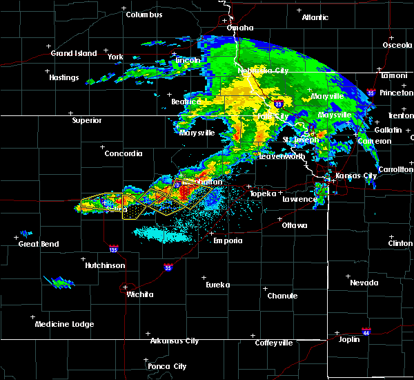 At 556 pm cdt, a severe thunderstorm was located 6 miles north of carlton, moving east at 30 mph (radar indicated). Hazards include golf ball size hail and 60 mph wind gusts. People and animals outdoors will be injured. expect hail damage to roofs, siding, windows, and vehicles. expect wind damage to roofs, siding, and trees. locations impacted include, solomon and carlton. This includes interstate 70 between mile markers 267 and 271. At 556 pm cdt, a severe thunderstorm was located 6 miles north of carlton, moving east at 30 mph (radar indicated). Hazards include golf ball size hail and 60 mph wind gusts. People and animals outdoors will be injured. expect hail damage to roofs, siding, windows, and vehicles. expect wind damage to roofs, siding, and trees. locations impacted include, solomon and carlton. This includes interstate 70 between mile markers 267 and 271.
|
| 5/6/2019 5:54 PM CDT |
 The severe thunderstorm warning for northern saline county will expire at 600 pm cdt, the storm which prompted the warning is moving out of the area. therefore, the warning will be allowed to expire. a tornado watch remains in effect until 100 am cdt for central kansas. The severe thunderstorm warning for northern saline county will expire at 600 pm cdt, the storm which prompted the warning is moving out of the area. therefore, the warning will be allowed to expire. a tornado watch remains in effect until 100 am cdt for central kansas.
|
| 5/6/2019 5:41 PM CDT |
 At 541 pm cdt, a severe thunderstorm was located 4 miles southeast of new cambria, moving east at 25 mph (radar indicated). Hazards include two inch hail and 60 mph wind gusts. People and animals outdoors will be injured. expect hail damage to roofs, siding, windows, and vehicles. expect wind damage to roofs, siding, and trees. locations impacted include, solomon and carlton. This includes interstate 70 between mile markers 267 and 271. At 541 pm cdt, a severe thunderstorm was located 4 miles southeast of new cambria, moving east at 25 mph (radar indicated). Hazards include two inch hail and 60 mph wind gusts. People and animals outdoors will be injured. expect hail damage to roofs, siding, windows, and vehicles. expect wind damage to roofs, siding, and trees. locations impacted include, solomon and carlton. This includes interstate 70 between mile markers 267 and 271.
|
| 5/6/2019 5:40 PM CDT |
 At 539 pm cdt, a severe thunderstorm was located over new cambria, or 9 miles east of salina, moving east at 25 mph (radar indicated). Hazards include 60 mph wind gusts and quarter size hail. Hail damage to vehicles is expected. expect wind damage to roofs, siding, and trees. Locations impacted include, salina, brookville, new cambria, kipp and salina airport. At 539 pm cdt, a severe thunderstorm was located over new cambria, or 9 miles east of salina, moving east at 25 mph (radar indicated). Hazards include 60 mph wind gusts and quarter size hail. Hail damage to vehicles is expected. expect wind damage to roofs, siding, and trees. Locations impacted include, salina, brookville, new cambria, kipp and salina airport.
|
| 5/6/2019 5:40 PM CDT |
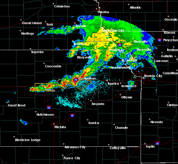 At 540 pm cdt, a severe thunderstorm was located 4 miles south of new cambria, moving east at 25 mph (radar indicated). Hazards include ping pong ball size hail and 60 mph wind gusts. People and animals outdoors will be injured. expect hail damage to roofs, siding, windows, and vehicles. expect wind damage to roofs, siding, and trees. locations impacted include, solomon and carlton. This includes interstate 70 between mile markers 267 and 271. At 540 pm cdt, a severe thunderstorm was located 4 miles south of new cambria, moving east at 25 mph (radar indicated). Hazards include ping pong ball size hail and 60 mph wind gusts. People and animals outdoors will be injured. expect hail damage to roofs, siding, windows, and vehicles. expect wind damage to roofs, siding, and trees. locations impacted include, solomon and carlton. This includes interstate 70 between mile markers 267 and 271.
|
| 5/6/2019 5:36 PM CDT |
 At 535 pm cdt, a severe thunderstorm was located 5 miles east of salina, moving southeast at 25 mph (radar indicated). Hazards include 60 mph wind gusts and half dollar size hail. Hail damage to vehicles is expected. Expect wind damage to roofs, siding, and trees. At 535 pm cdt, a severe thunderstorm was located 5 miles east of salina, moving southeast at 25 mph (radar indicated). Hazards include 60 mph wind gusts and half dollar size hail. Hail damage to vehicles is expected. Expect wind damage to roofs, siding, and trees.
|
| 5/6/2019 5:02 PM CDT |
 At 501 pm cdt, a severe thunderstorm was located near culver, or 7 miles northwest of salina, moving east at 35 mph (radar indicated). Hazards include 60 mph wind gusts and half dollar size hail. Hail damage to vehicles is expected. Expect wind damage to roofs, siding, and trees. At 501 pm cdt, a severe thunderstorm was located near culver, or 7 miles northwest of salina, moving east at 35 mph (radar indicated). Hazards include 60 mph wind gusts and half dollar size hail. Hail damage to vehicles is expected. Expect wind damage to roofs, siding, and trees.
|
| 9/20/2018 8:36 PM CDT |
 At 815 pm cdt, severe thunderstorms were located along a line extending from near leonardville to 4 miles northeast of gypsum, moving east at 30 mph (radar indicated). Hazards include 60 mph wind gusts. Expect damage to roofs, siding, and trees. locations impacted include, abilene, clay center, herington, chapman, solomon, wakefield, enterprise, hope, woodbine, manchester, longford, carlton, oak hill, talmage, idana and moonlight. This includes interstate 70 between mile markers 267 and 289. At 815 pm cdt, severe thunderstorms were located along a line extending from near leonardville to 4 miles northeast of gypsum, moving east at 30 mph (radar indicated). Hazards include 60 mph wind gusts. Expect damage to roofs, siding, and trees. locations impacted include, abilene, clay center, herington, chapman, solomon, wakefield, enterprise, hope, woodbine, manchester, longford, carlton, oak hill, talmage, idana and moonlight. This includes interstate 70 between mile markers 267 and 289.
|
| 9/20/2018 8:15 PM CDT |
 At 815 pm cdt, severe thunderstorms were located along a line extending from near leonardville to 4 miles northeast of gypsum, moving east at 30 mph (radar indicated). Hazards include 60 mph wind gusts. Expect damage to roofs, siding, and trees. locations impacted include, abilene, clay center, herington, chapman, solomon, wakefield, enterprise, hope, woodbine, manchester, longford, carlton, oak hill, talmage, idana and moonlight. This includes interstate 70 between mile markers 267 and 289. At 815 pm cdt, severe thunderstorms were located along a line extending from near leonardville to 4 miles northeast of gypsum, moving east at 30 mph (radar indicated). Hazards include 60 mph wind gusts. Expect damage to roofs, siding, and trees. locations impacted include, abilene, clay center, herington, chapman, solomon, wakefield, enterprise, hope, woodbine, manchester, longford, carlton, oak hill, talmage, idana and moonlight. This includes interstate 70 between mile markers 267 and 289.
|
| 9/20/2018 7:52 PM CDT |
 The national weather service in topeka has issued a * severe thunderstorm warning for. dickinson county in central kansas. clay county in north central kansas. until 845 pm cdt. At 751 pm cdt, severe thunderstorms were located along a line. The national weather service in topeka has issued a * severe thunderstorm warning for. dickinson county in central kansas. clay county in north central kansas. until 845 pm cdt. At 751 pm cdt, severe thunderstorms were located along a line.
|
| 8/16/2018 8:53 PM CDT |
 At 852 pm cdt, a severe thunderstorm was located 6 miles north of brookville, or 15 miles west of salina, moving east at 15 mph (radar indicated). Hazards include 60 mph wind gusts and quarter size hail. Hail damage to vehicles is expected. Expect wind damage to roofs, siding, and trees. At 852 pm cdt, a severe thunderstorm was located 6 miles north of brookville, or 15 miles west of salina, moving east at 15 mph (radar indicated). Hazards include 60 mph wind gusts and quarter size hail. Hail damage to vehicles is expected. Expect wind damage to roofs, siding, and trees.
|
| 7/29/2018 2:12 AM CDT |
 At 212 am cdt, a severe thunderstorm was located near abilene, moving southeast at 30 mph (radar indicated). Hazards include 60 mph wind gusts and penny size hail. Expect damage to roofs, siding, and trees. locations impacted include, abilene, chapman, solomon, enterprise and moonlight. This includes interstate 70 between mile markers 267 and 288. At 212 am cdt, a severe thunderstorm was located near abilene, moving southeast at 30 mph (radar indicated). Hazards include 60 mph wind gusts and penny size hail. Expect damage to roofs, siding, and trees. locations impacted include, abilene, chapman, solomon, enterprise and moonlight. This includes interstate 70 between mile markers 267 and 288.
|
| 7/29/2018 2:01 AM CDT |
 At 201 am cdt, a severe thunderstorm was located 4 miles northwest of abilene, moving east at 20 mph (radar indicated). Hazards include 60 mph wind gusts and penny size hail. Expect damage to roofs, siding, and trees. locations impacted include, abilene, chapman, solomon, enterprise, moonlight and talmage. This includes interstate 70 between mile markers 267 and 288. At 201 am cdt, a severe thunderstorm was located 4 miles northwest of abilene, moving east at 20 mph (radar indicated). Hazards include 60 mph wind gusts and penny size hail. Expect damage to roofs, siding, and trees. locations impacted include, abilene, chapman, solomon, enterprise, moonlight and talmage. This includes interstate 70 between mile markers 267 and 288.
|
| 7/29/2018 1:47 AM CDT |
 At 147 am cdt, a severe thunderstorm was located near niles, moving east at 20 mph (radar indicated). Hazards include 60 mph wind gusts and penny size hail. expect damage to roofs, siding, and trees At 147 am cdt, a severe thunderstorm was located near niles, moving east at 20 mph (radar indicated). Hazards include 60 mph wind gusts and penny size hail. expect damage to roofs, siding, and trees
|
| 7/25/2018 10:38 PM CDT |
 At 1037 pm cdt, a severe thunderstorm was located near abilene, moving southeast at 40 mph (radar indicated. at 1028 pm cdt...abilene airport reported a 76 mph wind gust). Hazards include 70 mph wind gusts. Expect considerable tree damage. Damage is likely to mobile homes, roofs, and outbuildings. At 1037 pm cdt, a severe thunderstorm was located near abilene, moving southeast at 40 mph (radar indicated. at 1028 pm cdt...abilene airport reported a 76 mph wind gust). Hazards include 70 mph wind gusts. Expect considerable tree damage. Damage is likely to mobile homes, roofs, and outbuildings.
|
| 7/19/2018 1:58 PM CDT |
 At 158 pm cdt, severe thunderstorms were located along a line extending from 4 miles south of clay center to 7 miles southwest of wakefield to 5 miles northwest of hope, moving east at 30 mph (radar indicated). Hazards include 60 mph wind gusts and quarter size hail. Hail damage to vehicles is expected. expect wind damage to roofs, siding, and trees. locations impacted include, abilene, herington, chapman, solomon, wakefield, enterprise, hope, woodbine, manchester, longford, carlton, oak hill, talmage and moonlight. This includes interstate 70 between mile markers 267 and 289. At 158 pm cdt, severe thunderstorms were located along a line extending from 4 miles south of clay center to 7 miles southwest of wakefield to 5 miles northwest of hope, moving east at 30 mph (radar indicated). Hazards include 60 mph wind gusts and quarter size hail. Hail damage to vehicles is expected. expect wind damage to roofs, siding, and trees. locations impacted include, abilene, herington, chapman, solomon, wakefield, enterprise, hope, woodbine, manchester, longford, carlton, oak hill, talmage and moonlight. This includes interstate 70 between mile markers 267 and 289.
|
| 7/19/2018 1:31 PM CDT |
 At 131 pm cdt, severe thunderstorms were located along a line extending from 3 miles southeast of miltonvale to 3 miles southwest of longford to near gypsum, moving east at 30 mph (trained weather spotters. these storms have a history of producing damaging winds). Hazards include 70 mph wind gusts and quarter size hail. Hail damage to vehicles is expected. expect considerable tree damage. wind damage is also likely to mobile homes, roofs, and outbuildings. locations impacted include, abilene, herington, chapman, solomon, wakefield, enterprise, hope, woodbine, manchester, longford, carlton, oak hill, talmage and moonlight. This includes interstate 70 between mile markers 267 and 289. At 131 pm cdt, severe thunderstorms were located along a line extending from 3 miles southeast of miltonvale to 3 miles southwest of longford to near gypsum, moving east at 30 mph (trained weather spotters. these storms have a history of producing damaging winds). Hazards include 70 mph wind gusts and quarter size hail. Hail damage to vehicles is expected. expect considerable tree damage. wind damage is also likely to mobile homes, roofs, and outbuildings. locations impacted include, abilene, herington, chapman, solomon, wakefield, enterprise, hope, woodbine, manchester, longford, carlton, oak hill, talmage and moonlight. This includes interstate 70 between mile markers 267 and 289.
|
| 7/19/2018 1:18 PM CDT |
 At 118 pm cdt, severe thunderstorms were located along a line extending from 4 miles southwest of miltonvale to near wells to 5 miles northeast of assaria, moving east at 30 mph (radar indicated). Hazards include 70 mph wind gusts and nickel size hail. Expect considerable tree damage. Damage is likely to mobile homes, roofs, and outbuildings. At 118 pm cdt, severe thunderstorms were located along a line extending from 4 miles southwest of miltonvale to near wells to 5 miles northeast of assaria, moving east at 30 mph (radar indicated). Hazards include 70 mph wind gusts and nickel size hail. Expect considerable tree damage. Damage is likely to mobile homes, roofs, and outbuildings.
|
| 6/19/2018 10:50 PM CDT |
 The severe thunderstorm warning for northern dickinson and southern clay counties will expire at 1100 pm cdt, the storms which prompted the warning have weakened below severe limits, and no longer pose an immediate threat to life or property. therefore, the warning will be allowed to expire. however gusty winds are still possible with these thunderstorms. a severe thunderstorm watch remains in effect until 1100 pm cdt for north central kansas. a severe thunderstorm watch also remains in effect until 500 am cdt for central kansas. The severe thunderstorm warning for northern dickinson and southern clay counties will expire at 1100 pm cdt, the storms which prompted the warning have weakened below severe limits, and no longer pose an immediate threat to life or property. therefore, the warning will be allowed to expire. however gusty winds are still possible with these thunderstorms. a severe thunderstorm watch remains in effect until 1100 pm cdt for north central kansas. a severe thunderstorm watch also remains in effect until 500 am cdt for central kansas.
|
| 6/19/2018 10:28 PM CDT |
 At 1028 pm cdt, severe thunderstorms were located along a line extending from 8 miles southwest of wakefield to 3 miles north of abilene to 5 miles south of solomon, moving southeast at 30 mph (radar indicated). Hazards include 60 mph wind gusts. Expect damage to roofs, siding, and trees. locations impacted include, abilene, chapman, solomon, wakefield, enterprise, manchester, longford, oak hill, moonlight and talmage. This includes interstate 70 between mile markers 267 and 288. At 1028 pm cdt, severe thunderstorms were located along a line extending from 8 miles southwest of wakefield to 3 miles north of abilene to 5 miles south of solomon, moving southeast at 30 mph (radar indicated). Hazards include 60 mph wind gusts. Expect damage to roofs, siding, and trees. locations impacted include, abilene, chapman, solomon, wakefield, enterprise, manchester, longford, oak hill, moonlight and talmage. This includes interstate 70 between mile markers 267 and 288.
|
| 6/19/2018 10:18 PM CDT |
 At 1018 pm cdt, severe thunderstorms were located along a line extending from 6 miles east of longford to near talmage to 3 miles southwest of solomon, moving southeast at 30 mph (radar indicated). Hazards include 60 mph wind gusts. Expect damage to roofs, siding, and trees. locations impacted include, abilene, chapman, solomon, wakefield, enterprise, bennington, wells, manchester, longford, oak hill, niles, talmage and moonlight. This includes interstate 70 between mile markers 267 and 288. At 1018 pm cdt, severe thunderstorms were located along a line extending from 6 miles east of longford to near talmage to 3 miles southwest of solomon, moving southeast at 30 mph (radar indicated). Hazards include 60 mph wind gusts. Expect damage to roofs, siding, and trees. locations impacted include, abilene, chapman, solomon, wakefield, enterprise, bennington, wells, manchester, longford, oak hill, niles, talmage and moonlight. This includes interstate 70 between mile markers 267 and 288.
|
| 6/19/2018 9:57 PM CDT |
 A severe thunderstorm warning remains in effect until 1030 pm cdt for northeastern ellsworth and saline counties. at 956 pm cdt, severe thunderstorms were located along a line extending from near bennington, to 6 miles northeast of brookville, to 8 miles east of kanopolis, moving southeast at 25 mph. hazard. 60 mph wind gusts. A severe thunderstorm warning remains in effect until 1030 pm cdt for northeastern ellsworth and saline counties. at 956 pm cdt, severe thunderstorms were located along a line extending from near bennington, to 6 miles northeast of brookville, to 8 miles east of kanopolis, moving southeast at 25 mph. hazard. 60 mph wind gusts.
|
| 6/19/2018 9:55 PM CDT |
 At 955 pm cdt, severe thunderstorms were located along a line extending from 6 miles west of oak hill to near bennington, moving southeast at 30 mph (radar indicated). Hazards include 60 mph wind gusts. expect damage to roofs, siding, and trees At 955 pm cdt, severe thunderstorms were located along a line extending from 6 miles west of oak hill to near bennington, moving southeast at 30 mph (radar indicated). Hazards include 60 mph wind gusts. expect damage to roofs, siding, and trees
|
| 6/19/2018 9:25 PM CDT |
 At 924 pm cdt, severe thunderstorms were located along a line extending from minneapolis, to near tescott, to 11 miles southwest of beverly, moving southeast at 35 mph (radar indicated. this storm produced wind gusts up to 70 mph near beverly in eastern lincoln county). Hazards include 60 mph wind gusts. expect damage to roofs, siding, and trees At 924 pm cdt, severe thunderstorms were located along a line extending from minneapolis, to near tescott, to 11 miles southwest of beverly, moving southeast at 35 mph (radar indicated. this storm produced wind gusts up to 70 mph near beverly in eastern lincoln county). Hazards include 60 mph wind gusts. expect damage to roofs, siding, and trees
|
| 6/18/2018 7:37 PM CDT |
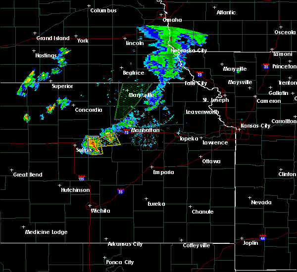 At 737 pm cdt, severe thunderstorms were located along a line extending from 3 miles southwest of talmage to 6 miles northwest of hope, moving northeast at 20 mph (radar indicated). Hazards include 60 mph wind gusts. Expect damage to roofs, siding, and trees. locations impacted include, abilene, solomon and carlton. This includes interstate 70 between mile markers 267 and 278. At 737 pm cdt, severe thunderstorms were located along a line extending from 3 miles southwest of talmage to 6 miles northwest of hope, moving northeast at 20 mph (radar indicated). Hazards include 60 mph wind gusts. Expect damage to roofs, siding, and trees. locations impacted include, abilene, solomon and carlton. This includes interstate 70 between mile markers 267 and 278.
|
| 6/18/2018 7:11 PM CDT |
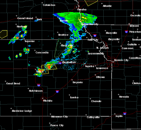 At 711 pm cdt, a severe thunderstorm was located 6 miles northeast of gypsum, moving northeast at 25 mph (radar indicated). Hazards include 60 mph wind gusts. expect damage to roofs, siding, and trees At 711 pm cdt, a severe thunderstorm was located 6 miles northeast of gypsum, moving northeast at 25 mph (radar indicated). Hazards include 60 mph wind gusts. expect damage to roofs, siding, and trees
|
| 5/14/2018 12:01 AM CDT |
 At 1156 pm cdt, severe thunderstorms were located along a line extending from 6 miles north of wells to near new cambria to near lindsborg, moving east at 45 mph (radar indicated). Hazards include 70 mph wind gusts and nickel size hail. Expect considerable tree damage. Damage is likely to mobile homes, roofs, and outbuildings. At 1156 pm cdt, severe thunderstorms were located along a line extending from 6 miles north of wells to near new cambria to near lindsborg, moving east at 45 mph (radar indicated). Hazards include 70 mph wind gusts and nickel size hail. Expect considerable tree damage. Damage is likely to mobile homes, roofs, and outbuildings.
|
| 5/13/2018 11:56 PM CDT |
 At 1156 pm cdt, severe thunderstorms were located along a line extending from 6 miles north of wells to near new cambria to near lindsborg, moving east at 45 mph (radar indicated). Hazards include 70 mph wind gusts and nickel size hail. Expect considerable tree damage. Damage is likely to mobile homes, roofs, and outbuildings. At 1156 pm cdt, severe thunderstorms were located along a line extending from 6 miles north of wells to near new cambria to near lindsborg, moving east at 45 mph (radar indicated). Hazards include 70 mph wind gusts and nickel size hail. Expect considerable tree damage. Damage is likely to mobile homes, roofs, and outbuildings.
|
| 5/3/2018 8:26 PM CDT |
 At 826 pm cdt, a severe thunderstorm was located near abilene, moving east at 40 mph (emergency management). Hazards include ping pong ball size hail and 60 mph wind gusts. People and animals outdoors will be injured. expect hail damage to roofs, siding, windows, and vehicles. expect wind damage to roofs, siding, and trees. this severe storm will be near, enterprise and moonlight around 835 pm cdt. chapman around 845 pm cdt. This includes interstate 70 between mile markers 267 and 296. At 826 pm cdt, a severe thunderstorm was located near abilene, moving east at 40 mph (emergency management). Hazards include ping pong ball size hail and 60 mph wind gusts. People and animals outdoors will be injured. expect hail damage to roofs, siding, windows, and vehicles. expect wind damage to roofs, siding, and trees. this severe storm will be near, enterprise and moonlight around 835 pm cdt. chapman around 845 pm cdt. This includes interstate 70 between mile markers 267 and 296.
|
| 5/3/2018 8:22 PM CDT | Ping Pong Ball sized hail reported 0.7 miles SSW of Solomon, KS, law enforcement reported. |
| 5/3/2018 8:20 PM CDT |
 The severe thunderstorm warning for northeastern saline county will expire at 830 pm cdt, the storm which prompted the warning has moved out of the area. therefore the warning will be allowed to expire. The severe thunderstorm warning for northeastern saline county will expire at 830 pm cdt, the storm which prompted the warning has moved out of the area. therefore the warning will be allowed to expire.
|
| 5/3/2018 8:11 PM CDT |
 At 811 pm cdt, a severe thunderstorm was located near niles, moving east at 45 mph (trained weather spotters). Hazards include ping pong ball size hail and 60 mph wind gusts. People and animals outdoors will be injured. expect hail damage to roofs, siding, windows, and vehicles. expect wind damage to roofs, siding, and trees. this severe thunderstorm will be near, solomon around 815 pm cdt. abilene around 825 pm cdt. enterprise and moonlight around 835 pm cdt. chapman around 840 pm cdt. junction city around 845 pm cdt. This includes interstate 70 between mile markers 267 and 296. At 811 pm cdt, a severe thunderstorm was located near niles, moving east at 45 mph (trained weather spotters). Hazards include ping pong ball size hail and 60 mph wind gusts. People and animals outdoors will be injured. expect hail damage to roofs, siding, windows, and vehicles. expect wind damage to roofs, siding, and trees. this severe thunderstorm will be near, solomon around 815 pm cdt. abilene around 825 pm cdt. enterprise and moonlight around 835 pm cdt. chapman around 840 pm cdt. junction city around 845 pm cdt. This includes interstate 70 between mile markers 267 and 296.
|
| 5/3/2018 8:01 PM CDT |
 At 749 pm cdt, a severe thunderstorm was located near culver, or 9 miles north of salina, moving east at 40 mph (radar indicated). Hazards include quarter size hail. Damage to vehicles is expected. Locations impacted include, salina and new cambria. At 749 pm cdt, a severe thunderstorm was located near culver, or 9 miles north of salina, moving east at 40 mph (radar indicated). Hazards include quarter size hail. Damage to vehicles is expected. Locations impacted include, salina and new cambria.
|
| 5/3/2018 7:55 PM CDT |
 At 755 pm cdt, a severe thunderstorm was located 4 miles south of bennington, moving east at 45 mph (trained weather spotters). Hazards include 60 mph wind gusts and half dollar size hail. Hail damage to vehicles is expected. expect wind damage to roofs, siding, and trees. this severe storm will be near, niles around 805 pm cdt. abilene, solomon, manchester and talmage around 815 pm cdt. This includes interstate 70 between mile markers 267 and 276. At 755 pm cdt, a severe thunderstorm was located 4 miles south of bennington, moving east at 45 mph (trained weather spotters). Hazards include 60 mph wind gusts and half dollar size hail. Hail damage to vehicles is expected. expect wind damage to roofs, siding, and trees. this severe storm will be near, niles around 805 pm cdt. abilene, solomon, manchester and talmage around 815 pm cdt. This includes interstate 70 between mile markers 267 and 276.
|
| 5/3/2018 7:50 PM CDT |
 At 749 pm cdt, a severe thunderstorm was located near culver, or 9 miles north of salina, moving east at 40 mph (radar indicated). Hazards include quarter size hail. Damage to vehicles is expected. Locations impacted include, salina and new cambria. At 749 pm cdt, a severe thunderstorm was located near culver, or 9 miles north of salina, moving east at 40 mph (radar indicated). Hazards include quarter size hail. Damage to vehicles is expected. Locations impacted include, salina and new cambria.
|
| 5/3/2018 7:42 PM CDT |
 At 742 pm cdt, a severe thunderstorm was located over culver, moving east at 55 mph (trained weather spotters). Hazards include 60 mph wind gusts and half dollar size hail. Hail damage to vehicles is expected. expect wind damage to roofs, siding, and trees. this severe thunderstorm will be near, bennington around 755 pm cdt. niles around 800 pm cdt. solomon around 805 pm cdt. manchester around 810 pm cdt. abilene and talmage around 815 pm cdt. This includes interstate 70 between mile markers 267 and 276. At 742 pm cdt, a severe thunderstorm was located over culver, moving east at 55 mph (trained weather spotters). Hazards include 60 mph wind gusts and half dollar size hail. Hail damage to vehicles is expected. expect wind damage to roofs, siding, and trees. this severe thunderstorm will be near, bennington around 755 pm cdt. niles around 800 pm cdt. solomon around 805 pm cdt. manchester around 810 pm cdt. abilene and talmage around 815 pm cdt. This includes interstate 70 between mile markers 267 and 276.
|
| 5/3/2018 7:40 PM CDT |
 At 740 pm cdt, a severe thunderstorm was located over culver, or 12 miles northwest of salina, moving east at 40 mph (radar indicated). Hazards include quarter to half dollar size hail. Damage to vehicles is expected. Locations impacted include, salina, new cambria and glendale. At 740 pm cdt, a severe thunderstorm was located over culver, or 12 miles northwest of salina, moving east at 40 mph (radar indicated). Hazards include quarter to half dollar size hail. Damage to vehicles is expected. Locations impacted include, salina, new cambria and glendale.
|
| 5/3/2018 7:29 PM CDT |
 At 729 pm cdt, a severe thunderstorm was located 6 miles south of beverly, or 13 miles southeast of lincoln, moving east at 40 mph (radar indicated). Hazards include quarter to half dollar size hail. damage to vehicles is expected At 729 pm cdt, a severe thunderstorm was located 6 miles south of beverly, or 13 miles southeast of lincoln, moving east at 40 mph (radar indicated). Hazards include quarter to half dollar size hail. damage to vehicles is expected
|
| 5/2/2018 5:37 PM CDT |
 The severe thunderstorm warning for northern dickinson, eastern ottawa and southern clay counties will expire at 545 pm cdt, the storms which prompted the warning have moved out of the area. therefore the warning will be allowed to expire. a tornado watch remains in effect until 1000 pm cdt for central, north central, northeastern and east central kansas. The severe thunderstorm warning for northern dickinson, eastern ottawa and southern clay counties will expire at 545 pm cdt, the storms which prompted the warning have moved out of the area. therefore the warning will be allowed to expire. a tornado watch remains in effect until 1000 pm cdt for central, north central, northeastern and east central kansas.
|
| 5/2/2018 5:20 PM CDT |
 At 520 pm cdt, severe thunderstorms were located along a line extending from 3 miles west of riley to 5 miles southeast of chapman, moving east at 55 mph (radar indicated). Hazards include 60 mph wind gusts and quarter size hail. Hail damage to vehicles is expected. expect wind damage to roofs, siding, and trees. locations impacted include, abilene, chapman, solomon, wakefield, enterprise, manchester, longford, oak hill, moonlight and talmage. this includes interstate 70 between mile markers 267 and 289. A tornado watch remains in effect until 1000 pm cdt for central, north central, northeastern and east central kansas. At 520 pm cdt, severe thunderstorms were located along a line extending from 3 miles west of riley to 5 miles southeast of chapman, moving east at 55 mph (radar indicated). Hazards include 60 mph wind gusts and quarter size hail. Hail damage to vehicles is expected. expect wind damage to roofs, siding, and trees. locations impacted include, abilene, chapman, solomon, wakefield, enterprise, manchester, longford, oak hill, moonlight and talmage. this includes interstate 70 between mile markers 267 and 289. A tornado watch remains in effect until 1000 pm cdt for central, north central, northeastern and east central kansas.
|
| 5/2/2018 4:40 PM CDT |
 At 439 pm cdt, severe thunderstorms were located along a line extending from 4 miles east of wells to near niles, moving northeast at 50 mph (radar indicated). Hazards include 60 mph wind gusts and quarter size hail. Hail damage to vehicles is expected. Expect wind damage to roofs, siding, and trees. At 439 pm cdt, severe thunderstorms were located along a line extending from 4 miles east of wells to near niles, moving northeast at 50 mph (radar indicated). Hazards include 60 mph wind gusts and quarter size hail. Hail damage to vehicles is expected. Expect wind damage to roofs, siding, and trees.
|
| 9/18/2017 6:25 PM CDT |
 The severe thunderstorm warning for northeastern saline county will expire at 630 pm cdt, the storm which prompted the warning has weakened below severe limits, and no longer poses an immediate threat to life or property. therefore the warning will be allowed to expire. however small hail, gusty winds and heavy rain are still possible with this thunderstorm. The severe thunderstorm warning for northeastern saline county will expire at 630 pm cdt, the storm which prompted the warning has weakened below severe limits, and no longer poses an immediate threat to life or property. therefore the warning will be allowed to expire. however small hail, gusty winds and heavy rain are still possible with this thunderstorm.
|
| 9/18/2017 6:10 PM CDT |
 At 610 pm cdt, a severe thunderstorm was located near new cambria, or 6 miles north of salina, moving southeast at 25 mph (radar indicated). Hazards include 60 mph wind gusts and quarter size hail. Hail damage to vehicles is expected. expect wind damage to roofs, siding, and trees. Locations impacted include, salina and new cambria. At 610 pm cdt, a severe thunderstorm was located near new cambria, or 6 miles north of salina, moving southeast at 25 mph (radar indicated). Hazards include 60 mph wind gusts and quarter size hail. Hail damage to vehicles is expected. expect wind damage to roofs, siding, and trees. Locations impacted include, salina and new cambria.
|
| 9/18/2017 5:51 PM CDT |
 At 550 pm cdt, a severe thunderstorm was located near culver, or 10 miles north of salina, moving southeast at 30 mph (radar indicated). Hazards include golf ball size hail and 70 mph wind gusts. People and animals outdoors will be injured. expect hail damage to roofs, siding, windows, and vehicles. expect considerable tree damage. wind damage is also likely to mobile homes, roofs, and outbuildings. locations impacted include, salina and new cambria. This storm has a history of producing severe wind gusts and large hail. At 550 pm cdt, a severe thunderstorm was located near culver, or 10 miles north of salina, moving southeast at 30 mph (radar indicated). Hazards include golf ball size hail and 70 mph wind gusts. People and animals outdoors will be injured. expect hail damage to roofs, siding, windows, and vehicles. expect considerable tree damage. wind damage is also likely to mobile homes, roofs, and outbuildings. locations impacted include, salina and new cambria. This storm has a history of producing severe wind gusts and large hail.
|
| 9/18/2017 5:44 PM CDT |
 At 544 pm cdt, a severe thunderstorm was located over culver, or 10 miles south of minneapolis, moving east at 35 mph (radar indicated). Hazards include 60 mph wind gusts and quarter size hail. Hail damage to vehicles is expected. Expect wind damage to roofs, siding, and trees. At 544 pm cdt, a severe thunderstorm was located over culver, or 10 miles south of minneapolis, moving east at 35 mph (radar indicated). Hazards include 60 mph wind gusts and quarter size hail. Hail damage to vehicles is expected. Expect wind damage to roofs, siding, and trees.
|
| 6/29/2017 7:37 PM CDT |
 The severe thunderstorm warning for eastern saline county will expire at 1245 am cdt, the storm which prompted the warning has moved out of the area. therefore the warning will be allowed to expire. a severe thunderstorm watch remains in effect until 500 am cdt for central kansas. The severe thunderstorm warning for eastern saline county will expire at 1245 am cdt, the storm which prompted the warning has moved out of the area. therefore the warning will be allowed to expire. a severe thunderstorm watch remains in effect until 500 am cdt for central kansas.
|
| 6/29/2017 7:31 PM CDT |
 At 1230 am cdt, severe thunderstorms were located along a line extending from near niles to near carlton, moving east at 45 mph (radar indicated. a wind gust of 68 mph was measured at salina from this storm shortly after midnight). Hazards include 60 mph wind gusts and quarter size hail. Hail damage to vehicles is expected. expect wind damage to roofs, siding, and trees. these severe storms will be near, abilene around 1240 am cdt. talmage and moonlight around 1245 am cdt. This includes interstate 70 between mile markers 267 and 288. At 1230 am cdt, severe thunderstorms were located along a line extending from near niles to near carlton, moving east at 45 mph (radar indicated. a wind gust of 68 mph was measured at salina from this storm shortly after midnight). Hazards include 60 mph wind gusts and quarter size hail. Hail damage to vehicles is expected. expect wind damage to roofs, siding, and trees. these severe storms will be near, abilene around 1240 am cdt. talmage and moonlight around 1245 am cdt. This includes interstate 70 between mile markers 267 and 288.
|
| 6/29/2017 7:12 PM CDT |
 At 1211 am cdt, severe thunderstorms were located along a line extending from near bennington to 3 miles east of assaria, moving east at 45 mph (automated surface observation site. a gust of 64 mph was measured at salina). Hazards include 60 mph wind gusts. Expect damage to roofs, siding, and trees. severe thunderstorms will be near, niles around 1220 am cdt. carlton around 1230 am cdt. talmage around 1235 am cdt. moonlight around 1245 am cdt. This includes interstate 70 between mile markers 267 and 288. At 1211 am cdt, severe thunderstorms were located along a line extending from near bennington to 3 miles east of assaria, moving east at 45 mph (automated surface observation site. a gust of 64 mph was measured at salina). Hazards include 60 mph wind gusts. Expect damage to roofs, siding, and trees. severe thunderstorms will be near, niles around 1220 am cdt. carlton around 1230 am cdt. talmage around 1235 am cdt. moonlight around 1245 am cdt. This includes interstate 70 between mile markers 267 and 288.
|
| 6/29/2017 7:10 PM CDT |
 At 1210 am cdt, a severe thunderstorm was located over gypsum, or 10 miles southeast of salina, moving east at 25 mph (radar indicated). Hazards include 60 mph wind gusts and nickel size hail. expect damage to roofs, siding, and trees At 1210 am cdt, a severe thunderstorm was located over gypsum, or 10 miles southeast of salina, moving east at 25 mph (radar indicated). Hazards include 60 mph wind gusts and nickel size hail. expect damage to roofs, siding, and trees
|
| 6/15/2017 5:51 PM CDT |
 At 550 pm cdt, a severe thunderstorm was located 8 miles south of gypsum, or 12 miles east of lindsborg, moving east at 25 mph. this is a very dangerous storm (law enforcement). Hazards include 80 mph wind gusts and half dollar size hail. Flying debris will be dangerous to those caught without shelter. mobile homes will be heavily damaged. expect considerable damage to roofs, windows, and vehicles. extensive tree damage and power outages are likely. Locations impacted include, salina, mcpherson, lindsborg, hillsboro, galva, canton, goessel, assaria, gypsum, ramona, lehigh, new cambria, tampa, durham, mcpherson airport, roxbury, marion lake, bridgeport and kipp. At 550 pm cdt, a severe thunderstorm was located 8 miles south of gypsum, or 12 miles east of lindsborg, moving east at 25 mph. this is a very dangerous storm (law enforcement). Hazards include 80 mph wind gusts and half dollar size hail. Flying debris will be dangerous to those caught without shelter. mobile homes will be heavily damaged. expect considerable damage to roofs, windows, and vehicles. extensive tree damage and power outages are likely. Locations impacted include, salina, mcpherson, lindsborg, hillsboro, galva, canton, goessel, assaria, gypsum, ramona, lehigh, new cambria, tampa, durham, mcpherson airport, roxbury, marion lake, bridgeport and kipp.
|
| 6/15/2017 5:45 PM CDT |
 At 545 pm cdt, severe thunderstorms were located along a line extending from 7 miles south of clay center to near moonlight to 5 miles west of tampa, moving west at 25 mph. these are very dangerous storms (radar indicated). Hazards include 80 mph wind gusts and golf ball size hail. Flying debris will be dangerous to those caught without shelter. mobile homes will be heavily damaged. expect considerable damage to roofs, windows, and vehicles. Extensive tree damage and power outages are likely. At 545 pm cdt, severe thunderstorms were located along a line extending from 7 miles south of clay center to near moonlight to 5 miles west of tampa, moving west at 25 mph. these are very dangerous storms (radar indicated). Hazards include 80 mph wind gusts and golf ball size hail. Flying debris will be dangerous to those caught without shelter. mobile homes will be heavily damaged. expect considerable damage to roofs, windows, and vehicles. Extensive tree damage and power outages are likely.
|
| 6/15/2017 5:33 PM CDT |
 At 532 pm cdt, a severe thunderstorm was located over carlton, moving east at 60 mph. this is a very dangerous storm (trained weather spotters reported a 70 mph wind gust 2 miles north of lindsborg at 530 pm). Hazards include 90 mph wind gusts and quarter size hail. You are in a life-threatening situation. flying debris may be deadly to those caught without shelter. mobile homes will be heavily damaged or destroyed. homes and businesses will have substantial roof and window damage. expect extensive tree damage and power outages. this severe storm will be near, hope and woodbine around 545 pm cdt. This includes interstate 70 between mile markers 267 and 282. At 532 pm cdt, a severe thunderstorm was located over carlton, moving east at 60 mph. this is a very dangerous storm (trained weather spotters reported a 70 mph wind gust 2 miles north of lindsborg at 530 pm). Hazards include 90 mph wind gusts and quarter size hail. You are in a life-threatening situation. flying debris may be deadly to those caught without shelter. mobile homes will be heavily damaged or destroyed. homes and businesses will have substantial roof and window damage. expect extensive tree damage and power outages. this severe storm will be near, hope and woodbine around 545 pm cdt. This includes interstate 70 between mile markers 267 and 282.
|
| 6/15/2017 5:30 PM CDT |
 At 528 pm cdt, a severe thunderstorm was located over lindsborg, moving east at 25 mph. this is a very dangerous storm (law enforcement has reported tractor trailers blown off i- 135 south of salina). Hazards include 80 mph wind gusts and half dollar size hail. Flying debris will be dangerous to those caught without shelter. mobile homes will be heavily damaged. expect considerable damage to roofs, windows, and vehicles. extensive tree damage and power outages are likely. Locations impacted include, salina, mcpherson, lindsborg, hillsboro, galva, canton, goessel, assaria, gypsum, ramona, lehigh, new cambria, tampa, durham, mcpherson airport, roxbury, marion lake, bridgeport and kipp. At 528 pm cdt, a severe thunderstorm was located over lindsborg, moving east at 25 mph. this is a very dangerous storm (law enforcement has reported tractor trailers blown off i- 135 south of salina). Hazards include 80 mph wind gusts and half dollar size hail. Flying debris will be dangerous to those caught without shelter. mobile homes will be heavily damaged. expect considerable damage to roofs, windows, and vehicles. extensive tree damage and power outages are likely. Locations impacted include, salina, mcpherson, lindsborg, hillsboro, galva, canton, goessel, assaria, gypsum, ramona, lehigh, new cambria, tampa, durham, mcpherson airport, roxbury, marion lake, bridgeport and kipp.
|
| 6/15/2017 5:23 PM CDT |
 At 522 pm cdt, a severe thunderstorm was located near lindsborg, moving east at 25 mph (radar indicated). Hazards include 70 mph wind gusts and half dollar size hail. Hail damage to vehicles is expected. expect considerable tree damage. Wind damage is also likely to mobile homes, roofs, and outbuildings. At 522 pm cdt, a severe thunderstorm was located near lindsborg, moving east at 25 mph (radar indicated). Hazards include 70 mph wind gusts and half dollar size hail. Hail damage to vehicles is expected. expect considerable tree damage. Wind damage is also likely to mobile homes, roofs, and outbuildings.
|
| 6/15/2017 5:12 PM CDT |
 At 511 pm cdt, a severe thunderstorm was located near lindsborg, moving east at 20 mph (trained weather spotters). Hazards include 60 mph wind gusts and quarter size hail. Hail damage to vehicles is expected. expect wind damage to roofs, siding, and trees. Locations impacted include, salina, mcpherson, lindsborg, galva, canton, marquette, assaria, gypsum, brookville, smolan, windom, new cambria, falun, glendale, salina airport, mcpherson airport, roxbury, bridgeport and kipp. At 511 pm cdt, a severe thunderstorm was located near lindsborg, moving east at 20 mph (trained weather spotters). Hazards include 60 mph wind gusts and quarter size hail. Hail damage to vehicles is expected. expect wind damage to roofs, siding, and trees. Locations impacted include, salina, mcpherson, lindsborg, galva, canton, marquette, assaria, gypsum, brookville, smolan, windom, new cambria, falun, glendale, salina airport, mcpherson airport, roxbury, bridgeport and kipp.
|
| 6/15/2017 5:05 PM CDT |
 At 505 pm cdt, a severe thunderstorm was located 6 miles west of woodbine, moving east at 20 mph (radar indicated). Hazards include golf ball size hail and 60 mph wind gusts. People and animals outdoors will be injured. expect hail damage to roofs, siding, windows, and vehicles. expect wind damage to roofs, siding, and trees. locations impacted include, abilene, herington, chapman, solomon, enterprise, hope, woodbine, carlton and latimer. This includes interstate 70 between mile markers 267 and 283. At 505 pm cdt, a severe thunderstorm was located 6 miles west of woodbine, moving east at 20 mph (radar indicated). Hazards include golf ball size hail and 60 mph wind gusts. People and animals outdoors will be injured. expect hail damage to roofs, siding, windows, and vehicles. expect wind damage to roofs, siding, and trees. locations impacted include, abilene, herington, chapman, solomon, enterprise, hope, woodbine, carlton and latimer. This includes interstate 70 between mile markers 267 and 283.
|
| 6/15/2017 5:04 PM CDT |
 At 504 pm cdt, a severe thunderstorm was located over marquette, or 7 miles west of lindsborg, moving east at 20 mph (trained weather spotters). Hazards include 60 mph wind gusts and quarter size hail. Hail damage to vehicles is expected. expect wind damage to roofs, siding, and trees. Locations impacted include, salina, mcpherson, lindsborg, galva, canton, kanopolis, marquette, assaria, gypsum, brookville, smolan, windom, new cambria, falun, glendale, salina airport, mcpherson airport, roxbury, bridgeport and kanopolis lake. At 504 pm cdt, a severe thunderstorm was located over marquette, or 7 miles west of lindsborg, moving east at 20 mph (trained weather spotters). Hazards include 60 mph wind gusts and quarter size hail. Hail damage to vehicles is expected. expect wind damage to roofs, siding, and trees. Locations impacted include, salina, mcpherson, lindsborg, galva, canton, kanopolis, marquette, assaria, gypsum, brookville, smolan, windom, new cambria, falun, glendale, salina airport, mcpherson airport, roxbury, bridgeport and kanopolis lake.
|
| 6/15/2017 4:54 PM CDT |
 At 454 pm cdt, a severe thunderstorm was located 5 miles north of hope, moving east at 25 mph (radar indicated). Hazards include golf ball size hail and 60 mph wind gusts. People and animals outdoors will be injured. expect hail damage to roofs, siding, windows, and vehicles. Expect wind damage to roofs, siding, and trees. At 454 pm cdt, a severe thunderstorm was located 5 miles north of hope, moving east at 25 mph (radar indicated). Hazards include golf ball size hail and 60 mph wind gusts. People and animals outdoors will be injured. expect hail damage to roofs, siding, windows, and vehicles. Expect wind damage to roofs, siding, and trees.
|
| 6/15/2017 4:50 PM CDT |
 At 448 pm cdt, a severe thunderstorm was located near marquette, or 13 miles west of lindsborg, moving east at 25 mph (trained weather spotters have reported 1 inch hail in geneseo). Hazards include 60 mph wind gusts and half dollar size hail. Hail damage to vehicles is expected. expect wind damage to roofs, siding, and trees. Locations impacted include, salina, mcpherson, lindsborg, galva, canton, kanopolis, marquette, little river, assaria, gypsum, geneseo, brookville, smolan, windom, new cambria, falun, glendale, salina airport, mcpherson airport and roxbury. At 448 pm cdt, a severe thunderstorm was located near marquette, or 13 miles west of lindsborg, moving east at 25 mph (trained weather spotters have reported 1 inch hail in geneseo). Hazards include 60 mph wind gusts and half dollar size hail. Hail damage to vehicles is expected. expect wind damage to roofs, siding, and trees. Locations impacted include, salina, mcpherson, lindsborg, galva, canton, kanopolis, marquette, little river, assaria, gypsum, geneseo, brookville, smolan, windom, new cambria, falun, glendale, salina airport, mcpherson airport and roxbury.
|
| 6/15/2017 4:27 PM CDT |
 At 425 pm cdt, a severe thunderstorm was located 8 miles east of geneseo, or 14 miles southeast of kanopolis, moving east at 20 mph (trained weather spotters have reported quarter sized hail but this storm is still capable of producing half dollar sized hail). Hazards include 60 mph wind gusts and half dollar size hail. Hail damage to vehicles is expected. expect wind damage to roofs, siding, and trees. Locations impacted include, salina, mcpherson, lindsborg, galva, canton, kanopolis, lincoln, marquette, little river, assaria, gypsum, geneseo, brookville, smolan, beverly, windom, new cambria, falun, glendale and mcpherson airport. At 425 pm cdt, a severe thunderstorm was located 8 miles east of geneseo, or 14 miles southeast of kanopolis, moving east at 20 mph (trained weather spotters have reported quarter sized hail but this storm is still capable of producing half dollar sized hail). Hazards include 60 mph wind gusts and half dollar size hail. Hail damage to vehicles is expected. expect wind damage to roofs, siding, and trees. Locations impacted include, salina, mcpherson, lindsborg, galva, canton, kanopolis, lincoln, marquette, little river, assaria, gypsum, geneseo, brookville, smolan, beverly, windom, new cambria, falun, glendale and mcpherson airport.
|
| 6/15/2017 4:15 PM CDT |
 At 415 pm cdt, a severe thunderstorm was located near geneseo, or 12 miles south of kanopolis, moving east at 20 mph (radar indicated). Hazards include 60 mph wind gusts and half dollar size hail. Hail damage to vehicles is expected. Expect wind damage to roofs, siding, and trees. At 415 pm cdt, a severe thunderstorm was located near geneseo, or 12 miles south of kanopolis, moving east at 20 mph (radar indicated). Hazards include 60 mph wind gusts and half dollar size hail. Hail damage to vehicles is expected. Expect wind damage to roofs, siding, and trees.
|
| 5/25/2017 10:47 PM CDT |
 At 1046 pm cdt, a severe thunderstorm was located near tescott, or 15 miles northwest of salina, moving east at 40 mph (radar indicated). Hazards include 60 mph wind gusts. Expect damage to roofs, siding, and trees. Locations impacted include, salina, new cambria and glendale. At 1046 pm cdt, a severe thunderstorm was located near tescott, or 15 miles northwest of salina, moving east at 40 mph (radar indicated). Hazards include 60 mph wind gusts. Expect damage to roofs, siding, and trees. Locations impacted include, salina, new cambria and glendale.
|
| 5/25/2017 10:39 PM CDT |
 At 1039 pm cdt, a severe thunderstorm was located 7 miles south of beverly, or 13 miles southeast of lincoln, moving east at 40 mph (radar indicated). Hazards include 60 mph wind gusts and penny size hail. expect damage to roofs, siding, and trees At 1039 pm cdt, a severe thunderstorm was located 7 miles south of beverly, or 13 miles southeast of lincoln, moving east at 40 mph (radar indicated). Hazards include 60 mph wind gusts and penny size hail. expect damage to roofs, siding, and trees
|
| 5/18/2017 7:14 PM CDT |
 At 714 pm cdt, a severe thunderstorm was located near talmage, moving northeast at 35 mph (radar indicated). Hazards include 60 mph wind gusts. Expect damage to roofs, siding, and trees. locations impacted include, abilene, solomon, enterprise, manchester, niles, moonlight and talmage. this includes interstate 70 between mile markers 267 and 283. A tornado watch remains in effect until 1000 pm cdt for central and north central kansas. At 714 pm cdt, a severe thunderstorm was located near talmage, moving northeast at 35 mph (radar indicated). Hazards include 60 mph wind gusts. Expect damage to roofs, siding, and trees. locations impacted include, abilene, solomon, enterprise, manchester, niles, moonlight and talmage. this includes interstate 70 between mile markers 267 and 283. A tornado watch remains in effect until 1000 pm cdt for central and north central kansas.
|
| 5/18/2017 6:58 PM CDT |
 At 658 pm cdt, a severe thunderstorm was located over solomon, moving northeast at 35 mph (radar indicated). Hazards include 70 mph wind gusts and quarter size hail. Hail damage to vehicles is expected. expect considerable tree damage. Wind damage is also likely to mobile homes, roofs, and outbuildings. At 658 pm cdt, a severe thunderstorm was located over solomon, moving northeast at 35 mph (radar indicated). Hazards include 70 mph wind gusts and quarter size hail. Hail damage to vehicles is expected. expect considerable tree damage. Wind damage is also likely to mobile homes, roofs, and outbuildings.
|
| 5/18/2017 6:50 PM CDT |
 At 650 pm cdt, a severe thunderstorm was located near gypsum, or 9 miles east of salina, moving northeast at 35 mph (radar indicated). Hazards include 70 mph wind gusts. Expect considerable tree damage. Damage is likely to mobile homes, roofs, and outbuildings. At 650 pm cdt, a severe thunderstorm was located near gypsum, or 9 miles east of salina, moving northeast at 35 mph (radar indicated). Hazards include 70 mph wind gusts. Expect considerable tree damage. Damage is likely to mobile homes, roofs, and outbuildings.
|
| 5/18/2017 6:33 PM CDT |
 At 633 pm cdt, a confirmed tornado was located near new cambria, moving northeast at 35 mph (emergency management confirmed tornado). Hazards include damaging tornado and golf ball size hail. Flying debris will be dangerous to those caught without shelter. mobile homes will be damaged or destroyed. damage to roofs, windows, and vehicles will occur. tree damage is likely. locations impacted include, abilene, solomon, bennington, manchester, niles and talmage. This includes interstate 70 between mile markers 267 and 276. At 633 pm cdt, a confirmed tornado was located near new cambria, moving northeast at 35 mph (emergency management confirmed tornado). Hazards include damaging tornado and golf ball size hail. Flying debris will be dangerous to those caught without shelter. mobile homes will be damaged or destroyed. damage to roofs, windows, and vehicles will occur. tree damage is likely. locations impacted include, abilene, solomon, bennington, manchester, niles and talmage. This includes interstate 70 between mile markers 267 and 276.
|
| 5/18/2017 6:27 PM CDT |
 At 626 pm cdt, a severe thunderstorm capable of producing a tornado was located near salina, moving northeast at 35 mph (radar indicated rotation). Hazards include tornado and golf ball size hail. Flying debris will be dangerous to those caught without shelter. mobile homes will be damaged or destroyed. damage to roofs, windows, and vehicles will occur. Tree damage is likely. At 626 pm cdt, a severe thunderstorm capable of producing a tornado was located near salina, moving northeast at 35 mph (radar indicated rotation). Hazards include tornado and golf ball size hail. Flying debris will be dangerous to those caught without shelter. mobile homes will be damaged or destroyed. damage to roofs, windows, and vehicles will occur. Tree damage is likely.
|
| 5/18/2017 6:06 PM CDT |
 At 605 pm cdt, a severe thunderstorm was located near talmage, moving northeast at 30 mph (radar indicated). Hazards include half dollar size hail. Damage to vehicles is expected. locations impacted include, abilene, chapman, solomon, wakefield, enterprise, milford, manchester, longford, oak hill, milford lake, moonlight and talmage. this includes interstate 70 between mile markers 267 and 293. A tornado watch remains in effect until 1000 pm cdt for central, north central, northeastern and east central kansas. At 605 pm cdt, a severe thunderstorm was located near talmage, moving northeast at 30 mph (radar indicated). Hazards include half dollar size hail. Damage to vehicles is expected. locations impacted include, abilene, chapman, solomon, wakefield, enterprise, milford, manchester, longford, oak hill, milford lake, moonlight and talmage. this includes interstate 70 between mile markers 267 and 293. A tornado watch remains in effect until 1000 pm cdt for central, north central, northeastern and east central kansas.
|
| 5/18/2017 5:45 PM CDT |
 At 544 pm cdt, a severe thunderstorm was located near abilene, moving northeast at 45 mph (radar indicated). Hazards include 60 mph wind gusts and quarter size hail. Hail damage to vehicles is expected. Expect wind damage to roofs, siding, and trees. At 544 pm cdt, a severe thunderstorm was located near abilene, moving northeast at 45 mph (radar indicated). Hazards include 60 mph wind gusts and quarter size hail. Hail damage to vehicles is expected. Expect wind damage to roofs, siding, and trees.
|
| 5/18/2017 5:42 PM CDT |
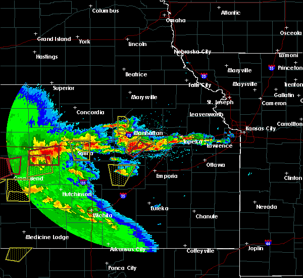 At 542 pm cdt, a severe thunderstorm was located near solomon, or 10 miles southwest of abilene, moving northeast at 20 mph (radar indicated). Hazards include 60 mph wind gusts and half dollar size hail. Hail damage to vehicles is expected. Expect wind damage to roofs, siding, and trees. At 542 pm cdt, a severe thunderstorm was located near solomon, or 10 miles southwest of abilene, moving northeast at 20 mph (radar indicated). Hazards include 60 mph wind gusts and half dollar size hail. Hail damage to vehicles is expected. Expect wind damage to roofs, siding, and trees.
|
| 5/18/2017 5:22 PM CDT |
 At 521 pm cdt, a severe thunderstorm was located near new cambria, or 7 miles east of salina, moving north at 40 mph (radar indicated). Hazards include 60 mph wind gusts and quarter size hail. Hail damage to vehicles is expected. expect wind damage to roofs, siding, and trees. locations impacted include, salina, assaria, gypsum, smolan, new cambria, bridgeport, salina airport and kipp. A tornado watch remains in effect until 1100 pm cdt for central kansas. At 521 pm cdt, a severe thunderstorm was located near new cambria, or 7 miles east of salina, moving north at 40 mph (radar indicated). Hazards include 60 mph wind gusts and quarter size hail. Hail damage to vehicles is expected. expect wind damage to roofs, siding, and trees. locations impacted include, salina, assaria, gypsum, smolan, new cambria, bridgeport, salina airport and kipp. A tornado watch remains in effect until 1100 pm cdt for central kansas.
|
| 5/18/2017 4:58 PM CDT |
 At 458 pm cdt, a severe thunderstorm was located near assaria, or 9 miles southeast of salina, moving north at 30 mph (radar indicated). Hazards include 60 mph wind gusts and half dollar size hail. Hail damage to vehicles is expected. expect wind damage to roofs, siding, and trees. locations impacted include, salina, assaria, gypsum, smolan, new cambria, bridgeport, salina airport and kipp. A tornado watch remains in effect until 1100 pm cdt for central kansas. At 458 pm cdt, a severe thunderstorm was located near assaria, or 9 miles southeast of salina, moving north at 30 mph (radar indicated). Hazards include 60 mph wind gusts and half dollar size hail. Hail damage to vehicles is expected. expect wind damage to roofs, siding, and trees. locations impacted include, salina, assaria, gypsum, smolan, new cambria, bridgeport, salina airport and kipp. A tornado watch remains in effect until 1100 pm cdt for central kansas.
|
| 5/18/2017 4:51 PM CDT |
 At 451 pm cdt, a severe thunderstorm was located near assaria, or 9 miles northeast of lindsborg, moving north at 30 mph (radar indicated). Hazards include golf ball size hail and 70 mph wind gusts. People and animals outdoors will be injured. expect hail damage to roofs, siding, windows, and vehicles. expect considerable tree damage. Wind damage is also likely to mobile homes, roofs, and outbuildings. At 451 pm cdt, a severe thunderstorm was located near assaria, or 9 miles northeast of lindsborg, moving north at 30 mph (radar indicated). Hazards include golf ball size hail and 70 mph wind gusts. People and animals outdoors will be injured. expect hail damage to roofs, siding, windows, and vehicles. expect considerable tree damage. Wind damage is also likely to mobile homes, roofs, and outbuildings.
|
| 4/19/2017 7:59 PM CDT |
 At 758 pm cdt, a severe thunderstorm was located near solomon, or 11 miles west of abilene, moving east at 20 mph (radar indicated). Hazards include 60 mph wind gusts and quarter size hail. Hail damage to vehicles is expected. expect wind damage to roofs, siding, and trees. Locations impacted include, salina, new cambria and kipp. At 758 pm cdt, a severe thunderstorm was located near solomon, or 11 miles west of abilene, moving east at 20 mph (radar indicated). Hazards include 60 mph wind gusts and quarter size hail. Hail damage to vehicles is expected. expect wind damage to roofs, siding, and trees. Locations impacted include, salina, new cambria and kipp.
|
| 4/19/2017 7:53 PM CDT |
 At 753 pm cdt, severe thunderstorms were located along a line extending from 5 miles north of moonlight to near abilene, moving east at 35 mph (radar indicated). Hazards include 60 mph wind gusts and quarter size hail. Hail damage to vehicles is expected. expect wind damage to roofs, siding, and trees. locations impacted include, junction city, abilene, chapman, solomon, enterprise, moonlight and talmage. This includes interstate 70 between mile markers 267 and 295. At 753 pm cdt, severe thunderstorms were located along a line extending from 5 miles north of moonlight to near abilene, moving east at 35 mph (radar indicated). Hazards include 60 mph wind gusts and quarter size hail. Hail damage to vehicles is expected. expect wind damage to roofs, siding, and trees. locations impacted include, junction city, abilene, chapman, solomon, enterprise, moonlight and talmage. This includes interstate 70 between mile markers 267 and 295.
|
| 4/19/2017 7:45 PM CDT |
 At 745 pm cdt, a severe thunderstorm was located over new cambria, or 7 miles northeast of salina, moving east at 20 mph (radar indicated). Hazards include 60 mph wind gusts and half dollar size hail. Hail damage to vehicles is expected. Expect wind damage to roofs, siding, and trees. At 745 pm cdt, a severe thunderstorm was located over new cambria, or 7 miles northeast of salina, moving east at 20 mph (radar indicated). Hazards include 60 mph wind gusts and half dollar size hail. Hail damage to vehicles is expected. Expect wind damage to roofs, siding, and trees.
|
| 4/19/2017 7:24 PM CDT |
 At 724 pm cdt, severe thunderstorms were located along a line extending from near manchester to 3 miles northeast of new cambria, moving east at 40 mph (radar indicated). Hazards include 60 mph wind gusts and quarter size hail. Hail damage to vehicles is expected. Expect wind damage to roofs, siding, and trees. At 724 pm cdt, severe thunderstorms were located along a line extending from near manchester to 3 miles northeast of new cambria, moving east at 40 mph (radar indicated). Hazards include 60 mph wind gusts and quarter size hail. Hail damage to vehicles is expected. Expect wind damage to roofs, siding, and trees.
|
| 4/19/2017 7:15 PM CDT |
 At 715 pm cdt, severe thunderstorms were located along a line extending from 5 miles west of manchester to 4 miles south of bennington, moving east at 40 mph (radar indicated). Hazards include 70 mph wind gusts and quarter size hail. Hail damage to vehicles is expected. expect considerable tree damage. wind damage is also likely to mobile homes, roofs, and outbuildings. these severe storms will be near, manchester around 725 pm cdt. solomon and talmage around 730 pm cdt. This includes interstate 70 between mile markers 267 and 274. At 715 pm cdt, severe thunderstorms were located along a line extending from 5 miles west of manchester to 4 miles south of bennington, moving east at 40 mph (radar indicated). Hazards include 70 mph wind gusts and quarter size hail. Hail damage to vehicles is expected. expect considerable tree damage. wind damage is also likely to mobile homes, roofs, and outbuildings. these severe storms will be near, manchester around 725 pm cdt. solomon and talmage around 730 pm cdt. This includes interstate 70 between mile markers 267 and 274.
|
| 4/19/2017 7:10 PM CDT |
 At 708 pm cdt, severe thunderstorms were located along a line extending from near wells to ellsworth, moving east at 30 mph (trained weather spotters have reported 2 inch hail with this storm). Hazards include ping pong ball size hail and 60 mph wind gusts. People and animals outdoors will be injured. expect hail damage to roofs, siding, windows, and vehicles. expect wind damage to roofs, siding, and trees. Locations impacted include, salina, ellsworth, kanopolis, assaria, brookville, smolan, new cambria, falun, glendale, salina airport, ellsworth airport, kanopolis state park, kipp and kanopolis lake. At 708 pm cdt, severe thunderstorms were located along a line extending from near wells to ellsworth, moving east at 30 mph (trained weather spotters have reported 2 inch hail with this storm). Hazards include ping pong ball size hail and 60 mph wind gusts. People and animals outdoors will be injured. expect hail damage to roofs, siding, windows, and vehicles. expect wind damage to roofs, siding, and trees. Locations impacted include, salina, ellsworth, kanopolis, assaria, brookville, smolan, new cambria, falun, glendale, salina airport, ellsworth airport, kanopolis state park, kipp and kanopolis lake.
|
| 4/19/2017 6:51 PM CDT |
 At 651 pm cdt, severe thunderstorms were located along a line extending from minneapolis to near tescott, moving east at 40 mph (radar indicated). Hazards include golf ball size hail and 70 mph wind gusts. People and animals outdoors will be injured. expect hail damage to roofs, siding, windows, and vehicles. expect considerable tree damage. wind damage is also likely to mobile homes, roofs, and outbuildings. severe thunderstorms will be near, minneapolis around 655 pm cdt. wells around 705 pm cdt. bennington around 715 pm cdt. manchester and niles around 725 pm cdt. solomon and talmage around 730 pm cdt. This includes interstate 70 between mile markers 267 and 274. At 651 pm cdt, severe thunderstorms were located along a line extending from minneapolis to near tescott, moving east at 40 mph (radar indicated). Hazards include golf ball size hail and 70 mph wind gusts. People and animals outdoors will be injured. expect hail damage to roofs, siding, windows, and vehicles. expect considerable tree damage. wind damage is also likely to mobile homes, roofs, and outbuildings. severe thunderstorms will be near, minneapolis around 655 pm cdt. wells around 705 pm cdt. bennington around 715 pm cdt. manchester and niles around 725 pm cdt. solomon and talmage around 730 pm cdt. This includes interstate 70 between mile markers 267 and 274.
|
| 4/19/2017 6:50 PM CDT |
 At 647 pm cdt, severe thunderstorms were located along a line extending from near minneapolis to 6 miles southeast of wilson, moving east at 30 mph (trained weather spotters have reported 2 inch hail 5 miles northwest of ellsworth). Hazards include two inch hail and 60 mph wind gusts. People and animals outdoors will be injured. expect hail damage to roofs, siding, windows, and vehicles. expect wind damage to roofs, siding, and trees. Locations impacted include, salina, ellsworth, wilson, kanopolis, lincoln, assaria, brookville, smolan, beverly, new cambria, falun, glendale, westfall, salina airport, ellsworth airport, kanopolis state park, kipp and kanopolis lake. At 647 pm cdt, severe thunderstorms were located along a line extending from near minneapolis to 6 miles southeast of wilson, moving east at 30 mph (trained weather spotters have reported 2 inch hail 5 miles northwest of ellsworth). Hazards include two inch hail and 60 mph wind gusts. People and animals outdoors will be injured. expect hail damage to roofs, siding, windows, and vehicles. expect wind damage to roofs, siding, and trees. Locations impacted include, salina, ellsworth, wilson, kanopolis, lincoln, assaria, brookville, smolan, beverly, new cambria, falun, glendale, westfall, salina airport, ellsworth airport, kanopolis state park, kipp and kanopolis lake.
|
| 4/19/2017 6:40 PM CDT |
 At 638 pm cdt, severe thunderstorms were located along a line extending from near minneapolis to near wilson, moving east at 30 mph (trained weather spotters have reported 1 and a quarter inch hail near beverly. ). Hazards include 60 mph wind gusts and half dollar size hail. Hail damage to vehicles is expected. Expect wind damage to roofs, siding, and trees. At 638 pm cdt, severe thunderstorms were located along a line extending from near minneapolis to near wilson, moving east at 30 mph (trained weather spotters have reported 1 and a quarter inch hail near beverly. ). Hazards include 60 mph wind gusts and half dollar size hail. Hail damage to vehicles is expected. Expect wind damage to roofs, siding, and trees.
|
| 4/15/2017 10:28 PM CDT |
 At 1027 pm cdt, a severe thunderstorm was located near new cambria, moving east at 35 mph (radar indicated). Hazards include 70 mph wind gusts and quarter size hail. Hail damage to vehicles is expected. expect considerable tree damage. wind damage is also likely to mobile homes, roofs, and outbuildings. this severe thunderstorm will be near, solomon around 1035 pm cdt. abilene around 1045 pm cdt. enterprise around 1100 pm cdt. moonlight around 1105 pm cdt. chapman around 1110 pm cdt. This includes interstate 70 between mile markers 267 and 288. At 1027 pm cdt, a severe thunderstorm was located near new cambria, moving east at 35 mph (radar indicated). Hazards include 70 mph wind gusts and quarter size hail. Hail damage to vehicles is expected. expect considerable tree damage. wind damage is also likely to mobile homes, roofs, and outbuildings. this severe thunderstorm will be near, solomon around 1035 pm cdt. abilene around 1045 pm cdt. enterprise around 1100 pm cdt. moonlight around 1105 pm cdt. chapman around 1110 pm cdt. This includes interstate 70 between mile markers 267 and 288.
|
| 10/6/2016 4:43 PM CDT |
 At 443 pm cdt, a severe thunderstorm was located 5 miles northwest of carlton, moving northeast at 20 mph (radar indicated). Hazards include 60 mph wind gusts and quarter size hail. Hail damage to vehicles is expected. Expect wind damage to roofs, siding, and trees. At 443 pm cdt, a severe thunderstorm was located 5 miles northwest of carlton, moving northeast at 20 mph (radar indicated). Hazards include 60 mph wind gusts and quarter size hail. Hail damage to vehicles is expected. Expect wind damage to roofs, siding, and trees.
|
| 10/6/2016 4:28 PM CDT |
 At 428 pm cdt, a severe thunderstorm capable of producing a tornado was located over gypsum, or 13 miles southeast of salina, moving northeast at 50 mph (radar indicated rotation). Hazards include tornado and ping pong ball size hail. Flying debris will be dangerous to those caught without shelter. mobile homes will be damaged or destroyed. damage to roofs, windows, and vehicles will occur. tree damage is likely. Locations impacted include, gypsum and kipp. At 428 pm cdt, a severe thunderstorm capable of producing a tornado was located over gypsum, or 13 miles southeast of salina, moving northeast at 50 mph (radar indicated rotation). Hazards include tornado and ping pong ball size hail. Flying debris will be dangerous to those caught without shelter. mobile homes will be damaged or destroyed. damage to roofs, windows, and vehicles will occur. tree damage is likely. Locations impacted include, gypsum and kipp.
|
| 10/6/2016 4:23 PM CDT |
 At 422 pm cdt, a confirmed large and extremely dangerous tornado was located 4 miles south of solomon, moving northeast at 30 mph. this is a particularly dangerous situation. take cover now! (law enforcement confirmed tornado at 420 pm...1 mile east of solomon). Hazards include damaging tornado. You are in a life-threatening situation. flying debris may be deadly to those caught without shelter. mobile homes will be destroyed. considerable damage to homes, businesses, and vehicles is likely and complete destruction is possible. the tornado will be near, abilene around 435 pm cdt. enterprise and moonlight around 445 pm cdt. This includes interstate 70 between mile markers 267 and 287. At 422 pm cdt, a confirmed large and extremely dangerous tornado was located 4 miles south of solomon, moving northeast at 30 mph. this is a particularly dangerous situation. take cover now! (law enforcement confirmed tornado at 420 pm...1 mile east of solomon). Hazards include damaging tornado. You are in a life-threatening situation. flying debris may be deadly to those caught without shelter. mobile homes will be destroyed. considerable damage to homes, businesses, and vehicles is likely and complete destruction is possible. the tornado will be near, abilene around 435 pm cdt. enterprise and moonlight around 445 pm cdt. This includes interstate 70 between mile markers 267 and 287.
|
| 10/6/2016 4:18 PM CDT |
 At 418 pm cdt, a confirmed tornado was located 6 miles south of solomon, moving northeast at 30 mph (law enforcement confirmed tornado). Hazards include damaging tornado. Flying debris will be dangerous to those caught without shelter. mobile homes will be damaged or destroyed. damage to roofs, windows, and vehicles will occur. tree damage is likely. the tornado will be near, solomon around 430 pm cdt. abilene around 440 pm cdt. enterprise and moonlight around 445 pm cdt. This includes interstate 70 between mile markers 267 and 287. At 418 pm cdt, a confirmed tornado was located 6 miles south of solomon, moving northeast at 30 mph (law enforcement confirmed tornado). Hazards include damaging tornado. Flying debris will be dangerous to those caught without shelter. mobile homes will be damaged or destroyed. damage to roofs, windows, and vehicles will occur. tree damage is likely. the tornado will be near, solomon around 430 pm cdt. abilene around 440 pm cdt. enterprise and moonlight around 445 pm cdt. This includes interstate 70 between mile markers 267 and 287.
|
| 10/6/2016 4:17 PM CDT |
 At 417 pm cdt, a confirmed tornado was located 6 miles southeast of new cambria, or 9 miles east of salina, moving northeast at 30 mph (weather spotters confirmed tornado). Hazards include damaging tornado and ping pong ball size hail. Flying debris will be dangerous to those caught without shelter. mobile homes will be damaged or destroyed. damage to roofs, windows, and vehicles will occur. tree damage is likely. this tornadic thunderstorm will remain over mainly rural areas of northeastern saline county, including the following locations: kipp. This includes interstate 70 between mile markers 262 and 266. At 417 pm cdt, a confirmed tornado was located 6 miles southeast of new cambria, or 9 miles east of salina, moving northeast at 30 mph (weather spotters confirmed tornado). Hazards include damaging tornado and ping pong ball size hail. Flying debris will be dangerous to those caught without shelter. mobile homes will be damaged or destroyed. damage to roofs, windows, and vehicles will occur. tree damage is likely. this tornadic thunderstorm will remain over mainly rural areas of northeastern saline county, including the following locations: kipp. This includes interstate 70 between mile markers 262 and 266.
|
| 10/6/2016 4:11 PM CDT |
 At 409 pm cdt, a severe thunderstorm was located 7 miles north of gypsum, moving northeast at 35 mph (radar indicated). Hazards include golf ball size hail and 60 mph wind gusts. People and animals outdoors will be injured. expect hail damage to roofs, siding, windows, and vehicles. Expect wind damage to roofs, siding, and trees. At 409 pm cdt, a severe thunderstorm was located 7 miles north of gypsum, moving northeast at 35 mph (radar indicated). Hazards include golf ball size hail and 60 mph wind gusts. People and animals outdoors will be injured. expect hail damage to roofs, siding, windows, and vehicles. Expect wind damage to roofs, siding, and trees.
|
| 10/4/2016 6:45 PM CDT |
 At 645 pm cdt, a severe thunderstorm was located 4 miles northwest of moonlight, moving northeast at 45 mph (radar indicated). Hazards include 60 mph wind gusts and quarter size hail. Hail damage to vehicles is expected. expect wind damage to roofs, siding, and trees. locations impacted include, abilene, chapman, solomon, moonlight and talmage. this includes interstate 70 between mile markers 267 and 289. A tornado watch remains in effect until 900 pm cdt for east central and central kansas. At 645 pm cdt, a severe thunderstorm was located 4 miles northwest of moonlight, moving northeast at 45 mph (radar indicated). Hazards include 60 mph wind gusts and quarter size hail. Hail damage to vehicles is expected. expect wind damage to roofs, siding, and trees. locations impacted include, abilene, chapman, solomon, moonlight and talmage. this includes interstate 70 between mile markers 267 and 289. A tornado watch remains in effect until 900 pm cdt for east central and central kansas.
|
| 10/4/2016 6:42 PM CDT |
 At 630 pm cdt, severe thunderstorms were located along a line extending from near manchester to near smolan, moving east at 25 mph (radar indicated). Hazards include 60 mph wind gusts and quarter size hail. Hail damage to vehicles is expected. expect wind damage to roofs, siding, and trees. locations impacted include, salina, smolan, new cambria, salina airport and kipp. A tornado watch remains in effect until 900 pm cdt for central kansas. At 630 pm cdt, severe thunderstorms were located along a line extending from near manchester to near smolan, moving east at 25 mph (radar indicated). Hazards include 60 mph wind gusts and quarter size hail. Hail damage to vehicles is expected. expect wind damage to roofs, siding, and trees. locations impacted include, salina, smolan, new cambria, salina airport and kipp. A tornado watch remains in effect until 900 pm cdt for central kansas.
|
| 10/4/2016 6:30 PM CDT |
 At 630 pm cdt, severe thunderstorms were located along a line extending from near manchester to near smolan, moving east at 25 mph (radar indicated). Hazards include 60 mph wind gusts and quarter size hail. Hail damage to vehicles is expected. expect wind damage to roofs, siding, and trees. locations impacted include, salina, smolan, new cambria, salina airport and kipp. A tornado watch remains in effect until 900 pm cdt for central kansas. At 630 pm cdt, severe thunderstorms were located along a line extending from near manchester to near smolan, moving east at 25 mph (radar indicated). Hazards include 60 mph wind gusts and quarter size hail. Hail damage to vehicles is expected. expect wind damage to roofs, siding, and trees. locations impacted include, salina, smolan, new cambria, salina airport and kipp. A tornado watch remains in effect until 900 pm cdt for central kansas.
|
| 10/4/2016 6:25 PM CDT |
 At 623 pm cdt, a severe thunderstorm was located near solomon, moving northeast at 45 mph (radar indicated). Hazards include 60 mph wind gusts and quarter size hail. Hail damage to vehicles is expected. Expect wind damage to roofs, siding, and trees. At 623 pm cdt, a severe thunderstorm was located near solomon, moving northeast at 45 mph (radar indicated). Hazards include 60 mph wind gusts and quarter size hail. Hail damage to vehicles is expected. Expect wind damage to roofs, siding, and trees.
|
| 10/4/2016 6:15 PM CDT |
 At 615 pm cdt, severe thunderstorms were located along a line extending from near manchester to near salina, moving northeast at 35 mph (radar indicated). Hazards include 60 mph wind gusts and half dollar size hail. Hail damage to vehicles is expected. expect wind damage to roofs, siding, and trees. locations impacted include, salina, smolan, new cambria, falun, salina airport and kipp. A tornado watch remains in effect until 900 pm cdt for central kansas. At 615 pm cdt, severe thunderstorms were located along a line extending from near manchester to near salina, moving northeast at 35 mph (radar indicated). Hazards include 60 mph wind gusts and half dollar size hail. Hail damage to vehicles is expected. expect wind damage to roofs, siding, and trees. locations impacted include, salina, smolan, new cambria, falun, salina airport and kipp. A tornado watch remains in effect until 900 pm cdt for central kansas.
|
| 10/4/2016 5:48 PM CDT |
 At 548 pm cdt, severe thunderstorms were located along a line extending from 5 miles east of culver to 6 miles southwest of brookville, moving northeast at 35 mph (radar indicated). Hazards include 60 mph wind gusts and half dollar size hail. Hail damage to vehicles is expected. Expect wind damage to roofs, siding, and trees. At 548 pm cdt, severe thunderstorms were located along a line extending from 5 miles east of culver to 6 miles southwest of brookville, moving northeast at 35 mph (radar indicated). Hazards include 60 mph wind gusts and half dollar size hail. Hail damage to vehicles is expected. Expect wind damage to roofs, siding, and trees.
|
| 10/4/2016 3:30 PM CDT |
 At 329 pm cdt, a severe thunderstorm was located near abilene, moving northeast at 50 mph (radar indicated). Hazards include ping pong ball size hail and 60 mph wind gusts. People and animals outdoors will be injured. expect hail damage to roofs, siding, windows, and vehicles. Expect wind damage to roofs, siding, and trees. At 329 pm cdt, a severe thunderstorm was located near abilene, moving northeast at 50 mph (radar indicated). Hazards include ping pong ball size hail and 60 mph wind gusts. People and animals outdoors will be injured. expect hail damage to roofs, siding, windows, and vehicles. Expect wind damage to roofs, siding, and trees.
|
| 7/13/2016 7:51 AM CDT |
 At 750 am cdt, severe thunderstorms were located along a line extending from near miltonvale to near solomon to 10 miles north of canton, moving east at 45 mph (radar indicated). Hazards include ping pong ball size hail and 60 mph wind gusts. People and animals outdoors will be injured. expect hail damage to roofs, siding, windows, and vehicles. expect wind damage to roofs, siding, and trees. locations impacted include, abilene, herington, chapman, wakefield, enterprise, bennington, hope, woodbine, wells, manchester, longford, carlton, oak hill, moonlight, niles and talmage. This includes interstate 70 between mile markers 268 and 289. At 750 am cdt, severe thunderstorms were located along a line extending from near miltonvale to near solomon to 10 miles north of canton, moving east at 45 mph (radar indicated). Hazards include ping pong ball size hail and 60 mph wind gusts. People and animals outdoors will be injured. expect hail damage to roofs, siding, windows, and vehicles. expect wind damage to roofs, siding, and trees. locations impacted include, abilene, herington, chapman, wakefield, enterprise, bennington, hope, woodbine, wells, manchester, longford, carlton, oak hill, moonlight, niles and talmage. This includes interstate 70 between mile markers 268 and 289.
|
| 7/13/2016 7:50 AM CDT |
 At 749 am cdt, severe thunderstorms were located along a line extending from near culver to near assaria to 6 miles south of lindsborg, moving east at 40 mph (radar indicated). Hazards include 60 mph wind gusts. Expect damage to roofs. siding. and trees. Locations impacted include, salina, lindsborg, marquette, assaria, gypsum, brookville, smolan, new cambria, falun, glendale, kipp, salina airport, bridgeport and roxbury. At 749 am cdt, severe thunderstorms were located along a line extending from near culver to near assaria to 6 miles south of lindsborg, moving east at 40 mph (radar indicated). Hazards include 60 mph wind gusts. Expect damage to roofs. siding. and trees. Locations impacted include, salina, lindsborg, marquette, assaria, gypsum, brookville, smolan, new cambria, falun, glendale, kipp, salina airport, bridgeport and roxbury.
|
| 7/13/2016 7:42 AM CDT |
 At 741 am cdt, severe thunderstorms were located along a line extending from 5 miles southwest of miltonvale to niles to 8 miles southeast of lindsborg, moving east at 50 mph (radar indicated). Hazards include 60 mph wind gusts and penny size hail. Expect damage to roofs. siding. And trees. At 741 am cdt, severe thunderstorms were located along a line extending from 5 miles southwest of miltonvale to niles to 8 miles southeast of lindsborg, moving east at 50 mph (radar indicated). Hazards include 60 mph wind gusts and penny size hail. Expect damage to roofs. siding. And trees.
|
| 7/13/2016 7:33 AM CDT |
 At 733 am cdt, severe thunderstorms were located along a line extending from tescott to near smolan to marquette, moving east at 35 mph (radar indicated). Hazards include 60 mph wind gusts. Expect damage to roofs. siding. and trees. Locations impacted include, salina, lindsborg, marquette, assaria, gypsum, brookville, smolan, new cambria, falun, glendale, kipp, salina airport, bridgeport and roxbury. At 733 am cdt, severe thunderstorms were located along a line extending from tescott to near smolan to marquette, moving east at 35 mph (radar indicated). Hazards include 60 mph wind gusts. Expect damage to roofs. siding. and trees. Locations impacted include, salina, lindsborg, marquette, assaria, gypsum, brookville, smolan, new cambria, falun, glendale, kipp, salina airport, bridgeport and roxbury.
|
| 7/13/2016 7:21 AM CDT |
 At 720 am cdt, severe thunderstorms were located along a line extending from near beverly to 5 miles north of brookville to 8 miles northwest of marquette, moving east at 50 mph (radar indicated). Hazards include 70 mph wind gusts. Expect considerable tree damage. damage is likely to mobile homes, roofs, and outbuildings. Locations impacted include, salina, lindsborg, marquette, assaria, gypsum, brookville, smolan, new cambria, falun, glendale, kipp, salina airport, bridgeport and roxbury. At 720 am cdt, severe thunderstorms were located along a line extending from near beverly to 5 miles north of brookville to 8 miles northwest of marquette, moving east at 50 mph (radar indicated). Hazards include 70 mph wind gusts. Expect considerable tree damage. damage is likely to mobile homes, roofs, and outbuildings. Locations impacted include, salina, lindsborg, marquette, assaria, gypsum, brookville, smolan, new cambria, falun, glendale, kipp, salina airport, bridgeport and roxbury.
|
| 7/13/2016 7:05 AM CDT |
 At 703 am cdt, severe thunderstorms were located along a line extending from 5 miles west of lincoln to 9 miles northeast of ellsworth to 6 miles northeast of lorraine, moving east at 45 mph (radar indicated). Hazards include 70 mph wind gusts. Expect considerable tree damage. Damage is likely to mobile homes, roofs, and outbuildings. At 703 am cdt, severe thunderstorms were located along a line extending from 5 miles west of lincoln to 9 miles northeast of ellsworth to 6 miles northeast of lorraine, moving east at 45 mph (radar indicated). Hazards include 70 mph wind gusts. Expect considerable tree damage. Damage is likely to mobile homes, roofs, and outbuildings.
|
| 7/6/2016 2:35 AM CDT |
 The severe thunderstorm warning for dickinson county will expire at 245 am cdt, the storm which prompted the warning has weakened below severe limits, and has exited the warned area. therefore the warning will be allowed to expire. a severe thunderstorm watch remains in effect until 900 am cdt for east central and central kansas. The severe thunderstorm warning for dickinson county will expire at 245 am cdt, the storm which prompted the warning has weakened below severe limits, and has exited the warned area. therefore the warning will be allowed to expire. a severe thunderstorm watch remains in effect until 900 am cdt for east central and central kansas.
|
| 7/6/2016 2:13 AM CDT |
 At 213 am cdt, a severe thunderstorm was located 6 miles southeast of new cambria, moving east at 20 mph (radar indicated). Hazards include 70 mph wind gusts and quarter size hail. Hail damage to vehicles is expected. expect considerable tree damage. Wind damage is also likely to mobile homes, roofs, and outbuildings. At 213 am cdt, a severe thunderstorm was located 6 miles southeast of new cambria, moving east at 20 mph (radar indicated). Hazards include 70 mph wind gusts and quarter size hail. Hail damage to vehicles is expected. expect considerable tree damage. Wind damage is also likely to mobile homes, roofs, and outbuildings.
|
| 7/6/2016 2:01 AM CDT |
 At 200 am cdt, severe thunderstorms were located along a line extending from near new cambria to near mcpherson to near haven, moving east at 55 mph (radar indicated). Hazards include 70 mph wind gusts and nickel size hail. Expect considerable tree damage. damage is likely to mobile homes, roofs, and outbuildings. Locations impacted include, salina, hutchinson, newton, mcpherson, hesston, lindsborg, south hutchinson, halstead, north newton, moundridge, sedgwick, inman, buhler, haven, burrton, galva, canton, marquette, goessel and assaria. At 200 am cdt, severe thunderstorms were located along a line extending from near new cambria to near mcpherson to near haven, moving east at 55 mph (radar indicated). Hazards include 70 mph wind gusts and nickel size hail. Expect considerable tree damage. damage is likely to mobile homes, roofs, and outbuildings. Locations impacted include, salina, hutchinson, newton, mcpherson, hesston, lindsborg, south hutchinson, halstead, north newton, moundridge, sedgwick, inman, buhler, haven, burrton, galva, canton, marquette, goessel and assaria.
|
| 7/6/2016 1:48 AM CDT |
 At 148 am cdt, severe thunderstorms were located along a line extending from near culver to 6 miles east of windom to 7 miles west of haven, moving east at 55 mph (radar indicated). Hazards include 70 mph wind gusts and nickel size hail. Expect considerable tree damage. damage is likely to mobile homes, roofs, and outbuildings. locations impacted include, salina, hutchinson, newton, mcpherson, hesston, lindsborg, south hutchinson, halstead, north newton, moundridge, sedgwick, inman, buhler, haven, burrton, galva, canton, marquette, goessel and assaria. This line of storms has a history of producing severe wind gusts of 60 mph or greater. At 148 am cdt, severe thunderstorms were located along a line extending from near culver to 6 miles east of windom to 7 miles west of haven, moving east at 55 mph (radar indicated). Hazards include 70 mph wind gusts and nickel size hail. Expect considerable tree damage. damage is likely to mobile homes, roofs, and outbuildings. locations impacted include, salina, hutchinson, newton, mcpherson, hesston, lindsborg, south hutchinson, halstead, north newton, moundridge, sedgwick, inman, buhler, haven, burrton, galva, canton, marquette, goessel and assaria. This line of storms has a history of producing severe wind gusts of 60 mph or greater.
|
| 7/6/2016 1:23 AM CDT |
 At 123 am cdt, severe thunderstorms were located along a line extending from near culver to near nickerson, moving east at 55 mph (radar indicated). Hazards include 70 mph wind gusts and nickel size hail. Expect considerable tree damage. Damage is likely to mobile homes, roofs, and outbuildings. At 123 am cdt, severe thunderstorms were located along a line extending from near culver to near nickerson, moving east at 55 mph (radar indicated). Hazards include 70 mph wind gusts and nickel size hail. Expect considerable tree damage. Damage is likely to mobile homes, roofs, and outbuildings.
|
| 6/15/2016 6:55 PM CDT |
 At 654 pm cdt, a severe thunderstorm was located near solomon, moving northeast at 25 mph (radar indicated. the storm has a history of producing isolated wind damage). Hazards include 60 mph wind gusts and quarter size hail. Hail damage to vehicles is expected. Expect wind damage to roofs, siding, and trees. At 654 pm cdt, a severe thunderstorm was located near solomon, moving northeast at 25 mph (radar indicated. the storm has a history of producing isolated wind damage). Hazards include 60 mph wind gusts and quarter size hail. Hail damage to vehicles is expected. Expect wind damage to roofs, siding, and trees.
|
| 6/15/2016 6:49 PM CDT |
 At 647 pm cdt, severe thunderstorms were located along a line extending from near manchester to near hope, moving northeast at 25 mph (law enforcement. at 645 pm, the sheriff reported some wind damage in enterprise with power lines down). Hazards include 60 mph wind gusts and quarter size hail. Hail damage to vehicles is expected. expect wind damage to roofs, siding, and trees. locations impacted include, abilene, herington, solomon, enterprise, hope, woodbine, manchester, carlton, niles and talmage. This includes interstate 70 between mile markers 267 and 281. At 647 pm cdt, severe thunderstorms were located along a line extending from near manchester to near hope, moving northeast at 25 mph (law enforcement. at 645 pm, the sheriff reported some wind damage in enterprise with power lines down). Hazards include 60 mph wind gusts and quarter size hail. Hail damage to vehicles is expected. expect wind damage to roofs, siding, and trees. locations impacted include, abilene, herington, solomon, enterprise, hope, woodbine, manchester, carlton, niles and talmage. This includes interstate 70 between mile markers 267 and 281.
|
| 6/15/2016 6:24 PM CDT |
 At 624 pm cdt, a severe thunderstorm was located over new cambria, or near salina, moving east at 15 mph (radar indicated). Hazards include 60 mph wind gusts and quarter size hail. Hail damage to vehicles is expected. Expect wind damage to roofs, siding, and trees. At 624 pm cdt, a severe thunderstorm was located over new cambria, or near salina, moving east at 15 mph (radar indicated). Hazards include 60 mph wind gusts and quarter size hail. Hail damage to vehicles is expected. Expect wind damage to roofs, siding, and trees.
|
| 6/15/2016 6:20 PM CDT |
 At 620 pm cdt, severe thunderstorms were located along a line extending from near niles to near carlton, moving northeast at 25 mph (radar indicated). Hazards include ping pong ball size hail and 60 mph wind gusts. People and animals outdoors will be injured. expect hail damage to roofs, siding, windows, and vehicles. expect wind damage to roofs, siding, and trees. locations impacted include, abilene, herington, solomon, enterprise, hope, woodbine, manchester, carlton, niles and talmage. This includes interstate 70 between mile markers 267 and 281. At 620 pm cdt, severe thunderstorms were located along a line extending from near niles to near carlton, moving northeast at 25 mph (radar indicated). Hazards include ping pong ball size hail and 60 mph wind gusts. People and animals outdoors will be injured. expect hail damage to roofs, siding, windows, and vehicles. expect wind damage to roofs, siding, and trees. locations impacted include, abilene, herington, solomon, enterprise, hope, woodbine, manchester, carlton, niles and talmage. This includes interstate 70 between mile markers 267 and 281.
|
| 6/15/2016 6:08 PM CDT |
 At 608 pm cdt, severe thunderstorms were located along a line extending from 5 miles northwest of new cambria to 6 miles south of carlton, moving northeast at 25 mph (radar indicated). Hazards include 60 mph wind gusts and quarter size hail. Hail damage to vehicles is expected. Expect wind damage to roofs, siding, and trees. At 608 pm cdt, severe thunderstorms were located along a line extending from 5 miles northwest of new cambria to 6 miles south of carlton, moving northeast at 25 mph (radar indicated). Hazards include 60 mph wind gusts and quarter size hail. Hail damage to vehicles is expected. Expect wind damage to roofs, siding, and trees.
|
| 5/26/2016 9:43 PM CDT |
 At 942 pm cdt, a line of severe thunderstorm was located just west of manchester, moving east at 40 mph (radar indicated). Hazards include 60 mph wind gusts. Expect damage to roofs. siding. And trees. At 942 pm cdt, a line of severe thunderstorm was located just west of manchester, moving east at 40 mph (radar indicated). Hazards include 60 mph wind gusts. Expect damage to roofs. siding. And trees.
|
| 5/26/2016 9:37 PM CDT |
 At 936 pm cdt, a severe thunderstorm was located near niles, moving east at 40 mph (radar indicated. spotters reported 50 to 55mph winds 4 miles east northeast of culver at 921pm). Hazards include 60 mph wind gusts. Expect damage to roofs. siding. and trees. locations impacted include, abilene, minneapolis, solomon, bennington, miltonvale, delphos, tescott, culver, wells, manchester, longford, oak hill, ada, niles, talmage and idana. this includes interstate 70 between mile markers 267 and 276. A tornado watch remains in effect until 1000 pm cdt for north central kansas. At 936 pm cdt, a severe thunderstorm was located near niles, moving east at 40 mph (radar indicated. spotters reported 50 to 55mph winds 4 miles east northeast of culver at 921pm). Hazards include 60 mph wind gusts. Expect damage to roofs. siding. and trees. locations impacted include, abilene, minneapolis, solomon, bennington, miltonvale, delphos, tescott, culver, wells, manchester, longford, oak hill, ada, niles, talmage and idana. this includes interstate 70 between mile markers 267 and 276. A tornado watch remains in effect until 1000 pm cdt for north central kansas.
|
| 5/26/2016 9:08 PM CDT |
 At 908 pm cdt, a severe thunderstorm was located near minneapolis, moving east at 40 mph (radar indicated). Hazards include 60 mph wind gusts. Expect damage to roofs. siding. And trees. At 908 pm cdt, a severe thunderstorm was located near minneapolis, moving east at 40 mph (radar indicated). Hazards include 60 mph wind gusts. Expect damage to roofs. siding. And trees.
|
| 5/26/2016 5:36 PM CDT |
 The severe thunderstorm warning for saline and northwestern mcpherson counties will expire at 545 pm cdt, the storm which prompted the warning has weakened below severe limits and exited the warned area. therefore the warning will be allowed to expire. a tornado watch remains in effect until 1000 pm cdt for central kansas. The severe thunderstorm warning for saline and northwestern mcpherson counties will expire at 545 pm cdt, the storm which prompted the warning has weakened below severe limits and exited the warned area. therefore the warning will be allowed to expire. a tornado watch remains in effect until 1000 pm cdt for central kansas.
|
| 5/26/2016 5:30 PM CDT |
 At 530 pm cdt, a severe thunderstorm was located near marquette, or near lindsborg, moving northeast at 45 mph (trained weather spotters). Hazards include 60 mph wind gusts and quarter size hail. Hail damage to vehicles is expected. expect wind damage to roofs, siding, and trees. locations impacted include, salina, lindsborg, marquette, assaria, brookville, smolan, new cambria, falun, kipp, bridgeport and salina airport. A tornado watch remains in effect until 1000 pm cdt for central kansas. At 530 pm cdt, a severe thunderstorm was located near marquette, or near lindsborg, moving northeast at 45 mph (trained weather spotters). Hazards include 60 mph wind gusts and quarter size hail. Hail damage to vehicles is expected. expect wind damage to roofs, siding, and trees. locations impacted include, salina, lindsborg, marquette, assaria, brookville, smolan, new cambria, falun, kipp, bridgeport and salina airport. A tornado watch remains in effect until 1000 pm cdt for central kansas.
|
| 5/26/2016 5:24 PM CDT |
 At 523 pm cdt, a severe thunderstorm was located near hope, moving north at 45 mph (radar indicated). Hazards include two inch hail and 60 mph wind gusts. People and animals outdoors will be injured. expect hail damage to roofs, siding, windows, and vehicles. expect wind damage to roofs, siding, and trees. locations impacted include, abilene, chapman, solomon, enterprise, hope and carlton. this includes interstate 70 between mile markers 267 and 285. A tornado watch remains in effect until 1000 pm cdt for east central kansas. At 523 pm cdt, a severe thunderstorm was located near hope, moving north at 45 mph (radar indicated). Hazards include two inch hail and 60 mph wind gusts. People and animals outdoors will be injured. expect hail damage to roofs, siding, windows, and vehicles. expect wind damage to roofs, siding, and trees. locations impacted include, abilene, chapman, solomon, enterprise, hope and carlton. this includes interstate 70 between mile markers 267 and 285. A tornado watch remains in effect until 1000 pm cdt for east central kansas.
|
| 5/26/2016 5:11 PM CDT |
 At 511 pm cdt, severe thunderstorms were located along a line extending from near windom to near salina, moving northeast at 40 mph (trained weather spotters). Hazards include 60 mph wind gusts and half dollar size hail. Hail damage to vehicles is expected. expect wind damage to roofs, siding, and trees. locations impacted include, salina, lindsborg, marquette, little river, assaria, brookville, smolan, windom, new cambria, falun, kipp, bridgeport, salina airport, kanopolis lake and kanopolis state park. A tornado watch remains in effect until 1000 pm cdt for south central kansas. At 511 pm cdt, severe thunderstorms were located along a line extending from near windom to near salina, moving northeast at 40 mph (trained weather spotters). Hazards include 60 mph wind gusts and half dollar size hail. Hail damage to vehicles is expected. expect wind damage to roofs, siding, and trees. locations impacted include, salina, lindsborg, marquette, little river, assaria, brookville, smolan, windom, new cambria, falun, kipp, bridgeport, salina airport, kanopolis lake and kanopolis state park. A tornado watch remains in effect until 1000 pm cdt for south central kansas.
|
| 5/26/2016 5:05 PM CDT |
 At 504 pm cdt, a severe thunderstorm was located near little river, or 14 miles northeast of lyons, moving northeast at 50 mph (radar indicated). Hazards include 60 mph wind gusts and half dollar size hail. Hail damage to vehicles is expected. expect wind damage to roofs, siding, and trees. locations impacted include, salina, lyons, lindsborg, marquette, little river, assaria, brookville, smolan, windom, new cambria, glendale, falun, kipp, bridgeport, salina airport, kanopolis lake and kanopolis state park. A tornado watch remains in effect until 1000 pm cdt for south central kansas. At 504 pm cdt, a severe thunderstorm was located near little river, or 14 miles northeast of lyons, moving northeast at 50 mph (radar indicated). Hazards include 60 mph wind gusts and half dollar size hail. Hail damage to vehicles is expected. expect wind damage to roofs, siding, and trees. locations impacted include, salina, lyons, lindsborg, marquette, little river, assaria, brookville, smolan, windom, new cambria, glendale, falun, kipp, bridgeport, salina airport, kanopolis lake and kanopolis state park. A tornado watch remains in effect until 1000 pm cdt for south central kansas.
|
| 5/26/2016 5:00 PM CDT |
 At 458 pm cdt, one severe thunderstorm was located near little river, or 11 miles northeast of lyons, a second severe thunderstorm was located near salina moving northeast at 60 mph (trained weather spotters). Hazards include ping pong ball size hail and 60 mph wind gusts. People and animals outdoors will be injured. expect hail damage to roofs, siding, windows, and vehicles. expect wind damage to roofs, siding, and trees. locations impacted include, salina, lyons, lindsborg, ellsworth, kanopolis, lincoln, marquette, little river, assaria, geneseo, brookville, smolan, beverly, lorraine, windom, new cambria, glendale, falun, kipp and frederick. A tornado watch remains in effect until 1000 pm cdt for south central kansas. At 458 pm cdt, one severe thunderstorm was located near little river, or 11 miles northeast of lyons, a second severe thunderstorm was located near salina moving northeast at 60 mph (trained weather spotters). Hazards include ping pong ball size hail and 60 mph wind gusts. People and animals outdoors will be injured. expect hail damage to roofs, siding, windows, and vehicles. expect wind damage to roofs, siding, and trees. locations impacted include, salina, lyons, lindsborg, ellsworth, kanopolis, lincoln, marquette, little river, assaria, geneseo, brookville, smolan, beverly, lorraine, windom, new cambria, glendale, falun, kipp and frederick. A tornado watch remains in effect until 1000 pm cdt for south central kansas.
|
| 5/26/2016 5:00 PM CDT |
 At 500 pm cdt, a severe thunderstorm was located near durham, moving northeast at 40 mph (radar indicated). Hazards include two inch hail and 60 mph wind gusts. People and animals outdoors will be injured. expect hail damage to roofs, siding, windows, and vehicles. Expect wind damage to roofs, siding, and trees. At 500 pm cdt, a severe thunderstorm was located near durham, moving northeast at 40 mph (radar indicated). Hazards include two inch hail and 60 mph wind gusts. People and animals outdoors will be injured. expect hail damage to roofs, siding, windows, and vehicles. Expect wind damage to roofs, siding, and trees.
|
| 5/26/2016 4:46 PM CDT |
 At 446 pm cdt, a severe thunderstorm was located over lyons, moving north at 35 mph (radar indicated). Hazards include 60 mph wind gusts and quarter size hail. Hail damage to vehicles is expected. Expect wind damage to roofs, siding, and trees. At 446 pm cdt, a severe thunderstorm was located over lyons, moving north at 35 mph (radar indicated). Hazards include 60 mph wind gusts and quarter size hail. Hail damage to vehicles is expected. Expect wind damage to roofs, siding, and trees.
|
| 5/25/2016 8:09 PM CDT |
 At 809 pm cdt, a severe thunderstorm was located near solomon, moving east at 25 mph (radar indicated). Hazards include tennis ball size hail. People and animals outdoors will be injured. Expect damage to roofs, siding, windows, and vehicles. At 809 pm cdt, a severe thunderstorm was located near solomon, moving east at 25 mph (radar indicated). Hazards include tennis ball size hail. People and animals outdoors will be injured. Expect damage to roofs, siding, windows, and vehicles.
|
| 5/25/2016 7:26 PM CDT | At 723 pm cdt, a confirmed large and extremely dangerous tornado was located near about 5 miles east northeast of niles approaching the dickinson ottawa county border, moving east at 20 mph. this is a particularly dangerous situation. take cover now! (weather spotters confirmed a half mile wide wedge tornado about 5 miles east northeast of niles, just crossing solomon road). Hazards include damaging tornado. You are in a life-threatening situation. flying debris may be deadly to those caught without shelter. mobile homes will be destroyed. considerable damage to homes, businesses, and vehicles is likely and complete destruction is possible. locations impacted include, solomon and talmage. This includes interstate 70 between mile markers 267 and 270. |
| 5/25/2016 7:15 PM CDT |
 At 713 pm cdt, a confirmed large and extremely dangerous tornado was located just northeast of niles, moving east at 15 mph. this is a particularly dangerous situation. take cover now! (weather spotters confirmed a quarter mile wide tornado just northeast of niles at 713 pm). Hazards include damaging tornado. You are in a life-threatening situation. flying debris may be deadly to those caught without shelter. mobile homes will be destroyed. considerable damage to homes, businesses, and vehicles is likely and complete destruction is possible. locations impacted include, solomon. This includes interstate 70 between mile markers 267 and 270. At 713 pm cdt, a confirmed large and extremely dangerous tornado was located just northeast of niles, moving east at 15 mph. this is a particularly dangerous situation. take cover now! (weather spotters confirmed a quarter mile wide tornado just northeast of niles at 713 pm). Hazards include damaging tornado. You are in a life-threatening situation. flying debris may be deadly to those caught without shelter. mobile homes will be destroyed. considerable damage to homes, businesses, and vehicles is likely and complete destruction is possible. locations impacted include, solomon. This includes interstate 70 between mile markers 267 and 270.
|
| 5/25/2016 7:15 PM CDT |
 At 715 pm cdt, a confirmed tornado was located 7 miles northeast of new cambria, or 14 miles northeast of salina, moving southeast at 15 mph (weather spotters confirmed tornado). Hazards include damaging tornado and golf ball size hail. Flying debris will be dangerous to those caught without shelter. mobile homes will be damaged or destroyed. damage to roofs, windows, and vehicles will occur. tree damage is likely. This tornadic thunderstorm will remain over mainly rural areas of northeastern saline county. At 715 pm cdt, a confirmed tornado was located 7 miles northeast of new cambria, or 14 miles northeast of salina, moving southeast at 15 mph (weather spotters confirmed tornado). Hazards include damaging tornado and golf ball size hail. Flying debris will be dangerous to those caught without shelter. mobile homes will be damaged or destroyed. damage to roofs, windows, and vehicles will occur. tree damage is likely. This tornadic thunderstorm will remain over mainly rural areas of northeastern saline county.
|
| 5/25/2016 7:09 PM CDT |
 At 707 pm cdt, a confirmed tornado was located near niles, moving east at 15 mph (weather spotters confirmed tornado near niles at 707 pm). Hazards include damaging tornado and tennis ball size hail. Flying debris will be dangerous to those caught without shelter. mobile homes will be damaged or destroyed. damage to roofs, windows, and vehicles will occur. tree damage is likely. locations impacted include, solomon and niles. This includes interstate 70 between mile markers 267 and 270. At 707 pm cdt, a confirmed tornado was located near niles, moving east at 15 mph (weather spotters confirmed tornado near niles at 707 pm). Hazards include damaging tornado and tennis ball size hail. Flying debris will be dangerous to those caught without shelter. mobile homes will be damaged or destroyed. damage to roofs, windows, and vehicles will occur. tree damage is likely. locations impacted include, solomon and niles. This includes interstate 70 between mile markers 267 and 270.
|
| 5/25/2016 7:04 PM CDT |
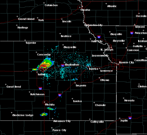 At 703 pm cdt, a severe thunderstorm capable of producing a tornado was located 8 miles north of new cambria, or 14 miles northeast of salina, moving southeast at 10 mph (radar indicated rotation). Hazards include tornado and golf ball size hail. Flying debris will be dangerous to those caught without shelter. mobile homes will be damaged or destroyed. damage to roofs, windows, and vehicles will occur. tree damage is likely. this tornadic thunderstorm will remain over mainly rural areas of northeastern saline county. This includes interstate 70 between mile markers 260 and 266. At 703 pm cdt, a severe thunderstorm capable of producing a tornado was located 8 miles north of new cambria, or 14 miles northeast of salina, moving southeast at 10 mph (radar indicated rotation). Hazards include tornado and golf ball size hail. Flying debris will be dangerous to those caught without shelter. mobile homes will be damaged or destroyed. damage to roofs, windows, and vehicles will occur. tree damage is likely. this tornadic thunderstorm will remain over mainly rural areas of northeastern saline county. This includes interstate 70 between mile markers 260 and 266.
|
| 5/25/2016 7:03 PM CDT |
 At 703 pm cdt, a severe thunderstorm capable of producing a tornado was located over niles, moving east at 20 mph (radar indicated rotation). Hazards include tornado and tennis ball size hail. Flying debris will be dangerous to those caught without shelter. mobile homes will be damaged or destroyed. damage to roofs, windows, and vehicles will occur. tree damage is likely. this dangerous storm will be near, solomon around 725 pm cdt. talmage around 730 pm cdt. This includes interstate 70 between mile markers 267 and 270. At 703 pm cdt, a severe thunderstorm capable of producing a tornado was located over niles, moving east at 20 mph (radar indicated rotation). Hazards include tornado and tennis ball size hail. Flying debris will be dangerous to those caught without shelter. mobile homes will be damaged or destroyed. damage to roofs, windows, and vehicles will occur. tree damage is likely. this dangerous storm will be near, solomon around 725 pm cdt. talmage around 730 pm cdt. This includes interstate 70 between mile markers 267 and 270.
|
| 5/25/2016 6:55 PM CDT |
 At 654 pm cdt, a severe thunderstorm was located near bennington, moving east at 20 mph. this is a very dangerous storm (radar indicated). Hazards include baseball size hail. People and animals outdoors will be severely injured. Expect shattered windows, extensive damage to roofs, siding, and vehicles. At 654 pm cdt, a severe thunderstorm was located near bennington, moving east at 20 mph. this is a very dangerous storm (radar indicated). Hazards include baseball size hail. People and animals outdoors will be severely injured. Expect shattered windows, extensive damage to roofs, siding, and vehicles.
|
| 5/24/2016 10:23 PM CDT | The national weather service in topeka has issued a * severe thunderstorm warning for. western geary county in east central kansas. southeastern clay county in north central kansas. dickinson county in central kansas. Until 1100 pm cdt. |
| 5/11/2016 3:52 AM CDT |
 At 352 am cdt, a severe thunderstorm was located over longford, moving east at 45 mph (radar indicated). Hazards include 60 mph wind gusts and quarter size hail. Hail damage to vehicles is expected. Expect wind damage to roofs, siding, and trees. At 352 am cdt, a severe thunderstorm was located over longford, moving east at 45 mph (radar indicated). Hazards include 60 mph wind gusts and quarter size hail. Hail damage to vehicles is expected. Expect wind damage to roofs, siding, and trees.
|
| 4/24/2016 10:58 PM CDT | Hen Egg sized hail reported 0.1 miles W of Solomon, KS |
| 4/24/2016 9:20 PM CDT |
 At 920 pm cdt, a severe thunderstorm was located near marquette, or 7 miles west of lindsborg, moving east at 25 mph (radar indicated). Hazards include two inch hail and 60 mph wind gusts. People and animals outdoors will be injured. expect hail damage to roofs, siding, windows, and vehicles. expect wind damage to roofs, siding, and trees. locations impacted include, salina, lindsborg, marquette, assaria, gypsum, smolan, new cambria, falun, kipp, bridgeport, salina airport, roxbury and kanopolis lake. A tornado watch remains in effect until 1100 pm cdt for central kansas. At 920 pm cdt, a severe thunderstorm was located near marquette, or 7 miles west of lindsborg, moving east at 25 mph (radar indicated). Hazards include two inch hail and 60 mph wind gusts. People and animals outdoors will be injured. expect hail damage to roofs, siding, windows, and vehicles. expect wind damage to roofs, siding, and trees. locations impacted include, salina, lindsborg, marquette, assaria, gypsum, smolan, new cambria, falun, kipp, bridgeport, salina airport, roxbury and kanopolis lake. A tornado watch remains in effect until 1100 pm cdt for central kansas.
|
| 4/24/2016 9:12 PM CDT |
 At 911 pm cdt, a severe thunderstorm was located near marquette, or 9 miles west of lindsborg, moving east at 25 mph (radar indicated). Hazards include golf ball size hail and 60 mph wind gusts. People and animals outdoors will be injured. expect hail damage to roofs, siding, windows, and vehicles. expect wind damage to roofs, siding, and trees. locations impacted include, salina, lindsborg, marquette, assaria, gypsum, smolan, new cambria, falun, kipp, bridgeport, salina airport, roxbury, kanopolis state park and kanopolis lake. A tornado watch remains in effect until 1100 pm cdt for central kansas. At 911 pm cdt, a severe thunderstorm was located near marquette, or 9 miles west of lindsborg, moving east at 25 mph (radar indicated). Hazards include golf ball size hail and 60 mph wind gusts. People and animals outdoors will be injured. expect hail damage to roofs, siding, windows, and vehicles. expect wind damage to roofs, siding, and trees. locations impacted include, salina, lindsborg, marquette, assaria, gypsum, smolan, new cambria, falun, kipp, bridgeport, salina airport, roxbury, kanopolis state park and kanopolis lake. A tornado watch remains in effect until 1100 pm cdt for central kansas.
|
| 4/24/2016 9:03 PM CDT |
 At 902 pm cdt, a severe thunderstorm was located near marquette, or 8 miles west of lindsborg, moving east at 15 mph (radar indicated). Hazards include golf ball size hail and 60 mph wind gusts. People and animals outdoors will be injured. expect hail damage to roofs, siding, windows, and vehicles. expect wind damage to roofs, siding, and trees. locations impacted include, salina, lindsborg, marquette, assaria, gypsum, brookville, smolan, new cambria, falun, kipp, bridgeport, salina airport, kanopolis state park, roxbury and kanopolis lake. other severe thunderstorms with large hail indications were 2 miles southwest of new cambria, and near gypsum. these storms were also moving east at 15 to 20 mph. A tornado watch remains in effect until 1100 pm cdt for central kansas. At 902 pm cdt, a severe thunderstorm was located near marquette, or 8 miles west of lindsborg, moving east at 15 mph (radar indicated). Hazards include golf ball size hail and 60 mph wind gusts. People and animals outdoors will be injured. expect hail damage to roofs, siding, windows, and vehicles. expect wind damage to roofs, siding, and trees. locations impacted include, salina, lindsborg, marquette, assaria, gypsum, brookville, smolan, new cambria, falun, kipp, bridgeport, salina airport, kanopolis state park, roxbury and kanopolis lake. other severe thunderstorms with large hail indications were 2 miles southwest of new cambria, and near gypsum. these storms were also moving east at 15 to 20 mph. A tornado watch remains in effect until 1100 pm cdt for central kansas.
|
| 4/24/2016 8:53 PM CDT |
 At 852 pm cdt, a severe thunderstorm was located near marquette, or 7 miles northwest of lindsborg, moving east at 35 mph (radar indicated). Hazards include golf ball size hail and 60 mph wind gusts. People and animals outdoors will be injured. expect hail damage to roofs, siding, windows, and vehicles. expect wind damage to roofs, siding, and trees. This thunderstorm warning replaces the previous severe warnings that were in effect for the warned areas. At 852 pm cdt, a severe thunderstorm was located near marquette, or 7 miles northwest of lindsborg, moving east at 35 mph (radar indicated). Hazards include golf ball size hail and 60 mph wind gusts. People and animals outdoors will be injured. expect hail damage to roofs, siding, windows, and vehicles. expect wind damage to roofs, siding, and trees. This thunderstorm warning replaces the previous severe warnings that were in effect for the warned areas.
|
| 4/24/2016 8:22 PM CDT |
 At 821 pm cdt, a severe thunderstorm was located over assaria, or 7 miles south of salina, moving east at 25 mph (radar indicated). Hazards include ping pong ball size hail and 60 mph wind gusts. People and animals outdoors will be injured. expect hail damage to roofs, siding, windows, and vehicles. expect wind damage to roofs, siding, and trees. locations impacted include, salina, lindsborg, marquette, assaria, gypsum, smolan, falun, kipp, roxbury and bridgeport. a second severe thunderstorm was located near lindsborg, moving east at 25 mph. this storm is capable of quarter to pingpong ball sized hail. A tornado watch remains in effect until 1100 pm cdt for central kansas. At 821 pm cdt, a severe thunderstorm was located over assaria, or 7 miles south of salina, moving east at 25 mph (radar indicated). Hazards include ping pong ball size hail and 60 mph wind gusts. People and animals outdoors will be injured. expect hail damage to roofs, siding, windows, and vehicles. expect wind damage to roofs, siding, and trees. locations impacted include, salina, lindsborg, marquette, assaria, gypsum, smolan, falun, kipp, roxbury and bridgeport. a second severe thunderstorm was located near lindsborg, moving east at 25 mph. this storm is capable of quarter to pingpong ball sized hail. A tornado watch remains in effect until 1100 pm cdt for central kansas.
|
| 4/24/2016 8:12 PM CDT |
 At 811 pm cdt, a severe thunderstorm was located over assaria, or 8 miles south of salina, moving east at 40 mph (radar indicated). Hazards include ping pong ball size hail and 60 mph wind gusts. People and animals outdoors will be injured. expect hail damage to roofs, siding, windows, and vehicles. Expect wind damage to roofs, siding, and trees. At 811 pm cdt, a severe thunderstorm was located over assaria, or 8 miles south of salina, moving east at 40 mph (radar indicated). Hazards include ping pong ball size hail and 60 mph wind gusts. People and animals outdoors will be injured. expect hail damage to roofs, siding, windows, and vehicles. Expect wind damage to roofs, siding, and trees.
|
| 4/24/2016 6:50 PM CDT |
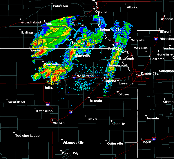 The severe thunderstorm warning for northeastern saline county will expire at 700 pm cdt, the storm which prompted the warning has moved out of the area. therefore the warning will be allowed to expire. a tornado watch remains in effect until 1100 pm cdt for central kansas. The severe thunderstorm warning for northeastern saline county will expire at 700 pm cdt, the storm which prompted the warning has moved out of the area. therefore the warning will be allowed to expire. a tornado watch remains in effect until 1100 pm cdt for central kansas.
|
| 4/24/2016 6:50 PM CDT |
 At 647 pm cdt, a severe thunderstorm was located over solomon, moving northeast at 30 mph. this is a very dangerous storm (trained weather spotters reported baseball size hail in solomon). Hazards include baseball size hail and 60 mph wind gusts. People and animals outdoors will be severely injured. expect shattered windows, extensive damage to roofs, siding, and vehicles. locations impacted include, abilene, solomon, enterprise, manchester and talmage. this includes interstate 70 between mile markers 267 and 281. A tornado watch remains in effect until 1100 pm cdt for central kansas. At 647 pm cdt, a severe thunderstorm was located over solomon, moving northeast at 30 mph. this is a very dangerous storm (trained weather spotters reported baseball size hail in solomon). Hazards include baseball size hail and 60 mph wind gusts. People and animals outdoors will be severely injured. expect shattered windows, extensive damage to roofs, siding, and vehicles. locations impacted include, abilene, solomon, enterprise, manchester and talmage. this includes interstate 70 between mile markers 267 and 281. A tornado watch remains in effect until 1100 pm cdt for central kansas.
|
| 4/24/2016 6:42 PM CDT | Golf Ball sized hail reported 2.9 miles NNE of Solomon, KS, rotating wall cloud reported by chaser same location |
| 4/24/2016 6:41 PM CDT | The tornado warning for northeastern saline county will expire at 645 pm cdt, the storm which prompted the warning no longer appears capable of producing a tornado. therefore the warning will be allowed to expire. however large hail is still possible with this thunderstorm. a tornado watch remains in effect until 1100 pm cdt for central kansas. |
| 4/24/2016 6:41 PM CDT |
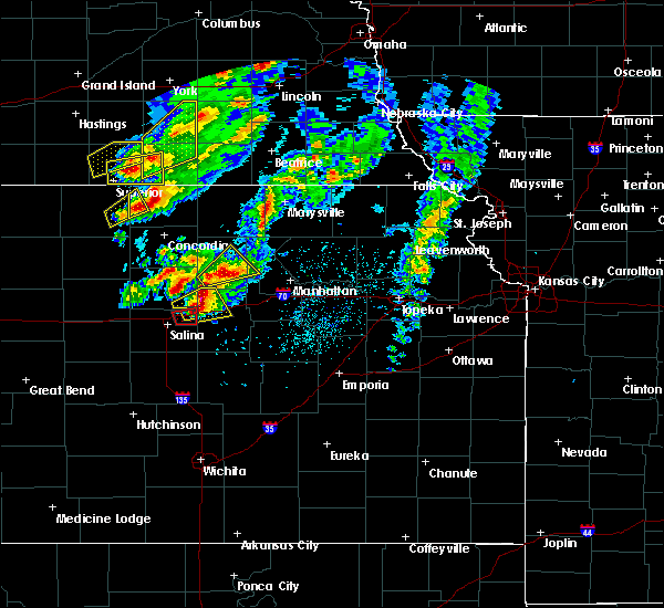 At 640 pm cdt, a severe thunderstorm was located 7 miles northeast of new cambria, or 14 miles northeast of salina, moving northeast at 30 mph (radar indicated). Hazards include two inch hail and 60 mph wind gusts. People and animals outdoors will be injured. expect hail damage to roofs, siding, windows, and vehicles. expect wind damage to roofs, siding, and trees. this severe thunderstorm will remain over mainly rural areas of northeastern saline county. this includes interstate 70 between mile markers 260 and 266. A tornado watch remains in effect until 1100 pm cdt for central kansas. At 640 pm cdt, a severe thunderstorm was located 7 miles northeast of new cambria, or 14 miles northeast of salina, moving northeast at 30 mph (radar indicated). Hazards include two inch hail and 60 mph wind gusts. People and animals outdoors will be injured. expect hail damage to roofs, siding, windows, and vehicles. expect wind damage to roofs, siding, and trees. this severe thunderstorm will remain over mainly rural areas of northeastern saline county. this includes interstate 70 between mile markers 260 and 266. A tornado watch remains in effect until 1100 pm cdt for central kansas.
|
| 4/24/2016 6:40 PM CDT | Hen Egg sized hail reported 0.1 miles W of Solomon, KS |
| 4/24/2016 6:34 PM CDT |
 At 633 pm cdt, a severe thunderstorm was located near niles, moving northeast at 30 mph. this is a very dangerous storm (trained weather spotters reported baseball size hail 1 mile south of niles). Hazards include baseball size hail and 60 mph wind gusts. People and animals outdoors will be severely injured. expect shattered windows, extensive damage to roofs, siding, and vehicles. locations impacted include, abilene, solomon, enterprise, manchester, niles and talmage. this includes interstate 70 between mile markers 267 and 281. A tornado watch remains in effect until 1100 pm cdt for north central kansas. At 633 pm cdt, a severe thunderstorm was located near niles, moving northeast at 30 mph. this is a very dangerous storm (trained weather spotters reported baseball size hail 1 mile south of niles). Hazards include baseball size hail and 60 mph wind gusts. People and animals outdoors will be severely injured. expect shattered windows, extensive damage to roofs, siding, and vehicles. locations impacted include, abilene, solomon, enterprise, manchester, niles and talmage. this includes interstate 70 between mile markers 267 and 281. A tornado watch remains in effect until 1100 pm cdt for north central kansas.
|
| 4/24/2016 6:29 PM CDT |
 At 627 pm cdt, a severe thunderstorm was located over new cambria, moving northeast at 30 mph (radar indicated). Hazards include two inch hail and 60 mph wind gusts. People and animals outdoors will be injured. expect hail damage to roofs, siding, windows, and vehicles. Expect wind damage to roofs, siding, and trees. At 627 pm cdt, a severe thunderstorm was located over new cambria, moving northeast at 30 mph (radar indicated). Hazards include two inch hail and 60 mph wind gusts. People and animals outdoors will be injured. expect hail damage to roofs, siding, windows, and vehicles. Expect wind damage to roofs, siding, and trees.
|
| 4/24/2016 6:27 PM CDT |
 At 626 pm cdt, a severe thunderstorm capable of producing a tornado was located over new cambria, or 8 miles northeast of salina, moving northeast at 35 mph (radar indicated rotation). Hazards include tornado and two inch hail. Flying debris will be dangerous to those caught without shelter. mobile homes will be damaged or destroyed. damage to roofs, windows, and vehicles will occur. tree damage is likely. This tornadic thunderstorm will remain over mainly rural areas of northeastern saline county. At 626 pm cdt, a severe thunderstorm capable of producing a tornado was located over new cambria, or 8 miles northeast of salina, moving northeast at 35 mph (radar indicated rotation). Hazards include tornado and two inch hail. Flying debris will be dangerous to those caught without shelter. mobile homes will be damaged or destroyed. damage to roofs, windows, and vehicles will occur. tree damage is likely. This tornadic thunderstorm will remain over mainly rural areas of northeastern saline county.
|
| 4/24/2016 6:12 PM CDT |
 At 612 pm cdt, a severe thunderstorm capable of producing a tornado was located over salina, moving east at 25 mph (radar indicated rotation). Hazards include tornado and two inch hail. Flying debris will be dangerous to those caught without shelter. mobile homes will be damaged or destroyed. damage to roofs, windows, and vehicles will occur. tree damage is likely. this dangerous storm will be near, new cambria around 630 pm cdt. Other locations impacted by this tornadic thunderstorm include kipp and salina airport. At 612 pm cdt, a severe thunderstorm capable of producing a tornado was located over salina, moving east at 25 mph (radar indicated rotation). Hazards include tornado and two inch hail. Flying debris will be dangerous to those caught without shelter. mobile homes will be damaged or destroyed. damage to roofs, windows, and vehicles will occur. tree damage is likely. this dangerous storm will be near, new cambria around 630 pm cdt. Other locations impacted by this tornadic thunderstorm include kipp and salina airport.
|
| 4/24/2016 5:59 PM CDT |
 At 558 pm cdt, a severe thunderstorm capable of producing a tornado was located 8 miles northwest of new cambria, or 8 miles north of salina, moving northeast at 40 mph. another storm with strong rotation and possible tornado was located 4 miles west of salina, moving northeast at 40 mph (radar indicated rotation). Hazards include tornado and hail up to two inches in diameter. Flying debris will be dangerous to those caught without shelter. mobile homes will be damaged or destroyed. damage to roofs, windows, and vehicles will occur. tree damage is likely. this dangerous storm will be near, new cambria around 605 pm cdt. other locations impacted by this tornadic thunderstorm include kipp and salina airport. this includes the following highways, interstate 135 between mile markers 88 and 95. Interstate 70 between mile markers 244 and 266. At 558 pm cdt, a severe thunderstorm capable of producing a tornado was located 8 miles northwest of new cambria, or 8 miles north of salina, moving northeast at 40 mph. another storm with strong rotation and possible tornado was located 4 miles west of salina, moving northeast at 40 mph (radar indicated rotation). Hazards include tornado and hail up to two inches in diameter. Flying debris will be dangerous to those caught without shelter. mobile homes will be damaged or destroyed. damage to roofs, windows, and vehicles will occur. tree damage is likely. this dangerous storm will be near, new cambria around 605 pm cdt. other locations impacted by this tornadic thunderstorm include kipp and salina airport. this includes the following highways, interstate 135 between mile markers 88 and 95. Interstate 70 between mile markers 244 and 266.
|
| 9/7/2015 6:06 PM CDT |
 The severe thunderstorm warning for dickinson county will expire at 615 pm cdt, the storm which prompted the warning has weakened below severe limits, and no longer pose an immediate threat to life or property. therefore the warning will be allowed to expire. however gusty winds near 50 mph and heavy rain are still possible with this thunderstorm. a severe thunderstorm watch remains in effect until 900 pm cdt for central kansas. The severe thunderstorm warning for dickinson county will expire at 615 pm cdt, the storm which prompted the warning has weakened below severe limits, and no longer pose an immediate threat to life or property. therefore the warning will be allowed to expire. however gusty winds near 50 mph and heavy rain are still possible with this thunderstorm. a severe thunderstorm watch remains in effect until 900 pm cdt for central kansas.
|
| 9/7/2015 5:56 PM CDT |
 The severe thunderstorm warning for eastern saline county will expire at 600 pm cdt, the storms which prompted the warning have moved out of the area. therefore the warning will be allowed to expire. however heavy rain is still possible with these thunderstorms. The severe thunderstorm warning for eastern saline county will expire at 600 pm cdt, the storms which prompted the warning have moved out of the area. therefore the warning will be allowed to expire. however heavy rain is still possible with these thunderstorms.
|
| 9/7/2015 5:54 PM CDT |
 At 554 pm cdt, a severe thunderstorm was located 6 miles northeast of gypsum, moving east at 30 mph (radar indicated). Hazards include 60 mph wind gusts and nickel size hail. Expect damage to roofs. siding and trees. locations impacted include, abilene, herington, solomon, enterprise, hope, woodbine and carlton. This includes interstate 70 between mile markers 267 and 280. At 554 pm cdt, a severe thunderstorm was located 6 miles northeast of gypsum, moving east at 30 mph (radar indicated). Hazards include 60 mph wind gusts and nickel size hail. Expect damage to roofs. siding and trees. locations impacted include, abilene, herington, solomon, enterprise, hope, woodbine and carlton. This includes interstate 70 between mile markers 267 and 280.
|
| 9/7/2015 5:47 PM CDT |
 At 547 pm cdt, severe thunderstorms were located along a line extending from 5 miles east of new cambria to near gypsum to 7 miles southeast of assaria, moving east at 35 mph (radar indicated). Hazards include 60 mph wind gusts and nickel size hail. Expect damage to roofs. siding and trees. Locations impacted include, salina, assaria, gypsum, new cambria, kipp and bridgeport. At 547 pm cdt, severe thunderstorms were located along a line extending from 5 miles east of new cambria to near gypsum to 7 miles southeast of assaria, moving east at 35 mph (radar indicated). Hazards include 60 mph wind gusts and nickel size hail. Expect damage to roofs. siding and trees. Locations impacted include, salina, assaria, gypsum, new cambria, kipp and bridgeport.
|
| 9/7/2015 5:29 PM CDT |
 At 528 pm cdt, a severe thunderstorm was located near gypsum, moving east at 35 mph (measured at the salina airport at 518 pm cdt). Hazards include 60 mph wind gusts and nickel size hail. Expect damage to roofs. Siding and trees. At 528 pm cdt, a severe thunderstorm was located near gypsum, moving east at 35 mph (measured at the salina airport at 518 pm cdt). Hazards include 60 mph wind gusts and nickel size hail. Expect damage to roofs. Siding and trees.
|
| 9/7/2015 5:25 PM CDT |
 At 525 pm cdt, severe thunderstorms were located along a line extending from 5 miles northwest of new cambria to near salina to near assaria, moving northeast at 70 mph (radar indicated). Hazards include 60 mph wind gusts and nickel size hail. Expect damage to roofs. Siding and trees. At 525 pm cdt, severe thunderstorms were located along a line extending from 5 miles northwest of new cambria to near salina to near assaria, moving northeast at 70 mph (radar indicated). Hazards include 60 mph wind gusts and nickel size hail. Expect damage to roofs. Siding and trees.
|
| 8/22/2015 10:37 PM CDT |
 At 1036 pm cdt, a severe thunderstorm was located near lindsborg, moving southeast at 45 mph (trained weather spotters). Hazards include golf ball size hail and 70 mph wind gusts. People and animals outdoors will be injured. expect hail damage to roofs, siding, windows and vehicles. expect considerable tree damage. wind damage is also likely to mobile homes, roofs and outbuildings. Locations impacted include, salina, mcpherson, lindsborg, assaria, gypsum, smolan, new cambria, falun, kipp, roxbury, bridgeport and salina airport. At 1036 pm cdt, a severe thunderstorm was located near lindsborg, moving southeast at 45 mph (trained weather spotters). Hazards include golf ball size hail and 70 mph wind gusts. People and animals outdoors will be injured. expect hail damage to roofs, siding, windows and vehicles. expect considerable tree damage. wind damage is also likely to mobile homes, roofs and outbuildings. Locations impacted include, salina, mcpherson, lindsborg, assaria, gypsum, smolan, new cambria, falun, kipp, roxbury, bridgeport and salina airport.
|
| 8/22/2015 10:26 PM CDT |
 At 1025 pm cdt, a severe thunderstorm was located near gypsum, or 12 miles east of lindsborg, moving southeast at 45 mph (radar indicated). Hazards include 60 mph wind gusts and quarter size hail. Hail damage to vehicles is expected. expect wind damage to roofs, siding and trees. Locations impacted include, salina, mcpherson, lindsborg, assaria, gypsum, smolan, new cambria, falun, kipp, roxbury, bridgeport and salina airport. At 1025 pm cdt, a severe thunderstorm was located near gypsum, or 12 miles east of lindsborg, moving southeast at 45 mph (radar indicated). Hazards include 60 mph wind gusts and quarter size hail. Hail damage to vehicles is expected. expect wind damage to roofs, siding and trees. Locations impacted include, salina, mcpherson, lindsborg, assaria, gypsum, smolan, new cambria, falun, kipp, roxbury, bridgeport and salina airport.
|
| 8/22/2015 10:11 PM CDT |
 At 1009 pm cdt, a severe thunderstorm was located near salina, moving southeast at 45 mph (radar indicated). Hazards include 60 mph wind gusts and quarter size hail. Hail damage to vehicles is expected. Expect wind damage to roofs, siding and trees. At 1009 pm cdt, a severe thunderstorm was located near salina, moving southeast at 45 mph (radar indicated). Hazards include 60 mph wind gusts and quarter size hail. Hail damage to vehicles is expected. Expect wind damage to roofs, siding and trees.
|
| 8/22/2015 9:58 PM CDT |
 At 958 pm cdt, a severe thunderstorm was located 6 miles west of salina, and is nearly stationary (radar indicated). Hazards include 60 mph wind gusts and quarter size hail. Hail damage to vehicles is expected. expect wind damage to roofs, siding and trees. Locations impacted include, salina, brookville, smolan, new cambria, glendale, falun, kipp and salina airport. At 958 pm cdt, a severe thunderstorm was located 6 miles west of salina, and is nearly stationary (radar indicated). Hazards include 60 mph wind gusts and quarter size hail. Hail damage to vehicles is expected. expect wind damage to roofs, siding and trees. Locations impacted include, salina, brookville, smolan, new cambria, glendale, falun, kipp and salina airport.
|
| 8/22/2015 9:43 PM CDT |
 At 942 pm cdt, a severe thunderstorm was located 10 miles north of brookville, or 12 miles northwest of salina, moving southeast at 30 mph (radar indicated). Hazards include 60 mph wind gusts and quarter size hail. Hail damage to vehicles is expected. Expect wind damage to roofs, siding and trees. At 942 pm cdt, a severe thunderstorm was located 10 miles north of brookville, or 12 miles northwest of salina, moving southeast at 30 mph (radar indicated). Hazards include 60 mph wind gusts and quarter size hail. Hail damage to vehicles is expected. Expect wind damage to roofs, siding and trees.
|
| 7/19/2015 5:22 AM CDT |
 At 520 am cdt, severe thunderstorms were located near salina as well as 10 miles northeast of new cambria, moving northeast at 40 mph (radar indicated). Hazards include 60 mph wind gusts. Expect damage to roofs. siding and trees. Locations impacted include, salina, assaria, gypsum, brookville, smolan, new cambria, falun, glendale, salina airport, kipp and bridgeport. At 520 am cdt, severe thunderstorms were located near salina as well as 10 miles northeast of new cambria, moving northeast at 40 mph (radar indicated). Hazards include 60 mph wind gusts. Expect damage to roofs. siding and trees. Locations impacted include, salina, assaria, gypsum, brookville, smolan, new cambria, falun, glendale, salina airport, kipp and bridgeport.
|
| 7/19/2015 5:00 AM CDT |
 At 459 am cdt, a severe thunderstorm was located over new cambria, or 7 miles northeast of salina, moving northeast at 40 mph (radar indicated). Hazards include 60 mph wind gusts. Expect damage to roofs. siding and trees. Locations impacted include, salina, assaria, gypsum, brookville, smolan, new cambria, falun, glendale, salina airport, kipp and bridgeport. At 459 am cdt, a severe thunderstorm was located over new cambria, or 7 miles northeast of salina, moving northeast at 40 mph (radar indicated). Hazards include 60 mph wind gusts. Expect damage to roofs. siding and trees. Locations impacted include, salina, assaria, gypsum, brookville, smolan, new cambria, falun, glendale, salina airport, kipp and bridgeport.
|
| 7/19/2015 4:43 AM CDT |
 At 442 am cdt, a severe thunderstorm was located over brookville, or 14 miles east of kanopolis, moving northeast at 40 mph (radar indicated). Hazards include 60 mph wind gusts and nickel size hail. Expect damage to roofs. Siding and trees. At 442 am cdt, a severe thunderstorm was located over brookville, or 14 miles east of kanopolis, moving northeast at 40 mph (radar indicated). Hazards include 60 mph wind gusts and nickel size hail. Expect damage to roofs. Siding and trees.
|
| 6/7/2015 7:37 PM CDT | At 735 pm cdt, a severe thunderstorm was located 7 miles north of gypsum, and moving southeast at 35 mph (radar indicated). Hazards include tennis ball size hail and 60 mph wind gusts. People and animals outdoors will be injured. expect hail damage to roofs, siding, windows and vehicles. expect wind damage to roofs, siding and trees. Locations impacted include, herington, carlton and hope. |
| 6/7/2015 7:36 PM CDT | At 733 pm cdt, a severe thunderstorm was located 8 miles east of salina or 10 miles southwest of abilene. a second severe thunderstorm was located 5 miles east of salina. both severe thunderstorms were moving southeast at 40 mph (radar indicated). Hazards include golf ball size hail and 60 mph winds. People and animals outdoors will be injured. expect hail damage to roofs, siding, windows and vehicles. Expect wind damage to roofs, siding and trees. |
| 6/7/2015 7:28 PM CDT | At 725 pm cdt, a severe thunderstorm was located near new cambria, and moving southeast at 35 mph (radar indicated). Hazards include hen egg size hail and 60 mph wind gusts. People and animals outdoors will be injured. expect hail damage to roofs, siding, windows and vehicles. Expect wind damage to roofs, siding and trees. |
| 6/7/2015 7:25 PM CDT | At 723 pm cdt, a severe thunderstorm was located near solomon, or 11 miles west of abilene, moving east southeast at 40 mph (radar indicated). Hazards include two inch hail. People and animals outdoors will be injured. Expect damage to roofs, siding, windows and vehicles. |
| 6/5/2015 1:28 AM CDT | At 125 am cdt, severe thunderstorms were located along a line extending from manchester to 5 miles north of woodbine, and moving south at 25 mph (radar indicated). Hazards include 60 mph wind gusts and penny size hail. Expect damage to roofs. siding and trees. locations impacted include, herington, solomon, woodbine, hope and carlton. This includes interstate 70 between mile markers 267 and 292. |
| 6/5/2015 1:04 AM CDT | At 101 am cdt, severe thunderstorms were located along a line extending from scottsville to 5 miles west of manchester to 5 miles northeast of chapman, and moving south at 25 mph (radar indicated). Hazards include 60 mph wind gusts and penny size hail. Expect damage to roofs. Siding and trees. |
| 5/25/2015 4:48 PM CDT | At 446 pm cdt, severe thunderstorms were located along a line extending from wakefield to niles, and moving north at 40 mph (public. at 445 pm quarter size hail was reported 4 miles north of milford). Hazards include 60 mph wind gusts and half dollar size hail. Hail damage to vehicles is expected. expect wind damage to roofs, siding and trees. Locations impacted include, manchester and longford. |
| 5/25/2015 4:39 PM CDT | At 436 pm cdt, severe thunderstorms were located along a line extending from 7 miles north of moonlight to new cambria, and moving north at 40 mph (public. quarter size hail was reported 3 miles east of solomon at 437 pm). Hazards include 60 mph wind gusts and quarter size hail. Hail damage to vehicles is expected. expect wind damage to roofs, siding and trees. locations impacted include, niles, wakefield, manchester and longford. This includes interstate 70 between mile markers 267 and 273. |
| 5/25/2015 4:30 PM CDT | At 428 pm cdt, severe thunderstorms were located along a line extending from moonlight to new cambria, and moving north at 40 mph (radar indicated). Hazards include 60 mph wind gusts and quarter size hail. Hail damage to vehicles is expected. Expect wind damage to roofs, siding and trees. |
| 5/25/2015 4:29 PM CDT | At 428 pm cdt, a severe thunderstorm was located over assaria, or 6 miles north of lindsborg, moving northeast at 20 mph (radar indicated). Hazards include 60 mph wind gusts and half dollar size hail. Hail damage to vehicles is expected. expect wind damage to roofs, siding and trees. Locations impacted include, salina, assaria, gypsum, brookville, smolan, new cambria, falun, glendale, salina airport, kipp and bridgeport. |
| 5/25/2015 4:20 PM CDT | At 419 pm cdt, a severe thunderstorm was located over assaria, or 6 miles north of lindsborg, moving northeast at 40 mph (radar indicated). Hazards include 60 mph wind gusts and half dollar size hail. Hail damage to vehicles is expected. Expect wind damage to roofs, siding and trees. |
| 5/25/2015 4:09 PM CDT | At 404 pm cdt, a severe thunderstorm was located near carlton, and moving north at 35 mph (trained weather spotters reported half dollar size hail 2 miles southwest of carlton with this storm). Hazards include 60 mph wind gusts and half dollar size hail. Hail damage to vehicles is expected. expect wind damage to roofs, siding and trees. Locations impacted include, mainly rural areas of western dickinson county. |
| 5/25/2015 4:03 PM CDT | At 402 pm cdt, a severe thunderstorm was located near carlton, and moving north at 35 mph (radar indicated). Hazards include 60 mph wind gusts and quarter size hail. Hail damage to vehicles is expected. Expect wind damage to roofs, siding and trees. |
| 5/4/2015 6:24 PM CDT | The severe thunderstorm warning for northwestern dickinson and southeastern ottawa counties will expire at 630 pm cdt, the storm which prompted the warning has weakened below severe limits, and no longer poses an immediate threat to life or property. however, small hail, gusty winds and very heavy rain are still possible with this thunderstorm. motorist are urged to watch for flooding on county roads. in addition, strong thunderstorms may redevelop, and a severe thunderstorm watch remains in effect until 900 pm cdt. |
| 5/4/2015 6:11 PM CDT | At 609 pm cdt, a severe thunderstorm was located 4 miles north of solomon, and moving northeast at 20 mph (radar indicated). Hazards include 60 mph wind gusts and quarter size hail. Hail damage to vehicles is expected. expect wind damage to roofs, siding and trees. locations impacted include, talmage and manchester. 1. 00in. |
| 5/4/2015 6:04 PM CDT | At 600 pm cdt, a severe thunderstorm was located near solomon, and moving northeast at 15 mph. a second severe thunderstorm was located 2 miles east of niles, moving northeast at 15 mph (radar indicated). Hazards include 60 mph wind gusts and quarter size hail. Hail damage to vehicles is expected. expect wind damage to roofs, siding and trees. locations impacted include, talmage and manchester. at 555 pm cdt, a citizen reported quarter size hail 2 miles east-northeast of niles. 1. 00in. |
| 5/4/2015 5:55 PM CDT | Quarter sized hail reported 5.2 miles SE of Solomon, KS, nickel to quarter sized hail. accumulated to cover grass. |
| 5/4/2015 5:55 PM CDT | At 553 pm cdt, a severe thunderstorm was located near niles, and moving northeast at 15 mph (radar indicated). Hazards include ping pong ball size hail and 60 mph wind gusts. People and animals outdoors will be injured. expect hail damage to roofs, siding, windows and vehicles. expect wind damage to roofs, siding and trees. locations impacted include, talmage and manchester. 1. 50in. |
| 5/4/2015 5:43 PM CDT | At 542 pm cdt, a severe thunderstorm was located near niles, and moving northeast at 30 mph (radar indicated). Hazards include 60 mph wind gusts and quarter size hail. Hail damage to vehicles is expected. Expect wind damage to roofs, siding and trees. |
| 4/24/2015 8:30 PM CDT | At 829 pm cdt, severe thunderstorms were located along a line extending from near manchester to near brookville, moving east at 30 mph (radar indicated). Hazards include 60 mph winds. Expect damage to roofs. siding and trees. locations impacted include, salina, assaria, gypsum, brookville, smolan, new cambria, falun, glendale, salina airport, kipp and bridgeport. a tornado watch remains in effect until 1100 pm cdt for central kansas. 75in. |
| 4/24/2015 8:05 PM CDT | At 805 pm cdt, severe thunderstorms were located along a line extending from near bennington to near kanopolis, moving east at 30 mph (radar indicated). Hazards include 60 mph wind gusts and quarter size hail. Hail damage to vehicles is expected. Expect wind damage to roofs, siding and trees. |
| 6/15/2014 1:06 AM CDT | Many tree limbs down around 3 inches in diamete in dickinson county KS, 0.1 miles W of Solomon, KS |
| 6/1/2014 7:54 PM CDT | Several 3 to 4 inch diameter tree branches dow in dickinson county KS, 0.1 miles W of Solomon, KS |
| 6/25/2013 4:12 AM CDT | Golf Ball sized hail reported 0.1 miles W of Solomon, KS |
| 5/19/2012 7:35 PM CDT | Golf Ball sized hail reported 5.5 miles ESE of Solomon, KS |
| 1/1/0001 12:00 AM | Storm damage reported in dickinson county KS, 0.7 miles W of Solomon, KS |
| 1/1/0001 12:00 AM | Quarter sized hail reported 4.1 miles SSW of Solomon, KS, delayed report |
Hail Maps for Solomon, KS
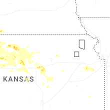


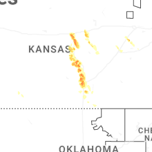


Connect with Interactive Hail Maps