

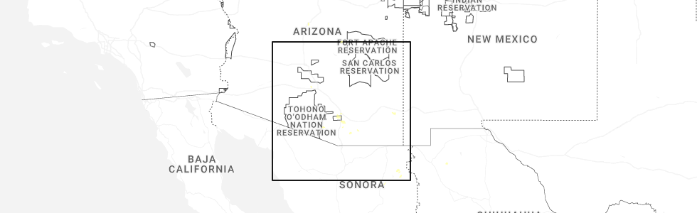
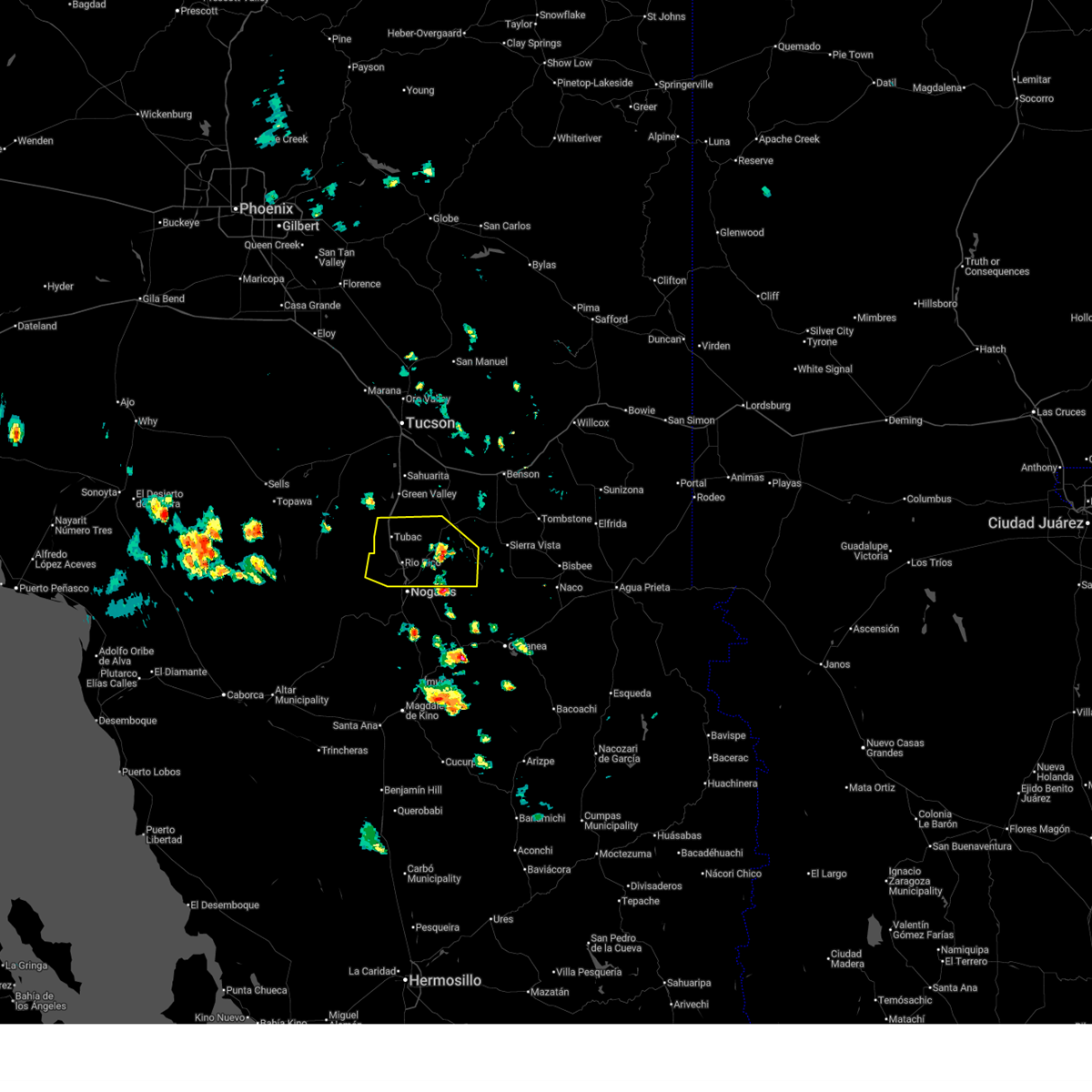
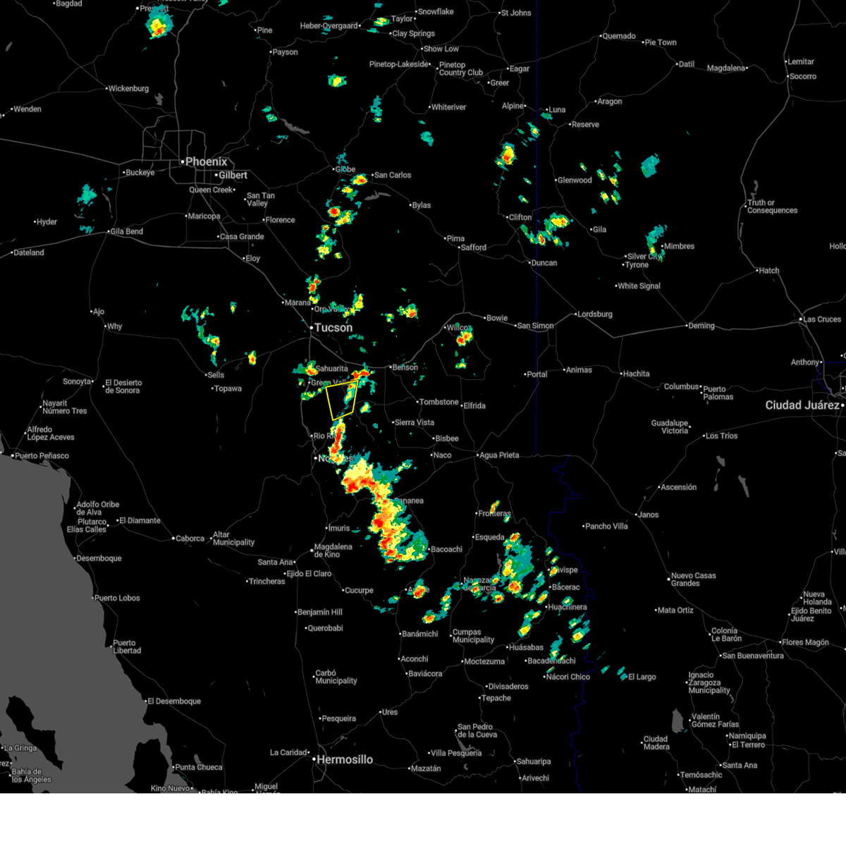
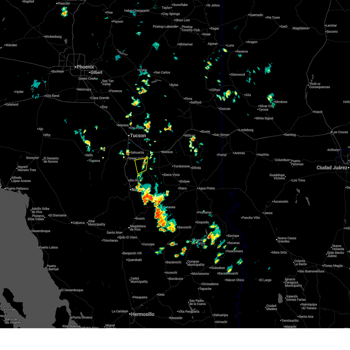
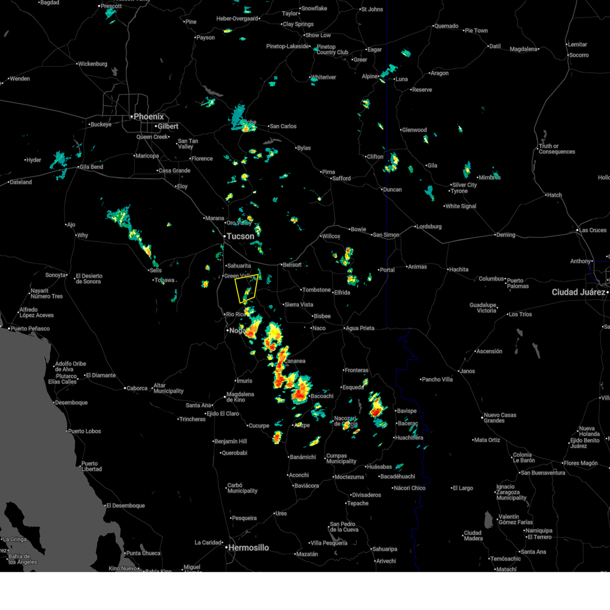
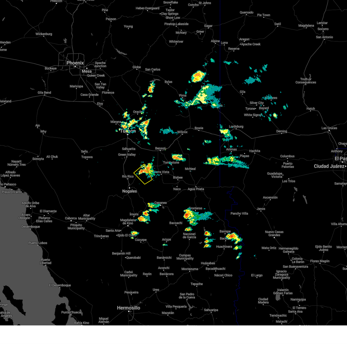
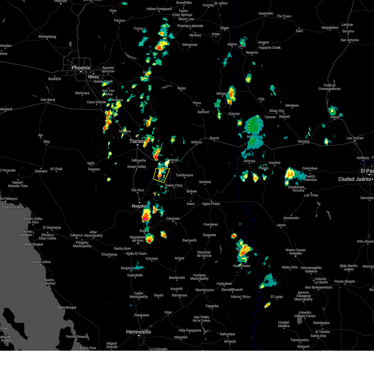
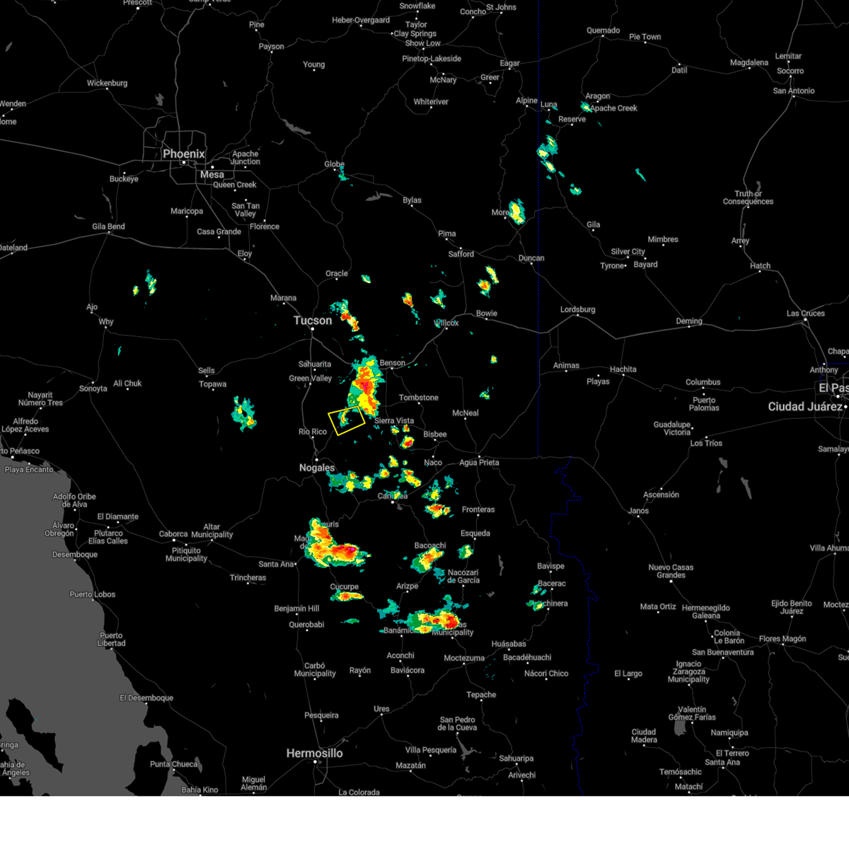
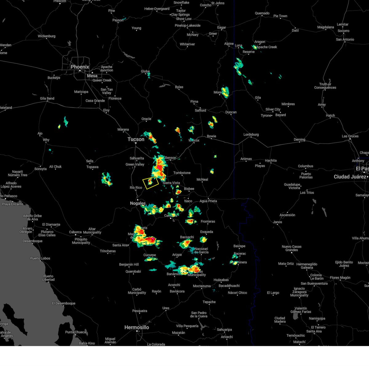
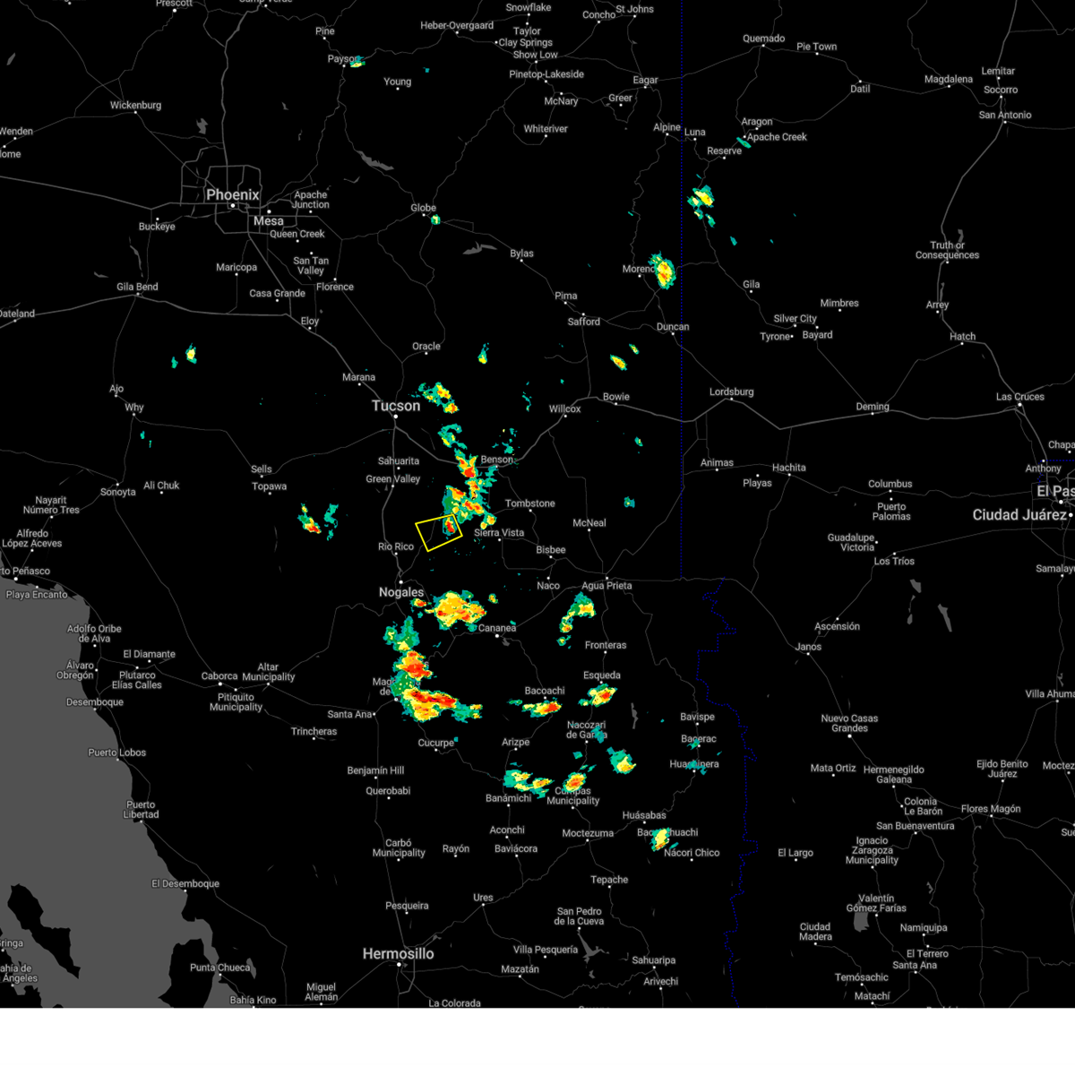
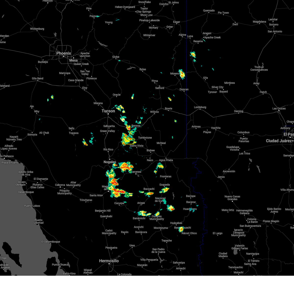
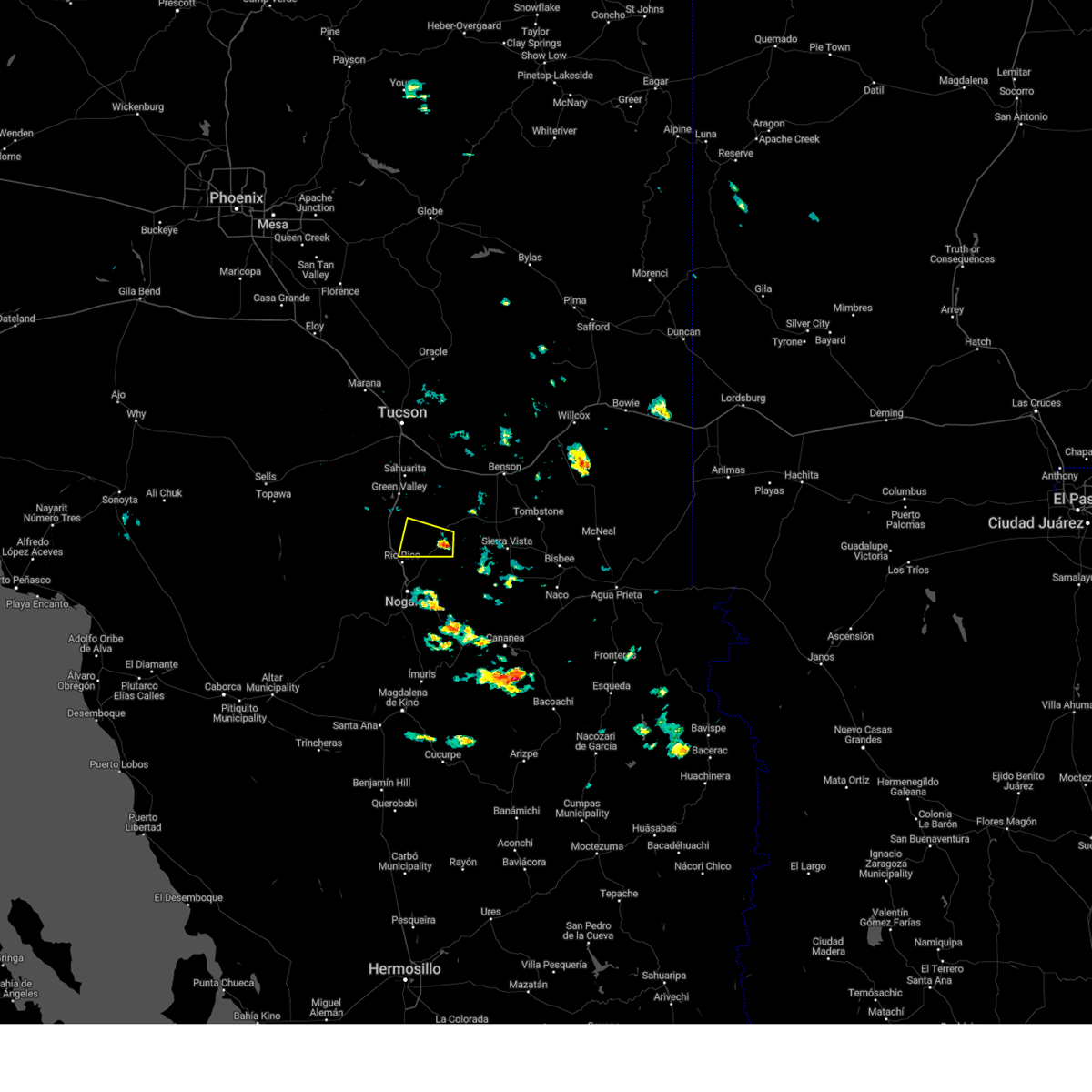
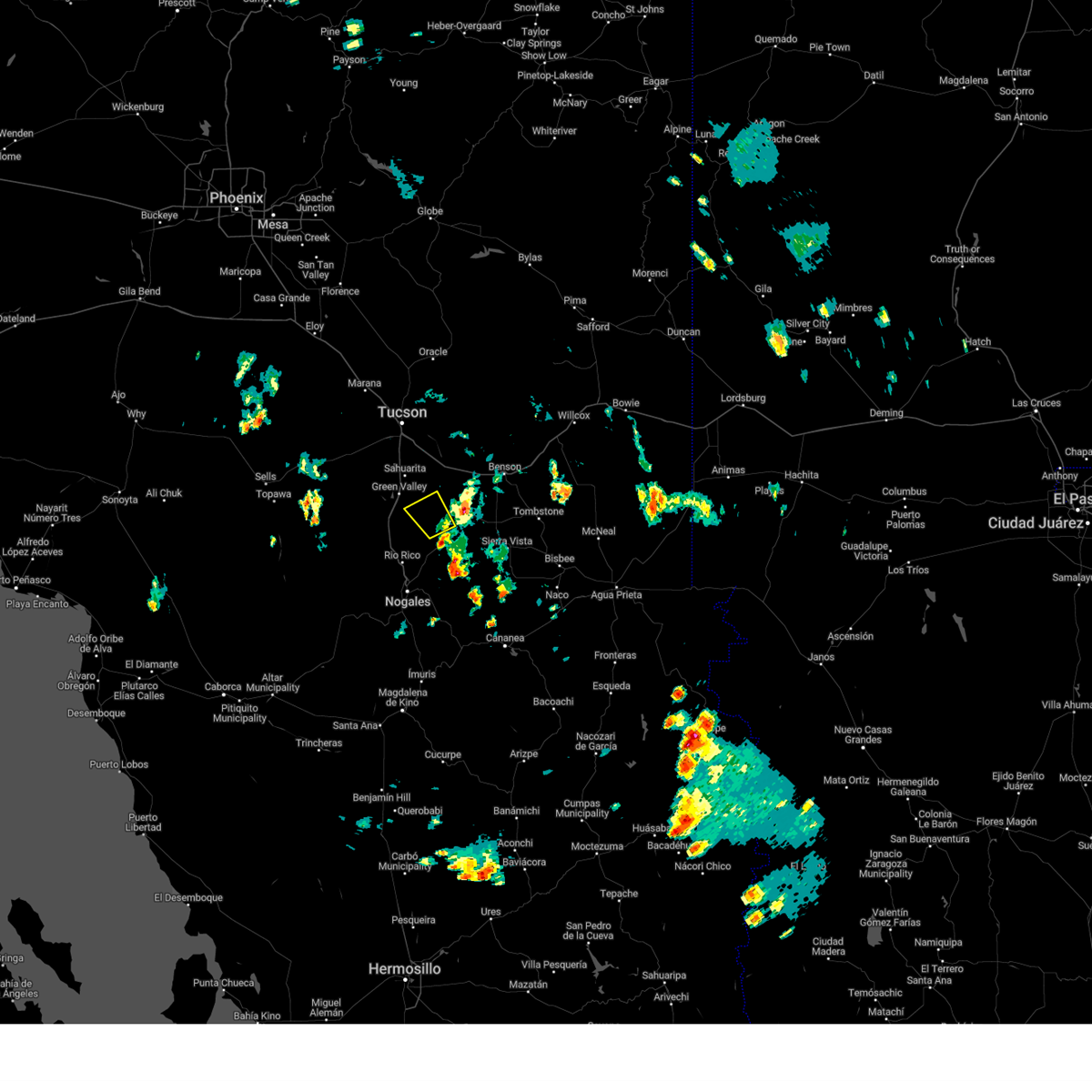
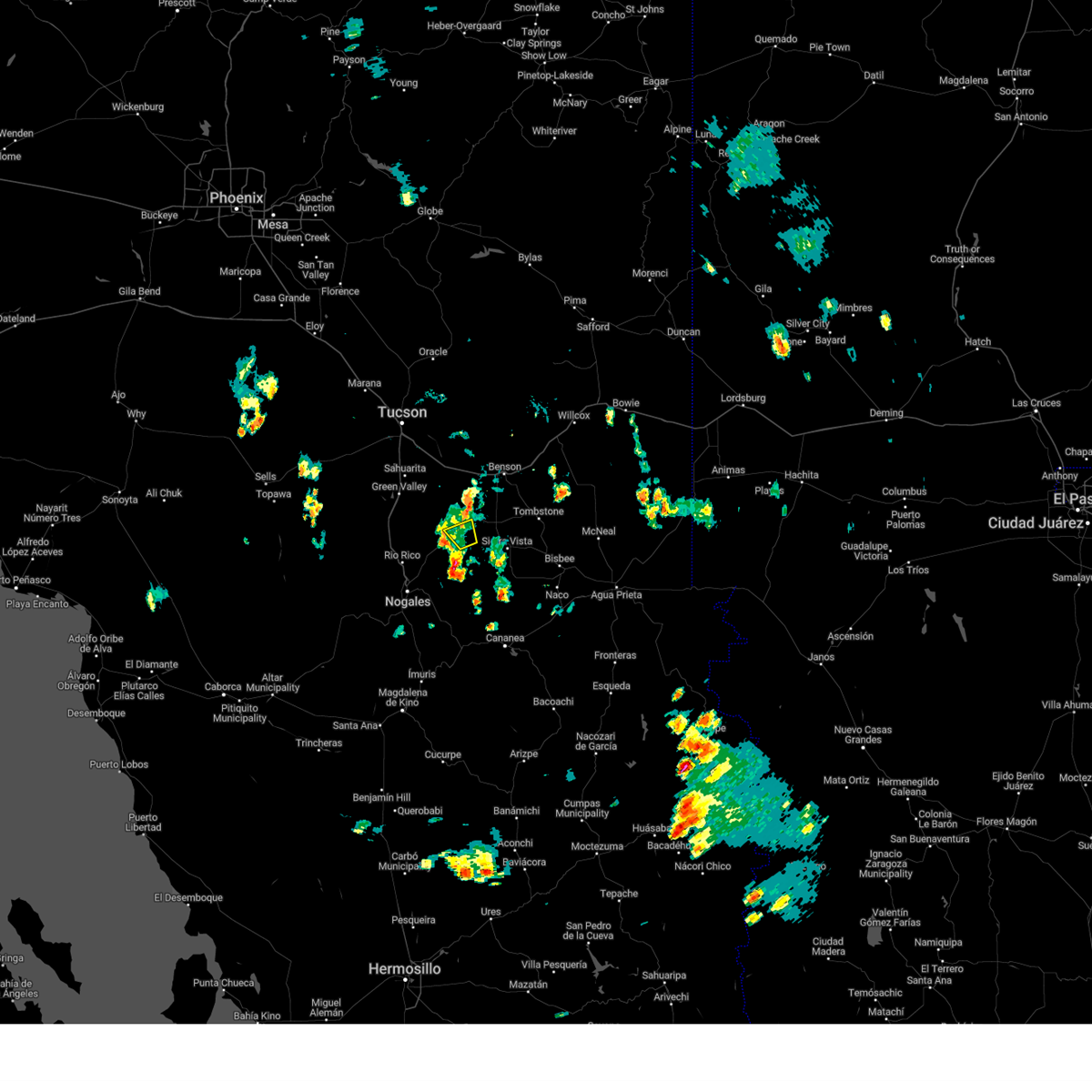
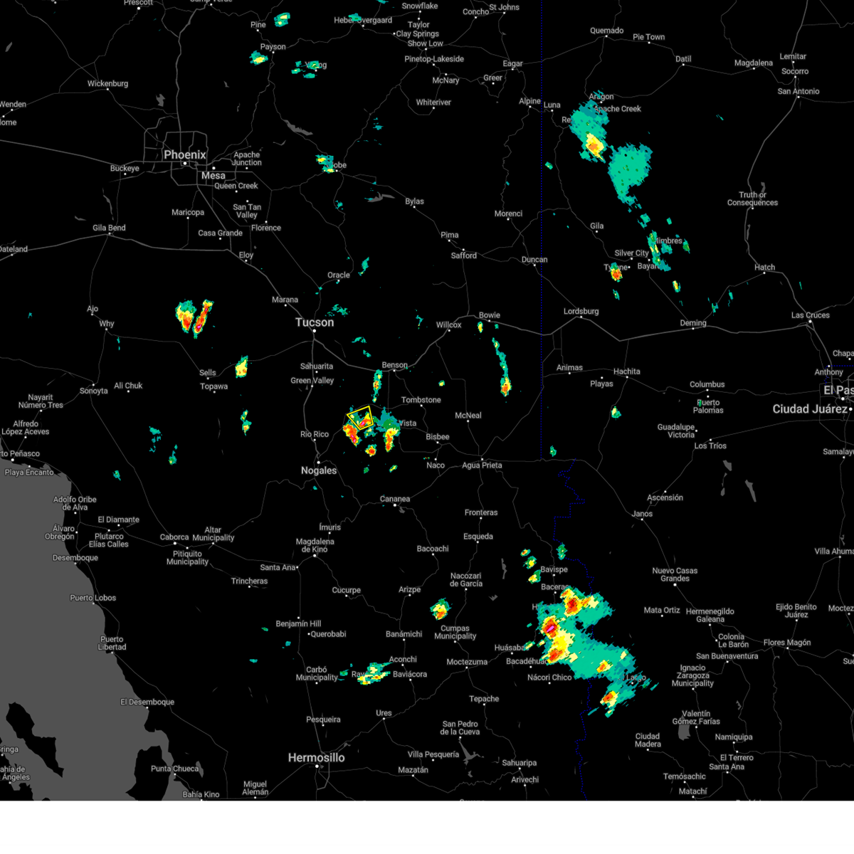
Hail Map for Sonoita, AZ
The Sonoita, AZ area has had 0 reports of on-the-ground hail by trained spotters, and has been under severe weather warnings 13 times during the past 12 months. Doppler radar has detected hail at or near Sonoita, AZ on 70 occasions, including 3 occasions during the past year.
| Name: | Sonoita, AZ |
| Where Located: | 42.9 miles SSE of Tucson, AZ |
| Map: | Google Map for Sonoita, AZ |
| Population: | 818 |
| Housing Units: | 462 |
| More Info: | Search Google for Sonoita, AZ |
1
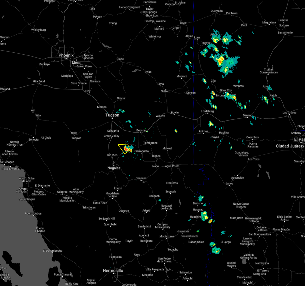
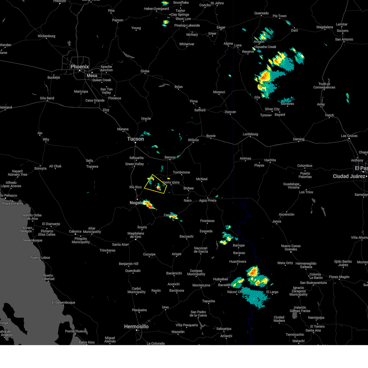
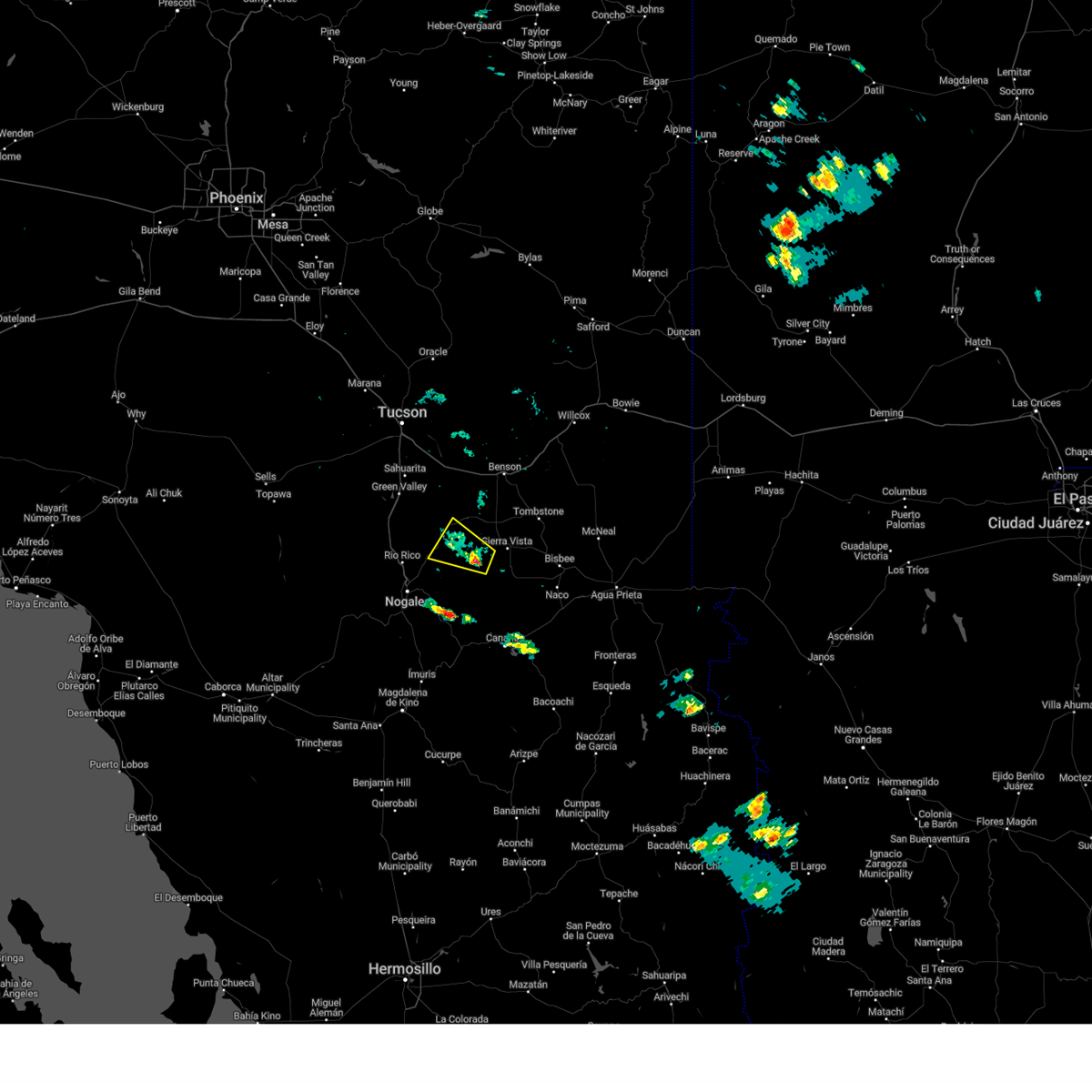
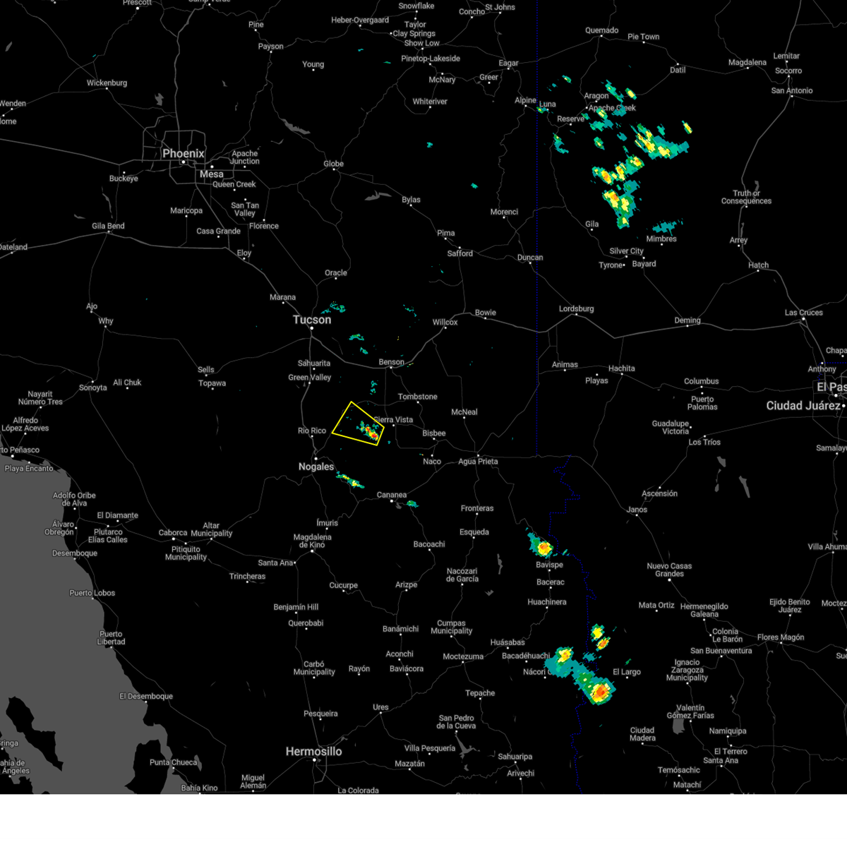
The Top Recent Hail Date for Sonoita, AZ is Wednesday, June 17, 2026 (12th out of 70)
Hail and Wind Damage Spotted near Sonoita, AZ
| Date / Time | Report Details |
|---|---|
| 6/17/2026 2:31 PM MST |
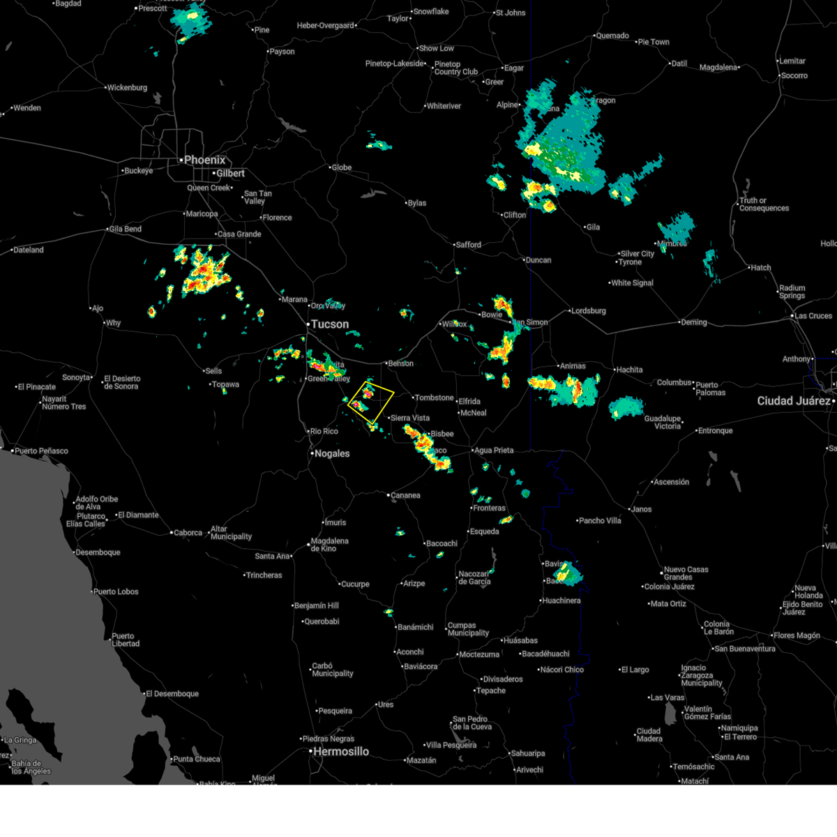 Svrtwc the national weather service in tucson has issued a * severe thunderstorm warning for, west central cochise county in southeastern arizona, southeastern pima county in southeastern arizona, northeastern santa cruz county in southeastern arizona, * until 315 pm mst. * at 231 pm mst, a severe thunderstorm was located near whetstone, moving southeast at 10 mph (radar indicated). Hazards include 60 mph wind gusts and quarter size hail. Hail damage to vehicles is expected. Expect wind damage to roofs, siding, and trees. Svrtwc the national weather service in tucson has issued a * severe thunderstorm warning for, west central cochise county in southeastern arizona, southeastern pima county in southeastern arizona, northeastern santa cruz county in southeastern arizona, * until 315 pm mst. * at 231 pm mst, a severe thunderstorm was located near whetstone, moving southeast at 10 mph (radar indicated). Hazards include 60 mph wind gusts and quarter size hail. Hail damage to vehicles is expected. Expect wind damage to roofs, siding, and trees.
|
| 9/25/2025 8:48 PM MST | the severe thunderstorm warning has been cancelled and is no longer in effect |
| 9/25/2025 8:27 PM MST | At 827 pm mst, a severe thunderstorm was located 7 miles northwest of patagonia, moving northeast at 20 mph (radar indicated). Hazards include 60 mph wind gusts and small hail. Expect damage to roofs, siding, and trees. locations impacted include, patagonia, sonoita, elgin, patagonia lake state park and madera canyon. this includes the following highways, route 82 between mile markers 12 and 37. Route 83 between mile markers 29 and 36. |
| 9/25/2025 8:15 PM MST | Svrtwc the national weather service in tucson has issued a * severe thunderstorm warning for, eastern santa cruz county in southeastern arizona, * until 900 pm mst. * at 815 pm mst, a severe thunderstorm was located 6 miles north of patagonia lake state park, moving northeast at 20 mph (radar indicated). Hazards include 60 mph wind gusts and quarter size hail. Hail damage to vehicles is expected. Expect wind damage to roofs, siding, and trees. |
| 9/22/2025 4:14 PM MST | the severe thunderstorm warning has been cancelled and is no longer in effect |
| 9/22/2025 3:39 PM MST | Svrtwc the national weather service in tucson has issued a * severe thunderstorm warning for, west central cochise county in southeastern arizona, east central pima county in southeastern arizona, northeastern santa cruz county in southeastern arizona, * until 445 pm mst. * at 339 pm mst, a severe thunderstorm was located 10 miles south of corona de tucson, moving east at 20 mph (radar indicated). Hazards include 60 mph wind gusts and quarter size hail. Hail damage to vehicles is expected. Expect wind damage to roofs, siding, and trees. |
| 9/22/2025 2:58 PM MST | Svrtwc the national weather service in tucson has issued a * severe thunderstorm warning for, east central pima county in southeastern arizona, north central santa cruz county in southeastern arizona, * until 345 pm mst. * at 258 pm mst, a severe thunderstorm was located near green valley, moving east at 20 mph (radar indicated). Hazards include 60 mph wind gusts and quarter size hail. Hail damage to vehicles is expected. Expect wind damage to roofs, siding, and trees. |
| 8/25/2025 1:59 PM MST |
 The storm which prompted the warning has weakened below severe limits, and no longer poses an immediate threat to life or property. therefore, the warning will be allowed to expire. however, gusty winds and heavy rain are still possible with this thunderstorm. The storm which prompted the warning has weakened below severe limits, and no longer poses an immediate threat to life or property. therefore, the warning will be allowed to expire. however, gusty winds and heavy rain are still possible with this thunderstorm.
|
| 8/25/2025 1:31 PM MST |
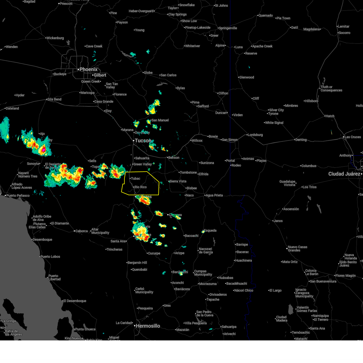
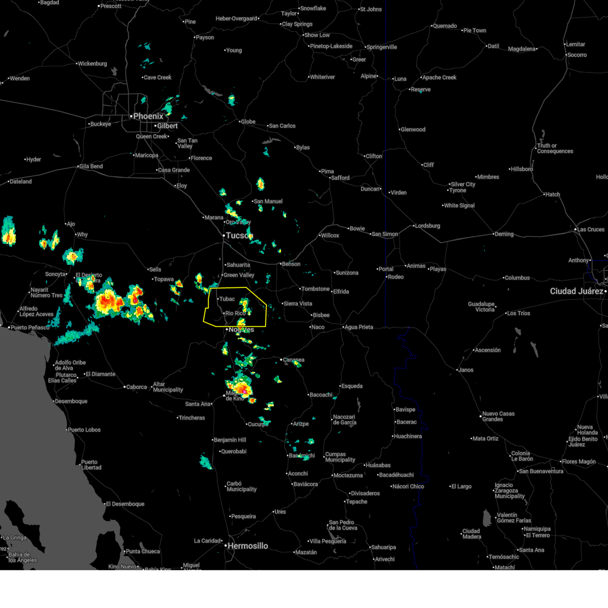 At 131 pm mst, severe thunderstorms were located near tubac, moving northwest at 20 mph (radar indicated). Hazards include 60 mph wind gusts and quarter size hail. Hail damage to vehicles is expected. expect wind damage to roofs, siding, and trees. locations impacted include, nogales, tubac, rio rico, patagonia, sonoita, elgin, patagonia lake state park, nogales international airport, tumacacori, amado, kino springs, madera canyon, pena blanca lake, lochiel and canelo. this includes the following highways, interstate 19 between mile markers 1 and 29. route 82 between mile markers 1 and 33. Route 83 between mile markers 8 and 26, and between mile markers 30 and 33. At 131 pm mst, severe thunderstorms were located near tubac, moving northwest at 20 mph (radar indicated). Hazards include 60 mph wind gusts and quarter size hail. Hail damage to vehicles is expected. expect wind damage to roofs, siding, and trees. locations impacted include, nogales, tubac, rio rico, patagonia, sonoita, elgin, patagonia lake state park, nogales international airport, tumacacori, amado, kino springs, madera canyon, pena blanca lake, lochiel and canelo. this includes the following highways, interstate 19 between mile markers 1 and 29. route 82 between mile markers 1 and 33. Route 83 between mile markers 8 and 26, and between mile markers 30 and 33.
|
| 8/25/2025 1:11 PM MST |
 Svrtwc the national weather service in tucson has issued a * severe thunderstorm warning for, santa cruz county in southeastern arizona, * until 200 pm mst. * at 111 pm mst, severe thunderstorms were located near tubac, moving northwest at 20 mph (radar indicated). Hazards include 60 mph wind gusts and quarter size hail. Hail damage to vehicles is expected. Expect wind damage to roofs, siding, and trees. Svrtwc the national weather service in tucson has issued a * severe thunderstorm warning for, santa cruz county in southeastern arizona, * until 200 pm mst. * at 111 pm mst, severe thunderstorms were located near tubac, moving northwest at 20 mph (radar indicated). Hazards include 60 mph wind gusts and quarter size hail. Hail damage to vehicles is expected. Expect wind damage to roofs, siding, and trees.
|
| 7/2/2025 1:00 PM MST |
 The storm which prompted the warning has weakened below severe limits, and no longer poses an immediate threat to life or property. therefore, the warning has been allowed to expire. however, gusty winds are still possible with this thunderstorm. The storm which prompted the warning has weakened below severe limits, and no longer poses an immediate threat to life or property. therefore, the warning has been allowed to expire. however, gusty winds are still possible with this thunderstorm.
|
| 7/2/2025 12:43 PM MST |
 At 1243 pm mst, a severe thunderstorm was located north of sonoita, moving northeast at 5 mph (radar indicated). Hazards include 60 mph wind gusts and small hail. Expect damage to roofs, siding, and trees. locations impacted include, sonoita. this includes the following highways, route 82 between mile markers 25 and 35. Route 83 between mile markers 29 and 46. At 1243 pm mst, a severe thunderstorm was located north of sonoita, moving northeast at 5 mph (radar indicated). Hazards include 60 mph wind gusts and small hail. Expect damage to roofs, siding, and trees. locations impacted include, sonoita. this includes the following highways, route 82 between mile markers 25 and 35. Route 83 between mile markers 29 and 46.
|
| 7/2/2025 12:11 PM MST |
 Svrtwc the national weather service in tucson has issued a * severe thunderstorm warning for, east central pima county in southeastern arizona, northeastern santa cruz county in southeastern arizona, * until 100 pm mst. * at 1211 pm mst, a severe thunderstorm was located near sonoita, moving northeast at 5 mph (radar indicated). Hazards include 60 mph wind gusts and small hail. expect damage to roofs, siding, and trees Svrtwc the national weather service in tucson has issued a * severe thunderstorm warning for, east central pima county in southeastern arizona, northeastern santa cruz county in southeastern arizona, * until 100 pm mst. * at 1211 pm mst, a severe thunderstorm was located near sonoita, moving northeast at 5 mph (radar indicated). Hazards include 60 mph wind gusts and small hail. expect damage to roofs, siding, and trees
|
| 9/15/2024 5:06 PM MST |
 The storm which prompted the warning has weakened below severe limits, and no longer poses an immediate threat to life or property. therefore, the warning will be allowed to expire. The storm which prompted the warning has weakened below severe limits, and no longer poses an immediate threat to life or property. therefore, the warning will be allowed to expire.
|
| 9/15/2024 4:49 PM MST |
 At 448 pm mst, a severe thunderstorm was located over patagonia, or 19 miles northeast of nogales, moving northeast at 10 mph (radar indicated). Hazards include 60 mph wind gusts and quarter size hail. Hail damage to vehicles is expected. expect wind damage to roofs, siding, and trees. locations impacted include, patagonia, sonoita, and elgin. this includes the following highways, route 82 between mile markers 17 and 35. Route 83 between mile markers 9 and 11, and between mile markers 15 and 35. At 448 pm mst, a severe thunderstorm was located over patagonia, or 19 miles northeast of nogales, moving northeast at 10 mph (radar indicated). Hazards include 60 mph wind gusts and quarter size hail. Hail damage to vehicles is expected. expect wind damage to roofs, siding, and trees. locations impacted include, patagonia, sonoita, and elgin. this includes the following highways, route 82 between mile markers 17 and 35. Route 83 between mile markers 9 and 11, and between mile markers 15 and 35.
|
| 9/15/2024 4:32 PM MST |
 Svrtwc the national weather service in tucson has issued a * severe thunderstorm warning for, eastern santa cruz county in southeastern arizona, * until 515 pm mst. * at 432 pm mst, a severe thunderstorm was located over patagonia, or 16 miles northeast of nogales, moving northeast at 10 mph (radar indicated). Hazards include 60 mph wind gusts and quarter size hail. Hail damage to vehicles is expected. Expect wind damage to roofs, siding, and trees. Svrtwc the national weather service in tucson has issued a * severe thunderstorm warning for, eastern santa cruz county in southeastern arizona, * until 515 pm mst. * at 432 pm mst, a severe thunderstorm was located over patagonia, or 16 miles northeast of nogales, moving northeast at 10 mph (radar indicated). Hazards include 60 mph wind gusts and quarter size hail. Hail damage to vehicles is expected. Expect wind damage to roofs, siding, and trees.
|
| 8/23/2024 4:06 PM MST |
 The storm which prompted the warning has weakened below severe limits. therefore, the warning will be allowed to expire. The storm which prompted the warning has weakened below severe limits. therefore, the warning will be allowed to expire.
|
| 8/23/2024 3:28 PM MST |
 Svrtwc the national weather service in tucson has issued a * severe thunderstorm warning for, east central pima county in southeastern arizona, western cochise county in southeastern arizona, northeastern santa cruz county in southeastern arizona, * until 415 pm mst. * at 328 pm mst, a severe thunderstorm was located near elgin, or 20 miles southwest of benson, moving northeast at 10 mph (radar indicated). Hazards include 60 mph wind gusts and penny size hail. expect damage to roofs, siding, and trees Svrtwc the national weather service in tucson has issued a * severe thunderstorm warning for, east central pima county in southeastern arizona, western cochise county in southeastern arizona, northeastern santa cruz county in southeastern arizona, * until 415 pm mst. * at 328 pm mst, a severe thunderstorm was located near elgin, or 20 miles southwest of benson, moving northeast at 10 mph (radar indicated). Hazards include 60 mph wind gusts and penny size hail. expect damage to roofs, siding, and trees
|
| 8/19/2024 4:02 PM MST |
 the severe thunderstorm warning has been cancelled and is no longer in effect the severe thunderstorm warning has been cancelled and is no longer in effect
|
| 8/19/2024 3:52 PM MST |
 At 351 pm mst, a severe thunderstorm was located near patagonia, or 20 miles east of tubac, moving west at 15 mph (radar indicated). Hazards include 60 mph wind gusts and quarter size hail. Hail damage to vehicles is expected. expect wind damage to roofs, siding, and trees. locations impacted include, patagonia and sonoita. this includes the following highways, route 82 between mile markers 18 and 31. Route 83 between mile markers 18 and 31. At 351 pm mst, a severe thunderstorm was located near patagonia, or 20 miles east of tubac, moving west at 15 mph (radar indicated). Hazards include 60 mph wind gusts and quarter size hail. Hail damage to vehicles is expected. expect wind damage to roofs, siding, and trees. locations impacted include, patagonia and sonoita. this includes the following highways, route 82 between mile markers 18 and 31. Route 83 between mile markers 18 and 31.
|
| 8/19/2024 3:35 PM MST |
 Svrtwc the national weather service in tucson has issued a * severe thunderstorm warning for, northeastern santa cruz county in southeastern arizona, * until 415 pm mst. * at 333 pm mst, a severe thunderstorm was located 3 miles south of sonoita, or 23 miles west of sierra vista, moving southwest at 10 mph (radar indicated). Hazards include 60 mph wind gusts and quarter size hail. Hail damage to vehicles is expected. Expect wind damage to roofs, siding, and trees. Svrtwc the national weather service in tucson has issued a * severe thunderstorm warning for, northeastern santa cruz county in southeastern arizona, * until 415 pm mst. * at 333 pm mst, a severe thunderstorm was located 3 miles south of sonoita, or 23 miles west of sierra vista, moving southwest at 10 mph (radar indicated). Hazards include 60 mph wind gusts and quarter size hail. Hail damage to vehicles is expected. Expect wind damage to roofs, siding, and trees.
|
| 8/19/2024 3:29 PM MST |
 The storm which prompted the warning has weakened below severe limits, and has exited the warned area. therefore, the warning will be allowed to expire. The storm which prompted the warning has weakened below severe limits, and has exited the warned area. therefore, the warning will be allowed to expire.
|
| 8/19/2024 3:08 PM MST |
 At 306 pm mst, a severe thunderstorm was located between whetstone and elgin, or about 16 miles northwest of sierra vista, moving west at 5 mph (radar indicated). Hazards include 60 mph wind gusts and quarter size hail. Hail damage to vehicles is expected. expect wind damage to roofs, siding, and trees. locations impacted include, whetstone, huachuca city, sonoita, and elgin. this includes the following highways, route 82 between mile markers 35 and 52. route 83 between mile markers 25 and 29. Route 90 between mile markers 306 and 310. At 306 pm mst, a severe thunderstorm was located between whetstone and elgin, or about 16 miles northwest of sierra vista, moving west at 5 mph (radar indicated). Hazards include 60 mph wind gusts and quarter size hail. Hail damage to vehicles is expected. expect wind damage to roofs, siding, and trees. locations impacted include, whetstone, huachuca city, sonoita, and elgin. this includes the following highways, route 82 between mile markers 35 and 52. route 83 between mile markers 25 and 29. Route 90 between mile markers 306 and 310.
|
| 8/19/2024 2:50 PM MST |
 The storm which prompted the warning has weakened below severe limits, and no longer poses an immediate threat to life or property. therefore, the warning will be allowed to expire. The storm which prompted the warning has weakened below severe limits, and no longer poses an immediate threat to life or property. therefore, the warning will be allowed to expire.
|
| 8/19/2024 2:46 PM MST |
 Svrtwc the national weather service in tucson has issued a * severe thunderstorm warning for, southeastern pima county in southeastern arizona, west central cochise county in southeastern arizona, northeastern santa cruz county in southeastern arizona, * until 330 pm mst. * at 245 pm mst, a severe thunderstorm was located over whetstone, or 15 miles northwest of sierra vista, moving west at 5 mph (radar indicated). Hazards include 60 mph wind gusts and quarter size hail. Hail damage to vehicles is expected. Expect wind damage to roofs, siding, and trees. Svrtwc the national weather service in tucson has issued a * severe thunderstorm warning for, southeastern pima county in southeastern arizona, west central cochise county in southeastern arizona, northeastern santa cruz county in southeastern arizona, * until 330 pm mst. * at 245 pm mst, a severe thunderstorm was located over whetstone, or 15 miles northwest of sierra vista, moving west at 5 mph (radar indicated). Hazards include 60 mph wind gusts and quarter size hail. Hail damage to vehicles is expected. Expect wind damage to roofs, siding, and trees.
|
| 8/19/2024 2:10 PM MST |
 Svrtwc the national weather service in tucson has issued a * severe thunderstorm warning for, northeastern santa cruz county in southeastern arizona, * until 300 pm mst. * at 210 pm mst, a severe thunderstorm was located near patagonia, or 19 miles northeast of nogales, moving west at 15 mph (radar indicated). Hazards include 60 mph wind gusts and quarter size hail. Hail damage to vehicles is expected. Expect wind damage to roofs, siding, and trees. Svrtwc the national weather service in tucson has issued a * severe thunderstorm warning for, northeastern santa cruz county in southeastern arizona, * until 300 pm mst. * at 210 pm mst, a severe thunderstorm was located near patagonia, or 19 miles northeast of nogales, moving west at 15 mph (radar indicated). Hazards include 60 mph wind gusts and quarter size hail. Hail damage to vehicles is expected. Expect wind damage to roofs, siding, and trees.
|
| 8/17/2024 3:32 PM MST |
 the severe thunderstorm warning has been cancelled and is no longer in effect the severe thunderstorm warning has been cancelled and is no longer in effect
|
| 8/17/2024 3:04 PM MST |
 Svrtwc the national weather service in tucson has issued a * severe thunderstorm warning for, eastern santa cruz county in southeastern arizona, * until 400 pm mst. * at 303 pm mst, a severe thunderstorm was located near patagonia, or 15 miles northeast of nogales, and is nearly stationary (radar indicated). Hazards include 60 mph wind gusts and quarter size hail. Hail damage to vehicles is expected. Expect wind damage to roofs, siding, and trees. Svrtwc the national weather service in tucson has issued a * severe thunderstorm warning for, eastern santa cruz county in southeastern arizona, * until 400 pm mst. * at 303 pm mst, a severe thunderstorm was located near patagonia, or 15 miles northeast of nogales, and is nearly stationary (radar indicated). Hazards include 60 mph wind gusts and quarter size hail. Hail damage to vehicles is expected. Expect wind damage to roofs, siding, and trees.
|
| 8/17/2024 2:12 PM MST |
 The storm which prompted the warning has weakened below severe limits, and no longer poses an immediate threat to life or property. therefore, the warning will be allowed to expire. The storm which prompted the warning has weakened below severe limits, and no longer poses an immediate threat to life or property. therefore, the warning will be allowed to expire.
|
| 8/17/2024 1:51 PM MST |
 At 151 pm mst, a severe thunderstorm was located over sonoita, or 22 miles east of tubac, moving northwest at 10 mph (radar indicated). Hazards include 60 mph wind gusts and nickel size hail. Expect damage to roofs, siding, and trees. locations impacted include, sonoita and elgin. this includes the following highways, route 82 between mile markers 24 and 36. Route 83 between mile markers 22 and 36. At 151 pm mst, a severe thunderstorm was located over sonoita, or 22 miles east of tubac, moving northwest at 10 mph (radar indicated). Hazards include 60 mph wind gusts and nickel size hail. Expect damage to roofs, siding, and trees. locations impacted include, sonoita and elgin. this includes the following highways, route 82 between mile markers 24 and 36. Route 83 between mile markers 22 and 36.
|
| 8/17/2024 1:33 PM MST |
 Svrtwc the national weather service in tucson has issued a * severe thunderstorm warning for, northeastern santa cruz county in southeastern arizona, * until 215 pm mst. * at 132 pm mst, a severe thunderstorm was located near sonoita, or 23 miles east of tubac, moving northwest at 10 mph (radar indicated). Hazards include 60 mph wind gusts and nickel size hail. expect damage to roofs, siding, and trees Svrtwc the national weather service in tucson has issued a * severe thunderstorm warning for, northeastern santa cruz county in southeastern arizona, * until 215 pm mst. * at 132 pm mst, a severe thunderstorm was located near sonoita, or 23 miles east of tubac, moving northwest at 10 mph (radar indicated). Hazards include 60 mph wind gusts and nickel size hail. expect damage to roofs, siding, and trees
|
| 8/16/2024 2:59 PM MST |
 The severe thunderstorm which prompted the warning has weakened. moved out of the warned area. therefore, the warning will be allowed to expire. however, gusty winds are still possible with this thunderstorm. The severe thunderstorm which prompted the warning has weakened. moved out of the warned area. therefore, the warning will be allowed to expire. however, gusty winds are still possible with this thunderstorm.
|
| 8/16/2024 2:43 PM MST |
 At 241 pm mst, a severe thunderstorm was located 7 miles south of elgin, or 20 miles west of sierra vista, moving northwest at 10 mph (radar indicated). Hazards include 60 mph wind gusts and quarter size hail. Hail damage to vehicles is expected. expect wind damage to roofs, siding, and trees. locations impacted include, patagonia, sonoita, elgin, parker canyon lake and canelo. this includes the following highways, route 82 between mile markers 18 and 24, and between mile markers 31 and 35. Route 83 between mile markers 3 and 34. At 241 pm mst, a severe thunderstorm was located 7 miles south of elgin, or 20 miles west of sierra vista, moving northwest at 10 mph (radar indicated). Hazards include 60 mph wind gusts and quarter size hail. Hail damage to vehicles is expected. expect wind damage to roofs, siding, and trees. locations impacted include, patagonia, sonoita, elgin, parker canyon lake and canelo. this includes the following highways, route 82 between mile markers 18 and 24, and between mile markers 31 and 35. Route 83 between mile markers 3 and 34.
|
| 8/16/2024 2:22 PM MST |
 Svrtwc the national weather service in tucson has issued a * severe thunderstorm warning for, western cochise county in southeastern arizona, northeastern santa cruz county in southeastern arizona, * until 300 pm mst. * at 221 pm mst, a severe thunderstorm was located 7 miles northwest of parker canyon lake, or 16 miles west of sierra vista, moving northwest at 10 mph (radar indicated). Hazards include 60 mph wind gusts and quarter size hail. Hail damage to vehicles is expected. Expect wind damage to roofs, siding, and trees. Svrtwc the national weather service in tucson has issued a * severe thunderstorm warning for, western cochise county in southeastern arizona, northeastern santa cruz county in southeastern arizona, * until 300 pm mst. * at 221 pm mst, a severe thunderstorm was located 7 miles northwest of parker canyon lake, or 16 miles west of sierra vista, moving northwest at 10 mph (radar indicated). Hazards include 60 mph wind gusts and quarter size hail. Hail damage to vehicles is expected. Expect wind damage to roofs, siding, and trees.
|
| 8/12/2024 2:43 PM MST |
 Svrtwc the national weather service in tucson has issued a * severe thunderstorm warning for, east central pima county in southeastern arizona, north central santa cruz county in southeastern arizona, * until 330 pm mst. * at 243 pm mst, a severe thunderstorm was located near sonoita, or 18 miles east of tubac, moving northwest at 10 mph (radar indicated). Hazards include 60 mph wind gusts and quarter size hail. Hail damage to vehicles is expected. Expect wind damage to roofs, siding, and trees. Svrtwc the national weather service in tucson has issued a * severe thunderstorm warning for, east central pima county in southeastern arizona, north central santa cruz county in southeastern arizona, * until 330 pm mst. * at 243 pm mst, a severe thunderstorm was located near sonoita, or 18 miles east of tubac, moving northwest at 10 mph (radar indicated). Hazards include 60 mph wind gusts and quarter size hail. Hail damage to vehicles is expected. Expect wind damage to roofs, siding, and trees.
|
| 8/12/2024 2:36 PM MST |
 The storm which prompted the warning has weakened below severe limits, and no longer poses an immediate threat to life or property. therefore, the warning will be allowed to expire. however, heavy rain is still possible with this thunderstorm. remember, a severe thunderstorm warning still remains in effect for portions of southeast santa cruz county until 315 pm. The storm which prompted the warning has weakened below severe limits, and no longer poses an immediate threat to life or property. therefore, the warning will be allowed to expire. however, heavy rain is still possible with this thunderstorm. remember, a severe thunderstorm warning still remains in effect for portions of southeast santa cruz county until 315 pm.
|
| 8/12/2024 2:00 PM MST |
 Svrtwc the national weather service in tucson has issued a * severe thunderstorm warning for, northeastern santa cruz county in southeastern arizona, * until 245 pm mst. * at 200 pm mst, a severe thunderstorm was located near elgin, or 20 miles west of sierra vista, and is nearly stationary (radar indicated). Hazards include 60 mph wind gusts and quarter size hail. Hail damage to vehicles is expected. Expect wind damage to roofs, siding, and trees. Svrtwc the national weather service in tucson has issued a * severe thunderstorm warning for, northeastern santa cruz county in southeastern arizona, * until 245 pm mst. * at 200 pm mst, a severe thunderstorm was located near elgin, or 20 miles west of sierra vista, and is nearly stationary (radar indicated). Hazards include 60 mph wind gusts and quarter size hail. Hail damage to vehicles is expected. Expect wind damage to roofs, siding, and trees.
|
| 7/25/2024 5:59 PM MST |
 The storms which prompted the warning have weakened below severe limits, and no longer pose an immediate threat to life or property. therefore, the warning will be allowed to expire. however, heavy rain is still possible with these thunderstorms. remember, a flash flood warning still remains in effect for central santa cruz county, including rio rico, until 815 pm mst. The storms which prompted the warning have weakened below severe limits, and no longer pose an immediate threat to life or property. therefore, the warning will be allowed to expire. however, heavy rain is still possible with these thunderstorms. remember, a flash flood warning still remains in effect for central santa cruz county, including rio rico, until 815 pm mst.
|
| 7/25/2024 5:29 PM MST |
 At 529 pm mst, severe thunderstorms were located along a line extending from 11 miles west of sonoita to near rio rico, and are nearly stationary (radar indicated). Hazards include 60 mph wind gusts and quarter size hail. Hail damage to vehicles is expected. expect wind damage to roofs, siding, and trees. locations impacted include, tubac, rio rico, sonoita, patagonia lake state park, tumacacori, amado, and madera canyon. this includes the following highways, interstate 19 between mile markers 8 and 25. route 82 between mile markers 24 and 32. Route 83 between mile markers 31 and 36. At 529 pm mst, severe thunderstorms were located along a line extending from 11 miles west of sonoita to near rio rico, and are nearly stationary (radar indicated). Hazards include 60 mph wind gusts and quarter size hail. Hail damage to vehicles is expected. expect wind damage to roofs, siding, and trees. locations impacted include, tubac, rio rico, sonoita, patagonia lake state park, tumacacori, amado, and madera canyon. this includes the following highways, interstate 19 between mile markers 8 and 25. route 82 between mile markers 24 and 32. Route 83 between mile markers 31 and 36.
|
| 7/25/2024 5:13 PM MST |
 Svrtwc the national weather service in tucson has issued a * severe thunderstorm warning for, central and northern santa cruz county in southeastern arizona, * until 600 pm mst. * at 511 pm mst, severe thunderstorms were located along a line extending from 10 miles west of sonoita to near tubac, and are nearly stationary (radar indicated). Hazards include 60 mph wind gusts and quarter size hail. Hail damage to vehicles is expected. Expect wind damage to roofs, siding, and trees. Svrtwc the national weather service in tucson has issued a * severe thunderstorm warning for, central and northern santa cruz county in southeastern arizona, * until 600 pm mst. * at 511 pm mst, severe thunderstorms were located along a line extending from 10 miles west of sonoita to near tubac, and are nearly stationary (radar indicated). Hazards include 60 mph wind gusts and quarter size hail. Hail damage to vehicles is expected. Expect wind damage to roofs, siding, and trees.
|
| 7/21/2024 6:44 PM MST |
 The storms which prompted the warning south of tucson have weakened below severe limits. therefore, the warning will be allowed to expire. however, gusty winds and heavy rain are still possible with these thunderstorms. The storms which prompted the warning south of tucson have weakened below severe limits. therefore, the warning will be allowed to expire. however, gusty winds and heavy rain are still possible with these thunderstorms.
|
| 7/21/2024 6:14 PM MST |
 At 614 pm mst, a severe thunderstorm was located near and east of green valley, moving southwest at 15 mph (radar indicated). Hazards include 60 mph wind gusts. Expect damage to roofs, siding, and trees. locations impacted include, sahuarita, green valley, vail, corona de tucson, sonoita, elgin, and madera canyon. this includes the following highways, interstate 19 between mile markers 32 and 45. route 82 between mile markers 31 and 37. Route 83 between mile markers 28 and 54. At 614 pm mst, a severe thunderstorm was located near and east of green valley, moving southwest at 15 mph (radar indicated). Hazards include 60 mph wind gusts. Expect damage to roofs, siding, and trees. locations impacted include, sahuarita, green valley, vail, corona de tucson, sonoita, elgin, and madera canyon. this includes the following highways, interstate 19 between mile markers 32 and 45. route 82 between mile markers 31 and 37. Route 83 between mile markers 28 and 54.
|
| 7/21/2024 6:01 PM MST |
 Svrtwc the national weather service in tucson has issued a * severe thunderstorm warning for, east central pima county in southeastern arizona, northeastern santa cruz county in southeastern arizona, * until 645 pm mst. * at 600 pm mst, a severe thunderstorm was located 5 to 10 miles southeast of sahuarita, moving southwest at 15 mph (radar indicated). Hazards include 60 mph wind gusts. expect damage to roofs, siding, and trees Svrtwc the national weather service in tucson has issued a * severe thunderstorm warning for, east central pima county in southeastern arizona, northeastern santa cruz county in southeastern arizona, * until 645 pm mst. * at 600 pm mst, a severe thunderstorm was located 5 to 10 miles southeast of sahuarita, moving southwest at 15 mph (radar indicated). Hazards include 60 mph wind gusts. expect damage to roofs, siding, and trees
|
| 7/20/2024 5:12 PM MST |
 Svrtwc the national weather service in tucson has issued a * severe thunderstorm warning for, east central pima county in southeastern arizona, northeastern santa cruz county in southeastern arizona, * until 600 pm mst. * at 512 pm mst, a severe thunderstorm was located near and south of corona de tucson, or 12 miles southeast of sahuarita, moving west at 15 mph (radar indicated). Hazards include 60 mph wind gusts. expect damage to roofs, siding, and trees Svrtwc the national weather service in tucson has issued a * severe thunderstorm warning for, east central pima county in southeastern arizona, northeastern santa cruz county in southeastern arizona, * until 600 pm mst. * at 512 pm mst, a severe thunderstorm was located near and south of corona de tucson, or 12 miles southeast of sahuarita, moving west at 15 mph (radar indicated). Hazards include 60 mph wind gusts. expect damage to roofs, siding, and trees
|
| 7/20/2024 4:25 PM MST |
 Svrtwc the national weather service in tucson has issued a * severe thunderstorm warning for, east central pima county in southeastern arizona, west central cochise county in southeastern arizona, northeastern santa cruz county in southeastern arizona, * until 515 pm mst. * at 425 pm mst, a severe thunderstorm was located 10 miles north of sonoita, or 19 miles southwest of benson, moving west at 15 mph (radar indicated). Hazards include 60 mph wind gusts. expect damage to roofs, siding, and trees Svrtwc the national weather service in tucson has issued a * severe thunderstorm warning for, east central pima county in southeastern arizona, west central cochise county in southeastern arizona, northeastern santa cruz county in southeastern arizona, * until 515 pm mst. * at 425 pm mst, a severe thunderstorm was located 10 miles north of sonoita, or 19 miles southwest of benson, moving west at 15 mph (radar indicated). Hazards include 60 mph wind gusts. expect damage to roofs, siding, and trees
|
| 7/15/2024 6:09 PM MST |
 Svrtwc the national weather service in tucson has issued a * severe thunderstorm warning for, southeastern pima county in southeastern arizona, west central cochise county in southeastern arizona, northeastern santa cruz county in southeastern arizona, * until 700 pm mst. * at 608 pm mst, a severe thunderstorm was located near elgin, or 15 miles northwest of sierra vista, moving northwest at 10 mph (radar indicated). Hazards include 60 mph wind gusts and quarter size hail. Hail damage to vehicles is expected. Expect wind damage to roofs, siding, and trees. Svrtwc the national weather service in tucson has issued a * severe thunderstorm warning for, southeastern pima county in southeastern arizona, west central cochise county in southeastern arizona, northeastern santa cruz county in southeastern arizona, * until 700 pm mst. * at 608 pm mst, a severe thunderstorm was located near elgin, or 15 miles northwest of sierra vista, moving northwest at 10 mph (radar indicated). Hazards include 60 mph wind gusts and quarter size hail. Hail damage to vehicles is expected. Expect wind damage to roofs, siding, and trees.
|
| 7/14/2024 3:53 PM MST |
 The storm which prompted the warning has weakened below severe limits, and has exited the warned area. therefore, the warning will be allowed to expire. however, gusty winds and heavy rain are still possible with this thunderstorm which is now near elgin west of whetstone. The storm which prompted the warning has weakened below severe limits, and has exited the warned area. therefore, the warning will be allowed to expire. however, gusty winds and heavy rain are still possible with this thunderstorm which is now near elgin west of whetstone.
|
| 7/14/2024 3:40 PM MST |
 At 340 pm mst, a severe thunderstorm was located near elgin, or 19 miles northwest of sierra vista, moving northwest at 10 mph (radar indicated). Hazards include 60 mph wind gusts. Expect damage to roofs, siding, and trees. locations impacted include, whetstone, huachuca city, sonoita, elgin, and fort huachuca. this includes the following highways, route 82 between mile markers 35 and 56. route 83 between mile markers 19 and 29. Route 90 between mile markers 303 and 313. At 340 pm mst, a severe thunderstorm was located near elgin, or 19 miles northwest of sierra vista, moving northwest at 10 mph (radar indicated). Hazards include 60 mph wind gusts. Expect damage to roofs, siding, and trees. locations impacted include, whetstone, huachuca city, sonoita, elgin, and fort huachuca. this includes the following highways, route 82 between mile markers 35 and 56. route 83 between mile markers 19 and 29. Route 90 between mile markers 303 and 313.
|
| 7/14/2024 3:16 PM MST |
 Svrtwc the national weather service in tucson has issued a * severe thunderstorm warning for, east central pima county in southeastern arizona, west central cochise county in southeastern arizona, northeastern santa cruz county in southeastern arizona, * until 400 pm mst. * at 315 pm mst, a severe thunderstorm was located near huachuca city, or 14 miles northwest of sierra vista, moving northwest at 10 mph (radar indicated). Hazards include 60 mph wind gusts and penny size hail. expect damage to roofs, siding, and trees Svrtwc the national weather service in tucson has issued a * severe thunderstorm warning for, east central pima county in southeastern arizona, west central cochise county in southeastern arizona, northeastern santa cruz county in southeastern arizona, * until 400 pm mst. * at 315 pm mst, a severe thunderstorm was located near huachuca city, or 14 miles northwest of sierra vista, moving northwest at 10 mph (radar indicated). Hazards include 60 mph wind gusts and penny size hail. expect damage to roofs, siding, and trees
|
| 7/11/2024 6:07 PM MST |
 The storm which prompted the warning has weakened below severe limits, and no longer poses an immediate threat to life or property. therefore, the warning will be allowed to expire. however, gusty winds and heavy rain are still possible with this thunderstorm. The storm which prompted the warning has weakened below severe limits, and no longer poses an immediate threat to life or property. therefore, the warning will be allowed to expire. however, gusty winds and heavy rain are still possible with this thunderstorm.
|
| 7/11/2024 5:51 PM MST |
 At 551 pm mst, a severe thunderstorm was located near nogales international airport, or 11 miles northeast of nogales, moving southwest at 25 mph (radar indicated). Hazards include 60 mph wind gusts. Expect damage to roofs, siding, and trees. locations impacted include, rio rico, patagonia, sonoita, elgin, nogales international airport, patagonia lake state park, canelo, and lochiel. this includes the following highways, interstate 19 near mile marker 12. route 82 between mile markers 8 and 39, and near mile marker 44. Route 83 between mile markers 12 and 35. At 551 pm mst, a severe thunderstorm was located near nogales international airport, or 11 miles northeast of nogales, moving southwest at 25 mph (radar indicated). Hazards include 60 mph wind gusts. Expect damage to roofs, siding, and trees. locations impacted include, rio rico, patagonia, sonoita, elgin, nogales international airport, patagonia lake state park, canelo, and lochiel. this includes the following highways, interstate 19 near mile marker 12. route 82 between mile markers 8 and 39, and near mile marker 44. Route 83 between mile markers 12 and 35.
|
| 7/11/2024 5:51 PM MST |
 the severe thunderstorm warning has been cancelled and is no longer in effect the severe thunderstorm warning has been cancelled and is no longer in effect
|
| 7/11/2024 5:21 PM MST |
 Svrtwc the national weather service in tucson has issued a * severe thunderstorm warning for, east central pima county in southeastern arizona, west central cochise county in southeastern arizona, eastern santa cruz county in southeastern arizona, * until 615 pm mst. * at 519 pm mst, there were a pair of severe thunderstorms, one south of benson in western cochise county and one near sonoita in eastern santa cruz county. these storms were moving to the southwest at 25 mph (radar indicated). Hazards include 60 mph wind gusts. expect damage to roofs, siding, and trees Svrtwc the national weather service in tucson has issued a * severe thunderstorm warning for, east central pima county in southeastern arizona, west central cochise county in southeastern arizona, eastern santa cruz county in southeastern arizona, * until 615 pm mst. * at 519 pm mst, there were a pair of severe thunderstorms, one south of benson in western cochise county and one near sonoita in eastern santa cruz county. these storms were moving to the southwest at 25 mph (radar indicated). Hazards include 60 mph wind gusts. expect damage to roofs, siding, and trees
|
| 7/10/2024 6:24 PM MST |
 The storms which prompted the warning have weakened below severe limits, and have exited the warned area. therefore, the warning will be allowed to expire. however, gusty winds are still possible with these thunderstorms. The storms which prompted the warning have weakened below severe limits, and have exited the warned area. therefore, the warning will be allowed to expire. however, gusty winds are still possible with these thunderstorms.
|
| 7/10/2024 5:40 PM MST |
 Svrtwc the national weather service in tucson has issued a * severe thunderstorm warning for, southwestern cochise county in southeastern arizona, northeastern santa cruz county in southeastern arizona, * until 630 pm mst. * at 540 pm mst, severe thunderstorms were located along a line extending from near whetstone to fort huachuca, moving west at 10 mph (radar indicated). Hazards include 60 mph wind gusts. expect damage to roofs, siding, and trees Svrtwc the national weather service in tucson has issued a * severe thunderstorm warning for, southwestern cochise county in southeastern arizona, northeastern santa cruz county in southeastern arizona, * until 630 pm mst. * at 540 pm mst, severe thunderstorms were located along a line extending from near whetstone to fort huachuca, moving west at 10 mph (radar indicated). Hazards include 60 mph wind gusts. expect damage to roofs, siding, and trees
|
| 7/9/2024 2:21 PM MST |
 The storm which prompted the warning has weakened below severe limits, and no longer poses an immediate threat to life or property. therefore, the warning will be allowed to expire. however, gusty winds are still possible with this thunderstorm. The storm which prompted the warning has weakened below severe limits, and no longer poses an immediate threat to life or property. therefore, the warning will be allowed to expire. however, gusty winds are still possible with this thunderstorm.
|
| 7/9/2024 1:43 PM MST |
 Svrtwc the national weather service in tucson has issued a * severe thunderstorm warning for, eastern santa cruz county in southeastern arizona, * until 230 pm mst. * at 143 pm mst, a severe thunderstorm was located near patagonia, or 23 miles northeast of nogales, moving southwest at 10 mph (radar indicated). Hazards include 60 mph wind gusts and quarter size hail. Hail damage to vehicles is expected. Expect wind damage to roofs, siding, and trees. Svrtwc the national weather service in tucson has issued a * severe thunderstorm warning for, eastern santa cruz county in southeastern arizona, * until 230 pm mst. * at 143 pm mst, a severe thunderstorm was located near patagonia, or 23 miles northeast of nogales, moving southwest at 10 mph (radar indicated). Hazards include 60 mph wind gusts and quarter size hail. Hail damage to vehicles is expected. Expect wind damage to roofs, siding, and trees.
|
| 6/30/2024 3:19 PM MST |
 Svrtwc the national weather service in tucson has issued a * severe thunderstorm warning for, southeastern pima county in southeastern arizona, west central cochise county in southeastern arizona, northeastern santa cruz county in southeastern arizona, * until 400 pm mst. * at 319 pm mst, a severe thunderstorm was located near huachuca city, or 15 miles northwest of sierra vista, moving northwest at 10 mph (radar indicated). Hazards include 60 mph wind gusts and quarter size hail. Hail damage to vehicles is expected. Expect wind damage to roofs, siding, and trees. Svrtwc the national weather service in tucson has issued a * severe thunderstorm warning for, southeastern pima county in southeastern arizona, west central cochise county in southeastern arizona, northeastern santa cruz county in southeastern arizona, * until 400 pm mst. * at 319 pm mst, a severe thunderstorm was located near huachuca city, or 15 miles northwest of sierra vista, moving northwest at 10 mph (radar indicated). Hazards include 60 mph wind gusts and quarter size hail. Hail damage to vehicles is expected. Expect wind damage to roofs, siding, and trees.
|
| 6/27/2024 4:58 PM MST |
 the severe thunderstorm warning has been cancelled and is no longer in effect the severe thunderstorm warning has been cancelled and is no longer in effect
|
| 6/27/2024 4:38 PM MST |
 Svrtwc the national weather service in tucson has issued a * severe thunderstorm warning for, southeastern pima county in southeastern arizona, northeastern santa cruz county in southeastern arizona, * until 515 pm mst. * at 438 pm mst, a severe thunderstorm was located over elgin, or 23 miles northwest of sierra vista, moving east at 10 mph (radar indicated). Hazards include 60 mph wind gusts and quarter size hail. Hail damage to vehicles is expected. Expect wind damage to roofs, siding, and trees. Svrtwc the national weather service in tucson has issued a * severe thunderstorm warning for, southeastern pima county in southeastern arizona, northeastern santa cruz county in southeastern arizona, * until 515 pm mst. * at 438 pm mst, a severe thunderstorm was located over elgin, or 23 miles northwest of sierra vista, moving east at 10 mph (radar indicated). Hazards include 60 mph wind gusts and quarter size hail. Hail damage to vehicles is expected. Expect wind damage to roofs, siding, and trees.
|
| 6/23/2024 2:22 PM MST |
 The storm which prompted the warning has moved out of the area. therefore, the warning will be allowed to expire. The storm which prompted the warning has moved out of the area. therefore, the warning will be allowed to expire.
|
| 6/23/2024 2:15 PM MST |
 Svrtwc the national weather service in tucson has issued a * severe thunderstorm warning for, east central pima county in southeastern arizona, north central santa cruz county in southeastern arizona, * until 300 pm mst. * at 215 pm mst, a severe thunderstorm was located near sonoita, or 19 miles east of green valley, moving north at 10 mph (radar indicated). Hazards include 60 mph wind gusts and quarter size hail. Hail damage to vehicles is expected. Expect wind damage to roofs, siding, and trees. Svrtwc the national weather service in tucson has issued a * severe thunderstorm warning for, east central pima county in southeastern arizona, north central santa cruz county in southeastern arizona, * until 300 pm mst. * at 215 pm mst, a severe thunderstorm was located near sonoita, or 19 miles east of green valley, moving north at 10 mph (radar indicated). Hazards include 60 mph wind gusts and quarter size hail. Hail damage to vehicles is expected. Expect wind damage to roofs, siding, and trees.
|
| 6/23/2024 2:11 PM MST |
 At 211 pm mst, a severe thunderstorm was located near sonoita, or 18 miles southeast of green valley, moving north at 5 mph (radar indicated). Hazards include 60 mph wind gusts and quarter size hail. Hail damage to vehicles is expected. expect wind damage to roofs, siding, and trees. locations impacted include, sonoita. this includes the following highways, route 82 between mile markers 25 and 32. Route 83 between mile markers 31 and 34. At 211 pm mst, a severe thunderstorm was located near sonoita, or 18 miles southeast of green valley, moving north at 5 mph (radar indicated). Hazards include 60 mph wind gusts and quarter size hail. Hail damage to vehicles is expected. expect wind damage to roofs, siding, and trees. locations impacted include, sonoita. this includes the following highways, route 82 between mile markers 25 and 32. Route 83 between mile markers 31 and 34.
|
| 6/23/2024 1:57 PM MST |
 At 157 pm mst, a severe thunderstorm was located 7 miles west of sonoita, or 16 miles east of tubac, moving north at 10 mph (radar indicated). Hazards include 60 mph wind gusts and quarter size hail. Hail damage to vehicles is expected. expect wind damage to roofs, siding, and trees. locations impacted include, patagonia and sonoita. this includes the following highways, route 82 between mile markers 18 and 32. Route 83 between mile markers 31 and 33. At 157 pm mst, a severe thunderstorm was located 7 miles west of sonoita, or 16 miles east of tubac, moving north at 10 mph (radar indicated). Hazards include 60 mph wind gusts and quarter size hail. Hail damage to vehicles is expected. expect wind damage to roofs, siding, and trees. locations impacted include, patagonia and sonoita. this includes the following highways, route 82 between mile markers 18 and 32. Route 83 between mile markers 31 and 33.
|
| 6/23/2024 1:41 PM MST |
 Svrtwc the national weather service in tucson has issued a * severe thunderstorm warning for, northeastern santa cruz county in southeastern arizona, * until 230 pm mst. * at 140 pm mst, a severe thunderstorm was located near patagonia, or 15 miles east of tubac, and is nearly stationary (radar indicated). Hazards include 60 mph wind gusts and quarter size hail. Hail damage to vehicles is expected. Expect wind damage to roofs, siding, and trees. Svrtwc the national weather service in tucson has issued a * severe thunderstorm warning for, northeastern santa cruz county in southeastern arizona, * until 230 pm mst. * at 140 pm mst, a severe thunderstorm was located near patagonia, or 15 miles east of tubac, and is nearly stationary (radar indicated). Hazards include 60 mph wind gusts and quarter size hail. Hail damage to vehicles is expected. Expect wind damage to roofs, siding, and trees.
|
| 9/12/2023 1:36 PM MST |
 At 135 pm mst, a severe thunderstorm was located near sonoita, or 21 miles southwest of benson, moving east at 10 mph (radar indicated). Hazards include 60 mph wind gusts and quarter size hail. Hail damage to vehicles is expected. Expect wind damage to roofs, siding, and trees. At 135 pm mst, a severe thunderstorm was located near sonoita, or 21 miles southwest of benson, moving east at 10 mph (radar indicated). Hazards include 60 mph wind gusts and quarter size hail. Hail damage to vehicles is expected. Expect wind damage to roofs, siding, and trees.
|
| 8/21/2023 6:28 PM MST |
 At 627 pm mst, severe thunderstorms were located along a line extending from near kartchner caverns state park to sonoita to near patagonia, moving northwest at 35 mph (radar indicated). Hazards include 60 mph wind gusts and quarter size hail. Hail damage to vehicles is expected. expect wind damage to roofs, siding, and trees. locations impacted include, benson, whetstone, patagonia, sonoita, elgin and kartchner caverns state park. hail threat, radar indicated max hail size, 1. 00 in wind threat, radar indicated max wind gust, 60 mph. At 627 pm mst, severe thunderstorms were located along a line extending from near kartchner caverns state park to sonoita to near patagonia, moving northwest at 35 mph (radar indicated). Hazards include 60 mph wind gusts and quarter size hail. Hail damage to vehicles is expected. expect wind damage to roofs, siding, and trees. locations impacted include, benson, whetstone, patagonia, sonoita, elgin and kartchner caverns state park. hail threat, radar indicated max hail size, 1. 00 in wind threat, radar indicated max wind gust, 60 mph.
|
| 8/21/2023 5:53 PM MST |
 At 553 pm mst, severe thunderstorms were located along a line extending from 7 miles east of whetstone to near fort huachuca to near parker canyon lake, moving northwest at 35 mph (radar indicated). Hazards include 60 mph wind gusts and quarter size hail. Hail damage to vehicles is expected. Expect wind damage to roofs, siding, and trees. At 553 pm mst, severe thunderstorms were located along a line extending from 7 miles east of whetstone to near fort huachuca to near parker canyon lake, moving northwest at 35 mph (radar indicated). Hazards include 60 mph wind gusts and quarter size hail. Hail damage to vehicles is expected. Expect wind damage to roofs, siding, and trees.
|
| 8/18/2023 6:43 PM MST | At 643 pm mst, a severe thunderstorm was located near patagonia, or 12 miles northeast of nogales, moving north at 35 mph (radar indicated). Hazards include 70 mph wind gusts and quarter size hail. Hail damage to vehicles is expected. expect considerable tree damage. Wind damage is also likely to mobile homes, roofs, and outbuildings. |
| 8/18/2023 5:14 PM MST |
 At 513 pm mst, severe thunderstorms were located along a line extending from 8 miles southeast of vail to 10 miles north of sonoita to 7 miles south of elgin, moving west-northwest at 20 mph. strong winds have been reported with these storms (radar indicated). Hazards include 60 mph wind gusts. expect damage to roofs, siding, and trees At 513 pm mst, severe thunderstorms were located along a line extending from 8 miles southeast of vail to 10 miles north of sonoita to 7 miles south of elgin, moving west-northwest at 20 mph. strong winds have been reported with these storms (radar indicated). Hazards include 60 mph wind gusts. expect damage to roofs, siding, and trees
|
| 8/18/2023 4:31 PM MST |
 At 431 pm mst, a severe thunderstorm was located near kartchner caverns state park, or 7 miles southwest of benson, moving northwest at 20 mph (radar indicated). Hazards include 60 mph wind gusts and nickel size hail. expect damage to roofs, siding, and trees At 431 pm mst, a severe thunderstorm was located near kartchner caverns state park, or 7 miles southwest of benson, moving northwest at 20 mph (radar indicated). Hazards include 60 mph wind gusts and nickel size hail. expect damage to roofs, siding, and trees
|
| 8/17/2023 1:14 PM MST |
 At 114 pm mst, a severe thunderstorm was located 8 miles west of sonoita, or 15 miles east of tubac, and is nearly stationary (radar indicated). Hazards include 60 mph wind gusts and quarter size hail. Hail damage to vehicles is expected. Expect wind damage to roofs, siding, and trees. At 114 pm mst, a severe thunderstorm was located 8 miles west of sonoita, or 15 miles east of tubac, and is nearly stationary (radar indicated). Hazards include 60 mph wind gusts and quarter size hail. Hail damage to vehicles is expected. Expect wind damage to roofs, siding, and trees.
|
| 8/6/2023 7:39 PM MST |
 The severe thunderstorm warning for eastern santa cruz county will expire at 745 pm mst, the storms which prompted the warning have weakened below severe limits. therefore, the warning will be allowed to expire. however gusty winds to 35 mph and very heavy rain are still possible with these thunderstorms. a flash flood warning remains in effect until 10:30 pm mst. The severe thunderstorm warning for eastern santa cruz county will expire at 745 pm mst, the storms which prompted the warning have weakened below severe limits. therefore, the warning will be allowed to expire. however gusty winds to 35 mph and very heavy rain are still possible with these thunderstorms. a flash flood warning remains in effect until 10:30 pm mst.
|
| 8/6/2023 7:03 PM MST |
 At 703 pm mst, severe thunderstorms were located along a line extending from near sonoita to patagonia to just east of nogales international airport, moving west and northwest at 10 mph (radar indicated). Hazards include 60 mph wind gusts and half dollar size hail. Hail damage to vehicles is expected. expect wind damage to roofs, siding, and trees. locations impacted include, nogales, patagonia, sonoita, elgin, nogales international airport, patagonia lake state park and kino springs. hail threat, radar indicated max hail size, 1. 25 in wind threat, radar indicated max wind gust, 60 mph. At 703 pm mst, severe thunderstorms were located along a line extending from near sonoita to patagonia to just east of nogales international airport, moving west and northwest at 10 mph (radar indicated). Hazards include 60 mph wind gusts and half dollar size hail. Hail damage to vehicles is expected. expect wind damage to roofs, siding, and trees. locations impacted include, nogales, patagonia, sonoita, elgin, nogales international airport, patagonia lake state park and kino springs. hail threat, radar indicated max hail size, 1. 25 in wind threat, radar indicated max wind gust, 60 mph.
|
| 8/6/2023 6:40 PM MST |
 At 639 pm mst, severe thunderstorms were located along a line extending from 8 miles southwest of elgin to near patagonia to 7 miles east of nogales international airport, moving west at 10 mph (radar indicated). Hazards include 60 mph wind gusts and quarter size hail. Hail damage to vehicles is expected. Expect wind damage to roofs, siding, and trees. At 639 pm mst, severe thunderstorms were located along a line extending from 8 miles southwest of elgin to near patagonia to 7 miles east of nogales international airport, moving west at 10 mph (radar indicated). Hazards include 60 mph wind gusts and quarter size hail. Hail damage to vehicles is expected. Expect wind damage to roofs, siding, and trees.
|
| 7/28/2023 6:53 PM MST |
 The severe thunderstorm warning for east central pima, western cochise and northeastern santa cruz counties will expire at 700 pm mst, the storm which prompted the warning has weakened below severe limits, and no longer poses an immediate threat to life or property. therefore, the warning will be allowed to expire. The severe thunderstorm warning for east central pima, western cochise and northeastern santa cruz counties will expire at 700 pm mst, the storm which prompted the warning has weakened below severe limits, and no longer poses an immediate threat to life or property. therefore, the warning will be allowed to expire.
|
| 7/28/2023 6:24 PM MST |
 At 624 pm mst, a severe thunderstorm was located 8 miles north of sonoita, or 19 miles southeast of sahuarita, moving southwest at 10 mph (radar indicated). Hazards include 60 mph wind gusts and quarter size hail. Hail damage to vehicles is expected. expect wind damage to roofs, siding, and trees. locations impacted include, vail, patagonia, sonoita, elgin and madera canyon. hail threat, radar indicated max hail size, 1. 00 in wind threat, radar indicated max wind gust, 60 mph. At 624 pm mst, a severe thunderstorm was located 8 miles north of sonoita, or 19 miles southeast of sahuarita, moving southwest at 10 mph (radar indicated). Hazards include 60 mph wind gusts and quarter size hail. Hail damage to vehicles is expected. expect wind damage to roofs, siding, and trees. locations impacted include, vail, patagonia, sonoita, elgin and madera canyon. hail threat, radar indicated max hail size, 1. 00 in wind threat, radar indicated max wind gust, 60 mph.
|
| 7/28/2023 6:03 PM MST |
 At 603 pm mst, a severe thunderstorm was located 11 miles northwest of kartchner caverns state park, or 12 miles west of benson, moving southwest at 10 mph (radar indicated). Hazards include 60 mph wind gusts and quarter size hail. Hail damage to vehicles is expected. Expect wind damage to roofs, siding, and trees. At 603 pm mst, a severe thunderstorm was located 11 miles northwest of kartchner caverns state park, or 12 miles west of benson, moving southwest at 10 mph (radar indicated). Hazards include 60 mph wind gusts and quarter size hail. Hail damage to vehicles is expected. Expect wind damage to roofs, siding, and trees.
|
| 7/28/2023 5:11 PM MST |
 The severe thunderstorm warning for santa cruz county will expire at 515 pm mst, the storm which prompted the warning has weakened below severe limits, and no longer poses an immediate threat to life or property. therefore, the warning will be allowed to expire. however gusty winds to 40 mph are still possible with this thunderstorm through 530 pm mst. The severe thunderstorm warning for santa cruz county will expire at 515 pm mst, the storm which prompted the warning has weakened below severe limits, and no longer poses an immediate threat to life or property. therefore, the warning will be allowed to expire. however gusty winds to 40 mph are still possible with this thunderstorm through 530 pm mst.
|
| 7/28/2023 4:42 PM MST |
 At 440 pm mst, a severe thunderstorm was located 8 miles north of patagonia lake state park, or 8 miles east of tubac, moving west at 15 mph. another strong thunderstorm southwest of whetstone will move west into santa cruz county near elgin (radar indicated). Hazards include 60 mph wind gusts and penny size hail. Expect damage to roofs, siding, and trees. locations impacted include, tubac, rio rico, patagonia, elgin, patagonia lake state park, tumacacori, amado, canelo and madera canyon. hail threat, radar indicated max hail size, 0. 75 in wind threat, radar indicated max wind gust, 60 mph. At 440 pm mst, a severe thunderstorm was located 8 miles north of patagonia lake state park, or 8 miles east of tubac, moving west at 15 mph. another strong thunderstorm southwest of whetstone will move west into santa cruz county near elgin (radar indicated). Hazards include 60 mph wind gusts and penny size hail. Expect damage to roofs, siding, and trees. locations impacted include, tubac, rio rico, patagonia, elgin, patagonia lake state park, tumacacori, amado, canelo and madera canyon. hail threat, radar indicated max hail size, 0. 75 in wind threat, radar indicated max wind gust, 60 mph.
|
| 7/28/2023 4:22 PM MST |
 At 421 pm mst, a severe thunderstorm was located 7 miles east of patagonia, or 22 miles northeast of nogales, moving west at 20 mph (radar indicated). Hazards include 60 mph wind gusts and quarter size hail. Hail damage to vehicles is expected. Expect wind damage to roofs, siding, and trees. At 421 pm mst, a severe thunderstorm was located 7 miles east of patagonia, or 22 miles northeast of nogales, moving west at 20 mph (radar indicated). Hazards include 60 mph wind gusts and quarter size hail. Hail damage to vehicles is expected. Expect wind damage to roofs, siding, and trees.
|
| 7/27/2023 9:02 PM MST |
 At 901 pm mst, a severe thunderstorm was located 11 miles south of corona de tucson, or 13 miles east of green valley, moving west at 20 mph (radar indicated). Hazards include 60 mph wind gusts. expect damage to roofs, siding, and trees At 901 pm mst, a severe thunderstorm was located 11 miles south of corona de tucson, or 13 miles east of green valley, moving west at 20 mph (radar indicated). Hazards include 60 mph wind gusts. expect damage to roofs, siding, and trees
|
| 7/27/2023 8:45 PM MST |
 At 844 pm mst, a severe thunderstorm was located near elgin, or 22 miles southwest of benson, moving west at 10 mph (radar indicated). Hazards include 60 mph wind gusts and penny size hail. Expect damage to roofs, siding, and trees. locations impacted include, sonoita and elgin. hail threat, radar indicated max hail size, 0. 75 in wind threat, radar indicated max wind gust, 60 mph. At 844 pm mst, a severe thunderstorm was located near elgin, or 22 miles southwest of benson, moving west at 10 mph (radar indicated). Hazards include 60 mph wind gusts and penny size hail. Expect damage to roofs, siding, and trees. locations impacted include, sonoita and elgin. hail threat, radar indicated max hail size, 0. 75 in wind threat, radar indicated max wind gust, 60 mph.
|
| 7/27/2023 8:23 PM MST |
 At 822 pm mst, a severe thunderstorm was located near elgin, or 19 miles southwest of benson, moving southwest at 10 mph (radar indicated). Hazards include 60 mph wind gusts and quarter size hail. Hail damage to vehicles is expected. Expect wind damage to roofs, siding, and trees. At 822 pm mst, a severe thunderstorm was located near elgin, or 19 miles southwest of benson, moving southwest at 10 mph (radar indicated). Hazards include 60 mph wind gusts and quarter size hail. Hail damage to vehicles is expected. Expect wind damage to roofs, siding, and trees.
|
| 7/26/2023 5:18 PM MST |
 At 517 pm mst, a severe thunderstorm was located 8 miles north of elgin, or 17 miles southwest of benson, moving north at 10 mph (radar indicated). Hazards include 60 mph wind gusts and quarter size hail. Hail damage to vehicles is expected. Expect wind damage to roofs, siding, and trees. At 517 pm mst, a severe thunderstorm was located 8 miles north of elgin, or 17 miles southwest of benson, moving north at 10 mph (radar indicated). Hazards include 60 mph wind gusts and quarter size hail. Hail damage to vehicles is expected. Expect wind damage to roofs, siding, and trees.
|
| 7/21/2023 6:11 PM MST |
 At 608 pm mst, severe thunderstorms were located along a line extending from 11 miles northwest of benson to just west of huachuca city, moving west at 10 mph (radar indicated). Hazards include 60 mph wind gusts. Expect damage to roofs, siding, and trees. locations impacted include, vail, sonoita, elgin, kartchner caverns state park, corona de tucson, fort huachuca and mescal. hail threat, radar indicated max hail size, <. 75 in wind threat, radar indicated max wind gust, 60 mph. At 608 pm mst, severe thunderstorms were located along a line extending from 11 miles northwest of benson to just west of huachuca city, moving west at 10 mph (radar indicated). Hazards include 60 mph wind gusts. Expect damage to roofs, siding, and trees. locations impacted include, vail, sonoita, elgin, kartchner caverns state park, corona de tucson, fort huachuca and mescal. hail threat, radar indicated max hail size, <. 75 in wind threat, radar indicated max wind gust, 60 mph.
|
| 7/21/2023 5:50 PM MST |
 At 550 pm mst, severe thunderstorms were located along a line extending from 10 miles northwest of benson to near huachuca city, moving west at 10 mph (radar indicated). Hazards include 60 mph wind gusts. expect damage to roofs, siding, and trees At 550 pm mst, severe thunderstorms were located along a line extending from 10 miles northwest of benson to near huachuca city, moving west at 10 mph (radar indicated). Hazards include 60 mph wind gusts. expect damage to roofs, siding, and trees
|
| 9/23/2022 3:06 PM MST |
 At 306 pm mst, a severe thunderstorm was located near elgin, or 20 miles northwest of sierra vista, and is nearly stationary (radar indicated). Hazards include 60 mph wind gusts and quarter size hail. Hail damage to vehicles is expected. Expect wind damage to roofs, siding, and trees. At 306 pm mst, a severe thunderstorm was located near elgin, or 20 miles northwest of sierra vista, and is nearly stationary (radar indicated). Hazards include 60 mph wind gusts and quarter size hail. Hail damage to vehicles is expected. Expect wind damage to roofs, siding, and trees.
|
| 9/12/2022 4:37 PM MST |
 The severe thunderstorm warning for east central pima and northeastern santa cruz counties will expire at 445 pm mst, the storms near patagonia and sonoita which prompted the warning have moved out of the area. therefore, the warning will be allowed to expire. The severe thunderstorm warning for east central pima and northeastern santa cruz counties will expire at 445 pm mst, the storms near patagonia and sonoita which prompted the warning have moved out of the area. therefore, the warning will be allowed to expire.
|
| 9/12/2022 4:09 PM MST |
 The severe thunderstorm warning for west central cochise and northeastern santa cruz counties will expire at 415 pm mst, the storms which prompted the warning near elgin and sonoita have moved out of the area. therefore, the warning will be allowed to expire. The severe thunderstorm warning for west central cochise and northeastern santa cruz counties will expire at 415 pm mst, the storms which prompted the warning near elgin and sonoita have moved out of the area. therefore, the warning will be allowed to expire.
|
| 9/12/2022 4:01 PM MST |
 At 401 pm mst, a severe thunderstorm was located near sonoita, or 17 miles east of tubac, moving northeast at 10 mph (radar indicated). Hazards include 60 mph wind gusts and quarter size hail. Hail damage to vehicles is expected. Expect wind damage to roofs, siding, and trees. At 401 pm mst, a severe thunderstorm was located near sonoita, or 17 miles east of tubac, moving northeast at 10 mph (radar indicated). Hazards include 60 mph wind gusts and quarter size hail. Hail damage to vehicles is expected. Expect wind damage to roofs, siding, and trees.
|
| 9/12/2022 3:27 PM MST |
 At 325 pm mst, a severe thunderstorm was located near and southwest of elgin, or 22 miles northwest of sierra vista, moving northeast at 10 mph. additional storms were developing along an outflow through eastern santa cruz county and southwest cochise county (radar indicated). Hazards include 60 mph wind gusts and quarter size hail. Hail damage to vehicles is expected. Expect wind damage to roofs, siding, and trees. At 325 pm mst, a severe thunderstorm was located near and southwest of elgin, or 22 miles northwest of sierra vista, moving northeast at 10 mph. additional storms were developing along an outflow through eastern santa cruz county and southwest cochise county (radar indicated). Hazards include 60 mph wind gusts and quarter size hail. Hail damage to vehicles is expected. Expect wind damage to roofs, siding, and trees.
|
| 8/15/2022 1:36 PM MST |
 At 135 pm mst, a severe thunderstorm was located near and south of sonoita, or 22 miles east of tubac, and is nearly stationary (radar indicated). Hazards include 60 mph wind gusts and penny size hail. expect damage to roofs, siding, and trees At 135 pm mst, a severe thunderstorm was located near and south of sonoita, or 22 miles east of tubac, and is nearly stationary (radar indicated). Hazards include 60 mph wind gusts and penny size hail. expect damage to roofs, siding, and trees
|
| 8/7/2022 7:03 PM MST |
 At 703 pm mst, a severe thunderstorm was located near elgin, or 20 miles northwest of sierra vista, moving northwest at 15 mph (radar indicated). Hazards include 60 mph wind gusts and quarter size hail. Hail damage to vehicles is expected. expect wind damage to roofs, siding, and trees. locations impacted include, sonoita and elgin. hail threat, observed max hail size, 1. 00 in wind threat, observed max wind gust, 60 mph. At 703 pm mst, a severe thunderstorm was located near elgin, or 20 miles northwest of sierra vista, moving northwest at 15 mph (radar indicated). Hazards include 60 mph wind gusts and quarter size hail. Hail damage to vehicles is expected. expect wind damage to roofs, siding, and trees. locations impacted include, sonoita and elgin. hail threat, observed max hail size, 1. 00 in wind threat, observed max wind gust, 60 mph.
|
| 8/7/2022 6:41 PM MST |
 At 641 pm mst, a severe thunderstorm was located near huachuca city, or 15 miles northwest of sierra vista, moving northwest at 20 mph (radar indicated). Hazards include 60 mph wind gusts and half dollar size hail. Hail damage to vehicles is expected. Expect wind damage to roofs, siding, and trees. At 641 pm mst, a severe thunderstorm was located near huachuca city, or 15 miles northwest of sierra vista, moving northwest at 20 mph (radar indicated). Hazards include 60 mph wind gusts and half dollar size hail. Hail damage to vehicles is expected. Expect wind damage to roofs, siding, and trees.
|
| 8/6/2022 9:54 PM MST |
 The severe thunderstorm warning for eastern pima and northeastern santa cruz counties will expire at 1000 pm mst, the storm which prompted the warning has weakened below severe limits, and no longer poses an immediate threat to life or property. therefore, the warning will be allowed to expire. however gusty winds and heavy rain are still possible with this thunderstorm. The severe thunderstorm warning for eastern pima and northeastern santa cruz counties will expire at 1000 pm mst, the storm which prompted the warning has weakened below severe limits, and no longer poses an immediate threat to life or property. therefore, the warning will be allowed to expire. however gusty winds and heavy rain are still possible with this thunderstorm.
|
| 8/6/2022 9:33 PM MST |
 At 932 pm mst, a cluster of severe thunderstorms was located across the tucson metro area extending from green valley northward to tucson, moving west at 30 mph (radar indicated). Hazards include 60 mph wind gusts. Expect damage to roofs, siding, and trees. locations impacted include, tucson, sahuarita, green valley, davis-monthan air force base, casas adobes, drexel heights, flowing wells, tanque verde, vail, south tucson, three points, pascua pueblo yaqui reservation, east sahuarita, sonoita, elgin, sabino canyon recreation area, summit, tucson estates, saguaro national park west and valencia west. hail threat, radar indicated max hail size, <. 75 in wind threat, radar indicated max wind gust, 60 mph. At 932 pm mst, a cluster of severe thunderstorms was located across the tucson metro area extending from green valley northward to tucson, moving west at 30 mph (radar indicated). Hazards include 60 mph wind gusts. Expect damage to roofs, siding, and trees. locations impacted include, tucson, sahuarita, green valley, davis-monthan air force base, casas adobes, drexel heights, flowing wells, tanque verde, vail, south tucson, three points, pascua pueblo yaqui reservation, east sahuarita, sonoita, elgin, sabino canyon recreation area, summit, tucson estates, saguaro national park west and valencia west. hail threat, radar indicated max hail size, <. 75 in wind threat, radar indicated max wind gust, 60 mph.
|
| 8/6/2022 9:09 PM MST |
 At 908 pm mst, a severe thunderstorm was located near east sahuarita, or 7 miles east of sahuarita, moving west at 40 mph (radar indicated). Hazards include 60 mph wind gusts and penny size hail. expect damage to roofs, siding, and trees At 908 pm mst, a severe thunderstorm was located near east sahuarita, or 7 miles east of sahuarita, moving west at 40 mph (radar indicated). Hazards include 60 mph wind gusts and penny size hail. expect damage to roofs, siding, and trees
|
| 8/6/2022 8:26 PM MST |
 The severe thunderstorm warning for southeastern pima, southwestern cochise and northeastern santa cruz counties will expire at 830 pm mst, the storm which prompted the warning has weakened below severe limits, and no longer poses an immediate threat to life or property. therefore, the warning will be allowed to expire. however gusty winds and heavy rain are still possible with this thunderstorm. The severe thunderstorm warning for southeastern pima, southwestern cochise and northeastern santa cruz counties will expire at 830 pm mst, the storm which prompted the warning has weakened below severe limits, and no longer poses an immediate threat to life or property. therefore, the warning will be allowed to expire. however gusty winds and heavy rain are still possible with this thunderstorm.
|
| 8/6/2022 8:17 PM MST |
 At 816 pm mst, a severe thunderstorm was located near patagonia, or 21 miles northeast of nogales, moving west at 15 mph (radar indicated). Hazards include 60 mph wind gusts and quarter size hail. Hail damage to vehicles is expected. expect wind damage to roofs, siding, and trees. locations impacted include, patagonia, sonoita, elgin, fort huachuca and canelo. hail threat, radar indicated max hail size, 1. 00 in wind threat, radar indicated max wind gust, 60 mph. At 816 pm mst, a severe thunderstorm was located near patagonia, or 21 miles northeast of nogales, moving west at 15 mph (radar indicated). Hazards include 60 mph wind gusts and quarter size hail. Hail damage to vehicles is expected. expect wind damage to roofs, siding, and trees. locations impacted include, patagonia, sonoita, elgin, fort huachuca and canelo. hail threat, radar indicated max hail size, 1. 00 in wind threat, radar indicated max wind gust, 60 mph.
|
| 8/6/2022 7:50 PM MST |
 At 750 pm mst, a severe thunderstorm was located near elgin, or 20 miles west of sierra vista, moving west at 25 mph (radar indicated). Hazards include 60 mph wind gusts and quarter size hail. Hail damage to vehicles is expected. Expect wind damage to roofs, siding, and trees. At 750 pm mst, a severe thunderstorm was located near elgin, or 20 miles west of sierra vista, moving west at 25 mph (radar indicated). Hazards include 60 mph wind gusts and quarter size hail. Hail damage to vehicles is expected. Expect wind damage to roofs, siding, and trees.
|
| 8/2/2022 12:40 PM MST |
 The severe thunderstorm warning for east central pima, west central cochise and northeastern santa cruz counties will expire at 1245 pm mst, the storm which prompted the warning has weakened below severe limits, and no longer poses an immediate threat to life or property. therefore, the warning will be allowed to expire. The severe thunderstorm warning for east central pima, west central cochise and northeastern santa cruz counties will expire at 1245 pm mst, the storm which prompted the warning has weakened below severe limits, and no longer poses an immediate threat to life or property. therefore, the warning will be allowed to expire.
|
| 8/2/2022 12:20 PM MST |
 At 1219 pm mst, a severe thunderstorm was located near elgin, or 21 miles southwest of benson, moving northwest at 10 mph (radar indicated). Hazards include 60 mph wind gusts and quarter size hail. Hail damage to vehicles is expected. expect wind damage to roofs, siding, and trees. locations impacted include, whetstone, huachuca city, sonoita, elgin and fort huachuca. hail threat, radar indicated max hail size, 1. 00 in wind threat, radar indicated max wind gust, 60 mph. At 1219 pm mst, a severe thunderstorm was located near elgin, or 21 miles southwest of benson, moving northwest at 10 mph (radar indicated). Hazards include 60 mph wind gusts and quarter size hail. Hail damage to vehicles is expected. expect wind damage to roofs, siding, and trees. locations impacted include, whetstone, huachuca city, sonoita, elgin and fort huachuca. hail threat, radar indicated max hail size, 1. 00 in wind threat, radar indicated max wind gust, 60 mph.
|
| 8/2/2022 12:05 PM MST |
 At 1205 pm mst, a severe thunderstorm was located near elgin, or 20 miles southwest of benson, moving northwest at 10 mph (radar indicated). Hazards include 60 mph wind gusts and quarter size hail. Hail damage to vehicles is expected. Expect wind damage to roofs, siding, and trees. At 1205 pm mst, a severe thunderstorm was located near elgin, or 20 miles southwest of benson, moving northwest at 10 mph (radar indicated). Hazards include 60 mph wind gusts and quarter size hail. Hail damage to vehicles is expected. Expect wind damage to roofs, siding, and trees.
|
| 8/1/2022 3:53 PM MST |
 The severe thunderstorm warning for east central pima and northeastern santa cruz counties will expire at 400 pm mst, the storm which prompted the warning has weakened below severe limits, and no longer poses an immediate threat to life or property. therefore, the warning will be allowed to expire. The severe thunderstorm warning for east central pima and northeastern santa cruz counties will expire at 400 pm mst, the storm which prompted the warning has weakened below severe limits, and no longer poses an immediate threat to life or property. therefore, the warning will be allowed to expire.
|
| 8/1/2022 3:36 PM MST |
 At 335 pm mst, a severe thunderstorm was located 8 miles northwest of patagonia, or 14 miles east of tubac, moving west at 10 mph (radar indicated). Hazards include 60 mph wind gusts and quarter size hail. Hail damage to vehicles is expected. expect wind damage to roofs, siding, and trees. locations impacted include, sonoita, elgin and madera canyon. hail threat, radar indicated max hail size, 1. 00 in wind threat, radar indicated max wind gust, 60 mph. At 335 pm mst, a severe thunderstorm was located 8 miles northwest of patagonia, or 14 miles east of tubac, moving west at 10 mph (radar indicated). Hazards include 60 mph wind gusts and quarter size hail. Hail damage to vehicles is expected. expect wind damage to roofs, siding, and trees. locations impacted include, sonoita, elgin and madera canyon. hail threat, radar indicated max hail size, 1. 00 in wind threat, radar indicated max wind gust, 60 mph.
|
| 8/1/2022 3:17 PM MST |
 At 317 pm mst, a severe thunderstorm was located near sonoita, or 19 miles east of tubac, moving northwest at 5 mph (radar indicated). Hazards include 60 mph wind gusts and quarter size hail. Hail damage to vehicles is expected. Expect wind damage to roofs, siding, and trees. At 317 pm mst, a severe thunderstorm was located near sonoita, or 19 miles east of tubac, moving northwest at 5 mph (radar indicated). Hazards include 60 mph wind gusts and quarter size hail. Hail damage to vehicles is expected. Expect wind damage to roofs, siding, and trees.
|
| 7/30/2022 10:42 PM MST |
 The severe thunderstorm warning for southwestern cochise and southeastern santa cruz counties will expire at 1045 pm mst, the storm which prompted the warning has weakened below severe limits, and no longer poses an immediate threat to life or property. therefore, the warning will be allowed to expire. however heavy rain is still possible with this thunderstorm. The severe thunderstorm warning for southwestern cochise and southeastern santa cruz counties will expire at 1045 pm mst, the storm which prompted the warning has weakened below severe limits, and no longer poses an immediate threat to life or property. therefore, the warning will be allowed to expire. however heavy rain is still possible with this thunderstorm.
|
| 7/30/2022 10:03 PM MST |
 At 1002 pm mst, a severe thunderstorm was located 10 miles east of nogales international airport, or 15 miles east of nogales, moving northwest at 15 mph (radar indicated). Hazards include 60 mph wind gusts and quarter size hail. Hail damage to vehicles is expected. Expect wind damage to roofs, siding, and trees. At 1002 pm mst, a severe thunderstorm was located 10 miles east of nogales international airport, or 15 miles east of nogales, moving northwest at 15 mph (radar indicated). Hazards include 60 mph wind gusts and quarter size hail. Hail damage to vehicles is expected. Expect wind damage to roofs, siding, and trees.
|
| 7/22/2022 3:45 PM MST |
 At 344 pm mst, a severe thunderstorm was located over patagonia, or 18 miles northeast of nogales, moving southwest at 15 mph (radar indicated). Hazards include 60 mph wind gusts and quarter size hail. Hail damage to vehicles is expected. Expect wind damage to roofs, siding, and trees. At 344 pm mst, a severe thunderstorm was located over patagonia, or 18 miles northeast of nogales, moving southwest at 15 mph (radar indicated). Hazards include 60 mph wind gusts and quarter size hail. Hail damage to vehicles is expected. Expect wind damage to roofs, siding, and trees.
|
| 7/22/2022 3:12 PM MST |
 The severe thunderstorm warning for southeastern pima, southwestern cochise and northeastern santa cruz counties will expire at 315 pm mst, the storm which prompted the warning has weakened below severe limits, and no longer poses an immediate threat to life or property. therefore, the warning will be allowed to expire. however gusty winds and heavy rain are still possible with this thunderstorm. to report severe weather, contact your nearest law enforcement agency. they will relay your report to the national weather service tucson. The severe thunderstorm warning for southeastern pima, southwestern cochise and northeastern santa cruz counties will expire at 315 pm mst, the storm which prompted the warning has weakened below severe limits, and no longer poses an immediate threat to life or property. therefore, the warning will be allowed to expire. however gusty winds and heavy rain are still possible with this thunderstorm. to report severe weather, contact your nearest law enforcement agency. they will relay your report to the national weather service tucson.
|
| 7/22/2022 2:56 PM MST |
 At 255 pm mst, a severe thunderstorm was located over elgin, or 22 miles northwest of sierra vista, and is nearly stationary (radar indicated). Hazards include 60 mph wind gusts and quarter size hail. Hail damage to vehicles is expected. expect wind damage to roofs, siding, and trees. locations impacted include, sonoita and elgin. hail threat, radar indicated max hail size, 1. 00 in wind threat, radar indicated max wind gust, 60 mph. At 255 pm mst, a severe thunderstorm was located over elgin, or 22 miles northwest of sierra vista, and is nearly stationary (radar indicated). Hazards include 60 mph wind gusts and quarter size hail. Hail damage to vehicles is expected. expect wind damage to roofs, siding, and trees. locations impacted include, sonoita and elgin. hail threat, radar indicated max hail size, 1. 00 in wind threat, radar indicated max wind gust, 60 mph.
|
| 7/22/2022 2:32 PM MST |
 At 232 pm mst, a severe thunderstorm was located over elgin, or 22 miles northwest of sierra vista, moving northwest at 5 mph (radar indicated). Hazards include 60 mph wind gusts and quarter size hail. Hail damage to vehicles is expected. Expect wind damage to roofs, siding, and trees. At 232 pm mst, a severe thunderstorm was located over elgin, or 22 miles northwest of sierra vista, moving northwest at 5 mph (radar indicated). Hazards include 60 mph wind gusts and quarter size hail. Hail damage to vehicles is expected. Expect wind damage to roofs, siding, and trees.
|
| 7/19/2022 9:24 PM MST |
 The severe thunderstorm warning for eastern santa cruz county will expire at 930 pm mst, the storms which prompted the warning have weakened below severe limits, and no longer pose an immediate threat to life or property. therefore, the warning will be allowed to expire. The severe thunderstorm warning for eastern santa cruz county will expire at 930 pm mst, the storms which prompted the warning have weakened below severe limits, and no longer pose an immediate threat to life or property. therefore, the warning will be allowed to expire.
|
| 7/19/2022 8:58 PM MST |
 At 856 pm mst, a cluster of thunderstorms tracking west across santa cruz county were producing wind gusts in excess of 58 mph. these storms were moving west at 15 mph (radar indicated). Hazards include 60 mph wind gusts. expect damage to roofs, siding, and trees At 856 pm mst, a cluster of thunderstorms tracking west across santa cruz county were producing wind gusts in excess of 58 mph. these storms were moving west at 15 mph (radar indicated). Hazards include 60 mph wind gusts. expect damage to roofs, siding, and trees
|
| 7/16/2022 4:06 PM MST |
 At 406 pm mst, a severe thunderstorm was located near sonoita, or 20 miles southeast of green valley, moving west at 20 mph (radar indicated). Hazards include 60 mph wind gusts and quarter size hail. Hail damage to vehicles is expected. Expect wind damage to roofs, siding, and trees. At 406 pm mst, a severe thunderstorm was located near sonoita, or 20 miles southeast of green valley, moving west at 20 mph (radar indicated). Hazards include 60 mph wind gusts and quarter size hail. Hail damage to vehicles is expected. Expect wind damage to roofs, siding, and trees.
|
| 9/26/2021 2:25 PM MST |
 The severe thunderstorm warning for east central pima and northeastern santa cruz counties will expire at 230 pm mst, the storm which prompted the warning has weakened below severe limits, and no longer poses an immediate threat to life or property. therefore, the warning will be allowed to expire. however small hail is still possible with this thunderstorm. The severe thunderstorm warning for east central pima and northeastern santa cruz counties will expire at 230 pm mst, the storm which prompted the warning has weakened below severe limits, and no longer poses an immediate threat to life or property. therefore, the warning will be allowed to expire. however small hail is still possible with this thunderstorm.
|
| 9/26/2021 1:59 PM MST |
 At 140 pm mst, a severe thunderstorm was located 7 miles south of green valley, moving east at 20 mph (radar indicated). Hazards include 60 mph wind gusts and quarter size hail. Hail damage to vehicles is expected. Expect wind damage to roofs, siding, and trees. At 140 pm mst, a severe thunderstorm was located 7 miles south of green valley, moving east at 20 mph (radar indicated). Hazards include 60 mph wind gusts and quarter size hail. Hail damage to vehicles is expected. Expect wind damage to roofs, siding, and trees.
|
| 9/26/2021 1:40 PM MST |
 At 140 pm mst, a severe thunderstorm was located 7 miles south of green valley, moving east at 20 mph (radar indicated). Hazards include 60 mph wind gusts and quarter size hail. Hail damage to vehicles is expected. Expect wind damage to roofs, siding, and trees. At 140 pm mst, a severe thunderstorm was located 7 miles south of green valley, moving east at 20 mph (radar indicated). Hazards include 60 mph wind gusts and quarter size hail. Hail damage to vehicles is expected. Expect wind damage to roofs, siding, and trees.
|
| 9/5/2021 3:08 PM MST |
 At 307 pm mst, severe thunderstorms were located along a line extending from near saguaro national park east to 6 miles north of sonoita, moving southwest at 15 to 20 mph (radar indicated). Hazards include 70 mph wind gusts and penny size hail. Expect considerable tree damage. Damage is likely to mobile homes, roofs, and outbuildings. At 307 pm mst, severe thunderstorms were located along a line extending from near saguaro national park east to 6 miles north of sonoita, moving southwest at 15 to 20 mph (radar indicated). Hazards include 70 mph wind gusts and penny size hail. Expect considerable tree damage. Damage is likely to mobile homes, roofs, and outbuildings.
|
| 8/10/2021 5:23 PM MST |
 The severe thunderstorm warning for east central pima and northeastern santa cruz counties will expire at 530 pm mst, the storm which prompted the warning has weakened below severe limits, and no longer poses an immediate threat to life or property. therefore, the warning will be allowed to expire. however heavy rain is still possible with this thunderstorm. The severe thunderstorm warning for east central pima and northeastern santa cruz counties will expire at 530 pm mst, the storm which prompted the warning has weakened below severe limits, and no longer poses an immediate threat to life or property. therefore, the warning will be allowed to expire. however heavy rain is still possible with this thunderstorm.
|
| 8/10/2021 5:03 PM MST |
 At 503 pm mst, a severe thunderstorm was located 7 miles southeast of corona de tucson, or 18 miles east of sahuarita, moving north at 10 mph (radar indicated). Hazards include 60 mph wind gusts and penny size hail. expect damage to roofs, siding, and trees At 503 pm mst, a severe thunderstorm was located 7 miles southeast of corona de tucson, or 18 miles east of sahuarita, moving north at 10 mph (radar indicated). Hazards include 60 mph wind gusts and penny size hail. expect damage to roofs, siding, and trees
|
| 7/22/2021 2:43 PM MST |
 At 243 pm mst, a severe thunderstorm was located 7 miles north of sonoita, or 19 miles southeast of sahuarita, moving west at 10 mph (radar indicated). Hazards include 60 mph wind gusts and penny size hail. expect damage to roofs, siding, and trees At 243 pm mst, a severe thunderstorm was located 7 miles north of sonoita, or 19 miles southeast of sahuarita, moving west at 10 mph (radar indicated). Hazards include 60 mph wind gusts and penny size hail. expect damage to roofs, siding, and trees
|
| 7/18/2021 6:41 PM MST |
 The severe thunderstorm warning for western cochise and northeastern santa cruz counties will expire at 645 pm mst, the storm which prompted the warning has weakened below severe limits, and no longer poses an immediate threat to life or property. therefore, the warning will be allowed to expire. however gusty winds and heavy rain are still likely with this thunderstorm. The severe thunderstorm warning for western cochise and northeastern santa cruz counties will expire at 645 pm mst, the storm which prompted the warning has weakened below severe limits, and no longer poses an immediate threat to life or property. therefore, the warning will be allowed to expire. however gusty winds and heavy rain are still likely with this thunderstorm.
|
| 7/18/2021 6:02 PM MST |
 At 602 pm mst, a severe thunderstorm was located near elgin, or 19 miles west of sierra vista, moving northwest at 5 mph (radar indicated). Hazards include 60 mph wind gusts. expect damage to roofs, siding, and trees At 602 pm mst, a severe thunderstorm was located near elgin, or 19 miles west of sierra vista, moving northwest at 5 mph (radar indicated). Hazards include 60 mph wind gusts. expect damage to roofs, siding, and trees
|
| 7/13/2021 3:30 PM MST | Empire raws measured a 63 mph wind gus in pima county AZ, 8 miles S of Sonoita, AZ |
| 7/13/2021 3:25 PM MST |
 At 323 pm mst, a severe thunderstorm was located over sonoita, or 24 miles southeast of green valley, moving west at 10 mph (radar indicated, and spotter verified the very strong and gusty winds). Hazards include 60 mph wind gusts and penny size hail. very heavy rain has been reported with this storm as well. Expect damage to roofs, siding, and trees. locations impacted include, sonoita and elgin. this includes the following highways, route 82 between mile markers 23 and 47. Route 83 between mile markers 19 and 48. At 323 pm mst, a severe thunderstorm was located over sonoita, or 24 miles southeast of green valley, moving west at 10 mph (radar indicated, and spotter verified the very strong and gusty winds). Hazards include 60 mph wind gusts and penny size hail. very heavy rain has been reported with this storm as well. Expect damage to roofs, siding, and trees. locations impacted include, sonoita and elgin. this includes the following highways, route 82 between mile markers 23 and 47. Route 83 between mile markers 19 and 48.
|
| 7/13/2021 3:02 PM MST |
 At 301 pm mst, a severe thunderstorm was located near sonoita, or 21 miles southwest of benson, moving west at 10 mph (radar indicated). Hazards include 60 mph wind gusts and nickel size hail. expect damage to roofs, siding, and trees At 301 pm mst, a severe thunderstorm was located near sonoita, or 21 miles southwest of benson, moving west at 10 mph (radar indicated). Hazards include 60 mph wind gusts and nickel size hail. expect damage to roofs, siding, and trees
|
| 7/12/2021 8:22 PM MST |
 At 821 pm mst, a severe thunderstorm was located near sonoita, or 21 miles east of tubac, moving southwest at 20 mph (radar indicated). Hazards include 60 mph wind gusts and quarter size hail. Hail damage to vehicles is expected. Expect wind damage to roofs, siding, and trees. At 821 pm mst, a severe thunderstorm was located near sonoita, or 21 miles east of tubac, moving southwest at 20 mph (radar indicated). Hazards include 60 mph wind gusts and quarter size hail. Hail damage to vehicles is expected. Expect wind damage to roofs, siding, and trees.
|
| 7/12/2021 7:45 PM MST |
 At 744 pm mst, a severe thunderstorm was located 11 miles west of kartchner caverns state park, or 16 miles southwest of benson, moving southwest at 20 mph (radar indicated). Hazards include 60 mph wind gusts and quarter size hail. Hail damage to vehicles is expected. Expect wind damage to roofs, siding, and trees. At 744 pm mst, a severe thunderstorm was located 11 miles west of kartchner caverns state park, or 16 miles southwest of benson, moving southwest at 20 mph (radar indicated). Hazards include 60 mph wind gusts and quarter size hail. Hail damage to vehicles is expected. Expect wind damage to roofs, siding, and trees.
|
| 7/10/2021 7:10 PM MST |
 The severe thunderstorm warning for east central pima and north central santa cruz counties will expire at 715 pm mst, the storm which prompted the warning has weakened below severe limits, and has exited the warned area. therefore, the warning will be allowed to expire. a severe thunderstorm watch remains in effect until midnight mst for southeastern arizona. The severe thunderstorm warning for east central pima and north central santa cruz counties will expire at 715 pm mst, the storm which prompted the warning has weakened below severe limits, and has exited the warned area. therefore, the warning will be allowed to expire. a severe thunderstorm watch remains in effect until midnight mst for southeastern arizona.
|
| 7/10/2021 6:22 PM MST |
 At 622 pm mst, a severe thunderstorm was located near sonoita, or 19 miles east of tubac, moving west at 15 mph (radar indicated). Hazards include 60 mph wind gusts and quarter size hail. Hail damage to vehicles is expected. Expect wind damage to roofs, siding, and trees. At 622 pm mst, a severe thunderstorm was located near sonoita, or 19 miles east of tubac, moving west at 15 mph (radar indicated). Hazards include 60 mph wind gusts and quarter size hail. Hail damage to vehicles is expected. Expect wind damage to roofs, siding, and trees.
|
| 7/10/2021 5:46 PM MST |
 At 546 pm mst, a severe thunderstorm was located 7 miles west of fort huachuca, or 15 miles west of sierra vista, moving south at 15 mph (radar indicated). Hazards include 70 mph wind gusts and quarter size hail. Hail damage to vehicles is expected. expect considerable tree damage. Wind damage is also likely to mobile homes, roofs, and outbuildings. At 546 pm mst, a severe thunderstorm was located 7 miles west of fort huachuca, or 15 miles west of sierra vista, moving south at 15 mph (radar indicated). Hazards include 70 mph wind gusts and quarter size hail. Hail damage to vehicles is expected. expect considerable tree damage. Wind damage is also likely to mobile homes, roofs, and outbuildings.
|
| 8/15/2020 6:26 PM MST |
 The severe thunderstorm warning for southeastern pima, west central cochise and northeastern santa cruz counties will expire at 630 pm mst, the storm which prompted the warning has moved out of the area. therefore, the warning will be allowed to expire. however gusty winds and heavy rain are still possible with this thunderstorm. The severe thunderstorm warning for southeastern pima, west central cochise and northeastern santa cruz counties will expire at 630 pm mst, the storm which prompted the warning has moved out of the area. therefore, the warning will be allowed to expire. however gusty winds and heavy rain are still possible with this thunderstorm.
|
| 8/15/2020 5:57 PM MST |
 At 557 pm mst, a severe thunderstorm was located over elgin, or 22 miles northwest of sierra vista, moving west at 15 mph (radar indicated). Hazards include 60 mph wind gusts and quarter size hail. Hail damage to vehicles is expected. expect wind damage to roofs, siding, and trees. locations impacted include, whetstone, huachuca city, sonoita, elgin, fort huachuca and canelo. this includes the following highways, route 82 between mile markers 25 and 51. Route 83 between mile markers 13 and 40. At 557 pm mst, a severe thunderstorm was located over elgin, or 22 miles northwest of sierra vista, moving west at 15 mph (radar indicated). Hazards include 60 mph wind gusts and quarter size hail. Hail damage to vehicles is expected. expect wind damage to roofs, siding, and trees. locations impacted include, whetstone, huachuca city, sonoita, elgin, fort huachuca and canelo. this includes the following highways, route 82 between mile markers 25 and 51. Route 83 between mile markers 13 and 40.
|
| 8/15/2020 5:38 PM MST |
 At 537 pm mst, a severe thunderstorm was located near elgin, or 18 miles northwest of sierra vista, moving west at 15 mph (radar indicated). Hazards include 60 mph wind gusts and quarter size hail. Hail damage to vehicles is expected. Expect wind damage to roofs, siding, and trees. At 537 pm mst, a severe thunderstorm was located near elgin, or 18 miles northwest of sierra vista, moving west at 15 mph (radar indicated). Hazards include 60 mph wind gusts and quarter size hail. Hail damage to vehicles is expected. Expect wind damage to roofs, siding, and trees.
|
| 8/2/2020 7:54 PM MST |
 The severe thunderstorm warning for western cochise and northeastern santa cruz counties will expire at 800 pm mst, the storm which prompted the warning has weakened below severe limits, and no longer poses an immediate threat to life or property. therefore, the warning will be allowed to expire. however heavy rain is still possible with this thunderstorm. The severe thunderstorm warning for western cochise and northeastern santa cruz counties will expire at 800 pm mst, the storm which prompted the warning has weakened below severe limits, and no longer poses an immediate threat to life or property. therefore, the warning will be allowed to expire. however heavy rain is still possible with this thunderstorm.
|
| 8/2/2020 7:37 PM MST |
 At 737 pm mst, a severe thunderstorm was located over elgin, or 22 miles northwest of sierra vista, moving south at 5 mph (radar indicated). Hazards include 60 mph wind gusts and quarter size hail. Hail damage to vehicles is expected. expect wind damage to roofs, siding, and trees. locations impacted include, sonoita, elgin and fort huachuca. this includes the following highways, route 82 between mile markers 35 and 44. Route 83 between mile markers 16 and 29. At 737 pm mst, a severe thunderstorm was located over elgin, or 22 miles northwest of sierra vista, moving south at 5 mph (radar indicated). Hazards include 60 mph wind gusts and quarter size hail. Hail damage to vehicles is expected. expect wind damage to roofs, siding, and trees. locations impacted include, sonoita, elgin and fort huachuca. this includes the following highways, route 82 between mile markers 35 and 44. Route 83 between mile markers 16 and 29.
|
| 8/2/2020 7:12 PM MST |
 At 712 pm mst, a severe thunderstorm was located over elgin, or 23 miles southwest of benson, moving south at 15 mph (radar indicated). Hazards include 60 mph wind gusts and quarter size hail. Hail damage to vehicles is expected. Expect wind damage to roofs, siding, and trees. At 712 pm mst, a severe thunderstorm was located over elgin, or 23 miles southwest of benson, moving south at 15 mph (radar indicated). Hazards include 60 mph wind gusts and quarter size hail. Hail damage to vehicles is expected. Expect wind damage to roofs, siding, and trees.
|
| 7/23/2020 9:42 AM MST |
 The severe thunderstorm warning for east central pima and north central santa cruz counties will expire at 945 am mst, the storm which prompted the warning has weakened below severe limits, and no longer poses an immediate threat to life or property. therefore, the warning will be allowed to expire. however gusty winds and heavy rain are still possible with this thunderstorm. to report severe weather, contact your nearest law enforcement agency. they will relay your report to the national weather service tucson. The severe thunderstorm warning for east central pima and north central santa cruz counties will expire at 945 am mst, the storm which prompted the warning has weakened below severe limits, and no longer poses an immediate threat to life or property. therefore, the warning will be allowed to expire. however gusty winds and heavy rain are still possible with this thunderstorm. to report severe weather, contact your nearest law enforcement agency. they will relay your report to the national weather service tucson.
|
| 7/23/2020 9:03 AM MST |
 At 903 am mst, a severe thunderstorm was located 12 miles northwest of sonoita, or 12 miles southeast of green valley, moving west at 10 mph (radar indicated). Hazards include 60 mph wind gusts and quarter size hail. Hail damage to vehicles is expected. Expect wind damage to roofs, siding, and trees. At 903 am mst, a severe thunderstorm was located 12 miles northwest of sonoita, or 12 miles southeast of green valley, moving west at 10 mph (radar indicated). Hazards include 60 mph wind gusts and quarter size hail. Hail damage to vehicles is expected. Expect wind damage to roofs, siding, and trees.
|
| 7/15/2020 12:50 PM MST | Mesonet station qema3 empir in pima county AZ, 8 miles S of Sonoita, AZ |
| 7/11/2020 5:49 PM MST |
 At 547 pm mst, a severe thunderstorm was located near fort huachuca, or 14 miles west of sierra vista, moving west at 20 mph (radar indicated). Hazards include 75 mph wind gusts and penny size hail. Expect considerable tree damage. damage is likely to mobile homes, roofs, and outbuildings. locations impacted include, sierra vista, whetstone, huachuca city, sonoita, elgin, fort huachuca and canelo. this includes the following highways, route 82 between mile markers 31 and 40, and between mile markers 42 and 56. route 83 between mile markers 7 and 36. Route 90 between mile markers 306 and 318. At 547 pm mst, a severe thunderstorm was located near fort huachuca, or 14 miles west of sierra vista, moving west at 20 mph (radar indicated). Hazards include 75 mph wind gusts and penny size hail. Expect considerable tree damage. damage is likely to mobile homes, roofs, and outbuildings. locations impacted include, sierra vista, whetstone, huachuca city, sonoita, elgin, fort huachuca and canelo. this includes the following highways, route 82 between mile markers 31 and 40, and between mile markers 42 and 56. route 83 between mile markers 7 and 36. Route 90 between mile markers 306 and 318.
|
| 7/11/2020 5:38 PM MST |
 At 538 pm mst, a severe thunderstorm was located near fort huachuca, or 11 miles northwest of sierra vista, moving west at 20 mph (radar indicated). Hazards include 60 mph wind gusts and penny size hail. expect damage to roofs, siding, and trees At 538 pm mst, a severe thunderstorm was located near fort huachuca, or 11 miles northwest of sierra vista, moving west at 20 mph (radar indicated). Hazards include 60 mph wind gusts and penny size hail. expect damage to roofs, siding, and trees
|
| 11/29/2019 8:54 AM MST |
 The severe thunderstorm warning for east central pima, northwestern cochise and northeastern santa cruz counties will expire at 900 am mst, the storms which prompted the warning have weakened below severe limits. The severe thunderstorm warning for east central pima, northwestern cochise and northeastern santa cruz counties will expire at 900 am mst, the storms which prompted the warning have weakened below severe limits.
|
| 11/29/2019 8:13 AM MST |
 At 812 am mst, strong to severe thunderstorms were located along a line extending from 16 miles north of benson to i-10 between vail and benson, to 6 miles northeast of elgin, moving east at 35 mph (radar indicated). Hazards include 60 mph wind gusts. expect damage to roofs, siding, and trees At 812 am mst, strong to severe thunderstorms were located along a line extending from 16 miles north of benson to i-10 between vail and benson, to 6 miles northeast of elgin, moving east at 35 mph (radar indicated). Hazards include 60 mph wind gusts. expect damage to roofs, siding, and trees
|
| 8/31/2019 9:28 PM MST |
 The severe thunderstorm warning for east central pima, west central cochise and eastern santa cruz counties will expire at 930 pm mst, the storm which prompted the warning originally near st david and passed north of sonoita has moved west out of the warned area. therefore, this warning will be allowed to expire. a new warning has been issued as the storm continues to move westward toward green valley south of tucson. The severe thunderstorm warning for east central pima, west central cochise and eastern santa cruz counties will expire at 930 pm mst, the storm which prompted the warning originally near st david and passed north of sonoita has moved west out of the warned area. therefore, this warning will be allowed to expire. a new warning has been issued as the storm continues to move westward toward green valley south of tucson.
|
| 8/31/2019 8:58 PM MST |
 At 856 pm mst, a severe thunderstorm was located just north of sonoita, or 21 miles east of green valley, moving southwest at 15 to 20 mph (radar indicated). Hazards include 60 mph wind gusts, small hail and heavy rain. Expect damage to roofs, siding, and trees. locations impacted include, patagonia, sonoita, elgin, patagonia lake state park and madera canyon. this includes the following highways, route 82 between mile markers 11 and 46. route 83 between mile markers 23 and 49. Route 90 near mile marker 302. At 856 pm mst, a severe thunderstorm was located just north of sonoita, or 21 miles east of green valley, moving southwest at 15 to 20 mph (radar indicated). Hazards include 60 mph wind gusts, small hail and heavy rain. Expect damage to roofs, siding, and trees. locations impacted include, patagonia, sonoita, elgin, patagonia lake state park and madera canyon. this includes the following highways, route 82 between mile markers 11 and 46. route 83 between mile markers 23 and 49. Route 90 near mile marker 302.
|
| 8/31/2019 8:30 PM MST |
 At 829 pm mst, a severe thunderstorm was located 8 miles west of kartchner caverns state park, or 14 miles southwest of benson, moving southwest at 15 to 20 mph (radar indicated). Hazards include 60 mph wind gusts, half inch hail and heavy rain. this storm has a history of wind damage. expect damage to roofs, siding, and trees At 829 pm mst, a severe thunderstorm was located 8 miles west of kartchner caverns state park, or 14 miles southwest of benson, moving southwest at 15 to 20 mph (radar indicated). Hazards include 60 mph wind gusts, half inch hail and heavy rain. this storm has a history of wind damage. expect damage to roofs, siding, and trees
|
| 8/28/2019 3:11 PM MST |
 The severe thunderstorm warning for northeastern santa cruz county will expire at 315 pm mst, the storm which prompted the warning has weakened below severe limits, and no longer poses an immediate threat to life or property. therefore, the warning will be allowed to expire. The severe thunderstorm warning for northeastern santa cruz county will expire at 315 pm mst, the storm which prompted the warning has weakened below severe limits, and no longer poses an immediate threat to life or property. therefore, the warning will be allowed to expire.
|
| 8/28/2019 2:55 PM MST |
 At 254 pm mst, a severe thunderstorm was located near elgin, or 19 miles west of sierra vista, and is nearly stationary (radar indicated). Hazards include 60 mph wind gusts and quarter size hail. Hail damage to vehicles is expected. expect wind damage to roofs, siding, and trees. locations impacted include, sonoita and elgin. this includes the following highways, route 82 between mile markers 29 and 37. Route 83 between mile markers 26 and 35. At 254 pm mst, a severe thunderstorm was located near elgin, or 19 miles west of sierra vista, and is nearly stationary (radar indicated). Hazards include 60 mph wind gusts and quarter size hail. Hail damage to vehicles is expected. expect wind damage to roofs, siding, and trees. locations impacted include, sonoita and elgin. this includes the following highways, route 82 between mile markers 29 and 37. Route 83 between mile markers 26 and 35.
|
| 8/28/2019 2:29 PM MST |
 The national weather service in tucson has issued a * severe thunderstorm warning for. southeastern pima county in southeastern arizona. northeastern santa cruz county in southeastern arizona. until 315 pm mst. At 228 pm mst, a severe thunderstorm was located over sonoita, or. The national weather service in tucson has issued a * severe thunderstorm warning for. southeastern pima county in southeastern arizona. northeastern santa cruz county in southeastern arizona. until 315 pm mst. At 228 pm mst, a severe thunderstorm was located over sonoita, or.
|
| 8/23/2019 6:55 PM MST |
 The severe thunderstorm warning for southeastern pima, west central cochise and northeastern santa cruz counties will expire at 700 pm mst, the storm which prompted the warning has weakened below severe limits, and no longer poses an immediate threat to life or property. therefore, the warning will be allowed to expire. however gusty winds and heavy rain are still possible with this thunderstorm. The severe thunderstorm warning for southeastern pima, west central cochise and northeastern santa cruz counties will expire at 700 pm mst, the storm which prompted the warning has weakened below severe limits, and no longer poses an immediate threat to life or property. therefore, the warning will be allowed to expire. however gusty winds and heavy rain are still possible with this thunderstorm.
|
| 8/23/2019 6:15 PM MST |
 At 615 pm mst, a severe thunderstorm was located near elgin, or 13 miles northwest of sierra vista, moving west at 10 mph (radar indicated). Hazards include 60 mph wind gusts and penny size hail. expect damage to roofs, siding, and trees At 615 pm mst, a severe thunderstorm was located near elgin, or 13 miles northwest of sierra vista, moving west at 10 mph (radar indicated). Hazards include 60 mph wind gusts and penny size hail. expect damage to roofs, siding, and trees
|
| 8/21/2019 2:01 PM MST |
 At 200 pm mst, a severe thunderstorm was located southeast of sonoita, or 18 miles west of sierra vista, and is slowly moving toward the southeast. (radar indicated). Hazards include 60 mph wind gusts and quarter size hail. Hail damage to vehicles is expected. Expect wind damage to roofs, siding, and trees. At 200 pm mst, a severe thunderstorm was located southeast of sonoita, or 18 miles west of sierra vista, and is slowly moving toward the southeast. (radar indicated). Hazards include 60 mph wind gusts and quarter size hail. Hail damage to vehicles is expected. Expect wind damage to roofs, siding, and trees.
|
| 8/3/2019 1:42 PM MST |
 The severe thunderstorm warning for east central pima and northeastern santa cruz counties will expire at 145 pm mst, the storm which prompted the warning has weakened below severe limits, and no longer poses an immediate threat to life or property. therefore, the warning will be allowed to expire. The severe thunderstorm warning for east central pima and northeastern santa cruz counties will expire at 145 pm mst, the storm which prompted the warning has weakened below severe limits, and no longer poses an immediate threat to life or property. therefore, the warning will be allowed to expire.
|
| 8/3/2019 1:23 PM MST |
 At 122 pm mst, a severe thunderstorm was located 7 miles northwest of sonoita, or 16 miles southeast of green valley, moving northwest at 5 mph (radar indicated). Hazards include 60 mph wind gusts and quarter size hail. Hail damage to vehicles is expected. expect wind damage to roofs, siding, and trees. locations impacted include, patagonia, sonoita and madera canyon. this includes the following highways, route 82 between mile markers 19 and 33. Route 83 between mile markers 30 and 45. At 122 pm mst, a severe thunderstorm was located 7 miles northwest of sonoita, or 16 miles southeast of green valley, moving northwest at 5 mph (radar indicated). Hazards include 60 mph wind gusts and quarter size hail. Hail damage to vehicles is expected. expect wind damage to roofs, siding, and trees. locations impacted include, patagonia, sonoita and madera canyon. this includes the following highways, route 82 between mile markers 19 and 33. Route 83 between mile markers 30 and 45.
|
| 8/3/2019 1:01 PM MST |
 The national weather service in tucson has issued a * severe thunderstorm warning for. east central pima county in southeastern arizona. northeastern santa cruz county in southeastern arizona. until 145 pm mst. At 100 pm mst, a severe thunderstorm was located near sonoita, or. The national weather service in tucson has issued a * severe thunderstorm warning for. east central pima county in southeastern arizona. northeastern santa cruz county in southeastern arizona. until 145 pm mst. At 100 pm mst, a severe thunderstorm was located near sonoita, or.
|
| 7/22/2019 4:42 PM MST |
 At 427 pm mst, a severe thunderstorm was located near tubac, moving west at 20 mph. another storm was moving into the santa ritas from the east and will impact the madera canyon area shortly with strong winds and heavy rain (radar indicated). Hazards include 60 mph wind gusts and nickel size hail. Expect damage to roofs, siding, and trees. locations impacted include, sahuarita, green valley, tubac, patagonia, sonoita, tumacacori, amado, madera canyon and arivaca junction. this includes the following highways, interstate 19 between mile markers 18 and 41. route 82 between mile markers 17 and 33. Route 83 between mile markers 31 and 43. At 427 pm mst, a severe thunderstorm was located near tubac, moving west at 20 mph. another storm was moving into the santa ritas from the east and will impact the madera canyon area shortly with strong winds and heavy rain (radar indicated). Hazards include 60 mph wind gusts and nickel size hail. Expect damage to roofs, siding, and trees. locations impacted include, sahuarita, green valley, tubac, patagonia, sonoita, tumacacori, amado, madera canyon and arivaca junction. this includes the following highways, interstate 19 between mile markers 18 and 41. route 82 between mile markers 17 and 33. Route 83 between mile markers 31 and 43.
|
| 7/22/2019 4:29 PM MST |
 At 427 pm mst, a severe thunderstorm was located near tubac, moving west at 20 mph. another storm was moving into the santa ritas from the east and will impact the madera canyon area shortly with strong winds and heavy rain (radar indicated). Hazards include 60 mph wind gusts and nickel size hail. Expect damage to roofs, siding, and trees. locations impacted include, sahuarita, green valley, tubac, patagonia, sonoita, tumacacori, amado, madera canyon and arivaca junction. this includes the following highways, interstate 19 between mile markers 18 and 41. route 82 between mile markers 17 and 33. Route 83 between mile markers 31 and 43. At 427 pm mst, a severe thunderstorm was located near tubac, moving west at 20 mph. another storm was moving into the santa ritas from the east and will impact the madera canyon area shortly with strong winds and heavy rain (radar indicated). Hazards include 60 mph wind gusts and nickel size hail. Expect damage to roofs, siding, and trees. locations impacted include, sahuarita, green valley, tubac, patagonia, sonoita, tumacacori, amado, madera canyon and arivaca junction. this includes the following highways, interstate 19 between mile markers 18 and 41. route 82 between mile markers 17 and 33. Route 83 between mile markers 31 and 43.
|
| 7/22/2019 3:56 PM MST |
 At 356 pm mst, a severe thunderstorm was located 9 miles northwest of patagonia, or 11 miles east of tubac, moving west at 20 mph (radar indicated). Hazards include 60 mph wind gusts and quarter size hail. Hail damage to vehicles is expected. Expect wind damage to roofs, siding, and trees. At 356 pm mst, a severe thunderstorm was located 9 miles northwest of patagonia, or 11 miles east of tubac, moving west at 20 mph (radar indicated). Hazards include 60 mph wind gusts and quarter size hail. Hail damage to vehicles is expected. Expect wind damage to roofs, siding, and trees.
|
| 7/16/2019 1:55 PM MST |
 At 151 pm mst, a severe thunderstorm was located northeast of sonoita, or 21 miles northwest of sierra vista, moving west at 5 mph. a trained spotter reported dime size hail with this storm north of elgin at 145 pm mst (radar indicated). Hazards include 60 mph wind gusts and quarter size hail. Hail damage to vehicles is expected. expect wind damage to roofs, siding, and trees. locations impacted include, sonoita and elgin. this includes the following highways, route 82 between mile markers 31 and 44. Route 83 between mile markers 19 and 38. At 151 pm mst, a severe thunderstorm was located northeast of sonoita, or 21 miles northwest of sierra vista, moving west at 5 mph. a trained spotter reported dime size hail with this storm north of elgin at 145 pm mst (radar indicated). Hazards include 60 mph wind gusts and quarter size hail. Hail damage to vehicles is expected. expect wind damage to roofs, siding, and trees. locations impacted include, sonoita and elgin. this includes the following highways, route 82 between mile markers 31 and 44. Route 83 between mile markers 19 and 38.
|
| 7/16/2019 1:40 PM MST |
 At 139 pm mst, a severe thunderstorm was located near elgin, or 18 miles northwest of sierra vista, moving southeast at 5 mph (radar indicated). Hazards include 60 mph wind gusts and quarter size hail. Hail damage to vehicles is expected. Expect wind damage to roofs, siding, and trees. At 139 pm mst, a severe thunderstorm was located near elgin, or 18 miles northwest of sierra vista, moving southeast at 5 mph (radar indicated). Hazards include 60 mph wind gusts and quarter size hail. Hail damage to vehicles is expected. Expect wind damage to roofs, siding, and trees.
|
| 7/15/2019 2:26 PM MST |
 The severe thunderstorm warning for northeastern santa cruz county will expire at 230 pm mst, the storm which prompted the warning has weakened below severe limits, and no longer poses an immediate threat to life or property. therefore, the warning will be allowed to expire. however gusty winds are still possible with this thunderstorm as it continues to weaken. to report severe weather, contact your nearest law enforcement agency. they will relay your report to the national weather service tucson. The severe thunderstorm warning for northeastern santa cruz county will expire at 230 pm mst, the storm which prompted the warning has weakened below severe limits, and no longer poses an immediate threat to life or property. therefore, the warning will be allowed to expire. however gusty winds are still possible with this thunderstorm as it continues to weaken. to report severe weather, contact your nearest law enforcement agency. they will relay your report to the national weather service tucson.
|
| 7/15/2019 2:12 PM MST |
 At 210 pm mst, a severe thunderstorm was located near patagonia, or 19 miles northeast of nogales, and showing a slight movement to the northeast toward sonoita. the main threats with the storm are damaging winds and heavy rain (radar indicated). Hazards include 60 mph wind gusts. Expect damage to roofs, siding, and trees. locations impacted include, patagonia and sonoita. this includes the following highways, route 82 between mile markers 17 and 31. Route 83 between mile markers 16 and 25. At 210 pm mst, a severe thunderstorm was located near patagonia, or 19 miles northeast of nogales, and showing a slight movement to the northeast toward sonoita. the main threats with the storm are damaging winds and heavy rain (radar indicated). Hazards include 60 mph wind gusts. Expect damage to roofs, siding, and trees. locations impacted include, patagonia and sonoita. this includes the following highways, route 82 between mile markers 17 and 31. Route 83 between mile markers 16 and 25.
|
| 7/15/2019 1:49 PM MST |
 At 148 pm mst, a severe thunderstorm was located near patagonia, or 19 miles northeast of nogales, moving southeast at 5 mph (radar indicated). Hazards include 60 mph wind gusts and nickel size hail. expect damage to roofs, siding, and trees At 148 pm mst, a severe thunderstorm was located near patagonia, or 19 miles northeast of nogales, moving southeast at 5 mph (radar indicated). Hazards include 60 mph wind gusts and nickel size hail. expect damage to roofs, siding, and trees
|
| 10/21/2018 4:28 PM MST |
 At 426 pm mst, severe thunderstorms were across eastern santa cruz county near patagonia and elgin. additional strong thunderstorms that have the potential to become severe were near tubac and rio rico. storms were moving north-northeast at 20 mph (radar indicated). Hazards include 60 mph wind gusts and quarter size hail. Hail damage to vehicles is expected. Expect wind damage to roofs, siding, and trees. At 426 pm mst, severe thunderstorms were across eastern santa cruz county near patagonia and elgin. additional strong thunderstorms that have the potential to become severe were near tubac and rio rico. storms were moving north-northeast at 20 mph (radar indicated). Hazards include 60 mph wind gusts and quarter size hail. Hail damage to vehicles is expected. Expect wind damage to roofs, siding, and trees.
|
| 10/21/2018 3:44 PM MST |
 The national weather service in tucson has issued a * severe thunderstorm warning for. southeastern pima county in southeastern arizona. west central cochise county in southeastern arizona. northeastern santa cruz county in southeastern arizona. Until 500 pm mst. The national weather service in tucson has issued a * severe thunderstorm warning for. southeastern pima county in southeastern arizona. west central cochise county in southeastern arizona. northeastern santa cruz county in southeastern arizona. Until 500 pm mst.
|
| 10/21/2018 3:15 PM MST |
 At 313 pm mst, a severe thunderstorm was near sonoita, moving northeast at 15 mph. an additional strong thunderstorm was north of patagonia and may impact sonoita around 330 pm (radar indicated). Hazards include 60 mph wind gusts and quarter size hail. Hail damage to vehicles is expected. expect wind damage to roofs, siding, and trees. locations impacted include, sonoita and elgin. this includes the following highways, interstate 10 near mile marker 284. route 82 between mile markers 26 and 43. Route 83 between mile markers 26 and 55. At 313 pm mst, a severe thunderstorm was near sonoita, moving northeast at 15 mph. an additional strong thunderstorm was north of patagonia and may impact sonoita around 330 pm (radar indicated). Hazards include 60 mph wind gusts and quarter size hail. Hail damage to vehicles is expected. expect wind damage to roofs, siding, and trees. locations impacted include, sonoita and elgin. this includes the following highways, interstate 10 near mile marker 284. route 82 between mile markers 26 and 43. Route 83 between mile markers 26 and 55.
|
| 10/21/2018 2:54 PM MST |
 At 253 pm mst, a severe thunderstorm was located near sonoita, moving northeast at 20 mph (radar indicated). Hazards include 60 mph wind gusts and quarter size hail. Hail damage to vehicles is expected. Expect wind damage to roofs, siding, and trees. At 253 pm mst, a severe thunderstorm was located near sonoita, moving northeast at 20 mph (radar indicated). Hazards include 60 mph wind gusts and quarter size hail. Hail damage to vehicles is expected. Expect wind damage to roofs, siding, and trees.
|
| 7/13/2017 7:42 PM MST |
 The severe thunderstorm warning for east central pima, west central cochise and northeastern santa cruz counties will expire at 745 pm mst, the storms which prompted the warning have weakened below severe limits, and no longer poses an immediate threat to life or property. therefore the warning will be allowed to expire. however gusty winds to 50 mph, blowing dust and heavy rain are still possible with these thunderstorms. The severe thunderstorm warning for east central pima, west central cochise and northeastern santa cruz counties will expire at 745 pm mst, the storms which prompted the warning have weakened below severe limits, and no longer poses an immediate threat to life or property. therefore the warning will be allowed to expire. however gusty winds to 50 mph, blowing dust and heavy rain are still possible with these thunderstorms.
|
| 7/13/2017 7:08 PM MST |
 At 707 pm mst, a severe thunderstorm was located 17 miles southwest of benson, moving west at 15 mph (radar indicated). Hazards include 60 mph wind gusts and nickel size hail. Expect damage to roofs, siding, and trees. Locations impacted include, benson, kartchner caverns state park, sonoita, corona de tucson, vail and elgin. At 707 pm mst, a severe thunderstorm was located 17 miles southwest of benson, moving west at 15 mph (radar indicated). Hazards include 60 mph wind gusts and nickel size hail. Expect damage to roofs, siding, and trees. Locations impacted include, benson, kartchner caverns state park, sonoita, corona de tucson, vail and elgin.
|
| 7/13/2017 6:43 PM MST |
 At 641 pm mst, a severe thunderstorm was located 10 miles southwest of benson, moving west at 15 mph (radar indicated. at 610 pm mst nickel size hail was reported near mescal). Hazards include 60 mph wind gusts and nickel size hail. expect damage to roofs, siding, and trees At 641 pm mst, a severe thunderstorm was located 10 miles southwest of benson, moving west at 15 mph (radar indicated. at 610 pm mst nickel size hail was reported near mescal). Hazards include 60 mph wind gusts and nickel size hail. expect damage to roofs, siding, and trees
|
| 7/9/2017 1:22 PM MST |
 At 122 pm mst, a severe thunderstorm was located 11 miles southeast of east sahuarita, or 14 miles east of green valley, moving north at 10 mph (radar indicated). Hazards include 60 mph wind gusts and quarter size hail. Hail damage to vehicles is expected. expect wind damage to roofs, siding, and trees. Locations impacted include, east sahuarita, corona de tucson, sonoita and vail. At 122 pm mst, a severe thunderstorm was located 11 miles southeast of east sahuarita, or 14 miles east of green valley, moving north at 10 mph (radar indicated). Hazards include 60 mph wind gusts and quarter size hail. Hail damage to vehicles is expected. expect wind damage to roofs, siding, and trees. Locations impacted include, east sahuarita, corona de tucson, sonoita and vail.
|
| 7/9/2017 12:56 PM MST |
 At 1255 pm mst, a severe thunderstorm was located 14 miles southeast of east sahuarita, or 16 miles east of green valley, moving north at 10 mph (radar indicated). Hazards include 60 mph wind gusts and quarter size hail. Hail damage to vehicles is expected. Expect wind damage to roofs, siding, and trees. At 1255 pm mst, a severe thunderstorm was located 14 miles southeast of east sahuarita, or 16 miles east of green valley, moving north at 10 mph (radar indicated). Hazards include 60 mph wind gusts and quarter size hail. Hail damage to vehicles is expected. Expect wind damage to roofs, siding, and trees.
|
| 8/20/2015 2:41 PM MST |
 The severe thunderstorm warning for northeastern santa cruz county will expire at 245 pm mst, the storm which prompted the warning has weakened below severe limits, and no longer poses an immediate threat to life or property. therefore the warning will be allowed to expire. however heavy rain is still occurring, especially near the elgin area. The severe thunderstorm warning for northeastern santa cruz county will expire at 245 pm mst, the storm which prompted the warning has weakened below severe limits, and no longer poses an immediate threat to life or property. therefore the warning will be allowed to expire. however heavy rain is still occurring, especially near the elgin area.
|
| 8/20/2015 2:23 PM MST |
 At 222 pm mst, doppler radar indicated cluster of severe thunderstorms capable of producing quarter size hail and damaging winds in excess of 60 mph. these storms were located near sonoita, moving east at 10 mph. locations impacted include, patagonia, canelo, sonoita and elgin. At 222 pm mst, doppler radar indicated cluster of severe thunderstorms capable of producing quarter size hail and damaging winds in excess of 60 mph. these storms were located near sonoita, moving east at 10 mph. locations impacted include, patagonia, canelo, sonoita and elgin.
|
| 8/20/2015 1:59 PM MST |
 At 159 pm mst, doppler radar indicated a severe thunderstorm capable of producing quarter size hail and damaging winds in excess of 60 mph. this storm was located near sonoita, and moving east at 10 mph. At 159 pm mst, doppler radar indicated a severe thunderstorm capable of producing quarter size hail and damaging winds in excess of 60 mph. this storm was located near sonoita, and moving east at 10 mph.
|
| 6/30/2015 9:10 PM MST |
 At 908 pm mst, doppler radar indicated a severe thunderstorm capable of producing quarter size hail and damaging winds in excess of 60 mph. this storm was located over arivaca junction, and moving west at 30 mph. this storm has a history of producing large hail and strong winds. At 908 pm mst, doppler radar indicated a severe thunderstorm capable of producing quarter size hail and damaging winds in excess of 60 mph. this storm was located over arivaca junction, and moving west at 30 mph. this storm has a history of producing large hail and strong winds.
|
| 6/30/2015 8:45 PM MST |
 At 841 pm mst, doppler radar indicated a severe rotating thunderstorm capable of producing quarter size hail and damaging winds in excess of 60 mph near green valley. due to the rotation funnel clouds are possible. locations impacted include, sierra vista, green valley, sahuarita, benson, huachuca city, rio rico northeast, rio rico southeast, rio rico northwest, rio rico southwest, tumacacori-carmen, sierra vista southeast, east sahuarita, tubac, patagonia, canelo, patagonia lake, tumacacori, sonoita, fort huachuca and ramsey canyon preserve. At 841 pm mst, doppler radar indicated a severe rotating thunderstorm capable of producing quarter size hail and damaging winds in excess of 60 mph near green valley. due to the rotation funnel clouds are possible. locations impacted include, sierra vista, green valley, sahuarita, benson, huachuca city, rio rico northeast, rio rico southeast, rio rico northwest, rio rico southwest, tumacacori-carmen, sierra vista southeast, east sahuarita, tubac, patagonia, canelo, patagonia lake, tumacacori, sonoita, fort huachuca and ramsey canyon preserve.
|
| 6/30/2015 8:21 PM MST |
 At 820 pm mst, doppler radar indicated a severe thunderstorm capable of producing quarter size hail and damaging winds in excess of 60 mph. this storm was located near sonoita, and moving west at 20 mph. At 820 pm mst, doppler radar indicated a severe thunderstorm capable of producing quarter size hail and damaging winds in excess of 60 mph. this storm was located near sonoita, and moving west at 20 mph.
|
| 6/30/2015 7:49 PM MST |
 At 746 pm mst, doppler radar indicated a severe thunderstorm capable of producing quarter size hail and damaging winds in excess of 60 mph. this storm was located over elgin, and moving west at 25 mph. this storm exhibited strong rotation early this evening on doppler radar and the public reported a wall cloud with this storms earlier this evening when it was near huachuca city in southwest cochise county. the strong rotation signature on radar has weakened considerably. At 746 pm mst, doppler radar indicated a severe thunderstorm capable of producing quarter size hail and damaging winds in excess of 60 mph. this storm was located over elgin, and moving west at 25 mph. this storm exhibited strong rotation early this evening on doppler radar and the public reported a wall cloud with this storms earlier this evening when it was near huachuca city in southwest cochise county. the strong rotation signature on radar has weakened considerably.
|
Hail Maps for Sonoita, AZ
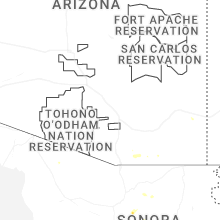
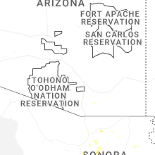


Connect with Interactive Hail Maps