

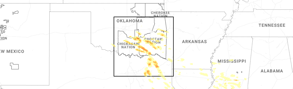
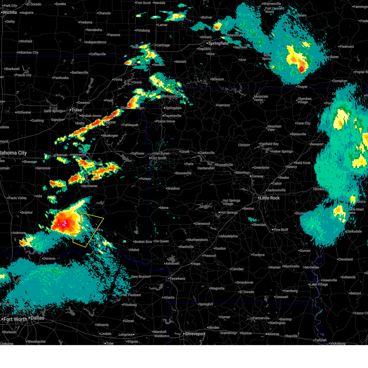
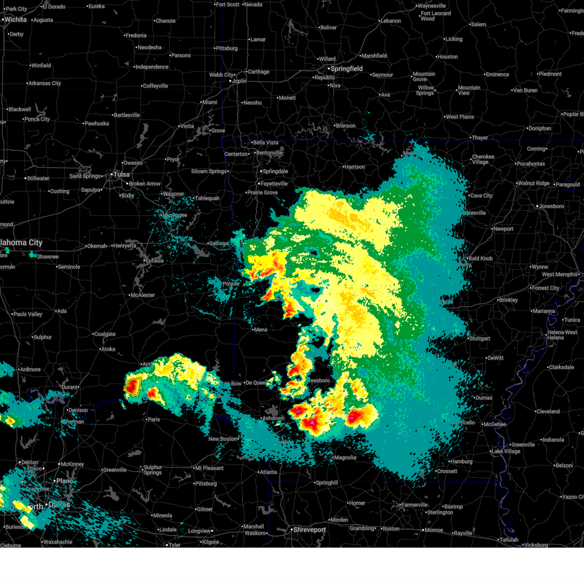
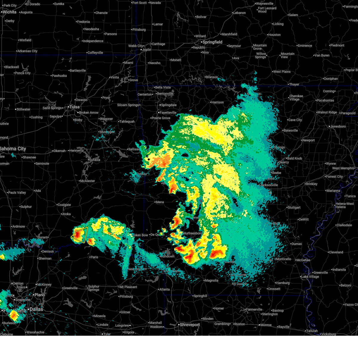
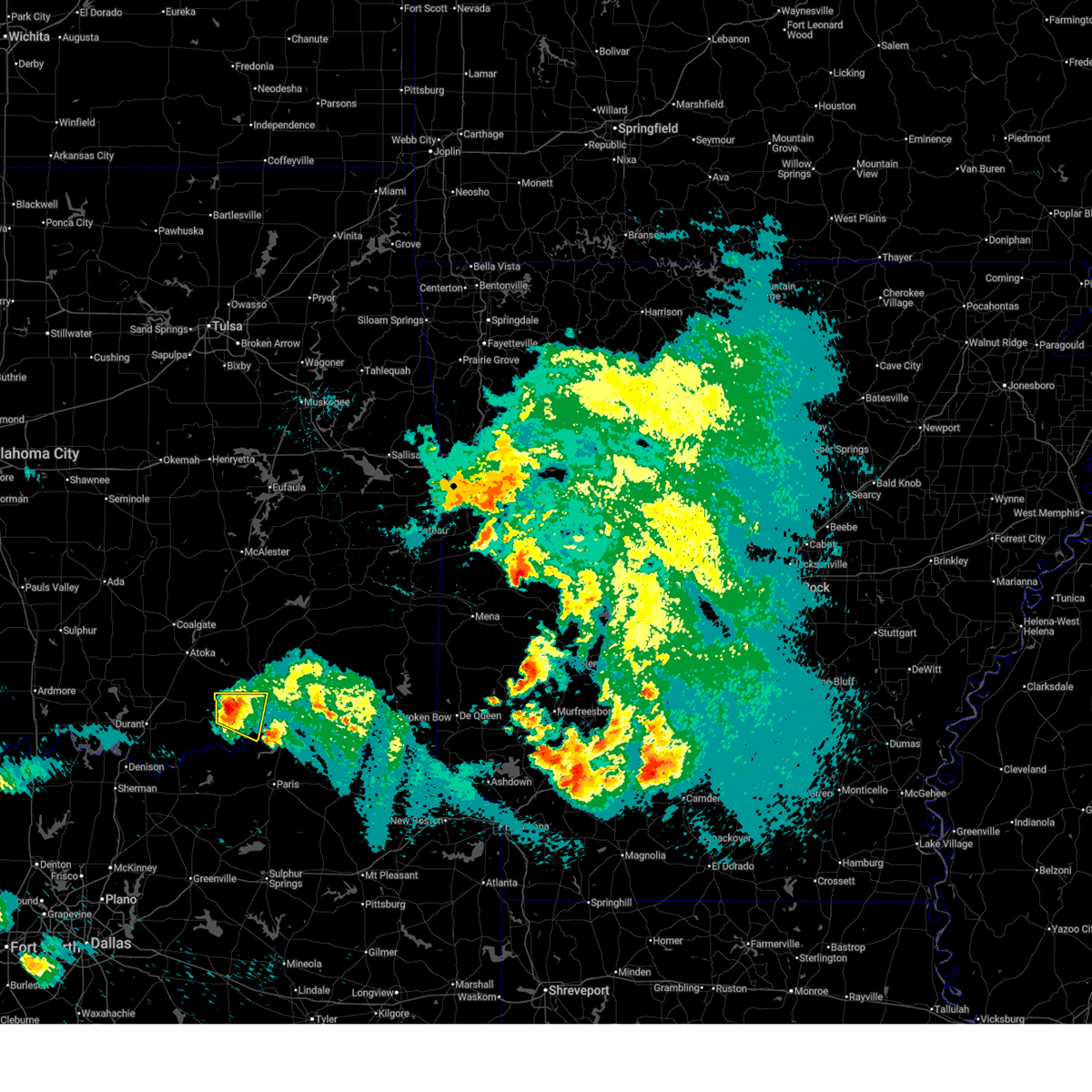
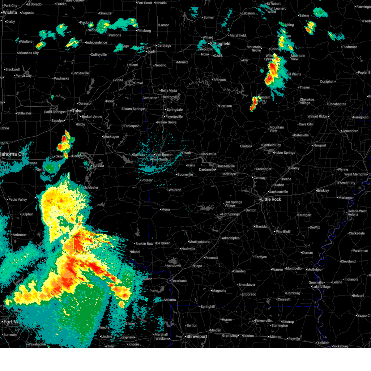
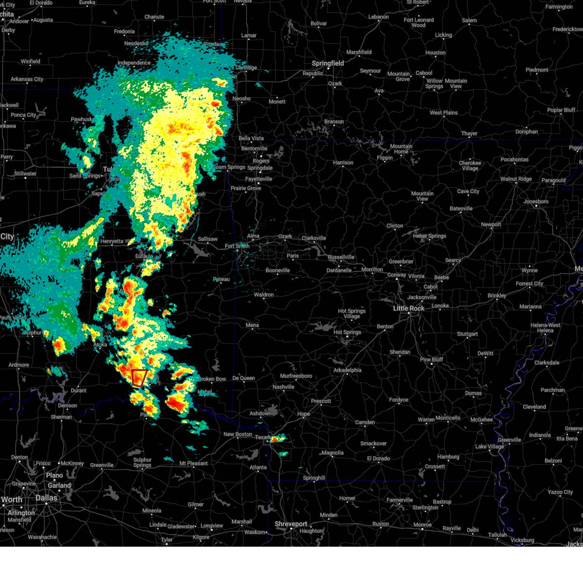
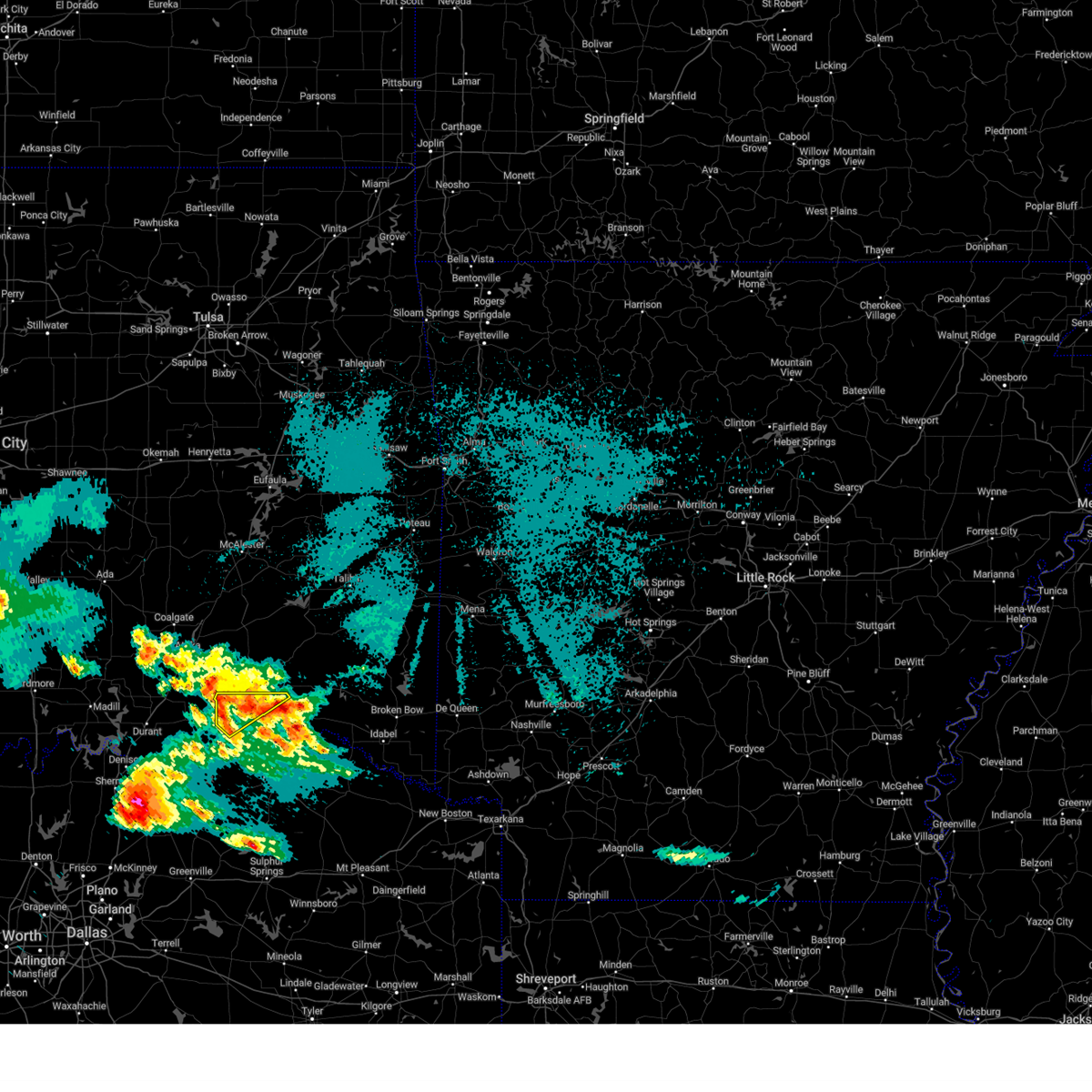
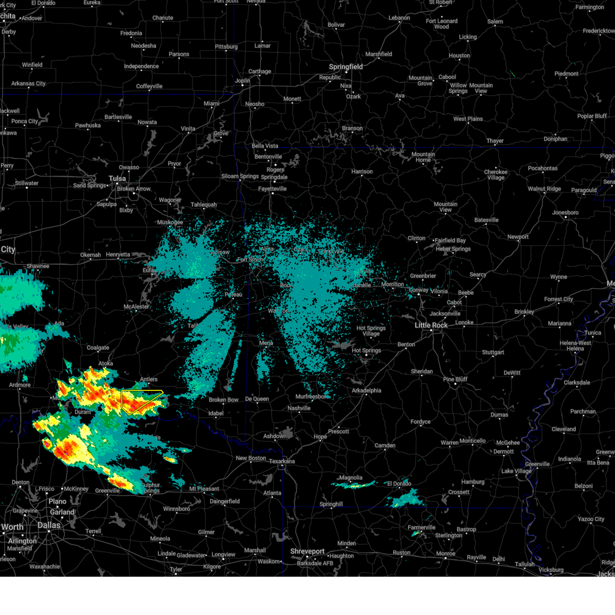
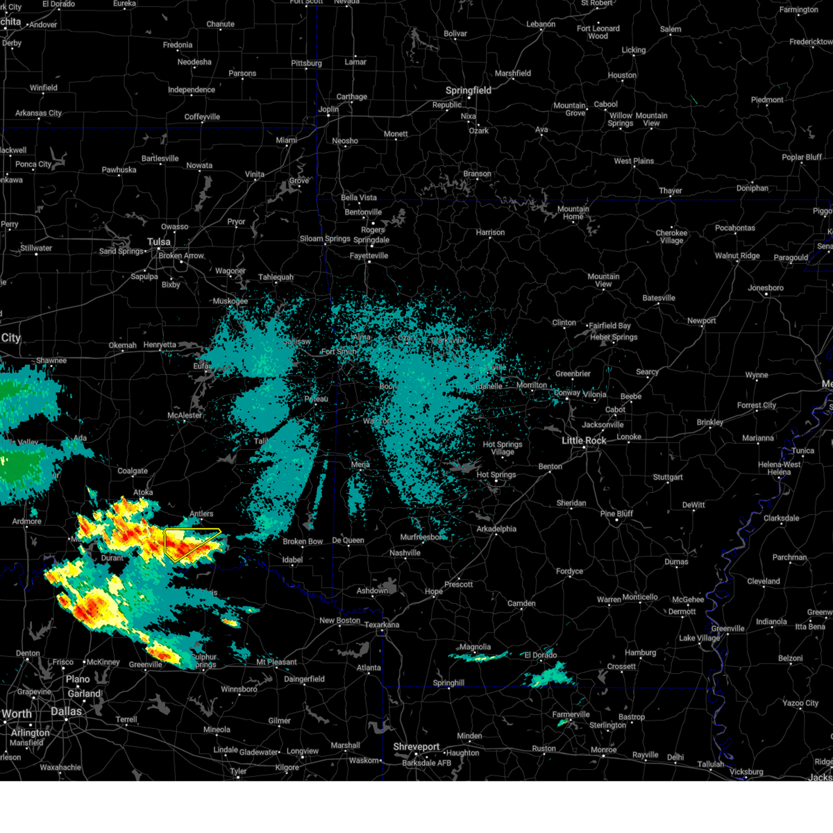
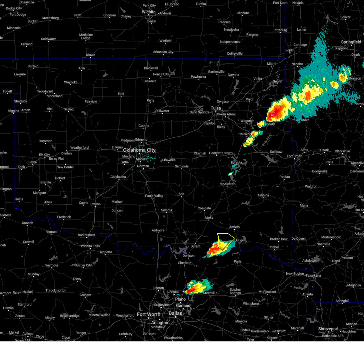
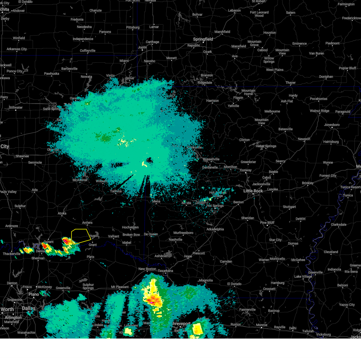
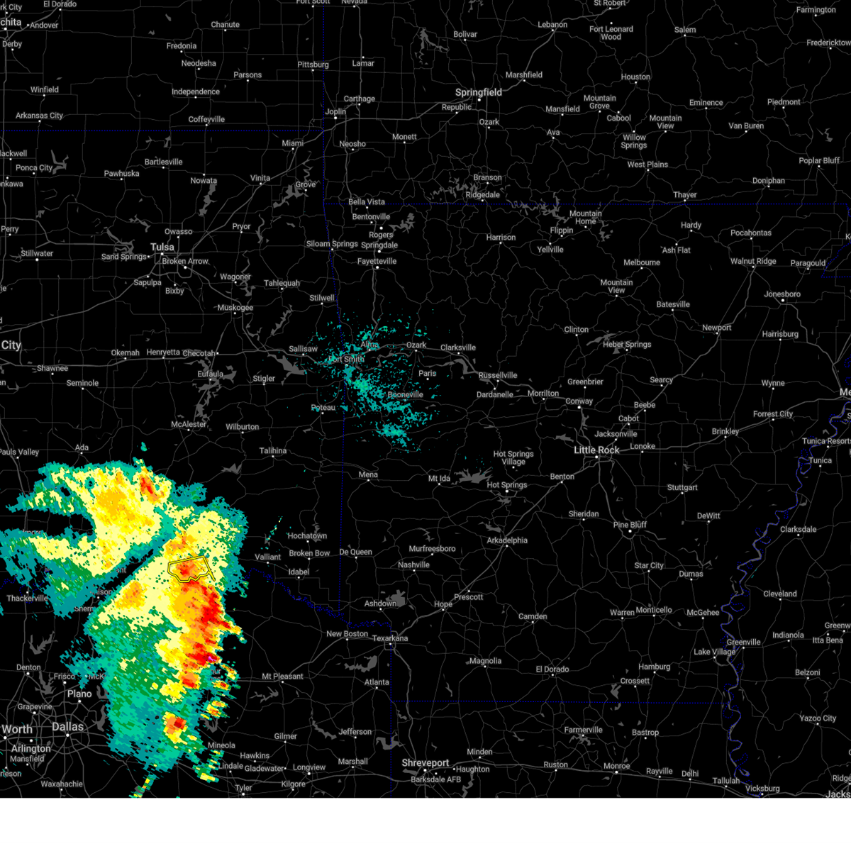
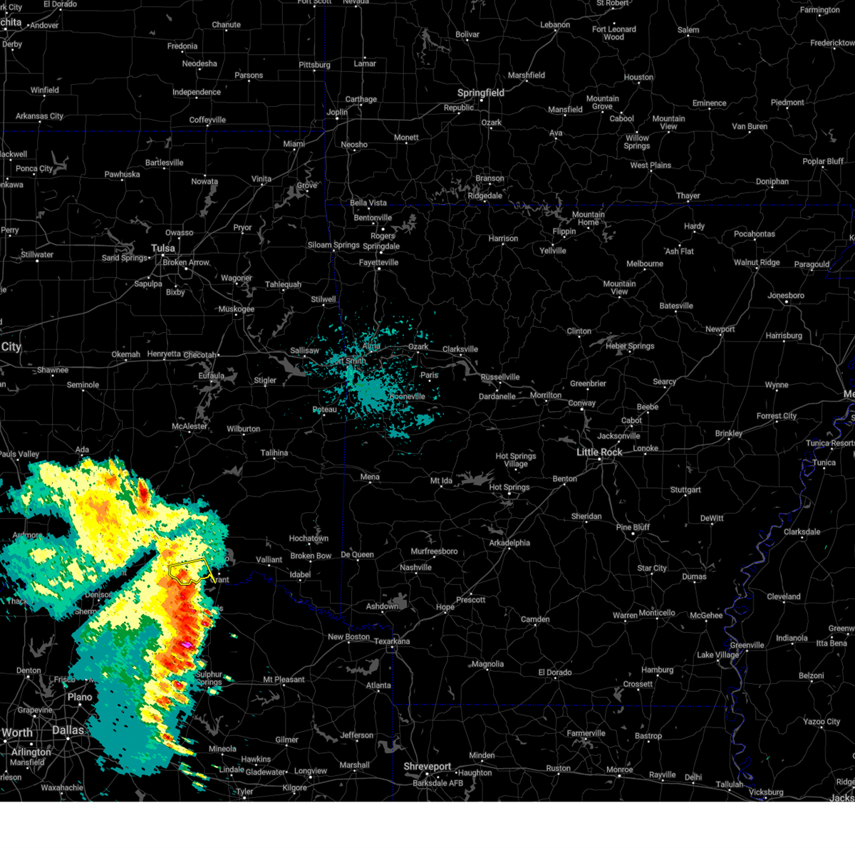
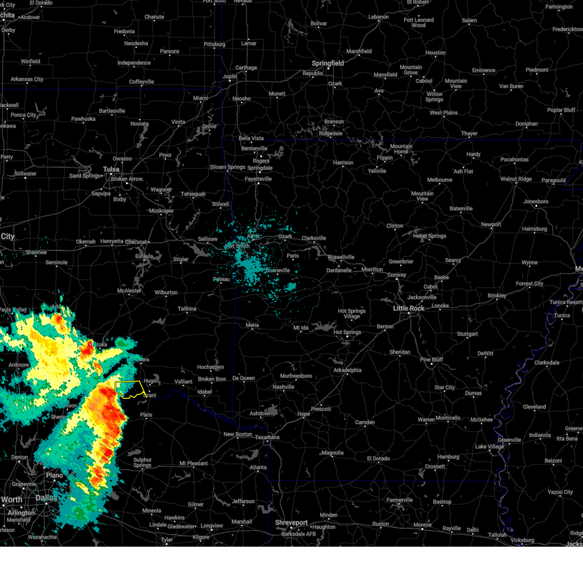
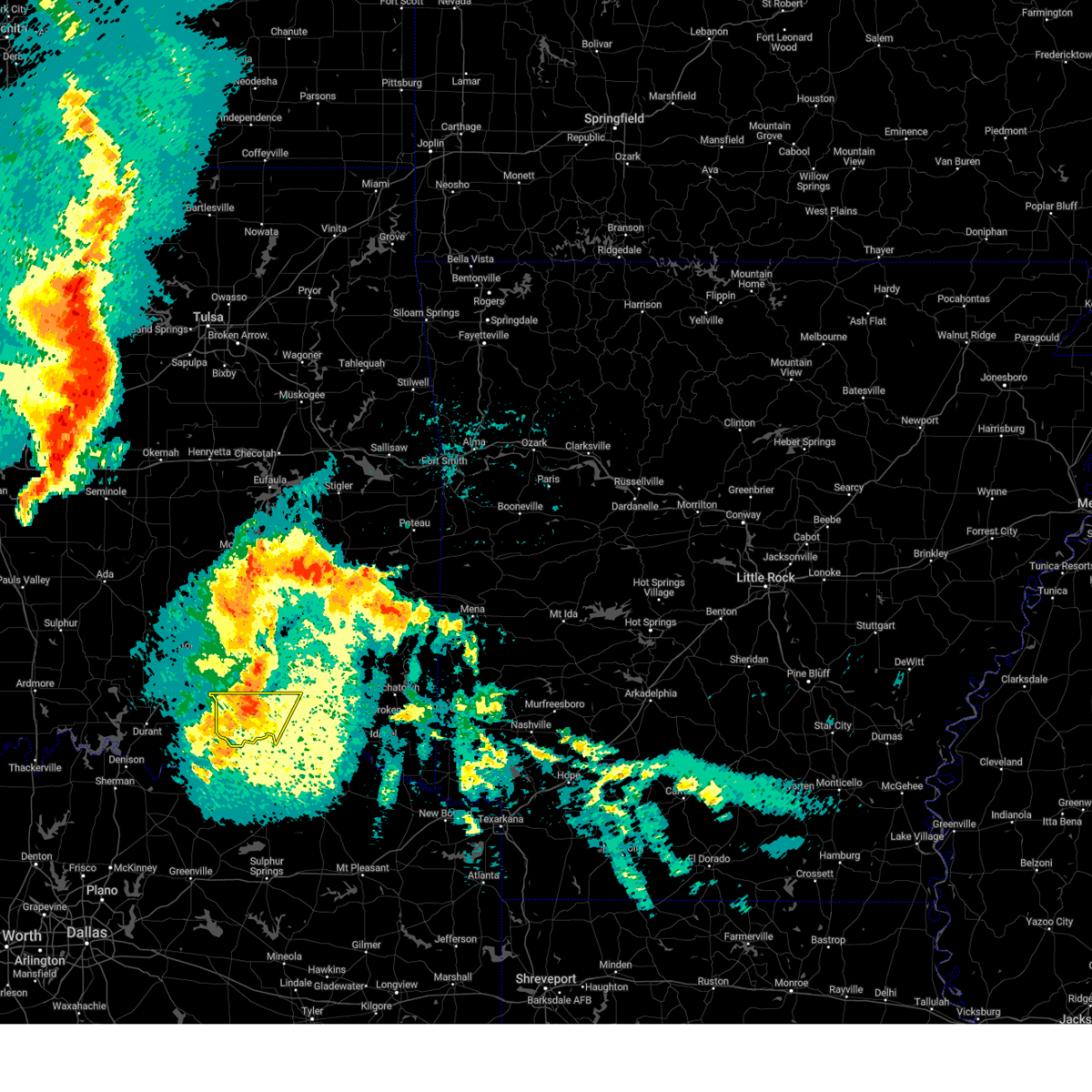
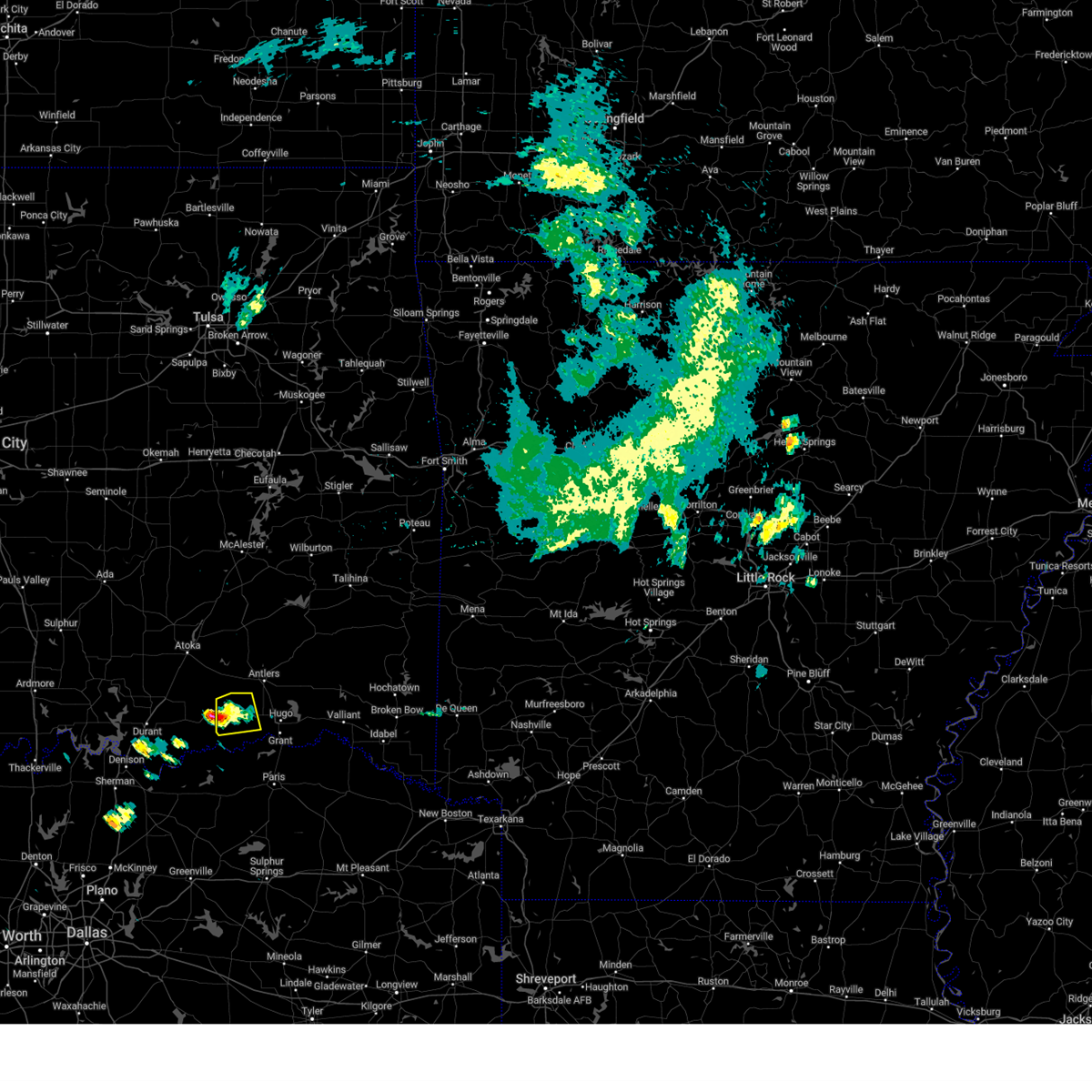
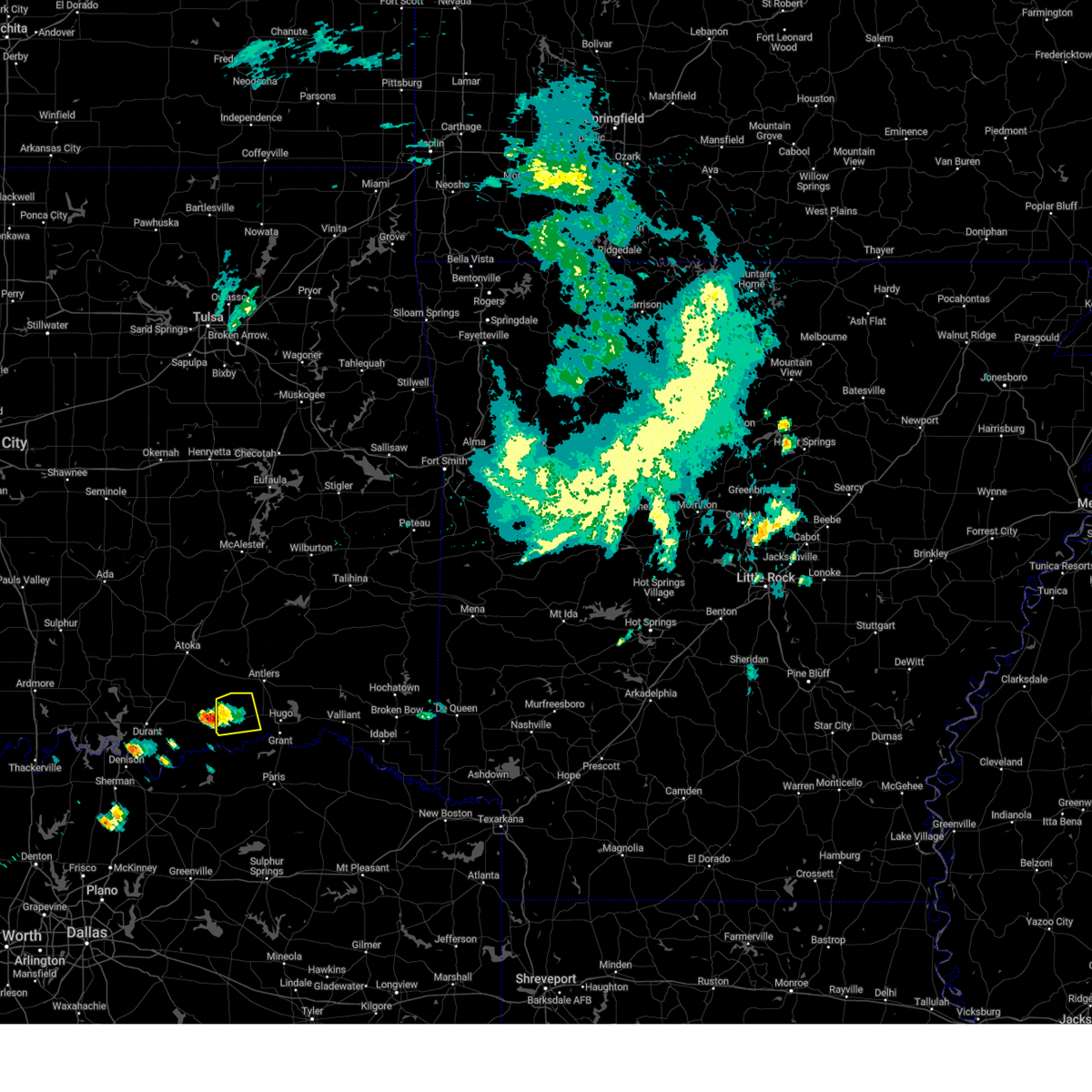
Hail Map for Soper, OK
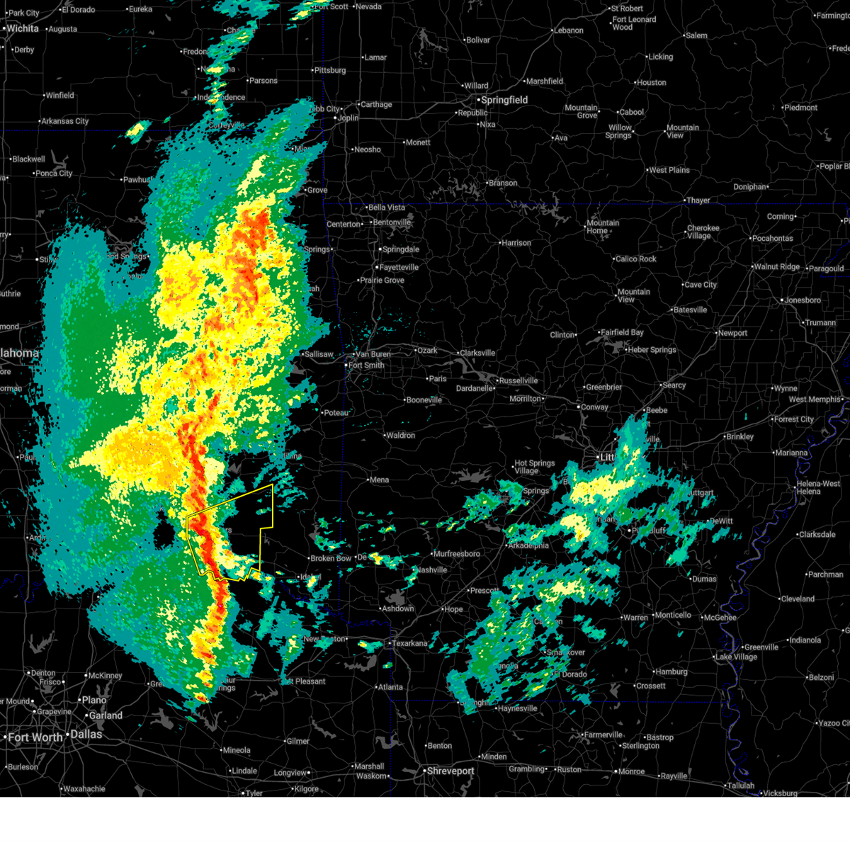
The Soper, OK area has had 5 reports of on-the-ground hail by trained spotters, and has been under severe weather warnings 23 times during the past 12 months. Doppler radar has detected hail at or near Soper, OK on 57 occasions, including 4 occasions during the past year.
| Name: | Soper, OK |
| Where Located: | 34.7 miles SE of Atoka, OK |
| Map: | Google Map for Soper, OK |
| Population: | 261 |
| Housing Units: | 153 |
| More Info: | Search Google for Soper, OK |
5
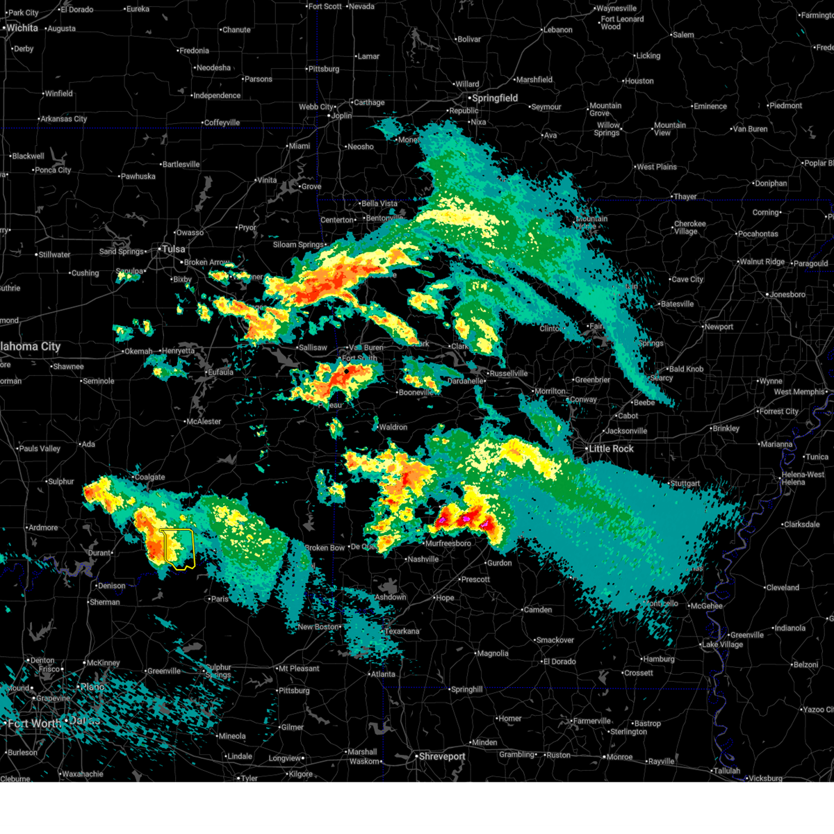
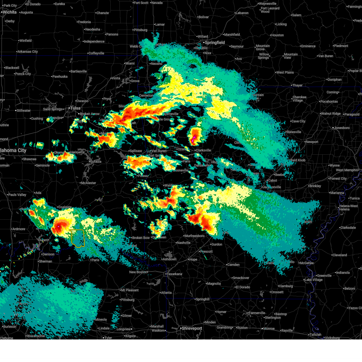
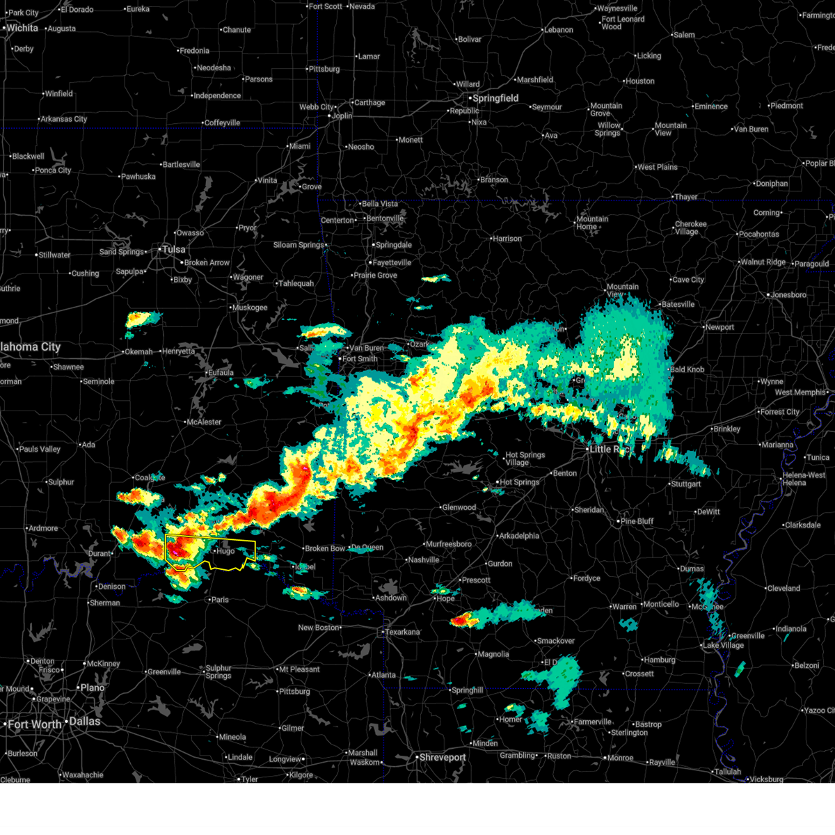
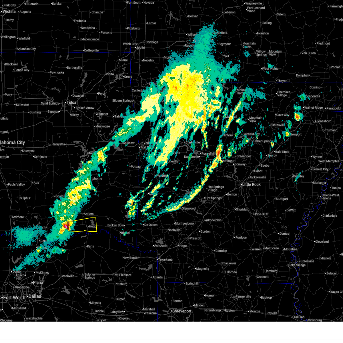
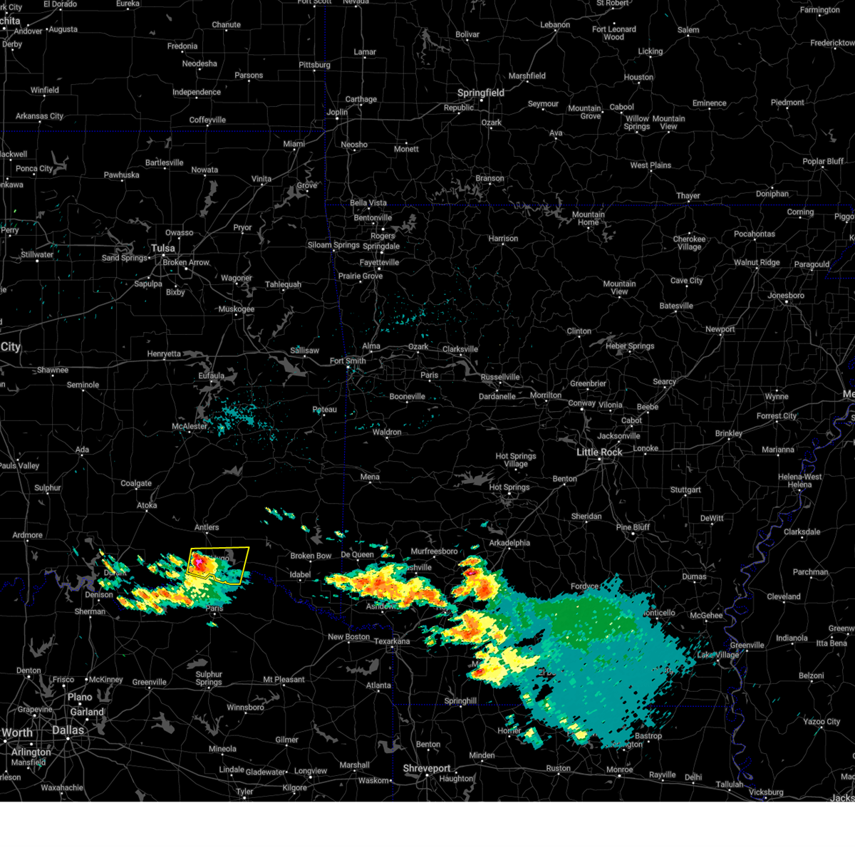
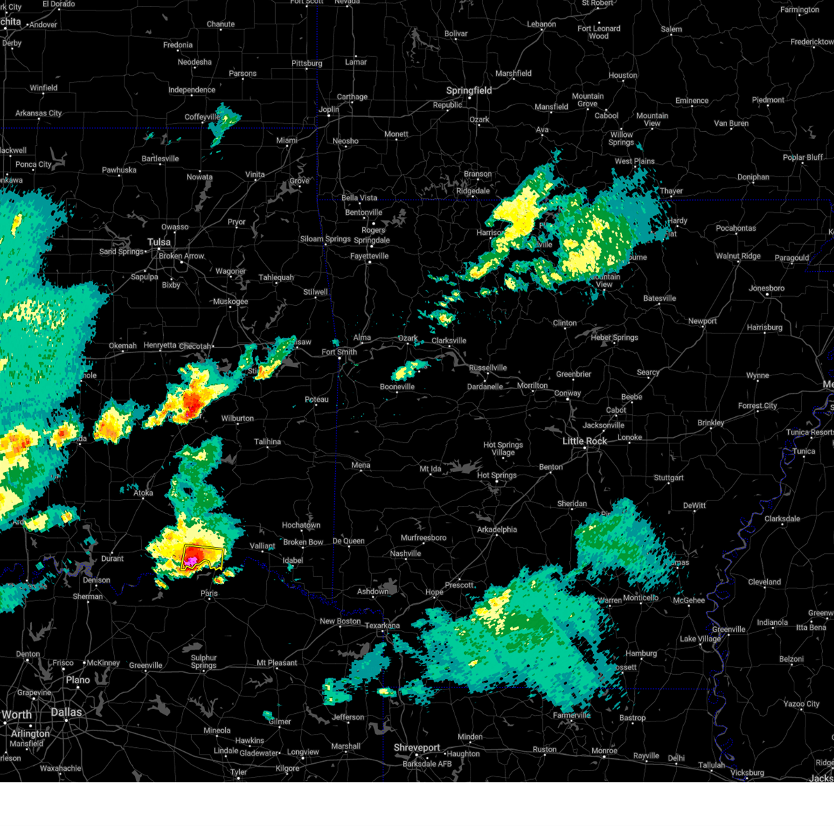
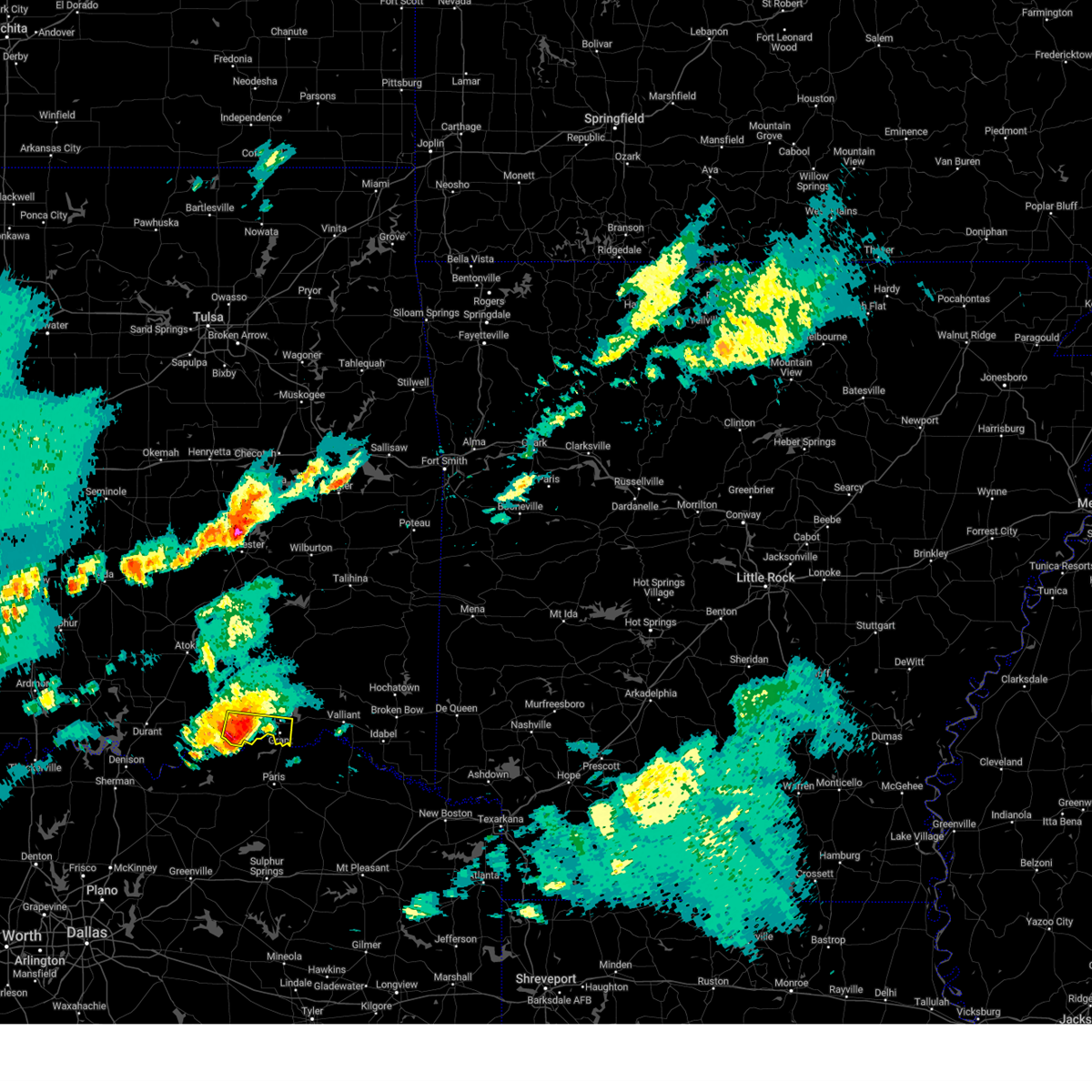
The Top Recent Hail Date for Soper, OK is Friday, April 24, 2026 (3rd out of 57)
Hail and Wind Damage Spotted near Soper, OK
| Date / Time | Report Details |
|---|---|
| 4/28/2026 4:31 PM CDT |
 At 431 pm cdt, a severe thunderstorm was located 5 miles west of kellond, moving east at 35 mph (emergency management). Hazards include golf ball size hail and 70 mph wind gusts. People and animals outdoors will be injured. expect hail damage to roofs, siding, windows, and vehicles. expect considerable tree damage. wind damage is also likely to mobile homes, roofs, and outbuildings. Locations in or near the path include, hugo, antlers, boswell, fort towson, sawyer, rattan, soper, snow, hugo lake state park, kellond, kent, goodland, messer, moyers, kosoma, dunbar, oleta, cloudy, grant, ord,. At 431 pm cdt, a severe thunderstorm was located 5 miles west of kellond, moving east at 35 mph (emergency management). Hazards include golf ball size hail and 70 mph wind gusts. People and animals outdoors will be injured. expect hail damage to roofs, siding, windows, and vehicles. expect considerable tree damage. wind damage is also likely to mobile homes, roofs, and outbuildings. Locations in or near the path include, hugo, antlers, boswell, fort towson, sawyer, rattan, soper, snow, hugo lake state park, kellond, kent, goodland, messer, moyers, kosoma, dunbar, oleta, cloudy, grant, ord,.
|
| 4/28/2026 4:22 PM CDT |
 Svrtsa the national weather service in tulsa has issued a * severe thunderstorm warning for, southern pushmataha county in southeastern oklahoma, choctaw county in southeastern oklahoma, * until 500 pm cdt. * at 422 pm cdt, a severe thunderstorm was located 9 miles east of lane, moving east at 35 mph (radar indicated). Hazards include 70 mph wind gusts and ping pong ball size hail. People and animals outdoors will be injured. expect hail damage to roofs, siding, windows, and vehicles. expect considerable tree damage. wind damage is also likely to mobile homes, roofs, and outbuildings. Locations in or near the path include, hugo, antlers, boswell, fort towson, sawyer, rattan, soper, snow, hugo lake state park, kellond, kent, goodland, messer, moyers, kosoma, dunbar, oleta, cloudy, grant, ord,. Svrtsa the national weather service in tulsa has issued a * severe thunderstorm warning for, southern pushmataha county in southeastern oklahoma, choctaw county in southeastern oklahoma, * until 500 pm cdt. * at 422 pm cdt, a severe thunderstorm was located 9 miles east of lane, moving east at 35 mph (radar indicated). Hazards include 70 mph wind gusts and ping pong ball size hail. People and animals outdoors will be injured. expect hail damage to roofs, siding, windows, and vehicles. expect considerable tree damage. wind damage is also likely to mobile homes, roofs, and outbuildings. Locations in or near the path include, hugo, antlers, boswell, fort towson, sawyer, rattan, soper, snow, hugo lake state park, kellond, kent, goodland, messer, moyers, kosoma, dunbar, oleta, cloudy, grant, ord,.
|
| 4/28/2026 4:13 PM CDT |
 At 413 pm cdt, a severe thunderstorm was located 8 miles east of lane, moving east at 35 to 40 mph (radar indicated). Hazards include 70 mph wind gusts and ping pong ball size hail. People and animals outdoors will be injured. expect hail damage to roofs, siding, windows, and vehicles. expect considerable tree damage. wind damage is also likely to mobile homes, roofs, and outbuildings. Locations in or near the path include, antlers, boswell, soper, kent, snow, moyers, kosoma, kellond, eubanks, darwin, dela, unger, finley,. At 413 pm cdt, a severe thunderstorm was located 8 miles east of lane, moving east at 35 to 40 mph (radar indicated). Hazards include 70 mph wind gusts and ping pong ball size hail. People and animals outdoors will be injured. expect hail damage to roofs, siding, windows, and vehicles. expect considerable tree damage. wind damage is also likely to mobile homes, roofs, and outbuildings. Locations in or near the path include, antlers, boswell, soper, kent, snow, moyers, kosoma, kellond, eubanks, darwin, dela, unger, finley,.
|
| 4/28/2026 4:05 PM CDT |
 Tortsa the national weather service in tulsa has issued a * tornado warning for, southwestern pushmataha county in southeastern oklahoma, northwestern choctaw county in southeastern oklahoma, * until 430 pm cdt. * at 405 pm cdt, a severe thunderstorm capable of producing a tornado was located near lane, moving east at 40 mph (radar indicated rotation). Hazards include tornado and ping pong ball size hail. Flying debris will be dangerous to those caught without shelter. mobile homes will be damaged or destroyed. damage to roofs, windows, and vehicles will occur. tree damage is likely. Locations in or near the path include, antlers, soper, kellond, kent, moyers, darwin,. Tortsa the national weather service in tulsa has issued a * tornado warning for, southwestern pushmataha county in southeastern oklahoma, northwestern choctaw county in southeastern oklahoma, * until 430 pm cdt. * at 405 pm cdt, a severe thunderstorm capable of producing a tornado was located near lane, moving east at 40 mph (radar indicated rotation). Hazards include tornado and ping pong ball size hail. Flying debris will be dangerous to those caught without shelter. mobile homes will be damaged or destroyed. damage to roofs, windows, and vehicles will occur. tree damage is likely. Locations in or near the path include, antlers, soper, kellond, kent, moyers, darwin,.
|
| 4/28/2026 3:51 PM CDT |
 Svrtsa the national weather service in tulsa has issued a * severe thunderstorm warning for, southwestern pushmataha county in southeastern oklahoma, northwestern choctaw county in southeastern oklahoma, * until 430 pm cdt. * at 351 pm cdt, a severe thunderstorm was located 3 miles southeast of atoka, moving east at 40 mph (radar indicated). Hazards include 70 mph wind gusts and ping pong ball size hail. People and animals outdoors will be injured. expect hail damage to roofs, siding, windows, and vehicles. expect considerable tree damage. wind damage is also likely to mobile homes, roofs, and outbuildings. Locations in or near the path include, antlers, boswell, soper, kent, snow, moyers, kosoma, kellond, eubanks, darwin, dela, unger, finley,. Svrtsa the national weather service in tulsa has issued a * severe thunderstorm warning for, southwestern pushmataha county in southeastern oklahoma, northwestern choctaw county in southeastern oklahoma, * until 430 pm cdt. * at 351 pm cdt, a severe thunderstorm was located 3 miles southeast of atoka, moving east at 40 mph (radar indicated). Hazards include 70 mph wind gusts and ping pong ball size hail. People and animals outdoors will be injured. expect hail damage to roofs, siding, windows, and vehicles. expect considerable tree damage. wind damage is also likely to mobile homes, roofs, and outbuildings. Locations in or near the path include, antlers, boswell, soper, kent, snow, moyers, kosoma, kellond, eubanks, darwin, dela, unger, finley,.
|
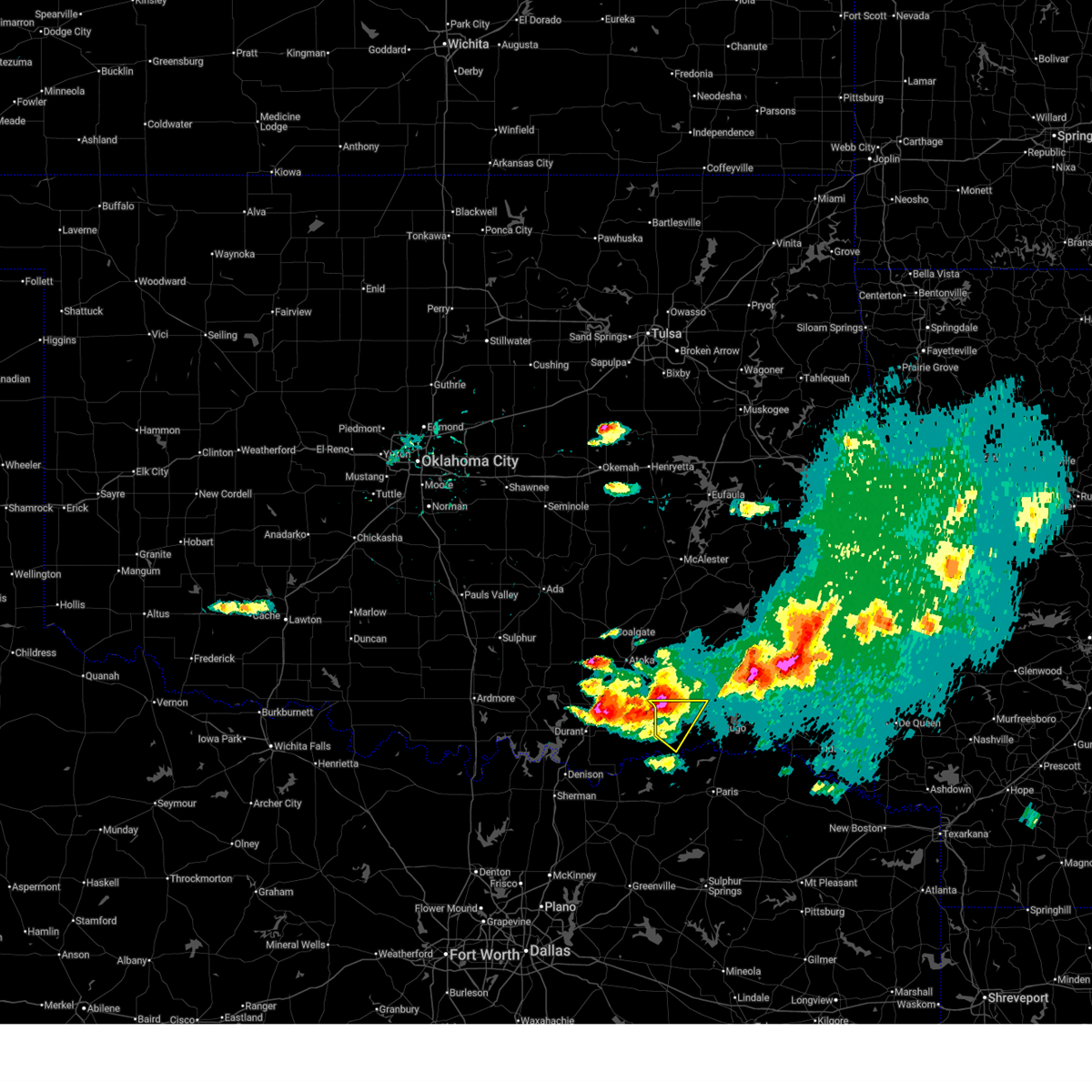
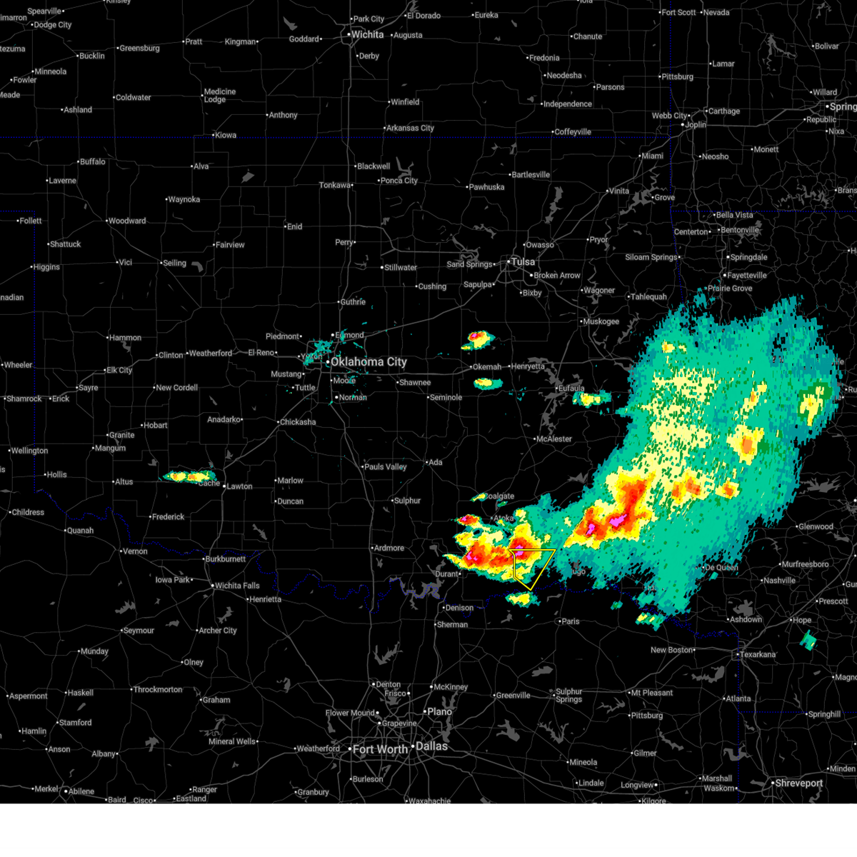
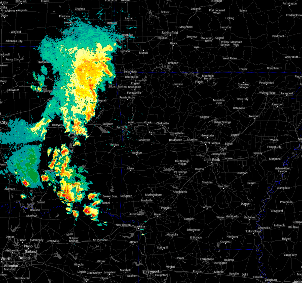
| 4/26/2026 12:11 AM CDT |
 At 1211 am cdt, a severe thunderstorm was located near soper, moving east at 15 mph (radar indicated). Hazards include 60 mph wind gusts and quarter size hail. Hail damage to vehicles is expected. expect wind damage to roofs, siding, and trees. Locations in or near the path include, soper, unger,. At 1211 am cdt, a severe thunderstorm was located near soper, moving east at 15 mph (radar indicated). Hazards include 60 mph wind gusts and quarter size hail. Hail damage to vehicles is expected. expect wind damage to roofs, siding, and trees. Locations in or near the path include, soper, unger,.
|
| 4/25/2026 11:59 PM CDT |
 At 1159 pm cdt, a severe thunderstorm was located 4 miles west of soper, moving southeast at 30 mph (radar indicated). Hazards include 60 mph wind gusts and quarter size hail. Hail damage to vehicles is expected. expect wind damage to roofs, siding, and trees. Locations in or near the path include, boswell, soper, kent, unger,. At 1159 pm cdt, a severe thunderstorm was located 4 miles west of soper, moving southeast at 30 mph (radar indicated). Hazards include 60 mph wind gusts and quarter size hail. Hail damage to vehicles is expected. expect wind damage to roofs, siding, and trees. Locations in or near the path include, boswell, soper, kent, unger,.
|
| 4/25/2026 11:46 PM CDT |
 Svrtsa the national weather service in tulsa has issued a * severe thunderstorm warning for, western choctaw county in southeastern oklahoma, * until 1230 am cdt. * at 1146 pm cdt, a severe thunderstorm was located 4 miles north of boswell, moving east at 15 mph (radar indicated). Hazards include 60 mph wind gusts and half dollar size hail. Hail damage to vehicles is expected. expect wind damage to roofs, siding, and trees. Locations in or near the path include, boswell, soper, kent, unger,. Svrtsa the national weather service in tulsa has issued a * severe thunderstorm warning for, western choctaw county in southeastern oklahoma, * until 1230 am cdt. * at 1146 pm cdt, a severe thunderstorm was located 4 miles north of boswell, moving east at 15 mph (radar indicated). Hazards include 60 mph wind gusts and half dollar size hail. Hail damage to vehicles is expected. expect wind damage to roofs, siding, and trees. Locations in or near the path include, boswell, soper, kent, unger,.
|
| 4/25/2026 10:11 PM CDT |
 At 1011 pm cdt, a severe thunderstorm was located over bennington, moving southeast at 35 mph (radar indicated). Hazards include 60 mph wind gusts and quarter size hail. Hail damage to vehicles is expected. expect wind damage to roofs, siding, and trees. Locations in or near the path include, boswell, soper, unger,. At 1011 pm cdt, a severe thunderstorm was located over bennington, moving southeast at 35 mph (radar indicated). Hazards include 60 mph wind gusts and quarter size hail. Hail damage to vehicles is expected. expect wind damage to roofs, siding, and trees. Locations in or near the path include, boswell, soper, unger,.
|
| 4/25/2026 9:41 PM CDT |
 Svrtsa the national weather service in tulsa has issued a * severe thunderstorm warning for, western choctaw county in southeastern oklahoma, * until 1045 pm cdt. * at 941 pm cdt, a severe thunderstorm was located 4 miles northeast of caddo, moving southeast at 35 mph (radar indicated). Hazards include ping pong ball size hail and 60 mph wind gusts. People and animals outdoors will be injured. expect hail damage to roofs, siding, windows, and vehicles. expect wind damage to roofs, siding, and trees. Locations in or near the path include, boswell, soper, unger,. Svrtsa the national weather service in tulsa has issued a * severe thunderstorm warning for, western choctaw county in southeastern oklahoma, * until 1045 pm cdt. * at 941 pm cdt, a severe thunderstorm was located 4 miles northeast of caddo, moving southeast at 35 mph (radar indicated). Hazards include ping pong ball size hail and 60 mph wind gusts. People and animals outdoors will be injured. expect hail damage to roofs, siding, windows, and vehicles. expect wind damage to roofs, siding, and trees. Locations in or near the path include, boswell, soper, unger,.
|
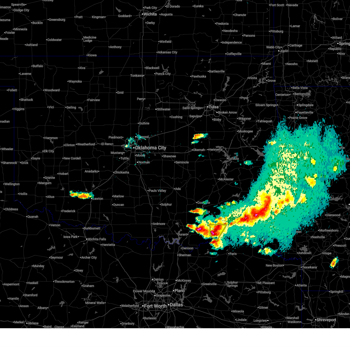
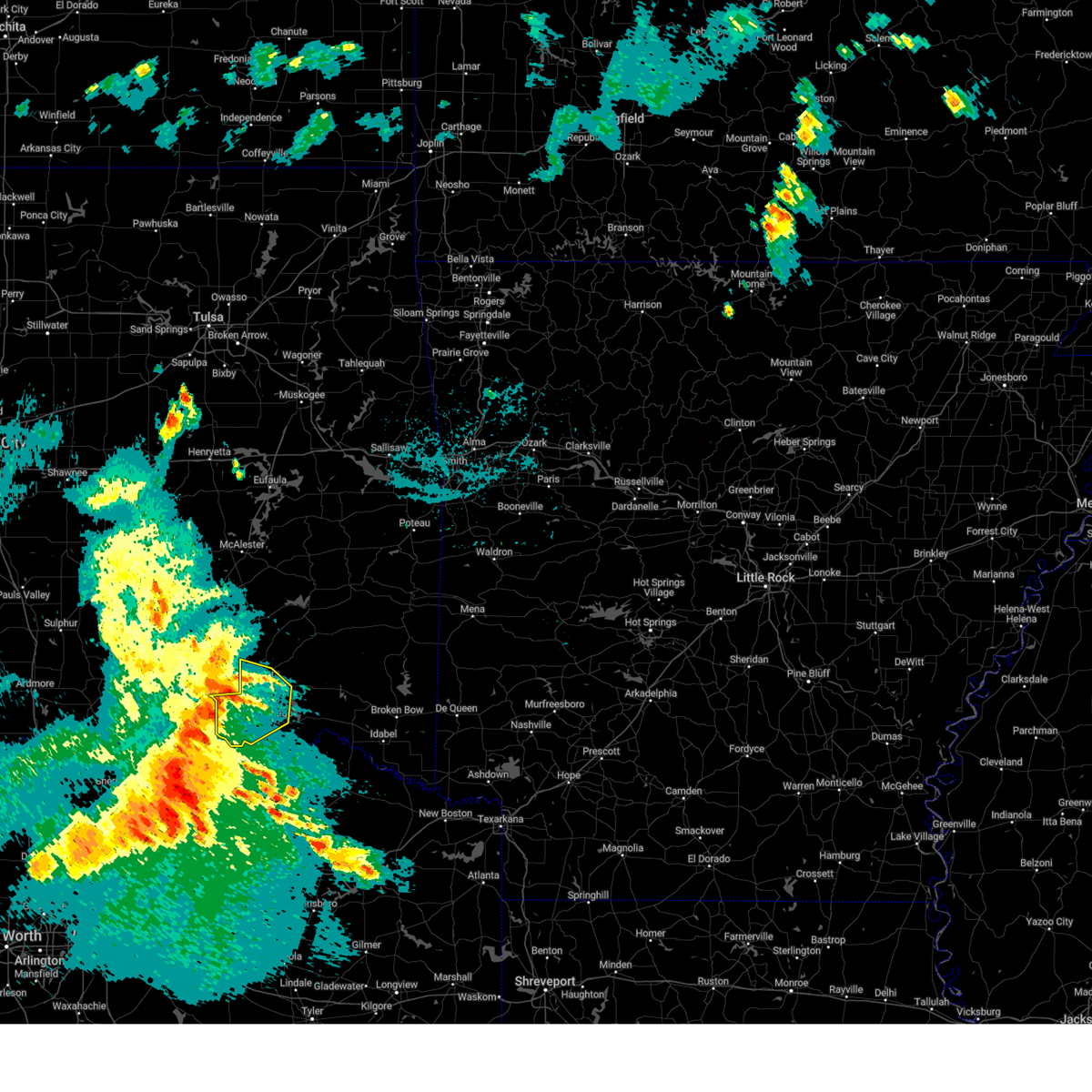
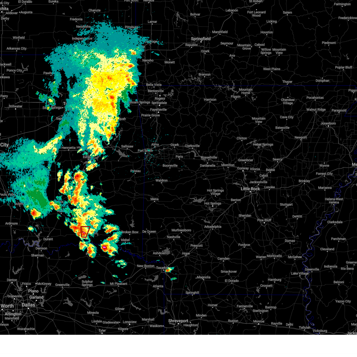
| 4/24/2026 7:30 PM CDT | Quarter sized hail reported 0.3 miles NE of Soper, OK, time estimated from radar. |
| 4/24/2026 7:30 PM CDT |
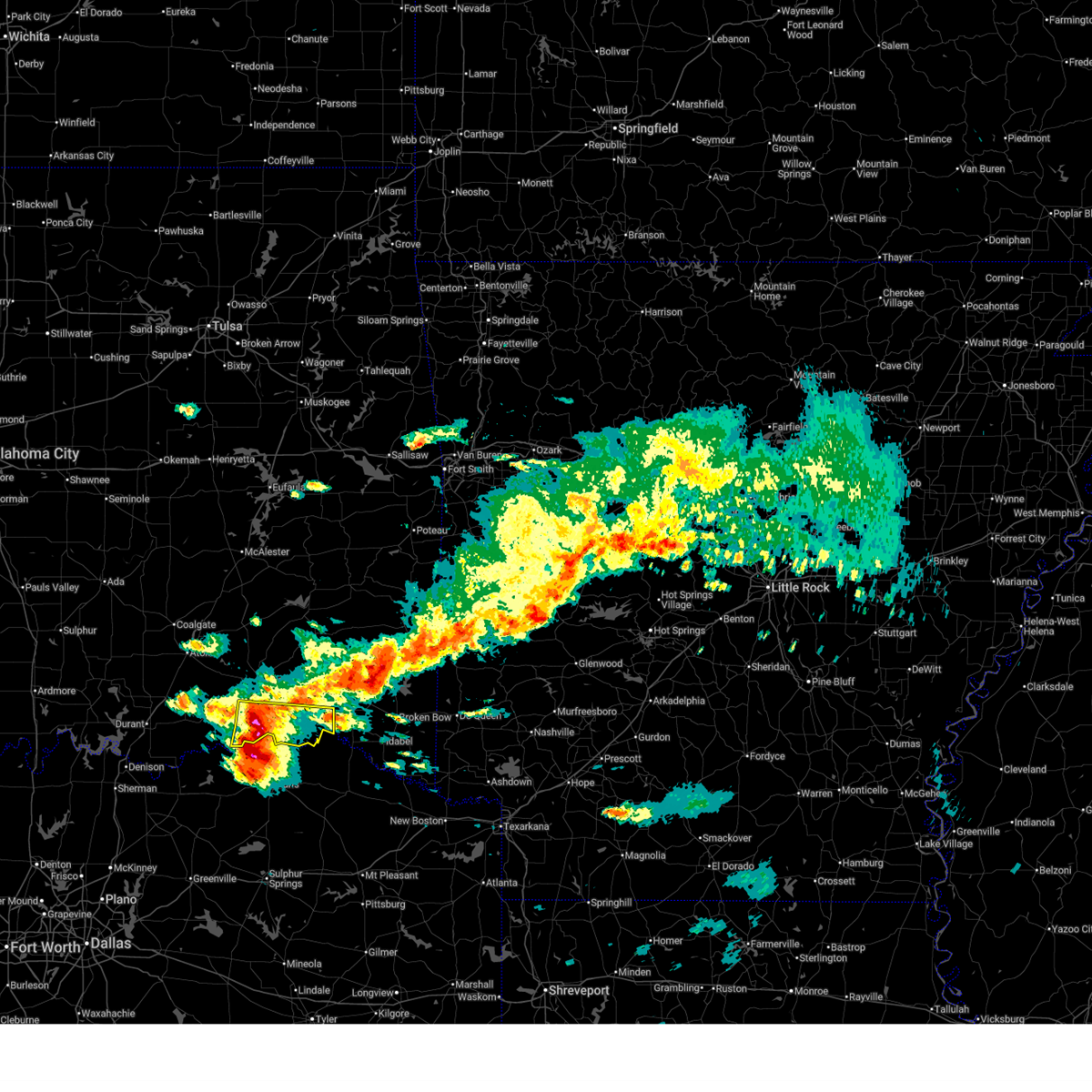 At 730 pm cdt, a severe thunderstorm was located 3 miles southeast of soper, moving east at 35 mph (radar indicated). Hazards include two inch hail and 60 mph wind gusts. People and animals outdoors will be injured. expect hail damage to roofs, siding, windows, and vehicles. expect wind damage to roofs, siding, and trees. Locations in or near the path include, hugo, fort towson, sawyer, soper, goodland, messer, hugo lake state park, raymond gary state park, grant, ord, fallon, swink, frogville, unger, huskey, gay,. At 730 pm cdt, a severe thunderstorm was located 3 miles southeast of soper, moving east at 35 mph (radar indicated). Hazards include two inch hail and 60 mph wind gusts. People and animals outdoors will be injured. expect hail damage to roofs, siding, windows, and vehicles. expect wind damage to roofs, siding, and trees. Locations in or near the path include, hugo, fort towson, sawyer, soper, goodland, messer, hugo lake state park, raymond gary state park, grant, ord, fallon, swink, frogville, unger, huskey, gay,.
|
| 4/24/2026 7:16 PM CDT |
 Svrtsa the national weather service in tulsa has issued a * severe thunderstorm warning for, choctaw county in southeastern oklahoma, * until 800 pm cdt. * at 715 pm cdt, a severe thunderstorm was located 5 miles southwest of soper, moving east at 40 mph (radar indicated). Hazards include golf ball size hail and 60 mph wind gusts. People and animals outdoors will be injured. expect hail damage to roofs, siding, windows, and vehicles. expect wind damage to roofs, siding, and trees. Locations in or near the path include, hugo, boswell, fort towson, sawyer, soper, goodland, messer, hugo lake state park, raymond gary state park, grant, ord, fallon, swink, frogville, unger, huskey, gay,. Svrtsa the national weather service in tulsa has issued a * severe thunderstorm warning for, choctaw county in southeastern oklahoma, * until 800 pm cdt. * at 715 pm cdt, a severe thunderstorm was located 5 miles southwest of soper, moving east at 40 mph (radar indicated). Hazards include golf ball size hail and 60 mph wind gusts. People and animals outdoors will be injured. expect hail damage to roofs, siding, windows, and vehicles. expect wind damage to roofs, siding, and trees. Locations in or near the path include, hugo, boswell, fort towson, sawyer, soper, goodland, messer, hugo lake state park, raymond gary state park, grant, ord, fallon, swink, frogville, unger, huskey, gay,.
|
| 4/24/2026 7:11 PM CDT |
 At 710 pm cdt, a severe thunderstorm was located over boswell, moving northeast at 15 mph (radar indicated). Hazards include golf ball size hail and 60 mph wind gusts. People and animals outdoors will be injured. expect hail damage to roofs, siding, windows, and vehicles. expect wind damage to roofs, siding, and trees. Locations in or near the path include, boswell, soper, unger,. At 710 pm cdt, a severe thunderstorm was located over boswell, moving northeast at 15 mph (radar indicated). Hazards include golf ball size hail and 60 mph wind gusts. People and animals outdoors will be injured. expect hail damage to roofs, siding, windows, and vehicles. expect wind damage to roofs, siding, and trees. Locations in or near the path include, boswell, soper, unger,.
|
| 4/24/2026 6:59 PM CDT |
 the severe thunderstorm warning has been cancelled and is no longer in effect the severe thunderstorm warning has been cancelled and is no longer in effect
|
| 4/24/2026 6:59 PM CDT |
 At 658 pm cdt, a severe thunderstorm was located 6 miles north of boswell, moving southeast at 30 mph (radar indicated). Hazards include two inch hail and 70 mph wind gusts. People and animals outdoors will be injured. expect hail damage to roofs, siding, windows, and vehicles. expect considerable tree damage. wind damage is also likely to mobile homes, roofs, and outbuildings. Locations in or near the path include, boswell, soper, unger,. At 658 pm cdt, a severe thunderstorm was located 6 miles north of boswell, moving southeast at 30 mph (radar indicated). Hazards include two inch hail and 70 mph wind gusts. People and animals outdoors will be injured. expect hail damage to roofs, siding, windows, and vehicles. expect considerable tree damage. wind damage is also likely to mobile homes, roofs, and outbuildings. Locations in or near the path include, boswell, soper, unger,.
|
| 4/24/2026 6:47 PM CDT |
 At 647 pm cdt, a severe thunderstorm was located 9 miles northwest of boswell, moving southeast at 30 mph (radar indicated). Hazards include two inch hail and 70 mph wind gusts. People and animals outdoors will be injured. expect hail damage to roofs, siding, windows, and vehicles. expect considerable tree damage. wind damage is also likely to mobile homes, roofs, and outbuildings. Locations in or near the path include, boswell, soper, kent, darwin, unger,. At 647 pm cdt, a severe thunderstorm was located 9 miles northwest of boswell, moving southeast at 30 mph (radar indicated). Hazards include two inch hail and 70 mph wind gusts. People and animals outdoors will be injured. expect hail damage to roofs, siding, windows, and vehicles. expect considerable tree damage. wind damage is also likely to mobile homes, roofs, and outbuildings. Locations in or near the path include, boswell, soper, kent, darwin, unger,.
|
| 4/24/2026 6:27 PM CDT |
 Svrtsa the national weather service in tulsa has issued a * severe thunderstorm warning for, southwestern pushmataha county in southeastern oklahoma, western choctaw county in southeastern oklahoma, * until 730 pm cdt. * at 627 pm cdt, a severe thunderstorm was located 5 miles east of caney, moving southeast at 30 mph (radar indicated). Hazards include two inch hail and 70 mph wind gusts. People and animals outdoors will be injured. expect hail damage to roofs, siding, windows, and vehicles. expect considerable tree damage. wind damage is also likely to mobile homes, roofs, and outbuildings. Locations in or near the path include, boswell, soper, kent, darwin, unger,. Svrtsa the national weather service in tulsa has issued a * severe thunderstorm warning for, southwestern pushmataha county in southeastern oklahoma, western choctaw county in southeastern oklahoma, * until 730 pm cdt. * at 627 pm cdt, a severe thunderstorm was located 5 miles east of caney, moving southeast at 30 mph (radar indicated). Hazards include two inch hail and 70 mph wind gusts. People and animals outdoors will be injured. expect hail damage to roofs, siding, windows, and vehicles. expect considerable tree damage. wind damage is also likely to mobile homes, roofs, and outbuildings. Locations in or near the path include, boswell, soper, kent, darwin, unger,.
|
| 4/18/2026 4:58 AM CDT |
 At 458 am cdt, a severe thunderstorm was located over soper, moving east at 45 mph (radar indicated). Hazards include 60 mph wind gusts and quarter size hail. Hail damage to vehicles is expected. expect wind damage to roofs, siding, and trees. Locations in or near the path include, hugo, sawyer, soper, kent, goodland, messer, hugo lake state park, grant, fallon, apple, speer, unger, gay,. At 458 am cdt, a severe thunderstorm was located over soper, moving east at 45 mph (radar indicated). Hazards include 60 mph wind gusts and quarter size hail. Hail damage to vehicles is expected. expect wind damage to roofs, siding, and trees. Locations in or near the path include, hugo, sawyer, soper, kent, goodland, messer, hugo lake state park, grant, fallon, apple, speer, unger, gay,.
|
| 4/18/2026 4:42 AM CDT |
 Svrtsa the national weather service in tulsa has issued a * severe thunderstorm warning for, choctaw county in southeastern oklahoma, * until 530 am cdt. * at 442 am cdt, a severe thunderstorm was located 4 miles west of boswell, moving east at 45 mph (radar indicated). Hazards include 60 mph wind gusts and half dollar size hail. Hail damage to vehicles is expected. expect wind damage to roofs, siding, and trees. Locations in or near the path include, hugo, boswell, sawyer, soper, kent, goodland, messer, hugo lake state park, grant, fallon, apple, speer, unger, gay,. Svrtsa the national weather service in tulsa has issued a * severe thunderstorm warning for, choctaw county in southeastern oklahoma, * until 530 am cdt. * at 442 am cdt, a severe thunderstorm was located 4 miles west of boswell, moving east at 45 mph (radar indicated). Hazards include 60 mph wind gusts and half dollar size hail. Hail damage to vehicles is expected. expect wind damage to roofs, siding, and trees. Locations in or near the path include, hugo, boswell, sawyer, soper, kent, goodland, messer, hugo lake state park, grant, fallon, apple, speer, unger, gay,.
|
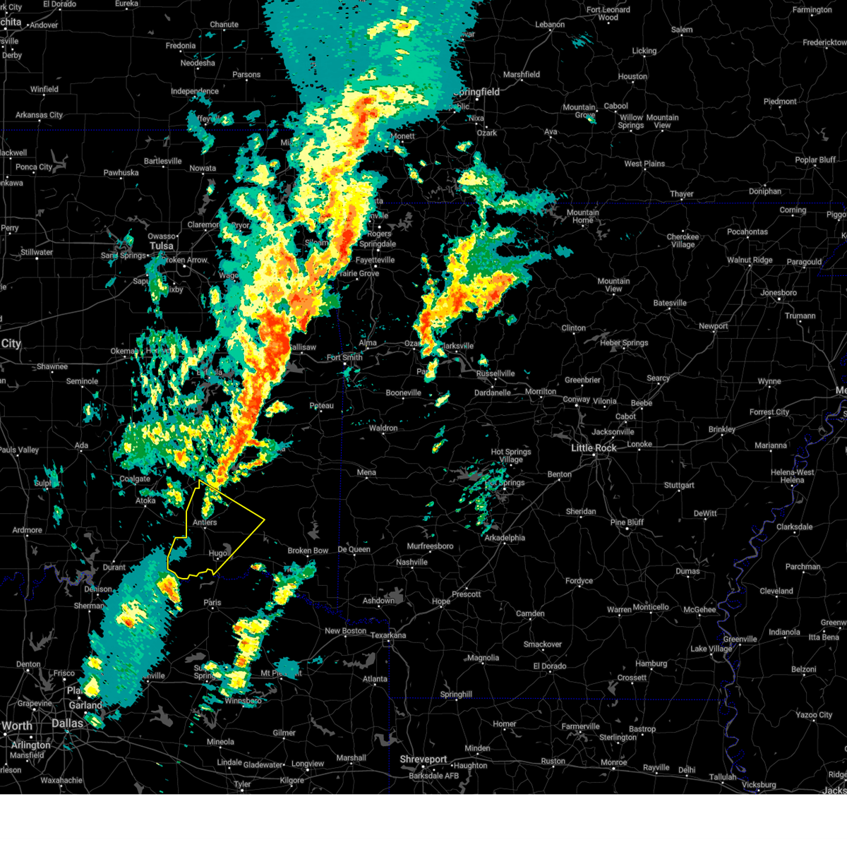
| 3/10/2026 11:47 PM CDT |
 Svrtsa the national weather service in tulsa has issued a * severe thunderstorm warning for, southern pushmataha county in southeastern oklahoma, choctaw county in southeastern oklahoma, * until 1230 am cdt. * at 1146 pm cdt, severe thunderstorms were located along a line extending from 5 miles west of kellond to arthur city, moving northeast at 45 mph (radar indicated). Hazards include 60 mph wind gusts and penny size hail. Expect damage to roofs, siding, and trees. Locations in or near the path include, ord, snow, rattan, fallon, sobol, sawyer, frogville, hugo lake state park, darwin, kellond, grant, corinne, kent, soper, swink, goodland, messer, apple, speer, moyers,. Svrtsa the national weather service in tulsa has issued a * severe thunderstorm warning for, southern pushmataha county in southeastern oklahoma, choctaw county in southeastern oklahoma, * until 1230 am cdt. * at 1146 pm cdt, severe thunderstorms were located along a line extending from 5 miles west of kellond to arthur city, moving northeast at 45 mph (radar indicated). Hazards include 60 mph wind gusts and penny size hail. Expect damage to roofs, siding, and trees. Locations in or near the path include, ord, snow, rattan, fallon, sobol, sawyer, frogville, hugo lake state park, darwin, kellond, grant, corinne, kent, soper, swink, goodland, messer, apple, speer, moyers,.
|
| 9/23/2025 11:11 PM CDT | The storm which prompted the warning has weakened below severe limits, and no longer poses an immediate threat to life or property. therefore, the warning will be allowed to expire. a severe thunderstorm watch remains in effect until midnight cdt for southeastern oklahoma. |
| 9/23/2025 10:37 PM CDT | At 1037 pm cdt, a severe thunderstorm was located 3 miles southwest of soper, moving east at 50 mph (radar indicated). Hazards include 60 mph wind gusts and quarter size hail. Hail damage to vehicles is expected. expect wind damage to roofs, siding, and trees. Locations in or near the path include, ord, grant, kent, soper, boswell, fallon, goodland, sawyer, frogville, messer, hugo lake state park, apple, speer, hugo, unger, gay,. |
| 9/23/2025 10:12 PM CDT | Svrtsa the national weather service in tulsa has issued a * severe thunderstorm warning for, choctaw county in southeastern oklahoma, * until 1115 pm cdt. * at 1012 pm cdt, a severe thunderstorm was located 3 miles southeast of bennington, moving east at 40 mph (radar indicated). Hazards include 60 mph wind gusts and half dollar size hail. Hail damage to vehicles is expected. expect wind damage to roofs, siding, and trees. Locations in or near the path include, ord, grant, kent, soper, boswell, fallon, goodland, sawyer, frogville, messer, hugo lake state park, apple, speer, hugo, unger, gay,. |
| 6/8/2025 11:07 PM CDT |
 At 1106 pm cdt, a severe thunderstorm was located 5 miles east of arthur city, moving southeast at 50 mph (radar indicated). Hazards include 60 mph wind gusts. Expect damage to roofs, siding, and trees. Locations in or near the path include, ord, grant, kent, soper, fallon, goodland, sawyer, frogville, messer, hugo, huskey, unger, gay, boswell,. At 1106 pm cdt, a severe thunderstorm was located 5 miles east of arthur city, moving southeast at 50 mph (radar indicated). Hazards include 60 mph wind gusts. Expect damage to roofs, siding, and trees. Locations in or near the path include, ord, grant, kent, soper, fallon, goodland, sawyer, frogville, messer, hugo, huskey, unger, gay, boswell,.
|
| 6/8/2025 11:07 PM CDT |
 the severe thunderstorm warning has been cancelled and is no longer in effect the severe thunderstorm warning has been cancelled and is no longer in effect
|
| 6/8/2025 10:44 PM CDT |
 Svrtsa the national weather service in tulsa has issued a * severe thunderstorm warning for, southwestern pushmataha county in southeastern oklahoma, choctaw county in southeastern oklahoma, * until 1130 pm cdt. * at 1044 pm cdt, a severe thunderstorm was located over kent, moving southeast at 50 mph (radar indicated). Hazards include 60 mph wind gusts. Expect damage to roofs, siding, and trees. Locations in or near the path include, ord, grant, kent, soper, boswell, fallon, goodland, sawyer, frogville, messer, hugo lake state park, speer, dela, hugo, huskey, unger, gay,. Svrtsa the national weather service in tulsa has issued a * severe thunderstorm warning for, southwestern pushmataha county in southeastern oklahoma, choctaw county in southeastern oklahoma, * until 1130 pm cdt. * at 1044 pm cdt, a severe thunderstorm was located over kent, moving southeast at 50 mph (radar indicated). Hazards include 60 mph wind gusts. Expect damage to roofs, siding, and trees. Locations in or near the path include, ord, grant, kent, soper, boswell, fallon, goodland, sawyer, frogville, messer, hugo lake state park, speer, dela, hugo, huskey, unger, gay,.
|
| 6/8/2025 10:30 PM CDT |
 At 1030 pm cdt, a severe thunderstorm was located near kent, moving southeast at 40 mph (radar indicated). Hazards include 60 mph wind gusts and penny size hail. Expect damage to roofs, siding, and trees. Locations in or near the path include, darwin, speer, kent, soper, boswell, hugo, unger, goodland, gay, messer, antlers,. At 1030 pm cdt, a severe thunderstorm was located near kent, moving southeast at 40 mph (radar indicated). Hazards include 60 mph wind gusts and penny size hail. Expect damage to roofs, siding, and trees. Locations in or near the path include, darwin, speer, kent, soper, boswell, hugo, unger, goodland, gay, messer, antlers,.
|
| 6/8/2025 10:09 PM CDT |
 At 1008 pm cdt, a severe thunderstorm was located 9 miles west of kellond, moving southeast at 40 mph (radar indicated). Hazards include 60 mph wind gusts and penny size hail. Expect damage to roofs, siding, and trees. Locations in or near the path include, kent, soper, boswell, goodland, messer, darwin, speer, dela, hugo, kellond, unger, antlers, gay,. At 1008 pm cdt, a severe thunderstorm was located 9 miles west of kellond, moving southeast at 40 mph (radar indicated). Hazards include 60 mph wind gusts and penny size hail. Expect damage to roofs, siding, and trees. Locations in or near the path include, kent, soper, boswell, goodland, messer, darwin, speer, dela, hugo, kellond, unger, antlers, gay,.
|
| 6/8/2025 9:56 PM CDT |
 Svrtsa the national weather service in tulsa has issued a * severe thunderstorm warning for, southwestern pushmataha county in southeastern oklahoma, choctaw county in southeastern oklahoma, * until 1045 pm cdt. * at 954 pm cdt, a severe thunderstorm was located 4 miles southeast of lane, moving southeast at 40 mph (radar indicated). Hazards include 60 mph wind gusts and penny size hail. Expect damage to roofs, siding, and trees. Locations in or near the path include, eubanks, kent, soper, boswell, rattan, goodland, messer, darwin, apple, speer, moyers, dela, hugo, kosoma, kellond, unger, finley, oleta, antlers, gay,. Svrtsa the national weather service in tulsa has issued a * severe thunderstorm warning for, southwestern pushmataha county in southeastern oklahoma, choctaw county in southeastern oklahoma, * until 1045 pm cdt. * at 954 pm cdt, a severe thunderstorm was located 4 miles southeast of lane, moving southeast at 40 mph (radar indicated). Hazards include 60 mph wind gusts and penny size hail. Expect damage to roofs, siding, and trees. Locations in or near the path include, eubanks, kent, soper, boswell, rattan, goodland, messer, darwin, apple, speer, moyers, dela, hugo, kosoma, kellond, unger, finley, oleta, antlers, gay,.
|
| 6/8/2025 4:17 AM CDT |
 At 416 am cdt, a severe thunderstorm was located 4 miles northwest of goodland, moving east at 30 mph (radar indicated). Hazards include ping pong ball size hail and 60 mph wind gusts. People and animals outdoors will be injured. expect hail damage to roofs, siding, windows, and vehicles. expect wind damage to roofs, siding, and trees. Locations in or near the path include, ord, grant, hugo lake state park, speer, kent, soper, fallon, hugo, goodland, sawyer, gay, messer,. At 416 am cdt, a severe thunderstorm was located 4 miles northwest of goodland, moving east at 30 mph (radar indicated). Hazards include ping pong ball size hail and 60 mph wind gusts. People and animals outdoors will be injured. expect hail damage to roofs, siding, windows, and vehicles. expect wind damage to roofs, siding, and trees. Locations in or near the path include, ord, grant, hugo lake state park, speer, kent, soper, fallon, hugo, goodland, sawyer, gay, messer,.
|
| 6/8/2025 4:08 AM CDT |
 Svrtsa the national weather service in tulsa has issued a * severe thunderstorm warning for, central choctaw county in southeastern oklahoma, * until 500 am cdt. * at 407 am cdt, a severe thunderstorm was located over soper, moving east at 30 mph (radar indicated). Hazards include 60 mph wind gusts and half dollar size hail. Hail damage to vehicles is expected. expect wind damage to roofs, siding, and trees. Locations in or near the path include, ord, grant, kent, soper, fallon, goodland, sawyer, messer, hugo lake state park, speer, hugo, gay, apple,. Svrtsa the national weather service in tulsa has issued a * severe thunderstorm warning for, central choctaw county in southeastern oklahoma, * until 500 am cdt. * at 407 am cdt, a severe thunderstorm was located over soper, moving east at 30 mph (radar indicated). Hazards include 60 mph wind gusts and half dollar size hail. Hail damage to vehicles is expected. expect wind damage to roofs, siding, and trees. Locations in or near the path include, ord, grant, kent, soper, fallon, goodland, sawyer, messer, hugo lake state park, speer, hugo, gay, apple,.
|
| 4/30/2025 11:09 AM CDT |
 The tornadic thunderstorm which prompted the warning has weakened. therefore, the warning will be allowed to expire. a tornado watch remains in effect until 500 pm cdt for southeastern oklahoma. The tornadic thunderstorm which prompted the warning has weakened. therefore, the warning will be allowed to expire. a tornado watch remains in effect until 500 pm cdt for southeastern oklahoma.
|
| 4/30/2025 11:08 AM CDT |
 Svrtsa the national weather service in tulsa has issued a * severe thunderstorm warning for, western pushmataha county in southeastern oklahoma, choctaw county in southeastern oklahoma, * until noon cdt. * at 1108 am cdt, severe thunderstorms were located along a line extending from 10 miles west of kellond to 9 miles west of pat mayse lake, moving north at 35 mph (radar indicated). Hazards include 60 mph wind gusts. Expect damage to roofs, siding, and trees. Locations in or near the path include, ord, snow, rattan, fallon, sawyer, hugo lake state park, darwin, stanley, kellond, unger, eubanks, grant, kent, soper, goodland, messer, apple, speer, moyers, dela,. Svrtsa the national weather service in tulsa has issued a * severe thunderstorm warning for, western pushmataha county in southeastern oklahoma, choctaw county in southeastern oklahoma, * until noon cdt. * at 1108 am cdt, severe thunderstorms were located along a line extending from 10 miles west of kellond to 9 miles west of pat mayse lake, moving north at 35 mph (radar indicated). Hazards include 60 mph wind gusts. Expect damage to roofs, siding, and trees. Locations in or near the path include, ord, snow, rattan, fallon, sawyer, hugo lake state park, darwin, stanley, kellond, unger, eubanks, grant, kent, soper, goodland, messer, apple, speer, moyers, dela,.
|
| 4/30/2025 11:03 AM CDT |
 At 1103 am cdt, a severe thunderstorm capable of producing a tornado was located 8 miles west of pat mayse lake, moving northeast at 30 mph (radar indicated rotation). Hazards include tornado. Flying debris will be dangerous to those caught without shelter. mobile homes will be damaged or destroyed. damage to roofs, windows, and vehicles will occur. tree damage is likely. Locations in or near the path include, ord, grant, goodland, soper, gay,. At 1103 am cdt, a severe thunderstorm capable of producing a tornado was located 8 miles west of pat mayse lake, moving northeast at 30 mph (radar indicated rotation). Hazards include tornado. Flying debris will be dangerous to those caught without shelter. mobile homes will be damaged or destroyed. damage to roofs, windows, and vehicles will occur. tree damage is likely. Locations in or near the path include, ord, grant, goodland, soper, gay,.
|
| 4/30/2025 10:53 AM CDT |
 Tortsa the national weather service in tulsa has issued a * tornado warning for, southwestern choctaw county in southeastern oklahoma, * until 1115 am cdt. * at 1053 am cdt, a severe thunderstorm capable of producing a tornado was located 9 miles northwest of sumner, moving northeast at 30 mph (radar indicated rotation). Hazards include tornado. Flying debris will be dangerous to those caught without shelter. mobile homes will be damaged or destroyed. damage to roofs, windows, and vehicles will occur. tree damage is likely. Locations in or near the path include, ord, grant, goodland, soper, gay,. Tortsa the national weather service in tulsa has issued a * tornado warning for, southwestern choctaw county in southeastern oklahoma, * until 1115 am cdt. * at 1053 am cdt, a severe thunderstorm capable of producing a tornado was located 9 miles northwest of sumner, moving northeast at 30 mph (radar indicated rotation). Hazards include tornado. Flying debris will be dangerous to those caught without shelter. mobile homes will be damaged or destroyed. damage to roofs, windows, and vehicles will occur. tree damage is likely. Locations in or near the path include, ord, grant, goodland, soper, gay,.
|
| 4/26/2025 4:02 PM CDT |
 At 402 pm cdt, a severe thunderstorm capable of producing a tornado was located 3 miles northeast of soper, moving north at 20 mph (radar indicated rotation). Hazards include tornado. Flying debris will be dangerous to those caught without shelter. mobile homes will be damaged or destroyed. damage to roofs, windows, and vehicles will occur. tree damage is likely. Locations in or near the path include, soper, kent,. At 402 pm cdt, a severe thunderstorm capable of producing a tornado was located 3 miles northeast of soper, moving north at 20 mph (radar indicated rotation). Hazards include tornado. Flying debris will be dangerous to those caught without shelter. mobile homes will be damaged or destroyed. damage to roofs, windows, and vehicles will occur. tree damage is likely. Locations in or near the path include, soper, kent,.
|
| 4/26/2025 4:01 PM CDT |
 At 401 pm cdt, a severe thunderstorm was located 6 miles west of kent, moving north at 20 mph (radar indicated). Hazards include 60 mph wind gusts and quarter size hail. Hail damage to vehicles is expected. expect wind damage to roofs, siding, and trees. Locations in or near the path include, darwin, speer, kent, soper, dela, kellond, antlers,. At 401 pm cdt, a severe thunderstorm was located 6 miles west of kent, moving north at 20 mph (radar indicated). Hazards include 60 mph wind gusts and quarter size hail. Hail damage to vehicles is expected. expect wind damage to roofs, siding, and trees. Locations in or near the path include, darwin, speer, kent, soper, dela, kellond, antlers,.
|
| 4/26/2025 3:51 PM CDT |
 Tortsa the national weather service in tulsa has issued a * tornado warning for, north central choctaw county in southeastern oklahoma, * until 415 pm cdt. * at 351 pm cdt, a severe thunderstorm capable of producing a tornado was located over soper, moving north at 20 mph (radar indicated rotation). Hazards include tornado and quarter size hail. Flying debris will be dangerous to those caught without shelter. mobile homes will be damaged or destroyed. damage to roofs, windows, and vehicles will occur. tree damage is likely. Locations in or near the path include, soper, kent,. Tortsa the national weather service in tulsa has issued a * tornado warning for, north central choctaw county in southeastern oklahoma, * until 415 pm cdt. * at 351 pm cdt, a severe thunderstorm capable of producing a tornado was located over soper, moving north at 20 mph (radar indicated rotation). Hazards include tornado and quarter size hail. Flying debris will be dangerous to those caught without shelter. mobile homes will be damaged or destroyed. damage to roofs, windows, and vehicles will occur. tree damage is likely. Locations in or near the path include, soper, kent,.
|
| 4/26/2025 3:43 PM CDT |
 Svrtsa the national weather service in tulsa has issued a * severe thunderstorm warning for, southwestern pushmataha county in southeastern oklahoma, northwestern choctaw county in southeastern oklahoma, * until 415 pm cdt. * at 342 pm cdt, a cluster severe thunderstorms were located 3 miles northwest of soper, moving north at 20 mph (radar indicated). Hazards include 60 mph wind gusts and quarter size hail. Hail damage to vehicles is expected. expect wind damage to roofs, siding, and trees. Locations in or near the path include, darwin, speer, kent, soper, boswell, dela, kellond, unger, antlers, gay,. Svrtsa the national weather service in tulsa has issued a * severe thunderstorm warning for, southwestern pushmataha county in southeastern oklahoma, northwestern choctaw county in southeastern oklahoma, * until 415 pm cdt. * at 342 pm cdt, a cluster severe thunderstorms were located 3 miles northwest of soper, moving north at 20 mph (radar indicated). Hazards include 60 mph wind gusts and quarter size hail. Hail damage to vehicles is expected. expect wind damage to roofs, siding, and trees. Locations in or near the path include, darwin, speer, kent, soper, boswell, dela, kellond, unger, antlers, gay,.
|
| 3/4/2025 6:45 AM CST |
 Svrtsa the national weather service in tulsa has issued a * severe thunderstorm warning for, choctaw county in southeastern oklahoma, * until 730 am cst. * at 645 am cst, severe thunderstorms were located along a line extending from 4 miles north of kent to 5 miles north of pat mayse lake, moving east at 50 mph (radar indicated). Hazards include 60 mph wind gusts. Expect damage to roofs, siding, and trees. Locations in or near the path include, ord, grant, kent, soper, fallon, swink, goodland, sawyer, frogville, messer, hugo lake state park, apple, speer, raymond gary state park, hugo, huskey, fort towson, gay,. Svrtsa the national weather service in tulsa has issued a * severe thunderstorm warning for, choctaw county in southeastern oklahoma, * until 730 am cst. * at 645 am cst, severe thunderstorms were located along a line extending from 4 miles north of kent to 5 miles north of pat mayse lake, moving east at 50 mph (radar indicated). Hazards include 60 mph wind gusts. Expect damage to roofs, siding, and trees. Locations in or near the path include, ord, grant, kent, soper, fallon, swink, goodland, sawyer, frogville, messer, hugo lake state park, apple, speer, raymond gary state park, hugo, huskey, fort towson, gay,.
|
| 11/4/2024 4:26 PM CST |
 Svrtsa the national weather service in tulsa has issued a * severe thunderstorm warning for, southern pushmataha county in southeastern oklahoma, choctaw county in southeastern oklahoma, * until 515 pm cst. * at 426 pm cst, a severe thunderstorm was located 7 miles north of crockett lake, moving northeast at 65 mph (radar indicated). Hazards include 60 mph wind gusts and penny size hail. Expect damage to roofs, siding, and trees. Locations in or near the path include, hugo, antlers, boswell, rattan, soper, snow, hugo lake state park, kellond, kent, goodland, messer, moyers, kosoma, dunbar, oleta, cloudy, grant, darwin, unger, eubanks,. Svrtsa the national weather service in tulsa has issued a * severe thunderstorm warning for, southern pushmataha county in southeastern oklahoma, choctaw county in southeastern oklahoma, * until 515 pm cst. * at 426 pm cst, a severe thunderstorm was located 7 miles north of crockett lake, moving northeast at 65 mph (radar indicated). Hazards include 60 mph wind gusts and penny size hail. Expect damage to roofs, siding, and trees. Locations in or near the path include, hugo, antlers, boswell, rattan, soper, snow, hugo lake state park, kellond, kent, goodland, messer, moyers, kosoma, dunbar, oleta, cloudy, grant, darwin, unger, eubanks,.
|
| 6/26/2024 10:49 AM CDT |
 the severe thunderstorm warning has been cancelled and is no longer in effect the severe thunderstorm warning has been cancelled and is no longer in effect
|
| 6/26/2024 10:49 AM CDT |
 At 1049 am cdt, severe thunderstorms were located along a line extending from 3 miles northwest of soper to 5 miles east of raymond gary state park to 11 miles north of broken bow, moving south at 35 mph (radar indicated). Hazards include 60 mph wind gusts. Expect damage to roofs, siding, and trees. Locations in or near the path include, hugo, boswell, fort towson, sawyer, soper, kent, goodland, messer, hugo lake state park, raymond gary state park, grant, ord, fallon, swink, frogville, apple, speer, huskey, unger, gay,. At 1049 am cdt, severe thunderstorms were located along a line extending from 3 miles northwest of soper to 5 miles east of raymond gary state park to 11 miles north of broken bow, moving south at 35 mph (radar indicated). Hazards include 60 mph wind gusts. Expect damage to roofs, siding, and trees. Locations in or near the path include, hugo, boswell, fort towson, sawyer, soper, kent, goodland, messer, hugo lake state park, raymond gary state park, grant, ord, fallon, swink, frogville, apple, speer, huskey, unger, gay,.
|
| 6/26/2024 10:04 AM CDT |
 Svrtsa the national weather service in tulsa has issued a * severe thunderstorm warning for, southern pushmataha county in southeastern oklahoma, choctaw county in southeastern oklahoma, * until 1100 am cdt. * at 1004 am cdt, severe thunderstorms were located along a line extending from 10 miles east of stringtown to 5 miles north of cloudy to 10 miles south of whitesboro, moving south at 35 mph (radar indicated). Hazards include 60 mph wind gusts. Expect damage to roofs, siding, and trees. Locations in or near the path include, hugo, antlers, boswell, fort towson, sawyer, rattan, soper, snow, hugo lake state park, kellond, kent, goodland, messer, moyers, raymond gary state park, kosoma, oleta, cloudy, grant, ord,. Svrtsa the national weather service in tulsa has issued a * severe thunderstorm warning for, southern pushmataha county in southeastern oklahoma, choctaw county in southeastern oklahoma, * until 1100 am cdt. * at 1004 am cdt, severe thunderstorms were located along a line extending from 10 miles east of stringtown to 5 miles north of cloudy to 10 miles south of whitesboro, moving south at 35 mph (radar indicated). Hazards include 60 mph wind gusts. Expect damage to roofs, siding, and trees. Locations in or near the path include, hugo, antlers, boswell, fort towson, sawyer, rattan, soper, snow, hugo lake state park, kellond, kent, goodland, messer, moyers, raymond gary state park, kosoma, oleta, cloudy, grant, ord,.
|
| 6/4/2024 4:31 AM CDT |
 At 431 am cdt, severe thunderstorms were located along a line extending from 6 miles north of higgins to 4 miles southwest of clayton lake state park to near kent, moving east at 45 mph (radar indicated). Hazards include 70 mph wind gusts and quarter size hail. Hail damage to vehicles is expected. expect considerable tree damage. wind damage is also likely to mobile homes, roofs, and outbuildings. Locations in or near the path include, hugo, wilburton, antlers, clayton, hartshorne, boswell, red oak, rattan, soper, albion, snow, clayton lake state park, damon, goodland, robbers cave state park, moyers, nashoba, kosoma, dunbar, higgins,. At 431 am cdt, severe thunderstorms were located along a line extending from 6 miles north of higgins to 4 miles southwest of clayton lake state park to near kent, moving east at 45 mph (radar indicated). Hazards include 70 mph wind gusts and quarter size hail. Hail damage to vehicles is expected. expect considerable tree damage. wind damage is also likely to mobile homes, roofs, and outbuildings. Locations in or near the path include, hugo, wilburton, antlers, clayton, hartshorne, boswell, red oak, rattan, soper, albion, snow, clayton lake state park, damon, goodland, robbers cave state park, moyers, nashoba, kosoma, dunbar, higgins,.
|
| 6/4/2024 4:14 AM CDT |
 Svrtsa the national weather service in tulsa has issued a * severe thunderstorm warning for, pushmataha county in southeastern oklahoma, latimer county in southeastern oklahoma, choctaw county in southeastern oklahoma, southeastern pittsburg county in southeastern oklahoma, * until 500 am cdt. * at 414 am cdt, severe thunderstorms were located along a line extending from 5 miles northeast of krebs to 5 miles west of stanley to 6 miles south of lane, moving east at 45 mph (radar indicated). Hazards include 70 mph wind gusts and quarter size hail. Hail damage to vehicles is expected. expect considerable tree damage. wind damage is also likely to mobile homes, roofs, and outbuildings. Locations in or near the path include, hugo, wilburton, antlers, clayton, hartshorne, boswell, red oak, rattan, soper, albion, snow, clayton lake state park, damon, goodland, robbers cave state park, moyers, nashoba, kosoma, dunbar, higgins,. Svrtsa the national weather service in tulsa has issued a * severe thunderstorm warning for, pushmataha county in southeastern oklahoma, latimer county in southeastern oklahoma, choctaw county in southeastern oklahoma, southeastern pittsburg county in southeastern oklahoma, * until 500 am cdt. * at 414 am cdt, severe thunderstorms were located along a line extending from 5 miles northeast of krebs to 5 miles west of stanley to 6 miles south of lane, moving east at 45 mph (radar indicated). Hazards include 70 mph wind gusts and quarter size hail. Hail damage to vehicles is expected. expect considerable tree damage. wind damage is also likely to mobile homes, roofs, and outbuildings. Locations in or near the path include, hugo, wilburton, antlers, clayton, hartshorne, boswell, red oak, rattan, soper, albion, snow, clayton lake state park, damon, goodland, robbers cave state park, moyers, nashoba, kosoma, dunbar, higgins,.
|
| 6/4/2024 4:04 AM CDT |
 At 404 am cdt, severe thunderstorms were located along a line extending from 6 miles east of blanco to 5 miles southwest of daisy to 3 miles southeast of tushka, moving east at 45 mph (radar indicated). Hazards include 70 mph wind gusts and quarter size hail. Hail damage to vehicles is expected. expect considerable tree damage. wind damage is also likely to mobile homes, roofs, and outbuildings. Locations in or near the path include, mcalester, antlers, clayton, kiowa, boswell, savanna, rattan, soper, albion, snow, haywood, tuskahoma, stanley, kiamichi, kellond, clayton lake state park, kent, yanush, mcalester regional airport, moyers,. At 404 am cdt, severe thunderstorms were located along a line extending from 6 miles east of blanco to 5 miles southwest of daisy to 3 miles southeast of tushka, moving east at 45 mph (radar indicated). Hazards include 70 mph wind gusts and quarter size hail. Hail damage to vehicles is expected. expect considerable tree damage. wind damage is also likely to mobile homes, roofs, and outbuildings. Locations in or near the path include, mcalester, antlers, clayton, kiowa, boswell, savanna, rattan, soper, albion, snow, haywood, tuskahoma, stanley, kiamichi, kellond, clayton lake state park, kent, yanush, mcalester regional airport, moyers,.
|
| 6/4/2024 3:36 AM CDT |
 Svrtsa the national weather service in tulsa has issued a * severe thunderstorm warning for, pushmataha county in southeastern oklahoma, southwestern latimer county in southeastern oklahoma, western choctaw county in southeastern oklahoma, southern pittsburg county in southeastern oklahoma, * until 430 am cdt. * at 336 am cdt, severe thunderstorms were located along a line extending from 4 miles southwest of haywood to 5 miles northeast of coalgate to 2 miles south of bromide, moving east to southeast at 45 mph (radar indicated). Hazards include 70 mph wind gusts and quarter size hail. Hail damage to vehicles is expected. expect considerable tree damage. wind damage is also likely to mobile homes, roofs, and outbuildings. Locations in or near the path include, mcalester, antlers, clayton, kiowa, boswell, savanna, rattan, soper, albion, ashland, snow, haywood, tuskahoma, stanley, kiamichi, kellond, clayton lake state park, kent, yanush, mcalester regional airport,. Svrtsa the national weather service in tulsa has issued a * severe thunderstorm warning for, pushmataha county in southeastern oklahoma, southwestern latimer county in southeastern oklahoma, western choctaw county in southeastern oklahoma, southern pittsburg county in southeastern oklahoma, * until 430 am cdt. * at 336 am cdt, severe thunderstorms were located along a line extending from 4 miles southwest of haywood to 5 miles northeast of coalgate to 2 miles south of bromide, moving east to southeast at 45 mph (radar indicated). Hazards include 70 mph wind gusts and quarter size hail. Hail damage to vehicles is expected. expect considerable tree damage. wind damage is also likely to mobile homes, roofs, and outbuildings. Locations in or near the path include, mcalester, antlers, clayton, kiowa, boswell, savanna, rattan, soper, albion, ashland, snow, haywood, tuskahoma, stanley, kiamichi, kellond, clayton lake state park, kent, yanush, mcalester regional airport,.
|
| 5/26/2024 12:33 AM CDT |
 At 1233 am cdt, a severe thunderstorm was located over soper, moving east at 20 mph (radar indicated). Hazards include 60 mph wind gusts. Expect damage to roofs, siding, and trees. Locations in or near the path include, hugo, boswell, fort towson, sawyer, soper, kent, goodland, messer, hugo lake state park, raymond gary state park, grant, ord, fallon, swink, frogville, apple, speer, huskey, unger, gay,. At 1233 am cdt, a severe thunderstorm was located over soper, moving east at 20 mph (radar indicated). Hazards include 60 mph wind gusts. Expect damage to roofs, siding, and trees. Locations in or near the path include, hugo, boswell, fort towson, sawyer, soper, kent, goodland, messer, hugo lake state park, raymond gary state park, grant, ord, fallon, swink, frogville, apple, speer, huskey, unger, gay,.
|
| 5/26/2024 12:00 AM CDT |
 Svrtsa the national weather service in tulsa has issued a * severe thunderstorm warning for, choctaw county in southeastern oklahoma, * until 1245 am cdt. * at 1159 pm cdt, scattered thunderstorms were producing pockets of severe winds across choctaw county. a wind gust to 62 mph was recently reported at the hugo mesonet (radar indicated). Hazards include 60 mph wind gusts. Expect damage to roofs, siding, and trees. Locations in or near the path include, hugo, boswell, fort towson, sawyer, soper, kent, goodland, messer, hugo lake state park, raymond gary state park, grant, ord, fallon, swink, frogville, apple, speer, huskey, unger, gay,. Svrtsa the national weather service in tulsa has issued a * severe thunderstorm warning for, choctaw county in southeastern oklahoma, * until 1245 am cdt. * at 1159 pm cdt, scattered thunderstorms were producing pockets of severe winds across choctaw county. a wind gust to 62 mph was recently reported at the hugo mesonet (radar indicated). Hazards include 60 mph wind gusts. Expect damage to roofs, siding, and trees. Locations in or near the path include, hugo, boswell, fort towson, sawyer, soper, kent, goodland, messer, hugo lake state park, raymond gary state park, grant, ord, fallon, swink, frogville, apple, speer, huskey, unger, gay,.
|
| 5/23/2024 11:55 PM CDT |
 The severe thunderstorm which prompted the warning has weakened. therefore, the warning will be allowed to expire. however, hail to penny size, gusty winds and heavy rain are still possible with this thunderstorm. a severe thunderstorm watch remains in effect until 500 am cdt for southeastern oklahoma. The severe thunderstorm which prompted the warning has weakened. therefore, the warning will be allowed to expire. however, hail to penny size, gusty winds and heavy rain are still possible with this thunderstorm. a severe thunderstorm watch remains in effect until 500 am cdt for southeastern oklahoma.
|
| 5/23/2024 11:26 PM CDT |
 At 1125 pm cdt, a severe thunderstorm was located 4 miles east of boswell, moving northeast at 20 mph (radar indicated). Hazards include 60 mph wind gusts and quarter size hail. Hail damage to vehicles is expected. expect wind damage to roofs, siding, and trees. Locations in or near the path include, boswell, soper, kent, unger, speer,. At 1125 pm cdt, a severe thunderstorm was located 4 miles east of boswell, moving northeast at 20 mph (radar indicated). Hazards include 60 mph wind gusts and quarter size hail. Hail damage to vehicles is expected. expect wind damage to roofs, siding, and trees. Locations in or near the path include, boswell, soper, kent, unger, speer,.
|
| 5/23/2024 11:26 PM CDT |
 the severe thunderstorm warning has been cancelled and is no longer in effect the severe thunderstorm warning has been cancelled and is no longer in effect
|
| 5/23/2024 11:13 PM CDT |
 Svrtsa the national weather service in tulsa has issued a * severe thunderstorm warning for, southwestern pushmataha county in southeastern oklahoma, northwestern choctaw county in southeastern oklahoma, * until midnight cdt. * at 1113 pm cdt, a severe thunderstorm was located over boswell, moving northeast at 25 mph (radar indicated). Hazards include 60 mph wind gusts and quarter size hail. Hail damage to vehicles is expected. expect wind damage to roofs, siding, and trees. Locations in or near the path include, antlers, boswell, soper, kent, kellond, darwin, speer, unger,. Svrtsa the national weather service in tulsa has issued a * severe thunderstorm warning for, southwestern pushmataha county in southeastern oklahoma, northwestern choctaw county in southeastern oklahoma, * until midnight cdt. * at 1113 pm cdt, a severe thunderstorm was located over boswell, moving northeast at 25 mph (radar indicated). Hazards include 60 mph wind gusts and quarter size hail. Hail damage to vehicles is expected. expect wind damage to roofs, siding, and trees. Locations in or near the path include, antlers, boswell, soper, kent, kellond, darwin, speer, unger,.
|
| 5/22/2024 10:40 AM CDT |
 Svrtsa the national weather service in tulsa has issued a * severe thunderstorm warning for, western pushmataha county in southeastern oklahoma, western choctaw county in southeastern oklahoma, southwestern pittsburg county in southeastern oklahoma, * until 1130 am cdt. * at 1040 am cdt, a severe thunderstorm was located near atoka, moving east at 50 mph (radar indicated). Hazards include 60 mph wind gusts and half dollar size hail. Hail damage to vehicles is expected. expect wind damage to roofs, siding, and trees. Locations in or near the path include, antlers, clayton, boswell, soper, kent, snow, stanley, moyers, kosoma, kellond, dunbar, pittsburg, eubanks, sardis, darwin, speer, dela, unger, finley, gay,. Svrtsa the national weather service in tulsa has issued a * severe thunderstorm warning for, western pushmataha county in southeastern oklahoma, western choctaw county in southeastern oklahoma, southwestern pittsburg county in southeastern oklahoma, * until 1130 am cdt. * at 1040 am cdt, a severe thunderstorm was located near atoka, moving east at 50 mph (radar indicated). Hazards include 60 mph wind gusts and half dollar size hail. Hail damage to vehicles is expected. expect wind damage to roofs, siding, and trees. Locations in or near the path include, antlers, clayton, boswell, soper, kent, snow, stanley, moyers, kosoma, kellond, dunbar, pittsburg, eubanks, sardis, darwin, speer, dela, unger, finley, gay,.
|
| 5/8/2024 6:28 PM CDT |
 Svrtsa the national weather service in tulsa has issued a * severe thunderstorm warning for, western choctaw county in southeastern oklahoma, * until 715 pm cdt. * at 628 pm cdt, a severe thunderstorm was located 5 miles south of bennington, moving northeast at 25 mph (radar indicated). Hazards include ping pong ball size hail and 60 mph wind gusts. People and animals outdoors will be injured. expect hail damage to roofs, siding, windows, and vehicles. expect wind damage to roofs, siding, and trees. Locations in or near the path include, boswell, soper, unger,. Svrtsa the national weather service in tulsa has issued a * severe thunderstorm warning for, western choctaw county in southeastern oklahoma, * until 715 pm cdt. * at 628 pm cdt, a severe thunderstorm was located 5 miles south of bennington, moving northeast at 25 mph (radar indicated). Hazards include ping pong ball size hail and 60 mph wind gusts. People and animals outdoors will be injured. expect hail damage to roofs, siding, windows, and vehicles. expect wind damage to roofs, siding, and trees. Locations in or near the path include, boswell, soper, unger,.
|
| 10/4/2023 4:37 PM CDT |
 At 437 pm cdt, a severe thunderstorm was located 6 miles south of soper, moving east at 20 mph (radar indicated). Hazards include 60 mph wind gusts and half dollar size hail. Hail damage to vehicles is expected. expect wind damage to roofs, siding, and trees. locations in or near the path include, hugo, soper, goodland, grant, ord, gay, hail threat, radar indicated max hail size, 1. 25 in wind threat, radar indicated max wind gust, 60 mph. At 437 pm cdt, a severe thunderstorm was located 6 miles south of soper, moving east at 20 mph (radar indicated). Hazards include 60 mph wind gusts and half dollar size hail. Hail damage to vehicles is expected. expect wind damage to roofs, siding, and trees. locations in or near the path include, hugo, soper, goodland, grant, ord, gay, hail threat, radar indicated max hail size, 1. 25 in wind threat, radar indicated max wind gust, 60 mph.
|
| 10/4/2023 4:21 PM CDT |
 At 421 pm cdt, a severe thunderstorm was located 7 miles southeast of boswell, moving east at 20 mph (radar indicated). Hazards include 60 mph wind gusts and half dollar size hail. Hail damage to vehicles is expected. expect wind damage to roofs, siding, and trees. locations in or near the path include, hugo, boswell, soper, goodland, grant, ord, unger, gay, hail threat, radar indicated max hail size, 1. 25 in wind threat, radar indicated max wind gust, 60 mph. At 421 pm cdt, a severe thunderstorm was located 7 miles southeast of boswell, moving east at 20 mph (radar indicated). Hazards include 60 mph wind gusts and half dollar size hail. Hail damage to vehicles is expected. expect wind damage to roofs, siding, and trees. locations in or near the path include, hugo, boswell, soper, goodland, grant, ord, unger, gay, hail threat, radar indicated max hail size, 1. 25 in wind threat, radar indicated max wind gust, 60 mph.
|
| 9/24/2023 11:45 PM CDT |
 At 1145 pm cdt, a severe thunderstorm was located near boswell, moving east at 20 mph (radar indicated). Hazards include 60 mph wind gusts and quarter size hail. Hail damage to vehicles is expected. expect wind damage to roofs, siding, and trees. locations in or near the path include, hugo, boswell, soper, kent, unger, speer, hail threat, radar indicated max hail size, 1. 00 in wind threat, radar indicated max wind gust, 60 mph. At 1145 pm cdt, a severe thunderstorm was located near boswell, moving east at 20 mph (radar indicated). Hazards include 60 mph wind gusts and quarter size hail. Hail damage to vehicles is expected. expect wind damage to roofs, siding, and trees. locations in or near the path include, hugo, boswell, soper, kent, unger, speer, hail threat, radar indicated max hail size, 1. 00 in wind threat, radar indicated max wind gust, 60 mph.
|
| 9/24/2023 11:23 PM CDT |
 At 1123 pm cdt, a severe thunderstorm was located over boswell, moving east at 20 mph (radar indicated). Hazards include 60 mph wind gusts and quarter size hail. Hail damage to vehicles is expected. expect wind damage to roofs, siding, and trees. locations in or near the path include, boswell, soper, unger, hail threat, radar indicated max hail size, 1. 00 in wind threat, radar indicated max wind gust, 60 mph. At 1123 pm cdt, a severe thunderstorm was located over boswell, moving east at 20 mph (radar indicated). Hazards include 60 mph wind gusts and quarter size hail. Hail damage to vehicles is expected. expect wind damage to roofs, siding, and trees. locations in or near the path include, boswell, soper, unger, hail threat, radar indicated max hail size, 1. 00 in wind threat, radar indicated max wind gust, 60 mph.
|
| 9/24/2023 10:55 PM CDT |
 At 1055 pm cdt, a severe thunderstorm was located near bennington, moving northeast at 25 mph (radar indicated). Hazards include ping pong ball size hail. People and animals outdoors will be injured. expect damage to roofs, siding, windows, and vehicles. locations in or near the path include, boswell, soper, kent, unger, hail threat, radar indicated max hail size, 1. 50 in wind threat, radar indicated max wind gust, <50 mph. At 1055 pm cdt, a severe thunderstorm was located near bennington, moving northeast at 25 mph (radar indicated). Hazards include ping pong ball size hail. People and animals outdoors will be injured. expect damage to roofs, siding, windows, and vehicles. locations in or near the path include, boswell, soper, kent, unger, hail threat, radar indicated max hail size, 1. 50 in wind threat, radar indicated max wind gust, <50 mph.
|
| 7/16/2023 11:41 AM CDT |
 The severe thunderstorm warning for southwestern choctaw county will expire at 1145 am cdt, the storm which prompted the warning has weakened below severe limits, and no longer poses an immediate threat to life or property. therefore, the warning will be allowed to expire. however gusty winds are still possible with this thunderstorm. The severe thunderstorm warning for southwestern choctaw county will expire at 1145 am cdt, the storm which prompted the warning has weakened below severe limits, and no longer poses an immediate threat to life or property. therefore, the warning will be allowed to expire. however gusty winds are still possible with this thunderstorm.
|
| 7/16/2023 11:28 AM CDT |
 At 1127 am cdt, a severe thunderstorm was located 7 miles southwest of soper, moving east at 25 mph (radar indicated). Hazards include 60 mph wind gusts and penny size hail. Expect damage to roofs, siding, and trees. locations in or near the path include, soper, gay, unger, hail threat, radar indicated max hail size, 0. 75 in wind threat, radar indicated max wind gust, 60 mph. At 1127 am cdt, a severe thunderstorm was located 7 miles southwest of soper, moving east at 25 mph (radar indicated). Hazards include 60 mph wind gusts and penny size hail. Expect damage to roofs, siding, and trees. locations in or near the path include, soper, gay, unger, hail threat, radar indicated max hail size, 0. 75 in wind threat, radar indicated max wind gust, 60 mph.
|
| 7/16/2023 11:04 AM CDT |
 At 1104 am cdt, a severe thunderstorm was located 5 miles southeast of bennington, moving east at 20 mph (radar indicated). Hazards include 60 mph wind gusts and penny size hail. Expect damage to roofs, siding, and trees. locations in or near the path include, boswell, soper, unger, gay, hail threat, radar indicated max hail size, 0. 75 in wind threat, radar indicated max wind gust, 60 mph. At 1104 am cdt, a severe thunderstorm was located 5 miles southeast of bennington, moving east at 20 mph (radar indicated). Hazards include 60 mph wind gusts and penny size hail. Expect damage to roofs, siding, and trees. locations in or near the path include, boswell, soper, unger, gay, hail threat, radar indicated max hail size, 0. 75 in wind threat, radar indicated max wind gust, 60 mph.
|
| 6/17/2023 11:41 PM CDT |
 At 1141 pm cdt, a severe thunderstorm was located near soper, moving northeast at 45 mph (radar indicated). Hazards include 60 mph wind gusts and quarter size hail. Hail damage to vehicles is expected. expect wind damage to roofs, siding, and trees. locations in or near the path include, hugo, boswell, soper, kent, goodland, messer, grant, apple, speer, unger, gay, hail threat, radar indicated max hail size, 1. 00 in wind threat, radar indicated max wind gust, 60 mph. At 1141 pm cdt, a severe thunderstorm was located near soper, moving northeast at 45 mph (radar indicated). Hazards include 60 mph wind gusts and quarter size hail. Hail damage to vehicles is expected. expect wind damage to roofs, siding, and trees. locations in or near the path include, hugo, boswell, soper, kent, goodland, messer, grant, apple, speer, unger, gay, hail threat, radar indicated max hail size, 1. 00 in wind threat, radar indicated max wind gust, 60 mph.
|
| 5/19/2023 2:28 PM CDT |
 At 227 pm cdt, a severe thunderstorm was located near goodland, moving east at 25 mph (radar indicated). Hazards include 60 mph wind gusts and quarter size hail. Hail damage to vehicles is expected. expect wind damage to roofs, siding, and trees. locations in or near the path include, hugo, soper, goodland, grant, ord, gay, hail threat, radar indicated max hail size, 1. 00 in wind threat, radar indicated max wind gust, 60 mph. At 227 pm cdt, a severe thunderstorm was located near goodland, moving east at 25 mph (radar indicated). Hazards include 60 mph wind gusts and quarter size hail. Hail damage to vehicles is expected. expect wind damage to roofs, siding, and trees. locations in or near the path include, hugo, soper, goodland, grant, ord, gay, hail threat, radar indicated max hail size, 1. 00 in wind threat, radar indicated max wind gust, 60 mph.
|
| 5/19/2023 2:09 PM CDT |
 At 209 pm cdt, a severe thunderstorm was located near soper, moving east at 25 mph (radar indicated). Hazards include 60 mph wind gusts and quarter size hail. Hail damage to vehicles is expected. expect wind damage to roofs, siding, and trees. locations in or near the path include, hugo, soper, goodland, grant, ord, unger, gay, hail threat, radar indicated max hail size, 1. 00 in wind threat, radar indicated max wind gust, 60 mph. At 209 pm cdt, a severe thunderstorm was located near soper, moving east at 25 mph (radar indicated). Hazards include 60 mph wind gusts and quarter size hail. Hail damage to vehicles is expected. expect wind damage to roofs, siding, and trees. locations in or near the path include, hugo, soper, goodland, grant, ord, unger, gay, hail threat, radar indicated max hail size, 1. 00 in wind threat, radar indicated max wind gust, 60 mph.
|
| 5/19/2023 1:57 PM CDT |
 At 157 pm cdt, a severe thunderstorm was located 4 miles west of soper, moving east at 25 mph (radar indicated). Hazards include ping pong ball size hail and 60 mph wind gusts. People and animals outdoors will be injured. expect hail damage to roofs, siding, windows, and vehicles. expect wind damage to roofs, siding, and trees. locations in or near the path include, boswell, soper, unger, hail threat, radar indicated max hail size, 1. 50 in wind threat, radar indicated max wind gust, 60 mph. At 157 pm cdt, a severe thunderstorm was located 4 miles west of soper, moving east at 25 mph (radar indicated). Hazards include ping pong ball size hail and 60 mph wind gusts. People and animals outdoors will be injured. expect hail damage to roofs, siding, windows, and vehicles. expect wind damage to roofs, siding, and trees. locations in or near the path include, boswell, soper, unger, hail threat, radar indicated max hail size, 1. 50 in wind threat, radar indicated max wind gust, 60 mph.
|
| 5/19/2023 1:32 PM CDT |
 At 132 pm cdt, a severe thunderstorm was located near boswell, moving east at 15 mph (radar indicated). Hazards include ping pong ball size hail and 60 mph wind gusts. People and animals outdoors will be injured. expect hail damage to roofs, siding, windows, and vehicles. expect wind damage to roofs, siding, and trees. locations in or near the path include, boswell, soper, unger, hail threat, radar indicated max hail size, 1. 50 in wind threat, radar indicated max wind gust, 60 mph. At 132 pm cdt, a severe thunderstorm was located near boswell, moving east at 15 mph (radar indicated). Hazards include ping pong ball size hail and 60 mph wind gusts. People and animals outdoors will be injured. expect hail damage to roofs, siding, windows, and vehicles. expect wind damage to roofs, siding, and trees. locations in or near the path include, boswell, soper, unger, hail threat, radar indicated max hail size, 1. 50 in wind threat, radar indicated max wind gust, 60 mph.
|
| 5/19/2023 1:25 PM CDT |
 At 124 pm cdt, a severe thunderstorm was located 4 miles west of boswell, moving east at 20 mph (radar indicated). Hazards include 60 mph wind gusts and quarter size hail. Hail damage to vehicles is expected. expect wind damage to roofs, siding, and trees. locations in or near the path include, boswell, soper, unger, hail threat, radar indicated max hail size, 1. 00 in wind threat, radar indicated max wind gust, 60 mph. At 124 pm cdt, a severe thunderstorm was located 4 miles west of boswell, moving east at 20 mph (radar indicated). Hazards include 60 mph wind gusts and quarter size hail. Hail damage to vehicles is expected. expect wind damage to roofs, siding, and trees. locations in or near the path include, boswell, soper, unger, hail threat, radar indicated max hail size, 1. 00 in wind threat, radar indicated max wind gust, 60 mph.
|
| 3/16/2023 6:27 PM CDT |
 At 626 pm cdt, severe thunderstorms were located along a line extending from 2 miles east of kent to 6 miles south of soper, moving east at 35 mph (radar indicated). Hazards include 60 mph wind gusts. Expect damage to roofs, siding, and trees. locations in or near the path include, hugo, soper, kent, goodland, messer, grant, ord, apple, speer, fallon, gay, hail threat, radar indicated max hail size, <. 75 in wind threat, radar indicated max wind gust, 60 mph. At 626 pm cdt, severe thunderstorms were located along a line extending from 2 miles east of kent to 6 miles south of soper, moving east at 35 mph (radar indicated). Hazards include 60 mph wind gusts. Expect damage to roofs, siding, and trees. locations in or near the path include, hugo, soper, kent, goodland, messer, grant, ord, apple, speer, fallon, gay, hail threat, radar indicated max hail size, <. 75 in wind threat, radar indicated max wind gust, 60 mph.
|
| 3/16/2023 6:14 PM CDT |
 At 614 pm cdt, a severe thunderstorm was located over soper, moving east at 40 mph (radar indicated). Hazards include 60 mph wind gusts and quarter size hail. Hail damage to vehicles is expected. expect wind damage to roofs, siding, and trees. locations in or near the path include, hugo, antlers, boswell, rattan, soper, kent, goodland, messer, grant, ord, fallon, apple, speer, dela, unger, gay, hail threat, radar indicated max hail size, 1. 00 in wind threat, radar indicated max wind gust, 60 mph. At 614 pm cdt, a severe thunderstorm was located over soper, moving east at 40 mph (radar indicated). Hazards include 60 mph wind gusts and quarter size hail. Hail damage to vehicles is expected. expect wind damage to roofs, siding, and trees. locations in or near the path include, hugo, antlers, boswell, rattan, soper, kent, goodland, messer, grant, ord, fallon, apple, speer, dela, unger, gay, hail threat, radar indicated max hail size, 1. 00 in wind threat, radar indicated max wind gust, 60 mph.
|
| 3/16/2023 5:55 PM CDT |
 At 554 pm cdt, a severe thunderstorm was located 4 miles west of boswell, moving east at 45 mph (radar indicated). Hazards include 60 mph wind gusts and quarter size hail. Hail damage to vehicles is expected. expect wind damage to roofs, siding, and trees. locations in or near the path include, hugo, antlers, boswell, rattan, soper, kent, goodland, messer, grant, ord, fallon, apple, speer, dela, unger, gay, hail threat, radar indicated max hail size, 1. 00 in wind threat, radar indicated max wind gust, 60 mph. At 554 pm cdt, a severe thunderstorm was located 4 miles west of boswell, moving east at 45 mph (radar indicated). Hazards include 60 mph wind gusts and quarter size hail. Hail damage to vehicles is expected. expect wind damage to roofs, siding, and trees. locations in or near the path include, hugo, antlers, boswell, rattan, soper, kent, goodland, messer, grant, ord, fallon, apple, speer, dela, unger, gay, hail threat, radar indicated max hail size, 1. 00 in wind threat, radar indicated max wind gust, 60 mph.
|
| 3/2/2023 7:35 PM CST |
 At 735 pm cst, severe thunderstorms were located along a line extending from 4 miles northwest of kent to 2 miles southwest of goodland, moving northeast at 45 mph (radar indicated). Hazards include 60 mph wind gusts and quarter size hail. Hail damage to vehicles is expected. expect wind damage to roofs, siding, and trees. locations in or near the path include, hugo, antlers, fort towson, sawyer, rattan, soper, kent, goodland, messer, hugo lake state park, raymond gary state park, grant, fallon, swink, apple, speer, dela, gay, hail threat, radar indicated max hail size, 1. 00 in wind threat, radar indicated max wind gust, 60 mph. At 735 pm cst, severe thunderstorms were located along a line extending from 4 miles northwest of kent to 2 miles southwest of goodland, moving northeast at 45 mph (radar indicated). Hazards include 60 mph wind gusts and quarter size hail. Hail damage to vehicles is expected. expect wind damage to roofs, siding, and trees. locations in or near the path include, hugo, antlers, fort towson, sawyer, rattan, soper, kent, goodland, messer, hugo lake state park, raymond gary state park, grant, fallon, swink, apple, speer, dela, gay, hail threat, radar indicated max hail size, 1. 00 in wind threat, radar indicated max wind gust, 60 mph.
|
| 3/2/2023 7:19 PM CST |
 At 719 pm cst, a severe thunderstorm was located 4 miles southeast of boswell, moving northeast at 45 mph (radar indicated). Hazards include 60 mph wind gusts and quarter size hail. Hail damage to vehicles is expected. expect wind damage to roofs, siding, and trees. locations in or near the path include, hugo, antlers, boswell, fort towson, sawyer, rattan, soper, kent, goodland, messer, hugo lake state park, raymond gary state park, grant, fallon, swink, apple, speer, dela, unger, gay, hail threat, radar indicated max hail size, 1. 00 in wind threat, radar indicated max wind gust, 60 mph. At 719 pm cst, a severe thunderstorm was located 4 miles southeast of boswell, moving northeast at 45 mph (radar indicated). Hazards include 60 mph wind gusts and quarter size hail. Hail damage to vehicles is expected. expect wind damage to roofs, siding, and trees. locations in or near the path include, hugo, antlers, boswell, fort towson, sawyer, rattan, soper, kent, goodland, messer, hugo lake state park, raymond gary state park, grant, fallon, swink, apple, speer, dela, unger, gay, hail threat, radar indicated max hail size, 1. 00 in wind threat, radar indicated max wind gust, 60 mph.
|
| 3/2/2023 4:39 PM CST |
 At 439 pm cst, severe thunderstorms were located along a line extending from 7 miles southwest of lane to 9 miles northwest of boswell to bennington, moving east at 40 mph (radar indicated). Hazards include 70 mph wind gusts and quarter size hail. Hail damage to vehicles is expected. expect considerable tree damage. wind damage is also likely to mobile homes, roofs, and outbuildings. Locations in or near the path include, hugo, antlers, boswell, soper, kent, moyers, kosoma, kellond, dunbar, eubanks, darwin, speer, dela, unger,. At 439 pm cst, severe thunderstorms were located along a line extending from 7 miles southwest of lane to 9 miles northwest of boswell to bennington, moving east at 40 mph (radar indicated). Hazards include 70 mph wind gusts and quarter size hail. Hail damage to vehicles is expected. expect considerable tree damage. wind damage is also likely to mobile homes, roofs, and outbuildings. Locations in or near the path include, hugo, antlers, boswell, soper, kent, moyers, kosoma, kellond, dunbar, eubanks, darwin, speer, dela, unger,.
|
| 6/7/2022 10:21 AM CDT |
 The severe thunderstorm warning for southwestern pushmataha and western choctaw counties will expire at 1030 am cdt, the storms which prompted the warning have weakened below severe limits, and have exited the warned area. therefore, the warning will be allowed to expire. however gusty winds to 45 mph will remain possible behind these storms. a severe thunderstorm watch remains in effect until 200 pm cdt for southeastern oklahoma. The severe thunderstorm warning for southwestern pushmataha and western choctaw counties will expire at 1030 am cdt, the storms which prompted the warning have weakened below severe limits, and have exited the warned area. therefore, the warning will be allowed to expire. however gusty winds to 45 mph will remain possible behind these storms. a severe thunderstorm watch remains in effect until 200 pm cdt for southeastern oklahoma.
|
| 6/7/2022 9:58 AM CDT |
 At 958 am cdt, severe thunderstorms were located along a line extending from 3 miles northeast of kosoma to 2 miles north of boswell, moving east at 55 mph (radar indicated). Hazards include 60 mph wind gusts and penny size hail. Expect damage to roofs, siding, and trees. locations in or near the path include, hugo, antlers, boswell, rattan, soper, kent, snow, goodland, messer, stanley, moyers, kosoma, kellond, dunbar, grant, ord, eubanks, darwin, apple, speer, hail threat, radar indicated max hail size, 0. 75 in wind threat, radar indicated max wind gust, 60 mph. At 958 am cdt, severe thunderstorms were located along a line extending from 3 miles northeast of kosoma to 2 miles north of boswell, moving east at 55 mph (radar indicated). Hazards include 60 mph wind gusts and penny size hail. Expect damage to roofs, siding, and trees. locations in or near the path include, hugo, antlers, boswell, rattan, soper, kent, snow, goodland, messer, stanley, moyers, kosoma, kellond, dunbar, grant, ord, eubanks, darwin, apple, speer, hail threat, radar indicated max hail size, 0. 75 in wind threat, radar indicated max wind gust, 60 mph.
|
| 6/7/2022 9:41 AM CDT |
 At 941 am cdt, severe thunderstorms were located along a line extending from 7 miles west of daisy to 6 miles southeast of caney, moving east at 45 mph (radar indicated). Hazards include 60 mph wind gusts and quarter size hail. Hail damage to vehicles is expected. expect wind damage to roofs, siding, and trees. locations in or near the path include, hugo, antlers, boswell, rattan, soper, kent, snow, goodland, messer, stanley, moyers, kosoma, kellond, dunbar, grant, ord, eubanks, darwin, apple, speer, hail threat, radar indicated max hail size, 1. 00 in wind threat, radar indicated max wind gust, 60 mph. At 941 am cdt, severe thunderstorms were located along a line extending from 7 miles west of daisy to 6 miles southeast of caney, moving east at 45 mph (radar indicated). Hazards include 60 mph wind gusts and quarter size hail. Hail damage to vehicles is expected. expect wind damage to roofs, siding, and trees. locations in or near the path include, hugo, antlers, boswell, rattan, soper, kent, snow, goodland, messer, stanley, moyers, kosoma, kellond, dunbar, grant, ord, eubanks, darwin, apple, speer, hail threat, radar indicated max hail size, 1. 00 in wind threat, radar indicated max wind gust, 60 mph.
|
| 5/5/2022 2:06 PM CDT |
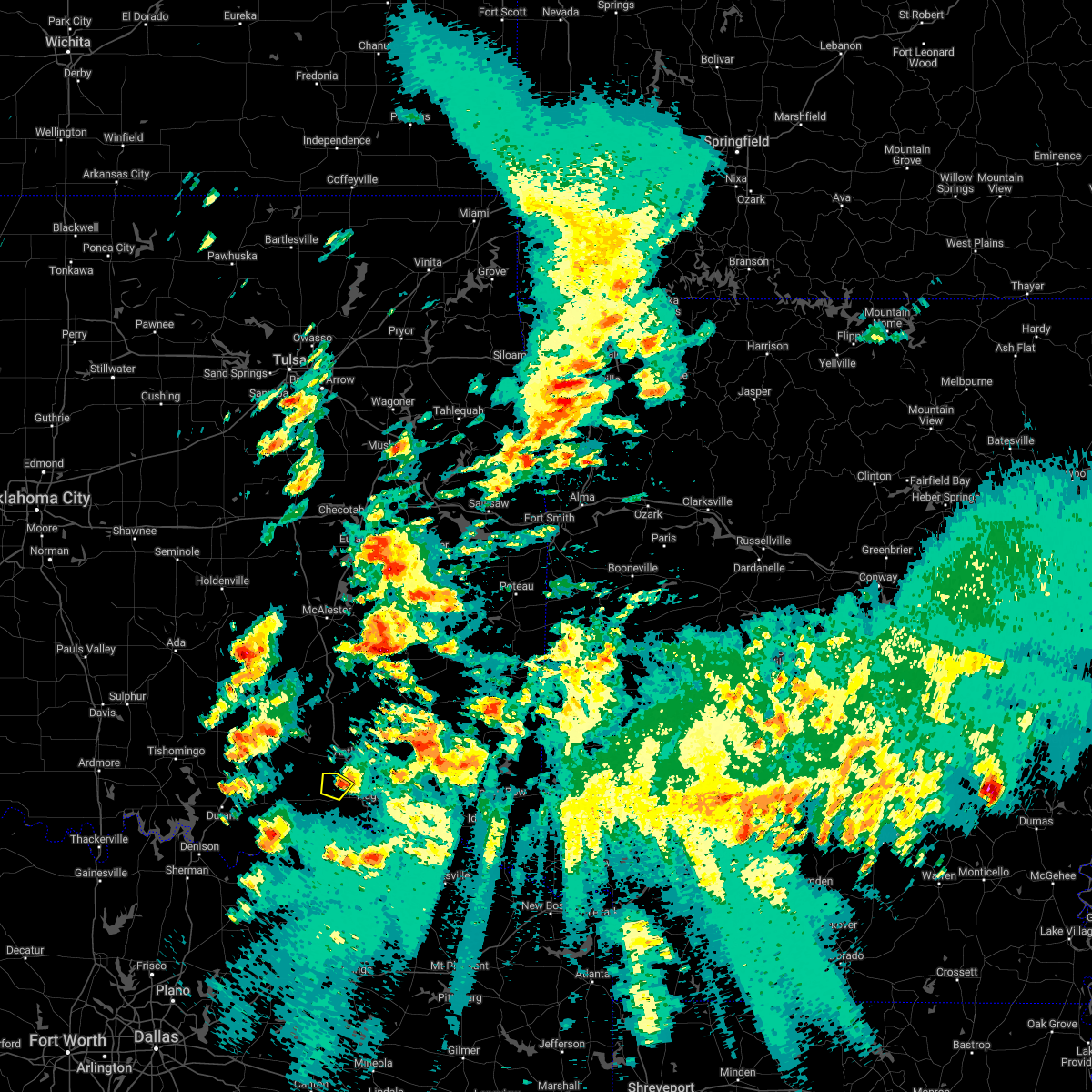 The severe thunderstorm warning for northwestern choctaw county will expire at 215 pm cdt, the storm which prompted the warning has weakened below severe limits, and no longer poses an immediate threat to life or property. therefore, the warning will be allowed to expire. however small hail is still possible with this thunderstorm. The severe thunderstorm warning for northwestern choctaw county will expire at 215 pm cdt, the storm which prompted the warning has weakened below severe limits, and no longer poses an immediate threat to life or property. therefore, the warning will be allowed to expire. however small hail is still possible with this thunderstorm.
|
| 5/5/2022 2:01 PM CDT |
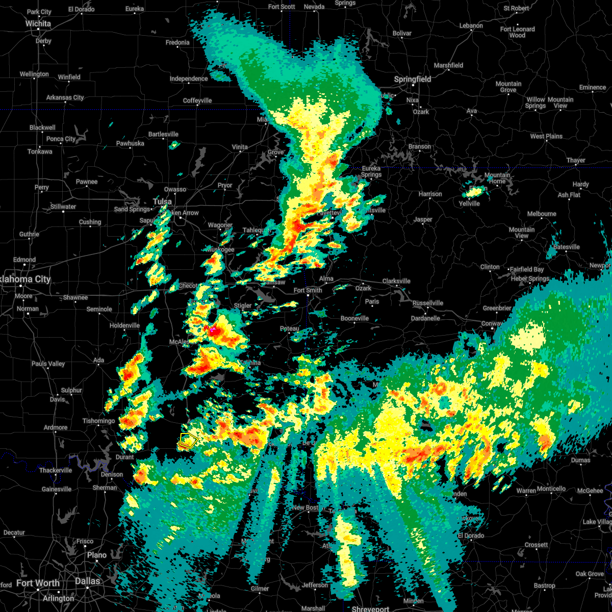 At 201 pm cdt, a severe thunderstorm was located 6 miles west of kent, moving northeast at 40 mph (radar indicated). Hazards include 60 mph wind gusts and quarter size hail. Hail damage to vehicles is expected. expect wind damage to roofs, siding, and trees. locations in or near the path include, soper, kent, hail threat, radar indicated max hail size, 1. 00 in wind threat, radar indicated max wind gust, 60 mph. At 201 pm cdt, a severe thunderstorm was located 6 miles west of kent, moving northeast at 40 mph (radar indicated). Hazards include 60 mph wind gusts and quarter size hail. Hail damage to vehicles is expected. expect wind damage to roofs, siding, and trees. locations in or near the path include, soper, kent, hail threat, radar indicated max hail size, 1. 00 in wind threat, radar indicated max wind gust, 60 mph.
|
| 5/5/2022 1:48 PM CDT |
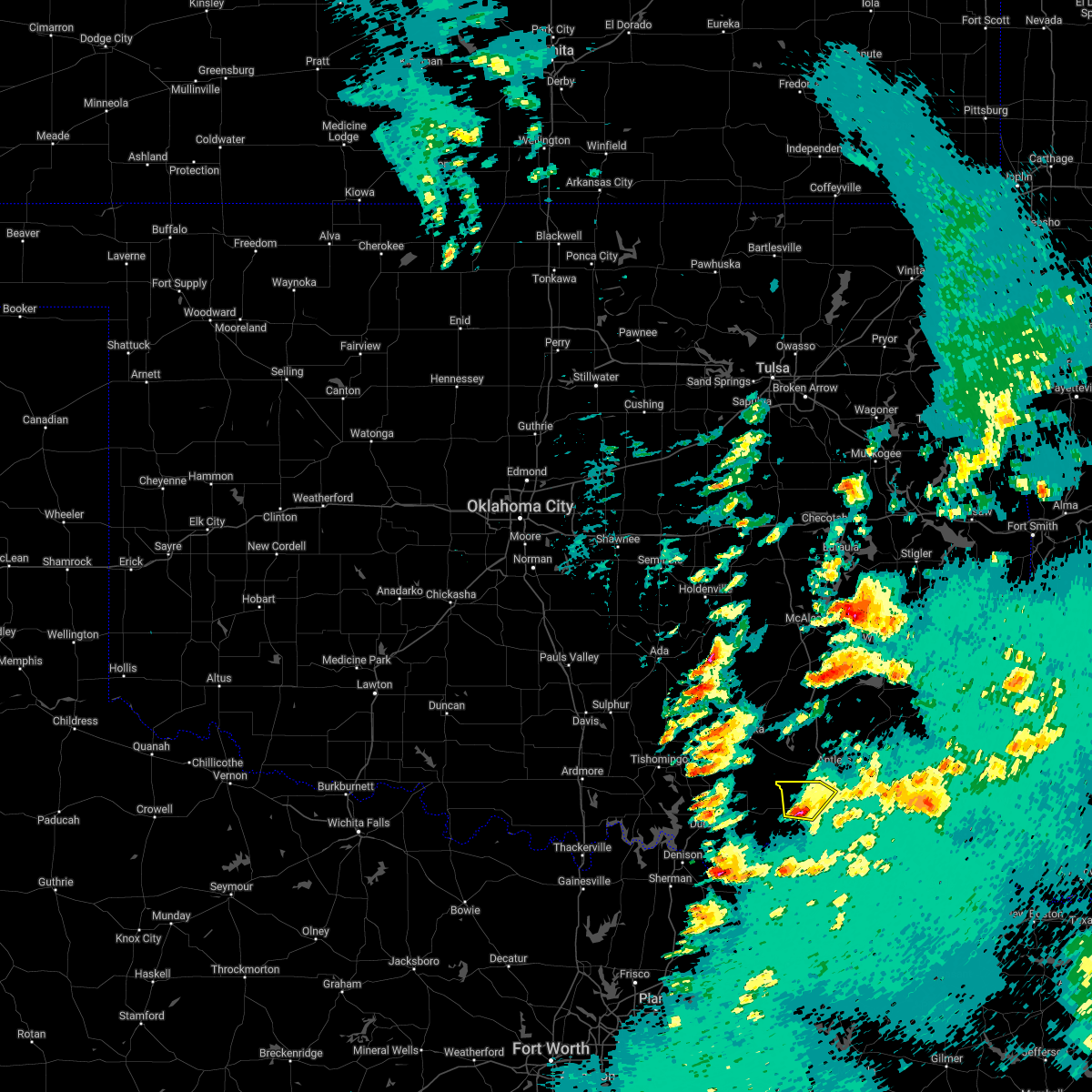 At 148 pm cdt, a severe thunderstorm was located near boswell, moving northeast at 35 mph (radar indicated). Hazards include 60 mph wind gusts and quarter size hail. Hail damage to vehicles is expected. expect wind damage to roofs, siding, and trees. locations in or near the path include, boswell, soper, kent, unger, hail threat, radar indicated max hail size, 1. 00 in wind threat, radar indicated max wind gust, 60 mph. At 148 pm cdt, a severe thunderstorm was located near boswell, moving northeast at 35 mph (radar indicated). Hazards include 60 mph wind gusts and quarter size hail. Hail damage to vehicles is expected. expect wind damage to roofs, siding, and trees. locations in or near the path include, boswell, soper, kent, unger, hail threat, radar indicated max hail size, 1. 00 in wind threat, radar indicated max wind gust, 60 mph.
|
| 5/5/2022 1:29 PM CDT |
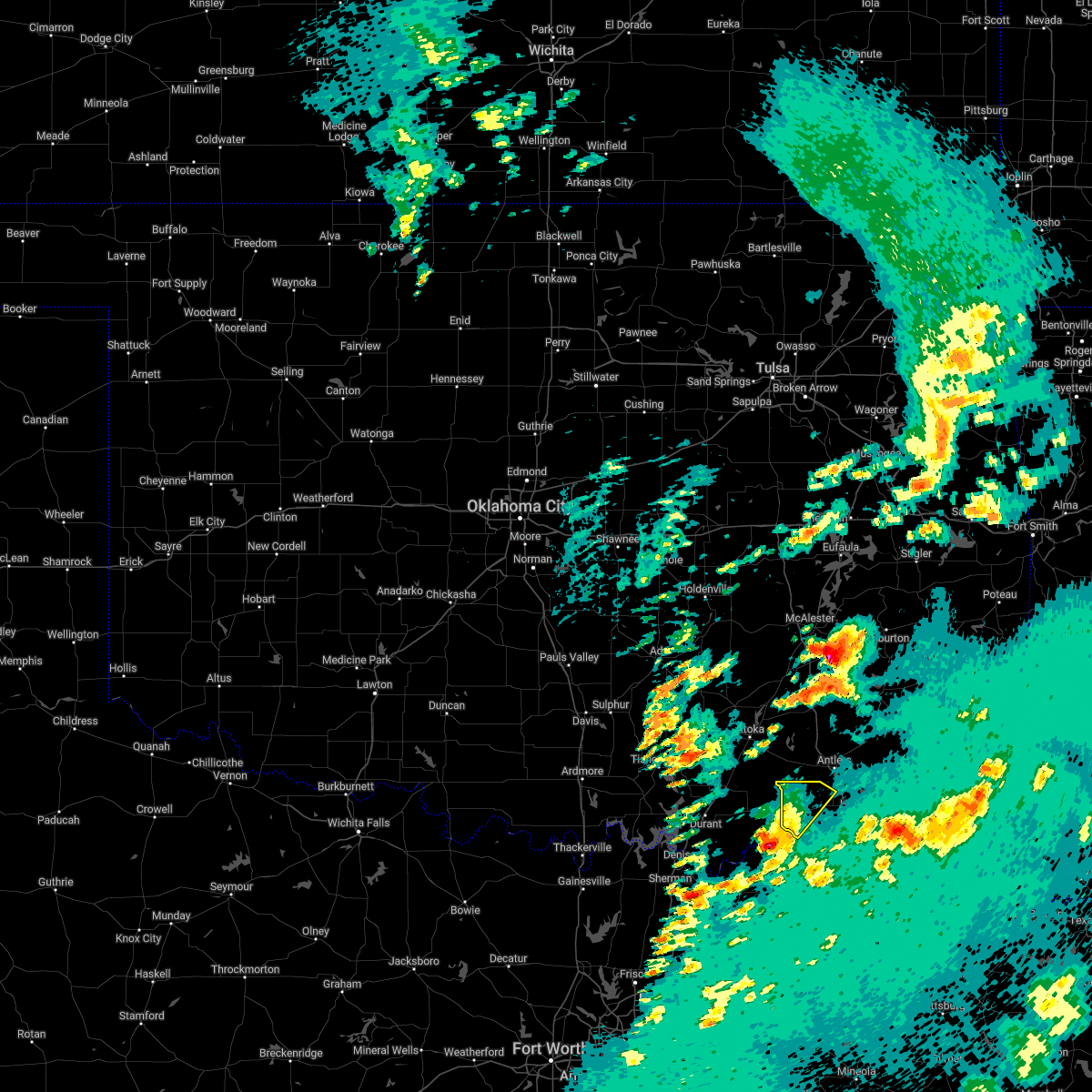 At 129 pm cdt, a severe thunderstorm was located 7 miles southeast of bennington, moving northeast at 40 mph (radar indicated). Hazards include 60 mph wind gusts and quarter size hail. Hail damage to vehicles is expected. expect wind damage to roofs, siding, and trees. locations in or near the path include, boswell, soper, kent, unger, hail threat, radar indicated max hail size, 1. 00 in wind threat, radar indicated max wind gust, 60 mph. At 129 pm cdt, a severe thunderstorm was located 7 miles southeast of bennington, moving northeast at 40 mph (radar indicated). Hazards include 60 mph wind gusts and quarter size hail. Hail damage to vehicles is expected. expect wind damage to roofs, siding, and trees. locations in or near the path include, boswell, soper, kent, unger, hail threat, radar indicated max hail size, 1. 00 in wind threat, radar indicated max wind gust, 60 mph.
|
| 5/2/2022 11:53 PM CDT |
 At 1153 pm cdt, severe thunderstorms were located along a line extending from 17 miles south of octavia to 8 miles south of goodland, moving southeast at 40 mph (radar indicated). Hazards include 60 mph wind gusts and penny size hail. Expect damage to roofs, siding, and trees. locations in or near the path include, hugo, boswell, fort towson, sawyer, soper, goodland, messer, hugo lake state park, raymond gary state park, grant, ord, fallon, swink, frogville, apple, huskey, unger, gay, hail threat, radar indicated max hail size, 0. 75 in wind threat, radar indicated max wind gust, 60 mph. At 1153 pm cdt, severe thunderstorms were located along a line extending from 17 miles south of octavia to 8 miles south of goodland, moving southeast at 40 mph (radar indicated). Hazards include 60 mph wind gusts and penny size hail. Expect damage to roofs, siding, and trees. locations in or near the path include, hugo, boswell, fort towson, sawyer, soper, goodland, messer, hugo lake state park, raymond gary state park, grant, ord, fallon, swink, frogville, apple, huskey, unger, gay, hail threat, radar indicated max hail size, 0. 75 in wind threat, radar indicated max wind gust, 60 mph.
|
| 5/2/2022 11:47 PM CDT |
 At 1147 pm cdt, severe thunderstorms were located along a line extending from 17 miles southwest of octavia to 8 miles southwest of goodland, moving southeast at 40 mph (radar indicated). Hazards include 60 mph wind gusts and penny size hail. Expect damage to roofs, siding, and trees. locations in or near the path include, hugo, boswell, fort towson, sawyer, soper, octavia, goodland, messer, hugo lake state park, raymond gary state park, oleta, grant, ord, corinne, fallon, sobol, swink, frogville, apple, huskey, hail threat, radar indicated max hail size, 0. 75 in wind threat, radar indicated max wind gust, 60 mph. At 1147 pm cdt, severe thunderstorms were located along a line extending from 17 miles southwest of octavia to 8 miles southwest of goodland, moving southeast at 40 mph (radar indicated). Hazards include 60 mph wind gusts and penny size hail. Expect damage to roofs, siding, and trees. locations in or near the path include, hugo, boswell, fort towson, sawyer, soper, octavia, goodland, messer, hugo lake state park, raymond gary state park, oleta, grant, ord, corinne, fallon, sobol, swink, frogville, apple, huskey, hail threat, radar indicated max hail size, 0. 75 in wind threat, radar indicated max wind gust, 60 mph.
|
| 5/2/2022 11:25 PM CDT |
 At 1124 pm cdt, severe thunderstorms were located along a line extending from 11 miles east of nashoba to 2 miles southeast of boswell, moving southeast at 40 mph (radar indicated). Hazards include 60 mph wind gusts and penny size hail. Expect damage to roofs, siding, and trees. locations in or near the path include, hugo, antlers, boswell, fort towson, sawyer, rattan, soper, octavia, big cedar, hugo lake state park, whitesboro, kent, goodland, messer, raymond gary state park, muse, oleta, cloudy, grant, ord, hail threat, radar indicated max hail size, 0. 75 in wind threat, radar indicated max wind gust, 60 mph. At 1124 pm cdt, severe thunderstorms were located along a line extending from 11 miles east of nashoba to 2 miles southeast of boswell, moving southeast at 40 mph (radar indicated). Hazards include 60 mph wind gusts and penny size hail. Expect damage to roofs, siding, and trees. locations in or near the path include, hugo, antlers, boswell, fort towson, sawyer, rattan, soper, octavia, big cedar, hugo lake state park, whitesboro, kent, goodland, messer, raymond gary state park, muse, oleta, cloudy, grant, ord, hail threat, radar indicated max hail size, 0. 75 in wind threat, radar indicated max wind gust, 60 mph.
|
| 5/2/2022 11:15 PM CDT |
 At 1115 pm cdt, severe thunderstorms were located along a line extending from near rattan to 4 miles east of boswell, moving east at 55 mph (radar indicated). Hazards include 60 mph wind gusts and penny size hail. Expect damage to roofs, siding, and trees. locations in or near the path include, hugo, antlers, boswell, fort towson, sawyer, soper, hugo lake state park, kellond, kent, goodland, messer, moyers, raymond gary state park, kosoma, grant, ord, fallon, sobol, frogville, darwin, hail threat, radar indicated max hail size, 0. 75 in wind threat, radar indicated max wind gust, 60 mph. At 1115 pm cdt, severe thunderstorms were located along a line extending from near rattan to 4 miles east of boswell, moving east at 55 mph (radar indicated). Hazards include 60 mph wind gusts and penny size hail. Expect damage to roofs, siding, and trees. locations in or near the path include, hugo, antlers, boswell, fort towson, sawyer, soper, hugo lake state park, kellond, kent, goodland, messer, moyers, raymond gary state park, kosoma, grant, ord, fallon, sobol, frogville, darwin, hail threat, radar indicated max hail size, 0. 75 in wind threat, radar indicated max wind gust, 60 mph.
|
| 5/2/2022 10:59 PM CDT |
 At 1059 pm cdt, severe thunderstorms were located along a line extending from 4 miles southwest of antlers to 2 miles northwest of bennington, moving east at 55 mph (radar indicated). Hazards include 60 mph wind gusts and penny size hail. Expect damage to roofs, siding, and trees. locations in or near the path include, hugo, antlers, boswell, fort towson, sawyer, soper, hugo lake state park, kellond, kent, goodland, messer, moyers, raymond gary state park, kosoma, dunbar, grant, ord, fallon, sobol, frogville, hail threat, radar indicated max hail size, 0. 75 in wind threat, radar indicated max wind gust, 60 mph. At 1059 pm cdt, severe thunderstorms were located along a line extending from 4 miles southwest of antlers to 2 miles northwest of bennington, moving east at 55 mph (radar indicated). Hazards include 60 mph wind gusts and penny size hail. Expect damage to roofs, siding, and trees. locations in or near the path include, hugo, antlers, boswell, fort towson, sawyer, soper, hugo lake state park, kellond, kent, goodland, messer, moyers, raymond gary state park, kosoma, dunbar, grant, ord, fallon, sobol, frogville, hail threat, radar indicated max hail size, 0. 75 in wind threat, radar indicated max wind gust, 60 mph.
|
| 4/24/2022 7:24 PM CDT |
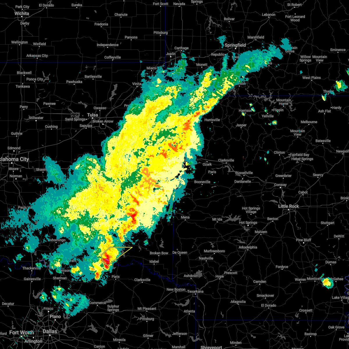 At 724 pm cdt, a severe thunderstorm was located 3 miles southeast of soper, moving northeast at 40 mph (radar indicated). Hazards include 60 mph wind gusts and quarter size hail. Hail damage to vehicles is expected. expect wind damage to roofs, siding, and trees. locations in or near the path include, hugo, soper, kent, goodland, messer, apple, speer, unger, gay, hail threat, radar indicated max hail size, 1. 00 in wind threat, radar indicated max wind gust, 60 mph. At 724 pm cdt, a severe thunderstorm was located 3 miles southeast of soper, moving northeast at 40 mph (radar indicated). Hazards include 60 mph wind gusts and quarter size hail. Hail damage to vehicles is expected. expect wind damage to roofs, siding, and trees. locations in or near the path include, hugo, soper, kent, goodland, messer, apple, speer, unger, gay, hail threat, radar indicated max hail size, 1. 00 in wind threat, radar indicated max wind gust, 60 mph.
|
| 4/24/2022 7:10 PM CDT |
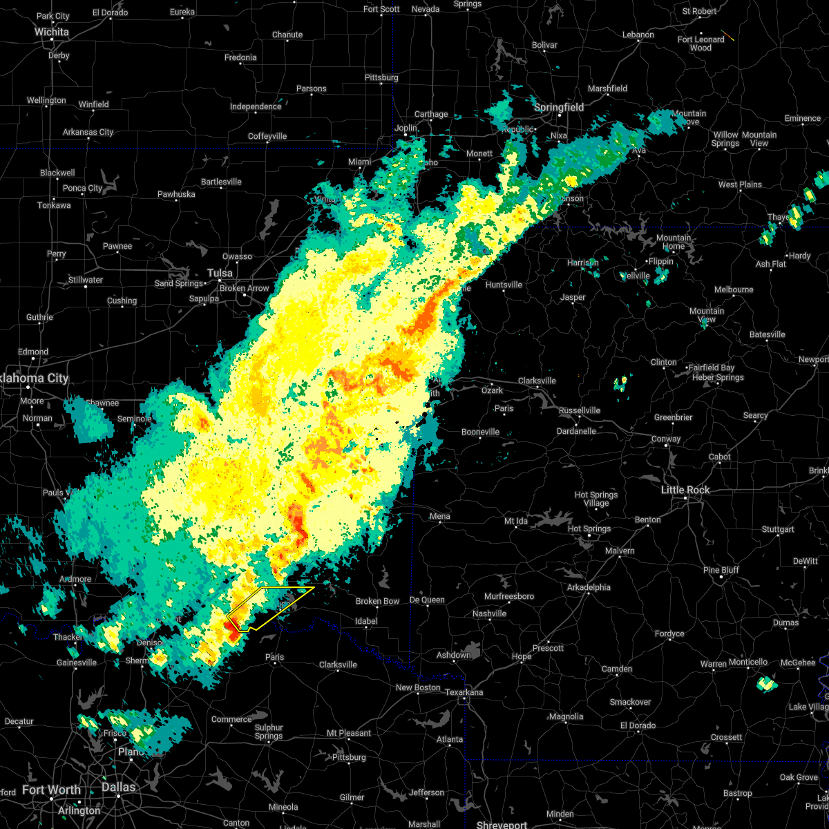 At 710 pm cdt, a severe thunderstorm was located 7 miles southeast of boswell, moving northeast at 50 mph (radar indicated). Hazards include 60 mph wind gusts and quarter size hail. Hail damage to vehicles is expected. expect wind damage to roofs, siding, and trees. locations in or near the path include, hugo, soper, kent, goodland, messer, apple, speer, unger, gay, hail threat, radar indicated max hail size, 1. 00 in wind threat, radar indicated max wind gust, 60 mph. At 710 pm cdt, a severe thunderstorm was located 7 miles southeast of boswell, moving northeast at 50 mph (radar indicated). Hazards include 60 mph wind gusts and quarter size hail. Hail damage to vehicles is expected. expect wind damage to roofs, siding, and trees. locations in or near the path include, hugo, soper, kent, goodland, messer, apple, speer, unger, gay, hail threat, radar indicated max hail size, 1. 00 in wind threat, radar indicated max wind gust, 60 mph.
|
| 3/30/2022 5:09 AM CDT |
 At 508 am cdt, a severe thunderstorm was located near soper, moving northeast at 55 mph (radar indicated). Hazards include 60 mph wind gusts. Expect damage to roofs, siding, and trees. locations in or near the path include, hugo, sawyer, soper, kent, goodland, messer, hugo lake state park, grant, ord, fallon, apple, speer, unger, gay, hail threat, radar indicated max hail size, <. 75 in wind threat, radar indicated max wind gust, 60 mph. At 508 am cdt, a severe thunderstorm was located near soper, moving northeast at 55 mph (radar indicated). Hazards include 60 mph wind gusts. Expect damage to roofs, siding, and trees. locations in or near the path include, hugo, sawyer, soper, kent, goodland, messer, hugo lake state park, grant, ord, fallon, apple, speer, unger, gay, hail threat, radar indicated max hail size, <. 75 in wind threat, radar indicated max wind gust, 60 mph.
|
| 3/30/2022 4:53 AM CDT |
 At 453 am cdt, a severe thunderstorm was located 11 miles south of boswell, moving northeast at 60 mph (radar indicated). Hazards include 60 mph wind gusts. Expect damage to roofs, siding, and trees. locations in or near the path include, hugo, boswell, sawyer, soper, kent, goodland, messer, hugo lake state park, grant, ord, fallon, apple, speer, unger, gay, hail threat, radar indicated max hail size, <. 75 in wind threat, radar indicated max wind gust, 60 mph. At 453 am cdt, a severe thunderstorm was located 11 miles south of boswell, moving northeast at 60 mph (radar indicated). Hazards include 60 mph wind gusts. Expect damage to roofs, siding, and trees. locations in or near the path include, hugo, boswell, sawyer, soper, kent, goodland, messer, hugo lake state park, grant, ord, fallon, apple, speer, unger, gay, hail threat, radar indicated max hail size, <. 75 in wind threat, radar indicated max wind gust, 60 mph.
|
| 3/21/2022 8:39 PM CDT |
 The severe thunderstorm warning for southwestern pushmataha and central choctaw counties will expire at 845 pm cdt, the storms which prompted the warning have moved out of the area. therefore, the warning will be allowed to expire. a severe thunderstorm watch remains in effect until midnight cdt for southeastern oklahoma. The severe thunderstorm warning for southwestern pushmataha and central choctaw counties will expire at 845 pm cdt, the storms which prompted the warning have moved out of the area. therefore, the warning will be allowed to expire. a severe thunderstorm watch remains in effect until midnight cdt for southeastern oklahoma.
|
| 3/21/2022 8:19 PM CDT |
 At 819 pm cdt, severe thunderstorms were located along a line extending from 3 miles southwest of snow to near goodland, moving northeast at 60 mph (radar indicated). Hazards include 60 mph wind gusts and penny size hail. Expect damage to roofs, siding, and trees. locations in or near the path include, hugo, antlers, soper, kent, goodland, messer, grant, ord, speer, dela, gay, hail threat, radar indicated max hail size, 0. 75 in wind threat, radar indicated max wind gust, 60 mph. At 819 pm cdt, severe thunderstorms were located along a line extending from 3 miles southwest of snow to near goodland, moving northeast at 60 mph (radar indicated). Hazards include 60 mph wind gusts and penny size hail. Expect damage to roofs, siding, and trees. locations in or near the path include, hugo, antlers, soper, kent, goodland, messer, grant, ord, speer, dela, gay, hail threat, radar indicated max hail size, 0. 75 in wind threat, radar indicated max wind gust, 60 mph.
|
| 3/21/2022 7:40 PM CDT |
 At 739 pm cdt, severe thunderstorms were located along a line extending from 9 miles south of lane to 8 miles southeast of bennington, moving east at 45 mph (radar indicated). Hazards include 60 mph wind gusts and penny size hail. Expect damage to roofs, siding, and trees. locations in or near the path include, hugo, antlers, boswell, soper, kent, goodland, messer, kellond, grant, ord, darwin, speer, dela, unger, gay, hail threat, radar indicated max hail size, 0. 75 in wind threat, radar indicated max wind gust, 60 mph. At 739 pm cdt, severe thunderstorms were located along a line extending from 9 miles south of lane to 8 miles southeast of bennington, moving east at 45 mph (radar indicated). Hazards include 60 mph wind gusts and penny size hail. Expect damage to roofs, siding, and trees. locations in or near the path include, hugo, antlers, boswell, soper, kent, goodland, messer, kellond, grant, ord, darwin, speer, dela, unger, gay, hail threat, radar indicated max hail size, 0. 75 in wind threat, radar indicated max wind gust, 60 mph.
|
| 10/13/2021 4:22 PM CDT |
 At 422 pm cdt, a severe thunderstorm was located near kent, moving northeast at 35 mph (radar indicated). Hazards include 60 mph wind gusts and quarter size hail. Hail damage to vehicles is expected. expect wind damage to roofs, siding, and trees. locations in or near the path include, hugo, antlers, rattan, soper, kent, snow, messer, nashoba, kellond, oleta, cloudy, corinne, sobol, apple, speer, dela, unger, finley, hail threat, radar indicated max hail size, 1. 00 in wind threat, radar indicated max wind gust, 60 mph. At 422 pm cdt, a severe thunderstorm was located near kent, moving northeast at 35 mph (radar indicated). Hazards include 60 mph wind gusts and quarter size hail. Hail damage to vehicles is expected. expect wind damage to roofs, siding, and trees. locations in or near the path include, hugo, antlers, rattan, soper, kent, snow, messer, nashoba, kellond, oleta, cloudy, corinne, sobol, apple, speer, dela, unger, finley, hail threat, radar indicated max hail size, 1. 00 in wind threat, radar indicated max wind gust, 60 mph.
|
| 10/10/2021 10:53 PM CDT |
 At 1052 pm cdt, severe thunderstorms were located along a line extending from 2 miles northeast of blanco to 6 miles south of soper, moving northeast at 75 mph (radar indicated). Hazards include 60 mph wind gusts. Expect damage to roofs, siding, and trees. locations in or near the path include, hugo, antlers, clayton, boswell, fort towson, sawyer, rattan, soper, snow, tuskahoma, hugo lake state park, stanley, kellond, clayton lake state park, kent, goodland, yanush, messer, raymond gary state park, moyers, hail threat, radar indicated max hail size, <. 75 in wind threat, radar indicated max wind gust, 60 mph. At 1052 pm cdt, severe thunderstorms were located along a line extending from 2 miles northeast of blanco to 6 miles south of soper, moving northeast at 75 mph (radar indicated). Hazards include 60 mph wind gusts. Expect damage to roofs, siding, and trees. locations in or near the path include, hugo, antlers, clayton, boswell, fort towson, sawyer, rattan, soper, snow, tuskahoma, hugo lake state park, stanley, kellond, clayton lake state park, kent, goodland, yanush, messer, raymond gary state park, moyers, hail threat, radar indicated max hail size, <. 75 in wind threat, radar indicated max wind gust, 60 mph.
|
| 5/10/2021 8:13 PM CDT | Golf Ball sized hail reported 4.3 miles N of Soper, OK, report with photo relayed via broadcast media twitter. location estimated from radar and time provided. |
| 5/10/2021 8:01 PM CDT |
 At 743 pm cdt, a severe thunderstorm was located 12 miles southeast of bennington, moving northeast at 45 mph (radar indicated). Hazards include golf ball size hail. People and animals outdoors will be injured. expect damage to roofs, siding, windows, and vehicles. Locations in or near the path include, hugo, boswell, fort towson, sawyer, soper, kent, goodland, messer, hugo lake state park, grant, ord, fallon, apple, speer, unger, gay,. At 743 pm cdt, a severe thunderstorm was located 12 miles southeast of bennington, moving northeast at 45 mph (radar indicated). Hazards include golf ball size hail. People and animals outdoors will be injured. expect damage to roofs, siding, windows, and vehicles. Locations in or near the path include, hugo, boswell, fort towson, sawyer, soper, kent, goodland, messer, hugo lake state park, grant, ord, fallon, apple, speer, unger, gay,.
|
| 5/10/2021 7:44 PM CDT |
 At 743 pm cdt, a severe thunderstorm was located 12 miles southeast of bennington, moving northeast at 45 mph (radar indicated). Hazards include golf ball size hail. People and animals outdoors will be injured. expect damage to roofs, siding, windows, and vehicles. Locations in or near the path include, hugo, boswell, fort towson, sawyer, soper, kent, goodland, messer, hugo lake state park, grant, ord, fallon, apple, speer, unger, gay,. At 743 pm cdt, a severe thunderstorm was located 12 miles southeast of bennington, moving northeast at 45 mph (radar indicated). Hazards include golf ball size hail. People and animals outdoors will be injured. expect damage to roofs, siding, windows, and vehicles. Locations in or near the path include, hugo, boswell, fort towson, sawyer, soper, kent, goodland, messer, hugo lake state park, grant, ord, fallon, apple, speer, unger, gay,.
|
| 4/9/2021 10:05 PM CDT |
 At 1004 pm cdt, severe thunderstorms were located along a line extending from 6 miles southeast of kosoma to 9 miles south of soper, moving east at 30 mph (radar indicated). Hazards include 60 mph wind gusts and quarter size hail. Hail damage to vehicles is expected. expect wind damage to roofs, siding, and trees. Locations in or near the path include, hugo, antlers, boswell, sawyer, rattan, soper, kent, snow, goodland, messer, hugo lake state park, kellond, grant, ord, fallon, apple, speer, dela, unger, finley,. At 1004 pm cdt, severe thunderstorms were located along a line extending from 6 miles southeast of kosoma to 9 miles south of soper, moving east at 30 mph (radar indicated). Hazards include 60 mph wind gusts and quarter size hail. Hail damage to vehicles is expected. expect wind damage to roofs, siding, and trees. Locations in or near the path include, hugo, antlers, boswell, sawyer, rattan, soper, kent, snow, goodland, messer, hugo lake state park, kellond, grant, ord, fallon, apple, speer, dela, unger, finley,.
|
| 4/9/2021 9:24 PM CDT |
 At 924 pm cdt, a severe thunderstorm was located 3 miles northeast of bennington, moving east at 35 mph (radar indicated). Hazards include 60 mph wind gusts and quarter size hail. Hail damage to vehicles is expected. expect wind damage to roofs, siding, and trees. Locations in or near the path include, hugo, antlers, boswell, sawyer, rattan, soper, kent, snow, goodland, messer, hugo lake state park, moyers, kosoma, kellond, grant, ord, fallon, darwin, apple, speer,. At 924 pm cdt, a severe thunderstorm was located 3 miles northeast of bennington, moving east at 35 mph (radar indicated). Hazards include 60 mph wind gusts and quarter size hail. Hail damage to vehicles is expected. expect wind damage to roofs, siding, and trees. Locations in or near the path include, hugo, antlers, boswell, sawyer, rattan, soper, kent, snow, goodland, messer, hugo lake state park, moyers, kosoma, kellond, grant, ord, fallon, darwin, apple, speer,.
|
| 2/28/2021 11:45 AM CST | Quarter sized hail reported 0.3 miles NE of Soper, OK |
| 2/28/2021 11:39 AM CST |
 At 1139 am cst, a severe thunderstorm was located 4 miles southeast of boswell, moving northeast at 55 mph (radar indicated). Hazards include 60 mph wind gusts and quarter size hail. Hail damage to vehicles is expected. expect wind damage to roofs, siding, and trees. Locations in or near the path include, hugo, antlers, boswell, sawyer, rattan, soper, kent, snow, goodland, messer, hugo lake state park, oleta, corinne, fallon, sobol, apple, speer, dela, unger, finley,. At 1139 am cst, a severe thunderstorm was located 4 miles southeast of boswell, moving northeast at 55 mph (radar indicated). Hazards include 60 mph wind gusts and quarter size hail. Hail damage to vehicles is expected. expect wind damage to roofs, siding, and trees. Locations in or near the path include, hugo, antlers, boswell, sawyer, rattan, soper, kent, snow, goodland, messer, hugo lake state park, oleta, corinne, fallon, sobol, apple, speer, dela, unger, finley,.
|
| 2/28/2021 10:33 AM CST |
 At 1033 am cst, a severe thunderstorm was located over bennington, moving northeast at 50 mph (radar indicated). Hazards include ping pong ball size hail and 60 mph wind gusts. People and animals outdoors will be injured. expect hail damage to roofs, siding, windows, and vehicles. expect wind damage to roofs, siding, and trees. Locations in or near the path include, antlers, boswell, rattan, soper, kent, messer, moyers, kosoma, kellond, dunbar, oleta, eubanks, corinne, sobol, darwin, apple, speer, dela, unger, finley,. At 1033 am cst, a severe thunderstorm was located over bennington, moving northeast at 50 mph (radar indicated). Hazards include ping pong ball size hail and 60 mph wind gusts. People and animals outdoors will be injured. expect hail damage to roofs, siding, windows, and vehicles. expect wind damage to roofs, siding, and trees. Locations in or near the path include, antlers, boswell, rattan, soper, kent, messer, moyers, kosoma, kellond, dunbar, oleta, eubanks, corinne, sobol, darwin, apple, speer, dela, unger, finley,.
|
| 9/27/2020 9:52 PM CDT |
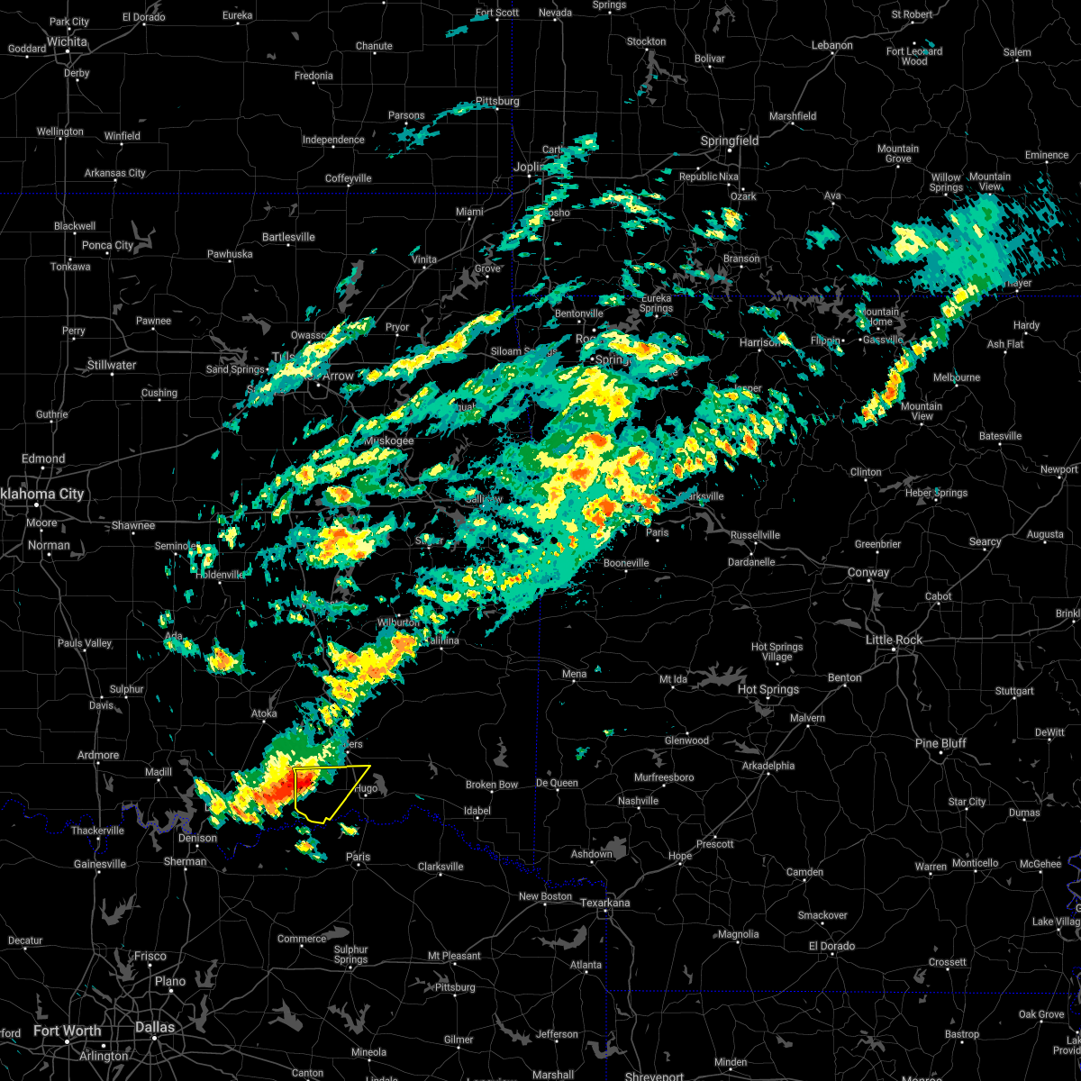 At 951 pm cdt, a severe thunderstorm was located near boswell, moving southeast at 40 mph (radar indicated). Hazards include 60 mph wind gusts and half dollar size hail. Hail damage to vehicles is expected. expect wind damage to roofs, siding, and trees. Locations in or near the path include, boswell, soper, kent, unger, speer,. At 951 pm cdt, a severe thunderstorm was located near boswell, moving southeast at 40 mph (radar indicated). Hazards include 60 mph wind gusts and half dollar size hail. Hail damage to vehicles is expected. expect wind damage to roofs, siding, and trees. Locations in or near the path include, boswell, soper, kent, unger, speer,.
|
| 9/27/2020 9:25 PM CDT |
 At 925 pm cdt, a severe thunderstorm was located 4 miles east of caney, moving southeast at 45 mph (radar indicated). Hazards include 60 mph wind gusts and half dollar size hail. Hail damage to vehicles is expected. expect wind damage to roofs, siding, and trees. Locations in or near the path include, antlers, boswell, soper, kent, kellond, darwin, speer, dela, unger,. At 925 pm cdt, a severe thunderstorm was located 4 miles east of caney, moving southeast at 45 mph (radar indicated). Hazards include 60 mph wind gusts and half dollar size hail. Hail damage to vehicles is expected. expect wind damage to roofs, siding, and trees. Locations in or near the path include, antlers, boswell, soper, kent, kellond, darwin, speer, dela, unger,.
|
| 8/29/2020 10:42 PM CDT |
 The severe thunderstorm warning for southwestern pushmataha and choctaw counties will expire at 1045 pm cdt, the storms which prompted the warning have weakened below severe limits, and no longer pose an immediate threat to life or property. therefore the warning will be allowed to expire. however small hail, gusty winds to 45 mph, and heavy rain are still possible with these thunderstorms. a severe thunderstorm watch remains in effect until 100 am cdt for southeastern oklahoma. The severe thunderstorm warning for southwestern pushmataha and choctaw counties will expire at 1045 pm cdt, the storms which prompted the warning have weakened below severe limits, and no longer pose an immediate threat to life or property. therefore the warning will be allowed to expire. however small hail, gusty winds to 45 mph, and heavy rain are still possible with these thunderstorms. a severe thunderstorm watch remains in effect until 100 am cdt for southeastern oklahoma.
|
| 8/29/2020 9:43 PM CDT |
 At 943 pm cdt, severe thunderstorms were located along a line extending from 6 miles northeast of bennington to 5 miles east of fort towson, moving southeast at 25 mph (radar indicated). Hazards include 60 mph wind gusts and quarter size hail. Hail damage to vehicles is expected. expect wind damage to roofs, siding, and trees. Locations in or near the path include, hugo, antlers, boswell, fort towson, sawyer, rattan, soper, hugo lake state park, kellond, kent, goodland, messer, raymond gary state park, oleta, grant, ord, fallon, sobol, frogville, unger,. At 943 pm cdt, severe thunderstorms were located along a line extending from 6 miles northeast of bennington to 5 miles east of fort towson, moving southeast at 25 mph (radar indicated). Hazards include 60 mph wind gusts and quarter size hail. Hail damage to vehicles is expected. expect wind damage to roofs, siding, and trees. Locations in or near the path include, hugo, antlers, boswell, fort towson, sawyer, rattan, soper, hugo lake state park, kellond, kent, goodland, messer, raymond gary state park, oleta, grant, ord, fallon, sobol, frogville, unger,.
|
| 8/29/2020 9:29 PM CDT |
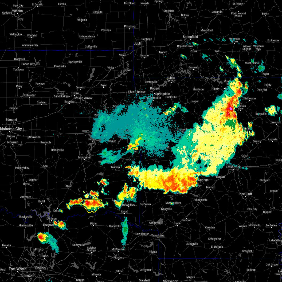 At 929 pm cdt, a severe thunderstorm was located near soper, moving southeast at 15 mph (radar indicated). Hazards include 60 mph wind gusts and half dollar size hail. Hail damage to vehicles is expected. expect wind damage to roofs, siding, and trees. Locations in or near the path include, hugo, soper, kent, goodland, messer, grant, apple, speer, gay,. At 929 pm cdt, a severe thunderstorm was located near soper, moving southeast at 15 mph (radar indicated). Hazards include 60 mph wind gusts and half dollar size hail. Hail damage to vehicles is expected. expect wind damage to roofs, siding, and trees. Locations in or near the path include, hugo, soper, kent, goodland, messer, grant, apple, speer, gay,.
|
| 8/29/2020 9:04 PM CDT |
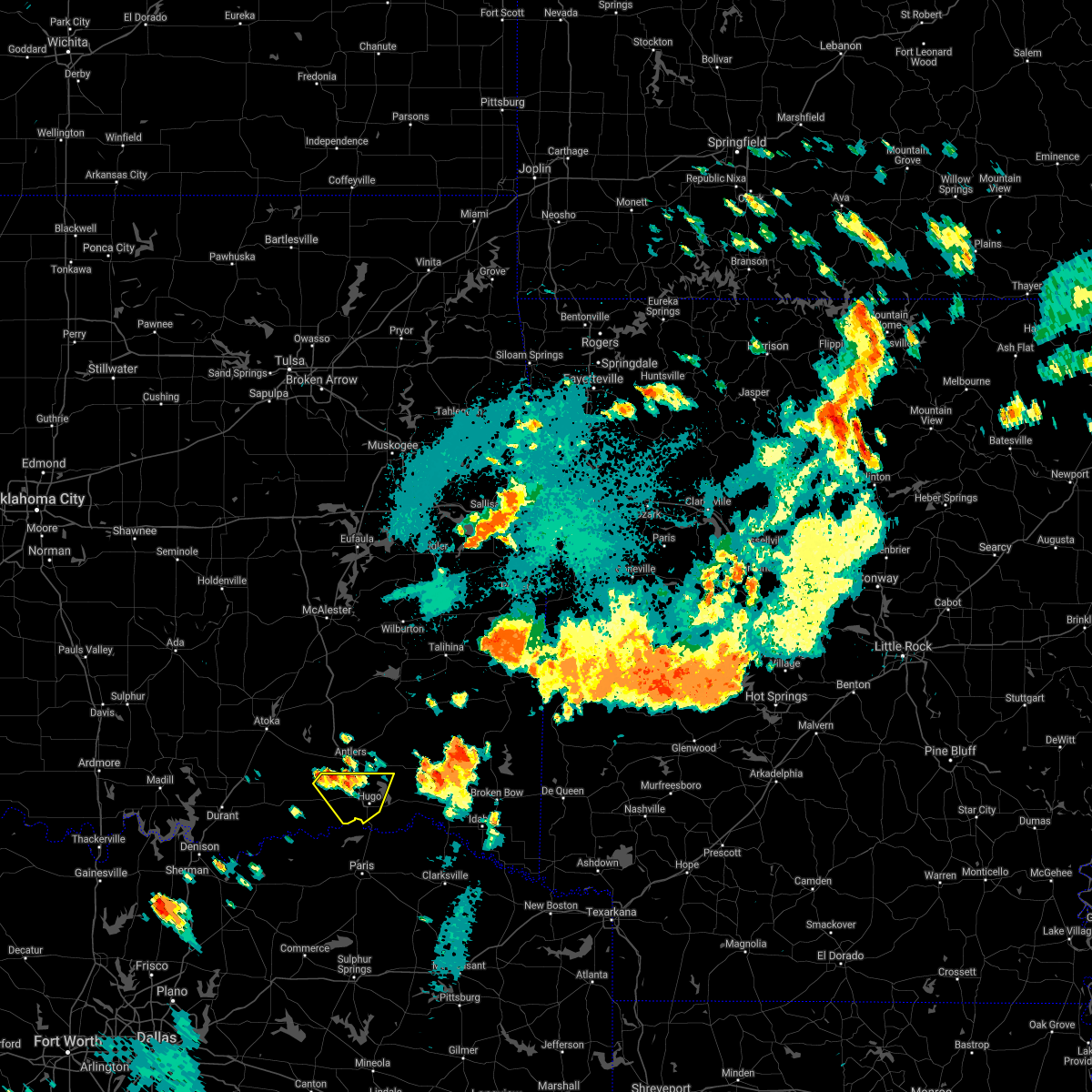 At 903 pm cdt, a severe thunderstorm was located 5 miles west of kent, moving southeast at 20 mph (radar indicated). Hazards include 60 mph wind gusts and quarter size hail. Hail damage to vehicles is expected. expect wind damage to roofs, siding, and trees. Locations in or near the path include, hugo, soper, kent, goodland, messer, grant, apple, speer, gay,. At 903 pm cdt, a severe thunderstorm was located 5 miles west of kent, moving southeast at 20 mph (radar indicated). Hazards include 60 mph wind gusts and quarter size hail. Hail damage to vehicles is expected. expect wind damage to roofs, siding, and trees. Locations in or near the path include, hugo, soper, kent, goodland, messer, grant, apple, speer, gay,.
|
| 7/30/2020 9:02 PM CDT |
 At 900 pm cdt, severe thunderstorms were located along a line extending from 4 miles southeast of albion to 7 miles south of sawyer, moving east at 30 mph (public). Hazards include 60 mph wind gusts. public reported trees down and power out in the city of hugo. additional tree damage was located near the border of mccurtain county. Expect damage to roofs, siding, and trees. Locations in or near the path include, hugo, antlers, clayton, heavener, talihina, fort towson, sawyer, rattan, soper, albion, octavia, talimena state park, snow, heavener runestone state park, tuskahoma, big cedar, hugo lake state park, kiamichi, whitesboro, clayton lake state park,. At 900 pm cdt, severe thunderstorms were located along a line extending from 4 miles southeast of albion to 7 miles south of sawyer, moving east at 30 mph (public). Hazards include 60 mph wind gusts. public reported trees down and power out in the city of hugo. additional tree damage was located near the border of mccurtain county. Expect damage to roofs, siding, and trees. Locations in or near the path include, hugo, antlers, clayton, heavener, talihina, fort towson, sawyer, rattan, soper, albion, octavia, talimena state park, snow, heavener runestone state park, tuskahoma, big cedar, hugo lake state park, kiamichi, whitesboro, clayton lake state park,.
|
| 7/30/2020 8:56 PM CDT |
 At 856 pm cdt, severe thunderstorms were located along a line extending from 4 miles southeast of albion to 7 miles south of sawyer, moving east at 30 mph (radar indicated). Hazards include 60 mph wind gusts. Expect damage to roofs, siding, and trees. Locations in or near the path include, hugo, antlers, clayton, heavener, talihina, fort towson, sawyer, rattan, soper, albion, octavia, talimena state park, snow, heavener runestone state park, tuskahoma, big cedar, hugo lake state park, kiamichi, whitesboro, clayton lake state park,. At 856 pm cdt, severe thunderstorms were located along a line extending from 4 miles southeast of albion to 7 miles south of sawyer, moving east at 30 mph (radar indicated). Hazards include 60 mph wind gusts. Expect damage to roofs, siding, and trees. Locations in or near the path include, hugo, antlers, clayton, heavener, talihina, fort towson, sawyer, rattan, soper, albion, octavia, talimena state park, snow, heavener runestone state park, tuskahoma, big cedar, hugo lake state park, kiamichi, whitesboro, clayton lake state park,.
|
| 7/30/2020 8:51 PM CDT |
 At 850 pm cdt, severe thunderstorms were located along a line extending from near yanush to 3 miles northeast of oleta to 5 miles south of goodland, moving east at 35 mph (radar indicated). Hazards include 60 mph wind gusts and penny size hail. Expect damage to roofs, siding, and trees. Locations in or near the path include, hugo, antlers, clayton, fort towson, sawyer, rattan, soper, snow, tuskahoma, hugo lake state park, stanley, clayton lake state park, kent, goodland, messer, raymond gary state park, nashoba, oleta, cloudy, grant,. At 850 pm cdt, severe thunderstorms were located along a line extending from near yanush to 3 miles northeast of oleta to 5 miles south of goodland, moving east at 35 mph (radar indicated). Hazards include 60 mph wind gusts and penny size hail. Expect damage to roofs, siding, and trees. Locations in or near the path include, hugo, antlers, clayton, fort towson, sawyer, rattan, soper, snow, tuskahoma, hugo lake state park, stanley, clayton lake state park, kent, goodland, messer, raymond gary state park, nashoba, oleta, cloudy, grant,.
|
| 7/30/2020 8:23 PM CDT |
 At 822 pm cdt, severe thunderstorms were located along a line extending from 5 miles east of wardville to 8 miles northwest of boswell to 3 miles south of utica to 5 miles west of knollwood, moving southeast at 25 mph (radar indicated). Hazards include 60 mph wind gusts and penny size hail. Expect damage to roofs, siding, and trees. Locations in or near the path include, antlers, kiowa, boswell, soper, ashland, kent, moyers, kosoma, kellond, blanco, pittsburg, darwin, unger,. At 822 pm cdt, severe thunderstorms were located along a line extending from 5 miles east of wardville to 8 miles northwest of boswell to 3 miles south of utica to 5 miles west of knollwood, moving southeast at 25 mph (radar indicated). Hazards include 60 mph wind gusts and penny size hail. Expect damage to roofs, siding, and trees. Locations in or near the path include, antlers, kiowa, boswell, soper, ashland, kent, moyers, kosoma, kellond, blanco, pittsburg, darwin, unger,.
|
| 7/30/2020 8:13 PM CDT |
 At 812 pm cdt, severe thunderstorms were located along a line extending from 4 miles east of blanco to 3 miles southwest of moyers to 4 miles southeast of bennington, moving east at 35 mph (radar indicated). Hazards include 60 mph wind gusts and penny size hail. Expect damage to roofs, siding, and trees. Locations in or near the path include, hugo, antlers, clayton, boswell, fort towson, sawyer, rattan, soper, snow, tuskahoma, hugo lake state park, stanley, kellond, clayton lake state park, kent, goodland, messer, raymond gary state park, moyers, nashoba,. At 812 pm cdt, severe thunderstorms were located along a line extending from 4 miles east of blanco to 3 miles southwest of moyers to 4 miles southeast of bennington, moving east at 35 mph (radar indicated). Hazards include 60 mph wind gusts and penny size hail. Expect damage to roofs, siding, and trees. Locations in or near the path include, hugo, antlers, clayton, boswell, fort towson, sawyer, rattan, soper, snow, tuskahoma, hugo lake state park, stanley, kellond, clayton lake state park, kent, goodland, messer, raymond gary state park, moyers, nashoba,.
|
| 7/30/2020 7:52 PM CDT |
 At 752 pm cdt, severe thunderstorms were located along a line extending from 2 miles northeast of ashland to 5 miles southwest of lane to 3 miles southeast of armstrong to 4 miles south of willis, moving southeast at 25 mph (radar indicated). Hazards include 60 mph wind gusts and penny size hail. Expect damage to roofs, siding, and trees. Locations in or near the path include, antlers, kiowa, boswell, soper, ashland, kent, moyers, kosoma, kellond, blanco, pittsburg, darwin, unger,. At 752 pm cdt, severe thunderstorms were located along a line extending from 2 miles northeast of ashland to 5 miles southwest of lane to 3 miles southeast of armstrong to 4 miles south of willis, moving southeast at 25 mph (radar indicated). Hazards include 60 mph wind gusts and penny size hail. Expect damage to roofs, siding, and trees. Locations in or near the path include, antlers, kiowa, boswell, soper, ashland, kent, moyers, kosoma, kellond, blanco, pittsburg, darwin, unger,.
|
| 7/12/2020 12:53 AM CDT |
 At 1252 am cdt, severe thunderstorms were located along a line extending from 6 miles east of raymond gary state park to 6 miles south of sawyer to 4 miles northwest of boswell, moving south at 30 mph (radar indicated. a tree was reported down in hugo). Hazards include 60 mph wind gusts. Expect damage to roofs, siding, and trees. Locations in or near the path include, hugo, boswell, fort towson, sawyer, soper, kent, goodland, messer, hugo lake state park, raymond gary state park, grant, ord, fallon, swink, frogville, apple, speer, huskey, unger, gay,. At 1252 am cdt, severe thunderstorms were located along a line extending from 6 miles east of raymond gary state park to 6 miles south of sawyer to 4 miles northwest of boswell, moving south at 30 mph (radar indicated. a tree was reported down in hugo). Hazards include 60 mph wind gusts. Expect damage to roofs, siding, and trees. Locations in or near the path include, hugo, boswell, fort towson, sawyer, soper, kent, goodland, messer, hugo lake state park, raymond gary state park, grant, ord, fallon, swink, frogville, apple, speer, huskey, unger, gay,.
|
| 7/12/2020 12:41 AM CDT |
 At 1240 am cdt, severe thunderstorms were located along a line extending from 14 miles west of broken bow to 2 miles southeast of sawyer to 6 miles northeast of boswell, moving south at 35 mph (radar indicated). Hazards include 60 mph wind gusts. Expect damage to roofs, siding, and trees. Locations in or near the path include, hugo, antlers, boswell, fort towson, sawyer, rattan, soper, hugo lake state park, kellond, kent, goodland, messer, raymond gary state park, moyers, kosoma, oleta, cloudy, grant, ord, fallon,. At 1240 am cdt, severe thunderstorms were located along a line extending from 14 miles west of broken bow to 2 miles southeast of sawyer to 6 miles northeast of boswell, moving south at 35 mph (radar indicated). Hazards include 60 mph wind gusts. Expect damage to roofs, siding, and trees. Locations in or near the path include, hugo, antlers, boswell, fort towson, sawyer, rattan, soper, hugo lake state park, kellond, kent, goodland, messer, raymond gary state park, moyers, kosoma, oleta, cloudy, grant, ord, fallon,.
|
| 7/12/2020 12:15 AM CDT |
 At 1215 am cdt, severe thunderstorms were located along a line extending from 14 miles northeast of fort towson to near oleta to 6 miles northwest of moyers, moving south at 40 mph (radar indicated). Hazards include 70 mph wind gusts. Expect considerable tree damage. damage is likely to mobile homes, roofs, and outbuildings. Locations in or near the path include, hugo, antlers, boswell, fort towson, sawyer, rattan, soper, hugo lake state park, kellond, kent, goodland, messer, raymond gary state park, moyers, kosoma, oleta, cloudy, grant, ord, fallon,. At 1215 am cdt, severe thunderstorms were located along a line extending from 14 miles northeast of fort towson to near oleta to 6 miles northwest of moyers, moving south at 40 mph (radar indicated). Hazards include 70 mph wind gusts. Expect considerable tree damage. damage is likely to mobile homes, roofs, and outbuildings. Locations in or near the path include, hugo, antlers, boswell, fort towson, sawyer, rattan, soper, hugo lake state park, kellond, kent, goodland, messer, raymond gary state park, moyers, kosoma, oleta, cloudy, grant, ord, fallon,.
|
| 5/23/2020 1:43 AM CDT |
 At 143 am cdt, severe thunderstorms were located along a line extending from 2 miles northwest of soper to 11 miles southeast of goodland, moving northeast at 20 mph (radar indicated). Hazards include 60 mph wind gusts and quarter size hail. Hail damage to vehicles is expected. expect wind damage to roofs, siding, and trees. Locations in or near the path include, hugo, fort towson, sawyer, soper, kent, goodland, messer, hugo lake state park, raymond gary state park, grant, ord, fallon, frogville, apple, speer, huskey, unger, gay,. At 143 am cdt, severe thunderstorms were located along a line extending from 2 miles northwest of soper to 11 miles southeast of goodland, moving northeast at 20 mph (radar indicated). Hazards include 60 mph wind gusts and quarter size hail. Hail damage to vehicles is expected. expect wind damage to roofs, siding, and trees. Locations in or near the path include, hugo, fort towson, sawyer, soper, kent, goodland, messer, hugo lake state park, raymond gary state park, grant, ord, fallon, frogville, apple, speer, huskey, unger, gay,.
|
| 5/23/2020 1:28 AM CDT |
 At 128 am cdt, severe thunderstorms were located along a line extending from 8 miles southeast of lane to 4 miles southwest of soper to 9 miles northeast of honey grove, moving east at 25 mph (radar indicated). Hazards include 60 mph wind gusts and quarter size hail. Hail damage to vehicles is expected. expect wind damage to roofs, siding, and trees. Locations in or near the path include, hugo, antlers, boswell, soper, kent, goodland, grant, ord, darwin, speer, unger, gay,. At 128 am cdt, severe thunderstorms were located along a line extending from 8 miles southeast of lane to 4 miles southwest of soper to 9 miles northeast of honey grove, moving east at 25 mph (radar indicated). Hazards include 60 mph wind gusts and quarter size hail. Hail damage to vehicles is expected. expect wind damage to roofs, siding, and trees. Locations in or near the path include, hugo, antlers, boswell, soper, kent, goodland, grant, ord, darwin, speer, unger, gay,.
|
| 5/23/2020 1:01 AM CDT |
 At 100 am cdt, severe thunderstorms were located along a line extending from 8 miles southeast of caney to 7 miles southeast of bennington to 6 miles northeast of dodd city, moving east at 25 mph (radar indicated). Hazards include 70 mph wind gusts and quarter size hail. Hail damage to vehicles is expected. expect considerable tree damage. wind damage is also likely to mobile homes, roofs, and outbuildings. Locations in or near the path include, hugo, antlers, boswell, soper, kent, goodland, grant, ord, darwin, speer, unger, gay,. At 100 am cdt, severe thunderstorms were located along a line extending from 8 miles southeast of caney to 7 miles southeast of bennington to 6 miles northeast of dodd city, moving east at 25 mph (radar indicated). Hazards include 70 mph wind gusts and quarter size hail. Hail damage to vehicles is expected. expect considerable tree damage. wind damage is also likely to mobile homes, roofs, and outbuildings. Locations in or near the path include, hugo, antlers, boswell, soper, kent, goodland, grant, ord, darwin, speer, unger, gay,.
|
| 5/22/2020 11:16 PM CDT |
 At 1116 pm cdt, a severe thunderstorm was located over goodland, moving east at 30 mph (radar indicated). Hazards include 60 mph wind gusts and half dollar size hail. Hail damage to vehicles is expected. expect wind damage to roofs, siding, and trees. Locations in or near the path include, hugo, fort towson, sawyer, soper, goodland, messer, hugo lake state park, raymond gary state park, grant, ord, fallon, apple, speer, huskey, gay,. At 1116 pm cdt, a severe thunderstorm was located over goodland, moving east at 30 mph (radar indicated). Hazards include 60 mph wind gusts and half dollar size hail. Hail damage to vehicles is expected. expect wind damage to roofs, siding, and trees. Locations in or near the path include, hugo, fort towson, sawyer, soper, goodland, messer, hugo lake state park, raymond gary state park, grant, ord, fallon, apple, speer, huskey, gay,.
|
| 5/22/2020 10:55 PM CDT |
 At 1055 pm cdt, a severe thunderstorm was located 4 miles south of soper, moving northeast at 25 mph (radar indicated). Hazards include 60 mph wind gusts and half dollar size hail. Hail damage to vehicles is expected. expect wind damage to roofs, siding, and trees. Locations in or near the path include, hugo, fort towson, sawyer, soper, goodland, messer, hugo lake state park, raymond gary state park, grant, ord, fallon, apple, speer, huskey, unger, gay,. At 1055 pm cdt, a severe thunderstorm was located 4 miles south of soper, moving northeast at 25 mph (radar indicated). Hazards include 60 mph wind gusts and half dollar size hail. Hail damage to vehicles is expected. expect wind damage to roofs, siding, and trees. Locations in or near the path include, hugo, fort towson, sawyer, soper, goodland, messer, hugo lake state park, raymond gary state park, grant, ord, fallon, apple, speer, huskey, unger, gay,.
|
| 5/22/2020 10:33 PM CDT |
 At 1033 pm cdt, a severe thunderstorm was located 4 miles southwest of soper, moving east at 25 mph (radar indicated). Hazards include 60 mph wind gusts and quarter size hail. Hail damage to vehicles is expected. expect wind damage to roofs, siding, and trees. Locations in or near the path include, hugo, boswell, soper, kent, goodland, grant, speer, unger, gay,. At 1033 pm cdt, a severe thunderstorm was located 4 miles southwest of soper, moving east at 25 mph (radar indicated). Hazards include 60 mph wind gusts and quarter size hail. Hail damage to vehicles is expected. expect wind damage to roofs, siding, and trees. Locations in or near the path include, hugo, boswell, soper, kent, goodland, grant, speer, unger, gay,.
|
| 5/22/2020 10:10 PM CDT |
 At 1010 pm cdt, a severe thunderstorm was located 4 miles southwest of boswell, moving east at 35 mph (radar indicated). Hazards include 60 mph wind gusts and half dollar size hail. Hail damage to vehicles is expected. expect wind damage to roofs, siding, and trees. Locations in or near the path include, hugo, boswell, soper, kent, goodland, grant, speer, unger, gay,. At 1010 pm cdt, a severe thunderstorm was located 4 miles southwest of boswell, moving east at 35 mph (radar indicated). Hazards include 60 mph wind gusts and half dollar size hail. Hail damage to vehicles is expected. expect wind damage to roofs, siding, and trees. Locations in or near the path include, hugo, boswell, soper, kent, goodland, grant, speer, unger, gay,.
|
| 5/8/2020 3:29 AM CDT |
 At 328 am cdt, severe thunderstorms were located along a line extending from 5 miles southeast of oleta to 4 miles south of sawyer to 12 miles southwest of goodland, moving southeast at 70 mph. these are very dangerous storms (radar indicated. at 320 am wind gusts at hugo oklahoma were measured at 63 mph). Hazards include 80 mph wind gusts and quarter size hail. Flying debris will be dangerous to those caught without shelter. mobile homes will be heavily damaged. expect considerable damage to roofs, windows, and vehicles. extensive tree damage and power outages are likely. Locations in or near the path include, hugo, boswell, fort towson, sawyer, soper, kent, goodland, messer, hugo lake state park, raymond gary state park, grant, ord, fallon, swink, frogville, apple, speer, huskey, unger, gay,. At 328 am cdt, severe thunderstorms were located along a line extending from 5 miles southeast of oleta to 4 miles south of sawyer to 12 miles southwest of goodland, moving southeast at 70 mph. these are very dangerous storms (radar indicated. at 320 am wind gusts at hugo oklahoma were measured at 63 mph). Hazards include 80 mph wind gusts and quarter size hail. Flying debris will be dangerous to those caught without shelter. mobile homes will be heavily damaged. expect considerable damage to roofs, windows, and vehicles. extensive tree damage and power outages are likely. Locations in or near the path include, hugo, boswell, fort towson, sawyer, soper, kent, goodland, messer, hugo lake state park, raymond gary state park, grant, ord, fallon, swink, frogville, apple, speer, huskey, unger, gay,.
|
| 5/8/2020 3:09 AM CDT |
 At 308 am cdt, severe thunderstorms were located along a line extending from 2 miles northeast of antlers to near bennington, moving southeast at 70 mph. these are very dangerous storms (radar indicated). Hazards include 80 mph wind gusts and quarter size hail. Flying debris will be dangerous to those caught without shelter. mobile homes will be heavily damaged. expect considerable damage to roofs, windows, and vehicles. extensive tree damage and power outages are likely. Locations in or near the path include, hugo, boswell, fort towson, sawyer, soper, kent, goodland, messer, hugo lake state park, raymond gary state park, grant, ord, fallon, swink, frogville, apple, speer, huskey, unger, gay,. At 308 am cdt, severe thunderstorms were located along a line extending from 2 miles northeast of antlers to near bennington, moving southeast at 70 mph. these are very dangerous storms (radar indicated). Hazards include 80 mph wind gusts and quarter size hail. Flying debris will be dangerous to those caught without shelter. mobile homes will be heavily damaged. expect considerable damage to roofs, windows, and vehicles. extensive tree damage and power outages are likely. Locations in or near the path include, hugo, boswell, fort towson, sawyer, soper, kent, goodland, messer, hugo lake state park, raymond gary state park, grant, ord, fallon, swink, frogville, apple, speer, huskey, unger, gay,.
|
| 5/8/2020 2:53 AM CDT |
 At 253 am cdt, severe thunderstorms were located along a line extending from 8 miles southwest of daisy to 3 miles east of caddo, moving southeast at 60 mph (radar indicated). Hazards include 70 mph wind gusts and quarter size hail. Hail damage to vehicles is expected. expect considerable tree damage. wind damage is also likely to mobile homes, roofs, and outbuildings. Locations in or near the path include, hugo, boswell, fort towson, sawyer, soper, kent, goodland, messer, hugo lake state park, raymond gary state park, grant, ord, fallon, swink, frogville, apple, speer, huskey, unger, gay,. At 253 am cdt, severe thunderstorms were located along a line extending from 8 miles southwest of daisy to 3 miles east of caddo, moving southeast at 60 mph (radar indicated). Hazards include 70 mph wind gusts and quarter size hail. Hail damage to vehicles is expected. expect considerable tree damage. wind damage is also likely to mobile homes, roofs, and outbuildings. Locations in or near the path include, hugo, boswell, fort towson, sawyer, soper, kent, goodland, messer, hugo lake state park, raymond gary state park, grant, ord, fallon, swink, frogville, apple, speer, huskey, unger, gay,.
|
| 4/28/2020 10:27 PM CDT |
 At 1027 pm cdt, severe thunderstorms were located along a line extending from 8 miles northeast of fort towson to 3 miles north of goodland to 4 miles southwest of boswell, moving south at 35 mph (radar indicated). Hazards include 60 mph wind gusts and half dollar size hail. Hail damage to vehicles is expected. expect wind damage to roofs, siding, and trees. Locations in or near the path include, hugo, boswell, fort towson, sawyer, soper, goodland, messer, hugo lake state park, raymond gary state park, grant, ord, fallon, swink, frogville, huskey, unger, gay, a tornado watch remains in effect until 1100 pm cdt for southeastern oklahoma. At 1027 pm cdt, severe thunderstorms were located along a line extending from 8 miles northeast of fort towson to 3 miles north of goodland to 4 miles southwest of boswell, moving south at 35 mph (radar indicated). Hazards include 60 mph wind gusts and half dollar size hail. Hail damage to vehicles is expected. expect wind damage to roofs, siding, and trees. Locations in or near the path include, hugo, boswell, fort towson, sawyer, soper, goodland, messer, hugo lake state park, raymond gary state park, grant, ord, fallon, swink, frogville, huskey, unger, gay, a tornado watch remains in effect until 1100 pm cdt for southeastern oklahoma.
|
| 4/28/2020 9:47 PM CDT |
 At 947 pm cdt, severe thunderstorms were located along a line extending from near tushka to 6 miles northwest of moyers, moving southeast at 60 mph (radar indicated). Hazards include 60 mph wind gusts and quarter size hail. Hail damage to vehicles is expected. expect wind damage to roofs, siding, and trees. Locations in or near the path include, hugo, antlers, boswell, fort towson, sawyer, rattan, soper, hugo lake state park, kellond, kent, goodland, messer, raymond gary state park, moyers, kosoma, oleta, grant, ord, fallon, sobol, a tornado watch remains in effect until 1100 pm cdt for southeastern oklahoma. At 947 pm cdt, severe thunderstorms were located along a line extending from near tushka to 6 miles northwest of moyers, moving southeast at 60 mph (radar indicated). Hazards include 60 mph wind gusts and quarter size hail. Hail damage to vehicles is expected. expect wind damage to roofs, siding, and trees. Locations in or near the path include, hugo, antlers, boswell, fort towson, sawyer, rattan, soper, hugo lake state park, kellond, kent, goodland, messer, raymond gary state park, moyers, kosoma, oleta, grant, ord, fallon, sobol, a tornado watch remains in effect until 1100 pm cdt for southeastern oklahoma.
|
| 4/22/2020 7:27 PM CDT |
 At 726 pm cdt, severe thunderstorms were located along a line extending from 3 miles southeast of kent to 8 miles south of boswell, moving east at 40 mph (radar indicated). Hazards include 60 mph wind gusts and quarter size hail. Hail damage to vehicles is expected. expect wind damage to roofs, siding, and trees. Locations in or near the path include, hugo, sawyer, soper, hugo lake state park, goodland, messer, grant, ord, apple, speer, fallon, gay, a tornado watch remains in effect until 900 pm cdt for southeastern oklahoma. At 726 pm cdt, severe thunderstorms were located along a line extending from 3 miles southeast of kent to 8 miles south of boswell, moving east at 40 mph (radar indicated). Hazards include 60 mph wind gusts and quarter size hail. Hail damage to vehicles is expected. expect wind damage to roofs, siding, and trees. Locations in or near the path include, hugo, sawyer, soper, hugo lake state park, goodland, messer, grant, ord, apple, speer, fallon, gay, a tornado watch remains in effect until 900 pm cdt for southeastern oklahoma.
|
| 4/22/2020 6:59 PM CDT |
 At 659 pm cdt, severe thunderstorms were located along a line extending from 6 miles north of boswell to near albany, moving east at 45 mph (radar indicated). Hazards include 60 mph wind gusts and quarter size hail. Hail damage to vehicles is expected. expect wind damage to roofs, siding, and trees. Locations in or near the path include, hugo, antlers, boswell, sawyer, rattan, soper, kent, goodland, messer, hugo lake state park, oleta, grant, ord, corinne, fallon, sobol, apple, speer, dela, unger, a tornado watch remains in effect until 900 pm cdt for southeastern oklahoma. At 659 pm cdt, severe thunderstorms were located along a line extending from 6 miles north of boswell to near albany, moving east at 45 mph (radar indicated). Hazards include 60 mph wind gusts and quarter size hail. Hail damage to vehicles is expected. expect wind damage to roofs, siding, and trees. Locations in or near the path include, hugo, antlers, boswell, sawyer, rattan, soper, kent, goodland, messer, hugo lake state park, oleta, grant, ord, corinne, fallon, sobol, apple, speer, dela, unger, a tornado watch remains in effect until 900 pm cdt for southeastern oklahoma.
|
| 4/22/2020 6:10 PM CDT |
 At 610 pm cdt, a severe thunderstorm with strong low level rotation that could produce a tornado at any time was located 10 miles south of bennington, moving east at 40 mph (radar indicated rotation). Hazards include tornado and two inch hail. Flying debris will be dangerous to those caught without shelter. mobile homes will be damaged or destroyed. damage to roofs, windows, and vehicles will occur. tree damage is likely. Locations in or near the path include, boswell, soper, unger,. At 610 pm cdt, a severe thunderstorm with strong low level rotation that could produce a tornado at any time was located 10 miles south of bennington, moving east at 40 mph (radar indicated rotation). Hazards include tornado and two inch hail. Flying debris will be dangerous to those caught without shelter. mobile homes will be damaged or destroyed. damage to roofs, windows, and vehicles will occur. tree damage is likely. Locations in or near the path include, boswell, soper, unger,.
|
| 4/22/2020 5:55 PM CDT |
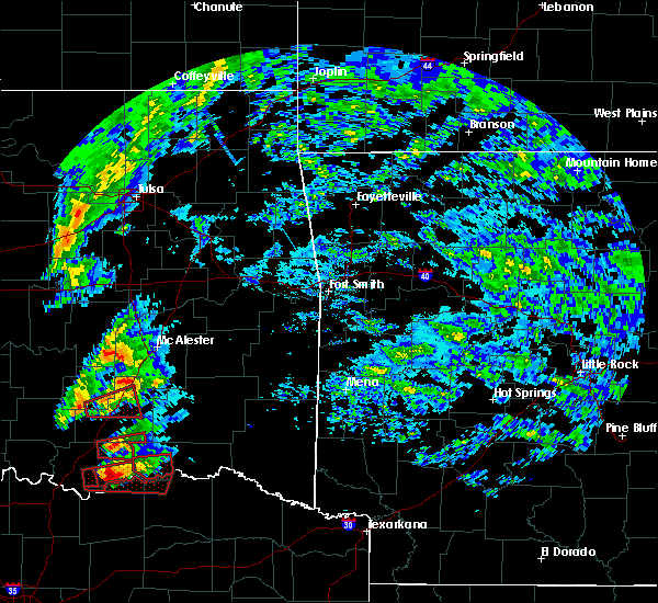 At 555 pm cdt, a severe thunderstorm capable of producing a tornado was located near albany, moving east at 40 mph (radar indicated rotation). Hazards include tornado and golf ball size hail. Flying debris will be dangerous to those caught without shelter. mobile homes will be damaged or destroyed. damage to roofs, windows, and vehicles will occur. tree damage is likely. Locations in or near the path include, boswell, soper, unger,. At 555 pm cdt, a severe thunderstorm capable of producing a tornado was located near albany, moving east at 40 mph (radar indicated rotation). Hazards include tornado and golf ball size hail. Flying debris will be dangerous to those caught without shelter. mobile homes will be damaged or destroyed. damage to roofs, windows, and vehicles will occur. tree damage is likely. Locations in or near the path include, boswell, soper, unger,.
|
| 4/22/2020 2:51 AM CDT |
 At 251 am cdt, a severe thunderstorm was located 7 miles north of boswell, moving east at 45 mph (radar indicated). Hazards include golf ball size hail and 60 mph wind gusts. People and animals outdoors will be injured. expect hail damage to roofs, siding, windows, and vehicles. expect wind damage to roofs, siding, and trees. Locations in or near the path include, hugo, antlers, boswell, soper, kent, kellond, darwin, speer, dela, unger,. At 251 am cdt, a severe thunderstorm was located 7 miles north of boswell, moving east at 45 mph (radar indicated). Hazards include golf ball size hail and 60 mph wind gusts. People and animals outdoors will be injured. expect hail damage to roofs, siding, windows, and vehicles. expect wind damage to roofs, siding, and trees. Locations in or near the path include, hugo, antlers, boswell, soper, kent, kellond, darwin, speer, dela, unger,.
|
| 4/22/2020 2:33 AM CDT |
 At 232 am cdt, a severe thunderstorm was located 6 miles southeast of caney, moving east at 35 mph (radar indicated). Hazards include golf ball size hail and 60 mph wind gusts. People and animals outdoors will be injured. expect hail damage to roofs, siding, windows, and vehicles. expect wind damage to roofs, siding, and trees. Locations in or near the path include, hugo, antlers, boswell, soper, kent, moyers, kellond, darwin, speer, dela, unger, finley,. At 232 am cdt, a severe thunderstorm was located 6 miles southeast of caney, moving east at 35 mph (radar indicated). Hazards include golf ball size hail and 60 mph wind gusts. People and animals outdoors will be injured. expect hail damage to roofs, siding, windows, and vehicles. expect wind damage to roofs, siding, and trees. Locations in or near the path include, hugo, antlers, boswell, soper, kent, moyers, kellond, darwin, speer, dela, unger, finley,.
|
| 3/19/2020 6:22 PM CDT |
 At 622 pm cdt, severe thunderstorms were located along a line extending from 4 miles south of snow to 3 miles southwest of rattan to 8 miles south of soper, moving east at 35 mph (radar indicated). Hazards include 60 mph wind gusts. Expect damage to roofs, siding, and trees. Locations in or near the path include, hugo, antlers, fort towson, sawyer, rattan, soper, snow, hugo lake state park, kent, goodland, messer, raymond gary state park, nashoba, oleta, cloudy, grant, ord, fallon, sobol, frogville, a tornado watch remains in effect until 1000 pm cdt for southeastern oklahoma. At 622 pm cdt, severe thunderstorms were located along a line extending from 4 miles south of snow to 3 miles southwest of rattan to 8 miles south of soper, moving east at 35 mph (radar indicated). Hazards include 60 mph wind gusts. Expect damage to roofs, siding, and trees. Locations in or near the path include, hugo, antlers, fort towson, sawyer, rattan, soper, snow, hugo lake state park, kent, goodland, messer, raymond gary state park, nashoba, oleta, cloudy, grant, ord, fallon, sobol, frogville, a tornado watch remains in effect until 1000 pm cdt for southeastern oklahoma.
|
| 3/19/2020 6:07 PM CDT |
 At 607 pm cdt, severe thunderstorms were located along a line extending from near kellond to kent to 9 miles south of boswell, moving east at 30 mph (radar indicated). Hazards include 60 mph wind gusts and quarter size hail. Hail damage to vehicles is expected. expect wind damage to roofs, siding, and trees. Locations in or near the path include, hugo, antlers, fort towson, sawyer, rattan, soper, snow, hugo lake state park, kellond, kent, goodland, messer, raymond gary state park, moyers, nashoba, kosoma, oleta, cloudy, grant, ord, a tornado watch remains in effect until 1000 pm cdt for southeastern oklahoma. At 607 pm cdt, severe thunderstorms were located along a line extending from near kellond to kent to 9 miles south of boswell, moving east at 30 mph (radar indicated). Hazards include 60 mph wind gusts and quarter size hail. Hail damage to vehicles is expected. expect wind damage to roofs, siding, and trees. Locations in or near the path include, hugo, antlers, fort towson, sawyer, rattan, soper, snow, hugo lake state park, kellond, kent, goodland, messer, raymond gary state park, moyers, nashoba, kosoma, oleta, cloudy, grant, ord, a tornado watch remains in effect until 1000 pm cdt for southeastern oklahoma.
|
| 10/15/2019 4:17 PM CDT |
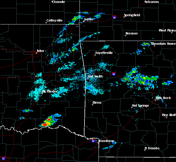 At 417 pm cdt, a severe thunderstorm was located 4 miles southeast of soper, moving southeast at 25 mph (radar indicated). Hazards include 60 mph wind gusts and quarter size hail. Hail damage to vehicles is expected. expect wind damage to roofs, siding, and trees. Locations in or near the path include, hugo, soper, goodland, grant, ord, frogville, gay,. At 417 pm cdt, a severe thunderstorm was located 4 miles southeast of soper, moving southeast at 25 mph (radar indicated). Hazards include 60 mph wind gusts and quarter size hail. Hail damage to vehicles is expected. expect wind damage to roofs, siding, and trees. Locations in or near the path include, hugo, soper, goodland, grant, ord, frogville, gay,.
|
| 7/10/2019 6:12 PM CDT |
 The severe thunderstorm warning for choctaw county will expire at 615 pm cdt, the storms which prompted the warning have weakened below severe limits, and no longer pose an immediate threat to life or property. therefore the warning will be allowed to expire. however gusty winds and heavy rain are still possible with these thunderstorms. to report severe weather, contact your nearest law enforcement agency. they will relay your report to the national weather service tulsa. The severe thunderstorm warning for choctaw county will expire at 615 pm cdt, the storms which prompted the warning have weakened below severe limits, and no longer pose an immediate threat to life or property. therefore the warning will be allowed to expire. however gusty winds and heavy rain are still possible with these thunderstorms. to report severe weather, contact your nearest law enforcement agency. they will relay your report to the national weather service tulsa.
|
| 7/10/2019 6:03 PM CDT |
 A severe thunderstorm warning remains in effect until 615 pm cdt for choctaw county. at 602 pm cdt, severe thunderstorms were located along a line extending from near soper to sawyer, moving south at 25 mph. hazard. 60 mph wind gusts and penny size hail. source. Radar indicated. A severe thunderstorm warning remains in effect until 615 pm cdt for choctaw county. at 602 pm cdt, severe thunderstorms were located along a line extending from near soper to sawyer, moving south at 25 mph. hazard. 60 mph wind gusts and penny size hail. source. Radar indicated.
|
| 7/10/2019 5:36 PM CDT |
 The national weather service in tulsa has issued a * severe thunderstorm warning for. southwestern pushmataha county in southeastern oklahoma. choctaw county in southeastern oklahoma. until 615 pm cdt. At 536 pm cdt, severe thunderstorms were located along a line. The national weather service in tulsa has issued a * severe thunderstorm warning for. southwestern pushmataha county in southeastern oklahoma. choctaw county in southeastern oklahoma. until 615 pm cdt. At 536 pm cdt, severe thunderstorms were located along a line.
|
| 6/19/2019 7:04 PM CDT |
 At 704 pm cdt, a severe thunderstorm was located 4 miles southeast of soper, moving northeast at 35 mph (radar indicated). Hazards include ping pong ball size hail and 60 mph wind gusts. People and animals outdoors will be injured. expect hail damage to roofs, siding, windows, and vehicles. expect wind damage to roofs, siding, and trees. Locations in or near the path include, hugo, soper, goodland, gay, a tornado watch remains in effect until midnight cdt for southeastern oklahoma. At 704 pm cdt, a severe thunderstorm was located 4 miles southeast of soper, moving northeast at 35 mph (radar indicated). Hazards include ping pong ball size hail and 60 mph wind gusts. People and animals outdoors will be injured. expect hail damage to roofs, siding, windows, and vehicles. expect wind damage to roofs, siding, and trees. Locations in or near the path include, hugo, soper, goodland, gay, a tornado watch remains in effect until midnight cdt for southeastern oklahoma.
|
| 6/19/2019 6:58 PM CDT | Hen Egg sized hail reported 0.9 miles NNE of Soper, OK, hail estimated to be 2 inches from picture on social media. time is estimated from radar. |
| 6/19/2019 6:53 PM CDT |
 At 652 pm cdt, a severe thunderstorm was located 4 miles south of soper, moving northeast at 40 mph (radar indicated). Hazards include ping pong ball size hail and 60 mph wind gusts. People and animals outdoors will be injured. expect hail damage to roofs, siding, windows, and vehicles. expect wind damage to roofs, siding, and trees. Locations in or near the path include, hugo, boswell, soper, goodland, unger, gay, a tornado watch remains in effect until midnight cdt for southeastern oklahoma. At 652 pm cdt, a severe thunderstorm was located 4 miles south of soper, moving northeast at 40 mph (radar indicated). Hazards include ping pong ball size hail and 60 mph wind gusts. People and animals outdoors will be injured. expect hail damage to roofs, siding, windows, and vehicles. expect wind damage to roofs, siding, and trees. Locations in or near the path include, hugo, boswell, soper, goodland, unger, gay, a tornado watch remains in effect until midnight cdt for southeastern oklahoma.
|
| 6/19/2019 6:37 PM CDT |
 At 636 pm cdt, a severe thunderstorm was located 8 miles south of boswell, moving northeast at 35 mph (radar indicated). Hazards include two inch hail and 60 mph wind gusts. People and animals outdoors will be injured. expect hail damage to roofs, siding, windows, and vehicles. expect wind damage to roofs, siding, and trees. Locations in or near the path include, hugo, boswell, soper, goodland, unger, gay, a tornado watch remains in effect until midnight cdt for southeastern oklahoma. At 636 pm cdt, a severe thunderstorm was located 8 miles south of boswell, moving northeast at 35 mph (radar indicated). Hazards include two inch hail and 60 mph wind gusts. People and animals outdoors will be injured. expect hail damage to roofs, siding, windows, and vehicles. expect wind damage to roofs, siding, and trees. Locations in or near the path include, hugo, boswell, soper, goodland, unger, gay, a tornado watch remains in effect until midnight cdt for southeastern oklahoma.
|
| 6/19/2019 6:34 PM CDT |
 At 633 pm cdt, a severe thunderstorm was located 9 miles south of boswell, moving northeast at 40 mph (radar indicated). Hazards include ping pong ball size hail and 60 mph wind gusts. People and animals outdoors will be injured. expect hail damage to roofs, siding, windows, and vehicles. expect wind damage to roofs, siding, and trees. Locations in or near the path include, hugo, boswell, soper, goodland, unger, gay, a tornado watch remains in effect until midnight cdt for southeastern oklahoma. At 633 pm cdt, a severe thunderstorm was located 9 miles south of boswell, moving northeast at 40 mph (radar indicated). Hazards include ping pong ball size hail and 60 mph wind gusts. People and animals outdoors will be injured. expect hail damage to roofs, siding, windows, and vehicles. expect wind damage to roofs, siding, and trees. Locations in or near the path include, hugo, boswell, soper, goodland, unger, gay, a tornado watch remains in effect until midnight cdt for southeastern oklahoma.
|
| 6/19/2019 3:17 AM CDT |
 At 316 am cdt, severe thunderstorms were located along a line extending from 4 miles northwest of raiford to 6 miles southeast of scipio to 5 miles northwest of daisy to 9 miles southeast of boswell, moving northeast at 50 mph (radar indicated). Hazards include 70 mph wind gusts and penny size hail. Expect considerable tree damage. damage is likely to mobile homes, roofs, and outbuildings. Locations in or near the path include, mcalester, hugo, wilburton, eufaula, stigler, antlers, clayton, hartshorne, krebs, quinton, kiowa, porum, boswell, savanna, keota, red oak, fort towson, mccurtain, crowder, whitefield,. At 316 am cdt, severe thunderstorms were located along a line extending from 4 miles northwest of raiford to 6 miles southeast of scipio to 5 miles northwest of daisy to 9 miles southeast of boswell, moving northeast at 50 mph (radar indicated). Hazards include 70 mph wind gusts and penny size hail. Expect considerable tree damage. damage is likely to mobile homes, roofs, and outbuildings. Locations in or near the path include, mcalester, hugo, wilburton, eufaula, stigler, antlers, clayton, hartshorne, krebs, quinton, kiowa, porum, boswell, savanna, keota, red oak, fort towson, mccurtain, crowder, whitefield,.
|
| 6/19/2019 2:48 AM CDT |
 At 248 am cdt, severe thunderstorms were located along a line extending from 4 miles west of dustin to 4 miles northwest of calvin to 3 miles northwest of gerty to 6 miles north of coalgate to 2 miles southeast of olney to 2 miles northwest of caney to 8 miles east of albany, moving east at 50 mph (radar indicated). Hazards include 70 mph wind gusts and penny size hail. Expect considerable tree damage. damage is likely to mobile homes, roofs, and outbuildings. Locations in or near the path include, mcalester, hugo, wilburton, eufaula, stigler, antlers, clayton, hartshorne, krebs, quinton, kiowa, porum, boswell, savanna, keota, red oak, fort towson, mccurtain, crowder, whitefield,. At 248 am cdt, severe thunderstorms were located along a line extending from 4 miles west of dustin to 4 miles northwest of calvin to 3 miles northwest of gerty to 6 miles north of coalgate to 2 miles southeast of olney to 2 miles northwest of caney to 8 miles east of albany, moving east at 50 mph (radar indicated). Hazards include 70 mph wind gusts and penny size hail. Expect considerable tree damage. damage is likely to mobile homes, roofs, and outbuildings. Locations in or near the path include, mcalester, hugo, wilburton, eufaula, stigler, antlers, clayton, hartshorne, krebs, quinton, kiowa, porum, boswell, savanna, keota, red oak, fort towson, mccurtain, crowder, whitefield,.
|
| 5/29/2019 2:46 PM CDT |
 At 246 pm cdt, a severe thunderstorm was located 8 miles south of soper, moving northeast at 30 mph (radar indicated). Hazards include 60 mph wind gusts and quarter size hail. Hail damage to vehicles is expected. expect wind damage to roofs, siding, and trees. Locations in or near the path include, hugo, fort towson, sawyer, rattan, soper, kent, goodland, messer, hugo lake state park, oleta, cloudy, grant, ord, corinne, fallon, sobol, apple, speer, dela, gay, a tornado watch remains in effect until 800 pm cdt for southeastern oklahoma. At 246 pm cdt, a severe thunderstorm was located 8 miles south of soper, moving northeast at 30 mph (radar indicated). Hazards include 60 mph wind gusts and quarter size hail. Hail damage to vehicles is expected. expect wind damage to roofs, siding, and trees. Locations in or near the path include, hugo, fort towson, sawyer, rattan, soper, kent, goodland, messer, hugo lake state park, oleta, cloudy, grant, ord, corinne, fallon, sobol, apple, speer, dela, gay, a tornado watch remains in effect until 800 pm cdt for southeastern oklahoma.
|
| 5/18/2019 12:57 PM CDT |
 At 1256 pm cdt, severe thunderstorms were located along a line extending from 3 miles northeast of briartown to talihina to 6 miles northeast of cloudy to 5 miles south of goodland, moving east at 40 mph (radar indicated). Hazards include 60 mph wind gusts. Expect damage to roofs, siding, and trees. Locations in or near the path include, poteau, hugo, wilburton, eufaula, stigler, antlers, clayton, pocola, heavener, spiro, hartshorne, arkoma, panama, talihina, wister, quinton, howe, bonanza, keota, red oak, a tornado watch remains in effect until 500 pm cdt for west central arkansas, and southeastern and east central oklahoma. At 1256 pm cdt, severe thunderstorms were located along a line extending from 3 miles northeast of briartown to talihina to 6 miles northeast of cloudy to 5 miles south of goodland, moving east at 40 mph (radar indicated). Hazards include 60 mph wind gusts. Expect damage to roofs, siding, and trees. Locations in or near the path include, poteau, hugo, wilburton, eufaula, stigler, antlers, clayton, pocola, heavener, spiro, hartshorne, arkoma, panama, talihina, wister, quinton, howe, bonanza, keota, red oak, a tornado watch remains in effect until 500 pm cdt for west central arkansas, and southeastern and east central oklahoma.
|
| 5/18/2019 12:35 PM CDT |
 At 1235 pm cdt, severe thunderstorms were located along a line extending from 3 miles southwest of antlers to 11 miles south of boswell, moving east at 35 mph (radar indicated). Hazards include 70 mph wind gusts. Expect considerable tree damage. damage is likely to mobile homes, roofs, and outbuildings. Locations in or near the path include, hugo, boswell, fort towson, sawyer, soper, kent, goodland, messer, hugo lake state park, raymond gary state park, grant, ord, fallon, frogville, apple, speer, huskey, unger, gay, a tornado watch remains in effect until 500 pm cdt for southeastern oklahoma. At 1235 pm cdt, severe thunderstorms were located along a line extending from 3 miles southwest of antlers to 11 miles south of boswell, moving east at 35 mph (radar indicated). Hazards include 70 mph wind gusts. Expect considerable tree damage. damage is likely to mobile homes, roofs, and outbuildings. Locations in or near the path include, hugo, boswell, fort towson, sawyer, soper, kent, goodland, messer, hugo lake state park, raymond gary state park, grant, ord, fallon, frogville, apple, speer, huskey, unger, gay, a tornado watch remains in effect until 500 pm cdt for southeastern oklahoma.
|
| 5/1/2019 7:59 PM CDT |
 At 759 pm cdt, a severe thunderstorm was located 7 miles south of soper, moving east at 35 mph (radar indicated). Hazards include 60 mph wind gusts and quarter size hail. Hail damage to vehicles is expected. expect wind damage to roofs, siding, and trees. Locations in or near the path include, boswell, soper, kent, unger, gay,. At 759 pm cdt, a severe thunderstorm was located 7 miles south of soper, moving east at 35 mph (radar indicated). Hazards include 60 mph wind gusts and quarter size hail. Hail damage to vehicles is expected. expect wind damage to roofs, siding, and trees. Locations in or near the path include, boswell, soper, kent, unger, gay,.
|
| 5/1/2019 7:43 PM CDT |
 At 743 pm cdt, a severe thunderstorm was located 6 miles south of boswell, moving east at 30 mph (radar indicated). Hazards include 60 mph wind gusts and half dollar size hail. Hail damage to vehicles is expected. expect wind damage to roofs, siding, and trees. Locations in or near the path include, boswell, soper, kent, unger, gay,. At 743 pm cdt, a severe thunderstorm was located 6 miles south of boswell, moving east at 30 mph (radar indicated). Hazards include 60 mph wind gusts and half dollar size hail. Hail damage to vehicles is expected. expect wind damage to roofs, siding, and trees. Locations in or near the path include, boswell, soper, kent, unger, gay,.
|
| 5/1/2019 7:30 PM CDT |
 At 730 pm cdt, a severe thunderstorm was located 4 miles southeast of bennington, moving east at 40 mph (radar indicated). Hazards include 60 mph wind gusts and half dollar size hail. Hail damage to vehicles is expected. expect wind damage to roofs, siding, and trees. Locations in or near the path include, boswell, soper, kent, unger, gay,. At 730 pm cdt, a severe thunderstorm was located 4 miles southeast of bennington, moving east at 40 mph (radar indicated). Hazards include 60 mph wind gusts and half dollar size hail. Hail damage to vehicles is expected. expect wind damage to roofs, siding, and trees. Locations in or near the path include, boswell, soper, kent, unger, gay,.
|
| 3/24/2019 7:05 PM CDT |
 At 704 pm cdt, a severe thunderstorm was located 6 miles south of boswell, moving east at 45 mph (radar indicated). Hazards include 60 mph wind gusts and quarter size hail. Hail damage to vehicles is expected. expect wind damage to roofs, siding, and trees. Locations in or near the path include, hugo, boswell, sawyer, soper, goodland, kent, grant, fallon, unger, gay,. At 704 pm cdt, a severe thunderstorm was located 6 miles south of boswell, moving east at 45 mph (radar indicated). Hazards include 60 mph wind gusts and quarter size hail. Hail damage to vehicles is expected. expect wind damage to roofs, siding, and trees. Locations in or near the path include, hugo, boswell, sawyer, soper, goodland, kent, grant, fallon, unger, gay,.
|
| 3/13/2019 6:38 AM CDT |
 The severe thunderstorm warning for western pushmataha and choctaw counties will expire at 645 am cdt, the storms which prompted the warning have weakened below severe limits, and no longer pose an immediate threat to life or property. therefore the warning will be allowed to expire. however gusty winds are still possible with these thunderstorms. The severe thunderstorm warning for western pushmataha and choctaw counties will expire at 645 am cdt, the storms which prompted the warning have weakened below severe limits, and no longer pose an immediate threat to life or property. therefore the warning will be allowed to expire. however gusty winds are still possible with these thunderstorms.
|
| 3/13/2019 6:05 AM CDT |
 At 605 am cdt, severe thunderstorms were located along a line extending from 4 miles west of tushka to 5 miles east of albany to 4 miles south of dodd city, moving east at 60 mph (radar indicated). Hazards include 70 mph wind gusts. Expect considerable tree damage. damage is likely to mobile homes, roofs, and outbuildings. Locations in or near the path include, hugo, antlers, boswell, fort towson, sawyer, rattan, soper, snow, hugo lake state park, stanley, kellond, kent, goodland, messer, raymond gary state park, moyers, kosoma, dunbar, oleta, cloudy,. At 605 am cdt, severe thunderstorms were located along a line extending from 4 miles west of tushka to 5 miles east of albany to 4 miles south of dodd city, moving east at 60 mph (radar indicated). Hazards include 70 mph wind gusts. Expect considerable tree damage. damage is likely to mobile homes, roofs, and outbuildings. Locations in or near the path include, hugo, antlers, boswell, fort towson, sawyer, rattan, soper, snow, hugo lake state park, stanley, kellond, kent, goodland, messer, raymond gary state park, moyers, kosoma, dunbar, oleta, cloudy,.
|
| 11/30/2018 10:15 PM CST |
 At 948 pm cst, severe thunderstorms were located along a line extending from 4 miles east of ashland to 5 miles west of daisy to 4 miles west of boswell, moving northeast at 70 mph (radar indicated). Hazards include 70 mph wind gusts and nickel size hail. Expect considerable tree damage. damage is likely to mobile homes, roofs, and outbuildings. Locations in or near the path include, mcalester, hugo, wilburton, antlers, clayton, hartshorne, krebs, quinton, kiowa, boswell, savanna, fort towson, sawyer, rattan, alderson, soper, ashland, snow, clayton lake state park, damon, a tornado watch remains in effect until midnight cst for southeastern oklahoma. At 948 pm cst, severe thunderstorms were located along a line extending from 4 miles east of ashland to 5 miles west of daisy to 4 miles west of boswell, moving northeast at 70 mph (radar indicated). Hazards include 70 mph wind gusts and nickel size hail. Expect considerable tree damage. damage is likely to mobile homes, roofs, and outbuildings. Locations in or near the path include, mcalester, hugo, wilburton, antlers, clayton, hartshorne, krebs, quinton, kiowa, boswell, savanna, fort towson, sawyer, rattan, alderson, soper, ashland, snow, clayton lake state park, damon, a tornado watch remains in effect until midnight cst for southeastern oklahoma.
|
| 11/30/2018 9:49 PM CST |
 At 948 pm cst, severe thunderstorms were located along a line extending from 4 miles east of ashland to 5 miles west of daisy to 4 miles west of boswell, moving northeast at 70 mph (radar indicated). Hazards include 70 mph wind gusts and nickel size hail. Expect considerable tree damage. damage is likely to mobile homes, roofs, and outbuildings. Locations in or near the path include, mcalester, hugo, wilburton, antlers, clayton, hartshorne, krebs, quinton, kiowa, boswell, savanna, fort towson, sawyer, rattan, alderson, soper, ashland, snow, clayton lake state park, damon, a tornado watch remains in effect until midnight cst for southeastern oklahoma. At 948 pm cst, severe thunderstorms were located along a line extending from 4 miles east of ashland to 5 miles west of daisy to 4 miles west of boswell, moving northeast at 70 mph (radar indicated). Hazards include 70 mph wind gusts and nickel size hail. Expect considerable tree damage. damage is likely to mobile homes, roofs, and outbuildings. Locations in or near the path include, mcalester, hugo, wilburton, antlers, clayton, hartshorne, krebs, quinton, kiowa, boswell, savanna, fort towson, sawyer, rattan, alderson, soper, ashland, snow, clayton lake state park, damon, a tornado watch remains in effect until midnight cst for southeastern oklahoma.
|
| 4/13/2018 5:59 PM CDT |
 At 559 pm cdt, severe thunderstorms were located along a line extending from 2 miles northeast of kosoma to 3 miles northeast of soper, moving northeast at 45 mph (radar indicated). Hazards include 60 mph wind gusts and quarter size hail. Hail damage to vehicles is expected. expect wind damage to roofs, siding, and trees. Locations in or near the path include, antlers, clayton, rattan, soper, snow, tuskahoma, stanley, kiamichi, kellond, clayton lake state park, kent, messer, moyers, nashoba, kosoma, dunbar, cloudy, oleta, sobol, eubanks, a tornado watch remains in effect until 1000 pm cdt for southeastern oklahoma. At 559 pm cdt, severe thunderstorms were located along a line extending from 2 miles northeast of kosoma to 3 miles northeast of soper, moving northeast at 45 mph (radar indicated). Hazards include 60 mph wind gusts and quarter size hail. Hail damage to vehicles is expected. expect wind damage to roofs, siding, and trees. Locations in or near the path include, antlers, clayton, rattan, soper, snow, tuskahoma, stanley, kiamichi, kellond, clayton lake state park, kent, messer, moyers, nashoba, kosoma, dunbar, cloudy, oleta, sobol, eubanks, a tornado watch remains in effect until 1000 pm cdt for southeastern oklahoma.
|
| 4/13/2018 5:33 PM CDT |
 At 532 pm cdt, a severe thunderstorm was located 6 miles north of boswell, moving northeast at 45 mph (radar indicated). Hazards include golf ball size hail and 70 mph wind gusts. People and animals outdoors will be injured. expect hail damage to roofs, siding, windows, and vehicles. expect considerable tree damage. wind damage is also likely to mobile homes, roofs, and outbuildings. Locations in or near the path include, antlers, boswell, rattan, soper, kent, snow, messer, moyers, kosoma, kellond, oleta, corinne, sobol, darwin, apple, speer, dela, unger, finley, a tornado watch remains in effect until 1000 pm cdt for southeastern oklahoma. At 532 pm cdt, a severe thunderstorm was located 6 miles north of boswell, moving northeast at 45 mph (radar indicated). Hazards include golf ball size hail and 70 mph wind gusts. People and animals outdoors will be injured. expect hail damage to roofs, siding, windows, and vehicles. expect considerable tree damage. wind damage is also likely to mobile homes, roofs, and outbuildings. Locations in or near the path include, antlers, boswell, rattan, soper, kent, snow, messer, moyers, kosoma, kellond, oleta, corinne, sobol, darwin, apple, speer, dela, unger, finley, a tornado watch remains in effect until 1000 pm cdt for southeastern oklahoma.
|
| 4/13/2018 5:20 PM CDT |
 At 519 pm cdt, a severe thunderstorm was located 3 miles northeast of bennington, moving northeast at 55 mph (radar indicated). Hazards include 60 mph wind gusts and half dollar size hail. Hail damage to vehicles is expected. expect wind damage to roofs, siding, and trees. Locations in or near the path include, antlers, boswell, rattan, soper, kent, snow, messer, moyers, kosoma, kellond, oleta, corinne, sobol, darwin, apple, speer, dela, unger, finley, a tornado watch remains in effect until 1000 pm cdt for southeastern oklahoma. At 519 pm cdt, a severe thunderstorm was located 3 miles northeast of bennington, moving northeast at 55 mph (radar indicated). Hazards include 60 mph wind gusts and half dollar size hail. Hail damage to vehicles is expected. expect wind damage to roofs, siding, and trees. Locations in or near the path include, antlers, boswell, rattan, soper, kent, snow, messer, moyers, kosoma, kellond, oleta, corinne, sobol, darwin, apple, speer, dela, unger, finley, a tornado watch remains in effect until 1000 pm cdt for southeastern oklahoma.
|
| 7/23/2017 8:43 PM CDT |
 The severe thunderstorm warning for choctaw county will expire at 845 pm cdt. the storms which prompted the warning have moved out of the area. therefore the warning will be allowed to expire. however gusty winds and heavy rain are still possible with these thunderstorms. To report severe weather, contact your nearest law enforcement. The severe thunderstorm warning for choctaw county will expire at 845 pm cdt. the storms which prompted the warning have moved out of the area. therefore the warning will be allowed to expire. however gusty winds and heavy rain are still possible with these thunderstorms. To report severe weather, contact your nearest law enforcement.
|
| 7/23/2017 8:17 PM CDT |
 At 816 pm cdt, severe thunderstorms were located along a line extending from near sawyer to 10 miles south of boswell, moving southeast at 35 mph (radar indicated. at 810 pm, wind gusts to 63 mph were reported from the hugo mesonet site). Hazards include 70 mph wind gusts. Expect considerable tree damage. damage is likely to mobile homes, roofs, and outbuildings. Locations in or near the path include, hugo, boswell, sawyer, soper, goodland, messer, hugo lake state park, raymond gary state park, grant, ord, fallon, frogville, apple, unger, huskey, gay,. At 816 pm cdt, severe thunderstorms were located along a line extending from near sawyer to 10 miles south of boswell, moving southeast at 35 mph (radar indicated. at 810 pm, wind gusts to 63 mph were reported from the hugo mesonet site). Hazards include 70 mph wind gusts. Expect considerable tree damage. damage is likely to mobile homes, roofs, and outbuildings. Locations in or near the path include, hugo, boswell, sawyer, soper, goodland, messer, hugo lake state park, raymond gary state park, grant, ord, fallon, frogville, apple, unger, huskey, gay,.
|
| 7/1/2017 12:22 AM CDT |
 At 1221 am cdt, severe thunderstorms were located along a line extending from 5 miles west of goodland to near sawyer, moving east at 30 mph (radar indicated). Hazards include 60 mph wind gusts. Expect damage to roofs, siding, and trees. Locations in or near the path include, hugo, fort towson, sawyer, soper, goodland, messer, hugo lake state park, raymond gary state park, grant, ord, fallon, swink, frogville, huskey, gay,. At 1221 am cdt, severe thunderstorms were located along a line extending from 5 miles west of goodland to near sawyer, moving east at 30 mph (radar indicated). Hazards include 60 mph wind gusts. Expect damage to roofs, siding, and trees. Locations in or near the path include, hugo, fort towson, sawyer, soper, goodland, messer, hugo lake state park, raymond gary state park, grant, ord, fallon, swink, frogville, huskey, gay,.
|
| 6/30/2017 11:54 PM CDT |
 At 1154 pm cdt, severe thunderstorms were located along a line extending from 4 miles southwest of boswell to near hugo, moving east at 35 mph (radar indicated). Hazards include 60 mph wind gusts and quarter size hail. Hail damage to vehicles is expected. expect wind damage to roofs, siding, and trees. Locations in or near the path include, hugo, boswell, fort towson, sawyer, soper, kent, goodland, messer, hugo lake state park, raymond gary state park, grant, ord, fallon, swink, frogville, apple, speer, unger, huskey, gay,. At 1154 pm cdt, severe thunderstorms were located along a line extending from 4 miles southwest of boswell to near hugo, moving east at 35 mph (radar indicated). Hazards include 60 mph wind gusts and quarter size hail. Hail damage to vehicles is expected. expect wind damage to roofs, siding, and trees. Locations in or near the path include, hugo, boswell, fort towson, sawyer, soper, kent, goodland, messer, hugo lake state park, raymond gary state park, grant, ord, fallon, swink, frogville, apple, speer, unger, huskey, gay,.
|
| 6/30/2017 11:38 PM CDT |
 At 1138 pm cdt, severe thunderstorms were located along a line extending from 4 miles east of albany to 3 miles southeast of goodland, moving east at 55 mph (radar indicated). Hazards include 60 mph wind gusts and quarter size hail. Hail damage to vehicles is expected. expect wind damage to roofs, siding, and trees. Locations in or near the path include, hugo, boswell, fort towson, sawyer, soper, kent, goodland, messer, hugo lake state park, raymond gary state park, grant, ord, fallon, swink, frogville, apple, speer, unger, huskey, gay,. At 1138 pm cdt, severe thunderstorms were located along a line extending from 4 miles east of albany to 3 miles southeast of goodland, moving east at 55 mph (radar indicated). Hazards include 60 mph wind gusts and quarter size hail. Hail damage to vehicles is expected. expect wind damage to roofs, siding, and trees. Locations in or near the path include, hugo, boswell, fort towson, sawyer, soper, kent, goodland, messer, hugo lake state park, raymond gary state park, grant, ord, fallon, swink, frogville, apple, speer, unger, huskey, gay,.
|
| 4/21/2017 8:48 PM CDT |
 At 848 pm cdt, a severe thunderstorm was located 3 miles north of soper, moving east at 35 mph (radar indicated). Hazards include 60 mph wind gusts and quarter size hail. Hail damage to vehicles is expected. expect wind damage to roofs, siding, and trees. Locations in or near the path include, hugo, fort towson, sawyer, soper, kent, goodland, messer, hugo lake state park, raymond gary state park, grant, ord, fallon, swink, frogville, speer, unger, huskey, gay, a tornado watch remains in effect until 100 am cdt for southeastern oklahoma. At 848 pm cdt, a severe thunderstorm was located 3 miles north of soper, moving east at 35 mph (radar indicated). Hazards include 60 mph wind gusts and quarter size hail. Hail damage to vehicles is expected. expect wind damage to roofs, siding, and trees. Locations in or near the path include, hugo, fort towson, sawyer, soper, kent, goodland, messer, hugo lake state park, raymond gary state park, grant, ord, fallon, swink, frogville, speer, unger, huskey, gay, a tornado watch remains in effect until 100 am cdt for southeastern oklahoma.
|
| 4/21/2017 7:37 PM CDT |
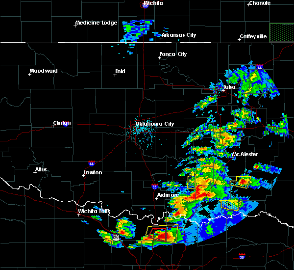 The severe thunderstorm warning for northwestern choctaw county will expire at 745 pm cdt, the storm which prompted the warning has weakened below severe limits, and no longer poses an immediate threat to life or property. therefore the warning will be allowed to expire. a tornado watch remains in effect until 100 am cdt for southeastern oklahoma. The severe thunderstorm warning for northwestern choctaw county will expire at 745 pm cdt, the storm which prompted the warning has weakened below severe limits, and no longer poses an immediate threat to life or property. therefore the warning will be allowed to expire. a tornado watch remains in effect until 100 am cdt for southeastern oklahoma.
|
| 4/21/2017 7:23 PM CDT |
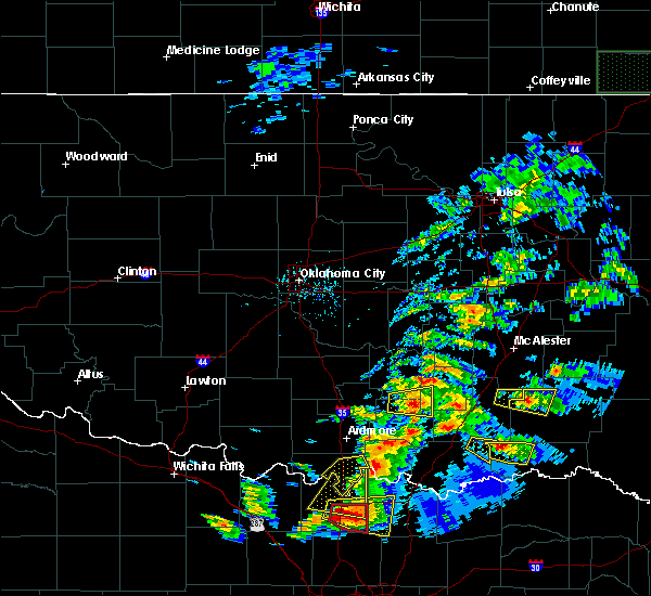 At 722 pm cdt, a severe thunderstorm was located 6 miles north of boswell, moving east at 30 mph (radar indicated). Hazards include golf ball size hail and 70 mph wind gusts. People and animals outdoors will be injured. expect hail damage to roofs, siding, windows, and vehicles. expect considerable tree damage. wind damage is also likely to mobile homes, roofs, and outbuildings. Locations in or near the path include, boswell, soper, kent, unger, a tornado watch remains in effect until 100 am cdt for southeastern oklahoma. At 722 pm cdt, a severe thunderstorm was located 6 miles north of boswell, moving east at 30 mph (radar indicated). Hazards include golf ball size hail and 70 mph wind gusts. People and animals outdoors will be injured. expect hail damage to roofs, siding, windows, and vehicles. expect considerable tree damage. wind damage is also likely to mobile homes, roofs, and outbuildings. Locations in or near the path include, boswell, soper, kent, unger, a tornado watch remains in effect until 100 am cdt for southeastern oklahoma.
|
| 4/21/2017 6:56 PM CDT |
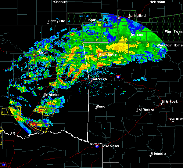 At 655 pm cdt, a severe thunderstorm was located 9 miles north of bennington, moving east at 35 mph (radar indicated). Hazards include golf ball size hail and 70 mph wind gusts. People and animals outdoors will be injured. expect hail damage to roofs, siding, windows, and vehicles. expect considerable tree damage. wind damage is also likely to mobile homes, roofs, and outbuildings. Locations in or near the path include, boswell, soper, kent, unger, a tornado watch remains in effect until 100 am cdt for southeastern oklahoma. At 655 pm cdt, a severe thunderstorm was located 9 miles north of bennington, moving east at 35 mph (radar indicated). Hazards include golf ball size hail and 70 mph wind gusts. People and animals outdoors will be injured. expect hail damage to roofs, siding, windows, and vehicles. expect considerable tree damage. wind damage is also likely to mobile homes, roofs, and outbuildings. Locations in or near the path include, boswell, soper, kent, unger, a tornado watch remains in effect until 100 am cdt for southeastern oklahoma.
|
| 4/4/2017 7:32 PM CDT |
 At 732 pm cdt, severe thunderstorms were 12 miles north of honey grove and 4 miles west of goodland, moving northeast at 50 mph (radar indicated). Hazards include 60 mph wind gusts and quarter size hail. Hail damage to vehicles is expected. expect wind damage to roofs, siding, and trees. Locations in or near the path include, hugo, fort towson, sawyer, rattan, soper, kent, goodland, messer, hugo lake state park, raymond gary state park, oleta, cloudy, grant, ord, corinne, sobol, fallon, swink, frogville, apple,. At 732 pm cdt, severe thunderstorms were 12 miles north of honey grove and 4 miles west of goodland, moving northeast at 50 mph (radar indicated). Hazards include 60 mph wind gusts and quarter size hail. Hail damage to vehicles is expected. expect wind damage to roofs, siding, and trees. Locations in or near the path include, hugo, fort towson, sawyer, rattan, soper, kent, goodland, messer, hugo lake state park, raymond gary state park, oleta, cloudy, grant, ord, corinne, sobol, fallon, swink, frogville, apple,.
|
| 5/9/2016 7:18 PM CDT |
 At 717 pm cdt, a confirmed tornado was located near messer, moving northeast at 30 mph. another severe thunderstorm with strong low level rotation was located 5 miles east of soper, moving east at 30 mph (weather spotters confirmed tornado). Hazards include damaging tornado and golf ball size hail. Flying debris will be dangerous to those caught without shelter. mobile homes will be damaged or destroyed. damage to roofs, windows, and vehicles will occur. tree damage is likely. Locations in or near the path include, hugo, fort towson, sawyer, soper, hugo lake state park, messer, raymond gary state park, kent, goodland, speer, apple, swink, fallon, huskey,. At 717 pm cdt, a confirmed tornado was located near messer, moving northeast at 30 mph. another severe thunderstorm with strong low level rotation was located 5 miles east of soper, moving east at 30 mph (weather spotters confirmed tornado). Hazards include damaging tornado and golf ball size hail. Flying debris will be dangerous to those caught without shelter. mobile homes will be damaged or destroyed. damage to roofs, windows, and vehicles will occur. tree damage is likely. Locations in or near the path include, hugo, fort towson, sawyer, soper, hugo lake state park, messer, raymond gary state park, kent, goodland, speer, apple, swink, fallon, huskey,.
|
| 5/9/2016 7:06 PM CDT |
 At 704 pm cdt, a confirmed tornado was located near hugo, moving east at 35 mph. another severe thunderstorm with strong low level rotation was located near unger, moving east at 30 mph (weather spotters confirmed tornado). Hazards include damaging tornado and golf ball size hail. Flying debris will be dangerous to those caught without shelter. mobile homes will be damaged or destroyed. damage to roofs, windows, and vehicles will occur. tree damage is likely. Locations in or near the path include, hugo, fort towson, sawyer, soper, hugo lake state park, messer, raymond gary state park, kent, goodland, speer, apple, swink, fallon, huskey,. At 704 pm cdt, a confirmed tornado was located near hugo, moving east at 35 mph. another severe thunderstorm with strong low level rotation was located near unger, moving east at 30 mph (weather spotters confirmed tornado). Hazards include damaging tornado and golf ball size hail. Flying debris will be dangerous to those caught without shelter. mobile homes will be damaged or destroyed. damage to roofs, windows, and vehicles will occur. tree damage is likely. Locations in or near the path include, hugo, fort towson, sawyer, soper, hugo lake state park, messer, raymond gary state park, kent, goodland, speer, apple, swink, fallon, huskey,.
|
| 5/9/2016 6:53 PM CDT |
 At 653 pm cdt, a confirmed tornado was located 3 miles southeast of soper, moving east at 35 mph (law enforcement confirmed tornado). Hazards include damaging tornado and golf ball size hail. Flying debris will be dangerous to those caught without shelter. mobile homes will be damaged or destroyed. damage to roofs, windows, and vehicles will occur. tree damage is likely. Locations in or near the path include, hugo, fort towson, sawyer, soper, hugo lake state park, messer, raymond gary state park, kent, goodland, speer, apple, swink, fallon, huskey,. At 653 pm cdt, a confirmed tornado was located 3 miles southeast of soper, moving east at 35 mph (law enforcement confirmed tornado). Hazards include damaging tornado and golf ball size hail. Flying debris will be dangerous to those caught without shelter. mobile homes will be damaged or destroyed. damage to roofs, windows, and vehicles will occur. tree damage is likely. Locations in or near the path include, hugo, fort towson, sawyer, soper, hugo lake state park, messer, raymond gary state park, kent, goodland, speer, apple, swink, fallon, huskey,.
|
| 5/9/2016 6:49 PM CDT |
 At 649 pm cdt, a confirmed tornado was located over soper, moving east at 35 mph (law enforcement confirmed tornado). Hazards include damaging tornado and golf ball size hail. Flying debris will be dangerous to those caught without shelter. mobile homes will be damaged or destroyed. damage to roofs, windows, and vehicles will occur. tree damage is likely. Locations in or near the path include, soper, kent, goodland, speer,. At 649 pm cdt, a confirmed tornado was located over soper, moving east at 35 mph (law enforcement confirmed tornado). Hazards include damaging tornado and golf ball size hail. Flying debris will be dangerous to those caught without shelter. mobile homes will be damaged or destroyed. damage to roofs, windows, and vehicles will occur. tree damage is likely. Locations in or near the path include, soper, kent, goodland, speer,.
|
| 5/9/2016 6:37 PM CDT |
 At 636 pm cdt, a confirmed large and extremely dangerous tornado was located near boswell, moving east at 25 mph. this is a particularly dangerous situation. take cover now! (law enforcement confirmed tornado). Hazards include damaging tornado. You are in a life-threatening situation. flying debris may be deadly to those caught without shelter. mobile homes will be destroyed. considerable damage to homes, businesses, and vehicles is likely and complete destruction is possible. Locations in or near the path include, boswell, soper, kent, goodland, speer, gay, unger,. At 636 pm cdt, a confirmed large and extremely dangerous tornado was located near boswell, moving east at 25 mph. this is a particularly dangerous situation. take cover now! (law enforcement confirmed tornado). Hazards include damaging tornado. You are in a life-threatening situation. flying debris may be deadly to those caught without shelter. mobile homes will be destroyed. considerable damage to homes, businesses, and vehicles is likely and complete destruction is possible. Locations in or near the path include, boswell, soper, kent, goodland, speer, gay, unger,.
|
| 5/9/2016 6:24 PM CDT |
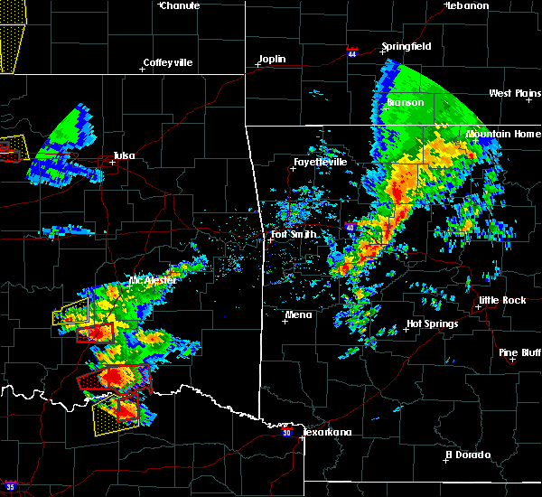 At 623 pm cdt, a severe thunderstorm with strong low level rotation that could produce a tornado at any time was located near boswell, moving east at 30 mph (radar indicated rotation). Hazards include tornado and golf ball size hail. Flying debris will be dangerous to those caught without shelter. mobile homes will be damaged or destroyed. damage to roofs, windows, and vehicles will occur. tree damage is likely. Locations in or near the path include, boswell, soper, kent, goodland, speer, gay, unger,. At 623 pm cdt, a severe thunderstorm with strong low level rotation that could produce a tornado at any time was located near boswell, moving east at 30 mph (radar indicated rotation). Hazards include tornado and golf ball size hail. Flying debris will be dangerous to those caught without shelter. mobile homes will be damaged or destroyed. damage to roofs, windows, and vehicles will occur. tree damage is likely. Locations in or near the path include, boswell, soper, kent, goodland, speer, gay, unger,.
|
| 5/9/2016 6:12 PM CDT |
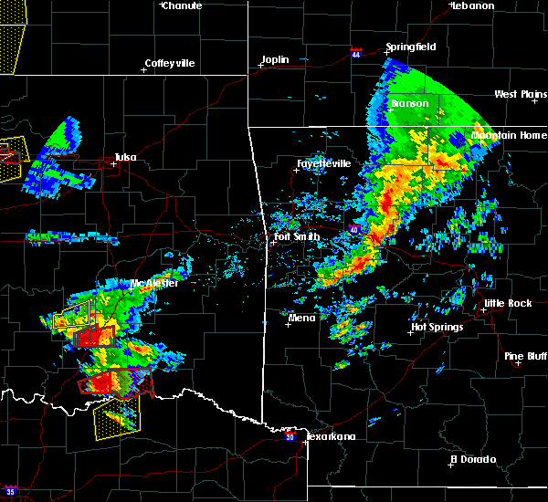 At 612 pm cdt, a severe thunderstorm with strong low level rotation that could produce a tornado at any time was located 3 miles south of bennington, moving east at 35 mph (radar indicated rotation). Hazards include tornado and golf ball size hail. Flying debris will be dangerous to those caught without shelter. mobile homes will be damaged or destroyed. damage to roofs, windows, and vehicles will occur. tree damage is likely. Locations in or near the path include, boswell, soper, kent, goodland, speer, gay, unger,. At 612 pm cdt, a severe thunderstorm with strong low level rotation that could produce a tornado at any time was located 3 miles south of bennington, moving east at 35 mph (radar indicated rotation). Hazards include tornado and golf ball size hail. Flying debris will be dangerous to those caught without shelter. mobile homes will be damaged or destroyed. damage to roofs, windows, and vehicles will occur. tree damage is likely. Locations in or near the path include, boswell, soper, kent, goodland, speer, gay, unger,.
|
| 4/26/2016 10:51 PM CDT |
 At 1051 pm cdt, severe thunderstorms were located along a line extending from 9 miles west of daisy to 4 miles southeast of bonham state park, moving east at 35 mph (radar indicated). Hazards include 70 mph wind gusts. Expect considerable tree damage. damage is likely to mobile homes, roofs, and outbuildings. Locations in or near the path include, hugo, antlers, clayton, boswell, rattan, soper, hugo lake state park, messer, kent, tuskahoma, stanley, clayton lake state park, kosoma, yanush, snow, kellond, moyers, dunbar, goodland, oleta,. At 1051 pm cdt, severe thunderstorms were located along a line extending from 9 miles west of daisy to 4 miles southeast of bonham state park, moving east at 35 mph (radar indicated). Hazards include 70 mph wind gusts. Expect considerable tree damage. damage is likely to mobile homes, roofs, and outbuildings. Locations in or near the path include, hugo, antlers, clayton, boswell, rattan, soper, hugo lake state park, messer, kent, tuskahoma, stanley, clayton lake state park, kosoma, yanush, snow, kellond, moyers, dunbar, goodland, oleta,.
|
| 4/11/2016 3:36 PM CDT |
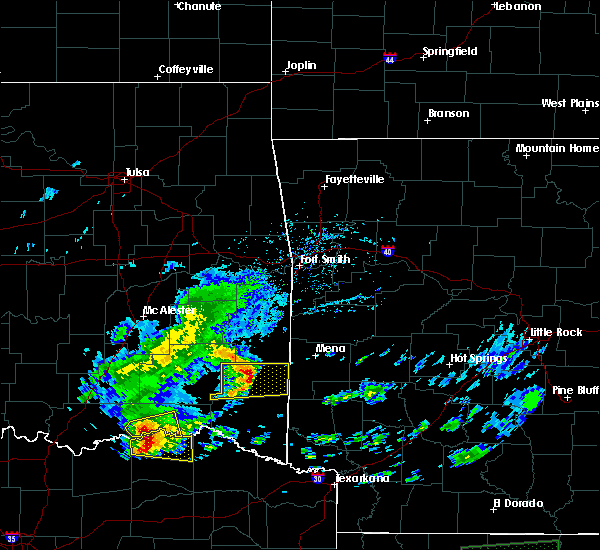 At 336 pm cdt, severe thunderstorms were located along a line extending from 5 miles southwest of soper to 12 miles northwest of paris, moving east at 35 mph (radar indicated). Hazards include 60 mph wind gusts and half dollar size hail. Hail damage to vehicles is expected. expect wind damage to roofs, siding, and trees. Locations in or near the path include, hugo, soper, goodland, messer, grant, ord, gay,. At 336 pm cdt, severe thunderstorms were located along a line extending from 5 miles southwest of soper to 12 miles northwest of paris, moving east at 35 mph (radar indicated). Hazards include 60 mph wind gusts and half dollar size hail. Hail damage to vehicles is expected. expect wind damage to roofs, siding, and trees. Locations in or near the path include, hugo, soper, goodland, messer, grant, ord, gay,.
|
| 4/11/2016 3:26 PM CDT |
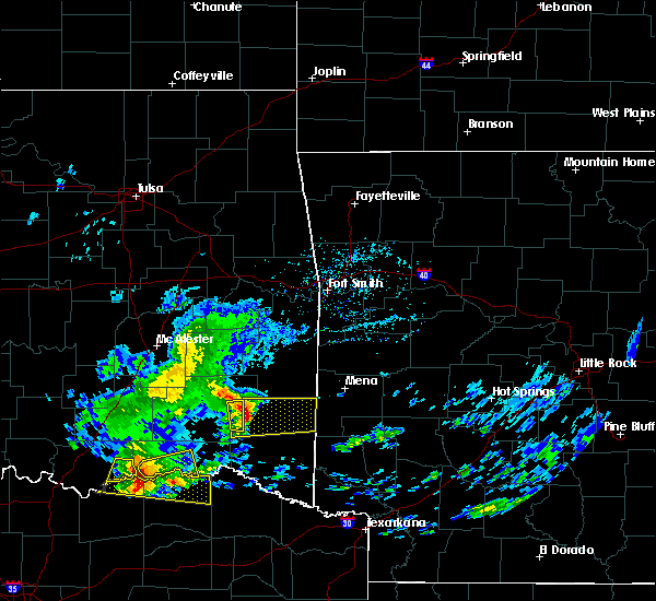 At 326 pm cdt, severe thunderstorms were located along a line extending from 4 miles southeast of boswell to 15 miles northeast of honey grove, moving east at 35 mph (radar indicated). Hazards include 60 mph wind gusts and half dollar size hail. Hail damage to vehicles is expected. expect wind damage to roofs, siding, and trees. Locations in or near the path include, hugo, soper, goodland, messer, grant, ord, gay,. At 326 pm cdt, severe thunderstorms were located along a line extending from 4 miles southeast of boswell to 15 miles northeast of honey grove, moving east at 35 mph (radar indicated). Hazards include 60 mph wind gusts and half dollar size hail. Hail damage to vehicles is expected. expect wind damage to roofs, siding, and trees. Locations in or near the path include, hugo, soper, goodland, messer, grant, ord, gay,.
|
| 4/11/2016 3:12 PM CDT |
 At 312 pm cdt, severe thunderstorms were located along a line extending from 4 miles southeast of bennington to 14 miles southeast of albany, moving east at 35 mph (radar indicated). Hazards include golf ball size hail and 60 mph wind gusts. People and animals outdoors will be injured. expect hail damage to roofs, siding, windows, and vehicles. expect wind damage to roofs, siding, and trees. Locations in or near the path include, hugo, boswell, soper, goodland, messer, grant, ord, gay, unger,. At 312 pm cdt, severe thunderstorms were located along a line extending from 4 miles southeast of bennington to 14 miles southeast of albany, moving east at 35 mph (radar indicated). Hazards include golf ball size hail and 60 mph wind gusts. People and animals outdoors will be injured. expect hail damage to roofs, siding, windows, and vehicles. expect wind damage to roofs, siding, and trees. Locations in or near the path include, hugo, boswell, soper, goodland, messer, grant, ord, gay, unger,.
|
| 3/23/2016 9:56 PM CDT |
 The severe thunderstorm warning for northwestern choctaw and southwestern pushmataha counties will expire at 1000 pm cdt, the storm which prompted the warning has weakened below severe limits, and no longer poses an immediate threat to life or property. therefore the warning will be allowed to expire. however small hail is still possible with this thunderstorm. a severe thunderstorm watch remains in effect until midnight cdt for southeastern oklahoma. The severe thunderstorm warning for northwestern choctaw and southwestern pushmataha counties will expire at 1000 pm cdt, the storm which prompted the warning has weakened below severe limits, and no longer poses an immediate threat to life or property. therefore the warning will be allowed to expire. however small hail is still possible with this thunderstorm. a severe thunderstorm watch remains in effect until midnight cdt for southeastern oklahoma.
|
| 3/23/2016 9:11 PM CDT |
 At 911 pm cdt, a severe thunderstorm was located 4 miles northeast of bennington, moving east at 45 mph (radar indicated). Hazards include 60 mph wind gusts and quarter size hail. Hail damage to vehicles is expected. expect wind damage to roofs, siding, and trees. Locations in or near the path include, hugo, antlers, boswell, soper, kent, kellond, goodland, speer, dela, unger,. At 911 pm cdt, a severe thunderstorm was located 4 miles northeast of bennington, moving east at 45 mph (radar indicated). Hazards include 60 mph wind gusts and quarter size hail. Hail damage to vehicles is expected. expect wind damage to roofs, siding, and trees. Locations in or near the path include, hugo, antlers, boswell, soper, kent, kellond, goodland, speer, dela, unger,.
|
| 3/18/2016 10:30 AM CDT |
 At 1029 am cdt, severe thunderstorms were located along a line extending from 4 miles east of soper to 9 miles southeast of boswell, moving southeast at 30 mph (radar indicated). Hazards include half dollar size hail. Damage to vehicles is expected. Locations in or near the path include, hugo, sawyer, soper, kent, hugo lake state park, messer, goodland, grant, speer, ord, gay, fallon, apple,. At 1029 am cdt, severe thunderstorms were located along a line extending from 4 miles east of soper to 9 miles southeast of boswell, moving southeast at 30 mph (radar indicated). Hazards include half dollar size hail. Damage to vehicles is expected. Locations in or near the path include, hugo, sawyer, soper, kent, hugo lake state park, messer, goodland, grant, speer, ord, gay, fallon, apple,.
|
| 3/18/2016 10:21 AM CDT |
 At 1018 am cdt, severe thunderstorms were located 2 miles north of soper and 3 miles south of boswell, moving east at 30 mph. the stronger severe thunderstorm was located 2 miles north of soper and is capable of producing golf ball size hail (radar indicated). Hazards include golf ball size hail. People and animals outdoors will be injured. expect damage to roofs, siding, windows, and vehicles. Locations in or near the path include, hugo, boswell, sawyer, soper, hugo lake state park, messer, kent, goodland, grant, speer, apple, gay, ord, unger, fallon,. At 1018 am cdt, severe thunderstorms were located 2 miles north of soper and 3 miles south of boswell, moving east at 30 mph. the stronger severe thunderstorm was located 2 miles north of soper and is capable of producing golf ball size hail (radar indicated). Hazards include golf ball size hail. People and animals outdoors will be injured. expect damage to roofs, siding, windows, and vehicles. Locations in or near the path include, hugo, boswell, sawyer, soper, hugo lake state park, messer, kent, goodland, grant, speer, apple, gay, ord, unger, fallon,.
|
| 3/18/2016 10:13 AM CDT |
 At 1013 am cdt, a severe thunderstorm was located near soper, moving east at 30 mph (radar indicated). Hazards include golf ball size hail. People and animals outdoors will be injured. expect damage to roofs, siding, windows, and vehicles. Locations in or near the path include, hugo, boswell, sawyer, soper, hugo lake state park, messer, kent, goodland, grant, speer, apple, gay, ord, unger, fallon,. At 1013 am cdt, a severe thunderstorm was located near soper, moving east at 30 mph (radar indicated). Hazards include golf ball size hail. People and animals outdoors will be injured. expect damage to roofs, siding, windows, and vehicles. Locations in or near the path include, hugo, boswell, sawyer, soper, hugo lake state park, messer, kent, goodland, grant, speer, apple, gay, ord, unger, fallon,.
|
| 3/18/2016 10:06 AM CDT |
 At 1006 am cdt, a severe thunderstorm was located 4 miles northwest of soper, moving east at 25 mph (radar indicated). Hazards include quarter size hail. Damage to vehicles is expected. Locations in or near the path include, boswell, soper, kent, unger,. At 1006 am cdt, a severe thunderstorm was located 4 miles northwest of soper, moving east at 25 mph (radar indicated). Hazards include quarter size hail. Damage to vehicles is expected. Locations in or near the path include, boswell, soper, kent, unger,.
|
| 3/18/2016 10:04 AM CDT |
 At 1003 am cdt, a severe thunderstorm was located 6 miles northwest of soper, moving east at 30 mph (radar indicated). Hazards include quarter size hail. Damage to vehicles is expected. Locations in or near the path include, boswell, soper, kent, unger,. At 1003 am cdt, a severe thunderstorm was located 6 miles northwest of soper, moving east at 30 mph (radar indicated). Hazards include quarter size hail. Damage to vehicles is expected. Locations in or near the path include, boswell, soper, kent, unger,.
|
| 3/18/2016 9:59 AM CDT |
 At 958 am cdt, a severe thunderstorm was located 5 miles northeast of boswell, moving east at 30 mph (radar indicated). Hazards include golf ball size hail. People and animals outdoors will be injured. expect damage to roofs, siding, windows, and vehicles. Locations in or near the path include, boswell, soper, kent, unger,. At 958 am cdt, a severe thunderstorm was located 5 miles northeast of boswell, moving east at 30 mph (radar indicated). Hazards include golf ball size hail. People and animals outdoors will be injured. expect damage to roofs, siding, windows, and vehicles. Locations in or near the path include, boswell, soper, kent, unger,.
|
| 3/18/2016 9:45 AM CDT |
 At 945 am cdt, a severe thunderstorm was located 9 miles northwest of boswell, moving east at 30 mph (radar indicated). Hazards include golf ball size hail. People and animals outdoors will be injured. expect damage to roofs, siding, windows, and vehicles. Locations in or near the path include, boswell, soper, kent, unger,. At 945 am cdt, a severe thunderstorm was located 9 miles northwest of boswell, moving east at 30 mph (radar indicated). Hazards include golf ball size hail. People and animals outdoors will be injured. expect damage to roofs, siding, windows, and vehicles. Locations in or near the path include, boswell, soper, kent, unger,.
|
| 3/18/2016 9:37 AM CDT |
 At 937 am cdt, a severe thunderstorm was located 9 miles south of lane, moving east at 30 mph (radar indicated). Hazards include quarter size hail. Damage to vehicles is expected. Locations in or near the path include, boswell, soper, kent, unger,. At 937 am cdt, a severe thunderstorm was located 9 miles south of lane, moving east at 30 mph (radar indicated). Hazards include quarter size hail. Damage to vehicles is expected. Locations in or near the path include, boswell, soper, kent, unger,.
|
| 11/17/2015 6:00 AM CST |
 At 600 am cst, severe thunderstorms were located along a line extending from near kosoma to 2 miles northwest of goodland, moving northeast at 40 mph (radar indicated). Hazards include 60 mph wind gusts. Damage to roofs. siding and trees will be possible. Locations in or near the path include, hugo, antlers, fort towson, sawyer, rattan, soper, hugo lake state park, messer, kent, cloudy, kosoma, snow, kellond, moyers, raymond gary state park, goodland, oleta, grant, corinne, dela,. At 600 am cst, severe thunderstorms were located along a line extending from near kosoma to 2 miles northwest of goodland, moving northeast at 40 mph (radar indicated). Hazards include 60 mph wind gusts. Damage to roofs. siding and trees will be possible. Locations in or near the path include, hugo, antlers, fort towson, sawyer, rattan, soper, hugo lake state park, messer, kent, cloudy, kosoma, snow, kellond, moyers, raymond gary state park, goodland, oleta, grant, corinne, dela,.
|
| 11/17/2015 5:29 AM CST |
 At 529 am cst, severe thunderstorms were located along a line extending from 9 miles north of boswell to 15 miles southeast of bennington, moving northeast at 30 mph (radar indicated). Hazards include 60 mph wind gusts. Damage to roofs. siding and trees will be possible. Locations in or near the path include, hugo, antlers, boswell, fort towson, sawyer, rattan, soper, hugo lake state park, messer, kent, cloudy, kosoma, snow, kellond, moyers, raymond gary state park, goodland, oleta, grant, corinne,. At 529 am cst, severe thunderstorms were located along a line extending from 9 miles north of boswell to 15 miles southeast of bennington, moving northeast at 30 mph (radar indicated). Hazards include 60 mph wind gusts. Damage to roofs. siding and trees will be possible. Locations in or near the path include, hugo, antlers, boswell, fort towson, sawyer, rattan, soper, hugo lake state park, messer, kent, cloudy, kosoma, snow, kellond, moyers, raymond gary state park, goodland, oleta, grant, corinne,.
|
| 5/25/2015 4:58 PM CDT | The severe thunderstorm warning for southwestern pushmataha and central choctaw counties will expire at 500 pm cdt. the line of storms which prompted the warning has moved out of the warned area. Additional severe thunderstorms are still possible and tornado watch remains in effect until 10 pm. |
| 5/25/2015 4:23 PM CDT | At 419 pm cdt, severe thunderstorms were located along a line extending from moyers to goodland, and moving northeast at 50 mph (radar indicated). Hazards include 60 mph wind gusts and penny size hail. Expect damage to roofs. siding and trees. Locations in or near the path include, grant, antlers, hugo, speer, dela, fallon, frogville, messer, sawyer, finley, huskey, hugo lake state park, apple and rattan. |
| 5/25/2015 4:14 PM CDT | Trees down and transformer/wires down in area of boggy creek at hwy 7 in choctaw county OK, 0.3 miles NE of Soper, OK |
| 5/25/2015 3:55 PM CDT | At 353 pm cdt, severe thunderstorms were located along a line extending from 8 miles north of bennington to 18 miles southeast of albany, and moving northeast at 50 mph (radar indicated). Hazards include 60 mph wind gusts and quarter size hail. Hail damage to vehicles is expected. expect wind damage to roofs, siding and trees. Locations in or near the path include, boswell, unger, soper, gay, kent, antlers, moyers, kellond, goodland, speer, ord, dela, grant, hugo, messer, finley, fallon, apple, rattan, sawyer, hugo lake state park, frogville and huskey. |
| 5/17/2015 2:39 AM CDT | At 238 am cdt, severe thunderstorms were located along a line extending from damon to snow to 6 miles south of goodland, and moving east at 50 mph (radar indicated). Hazards include 60 mph wind gusts and penny size hail. Expect damage to roofs. siding and trees. locations in or near the path include, tuskahoma, fallon, oleta, hugo lake state park, sawyer, cloudy, nashoba, corinne, kiamichi, frogville, sobol, huskey, fort towson, raymond gary state park, albion, bengal and swink , 0. 75in. |
| 5/17/2015 2:02 AM CDT | At 200 am cdt, severe thunderstorms were located along a line extending from kiowa to 9 miles southeast of lane to 14 miles southeast of albany, and moving east at 50 mph (radar indicated). Hazards include 60 mph wind gusts and penny size hail. Expect damage to roofs. siding and trees. locations in or near the path include, boswell, unger, moyers, soper, kosoma, kellond, antlers, eubanks, kent, dunbar, gay, finley, speer, dela, stanley, goodland, hugo, grant, snow, messer, ord, sardis, rattan, apple, clayton, clayton lake state park, fallon, oleta, yanush, hugo lake state park, sawyer, tuskahoma, cloudy, corinne, frogville, nashoba, huskey, kiamichi, fort towson, sobol, raymond gary state park, albion, swink and bengal. 0. 75in. |
| 3/26/2015 12:56 AM CDT | The severe thunderstorm warning for southwestern pushmataha and western choctaw counties will be allowed to expired. the line of storms which prompted the warning has weakened below severe limits. and no longer poses an immediate threat to life or property. however. Small hail and gusty winds are still possible with these thunderstorms. |
| 3/26/2015 12:43 AM CDT | A severe thunderstorm warning remains in effect for southwestern pushmataha and western choctaw counties until 100 am cdt. at 1241 am cdt. severe thunderstorms were located along a line extending from kosoma to 6 miles southwest of soper. and moving east at 40 mph. hazard. 60 mph wind gusts and quarter size hail. |
| 3/26/2015 12:31 AM CDT | A severe thunderstorm warning remains in effect for southwestern pushmataha and western choctaw counties until 100 am cdt. at 1229 am cdt. severe thunderstorms were located along a line extending from 5 miles northwest of moyers to 5 miles south of boswell. and moving east at 40 mph. hazard. 60 mph wind gusts and quarter size hail. |
| 3/26/2015 12:19 AM CDT | The national weather service in tulsa has issued a * severe thunderstorm warning for. western choctaw county in southeast oklahoma. southwestern pushmataha county in southeast oklahoma. until 100 am cdt * at 1218 am cdt. Severe thunderstorms were located along a line. |
| 10/2/2014 4:30 PM CDT | Trees down in soper... blocking highway 7 in choctaw county OK, 0.3 miles NE of Soper, OK |
| 4/27/2014 3:53 PM CDT | Quarter sized hail reported 0.3 miles NE of Soper, OK |
Hail Maps for Soper, OK
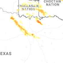
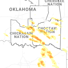

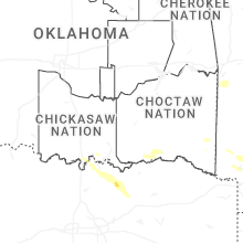


Connect with Interactive Hail Maps