

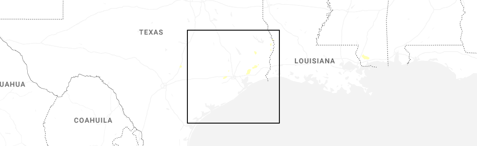
Hail Map for Sour Lake, TX
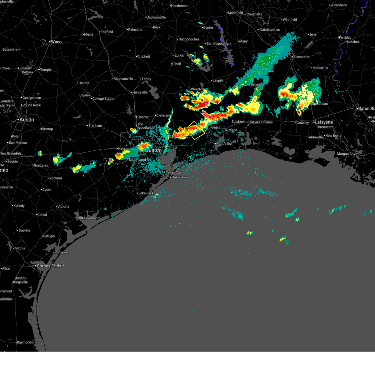
The Sour Lake, TX area has had 5 reports of on-the-ground hail by trained spotters, and has been under severe weather warnings 13 times during the past 12 months. Doppler radar has detected hail at or near Sour Lake, TX on 39 occasions, including 3 occasions during the past year.
| Name: | Sour Lake, TX |
| Where Located: | 40.1 miles W of Beaumont, TX |
| Map: | Google Map for Sour Lake, TX |
| Population: | 1813 |
| Housing Units: | 781 |
| More Info: | Search Google for Sour Lake, TX |
4
The Top Recent Hail Date for Sour Lake, TX is Saturday, May 9, 2026 (9th out of 39)
Hail and Wind Damage Spotted near Sour Lake, TX
| Date / Time | Report Details |
|---|---|
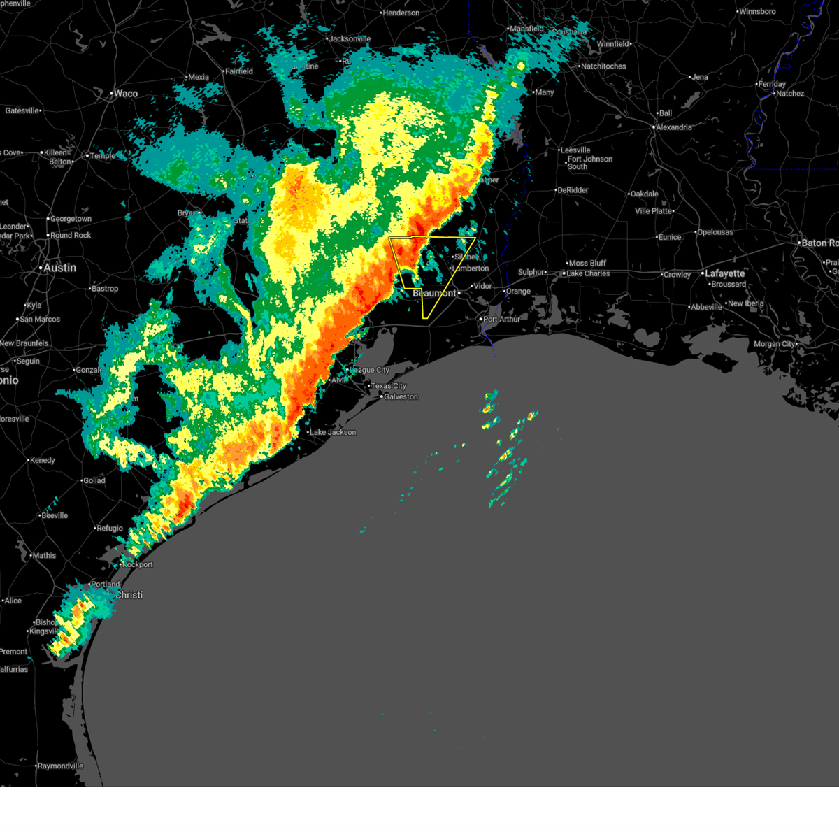
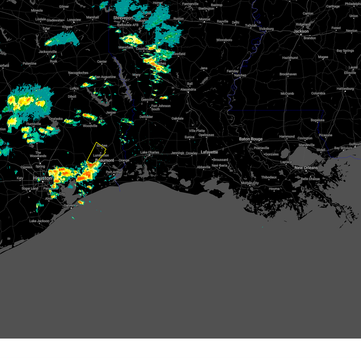
| 5/9/2026 7:20 PM CDT |
 the severe thunderstorm warning has been cancelled and is no longer in effect the severe thunderstorm warning has been cancelled and is no longer in effect
|
| 5/9/2026 7:05 PM CDT |
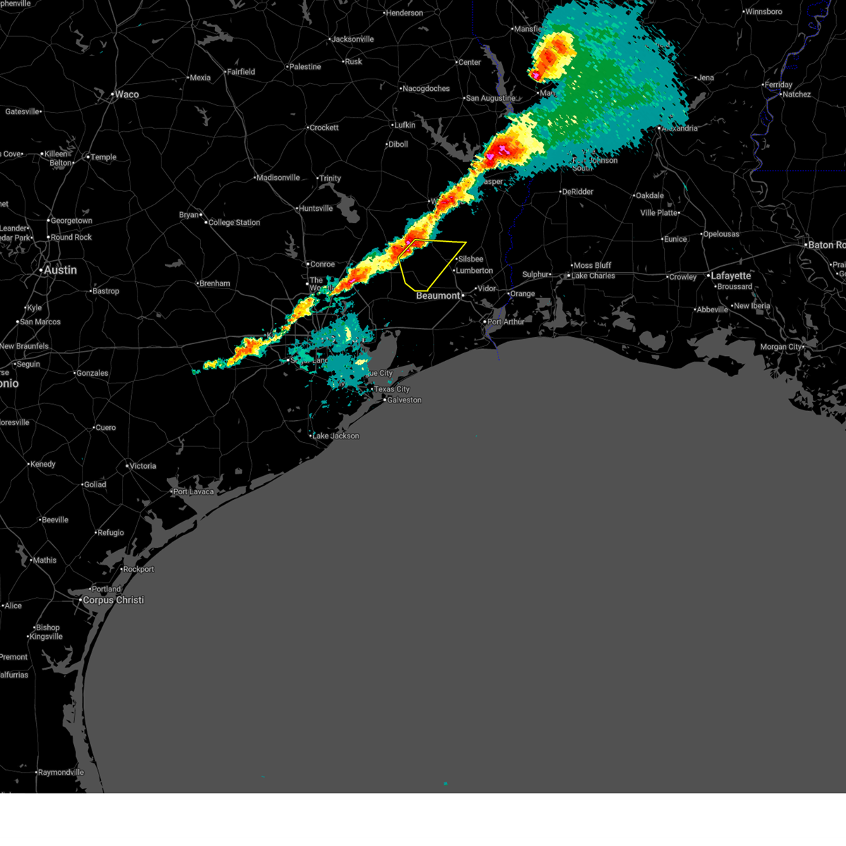
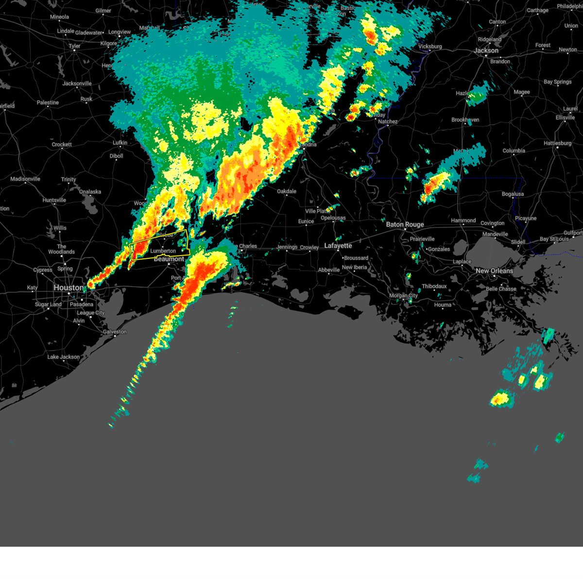
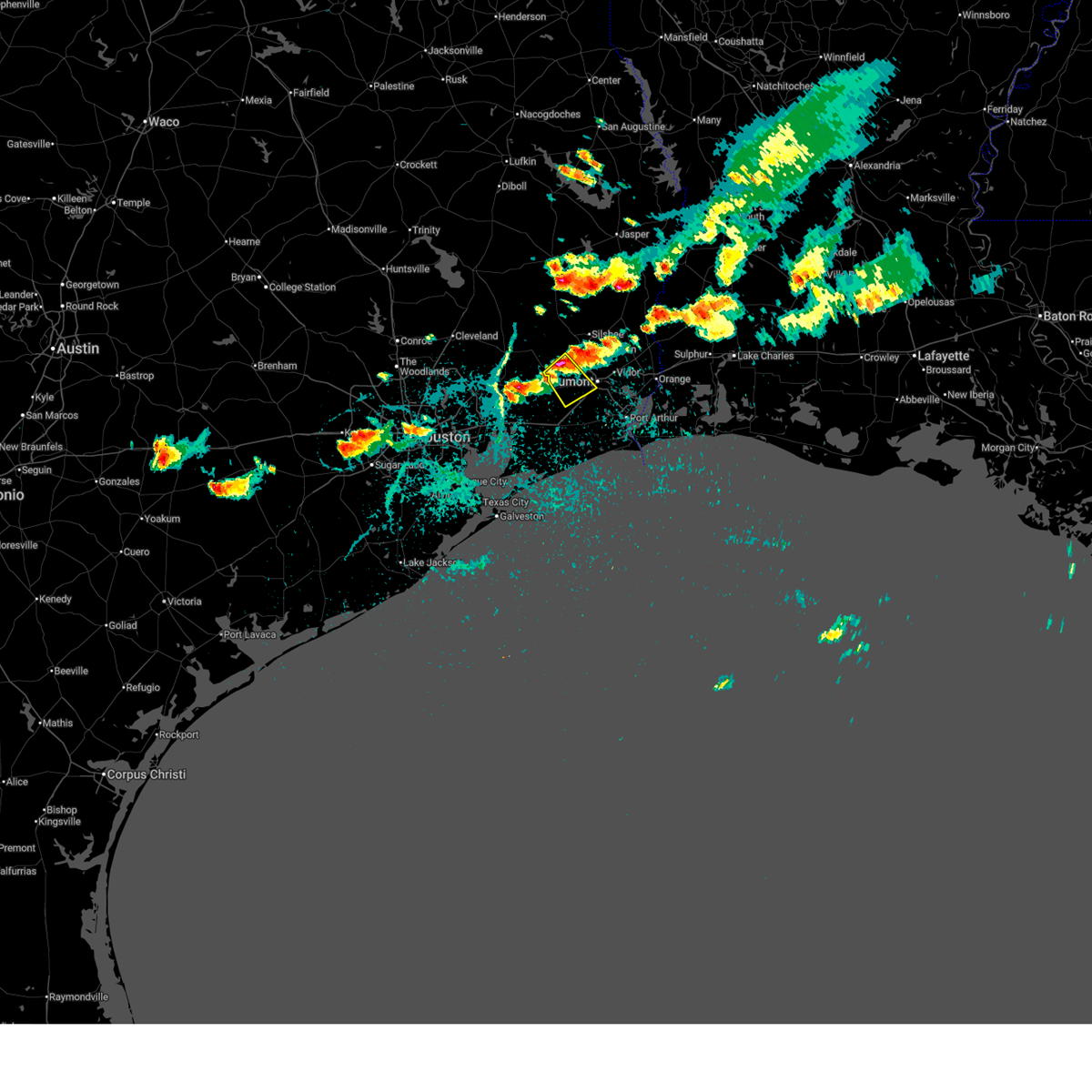 Svrlch the national weather service in lake charles has issued a * severe thunderstorm warning for, northwestern jefferson county in southeastern texas, south central hardin county in southeastern texas, * until 745 pm cdt. * at 705 pm cdt, a severe thunderstorm was located over sour lake, moving southeast at 10 mph (radar indicated). Hazards include quarter size hail. damage to vehicles is expected Svrlch the national weather service in lake charles has issued a * severe thunderstorm warning for, northwestern jefferson county in southeastern texas, south central hardin county in southeastern texas, * until 745 pm cdt. * at 705 pm cdt, a severe thunderstorm was located over sour lake, moving southeast at 10 mph (radar indicated). Hazards include quarter size hail. damage to vehicles is expected
|
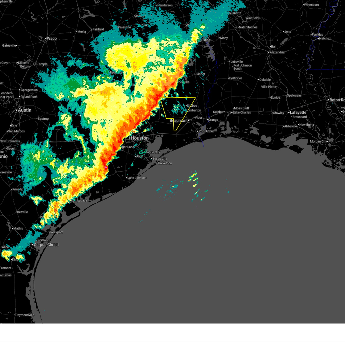
| 3/15/2026 8:03 PM CDT |
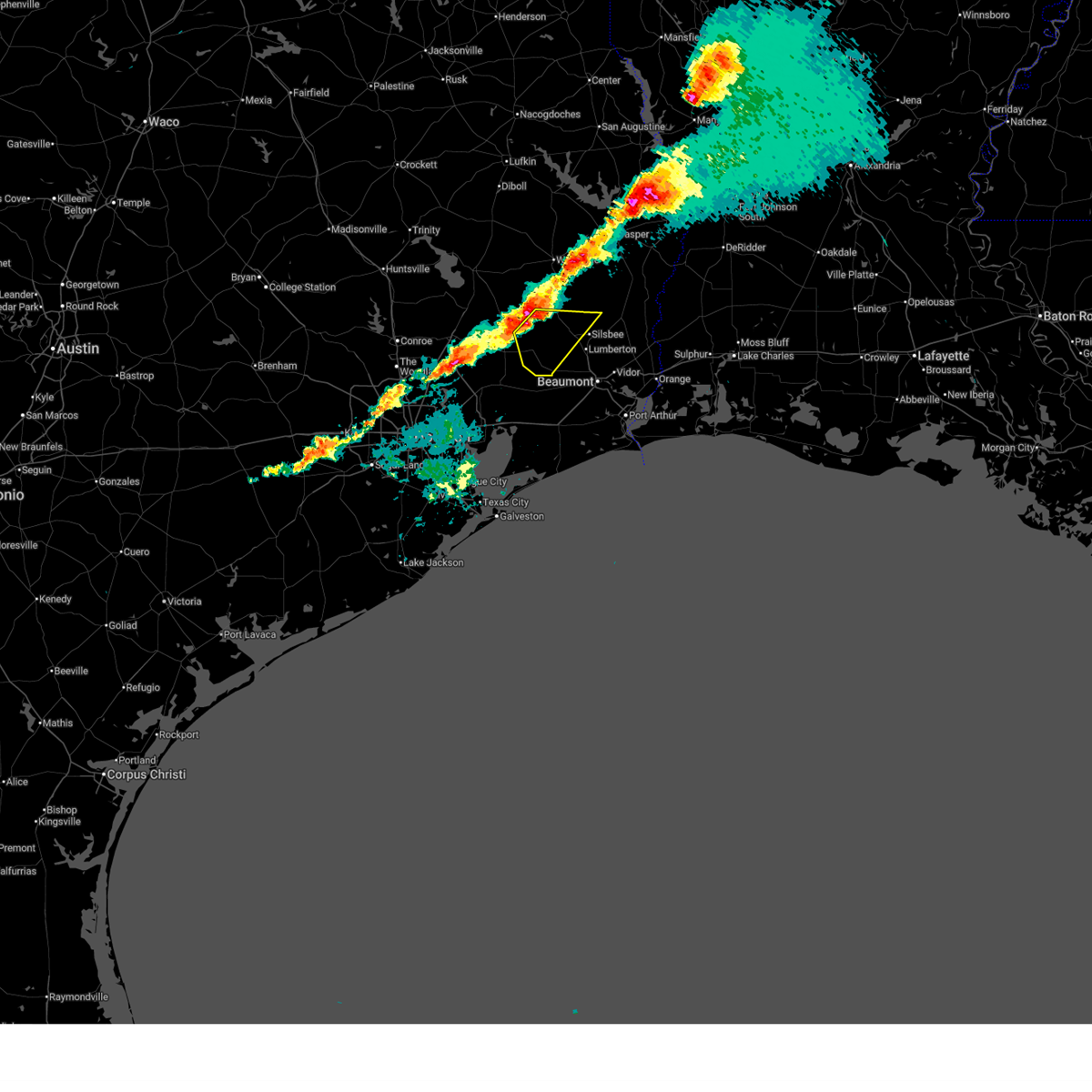 At 803 pm cdt, a severe thunderstorm was located near honey island, or near saratoga, moving southeast at 35 mph (radar indicated). Hazards include 60 mph wind gusts and quarter size hail. Hail damage to vehicles is expected. expect wind damage to roofs, siding, and trees. Locations impacted include, silsbee, kountze, sour lake, saratoga, thicket, batson, and honey island. At 803 pm cdt, a severe thunderstorm was located near honey island, or near saratoga, moving southeast at 35 mph (radar indicated). Hazards include 60 mph wind gusts and quarter size hail. Hail damage to vehicles is expected. expect wind damage to roofs, siding, and trees. Locations impacted include, silsbee, kountze, sour lake, saratoga, thicket, batson, and honey island.
|
| 3/15/2026 8:03 PM CDT |
 the severe thunderstorm warning has been cancelled and is no longer in effect the severe thunderstorm warning has been cancelled and is no longer in effect
|
| 3/15/2026 7:51 PM CDT |
 At 751 pm cdt, a severe thunderstorm was located near thicket, moving southeast at 40 mph (radar indicated). Hazards include ping pong ball size hail and 60 mph wind gusts. People and animals outdoors will be injured. expect hail damage to roofs, siding, windows, and vehicles. expect wind damage to roofs, siding, and trees. Locations impacted include, silsbee, kountze, sour lake, saratoga, thicket, wildwood, batson, votaw, honey island, and village mills. At 751 pm cdt, a severe thunderstorm was located near thicket, moving southeast at 40 mph (radar indicated). Hazards include ping pong ball size hail and 60 mph wind gusts. People and animals outdoors will be injured. expect hail damage to roofs, siding, windows, and vehicles. expect wind damage to roofs, siding, and trees. Locations impacted include, silsbee, kountze, sour lake, saratoga, thicket, wildwood, batson, votaw, honey island, and village mills.
|
| 3/15/2026 7:34 PM CDT |
 Svrlch the national weather service in lake charles has issued a * severe thunderstorm warning for, south central tyler county in southeastern texas, hardin county in southeastern texas, * until 815 pm cdt. * at 734 pm cdt, a severe thunderstorm was located near votaw, or 10 miles northwest of thicket, moving southeast at 35 mph (radar indicated). Hazards include 60 mph wind gusts and quarter size hail. Hail damage to vehicles is expected. Expect wind damage to roofs, siding, and trees. Svrlch the national weather service in lake charles has issued a * severe thunderstorm warning for, south central tyler county in southeastern texas, hardin county in southeastern texas, * until 815 pm cdt. * at 734 pm cdt, a severe thunderstorm was located near votaw, or 10 miles northwest of thicket, moving southeast at 35 mph (radar indicated). Hazards include 60 mph wind gusts and quarter size hail. Hail damage to vehicles is expected. Expect wind damage to roofs, siding, and trees.
|
| 2/14/2026 7:21 PM CST |
 Svrlch the national weather service in lake charles has issued a * severe thunderstorm warning for, southwestern beauregard parish in southwestern louisiana, northwestern calcasieu parish in southwestern louisiana, northern jefferson county in southeastern texas, southwestern newton county in southeastern texas, eastern hardin county in southeastern texas, orange county in southeastern texas, southeastern jasper county in southeastern texas, * until 800 pm cst. * at 721 pm cst, severe thunderstorms were located along a line extending from 7 miles southwest of call to near lumberton to near sour lake, moving southeast at 40 mph (radar indicated). Hazards include 60 mph wind gusts. expect damage to roofs, siding, and trees Svrlch the national weather service in lake charles has issued a * severe thunderstorm warning for, southwestern beauregard parish in southwestern louisiana, northwestern calcasieu parish in southwestern louisiana, northern jefferson county in southeastern texas, southwestern newton county in southeastern texas, eastern hardin county in southeastern texas, orange county in southeastern texas, southeastern jasper county in southeastern texas, * until 800 pm cst. * at 721 pm cst, severe thunderstorms were located along a line extending from 7 miles southwest of call to near lumberton to near sour lake, moving southeast at 40 mph (radar indicated). Hazards include 60 mph wind gusts. expect damage to roofs, siding, and trees
|
| 2/14/2026 6:52 PM CST |
 the severe thunderstorm warning has been cancelled and is no longer in effect the severe thunderstorm warning has been cancelled and is no longer in effect
|
| 2/14/2026 6:29 PM CST |
 Svrlch the national weather service in lake charles has issued a * severe thunderstorm warning for, northwestern jefferson county in southeastern texas, hardin county in southeastern texas, southeastern jasper county in southeastern texas, * until 715 pm cst. * at 629 pm cst, severe thunderstorms were located along a line extending from near votaw to near dayton lakes to near lake houston dam, moving southeast at 25 mph (radar indicated). Hazards include 60 mph wind gusts. expect damage to roofs, siding, and trees Svrlch the national weather service in lake charles has issued a * severe thunderstorm warning for, northwestern jefferson county in southeastern texas, hardin county in southeastern texas, southeastern jasper county in southeastern texas, * until 715 pm cst. * at 629 pm cst, severe thunderstorms were located along a line extending from near votaw to near dayton lakes to near lake houston dam, moving southeast at 25 mph (radar indicated). Hazards include 60 mph wind gusts. expect damage to roofs, siding, and trees
|
| 10/25/2025 5:17 AM CDT | At 517 am cdt, severe thunderstorms were located along a line extending from 6 miles northeast of woodville to near caney head to near bevil oaks, moving east at 35 mph (radar indicated). Hazards include 60 mph wind gusts. Expect damage to roofs, siding, and trees. Locations impacted include, lumberton, jasper, silsbee, woodville, kirbyville, kountze, sour lake, colmesneil, chester, evadale, rockland, warren, town bluff, ebenezer, fred, buna, bevil oaks, weiss bluff, gist, and spurger. |
| 10/25/2025 4:39 AM CDT | Svrlch the national weather service in lake charles has issued a * severe thunderstorm warning for, tyler county in southeastern texas, hardin county in southeastern texas, jasper county in southeastern texas, * until 545 am cdt. * at 439 am cdt, severe thunderstorms were located along a line extending from near alabama-coushatta reservation to near honey island to near anahuac, moving east at 35 mph (radar indicated). Hazards include 60 mph wind gusts. expect damage to roofs, siding, and trees |
| 10/25/2025 4:18 AM CDT | At 417 am cdt, severe thunderstorms were located along a line extending from near livingston to 7 miles southwest of votaw to near dayton, moving east at 40 mph (radar indicated). Hazards include 60 mph wind gusts. Expect damage to roofs, siding, and trees. Locations impacted include, woodville, kountze, sour lake, colmesneil, chester, saratoga, fred, rockland, wildwood, warren, thicket, caney head, votaw, honey island, spurger, batson, village mills, ivanhoe, and hillister. |
| 10/25/2025 3:52 AM CDT | Svrlch the national weather service in lake charles has issued a * severe thunderstorm warning for, tyler county in southeastern texas, hardin county in southeastern texas, * until 445 am cdt. * at 351 am cdt, severe thunderstorms were located along a line extending from near lake livingston state park to near cleveland to atascocita, moving east at 40 mph (radar indicated). Hazards include 60 mph wind gusts. expect damage to roofs, siding, and trees |
| 5/27/2025 1:45 AM CDT |
 At 145 am cdt, severe thunderstorms were located along a line extending from near jamestown to near buna to near lakeview, moving east at 50 mph (radar indicated). Hazards include 60 mph wind gusts and penny size hail. Expect damage to roofs, siding, and trees. Locations impacted include, beaumont, orange, lumberton, vidor, silsbee, newton, kirbyville, kountze, sour lake, deweyville, evadale, town bluff, call, fred, bon weir, mauriceville, buna, bevil oaks, rose city, and pine forest. At 145 am cdt, severe thunderstorms were located along a line extending from near jamestown to near buna to near lakeview, moving east at 50 mph (radar indicated). Hazards include 60 mph wind gusts and penny size hail. Expect damage to roofs, siding, and trees. Locations impacted include, beaumont, orange, lumberton, vidor, silsbee, newton, kirbyville, kountze, sour lake, deweyville, evadale, town bluff, call, fred, bon weir, mauriceville, buna, bevil oaks, rose city, and pine forest.
|
| 5/27/2025 1:27 AM CDT |
 Svrlch the national weather service in lake charles has issued a * severe thunderstorm warning for, southwestern beauregard parish in southwestern louisiana, northwestern jefferson county in southeastern texas, southeastern tyler county in southeastern texas, southern newton county in southeastern texas, hardin county in southeastern texas, northern orange county in southeastern texas, jasper county in southeastern texas, * until 215 am cdt. * at 127 am cdt, severe thunderstorms were located along a line extending from 6 miles southwest of jasper to near kountze to sour lake, moving east at 50 mph (radar indicated). Hazards include 60 mph wind gusts and penny size hail. expect damage to roofs, siding, and trees Svrlch the national weather service in lake charles has issued a * severe thunderstorm warning for, southwestern beauregard parish in southwestern louisiana, northwestern jefferson county in southeastern texas, southeastern tyler county in southeastern texas, southern newton county in southeastern texas, hardin county in southeastern texas, northern orange county in southeastern texas, jasper county in southeastern texas, * until 215 am cdt. * at 127 am cdt, severe thunderstorms were located along a line extending from 6 miles southwest of jasper to near kountze to sour lake, moving east at 50 mph (radar indicated). Hazards include 60 mph wind gusts and penny size hail. expect damage to roofs, siding, and trees
|
| 12/28/2024 4:14 PM CST |
 Svrlch the national weather service in lake charles has issued a * severe thunderstorm warning for, southern hardin county in southeastern texas, northwestern orange county in southeastern texas, southeastern jasper county in southeastern texas, * until 515 pm cst. * at 414 pm cst, a severe thunderstorm was located near saratoga, moving east at 30 mph (radar indicated). Hazards include 70 mph wind gusts and nickel size hail. Expect considerable tree damage. Damage is likely to mobile homes, roofs, and outbuildings. Svrlch the national weather service in lake charles has issued a * severe thunderstorm warning for, southern hardin county in southeastern texas, northwestern orange county in southeastern texas, southeastern jasper county in southeastern texas, * until 515 pm cst. * at 414 pm cst, a severe thunderstorm was located near saratoga, moving east at 30 mph (radar indicated). Hazards include 70 mph wind gusts and nickel size hail. Expect considerable tree damage. Damage is likely to mobile homes, roofs, and outbuildings.
|
| 12/26/2024 11:10 AM CST |
 Svrlch the national weather service in lake charles has issued a * severe thunderstorm warning for, northwestern jefferson county in southeastern texas, eastern hardin county in southeastern texas, * until noon cst. * at 1110 am cst, a severe thunderstorm was located over nome, moving northeast at 35 mph (radar indicated). Hazards include 60 mph wind gusts and quarter size hail. Hail damage to vehicles is expected. Expect wind damage to roofs, siding, and trees. Svrlch the national weather service in lake charles has issued a * severe thunderstorm warning for, northwestern jefferson county in southeastern texas, eastern hardin county in southeastern texas, * until noon cst. * at 1110 am cst, a severe thunderstorm was located over nome, moving northeast at 35 mph (radar indicated). Hazards include 60 mph wind gusts and quarter size hail. Hail damage to vehicles is expected. Expect wind damage to roofs, siding, and trees.
|
| 7/8/2024 11:03 AM CDT |
 the tornado warning has been cancelled and is no longer in effect the tornado warning has been cancelled and is no longer in effect
|
| 7/8/2024 10:55 AM CDT |
 The tornado warning that was previously in effect has been reissued for hardin county and is in effect until 1115 am cdt. please refer to that bulletin for the latest severe weather information. a tornado watch remains in effect until 1000 pm cdt for southeastern texas. The tornado warning that was previously in effect has been reissued for hardin county and is in effect until 1115 am cdt. please refer to that bulletin for the latest severe weather information. a tornado watch remains in effect until 1000 pm cdt for southeastern texas.
|
| 7/8/2024 10:54 AM CDT |
 Torlch the national weather service in lake charles has issued a * tornado warning for, south central hardin county in southeastern texas, * until 1115 am cdt. * at 1054 am cdt, a severe thunderstorm capable of producing a tornado was located over sour lake, moving north at 60 mph (radar indicated rotation). Hazards include tornado. Flying debris will be dangerous to those caught without shelter. mobile homes will be damaged or destroyed. damage to roofs, windows, and vehicles will occur. tree damage is likely. This dangerous storm will be near, kountze around 1100 am cdt. Torlch the national weather service in lake charles has issued a * tornado warning for, south central hardin county in southeastern texas, * until 1115 am cdt. * at 1054 am cdt, a severe thunderstorm capable of producing a tornado was located over sour lake, moving north at 60 mph (radar indicated rotation). Hazards include tornado. Flying debris will be dangerous to those caught without shelter. mobile homes will be damaged or destroyed. damage to roofs, windows, and vehicles will occur. tree damage is likely. This dangerous storm will be near, kountze around 1100 am cdt.
|
| 7/8/2024 10:45 AM CDT |
 At 1045 am cdt, a severe thunderstorm capable of producing a tornado was located over china, or near nome, moving north at 60 mph (radar indicated rotation). Hazards include tornado. Flying debris will be dangerous to those caught without shelter. mobile homes will be damaged or destroyed. damage to roofs, windows, and vehicles will occur. tree damage is likely. This dangerous storm will be near, sour lake, bevil oaks, and china around 1050 am cdt. At 1045 am cdt, a severe thunderstorm capable of producing a tornado was located over china, or near nome, moving north at 60 mph (radar indicated rotation). Hazards include tornado. Flying debris will be dangerous to those caught without shelter. mobile homes will be damaged or destroyed. damage to roofs, windows, and vehicles will occur. tree damage is likely. This dangerous storm will be near, sour lake, bevil oaks, and china around 1050 am cdt.
|
| 7/8/2024 10:36 AM CDT |
 Torlch the national weather service in lake charles has issued a * tornado warning for, northwestern jefferson county in southeastern texas, south central hardin county in southeastern texas, * until 1100 am cdt. * at 1035 am cdt, a severe thunderstorm capable of producing a tornado was located over hamshire, moving north at 75 mph (radar indicated rotation). Hazards include tornado. Flying debris will be dangerous to those caught without shelter. mobile homes will be damaged or destroyed. damage to roofs, windows, and vehicles will occur. tree damage is likely. this dangerous storm will be near, beaumont, nome, and china around 1040 am cdt. sour lake and bevil oaks around 1045 am cdt. This includes interstate 10 in texas between mile markers 839 and 832. Torlch the national weather service in lake charles has issued a * tornado warning for, northwestern jefferson county in southeastern texas, south central hardin county in southeastern texas, * until 1100 am cdt. * at 1035 am cdt, a severe thunderstorm capable of producing a tornado was located over hamshire, moving north at 75 mph (radar indicated rotation). Hazards include tornado. Flying debris will be dangerous to those caught without shelter. mobile homes will be damaged or destroyed. damage to roofs, windows, and vehicles will occur. tree damage is likely. this dangerous storm will be near, beaumont, nome, and china around 1040 am cdt. sour lake and bevil oaks around 1045 am cdt. This includes interstate 10 in texas between mile markers 839 and 832.
|
| 7/8/2024 8:14 AM CDT |
 Torlch the national weather service in lake charles has issued a * tornado warning for, southwestern tyler county in southeastern texas, western hardin county in southeastern texas, * until 845 am cdt. * at 814 am cdt, a severe thunderstorm capable of producing a tornado was located near sour lake, moving northwest at 50 mph (radar indicated rotation). Hazards include tornado. Flying debris will be dangerous to those caught without shelter. mobile homes will be damaged or destroyed. damage to roofs, windows, and vehicles will occur. tree damage is likely. this dangerous storm will be near, saratoga around 820 am cdt. batson and honey island around 825 am cdt. thicket around 830 am cdt. Votaw around 835 am cdt. Torlch the national weather service in lake charles has issued a * tornado warning for, southwestern tyler county in southeastern texas, western hardin county in southeastern texas, * until 845 am cdt. * at 814 am cdt, a severe thunderstorm capable of producing a tornado was located near sour lake, moving northwest at 50 mph (radar indicated rotation). Hazards include tornado. Flying debris will be dangerous to those caught without shelter. mobile homes will be damaged or destroyed. damage to roofs, windows, and vehicles will occur. tree damage is likely. this dangerous storm will be near, saratoga around 820 am cdt. batson and honey island around 825 am cdt. thicket around 830 am cdt. Votaw around 835 am cdt.
|
| 5/30/2024 8:40 PM CDT |
 The storms which prompted the warning have weakened below severe limits, and no longer pose an immediate threat to life or property. therefore, the warning will be allowed to expire. a severe thunderstorm watch remains in effect until 1100 pm cdt for southwestern and west central louisiana, and southeastern texas. The storms which prompted the warning have weakened below severe limits, and no longer pose an immediate threat to life or property. therefore, the warning will be allowed to expire. a severe thunderstorm watch remains in effect until 1100 pm cdt for southwestern and west central louisiana, and southeastern texas.
|
| 5/30/2024 8:11 PM CDT |
 Svrlch the national weather service in lake charles has issued a * severe thunderstorm warning for, western beauregard parish in southwestern louisiana, southwestern vernon parish in west central louisiana, northwestern jefferson county in southeastern texas, southern tyler county in southeastern texas, newton county in southeastern texas, hardin county in southeastern texas, northwestern orange county in southeastern texas, jasper county in southeastern texas, * until 845 pm cdt. * at 811 pm cdt, severe thunderstorms were located along a line extending from near newton to near fred to near honey island, moving south at 45 mph (radar indicated). Hazards include 60 mph wind gusts and nickel size hail. expect damage to roofs, siding, and trees Svrlch the national weather service in lake charles has issued a * severe thunderstorm warning for, western beauregard parish in southwestern louisiana, southwestern vernon parish in west central louisiana, northwestern jefferson county in southeastern texas, southern tyler county in southeastern texas, newton county in southeastern texas, hardin county in southeastern texas, northwestern orange county in southeastern texas, jasper county in southeastern texas, * until 845 pm cdt. * at 811 pm cdt, severe thunderstorms were located along a line extending from near newton to near fred to near honey island, moving south at 45 mph (radar indicated). Hazards include 60 mph wind gusts and nickel size hail. expect damage to roofs, siding, and trees
|
| 5/29/2024 4:49 PM CDT |
 Svrlch the national weather service in lake charles has issued a * severe thunderstorm warning for, north central jefferson county in southeastern texas, southeastern hardin county in southeastern texas, * until 530 pm cdt. * at 448 pm cdt, a severe thunderstorm was located near sour lake, moving northeast at 10 mph (radar indicated). Hazards include 60 mph wind gusts and quarter size hail. Hail damage to vehicles is expected. Expect wind damage to roofs, siding, and trees. Svrlch the national weather service in lake charles has issued a * severe thunderstorm warning for, north central jefferson county in southeastern texas, southeastern hardin county in southeastern texas, * until 530 pm cdt. * at 448 pm cdt, a severe thunderstorm was located near sour lake, moving northeast at 10 mph (radar indicated). Hazards include 60 mph wind gusts and quarter size hail. Hail damage to vehicles is expected. Expect wind damage to roofs, siding, and trees.
|
| 5/28/2024 2:07 PM CDT |
 the severe thunderstorm warning has been cancelled and is no longer in effect the severe thunderstorm warning has been cancelled and is no longer in effect
|
| 5/28/2024 2:07 PM CDT |
 At 207 pm cdt, severe thunderstorms were located along a line extending from near buna to near pine forest to near nome, moving southeast at 35 mph (radar indicated). Hazards include 60 mph wind gusts and quarter size hail. Hail damage to vehicles is expected. expect wind damage to roofs, siding, and trees. Locations impacted include, beaumont, port arthur, orange, nederland, groves, port neches, lumberton, vidor, bridge city, silsbee, west orange, sour lake, deweyville, evadale, central gardens, mauriceville, buna, bevil oaks, rose city, and pine forest. At 207 pm cdt, severe thunderstorms were located along a line extending from near buna to near pine forest to near nome, moving southeast at 35 mph (radar indicated). Hazards include 60 mph wind gusts and quarter size hail. Hail damage to vehicles is expected. expect wind damage to roofs, siding, and trees. Locations impacted include, beaumont, port arthur, orange, nederland, groves, port neches, lumberton, vidor, bridge city, silsbee, west orange, sour lake, deweyville, evadale, central gardens, mauriceville, buna, bevil oaks, rose city, and pine forest.
|
| 5/28/2024 1:37 PM CDT |
 Svrlch the national weather service in lake charles has issued a * severe thunderstorm warning for, jefferson county in southeastern texas, southeastern tyler county in southeastern texas, southwestern newton county in southeastern texas, hardin county in southeastern texas, orange county in southeastern texas, southeastern jasper county in southeastern texas, * until 215 pm cdt. * at 136 pm cdt, severe thunderstorms were located along a line extending from 6 miles southwest of spurger to near kountze to hardin, moving southeast at 35 mph (radar indicated). Hazards include 60 mph wind gusts and quarter size hail. Hail damage to vehicles is expected. Expect wind damage to roofs, siding, and trees. Svrlch the national weather service in lake charles has issued a * severe thunderstorm warning for, jefferson county in southeastern texas, southeastern tyler county in southeastern texas, southwestern newton county in southeastern texas, hardin county in southeastern texas, orange county in southeastern texas, southeastern jasper county in southeastern texas, * until 215 pm cdt. * at 136 pm cdt, severe thunderstorms were located along a line extending from 6 miles southwest of spurger to near kountze to hardin, moving southeast at 35 mph (radar indicated). Hazards include 60 mph wind gusts and quarter size hail. Hail damage to vehicles is expected. Expect wind damage to roofs, siding, and trees.
|
| 5/12/2024 12:56 PM CDT |
 The severe thunderstorm which prompted the warning continues. please see severe number 116 for more information. therefore, the warning will be allowed to expire. a tornado watch remains in effect until 700 pm cdt for southeastern texas. The severe thunderstorm which prompted the warning continues. please see severe number 116 for more information. therefore, the warning will be allowed to expire. a tornado watch remains in effect until 700 pm cdt for southeastern texas.
|
| 5/12/2024 12:40 PM CDT |
 At 1240 pm cdt, a severe thunderstorm was located over fannett, or near hamshire, moving east at 25 mph (radar indicated). Hazards include two inch hail and 60 mph wind gusts. People and animals outdoors will be injured. expect hail damage to roofs, siding, windows, and vehicles. expect wind damage to roofs, siding, and trees. Locations impacted include, beaumont, port arthur, sour lake, nome, hamshire, bevil oaks, china, rose city, lakeview, port acres, fannett, la belle, and southeast texas regional airport. At 1240 pm cdt, a severe thunderstorm was located over fannett, or near hamshire, moving east at 25 mph (radar indicated). Hazards include two inch hail and 60 mph wind gusts. People and animals outdoors will be injured. expect hail damage to roofs, siding, windows, and vehicles. expect wind damage to roofs, siding, and trees. Locations impacted include, beaumont, port arthur, sour lake, nome, hamshire, bevil oaks, china, rose city, lakeview, port acres, fannett, la belle, and southeast texas regional airport.
|
| 5/12/2024 12:25 PM CDT |
 At 1225 pm cdt, a severe thunderstorm was located near hamshire, moving east at 35 mph (radar indicated). Hazards include ping pong ball size hail and 60 mph wind gusts. People and animals outdoors will be injured. expect hail damage to roofs, siding, windows, and vehicles. expect wind damage to roofs, siding, and trees. Locations impacted include, beaumont, port arthur, sour lake, nome, hamshire, bevil oaks, china, rose city, lakeview, port acres, fannett, la belle, and southeast texas regional airport. At 1225 pm cdt, a severe thunderstorm was located near hamshire, moving east at 35 mph (radar indicated). Hazards include ping pong ball size hail and 60 mph wind gusts. People and animals outdoors will be injured. expect hail damage to roofs, siding, windows, and vehicles. expect wind damage to roofs, siding, and trees. Locations impacted include, beaumont, port arthur, sour lake, nome, hamshire, bevil oaks, china, rose city, lakeview, port acres, fannett, la belle, and southeast texas regional airport.
|
| 5/12/2024 11:57 AM CDT |
 Svrlch the national weather service in lake charles has issued a * severe thunderstorm warning for, jefferson county in southeastern texas, southeastern hardin county in southeastern texas, northwestern orange county in southeastern texas, * until 100 pm cdt. * at 1157 am cdt, a severe thunderstorm was located 9 miles southwest of devers, or 12 miles southeast of liberty, moving east at 30 mph (radar indicated). Hazards include 60 mph wind gusts and quarter size hail. Hail damage to vehicles is expected. Expect wind damage to roofs, siding, and trees. Svrlch the national weather service in lake charles has issued a * severe thunderstorm warning for, jefferson county in southeastern texas, southeastern hardin county in southeastern texas, northwestern orange county in southeastern texas, * until 100 pm cdt. * at 1157 am cdt, a severe thunderstorm was located 9 miles southwest of devers, or 12 miles southeast of liberty, moving east at 30 mph (radar indicated). Hazards include 60 mph wind gusts and quarter size hail. Hail damage to vehicles is expected. Expect wind damage to roofs, siding, and trees.
|
| 5/2/2024 7:44 AM CDT |
 The storms which prompted the warning have moved out of the area. therefore, the warning will be allowed to expire. The storms which prompted the warning have moved out of the area. therefore, the warning will be allowed to expire.
|
| 5/2/2024 7:30 AM CDT |
 At 730 am cdt, severe thunderstorms were located along a line extending from near village mills to near saratoga to batson, moving east at 30 mph (radar indicated). Hazards include ping pong ball size hail and 60 mph wind gusts. People and animals outdoors will be injured. expect hail damage to roofs, siding, windows, and vehicles. expect wind damage to roofs, siding, and trees. Locations impacted include, lumberton, silsbee, kountze, sour lake, saratoga, fred, wildwood, warren, thicket, bevil oaks, caney head, votaw, honey island, batson, and village mills. At 730 am cdt, severe thunderstorms were located along a line extending from near village mills to near saratoga to batson, moving east at 30 mph (radar indicated). Hazards include ping pong ball size hail and 60 mph wind gusts. People and animals outdoors will be injured. expect hail damage to roofs, siding, windows, and vehicles. expect wind damage to roofs, siding, and trees. Locations impacted include, lumberton, silsbee, kountze, sour lake, saratoga, fred, wildwood, warren, thicket, bevil oaks, caney head, votaw, honey island, batson, and village mills.
|
| 5/2/2024 7:15 AM CDT |
 At 715 am cdt, severe thunderstorms were located along a line extending from near wildwood to near thicket to 7 miles north of hardin, moving east at 25 mph (radar indicated). Hazards include 60 mph wind gusts and half dollar size hail. Hail damage to vehicles is expected. expect wind damage to roofs, siding, and trees. Locations impacted include, lumberton, silsbee, kountze, sour lake, saratoga, fred, wildwood, warren, thicket, bevil oaks, caney head, votaw, honey island, batson, and village mills. At 715 am cdt, severe thunderstorms were located along a line extending from near wildwood to near thicket to 7 miles north of hardin, moving east at 25 mph (radar indicated). Hazards include 60 mph wind gusts and half dollar size hail. Hail damage to vehicles is expected. expect wind damage to roofs, siding, and trees. Locations impacted include, lumberton, silsbee, kountze, sour lake, saratoga, fred, wildwood, warren, thicket, bevil oaks, caney head, votaw, honey island, batson, and village mills.
|
| 5/2/2024 6:39 AM CDT |
 Svrlch the national weather service in lake charles has issued a * severe thunderstorm warning for, southern tyler county in southeastern texas, hardin county in southeastern texas, * until 745 am cdt. * at 638 am cdt, severe thunderstorms were located along a line extending from 6 miles south of alabama-coushatta reservation to 7 miles southwest of votaw to 8 miles northeast of plum grove, moving east at 30 mph (radar indicated). Hazards include 60 mph wind gusts and half dollar size hail. Hail damage to vehicles is expected. Expect wind damage to roofs, siding, and trees. Svrlch the national weather service in lake charles has issued a * severe thunderstorm warning for, southern tyler county in southeastern texas, hardin county in southeastern texas, * until 745 am cdt. * at 638 am cdt, severe thunderstorms were located along a line extending from 6 miles south of alabama-coushatta reservation to 7 miles southwest of votaw to 8 miles northeast of plum grove, moving east at 30 mph (radar indicated). Hazards include 60 mph wind gusts and half dollar size hail. Hail damage to vehicles is expected. Expect wind damage to roofs, siding, and trees.
|
| 5/2/2024 5:43 AM CDT |
 At 543 am cdt, severe thunderstorms were located along a line extending from near silsbee to near lumberton to near bevil oaks, moving east at 50 mph (radar indicated). Hazards include 60 mph wind gusts and half dollar size hail. Hail damage to vehicles is expected. expect wind damage to roofs, siding, and trees. Locations impacted include, lumberton, silsbee, sour lake, and bevil oaks. At 543 am cdt, severe thunderstorms were located along a line extending from near silsbee to near lumberton to near bevil oaks, moving east at 50 mph (radar indicated). Hazards include 60 mph wind gusts and half dollar size hail. Hail damage to vehicles is expected. expect wind damage to roofs, siding, and trees. Locations impacted include, lumberton, silsbee, sour lake, and bevil oaks.
|
| 5/2/2024 5:18 AM CDT |
 At 518 am cdt, a severe thunderstorm was located 7 miles southeast of batson, or 7 miles south of saratoga, moving east at 35 mph (radar indicated). Hazards include 60 mph wind gusts and half dollar size hail. Hail damage to vehicles is expected. expect wind damage to roofs, siding, and trees. Locations impacted include, lumberton, silsbee, kountze, sour lake, saratoga, bevil oaks, and caney head. At 518 am cdt, a severe thunderstorm was located 7 miles southeast of batson, or 7 miles south of saratoga, moving east at 35 mph (radar indicated). Hazards include 60 mph wind gusts and half dollar size hail. Hail damage to vehicles is expected. expect wind damage to roofs, siding, and trees. Locations impacted include, lumberton, silsbee, kountze, sour lake, saratoga, bevil oaks, and caney head.
|
| 5/2/2024 5:06 AM CDT |
 Svrlch the national weather service in lake charles has issued a * severe thunderstorm warning for, hardin county in southeastern texas, * until 600 am cdt. * at 505 am cdt, a severe thunderstorm was located near batson, or 8 miles southwest of saratoga, moving east at 45 mph (radar indicated). Hazards include ping pong ball size hail and 60 mph wind gusts. People and animals outdoors will be injured. expect hail damage to roofs, siding, windows, and vehicles. Expect wind damage to roofs, siding, and trees. Svrlch the national weather service in lake charles has issued a * severe thunderstorm warning for, hardin county in southeastern texas, * until 600 am cdt. * at 505 am cdt, a severe thunderstorm was located near batson, or 8 miles southwest of saratoga, moving east at 45 mph (radar indicated). Hazards include ping pong ball size hail and 60 mph wind gusts. People and animals outdoors will be injured. expect hail damage to roofs, siding, windows, and vehicles. Expect wind damage to roofs, siding, and trees.
|
| 4/10/2024 6:00 AM CDT |
 the severe thunderstorm warning has been cancelled and is no longer in effect the severe thunderstorm warning has been cancelled and is no longer in effect
|
| 4/10/2024 5:20 AM CDT |
 the severe thunderstorm warning has been cancelled and is no longer in effect the severe thunderstorm warning has been cancelled and is no longer in effect
|
| 4/10/2024 5:19 AM CDT |
 Svrlch the national weather service in lake charles has issued a * severe thunderstorm warning for, west central calcasieu parish in southwestern louisiana, northwestern jefferson county in southeastern texas, southeastern tyler county in southeastern texas, southwestern newton county in southeastern texas, hardin county in southeastern texas, northern orange county in southeastern texas, southeastern jasper county in southeastern texas, * until 615 am cdt. * at 518 am cdt, severe thunderstorms were located along a line extending from village mills to near kountze to near nome, moving east at 35 mph (radar indicated). Hazards include 60 mph wind gusts. expect damage to roofs, siding, and trees Svrlch the national weather service in lake charles has issued a * severe thunderstorm warning for, west central calcasieu parish in southwestern louisiana, northwestern jefferson county in southeastern texas, southeastern tyler county in southeastern texas, southwestern newton county in southeastern texas, hardin county in southeastern texas, northern orange county in southeastern texas, southeastern jasper county in southeastern texas, * until 615 am cdt. * at 518 am cdt, severe thunderstorms were located along a line extending from village mills to near kountze to near nome, moving east at 35 mph (radar indicated). Hazards include 60 mph wind gusts. expect damage to roofs, siding, and trees
|
| 4/10/2024 5:03 AM CDT |
 At 503 am cdt, severe thunderstorms were located along a line extending from near wildwood to near honey island to devers, moving east at 40 mph (radar indicated). Hazards include 60 mph wind gusts. Expect damage to roofs, siding, and trees. Locations impacted include, beaumont, lumberton, silsbee, kountze, sour lake, nome, saratoga, hamshire, wildwood, thicket, bevil oaks, china, votaw, honey island, batson, and village mills. At 503 am cdt, severe thunderstorms were located along a line extending from near wildwood to near honey island to devers, moving east at 40 mph (radar indicated). Hazards include 60 mph wind gusts. Expect damage to roofs, siding, and trees. Locations impacted include, beaumont, lumberton, silsbee, kountze, sour lake, nome, saratoga, hamshire, wildwood, thicket, bevil oaks, china, votaw, honey island, batson, and village mills.
|
| 4/10/2024 4:36 AM CDT |
 Svrlch the national weather service in lake charles has issued a * severe thunderstorm warning for, northwestern jefferson county in southeastern texas, south central tyler county in southeastern texas, hardin county in southeastern texas, * until 530 am cdt. * at 436 am cdt, severe thunderstorms were located along a line extending from 9 miles west of votaw to near hardin to near mont belvieu, moving east at 35 mph (radar indicated). Hazards include 60 mph wind gusts. expect damage to roofs, siding, and trees Svrlch the national weather service in lake charles has issued a * severe thunderstorm warning for, northwestern jefferson county in southeastern texas, south central tyler county in southeastern texas, hardin county in southeastern texas, * until 530 am cdt. * at 436 am cdt, severe thunderstorms were located along a line extending from 9 miles west of votaw to near hardin to near mont belvieu, moving east at 35 mph (radar indicated). Hazards include 60 mph wind gusts. expect damage to roofs, siding, and trees
|
| 3/21/2024 10:55 PM CDT |
 The storm which prompted the warning has weakened below severe limits, and has exited the warned area. therefore, the warning will be allowed to expire. remember, a severe thunderstorm warning still remains in effect for portions of hardin and jefferson counties. The storm which prompted the warning has weakened below severe limits, and has exited the warned area. therefore, the warning will be allowed to expire. remember, a severe thunderstorm warning still remains in effect for portions of hardin and jefferson counties.
|
| 3/21/2024 10:53 PM CDT |
 Svrlch the national weather service in lake charles has issued a * severe thunderstorm warning for, northwestern jefferson county in southeastern texas, southeastern hardin county in southeastern texas, west central orange county in southeastern texas, * until midnight cdt. * at 1053 pm cdt, a severe thunderstorm was located near devers, or 7 miles west of nome, moving east at 25 mph (radar indicated). Hazards include half dollar size hail. damage to vehicles is expected Svrlch the national weather service in lake charles has issued a * severe thunderstorm warning for, northwestern jefferson county in southeastern texas, southeastern hardin county in southeastern texas, west central orange county in southeastern texas, * until midnight cdt. * at 1053 pm cdt, a severe thunderstorm was located near devers, or 7 miles west of nome, moving east at 25 mph (radar indicated). Hazards include half dollar size hail. damage to vehicles is expected
|
| 3/21/2024 10:49 PM CDT |
 At 1049 pm cdt, a severe thunderstorm was located near sour lake, moving east at 30 mph (radar indicated). Hazards include quarter size hail. Damage to vehicles is expected. Locations impacted include, kountze, sour lake, nome, saratoga, bevil oaks, china, and batson. At 1049 pm cdt, a severe thunderstorm was located near sour lake, moving east at 30 mph (radar indicated). Hazards include quarter size hail. Damage to vehicles is expected. Locations impacted include, kountze, sour lake, nome, saratoga, bevil oaks, china, and batson.
|
| 3/21/2024 10:00 PM CDT |
 Svrlch the national weather service in lake charles has issued a * severe thunderstorm warning for, northwestern jefferson county in southeastern texas, western hardin county in southeastern texas, * until 1100 pm cdt. * at 959 pm cdt, a severe thunderstorm was located near dayton lakes, or 9 miles north of dayton, moving east at 30 mph (radar indicated). Hazards include ping pong ball size hail and 60 mph wind gusts. People and animals outdoors will be injured. expect hail damage to roofs, siding, windows, and vehicles. Expect wind damage to roofs, siding, and trees. Svrlch the national weather service in lake charles has issued a * severe thunderstorm warning for, northwestern jefferson county in southeastern texas, western hardin county in southeastern texas, * until 1100 pm cdt. * at 959 pm cdt, a severe thunderstorm was located near dayton lakes, or 9 miles north of dayton, moving east at 30 mph (radar indicated). Hazards include ping pong ball size hail and 60 mph wind gusts. People and animals outdoors will be injured. expect hail damage to roofs, siding, windows, and vehicles. Expect wind damage to roofs, siding, and trees.
|
| 3/15/2024 4:30 PM CDT |
 At 430 pm cdt, a severe thunderstorm was located over bevil oaks, or near sour lake, moving east at 10 mph (radar indicated). Hazards include 60 mph wind gusts and half dollar size hail. Hail damage to vehicles is expected. expect wind damage to roofs, siding, and trees. Locations impacted include, beaumont, lumberton, vidor, silsbee, kountze, sour lake, bevil oaks, pine forest, and lakeview. At 430 pm cdt, a severe thunderstorm was located over bevil oaks, or near sour lake, moving east at 10 mph (radar indicated). Hazards include 60 mph wind gusts and half dollar size hail. Hail damage to vehicles is expected. expect wind damage to roofs, siding, and trees. Locations impacted include, beaumont, lumberton, vidor, silsbee, kountze, sour lake, bevil oaks, pine forest, and lakeview.
|
| 3/15/2024 4:13 PM CDT |
 The severe thunderstorm warning had been allowed to expire and is replaced by severe warning number 45. a severe thunderstorm watch remains in effect until 800 pm cdt for southeastern texas. The severe thunderstorm warning had been allowed to expire and is replaced by severe warning number 45. a severe thunderstorm watch remains in effect until 800 pm cdt for southeastern texas.
|
| 3/15/2024 4:11 PM CDT |
 Svrlch the national weather service in lake charles has issued a * severe thunderstorm warning for, northwestern jefferson county in southeastern texas, southeastern hardin county in southeastern texas, northwestern orange county in southeastern texas, * until 500 pm cdt. * at 411 pm cdt, a severe thunderstorm was located near bevil oaks, or near sour lake, moving northeast at 20 mph (radar indicated). Hazards include 60 mph wind gusts and quarter size hail. Hail damage to vehicles is expected. Expect wind damage to roofs, siding, and trees. Svrlch the national weather service in lake charles has issued a * severe thunderstorm warning for, northwestern jefferson county in southeastern texas, southeastern hardin county in southeastern texas, northwestern orange county in southeastern texas, * until 500 pm cdt. * at 411 pm cdt, a severe thunderstorm was located near bevil oaks, or near sour lake, moving northeast at 20 mph (radar indicated). Hazards include 60 mph wind gusts and quarter size hail. Hail damage to vehicles is expected. Expect wind damage to roofs, siding, and trees.
|
| 3/15/2024 3:55 PM CDT |
 At 355 pm cdt, a severe thunderstorm was located over sour lake, moving northeast at 20 mph (radar indicated). Hazards include 60 mph wind gusts and half dollar size hail. Hail damage to vehicles is expected. expect wind damage to roofs, siding, and trees. Locations impacted include, beaumont, sour lake, and bevil oaks. At 355 pm cdt, a severe thunderstorm was located over sour lake, moving northeast at 20 mph (radar indicated). Hazards include 60 mph wind gusts and half dollar size hail. Hail damage to vehicles is expected. expect wind damage to roofs, siding, and trees. Locations impacted include, beaumont, sour lake, and bevil oaks.
|
| 3/15/2024 3:38 PM CDT |
 Svrlch the national weather service in lake charles has issued a * severe thunderstorm warning for, northwestern jefferson county in southeastern texas, southern hardin county in southeastern texas, * until 415 pm cdt. * at 337 pm cdt, a severe thunderstorm was located near sour lake, moving northeast at 20 mph (radar indicated). Hazards include 60 mph wind gusts and quarter size hail. Hail damage to vehicles is expected. Expect wind damage to roofs, siding, and trees. Svrlch the national weather service in lake charles has issued a * severe thunderstorm warning for, northwestern jefferson county in southeastern texas, southern hardin county in southeastern texas, * until 415 pm cdt. * at 337 pm cdt, a severe thunderstorm was located near sour lake, moving northeast at 20 mph (radar indicated). Hazards include 60 mph wind gusts and quarter size hail. Hail damage to vehicles is expected. Expect wind damage to roofs, siding, and trees.
|
| 1/8/2024 4:04 PM CST |
 At 404 pm cst, a severe thunderstorm was located near saratoga, moving northeast at 50 mph (radar indicated). Hazards include 60 mph wind gusts and half dollar size hail. Hail damage to vehicles is expected. Expect wind damage to roofs, siding, and trees. At 404 pm cst, a severe thunderstorm was located near saratoga, moving northeast at 50 mph (radar indicated). Hazards include 60 mph wind gusts and half dollar size hail. Hail damage to vehicles is expected. Expect wind damage to roofs, siding, and trees.
|
| 12/9/2023 7:22 PM CST |
 The severe thunderstorm warning for northwestern jefferson and southeastern hardin counties will expire at 730 pm cst, the storm which prompted the warning has weakened below severe limits, and no longer poses an immediate threat to life or property. therefore, the warning will be allowed to expire. &&. The severe thunderstorm warning for northwestern jefferson and southeastern hardin counties will expire at 730 pm cst, the storm which prompted the warning has weakened below severe limits, and no longer poses an immediate threat to life or property. therefore, the warning will be allowed to expire. &&.
|
| 12/9/2023 6:51 PM CST |
 At 651 pm cst, a severe thunderstorm was located over nome, moving east at 25 mph (radar indicated). Hazards include 60 mph wind gusts and quarter size hail. Hail damage to vehicles is expected. Expect wind damage to roofs, siding, and trees. At 651 pm cst, a severe thunderstorm was located over nome, moving east at 25 mph (radar indicated). Hazards include 60 mph wind gusts and quarter size hail. Hail damage to vehicles is expected. Expect wind damage to roofs, siding, and trees.
|
| 9/8/2023 1:41 PM CDT |
 At 141 pm cdt, severe thunderstorms were located along a line extending from near chester to near wrights settlement, moving south at 30 mph (radar indicated). Hazards include 60 mph wind gusts and penny size hail. expect damage to roofs, siding, and trees At 141 pm cdt, severe thunderstorms were located along a line extending from near chester to near wrights settlement, moving south at 30 mph (radar indicated). Hazards include 60 mph wind gusts and penny size hail. expect damage to roofs, siding, and trees
|
| 7/2/2023 4:50 PM CDT |
 At 450 pm cdt, a severe thunderstorm was located over sour lake, and is nearly stationary (radar indicated). Hazards include 60 mph wind gusts. Expect damage to roofs, siding, and trees. locations impacted include, sour lake and bevil oaks. hail threat, radar indicated max hail size, <. 75 in wind threat, observed max wind gust, 60 mph. At 450 pm cdt, a severe thunderstorm was located over sour lake, and is nearly stationary (radar indicated). Hazards include 60 mph wind gusts. Expect damage to roofs, siding, and trees. locations impacted include, sour lake and bevil oaks. hail threat, radar indicated max hail size, <. 75 in wind threat, observed max wind gust, 60 mph.
|
| 7/2/2023 4:35 PM CDT |
 At 434 pm cdt, a severe thunderstorm was located over sour lake, and is nearly stationary (radar indicated). Hazards include 60 mph wind gusts. expect damage to roofs, siding, and trees At 434 pm cdt, a severe thunderstorm was located over sour lake, and is nearly stationary (radar indicated). Hazards include 60 mph wind gusts. expect damage to roofs, siding, and trees
|
| 5/8/2023 3:11 PM CDT |
 At 311 pm cdt, a severe thunderstorm capable of producing a tornado was located over bevil oaks, or near sour lake, moving southeast at 30 mph (radar indicated rotation). Hazards include tornado and hail up to two inches in diameter. Flying debris will be dangerous to those caught without shelter. mobile homes will be damaged or destroyed. damage to roofs, windows, and vehicles will occur. tree damage is likely. this dangerous storm will be near, bevil oaks around 315 pm cdt. beaumont around 320 pm cdt. This includes interstate 10 in texas between mile markers 856 and 844. At 311 pm cdt, a severe thunderstorm capable of producing a tornado was located over bevil oaks, or near sour lake, moving southeast at 30 mph (radar indicated rotation). Hazards include tornado and hail up to two inches in diameter. Flying debris will be dangerous to those caught without shelter. mobile homes will be damaged or destroyed. damage to roofs, windows, and vehicles will occur. tree damage is likely. this dangerous storm will be near, bevil oaks around 315 pm cdt. beaumont around 320 pm cdt. This includes interstate 10 in texas between mile markers 856 and 844.
|
| 5/8/2023 2:57 PM CDT |
 At 257 pm cdt, a severe thunderstorm capable of producing a tornado was located 7 miles north of sour lake, moving east at 15 mph (radar indicated rotation). Hazards include tornado. Flying debris will be dangerous to those caught without shelter. mobile homes will be damaged or destroyed. damage to roofs, windows, and vehicles will occur. tree damage is likely. This dangerous storm will be near, lumberton around 330 pm cdt. At 257 pm cdt, a severe thunderstorm capable of producing a tornado was located 7 miles north of sour lake, moving east at 15 mph (radar indicated rotation). Hazards include tornado. Flying debris will be dangerous to those caught without shelter. mobile homes will be damaged or destroyed. damage to roofs, windows, and vehicles will occur. tree damage is likely. This dangerous storm will be near, lumberton around 330 pm cdt.
|
| 5/6/2023 3:21 AM CDT |
 The severe thunderstorm warning for northwestern jefferson and hardin counties will expire at 330 am cdt, the storm which prompted the warning has weakened below severe limits, and no longer poses an immediate threat to life or property. therefore, the warning will be allowed to expire. however small hail and gusty winds are still possible with this thunderstorm. to report severe weather, contact your nearest law enforcement agency. they will relay your report to the national weather service lake charles. The severe thunderstorm warning for northwestern jefferson and hardin counties will expire at 330 am cdt, the storm which prompted the warning has weakened below severe limits, and no longer poses an immediate threat to life or property. therefore, the warning will be allowed to expire. however small hail and gusty winds are still possible with this thunderstorm. to report severe weather, contact your nearest law enforcement agency. they will relay your report to the national weather service lake charles.
|
| 5/6/2023 2:43 AM CDT |
 At 242 am cdt, a severe thunderstorm was located over hardin, or near liberty, moving east at 40 mph (radar indicated). Hazards include 60 mph wind gusts and quarter size hail. Hail damage to vehicles is expected. Expect wind damage to roofs, siding, and trees. At 242 am cdt, a severe thunderstorm was located over hardin, or near liberty, moving east at 40 mph (radar indicated). Hazards include 60 mph wind gusts and quarter size hail. Hail damage to vehicles is expected. Expect wind damage to roofs, siding, and trees.
|
| 4/15/2023 8:21 PM CDT |
 At 821 pm cdt, a severe thunderstorm was located over beaumont, moving southeast at 10 mph (radar indicated). Hazards include golf ball size hail and 60 mph wind gusts. People and animals outdoors will be injured. expect hail damage to roofs, siding, windows, and vehicles. expect wind damage to roofs, siding, and trees. locations impacted include, beaumont, lumberton, sour lake, bevil oaks, pine forest and lakeview. thunderstorm damage threat, considerable hail threat, radar indicated max hail size, 1. 75 in wind threat, radar indicated max wind gust, 60 mph. At 821 pm cdt, a severe thunderstorm was located over beaumont, moving southeast at 10 mph (radar indicated). Hazards include golf ball size hail and 60 mph wind gusts. People and animals outdoors will be injured. expect hail damage to roofs, siding, windows, and vehicles. expect wind damage to roofs, siding, and trees. locations impacted include, beaumont, lumberton, sour lake, bevil oaks, pine forest and lakeview. thunderstorm damage threat, considerable hail threat, radar indicated max hail size, 1. 75 in wind threat, radar indicated max wind gust, 60 mph.
|
| 4/15/2023 8:20 PM CDT | Golf Ball sized hail reported 7.1 miles WSW of Sour Lake, TX, picture of golf ball size hail on twitter at pinewood estates. |
| 4/15/2023 7:57 PM CDT |
 At 757 pm cdt, a severe thunderstorm was located near bevil oaks, or near beaumont, moving east at 5 mph (radar indicated). Hazards include ping pong ball size hail and 60 mph wind gusts. People and animals outdoors will be injured. expect hail damage to roofs, siding, windows, and vehicles. expect wind damage to roofs, siding, and trees. locations impacted include, beaumont, lumberton, sour lake, bevil oaks, pine forest and lakeview. hail threat, radar indicated max hail size, 1. 50 in wind threat, radar indicated max wind gust, 60 mph. At 757 pm cdt, a severe thunderstorm was located near bevil oaks, or near beaumont, moving east at 5 mph (radar indicated). Hazards include ping pong ball size hail and 60 mph wind gusts. People and animals outdoors will be injured. expect hail damage to roofs, siding, windows, and vehicles. expect wind damage to roofs, siding, and trees. locations impacted include, beaumont, lumberton, sour lake, bevil oaks, pine forest and lakeview. hail threat, radar indicated max hail size, 1. 50 in wind threat, radar indicated max wind gust, 60 mph.
|
| 4/15/2023 7:29 PM CDT |
 At 728 pm cdt, a severe thunderstorm was located over bevil oaks, or 7 miles northwest of beaumont, and is nearly stationary (radar indicated). Hazards include 60 mph wind gusts and quarter size hail. Hail damage to vehicles is expected. Expect wind damage to roofs, siding, and trees. At 728 pm cdt, a severe thunderstorm was located over bevil oaks, or 7 miles northwest of beaumont, and is nearly stationary (radar indicated). Hazards include 60 mph wind gusts and quarter size hail. Hail damage to vehicles is expected. Expect wind damage to roofs, siding, and trees.
|
| 4/15/2023 6:37 PM CDT |
 At 637 pm cdt, a severe thunderstorm was located near bevil oaks, or near lumberton, moving east at 10 mph (radar indicated). Hazards include ping pong ball size hail and 60 mph wind gusts. People and animals outdoors will be injured. expect hail damage to roofs, siding, windows, and vehicles. expect wind damage to roofs, siding, and trees. locations impacted include, beaumont, lumberton, silsbee, sour lake, bevil oaks, rose city, pine forest, lakeview and weiss bluff. hail threat, radar indicated max hail size, 1. 50 in wind threat, radar indicated max wind gust, 60 mph. At 637 pm cdt, a severe thunderstorm was located near bevil oaks, or near lumberton, moving east at 10 mph (radar indicated). Hazards include ping pong ball size hail and 60 mph wind gusts. People and animals outdoors will be injured. expect hail damage to roofs, siding, windows, and vehicles. expect wind damage to roofs, siding, and trees. locations impacted include, beaumont, lumberton, silsbee, sour lake, bevil oaks, rose city, pine forest, lakeview and weiss bluff. hail threat, radar indicated max hail size, 1. 50 in wind threat, radar indicated max wind gust, 60 mph.
|
| 4/15/2023 6:12 PM CDT |
 At 612 pm cdt, a severe thunderstorm was located near bevil oaks, or near lumberton, moving east at 10 mph (radar indicated). Hazards include 60 mph wind gusts and half dollar size hail. Hail damage to vehicles is expected. Expect wind damage to roofs, siding, and trees. At 612 pm cdt, a severe thunderstorm was located near bevil oaks, or near lumberton, moving east at 10 mph (radar indicated). Hazards include 60 mph wind gusts and half dollar size hail. Hail damage to vehicles is expected. Expect wind damage to roofs, siding, and trees.
|
| 1/24/2023 3:45 PM CST |
 At 345 pm cst, a severe thunderstorm capable of producing a tornado was located near china, or 8 miles southwest of beaumont, moving northeast at 35 mph (radar indicated rotation). Hazards include tornado. Flying debris will be dangerous to those caught without shelter. mobile homes will be damaged or destroyed. damage to roofs, windows, and vehicles will occur. tree damage is likely. this dangerous storm will be near, bevil oaks around 355 pm cst. beaumont around 400 pm cst. rose city and lakeview around 410 pm cst. Vidor and pine forest around 415 pm cst. At 345 pm cst, a severe thunderstorm capable of producing a tornado was located near china, or 8 miles southwest of beaumont, moving northeast at 35 mph (radar indicated rotation). Hazards include tornado. Flying debris will be dangerous to those caught without shelter. mobile homes will be damaged or destroyed. damage to roofs, windows, and vehicles will occur. tree damage is likely. this dangerous storm will be near, bevil oaks around 355 pm cst. beaumont around 400 pm cst. rose city and lakeview around 410 pm cst. Vidor and pine forest around 415 pm cst.
|
| 1/24/2023 3:41 PM CST |
 At 341 pm cst, severe thunderstorms were located along a line extending from 6 miles west of lumberton to near beaumont to near stowell, moving northeast at 50 mph (radar indicated). Hazards include 60 mph wind gusts. Expect damage to roofs, siding, and trees. Locations impacted include, beaumont, port arthur, nederland, groves, port neches, lumberton, vidor, bridge city, silsbee, sour lake, nome, hamshire, evadale, central gardens, bevil oaks, china, rose city, pine forest, lakeview and weiss bluff. At 341 pm cst, severe thunderstorms were located along a line extending from 6 miles west of lumberton to near beaumont to near stowell, moving northeast at 50 mph (radar indicated). Hazards include 60 mph wind gusts. Expect damage to roofs, siding, and trees. Locations impacted include, beaumont, port arthur, nederland, groves, port neches, lumberton, vidor, bridge city, silsbee, sour lake, nome, hamshire, evadale, central gardens, bevil oaks, china, rose city, pine forest, lakeview and weiss bluff.
|
| 1/24/2023 3:25 PM CST |
 At 325 pm cst, a severe thunderstorm capable of producing a tornado was located near nome, moving northeast at 45 mph (radar indicated rotation). Hazards include tornado. Flying debris will be dangerous to those caught without shelter. mobile homes will be damaged or destroyed. damage to roofs, windows, and vehicles will occur. tree damage is likely. this dangerous storm will be near, nome around 330 pm cst. sour lake around 335 pm cst. china around 340 pm cst. bevil oaks around 345 pm cst. beaumont around 355 pm cst. vidor, rose city, pine forest and lakeview around 400 pm cst. This includes interstate 10 in texas between mile markers 862 and 844. At 325 pm cst, a severe thunderstorm capable of producing a tornado was located near nome, moving northeast at 45 mph (radar indicated rotation). Hazards include tornado. Flying debris will be dangerous to those caught without shelter. mobile homes will be damaged or destroyed. damage to roofs, windows, and vehicles will occur. tree damage is likely. this dangerous storm will be near, nome around 330 pm cst. sour lake around 335 pm cst. china around 340 pm cst. bevil oaks around 345 pm cst. beaumont around 355 pm cst. vidor, rose city, pine forest and lakeview around 400 pm cst. This includes interstate 10 in texas between mile markers 862 and 844.
|
| 1/24/2023 3:19 PM CST |
 At 318 pm cst, severe thunderstorms were located along a line extending from near daisetta to 6 miles southeast of devers to 9 miles north of bolivar peninsula, moving northeast at 45 mph (radar indicated). Hazards include 60 mph wind gusts and penny size hail. expect damage to roofs, siding, and trees At 318 pm cst, severe thunderstorms were located along a line extending from near daisetta to 6 miles southeast of devers to 9 miles north of bolivar peninsula, moving northeast at 45 mph (radar indicated). Hazards include 60 mph wind gusts and penny size hail. expect damage to roofs, siding, and trees
|
| 3/22/2022 8:39 AM CDT |
 At 839 am cdt, a severe thunderstorm was located over bevil oaks, or near sour lake, moving northeast at 60 mph (radar indicated). Hazards include 60 mph wind gusts and penny size hail. expect damage to roofs, siding, and trees At 839 am cdt, a severe thunderstorm was located over bevil oaks, or near sour lake, moving northeast at 60 mph (radar indicated). Hazards include 60 mph wind gusts and penny size hail. expect damage to roofs, siding, and trees
|
| 11/11/2021 7:20 AM CST |
 At 719 am cst, a severe thunderstorm was located over bevil oaks, or near sour lake, moving southeast at 30 mph (radar indicated). Hazards include 60 mph wind gusts and penny size hail. Expect damage to roofs, siding, and trees. locations impacted include, beaumont, sour lake, bevil oaks, china and fannett. hail threat, radar indicated max hail size, 0. 75 in wind threat, radar indicated max wind gust, 60 mph. At 719 am cst, a severe thunderstorm was located over bevil oaks, or near sour lake, moving southeast at 30 mph (radar indicated). Hazards include 60 mph wind gusts and penny size hail. Expect damage to roofs, siding, and trees. locations impacted include, beaumont, sour lake, bevil oaks, china and fannett. hail threat, radar indicated max hail size, 0. 75 in wind threat, radar indicated max wind gust, 60 mph.
|
| 11/11/2021 7:05 AM CST |
 At 704 am cst, a severe thunderstorm was located near sour lake, moving southeast at 30 mph (radar indicated). Hazards include 60 mph wind gusts and penny size hail. expect damage to roofs, siding, and trees At 704 am cst, a severe thunderstorm was located near sour lake, moving southeast at 30 mph (radar indicated). Hazards include 60 mph wind gusts and penny size hail. expect damage to roofs, siding, and trees
|
| 6/15/2021 5:39 PM CDT |
 At 538 pm cdt, severe thunderstorms were located along a line extending from near sour lake to near bevil oaks to near beaumont to near la belle, moving southwest at 15 mph (radar indicated). Hazards include 60 mph wind gusts and quarter size hail. Hail damage to vehicles is expected. Expect wind damage to roofs, siding, and trees. At 538 pm cdt, severe thunderstorms were located along a line extending from near sour lake to near bevil oaks to near beaumont to near la belle, moving southwest at 15 mph (radar indicated). Hazards include 60 mph wind gusts and quarter size hail. Hail damage to vehicles is expected. Expect wind damage to roofs, siding, and trees.
|
| 12/31/2020 11:25 AM CST |
 At 1125 am cst, a severe thunderstorm was located near sour lake, moving north at 30 mph (radar indicated). Hazards include 60 mph wind gusts. expect damage to roofs, siding, and trees At 1125 am cst, a severe thunderstorm was located near sour lake, moving north at 30 mph (radar indicated). Hazards include 60 mph wind gusts. expect damage to roofs, siding, and trees
|
| 8/28/2020 4:00 PM CDT |
 At 400 pm cdt, a severe thunderstorm was located over bevil oaks, or near sour lake, moving east at 15 mph (radar indicated). Hazards include 60 mph wind gusts and penny size hail. Expect damage to roofs, siding, and trees. Locations impacted include, beaumont, lumberton, silsbee, sour lake, bevil oaks and china. At 400 pm cdt, a severe thunderstorm was located over bevil oaks, or near sour lake, moving east at 15 mph (radar indicated). Hazards include 60 mph wind gusts and penny size hail. Expect damage to roofs, siding, and trees. Locations impacted include, beaumont, lumberton, silsbee, sour lake, bevil oaks and china.
|
| 8/28/2020 3:49 PM CDT |
 At 348 pm cdt, a severe thunderstorm was located near sour lake, moving east at 15 mph (radar indicated). Hazards include 60 mph wind gusts and penny size hail. Expect damage to roofs, siding, and trees. locations impacted include, beaumont, lumberton, silsbee, sour lake, nome, bevil oaks and china. This includes interstate 10 in texas between mile markers 854 and 839. At 348 pm cdt, a severe thunderstorm was located near sour lake, moving east at 15 mph (radar indicated). Hazards include 60 mph wind gusts and penny size hail. Expect damage to roofs, siding, and trees. locations impacted include, beaumont, lumberton, silsbee, sour lake, nome, bevil oaks and china. This includes interstate 10 in texas between mile markers 854 and 839.
|
| 8/28/2020 3:32 PM CDT |
 At 331 pm cdt, a severe thunderstorm was located over sour lake, moving east at 15 mph (radar indicated). Hazards include 60 mph wind gusts and penny size hail. expect damage to roofs, siding, and trees At 331 pm cdt, a severe thunderstorm was located over sour lake, moving east at 15 mph (radar indicated). Hazards include 60 mph wind gusts and penny size hail. expect damage to roofs, siding, and trees
|
| 8/26/2020 1:26 PM CDT |
 The severe thunderstorm warning for northwestern cameron, southwestern beauregard and western calcasieu parishes, northern jefferson, southwestern newton, southeastern hardin, orange and southeastern jasper counties will expire at 130 pm cdt, the line of storms which prompted the warning have weakened below severe limits, and no longer pose an immediate threat to life or property. therefore, the warning will be allowed to expire. however gusty winds are still possible with this line of thunderstorms. The severe thunderstorm warning for northwestern cameron, southwestern beauregard and western calcasieu parishes, northern jefferson, southwestern newton, southeastern hardin, orange and southeastern jasper counties will expire at 130 pm cdt, the line of storms which prompted the warning have weakened below severe limits, and no longer pose an immediate threat to life or property. therefore, the warning will be allowed to expire. however gusty winds are still possible with this line of thunderstorms.
|
| 8/26/2020 1:03 PM CDT |
 At 101 pm cdt, a line of severe thunderstorms were located along a line extending from near de quincy to near forest heights to groves, moving northwest at 45 mph (radar indicated). Hazards include 60 mph wind gusts. Expect damage to roofs, siding, and trees. locations impacted include, beaumont, port arthur, sulphur, orange, nederland, groves, port neches, lumberton, vidor and bridge city. this includes the following highways, interstate 10 in texas between mile markers 880 and 847. Interstate 10 in louisiana between mile markers 1 and 19. At 101 pm cdt, a line of severe thunderstorms were located along a line extending from near de quincy to near forest heights to groves, moving northwest at 45 mph (radar indicated). Hazards include 60 mph wind gusts. Expect damage to roofs, siding, and trees. locations impacted include, beaumont, port arthur, sulphur, orange, nederland, groves, port neches, lumberton, vidor and bridge city. this includes the following highways, interstate 10 in texas between mile markers 880 and 847. Interstate 10 in louisiana between mile markers 1 and 19.
|
| 8/26/2020 12:30 PM CDT |
 At 1229 pm cdt, severe thunderstorms were located along a line extending from lebleu settlement to near sabine national wildlife, moving west at 45 mph (radar indicated). Hazards include 60 mph wind gusts. expect damage to roofs, siding, and trees At 1229 pm cdt, severe thunderstorms were located along a line extending from lebleu settlement to near sabine national wildlife, moving west at 45 mph (radar indicated). Hazards include 60 mph wind gusts. expect damage to roofs, siding, and trees
|
| 5/28/2020 1:29 PM CDT |
 At 129 pm cdt, a severe thunderstorm was located near china, or near sour lake, moving northeast at 15 mph (radar indicated). Hazards include 60 mph wind gusts and quarter size hail. Hail damage to vehicles is expected. Expect wind damage to roofs, siding, and trees. At 129 pm cdt, a severe thunderstorm was located near china, or near sour lake, moving northeast at 15 mph (radar indicated). Hazards include 60 mph wind gusts and quarter size hail. Hail damage to vehicles is expected. Expect wind damage to roofs, siding, and trees.
|
| 5/28/2020 12:24 PM CDT |
 At 1223 pm cdt, a severe thunderstorm was located near china, or near sour lake, moving northeast at 15 mph (radar indicated). Hazards include 60 mph wind gusts and quarter size hail. Hail damage to vehicles is expected. Expect wind damage to roofs, siding, and trees. At 1223 pm cdt, a severe thunderstorm was located near china, or near sour lake, moving northeast at 15 mph (radar indicated). Hazards include 60 mph wind gusts and quarter size hail. Hail damage to vehicles is expected. Expect wind damage to roofs, siding, and trees.
|
| 5/26/2020 8:09 PM CDT |
 At 809 pm cdt, a severe thunderstorm was located near nome, moving northeast at 25 mph (radar indicated). Hazards include quarter size hail. Damage to vehicles is expected. Locations impacted include, sour lake, nome and bevil oaks. At 809 pm cdt, a severe thunderstorm was located near nome, moving northeast at 25 mph (radar indicated). Hazards include quarter size hail. Damage to vehicles is expected. Locations impacted include, sour lake, nome and bevil oaks.
|
| 5/26/2020 7:46 PM CDT |
 At 746 pm cdt, a severe thunderstorm was located near devers, or 10 miles west of nome, moving northeast at 25 mph (radar indicated). Hazards include quarter size hail. damage to vehicles is expected At 746 pm cdt, a severe thunderstorm was located near devers, or 10 miles west of nome, moving northeast at 25 mph (radar indicated). Hazards include quarter size hail. damage to vehicles is expected
|
| 5/26/2020 7:31 PM CDT |
 At 731 pm cdt, a severe thunderstorm was located near nome, moving east at 25 mph (radar indicated). Hazards include quarter size hail. Damage to vehicles is expected. locations impacted include, sour lake, nome, hamshire, bevil oaks, china, fannett and la belle. This includes interstate 10 in texas between mile markers 844 and 832. At 731 pm cdt, a severe thunderstorm was located near nome, moving east at 25 mph (radar indicated). Hazards include quarter size hail. Damage to vehicles is expected. locations impacted include, sour lake, nome, hamshire, bevil oaks, china, fannett and la belle. This includes interstate 10 in texas between mile markers 844 and 832.
|
| 5/26/2020 7:21 PM CDT |
 At 721 pm cdt, a severe thunderstorm was located near devers, or 9 miles southwest of nome, moving east at 25 mph (radar indicated). Hazards include quarter size hail. damage to vehicles is expected At 721 pm cdt, a severe thunderstorm was located near devers, or 9 miles southwest of nome, moving east at 25 mph (radar indicated). Hazards include quarter size hail. damage to vehicles is expected
|
| 5/26/2020 7:10 PM CDT | Quarter sized hail reported 0.4 miles SW of Sour Lake, TX, public sent a photo with reference of quarter size hail near sour lake. |
| 1/11/2020 1:57 AM CST |
 At 155 am cst, severe thunderstorms were located along a line extending from near pineland to magnolia springs to near gilchrist, moving east at 35 mph (radar indicated. at 1:40 am cst a wind gust to 59 mph was reported by local media at pinewood, texas). Hazards include 60 mph wind gusts. Expect damage to roofs, siding, and trees. locations impacted include, beaumont, port arthur, lumberton, jasper, silsbee, kirbyville, kountze, sour lake, nome, evadale, town bluff, hamshire, fred, buna, bevil oaks, china, rose city, pine forest, browndell and lakeview. This includes interstate 10 in texas between mile markers 860 and 832. At 155 am cst, severe thunderstorms were located along a line extending from near pineland to magnolia springs to near gilchrist, moving east at 35 mph (radar indicated. at 1:40 am cst a wind gust to 59 mph was reported by local media at pinewood, texas). Hazards include 60 mph wind gusts. Expect damage to roofs, siding, and trees. locations impacted include, beaumont, port arthur, lumberton, jasper, silsbee, kirbyville, kountze, sour lake, nome, evadale, town bluff, hamshire, fred, buna, bevil oaks, china, rose city, pine forest, browndell and lakeview. This includes interstate 10 in texas between mile markers 860 and 832.
|
| 1/11/2020 1:41 AM CST | Broadcast media reporting weathernet station recorded wind gust of 59 mp in hardin county TX, 5.2 miles W of Sour Lake, TX |
| 1/11/2020 1:31 AM CST |
 At 130 am cst, severe thunderstorms were located along a line extending from 9 miles west of pineland to near spurger to near crystal beach, moving east at 35 mph (radar indicated). Hazards include 60 mph wind gusts. expect damage to roofs, siding, and trees At 130 am cst, severe thunderstorms were located along a line extending from 9 miles west of pineland to near spurger to near crystal beach, moving east at 35 mph (radar indicated). Hazards include 60 mph wind gusts. expect damage to roofs, siding, and trees
|
| 1/11/2020 1:09 AM CST |
 At 109 am cst, severe thunderstorms were located along a line extending from 7 miles east of colmesneil to warren to near batson to 6 miles east of old river-winfree, moving east at 40 mph (radar indicated). Hazards include 60 mph wind gusts. expect damage to roofs, siding, and trees At 109 am cst, severe thunderstorms were located along a line extending from 7 miles east of colmesneil to warren to near batson to 6 miles east of old river-winfree, moving east at 40 mph (radar indicated). Hazards include 60 mph wind gusts. expect damage to roofs, siding, and trees
|
| 5/9/2019 8:39 PM CDT |
 At 838 pm cdt, a severe thunderstorm was located near saratoga, moving northeast at 10 mph (radar indicated). Hazards include golf ball size hail and 60 mph wind gusts. People and animals outdoors will be injured. expect hail damage to roofs, siding, windows, and vehicles. expect wind damage to roofs, siding, and trees. Locations impacted include, kountze, sour lake, saratoga, thicket, wildwood, batson, votaw, honey island and village mills. At 838 pm cdt, a severe thunderstorm was located near saratoga, moving northeast at 10 mph (radar indicated). Hazards include golf ball size hail and 60 mph wind gusts. People and animals outdoors will be injured. expect hail damage to roofs, siding, windows, and vehicles. expect wind damage to roofs, siding, and trees. Locations impacted include, kountze, sour lake, saratoga, thicket, wildwood, batson, votaw, honey island and village mills.
|
| 5/9/2019 8:24 PM CDT |
 At 823 pm cdt, a severe thunderstorm was located near saratoga, moving northeast at 15 mph (radar indicated). Hazards include 60 mph wind gusts and quarter size hail. Hail damage to vehicles is expected. Expect wind damage to roofs, siding, and trees. At 823 pm cdt, a severe thunderstorm was located near saratoga, moving northeast at 15 mph (radar indicated). Hazards include 60 mph wind gusts and quarter size hail. Hail damage to vehicles is expected. Expect wind damage to roofs, siding, and trees.
|
| 4/7/2019 1:57 PM CDT | Picture of a tree across a power line near sour lake. time estimated by rada in hardin county TX, 0.4 miles SW of Sour Lake, TX |
| 4/7/2019 1:56 PM CDT |
 At 155 pm cdt, severe thunderstorms were located along a line extending from 7 miles east of shepherd to near saratoga to 11 miles east of high island, moving northeast at 55 mph (radar indicated). Hazards include 60 mph wind gusts and quarter size hail. Hail damage to vehicles is expected. expect wind damage to roofs, siding, and trees. Locations impacted include, beaumont, port arthur, nederland, groves, port neches, lumberton, vidor, bridge city, silsbee, woodville, kountze, sour lake, nome, central gardens, warren, thicket, saratoga, hamshire, fred and wildwood. At 155 pm cdt, severe thunderstorms were located along a line extending from 7 miles east of shepherd to near saratoga to 11 miles east of high island, moving northeast at 55 mph (radar indicated). Hazards include 60 mph wind gusts and quarter size hail. Hail damage to vehicles is expected. expect wind damage to roofs, siding, and trees. Locations impacted include, beaumont, port arthur, nederland, groves, port neches, lumberton, vidor, bridge city, silsbee, woodville, kountze, sour lake, nome, central gardens, warren, thicket, saratoga, hamshire, fred and wildwood.
|
| 4/7/2019 1:37 PM CDT |
 At 137 pm cdt, severe thunderstorms were located along a line extending from near cleveland to daisetta to 13 miles southeast of gilchrist, moving northeast at 55 mph (radar indicated). Hazards include 60 mph wind gusts and quarter size hail. Hail damage to vehicles is expected. Expect wind damage to roofs, siding, and trees. At 137 pm cdt, severe thunderstorms were located along a line extending from near cleveland to daisetta to 13 miles southeast of gilchrist, moving northeast at 55 mph (radar indicated). Hazards include 60 mph wind gusts and quarter size hail. Hail damage to vehicles is expected. Expect wind damage to roofs, siding, and trees.
|
| 11/7/2018 9:04 PM CST |
 At 904 pm cst, a severe thunderstorm was located near sour lake, moving southeast at 25 mph (radar indicated). Hazards include 60 mph wind gusts and half dollar size hail. Hail damage to vehicles is expected. expect wind damage to roofs, siding, and trees. Locations impacted include, beaumont and lumberton. At 904 pm cst, a severe thunderstorm was located near sour lake, moving southeast at 25 mph (radar indicated). Hazards include 60 mph wind gusts and half dollar size hail. Hail damage to vehicles is expected. expect wind damage to roofs, siding, and trees. Locations impacted include, beaumont and lumberton.
|
| 11/7/2018 8:45 PM CST |
 At 845 pm cst, a severe thunderstorm was located over saratoga, moving east at 20 mph (radar indicated). Hazards include 60 mph wind gusts and quarter size hail. Hail damage to vehicles is expected. Expect wind damage to roofs, siding, and trees. At 845 pm cst, a severe thunderstorm was located over saratoga, moving east at 20 mph (radar indicated). Hazards include 60 mph wind gusts and quarter size hail. Hail damage to vehicles is expected. Expect wind damage to roofs, siding, and trees.
|
| 10/31/2018 7:30 PM CDT |
 At 729 pm cdt, severe thunderstorms were located along a line extending from near caney head to sour lake, moving east at 25 mph (radar indicated). Hazards include 60 mph wind gusts and nickel size hail. expect damage to roofs, siding, and trees At 729 pm cdt, severe thunderstorms were located along a line extending from near caney head to sour lake, moving east at 25 mph (radar indicated). Hazards include 60 mph wind gusts and nickel size hail. expect damage to roofs, siding, and trees
|
| 5/26/2018 7:09 PM CDT |
 At 709 pm cdt, severe thunderstorms were located along a line extending from near thicket to near lumberton, moving southwest at 30 mph (radar indicated). Hazards include 60 mph wind gusts and quarter size hail. Hail damage to vehicles is expected. expect wind damage to roofs, siding, and trees. Locations impacted include, beaumont, lumberton, saratoga, thicket, batson and votaw. At 709 pm cdt, severe thunderstorms were located along a line extending from near thicket to near lumberton, moving southwest at 30 mph (radar indicated). Hazards include 60 mph wind gusts and quarter size hail. Hail damage to vehicles is expected. expect wind damage to roofs, siding, and trees. Locations impacted include, beaumont, lumberton, saratoga, thicket, batson and votaw.
|
| 5/26/2018 7:00 PM CDT |
 At 637 pm cdt, severe thunderstorms were located along a line extending from 6 miles southwest of wildwood to silsbee, moving southwest at 15 mph (radar indicated). Hazards include 60 mph wind gusts and quarter size hail. Hail damage to vehicles is expected. Expect wind damage to roofs, siding, and trees. At 637 pm cdt, severe thunderstorms were located along a line extending from 6 miles southwest of wildwood to silsbee, moving southwest at 15 mph (radar indicated). Hazards include 60 mph wind gusts and quarter size hail. Hail damage to vehicles is expected. Expect wind damage to roofs, siding, and trees.
|
| 5/26/2018 6:37 PM CDT |
 At 637 pm cdt, severe thunderstorms were located along a line extending from 6 miles southwest of wildwood to silsbee, moving southwest at 15 mph (radar indicated). Hazards include 60 mph wind gusts and quarter size hail. Hail damage to vehicles is expected. Expect wind damage to roofs, siding, and trees. At 637 pm cdt, severe thunderstorms were located along a line extending from 6 miles southwest of wildwood to silsbee, moving southwest at 15 mph (radar indicated). Hazards include 60 mph wind gusts and quarter size hail. Hail damage to vehicles is expected. Expect wind damage to roofs, siding, and trees.
|
| 8/28/2017 3:42 PM CDT |
 At 341 pm cdt, a severe thunderstorm capable of producing a tornado was located over fannett, or 8 miles northeast of hamshire, moving northwest at 20 mph (radar indicated rotation). Hazards include tornado. Flying debris will be dangerous to those caught without shelter. mobile homes will be damaged or destroyed. damage to roofs, windows, and vehicles will occur. tree damage is likely. this dangerous storm will be near, china around 410 pm cdt. Bevil oaks around 415 pm cdt. At 341 pm cdt, a severe thunderstorm capable of producing a tornado was located over fannett, or 8 miles northeast of hamshire, moving northwest at 20 mph (radar indicated rotation). Hazards include tornado. Flying debris will be dangerous to those caught without shelter. mobile homes will be damaged or destroyed. damage to roofs, windows, and vehicles will occur. tree damage is likely. this dangerous storm will be near, china around 410 pm cdt. Bevil oaks around 415 pm cdt.
|
| 3/29/2017 4:36 PM CDT |
 The severe thunderstorm warning for jefferson, southeastern hardin and western orange counties will expire at 445 pm cdt, the storms which prompted the warning have weakened below severe limits, and no longer pose an immediate threat to life or property. therefore the warning will be allowed to expire. however gusty winds are still possible with these thunderstorms. a tornado watch remains in effect until 900 pm cdt for southeastern texas. The severe thunderstorm warning for jefferson, southeastern hardin and western orange counties will expire at 445 pm cdt, the storms which prompted the warning have weakened below severe limits, and no longer pose an immediate threat to life or property. therefore the warning will be allowed to expire. however gusty winds are still possible with these thunderstorms. a tornado watch remains in effect until 900 pm cdt for southeastern texas.
|
| 3/29/2017 4:20 PM CDT |
 At 420 pm cdt, severe thunderstorms were located along a line extending from 8 miles northwest of bevil oaks to near china to near hamshire, moving northeast at 30 mph (radar indicated). Hazards include 60 mph wind gusts and nickel size hail. Expect damage to roofs, siding, and trees. locations impacted include, beaumont, port arthur, nederland, lumberton, silsbee, sour lake, nome, hamshire, central gardens, bevil oaks, china, rose city, pine forest, lakeview, port acres, fannett, la belle and southeast texas regional airport. A tornado watch remains in effect until 900 pm cdt for southeastern texas. At 420 pm cdt, severe thunderstorms were located along a line extending from 8 miles northwest of bevil oaks to near china to near hamshire, moving northeast at 30 mph (radar indicated). Hazards include 60 mph wind gusts and nickel size hail. Expect damage to roofs, siding, and trees. locations impacted include, beaumont, port arthur, nederland, lumberton, silsbee, sour lake, nome, hamshire, central gardens, bevil oaks, china, rose city, pine forest, lakeview, port acres, fannett, la belle and southeast texas regional airport. A tornado watch remains in effect until 900 pm cdt for southeastern texas.
|
| 3/29/2017 3:50 PM CDT |
 At 350 pm cdt, severe thunderstorms were located along a line extending from 6 miles northeast of daisetta to 7 miles southwest of nome to 7 miles east of anahuac, moving northeast at 30 mph (radar indicated). Hazards include 60 mph wind gusts and quarter size hail. Hail damage to vehicles is expected. Expect wind damage to roofs, siding, and trees. At 350 pm cdt, severe thunderstorms were located along a line extending from 6 miles northeast of daisetta to 7 miles southwest of nome to 7 miles east of anahuac, moving northeast at 30 mph (radar indicated). Hazards include 60 mph wind gusts and quarter size hail. Hail damage to vehicles is expected. Expect wind damage to roofs, siding, and trees.
|
| 3/24/2017 11:40 PM CDT |
 At 1140 pm cdt, severe thunderstorms were located along a line extending from near wildwood to near daisetta, moving northeast at 40 mph (radar indicated). Hazards include 60 mph wind gusts. expect damage to roofs, siding, and trees At 1140 pm cdt, severe thunderstorms were located along a line extending from near wildwood to near daisetta, moving northeast at 40 mph (radar indicated). Hazards include 60 mph wind gusts. expect damage to roofs, siding, and trees
|
| 1/20/2017 8:10 PM CST |
 The severe thunderstorm warning for northwestern jefferson and south central hardin counties will expire at 815 pm cst, the storm which prompted the warning has moved out of the area. therefore the warning will be allowed to expire. a tornado watch remains in effect until 200 am cst for southeastern texas. The severe thunderstorm warning for northwestern jefferson and south central hardin counties will expire at 815 pm cst, the storm which prompted the warning has moved out of the area. therefore the warning will be allowed to expire. a tornado watch remains in effect until 200 am cst for southeastern texas.
|
| 1/20/2017 7:41 PM CST |
 At 741 pm cst, a severe thunderstorm was located near nome, moving northeast at 45 mph (radar indicated). Hazards include 60 mph wind gusts and quarter size hail. Hail damage to vehicles is expected. Expect wind damage to roofs, siding, and trees. At 741 pm cst, a severe thunderstorm was located near nome, moving northeast at 45 mph (radar indicated). Hazards include 60 mph wind gusts and quarter size hail. Hail damage to vehicles is expected. Expect wind damage to roofs, siding, and trees.
|
| 1/2/2017 10:28 AM CST |
 At 1028 am cst, severe thunderstorms were located along a line extending from near ragley to near buhler to near gilchrist, moving east at 45 mph (radar indicated). Hazards include 70 mph wind gusts. Expect considerable tree damage. damage is likely to mobile homes, roofs, and outbuildings. locations impacted include, beaumont, lake charles, port arthur, orange, nederland, groves, port neches, vidor, bridge city, west orange, vinton, sour lake, nome, starks, central gardens, hamshire, sabine pass, de quincy, mauriceville and dequincy. A tornado watch remains in effect until 200 pm cst for southwestern louisiana, and southeastern texas. At 1028 am cst, severe thunderstorms were located along a line extending from near ragley to near buhler to near gilchrist, moving east at 45 mph (radar indicated). Hazards include 70 mph wind gusts. Expect considerable tree damage. damage is likely to mobile homes, roofs, and outbuildings. locations impacted include, beaumont, lake charles, port arthur, orange, nederland, groves, port neches, vidor, bridge city, west orange, vinton, sour lake, nome, starks, central gardens, hamshire, sabine pass, de quincy, mauriceville and dequincy. A tornado watch remains in effect until 200 pm cst for southwestern louisiana, and southeastern texas.
|
| 1/2/2017 10:28 AM CST |
 A severe thunderstorm warning remains in effect until 1045 am cst for northwestern cameron and western calcasieu parishes. orange. jefferson. southeastern hardin. southeastern jasper and southwestern newton counties. At 1028 am cst, severe thunderstorms were located along a line extending from near ragley to near buhler to near gilchrist, moving. A severe thunderstorm warning remains in effect until 1045 am cst for northwestern cameron and western calcasieu parishes. orange. jefferson. southeastern hardin. southeastern jasper and southwestern newton counties. At 1028 am cst, severe thunderstorms were located along a line extending from near ragley to near buhler to near gilchrist, moving.
|
| 1/2/2017 10:28 AM CST |
 At 1028 am cst, severe thunderstorms were located along a line extending from near ragley to near buhler to near gilchrist, moving east at 45 mph (radar indicated). Hazards include 70 mph wind gusts. Expect considerable tree damage. damage is likely to mobile homes, roofs, and outbuildings. locations impacted include, beaumont, lake charles, port arthur, orange, nederland, groves, port neches, vidor, bridge city, west orange, vinton, sour lake, nome, starks, central gardens, hamshire, sabine pass, de quincy, mauriceville and dequincy. A tornado watch remains in effect until 200 pm cst for southwestern louisiana, and southeastern texas. At 1028 am cst, severe thunderstorms were located along a line extending from near ragley to near buhler to near gilchrist, moving east at 45 mph (radar indicated). Hazards include 70 mph wind gusts. Expect considerable tree damage. damage is likely to mobile homes, roofs, and outbuildings. locations impacted include, beaumont, lake charles, port arthur, orange, nederland, groves, port neches, vidor, bridge city, west orange, vinton, sour lake, nome, starks, central gardens, hamshire, sabine pass, de quincy, mauriceville and dequincy. A tornado watch remains in effect until 200 pm cst for southwestern louisiana, and southeastern texas.
|
| 1/2/2017 9:57 AM CST |
 At 957 am cst, severe thunderstorms were located along a line extending from near fields to near starks to near smith point, moving east at 45 mph (radar indicated). Hazards include 70 mph wind gusts. Expect considerable tree damage. Damage is likely to mobile homes, roofs, and outbuildings. At 957 am cst, severe thunderstorms were located along a line extending from near fields to near starks to near smith point, moving east at 45 mph (radar indicated). Hazards include 70 mph wind gusts. Expect considerable tree damage. Damage is likely to mobile homes, roofs, and outbuildings.
|
| 1/2/2017 9:34 AM CST |
 At 933 am cst, severe thunderstorms were located along a line extending from near evadale to near devers to near beach city, moving east at 45 mph (radar indicated). Hazards include 70 mph wind gusts and nickel size hail. Expect considerable tree damage. Damage is likely to mobile homes, roofs, and outbuildings. At 933 am cst, severe thunderstorms were located along a line extending from near evadale to near devers to near beach city, moving east at 45 mph (radar indicated). Hazards include 70 mph wind gusts and nickel size hail. Expect considerable tree damage. Damage is likely to mobile homes, roofs, and outbuildings.
|
| 5/27/2016 4:04 PM CDT |
 At 403 pm cdt, severe thunderstorms were located along a line extending from near burkeville to near devers, moving southeast at 15 mph (radar indicated). Hazards include 60 mph wind gusts and nickel size hail. Expect damage to roofs. siding. and trees. Locations impacted include, beaumont, lumberton, vidor, jasper, silsbee, newton, kirbyville, kountze, sour lake, thicket, fred, saratoga, bon weir, buna, burkeville, evadale, call, bevil oaks, china and rose city. At 403 pm cdt, severe thunderstorms were located along a line extending from near burkeville to near devers, moving southeast at 15 mph (radar indicated). Hazards include 60 mph wind gusts and nickel size hail. Expect damage to roofs. siding. and trees. Locations impacted include, beaumont, lumberton, vidor, jasper, silsbee, newton, kirbyville, kountze, sour lake, thicket, fred, saratoga, bon weir, buna, burkeville, evadale, call, bevil oaks, china and rose city.
|
| 5/27/2016 3:23 PM CDT |
 At 323 pm cdt, severe thunderstorms were located along a line extending from near mayflower to near daisetta, moving southeast at 15 mph (radar indicated). Hazards include 60 mph wind gusts. Expect damage to roofs. siding. And trees. At 323 pm cdt, severe thunderstorms were located along a line extending from near mayflower to near daisetta, moving southeast at 15 mph (radar indicated). Hazards include 60 mph wind gusts. Expect damage to roofs. siding. And trees.
|
| 5/26/2016 7:23 PM CDT |
 At 721 pm cdt, severe thunderstorms were located along a line extending from near shepherd to 9 miles northwest of dayton lakes to 7 miles south of plum grove, moving east at 25 mph (radar indicated). Hazards include 60 mph wind gusts and quarter size hail. Hail damage to vehicles is expected. Expect wind damage to roofs, siding, and trees. At 721 pm cdt, severe thunderstorms were located along a line extending from near shepherd to 9 miles northwest of dayton lakes to 7 miles south of plum grove, moving east at 25 mph (radar indicated). Hazards include 60 mph wind gusts and quarter size hail. Hail damage to vehicles is expected. Expect wind damage to roofs, siding, and trees.
|
| 4/27/2016 5:49 AM CDT |
 At 547 am cdt, severe thunderstorms were located along a line extending from 9 miles north of chester to near warren to near saratoga to daisetta to near la porte, moving east at 50 mph (radar indicated). Hazards include 60 mph wind gusts and penny size hail. Expect damage to roofs. siding. and trees. Locations impacted include, beaumont, lumberton, silsbee, woodville, kountze, sour lake, colmesneil, nome, chester, thicket, fred, saratoga, ebenezer, rockland, town bluff, warren, wildwood, bevil oaks, china and lakeview. At 547 am cdt, severe thunderstorms were located along a line extending from 9 miles north of chester to near warren to near saratoga to daisetta to near la porte, moving east at 50 mph (radar indicated). Hazards include 60 mph wind gusts and penny size hail. Expect damage to roofs. siding. and trees. Locations impacted include, beaumont, lumberton, silsbee, woodville, kountze, sour lake, colmesneil, nome, chester, thicket, fred, saratoga, ebenezer, rockland, town bluff, warren, wildwood, bevil oaks, china and lakeview.
|
| 4/27/2016 5:17 AM CDT |
 At 516 am cdt, severe thunderstorms were located along a line extending from 8 miles east of groveton to near goodrich to 8 miles east of cleveland to near plum grove to brays oaks, moving east at 50 mph (radar indicated). Hazards include 60 mph wind gusts and penny size hail. Expect damage to roofs. siding. And trees. At 516 am cdt, severe thunderstorms were located along a line extending from 8 miles east of groveton to near goodrich to 8 miles east of cleveland to near plum grove to brays oaks, moving east at 50 mph (radar indicated). Hazards include 60 mph wind gusts and penny size hail. Expect damage to roofs. siding. And trees.
|
| 1/8/2016 7:02 PM CST |
 The national weather service in lake charles has issued a * severe thunderstorm warning for. northwestern jefferson county in southeastern texas. southeastern hardin county in southeastern texas. until 800 pm cst * at 702 pm cst. A severe thunderstorm was located near daisetta. The national weather service in lake charles has issued a * severe thunderstorm warning for. northwestern jefferson county in southeastern texas. southeastern hardin county in southeastern texas. until 800 pm cst * at 702 pm cst. A severe thunderstorm was located near daisetta.
|
| 1/8/2016 5:59 PM CST |
 At 558 pm cst, a severe thunderstorm was located near nome, moving north at 25 mph (radar indicated). Hazards include 60 mph wind gusts and quarter size hail. Hail damage to vehicles is expected. Expect wind damage to roofs, siding and trees. At 558 pm cst, a severe thunderstorm was located near nome, moving north at 25 mph (radar indicated). Hazards include 60 mph wind gusts and quarter size hail. Hail damage to vehicles is expected. Expect wind damage to roofs, siding and trees.
|
| 10/31/2015 5:12 AM CDT |
 At 511 am cdt, severe thunderstorms were located along a line extending from honey island to 7 miles east of saratoga to near sour lake, moving northeast at 30 mph (radar indicated). Hazards include 60 mph wind gusts and penny size hail. Expect damage to roofs. Siding and trees. At 511 am cdt, severe thunderstorms were located along a line extending from honey island to 7 miles east of saratoga to near sour lake, moving northeast at 30 mph (radar indicated). Hazards include 60 mph wind gusts and penny size hail. Expect damage to roofs. Siding and trees.
|
| 10/31/2015 4:56 AM CDT |
 At 455 am cdt, severe thunderstorms were located along a line extending from near honey island to near devers, moving northeast at 10 mph (radar indicated). Hazards include 60 mph wind gusts and penny size hail. Expect damage to roofs. siding and trees. locations impacted include, beaumont, lumberton, silsbee, kountze, sour lake, saratoga, batson, caney head and honey island. A tornado watch remains in effect until 1000 am cdt for southeastern texas. At 455 am cdt, severe thunderstorms were located along a line extending from near honey island to near devers, moving northeast at 10 mph (radar indicated). Hazards include 60 mph wind gusts and penny size hail. Expect damage to roofs. siding and trees. locations impacted include, beaumont, lumberton, silsbee, kountze, sour lake, saratoga, batson, caney head and honey island. A tornado watch remains in effect until 1000 am cdt for southeastern texas.
|
| 10/31/2015 4:32 AM CDT |
 The national weather service in lake charles has issued a * severe thunderstorm warning for. hardin county in southeastern texas. until 515 am cdt * at 431 am cdt. severe thunderstorms were located along a line extending from near saratoga to near devers. Moving northeast at. The national weather service in lake charles has issued a * severe thunderstorm warning for. hardin county in southeastern texas. until 515 am cdt * at 431 am cdt. severe thunderstorms were located along a line extending from near saratoga to near devers. Moving northeast at.
|
| 5/27/2015 5:44 AM CDT | At 543 am cdt, doppler radar indicated a line of severe thunderstorms capable of producing quarter size hail and damaging winds in excess of 60 mph. these storms were located along a line extending from 8 miles west of rosepine to near singer to evadale, moving southeast at 30 mph. locations impacted include, beaumont, lumberton, silsbee, newton, kirbyville, kountze, sour lake, merryville, saratoga, bon weir, buna, burkeville, evadale, call, toledo bend dam, gist, caney head, old salem, trout creek and junction. |
| 5/27/2015 5:44 AM CDT | At 543 am cdt, doppler radar indicated a line of severe thunderstorms capable of producing quarter size hail and damaging winds in excess of 60 mph. these storms were located along a line extending from 8 miles west of rosepine to near singer to evadale, moving southeast at 30 mph. locations impacted include, beaumont, lumberton, silsbee, newton, kirbyville, kountze, sour lake, merryville, saratoga, bon weir, buna, burkeville, evadale, call, toledo bend dam, gist, caney head, old salem, trout creek and junction. |
| 5/27/2015 5:30 AM CDT | At 530 am cdt, doppler radar indicated a line of severe thunderstorms capable of producing quarter size hail and damaging winds in excess of 60 mph. these storms were located along a line extending from near bancroft to near weiss bluff to near cove, and moving southeast at 30 mph. |
| 5/27/2015 5:30 AM CDT | At 530 am cdt, doppler radar indicated a line of severe thunderstorms capable of producing quarter size hail and damaging winds in excess of 60 mph. these storms were located along a line extending from near bancroft to near weiss bluff to near cove, and moving southeast at 30 mph. |
| 5/27/2015 4:53 AM CDT | At 453 am cdt, doppler radar indicated a line of severe thunderstorms capable of producing quarter size hail and damaging winds in excess of 60 mph. these storms were located along a line extending from near mayflower to near roganville to wildwood, and moving southeast at 35 mph. |
| 5/27/2015 4:53 AM CDT | At 453 am cdt, doppler radar indicated a line of severe thunderstorms capable of producing quarter size hail and damaging winds in excess of 60 mph. these storms were located along a line extending from near mayflower to near roganville to wildwood, and moving southeast at 35 mph. |
| 5/25/2015 10:45 PM CDT | At 1045 pm cdt, doppler radar indicated a line of severe thunderstorms capable of producing quarter size hail and damaging winds in excess of 60 mph. these storms were located along a line extending from near boyce to near buhler to near fannett, moving east at 30 mph. locations impacted include, beaumont, port arthur, alexandria, orange, lumberton, vidor, bridge city, west orange, vinton, sour lake, rosepine, merryville, boyce, nome, deweyville, lena, dry creek, ragley, fort polk and evadale. a tornado watch remains in effect until 200 am cdt for southwestern louisiana and southeastern texas. |
| 5/25/2015 10:45 PM CDT | At 1045 pm cdt, doppler radar indicated a line of severe thunderstorms capable of producing quarter size hail and damaging winds in excess of 60 mph. these storms were located along a line extending from near boyce to near buhler to near fannett, moving east at 30 mph. locations impacted include, beaumont, port arthur, alexandria, orange, lumberton, vidor, bridge city, west orange, vinton, sour lake, rosepine, merryville, boyce, nome, deweyville, lena, dry creek, ragley, fort polk and evadale. a tornado watch remains in effect until 200 am cdt for southwestern louisiana and southeastern texas. |
| 5/25/2015 10:19 PM CDT | At 1018 pm cdt, doppler radar indicated a line of severe thunderstorms capable of producing quarter size hail and damaging winds in excess of 60 mph. these storms were located along a line extending from near de ridder to near lunita to nome. these storms were nearly stationary. |
| 5/25/2015 10:19 PM CDT | At 1018 pm cdt, doppler radar indicated a line of severe thunderstorms capable of producing quarter size hail and damaging winds in excess of 60 mph. these storms were located along a line extending from near de ridder to near lunita to nome. these storms were nearly stationary. |
| 9/29/2011 2:54 PM CDT | Quarter sized hail reported 4 miles WSW of Sour Lake, TX, pinewood estates reports nickel to quarter size hail. also several tree limbs down. |
| 1/1/0001 12:00 AM | Quarter sized hail reported 2.7 miles E of Sour Lake, TX |
| 1/1/0001 12:00 AM | Quarter sized hail reported 3 miles S of Sour Lake, TX, quarter size hail lasted for 30 minutes |
Hail Maps for Sour Lake, TX
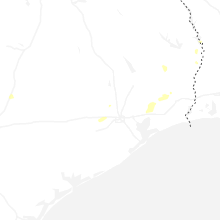
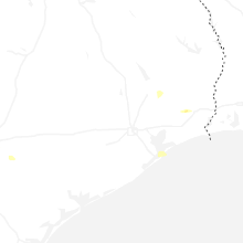
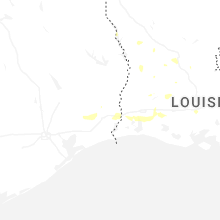
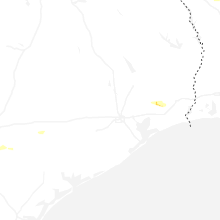
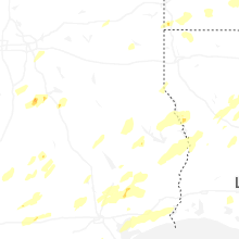
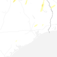


Connect with Interactive Hail Maps