

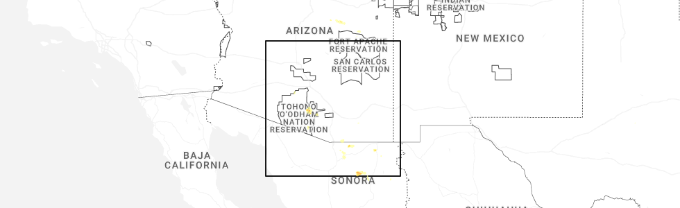
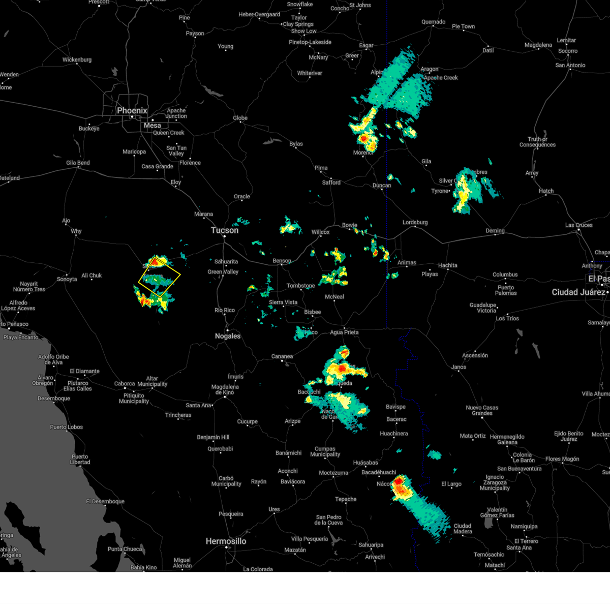
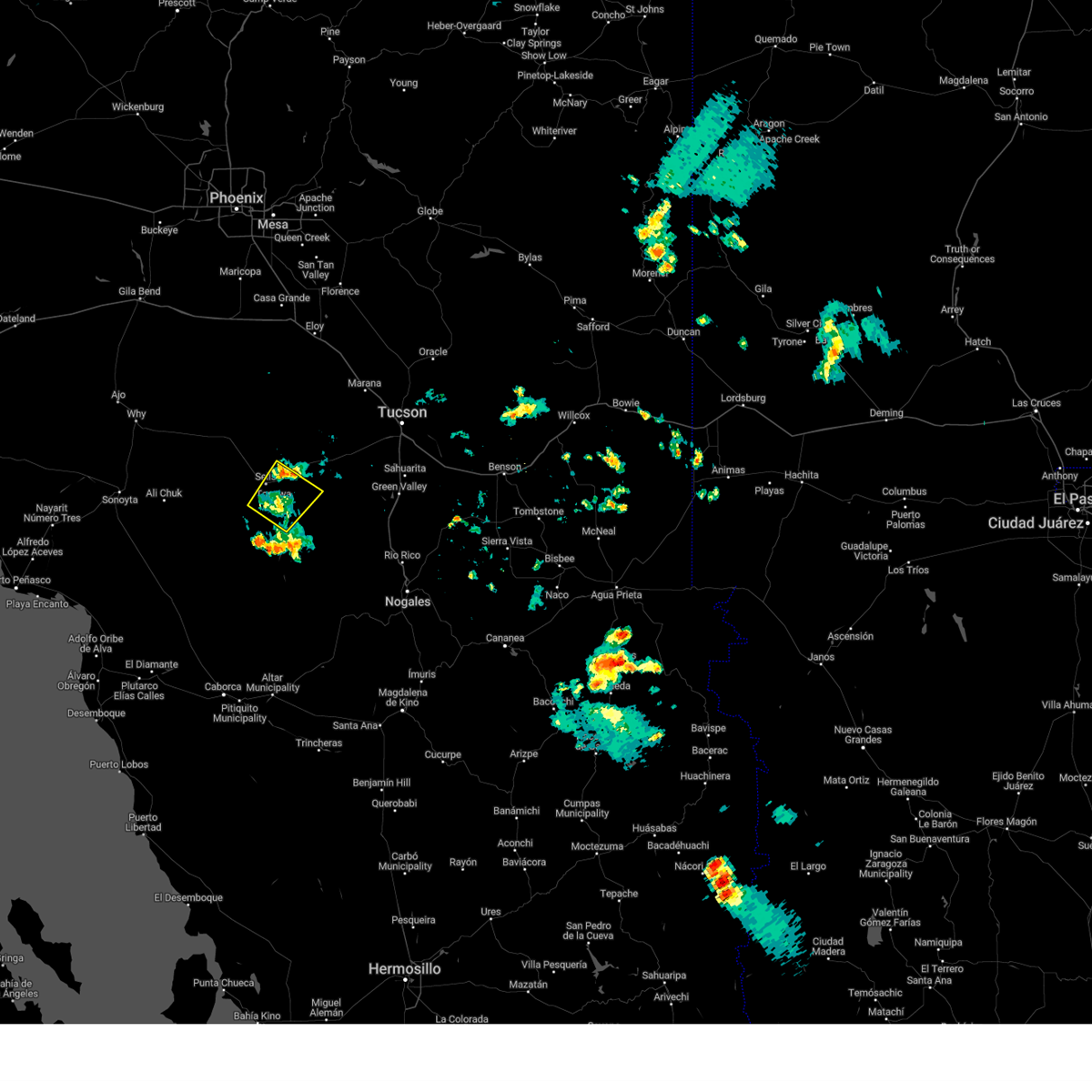
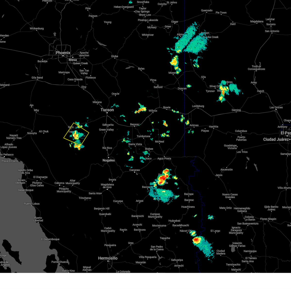
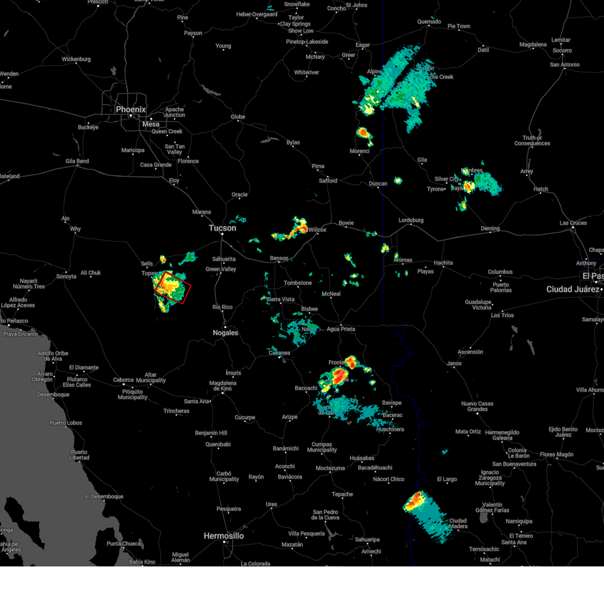
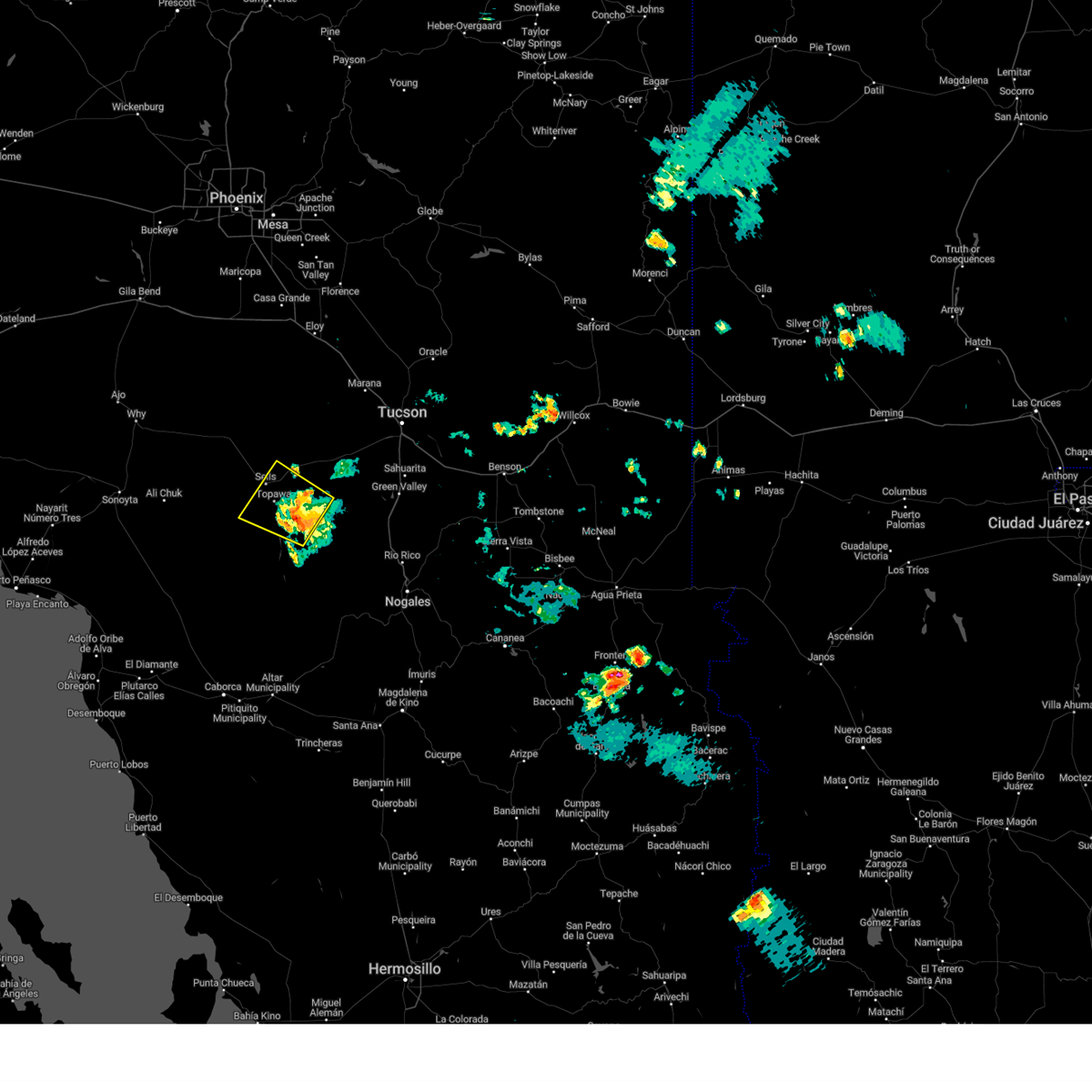
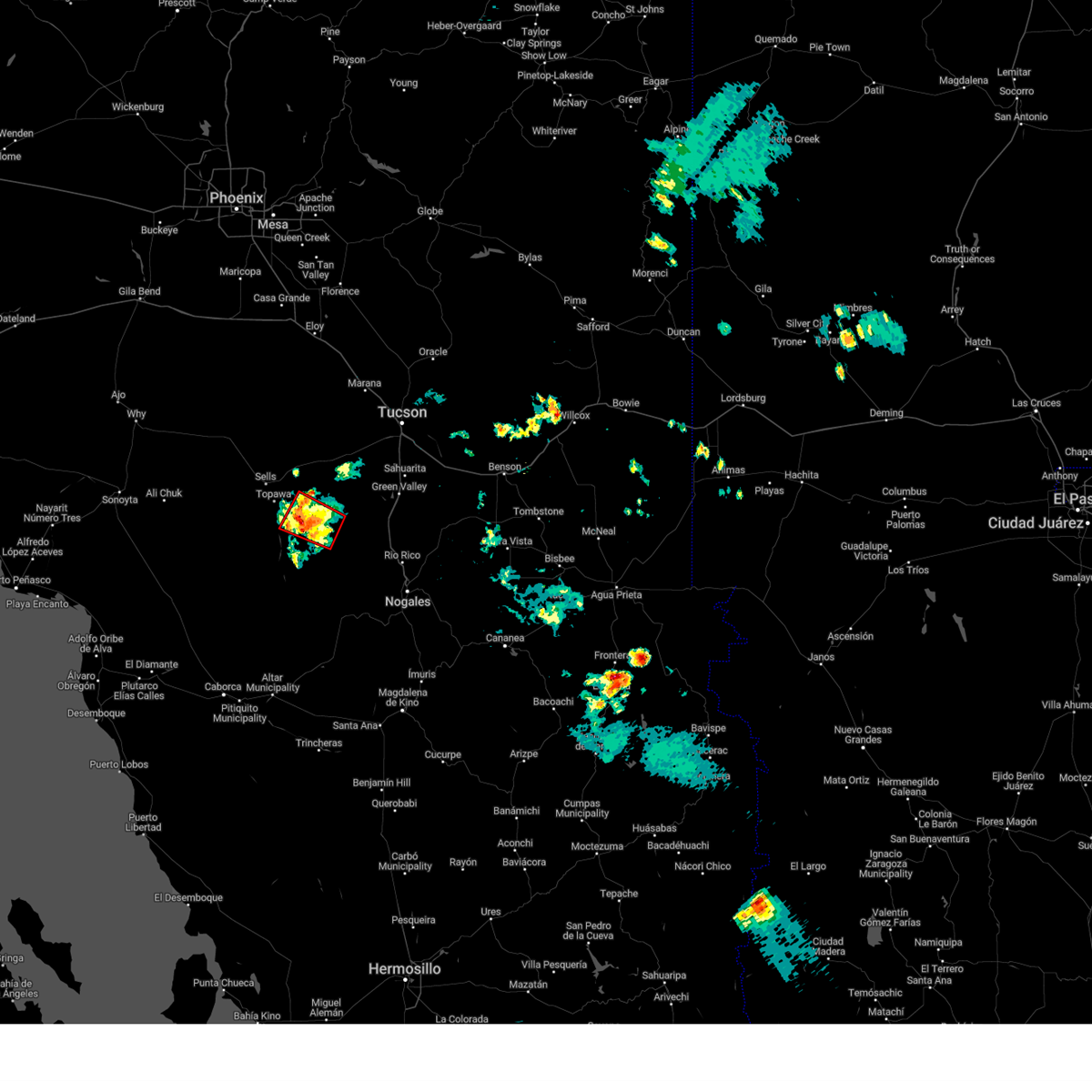
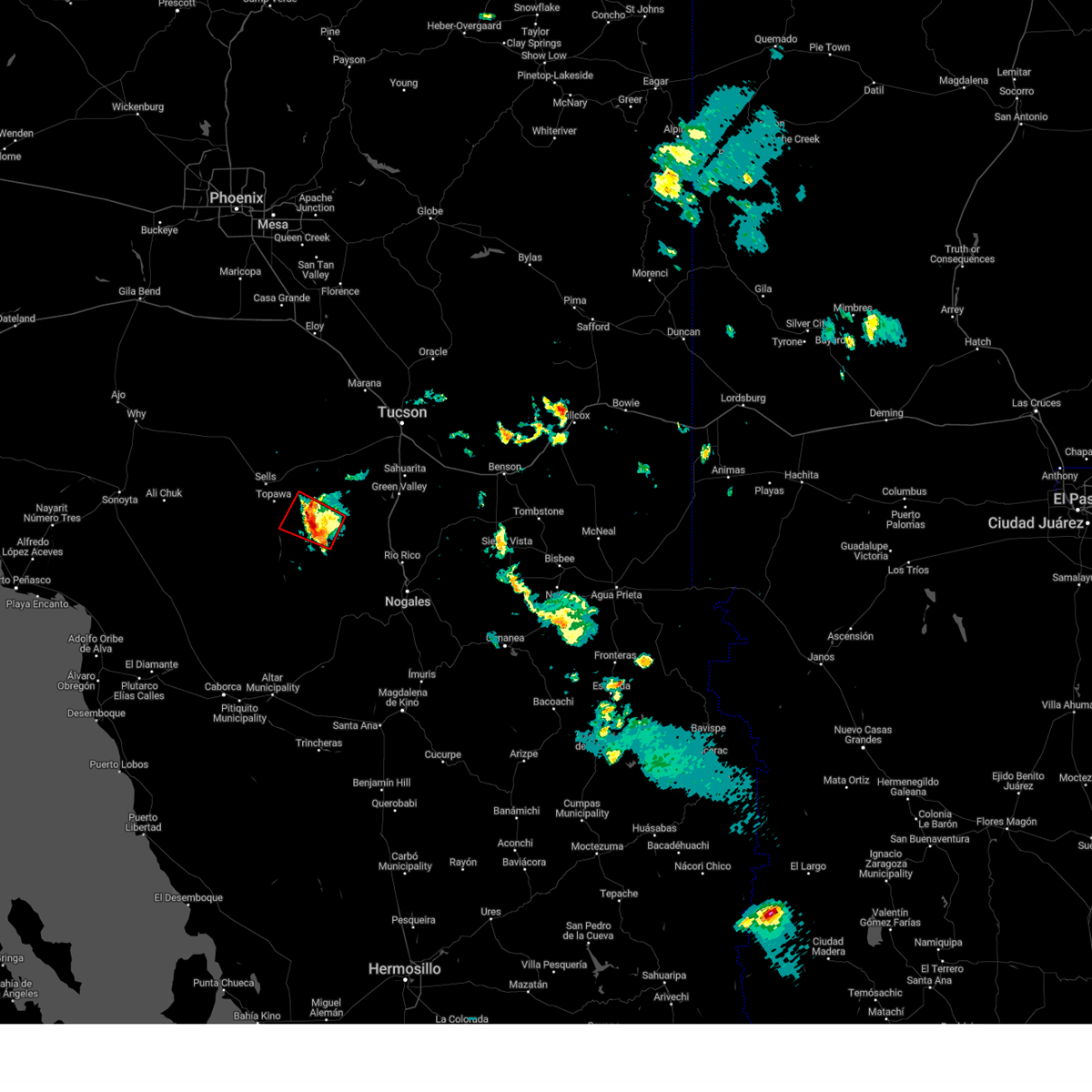
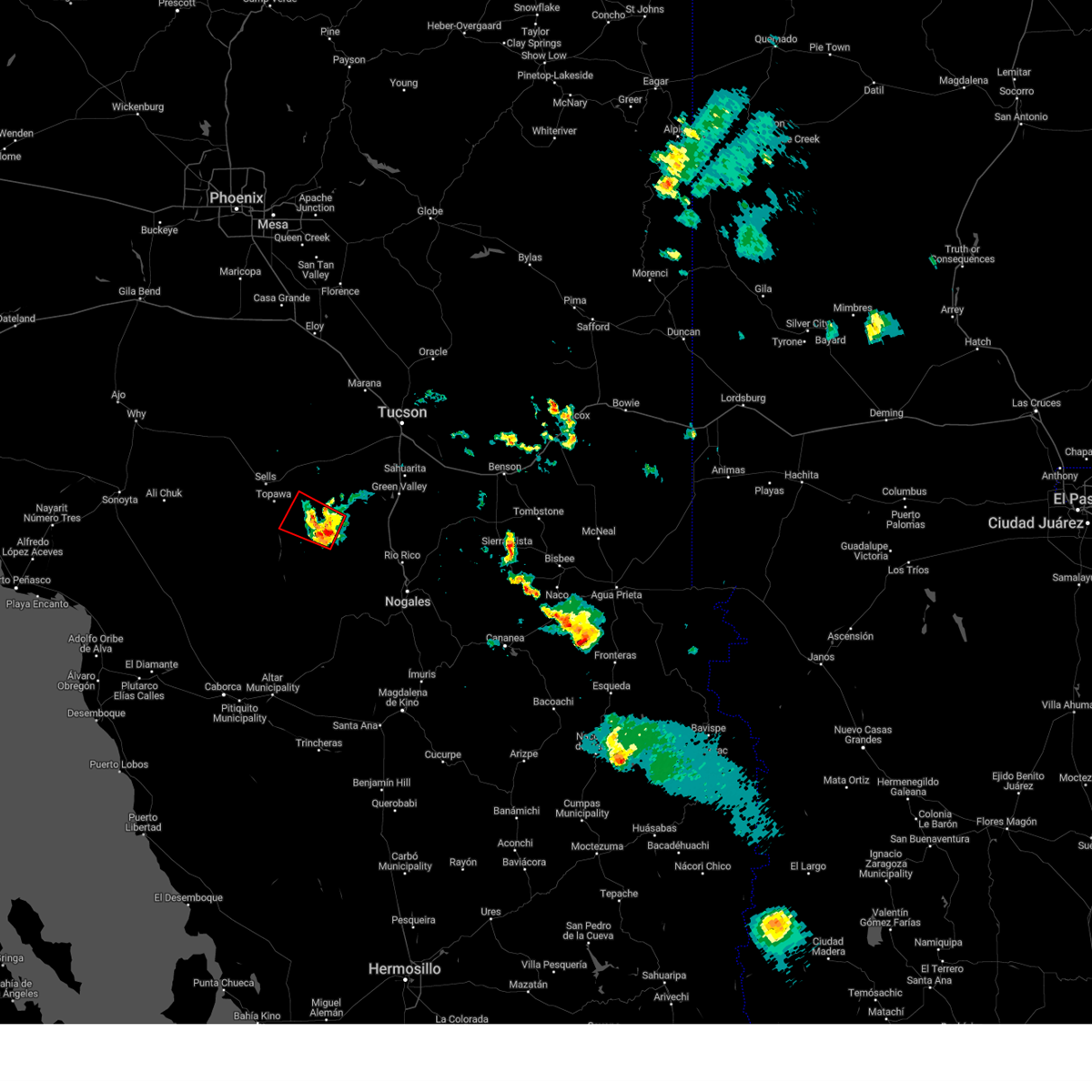
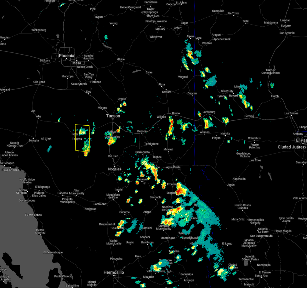
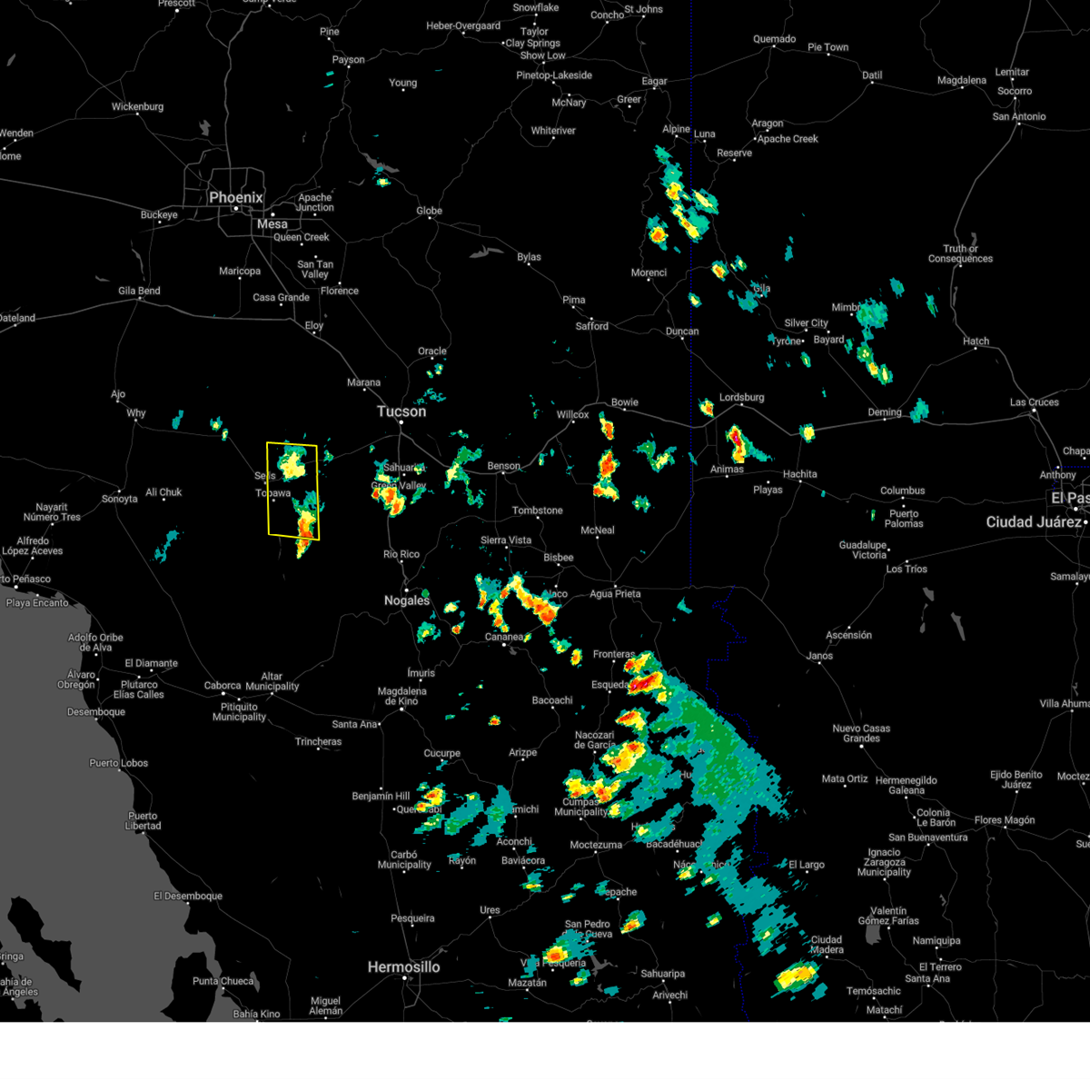
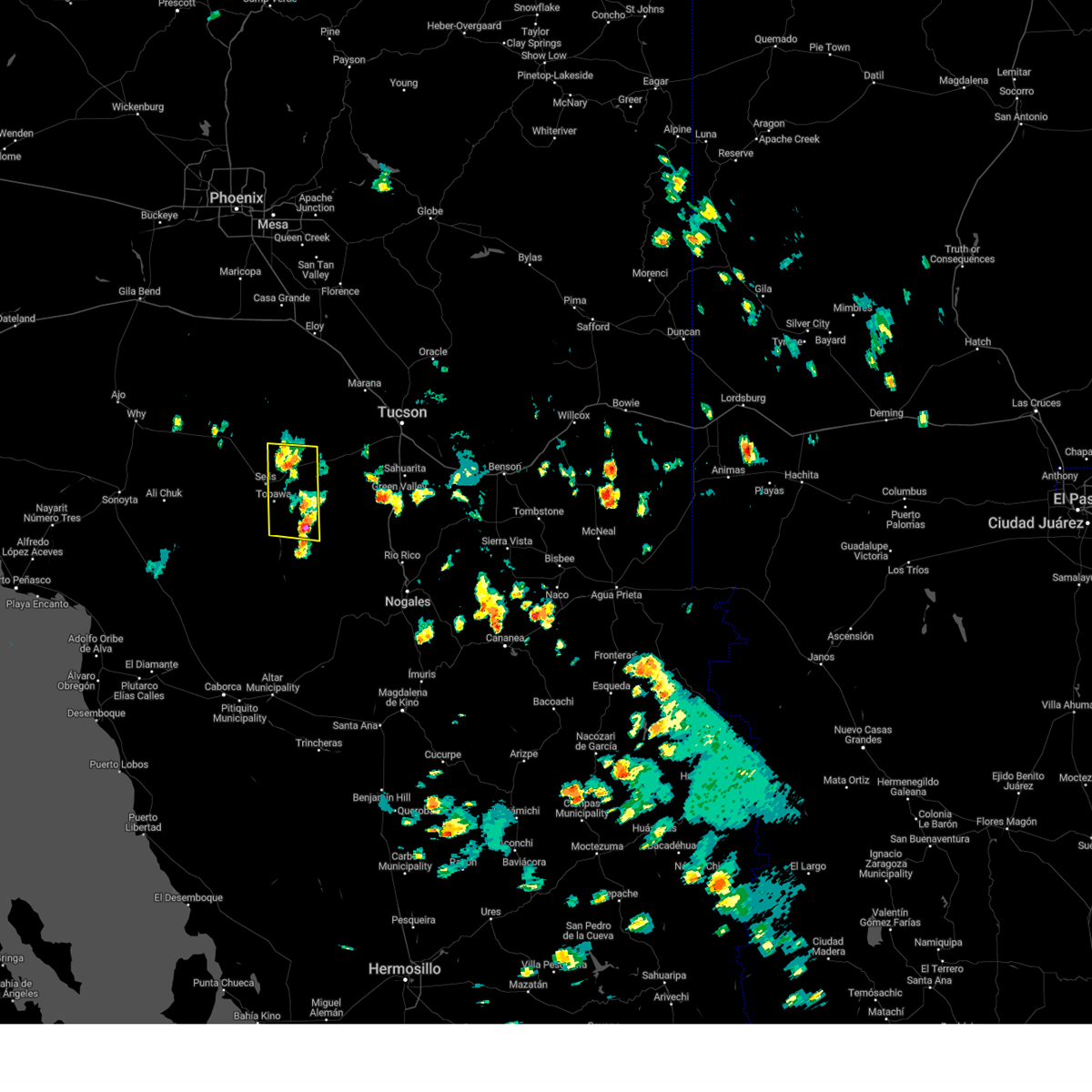
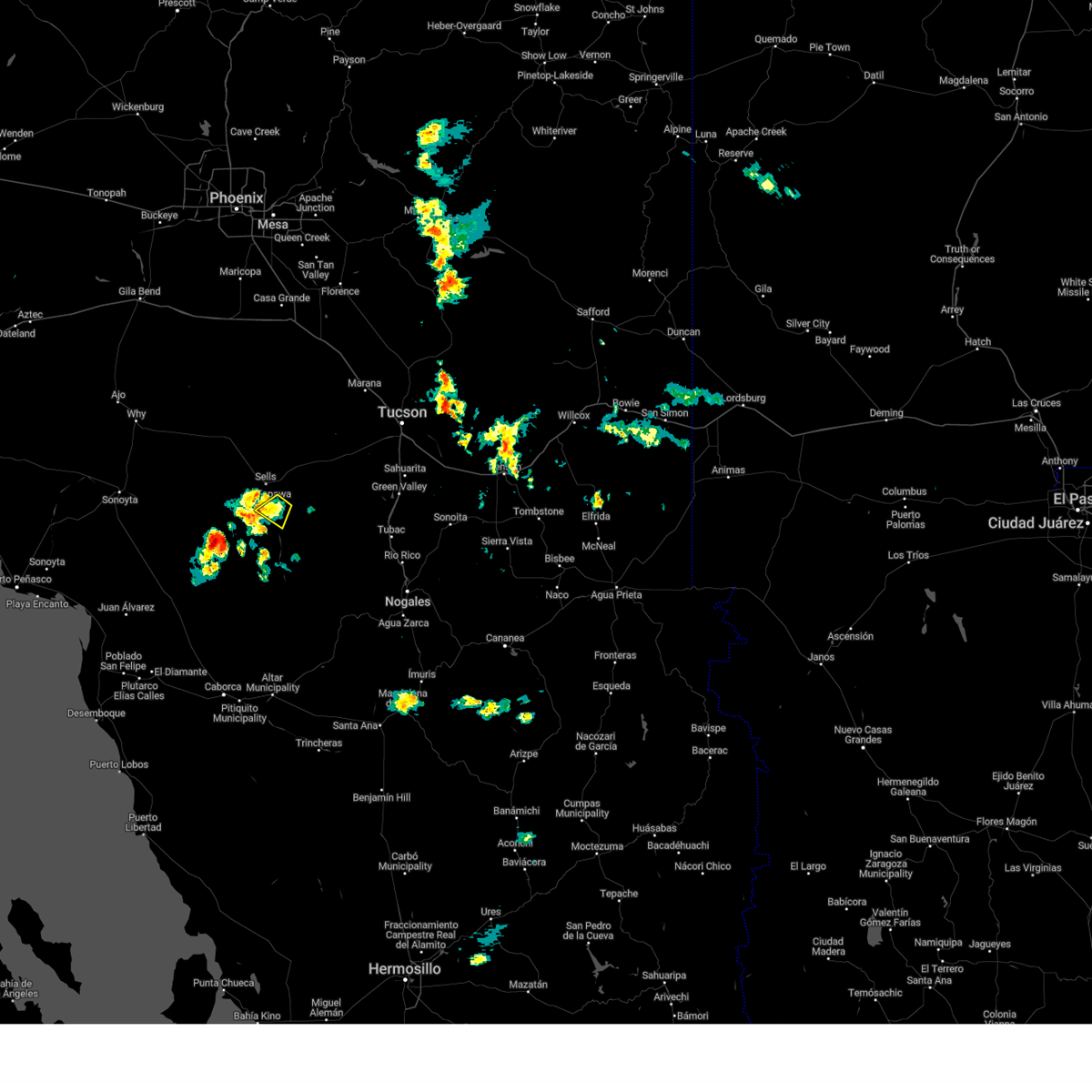
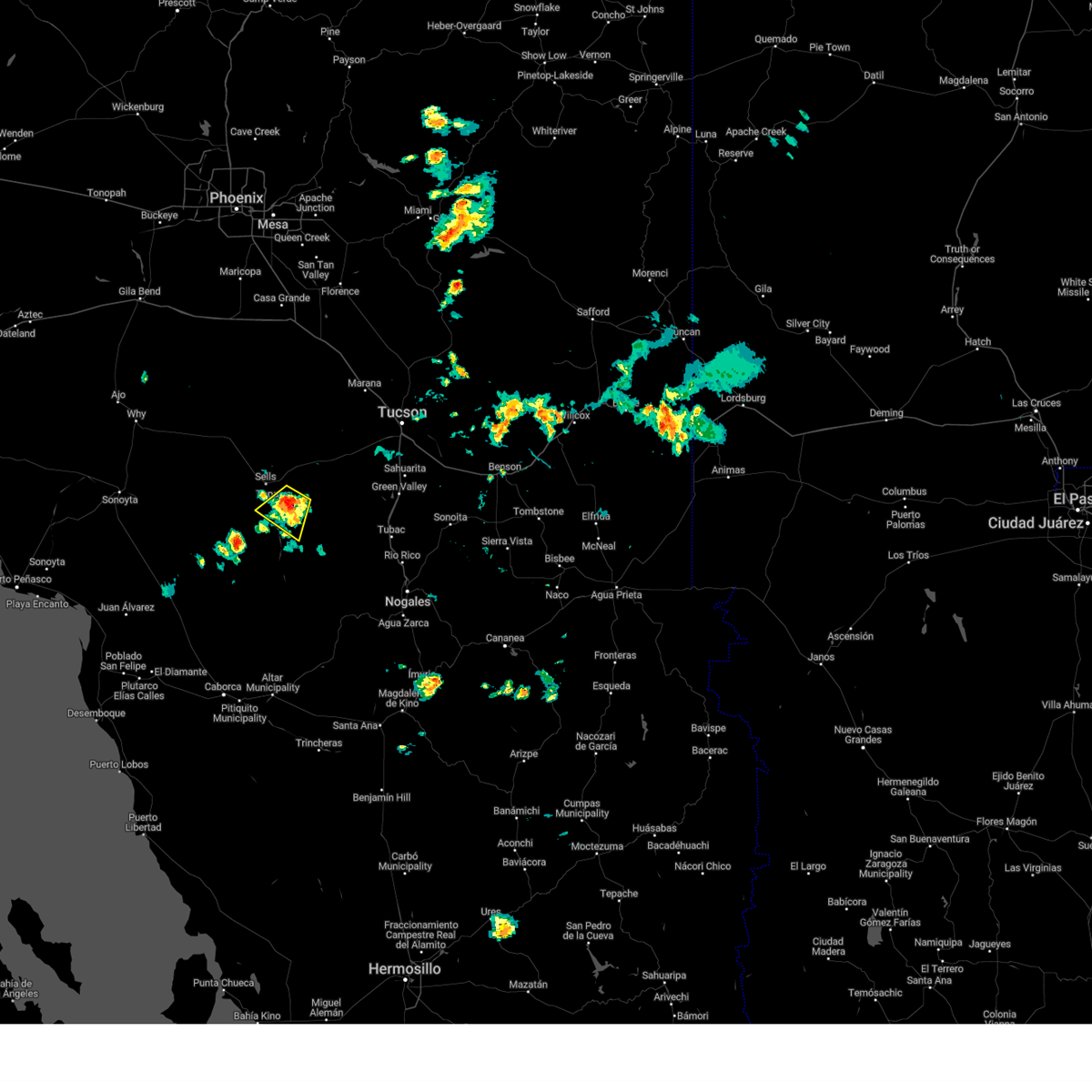
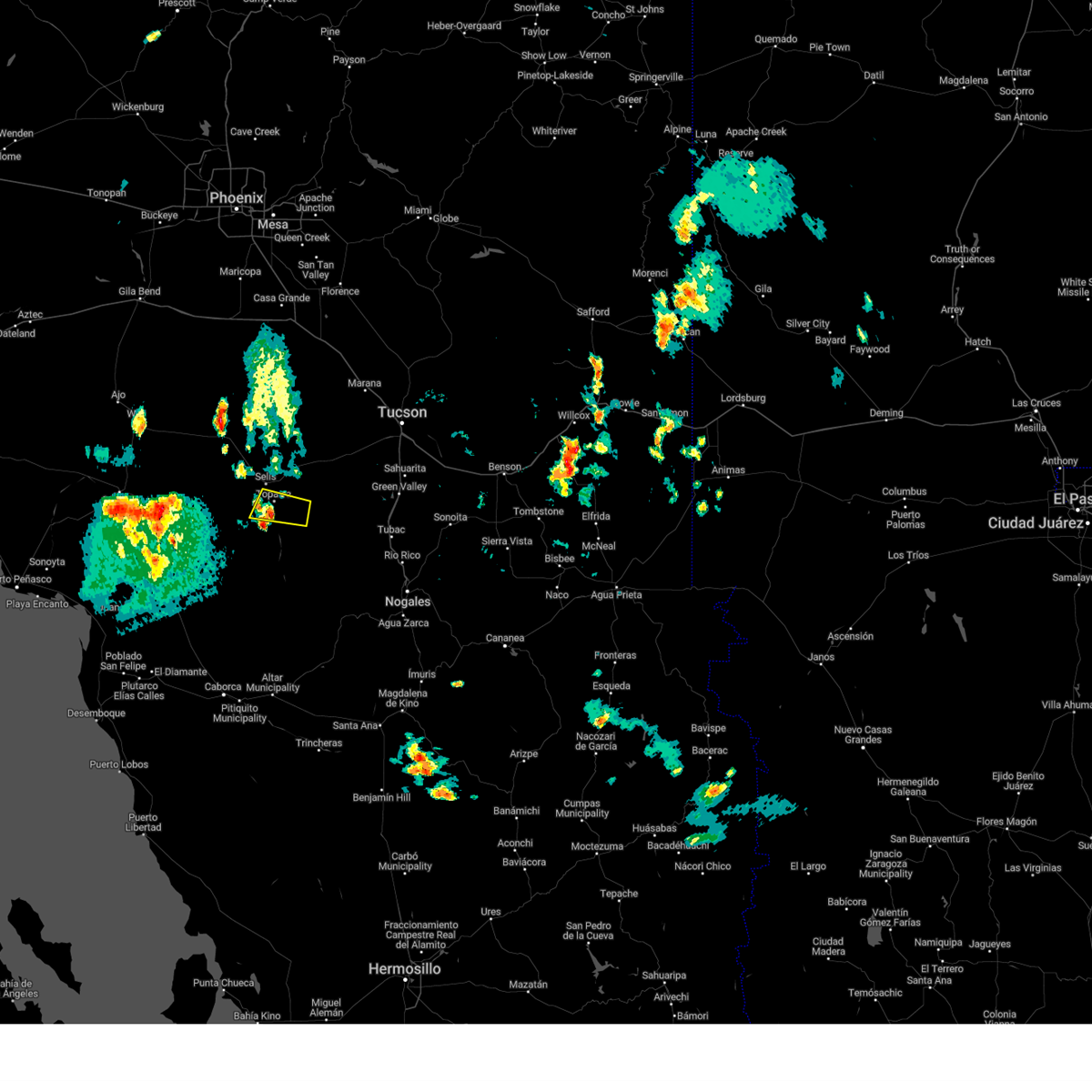
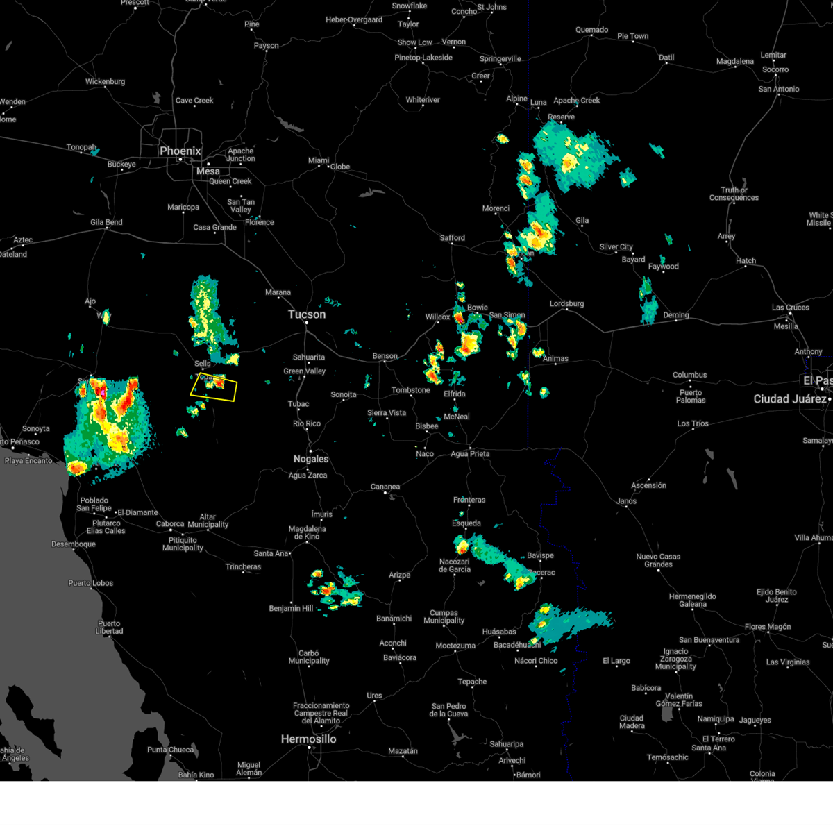
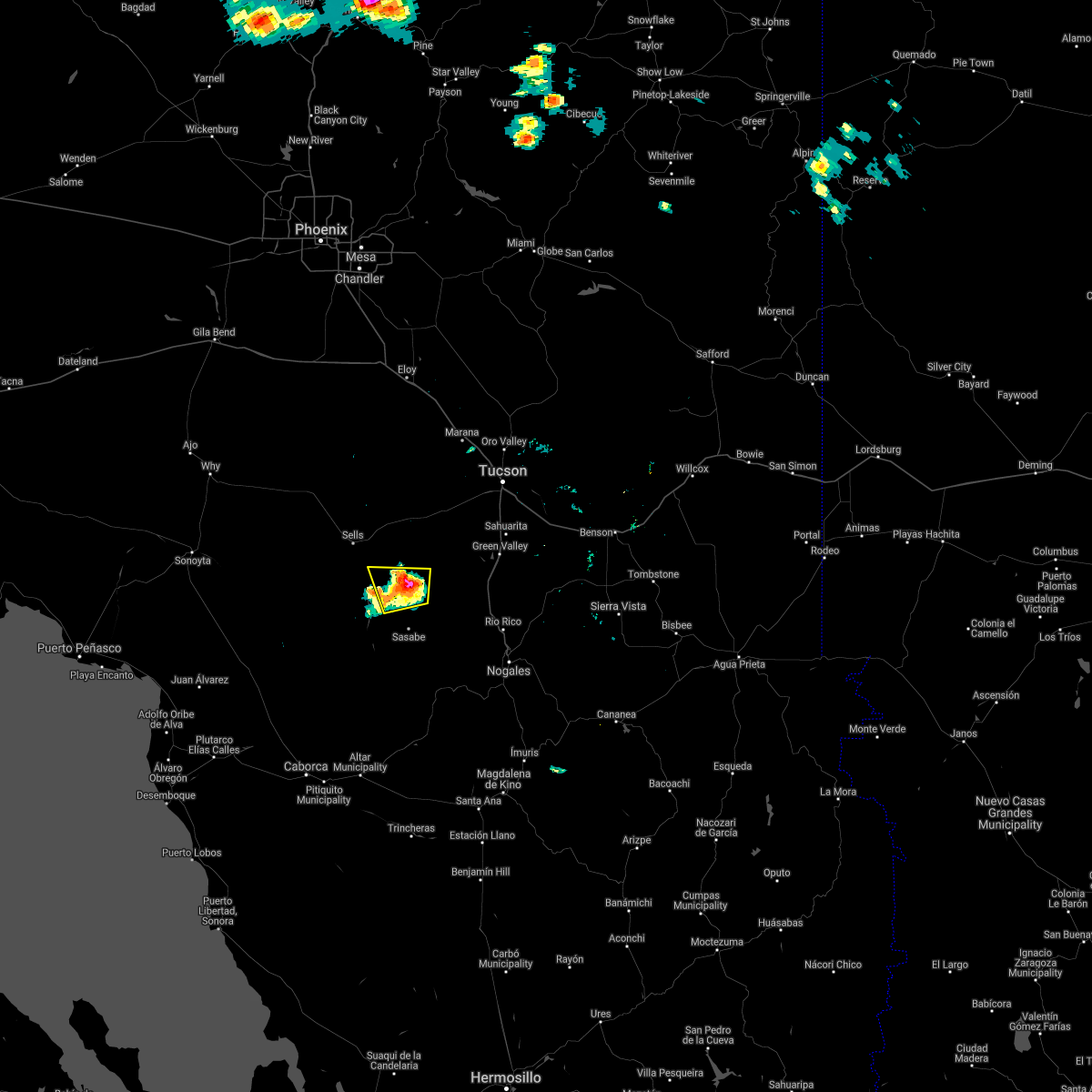
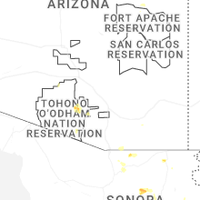
Hail Map for South Komelik, AZ
The South Komelik, AZ area has had 0 reports of on-the-ground hail by trained spotters, and has been under severe weather warnings 0 times during the past 12 months. Doppler radar has detected hail at or near South Komelik, AZ on 45 occasions, including 2 occasions during the past year.
| Name: | South Komelik, AZ |
| Where Located: | 58.5 miles SW of Tucson, AZ |
| Map: | Google Map for South Komelik, AZ |
| Population: | 111 |
| Housing Units: | 65 |
| More Info: | Search Google for South Komelik, AZ |
2
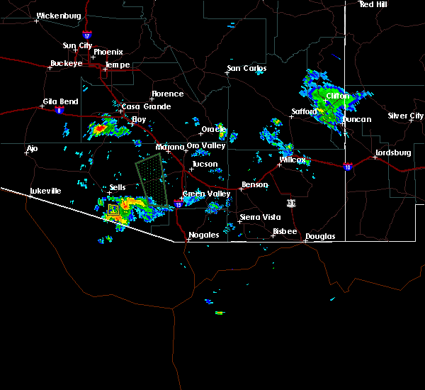
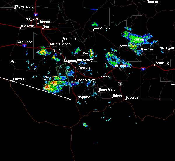
The Top Recent Hail Date for South Komelik, AZ is Tuesday, July 15, 2025 (11th out of 45)
Hail and Wind Damage Spotted near South Komelik, AZ
| Date / Time | Report Details |
|---|---|
| 8/16/2024 7:06 PM MST |
 The storm which prompted the warning has weakened below severe limits, and no longer poses an immediate threat to life or property. therefore, the warning will be allowed to expire. however, heavy rain is still possible with this thunderstorm. The storm which prompted the warning has weakened below severe limits, and no longer poses an immediate threat to life or property. therefore, the warning will be allowed to expire. however, heavy rain is still possible with this thunderstorm.
|
| 8/16/2024 6:58 PM MST |
 At 658 pm mst, a severe thunderstorm was located near sells, moving northwest at 25 mph (radar indicated). Hazards include 60 mph wind gusts and nickel size hail. Expect damage to roofs, siding, and trees. locations impacted include, sells, topawa, ali chukson, south komelik, cowlic, fresnal, choulic, coldfields, fresnal canyon, artesia, and ali molina. This includes route 86 between mile markers 113 and 125. At 658 pm mst, a severe thunderstorm was located near sells, moving northwest at 25 mph (radar indicated). Hazards include 60 mph wind gusts and nickel size hail. Expect damage to roofs, siding, and trees. locations impacted include, sells, topawa, ali chukson, south komelik, cowlic, fresnal, choulic, coldfields, fresnal canyon, artesia, and ali molina. This includes route 86 between mile markers 113 and 125.
|
| 8/16/2024 6:47 PM MST |
 At 646 pm mst, a severe thunderstorm was located over topawa, or 9 miles southeast of sells, moving northwest at 25 mph (radar indicated). Hazards include 60 mph wind gusts and quarter size hail. Hail damage to vehicles is expected. expect wind damage to roofs, siding, and trees. locations impacted include, sells, topawa, san miguel, ali chukson, vamori, south komelik, cowlic, fresnal, choulic, coldfields, fresnal canyon, artesia, and ali molina. this includes the following highways, route 86 between mile markers 113 and 125. Route 286 near mile marker 25. At 646 pm mst, a severe thunderstorm was located over topawa, or 9 miles southeast of sells, moving northwest at 25 mph (radar indicated). Hazards include 60 mph wind gusts and quarter size hail. Hail damage to vehicles is expected. expect wind damage to roofs, siding, and trees. locations impacted include, sells, topawa, san miguel, ali chukson, vamori, south komelik, cowlic, fresnal, choulic, coldfields, fresnal canyon, artesia, and ali molina. this includes the following highways, route 86 between mile markers 113 and 125. Route 286 near mile marker 25.
|
| 8/16/2024 6:28 PM MST |
 The tornado threat has diminished and the tornado warning has been cancelled. however, large hail and damaging winds remain likely and a severe thunderstorm warning remains in effect for the area. however, gusty winds are still possible with this thunderstorm. remember, a severe thunderstorm warning still remains in effect for fresnal canyon, coldfield, topawa, and south komelik. The tornado threat has diminished and the tornado warning has been cancelled. however, large hail and damaging winds remain likely and a severe thunderstorm warning remains in effect for the area. however, gusty winds are still possible with this thunderstorm. remember, a severe thunderstorm warning still remains in effect for fresnal canyon, coldfield, topawa, and south komelik.
|
| 8/16/2024 6:24 PM MST |
 Svrtwc the national weather service in tucson has issued a * severe thunderstorm warning for, south central pima county in southeastern arizona, * until 715 pm mst. * at 623 pm mst, a severe thunderstorm was located 9 miles northeast of san miguel, or 17 miles southeast of sells, moving northwest at 25 mph. this storm is capable of producing a tornado (radar indicated). Hazards include 60 mph wind gusts and quarter size hail. Hail damage to vehicles is expected. Expect wind damage to roofs, siding, and trees. Svrtwc the national weather service in tucson has issued a * severe thunderstorm warning for, south central pima county in southeastern arizona, * until 715 pm mst. * at 623 pm mst, a severe thunderstorm was located 9 miles northeast of san miguel, or 17 miles southeast of sells, moving northwest at 25 mph. this storm is capable of producing a tornado (radar indicated). Hazards include 60 mph wind gusts and quarter size hail. Hail damage to vehicles is expected. Expect wind damage to roofs, siding, and trees.
|
| 8/16/2024 6:19 PM MST |
 At 619 pm mst, a severe thunderstorm capable of producing a tornado was located 12 miles northeast of san miguel, or 23 miles southeast of sells, moving northwest at 25 mph (radar indicated rotation). Hazards include tornado. Flying debris will be dangerous to those caught without shelter. mobile homes will be damaged or destroyed. damage to roofs, windows, and vehicles will occur. tree damage is likely. locations impacted include, choulic, coldfields, and fresnal canyon. This includes route 286 between mile markers 7 and 21. At 619 pm mst, a severe thunderstorm capable of producing a tornado was located 12 miles northeast of san miguel, or 23 miles southeast of sells, moving northwest at 25 mph (radar indicated rotation). Hazards include tornado. Flying debris will be dangerous to those caught without shelter. mobile homes will be damaged or destroyed. damage to roofs, windows, and vehicles will occur. tree damage is likely. locations impacted include, choulic, coldfields, and fresnal canyon. This includes route 286 between mile markers 7 and 21.
|
| 8/16/2024 6:07 PM MST |
 At 606 pm mst, a severe thunderstorm capable of producing a tornado was located 13 miles northeast of san miguel, or 23 miles southeast of sells, moving northwest at 20 mph (radar indicated rotation). Hazards include tornado and quarter size hail. Flying debris will be dangerous to those caught without shelter. mobile homes will be damaged or destroyed. damage to roofs, windows, and vehicles will occur. tree damage is likely. locations impacted include, choulic, coldfields, and fresnal canyon. This includes route 286 between mile markers 7 and 21. At 606 pm mst, a severe thunderstorm capable of producing a tornado was located 13 miles northeast of san miguel, or 23 miles southeast of sells, moving northwest at 20 mph (radar indicated rotation). Hazards include tornado and quarter size hail. Flying debris will be dangerous to those caught without shelter. mobile homes will be damaged or destroyed. damage to roofs, windows, and vehicles will occur. tree damage is likely. locations impacted include, choulic, coldfields, and fresnal canyon. This includes route 286 between mile markers 7 and 21.
|
| 8/16/2024 5:54 PM MST |
 Tortwc the national weather service in tucson has issued a * tornado warning for, south central pima county in southeastern arizona, * until 630 pm mst. * at 554 pm mst, a severe thunderstorm capable of producing a tornado was located 12 miles northwest of arivaca, or 27 miles west of tubac, moving northwest at 20 mph (radar indicated rotation). Hazards include tornado and quarter size hail. Flying debris will be dangerous to those caught without shelter. mobile homes will be damaged or destroyed. damage to roofs, windows, and vehicles will occur. tree damage is likely. this tornadic thunderstorm will remain over mainly remote areas of south central pima county, including the following locations, fresnal canyon, choulic, and coldfields. This includes route 286 between mile markers 7 and 21. Tortwc the national weather service in tucson has issued a * tornado warning for, south central pima county in southeastern arizona, * until 630 pm mst. * at 554 pm mst, a severe thunderstorm capable of producing a tornado was located 12 miles northwest of arivaca, or 27 miles west of tubac, moving northwest at 20 mph (radar indicated rotation). Hazards include tornado and quarter size hail. Flying debris will be dangerous to those caught without shelter. mobile homes will be damaged or destroyed. damage to roofs, windows, and vehicles will occur. tree damage is likely. this tornadic thunderstorm will remain over mainly remote areas of south central pima county, including the following locations, fresnal canyon, choulic, and coldfields. This includes route 286 between mile markers 7 and 21.
|
| 8/12/2024 4:23 PM MST |
 The storm which prompted the warning has weakened below severe limits, and no longer poses an immediate threat to life or property. therefore, the warning will be allowed to expire. however, heavy rain is still possible with this thunderstorm. The storm which prompted the warning has weakened below severe limits, and no longer poses an immediate threat to life or property. therefore, the warning will be allowed to expire. however, heavy rain is still possible with this thunderstorm.
|
| 8/12/2024 4:06 PM MST |
 At 406 pm mst, a severe thunderstorm was located near san isidro, or 9 miles east of sells, moving north at 10 mph (radar indicated). Hazards include 60 mph wind gusts and quarter size hail. Hail damage to vehicles is expected. expect wind damage to roofs, siding, and trees. locations impacted include, sells, topawa, san miguel, san isidro, kitt peak, ali chukson, south komelik, fresnal, choulic, coldfields, comobabi, south comobabi, santa rosa ranch, fresnal canyon, artesia, pan tak, and ali molina. this includes the following highways, route 86 between mile markers 115 and 136. Route 286 between mile markers 8 and 9. At 406 pm mst, a severe thunderstorm was located near san isidro, or 9 miles east of sells, moving north at 10 mph (radar indicated). Hazards include 60 mph wind gusts and quarter size hail. Hail damage to vehicles is expected. expect wind damage to roofs, siding, and trees. locations impacted include, sells, topawa, san miguel, san isidro, kitt peak, ali chukson, south komelik, fresnal, choulic, coldfields, comobabi, south comobabi, santa rosa ranch, fresnal canyon, artesia, pan tak, and ali molina. this includes the following highways, route 86 between mile markers 115 and 136. Route 286 between mile markers 8 and 9.
|
| 8/12/2024 3:48 PM MST |
 Svrtwc the national weather service in tucson has issued a * severe thunderstorm warning for, central pima county in southeastern arizona, * until 430 pm mst. * at 348 pm mst, a severe thunderstorm was located near san isidro, or 9 miles east of sells, moving north at 15 mph (radar indicated). Hazards include 60 mph wind gusts and quarter size hail. Hail damage to vehicles is expected. Expect wind damage to roofs, siding, and trees. Svrtwc the national weather service in tucson has issued a * severe thunderstorm warning for, central pima county in southeastern arizona, * until 430 pm mst. * at 348 pm mst, a severe thunderstorm was located near san isidro, or 9 miles east of sells, moving north at 15 mph (radar indicated). Hazards include 60 mph wind gusts and quarter size hail. Hail damage to vehicles is expected. Expect wind damage to roofs, siding, and trees.
|
| 7/25/2024 2:07 PM MST |
 The storm which prompted the warning has weakened below severe limits, and no longer poses an immediate threat to life or property. therefore, the warning will be allowed to expire. however, gusty winds and heavy rain are still possible with this thunderstorm. to report severe weather, contact your nearest law enforcement agency. they will relay your report to the national weather service tucson. The storm which prompted the warning has weakened below severe limits, and no longer poses an immediate threat to life or property. therefore, the warning will be allowed to expire. however, gusty winds and heavy rain are still possible with this thunderstorm. to report severe weather, contact your nearest law enforcement agency. they will relay your report to the national weather service tucson.
|
| 7/25/2024 1:58 PM MST |
 Svrtwc the national weather service in tucson has issued a * severe thunderstorm warning for, central pima county in southeastern arizona, * until 215 pm mst. * at 158 pm mst, a severe thunderstorm was located 11 miles west of sells, moving south at 10 mph (radar indicated). Hazards include 60 mph wind gusts. expect damage to roofs, siding, and trees Svrtwc the national weather service in tucson has issued a * severe thunderstorm warning for, central pima county in southeastern arizona, * until 215 pm mst. * at 158 pm mst, a severe thunderstorm was located 11 miles west of sells, moving south at 10 mph (radar indicated). Hazards include 60 mph wind gusts. expect damage to roofs, siding, and trees
|
| 7/25/2024 1:38 PM MST |
 At 137 pm mst, a severe thunderstorm was located over sells, moving southwest at 20 mph (radar indicated). Hazards include 60 mph wind gusts. Expect damage to roofs, siding, and trees. locations impacted include, sells, topawa, san miguel, ali chukson, gu oidak, vamori, south komelik, cowlic, fresnal, choulic, coldfields, fresnal canyon, artesia, and ali molina. This includes route 86 between mile markers 108 and 123. At 137 pm mst, a severe thunderstorm was located over sells, moving southwest at 20 mph (radar indicated). Hazards include 60 mph wind gusts. Expect damage to roofs, siding, and trees. locations impacted include, sells, topawa, san miguel, ali chukson, gu oidak, vamori, south komelik, cowlic, fresnal, choulic, coldfields, fresnal canyon, artesia, and ali molina. This includes route 86 between mile markers 108 and 123.
|
| 7/25/2024 1:09 PM MST |
 Svrtwc the national weather service in tucson has issued a * severe thunderstorm warning for, south central pima county in southeastern arizona, * until 200 pm mst. * at 108 pm mst, a severe thunderstorm was located near topawa, or from sells to fresnal canyon, moving southwest at 5 mph (radar indicated). Hazards include 60 mph wind gusts and penny size hail. expect damage to roofs, siding, and trees Svrtwc the national weather service in tucson has issued a * severe thunderstorm warning for, south central pima county in southeastern arizona, * until 200 pm mst. * at 108 pm mst, a severe thunderstorm was located near topawa, or from sells to fresnal canyon, moving southwest at 5 mph (radar indicated). Hazards include 60 mph wind gusts and penny size hail. expect damage to roofs, siding, and trees
|
| 7/21/2024 8:12 PM MST |
 The storms which prompted the warning have moved out of the area. therefore, the warning will be allowed to expire. The storms which prompted the warning have moved out of the area. therefore, the warning will be allowed to expire.
|
| 7/21/2024 7:53 PM MST |
 At 753 pm mst, severe thunderstorms were located along a line extending from 9 miles southwest of topawa to 7 miles northeast of san miguel, moving southwest at 15 mph (radar indicated). Hazards include 60 mph wind gusts. Expect damage to roofs, siding, and trees. Locations impacted include, topawa, san miguel, vamori, south komelik, cowlic, choulic, newfield, coldfields, hashan chuchg, and itak. At 753 pm mst, severe thunderstorms were located along a line extending from 9 miles southwest of topawa to 7 miles northeast of san miguel, moving southwest at 15 mph (radar indicated). Hazards include 60 mph wind gusts. Expect damage to roofs, siding, and trees. Locations impacted include, topawa, san miguel, vamori, south komelik, cowlic, choulic, newfield, coldfields, hashan chuchg, and itak.
|
| 7/21/2024 7:26 PM MST |
 Svrtwc the national weather service in tucson has issued a * severe thunderstorm warning for, south central pima county in southeastern arizona, * until 815 pm mst. * at 726 pm mst, severe thunderstorms were located along a line extending from 6 miles west of topawa to 12 miles northeast of san miguel, moving southwest at 10 mph (radar indicated). Hazards include 60 mph wind gusts. expect damage to roofs, siding, and trees Svrtwc the national weather service in tucson has issued a * severe thunderstorm warning for, south central pima county in southeastern arizona, * until 815 pm mst. * at 726 pm mst, severe thunderstorms were located along a line extending from 6 miles west of topawa to 12 miles northeast of san miguel, moving southwest at 10 mph (radar indicated). Hazards include 60 mph wind gusts. expect damage to roofs, siding, and trees
|
| 7/13/2024 4:40 PM MST |
 The storm which prompted the warning has weakened below severe limits, and has exited the warned area. therefore, the warning will be allowed to expire. The storm which prompted the warning has weakened below severe limits, and has exited the warned area. therefore, the warning will be allowed to expire.
|
| 7/13/2024 4:25 PM MST |
 At 425 pm mst, a severe thunderstorm was located over san miguel, or 22 miles south of sells, moving west at 15 mph (radar indicated). Hazards include 60 mph wind gusts. Expect damage to roofs, siding, and trees. Locations impacted include, topawa, san miguel, south komelik, choulic, newfield, coldfields, and hashan chuchg. At 425 pm mst, a severe thunderstorm was located over san miguel, or 22 miles south of sells, moving west at 15 mph (radar indicated). Hazards include 60 mph wind gusts. Expect damage to roofs, siding, and trees. Locations impacted include, topawa, san miguel, south komelik, choulic, newfield, coldfields, and hashan chuchg.
|
| 7/13/2024 3:57 PM MST |
 Svrtwc the national weather service in tucson has issued a * severe thunderstorm warning for, south central pima county in southeastern arizona, * until 445 pm mst. * at 356 pm mst, a severe thunderstorm was located near san miguel, or 18 miles southeast of sells, moving west at 10 mph (radar indicated). Hazards include 60 mph wind gusts and quarter size hail. Hail damage to vehicles is expected. Expect wind damage to roofs, siding, and trees. Svrtwc the national weather service in tucson has issued a * severe thunderstorm warning for, south central pima county in southeastern arizona, * until 445 pm mst. * at 356 pm mst, a severe thunderstorm was located near san miguel, or 18 miles southeast of sells, moving west at 10 mph (radar indicated). Hazards include 60 mph wind gusts and quarter size hail. Hail damage to vehicles is expected. Expect wind damage to roofs, siding, and trees.
|
| 7/11/2024 7:36 PM MST |
 The storm which prompted the warning has moved out of the area. therefore, the warning will be allowed to expire. remember, a severe thunderstorm warning still remains in effect for western portions of the tohono o'odham nation into western pima county until 845 pm mst. The storm which prompted the warning has moved out of the area. therefore, the warning will be allowed to expire. remember, a severe thunderstorm warning still remains in effect for western portions of the tohono o'odham nation into western pima county until 845 pm mst.
|
| 7/11/2024 6:46 PM MST |
 Svrtwc the national weather service in tucson has issued a * severe thunderstorm warning for, south central pima county in southeastern arizona, * until 745 pm mst. * at 646 pm mst, a severe thunderstorm was located 14 miles west of sells, moving southwest at 25 mph (radar indicated). Hazards include 60 mph wind gusts. expect damage to roofs, siding, and trees Svrtwc the national weather service in tucson has issued a * severe thunderstorm warning for, south central pima county in southeastern arizona, * until 745 pm mst. * at 646 pm mst, a severe thunderstorm was located 14 miles west of sells, moving southwest at 25 mph (radar indicated). Hazards include 60 mph wind gusts. expect damage to roofs, siding, and trees
|
| 8/31/2023 5:35 PM MST |
 At 535 pm mst, a severe thunderstorm was located 7 miles northwest of san miguel, or 15 miles south of sells, moving west at 15 mph (radar indicated). Hazards include 60 mph wind gusts and quarter size hail. Hail damage to vehicles is expected. expect wind damage to roofs, siding, and trees. locations impacted include, sells, topawa, san miguel, ali chukson, gu oidak, vamori, cowlic, fresnal, choulic, coldfields, fresnal canyon, artesia, ali molina, south komelik and itak. hail threat, radar indicated max hail size, 1. 00 in wind threat, radar indicated max wind gust, 60 mph. At 535 pm mst, a severe thunderstorm was located 7 miles northwest of san miguel, or 15 miles south of sells, moving west at 15 mph (radar indicated). Hazards include 60 mph wind gusts and quarter size hail. Hail damage to vehicles is expected. expect wind damage to roofs, siding, and trees. locations impacted include, sells, topawa, san miguel, ali chukson, gu oidak, vamori, cowlic, fresnal, choulic, coldfields, fresnal canyon, artesia, ali molina, south komelik and itak. hail threat, radar indicated max hail size, 1. 00 in wind threat, radar indicated max wind gust, 60 mph.
|
| 8/31/2023 5:18 PM MST |
 At 518 pm mst, a severe thunderstorm was located near san miguel, or 15 miles south of sells, moving west at 15 mph (radar indicated). Hazards include 60 mph wind gusts and quarter size hail. Hail damage to vehicles is expected. Expect wind damage to roofs, siding, and trees. At 518 pm mst, a severe thunderstorm was located near san miguel, or 15 miles south of sells, moving west at 15 mph (radar indicated). Hazards include 60 mph wind gusts and quarter size hail. Hail damage to vehicles is expected. Expect wind damage to roofs, siding, and trees.
|
| 8/30/2023 6:36 PM MST |
 The severe thunderstorm warning for south central pima county will expire at 645 pm mst, the storm which prompted the warning has weakened below severe limits, and has exited the warned area. therefore, the warning will be allowed to expire. The severe thunderstorm warning for south central pima county will expire at 645 pm mst, the storm which prompted the warning has weakened below severe limits, and has exited the warned area. therefore, the warning will be allowed to expire.
|
| 8/30/2023 6:29 PM MST |
 At 629 pm mst, a severe thunderstorm was located near topawa, or 10 miles south of sells, moving southwest at 10 mph (radar indicated). Hazards include 60 mph wind gusts and nickel size hail. Expect damage to roofs, siding, and trees. locations impacted include, topawa, choulic, coldfields and south komelik. hail threat, radar indicated max hail size, 0. 88 in wind threat, radar indicated max wind gust, 60 mph. At 629 pm mst, a severe thunderstorm was located near topawa, or 10 miles south of sells, moving southwest at 10 mph (radar indicated). Hazards include 60 mph wind gusts and nickel size hail. Expect damage to roofs, siding, and trees. locations impacted include, topawa, choulic, coldfields and south komelik. hail threat, radar indicated max hail size, 0. 88 in wind threat, radar indicated max wind gust, 60 mph.
|
| 8/30/2023 5:56 PM MST |
 At 555 pm mst, a severe thunderstorm was located 8 miles east of topawa, or 14 miles southeast of sells, moving southwest at 10 mph (radar indicated). Hazards include 60 mph wind gusts and quarter size hail. Hail damage to vehicles is expected. Expect wind damage to roofs, siding, and trees. At 555 pm mst, a severe thunderstorm was located 8 miles east of topawa, or 14 miles southeast of sells, moving southwest at 10 mph (radar indicated). Hazards include 60 mph wind gusts and quarter size hail. Hail damage to vehicles is expected. Expect wind damage to roofs, siding, and trees.
|
| 8/18/2023 3:21 PM MST |
 The severe thunderstorm warning for south central pima county will expire at 330 pm mst, the storm which prompted the warning has weakened below severe limits, and no longer poses an immediate threat to life or property. therefore, the warning will be allowed to expire. however gusty winds are still possible with this thunderstorm. The severe thunderstorm warning for south central pima county will expire at 330 pm mst, the storm which prompted the warning has weakened below severe limits, and no longer poses an immediate threat to life or property. therefore, the warning will be allowed to expire. however gusty winds are still possible with this thunderstorm.
|
| 8/18/2023 3:07 PM MST |
 At 307 pm mst, a severe thunderstorm was located near topawa, or 10 miles southeast of sells, moving northwest at 5 mph (radar indicated). Hazards include 60 mph wind gusts and quarter size hail. Hail damage to vehicles is expected. expect wind damage to roofs, siding, and trees. locations impacted include, topawa, vamori, coldfields, fresnal canyon and south komelik. hail threat, radar indicated max hail size, 1. 00 in wind threat, radar indicated max wind gust, 60 mph. At 307 pm mst, a severe thunderstorm was located near topawa, or 10 miles southeast of sells, moving northwest at 5 mph (radar indicated). Hazards include 60 mph wind gusts and quarter size hail. Hail damage to vehicles is expected. expect wind damage to roofs, siding, and trees. locations impacted include, topawa, vamori, coldfields, fresnal canyon and south komelik. hail threat, radar indicated max hail size, 1. 00 in wind threat, radar indicated max wind gust, 60 mph.
|
| 8/18/2023 2:45 PM MST |
 At 245 pm mst, a severe thunderstorm was located 7 miles southeast of topawa, or 14 miles southeast of sells, and is nearly stationary (radar indicated). Hazards include 60 mph wind gusts and quarter size hail. Hail damage to vehicles is expected. Expect wind damage to roofs, siding, and trees. At 245 pm mst, a severe thunderstorm was located 7 miles southeast of topawa, or 14 miles southeast of sells, and is nearly stationary (radar indicated). Hazards include 60 mph wind gusts and quarter size hail. Hail damage to vehicles is expected. Expect wind damage to roofs, siding, and trees.
|
| 8/18/2023 2:16 PM MST |
 At 216 pm mst, a severe thunderstorm was located 8 miles southwest of kitt peak, or 13 miles east of sells, moving north at 10 mph (radar indicated). Hazards include 60 mph wind gusts and quarter size hail. Hail damage to vehicles is expected. expect wind damage to roofs, siding, and trees. locations impacted include, san isidro, kitt peak, ali chukson, fresnal, san pedro, comobabi, south comobabi, cababi, fresnal canyon, pan tak and ali molina. hail threat, radar indicated max hail size, 1. 00 in wind threat, radar indicated max wind gust, 60 mph. At 216 pm mst, a severe thunderstorm was located 8 miles southwest of kitt peak, or 13 miles east of sells, moving north at 10 mph (radar indicated). Hazards include 60 mph wind gusts and quarter size hail. Hail damage to vehicles is expected. expect wind damage to roofs, siding, and trees. locations impacted include, san isidro, kitt peak, ali chukson, fresnal, san pedro, comobabi, south comobabi, cababi, fresnal canyon, pan tak and ali molina. hail threat, radar indicated max hail size, 1. 00 in wind threat, radar indicated max wind gust, 60 mph.
|
| 8/18/2023 1:57 PM MST |
 At 157 pm mst, a severe thunderstorm was located 9 miles east of topawa, or 14 miles southeast of sells, moving north at 10 mph (radar indicated). Hazards include 60 mph wind gusts and quarter size hail. Hail damage to vehicles is expected. Expect wind damage to roofs, siding, and trees. At 157 pm mst, a severe thunderstorm was located 9 miles east of topawa, or 14 miles southeast of sells, moving north at 10 mph (radar indicated). Hazards include 60 mph wind gusts and quarter size hail. Hail damage to vehicles is expected. Expect wind damage to roofs, siding, and trees.
|
| 7/30/2023 4:38 PM MST |
 At 438 pm mst, a severe thunderstorm was located near topawa, or 9 miles south of sells, moving west at 15 mph (radar indicated). Hazards include 60 mph wind gusts and quarter size hail. Hail damage to vehicles is expected. Expect wind damage to roofs, siding, and trees. At 438 pm mst, a severe thunderstorm was located near topawa, or 9 miles south of sells, moving west at 15 mph (radar indicated). Hazards include 60 mph wind gusts and quarter size hail. Hail damage to vehicles is expected. Expect wind damage to roofs, siding, and trees.
|
| 7/29/2023 5:57 PM MST |
 The severe thunderstorm warning for south central pima county will expire at 600 pm mst, the storm which prompted the warning has weakened below severe limits, and no longer poses an immediate threat to life or property. therefore, the warning will be allowed to expire. however gusty winds to 40 mph are still possible with this thunderstorm from south komelik to vamori. The severe thunderstorm warning for south central pima county will expire at 600 pm mst, the storm which prompted the warning has weakened below severe limits, and no longer poses an immediate threat to life or property. therefore, the warning will be allowed to expire. however gusty winds to 40 mph are still possible with this thunderstorm from south komelik to vamori.
|
| 7/29/2023 5:33 PM MST |
 At 531 pm mst, a severe thunderstorm was located near san miguel, or 16 miles southeast of sells, moving west at 10 mph (radar indicated). Hazards include 60 mph wind gusts and quarter size hail. Hail damage to vehicles is expected. expect wind damage to roofs, siding, and trees. locations impacted include, topawa, san miguel, vamori, cowlic, choulic, newfield, coldfield, fresnal canyon, hashan chuchg, south komelik and itak. hail threat, radar indicated max hail size, 1. 00 in wind threat, radar indicated max wind gust, 60 mph. At 531 pm mst, a severe thunderstorm was located near san miguel, or 16 miles southeast of sells, moving west at 10 mph (radar indicated). Hazards include 60 mph wind gusts and quarter size hail. Hail damage to vehicles is expected. expect wind damage to roofs, siding, and trees. locations impacted include, topawa, san miguel, vamori, cowlic, choulic, newfield, coldfield, fresnal canyon, hashan chuchg, south komelik and itak. hail threat, radar indicated max hail size, 1. 00 in wind threat, radar indicated max wind gust, 60 mph.
|
| 7/29/2023 5:14 PM MST |
 At 513 pm mst, a severe thunderstorm was located 7 miles northeast of san miguel, or 17 miles southeast of sells, moving west at 10 mph (radar indicated). Hazards include 60 mph wind gusts and quarter size hail. Hail damage to vehicles is expected. Expect wind damage to roofs, siding, and trees. At 513 pm mst, a severe thunderstorm was located 7 miles northeast of san miguel, or 17 miles southeast of sells, moving west at 10 mph (radar indicated). Hazards include 60 mph wind gusts and quarter size hail. Hail damage to vehicles is expected. Expect wind damage to roofs, siding, and trees.
|
| 7/17/2022 6:57 PM MST |
 The severe thunderstorm warning for south central pima county will expire at 700 pm mst, the storms which prompted the warning south of sells near san miguel and vamori have weakened below severe limits, and have exited the warned area. therefore, the warning will be allowed to expire. The severe thunderstorm warning for south central pima county will expire at 700 pm mst, the storms which prompted the warning south of sells near san miguel and vamori have weakened below severe limits, and have exited the warned area. therefore, the warning will be allowed to expire.
|
| 7/17/2022 6:11 PM MST |
 At 610 pm mst, severe thunderstorms were located along a line extending from 6 miles northeast of san miguel to 19 miles southeast of topawa, moving west at 10 mph (radar indicated). Hazards include 60 mph wind gusts and quarter size hail. Hail damage to vehicles is expected. Expect wind damage to roofs, siding, and trees. At 610 pm mst, severe thunderstorms were located along a line extending from 6 miles northeast of san miguel to 19 miles southeast of topawa, moving west at 10 mph (radar indicated). Hazards include 60 mph wind gusts and quarter size hail. Hail damage to vehicles is expected. Expect wind damage to roofs, siding, and trees.
|
| 7/17/2022 4:45 PM MST |
 At 445 pm mst, a severe thunderstorm was located 9 miles south of kitt peak, or 15 miles southeast of sells, moving west at 15 mph (radar indicated). Hazards include 60 mph wind gusts and quarter size hail. Hail damage to vehicles is expected. Expect wind damage to roofs, siding, and trees. At 445 pm mst, a severe thunderstorm was located 9 miles south of kitt peak, or 15 miles southeast of sells, moving west at 15 mph (radar indicated). Hazards include 60 mph wind gusts and quarter size hail. Hail damage to vehicles is expected. Expect wind damage to roofs, siding, and trees.
|
| 8/26/2021 4:35 PM MST |
 The severe thunderstorm warning for south central pima county will expire at 445 pm mst, the storm which prompted the warning has weakened below severe limits, and no longer poses an immediate threat to life or property. therefore, the warning will be allowed to expire. however heavy rain is still possible with this thunderstorm. The severe thunderstorm warning for south central pima county will expire at 445 pm mst, the storm which prompted the warning has weakened below severe limits, and no longer poses an immediate threat to life or property. therefore, the warning will be allowed to expire. however heavy rain is still possible with this thunderstorm.
|
| 8/26/2021 4:01 PM MST |
 At 401 pm mst, a severe thunderstorm was located near san miguel, or 16 miles south of sells, moving north at 10 mph (radar indicated). Hazards include 60 mph wind gusts and penny size hail. expect damage to roofs, siding, and trees At 401 pm mst, a severe thunderstorm was located near san miguel, or 16 miles south of sells, moving north at 10 mph (radar indicated). Hazards include 60 mph wind gusts and penny size hail. expect damage to roofs, siding, and trees
|
| 7/10/2021 9:21 PM MST |
 The severe thunderstorm warning for south central pima county will expire at 930 pm mst, the storm which prompted the warning has weakened below severe limits, and no longer poses an immediate threat to life or property. therefore, the warning will be allowed to expire. however gusty winds and brief heavy rain are still possible with this thunderstorm. a severe thunderstorm watch remains in effect until midnight mst for southeastern arizona. The severe thunderstorm warning for south central pima county will expire at 930 pm mst, the storm which prompted the warning has weakened below severe limits, and no longer poses an immediate threat to life or property. therefore, the warning will be allowed to expire. however gusty winds and brief heavy rain are still possible with this thunderstorm. a severe thunderstorm watch remains in effect until midnight mst for southeastern arizona.
|
| 7/10/2021 9:11 PM MST |
 At 910 pm mst, a severe thunderstorm was located near topawa, or 11 miles south of sells, moving west at 20 mph (radar indicated). Hazards include 60 mph wind gusts and quarter size hail. Hail damage to vehicles is expected. expect wind damage to roofs, siding, and trees. locations impacted include, topawa, san miguel, ali chukson, fresnal, choulic, newfield, coldfields, fresnal canyon, hashan chuchg, south komelik and ali molina. This includes route 86 between mile markers 117 and 121. At 910 pm mst, a severe thunderstorm was located near topawa, or 11 miles south of sells, moving west at 20 mph (radar indicated). Hazards include 60 mph wind gusts and quarter size hail. Hail damage to vehicles is expected. expect wind damage to roofs, siding, and trees. locations impacted include, topawa, san miguel, ali chukson, fresnal, choulic, newfield, coldfields, fresnal canyon, hashan chuchg, south komelik and ali molina. This includes route 86 between mile markers 117 and 121.
|
| 7/10/2021 8:29 PM MST |
 At 829 pm mst, a severe thunderstorm was located 12 miles northeast of san miguel, or 22 miles southeast of sells, moving west at 20 mph (radar indicated). Hazards include 60 mph wind gusts and quarter size hail. Hail damage to vehicles is expected. Expect wind damage to roofs, siding, and trees. At 829 pm mst, a severe thunderstorm was located 12 miles northeast of san miguel, or 22 miles southeast of sells, moving west at 20 mph (radar indicated). Hazards include 60 mph wind gusts and quarter size hail. Hail damage to vehicles is expected. Expect wind damage to roofs, siding, and trees.
|
| 7/9/2021 4:52 PM MST |
 The severe thunderstorm warning for south central pima county will expire at 500 pm mst, the storm which prompted the warning has weakened below severe limits, and has exited the warned area. therefore, the warning will be allowed to expire. The severe thunderstorm warning for south central pima county will expire at 500 pm mst, the storm which prompted the warning has weakened below severe limits, and has exited the warned area. therefore, the warning will be allowed to expire.
|
| 7/9/2021 4:08 PM MST |
 At 407 pm mst, a severe thunderstorm was located near topawa, or 10 miles southeast of sells, moving west at 20 mph (radar indicated). Hazards include 60 mph wind gusts and half dollar size hail. Hail damage to vehicles is expected. Expect wind damage to roofs, siding, and trees. At 407 pm mst, a severe thunderstorm was located near topawa, or 10 miles southeast of sells, moving west at 20 mph (radar indicated). Hazards include 60 mph wind gusts and half dollar size hail. Hail damage to vehicles is expected. Expect wind damage to roofs, siding, and trees.
|
| 7/9/2021 3:45 PM MST |
 At 341 pm mst, a severe thunderstorm was located 13 miles northwest of arivaca, or 26 miles southeast of sells, moving west at 15 mph (radar indicated). Hazards include a tornado warning also remains in effect with this storm. half dollar size hail and straight line winds in excess of 60 mph will also accompany this storm. Hail damage to vehicles is expected. expect wind damage to roofs, siding, and trees. this severe thunderstorm will remain over mainly remote areas of southeastern pima county. This includes route 286 between mile markers 7 and 21. At 341 pm mst, a severe thunderstorm was located 13 miles northwest of arivaca, or 26 miles southeast of sells, moving west at 15 mph (radar indicated). Hazards include a tornado warning also remains in effect with this storm. half dollar size hail and straight line winds in excess of 60 mph will also accompany this storm. Hail damage to vehicles is expected. expect wind damage to roofs, siding, and trees. this severe thunderstorm will remain over mainly remote areas of southeastern pima county. This includes route 286 between mile markers 7 and 21.
|
| 8/15/2020 8:56 PM MST |
 At 856 pm mst, severe thunderstorms were located along a line extending from near san isidro to near topawa to 8 miles northwest of san miguel, moving west at 25 mph (radar indicated). Hazards include 60 mph wind gusts and quarter size hail. Hail damage to vehicles is expected. Expect wind damage to roofs, siding, and trees. At 856 pm mst, severe thunderstorms were located along a line extending from near san isidro to near topawa to 8 miles northwest of san miguel, moving west at 25 mph (radar indicated). Hazards include 60 mph wind gusts and quarter size hail. Hail damage to vehicles is expected. Expect wind damage to roofs, siding, and trees.
|
| 9/24/2019 4:12 AM MST |
 At 412 am mst, a severe thunderstorm was located near topawa, or 13 miles southeast of sells, moving east at 25 mph (radar indicated). Hazards include 60 mph wind gusts and quarter size hail. Hail damage to vehicles is expected. expect wind damage to roofs, siding, and trees. locations impacted include, topawa, kitt peak, choulic, coldfields, fresnal canyon, south komelik and ali molina. This includes route 286 between mile markers 14 and 25. At 412 am mst, a severe thunderstorm was located near topawa, or 13 miles southeast of sells, moving east at 25 mph (radar indicated). Hazards include 60 mph wind gusts and quarter size hail. Hail damage to vehicles is expected. expect wind damage to roofs, siding, and trees. locations impacted include, topawa, kitt peak, choulic, coldfields, fresnal canyon, south komelik and ali molina. This includes route 286 between mile markers 14 and 25.
|
| 9/24/2019 3:38 AM MST |
 At 338 am mst, a severe thunderstorm was located 10 miles southwest of topawa, or 15 miles south of sells, moving east at 25 mph (radar indicated). Hazards include 60 mph wind gusts and quarter size hail. Hail damage to vehicles is expected. Expect wind damage to roofs, siding, and trees. At 338 am mst, a severe thunderstorm was located 10 miles southwest of topawa, or 15 miles south of sells, moving east at 25 mph (radar indicated). Hazards include 60 mph wind gusts and quarter size hail. Hail damage to vehicles is expected. Expect wind damage to roofs, siding, and trees.
|
| 9/24/2019 2:55 AM MST |
 The severe thunderstorm warning for central pima county will expire at 300 am mst, the storm which prompted the warning has weakened below severe limits, and no longer poses an immediate threat to life or property. therefore, the warning will be allowed to expire. however small hail and gusty winds are still possible with this thunderstorm. The severe thunderstorm warning for central pima county will expire at 300 am mst, the storm which prompted the warning has weakened below severe limits, and no longer poses an immediate threat to life or property. therefore, the warning will be allowed to expire. however small hail and gusty winds are still possible with this thunderstorm.
|
| 9/24/2019 2:35 AM MST |
 At 235 am mst, a severe thunderstorm was located 8 miles east of topawa, or 12 miles southeast of sells, moving east at 30 mph (radar indicated). Hazards include 60 mph wind gusts and quarter size hail. Hail damage to vehicles is expected. expect wind damage to roofs, siding, and trees. locations impacted include, topawa, kitt peak, ali chukson, fresnal, fresnal canyon, artesia, pan tak, ali molina and south komelik. this includes the following highways, route 86 between mile markers 117 and 121, and between mile markers 135 and 138. Route 286 between mile markers 23 and 25. At 235 am mst, a severe thunderstorm was located 8 miles east of topawa, or 12 miles southeast of sells, moving east at 30 mph (radar indicated). Hazards include 60 mph wind gusts and quarter size hail. Hail damage to vehicles is expected. expect wind damage to roofs, siding, and trees. locations impacted include, topawa, kitt peak, ali chukson, fresnal, fresnal canyon, artesia, pan tak, ali molina and south komelik. this includes the following highways, route 86 between mile markers 117 and 121, and between mile markers 135 and 138. Route 286 between mile markers 23 and 25.
|
| 9/24/2019 2:22 AM MST |
 At 222 am mst, a severe thunderstorm was located over topawa, or 9 miles southeast of sells, moving east at 30 mph (radar indicated). Hazards include 60 mph wind gusts and quarter size hail. Hail damage to vehicles is expected. Expect wind damage to roofs, siding, and trees. At 222 am mst, a severe thunderstorm was located over topawa, or 9 miles southeast of sells, moving east at 30 mph (radar indicated). Hazards include 60 mph wind gusts and quarter size hail. Hail damage to vehicles is expected. Expect wind damage to roofs, siding, and trees.
|
| 7/25/2019 6:41 PM MST |
 The severe thunderstorm warning for south central pima county will expire at 645 pm mst, the storm which prompted the warning east of san miguel near vamori has weakened below severe limits. therefore, the warning will be allowed to expire. however gusty winds to 40 mph and heavy rain are still possible with this thunderstorm. The severe thunderstorm warning for south central pima county will expire at 645 pm mst, the storm which prompted the warning east of san miguel near vamori has weakened below severe limits. therefore, the warning will be allowed to expire. however gusty winds to 40 mph and heavy rain are still possible with this thunderstorm.
|
| 7/25/2019 6:03 PM MST |
 At 602 pm mst, a severe thunderstorm was located near san miguel, or 19 miles south of sells, moving northwest at 10 mph (radar indicated). Hazards include 60 mph wind gusts and quarter size hail along with heavy rain. Hail damage to vehicles is expected. Expect wind damage to roofs, siding, and trees. At 602 pm mst, a severe thunderstorm was located near san miguel, or 19 miles south of sells, moving northwest at 10 mph (radar indicated). Hazards include 60 mph wind gusts and quarter size hail along with heavy rain. Hail damage to vehicles is expected. Expect wind damage to roofs, siding, and trees.
|
| 8/20/2018 6:56 PM MST |
 The severe thunderstorm warning for central pima county will expire at 700 pm mst, the storms which prompted the warning have moved out of the area. therefore, the warning will be allowed to expire. however gusty winds are still possible with these thunderstorms. The severe thunderstorm warning for central pima county will expire at 700 pm mst, the storms which prompted the warning have moved out of the area. therefore, the warning will be allowed to expire. however gusty winds are still possible with these thunderstorms.
|
| 8/20/2018 6:17 PM MST |
 At 617 pm mst, severe thunderstorms were located along a line extending from 9 miles southwest of three points to 10 miles southeast of sells, moving north at 10 mph (radar indicated). Hazards include 60 mph wind gusts and quarter size hail. Hail damage to vehicles is expected. expect wind damage to roofs, siding, and trees. locations impacted include, sells, kitt peak, three points, topawa, south komelik, little tucson, artesa, fresnal canyon, san isidro, pan tak and san pedro. this includes the following highways, route 86 between mile markers 109 and 150. Route 286 between mile markers 31 and 44. At 617 pm mst, severe thunderstorms were located along a line extending from 9 miles southwest of three points to 10 miles southeast of sells, moving north at 10 mph (radar indicated). Hazards include 60 mph wind gusts and quarter size hail. Hail damage to vehicles is expected. expect wind damage to roofs, siding, and trees. locations impacted include, sells, kitt peak, three points, topawa, south komelik, little tucson, artesa, fresnal canyon, san isidro, pan tak and san pedro. this includes the following highways, route 86 between mile markers 109 and 150. Route 286 between mile markers 31 and 44.
|
| 8/20/2018 5:57 PM MST |
 At 557 pm mst, severe thunderstorms were located along a line extending from 11 miles east of kitt peak to 14 miles southeast of sells, moving west at 15 mph (radar indicated). Hazards include 60 mph wind gusts and quarter size hail. Hail damage to vehicles is expected. Expect wind damage to roofs, siding, and trees. At 557 pm mst, severe thunderstorms were located along a line extending from 11 miles east of kitt peak to 14 miles southeast of sells, moving west at 15 mph (radar indicated). Hazards include 60 mph wind gusts and quarter size hail. Hail damage to vehicles is expected. Expect wind damage to roofs, siding, and trees.
|
| 7/9/2018 2:17 PM MST |
 At 216 pm mst, a severe thunderstorm was located near kitt peak, or 12 miles east of sells, moving west at 20 mph (radar indicated). Hazards include 60 mph wind gusts and quarter size hail. Hail damage to vehicles is expected. Expect wind damage to roofs, siding, and trees. At 216 pm mst, a severe thunderstorm was located near kitt peak, or 12 miles east of sells, moving west at 20 mph (radar indicated). Hazards include 60 mph wind gusts and quarter size hail. Hail damage to vehicles is expected. Expect wind damage to roofs, siding, and trees.
|
| 7/13/2017 8:32 PM MST |
 At 831 pm mst, a line of severe thunderstorm were located across the southern sections of the tohono o`odham nation, moving southwest at 25 mph (radar indicated). Hazards include 60 mph wind gusts. expect damage to roofs, siding, and trees At 831 pm mst, a line of severe thunderstorm were located across the southern sections of the tohono o`odham nation, moving southwest at 25 mph (radar indicated). Hazards include 60 mph wind gusts. expect damage to roofs, siding, and trees
|
| 7/13/2017 8:14 PM MST |
 At 812 pm mst, the line of severe thunderstorms were south of highway 86, moving southwest at 25 mph (radar indicated). Hazards include 60 mph wind gusts. Expect damage to roofs, siding, and trees. Locations impacted include, santa cruz, little tucson, kupk, pisinimo, papago farms, pisinemo, vamori, mountain village, topawa, covered wells, big fields, cowlic, artesa, comobabi, nolic and san isidro. At 812 pm mst, the line of severe thunderstorms were south of highway 86, moving southwest at 25 mph (radar indicated). Hazards include 60 mph wind gusts. Expect damage to roofs, siding, and trees. Locations impacted include, santa cruz, little tucson, kupk, pisinimo, papago farms, pisinemo, vamori, mountain village, topawa, covered wells, big fields, cowlic, artesa, comobabi, nolic and san isidro.
|
| 7/13/2017 7:10 PM MST |
 At 709 pm mst, several severe thunderstorms were located 9 miles north of sells, moving southwest at 25 mph (radar indicated). Hazards include 60 mph wind gusts and blowing dust with visibilities below 1 mile at times. expect damage to roofs, siding, and trees At 709 pm mst, several severe thunderstorms were located 9 miles north of sells, moving southwest at 25 mph (radar indicated). Hazards include 60 mph wind gusts and blowing dust with visibilities below 1 mile at times. expect damage to roofs, siding, and trees
|
| 8/20/2015 6:21 PM MST |
 The severe thunderstorm warning for southern pima county will expire at 630 pm mst, the severe thunderstorm which prompted the warning has weakened. therefore the warning will be allowed to expire. The severe thunderstorm warning for southern pima county will expire at 630 pm mst, the severe thunderstorm which prompted the warning has weakened. therefore the warning will be allowed to expire.
|
| 8/20/2015 5:58 PM MST |
 At 558 pm mst, doppler radar indicated a severe thunderstorm capable of producing quarter size hail, damaging winds in excess of 60 mph and heavy rain. this storm was located over south komelik. this storm was nearly stationary. At 558 pm mst, doppler radar indicated a severe thunderstorm capable of producing quarter size hail, damaging winds in excess of 60 mph and heavy rain. this storm was located over south komelik. this storm was nearly stationary.
|
| 6/30/2015 8:27 PM MST |
 At 826 pm mst, doppler radar indicated a line of severe thunderstorms capable of producing quarter size hail and damaging winds in excess of 60 mph. these storms were located along a line extending from 6 miles east of kitt peak to 6 miles east of junction of highway 286 and arivaca road, and moving west at 30 mph. At 826 pm mst, doppler radar indicated a line of severe thunderstorms capable of producing quarter size hail and damaging winds in excess of 60 mph. these storms were located along a line extending from 6 miles east of kitt peak to 6 miles east of junction of highway 286 and arivaca road, and moving west at 30 mph.
|
| 1/1/0001 12:00 AM | Home roof and shed damag in pima county AZ, 0.6 miles WNW of South Komelik, AZ |
Hail Maps for South Komelik, AZ


Connect with Interactive Hail Maps