

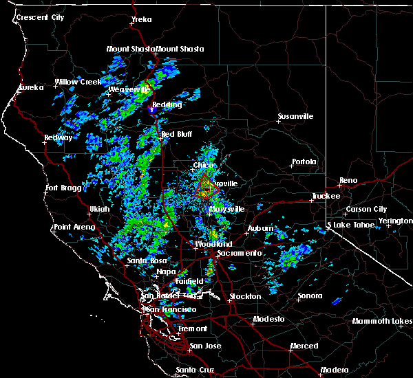
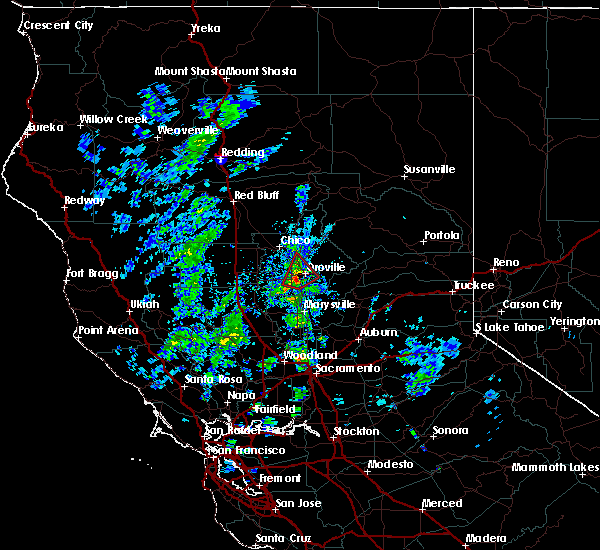
Hail Map for South Oroville, CA
The South Oroville, CA area has had 0 reports of on-the-ground hail by trained spotters, and has been under severe weather warnings 0 times during the past 12 months. Doppler radar has detected hail at or near South Oroville, CA on 1 occasion.
| Name: | South Oroville, CA |
| Where Located: | 56 miles NNW of Citrus Heights, CA |
| Map: | Google Map for South Oroville, CA |
| Population: | 5742 |
| Housing Units: | 1933 |
| More Info: | Search Google for South Oroville, CA |
5
The Top Recent Hail Date for South Oroville, CA is Thursday, May 30, 2019 (1st out of 1)

Hail and Wind Damage Spotted near South Oroville, CA
| Date / Time | Report Details |
|---|---|
| 1/9/2019 3:11 PM PST |
 At 303 pm pst, the public in oroville reported a funnel cloud to butte county law enforcement around 3 pm. the thunderstorm was located just north of oroville, moving northeast at 25 mph (public and law enforcement reported a funnel cloud). Hazards include damaging tornado. small hail. Flying debris will be dangerous to those caught without shelter. mobile homes will be damaged or destroyed. damage to roofs, windows, and vehicles will occur. tree damage is likely. This tornadic thunderstorm will remain over mainly rural areas of butte county. At 303 pm pst, the public in oroville reported a funnel cloud to butte county law enforcement around 3 pm. the thunderstorm was located just north of oroville, moving northeast at 25 mph (public and law enforcement reported a funnel cloud). Hazards include damaging tornado. small hail. Flying debris will be dangerous to those caught without shelter. mobile homes will be damaged or destroyed. damage to roofs, windows, and vehicles will occur. tree damage is likely. This tornadic thunderstorm will remain over mainly rural areas of butte county.
|
| 1/9/2019 2:49 PM PST |
 At 246 pm pst, a severe thunderstorm capable of producing a tornado was located near biggs, moving to the northeast at 15 to 20 mph (radar indicated rotation). Hazards include tornado. Flying debris will be dangerous to those caught without shelter. mobile homes will be damaged or destroyed. damage to roofs, windows, and vehicles will occur. tree damage is likely. this dangerous storm will be near, oroville and thermalito through 330 pm pst. Other locations impacted by this tornadic thunderstorm include biggs. At 246 pm pst, a severe thunderstorm capable of producing a tornado was located near biggs, moving to the northeast at 15 to 20 mph (radar indicated rotation). Hazards include tornado. Flying debris will be dangerous to those caught without shelter. mobile homes will be damaged or destroyed. damage to roofs, windows, and vehicles will occur. tree damage is likely. this dangerous storm will be near, oroville and thermalito through 330 pm pst. Other locations impacted by this tornadic thunderstorm include biggs.
|
Hail Maps for South Oroville, CA

Connect with Interactive Hail Maps