

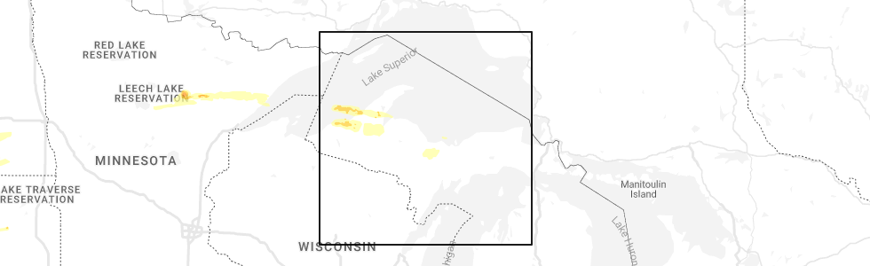
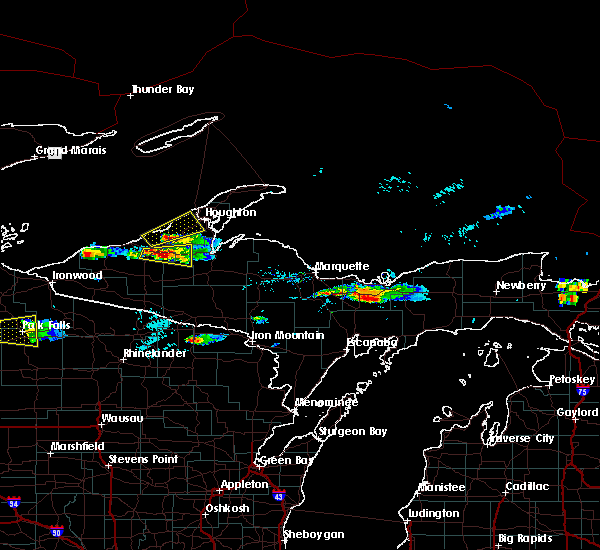
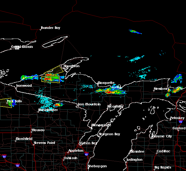
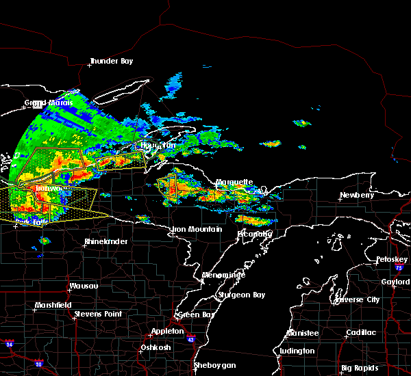
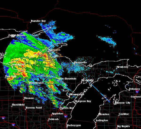
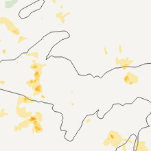
Hail Map for South Range, MI
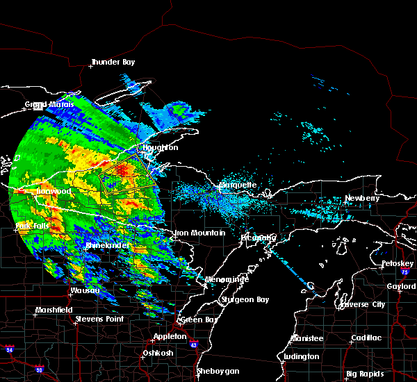
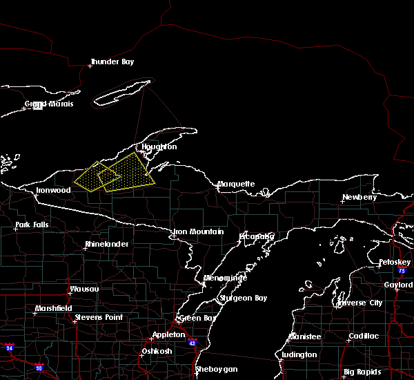
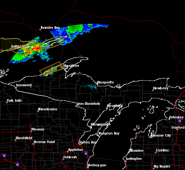
The South Range, MI area has had 3 reports of on-the-ground hail by trained spotters, and has been under severe weather warnings 0 times during the past 12 months. Doppler radar has detected hail at or near South Range, MI on 13 occasions.
| Name: | South Range, MI |
| Where Located: | 68.7 miles WNW of Marquette, MI |
| Map: | Google Map for South Range, MI |
| Population: | 758 |
| Housing Units: | 395 |
| More Info: | Search Google for South Range, MI |
0
The Top Recent Hail Date for South Range, MI is Wednesday, June 29, 2022 (7th out of 13)
Hail and Wind Damage Spotted near South Range, MI
| Date / Time | Report Details |
|---|---|
| 10/12/2022 8:46 AM EDT |
 At 846 am edt, severe thunderstorms were located along a line extending from 10 miles south of south range to near alberta to 6 miles north of iron river, moving northeast at 65 mph (radar indicated). Hazards include 60 mph wind gusts and penny size hail. Expect damage to roofs, siding, and trees. severe thunderstorms will be near, alberta around 850 am edt. l`anse, chassell and south range around 855 am edt. houghton, dollar bay and the lower entrance of portage canal around 900 am edt. hubbell and houghton county airport around 905 am edt. other locations in the path of these severe thunderstorms include laurium, lake linden, skanee, gay, the huron islands and three lakes. hail threat, radar indicated max hail size, 0. 75 in wind threat, radar indicated max wind gust, 60 mph. At 846 am edt, severe thunderstorms were located along a line extending from 10 miles south of south range to near alberta to 6 miles north of iron river, moving northeast at 65 mph (radar indicated). Hazards include 60 mph wind gusts and penny size hail. Expect damage to roofs, siding, and trees. severe thunderstorms will be near, alberta around 850 am edt. l`anse, chassell and south range around 855 am edt. houghton, dollar bay and the lower entrance of portage canal around 900 am edt. hubbell and houghton county airport around 905 am edt. other locations in the path of these severe thunderstorms include laurium, lake linden, skanee, gay, the huron islands and three lakes. hail threat, radar indicated max hail size, 0. 75 in wind threat, radar indicated max wind gust, 60 mph.
|
| 6/30/2022 6:05 PM EDT | Quarter sized hail reported 15.5 miles ENE of South Range, MI, pictures of nickel to quarter size hail from twitter... time estimated by radar. |
| 4/23/2022 1:33 AM EDT |
 At 133 am edt, a severe thunderstorm was located near chassell, or 11 miles south of houghton, moving northeast at 35 mph (radar indicated). Hazards include quarter size hail. damage to vehicles is expected At 133 am edt, a severe thunderstorm was located near chassell, or 11 miles south of houghton, moving northeast at 35 mph (radar indicated). Hazards include quarter size hail. damage to vehicles is expected
|
| 6/10/2021 5:35 PM EDT | Quarter sized hail reported 7.4 miles NW of South Range, MI, quarter sized hail reported a few miles southwest of chassell in rural houghton county. |
| 5/25/2021 6:55 PM EDT |
 At 655 pm edt, severe thunderstorms were located along a line extending from 9 miles east of ontonagon to near rockland, moving east at 85 mph (radar indicated). Hazards include 70 mph wind gusts and quarter size hail. Hail damage to vehicles is expected. expect considerable tree damage. wind damage is also likely to mobile homes, roofs, and outbuildings. severe thunderstorms will be near, nisula around 710 pm edt. baraga, chassell and south range around 715 pm edt. Other locations in the path of these severe thunderstorms include l`anse, the lower entrance of portage canal, keweenaw bay and skanee. At 655 pm edt, severe thunderstorms were located along a line extending from 9 miles east of ontonagon to near rockland, moving east at 85 mph (radar indicated). Hazards include 70 mph wind gusts and quarter size hail. Hail damage to vehicles is expected. expect considerable tree damage. wind damage is also likely to mobile homes, roofs, and outbuildings. severe thunderstorms will be near, nisula around 710 pm edt. baraga, chassell and south range around 715 pm edt. Other locations in the path of these severe thunderstorms include l`anse, the lower entrance of portage canal, keweenaw bay and skanee.
|
| 9/25/2020 9:11 PM EDT |
 The severe thunderstorm warning for northern houghton county will expire at 915 pm edt, the storm which prompted the warning has weakened below severe limits, and no longer poses an immediate threat to life or property. therefore, the warning will be allowed to expire. however gusty winds are still possible with this thunderstorm. a severe thunderstorm watch remains in effect until 100 am edt for western upper michigan. to report severe weather, contact your nearest law enforcement agency. they will relay your report to the national weather service marquette. The severe thunderstorm warning for northern houghton county will expire at 915 pm edt, the storm which prompted the warning has weakened below severe limits, and no longer poses an immediate threat to life or property. therefore, the warning will be allowed to expire. however gusty winds are still possible with this thunderstorm. a severe thunderstorm watch remains in effect until 100 am edt for western upper michigan. to report severe weather, contact your nearest law enforcement agency. they will relay your report to the national weather service marquette.
|
| 9/25/2020 9:00 PM EDT |
 At 900 pm edt, a severe thunderstorm was located near south range, or 10 miles southwest of houghton, moving east at 45 mph (radar indicated). Hazards include 60 mph wind gusts and penny size hail. Expect damage to roofs, siding, and trees. Locations impacted include, houghton, hancock, chassell, south range, the lower entrance of portage canal, dollar bay, hubbell, jacobsville, toivola, donken and painesdale. At 900 pm edt, a severe thunderstorm was located near south range, or 10 miles southwest of houghton, moving east at 45 mph (radar indicated). Hazards include 60 mph wind gusts and penny size hail. Expect damage to roofs, siding, and trees. Locations impacted include, houghton, hancock, chassell, south range, the lower entrance of portage canal, dollar bay, hubbell, jacobsville, toivola, donken and painesdale.
|
| 9/25/2020 8:46 PM EDT |
 At 846 pm edt, a severe thunderstorm was located 15 miles southwest of redridge, or 18 miles east of ontonagon, moving east at 45 mph (radar indicated). Hazards include 60 mph wind gusts and quarter size hail. Hail damage to vehicles is expected. Expect wind damage to roofs, siding, and trees. At 846 pm edt, a severe thunderstorm was located 15 miles southwest of redridge, or 18 miles east of ontonagon, moving east at 45 mph (radar indicated). Hazards include 60 mph wind gusts and quarter size hail. Hail damage to vehicles is expected. Expect wind damage to roofs, siding, and trees.
|
| 8/21/2020 9:50 PM EDT | Quarter sized hail reported 15.3 miles NE of South Range, MI, measured hail stones ranged from 0.5 inch to 1.00 inch. |
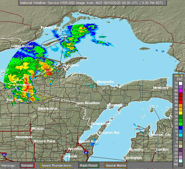
| 8/9/2020 9:17 PM EDT |
 At 917 pm edt, a severe thunderstorm was located over houghton, moving northeast at 30 mph (radar indicated). Hazards include 60 mph wind gusts and penny size hail. Expect damage to roofs, siding, and trees. Locations impacted include, houghton, hancock, chassell, south range, hubbell, houghton county airport, the lower entrance of portage canal, dollar bay, jacobsville, toivola, donken and tapiola. At 917 pm edt, a severe thunderstorm was located over houghton, moving northeast at 30 mph (radar indicated). Hazards include 60 mph wind gusts and penny size hail. Expect damage to roofs, siding, and trees. Locations impacted include, houghton, hancock, chassell, south range, hubbell, houghton county airport, the lower entrance of portage canal, dollar bay, jacobsville, toivola, donken and tapiola.
|
| 8/9/2020 8:57 PM EDT |
 At 857 pm edt, a severe thunderstorm was located near south range, or 10 miles southwest of houghton, moving northeast at 30 mph (radar indicated). Hazards include 60 mph wind gusts and quarter size hail. Hail damage to vehicles is expected. Expect wind damage to roofs, siding, and trees. At 857 pm edt, a severe thunderstorm was located near south range, or 10 miles southwest of houghton, moving northeast at 30 mph (radar indicated). Hazards include 60 mph wind gusts and quarter size hail. Hail damage to vehicles is expected. Expect wind damage to roofs, siding, and trees.
|
| 8/9/2020 8:51 PM EDT |
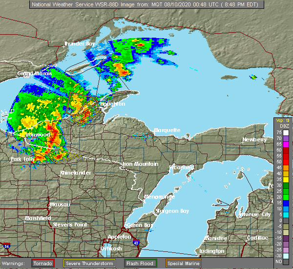 At 850 pm edt, a severe thunderstorm was located 9 miles southwest of south range, or 13 miles southwest of houghton, moving northeast at 30 mph (radar indicated). Hazards include 60 mph wind gusts and half dollar size hail. Hail damage to vehicles is expected. expect wind damage to roofs, siding, and trees. Locations impacted include, south range, twin lakes, winona, toivola, donken, freda and painesdale. At 850 pm edt, a severe thunderstorm was located 9 miles southwest of south range, or 13 miles southwest of houghton, moving northeast at 30 mph (radar indicated). Hazards include 60 mph wind gusts and half dollar size hail. Hail damage to vehicles is expected. expect wind damage to roofs, siding, and trees. Locations impacted include, south range, twin lakes, winona, toivola, donken, freda and painesdale.
|
| 8/9/2020 8:32 PM EDT |
 At 832 pm edt, a severe thunderstorm was located 11 miles northeast of mass city, or 17 miles east of ontonagon, moving northeast at 25 mph (radar indicated). Hazards include 60 mph wind gusts and half dollar size hail. Hail damage to vehicles is expected. Expect wind damage to roofs, siding, and trees. At 832 pm edt, a severe thunderstorm was located 11 miles northeast of mass city, or 17 miles east of ontonagon, moving northeast at 25 mph (radar indicated). Hazards include 60 mph wind gusts and half dollar size hail. Hail damage to vehicles is expected. Expect wind damage to roofs, siding, and trees.
|
| 7/19/2020 12:34 AM EDT |
 At 1233 am edt, a severe thunderstorm was located over south range, or near houghton, moving east at 35 mph (radar indicated). Hazards include 60 mph wind gusts and quarter size hail. Hail damage to vehicles is expected. expect wind damage to roofs, siding, and trees. Locations impacted include, houghton, calumet, eagle river, hancock, laurium, chassell, lake linden, south range, hubbell, redridge, houghton county airport and the upper entrance of portage canal. At 1233 am edt, a severe thunderstorm was located over south range, or near houghton, moving east at 35 mph (radar indicated). Hazards include 60 mph wind gusts and quarter size hail. Hail damage to vehicles is expected. expect wind damage to roofs, siding, and trees. Locations impacted include, houghton, calumet, eagle river, hancock, laurium, chassell, lake linden, south range, hubbell, redridge, houghton county airport and the upper entrance of portage canal.
|
| 7/19/2020 12:08 AM EDT |
 At 1208 am edt, a severe thunderstorm was located 10 miles southwest of redridge, or 16 miles southwest of houghton, moving east at 45 mph (radar indicated). Hazards include 60 mph wind gusts and quarter size hail. Hail damage to vehicles is expected. Expect wind damage to roofs, siding, and trees. At 1208 am edt, a severe thunderstorm was located 10 miles southwest of redridge, or 16 miles southwest of houghton, moving east at 45 mph (radar indicated). Hazards include 60 mph wind gusts and quarter size hail. Hail damage to vehicles is expected. Expect wind damage to roofs, siding, and trees.
|
| 9/24/2019 8:48 PM EDT |
 At 848 pm edt, a severe thunderstorm was located over redridge, or 7 miles northwest of houghton, moving east at 35 mph (radar indicated). Hazards include 60 mph wind gusts and quarter size hail. Hail damage to vehicles is expected. Expect wind damage to roofs, siding, and trees. At 848 pm edt, a severe thunderstorm was located over redridge, or 7 miles northwest of houghton, moving east at 35 mph (radar indicated). Hazards include 60 mph wind gusts and quarter size hail. Hail damage to vehicles is expected. Expect wind damage to roofs, siding, and trees.
|
| 7/15/2019 8:01 PM EDT |
 At 800 pm edt, a severe thunderstorm was located near south range, or near houghton, moving east at 30 mph (radar indicated). Hazards include 60 mph wind gusts and penny size hail. expect damage to roofs, siding, and trees At 800 pm edt, a severe thunderstorm was located near south range, or near houghton, moving east at 30 mph (radar indicated). Hazards include 60 mph wind gusts and penny size hail. expect damage to roofs, siding, and trees
|
| 8/27/2018 8:22 PM EDT |
 At 753 pm edt, a severe thunderstorm was located near redridge, or 12 miles west of houghton, moving east at 35 mph (radar indicated). Hazards include 60 mph wind gusts and nickel size hail. expect damage to roofs, siding, and trees At 753 pm edt, a severe thunderstorm was located near redridge, or 12 miles west of houghton, moving east at 35 mph (radar indicated). Hazards include 60 mph wind gusts and nickel size hail. expect damage to roofs, siding, and trees
|
| 8/27/2018 7:53 PM EDT |
 At 753 pm edt, a severe thunderstorm was located near redridge, or 12 miles west of houghton, moving east at 35 mph (radar indicated). Hazards include 60 mph wind gusts and nickel size hail. expect damage to roofs, siding, and trees At 753 pm edt, a severe thunderstorm was located near redridge, or 12 miles west of houghton, moving east at 35 mph (radar indicated). Hazards include 60 mph wind gusts and nickel size hail. expect damage to roofs, siding, and trees
|
| 8/5/2018 5:38 PM EDT |
 At 537 pm edt, a severe thunderstorm was located 8 miles southwest of south range, or 13 miles southwest of houghton, moving east at 30 mph. this storm continues to weaken (radar indicated). Hazards include 60 mph wind gusts and penny size hail. Expect damage to roofs, siding, and trees. Locations impacted include, south range, redridge, toivola, donken, painesdale and freda. At 537 pm edt, a severe thunderstorm was located 8 miles southwest of south range, or 13 miles southwest of houghton, moving east at 30 mph. this storm continues to weaken (radar indicated). Hazards include 60 mph wind gusts and penny size hail. Expect damage to roofs, siding, and trees. Locations impacted include, south range, redridge, toivola, donken, painesdale and freda.
|
| 8/5/2018 5:19 PM EDT |
 At 518 pm edt, a severe thunderstorm was located 12 miles northeast of mass city, or 17 miles east of ontonagon, moving northeast at 30 mph. this storm is showing signs of weakening (radar indicated). Hazards include 60 mph wind gusts and penny size hail. Expect damage to roofs, siding, and trees. Locations impacted include, south range, redridge, toivola, donken, painesdale and freda. At 518 pm edt, a severe thunderstorm was located 12 miles northeast of mass city, or 17 miles east of ontonagon, moving northeast at 30 mph. this storm is showing signs of weakening (radar indicated). Hazards include 60 mph wind gusts and penny size hail. Expect damage to roofs, siding, and trees. Locations impacted include, south range, redridge, toivola, donken, painesdale and freda.
|
| 8/5/2018 5:07 PM EDT |
 At 507 pm edt, a severe thunderstorm was located 9 miles north of mass city, or 13 miles east of ontonagon, moving northeast at 35 mph (radar indicated). Hazards include 60 mph wind gusts and quarter size hail. Hail damage to vehicles is expected. Expect wind damage to roofs, siding, and trees. At 507 pm edt, a severe thunderstorm was located 9 miles north of mass city, or 13 miles east of ontonagon, moving northeast at 35 mph (radar indicated). Hazards include 60 mph wind gusts and quarter size hail. Hail damage to vehicles is expected. Expect wind damage to roofs, siding, and trees.
|
| 6/29/2018 11:35 AM EDT |
 At 1101 am edt, severe thunderstorms were located along a line extending from 29 miles northwest of redridge to 6 miles southwest of silver city, moving east-southeast at 50 mph (radar indicated). Hazards include 70 mph wind gusts and quarter size hail. Hail damage to vehicles is expected. expect considerable tree damage. Wind damage is also likely to mobile homes, roofs, and outbuildings. At 1101 am edt, severe thunderstorms were located along a line extending from 29 miles northwest of redridge to 6 miles southwest of silver city, moving east-southeast at 50 mph (radar indicated). Hazards include 70 mph wind gusts and quarter size hail. Hail damage to vehicles is expected. expect considerable tree damage. Wind damage is also likely to mobile homes, roofs, and outbuildings.
|
| 6/29/2018 11:03 AM EDT |
 At 1101 am edt, severe thunderstorms were located along a line extending from 29 miles northwest of redridge to 6 miles southwest of silver city, moving east-southeast at 50 mph (radar indicated). Hazards include 70 mph wind gusts and quarter size hail. Hail damage to vehicles is expected. expect considerable tree damage. Wind damage is also likely to mobile homes, roofs, and outbuildings. At 1101 am edt, severe thunderstorms were located along a line extending from 29 miles northwest of redridge to 6 miles southwest of silver city, moving east-southeast at 50 mph (radar indicated). Hazards include 70 mph wind gusts and quarter size hail. Hail damage to vehicles is expected. expect considerable tree damage. Wind damage is also likely to mobile homes, roofs, and outbuildings.
|
| 6/17/2018 5:57 PM EDT |
 At 557 pm edt, a severe thunderstorm was located near ontonagon, moving east at 35 mph (radar indicated). Hazards include 60 mph wind gusts and quarter size hail. Hail damage to vehicles is expected. Expect wind damage to roofs, siding, and trees. At 557 pm edt, a severe thunderstorm was located near ontonagon, moving east at 35 mph (radar indicated). Hazards include 60 mph wind gusts and quarter size hail. Hail damage to vehicles is expected. Expect wind damage to roofs, siding, and trees.
|
| 6/10/2017 9:38 PM EDT |
 At 937 pm edt, severe thunderstorms were located along a line extending from near gay to 8 miles southwest of silver city, moving east at 55 mph (radar indicated). Hazards include 60 mph wind gusts and penny size hail. Expect damage to roofs, siding, and trees. Locations impacted include, houghton, baraga, ontonagon, hancock, chassell, south range, bergland, rockland, bruce crossing, keweenaw bay, dollar bay, mass city, northern lake gogebic, nisula, greenland, and trout creek. At 937 pm edt, severe thunderstorms were located along a line extending from near gay to 8 miles southwest of silver city, moving east at 55 mph (radar indicated). Hazards include 60 mph wind gusts and penny size hail. Expect damage to roofs, siding, and trees. Locations impacted include, houghton, baraga, ontonagon, hancock, chassell, south range, bergland, rockland, bruce crossing, keweenaw bay, dollar bay, mass city, northern lake gogebic, nisula, greenland, and trout creek.
|
| 6/10/2017 9:21 PM EDT |
 The national weather service in marquette has issued a * severe thunderstorm warning for. houghton county in western upper michigan. northwestern baraga county in north central upper michigan. ontonagon county in western upper michigan. Until 1015 pm edt. The national weather service in marquette has issued a * severe thunderstorm warning for. houghton county in western upper michigan. northwestern baraga county in north central upper michigan. ontonagon county in western upper michigan. Until 1015 pm edt.
|
| 6/10/2017 8:55 PM EDT |
 At 855 pm edt, a severe thunderstorm was located near hancock, or near houghton, moving east at 60 mph (radar indicated). Hazards include 60 mph wind gusts and quarter size hail. Hail damage to vehicles is expected. Expect wind damage to roofs, siding, and trees. At 855 pm edt, a severe thunderstorm was located near hancock, or near houghton, moving east at 60 mph (radar indicated). Hazards include 60 mph wind gusts and quarter size hail. Hail damage to vehicles is expected. Expect wind damage to roofs, siding, and trees.
|
| 10/17/2016 3:51 AM EDT |
 At 350 am edt, a severe thunderstorm was located near nisula, or 11 miles west of baraga, moving northeast at 40 mph (radar indicated). Hazards include quarter size hail. Damage to vehicles is expected. Locations impacted include, baraga, l`anse, south range, nisula, herman, tapiola, assinins, pelkie, toivola, painesdale, prickett dam, donken, alston and twin lakes. At 350 am edt, a severe thunderstorm was located near nisula, or 11 miles west of baraga, moving northeast at 40 mph (radar indicated). Hazards include quarter size hail. Damage to vehicles is expected. Locations impacted include, baraga, l`anse, south range, nisula, herman, tapiola, assinins, pelkie, toivola, painesdale, prickett dam, donken, alston and twin lakes.
|
| 10/17/2016 3:41 AM EDT |
 At 340 am edt, a severe thunderstorm was located near nisula, or 17 miles west of baraga, moving northeast at 40 mph (radar indicated). Hazards include quarter size hail. Damage to vehicles is expected. Locations impacted include, baraga, l`anse, south range, alberta, nisula, herman, tapiola, assinins, pelkie, toivola, winona, bob lake, painesdale, canyon falls, prickett dam, echo lake, donken, alston and twin lakes. At 340 am edt, a severe thunderstorm was located near nisula, or 17 miles west of baraga, moving northeast at 40 mph (radar indicated). Hazards include quarter size hail. Damage to vehicles is expected. Locations impacted include, baraga, l`anse, south range, alberta, nisula, herman, tapiola, assinins, pelkie, toivola, winona, bob lake, painesdale, canyon falls, prickett dam, echo lake, donken, alston and twin lakes.
|
| 10/17/2016 3:26 AM EDT |
 At 326 am edt, a severe thunderstorm was located over mass city, or 15 miles southeast of ontonagon, moving northeast at 40 mph (radar indicated). Hazards include quarter size hail. damage to vehicles is expected At 326 am edt, a severe thunderstorm was located over mass city, or 15 miles southeast of ontonagon, moving northeast at 40 mph (radar indicated). Hazards include quarter size hail. damage to vehicles is expected
|
| 7/21/2016 7:05 AM EDT | Widespread tree damage around toivala... donken... and twin lakes. m26 is blocked by fallen tree in houghton county MI, 7.7 miles NE of South Range, MI |
| 7/21/2016 6:56 AM EDT |
 At 654 am edt/554 am cdt/, severe thunderstorms were located along a line extending from 8 miles east of fourteen mile point to near nisula to 8 miles northwest of kenton to 10 miles southwest of watersmeet, moving east at 65 mph (law enforcement. these storms downed numerous trees and powerlines around mass city and over western gogebic county). Hazards include 70 mph wind gusts and nickel size hail. Expect considerable tree damage. damage is likely to mobile homes, roofs and outbuildings. locations impacted include, houghton, iron river, baraga, l`anse, crystal falls, calumet, hancock, laurium, chassell, stambaugh, lake linden, south range, covington, dollar bay, the lower entrance of portage canal, assinins, amasa, torch lake, mclain state park and u. s. 141 between covington and amasa. At 654 am edt/554 am cdt/, severe thunderstorms were located along a line extending from 8 miles east of fourteen mile point to near nisula to 8 miles northwest of kenton to 10 miles southwest of watersmeet, moving east at 65 mph (law enforcement. these storms downed numerous trees and powerlines around mass city and over western gogebic county). Hazards include 70 mph wind gusts and nickel size hail. Expect considerable tree damage. damage is likely to mobile homes, roofs and outbuildings. locations impacted include, houghton, iron river, baraga, l`anse, crystal falls, calumet, hancock, laurium, chassell, stambaugh, lake linden, south range, covington, dollar bay, the lower entrance of portage canal, assinins, amasa, torch lake, mclain state park and u. s. 141 between covington and amasa.
|
| 7/21/2016 6:46 AM EDT |
 At 645 am edt/545 am cdt/, severe thunderstorms were located along a line extending from near fourteen mile point to near bruce crossing to 7 miles northeast of boulder junction, moving east at 65 mph (radar indicated. this storm downed trees and powerlines it moved through western gogebic county). Hazards include 60 mph wind gusts and nickel size hail. Expect damage to roofs. Siding and trees. At 645 am edt/545 am cdt/, severe thunderstorms were located along a line extending from near fourteen mile point to near bruce crossing to 7 miles northeast of boulder junction, moving east at 65 mph (radar indicated. this storm downed trees and powerlines it moved through western gogebic county). Hazards include 60 mph wind gusts and nickel size hail. Expect damage to roofs. Siding and trees.
|
| 6/25/2016 10:19 PM EDT |
 At 1018 pm edt/918 pm cdt/, severe thunderstorms were located along a line extending from 6 miles southwest of south range to near nisula, moving east at 35 mph (radar indicated). Hazards include 60 mph wind gusts. Expect damage to roofs. siding and trees. Locations impacted include, houghton, baraga, l`anse, calumet, hancock, laurium, chassell, lake linden, south range, point abbaye, dollar bay, the lower entrance of portage canal, hubbell, sidnaw, keweenaw bay, assinins, kenton, redridge, houghton county airport and torch lake. At 1018 pm edt/918 pm cdt/, severe thunderstorms were located along a line extending from 6 miles southwest of south range to near nisula, moving east at 35 mph (radar indicated). Hazards include 60 mph wind gusts. Expect damage to roofs. siding and trees. Locations impacted include, houghton, baraga, l`anse, calumet, hancock, laurium, chassell, lake linden, south range, point abbaye, dollar bay, the lower entrance of portage canal, hubbell, sidnaw, keweenaw bay, assinins, kenton, redridge, houghton county airport and torch lake.
|
| 6/25/2016 10:10 PM EDT |
 At 1010 pm edt/910 pm cdt/, severe thunderstorms were located along a line extending from 8 miles south of freda to near nisula, moving east at 35 mph (radar indicated). Hazards include 60 mph wind gusts. Expect damage to roofs. Siding and trees. At 1010 pm edt/910 pm cdt/, severe thunderstorms were located along a line extending from 8 miles south of freda to near nisula, moving east at 35 mph (radar indicated). Hazards include 60 mph wind gusts. Expect damage to roofs. Siding and trees.
|
| 6/25/2016 12:36 PM EDT |
 At 1235 pm edt, a severe thunderstorm was located near calumet and mohawk, moving east at 30 mph (radar indicated). Hazards include 60 mph wind gusts and quarter size hail. Hail damage to vehicles is expected. expect wind damage to roofs, siding and trees. Locations impacted include, houghton, baraga, calumet, eagle river, hancock, laurium, chassell, lake linden, south range, phoenix, point abbaye, dollar bay, the lower entrance of portage canal, hubbell, gay, redridge, houghton county airport, torch lake, mclain state park and jacobsville. At 1235 pm edt, a severe thunderstorm was located near calumet and mohawk, moving east at 30 mph (radar indicated). Hazards include 60 mph wind gusts and quarter size hail. Hail damage to vehicles is expected. expect wind damage to roofs, siding and trees. Locations impacted include, houghton, baraga, calumet, eagle river, hancock, laurium, chassell, lake linden, south range, phoenix, point abbaye, dollar bay, the lower entrance of portage canal, hubbell, gay, redridge, houghton county airport, torch lake, mclain state park and jacobsville.
|
| 6/25/2016 11:54 AM EDT |
 At 1153 am edt, severe thunderstorms were located along a line extending from 13 miles northwest of eagle river to 11 miles north of fourteen mile point, moving southeast at 35 mph (radar indicated). Hazards include quarter size hail and 60 mph wind gusts. Hail damage to vehicles is expected. Expect wind damage to roofs, siding and trees. At 1153 am edt, severe thunderstorms were located along a line extending from 13 miles northwest of eagle river to 11 miles north of fourteen mile point, moving southeast at 35 mph (radar indicated). Hazards include quarter size hail and 60 mph wind gusts. Hail damage to vehicles is expected. Expect wind damage to roofs, siding and trees.
|
| 6/25/2016 11:24 AM EDT |
 At 1123 am edt, a severe thunderstorm was located 9 miles southwest of south range, or 14 miles southwest of houghton, moving east at 35 mph (radar indicated). Hazards include quarter size hail and 60 mph wind gusts. Hail damage to vehicles is expected. Expect wind damage to roofs, siding and trees. At 1123 am edt, a severe thunderstorm was located 9 miles southwest of south range, or 14 miles southwest of houghton, moving east at 35 mph (radar indicated). Hazards include quarter size hail and 60 mph wind gusts. Hail damage to vehicles is expected. Expect wind damage to roofs, siding and trees.
|
| 6/25/2016 10:51 AM EDT |
 At 1050 am edt, a severe thunderstorm was located near fourteen mile point, or 18 miles northeast of ontonagon, moving northeast at 40 mph (radar indicated). Hazards include quarter size hail and 60 mph wind gusts. Hail damage to vehicles is expected. Expect wind damage to roofs, siding and trees. At 1050 am edt, a severe thunderstorm was located near fourteen mile point, or 18 miles northeast of ontonagon, moving northeast at 40 mph (radar indicated). Hazards include quarter size hail and 60 mph wind gusts. Hail damage to vehicles is expected. Expect wind damage to roofs, siding and trees.
|
| 5/31/2013 8:50 PM EDT | Storm damage reported in houghton county MI, 9.3 miles ESE of South Range, MI |
| 1/1/0001 12:00 AM | Wind gusts greater than 50mph for 20 minutes. 63mph wind gust measured at 1959edt. measured quarter sized hail as wel in houghton county MI, 9.3 miles ESE of South Range, MI |
| 1/1/0001 12:00 AM | Wind gust measured from the northwes in houghton county MI, 9.3 miles ESE of South Range, MI |
| 1/1/0001 12:00 AM | Wind gust measured from the northwes in houghton county MI, 9.3 miles ESE of South Range, MI |
| 1/1/0001 12:00 AM | Wind gust measured from the northwes in houghton county MI, 9.3 miles ESE of South Range, MI |
| 1/1/0001 12:00 AM | Wind gust measured from the northwes in houghton county MI, 9.3 miles ESE of South Range, MI |
| 1/1/0001 12:00 AM | Storm damage reported in houghton county MI, 9.3 miles ESE of South Range, MI |
Hail Maps for South Range, MI


Connect with Interactive Hail Maps