

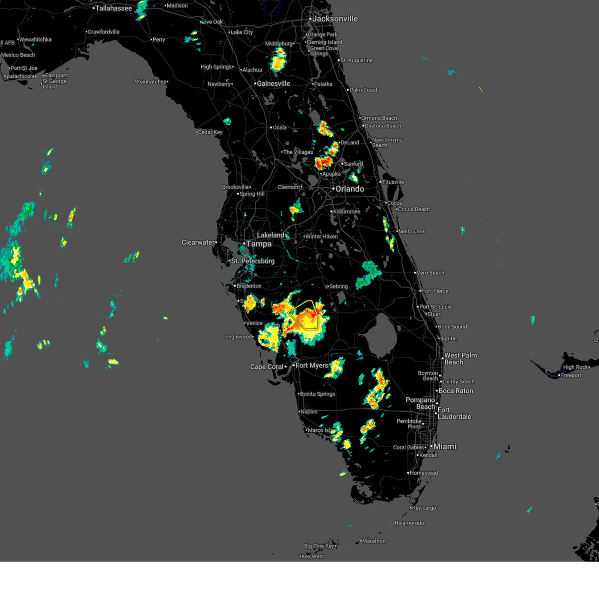
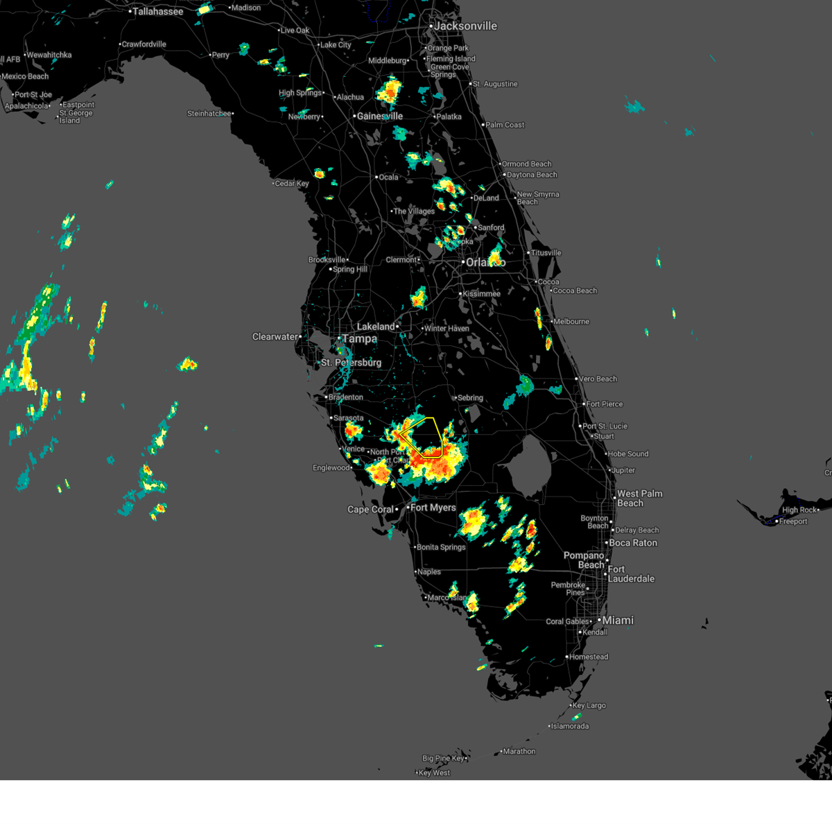
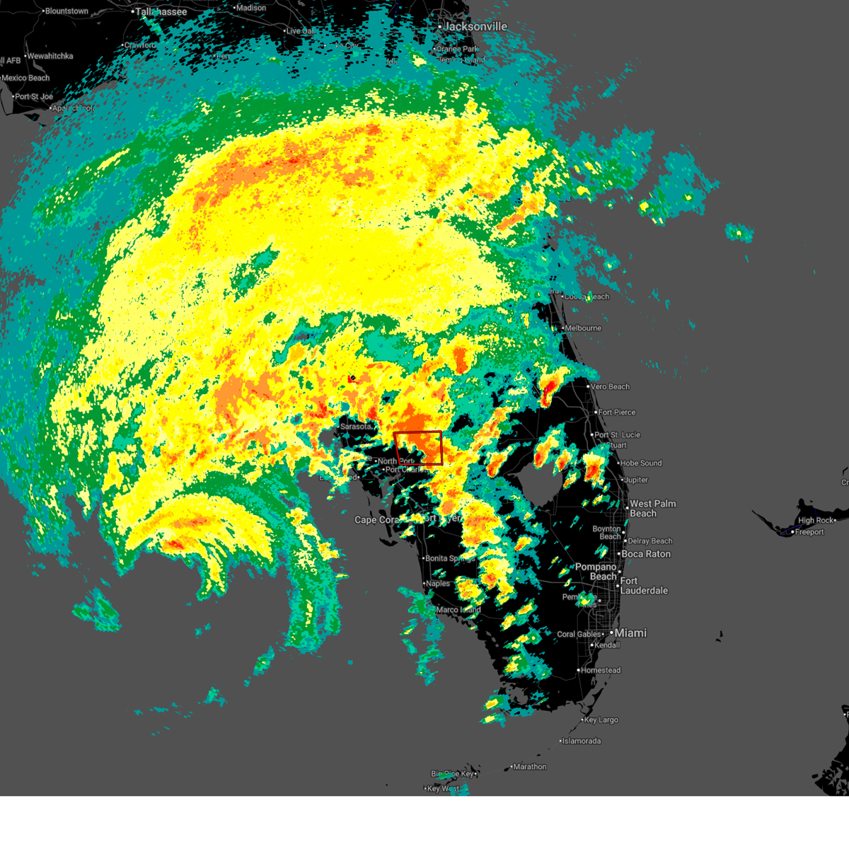
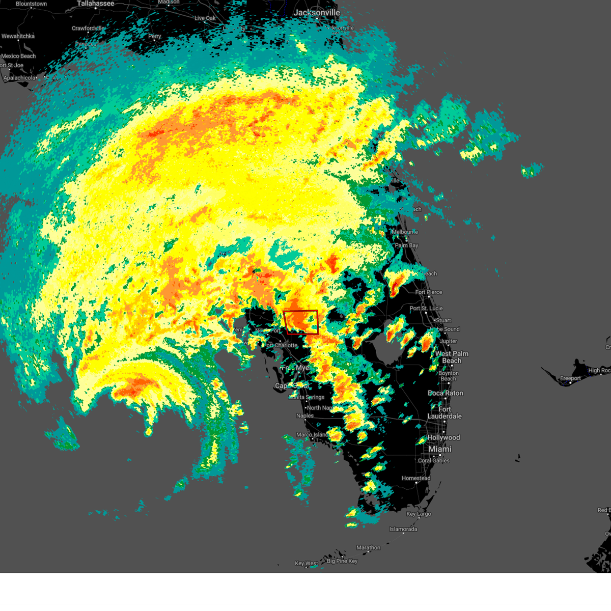
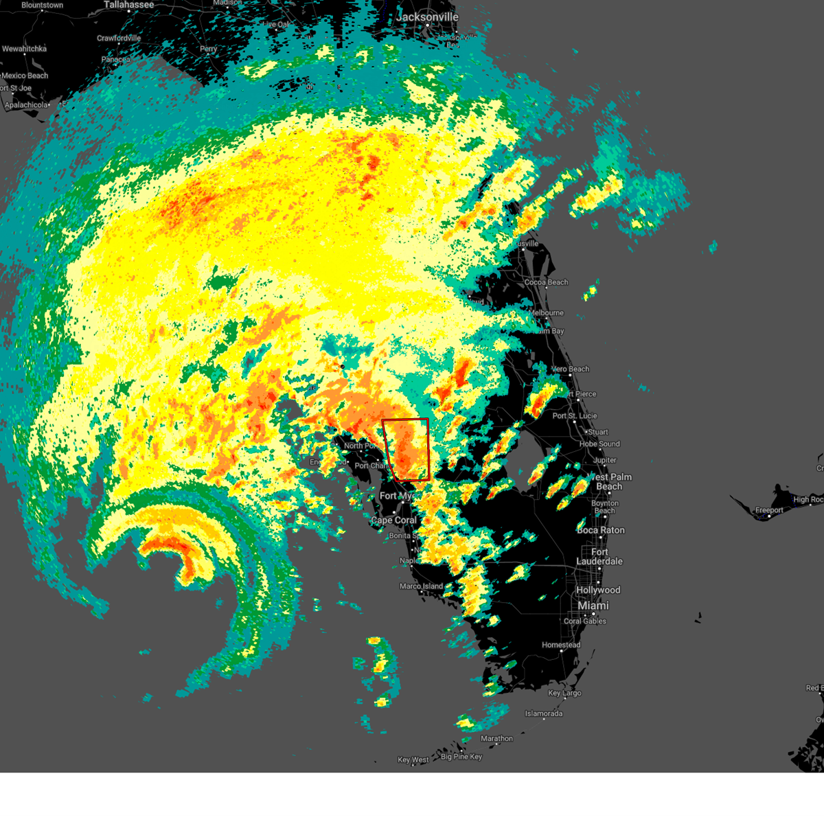
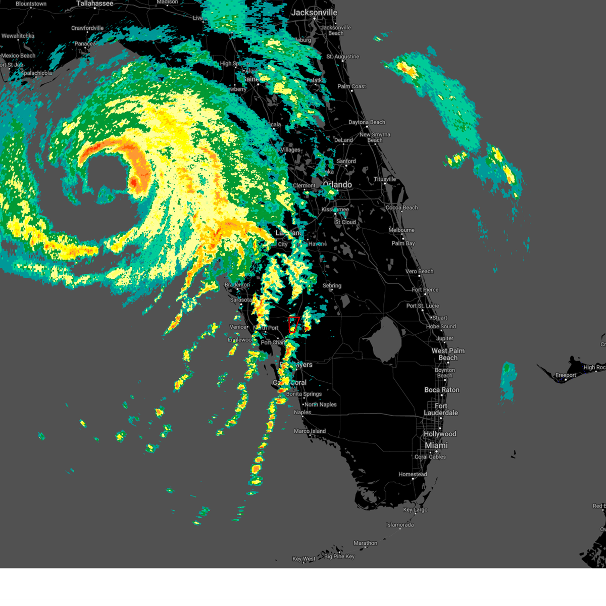
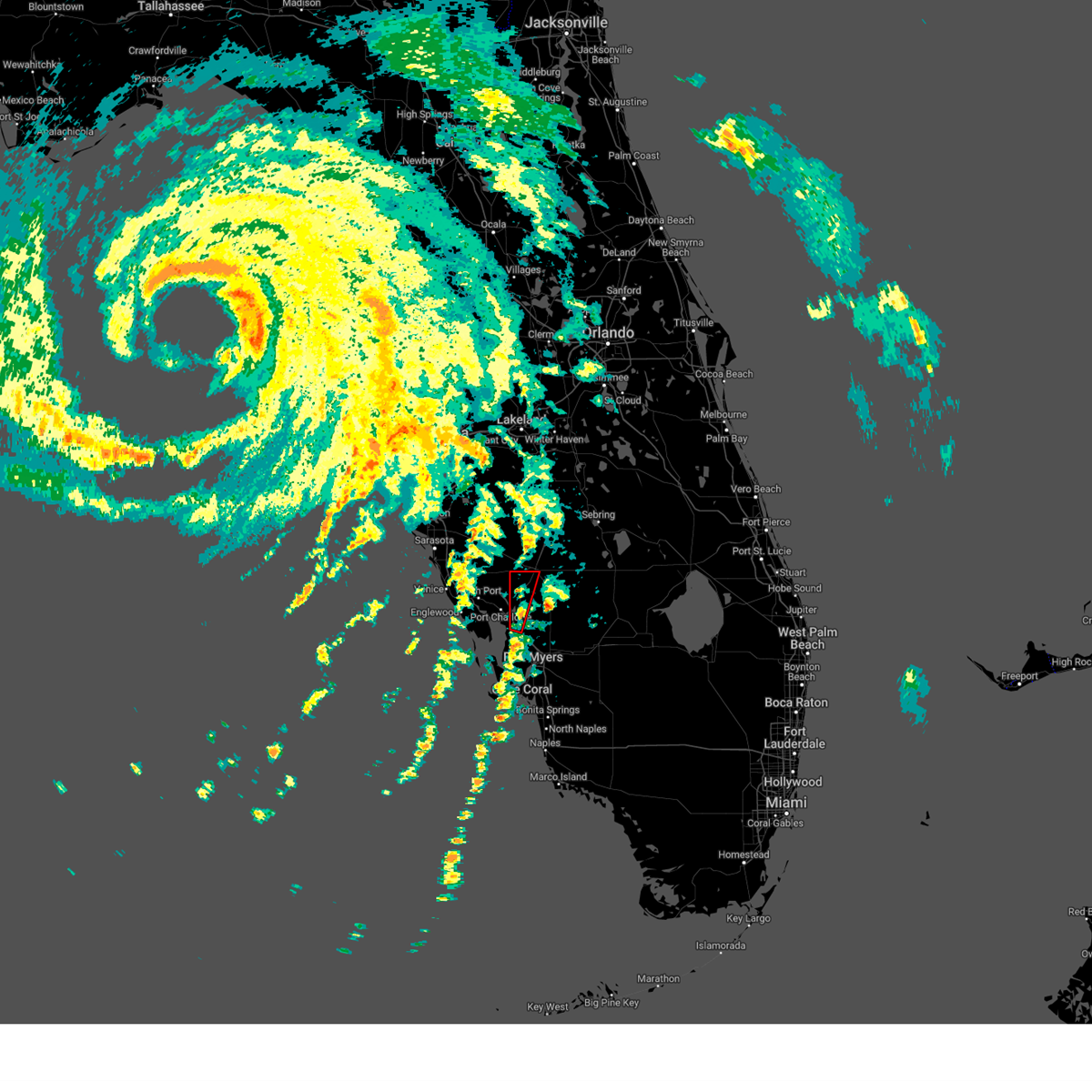
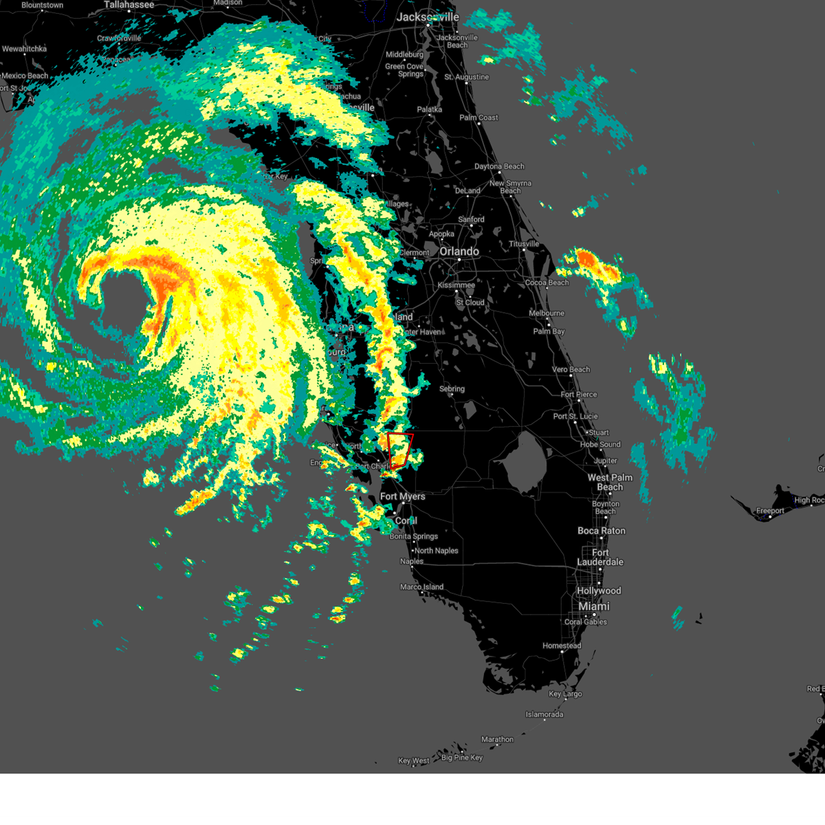
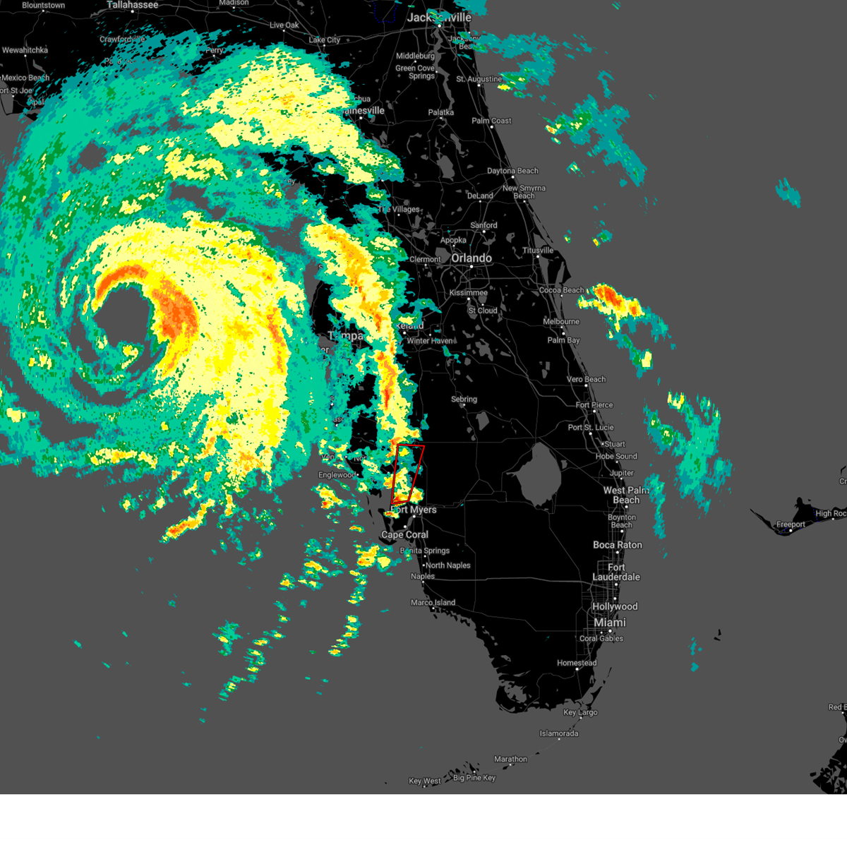
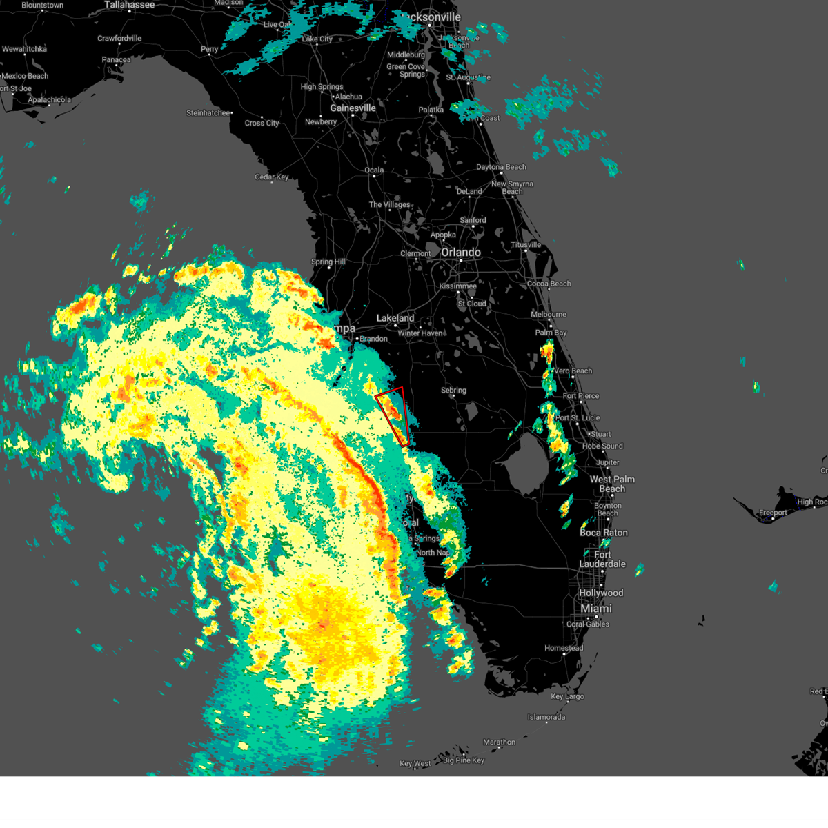
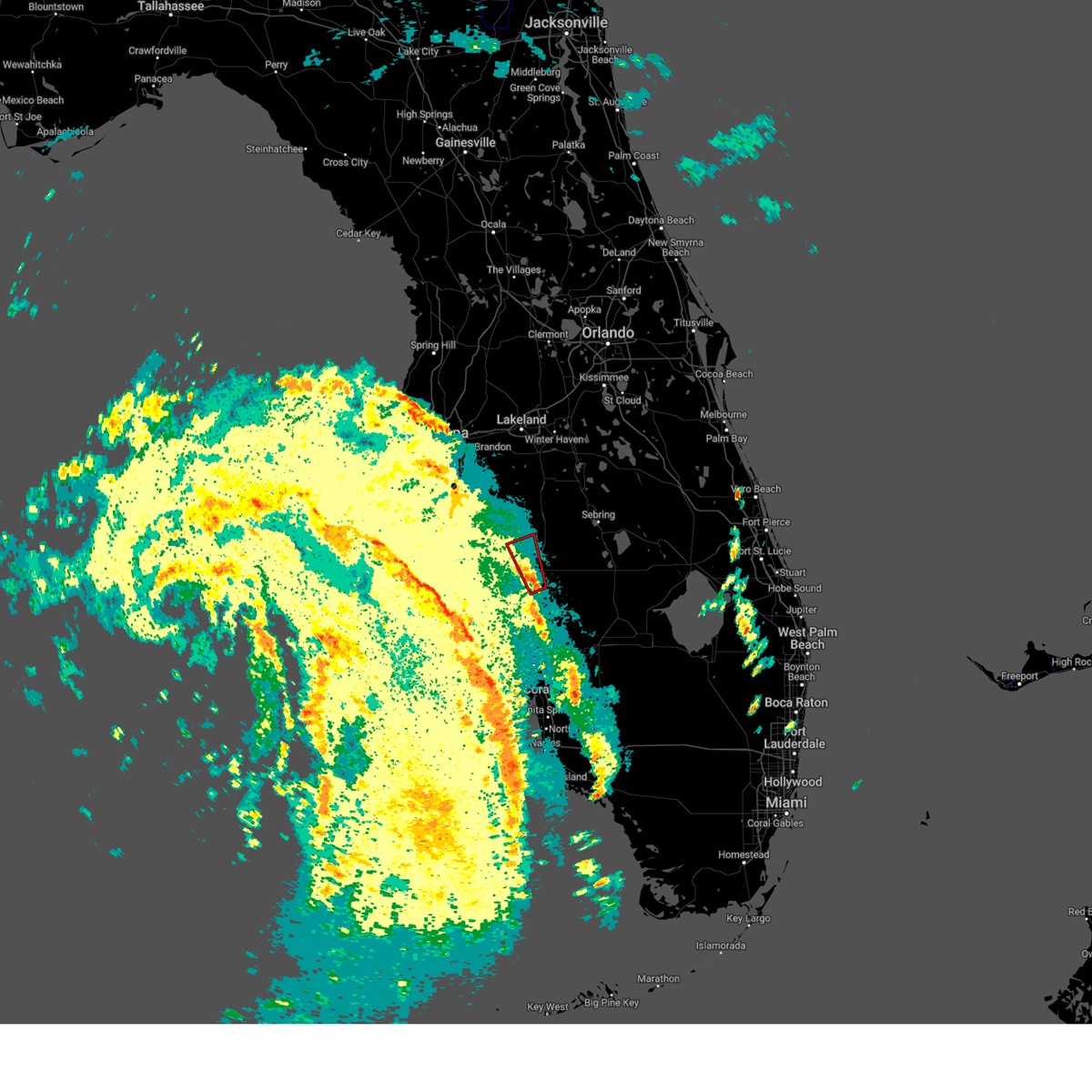
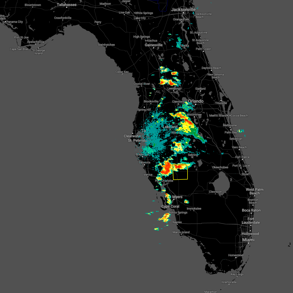
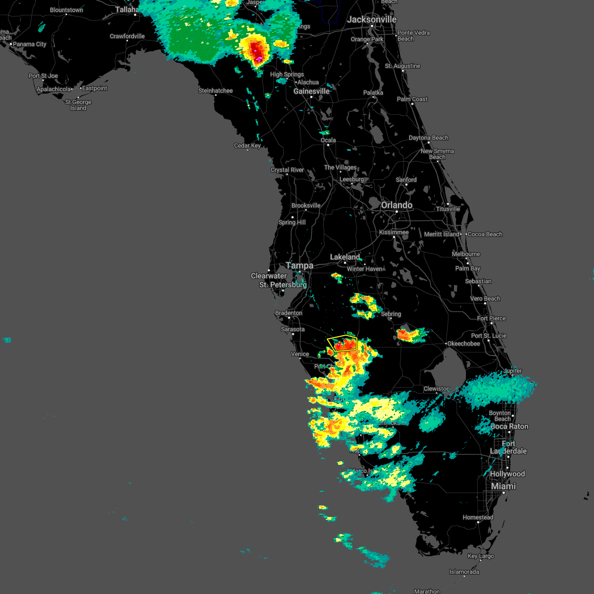
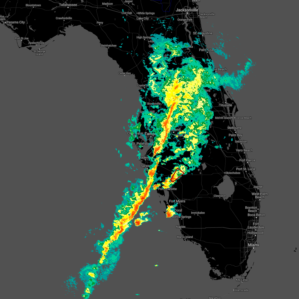
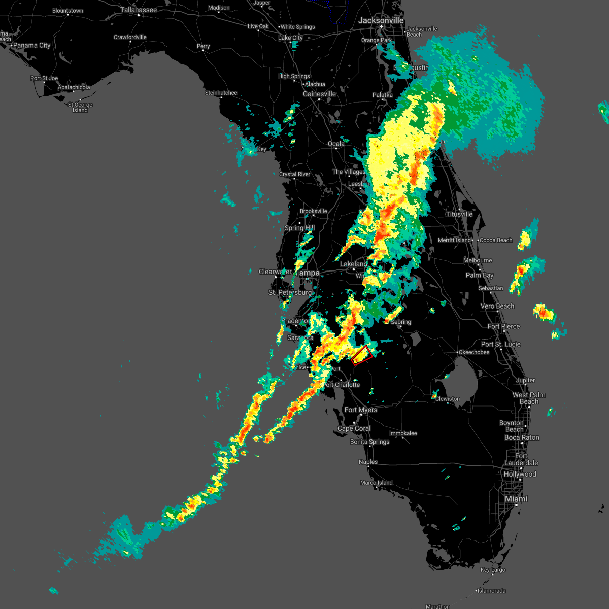
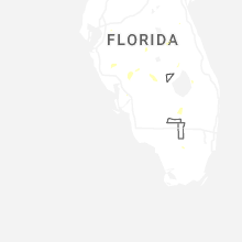
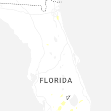
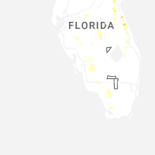
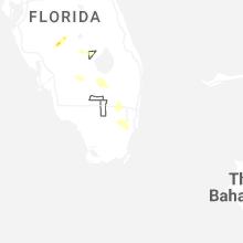
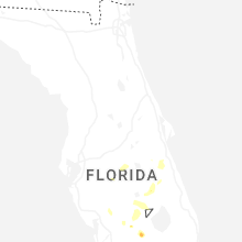
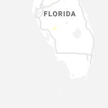
Hail Map for Southeast Arcadia, FL
The Southeast Arcadia, FL area has had 0 reports of on-the-ground hail by trained spotters, and has been under severe weather warnings 2 times during the past 12 months. Doppler radar has detected hail at or near Southeast Arcadia, FL on 41 occasions, including 5 occasions during the past year.
| Name: | Southeast Arcadia, FL |
| Where Located: | 49.5 miles ESE of Bradenton, FL |
| Map: | Google Map for Southeast Arcadia, FL |
| Population: | 6554 |
| Housing Units: | 2327 |
| More Info: | Search Google for Southeast Arcadia, FL |
1
The Top Recent Hail Date for Southeast Arcadia, FL is Friday, June 12, 2026 (10th out of 41)
Hail and Wind Damage Spotted near Southeast Arcadia, FL
| Date / Time | Report Details |
|---|---|
| 7/24/2025 5:05 PM EDT |
 the severe thunderstorm warning has been cancelled and is no longer in effect the severe thunderstorm warning has been cancelled and is no longer in effect
|
| 7/24/2025 4:41 PM EDT |
 Svrtbw the national weather service in ruskin has issued a * severe thunderstorm warning for, eastern desoto county in south central florida, * until 515 pm edt. * at 441 pm edt, a severe thunderstorm was located 12 miles northeast of babcock ranch, or 18 miles southeast of arcadia, moving northwest at 25 mph (radar indicated). Hazards include 60 mph wind gusts. expect damage to roofs, siding, and trees Svrtbw the national weather service in ruskin has issued a * severe thunderstorm warning for, eastern desoto county in south central florida, * until 515 pm edt. * at 441 pm edt, a severe thunderstorm was located 12 miles northeast of babcock ranch, or 18 miles southeast of arcadia, moving northwest at 25 mph (radar indicated). Hazards include 60 mph wind gusts. expect damage to roofs, siding, and trees
|
| 10/9/2024 1:42 PM EDT |
 the tornado warning has been cancelled and is no longer in effect the tornado warning has been cancelled and is no longer in effect
|
| 10/9/2024 1:36 PM EDT |
 the tornado warning has been cancelled and is no longer in effect the tornado warning has been cancelled and is no longer in effect
|
| 10/9/2024 1:36 PM EDT |
 At 136 pm edt, a severe thunderstorm capable of producing a tornado was located near southeast arcadia, or 7 miles southeast of arcadia, moving north at 25 mph (radar indicated rotation). Hazards include tornado. Flying debris will be dangerous to those caught without shelter. mobile homes will be damaged or destroyed. damage to roofs, windows, and vehicles will occur. tree damage is likely. this dangerous storm will be near, arcadia and southeast arcadia around 140 pm edt. Other locations impacted by this tornadic thunderstorm include nocatee and fort ogden. At 136 pm edt, a severe thunderstorm capable of producing a tornado was located near southeast arcadia, or 7 miles southeast of arcadia, moving north at 25 mph (radar indicated rotation). Hazards include tornado. Flying debris will be dangerous to those caught without shelter. mobile homes will be damaged or destroyed. damage to roofs, windows, and vehicles will occur. tree damage is likely. this dangerous storm will be near, arcadia and southeast arcadia around 140 pm edt. Other locations impacted by this tornadic thunderstorm include nocatee and fort ogden.
|
| 10/9/2024 1:12 PM EDT |
 Tortbw the national weather service in ruskin has issued a * tornado warning for, eastern charlotte county in southwestern florida, desoto county in south central florida, * until 200 pm edt. * at 112 pm edt, a severe thunderstorm capable of producing a tornado was located near babcock webb wma, or 12 miles east of punta gorda, moving north at 25 mph (radar indicated rotation). Hazards include tornado. Flying debris will be dangerous to those caught without shelter. mobile homes will be damaged or destroyed. damage to roofs, windows, and vehicles will occur. tree damage is likely. this dangerous storm will be near, southeast arcadia around 125 pm edt. arcadia around 135 pm edt. Other locations impacted by this tornadic thunderstorm include nocatee, fort ogden, cleveland, and harbour heights. Tortbw the national weather service in ruskin has issued a * tornado warning for, eastern charlotte county in southwestern florida, desoto county in south central florida, * until 200 pm edt. * at 112 pm edt, a severe thunderstorm capable of producing a tornado was located near babcock webb wma, or 12 miles east of punta gorda, moving north at 25 mph (radar indicated rotation). Hazards include tornado. Flying debris will be dangerous to those caught without shelter. mobile homes will be damaged or destroyed. damage to roofs, windows, and vehicles will occur. tree damage is likely. this dangerous storm will be near, southeast arcadia around 125 pm edt. arcadia around 135 pm edt. Other locations impacted by this tornadic thunderstorm include nocatee, fort ogden, cleveland, and harbour heights.
|
| 9/26/2024 8:01 PM EDT |
 the tornado warning has been cancelled and is no longer in effect the tornado warning has been cancelled and is no longer in effect
|
| 9/26/2024 7:58 PM EDT |
 the tornado warning has been cancelled and is no longer in effect the tornado warning has been cancelled and is no longer in effect
|
| 9/26/2024 7:58 PM EDT |
 At 757 pm edt, a severe thunderstorm capable of producing a tornado was located 7 miles north of charlotte county airport, or 9 miles east of port charlotte, moving north at 40 mph (radar indicated rotation). Hazards include tornado. Flying debris will be dangerous to those caught without shelter. mobile homes will be damaged or destroyed. damage to roofs, windows, and vehicles will occur. tree damage is likely. this dangerous storm will be near, southeast arcadia around 805 pm edt. Other locations impacted by this tornadic thunderstorm include nocatee. At 757 pm edt, a severe thunderstorm capable of producing a tornado was located 7 miles north of charlotte county airport, or 9 miles east of port charlotte, moving north at 40 mph (radar indicated rotation). Hazards include tornado. Flying debris will be dangerous to those caught without shelter. mobile homes will be damaged or destroyed. damage to roofs, windows, and vehicles will occur. tree damage is likely. this dangerous storm will be near, southeast arcadia around 805 pm edt. Other locations impacted by this tornadic thunderstorm include nocatee.
|
| 9/26/2024 7:47 PM EDT |
 Tortbw the national weather service in ruskin has issued a * tornado warning for, north central charlotte county in southwestern florida, central desoto county in south central florida, * until 800 pm edt. * at 747 pm edt, a severe thunderstorm capable of producing a tornado was located near babcock ranch, or 15 miles south of arcadia, moving north at 50 mph (radar indicated rotation). Hazards include tornado. Flying debris will be dangerous to those caught without shelter. mobile homes will be damaged or destroyed. damage to roofs, windows, and vehicles will occur. tree damage is likely. This tornadic thunderstorm will remain over mainly rural areas of north central charlotte and central desoto counties. Tortbw the national weather service in ruskin has issued a * tornado warning for, north central charlotte county in southwestern florida, central desoto county in south central florida, * until 800 pm edt. * at 747 pm edt, a severe thunderstorm capable of producing a tornado was located near babcock ranch, or 15 miles south of arcadia, moving north at 50 mph (radar indicated rotation). Hazards include tornado. Flying debris will be dangerous to those caught without shelter. mobile homes will be damaged or destroyed. damage to roofs, windows, and vehicles will occur. tree damage is likely. This tornadic thunderstorm will remain over mainly rural areas of north central charlotte and central desoto counties.
|
| 9/26/2024 7:46 PM EDT |
 Tortbw the national weather service in ruskin has issued a * tornado warning for, north central charlotte county in southwestern florida, southwestern desoto county in south central florida, * until 815 pm edt. * at 745 pm edt, a severe thunderstorm capable of producing a tornado was located over charlotte county airport, or near punta gorda, moving north at 40 mph (radar indicated rotation). Hazards include tornado. Flying debris will be dangerous to those caught without shelter. mobile homes will be damaged or destroyed. damage to roofs, windows, and vehicles will occur. tree damage is likely. this dangerous storm will be near, southeast arcadia around 805 pm edt. Other locations impacted by this tornadic thunderstorm include harbour heights, solana, cleveland, nocatee, and fort ogden. Tortbw the national weather service in ruskin has issued a * tornado warning for, north central charlotte county in southwestern florida, southwestern desoto county in south central florida, * until 815 pm edt. * at 745 pm edt, a severe thunderstorm capable of producing a tornado was located over charlotte county airport, or near punta gorda, moving north at 40 mph (radar indicated rotation). Hazards include tornado. Flying debris will be dangerous to those caught without shelter. mobile homes will be damaged or destroyed. damage to roofs, windows, and vehicles will occur. tree damage is likely. this dangerous storm will be near, southeast arcadia around 805 pm edt. Other locations impacted by this tornadic thunderstorm include harbour heights, solana, cleveland, nocatee, and fort ogden.
|
| 9/26/2024 6:43 PM EDT |
 the tornado warning has been cancelled and is no longer in effect the tornado warning has been cancelled and is no longer in effect
|
| 9/26/2024 6:43 PM EDT |
 At 643 pm edt, a severe thunderstorm capable of producing a tornado was located 9 miles northeast of charlotte county airport, or 12 miles east of port charlotte, moving north at 75 mph (radar indicated rotation). Hazards include tornado. Flying debris will be dangerous to those caught without shelter. mobile homes will be damaged or destroyed. damage to roofs, windows, and vehicles will occur. tree damage is likely. this dangerous storm will be near, southeast arcadia around 650 pm edt. Other locations impacted by this tornadic thunderstorm include nocatee, fort ogden, and cleveland. At 643 pm edt, a severe thunderstorm capable of producing a tornado was located 9 miles northeast of charlotte county airport, or 12 miles east of port charlotte, moving north at 75 mph (radar indicated rotation). Hazards include tornado. Flying debris will be dangerous to those caught without shelter. mobile homes will be damaged or destroyed. damage to roofs, windows, and vehicles will occur. tree damage is likely. this dangerous storm will be near, southeast arcadia around 650 pm edt. Other locations impacted by this tornadic thunderstorm include nocatee, fort ogden, and cleveland.
|
| 9/26/2024 6:29 PM EDT |
 Tortbw the national weather service in ruskin has issued a * tornado warning for, central charlotte county in southwestern florida, southwestern desoto county in south central florida, northwestern lee county in southwestern florida, * until 700 pm edt. * at 629 pm edt, a severe thunderstorm capable of producing a tornado was located 8 miles southeast of punta gorda, moving north at 75 mph (radar indicated rotation). Hazards include tornado. Flying debris will be dangerous to those caught without shelter. mobile homes will be damaged or destroyed. damage to roofs, windows, and vehicles will occur. tree damage is likely. this dangerous storm will be near, punta gorda and charlotte county airport around 635 pm edt. southeast arcadia around 645 pm edt. Other locations impacted by this tornadic thunderstorm include pirate harbor, solana, nocatee, tropical gulf acres, harbour heights, cleveland, fort ogden, burnt store marina, and charlotte park. Tortbw the national weather service in ruskin has issued a * tornado warning for, central charlotte county in southwestern florida, southwestern desoto county in south central florida, northwestern lee county in southwestern florida, * until 700 pm edt. * at 629 pm edt, a severe thunderstorm capable of producing a tornado was located 8 miles southeast of punta gorda, moving north at 75 mph (radar indicated rotation). Hazards include tornado. Flying debris will be dangerous to those caught without shelter. mobile homes will be damaged or destroyed. damage to roofs, windows, and vehicles will occur. tree damage is likely. this dangerous storm will be near, punta gorda and charlotte county airport around 635 pm edt. southeast arcadia around 645 pm edt. Other locations impacted by this tornadic thunderstorm include pirate harbor, solana, nocatee, tropical gulf acres, harbour heights, cleveland, fort ogden, burnt store marina, and charlotte park.
|
| 8/4/2024 10:45 AM EDT |
 Tortbw the national weather service in ruskin has issued a * tornado warning for, southwestern hardee county in central florida, east central manatee county in west central florida, western desoto county in south central florida, * until 1115 am edt. * at 1044 am edt, a severe thunderstorm capable of producing a tornado was located over southeast arcadia, or near arcadia, moving northwest at 45 mph (radar indicated rotation). Hazards include tornado. Flying debris will be dangerous to those caught without shelter. mobile homes will be damaged or destroyed. damage to roofs, windows, and vehicles will occur. tree damage is likely. this dangerous storm will be near, arcadia and southeast arcadia around 1050 am edt. ona around 1105 am edt. Other locations impacted by this tornadic thunderstorm include limestone, nocatee, and myakka head. Tortbw the national weather service in ruskin has issued a * tornado warning for, southwestern hardee county in central florida, east central manatee county in west central florida, western desoto county in south central florida, * until 1115 am edt. * at 1044 am edt, a severe thunderstorm capable of producing a tornado was located over southeast arcadia, or near arcadia, moving northwest at 45 mph (radar indicated rotation). Hazards include tornado. Flying debris will be dangerous to those caught without shelter. mobile homes will be damaged or destroyed. damage to roofs, windows, and vehicles will occur. tree damage is likely. this dangerous storm will be near, arcadia and southeast arcadia around 1050 am edt. ona around 1105 am edt. Other locations impacted by this tornadic thunderstorm include limestone, nocatee, and myakka head.
|
| 8/4/2024 10:19 AM EDT |
 Tortbw the national weather service in ruskin has issued a * tornado warning for, southwestern hardee county in central florida, western desoto county in south central florida, * until 1045 am edt. * at 1018 am edt, a severe thunderstorm capable of producing a tornado was located near southeast arcadia, or near arcadia, moving northwest at 35 mph (radar indicated rotation). Hazards include tornado. Flying debris will be dangerous to those caught without shelter. mobile homes will be damaged or destroyed. damage to roofs, windows, and vehicles will occur. tree damage is likely. this dangerous storm will be near, arcadia and southeast arcadia around 1025 am edt. Other locations impacted by this tornadic thunderstorm include limestone and nocatee. Tortbw the national weather service in ruskin has issued a * tornado warning for, southwestern hardee county in central florida, western desoto county in south central florida, * until 1045 am edt. * at 1018 am edt, a severe thunderstorm capable of producing a tornado was located near southeast arcadia, or near arcadia, moving northwest at 35 mph (radar indicated rotation). Hazards include tornado. Flying debris will be dangerous to those caught without shelter. mobile homes will be damaged or destroyed. damage to roofs, windows, and vehicles will occur. tree damage is likely. this dangerous storm will be near, arcadia and southeast arcadia around 1025 am edt. Other locations impacted by this tornadic thunderstorm include limestone and nocatee.
|
| 1/9/2024 6:34 PM EST |
 At 634 pm est, severe thunderstorms were located along a line extending from near southeast arcadia to near st. james city, moving east at 15 mph (radar indicated). Hazards include 60 mph wind gusts. Expect damage to roofs, siding, and trees. locations impacted include, cape coral, fort myers, punta gorda, arcadia, burnt store marina, page park, nocatee, east dunbar, harbour heights, and cleveland. hail threat, radar indicated max hail size, <. 75 in wind threat, radar indicated max wind gust, 60 mph. At 634 pm est, severe thunderstorms were located along a line extending from near southeast arcadia to near st. james city, moving east at 15 mph (radar indicated). Hazards include 60 mph wind gusts. Expect damage to roofs, siding, and trees. locations impacted include, cape coral, fort myers, punta gorda, arcadia, burnt store marina, page park, nocatee, east dunbar, harbour heights, and cleveland. hail threat, radar indicated max hail size, <. 75 in wind threat, radar indicated max wind gust, 60 mph.
|
| 1/9/2024 6:12 PM EST |
 The national weather service in ruskin has issued a * severe thunderstorm warning for. southeastern manatee county in west central florida. charlotte county in southwestern florida. desoto county in south central florida. Northern lee county in southwestern florida. The national weather service in ruskin has issued a * severe thunderstorm warning for. southeastern manatee county in west central florida. charlotte county in southwestern florida. desoto county in south central florida. Northern lee county in southwestern florida.
|
| 1/9/2024 6:12 PM EST |
 At 612 pm est, severe thunderstorms were located along a line extending from 7 miles northwest of north port to 25 miles west of pineland, moving east at 45 mph (radar indicated). Hazards include 60 mph wind gusts. expect damage to roofs, siding, and trees At 612 pm est, severe thunderstorms were located along a line extending from 7 miles northwest of north port to 25 miles west of pineland, moving east at 45 mph (radar indicated). Hazards include 60 mph wind gusts. expect damage to roofs, siding, and trees
|
| 1/9/2024 5:49 PM EST |
 At 548 pm est, severe thunderstorms were located along a line extending from 8 miles west of north port to 19 miles west of pineland to 38 miles west of st. james city, moving east at 50 mph (radar indicated). Hazards include 60 mph wind gusts. expect damage to roofs, siding, and trees At 548 pm est, severe thunderstorms were located along a line extending from 8 miles west of north port to 19 miles west of pineland to 38 miles west of st. james city, moving east at 50 mph (radar indicated). Hazards include 60 mph wind gusts. expect damage to roofs, siding, and trees
|
| 12/17/2023 2:59 AM EST |
 At 258 am est, a severe thunderstorm capable of producing a tornado was located over punta gorda, moving northeast at 40 mph (radar indicated rotation). Hazards include tornado. Flying debris will be dangerous to those caught without shelter. mobile homes will be damaged or destroyed. damage to roofs, windows, and vehicles will occur. tree damage is likely. this dangerous storm will be near, punta gorda, port charlotte, and charlotte county airport around 305 am est. Other locations impacted by this tornadic thunderstorm include pirate harbor, lake suzy, solana, nocatee, tropical gulf acres, harbour heights, charlotte park, cleveland, fort ogden, and charlotte harbor. At 258 am est, a severe thunderstorm capable of producing a tornado was located over punta gorda, moving northeast at 40 mph (radar indicated rotation). Hazards include tornado. Flying debris will be dangerous to those caught without shelter. mobile homes will be damaged or destroyed. damage to roofs, windows, and vehicles will occur. tree damage is likely. this dangerous storm will be near, punta gorda, port charlotte, and charlotte county airport around 305 am est. Other locations impacted by this tornadic thunderstorm include pirate harbor, lake suzy, solana, nocatee, tropical gulf acres, harbour heights, charlotte park, cleveland, fort ogden, and charlotte harbor.
|
| 4/30/2023 6:15 AM EDT |
 At 615 am edt, a severe thunderstorm was located near babcock webb wma, or 12 miles east of punta gorda, moving northeast at 65 mph (radar indicated). Hazards include 60 mph wind gusts. expect damage to roofs, siding, and trees At 615 am edt, a severe thunderstorm was located near babcock webb wma, or 12 miles east of punta gorda, moving northeast at 65 mph (radar indicated). Hazards include 60 mph wind gusts. expect damage to roofs, siding, and trees
|
| 4/30/2023 6:03 AM EDT |
 At 603 am edt, severe thunderstorms were located along a line extending from arcadia to 10 miles southeast of southeast arcadia to near babcock ranch, moving east at 50 mph (law enforcement). Hazards include 60 mph wind gusts. Expect damage to roofs, siding, and trees. Locations impacted include, north port, punta gorda, burnt store marina, murdock, southeast arcadia, nocatee, tropical gulf acres, babcock ranch, harbour heights, and placida. At 603 am edt, severe thunderstorms were located along a line extending from arcadia to 10 miles southeast of southeast arcadia to near babcock ranch, moving east at 50 mph (law enforcement). Hazards include 60 mph wind gusts. Expect damage to roofs, siding, and trees. Locations impacted include, north port, punta gorda, burnt store marina, murdock, southeast arcadia, nocatee, tropical gulf acres, babcock ranch, harbour heights, and placida.
|
| 4/30/2023 5:24 AM EDT |
 At 524 am edt, severe thunderstorms were located along a line extending from 9 miles southwest of myakka river state park to near north port to 10 miles west of punta gorda, moving east at 50 mph (radar indicated). Hazards include 60 mph wind gusts. expect damage to roofs, siding, and trees At 524 am edt, severe thunderstorms were located along a line extending from 9 miles southwest of myakka river state park to near north port to 10 miles west of punta gorda, moving east at 50 mph (radar indicated). Hazards include 60 mph wind gusts. expect damage to roofs, siding, and trees
|
| 11/2/2022 9:31 PM EDT |
 At 931 pm edt, a severe thunderstorm was located near arcadia, moving southeast at 10 mph (radar indicated). Hazards include 60 mph wind gusts and quarter size hail. Hail damage to vehicles is expected. Expect wind damage to roofs, siding, and trees. At 931 pm edt, a severe thunderstorm was located near arcadia, moving southeast at 10 mph (radar indicated). Hazards include 60 mph wind gusts and quarter size hail. Hail damage to vehicles is expected. Expect wind damage to roofs, siding, and trees.
|
| 6/18/2022 5:06 PM EDT |
 At 505 pm edt, severe thunderstorms were located along a line extending from 9 miles southeast of arcadia to 6 miles southwest of southeast arcadia to 10 miles northeast of port charlotte, and are nearly stationary (radar indicated). Hazards include 60 mph wind gusts and quarter size hail. Hail damage to vehicles is expected. expect wind damage to roofs, siding, and trees. locations impacted include, punta gorda, arcadia, southeast arcadia, nocatee, babcock ranch, harbour heights, cleveland, solana, charlotte county airport and port charlotte. hail threat, radar indicated max hail size, 1. 00 in wind threat, radar indicated max wind gust, 60 mph. At 505 pm edt, severe thunderstorms were located along a line extending from 9 miles southeast of arcadia to 6 miles southwest of southeast arcadia to 10 miles northeast of port charlotte, and are nearly stationary (radar indicated). Hazards include 60 mph wind gusts and quarter size hail. Hail damage to vehicles is expected. expect wind damage to roofs, siding, and trees. locations impacted include, punta gorda, arcadia, southeast arcadia, nocatee, babcock ranch, harbour heights, cleveland, solana, charlotte county airport and port charlotte. hail threat, radar indicated max hail size, 1. 00 in wind threat, radar indicated max wind gust, 60 mph.
|
| 6/18/2022 4:52 PM EDT |
 At 452 pm edt, severe thunderstorms were located along a line extending from 8 miles southeast of arcadia to near southeast arcadia to 11 miles northeast of port charlotte, and are nearly stationary (radar indicated). Hazards include 60 mph wind gusts and quarter size hail. Hail damage to vehicles is expected. Expect wind damage to roofs, siding, and trees. At 452 pm edt, severe thunderstorms were located along a line extending from 8 miles southeast of arcadia to near southeast arcadia to 11 miles northeast of port charlotte, and are nearly stationary (radar indicated). Hazards include 60 mph wind gusts and quarter size hail. Hail damage to vehicles is expected. Expect wind damage to roofs, siding, and trees.
|
| 5/30/2022 6:20 PM EDT |
 At 619 pm edt, severe thunderstorms were located along a line extending from arcadia to 8 miles northwest of southeast arcadia to 11 miles southeast of myakka city, moving west at 10 mph (radar indicated). Hazards include 60 mph wind gusts and quarter size hail. Hail damage to vehicles is expected. Expect wind damage to roofs, siding, and trees. At 619 pm edt, severe thunderstorms were located along a line extending from arcadia to 8 miles northwest of southeast arcadia to 11 miles southeast of myakka city, moving west at 10 mph (radar indicated). Hazards include 60 mph wind gusts and quarter size hail. Hail damage to vehicles is expected. Expect wind damage to roofs, siding, and trees.
|
| 1/16/2022 7:21 AM EST |
 At 720 am est, a severe thunderstorm capable of producing a tornado was located 9 miles southwest of southeast arcadia, or 10 miles southwest of arcadia, moving northeast at 40 mph (radar indicated rotation). Hazards include tornado. Flying debris will be dangerous to those caught without shelter. mobile homes will be damaged or destroyed. damage to roofs, windows, and vehicles will occur. tree damage is likely. this dangerous storm will be near, arcadia and southeast arcadia around 740 am est. Other locations impacted by this tornadic thunderstorm include brownville, nocatee and fort ogden. At 720 am est, a severe thunderstorm capable of producing a tornado was located 9 miles southwest of southeast arcadia, or 10 miles southwest of arcadia, moving northeast at 40 mph (radar indicated rotation). Hazards include tornado. Flying debris will be dangerous to those caught without shelter. mobile homes will be damaged or destroyed. damage to roofs, windows, and vehicles will occur. tree damage is likely. this dangerous storm will be near, arcadia and southeast arcadia around 740 am est. Other locations impacted by this tornadic thunderstorm include brownville, nocatee and fort ogden.
|
| 10/28/2021 2:57 PM EDT |
 At 257 pm edt, a severe thunderstorm capable of producing a tornado was located near southeast arcadia, or near arcadia, moving northeast at 35 mph (radar indicated rotation). Hazards include tornado. Flying debris will be dangerous to those caught without shelter. mobile homes will be damaged or destroyed. damage to roofs, windows, and vehicles will occur. tree damage is likely. this dangerous storm will be near, arcadia and southeast arcadia around 305 pm edt. Other locations impacted by this tornadic thunderstorm include nocatee. At 257 pm edt, a severe thunderstorm capable of producing a tornado was located near southeast arcadia, or near arcadia, moving northeast at 35 mph (radar indicated rotation). Hazards include tornado. Flying debris will be dangerous to those caught without shelter. mobile homes will be damaged or destroyed. damage to roofs, windows, and vehicles will occur. tree damage is likely. this dangerous storm will be near, arcadia and southeast arcadia around 305 pm edt. Other locations impacted by this tornadic thunderstorm include nocatee.
|
| 2/7/2020 12:20 AM EST |
 At 1219 am est, severe thunderstorms were located along a line extending from hunters creek to 6 miles west of north port, moving east at 50 mph (radar indicated). Hazards include 60 mph wind gusts. Expect damage to roofs, siding, and trees. Locations impacted include, winter haven, haines city, bartow, lake wales, sebring, avon park, arcadia, wauchula, ona, southeast arcadia, myakka city, jan phyl village, poinciana, sweetwater, fort meade, lake alfred, crooked lake park, dundee, frostproof and bowling green. At 1219 am est, severe thunderstorms were located along a line extending from hunters creek to 6 miles west of north port, moving east at 50 mph (radar indicated). Hazards include 60 mph wind gusts. Expect damage to roofs, siding, and trees. Locations impacted include, winter haven, haines city, bartow, lake wales, sebring, avon park, arcadia, wauchula, ona, southeast arcadia, myakka city, jan phyl village, poinciana, sweetwater, fort meade, lake alfred, crooked lake park, dundee, frostproof and bowling green.
|
| 2/6/2020 11:44 PM EST |
 At 1144 pm est, severe thunderstorms were located along a line extending from 9 miles west of four corners to 18 miles southwest of gulf gate estates, moving east at 50 mph (radar indicated). Hazards include 60 mph wind gusts. expect damage to roofs, siding, and trees At 1144 pm est, severe thunderstorms were located along a line extending from 9 miles west of four corners to 18 miles southwest of gulf gate estates, moving east at 50 mph (radar indicated). Hazards include 60 mph wind gusts. expect damage to roofs, siding, and trees
|
| 7/3/2019 6:21 PM EDT |
 The severe thunderstorm warning for central desoto county will expire at 630 pm edt, the storm which prompted the warning has weakened below severe limits, and no longer poses an immediate threat to life or property. therefore, the warning will be allowed to expire. however small hail and gusty winds are still possible with this thunderstorm. The severe thunderstorm warning for central desoto county will expire at 630 pm edt, the storm which prompted the warning has weakened below severe limits, and no longer poses an immediate threat to life or property. therefore, the warning will be allowed to expire. however small hail and gusty winds are still possible with this thunderstorm.
|
| 7/3/2019 5:57 PM EDT |
 At 557 pm edt, a severe thunderstorm was located 8 miles east of arcadia, and is nearly stationary (radar indicated). Hazards include 60 mph wind gusts and quarter size hail. Hail damage to vehicles is expected. Expect wind damage to roofs, siding, and trees. At 557 pm edt, a severe thunderstorm was located 8 miles east of arcadia, and is nearly stationary (radar indicated). Hazards include 60 mph wind gusts and quarter size hail. Hail damage to vehicles is expected. Expect wind damage to roofs, siding, and trees.
|
| 4/19/2019 4:02 PM EDT |
 At 401 pm edt, severe thunderstorms were located along a line extending from near west lake toho to 10 miles northeast of arcadia to 13 miles west of pineland, moving northeast at 50 mph (radar indicated). Hazards include 60 mph wind gusts. Expect damage to roofs, siding, and trees. Locations impacted include, punta gorda, lake wales, sebring, avon park, arcadia, port charlotte, southeast arcadia, charlotte county airport, poinciana, sweetwater, crooked lake park, frostproof, zolfo springs, hillcrest heights, highland park, indian lake estates, nocatee, brownville, harbour heights and cleveland. At 401 pm edt, severe thunderstorms were located along a line extending from near west lake toho to 10 miles northeast of arcadia to 13 miles west of pineland, moving northeast at 50 mph (radar indicated). Hazards include 60 mph wind gusts. Expect damage to roofs, siding, and trees. Locations impacted include, punta gorda, lake wales, sebring, avon park, arcadia, port charlotte, southeast arcadia, charlotte county airport, poinciana, sweetwater, crooked lake park, frostproof, zolfo springs, hillcrest heights, highland park, indian lake estates, nocatee, brownville, harbour heights and cleveland.
|
| 4/19/2019 3:29 PM EDT |
 At 329 pm edt, severe thunderstorms were located along a line extending from near intercession city to 9 miles northwest of arcadia to 34 miles west of pine island, moving northeast at 60 mph (radar indicated). Hazards include 60 mph wind gusts. expect damage to roofs, siding, and trees At 329 pm edt, severe thunderstorms were located along a line extending from near intercession city to 9 miles northwest of arcadia to 34 miles west of pine island, moving northeast at 60 mph (radar indicated). Hazards include 60 mph wind gusts. expect damage to roofs, siding, and trees
|
| 1/24/2019 6:31 AM EST |
 At 630 am est, severe thunderstorms were located along a line extending from jan phyl village to 5 miles west of wauchula to 10 miles southeast of myakka city, moving east at 35 mph (radar indicated). Hazards include 60 mph wind gusts. expect damage to roofs, siding, and trees At 630 am est, severe thunderstorms were located along a line extending from jan phyl village to 5 miles west of wauchula to 10 miles southeast of myakka city, moving east at 35 mph (radar indicated). Hazards include 60 mph wind gusts. expect damage to roofs, siding, and trees
|
| 12/20/2018 12:42 PM EST |
 The severe thunderstorm warning for hardee, central charlotte, southwestern polk and desoto counties will expire at 1245 pm est, the storms which prompted the warning have weakened below severe limits, and no longer pose an immediate threat to life or property. therefore, the warning will be allowed to expire. however gusty winds and heavy rain are still possible with these thunderstorms. a tornado watch remains in effect until 400 pm est for south central, central, southwestern and west central florida. The severe thunderstorm warning for hardee, central charlotte, southwestern polk and desoto counties will expire at 1245 pm est, the storms which prompted the warning have weakened below severe limits, and no longer pose an immediate threat to life or property. therefore, the warning will be allowed to expire. however gusty winds and heavy rain are still possible with these thunderstorms. a tornado watch remains in effect until 400 pm est for south central, central, southwestern and west central florida.
|
| 12/20/2018 12:29 PM EST |
 At 1228 pm est, severe thunderstorms were located along a line extending from near bartow to near punta gorda, moving east at 30 mph (radar indicated). Hazards include 60 mph wind gusts. Expect damage to roofs, siding, and trees. Locations impacted include, winter haven, bartow, punta gorda, lake wales, arcadia, wauchula, port charlotte, ona, babcock webb wma, southeast arcadia, babcock ranch, charlotte county airport, sweetwater, fort meade, crooked lake park, dundee, bowling green, zolfo springs, highland park and homeland. At 1228 pm est, severe thunderstorms were located along a line extending from near bartow to near punta gorda, moving east at 30 mph (radar indicated). Hazards include 60 mph wind gusts. Expect damage to roofs, siding, and trees. Locations impacted include, winter haven, bartow, punta gorda, lake wales, arcadia, wauchula, port charlotte, ona, babcock webb wma, southeast arcadia, babcock ranch, charlotte county airport, sweetwater, fort meade, crooked lake park, dundee, bowling green, zolfo springs, highland park and homeland.
|
| 12/20/2018 12:01 PM EST |
 At 1200 pm est, severe thunderstorms were located along a line extending from 9 miles southeast of fish hawk to 11 miles northwest of pineland, moving east at 25 mph (radar indicated). Hazards include 60 mph wind gusts. expect damage to roofs, siding, and trees At 1200 pm est, severe thunderstorms were located along a line extending from 9 miles southeast of fish hawk to 11 miles northwest of pineland, moving east at 25 mph (radar indicated). Hazards include 60 mph wind gusts. expect damage to roofs, siding, and trees
|
| 12/20/2018 11:21 AM EST |
 At 1120 am est, severe thunderstorms were located along a line extending from south gate ridge to 27 miles west of pineland, moving east at 45 mph (radar indicated). Hazards include 60 mph wind gusts. expect damage to roofs, siding, and trees At 1120 am est, severe thunderstorms were located along a line extending from south gate ridge to 27 miles west of pineland, moving east at 45 mph (radar indicated). Hazards include 60 mph wind gusts. expect damage to roofs, siding, and trees
|
| 6/7/2017 12:18 PM EDT |
 At 1218 pm edt, a severe thunderstorm was located 10 miles south of north port, moving northeast at 50 mph (radar indicated). Hazards include 60 mph wind gusts. expect damage to roofs, siding, and trees At 1218 pm edt, a severe thunderstorm was located 10 miles south of north port, moving northeast at 50 mph (radar indicated). Hazards include 60 mph wind gusts. expect damage to roofs, siding, and trees
|
| 7/16/2016 5:04 PM EDT |
 At 503 pm edt, a severe thunderstorm was located 12 miles east of arcadia, moving northwest at 10 mph (radar indicated). Hazards include 60 mph wind gusts and quarter size hail. Hail damage to vehicles is expected. Expect wind damage to roofs, siding, and trees. At 503 pm edt, a severe thunderstorm was located 12 miles east of arcadia, moving northwest at 10 mph (radar indicated). Hazards include 60 mph wind gusts and quarter size hail. Hail damage to vehicles is expected. Expect wind damage to roofs, siding, and trees.
|
| 6/26/2016 3:52 PM EDT |
 At 351 pm edt, a severe thunderstorm was located 7 miles north of myakka city, or 22 miles west of wauchula, moving south at 20 mph (radar indicated). Hazards include 60 mph wind gusts and quarter size hail. Hail damage to vehicles is expected. Expect wind damage to roofs, siding, and trees. At 351 pm edt, a severe thunderstorm was located 7 miles north of myakka city, or 22 miles west of wauchula, moving south at 20 mph (radar indicated). Hazards include 60 mph wind gusts and quarter size hail. Hail damage to vehicles is expected. Expect wind damage to roofs, siding, and trees.
|
| 6/6/2016 4:29 PM EDT |
 At 428 pm edt, a severe thunderstorm capable of producing a tornado was located over charlotte county airport, or near punta gorda, moving northeast at 30 mph (radar indicated rotation). Hazards include tornado. Flying debris will be dangerous to those caught without shelter. mobile homes will be damaged or destroyed. damage to roofs, windows, and vehicles will occur. tree damage is likely. this dangerous storm will be near, southeast arcadia around 500 pm edt. Other locations impacted by this tornadic thunderstorm include solana, fort ogden, nocatee, harbour heights and cleveland. At 428 pm edt, a severe thunderstorm capable of producing a tornado was located over charlotte county airport, or near punta gorda, moving northeast at 30 mph (radar indicated rotation). Hazards include tornado. Flying debris will be dangerous to those caught without shelter. mobile homes will be damaged or destroyed. damage to roofs, windows, and vehicles will occur. tree damage is likely. this dangerous storm will be near, southeast arcadia around 500 pm edt. Other locations impacted by this tornadic thunderstorm include solana, fort ogden, nocatee, harbour heights and cleveland.
|
| 2/24/2016 1:36 PM EST |
 At 136 pm est, a severe thunderstorm capable of producing a tornado was located near port charlotte, moving northeast at 25 mph (radar indicated rotation). Hazards include tornado. Flying debris will be dangerous to those caught without shelter. mobile homes will be damaged or destroyed. damage to roofs, windows, and vehicles will occur. tree damage is likely. This tornadic thunderstorm will remain over mainly rural areas of southwestern desoto and north central charlotte counties, including the following locations: harbour heights, fort ogden and lake suzy. At 136 pm est, a severe thunderstorm capable of producing a tornado was located near port charlotte, moving northeast at 25 mph (radar indicated rotation). Hazards include tornado. Flying debris will be dangerous to those caught without shelter. mobile homes will be damaged or destroyed. damage to roofs, windows, and vehicles will occur. tree damage is likely. This tornadic thunderstorm will remain over mainly rural areas of southwestern desoto and north central charlotte counties, including the following locations: harbour heights, fort ogden and lake suzy.
|
| 2/24/2016 1:29 PM EST |
 At 128 pm est, a severe thunderstorm was located near port charlotte, moving northeast at 25 mph (radar indicated). Hazards include 60 mph wind gusts. Expect damage to roofs. siding. And trees. At 128 pm est, a severe thunderstorm was located near port charlotte, moving northeast at 25 mph (radar indicated). Hazards include 60 mph wind gusts. Expect damage to roofs. siding. And trees.
|
| 1/17/2016 4:53 AM EST |
 At 452 am est, a severe thunderstorm capable of producing a tornado was located 10 miles northeast of port charlotte, moving east at 65 mph (radar indicated rotation). Hazards include tornado. Flying debris will be dangerous to those caught without shelter. mobile homes will be damaged or destroyed. damage to roofs, windows and vehicles will occur. tree damage is likely. Locations impacted include, southeast arcadia, fort ogden and nocatee. At 452 am est, a severe thunderstorm capable of producing a tornado was located 10 miles northeast of port charlotte, moving east at 65 mph (radar indicated rotation). Hazards include tornado. Flying debris will be dangerous to those caught without shelter. mobile homes will be damaged or destroyed. damage to roofs, windows and vehicles will occur. tree damage is likely. Locations impacted include, southeast arcadia, fort ogden and nocatee.
|
| 1/17/2016 4:44 AM EST |
 At 444 am est, a severe thunderstorm capable of producing a tornado was located near port charlotte, moving east at 60 mph (radar indicated rotation). Hazards include tornado. Flying debris will be dangerous to those caught without shelter. mobile homes will be damaged or destroyed. damage to roofs, windows and vehicles will occur. tree damage is likely. This tornadic thunderstorm will remain over mainly rural areas of southwestern desoto, northeastern charlotte and east central sarasota counties, including the following locations, fort ogden, lake suzy, nocatee, harbour heights, charlotte harbor and cleveland. At 444 am est, a severe thunderstorm capable of producing a tornado was located near port charlotte, moving east at 60 mph (radar indicated rotation). Hazards include tornado. Flying debris will be dangerous to those caught without shelter. mobile homes will be damaged or destroyed. damage to roofs, windows and vehicles will occur. tree damage is likely. This tornadic thunderstorm will remain over mainly rural areas of southwestern desoto, northeastern charlotte and east central sarasota counties, including the following locations, fort ogden, lake suzy, nocatee, harbour heights, charlotte harbor and cleveland.
|
| 1/17/2016 4:36 AM EST |
 At 435 am est, severe thunderstorms were located along a line extending from 5 miles southeast of ona to near port charlotte, moving east at 55 mph. these storms have a history of producing damaging winds up to 60 mph (public). Hazards include 60 mph wind gusts. Expect damage to roofs. Siding and trees. At 435 am est, severe thunderstorms were located along a line extending from 5 miles southeast of ona to near port charlotte, moving east at 55 mph. these storms have a history of producing damaging winds up to 60 mph (public). Hazards include 60 mph wind gusts. Expect damage to roofs. Siding and trees.
|
| 7/3/2015 6:54 PM EDT |
 At 653 pm edt, doppler radar indicated a line of severe thunderstorms capable of producing quarter size hail and damaging winds in excess of 60 mph. these storms were located along a line extending from 10 miles northeast of port charlotte to 6 miles southeast of charlotte county airport, and moving southwest at 10 mph. At 653 pm edt, doppler radar indicated a line of severe thunderstorms capable of producing quarter size hail and damaging winds in excess of 60 mph. these storms were located along a line extending from 10 miles northeast of port charlotte to 6 miles southeast of charlotte county airport, and moving southwest at 10 mph.
|
| 5/20/2013 6:40 PM EDT | Tree down on sw baldiwn st. time estimated by rada in desoto county FL, 1.1 miles SE of Southeast Arcadia, FL |
Hail Maps for Southeast Arcadia, FL


Connect with Interactive Hail Maps