

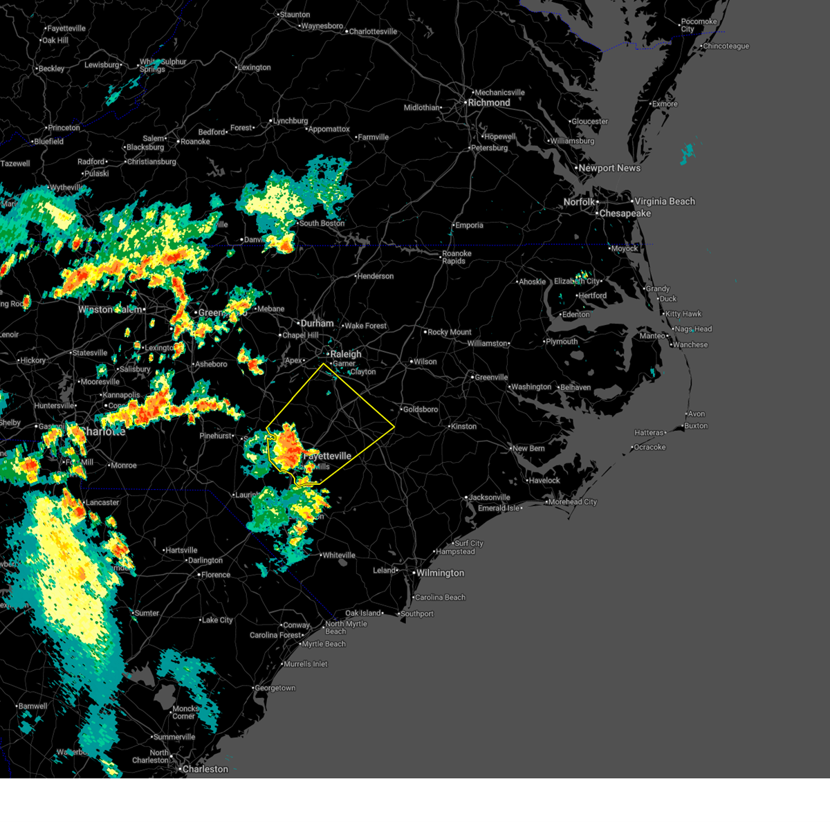
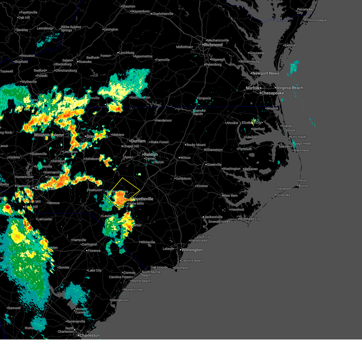
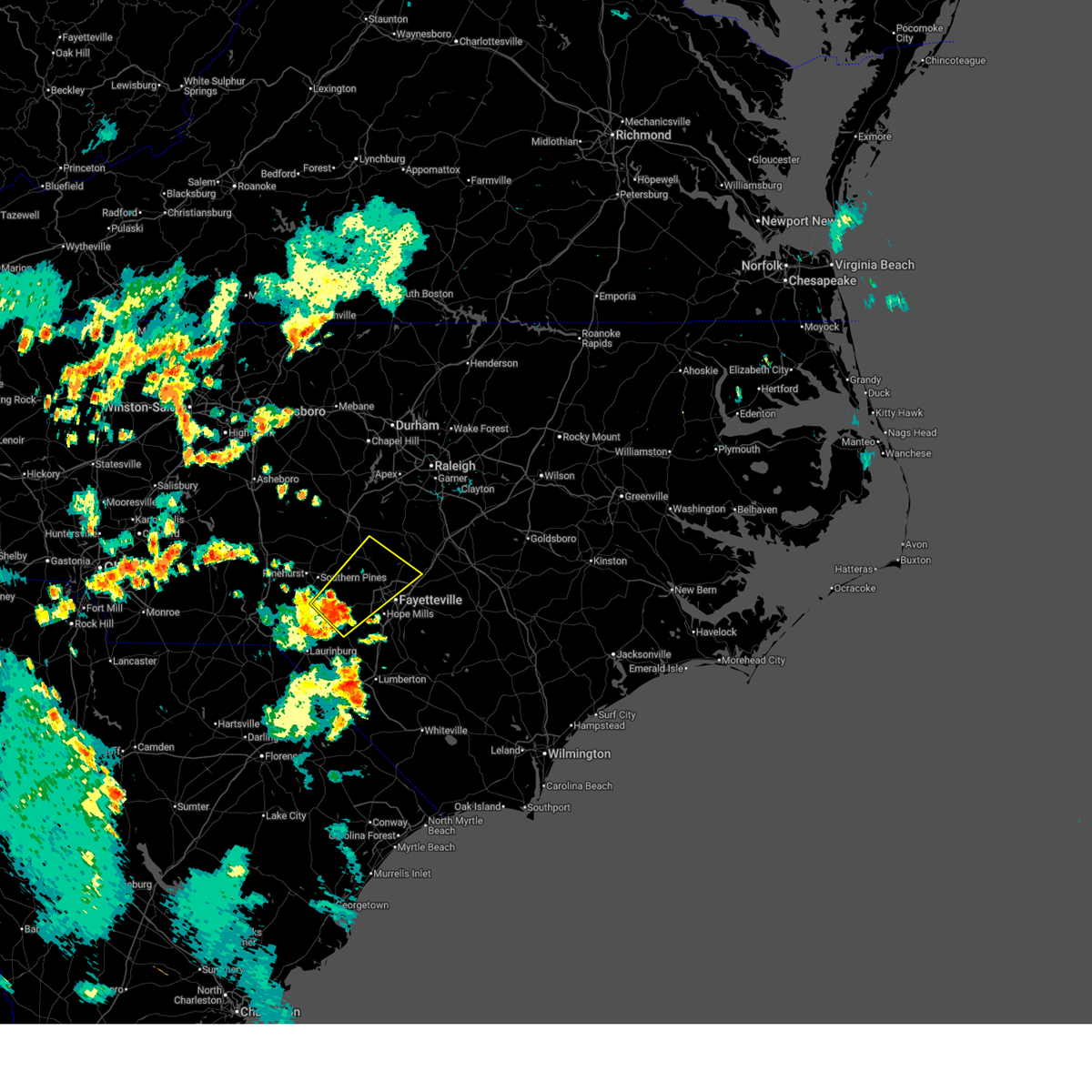
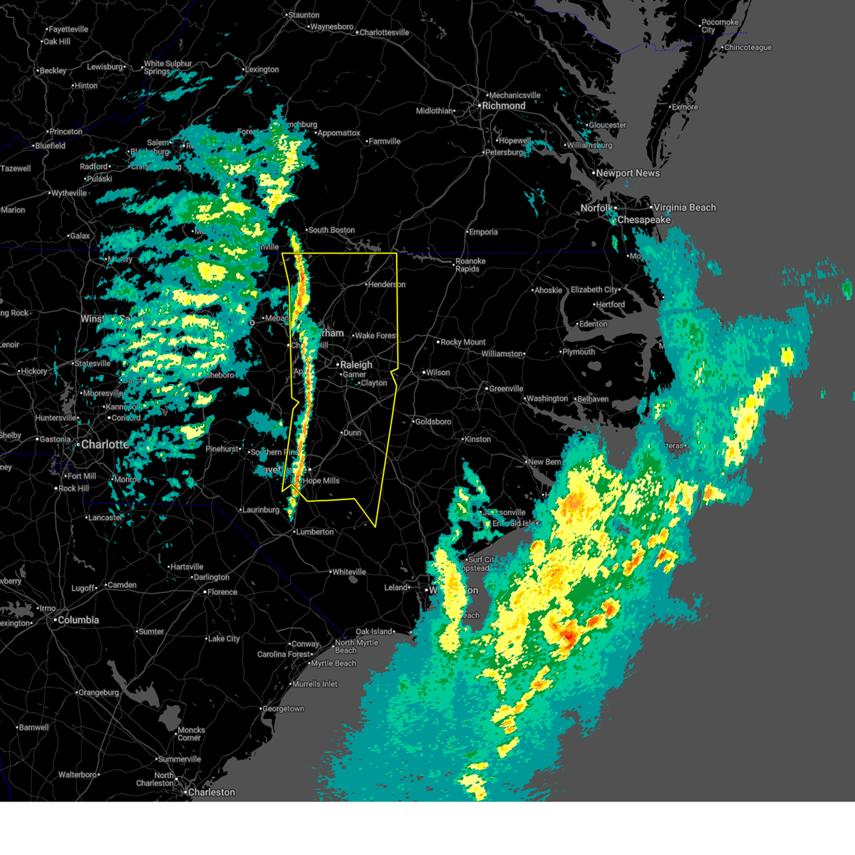
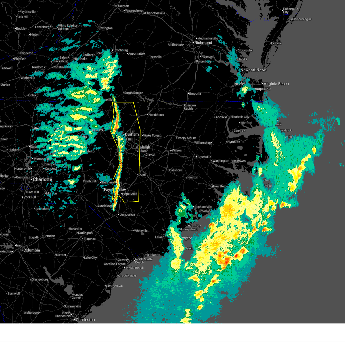
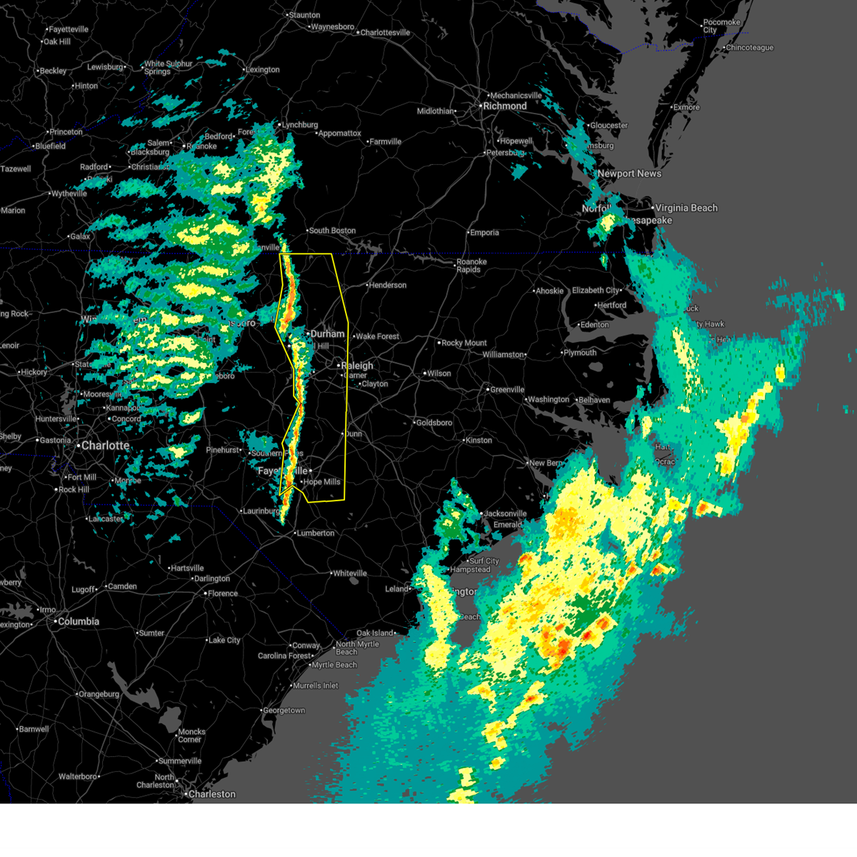
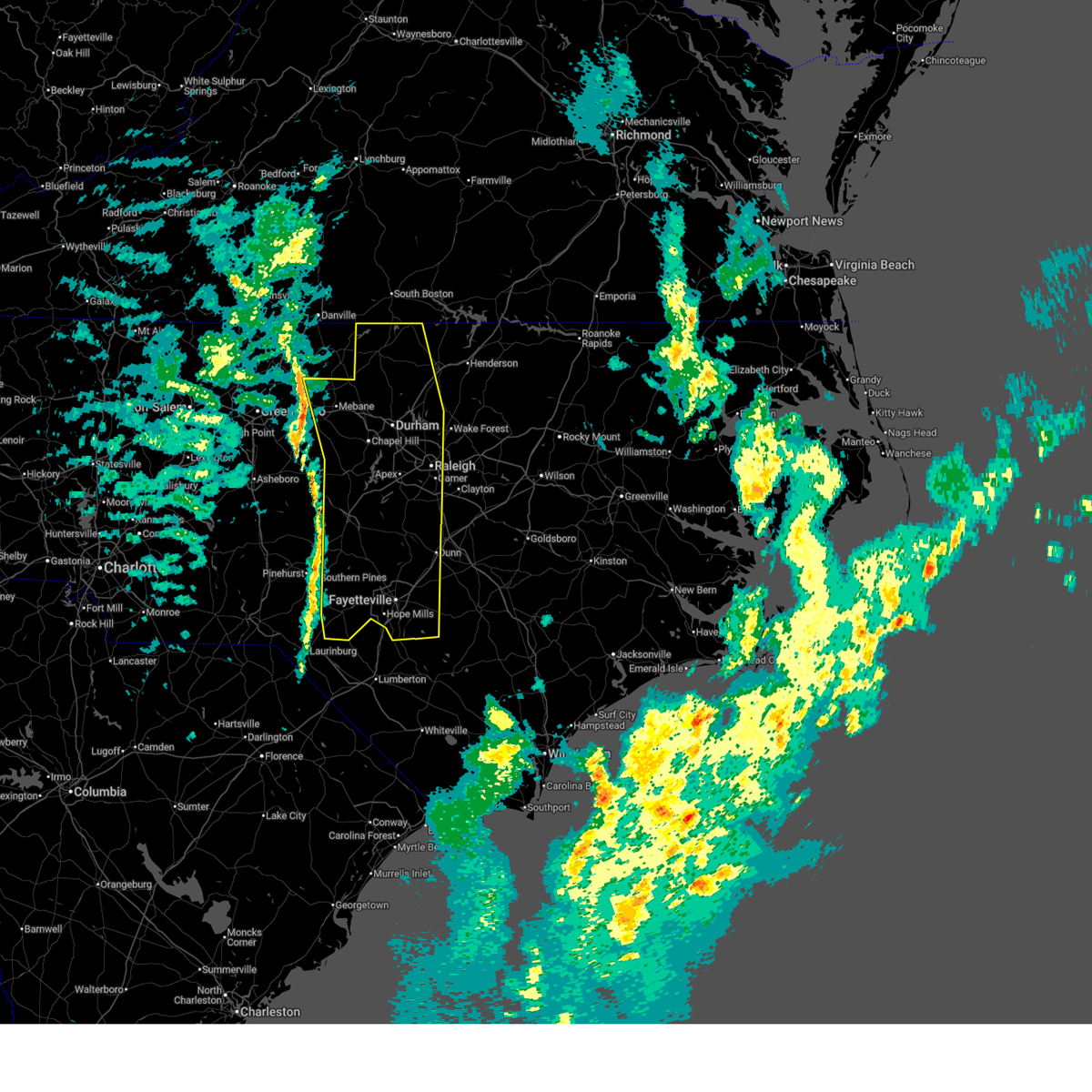
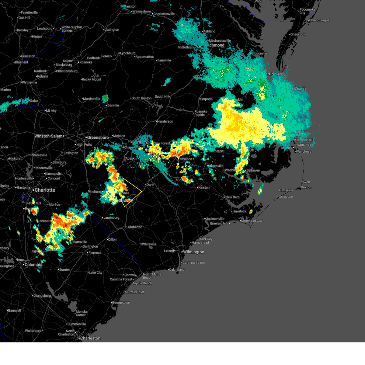
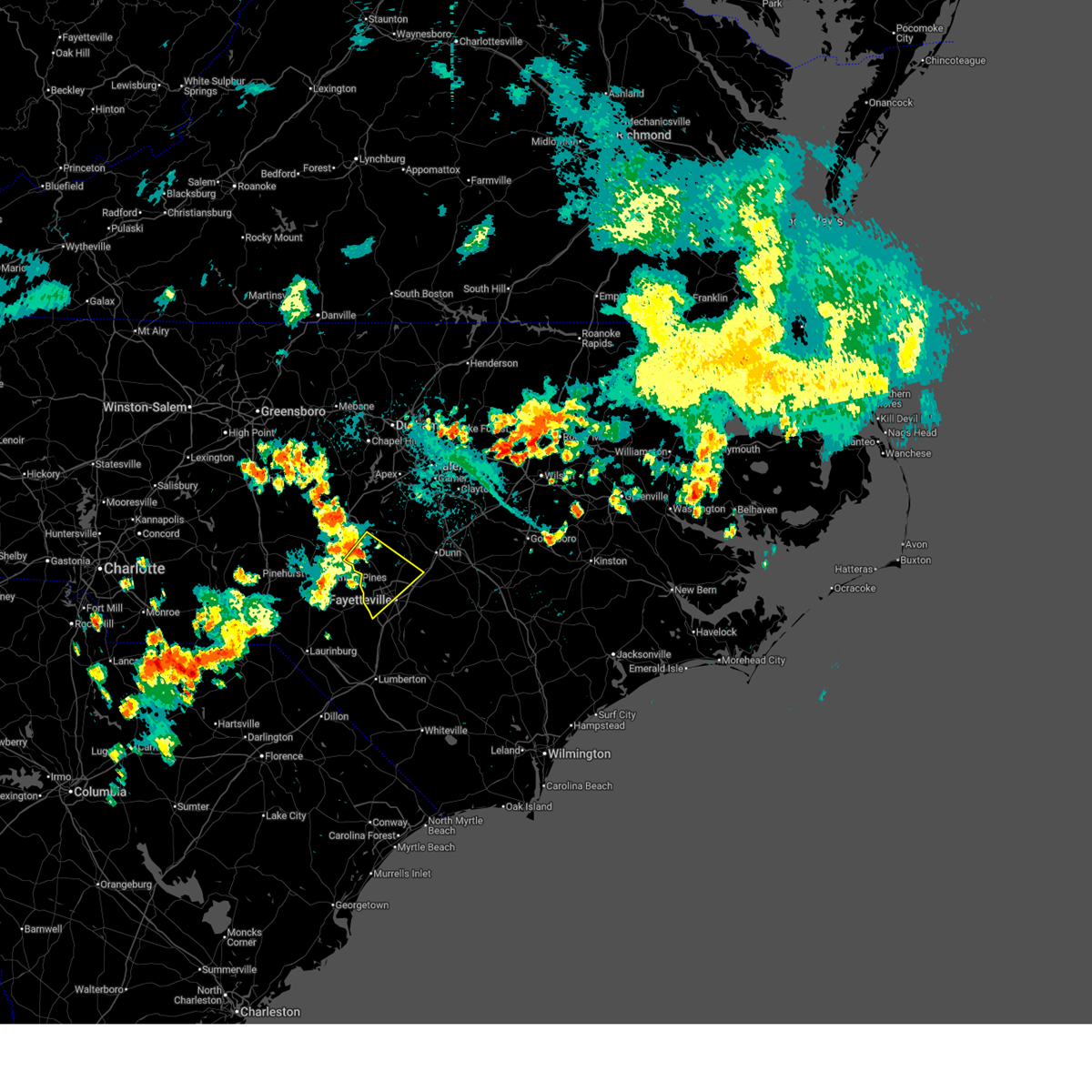
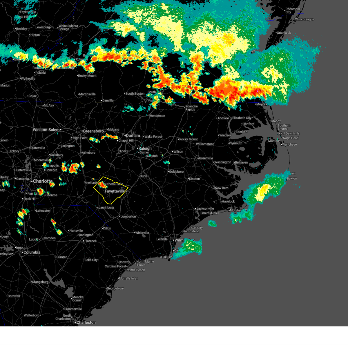
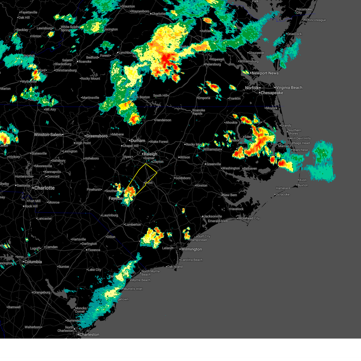
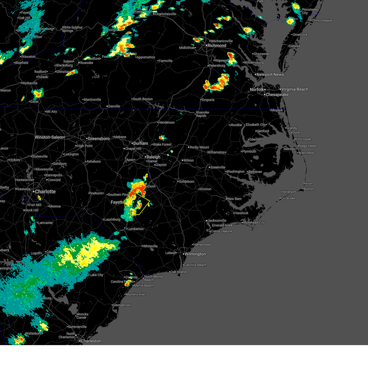
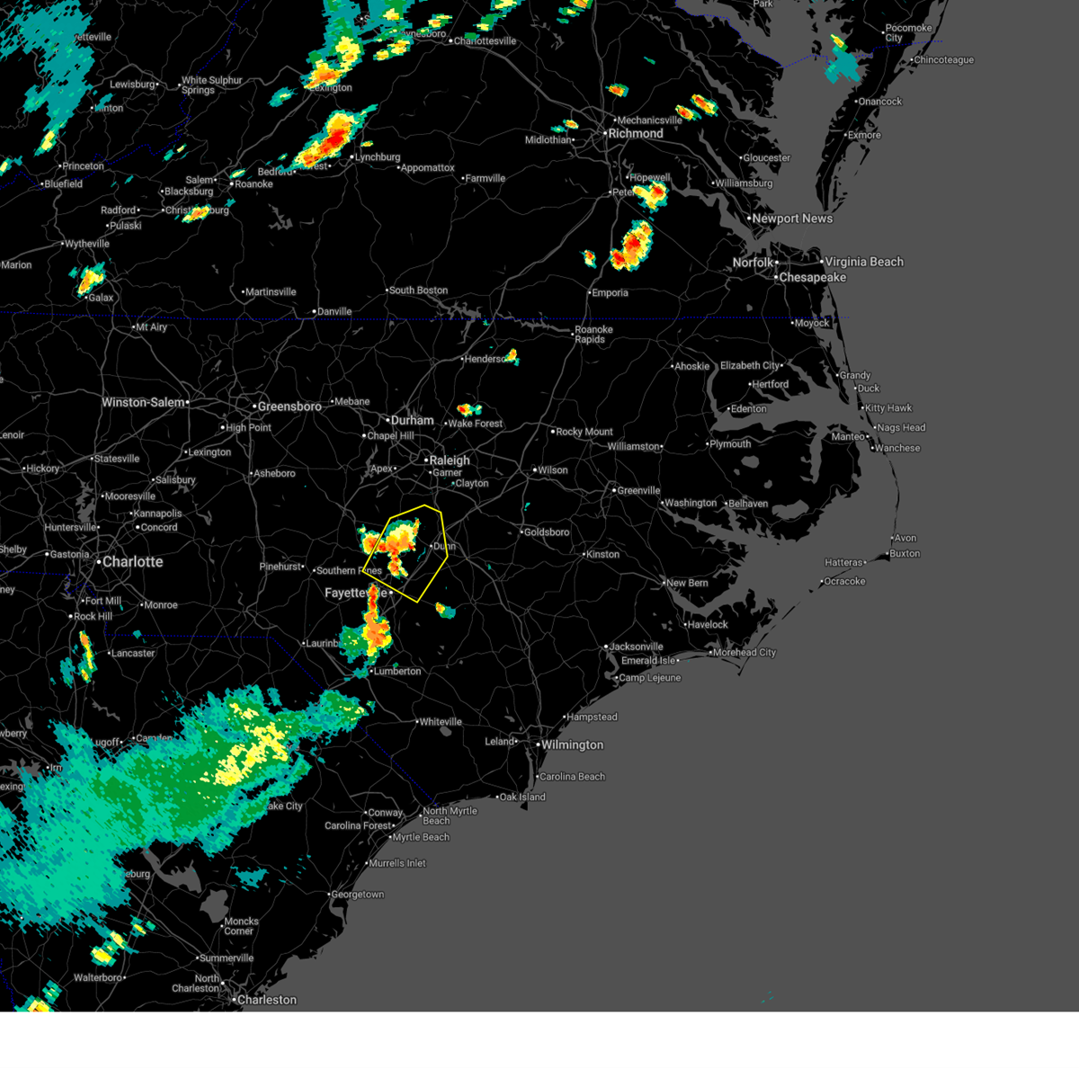
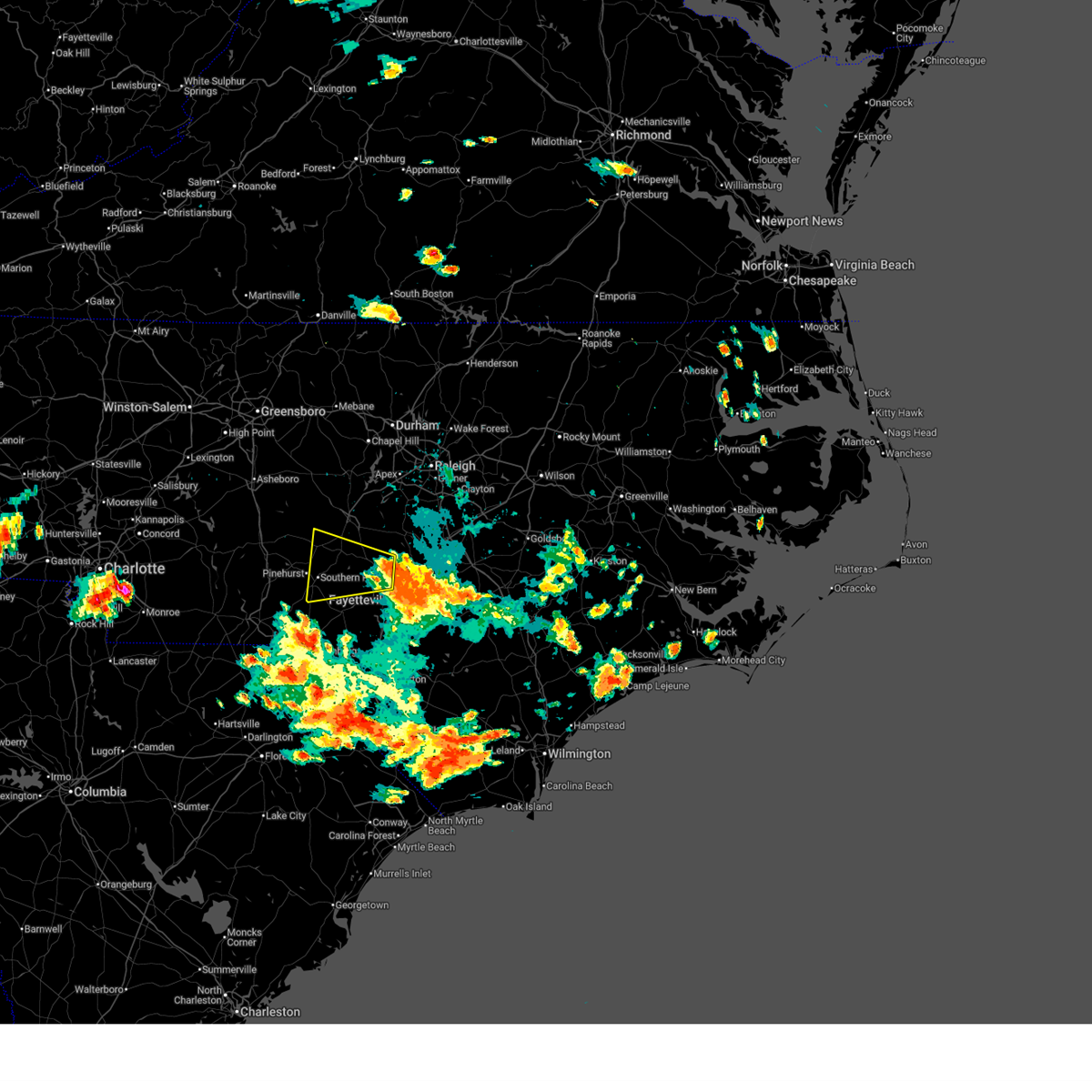
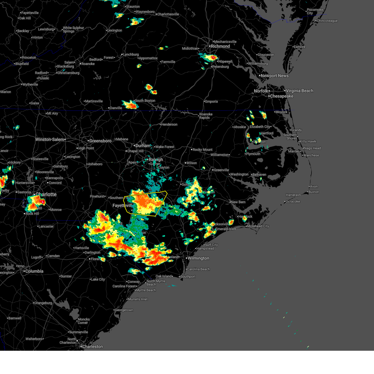
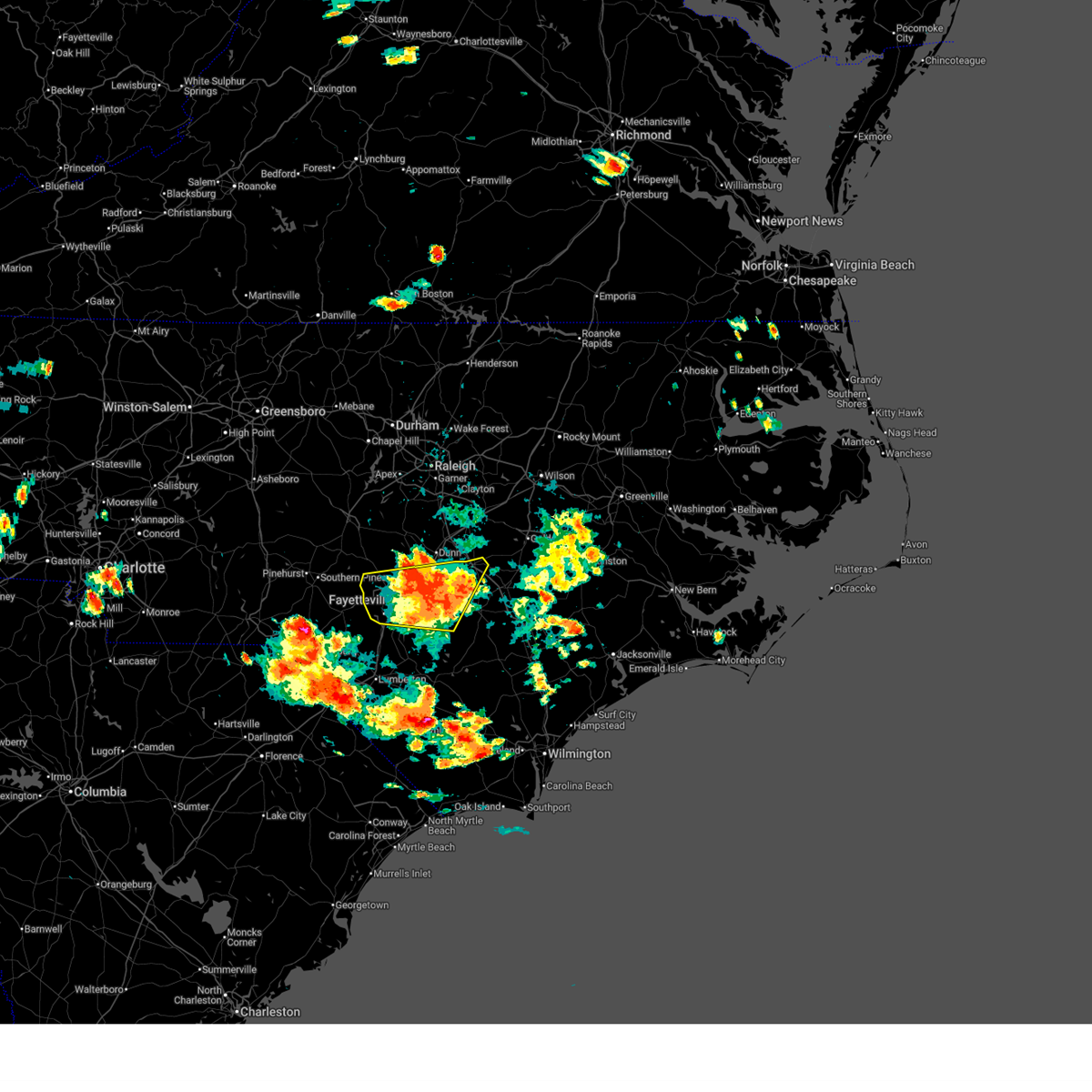
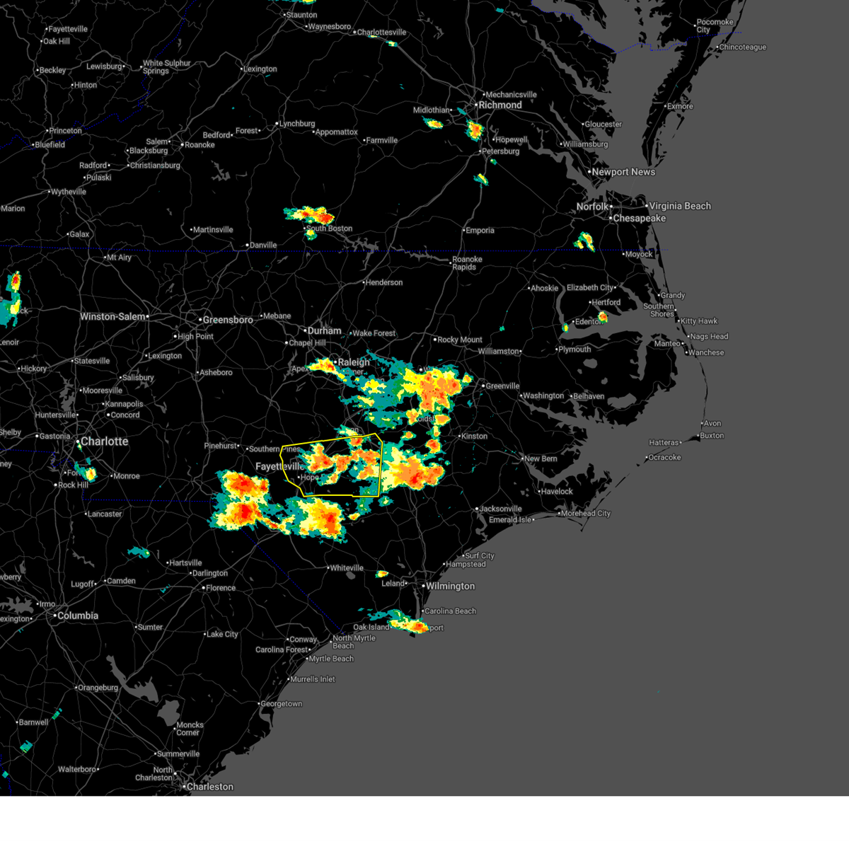
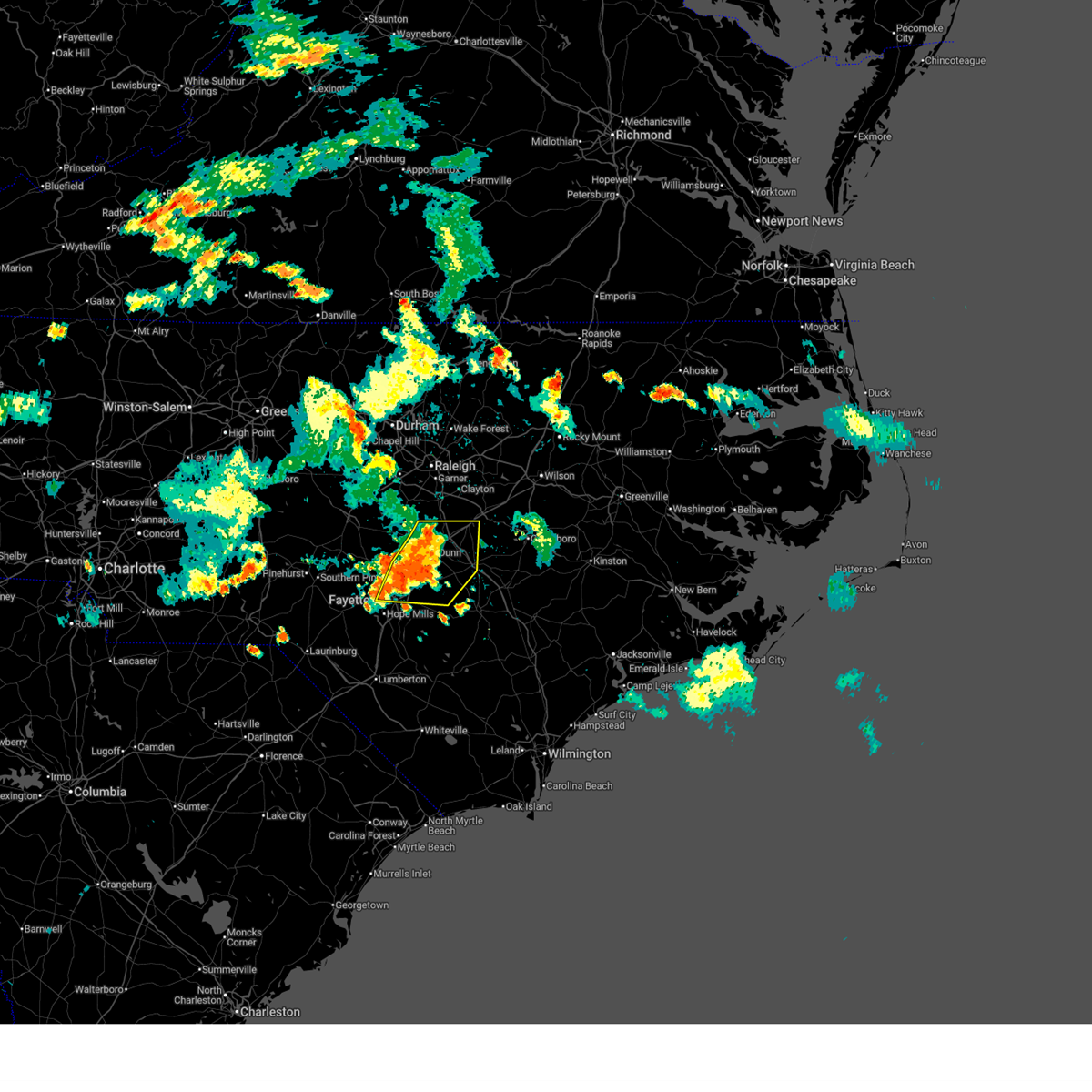
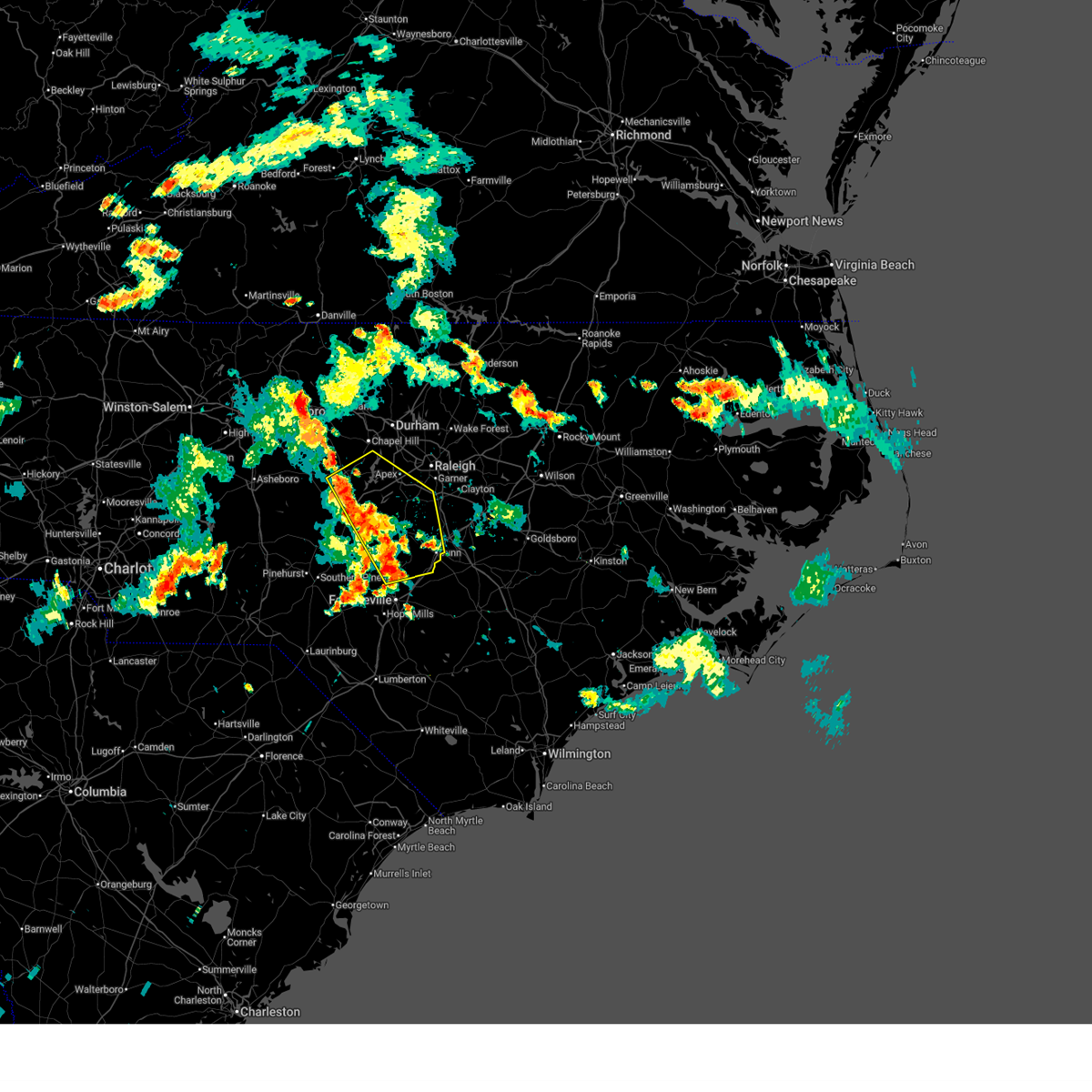
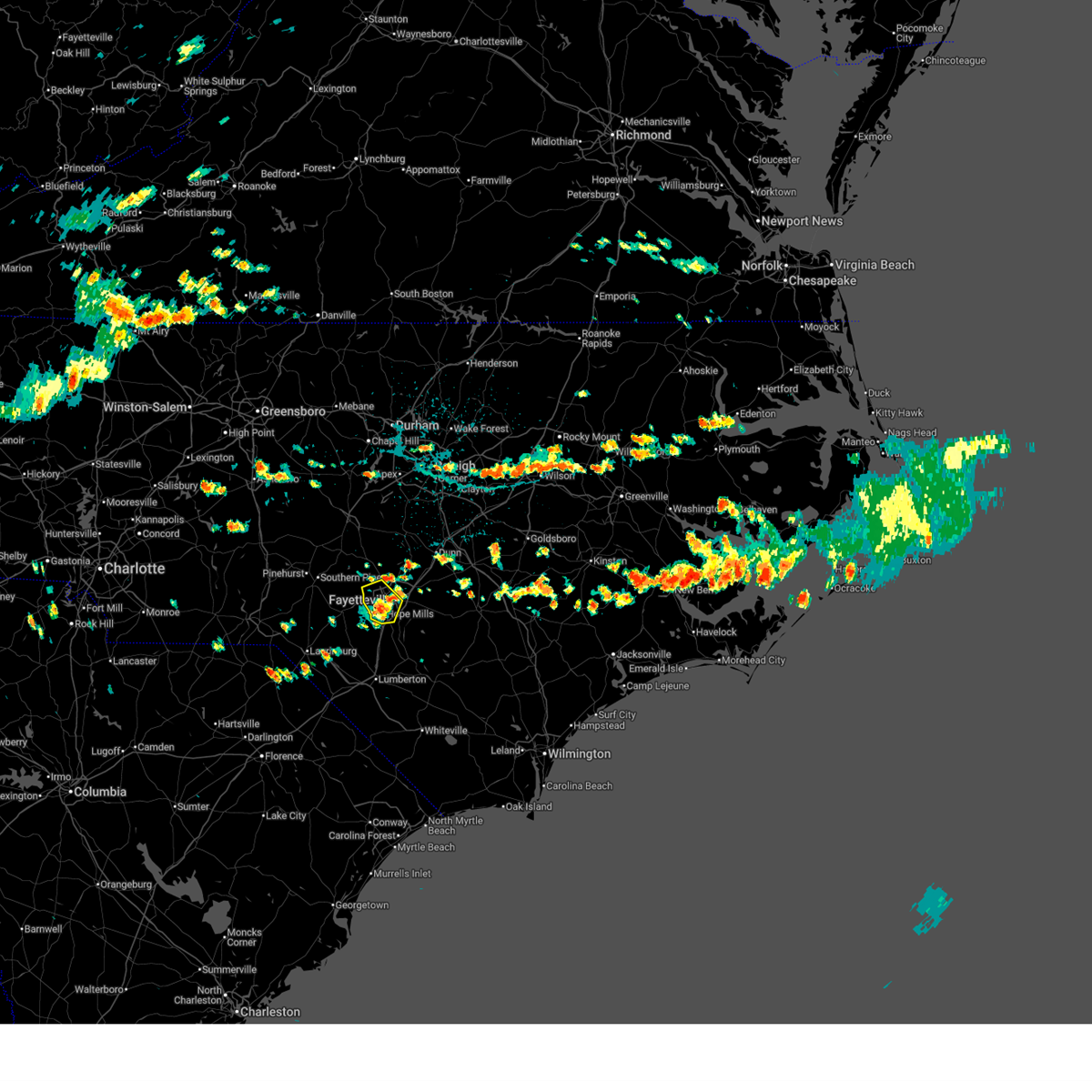
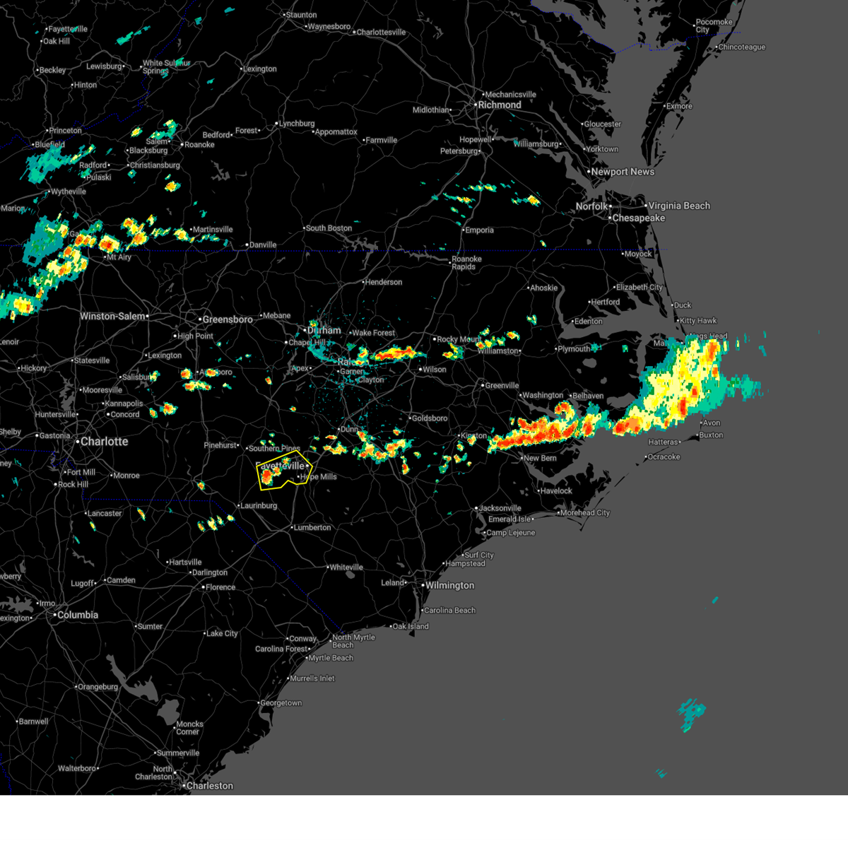
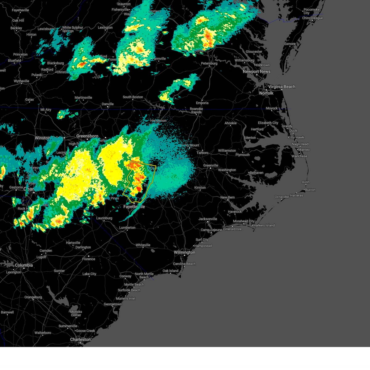
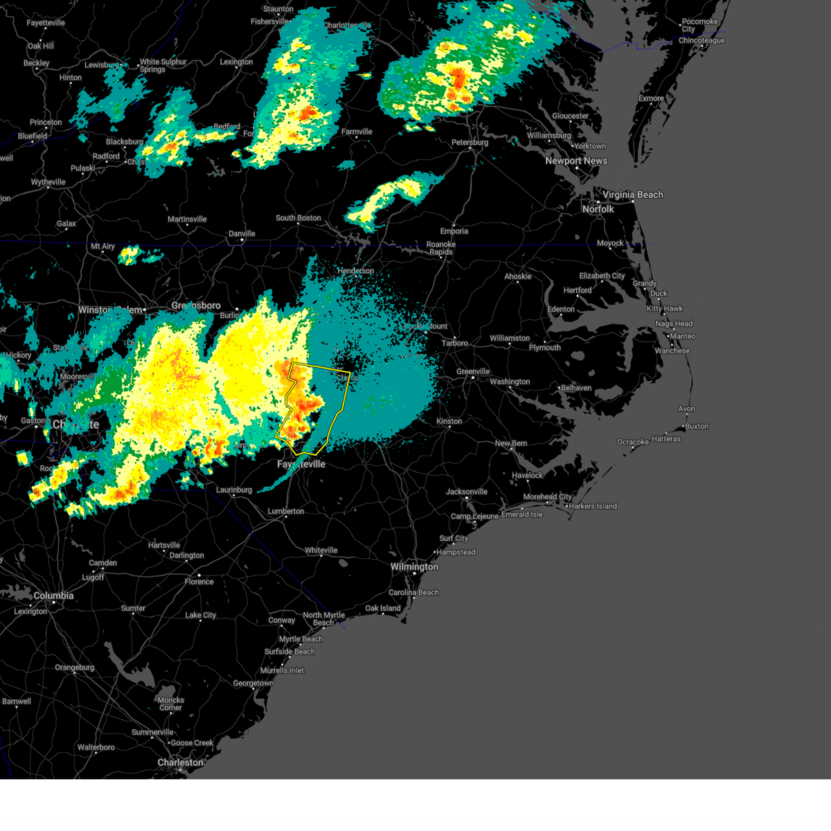
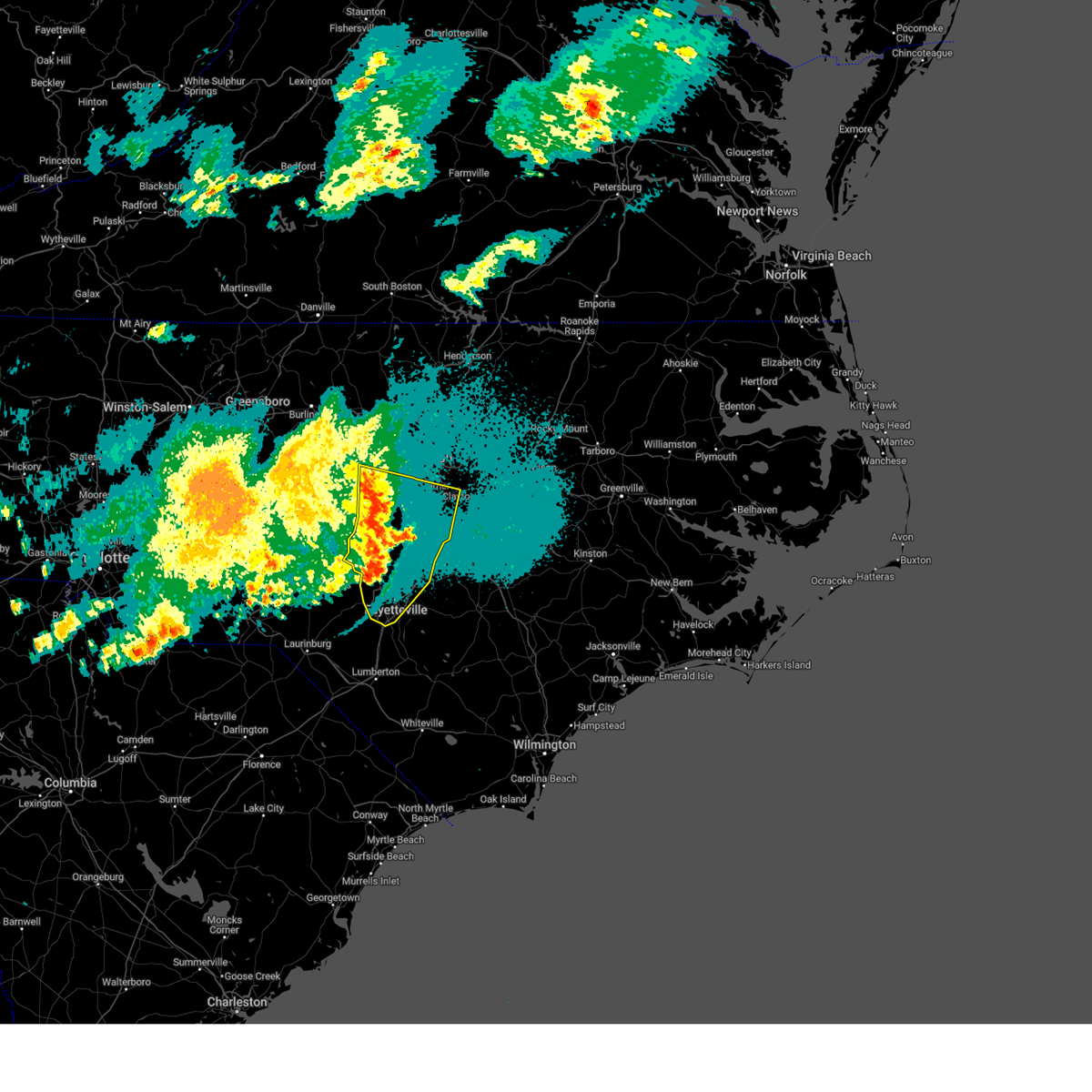
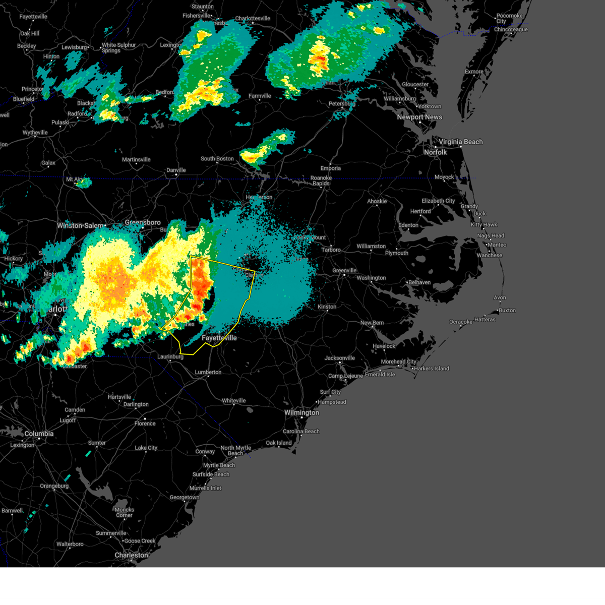
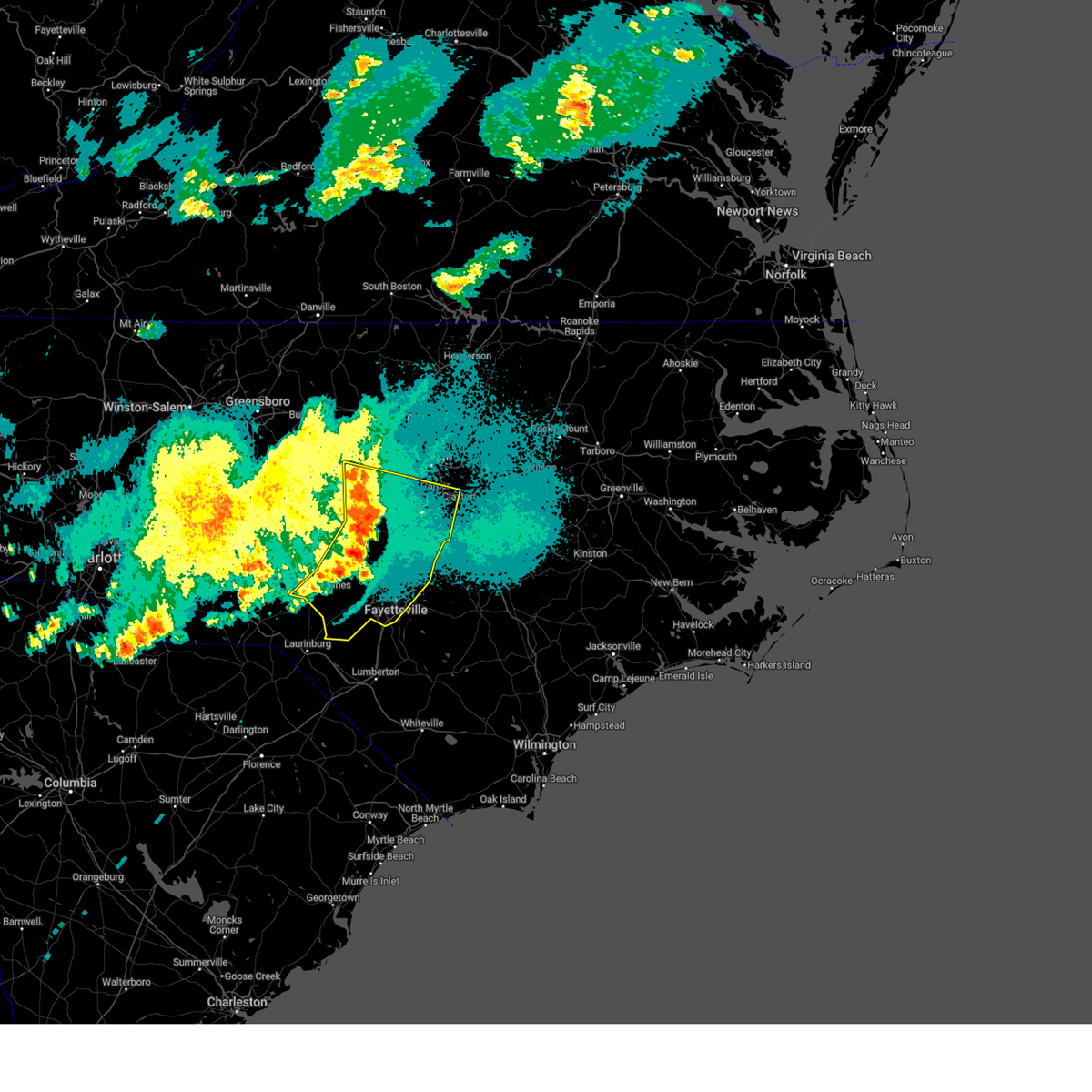
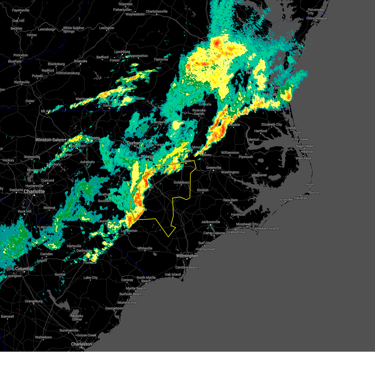
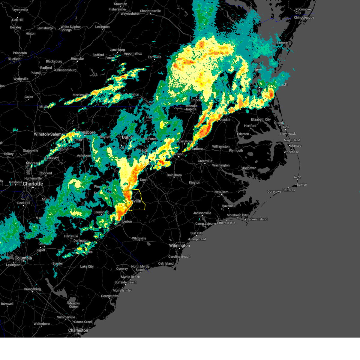
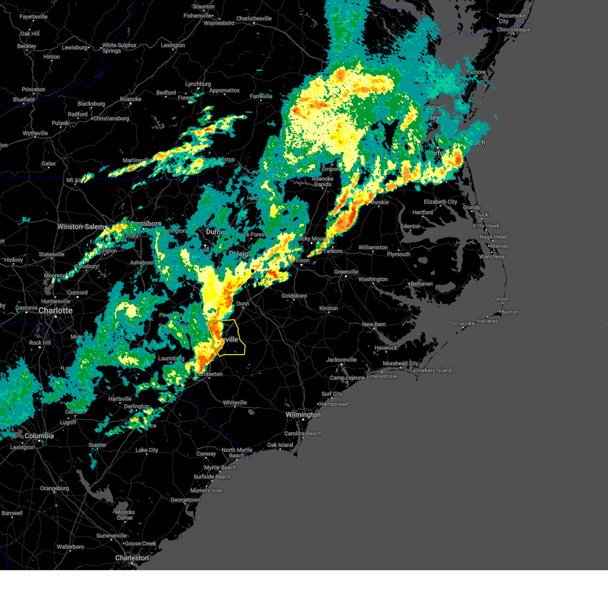
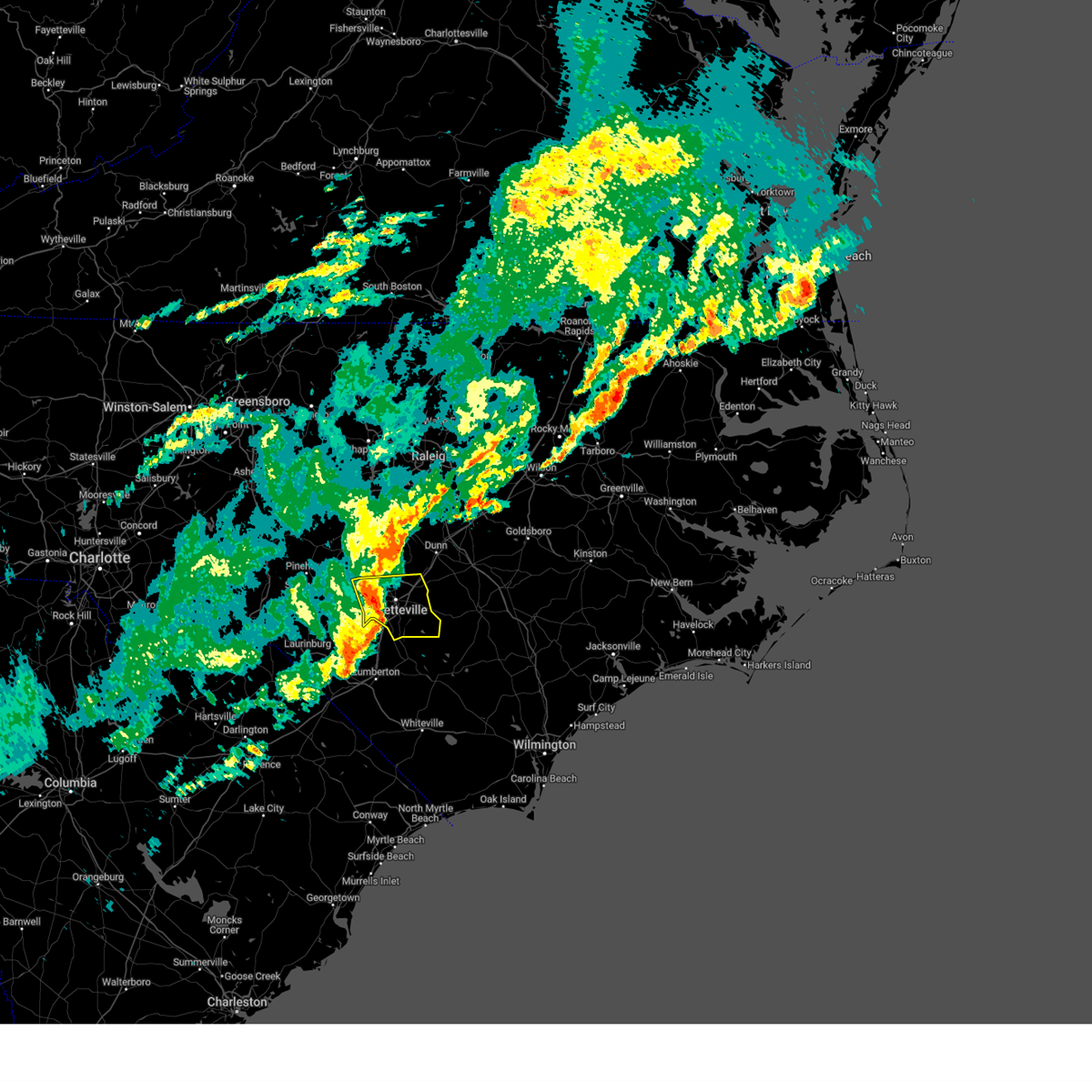
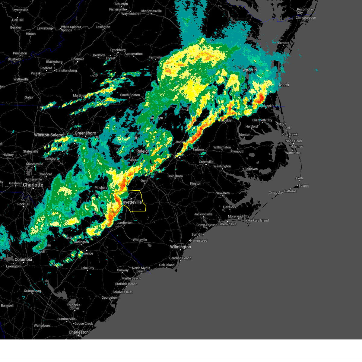
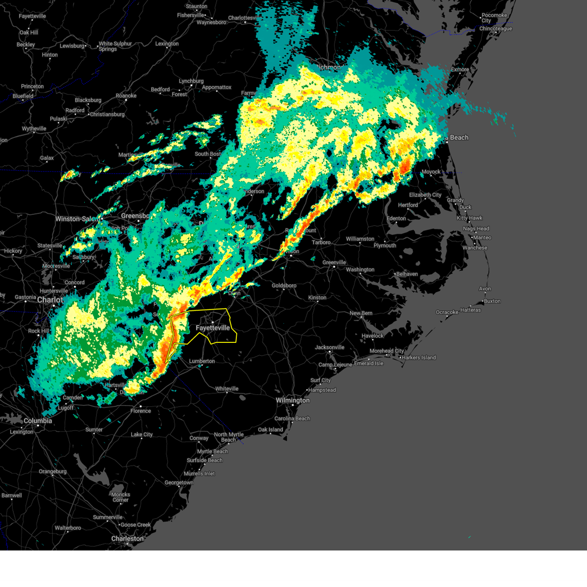
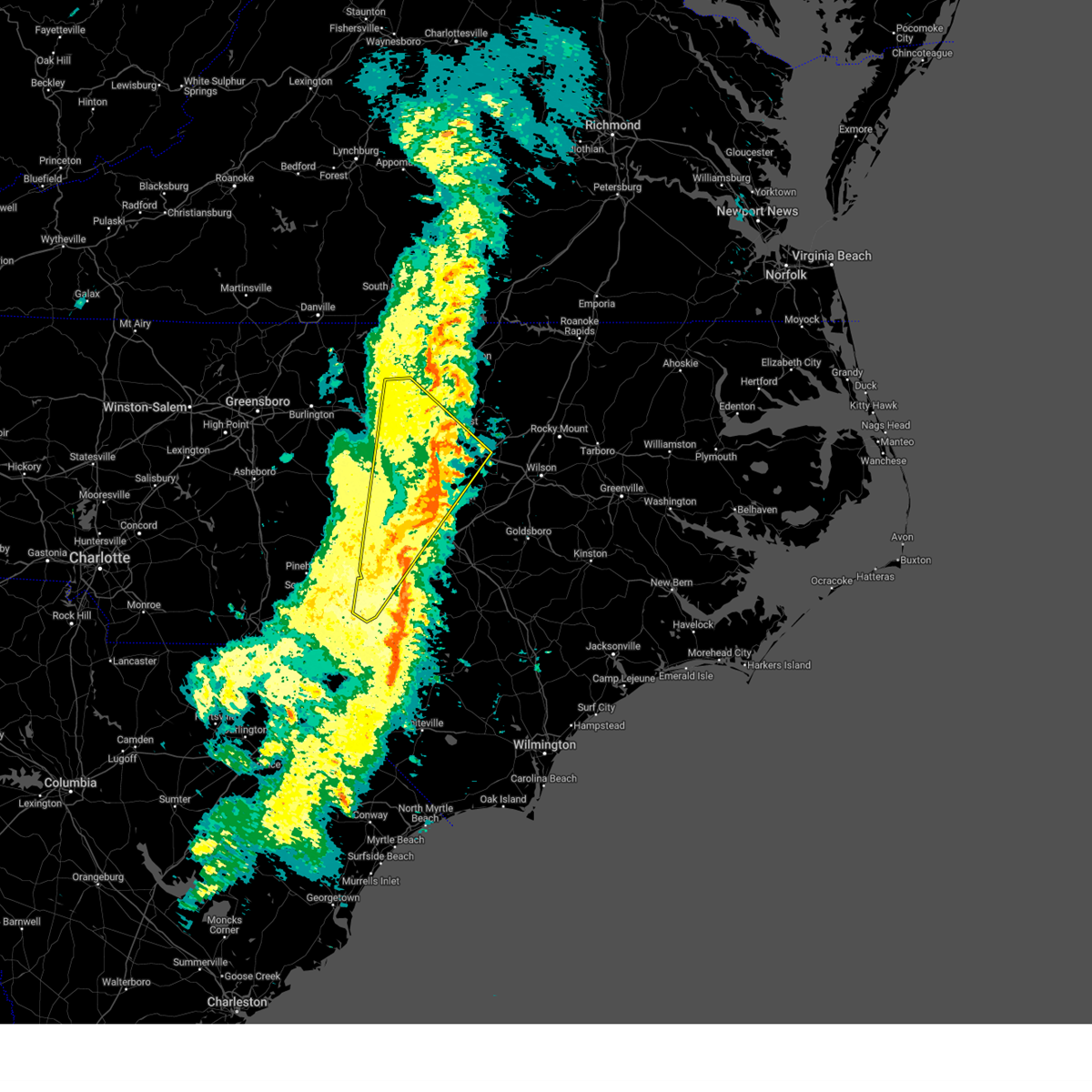
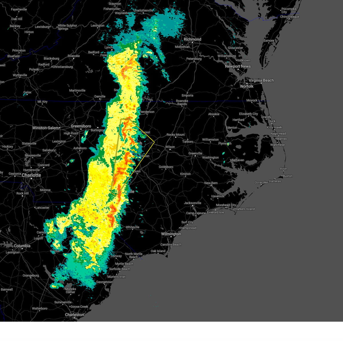
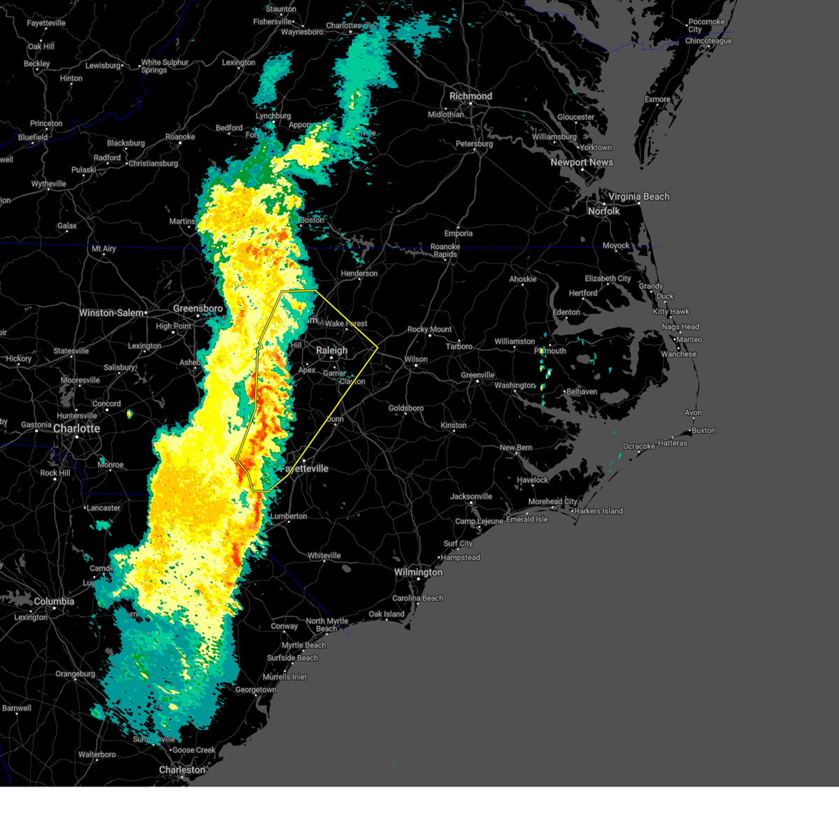
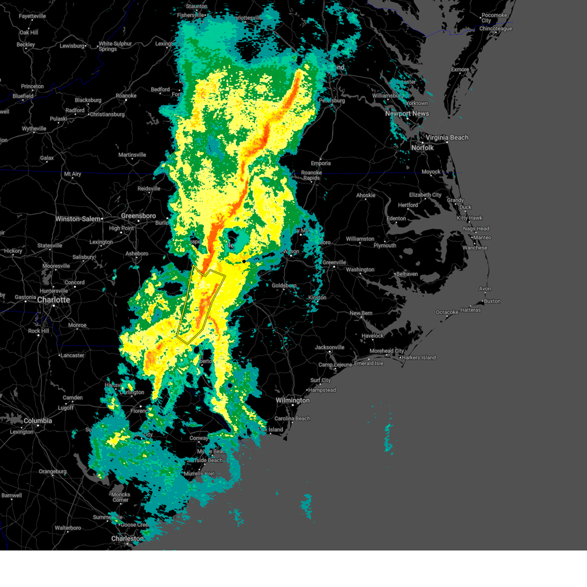
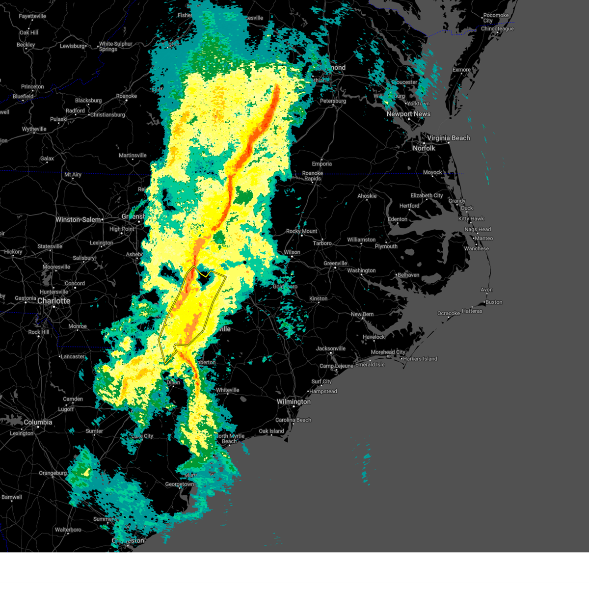
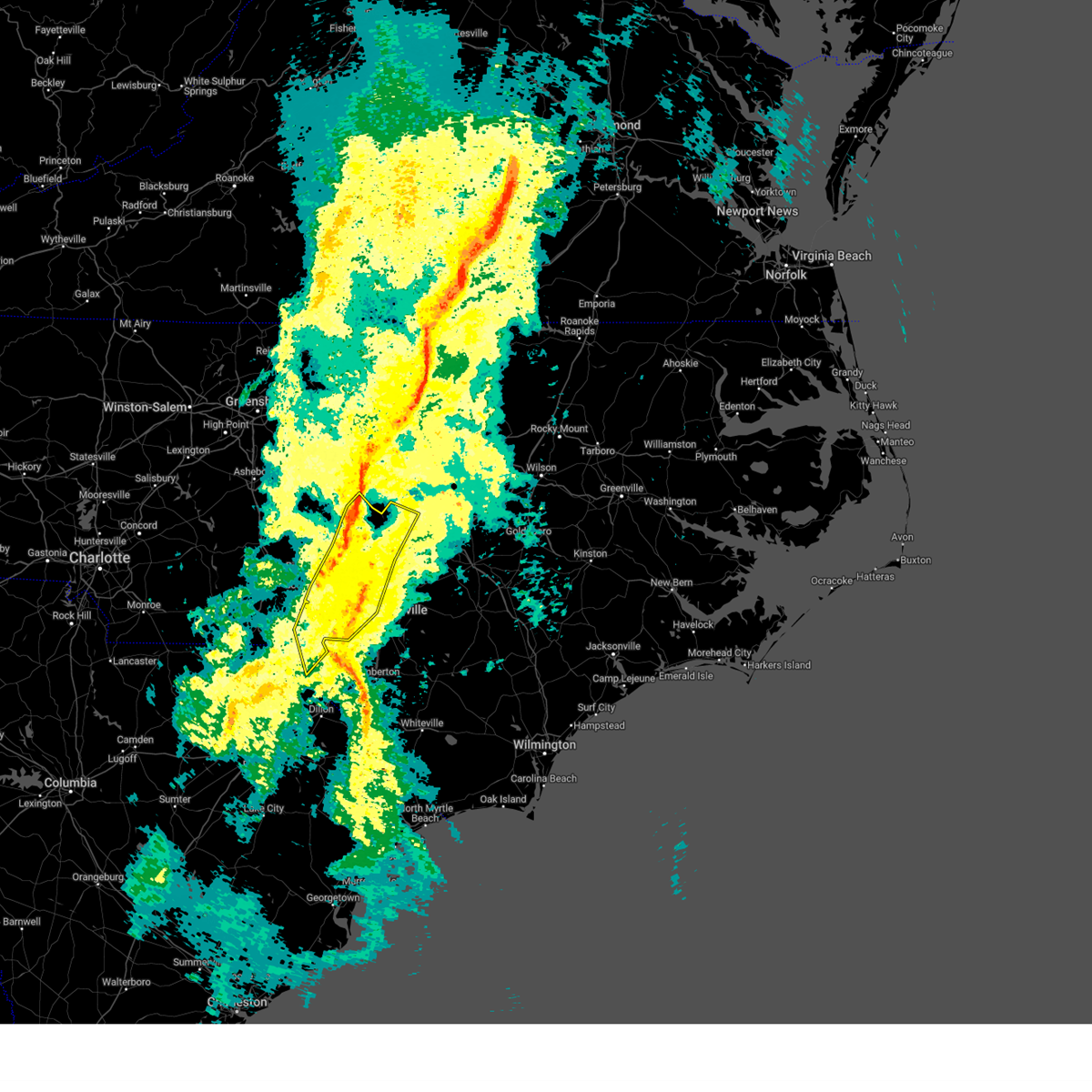
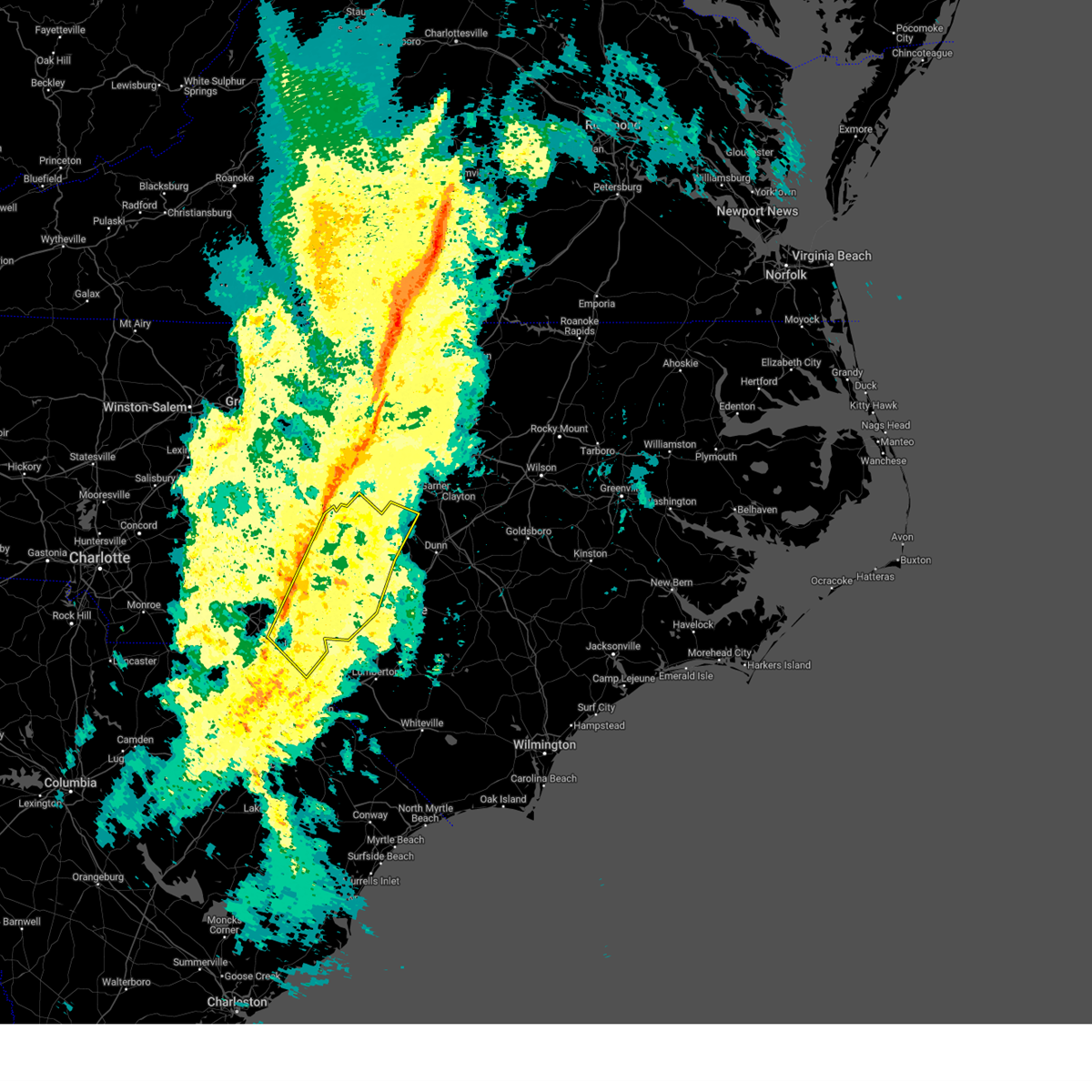
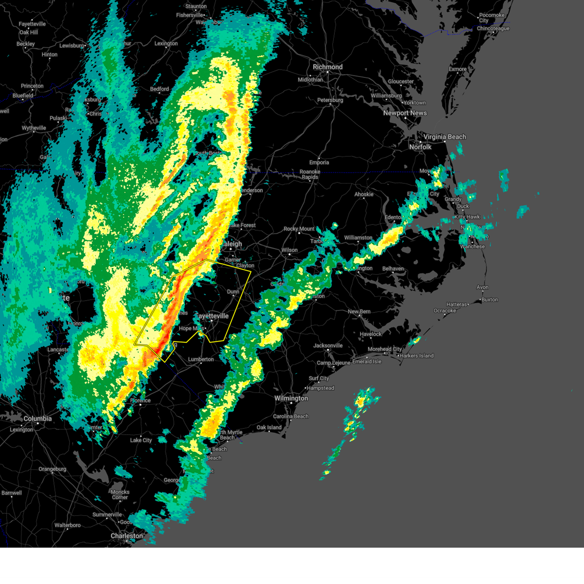
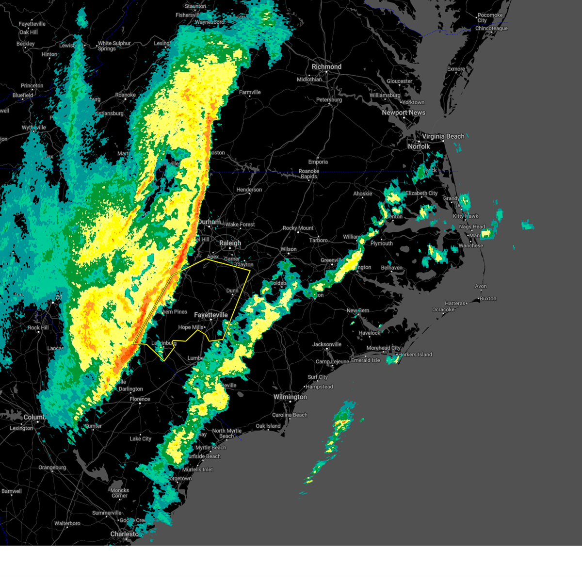
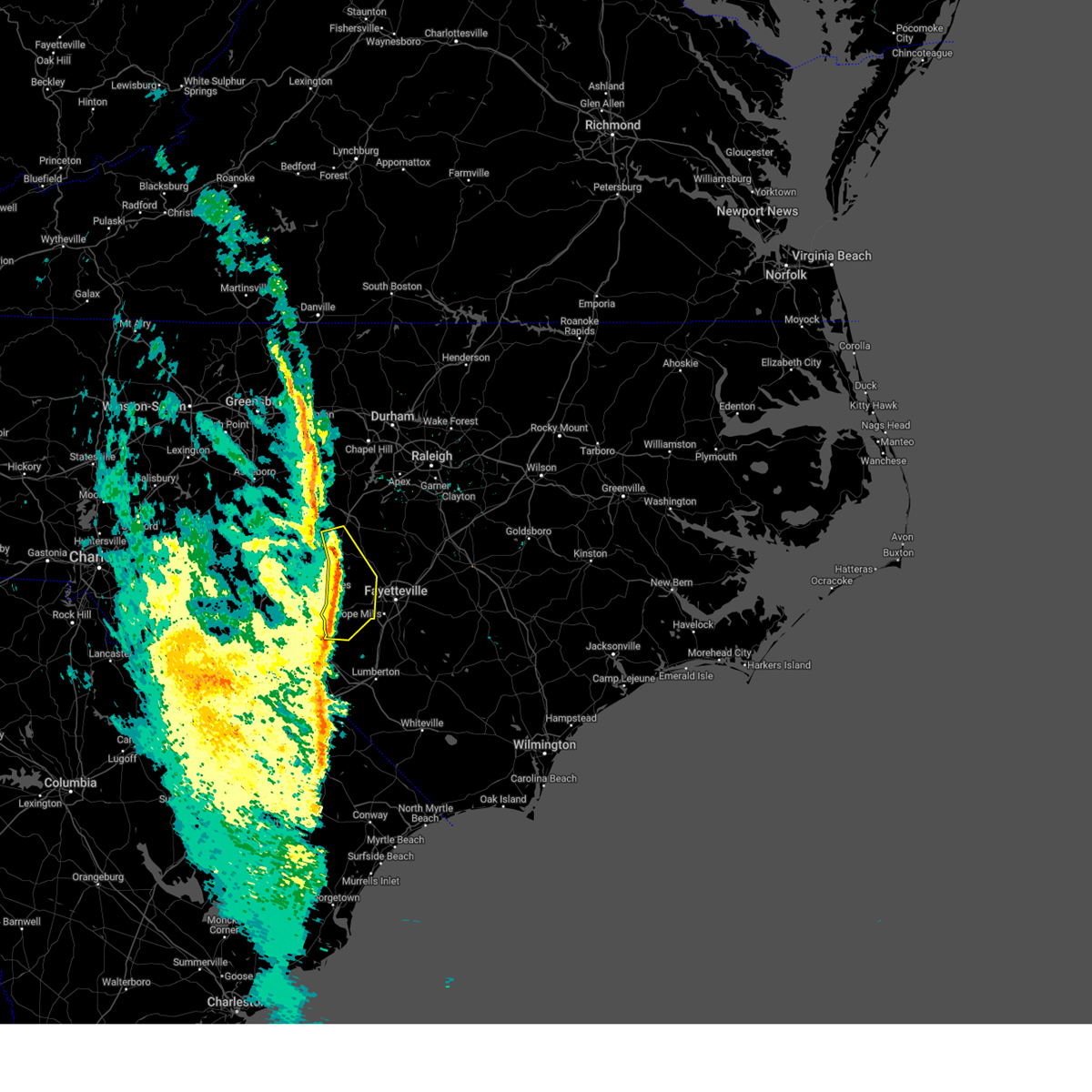
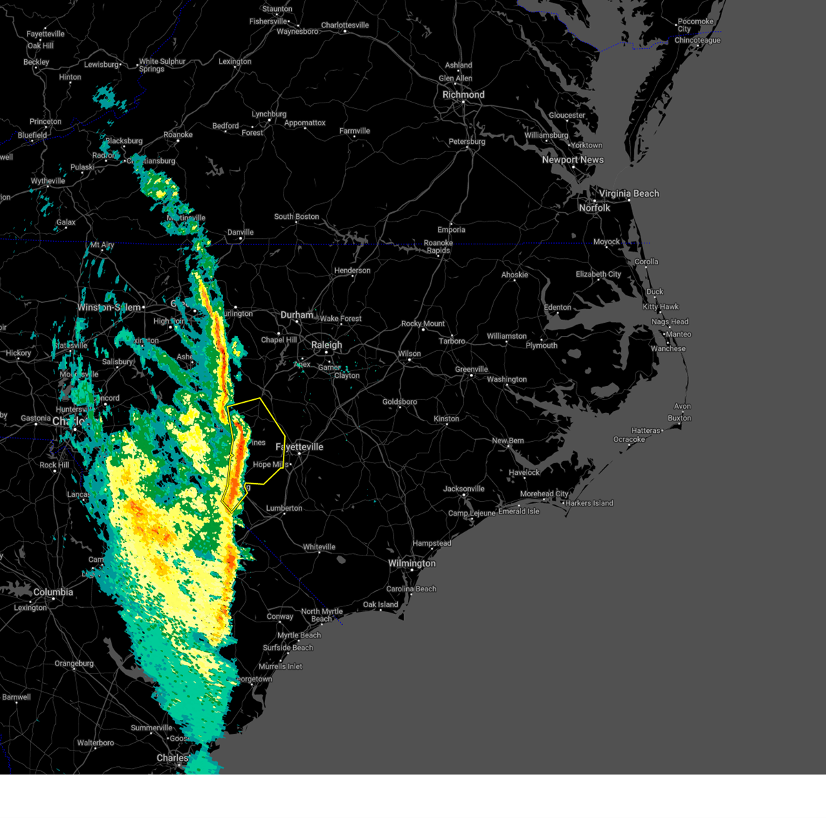
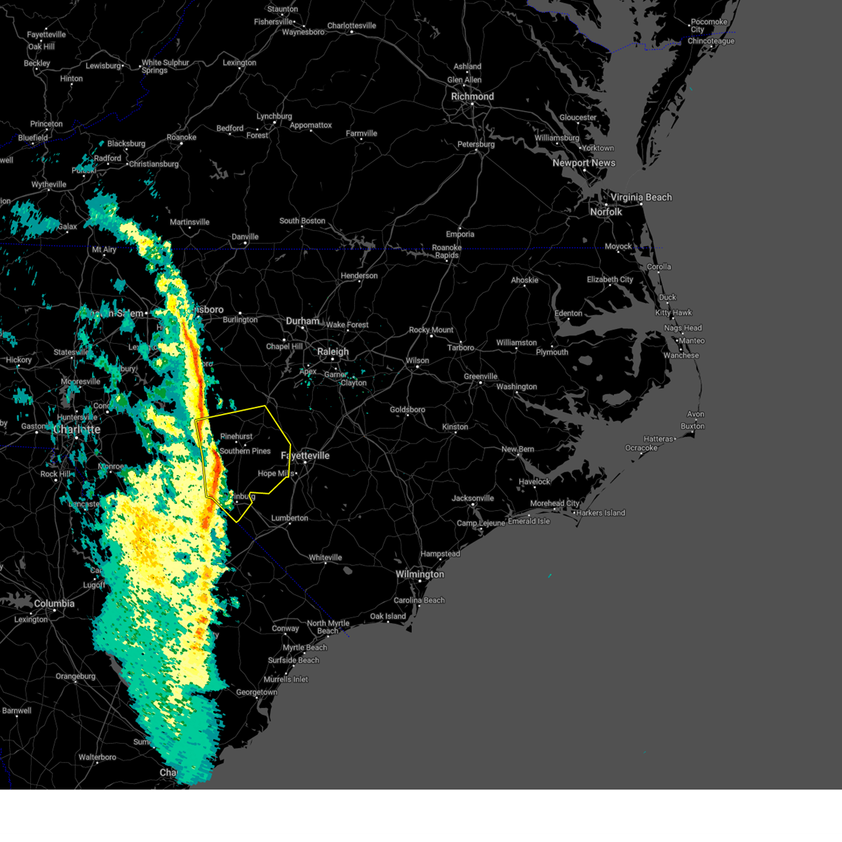
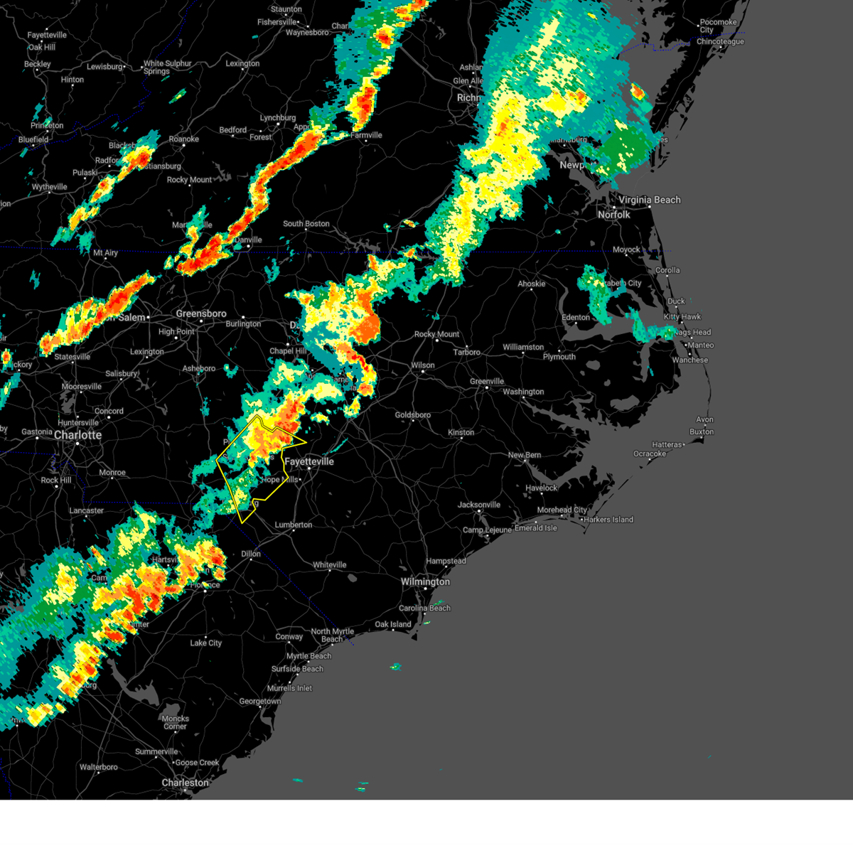
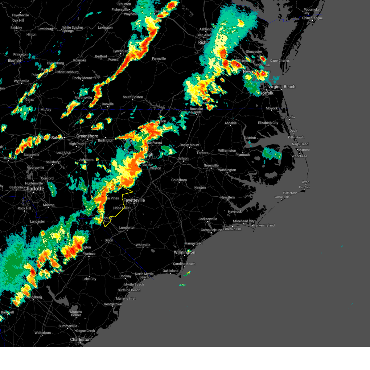
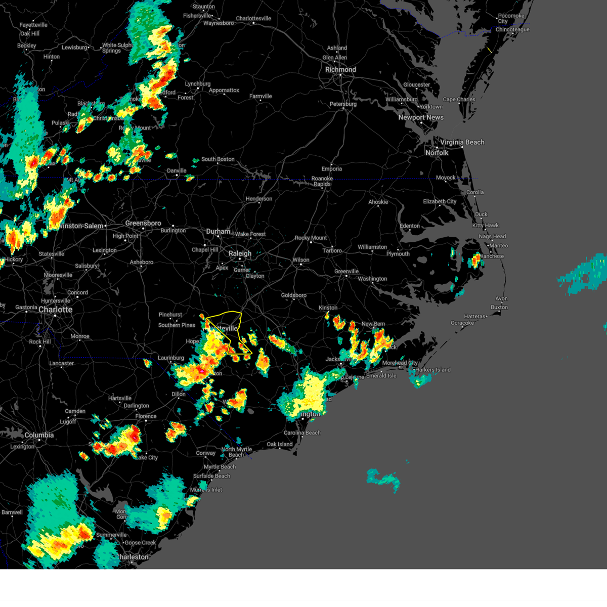
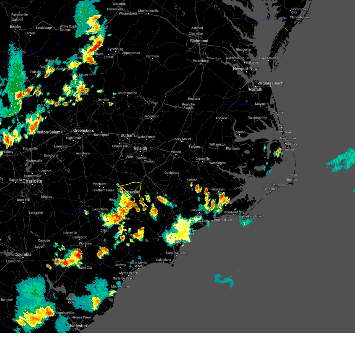
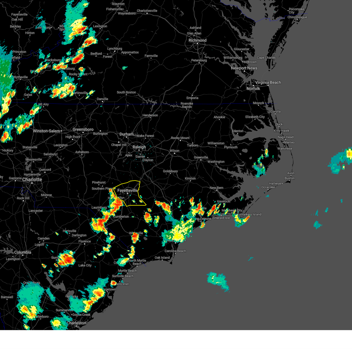
Hail Map for Spring Lake, NC
The Spring Lake, NC area has had 8 reports of on-the-ground hail by trained spotters, and has been under severe weather warnings 25 times during the past 12 months. Doppler radar has detected hail at or near Spring Lake, NC on 73 occasions, including 2 occasions during the past year.
| Name: | Spring Lake, NC |
| Where Located: | 46 miles SSW of Raleigh, NC |
| Map: | Google Map for Spring Lake, NC |
| Population: | 11964 |
| Housing Units: | 4855 |
| More Info: | Search Google for Spring Lake, NC |
2
The Top Recent Hail Date for Spring Lake, NC is Wednesday, June 25, 2025 (6th out of 73)

Hail and Wind Damage Spotted near Spring Lake, NC
| Date / Time | Report Details |
|---|---|
| 6/18/2026 8:17 PM EDT |
 Svrrah the national weather service in raleigh has issued a * severe thunderstorm warning for, southwestern wayne county in central north carolina, northern sampson county in central north carolina, harnett county in central north carolina, cumberland county in central north carolina, south central wake county in central north carolina, southwestern johnston county in central north carolina, northeastern hoke county in central north carolina, * until 900 pm edt. * at 815 pm edt, a severe thunderstorm was located near pope afb, or 8 miles northeast of fort bragg, moving northeast at 45 mph. this storm has a history of producing wind damage (radar indicated). Hazards include 60 mph wind gusts and penny size hail. expect damage to roofs, siding, and trees Svrrah the national weather service in raleigh has issued a * severe thunderstorm warning for, southwestern wayne county in central north carolina, northern sampson county in central north carolina, harnett county in central north carolina, cumberland county in central north carolina, south central wake county in central north carolina, southwestern johnston county in central north carolina, northeastern hoke county in central north carolina, * until 900 pm edt. * at 815 pm edt, a severe thunderstorm was located near pope afb, or 8 miles northeast of fort bragg, moving northeast at 45 mph. this storm has a history of producing wind damage (radar indicated). Hazards include 60 mph wind gusts and penny size hail. expect damage to roofs, siding, and trees
|
| 6/18/2026 8:06 PM EDT |
 At 806 pm edt, a severe thunderstorm was located near fort bragg, moving northeast at 35 mph (radar indicated). Hazards include 60 mph wind gusts and penny size hail. Expect damage to roofs, siding, and trees. Locations impacted include, fayetteville, raeford, fort bragg, pope afb, spring lake, wade, silver city, pineview, anderson creek, and timberlake. At 806 pm edt, a severe thunderstorm was located near fort bragg, moving northeast at 35 mph (radar indicated). Hazards include 60 mph wind gusts and penny size hail. Expect damage to roofs, siding, and trees. Locations impacted include, fayetteville, raeford, fort bragg, pope afb, spring lake, wade, silver city, pineview, anderson creek, and timberlake.
|
| 6/18/2026 8:03 PM EDT | Awos station kpob pope af in cumberland county NC, 1.8 miles ENE of Spring Lake, NC |
| 6/18/2026 7:42 PM EDT |
 Svrrah the national weather service in raleigh has issued a * severe thunderstorm warning for, east central moore county in central north carolina, southwestern harnett county in central north carolina, northwestern cumberland county in central north carolina, hoke county in central north carolina, * until 830 pm edt. * at 742 pm edt, a severe thunderstorm was located over raeford, moving northeast at 40 mph (radar indicated). Hazards include 60 mph wind gusts and penny size hail. expect damage to roofs, siding, and trees Svrrah the national weather service in raleigh has issued a * severe thunderstorm warning for, east central moore county in central north carolina, southwestern harnett county in central north carolina, northwestern cumberland county in central north carolina, hoke county in central north carolina, * until 830 pm edt. * at 742 pm edt, a severe thunderstorm was located over raeford, moving northeast at 40 mph (radar indicated). Hazards include 60 mph wind gusts and penny size hail. expect damage to roofs, siding, and trees
|
| 3/16/2026 6:39 PM EDT |
 Svrrah the national weather service in raleigh has issued a * severe thunderstorm warning for, vance county in central north carolina, harnett county in central north carolina, cumberland county in central north carolina, wake county in central north carolina, johnston county in central north carolina, east central hoke county in central north carolina, franklin county in central north carolina, person county in central north carolina, southwestern wayne county in central north carolina, western warren county in central north carolina, southwestern nash county in central north carolina, eastern orange county in central north carolina, sampson county in central north carolina, granville county in central north carolina, durham county in central north carolina, eastern chatham county in central north carolina, * until 745 pm edt. * at 639 pm edt, severe thunderstorms were located along a line extending from near elmo to near roxboro to near lillington to near robeson community college, moving northeast at 40 mph (radar indicated). Hazards include 60 mph wind gusts. expect damage to roofs, siding, and trees Svrrah the national weather service in raleigh has issued a * severe thunderstorm warning for, vance county in central north carolina, harnett county in central north carolina, cumberland county in central north carolina, wake county in central north carolina, johnston county in central north carolina, east central hoke county in central north carolina, franklin county in central north carolina, person county in central north carolina, southwestern wayne county in central north carolina, western warren county in central north carolina, southwestern nash county in central north carolina, eastern orange county in central north carolina, sampson county in central north carolina, granville county in central north carolina, durham county in central north carolina, eastern chatham county in central north carolina, * until 745 pm edt. * at 639 pm edt, severe thunderstorms were located along a line extending from near elmo to near roxboro to near lillington to near robeson community college, moving northeast at 40 mph (radar indicated). Hazards include 60 mph wind gusts. expect damage to roofs, siding, and trees
|
| 3/16/2026 6:37 PM EDT |
 At 637 pm edt, severe thunderstorms were located along a line extending from near roxboro to durham to near fayetteville, moving east at 45 mph (radar indicated). Hazards include 60 mph wind gusts. Expect damage to roofs, siding, and trees. locations impacted include, raleigh, durham, fayetteville, cary, chapel hill, roxboro, hillsborough, creedmoor, lillington, and fort bragg. this includes the following highways, interstate 95 between mile markers 73 and 41. interstate 85 between mile markers 163 and 200. interstate 40 between mile markers 161 and 162, between mile markers 259 and 306, and between mile markers 314 and 316. interstate 440 between mile markers 1 and 16. interstate 540 between mile markers 0 and 17. us 1 between mile markers 84 and 101. The durham freeway between mile markers 2 and 17. At 637 pm edt, severe thunderstorms were located along a line extending from near roxboro to durham to near fayetteville, moving east at 45 mph (radar indicated). Hazards include 60 mph wind gusts. Expect damage to roofs, siding, and trees. locations impacted include, raleigh, durham, fayetteville, cary, chapel hill, roxboro, hillsborough, creedmoor, lillington, and fort bragg. this includes the following highways, interstate 95 between mile markers 73 and 41. interstate 85 between mile markers 163 and 200. interstate 40 between mile markers 161 and 162, between mile markers 259 and 306, and between mile markers 314 and 316. interstate 440 between mile markers 1 and 16. interstate 540 between mile markers 0 and 17. us 1 between mile markers 84 and 101. The durham freeway between mile markers 2 and 17.
|
| 3/16/2026 6:37 PM EDT |
 the severe thunderstorm warning has been cancelled and is no longer in effect the severe thunderstorm warning has been cancelled and is no longer in effect
|
| 3/16/2026 6:05 PM EDT |
 Svrrah the national weather service in raleigh has issued a * severe thunderstorm warning for, eastern alamance county in central north carolina, harnett county in central north carolina, cumberland county in central north carolina, lee county in central north carolina, wake county in central north carolina, west central johnston county in central north carolina, hoke county in central north carolina, eastern moore county in central north carolina, person county in central north carolina, orange county in central north carolina, northwestern sampson county in central north carolina, western granville county in central north carolina, durham county in central north carolina, chatham county in central north carolina, * until 645 pm edt. * at 605 pm edt, severe thunderstorms were located along a line extending from near jericho to 10 miles northwest of pittsboro to 6 miles northwest of wakulla, moving east at 45 mph (radar indicated). Hazards include 60 mph wind gusts. expect damage to roofs, siding, and trees Svrrah the national weather service in raleigh has issued a * severe thunderstorm warning for, eastern alamance county in central north carolina, harnett county in central north carolina, cumberland county in central north carolina, lee county in central north carolina, wake county in central north carolina, west central johnston county in central north carolina, hoke county in central north carolina, eastern moore county in central north carolina, person county in central north carolina, orange county in central north carolina, northwestern sampson county in central north carolina, western granville county in central north carolina, durham county in central north carolina, chatham county in central north carolina, * until 645 pm edt. * at 605 pm edt, severe thunderstorms were located along a line extending from near jericho to 10 miles northwest of pittsboro to 6 miles northwest of wakulla, moving east at 45 mph (radar indicated). Hazards include 60 mph wind gusts. expect damage to roofs, siding, and trees
|
| 7/27/2025 10:40 PM EDT |
 the severe thunderstorm warning has been cancelled and is no longer in effect the severe thunderstorm warning has been cancelled and is no longer in effect
|
| 7/27/2025 10:20 PM EDT |
 Svrrah the national weather service in raleigh has issued a * severe thunderstorm warning for, southwestern harnett county in central north carolina, northwestern cumberland county in central north carolina, * until 1100 pm edt. * at 1019 pm edt, a severe thunderstorm was located near pineview, or 9 miles north of fort bragg, moving southeast at 30 mph (radar indicated). Hazards include 60 mph wind gusts. expect damage to roofs, siding, and trees Svrrah the national weather service in raleigh has issued a * severe thunderstorm warning for, southwestern harnett county in central north carolina, northwestern cumberland county in central north carolina, * until 1100 pm edt. * at 1019 pm edt, a severe thunderstorm was located near pineview, or 9 miles north of fort bragg, moving southeast at 30 mph (radar indicated). Hazards include 60 mph wind gusts. expect damage to roofs, siding, and trees
|
| 7/27/2025 7:40 PM EDT |
 Svrrah the national weather service in raleigh has issued a * severe thunderstorm warning for, southeastern moore county in central north carolina, west central cumberland county in central north carolina, hoke county in central north carolina, * until 830 pm edt. * at 740 pm edt, a severe thunderstorm was located near southern pines, moving southeast at 15 mph (radar indicated). Hazards include 60 mph wind gusts and penny size hail. expect damage to roofs, siding, and trees Svrrah the national weather service in raleigh has issued a * severe thunderstorm warning for, southeastern moore county in central north carolina, west central cumberland county in central north carolina, hoke county in central north carolina, * until 830 pm edt. * at 740 pm edt, a severe thunderstorm was located near southern pines, moving southeast at 15 mph (radar indicated). Hazards include 60 mph wind gusts and penny size hail. expect damage to roofs, siding, and trees
|
| 7/18/2025 6:32 PM EDT |
 Svrrah the national weather service in raleigh has issued a * severe thunderstorm warning for, eastern harnett county in central north carolina, north central cumberland county in central north carolina, southwestern johnston county in central north carolina, * until 715 pm edt. * at 631 pm edt, a severe thunderstorm was located 8 miles west of godwin, or 9 miles northeast of fayetteville, moving northeast at 30 mph (radar indicated). Hazards include 60 mph wind gusts. expect damage to roofs, siding, and trees Svrrah the national weather service in raleigh has issued a * severe thunderstorm warning for, eastern harnett county in central north carolina, north central cumberland county in central north carolina, southwestern johnston county in central north carolina, * until 715 pm edt. * at 631 pm edt, a severe thunderstorm was located 8 miles west of godwin, or 9 miles northeast of fayetteville, moving northeast at 30 mph (radar indicated). Hazards include 60 mph wind gusts. expect damage to roofs, siding, and trees
|
| 7/8/2025 6:36 PM EDT |
 The storms which prompted the warning have moved out of the area. therefore, the warning will be allowed to expire. remember, a severe thunderstorm warning still remains in effect for portion of cumberland and sampson counties. The storms which prompted the warning have moved out of the area. therefore, the warning will be allowed to expire. remember, a severe thunderstorm warning still remains in effect for portion of cumberland and sampson counties.
|
| 7/8/2025 6:14 PM EDT |
 Svrrah the national weather service in raleigh has issued a * severe thunderstorm warning for, northwestern sampson county in central north carolina, eastern harnett county in central north carolina, northern cumberland county in central north carolina, southwestern johnston county in central north carolina, * until 700 pm edt. * at 613 pm edt, a cluter of severe thunderstorms were located 9 miles west of godwin, or 10 miles northeast of fort bragg, and is nearly stationary (radar indicated). Hazards include 60 mph wind gusts and quarter size hail. Hail damage to vehicles is expected. Expect wind damage to roofs, siding, and trees. Svrrah the national weather service in raleigh has issued a * severe thunderstorm warning for, northwestern sampson county in central north carolina, eastern harnett county in central north carolina, northern cumberland county in central north carolina, southwestern johnston county in central north carolina, * until 700 pm edt. * at 613 pm edt, a cluter of severe thunderstorms were located 9 miles west of godwin, or 10 miles northeast of fort bragg, and is nearly stationary (radar indicated). Hazards include 60 mph wind gusts and quarter size hail. Hail damage to vehicles is expected. Expect wind damage to roofs, siding, and trees.
|
| 7/8/2025 5:57 PM EDT |
 Svrrah the national weather service in raleigh has issued a * severe thunderstorm warning for, west central sampson county in central north carolina, cumberland county in central north carolina, * until 645 pm edt. * at 556 pm edt, severe thunderstorms were located along a line extending from near fort bragg to 8 miles south of fayetteville to near tobermory, moving northeast at 15 mph (radar indicated). Hazards include 60 mph wind gusts. expect damage to roofs, siding, and trees Svrrah the national weather service in raleigh has issued a * severe thunderstorm warning for, west central sampson county in central north carolina, cumberland county in central north carolina, * until 645 pm edt. * at 556 pm edt, severe thunderstorms were located along a line extending from near fort bragg to 8 miles south of fayetteville to near tobermory, moving northeast at 15 mph (radar indicated). Hazards include 60 mph wind gusts. expect damage to roofs, siding, and trees
|
| 7/8/2025 5:55 PM EDT |
 At 554 pm edt, a severe thunderstorm was located 8 miles southwest of lillington, moving northeast at 10 mph (law enforcement reported multiple trees down near lillington). Hazards include 60 mph wind gusts and quarter size hail. Hail damage to vehicles is expected. expect wind damage to roofs, siding, and trees. Locations impacted include, lillington, spring lake, linden, pineview, anderson creek, timberlake, and raven rock state park. At 554 pm edt, a severe thunderstorm was located 8 miles southwest of lillington, moving northeast at 10 mph (law enforcement reported multiple trees down near lillington). Hazards include 60 mph wind gusts and quarter size hail. Hail damage to vehicles is expected. expect wind damage to roofs, siding, and trees. Locations impacted include, lillington, spring lake, linden, pineview, anderson creek, timberlake, and raven rock state park.
|
| 7/8/2025 5:50 PM EDT |
 At 550 pm edt, a severe thunderstorm was located 7 miles south of lillington, moving east at 5 mph (law enforcement reported multiple trees down in lillington). Hazards include 60 mph wind gusts and quarter size hail. Hail damage to vehicles is expected. expect wind damage to roofs, siding, and trees. Locations impacted include, lillington, dunn, godwin, erwin, coats, wade, falcon, linden, anderson creek, and timberlake. At 550 pm edt, a severe thunderstorm was located 7 miles south of lillington, moving east at 5 mph (law enforcement reported multiple trees down in lillington). Hazards include 60 mph wind gusts and quarter size hail. Hail damage to vehicles is expected. expect wind damage to roofs, siding, and trees. Locations impacted include, lillington, dunn, godwin, erwin, coats, wade, falcon, linden, anderson creek, and timberlake.
|
| 7/8/2025 5:27 PM EDT |
 Svrrah the national weather service in raleigh has issued a * severe thunderstorm warning for, western harnett county in central north carolina, northwestern cumberland county in central north carolina, * until 615 pm edt. * at 526 pm edt, a severe thunderstorm was located 8 miles north of pope afb, or 10 miles north of fort bragg, moving northeast at 10 mph (radar indicated). Hazards include 60 mph wind gusts and quarter size hail. Hail damage to vehicles is expected. Expect wind damage to roofs, siding, and trees. Svrrah the national weather service in raleigh has issued a * severe thunderstorm warning for, western harnett county in central north carolina, northwestern cumberland county in central north carolina, * until 615 pm edt. * at 526 pm edt, a severe thunderstorm was located 8 miles north of pope afb, or 10 miles north of fort bragg, moving northeast at 10 mph (radar indicated). Hazards include 60 mph wind gusts and quarter size hail. Hail damage to vehicles is expected. Expect wind damage to roofs, siding, and trees.
|
| 7/8/2025 5:14 PM EDT |
 Svrrah the national weather service in raleigh has issued a * severe thunderstorm warning for, central harnett county in central north carolina, northeastern cumberland county in central north carolina, * until 600 pm edt. * at 514 pm edt, a severe thunderstorm was located 8 miles southwest of lillington, moving east at 10 mph (radar indicated). Hazards include 60 mph wind gusts and quarter size hail. Hail damage to vehicles is expected. Expect wind damage to roofs, siding, and trees. Svrrah the national weather service in raleigh has issued a * severe thunderstorm warning for, central harnett county in central north carolina, northeastern cumberland county in central north carolina, * until 600 pm edt. * at 514 pm edt, a severe thunderstorm was located 8 miles southwest of lillington, moving east at 10 mph (radar indicated). Hazards include 60 mph wind gusts and quarter size hail. Hail damage to vehicles is expected. Expect wind damage to roofs, siding, and trees.
|
| 6/25/2025 6:45 PM EDT |
 the severe thunderstorm warning has been cancelled and is no longer in effect the severe thunderstorm warning has been cancelled and is no longer in effect
|
| 6/25/2025 6:23 PM EDT |
 the severe thunderstorm warning has been cancelled and is no longer in effect the severe thunderstorm warning has been cancelled and is no longer in effect
|
| 6/25/2025 6:23 PM EDT |
 At 621 pm edt, a severe thunderstorm was located 7 miles east of aberdeen, or 9 miles west of fort bragg, moving west at 20 mph (radar indicated). Hazards include 60 mph wind gusts and penny size hail. Expect damage to roofs, siding, and trees. Locations impacted include, southern pines, carthage, fort bragg, pinehurst, aberdeen, pope afb, whispering pines, pinebluff, and vass. At 621 pm edt, a severe thunderstorm was located 7 miles east of aberdeen, or 9 miles west of fort bragg, moving west at 20 mph (radar indicated). Hazards include 60 mph wind gusts and penny size hail. Expect damage to roofs, siding, and trees. Locations impacted include, southern pines, carthage, fort bragg, pinehurst, aberdeen, pope afb, whispering pines, pinebluff, and vass.
|
| 6/25/2025 5:53 PM EDT |
 Svrrah the national weather service in raleigh has issued a * severe thunderstorm warning for, central moore county in central north carolina, southwestern harnett county in central north carolina, northwestern cumberland county in central north carolina, southwestern lee county in central north carolina, northern hoke county in central north carolina, * until 700 pm edt. * at 553 pm edt, a severe thunderstorm was located near pope afb, or near fort bragg, moving west at 10 mph (radar indicated). Hazards include 60 mph wind gusts and penny size hail. expect damage to roofs, siding, and trees Svrrah the national weather service in raleigh has issued a * severe thunderstorm warning for, central moore county in central north carolina, southwestern harnett county in central north carolina, northwestern cumberland county in central north carolina, southwestern lee county in central north carolina, northern hoke county in central north carolina, * until 700 pm edt. * at 553 pm edt, a severe thunderstorm was located near pope afb, or near fort bragg, moving west at 10 mph (radar indicated). Hazards include 60 mph wind gusts and penny size hail. expect damage to roofs, siding, and trees
|
| 6/25/2025 5:50 PM EDT |
 The storm which prompted the warning has weakened below severe limits, and has exited the warned area. therefore, the warning has been allowed to expire. however, gusty winds and heavy rain are still possible with this thunderstorm. a severe thunderstorm watch remains in effect until midnight edt for central north carolina. The storm which prompted the warning has weakened below severe limits, and has exited the warned area. therefore, the warning has been allowed to expire. however, gusty winds and heavy rain are still possible with this thunderstorm. a severe thunderstorm watch remains in effect until midnight edt for central north carolina.
|
| 6/25/2025 5:25 PM EDT |
 At 524 pm edt, a severe thunderstorm was located near godwin, or 11 miles northeast of fayetteville, moving west at 5 mph (radar indicated). Hazards include 60 mph wind gusts and nickel size hail. Expect damage to roofs, siding, and trees. Locations impacted include, fayetteville, fort bragg, godwin, pope afb, hope mills, spring lake, eastover, roseboro, stedman, and newton grove. At 524 pm edt, a severe thunderstorm was located near godwin, or 11 miles northeast of fayetteville, moving west at 5 mph (radar indicated). Hazards include 60 mph wind gusts and nickel size hail. Expect damage to roofs, siding, and trees. Locations impacted include, fayetteville, fort bragg, godwin, pope afb, hope mills, spring lake, eastover, roseboro, stedman, and newton grove.
|
| 6/25/2025 4:52 PM EDT |
 Svrrah the national weather service in raleigh has issued a * severe thunderstorm warning for, sampson county in central north carolina, cumberland county in central north carolina, * until 545 pm edt. * at 452 pm edt, a severe thunderstorm was located 11 miles southeast of dunn, or 15 miles northwest of clinton, moving south at 10 mph (radar indicated). Hazards include 60 mph wind gusts and nickel size hail. expect damage to roofs, siding, and trees Svrrah the national weather service in raleigh has issued a * severe thunderstorm warning for, sampson county in central north carolina, cumberland county in central north carolina, * until 545 pm edt. * at 452 pm edt, a severe thunderstorm was located 11 miles southeast of dunn, or 15 miles northwest of clinton, moving south at 10 mph (radar indicated). Hazards include 60 mph wind gusts and nickel size hail. expect damage to roofs, siding, and trees
|
| 6/16/2025 8:25 PM EDT |
 At 825 pm edt, severe thunderstorms were located along a line extending from near benson to near godwin to near fayetteville, moving east at 25 mph (radar indicated). Hazards include 60 mph wind gusts and nickel size hail. Expect damage to roofs, siding, and trees. Locations impacted include, fayetteville, fort liberty, dunn, benson, godwin, erwin, eastover, coats, four oaks, and newton grove. At 825 pm edt, severe thunderstorms were located along a line extending from near benson to near godwin to near fayetteville, moving east at 25 mph (radar indicated). Hazards include 60 mph wind gusts and nickel size hail. Expect damage to roofs, siding, and trees. Locations impacted include, fayetteville, fort liberty, dunn, benson, godwin, erwin, eastover, coats, four oaks, and newton grove.
|
| 6/16/2025 8:13 PM EDT |
 Svrrah the national weather service in raleigh has issued a * severe thunderstorm warning for, northwestern sampson county in central north carolina, southeastern harnett county in central north carolina, northern cumberland county in central north carolina, southwestern johnston county in central north carolina, * until 900 pm edt. * at 812 pm edt, severe thunderstorms were located along a line extending from 7 miles west of benson to near godwin to fayetteville, moving east at 25 mph (radar indicated). Hazards include 60 mph wind gusts. expect damage to roofs, siding, and trees Svrrah the national weather service in raleigh has issued a * severe thunderstorm warning for, northwestern sampson county in central north carolina, southeastern harnett county in central north carolina, northern cumberland county in central north carolina, southwestern johnston county in central north carolina, * until 900 pm edt. * at 812 pm edt, severe thunderstorms were located along a line extending from 7 miles west of benson to near godwin to fayetteville, moving east at 25 mph (radar indicated). Hazards include 60 mph wind gusts. expect damage to roofs, siding, and trees
|
| 6/16/2025 8:08 PM EDT |
 At 808 pm edt, severe thunderstorms were located along a line extending from near lillington to near dunn to near godwin, moving northeast at 25 mph (radar indicated). Hazards include 60 mph wind gusts. Expect damage to roofs, siding, and trees. Locations impacted include, lillington, dunn, godwin, spring lake, erwin, coats, falcon, linden, anderson creek, and timberlake. At 808 pm edt, severe thunderstorms were located along a line extending from near lillington to near dunn to near godwin, moving northeast at 25 mph (radar indicated). Hazards include 60 mph wind gusts. Expect damage to roofs, siding, and trees. Locations impacted include, lillington, dunn, godwin, spring lake, erwin, coats, falcon, linden, anderson creek, and timberlake.
|
| 6/16/2025 8:08 PM EDT |
 the severe thunderstorm warning has been cancelled and is no longer in effect the severe thunderstorm warning has been cancelled and is no longer in effect
|
| 6/16/2025 7:59 PM EDT |
 At 759 pm edt, severe thunderstorms were located along a line extending from near pittsboro to near angier to near godwin, moving east at 25 mph (radar indicated). Hazards include 60 mph wind gusts. Expect damage to roofs, siding, and trees. Locations impacted include, cary, pittsboro, lillington, fuquay-varina, dunn, angier, godwin, apex, holly springs, and spring lake. At 759 pm edt, severe thunderstorms were located along a line extending from near pittsboro to near angier to near godwin, moving east at 25 mph (radar indicated). Hazards include 60 mph wind gusts. Expect damage to roofs, siding, and trees. Locations impacted include, cary, pittsboro, lillington, fuquay-varina, dunn, angier, godwin, apex, holly springs, and spring lake.
|
| 6/16/2025 7:41 PM EDT |
 Svrrah the national weather service in raleigh has issued a * severe thunderstorm warning for, harnett county in central north carolina, north central cumberland county in central north carolina, northeastern lee county in central north carolina, southwestern wake county in central north carolina, southwestern johnston county in central north carolina, eastern chatham county in central north carolina, * until 815 pm edt. * at 740 pm edt, severe thunderstorms were located along a line extending from near pittsboro to 10 miles northwest of lillington to 7 miles north of fayetteville, moving northeast at 25 mph (radar indicated). Hazards include 60 mph wind gusts. expect damage to roofs, siding, and trees Svrrah the national weather service in raleigh has issued a * severe thunderstorm warning for, harnett county in central north carolina, north central cumberland county in central north carolina, northeastern lee county in central north carolina, southwestern wake county in central north carolina, southwestern johnston county in central north carolina, eastern chatham county in central north carolina, * until 815 pm edt. * at 740 pm edt, severe thunderstorms were located along a line extending from near pittsboro to 10 miles northwest of lillington to 7 miles north of fayetteville, moving northeast at 25 mph (radar indicated). Hazards include 60 mph wind gusts. expect damage to roofs, siding, and trees
|
| 6/16/2025 2:23 PM EDT |
 At 222 pm edt, a severe thunderstorm was located near fayetteville, moving east at 25 mph (radar indicated). Hazards include 60 mph wind gusts and quarter size hail. Hail damage to vehicles is expected. expect wind damage to roofs, siding, and trees. Locations impacted include, fayetteville, fort liberty, hope mills, and bonnie doone. At 222 pm edt, a severe thunderstorm was located near fayetteville, moving east at 25 mph (radar indicated). Hazards include 60 mph wind gusts and quarter size hail. Hail damage to vehicles is expected. expect wind damage to roofs, siding, and trees. Locations impacted include, fayetteville, fort liberty, hope mills, and bonnie doone.
|
| 6/16/2025 2:23 PM EDT |
 the severe thunderstorm warning has been cancelled and is no longer in effect the severe thunderstorm warning has been cancelled and is no longer in effect
|
| 6/16/2025 1:46 PM EDT |
 Svrrah the national weather service in raleigh has issued a * severe thunderstorm warning for, southwestern cumberland county in central north carolina, southeastern hoke county in central north carolina, * until 230 pm edt. * at 146 pm edt, a severe thunderstorm was located over raeford, moving east at 25 mph (radar indicated). Hazards include 60 mph wind gusts and quarter size hail. Hail damage to vehicles is expected. Expect wind damage to roofs, siding, and trees. Svrrah the national weather service in raleigh has issued a * severe thunderstorm warning for, southwestern cumberland county in central north carolina, southeastern hoke county in central north carolina, * until 230 pm edt. * at 146 pm edt, a severe thunderstorm was located over raeford, moving east at 25 mph (radar indicated). Hazards include 60 mph wind gusts and quarter size hail. Hail damage to vehicles is expected. Expect wind damage to roofs, siding, and trees.
|
| 5/8/2025 10:44 PM EDT |
 The storms which prompted the warning have weakened. therefore, the warning will be allowed to expire. a severe thunderstorm watch remains in effect until midnight edt for central north carolina. The storms which prompted the warning have weakened. therefore, the warning will be allowed to expire. a severe thunderstorm watch remains in effect until midnight edt for central north carolina.
|
| 5/8/2025 10:34 PM EDT |
 At 1034 pm edt, severe thunderstorms were located along a line extending from near cary to 6 miles northwest of dunn to 7 miles west of godwin to near fayetteville to near fort bragg, moving east at 35 mph (radar indicated). Hazards include 60 mph wind gusts. Expect damage to roofs, siding, and trees. Locations impacted include, fayetteville, lillington, fort bragg, garner, fuquay-varina, clayton, dunn, angier, benson, and godwin. At 1034 pm edt, severe thunderstorms were located along a line extending from near cary to 6 miles northwest of dunn to 7 miles west of godwin to near fayetteville to near fort bragg, moving east at 35 mph (radar indicated). Hazards include 60 mph wind gusts. Expect damage to roofs, siding, and trees. Locations impacted include, fayetteville, lillington, fort bragg, garner, fuquay-varina, clayton, dunn, angier, benson, and godwin.
|
| 5/8/2025 10:34 PM EDT |
 the severe thunderstorm warning has been cancelled and is no longer in effect the severe thunderstorm warning has been cancelled and is no longer in effect
|
| 5/8/2025 10:23 PM EDT |
 At 1022 pm edt, severe thunderstorms were located along a line extending from near cary to 7 miles southwest of lillington to near fort bragg to near hoffman, moving east at 35 mph (radar indicated). Hazards include 60 mph wind gusts. Expect damage to roofs, siding, and trees. Locations impacted include, fayetteville, cary, sanford, lillington, fort bragg, garner, fuquay-varina, clayton, dunn, and angier. At 1022 pm edt, severe thunderstorms were located along a line extending from near cary to 7 miles southwest of lillington to near fort bragg to near hoffman, moving east at 35 mph (radar indicated). Hazards include 60 mph wind gusts. Expect damage to roofs, siding, and trees. Locations impacted include, fayetteville, cary, sanford, lillington, fort bragg, garner, fuquay-varina, clayton, dunn, and angier.
|
| 5/8/2025 10:23 PM EDT |
 the severe thunderstorm warning has been cancelled and is no longer in effect the severe thunderstorm warning has been cancelled and is no longer in effect
|
| 5/8/2025 10:14 PM EDT |
 At 1012 pm edt, severe thunderstorms were located along a line extending from 8 miles west of cary to 9 miles southwest of lillington to 10 miles west of pope afb to hoffman, moving east at 35 mph (radar indicated). Hazards include 60 mph wind gusts. Expect damage to roofs, siding, and trees. Locations impacted include, fayetteville, cary, sanford, southern pines, raeford, pittsboro, lillington, fort bragg, garner, and fuquay-varina. At 1012 pm edt, severe thunderstorms were located along a line extending from 8 miles west of cary to 9 miles southwest of lillington to 10 miles west of pope afb to hoffman, moving east at 35 mph (radar indicated). Hazards include 60 mph wind gusts. Expect damage to roofs, siding, and trees. Locations impacted include, fayetteville, cary, sanford, southern pines, raeford, pittsboro, lillington, fort bragg, garner, and fuquay-varina.
|
| 5/8/2025 10:14 PM EDT |
 the severe thunderstorm warning has been cancelled and is no longer in effect the severe thunderstorm warning has been cancelled and is no longer in effect
|
| 5/8/2025 9:48 PM EDT |
 Svrrah the national weather service in raleigh has issued a * severe thunderstorm warning for, southeastern moore county in central north carolina, scotland county in central north carolina, harnett county in central north carolina, eastern richmond county in central north carolina, cumberland county in central north carolina, lee county in central north carolina, southwestern wake county in central north carolina, southwestern johnston county in central north carolina, hoke county in central north carolina, eastern chatham county in central north carolina, * until 1045 pm edt. * at 947 pm edt, severe thunderstorms were located along a line extending from pittsboro to near sanford to near southern pines to 7 miles northeast of rockingham, moving east at 35 mph (radar indicated). Hazards include 60 mph wind gusts. expect damage to roofs, siding, and trees Svrrah the national weather service in raleigh has issued a * severe thunderstorm warning for, southeastern moore county in central north carolina, scotland county in central north carolina, harnett county in central north carolina, eastern richmond county in central north carolina, cumberland county in central north carolina, lee county in central north carolina, southwestern wake county in central north carolina, southwestern johnston county in central north carolina, hoke county in central north carolina, eastern chatham county in central north carolina, * until 1045 pm edt. * at 947 pm edt, severe thunderstorms were located along a line extending from pittsboro to near sanford to near southern pines to 7 miles northeast of rockingham, moving east at 35 mph (radar indicated). Hazards include 60 mph wind gusts. expect damage to roofs, siding, and trees
|
| 4/7/2025 2:42 PM EDT |
 At 242 pm edt, severe thunderstorms were located along a line extending from near angier to near dunn to near godwin to 7 miles north of jerome to near st. pauls, moving east at 60 mph (radar indicated). Hazards include 70 mph wind gusts. Expect considerable tree damage. damage is likely to mobile homes, roofs, and outbuildings. Locations impacted include, mar-mac, salemburg, harrells, seven springs, falcon, selma, smithfield, dunn, kenly, and buckhorn reservoir. At 242 pm edt, severe thunderstorms were located along a line extending from near angier to near dunn to near godwin to 7 miles north of jerome to near st. pauls, moving east at 60 mph (radar indicated). Hazards include 70 mph wind gusts. Expect considerable tree damage. damage is likely to mobile homes, roofs, and outbuildings. Locations impacted include, mar-mac, salemburg, harrells, seven springs, falcon, selma, smithfield, dunn, kenly, and buckhorn reservoir.
|
| 4/7/2025 2:39 PM EDT |
 At 239 pm edt, severe thunderstorms were located along a line extending from near fayetteville to 11 miles southeast of fort bragg to near tobermory to near robeson community college, moving east at 55 mph (radar indicated). Hazards include 70 mph wind gusts. Expect considerable tree damage. damage is likely to mobile homes, roofs, and outbuildings. Locations impacted include, wade, fayetteville, hope mills, vander, cedar creek, bonnie doone, stedman, fort bragg, eastover, and bushy lake natural area. At 239 pm edt, severe thunderstorms were located along a line extending from near fayetteville to 11 miles southeast of fort bragg to near tobermory to near robeson community college, moving east at 55 mph (radar indicated). Hazards include 70 mph wind gusts. Expect considerable tree damage. damage is likely to mobile homes, roofs, and outbuildings. Locations impacted include, wade, fayetteville, hope mills, vander, cedar creek, bonnie doone, stedman, fort bragg, eastover, and bushy lake natural area.
|
| 4/7/2025 2:39 PM EDT |
 the severe thunderstorm warning has been cancelled and is no longer in effect the severe thunderstorm warning has been cancelled and is no longer in effect
|
| 4/7/2025 2:33 PM EDT |
 At 232 pm edt, severe thunderstorms were located along a line extending from fort bragg to near fayetteville to near rex to buie, moving east at 60 mph (radar indicated). Hazards include 70 mph wind gusts. Expect considerable tree damage. damage is likely to mobile homes, roofs, and outbuildings. Locations impacted include, wade, fayetteville, hope mills, vander, cedar creek, rockfish, bonnie doone, stedman, fort bragg, and eastover. At 232 pm edt, severe thunderstorms were located along a line extending from fort bragg to near fayetteville to near rex to buie, moving east at 60 mph (radar indicated). Hazards include 70 mph wind gusts. Expect considerable tree damage. damage is likely to mobile homes, roofs, and outbuildings. Locations impacted include, wade, fayetteville, hope mills, vander, cedar creek, rockfish, bonnie doone, stedman, fort bragg, and eastover.
|
| 4/7/2025 2:31 PM EDT |
 Svrrah the national weather service in raleigh has issued a * severe thunderstorm warning for, wayne county in central north carolina, sampson county in central north carolina, harnett county in central north carolina, cumberland county in central north carolina, wilson county in central north carolina, johnston county in central north carolina, * until 330 pm edt. * at 231 pm edt, severe thunderstorms were located along a line extending from 7 miles west of lillington to 9 miles northeast of pope afb to near fayetteville to rex, moving east at 70 mph (radar indicated). Hazards include 60 mph wind gusts. expect damage to roofs, siding, and trees Svrrah the national weather service in raleigh has issued a * severe thunderstorm warning for, wayne county in central north carolina, sampson county in central north carolina, harnett county in central north carolina, cumberland county in central north carolina, wilson county in central north carolina, johnston county in central north carolina, * until 330 pm edt. * at 231 pm edt, severe thunderstorms were located along a line extending from 7 miles west of lillington to 9 miles northeast of pope afb to near fayetteville to rex, moving east at 70 mph (radar indicated). Hazards include 60 mph wind gusts. expect damage to roofs, siding, and trees
|
| 4/7/2025 2:26 PM EDT |
 At 226 pm edt, severe thunderstorms were located along a line extending from 8 miles west of fort bragg to 7 miles east of raeford to near shannon to near pembroke, moving east at 55 mph (radar indicated). Hazards include 60 mph wind gusts. Expect damage to roofs, siding, and trees. Locations impacted include, wade, fayetteville, hope mills, vander, cedar creek, rockfish, antioch, bonnie doone, stedman, and fort bragg. At 226 pm edt, severe thunderstorms were located along a line extending from 8 miles west of fort bragg to 7 miles east of raeford to near shannon to near pembroke, moving east at 55 mph (radar indicated). Hazards include 60 mph wind gusts. Expect damage to roofs, siding, and trees. Locations impacted include, wade, fayetteville, hope mills, vander, cedar creek, rockfish, antioch, bonnie doone, stedman, and fort bragg.
|
| 4/7/2025 2:26 PM EDT |
 the severe thunderstorm warning has been cancelled and is no longer in effect the severe thunderstorm warning has been cancelled and is no longer in effect
|
| 4/7/2025 2:16 PM EDT |
 Svrrah the national weather service in raleigh has issued a * severe thunderstorm warning for, southeastern scotland county in central north carolina, cumberland county in central north carolina, hoke county in central north carolina, * until 300 pm edt. * at 216 pm edt, severe thunderstorms were located along a line extending from 9 miles southeast of aberdeen to near raeford to wakulla to near raemon, moving east at 55 mph (radar indicated). Hazards include 60 mph wind gusts. expect damage to roofs, siding, and trees Svrrah the national weather service in raleigh has issued a * severe thunderstorm warning for, southeastern scotland county in central north carolina, cumberland county in central north carolina, hoke county in central north carolina, * until 300 pm edt. * at 216 pm edt, severe thunderstorms were located along a line extending from 9 miles southeast of aberdeen to near raeford to wakulla to near raemon, moving east at 55 mph (radar indicated). Hazards include 60 mph wind gusts. expect damage to roofs, siding, and trees
|
| 3/16/2025 11:59 AM EDT |
 The storms which prompted the warning have weakened below severe limits, and no longer pose an immediate threat to life or property. therefore, the warning will be allowed to expire. however, gusty winds and heavy rain are still possible with these thunderstorms. a tornado watch remains in effect until 200 pm edt for central north carolina. The storms which prompted the warning have weakened below severe limits, and no longer pose an immediate threat to life or property. therefore, the warning will be allowed to expire. however, gusty winds and heavy rain are still possible with these thunderstorms. a tornado watch remains in effect until 200 pm edt for central north carolina.
|
| 3/16/2025 11:40 AM EDT |
 At 1139 am edt, severe thunderstorms were located along a line extending from near creedmoor to 6 miles northeast of raleigh to near lillington, moving northeast at 70 mph (radar indicated). Hazards include 60 mph wind gusts. Expect damage to roofs, siding, and trees. Locations impacted include, lake wheeler, parkwood, bahama, lake benson, wake forest, knightdale, lake butner, anderson creek, morrisville, and buies creek. At 1139 am edt, severe thunderstorms were located along a line extending from near creedmoor to 6 miles northeast of raleigh to near lillington, moving northeast at 70 mph (radar indicated). Hazards include 60 mph wind gusts. Expect damage to roofs, siding, and trees. Locations impacted include, lake wheeler, parkwood, bahama, lake benson, wake forest, knightdale, lake butner, anderson creek, morrisville, and buies creek.
|
| 3/16/2025 11:40 AM EDT |
 the severe thunderstorm warning has been cancelled and is no longer in effect the severe thunderstorm warning has been cancelled and is no longer in effect
|
| 3/16/2025 11:03 AM EDT |
 Svrrah the national weather service in raleigh has issued a * severe thunderstorm warning for, southeastern moore county in central north carolina, orange county in central north carolina, harnett county in central north carolina, southwestern granville county in central north carolina, northwestern cumberland county in central north carolina, lee county in central north carolina, wake county in central north carolina, northwestern johnston county in central north carolina, hoke county in central north carolina, durham county in central north carolina, eastern chatham county in central north carolina, southwestern franklin county in central north carolina, * until noon edt. * at 1103 am edt, severe thunderstorms were located along a line extending from near pittsboro to 7 miles east of sanford to antioch, moving northeast at 65 mph (radar indicated). Hazards include 60 mph wind gusts. expect damage to roofs, siding, and trees Svrrah the national weather service in raleigh has issued a * severe thunderstorm warning for, southeastern moore county in central north carolina, orange county in central north carolina, harnett county in central north carolina, southwestern granville county in central north carolina, northwestern cumberland county in central north carolina, lee county in central north carolina, wake county in central north carolina, northwestern johnston county in central north carolina, hoke county in central north carolina, durham county in central north carolina, eastern chatham county in central north carolina, southwestern franklin county in central north carolina, * until noon edt. * at 1103 am edt, severe thunderstorms were located along a line extending from near pittsboro to 7 miles east of sanford to antioch, moving northeast at 65 mph (radar indicated). Hazards include 60 mph wind gusts. expect damage to roofs, siding, and trees
|
| 3/5/2025 11:58 AM EST |
 The storms which prompted the warning have weakened below severe limits, and no longer pose an immediate threat to life or property. therefore, the warning will be allowed to expire. however, gusty winds are still possible with these thunderstorms. a tornado watch remains in effect until 100 pm est for central north carolina. The storms which prompted the warning have weakened below severe limits, and no longer pose an immediate threat to life or property. therefore, the warning will be allowed to expire. however, gusty winds are still possible with these thunderstorms. a tornado watch remains in effect until 100 pm est for central north carolina.
|
| 3/5/2025 11:46 AM EST |
 At 1146 am est, severe thunderstorms were located along a line extending from 8 miles west of fuquay-varina to raeford, moving northeast at 60 mph (radar indicated). Hazards include 60 mph wind gusts. Expect damage to roofs, siding, and trees. Locations impacted include, lillington, broadway, rockfish, raven rock state park, antioch, bonnie doone, olivia, silver city, spring lake and pineview. At 1146 am est, severe thunderstorms were located along a line extending from 8 miles west of fuquay-varina to raeford, moving northeast at 60 mph (radar indicated). Hazards include 60 mph wind gusts. Expect damage to roofs, siding, and trees. Locations impacted include, lillington, broadway, rockfish, raven rock state park, antioch, bonnie doone, olivia, silver city, spring lake and pineview.
|
| 3/5/2025 11:46 AM EST |
 the severe thunderstorm warning has been cancelled and is no longer in effect the severe thunderstorm warning has been cancelled and is no longer in effect
|
| 3/5/2025 11:35 AM EST |
 the severe thunderstorm warning has been cancelled and is no longer in effect the severe thunderstorm warning has been cancelled and is no longer in effect
|
| 3/5/2025 11:35 AM EST |
 At 1135 am est, severe thunderstorms were located along a line extending from 7 miles northeast of sanford to 10 miles southwest of raeford, moving east at 25 mph (radar indicated). Hazards include 60 mph wind gusts. Expect damage to roofs, siding, and trees. Locations impacted include, vass, aberdeen, broadway, laurinburg, cameron, southern pines, sanford, anderson creek, fort liberty and timberlake. At 1135 am est, severe thunderstorms were located along a line extending from 7 miles northeast of sanford to 10 miles southwest of raeford, moving east at 25 mph (radar indicated). Hazards include 60 mph wind gusts. Expect damage to roofs, siding, and trees. Locations impacted include, vass, aberdeen, broadway, laurinburg, cameron, southern pines, sanford, anderson creek, fort liberty and timberlake.
|
| 3/5/2025 10:58 AM EST |
 Svrrah the national weather service in raleigh has issued a * severe thunderstorm warning for, central moore county in central north carolina, scotland county in central north carolina, harnett county in central north carolina, eastern richmond county in central north carolina, northwestern cumberland county in central north carolina, lee county in central north carolina, hoke county in central north carolina, * until noon est. * at 1058 am est, severe thunderstorms were located along a line extending from near pittsboro to near hoffman, moving northeast at 60 mph (radar indicated). Hazards include 60 mph wind gusts. expect damage to roofs, siding, and trees Svrrah the national weather service in raleigh has issued a * severe thunderstorm warning for, central moore county in central north carolina, scotland county in central north carolina, harnett county in central north carolina, eastern richmond county in central north carolina, northwestern cumberland county in central north carolina, lee county in central north carolina, hoke county in central north carolina, * until noon est. * at 1058 am est, severe thunderstorms were located along a line extending from near pittsboro to near hoffman, moving northeast at 60 mph (radar indicated). Hazards include 60 mph wind gusts. expect damage to roofs, siding, and trees
|
| 2/16/2025 9:11 AM EST |
 Svrrah the national weather service in raleigh has issued a * severe thunderstorm warning for, wayne county in central north carolina, southwestern nash county in central north carolina, sampson county in central north carolina, harnett county in central north carolina, southwestern edgecombe county in central north carolina, cumberland county in central north carolina, southern wake county in central north carolina, wilson county in central north carolina, johnston county in central north carolina, southeastern hoke county in central north carolina, * until 1015 am est. * at 911 am est, severe thunderstorms were located along a line extending from near cary to 6 miles northwest of rex to near mccoll, moving northeast at 60 mph (radar indicated). Hazards include 60 mph wind gusts. expect damage to roofs, siding, and trees Svrrah the national weather service in raleigh has issued a * severe thunderstorm warning for, wayne county in central north carolina, southwestern nash county in central north carolina, sampson county in central north carolina, harnett county in central north carolina, southwestern edgecombe county in central north carolina, cumberland county in central north carolina, southern wake county in central north carolina, wilson county in central north carolina, johnston county in central north carolina, southeastern hoke county in central north carolina, * until 1015 am est. * at 911 am est, severe thunderstorms were located along a line extending from near cary to 6 miles northwest of rex to near mccoll, moving northeast at 60 mph (radar indicated). Hazards include 60 mph wind gusts. expect damage to roofs, siding, and trees
|
| 2/16/2025 9:01 AM EST |
 At 901 am est, severe thunderstorms were located along a line extending from 10 miles northeast of sanford to 8 miles northwest of pope afb to 7 miles northwest of wakulla, moving northeast at 90 mph (radar indicated). Hazards include 60 mph wind gusts. Expect damage to roofs, siding, and trees. Locations impacted include, aberdeen, cameron, falcon, carthage, southern pines, east rockingham, dunn, sanford, anderson creek, and fort liberty. At 901 am est, severe thunderstorms were located along a line extending from 10 miles northeast of sanford to 8 miles northwest of pope afb to 7 miles northwest of wakulla, moving northeast at 90 mph (radar indicated). Hazards include 60 mph wind gusts. Expect damage to roofs, siding, and trees. Locations impacted include, aberdeen, cameron, falcon, carthage, southern pines, east rockingham, dunn, sanford, anderson creek, and fort liberty.
|
| 2/16/2025 8:31 AM EST |
 Svrrah the national weather service in raleigh has issued a * severe thunderstorm warning for, central moore county in central north carolina, scotland county in central north carolina, northwestern sampson county in central north carolina, harnett county in central north carolina, eastern richmond county in central north carolina, cumberland county in central north carolina, lee county in central north carolina, southwestern wake county in central north carolina, southwestern johnston county in central north carolina, hoke county in central north carolina, southeastern chatham county in central north carolina, * until 915 am est. * at 831 am est, severe thunderstorms were located along a line extending from 7 miles north of carthage to near pinehurst to near wallace, moving east at 75 mph (radar indicated). Hazards include 60 mph wind gusts. expect damage to roofs, siding, and trees Svrrah the national weather service in raleigh has issued a * severe thunderstorm warning for, central moore county in central north carolina, scotland county in central north carolina, northwestern sampson county in central north carolina, harnett county in central north carolina, eastern richmond county in central north carolina, cumberland county in central north carolina, lee county in central north carolina, southwestern wake county in central north carolina, southwestern johnston county in central north carolina, hoke county in central north carolina, southeastern chatham county in central north carolina, * until 915 am est. * at 831 am est, severe thunderstorms were located along a line extending from 7 miles north of carthage to near pinehurst to near wallace, moving east at 75 mph (radar indicated). Hazards include 60 mph wind gusts. expect damage to roofs, siding, and trees
|
| 12/29/2024 11:34 AM EST |
 the severe thunderstorm warning has been cancelled and is no longer in effect the severe thunderstorm warning has been cancelled and is no longer in effect
|
| 12/29/2024 11:34 AM EST |
 At 1134 am est, severe thunderstorms were located along a line extending from near carthage to 11 miles northwest of pope afb to near wakulla, moving east at 40 mph (radar indicated). Hazards include 60 mph wind gusts. Expect damage to roofs, siding, and trees. Locations impacted include, raeford, fort liberty, antioch, pope afb, vass, cameron, silver city, lemon springs, rockfish, and bowmore. At 1134 am est, severe thunderstorms were located along a line extending from near carthage to 11 miles northwest of pope afb to near wakulla, moving east at 40 mph (radar indicated). Hazards include 60 mph wind gusts. Expect damage to roofs, siding, and trees. Locations impacted include, raeford, fort liberty, antioch, pope afb, vass, cameron, silver city, lemon springs, rockfish, and bowmore.
|
| 12/29/2024 11:24 AM EST |
 the severe thunderstorm warning has been cancelled and is no longer in effect the severe thunderstorm warning has been cancelled and is no longer in effect
|
| 12/29/2024 11:24 AM EST |
 At 1124 am est, severe thunderstorms were located along a line extending from carthage to 6 miles east of southern pines to near maxton, moving northeast at 55 mph (radar indicated). Hazards include 60 mph wind gusts. Expect damage to roofs, siding, and trees. Locations impacted include, laurinburg, southern pines, raeford, carthage, fort liberty, pinehurst, aberdeen, maxton, antioch, and pope afb. At 1124 am est, severe thunderstorms were located along a line extending from carthage to 6 miles east of southern pines to near maxton, moving northeast at 55 mph (radar indicated). Hazards include 60 mph wind gusts. Expect damage to roofs, siding, and trees. Locations impacted include, laurinburg, southern pines, raeford, carthage, fort liberty, pinehurst, aberdeen, maxton, antioch, and pope afb.
|
| 12/29/2024 10:57 AM EST |
 Svrrah the national weather service in raleigh has issued a * severe thunderstorm warning for, moore county in central north carolina, scotland county in central north carolina, southwestern harnett county in central north carolina, southeastern montgomery county in central north carolina, eastern richmond county in central north carolina, northwestern cumberland county in central north carolina, southwestern lee county in central north carolina, hoke county in central north carolina, * until 1145 am est. * at 1057 am est, severe thunderstorms were located along a line extending from near biscoe to near hoffman to 7 miles southeast of hamlet, moving east at 40 mph (radar indicated). Hazards include 60 mph wind gusts. expect damage to roofs, siding, and trees Svrrah the national weather service in raleigh has issued a * severe thunderstorm warning for, moore county in central north carolina, scotland county in central north carolina, southwestern harnett county in central north carolina, southeastern montgomery county in central north carolina, eastern richmond county in central north carolina, northwestern cumberland county in central north carolina, southwestern lee county in central north carolina, hoke county in central north carolina, * until 1145 am est. * at 1057 am est, severe thunderstorms were located along a line extending from near biscoe to near hoffman to 7 miles southeast of hamlet, moving east at 40 mph (radar indicated). Hazards include 60 mph wind gusts. expect damage to roofs, siding, and trees
|
| 8/3/2024 6:13 PM EDT |
 the severe thunderstorm warning has been cancelled and is no longer in effect the severe thunderstorm warning has been cancelled and is no longer in effect
|
| 8/3/2024 5:34 PM EDT |
 Svrrah the national weather service in raleigh has issued a * severe thunderstorm warning for, eastern moore county in central north carolina, scotland county in central north carolina, southwestern harnett county in central north carolina, northeastern richmond county in central north carolina, hoke county in central north carolina, * until 630 pm edt. * at 533 pm edt, a severe thunderstorm was located near hoffman, or 8 miles southwest of southern pines, moving northeast at 25 mph (radar indicated). Hazards include 60 mph wind gusts. expect damage to roofs, siding, and trees Svrrah the national weather service in raleigh has issued a * severe thunderstorm warning for, eastern moore county in central north carolina, scotland county in central north carolina, southwestern harnett county in central north carolina, northeastern richmond county in central north carolina, hoke county in central north carolina, * until 630 pm edt. * at 533 pm edt, a severe thunderstorm was located near hoffman, or 8 miles southwest of southern pines, moving northeast at 25 mph (radar indicated). Hazards include 60 mph wind gusts. expect damage to roofs, siding, and trees
|
| 8/2/2024 3:11 PM EDT |
 the severe thunderstorm warning has been cancelled and is no longer in effect the severe thunderstorm warning has been cancelled and is no longer in effect
|
| 8/2/2024 3:11 PM EDT |
 At 310 pm edt, a severe thunderstorm was located near jerome, or 16 miles southeast of fayetteville, moving east at 35 mph (radar indicated). Hazards include 60 mph wind gusts. Expect damage to roofs, siding, and trees. Locations impacted include, fayetteville, fort liberty, godwin, pope afb, spring lake, eastover, stedman, wade, falcon, and autryville. At 310 pm edt, a severe thunderstorm was located near jerome, or 16 miles southeast of fayetteville, moving east at 35 mph (radar indicated). Hazards include 60 mph wind gusts. Expect damage to roofs, siding, and trees. Locations impacted include, fayetteville, fort liberty, godwin, pope afb, spring lake, eastover, stedman, wade, falcon, and autryville.
|
| 8/2/2024 2:41 PM EDT |
 Svrrah the national weather service in raleigh has issued a * severe thunderstorm warning for, cumberland county in central north carolina, northeastern hoke county in central north carolina, * until 330 pm edt. * at 240 pm edt, a severe thunderstorm was located near st. pauls, or 12 miles south of fayetteville, moving northeast at 40 mph (radar indicated). Hazards include 60 mph wind gusts and penny size hail. expect damage to roofs, siding, and trees Svrrah the national weather service in raleigh has issued a * severe thunderstorm warning for, cumberland county in central north carolina, northeastern hoke county in central north carolina, * until 330 pm edt. * at 240 pm edt, a severe thunderstorm was located near st. pauls, or 12 miles south of fayetteville, moving northeast at 40 mph (radar indicated). Hazards include 60 mph wind gusts and penny size hail. expect damage to roofs, siding, and trees
|
| 7/15/2024 3:49 PM EDT | Pope army airfiel in cumberland county NC, 1.3 miles NE of Spring Lake, NC |
| 6/25/2024 10:28 PM EDT |
 At 1028 pm edt, a severe thunderstorm was located 11 miles northeast of southern pines, moving southwest at 5 mph (radar indicated). Hazards include 60 mph wind gusts and quarter size hail. Hail damage to vehicles is expected. expect wind damage to roofs, siding, and trees. Locations impacted include, whispering pines, vass, and cameron. At 1028 pm edt, a severe thunderstorm was located 11 miles northeast of southern pines, moving southwest at 5 mph (radar indicated). Hazards include 60 mph wind gusts and quarter size hail. Hail damage to vehicles is expected. expect wind damage to roofs, siding, and trees. Locations impacted include, whispering pines, vass, and cameron.
|
| 6/25/2024 10:22 PM EDT |
 Svrrah the national weather service in raleigh has issued a * severe thunderstorm warning for, east central moore county in central north carolina, southwestern harnett county in central north carolina, northeastern hoke county in central north carolina, * until 1115 pm edt. * at 1022 pm edt, a severe thunderstorm was located 12 miles northeast of southern pines, and is nearly stationary (radar indicated). Hazards include 60 mph wind gusts and quarter size hail. Hail damage to vehicles is expected. Expect wind damage to roofs, siding, and trees. Svrrah the national weather service in raleigh has issued a * severe thunderstorm warning for, east central moore county in central north carolina, southwestern harnett county in central north carolina, northeastern hoke county in central north carolina, * until 1115 pm edt. * at 1022 pm edt, a severe thunderstorm was located 12 miles northeast of southern pines, and is nearly stationary (radar indicated). Hazards include 60 mph wind gusts and quarter size hail. Hail damage to vehicles is expected. Expect wind damage to roofs, siding, and trees.
|
| 5/27/2024 4:07 AM EDT |
 the severe thunderstorm warning has been cancelled and is no longer in effect the severe thunderstorm warning has been cancelled and is no longer in effect
|
| 5/27/2024 4:07 AM EDT |
 At 406 am edt, a severe thunderstorm was located near raeford, moving east at 30 mph (radar indicated). Hazards include 60 mph wind gusts and quarter size hail. Hail damage to vehicles is expected. expect wind damage to roofs, siding, and trees. Locations impacted include, fayetteville, raeford, fort liberty, antioch, pope afb, hope mills, spring lake, eastover, vander, and rockfish. At 406 am edt, a severe thunderstorm was located near raeford, moving east at 30 mph (radar indicated). Hazards include 60 mph wind gusts and quarter size hail. Hail damage to vehicles is expected. expect wind damage to roofs, siding, and trees. Locations impacted include, fayetteville, raeford, fort liberty, antioch, pope afb, hope mills, spring lake, eastover, vander, and rockfish.
|
| 5/27/2024 3:46 AM EDT |
 Svrrah the national weather service in raleigh has issued a * severe thunderstorm warning for, east central moore county in central north carolina, southwestern harnett county in central north carolina, western cumberland county in central north carolina, hoke county in central north carolina, * until 430 am edt. * at 346 am edt, a severe thunderstorm was located near raeford, moving east at 35 mph (radar indicated). Hazards include 60 mph wind gusts and quarter size hail. Hail damage to vehicles is expected. Expect wind damage to roofs, siding, and trees. Svrrah the national weather service in raleigh has issued a * severe thunderstorm warning for, east central moore county in central north carolina, southwestern harnett county in central north carolina, western cumberland county in central north carolina, hoke county in central north carolina, * until 430 am edt. * at 346 am edt, a severe thunderstorm was located near raeford, moving east at 35 mph (radar indicated). Hazards include 60 mph wind gusts and quarter size hail. Hail damage to vehicles is expected. Expect wind damage to roofs, siding, and trees.
|
| 5/10/2024 4:09 PM EDT | Roof torn off a mobile home on romie s in cumberland county NC, 0.4 miles ENE of Spring Lake, NC |
| 5/10/2024 4:09 PM EDT | Tree on a home near the intersection of odell rd. and goodyear d in cumberland county NC, 0.2 miles NW of Spring Lake, NC |
| 5/10/2024 4:08 PM EDT |
 the severe thunderstorm warning has been cancelled and is no longer in effect the severe thunderstorm warning has been cancelled and is no longer in effect
|
| 5/10/2024 4:08 PM EDT |
 At 408 pm edt, a severe thunderstorm was located over pope afb, or near fort liberty, moving east at 35 mph (radar indicated). Hazards include 60 mph wind gusts and quarter size hail. Hail damage to vehicles is expected. expect wind damage to roofs, siding, and trees. Locations impacted include, fayetteville, fort liberty, pope afb, spring lake, and bonnie doone. At 408 pm edt, a severe thunderstorm was located over pope afb, or near fort liberty, moving east at 35 mph (radar indicated). Hazards include 60 mph wind gusts and quarter size hail. Hail damage to vehicles is expected. expect wind damage to roofs, siding, and trees. Locations impacted include, fayetteville, fort liberty, pope afb, spring lake, and bonnie doone.
|
| 5/10/2024 4:06 PM EDT | Pk wnd 31057/0 in cumberland county NC, 1.8 miles ENE of Spring Lake, NC |
| 5/10/2024 3:47 PM EDT |
 Svrrah the national weather service in raleigh has issued a * severe thunderstorm warning for, east central moore county in central north carolina, southwestern harnett county in central north carolina, northwestern cumberland county in central north carolina, northeastern hoke county in central north carolina, * until 430 pm edt. * at 347 pm edt, a severe thunderstorm was located 10 miles east of southern pines, moving east at 35 mph (radar indicated). Hazards include 60 mph wind gusts and quarter size hail. Hail damage to vehicles is expected. Expect wind damage to roofs, siding, and trees. Svrrah the national weather service in raleigh has issued a * severe thunderstorm warning for, east central moore county in central north carolina, southwestern harnett county in central north carolina, northwestern cumberland county in central north carolina, northeastern hoke county in central north carolina, * until 430 pm edt. * at 347 pm edt, a severe thunderstorm was located 10 miles east of southern pines, moving east at 35 mph (radar indicated). Hazards include 60 mph wind gusts and quarter size hail. Hail damage to vehicles is expected. Expect wind damage to roofs, siding, and trees.
|
| 4/12/2024 6:51 PM EDT |
 The storms which prompted the warning have moved out of the area. therefore, the warning has been allowed to expire. to report severe weather, contact your nearest law enforcement agency. they will relay your report to the national weather service raleigh. The storms which prompted the warning have moved out of the area. therefore, the warning has been allowed to expire. to report severe weather, contact your nearest law enforcement agency. they will relay your report to the national weather service raleigh.
|
| 4/12/2024 6:33 PM EDT |
 the severe thunderstorm warning has been cancelled and is no longer in effect the severe thunderstorm warning has been cancelled and is no longer in effect
|
| 4/12/2024 6:33 PM EDT |
 At 631 pm edt, severe thunderstorms were located along a line extending from near godwin to near rex to prospect, moving east at 45 mph (9-1-1 centers). Hazards include 60 mph wind gusts. Expect damage to roofs, siding, and trees. Locations impacted include, fayetteville, fort liberty, dunn, godwin, pope afb, hope mills, spring lake, erwin, eastover, and stedman. At 631 pm edt, severe thunderstorms were located along a line extending from near godwin to near rex to prospect, moving east at 45 mph (9-1-1 centers). Hazards include 60 mph wind gusts. Expect damage to roofs, siding, and trees. Locations impacted include, fayetteville, fort liberty, dunn, godwin, pope afb, hope mills, spring lake, erwin, eastover, and stedman.
|
| 4/12/2024 6:09 PM EDT |
 At 608 pm edt, severe thunderstorms were located along a line extending from 7 miles north of pope afb to 7 miles west of raeford to 7 miles north of laurinburg, moving east at 35 mph (radar indicated). Hazards include 60 mph wind gusts. pea-sized hail. Expect damage to roofs, siding, and trees. Locations impacted include, fayetteville, laurinburg, raeford, fort liberty, dunn, maxton, godwin, pope afb, antioch, and jerome. At 608 pm edt, severe thunderstorms were located along a line extending from 7 miles north of pope afb to 7 miles west of raeford to 7 miles north of laurinburg, moving east at 35 mph (radar indicated). Hazards include 60 mph wind gusts. pea-sized hail. Expect damage to roofs, siding, and trees. Locations impacted include, fayetteville, laurinburg, raeford, fort liberty, dunn, maxton, godwin, pope afb, antioch, and jerome.
|
| 4/12/2024 6:09 PM EDT |
 the severe thunderstorm warning has been cancelled and is no longer in effect the severe thunderstorm warning has been cancelled and is no longer in effect
|
| 4/12/2024 5:45 PM EDT |
 Svrrah the national weather service in raleigh has issued a * severe thunderstorm warning for, southeastern moore county in central north carolina, scotland county in central north carolina, southern harnett county in central north carolina, eastern richmond county in central north carolina, cumberland county in central north carolina, hoke county in central north carolina, * until 645 pm edt. * at 545 pm edt, severe thunderstorms were located along a line extending from near carthage to near hoffman to near rockingham, moving east at 50 mph (radar indicated). Hazards include 60 mph wind gusts. expect damage to roofs, siding, and trees Svrrah the national weather service in raleigh has issued a * severe thunderstorm warning for, southeastern moore county in central north carolina, scotland county in central north carolina, southern harnett county in central north carolina, eastern richmond county in central north carolina, cumberland county in central north carolina, hoke county in central north carolina, * until 645 pm edt. * at 545 pm edt, severe thunderstorms were located along a line extending from near carthage to near hoffman to near rockingham, moving east at 50 mph (radar indicated). Hazards include 60 mph wind gusts. expect damage to roofs, siding, and trees
|
| 1/12/2024 9:25 PM EST |
 At 924 pm est, a severe thunderstorm was located near pope afb, or near fort liberty, moving northeast at 55 mph (radar indicated). Hazards include 60 mph wind gusts. expect damage to roofs, siding, and trees At 924 pm est, a severe thunderstorm was located near pope afb, or near fort liberty, moving northeast at 55 mph (radar indicated). Hazards include 60 mph wind gusts. expect damage to roofs, siding, and trees
|
| 1/9/2024 6:06 PM EST |
 At 605 pm est, severe thunderstorms were located along a line extending from near fuquay-varina to near angier to near fayetteville to near howellsville, moving northeast at 70 mph (radar indicated). Hazards include 60 mph wind gusts. expect damage to roofs, siding, and trees At 605 pm est, severe thunderstorms were located along a line extending from near fuquay-varina to near angier to near fayetteville to near howellsville, moving northeast at 70 mph (radar indicated). Hazards include 60 mph wind gusts. expect damage to roofs, siding, and trees
|
| 1/9/2024 5:48 PM EST |
 At 548 pm est, severe thunderstorms were located along a line extending from 8 miles west of fuquay-varina to near fort liberty to near elrod, moving northeast at 60 mph (radar indicated). Hazards include 60 mph wind gusts. Expect damage to roofs, siding, and trees. Locations impacted include, fayetteville, raeford, lillington, fort liberty, fuquay-varina, angier, pope afb, antioch, holly springs, and hope mills. At 548 pm est, severe thunderstorms were located along a line extending from 8 miles west of fuquay-varina to near fort liberty to near elrod, moving northeast at 60 mph (radar indicated). Hazards include 60 mph wind gusts. Expect damage to roofs, siding, and trees. Locations impacted include, fayetteville, raeford, lillington, fort liberty, fuquay-varina, angier, pope afb, antioch, holly springs, and hope mills.
|
| 1/9/2024 5:29 PM EST |
 At 528 pm est, severe thunderstorms were located along a line extending from near sanford to near little rock, moving northeast at 55 mph (radar indicated). Hazards include 60 mph wind gusts. expect damage to roofs, siding, and trees At 528 pm est, severe thunderstorms were located along a line extending from near sanford to near little rock, moving northeast at 55 mph (radar indicated). Hazards include 60 mph wind gusts. expect damage to roofs, siding, and trees
|
| 1/9/2024 4:06 PM EST |
 At 405 pm est, a severe thunderstorm capable of producing a tornado was located over st. pauls, or 11 miles east of red springs, moving northeast at 55 mph (radar indicated rotation). Hazards include tornado. Flying debris will be dangerous to those caught without shelter. mobile homes will be damaged or destroyed. damage to roofs, windows, and vehicles will occur. tree damage is likely. this dangerous storm will be near, fayetteville around 415 pm est. godwin around 435 pm est. Other locations impacted by this tornadic thunderstorm include wade, hope mills, vander, cedar creek, and falcon. At 405 pm est, a severe thunderstorm capable of producing a tornado was located over st. pauls, or 11 miles east of red springs, moving northeast at 55 mph (radar indicated rotation). Hazards include tornado. Flying debris will be dangerous to those caught without shelter. mobile homes will be damaged or destroyed. damage to roofs, windows, and vehicles will occur. tree damage is likely. this dangerous storm will be near, fayetteville around 415 pm est. godwin around 435 pm est. Other locations impacted by this tornadic thunderstorm include wade, hope mills, vander, cedar creek, and falcon.
|
| 1/9/2024 3:58 PM EST |
 The tornado warning for southwestern harnett and northwestern cumberland counties will expire at 400 pm est, the storm which prompted the warning has weakened below severe limits, and has exited the warned area. therefore, the warning will be allowed to expire. however, gusty winds are still possible with this thunderstorm. a tornado watch remains in effect until 900 pm est for central north carolina. remember, a severe thunderstorm warning still remains in effect for a portion of harnett county until 415 pm. The tornado warning for southwestern harnett and northwestern cumberland counties will expire at 400 pm est, the storm which prompted the warning has weakened below severe limits, and has exited the warned area. therefore, the warning will be allowed to expire. however, gusty winds are still possible with this thunderstorm. a tornado watch remains in effect until 900 pm est for central north carolina. remember, a severe thunderstorm warning still remains in effect for a portion of harnett county until 415 pm.
|
| 1/9/2024 3:54 PM EST |
 At 354 pm est, a severe thunderstorm was located 10 miles north of pope afb, or 10 miles southwest of lillington, moving northeast at 65 mph (radar indicated). Hazards include 60 mph wind gusts. Expect damage to roofs, siding, and trees. locations impacted include, lillington, angier, erwin, coats, pineview, anderson creek, timberlake, seminole, raven rock state park, and buies creek. hail threat, radar indicated max hail size, <. 75 in wind threat, radar indicated max wind gust, 60 mph. At 354 pm est, a severe thunderstorm was located 10 miles north of pope afb, or 10 miles southwest of lillington, moving northeast at 65 mph (radar indicated). Hazards include 60 mph wind gusts. Expect damage to roofs, siding, and trees. locations impacted include, lillington, angier, erwin, coats, pineview, anderson creek, timberlake, seminole, raven rock state park, and buies creek. hail threat, radar indicated max hail size, <. 75 in wind threat, radar indicated max wind gust, 60 mph.
|
| 1/9/2024 3:48 PM EST |
 At 347 pm est, a severe thunderstorm was located near pope afb, or 8 miles north of fort liberty, moving northeast at 70 mph (radar indicated). Hazards include 60 mph wind gusts. Expect damage to roofs, siding, and trees. locations impacted include, fayetteville, lillington, fort liberty, angier, pope afb, spring lake, erwin, coats, linden, and raven rock state park. hail threat, radar indicated max hail size, <. 75 in wind threat, radar indicated max wind gust, 60 mph. At 347 pm est, a severe thunderstorm was located near pope afb, or 8 miles north of fort liberty, moving northeast at 70 mph (radar indicated). Hazards include 60 mph wind gusts. Expect damage to roofs, siding, and trees. locations impacted include, fayetteville, lillington, fort liberty, angier, pope afb, spring lake, erwin, coats, linden, and raven rock state park. hail threat, radar indicated max hail size, <. 75 in wind threat, radar indicated max wind gust, 60 mph.
|
| 1/9/2024 3:45 PM EST |
 At 344 pm est, a severe thunderstorm capable of producing a tornado was located over pope afb, or near fort liberty, moving northeast at 70 mph (radar indicated rotation). Hazards include tornado. Flying debris will be dangerous to those caught without shelter. mobile homes will be damaged or destroyed. damage to roofs, windows, and vehicles will occur. tree damage is likely. This tornadic thunderstorm will remain over mainly rural areas of southwestern harnett and northwestern cumberland counties, including the following locations, timberlake, spring lake, anderson creek, and pineview. At 344 pm est, a severe thunderstorm capable of producing a tornado was located over pope afb, or near fort liberty, moving northeast at 70 mph (radar indicated rotation). Hazards include tornado. Flying debris will be dangerous to those caught without shelter. mobile homes will be damaged or destroyed. damage to roofs, windows, and vehicles will occur. tree damage is likely. This tornadic thunderstorm will remain over mainly rural areas of southwestern harnett and northwestern cumberland counties, including the following locations, timberlake, spring lake, anderson creek, and pineview.
|
| 1/9/2024 3:32 PM EST |
 At 332 pm est, a severe thunderstorm capable of producing a tornado was located over raeford, moving northeast at 70 mph (radar indicated rotation). Hazards include tornado. Flying debris will be dangerous to those caught without shelter. mobile homes will be damaged or destroyed. damage to roofs, windows, and vehicles will occur. tree damage is likely. this dangerous storm will be near, fort liberty around 335 pm est. pope afb around 340 pm est. Other locations impacted by this tornadic thunderstorm include olivia, silver city, spring lake, pineview, and anderson creek. At 332 pm est, a severe thunderstorm capable of producing a tornado was located over raeford, moving northeast at 70 mph (radar indicated rotation). Hazards include tornado. Flying debris will be dangerous to those caught without shelter. mobile homes will be damaged or destroyed. damage to roofs, windows, and vehicles will occur. tree damage is likely. this dangerous storm will be near, fort liberty around 335 pm est. pope afb around 340 pm est. Other locations impacted by this tornadic thunderstorm include olivia, silver city, spring lake, pineview, and anderson creek.
|
| 1/9/2024 3:30 PM EST |
 At 329 pm est, a severe thunderstorm was located over raeford, moving northeast at 70 mph (radar indicated). Hazards include 60 mph wind gusts. expect damage to roofs, siding, and trees At 329 pm est, a severe thunderstorm was located over raeford, moving northeast at 70 mph (radar indicated). Hazards include 60 mph wind gusts. expect damage to roofs, siding, and trees
|
| 9/8/2023 1:42 PM EDT |
 At 142 pm edt, a severe thunderstorm was located over duart, or 16 miles northwest of elizabethtown, moving north at 25 mph (radar indicated). Hazards include 60 mph wind gusts and quarter size hail. Hail damage to vehicles is expected. Expect wind damage to roofs, siding, and trees. At 142 pm edt, a severe thunderstorm was located over duart, or 16 miles northwest of elizabethtown, moving north at 25 mph (radar indicated). Hazards include 60 mph wind gusts and quarter size hail. Hail damage to vehicles is expected. Expect wind damage to roofs, siding, and trees.
|
| 8/7/2023 7:51 PM EDT |
 The severe thunderstorm warning for eastern harnett and cumberland counties will expire at 800 pm edt, the storms which prompted the warning have moved out of the area. therefore, the warning will be allowed to expire. however gusty winds are still possible with these thunderstorms. remember, a severe thunderstorm warning still remains in effect for eastern cumberland county until 845 pm edt. The severe thunderstorm warning for eastern harnett and cumberland counties will expire at 800 pm edt, the storms which prompted the warning have moved out of the area. therefore, the warning will be allowed to expire. however gusty winds are still possible with these thunderstorms. remember, a severe thunderstorm warning still remains in effect for eastern cumberland county until 845 pm edt.
|
| 8/7/2023 7:46 PM EDT |
 At 745 pm edt, severe thunderstorms were located along a line extending from near benson to 8 miles north of jerome to buie, moving southeast at 40 mph (radar indicated). Hazards include 70 mph wind gusts. Expect considerable tree damage. damage is likely to mobile homes, roofs, and outbuildings. Locations impacted include, fayetteville, lillington, fort liberty, dunn, angier, benson, godwin, hope mills, erwin and eastover. At 745 pm edt, severe thunderstorms were located along a line extending from near benson to 8 miles north of jerome to buie, moving southeast at 40 mph (radar indicated). Hazards include 70 mph wind gusts. Expect considerable tree damage. damage is likely to mobile homes, roofs, and outbuildings. Locations impacted include, fayetteville, lillington, fort liberty, dunn, angier, benson, godwin, hope mills, erwin and eastover.
|
| 8/7/2023 7:27 PM EDT |
 At 726 pm edt, severe thunderstorms were located along a line extending from angier to near fayetteville to near wakulla, moving east at 45 mph (radar indicated). Hazards include 70 mph wind gusts. Expect considerable tree damage. damage is likely to mobile homes, roofs, and outbuildings. Locations impacted include, fayetteville, laurinburg, raeford, lillington, fort liberty, dunn, angier, benson, maxton and godwin. At 726 pm edt, severe thunderstorms were located along a line extending from angier to near fayetteville to near wakulla, moving east at 45 mph (radar indicated). Hazards include 70 mph wind gusts. Expect considerable tree damage. damage is likely to mobile homes, roofs, and outbuildings. Locations impacted include, fayetteville, laurinburg, raeford, lillington, fort liberty, dunn, angier, benson, maxton and godwin.
|
| 8/7/2023 7:12 PM EDT |
 The severe thunderstorm warning for southeastern moore, scotland, southern anson, western harnett, richmond, lee and central hoke counties will expire at 715 pm edt, the storms which prompted the warning have moved out of the area. therefore, this particular warning will be allowed to expire. however gusty winds are still possible with these thunderstorms and additional severe thunderstorm warnings remain in effect to the east. The severe thunderstorm warning for southeastern moore, scotland, southern anson, western harnett, richmond, lee and central hoke counties will expire at 715 pm edt, the storms which prompted the warning have moved out of the area. therefore, this particular warning will be allowed to expire. however gusty winds are still possible with these thunderstorms and additional severe thunderstorm warnings remain in effect to the east.
|
| 8/7/2023 7:00 PM EDT |
 At 700 pm edt, severe thunderstorms were located along a line extending from near sanford to near raeford to near hamlet, moving east at 45 mph (radar indicated). Hazards include 70 mph wind gusts. Expect considerable tree damage. damage is likely to mobile homes, roofs, and outbuildings. Locations impacted include, sanford, laurinburg, southern pines, rockingham, wadesboro, pinehurst, hamlet, aberdeen, maxton and hoffman. At 700 pm edt, severe thunderstorms were located along a line extending from near sanford to near raeford to near hamlet, moving east at 45 mph (radar indicated). Hazards include 70 mph wind gusts. Expect considerable tree damage. damage is likely to mobile homes, roofs, and outbuildings. Locations impacted include, sanford, laurinburg, southern pines, rockingham, wadesboro, pinehurst, hamlet, aberdeen, maxton and hoffman.
|
| 8/7/2023 6:59 PM EDT |
 At 658 pm edt, severe thunderstorms were located along a line extending from near sanford to 6 miles north of raeford to near hamlet, moving east at 55 mph (radar indicated). Hazards include 70 mph wind gusts. Expect considerable tree damage. Damage is likely to mobile homes, roofs, and outbuildings. At 658 pm edt, severe thunderstorms were located along a line extending from near sanford to 6 miles north of raeford to near hamlet, moving east at 55 mph (radar indicated). Hazards include 70 mph wind gusts. Expect considerable tree damage. Damage is likely to mobile homes, roofs, and outbuildings.
|
| 8/7/2023 6:47 PM EDT |
 At 645 pm edt, severe thunderstorms were located along a line extending from near goldston to near aberdeen to 8 miles north of wallace, moving east at 55 mph (radar indicated). Hazards include 70 mph wind gusts. Expect considerable tree damage. damage is likely to mobile homes, roofs, and outbuildings. Locations impacted include, sanford, laurinburg, southern pines, rockingham, wadesboro, carthage, pinehurst, hamlet, aberdeen and maxton. At 645 pm edt, severe thunderstorms were located along a line extending from near goldston to near aberdeen to 8 miles north of wallace, moving east at 55 mph (radar indicated). Hazards include 70 mph wind gusts. Expect considerable tree damage. damage is likely to mobile homes, roofs, and outbuildings. Locations impacted include, sanford, laurinburg, southern pines, rockingham, wadesboro, carthage, pinehurst, hamlet, aberdeen and maxton.
|
| 8/7/2023 6:21 PM EDT |
 At 620 pm edt, severe thunderstorms were located along a line extending from near seagrove to 7 miles northwest of rockingham to near pageland, moving east at 55 mph (radar indicated). Hazards include 70 mph wind gusts. Expect considerable tree damage. Damage is likely to mobile homes, roofs, and outbuildings. At 620 pm edt, severe thunderstorms were located along a line extending from near seagrove to 7 miles northwest of rockingham to near pageland, moving east at 55 mph (radar indicated). Hazards include 70 mph wind gusts. Expect considerable tree damage. Damage is likely to mobile homes, roofs, and outbuildings.
|
| 7/31/2023 3:04 PM EDT |
 At 302 pm edt, a severe thunderstorm was located 7 miles southwest of fort liberty, moving southeast at 30 mph (radar indicated). Hazards include 60 mph wind gusts. Expect damage to roofs, siding, and trees. locations impacted include, fayetteville, raeford, fort liberty, antioch, pope afb, spring lake, silver city, rockfish, bowmore and ashley heights. hail threat, radar indicated max hail size, <. 75 in wind threat, radar indicated max wind gust, 60 mph. At 302 pm edt, a severe thunderstorm was located 7 miles southwest of fort liberty, moving southeast at 30 mph (radar indicated). Hazards include 60 mph wind gusts. Expect damage to roofs, siding, and trees. locations impacted include, fayetteville, raeford, fort liberty, antioch, pope afb, spring lake, silver city, rockfish, bowmore and ashley heights. hail threat, radar indicated max hail size, <. 75 in wind threat, radar indicated max wind gust, 60 mph.
|
| 7/31/2023 2:26 PM EDT |
 At 225 pm edt, a severe thunderstorm was located near southern pines, moving southeast at 30 mph (radar indicated). Hazards include 60 mph wind gusts. expect damage to roofs, siding, and trees At 225 pm edt, a severe thunderstorm was located near southern pines, moving southeast at 30 mph (radar indicated). Hazards include 60 mph wind gusts. expect damage to roofs, siding, and trees
|
| 7/14/2023 3:40 PM EDT |
 The severe thunderstorm warning for east central moore, harnett, northwestern cumberland, lee, southwestern wake, northeastern hoke and southeastern chatham counties will expire at 345 pm edt, the storms which prompted the warning have weakened below severe limits. while the warning will be allowed to expire, gusty winds and heavy rain are still possible with these thunderstorms. to report severe weather, contact your nearest law enforcement agency. they will relay your report to the national weather service raleigh. The severe thunderstorm warning for east central moore, harnett, northwestern cumberland, lee, southwestern wake, northeastern hoke and southeastern chatham counties will expire at 345 pm edt, the storms which prompted the warning have weakened below severe limits. while the warning will be allowed to expire, gusty winds and heavy rain are still possible with these thunderstorms. to report severe weather, contact your nearest law enforcement agency. they will relay your report to the national weather service raleigh.
|
| 7/14/2023 3:17 PM EDT |
 At 317 pm edt, severe thunderstorms were located along a line extending from 11 miles west of fuquay-varina to near fort liberty, moving east at 20 mph (radar indicated). Hazards include 60 mph wind gusts and quarter size hail. Hail damage to vehicles is expected. expect wind damage to roofs, siding, and trees. Locations impacted include, fayetteville, cary, sanford, lillington, fort liberty, fuquay-varina, angier, pope afb, apex and holly springs. At 317 pm edt, severe thunderstorms were located along a line extending from 11 miles west of fuquay-varina to near fort liberty, moving east at 20 mph (radar indicated). Hazards include 60 mph wind gusts and quarter size hail. Hail damage to vehicles is expected. expect wind damage to roofs, siding, and trees. Locations impacted include, fayetteville, cary, sanford, lillington, fort liberty, fuquay-varina, angier, pope afb, apex and holly springs.
|
| 7/14/2023 2:59 PM EDT |
 At 259 pm edt, severe thunderstorms were located along a line extending from 8 miles southeast of pittsboro to near pope afb, moving east at 20 mph (radar indicated). Hazards include 70 mph wind gusts and quarter size hail. Hail damage to vehicles is expected. expect considerable tree damage. Wind damage is also likely to mobile homes, roofs, and outbuildings. At 259 pm edt, severe thunderstorms were located along a line extending from 8 miles southeast of pittsboro to near pope afb, moving east at 20 mph (radar indicated). Hazards include 70 mph wind gusts and quarter size hail. Hail damage to vehicles is expected. expect considerable tree damage. Wind damage is also likely to mobile homes, roofs, and outbuildings.
|
| 7/5/2023 2:21 PM EDT |
 The severe thunderstorm warning for northeastern cumberland county will expire at 230 pm edt, the storm which prompted the warning has weakened below severe limits, and no longer poses an immediate threat to life or property. therefore, the warning will be allowed to expire. however, gusty winds up to 45 mph and heavy rain will remain possible with this thunderstorm. The severe thunderstorm warning for northeastern cumberland county will expire at 230 pm edt, the storm which prompted the warning has weakened below severe limits, and no longer poses an immediate threat to life or property. therefore, the warning will be allowed to expire. however, gusty winds up to 45 mph and heavy rain will remain possible with this thunderstorm.
|
| 7/5/2023 1:51 PM EDT |
 At 151 pm edt, a severe thunderstorm was located 7 miles southwest of godwin, or 8 miles northeast of fayetteville, moving east at 5 mph (radar indicated). Hazards include 60 mph wind gusts. expect damage to roofs, siding, and trees At 151 pm edt, a severe thunderstorm was located 7 miles southwest of godwin, or 8 miles northeast of fayetteville, moving east at 5 mph (radar indicated). Hazards include 60 mph wind gusts. expect damage to roofs, siding, and trees
|
| 7/1/2023 6:36 PM EDT |
 At 635 pm edt, severe thunderstorms were located along a line extending from near garner to near benson to near lillington, moving southeast at 30 mph (radar indicated). Hazards include 60 mph wind gusts and nickel size hail. Expect damage to roofs, siding, and trees. locations impacted include, raleigh, sanford, smithfield, lillington, garner, fuquay-varina, clayton, dunn, angier and benson. hail threat, radar indicated max hail size, 0. 88 in wind threat, radar indicated max wind gust, 60 mph. At 635 pm edt, severe thunderstorms were located along a line extending from near garner to near benson to near lillington, moving southeast at 30 mph (radar indicated). Hazards include 60 mph wind gusts and nickel size hail. Expect damage to roofs, siding, and trees. locations impacted include, raleigh, sanford, smithfield, lillington, garner, fuquay-varina, clayton, dunn, angier and benson. hail threat, radar indicated max hail size, 0. 88 in wind threat, radar indicated max wind gust, 60 mph.
|
| 7/1/2023 6:05 PM EDT |
 At 604 pm edt, severe thunderstorms were located along a line extending from near cary to near fuquay-varina to 9 miles east of sanford, moving southeast at 35 mph (radar indicated). Hazards include 60 mph wind gusts and nickel size hail. expect damage to roofs, siding, and trees At 604 pm edt, severe thunderstorms were located along a line extending from near cary to near fuquay-varina to 9 miles east of sanford, moving southeast at 35 mph (radar indicated). Hazards include 60 mph wind gusts and nickel size hail. expect damage to roofs, siding, and trees
|
| 6/26/2023 11:41 PM EDT |
 The severe thunderstorm warning for southeastern moore, northwestern sampson, southern harnett, cumberland and hoke counties will expire at 1145 pm edt, the storms which prompted the warning have moved out of the area. therefore, the warning will be allowed to expire. however, gusty winds are still possible, and a new severe thunderstorm warning has been issued for portions of this warning area and to the south and east. a severe thunderstorm watch remains in effect until 600 am edt for central north carolina. The severe thunderstorm warning for southeastern moore, northwestern sampson, southern harnett, cumberland and hoke counties will expire at 1145 pm edt, the storms which prompted the warning have moved out of the area. therefore, the warning will be allowed to expire. however, gusty winds are still possible, and a new severe thunderstorm warning has been issued for portions of this warning area and to the south and east. a severe thunderstorm watch remains in effect until 600 am edt for central north carolina.
|
| 6/26/2023 11:00 PM EDT | Tree down at e manchester rd and huntley s in cumberland county NC, 3.1 miles SW of Spring Lake, NC |
| 6/26/2023 11:00 PM EDT | Power pole down on tram r in cumberland county NC, 1.2 miles S of Spring Lake, NC |
| 6/26/2023 10:54 PM EDT | Corrects previous tstm wnd dmg report from 1 nnw spring lake. power pole down on tram r in cumberland county NC, 1.2 miles S of Spring Lake, NC |
| 6/26/2023 10:52 PM EDT |
 At 1051 pm edt, a severe thunderstorm was located over pope afb, or over fort bragg, moving southeast at 25 mph (radar indicated). Hazards include 60 mph wind gusts and quarter size hail. Hail damage to vehicles is expected. Expect wind damage to roofs, siding, and trees. At 1051 pm edt, a severe thunderstorm was located over pope afb, or over fort bragg, moving southeast at 25 mph (radar indicated). Hazards include 60 mph wind gusts and quarter size hail. Hail damage to vehicles is expected. Expect wind damage to roofs, siding, and trees.
|
| 6/26/2023 10:51 PM EDT | Tree down through a residence on rainey d in harnett county NC, 4.7 miles SSW of Spring Lake, NC |
| 6/26/2023 9:42 PM EDT |
 At 941 pm edt, a severe thunderstorm was located 8 miles southeast of sanford, moving northeast at 30 mph (radar indicated). Hazards include 60 mph wind gusts and quarter size hail. Hail damage to vehicles is expected. Expect wind damage to roofs, siding, and trees. At 941 pm edt, a severe thunderstorm was located 8 miles southeast of sanford, moving northeast at 30 mph (radar indicated). Hazards include 60 mph wind gusts and quarter size hail. Hail damage to vehicles is expected. Expect wind damage to roofs, siding, and trees.
|
| 6/26/2023 9:34 PM EDT |
 At 933 pm edt, a severe thunderstorm was located near sanford, moving east at 25 mph (radar indicated). Hazards include 60 mph wind gusts and quarter size hail. Hail damage to vehicles is expected. expect wind damage to roofs, siding, and trees. locations impacted include, sanford, carthage, broadway, robbins, vass, cameron, lemon springs, gum springs, harpers crossroads and highfalls. hail threat, radar indicated max hail size, 1. 00 in wind threat, radar indicated max wind gust, 60 mph. At 933 pm edt, a severe thunderstorm was located near sanford, moving east at 25 mph (radar indicated). Hazards include 60 mph wind gusts and quarter size hail. Hail damage to vehicles is expected. expect wind damage to roofs, siding, and trees. locations impacted include, sanford, carthage, broadway, robbins, vass, cameron, lemon springs, gum springs, harpers crossroads and highfalls. hail threat, radar indicated max hail size, 1. 00 in wind threat, radar indicated max wind gust, 60 mph.
|
| 6/26/2023 9:15 PM EDT |
 At 915 pm edt, a severe thunderstorm was located near carthage, moving east at 25 mph (radar indicated). Hazards include 60 mph wind gusts and quarter size hail. Hail damage to vehicles is expected. expect wind damage to roofs, siding, and trees. locations impacted include, sanford, southern pines, carthage, whispering pines, broadway, robbins, vass, cameron, lemon springs and gum springs. hail threat, radar indicated max hail size, 1. 00 in wind threat, radar indicated max wind gust, 60 mph. At 915 pm edt, a severe thunderstorm was located near carthage, moving east at 25 mph (radar indicated). Hazards include 60 mph wind gusts and quarter size hail. Hail damage to vehicles is expected. expect wind damage to roofs, siding, and trees. locations impacted include, sanford, southern pines, carthage, whispering pines, broadway, robbins, vass, cameron, lemon springs and gum springs. hail threat, radar indicated max hail size, 1. 00 in wind threat, radar indicated max wind gust, 60 mph.
|
| 6/26/2023 8:46 PM EDT |
 At 846 pm edt, a severe thunderstorm was located 9 miles west of carthage, moving east at 25 mph (radar indicated). Hazards include 60 mph wind gusts and quarter size hail. Hail damage to vehicles is expected. Expect wind damage to roofs, siding, and trees. At 846 pm edt, a severe thunderstorm was located 9 miles west of carthage, moving east at 25 mph (radar indicated). Hazards include 60 mph wind gusts and quarter size hail. Hail damage to vehicles is expected. Expect wind damage to roofs, siding, and trees.
|
| 6/26/2023 8:35 PM EDT |
 The severe thunderstorm warning for moore, southwestern harnett, southeastern montgomery, lee and north central hoke counties will expire at 845 pm edt, the storm which prompted the warning has weakened below severe limits, and no longer poses an immediate threat to life or property. therefore, the warning will be allowed to expire. however small hail is still possible with this thunderstorm. a severe thunderstorm watch remains in effect until 1100 pm edt for central north carolina. The severe thunderstorm warning for moore, southwestern harnett, southeastern montgomery, lee and north central hoke counties will expire at 845 pm edt, the storm which prompted the warning has weakened below severe limits, and no longer poses an immediate threat to life or property. therefore, the warning will be allowed to expire. however small hail is still possible with this thunderstorm. a severe thunderstorm watch remains in effect until 1100 pm edt for central north carolina.
|
| 6/26/2023 8:17 PM EDT |
 At 817 pm edt, a severe thunderstorm was located near carthage, moving east at 20 mph (radar indicated). Hazards include 60 mph wind gusts and half dollar size hail. Hail damage to vehicles is expected. expect wind damage to roofs, siding, and trees. locations impacted include, sanford, southern pines, carthage, pinehurst, biscoe, whispering pines, broadway, robbins, foxfire and candor. hail threat, radar indicated max hail size, 1. 25 in wind threat, radar indicated max wind gust, 60 mph. At 817 pm edt, a severe thunderstorm was located near carthage, moving east at 20 mph (radar indicated). Hazards include 60 mph wind gusts and half dollar size hail. Hail damage to vehicles is expected. expect wind damage to roofs, siding, and trees. locations impacted include, sanford, southern pines, carthage, pinehurst, biscoe, whispering pines, broadway, robbins, foxfire and candor. hail threat, radar indicated max hail size, 1. 25 in wind threat, radar indicated max wind gust, 60 mph.
|
| 6/26/2023 7:44 PM EDT |
 At 744 pm edt, a severe thunderstorm was located 7 miles southeast of biscoe, or 12 miles east of troy, moving east at 40 mph (radar indicated). Hazards include 60 mph wind gusts and half dollar size hail. Hail damage to vehicles is expected. Expect wind damage to roofs, siding, and trees. At 744 pm edt, a severe thunderstorm was located 7 miles southeast of biscoe, or 12 miles east of troy, moving east at 40 mph (radar indicated). Hazards include 60 mph wind gusts and half dollar size hail. Hail damage to vehicles is expected. Expect wind damage to roofs, siding, and trees.
|
| 4/30/2023 1:38 PM EDT |
 At 138 pm edt, severe thunderstorms were located along a line extending from near fayetteville to near tobermory to howellsville, moving northeast at 50 mph (radar indicated). Hazards include 60 mph wind gusts and nickel size hail. Expect damage to roofs, siding, and trees. locations impacted include, fayetteville, fort bragg, pope afb, hope mills, spring lake, eastover, stedman, wade, autryville and vander. hail threat, radar indicated max hail size, 0. 88 in wind threat, radar indicated max wind gust, 60 mph. At 138 pm edt, severe thunderstorms were located along a line extending from near fayetteville to near tobermory to howellsville, moving northeast at 50 mph (radar indicated). Hazards include 60 mph wind gusts and nickel size hail. Expect damage to roofs, siding, and trees. locations impacted include, fayetteville, fort bragg, pope afb, hope mills, spring lake, eastover, stedman, wade, autryville and vander. hail threat, radar indicated max hail size, 0. 88 in wind threat, radar indicated max wind gust, 60 mph.
|
| 4/30/2023 1:19 PM EDT |
 At 117 pm edt, severe thunderstorms were located along a line extending from near raeford to buie to near purvis, moving northeast at 35 mph. this storm has a history of producing strong wind gusts over laurinburg with a measured gust of 52 mph (radar indicated). Hazards include 60 mph wind gusts and nickel size hail. expect damage to roofs, siding, and trees At 117 pm edt, severe thunderstorms were located along a line extending from near raeford to buie to near purvis, moving northeast at 35 mph. this storm has a history of producing strong wind gusts over laurinburg with a measured gust of 52 mph (radar indicated). Hazards include 60 mph wind gusts and nickel size hail. expect damage to roofs, siding, and trees
|
| 4/22/2023 5:06 PM EDT |
 At 506 pm edt, severe thunderstorms were located along a line extending from near lillington to 8 miles west of godwin to near fayetteville to near shannon to near maxton, moving east at 35 mph (radar indicated). Hazards include 60 mph wind gusts and nickel size hail. Expect damage to roofs, siding, and trees. locations impacted include, fayetteville, lillington, fort bragg, dunn, godwin, antioch, pope afb, hope mills, spring lake and erwin. hail threat, radar indicated max hail size, 0. 88 in wind threat, radar indicated max wind gust, 60 mph. At 506 pm edt, severe thunderstorms were located along a line extending from near lillington to 8 miles west of godwin to near fayetteville to near shannon to near maxton, moving east at 35 mph (radar indicated). Hazards include 60 mph wind gusts and nickel size hail. Expect damage to roofs, siding, and trees. locations impacted include, fayetteville, lillington, fort bragg, dunn, godwin, antioch, pope afb, hope mills, spring lake and erwin. hail threat, radar indicated max hail size, 0. 88 in wind threat, radar indicated max wind gust, 60 mph.
|
| 4/22/2023 4:58 PM EDT |
 At 458 pm edt, severe thunderstorms were located along a line extending from near lillington to 6 miles east of pope afb to 7 miles southwest of fayetteville to near shannon to near mccoll, moving east at 35 mph (radar indicated). Hazards include 60 mph wind gusts and nickel size hail. Expect damage to roofs, siding, and trees. locations impacted include, fayetteville, laurinburg, raeford, lillington, fort bragg, dunn, maxton, godwin, pope afb and antioch. hail threat, radar indicated max hail size, 0. 88 in wind threat, radar indicated max wind gust, 60 mph. At 458 pm edt, severe thunderstorms were located along a line extending from near lillington to 6 miles east of pope afb to 7 miles southwest of fayetteville to near shannon to near mccoll, moving east at 35 mph (radar indicated). Hazards include 60 mph wind gusts and nickel size hail. Expect damage to roofs, siding, and trees. locations impacted include, fayetteville, laurinburg, raeford, lillington, fort bragg, dunn, maxton, godwin, pope afb and antioch. hail threat, radar indicated max hail size, 0. 88 in wind threat, radar indicated max wind gust, 60 mph.
|
| 4/22/2023 4:46 PM EDT |
 At 446 pm edt, severe thunderstorms were located along a line extending from near lillington to near pope afb to 8 miles east of raeford to near antioch to mccoll, moving east at 35 mph (radar indicated). Hazards include 60 mph wind gusts and nickel size hail. Expect damage to roofs, siding, and trees. locations impacted include, fayetteville, laurinburg, raeford, lillington, fort bragg, dunn, maxton, godwin, pope afb and antioch. hail threat, radar indicated max hail size, 0. 88 in wind threat, radar indicated max wind gust, 60 mph. At 446 pm edt, severe thunderstorms were located along a line extending from near lillington to near pope afb to 8 miles east of raeford to near antioch to mccoll, moving east at 35 mph (radar indicated). Hazards include 60 mph wind gusts and nickel size hail. Expect damage to roofs, siding, and trees. locations impacted include, fayetteville, laurinburg, raeford, lillington, fort bragg, dunn, maxton, godwin, pope afb and antioch. hail threat, radar indicated max hail size, 0. 88 in wind threat, radar indicated max wind gust, 60 mph.
|
| 4/22/2023 4:37 PM EDT |
 At 437 pm edt, severe thunderstorms were located along a line extending from 7 miles west of lillington to near pope afb to near raeford to near wakulla to near mccoll, moving east at 35 mph (radar indicated). Hazards include 60 mph wind gusts and nickel size hail. Expect damage to roofs, siding, and trees. locations impacted include, fayetteville, laurinburg, raeford, lillington, fort bragg, dunn, maxton, godwin, pope afb and antioch. hail threat, radar indicated max hail size, 0. 88 in wind threat, radar indicated max wind gust, 60 mph. At 437 pm edt, severe thunderstorms were located along a line extending from 7 miles west of lillington to near pope afb to near raeford to near wakulla to near mccoll, moving east at 35 mph (radar indicated). Hazards include 60 mph wind gusts and nickel size hail. Expect damage to roofs, siding, and trees. locations impacted include, fayetteville, laurinburg, raeford, lillington, fort bragg, dunn, maxton, godwin, pope afb and antioch. hail threat, radar indicated max hail size, 0. 88 in wind threat, radar indicated max wind gust, 60 mph.
|
| 4/22/2023 4:26 PM EDT |
 At 425 pm edt, severe thunderstorms were located along a line extending from 9 miles southeast of sanford to 7 miles west of pope afb to raeford to near laurinburg to near bennettsville, moving east at 35 mph (radar indicated). Hazards include 60 mph wind gusts and nickel size hail. expect damage to roofs, siding, and trees At 425 pm edt, severe thunderstorms were located along a line extending from 9 miles southeast of sanford to 7 miles west of pope afb to raeford to near laurinburg to near bennettsville, moving east at 35 mph (radar indicated). Hazards include 60 mph wind gusts and nickel size hail. expect damage to roofs, siding, and trees
|
| 4/22/2023 4:15 PM EDT |
 At 414 pm edt, a severe thunderstorm was located near aberdeen, or near southern pines, moving east at 25 mph (radar indicated). Hazards include 60 mph wind gusts and quarter size hail. Hail damage to vehicles is expected. expect wind damage to roofs, siding, and trees. locations impacted include, southern pines, fort bragg, pinehurst, aberdeen, pope afb, whispering pines, pinebluff, vass and ashley heights. hail threat, radar indicated max hail size, 1. 00 in wind threat, radar indicated max wind gust, 60 mph. At 414 pm edt, a severe thunderstorm was located near aberdeen, or near southern pines, moving east at 25 mph (radar indicated). Hazards include 60 mph wind gusts and quarter size hail. Hail damage to vehicles is expected. expect wind damage to roofs, siding, and trees. locations impacted include, southern pines, fort bragg, pinehurst, aberdeen, pope afb, whispering pines, pinebluff, vass and ashley heights. hail threat, radar indicated max hail size, 1. 00 in wind threat, radar indicated max wind gust, 60 mph.
|
| 4/22/2023 4:01 PM EDT |
 At 401 pm edt, a severe thunderstorm was located over aberdeen, or near southern pines, moving northeast at 35 mph (radar indicated). Hazards include 60 mph wind gusts and quarter size hail. Hail damage to vehicles is expected. expect wind damage to roofs, siding, and trees. locations impacted include, southern pines, fort bragg, pinehurst, aberdeen, pope afb, whispering pines, pinebluff, foxfire, vass and ashley heights. hail threat, radar indicated max hail size, 1. 00 in wind threat, radar indicated max wind gust, 60 mph. At 401 pm edt, a severe thunderstorm was located over aberdeen, or near southern pines, moving northeast at 35 mph (radar indicated). Hazards include 60 mph wind gusts and quarter size hail. Hail damage to vehicles is expected. expect wind damage to roofs, siding, and trees. locations impacted include, southern pines, fort bragg, pinehurst, aberdeen, pope afb, whispering pines, pinebluff, foxfire, vass and ashley heights. hail threat, radar indicated max hail size, 1. 00 in wind threat, radar indicated max wind gust, 60 mph.
|
| 4/22/2023 3:50 PM EDT |
 At 350 pm edt, a severe thunderstorm was located near aberdeen, or 7 miles southwest of southern pines, moving east at 35 mph (radar indicated). Hazards include 60 mph wind gusts and quarter size hail. Hail damage to vehicles is expected. Expect wind damage to roofs, siding, and trees. At 350 pm edt, a severe thunderstorm was located near aberdeen, or 7 miles southwest of southern pines, moving east at 35 mph (radar indicated). Hazards include 60 mph wind gusts and quarter size hail. Hail damage to vehicles is expected. Expect wind damage to roofs, siding, and trees.
|
| 8/15/2022 4:53 PM EDT |
 At 453 pm edt, a severe thunderstorm was located 8 miles northwest of pope afb, or 10 miles northwest of fort bragg, moving east at 25 mph (radar indicated). Hazards include 60 mph wind gusts and quarter size hail. Hail damage to vehicles is expected. expect wind damage to roofs, siding, and trees. locations impacted include, fayetteville, fort bragg, pope afb, spring lake, whispering pines, vass, cameron, olivia, pineview and timberlake. hail threat, radar indicated max hail size, 1. 00 in wind threat, radar indicated max wind gust, 60 mph. At 453 pm edt, a severe thunderstorm was located 8 miles northwest of pope afb, or 10 miles northwest of fort bragg, moving east at 25 mph (radar indicated). Hazards include 60 mph wind gusts and quarter size hail. Hail damage to vehicles is expected. expect wind damage to roofs, siding, and trees. locations impacted include, fayetteville, fort bragg, pope afb, spring lake, whispering pines, vass, cameron, olivia, pineview and timberlake. hail threat, radar indicated max hail size, 1. 00 in wind threat, radar indicated max wind gust, 60 mph.
|
| 8/15/2022 4:24 PM EDT |
 At 423 pm edt, a severe thunderstorm was located near southern pines, moving east at 30 mph (radar indicated). Hazards include 60 mph wind gusts and quarter size hail. Hail damage to vehicles is expected. Expect wind damage to roofs, siding, and trees. At 423 pm edt, a severe thunderstorm was located near southern pines, moving east at 30 mph (radar indicated). Hazards include 60 mph wind gusts and quarter size hail. Hail damage to vehicles is expected. Expect wind damage to roofs, siding, and trees.
|
| 7/29/2022 5:50 PM EDT |
 At 549 pm edt, a severe thunderstorm was located near raeford, moving east at 20 mph (radar indicated). Hazards include 60 mph wind gusts and penny size hail, and frequent lightning. expect damage to roofs, siding, and trees At 549 pm edt, a severe thunderstorm was located near raeford, moving east at 20 mph (radar indicated). Hazards include 60 mph wind gusts and penny size hail, and frequent lightning. expect damage to roofs, siding, and trees
|
| 7/6/2022 10:50 PM EDT |
 At 1050 pm edt, a severe thunderstorm was located near godwin, or 12 miles northeast of fayetteville, moving east at 20 mph (radar indicated). Hazards include 60 mph wind gusts. Expect damage to roofs, siding, and trees. locations impacted include, fayetteville, dunn, godwin, erwin, eastover, wade, falcon, linden and vander. hail threat, radar indicated max hail size, <. 75 in wind threat, radar indicated max wind gust, 60 mph. At 1050 pm edt, a severe thunderstorm was located near godwin, or 12 miles northeast of fayetteville, moving east at 20 mph (radar indicated). Hazards include 60 mph wind gusts. Expect damage to roofs, siding, and trees. locations impacted include, fayetteville, dunn, godwin, erwin, eastover, wade, falcon, linden and vander. hail threat, radar indicated max hail size, <. 75 in wind threat, radar indicated max wind gust, 60 mph.
|
| 7/6/2022 10:38 PM EDT |
 At 1035 pm edt, a pair of severe thunderstorms were located along the harnett and cumberland county from linden to timberlake, or 10 miles north of fayetteville, moving east at 15 mph (radar indicated). Hazards include 60 mph wind gusts. Expect damage to roofs, siding, and trees. locations impacted include, fayetteville, fort bragg, dunn, godwin, pope afb, spring lake, erwin, eastover, wade and falcon. hail threat, radar indicated max hail size, <. 75 in wind threat, radar indicated max wind gust, 60 mph. At 1035 pm edt, a pair of severe thunderstorms were located along the harnett and cumberland county from linden to timberlake, or 10 miles north of fayetteville, moving east at 15 mph (radar indicated). Hazards include 60 mph wind gusts. Expect damage to roofs, siding, and trees. locations impacted include, fayetteville, fort bragg, dunn, godwin, pope afb, spring lake, erwin, eastover, wade and falcon. hail threat, radar indicated max hail size, <. 75 in wind threat, radar indicated max wind gust, 60 mph.
|
| 7/6/2022 10:20 PM EDT |
 At 1020 pm edt, a severe thunderstorm was located over pope afb, or near fort bragg, moving east at 20 mph (radar indicated). Hazards include 60 mph wind gusts. expect damage to roofs, siding, and trees At 1020 pm edt, a severe thunderstorm was located over pope afb, or near fort bragg, moving east at 20 mph (radar indicated). Hazards include 60 mph wind gusts. expect damage to roofs, siding, and trees
|
| 6/17/2022 7:17 PM EDT |
 At 716 pm edt, severe thunderstorms were located along a line extending from 6 miles northwest of wilson to 8 miles southeast of benson to near fayetteville to near antioch, moving southeast at 40 mph (public. there are widespread reports of trees and power lines down across this area). Hazards include 70 mph wind gusts. Expect considerable tree damage. damage is likely to mobile homes, roofs, and outbuildings. locations impacted include, fayetteville, smithfield, raeford, fort bragg, wilson, dunn, benson, elm city, fremont and bailey. thunderstorm damage threat, considerable hail threat, radar indicated max hail size, <. 75 in wind threat, radar indicated max wind gust, 70 mph. At 716 pm edt, severe thunderstorms were located along a line extending from 6 miles northwest of wilson to 8 miles southeast of benson to near fayetteville to near antioch, moving southeast at 40 mph (public. there are widespread reports of trees and power lines down across this area). Hazards include 70 mph wind gusts. Expect considerable tree damage. damage is likely to mobile homes, roofs, and outbuildings. locations impacted include, fayetteville, smithfield, raeford, fort bragg, wilson, dunn, benson, elm city, fremont and bailey. thunderstorm damage threat, considerable hail threat, radar indicated max hail size, <. 75 in wind threat, radar indicated max wind gust, 70 mph.
|
| 6/17/2022 6:54 PM EDT |
 At 653 pm edt, severe thunderstorms were located along a line extending from 6 miles east of bunn to 6 miles north of benson to near pope afb to 6 miles south of aberdeen, moving southeast at 40 mph (public). Hazards include 70 mph wind gusts. Expect considerable tree damage. damage is likely to mobile homes, roofs, and outbuildings. locations impacted include, raleigh, fayetteville, southern pines, smithfield, raeford, louisburg, lillington, fort bragg, wilson and garner. thunderstorm damage threat, considerable hail threat, radar indicated max hail size, <. 75 in wind threat, radar indicated max wind gust, 70 mph. At 653 pm edt, severe thunderstorms were located along a line extending from 6 miles east of bunn to 6 miles north of benson to near pope afb to 6 miles south of aberdeen, moving southeast at 40 mph (public). Hazards include 70 mph wind gusts. Expect considerable tree damage. damage is likely to mobile homes, roofs, and outbuildings. locations impacted include, raleigh, fayetteville, southern pines, smithfield, raeford, louisburg, lillington, fort bragg, wilson and garner. thunderstorm damage threat, considerable hail threat, radar indicated max hail size, <. 75 in wind threat, radar indicated max wind gust, 70 mph.
|
| 6/17/2022 6:40 PM EDT |
 At 640 pm edt, severe thunderstorms were located along a line extending from near louisburg to near angier to 10 miles southeast of sanford to near pinehurst, moving southeast at 40 mph (emergency management. at 610 pm, a 63 mph gust was measured northwest of chapel hill). Hazards include 70 mph wind gusts. Expect considerable tree damage. Damage is likely to mobile homes, roofs, and outbuildings. At 640 pm edt, severe thunderstorms were located along a line extending from near louisburg to near angier to 10 miles southeast of sanford to near pinehurst, moving southeast at 40 mph (emergency management. at 610 pm, a 63 mph gust was measured northwest of chapel hill). Hazards include 70 mph wind gusts. Expect considerable tree damage. Damage is likely to mobile homes, roofs, and outbuildings.
|
| 6/11/2022 6:38 PM EDT |
 At 638 pm edt, a severe thunderstorm was located near fayetteville, moving east at 20 mph (radar indicated). Hazards include 60 mph wind gusts and quarter size hail. Hail damage to vehicles is expected. expect wind damage to roofs, siding, and trees. locations impacted include, fayetteville, fort bragg, pope afb, spring lake, linden and bonnie doone. hail threat, radar indicated max hail size, 1. 00 in wind threat, observed max wind gust, 60 mph. At 638 pm edt, a severe thunderstorm was located near fayetteville, moving east at 20 mph (radar indicated). Hazards include 60 mph wind gusts and quarter size hail. Hail damage to vehicles is expected. expect wind damage to roofs, siding, and trees. locations impacted include, fayetteville, fort bragg, pope afb, spring lake, linden and bonnie doone. hail threat, radar indicated max hail size, 1. 00 in wind threat, observed max wind gust, 60 mph.
|
| 6/11/2022 6:28 PM EDT |
 At 627 pm edt, a severe thunderstorm was located near fort bragg, moving east at 20 mph (radar indicated). Hazards include 60 mph wind gusts and half dollar size hail. Hail damage to vehicles is expected. expect wind damage to roofs, siding, and trees. locations impacted include, fayetteville, fort bragg, pope afb, spring lake, linden and bonnie doone. hail threat, radar indicated max hail size, 1. 25 in wind threat, observed max wind gust, 60 mph. At 627 pm edt, a severe thunderstorm was located near fort bragg, moving east at 20 mph (radar indicated). Hazards include 60 mph wind gusts and half dollar size hail. Hail damage to vehicles is expected. expect wind damage to roofs, siding, and trees. locations impacted include, fayetteville, fort bragg, pope afb, spring lake, linden and bonnie doone. hail threat, radar indicated max hail size, 1. 25 in wind threat, observed max wind gust, 60 mph.
|
| 6/11/2022 6:24 PM EDT | Corrects previous tstm wnd gst report from pope af in cumberland county NC, 1 miles E of Spring Lake, NC |
| 6/11/2022 6:24 PM EDT | Tree reported down on residenc in cumberland county NC, 1 miles E of Spring Lake, NC |
| 6/11/2022 6:15 PM EDT |
 At 615 pm edt, a severe thunderstorm was located over pope afb, or near fort bragg, moving east at 20 mph (radar indicated). Hazards include 60 mph wind gusts and half dollar size hail. Hail damage to vehicles is expected. expect wind damage to roofs, siding, and trees. locations impacted include, fayetteville, fort bragg, pope afb, hope mills, spring lake, linden, anderson creek and bonnie doone. hail threat, radar indicated max hail size, 1. 25 in wind threat, radar indicated max wind gust, 60 mph. At 615 pm edt, a severe thunderstorm was located over pope afb, or near fort bragg, moving east at 20 mph (radar indicated). Hazards include 60 mph wind gusts and half dollar size hail. Hail damage to vehicles is expected. expect wind damage to roofs, siding, and trees. locations impacted include, fayetteville, fort bragg, pope afb, hope mills, spring lake, linden, anderson creek and bonnie doone. hail threat, radar indicated max hail size, 1. 25 in wind threat, radar indicated max wind gust, 60 mph.
|
| 6/11/2022 5:55 PM EDT |
 At 554 pm edt, a severe thunderstorm was located 9 miles northwest of pope afb, or 10 miles northwest of fort bragg, moving east at 20 mph (radar indicated). Hazards include 60 mph wind gusts and quarter size hail. Hail damage to vehicles is expected. Expect wind damage to roofs, siding, and trees. At 554 pm edt, a severe thunderstorm was located 9 miles northwest of pope afb, or 10 miles northwest of fort bragg, moving east at 20 mph (radar indicated). Hazards include 60 mph wind gusts and quarter size hail. Hail damage to vehicles is expected. Expect wind damage to roofs, siding, and trees.
|
| 6/8/2022 5:52 PM EDT |
 At 552 pm edt, a severe thunderstorm was located 9 miles southeast of sanford, moving northeast at 45 mph (radar indicated). Hazards include 60 mph wind gusts and penny size hail. expect damage to roofs, siding, and trees At 552 pm edt, a severe thunderstorm was located 9 miles southeast of sanford, moving northeast at 45 mph (radar indicated). Hazards include 60 mph wind gusts and penny size hail. expect damage to roofs, siding, and trees
|
| 5/21/2022 4:26 PM EDT |
 At 426 pm edt, a severe thunderstorm was located 8 miles west of pope afb, or 8 miles west of fort bragg, moving north at 20 mph (radar indicated). Hazards include 60 mph wind gusts and penny size hail. expect damage to roofs, siding, and trees At 426 pm edt, a severe thunderstorm was located 8 miles west of pope afb, or 8 miles west of fort bragg, moving north at 20 mph (radar indicated). Hazards include 60 mph wind gusts and penny size hail. expect damage to roofs, siding, and trees
|
| 5/6/2022 8:05 PM EDT |
 At 804 pm edt, a severe thunderstorm was located 9 miles east of ammon, or 14 miles south of clinton, moving northeast at 45 mph (radar indicated). Hazards include 60 mph wind gusts and quarter size hail. Hail damage to vehicles is expected. Expect wind damage to roofs, siding, and trees. At 804 pm edt, a severe thunderstorm was located 9 miles east of ammon, or 14 miles south of clinton, moving northeast at 45 mph (radar indicated). Hazards include 60 mph wind gusts and quarter size hail. Hail damage to vehicles is expected. Expect wind damage to roofs, siding, and trees.
|
| 5/6/2022 7:40 PM EDT |
 At 739 pm edt, a severe thunderstorm was located near godwin, or 11 miles south of lillington, moving northeast at 50 mph (radar indicated). Hazards include 60 mph wind gusts and half dollar size hail. Hail damage to vehicles is expected. Expect wind damage to roofs, siding, and trees. At 739 pm edt, a severe thunderstorm was located near godwin, or 11 miles south of lillington, moving northeast at 50 mph (radar indicated). Hazards include 60 mph wind gusts and half dollar size hail. Hail damage to vehicles is expected. Expect wind damage to roofs, siding, and trees.
|
| 5/6/2022 7:25 PM EDT |
 At 725 pm edt, a severe thunderstorm was located over fayetteville, moving northeast at 50 mph (radar indicated). Hazards include ping pong ball size hail and 60 mph wind gusts. People and animals outdoors will be injured. expect hail damage to roofs, siding, windows, and vehicles. expect wind damage to roofs, siding, and trees. locations impacted include, fayetteville, fort bragg, pope afb, hope mills, spring lake, eastover, wade, rockfish and bonnie doone. hail threat, observed max hail size, 1. 50 in wind threat, radar indicated max wind gust, 60 mph. At 725 pm edt, a severe thunderstorm was located over fayetteville, moving northeast at 50 mph (radar indicated). Hazards include ping pong ball size hail and 60 mph wind gusts. People and animals outdoors will be injured. expect hail damage to roofs, siding, windows, and vehicles. expect wind damage to roofs, siding, and trees. locations impacted include, fayetteville, fort bragg, pope afb, hope mills, spring lake, eastover, wade, rockfish and bonnie doone. hail threat, observed max hail size, 1. 50 in wind threat, radar indicated max wind gust, 60 mph.
|
| 5/6/2022 6:53 PM EDT |
 At 653 pm edt, a severe thunderstorm was located over wakulla, or over red springs, moving northeast at 40 mph (radar indicated). Hazards include ping pong ball size hail and 60 mph wind gusts. People and animals outdoors will be injured. expect hail damage to roofs, siding, windows, and vehicles. Expect wind damage to roofs, siding, and trees. At 653 pm edt, a severe thunderstorm was located over wakulla, or over red springs, moving northeast at 40 mph (radar indicated). Hazards include ping pong ball size hail and 60 mph wind gusts. People and animals outdoors will be injured. expect hail damage to roofs, siding, windows, and vehicles. Expect wind damage to roofs, siding, and trees.
|
| 4/26/2022 5:05 PM EDT |
 At 505 pm edt, severe thunderstorms were located along a line extending from near gaston to near fremont to near jerome, moving east at 35 mph (radar indicated). Hazards include 60 mph wind gusts and quarter size hail. Hail damage to vehicles is expected. expect wind damage to roofs, siding, and trees. these severe storms will be near, roanoke rapids around 510 pm edt. fremont around 515 pm edt. other locations impacted by these severe thunderstorms include mar-mac, salemburg, whitakers, medoc mountain state park and pinetops. hail threat, radar indicated max hail size, 1. 00 in wind threat, radar indicated max wind gust, 60 mph. At 505 pm edt, severe thunderstorms were located along a line extending from near gaston to near fremont to near jerome, moving east at 35 mph (radar indicated). Hazards include 60 mph wind gusts and quarter size hail. Hail damage to vehicles is expected. expect wind damage to roofs, siding, and trees. these severe storms will be near, roanoke rapids around 510 pm edt. fremont around 515 pm edt. other locations impacted by these severe thunderstorms include mar-mac, salemburg, whitakers, medoc mountain state park and pinetops. hail threat, radar indicated max hail size, 1. 00 in wind threat, radar indicated max wind gust, 60 mph.
|
| 4/26/2022 4:51 PM EDT |
 The severe thunderstorm warning for vance, warren, western nash, northwestern sampson, harnett, southeastern granville, northern cumberland, central wake, western wilson, johnston and franklin counties will expire at 500 pm edt, the storms which prompted the warning have moved east and new warnings have been issued to include areas farther east. therefore, the original warning will be allowed to expire. The severe thunderstorm warning for vance, warren, western nash, northwestern sampson, harnett, southeastern granville, northern cumberland, central wake, western wilson, johnston and franklin counties will expire at 500 pm edt, the storms which prompted the warning have moved east and new warnings have been issued to include areas farther east. therefore, the original warning will be allowed to expire.
|
| 4/26/2022 4:44 PM EDT |
 At 442 pm edt, severe thunderstorms were located along a line extending from near gasburg to near smithfield to near rex, moving east at 35 mph (radar indicated). Hazards include 60 mph wind gusts and quarter size hail. Hail damage is expected. expect wind damage to trees and subsequent damage to homes and businesses from falling trees. severe thunderstorms will be near, littleton around 450 pm edt. jerome around 505 pm edt. roanoke rapids and fremont around 510 pm edt. other locations impacted by these severe thunderstorms include pilot, mar-mac, salemburg, whitakers and medoc mountain state park. hail threat, radar indicated max hail size, 1. 00 in wind threat, radar indicated max wind gust, 60 mph. At 442 pm edt, severe thunderstorms were located along a line extending from near gasburg to near smithfield to near rex, moving east at 35 mph (radar indicated). Hazards include 60 mph wind gusts and quarter size hail. Hail damage is expected. expect wind damage to trees and subsequent damage to homes and businesses from falling trees. severe thunderstorms will be near, littleton around 450 pm edt. jerome around 505 pm edt. roanoke rapids and fremont around 510 pm edt. other locations impacted by these severe thunderstorms include pilot, mar-mac, salemburg, whitakers and medoc mountain state park. hail threat, radar indicated max hail size, 1. 00 in wind threat, radar indicated max wind gust, 60 mph.
|
| 4/26/2022 4:37 PM EDT |
 The severe thunderstorm warning for scotland, cumberland and hoke counties will expire at 445 pm edt, the storms which prompted the warning have moved out of the area. therefore, the warning will be allowed to expire. The severe thunderstorm warning for scotland, cumberland and hoke counties will expire at 445 pm edt, the storms which prompted the warning have moved out of the area. therefore, the warning will be allowed to expire.
|
| 4/26/2022 4:03 PM EDT |
 At 402 pm edt, severe thunderstorms were located along a line extending from near oxford to near garner to near pope afb, moving east at 35 mph (radar indicated). Hazards include 60 mph wind gusts and quarter size hail. Hail damage to vehicles is expected. expect wind damage to roofs, siding, and trees. severe thunderstorms will be near, oxford and garner around 405 pm edt. henderson, clayton and kittrell around 415 pm edt. fayetteville around 420 pm edt. zebulon around 430 pm edt. godwin around 440 pm edt. warrenton and norlina around 445 pm edt. dunn and bailey around 450 pm edt. benson around 455 pm edt. other locations impacted by these severe thunderstorms include pilot, gillburg, lake benson, falcon and selma. hail threat, radar indicated max hail size, 1. 00 in wind threat, radar indicated max wind gust, 60 mph. At 402 pm edt, severe thunderstorms were located along a line extending from near oxford to near garner to near pope afb, moving east at 35 mph (radar indicated). Hazards include 60 mph wind gusts and quarter size hail. Hail damage to vehicles is expected. expect wind damage to roofs, siding, and trees. severe thunderstorms will be near, oxford and garner around 405 pm edt. henderson, clayton and kittrell around 415 pm edt. fayetteville around 420 pm edt. zebulon around 430 pm edt. godwin around 440 pm edt. warrenton and norlina around 445 pm edt. dunn and bailey around 450 pm edt. benson around 455 pm edt. other locations impacted by these severe thunderstorms include pilot, gillburg, lake benson, falcon and selma. hail threat, radar indicated max hail size, 1. 00 in wind threat, radar indicated max wind gust, 60 mph.
|
| 4/26/2022 3:46 PM EDT |
 At 346 pm edt, severe thunderstorms were located along a line extending from near aberdeen to 6 miles east of chavistown, moving east at 35 mph (radar indicated). Hazards include 60 mph wind gusts and quarter size hail. Hail damage to vehicles is expected. expect wind damage to roofs, siding, and trees. severe thunderstorms will be near, raeford around 405 pm edt. maxton around 420 pm edt. other locations impacted by these severe thunderstorms include wade, laurel hill, hope mills, vander and cedar creek. hail threat, radar indicated max hail size, 1. 00 in wind threat, radar indicated max wind gust, 60 mph. At 346 pm edt, severe thunderstorms were located along a line extending from near aberdeen to 6 miles east of chavistown, moving east at 35 mph (radar indicated). Hazards include 60 mph wind gusts and quarter size hail. Hail damage to vehicles is expected. expect wind damage to roofs, siding, and trees. severe thunderstorms will be near, raeford around 405 pm edt. maxton around 420 pm edt. other locations impacted by these severe thunderstorms include wade, laurel hill, hope mills, vander and cedar creek. hail threat, radar indicated max hail size, 1. 00 in wind threat, radar indicated max wind gust, 60 mph.
|
| 4/26/2022 3:42 PM EDT |
 At 341 pm edt, severe thunderstorms were located along a line extending from near rougemont to 10 miles west of fuquay-varina to aberdeen, moving east at 25 mph (radar indicated). Hazards include 60 mph wind gusts and quarter size hail. Expect wind damage to roofs, siding, and trees. these severe storms will be near, rougemont around 345 pm edt. butner around 355 pm edt. creedmoor around 400 pm edt. fuquay-varina around 405 pm edt. angier around 415 pm edt. other locations impacted by these severe thunderstorms include lake michie, vass, lake wheeler, pinebluff and gorman. hail threat, radar indicated max hail size, 1. 00 in wind threat, radar indicated max wind gust, 60 mph. At 341 pm edt, severe thunderstorms were located along a line extending from near rougemont to 10 miles west of fuquay-varina to aberdeen, moving east at 25 mph (radar indicated). Hazards include 60 mph wind gusts and quarter size hail. Expect wind damage to roofs, siding, and trees. these severe storms will be near, rougemont around 345 pm edt. butner around 355 pm edt. creedmoor around 400 pm edt. fuquay-varina around 405 pm edt. angier around 415 pm edt. other locations impacted by these severe thunderstorms include lake michie, vass, lake wheeler, pinebluff and gorman. hail threat, radar indicated max hail size, 1. 00 in wind threat, radar indicated max wind gust, 60 mph.
|
| 4/26/2022 3:06 PM EDT |
 At 304 pm edt, severe thunderstorms were located along a line extending from 6 miles southeast of prospect hill to near goldston to near pinehurst, moving east at 35 mph (radar indicated). Hazards include 60 mph wind gusts and quarter size hail. Hail damage is expected. expect wind damage to trees and subsequent damage to homes and businesses from falling trees. severe thunderstorms will be near, sanford and hillsborough around 310 pm edt. rougemont around 325 pm edt. butner around 340 pm edt. creedmoor and fuquay-varina around 345 pm edt. angier around 350 pm edt. other locations impacted by these severe thunderstorms include lake wheeler, parkwood, bahama, lake benson and cameron. hail threat, radar indicated max hail size, 1. 00 in wind threat, radar indicated max wind gust, 60 mph. At 304 pm edt, severe thunderstorms were located along a line extending from 6 miles southeast of prospect hill to near goldston to near pinehurst, moving east at 35 mph (radar indicated). Hazards include 60 mph wind gusts and quarter size hail. Hail damage is expected. expect wind damage to trees and subsequent damage to homes and businesses from falling trees. severe thunderstorms will be near, sanford and hillsborough around 310 pm edt. rougemont around 325 pm edt. butner around 340 pm edt. creedmoor and fuquay-varina around 345 pm edt. angier around 350 pm edt. other locations impacted by these severe thunderstorms include lake wheeler, parkwood, bahama, lake benson and cameron. hail threat, radar indicated max hail size, 1. 00 in wind threat, radar indicated max wind gust, 60 mph.
|
| 1/3/2022 6:51 AM EST |
 At 651 am est, severe thunderstorms were located along a line extending from near goldston to near robeson community college, moving northeast at 50 mph (radar indicated). Hazards include 60 mph wind gusts. expect damage to roofs, siding, and trees At 651 am est, severe thunderstorms were located along a line extending from near goldston to near robeson community college, moving northeast at 50 mph (radar indicated). Hazards include 60 mph wind gusts. expect damage to roofs, siding, and trees
|
| 1/3/2022 6:34 AM EST |
 At 634 am est, severe thunderstorms were located along a line extending from near carthage to near wakulla, moving northeast at 50 mph (radar indicated). Hazards include 60 mph wind gusts. Expect damage to roofs, siding, and trees. locations impacted include, fayetteville, sanford, southern pines, raeford, lillington, carthage, fort bragg, pinehurst, dunn and aberdeen. hail threat, radar indicated max hail size, <. 75 in wind threat, radar indicated max wind gust, 60 mph. At 634 am est, severe thunderstorms were located along a line extending from near carthage to near wakulla, moving northeast at 50 mph (radar indicated). Hazards include 60 mph wind gusts. Expect damage to roofs, siding, and trees. locations impacted include, fayetteville, sanford, southern pines, raeford, lillington, carthage, fort bragg, pinehurst, dunn and aberdeen. hail threat, radar indicated max hail size, <. 75 in wind threat, radar indicated max wind gust, 60 mph.
|
| 1/3/2022 6:00 AM EST |
 At 559 am est, severe thunderstorms were located along a line extending from 10 miles northwest of hoffman to near dunbar, moving northeast at 45 mph (radar indicated). Hazards include 60 mph wind gusts. expect damage to roofs, siding, and trees At 559 am est, severe thunderstorms were located along a line extending from 10 miles northwest of hoffman to near dunbar, moving northeast at 45 mph (radar indicated). Hazards include 60 mph wind gusts. expect damage to roofs, siding, and trees
|
| 9/8/2021 5:34 PM EDT |
 At 534 pm edt, a severe thunderstorm was located 7 miles east of fayetteville, moving northeast at 20 mph (radar indicated). Hazards include 60 mph wind gusts and quarter size hail. Hail damage to vehicles is expected. Expect wind damage to roofs, siding, and trees. At 534 pm edt, a severe thunderstorm was located 7 miles east of fayetteville, moving northeast at 20 mph (radar indicated). Hazards include 60 mph wind gusts and quarter size hail. Hail damage to vehicles is expected. Expect wind damage to roofs, siding, and trees.
|
| 8/19/2021 10:08 PM EDT |
 At 1007 pm edt, severe thunderstorms were located along a line extending from 11 miles south of sanford to 8 miles west of antioch, moving east at 30 mph (radar indicated). Hazards include 60 mph wind gusts. Expect damage to roofs, siding, and trees. locations impacted include, laurinburg, raeford, fort bragg, maxton, antioch, pope afb, spring lake, wagram, east laurinburg and rockfish. hail threat, radar indicated max hail size, <. 75 in wind threat, radar indicated max wind gust, 60 mph. At 1007 pm edt, severe thunderstorms were located along a line extending from 11 miles south of sanford to 8 miles west of antioch, moving east at 30 mph (radar indicated). Hazards include 60 mph wind gusts. Expect damage to roofs, siding, and trees. locations impacted include, laurinburg, raeford, fort bragg, maxton, antioch, pope afb, spring lake, wagram, east laurinburg and rockfish. hail threat, radar indicated max hail size, <. 75 in wind threat, radar indicated max wind gust, 60 mph.
|
| 8/19/2021 9:49 PM EDT |
 At 948 pm edt, severe thunderstorms were located along a line extending from 7 miles southeast of carthage to 7 miles north of laurinburg, moving east at 30 mph (radar indicated). Hazards include 60 mph wind gusts. Expect damage to roofs, siding, and trees. locations impacted include, laurinburg, southern pines, raeford, fort bragg, pinehurst, aberdeen, maxton, pope afb, antioch and spring lake. hail threat, radar indicated max hail size, <. 75 in wind threat, radar indicated max wind gust, 60 mph. At 948 pm edt, severe thunderstorms were located along a line extending from 7 miles southeast of carthage to 7 miles north of laurinburg, moving east at 30 mph (radar indicated). Hazards include 60 mph wind gusts. Expect damage to roofs, siding, and trees. locations impacted include, laurinburg, southern pines, raeford, fort bragg, pinehurst, aberdeen, maxton, pope afb, antioch and spring lake. hail threat, radar indicated max hail size, <. 75 in wind threat, radar indicated max wind gust, 60 mph.
|
| 8/19/2021 9:27 PM EDT |
 At 927 pm edt, severe thunderstorms were located along a line extending from near pinehurst to 6 miles southeast of hamlet, moving east at 30 mph (radar indicated). Hazards include 60 mph wind gusts. expect damage to roofs, siding, and trees At 927 pm edt, severe thunderstorms were located along a line extending from near pinehurst to 6 miles southeast of hamlet, moving east at 30 mph (radar indicated). Hazards include 60 mph wind gusts. expect damage to roofs, siding, and trees
|
| 7/28/2021 5:45 PM EDT |
 At 545 pm edt, severe thunderstorms were located along a line extending from 7 miles east of southern pines to near fort bragg to near godwin, moving southeast at 15 mph (radar indicated). Hazards include 60 mph wind gusts and quarter size hail. Hail damage to vehicles is expected. Expect wind damage to roofs, siding, and trees. At 545 pm edt, severe thunderstorms were located along a line extending from 7 miles east of southern pines to near fort bragg to near godwin, moving southeast at 15 mph (radar indicated). Hazards include 60 mph wind gusts and quarter size hail. Hail damage to vehicles is expected. Expect wind damage to roofs, siding, and trees.
|
| 7/1/2021 10:19 PM EDT |
 At 1018 pm edt, severe thunderstorms were located along a line extending from near kittrell to near zebulon to near smithfield, moving northeast at 60 mph (radar indicated). Hazards include 60 mph wind gusts and nickel size hail. Expect damage to roofs, siding, and trees. Locations impacted include, raleigh, cary, smithfield, lillington, garner, fuquay-varina, clayton, dunn, angier and benson. At 1018 pm edt, severe thunderstorms were located along a line extending from near kittrell to near zebulon to near smithfield, moving northeast at 60 mph (radar indicated). Hazards include 60 mph wind gusts and nickel size hail. Expect damage to roofs, siding, and trees. Locations impacted include, raleigh, cary, smithfield, lillington, garner, fuquay-varina, clayton, dunn, angier and benson.
|
| 7/1/2021 9:58 PM EDT |
 The severe thunderstorm warning for harnett, northwestern cumberland, southeastern lee and south central wake counties will expire at 1000 pm edt, the storms which prompted the warning have moved out of the area. therefore, the warning will be allowed to expire. however gusty winds are still possible with these thunderstorms. a new warning has been issued for eastern portions of this warning area and for areas to the east and northeast. The severe thunderstorm warning for harnett, northwestern cumberland, southeastern lee and south central wake counties will expire at 1000 pm edt, the storms which prompted the warning have moved out of the area. therefore, the warning will be allowed to expire. however gusty winds are still possible with these thunderstorms. a new warning has been issued for eastern portions of this warning area and for areas to the east and northeast.
|
| 7/1/2021 9:39 PM EDT |
 At 938 pm edt, severe thunderstorms were located along a line extending from 7 miles west of fuquay-varina to lillington to near fayetteville, moving northeast at 40 mph (radar indicated). Hazards include 60 mph wind gusts and nickel size hail. Expect damage to roofs, siding, and trees. Locations impacted include, fayetteville, sanford, lillington, fort bragg, fuquay-varina, dunn, angier, godwin, pope afb and spring lake. At 938 pm edt, severe thunderstorms were located along a line extending from 7 miles west of fuquay-varina to lillington to near fayetteville, moving northeast at 40 mph (radar indicated). Hazards include 60 mph wind gusts and nickel size hail. Expect damage to roofs, siding, and trees. Locations impacted include, fayetteville, sanford, lillington, fort bragg, fuquay-varina, dunn, angier, godwin, pope afb and spring lake.
|
| 7/1/2021 9:38 PM EDT |
 At 937 pm edt, severe thunderstorms were located along a line extending from 10 miles southwest of cary to near lillington to fayetteville, moving northeast at 60 mph (radar indicated). Hazards include 60 mph wind gusts and nickel size hail. expect damage to roofs, siding, and trees At 937 pm edt, severe thunderstorms were located along a line extending from 10 miles southwest of cary to near lillington to fayetteville, moving northeast at 60 mph (radar indicated). Hazards include 60 mph wind gusts and nickel size hail. expect damage to roofs, siding, and trees
|
| 7/1/2021 9:09 PM EDT |
 At 909 pm edt, severe thunderstorms were located along a line extending from near sanford to 6 miles northwest of pope afb to near raeford, moving northeast at 50 mph (radar indicated). Hazards include 60 mph wind gusts and nickel size hail. expect damage to roofs, siding, and trees At 909 pm edt, severe thunderstorms were located along a line extending from near sanford to 6 miles northwest of pope afb to near raeford, moving northeast at 50 mph (radar indicated). Hazards include 60 mph wind gusts and nickel size hail. expect damage to roofs, siding, and trees
|
| 7/1/2021 8:58 PM EDT |
 At 857 pm edt, severe thunderstorms were located along a line extending from 7 miles south of sanford to near raeford, moving northeast at 55 mph (radar indicated). Hazards include 60 mph wind gusts and quarter size hail. Hail damage to vehicles is expected. expect wind damage to roofs, siding, and trees. Locations impacted include, sanford, laurinburg, southern pines, raeford, carthage, pinehurst, aberdeen, maxton, antioch and whispering pines. At 857 pm edt, severe thunderstorms were located along a line extending from 7 miles south of sanford to near raeford, moving northeast at 55 mph (radar indicated). Hazards include 60 mph wind gusts and quarter size hail. Hail damage to vehicles is expected. expect wind damage to roofs, siding, and trees. Locations impacted include, sanford, laurinburg, southern pines, raeford, carthage, pinehurst, aberdeen, maxton, antioch and whispering pines.
|
| 7/1/2021 8:40 PM EDT |
 At 839 pm edt, severe thunderstorms were located along a line extending from near southern pines to laurinburg, moving northeast at 55 mph (radar indicated). Hazards include 60 mph wind gusts and quarter size hail. Hail damage to vehicles is expected. Expect wind damage to roofs, siding, and trees. At 839 pm edt, severe thunderstorms were located along a line extending from near southern pines to laurinburg, moving northeast at 55 mph (radar indicated). Hazards include 60 mph wind gusts and quarter size hail. Hail damage to vehicles is expected. Expect wind damage to roofs, siding, and trees.
|
| 5/7/2021 6:41 AM EDT |
 The severe thunderstorm warning for southeastern moore, southwestern harnett and northern hoke counties will expire at 645 am edt, the storm which prompted the warning has weakened below severe limits, and no longer poses an immediate threat to life or property. therefore, the warning will be allowed to expire. however small hail is still possible with this thunderstorm. The severe thunderstorm warning for southeastern moore, southwestern harnett and northern hoke counties will expire at 645 am edt, the storm which prompted the warning has weakened below severe limits, and no longer poses an immediate threat to life or property. therefore, the warning will be allowed to expire. however small hail is still possible with this thunderstorm.
|
| 5/7/2021 6:29 AM EDT |
 At 629 am edt, a severe thunderstorm was located 9 miles east of southern pines, moving east at 25 mph (radar indicated). Hazards include 60 mph wind gusts and quarter size hail. Hail damage to vehicles is expected. expect wind damage to roofs, siding, and trees. Locations impacted include, southern pines, whispering pines, vass, cameron and pineview. At 629 am edt, a severe thunderstorm was located 9 miles east of southern pines, moving east at 25 mph (radar indicated). Hazards include 60 mph wind gusts and quarter size hail. Hail damage to vehicles is expected. expect wind damage to roofs, siding, and trees. Locations impacted include, southern pines, whispering pines, vass, cameron and pineview.
|
| 5/7/2021 6:21 AM EDT |
 At 621 am edt, a severe thunderstorm was located near southern pines, moving east at 25 mph (radar indicated). Hazards include 60 mph wind gusts and quarter size hail. Hail damage to vehicles is expected. expect wind damage to roofs, siding, and trees. Locations impacted include, southern pines, carthage, pinehurst, aberdeen, whispering pines, pinebluff, foxfire, taylortown, vass and cameron. At 621 am edt, a severe thunderstorm was located near southern pines, moving east at 25 mph (radar indicated). Hazards include 60 mph wind gusts and quarter size hail. Hail damage to vehicles is expected. expect wind damage to roofs, siding, and trees. Locations impacted include, southern pines, carthage, pinehurst, aberdeen, whispering pines, pinebluff, foxfire, taylortown, vass and cameron.
|
| 5/7/2021 6:00 AM EDT |
 At 600 am edt, a severe thunderstorm was located near southern pines, moving east at 25 mph (radar indicated). Hazards include quarter size hail. damage to vehicles is expected At 600 am edt, a severe thunderstorm was located near southern pines, moving east at 25 mph (radar indicated). Hazards include quarter size hail. damage to vehicles is expected
|
| 5/4/2021 7:12 PM EDT |
 The severe thunderstorm warning for southern harnett and northern cumberland counties will expire at 715 pm edt, the storm which prompted the warning has weakened below severe limits, and no longer poses an immediate threat to life or property. therefore, the warning will be allowed to expire. however gusty winds are still possible with this thunderstorm. a severe thunderstorm watch remains in effect until 900 pm edt for central north carolina. The severe thunderstorm warning for southern harnett and northern cumberland counties will expire at 715 pm edt, the storm which prompted the warning has weakened below severe limits, and no longer poses an immediate threat to life or property. therefore, the warning will be allowed to expire. however gusty winds are still possible with this thunderstorm. a severe thunderstorm watch remains in effect until 900 pm edt for central north carolina.
|
| 5/4/2021 6:50 PM EDT |
 At 649 pm edt, a severe thunderstorm was located near fort bragg, moving northeast at 55 mph (radar indicated). Hazards include 60 mph wind gusts. Expect damage to roofs, siding, and trees. Locations impacted include, fayetteville, fort bragg, dunn, godwin, pope afb, hope mills, spring lake, erwin, eastover and coats. At 649 pm edt, a severe thunderstorm was located near fort bragg, moving northeast at 55 mph (radar indicated). Hazards include 60 mph wind gusts. Expect damage to roofs, siding, and trees. Locations impacted include, fayetteville, fort bragg, dunn, godwin, pope afb, hope mills, spring lake, erwin, eastover and coats.
|
| 5/4/2021 6:40 PM EDT |
 At 640 pm edt, a severe thunderstorm was located near fort bragg, moving northeast at 55 mph (radar indicated). Hazards include 60 mph wind gusts. Expect damage to roofs, siding, and trees. Locations impacted include, fayetteville, raeford, fort bragg, dunn, benson, godwin, antioch, pope afb, hope mills and spring lake. At 640 pm edt, a severe thunderstorm was located near fort bragg, moving northeast at 55 mph (radar indicated). Hazards include 60 mph wind gusts. Expect damage to roofs, siding, and trees. Locations impacted include, fayetteville, raeford, fort bragg, dunn, benson, godwin, antioch, pope afb, hope mills and spring lake.
|
| 5/4/2021 6:14 PM EDT |
 At 614 pm edt, a severe thunderstorm was located near hoffman, or 12 miles north of laurinburg, moving northeast at 55 mph (radar indicated). Hazards include 60 mph wind gusts. expect damage to roofs, siding, and trees At 614 pm edt, a severe thunderstorm was located near hoffman, or 12 miles north of laurinburg, moving northeast at 55 mph (radar indicated). Hazards include 60 mph wind gusts. expect damage to roofs, siding, and trees
|
| 3/27/2021 5:42 PM EDT |
 At 541 pm edt, severe thunderstorms were located along a line extending from 9 miles southwest of lillington to near carthage, moving east at 30 mph (radar indicated). Hazards include 60 mph wind gusts. expect damage to roofs, siding, and trees At 541 pm edt, severe thunderstorms were located along a line extending from 9 miles southwest of lillington to near carthage, moving east at 30 mph (radar indicated). Hazards include 60 mph wind gusts. expect damage to roofs, siding, and trees
|
| 3/18/2021 8:11 PM EDT |
 The severe thunderstorm warning for western harnett and northwestern cumberland counties will expire at 815 pm edt, the storm which prompted the warning has weakened below severe limits, and no longer poses an immediate threat to life or property. therefore, the warning will be allowed to expire. however gusty winds and heavy rain are still possible with this thunderstorm. a tornado watch remains in effect until 900 pm edt for central north carolina. The severe thunderstorm warning for western harnett and northwestern cumberland counties will expire at 815 pm edt, the storm which prompted the warning has weakened below severe limits, and no longer poses an immediate threat to life or property. therefore, the warning will be allowed to expire. however gusty winds and heavy rain are still possible with this thunderstorm. a tornado watch remains in effect until 900 pm edt for central north carolina.
|
| 3/18/2021 7:59 PM EDT |
 At 757 pm edt, a severe thunderstorm was located 9 miles north of pope afb, or 12 miles north of fort bragg, moving northeast at 45 mph (radar indicated). Hazards include 60 mph wind gusts. Expect damage to roofs, siding, and trees. Locations impacted include, lillington, fort bragg, pope afb, spring lake, olivia, pineview, anderson creek, timberlake, seminole and raven rock state park. At 757 pm edt, a severe thunderstorm was located 9 miles north of pope afb, or 12 miles north of fort bragg, moving northeast at 45 mph (radar indicated). Hazards include 60 mph wind gusts. Expect damage to roofs, siding, and trees. Locations impacted include, lillington, fort bragg, pope afb, spring lake, olivia, pineview, anderson creek, timberlake, seminole and raven rock state park.
|
| 3/18/2021 7:30 PM EDT |
 At 730 pm edt, a severe thunderstorm was located over southern pines, moving northeast at 45 mph (radar indicated). Hazards include 60 mph wind gusts and penny size hail. expect damage to roofs, siding, and trees At 730 pm edt, a severe thunderstorm was located over southern pines, moving northeast at 45 mph (radar indicated). Hazards include 60 mph wind gusts and penny size hail. expect damage to roofs, siding, and trees
|
| 9/25/2020 7:06 PM EDT |
 At 706 pm edt, a severe thunderstorm was located near pope afb, or 7 miles northwest of fort bragg, moving northeast at 25 mph (radar indicated). Hazards include 60 mph wind gusts and quarter size hail. Hail damage to vehicles is expected. expect wind damage to roofs, siding, and trees. Locations impacted include, fort bragg, pope afb, spring lake, olivia, pineview, anderson creek and timberlake. At 706 pm edt, a severe thunderstorm was located near pope afb, or 7 miles northwest of fort bragg, moving northeast at 25 mph (radar indicated). Hazards include 60 mph wind gusts and quarter size hail. Hail damage to vehicles is expected. expect wind damage to roofs, siding, and trees. Locations impacted include, fort bragg, pope afb, spring lake, olivia, pineview, anderson creek and timberlake.
|
| 9/25/2020 6:50 PM EDT |
 At 649 pm edt, a severe thunderstorm was located 8 miles west of pope afb, or 8 miles west of fort bragg, moving northeast at 25 mph (radar indicated). Hazards include 60 mph wind gusts and quarter size hail. Hail damage to vehicles is expected. expect wind damage to roofs, siding, and trees. Locations impacted include, fort bragg, pope afb, spring lake, olivia, pineview, anderson creek and timberlake. At 649 pm edt, a severe thunderstorm was located 8 miles west of pope afb, or 8 miles west of fort bragg, moving northeast at 25 mph (radar indicated). Hazards include 60 mph wind gusts and quarter size hail. Hail damage to vehicles is expected. expect wind damage to roofs, siding, and trees. Locations impacted include, fort bragg, pope afb, spring lake, olivia, pineview, anderson creek and timberlake.
|
| 9/25/2020 6:32 PM EDT |
 At 631 pm edt, a severe thunderstorm was located near raeford, moving northeast at 25 mph (radar indicated). Hazards include 60 mph wind gusts and quarter size hail. Hail damage to vehicles is expected. Expect wind damage to roofs, siding, and trees. At 631 pm edt, a severe thunderstorm was located near raeford, moving northeast at 25 mph (radar indicated). Hazards include 60 mph wind gusts and quarter size hail. Hail damage to vehicles is expected. Expect wind damage to roofs, siding, and trees.
|
| 7/24/2020 5:24 PM EDT |
 At 524 pm edt, a severe thunderstorm was located 9 miles south of godwin, or 10 miles east of fayetteville, moving east at 25 mph (radar indicated). Hazards include 60 mph wind gusts. Expect damage to roofs, siding, and trees. Locations impacted include, fayetteville, fort bragg, godwin, pope afb, hope mills, spring lake, eastover, stedman, wade and falcon. At 524 pm edt, a severe thunderstorm was located 9 miles south of godwin, or 10 miles east of fayetteville, moving east at 25 mph (radar indicated). Hazards include 60 mph wind gusts. Expect damage to roofs, siding, and trees. Locations impacted include, fayetteville, fort bragg, godwin, pope afb, hope mills, spring lake, eastover, stedman, wade and falcon.
|
| 7/24/2020 5:10 PM EDT |
 At 510 pm edt, a severe thunderstorm was located over fayetteville, moving east at 5 mph (radar indicated). Hazards include 60 mph wind gusts. expect damage to roofs, siding, and trees At 510 pm edt, a severe thunderstorm was located over fayetteville, moving east at 5 mph (radar indicated). Hazards include 60 mph wind gusts. expect damage to roofs, siding, and trees
|
| 7/13/2020 3:11 PM EDT |
 The severe thunderstorm warning for northwestern sampson, southeastern harnett and cumberland counties will expire at 315 pm edt, the storms which prompted the warning have weakened below severe limits, and no longer pose an immediate threat to life or property. therefore, the warning will be allowed to expire. however heavy rain and frequent lightning is still possible with these thunderstorms. to report severe weather, contact your nearest law enforcement agency. they will relay your report to the national weather service raleigh. The severe thunderstorm warning for northwestern sampson, southeastern harnett and cumberland counties will expire at 315 pm edt, the storms which prompted the warning have weakened below severe limits, and no longer pose an immediate threat to life or property. therefore, the warning will be allowed to expire. however heavy rain and frequent lightning is still possible with these thunderstorms. to report severe weather, contact your nearest law enforcement agency. they will relay your report to the national weather service raleigh.
|
| 7/13/2020 2:57 PM EDT |
 At 256 pm edt, severe thunderstorms were located along a line extending from near lillington to 10 miles south of godwin, moving east at 10 mph (radar indicated). Hazards include 60 mph wind gusts and quarter size hail. Hail damage to vehicles is expected. expect wind damage to roofs, siding, and trees. Locations impacted include, fayetteville, lillington, fort bragg, dunn, godwin, pope afb, hope mills, spring lake, erwin and eastover. At 256 pm edt, severe thunderstorms were located along a line extending from near lillington to 10 miles south of godwin, moving east at 10 mph (radar indicated). Hazards include 60 mph wind gusts and quarter size hail. Hail damage to vehicles is expected. expect wind damage to roofs, siding, and trees. Locations impacted include, fayetteville, lillington, fort bragg, dunn, godwin, pope afb, hope mills, spring lake, erwin and eastover.
|
| 7/13/2020 2:28 PM EDT |
 At 227 pm edt, severe thunderstorms were located along a line extending from near lillington to 8 miles east of fayetteville, moving northeast at 5 mph (radar indicated). Hazards include 60 mph wind gusts and quarter size hail. Hail damage to vehicles is expected. Expect wind damage to roofs, siding, and trees. At 227 pm edt, severe thunderstorms were located along a line extending from near lillington to 8 miles east of fayetteville, moving northeast at 5 mph (radar indicated). Hazards include 60 mph wind gusts and quarter size hail. Hail damage to vehicles is expected. Expect wind damage to roofs, siding, and trees.
|
| 6/22/2020 11:14 PM EDT |
 At 1114 pm edt, a severe thunderstorm was located 7 miles east of fayetteville, moving northeast at 30 mph (radar indicated). Hazards include 60 mph wind gusts. Expect damage to roofs, siding, and trees. Locations impacted include, fayetteville, eastover, stedman, wade, falcon, autryville, vander, bushy lake natural area and cedar creek. At 1114 pm edt, a severe thunderstorm was located 7 miles east of fayetteville, moving northeast at 30 mph (radar indicated). Hazards include 60 mph wind gusts. Expect damage to roofs, siding, and trees. Locations impacted include, fayetteville, eastover, stedman, wade, falcon, autryville, vander, bushy lake natural area and cedar creek.
|
| 6/22/2020 10:49 PM EDT |
 At 1049 pm edt, severe thunderstorms were located along a line extending from near fayetteville to near rex, moving northeast at 25 mph (radar indicated). Hazards include 60 mph wind gusts and penny size hail. Expect damage to roofs, siding, and trees. Locations impacted include, fayetteville, raeford, fort bragg, antioch, pope afb, hope mills, spring lake, eastover, stedman and wade. At 1049 pm edt, severe thunderstorms were located along a line extending from near fayetteville to near rex, moving northeast at 25 mph (radar indicated). Hazards include 60 mph wind gusts and penny size hail. Expect damage to roofs, siding, and trees. Locations impacted include, fayetteville, raeford, fort bragg, antioch, pope afb, hope mills, spring lake, eastover, stedman and wade.
|
| 6/22/2020 10:30 PM EDT |
 At 1030 pm edt, a severe thunderstorm was located near antioch, or near raeford, moving east at 25 mph (radar indicated). Hazards include 60 mph wind gusts and penny size hail. expect damage to roofs, siding, and trees At 1030 pm edt, a severe thunderstorm was located near antioch, or near raeford, moving east at 25 mph (radar indicated). Hazards include 60 mph wind gusts and penny size hail. expect damage to roofs, siding, and trees
|
| 6/20/2020 4:55 PM EDT |
 At 454 pm edt, a severe thunderstorm was located near fayetteville, moving northeast at 5 mph (radar indicated). Hazards include 60 mph wind gusts and quarter size hail. Hail damage to vehicles is expected. Expect wind damage to roofs, siding, and trees. At 454 pm edt, a severe thunderstorm was located near fayetteville, moving northeast at 5 mph (radar indicated). Hazards include 60 mph wind gusts and quarter size hail. Hail damage to vehicles is expected. Expect wind damage to roofs, siding, and trees.
|
| 5/28/2020 5:11 PM EDT |
 At 511 pm edt, severe thunderstorms were located along a line extending from 6 miles south of pittsboro to 6 miles northeast of carthage to 7 miles northwest of wakulla, moving north at 30 mph (radar indicated). Hazards include 60 mph wind gusts and quarter size hail. Hail damage to vehicles is expected. Expect wind damage to roofs, siding, and trees. At 511 pm edt, severe thunderstorms were located along a line extending from 6 miles south of pittsboro to 6 miles northeast of carthage to 7 miles northwest of wakulla, moving north at 30 mph (radar indicated). Hazards include 60 mph wind gusts and quarter size hail. Hail damage to vehicles is expected. Expect wind damage to roofs, siding, and trees.
|
| 5/22/2020 6:40 PM EDT |
 At 640 pm edt, severe thunderstorms were located along a line extending from 7 miles northeast of pope afb to 11 miles north of jerome to near bladen community college, moving east at 50 mph (radar indicated). Hazards include 60 mph wind gusts and penny size hail. Expect damage to roofs, siding, and trees. Locations impacted include, fayetteville, goldsboro, clinton, fort bragg, dunn, mount olive, benson, harrells, godwin and jerome. At 640 pm edt, severe thunderstorms were located along a line extending from 7 miles northeast of pope afb to 11 miles north of jerome to near bladen community college, moving east at 50 mph (radar indicated). Hazards include 60 mph wind gusts and penny size hail. Expect damage to roofs, siding, and trees. Locations impacted include, fayetteville, goldsboro, clinton, fort bragg, dunn, mount olive, benson, harrells, godwin and jerome.
|
| 5/22/2020 6:23 PM EDT |
 At 622 pm edt, severe thunderstorms were located along a line extending from 9 miles south of sanford to near fayetteville to near barker ten mile, moving east at 45 mph (radar indicated). Hazards include 60 mph wind gusts and penny size hail. expect damage to roofs, siding, and trees At 622 pm edt, severe thunderstorms were located along a line extending from 9 miles south of sanford to near fayetteville to near barker ten mile, moving east at 45 mph (radar indicated). Hazards include 60 mph wind gusts and penny size hail. expect damage to roofs, siding, and trees
|
| 5/22/2020 6:18 PM EDT |
 At 617 pm edt, severe thunderstorms were located along a line extending from near carthage to 6 miles southwest of fayetteville to near buie, moving east at 50 mph (radar indicated). Hazards include 60 mph wind gusts and penny size hail. Expect damage to roofs, siding, and trees. Locations impacted include, fayetteville, sanford, carthage, fort bragg, pope afb, hope mills, spring lake, eastover, whispering pines and broadway. At 617 pm edt, severe thunderstorms were located along a line extending from near carthage to 6 miles southwest of fayetteville to near buie, moving east at 50 mph (radar indicated). Hazards include 60 mph wind gusts and penny size hail. Expect damage to roofs, siding, and trees. Locations impacted include, fayetteville, sanford, carthage, fort bragg, pope afb, hope mills, spring lake, eastover, whispering pines and broadway.
|
| 5/22/2020 6:06 PM EDT |
 At 605 pm edt, severe thunderstorms were located along a line extending from near carthage to near raeford to near raemon, moving east at 45 mph (radar indicated). Hazards include 60 mph wind gusts and penny size hail. Expect damage to roofs, siding, and trees. Locations impacted include, fayetteville, sanford, southern pines, raeford, carthage, fort bragg, pinehurst, aberdeen, pope afb and antioch. At 605 pm edt, severe thunderstorms were located along a line extending from near carthage to near raeford to near raemon, moving east at 45 mph (radar indicated). Hazards include 60 mph wind gusts and penny size hail. Expect damage to roofs, siding, and trees. Locations impacted include, fayetteville, sanford, southern pines, raeford, carthage, fort bragg, pinehurst, aberdeen, pope afb and antioch.
|
| 5/22/2020 5:56 PM EDT |
 At 556 pm edt, a severe thunderstorm capable of producing a tornado was located over southern pines, moving northeast at 50 mph (radar indicated rotation). Hazards include tornado. Flying debris will be dangerous to those caught without shelter. mobile homes will be damaged or destroyed. damage to roofs, windows, and vehicles will occur. tree damage is likely. This tornadic thunderstorm will remain over mainly rural areas of southeastern moore, southwestern harnett, south central lee and northwestern hoke counties, including the following locations, taylortown, olivia, pineview, vass and whispering pines. At 556 pm edt, a severe thunderstorm capable of producing a tornado was located over southern pines, moving northeast at 50 mph (radar indicated rotation). Hazards include tornado. Flying debris will be dangerous to those caught without shelter. mobile homes will be damaged or destroyed. damage to roofs, windows, and vehicles will occur. tree damage is likely. This tornadic thunderstorm will remain over mainly rural areas of southeastern moore, southwestern harnett, south central lee and northwestern hoke counties, including the following locations, taylortown, olivia, pineview, vass and whispering pines.
|
| 5/22/2020 5:53 PM EDT |
 At 552 pm edt, severe thunderstorms were located along a line extending from 9 miles northwest of pinehurst to 8 miles west of raeford to near mccoll, moving east at 55 mph (radar indicated). Hazards include 60 mph wind gusts and penny size hail. Expect damage to roofs, siding, and trees. Locations impacted include, fayetteville, sanford, laurinburg, southern pines, raeford, carthage, fort bragg, pinehurst, aberdeen and maxton. At 552 pm edt, severe thunderstorms were located along a line extending from 9 miles northwest of pinehurst to 8 miles west of raeford to near mccoll, moving east at 55 mph (radar indicated). Hazards include 60 mph wind gusts and penny size hail. Expect damage to roofs, siding, and trees. Locations impacted include, fayetteville, sanford, laurinburg, southern pines, raeford, carthage, fort bragg, pinehurst, aberdeen and maxton.
|
| 5/22/2020 5:38 PM EDT |
 At 538 pm edt, severe thunderstorms were located along a line extending from 7 miles southeast of biscoe to near hoffman to near bennettsville, moving east at 55 mph (radar indicated). Hazards include 60 mph wind gusts and penny size hail. Expect damage to roofs, siding, and trees. Locations impacted include, fayetteville, sanford, laurinburg, southern pines, rockingham, raeford, carthage, fort bragg, pinehurst and hamlet. At 538 pm edt, severe thunderstorms were located along a line extending from 7 miles southeast of biscoe to near hoffman to near bennettsville, moving east at 55 mph (radar indicated). Hazards include 60 mph wind gusts and penny size hail. Expect damage to roofs, siding, and trees. Locations impacted include, fayetteville, sanford, laurinburg, southern pines, rockingham, raeford, carthage, fort bragg, pinehurst and hamlet.
|
| 5/22/2020 5:27 PM EDT |
 At 527 pm edt, severe thunderstorms were located along a line extending from troy to 11 miles north of rockingham to near wallace, moving east at 45 mph (radar indicated). Hazards include 60 mph wind gusts and penny size hail. expect damage to roofs, siding, and trees At 527 pm edt, severe thunderstorms were located along a line extending from troy to 11 miles north of rockingham to near wallace, moving east at 45 mph (radar indicated). Hazards include 60 mph wind gusts and penny size hail. expect damage to roofs, siding, and trees
|
| 5/21/2020 6:48 PM EDT |
 At 648 pm edt, a severe thunderstorm was located near pope afb, or near fort bragg, moving north at 10 mph (radar indicated). Hazards include 60 mph wind gusts. expect damage to roofs, siding, and trees At 648 pm edt, a severe thunderstorm was located near pope afb, or near fort bragg, moving north at 10 mph (radar indicated). Hazards include 60 mph wind gusts. expect damage to roofs, siding, and trees
|
| 5/21/2020 4:10 PM EDT |
 The tornado warning for east central moore, southwestern harnett, northwestern cumberland and northeastern hoke counties will expire at 415 pm edt, the storm which prompted the warning has weakened below severe limits, and no longer appears capable of producing a tornado. therefore, the warning will be allowed to expire. however gusty winds and heavy rain are still possible with this thunderstorm. to report severe weather, contact your nearest law enforcement agency. they will relay your report to the national weather service raleigh. The tornado warning for east central moore, southwestern harnett, northwestern cumberland and northeastern hoke counties will expire at 415 pm edt, the storm which prompted the warning has weakened below severe limits, and no longer appears capable of producing a tornado. therefore, the warning will be allowed to expire. however gusty winds and heavy rain are still possible with this thunderstorm. to report severe weather, contact your nearest law enforcement agency. they will relay your report to the national weather service raleigh.
|
| 5/21/2020 3:51 PM EDT |
 At 350 pm edt, a severe thunderstorm capable of producing a tornado was located near raeford, moving north at 10 mph (radar indicated rotation). Hazards include tornado. Flying debris will be dangerous to those caught without shelter. mobile homes will be damaged or destroyed. damage to roofs, windows, and vehicles will occur. tree damage is likely. this dangerous storm will be near, fort bragg around 415 pm edt. Other locations impacted by this tornadic thunderstorm include spring lake. At 350 pm edt, a severe thunderstorm capable of producing a tornado was located near raeford, moving north at 10 mph (radar indicated rotation). Hazards include tornado. Flying debris will be dangerous to those caught without shelter. mobile homes will be damaged or destroyed. damage to roofs, windows, and vehicles will occur. tree damage is likely. this dangerous storm will be near, fort bragg around 415 pm edt. Other locations impacted by this tornadic thunderstorm include spring lake.
|
| 5/21/2020 3:41 PM EDT |
 At 341 pm edt, a severe thunderstorm capable of producing a tornado was located near raeford, moving northeast at 15 mph (radar indicated rotation). Hazards include tornado. Flying debris will be dangerous to those caught without shelter. mobile homes will be damaged or destroyed. damage to roofs, windows, and vehicles will occur. tree damage is likely. this dangerous storm will be near, fort bragg and pope afb around 415 pm edt. Other locations impacted by this tornadic thunderstorm include spring lake, bonnie doone and rockfish. At 341 pm edt, a severe thunderstorm capable of producing a tornado was located near raeford, moving northeast at 15 mph (radar indicated rotation). Hazards include tornado. Flying debris will be dangerous to those caught without shelter. mobile homes will be damaged or destroyed. damage to roofs, windows, and vehicles will occur. tree damage is likely. this dangerous storm will be near, fort bragg and pope afb around 415 pm edt. Other locations impacted by this tornadic thunderstorm include spring lake, bonnie doone and rockfish.
|
| 4/13/2020 8:08 AM EDT |
 At 808 am edt, severe thunderstorms were located along a line extending from near benson to 9 miles southeast of godwin to near jerome, moving east at 85 mph (radar indicated). Hazards include 60 mph wind gusts. Expect damage to roofs, siding, and trees. Locations impacted include, fayetteville, lillington, dunn, angier, godwin, hope mills, erwin, eastover, coats and stedman. At 808 am edt, severe thunderstorms were located along a line extending from near benson to 9 miles southeast of godwin to near jerome, moving east at 85 mph (radar indicated). Hazards include 60 mph wind gusts. Expect damage to roofs, siding, and trees. Locations impacted include, fayetteville, lillington, dunn, angier, godwin, hope mills, erwin, eastover, coats and stedman.
|
| 4/13/2020 7:35 AM EDT |
 At 734 am edt, severe thunderstorms were located along a line extending from 7 miles south of sanford to 7 miles north of raeford to near laurinburg, moving northeast at 60 mph (radar indicated). Hazards include 60 mph wind gusts. Expect damage to roofs, siding, and trees. Locations impacted include, fayetteville, sanford, laurinburg, raeford, lillington, fort bragg, dunn, angier, maxton and godwin. At 734 am edt, severe thunderstorms were located along a line extending from 7 miles south of sanford to 7 miles north of raeford to near laurinburg, moving northeast at 60 mph (radar indicated). Hazards include 60 mph wind gusts. Expect damage to roofs, siding, and trees. Locations impacted include, fayetteville, sanford, laurinburg, raeford, lillington, fort bragg, dunn, angier, maxton and godwin.
|
| 4/13/2020 7:27 AM EDT |
 At 726 am edt, a severe thunderstorm capable of producing a tornado was located near aberdeen, or 7 miles south of southern pines, moving northeast at 45 mph (radar indicated rotation). Hazards include tornado and quarter size hail. Flying debris will be dangerous to those caught without shelter. mobile homes will be damaged or destroyed. damage to roofs, windows, and vehicles will occur. tree damage is likely. This tornadic thunderstorm will remain over mainly rural areas of southeastern moore, southwestern harnett, northwestern cumberland and northern hoke counties, including the following locations, spring lake, ashley heights, pineview, vass and pinebluff. At 726 am edt, a severe thunderstorm capable of producing a tornado was located near aberdeen, or 7 miles south of southern pines, moving northeast at 45 mph (radar indicated rotation). Hazards include tornado and quarter size hail. Flying debris will be dangerous to those caught without shelter. mobile homes will be damaged or destroyed. damage to roofs, windows, and vehicles will occur. tree damage is likely. This tornadic thunderstorm will remain over mainly rural areas of southeastern moore, southwestern harnett, northwestern cumberland and northern hoke counties, including the following locations, spring lake, ashley heights, pineview, vass and pinebluff.
|
| 4/13/2020 7:19 AM EDT |
 At 718 am edt, a severe thunderstorm capable of producing a tornado was located near hoffman, or 11 miles south of southern pines, moving northeast at 45 mph (radar indicated rotation). Hazards include tornado and quarter size hail. Flying debris will be dangerous to those caught without shelter. mobile homes will be damaged or destroyed. damage to roofs, windows, and vehicles will occur. tree damage is likely. this dangerous storm will be near, aberdeen around 730 am edt. Other locations impacted by this tornadic thunderstorm include spring lake, pineview, vass, pinebluff and sandhills game land. At 718 am edt, a severe thunderstorm capable of producing a tornado was located near hoffman, or 11 miles south of southern pines, moving northeast at 45 mph (radar indicated rotation). Hazards include tornado and quarter size hail. Flying debris will be dangerous to those caught without shelter. mobile homes will be damaged or destroyed. damage to roofs, windows, and vehicles will occur. tree damage is likely. this dangerous storm will be near, aberdeen around 730 am edt. Other locations impacted by this tornadic thunderstorm include spring lake, pineview, vass, pinebluff and sandhills game land.
|
| 4/13/2020 7:10 AM EDT |
 At 710 am edt, severe thunderstorms were located along a line extending from near pinehurst to 9 miles south of hoffman to 8 miles southwest of bennettsville, moving northeast at 55 mph (radar indicated). Hazards include 60 mph wind gusts. Expect damage to roofs, siding, and trees. Locations impacted include, fayetteville, sanford, laurinburg, southern pines, rockingham, raeford, lillington, carthage, fort bragg and pinehurst. At 710 am edt, severe thunderstorms were located along a line extending from near pinehurst to 9 miles south of hoffman to 8 miles southwest of bennettsville, moving northeast at 55 mph (radar indicated). Hazards include 60 mph wind gusts. Expect damage to roofs, siding, and trees. Locations impacted include, fayetteville, sanford, laurinburg, southern pines, rockingham, raeford, lillington, carthage, fort bragg and pinehurst.
|
| 4/13/2020 6:58 AM EDT |
 At 657 am edt, severe thunderstorms were located along a line extending from 12 miles east of seagrove to near pinehurst to near rockingham, moving northeast at 60 mph (radar indicated). Hazards include 60 mph wind gusts. expect damage to roofs, siding, and trees At 657 am edt, severe thunderstorms were located along a line extending from 12 miles east of seagrove to near pinehurst to near rockingham, moving northeast at 60 mph (radar indicated). Hazards include 60 mph wind gusts. expect damage to roofs, siding, and trees
|
| 4/8/2020 8:09 PM EDT |
 The severe thunderstorm warning for moore, harnett and lee counties will expire at 815 pm edt, the storms which prompted the warning have weakened below severe limits, and no longer pose an immediate threat to life or property. therefore, the warning will be allowed to expire. however small hail, gusty winds and heavy rain are still possible with these thunderstorms. to report severe weather, contact your nearest law enforcement agency. they will relay your report to the national weather service raleigh. The severe thunderstorm warning for moore, harnett and lee counties will expire at 815 pm edt, the storms which prompted the warning have weakened below severe limits, and no longer pose an immediate threat to life or property. therefore, the warning will be allowed to expire. however small hail, gusty winds and heavy rain are still possible with these thunderstorms. to report severe weather, contact your nearest law enforcement agency. they will relay your report to the national weather service raleigh.
|
| 4/8/2020 7:55 PM EDT |
 At 755 pm edt, severe thunderstorms were located along a line extending from 8 miles southwest of fuquay-varina to 8 miles northwest of pope afb to 7 miles northwest of pinehurst, moving southeast at 50 mph (radar indicated). Hazards include 60 mph wind gusts and quarter size hail. Hail damage to vehicles is expected. expect wind damage to roofs, siding, and trees. Locations impacted include, sanford, southern pines, lillington, carthage, pinehurst, aberdeen, angier, erwin, whispering pines and coats. At 755 pm edt, severe thunderstorms were located along a line extending from 8 miles southwest of fuquay-varina to 8 miles northwest of pope afb to 7 miles northwest of pinehurst, moving southeast at 50 mph (radar indicated). Hazards include 60 mph wind gusts and quarter size hail. Hail damage to vehicles is expected. expect wind damage to roofs, siding, and trees. Locations impacted include, sanford, southern pines, lillington, carthage, pinehurst, aberdeen, angier, erwin, whispering pines and coats.
|
| 4/8/2020 7:42 PM EDT |
 At 742 pm edt, severe thunderstorms were located along a line extending from 9 miles south of sanford to near carthage to 6 miles northeast of biscoe, moving southeast at 25 mph (radar indicated). Hazards include 60 mph wind gusts. Expect damage to roofs, siding, and trees. Locations impacted include, sanford, southern pines, lillington, carthage, pinehurst, aberdeen, angier, erwin, whispering pines and coats. At 742 pm edt, severe thunderstorms were located along a line extending from 9 miles south of sanford to near carthage to 6 miles northeast of biscoe, moving southeast at 25 mph (radar indicated). Hazards include 60 mph wind gusts. Expect damage to roofs, siding, and trees. Locations impacted include, sanford, southern pines, lillington, carthage, pinehurst, aberdeen, angier, erwin, whispering pines and coats.
|
| 4/8/2020 7:32 PM EDT |
 At 732 pm edt, severe thunderstorms were located along a line extending from near sanford to near biscoe, moving southeast at 25 mph (radar indicated). Hazards include 60 mph wind gusts. Expect damage to roofs, siding, and trees. Locations impacted include, sanford, southern pines, lillington, carthage, north carolina zoo, pinehurst, aberdeen, angier, goldston and seagrove. At 732 pm edt, severe thunderstorms were located along a line extending from near sanford to near biscoe, moving southeast at 25 mph (radar indicated). Hazards include 60 mph wind gusts. Expect damage to roofs, siding, and trees. Locations impacted include, sanford, southern pines, lillington, carthage, north carolina zoo, pinehurst, aberdeen, angier, goldston and seagrove.
|
| 4/8/2020 7:08 PM EDT |
 At 708 pm edt, severe thunderstorms were located along a line extending from 7 miles southwest of goldston to 7 miles west of seagrove, moving southeast at 25 mph (radar indicated). Hazards include 60 mph wind gusts and quarter size hail. Hail damage to vehicles is expected. Expect wind damage to roofs, siding, and trees. At 708 pm edt, severe thunderstorms were located along a line extending from 7 miles southwest of goldston to 7 miles west of seagrove, moving southeast at 25 mph (radar indicated). Hazards include 60 mph wind gusts and quarter size hail. Hail damage to vehicles is expected. Expect wind damage to roofs, siding, and trees.
|
| 2/6/2020 5:59 PM EST |
 At 558 pm est, a severe thunderstorm was located near fayetteville, moving east at 65 mph (radar indicated). Hazards include 60 mph wind gusts and penny size hail. Expect damage to roofs, siding, and trees. Locations impacted include, fayetteville, fort bragg, hope mills, eastover, stedman, vander and bonnie doone. At 558 pm est, a severe thunderstorm was located near fayetteville, moving east at 65 mph (radar indicated). Hazards include 60 mph wind gusts and penny size hail. Expect damage to roofs, siding, and trees. Locations impacted include, fayetteville, fort bragg, hope mills, eastover, stedman, vander and bonnie doone.
|
| 2/6/2020 5:41 PM EST |
 At 540 pm est, a severe thunderstorm was located near antioch, or near red springs, moving northeast at 55 mph (radar indicated). Hazards include 60 mph wind gusts and penny size hail. Expect damage to roofs, siding, and trees. Locations impacted include, fayetteville, raeford, fort bragg, antioch, hope mills, eastover, stedman, silver city, vander and rockfish. At 540 pm est, a severe thunderstorm was located near antioch, or near red springs, moving northeast at 55 mph (radar indicated). Hazards include 60 mph wind gusts and penny size hail. Expect damage to roofs, siding, and trees. Locations impacted include, fayetteville, raeford, fort bragg, antioch, hope mills, eastover, stedman, silver city, vander and rockfish.
|
| 2/6/2020 5:28 PM EST |
 At 528 pm est, a severe thunderstorm was located over laurinburg, moving northeast at 55 mph (radar indicated). Hazards include 60 mph wind gusts and penny size hail. expect damage to roofs, siding, and trees At 528 pm est, a severe thunderstorm was located over laurinburg, moving northeast at 55 mph (radar indicated). Hazards include 60 mph wind gusts and penny size hail. expect damage to roofs, siding, and trees
|
| 1/12/2020 12:49 AM EST |
 At 1249 am est, severe thunderstorms were located along a line extending from 6 miles north of bailey to 8 miles east of smithfield to 11 miles northeast of jerome, moving northeast at 65 mph (radar indicated). Hazards include 60 mph wind gusts. Expect damage to roofs, siding, and trees. Locations impacted include, fayetteville, smithfield, clinton, fort bragg, dunn, benson, godwin, pope afb, hope mills and spring lake. At 1249 am est, severe thunderstorms were located along a line extending from 6 miles north of bailey to 8 miles east of smithfield to 11 miles northeast of jerome, moving northeast at 65 mph (radar indicated). Hazards include 60 mph wind gusts. Expect damage to roofs, siding, and trees. Locations impacted include, fayetteville, smithfield, clinton, fort bragg, dunn, benson, godwin, pope afb, hope mills and spring lake.
|
| 1/12/2020 12:41 AM EST |
 At 1240 am est, severe thunderstorms were located along a line extending from zebulon to smithfield to near jerome, moving northeast at 65 mph (radar indicated). Hazards include 60 mph wind gusts. Expect damage to roofs, siding, and trees. Locations impacted include, fayetteville, smithfield, clinton, raeford, lillington, fort bragg, clayton, dunn, zebulon and angier. At 1240 am est, severe thunderstorms were located along a line extending from zebulon to smithfield to near jerome, moving northeast at 65 mph (radar indicated). Hazards include 60 mph wind gusts. Expect damage to roofs, siding, and trees. Locations impacted include, fayetteville, smithfield, clinton, raeford, lillington, fort bragg, clayton, dunn, zebulon and angier.
|
| 1/12/2020 12:28 AM EST |
 At 1228 am est, severe thunderstorms were located along a line extending from near wake forest to near benson to near tobermory, moving northeast at 50 mph (radar indicated). Hazards include 60 mph wind gusts. Expect damage to roofs, siding, and trees. Locations impacted include, raleigh, fayetteville, cary, smithfield, clinton, raeford, lillington, fort bragg, wake forest and garner. At 1228 am est, severe thunderstorms were located along a line extending from near wake forest to near benson to near tobermory, moving northeast at 50 mph (radar indicated). Hazards include 60 mph wind gusts. Expect damage to roofs, siding, and trees. Locations impacted include, raleigh, fayetteville, cary, smithfield, clinton, raeford, lillington, fort bragg, wake forest and garner.
|
| 1/11/2020 11:52 PM EST |
 At 1151 pm est, severe thunderstorms were located along a line extending from near chapel hill to near pope afb to near raemon, moving northeast at 65 mph (radar indicated). Hazards include 60 mph wind gusts. expect damage to roofs, siding, and trees At 1151 pm est, severe thunderstorms were located along a line extending from near chapel hill to near pope afb to near raemon, moving northeast at 65 mph (radar indicated). Hazards include 60 mph wind gusts. expect damage to roofs, siding, and trees
|
| 10/31/2019 9:13 PM EDT |
 At 912 pm edt, a severe thunderstorm was located near pope afb, or 7 miles north of fort bragg, moving northeast at 45 mph (radar indicated). Hazards include 60 mph wind gusts. Expect damage to roofs, siding, and trees. locations impacted include, fayetteville, lillington, fort bragg, dunn, angier, benson, godwin, pope afb, spring lake and erwin. A tornado watch remains in effect until 1100 pm edt for central north carolina. At 912 pm edt, a severe thunderstorm was located near pope afb, or 7 miles north of fort bragg, moving northeast at 45 mph (radar indicated). Hazards include 60 mph wind gusts. Expect damage to roofs, siding, and trees. locations impacted include, fayetteville, lillington, fort bragg, dunn, angier, benson, godwin, pope afb, spring lake and erwin. A tornado watch remains in effect until 1100 pm edt for central north carolina.
|
| 10/31/2019 8:58 PM EDT |
 At 858 pm edt, a severe thunderstorm was located 7 miles west of pope afb, or 8 miles west of fort bragg, moving northeast at 45 mph (radar indicated). Hazards include 60 mph wind gusts. expect damage to roofs, siding, and trees At 858 pm edt, a severe thunderstorm was located 7 miles west of pope afb, or 8 miles west of fort bragg, moving northeast at 45 mph (radar indicated). Hazards include 60 mph wind gusts. expect damage to roofs, siding, and trees
|
| 10/31/2019 8:46 PM EDT |
 At 846 pm edt, severe thunderstorms were located along a line extending from near raleigh to near fuquay-varina to 10 miles west of pope afb, moving east at 45 mph (radar indicated). Hazards include 60 mph wind gusts. Expect damage to roofs, siding, and trees. locations impacted include, fayetteville, sanford, laurinburg, southern pines, raeford, lillington, fort bragg, pinehurst, dunn and aberdeen. A tornado watch remains in effect until 1100 pm edt for central north carolina. At 846 pm edt, severe thunderstorms were located along a line extending from near raleigh to near fuquay-varina to 10 miles west of pope afb, moving east at 45 mph (radar indicated). Hazards include 60 mph wind gusts. Expect damage to roofs, siding, and trees. locations impacted include, fayetteville, sanford, laurinburg, southern pines, raeford, lillington, fort bragg, pinehurst, dunn and aberdeen. A tornado watch remains in effect until 1100 pm edt for central north carolina.
|
| 10/31/2019 7:39 PM EDT |
 The national weather service in raleigh has issued a * severe thunderstorm warning for. central moore county in central north carolina. scotland county in central north carolina. harnett county in central north carolina. Eastern richmond county in central north carolina. The national weather service in raleigh has issued a * severe thunderstorm warning for. central moore county in central north carolina. scotland county in central north carolina. harnett county in central north carolina. Eastern richmond county in central north carolina.
|
| 8/22/2019 7:35 PM EDT |
 At 735 pm edt, severe thunderstorms were located along a line extending from near zebulon to 8 miles north of clayton to near fuquay-varina, moving east at 15 mph (radar indicated). Hazards include 60 mph wind gusts and penny size hail. Expect damage to roofs, siding, and trees. Locations impacted include, raleigh, cary, smithfield, lillington, garner, fuquay-varina, clayton, dunn, zebulon and angier. At 735 pm edt, severe thunderstorms were located along a line extending from near zebulon to 8 miles north of clayton to near fuquay-varina, moving east at 15 mph (radar indicated). Hazards include 60 mph wind gusts and penny size hail. Expect damage to roofs, siding, and trees. Locations impacted include, raleigh, cary, smithfield, lillington, garner, fuquay-varina, clayton, dunn, zebulon and angier.
|
| 8/22/2019 7:04 PM EDT |
 A severe thunderstorm warning remains in effect until 815 pm edt for harnett. wake and central johnston counties. at 704 pm edt, severe thunderstorms were located along a line extending from near wake forest to near raleigh to 8 miles west of fuquay-varina, moving east at 20 mph. hazard. 60 mph wind gusts and penny size hail. A severe thunderstorm warning remains in effect until 815 pm edt for harnett. wake and central johnston counties. at 704 pm edt, severe thunderstorms were located along a line extending from near wake forest to near raleigh to 8 miles west of fuquay-varina, moving east at 20 mph. hazard. 60 mph wind gusts and penny size hail.
|
| 8/22/2019 6:53 PM EDT |
 At 653 pm edt, a severe thunderstorm was located near cary, moving east at 15 mph (radar indicated). Hazards include 60 mph wind gusts and penny size hail. expect damage to roofs, siding, and trees At 653 pm edt, a severe thunderstorm was located near cary, moving east at 15 mph (radar indicated). Hazards include 60 mph wind gusts and penny size hail. expect damage to roofs, siding, and trees
|
| 8/19/2019 4:50 PM EDT |
 The severe thunderstorm warning for northwestern sampson and cumberland counties will expire at 500 pm edt, the storm which prompted the warning has weakened below severe limits, and has exited the warned area. therefore, the warning will be allowed to expire. however gusty winds and heavy rain are still possible with this thunderstorm. to report severe weather, contact your nearest law enforcement agency. they will relay your report to the national weather service raleigh. The severe thunderstorm warning for northwestern sampson and cumberland counties will expire at 500 pm edt, the storm which prompted the warning has weakened below severe limits, and has exited the warned area. therefore, the warning will be allowed to expire. however gusty winds and heavy rain are still possible with this thunderstorm. to report severe weather, contact your nearest law enforcement agency. they will relay your report to the national weather service raleigh.
|
| 8/19/2019 4:32 PM EDT |
 At 432 pm edt, a severe thunderstorm was located near fayetteville, moving south at 10 mph (radar indicated). Hazards include 60 mph wind gusts. Expect damage to roofs, siding, and trees. Locations impacted include, fayetteville, fort bragg, pope afb, hope mills, spring lake, eastover, roseboro, stedman, wade and salemburg. At 432 pm edt, a severe thunderstorm was located near fayetteville, moving south at 10 mph (radar indicated). Hazards include 60 mph wind gusts. Expect damage to roofs, siding, and trees. Locations impacted include, fayetteville, fort bragg, pope afb, hope mills, spring lake, eastover, roseboro, stedman, wade and salemburg.
|
| 8/19/2019 4:15 PM EDT |
 At 415 pm edt, a severe thunderstorm was located over fayetteville, moving south at 10 mph (radar indicated). Hazards include 60 mph wind gusts and quarter size hail. Hail damage to vehicles is expected. Expect wind damage to roofs, siding, and trees. At 415 pm edt, a severe thunderstorm was located over fayetteville, moving south at 10 mph (radar indicated). Hazards include 60 mph wind gusts and quarter size hail. Hail damage to vehicles is expected. Expect wind damage to roofs, siding, and trees.
|
| 8/19/2019 4:05 PM EDT |
 At 404 pm edt, a severe thunderstorm was located near fayetteville, moving southwest at 10 mph (radar indicated). Hazards include 60 mph wind gusts and quarter size hail. Hail damage to vehicles is expected. expect wind damage to roofs, siding, and trees. Locations impacted include, fayetteville, fort bragg, pope afb, hope mills, spring lake, eastover, stedman, wade, autryville and vander. At 404 pm edt, a severe thunderstorm was located near fayetteville, moving southwest at 10 mph (radar indicated). Hazards include 60 mph wind gusts and quarter size hail. Hail damage to vehicles is expected. expect wind damage to roofs, siding, and trees. Locations impacted include, fayetteville, fort bragg, pope afb, hope mills, spring lake, eastover, stedman, wade, autryville and vander.
|
| 8/19/2019 3:53 PM EDT |
 A severe thunderstorm warning remains in effect until 415 pm edt for west central sampson. cumberland and northeastern hoke counties. at 353 pm edt, a severe thunderstorm was located near fayetteville, moving south at 10 mph. hazard. 60 mph wind gusts and quarter size hail. A severe thunderstorm warning remains in effect until 415 pm edt for west central sampson. cumberland and northeastern hoke counties. at 353 pm edt, a severe thunderstorm was located near fayetteville, moving south at 10 mph. hazard. 60 mph wind gusts and quarter size hail.
|
| 8/19/2019 3:34 PM EDT |
 The national weather service in raleigh has issued a * severe thunderstorm warning for. west central sampson county in central north carolina. south central harnett county in central north carolina. cumberland county in central north carolina. Northeastern hoke county in central north carolina. The national weather service in raleigh has issued a * severe thunderstorm warning for. west central sampson county in central north carolina. south central harnett county in central north carolina. cumberland county in central north carolina. Northeastern hoke county in central north carolina.
|
| 8/1/2019 7:22 PM EDT |
 At 721 pm edt, a severe thunderstorm was located near fort bragg, moving southeast at 10 mph (radar indicated). Hazards include 60 mph wind gusts. Expect damage to roofs, siding, and trees. Locations impacted include, fort bragg, pope afb and spring lake. At 721 pm edt, a severe thunderstorm was located near fort bragg, moving southeast at 10 mph (radar indicated). Hazards include 60 mph wind gusts. Expect damage to roofs, siding, and trees. Locations impacted include, fort bragg, pope afb and spring lake.
|
| 8/1/2019 7:11 PM EDT |
 At 711 pm edt, a severe thunderstorm was located 7 miles west of fort bragg, moving southeast at 10 mph (radar indicated). Hazards include 60 mph wind gusts. Expect damage to roofs, siding, and trees. Locations impacted include, fort bragg, pope afb and spring lake. At 711 pm edt, a severe thunderstorm was located 7 miles west of fort bragg, moving southeast at 10 mph (radar indicated). Hazards include 60 mph wind gusts. Expect damage to roofs, siding, and trees. Locations impacted include, fort bragg, pope afb and spring lake.
|
| 8/1/2019 7:02 PM EDT |
 At 701 pm edt, a severe thunderstorm was located over the fort bragg military reservation in northern hoke county, moving southeast at 10 mph (radar indicated). Hazards include 60 mph wind gusts. Expect damage to roofs, siding, and trees. Locations impacted include, fort bragg, pope afb and spring lake. At 701 pm edt, a severe thunderstorm was located over the fort bragg military reservation in northern hoke county, moving southeast at 10 mph (radar indicated). Hazards include 60 mph wind gusts. Expect damage to roofs, siding, and trees. Locations impacted include, fort bragg, pope afb and spring lake.
|
| 8/1/2019 6:39 PM EDT |
 At 639 pm edt, a severe thunderstorm was located 8 miles west of pope afb, or 9 miles west of fort bragg, moving southeast at 10 mph (radar indicated). Hazards include 60 mph wind gusts. expect damage to roofs, siding, and trees At 639 pm edt, a severe thunderstorm was located 8 miles west of pope afb, or 9 miles west of fort bragg, moving southeast at 10 mph (radar indicated). Hazards include 60 mph wind gusts. expect damage to roofs, siding, and trees
|
| 6/5/2019 3:53 PM EDT |
 At 352 pm edt, a severe thunderstorm was located 8 miles southwest of lillington, moving northeast at 25 mph (radar indicated). Hazards include 60 mph wind gusts and quarter size hail. Hail damage to vehicles is expected. Expect wind damage to roofs, siding, and trees. At 352 pm edt, a severe thunderstorm was located 8 miles southwest of lillington, moving northeast at 25 mph (radar indicated). Hazards include 60 mph wind gusts and quarter size hail. Hail damage to vehicles is expected. Expect wind damage to roofs, siding, and trees.
|
| 6/5/2019 3:37 PM EDT |
 At 334 pm edt, a severe thunderstorm was located 12 miles northeast of southern pines, moving northeast at 30 mph (at 317 pm edt, public reported half dollar size hail 3 miles north of silver city). Hazards include 60 mph wind gusts and half dollar size hail. Hail damage to vehicles is expected. expect wind damage to roofs, siding, and trees. Locations impacted include, vass, cameron and olivia. At 334 pm edt, a severe thunderstorm was located 12 miles northeast of southern pines, moving northeast at 30 mph (at 317 pm edt, public reported half dollar size hail 3 miles north of silver city). Hazards include 60 mph wind gusts and half dollar size hail. Hail damage to vehicles is expected. expect wind damage to roofs, siding, and trees. Locations impacted include, vass, cameron and olivia.
|
| 6/5/2019 3:14 PM EDT |
 A severe thunderstorm warning remains in effect until 400 pm edt for central moore. scotland. southwestern harnett. southwestern lee and hoke counties. at 313 pm edt, a severe thunderstorm was located near southern pines, moving northeast at 20 mph. hazard. 60 mph wind gusts and quarter size hail. A severe thunderstorm warning remains in effect until 400 pm edt for central moore. scotland. southwestern harnett. southwestern lee and hoke counties. at 313 pm edt, a severe thunderstorm was located near southern pines, moving northeast at 20 mph. hazard. 60 mph wind gusts and quarter size hail.
|
| 6/5/2019 2:58 PM EDT |
 At 257 pm edt, a severe thunderstorm was located over aberdeen, or near southern pines, moving northeast at 25 mph (radar indicated). Hazards include 60 mph wind gusts and quarter size hail. Hail damage to vehicles is expected. Expect wind damage to roofs, siding, and trees. At 257 pm edt, a severe thunderstorm was located over aberdeen, or near southern pines, moving northeast at 25 mph (radar indicated). Hazards include 60 mph wind gusts and quarter size hail. Hail damage to vehicles is expected. Expect wind damage to roofs, siding, and trees.
|
| 5/30/2019 6:45 PM EDT | Measured at kfbg aso in cumberland county NC, 4.6 miles NW of Spring Lake, NC |
| 5/30/2019 6:29 PM EDT | Measured at kpob aso in cumberland county NC, 1.6 miles E of Spring Lake, NC |
| 5/4/2019 8:23 PM EDT |
 The severe thunderstorm warning for harnett, northwestern cumberland and eastern lee counties will expire at 830 pm edt, the storm which prompted the warning has moved out of the area. therefore the warning will be allowed to expire. however heavy rain is still possible with this thunderstorm. to report severe weather, contact your nearest law enforcement agency. they will relay your report to the national weather service raleigh. The severe thunderstorm warning for harnett, northwestern cumberland and eastern lee counties will expire at 830 pm edt, the storm which prompted the warning has moved out of the area. therefore the warning will be allowed to expire. however heavy rain is still possible with this thunderstorm. to report severe weather, contact your nearest law enforcement agency. they will relay your report to the national weather service raleigh.
|
| 5/4/2019 7:38 PM EDT |
 At 737 pm edt, a severe thunderstorm was located 8 miles west of pope afb, or 9 miles west of fort bragg, moving northeast at 50 mph (emergency management reported several trees down across hoke county). Hazards include 60 mph wind gusts, heavy downpours, and quarter size hail. Hail damage to vehicles is expected. Expect wind damage to roofs, siding, and trees. At 737 pm edt, a severe thunderstorm was located 8 miles west of pope afb, or 9 miles west of fort bragg, moving northeast at 50 mph (emergency management reported several trees down across hoke county). Hazards include 60 mph wind gusts, heavy downpours, and quarter size hail. Hail damage to vehicles is expected. Expect wind damage to roofs, siding, and trees.
|
| 5/4/2019 7:32 PM EDT |
 At 732 pm edt, a severe thunderstorm was located near raeford, moving northeast at 30 mph (radar indicated). Hazards include 60 mph wind gusts and quarter size hail. Hail damage to vehicles is expected. expect wind damage to roofs, siding, and trees. Locations impacted include, fayetteville, southern pines, raeford, fort bragg, aberdeen, pope afb, hope mills, vass, silver city and rockfish. At 732 pm edt, a severe thunderstorm was located near raeford, moving northeast at 30 mph (radar indicated). Hazards include 60 mph wind gusts and quarter size hail. Hail damage to vehicles is expected. expect wind damage to roofs, siding, and trees. Locations impacted include, fayetteville, southern pines, raeford, fort bragg, aberdeen, pope afb, hope mills, vass, silver city and rockfish.
|
| 5/4/2019 7:15 PM EDT |
 At 715 pm edt, a severe thunderstorm was located 10 miles southwest of raeford, moving northeast at 30 mph (radar indicated). Hazards include 60 mph wind gusts and quarter size hail. Hail damage to vehicles is expected. Expect wind damage to roofs, siding, and trees. At 715 pm edt, a severe thunderstorm was located 10 miles southwest of raeford, moving northeast at 30 mph (radar indicated). Hazards include 60 mph wind gusts and quarter size hail. Hail damage to vehicles is expected. Expect wind damage to roofs, siding, and trees.
|
| 4/19/2019 5:10 PM EDT |
 The tornado warning for central harnett county will expire at 515 pm edt, the storm which prompted the warning has weakened below severe limits, and has exited the warned area. therefore, the warning will be allowed to expire. however gusty winds are still possible with this thunderstorm. a tornado watch remains in effect until 800 pm edt for central north carolina. a tornado watch also remains in effect until midnight edt for central north carolina. remember, a severe thunderstorm warning still remains in effect for harnett county. The tornado warning for central harnett county will expire at 515 pm edt, the storm which prompted the warning has weakened below severe limits, and has exited the warned area. therefore, the warning will be allowed to expire. however gusty winds are still possible with this thunderstorm. a tornado watch remains in effect until 800 pm edt for central north carolina. a tornado watch also remains in effect until midnight edt for central north carolina. remember, a severe thunderstorm warning still remains in effect for harnett county.
|
| 4/19/2019 4:39 PM EDT |
 At 438 pm edt, a severe thunderstorm capable of producing a tornado was located 8 miles south of lillington, moving north at 45 mph (radar indicated rotation). Hazards include tornado. Flying debris will be dangerous to those caught without shelter. mobile homes will be damaged or destroyed. damage to roofs, windows, and vehicles will occur. Tree damage is likely. At 438 pm edt, a severe thunderstorm capable of producing a tornado was located 8 miles south of lillington, moving north at 45 mph (radar indicated rotation). Hazards include tornado. Flying debris will be dangerous to those caught without shelter. mobile homes will be damaged or destroyed. damage to roofs, windows, and vehicles will occur. Tree damage is likely.
|
| 4/19/2019 4:31 PM EDT |
 At 431 pm edt, a severe thunderstorm capable of producing a tornado was located near fayetteville, moving north at 45 mph (radar indicated rotation). Hazards include tornado. Flying debris will be dangerous to those caught without shelter. mobile homes will be damaged or destroyed. damage to roofs, windows, and vehicles will occur. tree damage is likely. Locations impacted include, fayetteville, fort bragg, spring lake and linden. At 431 pm edt, a severe thunderstorm capable of producing a tornado was located near fayetteville, moving north at 45 mph (radar indicated rotation). Hazards include tornado. Flying debris will be dangerous to those caught without shelter. mobile homes will be damaged or destroyed. damage to roofs, windows, and vehicles will occur. tree damage is likely. Locations impacted include, fayetteville, fort bragg, spring lake and linden.
|
| 4/19/2019 4:31 PM EDT |
 At 430 pm edt, severe thunderstorms were located along a line extending from near carthage to tobermory, moving northeast at 55 mph (radar indicated). Hazards include 60 mph wind gusts. expect damage to roofs, siding, and trees At 430 pm edt, severe thunderstorms were located along a line extending from near carthage to tobermory, moving northeast at 55 mph (radar indicated). Hazards include 60 mph wind gusts. expect damage to roofs, siding, and trees
|
| 4/19/2019 4:21 PM EDT |
 At 421 pm edt, a severe thunderstorm capable of producing a tornado was located over fayetteville, moving north at 45 mph (radar indicated rotation). Hazards include tornado. Flying debris will be dangerous to those caught without shelter. mobile homes will be damaged or destroyed. damage to roofs, windows, and vehicles will occur. tree damage is likely. Locations impacted include, fayetteville, fort bragg, godwin, eastover, wade, falcon, linden, vander and bonnie doone. At 421 pm edt, a severe thunderstorm capable of producing a tornado was located over fayetteville, moving north at 45 mph (radar indicated rotation). Hazards include tornado. Flying debris will be dangerous to those caught without shelter. mobile homes will be damaged or destroyed. damage to roofs, windows, and vehicles will occur. tree damage is likely. Locations impacted include, fayetteville, fort bragg, godwin, eastover, wade, falcon, linden, vander and bonnie doone.
|
| 4/19/2019 4:11 PM EDT |
 At 411 pm edt, a severe thunderstorm capable of producing a tornado was located 7 miles northeast of rex, or 9 miles southwest of fayetteville, moving north at 45 mph (radar indicated rotation). Hazards include tornado. Flying debris will be dangerous to those caught without shelter. mobile homes will be damaged or destroyed. damage to roofs, windows, and vehicles will occur. Tree damage is likely. At 411 pm edt, a severe thunderstorm capable of producing a tornado was located 7 miles northeast of rex, or 9 miles southwest of fayetteville, moving north at 45 mph (radar indicated rotation). Hazards include tornado. Flying debris will be dangerous to those caught without shelter. mobile homes will be damaged or destroyed. damage to roofs, windows, and vehicles will occur. Tree damage is likely.
|
| 4/19/2019 4:10 PM EDT |
 At 410 pm edt, a severe thunderstorm capable of producing a tornado was located near pope afb, or near fort bragg, moving north at 60 mph (radar indicated rotation). Hazards include tornado. Flying debris will be dangerous to those caught without shelter. mobile homes will be damaged or destroyed. damage to roofs, windows, and vehicles will occur. Tree damage is likely. At 410 pm edt, a severe thunderstorm capable of producing a tornado was located near pope afb, or near fort bragg, moving north at 60 mph (radar indicated rotation). Hazards include tornado. Flying debris will be dangerous to those caught without shelter. mobile homes will be damaged or destroyed. damage to roofs, windows, and vehicles will occur. Tree damage is likely.
|
| 4/19/2019 3:52 PM EDT |
 At 351 pm edt, a severe thunderstorm capable of producing a tornado was located over raeford, moving north at 50 mph (radar indicated rotation). Hazards include tornado. Flying debris will be dangerous to those caught without shelter. mobile homes will be damaged or destroyed. damage to roofs, windows, and vehicles will occur. Tree damage is likely. At 351 pm edt, a severe thunderstorm capable of producing a tornado was located over raeford, moving north at 50 mph (radar indicated rotation). Hazards include tornado. Flying debris will be dangerous to those caught without shelter. mobile homes will be damaged or destroyed. damage to roofs, windows, and vehicles will occur. Tree damage is likely.
|
| 4/14/2019 6:59 PM EDT |
 At 659 pm edt, a severe thunderstorm was located near aberdeen, or 7 miles south of southern pines, moving northeast at 45 mph (radar indicated). Hazards include 60 mph wind gusts. expect damage to roofs, siding, and trees At 659 pm edt, a severe thunderstorm was located near aberdeen, or 7 miles south of southern pines, moving northeast at 45 mph (radar indicated). Hazards include 60 mph wind gusts. expect damage to roofs, siding, and trees
|
| 4/8/2019 5:39 PM EDT |
 The severe thunderstorm warning for harnett and north central cumberland counties will expire at 545 pm edt, the storm which prompted the warning is moving out of the area, and this warning will be allowed to expire. however, another severe thunderstorm warning has been issued for this storm further east. a severe thunderstorm watch remains in effect until 1000 pm edt for central north carolina. The severe thunderstorm warning for harnett and north central cumberland counties will expire at 545 pm edt, the storm which prompted the warning is moving out of the area, and this warning will be allowed to expire. however, another severe thunderstorm warning has been issued for this storm further east. a severe thunderstorm watch remains in effect until 1000 pm edt for central north carolina.
|
| 4/8/2019 5:20 PM EDT |
 At 520 pm edt, a severe thunderstorm was located near lillington, moving northeast at 40 mph (radar indicated). Hazards include 60 mph wind gusts and quarter size hail. Hail damage to vehicles is expected. expect wind damage to roofs, siding, and trees. Locations impacted include, lillington, dunn, angier, godwin, spring lake, erwin, coats, wade, falcon and linden. At 520 pm edt, a severe thunderstorm was located near lillington, moving northeast at 40 mph (radar indicated). Hazards include 60 mph wind gusts and quarter size hail. Hail damage to vehicles is expected. expect wind damage to roofs, siding, and trees. Locations impacted include, lillington, dunn, angier, godwin, spring lake, erwin, coats, wade, falcon and linden.
|
| 4/8/2019 5:06 PM EDT |
 The severe thunderstorm warning for east central moore, southwestern harnett, northwestern cumberland and northeastern hoke counties will expire at 515 pm edt, the storm which prompted the warning is moving out of the warning area, and this warning will be allowed to expire. however, another severe thunderstorm warning has been issued for this storm further east. a severe thunderstorm watch remains in effect until 1000 pm edt for central north carolina. The severe thunderstorm warning for east central moore, southwestern harnett, northwestern cumberland and northeastern hoke counties will expire at 515 pm edt, the storm which prompted the warning is moving out of the warning area, and this warning will be allowed to expire. however, another severe thunderstorm warning has been issued for this storm further east. a severe thunderstorm watch remains in effect until 1000 pm edt for central north carolina.
|
| 4/8/2019 5:03 PM EDT |
 At 503 pm edt, a severe thunderstorm was located 7 miles northwest of pope afb, or 9 miles northwest of fort bragg, moving northeast at 35 mph (radar indicated). Hazards include 60 mph wind gusts and quarter size hail. Hail damage to vehicles is expected. Expect wind damage to roofs, siding, and trees. At 503 pm edt, a severe thunderstorm was located 7 miles northwest of pope afb, or 9 miles northwest of fort bragg, moving northeast at 35 mph (radar indicated). Hazards include 60 mph wind gusts and quarter size hail. Hail damage to vehicles is expected. Expect wind damage to roofs, siding, and trees.
|
| 4/8/2019 4:41 PM EDT |
 At 440 pm edt, a severe thunderstorm was located 8 miles east of southern pines, moving northeast at 30 mph (radar indicated). Hazards include 60 mph wind gusts and quarter size hail. Hail damage to vehicles is expected. expect wind damage to roofs, siding, and trees. Locations impacted include, fort bragg, pope afb, spring lake, vass and pineview. At 440 pm edt, a severe thunderstorm was located 8 miles east of southern pines, moving northeast at 30 mph (radar indicated). Hazards include 60 mph wind gusts and quarter size hail. Hail damage to vehicles is expected. expect wind damage to roofs, siding, and trees. Locations impacted include, fort bragg, pope afb, spring lake, vass and pineview.
|
| 4/8/2019 4:29 PM EDT |
 At 429 pm edt, a severe thunderstorm was located near southern pines, moving northeast at 30 mph (radar indicated). Hazards include 60 mph wind gusts and quarter size hail. Hail damage to vehicles is expected. Expect wind damage to roofs, siding, and trees. At 429 pm edt, a severe thunderstorm was located near southern pines, moving northeast at 30 mph (radar indicated). Hazards include 60 mph wind gusts and quarter size hail. Hail damage to vehicles is expected. Expect wind damage to roofs, siding, and trees.
|
| 10/11/2018 6:22 PM EDT |
 The severe thunderstorm warning for central moore, harnett, cumberland, lee and hoke counties will expire at 630 pm edt, the damaging wind gusts which prompted the warning have weakened below severe limits, and no longer pose an immediate threat to life or property. therefore the warning will be allowed to expire. however gusty winds will still be possible over the next few hours as the remnants of tropical storm michael pushes northeast into virginia tonight. The severe thunderstorm warning for central moore, harnett, cumberland, lee and hoke counties will expire at 630 pm edt, the damaging wind gusts which prompted the warning have weakened below severe limits, and no longer pose an immediate threat to life or property. therefore the warning will be allowed to expire. however gusty winds will still be possible over the next few hours as the remnants of tropical storm michael pushes northeast into virginia tonight.
|
| 10/11/2018 5:37 PM EDT |
 At 535 pm edt, a line of damaging winds mixing south along the western side of michael were pushing east along a line extending from near garner through 7 miles northeast of angier to near raeford, moving east at 40 mph (emergency management confirms damage from this area of high wind gusts). Hazards include 60 mph wind gusts. Expect damage to roofs, siding, and trees. locations impacted include, fayetteville, sanford, southern pines, raeford, lillington, carthage, fort bragg, pinehurst, dunn and aberdeen. A tornado watch remains in effect until 900 pm edt for central north carolina. At 535 pm edt, a line of damaging winds mixing south along the western side of michael were pushing east along a line extending from near garner through 7 miles northeast of angier to near raeford, moving east at 40 mph (emergency management confirms damage from this area of high wind gusts). Hazards include 60 mph wind gusts. Expect damage to roofs, siding, and trees. locations impacted include, fayetteville, sanford, southern pines, raeford, lillington, carthage, fort bragg, pinehurst, dunn and aberdeen. A tornado watch remains in effect until 900 pm edt for central north carolina.
|
| 10/11/2018 4:57 PM EDT |
 At 455 pm edt, a line of damaging winds mixing south along the western side of michael were moving along a line extending from 8 miles west of cary through 11 miles southeast of pittsboro to 6 miles northeast of hamlet, moving east at 45 mph. this line of winds have a history of producing extensive wind damage to structures (emergency management). Hazards include 60 mph wind gusts. expect damage to roofs, siding, and trees At 455 pm edt, a line of damaging winds mixing south along the western side of michael were moving along a line extending from 8 miles west of cary through 11 miles southeast of pittsboro to 6 miles northeast of hamlet, moving east at 45 mph. this line of winds have a history of producing extensive wind damage to structures (emergency management). Hazards include 60 mph wind gusts. expect damage to roofs, siding, and trees
|
| 9/17/2018 8:08 PM EDT |
 At 807 pm edt, severe thunderstorms were located along a line extending from 8 miles east of pope afb to near fayetteville to 9 miles south of fort bragg, moving east at 15 mph (radar indicated). Hazards include 60 mph wind gusts. Expect damage to roofs, siding, and trees. Locations impacted include, fayetteville, fort bragg, godwin, pope afb, spring lake, eastover, wade, falcon, linden and spivey`s corner. At 807 pm edt, severe thunderstorms were located along a line extending from 8 miles east of pope afb to near fayetteville to 9 miles south of fort bragg, moving east at 15 mph (radar indicated). Hazards include 60 mph wind gusts. Expect damage to roofs, siding, and trees. Locations impacted include, fayetteville, fort bragg, godwin, pope afb, spring lake, eastover, wade, falcon, linden and spivey`s corner.
|
| 9/17/2018 7:42 PM EDT |
 At 742 pm edt, severe thunderstorms were located along a line extending from 8 miles southwest of lillington to 7 miles north of fayetteville to near fort bragg, moving east at 20 mph (radar indicated). Hazards include 60 mph wind gusts. expect damage to roofs, siding, and trees At 742 pm edt, severe thunderstorms were located along a line extending from 8 miles southwest of lillington to 7 miles north of fayetteville to near fort bragg, moving east at 20 mph (radar indicated). Hazards include 60 mph wind gusts. expect damage to roofs, siding, and trees
|
| 9/17/2018 7:37 PM EDT |
 At 736 pm edt, severe thunderstorms were located along a line extending from 6 miles southwest of lillington to near pope afb to 6 miles west of antioch, moving northeast at 15 mph (radar indicated). Hazards include 60 mph wind gusts. Expect damage to roofs, siding, and trees. Locations impacted include, fayetteville, raeford, lillington, fort bragg, godwin, antioch, pope afb, hope mills, spring lake and erwin. At 736 pm edt, severe thunderstorms were located along a line extending from 6 miles southwest of lillington to near pope afb to 6 miles west of antioch, moving northeast at 15 mph (radar indicated). Hazards include 60 mph wind gusts. Expect damage to roofs, siding, and trees. Locations impacted include, fayetteville, raeford, lillington, fort bragg, godwin, antioch, pope afb, hope mills, spring lake and erwin.
|
| 9/17/2018 7:25 PM EDT |
 At 705 pm edt, severe thunderstorms were located along a line extending from 8 miles southwest of lillington to near laurinburg, moving northeast at 15 mph (radar indicated). Hazards include 60 mph wind gusts. Expect damage to roofs, siding, and trees. Locations impacted include, fayetteville, raeford, lillington, fort bragg, dunn, angier, benson, godwin, pope afb and antioch. At 705 pm edt, severe thunderstorms were located along a line extending from 8 miles southwest of lillington to near laurinburg, moving northeast at 15 mph (radar indicated). Hazards include 60 mph wind gusts. Expect damage to roofs, siding, and trees. Locations impacted include, fayetteville, raeford, lillington, fort bragg, dunn, angier, benson, godwin, pope afb and antioch.
|
| 9/17/2018 7:05 PM EDT |
 At 705 pm edt, severe thunderstorms were located along a line extending from 8 miles southwest of lillington to near laurinburg, moving northeast at 15 mph (radar indicated). Hazards include 60 mph wind gusts. Expect damage to roofs, siding, and trees. Locations impacted include, fayetteville, raeford, lillington, fort bragg, dunn, angier, benson, godwin, pope afb and antioch. At 705 pm edt, severe thunderstorms were located along a line extending from 8 miles southwest of lillington to near laurinburg, moving northeast at 15 mph (radar indicated). Hazards include 60 mph wind gusts. Expect damage to roofs, siding, and trees. Locations impacted include, fayetteville, raeford, lillington, fort bragg, dunn, angier, benson, godwin, pope afb and antioch.
|
| 9/17/2018 6:36 PM EDT |
 At 636 pm edt, severe thunderstorms were located along a line extending from near pope afb to 8 miles west of laurinburg, moving northeast at 15 mph (radar indicated). Hazards include 60 mph wind gusts. expect damage to roofs, siding, and trees At 636 pm edt, severe thunderstorms were located along a line extending from near pope afb to 8 miles west of laurinburg, moving northeast at 15 mph (radar indicated). Hazards include 60 mph wind gusts. expect damage to roofs, siding, and trees
|
| 8/18/2018 11:44 PM EDT |
 At 1144 pm edt, severe thunderstorms were located along a line extending from 11 miles southeast of pittsboro to 9 miles southeast of sanford to near southern pines, moving east at 35 mph (radar indicated). Hazards include 60 mph wind gusts. Expect damage to roofs, siding, and trees. Locations impacted include, sanford, southern pines, carthage, pinehurst, whispering pines, broadway, foxfire, taylortown, vass and cameron. At 1144 pm edt, severe thunderstorms were located along a line extending from 11 miles southeast of pittsboro to 9 miles southeast of sanford to near southern pines, moving east at 35 mph (radar indicated). Hazards include 60 mph wind gusts. Expect damage to roofs, siding, and trees. Locations impacted include, sanford, southern pines, carthage, pinehurst, whispering pines, broadway, foxfire, taylortown, vass and cameron.
|
| 8/18/2018 11:26 PM EDT |
 At 1126 pm edt, severe thunderstorms were located along a line extending from 6 miles south of pittsboro to 6 miles east of carthage to 8 miles northwest of pinehurst, moving east at 35 mph (radar indicated). Hazards include 60 mph wind gusts. Expect damage to roofs, siding, and trees. Locations impacted include, sanford, southern pines, carthage, pinehurst, goldston, whispering pines, broadway, foxfire, taylortown and vass. At 1126 pm edt, severe thunderstorms were located along a line extending from 6 miles south of pittsboro to 6 miles east of carthage to 8 miles northwest of pinehurst, moving east at 35 mph (radar indicated). Hazards include 60 mph wind gusts. Expect damage to roofs, siding, and trees. Locations impacted include, sanford, southern pines, carthage, pinehurst, goldston, whispering pines, broadway, foxfire, taylortown and vass.
|
| 8/18/2018 11:14 PM EDT |
 At 1113 pm edt, severe thunderstorms were located along a line extending from 9 miles west of goldston to near carthage to 7 miles northwest of pinehurst, moving east at 35 mph (radar indicated). Hazards include 60 mph wind gusts. Expect damage to roofs, siding, and trees. Locations impacted include, sanford, southern pines, carthage, pinehurst, goldston, whispering pines, broadway, robbins, foxfire and taylortown. At 1113 pm edt, severe thunderstorms were located along a line extending from 9 miles west of goldston to near carthage to 7 miles northwest of pinehurst, moving east at 35 mph (radar indicated). Hazards include 60 mph wind gusts. Expect damage to roofs, siding, and trees. Locations impacted include, sanford, southern pines, carthage, pinehurst, goldston, whispering pines, broadway, robbins, foxfire and taylortown.
|
| 8/18/2018 10:53 PM EDT |
 At 1053 pm edt, severe thunderstorms were located along a line extending from near north carolina zoo to 12 miles southeast of seagrove to 7 miles south of biscoe, moving east at 35 mph (radar indicated). Hazards include 60 mph wind gusts. expect damage to roofs, siding, and trees At 1053 pm edt, severe thunderstorms were located along a line extending from near north carolina zoo to 12 miles southeast of seagrove to 7 miles south of biscoe, moving east at 35 mph (radar indicated). Hazards include 60 mph wind gusts. expect damage to roofs, siding, and trees
|
| 8/14/2018 3:12 PM EDT |
 At 312 pm edt, a severe thunderstorm was located near carthage, moving east at 15 mph (radar indicated). Hazards include 60 mph wind gusts and quarter size hail. Hail damage to vehicles is expected. Expect wind damage to roofs, siding, and trees. At 312 pm edt, a severe thunderstorm was located near carthage, moving east at 15 mph (radar indicated). Hazards include 60 mph wind gusts and quarter size hail. Hail damage to vehicles is expected. Expect wind damage to roofs, siding, and trees.
|
| 8/12/2018 11:53 PM EDT |
 The severe thunderstorm warning for cumberland county will expire at midnight edt, the storms which prompted the warning have weakened below severe limits, and no longer pose an immediate threat to life or property. therefore the warning will be allowed to expire. however small hail and gusty winds are still possible with these thunderstorms. to report severe weather, contact your nearest law enforcement agency. they will relay your report to the national weather service raleigh. The severe thunderstorm warning for cumberland county will expire at midnight edt, the storms which prompted the warning have weakened below severe limits, and no longer pose an immediate threat to life or property. therefore the warning will be allowed to expire. however small hail and gusty winds are still possible with these thunderstorms. to report severe weather, contact your nearest law enforcement agency. they will relay your report to the national weather service raleigh.
|
| 8/12/2018 11:29 PM EDT |
 At 1128 pm edt, severe thunderstorms were located along a line extending from near fort bragg to near fayetteville to 6 miles northeast of rex, moving east at 35 mph (radar indicated). Hazards include 60 mph wind gusts. Expect damage to roofs, siding, and trees. Locations impacted include, fayetteville, fort bragg, godwin, pope afb, hope mills, spring lake, eastover, stedman, wade and falcon. At 1128 pm edt, severe thunderstorms were located along a line extending from near fort bragg to near fayetteville to 6 miles northeast of rex, moving east at 35 mph (radar indicated). Hazards include 60 mph wind gusts. Expect damage to roofs, siding, and trees. Locations impacted include, fayetteville, fort bragg, godwin, pope afb, hope mills, spring lake, eastover, stedman, wade and falcon.
|
| 8/12/2018 11:15 PM EDT |
 At 1115 pm edt, severe thunderstorms were located along a line extending from 7 miles west of fort bragg to 9 miles southwest of pope afb to near rex, moving east at 25 mph (radar indicated). Hazards include 60 mph wind gusts. Expect damage to roofs, siding, and trees. Locations impacted include, fayetteville, fort bragg, godwin, pope afb, hope mills, spring lake, eastover, stedman, wade and falcon. At 1115 pm edt, severe thunderstorms were located along a line extending from 7 miles west of fort bragg to 9 miles southwest of pope afb to near rex, moving east at 25 mph (radar indicated). Hazards include 60 mph wind gusts. Expect damage to roofs, siding, and trees. Locations impacted include, fayetteville, fort bragg, godwin, pope afb, hope mills, spring lake, eastover, stedman, wade and falcon.
|
| 8/12/2018 11:00 PM EDT |
 At 1100 pm edt, severe thunderstorms were located along a line extending from 8 miles east of southern pines to 7 miles northeast of raeford to near antioch, moving east at 30 mph (radar indicated). Hazards include 60 mph wind gusts. expect damage to roofs, siding, and trees At 1100 pm edt, severe thunderstorms were located along a line extending from 8 miles east of southern pines to 7 miles northeast of raeford to near antioch, moving east at 30 mph (radar indicated). Hazards include 60 mph wind gusts. expect damage to roofs, siding, and trees
|
| 8/11/2018 3:34 AM EDT |
 At 334 am edt, a severe thunderstorm was located 8 miles south of lillington, moving east at 35 mph (radar indicated). Hazards include 60 mph wind gusts. Expect damage to roofs, siding, and trees. Locations impacted include, fayetteville, lillington, fort bragg, dunn, godwin, spring lake, erwin, coats, wade and falcon. At 334 am edt, a severe thunderstorm was located 8 miles south of lillington, moving east at 35 mph (radar indicated). Hazards include 60 mph wind gusts. Expect damage to roofs, siding, and trees. Locations impacted include, fayetteville, lillington, fort bragg, dunn, godwin, spring lake, erwin, coats, wade and falcon.
|
| 8/11/2018 3:28 AM EDT |
 At 327 am edt, a severe thunderstorm was located 9 miles southwest of lillington, moving east at 30 mph (radar indicated). Hazards include 60 mph wind gusts. Expect damage to roofs, siding, and trees. Locations impacted include, fayetteville, lillington, fort bragg, dunn, godwin, pope afb, spring lake, erwin, coats and wade. At 327 am edt, a severe thunderstorm was located 9 miles southwest of lillington, moving east at 30 mph (radar indicated). Hazards include 60 mph wind gusts. Expect damage to roofs, siding, and trees. Locations impacted include, fayetteville, lillington, fort bragg, dunn, godwin, pope afb, spring lake, erwin, coats and wade.
|
| 8/11/2018 3:14 AM EDT |
 At 313 am edt, a severe thunderstorm was located near pope afb, or 8 miles north of fort bragg, moving east at 20 mph (radar indicated). Hazards include 60 mph wind gusts. expect damage to roofs, siding, and trees At 313 am edt, a severe thunderstorm was located near pope afb, or 8 miles north of fort bragg, moving east at 20 mph (radar indicated). Hazards include 60 mph wind gusts. expect damage to roofs, siding, and trees
|
| 8/8/2018 9:04 PM EDT |
 At 904 pm edt, severe thunderstorms were located along a line extending from near angier to near benson to 8 miles southeast of fayetteville, moving east at 35 mph (radar indicated). Hazards include 60 mph wind gusts. Expect damage to roofs, siding, and trees. Locations impacted include, fayetteville, goldsboro, smithfield, clinton, lillington, fort bragg, clayton, dunn, mount olive and angier. At 904 pm edt, severe thunderstorms were located along a line extending from near angier to near benson to 8 miles southeast of fayetteville, moving east at 35 mph (radar indicated). Hazards include 60 mph wind gusts. Expect damage to roofs, siding, and trees. Locations impacted include, fayetteville, goldsboro, smithfield, clinton, lillington, fort bragg, clayton, dunn, mount olive and angier.
|
| 8/8/2018 8:41 PM EDT |
 The severe thunderstorm warning for central moore, western harnett, lee and southeastern chatham counties will expire at 845 pm edt, the storms which prompted the warning have moved out of the area. therefore the warning will be allowed to expire. however gusty winds and heavy rain are still possible with these thunderstorms. remember, a severe thunderstorm warning still remains in effect for harnett county until 945 pm edt. The severe thunderstorm warning for central moore, western harnett, lee and southeastern chatham counties will expire at 845 pm edt, the storms which prompted the warning have moved out of the area. therefore the warning will be allowed to expire. however gusty winds and heavy rain are still possible with these thunderstorms. remember, a severe thunderstorm warning still remains in effect for harnett county until 945 pm edt.
|
| 8/8/2018 8:35 PM EDT |
 At 834 pm edt, severe thunderstorms were located along a line extending from near fuquay-varina to near lillington to 8 miles west of fort bragg, moving east at 35 mph (radar indicated). Hazards include 60 mph wind gusts. expect damage to roofs, siding, and trees At 834 pm edt, severe thunderstorms were located along a line extending from near fuquay-varina to near lillington to 8 miles west of fort bragg, moving east at 35 mph (radar indicated). Hazards include 60 mph wind gusts. expect damage to roofs, siding, and trees
|
| 8/8/2018 8:30 PM EDT |
 At 830 pm edt, severe thunderstorms were located along a line extending from 7 miles southeast of pittsboro to 9 miles east of sanford to near aberdeen, moving east at 30 mph (radar indicated). Hazards include 60 mph wind gusts. Expect damage to roofs, siding, and trees. Locations impacted include, sanford, southern pines, pittsboro, carthage, pinehurst, aberdeen, goldston, whispering pines, pinebluff and broadway. At 830 pm edt, severe thunderstorms were located along a line extending from 7 miles southeast of pittsboro to 9 miles east of sanford to near aberdeen, moving east at 30 mph (radar indicated). Hazards include 60 mph wind gusts. Expect damage to roofs, siding, and trees. Locations impacted include, sanford, southern pines, pittsboro, carthage, pinehurst, aberdeen, goldston, whispering pines, pinebluff and broadway.
|
| 8/8/2018 8:07 PM EDT |
 At 806 pm edt, severe thunderstorms were located along a line extending from near pittsboro to 6 miles west of sanford to near pinehurst, moving east at 40 mph (radar indicated). Hazards include 60 mph wind gusts. Expect damage to roofs, siding, and trees. Locations impacted include, sanford, southern pines, pittsboro, carthage, pinehurst, aberdeen, goldston, whispering pines, pinebluff and broadway. At 806 pm edt, severe thunderstorms were located along a line extending from near pittsboro to 6 miles west of sanford to near pinehurst, moving east at 40 mph (radar indicated). Hazards include 60 mph wind gusts. Expect damage to roofs, siding, and trees. Locations impacted include, sanford, southern pines, pittsboro, carthage, pinehurst, aberdeen, goldston, whispering pines, pinebluff and broadway.
|
| 8/8/2018 7:29 PM EDT |
 At 729 pm edt, severe thunderstorms were located along a line extending from near asheboro to seagrove to near troy, moving east at 40 mph (radar indicated). Hazards include 60 mph wind gusts. expect damage to roofs, siding, and trees At 729 pm edt, severe thunderstorms were located along a line extending from near asheboro to seagrove to near troy, moving east at 40 mph (radar indicated). Hazards include 60 mph wind gusts. expect damage to roofs, siding, and trees
|
| 7/21/2018 10:18 PM EDT |
 At 1018 pm edt, a severe thunderstorm was located 8 miles northwest of pope afb, or 9 miles northwest of fort bragg, moving northeast at 25 mph (radar indicated). Hazards include 60 mph wind gusts. expect damage to roofs, siding, and trees At 1018 pm edt, a severe thunderstorm was located 8 miles northwest of pope afb, or 9 miles northwest of fort bragg, moving northeast at 25 mph (radar indicated). Hazards include 60 mph wind gusts. expect damage to roofs, siding, and trees
|
| 6/25/2018 10:35 PM EDT |
 At 1034 pm edt, severe thunderstorms were located along a line extending from 8 miles south of lillington to 8 miles south of fayetteville to near prospect, moving east at 25 mph (radar indicated). Hazards include 60 mph wind gusts and penny size hail. Expect damage to roofs, siding, and trees. Locations impacted include, fayetteville, fort bragg, pope afb, hope mills, spring lake, eastover, stedman, wade, autryville and vander. At 1034 pm edt, severe thunderstorms were located along a line extending from 8 miles south of lillington to 8 miles south of fayetteville to near prospect, moving east at 25 mph (radar indicated). Hazards include 60 mph wind gusts and penny size hail. Expect damage to roofs, siding, and trees. Locations impacted include, fayetteville, fort bragg, pope afb, hope mills, spring lake, eastover, stedman, wade, autryville and vander.
|
| 6/25/2018 10:08 PM EDT |
 At 1008 pm edt, severe thunderstorms were located along a line extending from 9 miles north of pope afb to 7 miles east of raeford to laurinburg, moving east at 25 mph (radar indicated). Hazards include 60 mph wind gusts and penny size hail. expect damage to roofs, siding, and trees At 1008 pm edt, severe thunderstorms were located along a line extending from 9 miles north of pope afb to 7 miles east of raeford to laurinburg, moving east at 25 mph (radar indicated). Hazards include 60 mph wind gusts and penny size hail. expect damage to roofs, siding, and trees
|
| 6/24/2018 6:05 PM EDT |
 At 604 pm edt, severe thunderstorms were located along a line extending from near clinton to near fayetteville, moving east at 20 mph (radar indicated). Hazards include 60 mph wind gusts. Expect damage to roofs, siding, and trees. Locations impacted include, fayetteville, clinton, fort bragg, eastover, roseboro, stedman, salemburg, turkey and autryville. At 604 pm edt, severe thunderstorms were located along a line extending from near clinton to near fayetteville, moving east at 20 mph (radar indicated). Hazards include 60 mph wind gusts. Expect damage to roofs, siding, and trees. Locations impacted include, fayetteville, clinton, fort bragg, eastover, roseboro, stedman, salemburg, turkey and autryville.
|
| 6/24/2018 5:50 PM EDT |
 At 548 pm edt, severe thunderstorms were located along a line extending from 6 miles northwest of bowdens to 6 miles west of warsaw to fort bragg, moving east at 25 mph (radar indicated). Hazards include 60 mph wind gusts. Expect damage to roofs, siding, and trees. Locations impacted include, fayetteville, clinton, fort bragg, pope afb, spring lake, eastover, roseboro, stedman. At 548 pm edt, severe thunderstorms were located along a line extending from 6 miles northwest of bowdens to 6 miles west of warsaw to fort bragg, moving east at 25 mph (radar indicated). Hazards include 60 mph wind gusts. Expect damage to roofs, siding, and trees. Locations impacted include, fayetteville, clinton, fort bragg, pope afb, spring lake, eastover, roseboro, stedman.
|
| 6/24/2018 5:27 PM EDT |
 At 527 pm edt, severe thunderstorms were located along a line extending from 7 miles northwest of bowdens to 6 miles west of clinton to fort bragg, moving east at 20 mph (radar indicated). Hazards include 60 mph wind gusts. expect damage to roofs, siding, and trees At 527 pm edt, severe thunderstorms were located along a line extending from 7 miles northwest of bowdens to 6 miles west of clinton to fort bragg, moving east at 20 mph (radar indicated). Hazards include 60 mph wind gusts. expect damage to roofs, siding, and trees
|
| 6/24/2018 3:49 PM EDT |
 At 349 pm edt, a severe thunderstorm was located near godwin, or 18 miles northwest of clinton, moving east at 30 mph (radar indicated). Hazards include 60 mph wind gusts. expect damage to roofs, siding, and trees At 349 pm edt, a severe thunderstorm was located near godwin, or 18 miles northwest of clinton, moving east at 30 mph (radar indicated). Hazards include 60 mph wind gusts. expect damage to roofs, siding, and trees
|
| 6/20/2018 6:23 PM EDT |
 At 623 pm edt, a severe thunderstorm was located over southern pines, moving east at 40 mph (radar indicated). Hazards include 60 mph wind gusts. Expect damage to roofs, siding, and trees. Locations impacted include, southern pines, pinehurst, aberdeen, whispering pines, pinebluff, foxfire, taylortown, vass and ashley heights. At 623 pm edt, a severe thunderstorm was located over southern pines, moving east at 40 mph (radar indicated). Hazards include 60 mph wind gusts. Expect damage to roofs, siding, and trees. Locations impacted include, southern pines, pinehurst, aberdeen, whispering pines, pinebluff, foxfire, taylortown, vass and ashley heights.
|
| 6/20/2018 6:08 PM EDT |
 At 608 pm edt, a severe thunderstorm was located near pinehurst, or near southern pines, moving east at 35 mph (radar indicated). Hazards include 60 mph wind gusts. expect damage to roofs, siding, and trees At 608 pm edt, a severe thunderstorm was located near pinehurst, or near southern pines, moving east at 35 mph (radar indicated). Hazards include 60 mph wind gusts. expect damage to roofs, siding, and trees
|
| 6/11/2018 5:14 PM EDT |
 At 514 pm edt, a severe thunderstorm was located 8 miles west of sanford, moving southeast at 15 mph (radar indicated). Hazards include 60 mph wind gusts and quarter size hail. Hail damage to vehicles is expected. Expect wind damage to roofs, siding, and trees. At 514 pm edt, a severe thunderstorm was located 8 miles west of sanford, moving southeast at 15 mph (radar indicated). Hazards include 60 mph wind gusts and quarter size hail. Hail damage to vehicles is expected. Expect wind damage to roofs, siding, and trees.
|
| 4/24/2018 4:26 PM EDT |
 At 426 pm edt, a severe thunderstorm was located near raeford, moving northeast at 20 mph (radar indicated). Hazards include 60 mph wind gusts and quarter size hail. Hail damage to vehicles is possible. Expect wind damage to roofs, siding, and trees. At 426 pm edt, a severe thunderstorm was located near raeford, moving northeast at 20 mph (radar indicated). Hazards include 60 mph wind gusts and quarter size hail. Hail damage to vehicles is possible. Expect wind damage to roofs, siding, and trees.
|
| 4/15/2018 8:56 PM EDT |
 At 855 pm edt, severe thunderstorms were located along a line extending from 10 miles east of pittsboro to near raeford, moving north at 55 mph (radar indicated). Hazards include 60 mph wind gusts. Expect damage to roofs, siding, and trees. locations impacted include, fayetteville, cary, sanford, raeford, fort bragg, fuquay-varina, pope afb, antioch, apex and holly springs. A tornado watch remains in effect until 1100 pm edt for central north carolina. At 855 pm edt, severe thunderstorms were located along a line extending from 10 miles east of pittsboro to near raeford, moving north at 55 mph (radar indicated). Hazards include 60 mph wind gusts. Expect damage to roofs, siding, and trees. locations impacted include, fayetteville, cary, sanford, raeford, fort bragg, fuquay-varina, pope afb, antioch, apex and holly springs. A tornado watch remains in effect until 1100 pm edt for central north carolina.
|
| 4/15/2018 8:31 PM EDT |
 At 830 pm edt, severe thunderstorms were located along a line extending from near sanford to near prospect, moving northeast at 80 mph (radar indicated). Hazards include 60 mph wind gusts. expect damage to roofs, siding, and trees At 830 pm edt, severe thunderstorms were located along a line extending from near sanford to near prospect, moving northeast at 80 mph (radar indicated). Hazards include 60 mph wind gusts. expect damage to roofs, siding, and trees
|
| 4/15/2018 6:16 PM EDT |
 At 616 pm edt, a severe thunderstorm was located 8 miles south of fort bragg, moving northeast at 50 mph (radar indicated). Hazards include 60 mph wind gusts. Expect damage to roofs, siding, and trees. locations impacted include, fayetteville, sanford, lillington, fort bragg, dunn, angier, godwin, pope afb, hope mills and spring lake. A tornado watch remains in effect until 1100 pm edt for central north carolina. At 616 pm edt, a severe thunderstorm was located 8 miles south of fort bragg, moving northeast at 50 mph (radar indicated). Hazards include 60 mph wind gusts. Expect damage to roofs, siding, and trees. locations impacted include, fayetteville, sanford, lillington, fort bragg, dunn, angier, godwin, pope afb, hope mills and spring lake. A tornado watch remains in effect until 1100 pm edt for central north carolina.
|
| 4/15/2018 5:53 PM EDT |
 At 551 pm edt, a line of severe thunderstorms was moving in from the southwest. the leading edge of the storms were located from pembroke to raeford, moving north at 60 mph (radar indicated). Hazards include 60 mph wind gusts and quarter size hail. expect wind damage to roofs, siding, and trees At 551 pm edt, a line of severe thunderstorms was moving in from the southwest. the leading edge of the storms were located from pembroke to raeford, moving north at 60 mph (radar indicated). Hazards include 60 mph wind gusts and quarter size hail. expect wind damage to roofs, siding, and trees
|
| 4/15/2018 5:38 PM EDT |
 At 538 pm edt, a severe thunderstorm was located near hoffman, or 10 miles south of southern pines, moving north at 20 mph (radar indicated). Hazards include 60 mph wind gusts and quarter size hail. Hail damage to vehicles is expected. expect wind damage to roofs, siding, and trees. locations impacted include, laurinburg, southern pines, raeford, carthage, pinehurst, aberdeen, maxton, antioch, whispering pines and pinebluff. A tornado watch remains in effect until 1100 pm edt for central north carolina. At 538 pm edt, a severe thunderstorm was located near hoffman, or 10 miles south of southern pines, moving north at 20 mph (radar indicated). Hazards include 60 mph wind gusts and quarter size hail. Hail damage to vehicles is expected. expect wind damage to roofs, siding, and trees. locations impacted include, laurinburg, southern pines, raeford, carthage, pinehurst, aberdeen, maxton, antioch, whispering pines and pinebluff. A tornado watch remains in effect until 1100 pm edt for central north carolina.
|
| 4/15/2018 4:55 PM EDT |
 At 453 pm edt, a line of severe thunderstorms were approaching from the south. these storms were located near mccoll, or near bennettsville, moving north at 45 mph (radar indicated). Hazards include 60 mph wind gusts and quarter size hail. Hail damage to vehicles is expected. Expect wind damage to roofs, siding, and trees. At 453 pm edt, a line of severe thunderstorms were approaching from the south. these storms were located near mccoll, or near bennettsville, moving north at 45 mph (radar indicated). Hazards include 60 mph wind gusts and quarter size hail. Hail damage to vehicles is expected. Expect wind damage to roofs, siding, and trees.
|
| 3/1/2018 4:11 PM EST |
 At 411 pm est, a severe thunderstorm capable of producing a tornado was located over fort bragg, moving east at 35 mph (radar indicated rotation). Hazards include tornado. Flying debris will be dangerous to those caught without shelter. mobile homes will be damaged or destroyed. damage to roofs, windows, and vehicles will occur. tree damage is likely. Locations impacted include, fayetteville, fort bragg, godwin, spring lake, eastover, stedman, wade, falcon, vander and bonnie doone. At 411 pm est, a severe thunderstorm capable of producing a tornado was located over fort bragg, moving east at 35 mph (radar indicated rotation). Hazards include tornado. Flying debris will be dangerous to those caught without shelter. mobile homes will be damaged or destroyed. damage to roofs, windows, and vehicles will occur. tree damage is likely. Locations impacted include, fayetteville, fort bragg, godwin, spring lake, eastover, stedman, wade, falcon, vander and bonnie doone.
|
| 3/1/2018 4:04 PM EST |
 At 404 pm est, a severe thunderstorm capable of producing a tornado was located near fort bragg, moving east at 30 mph (radar indicated rotation). Hazards include tornado. Flying debris will be dangerous to those caught without shelter. mobile homes will be damaged or destroyed. damage to roofs, windows, and vehicles will occur. tree damage is likely. Locations impacted include, fayetteville, fort bragg, godwin, pope afb, spring lake, eastover, stedman, wade, falcon and vander. At 404 pm est, a severe thunderstorm capable of producing a tornado was located near fort bragg, moving east at 30 mph (radar indicated rotation). Hazards include tornado. Flying debris will be dangerous to those caught without shelter. mobile homes will be damaged or destroyed. damage to roofs, windows, and vehicles will occur. tree damage is likely. Locations impacted include, fayetteville, fort bragg, godwin, pope afb, spring lake, eastover, stedman, wade, falcon and vander.
|
| 3/1/2018 3:57 PM EST |
 At 356 pm est, a severe thunderstorm capable of producing a tornado was located 7 miles west of fort bragg, moving east at 30 mph (radar indicated rotation). Hazards include tornado. Flying debris will be dangerous to those caught without shelter. mobile homes will be damaged or destroyed. damage to roofs, windows, and vehicles will occur. Tree damage is likely. At 356 pm est, a severe thunderstorm capable of producing a tornado was located 7 miles west of fort bragg, moving east at 30 mph (radar indicated rotation). Hazards include tornado. Flying debris will be dangerous to those caught without shelter. mobile homes will be damaged or destroyed. damage to roofs, windows, and vehicles will occur. Tree damage is likely.
|
| 3/1/2018 3:52 PM EST |
 At 351 pm est, a severe thunderstorm was located 8 miles north of raeford, moving east at 40 mph (radar indicated). Hazards include 60 mph wind gusts. Expect damage to roofs, siding, and trees. Locations impacted include, fayetteville and fort bragg. At 351 pm est, a severe thunderstorm was located 8 miles north of raeford, moving east at 40 mph (radar indicated). Hazards include 60 mph wind gusts. Expect damage to roofs, siding, and trees. Locations impacted include, fayetteville and fort bragg.
|
| 3/1/2018 3:42 PM EST |
 At 342 pm est, a severe thunderstorm was located 8 miles northwest of raeford, moving east at 35 mph (radar indicated). Hazards include 60 mph wind gusts. Expect damage to roofs, siding, and trees. Locations impacted include, fayetteville, fort bragg, pope afb, hope mills, spring lake and bonnie doone. At 342 pm est, a severe thunderstorm was located 8 miles northwest of raeford, moving east at 35 mph (radar indicated). Hazards include 60 mph wind gusts. Expect damage to roofs, siding, and trees. Locations impacted include, fayetteville, fort bragg, pope afb, hope mills, spring lake and bonnie doone.
|
| 3/1/2018 3:27 PM EST |
 At 327 pm est, a severe thunderstorm was located near aberdeen, or 7 miles south of southern pines, moving east at 40 mph (radar indicated). Hazards include 60 mph wind gusts. expect damage to roofs, siding, and trees At 327 pm est, a severe thunderstorm was located near aberdeen, or 7 miles south of southern pines, moving east at 40 mph (radar indicated). Hazards include 60 mph wind gusts. expect damage to roofs, siding, and trees
|
| 9/5/2017 9:39 PM EDT |
 The severe thunderstorm warning for cumberland and southeastern hoke counties will expire at 945 pm edt, the storms which prompted the warning have weakened below severe limits, and no longer pose an immediate threat to life or property. therefore the warning will be allowed to expire. however gusty winds and heavy rain are still possible with these thunderstorms. The severe thunderstorm warning for cumberland and southeastern hoke counties will expire at 945 pm edt, the storms which prompted the warning have weakened below severe limits, and no longer pose an immediate threat to life or property. therefore the warning will be allowed to expire. however gusty winds and heavy rain are still possible with these thunderstorms.
|
| 9/5/2017 9:22 PM EDT |
 At 921 pm edt, severe thunderstorms were located along a line extending from near fayetteville to 8 miles south of fort bragg to antioch, moving east at 20 mph (radar indicated). Hazards include 60 mph wind gusts. Expect damage to roofs, siding, and trees. Locations impacted include, fayetteville, raeford, fort bragg, antioch, hope mills, spring lake, eastover, wade, vander and cedar creek. At 921 pm edt, severe thunderstorms were located along a line extending from near fayetteville to 8 miles south of fort bragg to antioch, moving east at 20 mph (radar indicated). Hazards include 60 mph wind gusts. Expect damage to roofs, siding, and trees. Locations impacted include, fayetteville, raeford, fort bragg, antioch, hope mills, spring lake, eastover, wade, vander and cedar creek.
|
| 9/5/2017 8:52 PM EDT |
 At 851 pm edt, a severe thunderstorm was located near raeford, moving east at 25 mph (radar indicated). Hazards include 60 mph wind gusts and quarter size hail. Hail damage to vehicles is expected. Expect wind damage to roofs, siding, and trees. At 851 pm edt, a severe thunderstorm was located near raeford, moving east at 25 mph (radar indicated). Hazards include 60 mph wind gusts and quarter size hail. Hail damage to vehicles is expected. Expect wind damage to roofs, siding, and trees.
|
| 9/1/2017 6:21 PM EDT |
 The severe thunderstorm warning for west central cumberland and northeastern hoke counties will expire at 630 pm edt, the storm which prompted the warning has weakened below severe limits, and no longer poses an immediate threat to life or property. therefore the warning will be allowed to expire. a tornado watch remains in effect until 1000 pm edt for central north carolina. to report severe weather, contact your nearest law enforcement agency. they will relay your report to the national weather service raleigh. The severe thunderstorm warning for west central cumberland and northeastern hoke counties will expire at 630 pm edt, the storm which prompted the warning has weakened below severe limits, and no longer poses an immediate threat to life or property. therefore the warning will be allowed to expire. a tornado watch remains in effect until 1000 pm edt for central north carolina. to report severe weather, contact your nearest law enforcement agency. they will relay your report to the national weather service raleigh.
|
| 9/1/2017 6:16 PM EDT |
 At 616 pm edt, a severe thunderstorm capable of producing a tornado was located near lillington, moving east at 45 mph (radar indicated rotation). Hazards include tornado. Flying debris will be dangerous to those caught without shelter. mobile homes will be damaged or destroyed. damage to roofs, windows, and vehicles will occur. tree damage is likely. Locations impacted include, lillington, dunn, angier, erwin, coats, anderson creek, timberlake, raven rock state park and buies creek. At 616 pm edt, a severe thunderstorm capable of producing a tornado was located near lillington, moving east at 45 mph (radar indicated rotation). Hazards include tornado. Flying debris will be dangerous to those caught without shelter. mobile homes will be damaged or destroyed. damage to roofs, windows, and vehicles will occur. tree damage is likely. Locations impacted include, lillington, dunn, angier, erwin, coats, anderson creek, timberlake, raven rock state park and buies creek.
|
| 9/1/2017 6:06 PM EDT |
 At 605 pm edt, a severe thunderstorm was located 9 miles west of pope afb, or 9 miles west of fort bragg, moving east at 25 mph (radar indicated). Hazards include 60 mph wind gusts. Expect damage to roofs, siding, and trees. locations impacted include, raeford, fort bragg, pope afb, hope mills, silver city and rockfish. A tornado watch remains in effect until 1000 pm edt for central north carolina. At 605 pm edt, a severe thunderstorm was located 9 miles west of pope afb, or 9 miles west of fort bragg, moving east at 25 mph (radar indicated). Hazards include 60 mph wind gusts. Expect damage to roofs, siding, and trees. locations impacted include, raeford, fort bragg, pope afb, hope mills, silver city and rockfish. A tornado watch remains in effect until 1000 pm edt for central north carolina.
|
| 9/1/2017 5:58 PM EDT |
 At 558 pm edt, a severe thunderstorm capable of producing a tornado was located 10 miles northwest of pope afb, or 12 miles northwest of fort bragg, moving east at 45 mph (radar indicated rotation). Hazards include tornado. Flying debris will be dangerous to those caught without shelter. mobile homes will be damaged or destroyed. damage to roofs, windows, and vehicles will occur. Tree damage is likely. At 558 pm edt, a severe thunderstorm capable of producing a tornado was located 10 miles northwest of pope afb, or 12 miles northwest of fort bragg, moving east at 45 mph (radar indicated rotation). Hazards include tornado. Flying debris will be dangerous to those caught without shelter. mobile homes will be damaged or destroyed. damage to roofs, windows, and vehicles will occur. Tree damage is likely.
|
| 9/1/2017 5:44 PM EDT |
 At 543 pm edt, a severe thunderstorm was located near raeford, moving east at 25 mph (radar indicated). Hazards include 60 mph wind gusts. expect damage to roofs, siding, and trees At 543 pm edt, a severe thunderstorm was located near raeford, moving east at 25 mph (radar indicated). Hazards include 60 mph wind gusts. expect damage to roofs, siding, and trees
|
| 9/1/2017 5:19 PM EDT |
 At 518 pm edt, severe thunderstorms were located along a line extending from 9 miles northeast of siler city to pinehurst, moving east at 25 mph (radar indicated). Hazards include 60 mph wind gusts. expect damage to roofs, siding, and trees At 518 pm edt, severe thunderstorms were located along a line extending from 9 miles northeast of siler city to pinehurst, moving east at 25 mph (radar indicated). Hazards include 60 mph wind gusts. expect damage to roofs, siding, and trees
|
| 8/17/2017 2:59 PM EDT |
 At 259 pm edt, a severe thunderstorm was located near godwin, or 9 miles northeast of fayetteville, moving east at 30 mph (radar indicated). Hazards include 60 mph wind gusts and quarter size hail. Hail damage to vehicles is expected. Expect wind damage to roofs, siding, and trees. At 259 pm edt, a severe thunderstorm was located near godwin, or 9 miles northeast of fayetteville, moving east at 30 mph (radar indicated). Hazards include 60 mph wind gusts and quarter size hail. Hail damage to vehicles is expected. Expect wind damage to roofs, siding, and trees.
|
| 8/7/2017 6:59 PM EDT |
 At 658 pm edt, a severe thunderstorm was located 7 miles east of fayetteville, moving northeast at 40 mph (radar indicated). Hazards include 60 mph wind gusts and penny size hail. Expect damage to roofs, siding, and trees. Locations impacted include, fayetteville, fort bragg, godwin, hope mills, spring lake, eastover, stedman, wade, falcon and autryville. At 658 pm edt, a severe thunderstorm was located 7 miles east of fayetteville, moving northeast at 40 mph (radar indicated). Hazards include 60 mph wind gusts and penny size hail. Expect damage to roofs, siding, and trees. Locations impacted include, fayetteville, fort bragg, godwin, hope mills, spring lake, eastover, stedman, wade, falcon and autryville.
|
| 8/7/2017 6:44 PM EDT |
 At 644 pm edt, a severe thunderstorm was located near fayetteville, moving northeast at 40 mph (radar indicated). Hazards include 60 mph wind gusts and penny size hail. expect damage to roofs, siding, and trees At 644 pm edt, a severe thunderstorm was located near fayetteville, moving northeast at 40 mph (radar indicated). Hazards include 60 mph wind gusts and penny size hail. expect damage to roofs, siding, and trees
|
| 7/23/2017 5:17 PM EDT |
 At 516 pm edt, a severe thunderstorm was located near fayetteville, and is nearly stationary (radar indicated). Hazards include 60 mph wind gusts and quarter size hail. Hail damage to vehicles is expected. expect wind damage to roofs, siding, and trees. Locations impacted include, fayetteville, fort bragg, antioch, pope afb, hope mills, spring lake. At 516 pm edt, a severe thunderstorm was located near fayetteville, and is nearly stationary (radar indicated). Hazards include 60 mph wind gusts and quarter size hail. Hail damage to vehicles is expected. expect wind damage to roofs, siding, and trees. Locations impacted include, fayetteville, fort bragg, antioch, pope afb, hope mills, spring lake.
|
| 7/23/2017 4:35 PM EDT |
 At 435 pm edt, a severe thunderstorm was located 8 miles southwest of fort bragg, moving east at 10 mph (radar indicated). Hazards include 60 mph wind gusts and quarter size hail. Hail damage to vehicles is expected. Expect wind damage to roofs, siding, and trees. At 435 pm edt, a severe thunderstorm was located 8 miles southwest of fort bragg, moving east at 10 mph (radar indicated). Hazards include 60 mph wind gusts and quarter size hail. Hail damage to vehicles is expected. Expect wind damage to roofs, siding, and trees.
|
| 7/6/2017 9:13 PM EDT |
 At 913 pm edt, a severe thunderstorm was located 7 miles southwest of godwin, or 8 miles northeast of fayetteville, moving east at 30 mph (radar indicated). Hazards include 60 mph wind gusts. Expect damage to roofs, siding, and trees. Locations impacted include, fayetteville, godwin, eastover, wade, falcon and vander. At 913 pm edt, a severe thunderstorm was located 7 miles southwest of godwin, or 8 miles northeast of fayetteville, moving east at 30 mph (radar indicated). Hazards include 60 mph wind gusts. Expect damage to roofs, siding, and trees. Locations impacted include, fayetteville, godwin, eastover, wade, falcon and vander.
|
| 7/6/2017 8:57 PM EDT |
 A severe thunderstorm warning remains in effect until 945 pm edt for northern cumberland county. at 857 pm edt, a severe thunderstorm was located near fayetteville, moving east at 30 mph. hazard. 60 mph wind gusts. source. Radar indicated. A severe thunderstorm warning remains in effect until 945 pm edt for northern cumberland county. at 857 pm edt, a severe thunderstorm was located near fayetteville, moving east at 30 mph. hazard. 60 mph wind gusts. source. Radar indicated.
|
| 7/6/2017 8:41 PM EDT |
 At 841 pm edt, a severe thunderstorm was located 7 miles northeast of raeford, moving east at 30 mph (radar indicated). Hazards include 60 mph wind gusts. expect damage to roofs, siding, and trees At 841 pm edt, a severe thunderstorm was located 7 miles northeast of raeford, moving east at 30 mph (radar indicated). Hazards include 60 mph wind gusts. expect damage to roofs, siding, and trees
|
| 7/6/2017 8:12 PM EDT |
 At 812 pm edt, a severe thunderstorm was located 10 miles north of pope afb, or 12 miles southwest of lillington, moving northeast at 40 mph (radar indicated). Hazards include 60 mph wind gusts and quarter size hail. Hail damage to vehicles is expected. Expect wind damage to roofs, siding, and trees. At 812 pm edt, a severe thunderstorm was located 10 miles north of pope afb, or 12 miles southwest of lillington, moving northeast at 40 mph (radar indicated). Hazards include 60 mph wind gusts and quarter size hail. Hail damage to vehicles is expected. Expect wind damage to roofs, siding, and trees.
|
| 7/6/2017 7:55 PM EDT |
 At 754 pm edt, a severe thunderstorm was located 10 miles northeast of southern pines, moving east at 30 mph (radar indicated). Hazards include 60 mph wind gusts and quarter size hail. Hail damage to vehicles is expected. Expect wind damage to roofs, siding, and trees. At 754 pm edt, a severe thunderstorm was located 10 miles northeast of southern pines, moving east at 30 mph (radar indicated). Hazards include 60 mph wind gusts and quarter size hail. Hail damage to vehicles is expected. Expect wind damage to roofs, siding, and trees.
|
| 7/3/2017 3:59 PM EDT |
 At 359 pm edt, a severe thunderstorm was located over fayetteville, moving north at 25 mph (radar indicated). Hazards include 60 mph wind gusts. Expect minor damage to roofs, siding, and trees. Locations impacted include, fayetteville, fort bragg, eastover, stedman and vander. At 359 pm edt, a severe thunderstorm was located over fayetteville, moving north at 25 mph (radar indicated). Hazards include 60 mph wind gusts. Expect minor damage to roofs, siding, and trees. Locations impacted include, fayetteville, fort bragg, eastover, stedman and vander.
|
| 7/3/2017 3:42 PM EDT |
 At 342 pm edt, a severe thunderstorm was located 8 miles north of tobermory, or 9 miles south of fayetteville, and is nearly stationary (radar indicated). Hazards include 60 mph wind gusts. expect minor damage to roofs, siding, and trees At 342 pm edt, a severe thunderstorm was located 8 miles north of tobermory, or 9 miles south of fayetteville, and is nearly stationary (radar indicated). Hazards include 60 mph wind gusts. expect minor damage to roofs, siding, and trees
|
| 7/1/2017 7:09 PM EDT |
 At 706 pm edt, severe thunderstorms were located along a line extending from 7 miles southeast of aberdeen to near hoffman to 6 miles northeast of rockingham, moving east at 25 mph (radar indicated). Hazards include 60 mph wind gusts. Expect damage to roofs, siding, and trees. Locations impacted include, fayetteville, southern pines, raeford, fort bragg, pinehurst, aberdeen, hoffman, antioch, pope afb and hope mills. At 706 pm edt, severe thunderstorms were located along a line extending from 7 miles southeast of aberdeen to near hoffman to 6 miles northeast of rockingham, moving east at 25 mph (radar indicated). Hazards include 60 mph wind gusts. Expect damage to roofs, siding, and trees. Locations impacted include, fayetteville, southern pines, raeford, fort bragg, pinehurst, aberdeen, hoffman, antioch, pope afb and hope mills.
|
| 7/1/2017 6:50 PM EDT |
 At 649 pm edt, severe thunderstorms were located along a line extending from near southern pines to near aberdeen to 6 miles north of rockingham, moving east at 25 mph (radar indicated). Hazards include 60 mph wind gusts. Expect damage to roofs, siding, and trees. Locations impacted include, fayetteville, southern pines, raeford, fort bragg, pinehurst, aberdeen, hoffman, pope afb, antioch and hope mills. At 649 pm edt, severe thunderstorms were located along a line extending from near southern pines to near aberdeen to 6 miles north of rockingham, moving east at 25 mph (radar indicated). Hazards include 60 mph wind gusts. Expect damage to roofs, siding, and trees. Locations impacted include, fayetteville, southern pines, raeford, fort bragg, pinehurst, aberdeen, hoffman, pope afb, antioch and hope mills.
|
| 7/1/2017 6:27 PM EDT |
 At 627 pm edt, severe thunderstorms were located along a line extending from near southern pines to 6 miles northwest of hoffman, moving east at 30 mph (radar indicated). Hazards include 60 mph wind gusts. expect damage to roofs, siding, and trees At 627 pm edt, severe thunderstorms were located along a line extending from near southern pines to 6 miles northwest of hoffman, moving east at 30 mph (radar indicated). Hazards include 60 mph wind gusts. expect damage to roofs, siding, and trees
|
| 6/19/2017 3:41 PM EDT |
 At 341 pm edt, a severe thunderstorm was located 7 miles north of raeford, moving northeast at 30 mph (radar indicated). Hazards include 60 mph wind gusts and quarter size hail. Hail damage to vehicles is expected. expect wind damage to roofs, siding, and trees. Locations impacted include, fayetteville, fort bragg, pope afb, spring lake, pineview, anderson creek and timberlake. At 341 pm edt, a severe thunderstorm was located 7 miles north of raeford, moving northeast at 30 mph (radar indicated). Hazards include 60 mph wind gusts and quarter size hail. Hail damage to vehicles is expected. expect wind damage to roofs, siding, and trees. Locations impacted include, fayetteville, fort bragg, pope afb, spring lake, pineview, anderson creek and timberlake.
|
| 6/19/2017 3:30 PM EDT |
 At 329 pm edt, a severe thunderstorm was located 7 miles northwest of raeford, moving northeast at 25 mph (radar indicated). Hazards include 60 mph wind gusts and quarter size hail. Hail damage to vehicles is expected. Expect wind damage to roofs, siding, and trees. At 329 pm edt, a severe thunderstorm was located 7 miles northwest of raeford, moving northeast at 25 mph (radar indicated). Hazards include 60 mph wind gusts and quarter size hail. Hail damage to vehicles is expected. Expect wind damage to roofs, siding, and trees.
|
| 6/14/2017 5:34 PM EDT |
 At 533 pm edt, a severe thunderstorm was located 5 miles west of hope mills or just southwest of fayetteville, moving east at 15 mph. other storms were developing rapidly nearby (radar indicated). Hazards include 60 mph wind gusts. expect damage to crops and trees At 533 pm edt, a severe thunderstorm was located 5 miles west of hope mills or just southwest of fayetteville, moving east at 15 mph. other storms were developing rapidly nearby (radar indicated). Hazards include 60 mph wind gusts. expect damage to crops and trees
|
| 5/31/2017 1:59 PM EDT |
 At 158 pm edt, a severe thunderstorm was located 7 miles west of godwin, or 10 miles south of lillington, moving east at 45 mph (trained weather spotters). Hazards include quarter size hail. Damage to vehicles is expected. Locations impacted include, linden and anderson creek. At 158 pm edt, a severe thunderstorm was located 7 miles west of godwin, or 10 miles south of lillington, moving east at 45 mph (trained weather spotters). Hazards include quarter size hail. Damage to vehicles is expected. Locations impacted include, linden and anderson creek.
|
| 5/31/2017 1:51 PM EDT |
 At 150 pm edt, a severe thunderstorm was located near pope afb, or 8 miles northeast of fort bragg, moving east at 20 mph (radar indicated). Hazards include 60 mph wind gusts and quarter size hail. Hail damage to vehicles is expected. wind damage to roofs, siding, and trees is possible. Locations impacted include, spring lake, linden, timberlake and anderson creek. At 150 pm edt, a severe thunderstorm was located near pope afb, or 8 miles northeast of fort bragg, moving east at 20 mph (radar indicated). Hazards include 60 mph wind gusts and quarter size hail. Hail damage to vehicles is expected. wind damage to roofs, siding, and trees is possible. Locations impacted include, spring lake, linden, timberlake and anderson creek.
|
| 5/31/2017 1:50 PM EDT | Quarter sized hail reported 7.5 miles SW of Spring Lake, NC, spotter roported quarter size hail. |
| 5/31/2017 1:35 PM EDT |
 At 134 pm edt, a severe thunderstorm was located near pope afb, or near fort bragg, moving east at 15 mph (radar indicated). Hazards include quarter size hail. damage to vehicles may occur At 134 pm edt, a severe thunderstorm was located near pope afb, or near fort bragg, moving east at 15 mph (radar indicated). Hazards include quarter size hail. damage to vehicles may occur
|
| 5/24/2017 5:30 PM EDT |
 At 529 pm edt, a severe thunderstorm was located 9 miles south of sanford, moving north at 35 mph (radar indicated). Hazards include 60 mph wind gusts and penny size hail. Expect damage to roofs, siding, and trees. locations impacted include, sanford, carthage, whispering pines, broadway, vass, cameron, olivia, pineview, lemon springs and gum springs. A tornado watch remains in effect until midnight edt for central north carolina. At 529 pm edt, a severe thunderstorm was located 9 miles south of sanford, moving north at 35 mph (radar indicated). Hazards include 60 mph wind gusts and penny size hail. Expect damage to roofs, siding, and trees. locations impacted include, sanford, carthage, whispering pines, broadway, vass, cameron, olivia, pineview, lemon springs and gum springs. A tornado watch remains in effect until midnight edt for central north carolina.
|
| 5/24/2017 5:15 PM EDT |
 At 514 pm edt, a severe thunderstorm was located near carthage, moving north at 45 mph (radar indicated). Hazards include 60 mph wind gusts and penny size hail. Expect damage to roofs, siding, and trees. locations impacted include, sanford, southern pines, raeford, troy, carthage, pinehurst, biscoe, whispering pines, broadway and mount gilead. A tornado watch remains in effect until midnight edt for central north carolina. At 514 pm edt, a severe thunderstorm was located near carthage, moving north at 45 mph (radar indicated). Hazards include 60 mph wind gusts and penny size hail. Expect damage to roofs, siding, and trees. locations impacted include, sanford, southern pines, raeford, troy, carthage, pinehurst, biscoe, whispering pines, broadway and mount gilead. A tornado watch remains in effect until midnight edt for central north carolina.
|
| 5/24/2017 4:57 PM EDT |
 At 457 pm edt, a severe thunderstorm was located near aberdeen, or near southern pines, moving north at 40 mph (radar indicated). Hazards include 60 mph wind gusts and penny size hail. expect damage to roofs, siding, and trees At 457 pm edt, a severe thunderstorm was located near aberdeen, or near southern pines, moving north at 40 mph (radar indicated). Hazards include 60 mph wind gusts and penny size hail. expect damage to roofs, siding, and trees
|
| 5/5/2017 4:35 AM EDT |
 At 434 am edt, a severe thunderstorm was located 12 miles south of fayetteville, moving northeast at 65 mph (radar indicated). Hazards include 60 mph wind gusts. expect damage to roofs, siding, and trees At 434 am edt, a severe thunderstorm was located 12 miles south of fayetteville, moving northeast at 65 mph (radar indicated). Hazards include 60 mph wind gusts. expect damage to roofs, siding, and trees
|
| 5/5/2017 4:06 AM EDT |
 At 406 am edt, a severe thunderstorm was located 10 miles southeast of sanford, moving northeast at 35 mph (radar indicated). Hazards include 60 mph wind gusts. Expect damage to roofs, siding, and trees. locations impacted include, sanford, lillington, angier, spring lake, broadway, vass, cameron, lemon springs, gum springs and raven rock state park. A tornado watch remains in effect until 900 am edt for central north carolina. At 406 am edt, a severe thunderstorm was located 10 miles southeast of sanford, moving northeast at 35 mph (radar indicated). Hazards include 60 mph wind gusts. Expect damage to roofs, siding, and trees. locations impacted include, sanford, lillington, angier, spring lake, broadway, vass, cameron, lemon springs, gum springs and raven rock state park. A tornado watch remains in effect until 900 am edt for central north carolina.
|
| 5/5/2017 3:50 AM EDT |
 At 348 am edt, a severe thunderstorm was located 7 miles south of pineview, moving northeast at 30 mph (radar indicated). Hazards include 60 mph wind gusts. expect damage to roofs, siding, and trees At 348 am edt, a severe thunderstorm was located 7 miles south of pineview, moving northeast at 30 mph (radar indicated). Hazards include 60 mph wind gusts. expect damage to roofs, siding, and trees
|
| 4/3/2017 6:52 PM EDT |
 The severe thunderstorm warning for south central harnett, western cumberland and northeastern hoke counties will expire at 700 pm edt, the storms which prompted the warning have weakened below severe limits, and have exited the warned area. therefore the warning will be allowed to expire. a severe thunderstorm watch remains in effect until 1000 pm edt for central north carolina. to report severe weather, contact your nearest law enforcement agency. they will relay your report to the national weather service raleigh. The severe thunderstorm warning for south central harnett, western cumberland and northeastern hoke counties will expire at 700 pm edt, the storms which prompted the warning have weakened below severe limits, and have exited the warned area. therefore the warning will be allowed to expire. a severe thunderstorm watch remains in effect until 1000 pm edt for central north carolina. to report severe weather, contact your nearest law enforcement agency. they will relay your report to the national weather service raleigh.
|
| 4/3/2017 6:50 PM EDT |
 The severe thunderstorm warning for harnett, eastern lee, southwestern wake and eastern chatham counties will expire at 700 pm edt, the storms which prompted the warning have weakened below severe limits, and no longer pose an immediate threat to life or property. therefore the warning will be allowed to expire. however gusty winds and heavy rain are still possible with these thunderstorms. a severe thunderstorm watch remains in effect until 1000 pm edt for central north carolina. to report severe weather, contact your nearest law enforcement agency. they will relay your report to the national weather service raleigh. The severe thunderstorm warning for harnett, eastern lee, southwestern wake and eastern chatham counties will expire at 700 pm edt, the storms which prompted the warning have weakened below severe limits, and no longer pose an immediate threat to life or property. therefore the warning will be allowed to expire. however gusty winds and heavy rain are still possible with these thunderstorms. a severe thunderstorm watch remains in effect until 1000 pm edt for central north carolina. to report severe weather, contact your nearest law enforcement agency. they will relay your report to the national weather service raleigh.
|
| 4/3/2017 6:43 PM EDT |
 At 643 pm edt, severe thunderstorms were located along a line extending from 10 miles south of chapel hill to 8 miles north of pope afb, moving east at 45 mph (radar indicated). Hazards include 60 mph wind gusts. Expect damage to roofs, siding, and trees. Locations impacted include, cary, lillington, fuquay-varina, apex, holly springs, morrisville, broadway, anderson creek, seaforth boat dock and harris lake boat launch. At 643 pm edt, severe thunderstorms were located along a line extending from 10 miles south of chapel hill to 8 miles north of pope afb, moving east at 45 mph (radar indicated). Hazards include 60 mph wind gusts. Expect damage to roofs, siding, and trees. Locations impacted include, cary, lillington, fuquay-varina, apex, holly springs, morrisville, broadway, anderson creek, seaforth boat dock and harris lake boat launch.
|
| 4/3/2017 6:34 PM EDT |
 At 632 pm edt, severe thunderstorms were located along a line extending from near pope afb to 6 miles north of rex, moving northeast at 45 mph. another severe thunderstorm was located north of raeford and west of pope afb, also moving east northeast at 45 mph (radar indicated). Hazards include 60 mph wind gusts. Expect minor damage to roofs, siding, and trees. Locations impacted include, fayetteville, raeford, fort bragg, pope afb, hope mills, spring lake, silver city, rockfish and bonnie doone. At 632 pm edt, severe thunderstorms were located along a line extending from near pope afb to 6 miles north of rex, moving northeast at 45 mph. another severe thunderstorm was located north of raeford and west of pope afb, also moving east northeast at 45 mph (radar indicated). Hazards include 60 mph wind gusts. Expect minor damage to roofs, siding, and trees. Locations impacted include, fayetteville, raeford, fort bragg, pope afb, hope mills, spring lake, silver city, rockfish and bonnie doone.
|
| 4/3/2017 6:21 PM EDT |
 At 621 pm edt, severe thunderstorms were located along a line extending from 8 miles northwest of pittsboro to 8 miles east of carthage, moving east at 45 mph (radar indicated). Hazards include 60 mph wind gusts. expect damage to roofs, siding, and trees At 621 pm edt, severe thunderstorms were located along a line extending from 8 miles northwest of pittsboro to 8 miles east of carthage, moving east at 45 mph (radar indicated). Hazards include 60 mph wind gusts. expect damage to roofs, siding, and trees
|
| 4/3/2017 6:12 PM EDT |
 At 611 pm edt, severe thunderstorms were located along a line extending from 9 miles west of pope afb to wakulla, moving southeast at 15 mph (radar indicated). Hazards include 60 mph wind gusts. expect damage to roofs, siding, and trees At 611 pm edt, severe thunderstorms were located along a line extending from 9 miles west of pope afb to wakulla, moving southeast at 15 mph (radar indicated). Hazards include 60 mph wind gusts. expect damage to roofs, siding, and trees
|
| 3/31/2017 7:52 AM EDT |
 At 752 am edt, a severe thunderstorm was located over fort bragg, moving northeast at 35 mph (radar indicated). Hazards include 60 mph wind gusts and nickel size hail. Expect damage to roofs, siding, and trees. Locations impacted include, fayetteville, fort bragg, godwin, pope afb, spring lake, wade, falcon, linden, anderson creek and timberlake. At 752 am edt, a severe thunderstorm was located over fort bragg, moving northeast at 35 mph (radar indicated). Hazards include 60 mph wind gusts and nickel size hail. Expect damage to roofs, siding, and trees. Locations impacted include, fayetteville, fort bragg, godwin, pope afb, spring lake, wade, falcon, linden, anderson creek and timberlake.
|
| 3/31/2017 7:40 AM EDT |
 At 740 am edt, a severe thunderstorm was located near fort bragg, moving northeast at 50 mph (radar indicated). Hazards include 60 mph wind gusts and nickel size hail. Expect damage to roofs, siding, and trees. Locations impacted include, fayetteville, fort bragg, godwin, pope afb, spring lake, wade, falcon, linden, anderson creek and timberlake. At 740 am edt, a severe thunderstorm was located near fort bragg, moving northeast at 50 mph (radar indicated). Hazards include 60 mph wind gusts and nickel size hail. Expect damage to roofs, siding, and trees. Locations impacted include, fayetteville, fort bragg, godwin, pope afb, spring lake, wade, falcon, linden, anderson creek and timberlake.
|
| 3/31/2017 7:30 AM EDT |
 At 729 am edt, a severe thunderstorm was located 7 miles northeast of raeford, moving northeast at 55 mph (radar indicated). Hazards include 60 mph wind gusts and quarter size hail. Hail damage to vehicles is expected. Expect wind damage to roofs, siding, and trees. At 729 am edt, a severe thunderstorm was located 7 miles northeast of raeford, moving northeast at 55 mph (radar indicated). Hazards include 60 mph wind gusts and quarter size hail. Hail damage to vehicles is expected. Expect wind damage to roofs, siding, and trees.
|
| 9/28/2016 5:38 PM EDT |
 At 538 pm edt, a severe thunderstorm was located 8 miles south of lillington, moving northeast at 15 mph (radar indicated). Hazards include 60 mph wind gusts and quarter size hail. Hail damage to vehicles is expected. expect wind damage to roofs, siding, and trees. locations impacted include, fayetteville, fort bragg, dunn, godwin, pope afb, spring lake, erwin, eastover, wade and falcon. A severe thunderstorm watch remains in effect until 1000 pm edt for central north carolina. At 538 pm edt, a severe thunderstorm was located 8 miles south of lillington, moving northeast at 15 mph (radar indicated). Hazards include 60 mph wind gusts and quarter size hail. Hail damage to vehicles is expected. expect wind damage to roofs, siding, and trees. locations impacted include, fayetteville, fort bragg, dunn, godwin, pope afb, spring lake, erwin, eastover, wade and falcon. A severe thunderstorm watch remains in effect until 1000 pm edt for central north carolina.
|
| 9/28/2016 5:31 PM EDT |
 At 531 pm edt, a severe thunderstorm was located 9 miles west of godwin, or 9 miles south of lillington, moving northeast at 15 mph (radar indicated). Hazards include 60 mph wind gusts and quarter size hail. Hail damage to vehicles is expected. expect wind damage to roofs, siding, and trees. locations impacted include, fayetteville, lillington, fort bragg, dunn, godwin, pope afb, spring lake, erwin, eastover and coats. A severe thunderstorm watch remains in effect until 1000 pm edt for central north carolina. At 531 pm edt, a severe thunderstorm was located 9 miles west of godwin, or 9 miles south of lillington, moving northeast at 15 mph (radar indicated). Hazards include 60 mph wind gusts and quarter size hail. Hail damage to vehicles is expected. expect wind damage to roofs, siding, and trees. locations impacted include, fayetteville, lillington, fort bragg, dunn, godwin, pope afb, spring lake, erwin, eastover and coats. A severe thunderstorm watch remains in effect until 1000 pm edt for central north carolina.
|
| 9/28/2016 5:15 PM EDT |
 At 515 pm edt, a severe thunderstorm was located 7 miles northeast of pope afb, or 8 miles northeast of fort bragg, moving northeast at 15 mph (radar indicated). Hazards include 60 mph wind gusts and quarter size hail. Hail damage to vehicles is expected. Expect wind damage to roofs, siding, and trees. At 515 pm edt, a severe thunderstorm was located 7 miles northeast of pope afb, or 8 miles northeast of fort bragg, moving northeast at 15 mph (radar indicated). Hazards include 60 mph wind gusts and quarter size hail. Hail damage to vehicles is expected. Expect wind damage to roofs, siding, and trees.
|
| 9/28/2016 3:36 PM EDT |
 At 335 pm edt, a severe thunderstorm was located near pope afb, or 8 miles northwest of fort bragg, moving northeast at 25 mph (radar indicated). Hazards include 60 mph wind gusts and quarter size hail. Hail damage to vehicles is expected. Expect wind damage to roofs, siding, and trees. At 335 pm edt, a severe thunderstorm was located near pope afb, or 8 miles northwest of fort bragg, moving northeast at 25 mph (radar indicated). Hazards include 60 mph wind gusts and quarter size hail. Hail damage to vehicles is expected. Expect wind damage to roofs, siding, and trees.
|
| 9/28/2016 3:13 PM EDT |
 At 313 pm edt, a severe thunderstorm was located near godwin, or 11 miles northeast of fayetteville, moving northeast at 20 mph (radar indicated). Hazards include 60 mph wind gusts and quarter size hail. Hail damage to vehicles is expected. expect wind damage to roofs, siding, and trees. locations impacted include, fayetteville, lillington, dunn, godwin, erwin, coats, wade, falcon, linden and buies creek. A severe thunderstorm watch remains in effect until 1000 pm edt for central north carolina. At 313 pm edt, a severe thunderstorm was located near godwin, or 11 miles northeast of fayetteville, moving northeast at 20 mph (radar indicated). Hazards include 60 mph wind gusts and quarter size hail. Hail damage to vehicles is expected. expect wind damage to roofs, siding, and trees. locations impacted include, fayetteville, lillington, dunn, godwin, erwin, coats, wade, falcon, linden and buies creek. A severe thunderstorm watch remains in effect until 1000 pm edt for central north carolina.
|
| 9/28/2016 2:57 PM EDT |
 At 256 pm edt, a severe thunderstorm was located 9 miles west of godwin, or 9 miles north of fayetteville, moving northeast at 15 mph (radar indicated). Hazards include 60 mph wind gusts and quarter size hail. Hail damage to vehicles is expected. Expect wind damage to roofs, siding, and trees. At 256 pm edt, a severe thunderstorm was located 9 miles west of godwin, or 9 miles north of fayetteville, moving northeast at 15 mph (radar indicated). Hazards include 60 mph wind gusts and quarter size hail. Hail damage to vehicles is expected. Expect wind damage to roofs, siding, and trees.
|
| 8/21/2016 7:40 PM EDT |
 The severe thunderstorm warning for western harnett, east central moore and lee counties will expire at 745 pm edt, the storm which prompted the warning has weakened below severe limits, and no longer poses an immediate threat to life or property. therefore the warning will be allowed to expire. The severe thunderstorm warning for western harnett, east central moore and lee counties will expire at 745 pm edt, the storm which prompted the warning has weakened below severe limits, and no longer poses an immediate threat to life or property. therefore the warning will be allowed to expire.
|
| 8/21/2016 7:32 PM EDT |
 At 730 pm edt, a severe thunderstorm was located 9 miles south of sanford, moving east at 45 mph (radar indicated). Hazards include 60 mph wind gusts. Expect damage to roofs. siding. and trees. Locations impacted include, sanford, southern pines, whispering pines, broadway, vass, cameron, gum springs, seminole, lemon springs and pineview. At 730 pm edt, a severe thunderstorm was located 9 miles south of sanford, moving east at 45 mph (radar indicated). Hazards include 60 mph wind gusts. Expect damage to roofs. siding. and trees. Locations impacted include, sanford, southern pines, whispering pines, broadway, vass, cameron, gum springs, seminole, lemon springs and pineview.
|
| 8/21/2016 7:16 PM EDT |
 At 715 pm edt, a severe thunderstorm was located over carthage, moving east at 45 mph (radar indicated). Hazards include 60 mph wind gusts. Expect damage to roofs. siding. and trees. Locations impacted include, sanford, southern pines, carthage, pinehurst, whispering pines, broadway, taylortown, vass, cameron and seminole. At 715 pm edt, a severe thunderstorm was located over carthage, moving east at 45 mph (radar indicated). Hazards include 60 mph wind gusts. Expect damage to roofs. siding. and trees. Locations impacted include, sanford, southern pines, carthage, pinehurst, whispering pines, broadway, taylortown, vass, cameron and seminole.
|
| 8/21/2016 7:01 PM EDT |
 At 701 pm edt, a severe thunderstorm was located 9 miles west of carthage, moving east at 45 mph (radar indicated). Hazards include 60 mph wind gusts. Expect damage to roofs. siding. And trees. At 701 pm edt, a severe thunderstorm was located 9 miles west of carthage, moving east at 45 mph (radar indicated). Hazards include 60 mph wind gusts. Expect damage to roofs. siding. And trees.
|
| 7/22/2016 8:09 PM EDT |
 At 806 pm edt, a severe thunderstorm was located 9 miles west of fort bragg, moving south at 10 mph (radar indicated). Hazards include 60 mph wind gusts. Expect damage to roofs. siding. and trees. Locations impacted include, raeford, rockfish and silver city. At 806 pm edt, a severe thunderstorm was located 9 miles west of fort bragg, moving south at 10 mph (radar indicated). Hazards include 60 mph wind gusts. Expect damage to roofs. siding. and trees. Locations impacted include, raeford, rockfish and silver city.
|
| 7/22/2016 7:58 PM EDT |
 At 757 pm edt, a severe thunderstorm was located 9 miles west of fort bragg, moving south at 15 mph (radar indicated). Hazards include 60 mph wind gusts. Expect damage to roofs. siding. and trees. Locations impacted include, raeford, fort bragg, pope afb, rockfish and silver city. At 757 pm edt, a severe thunderstorm was located 9 miles west of fort bragg, moving south at 15 mph (radar indicated). Hazards include 60 mph wind gusts. Expect damage to roofs. siding. and trees. Locations impacted include, raeford, fort bragg, pope afb, rockfish and silver city.
|
| 7/22/2016 7:35 PM EDT |
 At 735 pm edt, a severe thunderstorm was located 7 miles west of pope afb, or 8 miles west of fort bragg, moving south at 15 mph (radar indicated). Hazards include 60 mph wind gusts. Expect damage to roofs. siding. And trees. At 735 pm edt, a severe thunderstorm was located 7 miles west of pope afb, or 8 miles west of fort bragg, moving south at 15 mph (radar indicated). Hazards include 60 mph wind gusts. Expect damage to roofs. siding. And trees.
|
| 7/20/2016 12:27 AM EDT | The severe thunderstorm warning for southwestern harnett, southeastern moore, hoke and western cumberland counties will expire at 1230 am edt, the storms which prompted the warning have weakened below severe limits, and no longer pose an immediate threat to life or property. therefore the warning will be allowed to expire. however heavy rain is still possible with these thunderstorms. to report severe weather, contact your nearest law enforcement agency. they will relay your report to the national weather service raleigh. |
| 7/20/2016 12:13 AM EDT |
 At 1212 am edt, severe thunderstorms were located along a line extending from near pope afb to near raeford, moving south at 30 mph (radar indicated). Hazards include 60 mph wind gusts. Expect damage to roofs. siding. and trees. Locations impacted include, fayetteville, southern pines, raeford, fort bragg, pinehurst, aberdeen, pope afb, antioch, hope mills and spring lake. At 1212 am edt, severe thunderstorms were located along a line extending from near pope afb to near raeford, moving south at 30 mph (radar indicated). Hazards include 60 mph wind gusts. Expect damage to roofs. siding. and trees. Locations impacted include, fayetteville, southern pines, raeford, fort bragg, pinehurst, aberdeen, pope afb, antioch, hope mills and spring lake.
|
| 7/19/2016 11:31 PM EDT |
 At 1131 pm edt, severe thunderstorms were located along a line extending from 11 miles southeast of sanford to aberdeen, moving southeast at 15 mph (radar indicated). Hazards include 60 mph wind gusts. Expect damage to roofs. siding. And trees. At 1131 pm edt, severe thunderstorms were located along a line extending from 11 miles southeast of sanford to aberdeen, moving southeast at 15 mph (radar indicated). Hazards include 60 mph wind gusts. Expect damage to roofs. siding. And trees.
|
| 7/16/2016 9:56 PM EDT |
 At 954 pm edt, a line of severe thunderstorms moving through the warned area at 25 mph (radar indicated). Hazards include 60 mph wind gusts... very heavy rain... and lightning. Expect damage to roofs. siding. And trees. At 954 pm edt, a line of severe thunderstorms moving through the warned area at 25 mph (radar indicated). Hazards include 60 mph wind gusts... very heavy rain... and lightning. Expect damage to roofs. siding. And trees.
|
| 7/16/2016 9:31 PM EDT |
 At 931 pm edt, severe thunderstorms were located along a line extending from fort bragg to near rex to near fairmont, moving east at 25 mph (radar indicated). Hazards include 60 mph wind gusts. Expect damage to roofs. siding. and trees. Locations impacted include, fayetteville, lillington, fort bragg, dunn, godwin, pope afb, hope mills, spring lake, erwin and eastover. At 931 pm edt, severe thunderstorms were located along a line extending from fort bragg to near rex to near fairmont, moving east at 25 mph (radar indicated). Hazards include 60 mph wind gusts. Expect damage to roofs. siding. and trees. Locations impacted include, fayetteville, lillington, fort bragg, dunn, godwin, pope afb, hope mills, spring lake, erwin and eastover.
|
| 7/16/2016 8:42 PM EDT |
 At 842 pm edt, severe thunderstorms were located along a line extending from near southern pines to 7 miles west of raeford to clio, moving east at 25 mph (radar indicated). Hazards include 60 mph wind gusts. Expect damage to roofs. siding. And trees. At 842 pm edt, severe thunderstorms were located along a line extending from near southern pines to 7 miles west of raeford to clio, moving east at 25 mph (radar indicated). Hazards include 60 mph wind gusts. Expect damage to roofs. siding. And trees.
|
| 7/15/2016 4:06 PM EDT |
 At 406 pm edt, severe thunderstorms were located along a line extending from 6 miles southwest of godwin to 14 miles east of fort bragg to 7 miles southeast of fayetteville, moving southeast at 25 mph (radar indicated). Hazards include 60 mph wind gusts. Expect damage to roofs. siding. and trees. Locations impacted include, fayetteville, godwin, hope mills, eastover, stedman, wade, falcon, autryville, cedar creek and vander. At 406 pm edt, severe thunderstorms were located along a line extending from 6 miles southwest of godwin to 14 miles east of fort bragg to 7 miles southeast of fayetteville, moving southeast at 25 mph (radar indicated). Hazards include 60 mph wind gusts. Expect damage to roofs. siding. and trees. Locations impacted include, fayetteville, godwin, hope mills, eastover, stedman, wade, falcon, autryville, cedar creek and vander.
|
| 7/15/2016 3:56 PM EDT |
 At 355 pm edt, severe thunderstorms were located along a line extending from 9 miles northeast of pope afb to 6 miles north of fayetteville to 9 miles south of fort bragg, moving east at 25 mph (radar indicated). Hazards include 60 mph wind gusts. Expect damage to roofs. siding. And trees. At 355 pm edt, severe thunderstorms were located along a line extending from 9 miles northeast of pope afb to 6 miles north of fayetteville to 9 miles south of fort bragg, moving east at 25 mph (radar indicated). Hazards include 60 mph wind gusts. Expect damage to roofs. siding. And trees.
|
| 7/15/2016 3:38 PM EDT | 53 knot wind gust observed at pope army field. in cumberland county NC, 1.3 miles NE of Spring Lake, NC |
| 7/15/2016 3:27 PM EDT | The severe thunderstorm warning for southwestern harnett, east central moore and northeastern hoke counties will expire at 330 pm edt, the storm which prompted the warning has weakened below severe limits, and no longer poses an immediate threat to life or property. therefore the warning will be allowed to expire. to report severe weather, contact your nearest law enforcement agency. they will relay your report to the national weather service raleigh. |
| 7/15/2016 3:13 PM EDT |
 At 313 pm edt, a severe thunderstorm was located 10 miles west of pope afb, or 11 miles northwest of fort bragg, moving east at 15 mph (radar indicated). Hazards include 60 mph wind gusts and nickel size hail. Expect damage to roofs. siding. and trees. Locations impacted include, vass, anderson creek, timberlake, pineview and olivia. At 313 pm edt, a severe thunderstorm was located 10 miles west of pope afb, or 11 miles northwest of fort bragg, moving east at 15 mph (radar indicated). Hazards include 60 mph wind gusts and nickel size hail. Expect damage to roofs. siding. and trees. Locations impacted include, vass, anderson creek, timberlake, pineview and olivia.
|
| 7/15/2016 2:50 PM EDT |
 At 250 pm edt, a severe thunderstorm was located 10 miles east of southern pines, moving northeast at 10 mph (radar indicated). Hazards include 60 mph wind gusts and nickel size hail. Expect damage to roofs. siding. And trees. At 250 pm edt, a severe thunderstorm was located 10 miles east of southern pines, moving northeast at 10 mph (radar indicated). Hazards include 60 mph wind gusts and nickel size hail. Expect damage to roofs. siding. And trees.
|
| 7/8/2016 10:40 PM EDT |
 The severe thunderstorm warning for central harnett, hoke, cumberland and scotland counties will expire at 1045 pm edt, the storms which prompted the warning have moved out of the area. therefore the warning will be allowed to expire. however gusty winds and heavy rain are still possible with these thunderstorms. a severe thunderstorm watch remains in effect until midnight edt for central north carolina. remember, a severe thunderstorm warning still remains in effect for cumberland county until 1115 pm. The severe thunderstorm warning for central harnett, hoke, cumberland and scotland counties will expire at 1045 pm edt, the storms which prompted the warning have moved out of the area. therefore the warning will be allowed to expire. however gusty winds and heavy rain are still possible with these thunderstorms. a severe thunderstorm watch remains in effect until midnight edt for central north carolina. remember, a severe thunderstorm warning still remains in effect for cumberland county until 1115 pm.
|
| 7/8/2016 10:23 PM EDT |
 At 1022 pm edt, severe thunderstorms were located along a line extending from angier to near hoffman, moving east at 35 mph (radar indicated). Hazards include 60 mph wind gusts. Expect damage to roofs. siding. and trees. locations impacted include, fayetteville, laurinburg, raeford, lillington, fort bragg, dunn, benson, maxton, godwin and pope afb. A severe thunderstorm watch remains in effect until midnight edt for central north carolina. At 1022 pm edt, severe thunderstorms were located along a line extending from angier to near hoffman, moving east at 35 mph (radar indicated). Hazards include 60 mph wind gusts. Expect damage to roofs. siding. and trees. locations impacted include, fayetteville, laurinburg, raeford, lillington, fort bragg, dunn, benson, maxton, godwin and pope afb. A severe thunderstorm watch remains in effect until midnight edt for central north carolina.
|
| 7/8/2016 9:26 PM EDT |
 At 925 pm edt, severe thunderstorms were located along a line extending from near goldston to near ansonville, moving southeast at 35 mph (radar indicated). Hazards include 60 mph wind gusts and quarter size hail. Hail damage to vehicles is expected. Expect wind damage to roofs, siding, and trees. At 925 pm edt, severe thunderstorms were located along a line extending from near goldston to near ansonville, moving southeast at 35 mph (radar indicated). Hazards include 60 mph wind gusts and quarter size hail. Hail damage to vehicles is expected. Expect wind damage to roofs, siding, and trees.
|
| 7/7/2016 7:22 PM EDT |
 At 720 pm edt, severe thunderstorms were located along a line extending from 11 miles north of pope afb to near fayetteville, moving east at 40 mph (moore county 911 reported numerous trees down across the county from these storms). Hazards include 60 mph wind gusts. Expect wind damage to roofs. siding. and trees. locations impacted include, fayetteville, fort bragg, pope afb, spring lake, eastover, broadway, wade, linden, seminole and pineview. A severe thunderstorm watch remains in effect until 1100 pm edt for central north carolina. At 720 pm edt, severe thunderstorms were located along a line extending from 11 miles north of pope afb to near fayetteville, moving east at 40 mph (moore county 911 reported numerous trees down across the county from these storms). Hazards include 60 mph wind gusts. Expect wind damage to roofs. siding. and trees. locations impacted include, fayetteville, fort bragg, pope afb, spring lake, eastover, broadway, wade, linden, seminole and pineview. A severe thunderstorm watch remains in effect until 1100 pm edt for central north carolina.
|
| 7/7/2016 7:15 PM EDT | Reported at pope air force bas in cumberland county NC, 1.3 miles NE of Spring Lake, NC |
| 7/7/2016 7:09 PM EDT |
 At 708 pm edt, severe thunderstorms were located along a line extending from 11 miles east of carthage to near fort bragg, moving east at 40 mph (radar indicated). Hazards include 60 mph wind gusts. Expect damage to roofs. siding. and trees. locations impacted include, fayetteville, fort bragg, pope afb, spring lake, eastover, broadway, wade, cameron, linden and seminole. A severe thunderstorm watch remains in effect until 1100 pm edt for central north carolina. At 708 pm edt, severe thunderstorms were located along a line extending from 11 miles east of carthage to near fort bragg, moving east at 40 mph (radar indicated). Hazards include 60 mph wind gusts. Expect damage to roofs. siding. and trees. locations impacted include, fayetteville, fort bragg, pope afb, spring lake, eastover, broadway, wade, cameron, linden and seminole. A severe thunderstorm watch remains in effect until 1100 pm edt for central north carolina.
|
| 7/7/2016 6:57 PM EDT |
 At 656 pm edt, severe thunderstorms were located along a line extending from 6 miles northeast of southern pines to 9 miles west of pope afb, moving east at 45 mph (radar indicated. these storms downed several trees in the ellerbe area around 6 pm). Hazards include 60 mph wind gusts. Expect wind damage to roofs. siding. And trees. At 656 pm edt, severe thunderstorms were located along a line extending from 6 miles northeast of southern pines to 9 miles west of pope afb, moving east at 45 mph (radar indicated. these storms downed several trees in the ellerbe area around 6 pm). Hazards include 60 mph wind gusts. Expect wind damage to roofs. siding. And trees.
|
| 7/7/2016 4:43 PM EDT | The severe thunderstorm warning for southeastern harnett and north central cumberland counties will expire at 445 pm edt, the storm which prompted the warning has weakened below severe limits, and no longer poses an immediate threat to life or property. therefore the warning will be allowed to expire. a severe thunderstorm watch remains in effect until 1100 pm edt for central north carolina. |
| 7/7/2016 4:31 PM EDT |
 At 430 pm edt, a severe thunderstorm was located 9 miles northeast of pope afb, or 10 miles south of lillington, moving east at 35 mph (radar indicated). Hazards include 60 mph wind gusts. Expect damage to roofs. siding. and trees. locations impacted include, dunn, godwin, erwin, wade, linden, anderson creek and timberlake. A severe thunderstorm watch remains in effect until 1100 pm edt for central north carolina. At 430 pm edt, a severe thunderstorm was located 9 miles northeast of pope afb, or 10 miles south of lillington, moving east at 35 mph (radar indicated). Hazards include 60 mph wind gusts. Expect damage to roofs. siding. and trees. locations impacted include, dunn, godwin, erwin, wade, linden, anderson creek and timberlake. A severe thunderstorm watch remains in effect until 1100 pm edt for central north carolina.
|
| 7/7/2016 4:19 PM EDT |
 At 419 pm edt, a severe thunderstorm was located near pope afb, or near fort bragg, moving east at 30 mph (radar indicated). Hazards include 60 mph wind gusts. Expect damage to roofs. siding. and trees. locations impacted include, fayetteville, fort bragg, dunn, godwin, pope afb, spring lake, erwin, eastover, wade and linden. A severe thunderstorm watch remains in effect until 1100 pm edt for central north carolina. At 419 pm edt, a severe thunderstorm was located near pope afb, or near fort bragg, moving east at 30 mph (radar indicated). Hazards include 60 mph wind gusts. Expect damage to roofs. siding. and trees. locations impacted include, fayetteville, fort bragg, dunn, godwin, pope afb, spring lake, erwin, eastover, wade and linden. A severe thunderstorm watch remains in effect until 1100 pm edt for central north carolina.
|
| 7/7/2016 4:02 PM EDT |
 At 402 pm edt, a severe thunderstorm was located 9 miles northwest of pope afb, or 10 miles northwest of fort bragg, moving east at 30 mph (radar indicated). Hazards include 60 mph wind gusts. Expect damage to roofs. siding. And trees. At 402 pm edt, a severe thunderstorm was located 9 miles northwest of pope afb, or 10 miles northwest of fort bragg, moving east at 30 mph (radar indicated). Hazards include 60 mph wind gusts. Expect damage to roofs. siding. And trees.
|
| 7/5/2016 6:59 PM EDT |
 At 659 pm edt, severe thunderstorms were located along a line extending from 7 miles north of benson to near fayetteville, moving east at 35 mph (radar indicated). Hazards include 60 mph wind gusts. Expect damage to roofs. siding. and trees. locations impacted include, fayetteville, smithfield, fort bragg, dunn, benson, godwin, spring lake, micro, selma and erwin. A severe thunderstorm watch remains in effect until 1000 pm edt for central north carolina. At 659 pm edt, severe thunderstorms were located along a line extending from 7 miles north of benson to near fayetteville, moving east at 35 mph (radar indicated). Hazards include 60 mph wind gusts. Expect damage to roofs. siding. and trees. locations impacted include, fayetteville, smithfield, fort bragg, dunn, benson, godwin, spring lake, micro, selma and erwin. A severe thunderstorm watch remains in effect until 1000 pm edt for central north carolina.
|
| 7/5/2016 6:42 PM EDT |
 At 642 pm edt, severe thunderstorms were located along a line extending from near angier to pope afb, moving east at 35 mph (radar indicated). Hazards include 60 mph wind gusts. Expect damage to roofs. siding. And trees. At 642 pm edt, severe thunderstorms were located along a line extending from near angier to pope afb, moving east at 35 mph (radar indicated). Hazards include 60 mph wind gusts. Expect damage to roofs. siding. And trees.
|
| 7/4/2016 5:49 PM EDT |
 At 549 pm edt, severe thunderstorms were located along a line extending from 11 miles west of lillington to 9 miles northeast of pope afb to fayetteville, moving northeast at 30 mph (radar indicated). Hazards include 70 mph wind gusts and quarter size hail. Wind damage is also likely to mobile homes. roofs. and outbuildings. Locations impacted include, fayetteville, lillington, fort bragg, dunn, angier, godwin, spring lake, erwin, eastover and coats. At 549 pm edt, severe thunderstorms were located along a line extending from 11 miles west of lillington to 9 miles northeast of pope afb to fayetteville, moving northeast at 30 mph (radar indicated). Hazards include 70 mph wind gusts and quarter size hail. Wind damage is also likely to mobile homes. roofs. and outbuildings. Locations impacted include, fayetteville, lillington, fort bragg, dunn, angier, godwin, spring lake, erwin, eastover and coats.
|
| 7/4/2016 5:32 PM EDT |
 At 531 pm edt, severe thunderstorms were located along a line extending from 8 miles northwest of pope afb to near fort bragg, moving east at 30 mph (radar indicated). Hazards include 70 mph wind gusts and quarter size hail. Expect considerable tree damage. wind damage is also likely to mobile homes, roofs, and outbuildings. Locations impacted include, fayetteville, lillington, fort bragg, dunn, angier, godwin, pope afb, spring lake, erwin and eastover. At 531 pm edt, severe thunderstorms were located along a line extending from 8 miles northwest of pope afb to near fort bragg, moving east at 30 mph (radar indicated). Hazards include 70 mph wind gusts and quarter size hail. Expect considerable tree damage. wind damage is also likely to mobile homes, roofs, and outbuildings. Locations impacted include, fayetteville, lillington, fort bragg, dunn, angier, godwin, pope afb, spring lake, erwin and eastover.
|
| 7/4/2016 5:15 PM EDT |
 At 514 pm edt, severe thunderstorms were located along a line extending from 11 miles northeast of southern pines to 7 miles southwest of fort bragg, moving east at 30 mph (radar indicated). Hazards include 60 mph wind gusts. Expect damage to roofs. siding. And trees. At 514 pm edt, severe thunderstorms were located along a line extending from 11 miles northeast of southern pines to 7 miles southwest of fort bragg, moving east at 30 mph (radar indicated). Hazards include 60 mph wind gusts. Expect damage to roofs. siding. And trees.
|
| 6/5/2016 6:37 PM EDT |
 The severe thunderstorm warning for northwestern cumberland county will expire at 645 pm edt, the storm which prompted the warning has weakened below severe limits, and no longer poses an immediate threat to life or property. therefore, the warning will be allowed to expire. a severe thunderstorm watch remains in effect until 1100 pm edt for central north carolina. to report severe weather, contact your nearest law enforcement agency. they will relay your report to the national weather service raleigh. The severe thunderstorm warning for northwestern cumberland county will expire at 645 pm edt, the storm which prompted the warning has weakened below severe limits, and no longer poses an immediate threat to life or property. therefore, the warning will be allowed to expire. a severe thunderstorm watch remains in effect until 1100 pm edt for central north carolina. to report severe weather, contact your nearest law enforcement agency. they will relay your report to the national weather service raleigh.
|
| 6/5/2016 6:29 PM EDT |
 At 628 pm edt, a severe thunderstorm was located near fort bragg, moving east at 40 mph (radar indicated). Hazards include 60 mph wind gusts. Expect damage to roofs. siding. and trees. Locations impacted include, fayetteville, fort bragg, pope afb, spring lake and bonnie doone. At 628 pm edt, a severe thunderstorm was located near fort bragg, moving east at 40 mph (radar indicated). Hazards include 60 mph wind gusts. Expect damage to roofs. siding. and trees. Locations impacted include, fayetteville, fort bragg, pope afb, spring lake and bonnie doone.
|
| 6/5/2016 6:16 PM EDT |
 At 615 pm edt, a severe thunderstorm was located 7 miles west of fort bragg, moving east at 40 mph (radar indicated). Hazards include 60 mph wind gusts and penny size hail. Expect damage to roofs. siding. and trees. Locations impacted include, fayetteville, raeford, fort bragg, pope afb, hope mills, spring lake, rockfish, bonnie doone and silver city. At 615 pm edt, a severe thunderstorm was located 7 miles west of fort bragg, moving east at 40 mph (radar indicated). Hazards include 60 mph wind gusts and penny size hail. Expect damage to roofs. siding. and trees. Locations impacted include, fayetteville, raeford, fort bragg, pope afb, hope mills, spring lake, rockfish, bonnie doone and silver city.
|
| 6/5/2016 6:02 PM EDT |
 At 601 pm edt, a severe thunderstorm was located near raeford, moving east at 35 mph (radar indicated). Hazards include 60 mph wind gusts and quarter size hail. Hail damage to vehicles is expected. expect wind damage to roofs, siding, and trees. Locations impacted include, fayetteville, raeford, fort bragg, pope afb, hope mills, spring lake, rockfish, ashley heights, bowmore and bonnie doone. At 601 pm edt, a severe thunderstorm was located near raeford, moving east at 35 mph (radar indicated). Hazards include 60 mph wind gusts and quarter size hail. Hail damage to vehicles is expected. expect wind damage to roofs, siding, and trees. Locations impacted include, fayetteville, raeford, fort bragg, pope afb, hope mills, spring lake, rockfish, ashley heights, bowmore and bonnie doone.
|
| 6/5/2016 5:46 PM EDT |
 At 545 pm edt, a severe thunderstorm was located near hoffman, or 13 miles south of southern pines, moving east at 35 mph (radar indicated). Hazards include 60 mph wind gusts. Expect damage to roofs. siding. And trees. At 545 pm edt, a severe thunderstorm was located near hoffman, or 13 miles south of southern pines, moving east at 35 mph (radar indicated). Hazards include 60 mph wind gusts. Expect damage to roofs. siding. And trees.
|
| 5/12/2016 2:18 PM EDT |
 At 216 pm edt, a severe thunderstorm was located south of fort bragg near the hoke and cumberland county line on raeford road. this storm is nearly stationary and has already produced nickel sized hail (radar indicated). Hazards include quarter size hail. Damage to vehicles is expected. Locations impacted include, fayetteville, fort bragg, pope afb, hope mills, spring lake, rockfish and bonnie doone. At 216 pm edt, a severe thunderstorm was located south of fort bragg near the hoke and cumberland county line on raeford road. this storm is nearly stationary and has already produced nickel sized hail (radar indicated). Hazards include quarter size hail. Damage to vehicles is expected. Locations impacted include, fayetteville, fort bragg, pope afb, hope mills, spring lake, rockfish and bonnie doone.
|
| 5/12/2016 1:55 PM EDT |
 At 154 pm edt, a severe thunderstorm was located 7 miles southwest of fort bragg, and is moving slowly east around 5 mph (radar indicated). Hazards include quarter size hail and wind gusts to 40 mph. damage to vehicles is expected At 154 pm edt, a severe thunderstorm was located 7 miles southwest of fort bragg, and is moving slowly east around 5 mph (radar indicated). Hazards include quarter size hail and wind gusts to 40 mph. damage to vehicles is expected
|
| 2/24/2016 5:04 PM EST |
 At 503 pm est, doppler radar indicated a severe thunderstorm capable of producing a tornado. this dangerous storm was located over buie, or near red springs, and moving northeast at 65 mph. in addition to a tornado, golf ball size hail and destructive straight line winds up to 75 mph are expected with this storm. this is an extremely dangerous supercell thunderstorm. At 503 pm est, doppler radar indicated a severe thunderstorm capable of producing a tornado. this dangerous storm was located over buie, or near red springs, and moving northeast at 65 mph. in addition to a tornado, golf ball size hail and destructive straight line winds up to 75 mph are expected with this storm. this is an extremely dangerous supercell thunderstorm.
|
| 8/19/2015 7:02 PM EDT |
 At 702 pm edt, doppler radar indicated a severe thunderstorm capable of damaging winds in excess of 58 mph and possibly large hail. this storm was located near godwin, or 8 miles south of lillington, and moving east at 15 mph. At 702 pm edt, doppler radar indicated a severe thunderstorm capable of damaging winds in excess of 58 mph and possibly large hail. this storm was located near godwin, or 8 miles south of lillington, and moving east at 15 mph.
|
| 8/11/2015 8:15 PM EDT |
 At 815 pm edt, doppler radar continued to indicate a cluster of thunderstorms capable of producing damaging winds in excess of 58 mph. these storms were located along a line extending from near lillington to 11 miles north of pope afb, moving east at 50 mph. locations impacted include, lillington, vass, cameron, pineview, anderson creek, timberlake and raven rock state park. At 815 pm edt, doppler radar continued to indicate a cluster of thunderstorms capable of producing damaging winds in excess of 58 mph. these storms were located along a line extending from near lillington to 11 miles north of pope afb, moving east at 50 mph. locations impacted include, lillington, vass, cameron, pineview, anderson creek, timberlake and raven rock state park.
|
| 8/11/2015 8:09 PM EDT |
 At 808 pm edt, doppler radar continued to indicate a cluster of thunderstorms capable of producing damaging winds in excess of 58 mph. these storms were located along a line extending from 7 miles northwest of lillington to 8 miles southeast of sanford, moving southeast at 25 mph. locations impacted include, sanford, lillington, broadway, vass, cameron, seminole, pineview, timberlake, tramway and lemon springs. At 808 pm edt, doppler radar continued to indicate a cluster of thunderstorms capable of producing damaging winds in excess of 58 mph. these storms were located along a line extending from 7 miles northwest of lillington to 8 miles southeast of sanford, moving southeast at 25 mph. locations impacted include, sanford, lillington, broadway, vass, cameron, seminole, pineview, timberlake, tramway and lemon springs.
|
| 8/11/2015 7:54 PM EDT |
 At 753 pm edt, doppler radar continued to indicate a cluster of severe thunderstorms capable of producing damaging winds in excess of 58 mph. these storms were located along a line extending from 11 miles west of fuquay-varina to near sanford, moving southeast at 25 mph. locations impacted include, sanford, lillington, broadway, vass, cameron, seminole, pineview, cumnock, timberlake and tramway. At 753 pm edt, doppler radar continued to indicate a cluster of severe thunderstorms capable of producing damaging winds in excess of 58 mph. these storms were located along a line extending from 11 miles west of fuquay-varina to near sanford, moving southeast at 25 mph. locations impacted include, sanford, lillington, broadway, vass, cameron, seminole, pineview, cumnock, timberlake and tramway.
|
| 8/11/2015 7:43 PM EDT |
 At 743 pm edt, doppler radar continued to indicate a cluster of severe thunderstorms capable of producing damaging winds in excess of 58 mph. these storms were located along a line extending from 13 miles southeast of pittsboro to sanford, moving southeast at 35 mph. locations impacted include, sanford, lillington, broadway, vass, cameron, seminole, pineview, cumnock, timberlake and tramway. At 743 pm edt, doppler radar continued to indicate a cluster of severe thunderstorms capable of producing damaging winds in excess of 58 mph. these storms were located along a line extending from 13 miles southeast of pittsboro to sanford, moving southeast at 35 mph. locations impacted include, sanford, lillington, broadway, vass, cameron, seminole, pineview, cumnock, timberlake and tramway.
|
| 8/11/2015 7:30 PM EDT |
 At 729 pm edt, doppler radar indicated a severe thunderstorm capable of producing damaging winds in excess of 58 mph. this storm was located near goldston, or near sanford, and moving southeast at 25 mph. At 729 pm edt, doppler radar indicated a severe thunderstorm capable of producing damaging winds in excess of 58 mph. this storm was located near goldston, or near sanford, and moving southeast at 25 mph.
|
| 7/18/2015 4:38 PM EDT |
 At 438 pm edt, doppler radar indicated a line of severe thunderstorms capable of producing damaging winds in excess of 58 mph. these storms were located along a line extending from near benson to near fayetteville, and moving east at 20 mph. At 438 pm edt, doppler radar indicated a line of severe thunderstorms capable of producing damaging winds in excess of 58 mph. these storms were located along a line extending from near benson to near fayetteville, and moving east at 20 mph.
|
| 7/13/2015 10:25 PM EDT |
 At 1024 pm edt, doppler radar indicated a line of severe thunderstorms capable of producing damaging winds in excess of 58 mph. these storms were located along a line extending from 7 miles west of goldston to 10 miles northwest of carthage to 14 miles north of rockingham, and moving east at 35 mph. At 1024 pm edt, doppler radar indicated a line of severe thunderstorms capable of producing damaging winds in excess of 58 mph. these storms were located along a line extending from 7 miles west of goldston to 10 miles northwest of carthage to 14 miles north of rockingham, and moving east at 35 mph.
|
| 7/8/2015 9:23 PM EDT |
 At 922 pm edt, doppler radar indicated a severe thunderstorm capable of producing quarter size hail and damaging winds in excess of 58 mph. this storm was located near fayetteville, and moving east at 25 mph. pope air base recently reported a wind gust in excess of 55 mph. At 922 pm edt, doppler radar indicated a severe thunderstorm capable of producing quarter size hail and damaging winds in excess of 58 mph. this storm was located near fayetteville, and moving east at 25 mph. pope air base recently reported a wind gust in excess of 55 mph.
|
| 6/30/2015 7:42 PM EDT |
 At 742 pm edt, doppler radar continued to indicate a line of severe thunderstorms capable of producing damaging winds in excess of 58 mph. these storms were located along a line extending from lillington to 7 miles west of godwin to rex, moving east at 30 mph. locations impacted include, fayetteville, lillington, fort bragg, clayton, dunn, angier, benson, godwin, hope mills and spring lake. At 742 pm edt, doppler radar continued to indicate a line of severe thunderstorms capable of producing damaging winds in excess of 58 mph. these storms were located along a line extending from lillington to 7 miles west of godwin to rex, moving east at 30 mph. locations impacted include, fayetteville, lillington, fort bragg, clayton, dunn, angier, benson, godwin, hope mills and spring lake.
|
| 6/30/2015 7:12 PM EDT |
 At 712 pm edt, doppler radar indicated a line of severe thunderstorms capable of producing damaging winds in excess of 58 mph. these storms were located along a line extending from 10 miles southeast of sanford to near pope afb to near wakulla, and moving east at 30 mph. At 712 pm edt, doppler radar indicated a line of severe thunderstorms capable of producing damaging winds in excess of 58 mph. these storms were located along a line extending from 10 miles southeast of sanford to near pope afb to near wakulla, and moving east at 30 mph.
|
| 6/30/2015 6:52 PM EDT |
 At 650 pm edt, .doppler radar continued to indicate a line of severe thunderstorms capable of producing damaging winds in in excess of 58 mph. these storms were located along a line extending from 6 miles southwest of sanford to 10 miles northwest of pope army airfield to near laurinburg, moving east at 30 mph. locations impacted include, fayetteville, sanford, laurinburg, southern pines, raeford, fort bragg, pinehurst, aberdeen, maxton and pope army airfield. At 650 pm edt, .doppler radar continued to indicate a line of severe thunderstorms capable of producing damaging winds in in excess of 58 mph. these storms were located along a line extending from 6 miles southwest of sanford to 10 miles northwest of pope army airfield to near laurinburg, moving east at 30 mph. locations impacted include, fayetteville, sanford, laurinburg, southern pines, raeford, fort bragg, pinehurst, aberdeen, maxton and pope army airfield.
|
| 6/30/2015 6:39 PM EDT |
 At 638 pm edt, doppler radar continued to indicate a line of severe thunderstorms capable of producing damaging winds in excess of 58 mph. these storms were located along a line extending from near carthage to 6 miles east of southern pines to 7 miles southeast of hamlet, moving east at 25 mph. locations impacted include, fayetteville, sanford, laurinburg, southern pines, raeford, carthage, fort bragg, pinehurst, hamlet and aberdeen. At 638 pm edt, doppler radar continued to indicate a line of severe thunderstorms capable of producing damaging winds in excess of 58 mph. these storms were located along a line extending from near carthage to 6 miles east of southern pines to 7 miles southeast of hamlet, moving east at 25 mph. locations impacted include, fayetteville, sanford, laurinburg, southern pines, raeford, carthage, fort bragg, pinehurst, hamlet and aberdeen.
|
| 6/30/2015 6:07 PM EDT |
 At 607 pm edt, doppler radar indicated a line of severe thunderstorms capable of producing damaging winds in excess of 58 mph. these storms were located along a line extending from 12 miles east of seagrove to pinehurst to 7 miles north of wallace, and moving east at 30 mph. At 607 pm edt, doppler radar indicated a line of severe thunderstorms capable of producing damaging winds in excess of 58 mph. these storms were located along a line extending from 12 miles east of seagrove to pinehurst to 7 miles north of wallace, and moving east at 30 mph.
|
| 6/27/2015 7:33 PM EDT |
 At 732 pm edt, doppler radar continued to indicate a line of severe thunderstorms capable of producing damaging winds in excess of 58 mph. these storms were located along a line extending from 7 miles northwest of fuquay-varina to near angier to 8 miles south of lillington, moving east at 40 mph. locations impacted include, raleigh, cary, smithfield, lillington, wake forest, garner, fuquay-varina, clayton, dunn and zebulon. At 732 pm edt, doppler radar continued to indicate a line of severe thunderstorms capable of producing damaging winds in excess of 58 mph. these storms were located along a line extending from 7 miles northwest of fuquay-varina to near angier to 8 miles south of lillington, moving east at 40 mph. locations impacted include, raleigh, cary, smithfield, lillington, wake forest, garner, fuquay-varina, clayton, dunn and zebulon.
|
| 6/27/2015 7:20 PM EDT |
 At 719 pm edt, doppler radar continued to indicate a line of severe thunderstorms capable of producing damaging winds in excess of 58 mph. these storms were located along a line extending from 7 miles southwest of cary to 7 miles northwest of lillington to near pope afb, moving east at 40 mph. locations impacted include, raleigh, cary, smithfield, lillington, wake forest, garner, fuquay-varina, clayton, dunn and zebulon. At 719 pm edt, doppler radar continued to indicate a line of severe thunderstorms capable of producing damaging winds in excess of 58 mph. these storms were located along a line extending from 7 miles southwest of cary to 7 miles northwest of lillington to near pope afb, moving east at 40 mph. locations impacted include, raleigh, cary, smithfield, lillington, wake forest, garner, fuquay-varina, clayton, dunn and zebulon.
|
| 6/27/2015 6:57 PM EDT |
 At 657 pm edt, doppler radar indicated a line of severe thunderstorms capable of producing damaging winds in excess of 58 mph. these storms were located along a line extending from near pittsboro to near sanford to 11 miles northeast of southern pines, and moving east at 35 mph. At 657 pm edt, doppler radar indicated a line of severe thunderstorms capable of producing damaging winds in excess of 58 mph. these storms were located along a line extending from near pittsboro to near sanford to 11 miles northeast of southern pines, and moving east at 35 mph.
|
| 6/26/2015 7:38 PM EDT | At 738 pm edt, doppler radar continued to indicate a cluster of severe thunderstorms capable of producing damaging winds in excess of 58 mph. these storms were located along a line extending from 6 miles north of pope afb to 9 miles east of southern pines to near aberdeen, moving east at 25 mph. locations impacted include, southern pines, carthage, fort bragg, pinehurst, aberdeen, pope afb, spring lake, whispering pines, taylortown and vass. |
| 6/26/2015 7:21 PM EDT | At 718 pm edt, doppler radar continued to indicate a cluster of severe thunderstorms capable of producing damaging winds in excess of 58 mph. these storms were located along a line extending from 10 miles east of southern pines to aberdeen, moving southeast at 25 mph. locations impacted include, southern pines, carthage, fort bragg, pinehurst, aberdeen, pope afb, spring lake, whispering pines, taylortown and vass. |
| 6/26/2015 7:05 PM EDT | At 704 pm edt, doppler radar continued to indicate a cluster of severe thunderstorms capable of producing damaging winds in excess of 58 mph. these storms were located from 8 miles east of carthage to near southern pines to pinehurst, moving east at 20 mph. locations impacted include, southern pines, carthage, fort bragg, pinehurst, aberdeen, pope afb, spring lake, whispering pines, taylortown and vass. |
| 6/26/2015 6:50 PM EDT | At 649 pm edt, doppler radar indicated a severe thunderstorm capable of producing quarter size hail and damaging winds in excess of 58 mph. this storm was located near carthage, and moving southeast at 20 mph. |
| 6/26/2015 6:50 PM EDT | At 649 pm edt, doppler radar indicated a severe thunderstorm capable of producing quarter size hail and damaging winds in excess of 58 mph. this storm was located near carthage, and moving southeast at 20 mph. |
| 6/26/2015 5:02 PM EDT | At 501 pm edt, doppler radar indicated a severe thunderstorm capable of producing quarter size hail and damaging winds in excess of 58 mph. this storm was located 9 miles northeast of pope afb, or 9 miles south of lillington, and moving northeast at 25 mph. |
| 6/25/2015 11:40 PM EDT |
 The severe thunderstorm warning for northern cumberland county will expire at 1145 pm edt, the storm which prompted the warning has weakened below severe limits, and no longer poses an immediate threat to life or property. therefore the warning will be allowed to expire. The severe thunderstorm warning for northern cumberland county will expire at 1145 pm edt, the storm which prompted the warning has weakened below severe limits, and no longer poses an immediate threat to life or property. therefore the warning will be allowed to expire.
|
| 6/25/2015 11:24 PM EDT |
 At 1123 pm edt, doppler radar continued to indicate a severe thunderstorm capable of producing quarter size hail and damaging winds in excess of 58 mph. this storm was located 9 miles west of godwin, or 9 miles north of fayetteville, moving southeast at 10 mph. locations impacted include, fayetteville, fort bragg, godwin, spring lake, eastover, wade, falcon and linden. At 1123 pm edt, doppler radar continued to indicate a severe thunderstorm capable of producing quarter size hail and damaging winds in excess of 58 mph. this storm was located 9 miles west of godwin, or 9 miles north of fayetteville, moving southeast at 10 mph. locations impacted include, fayetteville, fort bragg, godwin, spring lake, eastover, wade, falcon and linden.
|
| 6/25/2015 10:53 PM EDT |
 At 1053 pm edt, doppler radar indicated a severe thunderstorm capable of producing quarter size hail and damaging winds in excess of 58 mph. this storm was located 9 miles southwest of lillington, and moving southeast at 15 mph. At 1053 pm edt, doppler radar indicated a severe thunderstorm capable of producing quarter size hail and damaging winds in excess of 58 mph. this storm was located 9 miles southwest of lillington, and moving southeast at 15 mph.
|
| 6/19/2015 7:46 PM EDT |
 At 745 pm edt, doppler radar indicated a line of severe thunderstorms capable of producing quarter size hail and damaging winds in excess of 58 mph. these storms extended from hope mills to fayetteville to raven rock, moving east at 25 mph. At 745 pm edt, doppler radar indicated a line of severe thunderstorms capable of producing quarter size hail and damaging winds in excess of 58 mph. these storms extended from hope mills to fayetteville to raven rock, moving east at 25 mph.
|
| 6/19/2015 6:00 PM EDT |
 At 600 pm edt, doppler radar indicated a severe thunderstorm capable of producing quarter size hail and damaging winds in excess of 58 mph. this storm was located near godwin, or 10 miles south of lillington, and moving east at 10 mph. At 600 pm edt, doppler radar indicated a severe thunderstorm capable of producing quarter size hail and damaging winds in excess of 58 mph. this storm was located near godwin, or 10 miles south of lillington, and moving east at 10 mph.
|
| 6/18/2015 3:24 PM EDT | At 323 pm edt, doppler radar continued to indicate a cluster of severe thunderstorms capable of producing quarter size hail and damaging winds in excess of 58 mph. these storms were located along a line extending from 7 miles northeast of raeford to 9 miles northeast of jerome, moving east at 15 mph. locations impacted include, fayetteville, clinton, raeford, fort bragg, pope afb, hope mills, spring lake, eastover, roseboro, stedman, salemburg, bonnie doone, and rockfish. |
| 6/18/2015 3:03 PM EDT | At 301 pm edt, doppler radar indicated a cluster of severe thunderstorms capable of producing quarter size hail and damaging winds in excess of 58 mph. these storms were located along a line extending from 8 miles north of raeford to 10 miles north of jerome, and moving east-southeast at 20 mph. |
| 6/2/2015 7:05 PM EDT | At 704 pm edt, doppler radar continued to indicate a severe thunderstorm capable of producing damaging winds in excess of 58 mph. this storm was located near lillington, moving east at 15 mph. locations impacted include, fort bragg, pope afb, spring lake, seminole, pineview, anderson creek, timberlake and olivia. |
| 6/2/2015 6:50 PM EDT | Trees down on nursery road in harnett county NC, 3.6 miles SSE of Spring Lake, NC |
| 6/2/2015 6:42 PM EDT | At 642 pm edt, doppler radar indicated a severe thunderstorm capable of producing quarter size hail and damaging winds in excess of 58 mph. this storm was located 7 miles northwest of pope afb, or 9 miles northwest of fort bragg, and moving east at 15 mph. |
| 6/2/2015 6:35 PM EDT | Trees down at cameron hill rd. and hillmon grove r in harnett county NC, 8.7 miles ESE of Spring Lake, NC |
| 6/2/2015 6:14 PM EDT | At 614 pm edt, doppler radar continued to indicate a severe thunderstorm capable of producing damaging winds in excess of 58 mph. this storm was located 10 miles south of sanford, moving east at 35 mph. locations impacted include, sanford, lillington, spring lake, broadway, vass, cameron and seminole. |
| 6/2/2015 5:59 PM EDT | At 558 pm edt, doppler radar indicated a severe thunderstorm capable of producing damaging winds in excess of 58 mph. this storm was located 7 miles southeast of carthage, and moving east at 35 mph. |
| 5/21/2015 2:51 PM EDT | At 248 pm edt, doppler radar indicated a severe thunderstorm capable of producing damaging winds up to 60 mph. this storm was located near godwin, or 10 miles northeast of fayetteville, moving east at 35 mph. fort bragg reported a 45 mph wind gust with this storm at 235 pm. locations impacted include, fayetteville, clinton, godwin, eastover, roseboro, stedman, wade, salemburg, falcon and autryville. |
| 5/21/2015 2:36 PM EDT | At 236 pm edt, doppler radar indicated a severe thunderstorm capable of producing damaging wind gusts up to 60 mph. this storm was located 7 miles north of fayetteville, and moving east at 30 mph. |
| 9/16/2014 9:32 PM EDT | Trees down in the vicinity of lemuel black road in harnett county NC, 7.6 miles SSW of Spring Lake, NC |
| 8/23/2014 5:40 PM EDT | Tree down along anderson creek school road. time estimate in harnett county NC, 7.9 miles SSW of Spring Lake, NC |
| 8/23/2014 4:40 PM EDT | Tree down along anderson creek school road. time estimate in harnett county NC, 7.9 miles SSW of Spring Lake, NC |
| 4/25/2014 3:25 PM EDT | Quarter sized hail reported 0.6 miles SSW of Spring Lake, NC, 1 inch hail near little river |
| 4/25/2014 2:25 PM EDT | Quarter sized hail reported 0.6 miles SSW of Spring Lake, NC, 1 inch hail near little river. corrected time. |
| 4/25/2014 2:05 PM EDT | Quarter sized hail reported 0.7 miles WNW of Spring Lake, NC, reports of quarter size hail near spring lake |
| 4/25/2014 2:05 PM EDT | Half Dollar sized hail reported 3 miles W of Spring Lake, NC, large hail observed on bluebird lane |
| 8/2/2012 2:50 PM EDT | Cumberland co 911 received report of power lines down at mckenzie rd and bragg blvd in cumberland county NC, 0.7 miles WNW of Spring Lake, NC |
| 7/20/2012 3:35 PM EDT | Harnett co 911 received report of one tree down on cameron hill rd in harnett county NC, 10.6 miles ESE of Spring Lake, NC |
| 7/20/2012 3:25 PM EDT | One tree blown down along morrison bridge road. time estimate in moore county NC, 11.2 miles E of Spring Lake, NC |
| 7/4/2012 4:45 PM EDT | Numerous trees reported down in the southeast part of the county in moore county NC, 9.6 miles E of Spring Lake, NC |
| 5/5/2012 6:05 PM EDT | One tree fell onto the side of a home on north bragg blvd in spring lake causing minor damage in cumberland county NC, 0.9 miles SW of Spring Lake, NC |
| 1/1/0001 12:00 AM | Several trees down across the southern portions of the county in harnett county NC, 5.5 miles SSW of Spring Lake, NC |
| 1/1/0001 12:00 AM | Quarter sized hail reported 0.7 miles WNW of Spring Lake, NC, public reported quarter size hail in spring lake at 910 pm |
| 1/1/0001 12:00 AM | Quarter sized hail reported 2.8 miles SSE of Spring Lake, NC |
| 1/1/0001 12:00 AM | Quarter sized hail reported 2 miles SSW of Spring Lake, NC |
Hail Maps for Spring Lake, NC


Connect with Interactive Hail Maps