

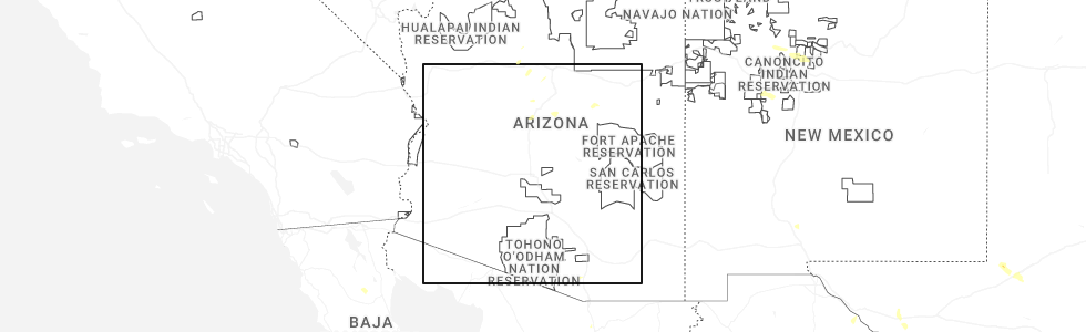
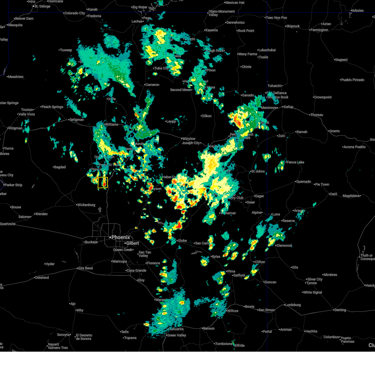
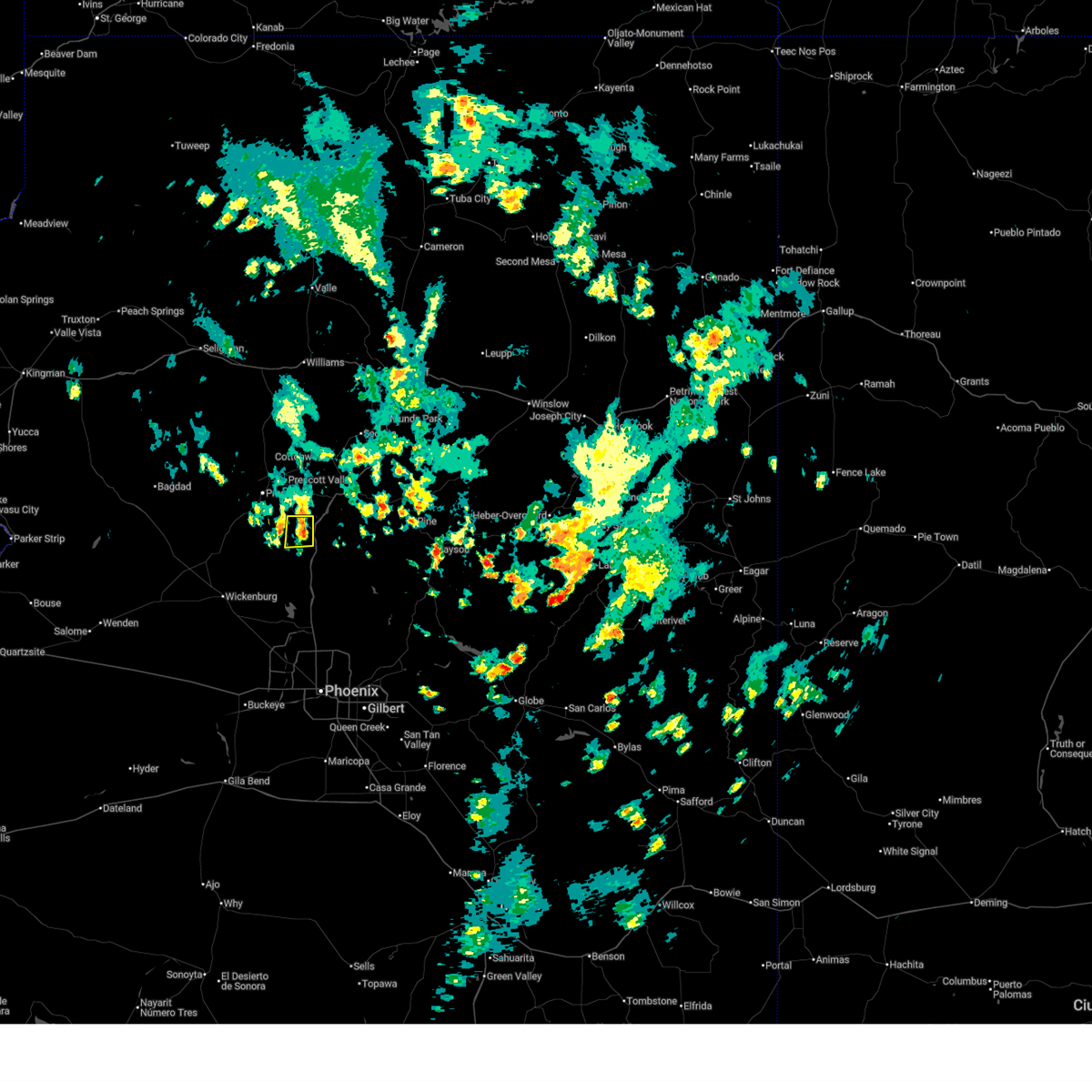
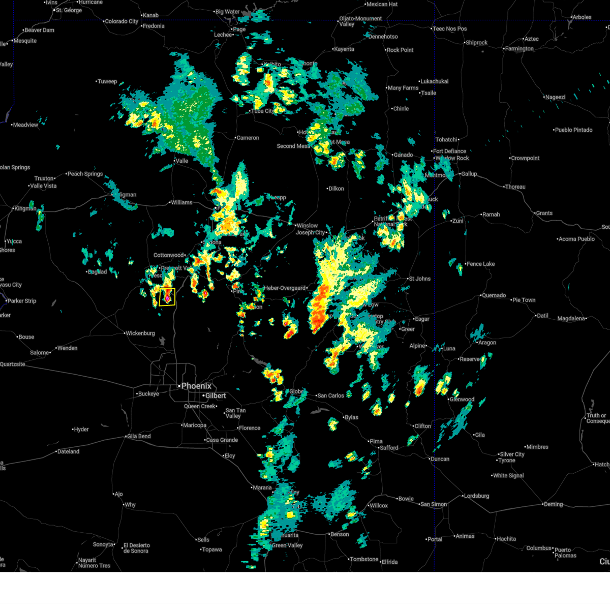
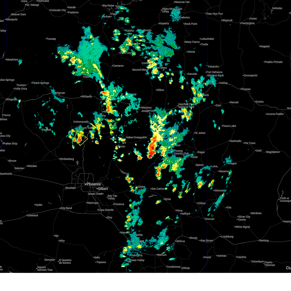
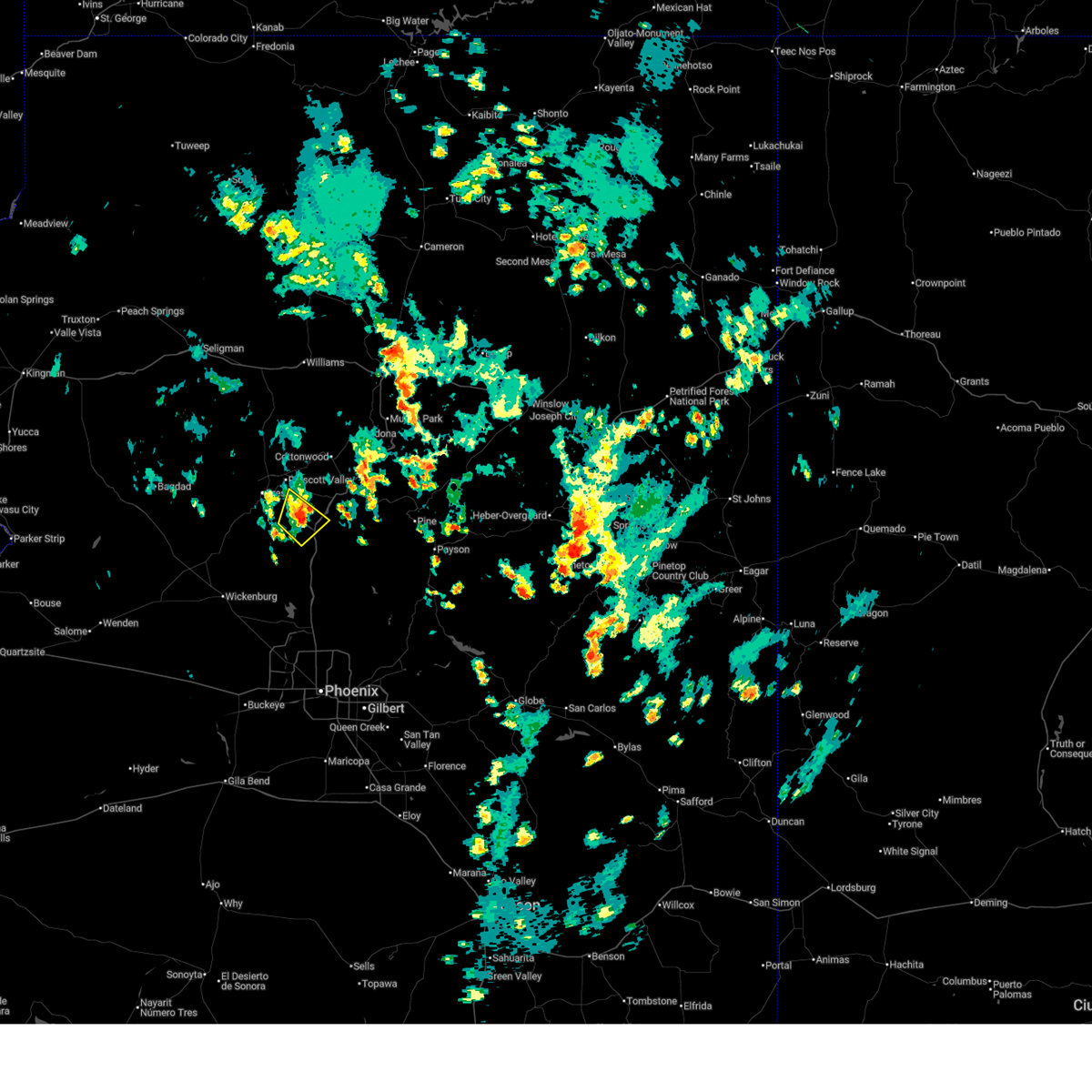
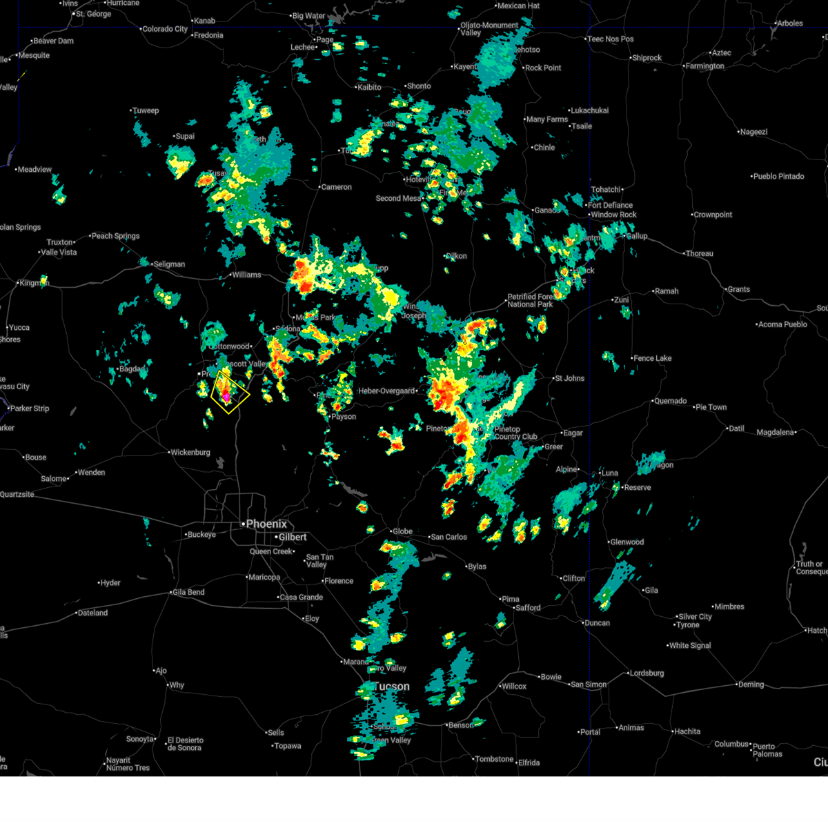
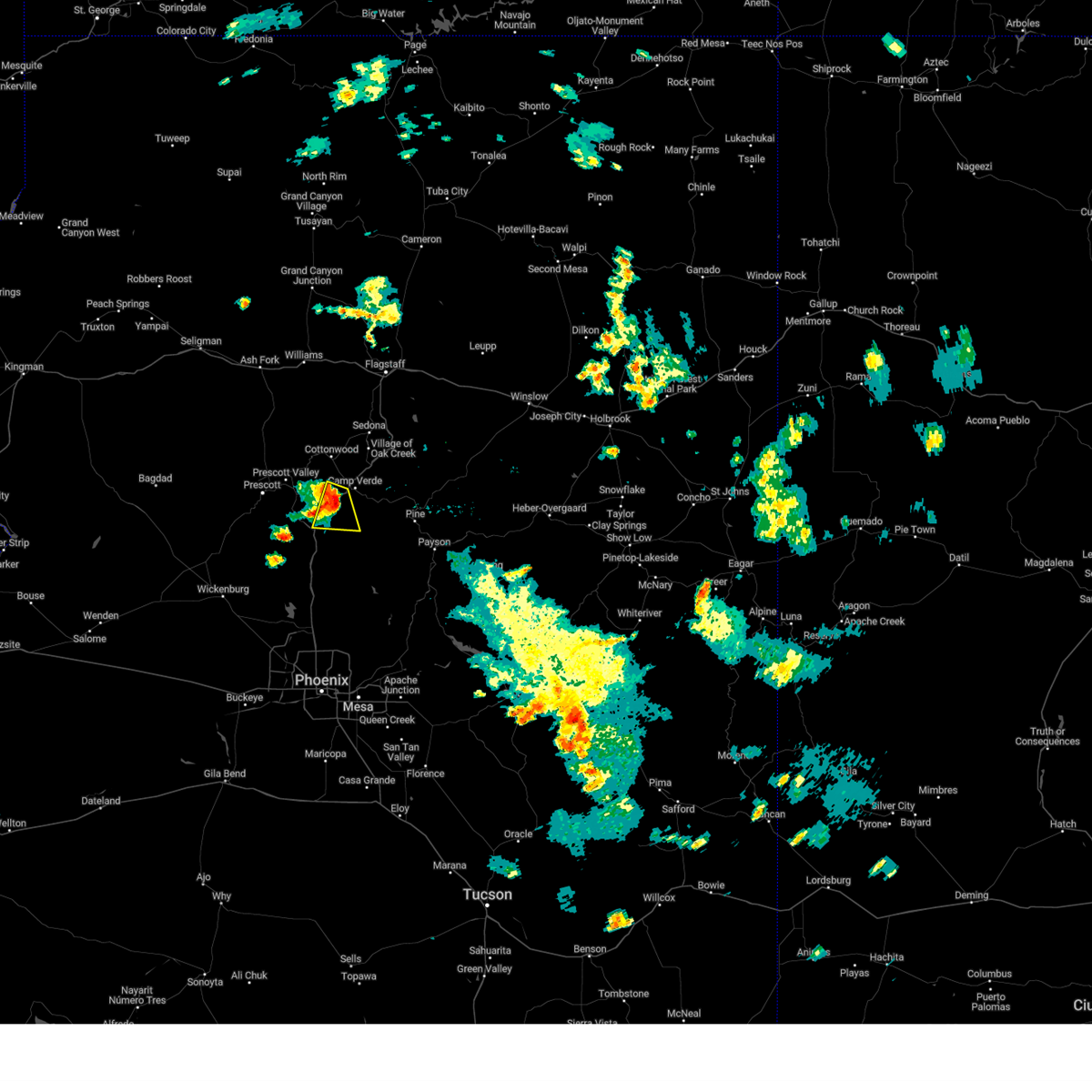
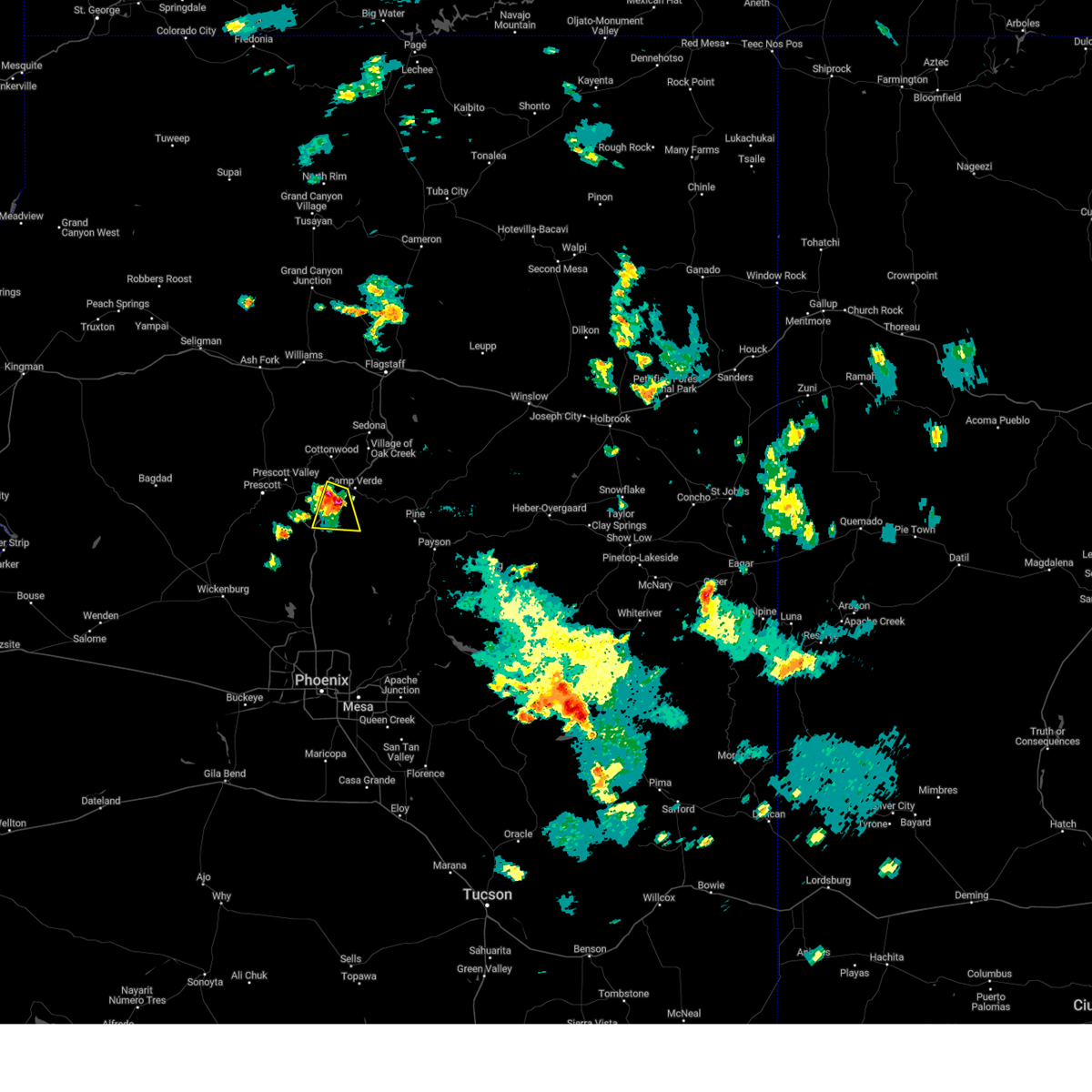
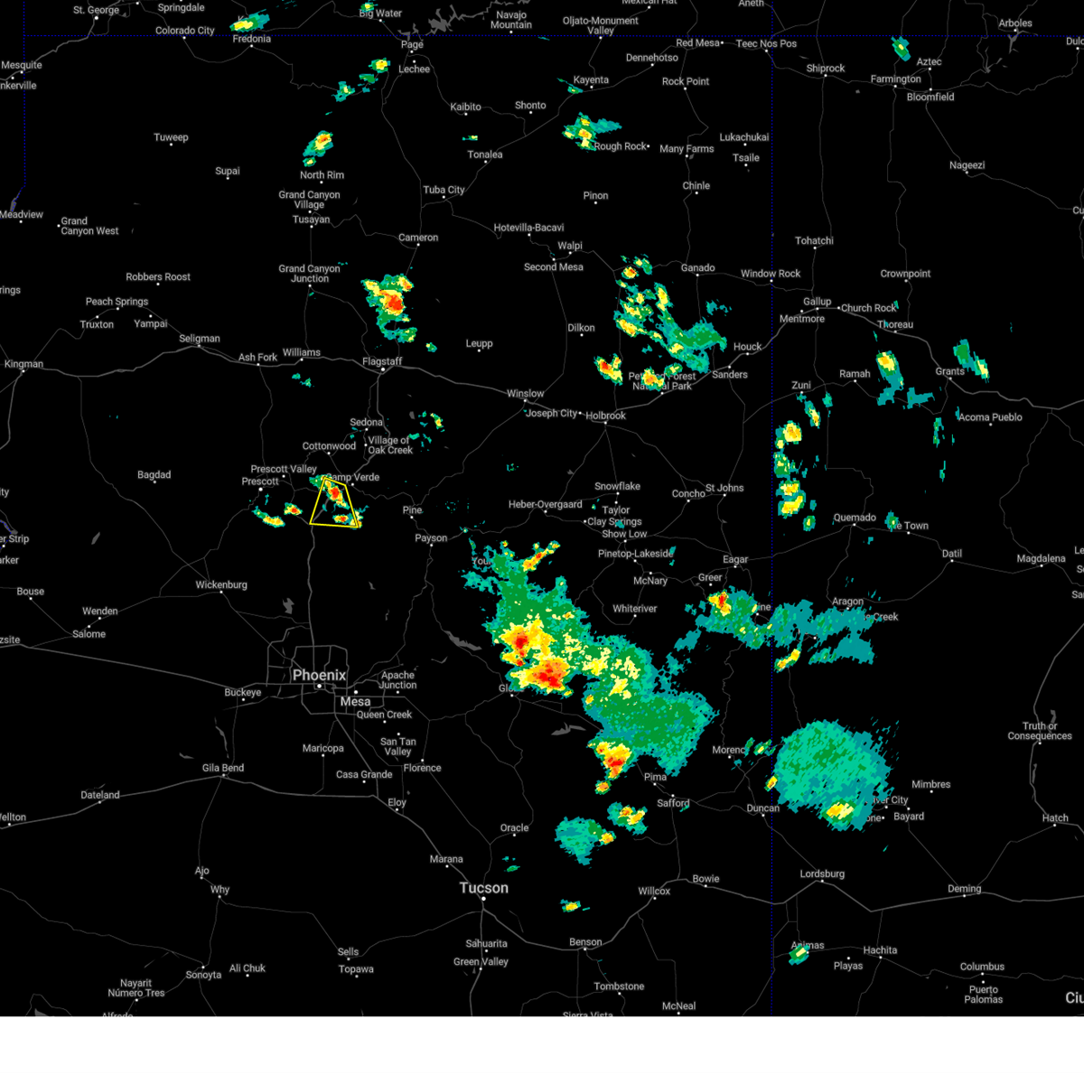
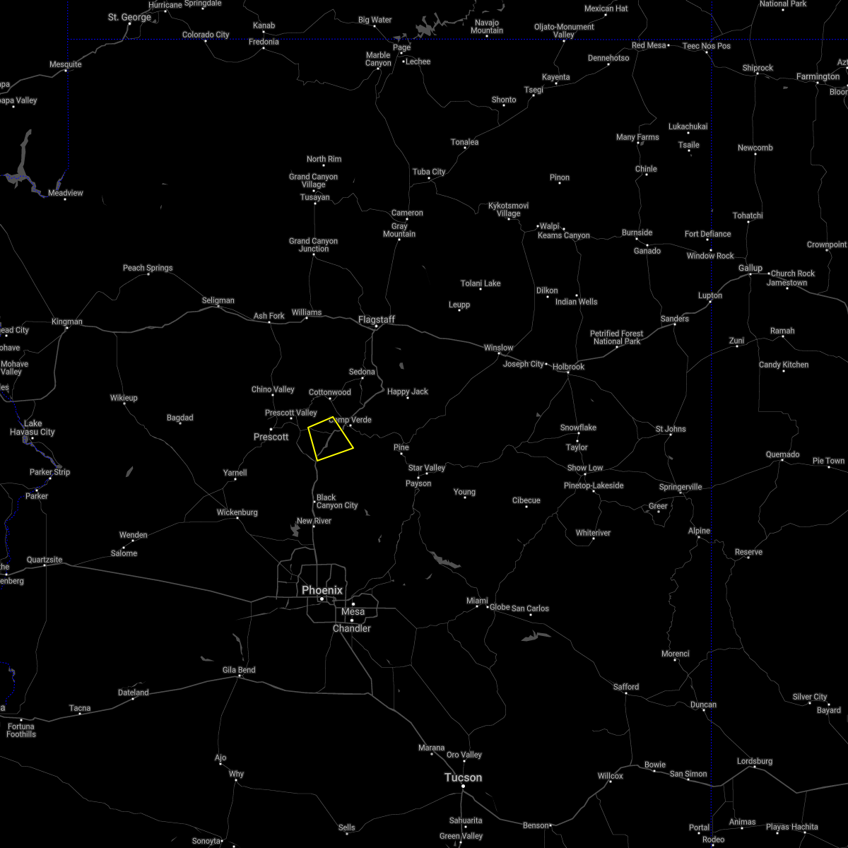
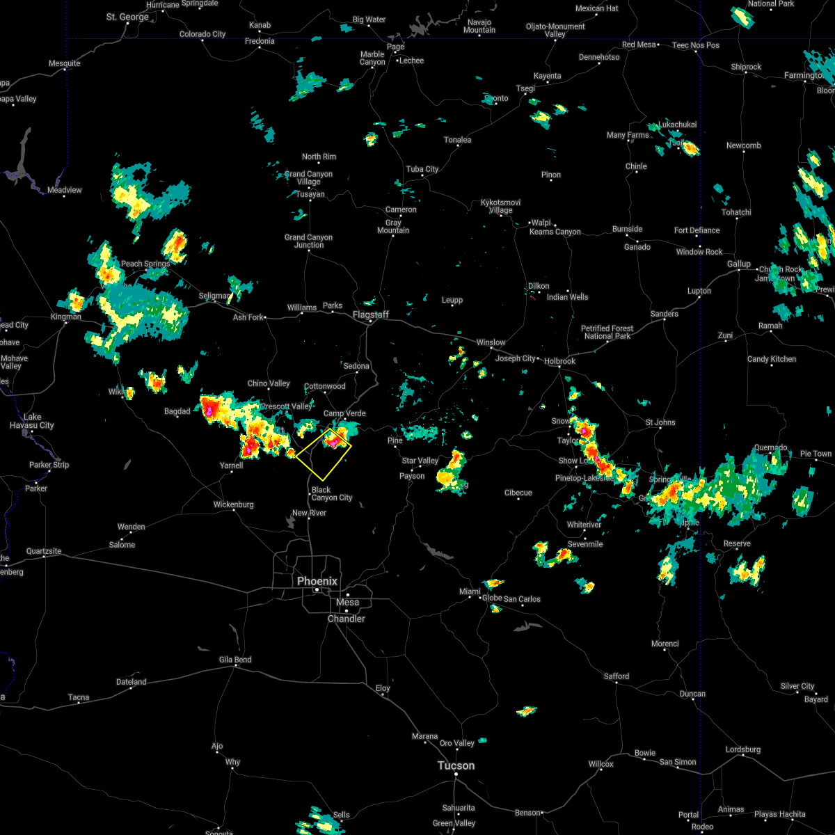
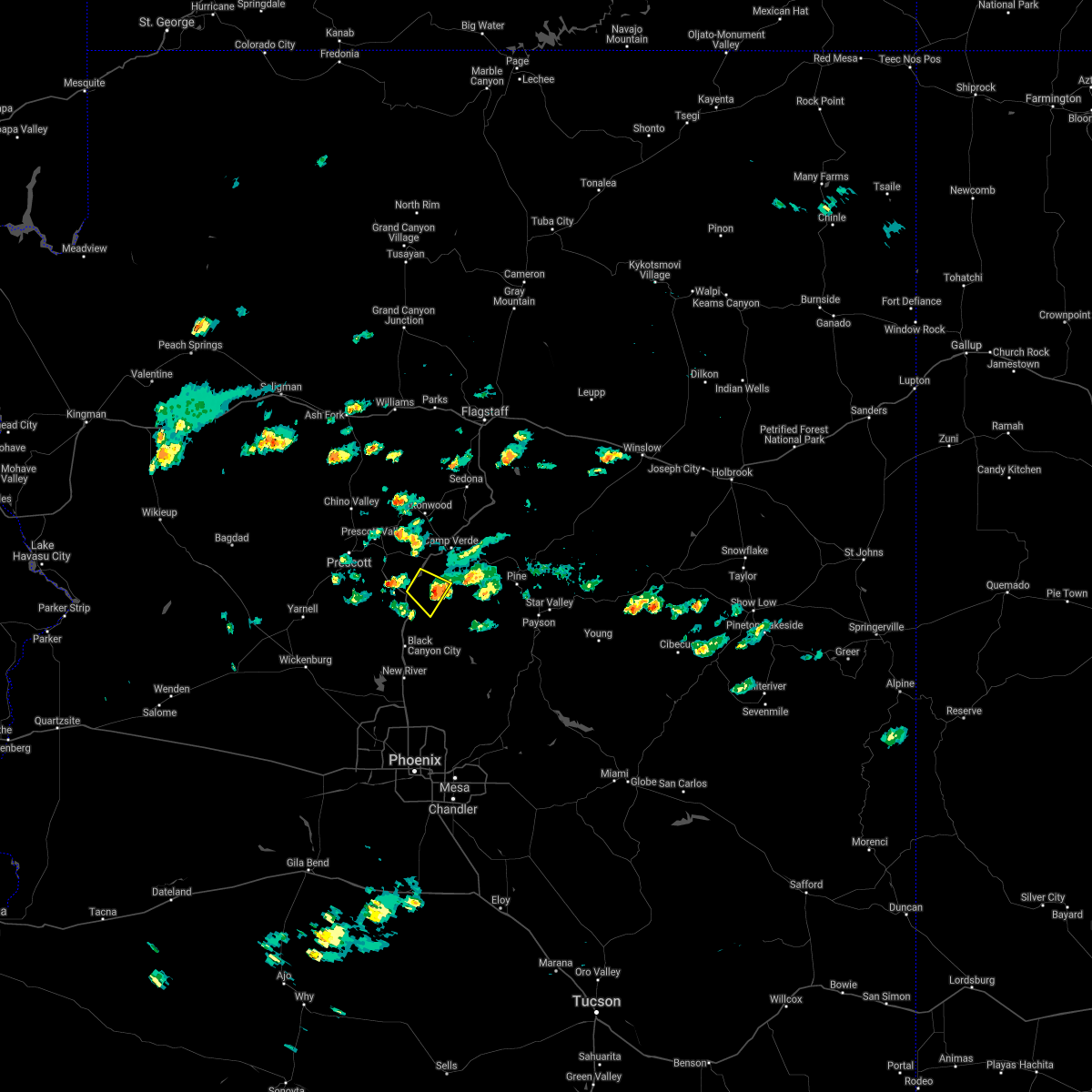
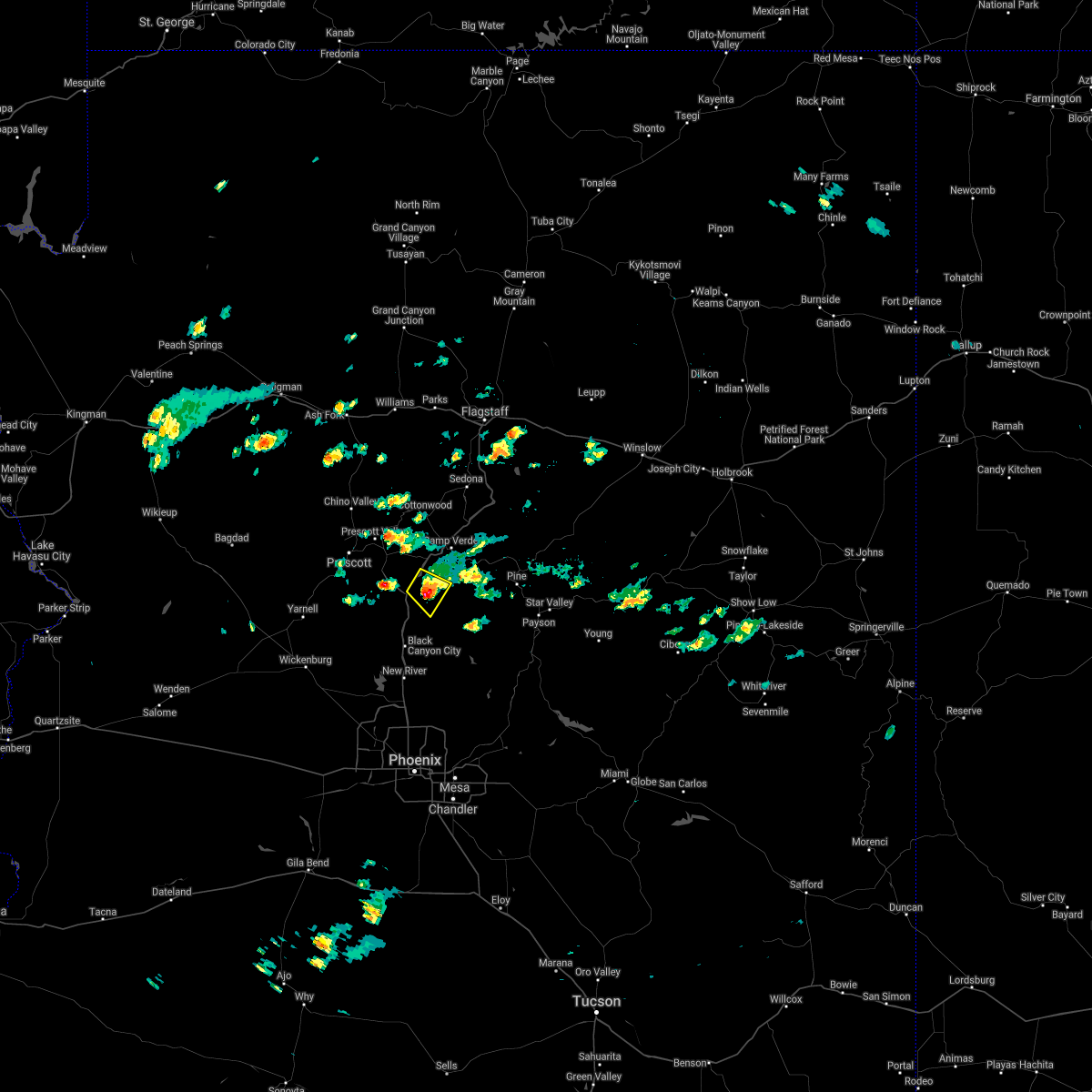
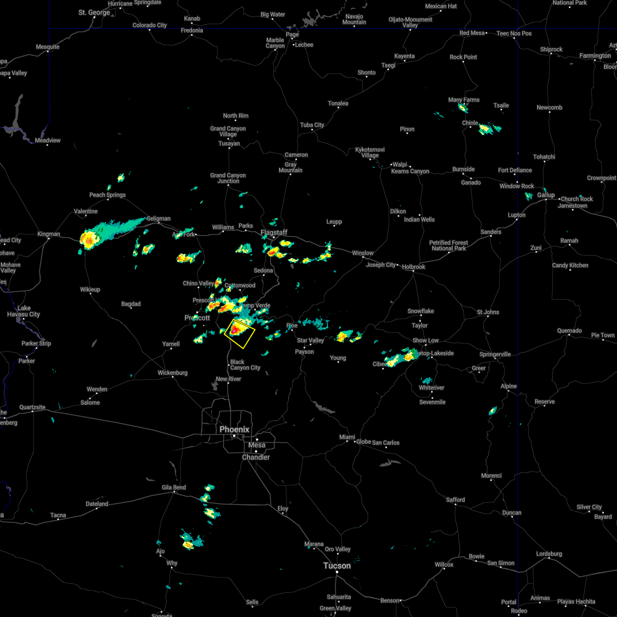
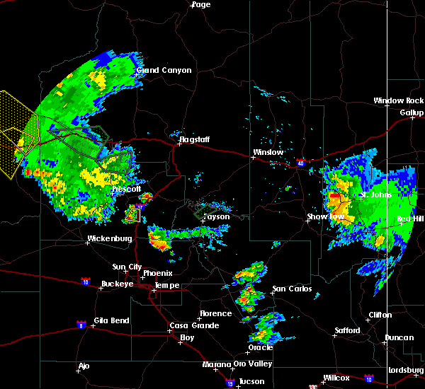
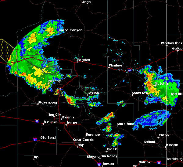
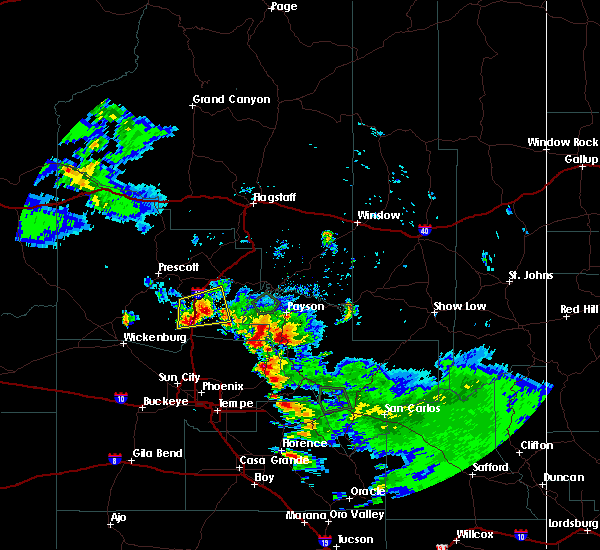
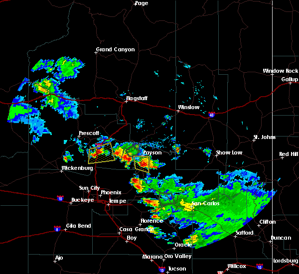
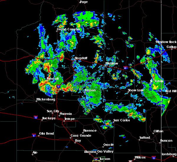
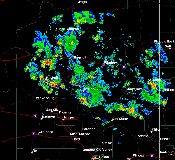
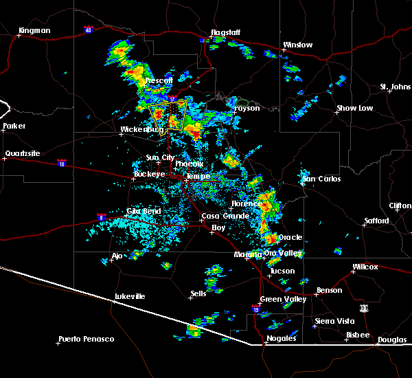
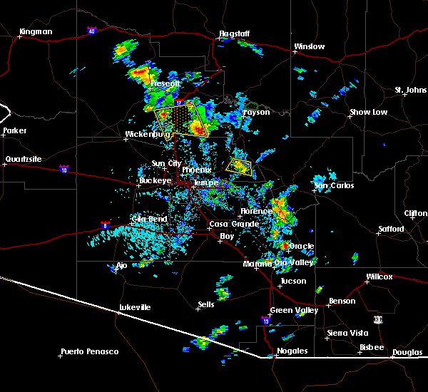
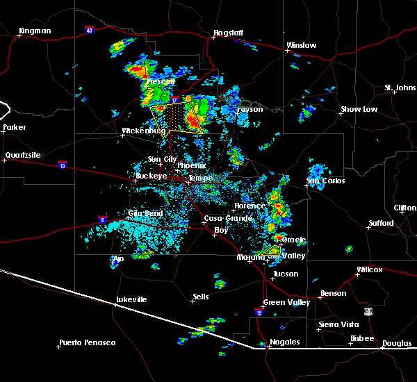
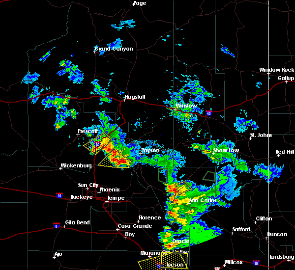
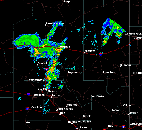
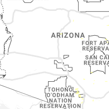
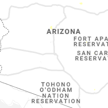
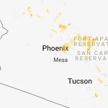
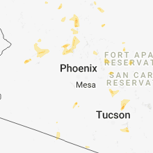
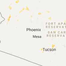
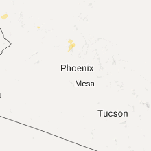
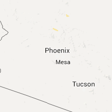
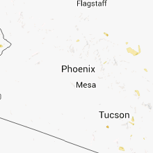
Hail Map for Spring Valley, AZ
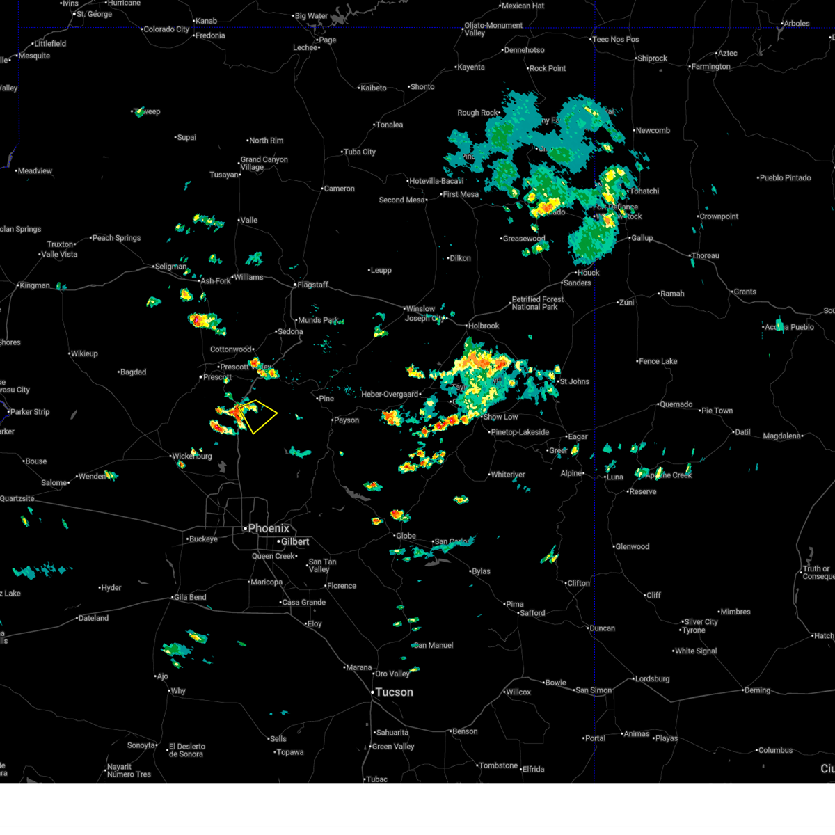
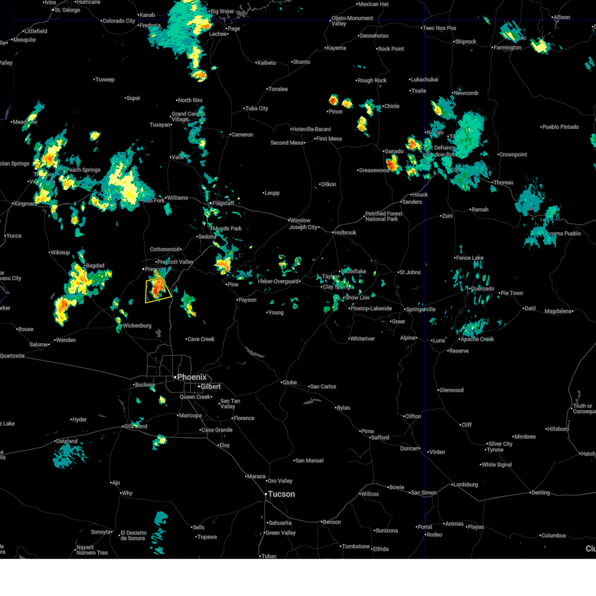
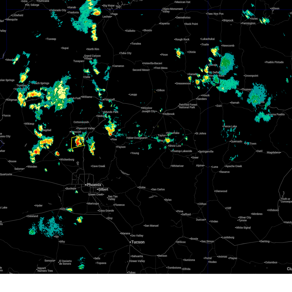
The Spring Valley, AZ area has had 0 reports of on-the-ground hail by trained spotters, and has been under severe weather warnings 6 times during the past 12 months. Doppler radar has detected hail at or near Spring Valley, AZ on 49 occasions, including 2 occasions during the past year.
| Name: | Spring Valley, AZ |
| Where Located: | 62.4 miles N of Phoenix, AZ |
| Map: | Google Map for Spring Valley, AZ |
| Population: | 1148 |
| Housing Units: | 629 |
| More Info: | Search Google for Spring Valley, AZ |
1
The Top Recent Hail Date for Spring Valley, AZ is Sunday, June 14, 2026 (17th out of 49)
Hail and Wind Damage Spotted near Spring Valley, AZ
| Date / Time | Report Details |
|---|---|
| 9/26/2025 4:46 AM MST | At 446 am mst, a severe thunderstorm was located 6 miles northeast of spring valley, or 17 miles southwest of camp verde, moving northeast along i-17 at 20 mph. this storm has weakened slightly, but may strengthen again and is still capable of producing severe hail (radar indicated). Hazards include quarter size hail. Damage to vehicles is expected. locations impacted include, flower pot, cordes lakes, spring valley, mayer, agua fria national monument, cedar mill, arcosanti, dugas, cordes junction and cedar bench wilderness. this includes the following highways, state route 69 between mile markers 263 and 268. Interstate 17 between mile markers 262 and 279. |
| 9/26/2025 4:31 AM MST | Svrfgz the national weather service in flagstaff has issued a * severe thunderstorm warning for, yavapai county in west central arizona, * until 500 am mst. * at 431 am mst, a severe thunderstorm was located over spring valley, or 19 miles southeast of prescott valley, moving northeast at 20 mph (radar indicated). Hazards include quarter size hail. damage to vehicles is expected |
| 9/6/2025 3:10 PM MST |
 the severe thunderstorm warning has been cancelled and is no longer in effect the severe thunderstorm warning has been cancelled and is no longer in effect
|
| 9/6/2025 2:45 PM MST |
 Svrfgz the national weather service in flagstaff has issued a * severe thunderstorm warning for, yavapai county in west central arizona, * until 330 pm mst. * at 244 pm mst, a severe thunderstorm was located near cordes lakes, or 20 miles southwest of camp verde, moving southeast at 15 mph (radar indicated). Hazards include 60 mph wind gusts and quarter size hail. Hail damage to vehicles is expected. Expect wind damage to roofs, siding, and trees. Svrfgz the national weather service in flagstaff has issued a * severe thunderstorm warning for, yavapai county in west central arizona, * until 330 pm mst. * at 244 pm mst, a severe thunderstorm was located near cordes lakes, or 20 miles southwest of camp verde, moving southeast at 15 mph (radar indicated). Hazards include 60 mph wind gusts and quarter size hail. Hail damage to vehicles is expected. Expect wind damage to roofs, siding, and trees.
|
| 8/24/2025 4:35 PM MST |
 The storm which prompted the warning has weakened below severe limits, and no longer poses an immediate threat to life or property. therefore, the warning will be allowed to expire. however, small hail, gusty winds, and heavy rain are still possible with this thunderstorm. The storm which prompted the warning has weakened below severe limits, and no longer poses an immediate threat to life or property. therefore, the warning will be allowed to expire. however, small hail, gusty winds, and heavy rain are still possible with this thunderstorm.
|
| 8/24/2025 4:17 PM MST |
 Svrfgz the national weather service in flagstaff has issued a * severe thunderstorm warning for, areas south of mayer yavapai county in west central arizona, * until 445 pm mst. * at 417 pm mst, a severe thunderstorm was located 8 miles north of horse thief basin, or 20 miles southeast of prescott. this storm was stationary (radar indicated). Hazards include 60 mph wind gusts and quarter size hail. Hail damage to vehicles is expected. Expect wind damage to roofs, siding, and trees. Svrfgz the national weather service in flagstaff has issued a * severe thunderstorm warning for, areas south of mayer yavapai county in west central arizona, * until 445 pm mst. * at 417 pm mst, a severe thunderstorm was located 8 miles north of horse thief basin, or 20 miles southeast of prescott. this storm was stationary (radar indicated). Hazards include 60 mph wind gusts and quarter size hail. Hail damage to vehicles is expected. Expect wind damage to roofs, siding, and trees.
|
| 7/2/2025 3:14 PM MST |
 The storm which prompted the warning has weakened below severe limits, and no longer poses an immediate threat to life or property. therefore, the warning will be allowed to expire. however, gusty winds and heavy rain are still possible with this thunderstorm. The storm which prompted the warning has weakened below severe limits, and no longer poses an immediate threat to life or property. therefore, the warning will be allowed to expire. however, gusty winds and heavy rain are still possible with this thunderstorm.
|
| 7/2/2025 2:59 PM MST |
 At 259 pm mst, a severe thunderstorm was located near spring valley, or 21 miles south of prescott valley. this storm was stationary (radar indicated). Hazards include 60 mph wind gusts and small hail. Expect damage to roofs, siding, and trees. locations impacted include, spring valley, mayer, cordes lakes, cleator and castle creek wilderness. This includes state route 69 between mile markers 264 and 271. At 259 pm mst, a severe thunderstorm was located near spring valley, or 21 miles south of prescott valley. this storm was stationary (radar indicated). Hazards include 60 mph wind gusts and small hail. Expect damage to roofs, siding, and trees. locations impacted include, spring valley, mayer, cordes lakes, cleator and castle creek wilderness. This includes state route 69 between mile markers 264 and 271.
|
| 7/2/2025 2:34 PM MST |
 Svrfgz the national weather service in flagstaff has issued a * severe thunderstorm warning for, yavapai county in west central arizona, * until 315 pm mst. * at 234 pm mst, a severe thunderstorm was located near spring valley, or 21 miles south of prescott valley. this storm was stationary (radar indicated). Hazards include 60 mph wind gusts and quarter size hail. Hail damage to vehicles is expected. Expect wind damage to roofs, siding, and trees. Svrfgz the national weather service in flagstaff has issued a * severe thunderstorm warning for, yavapai county in west central arizona, * until 315 pm mst. * at 234 pm mst, a severe thunderstorm was located near spring valley, or 21 miles south of prescott valley. this storm was stationary (radar indicated). Hazards include 60 mph wind gusts and quarter size hail. Hail damage to vehicles is expected. Expect wind damage to roofs, siding, and trees.
|
| 7/2/2025 2:27 PM MST |
 The storm which prompted the warning has weakened below severe limits, and no longer poses an immediate threat to life or property. therefore, the warning will be allowed to expire. however, gusty winds and heavy rain are still possible with this thunderstorm. The storm which prompted the warning has weakened below severe limits, and no longer poses an immediate threat to life or property. therefore, the warning will be allowed to expire. however, gusty winds and heavy rain are still possible with this thunderstorm.
|
| 7/2/2025 2:14 PM MST |
 At 214 pm mst, a severe thunderstorm was located over mayer, or 16 miles southeast of prescott valley. this storm was stationary (radar indicated). Hazards include 60 mph wind gusts and small hail. Expect damage to roofs, siding, and trees. locations impacted include, prescott valley, dewey-humboldt, mayer, spring valley, cordes lakes, agua fria national monument, poland junction, cordes junction, cleator and arcosanti. this includes the following highways, state route 69 between mile markers 263 and 281. Interstate 17 between mile markers 262 and 269. At 214 pm mst, a severe thunderstorm was located over mayer, or 16 miles southeast of prescott valley. this storm was stationary (radar indicated). Hazards include 60 mph wind gusts and small hail. Expect damage to roofs, siding, and trees. locations impacted include, prescott valley, dewey-humboldt, mayer, spring valley, cordes lakes, agua fria national monument, poland junction, cordes junction, cleator and arcosanti. this includes the following highways, state route 69 between mile markers 263 and 281. Interstate 17 between mile markers 262 and 269.
|
| 7/2/2025 1:59 PM MST |
 Svrfgz the national weather service in flagstaff has issued a * severe thunderstorm warning for, yavapai county in west central arizona, * until 230 pm mst. * at 159 pm mst, a severe thunderstorm was located near mayer, or 18 miles south of prescott valley. this storm was stationary (radar indicated). Hazards include 60 mph wind gusts and quarter size hail. Hail damage to vehicles is expected. Expect wind damage to roofs, siding, and trees. Svrfgz the national weather service in flagstaff has issued a * severe thunderstorm warning for, yavapai county in west central arizona, * until 230 pm mst. * at 159 pm mst, a severe thunderstorm was located near mayer, or 18 miles south of prescott valley. this storm was stationary (radar indicated). Hazards include 60 mph wind gusts and quarter size hail. Hail damage to vehicles is expected. Expect wind damage to roofs, siding, and trees.
|
| 8/7/2024 4:40 PM MST |
 The storm which prompted the warning has weakened below severe limits, and no longer poses an immediate threat to life or property. therefore, the warning will be allowed to expire. however, heavy rain is still possible with this thunderstorm. The storm which prompted the warning has weakened below severe limits, and no longer poses an immediate threat to life or property. therefore, the warning will be allowed to expire. however, heavy rain is still possible with this thunderstorm.
|
| 8/7/2024 4:25 PM MST |
 At 424 pm mst, a severe thunderstorm was located over interstate 17 about 10 miles southwest of camp verde, moving south at 5 mph (radar indicated). Hazards include 60 mph wind gusts and quarter size hail. Hail damage to vehicles is expected. expect wind damage to roofs, siding, and trees. locations impacted include, flower pot, cedar mill, cherry, dugas, and cedar bench wilderness. This includes interstate 17 between mile markers 264 and 285. At 424 pm mst, a severe thunderstorm was located over interstate 17 about 10 miles southwest of camp verde, moving south at 5 mph (radar indicated). Hazards include 60 mph wind gusts and quarter size hail. Hail damage to vehicles is expected. expect wind damage to roofs, siding, and trees. locations impacted include, flower pot, cedar mill, cherry, dugas, and cedar bench wilderness. This includes interstate 17 between mile markers 264 and 285.
|
| 8/7/2024 4:00 PM MST |
 Svrfgz the national weather service in flagstaff has issued a * severe thunderstorm warning for, yavapai county in west central arizona, * until 445 pm mst. * at 400 pm mst, a severe thunderstorm was located over interstate 17 about 8 miles southwest of camp verde, moving south at 5 mph (radar indicated). Hazards include 60 mph wind gusts and quarter size hail. Hail damage to vehicles is expected. Expect wind damage to roofs, siding, and trees. Svrfgz the national weather service in flagstaff has issued a * severe thunderstorm warning for, yavapai county in west central arizona, * until 445 pm mst. * at 400 pm mst, a severe thunderstorm was located over interstate 17 about 8 miles southwest of camp verde, moving south at 5 mph (radar indicated). Hazards include 60 mph wind gusts and quarter size hail. Hail damage to vehicles is expected. Expect wind damage to roofs, siding, and trees.
|
| 7/25/2024 4:43 PM MST |
 The storm which prompted the warning has weakened below severe limits, and no longer poses an immediate threat to life or property. therefore, the warning will be allowed to expire. however, gusty winds and heavy rain are still possible with this thunderstorm. The storm which prompted the warning has weakened below severe limits, and no longer poses an immediate threat to life or property. therefore, the warning will be allowed to expire. however, gusty winds and heavy rain are still possible with this thunderstorm.
|
| 7/25/2024 4:33 PM MST |
 At 433 pm mst, a severe thunderstorm was located 7 miles southwest of flower pot, or 14 miles southwest of camp verde, moving southeast at 20 mph (radar indicated). Hazards include 60 mph wind gusts and penny size hail. Expect damage to roofs, siding, and trees. locations impacted include, bullpen day use area, verde lakes, cordes junction, camp verde, cordes lakes, arcosanti, cherry, montezuma airport, rockin' river ranch state park, cedar bench wilderness, out of africa wildlife park, spring valley, cedar mill, fort verde state historic park, mountain view estates, middle verde, flower pot, dugas, mayer, and montezuma castle national monument. this includes the following highways, interstate 17 between mile markers 257 and 290. state route 260 between mile markers 212 and 236. State route 69 between mile markers 263 and 270. At 433 pm mst, a severe thunderstorm was located 7 miles southwest of flower pot, or 14 miles southwest of camp verde, moving southeast at 20 mph (radar indicated). Hazards include 60 mph wind gusts and penny size hail. Expect damage to roofs, siding, and trees. locations impacted include, bullpen day use area, verde lakes, cordes junction, camp verde, cordes lakes, arcosanti, cherry, montezuma airport, rockin' river ranch state park, cedar bench wilderness, out of africa wildlife park, spring valley, cedar mill, fort verde state historic park, mountain view estates, middle verde, flower pot, dugas, mayer, and montezuma castle national monument. this includes the following highways, interstate 17 between mile markers 257 and 290. state route 260 between mile markers 212 and 236. State route 69 between mile markers 263 and 270.
|
| 7/25/2024 4:16 PM MST |
 Svrfgz the national weather service in flagstaff has issued a * severe thunderstorm warning for, yavapai county from nea cherry to cordes junction in west central arizona, * until 445 pm mst. * at 415 pm mst, a severe thunderstorm was located near flower pot, or 8 miles west of camp verde, moving southeast at 20 mph (radar indicated). Hazards include 60 mph wind gusts and penny size hail. expect damage to roofs, siding, and trees Svrfgz the national weather service in flagstaff has issued a * severe thunderstorm warning for, yavapai county from nea cherry to cordes junction in west central arizona, * until 445 pm mst. * at 415 pm mst, a severe thunderstorm was located near flower pot, or 8 miles west of camp verde, moving southeast at 20 mph (radar indicated). Hazards include 60 mph wind gusts and penny size hail. expect damage to roofs, siding, and trees
|
| 7/21/2024 2:35 PM MST |
 Svrfgz the national weather service in flagstaff has issued a * severe thunderstorm warning for, yavapai county in west central arizona from cordes junction to bumble bee, * until 300 pm mst. * at 234 pm mst, a severe thunderstorm was located near spring valley, or 20 miles south of prescott valley, moving south at 10 mph (radar indicated). Hazards include 60 mph wind gusts and penny size hail. expect damage to roofs, siding, and trees Svrfgz the national weather service in flagstaff has issued a * severe thunderstorm warning for, yavapai county in west central arizona from cordes junction to bumble bee, * until 300 pm mst. * at 234 pm mst, a severe thunderstorm was located near spring valley, or 20 miles south of prescott valley, moving south at 10 mph (radar indicated). Hazards include 60 mph wind gusts and penny size hail. expect damage to roofs, siding, and trees
|
| 9/2/2022 5:32 PM MST |
 At 531 pm mst, severe thunderstorms were located along a line extending from near mayer to near crown king, moving west at 30 mph (radar indicated). Hazards include 70 mph wind gusts and half dollar size hail. Hail damage to vehicles is expected. expect considerable tree damage. wind damage is also likely to mobile homes, roofs, and outbuildings. locations impacted include, ponderosa park, crown king, groom creek subdivision, mayer, walker, poland junction, turney gulch group campground, lower wolf creek campground, upper wolf creek group campground and hazlett hollow campground. this includes the following highways, state route 89 between mile markers 302 and 305. state route 69 between mile markers 267 and 276. thunderstorm damage threat, considerable hail threat, radar indicated max hail size, 1. 25 in wind threat, radar indicated max wind gust, 70 mph. At 531 pm mst, severe thunderstorms were located along a line extending from near mayer to near crown king, moving west at 30 mph (radar indicated). Hazards include 70 mph wind gusts and half dollar size hail. Hail damage to vehicles is expected. expect considerable tree damage. wind damage is also likely to mobile homes, roofs, and outbuildings. locations impacted include, ponderosa park, crown king, groom creek subdivision, mayer, walker, poland junction, turney gulch group campground, lower wolf creek campground, upper wolf creek group campground and hazlett hollow campground. this includes the following highways, state route 89 between mile markers 302 and 305. state route 69 between mile markers 267 and 276. thunderstorm damage threat, considerable hail threat, radar indicated max hail size, 1. 25 in wind threat, radar indicated max wind gust, 70 mph.
|
| 9/2/2022 5:17 PM MST |
 At 517 pm mst, severe thunderstorms were located along a line extending from mayer to near crown king, moving west at 30 mph (radar indicated). Hazards include 60 mph wind gusts and quarter size hail. Hail damage to vehicles is expected. Expect wind damage to roofs, siding, and trees. At 517 pm mst, severe thunderstorms were located along a line extending from mayer to near crown king, moving west at 30 mph (radar indicated). Hazards include 60 mph wind gusts and quarter size hail. Hail damage to vehicles is expected. Expect wind damage to roofs, siding, and trees.
|
| 9/2/2022 4:48 PM MST |
 At 446 pm mst, severe thunderstorms were located along a line extending from 7 miles northeast of cordes junction to 8 miles northwest of camp creek, moving west at 25 mph (radar indicated). Hazards include 70 mph wind gusts and dime to half dollar size hail. Hail damage to vehicles is expected. expect considerable tree damage. wind damage is also likely to mobile homes, roofs, and outbuildings. locations impacted include, cordes junction, bumble bee, cordes lakes, black canyon city, rock springs, cordes and spring valley. this includes the following highways, interstate 17 between mile markers 242 and 271. state route 69 between mile markers 263 and 269. thunderstorm damage threat, considerable hail threat, radar indicated max hail size, 1. 25 in wind threat, radar indicated max wind gust, 70 mph. At 446 pm mst, severe thunderstorms were located along a line extending from 7 miles northeast of cordes junction to 8 miles northwest of camp creek, moving west at 25 mph (radar indicated). Hazards include 70 mph wind gusts and dime to half dollar size hail. Hail damage to vehicles is expected. expect considerable tree damage. wind damage is also likely to mobile homes, roofs, and outbuildings. locations impacted include, cordes junction, bumble bee, cordes lakes, black canyon city, rock springs, cordes and spring valley. this includes the following highways, interstate 17 between mile markers 242 and 271. state route 69 between mile markers 263 and 269. thunderstorm damage threat, considerable hail threat, radar indicated max hail size, 1. 25 in wind threat, radar indicated max wind gust, 70 mph.
|
| 9/2/2022 4:28 PM MST |
 At 427 pm mst, severe thunderstorms were located along a line extending from 12 miles northeast of cordes junction to near horseshoe reservoir, moving west at 25 mph (radar indicated). Hazards include 60 mph wind gusts and quarter size hail. Hail damage to vehicles is expected. Expect wind damage to roofs, siding, and trees. At 427 pm mst, severe thunderstorms were located along a line extending from 12 miles northeast of cordes junction to near horseshoe reservoir, moving west at 25 mph (radar indicated). Hazards include 60 mph wind gusts and quarter size hail. Hail damage to vehicles is expected. Expect wind damage to roofs, siding, and trees.
|
| 8/28/2022 1:48 PM MST | At 147 pm mst, a severe thunderstorm was located near bumble bee, or 9 miles north of new river, moving southeast at 20 mph (radar indicated). Hazards include 60 mph wind gusts and quarter size hail. Hail damage to vehicles is expected. Expect wind damage to roofs, siding, and trees. |
| 8/21/2022 4:41 PM MST |
 At 440 pm mst, a severe thunderstorm was located near dewey- humboldt, or 11 miles southeast of prescott valley, moving south at 10 mph (radar indicated). Hazards include 60 mph wind gusts, quarter size hail, and heavy rainfall. Hail damage to vehicles is expected. Expect wind damage to roofs, siding, and trees. At 440 pm mst, a severe thunderstorm was located near dewey- humboldt, or 11 miles southeast of prescott valley, moving south at 10 mph (radar indicated). Hazards include 60 mph wind gusts, quarter size hail, and heavy rainfall. Hail damage to vehicles is expected. Expect wind damage to roofs, siding, and trees.
|
| 7/20/2022 4:43 PM MST |
 The severe thunderstorm warning for yavapai county will expire at 445 pm mst, the storm which prompted the warning near cordes has weakened below severe limits, and no longer poses an immediate threat to life or property. therefore, the warning will be allowed to expire. a wind gust to 58 mph was recorded in spring valley at 415 pm. The severe thunderstorm warning for yavapai county will expire at 445 pm mst, the storm which prompted the warning near cordes has weakened below severe limits, and no longer poses an immediate threat to life or property. therefore, the warning will be allowed to expire. a wind gust to 58 mph was recorded in spring valley at 415 pm.
|
| 7/20/2022 4:23 PM MST |
 At 422 pm mst, a severe thunderstorm was located over cordes junction, or 22 miles southeast of prescott valley, moving south at 5 mph (radar indicated). Hazards include 60 mph wind gusts. Expect damage to roofs, siding, and trees. locations impacted include, cordes junction, cordes lakes, cordes and spring valley. hail threat, radar indicated max hail size, <. 75 in wind threat, radar indicated max wind gust, 60 mph. At 422 pm mst, a severe thunderstorm was located over cordes junction, or 22 miles southeast of prescott valley, moving south at 5 mph (radar indicated). Hazards include 60 mph wind gusts. Expect damage to roofs, siding, and trees. locations impacted include, cordes junction, cordes lakes, cordes and spring valley. hail threat, radar indicated max hail size, <. 75 in wind threat, radar indicated max wind gust, 60 mph.
|
| 7/20/2022 4:02 PM MST |
 At 401 pm mst, a severe thunderstorm was located over spring valley, or 21 miles southeast of prescott valley, moving south at 10 mph (radar indicated). Hazards include 60 mph wind gusts and quarter size hail. Hail damage to vehicles is expected. Expect wind damage to roofs, siding, and trees. At 401 pm mst, a severe thunderstorm was located over spring valley, or 21 miles southeast of prescott valley, moving south at 10 mph (radar indicated). Hazards include 60 mph wind gusts and quarter size hail. Hail damage to vehicles is expected. Expect wind damage to roofs, siding, and trees.
|
| 8/28/2021 3:34 PM MST |
 At 334 pm mst, a severe thunderstorm was located over mayer, or 17 miles southeast of prescott valley, and is nearly stationary (radar indicated). Hazards include 60 mph wind gusts and quarter size hail. Hail damage to vehicles is expected. Expect wind damage to roofs, siding, and trees. At 334 pm mst, a severe thunderstorm was located over mayer, or 17 miles southeast of prescott valley, and is nearly stationary (radar indicated). Hazards include 60 mph wind gusts and quarter size hail. Hail damage to vehicles is expected. Expect wind damage to roofs, siding, and trees.
|
| 8/13/2021 8:51 PM MST |
 At 850 pm mst, a severe thunderstorm was located over spring valley, or 22 miles southeast of prescott valley, moving west at 30 mph (radar indicated). Hazards include 60 mph wind gusts. half dollar size hail in the area of cordes junction. Hail damage to vehicles is expected. expect wind damage to roofs, siding, and trees. locations impacted include, camp verde, cordes junction, bumble bee, cordes lakes, black canyon city, rock springs, cordes, spring valley, childs power plant and clear creek campgrounds. hail threat, radar indicated max hail size, 1. 25 in wind threat, radar indicated max wind gust, 60 mph. At 850 pm mst, a severe thunderstorm was located over spring valley, or 22 miles southeast of prescott valley, moving west at 30 mph (radar indicated). Hazards include 60 mph wind gusts. half dollar size hail in the area of cordes junction. Hail damage to vehicles is expected. expect wind damage to roofs, siding, and trees. locations impacted include, camp verde, cordes junction, bumble bee, cordes lakes, black canyon city, rock springs, cordes, spring valley, childs power plant and clear creek campgrounds. hail threat, radar indicated max hail size, 1. 25 in wind threat, radar indicated max wind gust, 60 mph.
|
| 8/13/2021 8:38 PM MST |
 At 838 pm mst, a severe thunderstorm was located near cordes lakes, or 18 miles southwest of camp verde, moving west at 25 mph (radar indicated). Hazards include 60 mph wind gusts. expect damage to roofs, siding, and trees At 838 pm mst, a severe thunderstorm was located near cordes lakes, or 18 miles southwest of camp verde, moving west at 25 mph (radar indicated). Hazards include 60 mph wind gusts. expect damage to roofs, siding, and trees
|
| 8/10/2021 2:26 PM MST |
 At 226 pm mst, a severe thunderstorm was located near cherry, or 10 miles west of camp verde, moving south at 10 mph (radar indicated). Hazards include 60 mph wind gusts and quarter size hail. Hail damage to vehicles is expected. Expect wind damage to roofs, siding, and trees. At 226 pm mst, a severe thunderstorm was located near cherry, or 10 miles west of camp verde, moving south at 10 mph (radar indicated). Hazards include 60 mph wind gusts and quarter size hail. Hail damage to vehicles is expected. Expect wind damage to roofs, siding, and trees.
|
| 7/9/2021 5:00 PM MST |
 At 459 pm mst, a severe thunderstorm was located 10 miles south of camp verde, moving southwest at 15 mph (radar indicated). Hazards include 70 mph wind gusts and quarter size hail. Hail damage to vehicles is expected. expect considerable tree damage. Wind damage is also likely to mobile homes, roofs, and outbuildings. At 459 pm mst, a severe thunderstorm was located 10 miles south of camp verde, moving southwest at 15 mph (radar indicated). Hazards include 70 mph wind gusts and quarter size hail. Hail damage to vehicles is expected. expect considerable tree damage. Wind damage is also likely to mobile homes, roofs, and outbuildings.
|
| 7/8/2021 5:28 PM MST |
 At 526 pm mst, a severe thunderstorm was located over mayer, or 14 miles southeast of prescott valley, moving south at 10 mph (radar indicated). Hazards include 60 mph wind gusts and quarter size hail. Hail damage to vehicles is expected. Expect wind damage to roofs, siding, and trees. At 526 pm mst, a severe thunderstorm was located over mayer, or 14 miles southeast of prescott valley, moving south at 10 mph (radar indicated). Hazards include 60 mph wind gusts and quarter size hail. Hail damage to vehicles is expected. Expect wind damage to roofs, siding, and trees.
|
| 8/30/2020 1:41 PM MST |
 The severe thunderstorm warning for yavapai county will expire at 145 pm mst, the storm which prompted the warning has weakened below severe limits, and no longer poses an immediate threat to life or property. therefore, the warning will be allowed to expire. however gusty winds and heavy rain are still likely with this thunderstorm. The severe thunderstorm warning for yavapai county will expire at 145 pm mst, the storm which prompted the warning has weakened below severe limits, and no longer poses an immediate threat to life or property. therefore, the warning will be allowed to expire. however gusty winds and heavy rain are still likely with this thunderstorm.
|
| 8/30/2020 1:29 PM MST |
 At 128 pm mst, a severe thunderstorm was located near cordes lakes, or 17 miles southwest of camp verde, moving southeast at 15 mph (radar indicated). Hazards include 60 mph wind gusts and penny size hail. Expect damage to roofs, siding, and trees. This severe thunderstorm will remain over mainly rural areas of yavapai county. At 128 pm mst, a severe thunderstorm was located near cordes lakes, or 17 miles southwest of camp verde, moving southeast at 15 mph (radar indicated). Hazards include 60 mph wind gusts and penny size hail. Expect damage to roofs, siding, and trees. This severe thunderstorm will remain over mainly rural areas of yavapai county.
|
| 8/30/2020 1:13 PM MST |
 At 113 pm mst, a severe thunderstorm was located near cordes junction, or 18 miles southwest of camp verde, moving southeast at 15 mph (radar indicated). Hazards include 60 mph wind gusts and penny size hail. expect damage to roofs, siding, and trees At 113 pm mst, a severe thunderstorm was located near cordes junction, or 18 miles southwest of camp verde, moving southeast at 15 mph (radar indicated). Hazards include 60 mph wind gusts and penny size hail. expect damage to roofs, siding, and trees
|
| 8/30/2020 12:57 PM MST |
 At 1256 pm mst, a severe thunderstorm was located near spring valley, or 18 miles southwest of camp verde, moving southeast at 10 mph (radar indicated). Hazards include 60 mph wind gusts and penny size hail. Expect damage to roofs, siding, and trees. Locations impacted include, cordes junction and spring valley. At 1256 pm mst, a severe thunderstorm was located near spring valley, or 18 miles southwest of camp verde, moving southeast at 10 mph (radar indicated). Hazards include 60 mph wind gusts and penny size hail. Expect damage to roofs, siding, and trees. Locations impacted include, cordes junction and spring valley.
|
| 8/30/2020 12:42 PM MST |
 At 1241 pm mst, a severe thunderstorm was located near mayer, or 16 miles southeast of prescott valley, moving southeast at 10 mph (radar indicated). Hazards include 60 mph wind gusts and quarter size hail. Hail damage to vehicles is expected. Expect wind damage to roofs, siding, and trees. At 1241 pm mst, a severe thunderstorm was located near mayer, or 16 miles southeast of prescott valley, moving southeast at 10 mph (radar indicated). Hazards include 60 mph wind gusts and quarter size hail. Hail damage to vehicles is expected. Expect wind damage to roofs, siding, and trees.
|
| 9/26/2019 4:11 AM MST |
 The severe thunderstorm warning for yavapai county will expire at 415 am mst, the storm which prompted the warning has weakened below severe limits, and no longer poses an immediate threat to life or property. therefore, the warning will be allowed to expire. however small hail and heavy rain are still possible with this thunderstorm. to report severe weather, contact your nearest law enforcement agency. they will relay your report to the national weather service flagstaff. The severe thunderstorm warning for yavapai county will expire at 415 am mst, the storm which prompted the warning has weakened below severe limits, and no longer poses an immediate threat to life or property. therefore, the warning will be allowed to expire. however small hail and heavy rain are still possible with this thunderstorm. to report severe weather, contact your nearest law enforcement agency. they will relay your report to the national weather service flagstaff.
|
| 9/26/2019 4:02 AM MST |
 At 401 am mst, a severe thunderstorm was located over mayer, or 16 miles southeast of prescott valley, moving northwest at 25 mph (radar indicated). Hazards include quarter size hail. Damage to vehicles is expected. Locations impacted include, dewey-humboldt, mayer, poland junction and spring valley. At 401 am mst, a severe thunderstorm was located over mayer, or 16 miles southeast of prescott valley, moving northwest at 25 mph (radar indicated). Hazards include quarter size hail. Damage to vehicles is expected. Locations impacted include, dewey-humboldt, mayer, poland junction and spring valley.
|
| 9/26/2019 3:49 AM MST |
 At 348 am mst, a severe thunderstorm was located over spring valley, or 21 miles southeast of prescott valley, moving northwest at 25 mph (radar indicated). Hazards include quarter size hail. damage to vehicles is expected At 348 am mst, a severe thunderstorm was located over spring valley, or 21 miles southeast of prescott valley, moving northwest at 25 mph (radar indicated). Hazards include quarter size hail. damage to vehicles is expected
|
| 5/8/2019 11:39 AM MST |
 The severe thunderstorm warning for yavapai county will expire at 1145 am mst, the storm which prompted the warning has weakened below severe limits, and no longer pose an immediate threat to life or property. therefore the warning will be allowed to expire. The severe thunderstorm warning for yavapai county will expire at 1145 am mst, the storm which prompted the warning has weakened below severe limits, and no longer pose an immediate threat to life or property. therefore the warning will be allowed to expire.
|
| 5/8/2019 11:22 AM MST |
 At 1121 am mst, a severe thunderstorm was located 7 miles south of cherry, or 14 miles southwest of camp verde, moving southeast at 40 mph (radar indicated). Hazards include quarter size hail. damage to vehicles is expected At 1121 am mst, a severe thunderstorm was located 7 miles south of cherry, or 14 miles southwest of camp verde, moving southeast at 40 mph (radar indicated). Hazards include quarter size hail. damage to vehicles is expected
|
| 8/11/2018 3:31 PM MST |
 At 331 pm mst, a severe thunderstorm was located near mayer, or 16 miles southeast of prescott valley, moving southwest at 10 mph (radar indicated). Hazards include 60 mph wind gusts and half dollar size hail. Hail damage to vehicles is expected. Expect wind damage to roofs, siding, and trees. At 331 pm mst, a severe thunderstorm was located near mayer, or 16 miles southeast of prescott valley, moving southwest at 10 mph (radar indicated). Hazards include 60 mph wind gusts and half dollar size hail. Hail damage to vehicles is expected. Expect wind damage to roofs, siding, and trees.
|
| 8/9/2018 6:53 PM MST |
 At 653 pm mst, a severe thunderstorm was located over cordes, or 23 miles southeast of prescott valley, and is nearly stationary (radar indicated). Hazards include 60 mph wind gusts and penny size hail. Expect damage to roofs, siding, and trees. locations impacted include, cordes junction, cordes lakes, cordes and spring valley. this includes the following highways, interstate 17 between mile markers 257 and 267. State route 69 between mile markers 263 and 268. At 653 pm mst, a severe thunderstorm was located over cordes, or 23 miles southeast of prescott valley, and is nearly stationary (radar indicated). Hazards include 60 mph wind gusts and penny size hail. Expect damage to roofs, siding, and trees. locations impacted include, cordes junction, cordes lakes, cordes and spring valley. this includes the following highways, interstate 17 between mile markers 257 and 267. State route 69 between mile markers 263 and 268.
|
| 8/9/2018 6:30 PM MST |
 At 630 pm mst, a severe thunderstorm was located over spring valley, or 21 miles southeast of prescott valley, and is nearly stationary (radar indicated). Hazards include 60 mph wind gusts and quarter size hail. Hail damage to vehicles is expected. Expect wind damage to roofs, siding, and trees. At 630 pm mst, a severe thunderstorm was located over spring valley, or 21 miles southeast of prescott valley, and is nearly stationary (radar indicated). Hazards include 60 mph wind gusts and quarter size hail. Hail damage to vehicles is expected. Expect wind damage to roofs, siding, and trees.
|
| 8/8/2018 4:30 PM MST |
 At 429 pm mst, severe thunderstorms were located along a line extending from 8 miles southwest of camp verde to near childs power plant, moving south at 10 mph (radar indicated). Hazards include 60 mph wind gusts and quarter size hail. Hail damage to vehicles is expected. Expect wind damage to roofs, siding, and trees. At 429 pm mst, severe thunderstorms were located along a line extending from 8 miles southwest of camp verde to near childs power plant, moving south at 10 mph (radar indicated). Hazards include 60 mph wind gusts and quarter size hail. Hail damage to vehicles is expected. Expect wind damage to roofs, siding, and trees.
|
| 7/30/2018 6:10 PM MST |
 At 609 pm mst, a severe thunderstorm was located 9 miles northeast of black canyon city, or 16 miles northeast of new river, moving south at 20 mph (radar indicated). Hazards include 60 mph wind gusts and quarter size hail. Hail damage to vehicles is expected. expect wind damage to roofs, siding, and trees. locations impacted include, cordes junction, bumble bee, cordes, cordes lakes and spring valley. this includes the following highways, interstate 17 between mile markers 248 and 269. State route 69 between mile markers 263 and 267. At 609 pm mst, a severe thunderstorm was located 9 miles northeast of black canyon city, or 16 miles northeast of new river, moving south at 20 mph (radar indicated). Hazards include 60 mph wind gusts and quarter size hail. Hail damage to vehicles is expected. expect wind damage to roofs, siding, and trees. locations impacted include, cordes junction, bumble bee, cordes, cordes lakes and spring valley. this includes the following highways, interstate 17 between mile markers 248 and 269. State route 69 between mile markers 263 and 267.
|
| 7/30/2018 5:44 PM MST |
 At 544 pm mst, a severe thunderstorm was located near cordes lakes, or 23 miles north of new river, moving southeast at 20 mph (radar indicated). Hazards include 60 mph wind gusts and quarter size hail. Hail damage to vehicles is expected. Expect wind damage to roofs, siding, and trees. At 544 pm mst, a severe thunderstorm was located near cordes lakes, or 23 miles north of new river, moving southeast at 20 mph (radar indicated). Hazards include 60 mph wind gusts and quarter size hail. Hail damage to vehicles is expected. Expect wind damage to roofs, siding, and trees.
|
| 7/28/2018 6:29 PM MST |
 At 628 pm mst, a severe thunderstorm was located over cordes, or 22 miles southeast of prescott valley, moving southeast at 5 mph (radar indicated). Hazards include 60 mph wind gusts and quarter size hail. Hail damage to vehicles is expected. expect wind damage to roofs, siding, and trees. locations impacted include, cordes junction, cordes lakes, cordes and spring valley. this includes the following highways, interstate 17 between mile markers 258 and 266. State route 69 between mile markers 263 and 270. At 628 pm mst, a severe thunderstorm was located over cordes, or 22 miles southeast of prescott valley, moving southeast at 5 mph (radar indicated). Hazards include 60 mph wind gusts and quarter size hail. Hail damage to vehicles is expected. expect wind damage to roofs, siding, and trees. locations impacted include, cordes junction, cordes lakes, cordes and spring valley. this includes the following highways, interstate 17 between mile markers 258 and 266. State route 69 between mile markers 263 and 270.
|
| 7/28/2018 6:15 PM MST |
 At 614 pm mst, a severe thunderstorm was located over spring valley, or 18 miles southeast of prescott valley, moving southeast at 5 mph (radar indicated). Hazards include 60 mph wind gusts and quarter size hail. Hail damage to vehicles is expected. Expect wind damage to roofs, siding, and trees. At 614 pm mst, a severe thunderstorm was located over spring valley, or 18 miles southeast of prescott valley, moving southeast at 5 mph (radar indicated). Hazards include 60 mph wind gusts and quarter size hail. Hail damage to vehicles is expected. Expect wind damage to roofs, siding, and trees.
|
| 7/27/2018 6:25 PM MST |
 The severe thunderstorm warning for yavapai county will expire at 630 pm mst, the storms which prompted the warning have weakened below severe limits, and no longer pose an immediate threat to life or property. therefore the warning will be allowed to expire. however heavy rain is still possible with these thunderstorms. The severe thunderstorm warning for yavapai county will expire at 630 pm mst, the storms which prompted the warning have weakened below severe limits, and no longer pose an immediate threat to life or property. therefore the warning will be allowed to expire. however heavy rain is still possible with these thunderstorms.
|
| 7/27/2018 5:47 PM MST |
 At 546 pm mst, severe thunderstorms were located along a line extending from near stoneman lake to near cherry, moving south at 20 mph (radar indicated). Hazards include 60 mph wind gusts and quarter size hail. Hail damage to vehicles is expected. Expect wind damage to roofs, siding, and trees. At 546 pm mst, severe thunderstorms were located along a line extending from near stoneman lake to near cherry, moving south at 20 mph (radar indicated). Hazards include 60 mph wind gusts and quarter size hail. Hail damage to vehicles is expected. Expect wind damage to roofs, siding, and trees.
|
| 7/26/2018 5:27 PM MST |
 At 451 pm mst, a severe thunderstorm was located over spring valley, or 19 miles southwest of camp verde, moving southwest at 15 mph (radar indicated). Hazards include 60 mph wind gusts and quarter size hail. Hail damage to vehicles is expected. Expect wind damage to roofs, siding, and trees. At 451 pm mst, a severe thunderstorm was located over spring valley, or 19 miles southwest of camp verde, moving southwest at 15 mph (radar indicated). Hazards include 60 mph wind gusts and quarter size hail. Hail damage to vehicles is expected. Expect wind damage to roofs, siding, and trees.
|
| 7/26/2018 4:53 PM MST |
 At 451 pm mst, a severe thunderstorm was located over spring valley, or 19 miles southwest of camp verde, moving southwest at 15 mph (radar indicated). Hazards include 60 mph wind gusts and quarter size hail. Hail damage to vehicles is expected. Expect wind damage to roofs, siding, and trees. At 451 pm mst, a severe thunderstorm was located over spring valley, or 19 miles southwest of camp verde, moving southwest at 15 mph (radar indicated). Hazards include 60 mph wind gusts and quarter size hail. Hail damage to vehicles is expected. Expect wind damage to roofs, siding, and trees.
|
| 7/19/2018 8:08 PM MST |
 The severe thunderstorm warning for yavapai county will expire at 815 pm mst, the storms which prompted the warning have weakened below severe limits, and no longer pose an immediate threat to life or property. therefore the warning will be allowed to expire. however small hail and torrential rain are still possible with these thunderstorms. The severe thunderstorm warning for yavapai county will expire at 815 pm mst, the storms which prompted the warning have weakened below severe limits, and no longer pose an immediate threat to life or property. therefore the warning will be allowed to expire. however small hail and torrential rain are still possible with these thunderstorms.
|
| 7/19/2018 7:27 PM MST |
 At 726 pm mst, severe thunderstorms were located along a line extending from 7 miles northwest of childs power plant to 15 miles north of horseshoe reservoir, moving west at 15 mph (radar indicated). Hazards include 60 mph wind gusts and quarter size hail. Hail damage to vehicles is expected. Expect wind damage to roofs, siding, and trees. At 726 pm mst, severe thunderstorms were located along a line extending from 7 miles northwest of childs power plant to 15 miles north of horseshoe reservoir, moving west at 15 mph (radar indicated). Hazards include 60 mph wind gusts and quarter size hail. Hail damage to vehicles is expected. Expect wind damage to roofs, siding, and trees.
|
| 7/28/2017 4:24 PM MST |
 At 424 pm mst, a severe thunderstorm was located over cordes junction, or 23 miles southwest of camp verde, moving south at 5 mph (radar indicated). Hazards include 60 mph wind gusts and nickel size hail. expect damage to roofs, siding, and trees At 424 pm mst, a severe thunderstorm was located over cordes junction, or 23 miles southwest of camp verde, moving south at 5 mph (radar indicated). Hazards include 60 mph wind gusts and nickel size hail. expect damage to roofs, siding, and trees
|
| 7/28/2017 3:52 PM MST |
 At 351 pm mst, a severe thunderstorm was located near spring valley, or 10 miles northwest of cordes junction, moving southeast at 10 mph (radar indicated). Hazards include 60 mph wind gusts and penny size hail. expect damage to roofs, siding, and trees At 351 pm mst, a severe thunderstorm was located near spring valley, or 10 miles northwest of cordes junction, moving southeast at 10 mph (radar indicated). Hazards include 60 mph wind gusts and penny size hail. expect damage to roofs, siding, and trees
|
| 7/15/2017 4:15 PM MST |
 At 414 pm mst, a severe thunderstorm was located near crown king, or 19 miles north of new river, moving south at 10 mph. other severe storms were located 2 miles northeast of black canyon city (radar indicated). Hazards include 60 mph wind gusts and half dollar size hail. Hail damage to vehicles is expected. expect wind damage to roofs, siding, and trees. locations impacted include, cordes junction, bumble bee, cordes lakes, crown king, black canyon city, rock springs, cordes, spring valley, turney gulch group campground and hazlett hollow campground. this includes the following highways, interstate 17 between mile markers 242 and 265. State route 69 between mile markers 263 and 266. At 414 pm mst, a severe thunderstorm was located near crown king, or 19 miles north of new river, moving south at 10 mph. other severe storms were located 2 miles northeast of black canyon city (radar indicated). Hazards include 60 mph wind gusts and half dollar size hail. Hail damage to vehicles is expected. expect wind damage to roofs, siding, and trees. locations impacted include, cordes junction, bumble bee, cordes lakes, crown king, black canyon city, rock springs, cordes, spring valley, turney gulch group campground and hazlett hollow campground. this includes the following highways, interstate 17 between mile markers 242 and 265. State route 69 between mile markers 263 and 266.
|
| 7/15/2017 4:01 PM MST |
 At 400 pm mst, severe thunderstorms were located along a line extending from 11 miles east of bumble bee to 9 miles east of black canyon city to 6 miles north of camp creek, moving south at 15 mph (radar indicated). Hazards include 60 mph wind gusts and nickel size hail. Expect damage to roofs, siding, and trees. locations impacted include, cordes junction, bumble bee, cordes lakes, crown king, black canyon city, rock springs, spring valley, turney gulch group campground and hazlett hollow campground. this includes the following highways, interstate 17 between mile markers 242 and 265. State route 69 between mile markers 263 and 266. At 400 pm mst, severe thunderstorms were located along a line extending from 11 miles east of bumble bee to 9 miles east of black canyon city to 6 miles north of camp creek, moving south at 15 mph (radar indicated). Hazards include 60 mph wind gusts and nickel size hail. Expect damage to roofs, siding, and trees. locations impacted include, cordes junction, bumble bee, cordes lakes, crown king, black canyon city, rock springs, spring valley, turney gulch group campground and hazlett hollow campground. this includes the following highways, interstate 17 between mile markers 242 and 265. State route 69 between mile markers 263 and 266.
|
| 7/15/2017 3:46 PM MST |
 At 345 pm mst, severe thunderstorms were located along a line extending from 11 miles southeast of cordes lakes to 10 miles northwest of horseshoe reservoir, moving west at 20 mph (radar indicated). Hazards include 60 mph wind gusts and quarter size hail. Hail damage to vehicles is expected. Expect wind damage to roofs, siding, and trees. At 345 pm mst, severe thunderstorms were located along a line extending from 11 miles southeast of cordes lakes to 10 miles northwest of horseshoe reservoir, moving west at 20 mph (radar indicated). Hazards include 60 mph wind gusts and quarter size hail. Hail damage to vehicles is expected. Expect wind damage to roofs, siding, and trees.
|
| 7/29/2016 6:14 PM MST |
 At 613 pm mst, doppler radar indicated a severe thunderstorm capable of producing quarter size hail and damaging winds in excess of 60 mph. this storm was located over cordes, and moving southwest at 5 to 10 mph. At 613 pm mst, doppler radar indicated a severe thunderstorm capable of producing quarter size hail and damaging winds in excess of 60 mph. this storm was located over cordes, and moving southwest at 5 to 10 mph.
|
| 7/29/2016 6:02 PM MST |
 At 559 pm mst, trained weather spotters reported a severe thunderstorm producing quarter size hail near cordes junction. a line of strong storms currently stretches from cordes junction northeastward to near camp verde. these storms are moving south at about 10 mph. locations impacted include, cordes junction, mayer, spring valley, cordes lakes and cordes. At 559 pm mst, trained weather spotters reported a severe thunderstorm producing quarter size hail near cordes junction. a line of strong storms currently stretches from cordes junction northeastward to near camp verde. these storms are moving south at about 10 mph. locations impacted include, cordes junction, mayer, spring valley, cordes lakes and cordes.
|
| 7/29/2016 5:52 PM MST |
 At 551 pm mst, doppler radar indicated a severe thunderstorm capable of producing quarter size hail and damaging winds in excess of 60 mph. this storm was located 8 miles south of cherry, or 10 miles southwest of camp verde, the storm is nearly stationary. At 551 pm mst, doppler radar indicated a severe thunderstorm capable of producing quarter size hail and damaging winds in excess of 60 mph. this storm was located 8 miles south of cherry, or 10 miles southwest of camp verde, the storm is nearly stationary.
|
| 10/20/2015 5:09 AM MST |
 At 509 am mst, doppler radar indicated a severe thunderstorm capable of producing half dollar size hail and damaging winds in excess of 60 mph. this storm was located near black canyon city, or 13 miles north of new river, and moving north at 25 mph. At 509 am mst, doppler radar indicated a severe thunderstorm capable of producing half dollar size hail and damaging winds in excess of 60 mph. this storm was located near black canyon city, or 13 miles north of new river, and moving north at 25 mph.
|
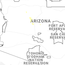
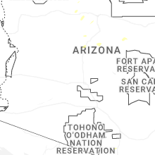
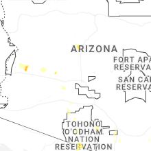
Hail Maps for Spring Valley, AZ


Connect with Interactive Hail Maps