

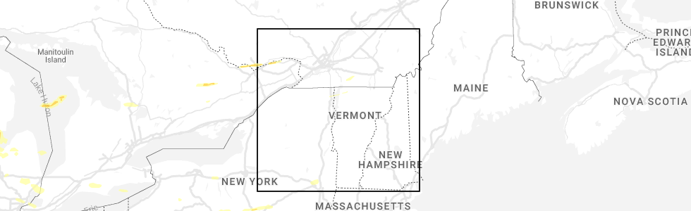
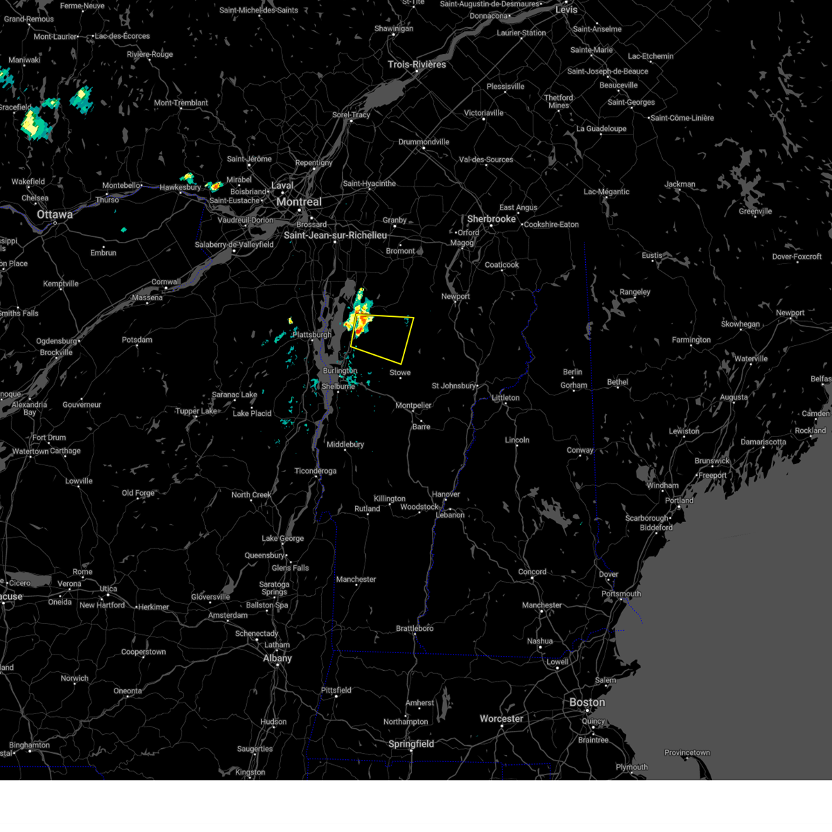
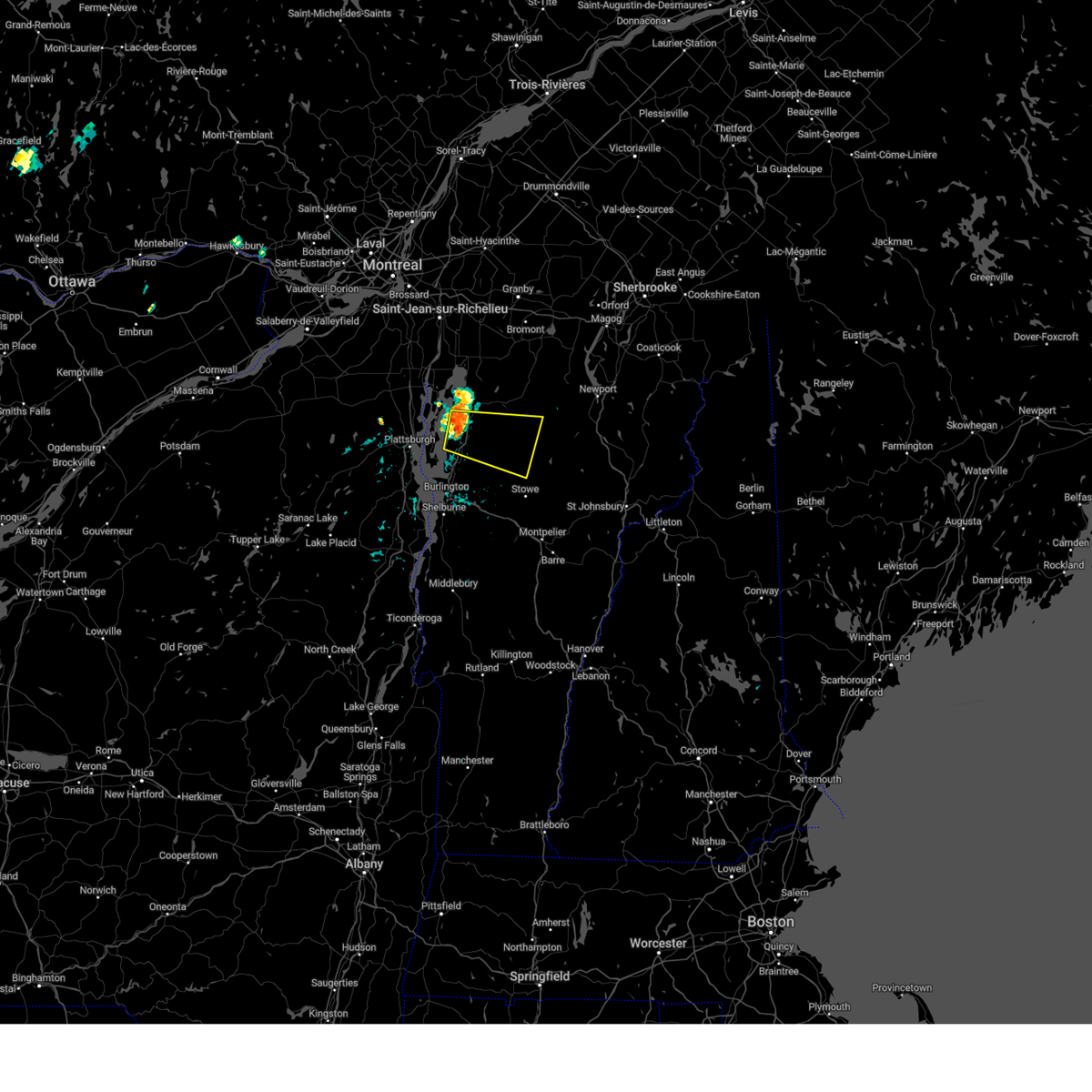
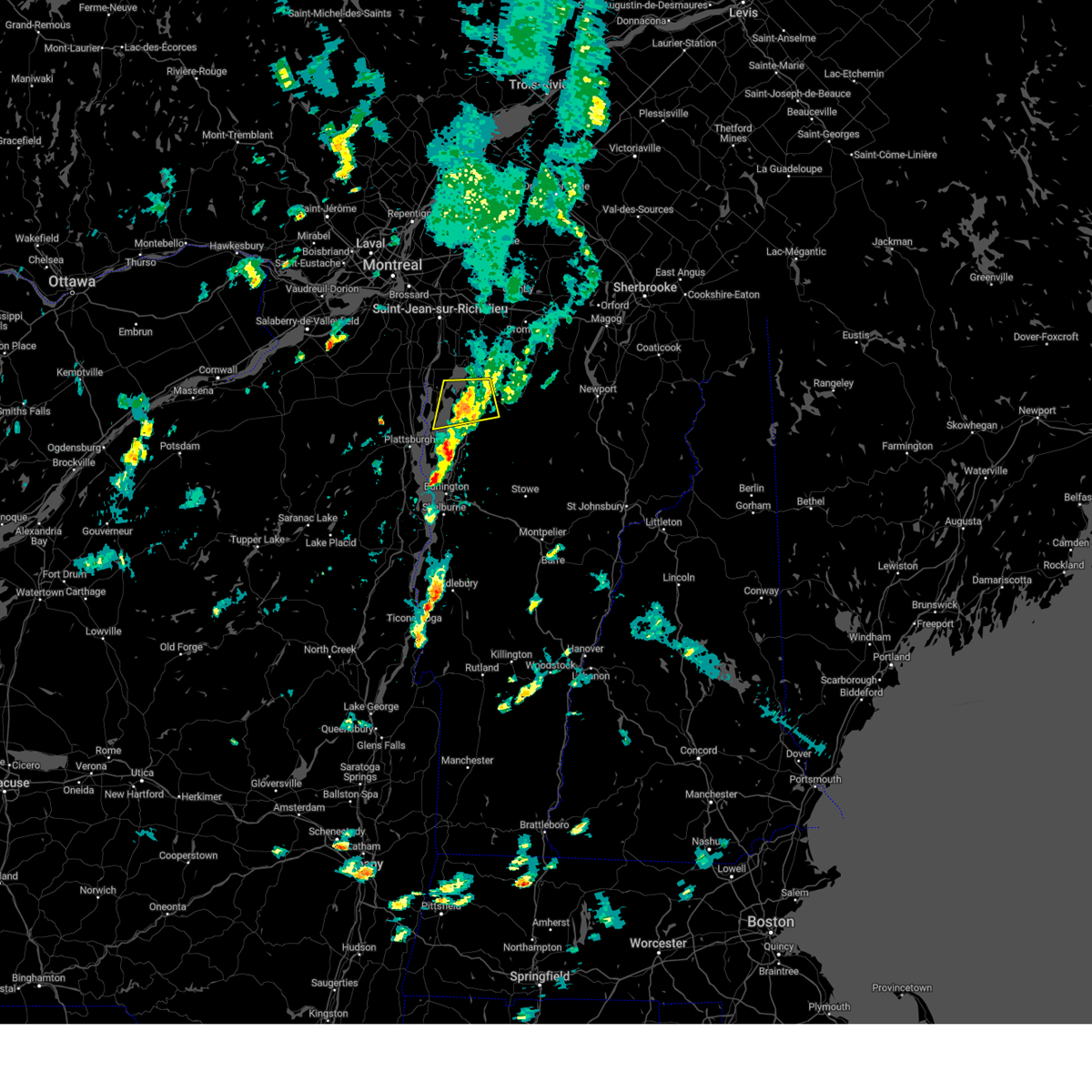
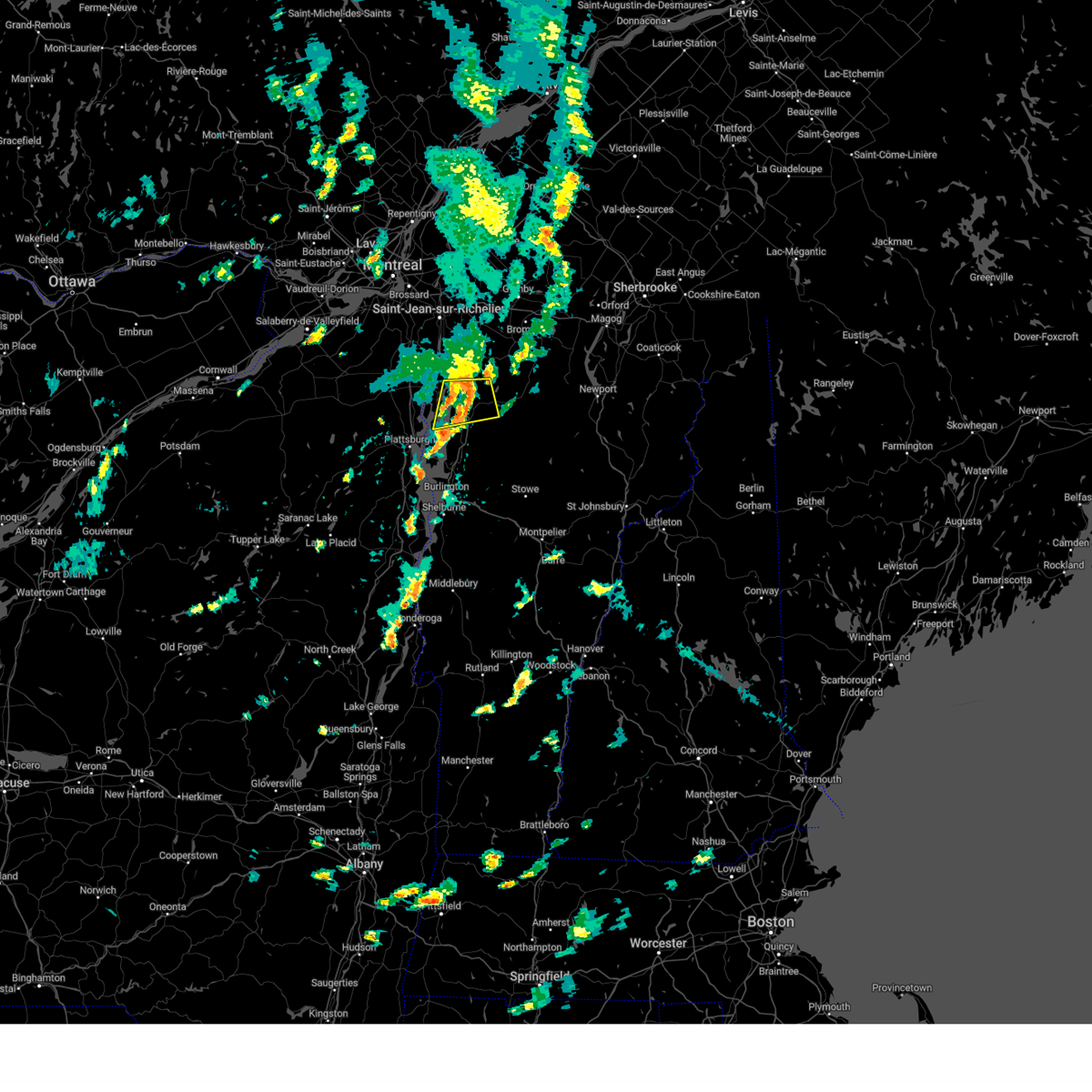
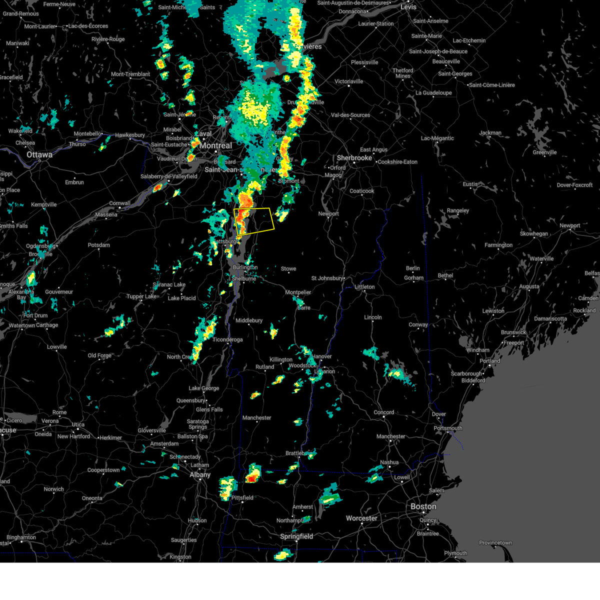
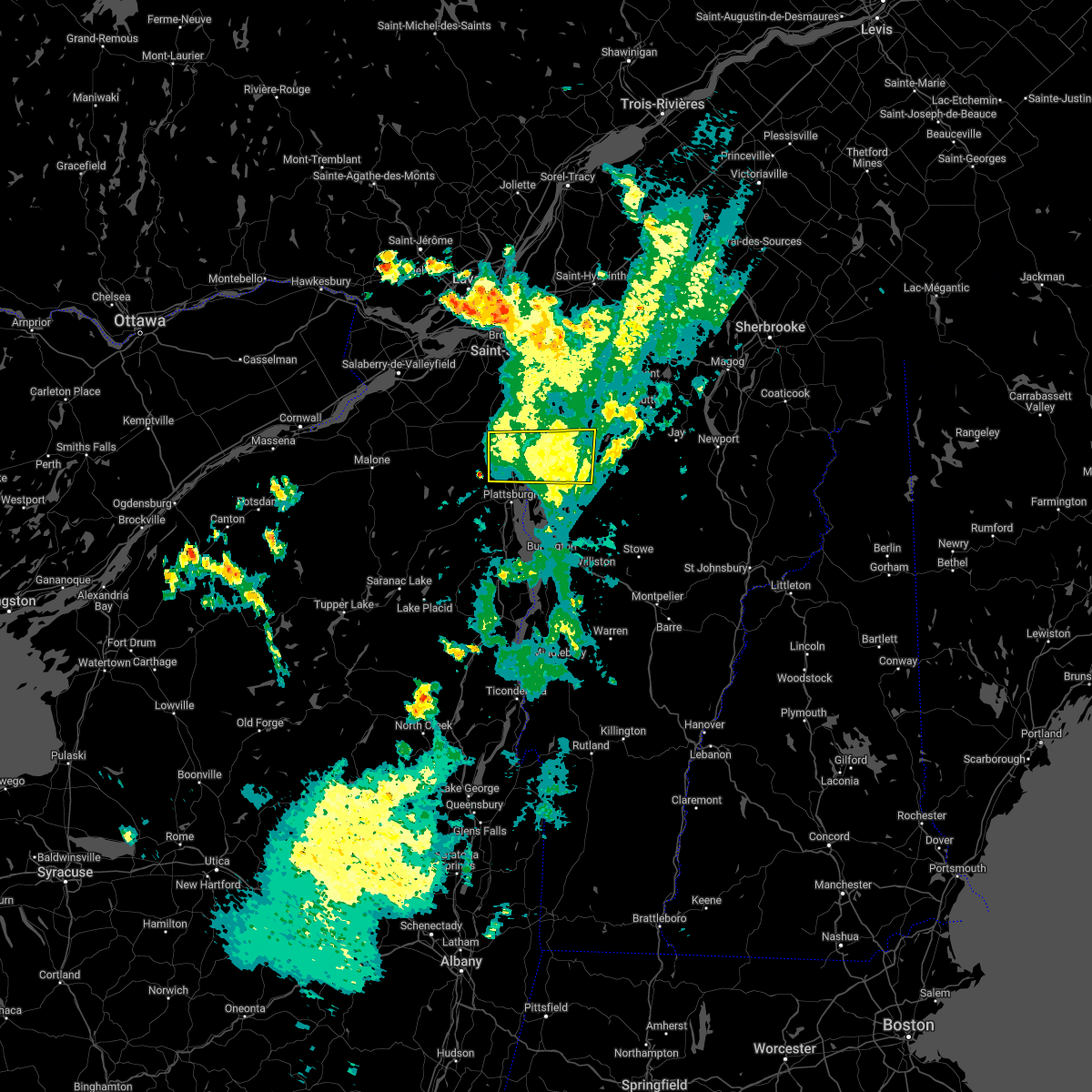
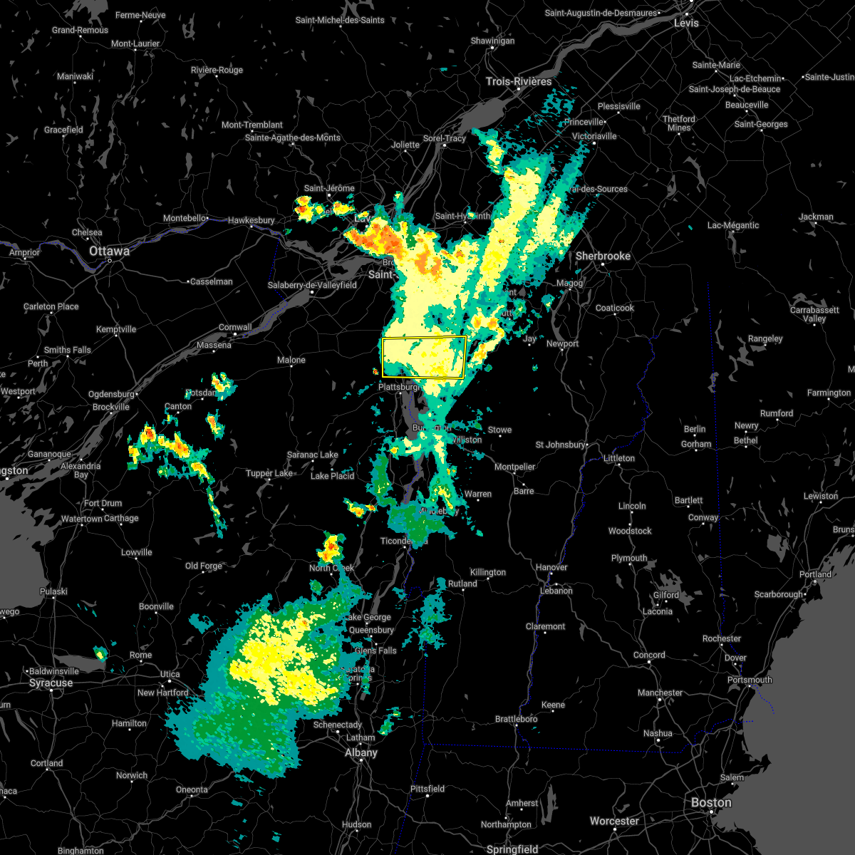
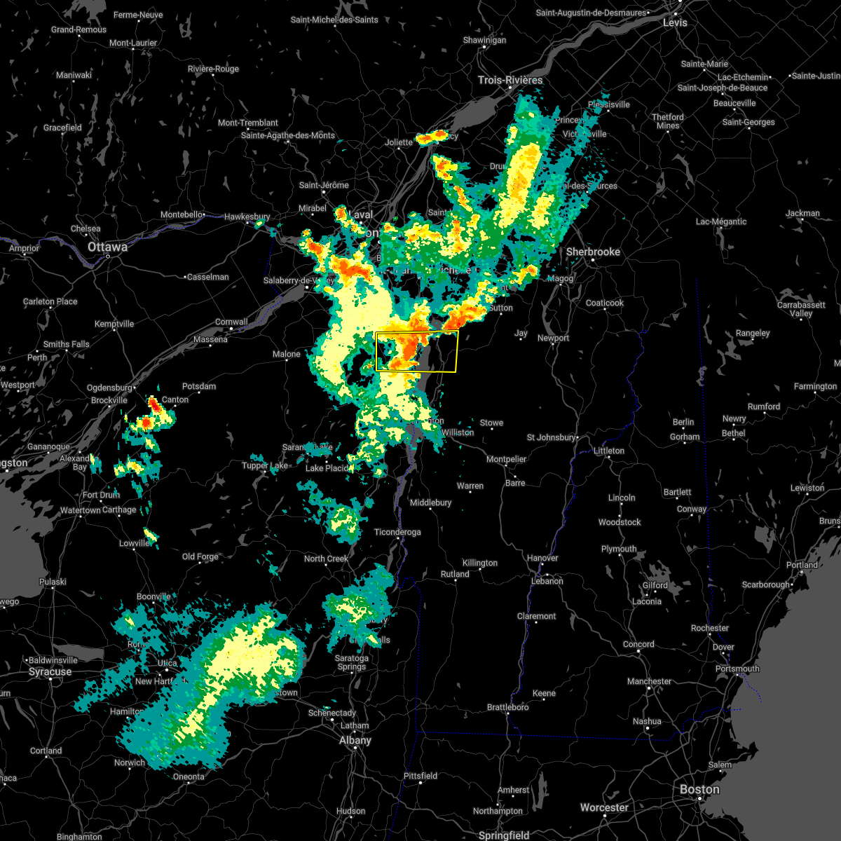
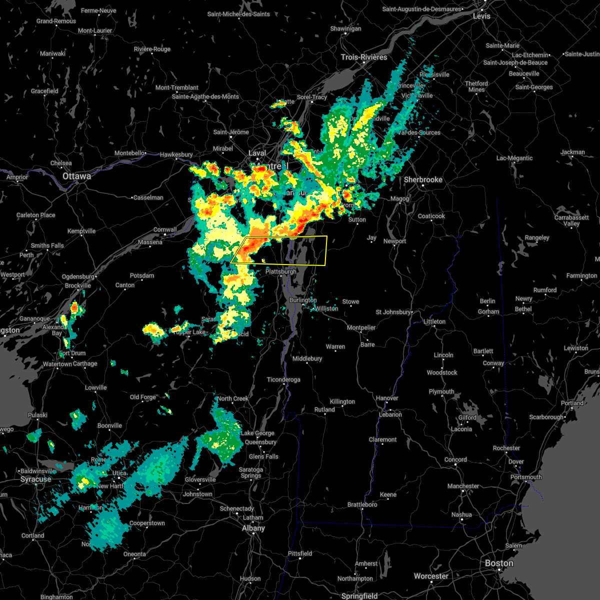
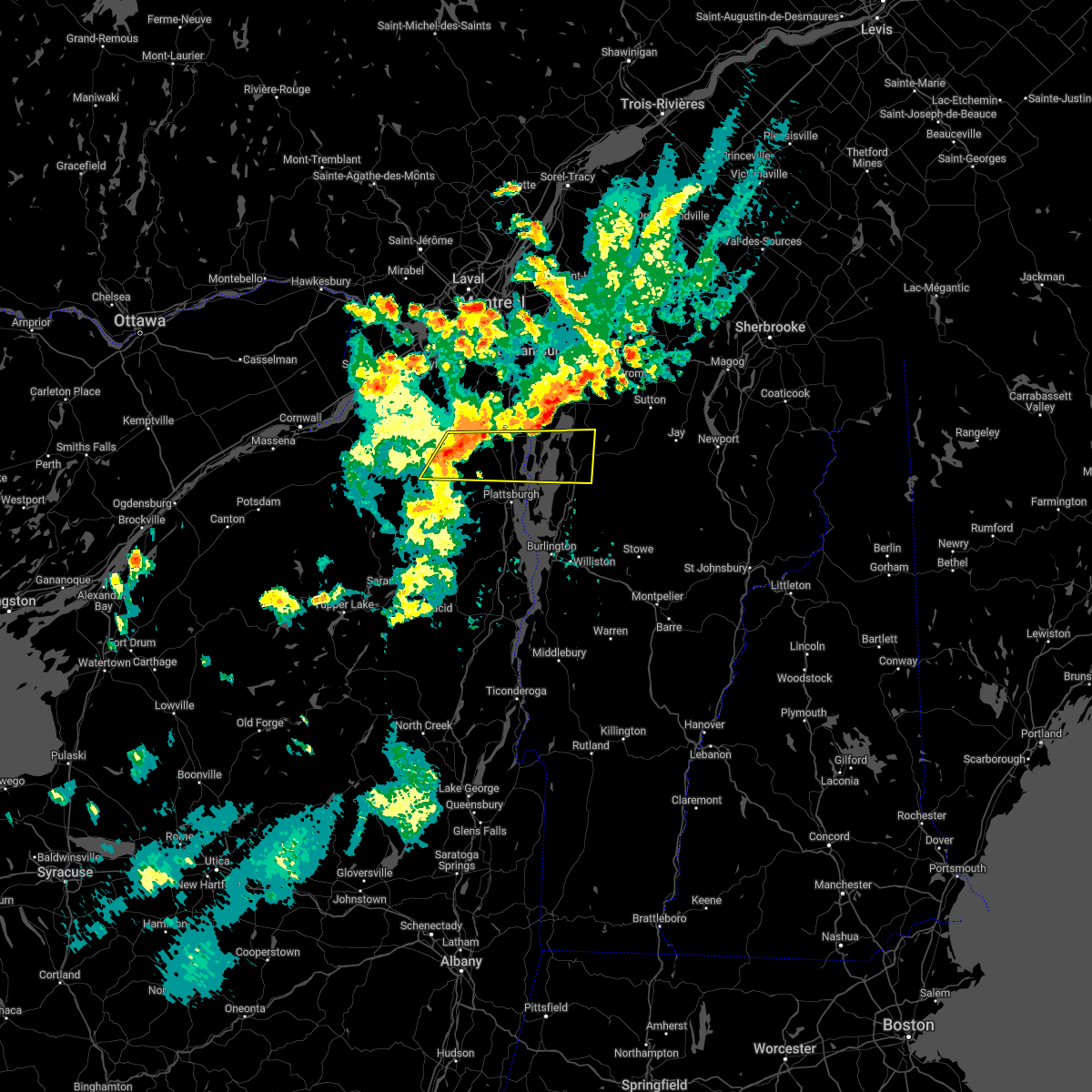
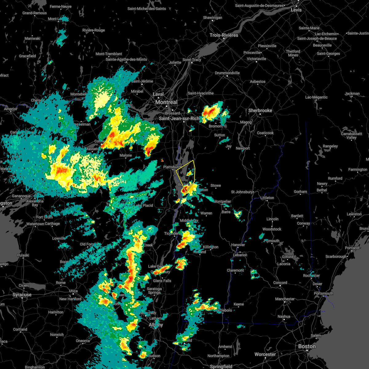
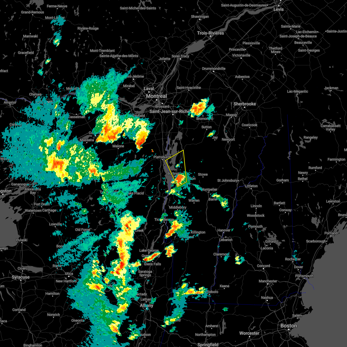
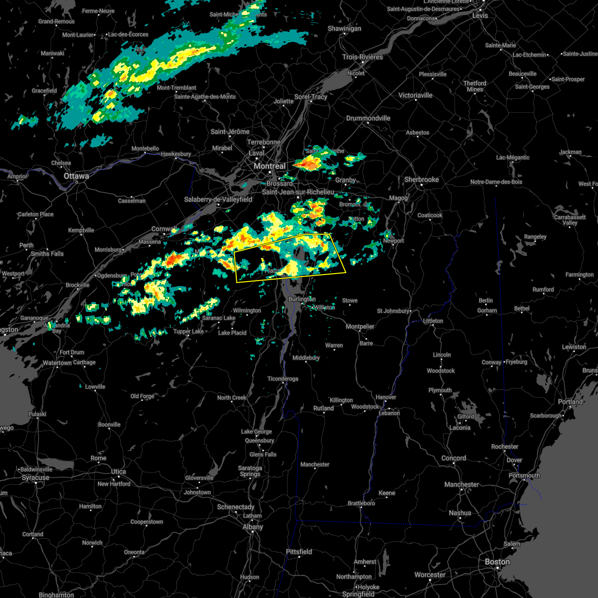
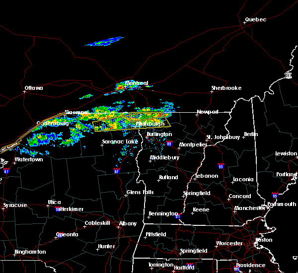
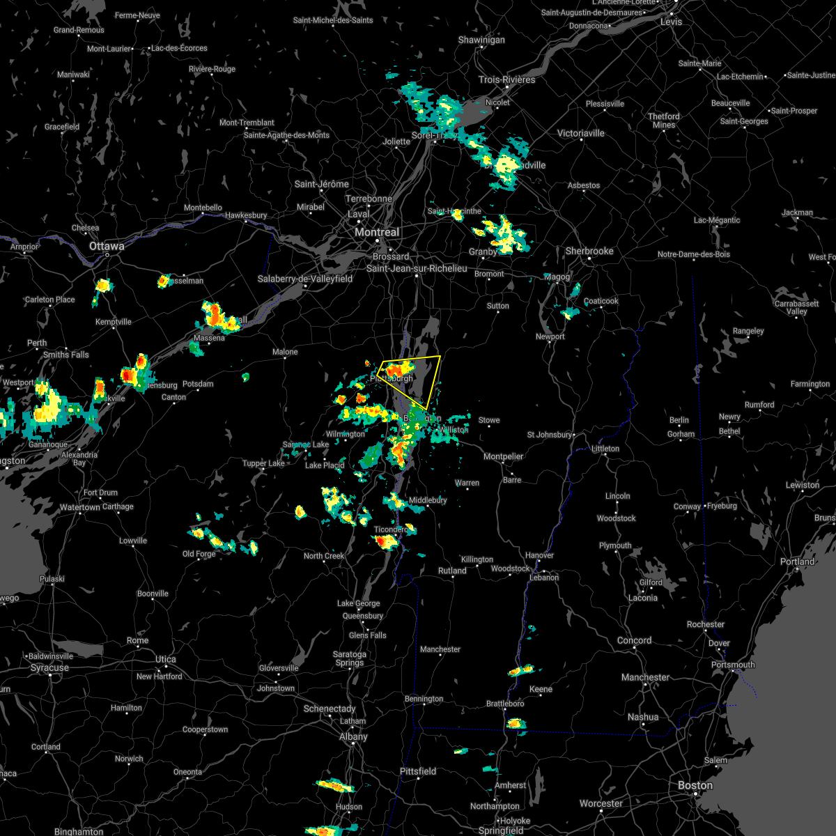
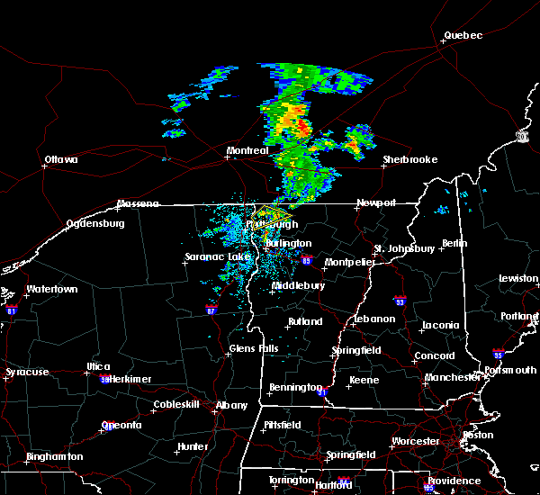
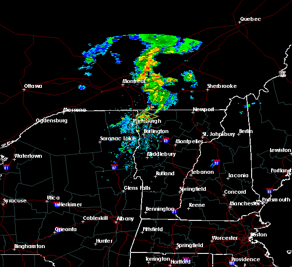
Hail Map for St. Albans, VT
The St. Albans, VT area has had 0 reports of on-the-ground hail by trained spotters, and has been under severe weather warnings 11 times during the past 12 months. Doppler radar has detected hail at or near St. Albans, VT on 10 occasions.
| Name: | St. Albans, VT |
| Where Located: | 23.8 miles NNE of Burlington, VT |
| Map: | Google Map for St. Albans, VT |
| Population: | 6918 |
| Housing Units: | 3231 |
| More Info: | Search Google for St. Albans, VT |
0
The Top Recent Hail Date for St. Albans, VT is Wednesday, September 21, 2022 (6th out of 10)
Hail and Wind Damage Spotted near St. Albans, VT
| Date / Time | Report Details |
|---|---|
| 9/7/2023 4:36 PM EDT |
 The severe thunderstorm warning for northeastern clinton, lamoille, northern addison, grand isle, chittenden, western washington and franklin counties will expire at 445 pm edt, the storms which prompted the warning have moved out of the warned area. therefore, the warning will be allowed to expire. The severe thunderstorm warning for northeastern clinton, lamoille, northern addison, grand isle, chittenden, western washington and franklin counties will expire at 445 pm edt, the storms which prompted the warning have moved out of the warned area. therefore, the warning will be allowed to expire.
|
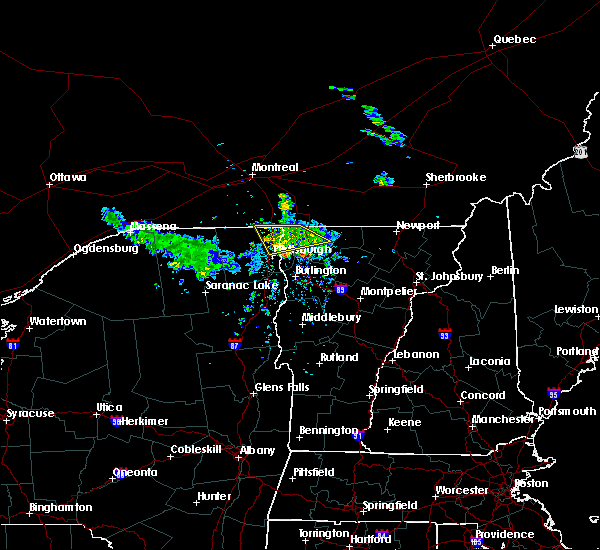
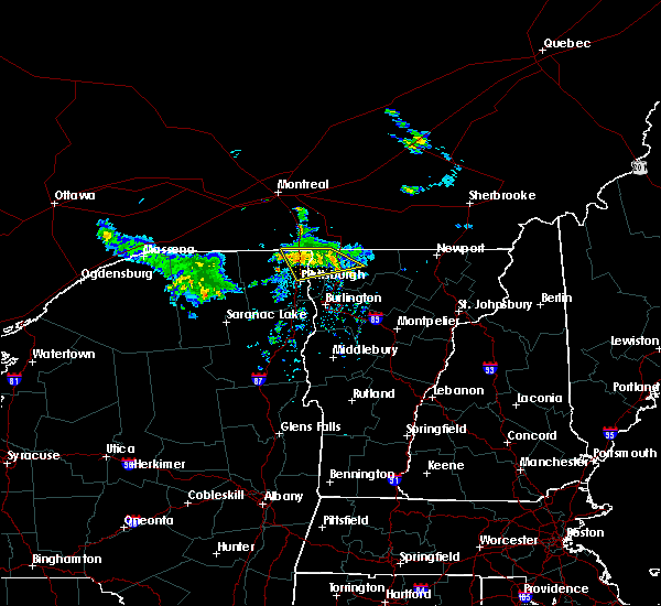
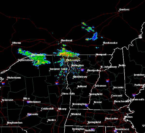
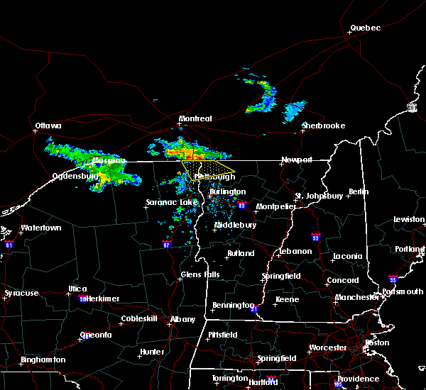
| 9/7/2023 3:40 PM EDT | At 340 pm edt, severe thunderstorms were located along a line extending from near shad island to jericho village to near weybridge, moving east at 25 mph (radar indicated). Hazards include 60 mph wind gusts and quarter size hail. Minor hail damage to vehicles is possible. Expect wind damage to trees and powerlines. |
| 9/7/2023 3:40 PM EDT | At 340 pm edt, severe thunderstorms were located along a line extending from near shad island to jericho village to near weybridge, moving east at 25 mph (radar indicated). Hazards include 60 mph wind gusts and quarter size hail. Minor hail damage to vehicles is possible. Expect wind damage to trees and powerlines. |
| 7/26/2023 12:02 AM EDT |
 At 1202 am edt, a severe thunderstorm was located near north fairfax, moving east at 15 mph (radar indicated). Hazards include 60 mph wind gusts and quarter size hail. Minor hail damage to vehicles is possible. expect wind damage to trees and powerlines. locations impacted include, johnson village, waterville, cambridge, bakersfield, cambridge village, johnson, jeffersonville village, fairfax, belvidere center, fletcher, fairfield, belvidere, st. albans city, georgia, montgomery, morristown, westford, milton, enosburg, and st. albans town. hail threat, radar indicated max hail size, 1. 00 in wind threat, radar indicated max wind gust, 60 mph. At 1202 am edt, a severe thunderstorm was located near north fairfax, moving east at 15 mph (radar indicated). Hazards include 60 mph wind gusts and quarter size hail. Minor hail damage to vehicles is possible. expect wind damage to trees and powerlines. locations impacted include, johnson village, waterville, cambridge, bakersfield, cambridge village, johnson, jeffersonville village, fairfax, belvidere center, fletcher, fairfield, belvidere, st. albans city, georgia, montgomery, morristown, westford, milton, enosburg, and st. albans town. hail threat, radar indicated max hail size, 1. 00 in wind threat, radar indicated max wind gust, 60 mph.
|
| 7/25/2023 11:42 PM EDT |
 At 1141 pm edt, a severe thunderstorm was located over lime rock point, moving east at 20 mph (radar indicated). Hazards include 60 mph wind gusts and quarter size hail. Minor hail damage to vehicles is possible. Expect wind damage to trees and powerlines. At 1141 pm edt, a severe thunderstorm was located over lime rock point, moving east at 20 mph (radar indicated). Hazards include 60 mph wind gusts and quarter size hail. Minor hail damage to vehicles is possible. Expect wind damage to trees and powerlines.
|
| 7/21/2023 5:23 PM EDT |
 The severe thunderstorm warning for northeastern grand isle and northwestern franklin counties will expire at 530 pm edt, the storms which prompted the warning have weakened below severe limits, and no longer pose an immediate threat to life or property. therefore, the warning will be allowed to expire. however small hail, gusty winds and heavy rain are still possible with these thunderstorms. The severe thunderstorm warning for northeastern grand isle and northwestern franklin counties will expire at 530 pm edt, the storms which prompted the warning have weakened below severe limits, and no longer pose an immediate threat to life or property. therefore, the warning will be allowed to expire. however small hail, gusty winds and heavy rain are still possible with these thunderstorms.
|
| 7/21/2023 5:02 PM EDT |
 At 501 pm edt, severe thunderstorms were located along a line extending from near rock river bay to near swanton junction to lapans bay, moving east at 15 mph (radar indicated). Hazards include 60 mph wind gusts. Expect damage to trees and powerlines. locations impacted include, swanton village, highgate falls, st. albans city, sheldon, swanton, st. albans town, highgate, north hero, franklin, fairfield, alburgh, north hero state park, sheldon junction, butler island, kings bay, rock river bay, hen island, allens bay in grand isle county, east highgate, and martindale point. hail threat, radar indicated max hail size, <. 75 in wind threat, radar indicated max wind gust, 60 mph. At 501 pm edt, severe thunderstorms were located along a line extending from near rock river bay to near swanton junction to lapans bay, moving east at 15 mph (radar indicated). Hazards include 60 mph wind gusts. Expect damage to trees and powerlines. locations impacted include, swanton village, highgate falls, st. albans city, sheldon, swanton, st. albans town, highgate, north hero, franklin, fairfield, alburgh, north hero state park, sheldon junction, butler island, kings bay, rock river bay, hen island, allens bay in grand isle county, east highgate, and martindale point. hail threat, radar indicated max hail size, <. 75 in wind threat, radar indicated max wind gust, 60 mph.
|
| 7/21/2023 4:29 PM EDT |
 At 429 pm edt, a severe thunderstorm was located over east alburgh, moving east at 10 mph (radar indicated). Hazards include 60 mph wind gusts. expect damage to trees and powerlines At 429 pm edt, a severe thunderstorm was located over east alburgh, moving east at 10 mph (radar indicated). Hazards include 60 mph wind gusts. expect damage to trees and powerlines
|
| 6/15/2023 4:00 PM EDT |
 At 400 pm edt, a severe thunderstorm was located over rock river bay, moving southeast at 25 mph (radar indicated). Hazards include 60 mph wind gusts and quarter size hail. Minor hail damage to vehicles is possible. Expect wind damage to trees and powerlines. At 400 pm edt, a severe thunderstorm was located over rock river bay, moving southeast at 25 mph (radar indicated). Hazards include 60 mph wind gusts and quarter size hail. Minor hail damage to vehicles is possible. Expect wind damage to trees and powerlines.
|
| 9/22/2022 3:26 AM EDT |
 At 324 am edt, a severe thunderstorm was located over northern lake champlain approaching swanton moving east at 50 mph (radar indicated). Hazards include 60 mph wind gusts. Expect damage to trees and powerlines. locations impacted include, newport city, enosburg falls, franklin, jay, newport town, jay in franklin county, swanton village, berkshire, highgate falls, montgomery center, montgomery, coventry, st. albans city, troy, sheldon, lake carmi state park, enosburg, swanton, westfield and newport center. hail threat, radar indicated max hail size, <. 75 in wind threat, radar indicated max wind gust, 60 mph. At 324 am edt, a severe thunderstorm was located over northern lake champlain approaching swanton moving east at 50 mph (radar indicated). Hazards include 60 mph wind gusts. Expect damage to trees and powerlines. locations impacted include, newport city, enosburg falls, franklin, jay, newport town, jay in franklin county, swanton village, berkshire, highgate falls, montgomery center, montgomery, coventry, st. albans city, troy, sheldon, lake carmi state park, enosburg, swanton, westfield and newport center. hail threat, radar indicated max hail size, <. 75 in wind threat, radar indicated max wind gust, 60 mph.
|
| 9/22/2022 2:40 AM EDT |
 At 239 am edt, a severe thunderstorm was located jericho and beekmantown point, moving east at 55 mph (radar indicated). Hazards include 60 mph wind gusts and quarter size hail. Minor hail damage to vehicles is possible. Expect wind damage to trees and powerlines. At 239 am edt, a severe thunderstorm was located jericho and beekmantown point, moving east at 55 mph (radar indicated). Hazards include 60 mph wind gusts and quarter size hail. Minor hail damage to vehicles is possible. Expect wind damage to trees and powerlines.
|
| 8/30/2022 5:50 PM EDT |
 The severe thunderstorm warning for northeastern grand isle and franklin counties will expire at 600 pm edt, the storm which prompted the warning has weakened below severe limits, and has exited the warned area. therefore, the warning will be allowed to expire. The severe thunderstorm warning for northeastern grand isle and franklin counties will expire at 600 pm edt, the storm which prompted the warning has weakened below severe limits, and has exited the warned area. therefore, the warning will be allowed to expire.
|
| 8/30/2022 5:36 PM EDT |
 At 535 pm edt, a severe thunderstorm was located over swanton junction, moving northeast at 45 mph (radar indicated). Hazards include 60 mph wind gusts. Expect damage to trees and powerlines. locations impacted include, enosburg falls, franklin, swanton village, berkshire, highgate falls, st. albans city, fairfax, sheldon, georgia, lake carmi state park, swanton, st. albans town, highgate, enosburg falls village, georgia center, north hero, fairfield, alburgh, enosburg and richford. hail threat, radar indicated max hail size, <. 75 in wind threat, observed max wind gust, 60 mph. At 535 pm edt, a severe thunderstorm was located over swanton junction, moving northeast at 45 mph (radar indicated). Hazards include 60 mph wind gusts. Expect damage to trees and powerlines. locations impacted include, enosburg falls, franklin, swanton village, berkshire, highgate falls, st. albans city, fairfax, sheldon, georgia, lake carmi state park, swanton, st. albans town, highgate, enosburg falls village, georgia center, north hero, fairfield, alburgh, enosburg and richford. hail threat, radar indicated max hail size, <. 75 in wind threat, observed max wind gust, 60 mph.
|
| 8/30/2022 5:30 PM EDT | Tree down at park in franklin county VT, 3.2 miles E of St. Albans, VT |
| 8/30/2022 5:17 PM EDT | Live tree snapped in hal in franklin county VT, 5 miles NNE of St. Albans, VT |
| 8/30/2022 5:17 PM EDT |
 At 516 pm edt, a severe thunderstorm was located over east georgia, moving northeast at 40 mph (radar indicated). Hazards include 60 mph wind gusts. Expect damage to trees and powerlines. locations impacted include, enosburg falls, franklin, jay, montgomery center, westford, sheldon, georgia, waterville, grand isle, st. albans town, south alburgh, alburgh, enosburg falls village, alburgh dunes state park, north hero, milton, bakersfield, cambridge village, berkshire and jeffersonville village. hail threat, radar indicated max hail size, <. 75 in wind threat, observed max wind gust, 60 mph. At 516 pm edt, a severe thunderstorm was located over east georgia, moving northeast at 40 mph (radar indicated). Hazards include 60 mph wind gusts. Expect damage to trees and powerlines. locations impacted include, enosburg falls, franklin, jay, montgomery center, westford, sheldon, georgia, waterville, grand isle, st. albans town, south alburgh, alburgh, enosburg falls village, alburgh dunes state park, north hero, milton, bakersfield, cambridge village, berkshire and jeffersonville village. hail threat, radar indicated max hail size, <. 75 in wind threat, observed max wind gust, 60 mph.
|
| 8/30/2022 5:01 PM EDT |
 At 500 pm edt, a severe thunderstorm was located over winooski, moving northeast at 40 mph (radar indicated). Hazards include 70 mph wind gusts and nickel size hail. Expect considerable tree damage. Damage is likely to mobile homes, roofs, and outbuildings. At 500 pm edt, a severe thunderstorm was located over winooski, moving northeast at 40 mph (radar indicated). Hazards include 70 mph wind gusts and nickel size hail. Expect considerable tree damage. Damage is likely to mobile homes, roofs, and outbuildings.
|
| 7/21/2022 12:14 PM EDT |
 At 1214 pm edt, a severe thunderstorm was located over east fairfield, moving northeast at 35 mph (radar indicated). Hazards include 60 mph wind gusts and quarter size hail. Minor hail damage to vehicles is possible. expect wind damage to trees and powerlines. locations impacted include, enosburg falls, bakersfield, berkshire, st. albans town, st. albans city, enosburg falls village, fairfax, sheldon, belvidere center, fletcher, fairfield, lake carmi state park, enosburg, belvidere, waterville, franklin, georgia, westford, montgomery and cambridge. hail threat, radar indicated max hail size, 1. 00 in wind threat, radar indicated max wind gust, 60 mph. At 1214 pm edt, a severe thunderstorm was located over east fairfield, moving northeast at 35 mph (radar indicated). Hazards include 60 mph wind gusts and quarter size hail. Minor hail damage to vehicles is possible. expect wind damage to trees and powerlines. locations impacted include, enosburg falls, bakersfield, berkshire, st. albans town, st. albans city, enosburg falls village, fairfax, sheldon, belvidere center, fletcher, fairfield, lake carmi state park, enosburg, belvidere, waterville, franklin, georgia, westford, montgomery and cambridge. hail threat, radar indicated max hail size, 1. 00 in wind threat, radar indicated max wind gust, 60 mph.
|
| 7/21/2022 11:47 AM EDT |
 At 1147 am edt, a severe thunderstorm was located over milton, moving northeast at 35 mph (radar indicated). Hazards include 60 mph wind gusts and quarter size hail. Minor hail damage to vehicles is possible. Expect wind damage to trees and powerlines. At 1147 am edt, a severe thunderstorm was located over milton, moving northeast at 35 mph (radar indicated). Hazards include 60 mph wind gusts and quarter size hail. Minor hail damage to vehicles is possible. Expect wind damage to trees and powerlines.
|
| 6/16/2022 7:24 PM EDT |
 The severe thunderstorm warning for northeastern clinton, northern grand isle and northwestern franklin counties will expire at 730 pm edt, the storm which prompted the warning has moved out of the area. therefore, the warning will be allowed to expire. however heavy rain is still possible with this thunderstorm. The severe thunderstorm warning for northeastern clinton, northern grand isle and northwestern franklin counties will expire at 730 pm edt, the storm which prompted the warning has moved out of the area. therefore, the warning will be allowed to expire. however heavy rain is still possible with this thunderstorm.
|
| 6/16/2022 6:51 PM EDT |
 At 651 pm edt, a severe thunderstorm was located over wagner point, moving east at 40 mph (radar indicated). Hazards include 60 mph wind gusts and penny size hail. Expect damage to trees and powerlines. locations impacted include, chazy, mooers, alburgh village, champlain, st. albans city, swanton, st. albans town, south alburgh, alburgh, alburgh dunes state park, north hero, swanton village, highgate falls, isle la motte, rouses point, highgate, fairfield, sheldon, franklin and georgia. hail threat, radar indicated max hail size, 0. 75 in wind threat, radar indicated max wind gust, 60 mph. At 651 pm edt, a severe thunderstorm was located over wagner point, moving east at 40 mph (radar indicated). Hazards include 60 mph wind gusts and penny size hail. Expect damage to trees and powerlines. locations impacted include, chazy, mooers, alburgh village, champlain, st. albans city, swanton, st. albans town, south alburgh, alburgh, alburgh dunes state park, north hero, swanton village, highgate falls, isle la motte, rouses point, highgate, fairfield, sheldon, franklin and georgia. hail threat, radar indicated max hail size, 0. 75 in wind threat, radar indicated max wind gust, 60 mph.
|
| 6/16/2022 6:29 PM EDT |
 At 628 pm edt, a severe thunderstorm was located over cannon corners, moving east at 30 mph (radar indicated). Hazards include 60 mph wind gusts and quarter size hail. Minor hail damage to vehicles is possible. Expect wind damage to trees and powerlines. At 628 pm edt, a severe thunderstorm was located over cannon corners, moving east at 30 mph (radar indicated). Hazards include 60 mph wind gusts and quarter size hail. Minor hail damage to vehicles is possible. Expect wind damage to trees and powerlines.
|
| 5/16/2022 3:50 PM EDT |
 At 350 pm edt, a severe thunderstorm was located over winooski, moving north at 20 mph (emergency management). Hazards include 60 mph wind gusts. Expect damage to trees and powerlines. locations impacted include, south burlington, burlington, burlington international airport, winooski, colchester, south hero, georgia, grand isle, georgia center, milton, st. albans city, essex junction village, st. albans town, essex, shelburne, fairfax, westford, wilcox point, mallets bay state park and sand bar state park. hail threat, radar indicated max hail size, <. 75 in wind threat, observed max wind gust, 60 mph. At 350 pm edt, a severe thunderstorm was located over winooski, moving north at 20 mph (emergency management). Hazards include 60 mph wind gusts. Expect damage to trees and powerlines. locations impacted include, south burlington, burlington, burlington international airport, winooski, colchester, south hero, georgia, grand isle, georgia center, milton, st. albans city, essex junction village, st. albans town, essex, shelburne, fairfax, westford, wilcox point, mallets bay state park and sand bar state park. hail threat, radar indicated max hail size, <. 75 in wind threat, observed max wind gust, 60 mph.
|
| 5/16/2022 3:41 PM EDT |
 At 340 pm edt, a severe thunderstorm was located over burlington international airport, moving north at 20 mph. reports of down trees on route 22a associated with this storm (emergency management). Hazards include 60 mph wind gusts. expect damage to trees and powerlines At 340 pm edt, a severe thunderstorm was located over burlington international airport, moving north at 20 mph. reports of down trees on route 22a associated with this storm (emergency management). Hazards include 60 mph wind gusts. expect damage to trees and powerlines
|
| 10/16/2021 3:01 PM EDT | Trees and powerlines down on fairfield r in franklin county VT, 1.4 miles WNW of St. Albans, VT |
| 10/16/2021 2:55 PM EDT |
 At 255 pm edt, severe thunderstorms were located along a line extending from province point to st. albans city to west milton, moving northeast at 55 mph (radar indicated). Hazards include 60 mph wind gusts. expect damage to trees and powerlines At 255 pm edt, severe thunderstorms were located along a line extending from province point to st. albans city to west milton, moving northeast at 55 mph (radar indicated). Hazards include 60 mph wind gusts. expect damage to trees and powerlines
|
| 7/20/2021 7:06 PM EDT |
 At 704 pm edt, a line of severe thunderstorms over northwest vermont and essex county new york was located along a line extending from shad island to south burlington to near chilson, new york moving east at 35 mph (radar indicated). Hazards include 60 mph wind gusts and quarter size hail. Expect wind damage to trees and powerlines. minor hail damage to vehicles is possible. Locations impacted include, essex junction, plattsburgh international airport, burlington, burlington international airport, plattsburgh, middlebury, south burlington, vergennes, peru, beekmantown, moriah, chazy, willsboro, crown point, morrisville, enosburg falls, westport, elizabethtown, champlain and waterbury village. At 704 pm edt, a line of severe thunderstorms over northwest vermont and essex county new york was located along a line extending from shad island to south burlington to near chilson, new york moving east at 35 mph (radar indicated). Hazards include 60 mph wind gusts and quarter size hail. Expect wind damage to trees and powerlines. minor hail damage to vehicles is possible. Locations impacted include, essex junction, plattsburgh international airport, burlington, burlington international airport, plattsburgh, middlebury, south burlington, vergennes, peru, beekmantown, moriah, chazy, willsboro, crown point, morrisville, enosburg falls, westport, elizabethtown, champlain and waterbury village.
|
| 7/20/2021 6:31 PM EDT |
 At 630 pm edt, a line of severe thunderstorms over northeast new york was located along a line extending from near perry mills to near harkness to 9 miles west of schroon falls, moving east at 40 mph (radar indicated). Hazards include 60 mph wind gusts and quarter size hail. Expect wind damage to trees and powerlines. Minor hail damage to vehicles is possible. At 630 pm edt, a line of severe thunderstorms over northeast new york was located along a line extending from near perry mills to near harkness to 9 miles west of schroon falls, moving east at 40 mph (radar indicated). Hazards include 60 mph wind gusts and quarter size hail. Expect wind damage to trees and powerlines. Minor hail damage to vehicles is possible.
|
| 10/10/2020 3:27 PM EDT |
 The severe thunderstorm warning for central clinton, northwestern lamoille, grand isle, northwestern chittenden and franklin counties will expire at 330 pm edt, the storm which prompted the warning has weakened below severe limits, and has exited the warned area. therefore, the warning will be allowed to expire. however gusty winds are still possible with this thunderstorm. a severe thunderstorm watch remains in effect until 900 pm edt for northern new york, and northwestern vermont. to report severe weather, contact your nearest law enforcement agency. they will relay your report to the national weather service burlington. The severe thunderstorm warning for central clinton, northwestern lamoille, grand isle, northwestern chittenden and franklin counties will expire at 330 pm edt, the storm which prompted the warning has weakened below severe limits, and has exited the warned area. therefore, the warning will be allowed to expire. however gusty winds are still possible with this thunderstorm. a severe thunderstorm watch remains in effect until 900 pm edt for northern new york, and northwestern vermont. to report severe weather, contact your nearest law enforcement agency. they will relay your report to the national weather service burlington.
|
| 10/10/2020 3:12 PM EDT |
 At 312 pm edt, a severe thunderstorm was located over cadyville, moving east at 65 mph (radar indicated). Hazards include 60 mph wind gusts and nickel size hail. Expect damage to trees and powerlines. locations impacted include, plattsburgh, beekmantown, chazy, altona, franklin, sheldon, georgia, grand isle, st. Albans town, south alburgh, alburgh, alburgh dunes state park, north hero, bakersfield, isle la motte, lake carmi state park, dannemora, highgate, georgia center and fletcher. At 312 pm edt, a severe thunderstorm was located over cadyville, moving east at 65 mph (radar indicated). Hazards include 60 mph wind gusts and nickel size hail. Expect damage to trees and powerlines. locations impacted include, plattsburgh, beekmantown, chazy, altona, franklin, sheldon, georgia, grand isle, st. Albans town, south alburgh, alburgh, alburgh dunes state park, north hero, bakersfield, isle la motte, lake carmi state park, dannemora, highgate, georgia center and fletcher.
|
| 10/10/2020 2:26 PM EDT |
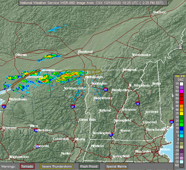 At 226 pm edt, a severe thunderstorm was located over nicholville, moving east at 65 mph (radar indicated). Hazards include 60 mph wind gusts and nickel size hail. expect damage to trees and powerlines At 226 pm edt, a severe thunderstorm was located over nicholville, moving east at 65 mph (radar indicated). Hazards include 60 mph wind gusts and nickel size hail. expect damage to trees and powerlines
|
| 8/24/2020 2:07 PM EDT |
 At 206 pm edt, a severe thunderstorm was located over west beekmantown, moving east at 25 mph (radar indicated). Hazards include 60 mph wind gusts and quarter size hail. Minor hail damage to vehicles is possible. Expect wind damage to trees and powerlines. At 206 pm edt, a severe thunderstorm was located over west beekmantown, moving east at 25 mph (radar indicated). Hazards include 60 mph wind gusts and quarter size hail. Minor hail damage to vehicles is possible. Expect wind damage to trees and powerlines.
|
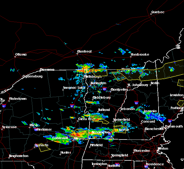
| 7/8/2020 4:35 PM EDT | Trees... powerlines... and poles dow in franklin county VT, 6.7 miles W of St. Albans, VT |
| 7/8/2020 4:30 PM EDT |
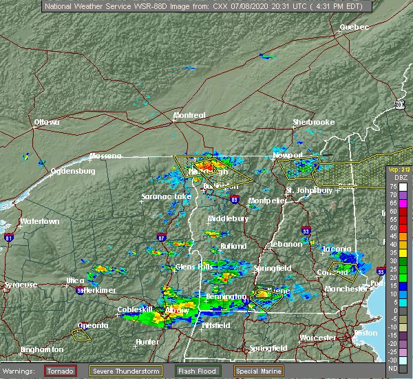 At 430 pm edt, a severe thunderstorm was located over swanton junction, moving southeast at 35 mph (radar indicated). Hazards include 60 mph wind gusts and quarter size hail. Minor hail damage to vehicles is possible. Expect wind damage to trees and powerlines. At 430 pm edt, a severe thunderstorm was located over swanton junction, moving southeast at 35 mph (radar indicated). Hazards include 60 mph wind gusts and quarter size hail. Minor hail damage to vehicles is possible. Expect wind damage to trees and powerlines.
|
| 7/8/2020 4:30 PM EDT |
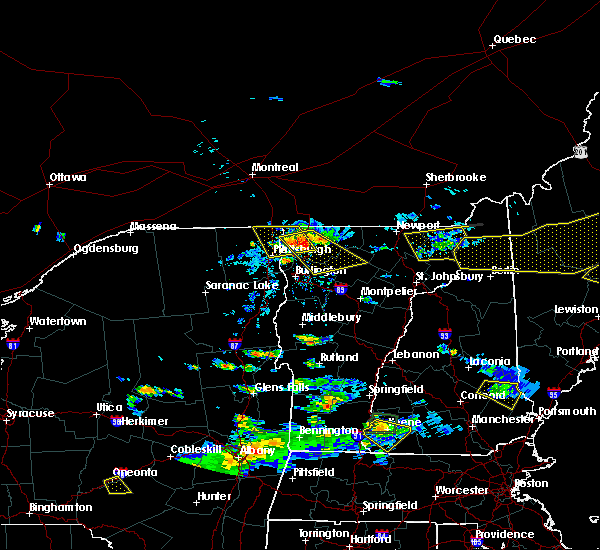 At 430 pm edt, a severe thunderstorm was located over swanton junction, moving southeast at 35 mph (radar indicated). Hazards include 60 mph wind gusts and quarter size hail. Minor hail damage to vehicles is possible. Expect wind damage to trees and powerlines. At 430 pm edt, a severe thunderstorm was located over swanton junction, moving southeast at 35 mph (radar indicated). Hazards include 60 mph wind gusts and quarter size hail. Minor hail damage to vehicles is possible. Expect wind damage to trees and powerlines.
|
| 7/8/2020 4:11 PM EDT |
 At 411 pm edt, a severe thunderstorm was located over fee fee point, moving southeast at 15 mph (radar indicated). Hazards include 60 mph wind gusts and quarter size hail. Minor hail damage to vehicles is possible. Expect wind damage to trees and powerlines. At 411 pm edt, a severe thunderstorm was located over fee fee point, moving southeast at 15 mph (radar indicated). Hazards include 60 mph wind gusts and quarter size hail. Minor hail damage to vehicles is possible. Expect wind damage to trees and powerlines.
|
| 7/8/2020 3:35 PM EDT |
 At 334 pm edt, a severe thunderstorm was located near morses line, moving south at 20 mph (radar indicated). Hazards include 60 mph wind gusts and quarter size hail. Minor hail damage to vehicles is possible. Expect wind damage to trees and powerlines. At 334 pm edt, a severe thunderstorm was located near morses line, moving south at 20 mph (radar indicated). Hazards include 60 mph wind gusts and quarter size hail. Minor hail damage to vehicles is possible. Expect wind damage to trees and powerlines.
|
| 3/20/2020 3:55 PM EDT |
 At 355 pm edt, a severe thunderstorm was located near rock river bay, moving east at 70 mph (radar indicated). Hazards include 60 mph wind gusts and penny size hail. Expect damage to trees and powerlines. locations impacted include, enosburg falls, franklin, swanton village, bakersfield, berkshire, highgate falls, montgomery center, montgomery, st. albans city, sheldon, lake carmi state park, enosburg, swanton, st. Albans town, richford, highgate, enosburg falls village, fairfield, georgia and belvidere. At 355 pm edt, a severe thunderstorm was located near rock river bay, moving east at 70 mph (radar indicated). Hazards include 60 mph wind gusts and penny size hail. Expect damage to trees and powerlines. locations impacted include, enosburg falls, franklin, swanton village, bakersfield, berkshire, highgate falls, montgomery center, montgomery, st. albans city, sheldon, lake carmi state park, enosburg, swanton, st. Albans town, richford, highgate, enosburg falls village, fairfield, georgia and belvidere.
|
| 3/20/2020 3:30 PM EDT |
 At 330 pm edt, a severe thunderstorm was located over altona, moving east at 70 mph (radar indicated). Hazards include 60 mph wind gusts and penny size hail. expect damage to trees and powerlines At 330 pm edt, a severe thunderstorm was located over altona, moving east at 70 mph (radar indicated). Hazards include 60 mph wind gusts and penny size hail. expect damage to trees and powerlines
|
| 7/30/2019 4:28 PM EDT |
 At 427 pm edt, severe thunderstorms were located along a line extending from 18 miles north of morses line to georgia center, moving east at 15 mph (vtrans reported 76 mph gust at north hero project in addition to several trees down with multiple power outages being reported). Hazards include 70 mph wind gusts and quarter size hail. Minor hail damage to vehicles is possible. expect considerable tree damage. wind damage is also likely to mobile homes, roofs, and outbuildings. locations impacted include, enosburg falls, franklin, johnson village, swanton village, cambridge, bakersfield, cambridge village, berkshire, highgate falls, montgomery center, jeffersonville village, montgomery, st. Albans city, fairfax, sheldon, belvidere center, georgia, lake carmi state park, enosburg and belvidere. At 427 pm edt, severe thunderstorms were located along a line extending from 18 miles north of morses line to georgia center, moving east at 15 mph (vtrans reported 76 mph gust at north hero project in addition to several trees down with multiple power outages being reported). Hazards include 70 mph wind gusts and quarter size hail. Minor hail damage to vehicles is possible. expect considerable tree damage. wind damage is also likely to mobile homes, roofs, and outbuildings. locations impacted include, enosburg falls, franklin, johnson village, swanton village, cambridge, bakersfield, cambridge village, berkshire, highgate falls, montgomery center, jeffersonville village, montgomery, st. Albans city, fairfax, sheldon, belvidere center, georgia, lake carmi state park, enosburg and belvidere.
|
| 7/30/2019 4:03 PM EDT | Tree down on ca in franklin county VT, 0.3 miles WSW of St. Albans, VT |
| 7/30/2019 3:55 PM EDT |
 At 354 pm edt, severe thunderstorms were located along a line extending from 19 miles north of morses line to hyde point, moving east at 15 mph (highway department reported wind gust of 76 mph in association with this line of storms). Hazards include 70 mph wind gusts and quarter size hail. Minor hail damage to vehicles is possible. expect considerable tree damage. wind damage is also likely to mobile homes, roofs, and outbuildings. locations impacted include, enosburg falls, franklin, alburgh village, johnson village, cambridge, montgomery center, montgomery, st. albans city, fairfax, sheldon, belvidere center, georgia, enosburg, swanton, waterville, grand isle, st. Albans town, south alburgh, johnson and alburgh. At 354 pm edt, severe thunderstorms were located along a line extending from 19 miles north of morses line to hyde point, moving east at 15 mph (highway department reported wind gust of 76 mph in association with this line of storms). Hazards include 70 mph wind gusts and quarter size hail. Minor hail damage to vehicles is possible. expect considerable tree damage. wind damage is also likely to mobile homes, roofs, and outbuildings. locations impacted include, enosburg falls, franklin, alburgh village, johnson village, cambridge, montgomery center, montgomery, st. albans city, fairfax, sheldon, belvidere center, georgia, enosburg, swanton, waterville, grand isle, st. Albans town, south alburgh, johnson and alburgh.
|
| 7/30/2019 3:46 PM EDT |
 At 345 pm edt, severe thunderstorms were located along a line extending from 19 miles north of morses line to ladd bay, moving east at 15 mph (radar indicated). Hazards include 60 mph wind gusts and quarter size hail. Minor hail damage to vehicles is possible. Expect wind damage to trees and powerlines. At 345 pm edt, severe thunderstorms were located along a line extending from 19 miles north of morses line to ladd bay, moving east at 15 mph (radar indicated). Hazards include 60 mph wind gusts and quarter size hail. Minor hail damage to vehicles is possible. Expect wind damage to trees and powerlines.
|
| 6/28/2019 12:41 AM EDT |
 The severe thunderstorm warning for northeastern clinton, northern grand isle and northwestern franklin counties will expire at 1245 am edt, the storm which prompted the warning has weakened below severe limits and no longer poses an immediate threat to life or property. therefore, the warning will be allowed to expire. however gusty winds and heavy rain are still possible with this thunderstorm. The severe thunderstorm warning for northeastern clinton, northern grand isle and northwestern franklin counties will expire at 1245 am edt, the storm which prompted the warning has weakened below severe limits and no longer poses an immediate threat to life or property. therefore, the warning will be allowed to expire. however gusty winds and heavy rain are still possible with this thunderstorm.
|
| 6/28/2019 12:21 AM EDT |
 At 1219 am edt, a severe thunderstorm was located over hemlock island, moving southeast at 15 mph (law enforcement. dime sized hail and several trees were reported down where highway 9 meets interstate 87 near champlain). Hazards include 60 mph wind gusts and quarter size hail. Minor hail damage to vehicles is possible. expect wind damage to trees and powerlines. locations impacted include, beekmantown, chazy, mooers, alburgh village, champlain, st. albans city, swanton, st. Albans town, south alburgh, alburgh, alburgh dunes state park, north hero, swanton village, highgate falls, isle la motte, rouses point, highgate, sheldon, fairfield and grand isle. At 1219 am edt, a severe thunderstorm was located over hemlock island, moving southeast at 15 mph (law enforcement. dime sized hail and several trees were reported down where highway 9 meets interstate 87 near champlain). Hazards include 60 mph wind gusts and quarter size hail. Minor hail damage to vehicles is possible. expect wind damage to trees and powerlines. locations impacted include, beekmantown, chazy, mooers, alburgh village, champlain, st. albans city, swanton, st. Albans town, south alburgh, alburgh, alburgh dunes state park, north hero, swanton village, highgate falls, isle la motte, rouses point, highgate, sheldon, fairfield and grand isle.
|
| 6/28/2019 12:03 AM EDT |
 At 1203 am edt, a severe thunderstorm was located over king bay, moving southeast at 20 mph (radar indicated). Hazards include 60 mph wind gusts and quarter size hail. Minor hail damage to vehicles is possible. expect wind damage to trees and powerlines. locations impacted include, beekmantown, chazy, mooers, alburgh village, champlain, st. albans city, swanton, st. Albans town, south alburgh, alburgh, alburgh dunes state park, north hero, swanton village, highgate falls, isle la motte, rouses point, highgate, sheldon, fairfield and grand isle. At 1203 am edt, a severe thunderstorm was located over king bay, moving southeast at 20 mph (radar indicated). Hazards include 60 mph wind gusts and quarter size hail. Minor hail damage to vehicles is possible. expect wind damage to trees and powerlines. locations impacted include, beekmantown, chazy, mooers, alburgh village, champlain, st. albans city, swanton, st. Albans town, south alburgh, alburgh, alburgh dunes state park, north hero, swanton village, highgate falls, isle la motte, rouses point, highgate, sheldon, fairfield and grand isle.
|
| 6/27/2019 11:44 PM EDT |
 At 1144 pm edt, a severe thunderstorm was located over rouses point, moving southeast at 20 mph (radar indicated). Hazards include 60 mph wind gusts and quarter size hail. Minor hail damage to vehicles is possible. Expect wind damage to trees and powerlines. At 1144 pm edt, a severe thunderstorm was located over rouses point, moving southeast at 20 mph (radar indicated). Hazards include 60 mph wind gusts and quarter size hail. Minor hail damage to vehicles is possible. Expect wind damage to trees and powerlines.
|
| 5/4/2018 6:02 PM EDT |
 At 601 pm edt, a severe thunderstorm was located over sciota, moving east at 50 mph (radar indicated). Hazards include 60 mph wind gusts and quarter size hail. Minor hail damage to vehicles is possible. expect wind damage to trees and powerlines. locations impacted include, beekmantown, chazy, mooers, altona, franklin, alburgh village, ellenburg depot, champlain, st. albans city, sheldon, swanton, st. albans town, south alburgh, alburgh, alburgh dunes state park, north hero, swanton village, highgate falls, isle la motte and lake carmi state park. A tornado watch remains in effect until 1000 pm edt for northern new york, and northwestern vermont. At 601 pm edt, a severe thunderstorm was located over sciota, moving east at 50 mph (radar indicated). Hazards include 60 mph wind gusts and quarter size hail. Minor hail damage to vehicles is possible. expect wind damage to trees and powerlines. locations impacted include, beekmantown, chazy, mooers, altona, franklin, alburgh village, ellenburg depot, champlain, st. albans city, sheldon, swanton, st. albans town, south alburgh, alburgh, alburgh dunes state park, north hero, swanton village, highgate falls, isle la motte and lake carmi state park. A tornado watch remains in effect until 1000 pm edt for northern new york, and northwestern vermont.
|
| 5/4/2018 5:41 PM EDT |
 The national weather service in burlington has issued a * severe thunderstorm warning for. northern clinton county in northern new york. northeastern franklin county in northern new york. northern grand isle county in northwestern vermont. Northwestern franklin county in northwestern vermont. The national weather service in burlington has issued a * severe thunderstorm warning for. northern clinton county in northern new york. northeastern franklin county in northern new york. northern grand isle county in northwestern vermont. Northwestern franklin county in northwestern vermont.
|
| 5/4/2018 5:41 PM EDT |
 At 541 pm edt, a severe thunderstorm was located near brainardsville, moving east at 50 mph (radar indicated). Hazards include 60 mph wind gusts and quarter size hail. Minor hail damage to vehicles is possible. Expect wind damage to trees and powerlines. At 541 pm edt, a severe thunderstorm was located near brainardsville, moving east at 50 mph (radar indicated). Hazards include 60 mph wind gusts and quarter size hail. Minor hail damage to vehicles is possible. Expect wind damage to trees and powerlines.
|
| 8/2/2017 10:25 PM EDT |
 The severe thunderstorm warning for central grand isle and west central franklin counties will expire at 1030 pm edt, the storm which prompted the warning has weakened below severe limits, and no longer pose an immediate threat to life or property. therefore the warning will be allowed to expire. The severe thunderstorm warning for central grand isle and west central franklin counties will expire at 1030 pm edt, the storm which prompted the warning has weakened below severe limits, and no longer pose an immediate threat to life or property. therefore the warning will be allowed to expire.
|
| 8/2/2017 10:05 PM EDT |
 At 1003 pm edt, a severe thunderstorm was located over butler island, moving east at 15 mph (radar indicated). Hazards include 60 mph wind gusts and quarter size hail. Minor hail damage to vehicles is possible. expect wind damage to trees and powerlines and create boating hazards. locations impacted include, swanton village, isle la motte, st. albans city, swanton, st. Albans town, south alburgh, alburgh dunes state park, north hero, grand isle, alburgh, sheldon, highgate, fairfield, reed point, wagner point, young island, north hero state park, scott point, burton island state park and butler island. At 1003 pm edt, a severe thunderstorm was located over butler island, moving east at 15 mph (radar indicated). Hazards include 60 mph wind gusts and quarter size hail. Minor hail damage to vehicles is possible. expect wind damage to trees and powerlines and create boating hazards. locations impacted include, swanton village, isle la motte, st. albans city, swanton, st. Albans town, south alburgh, alburgh dunes state park, north hero, grand isle, alburgh, sheldon, highgate, fairfield, reed point, wagner point, young island, north hero state park, scott point, burton island state park and butler island.
|
| 8/2/2017 9:46 PM EDT |
 At 946 pm edt, a severe thunderstorm was located over cloak island, moving east at 15 mph (radar indicated). Hazards include 60 mph wind gusts and quarter size hail. Minor hail damage to vehicles is possible. Expect wind damage to trees and powerlines. At 946 pm edt, a severe thunderstorm was located over cloak island, moving east at 15 mph (radar indicated). Hazards include 60 mph wind gusts and quarter size hail. Minor hail damage to vehicles is possible. Expect wind damage to trees and powerlines.
|
| 7/8/2017 7:55 AM EDT |
 The severe thunderstorm warning for southeastern clinton, northeastern essex, grand isle, northwestern chittenden and southwestern franklin counties will expire at 800 am edt, the storms which prompted the warning have weakened below severe limits, and no longer pose an immediate threat to life or property. therefore the warning will be allowed to expire. however gusty winds and heavy rain are still possible with these thunderstorms. The severe thunderstorm warning for southeastern clinton, northeastern essex, grand isle, northwestern chittenden and southwestern franklin counties will expire at 800 am edt, the storms which prompted the warning have weakened below severe limits, and no longer pose an immediate threat to life or property. therefore the warning will be allowed to expire. however gusty winds and heavy rain are still possible with these thunderstorms.
|
| 7/8/2017 7:27 AM EDT |
 At 727 am edt, severe thunderstorms were located along a line extending from deep bay to ausable point to near north jay, moving east at 30 mph (radar indicated). Hazards include 60 mph wind gusts. Expect damage to trees and powerlines. locations impacted include, essex junction, burlington international airport, plattsburgh, plattsburgh international airport, south burlington, burlington, peru, beekmantown, schuyler falls, willsboro, colchester, essex junction village, georgia, au sable forks, grand isle, st. Albans town, north hero, milton, shelburne and port kent. At 727 am edt, severe thunderstorms were located along a line extending from deep bay to ausable point to near north jay, moving east at 30 mph (radar indicated). Hazards include 60 mph wind gusts. Expect damage to trees and powerlines. locations impacted include, essex junction, burlington international airport, plattsburgh, plattsburgh international airport, south burlington, burlington, peru, beekmantown, schuyler falls, willsboro, colchester, essex junction village, georgia, au sable forks, grand isle, st. Albans town, north hero, milton, shelburne and port kent.
|
| 7/8/2017 7:15 AM EDT |
 At 715 am edt, severe thunderstorms were located along a line extending from beekmantown to laphams mills to north jay, moving east at 45 mph (radar indicated). Hazards include 60 mph wind gusts. Expect damage to trees and powerlines. locations impacted include, essex junction, burlington international airport, plattsburgh, plattsburgh international airport, south burlington, burlington, peru, beekmantown, schuyler falls, saranac, willsboro, colchester, essex junction village, georgia, au sable forks, grand isle, st. Albans town, jay in essex county, north hero and milton. At 715 am edt, severe thunderstorms were located along a line extending from beekmantown to laphams mills to north jay, moving east at 45 mph (radar indicated). Hazards include 60 mph wind gusts. Expect damage to trees and powerlines. locations impacted include, essex junction, burlington international airport, plattsburgh, plattsburgh international airport, south burlington, burlington, peru, beekmantown, schuyler falls, saranac, willsboro, colchester, essex junction village, georgia, au sable forks, grand isle, st. Albans town, jay in essex county, north hero and milton.
|
| 7/8/2017 7:04 AM EDT |
 At 703 am edt, severe thunderstorms were located along a line extending from jericho to near peasleeville to near wilmington, moving east at 30 mph (radar indicated). Hazards include 60 mph wind gusts. Expect damage to trees and powerlines. locations impacted include, essex junction, burlington international airport, adirondack regional airport, plattsburgh, plattsburgh international airport, south burlington, burlington, saranac lake, peru, beekmantown, schuyler falls, saranac, willsboro, wilmington, colchester, essex junction village, georgia, au sable forks, grand isle and st. Albans town. At 703 am edt, severe thunderstorms were located along a line extending from jericho to near peasleeville to near wilmington, moving east at 30 mph (radar indicated). Hazards include 60 mph wind gusts. Expect damage to trees and powerlines. locations impacted include, essex junction, burlington international airport, adirondack regional airport, plattsburgh, plattsburgh international airport, south burlington, burlington, saranac lake, peru, beekmantown, schuyler falls, saranac, willsboro, wilmington, colchester, essex junction village, georgia, au sable forks, grand isle and st. Albans town.
|
| 7/8/2017 6:29 AM EDT |
 At 628 am edt, severe thunderstorms were located along a line extending from merrill to near loon lake to adirondack regional airport, moving east at 30 mph (radar indicated). Hazards include 60 mph wind gusts and quarter size hail. Minor hail damage to vehicles is possible. Expect wind damage to trees and powerlines. At 628 am edt, severe thunderstorms were located along a line extending from merrill to near loon lake to adirondack regional airport, moving east at 30 mph (radar indicated). Hazards include 60 mph wind gusts and quarter size hail. Minor hail damage to vehicles is possible. Expect wind damage to trees and powerlines.
|
| 8/28/2016 6:53 PM EDT |
 At 652 pm edt, a severe thunderstorm was located over fairfield, moving east at 30 mph (radar indicated). Hazards include 60 mph wind gusts and quarter size hail. Hail damage to vehicles is expected. expect wind damage to roofs, siding, and trees. Locations impacted include, sheldon, fairfield, berkshire, enosburg falls, bakersfield, lake carmi state park, highgate falls, enosburg center, east sheldon, north enosburg, killkare state park, kill kare state park, lapans bay, east fairfield, popasquash island, cheney point, hathaway point, north fairfax, highgate center and maquam. At 652 pm edt, a severe thunderstorm was located over fairfield, moving east at 30 mph (radar indicated). Hazards include 60 mph wind gusts and quarter size hail. Hail damage to vehicles is expected. expect wind damage to roofs, siding, and trees. Locations impacted include, sheldon, fairfield, berkshire, enosburg falls, bakersfield, lake carmi state park, highgate falls, enosburg center, east sheldon, north enosburg, killkare state park, kill kare state park, lapans bay, east fairfield, popasquash island, cheney point, hathaway point, north fairfax, highgate center and maquam.
|
| 8/28/2016 6:50 PM EDT | Trees down on lower newton road in franklin county VT, 0.3 miles WSW of St. Albans, VT |
| 8/28/2016 6:12 PM EDT |
 At 611 pm edt, a severe thunderstorm was located over reynolds point, moving east at 30 mph (radar indicated). Hazards include 60 mph wind gusts and quarter size hail. Hail damage to vehicles is expected. Expect wind damage to roofs, siding, and trees. At 611 pm edt, a severe thunderstorm was located over reynolds point, moving east at 30 mph (radar indicated). Hazards include 60 mph wind gusts and quarter size hail. Hail damage to vehicles is expected. Expect wind damage to roofs, siding, and trees.
|
| 7/22/2016 10:43 PM EDT |
 At 1041 pm edt, severe thunderstorms were located along a line extending from alburg vermont to burlington vermont, moving east at 35 to 40 mph. other strong to severe thunderstorms were located over northeast vermont moving east at 35 mph (radar indicated). Hazards include 60 mph wind gusts and quarter size hail. Hail damage to vehicles is expected. Expect wind damage to roofs, siding, and trees. At 1041 pm edt, severe thunderstorms were located along a line extending from alburg vermont to burlington vermont, moving east at 35 to 40 mph. other strong to severe thunderstorms were located over northeast vermont moving east at 35 mph (radar indicated). Hazards include 60 mph wind gusts and quarter size hail. Hail damage to vehicles is expected. Expect wind damage to roofs, siding, and trees.
|
| 7/22/2016 10:09 PM EDT |
 At 1008 pm edt, an area of strong to severe thunderstorms was located from east fletcher vermont westward to cumberland head new york, moving east at 30 mph (radar indicated). Hazards include 60 mph wind gusts and quarter size hail. Hail damage to vehicles is expected. expect wind damage to roofs, siding, and trees. Locations impacted include, colchester, essex junction, plattsburgh international airport, grand isle, beekmantown, jericho, fairfax, chazy, underhill, westford, south hero, johnson, fletcher, north hero, waterville, isle la motte, cambridge, underhill state park, georgia center and schuyler falls. At 1008 pm edt, an area of strong to severe thunderstorms was located from east fletcher vermont westward to cumberland head new york, moving east at 30 mph (radar indicated). Hazards include 60 mph wind gusts and quarter size hail. Hail damage to vehicles is expected. expect wind damage to roofs, siding, and trees. Locations impacted include, colchester, essex junction, plattsburgh international airport, grand isle, beekmantown, jericho, fairfax, chazy, underhill, westford, south hero, johnson, fletcher, north hero, waterville, isle la motte, cambridge, underhill state park, georgia center and schuyler falls.
|
| 7/22/2016 10:09 PM EDT |
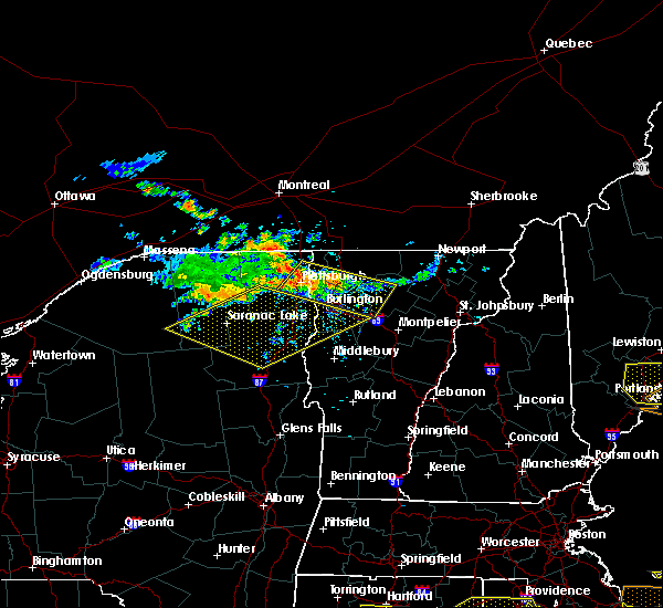 At 1008 pm edt, an area of strong to severe thunderstorms was located from east fletcher vermont westward to cumberland head new york, moving east at 30 mph (radar indicated). Hazards include 60 mph wind gusts and quarter size hail. Hail damage to vehicles is expected. expect wind damage to roofs, siding, and trees. Locations impacted include, colchester, essex junction, plattsburgh international airport, grand isle, beekmantown, jericho, fairfax, chazy, underhill, westford, south hero, johnson, fletcher, north hero, waterville, isle la motte, cambridge, underhill state park, georgia center and schuyler falls. At 1008 pm edt, an area of strong to severe thunderstorms was located from east fletcher vermont westward to cumberland head new york, moving east at 30 mph (radar indicated). Hazards include 60 mph wind gusts and quarter size hail. Hail damage to vehicles is expected. expect wind damage to roofs, siding, and trees. Locations impacted include, colchester, essex junction, plattsburgh international airport, grand isle, beekmantown, jericho, fairfax, chazy, underhill, westford, south hero, johnson, fletcher, north hero, waterville, isle la motte, cambridge, underhill state park, georgia center and schuyler falls.
|
| 7/22/2016 9:42 PM EDT |
 At 941 pm edt, a severe thunderstorm was located over allens bay in clinton county, moving east at 35 mph (radar indicated). Hazards include 60 mph wind gusts and quarter size hail. Hail damage to vehicles is expected. Expect wind damage to roofs, siding, and trees. At 941 pm edt, a severe thunderstorm was located over allens bay in clinton county, moving east at 35 mph (radar indicated). Hazards include 60 mph wind gusts and quarter size hail. Hail damage to vehicles is expected. Expect wind damage to roofs, siding, and trees.
|
| 7/7/2016 1:54 PM EDT |
 At 154 pm edt, a severe thunderstorm was located near fairfax, moving east at 20 mph (radar indicated). Hazards include quarter size hail. damage to vehicles is expected At 154 pm edt, a severe thunderstorm was located near fairfax, moving east at 20 mph (radar indicated). Hazards include quarter size hail. damage to vehicles is expected
|
| 7/7/2016 1:52 PM EDT | Broken power pole casued by falling trees in franklin county VT, 6.8 miles NW of St. Albans, VT |
| 7/7/2016 1:44 PM EDT |
 At 143 pm edt, a severe thunderstorm was located over georgia center, moving southeast at 30 mph (radar indicated). Hazards include quarter size hail. Damage to vehicles is expected. locations impacted include, fairfield, fletcher, georgia center, east fairfield, lime rock point, north fairfax, west fletcher, georgia plains and north cambridge. At 143 pm edt, a severe thunderstorm was located over georgia center, moving southeast at 30 mph (radar indicated). Hazards include quarter size hail. Damage to vehicles is expected. locations impacted include, fairfield, fletcher, georgia center, east fairfield, lime rock point, north fairfax, west fletcher, georgia plains and north cambridge.
|
| 7/7/2016 1:40 PM EDT | Tree down on rt. 7 by georgia town office in franklin county VT, 5.6 miles NNE of St. Albans, VT |
| 7/7/2016 1:26 PM EDT |
 At 126 pm edt, a severe thunderstorm was located over north hero, moving east at 20 mph (radar indicated). Hazards include quarter size hail. Damage to vehicles is expected. locations impacted include, sheldon, fairfield, fletcher, north hero, isle la motte, alburgh dunes state park, highgate falls, south alburgh, georgia center, allens bay in grand isle county, reynolds point, monty point, killkare state park, butler island, fleury bay, west fletcher, graveyard point, middle point, swanton junction and fisk point. At 126 pm edt, a severe thunderstorm was located over north hero, moving east at 20 mph (radar indicated). Hazards include quarter size hail. Damage to vehicles is expected. locations impacted include, sheldon, fairfield, fletcher, north hero, isle la motte, alburgh dunes state park, highgate falls, south alburgh, georgia center, allens bay in grand isle county, reynolds point, monty point, killkare state park, butler island, fleury bay, west fletcher, graveyard point, middle point, swanton junction and fisk point.
|
| 7/7/2016 1:06 PM EDT |
 At 105 pm edt, a severe thunderstorm was located near chazy, moving east at 20 mph (radar indicated). Hazards include quarter size hail. damage to vehicles is expected At 105 pm edt, a severe thunderstorm was located near chazy, moving east at 20 mph (radar indicated). Hazards include quarter size hail. damage to vehicles is expected
|
| 5/29/2016 4:14 PM EDT |
 At 413 pm edt, a severe thunderstorm was located over lake carmi state park, moving northeast at 30 mph (radar indicated). Hazards include 60 mph wind gusts and penny size hail. Expect damage to roofs. siding. and trees. observation, dime size hail was reported in sheldon at 4:10 pm. locations impacted include, franklin, richford, sheldon, fairfield, berkshire, troy, enosburg falls, montgomery, westfield, jay, lake carmi state park, newport center, highgate falls, jay in franklin county, montgomery center, north troy, goose bay, holbrook bay, south bay in orleans county and metcalfe island. At 413 pm edt, a severe thunderstorm was located over lake carmi state park, moving northeast at 30 mph (radar indicated). Hazards include 60 mph wind gusts and penny size hail. Expect damage to roofs. siding. and trees. observation, dime size hail was reported in sheldon at 4:10 pm. locations impacted include, franklin, richford, sheldon, fairfield, berkshire, troy, enosburg falls, montgomery, westfield, jay, lake carmi state park, newport center, highgate falls, jay in franklin county, montgomery center, north troy, goose bay, holbrook bay, south bay in orleans county and metcalfe island.
|
| 5/29/2016 4:10 PM EDT | Trees dow in franklin county VT, 0.9 miles SSW of St. Albans, VT |
| 5/29/2016 4:09 PM EDT |
 At 408 pm edt, a severe thunderstorm was located over sheldon, moving northeast at 30 mph (radar indicated). Hazards include 60 mph wind gusts. Expect damage to roofs. siding. And trees. At 408 pm edt, a severe thunderstorm was located over sheldon, moving northeast at 30 mph (radar indicated). Hazards include 60 mph wind gusts. Expect damage to roofs. siding. And trees.
|
| 5/27/2015 2:09 PM EDT | The severe thunderstorm warning for northern lamoille, southern grand isle, northern chittenden, southwestern orleans and franklin counties will expire at 215 pm edt, the storm which prompted the warning has weakened below severe limits, and no longer poses an immediate threat to life or property. therefore the warning will be allowed to expire. however gusty winds and heavy rain are still possible with this thunderstorm. |
| 5/27/2015 2:02 PM EDT | At 201 pm edt, doppler radar indicated a severe thunderstorm capable of producing quarter size hail and damaging winds in excess of 60 mph. this storm was located over sheldon, moving northeast at 35 mph. locations impacted include, franklin, richford, sheldon, fairfield, berkshire, enosburg falls, montgomery, jay, lake carmi state park, newport center, jay in franklin county, georgia center, montgomery center, north troy, holbrook bay, killkare state park, east fairfield, west hill, st. albans point and burton island state park. |
| 5/27/2015 1:57 PM EDT | At 156 pm edt, doppler radar indicated a severe thunderstorm capable of producing quarter size hail and damaging winds in excess of 60 mph. this storm was located over georgia center, moving northeast at 40 mph. locations impacted include, south burlington, colchester, essex junction, burlington international airport, winooski, fairfax, underhill, richford, sheldon, westford, fairfield, berkshire, south hero, johnson, enosburg falls, eden, bakersfield, fletcher, montgomery and lowell. |
| 5/27/2015 1:43 PM EDT | At 141 pm edt, doppler radar indicated a severe thunderstorm capable of producing quarter size hail and damaging winds in excess of 60 mph. this storm was located over south hero, moving northeast at 35 mph. locations impacted include, south burlington, colchester, essex junction, burlington international airport, winooski, peru, fairfax, underhill, richford, sheldon, westford, fairfield, berkshire, south hero, johnson, enosburg falls, eden, bakersfield, fletcher and montgomery. |
| 5/27/2015 1:43 PM EDT | At 142 pm edt, doppler radar indicated a severe thunderstorm capable of producing quarter size hail and damaging winds in excess of 60 mph. this storm was located near fairfield, moving northeast at 40 mph. locations impacted include, franklin, grand isle, richford, sheldon, fairfield, berkshire, enosburg falls, montgomery, jay, lake carmi state park, newport center, highgate falls, jay in franklin county, georgia center, montgomery center, north troy, holbrook bay, killkare state park, lapans bay and east fairfield. |
| 5/27/2015 1:43 PM EDT | At 141 pm edt, doppler radar indicated a severe thunderstorm capable of producing quarter size hail and damaging winds in excess of 60 mph. this storm was located over south hero, moving northeast at 35 mph. locations impacted include, south burlington, colchester, essex junction, burlington international airport, winooski, peru, fairfax, underhill, richford, sheldon, westford, fairfield, berkshire, south hero, johnson, enosburg falls, eden, bakersfield, fletcher and montgomery. |
| 5/27/2015 1:22 PM EDT | At 121 pm edt, doppler radar indicated a severe thunderstorm capable of producing quarter size hail and damaging winds in excess of 60 mph. this storm was located near north hero, and moving northeast at 45 mph. * locations to be impacted include, franklin, grand isle, richford, sheldon, fairfield, berkshire, enosburg falls, montgomery, north hero, jay, lake carmi state park, highgate falls, jay in franklin county, montgomery center, newport center, georgia center, north troy, allens bay in grand isle county, holbrook bay and killkare state park. |
| 5/27/2015 1:21 PM EDT | At 121 pm edt, doppler radar indicated a severe thunderstorm capable of producing quarter size hail and damaging winds in excess of 60 mph. this storm was located near peru, and moving northeast at 40 mph. * locations to be impacted include, south burlington, colchester, essex junction, burlington international airport, winooski, peru, jericho, fairfax, underhill, richford, sheldon, westford, fairfield, berkshire, south hero, johnson, enosburg falls, eden, bakersfield and fletcher. |
| 5/27/2015 1:21 PM EDT | At 121 pm edt, doppler radar indicated a severe thunderstorm capable of producing quarter size hail and damaging winds in excess of 60 mph. this storm was located near peru, and moving northeast at 40 mph. * locations to be impacted include, south burlington, colchester, essex junction, burlington international airport, winooski, peru, jericho, fairfax, underhill, richford, sheldon, westford, fairfield, berkshire, south hero, johnson, enosburg falls, eden, bakersfield and fletcher. |
| 5/19/2015 3:12 PM EDT | The severe thunderstorm warning for southeastern grand isle, north central chittenden and franklin counties will expire at 315 pm edt, the storm which prompted the warning has weakened below severe limits, and no longer poses an immediate threat to life or property. therefore the warning will be allowed to expire. to report severe weather, contact your nearest law enforcement agency. they will relay your report to the national weather service burlington. |
| 5/19/2015 2:39 PM EDT | At 237 pm edt, doppler radar continued to indicated a severe thunderstorm capable of producing damaging winds in excess of 60 mph. this storm was located over georgia center, moving northeast at 45 mph. nickel size hail may also accompany the damaging winds. locations impacted include, grand isle, fairfax, richford, sheldon, fairfield, berkshire, enosburg falls, bakersfield, fletcher, montgomery, georgia center, montgomery center, lime rock point, enosburg center, beans point, knight point, st. albans bay, binghamville, savage island and lapans bay. |
| 5/19/2015 2:12 PM EDT | At 210 pm edt, doppler radar indicated a severe thunderstorm capable of producing damaging winds in excess of 60 mph. this storm was located near south hero, and moving northeast at 50 mph. nickel size hail may also accompany the damaging winds. * locations to be impacted include, peru, grand isle, fairfax, richford, sheldon, fairfield, berkshire, south hero, enosburg falls, bakersfield, fletcher, montgomery, lake carmi state park, montgomery center, georgia center, schuyler falls, keeseville, wilcox bay, paradise bay and martin bay. |
| 5/19/2015 2:12 PM EDT | At 210 pm edt, doppler radar indicated a severe thunderstorm capable of producing damaging winds in excess of 60 mph. this storm was located near south hero, and moving northeast at 50 mph. nickel size hail may also accompany the damaging winds. * locations to be impacted include, peru, grand isle, fairfax, richford, sheldon, fairfield, berkshire, south hero, enosburg falls, bakersfield, fletcher, montgomery, lake carmi state park, montgomery center, georgia center, schuyler falls, keeseville, wilcox bay, paradise bay and martin bay. |
| 7/19/2013 7:18 PM EDT | Trees down in franklin county VT, 5.6 miles NNE of St. Albans, VT |
| 9/8/2012 4:45 PM EDT | Multiple trees down in franklin county VT, 0.3 miles WSW of St. Albans, VT |
| 7/23/2012 6:47 PM EDT | Tree limbs and powerlines down throughout tow in franklin county VT, 0.3 miles WSW of St. Albans, VT |
| 1/1/0001 12:00 AM | Trees down and power outages in franklin county VT, 5.6 miles NNE of St. Albans, VT |
Hail Maps for St. Albans, VT
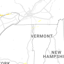
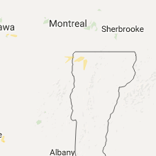

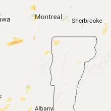


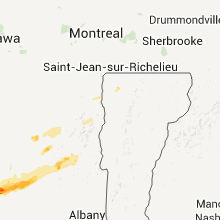
Connect with Interactive Hail Maps