

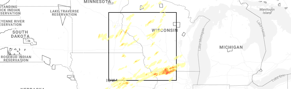
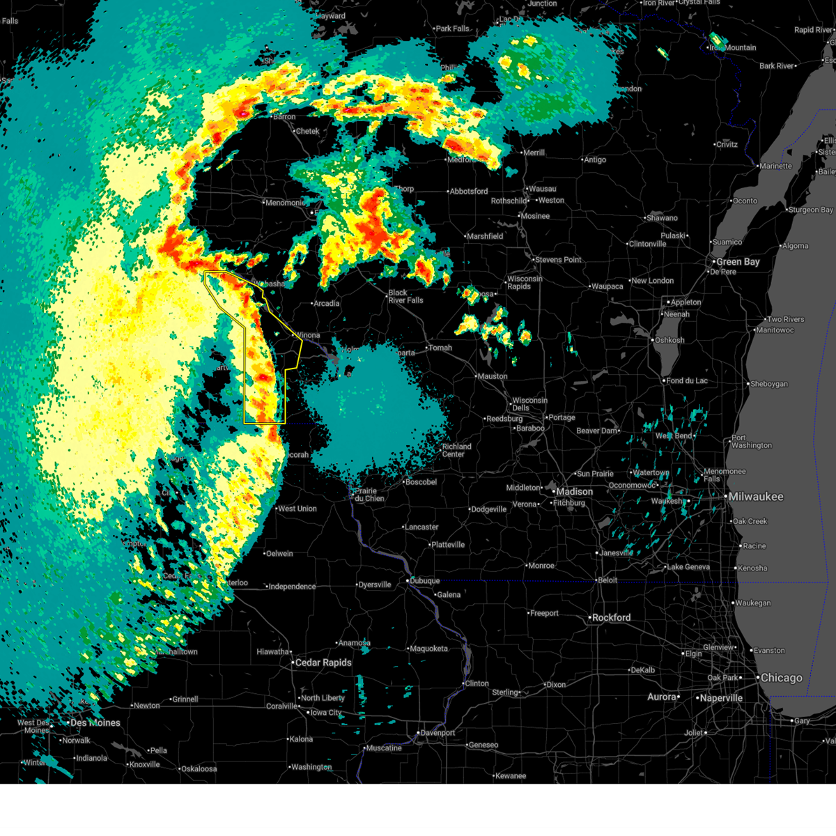
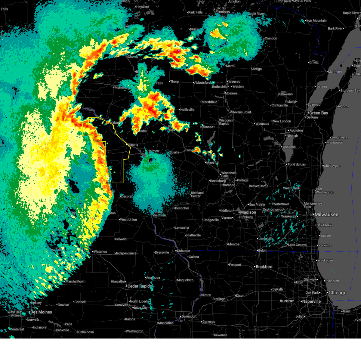
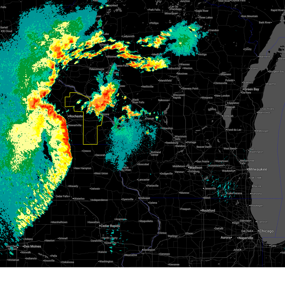
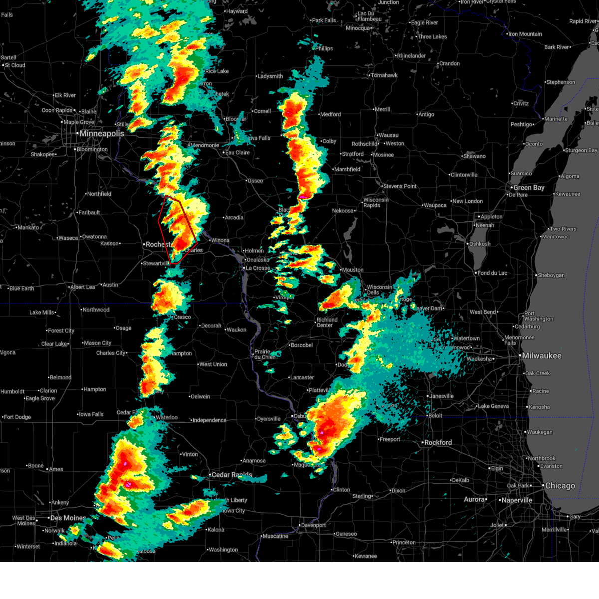
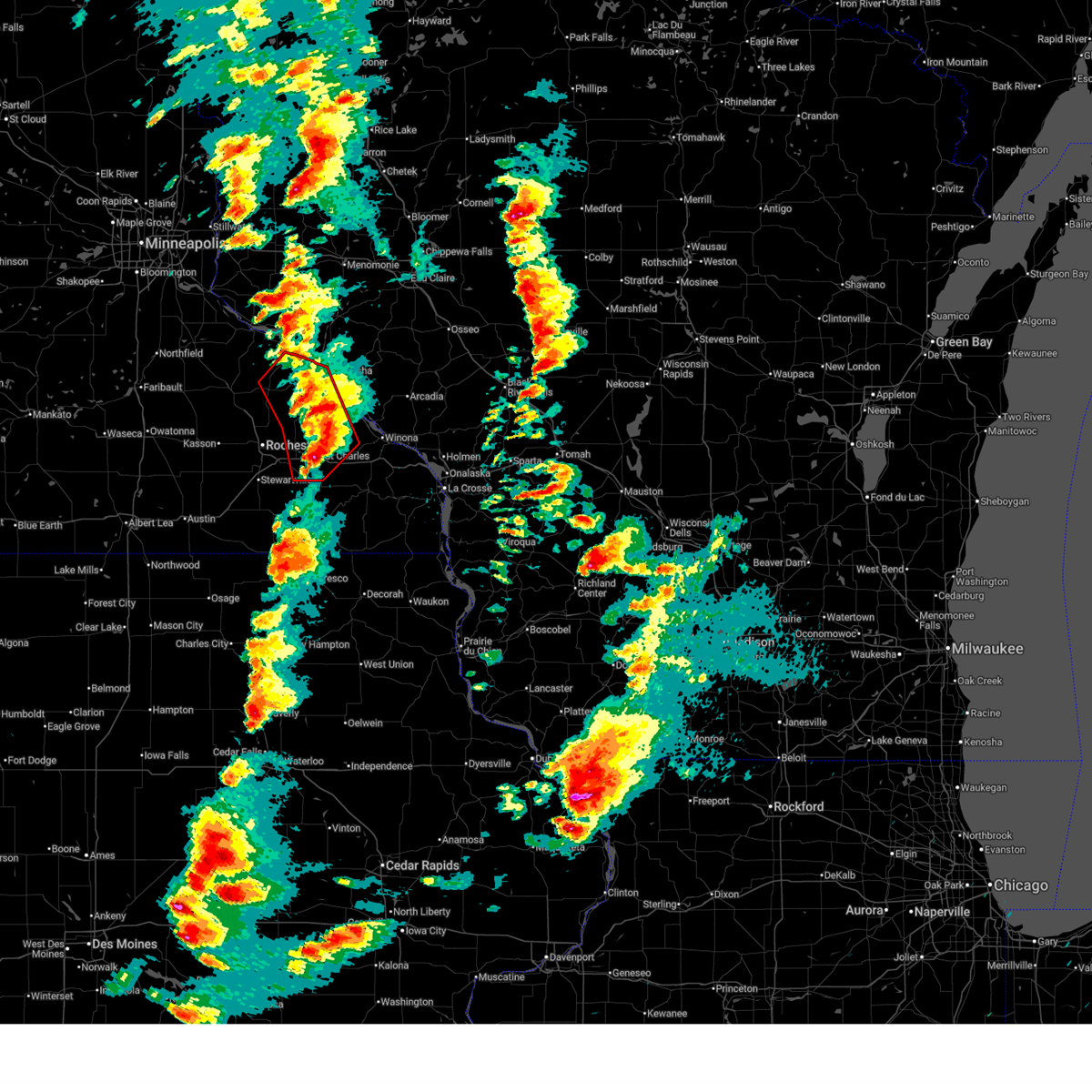
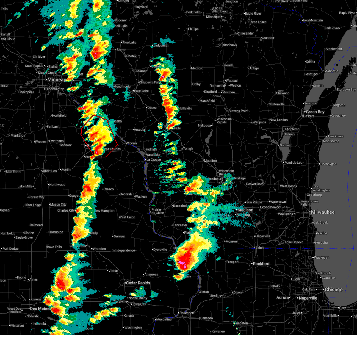
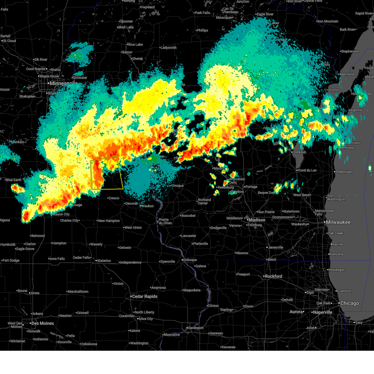
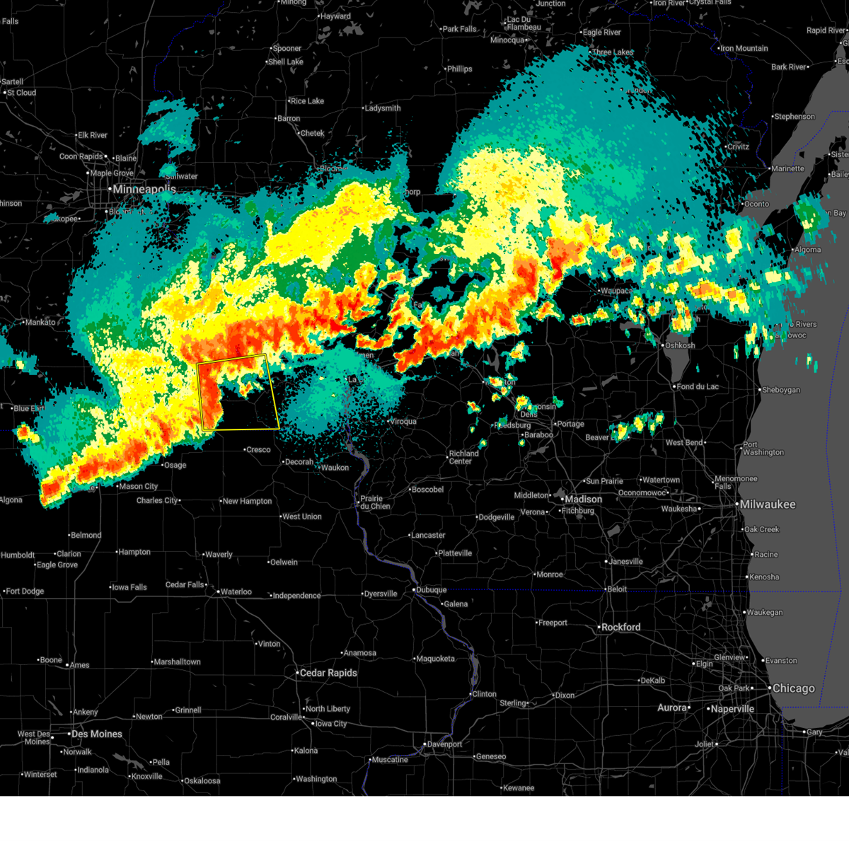
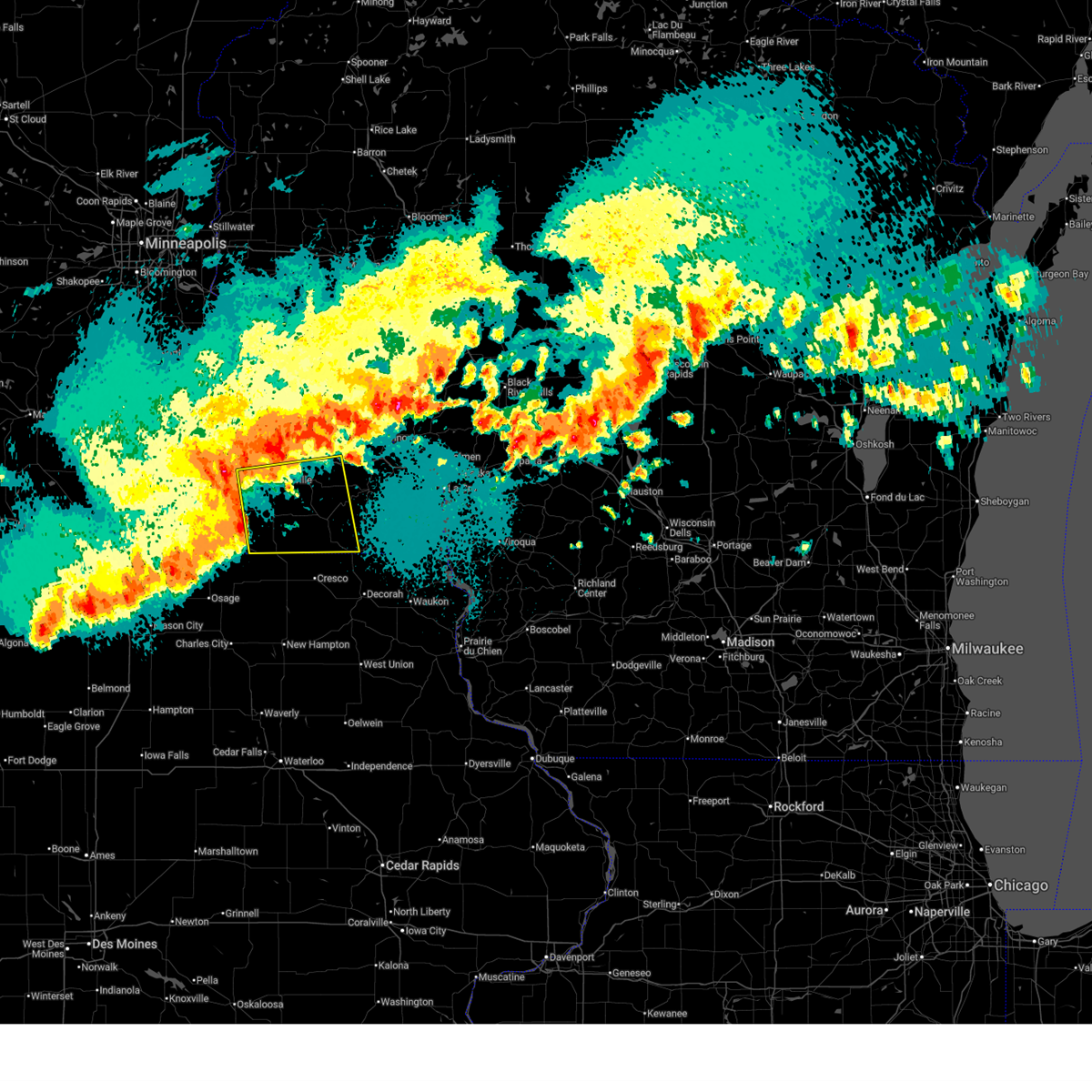
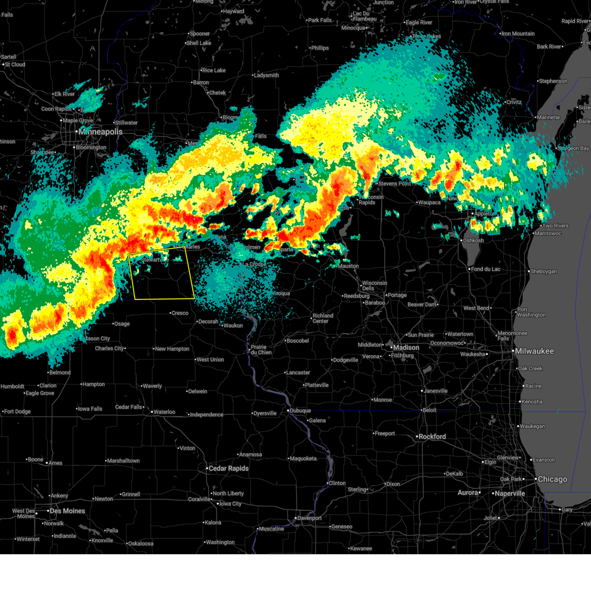
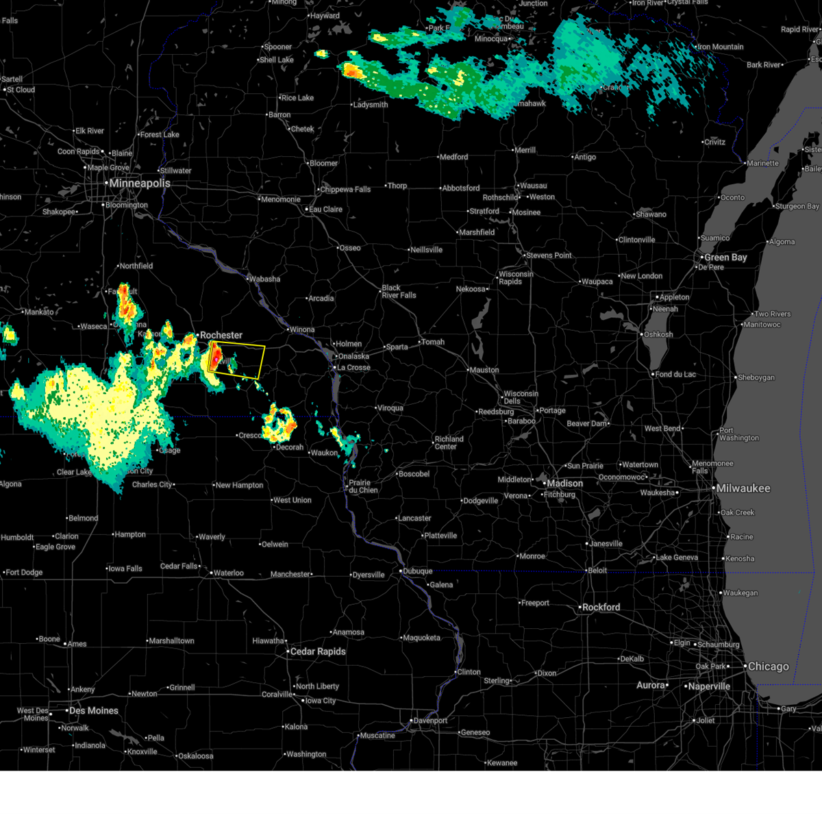
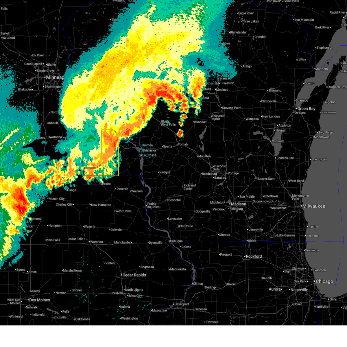
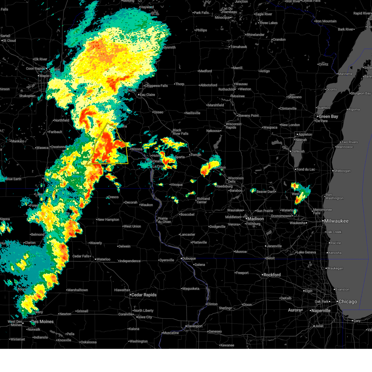
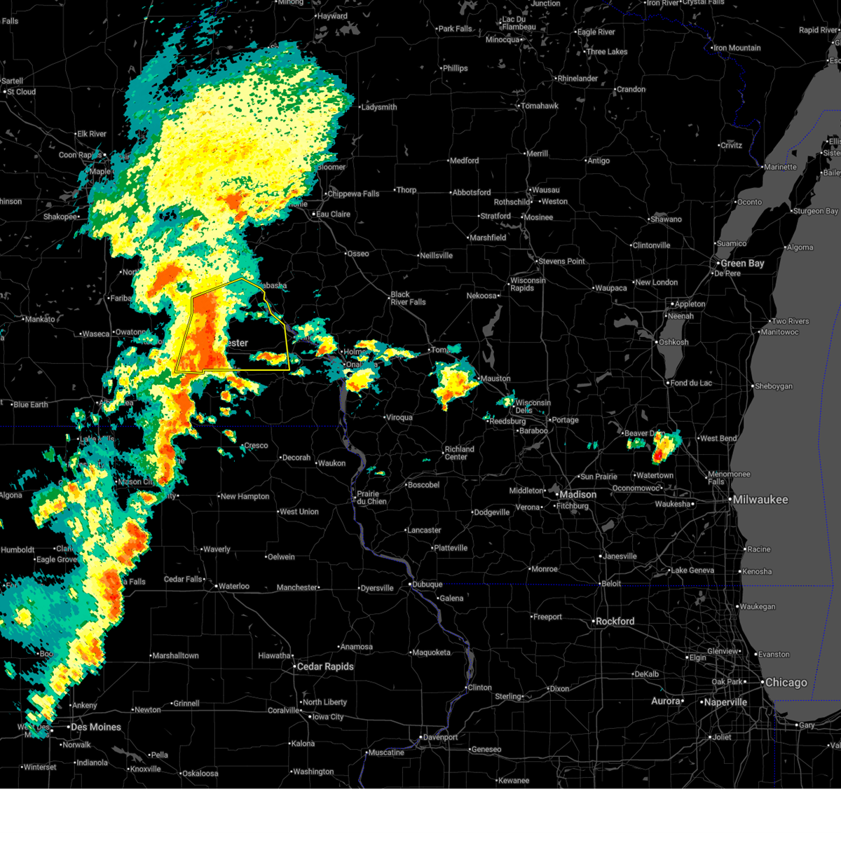
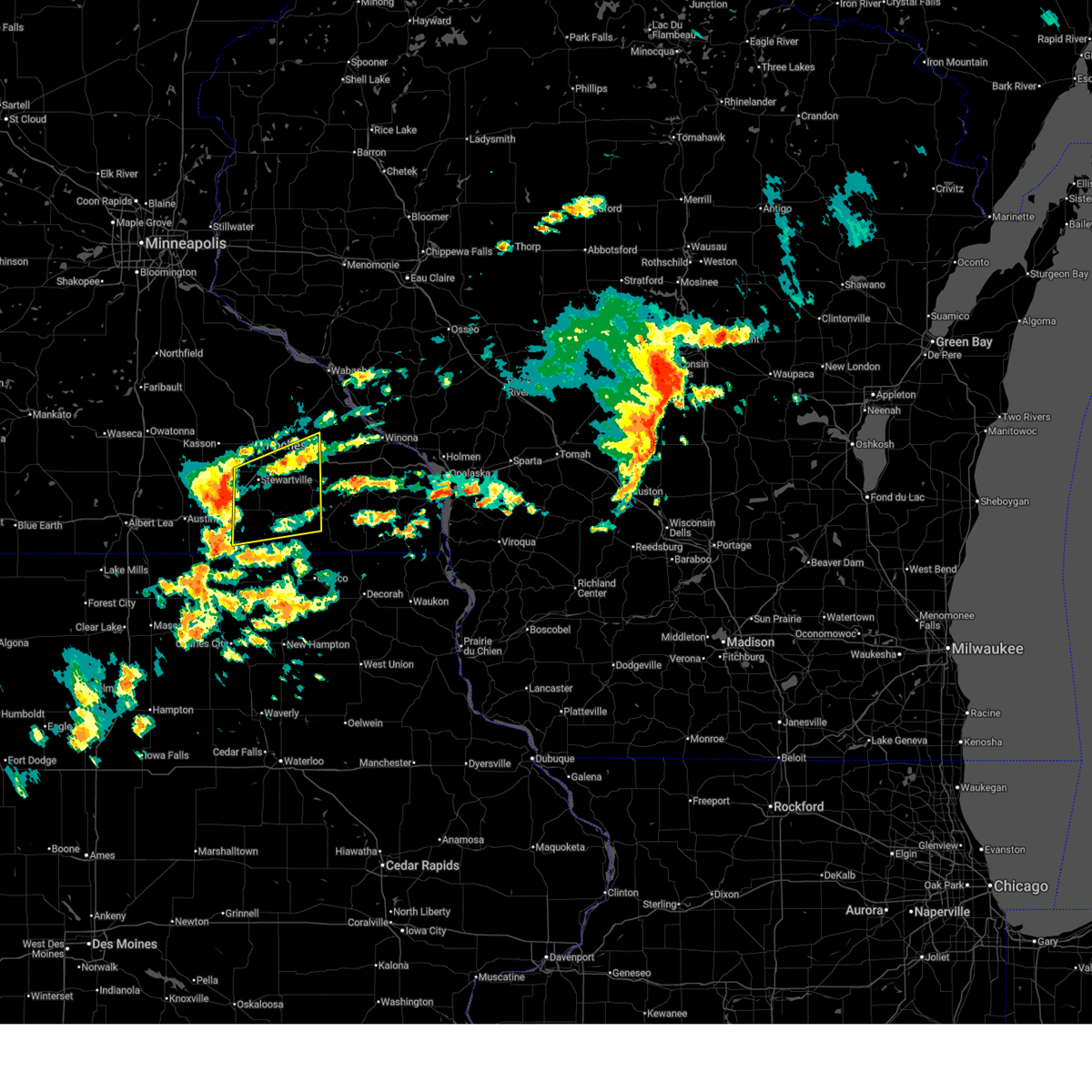
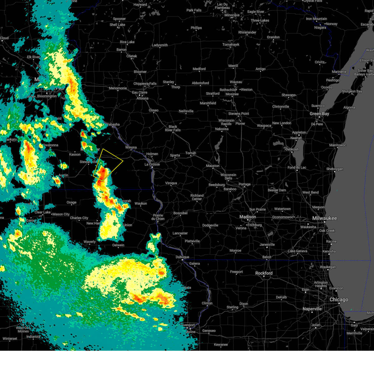
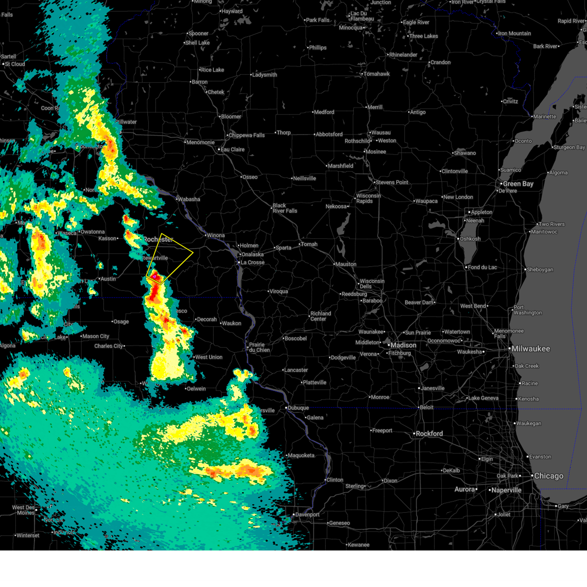
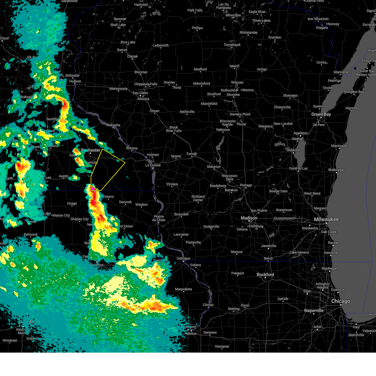
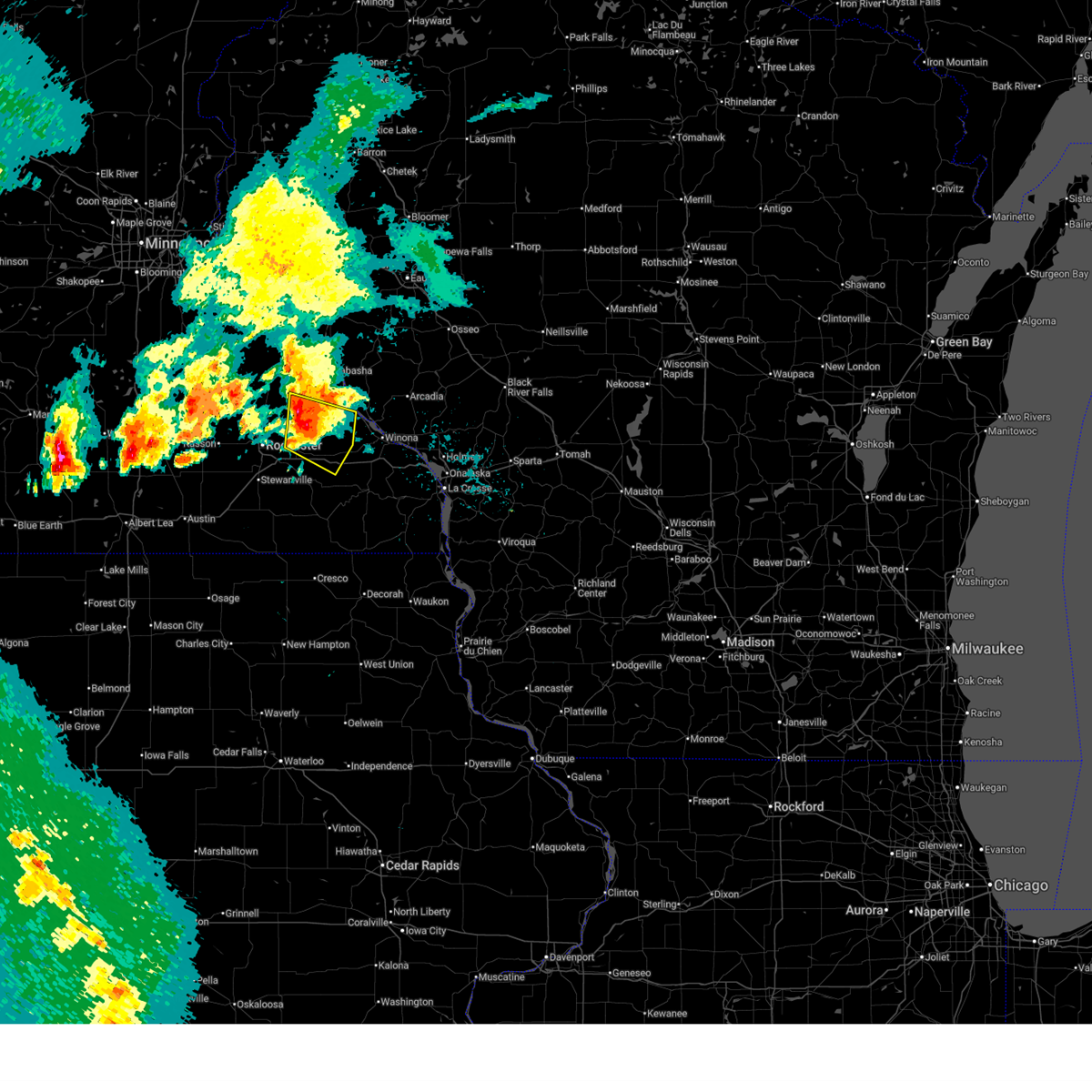
Hail Map for St. Charles, MN
The St. Charles, MN area has had 6 reports of on-the-ground hail by trained spotters, and has been under severe weather warnings 21 times during the past 12 months. Doppler radar has detected hail at or near St. Charles, MN on 52 occasions, including 3 occasions during the past year.
| Name: | St. Charles, MN |
| Where Located: | 41.7 miles WNW of La Crosse, WI |
| Map: | Google Map for St. Charles, MN |
| Population: | 3735 |
| Housing Units: | 1532 |
| More Info: | Search Google for St. Charles, MN |
3
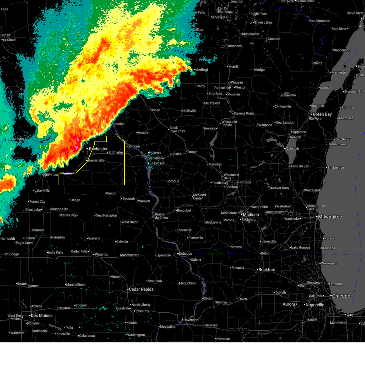
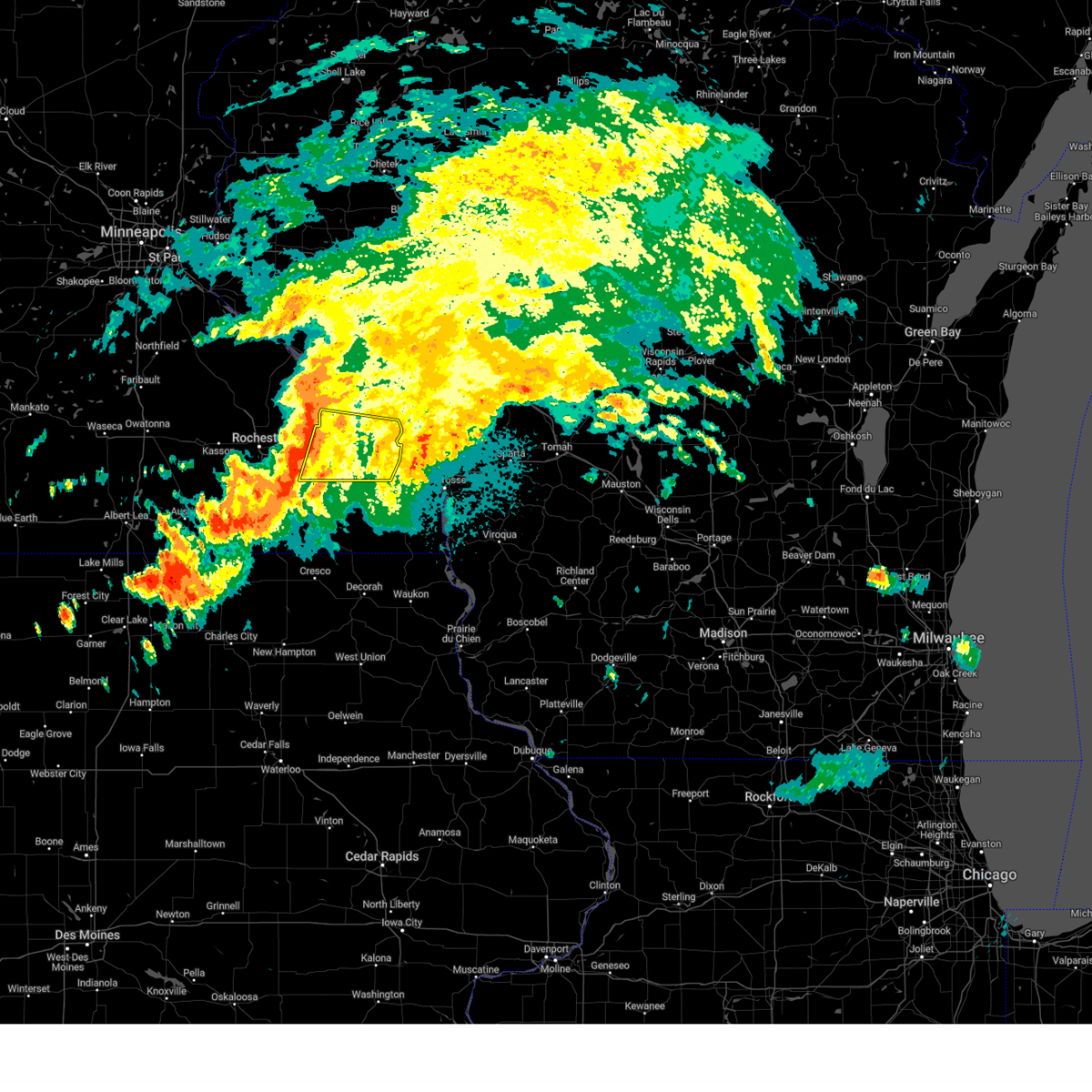
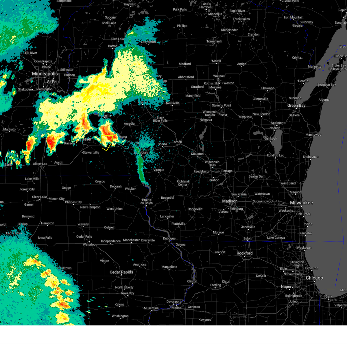
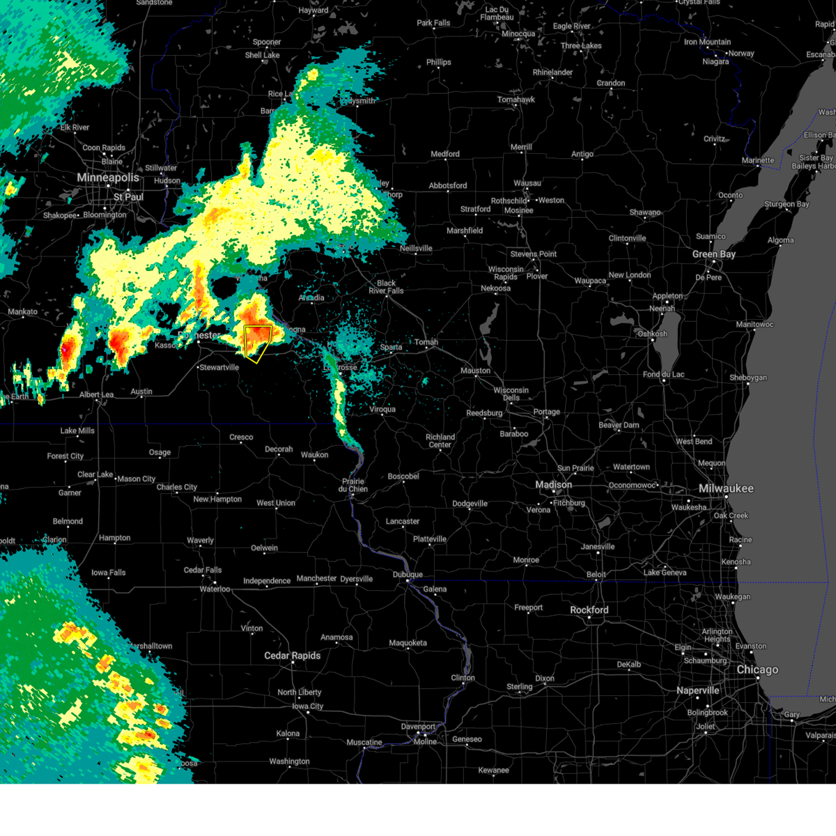
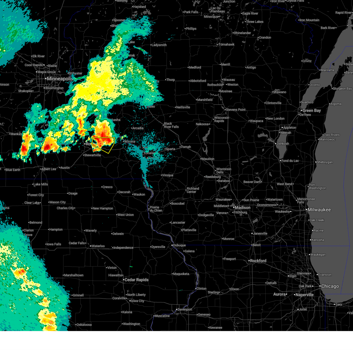
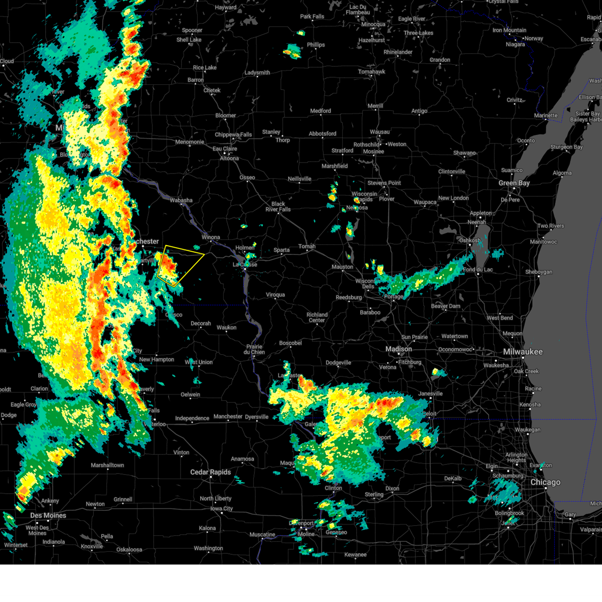
The Top Recent Hail Date for St. Charles, MN is Friday, April 17, 2026 (4th out of 52)
Hail and Wind Damage Spotted near St. Charles, MN
| Date / Time | Report Details |
|---|---|
| 6/10/2026 5:46 PM CDT |
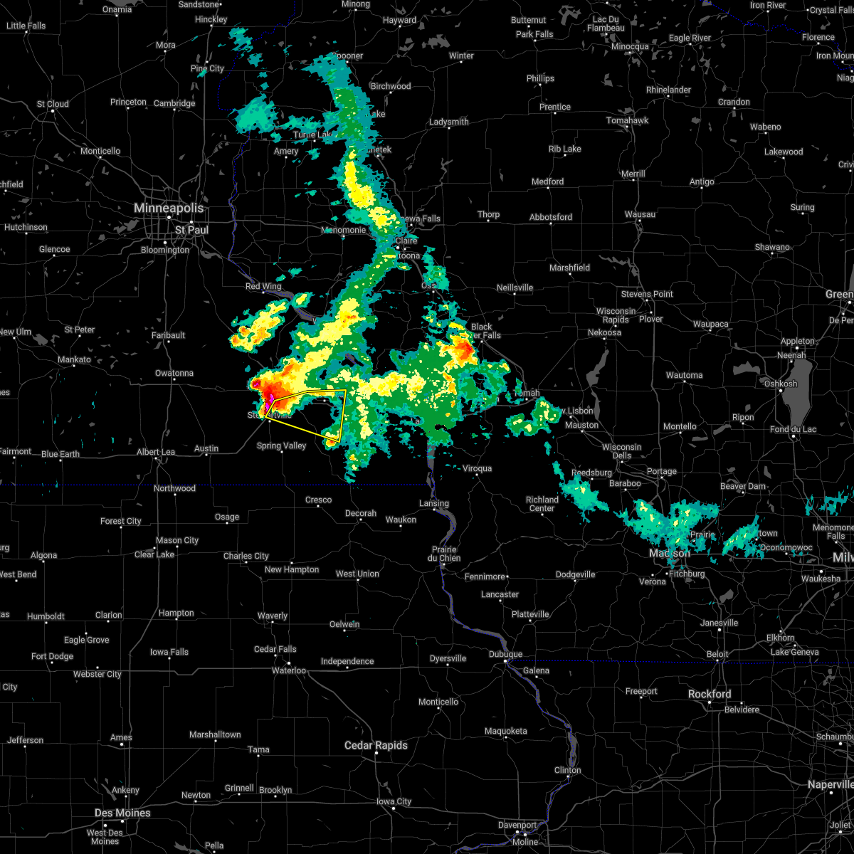
 Svrarx the national weather service in la crosse has issued a * severe thunderstorm warning for, southwestern winona county in southeastern minnesota, southeastern olmsted county in southeastern minnesota, northern fillmore county in southeastern minnesota, * until 630 pm cdt. * at 546 pm cdt, a severe thunderstorm was located near chatfield, or 12 miles northwest of preston, moving east at 30 mph (radar indicated). Hazards include golf ball size hail and 60 mph wind gusts. People and animals outdoors will be injured. expect hail damage to roofs, siding, windows, and vehicles. expect wind damage to roofs, siding, and trees. this severe thunderstorm will be near, chatfield around 550 pm cdt. other locations impacted by this severe thunderstorm include saratoga, county roads 6 and 33, county roads 137 and 136, fillmore, highway 30 and county 74, utica, and peterson. This includes interstate 90 in minnesota between mile markers 232 and 246. Svrarx the national weather service in la crosse has issued a * severe thunderstorm warning for, southwestern winona county in southeastern minnesota, southeastern olmsted county in southeastern minnesota, northern fillmore county in southeastern minnesota, * until 630 pm cdt. * at 546 pm cdt, a severe thunderstorm was located near chatfield, or 12 miles northwest of preston, moving east at 30 mph (radar indicated). Hazards include golf ball size hail and 60 mph wind gusts. People and animals outdoors will be injured. expect hail damage to roofs, siding, windows, and vehicles. expect wind damage to roofs, siding, and trees. this severe thunderstorm will be near, chatfield around 550 pm cdt. other locations impacted by this severe thunderstorm include saratoga, county roads 6 and 33, county roads 137 and 136, fillmore, highway 30 and county 74, utica, and peterson. This includes interstate 90 in minnesota between mile markers 232 and 246.
|
| 6/10/2026 5:25 PM CDT |
 At 525 pm cdt, a severe thunderstorm was located over lewiston, or 9 miles west of winona, moving east at 40 mph (radar indicated). Hazards include 60 mph wind gusts. Expect damage to roofs, siding, and trees. this severe storm will be near, winona, goodview, and stockton around 530 pm cdt. other locations impacted by this severe thunderstorm include county roads 28 and 31, minnesota city, lock and dam 5 a, utica, bethany, and elba. This includes interstate 90 in minnesota between mile markers 252 and 255. At 525 pm cdt, a severe thunderstorm was located over lewiston, or 9 miles west of winona, moving east at 40 mph (radar indicated). Hazards include 60 mph wind gusts. Expect damage to roofs, siding, and trees. this severe storm will be near, winona, goodview, and stockton around 530 pm cdt. other locations impacted by this severe thunderstorm include county roads 28 and 31, minnesota city, lock and dam 5 a, utica, bethany, and elba. This includes interstate 90 in minnesota between mile markers 252 and 255.
|
| 6/10/2026 5:18 PM CDT |
 At 517 pm cdt, a severe thunderstorm was located near altura, or 14 miles west of winona, moving east at 40 mph (radar indicated). Hazards include 60 mph wind gusts and quarter size hail. Hail damage to vehicles is expected. expect wind damage to roofs, siding, and trees. this severe storm will be near, lewiston and stockton around 525 pm cdt. winona and goodview around 530 pm cdt. other locations impacted by this severe thunderstorm include whitewater state park, lock and dam 5 a, elba, wilson, county roads 28 and 31, minnesota city, and utica. This includes interstate 90 in minnesota between mile markers 229 and 234, and between mile markers 252 and 255. At 517 pm cdt, a severe thunderstorm was located near altura, or 14 miles west of winona, moving east at 40 mph (radar indicated). Hazards include 60 mph wind gusts and quarter size hail. Hail damage to vehicles is expected. expect wind damage to roofs, siding, and trees. this severe storm will be near, lewiston and stockton around 525 pm cdt. winona and goodview around 530 pm cdt. other locations impacted by this severe thunderstorm include whitewater state park, lock and dam 5 a, elba, wilson, county roads 28 and 31, minnesota city, and utica. This includes interstate 90 in minnesota between mile markers 229 and 234, and between mile markers 252 and 255.
|
| 6/10/2026 5:05 PM CDT |
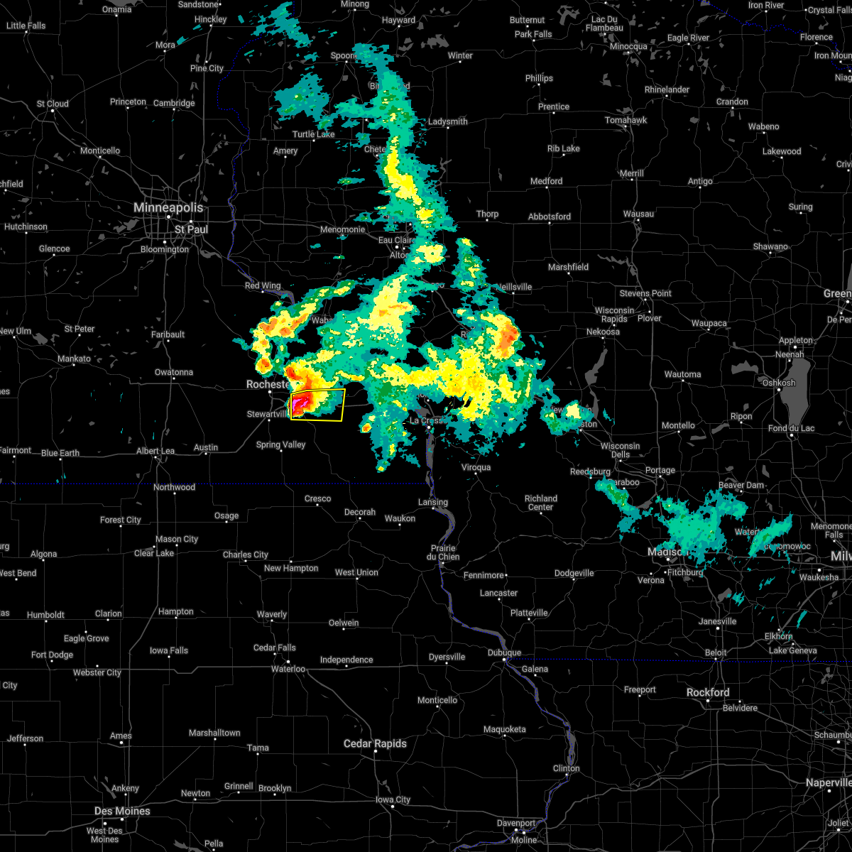
 Svrarx the national weather service in la crosse has issued a * severe thunderstorm warning for, northwestern winona county in southeastern minnesota, east central olmsted county in southeastern minnesota, southeastern wabasha county in southeastern minnesota, southeastern buffalo county in west central wisconsin, * until 600 pm cdt. * at 504 pm cdt, a severe thunderstorm was located near eyota, or 15 miles east of rochester, moving east at 30 mph (trained weather spotters). Hazards include ping pong ball size hail and 60 mph wind gusts. People and animals outdoors will be injured. expect hail damage to roofs, siding, windows, and vehicles. expect wind damage to roofs, siding, and trees. this severe thunderstorm will be near, altura around 520 pm cdt. rollingstone around 530 pm cdt. goodview around 540 pm cdt. winona and fountain city around 545 pm cdt. other locations impacted by this severe thunderstorm include whitewater state park, weaver, czechville, merrick state park, lock and dam 5 a, county roads 9 and 10, and elba. This includes interstate 90 in minnesota between mile markers 224 and 234, and between mile markers 252 and 255. Svrarx the national weather service in la crosse has issued a * severe thunderstorm warning for, northwestern winona county in southeastern minnesota, east central olmsted county in southeastern minnesota, southeastern wabasha county in southeastern minnesota, southeastern buffalo county in west central wisconsin, * until 600 pm cdt. * at 504 pm cdt, a severe thunderstorm was located near eyota, or 15 miles east of rochester, moving east at 30 mph (trained weather spotters). Hazards include ping pong ball size hail and 60 mph wind gusts. People and animals outdoors will be injured. expect hail damage to roofs, siding, windows, and vehicles. expect wind damage to roofs, siding, and trees. this severe thunderstorm will be near, altura around 520 pm cdt. rollingstone around 530 pm cdt. goodview around 540 pm cdt. winona and fountain city around 545 pm cdt. other locations impacted by this severe thunderstorm include whitewater state park, weaver, czechville, merrick state park, lock and dam 5 a, county roads 9 and 10, and elba. This includes interstate 90 in minnesota between mile markers 224 and 234, and between mile markers 252 and 255.
|
| 5/17/2026 11:52 PM CDT |
 At 1151 pm cdt, severe thunderstorms were located along a line extending from near red wing to near kellogg to near canton, moving northeast at 60 mph (radar indicated). Hazards include 60 mph wind gusts. Expect damage to roofs, siding, and trees. these severe storms will be near, wabasha, alma, rushford, lewiston, buffalo city, rollingstone, altura, and kellogg around 1155 pm cdt. stockton around 1200 am cdt. winona and goodview around 1205 am cdt. other locations impacted by these severe thunderstorms include pioneer campground, choice, isinours, hutton, county roads 28 and 31, utica, and rattlesnake ridge. This includes interstate 90 in minnesota between mile markers 233 and 257. At 1151 pm cdt, severe thunderstorms were located along a line extending from near red wing to near kellogg to near canton, moving northeast at 60 mph (radar indicated). Hazards include 60 mph wind gusts. Expect damage to roofs, siding, and trees. these severe storms will be near, wabasha, alma, rushford, lewiston, buffalo city, rollingstone, altura, and kellogg around 1155 pm cdt. stockton around 1200 am cdt. winona and goodview around 1205 am cdt. other locations impacted by these severe thunderstorms include pioneer campground, choice, isinours, hutton, county roads 28 and 31, utica, and rattlesnake ridge. This includes interstate 90 in minnesota between mile markers 233 and 257.
|
| 5/17/2026 11:42 PM CDT |
 At 1141 pm cdt, severe thunderstorms were located along a line extending from near goodhue to near plainview to near canton, moving northeast at 60 mph (radar indicated). Hazards include 60 mph wind gusts. Expect damage to roofs, siding, and trees. these severe storms will be near, st. charles, plainview, lanesboro, altura, and canton around 1145 pm cdt. wabasha, lewiston, buffalo city, mabel, and kellogg around 1150 pm cdt. alma, rushford, stockton, and rollingstone around 1155 pm cdt. winona and goodview around 1200 am cdt. other locations impacted by these severe thunderstorms include south troy, pioneer campground, choice, isinours, hutton, county roads 28 and 31, and utica. This includes interstate 90 in minnesota between mile markers 233 and 257. At 1141 pm cdt, severe thunderstorms were located along a line extending from near goodhue to near plainview to near canton, moving northeast at 60 mph (radar indicated). Hazards include 60 mph wind gusts. Expect damage to roofs, siding, and trees. these severe storms will be near, st. charles, plainview, lanesboro, altura, and canton around 1145 pm cdt. wabasha, lewiston, buffalo city, mabel, and kellogg around 1150 pm cdt. alma, rushford, stockton, and rollingstone around 1155 pm cdt. winona and goodview around 1200 am cdt. other locations impacted by these severe thunderstorms include south troy, pioneer campground, choice, isinours, hutton, county roads 28 and 31, and utica. This includes interstate 90 in minnesota between mile markers 233 and 257.
|
| 5/17/2026 11:17 PM CDT |
 Svrarx the national weather service in la crosse has issued a * severe thunderstorm warning for, winona county in southeastern minnesota, wabasha county in southeastern minnesota, eastern fillmore county in southeastern minnesota, * until 1215 am cdt. * at 1116 pm cdt, severe thunderstorms were located along a line extending from near kenyon to rochester to 8 miles south of lime springs, moving northeast at 60 mph (radar indicated). Hazards include 60 mph wind gusts. Expect damage to roofs, siding, and trees. severe thunderstorms will be near, mazeppa around 1125 pm cdt. elgin around 1130 pm cdt. preston and plainview around 1135 pm cdt. st. charles and lanesboro around 1140 pm cdt. wabasha around 1145 pm cdt. altura and kellogg around 1150 pm cdt. alma, lewiston, and buffalo city around 1155 pm cdt. stockton and rollingstone around 1200 am cdt. other locations impacted by these severe thunderstorms include south troy, pioneer campground, choice, isinours, hutton, county roads 28 and 31, and utica. This includes interstate 90 in minnesota between mile markers 233 and 257. Svrarx the national weather service in la crosse has issued a * severe thunderstorm warning for, winona county in southeastern minnesota, wabasha county in southeastern minnesota, eastern fillmore county in southeastern minnesota, * until 1215 am cdt. * at 1116 pm cdt, severe thunderstorms were located along a line extending from near kenyon to rochester to 8 miles south of lime springs, moving northeast at 60 mph (radar indicated). Hazards include 60 mph wind gusts. Expect damage to roofs, siding, and trees. severe thunderstorms will be near, mazeppa around 1125 pm cdt. elgin around 1130 pm cdt. preston and plainview around 1135 pm cdt. st. charles and lanesboro around 1140 pm cdt. wabasha around 1145 pm cdt. altura and kellogg around 1150 pm cdt. alma, lewiston, and buffalo city around 1155 pm cdt. stockton and rollingstone around 1200 am cdt. other locations impacted by these severe thunderstorms include south troy, pioneer campground, choice, isinours, hutton, county roads 28 and 31, and utica. This includes interstate 90 in minnesota between mile markers 233 and 257.
|
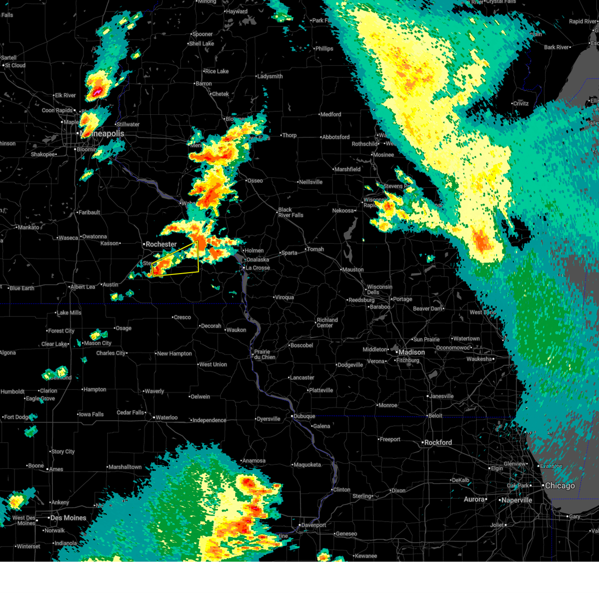
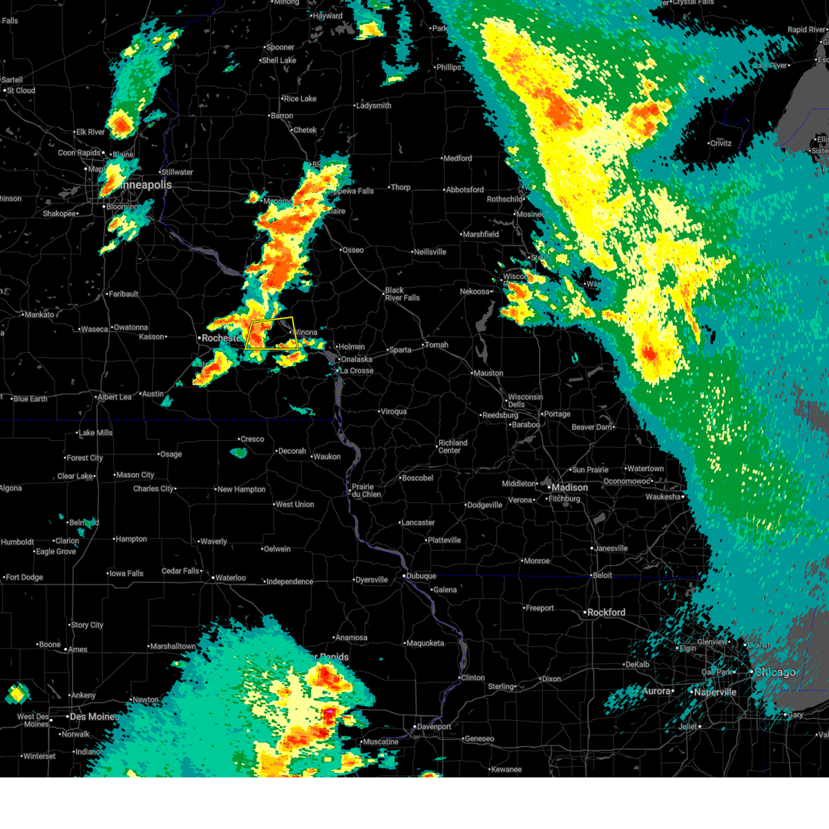
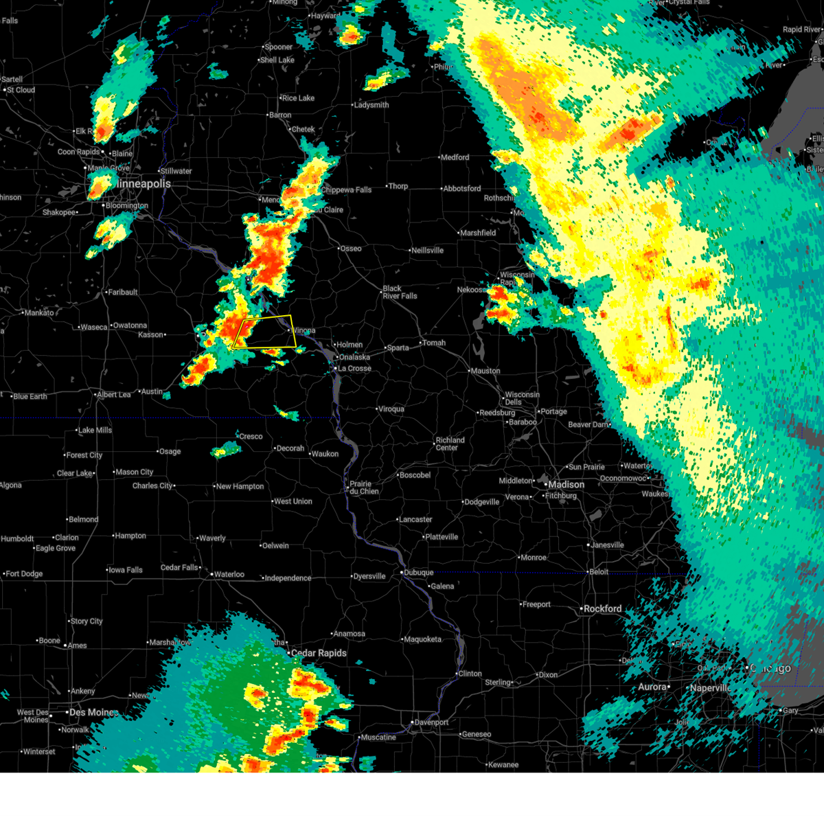
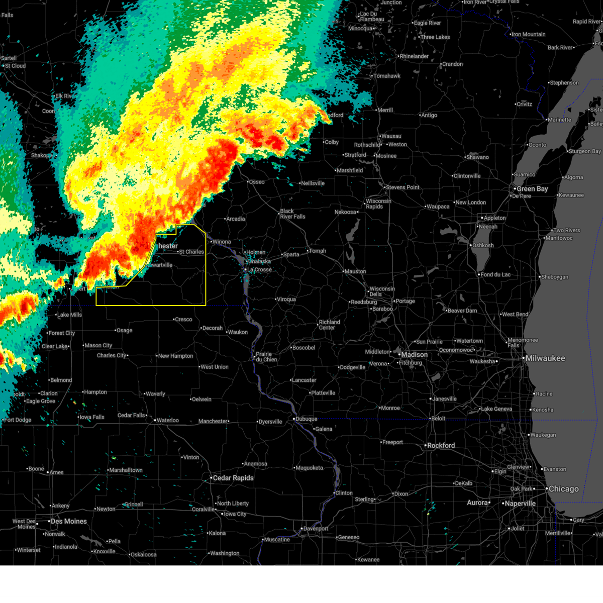
| 4/17/2026 3:00 PM CDT |
 At 259 pm cdt, tornado producing storms were located along a line extending from 7 miles north of plainview to near st. charles, moving east at 30 mph (weather spotters confirmed tornado). Hazards include damaging tornado and quarter size hail. Flying debris will be dangerous to those caught without shelter. mobile homes will be damaged or destroyed. damage to roofs, windows, and vehicles will occur. tree damage is likely. these tornadic storms will be near, st. charles and altura around 305 pm cdt. lewiston around 310 pm cdt. kellogg around 315 pm cdt. other locations impacted by these tornadic storms include saratoga, whitewater state park, county roads 9 and 10, county roads 79 and 2, elba, zumbro bottoms campground, and conception. This includes interstate 90 in minnesota between mile markers 228 and 239. At 259 pm cdt, tornado producing storms were located along a line extending from 7 miles north of plainview to near st. charles, moving east at 30 mph (weather spotters confirmed tornado). Hazards include damaging tornado and quarter size hail. Flying debris will be dangerous to those caught without shelter. mobile homes will be damaged or destroyed. damage to roofs, windows, and vehicles will occur. tree damage is likely. these tornadic storms will be near, st. charles and altura around 305 pm cdt. lewiston around 310 pm cdt. kellogg around 315 pm cdt. other locations impacted by these tornadic storms include saratoga, whitewater state park, county roads 9 and 10, county roads 79 and 2, elba, zumbro bottoms campground, and conception. This includes interstate 90 in minnesota between mile markers 228 and 239.
|
| 4/17/2026 2:53 PM CDT |
 At 253 pm cdt, tornado producing storms were located along a line extending from 7 miles northeast of mazeppa to dover, moving northeast at 25 mph (weather spotters confirmed tornado). Hazards include damaging tornado and quarter size hail. multiple tornadoes are being reported with this line of storms. a damaging tornado has hit marion and another is located near plainview. Flying debris will be dangerous to those caught without shelter. mobile homes will be damaged or destroyed. damage to roofs, windows, and vehicles will occur. tree damage is likely. these tornadic storms will be near, st. charles and plainview around 300 pm cdt. altura around 310 pm cdt. wabasha around 320 pm cdt. kellogg around 325 pm cdt. other locations impacted by these tornadic storms include whitewater state park, county roads 9 and 10, potsdam, county roads 28 and 31, utica, west albany, and county roads 33 and 4. This includes interstate 90 in minnesota between mile markers 222 and 239. At 253 pm cdt, tornado producing storms were located along a line extending from 7 miles northeast of mazeppa to dover, moving northeast at 25 mph (weather spotters confirmed tornado). Hazards include damaging tornado and quarter size hail. multiple tornadoes are being reported with this line of storms. a damaging tornado has hit marion and another is located near plainview. Flying debris will be dangerous to those caught without shelter. mobile homes will be damaged or destroyed. damage to roofs, windows, and vehicles will occur. tree damage is likely. these tornadic storms will be near, st. charles and plainview around 300 pm cdt. altura around 310 pm cdt. wabasha around 320 pm cdt. kellogg around 325 pm cdt. other locations impacted by these tornadic storms include whitewater state park, county roads 9 and 10, potsdam, county roads 28 and 31, utica, west albany, and county roads 33 and 4. This includes interstate 90 in minnesota between mile markers 222 and 239.
|
| 4/17/2026 2:47 PM CDT |
 At 246 pm cdt, tornado producing storms were located along a line extending from near mazeppa to near dover, moving northeast at 25 mph (weather spotters confirmed tornado. a dangerous tornado is likely located near elgin!). Hazards include damaging tornado and quarter size hail. Flying debris will be dangerous to those caught without shelter. mobile homes will be damaged or destroyed. damage to roofs, windows, and vehicles will occur. tree damage is likely. these tornadic storms will be near, st. charles, plainview, elgin, and dover around 250 pm cdt. altura around 305 pm cdt. wabasha around 315 pm cdt. other locations impacted by these tornadic storms include south troy, whitewater state park, county roads 9 and 10, rattelsnake point, potsdam, county roads 28 and 31, and utica. This includes interstate 90 in minnesota between mile markers 220 and 239. At 246 pm cdt, tornado producing storms were located along a line extending from near mazeppa to near dover, moving northeast at 25 mph (weather spotters confirmed tornado. a dangerous tornado is likely located near elgin!). Hazards include damaging tornado and quarter size hail. Flying debris will be dangerous to those caught without shelter. mobile homes will be damaged or destroyed. damage to roofs, windows, and vehicles will occur. tree damage is likely. these tornadic storms will be near, st. charles, plainview, elgin, and dover around 250 pm cdt. altura around 305 pm cdt. wabasha around 315 pm cdt. other locations impacted by these tornadic storms include south troy, whitewater state park, county roads 9 and 10, rattelsnake point, potsdam, county roads 28 and 31, and utica. This includes interstate 90 in minnesota between mile markers 220 and 239.
|
| 4/17/2026 2:41 PM CDT |
 Torarx the national weather service in la crosse has issued a * tornado warning for, western winona county in southeastern minnesota, eastern olmsted county in southeastern minnesota, wabasha county in southeastern minnesota, * until 330 pm cdt. * at 241 pm cdt, tornado producing storms were located along a line extending from near mazeppa to near chatfield, moving northeast at 25 mph (weather spotters confirmed tornado. mulitple tornadoes have been reported with these storms). Hazards include damaging tornadoes and quarter size hail. Flying debris will be dangerous to those caught without shelter. mobile homes will be damaged or destroyed. damage to roofs, windows, and vehicles will occur. Tree damage is likely. Torarx the national weather service in la crosse has issued a * tornado warning for, western winona county in southeastern minnesota, eastern olmsted county in southeastern minnesota, wabasha county in southeastern minnesota, * until 330 pm cdt. * at 241 pm cdt, tornado producing storms were located along a line extending from near mazeppa to near chatfield, moving northeast at 25 mph (weather spotters confirmed tornado. mulitple tornadoes have been reported with these storms). Hazards include damaging tornadoes and quarter size hail. Flying debris will be dangerous to those caught without shelter. mobile homes will be damaged or destroyed. damage to roofs, windows, and vehicles will occur. Tree damage is likely.
|
| 4/13/2026 9:30 PM CDT |
 At 930 pm cdt, severe thunderstorms were located along a line extending from 6 miles west of chatfield to 6 miles north of lime springs, moving east at 55 mph (trained weather spotters). Hazards include 70 mph wind gusts. Expect considerable tree damage. damage is likely to mobile homes, roofs, and outbuildings. these severe storms will be near, preston, chatfield, and fountain around 935 pm cdt. harmony and lanesboro around 940 pm cdt. canton around 945 pm cdt. other locations impacted by these severe thunderstorms include forestville state park, county roads 6 and 33, york, isinours, hutton, fillmore, and washington. This includes interstate 90 in minnesota between mile markers 233 and 240. At 930 pm cdt, severe thunderstorms were located along a line extending from 6 miles west of chatfield to 6 miles north of lime springs, moving east at 55 mph (trained weather spotters). Hazards include 70 mph wind gusts. Expect considerable tree damage. damage is likely to mobile homes, roofs, and outbuildings. these severe storms will be near, preston, chatfield, and fountain around 935 pm cdt. harmony and lanesboro around 940 pm cdt. canton around 945 pm cdt. other locations impacted by these severe thunderstorms include forestville state park, county roads 6 and 33, york, isinours, hutton, fillmore, and washington. This includes interstate 90 in minnesota between mile markers 233 and 240.
|
| 4/13/2026 9:27 PM CDT |
 At 927 pm cdt, severe thunderstorms were located along a line extending from 6 miles east of stewartville to 6 miles north of lime springs, moving east at 55 mph (trained weather spotters). Hazards include 70 mph wind gusts. Expect considerable tree damage. damage is likely to mobile homes, roofs, and outbuildings. these severe storms will be near, preston, chatfield, and fountain around 935 pm cdt. harmony, lanesboro, and canton around 940 pm cdt. other locations impacted by these severe thunderstorms include forestville state park, county roads 6 and 33, york, isinours, hutton, fillmore, and rochester airport. This includes interstate 90 in minnesota between mile markers 208 and 214, and between mile markers 232 and 240. At 927 pm cdt, severe thunderstorms were located along a line extending from 6 miles east of stewartville to 6 miles north of lime springs, moving east at 55 mph (trained weather spotters). Hazards include 70 mph wind gusts. Expect considerable tree damage. damage is likely to mobile homes, roofs, and outbuildings. these severe storms will be near, preston, chatfield, and fountain around 935 pm cdt. harmony, lanesboro, and canton around 940 pm cdt. other locations impacted by these severe thunderstorms include forestville state park, county roads 6 and 33, york, isinours, hutton, fillmore, and rochester airport. This includes interstate 90 in minnesota between mile markers 208 and 214, and between mile markers 232 and 240.
|
| 4/13/2026 9:17 PM CDT |
 At 917 pm cdt, severe thunderstorms were located along a line extending from stewartville to near le roy, moving east at 50 mph (trained weather spotters). Hazards include 70 mph wind gusts. wind gusts to 60 mph have been reported with this storm. Expect considerable tree damage. damage is likely to mobile homes, roofs, and outbuildings. these severe storms will be near, stewartville and spring valley around 920 pm cdt. wykoff around 925 pm cdt. chatfield and fountain around 930 pm cdt. preston and harmony around 935 pm cdt. lanesboro and canton around 940 pm cdt. other locations impacted by these severe thunderstorms include forestville state park, county roads 6 and 33, york, isinours, hutton, fillmore, and rochester airport. This includes interstate 90 in minnesota between mile markers 201 and 214, and between mile markers 232 and 240. At 917 pm cdt, severe thunderstorms were located along a line extending from stewartville to near le roy, moving east at 50 mph (trained weather spotters). Hazards include 70 mph wind gusts. wind gusts to 60 mph have been reported with this storm. Expect considerable tree damage. damage is likely to mobile homes, roofs, and outbuildings. these severe storms will be near, stewartville and spring valley around 920 pm cdt. wykoff around 925 pm cdt. chatfield and fountain around 930 pm cdt. preston and harmony around 935 pm cdt. lanesboro and canton around 940 pm cdt. other locations impacted by these severe thunderstorms include forestville state park, county roads 6 and 33, york, isinours, hutton, fillmore, and rochester airport. This includes interstate 90 in minnesota between mile markers 201 and 214, and between mile markers 232 and 240.
|
| 4/13/2026 9:05 PM CDT |
 Svrarx the national weather service in la crosse has issued a * severe thunderstorm warning for, southwestern winona county in southeastern minnesota, southern olmsted county in southeastern minnesota, eastern mower county in southeastern minnesota, fillmore county in southeastern minnesota, * until 945 pm cdt. * at 904 pm cdt, severe thunderstorms were located along a line extending from 9 miles southeast of hayfield to near le roy, moving east at 55 mph (radar indicated). Hazards include 70 mph wind gusts. Expect considerable tree damage. damage is likely to mobile homes, roofs, and outbuildings. severe thunderstorms will be near, stewartville, grand meadow, and le roy around 910 pm cdt. spring valley around 915 pm cdt. wykoff around 920 pm cdt. chatfield around 925 pm cdt. preston and fountain around 930 pm cdt. harmony and lanesboro around 935 pm cdt. other locations impacted by these severe thunderstorms include forestville state park, county roads 6 and 33, york, isinours, hutton, fillmore, and rochester airport. This includes interstate 90 in minnesota between mile markers 201 and 214, and between mile markers 232 and 240. Svrarx the national weather service in la crosse has issued a * severe thunderstorm warning for, southwestern winona county in southeastern minnesota, southern olmsted county in southeastern minnesota, eastern mower county in southeastern minnesota, fillmore county in southeastern minnesota, * until 945 pm cdt. * at 904 pm cdt, severe thunderstorms were located along a line extending from 9 miles southeast of hayfield to near le roy, moving east at 55 mph (radar indicated). Hazards include 70 mph wind gusts. Expect considerable tree damage. damage is likely to mobile homes, roofs, and outbuildings. severe thunderstorms will be near, stewartville, grand meadow, and le roy around 910 pm cdt. spring valley around 915 pm cdt. wykoff around 920 pm cdt. chatfield around 925 pm cdt. preston and fountain around 930 pm cdt. harmony and lanesboro around 935 pm cdt. other locations impacted by these severe thunderstorms include forestville state park, county roads 6 and 33, york, isinours, hutton, fillmore, and rochester airport. This includes interstate 90 in minnesota between mile markers 201 and 214, and between mile markers 232 and 240.
|
| 8/27/2025 8:05 PM CDT |
 Svrarx the national weather service in la crosse has issued a * severe thunderstorm warning for, southwestern winona county in southeastern minnesota, southeastern olmsted county in southeastern minnesota, northwestern fillmore county in southeastern minnesota, * until 830 pm cdt. * at 804 pm cdt, a severe thunderstorm was located over chatfield, or 13 miles northwest of preston, moving east at 35 mph (radar indicated). Hazards include quarter size hail. Damage to vehicles is expected. this severe thunderstorm will be near, chatfield around 810 pm cdt. other locations impacted by this severe thunderstorm include county roads 2 and 38, saratoga, arendahl, predmore, county roads 6 and 33, pilot mound, and county roads 137 and 136. This includes interstate 90 in minnesota between mile markers 220 and 242. Svrarx the national weather service in la crosse has issued a * severe thunderstorm warning for, southwestern winona county in southeastern minnesota, southeastern olmsted county in southeastern minnesota, northwestern fillmore county in southeastern minnesota, * until 830 pm cdt. * at 804 pm cdt, a severe thunderstorm was located over chatfield, or 13 miles northwest of preston, moving east at 35 mph (radar indicated). Hazards include quarter size hail. Damage to vehicles is expected. this severe thunderstorm will be near, chatfield around 810 pm cdt. other locations impacted by this severe thunderstorm include county roads 2 and 38, saratoga, arendahl, predmore, county roads 6 and 33, pilot mound, and county roads 137 and 136. This includes interstate 90 in minnesota between mile markers 220 and 242.
|
| 7/29/2025 12:06 AM CDT |
 At 1205 am cdt, severe thunderstorms were located along a line extending from near trempealeau to near rushford to 6 miles northeast of lime springs, moving east at 55 mph (radar indicated). Hazards include 60 mph wind gusts. Expect damage to roofs, siding, and trees. locations impacted include, preston, goodview, st. charles, rushford, lewiston, harmony, mabel, lanesboro, stockton, rollingstone, altura, canton, rushford village, saratoga, highland, cherry grove, bristol, newburg, amherst, and york. This includes interstate 90 in minnesota between mile markers 232 and 250. At 1205 am cdt, severe thunderstorms were located along a line extending from near trempealeau to near rushford to 6 miles northeast of lime springs, moving east at 55 mph (radar indicated). Hazards include 60 mph wind gusts. Expect damage to roofs, siding, and trees. locations impacted include, preston, goodview, st. charles, rushford, lewiston, harmony, mabel, lanesboro, stockton, rollingstone, altura, canton, rushford village, saratoga, highland, cherry grove, bristol, newburg, amherst, and york. This includes interstate 90 in minnesota between mile markers 232 and 250.
|
| 7/29/2025 12:06 AM CDT |
 the severe thunderstorm warning has been cancelled and is no longer in effect the severe thunderstorm warning has been cancelled and is no longer in effect
|
| 7/28/2025 11:59 PM CDT |
 At 1159 pm cdt, severe thunderstorms were located along a line extending from 6 miles northwest of trempealeau to near rushford to 7 miles north of lime springs, moving east at 50 mph (radar indicated). Hazards include 70 mph wind gusts. Expect considerable tree damage. damage is likely to mobile homes, roofs, and outbuildings. locations impacted include, austin, preston, goodview, st. charles, spring valley, rushford, lewiston, harmony, le roy, adams, mabel, lanesboro, stockton, rollingstone, lyle, altura, wykoff, fountain, rose creek, and canton. This includes interstate 90 in minnesota between mile markers 232 and 250. At 1159 pm cdt, severe thunderstorms were located along a line extending from 6 miles northwest of trempealeau to near rushford to 7 miles north of lime springs, moving east at 50 mph (radar indicated). Hazards include 70 mph wind gusts. Expect considerable tree damage. damage is likely to mobile homes, roofs, and outbuildings. locations impacted include, austin, preston, goodview, st. charles, spring valley, rushford, lewiston, harmony, le roy, adams, mabel, lanesboro, stockton, rollingstone, lyle, altura, wykoff, fountain, rose creek, and canton. This includes interstate 90 in minnesota between mile markers 232 and 250.
|
| 7/28/2025 11:23 PM CDT |
 At 1122 pm cdt, severe thunderstorms were located along a line extending from plainview to near stewartville to austin, moving east at 55 mph (radar indicated). Hazards include 70 mph wind gusts and penny size hail. Expect considerable tree damage. damage is likely to mobile homes, roofs, and outbuildings. locations impacted include, st. Charles, chatfield, eyota, grand meadow, dover, altura, rose creek, spring valley, adams, rollingstone, goodview, lewiston, stockton, wykoff, fountain, preston, lanesboro, rushford, harmony and canton. At 1122 pm cdt, severe thunderstorms were located along a line extending from plainview to near stewartville to austin, moving east at 55 mph (radar indicated). Hazards include 70 mph wind gusts and penny size hail. Expect considerable tree damage. damage is likely to mobile homes, roofs, and outbuildings. locations impacted include, st. Charles, chatfield, eyota, grand meadow, dover, altura, rose creek, spring valley, adams, rollingstone, goodview, lewiston, stockton, wykoff, fountain, preston, lanesboro, rushford, harmony and canton.
|
| 7/28/2025 11:08 PM CDT |
 Svrarx the national weather service in la crosse has issued a * severe thunderstorm warning for, winona county in southeastern minnesota, eastern olmsted county in southeastern minnesota, southern mower county in southeastern minnesota, southeastern wabasha county in southeastern minnesota, fillmore county in southeastern minnesota, * until 1215 am cdt. * at 1108 pm cdt, severe thunderstorms were located along a line extending from 8 miles northwest of elgin to 6 miles south of byron to near hollandale, moving east at 50 mph (radar indicated). Hazards include 60 mph wind gusts and penny size hail. Expect damage to roofs, siding, and trees. severe thunderstorms will be near, austin and elgin around 1115 pm cdt. eyota around 1120 pm cdt. grand meadow, dover, and rose creek around 1125 pm cdt. st. charles, chatfield, adams, and altura around 1130 pm cdt. spring valley, lewiston, rollingstone, and wykoff around 1135 pm cdt. goodview, stockton, and fountain around 1140 pm cdt. preston and le roy around 1145 pm cdt. Rushford and lanesboro around 1150 pm cdt. Svrarx the national weather service in la crosse has issued a * severe thunderstorm warning for, winona county in southeastern minnesota, eastern olmsted county in southeastern minnesota, southern mower county in southeastern minnesota, southeastern wabasha county in southeastern minnesota, fillmore county in southeastern minnesota, * until 1215 am cdt. * at 1108 pm cdt, severe thunderstorms were located along a line extending from 8 miles northwest of elgin to 6 miles south of byron to near hollandale, moving east at 50 mph (radar indicated). Hazards include 60 mph wind gusts and penny size hail. Expect damage to roofs, siding, and trees. severe thunderstorms will be near, austin and elgin around 1115 pm cdt. eyota around 1120 pm cdt. grand meadow, dover, and rose creek around 1125 pm cdt. st. charles, chatfield, adams, and altura around 1130 pm cdt. spring valley, lewiston, rollingstone, and wykoff around 1135 pm cdt. goodview, stockton, and fountain around 1140 pm cdt. preston and le roy around 1145 pm cdt. Rushford and lanesboro around 1150 pm cdt.
|
| 6/26/2025 3:44 PM CDT |
 At 343 pm cdt, severe thunderstorms were located along a line extending from near fountain city to near rushford to preston, moving northeast at 55 mph (radar indicated). Hazards include 60 mph wind gusts. Expect damage to roofs, siding, and trees. these severe storms will be near, winona, goodview, rushford, fountain city, and lanesboro around 350 pm cdt. trempealeau around 400 pm cdt. other locations impacted by these severe thunderstorms include forestville state park, whitewater state park, choice, lock and dam 5 a, county roads 6 and 33, wyattville, and isinours. This includes interstate 90 in minnesota between mile markers 233 and 268. At 343 pm cdt, severe thunderstorms were located along a line extending from near fountain city to near rushford to preston, moving northeast at 55 mph (radar indicated). Hazards include 60 mph wind gusts. Expect damage to roofs, siding, and trees. these severe storms will be near, winona, goodview, rushford, fountain city, and lanesboro around 350 pm cdt. trempealeau around 400 pm cdt. other locations impacted by these severe thunderstorms include forestville state park, whitewater state park, choice, lock and dam 5 a, county roads 6 and 33, wyattville, and isinours. This includes interstate 90 in minnesota between mile markers 233 and 268.
|
| 6/26/2025 3:44 PM CDT |
 the severe thunderstorm warning has been cancelled and is no longer in effect the severe thunderstorm warning has been cancelled and is no longer in effect
|
| 6/26/2025 3:24 PM CDT |
 Svrarx the national weather service in la crosse has issued a * severe thunderstorm warning for, winona county in southeastern minnesota, southeastern olmsted county in southeastern minnesota, northwestern houston county in southeastern minnesota, fillmore county in southeastern minnesota, * until 415 pm cdt. * at 324 pm cdt, severe thunderstorms were located along a line extending from near buffalo to near fountain to near lime springs, moving northeast at 50 mph (radar indicated). Hazards include 60 mph wind gusts. Expect damage to roofs, siding, and trees. severe thunderstorms will be near, preston, lewiston, lanesboro, rollingstone, altura, and fountain around 330 pm cdt. stockton around 335 pm cdt. winona, goodview, and fountain city around 340 pm cdt. rushford around 345 pm cdt. trempealeau around 405 pm cdt. other locations impacted by these severe thunderstorms include forestville state park, choice, county roads 9 and 10, isinours, hutton, fillmore, and ridgeway. This includes interstate 90 in minnesota between mile markers 222 and 268. Svrarx the national weather service in la crosse has issued a * severe thunderstorm warning for, winona county in southeastern minnesota, southeastern olmsted county in southeastern minnesota, northwestern houston county in southeastern minnesota, fillmore county in southeastern minnesota, * until 415 pm cdt. * at 324 pm cdt, severe thunderstorms were located along a line extending from near buffalo to near fountain to near lime springs, moving northeast at 50 mph (radar indicated). Hazards include 60 mph wind gusts. Expect damage to roofs, siding, and trees. severe thunderstorms will be near, preston, lewiston, lanesboro, rollingstone, altura, and fountain around 330 pm cdt. stockton around 335 pm cdt. winona, goodview, and fountain city around 340 pm cdt. rushford around 345 pm cdt. trempealeau around 405 pm cdt. other locations impacted by these severe thunderstorms include forestville state park, choice, county roads 9 and 10, isinours, hutton, fillmore, and ridgeway. This includes interstate 90 in minnesota between mile markers 222 and 268.
|
| 6/26/2025 3:17 PM CDT |
 At 317 pm cdt, severe thunderstorms were located along a line extending from 6 miles west of kellogg to near chatfield, moving northeast at 50 mph (radar indicated). Hazards include 60 mph wind gusts. Expect damage to roofs, siding, and trees. these severe storms will be near, wabasha, alma, st. charles, dover, and kellogg around 325 pm cdt. buffalo city and altura around 330 pm cdt. lewiston and rollingstone around 340 pm cdt. stockton around 345 pm cdt. other locations impacted by these severe thunderstorms include whitewater state park, pioneer campground, county roads 9 and 10, county roads 6 and 33, wyattville, whitman, and county roads 28 and 31. This includes interstate 90 in minnesota between mile markers 211 and 250. At 317 pm cdt, severe thunderstorms were located along a line extending from 6 miles west of kellogg to near chatfield, moving northeast at 50 mph (radar indicated). Hazards include 60 mph wind gusts. Expect damage to roofs, siding, and trees. these severe storms will be near, wabasha, alma, st. charles, dover, and kellogg around 325 pm cdt. buffalo city and altura around 330 pm cdt. lewiston and rollingstone around 340 pm cdt. stockton around 345 pm cdt. other locations impacted by these severe thunderstorms include whitewater state park, pioneer campground, county roads 9 and 10, county roads 6 and 33, wyattville, whitman, and county roads 28 and 31. This includes interstate 90 in minnesota between mile markers 211 and 250.
|
| 6/26/2025 2:54 PM CDT |
 Svrarx the national weather service in la crosse has issued a * severe thunderstorm warning for, winona county in southeastern minnesota, olmsted county in southeastern minnesota, wabasha county in southeastern minnesota, * until 330 pm cdt. * at 253 pm cdt, a severe thunderstorm was located near elgin, or 8 miles northeast of rochester, moving east at 50 mph (radar indicated). Hazards include 60 mph wind gusts. Expect damage to roofs, siding, and trees. this severe thunderstorm will be near, plainview and elgin around 300 pm cdt. buffalo city around 320 pm cdt. other locations impacted by this severe thunderstorm include south troy, pioneer campground, county roads 9 and 10, potsdam, county roads 28 and 31, hidden meadows r v park, and rock dell. This includes interstate 90 in minnesota between mile markers 205 and 250. Svrarx the national weather service in la crosse has issued a * severe thunderstorm warning for, winona county in southeastern minnesota, olmsted county in southeastern minnesota, wabasha county in southeastern minnesota, * until 330 pm cdt. * at 253 pm cdt, a severe thunderstorm was located near elgin, or 8 miles northeast of rochester, moving east at 50 mph (radar indicated). Hazards include 60 mph wind gusts. Expect damage to roofs, siding, and trees. this severe thunderstorm will be near, plainview and elgin around 300 pm cdt. buffalo city around 320 pm cdt. other locations impacted by this severe thunderstorm include south troy, pioneer campground, county roads 9 and 10, potsdam, county roads 28 and 31, hidden meadows r v park, and rock dell. This includes interstate 90 in minnesota between mile markers 205 and 250.
|
| 6/23/2025 2:23 PM CDT |
 the severe thunderstorm warning has been cancelled and is no longer in effect the severe thunderstorm warning has been cancelled and is no longer in effect
|
| 6/23/2025 2:23 PM CDT |
 At 222 pm cdt, severe thunderstorms were located along a line extending from 7 miles southwest of eyota to near spring valley, moving northeast at 35 mph (automated weather observations reported 60 to 70 mph gusts briefly in dexter at 2 pm). Hazards include 60 mph wind gusts. Expect damage to roofs, siding, and trees. these severe storms will be near, chatfield, eyota, and wykoff around 230 pm cdt. dover and fountain around 235 pm cdt. preston and st. charles around 240 pm cdt. other locations impacted by these severe thunderstorms include forestville state park, etna, carimona, predmore, county roads 9 and 10, county roads 137 and 136, and ostrander. This includes interstate 90 in minnesota between mile markers 213 and 232. At 222 pm cdt, severe thunderstorms were located along a line extending from 7 miles southwest of eyota to near spring valley, moving northeast at 35 mph (automated weather observations reported 60 to 70 mph gusts briefly in dexter at 2 pm). Hazards include 60 mph wind gusts. Expect damage to roofs, siding, and trees. these severe storms will be near, chatfield, eyota, and wykoff around 230 pm cdt. dover and fountain around 235 pm cdt. preston and st. charles around 240 pm cdt. other locations impacted by these severe thunderstorms include forestville state park, etna, carimona, predmore, county roads 9 and 10, county roads 137 and 136, and ostrander. This includes interstate 90 in minnesota between mile markers 213 and 232.
|
| 6/23/2025 2:12 PM CDT |
 At 211 pm cdt, severe thunderstorms were located along a line extending from near stewartville to 6 miles north of le roy, moving east at 50 mph (automated weather observations reported 60 to 70 mph gusts briefly in dexter at 2 pm). Hazards include 60 mph wind gusts. Expect damage to roofs, siding, and trees. these severe storms will be near, spring valley around 215 pm cdt. chatfield, eyota, and wykoff around 220 pm cdt. dover and fountain around 225 pm cdt. preston and st. charles around 230 pm cdt. other locations impacted by these severe thunderstorms include forestville state park, etna, carimona, predmore, county roads 9 and 10, county roads 137 and 136, and ostrander. This includes interstate 90 in minnesota between mile markers 206 and 232. At 211 pm cdt, severe thunderstorms were located along a line extending from near stewartville to 6 miles north of le roy, moving east at 50 mph (automated weather observations reported 60 to 70 mph gusts briefly in dexter at 2 pm). Hazards include 60 mph wind gusts. Expect damage to roofs, siding, and trees. these severe storms will be near, spring valley around 215 pm cdt. chatfield, eyota, and wykoff around 220 pm cdt. dover and fountain around 225 pm cdt. preston and st. charles around 230 pm cdt. other locations impacted by these severe thunderstorms include forestville state park, etna, carimona, predmore, county roads 9 and 10, county roads 137 and 136, and ostrander. This includes interstate 90 in minnesota between mile markers 206 and 232.
|
| 6/23/2025 2:04 PM CDT |
 Svrarx the national weather service in la crosse has issued a * severe thunderstorm warning for, southern olmsted county in southeastern minnesota, eastern mower county in southeastern minnesota, northwestern fillmore county in southeastern minnesota, * until 300 pm cdt. * at 204 pm cdt, severe thunderstorms were located along a line extending from near stewartville to near le roy, moving east at 40 mph (radar indicated. at 155 pm, dexter reported a wind gust to 57 mph). Hazards include 60 mph wind gusts. Expect damage to roofs, siding, and trees. severe thunderstorms will be near, rochester, stewartville, and spring valley around 210 pm cdt. wykoff around 220 pm cdt. chatfield and eyota around 225 pm cdt. dover and fountain around 230 pm cdt. preston and st. charles around 235 pm cdt. other locations impacted by these severe thunderstorms include forestville state park, county roads 9 and 10, county roads 3 and 108, fillmore, county roads 4 and 8, rochester airport, and washington. This includes interstate 90 in minnesota between mile markers 198 and 232. Svrarx the national weather service in la crosse has issued a * severe thunderstorm warning for, southern olmsted county in southeastern minnesota, eastern mower county in southeastern minnesota, northwestern fillmore county in southeastern minnesota, * until 300 pm cdt. * at 204 pm cdt, severe thunderstorms were located along a line extending from near stewartville to near le roy, moving east at 40 mph (radar indicated. at 155 pm, dexter reported a wind gust to 57 mph). Hazards include 60 mph wind gusts. Expect damage to roofs, siding, and trees. severe thunderstorms will be near, rochester, stewartville, and spring valley around 210 pm cdt. wykoff around 220 pm cdt. chatfield and eyota around 225 pm cdt. dover and fountain around 230 pm cdt. preston and st. charles around 235 pm cdt. other locations impacted by these severe thunderstorms include forestville state park, county roads 9 and 10, county roads 3 and 108, fillmore, county roads 4 and 8, rochester airport, and washington. This includes interstate 90 in minnesota between mile markers 198 and 232.
|
| 5/19/2025 7:40 PM CDT |
 The storm which prompted the warning has weakened below severe limits, and no longer poses an immediate threat to life or property. therefore, the warning will be allowed to expire. however, small hail is still possible with this thunderstorm. The storm which prompted the warning has weakened below severe limits, and no longer poses an immediate threat to life or property. therefore, the warning will be allowed to expire. however, small hail is still possible with this thunderstorm.
|
| 5/19/2025 7:30 PM CDT |
 At 730 pm cdt, a severe thunderstorm was located over wykoff, or 9 miles west of preston, moving northeast at 45 mph (radar indicated). Hazards include quarter size hail. Damage to vehicles is expected. locations impacted include, st. Charles, chatfield, spring valley, eyota, dover, wykoff, fountain, fillmore, washington, saratoga, fremont, pilot mound, arendahl, carimona, troy, highway 30 and county 74, county roads 137 and 136, county roads 2 and 101, cummingsville and county roads 6 and 33. At 730 pm cdt, a severe thunderstorm was located over wykoff, or 9 miles west of preston, moving northeast at 45 mph (radar indicated). Hazards include quarter size hail. Damage to vehicles is expected. locations impacted include, st. Charles, chatfield, spring valley, eyota, dover, wykoff, fountain, fillmore, washington, saratoga, fremont, pilot mound, arendahl, carimona, troy, highway 30 and county 74, county roads 137 and 136, county roads 2 and 101, cummingsville and county roads 6 and 33.
|
| 5/19/2025 7:11 PM CDT |
 Svrarx the national weather service in la crosse has issued a * severe thunderstorm warning for, western fillmore county in southeastern minnesota, southeastern olmsted county in southeastern minnesota, southwestern winona county in southeastern minnesota, * until 745 pm cdt. * at 711 pm cdt, a severe thunderstorm was located 6 miles east of le roy, or 18 miles southwest of preston, moving northeast at 65 mph (radar indicated). Hazards include quarter size hail. damage to vehicles is expected Svrarx the national weather service in la crosse has issued a * severe thunderstorm warning for, western fillmore county in southeastern minnesota, southeastern olmsted county in southeastern minnesota, southwestern winona county in southeastern minnesota, * until 745 pm cdt. * at 711 pm cdt, a severe thunderstorm was located 6 miles east of le roy, or 18 miles southwest of preston, moving northeast at 65 mph (radar indicated). Hazards include quarter size hail. damage to vehicles is expected
|
| 8/5/2024 8:39 PM CDT |
 Svrarx the national weather service in la crosse has issued a * severe thunderstorm warning for, winona county in southeastern minnesota, southeastern olmsted county in southeastern minnesota, southeastern buffalo county in west central wisconsin, * until 930 pm cdt. * at 839 pm cdt, severe thunderstorms were located along a line extending from near plainview to 6 miles west of altura to chatfield, moving east at 35 mph (radar indicated). Hazards include 60 mph wind gusts. Expect damage to roofs, siding, and trees. severe thunderstorms will be near, st. charles, chatfield, and altura around 845 pm cdt. lewiston around 850 pm cdt. stockton and rollingstone around 855 pm cdt. winona, goodview, and fountain city around 905 pm cdt. other locations impacted by these severe thunderstorms include whitewater state park, merrick state park, lock and dam 5 a, county roads 9 and 10, dodge, county roads 6 and 33, and wyattville. This includes interstate 90 in minnesota between mile markers 228 and 259. Svrarx the national weather service in la crosse has issued a * severe thunderstorm warning for, winona county in southeastern minnesota, southeastern olmsted county in southeastern minnesota, southeastern buffalo county in west central wisconsin, * until 930 pm cdt. * at 839 pm cdt, severe thunderstorms were located along a line extending from near plainview to 6 miles west of altura to chatfield, moving east at 35 mph (radar indicated). Hazards include 60 mph wind gusts. Expect damage to roofs, siding, and trees. severe thunderstorms will be near, st. charles, chatfield, and altura around 845 pm cdt. lewiston around 850 pm cdt. stockton and rollingstone around 855 pm cdt. winona, goodview, and fountain city around 905 pm cdt. other locations impacted by these severe thunderstorms include whitewater state park, merrick state park, lock and dam 5 a, county roads 9 and 10, dodge, county roads 6 and 33, and wyattville. This includes interstate 90 in minnesota between mile markers 228 and 259.
|
| 7/31/2024 9:27 PM CDT |
 the severe thunderstorm warning has been cancelled and is no longer in effect the severe thunderstorm warning has been cancelled and is no longer in effect
|
| 7/31/2024 9:18 PM CDT |
 the severe thunderstorm warning has been cancelled and is no longer in effect the severe thunderstorm warning has been cancelled and is no longer in effect
|
| 7/31/2024 9:18 PM CDT |
 At 918 pm cdt, a severe thunderstorm was located near st. charles, or 17 miles west of winona, moving southeast at 15 mph (radar indicated). Hazards include quarter size hail. Damage to vehicles is expected. locations impacted include, st. charles, altura, utica, elba, and whitewater state park. This includes interstate 90 in minnesota between mile markers 233 and 239. At 918 pm cdt, a severe thunderstorm was located near st. charles, or 17 miles west of winona, moving southeast at 15 mph (radar indicated). Hazards include quarter size hail. Damage to vehicles is expected. locations impacted include, st. charles, altura, utica, elba, and whitewater state park. This includes interstate 90 in minnesota between mile markers 233 and 239.
|
| 7/31/2024 9:06 PM CDT |
 At 905 pm cdt, a severe thunderstorm was located over st. charles, or 19 miles west of winona, moving southeast at 15 mph (radar indicated). Hazards include 60 mph wind gusts and quarter size hail. Hail damage to vehicles is expected. expect wind damage to roofs, siding, and trees. locations impacted include, st. charles, eyota, elgin, dover, altura, viola, utica, elba, whitewater state park, county roads 9 and 10, county roads 6 and 33, lazy d campground, carley state park, little valley, bethany, and highway 42 and county 9. This includes interstate 90 in minnesota between mile markers 228 and 239. At 905 pm cdt, a severe thunderstorm was located over st. charles, or 19 miles west of winona, moving southeast at 15 mph (radar indicated). Hazards include 60 mph wind gusts and quarter size hail. Hail damage to vehicles is expected. expect wind damage to roofs, siding, and trees. locations impacted include, st. charles, eyota, elgin, dover, altura, viola, utica, elba, whitewater state park, county roads 9 and 10, county roads 6 and 33, lazy d campground, carley state park, little valley, bethany, and highway 42 and county 9. This includes interstate 90 in minnesota between mile markers 228 and 239.
|
| 7/31/2024 9:06 PM CDT |
 the severe thunderstorm warning has been cancelled and is no longer in effect the severe thunderstorm warning has been cancelled and is no longer in effect
|
| 7/31/2024 8:41 PM CDT |
 Svrarx the national weather service in la crosse has issued a * severe thunderstorm warning for, western winona county in southeastern minnesota, east central olmsted county in southeastern minnesota, southeastern wabasha county in southeastern minnesota, * until 945 pm cdt. * at 840 pm cdt, a severe thunderstorm was located over plainview, or 17 miles south of wabasha, moving southeast at 15 mph (radar indicated. quarter-sized hail has been reported with this storm and it is showing signs of intensifying). Hazards include golf ball size hail and 60 mph wind gusts. People and animals outdoors will be injured. expect hail damage to roofs, siding, windows, and vehicles. Expect wind damage to roofs, siding, and trees. Svrarx the national weather service in la crosse has issued a * severe thunderstorm warning for, western winona county in southeastern minnesota, east central olmsted county in southeastern minnesota, southeastern wabasha county in southeastern minnesota, * until 945 pm cdt. * at 840 pm cdt, a severe thunderstorm was located over plainview, or 17 miles south of wabasha, moving southeast at 15 mph (radar indicated. quarter-sized hail has been reported with this storm and it is showing signs of intensifying). Hazards include golf ball size hail and 60 mph wind gusts. People and animals outdoors will be injured. expect hail damage to roofs, siding, windows, and vehicles. Expect wind damage to roofs, siding, and trees.
|
| 7/13/2024 7:22 PM CDT |
 At 721 pm cdt, severe thunderstorms were located along a line extending from near fountain to near spring valley to 6 miles east of brownsdale, moving southeast at 35 mph (radar indicated). Hazards include 70 mph wind gusts and nickel size hail. Expect considerable tree damage. damage is likely to mobile homes, roofs, and outbuildings. these severe storms will be near, preston, spring valley, grand meadow, and fountain around 725 pm cdt. lanesboro around 730 pm cdt. harmony and le roy around 740 pm cdt. canton around 750 pm cdt. other locations impacted by these severe thunderstorms include forestville state park, choice, county roads 6 and 33, york, isinours, hutton, and fillmore. This includes interstate 90 in minnesota between mile markers 191 and 202, and between mile markers 227 and 232. At 721 pm cdt, severe thunderstorms were located along a line extending from near fountain to near spring valley to 6 miles east of brownsdale, moving southeast at 35 mph (radar indicated). Hazards include 70 mph wind gusts and nickel size hail. Expect considerable tree damage. damage is likely to mobile homes, roofs, and outbuildings. these severe storms will be near, preston, spring valley, grand meadow, and fountain around 725 pm cdt. lanesboro around 730 pm cdt. harmony and le roy around 740 pm cdt. canton around 750 pm cdt. other locations impacted by these severe thunderstorms include forestville state park, choice, county roads 6 and 33, york, isinours, hutton, and fillmore. This includes interstate 90 in minnesota between mile markers 191 and 202, and between mile markers 227 and 232.
|
| 7/13/2024 7:22 PM CDT |
 the severe thunderstorm warning has been cancelled and is no longer in effect the severe thunderstorm warning has been cancelled and is no longer in effect
|
| 7/13/2024 7:06 PM CDT |
 Svrarx the national weather service in la crosse has issued a * severe thunderstorm warning for, southwestern winona county in southeastern minnesota, southeastern olmsted county in southeastern minnesota, eastern mower county in southeastern minnesota, south central dodge county in southeastern minnesota, fillmore county in southeastern minnesota, * until 745 pm cdt. * at 706 pm cdt, severe thunderstorms were located along a line extending from near chatfield to near spring valley to near hayfield, moving southeast at 45 mph (trained weather spotters). Hazards include 70 mph wind gusts and penny size hail. Expect considerable tree damage. damage is likely to mobile homes, roofs, and outbuildings. severe thunderstorms will be near, chatfield, spring valley, and wykoff around 710 pm cdt. grand meadow and fountain around 715 pm cdt. preston and lanesboro around 720 pm cdt. harmony around 735 pm cdt. other locations impacted by these severe thunderstorms include forestville state park, choice, isinours, hutton, fillmore, waltham, and rushford village. This includes interstate 90 in minnesota between mile markers 190 and 202, and between mile markers 227 and 232. Svrarx the national weather service in la crosse has issued a * severe thunderstorm warning for, southwestern winona county in southeastern minnesota, southeastern olmsted county in southeastern minnesota, eastern mower county in southeastern minnesota, south central dodge county in southeastern minnesota, fillmore county in southeastern minnesota, * until 745 pm cdt. * at 706 pm cdt, severe thunderstorms were located along a line extending from near chatfield to near spring valley to near hayfield, moving southeast at 45 mph (trained weather spotters). Hazards include 70 mph wind gusts and penny size hail. Expect considerable tree damage. damage is likely to mobile homes, roofs, and outbuildings. severe thunderstorms will be near, chatfield, spring valley, and wykoff around 710 pm cdt. grand meadow and fountain around 715 pm cdt. preston and lanesboro around 720 pm cdt. harmony around 735 pm cdt. other locations impacted by these severe thunderstorms include forestville state park, choice, isinours, hutton, fillmore, waltham, and rushford village. This includes interstate 90 in minnesota between mile markers 190 and 202, and between mile markers 227 and 232.
|
| 6/4/2024 7:15 PM CDT |
 The storm which prompted the warning has weakened below severe limits, and no longer poses an immediate threat to life or property. therefore, the warning has been allowed to expire. however, gusty winds and heavy rain are still possible with this thunderstorm. The storm which prompted the warning has weakened below severe limits, and no longer poses an immediate threat to life or property. therefore, the warning has been allowed to expire. however, gusty winds and heavy rain are still possible with this thunderstorm.
|
| 6/4/2024 7:01 PM CDT |
 At 701 pm cdt, a severe thunderstorm was located near chatfield, or 11 miles north of preston, moving north at 35 mph (trained weather spotters). Hazards include 60 mph wind gusts. Expect damage to roofs, siding, and trees. this severe storm will be near, chatfield around 705 pm cdt. st. charles around 710 pm cdt. dover around 715 pm cdt. other locations impacted by this severe thunderstorm include saratoga, county roads 6 and 33, wyattville, isinours, county roads 137 and 136, fillmore, and highway 30 and county 74. This includes interstate 90 in minnesota between mile markers 225 and 249. At 701 pm cdt, a severe thunderstorm was located near chatfield, or 11 miles north of preston, moving north at 35 mph (trained weather spotters). Hazards include 60 mph wind gusts. Expect damage to roofs, siding, and trees. this severe storm will be near, chatfield around 705 pm cdt. st. charles around 710 pm cdt. dover around 715 pm cdt. other locations impacted by this severe thunderstorm include saratoga, county roads 6 and 33, wyattville, isinours, county roads 137 and 136, fillmore, and highway 30 and county 74. This includes interstate 90 in minnesota between mile markers 225 and 249.
|
| 6/4/2024 6:51 PM CDT |
 Svrarx the national weather service in la crosse has issued a * severe thunderstorm warning for, southwestern winona county in southeastern minnesota, southeastern olmsted county in southeastern minnesota, northern fillmore county in southeastern minnesota, * until 715 pm cdt. * at 650 pm cdt, a severe thunderstorm was located near fountain, or 8 miles northwest of preston, moving north at 35 mph (trained weather spotters. a wind gust of 64 mph was measured near wykoff). Hazards include 60 mph wind gusts. Expect damage to roofs, siding, and trees. this severe thunderstorm will be near, chatfield around 655 pm cdt. dover around 710 pm cdt. other locations impacted by this severe thunderstorm include saratoga, county roads 6 and 33, wyattville, old barn campground, isinours, county roads 137 and 136, and fillmore. This includes interstate 90 in minnesota between mile markers 222 and 250. Svrarx the national weather service in la crosse has issued a * severe thunderstorm warning for, southwestern winona county in southeastern minnesota, southeastern olmsted county in southeastern minnesota, northern fillmore county in southeastern minnesota, * until 715 pm cdt. * at 650 pm cdt, a severe thunderstorm was located near fountain, or 8 miles northwest of preston, moving north at 35 mph (trained weather spotters. a wind gust of 64 mph was measured near wykoff). Hazards include 60 mph wind gusts. Expect damage to roofs, siding, and trees. this severe thunderstorm will be near, chatfield around 655 pm cdt. dover around 710 pm cdt. other locations impacted by this severe thunderstorm include saratoga, county roads 6 and 33, wyattville, old barn campground, isinours, county roads 137 and 136, and fillmore. This includes interstate 90 in minnesota between mile markers 222 and 250.
|
| 5/21/2024 6:19 PM CDT |
 At 619 pm cdt, severe thunderstorms were located along a line extending from near kellogg to fountain city to near houston to decorah, moving northeast at 60 mph (radar indicated). Hazards include 70 mph wind gusts and penny size hail. Expect considerable tree damage. damage is likely to mobile homes, roofs, and outbuildings. locations impacted include, winona, decorah, caledonia, alma, spring grove, buffalo city, houston, kellogg, dakota and la crescent. This includes interstate 90 in minnesota between mile markers 233 and 276. At 619 pm cdt, severe thunderstorms were located along a line extending from near kellogg to fountain city to near houston to decorah, moving northeast at 60 mph (radar indicated). Hazards include 70 mph wind gusts and penny size hail. Expect considerable tree damage. damage is likely to mobile homes, roofs, and outbuildings. locations impacted include, winona, decorah, caledonia, alma, spring grove, buffalo city, houston, kellogg, dakota and la crescent. This includes interstate 90 in minnesota between mile markers 233 and 276.
|
| 5/21/2024 5:51 PM CDT |
 Svrarx the national weather service in la crosse has issued a * severe thunderstorm warning for, winneshiek county in northeastern iowa, winona county in southeastern minnesota, wabasha county in southeastern minnesota, western houston county in southeastern minnesota, eastern fillmore county in southeastern minnesota, * until 630 pm cdt. * at 551 pm cdt, severe thunderstorms were located along a line extending from near oronoco to near dover to near preston to near jerico, moving northeast at 70 mph (radar indicated). Hazards include 70 mph wind gusts and penny size hail. Expect considerable tree damage. damage is likely to mobile homes, roofs, and outbuildings. severe thunderstorms will be near, preston, st. charles, plainview, elgin, harmony, and lanesboro around 555 pm cdt. lewiston, altura, canton, and ridgeway around 600 pm cdt. Wabasha, alma, rushford, buffalo city, stockton, rollingstone, and kellogg around 605 pm cdt. Svrarx the national weather service in la crosse has issued a * severe thunderstorm warning for, winneshiek county in northeastern iowa, winona county in southeastern minnesota, wabasha county in southeastern minnesota, western houston county in southeastern minnesota, eastern fillmore county in southeastern minnesota, * until 630 pm cdt. * at 551 pm cdt, severe thunderstorms were located along a line extending from near oronoco to near dover to near preston to near jerico, moving northeast at 70 mph (radar indicated). Hazards include 70 mph wind gusts and penny size hail. Expect considerable tree damage. damage is likely to mobile homes, roofs, and outbuildings. severe thunderstorms will be near, preston, st. charles, plainview, elgin, harmony, and lanesboro around 555 pm cdt. lewiston, altura, canton, and ridgeway around 600 pm cdt. Wabasha, alma, rushford, buffalo city, stockton, rollingstone, and kellogg around 605 pm cdt.
|
| 4/4/2023 7:36 PM CDT | Quarter sized hail reported 0.1 miles NE of St. Charles, MN |
| 7/23/2022 2:03 PM CDT |
 At 203 pm cdt, severe thunderstorms were located along a line extending from near altura to stewartville, moving east at 30 mph (radar indicated). Hazards include 60 mph wind gusts and quarter size hail. Hail damage to vehicles is expected. expect wind damage to roofs, siding, and trees. severe thunderstorms will be near, st. charles around 210 pm cdt. altura around 215 pm cdt. chatfield around 230 pm cdt. other locations impacted by these severe thunderstorms include saratoga, whitewater state park, predmore, county roads 9 and 10, county roads 6 and 33, elba and county roads 137 and 136. this includes interstate 90 in minnesota between mile markers 213 and 242. hail threat, radar indicated max hail size, 1. 00 in wind threat, radar indicated max wind gust, 60 mph. At 203 pm cdt, severe thunderstorms were located along a line extending from near altura to stewartville, moving east at 30 mph (radar indicated). Hazards include 60 mph wind gusts and quarter size hail. Hail damage to vehicles is expected. expect wind damage to roofs, siding, and trees. severe thunderstorms will be near, st. charles around 210 pm cdt. altura around 215 pm cdt. chatfield around 230 pm cdt. other locations impacted by these severe thunderstorms include saratoga, whitewater state park, predmore, county roads 9 and 10, county roads 6 and 33, elba and county roads 137 and 136. this includes interstate 90 in minnesota between mile markers 213 and 242. hail threat, radar indicated max hail size, 1. 00 in wind threat, radar indicated max wind gust, 60 mph.
|
| 6/28/2022 6:58 PM CDT |
 The severe thunderstorm warning for southwestern winona and northeastern fillmore counties will expire at 700 pm cdt, the storm which prompted the warning has weakened below severe limits, and no longer poses an immediate threat to life or property. therefore, the warning will be allowed to expire. however gusty winds and heavy rain are still possible with this thunderstorm. a severe thunderstorm watch remains in effect until 900 pm cdt for southeastern minnesota. remember, a severe thunderstorm warning still remains in effect for southern fillmore until 745 pm cdt. The severe thunderstorm warning for southwestern winona and northeastern fillmore counties will expire at 700 pm cdt, the storm which prompted the warning has weakened below severe limits, and no longer poses an immediate threat to life or property. therefore, the warning will be allowed to expire. however gusty winds and heavy rain are still possible with this thunderstorm. a severe thunderstorm watch remains in effect until 900 pm cdt for southeastern minnesota. remember, a severe thunderstorm warning still remains in effect for southern fillmore until 745 pm cdt.
|
| 6/28/2022 6:11 PM CDT |
 At 611 pm cdt, a severe thunderstorm was located near chatfield, or 14 miles north of preston, moving southeast at 30 mph (trained weather spotters). Hazards include 60 mph wind gusts and quarter size hail. Hail damage to vehicles is expected. expect wind damage to roofs, siding, and trees. this severe thunderstorm will be near, lanesboro around 635 pm cdt. rushford around 645 pm cdt. other locations impacted by this severe thunderstorm include saratoga, choice, peterson, troy and arendahl. this includes interstate 90 in minnesota between mile markers 233 and 243. hail threat, radar indicated max hail size, 1. 00 in wind threat, observed max wind gust, 60 mph. At 611 pm cdt, a severe thunderstorm was located near chatfield, or 14 miles north of preston, moving southeast at 30 mph (trained weather spotters). Hazards include 60 mph wind gusts and quarter size hail. Hail damage to vehicles is expected. expect wind damage to roofs, siding, and trees. this severe thunderstorm will be near, lanesboro around 635 pm cdt. rushford around 645 pm cdt. other locations impacted by this severe thunderstorm include saratoga, choice, peterson, troy and arendahl. this includes interstate 90 in minnesota between mile markers 233 and 243. hail threat, radar indicated max hail size, 1. 00 in wind threat, observed max wind gust, 60 mph.
|
| 5/19/2022 9:51 PM CDT |
 At 951 pm cdt, severe thunderstorms were located along a line extending from stewartville to trempealeau, moving east at 30 mph (radar indicated). Hazards include quarter size hail. Damage to vehicles is expected. severe thunderstorms will be near, trempealeau and dakota around 955 pm cdt. galesville and brice prairie around 1000 pm cdt. onalaska and holmen around 1010 pm cdt. chatfield around 1025 pm cdt. dover around 1030 pm cdt. other locations impacted by these severe thunderstorms include north side of la crosse, lock and dam 5 a, camp decorah, county roads 6 and 33, wyattville, perrot state park and ridgeway. this includes the following highways, interstate 90 in minnesota between mile markers 213 and 276. interstate 90 in wisconsin between mile markers 1 and 6. hail threat, radar indicated max hail size, 1. 00 in wind threat, radar indicated max wind gust, <50 mph. At 951 pm cdt, severe thunderstorms were located along a line extending from stewartville to trempealeau, moving east at 30 mph (radar indicated). Hazards include quarter size hail. Damage to vehicles is expected. severe thunderstorms will be near, trempealeau and dakota around 955 pm cdt. galesville and brice prairie around 1000 pm cdt. onalaska and holmen around 1010 pm cdt. chatfield around 1025 pm cdt. dover around 1030 pm cdt. other locations impacted by these severe thunderstorms include north side of la crosse, lock and dam 5 a, camp decorah, county roads 6 and 33, wyattville, perrot state park and ridgeway. this includes the following highways, interstate 90 in minnesota between mile markers 213 and 276. interstate 90 in wisconsin between mile markers 1 and 6. hail threat, radar indicated max hail size, 1. 00 in wind threat, radar indicated max wind gust, <50 mph.
|
| 5/19/2022 2:06 PM CDT |
 At 205 pm cdt, a severe thunderstorm was located near st. charles, or 16 miles southwest of winona, moving east at 45 mph (public reported pea sized hail in st. charles at 100 pm). Hazards include two inch hail and 60 mph wind gusts. People and animals outdoors will be injured. expect hail damage to roofs, siding, windows, and vehicles. expect wind damage to roofs, siding, and trees. locations impacted include, st. charles, dover, saratoga, utica, troy, county roads 9 and 10, county roads 6 and 33 and bethany. this includes interstate 90 in minnesota between mile markers 228 and 240. thunderstorm damage threat, considerable hail threat, observed max hail size, 2. 00 in wind threat, radar indicated max wind gust, 60 mph. At 205 pm cdt, a severe thunderstorm was located near st. charles, or 16 miles southwest of winona, moving east at 45 mph (public reported pea sized hail in st. charles at 100 pm). Hazards include two inch hail and 60 mph wind gusts. People and animals outdoors will be injured. expect hail damage to roofs, siding, windows, and vehicles. expect wind damage to roofs, siding, and trees. locations impacted include, st. charles, dover, saratoga, utica, troy, county roads 9 and 10, county roads 6 and 33 and bethany. this includes interstate 90 in minnesota between mile markers 228 and 240. thunderstorm damage threat, considerable hail threat, observed max hail size, 2. 00 in wind threat, radar indicated max wind gust, 60 mph.
|
| 5/19/2022 1:56 PM CDT |
 At 155 pm cdt, a severe thunderstorm was located over st. charles, or 19 miles north of preston, moving east at 55 mph (public reported 1 to 2 inch hail south of rochester at 150 pm). Hazards include two inch hail and 60 mph wind gusts. People and animals outdoors will be injured. expect hail damage to roofs, siding, windows, and vehicles. expect wind damage to roofs, siding, and trees. this severe thunderstorm will remain over mainly rural areas of southwestern winona and southeastern olmsted counties, including the following locations, saratoga, county roads 9 and 10, county roads 6 and 33, county roads 137 and 136, utica, cummingsville and bethany. this includes interstate 90 in minnesota between mile markers 220 and 240. thunderstorm damage threat, considerable hail threat, observed max hail size, 2. 00 in wind threat, radar indicated max wind gust, 60 mph. At 155 pm cdt, a severe thunderstorm was located over st. charles, or 19 miles north of preston, moving east at 55 mph (public reported 1 to 2 inch hail south of rochester at 150 pm). Hazards include two inch hail and 60 mph wind gusts. People and animals outdoors will be injured. expect hail damage to roofs, siding, windows, and vehicles. expect wind damage to roofs, siding, and trees. this severe thunderstorm will remain over mainly rural areas of southwestern winona and southeastern olmsted counties, including the following locations, saratoga, county roads 9 and 10, county roads 6 and 33, county roads 137 and 136, utica, cummingsville and bethany. this includes interstate 90 in minnesota between mile markers 220 and 240. thunderstorm damage threat, considerable hail threat, observed max hail size, 2. 00 in wind threat, radar indicated max wind gust, 60 mph.
|
| 5/19/2022 1:40 PM CDT |
 At 139 pm cdt, a severe thunderstorm was located near stewartville, or near rochester, moving east at 40 mph (public reported ping pong ball size hail south of rochester at 135 pm). Hazards include golf ball size hail and 60 mph wind gusts. People and animals outdoors will be injured. expect hail damage to roofs, siding, windows, and vehicles. expect wind damage to roofs, siding, and trees. this severe thunderstorm will be near, eyota around 150 pm cdt. chatfield around 155 pm cdt. st. charles and dover around 200 pm cdt. other locations impacted by this severe thunderstorm include saratoga, predmore, county roads 9 and 10, county roads 6 and 33, county roads 137 and 136, highway 30 and county 74 and utica. this includes interstate 90 in minnesota between mile markers 209 and 240. thunderstorm damage threat, considerable hail threat, observed max hail size, 1. 75 in wind threat, radar indicated max wind gust, 60 mph. At 139 pm cdt, a severe thunderstorm was located near stewartville, or near rochester, moving east at 40 mph (public reported ping pong ball size hail south of rochester at 135 pm). Hazards include golf ball size hail and 60 mph wind gusts. People and animals outdoors will be injured. expect hail damage to roofs, siding, windows, and vehicles. expect wind damage to roofs, siding, and trees. this severe thunderstorm will be near, eyota around 150 pm cdt. chatfield around 155 pm cdt. st. charles and dover around 200 pm cdt. other locations impacted by this severe thunderstorm include saratoga, predmore, county roads 9 and 10, county roads 6 and 33, county roads 137 and 136, highway 30 and county 74 and utica. this includes interstate 90 in minnesota between mile markers 209 and 240. thunderstorm damage threat, considerable hail threat, observed max hail size, 1. 75 in wind threat, radar indicated max wind gust, 60 mph.
|
| 5/9/2022 8:29 PM CDT |
 At 829 pm cdt, a severe thunderstorm was located near altura, or 14 miles west of winona, moving northeast at 40 mph (radar indicated). Hazards include 60 mph wind gusts and nickel size hail. Expect damage to roofs, siding, and trees. this severe thunderstorm will be near, rollingstone around 835 pm cdt. buffalo and buffalo city around 840 pm cdt. fountain city around 845 pm cdt. arcadia around 905 pm cdt. independence around 915 pm cdt. whitehall around 920 pm cdt. other locations impacted by this severe thunderstorm include whitewater state park, czechville, merrick state park, lock and dam 5 a, county roads 9 and 10, dodge and cream. this includes interstate 90 in minnesota between mile markers 227 and 231. hail threat, radar indicated max hail size, 0. 88 in wind threat, radar indicated max wind gust, 60 mph. At 829 pm cdt, a severe thunderstorm was located near altura, or 14 miles west of winona, moving northeast at 40 mph (radar indicated). Hazards include 60 mph wind gusts and nickel size hail. Expect damage to roofs, siding, and trees. this severe thunderstorm will be near, rollingstone around 835 pm cdt. buffalo and buffalo city around 840 pm cdt. fountain city around 845 pm cdt. arcadia around 905 pm cdt. independence around 915 pm cdt. whitehall around 920 pm cdt. other locations impacted by this severe thunderstorm include whitewater state park, czechville, merrick state park, lock and dam 5 a, county roads 9 and 10, dodge and cream. this includes interstate 90 in minnesota between mile markers 227 and 231. hail threat, radar indicated max hail size, 0. 88 in wind threat, radar indicated max wind gust, 60 mph.
|
| 5/9/2022 8:04 PM CDT |
 At 802 pm cdt, severe thunderstorms were located along a line extending from kellogg to 6 miles south of eyota, moving northeast at 45 mph (radar indicated. at 754 pm, the rochester airport reported a wind gust of 76 mph). Hazards include 75 mph wind gusts and quarter size hail. Hail damage to vehicles is expected. expect considerable tree damage. wind damage is also likely to mobile homes, roofs, and outbuildings. these severe storms will be near, wabasha and kellogg around 805 pm cdt. alma and buffalo city around 810 pm cdt. st. charles around 820 pm cdt. modena around 825 pm cdt. lewiston and altura around 830 pm cdt. rollingstone around 840 pm cdt. other locations impacted by these severe thunderstorms include pioneer campground, county roads 9 and 10, cream, mondovi airfield, highway 88 and county o, county roads 28 and 31 and utica. this includes interstate 90 in minnesota between mile markers 206 and 243. thunderstorm damage threat, considerable hail threat, radar indicated max hail size, 1. 00 in wind threat, observed max wind gust, 70 mph. At 802 pm cdt, severe thunderstorms were located along a line extending from kellogg to 6 miles south of eyota, moving northeast at 45 mph (radar indicated. at 754 pm, the rochester airport reported a wind gust of 76 mph). Hazards include 75 mph wind gusts and quarter size hail. Hail damage to vehicles is expected. expect considerable tree damage. wind damage is also likely to mobile homes, roofs, and outbuildings. these severe storms will be near, wabasha and kellogg around 805 pm cdt. alma and buffalo city around 810 pm cdt. st. charles around 820 pm cdt. modena around 825 pm cdt. lewiston and altura around 830 pm cdt. rollingstone around 840 pm cdt. other locations impacted by these severe thunderstorms include pioneer campground, county roads 9 and 10, cream, mondovi airfield, highway 88 and county o, county roads 28 and 31 and utica. this includes interstate 90 in minnesota between mile markers 206 and 243. thunderstorm damage threat, considerable hail threat, radar indicated max hail size, 1. 00 in wind threat, observed max wind gust, 70 mph.
|
| 5/9/2022 7:34 PM CDT |
 At 734 pm cdt, severe thunderstorms were located along a line extending from 7 miles northwest of elgin to 6 miles north of grand meadow, moving northeast at 45 mph (radar indicated). Hazards include 60 mph wind gusts and quarter size hail. Hail damage to vehicles is expected. expect wind damage to roofs, siding, and trees. severe thunderstorms will be near, elgin around 740 pm cdt. plainview around 745 pm cdt. wabasha and kellogg around 800 pm cdt. chatfield, eyota and buffalo city around 805 pm cdt. alma and dover around 810 pm cdt. st. charles around 815 pm cdt. modena around 820 pm cdt. lewiston, rollingstone and altura around 830 pm cdt. other locations impacted by these severe thunderstorms include south troy, pioneer campground, county roads 9 and 10, potsdam, cream, mondovi airfield and highway 88 and county o. this includes interstate 90 in minnesota between mile markers 205 and 243. hail threat, radar indicated max hail size, 1. 00 in wind threat, radar indicated max wind gust, 60 mph. At 734 pm cdt, severe thunderstorms were located along a line extending from 7 miles northwest of elgin to 6 miles north of grand meadow, moving northeast at 45 mph (radar indicated). Hazards include 60 mph wind gusts and quarter size hail. Hail damage to vehicles is expected. expect wind damage to roofs, siding, and trees. severe thunderstorms will be near, elgin around 740 pm cdt. plainview around 745 pm cdt. wabasha and kellogg around 800 pm cdt. chatfield, eyota and buffalo city around 805 pm cdt. alma and dover around 810 pm cdt. st. charles around 815 pm cdt. modena around 820 pm cdt. lewiston, rollingstone and altura around 830 pm cdt. other locations impacted by these severe thunderstorms include south troy, pioneer campground, county roads 9 and 10, potsdam, cream, mondovi airfield and highway 88 and county o. this includes interstate 90 in minnesota between mile markers 205 and 243. hail threat, radar indicated max hail size, 1. 00 in wind threat, radar indicated max wind gust, 60 mph.
|
| 4/12/2022 11:34 PM CDT |
 At 1134 pm cdt, severe thunderstorms were located along a line extending from near st. charles to near rushford to near canton, moving east at 55 mph (radar indicated). Hazards include 70 mph wind gusts. Expect considerable tree damage. damage is likely to mobile homes, roofs, and outbuildings. these severe storms will be near, rushford and lewiston around 1140 pm cdt. stockton around 1145 pm cdt. winona and goodview around 1150 pm cdt. spring grove around 1155 pm cdt. other locations impacted by these severe thunderstorms include choice, county roads 6 and 33, wyattville, isinours, hutton, riceford and utica. This includes interstate 90 in minnesota between mile markers 233 and 253. At 1134 pm cdt, severe thunderstorms were located along a line extending from near st. charles to near rushford to near canton, moving east at 55 mph (radar indicated). Hazards include 70 mph wind gusts. Expect considerable tree damage. damage is likely to mobile homes, roofs, and outbuildings. these severe storms will be near, rushford and lewiston around 1140 pm cdt. stockton around 1145 pm cdt. winona and goodview around 1150 pm cdt. spring grove around 1155 pm cdt. other locations impacted by these severe thunderstorms include choice, county roads 6 and 33, wyattville, isinours, hutton, riceford and utica. This includes interstate 90 in minnesota between mile markers 233 and 253.
|
| 4/12/2022 11:19 PM CDT |
 At 1118 pm cdt, severe thunderstorms were located along a line extending from near dover to 6 miles northeast of lime springs, moving northeast at 50 mph (radar indicated). Hazards include 70 mph wind gusts. Expect considerable tree damage. damage is likely to mobile homes, roofs, and outbuildings. severe thunderstorms will be near, st. charles and dover around 1125 pm cdt. harmony around 1130 pm cdt. lewiston and canton around 1135 pm cdt. lanesboro around 1140 pm cdt. stockton around 1145 pm cdt. winona and goodview around 1150 pm cdt. other locations impacted by these severe thunderstorms include forestville state park, choice, county roads 6 and 33, york, wyattville, isinours and hutton. This includes interstate 90 in minnesota between mile markers 223 and 253. At 1118 pm cdt, severe thunderstorms were located along a line extending from near dover to 6 miles northeast of lime springs, moving northeast at 50 mph (radar indicated). Hazards include 70 mph wind gusts. Expect considerable tree damage. damage is likely to mobile homes, roofs, and outbuildings. severe thunderstorms will be near, st. charles and dover around 1125 pm cdt. harmony around 1130 pm cdt. lewiston and canton around 1135 pm cdt. lanesboro around 1140 pm cdt. stockton around 1145 pm cdt. winona and goodview around 1150 pm cdt. other locations impacted by these severe thunderstorms include forestville state park, choice, county roads 6 and 33, york, wyattville, isinours and hutton. This includes interstate 90 in minnesota between mile markers 223 and 253.
|
| 4/12/2022 2:48 PM CDT |
 At 247 pm cdt, a severe thunderstorm was located near lewiston, or 11 miles southwest of winona, moving east at 60 mph (public reported 1 inch hail at 230 pm). Hazards include 60 mph wind gusts and quarter size hail. Hail damage to vehicles is expected. expect wind damage to roofs, siding, and trees. this severe storm will be near, winona and goodview around 255 pm cdt. other locations impacted by this severe thunderstorm include saratoga, county roads 6 and 33, wyattville, wilson, county roads 137 and 136, highway 30 and county 74 and utica. this includes interstate 90 in minnesota between mile markers 232 and 255. hail threat, radar indicated max hail size, 1. 00 in wind threat, radar indicated max wind gust, 60 mph. At 247 pm cdt, a severe thunderstorm was located near lewiston, or 11 miles southwest of winona, moving east at 60 mph (public reported 1 inch hail at 230 pm). Hazards include 60 mph wind gusts and quarter size hail. Hail damage to vehicles is expected. expect wind damage to roofs, siding, and trees. this severe storm will be near, winona and goodview around 255 pm cdt. other locations impacted by this severe thunderstorm include saratoga, county roads 6 and 33, wyattville, wilson, county roads 137 and 136, highway 30 and county 74 and utica. this includes interstate 90 in minnesota between mile markers 232 and 255. hail threat, radar indicated max hail size, 1. 00 in wind threat, radar indicated max wind gust, 60 mph.
|
| 4/12/2022 2:37 PM CDT |
 At 237 pm cdt, a severe thunderstorm was located over st. charles, or 19 miles west of winona, moving northeast at 60 mph (public reported 1/2 inch hail in stewartvile at 220 pm). Hazards include 60 mph wind gusts and quarter size hail. Hail damage to vehicles is expected. expect wind damage to roofs, siding, and trees. this severe storm will be near, altura around 245 pm cdt. rollingstone around 250 pm cdt. winona, goodview and fountain city around 255 pm cdt. other locations impacted by this severe thunderstorm include whitewater state park, weaver, lock and dam 5 a, predmore, county roads 9 and 10, west newton and elba. this includes interstate 90 in minnesota between mile markers 219 and 234. hail threat, observed max hail size, 1. 00 in wind threat, radar indicated max wind gust, 60 mph. At 237 pm cdt, a severe thunderstorm was located over st. charles, or 19 miles west of winona, moving northeast at 60 mph (public reported 1/2 inch hail in stewartvile at 220 pm). Hazards include 60 mph wind gusts and quarter size hail. Hail damage to vehicles is expected. expect wind damage to roofs, siding, and trees. this severe storm will be near, altura around 245 pm cdt. rollingstone around 250 pm cdt. winona, goodview and fountain city around 255 pm cdt. other locations impacted by this severe thunderstorm include whitewater state park, weaver, lock and dam 5 a, predmore, county roads 9 and 10, west newton and elba. this includes interstate 90 in minnesota between mile markers 219 and 234. hail threat, observed max hail size, 1. 00 in wind threat, radar indicated max wind gust, 60 mph.
|
| 4/12/2022 2:34 PM CDT |
 At 234 pm cdt, a severe thunderstorm was located near chatfield, or 14 miles north of preston, moving east at 60 mph (radar indicated). Hazards include 60 mph wind gusts and quarter size hail. Hail damage to vehicles is expected. expect wind damage to roofs, siding, and trees. this severe thunderstorm will be near, lewiston around 245 pm cdt. stockton around 250 pm cdt. winona and goodview around 255 pm cdt. other locations impacted by this severe thunderstorm include saratoga, county roads 6 and 33, wyattville, wilson, county roads 137 and 136, highway 30 and county 74 and utica. this includes interstate 90 in minnesota between mile markers 232 and 255. hail threat, radar indicated max hail size, 1. 00 in wind threat, radar indicated max wind gust, 60 mph. At 234 pm cdt, a severe thunderstorm was located near chatfield, or 14 miles north of preston, moving east at 60 mph (radar indicated). Hazards include 60 mph wind gusts and quarter size hail. Hail damage to vehicles is expected. expect wind damage to roofs, siding, and trees. this severe thunderstorm will be near, lewiston around 245 pm cdt. stockton around 250 pm cdt. winona and goodview around 255 pm cdt. other locations impacted by this severe thunderstorm include saratoga, county roads 6 and 33, wyattville, wilson, county roads 137 and 136, highway 30 and county 74 and utica. this includes interstate 90 in minnesota between mile markers 232 and 255. hail threat, radar indicated max hail size, 1. 00 in wind threat, radar indicated max wind gust, 60 mph.
|
| 4/12/2022 2:21 PM CDT |
 At 221 pm cdt, a severe thunderstorm was located near stewartville, or 7 miles southeast of rochester, moving northeast at 55 mph (radar indicated). Hazards include 60 mph wind gusts and quarter size hail. Hail damage to vehicles is expected. expect wind damage to roofs, siding, and trees. this severe thunderstorm will be near, eyota around 230 pm cdt. dover around 235 pm cdt. st. charles around 240 pm cdt. altura around 250 pm cdt. buffalo city and rollingstone around 255 pm cdt. winona, goodview and fountain city around 300 pm cdt. other locations impacted by this severe thunderstorm include whitewater state park, lock and dam 5 a, county roads 9 and 10, whitman, county roads 28 and 31, utica and rochester airport. this includes interstate 90 in minnesota between mile markers 209 and 234. hail threat, radar indicated max hail size, 1. 00 in wind threat, radar indicated max wind gust, 60 mph. At 221 pm cdt, a severe thunderstorm was located near stewartville, or 7 miles southeast of rochester, moving northeast at 55 mph (radar indicated). Hazards include 60 mph wind gusts and quarter size hail. Hail damage to vehicles is expected. expect wind damage to roofs, siding, and trees. this severe thunderstorm will be near, eyota around 230 pm cdt. dover around 235 pm cdt. st. charles around 240 pm cdt. altura around 250 pm cdt. buffalo city and rollingstone around 255 pm cdt. winona, goodview and fountain city around 300 pm cdt. other locations impacted by this severe thunderstorm include whitewater state park, lock and dam 5 a, county roads 9 and 10, whitman, county roads 28 and 31, utica and rochester airport. this includes interstate 90 in minnesota between mile markers 209 and 234. hail threat, radar indicated max hail size, 1. 00 in wind threat, radar indicated max wind gust, 60 mph.
|
| 9/20/2021 5:11 PM CDT |
 The severe thunderstorm warning for western winona, southeastern olmsted and south central wabasha counties will expire at 515 pm cdt, the storms which prompted the warning have weakened below severe limits, and no longer pose an immediate threat to life or property. therefore, the warning will be allowed to expire. however gusty winds are still possible with these thunderstorms. a severe thunderstorm watch remains in effect until 1000 pm cdt for southeastern minnesota. The severe thunderstorm warning for western winona, southeastern olmsted and south central wabasha counties will expire at 515 pm cdt, the storms which prompted the warning have weakened below severe limits, and no longer pose an immediate threat to life or property. therefore, the warning will be allowed to expire. however gusty winds are still possible with these thunderstorms. a severe thunderstorm watch remains in effect until 1000 pm cdt for southeastern minnesota.
|
| 9/20/2021 4:57 PM CDT |
 At 457 pm cdt, severe thunderstorms were located along a line extending from near plainview to 6 miles west of altura to chatfield, moving northeast at 50 mph (radar indicated). Hazards include 60 mph wind gusts and penny size hail. Expect damage to roofs, siding, and trees. these severe storms will be near, altura around 505 pm cdt. st. charles around 510 pm cdt. lewiston around 520 pm cdt. rollingstone around 525 pm cdt. this includes interstate 90 in minnesota between mile markers 224 and 243. hail threat, radar indicated max hail size, 0. 75 in wind threat, radar indicated max wind gust, 60 mph. At 457 pm cdt, severe thunderstorms were located along a line extending from near plainview to 6 miles west of altura to chatfield, moving northeast at 50 mph (radar indicated). Hazards include 60 mph wind gusts and penny size hail. Expect damage to roofs, siding, and trees. these severe storms will be near, altura around 505 pm cdt. st. charles around 510 pm cdt. lewiston around 520 pm cdt. rollingstone around 525 pm cdt. this includes interstate 90 in minnesota between mile markers 224 and 243. hail threat, radar indicated max hail size, 0. 75 in wind threat, radar indicated max wind gust, 60 mph.
|
| 9/20/2021 4:42 PM CDT |
 At 441 pm cdt, severe thunderstorms were located along a line extending from near elgin to near eyota to 7 miles southeast of stewartville, moving northeast at 35 mph (radar indicated). Hazards include 60 mph wind gusts and nickel size hail. Expect damage to roofs, siding, and trees. these severe storms will be near, eyota around 450 pm cdt. other locations in the path of these severe thunderstorms include dover, st. charles, chatfield, altura, lewiston and rollingstone. this includes interstate 90 in minnesota between mile markers 215 and 243. hail threat, radar indicated max hail size, 0. 88 in wind threat, radar indicated max wind gust, 60 mph. At 441 pm cdt, severe thunderstorms were located along a line extending from near elgin to near eyota to 7 miles southeast of stewartville, moving northeast at 35 mph (radar indicated). Hazards include 60 mph wind gusts and nickel size hail. Expect damage to roofs, siding, and trees. these severe storms will be near, eyota around 450 pm cdt. other locations in the path of these severe thunderstorms include dover, st. charles, chatfield, altura, lewiston and rollingstone. this includes interstate 90 in minnesota between mile markers 215 and 243. hail threat, radar indicated max hail size, 0. 88 in wind threat, radar indicated max wind gust, 60 mph.
|
| 9/20/2021 4:30 PM CDT |
 At 430 pm cdt, severe thunderstorms were located along a line extending from rochester to near stewartville to 7 miles northwest of spring valley, moving northeast at 35 mph (radar indicated). Hazards include 60 mph wind gusts and nickel size hail. Expect damage to roofs, siding, and trees. severe thunderstorms will be near, eyota around 450 pm cdt. chatfield and dover around 455 pm cdt. st. charles around 500 pm cdt. lewiston, rollingstone and altura around 515 pm cdt. this includes interstate 90 in minnesota between mile markers 210 and 243. hail threat, radar indicated max hail size, 0. 88 in wind threat, radar indicated max wind gust, 60 mph. At 430 pm cdt, severe thunderstorms were located along a line extending from rochester to near stewartville to 7 miles northwest of spring valley, moving northeast at 35 mph (radar indicated). Hazards include 60 mph wind gusts and nickel size hail. Expect damage to roofs, siding, and trees. severe thunderstorms will be near, eyota around 450 pm cdt. chatfield and dover around 455 pm cdt. st. charles around 500 pm cdt. lewiston, rollingstone and altura around 515 pm cdt. this includes interstate 90 in minnesota between mile markers 210 and 243. hail threat, radar indicated max hail size, 0. 88 in wind threat, radar indicated max wind gust, 60 mph.
|
| 7/27/2021 9:40 PM CDT |
 At 939 pm cdt, a severe thunderstorm was located near eyota, or 13 miles east of rochester, moving southeast at 15 mph (public). Hazards include 60 mph wind gusts and quarter size hail. Hail damage to vehicles is expected. expect wind damage to roofs, siding, and trees. this severe storm will be near, st. charles around 945 pm cdt. chatfield around 1005 pm cdt. other locations impacted by this severe thunderstorm include chester, saratoga, county roads 9 and 10, county roads 137 and 136, highway 30 and county 74, cummingsville and highway 42 and county 9. This includes interstate 90 in minnesota between mile markers 220 and 237. At 939 pm cdt, a severe thunderstorm was located near eyota, or 13 miles east of rochester, moving southeast at 15 mph (public). Hazards include 60 mph wind gusts and quarter size hail. Hail damage to vehicles is expected. expect wind damage to roofs, siding, and trees. this severe storm will be near, st. charles around 945 pm cdt. chatfield around 1005 pm cdt. other locations impacted by this severe thunderstorm include chester, saratoga, county roads 9 and 10, county roads 137 and 136, highway 30 and county 74, cummingsville and highway 42 and county 9. This includes interstate 90 in minnesota between mile markers 220 and 237.
|
| 7/27/2021 9:28 PM CDT |
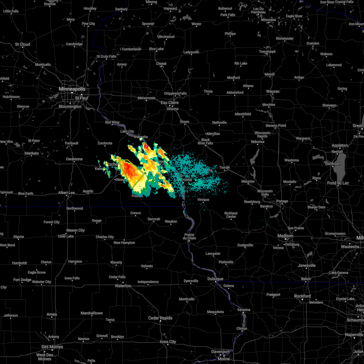 At 927 pm cdt, a severe thunderstorm was located over eyota, or 11 miles east of rochester, moving southeast at 15 mph (public). Hazards include 60 mph wind gusts and quarter size hail. Hail damage to vehicles is expected. expect wind damage to roofs, siding, and trees. this severe storm will be near, dover around 940 pm cdt. st. charles around 945 pm cdt. chatfield around 1005 pm cdt. other locations impacted by this severe thunderstorm include chester, saratoga, county roads 9 and 10, county roads 137 and 136, highway 30 and county 74, viola and cummingsville. This includes interstate 90 in minnesota between mile markers 220 and 237. At 927 pm cdt, a severe thunderstorm was located over eyota, or 11 miles east of rochester, moving southeast at 15 mph (public). Hazards include 60 mph wind gusts and quarter size hail. Hail damage to vehicles is expected. expect wind damage to roofs, siding, and trees. this severe storm will be near, dover around 940 pm cdt. st. charles around 945 pm cdt. chatfield around 1005 pm cdt. other locations impacted by this severe thunderstorm include chester, saratoga, county roads 9 and 10, county roads 137 and 136, highway 30 and county 74, viola and cummingsville. This includes interstate 90 in minnesota between mile markers 220 and 237.
|
| 7/27/2021 9:16 PM CDT |
 At 915 pm cdt, a severe thunderstorm was located over eyota, or 11 miles east of rochester, moving southeast at 20 mph (public. quarter sized hail was reported north of eyota). Hazards include 60 mph wind gusts and quarter size hail. Hail damage to vehicles is expected. expect wind damage to roofs, siding, and trees. this severe thunderstorm will be near, eyota around 920 pm cdt. dover around 930 pm cdt. st. charles around 935 pm cdt. chatfield around 945 pm cdt. other locations impacted by this severe thunderstorm include chester, ringe, saratoga, county roads 9 and 10, county roads 137 and 136, highway 30 and county 74 and viola. This includes interstate 90 in minnesota between mile markers 220 and 238. At 915 pm cdt, a severe thunderstorm was located over eyota, or 11 miles east of rochester, moving southeast at 20 mph (public. quarter sized hail was reported north of eyota). Hazards include 60 mph wind gusts and quarter size hail. Hail damage to vehicles is expected. expect wind damage to roofs, siding, and trees. this severe thunderstorm will be near, eyota around 920 pm cdt. dover around 930 pm cdt. st. charles around 935 pm cdt. chatfield around 945 pm cdt. other locations impacted by this severe thunderstorm include chester, ringe, saratoga, county roads 9 and 10, county roads 137 and 136, highway 30 and county 74 and viola. This includes interstate 90 in minnesota between mile markers 220 and 238.
|
| 7/27/2021 9:03 PM CDT |
 At 902 pm cdt, a severe thunderstorm was located near elgin, or 11 miles east of rochester, moving south at 20 mph (radar indicated). Hazards include half dollar size hail. Damage to vehicles is expected. this severe storm will be near, eyota around 915 pm cdt. dover around 925 pm cdt. st. charles around 930 pm cdt. other locations impacted by this severe thunderstorm include whitewater state park, county roads 9 and 10, carley state park, elba, little valley, viola and lazy d campground. This includes interstate 90 in minnesota between mile markers 225 and 233. At 902 pm cdt, a severe thunderstorm was located near elgin, or 11 miles east of rochester, moving south at 20 mph (radar indicated). Hazards include half dollar size hail. Damage to vehicles is expected. this severe storm will be near, eyota around 915 pm cdt. dover around 925 pm cdt. st. charles around 930 pm cdt. other locations impacted by this severe thunderstorm include whitewater state park, county roads 9 and 10, carley state park, elba, little valley, viola and lazy d campground. This includes interstate 90 in minnesota between mile markers 225 and 233.
|
| 7/27/2021 8:49 PM CDT |
 At 849 pm cdt, a severe thunderstorm was located over elgin, or 14 miles northeast of rochester, moving southeast at 20 mph (radar indicated). Hazards include half dollar size hail. Damage to vehicles is expected. this severe storm will be near, eyota around 905 pm cdt. dover around 925 pm cdt. st. charles around 930 pm cdt. other locations impacted by this severe thunderstorm include ringe, whitewater state park, county roads 9 and 10, county roads 79 and 2, carley state park, elba and beaver. This includes interstate 90 in minnesota between mile markers 225 and 233. At 849 pm cdt, a severe thunderstorm was located over elgin, or 14 miles northeast of rochester, moving southeast at 20 mph (radar indicated). Hazards include half dollar size hail. Damage to vehicles is expected. this severe storm will be near, eyota around 905 pm cdt. dover around 925 pm cdt. st. charles around 930 pm cdt. other locations impacted by this severe thunderstorm include ringe, whitewater state park, county roads 9 and 10, county roads 79 and 2, carley state park, elba and beaver. This includes interstate 90 in minnesota between mile markers 225 and 233.
|
| 7/27/2021 8:30 PM CDT |
 At 830 pm cdt, a severe thunderstorm was located near plainview, or 15 miles southwest of wabasha, moving southeast at 10 mph (radar indicated). Hazards include quarter size hail. Damage to vehicles is expected. this severe thunderstorm will be near, elgin around 845 pm cdt. plainview around 900 pm cdt. other locations impacted by this severe thunderstorm include south troy, whitewater state park, county roads 9 and 10, rattelsnake point, potsdam, county roads 28 and 31 and rattlesnake ridge. This includes interstate 90 in minnesota between mile markers 225 and 233. At 830 pm cdt, a severe thunderstorm was located near plainview, or 15 miles southwest of wabasha, moving southeast at 10 mph (radar indicated). Hazards include quarter size hail. Damage to vehicles is expected. this severe thunderstorm will be near, elgin around 845 pm cdt. plainview around 900 pm cdt. other locations impacted by this severe thunderstorm include south troy, whitewater state park, county roads 9 and 10, rattelsnake point, potsdam, county roads 28 and 31 and rattlesnake ridge. This includes interstate 90 in minnesota between mile markers 225 and 233.
|
| 6/20/2021 4:52 PM CDT |
 At 451 pm cdt, severe thunderstorms were located along a line extending from near buffalo to near altura to 6 miles east of chatfield, moving east at 30 mph (radar indicated). Hazards include 60 mph wind gusts. Expect damage to roofs, siding, and trees. these severe storms will be near, altura around 455 pm cdt. lewiston and rollingstone around 500 pm cdt. fountain city and stockton around 510 pm cdt. winona and goodview around 520 pm cdt. other locations impacted by these severe thunderstorms include saratoga, whitewater state park, county roads 6 and 33, elba, wyattville, wilson and ridgeway. This includes interstate 90 in minnesota between mile markers 233 and 261. At 451 pm cdt, severe thunderstorms were located along a line extending from near buffalo to near altura to 6 miles east of chatfield, moving east at 30 mph (radar indicated). Hazards include 60 mph wind gusts. Expect damage to roofs, siding, and trees. these severe storms will be near, altura around 455 pm cdt. lewiston and rollingstone around 500 pm cdt. fountain city and stockton around 510 pm cdt. winona and goodview around 520 pm cdt. other locations impacted by these severe thunderstorms include saratoga, whitewater state park, county roads 6 and 33, elba, wyattville, wilson and ridgeway. This includes interstate 90 in minnesota between mile markers 233 and 261.
|
| 6/20/2021 4:38 PM CDT |
 At 438 pm cdt, severe thunderstorms were located along a line extending from 7 miles northwest of altura to near st. charles to chatfield, moving east at 25 mph (radar indicated). Hazards include 60 mph wind gusts. Expect damage to roofs, siding, and trees. severe thunderstorms will be near, altura around 455 pm cdt. lewiston and rollingstone around 500 pm cdt. fountain city and stockton around 510 pm cdt. winona and goodview around 515 pm cdt. other locations impacted by these severe thunderstorms include saratoga, whitewater state park, county roads 9 and 10, county roads 6 and 33, elba, wyattville and wilson. This includes interstate 90 in minnesota between mile markers 228 and 261. At 438 pm cdt, severe thunderstorms were located along a line extending from 7 miles northwest of altura to near st. charles to chatfield, moving east at 25 mph (radar indicated). Hazards include 60 mph wind gusts. Expect damage to roofs, siding, and trees. severe thunderstorms will be near, altura around 455 pm cdt. lewiston and rollingstone around 500 pm cdt. fountain city and stockton around 510 pm cdt. winona and goodview around 515 pm cdt. other locations impacted by these severe thunderstorms include saratoga, whitewater state park, county roads 9 and 10, county roads 6 and 33, elba, wyattville and wilson. This includes interstate 90 in minnesota between mile markers 228 and 261.
|
| 5/15/2021 7:59 PM CDT |
 At 758 pm cdt, a severe thunderstorm was between beaver and minneiska, or 12 miles south of alma, moving south at 20 mph (radar indicated). Hazards include quarter size hail. Damage to vehicles is expected. this severe thunderstorm will be near, altura around 815 pm cdt. rollingstone around 820 pm cdt. stockton around 835 pm cdt. lewiston around 840 pm cdt. Other locations impacted by this severe thunderstorm include whitewater state park, elba, beaver, whitman, county roads 28 and 31, minnesota city and lazy d campground. At 758 pm cdt, a severe thunderstorm was between beaver and minneiska, or 12 miles south of alma, moving south at 20 mph (radar indicated). Hazards include quarter size hail. Damage to vehicles is expected. this severe thunderstorm will be near, altura around 815 pm cdt. rollingstone around 820 pm cdt. stockton around 835 pm cdt. lewiston around 840 pm cdt. Other locations impacted by this severe thunderstorm include whitewater state park, elba, beaver, whitman, county roads 28 and 31, minnesota city and lazy d campground.
|
| 5/15/2021 5:31 PM CDT |
 At 530 pm cdt, a severe thunderstorm was located near chatfield, or 12 miles north of preston, moving southeast at 20 mph (radar indicated). Hazards include quarter size hail. Damage to vehicles is expected. this severe thunderstorm will be near, lanesboro around 555 pm cdt. rushford around 605 pm cdt. other locations impacted by this severe thunderstorm include saratoga, arendahl, rushford village, whalan, county roads 6 and 33, pilot mound and highway 30 and county 74. This includes interstate 90 in minnesota between mile markers 232 and 237. At 530 pm cdt, a severe thunderstorm was located near chatfield, or 12 miles north of preston, moving southeast at 20 mph (radar indicated). Hazards include quarter size hail. Damage to vehicles is expected. this severe thunderstorm will be near, lanesboro around 555 pm cdt. rushford around 605 pm cdt. other locations impacted by this severe thunderstorm include saratoga, arendahl, rushford village, whalan, county roads 6 and 33, pilot mound and highway 30 and county 74. This includes interstate 90 in minnesota between mile markers 232 and 237.
|
| 5/2/2021 5:49 PM CDT |
 At 549 pm cdt, a severe thunderstorm was located near lewiston, or 13 miles southwest of winona, moving east at 25 mph (radar indicated). Hazards include quarter size hail. Damage to vehicles is expected. locations impacted include, st. Charles, altura, saratoga, fremont, utica, troy, county roads 6 and 33 and bethany. At 549 pm cdt, a severe thunderstorm was located near lewiston, or 13 miles southwest of winona, moving east at 25 mph (radar indicated). Hazards include quarter size hail. Damage to vehicles is expected. locations impacted include, st. Charles, altura, saratoga, fremont, utica, troy, county roads 6 and 33 and bethany.
|
| 5/2/2021 5:36 PM CDT |
 At 535 pm cdt, a severe thunderstorm was located over altura, or 14 miles west of winona, moving east at 25 mph (radar indicated). Hazards include quarter size hail. Damage to vehicles is expected. This severe thunderstorm will remain over mainly rural areas of western winona county, including the following locations, saratoga, whitewater state park, county roads 6 and 33, elba, county roads 28 and 31, utica and lazy d campground. At 535 pm cdt, a severe thunderstorm was located over altura, or 14 miles west of winona, moving east at 25 mph (radar indicated). Hazards include quarter size hail. Damage to vehicles is expected. This severe thunderstorm will remain over mainly rural areas of western winona county, including the following locations, saratoga, whitewater state park, county roads 6 and 33, elba, county roads 28 and 31, utica and lazy d campground.
|
| 5/2/2021 5:21 PM CDT |
 At 521 pm cdt, a severe thunderstorm was located over st. charles, or 19 miles west of winona, moving east at 25 mph (radar indicated). Hazards include quarter size hail. Damage to vehicles is expected. this severe storm will be near, altura around 540 pm cdt. Other locations impacted by this severe thunderstorm include saratoga, whitewater state park, county roads 9 and 10, county roads 6 and 33, elba, county roads 28 and 31 and utica. At 521 pm cdt, a severe thunderstorm was located over st. charles, or 19 miles west of winona, moving east at 25 mph (radar indicated). Hazards include quarter size hail. Damage to vehicles is expected. this severe storm will be near, altura around 540 pm cdt. Other locations impacted by this severe thunderstorm include saratoga, whitewater state park, county roads 9 and 10, county roads 6 and 33, elba, county roads 28 and 31 and utica.
|
| 5/2/2021 5:10 PM CDT |
 At 509 pm cdt, a severe thunderstorm was located over dover, or 16 miles east of rochester, moving east at 25 mph (radar indicated). Hazards include quarter size hail. Damage to vehicles is expected. this severe thunderstorm will be near, st. charles around 520 pm cdt. altura around 540 pm cdt. other locations impacted by this severe thunderstorm include saratoga, whitewater state park, county roads 9 and 10, county roads 6 and 33, elba, county roads 28 and 31 and utica. This includes interstate 90 in minnesota between mile markers 226 and 241. At 509 pm cdt, a severe thunderstorm was located over dover, or 16 miles east of rochester, moving east at 25 mph (radar indicated). Hazards include quarter size hail. Damage to vehicles is expected. this severe thunderstorm will be near, st. charles around 520 pm cdt. altura around 540 pm cdt. other locations impacted by this severe thunderstorm include saratoga, whitewater state park, county roads 9 and 10, county roads 6 and 33, elba, county roads 28 and 31 and utica. This includes interstate 90 in minnesota between mile markers 226 and 241.
|
| 4/27/2021 12:26 AM CDT |
 At 1225 am cdt, a severe thunderstorm was located over stockton, or near winona, moving northeast at 55 mph (radar indicated). Hazards include quarter size hail. Damage to vehicles is expected. this severe thunderstorm will be near, winona and goodview around 1230 am cdt. fountain city around 1235 am cdt. arcadia around 1250 am cdt. blair around 105 am cdt. Other locations impacted by this severe thunderstorm include whitewater state park, merrick state park, czechville, lock and dam 5 a, dodge, county roads 6 and 33 and beach corners. At 1225 am cdt, a severe thunderstorm was located over stockton, or near winona, moving northeast at 55 mph (radar indicated). Hazards include quarter size hail. Damage to vehicles is expected. this severe thunderstorm will be near, winona and goodview around 1230 am cdt. fountain city around 1235 am cdt. arcadia around 1250 am cdt. blair around 105 am cdt. Other locations impacted by this severe thunderstorm include whitewater state park, merrick state park, czechville, lock and dam 5 a, dodge, county roads 6 and 33 and beach corners.
|
| 8/10/2020 5:56 AM CDT |
 At 556 am cdt, a severe thunderstorm was located near lewiston, or 14 miles southwest of winona, moving east at 45 mph (radar indicated). Hazards include 60 mph wind gusts and quarter size hail. Hail damage to vehicles is expected. expect wind damage to roofs, siding, and trees. this severe thunderstorm will be near, trempealeau around 630 am cdt. dakota around 635 am cdt. Other locations impacted by this severe thunderstorm include county roads 6 and 33, wyattville, i 90 exit 257, ridgeway, i 90 exit 275, utica and peterson. At 556 am cdt, a severe thunderstorm was located near lewiston, or 14 miles southwest of winona, moving east at 45 mph (radar indicated). Hazards include 60 mph wind gusts and quarter size hail. Hail damage to vehicles is expected. expect wind damage to roofs, siding, and trees. this severe thunderstorm will be near, trempealeau around 630 am cdt. dakota around 635 am cdt. Other locations impacted by this severe thunderstorm include county roads 6 and 33, wyattville, i 90 exit 257, ridgeway, i 90 exit 275, utica and peterson.
|
| 6/28/2020 7:26 PM CDT |
 At 725 pm cdt, a severe thunderstorm was located over st. charles, or 19 miles east of rochester, moving northeast at 20 mph (trained weather spotters reported quarter size hail in st. charles). Hazards include 60 mph wind gusts and quarter size hail. Hail damage to vehicles is expected. expect wind damage to roofs, siding, and trees. this severe thunderstorm will be near, lewiston around 750 pm cdt. altura around 755 pm cdt. stockton around 805 pm cdt. rollingstone around 810 pm cdt. winona and goodview around 820 pm cdt. fountain city around 825 pm cdt. Other locations impacted by this severe thunderstorm include whitewater state park, lock and dam 5 a, elba, whitman, county roads 28 and 31, minnesota city and utica. At 725 pm cdt, a severe thunderstorm was located over st. charles, or 19 miles east of rochester, moving northeast at 20 mph (trained weather spotters reported quarter size hail in st. charles). Hazards include 60 mph wind gusts and quarter size hail. Hail damage to vehicles is expected. expect wind damage to roofs, siding, and trees. this severe thunderstorm will be near, lewiston around 750 pm cdt. altura around 755 pm cdt. stockton around 805 pm cdt. rollingstone around 810 pm cdt. winona and goodview around 820 pm cdt. fountain city around 825 pm cdt. Other locations impacted by this severe thunderstorm include whitewater state park, lock and dam 5 a, elba, whitman, county roads 28 and 31, minnesota city and utica.
|
| 6/28/2020 7:23 PM CDT | Quarter sized hail reported 0.1 miles NE of St. Charles, MN |
| 6/2/2020 8:18 PM CDT |
 At 817 pm cdt, severe thunderstorms were located along a line extending from near eyota to chatfield to near harmony, moving east at 40 mph (trained weather spotters. at 809 pm, a 60 mph wind gust was recorded 5 miles west of chatfield). Hazards include 60 mph wind gusts. Expect damage to roofs, siding, and trees. severe thunderstorms will be near, preston around 820 pm cdt. harmony around 825 pm cdt. canton around 830 pm cdt. st. charles around 835 pm cdt. rushford, lewiston and altura around 850 pm cdt. spring grove around 855 pm cdt. houston, stockton and rollingstone around 900 pm cdt. winona, caledonia, goodview and fountain city around 905 pm cdt. Other locations impacted by these severe thunderstorms include choice, isinours, i 90 exit 257, hutton, riceford, ridgeway and county roads 28 and 31. At 817 pm cdt, severe thunderstorms were located along a line extending from near eyota to chatfield to near harmony, moving east at 40 mph (trained weather spotters. at 809 pm, a 60 mph wind gust was recorded 5 miles west of chatfield). Hazards include 60 mph wind gusts. Expect damage to roofs, siding, and trees. severe thunderstorms will be near, preston around 820 pm cdt. harmony around 825 pm cdt. canton around 830 pm cdt. st. charles around 835 pm cdt. rushford, lewiston and altura around 850 pm cdt. spring grove around 855 pm cdt. houston, stockton and rollingstone around 900 pm cdt. winona, caledonia, goodview and fountain city around 905 pm cdt. Other locations impacted by these severe thunderstorms include choice, isinours, i 90 exit 257, hutton, riceford, ridgeway and county roads 28 and 31.
|
| 9/24/2019 8:23 PM CDT |
 At 822 pm cdt, severe thunderstorms were located along a line extending from near elgin to chatfield, moving east at 60 mph (trained weather spotters). Hazards include 60 mph wind gusts. Expect damage to roofs, siding, and trees. severe thunderstorms will be near, altura around 835 pm cdt. lewiston and rollingstone around 840 pm cdt. winona, goodview, fountain city and stockton around 845 pm cdt. dakota around 905 pm cdt. Other locations impacted by these severe thunderstorms include whitewater state park, merrick state park, czechville, lock and dam 5 a, dodge, county roads 6 and 33 and wyattville. At 822 pm cdt, severe thunderstorms were located along a line extending from near elgin to chatfield, moving east at 60 mph (trained weather spotters). Hazards include 60 mph wind gusts. Expect damage to roofs, siding, and trees. severe thunderstorms will be near, altura around 835 pm cdt. lewiston and rollingstone around 840 pm cdt. winona, goodview, fountain city and stockton around 845 pm cdt. dakota around 905 pm cdt. Other locations impacted by these severe thunderstorms include whitewater state park, merrick state park, czechville, lock and dam 5 a, dodge, county roads 6 and 33 and wyattville.
|
| 9/11/2019 5:36 AM CDT |
 At 535 am cdt, a severe thunderstorm was located near rochester, moving northeast at 60 mph (radar indicated). Hazards include 60 mph wind gusts and penny size hail. Expect damage to roofs, siding, and trees. this severe thunderstorm will be near, eyota around 550 am cdt. st. charles, elgin and dover around 555 am cdt. plainview around 600 am cdt. Other locations impacted by this severe thunderstorm include whitewater state park, county roads 9 and 10, county roads 6 and 33, i 90 exit 218, county roads 3 and 108, county roads 6 and 15 and salem corners. At 535 am cdt, a severe thunderstorm was located near rochester, moving northeast at 60 mph (radar indicated). Hazards include 60 mph wind gusts and penny size hail. Expect damage to roofs, siding, and trees. this severe thunderstorm will be near, eyota around 550 am cdt. st. charles, elgin and dover around 555 am cdt. plainview around 600 am cdt. Other locations impacted by this severe thunderstorm include whitewater state park, county roads 9 and 10, county roads 6 and 33, i 90 exit 218, county roads 3 and 108, county roads 6 and 15 and salem corners.
|
| 8/5/2019 6:40 PM CDT |
 At 640 pm cdt, a severe thunderstorm was located near st. charles, or 18 miles west of winona, moving east at 55 mph (radar indicated). Hazards include 60 mph wind gusts. Expect damage to roofs, siding, and trees. this severe thunderstorm will be near, lewiston around 650 pm cdt. winona, goodview and stockton around 655 pm cdt. dakota around 720 pm cdt. Other locations impacted by this severe thunderstorm include whitewater state park, county roads 6 and 33, wyattville, i 90 exit 257, ridgeway, i 90 exit 275 and utica. At 640 pm cdt, a severe thunderstorm was located near st. charles, or 18 miles west of winona, moving east at 55 mph (radar indicated). Hazards include 60 mph wind gusts. Expect damage to roofs, siding, and trees. this severe thunderstorm will be near, lewiston around 650 pm cdt. winona, goodview and stockton around 655 pm cdt. dakota around 720 pm cdt. Other locations impacted by this severe thunderstorm include whitewater state park, county roads 6 and 33, wyattville, i 90 exit 257, ridgeway, i 90 exit 275 and utica.
|
| 8/5/2019 5:29 PM CDT |
 The national weather service in la crosse has issued a * severe thunderstorm warning for. southern winona county in southeastern minnesota. northern houston county in southeastern minnesota. northeastern fillmore county in southeastern minnesota. Until 615 pm cdt. The national weather service in la crosse has issued a * severe thunderstorm warning for. southern winona county in southeastern minnesota. northern houston county in southeastern minnesota. northeastern fillmore county in southeastern minnesota. Until 615 pm cdt.
|
| 8/5/2019 5:16 PM CDT |
 At 516 pm cdt, a severe thunderstorm was located near rollingstone, or 10 miles west of winona, moving east at 25 mph (radar indicated). Hazards include half dollar size hail. Damage to vehicles is expected. this severe storm will be near, rollingstone around 520 pm cdt. stockton around 525 pm cdt. winona, goodview and fountain city around 530 pm cdt. Other locations impacted by this severe thunderstorm include i 90 exit 252, wilson, minnesota city, utica, pickwick, bethany and i 90 exit 233. At 516 pm cdt, a severe thunderstorm was located near rollingstone, or 10 miles west of winona, moving east at 25 mph (radar indicated). Hazards include half dollar size hail. Damage to vehicles is expected. this severe storm will be near, rollingstone around 520 pm cdt. stockton around 525 pm cdt. winona, goodview and fountain city around 530 pm cdt. Other locations impacted by this severe thunderstorm include i 90 exit 252, wilson, minnesota city, utica, pickwick, bethany and i 90 exit 233.
|
| 8/5/2019 4:59 PM CDT |
 At 459 pm cdt, a severe thunderstorm was located near altura, or 17 miles west of winona, moving east at 25 mph (radar indicated). Hazards include half dollar size hail. Damage to vehicles is expected. this severe thunderstorm will be near, lewiston and altura around 510 pm cdt. rollingstone around 520 pm cdt. stockton around 525 pm cdt. winona, goodview and fountain city around 530 pm cdt. Other locations impacted by this severe thunderstorm include whitewater state park, i 90 exit 252, elba, wilson, minnesota city, utica and pickwick. At 459 pm cdt, a severe thunderstorm was located near altura, or 17 miles west of winona, moving east at 25 mph (radar indicated). Hazards include half dollar size hail. Damage to vehicles is expected. this severe thunderstorm will be near, lewiston and altura around 510 pm cdt. rollingstone around 520 pm cdt. stockton around 525 pm cdt. winona, goodview and fountain city around 530 pm cdt. Other locations impacted by this severe thunderstorm include whitewater state park, i 90 exit 252, elba, wilson, minnesota city, utica and pickwick.
|
| 7/20/2019 12:03 PM CDT |
 At 1202 pm cdt, severe thunderstorms were located along a line extending from 6 miles northeast of buffalo city to near harmony, moving east at 65 mph (radar indicated. this storm has a history of producing 60 to 65 mph wind gusts). Hazards include 70 mph wind gusts. Expect considerable tree damage. damage is likely to mobile homes, roofs, and outbuildings. these severe storms will be near, spring grove around 1225 pm cdt. caledonia around 1230 pm cdt. Other locations impacted by these severe thunderstorms include forestville state park, choice, county roads 9 and 10, isinours, i 90 exit 257, hutton and riceford. At 1202 pm cdt, severe thunderstorms were located along a line extending from 6 miles northeast of buffalo city to near harmony, moving east at 65 mph (radar indicated. this storm has a history of producing 60 to 65 mph wind gusts). Hazards include 70 mph wind gusts. Expect considerable tree damage. damage is likely to mobile homes, roofs, and outbuildings. these severe storms will be near, spring grove around 1225 pm cdt. caledonia around 1230 pm cdt. Other locations impacted by these severe thunderstorms include forestville state park, choice, county roads 9 and 10, isinours, i 90 exit 257, hutton and riceford.
|
| 7/20/2019 11:36 AM CDT |
 At 1134 am cdt, severe thunderstorms were located along a line extending from near wabasha to near adams, moving east at 65 mph (radar indicated. this storm has a history of producing 60 to 65 mph wind gusts). Hazards include 70 mph wind gusts. Expect considerable tree damage. damage is likely to mobile homes, roofs, and outbuildings. severe thunderstorms will be near, harmony around 1205 pm cdt. canton around 1210 pm cdt. mabel around 1215 pm cdt. other locations impacted by these severe thunderstorms include forestville state park, potsdam, isinours, i 90 exit 257, riceford, fillmore and county roads 28 and 31. People attending the fillmore county fair, and rushford days should seek safe shelter immediately!. At 1134 am cdt, severe thunderstorms were located along a line extending from near wabasha to near adams, moving east at 65 mph (radar indicated. this storm has a history of producing 60 to 65 mph wind gusts). Hazards include 70 mph wind gusts. Expect considerable tree damage. damage is likely to mobile homes, roofs, and outbuildings. severe thunderstorms will be near, harmony around 1205 pm cdt. canton around 1210 pm cdt. mabel around 1215 pm cdt. other locations impacted by these severe thunderstorms include forestville state park, potsdam, isinours, i 90 exit 257, riceford, fillmore and county roads 28 and 31. People attending the fillmore county fair, and rushford days should seek safe shelter immediately!.
|
| 7/20/2019 9:20 AM CDT |
 At 919 am cdt, severe thunderstorms were located along a line extending from 7 miles northeast of wabasha to near altura to chatfield, moving east at 50 mph (radar indicated). Hazards include 60 mph wind gusts. Expect damage to roofs, siding, and trees. severe thunderstorms will be near, lewiston around 925 am cdt. fountain city, stockton, rollingstone and modena around 930 am cdt. winona and goodview around 935 am cdt. dakota around 955 am cdt. Other locations impacted by these severe thunderstorms include pioneer campground, merrick state park, cream, i 90 exit 257, highway 88 and county o, ridgeway and county roads 28 and 31. At 919 am cdt, severe thunderstorms were located along a line extending from 7 miles northeast of wabasha to near altura to chatfield, moving east at 50 mph (radar indicated). Hazards include 60 mph wind gusts. Expect damage to roofs, siding, and trees. severe thunderstorms will be near, lewiston around 925 am cdt. fountain city, stockton, rollingstone and modena around 930 am cdt. winona and goodview around 935 am cdt. dakota around 955 am cdt. Other locations impacted by these severe thunderstorms include pioneer campground, merrick state park, cream, i 90 exit 257, highway 88 and county o, ridgeway and county roads 28 and 31.
|
| 7/20/2019 8:21 AM CDT |
 At 820 am cdt, severe thunderstorms were located along a line extending from near alma to near buffalo city to near altura, moving east at 35 mph (radar indicated). Hazards include 60 mph wind gusts. Expect damage to roofs, siding, and trees. these severe storms will be near, winona, goodview and fountain city around 835 am cdt. Other locations impacted by these severe thunderstorms include whitewater state park, pioneer campground, merrick state park, czechville, lock and dam 5 a, dodge and cream. At 820 am cdt, severe thunderstorms were located along a line extending from near alma to near buffalo city to near altura, moving east at 35 mph (radar indicated). Hazards include 60 mph wind gusts. Expect damage to roofs, siding, and trees. these severe storms will be near, winona, goodview and fountain city around 835 am cdt. Other locations impacted by these severe thunderstorms include whitewater state park, pioneer campground, merrick state park, czechville, lock and dam 5 a, dodge and cream.
|
| 7/20/2019 8:11 AM CDT |
 At 811 am cdt, severe thunderstorms were located along a line extending from kellogg to near buffalo to near altura, moving east at 30 mph (radar indicated). Hazards include 60 mph wind gusts. Expect damage to roofs, siding, and trees. these severe storms will be near, alma, buffalo and buffalo city around 820 am cdt. rollingstone around 825 am cdt. winona, goodview and fountain city around 835 am cdt. Other locations impacted by these severe thunderstorms include whitewater state park, pioneer campground, merrick state park, czechville, lock and dam 5 a, dodge and cream. At 811 am cdt, severe thunderstorms were located along a line extending from kellogg to near buffalo to near altura, moving east at 30 mph (radar indicated). Hazards include 60 mph wind gusts. Expect damage to roofs, siding, and trees. these severe storms will be near, alma, buffalo and buffalo city around 820 am cdt. rollingstone around 825 am cdt. winona, goodview and fountain city around 835 am cdt. Other locations impacted by these severe thunderstorms include whitewater state park, pioneer campground, merrick state park, czechville, lock and dam 5 a, dodge and cream.
|
| 7/20/2019 7:59 AM CDT |
 At 758 am cdt, severe thunderstorms were located along a line extending from 6 miles northeast of plainview to 6 miles north of st. charles, moving east at 20 mph (radar indicated). Hazards include 60 mph wind gusts. Expect damage to roofs, siding, and trees. severe thunderstorms will be near, kellogg around 815 am cdt. altura around 820 am cdt. buffalo and buffalo city around 825 am cdt. alma around 830 am cdt. stockton and rollingstone around 835 am cdt. winona, goodview and fountain city around 845 am cdt. Other locations impacted by these severe thunderstorms include whitewater state park, pioneer campground, merrick state park, czechville, lock and dam 5 a, dodge and cream. At 758 am cdt, severe thunderstorms were located along a line extending from 6 miles northeast of plainview to 6 miles north of st. charles, moving east at 20 mph (radar indicated). Hazards include 60 mph wind gusts. Expect damage to roofs, siding, and trees. severe thunderstorms will be near, kellogg around 815 am cdt. altura around 820 am cdt. buffalo and buffalo city around 825 am cdt. alma around 830 am cdt. stockton and rollingstone around 835 am cdt. winona, goodview and fountain city around 845 am cdt. Other locations impacted by these severe thunderstorms include whitewater state park, pioneer campground, merrick state park, czechville, lock and dam 5 a, dodge and cream.
|
| 6/4/2019 6:54 PM CDT |
 At 653 pm cdt, severe thunderstorms were located along a line extending from near stockton to near lanesboro, moving east at 35 mph (trained weather spotters. this storm has a history of producing 70 mph wind gusts). Hazards include 70 mph wind gusts and quarter size hail. Hail damage to vehicles is expected. expect considerable tree damage. wind damage is also likely to mobile homes, roofs, and outbuildings. These severe thunderstorms will remain over mainly rural areas of western winona and northeastern fillmore counties, including the following locations, saratoga, whitewater state park, county roads 6 and 33, elba, wyattville, county roads 28 and 31 and i 90 exit 249. At 653 pm cdt, severe thunderstorms were located along a line extending from near stockton to near lanesboro, moving east at 35 mph (trained weather spotters. this storm has a history of producing 70 mph wind gusts). Hazards include 70 mph wind gusts and quarter size hail. Hail damage to vehicles is expected. expect considerable tree damage. wind damage is also likely to mobile homes, roofs, and outbuildings. These severe thunderstorms will remain over mainly rural areas of western winona and northeastern fillmore counties, including the following locations, saratoga, whitewater state park, county roads 6 and 33, elba, wyattville, county roads 28 and 31 and i 90 exit 249.
|
| 6/4/2019 6:29 PM CDT |
 At 627 pm cdt, severe thunderstorms were located along a line extending from near altura to near fountain, moving east at 35 mph (trained weather spotters. at 625 pm cdt, 70 mph wind gusts were reported 4 miles west of chatfield). Hazards include 70 mph wind gusts and quarter size hail. Hail damage to vehicles is expected. expect considerable tree damage. wind damage is also likely to mobile homes, roofs, and outbuildings. these severe storms will be near, altura around 635 pm cdt. lewiston around 640 pm cdt. rollingstone around 645 pm cdt. stockton around 650 pm cdt. goodview around 655 pm cdt. Other locations impacted by these severe thunderstorms include whitewater state park, county roads 9 and 10, county roads 6 and 33, wyattville, county roads 28 and 31, utica and peterson. At 627 pm cdt, severe thunderstorms were located along a line extending from near altura to near fountain, moving east at 35 mph (trained weather spotters. at 625 pm cdt, 70 mph wind gusts were reported 4 miles west of chatfield). Hazards include 70 mph wind gusts and quarter size hail. Hail damage to vehicles is expected. expect considerable tree damage. wind damage is also likely to mobile homes, roofs, and outbuildings. these severe storms will be near, altura around 635 pm cdt. lewiston around 640 pm cdt. rollingstone around 645 pm cdt. stockton around 650 pm cdt. goodview around 655 pm cdt. Other locations impacted by these severe thunderstorms include whitewater state park, county roads 9 and 10, county roads 6 and 33, wyattville, county roads 28 and 31, utica and peterson.
|
| 6/4/2019 6:04 PM CDT |
 At 603 pm cdt, severe thunderstorms were located along a line extending from near wabasha to 6 miles northeast of stewartville, moving east at 35 mph (radar indicated). Hazards include 60 mph wind gusts and quarter size hail. Hail damage to vehicles is expected. expect wind damage to roofs, siding, and trees. severe thunderstorms will be near, chatfield and dover around 620 pm cdt. rushford around 655 pm cdt. Other locations impacted by these severe thunderstorms include whitewater state park, county roads 9 and 10, county roads 6 and 33, wyattville, county roads 28 and 31, utica and peterson. At 603 pm cdt, severe thunderstorms were located along a line extending from near wabasha to 6 miles northeast of stewartville, moving east at 35 mph (radar indicated). Hazards include 60 mph wind gusts and quarter size hail. Hail damage to vehicles is expected. expect wind damage to roofs, siding, and trees. severe thunderstorms will be near, chatfield and dover around 620 pm cdt. rushford around 655 pm cdt. Other locations impacted by these severe thunderstorms include whitewater state park, county roads 9 and 10, county roads 6 and 33, wyattville, county roads 28 and 31, utica and peterson.
|
| 9/20/2018 7:47 PM CDT |
 At 745 pm cdt, severe thunderstorms were located along a line extending from 6 miles southeast of durand to near eyota, moving east at 65 mph (trained weather spotters. the rochester airport, spotters, and the top of the mayo clinic reported 35 to 50 mph wind gusts between 715 to 745 pm). Hazards include 60 mph wind gusts. Expect damage to roofs, siding, and trees. these severe storms will be near, mondovi and modena around 750 pm cdt. rollingstone around 800 pm cdt. other locations impacted by these severe thunderstorms include saratoga, viola, cochrane, gilmanton and west newton. A tornado watch remains in effect until midnight cdt for southeastern minnesota, and west central wisconsin. At 745 pm cdt, severe thunderstorms were located along a line extending from 6 miles southeast of durand to near eyota, moving east at 65 mph (trained weather spotters. the rochester airport, spotters, and the top of the mayo clinic reported 35 to 50 mph wind gusts between 715 to 745 pm). Hazards include 60 mph wind gusts. Expect damage to roofs, siding, and trees. these severe storms will be near, mondovi and modena around 750 pm cdt. rollingstone around 800 pm cdt. other locations impacted by these severe thunderstorms include saratoga, viola, cochrane, gilmanton and west newton. A tornado watch remains in effect until midnight cdt for southeastern minnesota, and west central wisconsin.
|
| 9/20/2018 7:47 PM CDT |
 At 721 pm cdt, severe thunderstorms were located along a line extending from near red wing to austin, moving northeast at 65 mph (trained weather spotters. these storms have a history of localized damaging winds to 70 mph and brief tornadoes). Hazards include 70 mph wind gusts. Expect considerable tree damage. damage is likely to mobile homes, roofs, and outbuildings. these severe storms will be near, rochester around 735 pm cdt. chatfield and eyota around 745 pm cdt. mondovi and dover around 750 pm cdt. st. charles around 755 pm cdt. lewiston, altura and rollingstone around 800 pm cdt. other locations impacted by these severe thunderstorms include marion, pleasant grove, saratoga, viola and cochrane. A tornado watch remains in effect until midnight cdt for southeastern minnesota, and west central wisconsin. At 721 pm cdt, severe thunderstorms were located along a line extending from near red wing to austin, moving northeast at 65 mph (trained weather spotters. these storms have a history of localized damaging winds to 70 mph and brief tornadoes). Hazards include 70 mph wind gusts. Expect considerable tree damage. damage is likely to mobile homes, roofs, and outbuildings. these severe storms will be near, rochester around 735 pm cdt. chatfield and eyota around 745 pm cdt. mondovi and dover around 750 pm cdt. st. charles around 755 pm cdt. lewiston, altura and rollingstone around 800 pm cdt. other locations impacted by these severe thunderstorms include marion, pleasant grove, saratoga, viola and cochrane. A tornado watch remains in effect until midnight cdt for southeastern minnesota, and west central wisconsin.
|
| 9/20/2018 7:42 PM CDT |
 At 721 pm cdt, severe thunderstorms were located along a line extending from near red wing to austin, moving northeast at 65 mph (trained weather spotters. these storms have a history of localized damaging winds to 70 mph and brief tornadoes). Hazards include 70 mph wind gusts. Expect considerable tree damage. damage is likely to mobile homes, roofs, and outbuildings. these severe storms will be near, rochester around 735 pm cdt. chatfield and eyota around 745 pm cdt. mondovi and dover around 750 pm cdt. st. charles around 755 pm cdt. lewiston, altura and rollingstone around 800 pm cdt. other locations impacted by these severe thunderstorms include marion, pleasant grove, saratoga, viola and cochrane. A tornado watch remains in effect until midnight cdt for southeastern minnesota, and west central wisconsin. At 721 pm cdt, severe thunderstorms were located along a line extending from near red wing to austin, moving northeast at 65 mph (trained weather spotters. these storms have a history of localized damaging winds to 70 mph and brief tornadoes). Hazards include 70 mph wind gusts. Expect considerable tree damage. damage is likely to mobile homes, roofs, and outbuildings. these severe storms will be near, rochester around 735 pm cdt. chatfield and eyota around 745 pm cdt. mondovi and dover around 750 pm cdt. st. charles around 755 pm cdt. lewiston, altura and rollingstone around 800 pm cdt. other locations impacted by these severe thunderstorms include marion, pleasant grove, saratoga, viola and cochrane. A tornado watch remains in effect until midnight cdt for southeastern minnesota, and west central wisconsin.
|
| 9/20/2018 7:32 PM CDT |
 At 729 pm cdt, severe thunderstorms were located along a line extending from near stockholm to near stewartville, moving northeast at 75 mph (trained weather spotters have reported trees down in cannon falls). Hazards include 70 mph wind gusts. Expect considerable tree damage. damage is likely to mobile homes, roofs, and outbuildings. these severe storms will be near, dover and elgin around 745 pm cdt. mondovi, st. charles and plainview around 750 pm cdt. altura and lewiston around 755 pm cdt. alma, rollingstone, buffalo and buffalo city around 800 pm cdt. the most severe winds near 70 mph and possible tornadoes are more likely in northern wabasha and northern buffalo county. other locations impacted by these severe thunderstorms include marion, pleasant grove, saratoga, viola and cochrane. A tornado watch remains in effect until midnight cdt for southeastern minnesota, and west central wisconsin. At 729 pm cdt, severe thunderstorms were located along a line extending from near stockholm to near stewartville, moving northeast at 75 mph (trained weather spotters have reported trees down in cannon falls). Hazards include 70 mph wind gusts. Expect considerable tree damage. damage is likely to mobile homes, roofs, and outbuildings. these severe storms will be near, dover and elgin around 745 pm cdt. mondovi, st. charles and plainview around 750 pm cdt. altura and lewiston around 755 pm cdt. alma, rollingstone, buffalo and buffalo city around 800 pm cdt. the most severe winds near 70 mph and possible tornadoes are more likely in northern wabasha and northern buffalo county. other locations impacted by these severe thunderstorms include marion, pleasant grove, saratoga, viola and cochrane. A tornado watch remains in effect until midnight cdt for southeastern minnesota, and west central wisconsin.
|
| 9/20/2018 7:32 PM CDT |
 At 721 pm cdt, severe thunderstorms were located along a line extending from near red wing to austin, moving northeast at 65 mph (trained weather spotters. these storms have a history of localized damaging winds to 70 mph and brief tornadoes). Hazards include 70 mph wind gusts. Expect considerable tree damage. damage is likely to mobile homes, roofs, and outbuildings. these severe storms will be near, rochester around 735 pm cdt. chatfield and eyota around 745 pm cdt. mondovi and dover around 750 pm cdt. st. charles around 755 pm cdt. lewiston, altura and rollingstone around 800 pm cdt. other locations impacted by these severe thunderstorms include marion, pleasant grove, saratoga, viola and cochrane. A tornado watch remains in effect until midnight cdt for southeastern minnesota, and west central wisconsin. At 721 pm cdt, severe thunderstorms were located along a line extending from near red wing to austin, moving northeast at 65 mph (trained weather spotters. these storms have a history of localized damaging winds to 70 mph and brief tornadoes). Hazards include 70 mph wind gusts. Expect considerable tree damage. damage is likely to mobile homes, roofs, and outbuildings. these severe storms will be near, rochester around 735 pm cdt. chatfield and eyota around 745 pm cdt. mondovi and dover around 750 pm cdt. st. charles around 755 pm cdt. lewiston, altura and rollingstone around 800 pm cdt. other locations impacted by these severe thunderstorms include marion, pleasant grove, saratoga, viola and cochrane. A tornado watch remains in effect until midnight cdt for southeastern minnesota, and west central wisconsin.
|
| 9/20/2018 7:23 PM CDT |
 At 721 pm cdt, severe thunderstorms were located along a line extending from near red wing to austin, moving northeast at 65 mph (trained weather spotters. these storms have a history of localized damaging winds to 70 mph and brief tornadoes). Hazards include 70 mph wind gusts. Expect considerable tree damage. damage is likely to mobile homes, roofs, and outbuildings. these severe storms will be near, rochester around 735 pm cdt. chatfield and eyota around 745 pm cdt. mondovi and dover around 750 pm cdt. st. charles around 755 pm cdt. lewiston, altura and rollingstone around 800 pm cdt. other locations impacted by these severe thunderstorms include marion, pleasant grove, saratoga, viola and cochrane. A tornado watch remains in effect until midnight cdt for southeastern minnesota, and west central wisconsin. At 721 pm cdt, severe thunderstorms were located along a line extending from near red wing to austin, moving northeast at 65 mph (trained weather spotters. these storms have a history of localized damaging winds to 70 mph and brief tornadoes). Hazards include 70 mph wind gusts. Expect considerable tree damage. damage is likely to mobile homes, roofs, and outbuildings. these severe storms will be near, rochester around 735 pm cdt. chatfield and eyota around 745 pm cdt. mondovi and dover around 750 pm cdt. st. charles around 755 pm cdt. lewiston, altura and rollingstone around 800 pm cdt. other locations impacted by these severe thunderstorms include marion, pleasant grove, saratoga, viola and cochrane. A tornado watch remains in effect until midnight cdt for southeastern minnesota, and west central wisconsin.
|
| 9/20/2018 7:04 PM CDT |
 The national weather service in la crosse has issued a * severe thunderstorm warning for. western winona county in southeastern minnesota. eastern olmsted county in southeastern minnesota. wabasha county in southeastern minnesota. Western buffalo county in west central wisconsin. The national weather service in la crosse has issued a * severe thunderstorm warning for. western winona county in southeastern minnesota. eastern olmsted county in southeastern minnesota. wabasha county in southeastern minnesota. Western buffalo county in west central wisconsin.
|
| 9/20/2018 7:04 PM CDT |
 At 702 pm cdt, severe thunderstorms were located along a line extending from near goodhue to near london, moving east at 70 mph (trained weather spotters and law enforcement have reported wind damage, wind gusts to 70 mph, and brief tornadoes with this line of storms). Hazards include 70 mph wind gusts. Expect considerable tree damage. damage is likely to mobile homes, roofs, and outbuildings. severe thunderstorms will be near, mazeppa around 710 pm cdt. wabasha around 730 pm cdt. modena around 740 pm cdt. mondovi around 750 pm cdt. other locations impacted by these severe thunderstorms include marion, pleasant grove, saratoga, viola and cochrane. A tornado watch remains in effect until midnight cdt for southeastern minnesota, and west central wisconsin. At 702 pm cdt, severe thunderstorms were located along a line extending from near goodhue to near london, moving east at 70 mph (trained weather spotters and law enforcement have reported wind damage, wind gusts to 70 mph, and brief tornadoes with this line of storms). Hazards include 70 mph wind gusts. Expect considerable tree damage. damage is likely to mobile homes, roofs, and outbuildings. severe thunderstorms will be near, mazeppa around 710 pm cdt. wabasha around 730 pm cdt. modena around 740 pm cdt. mondovi around 750 pm cdt. other locations impacted by these severe thunderstorms include marion, pleasant grove, saratoga, viola and cochrane. A tornado watch remains in effect until midnight cdt for southeastern minnesota, and west central wisconsin.
|
| 8/27/2018 6:41 PM CDT |
 The severe thunderstorm warning for western winona, eastern olmsted, southeastern mower, wabasha, western fillmore and northwestern buffalo counties will expire at 645 pm cdt, the storms which prompted the warning have either weakened or moved out of the area. therefore the warning will be allowed to expire. however gusty winds and heavy rain are still possible with thunderstorms that remain in the area. a severe thunderstorm watch remains in effect until 1000 pm cdt for northeastern iowa, southeastern minnesota, and west central wisconsin. remember, a severe thunderstorm warning still remains in effect for eastern buffalo and eastern winona counties until 715 pm!. The severe thunderstorm warning for western winona, eastern olmsted, southeastern mower, wabasha, western fillmore and northwestern buffalo counties will expire at 645 pm cdt, the storms which prompted the warning have either weakened or moved out of the area. therefore the warning will be allowed to expire. however gusty winds and heavy rain are still possible with thunderstorms that remain in the area. a severe thunderstorm watch remains in effect until 1000 pm cdt for northeastern iowa, southeastern minnesota, and west central wisconsin. remember, a severe thunderstorm warning still remains in effect for eastern buffalo and eastern winona counties until 715 pm!.
|
| 8/27/2018 6:17 PM CDT |
 At 616 pm cdt, severe thunderstorms were located along a line extending from near durand to near plainview to adams, moving east at 45 mph. these storms have a history of 45 to 55 mph (radar indicated). Hazards include 60 mph wind gusts. Expect damage to roofs, siding, and trees. these severe storms will be near, plainview and st. charles around 620 pm cdt. altura around 625 pm cdt. kellogg around 630 pm cdt. alma, buffalo and buffalo city around 635 pm cdt. spring valley around 640 pm cdt. Other locations impacted by these severe thunderstorms include fillmore, marion, pleasant grove, washington and saratoga. At 616 pm cdt, severe thunderstorms were located along a line extending from near durand to near plainview to adams, moving east at 45 mph. these storms have a history of 45 to 55 mph (radar indicated). Hazards include 60 mph wind gusts. Expect damage to roofs, siding, and trees. these severe storms will be near, plainview and st. charles around 620 pm cdt. altura around 625 pm cdt. kellogg around 630 pm cdt. alma, buffalo and buffalo city around 635 pm cdt. spring valley around 640 pm cdt. Other locations impacted by these severe thunderstorms include fillmore, marion, pleasant grove, washington and saratoga.
|
| 8/27/2018 5:57 PM CDT |
 At 555 pm cdt, severe thunderstorms were located along a line extending from near bay city to near rochester to near lyle, moving east at 50 mph (radar indicated. trees were reported down in the city of kasson minnesota at 535 pm). Hazards include 60 mph wind gusts. Expect damage to roofs, siding, and trees. these severe storms will be near, eyota around 600 pm cdt. elgin and dover around 605 pm cdt. plainview and st. charles around 610 pm cdt. le roy around 615 pm cdt. grand meadow and altura around 620 pm cdt. buffalo, buffalo city and kellogg around 625 pm cdt. Other locations impacted by these severe thunderstorms include fillmore, marion, pleasant grove, washington and saratoga. At 555 pm cdt, severe thunderstorms were located along a line extending from near bay city to near rochester to near lyle, moving east at 50 mph (radar indicated. trees were reported down in the city of kasson minnesota at 535 pm). Hazards include 60 mph wind gusts. Expect damage to roofs, siding, and trees. these severe storms will be near, eyota around 600 pm cdt. elgin and dover around 605 pm cdt. plainview and st. charles around 610 pm cdt. le roy around 615 pm cdt. grand meadow and altura around 620 pm cdt. buffalo, buffalo city and kellogg around 625 pm cdt. Other locations impacted by these severe thunderstorms include fillmore, marion, pleasant grove, washington and saratoga.
|
| 8/27/2018 5:42 PM CDT |
 At 541 pm cdt, severe thunderstorms were located along a line extending from near goodhue to near byron to 6 miles east of northwood, moving northeast at 50 mph. this line of storms has produced winds of 45 to 55 mph (radar indicated). Hazards include 60 mph wind gusts. Expect damage to roofs, siding, and trees. these severe storms will be near, adams and eyota around 605 pm cdt. elgin and dover around 610 pm cdt. plainview and le roy around 615 pm cdt. grand meadow around 620 pm cdt. altura around 625 pm cdt. Other locations impacted by these severe thunderstorms include fillmore, marion, pleasant grove, washington and saratoga. At 541 pm cdt, severe thunderstorms were located along a line extending from near goodhue to near byron to 6 miles east of northwood, moving northeast at 50 mph. this line of storms has produced winds of 45 to 55 mph (radar indicated). Hazards include 60 mph wind gusts. Expect damage to roofs, siding, and trees. these severe storms will be near, adams and eyota around 605 pm cdt. elgin and dover around 610 pm cdt. plainview and le roy around 615 pm cdt. grand meadow around 620 pm cdt. altura around 625 pm cdt. Other locations impacted by these severe thunderstorms include fillmore, marion, pleasant grove, washington and saratoga.
|
| 8/27/2018 5:28 PM CDT |
 At 527 pm cdt, severe thunderstorms were located along a line extending from near wanamingo to hayfield to 7 miles southwest of northwood, moving east at 45 mph (radar indicated). Hazards include 60 mph wind gusts. expect damage to roofs, siding, and trees At 527 pm cdt, severe thunderstorms were located along a line extending from near wanamingo to hayfield to 7 miles southwest of northwood, moving east at 45 mph (radar indicated). Hazards include 60 mph wind gusts. expect damage to roofs, siding, and trees
|
| 7/4/2018 3:28 PM CDT |
 At 328 pm cdt, severe thunderstorms were located along a line extending from near rollingstone to lanesboro, moving east at 40 mph (radar indicated). Hazards include 60 mph wind gusts. Expect damage to roofs, siding, and trees. these severe storms will be near, rollingstone and stockton around 335 pm cdt. goodview around 340 pm cdt. rushford around 345 pm cdt. Other locations impacted by these severe thunderstorms include rushford village, saratoga, hart, fremont and pilot mound. At 328 pm cdt, severe thunderstorms were located along a line extending from near rollingstone to lanesboro, moving east at 40 mph (radar indicated). Hazards include 60 mph wind gusts. Expect damage to roofs, siding, and trees. these severe storms will be near, rollingstone and stockton around 335 pm cdt. goodview around 340 pm cdt. rushford around 345 pm cdt. Other locations impacted by these severe thunderstorms include rushford village, saratoga, hart, fremont and pilot mound.
|
| 7/4/2018 3:21 PM CDT |
 At 320 pm cdt, severe thunderstorms were located along a line extending from near altura to near preston, moving east at 40 mph (radar indicated). Hazards include 60 mph wind gusts. Expect damage to roofs, siding, and trees. these severe storms will be near, altura around 325 pm cdt. rollingstone and lewiston around 330 pm cdt. stockton around 335 pm cdt. goodview and rushford around 340 pm cdt. Other locations impacted by these severe thunderstorms include marion, rushford village, pleasant grove, washington and saratoga. At 320 pm cdt, severe thunderstorms were located along a line extending from near altura to near preston, moving east at 40 mph (radar indicated). Hazards include 60 mph wind gusts. Expect damage to roofs, siding, and trees. these severe storms will be near, altura around 325 pm cdt. rollingstone and lewiston around 330 pm cdt. stockton around 335 pm cdt. goodview and rushford around 340 pm cdt. Other locations impacted by these severe thunderstorms include marion, rushford village, pleasant grove, washington and saratoga.
|
| 7/4/2018 3:14 PM CDT |
 At 314 pm cdt, a severe thunderstorm was located near chatfield, or 10 miles north of preston, moving east at 35 mph (radar indicated). Hazards include 60 mph wind gusts. Expect damage to roofs, siding, and trees. this severe storm will be near, lewiston around 335 pm cdt. rushford around 340 pm cdt. Other locations impacted by this severe thunderstorm include marion, rushford village, pleasant grove, washington and saratoga. At 314 pm cdt, a severe thunderstorm was located near chatfield, or 10 miles north of preston, moving east at 35 mph (radar indicated). Hazards include 60 mph wind gusts. Expect damage to roofs, siding, and trees. this severe storm will be near, lewiston around 335 pm cdt. rushford around 340 pm cdt. Other locations impacted by this severe thunderstorm include marion, rushford village, pleasant grove, washington and saratoga.
|
| 7/4/2018 3:04 PM CDT |
 The national weather service in la crosse has issued a * severe thunderstorm warning for. winona county in southeastern minnesota. eastern olmsted county in southeastern minnesota. northern fillmore county in southeastern minnesota. Until 400 pm cdt. The national weather service in la crosse has issued a * severe thunderstorm warning for. winona county in southeastern minnesota. eastern olmsted county in southeastern minnesota. northern fillmore county in southeastern minnesota. Until 400 pm cdt.
|
| 6/30/2018 7:56 PM CDT |
 The severe thunderstorm warning for southern winona, northern houston and northeastern fillmore counties will expire at 800 pm cdt, the storms which prompted the warning have weakened below severe limits, and have exited the warned area. therefore the warning will be allowed to expire. a severe thunderstorm watch remains in effect until 900 pm cdt for southeastern minnesota, and west central wisconsin. to report severe weather, contact your nearest law enforcement agency. they will relay your report to the national weather service la crosse. The severe thunderstorm warning for southern winona, northern houston and northeastern fillmore counties will expire at 800 pm cdt, the storms which prompted the warning have weakened below severe limits, and have exited the warned area. therefore the warning will be allowed to expire. a severe thunderstorm watch remains in effect until 900 pm cdt for southeastern minnesota, and west central wisconsin. to report severe weather, contact your nearest law enforcement agency. they will relay your report to the national weather service la crosse.
|
| 6/30/2018 7:45 PM CDT |
 At 745 pm cdt, severe thunderstorms were located along a line extending from near winona to near dakota to near caledonia, moving east at 50 mph (radar indicated). Hazards include 70 mph wind gusts. Expect considerable tree damage. damage is likely to mobile homes, roofs, and outbuildings. these severe storms will be near, la crescent, dakota and hokah around 750 pm cdt. la crosse around 755 pm cdt. Other locations impacted by these severe thunderstorms include new hartford, rushford village, wilson, saratoga and mound prairie. At 745 pm cdt, severe thunderstorms were located along a line extending from near winona to near dakota to near caledonia, moving east at 50 mph (radar indicated). Hazards include 70 mph wind gusts. Expect considerable tree damage. damage is likely to mobile homes, roofs, and outbuildings. these severe storms will be near, la crescent, dakota and hokah around 750 pm cdt. la crosse around 755 pm cdt. Other locations impacted by these severe thunderstorms include new hartford, rushford village, wilson, saratoga and mound prairie.
|
| 6/30/2018 7:42 PM CDT |
 At 742 pm cdt, severe thunderstorms were located along a line extending from 6 miles southeast of plainview to altura to lewiston, moving north at 45 mph (trained weather spotters. wind gusts to 70 mph have been reported in st. charles). Hazards include 70 mph wind gusts. Expect considerable tree damage. damage is likely to mobile homes, roofs, and outbuildings. severe thunderstorms will be near, winona, rollingstone and goodview around 755 pm cdt. fountain city around 800 pm cdt. Other locations impacted by these severe thunderstorms include utica, minnesota city, elba, minneiska and beaver. At 742 pm cdt, severe thunderstorms were located along a line extending from 6 miles southeast of plainview to altura to lewiston, moving north at 45 mph (trained weather spotters. wind gusts to 70 mph have been reported in st. charles). Hazards include 70 mph wind gusts. Expect considerable tree damage. damage is likely to mobile homes, roofs, and outbuildings. severe thunderstorms will be near, winona, rollingstone and goodview around 755 pm cdt. fountain city around 800 pm cdt. Other locations impacted by these severe thunderstorms include utica, minnesota city, elba, minneiska and beaver.
|
| 6/30/2018 7:39 PM CDT | Storm damage reported in winona county MN, 0.1 miles NE of St. Charles, MN |
| 6/30/2018 7:29 PM CDT |
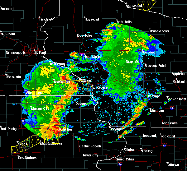 At 728 pm cdt, severe thunderstorms were located along a line extending from lewiston to near rushford to near spring grove, moving east at 50 mph (radar indicated). Hazards include 70 mph wind gusts. Expect considerable tree damage. damage is likely to mobile homes, roofs, and outbuildings. these severe storms will be near, houston around 735 pm cdt. dakota and hokah around 750 pm cdt. la crosse, la crescent and brownsville around 755 pm cdt. Other locations impacted by these severe thunderstorms include new hartford, rushford village, wilson, saratoga and mound prairie. At 728 pm cdt, severe thunderstorms were located along a line extending from lewiston to near rushford to near spring grove, moving east at 50 mph (radar indicated). Hazards include 70 mph wind gusts. Expect considerable tree damage. damage is likely to mobile homes, roofs, and outbuildings. these severe storms will be near, houston around 735 pm cdt. dakota and hokah around 750 pm cdt. la crosse, la crescent and brownsville around 755 pm cdt. Other locations impacted by these severe thunderstorms include new hartford, rushford village, wilson, saratoga and mound prairie.
|
| 6/30/2018 7:24 PM CDT |
 At 724 pm cdt, severe thunderstorms were located along a line extending from near st. charles to near rushford to 6 miles north of mabel, moving east at 55 mph (radar indicated). Hazards include 70 mph wind gusts. Expect considerable tree damage. damage is likely to mobile homes, roofs, and outbuildings. these severe storms will be near, caledonia and houston around 740 pm cdt. la crescent and dakota around 750 pm cdt. la crosse, brownsville and hokah around 755 pm cdt. Other locations impacted by these severe thunderstorms include new hartford, rushford village, wilson, saratoga and mound prairie. At 724 pm cdt, severe thunderstorms were located along a line extending from near st. charles to near rushford to 6 miles north of mabel, moving east at 55 mph (radar indicated). Hazards include 70 mph wind gusts. Expect considerable tree damage. damage is likely to mobile homes, roofs, and outbuildings. these severe storms will be near, caledonia and houston around 740 pm cdt. la crescent and dakota around 750 pm cdt. la crosse, brownsville and hokah around 755 pm cdt. Other locations impacted by these severe thunderstorms include new hartford, rushford village, wilson, saratoga and mound prairie.
|
| 6/30/2018 7:03 PM CDT |
 At 703 pm cdt, severe thunderstorms were located along a line extending from 6 miles southwest of eyota to fountain to 7 miles southwest of preston, moving east at 50 mph (trained weather spotters. wind damage has been reported across mower county, and the rochester airport gusted to 69 mph with these storms). Hazards include 70 mph wind gusts. Expect considerable tree damage. damage is likely to mobile homes, roofs, and outbuildings. severe thunderstorms will be near, lanesboro and st. charles around 715 pm cdt. rushford around 725 pm cdt. lewiston around 730 pm cdt. houston around 740 pm cdt. caledonia around 745 pm cdt. hokah around 750 pm cdt. la crescent and brownsville around 755 pm cdt. la crosse and dakota around 800 pm cdt. Other locations impacted by these severe thunderstorms include new hartford, rushford village, wilson, saratoga and mound prairie. At 703 pm cdt, severe thunderstorms were located along a line extending from 6 miles southwest of eyota to fountain to 7 miles southwest of preston, moving east at 50 mph (trained weather spotters. wind damage has been reported across mower county, and the rochester airport gusted to 69 mph with these storms). Hazards include 70 mph wind gusts. Expect considerable tree damage. damage is likely to mobile homes, roofs, and outbuildings. severe thunderstorms will be near, lanesboro and st. charles around 715 pm cdt. rushford around 725 pm cdt. lewiston around 730 pm cdt. houston around 740 pm cdt. caledonia around 745 pm cdt. hokah around 750 pm cdt. la crescent and brownsville around 755 pm cdt. la crosse and dakota around 800 pm cdt. Other locations impacted by these severe thunderstorms include new hartford, rushford village, wilson, saratoga and mound prairie.
|
| 5/25/2018 9:14 PM CDT |
 At 913 pm cdt, severe thunderstorms were located along a line extending from near lewiston to 9 miles southeast of st. charles to lanesboro, moving east at 35 mph (radar indicated). Hazards include 60 mph wind gusts. Expect damage to roofs, siding, and trees. these severe storms will be near, rushford around 930 pm cdt. Other locations impacted by these severe thunderstorms include rushford village, saratoga, highland, hart and fremont. At 913 pm cdt, severe thunderstorms were located along a line extending from near lewiston to 9 miles southeast of st. charles to lanesboro, moving east at 35 mph (radar indicated). Hazards include 60 mph wind gusts. Expect damage to roofs, siding, and trees. these severe storms will be near, rushford around 930 pm cdt. Other locations impacted by these severe thunderstorms include rushford village, saratoga, highland, hart and fremont.
|
| 5/25/2018 8:53 PM CDT |
 At 852 pm cdt, severe thunderstorms were located along a line extending from near eyota to near dover to near wykoff, moving east at 35 mph (law enforcement. wind gusts to 60 mph have been reported with these storms). Hazards include 60 mph wind gusts and penny size hail. Expect damage to roofs, siding, and trees. severe thunderstorms will be near, st. charles around 900 pm cdt. fountain around 905 pm cdt. lanesboro around 915 pm cdt. rushford around 925 pm cdt. Other locations impacted by these severe thunderstorms include fillmore, rushford village, saratoga, highland and hart. At 852 pm cdt, severe thunderstorms were located along a line extending from near eyota to near dover to near wykoff, moving east at 35 mph (law enforcement. wind gusts to 60 mph have been reported with these storms). Hazards include 60 mph wind gusts and penny size hail. Expect damage to roofs, siding, and trees. severe thunderstorms will be near, st. charles around 900 pm cdt. fountain around 905 pm cdt. lanesboro around 915 pm cdt. rushford around 925 pm cdt. Other locations impacted by these severe thunderstorms include fillmore, rushford village, saratoga, highland and hart.
|
| 5/25/2018 2:58 PM CDT |
 The severe thunderstorm warning for northwestern winona county will expire at 300 pm cdt, the storm which prompted the warning has weakened below severe limits, and no longer poses an immediate threat to life or property. therefore the warning will be allowed to expire. however small hail and heavy rain are still possible with this thunderstorm. a severe thunderstorm watch remains in effect until 800 pm cdt for southeastern minnesota, and west central wisconsin. The severe thunderstorm warning for northwestern winona county will expire at 300 pm cdt, the storm which prompted the warning has weakened below severe limits, and no longer poses an immediate threat to life or property. therefore the warning will be allowed to expire. however small hail and heavy rain are still possible with this thunderstorm. a severe thunderstorm watch remains in effect until 800 pm cdt for southeastern minnesota, and west central wisconsin.
|
| 5/25/2018 2:49 PM CDT |
 At 248 pm cdt, a severe thunderstorm was located over altura, or 15 miles west of winona, moving northeast at 25 mph (radar indicated). Hazards include quarter size hail. Damage to vehicles is expected. this severe storm will be near, lewiston around 255 pm cdt. winona, rollingstone, stockton, goodview and fountain city around 300 pm cdt. Other locations impacted by this severe thunderstorm include utica, minnesota city, elba, minneiska and beaver. At 248 pm cdt, a severe thunderstorm was located over altura, or 15 miles west of winona, moving northeast at 25 mph (radar indicated). Hazards include quarter size hail. Damage to vehicles is expected. this severe storm will be near, lewiston around 255 pm cdt. winona, rollingstone, stockton, goodview and fountain city around 300 pm cdt. Other locations impacted by this severe thunderstorm include utica, minnesota city, elba, minneiska and beaver.
|
| 5/25/2018 2:40 PM CDT |
 At 239 pm cdt, a severe thunderstorm was located near altura, or 17 miles west of winona, moving northeast at 35 mph (radar indicated). Hazards include quarter size hail. Damage to vehicles is expected. this severe thunderstorm will be near, altura and lewiston around 245 pm cdt. rollingstone and stockton around 255 pm cdt. winona, fountain city and goodview around 300 pm cdt. Other locations impacted by this severe thunderstorm include utica, minnesota city, elba, minneiska and beaver. At 239 pm cdt, a severe thunderstorm was located near altura, or 17 miles west of winona, moving northeast at 35 mph (radar indicated). Hazards include quarter size hail. Damage to vehicles is expected. this severe thunderstorm will be near, altura and lewiston around 245 pm cdt. rollingstone and stockton around 255 pm cdt. winona, fountain city and goodview around 300 pm cdt. Other locations impacted by this severe thunderstorm include utica, minnesota city, elba, minneiska and beaver.
|
| 7/19/2017 5:54 PM CDT |
 The severe thunderstorm warning for western winona, southeastern olmsted, south central wabasha and fillmore counties will expire at 600 pm cdt, the storms which prompted the warning have moved out of the area. therefore the warning will be allowed to expire. a severe thunderstorm watch remains in effect until 900 pm cdt for northeastern iowa, southeastern minnesota, and west central wisconsin. The severe thunderstorm warning for western winona, southeastern olmsted, south central wabasha and fillmore counties will expire at 600 pm cdt, the storms which prompted the warning have moved out of the area. therefore the warning will be allowed to expire. a severe thunderstorm watch remains in effect until 900 pm cdt for northeastern iowa, southeastern minnesota, and west central wisconsin.
|
| 7/19/2017 5:30 PM CDT | Power lines dow in winona county MN, 0.1 miles NE of St. Charles, MN |
| 7/19/2017 5:29 PM CDT |
 At 527 pm cdt, severe thunderstorms were located along a line extending from near lewiston to near lime springs, moving east at 50 mph (trained weather spotters. these storms have a history of winds in the 55 to 70 mph, trees downed, and power outage). Hazards include 70 mph wind gusts. Expect considerable tree damage. damage is likely to mobile homes, roofs, and outbuildings. these severe storms will be near, lewiston, stockton and rollingstone around 535 pm cdt. harmony and rushford around 540 pm cdt. canton around 545 pm cdt. Mabel around 555 pm cdt. At 527 pm cdt, severe thunderstorms were located along a line extending from near lewiston to near lime springs, moving east at 50 mph (trained weather spotters. these storms have a history of winds in the 55 to 70 mph, trees downed, and power outage). Hazards include 70 mph wind gusts. Expect considerable tree damage. damage is likely to mobile homes, roofs, and outbuildings. these severe storms will be near, lewiston, stockton and rollingstone around 535 pm cdt. harmony and rushford around 540 pm cdt. canton around 545 pm cdt. Mabel around 555 pm cdt.
|
| 7/19/2017 5:06 PM CDT |
 At 504 pm cdt, severe thunderstorms were located along a line extending from near elgin to near stewartville to adams, moving east at 50 mph (trained weather spotters reported 60 to 65 mph winds and numerous trees downed and power outages in dodge and olmsted county). Hazards include 70 mph wind gusts. Expect considerable tree damage. damage is likely to mobile homes, roofs, and outbuildings. these severe storms will be near, elgin around 510 pm cdt. plainview and eyota around 515 pm cdt. chatfield and dover around 520 pm cdt. st. charles and spring valley around 525 pm cdt. altura around 530 pm cdt. rollingstone around 535 pm cdt. stockton and lewiston around 540 pm cdt. Preston and rushford around 545 pm cdt. At 504 pm cdt, severe thunderstorms were located along a line extending from near elgin to near stewartville to adams, moving east at 50 mph (trained weather spotters reported 60 to 65 mph winds and numerous trees downed and power outages in dodge and olmsted county). Hazards include 70 mph wind gusts. Expect considerable tree damage. damage is likely to mobile homes, roofs, and outbuildings. these severe storms will be near, elgin around 510 pm cdt. plainview and eyota around 515 pm cdt. chatfield and dover around 520 pm cdt. st. charles and spring valley around 525 pm cdt. altura around 530 pm cdt. rollingstone around 535 pm cdt. stockton and lewiston around 540 pm cdt. Preston and rushford around 545 pm cdt.
|
| 7/19/2017 4:50 PM CDT |
 At 448 pm cdt, severe thunderstorms were located along a line extending from near oronoco to 6 miles south of byron to near lyle, moving east at 50 mph (law enforcement. wind damage reports have been received in dodge county with these storms. buildings have been damaged). Hazards include 70 mph wind gusts. Expect considerable tree damage. damage is likely to mobile homes, roofs, and outbuildings. severe thunderstorms will be near, rochester around 500 pm cdt. elgin around 505 pm cdt. eyota around 510 pm cdt. chatfield and plainview around 515 pm cdt. dover, spring valley and fountain around 520 pm cdt. st. charles around 525 pm cdt. lanesboro around 530 pm cdt. lewiston around 535 pm cdt. Other locations impacted by these severe thunderstorms include fillmore, marion, rushford village, pleasant grove and washington. At 448 pm cdt, severe thunderstorms were located along a line extending from near oronoco to 6 miles south of byron to near lyle, moving east at 50 mph (law enforcement. wind damage reports have been received in dodge county with these storms. buildings have been damaged). Hazards include 70 mph wind gusts. Expect considerable tree damage. damage is likely to mobile homes, roofs, and outbuildings. severe thunderstorms will be near, rochester around 500 pm cdt. elgin around 505 pm cdt. eyota around 510 pm cdt. chatfield and plainview around 515 pm cdt. dover, spring valley and fountain around 520 pm cdt. st. charles around 525 pm cdt. lanesboro around 530 pm cdt. lewiston around 535 pm cdt. Other locations impacted by these severe thunderstorms include fillmore, marion, rushford village, pleasant grove and washington.
|
| 6/28/2017 1:55 PM CDT |
 At 654 pm cdt, a storm that produced an earlier brief tornado touchdown was located over st. charles, or 18 miles west of winona, moving southeast at 40 mph (law enforcement confirmed tornado). Hazards include possible tornado. Flying debris will be dangerous to those caught without shelter. mobile homes will be damaged or destroyed. damage to roofs, windows, and vehicles will occur. tree damage is likely. This tornadic thunderstorm will remain over mainly rural areas of west central winona county, including the following locations: utica. At 654 pm cdt, a storm that produced an earlier brief tornado touchdown was located over st. charles, or 18 miles west of winona, moving southeast at 40 mph (law enforcement confirmed tornado). Hazards include possible tornado. Flying debris will be dangerous to those caught without shelter. mobile homes will be damaged or destroyed. damage to roofs, windows, and vehicles will occur. tree damage is likely. This tornadic thunderstorm will remain over mainly rural areas of west central winona county, including the following locations: utica.
|
| 6/28/2017 1:46 PM CDT |
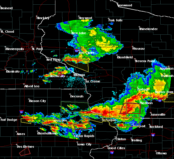 At 645 pm cdt, a confirmed tornado was located near dover, or 18 miles east of rochester, moving east at 20 mph (law enforcement confirmed tornado). Hazards include damaging tornado. Flying debris will be dangerous to those caught without shelter. mobile homes will be damaged or destroyed. damage to roofs, windows, and vehicles will occur. tree damage is likely. the tornado will be near, st. charles around 650 pm cdt. Other locations impacted by this tornadic thunderstorm include utica and i 90 exit 233. At 645 pm cdt, a confirmed tornado was located near dover, or 18 miles east of rochester, moving east at 20 mph (law enforcement confirmed tornado). Hazards include damaging tornado. Flying debris will be dangerous to those caught without shelter. mobile homes will be damaged or destroyed. damage to roofs, windows, and vehicles will occur. tree damage is likely. the tornado will be near, st. charles around 650 pm cdt. Other locations impacted by this tornadic thunderstorm include utica and i 90 exit 233.
|
| 6/16/2017 5:32 PM CDT |
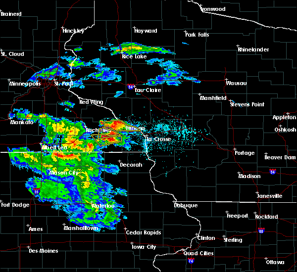 At 531 pm cdt, a severe thunderstorm was located near chatfield, or 10 miles north of preston, moving east at 25 mph (public has reported ping pong sized hail with this storm). Hazards include ping pong ball size hail and 60 mph wind gusts. People and animals outdoors will be injured. expect hail damage to roofs, siding, windows, and vehicles. expect wind damage to roofs, siding, and trees. This severe thunderstorm will remain over mainly rural areas of southwestern winona, southeastern olmsted and northeastern fillmore counties, including the following locations: rushford village, saratoga, fremont, pilot mound and arendahl. At 531 pm cdt, a severe thunderstorm was located near chatfield, or 10 miles north of preston, moving east at 25 mph (public has reported ping pong sized hail with this storm). Hazards include ping pong ball size hail and 60 mph wind gusts. People and animals outdoors will be injured. expect hail damage to roofs, siding, windows, and vehicles. expect wind damage to roofs, siding, and trees. This severe thunderstorm will remain over mainly rural areas of southwestern winona, southeastern olmsted and northeastern fillmore counties, including the following locations: rushford village, saratoga, fremont, pilot mound and arendahl.
|
| 6/16/2017 5:32 PM CDT |
 At 532 pm cdt, a severe thunderstorm was located over rollingstone, or 9 miles northwest of winona, moving northeast at 25 mph (radar indicated). Hazards include quarter size hail. Damage to vehicles is expected. this severe storm will be near, stockton around 535 pm cdt. winona and goodview around 540 pm cdt. fountain city around 545 pm cdt. Other locations impacted by this severe thunderstorm include wilson, utica, minnesota city, elba and whitewater state park. At 532 pm cdt, a severe thunderstorm was located over rollingstone, or 9 miles northwest of winona, moving northeast at 25 mph (radar indicated). Hazards include quarter size hail. Damage to vehicles is expected. this severe storm will be near, stockton around 535 pm cdt. winona and goodview around 540 pm cdt. fountain city around 545 pm cdt. Other locations impacted by this severe thunderstorm include wilson, utica, minnesota city, elba and whitewater state park.
|
| 6/16/2017 5:21 PM CDT |
 At 520 pm cdt, a severe thunderstorm was located over altura, or 12 miles west of winona, moving east at 30 mph (radar indicated). Hazards include quarter size hail. Damage to vehicles is expected. this severe thunderstorm will be near, stockton and rollingstone around 530 pm cdt. goodview and fountain city around 535 pm cdt. winona around 540 pm cdt. Other locations impacted by this severe thunderstorm include wilson, utica, minnesota city, elba and whitewater state park. At 520 pm cdt, a severe thunderstorm was located over altura, or 12 miles west of winona, moving east at 30 mph (radar indicated). Hazards include quarter size hail. Damage to vehicles is expected. this severe thunderstorm will be near, stockton and rollingstone around 530 pm cdt. goodview and fountain city around 535 pm cdt. winona around 540 pm cdt. Other locations impacted by this severe thunderstorm include wilson, utica, minnesota city, elba and whitewater state park.
|
| 6/16/2017 5:18 PM CDT |
 At 517 pm cdt, a severe thunderstorm was located over chatfield, or 15 miles northwest of preston, moving east at 25 mph (amateur radio reported ping pong sized hail 8 miles west of chatfield at 510 pm). Hazards include ping pong ball size hail and 60 mph wind gusts. People and animals outdoors will be injured. expect hail damage to roofs, siding, windows, and vehicles. expect wind damage to roofs, siding, and trees. this severe storm will be near, chatfield around 520 pm cdt. dover around 535 pm cdt. st. charles around 540 pm cdt. Other locations impacted by this severe thunderstorm include rushford village, saratoga, fremont, pilot mound and arendahl. At 517 pm cdt, a severe thunderstorm was located over chatfield, or 15 miles northwest of preston, moving east at 25 mph (amateur radio reported ping pong sized hail 8 miles west of chatfield at 510 pm). Hazards include ping pong ball size hail and 60 mph wind gusts. People and animals outdoors will be injured. expect hail damage to roofs, siding, windows, and vehicles. expect wind damage to roofs, siding, and trees. this severe storm will be near, chatfield around 520 pm cdt. dover around 535 pm cdt. st. charles around 540 pm cdt. Other locations impacted by this severe thunderstorm include rushford village, saratoga, fremont, pilot mound and arendahl.
|
| 6/16/2017 5:10 PM CDT |
 At 509 pm cdt, a severe thunderstorm was located near chatfield, or 15 miles southeast of rochester, moving east at 25 mph (radar indicated). Hazards include 60 mph wind gusts and quarter size hail. Hail damage to vehicles is expected. expect wind damage to roofs, siding, and trees. this severe storm will be near, chatfield around 515 pm cdt. dover around 530 pm cdt. st. charles around 535 pm cdt. Other locations impacted by this severe thunderstorm include rushford village, pleasant grove, washington, saratoga and fremont. At 509 pm cdt, a severe thunderstorm was located near chatfield, or 15 miles southeast of rochester, moving east at 25 mph (radar indicated). Hazards include 60 mph wind gusts and quarter size hail. Hail damage to vehicles is expected. expect wind damage to roofs, siding, and trees. this severe storm will be near, chatfield around 515 pm cdt. dover around 530 pm cdt. st. charles around 535 pm cdt. Other locations impacted by this severe thunderstorm include rushford village, pleasant grove, washington, saratoga and fremont.
|
| 6/16/2017 4:57 PM CDT |
 At 457 pm cdt, a severe thunderstorm was located near chatfield, or 13 miles southeast of rochester, moving east at 30 mph (radar indicated). Hazards include 60 mph wind gusts and quarter size hail. Hail damage to vehicles is expected. expect wind damage to roofs, siding, and trees. this severe thunderstorm will be near, chatfield around 505 pm cdt. dover around 520 pm cdt. st. charles around 525 pm cdt. Other locations impacted by this severe thunderstorm include rushford village, pleasant grove, washington, saratoga and fremont. At 457 pm cdt, a severe thunderstorm was located near chatfield, or 13 miles southeast of rochester, moving east at 30 mph (radar indicated). Hazards include 60 mph wind gusts and quarter size hail. Hail damage to vehicles is expected. expect wind damage to roofs, siding, and trees. this severe thunderstorm will be near, chatfield around 505 pm cdt. dover around 520 pm cdt. st. charles around 525 pm cdt. Other locations impacted by this severe thunderstorm include rushford village, pleasant grove, washington, saratoga and fremont.
|
| 5/17/2017 7:22 PM CDT |
 At 721 pm cdt, severe thunderstorms were located along a line extending from byron to eyota to near rushford, moving north at 55 mph (radar indicated. these storms have a history of producing damaging winds). Hazards include 70 mph wind gusts. Expect considerable tree damage. damage is likely to mobile homes, roofs, and outbuildings. these severe storms will be near, elgin and lewiston around 730 pm cdt. plainview, oronoco and stockton around 735 pm cdt. winona, goodview and rollingstone around 740 pm cdt. fountain city around 745 pm cdt. other locations impacted by these severe thunderstorms include marion, high forest, pleasant grove, douglas and rock dell. A tornado watch remains in effect until 1100 pm cdt for southeastern minnesota, and west central wisconsin. At 721 pm cdt, severe thunderstorms were located along a line extending from byron to eyota to near rushford, moving north at 55 mph (radar indicated. these storms have a history of producing damaging winds). Hazards include 70 mph wind gusts. Expect considerable tree damage. damage is likely to mobile homes, roofs, and outbuildings. these severe storms will be near, elgin and lewiston around 730 pm cdt. plainview, oronoco and stockton around 735 pm cdt. winona, goodview and rollingstone around 740 pm cdt. fountain city around 745 pm cdt. other locations impacted by these severe thunderstorms include marion, high forest, pleasant grove, douglas and rock dell. A tornado watch remains in effect until 1100 pm cdt for southeastern minnesota, and west central wisconsin.
|
| 5/17/2017 7:09 PM CDT |
 At 708 pm cdt, severe thunderstorms were located along a line extending from 8 miles west of stewartville to near chatfield to 9 miles south of rushford, moving north at 55 mph (radar indicated). Hazards include 70 mph wind gusts. Expect considerable tree damage. damage is likely to mobile homes, roofs, and outbuildings. severe thunderstorms will be near, rochester, eyota, byron and dover around 720 pm cdt. elgin and lewiston around 730 pm cdt. plainview, oronoco and stockton around 735 pm cdt. winona, goodview and rollingstone around 740 pm cdt. fountain city around 745 pm cdt. other locations impacted by these severe thunderstorms include marion, high forest, pleasant grove, douglas and rock dell. A tornado watch remains in effect until 1100 pm cdt for southeastern minnesota, and west central wisconsin. At 708 pm cdt, severe thunderstorms were located along a line extending from 8 miles west of stewartville to near chatfield to 9 miles south of rushford, moving north at 55 mph (radar indicated). Hazards include 70 mph wind gusts. Expect considerable tree damage. damage is likely to mobile homes, roofs, and outbuildings. severe thunderstorms will be near, rochester, eyota, byron and dover around 720 pm cdt. elgin and lewiston around 730 pm cdt. plainview, oronoco and stockton around 735 pm cdt. winona, goodview and rollingstone around 740 pm cdt. fountain city around 745 pm cdt. other locations impacted by these severe thunderstorms include marion, high forest, pleasant grove, douglas and rock dell. A tornado watch remains in effect until 1100 pm cdt for southeastern minnesota, and west central wisconsin.
|
| 5/17/2017 4:14 PM CDT |
 At 414 pm cdt, a severe thunderstorm was located near st. charles, or 16 miles west of winona, moving northeast at 30 mph (radar indicated). Hazards include 60 mph wind gusts and quarter size hail. Hail damage to vehicles is expected. expect wind damage to roofs, siding, and trees. this severe storm will be near, altura around 425 pm cdt. rollingstone around 430 pm cdt. other locations impacted by this severe thunderstorm include saratoga, utica, troy, elba and minneiska. A tornado watch remains in effect until 1100 pm cdt for southeastern minnesota, and west central wisconsin. At 414 pm cdt, a severe thunderstorm was located near st. charles, or 16 miles west of winona, moving northeast at 30 mph (radar indicated). Hazards include 60 mph wind gusts and quarter size hail. Hail damage to vehicles is expected. expect wind damage to roofs, siding, and trees. this severe storm will be near, altura around 425 pm cdt. rollingstone around 430 pm cdt. other locations impacted by this severe thunderstorm include saratoga, utica, troy, elba and minneiska. A tornado watch remains in effect until 1100 pm cdt for southeastern minnesota, and west central wisconsin.
|
| 5/17/2017 4:02 PM CDT |
 At 402 pm cdt, a severe thunderstorm was located over st. charles, or 18 miles north of preston, moving north at 40 mph (radar indicated). Hazards include 60 mph wind gusts and quarter size hail. Hail damage to vehicles is expected. expect wind damage to roofs, siding, and trees. this severe storm will be near, lewiston around 410 pm cdt. altura around 420 pm cdt. rollingstone around 425 pm cdt. other locations impacted by this severe thunderstorm include saratoga, utica, troy, elba and minneiska. A tornado watch remains in effect until 1100 pm cdt for southeastern minnesota, and west central wisconsin. At 402 pm cdt, a severe thunderstorm was located over st. charles, or 18 miles north of preston, moving north at 40 mph (radar indicated). Hazards include 60 mph wind gusts and quarter size hail. Hail damage to vehicles is expected. expect wind damage to roofs, siding, and trees. this severe storm will be near, lewiston around 410 pm cdt. altura around 420 pm cdt. rollingstone around 425 pm cdt. other locations impacted by this severe thunderstorm include saratoga, utica, troy, elba and minneiska. A tornado watch remains in effect until 1100 pm cdt for southeastern minnesota, and west central wisconsin.
|
| 5/17/2017 3:54 PM CDT |
 At 354 pm cdt, a severe thunderstorm was located near chatfield, or 13 miles north of preston, moving north at 40 mph (radar indicated). Hazards include 60 mph wind gusts and quarter size hail. Hail damage to vehicles is expected. expect wind damage to roofs, siding, and trees. this severe storm will be near, st. charles and dover around 405 pm cdt. lewiston around 410 pm cdt. altura around 420 pm cdt. rollingstone around 425 pm cdt. other locations impacted by this severe thunderstorm include saratoga, pilot mound, utica, troy and elba. A tornado watch remains in effect until 1100 pm cdt for southeastern minnesota, and west central wisconsin. At 354 pm cdt, a severe thunderstorm was located near chatfield, or 13 miles north of preston, moving north at 40 mph (radar indicated). Hazards include 60 mph wind gusts and quarter size hail. Hail damage to vehicles is expected. expect wind damage to roofs, siding, and trees. this severe storm will be near, st. charles and dover around 405 pm cdt. lewiston around 410 pm cdt. altura around 420 pm cdt. rollingstone around 425 pm cdt. other locations impacted by this severe thunderstorm include saratoga, pilot mound, utica, troy and elba. A tornado watch remains in effect until 1100 pm cdt for southeastern minnesota, and west central wisconsin.
|
| 5/17/2017 3:50 PM CDT |
 At 350 pm cdt, a severe thunderstorm was located near chatfield, or 11 miles north of preston, moving north at 40 mph (radar indicated). Hazards include 60 mph wind gusts and quarter size hail. Hail damage to vehicles is expected. expect wind damage to roofs, siding, and trees. this severe thunderstorm will be near, st. charles and dover around 405 pm cdt. lewiston around 410 pm cdt. altura around 420 pm cdt. rollingstone around 425 pm cdt. other locations impacted by this severe thunderstorm include saratoga, pilot mound, utica, troy and elba. A tornado watch remains in effect until 1100 pm cdt for southeastern minnesota, and west central wisconsin. At 350 pm cdt, a severe thunderstorm was located near chatfield, or 11 miles north of preston, moving north at 40 mph (radar indicated). Hazards include 60 mph wind gusts and quarter size hail. Hail damage to vehicles is expected. expect wind damage to roofs, siding, and trees. this severe thunderstorm will be near, st. charles and dover around 405 pm cdt. lewiston around 410 pm cdt. altura around 420 pm cdt. rollingstone around 425 pm cdt. other locations impacted by this severe thunderstorm include saratoga, pilot mound, utica, troy and elba. A tornado watch remains in effect until 1100 pm cdt for southeastern minnesota, and west central wisconsin.
|
| 4/9/2017 11:17 PM CDT |
 At 1117 pm cdt, a severe thunderstorm was located near stockton, or near winona, moving east at 40 mph (radar indicated). Hazards include quarter size hail. Damage to vehicles is expected. this severe storm will be near, dakota around 1130 pm cdt. Other locations impacted by this severe thunderstorm include new hartford, wilson, saratoga, dresbach and hart. At 1117 pm cdt, a severe thunderstorm was located near stockton, or near winona, moving east at 40 mph (radar indicated). Hazards include quarter size hail. Damage to vehicles is expected. this severe storm will be near, dakota around 1130 pm cdt. Other locations impacted by this severe thunderstorm include new hartford, wilson, saratoga, dresbach and hart.
|
| 4/9/2017 10:50 PM CDT |
 At 1050 pm cdt, a severe thunderstorm was located near altura, or 18 miles west of winona, moving northeast at 60 mph (radar indicated). Hazards include quarter size hail. Damage to vehicles is expected. this severe thunderstorm will be near, altura and lewiston around 1055 pm cdt. rollingstone and stockton around 1100 pm cdt. winona and goodview around 1105 pm cdt. Other locations impacted by this severe thunderstorm include new hartford, wilson, saratoga, dresbach and hart. At 1050 pm cdt, a severe thunderstorm was located near altura, or 18 miles west of winona, moving northeast at 60 mph (radar indicated). Hazards include quarter size hail. Damage to vehicles is expected. this severe thunderstorm will be near, altura and lewiston around 1055 pm cdt. rollingstone and stockton around 1100 pm cdt. winona and goodview around 1105 pm cdt. Other locations impacted by this severe thunderstorm include new hartford, wilson, saratoga, dresbach and hart.
|
| 8/18/2016 6:19 PM CDT |
 At 616 pm cdt, severe thunderstorms were located along a line extending from 6 miles south of lewiston to rushford to near mabel, moving east at 35 mph (trained weather spotters reported winds in the 60 to 70 mph range near preston at 615 pm). Hazards include 60 mph wind gusts. Expect damage to roofs. siding. and trees. these severe storms will be near, houston and spring grove around 625 pm cdt. caledonia around 635 pm cdt. hokah around 645 pm cdt. brownsville around 650 pm cdt. New albin around 655 pm cdt. At 616 pm cdt, severe thunderstorms were located along a line extending from 6 miles south of lewiston to rushford to near mabel, moving east at 35 mph (trained weather spotters reported winds in the 60 to 70 mph range near preston at 615 pm). Hazards include 60 mph wind gusts. Expect damage to roofs. siding. and trees. these severe storms will be near, houston and spring grove around 625 pm cdt. caledonia around 635 pm cdt. hokah around 645 pm cdt. brownsville around 650 pm cdt. New albin around 655 pm cdt.
|
| 8/18/2016 5:50 PM CDT |
 At 547 pm cdt, severe thunderstorms were located along a line extending from near eyota to near fountain to 6 miles west of harmony, moving east at 40 mph (trained spotters have reported winds in the 50 to 60 mph range). Hazards include 60 mph wind gusts. Expect damage to roofs. siding. and trees. severe thunderstorms will be near, preston around 550 pm cdt. harmony and lanesboro around 555 pm cdt. st. charles around 605 pm cdt. rushford around 610 pm cdt. mabel around 615 pm cdt. houston and spring grove around 625 pm cdt. Caledonia around 635 pm cdt. At 547 pm cdt, severe thunderstorms were located along a line extending from near eyota to near fountain to 6 miles west of harmony, moving east at 40 mph (trained spotters have reported winds in the 50 to 60 mph range). Hazards include 60 mph wind gusts. Expect damage to roofs. siding. and trees. severe thunderstorms will be near, preston around 550 pm cdt. harmony and lanesboro around 555 pm cdt. st. charles around 605 pm cdt. rushford around 610 pm cdt. mabel around 615 pm cdt. houston and spring grove around 625 pm cdt. Caledonia around 635 pm cdt.
|
| 7/5/2016 9:10 PM CDT |
 At 910 pm cdt, severe thunderstorms were located along a line extending from near mondovi to 6 miles northeast of buffalo city to chatfield, moving east at 50 mph (radar indicated). Hazards include 60 mph wind gusts. Expect damage to roofs. siding. and trees. these severe storms will be near, fountain city around 915 pm cdt. arcadia around 925 pm cdt. independence and lewiston around 930 pm cdt. stockton around 935 pm cdt. Other locations impacted by these severe thunderstorms include dodge, new hartford, wilson, saratoga and ettrick. At 910 pm cdt, severe thunderstorms were located along a line extending from near mondovi to 6 miles northeast of buffalo city to chatfield, moving east at 50 mph (radar indicated). Hazards include 60 mph wind gusts. Expect damage to roofs. siding. and trees. these severe storms will be near, fountain city around 915 pm cdt. arcadia around 925 pm cdt. independence and lewiston around 930 pm cdt. stockton around 935 pm cdt. Other locations impacted by these severe thunderstorms include dodge, new hartford, wilson, saratoga and ettrick.
|
| 7/5/2016 9:02 PM CDT |
 At 902 pm cdt, severe thunderstorms were located along a line extending from near osseo to near eyota, moving east at 55 mph (radar indicated). Hazards include 60 mph wind gusts. Expect damage to roofs. siding. and trees. these severe storms will be near, osseo around 910 pm cdt. stockton and rollingstone around 925 pm cdt. winona, goodview and fountain city around 930 pm cdt. trempealeau, dakota and galesville around 945 pm cdt. Other locations impacted by these severe thunderstorms include dodge, new hartford, wilson, saratoga and ettrick. At 902 pm cdt, severe thunderstorms were located along a line extending from near osseo to near eyota, moving east at 55 mph (radar indicated). Hazards include 60 mph wind gusts. Expect damage to roofs. siding. and trees. these severe storms will be near, osseo around 910 pm cdt. stockton and rollingstone around 925 pm cdt. winona, goodview and fountain city around 930 pm cdt. trempealeau, dakota and galesville around 945 pm cdt. Other locations impacted by these severe thunderstorms include dodge, new hartford, wilson, saratoga and ettrick.
|
| 7/5/2016 8:49 PM CDT |
 At 849 pm cdt, severe thunderstorms were located along a line extending from near strum to near rochester, moving east at 65 mph (radar indicated). Hazards include 60 mph wind gusts. Expect damage to roofs. siding. and trees. severe thunderstorms will be near, osseo around 900 pm cdt. st. charles around 905 pm cdt. lewiston and altura around 915 pm cdt. stockton and rollingstone around 920 pm cdt. Other locations impacted by these severe thunderstorms include dodge, new hartford, wilson, saratoga and ettrick. At 849 pm cdt, severe thunderstorms were located along a line extending from near strum to near rochester, moving east at 65 mph (radar indicated). Hazards include 60 mph wind gusts. Expect damage to roofs. siding. and trees. severe thunderstorms will be near, osseo around 900 pm cdt. st. charles around 905 pm cdt. lewiston and altura around 915 pm cdt. stockton and rollingstone around 920 pm cdt. Other locations impacted by these severe thunderstorms include dodge, new hartford, wilson, saratoga and ettrick.
|
| 7/18/2015 2:28 AM CDT |
 At 227 am cdt, severe thunderstorms were located along a line extending from near strum to near chatfield, moving east at 45 mph (radar indicated). Hazards include 60 mph wind gusts. Expect damage to roofs. siding and trees. these severe storms will be near, strum around 235 am cdt. osseo around 240 am cdt. lewiston around 245 am cdt. Other locations impacted by these severe thunderstorms include dodge, winona, eleva, wilson, saratoga and waumandee. At 227 am cdt, severe thunderstorms were located along a line extending from near strum to near chatfield, moving east at 45 mph (radar indicated). Hazards include 60 mph wind gusts. Expect damage to roofs. siding and trees. these severe storms will be near, strum around 235 am cdt. osseo around 240 am cdt. lewiston around 245 am cdt. Other locations impacted by these severe thunderstorms include dodge, winona, eleva, wilson, saratoga and waumandee.
|
| 7/18/2015 2:06 AM CDT |
 At 205 am cdt, severe thunderstorms were located along a line extending from 8 miles north of mondovi to near stewartville, moving east at 40 mph (radar indicated). Hazards include 60 mph wind gusts. Expect damage to roofs. siding and trees. severe thunderstorms will be near, st. charles and strum around 230 am cdt. osseo around 240 am cdt. lewiston around 245 am cdt. stockton and winona around 250 am cdt. Other locations impacted by these severe thunderstorms include arcadia, dodge, eleva, wilson, saratoga and waumandee. At 205 am cdt, severe thunderstorms were located along a line extending from 8 miles north of mondovi to near stewartville, moving east at 40 mph (radar indicated). Hazards include 60 mph wind gusts. Expect damage to roofs. siding and trees. severe thunderstorms will be near, st. charles and strum around 230 am cdt. osseo around 240 am cdt. lewiston around 245 am cdt. stockton and winona around 250 am cdt. Other locations impacted by these severe thunderstorms include arcadia, dodge, eleva, wilson, saratoga and waumandee.
|
| 5/3/2015 8:02 PM CDT | At 802 pm cdt, a severe thunderstorm was located near lewiston, or 16 miles southwest of winona, moving east at 35 mph (radar indicated). Hazards include 60 mph wind gusts and quarter size hail. Hail damage to vehicles is expected. expect wind damage to roofs, siding and trees. this severe storm will be near, lewiston around 810 pm cdt. stockton around 815 pm cdt. winona and goodview around 820 pm cdt. trempealeau around 845 pm cdt. other locations impacted by this severe thunderstorm include wilson, saratoga, hart, fremont and utica. 1. 00in. |
| 5/3/2015 7:55 PM CDT | At 754 pm cdt, a severe thunderstorm was located near st. charles, or 18 miles southwest of winona, moving east at 35 mph (radar indicated). Hazards include 60 mph wind gusts and quarter size hail. Hail damage to vehicles is expected. expect wind damage to roofs, siding and trees. this severe thunderstorm will be near, lewiston around 805 pm cdt. stockton around 810 pm cdt. winona and goodview around 815 pm cdt. trempealeau around 840 pm cdt. other locations impacted by this severe thunderstorm include wilson, saratoga, hart, fremont and utica. 1. 00in. |
| 5/19/2013 5:23 PM CDT | Structure damage. large trees down. pole barn down along with corn crib in winona county MN, 2 miles S of St. Charles, MN |
| 5/19/2013 5:23 PM CDT | Quarter sized hail reported 4.1 miles S of St. Charles, MN, also large pieces of tin metal 6 ft long blown out |
| 5/19/2013 5:22 PM CDT | Power lines down in the city. one tree down in the city as wel in winona county MN, 0.1 miles NE of St. Charles, MN |
| 10/25/2012 12:59 AM CDT | Quarter sized hail reported 0.1 miles NE of St. Charles, MN, kttc reported that quarter size hail fell for 2 minutes in st charles |
| 9/4/2012 4:10 PM CDT | Hen Egg sized hail reported 5.7 miles NNW of St. Charles, MN, reported 4 miles nw of clyde |
| 9/4/2012 4:01 PM CDT | Golf Ball sized hail reported 2.5 miles WSW of St. Charles, MN, reported 1 mile south of st. charles |
| 1/1/0001 12:00 AM | A couple of trees blown down in winona county MN, 0.1 miles NE of St. Charles, MN |
| 1/1/0001 12:00 AM | A couple of trees blown down in winona county MN, 0.1 miles NE of St. Charles, MN |
| 1/1/0001 12:00 AM | Power lines and trees down in winona county MN, 0.1 miles NE of St. Charles, MN |
Hail Maps for St. Charles, MN

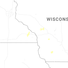
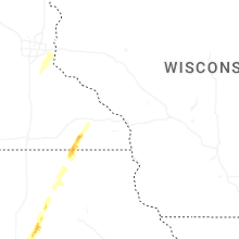
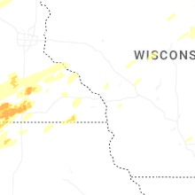


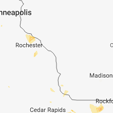


Connect with Interactive Hail Maps