

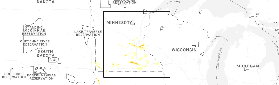
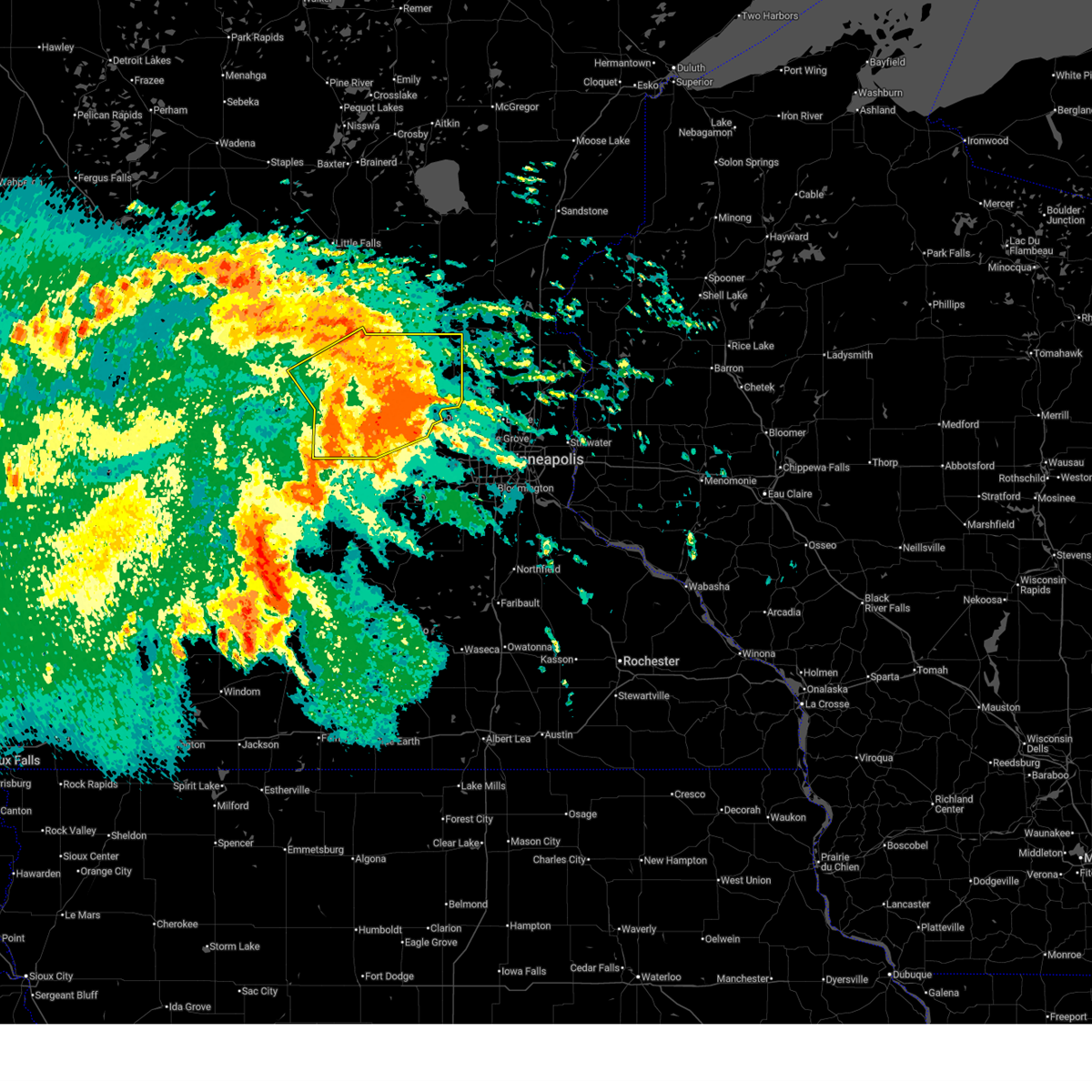
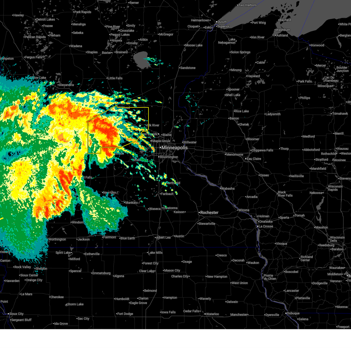
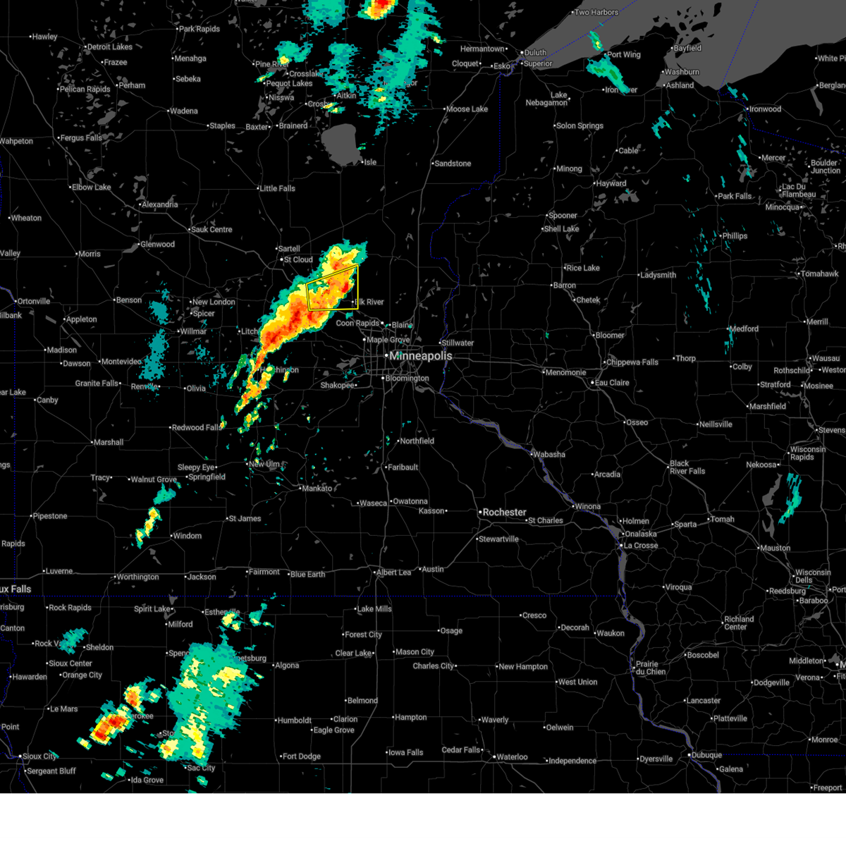
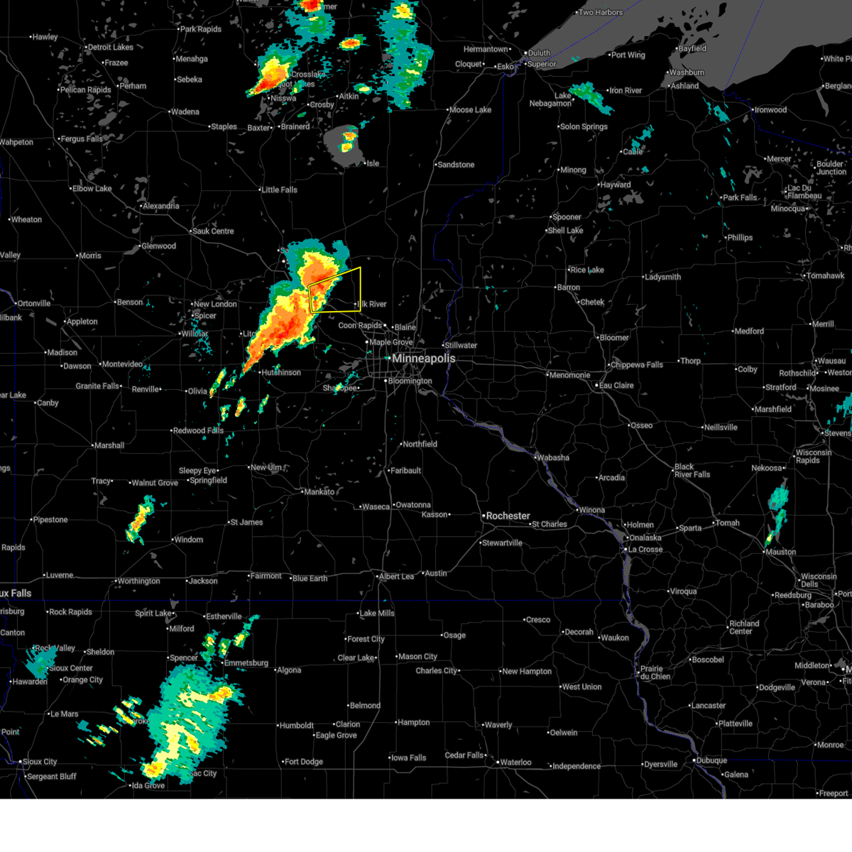
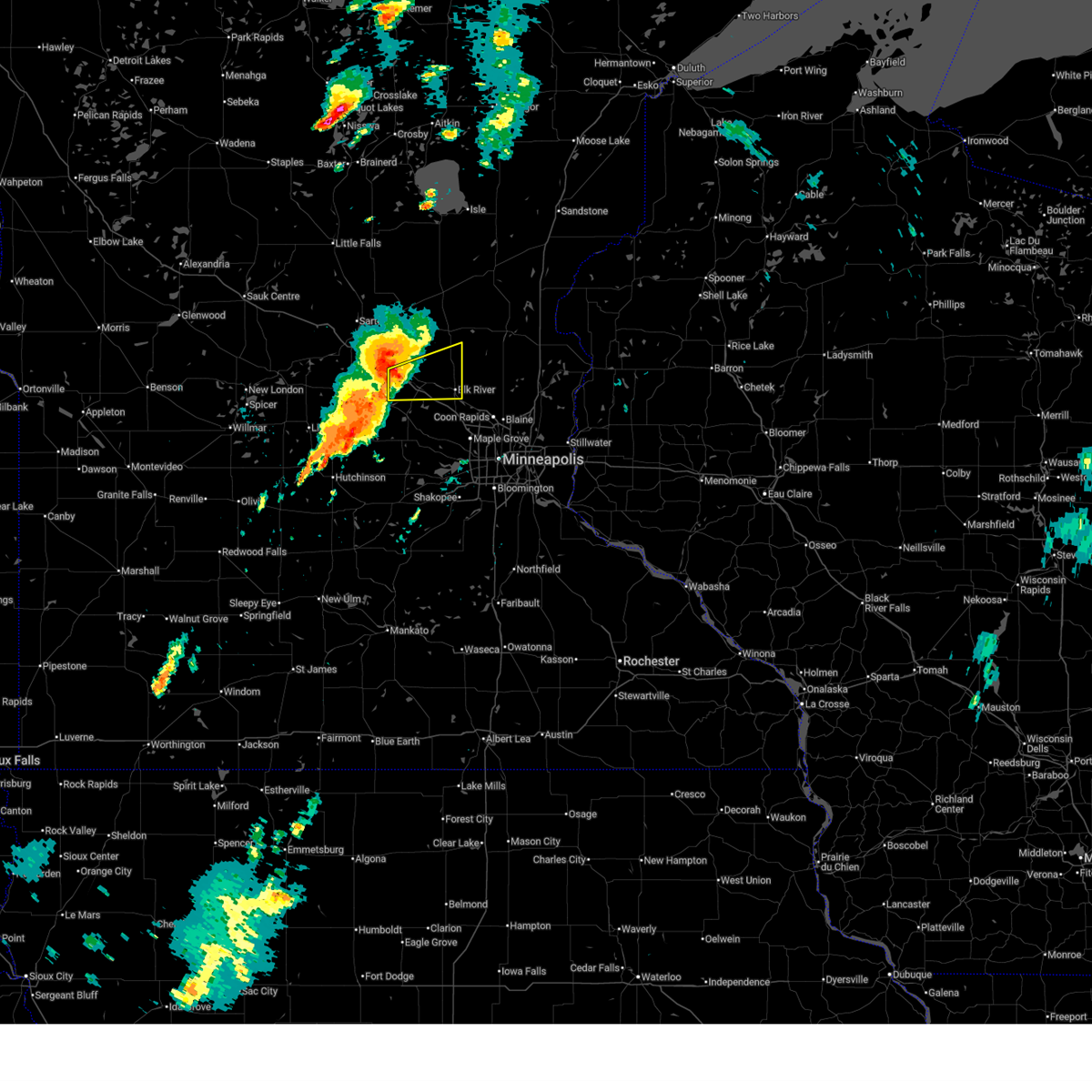
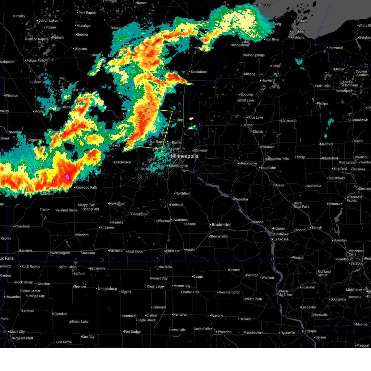
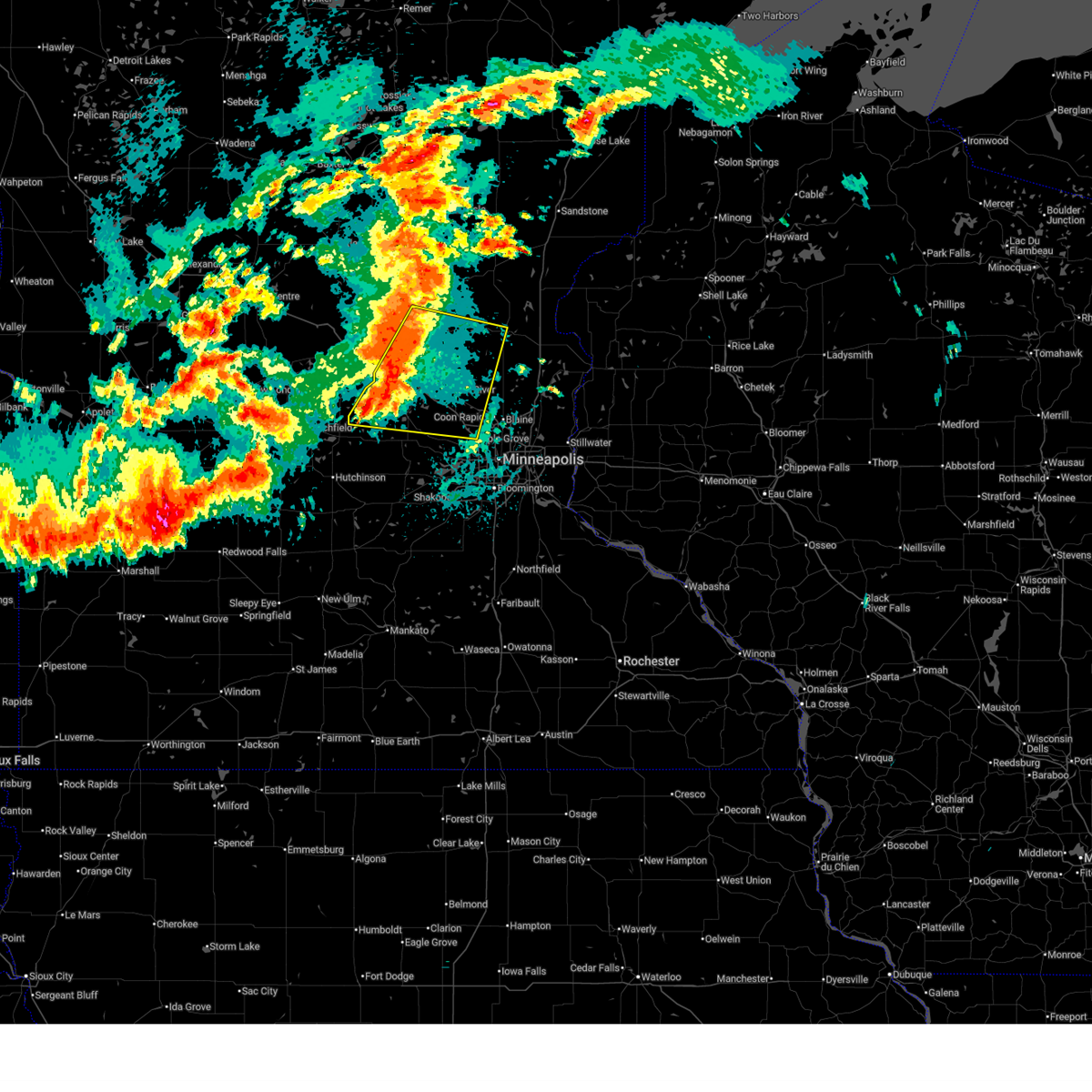
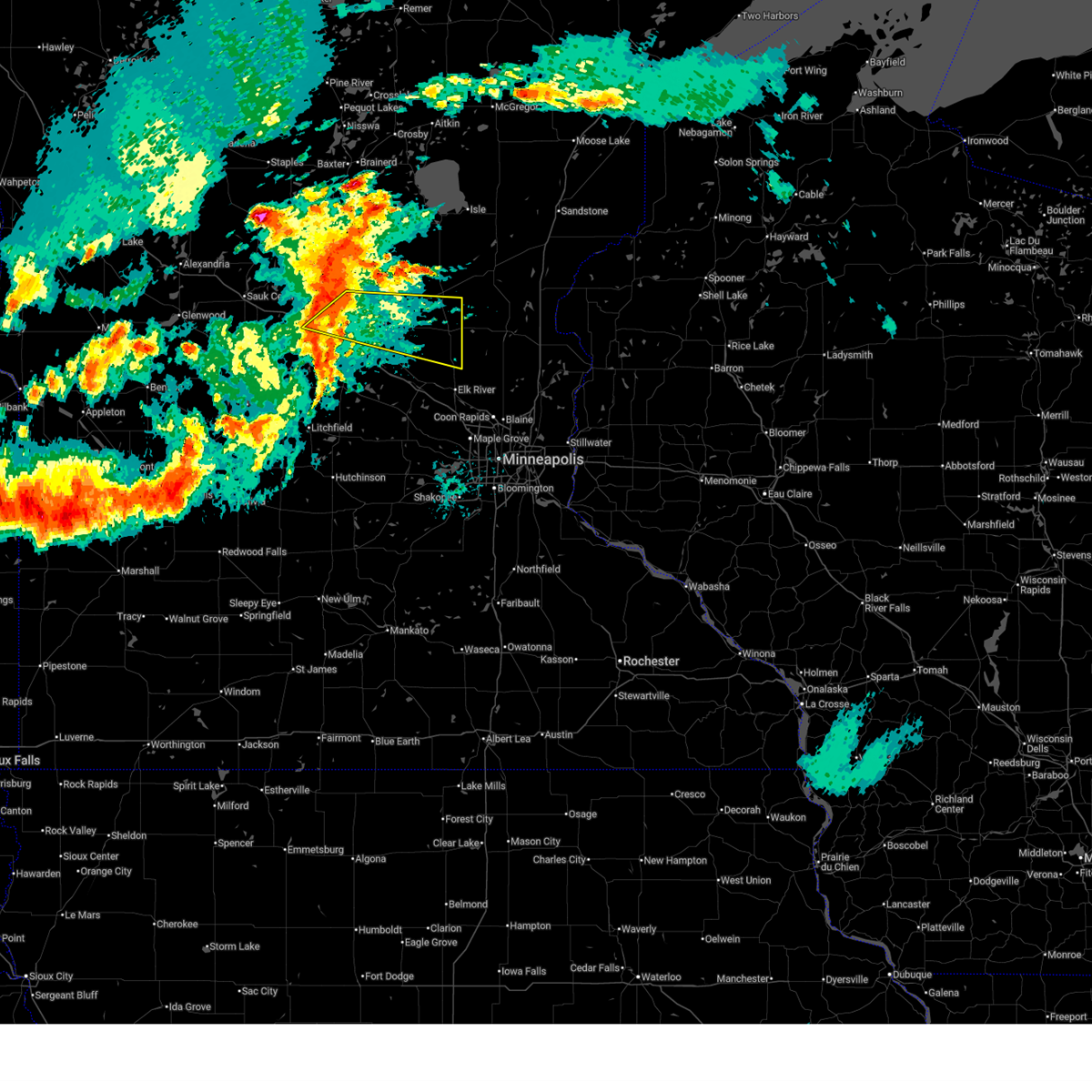
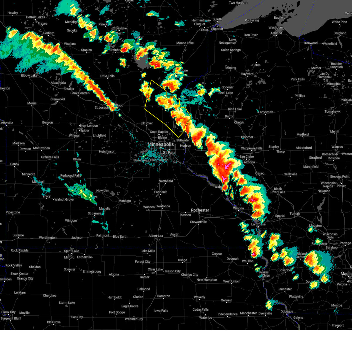
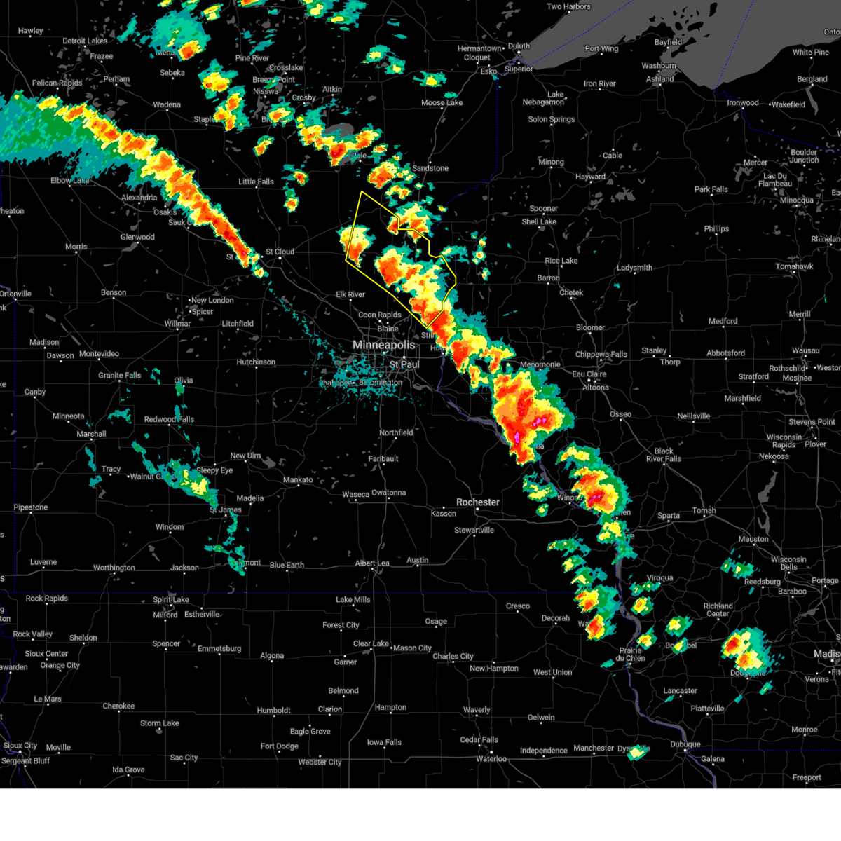
Hail Map for St. Francis, MN
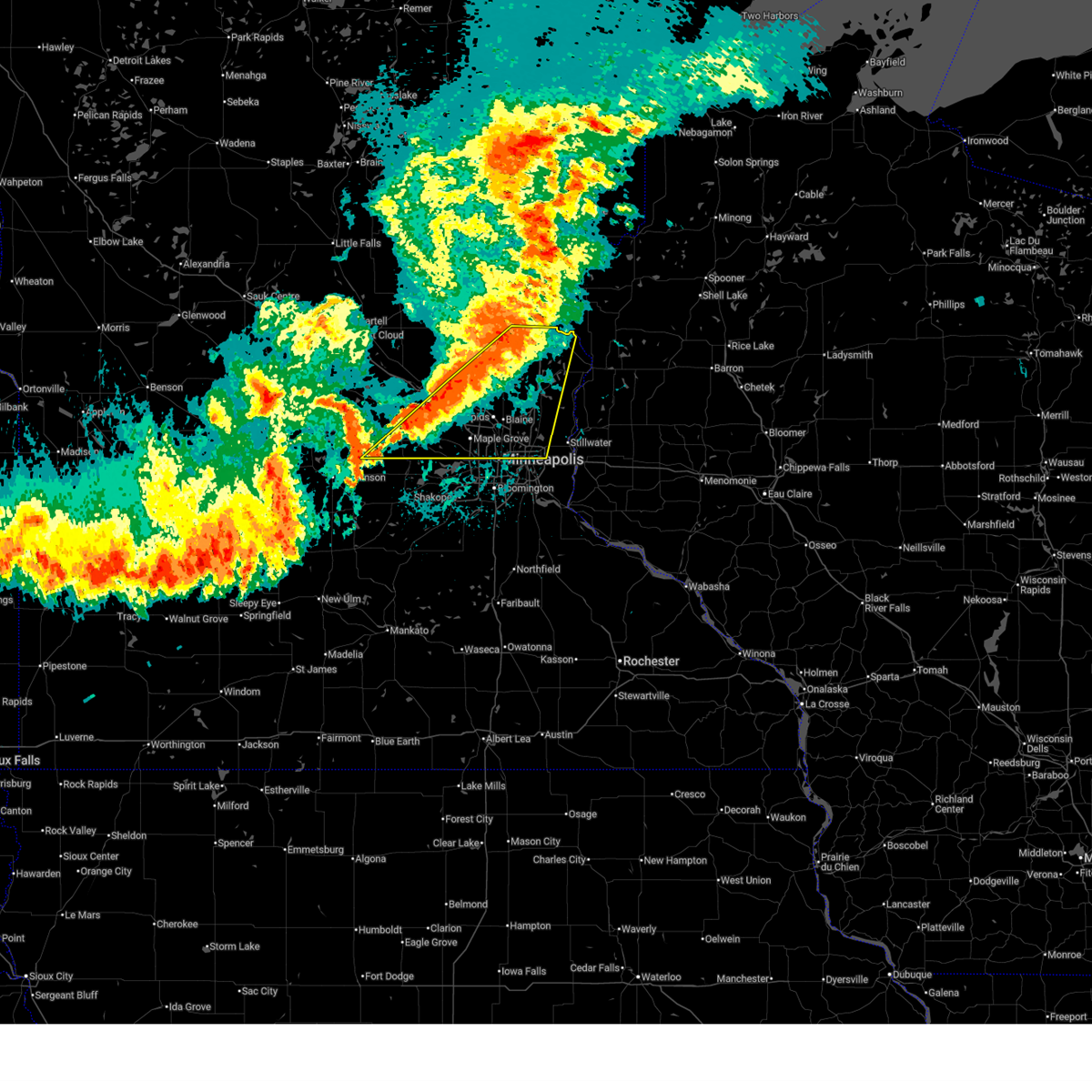
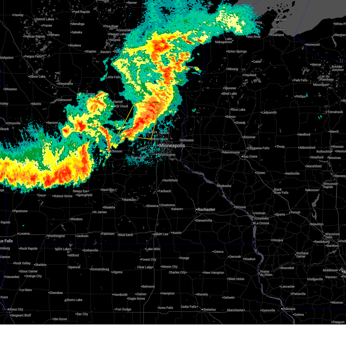
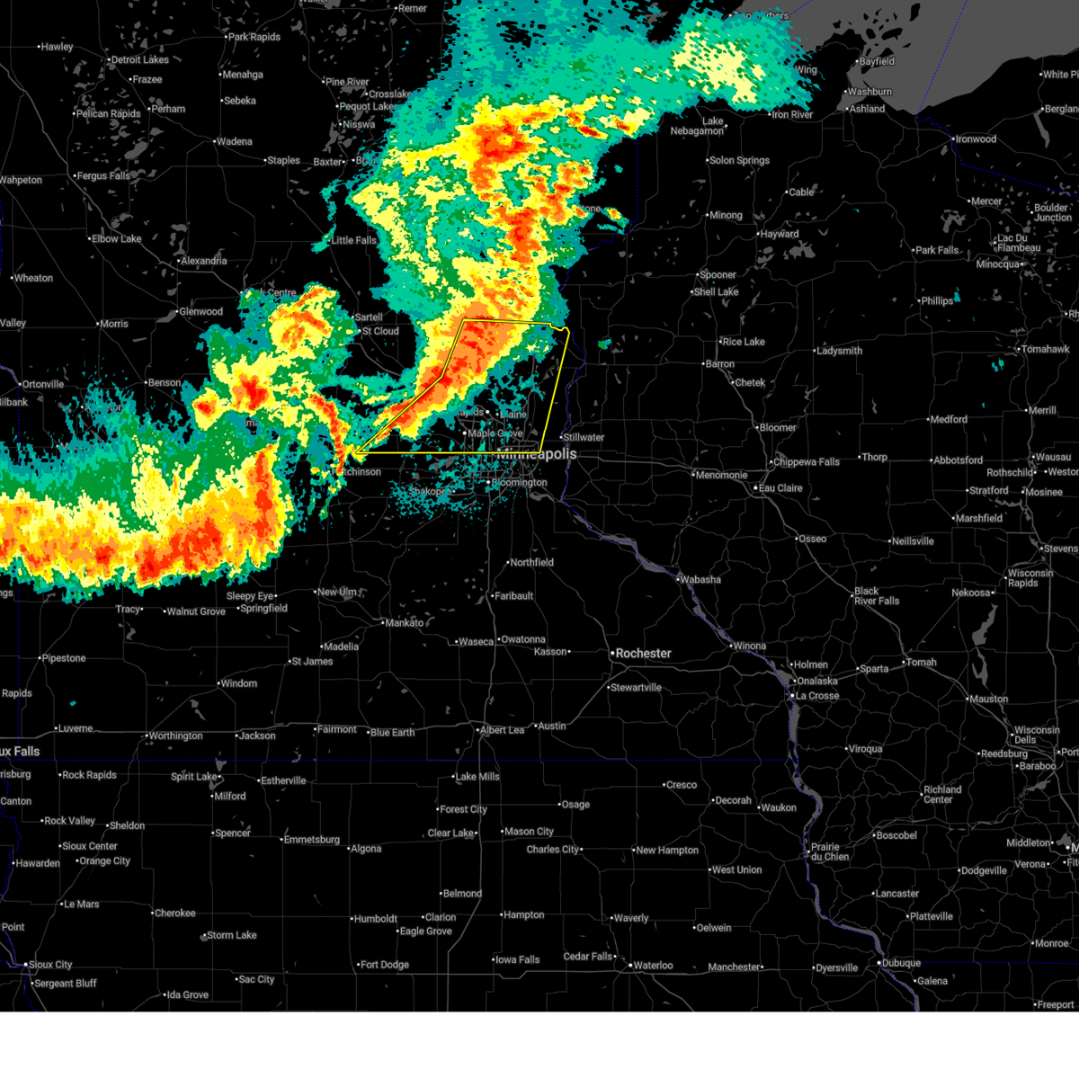
The St. Francis, MN area has had 5 reports of on-the-ground hail by trained spotters, and has been under severe weather warnings 9 times during the past 12 months. Doppler radar has detected hail at or near St. Francis, MN on 79 occasions, including 3 occasions during the past year.
| Name: | St. Francis, MN |
| Where Located: | 29.7 miles N of Minneapolis, MN |
| Map: | Google Map for St. Francis, MN |
| Population: | 7218 |
| Housing Units: | 2650 |
| More Info: | Search Google for St. Francis, MN |
1
The Top Recent Hail Date for St. Francis, MN is Sunday, September 21, 2025 (32nd out of 79)
Hail and Wind Damage Spotted near St. Francis, MN
| Date / Time | Report Details |
|---|---|
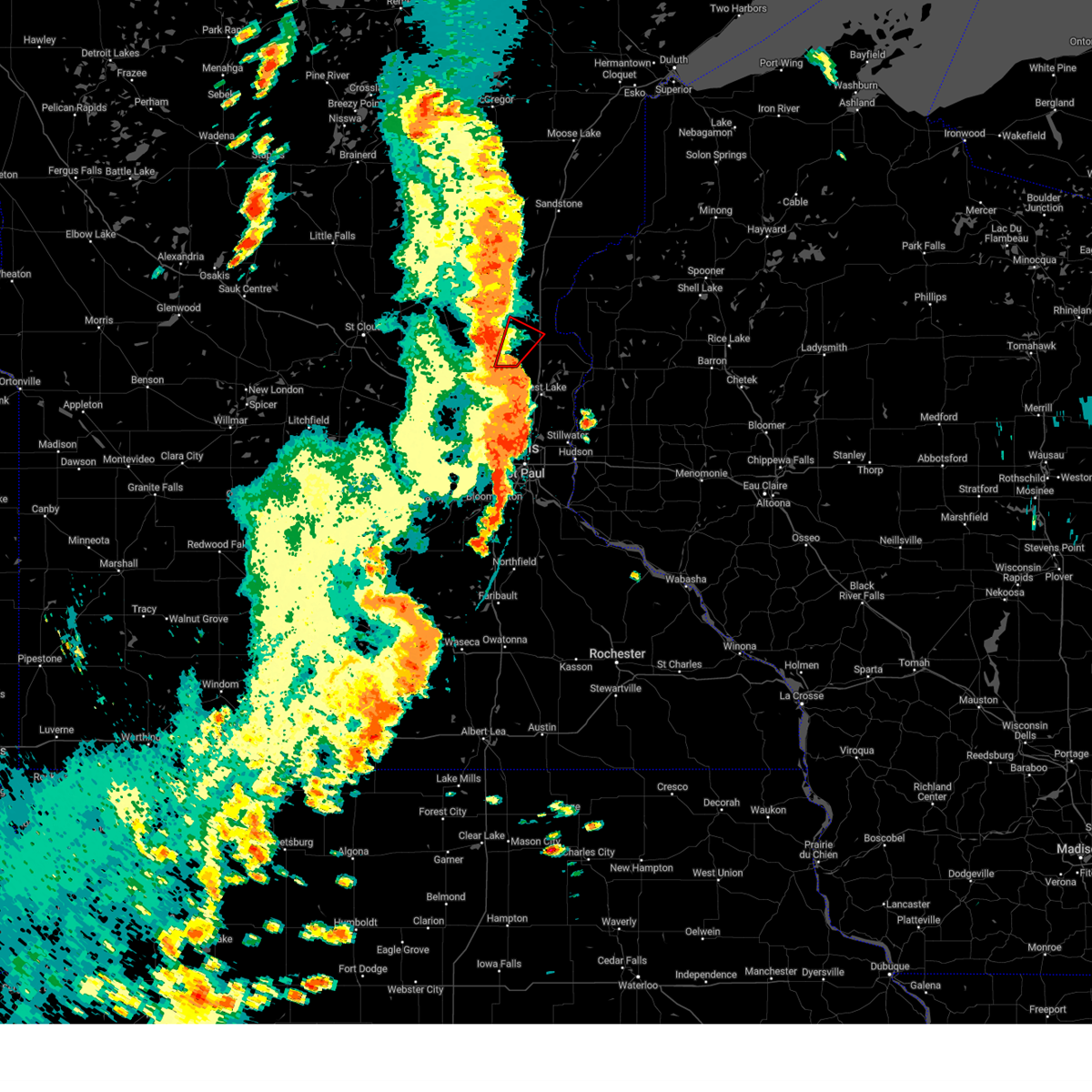
| 6/19/2026 5:09 PM CDT |
 Svrmpx the national weather service in the twin cities has issued a * severe thunderstorm warning for, northeastern sherburne county in central minnesota, northwestern anoka county in east central minnesota, southwestern isanti county in east central minnesota, * until 600 pm cdt. * at 509 pm cdt, a severe thunderstorm was located 9 miles northeast of becker, or 18 miles east of st. cloud, moving east at 25 mph (radar indicated). Hazards include 60 mph wind gusts and quarter size hail. Hail damage to vehicles is expected. Expect wind damage to roofs, siding, and trees. Svrmpx the national weather service in the twin cities has issued a * severe thunderstorm warning for, northeastern sherburne county in central minnesota, northwestern anoka county in east central minnesota, southwestern isanti county in east central minnesota, * until 600 pm cdt. * at 509 pm cdt, a severe thunderstorm was located 9 miles northeast of becker, or 18 miles east of st. cloud, moving east at 25 mph (radar indicated). Hazards include 60 mph wind gusts and quarter size hail. Hail damage to vehicles is expected. Expect wind damage to roofs, siding, and trees.
|
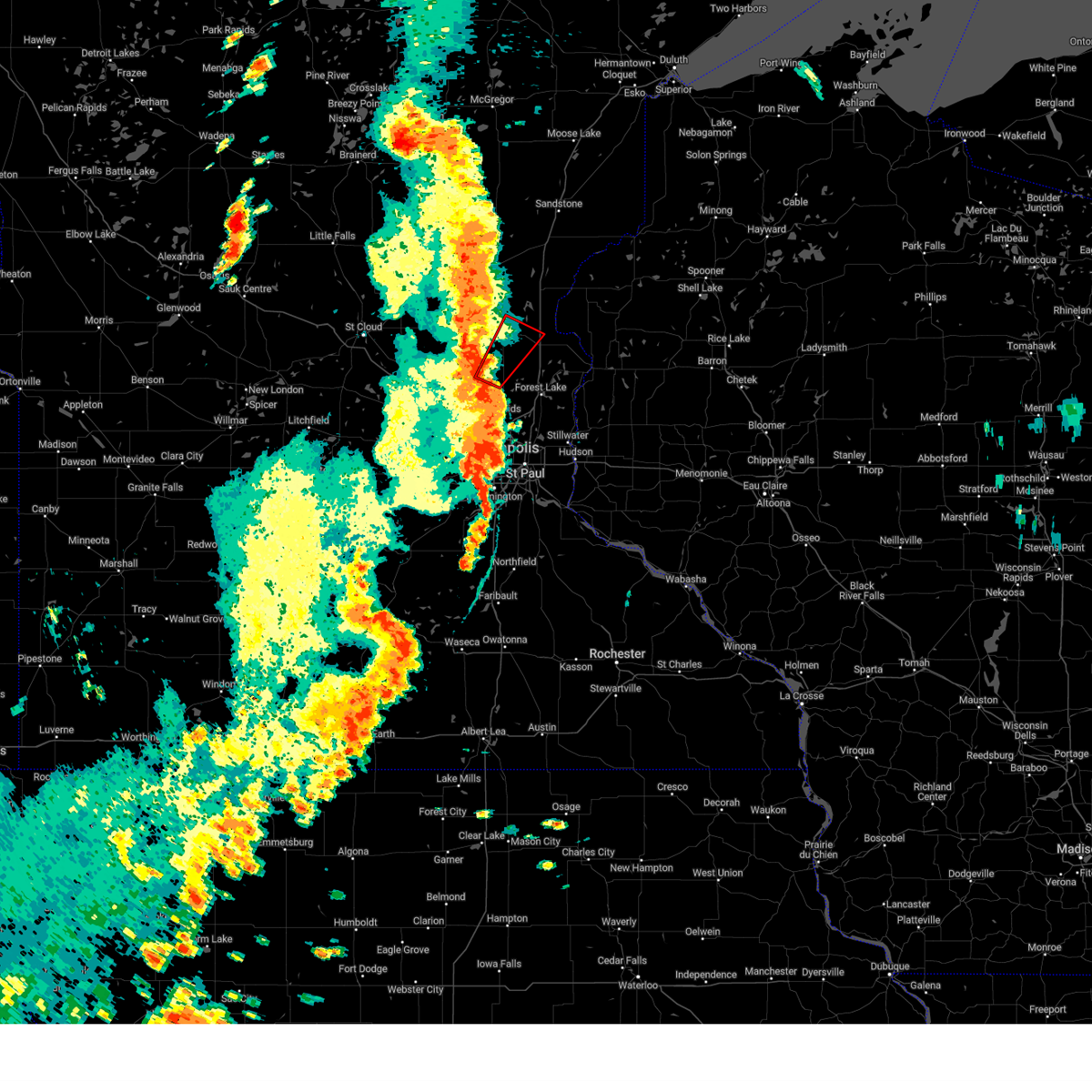
| 8/16/2025 6:42 AM CDT |
 The storms which prompted the warning have weakened below severe limits, and no longer pose an immediate threat to life or property. therefore, the warning will be allowed to expire. however, heavy rain is still possible with these thunderstorms. to report severe weather, contact your nearest law enforcement agency. they will send your report to the national weather service office. The storms which prompted the warning have weakened below severe limits, and no longer pose an immediate threat to life or property. therefore, the warning will be allowed to expire. however, heavy rain is still possible with these thunderstorms. to report severe weather, contact your nearest law enforcement agency. they will send your report to the national weather service office.
|
| 8/16/2025 6:26 AM CDT |
 At 626 am cdt, severe thunderstorms were located along a line from near foreston to near rogers, or along a line from 24 miles west of cambridge to 17 miles east of buffalo, moving northeast at 55 mph (radar indicated). Hazards include 60 mph wind gusts and quarter size hail. Hail damage to vehicles is expected. expect wind damage to roofs, siding, and trees. locations impacted include, buffalo, ramsey, elk river, st. michael, otsego, monticello, big lake, st. Francis, albertville, zimmerman, princeton, becker, rockford, annandale, montrose, cokato, maple lake, howard lake, clearwater and dassel. At 626 am cdt, severe thunderstorms were located along a line from near foreston to near rogers, or along a line from 24 miles west of cambridge to 17 miles east of buffalo, moving northeast at 55 mph (radar indicated). Hazards include 60 mph wind gusts and quarter size hail. Hail damage to vehicles is expected. expect wind damage to roofs, siding, and trees. locations impacted include, buffalo, ramsey, elk river, st. michael, otsego, monticello, big lake, st. Francis, albertville, zimmerman, princeton, becker, rockford, annandale, montrose, cokato, maple lake, howard lake, clearwater and dassel.
|
| 8/16/2025 6:26 AM CDT |
 the severe thunderstorm warning has been cancelled and is no longer in effect the severe thunderstorm warning has been cancelled and is no longer in effect
|
| 8/16/2025 6:11 AM CDT |
 At 611 am cdt, severe thunderstorms were located along a line from 6 miles south of foley to near rockford, or along a line from 12 miles east of st. cloud to 6 miles east of buffalo, moving northeast at 55 mph (radar indicated). Hazards include 60 mph wind gusts and quarter size hail. Hail damage to vehicles is expected. expect wind damage to roofs, siding, and trees. locations impacted include, st. cloud, buffalo, ramsey, elk river, st. michael, otsego, sauk rapids, monticello, big lake, st. francis, albertville, waite park, st. Joseph, zimmerman, princeton, becker, rockford, cold spring, annandale and montrose. At 611 am cdt, severe thunderstorms were located along a line from 6 miles south of foley to near rockford, or along a line from 12 miles east of st. cloud to 6 miles east of buffalo, moving northeast at 55 mph (radar indicated). Hazards include 60 mph wind gusts and quarter size hail. Hail damage to vehicles is expected. expect wind damage to roofs, siding, and trees. locations impacted include, st. cloud, buffalo, ramsey, elk river, st. michael, otsego, sauk rapids, monticello, big lake, st. francis, albertville, waite park, st. Joseph, zimmerman, princeton, becker, rockford, cold spring, annandale and montrose.
|
| 8/16/2025 5:52 AM CDT |
 Svrmpx the national weather service in the twin cities has issued a * severe thunderstorm warning for, meeker county in central minnesota, sherburne county in central minnesota, southeastern stearns county in central minnesota, wright county in central minnesota, * until 645 am cdt. * at 552 am cdt, severe thunderstorms were located along a line from 5 miles south of waite park to over howard lake, or along a line from 6 miles southwest of st. cloud to 14 miles southwest of buffalo, moving northeast at 55 mph (radar indicated). Hazards include 60 mph wind gusts and quarter size hail. Hail damage to vehicles is expected. Expect wind damage to roofs, siding, and trees. Svrmpx the national weather service in the twin cities has issued a * severe thunderstorm warning for, meeker county in central minnesota, sherburne county in central minnesota, southeastern stearns county in central minnesota, wright county in central minnesota, * until 645 am cdt. * at 552 am cdt, severe thunderstorms were located along a line from 5 miles south of waite park to over howard lake, or along a line from 6 miles southwest of st. cloud to 14 miles southwest of buffalo, moving northeast at 55 mph (radar indicated). Hazards include 60 mph wind gusts and quarter size hail. Hail damage to vehicles is expected. Expect wind damage to roofs, siding, and trees.
|
| 8/9/2025 2:17 AM CDT |
 the severe thunderstorm warning has been cancelled and is no longer in effect the severe thunderstorm warning has been cancelled and is no longer in effect
|
| 8/9/2025 1:52 AM CDT |
 At 152 am cdt, a severe thunderstorm was located over big lake, or 13 miles northeast of buffalo, moving east at 30 mph (radar indicated). Hazards include 60 mph wind gusts and quarter size hail. Hail damage to vehicles is expected. expect wind damage to roofs, siding, and trees. locations impacted include, ramsey, elk river, otsego, monticello, big lake, st. Francis, zimmerman, becker, orrock, silver creek, enfield and lake maria state park. At 152 am cdt, a severe thunderstorm was located over big lake, or 13 miles northeast of buffalo, moving east at 30 mph (radar indicated). Hazards include 60 mph wind gusts and quarter size hail. Hail damage to vehicles is expected. expect wind damage to roofs, siding, and trees. locations impacted include, ramsey, elk river, otsego, monticello, big lake, st. Francis, zimmerman, becker, orrock, silver creek, enfield and lake maria state park.
|
| 8/9/2025 1:39 AM CDT |
 Svrmpx the national weather service in the twin cities has issued a * severe thunderstorm warning for, southeastern sherburne county in central minnesota, northeastern wright county in central minnesota, * until 230 am cdt. * at 139 am cdt, a severe thunderstorm was located near becker, or 10 miles north of buffalo, moving east at 25 mph (radar indicated). Hazards include 60 mph wind gusts and quarter size hail. Hail damage to vehicles is expected. Expect wind damage to roofs, siding, and trees. Svrmpx the national weather service in the twin cities has issued a * severe thunderstorm warning for, southeastern sherburne county in central minnesota, northeastern wright county in central minnesota, * until 230 am cdt. * at 139 am cdt, a severe thunderstorm was located near becker, or 10 miles north of buffalo, moving east at 25 mph (radar indicated). Hazards include 60 mph wind gusts and quarter size hail. Hail damage to vehicles is expected. Expect wind damage to roofs, siding, and trees.
|
| 6/28/2025 11:29 PM CDT |
 At 1129 pm cdt, severe thunderstorms were located along a line from 7 miles north of center city to over brooklyn center, or along a line from 21 miles east of cambridge to 8 miles northwest of minneapolis, moving east at 40 mph (radar indicated). Hazards include 60 mph wind gusts and small hail. Expect damage to roofs, siding, and trees. locations impacted include, minneapolis, st. Paul, buffalo, cambridge, brooklyn park, plymouth, maple grove, coon rapids, blaine, maplewood, roseville, andover, brooklyn center, oakdale, fridley, shoreview, white bear lake, ramsey, champlin and elk river. At 1129 pm cdt, severe thunderstorms were located along a line from 7 miles north of center city to over brooklyn center, or along a line from 21 miles east of cambridge to 8 miles northwest of minneapolis, moving east at 40 mph (radar indicated). Hazards include 60 mph wind gusts and small hail. Expect damage to roofs, siding, and trees. locations impacted include, minneapolis, st. Paul, buffalo, cambridge, brooklyn park, plymouth, maple grove, coon rapids, blaine, maplewood, roseville, andover, brooklyn center, oakdale, fridley, shoreview, white bear lake, ramsey, champlin and elk river.
|
| 6/28/2025 11:14 PM CDT |
 The severe thunderstorm warning that was previously in effect has been reissued for isanti, hennepin, anoka, wright, and sherburne counties and is in effect until 1200 am cdt. please refer to that bulletin for the latest severe weather information. however, gusty winds are still possible with this thunderstorm. a tornado watch remains in effect until 100 am cdt for portions of central and east central minnesota. The severe thunderstorm warning that was previously in effect has been reissued for isanti, hennepin, anoka, wright, and sherburne counties and is in effect until 1200 am cdt. please refer to that bulletin for the latest severe weather information. however, gusty winds are still possible with this thunderstorm. a tornado watch remains in effect until 100 am cdt for portions of central and east central minnesota.
|
| 6/28/2025 11:14 PM CDT |
 Svrmpx the national weather service in the twin cities has issued a * severe thunderstorm warning for, southeastern sherburne county in central minnesota, southeastern wright county in central minnesota, anoka county in east central minnesota, southern chisago county in east central minnesota, northwest hennepin, northeast hennepin, west hennepin, central hennepin, and east hennepin county in east central minnesota, isanti county in east central minnesota, ramsey county in east central minnesota, northwestern washington county in east central minnesota, * until midnight cdt. * at 1114 pm cdt, severe thunderstorms were located along a line from over cambridge to near corcoran, or along a line from over cambridge to 12 miles southeast of buffalo, moving east at 35 mph (radar indicated). Hazards include 60 mph wind gusts and small hail. expect damage to roofs, siding, and trees Svrmpx the national weather service in the twin cities has issued a * severe thunderstorm warning for, southeastern sherburne county in central minnesota, southeastern wright county in central minnesota, anoka county in east central minnesota, southern chisago county in east central minnesota, northwest hennepin, northeast hennepin, west hennepin, central hennepin, and east hennepin county in east central minnesota, isanti county in east central minnesota, ramsey county in east central minnesota, northwestern washington county in east central minnesota, * until midnight cdt. * at 1114 pm cdt, severe thunderstorms were located along a line from over cambridge to near corcoran, or along a line from over cambridge to 12 miles southeast of buffalo, moving east at 35 mph (radar indicated). Hazards include 60 mph wind gusts and small hail. expect damage to roofs, siding, and trees
|
| 6/28/2025 10:50 PM CDT |
 At 1050 pm cdt, a severe thunderstorm was located over st. michael, or 8 miles northeast of buffalo, moving southeast at 40 mph (radar indicated). Hazards include 60 mph wind gusts and small hail. Expect damage to roofs, siding, and trees. locations impacted include, buffalo, cambridge, brooklyn park, maple grove, coon rapids, andover, ramsey, champlin, elk river, anoka, st. michael, otsego, monticello, big lake, rogers, st. Francis, albertville, corcoran, isanti and zimmerman. At 1050 pm cdt, a severe thunderstorm was located over st. michael, or 8 miles northeast of buffalo, moving southeast at 40 mph (radar indicated). Hazards include 60 mph wind gusts and small hail. Expect damage to roofs, siding, and trees. locations impacted include, buffalo, cambridge, brooklyn park, maple grove, coon rapids, andover, ramsey, champlin, elk river, anoka, st. michael, otsego, monticello, big lake, rogers, st. Francis, albertville, corcoran, isanti and zimmerman.
|
| 6/28/2025 10:50 PM CDT |
 the severe thunderstorm warning has been cancelled and is no longer in effect the severe thunderstorm warning has been cancelled and is no longer in effect
|
| 6/28/2025 10:28 PM CDT |
 Svrmpx the national weather service in the twin cities has issued a * severe thunderstorm warning for, southeastern benton county in central minnesota, sherburne county in central minnesota, wright county in central minnesota, northwestern anoka county in east central minnesota, northwest hennepin and northeast hennepin county in east central minnesota, southwestern isanti county in east central minnesota, southwestern mille lacs county in east central minnesota, * until 1115 pm cdt. * at 1028 pm cdt, a severe thunderstorm was located near becker, or 15 miles north of buffalo, moving east at 45 mph (radar indicated). Hazards include 60 mph wind gusts and small hail. expect damage to roofs, siding, and trees Svrmpx the national weather service in the twin cities has issued a * severe thunderstorm warning for, southeastern benton county in central minnesota, sherburne county in central minnesota, wright county in central minnesota, northwestern anoka county in east central minnesota, northwest hennepin and northeast hennepin county in east central minnesota, southwestern isanti county in east central minnesota, southwestern mille lacs county in east central minnesota, * until 1115 pm cdt. * at 1028 pm cdt, a severe thunderstorm was located near becker, or 15 miles north of buffalo, moving east at 45 mph (radar indicated). Hazards include 60 mph wind gusts and small hail. expect damage to roofs, siding, and trees
|
| 6/28/2025 9:50 PM CDT |
 Svrmpx the national weather service in the twin cities has issued a * severe thunderstorm warning for, benton county in central minnesota, northern sherburne county in central minnesota, northeastern stearns county in central minnesota, southern mille lacs county in east central minnesota, * until 1030 pm cdt. * at 950 pm cdt, a severe thunderstorm was located over sartell, or 9 miles northwest of st. cloud, moving east at 60 mph (radar indicated). Hazards include 60 mph wind gusts and small hail. expect damage to roofs, siding, and trees Svrmpx the national weather service in the twin cities has issued a * severe thunderstorm warning for, benton county in central minnesota, northern sherburne county in central minnesota, northeastern stearns county in central minnesota, southern mille lacs county in east central minnesota, * until 1030 pm cdt. * at 950 pm cdt, a severe thunderstorm was located over sartell, or 9 miles northwest of st. cloud, moving east at 60 mph (radar indicated). Hazards include 60 mph wind gusts and small hail. expect damage to roofs, siding, and trees
|
| 5/15/2025 3:28 PM CDT |
 The storms which prompted the warning have moved out of the area. therefore, the warning will be allowed to expire. however, heavy rain is still possible with these thunderstorms. The storms which prompted the warning have moved out of the area. therefore, the warning will be allowed to expire. however, heavy rain is still possible with these thunderstorms.
|
| 5/15/2025 3:12 PM CDT |
 the severe thunderstorm warning has been cancelled and is no longer in effect the severe thunderstorm warning has been cancelled and is no longer in effect
|
| 5/15/2025 3:12 PM CDT |
 At 312 pm cdt, severe thunderstorms were located along a line from 10 miles southeast of bock to over chisago city, or along a line from 13 miles northwest of cambridge to 20 miles southeast of cambridge, moving northeast at 50 mph (radar indicated). Hazards include 60 mph wind gusts and quarter size hail. Hail damage to vehicles is expected. expect wind damage to roofs, siding, and trees. locations impacted include, cambridge, forest lake, ham lake, hugo, east bethel, north branch, st. francis, isanti, chisago city, princeton, lindstrom, scandia, mora, rush city, st. Croix falls, stacy, brunswick, taylors falls, center city and ogilvie. At 312 pm cdt, severe thunderstorms were located along a line from 10 miles southeast of bock to over chisago city, or along a line from 13 miles northwest of cambridge to 20 miles southeast of cambridge, moving northeast at 50 mph (radar indicated). Hazards include 60 mph wind gusts and quarter size hail. Hail damage to vehicles is expected. expect wind damage to roofs, siding, and trees. locations impacted include, cambridge, forest lake, ham lake, hugo, east bethel, north branch, st. francis, isanti, chisago city, princeton, lindstrom, scandia, mora, rush city, st. Croix falls, stacy, brunswick, taylors falls, center city and ogilvie.
|
| 5/15/2025 2:55 PM CDT |
 At 255 pm cdt, severe thunderstorms were located along a line from near zimmerman to near hugo, or along a line from 16 miles west of cambridge to 17 miles north of st. paul, moving northeast at 50 mph (radar indicated). Hazards include 60 mph wind gusts and quarter size hail. Hail damage to vehicles is expected. expect wind damage to roofs, siding, and trees. locations impacted include, cambridge, blaine, andover, shoreview, white bear lake, elk river, lino lakes, forest lake, ham lake, hugo, east bethel, north branch, mahtomedi, st. Francis, isanti, zimmerman, chisago city, princeton, lindstrom and scandia. At 255 pm cdt, severe thunderstorms were located along a line from near zimmerman to near hugo, or along a line from 16 miles west of cambridge to 17 miles north of st. paul, moving northeast at 50 mph (radar indicated). Hazards include 60 mph wind gusts and quarter size hail. Hail damage to vehicles is expected. expect wind damage to roofs, siding, and trees. locations impacted include, cambridge, blaine, andover, shoreview, white bear lake, elk river, lino lakes, forest lake, ham lake, hugo, east bethel, north branch, mahtomedi, st. Francis, isanti, zimmerman, chisago city, princeton, lindstrom and scandia.
|
| 5/15/2025 2:55 PM CDT |
 the severe thunderstorm warning has been cancelled and is no longer in effect the severe thunderstorm warning has been cancelled and is no longer in effect
|
| 5/15/2025 2:41 PM CDT |
 Svrmpx the national weather service in the twin cities has issued a * severe thunderstorm warning for, eastern sherburne county in central minnesota, anoka county in east central minnesota, chisago county in east central minnesota, northeast hennepin county in east central minnesota, isanti county in east central minnesota, southwestern kanabec county in east central minnesota, southeastern mille lacs county in east central minnesota, northern ramsey county in east central minnesota, northern washington county in east central minnesota, * until 330 pm cdt. * at 241 pm cdt, a line of severe thunderstorms were located from near elk river to over vadnais heights, or along a line from 17 miles northeast of buffalo to 6 miles north of st. paul, moving northeast at 50 mph (radar indicated). Hazards include 60 mph wind gusts and quarter size hail. Hail damage to vehicles is expected. Expect wind damage to roofs, siding, and trees. Svrmpx the national weather service in the twin cities has issued a * severe thunderstorm warning for, eastern sherburne county in central minnesota, anoka county in east central minnesota, chisago county in east central minnesota, northeast hennepin county in east central minnesota, isanti county in east central minnesota, southwestern kanabec county in east central minnesota, southeastern mille lacs county in east central minnesota, northern ramsey county in east central minnesota, northern washington county in east central minnesota, * until 330 pm cdt. * at 241 pm cdt, a line of severe thunderstorms were located from near elk river to over vadnais heights, or along a line from 17 miles northeast of buffalo to 6 miles north of st. paul, moving northeast at 50 mph (radar indicated). Hazards include 60 mph wind gusts and quarter size hail. Hail damage to vehicles is expected. Expect wind damage to roofs, siding, and trees.
|
| 8/29/2024 4:41 PM CDT |
 the tornado warning has been cancelled and is no longer in effect the tornado warning has been cancelled and is no longer in effect
|
| 8/29/2024 4:41 PM CDT |
 At 441 pm cdt, a severe thunderstorm capable of producing a tornado was located near isanti, or 6 miles south of cambridge, moving northeast at 45 mph (radar indicated rotation). Hazards include tornado. Flying debris will be dangerous to those caught without shelter. mobile homes will be damaged or destroyed. damage to roofs, windows, and vehicles will occur. tree damage is likely. This tornadic thunderstorm will remain over mainly rural areas of west central chisago and southeastern isanti counties, including the following locations, weber, grandy, spring lake, bodum, and athens. At 441 pm cdt, a severe thunderstorm capable of producing a tornado was located near isanti, or 6 miles south of cambridge, moving northeast at 45 mph (radar indicated rotation). Hazards include tornado. Flying debris will be dangerous to those caught without shelter. mobile homes will be damaged or destroyed. damage to roofs, windows, and vehicles will occur. tree damage is likely. This tornadic thunderstorm will remain over mainly rural areas of west central chisago and southeastern isanti counties, including the following locations, weber, grandy, spring lake, bodum, and athens.
|
| 8/29/2024 4:32 PM CDT |
 Tormpx the national weather service in the twin cities has issued a * tornado warning for, west central chisago county in east central minnesota, north central anoka county in east central minnesota, southeastern isanti county in east central minnesota, * until 500 pm cdt. * at 431 pm cdt, a severe thunderstorm capable of producing a tornado was located near st. francis, or 11 miles south of cambridge, moving northeast at 45 mph (radar indicated rotation). Hazards include tornado. Flying debris will be dangerous to those caught without shelter. mobile homes will be damaged or destroyed. damage to roofs, windows, and vehicles will occur. tree damage is likely. this dangerous storm will be near, cambridge, east bethel, and st. francis around 435 pm cdt. Isanti around 440 pm cdt. Tormpx the national weather service in the twin cities has issued a * tornado warning for, west central chisago county in east central minnesota, north central anoka county in east central minnesota, southeastern isanti county in east central minnesota, * until 500 pm cdt. * at 431 pm cdt, a severe thunderstorm capable of producing a tornado was located near st. francis, or 11 miles south of cambridge, moving northeast at 45 mph (radar indicated rotation). Hazards include tornado. Flying debris will be dangerous to those caught without shelter. mobile homes will be damaged or destroyed. damage to roofs, windows, and vehicles will occur. tree damage is likely. this dangerous storm will be near, cambridge, east bethel, and st. francis around 435 pm cdt. Isanti around 440 pm cdt.
|
| 8/26/2024 7:26 PM CDT |
 Svrmpx the national weather service in the twin cities has issued a * severe thunderstorm warning for, chisago county in east central minnesota, northeastern anoka county in east central minnesota, southern isanti county in east central minnesota, northwestern polk county in northwestern wisconsin, * until 815 pm cdt. * at 726 pm cdt, a severe thunderstorm was located over isanti, or near cambridge, moving east at 45 mph (radar indicated). Hazards include 70 mph wind gusts and quarter size hail. Hail damage to vehicles is expected. expect considerable tree damage. Wind damage is also likely to mobile homes, roofs, and outbuildings. Svrmpx the national weather service in the twin cities has issued a * severe thunderstorm warning for, chisago county in east central minnesota, northeastern anoka county in east central minnesota, southern isanti county in east central minnesota, northwestern polk county in northwestern wisconsin, * until 815 pm cdt. * at 726 pm cdt, a severe thunderstorm was located over isanti, or near cambridge, moving east at 45 mph (radar indicated). Hazards include 70 mph wind gusts and quarter size hail. Hail damage to vehicles is expected. expect considerable tree damage. Wind damage is also likely to mobile homes, roofs, and outbuildings.
|
| 7/14/2024 12:38 AM CDT |
 The storm which prompted the warning has moved out of the area. therefore, the warning will be allowed to expire. however, small hail and heavy rain are still possible with this thunderstorm. a severe thunderstorm watch remains in effect until 400 am cdt for central and east central minnesota. remember, a severe thunderstorm warning still remains in effect for northeast wright county. The storm which prompted the warning has moved out of the area. therefore, the warning will be allowed to expire. however, small hail and heavy rain are still possible with this thunderstorm. a severe thunderstorm watch remains in effect until 400 am cdt for central and east central minnesota. remember, a severe thunderstorm warning still remains in effect for northeast wright county.
|
| 7/14/2024 12:19 AM CDT |
 At 1219 am cdt, a severe thunderstorm was located over big lake, or 12 miles northeast of buffalo, moving east at 25 mph (trained weather spotters). Hazards include two inch hail. People and animals outdoors will be injured. expect damage to roofs, siding, windows, and vehicles. locations impacted include, elk river, st. Michael, otsego, monticello, big lake, albertville, and hanover. At 1219 am cdt, a severe thunderstorm was located over big lake, or 12 miles northeast of buffalo, moving east at 25 mph (trained weather spotters). Hazards include two inch hail. People and animals outdoors will be injured. expect damage to roofs, siding, windows, and vehicles. locations impacted include, elk river, st. Michael, otsego, monticello, big lake, albertville, and hanover.
|
| 7/14/2024 12:17 AM CDT |
 At 1217 am cdt, a severe thunderstorm was located over big lake, or 12 miles northeast of buffalo, moving east at 25 mph (law enforcement). Hazards include golf ball size hail. People and animals outdoors will be injured. expect damage to roofs, siding, windows, and vehicles. locations impacted include, elk river, st. Michael, otsego, monticello, big lake, albertville, and hanover. At 1217 am cdt, a severe thunderstorm was located over big lake, or 12 miles northeast of buffalo, moving east at 25 mph (law enforcement). Hazards include golf ball size hail. People and animals outdoors will be injured. expect damage to roofs, siding, windows, and vehicles. locations impacted include, elk river, st. Michael, otsego, monticello, big lake, albertville, and hanover.
|
| 7/13/2024 11:59 PM CDT |
 Svrmpx the national weather service in the twin cities has issued a * severe thunderstorm warning for, northeastern wright county in central minnesota, southeastern sherburne county in central minnesota, * until 1245 am cdt. * at 1158 pm cdt, a severe thunderstorm was located near becker, or 10 miles north of buffalo, moving southeast at 20 mph (radar indicated). Hazards include ping pong ball size hail. People and animals outdoors will be injured. Expect damage to roofs, siding, windows, and vehicles. Svrmpx the national weather service in the twin cities has issued a * severe thunderstorm warning for, northeastern wright county in central minnesota, southeastern sherburne county in central minnesota, * until 1245 am cdt. * at 1158 pm cdt, a severe thunderstorm was located near becker, or 10 miles north of buffalo, moving southeast at 20 mph (radar indicated). Hazards include ping pong ball size hail. People and animals outdoors will be injured. Expect damage to roofs, siding, windows, and vehicles.
|
| 6/12/2024 9:46 PM CDT |
 the severe thunderstorm warning has been cancelled and is no longer in effect the severe thunderstorm warning has been cancelled and is no longer in effect
|
| 6/12/2024 9:26 PM CDT |
 The storm which prompted the warning has moved out of the area. therefore, the warning will be allowed to expire. a tornado watch remains in effect until 1000 pm cdt for central and east central minnesota. to report severe weather, contact your nearest law enforcement agency. they will relay your report to the national weather service the twin cities. The storm which prompted the warning has moved out of the area. therefore, the warning will be allowed to expire. a tornado watch remains in effect until 1000 pm cdt for central and east central minnesota. to report severe weather, contact your nearest law enforcement agency. they will relay your report to the national weather service the twin cities.
|
| 6/12/2024 9:25 PM CDT |
 Svrmpx the national weather service in the twin cities has issued a * severe thunderstorm warning for, northeastern anoka county in east central minnesota, * until 1000 pm cdt. * at 925 pm cdt, a severe thunderstorm was located near st. francis, or 14 miles south of cambridge, moving southeast at 40 mph (radar indicated). Hazards include 60 mph wind gusts and half dollar size hail. Hail damage to vehicles is expected. Expect wind damage to roofs, siding, and trees. Svrmpx the national weather service in the twin cities has issued a * severe thunderstorm warning for, northeastern anoka county in east central minnesota, * until 1000 pm cdt. * at 925 pm cdt, a severe thunderstorm was located near st. francis, or 14 miles south of cambridge, moving southeast at 40 mph (radar indicated). Hazards include 60 mph wind gusts and half dollar size hail. Hail damage to vehicles is expected. Expect wind damage to roofs, siding, and trees.
|
| 6/12/2024 9:15 PM CDT |
 At 915 pm cdt, a severe thunderstorm was located over st. francis, or 11 miles southwest of cambridge, moving east at 45 mph (radar indicated). Hazards include 60 mph wind gusts and quarter size hail. Hail damage to vehicles is expected. expect wind damage to roofs, siding, and trees. locations impacted include, andover, st. Francis, oak grove, nowthen, and cedar. At 915 pm cdt, a severe thunderstorm was located over st. francis, or 11 miles southwest of cambridge, moving east at 45 mph (radar indicated). Hazards include 60 mph wind gusts and quarter size hail. Hail damage to vehicles is expected. expect wind damage to roofs, siding, and trees. locations impacted include, andover, st. Francis, oak grove, nowthen, and cedar.
|
| 6/12/2024 9:15 PM CDT |
 the severe thunderstorm warning has been cancelled and is no longer in effect the severe thunderstorm warning has been cancelled and is no longer in effect
|
| 6/12/2024 8:55 PM CDT |
 Svrmpx the national weather service in the twin cities has issued a * severe thunderstorm warning for, northwestern anoka county in east central minnesota, southwestern isanti county in east central minnesota, northeastern sherburne county in central minnesota, * until 930 pm cdt. * at 855 pm cdt, a severe thunderstorm was located near zimmerman, or 21 miles west of cambridge, moving east at 45 mph (radar indicated). Hazards include 60 mph wind gusts and half dollar size hail. Hail damage to vehicles is expected. Expect wind damage to roofs, siding, and trees. Svrmpx the national weather service in the twin cities has issued a * severe thunderstorm warning for, northwestern anoka county in east central minnesota, southwestern isanti county in east central minnesota, northeastern sherburne county in central minnesota, * until 930 pm cdt. * at 855 pm cdt, a severe thunderstorm was located near zimmerman, or 21 miles west of cambridge, moving east at 45 mph (radar indicated). Hazards include 60 mph wind gusts and half dollar size hail. Hail damage to vehicles is expected. Expect wind damage to roofs, siding, and trees.
|
| 6/12/2024 7:59 PM CDT |
 Svrmpx the national weather service in the twin cities has issued a * severe thunderstorm warning for, northwestern chisago county in east central minnesota, isanti county in east central minnesota, * until 830 pm cdt. * at 759 pm cdt, a severe thunderstorm was located 9 miles northeast of princeton, or 10 miles northwest of cambridge, moving east at 60 mph (radar indicated). Hazards include 60 mph wind gusts and nickel size hail. expect damage to roofs, siding, and trees Svrmpx the national weather service in the twin cities has issued a * severe thunderstorm warning for, northwestern chisago county in east central minnesota, isanti county in east central minnesota, * until 830 pm cdt. * at 759 pm cdt, a severe thunderstorm was located 9 miles northeast of princeton, or 10 miles northwest of cambridge, moving east at 60 mph (radar indicated). Hazards include 60 mph wind gusts and nickel size hail. expect damage to roofs, siding, and trees
|
| 8/11/2023 4:22 PM CDT |
 At 421 pm cdt, severe thunderstorms were located along a line extending from near east bethel to 5 miles northeast of maple lake, moving southeast at 35 mph (radar indicated). Hazards include two inch hail and 70 mph wind gusts. People and animals outdoors will be injured. expect hail damage to roofs, siding, windows, and vehicles. expect considerable tree damage. wind damage is also likely to mobile homes, roofs, and outbuildings. these severe storms will be near, ham lake around 425 pm cdt. big lake around 435 pm cdt. other locations in the path of these severe thunderstorms include albertville, st. michael, maple grove, champlin, otsego, rogers and corcoran. thunderstorm damage threat, considerable hail threat, radar indicated max hail size, 2. 00 in wind threat, radar indicated max wind gust, 70 mph. At 421 pm cdt, severe thunderstorms were located along a line extending from near east bethel to 5 miles northeast of maple lake, moving southeast at 35 mph (radar indicated). Hazards include two inch hail and 70 mph wind gusts. People and animals outdoors will be injured. expect hail damage to roofs, siding, windows, and vehicles. expect considerable tree damage. wind damage is also likely to mobile homes, roofs, and outbuildings. these severe storms will be near, ham lake around 425 pm cdt. big lake around 435 pm cdt. other locations in the path of these severe thunderstorms include albertville, st. michael, maple grove, champlin, otsego, rogers and corcoran. thunderstorm damage threat, considerable hail threat, radar indicated max hail size, 2. 00 in wind threat, radar indicated max wind gust, 70 mph.
|
| 8/11/2023 4:15 PM CDT |
 At 415 pm cdt, severe thunderstorms were located along a line extending from east bethel to 6 miles north of maple lake, moving east at 40 mph (radar indicated). Hazards include 60 mph wind gusts and half dollar size hail. Hail damage to vehicles is expected. expect wind damage to roofs, siding, and trees. these severe storms will be near, ham lake and east bethel around 420 pm cdt. other locations in the path of these severe thunderstorms include big lake, albertville, st. michael, otsego, rogers, maple grove, corcoran, andover, ramsey, champlin, brooklyn park, coon rapids and anoka. hail threat, radar indicated max hail size, 1. 25 in wind threat, radar indicated max wind gust, 60 mph. At 415 pm cdt, severe thunderstorms were located along a line extending from east bethel to 6 miles north of maple lake, moving east at 40 mph (radar indicated). Hazards include 60 mph wind gusts and half dollar size hail. Hail damage to vehicles is expected. expect wind damage to roofs, siding, and trees. these severe storms will be near, ham lake and east bethel around 420 pm cdt. other locations in the path of these severe thunderstorms include big lake, albertville, st. michael, otsego, rogers, maple grove, corcoran, andover, ramsey, champlin, brooklyn park, coon rapids and anoka. hail threat, radar indicated max hail size, 1. 25 in wind threat, radar indicated max wind gust, 60 mph.
|
| 8/11/2023 4:13 PM CDT |
 At 413 pm cdt, a severe thunderstorm was located near north branch, or 7 miles southeast of cambridge, moving east at 50 mph (radar indicated). Hazards include 60 mph wind gusts and half dollar size hail. Hail damage to vehicles is expected. expect wind damage to roofs, siding, and trees. this severe thunderstorm will remain over mainly rural areas of southeastern isanti county, including the following locations, weber and athens. hail threat, radar indicated max hail size, 1. 25 in wind threat, radar indicated max wind gust, 60 mph. At 413 pm cdt, a severe thunderstorm was located near north branch, or 7 miles southeast of cambridge, moving east at 50 mph (radar indicated). Hazards include 60 mph wind gusts and half dollar size hail. Hail damage to vehicles is expected. expect wind damage to roofs, siding, and trees. this severe thunderstorm will remain over mainly rural areas of southeastern isanti county, including the following locations, weber and athens. hail threat, radar indicated max hail size, 1. 25 in wind threat, radar indicated max wind gust, 60 mph.
|
| 8/11/2023 4:09 PM CDT |
 At 409 pm cdt, a severe thunderstorm was located near monticello, or 10 miles north of buffalo, moving east at 45 mph (radar indicated). Hazards include 60 mph wind gusts and half dollar size hail. Hail damage to vehicles is expected. expect wind damage to roofs, siding, and trees. this severe thunderstorm will be near, big lake around 420 pm cdt. albertville around 425 pm cdt. other locations in the path of this severe thunderstorm include elk river, st. michael, otsego, rogers, andover, ramsey, champlin, anoka, brooklyn park, coon rapids and ham lake. hail threat, radar indicated max hail size, 1. 25 in wind threat, radar indicated max wind gust, 60 mph. At 409 pm cdt, a severe thunderstorm was located near monticello, or 10 miles north of buffalo, moving east at 45 mph (radar indicated). Hazards include 60 mph wind gusts and half dollar size hail. Hail damage to vehicles is expected. expect wind damage to roofs, siding, and trees. this severe thunderstorm will be near, big lake around 420 pm cdt. albertville around 425 pm cdt. other locations in the path of this severe thunderstorm include elk river, st. michael, otsego, rogers, andover, ramsey, champlin, anoka, brooklyn park, coon rapids and ham lake. hail threat, radar indicated max hail size, 1. 25 in wind threat, radar indicated max wind gust, 60 mph.
|
| 8/11/2023 3:51 PM CDT |
 At 351 pm cdt, a severe thunderstorm was located near princeton, or 11 miles west of cambridge, moving east at 50 mph (radar indicated). Hazards include 60 mph wind gusts and quarter size hail. Hail damage to vehicles is expected. expect wind damage to roofs, siding, and trees. this severe thunderstorm will be near, cambridge and isanti around 405 pm cdt. other locations in the path of this severe thunderstorm include north branch. hail threat, radar indicated max hail size, 1. 00 in wind threat, radar indicated max wind gust, 60 mph. At 351 pm cdt, a severe thunderstorm was located near princeton, or 11 miles west of cambridge, moving east at 50 mph (radar indicated). Hazards include 60 mph wind gusts and quarter size hail. Hail damage to vehicles is expected. expect wind damage to roofs, siding, and trees. this severe thunderstorm will be near, cambridge and isanti around 405 pm cdt. other locations in the path of this severe thunderstorm include north branch. hail threat, radar indicated max hail size, 1. 00 in wind threat, radar indicated max wind gust, 60 mph.
|
| 7/27/2023 7:53 PM CDT |
 The severe thunderstorm warning for northeastern anoka county will expire at 800 pm cdt, the storm which prompted the warning has weakened below severe limits, and no longer poses an immediate threat to life or property. therefore, the warning will be allowed to expire. however heavy rain is still possible with this thunderstorm. a severe thunderstorm watch remains in effect until 900 pm cdt for east central minnesota. The severe thunderstorm warning for northeastern anoka county will expire at 800 pm cdt, the storm which prompted the warning has weakened below severe limits, and no longer poses an immediate threat to life or property. therefore, the warning will be allowed to expire. however heavy rain is still possible with this thunderstorm. a severe thunderstorm watch remains in effect until 900 pm cdt for east central minnesota.
|
| 7/27/2023 7:39 PM CDT |
 The severe thunderstorm warning for south central chisago, northeastern anoka and southeastern isanti counties will expire at 745 pm cdt, the storm which prompted the warning has weakened below severe limits, and no longer poses an immediate threat to life or property. therefore, the warning will be allowed to expire. however heavy rain is still possible with this thunderstorm. a severe thunderstorm watch remains in effect until 900 pm cdt for east central minnesota. The severe thunderstorm warning for south central chisago, northeastern anoka and southeastern isanti counties will expire at 745 pm cdt, the storm which prompted the warning has weakened below severe limits, and no longer poses an immediate threat to life or property. therefore, the warning will be allowed to expire. however heavy rain is still possible with this thunderstorm. a severe thunderstorm watch remains in effect until 900 pm cdt for east central minnesota.
|
| 7/27/2023 7:33 PM CDT |
 At 732 pm cdt, a severe thunderstorm was located near ham lake, or 18 miles south of cambridge, moving east at 20 mph (radar indicated). Hazards include 60 mph wind gusts and half dollar size hail. Hail damage to vehicles is expected. expect wind damage to roofs, siding, and trees. this severe storm will be near, lino lakes around 740 pm cdt. other locations impacted by this severe thunderstorm include cedar and oak grove. hail threat, radar indicated max hail size, 1. 25 in wind threat, radar indicated max wind gust, 60 mph. At 732 pm cdt, a severe thunderstorm was located near ham lake, or 18 miles south of cambridge, moving east at 20 mph (radar indicated). Hazards include 60 mph wind gusts and half dollar size hail. Hail damage to vehicles is expected. expect wind damage to roofs, siding, and trees. this severe storm will be near, lino lakes around 740 pm cdt. other locations impacted by this severe thunderstorm include cedar and oak grove. hail threat, radar indicated max hail size, 1. 25 in wind threat, radar indicated max wind gust, 60 mph.
|
| 7/27/2023 7:29 PM CDT |
 At 729 pm cdt, a severe thunderstorm was located over stacy, or 15 miles southeast of cambridge, moving east at 25 mph (radar indicated). Hazards include 60 mph wind gusts and quarter size hail. Hail damage to vehicles is expected. expect wind damage to roofs, siding, and trees. this severe storm will be near, chisago city around 740 pm cdt. forest lake around 745 pm cdt. lindstrom around 750 pm cdt. other locations impacted by this severe thunderstorm include weber, athens, bethel, wyoming and oak grove. hail threat, radar indicated max hail size, 1. 00 in wind threat, radar indicated max wind gust, 60 mph. At 729 pm cdt, a severe thunderstorm was located over stacy, or 15 miles southeast of cambridge, moving east at 25 mph (radar indicated). Hazards include 60 mph wind gusts and quarter size hail. Hail damage to vehicles is expected. expect wind damage to roofs, siding, and trees. this severe storm will be near, chisago city around 740 pm cdt. forest lake around 745 pm cdt. lindstrom around 750 pm cdt. other locations impacted by this severe thunderstorm include weber, athens, bethel, wyoming and oak grove. hail threat, radar indicated max hail size, 1. 00 in wind threat, radar indicated max wind gust, 60 mph.
|
| 7/27/2023 7:14 PM CDT |
 At 714 pm cdt, a severe thunderstorm was located near east bethel, or 15 miles south of cambridge, moving east at 20 mph (radar indicated). Hazards include 60 mph wind gusts and half dollar size hail. Hail damage to vehicles is expected. expect wind damage to roofs, siding, and trees. this severe thunderstorm will be near, ham lake around 720 pm cdt. lino lakes around 735 pm cdt. other locations impacted by this severe thunderstorm include cedar and oak grove. hail threat, radar indicated max hail size, 1. 25 in wind threat, radar indicated max wind gust, 60 mph. At 714 pm cdt, a severe thunderstorm was located near east bethel, or 15 miles south of cambridge, moving east at 20 mph (radar indicated). Hazards include 60 mph wind gusts and half dollar size hail. Hail damage to vehicles is expected. expect wind damage to roofs, siding, and trees. this severe thunderstorm will be near, ham lake around 720 pm cdt. lino lakes around 735 pm cdt. other locations impacted by this severe thunderstorm include cedar and oak grove. hail threat, radar indicated max hail size, 1. 25 in wind threat, radar indicated max wind gust, 60 mph.
|
| 7/27/2023 7:06 PM CDT |
 At 706 pm cdt, a severe thunderstorm was located 6 miles northeast of east bethel, or 8 miles southeast of cambridge, moving east at 25 mph (radar indicated). Hazards include ping pong ball size hail and 60 mph wind gusts. People and animals outdoors will be injured. expect hail damage to roofs, siding, windows, and vehicles. expect wind damage to roofs, siding, and trees. this severe thunderstorm will be near, stacy around 730 pm cdt. chisago city around 740 pm cdt. forest lake and lindstrom around 745 pm cdt. other locations impacted by this severe thunderstorm include weber, bodum, athens, bethel, wyoming and oak grove. hail threat, radar indicated max hail size, 1. 50 in wind threat, radar indicated max wind gust, 60 mph. At 706 pm cdt, a severe thunderstorm was located 6 miles northeast of east bethel, or 8 miles southeast of cambridge, moving east at 25 mph (radar indicated). Hazards include ping pong ball size hail and 60 mph wind gusts. People and animals outdoors will be injured. expect hail damage to roofs, siding, windows, and vehicles. expect wind damage to roofs, siding, and trees. this severe thunderstorm will be near, stacy around 730 pm cdt. chisago city around 740 pm cdt. forest lake and lindstrom around 745 pm cdt. other locations impacted by this severe thunderstorm include weber, bodum, athens, bethel, wyoming and oak grove. hail threat, radar indicated max hail size, 1. 50 in wind threat, radar indicated max wind gust, 60 mph.
|
| 7/13/2023 8:26 PM CDT |
 At 825 pm cdt, a severe thunderstorm was located over big lake, or 12 miles northeast of buffalo, moving southeast at 35 mph (radar indicated). Hazards include golf ball size hail and 60 mph wind gusts. People and animals outdoors will be injured. expect hail damage to roofs, siding, windows, and vehicles. expect wind damage to roofs, siding, and trees. this severe thunderstorm will be near, albertville around 835 pm cdt. elk river around 840 pm cdt. st. michael and otsego around 845 pm cdt. other locations in the path of this severe thunderstorm include ramsey and anoka. thunderstorm damage threat, considerable hail threat, radar indicated max hail size, 1. 75 in wind threat, radar indicated max wind gust, 60 mph. At 825 pm cdt, a severe thunderstorm was located over big lake, or 12 miles northeast of buffalo, moving southeast at 35 mph (radar indicated). Hazards include golf ball size hail and 60 mph wind gusts. People and animals outdoors will be injured. expect hail damage to roofs, siding, windows, and vehicles. expect wind damage to roofs, siding, and trees. this severe thunderstorm will be near, albertville around 835 pm cdt. elk river around 840 pm cdt. st. michael and otsego around 845 pm cdt. other locations in the path of this severe thunderstorm include ramsey and anoka. thunderstorm damage threat, considerable hail threat, radar indicated max hail size, 1. 75 in wind threat, radar indicated max wind gust, 60 mph.
|
| 7/13/2023 8:15 PM CDT |
 At 815 pm cdt, a severe thunderstorm was located over big lake, or 14 miles northeast of buffalo, moving east at 30 mph (emergency management). Hazards include golf ball size hail and 60 mph wind gusts. People and animals outdoors will be injured. expect hail damage to roofs, siding, windows, and vehicles. expect wind damage to roofs, siding, and trees. locations impacted include, ramsey, elk river, otsego, monticello, big lake, zimmerman, becker and orrock. thunderstorm damage threat, considerable hail threat, radar indicated max hail size, 1. 75 in wind threat, radar indicated max wind gust, 60 mph. At 815 pm cdt, a severe thunderstorm was located over big lake, or 14 miles northeast of buffalo, moving east at 30 mph (emergency management). Hazards include golf ball size hail and 60 mph wind gusts. People and animals outdoors will be injured. expect hail damage to roofs, siding, windows, and vehicles. expect wind damage to roofs, siding, and trees. locations impacted include, ramsey, elk river, otsego, monticello, big lake, zimmerman, becker and orrock. thunderstorm damage threat, considerable hail threat, radar indicated max hail size, 1. 75 in wind threat, radar indicated max wind gust, 60 mph.
|
| 7/13/2023 8:04 PM CDT |
 At 803 pm cdt, a severe thunderstorm was located near becker, or 15 miles north of buffalo, moving east at 45 mph (emergency management). Hazards include golf ball size hail and 60 mph wind gusts. People and animals outdoors will be injured. expect hail damage to roofs, siding, windows, and vehicles. expect wind damage to roofs, siding, and trees. locations impacted include, ramsey, elk river, otsego, monticello, big lake, zimmerman, becker, orrock and sherburne national wildlife refuge. thunderstorm damage threat, considerable hail threat, radar indicated max hail size, 1. 75 in wind threat, radar indicated max wind gust, 60 mph. At 803 pm cdt, a severe thunderstorm was located near becker, or 15 miles north of buffalo, moving east at 45 mph (emergency management). Hazards include golf ball size hail and 60 mph wind gusts. People and animals outdoors will be injured. expect hail damage to roofs, siding, windows, and vehicles. expect wind damage to roofs, siding, and trees. locations impacted include, ramsey, elk river, otsego, monticello, big lake, zimmerman, becker, orrock and sherburne national wildlife refuge. thunderstorm damage threat, considerable hail threat, radar indicated max hail size, 1. 75 in wind threat, radar indicated max wind gust, 60 mph.
|
| 7/13/2023 7:57 PM CDT |
 At 757 pm cdt, a severe thunderstorm was located over becker, or 15 miles southeast of st. cloud, moving east at 40 mph (radar indicated). Hazards include golf ball size hail and 60 mph wind gusts. People and animals outdoors will be injured. expect hail damage to roofs, siding, windows, and vehicles. expect wind damage to roofs, siding, and trees. locations impacted include, monticello, big lake, zimmerman, elk river, otsego and ramsey. thunderstorm damage threat, considerable hail threat, radar indicated max hail size, 1. 75 in wind threat, radar indicated max wind gust, 60 mph. At 757 pm cdt, a severe thunderstorm was located over becker, or 15 miles southeast of st. cloud, moving east at 40 mph (radar indicated). Hazards include golf ball size hail and 60 mph wind gusts. People and animals outdoors will be injured. expect hail damage to roofs, siding, windows, and vehicles. expect wind damage to roofs, siding, and trees. locations impacted include, monticello, big lake, zimmerman, elk river, otsego and ramsey. thunderstorm damage threat, considerable hail threat, radar indicated max hail size, 1. 75 in wind threat, radar indicated max wind gust, 60 mph.
|
| 7/13/2023 7:44 PM CDT |
 At 744 pm cdt, a severe thunderstorm was located over clear lake, or 7 miles southeast of st. cloud, moving east at 45 mph (radar indicated). Hazards include golf ball size hail and 60 mph wind gusts. People and animals outdoors will be injured. expect hail damage to roofs, siding, windows, and vehicles. expect wind damage to roofs, siding, and trees. this severe thunderstorm will be near, becker around 755 pm cdt. monticello around 800 pm cdt. other locations in the path of this severe thunderstorm include big lake, zimmerman, elk river and ramsey. thunderstorm damage threat, considerable hail threat, radar indicated max hail size, 1. 75 in wind threat, radar indicated max wind gust, 60 mph. At 744 pm cdt, a severe thunderstorm was located over clear lake, or 7 miles southeast of st. cloud, moving east at 45 mph (radar indicated). Hazards include golf ball size hail and 60 mph wind gusts. People and animals outdoors will be injured. expect hail damage to roofs, siding, windows, and vehicles. expect wind damage to roofs, siding, and trees. this severe thunderstorm will be near, becker around 755 pm cdt. monticello around 800 pm cdt. other locations in the path of this severe thunderstorm include big lake, zimmerman, elk river and ramsey. thunderstorm damage threat, considerable hail threat, radar indicated max hail size, 1. 75 in wind threat, radar indicated max wind gust, 60 mph.
|
| 6/20/2022 11:35 PM CDT |
 At 1135 pm cdt, severe thunderstorms were located along a line extending from 6 miles north of st. francis to near ramsey, moving northeast at 55 mph (radar indicated). Hazards include 60 mph wind gusts. Expect damage to roofs, siding, and trees. these severe thunderstorms will remain over mainly rural areas of northwestern anoka, southwestern isanti and southeastern sherburne counties, including the following locations, nowthen and oak grove. hail threat, radar indicated max hail size, <. 75 in wind threat, radar indicated max wind gust, 60 mph. At 1135 pm cdt, severe thunderstorms were located along a line extending from 6 miles north of st. francis to near ramsey, moving northeast at 55 mph (radar indicated). Hazards include 60 mph wind gusts. Expect damage to roofs, siding, and trees. these severe thunderstorms will remain over mainly rural areas of northwestern anoka, southwestern isanti and southeastern sherburne counties, including the following locations, nowthen and oak grove. hail threat, radar indicated max hail size, <. 75 in wind threat, radar indicated max wind gust, 60 mph.
|
| 6/20/2022 11:25 PM CDT |
 At 1125 pm cdt, severe thunderstorms were located along a line extending from near zimmerman to st. michael, moving northeast at 60 mph (radar indicated). Hazards include 60 mph wind gusts. Expect damage to roofs, siding, and trees. these severe storms will be near, st. francis around 1130 pm cdt. ramsey and champlin around 1135 pm cdt. andover and anoka around 1140 pm cdt. other locations impacted by these severe thunderstorms include nowthen, oak grove, buffalo airport, dayton and hanover. hail threat, radar indicated max hail size, <. 75 in wind threat, radar indicated max wind gust, 60 mph. At 1125 pm cdt, severe thunderstorms were located along a line extending from near zimmerman to st. michael, moving northeast at 60 mph (radar indicated). Hazards include 60 mph wind gusts. Expect damage to roofs, siding, and trees. these severe storms will be near, st. francis around 1130 pm cdt. ramsey and champlin around 1135 pm cdt. andover and anoka around 1140 pm cdt. other locations impacted by these severe thunderstorms include nowthen, oak grove, buffalo airport, dayton and hanover. hail threat, radar indicated max hail size, <. 75 in wind threat, radar indicated max wind gust, 60 mph.
|
| 6/20/2022 11:14 PM CDT |
 At 1114 pm cdt, severe thunderstorms were located along a line extending from monticello to near buffalo, moving northeast at 50 mph (law enforcement). Hazards include 60 mph wind gusts. Expect damage to roofs, siding, and trees. severe thunderstorms will be near, big lake around 1120 pm cdt. elk river and zimmerman around 1125 pm cdt. st. francis and albertville around 1130 pm cdt. st. michael, otsego and rogers around 1135 pm cdt. ramsey and champlin around 1140 pm cdt. andover and anoka around 1145 pm cdt. other locations impacted by these severe thunderstorms include nowthen, hanover, buffalo airport, silver creek, rassat, oak grove, dayton and greenfield. hail threat, radar indicated max hail size, <. 75 in wind threat, radar indicated max wind gust, 60 mph. At 1114 pm cdt, severe thunderstorms were located along a line extending from monticello to near buffalo, moving northeast at 50 mph (law enforcement). Hazards include 60 mph wind gusts. Expect damage to roofs, siding, and trees. severe thunderstorms will be near, big lake around 1120 pm cdt. elk river and zimmerman around 1125 pm cdt. st. francis and albertville around 1130 pm cdt. st. michael, otsego and rogers around 1135 pm cdt. ramsey and champlin around 1140 pm cdt. andover and anoka around 1145 pm cdt. other locations impacted by these severe thunderstorms include nowthen, hanover, buffalo airport, silver creek, rassat, oak grove, dayton and greenfield. hail threat, radar indicated max hail size, <. 75 in wind threat, radar indicated max wind gust, 60 mph.
|
| 5/30/2022 7:25 PM CDT |
 At 724 pm cdt, severe thunderstorms were located along a line extending from near mora to 6 miles southwest of grasston to near cambridge, moving northeast at 60 mph (public). Hazards include 60 mph wind gusts and half dollar size hail. Hail damage to vehicles is expected. expect wind damage to roofs, siding, and trees. these severe storms will be near, grasston and quamba around 730 pm cdt. other locations in the path of these severe thunderstorms include rush city. hail threat, radar indicated max hail size, 1. 25 in wind threat, radar indicated max wind gust, 60 mph. At 724 pm cdt, severe thunderstorms were located along a line extending from near mora to 6 miles southwest of grasston to near cambridge, moving northeast at 60 mph (public). Hazards include 60 mph wind gusts and half dollar size hail. Hail damage to vehicles is expected. expect wind damage to roofs, siding, and trees. these severe storms will be near, grasston and quamba around 730 pm cdt. other locations in the path of these severe thunderstorms include rush city. hail threat, radar indicated max hail size, 1. 25 in wind threat, radar indicated max wind gust, 60 mph.
|
| 5/30/2022 7:12 PM CDT |
 At 712 pm cdt, severe thunderstorms were located along a line extending from near milaca to 6 miles northwest of cambridge to near st. francis, moving northeast at 60 mph (public). Hazards include 60 mph wind gusts and half dollar size hail. Hail damage to vehicles is expected. expect wind damage to roofs, siding, and trees. severe thunderstorms will be near, bock around 715 pm cdt. cambridge and ogilvie around 720 pm cdt. mora and brunswick around 725 pm cdt. grasston around 730 pm cdt. other locations in the path of these severe thunderstorms include rush city and quamba. hail threat, radar indicated max hail size, 1. 25 in wind threat, radar indicated max wind gust, 60 mph. At 712 pm cdt, severe thunderstorms were located along a line extending from near milaca to 6 miles northwest of cambridge to near st. francis, moving northeast at 60 mph (public). Hazards include 60 mph wind gusts and half dollar size hail. Hail damage to vehicles is expected. expect wind damage to roofs, siding, and trees. severe thunderstorms will be near, bock around 715 pm cdt. cambridge and ogilvie around 720 pm cdt. mora and brunswick around 725 pm cdt. grasston around 730 pm cdt. other locations in the path of these severe thunderstorms include rush city and quamba. hail threat, radar indicated max hail size, 1. 25 in wind threat, radar indicated max wind gust, 60 mph.
|
| 5/30/2022 6:58 PM CDT |
 At 657 pm cdt, severe thunderstorms were located along a line extending from foley to near zimmerman to near ramsey, moving northeast at 65 mph (public). Hazards include 70 mph wind gusts and half dollar size hail. Hail damage to vehicles is expected. expect considerable tree damage. wind damage is also likely to mobile homes, roofs, and outbuildings. locations impacted include, ham lake, cambridge, east bethel, isanti, milaca and bock. thunderstorm damage threat, considerable hail threat, radar indicated max hail size, 1. 25 in wind threat, radar indicated max wind gust, 70 mph. At 657 pm cdt, severe thunderstorms were located along a line extending from foley to near zimmerman to near ramsey, moving northeast at 65 mph (public). Hazards include 70 mph wind gusts and half dollar size hail. Hail damage to vehicles is expected. expect considerable tree damage. wind damage is also likely to mobile homes, roofs, and outbuildings. locations impacted include, ham lake, cambridge, east bethel, isanti, milaca and bock. thunderstorm damage threat, considerable hail threat, radar indicated max hail size, 1. 25 in wind threat, radar indicated max wind gust, 70 mph.
|
| 5/30/2022 6:41 PM CDT |
 At 640 pm cdt, severe thunderstorms were located along a line extending from near waite park to monticello to near corcoran, moving northeast at 65 mph (public). Hazards include golf ball size hail and 70 mph wind gusts. People and animals outdoors will be injured. expect hail damage to roofs, siding, windows, and vehicles. expect considerable tree damage. wind damage is also likely to mobile homes, roofs, and outbuildings. severe thunderstorms will be near, maple grove, big lake and albertville around 645 pm cdt. brooklyn park, elk river, otsego, rogers and zimmerman around 650 pm cdt. coon rapids, ramsey, champlin, anoka and st. francis around 655 pm cdt. andover and princeton around 700 pm cdt. other locations in the path of these severe thunderstorms include cambridge and milaca. thunderstorm damage threat, considerable hail threat, radar indicated max hail size, 1. 75 in wind threat, radar indicated max wind gust, 70 mph. At 640 pm cdt, severe thunderstorms were located along a line extending from near waite park to monticello to near corcoran, moving northeast at 65 mph (public). Hazards include golf ball size hail and 70 mph wind gusts. People and animals outdoors will be injured. expect hail damage to roofs, siding, windows, and vehicles. expect considerable tree damage. wind damage is also likely to mobile homes, roofs, and outbuildings. severe thunderstorms will be near, maple grove, big lake and albertville around 645 pm cdt. brooklyn park, elk river, otsego, rogers and zimmerman around 650 pm cdt. coon rapids, ramsey, champlin, anoka and st. francis around 655 pm cdt. andover and princeton around 700 pm cdt. other locations in the path of these severe thunderstorms include cambridge and milaca. thunderstorm damage threat, considerable hail threat, radar indicated max hail size, 1. 75 in wind threat, radar indicated max wind gust, 70 mph.
|
| 5/12/2022 8:36 PM CDT |
 At 836 pm cdt, severe thunderstorms were located along a line extending from brunswick to 5 miles northeast of east bethel, moving east at 45 mph (radar indicated). Hazards include 60 mph wind gusts. Expect damage to roofs, siding, and trees. these severe thunderstorms will remain over mainly rural areas of southern mille lacs, isanti, eastern benton and northeastern sherburne counties, including the following locations, sherburne national wildlife refuge, orrock, glendorado, spencer brook, pease, oak park, athens, stanchfield, cambridge airport and princeton airport. hail threat, radar indicated max hail size, <. 75 in wind threat, radar indicated max wind gust, 60 mph. At 836 pm cdt, severe thunderstorms were located along a line extending from brunswick to 5 miles northeast of east bethel, moving east at 45 mph (radar indicated). Hazards include 60 mph wind gusts. Expect damage to roofs, siding, and trees. these severe thunderstorms will remain over mainly rural areas of southern mille lacs, isanti, eastern benton and northeastern sherburne counties, including the following locations, sherburne national wildlife refuge, orrock, glendorado, spencer brook, pease, oak park, athens, stanchfield, cambridge airport and princeton airport. hail threat, radar indicated max hail size, <. 75 in wind threat, radar indicated max wind gust, 60 mph.
|
| 5/12/2022 8:18 PM CDT |
 At 816 pm cdt, a gust front was located along a line extending from near ramsey to near eden prairie to 5 miles northeast of new prague, moving east at 50 mph (radar indicated). Hazards include 60 mph wind gusts. Expect damage to roofs, siding, and trees. the gust front will be near, andover, savage, ramsey and anoka around 820 pm cdt. burnsville, edina, ham lake and elko new market around 825 pm cdt. lakeville, richfield, east bethel and msp international airport around 830 pm cdt. bloomington around 835 pm cdt. mendota heights around 840 pm cdt. other locations impacted by these severe thunderstorms include nowthen, robbinsdale, flying cloud airport, cedar, north minneapolis, mall of america, helena, rassat, marystown and plato. thunderstorms with heavy rain will follow the gust front by up to 30 minutes. hail threat, radar indicated max hail size, <. 75 in wind threat, radar indicated max wind gust, 60 mph. At 816 pm cdt, a gust front was located along a line extending from near ramsey to near eden prairie to 5 miles northeast of new prague, moving east at 50 mph (radar indicated). Hazards include 60 mph wind gusts. Expect damage to roofs, siding, and trees. the gust front will be near, andover, savage, ramsey and anoka around 820 pm cdt. burnsville, edina, ham lake and elko new market around 825 pm cdt. lakeville, richfield, east bethel and msp international airport around 830 pm cdt. bloomington around 835 pm cdt. mendota heights around 840 pm cdt. other locations impacted by these severe thunderstorms include nowthen, robbinsdale, flying cloud airport, cedar, north minneapolis, mall of america, helena, rassat, marystown and plato. thunderstorms with heavy rain will follow the gust front by up to 30 minutes. hail threat, radar indicated max hail size, <. 75 in wind threat, radar indicated max wind gust, 60 mph.
|
| 5/12/2022 8:14 PM CDT |
 At 814 pm cdt, severe thunderstorms were located along a line extending from near milaca to near st. francis, moving east at 55 mph (radar indicated). Hazards include 60 mph wind gusts. Expect damage to roofs, siding, and trees. these severe storms will be near, st. francis around 820 pm cdt. cambridge and isanti around 825 pm cdt. east bethel around 830 pm cdt. other locations impacted by these severe thunderstorms include sherburne national wildlife refuge, mayhew, glendorado, parent, grandy, gilman, ronneby, dalbo, weber and granite ledge. hail threat, radar indicated max hail size, <. 75 in wind threat, radar indicated max wind gust, 60 mph. At 814 pm cdt, severe thunderstorms were located along a line extending from near milaca to near st. francis, moving east at 55 mph (radar indicated). Hazards include 60 mph wind gusts. Expect damage to roofs, siding, and trees. these severe storms will be near, st. francis around 820 pm cdt. cambridge and isanti around 825 pm cdt. east bethel around 830 pm cdt. other locations impacted by these severe thunderstorms include sherburne national wildlife refuge, mayhew, glendorado, parent, grandy, gilman, ronneby, dalbo, weber and granite ledge. hail threat, radar indicated max hail size, <. 75 in wind threat, radar indicated max wind gust, 60 mph.
|
| 5/12/2022 8:02 PM CDT |
 At 802 pm cdt, severe thunderstorms were located along a line extending from near otsego to near cologne to near belle plaine, moving east at 50 mph (radar indicated). Hazards include 60 mph wind gusts. Expect damage to roofs, siding, and trees. these severe storms will be near, elk river, st. michael, big lake and albertville around 805 pm cdt. chaska, chanhassen and otsego around 810 pm cdt. ramsey, st. francis and excelsior around 815 pm cdt. eden prairie, shakopee, andover, savage and prior lake around 820 pm cdt. burnsville, minnetonka, edina, st. louis park and hopkins around 825 pm cdt. lakeville, richfield, east bethel and msp international airport around 830 pm cdt. hail threat, radar indicated max hail size, <. 75 in wind threat, radar indicated max wind gust, 60 mph. At 802 pm cdt, severe thunderstorms were located along a line extending from near otsego to near cologne to near belle plaine, moving east at 50 mph (radar indicated). Hazards include 60 mph wind gusts. Expect damage to roofs, siding, and trees. these severe storms will be near, elk river, st. michael, big lake and albertville around 805 pm cdt. chaska, chanhassen and otsego around 810 pm cdt. ramsey, st. francis and excelsior around 815 pm cdt. eden prairie, shakopee, andover, savage and prior lake around 820 pm cdt. burnsville, minnetonka, edina, st. louis park and hopkins around 825 pm cdt. lakeville, richfield, east bethel and msp international airport around 830 pm cdt. hail threat, radar indicated max hail size, <. 75 in wind threat, radar indicated max wind gust, 60 mph.
|
| 5/12/2022 7:48 PM CDT |
 At 748 pm cdt, severe thunderstorms were located along a line extending from near rice to 6 miles east of sauk rapids to near maple lake, moving northeast at 55 mph (radar indicated). Hazards include 60 mph wind gusts. Expect damage to roofs, siding, and trees. severe thunderstorms will be near, foley around 755 pm cdt. zimmerman around 805 pm cdt. st. francis, milaca and foreston around 810 pm cdt. bock around 815 pm cdt. cambridge and isanti around 825 pm cdt. hail threat, radar indicated max hail size, <. 75 in wind threat, radar indicated max wind gust, 60 mph. At 748 pm cdt, severe thunderstorms were located along a line extending from near rice to 6 miles east of sauk rapids to near maple lake, moving northeast at 55 mph (radar indicated). Hazards include 60 mph wind gusts. Expect damage to roofs, siding, and trees. severe thunderstorms will be near, foley around 755 pm cdt. zimmerman around 805 pm cdt. st. francis, milaca and foreston around 810 pm cdt. bock around 815 pm cdt. cambridge and isanti around 825 pm cdt. hail threat, radar indicated max hail size, <. 75 in wind threat, radar indicated max wind gust, 60 mph.
|
| 5/12/2022 7:45 PM CDT |
 At 744 pm cdt, severe thunderstorms were located along a line extending from near montrose to green isle to near le sueur, moving east at 50 mph (radar indicated). Hazards include 60 mph wind gusts. Expect damage to roofs, siding, and trees. severe thunderstorms will be near, buffalo around 750 pm cdt. delano around 755 pm cdt. belle plaine, rockford and cologne around 800 pm cdt. new prague, jordan, medina, independence and maple plain around 805 pm cdt. maple grove, st. michael, otsego, rogers and corcoran around 810 pm cdt. plymouth around 815 pm cdt. minneapolis, brooklyn park, shakopee, brooklyn center and savage around 820 pm cdt. coon rapids, burnsville, fridley, columbia heights and spring lake park around 825 pm cdt. hail threat, radar indicated max hail size, <. 75 in wind threat, radar indicated max wind gust, 60 mph. At 744 pm cdt, severe thunderstorms were located along a line extending from near montrose to green isle to near le sueur, moving east at 50 mph (radar indicated). Hazards include 60 mph wind gusts. Expect damage to roofs, siding, and trees. severe thunderstorms will be near, buffalo around 750 pm cdt. delano around 755 pm cdt. belle plaine, rockford and cologne around 800 pm cdt. new prague, jordan, medina, independence and maple plain around 805 pm cdt. maple grove, st. michael, otsego, rogers and corcoran around 810 pm cdt. plymouth around 815 pm cdt. minneapolis, brooklyn park, shakopee, brooklyn center and savage around 820 pm cdt. coon rapids, burnsville, fridley, columbia heights and spring lake park around 825 pm cdt. hail threat, radar indicated max hail size, <. 75 in wind threat, radar indicated max wind gust, 60 mph.
|
| 5/11/2022 8:31 PM CDT |
 At 830 pm cdt, a severe thunderstorm was located near princeton, or 21 miles west of cambridge, moving northeast at 45 mph (radar indicated). Hazards include 60 mph wind gusts and quarter size hail. Hail damage to vehicles is expected. expect wind damage to roofs, siding, and trees. locations impacted include, princeton. hail threat, radar indicated max hail size, 1. 00 in wind threat, radar indicated max wind gust, 60 mph. At 830 pm cdt, a severe thunderstorm was located near princeton, or 21 miles west of cambridge, moving northeast at 45 mph (radar indicated). Hazards include 60 mph wind gusts and quarter size hail. Hail damage to vehicles is expected. expect wind damage to roofs, siding, and trees. locations impacted include, princeton. hail threat, radar indicated max hail size, 1. 00 in wind threat, radar indicated max wind gust, 60 mph.
|
| 5/11/2022 8:13 PM CDT |
 At 813 pm cdt, a severe thunderstorm was located over st. louis park, or 7 miles west of minneapolis, moving northeast at 50 mph (law enforcement). Hazards include 70 mph wind gusts and quarter size hail. Hail damage to vehicles is expected. expect considerable tree damage. wind damage is also likely to mobile homes, roofs, and outbuildings. this severe thunderstorm will be near, brooklyn center around 820 pm cdt. brooklyn park, roseville and columbia heights around 825 pm cdt. fridley, shoreview, new brighton, mounds view and arden hills around 830 pm cdt. Other locations in the path of this severe thunderstorm include vadnais heights, blaine, lino lakes, hugo, forest lake, scandia and stacy. At 813 pm cdt, a severe thunderstorm was located over st. louis park, or 7 miles west of minneapolis, moving northeast at 50 mph (law enforcement). Hazards include 70 mph wind gusts and quarter size hail. Hail damage to vehicles is expected. expect considerable tree damage. wind damage is also likely to mobile homes, roofs, and outbuildings. this severe thunderstorm will be near, brooklyn center around 820 pm cdt. brooklyn park, roseville and columbia heights around 825 pm cdt. fridley, shoreview, new brighton, mounds view and arden hills around 830 pm cdt. Other locations in the path of this severe thunderstorm include vadnais heights, blaine, lino lakes, hugo, forest lake, scandia and stacy.
|
| 5/11/2022 3:57 PM CDT |
 At 357 pm cdt, a severe thunderstorm was located over brunswick, or 16 miles west of pine city, moving northeast at 30 mph (radar indicated). Hazards include ping pong ball size hail. People and animals outdoors will be injured. expect damage to roofs, siding, windows, and vehicles. this severe thunderstorm will be near, mora and grasston around 405 pm cdt. quamba around 415 pm cdt. hail threat, radar indicated max hail size, 1. 50 in wind threat, radar indicated max wind gust, <50 mph. At 357 pm cdt, a severe thunderstorm was located over brunswick, or 16 miles west of pine city, moving northeast at 30 mph (radar indicated). Hazards include ping pong ball size hail. People and animals outdoors will be injured. expect damage to roofs, siding, windows, and vehicles. this severe thunderstorm will be near, mora and grasston around 405 pm cdt. quamba around 415 pm cdt. hail threat, radar indicated max hail size, 1. 50 in wind threat, radar indicated max wind gust, <50 mph.
|
| 5/9/2022 5:08 PM CDT |
 The severe thunderstorm warning for north central hennepin, northeastern wright, northwestern anoka and southeastern sherburne counties will expire at 515 pm cdt, the storm which prompted the warning has moved out of the area. therefore, the warning will be allowed to expire. a tornado watch remains in effect until 1000 pm cdt for central and east central minnesota. The severe thunderstorm warning for north central hennepin, northeastern wright, northwestern anoka and southeastern sherburne counties will expire at 515 pm cdt, the storm which prompted the warning has moved out of the area. therefore, the warning will be allowed to expire. a tornado watch remains in effect until 1000 pm cdt for central and east central minnesota.
|
| 5/9/2022 5:03 PM CDT |
 At 503 pm cdt, a severe thunderstorm was located near east bethel, or 9 miles south of cambridge, moving northeast at 60 mph (radar indicated). Hazards include ping pong ball size hail and 60 mph wind gusts. People and animals outdoors will be injured. expect hail damage to roofs, siding, windows, and vehicles. expect wind damage to roofs, siding, and trees. this severe thunderstorm will be near, north branch around 520 pm cdt. other locations in the path of this severe thunderstorm include rush city. hail threat, radar indicated max hail size, 1. 50 in wind threat, radar indicated max wind gust, 60 mph. At 503 pm cdt, a severe thunderstorm was located near east bethel, or 9 miles south of cambridge, moving northeast at 60 mph (radar indicated). Hazards include ping pong ball size hail and 60 mph wind gusts. People and animals outdoors will be injured. expect hail damage to roofs, siding, windows, and vehicles. expect wind damage to roofs, siding, and trees. this severe thunderstorm will be near, north branch around 520 pm cdt. other locations in the path of this severe thunderstorm include rush city. hail threat, radar indicated max hail size, 1. 50 in wind threat, radar indicated max wind gust, 60 mph.
|
| 5/9/2022 4:40 PM CDT |
 At 440 pm cdt, a severe thunderstorm was located over rogers, or 17 miles east of buffalo, moving northeast at 50 mph (radar indicated). Hazards include half dollar size hail. Damage to vehicles is expected. this severe thunderstorm will be near, champlin around 445 pm cdt. coon rapids, ramsey and anoka around 450 pm cdt. andover around 455 pm cdt. Other locations in the path of this severe thunderstorm include east bethel. At 440 pm cdt, a severe thunderstorm was located over rogers, or 17 miles east of buffalo, moving northeast at 50 mph (radar indicated). Hazards include half dollar size hail. Damage to vehicles is expected. this severe thunderstorm will be near, champlin around 445 pm cdt. coon rapids, ramsey and anoka around 450 pm cdt. andover around 455 pm cdt. Other locations in the path of this severe thunderstorm include east bethel.
|
| 5/9/2022 9:57 AM CDT |
 At 956 am cdt, a severe thunderstorm was located near east bethel, or 15 miles south of cambridge, moving east at 50 mph (radar indicated). Hazards include 60 mph wind gusts and quarter size hail. Hail damage to vehicles is expected. expect wind damage to roofs, siding, and trees. this severe thunderstorm will be near, forest lake and stacy around 1005 am cdt. chisago city, lindstrom and center city around 1015 am cdt. other locations in the path of this severe thunderstorm include taylors falls. hail threat, radar indicated max hail size, 1. 00 in wind threat, radar indicated max wind gust, 60 mph. At 956 am cdt, a severe thunderstorm was located near east bethel, or 15 miles south of cambridge, moving east at 50 mph (radar indicated). Hazards include 60 mph wind gusts and quarter size hail. Hail damage to vehicles is expected. expect wind damage to roofs, siding, and trees. this severe thunderstorm will be near, forest lake and stacy around 1005 am cdt. chisago city, lindstrom and center city around 1015 am cdt. other locations in the path of this severe thunderstorm include taylors falls. hail threat, radar indicated max hail size, 1. 00 in wind threat, radar indicated max wind gust, 60 mph.
|
| 5/9/2022 9:53 AM CDT |
 At 953 am cdt, a severe thunderstorm was located over cambridge, moving east at 45 mph (radar indicated). Hazards include ping pong ball size hail and 60 mph wind gusts. People and animals outdoors will be injured. expect hail damage to roofs, siding, windows, and vehicles. expect wind damage to roofs, siding, and trees. this severe thunderstorm will be near, north branch around 1010 am cdt. other locations in the path of this severe thunderstorm include rush city. hail threat, radar indicated max hail size, 1. 50 in wind threat, radar indicated max wind gust, 60 mph. At 953 am cdt, a severe thunderstorm was located over cambridge, moving east at 45 mph (radar indicated). Hazards include ping pong ball size hail and 60 mph wind gusts. People and animals outdoors will be injured. expect hail damage to roofs, siding, windows, and vehicles. expect wind damage to roofs, siding, and trees. this severe thunderstorm will be near, north branch around 1010 am cdt. other locations in the path of this severe thunderstorm include rush city. hail threat, radar indicated max hail size, 1. 50 in wind threat, radar indicated max wind gust, 60 mph.
|
| 5/9/2022 9:44 AM CDT |
 At 944 am cdt, a severe thunderstorm was located near st. francis, or 10 miles southwest of cambridge, moving east at 50 mph (radar indicated). Hazards include two inch hail and 60 mph wind gusts. People and animals outdoors will be injured. expect hail damage to roofs, siding, windows, and vehicles. expect wind damage to roofs, siding, and trees. locations impacted include, ham lake and east bethel. thunderstorm damage threat, considerable hail threat, radar indicated max hail size, 2. 00 in wind threat, radar indicated max wind gust, 60 mph. At 944 am cdt, a severe thunderstorm was located near st. francis, or 10 miles southwest of cambridge, moving east at 50 mph (radar indicated). Hazards include two inch hail and 60 mph wind gusts. People and animals outdoors will be injured. expect hail damage to roofs, siding, windows, and vehicles. expect wind damage to roofs, siding, and trees. locations impacted include, ham lake and east bethel. thunderstorm damage threat, considerable hail threat, radar indicated max hail size, 2. 00 in wind threat, radar indicated max wind gust, 60 mph.
|
| 5/9/2022 9:43 AM CDT |
 At 942 am cdt, a severe thunderstorm was located near isanti, or near cambridge, moving east at 50 mph (radar indicated). Hazards include ping pong ball size hail and 60 mph wind gusts. People and animals outdoors will be injured. expect hail damage to roofs, siding, windows, and vehicles. expect wind damage to roofs, siding, and trees. this severe thunderstorm will remain over mainly rural areas of isanti county, including the following locations, grandy, spencer brook, dalbo, weber, bodum, athens, stanchfield and cambridge airport. hail threat, radar indicated max hail size, 1. 50 in wind threat, radar indicated max wind gust, 60 mph. At 942 am cdt, a severe thunderstorm was located near isanti, or near cambridge, moving east at 50 mph (radar indicated). Hazards include ping pong ball size hail and 60 mph wind gusts. People and animals outdoors will be injured. expect hail damage to roofs, siding, windows, and vehicles. expect wind damage to roofs, siding, and trees. this severe thunderstorm will remain over mainly rural areas of isanti county, including the following locations, grandy, spencer brook, dalbo, weber, bodum, athens, stanchfield and cambridge airport. hail threat, radar indicated max hail size, 1. 50 in wind threat, radar indicated max wind gust, 60 mph.
|
| 5/9/2022 9:40 AM CDT | Ping Pong Ball sized hail reported 1.3 miles NW of St. Francis, MN |
| 5/9/2022 9:26 AM CDT |
 At 926 am cdt, a severe thunderstorm was located near otsego, or 15 miles northeast of buffalo, moving east at 50 mph (radar indicated). Hazards include two inch hail and 60 mph wind gusts. People and animals outdoors will be injured. expect hail damage to roofs, siding, windows, and vehicles. expect wind damage to roofs, siding, and trees. this severe thunderstorm will be near, elk river around 930 am cdt. ramsey and st. francis around 935 am cdt. andover around 940 am cdt. other locations in the path of this severe thunderstorm include ham lake and east bethel. thunderstorm damage threat, considerable hail threat, radar indicated max hail size, 2. 00 in wind threat, radar indicated max wind gust, 60 mph. At 926 am cdt, a severe thunderstorm was located near otsego, or 15 miles northeast of buffalo, moving east at 50 mph (radar indicated). Hazards include two inch hail and 60 mph wind gusts. People and animals outdoors will be injured. expect hail damage to roofs, siding, windows, and vehicles. expect wind damage to roofs, siding, and trees. this severe thunderstorm will be near, elk river around 930 am cdt. ramsey and st. francis around 935 am cdt. andover around 940 am cdt. other locations in the path of this severe thunderstorm include ham lake and east bethel. thunderstorm damage threat, considerable hail threat, radar indicated max hail size, 2. 00 in wind threat, radar indicated max wind gust, 60 mph.
|
| 5/9/2022 9:23 AM CDT |
 At 922 am cdt, a severe thunderstorm was located near zimmerman, or 20 miles northeast of buffalo, moving east at 50 mph (radar indicated). Hazards include ping pong ball size hail and 60 mph wind gusts. People and animals outdoors will be injured. expect hail damage to roofs, siding, windows, and vehicles. expect wind damage to roofs, siding, and trees. this severe thunderstorm will be near, st. francis around 930 am cdt. other locations in the path of this severe thunderstorm include cambridge and isanti. hail threat, radar indicated max hail size, 1. 50 in wind threat, radar indicated max wind gust, 60 mph. At 922 am cdt, a severe thunderstorm was located near zimmerman, or 20 miles northeast of buffalo, moving east at 50 mph (radar indicated). Hazards include ping pong ball size hail and 60 mph wind gusts. People and animals outdoors will be injured. expect hail damage to roofs, siding, windows, and vehicles. expect wind damage to roofs, siding, and trees. this severe thunderstorm will be near, st. francis around 930 am cdt. other locations in the path of this severe thunderstorm include cambridge and isanti. hail threat, radar indicated max hail size, 1. 50 in wind threat, radar indicated max wind gust, 60 mph.
|
| 5/9/2022 9:11 AM CDT | Golf Ball sized hail reported 1.3 miles NW of St. Francis, MN |
| 5/9/2022 9:04 AM CDT |
 At 904 am cdt, a severe thunderstorm was located near andover, or 16 miles south of cambridge, moving northeast at 75 mph (radar indicated). Hazards include 60 mph wind gusts and quarter size hail. Hail damage to vehicles is expected. expect wind damage to roofs, siding, and trees. this severe thunderstorm will be near, cambridge and isanti around 915 am cdt. north branch around 920 am cdt. hail threat, radar indicated max hail size, 1. 00 in wind threat, radar indicated max wind gust, 60 mph. At 904 am cdt, a severe thunderstorm was located near andover, or 16 miles south of cambridge, moving northeast at 75 mph (radar indicated). Hazards include 60 mph wind gusts and quarter size hail. Hail damage to vehicles is expected. expect wind damage to roofs, siding, and trees. this severe thunderstorm will be near, cambridge and isanti around 915 am cdt. north branch around 920 am cdt. hail threat, radar indicated max hail size, 1. 00 in wind threat, radar indicated max wind gust, 60 mph.
|
| 8/24/2021 6:25 AM CDT |
 At 625 am cdt, a severe thunderstorm was located over brooklyn park, or 12 miles northwest of minneapolis, moving east at 50 mph (radar indicated). Hazards include 60 mph wind gusts and nickel size hail. Expect damage to roofs, siding, and trees. this severe thunderstorm will be near, minneapolis, brooklyn center, fridley and spring lake park around 630 am cdt. shoreview, new brighton, columbia heights and mounds view around 635 am cdt. roseville and arden hills around 640 am cdt. st. paul, maplewood and vadnais heights around 645 am cdt. other locations in the path of this severe thunderstorm include oakdale, white bear lake, mahtomedi, woodbury, lake elmo, stillwater, hudson, bayport and afton. hail threat, radar indicated max hail size, 0. 88 in wind threat, radar indicated max wind gust, 60 mph. At 625 am cdt, a severe thunderstorm was located over brooklyn park, or 12 miles northwest of minneapolis, moving east at 50 mph (radar indicated). Hazards include 60 mph wind gusts and nickel size hail. Expect damage to roofs, siding, and trees. this severe thunderstorm will be near, minneapolis, brooklyn center, fridley and spring lake park around 630 am cdt. shoreview, new brighton, columbia heights and mounds view around 635 am cdt. roseville and arden hills around 640 am cdt. st. paul, maplewood and vadnais heights around 645 am cdt. other locations in the path of this severe thunderstorm include oakdale, white bear lake, mahtomedi, woodbury, lake elmo, stillwater, hudson, bayport and afton. hail threat, radar indicated max hail size, 0. 88 in wind threat, radar indicated max wind gust, 60 mph.
|
| 8/24/2021 5:57 AM CDT |
 At 556 am cdt, a severe thunderstorm was located near monticello, or near buffalo, moving east at 45 mph (radar indicated). Hazards include 60 mph wind gusts and quarter size hail. Hail damage to vehicles is expected. expect wind damage to roofs, siding, and trees. this severe thunderstorm will be near, albertville around 605 am cdt. maple grove, st. michael, otsego, rogers and corcoran around 615 am cdt. other locations in the path of this severe thunderstorm include champlin, brooklyn park, plymouth and anoka. hail threat, radar indicated max hail size, 1. 00 in wind threat, radar indicated max wind gust, 60 mph. At 556 am cdt, a severe thunderstorm was located near monticello, or near buffalo, moving east at 45 mph (radar indicated). Hazards include 60 mph wind gusts and quarter size hail. Hail damage to vehicles is expected. expect wind damage to roofs, siding, and trees. this severe thunderstorm will be near, albertville around 605 am cdt. maple grove, st. michael, otsego, rogers and corcoran around 615 am cdt. other locations in the path of this severe thunderstorm include champlin, brooklyn park, plymouth and anoka. hail threat, radar indicated max hail size, 1. 00 in wind threat, radar indicated max wind gust, 60 mph.
|
| 4/5/2021 9:36 PM CDT |
 The severe thunderstorm warning for north central wright and sherburne counties will expire at 945 pm cdt, the storm which prompted the warning has weakened below severe limits, and no longer poses an immediate threat to life or property. therefore, the warning will be allowed to expire. however small hail is still possible with this thunderstorm. The severe thunderstorm warning for north central wright and sherburne counties will expire at 945 pm cdt, the storm which prompted the warning has weakened below severe limits, and no longer poses an immediate threat to life or property. therefore, the warning will be allowed to expire. however small hail is still possible with this thunderstorm.
|
| 4/5/2021 9:25 PM CDT |
 At 924 pm cdt, a severe thunderstorm was located over becker, or 15 miles north of buffalo, moving east at 50 mph (trained weather spotters). Hazards include 60 mph wind gusts and quarter size hail. Hail damage to vehicles is expected. expect wind damage to roofs, siding, and trees. this severe storm will be near, big lake around 935 pm cdt. elk river and zimmerman around 940 pm cdt. princeton around 950 pm cdt. Other locations impacted by this severe thunderstorm include sherburne national wildlife refuge, enfield, orrock and hasty. At 924 pm cdt, a severe thunderstorm was located over becker, or 15 miles north of buffalo, moving east at 50 mph (trained weather spotters). Hazards include 60 mph wind gusts and quarter size hail. Hail damage to vehicles is expected. expect wind damage to roofs, siding, and trees. this severe storm will be near, big lake around 935 pm cdt. elk river and zimmerman around 940 pm cdt. princeton around 950 pm cdt. Other locations impacted by this severe thunderstorm include sherburne national wildlife refuge, enfield, orrock and hasty.
|
| 4/5/2021 9:16 PM CDT |
 At 916 pm cdt, a severe thunderstorm was located over clearwater, or 15 miles northwest of buffalo, moving east at 50 mph. trained weather spotters reported 1 inch hail in fairhaven (trained weather spotters). Hazards include 60 mph wind gusts and quarter size hail. Hail damage to vehicles is expected. expect wind damage to roofs, siding, and trees. this severe thunderstorm will be near, clear lake around 920 pm cdt. monticello and becker around 925 pm cdt. big lake around 935 pm cdt. elk river and zimmerman around 940 pm cdt. princeton around 945 pm cdt. Other locations impacted by this severe thunderstorm include sherburne national wildlife refuge, enfield, orrock, hasty and silver creek. At 916 pm cdt, a severe thunderstorm was located over clearwater, or 15 miles northwest of buffalo, moving east at 50 mph. trained weather spotters reported 1 inch hail in fairhaven (trained weather spotters). Hazards include 60 mph wind gusts and quarter size hail. Hail damage to vehicles is expected. expect wind damage to roofs, siding, and trees. this severe thunderstorm will be near, clear lake around 920 pm cdt. monticello and becker around 925 pm cdt. big lake around 935 pm cdt. elk river and zimmerman around 940 pm cdt. princeton around 945 pm cdt. Other locations impacted by this severe thunderstorm include sherburne national wildlife refuge, enfield, orrock, hasty and silver creek.
|
| 4/5/2021 9:07 PM CDT |
 The severe thunderstorm warning for northern anoka county will expire at 915 pm cdt, the storm which prompted the warning has weakened below severe limits, and no longer poses an immediate threat to life or property. therefore, the warning will be allowed to expire. The severe thunderstorm warning for northern anoka county will expire at 915 pm cdt, the storm which prompted the warning has weakened below severe limits, and no longer poses an immediate threat to life or property. therefore, the warning will be allowed to expire.
|
| 4/5/2021 9:01 PM CDT |
 At 901 pm cdt, a severe thunderstorm was located near east bethel, or 11 miles south of cambridge, moving northeast at 30 mph (radar indicated). Hazards include 60 mph wind gusts and quarter size hail. Hail damage to vehicles is expected. expect wind damage to roofs, siding, and trees. this severe storm will be near, east bethel around 915 pm cdt. Other locations impacted by this severe thunderstorm include nowthen, oak grove, bethel and cedar. At 901 pm cdt, a severe thunderstorm was located near east bethel, or 11 miles south of cambridge, moving northeast at 30 mph (radar indicated). Hazards include 60 mph wind gusts and quarter size hail. Hail damage to vehicles is expected. expect wind damage to roofs, siding, and trees. this severe storm will be near, east bethel around 915 pm cdt. Other locations impacted by this severe thunderstorm include nowthen, oak grove, bethel and cedar.
|
| 4/5/2021 8:26 PM CDT |
 At 826 pm cdt, a severe thunderstorm was located over albertville, or 11 miles east of buffalo, moving northeast at 30 mph (radar indicated). Hazards include 60 mph wind gusts and quarter size hail. Hail damage to vehicles is expected. expect wind damage to roofs, siding, and trees. this severe thunderstorm will be near, otsego around 835 pm cdt. ramsey and st. francis around 845 pm cdt. andover and anoka around 850 pm cdt. ham lake around 900 pm cdt. east bethel around 915 pm cdt. Other locations impacted by this severe thunderstorm include nowthen, oak grove, bethel and cedar. At 826 pm cdt, a severe thunderstorm was located over albertville, or 11 miles east of buffalo, moving northeast at 30 mph (radar indicated). Hazards include 60 mph wind gusts and quarter size hail. Hail damage to vehicles is expected. expect wind damage to roofs, siding, and trees. this severe thunderstorm will be near, otsego around 835 pm cdt. ramsey and st. francis around 845 pm cdt. andover and anoka around 850 pm cdt. ham lake around 900 pm cdt. east bethel around 915 pm cdt. Other locations impacted by this severe thunderstorm include nowthen, oak grove, bethel and cedar.
|
| 8/9/2020 10:27 PM CDT |
 At 1026 pm cdt, a severe thunderstorm was located near otsego, or 11 miles northeast of buffalo, moving east at 20 mph (radar indicated). Hazards include 60 mph wind gusts and quarter size hail. Hail damage to vehicles is expected. Expect wind damage to roofs, siding, and trees. At 1026 pm cdt, a severe thunderstorm was located near otsego, or 11 miles northeast of buffalo, moving east at 20 mph (radar indicated). Hazards include 60 mph wind gusts and quarter size hail. Hail damage to vehicles is expected. Expect wind damage to roofs, siding, and trees.
|
| 7/18/2020 5:37 PM CDT |
 At 537 pm cdt, a severe thunderstorm was located over andover, or 19 miles south of cambridge, moving northeast at 25 mph (radar indicated). Hazards include 60 mph wind gusts and half dollar size hail. Hail damage to vehicles is expected. expect wind damage to roofs, siding, and trees. this severe storm will be near, ham lake around 550 pm cdt. east bethel around 605 pm cdt. Other locations impacted by this severe thunderstorm include cedar and oak grove. At 537 pm cdt, a severe thunderstorm was located over andover, or 19 miles south of cambridge, moving northeast at 25 mph (radar indicated). Hazards include 60 mph wind gusts and half dollar size hail. Hail damage to vehicles is expected. expect wind damage to roofs, siding, and trees. this severe storm will be near, ham lake around 550 pm cdt. east bethel around 605 pm cdt. Other locations impacted by this severe thunderstorm include cedar and oak grove.
|
| 7/18/2020 5:23 PM CDT |
 At 523 pm cdt, a severe thunderstorm was located over anoka, or 20 miles north of minneapolis, moving northeast at 25 mph (radar indicated). Hazards include 60 mph wind gusts and quarter size hail. Hail damage to vehicles is expected. expect wind damage to roofs, siding, and trees. this severe thunderstorm will be near, andover around 530 pm cdt. ham lake around 545 pm cdt. east bethel around 605 pm cdt. Other locations impacted by this severe thunderstorm include cedar, oak grove and bethel. At 523 pm cdt, a severe thunderstorm was located over anoka, or 20 miles north of minneapolis, moving northeast at 25 mph (radar indicated). Hazards include 60 mph wind gusts and quarter size hail. Hail damage to vehicles is expected. expect wind damage to roofs, siding, and trees. this severe thunderstorm will be near, andover around 530 pm cdt. ham lake around 545 pm cdt. east bethel around 605 pm cdt. Other locations impacted by this severe thunderstorm include cedar, oak grove and bethel.
|
| 7/18/2020 12:26 AM CDT |
 At 1226 am cdt, severe thunderstorms were located along a line extending from 9 miles north of foley to near st. cloud to near paynesville, moving southeast at 50 mph (radar indicated). Hazards include 60 mph wind gusts. Expect damage to roofs, siding, and trees. severe thunderstorms will be near, st. cloud, milaca and foreston around 1240 am cdt. clearwater, clear lake and bock around 1245 am cdt. watkins around 1250 am cdt. princeton, becker and kimball around 1255 am cdt. elk river, big lake, zimmerman and annandale around 105 am cdt. st. francis around 110 am cdt. Cambridge and maple lake around 115 am cdt. At 1226 am cdt, severe thunderstorms were located along a line extending from 9 miles north of foley to near st. cloud to near paynesville, moving southeast at 50 mph (radar indicated). Hazards include 60 mph wind gusts. Expect damage to roofs, siding, and trees. severe thunderstorms will be near, st. cloud, milaca and foreston around 1240 am cdt. clearwater, clear lake and bock around 1245 am cdt. watkins around 1250 am cdt. princeton, becker and kimball around 1255 am cdt. elk river, big lake, zimmerman and annandale around 105 am cdt. st. francis around 110 am cdt. Cambridge and maple lake around 115 am cdt.
|
| 6/7/2020 2:34 AM CDT |
 At 234 am cdt, severe thunderstorms were located along a line extending from 11 miles northwest of foreston to 7 miles southeast of milaca to near st. francis, moving northeast at 30 mph (radar indicated). Hazards include half dollar size hail. Damage to vehicles is expected. Locations impacted include, cambridge, princeton, milaca, foreston, bock, spencer brook, dalbo, granite ledge, pease, rum river, cambridge airport and princeton airport. At 234 am cdt, severe thunderstorms were located along a line extending from 11 miles northwest of foreston to 7 miles southeast of milaca to near st. francis, moving northeast at 30 mph (radar indicated). Hazards include half dollar size hail. Damage to vehicles is expected. Locations impacted include, cambridge, princeton, milaca, foreston, bock, spencer brook, dalbo, granite ledge, pease, rum river, cambridge airport and princeton airport.
|
| 9/2/2019 10:22 PM CDT |
 At 1022 pm cdt, severe thunderstorms were located along a line extending from near stacy to near golden valley to carver, moving east at 55 mph (radar indicated). Hazards include 60 mph wind gusts and quarter size hail. Hail damage to vehicles is expected. expect wind damage to roofs, siding, and trees. these severe storms will be near, roseville around 1030 pm cdt. st. paul and vadnais heights around 1035 pm cdt. Other locations impacted by these severe thunderstorms include medicine lake, robbinsdale, hilltop, flying cloud airport, cedar, circle pines, dayton, lexington, woodland and north minneapolis. At 1022 pm cdt, severe thunderstorms were located along a line extending from near stacy to near golden valley to carver, moving east at 55 mph (radar indicated). Hazards include 60 mph wind gusts and quarter size hail. Hail damage to vehicles is expected. expect wind damage to roofs, siding, and trees. these severe storms will be near, roseville around 1030 pm cdt. st. paul and vadnais heights around 1035 pm cdt. Other locations impacted by these severe thunderstorms include medicine lake, robbinsdale, hilltop, flying cloud airport, cedar, circle pines, dayton, lexington, woodland and north minneapolis.
|
| 9/2/2019 10:06 PM CDT |
 At 1006 pm cdt, severe thunderstorms were located along a line extending from near isanti to medina to near norwood young america, moving east at 60 mph (radar indicated). Hazards include 60 mph wind gusts and quarter size hail. Hail damage to vehicles is expected. expect wind damage to roofs, siding, and trees. locations impacted include, minneapolis, st. Paul, buffalo, bloomington, brooklyn park, plymouth, maple grove, coon rapids, eden prairie, blaine, minnetonka and edina. At 1006 pm cdt, severe thunderstorms were located along a line extending from near isanti to medina to near norwood young america, moving east at 60 mph (radar indicated). Hazards include 60 mph wind gusts and quarter size hail. Hail damage to vehicles is expected. expect wind damage to roofs, siding, and trees. locations impacted include, minneapolis, st. Paul, buffalo, bloomington, brooklyn park, plymouth, maple grove, coon rapids, eden prairie, blaine, minnetonka and edina.
|
| 9/2/2019 9:46 PM CDT |
 At 946 pm cdt, severe thunderstorms were located along a line extending from near zimmerman to near montrose to near glencoe, moving east at 60 mph (radar indicated). Hazards include 60 mph wind gusts and quarter size hail. Hail damage to vehicles is expected. Expect wind damage to roofs, siding, and trees. At 946 pm cdt, severe thunderstorms were located along a line extending from near zimmerman to near montrose to near glencoe, moving east at 60 mph (radar indicated). Hazards include 60 mph wind gusts and quarter size hail. Hail damage to vehicles is expected. Expect wind damage to roofs, siding, and trees.
|
| 7/26/2019 7:41 PM CDT |
 At 741 pm cdt, a severe thunderstorm was located near ramsey, or 18 miles northeast of buffalo, moving southeast at 25 mph (radar indicated). Hazards include 60 mph wind gusts and quarter size hail. Hail damage to vehicles is expected. expect wind damage to roofs, siding, and trees. locations impacted include, ramsey, elk river, otsego, st. Francis and nowthen. At 741 pm cdt, a severe thunderstorm was located near ramsey, or 18 miles northeast of buffalo, moving southeast at 25 mph (radar indicated). Hazards include 60 mph wind gusts and quarter size hail. Hail damage to vehicles is expected. expect wind damage to roofs, siding, and trees. locations impacted include, ramsey, elk river, otsego, st. Francis and nowthen.
|
| 7/26/2019 7:31 PM CDT |
 At 731 pm cdt, a severe thunderstorm was located over elk river, or 16 miles northeast of buffalo, moving southeast at 25 mph (radar indicated). Hazards include golf ball size hail and 60 mph wind gusts. People and animals outdoors will be injured. expect hail damage to roofs, siding, windows, and vehicles. expect wind damage to roofs, siding, and trees. locations impacted include, ramsey, elk river, st. michael, otsego, monticello, big lake, st. Francis, albertville, zimmerman and nowthen. At 731 pm cdt, a severe thunderstorm was located over elk river, or 16 miles northeast of buffalo, moving southeast at 25 mph (radar indicated). Hazards include golf ball size hail and 60 mph wind gusts. People and animals outdoors will be injured. expect hail damage to roofs, siding, windows, and vehicles. expect wind damage to roofs, siding, and trees. locations impacted include, ramsey, elk river, st. michael, otsego, monticello, big lake, st. Francis, albertville, zimmerman and nowthen.
|
| 7/26/2019 7:23 PM CDT |
 At 723 pm cdt, a severe thunderstorm was located near elk river, or 15 miles northeast of buffalo, moving southeast at 25 mph (radar indicated). Hazards include golf ball size hail and 60 mph wind gusts. People and animals outdoors will be injured. expect hail damage to roofs, siding, windows, and vehicles. expect wind damage to roofs, siding, and trees. locations impacted include, ramsey, elk river, st. michael, otsego, monticello, big lake, st. Francis, albertville, zimmerman and nowthen. At 723 pm cdt, a severe thunderstorm was located near elk river, or 15 miles northeast of buffalo, moving southeast at 25 mph (radar indicated). Hazards include golf ball size hail and 60 mph wind gusts. People and animals outdoors will be injured. expect hail damage to roofs, siding, windows, and vehicles. expect wind damage to roofs, siding, and trees. locations impacted include, ramsey, elk river, st. michael, otsego, monticello, big lake, st. Francis, albertville, zimmerman and nowthen.
|
| 7/26/2019 7:11 PM CDT |
 At 711 pm cdt, a severe thunderstorm was located near big lake, or 15 miles northeast of buffalo, moving southeast at 25 mph (radar indicated). Hazards include golf ball size hail and 60 mph wind gusts. People and animals outdoors will be injured. expect hail damage to roofs, siding, windows, and vehicles. Expect wind damage to roofs, siding, and trees. At 711 pm cdt, a severe thunderstorm was located near big lake, or 15 miles northeast of buffalo, moving southeast at 25 mph (radar indicated). Hazards include golf ball size hail and 60 mph wind gusts. People and animals outdoors will be injured. expect hail damage to roofs, siding, windows, and vehicles. Expect wind damage to roofs, siding, and trees.
|
| 7/26/2019 6:30 PM CDT |
 At 630 pm cdt, a severe thunderstorm was located near big lake, or 13 miles north of buffalo, moving southeast at 30 mph (radar indicated). Hazards include golf ball size hail and 60 mph wind gusts. People and animals outdoors will be injured. expect hail damage to roofs, siding, windows, and vehicles. Expect wind damage to roofs, siding, and trees. At 630 pm cdt, a severe thunderstorm was located near big lake, or 13 miles north of buffalo, moving southeast at 30 mph (radar indicated). Hazards include golf ball size hail and 60 mph wind gusts. People and animals outdoors will be injured. expect hail damage to roofs, siding, windows, and vehicles. Expect wind damage to roofs, siding, and trees.
|
| 7/15/2019 4:54 PM CDT |
 At 453 pm cdt, a severe thunderstorm was located near zimmerman, or 12 miles west of cambridge, moving northeast at 30 mph (radar indicated). Hazards include half dollar size hail. Damage to vehicles is expected. locations impacted include, st. Francis and spencer brook. At 453 pm cdt, a severe thunderstorm was located near zimmerman, or 12 miles west of cambridge, moving northeast at 30 mph (radar indicated). Hazards include half dollar size hail. Damage to vehicles is expected. locations impacted include, st. Francis and spencer brook.
|
| 7/15/2019 4:44 PM CDT |
 At 443 pm cdt, a severe thunderstorm was located over zimmerman, or 17 miles southwest of cambridge, moving northeast at 25 mph (radar indicated). Hazards include half dollar size hail. damage to vehicles is expected At 443 pm cdt, a severe thunderstorm was located over zimmerman, or 17 miles southwest of cambridge, moving northeast at 25 mph (radar indicated). Hazards include half dollar size hail. damage to vehicles is expected
|
| 7/14/2019 9:07 PM CDT |
 At 907 pm cdt, severe thunderstorms were located along a line extending from near rush city to near isanti, moving southeast at 35 mph (radar indicated). Hazards include 60 mph wind gusts. Expect damage to roofs, siding, and trees. locations impacted include, cambridge, andover, ham lake, east bethel, north branch, st. Francis, isanti, stacy, oak grove, spring lake, athens and harris. At 907 pm cdt, severe thunderstorms were located along a line extending from near rush city to near isanti, moving southeast at 35 mph (radar indicated). Hazards include 60 mph wind gusts. Expect damage to roofs, siding, and trees. locations impacted include, cambridge, andover, ham lake, east bethel, north branch, st. Francis, isanti, stacy, oak grove, spring lake, athens and harris.
|
| 7/14/2019 8:51 PM CDT |
 At 851 pm cdt, severe thunderstorms were located along a line extending from near grasston to 7 miles west of isanti, moving southeast at 45 mph (radar indicated). Hazards include 60 mph wind gusts. expect damage to roofs, siding, and trees At 851 pm cdt, severe thunderstorms were located along a line extending from near grasston to 7 miles west of isanti, moving southeast at 45 mph (radar indicated). Hazards include 60 mph wind gusts. expect damage to roofs, siding, and trees
|
| 6/4/2019 2:23 PM CDT |
 At 222 pm cdt, a severe thunderstorm was located near foley, or 11 miles east of st. cloud, moving east at 30 mph (radar indicated). Hazards include 60 mph wind gusts and penny size hail. expect damage to roofs, siding, and trees At 222 pm cdt, a severe thunderstorm was located near foley, or 11 miles east of st. cloud, moving east at 30 mph (radar indicated). Hazards include 60 mph wind gusts and penny size hail. expect damage to roofs, siding, and trees
|
| 8/27/2018 6:00 PM CDT |
 At 600 pm cdt, severe thunderstorms were located along a line extending from weber to near blaine to brooklyn park, moving east at 40 mph (radar indicated). Hazards include 60 mph wind gusts. Expect damage to roofs, siding, and trees. these severe storms will be near, lino lakes around 605 pm cdt. shoreview around 610 pm cdt. new brighton, vadnais heights, arden hills and mahtomedi around 615 pm cdt. Other locations impacted by these severe thunderstorms include crystal airport, hilltop, oak grove, athens, cedar, circle pines, dayton, lexington, centerville and north oaks. At 600 pm cdt, severe thunderstorms were located along a line extending from weber to near blaine to brooklyn park, moving east at 40 mph (radar indicated). Hazards include 60 mph wind gusts. Expect damage to roofs, siding, and trees. these severe storms will be near, lino lakes around 605 pm cdt. shoreview around 610 pm cdt. new brighton, vadnais heights, arden hills and mahtomedi around 615 pm cdt. Other locations impacted by these severe thunderstorms include crystal airport, hilltop, oak grove, athens, cedar, circle pines, dayton, lexington, centerville and north oaks.
|
| 8/27/2018 5:44 PM CDT |
 At 544 pm cdt, severe thunderstorms were located along a line extending from near isanti to near andover to near corcoran, moving east at 40 mph (radar indicated). Hazards include 60 mph wind gusts. Expect damage to roofs, siding, and trees. these severe storms will be near, cambridge, coon rapids, andover and isanti around 550 pm cdt. brooklyn park, ham lake and east bethel around 555 pm cdt. blaine, brooklyn center and lino lakes around 600 pm cdt. fridley, columbia heights and spring lake park around 605 pm cdt. shoreview, new brighton and mounds view around 610 pm cdt. vadnais heights, arden hills and mahtomedi around 615 pm cdt. Other locations impacted by these severe thunderstorms include nowthen, hanover, crystal airport, spencer brook, hilltop, oak grove, athens, cedar, circle pines and dayton. At 544 pm cdt, severe thunderstorms were located along a line extending from near isanti to near andover to near corcoran, moving east at 40 mph (radar indicated). Hazards include 60 mph wind gusts. Expect damage to roofs, siding, and trees. these severe storms will be near, cambridge, coon rapids, andover and isanti around 550 pm cdt. brooklyn park, ham lake and east bethel around 555 pm cdt. blaine, brooklyn center and lino lakes around 600 pm cdt. fridley, columbia heights and spring lake park around 605 pm cdt. shoreview, new brighton and mounds view around 610 pm cdt. vadnais heights, arden hills and mahtomedi around 615 pm cdt. Other locations impacted by these severe thunderstorms include nowthen, hanover, crystal airport, spencer brook, hilltop, oak grove, athens, cedar, circle pines and dayton.
|
| 8/27/2018 5:32 PM CDT |
 At 532 pm cdt, severe thunderstorms were located along a line extending from spencer brook to near elk river to near hanover, moving east at 40 mph (radar indicated). Hazards include 60 mph wind gusts. Expect damage to roofs, siding, and trees. severe thunderstorms will be near, ramsey around 535 pm cdt. andover and champlin around 540 pm cdt. maple grove and anoka around 545 pm cdt. cambridge, coon rapids, ham lake and isanti around 550 pm cdt. brooklyn park, plymouth and east bethel around 555 pm cdt. blaine, brooklyn center and lino lakes around 600 pm cdt. fridley, columbia heights, mounds view and spring lake park around 605 pm cdt. Shoreview and new brighton around 610 pm cdt. At 532 pm cdt, severe thunderstorms were located along a line extending from spencer brook to near elk river to near hanover, moving east at 40 mph (radar indicated). Hazards include 60 mph wind gusts. Expect damage to roofs, siding, and trees. severe thunderstorms will be near, ramsey around 535 pm cdt. andover and champlin around 540 pm cdt. maple grove and anoka around 545 pm cdt. cambridge, coon rapids, ham lake and isanti around 550 pm cdt. brooklyn park, plymouth and east bethel around 555 pm cdt. blaine, brooklyn center and lino lakes around 600 pm cdt. fridley, columbia heights, mounds view and spring lake park around 605 pm cdt. Shoreview and new brighton around 610 pm cdt.
|
| 8/26/2018 5:47 AM CDT |
 At 547 am cdt, severe thunderstorms were located along a line extending from near spencer brook to st. francis, moving east at 50 mph (radar indicated). Hazards include half dollar size hail. damage to vehicles is expected At 547 am cdt, severe thunderstorms were located along a line extending from near spencer brook to st. francis, moving east at 50 mph (radar indicated). Hazards include half dollar size hail. damage to vehicles is expected
|
| 5/29/2018 3:39 PM CDT |
 At 339 pm cdt, a severe thunderstorm was located near st. francis, or 8 miles southwest of cambridge, moving north at 15 mph (radar indicated). Hazards include 60 mph wind gusts and half dollar size hail. Hail damage to vehicles is expected. expect wind damage to roofs, siding, and trees. this severe thunderstorm will be near, cambridge around 345 pm cdt. isanti around 350 pm cdt. Other locations impacted by this severe thunderstorm include grandy, bodum, athens, cambridge airport and spencer brook. At 339 pm cdt, a severe thunderstorm was located near st. francis, or 8 miles southwest of cambridge, moving north at 15 mph (radar indicated). Hazards include 60 mph wind gusts and half dollar size hail. Hail damage to vehicles is expected. expect wind damage to roofs, siding, and trees. this severe thunderstorm will be near, cambridge around 345 pm cdt. isanti around 350 pm cdt. Other locations impacted by this severe thunderstorm include grandy, bodum, athens, cambridge airport and spencer brook.
|
| 5/29/2018 3:26 PM CDT | Quarter sized hail reported 0.4 miles E of St. Francis, MN |
| 5/28/2018 6:09 PM CDT |
 At 608 pm cdt, a severe thunderstorm was located over princeton, or 15 miles west of cambridge, moving north at 25 mph. this storm has a history of producing wind damage (public). Hazards include 60 mph wind gusts and half dollar size hail. Hail damage to vehicles is expected. expect wind damage to roofs, siding, and trees. this severe thunderstorm will be near, milaca around 640 pm cdt. bock around 645 pm cdt. other locations impacted by this severe thunderstorm include sherburne national wildlife refuge, orrock, spencer brook, dalbo, pease, lewis lake and princeton airport. this includes u. s. Highway 169 between mile markers 167 and 194. At 608 pm cdt, a severe thunderstorm was located over princeton, or 15 miles west of cambridge, moving north at 25 mph. this storm has a history of producing wind damage (public). Hazards include 60 mph wind gusts and half dollar size hail. Hail damage to vehicles is expected. expect wind damage to roofs, siding, and trees. this severe thunderstorm will be near, milaca around 640 pm cdt. bock around 645 pm cdt. other locations impacted by this severe thunderstorm include sherburne national wildlife refuge, orrock, spencer brook, dalbo, pease, lewis lake and princeton airport. this includes u. s. Highway 169 between mile markers 167 and 194.
|
| 5/28/2018 6:05 PM CDT |
 At 604 pm cdt, a severe thunderstorm was located near spencer brook, or 12 miles west of cambridge, moving north at 20 mph (trained weather spotters). Hazards include ping pong ball size hail and 60 mph wind gusts. People and animals outdoors will be injured. expect hail damage to roofs, siding, windows, and vehicles. expect wind damage to roofs, siding, and trees. locations impacted include, st. Francis. At 604 pm cdt, a severe thunderstorm was located near spencer brook, or 12 miles west of cambridge, moving north at 20 mph (trained weather spotters). Hazards include ping pong ball size hail and 60 mph wind gusts. People and animals outdoors will be injured. expect hail damage to roofs, siding, windows, and vehicles. expect wind damage to roofs, siding, and trees. locations impacted include, st. Francis.
|
| 5/28/2018 5:59 PM CDT |
 At 558 pm cdt, a severe thunderstorm was located over athens, or near cambridge, moving north at 25 mph (radar indicated). Hazards include ping pong ball size hail and 60 mph wind gusts. People and animals outdoors will be injured. expect hail damage to roofs, siding, windows, and vehicles. expect wind damage to roofs, siding, and trees. this severe thunderstorm will be near, cambridge and isanti around 605 pm cdt. Other locations impacted by this severe thunderstorm include spring lake, weber, oak grove, bodum, athens, bethel, cambridge airport and cedar. At 558 pm cdt, a severe thunderstorm was located over athens, or near cambridge, moving north at 25 mph (radar indicated). Hazards include ping pong ball size hail and 60 mph wind gusts. People and animals outdoors will be injured. expect hail damage to roofs, siding, windows, and vehicles. expect wind damage to roofs, siding, and trees. this severe thunderstorm will be near, cambridge and isanti around 605 pm cdt. Other locations impacted by this severe thunderstorm include spring lake, weber, oak grove, bodum, athens, bethel, cambridge airport and cedar.
|
| 5/28/2018 5:49 PM CDT |
 The national weather service in the twin cities has issued a * severe thunderstorm warning for. northwestern anoka county in east central minnesota. southwestern isanti county in east central minnesota. east central sherburne county in central minnesota. Until 615 pm cdt. The national weather service in the twin cities has issued a * severe thunderstorm warning for. northwestern anoka county in east central minnesota. southwestern isanti county in east central minnesota. east central sherburne county in central minnesota. Until 615 pm cdt.
|
| 9/20/2017 2:40 AM CDT |
 The severe thunderstorm warning for southern mille lacs, isanti, southeastern benton and northern sherburne counties will expire at 245 am cdt, the storms which prompted the warning have weakened below severe limits, and no longer pose an immediate threat to life or property. therefore the warning will be allowed to expire. however heavy rain is still possible with these thunderstorms. a severe thunderstorm watch remains in effect until 500 am cdt for central minnesota. a severe thunderstorm watch also remains in effect until 500 am cdt for central and east central minnesota. The severe thunderstorm warning for southern mille lacs, isanti, southeastern benton and northern sherburne counties will expire at 245 am cdt, the storms which prompted the warning have weakened below severe limits, and no longer pose an immediate threat to life or property. therefore the warning will be allowed to expire. however heavy rain is still possible with these thunderstorms. a severe thunderstorm watch remains in effect until 500 am cdt for central minnesota. a severe thunderstorm watch also remains in effect until 500 am cdt for central and east central minnesota.
|
| 9/20/2017 2:00 AM CDT |
 At 200 am cdt, severe thunderstorms were located along a line extending from granite ledge to duelm to near clearwater, moving northeast at 65 mph (radar indicated). Hazards include 60 mph wind gusts and nickel size hail. Expect damage to roofs, siding, and trees. severe thunderstorms will be near, foreston around 215 am cdt. princeton around 225 am cdt. Other locations impacted by these severe thunderstorms include sherburne national wildlife refuge, duelm, orrock, glendorado, spencer brook, pease, oak park, athens, and stanchfield. At 200 am cdt, severe thunderstorms were located along a line extending from granite ledge to duelm to near clearwater, moving northeast at 65 mph (radar indicated). Hazards include 60 mph wind gusts and nickel size hail. Expect damage to roofs, siding, and trees. severe thunderstorms will be near, foreston around 215 am cdt. princeton around 225 am cdt. Other locations impacted by these severe thunderstorms include sherburne national wildlife refuge, duelm, orrock, glendorado, spencer brook, pease, oak park, athens, and stanchfield.
|
| 7/12/2017 2:27 AM CDT |
 The severe thunderstorm warning for northwestern anoka, south central isanti and southeastern sherburne counties will expire at 230 am cdt, the storms which prompted the warning have weakened below severe limits, and have exited the warned area. therefore the warning will be allowed to expire. a severe thunderstorm watch remains in effect until 400 am cdt for central and east central minnesota. The severe thunderstorm warning for northwestern anoka, south central isanti and southeastern sherburne counties will expire at 230 am cdt, the storms which prompted the warning have weakened below severe limits, and have exited the warned area. therefore the warning will be allowed to expire. a severe thunderstorm watch remains in effect until 400 am cdt for central and east central minnesota.
|
| 7/12/2017 2:13 AM CDT | Trees down... time estimate in anoka county MN, 0.4 miles E of St. Francis, MN |
| 7/12/2017 2:11 AM CDT |
 At 211 am cdt, severe thunderstorms were located along a line extending from cambridge to st. francis to near monticello, moving southeast at 50 mph (radar indicated). Hazards include 60 mph wind gusts. Expect damage to roofs, siding, and trees. these severe storms will be near, cambridge and isanti around 215 am cdt. east bethel around 220 am cdt. otsego around 225 am cdt. Other locations impacted by these severe thunderstorms include bodum, athens, bethel, cambridge airport and oak grove. At 211 am cdt, severe thunderstorms were located along a line extending from cambridge to st. francis to near monticello, moving southeast at 50 mph (radar indicated). Hazards include 60 mph wind gusts. Expect damage to roofs, siding, and trees. these severe storms will be near, cambridge and isanti around 215 am cdt. east bethel around 220 am cdt. otsego around 225 am cdt. Other locations impacted by these severe thunderstorms include bodum, athens, bethel, cambridge airport and oak grove.
|
| 7/12/2017 1:59 AM CDT |
 At 158 am cdt, severe thunderstorms were located along a line extending from near dalbo to near spencer brook to hasty, moving southeast at 45 mph (radar indicated). Hazards include 60 mph wind gusts. Expect damage to roofs, siding, and trees. these severe storms will be near, st. francis around 205 am cdt. big lake around 210 am cdt. cambridge and isanti around 215 am cdt. east bethel around 225 am cdt. Other locations impacted by these severe thunderstorms include sherburne national wildlife refuge, grandy, orrock, spencer brook, dalbo, bodum, athens, bethel, stanchfield and cambridge airport. At 158 am cdt, severe thunderstorms were located along a line extending from near dalbo to near spencer brook to hasty, moving southeast at 45 mph (radar indicated). Hazards include 60 mph wind gusts. Expect damage to roofs, siding, and trees. these severe storms will be near, st. francis around 205 am cdt. big lake around 210 am cdt. cambridge and isanti around 215 am cdt. east bethel around 225 am cdt. Other locations impacted by these severe thunderstorms include sherburne national wildlife refuge, grandy, orrock, spencer brook, dalbo, bodum, athens, bethel, stanchfield and cambridge airport.
|
| 7/12/2017 1:47 AM CDT |
 At 146 am cdt, severe thunderstorms were located along a line extending from near bock to near princeton to near st augusta, moving southeast at 45 mph (radar indicated). Hazards include 60 mph wind gusts. Expect damage to roofs, siding, and trees. severe thunderstorms will be near, princeton and bock around 150 am cdt. becker around 205 am cdt. monticello around 210 am cdt. cambridge, big lake and isanti around 215 am cdt. east bethel around 220 am cdt. Otsego around 230 am cdt. At 146 am cdt, severe thunderstorms were located along a line extending from near bock to near princeton to near st augusta, moving southeast at 45 mph (radar indicated). Hazards include 60 mph wind gusts. Expect damage to roofs, siding, and trees. severe thunderstorms will be near, princeton and bock around 150 am cdt. becker around 205 am cdt. monticello around 210 am cdt. cambridge, big lake and isanti around 215 am cdt. east bethel around 220 am cdt. Otsego around 230 am cdt.
|
| 7/12/2017 1:44 AM CDT |
 At 143 am cdt, severe thunderstorms were located along a line extending from near bock to near pease to near st augusta, moving southeast at 40 mph (radar indicated). Hazards include 60 mph wind gusts. Expect damage to roofs, siding, and trees. severe thunderstorms will be near, princeton around 150 am cdt. becker around 205 am cdt. monticello around 210 am cdt. cambridge, big lake and isanti around 215 am cdt. east bethel around 220 am cdt. Otsego around 230 am cdt. At 143 am cdt, severe thunderstorms were located along a line extending from near bock to near pease to near st augusta, moving southeast at 40 mph (radar indicated). Hazards include 60 mph wind gusts. Expect damage to roofs, siding, and trees. severe thunderstorms will be near, princeton around 150 am cdt. becker around 205 am cdt. monticello around 210 am cdt. cambridge, big lake and isanti around 215 am cdt. east bethel around 220 am cdt. Otsego around 230 am cdt.
|
| 3/6/2017 5:35 PM CST |
 At 534 pm cst, a severe thunderstorm capable of producing a tornado was located over big lake, or 12 miles northeast of buffalo, moving northeast at 35 mph (radar indicated rotation). Hazards include tornado and ping pong ball size hail. Flying debris will be dangerous to those caught without shelter. mobile homes will be damaged or destroyed. damage to roofs, windows, and vehicles will occur. tree damage is likely. this dangerous storm will be near, elk river around 545 pm cst. Zimmerman around 550 pm cst. At 534 pm cst, a severe thunderstorm capable of producing a tornado was located over big lake, or 12 miles northeast of buffalo, moving northeast at 35 mph (radar indicated rotation). Hazards include tornado and ping pong ball size hail. Flying debris will be dangerous to those caught without shelter. mobile homes will be damaged or destroyed. damage to roofs, windows, and vehicles will occur. tree damage is likely. this dangerous storm will be near, elk river around 545 pm cst. Zimmerman around 550 pm cst.
|
| 3/6/2017 5:26 PM CST |
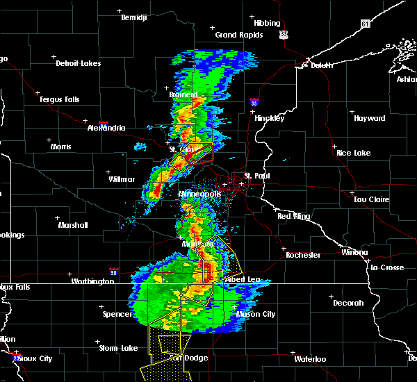 At 525 pm cst, a severe thunderstorm capable of producing a tornado was located over monticello, moving northeast at 35 mph (radar indicated rotation). Hazards include tornado and ping pong ball size hail. Flying debris will be dangerous to those caught without shelter. mobile homes will be damaged or destroyed. damage to roofs, windows, and vehicles will occur. tree damage is likely. this dangerous storm will be near, monticello around 530 pm cst. big lake around 540 pm cst. elk river and zimmerman around 550 pm cst. st. Francis around 600 pm cst. At 525 pm cst, a severe thunderstorm capable of producing a tornado was located over monticello, moving northeast at 35 mph (radar indicated rotation). Hazards include tornado and ping pong ball size hail. Flying debris will be dangerous to those caught without shelter. mobile homes will be damaged or destroyed. damage to roofs, windows, and vehicles will occur. tree damage is likely. this dangerous storm will be near, monticello around 530 pm cst. big lake around 540 pm cst. elk river and zimmerman around 550 pm cst. st. Francis around 600 pm cst.
|
| 8/19/2016 3:28 AM CDT |
 At 327 am cdt, severe thunderstorms were located along a line extending from near st. francis to near stacy to near stillwater, moving northeast at 35 mph (radar indicated). Hazards include 60 mph wind gusts. Expect damage to roofs. siding. and trees. these severe storms will be near, forest lake around 330 am cdt. Other locations impacted by these severe thunderstorms include pine springs, grant, bethel, birchwood, birchwood village, cedar, willernie, centerville and oak grove. At 327 am cdt, severe thunderstorms were located along a line extending from near st. francis to near stacy to near stillwater, moving northeast at 35 mph (radar indicated). Hazards include 60 mph wind gusts. Expect damage to roofs. siding. and trees. these severe storms will be near, forest lake around 330 am cdt. Other locations impacted by these severe thunderstorms include pine springs, grant, bethel, birchwood, birchwood village, cedar, willernie, centerville and oak grove.
|
| 8/19/2016 3:15 AM CDT |
 At 315 am cdt, severe thunderstorms were located along a line extending from near st. francis to near wyoming to near river falls, moving northeast at 45 mph (radar indicated). Hazards include 60 mph wind gusts. Expect damage to roofs. siding. and trees. severe thunderstorms will be near, stacy around 325 am cdt. chisago city, lindstrom and center city around 330 am cdt. rush city around 355 am cdt. frederic and luck around 400 am cdt. other locations impacted by these severe thunderstorms include branch, otisville, wild river state park, athens, cushing, nye, osceola airport, rush city airport, deronda and spencer brook. this includes the following highways, interstate 35 between mile markers 133 and 163. u. s. highway 8 in minnesota between mile markers 1 and 5, and between mile markers 7 and 22. u. s. Highway 61 between mile markers 161 and 165. At 315 am cdt, severe thunderstorms were located along a line extending from near st. francis to near wyoming to near river falls, moving northeast at 45 mph (radar indicated). Hazards include 60 mph wind gusts. Expect damage to roofs. siding. and trees. severe thunderstorms will be near, stacy around 325 am cdt. chisago city, lindstrom and center city around 330 am cdt. rush city around 355 am cdt. frederic and luck around 400 am cdt. other locations impacted by these severe thunderstorms include branch, otisville, wild river state park, athens, cushing, nye, osceola airport, rush city airport, deronda and spencer brook. this includes the following highways, interstate 35 between mile markers 133 and 163. u. s. highway 8 in minnesota between mile markers 1 and 5, and between mile markers 7 and 22. u. s. Highway 61 between mile markers 161 and 165.
|
| 8/19/2016 3:10 AM CDT |
 At 308 am cdt, severe thunderstorms were located along a line extending from elk river to near ham lake to oakdale, moving northeast at 55 mph (radar indicated). Hazards include 60 mph wind gusts. Expect damage to roofs. siding. and trees. these severe storms will be near, woodbury, oakdale, white bear lake, lino lakes and lake elmo around 315 am cdt. forest lake around 325 am cdt. other locations impacted by these severe thunderstorms include north st. Paul, bethel, birchwood, grant, nowthen, falcon heights, birchwood village, south maplewood, willernie and centerville. At 308 am cdt, severe thunderstorms were located along a line extending from elk river to near ham lake to oakdale, moving northeast at 55 mph (radar indicated). Hazards include 60 mph wind gusts. Expect damage to roofs. siding. and trees. these severe storms will be near, woodbury, oakdale, white bear lake, lino lakes and lake elmo around 315 am cdt. forest lake around 325 am cdt. other locations impacted by these severe thunderstorms include north st. Paul, bethel, birchwood, grant, nowthen, falcon heights, birchwood village, south maplewood, willernie and centerville.
|
| 8/19/2016 2:45 AM CDT |
 At 245 am cdt, severe thunderstorms were located along a line extending from near buffalo to st. louis park, moving northeast at 30 mph (radar indicated). Hazards include 60 mph wind gusts. Expect damage to roofs. siding. and trees. severe thunderstorms will be near, st. louis park, richfield and msp international airport around 250 am cdt. plymouth and golden valley around 255 am cdt. minneapolis and albertville around 300 am cdt. brooklyn center, columbia heights, st. michael and big lake around 305 am cdt. roseville, fridley and spring lake park around 310 am cdt. shoreview, elk river, new brighton and mounds view around 315 am cdt. vadnais heights, arden hills and zimmerman around 320 am cdt. st. francis around 325 am cdt. other locations impacted by these severe thunderstorms include fort snelling, north minneapolis, osseo, new hope, north st. paul, bethel, birchwood, como park, crystal airport and univ of mn minneapolis campus. this includes the following highways, interstate 35 between mile markers 128 and 132. interstate 94 in minnesota between mile markers 197 and 249. u. s. highway 10 in minnesota between mile markers 206 and 240. u. s. highway 12 between mile markers 151 and 156. u. s. highway 169 between mile markers 125 and 175. u. s. highway 8 in minnesota near mile marker 0. u. s. Highway 61 between mile markers 134 and 161. At 245 am cdt, severe thunderstorms were located along a line extending from near buffalo to st. louis park, moving northeast at 30 mph (radar indicated). Hazards include 60 mph wind gusts. Expect damage to roofs. siding. and trees. severe thunderstorms will be near, st. louis park, richfield and msp international airport around 250 am cdt. plymouth and golden valley around 255 am cdt. minneapolis and albertville around 300 am cdt. brooklyn center, columbia heights, st. michael and big lake around 305 am cdt. roseville, fridley and spring lake park around 310 am cdt. shoreview, elk river, new brighton and mounds view around 315 am cdt. vadnais heights, arden hills and zimmerman around 320 am cdt. st. francis around 325 am cdt. other locations impacted by these severe thunderstorms include fort snelling, north minneapolis, osseo, new hope, north st. paul, bethel, birchwood, como park, crystal airport and univ of mn minneapolis campus. this includes the following highways, interstate 35 between mile markers 128 and 132. interstate 94 in minnesota between mile markers 197 and 249. u. s. highway 10 in minnesota between mile markers 206 and 240. u. s. highway 12 between mile markers 151 and 156. u. s. highway 169 between mile markers 125 and 175. u. s. highway 8 in minnesota near mile marker 0. u. s. Highway 61 between mile markers 134 and 161.
|
| 8/10/2016 6:55 PM CDT |
 The severe thunderstorm warning for eastern sherburne, isanti, southern kanabec, northern anoka, southeastern mille lacs and western chisago counties will expire at 700 pm cdt, the storms which prompted the warning have moved out of the area. therefore the warning will be allowed to expire. however gusty winds of 40 to 50 mph and heavy rain are still occurring with these thunderstorms. a severe thunderstorm watch remains in effect until midnight cdt for central and east central minnesota, and northwestern wisconsin. The severe thunderstorm warning for eastern sherburne, isanti, southern kanabec, northern anoka, southeastern mille lacs and western chisago counties will expire at 700 pm cdt, the storms which prompted the warning have moved out of the area. therefore the warning will be allowed to expire. however gusty winds of 40 to 50 mph and heavy rain are still occurring with these thunderstorms. a severe thunderstorm watch remains in effect until midnight cdt for central and east central minnesota, and northwestern wisconsin.
|
| 8/10/2016 6:43 PM CDT |
 At 643 pm cdt, severe thunderstorms were located along a line extending from near grasston to cambridge to orrock, moving southeast at 45 mph (radar indicated). Hazards include 60 mph wind gusts. Expect damage to roofs. siding. and trees. these severe storms will be near, cambridge and isanti around 650 pm cdt. ramsey, east bethel, st. francis, rush city and stacy around 700 pm cdt. Other locations impacted by these severe thunderstorms include stanchfield, branch, grandy, athens, harris, spring lake, bethel, cedar and knife lake. At 643 pm cdt, severe thunderstorms were located along a line extending from near grasston to cambridge to orrock, moving southeast at 45 mph (radar indicated). Hazards include 60 mph wind gusts. Expect damage to roofs. siding. and trees. these severe storms will be near, cambridge and isanti around 650 pm cdt. ramsey, east bethel, st. francis, rush city and stacy around 700 pm cdt. Other locations impacted by these severe thunderstorms include stanchfield, branch, grandy, athens, harris, spring lake, bethel, cedar and knife lake.
|
| 8/10/2016 6:25 PM CDT |
 At 625 pm cdt, severe thunderstorms were located along a line extending from near knife lake to dalbo to duelm, moving southeast at 45 mph (radar indicated). Hazards include 60 mph wind gusts. Expect damage to roofs. siding. and trees. severe thunderstorms will be near, mora around 630 pm cdt. brunswick and quamba around 635 pm cdt. grasston around 640 pm cdt. cambridge, isanti and zimmerman around 650 pm cdt. elk river, east bethel and st. francis around 655 pm cdt. ramsey, rush city and stacy around 700 pm cdt. Other locations impacted by these severe thunderstorms include stanchfield, branch, grandy, athens, harris, spring lake, bethel, cedar and knife lake. At 625 pm cdt, severe thunderstorms were located along a line extending from near knife lake to dalbo to duelm, moving southeast at 45 mph (radar indicated). Hazards include 60 mph wind gusts. Expect damage to roofs. siding. and trees. severe thunderstorms will be near, mora around 630 pm cdt. brunswick and quamba around 635 pm cdt. grasston around 640 pm cdt. cambridge, isanti and zimmerman around 650 pm cdt. elk river, east bethel and st. francis around 655 pm cdt. ramsey, rush city and stacy around 700 pm cdt. Other locations impacted by these severe thunderstorms include stanchfield, branch, grandy, athens, harris, spring lake, bethel, cedar and knife lake.
|
| 7/11/2016 11:10 PM CDT | 4" diameter tree limb dow in anoka county MN, 0.9 miles NW of St. Francis, MN |
| 7/11/2016 8:44 PM CDT |
 At 843 pm cdt, a severe thunderstorm was located over monticello, or 7 miles north of buffalo, moving northeast at 40 mph (trained weather spotters). Hazards include 60 mph wind gusts and quarter size hail. Hail damage to vehicles is expected. expect wind damage to roofs, siding, and trees. this severe thunderstorm will be near, big lake around 850 pm cdt. albertville around 855 pm cdt. elk river around 900 pm cdt. zimmerman around 905 pm cdt. ramsey and st. francis around 910 pm cdt. other locations impacted by this severe thunderstorm include silver creek. A tornado watch remains in effect until 1000 pm cdt for central and east central minnesota. At 843 pm cdt, a severe thunderstorm was located over monticello, or 7 miles north of buffalo, moving northeast at 40 mph (trained weather spotters). Hazards include 60 mph wind gusts and quarter size hail. Hail damage to vehicles is expected. expect wind damage to roofs, siding, and trees. this severe thunderstorm will be near, big lake around 850 pm cdt. albertville around 855 pm cdt. elk river around 900 pm cdt. zimmerman around 905 pm cdt. ramsey and st. francis around 910 pm cdt. other locations impacted by this severe thunderstorm include silver creek. A tornado watch remains in effect until 1000 pm cdt for central and east central minnesota.
|
| 7/5/2016 4:47 PM CDT |
 At 447 pm cdt, a severe thunderstorm was located near silver creek, or 11 miles northwest of buffalo, moving east at 55 mph (radar indicated). Hazards include 60 mph wind gusts and quarter size hail. Hail damage to vehicles is expected. expect wind damage to roofs, siding, and trees. this severe thunderstorm will be near, monticello around 455 pm cdt. big lake around 500 pm cdt. albertville around 505 pm cdt. st. michael and otsego around 510 pm cdt. other locations impacted by this severe thunderstorm include enfield, hasty and silver creek. this includes the following highways, interstate 94 in minnesota between mile markers 179 and 205. u. s. highway 10 in minnesota between mile markers 189 and 217. u. s. highway 169 between mile markers 159 and 166. A tornado watch remains in effect until 900 pm cdt for central minnesota. At 447 pm cdt, a severe thunderstorm was located near silver creek, or 11 miles northwest of buffalo, moving east at 55 mph (radar indicated). Hazards include 60 mph wind gusts and quarter size hail. Hail damage to vehicles is expected. expect wind damage to roofs, siding, and trees. this severe thunderstorm will be near, monticello around 455 pm cdt. big lake around 500 pm cdt. albertville around 505 pm cdt. st. michael and otsego around 510 pm cdt. other locations impacted by this severe thunderstorm include enfield, hasty and silver creek. this includes the following highways, interstate 94 in minnesota between mile markers 179 and 205. u. s. highway 10 in minnesota between mile markers 189 and 217. u. s. highway 169 between mile markers 159 and 166. A tornado watch remains in effect until 900 pm cdt for central minnesota.
|
| 6/25/2016 5:53 PM CDT |
 At 552 pm cdt, severe thunderstorms were located along a line extending from near stanchfield to ramsey, moving northeast at 60 mph (trained weather spotters). Hazards include 60 mph wind gusts. Expect damage to roofs. siding. and trees. severe thunderstorms will be near, cambridge, east bethel and isanti around 610 pm cdt. stacy around 615 pm cdt. north branch around 625 pm cdt. other locations impacted by these severe thunderstorms include stanchfield, branch, grandy, athens, harris, spring lake, bethel, cedar, bodum and wyoming. this includes the following highways, interstate 35 between mile markers 135 and 163. u. s. highway 10 in minnesota near mile marker 219. A tornado watch remains in effect until 900 pm cdt for east central minnesota. At 552 pm cdt, severe thunderstorms were located along a line extending from near stanchfield to ramsey, moving northeast at 60 mph (trained weather spotters). Hazards include 60 mph wind gusts. Expect damage to roofs. siding. and trees. severe thunderstorms will be near, cambridge, east bethel and isanti around 610 pm cdt. stacy around 615 pm cdt. north branch around 625 pm cdt. other locations impacted by these severe thunderstorms include stanchfield, branch, grandy, athens, harris, spring lake, bethel, cedar, bodum and wyoming. this includes the following highways, interstate 35 between mile markers 135 and 163. u. s. highway 10 in minnesota near mile marker 219. A tornado watch remains in effect until 900 pm cdt for east central minnesota.
|
| 7/18/2015 1:12 AM CDT | The severe thunderstorm warning for northern dakota, eastern hennepin, ramsey, washington and anoka counties will expire at 115 am cdt, the storms which prompted the warning have moved out of the area. therefore the warning will be allowed to expire. a severe thunderstorm watch remains in effect until 200 am cdt for east central minnesota. a severe thunderstorm watch also remains in effect until 700 am cdt for west central wisconsin. |
| 7/18/2015 1:00 AM CDT |
 At 100 am cdt, severe thunderstorms were located along a line extending from near ham lake to woodbury to near cottage grove, moving east at 45 mph (radar indicated). Hazards include 60 mph wind gusts. Expect damage to roofs. siding and trees. these severe storms will be near, woodbury, hastings, lake elmo, bayport and afton around 105 am cdt. hudson and prescott around 110 am cdt. other locations impacted by these severe thunderstorms include north minneapolis, south st paul airport, afton state park, lakeland shores, north st. paul, south st paul, como park, st paul park, univ of mn minneapolis campus and newport. this includes the following highways, interstate 35 between mile markers 128 and 133. interstate 94 in minnesota between mile markers 225 and 258. u. s. highway 10 in minnesota between mile markers 226 and 302. u. s. highway 8 in minnesota between mile markers 0 and 1. u. s. Highway 61 between mile markers 119 and 162. At 100 am cdt, severe thunderstorms were located along a line extending from near ham lake to woodbury to near cottage grove, moving east at 45 mph (radar indicated). Hazards include 60 mph wind gusts. Expect damage to roofs. siding and trees. these severe storms will be near, woodbury, hastings, lake elmo, bayport and afton around 105 am cdt. hudson and prescott around 110 am cdt. other locations impacted by these severe thunderstorms include north minneapolis, south st paul airport, afton state park, lakeland shores, north st. paul, south st paul, como park, st paul park, univ of mn minneapolis campus and newport. this includes the following highways, interstate 35 between mile markers 128 and 133. interstate 94 in minnesota between mile markers 225 and 258. u. s. highway 10 in minnesota between mile markers 226 and 302. u. s. highway 8 in minnesota between mile markers 0 and 1. u. s. Highway 61 between mile markers 119 and 162.
|
| 7/18/2015 12:46 AM CDT |
 At 1246 am cdt, severe thunderstorms were located along a line extending from nowthen to near st. paul to eagan, moving east at 45 mph (radar indicated). Hazards include 60 mph wind gusts. Expect damage to roofs. siding and trees. these severe storms will be near, st. paul, eagan, maplewood, inver grove heights and roseville around 1250 am cdt. cottage grove, oakdale, white bear lake and st. paul park around 1255 am cdt. woodbury around 100 am cdt. blaine, hastings, lino lakes, lake elmo and bayport around 105 am cdt. hudson and prescott around 110 am cdt. forest lake and hugo around 115 am cdt. other locations impacted by these severe thunderstorms include north minneapolis, flying cloud airport, south st paul airport, afton state park, lakeland shores, new hope, north st. Paul, south st paul, como park and st paul park. At 1246 am cdt, severe thunderstorms were located along a line extending from nowthen to near st. paul to eagan, moving east at 45 mph (radar indicated). Hazards include 60 mph wind gusts. Expect damage to roofs. siding and trees. these severe storms will be near, st. paul, eagan, maplewood, inver grove heights and roseville around 1250 am cdt. cottage grove, oakdale, white bear lake and st. paul park around 1255 am cdt. woodbury around 100 am cdt. blaine, hastings, lino lakes, lake elmo and bayport around 105 am cdt. hudson and prescott around 110 am cdt. forest lake and hugo around 115 am cdt. other locations impacted by these severe thunderstorms include north minneapolis, flying cloud airport, south st paul airport, afton state park, lakeland shores, new hope, north st. Paul, south st paul, como park and st paul park.
|
| 7/18/2015 12:26 AM CDT |
 At 1226 am cdt, severe thunderstorms were located along a line extending from near big lake to wayzata to near flying cloud airport, moving east at 45 mph (radar indicated). Hazards include 60 mph wind gusts. Expect damage to roofs. siding and trees. severe thunderstorms will be near, plymouth, eden prairie, minnetonka, st. louis park and shakopee around 1230 am cdt. minneapolis, edina, brooklyn center and golden valley around 1235 am cdt. burnsville, richfield and columbia heights around 1240 am cdt. bloomington, roseville, st. michael, otsego and st. francis around 1245 am cdt. eagan, ramsey, champlin, rosemount and mendota heights around 1250 am cdt. st. paul, maplewood, inver grove heights, andover and south st. paul around 1255 am cdt. coon rapids, cottage grove, oakdale, ham lake and st. paul park around 100 am cdt. woodbury, lake elmo and afton around 105 am cdt. other locations impacted by these severe thunderstorms include north minneapolis, flying cloud airport, south st paul airport, afton state park, lakeland shores, new hope, north st. paul, south st paul, como park and st paul park. this includes the following highways, interstate 35 between mile markers 128 and 133. interstate 94 in minnesota between mile markers 194 and 258. u. s. highway 10 in minnesota between mile markers 195 and 302. u. s. highway 12 between mile markers 153 and 156. u. s. highway 169 between mile markers 118 and 165. u. s. highway 212 between mile markers 155 and 162. u. s. highway 8 in minnesota between mile markers 0 and 1. u. s. Highway 61 between mile markers 119 and 162. At 1226 am cdt, severe thunderstorms were located along a line extending from near big lake to wayzata to near flying cloud airport, moving east at 45 mph (radar indicated). Hazards include 60 mph wind gusts. Expect damage to roofs. siding and trees. severe thunderstorms will be near, plymouth, eden prairie, minnetonka, st. louis park and shakopee around 1230 am cdt. minneapolis, edina, brooklyn center and golden valley around 1235 am cdt. burnsville, richfield and columbia heights around 1240 am cdt. bloomington, roseville, st. michael, otsego and st. francis around 1245 am cdt. eagan, ramsey, champlin, rosemount and mendota heights around 1250 am cdt. st. paul, maplewood, inver grove heights, andover and south st. paul around 1255 am cdt. coon rapids, cottage grove, oakdale, ham lake and st. paul park around 100 am cdt. woodbury, lake elmo and afton around 105 am cdt. other locations impacted by these severe thunderstorms include north minneapolis, flying cloud airport, south st paul airport, afton state park, lakeland shores, new hope, north st. paul, south st paul, como park and st paul park. this includes the following highways, interstate 35 between mile markers 128 and 133. interstate 94 in minnesota between mile markers 194 and 258. u. s. highway 10 in minnesota between mile markers 195 and 302. u. s. highway 12 between mile markers 153 and 156. u. s. highway 169 between mile markers 118 and 165. u. s. highway 212 between mile markers 155 and 162. u. s. highway 8 in minnesota between mile markers 0 and 1. u. s. Highway 61 between mile markers 119 and 162.
|
| 7/18/2015 12:21 AM CDT |
 At 1220 am cdt, severe thunderstorms were located along a line extending from near monticello to loretto to near victoria, moving east at 35 mph (radar indicated). Hazards include 60 mph wind gusts and penny size hail. Expect damage to roofs. siding and trees. these severe storms will be near, chanhassen, mound, orono, medina and maple plain around 1225 am cdt. plymouth, eden prairie, minnetonka, shakopee and elk river around 1230 am cdt. other locations impacted by these severe thunderstorms include woodland, flying cloud airport, greenfield, buffalo airport, rassat, dayton, hamel, hanover, silver creek and enfield. this includes the following highways, interstate 94 in minnesota between mile markers 179 and 217. u. s. highway 10 in minnesota between mile markers 189 and 217. u. s. highway 12 between mile markers 130 and 156. u. s. highway 169 between mile markers 118 and 121, and between mile markers 159 and 166. u. s. Highway 212 between mile markers 155 and 161. At 1220 am cdt, severe thunderstorms were located along a line extending from near monticello to loretto to near victoria, moving east at 35 mph (radar indicated). Hazards include 60 mph wind gusts and penny size hail. Expect damage to roofs. siding and trees. these severe storms will be near, chanhassen, mound, orono, medina and maple plain around 1225 am cdt. plymouth, eden prairie, minnetonka, shakopee and elk river around 1230 am cdt. other locations impacted by these severe thunderstorms include woodland, flying cloud airport, greenfield, buffalo airport, rassat, dayton, hamel, hanover, silver creek and enfield. this includes the following highways, interstate 94 in minnesota between mile markers 179 and 217. u. s. highway 10 in minnesota between mile markers 189 and 217. u. s. highway 12 between mile markers 130 and 156. u. s. highway 169 between mile markers 118 and 121, and between mile markers 159 and 166. u. s. Highway 212 between mile markers 155 and 161.
|
| 7/17/2015 11:52 PM CDT |
 At 1151 pm cdt, severe thunderstorms were located along a line extending from near st augusta to near waverly to new germany, moving east at 35 mph (radar indicated). Hazards include 60 mph wind gusts and penny size hail. Expect damage to roofs. siding and trees. severe thunderstorms will be near, buffalo and montrose around 1200 am cdt. delano and st. bonifacius around 1210 am cdt. monticello, becker and rockford around 1215 am cdt. independence and maple plain around 1220 am cdt. chanhassen, big lake, mound, orono and minnetrista around 1225 am cdt. plymouth, eden prairie, minnetonka, shakopee and elk river around 1230 am cdt. other locations impacted by these severe thunderstorms include woodland, flying cloud airport, greenfield, waverly, buffalo airport, rassat, dayton, hamel, hanover and silver creek. this includes the following highways, interstate 94 in minnesota between mile markers 179 and 217. u. s. highway 10 in minnesota between mile markers 189 and 217. u. s. highway 12 between mile markers 123 and 156. u. s. highway 169 between mile markers 118 and 121, and between mile markers 159 and 166. u. s. Highway 212 between mile markers 155 and 161. At 1151 pm cdt, severe thunderstorms were located along a line extending from near st augusta to near waverly to new germany, moving east at 35 mph (radar indicated). Hazards include 60 mph wind gusts and penny size hail. Expect damage to roofs. siding and trees. severe thunderstorms will be near, buffalo and montrose around 1200 am cdt. delano and st. bonifacius around 1210 am cdt. monticello, becker and rockford around 1215 am cdt. independence and maple plain around 1220 am cdt. chanhassen, big lake, mound, orono and minnetrista around 1225 am cdt. plymouth, eden prairie, minnetonka, shakopee and elk river around 1230 am cdt. other locations impacted by these severe thunderstorms include woodland, flying cloud airport, greenfield, waverly, buffalo airport, rassat, dayton, hamel, hanover and silver creek. this includes the following highways, interstate 94 in minnesota between mile markers 179 and 217. u. s. highway 10 in minnesota between mile markers 189 and 217. u. s. highway 12 between mile markers 123 and 156. u. s. highway 169 between mile markers 118 and 121, and between mile markers 159 and 166. u. s. Highway 212 between mile markers 155 and 161.
|
| 7/12/2015 9:50 PM CDT |
 At 950 pm cdt, a severe thunderstorm was located near zimmerman, or 16 miles southwest of cambridge, moving southeast at 25 mph (radar indicated). Hazards include 60 mph wind gusts and penny size hail. Expect damage to roofs. siding and trees. locations impacted include, cambridge, ramsey, elk river, big lake, st. francis, isanti, zimmerman, princeton, becker, clear lake, oak grove and nowthen. A tornado watch remains in effect until 100 am cdt for east central minnesota. At 950 pm cdt, a severe thunderstorm was located near zimmerman, or 16 miles southwest of cambridge, moving southeast at 25 mph (radar indicated). Hazards include 60 mph wind gusts and penny size hail. Expect damage to roofs. siding and trees. locations impacted include, cambridge, ramsey, elk river, big lake, st. francis, isanti, zimmerman, princeton, becker, clear lake, oak grove and nowthen. A tornado watch remains in effect until 100 am cdt for east central minnesota.
|
| 7/12/2015 9:48 PM CDT |
 At 948 pm cdt, a severe thunderstorm was located over bethel, or 11 miles south of cambridge, moving east at 25 mph (radar indicated). Hazards include 60 mph wind gusts and nickel size hail. Expect damage to roofs. siding and trees. this severe thunderstorm will be near, ham lake around 955 pm cdt. east bethel around 1000 pm cdt. forest lake around 1020 pm cdt. scandia around 1045 pm cdt. other locations impacted by this severe thunderstorm include fort snelling, otisville, north st. paul, bethel, birchwood, grant, nowthen, falcon heights, william obrien state park and birchwood village. this includes the following highways, interstate 35 between mile markers 128 and 132. interstate 94 in minnesota near mile marker 225, and between mile markers 238 and 257. A tornado watch remains in effect until 100 am cdt for east central minnesota and northwestern wisconsin. At 948 pm cdt, a severe thunderstorm was located over bethel, or 11 miles south of cambridge, moving east at 25 mph (radar indicated). Hazards include 60 mph wind gusts and nickel size hail. Expect damage to roofs. siding and trees. this severe thunderstorm will be near, ham lake around 955 pm cdt. east bethel around 1000 pm cdt. forest lake around 1020 pm cdt. scandia around 1045 pm cdt. other locations impacted by this severe thunderstorm include fort snelling, otisville, north st. paul, bethel, birchwood, grant, nowthen, falcon heights, william obrien state park and birchwood village. this includes the following highways, interstate 35 between mile markers 128 and 132. interstate 94 in minnesota near mile marker 225, and between mile markers 238 and 257. A tornado watch remains in effect until 100 am cdt for east central minnesota and northwestern wisconsin.
|
| 7/12/2015 9:24 PM CDT |
 At 923 pm cdt, a severe thunderstorm was located over braham, or 11 miles north of cambridge, moving southeast at 25 mph (radar indicated). Hazards include 60 mph wind gusts and nickel size hail. Expect damage to roofs. siding and trees. this severe thunderstorm will be near, rush city around 950 pm cdt. north branch around 1005 pm cdt. chisago city around 1015 pm cdt. other locations impacted by this severe thunderstorm include stanchfield, branch, wolf creek, wild river state park, grandy, athens, harris, spring lake, bodum and cushing. this includes interstate 35 between mile markers 134 and 163. A tornado watch remains in effect until 100 am cdt for east central minnesota and northwestern wisconsin. At 923 pm cdt, a severe thunderstorm was located over braham, or 11 miles north of cambridge, moving southeast at 25 mph (radar indicated). Hazards include 60 mph wind gusts and nickel size hail. Expect damage to roofs. siding and trees. this severe thunderstorm will be near, rush city around 950 pm cdt. north branch around 1005 pm cdt. chisago city around 1015 pm cdt. other locations impacted by this severe thunderstorm include stanchfield, branch, wolf creek, wild river state park, grandy, athens, harris, spring lake, bodum and cushing. this includes interstate 35 between mile markers 134 and 163. A tornado watch remains in effect until 100 am cdt for east central minnesota and northwestern wisconsin.
|
| 7/12/2015 8:59 PM CDT |
 At 858 pm cdt, a severe thunderstorm was located over parent, or 11 miles east of st. cloud, moving southeast at 25 mph (radar indicated). Hazards include 70 mph wind gusts and quarter size hail. Hail damage to vehicles is expected. expect considerable tree damage. Wind damage is also likely to mobile homes, roofs and outbuildings. At 858 pm cdt, a severe thunderstorm was located over parent, or 11 miles east of st. cloud, moving southeast at 25 mph (radar indicated). Hazards include 70 mph wind gusts and quarter size hail. Hail damage to vehicles is expected. expect considerable tree damage. Wind damage is also likely to mobile homes, roofs and outbuildings.
|
| 6/9/2015 7:38 PM CDT |
 At 737 pm cdt, a severe thunderstorm was located over nowthen, or 18 miles southwest of cambridge, moving east at 45 mph (radar indicated). Hazards include 60 mph wind gusts and quarter size hail. Hail damage to vehicles is expected. expect wind damage to roofs, siding and trees. this severe thunderstorm will be near, andover around 745 pm cdt. coon rapids and ham lake around 750 pm cdt. blaine and lino lakes around 800 pm cdt. other locations impacted by this severe thunderstorm include cedar, nowthen, centerville, oak grove and dayton. This includes interstate 35 between mile markers 128 and 129. At 737 pm cdt, a severe thunderstorm was located over nowthen, or 18 miles southwest of cambridge, moving east at 45 mph (radar indicated). Hazards include 60 mph wind gusts and quarter size hail. Hail damage to vehicles is expected. expect wind damage to roofs, siding and trees. this severe thunderstorm will be near, andover around 745 pm cdt. coon rapids and ham lake around 750 pm cdt. blaine and lino lakes around 800 pm cdt. other locations impacted by this severe thunderstorm include cedar, nowthen, centerville, oak grove and dayton. This includes interstate 35 between mile markers 128 and 129.
|
| 6/10/2012 8:07 PM CDT | At the intersection of highway 47 and county ro in isanti county MN, 4.2 miles SSW of St. Francis, MN |
| 5/27/2012 8:50 PM CDT | Ping Pong Ball sized hail reported 1.8 miles NW of St. Francis, MN |
| 1/1/0001 12:00 AM | Tree damage. 9 inch tree down and several small trees partially uproote in anoka county MN, 1.8 miles NW of St. Francis, MN |
| 1/1/0001 12:00 AM | Trees dow in isanti county MN, 6.1 miles WSW of St. Francis, MN |
| 1/1/0001 12:00 AM | Tree damage. 9 inch tree down and several small trees partially uproote in anoka county MN, 1.8 miles NW of St. Francis, MN |
| 1/1/0001 12:00 AM | 12 inch branches dow in isanti county MN, 2.1 miles SSW of St. Francis, MN |
| 5/10/2011 9:00 PM CDT | Golf Ball sized hail reported 1.8 miles NW of St. Francis, MN |
Hail Maps for St. Francis, MN
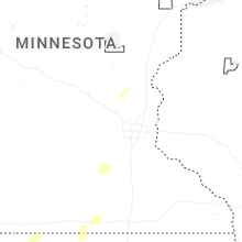

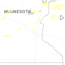


Connect with Interactive Hail Maps