

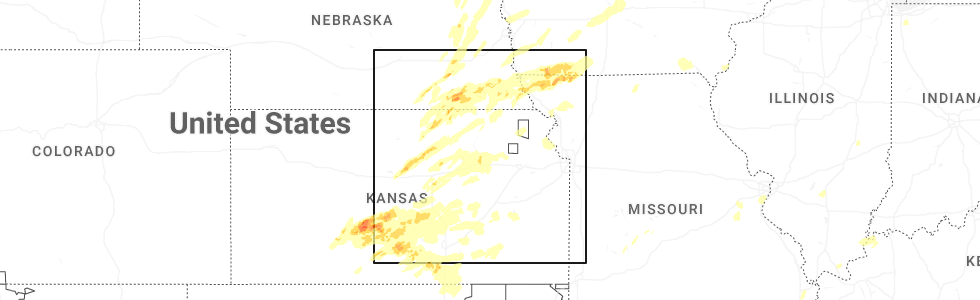
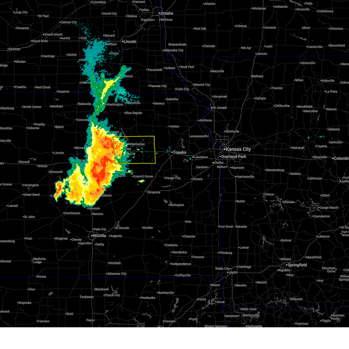
Hail Map for St. George, KS
The St. George, KS area has had 14 reports of on-the-ground hail by trained spotters, and has been under severe weather warnings 35 times during the past 12 months. Doppler radar has detected hail at or near St. George, KS on 98 occasions, including 4 occasions during the past year.
| Name: | St. George, KS |
| Where Located: | 7.8 miles E of Manhattan, KS |
| Map: | Google Map for St. George, KS |
| Population: | 639 |
| Housing Units: | 255 |
| More Info: | Search Google for St. George, KS |
2
The Top Recent Hail Date for St. George, KS is Monday, May 18, 2026 (29th out of 98)
Hail and Wind Damage Spotted near St. George, KS
| Date / Time | Report Details |
|---|---|
| 7/3/2026 9:40 PM CDT |
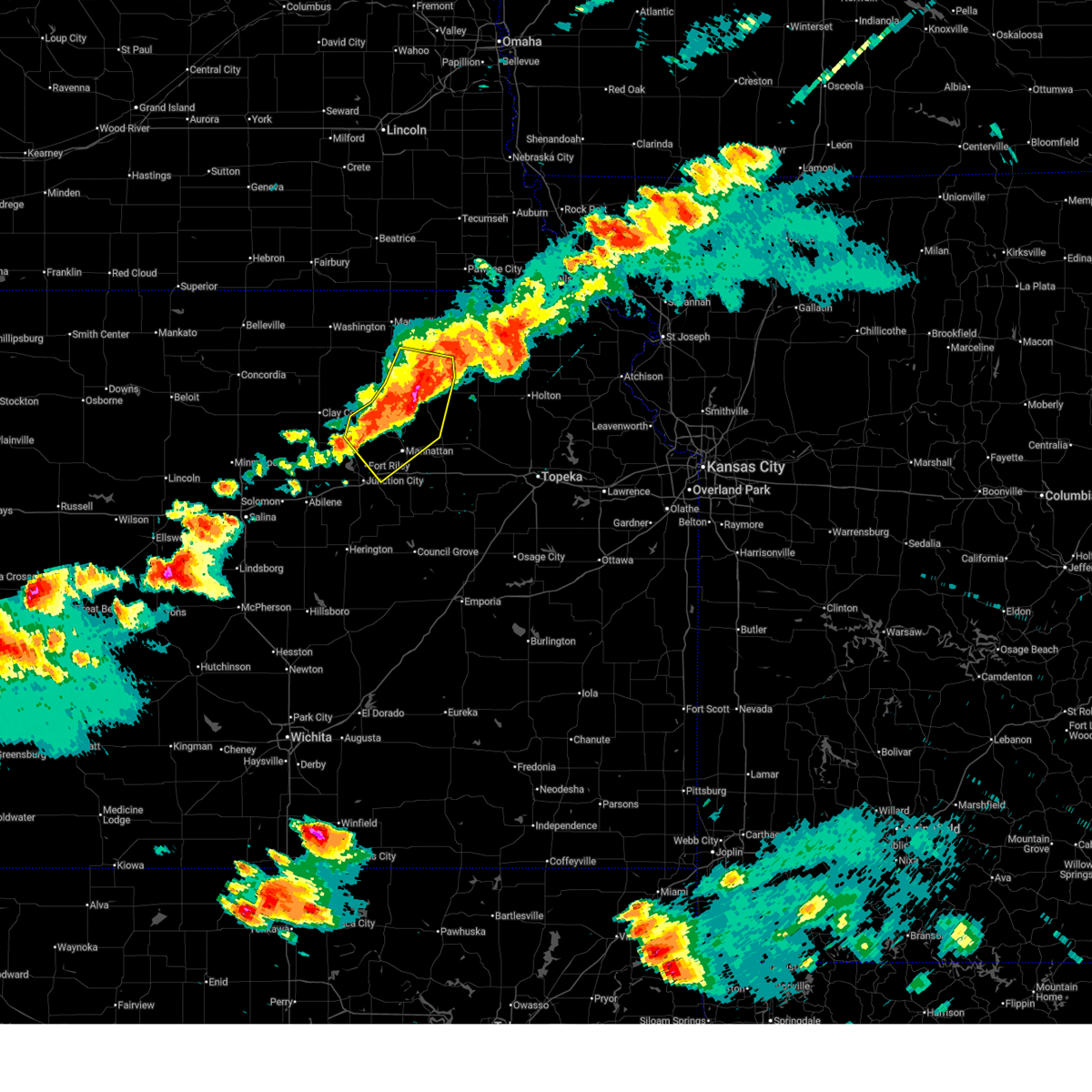
 Svrtop the national weather service in topeka has issued a * severe thunderstorm warning for, northeastern dickinson county in central kansas, geary county in east central kansas, southern riley county in northeastern kansas, southern pottawatomie county in northeastern kansas, southeastern clay county in north central kansas, * until 1015 pm cdt. * at 939 pm cdt, severe thunderstorms were located along a line extending from olsburg to 3 miles south of riley to 3 miles southwest of wakefield to 6 miles east of oak hill, moving southeast at 40 mph (public reports with this line of storm have ranged from 50-60 mph over the past hour. radar still shows strong signals for winds up to 60 mph along the main line of storms). Hazards include 60 mph wind gusts and penny size hail. expect damage to roofs, siding, and trees Svrtop the national weather service in topeka has issued a * severe thunderstorm warning for, northeastern dickinson county in central kansas, geary county in east central kansas, southern riley county in northeastern kansas, southern pottawatomie county in northeastern kansas, southeastern clay county in north central kansas, * until 1015 pm cdt. * at 939 pm cdt, severe thunderstorms were located along a line extending from olsburg to 3 miles south of riley to 3 miles southwest of wakefield to 6 miles east of oak hill, moving southeast at 40 mph (public reports with this line of storm have ranged from 50-60 mph over the past hour. radar still shows strong signals for winds up to 60 mph along the main line of storms). Hazards include 60 mph wind gusts and penny size hail. expect damage to roofs, siding, and trees
|
| 6/13/2026 7:10 PM CDT |
 At 709 pm cdt, severe thunderstorms were located along a line extending from 6 miles southeast of manhattan to near belvue to 5 miles northwest of potawatomi reservation, moving southeast at 45 mph (radar indicated). Hazards include 70 mph wind gusts and ping pong ball size hail. People and animals outdoors will be injured. expect hail damage to roofs, siding, windows, and vehicles. expect considerable tree damage. wind damage is also likely to mobile homes, roofs, and outbuildings. locations impacted include, manhattan, wamego, rossville, alma, westmoreland, st. marys, ogden, onaga, st. george, maple hill, mcfarland, paxico, belvue, emmett, louisville, delia, potawatomi reservation, keats, and volland. This includes interstate 70 between mile markers 309 and 340. At 709 pm cdt, severe thunderstorms were located along a line extending from 6 miles southeast of manhattan to near belvue to 5 miles northwest of potawatomi reservation, moving southeast at 45 mph (radar indicated). Hazards include 70 mph wind gusts and ping pong ball size hail. People and animals outdoors will be injured. expect hail damage to roofs, siding, windows, and vehicles. expect considerable tree damage. wind damage is also likely to mobile homes, roofs, and outbuildings. locations impacted include, manhattan, wamego, rossville, alma, westmoreland, st. marys, ogden, onaga, st. george, maple hill, mcfarland, paxico, belvue, emmett, louisville, delia, potawatomi reservation, keats, and volland. This includes interstate 70 between mile markers 309 and 340.
|
| 6/13/2026 6:54 PM CDT |
 At 653 pm cdt, severe thunderstorms were located along a line extending from near keats to 5 miles south of westmoreland to 3 miles southeast of onaga, moving southeast at 35 mph (public. at 6:50 pm, a personal weather station reported a 58 mph wind gust 2 miles north-northeast of manhattan). Hazards include 70 mph wind gusts and ping pong ball size hail. People and animals outdoors will be injured. expect hail damage to roofs, siding, windows, and vehicles. expect considerable tree damage. wind damage is also likely to mobile homes, roofs, and outbuildings. locations impacted include, manhattan, wamego, rossville, alma, westmoreland, blaine, st. marys, ogden, onaga, st. george, maple hill, mcfarland, paxico, belvue, emmett, louisville, delia, wheaton, potawatomi reservation, and keats. This includes interstate 70 between mile markers 308 and 340. At 653 pm cdt, severe thunderstorms were located along a line extending from near keats to 5 miles south of westmoreland to 3 miles southeast of onaga, moving southeast at 35 mph (public. at 6:50 pm, a personal weather station reported a 58 mph wind gust 2 miles north-northeast of manhattan). Hazards include 70 mph wind gusts and ping pong ball size hail. People and animals outdoors will be injured. expect hail damage to roofs, siding, windows, and vehicles. expect considerable tree damage. wind damage is also likely to mobile homes, roofs, and outbuildings. locations impacted include, manhattan, wamego, rossville, alma, westmoreland, blaine, st. marys, ogden, onaga, st. george, maple hill, mcfarland, paxico, belvue, emmett, louisville, delia, wheaton, potawatomi reservation, and keats. This includes interstate 70 between mile markers 308 and 340.
|
| 6/13/2026 6:48 PM CDT |
 At 647 pm cdt, severe thunderstorms were located along a line extending from near keats to 3 miles south of westmoreland to 3 miles southwest of lillis, moving southeast at 40 mph (trained weather spotters. at 6:46 pm, 60 mph winds were reported in olsburg). Hazards include 70 mph wind gusts and ping pong ball size hail. People and animals outdoors will be injured. expect hail damage to roofs, siding, windows, and vehicles. expect considerable tree damage. wind damage is also likely to mobile homes, roofs, and outbuildings. locations impacted include, manhattan, wamego, rossville, alma, westmoreland, blaine, st. marys, ogden, onaga, st. george, maple hill, mcfarland, paxico, belvue, emmett, louisville, delia, wheaton, potawatomi reservation, and keats. This includes interstate 70 between mile markers 308 and 340. At 647 pm cdt, severe thunderstorms were located along a line extending from near keats to 3 miles south of westmoreland to 3 miles southwest of lillis, moving southeast at 40 mph (trained weather spotters. at 6:46 pm, 60 mph winds were reported in olsburg). Hazards include 70 mph wind gusts and ping pong ball size hail. People and animals outdoors will be injured. expect hail damage to roofs, siding, windows, and vehicles. expect considerable tree damage. wind damage is also likely to mobile homes, roofs, and outbuildings. locations impacted include, manhattan, wamego, rossville, alma, westmoreland, blaine, st. marys, ogden, onaga, st. george, maple hill, mcfarland, paxico, belvue, emmett, louisville, delia, wheaton, potawatomi reservation, and keats. This includes interstate 70 between mile markers 308 and 340.
|
| 6/13/2026 6:42 PM CDT |
 At 642 pm cdt, severe thunderstorms were located along a line extending from near keats to 4 miles southwest of westmoreland to 5 miles north of blaine, moving southeast at 40 mph (radar indicated). Hazards include 70 mph wind gusts and half dollar size hail. Hail damage to vehicles is expected. expect considerable tree damage. wind damage is also likely to mobile homes, roofs, and outbuildings. locations impacted include, manhattan, westmoreland, blaine, ogden, riley, st. george, leonardville, olsburg, randolph, wheaton, lillis, keats, and tuttle creek lake. This includes interstate 70 between mile markers 303 and 308. At 642 pm cdt, severe thunderstorms were located along a line extending from near keats to 4 miles southwest of westmoreland to 5 miles north of blaine, moving southeast at 40 mph (radar indicated). Hazards include 70 mph wind gusts and half dollar size hail. Hail damage to vehicles is expected. expect considerable tree damage. wind damage is also likely to mobile homes, roofs, and outbuildings. locations impacted include, manhattan, westmoreland, blaine, ogden, riley, st. george, leonardville, olsburg, randolph, wheaton, lillis, keats, and tuttle creek lake. This includes interstate 70 between mile markers 303 and 308.
|
| 6/13/2026 6:30 PM CDT |
 At 630 pm cdt, severe thunderstorms were located along a line extending from 3 miles south of riley to near olsburg to 7 miles southwest of frankfort, moving southeast at 40 mph (radar indicated). Hazards include golf ball size hail and 70 mph wind gusts. People and animals outdoors will be injured. expect hail damage to roofs, siding, windows, and vehicles. expect considerable tree damage. wind damage is also likely to mobile homes, roofs, and outbuildings. locations impacted include, manhattan, blue rapids, westmoreland, blaine, ogden, riley, st. george, leonardville, olsburg, randolph, wheaton, lillis, keats, and tuttle creek lake. This includes interstate 70 between mile markers 303 and 308. At 630 pm cdt, severe thunderstorms were located along a line extending from 3 miles south of riley to near olsburg to 7 miles southwest of frankfort, moving southeast at 40 mph (radar indicated). Hazards include golf ball size hail and 70 mph wind gusts. People and animals outdoors will be injured. expect hail damage to roofs, siding, windows, and vehicles. expect considerable tree damage. wind damage is also likely to mobile homes, roofs, and outbuildings. locations impacted include, manhattan, blue rapids, westmoreland, blaine, ogden, riley, st. george, leonardville, olsburg, randolph, wheaton, lillis, keats, and tuttle creek lake. This includes interstate 70 between mile markers 303 and 308.
|
| 6/13/2026 6:20 PM CDT |
 At 620 pm cdt, severe thunderstorms were located along a line extending from 5 miles west of riley to 4 miles northeast of randolph to near blue rapids, moving southeast at 45 mph (radar indicated). Hazards include golf ball size hail and 70 mph wind gusts. People and animals outdoors will be injured. expect hail damage to roofs, siding, windows, and vehicles. expect considerable tree damage. wind damage is also likely to mobile homes, roofs, and outbuildings. locations impacted include, manhattan, blue rapids, westmoreland, blaine, ogden, riley, waterville, st. george, leonardville, olsburg, randolph, green, wheaton, lillis, keats, and tuttle creek lake. This includes interstate 70 between mile markers 303 and 308. At 620 pm cdt, severe thunderstorms were located along a line extending from 5 miles west of riley to 4 miles northeast of randolph to near blue rapids, moving southeast at 45 mph (radar indicated). Hazards include golf ball size hail and 70 mph wind gusts. People and animals outdoors will be injured. expect hail damage to roofs, siding, windows, and vehicles. expect considerable tree damage. wind damage is also likely to mobile homes, roofs, and outbuildings. locations impacted include, manhattan, blue rapids, westmoreland, blaine, ogden, riley, waterville, st. george, leonardville, olsburg, randolph, green, wheaton, lillis, keats, and tuttle creek lake. This includes interstate 70 between mile markers 303 and 308.
|
| 6/13/2026 6:09 PM CDT |
 Svrtop the national weather service in topeka has issued a * severe thunderstorm warning for, north central geary county in east central kansas, riley county in northeastern kansas, western pottawatomie county in northeastern kansas, southeastern washington county in north central kansas, east central clay county in north central kansas, southern marshall county in northeastern kansas, * until 700 pm cdt. * at 609 pm cdt, severe thunderstorms were located along a line extending from near green to 7 miles northwest of randolph to 3 miles north of waterville, moving southeast at 40 mph (radar indicated). Hazards include 70 mph wind gusts and ping pong ball size hail. People and animals outdoors will be injured. expect hail damage to roofs, siding, windows, and vehicles. expect considerable tree damage. Wind damage is also likely to mobile homes, roofs, and outbuildings. Svrtop the national weather service in topeka has issued a * severe thunderstorm warning for, north central geary county in east central kansas, riley county in northeastern kansas, western pottawatomie county in northeastern kansas, southeastern washington county in north central kansas, east central clay county in north central kansas, southern marshall county in northeastern kansas, * until 700 pm cdt. * at 609 pm cdt, severe thunderstorms were located along a line extending from near green to 7 miles northwest of randolph to 3 miles north of waterville, moving southeast at 40 mph (radar indicated). Hazards include 70 mph wind gusts and ping pong ball size hail. People and animals outdoors will be injured. expect hail damage to roofs, siding, windows, and vehicles. expect considerable tree damage. Wind damage is also likely to mobile homes, roofs, and outbuildings.
|
| 6/10/2026 7:20 PM CDT |
 At 719 pm cdt, a severe thunderstorm was located near louisville, moving east at 35 mph (radar indicated). Hazards include 70 mph wind gusts and quarter size hail. Hail damage to vehicles is expected. expect considerable tree damage. wind damage is also likely to mobile homes, roofs, and outbuildings. locations impacted include, northeastern manhattan, wamego, st. George, and louisville. At 719 pm cdt, a severe thunderstorm was located near louisville, moving east at 35 mph (radar indicated). Hazards include 70 mph wind gusts and quarter size hail. Hail damage to vehicles is expected. expect considerable tree damage. wind damage is also likely to mobile homes, roofs, and outbuildings. locations impacted include, northeastern manhattan, wamego, st. George, and louisville.
|
| 6/10/2026 7:11 PM CDT |
 At 711 pm cdt, a severe thunderstorm was located 4 miles north of st. george, moving southeast at 25 mph (radar indicated). Hazards include 70 mph wind gusts and quarter size hail. Hail damage to vehicles is expected. expect considerable tree damage. wind damage is also likely to mobile homes, roofs, and outbuildings. locations impacted include, northeastern manhattan, wamego, st. George, and louisville. At 711 pm cdt, a severe thunderstorm was located 4 miles north of st. george, moving southeast at 25 mph (radar indicated). Hazards include 70 mph wind gusts and quarter size hail. Hail damage to vehicles is expected. expect considerable tree damage. wind damage is also likely to mobile homes, roofs, and outbuildings. locations impacted include, northeastern manhattan, wamego, st. George, and louisville.
|
| 6/10/2026 7:00 PM CDT |
 Svrtop the national weather service in topeka has issued a * severe thunderstorm warning for, southeastern riley county in northeastern kansas, northwestern wabaunsee county in east central kansas, southern pottawatomie county in northeastern kansas, * until 730 pm cdt. * at 659 pm cdt, a severe thunderstorm was located 7 miles southeast of tuttle creek lake, moving southeast at 25 mph (radar indicated). Hazards include 70 mph wind gusts and quarter size hail. Hail damage to vehicles is expected. expect considerable tree damage. Wind damage is also likely to mobile homes, roofs, and outbuildings. Svrtop the national weather service in topeka has issued a * severe thunderstorm warning for, southeastern riley county in northeastern kansas, northwestern wabaunsee county in east central kansas, southern pottawatomie county in northeastern kansas, * until 730 pm cdt. * at 659 pm cdt, a severe thunderstorm was located 7 miles southeast of tuttle creek lake, moving southeast at 25 mph (radar indicated). Hazards include 70 mph wind gusts and quarter size hail. Hail damage to vehicles is expected. expect considerable tree damage. Wind damage is also likely to mobile homes, roofs, and outbuildings.
|
| 6/8/2026 10:36 PM CDT |
 At 1035 pm cdt, severe thunderstorms were located along a line extending from 4 miles north of manhattan to 8 miles west of volland, moving east at 45 mph (public. several personal weather stations from junction city to manhattan have reported wind gusts of around 70 mph). Hazards include 70 mph wind gusts and penny size hail. Expect considerable tree damage. damage is likely to mobile homes, roofs, and outbuildings. locations impacted include, manhattan, junction city, wamego, alma, st. marys, ogden, grandview plaza, riley, st. george, maple hill, mcfarland, paxico, belvue, emmett, louisville, keene, keats, and volland. This includes interstate 70 between mile markers 295 and 341. At 1035 pm cdt, severe thunderstorms were located along a line extending from 4 miles north of manhattan to 8 miles west of volland, moving east at 45 mph (public. several personal weather stations from junction city to manhattan have reported wind gusts of around 70 mph). Hazards include 70 mph wind gusts and penny size hail. Expect considerable tree damage. damage is likely to mobile homes, roofs, and outbuildings. locations impacted include, manhattan, junction city, wamego, alma, st. marys, ogden, grandview plaza, riley, st. george, maple hill, mcfarland, paxico, belvue, emmett, louisville, keene, keats, and volland. This includes interstate 70 between mile markers 295 and 341.
|
| 6/8/2026 10:13 PM CDT |
 Svrtop the national weather service in topeka has issued a * severe thunderstorm warning for, geary county in east central kansas, southern riley county in northeastern kansas, wabaunsee county in east central kansas, southern pottawatomie county in northeastern kansas, * until 1100 pm cdt. * at 1012 pm cdt, severe thunderstorms were located along a line extending from 3 miles south of riley to 3 miles south of junction city, moving east at 55 mph (radar indicated). Hazards include 70 mph wind gusts and penny size hail. Expect considerable tree damage. Damage is likely to mobile homes, roofs, and outbuildings. Svrtop the national weather service in topeka has issued a * severe thunderstorm warning for, geary county in east central kansas, southern riley county in northeastern kansas, wabaunsee county in east central kansas, southern pottawatomie county in northeastern kansas, * until 1100 pm cdt. * at 1012 pm cdt, severe thunderstorms were located along a line extending from 3 miles south of riley to 3 miles south of junction city, moving east at 55 mph (radar indicated). Hazards include 70 mph wind gusts and penny size hail. Expect considerable tree damage. Damage is likely to mobile homes, roofs, and outbuildings.
|
| 5/30/2026 8:49 PM CDT |
 At 849 pm cdt, a severe thunderstorm was located 4 miles east of manhattan, moving north at 20 mph (radar indicated). Hazards include 60 mph wind gusts and quarter size hail. Hail damage to vehicles is expected. expect wind damage to roofs, siding, and trees. locations impacted include, manhattan and st. George. At 849 pm cdt, a severe thunderstorm was located 4 miles east of manhattan, moving north at 20 mph (radar indicated). Hazards include 60 mph wind gusts and quarter size hail. Hail damage to vehicles is expected. expect wind damage to roofs, siding, and trees. locations impacted include, manhattan and st. George.
|
| 5/30/2026 8:39 PM CDT |
 At 839 pm cdt, a severe thunderstorm was located near manhattan, moving north at 20 mph (radar indicated). Hazards include 60 mph wind gusts and quarter size hail. Hail damage to vehicles is expected. expect wind damage to roofs, siding, and trees. locations impacted include, manhattan and st. George. At 839 pm cdt, a severe thunderstorm was located near manhattan, moving north at 20 mph (radar indicated). Hazards include 60 mph wind gusts and quarter size hail. Hail damage to vehicles is expected. expect wind damage to roofs, siding, and trees. locations impacted include, manhattan and st. George.
|
| 5/30/2026 8:39 PM CDT |
 the severe thunderstorm warning has been cancelled and is no longer in effect the severe thunderstorm warning has been cancelled and is no longer in effect
|
| 5/30/2026 8:28 PM CDT |
 Svrtop the national weather service in topeka has issued a * severe thunderstorm warning for, east central geary county in east central kansas, southeastern riley county in northeastern kansas, southwestern pottawatomie county in northeastern kansas, * until 915 pm cdt. * at 827 pm cdt, a severe thunderstorm was located 6 miles south of manhattan, moving north at 20 mph (radar indicated). Hazards include 60 mph wind gusts and quarter size hail. Hail damage to vehicles is expected. Expect wind damage to roofs, siding, and trees. Svrtop the national weather service in topeka has issued a * severe thunderstorm warning for, east central geary county in east central kansas, southeastern riley county in northeastern kansas, southwestern pottawatomie county in northeastern kansas, * until 915 pm cdt. * at 827 pm cdt, a severe thunderstorm was located 6 miles south of manhattan, moving north at 20 mph (radar indicated). Hazards include 60 mph wind gusts and quarter size hail. Hail damage to vehicles is expected. Expect wind damage to roofs, siding, and trees.
|
| 5/18/2026 7:12 PM CDT |
 At 712 pm cdt, severe thunderstorms were located along a line extending from 3 miles northwest of holton to 4 miles southwest of potawatomi reservation to near maple hill, moving east at 60 mph (radar indicated). Hazards include 70 mph wind gusts. Expect considerable tree damage. damage is likely to mobile homes, roofs, and outbuildings. locations impacted include, wamego, holton, rossville, alma, st. marys, dover, silver lake, onaga, hoyt, st. george, maple hill, mayetta, mcfarland, paxico, belvue, emmett, louisville, circleville, delia, and soldier. This includes interstate 70 between mile markers 311 and 351. At 712 pm cdt, severe thunderstorms were located along a line extending from 3 miles northwest of holton to 4 miles southwest of potawatomi reservation to near maple hill, moving east at 60 mph (radar indicated). Hazards include 70 mph wind gusts. Expect considerable tree damage. damage is likely to mobile homes, roofs, and outbuildings. locations impacted include, wamego, holton, rossville, alma, st. marys, dover, silver lake, onaga, hoyt, st. george, maple hill, mayetta, mcfarland, paxico, belvue, emmett, louisville, circleville, delia, and soldier. This includes interstate 70 between mile markers 311 and 351.
|
| 5/18/2026 6:42 PM CDT |
 Svrtop the national weather service in topeka has issued a * severe thunderstorm warning for, east central geary county in east central kansas, southeastern riley county in northeastern kansas, northwestern shawnee county in east central kansas, northern wabaunsee county in east central kansas, southeastern nemaha county in northeastern kansas, eastern pottawatomie county in northeastern kansas, jackson county in northeastern kansas, * until 730 pm cdt. * at 641 pm cdt, severe thunderstorms were located along a line extending from 7 miles southeast of westmoreland to 3 miles southeast of st. george to 4 miles northwest of alta vista, moving east at 60 mph (public reported a 67 mph wind gust east of manhattan at 628 pm). Hazards include 70 mph wind gusts. Expect considerable tree damage. Damage is likely to mobile homes, roofs, and outbuildings. Svrtop the national weather service in topeka has issued a * severe thunderstorm warning for, east central geary county in east central kansas, southeastern riley county in northeastern kansas, northwestern shawnee county in east central kansas, northern wabaunsee county in east central kansas, southeastern nemaha county in northeastern kansas, eastern pottawatomie county in northeastern kansas, jackson county in northeastern kansas, * until 730 pm cdt. * at 641 pm cdt, severe thunderstorms were located along a line extending from 7 miles southeast of westmoreland to 3 miles southeast of st. george to 4 miles northwest of alta vista, moving east at 60 mph (public reported a 67 mph wind gust east of manhattan at 628 pm). Hazards include 70 mph wind gusts. Expect considerable tree damage. Damage is likely to mobile homes, roofs, and outbuildings.
|
| 5/18/2026 6:33 PM CDT |
 At 632 pm cdt, a severe thunderstorm was located near st. george, moving east at 40 mph (trained weather spotters reported 60-70 mph winds west of the manhattan airport at 622 pm). Hazards include 70 mph wind gusts and half dollar size hail. Hail damage to vehicles is expected. expect considerable tree damage. wind damage is also likely to mobile homes, roofs, and outbuildings. locations impacted include, manhattan, junction city, wamego, alma, westmoreland, st. marys, ogden, grandview plaza, onaga, st. george, mcfarland, paxico, olsburg, belvue, emmett, louisville, woodbine, havensville, keats, and tuttle creek lake. This includes interstate 70 between mile markers 292 and 337. At 632 pm cdt, a severe thunderstorm was located near st. george, moving east at 40 mph (trained weather spotters reported 60-70 mph winds west of the manhattan airport at 622 pm). Hazards include 70 mph wind gusts and half dollar size hail. Hail damage to vehicles is expected. expect considerable tree damage. wind damage is also likely to mobile homes, roofs, and outbuildings. locations impacted include, manhattan, junction city, wamego, alma, westmoreland, st. marys, ogden, grandview plaza, onaga, st. george, mcfarland, paxico, olsburg, belvue, emmett, louisville, woodbine, havensville, keats, and tuttle creek lake. This includes interstate 70 between mile markers 292 and 337.
|
| 5/18/2026 6:21 PM CDT |
 Svrtop the national weather service in topeka has issued a * severe thunderstorm warning for, southeastern dickinson county in central kansas, geary county in east central kansas, southern riley county in northeastern kansas, northwestern morris county in east central kansas, northern wabaunsee county in east central kansas, pottawatomie county in northeastern kansas, * until 645 pm cdt. * at 621 pm cdt, a severe thunderstorm was located near manhattan, moving east at 40 mph (radar indicated). Hazards include 70 mph wind gusts and half dollar size hail. Hail damage to vehicles is expected. expect considerable tree damage. Wind damage is also likely to mobile homes, roofs, and outbuildings. Svrtop the national weather service in topeka has issued a * severe thunderstorm warning for, southeastern dickinson county in central kansas, geary county in east central kansas, southern riley county in northeastern kansas, northwestern morris county in east central kansas, northern wabaunsee county in east central kansas, pottawatomie county in northeastern kansas, * until 645 pm cdt. * at 621 pm cdt, a severe thunderstorm was located near manhattan, moving east at 40 mph (radar indicated). Hazards include 70 mph wind gusts and half dollar size hail. Hail damage to vehicles is expected. expect considerable tree damage. Wind damage is also likely to mobile homes, roofs, and outbuildings.
|
| 4/27/2026 2:27 AM CDT |
 At 227 am cdt, a severe thunderstorm was located over northeastern manhattan, moving northeast at 50 mph (radar indicated). Hazards include 60 mph wind gusts and quarter size hail. Hail damage to vehicles is expected. expect wind damage to roofs, siding, and trees. locations impacted include, manhattan, junction city, ogden, grandview plaza, st. george, and keats. This includes interstate 70 between mile markers 297 and 321. At 227 am cdt, a severe thunderstorm was located over northeastern manhattan, moving northeast at 50 mph (radar indicated). Hazards include 60 mph wind gusts and quarter size hail. Hail damage to vehicles is expected. expect wind damage to roofs, siding, and trees. locations impacted include, manhattan, junction city, ogden, grandview plaza, st. george, and keats. This includes interstate 70 between mile markers 297 and 321.
|
| 4/27/2026 2:14 AM CDT |
 Svrtop the national weather service in topeka has issued a * severe thunderstorm warning for, geary county in east central kansas, southern riley county in northeastern kansas, southwestern pottawatomie county in northeastern kansas, * until 245 am cdt. * at 214 am cdt, a severe thunderstorm was located 4 miles northwest of ogden, moving northeast at 50 mph (radar indicated). Hazards include 60 mph wind gusts and quarter size hail. Hail damage to vehicles is expected. Expect wind damage to roofs, siding, and trees. Svrtop the national weather service in topeka has issued a * severe thunderstorm warning for, geary county in east central kansas, southern riley county in northeastern kansas, southwestern pottawatomie county in northeastern kansas, * until 245 am cdt. * at 214 am cdt, a severe thunderstorm was located 4 miles northwest of ogden, moving northeast at 50 mph (radar indicated). Hazards include 60 mph wind gusts and quarter size hail. Hail damage to vehicles is expected. Expect wind damage to roofs, siding, and trees.
|
| 4/27/2026 1:58 AM CDT |
 Svrtop the national weather service in topeka has issued a * severe thunderstorm warning for, southeastern geary county in east central kansas, southeastern riley county in northeastern kansas, northeastern morris county in east central kansas, western wabaunsee county in east central kansas, south central pottawatomie county in northeastern kansas, * until 230 am cdt. * at 158 am cdt, a severe thunderstorm was located 6 miles west of volland, moving northeast at 45 mph (radar indicated). Hazards include 60 mph wind gusts and half dollar size hail. Hail damage to vehicles is expected. Expect wind damage to roofs, siding, and trees. Svrtop the national weather service in topeka has issued a * severe thunderstorm warning for, southeastern geary county in east central kansas, southeastern riley county in northeastern kansas, northeastern morris county in east central kansas, western wabaunsee county in east central kansas, south central pottawatomie county in northeastern kansas, * until 230 am cdt. * at 158 am cdt, a severe thunderstorm was located 6 miles west of volland, moving northeast at 45 mph (radar indicated). Hazards include 60 mph wind gusts and half dollar size hail. Hail damage to vehicles is expected. Expect wind damage to roofs, siding, and trees.
|
| 4/26/2026 1:59 PM CDT |
 At 159 pm cdt, severe thunderstorms were located along a line extending from 3 miles southeast of st. george to 9 miles southeast of volland to 3 miles west of dunlap, moving east at 40 mph (radar indicated). Hazards include 60 mph wind gusts and quarter size hail. Hail damage to vehicles is expected. expect wind damage to roofs, siding, and trees. locations impacted include, eastern manhattan, wamego, council grove, alma, eskridge, st. marys, americus, st. george, maple hill, alta vista, mcfarland, paxico, belvue, allen, admire, bushong, dunlap, keene, council grove lake, and volland. this includes the following highways, interstate 70 between mile markers 317 and 344. Kansas turnpike between mile markers 135 and 142. At 159 pm cdt, severe thunderstorms were located along a line extending from 3 miles southeast of st. george to 9 miles southeast of volland to 3 miles west of dunlap, moving east at 40 mph (radar indicated). Hazards include 60 mph wind gusts and quarter size hail. Hail damage to vehicles is expected. expect wind damage to roofs, siding, and trees. locations impacted include, eastern manhattan, wamego, council grove, alma, eskridge, st. marys, americus, st. george, maple hill, alta vista, mcfarland, paxico, belvue, allen, admire, bushong, dunlap, keene, council grove lake, and volland. this includes the following highways, interstate 70 between mile markers 317 and 344. Kansas turnpike between mile markers 135 and 142.
|
| 4/26/2026 1:51 PM CDT |
 Svrtop the national weather service in topeka has issued a * severe thunderstorm warning for, eastern riley county in northeastern kansas, southwestern nemaha county in northeastern kansas, pottawatomie county in northeastern kansas, southeastern marshall county in northeastern kansas, * until 230 pm cdt. * at 151 pm cdt, severe thunderstorms were located along a line extending from 5 miles northwest of olsburg to 6 miles west of westmoreland to 3 miles west of st. george, moving northeast at 35 mph (radar indicated). Hazards include 60 mph wind gusts and penny size hail. expect damage to roofs, siding, and trees Svrtop the national weather service in topeka has issued a * severe thunderstorm warning for, eastern riley county in northeastern kansas, southwestern nemaha county in northeastern kansas, pottawatomie county in northeastern kansas, southeastern marshall county in northeastern kansas, * until 230 pm cdt. * at 151 pm cdt, severe thunderstorms were located along a line extending from 5 miles northwest of olsburg to 6 miles west of westmoreland to 3 miles west of st. george, moving northeast at 35 mph (radar indicated). Hazards include 60 mph wind gusts and penny size hail. expect damage to roofs, siding, and trees
|
| 4/26/2026 1:29 PM CDT |
 Svrtop the national weather service in topeka has issued a * severe thunderstorm warning for, southeastern geary county in east central kansas, southeastern riley county in northeastern kansas, morris county in east central kansas, wabaunsee county in east central kansas, southeastern pottawatomie county in northeastern kansas, northwestern lyon county in east central kansas, * until 215 pm cdt. * at 129 pm cdt, severe thunderstorms were located along a line extending from 3 miles east of ogden to 3 miles southeast of dwight to 6 miles south of wilsey, moving east at 40 mph (radar indicated). Hazards include 60 mph wind gusts and quarter size hail. Hail damage to vehicles is expected. Expect wind damage to roofs, siding, and trees. Svrtop the national weather service in topeka has issued a * severe thunderstorm warning for, southeastern geary county in east central kansas, southeastern riley county in northeastern kansas, morris county in east central kansas, wabaunsee county in east central kansas, southeastern pottawatomie county in northeastern kansas, northwestern lyon county in east central kansas, * until 215 pm cdt. * at 129 pm cdt, severe thunderstorms were located along a line extending from 3 miles east of ogden to 3 miles southeast of dwight to 6 miles south of wilsey, moving east at 40 mph (radar indicated). Hazards include 60 mph wind gusts and quarter size hail. Hail damage to vehicles is expected. Expect wind damage to roofs, siding, and trees.
|
| 4/23/2026 6:15 PM CDT |
 At 614 pm cdt, severe thunderstorms were located along a line extending from 3 miles west of emmett to near keene to near bushong, moving east at 35 mph (radar indicated). Hazards include 70 mph wind gusts and half dollar size hail. Hail damage to vehicles is expected. expect considerable tree damage. wind damage is also likely to mobile homes, roofs, and outbuildings. locations impacted include, western topeka, wamego, council grove, rossville, alma, eskridge, st. marys, dover, silver lake, auburn, st. george, maple hill, alta vista, mcfarland, harveyville, paxico, belvue, emmett, louisville, and allen. this includes the following highways, interstate 70 between mile markers 319 and 355. Kansas turnpike between mile markers 148 and 169. At 614 pm cdt, severe thunderstorms were located along a line extending from 3 miles west of emmett to near keene to near bushong, moving east at 35 mph (radar indicated). Hazards include 70 mph wind gusts and half dollar size hail. Hail damage to vehicles is expected. expect considerable tree damage. wind damage is also likely to mobile homes, roofs, and outbuildings. locations impacted include, western topeka, wamego, council grove, rossville, alma, eskridge, st. marys, dover, silver lake, auburn, st. george, maple hill, alta vista, mcfarland, harveyville, paxico, belvue, emmett, louisville, and allen. this includes the following highways, interstate 70 between mile markers 319 and 355. Kansas turnpike between mile markers 148 and 169.
|
| 4/23/2026 5:57 PM CDT |
 Svrtop the national weather service in topeka has issued a * severe thunderstorm warning for, southeastern geary county in east central kansas, southeastern riley county in northeastern kansas, northeastern morris county in east central kansas, western shawnee county in east central kansas, wabaunsee county in east central kansas, northwestern osage county in east central kansas, southern pottawatomie county in northeastern kansas, southwestern jackson county in northeastern kansas, northern lyon county in east central kansas, * until 645 pm cdt. * at 556 pm cdt, severe thunderstorms were located along a line extending from 5 miles north of louisville to 5 miles southeast of mcfarland to 3 miles southeast of council grove, moving east at 35 mph (radar indicated). Hazards include 70 mph wind gusts and half dollar size hail. Hail damage to vehicles is expected. expect considerable tree damage. Wind damage is also likely to mobile homes, roofs, and outbuildings. Svrtop the national weather service in topeka has issued a * severe thunderstorm warning for, southeastern geary county in east central kansas, southeastern riley county in northeastern kansas, northeastern morris county in east central kansas, western shawnee county in east central kansas, wabaunsee county in east central kansas, northwestern osage county in east central kansas, southern pottawatomie county in northeastern kansas, southwestern jackson county in northeastern kansas, northern lyon county in east central kansas, * until 645 pm cdt. * at 556 pm cdt, severe thunderstorms were located along a line extending from 5 miles north of louisville to 5 miles southeast of mcfarland to 3 miles southeast of council grove, moving east at 35 mph (radar indicated). Hazards include 70 mph wind gusts and half dollar size hail. Hail damage to vehicles is expected. expect considerable tree damage. Wind damage is also likely to mobile homes, roofs, and outbuildings.
|
| 4/23/2026 5:43 PM CDT |
 At 543 pm cdt, severe thunderstorms were located along a line extending from 4 miles northwest of louisville to near alma to 6 miles west of dunlap, moving east at 45 mph (radar indicated). Hazards include 70 mph wind gusts and half dollar size hail. Hail damage to vehicles is expected. expect considerable tree damage. wind damage is also likely to mobile homes, roofs, and outbuildings. locations impacted include, manhattan, wamego, council grove, alma, ogden, grandview plaza, st. george, white city, alta vista, dwight, mcfarland, louisville, wilsey, parkerville, latimer, keats, council grove lake, volland, and burdick. This includes interstate 70 between mile markers 300 and 333. At 543 pm cdt, severe thunderstorms were located along a line extending from 4 miles northwest of louisville to near alma to 6 miles west of dunlap, moving east at 45 mph (radar indicated). Hazards include 70 mph wind gusts and half dollar size hail. Hail damage to vehicles is expected. expect considerable tree damage. wind damage is also likely to mobile homes, roofs, and outbuildings. locations impacted include, manhattan, wamego, council grove, alma, ogden, grandview plaza, st. george, white city, alta vista, dwight, mcfarland, louisville, wilsey, parkerville, latimer, keats, council grove lake, volland, and burdick. This includes interstate 70 between mile markers 300 and 333.
|
| 4/23/2026 5:33 PM CDT |
 the tornado warning has been cancelled and is no longer in effect the tornado warning has been cancelled and is no longer in effect
|
| 4/23/2026 5:33 PM CDT |
 At 532 pm cdt, a severe thunderstorm capable of producing a tornado was located 6 miles south of manhattan, moving northeast at 30 mph (radar indicated rotation). Hazards include tornado and half dollar size hail. Flying debris will be dangerous to those caught without shelter. mobile homes will be damaged or destroyed. damage to roofs, windows, and vehicles will occur. tree damage is likely. locations impacted include, st. George. At 532 pm cdt, a severe thunderstorm capable of producing a tornado was located 6 miles south of manhattan, moving northeast at 30 mph (radar indicated rotation). Hazards include tornado and half dollar size hail. Flying debris will be dangerous to those caught without shelter. mobile homes will be damaged or destroyed. damage to roofs, windows, and vehicles will occur. tree damage is likely. locations impacted include, st. George.
|
| 4/23/2026 5:22 PM CDT |
 At 522 pm cdt, a severe thunderstorm capable of producing a tornado was located near ogden, moving northeast at 30 mph (radar indicated rotation). Hazards include tornado and golf ball size hail. Flying debris will be dangerous to those caught without shelter. mobile homes will be damaged or destroyed. damage to roofs, windows, and vehicles will occur. tree damage is likely. locations impacted include, manhattan, ogden, and st. george. This includes interstate 70 between mile markers 304 and 310. At 522 pm cdt, a severe thunderstorm capable of producing a tornado was located near ogden, moving northeast at 30 mph (radar indicated rotation). Hazards include tornado and golf ball size hail. Flying debris will be dangerous to those caught without shelter. mobile homes will be damaged or destroyed. damage to roofs, windows, and vehicles will occur. tree damage is likely. locations impacted include, manhattan, ogden, and st. george. This includes interstate 70 between mile markers 304 and 310.
|
| 4/23/2026 5:18 PM CDT |
 Svrtop the national weather service in topeka has issued a * severe thunderstorm warning for, southeastern dickinson county in central kansas, geary county in east central kansas, southern riley county in northeastern kansas, morris county in east central kansas, western wabaunsee county in east central kansas, southwestern pottawatomie county in northeastern kansas, * until 600 pm cdt. * at 517 pm cdt, severe thunderstorms were located along a line extending from near keats to 5 miles northwest of dwight to 6 miles south of burdick, moving east at 45 mph (radar indicated). Hazards include golf ball size hail and 70 mph wind gusts. People and animals outdoors will be injured. expect hail damage to roofs, siding, windows, and vehicles. expect considerable tree damage. Wind damage is also likely to mobile homes, roofs, and outbuildings. Svrtop the national weather service in topeka has issued a * severe thunderstorm warning for, southeastern dickinson county in central kansas, geary county in east central kansas, southern riley county in northeastern kansas, morris county in east central kansas, western wabaunsee county in east central kansas, southwestern pottawatomie county in northeastern kansas, * until 600 pm cdt. * at 517 pm cdt, severe thunderstorms were located along a line extending from near keats to 5 miles northwest of dwight to 6 miles south of burdick, moving east at 45 mph (radar indicated). Hazards include golf ball size hail and 70 mph wind gusts. People and animals outdoors will be injured. expect hail damage to roofs, siding, windows, and vehicles. expect considerable tree damage. Wind damage is also likely to mobile homes, roofs, and outbuildings.
|
| 4/9/2026 8:38 PM CDT |
 Svrtop the national weather service in topeka has issued a * severe thunderstorm warning for, northeastern riley county in northeastern kansas, central pottawatomie county in northeastern kansas, * until 915 pm cdt. * at 838 pm cdt, a severe thunderstorm was located near olsburg, moving southeast at 30 mph (radar indicated). Hazards include 60 mph wind gusts and quarter size hail. Hail damage to vehicles is expected. Expect wind damage to roofs, siding, and trees. Svrtop the national weather service in topeka has issued a * severe thunderstorm warning for, northeastern riley county in northeastern kansas, central pottawatomie county in northeastern kansas, * until 915 pm cdt. * at 838 pm cdt, a severe thunderstorm was located near olsburg, moving southeast at 30 mph (radar indicated). Hazards include 60 mph wind gusts and quarter size hail. Hail damage to vehicles is expected. Expect wind damage to roofs, siding, and trees.
|
| 6/23/2025 5:25 PM CDT |
 The storm which prompted the warning has weakened below severe limits, and no longer poses an immediate threat to life or property. therefore, the warning will be allowed to expire. however, small hail, gusty winds, and heavy rain are still possible with this thunderstorm. a severe thunderstorm watch remains in effect until 1000 pm cdt for northeastern and east central kansas. The storm which prompted the warning has weakened below severe limits, and no longer poses an immediate threat to life or property. therefore, the warning will be allowed to expire. however, small hail, gusty winds, and heavy rain are still possible with this thunderstorm. a severe thunderstorm watch remains in effect until 1000 pm cdt for northeastern and east central kansas.
|
| 6/23/2025 5:09 PM CDT |
 At 509 pm cdt, a severe thunderstorm was located 5 miles east of manhattan, moving northeast at 25 mph (radar indicated). Hazards include 60 mph wind gusts and penny size hail. Expect damage to roofs, siding, and trees. locations impacted include, manhattan, ogden, and st. George. At 509 pm cdt, a severe thunderstorm was located 5 miles east of manhattan, moving northeast at 25 mph (radar indicated). Hazards include 60 mph wind gusts and penny size hail. Expect damage to roofs, siding, and trees. locations impacted include, manhattan, ogden, and st. George.
|
| 6/23/2025 4:55 PM CDT |
 Svrtop the national weather service in topeka has issued a * severe thunderstorm warning for, east central geary county in east central kansas, southeastern riley county in northeastern kansas, northwestern wabaunsee county in east central kansas, southwestern pottawatomie county in northeastern kansas, * until 530 pm cdt. * at 455 pm cdt, a severe thunderstorm was located 4 miles south of manhattan, moving northeast at 25 mph (radar indicated). Hazards include 60 mph wind gusts. expect damage to roofs, siding, and trees Svrtop the national weather service in topeka has issued a * severe thunderstorm warning for, east central geary county in east central kansas, southeastern riley county in northeastern kansas, northwestern wabaunsee county in east central kansas, southwestern pottawatomie county in northeastern kansas, * until 530 pm cdt. * at 455 pm cdt, a severe thunderstorm was located 4 miles south of manhattan, moving northeast at 25 mph (radar indicated). Hazards include 60 mph wind gusts. expect damage to roofs, siding, and trees
|
| 5/19/2025 6:23 PM CDT |
 the severe thunderstorm warning has been cancelled and is no longer in effect the severe thunderstorm warning has been cancelled and is no longer in effect
|
| 5/19/2025 5:57 PM CDT |
 Svrtop the national weather service in topeka has issued a * severe thunderstorm warning for, northwestern wabaunsee county in east central kansas, eastern pottawatomie county in northeastern kansas, south central nemaha county in northeastern kansas, southwestern jackson county in northeastern kansas, * until 645 pm cdt. * at 556 pm cdt, a severe thunderstorm was located 5 miles west of emmett, moving northeast at 25 mph (radar indicated). Hazards include 60 mph wind gusts and half dollar size hail. Hail damage to vehicles is expected. Expect wind damage to roofs, siding, and trees. Svrtop the national weather service in topeka has issued a * severe thunderstorm warning for, northwestern wabaunsee county in east central kansas, eastern pottawatomie county in northeastern kansas, south central nemaha county in northeastern kansas, southwestern jackson county in northeastern kansas, * until 645 pm cdt. * at 556 pm cdt, a severe thunderstorm was located 5 miles west of emmett, moving northeast at 25 mph (radar indicated). Hazards include 60 mph wind gusts and half dollar size hail. Hail damage to vehicles is expected. Expect wind damage to roofs, siding, and trees.
|
| 5/19/2025 5:23 PM CDT |
 Svrtop the national weather service in topeka has issued a * severe thunderstorm warning for, southeastern riley county in northeastern kansas, northwestern wabaunsee county in east central kansas, southeastern pottawatomie county in northeastern kansas, * until 600 pm cdt. * at 522 pm cdt, a severe thunderstorm was located near louisville, moving northeast at 30 mph (radar indicated). Hazards include 60 mph wind gusts and half dollar size hail. Hail damage to vehicles is expected. Expect wind damage to roofs, siding, and trees. Svrtop the national weather service in topeka has issued a * severe thunderstorm warning for, southeastern riley county in northeastern kansas, northwestern wabaunsee county in east central kansas, southeastern pottawatomie county in northeastern kansas, * until 600 pm cdt. * at 522 pm cdt, a severe thunderstorm was located near louisville, moving northeast at 30 mph (radar indicated). Hazards include 60 mph wind gusts and half dollar size hail. Hail damage to vehicles is expected. Expect wind damage to roofs, siding, and trees.
|
| 4/28/2025 7:32 PM CDT |
 At 731 pm cdt, a severe thunderstorm was located near st. george, moving east at 40 mph (radar indicated). Hazards include 60 mph wind gusts and half dollar size hail. Hail damage to vehicles is expected. expect wind damage to roofs, siding, and trees. locations impacted include, st. George, louisville, wamego, and belvue. At 731 pm cdt, a severe thunderstorm was located near st. george, moving east at 40 mph (radar indicated). Hazards include 60 mph wind gusts and half dollar size hail. Hail damage to vehicles is expected. expect wind damage to roofs, siding, and trees. locations impacted include, st. George, louisville, wamego, and belvue.
|
| 4/28/2025 7:24 PM CDT |
 Svrtop the national weather service in topeka has issued a * severe thunderstorm warning for, southeastern riley county in northeastern kansas, southern pottawatomie county in northeastern kansas, * until 800 pm cdt. * at 724 pm cdt, a severe thunderstorm was located near manhattan, moving east at 35 mph (radar indicated). Hazards include 60 mph wind gusts and quarter size hail. Hail damage to vehicles is expected. Expect wind damage to roofs, siding, and trees. Svrtop the national weather service in topeka has issued a * severe thunderstorm warning for, southeastern riley county in northeastern kansas, southern pottawatomie county in northeastern kansas, * until 800 pm cdt. * at 724 pm cdt, a severe thunderstorm was located near manhattan, moving east at 35 mph (radar indicated). Hazards include 60 mph wind gusts and quarter size hail. Hail damage to vehicles is expected. Expect wind damage to roofs, siding, and trees.
|
| 4/28/2025 6:55 PM CDT | Quarter sized hail reported 0.2 miles NE of St. George, KS, photos on social media. mainly nickel sized... with a few quarter sized mixing in. |
| 4/28/2025 6:38 PM CDT |
 At 636 pm cdt, a severe thunderstorm was located near belvue, moving east at 50 mph (law enforcement. at 6:31 pm cdt, law enforcement reported 68 mph wind gusts 3 miles northwest of wamego). Hazards include golf ball size hail and 70 mph wind gusts. People and animals outdoors will be injured. expect hail damage to roofs, siding, windows, and vehicles. expect considerable tree damage. wind damage is also likely to mobile homes, roofs, and outbuildings. locations impacted include, st. george, emmett, louisville, st. Marys, wamego, and belvue. At 636 pm cdt, a severe thunderstorm was located near belvue, moving east at 50 mph (law enforcement. at 6:31 pm cdt, law enforcement reported 68 mph wind gusts 3 miles northwest of wamego). Hazards include golf ball size hail and 70 mph wind gusts. People and animals outdoors will be injured. expect hail damage to roofs, siding, windows, and vehicles. expect considerable tree damage. wind damage is also likely to mobile homes, roofs, and outbuildings. locations impacted include, st. george, emmett, louisville, st. Marys, wamego, and belvue.
|
| 4/28/2025 6:32 PM CDT |
 At 630 pm cdt, a severe thunderstorm was located over wamego, moving east at 50 mph (trained weather spotters. at 6:28 pm cdt, a spotter 2 miles southeast of st george reported wind gusts up to 60 mph). Hazards include golf ball size hail and 70 mph wind gusts. People and animals outdoors will be injured. expect hail damage to roofs, siding, windows, and vehicles. expect considerable tree damage. wind damage is also likely to mobile homes, roofs, and outbuildings. this severe storm will be near, belvue and st. marys around 635 pm cdt. Emmett around 640 pm cdt. At 630 pm cdt, a severe thunderstorm was located over wamego, moving east at 50 mph (trained weather spotters. at 6:28 pm cdt, a spotter 2 miles southeast of st george reported wind gusts up to 60 mph). Hazards include golf ball size hail and 70 mph wind gusts. People and animals outdoors will be injured. expect hail damage to roofs, siding, windows, and vehicles. expect considerable tree damage. wind damage is also likely to mobile homes, roofs, and outbuildings. this severe storm will be near, belvue and st. marys around 635 pm cdt. Emmett around 640 pm cdt.
|
| 4/28/2025 6:27 PM CDT |
 At 626 pm cdt, a severe thunderstorm was located near wamego, moving east at 50 mph (radar indicated). Hazards include golf ball size hail and 70 mph wind gusts. People and animals outdoors will be injured. expect hail damage to roofs, siding, windows, and vehicles. expect considerable tree damage. wind damage is also likely to mobile homes, roofs, and outbuildings. this severe storm will be near, belvue, louisville, and wamego around 630 pm cdt. st. marys around 635 pm cdt. Emmett around 640 pm cdt. At 626 pm cdt, a severe thunderstorm was located near wamego, moving east at 50 mph (radar indicated). Hazards include golf ball size hail and 70 mph wind gusts. People and animals outdoors will be injured. expect hail damage to roofs, siding, windows, and vehicles. expect considerable tree damage. wind damage is also likely to mobile homes, roofs, and outbuildings. this severe storm will be near, belvue, louisville, and wamego around 630 pm cdt. st. marys around 635 pm cdt. Emmett around 640 pm cdt.
|
| 4/28/2025 6:25 PM CDT | Quarter sized hail reported 0.2 miles NE of St. George, KS, via social media photo. delayed report. |
| 4/28/2025 6:10 PM CDT |
 Svrtop the national weather service in topeka has issued a * severe thunderstorm warning for, southeastern riley county in northeastern kansas, northwestern wabaunsee county in east central kansas, southern pottawatomie county in northeastern kansas, * until 700 pm cdt. * at 609 pm cdt, a severe thunderstorm was located 4 miles south of manhattan, moving east at 50 mph (trained weather spotters). Hazards include golf ball size hail and 60 mph wind gusts. People and animals outdoors will be injured. expect hail damage to roofs, siding, windows, and vehicles. expect wind damage to roofs, siding, and trees. this severe thunderstorm will be near, st. george and manhattan around 615 pm cdt. louisville and wamego around 620 pm cdt. belvue around 630 pm cdt. st. marys around 635 pm cdt. Emmett around 640 pm cdt. Svrtop the national weather service in topeka has issued a * severe thunderstorm warning for, southeastern riley county in northeastern kansas, northwestern wabaunsee county in east central kansas, southern pottawatomie county in northeastern kansas, * until 700 pm cdt. * at 609 pm cdt, a severe thunderstorm was located 4 miles south of manhattan, moving east at 50 mph (trained weather spotters). Hazards include golf ball size hail and 60 mph wind gusts. People and animals outdoors will be injured. expect hail damage to roofs, siding, windows, and vehicles. expect wind damage to roofs, siding, and trees. this severe thunderstorm will be near, st. george and manhattan around 615 pm cdt. louisville and wamego around 620 pm cdt. belvue around 630 pm cdt. st. marys around 635 pm cdt. Emmett around 640 pm cdt.
|
| 4/17/2025 3:57 AM CDT |
 The storm which prompted the warning has weakened below severe limits, and no longer poses an immediate threat to life or property. therefore, the warning will be allowed to expire. however, small hail and gusty winds are still possible with this thunderstorm. The storm which prompted the warning has weakened below severe limits, and no longer poses an immediate threat to life or property. therefore, the warning will be allowed to expire. however, small hail and gusty winds are still possible with this thunderstorm.
|
| 4/17/2025 3:43 AM CDT |
 At 342 am cdt, a severe thunderstorm was located 4 miles southeast of manhattan, moving east at 40 mph (radar indicated). Hazards include 60 mph wind gusts and quarter size hail. Hail damage to vehicles is expected. expect wind damage to roofs, siding, and trees. locations impacted include, st. george, louisville, mcfarland, manhattan, and wamego. This includes interstate 70 between mile markers 316 and 330. At 342 am cdt, a severe thunderstorm was located 4 miles southeast of manhattan, moving east at 40 mph (radar indicated). Hazards include 60 mph wind gusts and quarter size hail. Hail damage to vehicles is expected. expect wind damage to roofs, siding, and trees. locations impacted include, st. george, louisville, mcfarland, manhattan, and wamego. This includes interstate 70 between mile markers 316 and 330.
|
| 4/17/2025 3:27 AM CDT |
 Svrtop the national weather service in topeka has issued a * severe thunderstorm warning for, southeastern riley county in northeastern kansas, northwestern wabaunsee county in east central kansas, southwestern pottawatomie county in northeastern kansas, * until 400 am cdt. * at 327 am cdt, a severe thunderstorm was located over ogden, moving east at 50 mph (radar indicated). Hazards include 60 mph wind gusts and quarter size hail. Hail damage to vehicles is expected. Expect wind damage to roofs, siding, and trees. Svrtop the national weather service in topeka has issued a * severe thunderstorm warning for, southeastern riley county in northeastern kansas, northwestern wabaunsee county in east central kansas, southwestern pottawatomie county in northeastern kansas, * until 400 am cdt. * at 327 am cdt, a severe thunderstorm was located over ogden, moving east at 50 mph (radar indicated). Hazards include 60 mph wind gusts and quarter size hail. Hail damage to vehicles is expected. Expect wind damage to roofs, siding, and trees.
|
| 10/24/2024 6:42 PM CDT |
 Svrtop the national weather service in topeka has issued a * severe thunderstorm warning for, northwestern wabaunsee county in east central kansas, southeastern pottawatomie county in northeastern kansas, * until 715 pm cdt. * at 641 pm cdt, a severe thunderstorm was located near wamego, moving east at 30 mph (radar indicated). Hazards include 60 mph wind gusts and quarter size hail. Hail damage to vehicles is expected. Expect wind damage to roofs, siding, and trees. Svrtop the national weather service in topeka has issued a * severe thunderstorm warning for, northwestern wabaunsee county in east central kansas, southeastern pottawatomie county in northeastern kansas, * until 715 pm cdt. * at 641 pm cdt, a severe thunderstorm was located near wamego, moving east at 30 mph (radar indicated). Hazards include 60 mph wind gusts and quarter size hail. Hail damage to vehicles is expected. Expect wind damage to roofs, siding, and trees.
|
| 8/14/2024 9:25 PM CDT |
 The storms which prompted the warning have moved out of the area. therefore, the warning will be allowed to expire. a severe thunderstorm watch remains in effect until 100 am cdt for northeastern and east central kansas. remember, a severe thunderstorm warning still remains in effect for portions of jackson, northern shawnee and brown county. The storms which prompted the warning have moved out of the area. therefore, the warning will be allowed to expire. a severe thunderstorm watch remains in effect until 100 am cdt for northeastern and east central kansas. remember, a severe thunderstorm warning still remains in effect for portions of jackson, northern shawnee and brown county.
|
| 8/14/2024 8:58 PM CDT |
 The storm which prompted the warning has moved out of the area. therefore, the warning will be allowed to expire. a severe thunderstorm watch remains in effect until 100 am cdt for northeastern and east central kansas. remember, a severe thunderstorm warning still remains in effect for eastern pottawatomie county. The storm which prompted the warning has moved out of the area. therefore, the warning will be allowed to expire. a severe thunderstorm watch remains in effect until 100 am cdt for northeastern and east central kansas. remember, a severe thunderstorm warning still remains in effect for eastern pottawatomie county.
|
| 8/14/2024 8:54 PM CDT |
 Svrtop the national weather service in topeka has issued a * severe thunderstorm warning for, southeastern riley county in northeastern kansas, northern wabaunsee county in east central kansas, eastern pottawatomie county in northeastern kansas, southern nemaha county in northeastern kansas, western jackson county in northeastern kansas, southwestern brown county in northeastern kansas, * until 930 pm cdt. * at 854 pm cdt, severe thunderstorms were located along a line extending from 3 miles north of goff to 4 miles south of st. george, moving east at 30 mph (radar indicated). Hazards include 60 mph wind gusts and penny size hail. expect damage to roofs, siding, and trees Svrtop the national weather service in topeka has issued a * severe thunderstorm warning for, southeastern riley county in northeastern kansas, northern wabaunsee county in east central kansas, eastern pottawatomie county in northeastern kansas, southern nemaha county in northeastern kansas, western jackson county in northeastern kansas, southwestern brown county in northeastern kansas, * until 930 pm cdt. * at 854 pm cdt, severe thunderstorms were located along a line extending from 3 miles north of goff to 4 miles south of st. george, moving east at 30 mph (radar indicated). Hazards include 60 mph wind gusts and penny size hail. expect damage to roofs, siding, and trees
|
| 8/14/2024 8:35 PM CDT |
 Svrtop the national weather service in topeka has issued a * severe thunderstorm warning for, southeastern riley county in northeastern kansas, eastern pottawatomie county in northeastern kansas, * until 900 pm cdt. * at 835 pm cdt, a severe thunderstorm was located 5 miles northwest of st. george, moving northeast at 45 mph (radar indicated). Hazards include 60 mph wind gusts. expect damage to roofs, siding, and trees Svrtop the national weather service in topeka has issued a * severe thunderstorm warning for, southeastern riley county in northeastern kansas, eastern pottawatomie county in northeastern kansas, * until 900 pm cdt. * at 835 pm cdt, a severe thunderstorm was located 5 miles northwest of st. george, moving northeast at 45 mph (radar indicated). Hazards include 60 mph wind gusts. expect damage to roofs, siding, and trees
|
| 7/31/2024 9:12 PM CDT |
 At 911 pm cdt, severe thunderstorms were located along a line extending from 3 miles northwest of havensville to near maple hill to 3 miles east of americus, moving east at 35 mph (trained weather spotters have reported 60 to 70 mph wind gusts in this line of storms). Hazards include 60 mph wind gusts and nickel size hail. Expect damage to roofs, siding, and trees. locations impacted include, western topeka, wamego, council grove, rossville, alma, westmoreland, eskridge, blaine, st. marys, dover, silver lake, auburn, americus, onaga, st. george, maple hill, mcfarland, harveyville, reading, and paxico. this includes the following highways, interstate 70 between mile markers 323 and 355. Kansas turnpike between mile markers 132 and 166. At 911 pm cdt, severe thunderstorms were located along a line extending from 3 miles northwest of havensville to near maple hill to 3 miles east of americus, moving east at 35 mph (trained weather spotters have reported 60 to 70 mph wind gusts in this line of storms). Hazards include 60 mph wind gusts and nickel size hail. Expect damage to roofs, siding, and trees. locations impacted include, western topeka, wamego, council grove, rossville, alma, westmoreland, eskridge, blaine, st. marys, dover, silver lake, auburn, americus, onaga, st. george, maple hill, mcfarland, harveyville, reading, and paxico. this includes the following highways, interstate 70 between mile markers 323 and 355. Kansas turnpike between mile markers 132 and 166.
|
| 7/31/2024 9:12 PM CDT |
 the severe thunderstorm warning has been cancelled and is no longer in effect the severe thunderstorm warning has been cancelled and is no longer in effect
|
| 7/31/2024 8:46 PM CDT |
 Svrtop the national weather service in topeka has issued a * severe thunderstorm warning for, southeastern geary county in east central kansas, eastern riley county in northeastern kansas, eastern morris county in east central kansas, western shawnee county in east central kansas, wabaunsee county in east central kansas, northwestern osage county in east central kansas, pottawatomie county in northeastern kansas, southwestern nemaha county in northeastern kansas, western jackson county in northeastern kansas, northern lyon county in east central kansas, southeastern marshall county in northeastern kansas, * until 930 pm cdt. * at 845 pm cdt, severe thunderstorms were located along a line extending from 4 miles west of lillis to 4 miles south of wamego to 5 miles southwest of dunlap, moving east at 35 mph (radar indicated). Hazards include 60 mph wind gusts and nickel size hail. expect damage to roofs, siding, and trees Svrtop the national weather service in topeka has issued a * severe thunderstorm warning for, southeastern geary county in east central kansas, eastern riley county in northeastern kansas, eastern morris county in east central kansas, western shawnee county in east central kansas, wabaunsee county in east central kansas, northwestern osage county in east central kansas, pottawatomie county in northeastern kansas, southwestern nemaha county in northeastern kansas, western jackson county in northeastern kansas, northern lyon county in east central kansas, southeastern marshall county in northeastern kansas, * until 930 pm cdt. * at 845 pm cdt, severe thunderstorms were located along a line extending from 4 miles west of lillis to 4 miles south of wamego to 5 miles southwest of dunlap, moving east at 35 mph (radar indicated). Hazards include 60 mph wind gusts and nickel size hail. expect damage to roofs, siding, and trees
|
| 7/16/2024 6:51 AM CDT |
 The storms which prompted the warning have moved out of the warned area. therefore, the warning will be allowed to expire. however, gusty winds are still possible with these thunderstorms. a severe thunderstorm watch remains in effect until 900 am cdt for northeastern and east central kansas. remember, a severe thunderstorm warning still remains in effect for pottawatomie, northern wabaunsee and eastern riley county. The storms which prompted the warning have moved out of the warned area. therefore, the warning will be allowed to expire. however, gusty winds are still possible with these thunderstorms. a severe thunderstorm watch remains in effect until 900 am cdt for northeastern and east central kansas. remember, a severe thunderstorm warning still remains in effect for pottawatomie, northern wabaunsee and eastern riley county.
|
| 7/16/2024 6:42 AM CDT |
 Svrtop the national weather service in topeka has issued a * severe thunderstorm warning for, southeastern riley county in northeastern kansas, northwestern shawnee county in east central kansas, northern wabaunsee county in east central kansas, eastern pottawatomie county in northeastern kansas, southwestern jackson county in northeastern kansas, * until 715 am cdt. * at 642 am cdt, severe thunderstorms were located along a line extending from 3 miles south of wheaton to 3 miles southeast of wamego to 3 miles northeast of volland, moving east at 60 mph (radar indicated). Hazards include 70 mph wind gusts and nickel size hail. Expect considerable tree damage. Damage is likely to mobile homes, roofs, and outbuildings. Svrtop the national weather service in topeka has issued a * severe thunderstorm warning for, southeastern riley county in northeastern kansas, northwestern shawnee county in east central kansas, northern wabaunsee county in east central kansas, eastern pottawatomie county in northeastern kansas, southwestern jackson county in northeastern kansas, * until 715 am cdt. * at 642 am cdt, severe thunderstorms were located along a line extending from 3 miles south of wheaton to 3 miles southeast of wamego to 3 miles northeast of volland, moving east at 60 mph (radar indicated). Hazards include 70 mph wind gusts and nickel size hail. Expect considerable tree damage. Damage is likely to mobile homes, roofs, and outbuildings.
|
| 7/16/2024 6:38 AM CDT |
 At 638 am cdt, severe thunderstorms were located along a line extending from 7 miles southwest of waterville to 4 miles northeast of tuttle creek lake to 5 miles north of dwight, moving east at 45 mph (law enforcement. 635 am, law enforcement reported 70 mph wind gusts 1 mile n of st. george). Hazards include 70 mph wind gusts and nickel size hail. Expect considerable tree damage. damage is likely to mobile homes, roofs, and outbuildings. locations impacted include, manhattan, wamego, alma, westmoreland, st. george, mcfarland, olsburg, louisville, and tuttle creek lake. This includes interstate 70 between mile markers 307 and 331. At 638 am cdt, severe thunderstorms were located along a line extending from 7 miles southwest of waterville to 4 miles northeast of tuttle creek lake to 5 miles north of dwight, moving east at 45 mph (law enforcement. 635 am, law enforcement reported 70 mph wind gusts 1 mile n of st. george). Hazards include 70 mph wind gusts and nickel size hail. Expect considerable tree damage. damage is likely to mobile homes, roofs, and outbuildings. locations impacted include, manhattan, wamego, alma, westmoreland, st. george, mcfarland, olsburg, louisville, and tuttle creek lake. This includes interstate 70 between mile markers 307 and 331.
|
| 7/16/2024 6:36 AM CDT | 60-70 mph wind gust in pottawatomie county KS, 0.6 miles SSE of St. George, KS |
| 7/16/2024 6:30 AM CDT |
 At 630 am cdt, severe thunderstorms were located along a line extending from 8 miles south of barnes to near tuttle creek lake to 6 miles northwest of dwight, moving east at 45 mph (trained weather spotters. at 615 am, trained spotters observed 70 mph wind gusts 6 miles nne of chapman). Hazards include 70 mph wind gusts and nickel size hail. Expect considerable tree damage. damage is likely to mobile homes, roofs, and outbuildings. locations impacted include, manhattan, junction city, wamego, alma, westmoreland, blaine, ogden, grandview plaza, riley, st. george, milford, leonardville, mcfarland, olsburg, louisville, randolph, wheaton, milford lake, keats, and tuttle creek lake. This includes interstate 70 between mile markers 290 and 331. At 630 am cdt, severe thunderstorms were located along a line extending from 8 miles south of barnes to near tuttle creek lake to 6 miles northwest of dwight, moving east at 45 mph (trained weather spotters. at 615 am, trained spotters observed 70 mph wind gusts 6 miles nne of chapman). Hazards include 70 mph wind gusts and nickel size hail. Expect considerable tree damage. damage is likely to mobile homes, roofs, and outbuildings. locations impacted include, manhattan, junction city, wamego, alma, westmoreland, blaine, ogden, grandview plaza, riley, st. george, milford, leonardville, mcfarland, olsburg, louisville, randolph, wheaton, milford lake, keats, and tuttle creek lake. This includes interstate 70 between mile markers 290 and 331.
|
| 7/16/2024 6:30 AM CDT |
 the severe thunderstorm warning has been cancelled and is no longer in effect the severe thunderstorm warning has been cancelled and is no longer in effect
|
| 7/16/2024 6:18 AM CDT |
 At 618 am cdt, severe thunderstorms were located along a line extending from 8 miles southeast of palmer to 3 miles northeast of riley to 7 miles northwest of white city, moving east at 45 mph (trained weather spotters. at 614 am, trained spotters reported winds of 70 mph at milford). Hazards include 70 mph wind gusts and penny size hail. Expect considerable tree damage. damage is likely to mobile homes, roofs, and outbuildings. locations impacted include, manhattan, junction city, wamego, alma, westmoreland, blaine, ogden, grandview plaza, chapman, wakefield, riley, st. george, milford, leonardville, mcfarland, olsburg, louisville, randolph, wheaton, and milford lake. This includes interstate 70 between mile markers 287 and 331. At 618 am cdt, severe thunderstorms were located along a line extending from 8 miles southeast of palmer to 3 miles northeast of riley to 7 miles northwest of white city, moving east at 45 mph (trained weather spotters. at 614 am, trained spotters reported winds of 70 mph at milford). Hazards include 70 mph wind gusts and penny size hail. Expect considerable tree damage. damage is likely to mobile homes, roofs, and outbuildings. locations impacted include, manhattan, junction city, wamego, alma, westmoreland, blaine, ogden, grandview plaza, chapman, wakefield, riley, st. george, milford, leonardville, mcfarland, olsburg, louisville, randolph, wheaton, and milford lake. This includes interstate 70 between mile markers 287 and 331.
|
| 7/16/2024 6:13 AM CDT |
 Svrtop the national weather service in topeka has issued a * severe thunderstorm warning for, northeastern dickinson county in central kansas, geary county in east central kansas, riley county in northeastern kansas, northwestern wabaunsee county in east central kansas, pottawatomie county in northeastern kansas, southeastern clay county in north central kansas, * until 700 am cdt. * at 612 am cdt, severe thunderstorms were located along a line extending from 6 miles southeast of palmer to near riley to 8 miles northwest of white city, moving east at 45 mph (radar indicated. at 609 am, a trained spotter reported 60 mph wind gusts at milford). Hazards include 70 mph wind gusts and penny size hail. Expect considerable tree damage. Damage is likely to mobile homes, roofs, and outbuildings. Svrtop the national weather service in topeka has issued a * severe thunderstorm warning for, northeastern dickinson county in central kansas, geary county in east central kansas, riley county in northeastern kansas, northwestern wabaunsee county in east central kansas, pottawatomie county in northeastern kansas, southeastern clay county in north central kansas, * until 700 am cdt. * at 612 am cdt, severe thunderstorms were located along a line extending from 6 miles southeast of palmer to near riley to 8 miles northwest of white city, moving east at 45 mph (radar indicated. at 609 am, a trained spotter reported 60 mph wind gusts at milford). Hazards include 70 mph wind gusts and penny size hail. Expect considerable tree damage. Damage is likely to mobile homes, roofs, and outbuildings.
|
| 7/4/2024 1:53 AM CDT |
 At 153 am cdt, severe thunderstorms were located along a line extending from 6 miles southeast of westmoreland to near mcfarland to 3 miles northeast of council grove, moving east at 50 mph (radar indicated). Hazards include 60 mph wind gusts. Expect damage to roofs, siding, and trees. locations impacted include, wamego, council grove, alma, westmoreland, eskridge, st. marys, st. george, alta vista, dwight, mcfarland, paxico, belvue, emmett, louisville, allen, bushong, council grove lake, and volland. This includes interstate 70 between mile markers 314 and 340. At 153 am cdt, severe thunderstorms were located along a line extending from 6 miles southeast of westmoreland to near mcfarland to 3 miles northeast of council grove, moving east at 50 mph (radar indicated). Hazards include 60 mph wind gusts. Expect damage to roofs, siding, and trees. locations impacted include, wamego, council grove, alma, westmoreland, eskridge, st. marys, st. george, alta vista, dwight, mcfarland, paxico, belvue, emmett, louisville, allen, bushong, council grove lake, and volland. This includes interstate 70 between mile markers 314 and 340.
|
| 7/4/2024 1:39 AM CDT |
 Svrtop the national weather service in topeka has issued a * severe thunderstorm warning for, southeastern geary county in east central kansas, southeastern riley county in northeastern kansas, morris county in east central kansas, wabaunsee county in east central kansas, southern pottawatomie county in northeastern kansas, northwestern lyon county in east central kansas, * until 215 am cdt. * at 138 am cdt, severe thunderstorms were located along a line extending from 6 miles southwest of westmoreland to 8 miles northwest of volland to near wilsey, moving east at 50 mph (radar indicated). Hazards include 60 mph wind gusts. expect damage to roofs, siding, and trees Svrtop the national weather service in topeka has issued a * severe thunderstorm warning for, southeastern geary county in east central kansas, southeastern riley county in northeastern kansas, morris county in east central kansas, wabaunsee county in east central kansas, southern pottawatomie county in northeastern kansas, northwestern lyon county in east central kansas, * until 215 am cdt. * at 138 am cdt, severe thunderstorms were located along a line extending from 6 miles southwest of westmoreland to 8 miles northwest of volland to near wilsey, moving east at 50 mph (radar indicated). Hazards include 60 mph wind gusts. expect damage to roofs, siding, and trees
|
| 6/26/2024 3:24 AM CDT |
 At 324 am cdt, severe thunderstorms were located along a line extending from 3 miles south of perry lake to near auburn to near dwight, moving southeast at 45 mph (radar indicated). Hazards include 70 mph wind gusts. Expect considerable tree damage. damage is likely to mobile homes, roofs, and outbuildings. locations impacted include, topeka, manhattan, wamego, rossville, alma, tecumseh, st. marys, ogden, dover, silver lake, auburn, hoyt, st. george, maple hill, mcfarland, paxico, belvue, louisville, delia, and willard. this includes the following highways, interstate 70 between mile markers 306 and 355. Kansas turnpike between mile markers 169 and 184. At 324 am cdt, severe thunderstorms were located along a line extending from 3 miles south of perry lake to near auburn to near dwight, moving southeast at 45 mph (radar indicated). Hazards include 70 mph wind gusts. Expect considerable tree damage. damage is likely to mobile homes, roofs, and outbuildings. locations impacted include, topeka, manhattan, wamego, rossville, alma, tecumseh, st. marys, ogden, dover, silver lake, auburn, hoyt, st. george, maple hill, mcfarland, paxico, belvue, louisville, delia, and willard. this includes the following highways, interstate 70 between mile markers 306 and 355. Kansas turnpike between mile markers 169 and 184.
|
| 6/26/2024 3:03 AM CDT |
 At 302 am cdt, severe thunderstorms were located along a line extending from 7 miles south of muscotah to 3 miles south of potawatomi reservation to 4 miles northeast of moonlight, moving southeast at 80 mph (radar indicated). Hazards include 70 mph wind gusts. Expect considerable tree damage. damage is likely to mobile homes, roofs, and outbuildings. locations impacted include, manhattan, wamego, holton, westmoreland, riley, onaga, hoyt, st. George, milford, leonardville, wetmore, mayetta, olsburg, belvue, emmett, louisville, circleville, delia, soldier, and havensville. At 302 am cdt, severe thunderstorms were located along a line extending from 7 miles south of muscotah to 3 miles south of potawatomi reservation to 4 miles northeast of moonlight, moving southeast at 80 mph (radar indicated). Hazards include 70 mph wind gusts. Expect considerable tree damage. damage is likely to mobile homes, roofs, and outbuildings. locations impacted include, manhattan, wamego, holton, westmoreland, riley, onaga, hoyt, st. George, milford, leonardville, wetmore, mayetta, olsburg, belvue, emmett, louisville, circleville, delia, soldier, and havensville.
|
| 6/26/2024 3:03 AM CDT |
 the severe thunderstorm warning has been cancelled and is no longer in effect the severe thunderstorm warning has been cancelled and is no longer in effect
|
| 6/26/2024 3:00 AM CDT |
 Svrtop the national weather service in topeka has issued a * severe thunderstorm warning for, geary county in east central kansas, southern riley county in northeastern kansas, shawnee county in east central kansas, wabaunsee county in east central kansas, southern pottawatomie county in northeastern kansas, southern jackson county in northeastern kansas, * until 345 am cdt. * at 300 am cdt, severe thunderstorms were located along a line extending from near holton to 3 miles northwest of st. marys to near milford lake, moving southeast at 50 mph (radar indicated). Hazards include 70 mph wind gusts. Expect considerable tree damage. Damage is likely to mobile homes, roofs, and outbuildings. Svrtop the national weather service in topeka has issued a * severe thunderstorm warning for, geary county in east central kansas, southern riley county in northeastern kansas, shawnee county in east central kansas, wabaunsee county in east central kansas, southern pottawatomie county in northeastern kansas, southern jackson county in northeastern kansas, * until 345 am cdt. * at 300 am cdt, severe thunderstorms were located along a line extending from near holton to 3 miles northwest of st. marys to near milford lake, moving southeast at 50 mph (radar indicated). Hazards include 70 mph wind gusts. Expect considerable tree damage. Damage is likely to mobile homes, roofs, and outbuildings.
|
| 6/26/2024 2:41 AM CDT |
 Svrtop the national weather service in topeka has issued a * severe thunderstorm warning for, northwestern dickinson county in central kansas, northwestern geary county in east central kansas, riley county in northeastern kansas, northeastern ottawa county in north central kansas, pottawatomie county in northeastern kansas, southern nemaha county in northeastern kansas, jackson county in northeastern kansas, clay county in north central kansas, southeastern cloud county in north central kansas, southeastern marshall county in northeastern kansas, * until 315 am cdt. * at 241 am cdt, severe thunderstorms were located along a line extending from near goff to 3 miles west of onaga to 6 miles south of miltonvale, moving southeast at 45 mph (radar indicated). Hazards include 70 mph wind gusts. Expect considerable tree damage. Damage is likely to mobile homes, roofs, and outbuildings. Svrtop the national weather service in topeka has issued a * severe thunderstorm warning for, northwestern dickinson county in central kansas, northwestern geary county in east central kansas, riley county in northeastern kansas, northeastern ottawa county in north central kansas, pottawatomie county in northeastern kansas, southern nemaha county in northeastern kansas, jackson county in northeastern kansas, clay county in north central kansas, southeastern cloud county in north central kansas, southeastern marshall county in northeastern kansas, * until 315 am cdt. * at 241 am cdt, severe thunderstorms were located along a line extending from near goff to 3 miles west of onaga to 6 miles south of miltonvale, moving southeast at 45 mph (radar indicated). Hazards include 70 mph wind gusts. Expect considerable tree damage. Damage is likely to mobile homes, roofs, and outbuildings.
|
| 6/13/2024 8:26 PM CDT |
 The storm which prompted the warning has moved out of the area. therefore, the warning will be allowed to expire. a severe thunderstorm watch remains in effect until 1000 pm cdt for northeastern kansas. a severe thunderstorm watch also remains in effect until 1100 pm cdt for northeastern and east central kansas. The storm which prompted the warning has moved out of the area. therefore, the warning will be allowed to expire. a severe thunderstorm watch remains in effect until 1000 pm cdt for northeastern kansas. a severe thunderstorm watch also remains in effect until 1100 pm cdt for northeastern and east central kansas.
|
| 6/13/2024 7:48 PM CDT |
 At 747 pm cdt, a severe thunderstorm was located over wamego, moving east at 30 mph. this is a destructive storm for wamego (public. at 746 pm, 2 inch hail was reported in wamego). Hazards include baseball size hail and 60 mph wind gusts. People and animals outdoors will be severely injured. expect shattered windows, extensive damage to roofs, siding, and vehicles. locations impacted include, wamego, st. marys, st. George, maple hill, paxico, belvue, emmett, and louisville. At 747 pm cdt, a severe thunderstorm was located over wamego, moving east at 30 mph. this is a destructive storm for wamego (public. at 746 pm, 2 inch hail was reported in wamego). Hazards include baseball size hail and 60 mph wind gusts. People and animals outdoors will be severely injured. expect shattered windows, extensive damage to roofs, siding, and vehicles. locations impacted include, wamego, st. marys, st. George, maple hill, paxico, belvue, emmett, and louisville.
|
| 6/13/2024 7:42 PM CDT |
 At 740 pm cdt, a severe thunderstorm was located near wamego, moving east at 30 mph. this is a destructive storm for louisville (emergency management. at 739 pm, golf ball size hail was reported 3 miles west of wamego). Hazards include baseball size hail and 60 mph wind gusts. People and animals outdoors will be severely injured. expect shattered windows, extensive damage to roofs, siding, and vehicles. locations impacted include, wamego, st. marys, st. George, maple hill, paxico, belvue, emmett, and louisville. At 740 pm cdt, a severe thunderstorm was located near wamego, moving east at 30 mph. this is a destructive storm for louisville (emergency management. at 739 pm, golf ball size hail was reported 3 miles west of wamego). Hazards include baseball size hail and 60 mph wind gusts. People and animals outdoors will be severely injured. expect shattered windows, extensive damage to roofs, siding, and vehicles. locations impacted include, wamego, st. marys, st. George, maple hill, paxico, belvue, emmett, and louisville.
|
| 6/13/2024 7:36 PM CDT |
 Svrtop the national weather service in topeka has issued a * severe thunderstorm warning for, southeastern riley county in northeastern kansas, northern wabaunsee county in east central kansas, southeastern pottawatomie county in northeastern kansas, * until 815 pm cdt. * at 736 pm cdt, a severe thunderstorm was located over st. george, moving east at 30 mph. this is a destructive storm for louisville (trained weather spotters reported baseball size hail south of flush at 730 pm). Hazards include baseball size hail and 60 mph wind gusts. People and animals outdoors will be severely injured. Expect shattered windows, extensive damage to roofs, siding, and vehicles. Svrtop the national weather service in topeka has issued a * severe thunderstorm warning for, southeastern riley county in northeastern kansas, northern wabaunsee county in east central kansas, southeastern pottawatomie county in northeastern kansas, * until 815 pm cdt. * at 736 pm cdt, a severe thunderstorm was located over st. george, moving east at 30 mph. this is a destructive storm for louisville (trained weather spotters reported baseball size hail south of flush at 730 pm). Hazards include baseball size hail and 60 mph wind gusts. People and animals outdoors will be severely injured. Expect shattered windows, extensive damage to roofs, siding, and vehicles.
|
| 6/13/2024 7:34 PM CDT |
 At 733 pm cdt, a severe thunderstorm was located 5 miles south of st. george, moving east at 30 mph. this is a destructive storm for st george (trained weather spotters reported baseball size hail south of flush at 730 pm). Hazards include baseball size hail and 60 mph wind gusts. People and animals outdoors will be severely injured. expect shattered windows, extensive damage to roofs, siding, and vehicles. locations impacted include, wamego and st. george. This includes interstate 70 between mile markers 321 and 325. At 733 pm cdt, a severe thunderstorm was located 5 miles south of st. george, moving east at 30 mph. this is a destructive storm for st george (trained weather spotters reported baseball size hail south of flush at 730 pm). Hazards include baseball size hail and 60 mph wind gusts. People and animals outdoors will be severely injured. expect shattered windows, extensive damage to roofs, siding, and vehicles. locations impacted include, wamego and st. george. This includes interstate 70 between mile markers 321 and 325.
|
| 6/13/2024 7:34 PM CDT |
 the severe thunderstorm warning has been cancelled and is no longer in effect the severe thunderstorm warning has been cancelled and is no longer in effect
|
| 6/13/2024 7:30 PM CDT | Baseball sized hail reported 5.5 miles SSE of St. George, KS |
| 6/13/2024 7:30 PM CDT | Hen Egg sized hail reported 1.7 miles SE of St. George, KS, delayed report from social media. |
| 6/13/2024 7:23 PM CDT |
 Svrtop the national weather service in topeka has issued a * severe thunderstorm warning for, southeastern riley county in northeastern kansas, northern wabaunsee county in east central kansas, southeastern pottawatomie county in northeastern kansas, * until 830 pm cdt. * at 723 pm cdt, a severe thunderstorm was located 4 miles southwest of st. george, moving east at 30 mph (trained weather spotters). Hazards include tennis ball size hail and 60 mph wind gusts. People and animals outdoors will be injured. expect hail damage to roofs, siding, windows, and vehicles. Expect wind damage to roofs, siding, and trees. Svrtop the national weather service in topeka has issued a * severe thunderstorm warning for, southeastern riley county in northeastern kansas, northern wabaunsee county in east central kansas, southeastern pottawatomie county in northeastern kansas, * until 830 pm cdt. * at 723 pm cdt, a severe thunderstorm was located 4 miles southwest of st. george, moving east at 30 mph (trained weather spotters). Hazards include tennis ball size hail and 60 mph wind gusts. People and animals outdoors will be injured. expect hail damage to roofs, siding, windows, and vehicles. Expect wind damage to roofs, siding, and trees.
|
| 6/13/2024 7:19 PM CDT |
 At 719 pm cdt, a severe thunderstorm was located 4 miles southeast of manhattan, moving east at 30 mph (trained weather spotters reported tennis ball size hail in manhattan at 720 pm ct). Hazards include tennis ball size hail and 60 mph wind gusts. People and animals outdoors will be injured. expect hail damage to roofs, siding, windows, and vehicles. expect wind damage to roofs, siding, and trees. locations impacted include, manhattan, wamego, ogden, and st. george. This includes interstate 70 between mile markers 307 and 325. At 719 pm cdt, a severe thunderstorm was located 4 miles southeast of manhattan, moving east at 30 mph (trained weather spotters reported tennis ball size hail in manhattan at 720 pm ct). Hazards include tennis ball size hail and 60 mph wind gusts. People and animals outdoors will be injured. expect hail damage to roofs, siding, windows, and vehicles. expect wind damage to roofs, siding, and trees. locations impacted include, manhattan, wamego, ogden, and st. george. This includes interstate 70 between mile markers 307 and 325.
|
| 6/13/2024 7:18 PM CDT |
 At 717 pm cdt, a severe thunderstorm was located near manhattan, moving east at 30 mph (emergency management reported golfball size hail manhattan at 716 pm ct). Hazards include golf ball size hail and 60 mph wind gusts. People and animals outdoors will be injured. expect hail damage to roofs, siding, windows, and vehicles. expect wind damage to roofs, siding, and trees. locations impacted include, manhattan, wamego, ogden, st. george, and keats. This includes interstate 70 between mile markers 305 and 325. At 717 pm cdt, a severe thunderstorm was located near manhattan, moving east at 30 mph (emergency management reported golfball size hail manhattan at 716 pm ct). Hazards include golf ball size hail and 60 mph wind gusts. People and animals outdoors will be injured. expect hail damage to roofs, siding, windows, and vehicles. expect wind damage to roofs, siding, and trees. locations impacted include, manhattan, wamego, ogden, st. george, and keats. This includes interstate 70 between mile markers 305 and 325.
|
| 6/13/2024 7:12 PM CDT |
 At 711 pm cdt, a severe thunderstorm was located over southwestern manhattan, moving east at 30 mph (public reported quarter size hail 3 miles west of keats at 711 pm ct. emergency management reported quarter size hail in manhattan at 711 pm ct). Hazards include 60 mph wind gusts and half dollar size hail. Hail damage to vehicles is expected. expect wind damage to roofs, siding, and trees. locations impacted include, manhattan, wamego, ogden, st. george, and keats. This includes interstate 70 between mile markers 305 and 325. At 711 pm cdt, a severe thunderstorm was located over southwestern manhattan, moving east at 30 mph (public reported quarter size hail 3 miles west of keats at 711 pm ct. emergency management reported quarter size hail in manhattan at 711 pm ct). Hazards include 60 mph wind gusts and half dollar size hail. Hail damage to vehicles is expected. expect wind damage to roofs, siding, and trees. locations impacted include, manhattan, wamego, ogden, st. george, and keats. This includes interstate 70 between mile markers 305 and 325.
|
| 6/13/2024 7:10 PM CDT |
 At 709 pm cdt, a severe thunderstorm was located near manhattan, moving east at 30 mph (radar indicated). Hazards include 60 mph wind gusts and half dollar size hail. Hail damage to vehicles is expected. expect wind damage to roofs, siding, and trees. locations impacted include, manhattan, wamego, ogden, st. george, and keats. This includes interstate 70 between mile markers 305 and 325. At 709 pm cdt, a severe thunderstorm was located near manhattan, moving east at 30 mph (radar indicated). Hazards include 60 mph wind gusts and half dollar size hail. Hail damage to vehicles is expected. expect wind damage to roofs, siding, and trees. locations impacted include, manhattan, wamego, ogden, st. george, and keats. This includes interstate 70 between mile markers 305 and 325.
|
| 6/13/2024 7:00 PM CDT |
 Svrtop the national weather service in topeka has issued a * severe thunderstorm warning for, east central geary county in east central kansas, southern riley county in northeastern kansas, northwestern wabaunsee county in east central kansas, southwestern pottawatomie county in northeastern kansas, * until 745 pm cdt. * at 700 pm cdt, a severe thunderstorm was located near keats, moving east at 30 mph (radar indicated). Hazards include 60 mph wind gusts and half dollar size hail. Hail damage to vehicles is expected. Expect wind damage to roofs, siding, and trees. Svrtop the national weather service in topeka has issued a * severe thunderstorm warning for, east central geary county in east central kansas, southern riley county in northeastern kansas, northwestern wabaunsee county in east central kansas, southwestern pottawatomie county in northeastern kansas, * until 745 pm cdt. * at 700 pm cdt, a severe thunderstorm was located near keats, moving east at 30 mph (radar indicated). Hazards include 60 mph wind gusts and half dollar size hail. Hail damage to vehicles is expected. Expect wind damage to roofs, siding, and trees.
|
| 6/8/2024 12:29 AM CDT |
 the severe thunderstorm warning has been cancelled and is no longer in effect the severe thunderstorm warning has been cancelled and is no longer in effect
|
| 6/8/2024 12:11 AM CDT |
 Svrtop the national weather service in topeka has issued a * severe thunderstorm warning for, northwestern shawnee county in east central kansas, northeastern wabaunsee county in east central kansas, pottawatomie county in northeastern kansas, southwestern jackson county in northeastern kansas, * until 1245 am cdt. * at 1210 am cdt, severe thunderstorms were located along a line extending from 3 miles south of lillis to 3 miles south of westmoreland, moving southeast at 45 mph (radar indicated). Hazards include 60 mph wind gusts. expect damage to roofs, siding, and trees Svrtop the national weather service in topeka has issued a * severe thunderstorm warning for, northwestern shawnee county in east central kansas, northeastern wabaunsee county in east central kansas, pottawatomie county in northeastern kansas, southwestern jackson county in northeastern kansas, * until 1245 am cdt. * at 1210 am cdt, severe thunderstorms were located along a line extending from 3 miles south of lillis to 3 miles south of westmoreland, moving southeast at 45 mph (radar indicated). Hazards include 60 mph wind gusts. expect damage to roofs, siding, and trees
|
| 5/6/2024 8:00 PM CDT |
 Svrtop the national weather service in topeka has issued a * severe thunderstorm warning for, pottawatomie county in northeastern kansas, western nemaha county in northeastern kansas, west central jackson county in northeastern kansas, eastern marshall county in northeastern kansas, * until 830 pm cdt. * at 800 pm cdt, severe thunderstorms were located along a line extending from 4 miles northwest of beattie to near st. george, moving northeast at 45 mph (radar indicated). Hazards include 70 mph wind gusts and quarter size hail. Hail damage to vehicles is expected. expect considerable tree damage. Wind damage is also likely to mobile homes, roofs, and outbuildings. Svrtop the national weather service in topeka has issued a * severe thunderstorm warning for, pottawatomie county in northeastern kansas, western nemaha county in northeastern kansas, west central jackson county in northeastern kansas, eastern marshall county in northeastern kansas, * until 830 pm cdt. * at 800 pm cdt, severe thunderstorms were located along a line extending from 4 miles northwest of beattie to near st. george, moving northeast at 45 mph (radar indicated). Hazards include 70 mph wind gusts and quarter size hail. Hail damage to vehicles is expected. expect considerable tree damage. Wind damage is also likely to mobile homes, roofs, and outbuildings.
|
| 5/6/2024 7:51 PM CDT |
 At 751 pm cdt, a severe thunderstorm capable of producing a tornado was located 4 miles northwest of st. george, moving northeast at 40 mph (radar indicated rotation). Hazards include tornado. Flying debris will be dangerous to those caught without shelter. mobile homes will be damaged or destroyed. damage to roofs, windows, and vehicles will occur. tree damage is likely. This tornadic thunderstorm will remain over mainly rural areas of southwestern pottawatomie county. At 751 pm cdt, a severe thunderstorm capable of producing a tornado was located 4 miles northwest of st. george, moving northeast at 40 mph (radar indicated rotation). Hazards include tornado. Flying debris will be dangerous to those caught without shelter. mobile homes will be damaged or destroyed. damage to roofs, windows, and vehicles will occur. tree damage is likely. This tornadic thunderstorm will remain over mainly rural areas of southwestern pottawatomie county.
|
| 5/6/2024 7:51 PM CDT |
 the tornado warning has been cancelled and is no longer in effect the tornado warning has been cancelled and is no longer in effect
|
| 5/6/2024 7:46 PM CDT |
 At 746 pm cdt, a severe thunderstorm capable of producing a tornado was located near manhattan, moving northeast at 45 mph (radar indicated rotation). Hazards include tornado. Flying debris will be dangerous to those caught without shelter. mobile homes will be damaged or destroyed. damage to roofs, windows, and vehicles will occur. tree damage is likely. Locations impacted include, manhattan and tuttle creek lake. At 746 pm cdt, a severe thunderstorm capable of producing a tornado was located near manhattan, moving northeast at 45 mph (radar indicated rotation). Hazards include tornado. Flying debris will be dangerous to those caught without shelter. mobile homes will be damaged or destroyed. damage to roofs, windows, and vehicles will occur. tree damage is likely. Locations impacted include, manhattan and tuttle creek lake.
|
| 5/6/2024 7:42 PM CDT |
 Svrtop the national weather service in topeka has issued a * severe thunderstorm warning for, central geary county in east central kansas, riley county in northeastern kansas, northwestern wabaunsee county in east central kansas, western pottawatomie county in northeastern kansas, southeastern washington county in north central kansas, western marshall county in northeastern kansas, * until 815 pm cdt. * at 741 pm cdt, severe thunderstorms were located along a line extending from 3 miles north of waterville to 7 miles southeast of ogden, moving northeast at 50 mph (radar indicated hail. a wind gust of 69 mph was reported at the manhattan airport at 0740 pm). Hazards include 70 mph wind gusts and quarter size hail. Hail damage to vehicles is expected. expect considerable tree damage. Wind damage is also likely to mobile homes, roofs, and outbuildings. Svrtop the national weather service in topeka has issued a * severe thunderstorm warning for, central geary county in east central kansas, riley county in northeastern kansas, northwestern wabaunsee county in east central kansas, western pottawatomie county in northeastern kansas, southeastern washington county in north central kansas, western marshall county in northeastern kansas, * until 815 pm cdt. * at 741 pm cdt, severe thunderstorms were located along a line extending from 3 miles north of waterville to 7 miles southeast of ogden, moving northeast at 50 mph (radar indicated hail. a wind gust of 69 mph was reported at the manhattan airport at 0740 pm). Hazards include 70 mph wind gusts and quarter size hail. Hail damage to vehicles is expected. expect considerable tree damage. Wind damage is also likely to mobile homes, roofs, and outbuildings.
|
| 4/17/2024 11:12 PM CDT |
 The storm which prompted the warning has weakened below severe limits, and no longer poses an immediate threat to life or property. therefore, the warning will be allowed to expire. however, small hail and gusty winds are still possible with this thunderstorm. The storm which prompted the warning has weakened below severe limits, and no longer poses an immediate threat to life or property. therefore, the warning will be allowed to expire. however, small hail and gusty winds are still possible with this thunderstorm.
|
| 4/17/2024 11:02 PM CDT |
 At 1102 pm cdt, a severe thunderstorm was located 6 miles southeast of st. george, moving east at 25 mph (radar indicated). Hazards include quarter size hail and 50 mph winds. Damage to vehicles is expected. locations impacted include, wamego, alma, st. george, mcfarland, paxico, belvue, and louisville. This includes interstate 70 between mile markers 319 and 339. At 1102 pm cdt, a severe thunderstorm was located 6 miles southeast of st. george, moving east at 25 mph (radar indicated). Hazards include quarter size hail and 50 mph winds. Damage to vehicles is expected. locations impacted include, wamego, alma, st. george, mcfarland, paxico, belvue, and louisville. This includes interstate 70 between mile markers 319 and 339.
|
| 4/17/2024 10:53 PM CDT |
 Svrtop the national weather service in topeka has issued a * severe thunderstorm warning for, southeastern riley county in northeastern kansas, central pottawatomie county in northeastern kansas, * until 1130 pm cdt. * at 1053 pm cdt, a severe thunderstorm was located near manhattan, moving northeast at 25 mph (radar indicated). Hazards include 60 mph wind gusts and quarter size hail. Hail damage to vehicles is expected. Expect wind damage to roofs, siding, and trees. Svrtop the national weather service in topeka has issued a * severe thunderstorm warning for, southeastern riley county in northeastern kansas, central pottawatomie county in northeastern kansas, * until 1130 pm cdt. * at 1053 pm cdt, a severe thunderstorm was located near manhattan, moving northeast at 25 mph (radar indicated). Hazards include 60 mph wind gusts and quarter size hail. Hail damage to vehicles is expected. Expect wind damage to roofs, siding, and trees.
|
| 4/17/2024 10:48 PM CDT |
 Svrtop the national weather service in topeka has issued a * severe thunderstorm warning for, southeastern riley county in northeastern kansas, northern wabaunsee county in east central kansas, southeastern pottawatomie county in northeastern kansas, * until 1115 pm cdt. * at 1048 pm cdt, a severe thunderstorm was located 6 miles south of st. george, moving east at 25 mph (radar indicated). Hazards include 60 mph wind gusts and quarter size hail. Hail damage to vehicles is expected. Expect wind damage to roofs, siding, and trees. Svrtop the national weather service in topeka has issued a * severe thunderstorm warning for, southeastern riley county in northeastern kansas, northern wabaunsee county in east central kansas, southeastern pottawatomie county in northeastern kansas, * until 1115 pm cdt. * at 1048 pm cdt, a severe thunderstorm was located 6 miles south of st. george, moving east at 25 mph (radar indicated). Hazards include 60 mph wind gusts and quarter size hail. Hail damage to vehicles is expected. Expect wind damage to roofs, siding, and trees.
|
| 3/13/2024 9:25 PM CDT |
 At 924 pm cdt, a severe thunderstorm was located 5 miles south of wamego, moving east at 30 mph (trained weather spotters. at 9:22pm, ping pong size hail was reported 6 miles sse of saint george). Hazards include tennis ball size hail and 60 mph wind gusts. People and animals outdoors will be injured. expect hail damage to roofs, siding, windows, and vehicles. expect wind damage to roofs, siding, and trees. locations impacted include, wamego, alma, st. george, mcfarland, paxico, and belvue. This includes interstate 70 between mile markers 323 and 339. At 924 pm cdt, a severe thunderstorm was located 5 miles south of wamego, moving east at 30 mph (trained weather spotters. at 9:22pm, ping pong size hail was reported 6 miles sse of saint george). Hazards include tennis ball size hail and 60 mph wind gusts. People and animals outdoors will be injured. expect hail damage to roofs, siding, windows, and vehicles. expect wind damage to roofs, siding, and trees. locations impacted include, wamego, alma, st. george, mcfarland, paxico, and belvue. This includes interstate 70 between mile markers 323 and 339.
|
| 3/13/2024 9:20 PM CDT |
 At 918 pm cdt, a severe thunderstorm was located 5 miles southeast of st. george, moving east at 30 mph. this is a destructive storm for areas south of st. george and northwest of alma (law enforcement. at 9:17pm, law enforcement reported quarter size hail in st. george). Hazards include three inch hail and 60 mph wind gusts. People and animals outdoors will be severely injured. expect shattered windows, extensive damage to roofs, siding, and vehicles. locations impacted include, wamego, alma, st. george, mcfarland, paxico, and belvue. This includes interstate 70 between mile markers 319 and 339. At 918 pm cdt, a severe thunderstorm was located 5 miles southeast of st. george, moving east at 30 mph. this is a destructive storm for areas south of st. george and northwest of alma (law enforcement. at 9:17pm, law enforcement reported quarter size hail in st. george). Hazards include three inch hail and 60 mph wind gusts. People and animals outdoors will be severely injured. expect shattered windows, extensive damage to roofs, siding, and vehicles. locations impacted include, wamego, alma, st. george, mcfarland, paxico, and belvue. This includes interstate 70 between mile markers 319 and 339.
|
| 3/13/2024 9:17 PM CDT | Quarter sized hail reported 0.2 miles NE of St. George, KS, quarter size hail reported by emergency management. |
| 3/13/2024 9:12 PM CDT |
 Svrtop the national weather service in topeka has issued a * severe thunderstorm warning for, southeastern riley county in northeastern kansas, northern wabaunsee county in east central kansas, southeastern pottawatomie county in northeastern kansas, * until 945 pm cdt. * at 912 pm cdt, a severe thunderstorm was located 6 miles south of st. george, moving east at 30 mph. this is a destructive storm for interstate 70 near and west of mcfarland (radar indicated). Hazards include three inch hail and 60 mph wind gusts. People and animals outdoors will be severely injured. Expect shattered windows, extensive damage to roofs, siding, and vehicles. Svrtop the national weather service in topeka has issued a * severe thunderstorm warning for, southeastern riley county in northeastern kansas, northern wabaunsee county in east central kansas, southeastern pottawatomie county in northeastern kansas, * until 945 pm cdt. * at 912 pm cdt, a severe thunderstorm was located 6 miles south of st. george, moving east at 30 mph. this is a destructive storm for interstate 70 near and west of mcfarland (radar indicated). Hazards include three inch hail and 60 mph wind gusts. People and animals outdoors will be severely injured. Expect shattered windows, extensive damage to roofs, siding, and vehicles.
|
| 3/13/2024 9:00 PM CDT |
 At 900 pm cdt, a severe thunderstorm was located 7 miles southeast of manhattan, moving east at 25 mph. this is a destructive storm for i-70 just west of alma and mcfarland (radar indicated). Hazards include softball size hail and 60 mph wind gusts. People and animals outdoors will be severely injured. expect shattered windows, extensive damage to roofs, siding, and vehicles. locations impacted include, manhattan and st. george. This includes interstate 70 between mile markers 310 and 321. At 900 pm cdt, a severe thunderstorm was located 7 miles southeast of manhattan, moving east at 25 mph. this is a destructive storm for i-70 just west of alma and mcfarland (radar indicated). Hazards include softball size hail and 60 mph wind gusts. People and animals outdoors will be severely injured. expect shattered windows, extensive damage to roofs, siding, and vehicles. locations impacted include, manhattan and st. george. This includes interstate 70 between mile markers 310 and 321.
|
| 3/13/2024 8:53 PM CDT |
 At 852 pm cdt, a severe thunderstorm was located 7 miles east of ogden, moving east at 25 mph. this is a destructive storm for i-70 between junction city and mcfarland (radar indicated). Hazards include three inch hail and 60 mph wind gusts. People and animals outdoors will be severely injured. expect shattered windows, extensive damage to roofs, siding, and vehicles. locations impacted include, manhattan and st. george. This includes interstate 70 between mile markers 307 and 321. At 852 pm cdt, a severe thunderstorm was located 7 miles east of ogden, moving east at 25 mph. this is a destructive storm for i-70 between junction city and mcfarland (radar indicated). Hazards include three inch hail and 60 mph wind gusts. People and animals outdoors will be severely injured. expect shattered windows, extensive damage to roofs, siding, and vehicles. locations impacted include, manhattan and st. george. This includes interstate 70 between mile markers 307 and 321.
|
| 3/13/2024 8:42 PM CDT |
 Svrtop the national weather service in topeka has issued a * severe thunderstorm warning for, east central geary county in east central kansas, southeastern riley county in northeastern kansas, northwestern wabaunsee county in east central kansas, southwestern pottawatomie county in northeastern kansas, * until 915 pm cdt. * at 842 pm cdt, a severe thunderstorm was located 4 miles east of ogden, moving east at 30 mph (radar indicated). Hazards include tennis ball size hail and 60 mph wind gusts. People and animals outdoors will be injured. expect hail damage to roofs, siding, windows, and vehicles. Expect wind damage to roofs, siding, and trees. Svrtop the national weather service in topeka has issued a * severe thunderstorm warning for, east central geary county in east central kansas, southeastern riley county in northeastern kansas, northwestern wabaunsee county in east central kansas, southwestern pottawatomie county in northeastern kansas, * until 915 pm cdt. * at 842 pm cdt, a severe thunderstorm was located 4 miles east of ogden, moving east at 30 mph (radar indicated). Hazards include tennis ball size hail and 60 mph wind gusts. People and animals outdoors will be injured. expect hail damage to roofs, siding, windows, and vehicles. Expect wind damage to roofs, siding, and trees.
|
| 3/13/2024 7:48 PM CDT |
 Svrtop the national weather service in topeka has issued a * severe thunderstorm warning for, east central geary county in east central kansas, southeastern riley county in northeastern kansas, northwestern wabaunsee county in east central kansas, southeastern pottawatomie county in northeastern kansas, * until 830 pm cdt. * at 748 pm cdt, a severe thunderstorm was located 4 miles southeast of manhattan, moving northeast at 10 mph (radar indicated). Hazards include golf ball size hail and 60 mph wind gusts. People and animals outdoors will be injured. expect hail damage to roofs, siding, windows, and vehicles. Expect wind damage to roofs, siding, and trees. Svrtop the national weather service in topeka has issued a * severe thunderstorm warning for, east central geary county in east central kansas, southeastern riley county in northeastern kansas, northwestern wabaunsee county in east central kansas, southeastern pottawatomie county in northeastern kansas, * until 830 pm cdt. * at 748 pm cdt, a severe thunderstorm was located 4 miles southeast of manhattan, moving northeast at 10 mph (radar indicated). Hazards include golf ball size hail and 60 mph wind gusts. People and animals outdoors will be injured. expect hail damage to roofs, siding, windows, and vehicles. Expect wind damage to roofs, siding, and trees.
|
| 9/16/2023 5:51 PM CDT |
 At 551 pm cdt, a severe thunderstorm was located 6 miles northwest of mcfarland, moving southeast at 30 mph (radar indicated). Hazards include 60 mph wind gusts and quarter size hail. Hail damage to vehicles is expected. expect wind damage to roofs, siding, and trees. locations impacted include, wamego, alma, st. george, mcfarland, paxico, louisville and volland. this includes interstate 70 between mile markers 317 and 336. hail threat, radar indicated max hail size, 1. 00 in wind threat, radar indicated max wind gust, 60 mph. At 551 pm cdt, a severe thunderstorm was located 6 miles northwest of mcfarland, moving southeast at 30 mph (radar indicated). Hazards include 60 mph wind gusts and quarter size hail. Hail damage to vehicles is expected. expect wind damage to roofs, siding, and trees. locations impacted include, wamego, alma, st. george, mcfarland, paxico, louisville and volland. this includes interstate 70 between mile markers 317 and 336. hail threat, radar indicated max hail size, 1. 00 in wind threat, radar indicated max wind gust, 60 mph.
|
| 9/16/2023 5:34 PM CDT |
 At 533 pm cdt, a severe thunderstorm was located over st. george, moving southeast at 30 mph (trained weather spotters. at 516 pm cdt trained spotters reported 60 mph wind gusts 4 miles wsw of westmoreland). Hazards include 70 mph wind gusts and ping pong ball size hail. People and animals outdoors will be injured. expect hail damage to roofs, siding, windows, and vehicles. expect considerable tree damage. Wind damage is also likely to mobile homes, roofs, and outbuildings. At 533 pm cdt, a severe thunderstorm was located over st. george, moving southeast at 30 mph (trained weather spotters. at 516 pm cdt trained spotters reported 60 mph wind gusts 4 miles wsw of westmoreland). Hazards include 70 mph wind gusts and ping pong ball size hail. People and animals outdoors will be injured. expect hail damage to roofs, siding, windows, and vehicles. expect considerable tree damage. Wind damage is also likely to mobile homes, roofs, and outbuildings.
|
| 9/16/2023 5:20 PM CDT |
 At 519 pm cdt, a severe thunderstorm was located 4 miles southwest of westmoreland, moving southeast at 30 mph (radar indicated). Hazards include 70 mph wind gusts and ping pong ball size hail. People and animals outdoors will be injured. expect hail damage to roofs, siding, windows, and vehicles. expect considerable tree damage. wind damage is also likely to mobile homes, roofs, and outbuildings. locations impacted include, wamego, westmoreland, blaine, st. george, belvue and louisville. thunderstorm damage threat, considerable hail threat, radar indicated max hail size, 1. 50 in wind threat, radar indicated max wind gust, 70 mph. At 519 pm cdt, a severe thunderstorm was located 4 miles southwest of westmoreland, moving southeast at 30 mph (radar indicated). Hazards include 70 mph wind gusts and ping pong ball size hail. People and animals outdoors will be injured. expect hail damage to roofs, siding, windows, and vehicles. expect considerable tree damage. wind damage is also likely to mobile homes, roofs, and outbuildings. locations impacted include, wamego, westmoreland, blaine, st. george, belvue and louisville. thunderstorm damage threat, considerable hail threat, radar indicated max hail size, 1. 50 in wind threat, radar indicated max wind gust, 70 mph.
|
| 9/16/2023 5:14 PM CDT |
 At 514 pm cdt, a severe thunderstorm was located 5 miles west of westmoreland, moving southeast at 30 mph (radar indicated). Hazards include 60 mph wind gusts and half dollar size hail. Hail damage to vehicles is expected. Expect wind damage to roofs, siding, and trees. At 514 pm cdt, a severe thunderstorm was located 5 miles west of westmoreland, moving southeast at 30 mph (radar indicated). Hazards include 60 mph wind gusts and half dollar size hail. Hail damage to vehicles is expected. Expect wind damage to roofs, siding, and trees.
|
| 7/28/2023 8:20 PM CDT |
 At 819 pm cdt, severe thunderstorms were located along a line extending from 4 miles southwest of wheaton to 4 miles northeast of louisville to 3 miles northwest of mcfarland to 3 miles west of alma, moving east at 30 mph (radar indicated). Hazards include 70 mph wind gusts and quarter size hail. Hail damage to vehicles is expected. expect considerable tree damage. wind damage is also likely to mobile homes, roofs, and outbuildings. locations impacted include, manhattan, wamego, westmoreland, blaine, ogden, st. george, olsburg, louisville, keats and tuttle creek lake. this includes interstate 70 between mile markers 316 and 321. thunderstorm damage threat, considerable hail threat, radar indicated max hail size, 1. 00 in wind threat, radar indicated max wind gust, 70 mph. At 819 pm cdt, severe thunderstorms were located along a line extending from 4 miles southwest of wheaton to 4 miles northeast of louisville to 3 miles northwest of mcfarland to 3 miles west of alma, moving east at 30 mph (radar indicated). Hazards include 70 mph wind gusts and quarter size hail. Hail damage to vehicles is expected. expect considerable tree damage. wind damage is also likely to mobile homes, roofs, and outbuildings. locations impacted include, manhattan, wamego, westmoreland, blaine, ogden, st. george, olsburg, louisville, keats and tuttle creek lake. this includes interstate 70 between mile markers 316 and 321. thunderstorm damage threat, considerable hail threat, radar indicated max hail size, 1. 00 in wind threat, radar indicated max wind gust, 70 mph.
|
| 7/28/2023 7:57 PM CDT |
 At 757 pm cdt, severe thunderstorms were located along a line extending from 5 miles northeast of olsburg to 3 miles south of westmoreland to 3 miles southwest of st. george to 8 miles south of manhattan, moving east at 30 mph (radar indicated). Hazards include 70 mph wind gusts. Expect considerable tree damage. Damage is likely to mobile homes, roofs, and outbuildings. At 757 pm cdt, severe thunderstorms were located along a line extending from 5 miles northeast of olsburg to 3 miles south of westmoreland to 3 miles southwest of st. george to 8 miles south of manhattan, moving east at 30 mph (radar indicated). Hazards include 70 mph wind gusts. Expect considerable tree damage. Damage is likely to mobile homes, roofs, and outbuildings.
|
| 7/28/2023 7:50 PM CDT |
 At 749 pm cdt, a severe thunderstorm was located over st. george, moving east at 40 mph (public. at 745 pm, 72 mph wind gust was reported at tuttle creek dam. a 62 mph wind gust was reported in northern manhattan). Hazards include 70 mph wind gusts and penny size hail. Expect considerable tree damage. damage is likely to mobile homes, roofs, and outbuildings. locations impacted include, manhattan, wamego, westmoreland, ogden, st. george, olsburg, louisville, keats and tuttle creek lake. this includes interstate 70 between mile markers 316 and 321. thunderstorm damage threat, considerable hail threat, radar indicated max hail size, 0. 75 in wind threat, observed max wind gust, 70 mph. At 749 pm cdt, a severe thunderstorm was located over st. george, moving east at 40 mph (public. at 745 pm, 72 mph wind gust was reported at tuttle creek dam. a 62 mph wind gust was reported in northern manhattan). Hazards include 70 mph wind gusts and penny size hail. Expect considerable tree damage. damage is likely to mobile homes, roofs, and outbuildings. locations impacted include, manhattan, wamego, westmoreland, ogden, st. george, olsburg, louisville, keats and tuttle creek lake. this includes interstate 70 between mile markers 316 and 321. thunderstorm damage threat, considerable hail threat, radar indicated max hail size, 0. 75 in wind threat, observed max wind gust, 70 mph.
|
| 7/28/2023 7:46 PM CDT |
 At 745 pm cdt, a severe thunderstorm was located near st. george, moving east at 40 mph (trained weather spotters. at 737 pm, a 58 mph wind gust was reported east of riley). Hazards include 70 mph wind gusts and penny size hail. Expect considerable tree damage. damage is likely to mobile homes, roofs, and outbuildings. locations impacted include, manhattan, wamego, westmoreland, ogden, st. george, olsburg, louisville, keats and tuttle creek lake. this includes interstate 70 between mile markers 316 and 321. thunderstorm damage threat, considerable hail threat, radar indicated max hail size, 0. 75 in wind threat, observed max wind gust, 70 mph. At 745 pm cdt, a severe thunderstorm was located near st. george, moving east at 40 mph (trained weather spotters. at 737 pm, a 58 mph wind gust was reported east of riley). Hazards include 70 mph wind gusts and penny size hail. Expect considerable tree damage. damage is likely to mobile homes, roofs, and outbuildings. locations impacted include, manhattan, wamego, westmoreland, ogden, st. george, olsburg, louisville, keats and tuttle creek lake. this includes interstate 70 between mile markers 316 and 321. thunderstorm damage threat, considerable hail threat, radar indicated max hail size, 0. 75 in wind threat, observed max wind gust, 70 mph.
|
| 7/28/2023 7:28 PM CDT |
 At 728 pm cdt, a severe thunderstorm was located 4 miles northeast of keats, moving east at 40 mph (radar indicated). Hazards include 70 mph wind gusts and penny size hail. Expect considerable tree damage. Damage is likely to mobile homes, roofs, and outbuildings. At 728 pm cdt, a severe thunderstorm was located 4 miles northeast of keats, moving east at 40 mph (radar indicated). Hazards include 70 mph wind gusts and penny size hail. Expect considerable tree damage. Damage is likely to mobile homes, roofs, and outbuildings.
|
| 7/14/2023 1:14 PM CDT |
 At 114 pm cdt, severe thunderstorms were located along a line extending from near wheaton to westmoreland to near manhattan, moving east at 30 mph (radar indicated). Hazards include 60 mph wind gusts and nickel size hail. Expect damage to roofs, siding, and trees. locations impacted include, wamego, westmoreland, blaine, riley, onaga, st. george, olsburg, louisville, havensville, wheaton, tuttle creek lake and lillis. hail threat, radar indicated max hail size, 0. 88 in wind threat, radar indicated max wind gust, 60 mph. At 114 pm cdt, severe thunderstorms were located along a line extending from near wheaton to westmoreland to near manhattan, moving east at 30 mph (radar indicated). Hazards include 60 mph wind gusts and nickel size hail. Expect damage to roofs, siding, and trees. locations impacted include, wamego, westmoreland, blaine, riley, onaga, st. george, olsburg, louisville, havensville, wheaton, tuttle creek lake and lillis. hail threat, radar indicated max hail size, 0. 88 in wind threat, radar indicated max wind gust, 60 mph.
|
| 7/14/2023 12:54 PM CDT |
 At 1254 pm cdt, severe thunderstorms were located along a line extending from 8 miles northwest of blaine to near olsburg to 4 miles northwest of keats, moving southeast at 30 mph (radar indicated). Hazards include 60 mph wind gusts and penny size hail. expect damage to roofs, siding, and trees At 1254 pm cdt, severe thunderstorms were located along a line extending from 8 miles northwest of blaine to near olsburg to 4 miles northwest of keats, moving southeast at 30 mph (radar indicated). Hazards include 60 mph wind gusts and penny size hail. expect damage to roofs, siding, and trees
|
| 7/4/2023 11:04 PM CDT |
 At 1104 pm cdt, severe thunderstorms were located along a line extending from 4 miles southeast of savannah to 6 miles southwest of atchison to near dover, moving east at 55 mph (radar indicated). Hazards include 70 mph wind gusts and penny size hail. Expect considerable tree damage. damage is likely to mobile homes, roofs, and outbuildings. locations impacted include, topeka, northwestern lawrence, wamego, holton, hiawatha, sabetha, horton, valley falls, rossville, oskaloosa, alma, tecumseh, st. marys, richland, dover, silver lake, auburn, perry, mclouth and meriden. this includes the following highways, interstate 70 between mile markers 309 and 355. kansas turnpike between mile markers 165 and 202. thunderstorm damage threat, considerable hail threat, radar indicated max hail size, 0. 75 in wind threat, radar indicated max wind gust, 70 mph. At 1104 pm cdt, severe thunderstorms were located along a line extending from 4 miles southeast of savannah to 6 miles southwest of atchison to near dover, moving east at 55 mph (radar indicated). Hazards include 70 mph wind gusts and penny size hail. Expect considerable tree damage. damage is likely to mobile homes, roofs, and outbuildings. locations impacted include, topeka, northwestern lawrence, wamego, holton, hiawatha, sabetha, horton, valley falls, rossville, oskaloosa, alma, tecumseh, st. marys, richland, dover, silver lake, auburn, perry, mclouth and meriden. this includes the following highways, interstate 70 between mile markers 309 and 355. kansas turnpike between mile markers 165 and 202. thunderstorm damage threat, considerable hail threat, radar indicated max hail size, 0. 75 in wind threat, radar indicated max wind gust, 70 mph.
|
| 7/4/2023 10:42 PM CDT |
 At 1042 pm cdt, severe thunderstorms were located along a line extending from 3 miles southeast of oregon to near muscotah to near alma, moving east at 55 mph (radar indicated). Hazards include 70 mph wind gusts and penny size hail. Expect considerable tree damage. Damage is likely to mobile homes, roofs, and outbuildings. At 1042 pm cdt, severe thunderstorms were located along a line extending from 3 miles southeast of oregon to near muscotah to near alma, moving east at 55 mph (radar indicated). Hazards include 70 mph wind gusts and penny size hail. Expect considerable tree damage. Damage is likely to mobile homes, roofs, and outbuildings.
|
| 7/4/2023 10:36 PM CDT |
 At 1035 pm cdt, severe thunderstorms were located along a line extending from wamego to 4 miles northwest of alta vista to near ramona, moving east at 60 mph (radar indicated). Hazards include 60 mph wind gusts and penny size hail. Expect damage to roofs, siding, and trees. locations impacted include, northwestern topeka, manhattan, junction city, abilene, wamego, herington, council grove, rossville, alma, eskridge, st. marys, ogden, grandview plaza, dover, silver lake, chapman, enterprise, st. george, maple hill and white city. this includes interstate 70 between mile markers 277 and 355. hail threat, radar indicated max hail size, 0. 75 in wind threat, radar indicated max wind gust, 60 mph. At 1035 pm cdt, severe thunderstorms were located along a line extending from wamego to 4 miles northwest of alta vista to near ramona, moving east at 60 mph (radar indicated). Hazards include 60 mph wind gusts and penny size hail. Expect damage to roofs, siding, and trees. locations impacted include, northwestern topeka, manhattan, junction city, abilene, wamego, herington, council grove, rossville, alma, eskridge, st. marys, ogden, grandview plaza, dover, silver lake, chapman, enterprise, st. george, maple hill and white city. this includes interstate 70 between mile markers 277 and 355. hail threat, radar indicated max hail size, 0. 75 in wind threat, radar indicated max wind gust, 60 mph.
|
| 7/4/2023 10:24 PM CDT |
 At 1024 pm cdt, severe thunderstorms were located along a line extending from near st. george to 8 miles northwest of dwight to 5 miles west of ramona, moving east at 65 mph (radar indicated). Hazards include 60 mph wind gusts and penny size hail. expect damage to roofs, siding, and trees At 1024 pm cdt, severe thunderstorms were located along a line extending from near st. george to 8 miles northwest of dwight to 5 miles west of ramona, moving east at 65 mph (radar indicated). Hazards include 60 mph wind gusts and penny size hail. expect damage to roofs, siding, and trees
|
| 6/30/2023 6:54 PM CDT |
 At 654 pm cdt, a severe thunderstorm was located near st. george, moving east at 20 mph (radar indicated). Hazards include 60 mph wind gusts and quarter size hail. Hail damage to vehicles is expected. Expect wind damage to roofs, siding, and trees. At 654 pm cdt, a severe thunderstorm was located near st. george, moving east at 20 mph (radar indicated). Hazards include 60 mph wind gusts and quarter size hail. Hail damage to vehicles is expected. Expect wind damage to roofs, siding, and trees.
|
| 6/10/2023 12:21 AM CDT |
 At 1220 am cdt, severe thunderstorms were located along a line extending from 3 miles southeast of st. george to near mcfarland to 4 miles southeast of alma, moving east at 45 mph (radar indicated). Hazards include 60 mph wind gusts and penny size hail. Expect damage to roofs, siding, and trees. locations impacted include, wamego, alma, st. george, mcfarland, paxico, belvue, louisville and volland. this includes interstate 70 between mile markers 315 and 337. hail threat, radar indicated max hail size, 0. 75 in wind threat, radar indicated max wind gust, 60 mph. At 1220 am cdt, severe thunderstorms were located along a line extending from 3 miles southeast of st. george to near mcfarland to 4 miles southeast of alma, moving east at 45 mph (radar indicated). Hazards include 60 mph wind gusts and penny size hail. Expect damage to roofs, siding, and trees. locations impacted include, wamego, alma, st. george, mcfarland, paxico, belvue, louisville and volland. this includes interstate 70 between mile markers 315 and 337. hail threat, radar indicated max hail size, 0. 75 in wind threat, radar indicated max wind gust, 60 mph.
|
| 6/10/2023 12:05 AM CDT |
 At 1205 am cdt, severe thunderstorms were located along a line extending from near manhattan to 9 miles southwest of st. george to 4 miles northwest of volland, moving east at 30 mph (radar indicated). Hazards include 60 mph wind gusts and penny size hail. expect damage to roofs, siding, and trees At 1205 am cdt, severe thunderstorms were located along a line extending from near manhattan to 9 miles southwest of st. george to 4 miles northwest of volland, moving east at 30 mph (radar indicated). Hazards include 60 mph wind gusts and penny size hail. expect damage to roofs, siding, and trees
|
| 5/9/2023 3:29 PM CDT |
 At 328 pm cdt, severe thunderstorms were located along a line extending from 6 miles northwest of emmett to near auburn to 5 miles east of cottonwood falls, moving east at 35 mph (radar indicated). Hazards include 60 mph wind gusts and quarter size hail. Hail damage to vehicles is expected. expect wind damage to roofs, siding, and trees. locations impacted include, emporia, wamego, osage city, council grove, carbondale, rossville, alma, eskridge, st. marys, dover, auburn, burlingame, americus, scranton, st. george, maple hill, alta vista, mcfarland, harveyville and reading. this includes the following highways, interstate 35 between mile markers 128 and 137. interstate 70 between mile markers 323 and 352. kansas turnpike between mile markers 117 and 173. hail threat, observed max hail size, 1. 00 in wind threat, radar indicated max wind gust, 60 mph. At 328 pm cdt, severe thunderstorms were located along a line extending from 6 miles northwest of emmett to near auburn to 5 miles east of cottonwood falls, moving east at 35 mph (radar indicated). Hazards include 60 mph wind gusts and quarter size hail. Hail damage to vehicles is expected. expect wind damage to roofs, siding, and trees. locations impacted include, emporia, wamego, osage city, council grove, carbondale, rossville, alma, eskridge, st. marys, dover, auburn, burlingame, americus, scranton, st. george, maple hill, alta vista, mcfarland, harveyville and reading. this includes the following highways, interstate 35 between mile markers 128 and 137. interstate 70 between mile markers 323 and 352. kansas turnpike between mile markers 117 and 173. hail threat, observed max hail size, 1. 00 in wind threat, radar indicated max wind gust, 60 mph.
|
| 5/9/2023 3:16 PM CDT |
 At 316 pm cdt, severe thunderstorms were located along a line extending from 5 miles east of westmoreland to 3 miles north of keene to 7 miles northeast of strong city, moving east at 40 mph (trained weather spotters). Hazards include 60 mph wind gusts and quarter size hail. Hail damage to vehicles is expected. expect wind damage to roofs, siding, and trees. locations impacted include, wamego, council grove, alma, westmoreland, blaine, st. marys, st. george, alta vista, mcfarland, paxico, belvue, emmett, louisville, wilsey, dunlap, council grove lake, volland and burdick. this includes interstate 70 between mile markers 315 and 339. hail threat, observed max hail size, 1. 00 in wind threat, radar indicated max wind gust, 60 mph. At 316 pm cdt, severe thunderstorms were located along a line extending from 5 miles east of westmoreland to 3 miles north of keene to 7 miles northeast of strong city, moving east at 40 mph (trained weather spotters). Hazards include 60 mph wind gusts and quarter size hail. Hail damage to vehicles is expected. expect wind damage to roofs, siding, and trees. locations impacted include, wamego, council grove, alma, westmoreland, blaine, st. marys, st. george, alta vista, mcfarland, paxico, belvue, emmett, louisville, wilsey, dunlap, council grove lake, volland and burdick. this includes interstate 70 between mile markers 315 and 339. hail threat, observed max hail size, 1. 00 in wind threat, radar indicated max wind gust, 60 mph.
|
| 5/9/2023 3:10 PM CDT |
 At 309 pm cdt, severe thunderstorms were located along a line extending from near westmoreland to near keene to 5 miles west of cottonwood falls, moving east at 35 mph (trained weather spotters). Hazards include 60 mph wind gusts and quarter size hail. Hail damage to vehicles is expected. Expect wind damage to roofs, siding, and trees. At 309 pm cdt, severe thunderstorms were located along a line extending from near westmoreland to near keene to 5 miles west of cottonwood falls, moving east at 35 mph (trained weather spotters). Hazards include 60 mph wind gusts and quarter size hail. Hail damage to vehicles is expected. Expect wind damage to roofs, siding, and trees.
|
| 5/9/2023 2:50 PM CDT |
 At 250 pm cdt, severe thunderstorms were located along a line extending from near olsburg to 3 miles west of alma to 4 miles northeast of burdick, moving east at 30 mph (radar indicated). Hazards include 70 mph wind gusts and half dollar size hail. Hail damage to vehicles is expected. expect considerable tree damage. wind damage is also likely to mobile homes, roofs, and outbuildings. locations impacted include, wamego, herington, council grove, alma, westmoreland, blaine, st. marys, st. george, alta vista, hope, mcfarland, paxico, belvue, emmett, louisville, wilsey, dunlap, council grove lake, volland and burdick. this includes interstate 70 between mile markers 315 and 339. thunderstorm damage threat, considerable hail threat, radar indicated max hail size, 1. 25 in wind threat, radar indicated max wind gust, 70 mph. At 250 pm cdt, severe thunderstorms were located along a line extending from near olsburg to 3 miles west of alma to 4 miles northeast of burdick, moving east at 30 mph (radar indicated). Hazards include 70 mph wind gusts and half dollar size hail. Hail damage to vehicles is expected. expect considerable tree damage. wind damage is also likely to mobile homes, roofs, and outbuildings. locations impacted include, wamego, herington, council grove, alma, westmoreland, blaine, st. marys, st. george, alta vista, hope, mcfarland, paxico, belvue, emmett, louisville, wilsey, dunlap, council grove lake, volland and burdick. this includes interstate 70 between mile markers 315 and 339. thunderstorm damage threat, considerable hail threat, radar indicated max hail size, 1. 25 in wind threat, radar indicated max wind gust, 70 mph.
|
| 5/9/2023 2:24 PM CDT |
 At 224 pm cdt, severe thunderstorms were located along a line extending from 9 miles south of barnes to 4 miles east of ogden to near hope, moving east at 35 mph (radar indicated). Hazards include 70 mph wind gusts and half dollar size hail. Hail damage to vehicles is expected. expect considerable tree damage. Wind damage is also likely to mobile homes, roofs, and outbuildings. At 224 pm cdt, severe thunderstorms were located along a line extending from 9 miles south of barnes to 4 miles east of ogden to near hope, moving east at 35 mph (radar indicated). Hazards include 70 mph wind gusts and half dollar size hail. Hail damage to vehicles is expected. expect considerable tree damage. Wind damage is also likely to mobile homes, roofs, and outbuildings.
|
| 5/7/2023 10:50 PM CDT | Quarter sized hail reported 0.2 miles NE of St. George, KS, delayed report. |
| 5/7/2023 10:23 PM CDT |
 At 1022 pm cdt, severe thunderstorms were located along a line extending from 4 miles north of blaine to 5 miles east of milford, moving east at 45 mph (radar indicated). Hazards include 60 mph wind gusts and half dollar size hail. Hail damage to vehicles is expected. expect wind damage to roofs, siding, and trees. locations impacted include, manhattan, westmoreland, blaine, riley, onaga, st. george, milford, olsburg, havensville, wheaton, lillis, keats, tuttle creek lake and milford lake. hail threat, radar indicated max hail size, 1. 25 in wind threat, radar indicated max wind gust, 60 mph. At 1022 pm cdt, severe thunderstorms were located along a line extending from 4 miles north of blaine to 5 miles east of milford, moving east at 45 mph (radar indicated). Hazards include 60 mph wind gusts and half dollar size hail. Hail damage to vehicles is expected. expect wind damage to roofs, siding, and trees. locations impacted include, manhattan, westmoreland, blaine, riley, onaga, st. george, milford, olsburg, havensville, wheaton, lillis, keats, tuttle creek lake and milford lake. hail threat, radar indicated max hail size, 1. 25 in wind threat, radar indicated max wind gust, 60 mph.
|
| 5/7/2023 9:52 PM CDT |
 At 952 pm cdt, severe thunderstorms were located along a line extending from 6 miles north of randolph to 5 miles east of longford, moving east at 45 mph (radar indicated). Hazards include 60 mph wind gusts and half dollar size hail. Hail damage to vehicles is expected. Expect wind damage to roofs, siding, and trees. At 952 pm cdt, severe thunderstorms were located along a line extending from 6 miles north of randolph to 5 miles east of longford, moving east at 45 mph (radar indicated). Hazards include 60 mph wind gusts and half dollar size hail. Hail damage to vehicles is expected. Expect wind damage to roofs, siding, and trees.
|
| 4/20/2023 3:27 AM CDT |
 At 327 am cdt, severe thunderstorms were located along a line extending from 6 miles west of bern to near corning to near wamego, moving east at 55 mph (radar indicated). Hazards include 60 mph wind gusts and quarter size hail. Hail damage to vehicles is expected. expect wind damage to roofs, siding, and trees. locations impacted include, eastern manhattan, wamego, seneca, westmoreland, onaga, st. george, centralia, axtell, belvue, emmett, louisville, bern, corning, soldier, havensville, goff, vermillion, wheaton, oneida and baileyville. hail threat, radar indicated max hail size, 1. 00 in wind threat, radar indicated max wind gust, 60 mph. At 327 am cdt, severe thunderstorms were located along a line extending from 6 miles west of bern to near corning to near wamego, moving east at 55 mph (radar indicated). Hazards include 60 mph wind gusts and quarter size hail. Hail damage to vehicles is expected. expect wind damage to roofs, siding, and trees. locations impacted include, eastern manhattan, wamego, seneca, westmoreland, onaga, st. george, centralia, axtell, belvue, emmett, louisville, bern, corning, soldier, havensville, goff, vermillion, wheaton, oneida and baileyville. hail threat, radar indicated max hail size, 1. 00 in wind threat, radar indicated max wind gust, 60 mph.
|
| 4/20/2023 3:20 AM CDT |
 At 319 am cdt, severe thunderstorms were located along a line extending from 6 miles east of summerfield to 5 miles east of lillis to near wamego, moving east at 55 mph (trained weather spotters). Hazards include 70 mph wind gusts and quarter size hail. Hail damage to vehicles is expected. expect considerable tree damage. wind damage is also likely to mobile homes, roofs, and outbuildings. locations impacted include, manhattan, wamego, seneca, westmoreland, blaine, frankfort, onaga, st. George, centralia, axtell, belvue, beattie, emmett, louisville, bern, corning, summerfield, soldier, havensville and goff. At 319 am cdt, severe thunderstorms were located along a line extending from 6 miles east of summerfield to 5 miles east of lillis to near wamego, moving east at 55 mph (trained weather spotters). Hazards include 70 mph wind gusts and quarter size hail. Hail damage to vehicles is expected. expect considerable tree damage. wind damage is also likely to mobile homes, roofs, and outbuildings. locations impacted include, manhattan, wamego, seneca, westmoreland, blaine, frankfort, onaga, st. George, centralia, axtell, belvue, beattie, emmett, louisville, bern, corning, summerfield, soldier, havensville and goff.
|
| 4/20/2023 3:12 AM CDT |
 At 311 am cdt, severe thunderstorms were located along a line extending from near summerfield to near lillis to near st. george, moving east at 50 mph (trained weather spotters reported 60 to 70 mph winds in riley and nemaha counties). Hazards include 70 mph wind gusts and quarter size hail. Hail damage to vehicles is expected. expect considerable tree damage. wind damage is also likely to mobile homes, roofs, and outbuildings. locations impacted include, manhattan, junction city, wamego, marysville, seneca, blue rapids, westmoreland, blaine, ogden, riley, frankfort, onaga, waterville, st. George, centralia, axtell, olsburg, belvue, beattie and emmett. At 311 am cdt, severe thunderstorms were located along a line extending from near summerfield to near lillis to near st. george, moving east at 50 mph (trained weather spotters reported 60 to 70 mph winds in riley and nemaha counties). Hazards include 70 mph wind gusts and quarter size hail. Hail damage to vehicles is expected. expect considerable tree damage. wind damage is also likely to mobile homes, roofs, and outbuildings. locations impacted include, manhattan, junction city, wamego, marysville, seneca, blue rapids, westmoreland, blaine, ogden, riley, frankfort, onaga, waterville, st. George, centralia, axtell, olsburg, belvue, beattie and emmett.
|
| 4/20/2023 3:01 AM CDT |
 At 301 am cdt, severe thunderstorms were located along a line extending from 6 miles east of oketo to 6 miles northwest of blaine to manhattan, moving east at 55 mph (radar indicated). Hazards include 70 mph wind gusts and quarter size hail. Hail damage to vehicles is expected. expect considerable tree damage. Wind damage is also likely to mobile homes, roofs, and outbuildings. At 301 am cdt, severe thunderstorms were located along a line extending from 6 miles east of oketo to 6 miles northwest of blaine to manhattan, moving east at 55 mph (radar indicated). Hazards include 70 mph wind gusts and quarter size hail. Hail damage to vehicles is expected. expect considerable tree damage. Wind damage is also likely to mobile homes, roofs, and outbuildings.
|
| 4/19/2023 10:20 PM CDT |
 At 1019 pm cdt, a severe thunderstorm was located 6 miles south of westmoreland, moving northeast at 30 mph (public reported ping pong ball size hail in manhattan at 1010 pm cdt). Hazards include ping pong ball size hail and 60 mph wind gusts. People and animals outdoors will be injured. expect hail damage to roofs, siding, windows, and vehicles. expect wind damage to roofs, siding, and trees. locations impacted include, northeastern manhattan, wamego, westmoreland, st. george and louisville. hail threat, observed max hail size, 1. 50 in wind threat, radar indicated max wind gust, 60 mph. At 1019 pm cdt, a severe thunderstorm was located 6 miles south of westmoreland, moving northeast at 30 mph (public reported ping pong ball size hail in manhattan at 1010 pm cdt). Hazards include ping pong ball size hail and 60 mph wind gusts. People and animals outdoors will be injured. expect hail damage to roofs, siding, windows, and vehicles. expect wind damage to roofs, siding, and trees. locations impacted include, northeastern manhattan, wamego, westmoreland, st. george and louisville. hail threat, observed max hail size, 1. 50 in wind threat, radar indicated max wind gust, 60 mph.
|
| 4/19/2023 10:03 PM CDT |
 At 1002 pm cdt, a severe thunderstorm was located near manhattan, moving northeast at 45 mph (public reported quarter size hail at 952 pm cdt in manhattan). Hazards include 60 mph wind gusts and quarter size hail. Hail damage to vehicles is expected. Expect wind damage to roofs, siding, and trees. At 1002 pm cdt, a severe thunderstorm was located near manhattan, moving northeast at 45 mph (public reported quarter size hail at 952 pm cdt in manhattan). Hazards include 60 mph wind gusts and quarter size hail. Hail damage to vehicles is expected. Expect wind damage to roofs, siding, and trees.
|
| 6/21/2022 9:23 PM CDT |
 The severe thunderstorm warning for southeastern riley, northern wabaunsee and southern pottawatomie counties will expire at 930 pm cdt, the storms which prompted the warning have weakened below severe limits, and no longer pose an immediate threat to life or property. therefore, the warning will be allowed to expire. however gusty winds are still possible with these thunderstorms. a severe thunderstorm watch remains in effect until midnight cdt for northeastern and east central kansas. The severe thunderstorm warning for southeastern riley, northern wabaunsee and southern pottawatomie counties will expire at 930 pm cdt, the storms which prompted the warning have weakened below severe limits, and no longer pose an immediate threat to life or property. therefore, the warning will be allowed to expire. however gusty winds are still possible with these thunderstorms. a severe thunderstorm watch remains in effect until midnight cdt for northeastern and east central kansas.
|
| 6/21/2022 9:17 PM CDT |
 At 916 pm cdt, severe thunderstorms were located along a line extending from near westmoreland to 7 miles west of emmett to 3 miles west of st. marys, moving northeast at 40 mph (radar indicated). Hazards include 60 mph wind gusts and nickel size hail. Expect damage to roofs, siding, and trees. locations impacted include, manhattan, wamego, westmoreland, st. marys, st. george, paxico, belvue and louisville. hail threat, radar indicated max hail size, 0. 88 in wind threat, radar indicated max wind gust, 60 mph. At 916 pm cdt, severe thunderstorms were located along a line extending from near westmoreland to 7 miles west of emmett to 3 miles west of st. marys, moving northeast at 40 mph (radar indicated). Hazards include 60 mph wind gusts and nickel size hail. Expect damage to roofs, siding, and trees. locations impacted include, manhattan, wamego, westmoreland, st. marys, st. george, paxico, belvue and louisville. hail threat, radar indicated max hail size, 0. 88 in wind threat, radar indicated max wind gust, 60 mph.
|
| 6/21/2022 8:50 PM CDT |
 At 850 pm cdt, severe thunderstorms were located along a line extending from 3 miles east of riley to 5 miles northwest of mcfarland to 8 miles north of bushong, moving east at 45 mph (radar indicated). Hazards include 60 mph wind gusts and nickel size hail. Expect damage to roofs, siding, and trees. locations impacted include, manhattan, alma, ogden, riley, st. george, alta vista, dwight, mcfarland, keats and volland. this includes interstate 70 between mile markers 304 and 330. hail threat, radar indicated max hail size, 0. 88 in wind threat, radar indicated max wind gust, 60 mph. At 850 pm cdt, severe thunderstorms were located along a line extending from 3 miles east of riley to 5 miles northwest of mcfarland to 8 miles north of bushong, moving east at 45 mph (radar indicated). Hazards include 60 mph wind gusts and nickel size hail. Expect damage to roofs, siding, and trees. locations impacted include, manhattan, alma, ogden, riley, st. george, alta vista, dwight, mcfarland, keats and volland. this includes interstate 70 between mile markers 304 and 330. hail threat, radar indicated max hail size, 0. 88 in wind threat, radar indicated max wind gust, 60 mph.
|
| 6/21/2022 8:46 PM CDT |
 At 845 pm cdt, severe thunderstorms were located along a line extending from 3 miles northeast of riley to 7 miles south of st. george to 5 miles southeast of volland, moving east at 40 mph (radar indicated). Hazards include 60 mph wind gusts and nickel size hail. expect damage to roofs, siding, and trees At 845 pm cdt, severe thunderstorms were located along a line extending from 3 miles northeast of riley to 7 miles south of st. george to 5 miles southeast of volland, moving east at 40 mph (radar indicated). Hazards include 60 mph wind gusts and nickel size hail. expect damage to roofs, siding, and trees
|
| 6/21/2022 8:18 PM CDT |
 At 817 pm cdt, severe thunderstorms were located along a line extending from 8 miles west of wakefield to 3 miles east of grandview plaza to 3 miles north of wilsey, moving east at 40 mph (radar indicated). Hazards include 60 mph wind gusts and nickel size hail. expect damage to roofs, siding, and trees At 817 pm cdt, severe thunderstorms were located along a line extending from 8 miles west of wakefield to 3 miles east of grandview plaza to 3 miles north of wilsey, moving east at 40 mph (radar indicated). Hazards include 60 mph wind gusts and nickel size hail. expect damage to roofs, siding, and trees
|
| 6/11/2022 7:58 PM CDT |
 At 755 pm cdt, a severe thunderstorm was located near alta vista, moving south at 40 mph (trained weather spotters. at 745 pm trained spotters reported quarter size hail on i-70 5 miles northwest of alma). Hazards include 70 mph wind gusts and half dollar size hail. Hail damage to vehicles is expected. expect considerable tree damage. wind damage is also likely to mobile homes, roofs, and outbuildings. locations impacted include, manhattan, wamego, council grove, alma, eskridge, ogden, grandview plaza, st. george, white city, alta vista, dwight, mcfarland, paxico, allen, admire, wilsey, parkerville, bushong, dunlap and council grove lake. this includes interstate 70 between mile markers 301 and 334. thunderstorm damage threat, considerable hail threat, radar indicated max hail size, 1. 25 in wind threat, radar indicated max wind gust, 70 mph. At 755 pm cdt, a severe thunderstorm was located near alta vista, moving south at 40 mph (trained weather spotters. at 745 pm trained spotters reported quarter size hail on i-70 5 miles northwest of alma). Hazards include 70 mph wind gusts and half dollar size hail. Hail damage to vehicles is expected. expect considerable tree damage. wind damage is also likely to mobile homes, roofs, and outbuildings. locations impacted include, manhattan, wamego, council grove, alma, eskridge, ogden, grandview plaza, st. george, white city, alta vista, dwight, mcfarland, paxico, allen, admire, wilsey, parkerville, bushong, dunlap and council grove lake. this includes interstate 70 between mile markers 301 and 334. thunderstorm damage threat, considerable hail threat, radar indicated max hail size, 1. 25 in wind threat, radar indicated max wind gust, 70 mph.
|
| 6/11/2022 7:39 PM CDT |
 At 739 pm cdt, a severe thunderstorm was located 5 miles west of volland, moving south at 40 mph (radar indicated). Hazards include 70 mph wind gusts and ping pong ball size hail. People and animals outdoors will be injured. expect hail damage to roofs, siding, windows, and vehicles. expect considerable tree damage. Wind damage is also likely to mobile homes, roofs, and outbuildings. At 739 pm cdt, a severe thunderstorm was located 5 miles west of volland, moving south at 40 mph (radar indicated). Hazards include 70 mph wind gusts and ping pong ball size hail. People and animals outdoors will be injured. expect hail damage to roofs, siding, windows, and vehicles. expect considerable tree damage. Wind damage is also likely to mobile homes, roofs, and outbuildings.
|
| 6/11/2022 7:20 PM CDT |
 At 719 pm cdt, a severe thunderstorm capable of producing a tornado was located over northeastern manhattan, moving south at 55 mph (radar indicated rotation). Hazards include tornado and golf ball size hail. Flying debris will be dangerous to those caught without shelter. mobile homes will be damaged or destroyed. damage to roofs, windows, and vehicles will occur. tree damage is likely. locations impacted include, manhattan and st. george. This includes interstate 70 between mile markers 312 and 321. At 719 pm cdt, a severe thunderstorm capable of producing a tornado was located over northeastern manhattan, moving south at 55 mph (radar indicated rotation). Hazards include tornado and golf ball size hail. Flying debris will be dangerous to those caught without shelter. mobile homes will be damaged or destroyed. damage to roofs, windows, and vehicles will occur. tree damage is likely. locations impacted include, manhattan and st. george. This includes interstate 70 between mile markers 312 and 321.
|
| 6/11/2022 7:13 PM CDT |
 At 713 pm cdt, a confirmed tornado was located 5 miles southeast of tuttle creek lake, moving south at 45 mph (radar confirmed tornado). Hazards include damaging tornado and two inch hail. Flying debris will be dangerous to those caught without shelter. mobile homes will be damaged or destroyed. damage to roofs, windows, and vehicles will occur. tree damage is likely. locations impacted include, manhattan and st. george. This includes interstate 70 between mile markers 312 and 324. At 713 pm cdt, a confirmed tornado was located 5 miles southeast of tuttle creek lake, moving south at 45 mph (radar confirmed tornado). Hazards include damaging tornado and two inch hail. Flying debris will be dangerous to those caught without shelter. mobile homes will be damaged or destroyed. damage to roofs, windows, and vehicles will occur. tree damage is likely. locations impacted include, manhattan and st. george. This includes interstate 70 between mile markers 312 and 324.
|
| 6/11/2022 7:04 PM CDT |
 At 704 pm cdt, a severe thunderstorm capable of producing a tornado was located 6 miles southeast of olsburg, moving south at 50 mph (radar indicated rotation). Hazards include tornado and hail up to two inches in diameter. Flying debris will be dangerous to those caught without shelter. mobile homes will be damaged or destroyed. damage to roofs, windows, and vehicles will occur. Tree damage is likely. At 704 pm cdt, a severe thunderstorm capable of producing a tornado was located 6 miles southeast of olsburg, moving south at 50 mph (radar indicated rotation). Hazards include tornado and hail up to two inches in diameter. Flying debris will be dangerous to those caught without shelter. mobile homes will be damaged or destroyed. damage to roofs, windows, and vehicles will occur. Tree damage is likely.
|
| 6/11/2022 7:03 PM CDT |
 At 702 pm cdt, severe thunderstorms were located along a line extending from 3 miles east of leonardville to 4 miles east of olsburg, moving south at 35 mph (law enforcement. at 701 pm law enforcement reported golf ball size hail in olsburg). Hazards include two inch hail and 70 mph wind gusts. People and animals outdoors will be injured. expect hail damage to roofs, siding, windows, and vehicles. expect considerable tree damage. wind damage is also likely to mobile homes, roofs, and outbuildings. locations impacted include, manhattan, junction city, wamego, westmoreland, ogden, grandview plaza, riley, st. george, milford, leonardville, olsburg, louisville, randolph, milford lake, keats and tuttle creek lake. this includes interstate 70 between mile markers 290 and 326. thunderstorm damage threat, considerable hail threat, observed max hail size, 2. 00 in wind threat, radar indicated max wind gust, 70 mph. At 702 pm cdt, severe thunderstorms were located along a line extending from 3 miles east of leonardville to 4 miles east of olsburg, moving south at 35 mph (law enforcement. at 701 pm law enforcement reported golf ball size hail in olsburg). Hazards include two inch hail and 70 mph wind gusts. People and animals outdoors will be injured. expect hail damage to roofs, siding, windows, and vehicles. expect considerable tree damage. wind damage is also likely to mobile homes, roofs, and outbuildings. locations impacted include, manhattan, junction city, wamego, westmoreland, ogden, grandview plaza, riley, st. george, milford, leonardville, olsburg, louisville, randolph, milford lake, keats and tuttle creek lake. this includes interstate 70 between mile markers 290 and 326. thunderstorm damage threat, considerable hail threat, observed max hail size, 2. 00 in wind threat, radar indicated max wind gust, 70 mph.
|
| 6/11/2022 6:59 PM CDT |
 At 659 pm cdt, severe thunderstorms were located along a line extending from 3 miles east of leonardville to 4 miles east of olsburg, moving south at 35 mph (radar indicated). Hazards include two inch hail and 70 mph wind gusts. People and animals outdoors will be injured. expect hail damage to roofs, siding, windows, and vehicles. expect considerable tree damage. Wind damage is also likely to mobile homes, roofs, and outbuildings. At 659 pm cdt, severe thunderstorms were located along a line extending from 3 miles east of leonardville to 4 miles east of olsburg, moving south at 35 mph (radar indicated). Hazards include two inch hail and 70 mph wind gusts. People and animals outdoors will be injured. expect hail damage to roofs, siding, windows, and vehicles. expect considerable tree damage. Wind damage is also likely to mobile homes, roofs, and outbuildings.
|
| 6/10/2022 2:57 AM CDT |
 The severe thunderstorm warning for central pottawatomie county will expire at 300 am cdt, the severe thunderstorm which prompted the warning has moved out of the warned area. therefore, the warning will be allowed to expire. The severe thunderstorm warning for central pottawatomie county will expire at 300 am cdt, the severe thunderstorm which prompted the warning has moved out of the warned area. therefore, the warning will be allowed to expire.
|
| 6/10/2022 2:40 AM CDT |
 At 239 am cdt, a severe thunderstorm was located near louisville, moving southeast at 45 mph (radar indicated). Hazards include ping pong ball size hail and 60 mph wind gusts. People and animals outdoors will be injured. expect hail damage to roofs, siding, windows, and vehicles. Expect wind damage to roofs, siding, and trees. At 239 am cdt, a severe thunderstorm was located near louisville, moving southeast at 45 mph (radar indicated). Hazards include ping pong ball size hail and 60 mph wind gusts. People and animals outdoors will be injured. expect hail damage to roofs, siding, windows, and vehicles. Expect wind damage to roofs, siding, and trees.
|
| 6/10/2022 2:26 AM CDT |
 At 226 am cdt, a severe thunderstorm was located over westmoreland, moving southeast at 40 mph (radar indicated). Hazards include 60 mph wind gusts and half dollar size hail. Hail damage to vehicles is expected. Expect wind damage to roofs, siding, and trees. At 226 am cdt, a severe thunderstorm was located over westmoreland, moving southeast at 40 mph (radar indicated). Hazards include 60 mph wind gusts and half dollar size hail. Hail damage to vehicles is expected. Expect wind damage to roofs, siding, and trees.
|
| 6/7/2022 11:56 PM CDT |
 The severe thunderstorm warning for central geary, southern riley, northwestern shawnee, central wabaunsee, southern pottawatomie and southwestern jackson counties will expire at midnight cdt, the storms which prompted the warning have weakened below severe limits, and have exited the warned area. therefore, the warning will be allowed to expire. however gusty winds and heavy rain are still possible with these thunderstorms. a severe thunderstorm watch remains in effect until 500 am cdt for northeastern and east central kansas. The severe thunderstorm warning for central geary, southern riley, northwestern shawnee, central wabaunsee, southern pottawatomie and southwestern jackson counties will expire at midnight cdt, the storms which prompted the warning have weakened below severe limits, and have exited the warned area. therefore, the warning will be allowed to expire. however gusty winds and heavy rain are still possible with these thunderstorms. a severe thunderstorm watch remains in effect until 500 am cdt for northeastern and east central kansas.
|
| 6/7/2022 11:43 PM CDT |
 At 1143 pm cdt, severe thunderstorms were located along a line extending from 4 miles north of emmett to near grandview plaza, moving east at 60 mph (radar indicated). Hazards include 60 mph wind gusts. Expect damage to roofs, siding, and trees. locations impacted include, manhattan, junction city, wamego, alma, westmoreland, st. marys, ogden, grandview plaza, st. george, mcfarland, paxico, belvue, emmett, louisville, delia, potawatomi reservation, keats and volland. this includes interstate 70 between mile markers 297 and 338. hail threat, radar indicated max hail size, <. 75 in wind threat, radar indicated max wind gust, 60 mph. At 1143 pm cdt, severe thunderstorms were located along a line extending from 4 miles north of emmett to near grandview plaza, moving east at 60 mph (radar indicated). Hazards include 60 mph wind gusts. Expect damage to roofs, siding, and trees. locations impacted include, manhattan, junction city, wamego, alma, westmoreland, st. marys, ogden, grandview plaza, st. george, mcfarland, paxico, belvue, emmett, louisville, delia, potawatomi reservation, keats and volland. this includes interstate 70 between mile markers 297 and 338. hail threat, radar indicated max hail size, <. 75 in wind threat, radar indicated max wind gust, 60 mph.
|
| 6/7/2022 11:28 PM CDT |
 At 1127 pm cdt, severe thunderstorms were located along a line extending from 4 miles southwest of westmoreland to 5 miles southwest of milford lake, moving southeast at 50 mph (radar indicated). Hazards include 60 mph wind gusts. expect damage to roofs, siding, and trees At 1127 pm cdt, severe thunderstorms were located along a line extending from 4 miles southwest of westmoreland to 5 miles southwest of milford lake, moving southeast at 50 mph (radar indicated). Hazards include 60 mph wind gusts. expect damage to roofs, siding, and trees
|
| 5/17/2022 8:59 PM CDT |
 At 858 pm cdt, a severe thunderstorm was located 7 miles southeast of manhattan, moving east at 40 mph (radar indicated). Hazards include 70 mph wind gusts and half dollar size hail. Hail damage to vehicles is expected. expect considerable tree damage. wind damage is also likely to mobile homes, roofs, and outbuildings. locations impacted include, manhattan, junction city, wamego, alma, ogden, grandview plaza, chapman, st. george, milford, louisville, milford lake, keats and volland. this includes interstate 70 between mile markers 285 and 328. thunderstorm damage threat, considerable hail threat, radar indicated max hail size, 1. 25 in wind threat, radar indicated max wind gust, 70 mph. At 858 pm cdt, a severe thunderstorm was located 7 miles southeast of manhattan, moving east at 40 mph (radar indicated). Hazards include 70 mph wind gusts and half dollar size hail. Hail damage to vehicles is expected. expect considerable tree damage. wind damage is also likely to mobile homes, roofs, and outbuildings. locations impacted include, manhattan, junction city, wamego, alma, ogden, grandview plaza, chapman, st. george, milford, louisville, milford lake, keats and volland. this includes interstate 70 between mile markers 285 and 328. thunderstorm damage threat, considerable hail threat, radar indicated max hail size, 1. 25 in wind threat, radar indicated max wind gust, 70 mph.
|
| 5/17/2022 8:41 PM CDT |
 At 840 pm cdt, a severe thunderstorm was located near ogden, moving east at 20 mph (radar indicated). Hazards include golf ball size hail and 70 mph wind gusts. People and animals outdoors will be injured. expect hail damage to roofs, siding, windows, and vehicles. expect considerable tree damage. Wind damage is also likely to mobile homes, roofs, and outbuildings. At 840 pm cdt, a severe thunderstorm was located near ogden, moving east at 20 mph (radar indicated). Hazards include golf ball size hail and 70 mph wind gusts. People and animals outdoors will be injured. expect hail damage to roofs, siding, windows, and vehicles. expect considerable tree damage. Wind damage is also likely to mobile homes, roofs, and outbuildings.
|
| 5/17/2022 8:29 PM CDT |
 At 828 pm cdt, a severe thunderstorm was located over milford, moving east at 25 mph (public). Hazards include 70 mph wind gusts and ping pong ball size hail. People and animals outdoors will be injured. expect hail damage to roofs, siding, windows, and vehicles. expect considerable tree damage. wind damage is also likely to mobile homes, roofs, and outbuildings. at 822 pm, the public reported a wind gust of 74 mph and half dollar size hail. locations impacted include, manhattan, junction city, wamego, ogden, wakefield, st. george, milford, louisville, milford lake and keats. this includes interstate 70 between mile markers 305 and 327. thunderstorm damage threat, considerable hail threat, radar indicated max hail size, 1. 50 in wind threat, radar indicated max wind gust, 70 mph. At 828 pm cdt, a severe thunderstorm was located over milford, moving east at 25 mph (public). Hazards include 70 mph wind gusts and ping pong ball size hail. People and animals outdoors will be injured. expect hail damage to roofs, siding, windows, and vehicles. expect considerable tree damage. wind damage is also likely to mobile homes, roofs, and outbuildings. at 822 pm, the public reported a wind gust of 74 mph and half dollar size hail. locations impacted include, manhattan, junction city, wamego, ogden, wakefield, st. george, milford, louisville, milford lake and keats. this includes interstate 70 between mile markers 305 and 327. thunderstorm damage threat, considerable hail threat, radar indicated max hail size, 1. 50 in wind threat, radar indicated max wind gust, 70 mph.
|
| 5/17/2022 8:07 PM CDT |
 At 806 pm cdt, a severe thunderstorm was located near wakefield, moving east at 15 mph. another severe thunderstorm was located 3 miles north of manhattan, and was also moving east at 15 mph (radar indicated). Hazards include ping pong ball size hail and 60 mph wind gusts. People and animals outdoors will be injured. expect hail damage to roofs, siding, windows, and vehicles. expect wind damage to roofs, siding, and trees. locations impacted include, manhattan, junction city, wamego, ogden, wakefield, st. george, milford, louisville, milford lake and keats. this includes interstate 70 between mile markers 305 and 327. hail threat, radar indicated max hail size, 1. 50 in wind threat, radar indicated max wind gust, 60 mph. At 806 pm cdt, a severe thunderstorm was located near wakefield, moving east at 15 mph. another severe thunderstorm was located 3 miles north of manhattan, and was also moving east at 15 mph (radar indicated). Hazards include ping pong ball size hail and 60 mph wind gusts. People and animals outdoors will be injured. expect hail damage to roofs, siding, windows, and vehicles. expect wind damage to roofs, siding, and trees. locations impacted include, manhattan, junction city, wamego, ogden, wakefield, st. george, milford, louisville, milford lake and keats. this includes interstate 70 between mile markers 305 and 327. hail threat, radar indicated max hail size, 1. 50 in wind threat, radar indicated max wind gust, 60 mph.
|
| 5/17/2022 7:57 PM CDT |
 At 757 pm cdt, a severe thunderstorm was located near wakefield, moving east at 25 mph. another severe thunderstorm was located near manhattan, and was also moving east at 25 mph (radar indicated). Hazards include ping pong ball size hail and 60 mph wind gusts. People and animals outdoors will be injured. expect hail damage to roofs, siding, windows, and vehicles. Expect wind damage to roofs, siding, and trees. At 757 pm cdt, a severe thunderstorm was located near wakefield, moving east at 25 mph. another severe thunderstorm was located near manhattan, and was also moving east at 25 mph (radar indicated). Hazards include ping pong ball size hail and 60 mph wind gusts. People and animals outdoors will be injured. expect hail damage to roofs, siding, windows, and vehicles. Expect wind damage to roofs, siding, and trees.
|
| 5/15/2022 6:34 AM CDT |
 At 633 am cdt, severe thunderstorms were located along a line extending from 3 miles south of havensville to 4 miles west of alma, moving east at 50 mph (radar indicated). Hazards include 60 mph wind gusts and quarter size hail. Hail damage to vehicles is expected. expect wind damage to roofs, siding, and trees. locations impacted include, eastern manhattan, wamego, holton, rossville, alma, westmoreland, blaine, st. marys, onaga, st. george, maple hill, mayetta, mcfarland, paxico, belvue, emmett, louisville, circleville, delia and havensville. this includes interstate 70 between mile markers 316 and 348. hail threat, radar indicated max hail size, 1. 00 in wind threat, radar indicated max wind gust, 60 mph. At 633 am cdt, severe thunderstorms were located along a line extending from 3 miles south of havensville to 4 miles west of alma, moving east at 50 mph (radar indicated). Hazards include 60 mph wind gusts and quarter size hail. Hail damage to vehicles is expected. expect wind damage to roofs, siding, and trees. locations impacted include, eastern manhattan, wamego, holton, rossville, alma, westmoreland, blaine, st. marys, onaga, st. george, maple hill, mayetta, mcfarland, paxico, belvue, emmett, louisville, circleville, delia and havensville. this includes interstate 70 between mile markers 316 and 348. hail threat, radar indicated max hail size, 1. 00 in wind threat, radar indicated max wind gust, 60 mph.
|
| 5/15/2022 6:19 AM CDT |
 At 618 am cdt, severe thunderstorms were located along a line extending from wheaton to 6 miles southeast of ogden, moving east at 50 mph (radar indicated). Hazards include 60 mph wind gusts and quarter size hail. Hail damage to vehicles is expected. Expect wind damage to roofs, siding, and trees. At 618 am cdt, severe thunderstorms were located along a line extending from wheaton to 6 miles southeast of ogden, moving east at 50 mph (radar indicated). Hazards include 60 mph wind gusts and quarter size hail. Hail damage to vehicles is expected. Expect wind damage to roofs, siding, and trees.
|
| 4/29/2022 8:38 PM CDT |
 At 838 pm cdt, severe thunderstorms were located along a line extending from near st. marys to 4 miles north of mcfarland to 7 miles north of volland, moving east at 20 mph (radar indicated). Hazards include 60 mph wind gusts and quarter size hail. Hail damage to vehicles is expected. Expect wind damage to roofs, siding, and trees. At 838 pm cdt, severe thunderstorms were located along a line extending from near st. marys to 4 miles north of mcfarland to 7 miles north of volland, moving east at 20 mph (radar indicated). Hazards include 60 mph wind gusts and quarter size hail. Hail damage to vehicles is expected. Expect wind damage to roofs, siding, and trees.
|
| 4/29/2022 8:06 PM CDT |
 At 806 pm cdt, severe thunderstorms were located along a line extending from near westmoreland to st. george to 9 miles south of manhattan, moving east at 25 mph (radar indicated). Hazards include ping pong ball size hail and 60 mph wind gusts. People and animals outdoors will be injured. expect hail damage to roofs, siding, windows, and vehicles. Expect wind damage to roofs, siding, and trees. At 806 pm cdt, severe thunderstorms were located along a line extending from near westmoreland to st. george to 9 miles south of manhattan, moving east at 25 mph (radar indicated). Hazards include ping pong ball size hail and 60 mph wind gusts. People and animals outdoors will be injured. expect hail damage to roofs, siding, windows, and vehicles. Expect wind damage to roofs, siding, and trees.
|
| 4/29/2022 7:44 PM CDT |
 At 744 pm cdt, a severe thunderstorm was located 7 miles south of st. george, moving northeast at 30 mph (trained weather spotters). Hazards include ping pong ball size hail and 60 mph wind gusts. People and animals outdoors will be injured. expect hail damage to roofs, siding, windows, and vehicles. Expect wind damage to roofs, siding, and trees. At 744 pm cdt, a severe thunderstorm was located 7 miles south of st. george, moving northeast at 30 mph (trained weather spotters). Hazards include ping pong ball size hail and 60 mph wind gusts. People and animals outdoors will be injured. expect hail damage to roofs, siding, windows, and vehicles. Expect wind damage to roofs, siding, and trees.
|
| 4/29/2022 7:30 PM CDT |
 At 729 pm cdt, a severe thunderstorm was located 4 miles southwest of st. george, moving northeast at 35 mph (radar indicated). Hazards include 60 mph wind gusts and quarter size hail. Hail damage to vehicles is expected. expect wind damage to roofs, siding, and trees. locations impacted include, northeastern manhattan, wamego, st. george and louisville. this includes interstate 70 between mile markers 311 and 321. hail threat, radar indicated max hail size, 1. 00 in wind threat, radar indicated max wind gust, 60 mph. At 729 pm cdt, a severe thunderstorm was located 4 miles southwest of st. george, moving northeast at 35 mph (radar indicated). Hazards include 60 mph wind gusts and quarter size hail. Hail damage to vehicles is expected. expect wind damage to roofs, siding, and trees. locations impacted include, northeastern manhattan, wamego, st. george and louisville. this includes interstate 70 between mile markers 311 and 321. hail threat, radar indicated max hail size, 1. 00 in wind threat, radar indicated max wind gust, 60 mph.
|
| 4/29/2022 7:15 PM CDT |
 At 715 pm cdt, a severe thunderstorm was located 9 miles southeast of ogden, moving northeast at 35 mph (radar indicated). Hazards include ping pong ball size hail and 60 mph wind gusts. People and animals outdoors will be injured. expect hail damage to roofs, siding, windows, and vehicles. Expect wind damage to roofs, siding, and trees. At 715 pm cdt, a severe thunderstorm was located 9 miles southeast of ogden, moving northeast at 35 mph (radar indicated). Hazards include ping pong ball size hail and 60 mph wind gusts. People and animals outdoors will be injured. expect hail damage to roofs, siding, windows, and vehicles. Expect wind damage to roofs, siding, and trees.
|
| 12/15/2021 3:19 PM CST |
 At 318 pm cst, severe thunderstorms were located along a line extending from near odell to chapman, moving east at 55 mph. these are destructive storms for the warned area (radar indicated). Hazards include 80 mph wind gusts and nickel size hail. Flying debris will be dangerous to those caught without shelter. mobile homes will be heavily damaged. expect considerable damage to roofs, windows, and vehicles. Extensive tree damage and power outages are likely. At 318 pm cst, severe thunderstorms were located along a line extending from near odell to chapman, moving east at 55 mph. these are destructive storms for the warned area (radar indicated). Hazards include 80 mph wind gusts and nickel size hail. Flying debris will be dangerous to those caught without shelter. mobile homes will be heavily damaged. expect considerable damage to roofs, windows, and vehicles. Extensive tree damage and power outages are likely.
|
| 8/20/2021 7:56 PM CDT |
 At 756 pm cdt, severe thunderstorms were located along a line extending from near westmoreland to near louisville to 4 miles south of st. george, moving east at 45 mph (radar indicated). Hazards include 60 mph wind gusts and penny size hail. expect damage to roofs, siding, and trees At 756 pm cdt, severe thunderstorms were located along a line extending from near westmoreland to near louisville to 4 miles south of st. george, moving east at 45 mph (radar indicated). Hazards include 60 mph wind gusts and penny size hail. expect damage to roofs, siding, and trees
|
| 8/20/2021 7:32 PM CDT |
 At 731 pm cdt, a severe thunderstorm was located 4 miles west of manhattan, moving northeast at 60 mph (trained weather spotters). Hazards include 70 mph wind gusts and quarter size hail. Hail damage to vehicles is expected. expect considerable tree damage. wind damage is also likely to mobile homes, roofs, and outbuildings. locations impacted include, manhattan, junction city, ogden, st. george and keats. this includes interstate 70 between mile markers 303 and 308. thunderstorm damage threat, considerable hail threat, radar indicated max hail size, 1. 00 in wind threat, observed max wind gust, 70 mph. At 731 pm cdt, a severe thunderstorm was located 4 miles west of manhattan, moving northeast at 60 mph (trained weather spotters). Hazards include 70 mph wind gusts and quarter size hail. Hail damage to vehicles is expected. expect considerable tree damage. wind damage is also likely to mobile homes, roofs, and outbuildings. locations impacted include, manhattan, junction city, ogden, st. george and keats. this includes interstate 70 between mile markers 303 and 308. thunderstorm damage threat, considerable hail threat, radar indicated max hail size, 1. 00 in wind threat, observed max wind gust, 70 mph.
|
| 8/20/2021 7:27 PM CDT |
 At 727 pm cdt, a severe thunderstorm was located near ogden, moving northeast at 55 mph (radar indicated). Hazards include 60 mph wind gusts and quarter size hail. Hail damage to vehicles is expected. Expect wind damage to roofs, siding, and trees. At 727 pm cdt, a severe thunderstorm was located near ogden, moving northeast at 55 mph (radar indicated). Hazards include 60 mph wind gusts and quarter size hail. Hail damage to vehicles is expected. Expect wind damage to roofs, siding, and trees.
|
| 8/10/2021 5:34 AM CDT | Quarter sized hail reported 0.2 miles NE of St. George, KS |
| 8/10/2021 5:27 AM CDT |
 At 526 am cdt, a severe thunderstorm was located near st. george, moving east at 35 mph (radar indicated). Hazards include 60 mph wind gusts and quarter size hail. Hail damage to vehicles is expected. expect wind damage to roofs, siding, and trees. locations impacted include, manhattan and st. george. hail threat, radar indicated max hail size, 1. 00 in wind threat, radar indicated max wind gust, 60 mph. At 526 am cdt, a severe thunderstorm was located near st. george, moving east at 35 mph (radar indicated). Hazards include 60 mph wind gusts and quarter size hail. Hail damage to vehicles is expected. expect wind damage to roofs, siding, and trees. locations impacted include, manhattan and st. george. hail threat, radar indicated max hail size, 1. 00 in wind threat, radar indicated max wind gust, 60 mph.
|
| 8/10/2021 5:22 AM CDT |
 At 522 am cdt, a severe thunderstorm was located near manhattan, moving east at 35 mph (radar indicated). Hazards include 60 mph wind gusts and quarter size hail. Hail damage to vehicles is expected. expect wind damage to roofs, siding, and trees. locations impacted include, manhattan and st. george. hail threat, radar indicated max hail size, 1. 00 in wind threat, radar indicated max wind gust, 60 mph. At 522 am cdt, a severe thunderstorm was located near manhattan, moving east at 35 mph (radar indicated). Hazards include 60 mph wind gusts and quarter size hail. Hail damage to vehicles is expected. expect wind damage to roofs, siding, and trees. locations impacted include, manhattan and st. george. hail threat, radar indicated max hail size, 1. 00 in wind threat, radar indicated max wind gust, 60 mph.
|
| 8/10/2021 5:18 AM CDT |
 At 517 am cdt, a severe thunderstorm was located over manhattan, moving east at 35 mph (radar indicated). Hazards include 60 mph wind gusts and quarter size hail. Hail damage to vehicles is expected. expect wind damage to roofs, siding, and trees. locations impacted include, manhattan, st. george and keats. this includes interstate 70 near mile marker 320. hail threat, radar indicated max hail size, 1. 00 in wind threat, radar indicated max wind gust, 60 mph. At 517 am cdt, a severe thunderstorm was located over manhattan, moving east at 35 mph (radar indicated). Hazards include 60 mph wind gusts and quarter size hail. Hail damage to vehicles is expected. expect wind damage to roofs, siding, and trees. locations impacted include, manhattan, st. george and keats. this includes interstate 70 near mile marker 320. hail threat, radar indicated max hail size, 1. 00 in wind threat, radar indicated max wind gust, 60 mph.
|
| 8/10/2021 5:11 AM CDT |
 At 511 am cdt, a severe thunderstorm was located near keats, moving east at 35 mph (radar indicated). Hazards include 60 mph wind gusts and quarter size hail. Hail damage to vehicles is expected. Expect wind damage to roofs, siding, and trees. At 511 am cdt, a severe thunderstorm was located near keats, moving east at 35 mph (radar indicated). Hazards include 60 mph wind gusts and quarter size hail. Hail damage to vehicles is expected. Expect wind damage to roofs, siding, and trees.
|
| 8/7/2021 10:24 PM CDT |
 The severe thunderstorm warning for geary, southern riley, morris, western wabaunsee, southern pottawatomie and northwestern lyon counties will expire at 1030 pm cdt, the storms which prompted the warning have weakened below severe limits, and no longer pose an immediate threat to life or property. therefore, the warning will be allowed to expire. however gusty winds are still possible with these thunderstorms. a severe thunderstorm watch remains in effect until 100 am cdt for central, northeastern and east central kansas. The severe thunderstorm warning for geary, southern riley, morris, western wabaunsee, southern pottawatomie and northwestern lyon counties will expire at 1030 pm cdt, the storms which prompted the warning have weakened below severe limits, and no longer pose an immediate threat to life or property. therefore, the warning will be allowed to expire. however gusty winds are still possible with these thunderstorms. a severe thunderstorm watch remains in effect until 100 am cdt for central, northeastern and east central kansas.
|
| 8/7/2021 10:11 PM CDT |
 At 1010 pm cdt, severe thunderstorms were located along a line extending from 7 miles east of tuttle creek lake to 4 miles northeast of burdick, moving east at 45 mph (radar indicated). Hazards include 60 mph wind gusts. Expect damage to roofs, siding, and trees. locations impacted include, manhattan, junction city, wamego, herington, council grove, alma, ogden, grandview plaza, riley, st. george, white city, milford, alta vista, dwight, mcfarland, paxico, belvue, louisville, wilsey and parkerville. this includes interstate 70 between mile markers 291 and 334. hail threat, radar indicated max hail size, <. 75 in wind threat, radar indicated max wind gust, 60 mph. At 1010 pm cdt, severe thunderstorms were located along a line extending from 7 miles east of tuttle creek lake to 4 miles northeast of burdick, moving east at 45 mph (radar indicated). Hazards include 60 mph wind gusts. Expect damage to roofs, siding, and trees. locations impacted include, manhattan, junction city, wamego, herington, council grove, alma, ogden, grandview plaza, riley, st. george, white city, milford, alta vista, dwight, mcfarland, paxico, belvue, louisville, wilsey and parkerville. this includes interstate 70 between mile markers 291 and 334. hail threat, radar indicated max hail size, <. 75 in wind threat, radar indicated max wind gust, 60 mph.
|
| 8/7/2021 9:49 PM CDT |
 At 949 pm cdt, severe thunderstorms were located along a line extending from near riley to 3 miles northwest of burdick, moving east at 50 mph (radar indicated). Hazards include 70 mph wind gusts. Expect considerable tree damage. Damage is likely to mobile homes, roofs, and outbuildings. At 949 pm cdt, severe thunderstorms were located along a line extending from near riley to 3 miles northwest of burdick, moving east at 50 mph (radar indicated). Hazards include 70 mph wind gusts. Expect considerable tree damage. Damage is likely to mobile homes, roofs, and outbuildings.
|
| 7/10/2021 1:10 AM CDT |
 At 109 am cdt, severe thunderstorms were located along a line extending from 4 miles southwest of centralia to 4 miles south of westmoreland to near riley to 3 miles north of oak hill, moving southeast at 50 mph (radar indicated). Hazards include 70 mph wind gusts. Expect considerable tree damage. damage is likely to mobile homes, roofs, and outbuildings. locations impacted include, manhattan, junction city, wamego, westmoreland, blaine, st. marys, ogden, grandview plaza, chapman, wakefield, riley, onaga, st. george, milford, centralia, axtell, belvue, emmett, louisville and havensville. This includes interstate 70 between mile markers 285 and 321. At 109 am cdt, severe thunderstorms were located along a line extending from 4 miles southwest of centralia to 4 miles south of westmoreland to near riley to 3 miles north of oak hill, moving southeast at 50 mph (radar indicated). Hazards include 70 mph wind gusts. Expect considerable tree damage. damage is likely to mobile homes, roofs, and outbuildings. locations impacted include, manhattan, junction city, wamego, westmoreland, blaine, st. marys, ogden, grandview plaza, chapman, wakefield, riley, onaga, st. george, milford, centralia, axtell, belvue, emmett, louisville and havensville. This includes interstate 70 between mile markers 285 and 321.
|
| 7/10/2021 12:57 AM CDT |
 At 1257 am cdt, severe thunderstorms were located along a line extending from 4 miles southwest of axtell to 3 miles northeast of olsburg to 3 miles south of idana, moving southeast at 50 mph (radar indicated). Hazards include 70 mph wind gusts. Expect considerable tree damage. Damage is likely to mobile homes, roofs, and outbuildings. At 1257 am cdt, severe thunderstorms were located along a line extending from 4 miles southwest of axtell to 3 miles northeast of olsburg to 3 miles south of idana, moving southeast at 50 mph (radar indicated). Hazards include 70 mph wind gusts. Expect considerable tree damage. Damage is likely to mobile homes, roofs, and outbuildings.
|
| 6/25/2021 5:50 PM CDT |
 The severe thunderstorm warning for east central geary, southeastern riley, northwestern wabaunsee and southwestern pottawatomie counties will expire at 600 pm cdt, the storm which prompted the warning has weakened below severe limits, and no longer poses an immediate threat to life or property. therefore, the warning will be allowed to expire. however gusty winds and heavy rain are still possible with this thunderstorm. a severe thunderstorm watch remains in effect until 900 pm cdt for east central kansas. The severe thunderstorm warning for east central geary, southeastern riley, northwestern wabaunsee and southwestern pottawatomie counties will expire at 600 pm cdt, the storm which prompted the warning has weakened below severe limits, and no longer poses an immediate threat to life or property. therefore, the warning will be allowed to expire. however gusty winds and heavy rain are still possible with this thunderstorm. a severe thunderstorm watch remains in effect until 900 pm cdt for east central kansas.
|
| 6/25/2021 5:41 PM CDT |
 At 541 pm cdt, a severe thunderstorm was located 4 miles east of ogden, moving northeast at 30 mph (radar indicated). Hazards include 60 mph wind gusts and quarter size hail. Hail damage to vehicles is expected. expect wind damage to roofs, siding, and trees. locations impacted include, manhattan, ogden and st. george. This includes interstate 70 between mile markers 306 and 321. At 541 pm cdt, a severe thunderstorm was located 4 miles east of ogden, moving northeast at 30 mph (radar indicated). Hazards include 60 mph wind gusts and quarter size hail. Hail damage to vehicles is expected. expect wind damage to roofs, siding, and trees. locations impacted include, manhattan, ogden and st. george. This includes interstate 70 between mile markers 306 and 321.
|
| 6/25/2021 5:31 PM CDT |
 At 531 pm cdt, a severe thunderstorm was located near ogden, moving northeast at 30 mph (radar indicated). Hazards include 60 mph wind gusts and quarter size hail. Hail damage to vehicles is expected. expect wind damage to roofs, siding, and trees. locations impacted include, manhattan, junction city, ogden, grandview plaza and st. george. This includes interstate 70 between mile markers 301 and 323. At 531 pm cdt, a severe thunderstorm was located near ogden, moving northeast at 30 mph (radar indicated). Hazards include 60 mph wind gusts and quarter size hail. Hail damage to vehicles is expected. expect wind damage to roofs, siding, and trees. locations impacted include, manhattan, junction city, ogden, grandview plaza and st. george. This includes interstate 70 between mile markers 301 and 323.
|
| 6/25/2021 5:20 PM CDT |
 At 519 pm cdt, a severe thunderstorm was located over grandview plaza, moving northeast at 30 mph (radar indicated). Hazards include ping pong ball size hail and 60 mph wind gusts. People and animals outdoors will be injured. expect hail damage to roofs, siding, windows, and vehicles. Expect wind damage to roofs, siding, and trees. At 519 pm cdt, a severe thunderstorm was located over grandview plaza, moving northeast at 30 mph (radar indicated). Hazards include ping pong ball size hail and 60 mph wind gusts. People and animals outdoors will be injured. expect hail damage to roofs, siding, windows, and vehicles. Expect wind damage to roofs, siding, and trees.
|
| 6/24/2021 8:51 PM CDT |
 At 850 pm cdt, a severe thunderstorm was located 4 miles south of wamego, moving east at 55 mph (radar indicated). Hazards include 60 mph wind gusts and quarter size hail. Hail damage to vehicles is expected. expect wind damage to roofs, siding, and trees. locations impacted include, wamego, st. george, mcfarland, paxico and belvue. This includes interstate 70 between mile markers 316 and 333. At 850 pm cdt, a severe thunderstorm was located 4 miles south of wamego, moving east at 55 mph (radar indicated). Hazards include 60 mph wind gusts and quarter size hail. Hail damage to vehicles is expected. expect wind damage to roofs, siding, and trees. locations impacted include, wamego, st. george, mcfarland, paxico and belvue. This includes interstate 70 between mile markers 316 and 333.
|
| 6/24/2021 8:43 PM CDT |
 At 842 pm cdt, a severe thunderstorm was located 7 miles south of st. george, moving east-northeast at 50 mph (radar indicated). Hazards include 60 mph wind gusts and quarter size hail. Hail damage to vehicles is expected. Expect wind damage to roofs, siding, and trees. At 842 pm cdt, a severe thunderstorm was located 7 miles south of st. george, moving east-northeast at 50 mph (radar indicated). Hazards include 60 mph wind gusts and quarter size hail. Hail damage to vehicles is expected. Expect wind damage to roofs, siding, and trees.
|
| 6/24/2021 8:22 PM CDT |
 The severe thunderstorm warning for south central pottawatomie county will expire at 830 pm cdt, the storm which prompted the warning has weakened below severe limits, and no longer poses an immediate threat to life or property. therefore, the warning will be allowed to expire. however small hail, gusty winds and heavy rain are still possible with this thunderstorm. a tornado watch remains in effect until 1000 pm cdt for northeastern kansas. The severe thunderstorm warning for south central pottawatomie county will expire at 830 pm cdt, the storm which prompted the warning has weakened below severe limits, and no longer poses an immediate threat to life or property. therefore, the warning will be allowed to expire. however small hail, gusty winds and heavy rain are still possible with this thunderstorm. a tornado watch remains in effect until 1000 pm cdt for northeastern kansas.
|
| 6/24/2021 8:20 PM CDT |
 At 818 pm cdt, a severe thunderstorm was located 4 miles northwest of st. george, moving northeast at 25 mph (radar indicated). Hazards include 60 mph wind gusts and nickel size hail. Expect damage to roofs, siding, and trees. locations impacted include, wamego, st. George and louisville. At 818 pm cdt, a severe thunderstorm was located 4 miles northwest of st. george, moving northeast at 25 mph (radar indicated). Hazards include 60 mph wind gusts and nickel size hail. Expect damage to roofs, siding, and trees. locations impacted include, wamego, st. George and louisville.
|
| 6/24/2021 8:14 PM CDT |
 At 814 pm cdt, a severe thunderstorm was located near manhattan, moving northeast at 25 mph (radar indicated). Hazards include 60 mph wind gusts and quarter size hail. Hail damage to vehicles is expected. expect wind damage to roofs, siding, and trees. locations impacted include, manhattan, wamego, st. George and louisville. At 814 pm cdt, a severe thunderstorm was located near manhattan, moving northeast at 25 mph (radar indicated). Hazards include 60 mph wind gusts and quarter size hail. Hail damage to vehicles is expected. expect wind damage to roofs, siding, and trees. locations impacted include, manhattan, wamego, st. George and louisville.
|
| 6/24/2021 8:07 PM CDT |
 At 806 pm cdt, a severe thunderstorm was located over southeastern manhattan, moving northeast at 25 mph (radar indicated). Hazards include 60 mph wind gusts and quarter size hail. Hail damage to vehicles is expected. Expect wind damage to roofs, siding, and trees. At 806 pm cdt, a severe thunderstorm was located over southeastern manhattan, moving northeast at 25 mph (radar indicated). Hazards include 60 mph wind gusts and quarter size hail. Hail damage to vehicles is expected. Expect wind damage to roofs, siding, and trees.
|
| 6/24/2021 6:57 PM CDT |
 At 656 pm cdt, a severe thunderstorm was located 4 miles northwest of manhattan, moving northeast at 40 mph (radar indicated). Hazards include 60 mph wind gusts and quarter size hail. Hail damage to vehicles is expected. expect wind damage to roofs, siding, and trees. locations impacted include, manhattan and st. George. At 656 pm cdt, a severe thunderstorm was located 4 miles northwest of manhattan, moving northeast at 40 mph (radar indicated). Hazards include 60 mph wind gusts and quarter size hail. Hail damage to vehicles is expected. expect wind damage to roofs, siding, and trees. locations impacted include, manhattan and st. George.
|
| 6/24/2021 6:51 PM CDT |
 At 651 pm cdt, a severe thunderstorm was located near keats, moving northeast at 40 mph (radar indicated). Hazards include 60 mph wind gusts and quarter size hail. Hail damage to vehicles is expected. expect wind damage to roofs, siding, and trees. locations impacted include, manhattan, st. George and keats. At 651 pm cdt, a severe thunderstorm was located near keats, moving northeast at 40 mph (radar indicated). Hazards include 60 mph wind gusts and quarter size hail. Hail damage to vehicles is expected. expect wind damage to roofs, siding, and trees. locations impacted include, manhattan, st. George and keats.
|
| 6/24/2021 6:46 PM CDT |
 At 645 pm cdt, a severe thunderstorm was located 4 miles southwest of keats, moving northeast at 35 mph (radar indicated). Hazards include 60 mph wind gusts and quarter size hail. Hail damage to vehicles is expected. Expect wind damage to roofs, siding, and trees. At 645 pm cdt, a severe thunderstorm was located 4 miles southwest of keats, moving northeast at 35 mph (radar indicated). Hazards include 60 mph wind gusts and quarter size hail. Hail damage to vehicles is expected. Expect wind damage to roofs, siding, and trees.
|
| 1/1/0001 12:00 AM | Downed tree limbs... time approximate in pottawatomie county KS, 6.9 miles S of St. George, KS |
| 5/8/2021 10:18 PM CDT |
 At 1017 pm cdt, severe thunderstorms were located along a line extending from 4 miles south of westmoreland to near wamego to 6 miles south of alta vista, moving east at 55 mph (radar indicated and reported by trained spotters). Hazards include 70 mph wind gusts and quarter size hail. the strongest winds are on the north side of the line with the hail threat on the south side of the line. Hail damage to vehicles is expected. expect considerable tree damage. wind damage is also likely to mobile homes, roofs, and outbuildings. locations impacted include, wamego, rossville, alma, eskridge, st. marys, st. george, maple hill, alta vista, mcfarland, paxico, belvue, emmett, louisville, delia, willard, keene and volland. This includes interstate 70 between mile markers 315 and 347. At 1017 pm cdt, severe thunderstorms were located along a line extending from 4 miles south of westmoreland to near wamego to 6 miles south of alta vista, moving east at 55 mph (radar indicated and reported by trained spotters). Hazards include 70 mph wind gusts and quarter size hail. the strongest winds are on the north side of the line with the hail threat on the south side of the line. Hail damage to vehicles is expected. expect considerable tree damage. wind damage is also likely to mobile homes, roofs, and outbuildings. locations impacted include, wamego, rossville, alma, eskridge, st. marys, st. george, maple hill, alta vista, mcfarland, paxico, belvue, emmett, louisville, delia, willard, keene and volland. This includes interstate 70 between mile markers 315 and 347.
|
| 5/8/2021 10:11 PM CDT |
 At 1010 pm cdt, severe thunderstorms capable of producing both tornadoes and extensive straight line wind damage were located over st. george, moving east at 45 mph (radar indicated rotation). Hazards include tornado. Flying debris will be dangerous to those caught without shelter. mobile homes will be damaged or destroyed. damage to roofs, windows, and vehicles will occur. tree damage is likely. these dangerous storms will be near, wamego around 1020 pm cdt. belvue around 1030 pm cdt. st. Marys around 1035 pm cdt. At 1010 pm cdt, severe thunderstorms capable of producing both tornadoes and extensive straight line wind damage were located over st. george, moving east at 45 mph (radar indicated rotation). Hazards include tornado. Flying debris will be dangerous to those caught without shelter. mobile homes will be damaged or destroyed. damage to roofs, windows, and vehicles will occur. tree damage is likely. these dangerous storms will be near, wamego around 1020 pm cdt. belvue around 1030 pm cdt. st. Marys around 1035 pm cdt.
|
| 5/8/2021 10:03 PM CDT |
 At 1003 pm cdt, severe thunderstorms were located along a line extending from 3 miles south of tuttle creek lake to near manhattan to 4 miles south of dwight, moving east at 50 mph (radar indicated). Hazards include 60 mph wind gusts and half dollar size hail. Hail damage to vehicles is expected. Expect wind damage to roofs, siding, and trees. At 1003 pm cdt, severe thunderstorms were located along a line extending from 3 miles south of tuttle creek lake to near manhattan to 4 miles south of dwight, moving east at 50 mph (radar indicated). Hazards include 60 mph wind gusts and half dollar size hail. Hail damage to vehicles is expected. Expect wind damage to roofs, siding, and trees.
|
| 7/9/2020 2:22 AM CDT |
 At 222 am cdt, severe thunderstorms were located along a line extending from near morrill to near maple hill to 6 miles northwest of hope, moving southeast at 55 mph (radar indicated). Hazards include 60 mph wind gusts. Expect damage to roofs, siding, and trees. locations impacted include, manhattan, junction city, wamego, hiawatha, sabetha, seneca, alma, westmoreland, blaine, st. marys, ogden, grandview plaza, onaga, st. george, milford, centralia, wetmore, fairview, mcfarland and morrill. This includes interstate 70 between mile markers 292 and 337. At 222 am cdt, severe thunderstorms were located along a line extending from near morrill to near maple hill to 6 miles northwest of hope, moving southeast at 55 mph (radar indicated). Hazards include 60 mph wind gusts. Expect damage to roofs, siding, and trees. locations impacted include, manhattan, junction city, wamego, hiawatha, sabetha, seneca, alma, westmoreland, blaine, st. marys, ogden, grandview plaza, onaga, st. george, milford, centralia, wetmore, fairview, mcfarland and morrill. This includes interstate 70 between mile markers 292 and 337.
|
| 7/9/2020 2:13 AM CDT |
 At 212 am cdt, severe thunderstorms were located along a line extending from 5 miles northeast of bern to 4 miles southwest of st. marys to 7 miles north of carlton, moving southeast at 50 mph (radar indicated). Hazards include 60 mph wind gusts. Expect damage to roofs, siding, and trees. locations impacted include, manhattan, junction city, abilene, wamego, hiawatha, sabetha, seneca, alma, westmoreland, blaine, st. marys, ogden, grandview plaza, chapman, solomon, enterprise, onaga, st. george, milford and centralia. This includes interstate 70 between mile markers 267 and 337. At 212 am cdt, severe thunderstorms were located along a line extending from 5 miles northeast of bern to 4 miles southwest of st. marys to 7 miles north of carlton, moving southeast at 50 mph (radar indicated). Hazards include 60 mph wind gusts. Expect damage to roofs, siding, and trees. locations impacted include, manhattan, junction city, abilene, wamego, hiawatha, sabetha, seneca, alma, westmoreland, blaine, st. marys, ogden, grandview plaza, chapman, solomon, enterprise, onaga, st. george, milford and centralia. This includes interstate 70 between mile markers 267 and 337.
|
| 7/9/2020 1:56 AM CDT |
 At 155 am cdt, severe thunderstorms were located along a line extending from 5 miles northwest of bern to near louisville to 3 miles southwest of new cambria, moving southeast at 50 mph (radar indicated). Hazards include 60 mph wind gusts and penny size hail. Expect damage to roofs, siding, and trees. locations impacted include, manhattan, junction city, abilene, wamego, hiawatha, sabetha, minneapolis, seneca, alma, westmoreland, blaine, st. marys, ogden, grandview plaza, chapman, solomon, enterprise, onaga, bennington and st. george. This includes interstate 70 between mile markers 267 and 337. At 155 am cdt, severe thunderstorms were located along a line extending from 5 miles northwest of bern to near louisville to 3 miles southwest of new cambria, moving southeast at 50 mph (radar indicated). Hazards include 60 mph wind gusts and penny size hail. Expect damage to roofs, siding, and trees. locations impacted include, manhattan, junction city, abilene, wamego, hiawatha, sabetha, minneapolis, seneca, alma, westmoreland, blaine, st. marys, ogden, grandview plaza, chapman, solomon, enterprise, onaga, bennington and st. george. This includes interstate 70 between mile markers 267 and 337.
|
| 7/9/2020 1:35 AM CDT |
 At 135 am cdt, severe thunderstorms were located along a line extending from 3 miles southeast of summerfield to near tuttle creek lake to 4 miles south of tescott, moving southeast at 55 mph (radar indicated). Hazards include 60 mph wind gusts and penny size hail. expect damage to roofs, siding, and trees At 135 am cdt, severe thunderstorms were located along a line extending from 3 miles southeast of summerfield to near tuttle creek lake to 4 miles south of tescott, moving southeast at 55 mph (radar indicated). Hazards include 60 mph wind gusts and penny size hail. expect damage to roofs, siding, and trees
|
| 6/5/2020 1:41 AM CDT |
 At 140 am cdt, severe thunderstorms were located along a line extending from 3 miles southwest of westmoreland to 5 miles northwest of st. george to near ogden, moving southeast at 50 mph (radar indicated). Hazards include 60 mph wind gusts and quarter size hail. Hail damage to vehicles is expected. Expect wind damage to roofs, siding, and trees. At 140 am cdt, severe thunderstorms were located along a line extending from 3 miles southwest of westmoreland to 5 miles northwest of st. george to near ogden, moving southeast at 50 mph (radar indicated). Hazards include 60 mph wind gusts and quarter size hail. Hail damage to vehicles is expected. Expect wind damage to roofs, siding, and trees.
|
| 6/5/2020 1:32 AM CDT |
 At 130 am cdt, severe thunderstorms were located along a line extending from 5 miles northeast of olsburg to 4 miles southeast of tuttle creek lake to 4 miles west of keats, moving east at 45 mph (trained weather spotters, 2 miles west of olsburg). Hazards include quarter size hail. Damage to vehicles is expected. locations impacted include, manhattan, ogden, riley, st. george, leonardville, olsburg, louisville, randolph, keats and tuttle creek lake. This includes interstate 70 between mile markers 303 and 315. At 130 am cdt, severe thunderstorms were located along a line extending from 5 miles northeast of olsburg to 4 miles southeast of tuttle creek lake to 4 miles west of keats, moving east at 45 mph (trained weather spotters, 2 miles west of olsburg). Hazards include quarter size hail. Damage to vehicles is expected. locations impacted include, manhattan, ogden, riley, st. george, leonardville, olsburg, louisville, randolph, keats and tuttle creek lake. This includes interstate 70 between mile markers 303 and 315.
|
| 6/5/2020 1:19 AM CDT |
 At 118 am cdt, severe thunderstorms were located along a line extending from 7 miles northeast of randolph to 4 miles east of riley to 5 miles northeast of wakefield, moving southeast at 50 mph (radar indicated). Hazards include 60 mph wind gusts and quarter size hail. Hail damage to vehicles is expected. expect wind damage to roofs, siding, and trees. locations impacted include, manhattan, clay center, ogden, riley, st. george, milford, leonardville, olsburg, louisville, randolph, green, keats and tuttle creek lake. This includes interstate 70 between mile markers 301 and 314. At 118 am cdt, severe thunderstorms were located along a line extending from 7 miles northeast of randolph to 4 miles east of riley to 5 miles northeast of wakefield, moving southeast at 50 mph (radar indicated). Hazards include 60 mph wind gusts and quarter size hail. Hail damage to vehicles is expected. expect wind damage to roofs, siding, and trees. locations impacted include, manhattan, clay center, ogden, riley, st. george, milford, leonardville, olsburg, louisville, randolph, green, keats and tuttle creek lake. This includes interstate 70 between mile markers 301 and 314.
|
| 6/5/2020 1:06 AM CDT |
 At 105 am cdt, severe thunderstorms were located along a line extending from 9 miles northwest of randolph to 4 miles south of green, moving southeast at 45 mph (radar indicated). Hazards include 60 mph wind gusts and penny size hail. expect damage to roofs, siding, and trees At 105 am cdt, severe thunderstorms were located along a line extending from 9 miles northwest of randolph to 4 miles south of green, moving southeast at 45 mph (radar indicated). Hazards include 60 mph wind gusts and penny size hail. expect damage to roofs, siding, and trees
|
| 6/4/2020 1:23 AM CDT |
 The severe thunderstorm warning for northern dickinson, geary, southern riley, western shawnee, wabaunsee, southern pottawatomie, jackson and southeastern brown counties will expire at 130 am cdt, the storms which prompted the warning have weakened below severe limits, and no longer pose an immediate threat to life or property. therefore, the warning will be allowed to expire. however gusty winds and heavy rain are still possible with these thunderstorms. a severe thunderstorm watch remains in effect until 300 am cdt for central, northeastern and east central kansas. The severe thunderstorm warning for northern dickinson, geary, southern riley, western shawnee, wabaunsee, southern pottawatomie, jackson and southeastern brown counties will expire at 130 am cdt, the storms which prompted the warning have weakened below severe limits, and no longer pose an immediate threat to life or property. therefore, the warning will be allowed to expire. however gusty winds and heavy rain are still possible with these thunderstorms. a severe thunderstorm watch remains in effect until 300 am cdt for central, northeastern and east central kansas.
|
| 6/4/2020 1:09 AM CDT |
 At 108 am cdt, severe thunderstorms were located along a line extending from near st. joseph to topeka to 3 miles east of woodbine, moving southeast at 60 mph (radar indicated). Hazards include 60 mph wind gusts and nickel size hail. Expect damage to roofs, siding, and trees. locations impacted include, northwestern topeka, manhattan, junction city, abilene, wamego, holton, horton, rossville, alma, st. marys, ogden, grandview plaza, dover, silver lake, chapman, enterprise, hoyt, st. george, maple hill and milford. This includes interstate 70 between mile markers 268 and 355. At 108 am cdt, severe thunderstorms were located along a line extending from near st. joseph to topeka to 3 miles east of woodbine, moving southeast at 60 mph (radar indicated). Hazards include 60 mph wind gusts and nickel size hail. Expect damage to roofs, siding, and trees. locations impacted include, northwestern topeka, manhattan, junction city, abilene, wamego, holton, horton, rossville, alma, st. marys, ogden, grandview plaza, dover, silver lake, chapman, enterprise, hoyt, st. george, maple hill and milford. This includes interstate 70 between mile markers 268 and 355.
|
| 6/4/2020 12:56 AM CDT |
 At 1255 am cdt, severe thunderstorms were located along a line extending from 5 miles north of troy to 5 miles northeast of rossville to 5 miles southeast of enterprise, moving southeast at 55 mph (radar indicated). Hazards include 60 mph wind gusts and nickel size hail. Expect damage to roofs, siding, and trees. locations impacted include, northwestern topeka, manhattan, junction city, abilene, wamego, holton, hiawatha, sabetha, horton, rossville, alma, westmoreland, blaine, st. marys, ogden, grandview plaza, dover, silver lake, chapman and solomon. This includes interstate 70 between mile markers 267 and 355. At 1255 am cdt, severe thunderstorms were located along a line extending from 5 miles north of troy to 5 miles northeast of rossville to 5 miles southeast of enterprise, moving southeast at 55 mph (radar indicated). Hazards include 60 mph wind gusts and nickel size hail. Expect damage to roofs, siding, and trees. locations impacted include, northwestern topeka, manhattan, junction city, abilene, wamego, holton, hiawatha, sabetha, horton, rossville, alma, westmoreland, blaine, st. marys, ogden, grandview plaza, dover, silver lake, chapman and solomon. This includes interstate 70 between mile markers 267 and 355.
|
| 6/4/2020 12:31 AM CDT |
 At 1230 am cdt, severe thunderstorms were located along a line extending from 5 miles northeast of reserve to near havensville to near moonlight, moving east at 55 mph (radar indicated). Hazards include 60 mph wind gusts and nickel size hail. Expect damage to roofs, siding, and trees. locations impacted include, northwestern topeka, manhattan, junction city, abilene, wamego, holton, hiawatha, sabetha, seneca, horton, rossville, alma, westmoreland, blaine, st. marys, ogden, grandview plaza, dover, silver lake and chapman. This includes interstate 70 between mile markers 267 and 355. At 1230 am cdt, severe thunderstorms were located along a line extending from 5 miles northeast of reserve to near havensville to near moonlight, moving east at 55 mph (radar indicated). Hazards include 60 mph wind gusts and nickel size hail. Expect damage to roofs, siding, and trees. locations impacted include, northwestern topeka, manhattan, junction city, abilene, wamego, holton, hiawatha, sabetha, seneca, horton, rossville, alma, westmoreland, blaine, st. marys, ogden, grandview plaza, dover, silver lake and chapman. This includes interstate 70 between mile markers 267 and 355.
|
| 6/4/2020 12:25 AM CDT |
 At 1224 am cdt, severe thunderstorms were located along a line extending from 3 miles north of reserve to onaga to 4 miles northeast of talmage, moving east at 55 mph (radar indicated). Hazards include 60 mph wind gusts and nickel size hail. expect damage to roofs, siding, and trees At 1224 am cdt, severe thunderstorms were located along a line extending from 3 miles north of reserve to onaga to 4 miles northeast of talmage, moving east at 55 mph (radar indicated). Hazards include 60 mph wind gusts and nickel size hail. expect damage to roofs, siding, and trees
|
| 5/4/2020 9:43 AM CDT |
 At 942 am cdt, severe thunderstorms were located along a line extending from 3 miles west of st. george to 3 miles west of alma to near alta vista, moving east at 55 mph. these are very dangerous storms (trained weather spotters). Hazards include 90 mph wind gusts and ping pong ball size hail. You are in a life-threatening situation. flying debris may be deadly to those caught without shelter. mobile homes will be heavily damaged or destroyed. homes and businesses will have substantial roof and window damage. expect extensive tree damage and power outages. locations impacted include, southern manhattan, wamego, alma, eskridge, st. marys, st. George, alta vista, dwight, mcfarland, paxico, belvue and volland. At 942 am cdt, severe thunderstorms were located along a line extending from 3 miles west of st. george to 3 miles west of alma to near alta vista, moving east at 55 mph. these are very dangerous storms (trained weather spotters). Hazards include 90 mph wind gusts and ping pong ball size hail. You are in a life-threatening situation. flying debris may be deadly to those caught without shelter. mobile homes will be heavily damaged or destroyed. homes and businesses will have substantial roof and window damage. expect extensive tree damage and power outages. locations impacted include, southern manhattan, wamego, alma, eskridge, st. marys, st. George, alta vista, dwight, mcfarland, paxico, belvue and volland.
|
| 5/4/2020 9:32 AM CDT |
 At 931 am cdt, severe thunderstorms were located along a line extending from 4 miles south of manhattan to 5 miles northwest of volland to near dwight, moving east at 55 mph. these are very dangerous storms (trained weather spotters. damage to outbuildings was reported with these storms near junction city). Hazards include 80 mph wind gusts and ping pong ball size hail. Flying debris will be dangerous to those caught without shelter. mobile homes will be heavily damaged. expect considerable damage to roofs, windows, and vehicles. extensive tree damage and power outages are likely. locations impacted include, southern manhattan, wamego, alma, eskridge, st. marys, ogden, grandview plaza, st. George, white city, alta vista, dwight, mcfarland, paxico, belvue, parkerville and volland. At 931 am cdt, severe thunderstorms were located along a line extending from 4 miles south of manhattan to 5 miles northwest of volland to near dwight, moving east at 55 mph. these are very dangerous storms (trained weather spotters. damage to outbuildings was reported with these storms near junction city). Hazards include 80 mph wind gusts and ping pong ball size hail. Flying debris will be dangerous to those caught without shelter. mobile homes will be heavily damaged. expect considerable damage to roofs, windows, and vehicles. extensive tree damage and power outages are likely. locations impacted include, southern manhattan, wamego, alma, eskridge, st. marys, ogden, grandview plaza, st. George, white city, alta vista, dwight, mcfarland, paxico, belvue, parkerville and volland.
|
| 5/4/2020 9:17 AM CDT |
 At 917 am cdt, severe thunderstorms were located along a line extending from 3 miles north of junction city to 7 miles north of white city to near latimer, moving east at 55 mph (radar indicated). Hazards include 70 mph wind gusts and ping pong ball size hail. People and animals outdoors will be injured. expect hail damage to roofs, siding, windows, and vehicles. expect considerable tree damage. Wind damage is also likely to mobile homes, roofs, and outbuildings. At 917 am cdt, severe thunderstorms were located along a line extending from 3 miles north of junction city to 7 miles north of white city to near latimer, moving east at 55 mph (radar indicated). Hazards include 70 mph wind gusts and ping pong ball size hail. People and animals outdoors will be injured. expect hail damage to roofs, siding, windows, and vehicles. expect considerable tree damage. Wind damage is also likely to mobile homes, roofs, and outbuildings.
|
| 5/4/2020 8:04 AM CDT |
 At 803 am cdt, a severe thunderstorm was located 7 miles northwest of volland, moving east at 30 mph (trained weather spotters. at 750 am cdt, spotters reported quarter sized hail 8 miles east of grandview plaza). Hazards include ping pong ball size hail and 60 mph wind gusts. People and animals outdoors will be injured. expect hail damage to roofs, siding, windows, and vehicles. expect wind damage to roofs, siding, and trees. locations impacted include, wamego, alma, st. George, mcfarland and volland. At 803 am cdt, a severe thunderstorm was located 7 miles northwest of volland, moving east at 30 mph (trained weather spotters. at 750 am cdt, spotters reported quarter sized hail 8 miles east of grandview plaza). Hazards include ping pong ball size hail and 60 mph wind gusts. People and animals outdoors will be injured. expect hail damage to roofs, siding, windows, and vehicles. expect wind damage to roofs, siding, and trees. locations impacted include, wamego, alma, st. George, mcfarland and volland.
|
| 5/4/2020 7:43 AM CDT |
 At 742 am cdt, a severe thunderstorm was located 6 miles southeast of grandview plaza, moving east at 35 mph (radar indicated). Hazards include golf ball size hail. People and animals outdoors will be injured. Expect damage to roofs, siding, windows, and vehicles. At 742 am cdt, a severe thunderstorm was located 6 miles southeast of grandview plaza, moving east at 35 mph (radar indicated). Hazards include golf ball size hail. People and animals outdoors will be injured. Expect damage to roofs, siding, windows, and vehicles.
|
| 10/1/2019 6:23 PM CDT |
 At 622 pm cdt, a severe thunderstorm capable of producing a tornado was located 4 miles north of manhattan, moving northeast at 40 mph (radar indicated rotation). Hazards include tornado. in addition, 70 mph wind gusts have been reported with this storm. Flying debris will be dangerous to those caught without shelter. mobile homes will be damaged or destroyed. damage to roofs, windows, and vehicles will occur. tree damage is likely. This dangerous storm will be near, westmoreland and louisville around 640 pm cdt. At 622 pm cdt, a severe thunderstorm capable of producing a tornado was located 4 miles north of manhattan, moving northeast at 40 mph (radar indicated rotation). Hazards include tornado. in addition, 70 mph wind gusts have been reported with this storm. Flying debris will be dangerous to those caught without shelter. mobile homes will be damaged or destroyed. damage to roofs, windows, and vehicles will occur. tree damage is likely. This dangerous storm will be near, westmoreland and louisville around 640 pm cdt.
|
| 9/24/2019 8:13 PM CDT |
 At 813 pm cdt, a severe thunderstorm was located over tuttle creek lake, moving southeast at 30 mph (radar indicated). Hazards include 60 mph wind gusts and penny size hail. Expect damage to roofs, siding, and trees. locations impacted include, northeastern manhattan, st. George and tuttle creek lake. At 813 pm cdt, a severe thunderstorm was located over tuttle creek lake, moving southeast at 30 mph (radar indicated). Hazards include 60 mph wind gusts and penny size hail. Expect damage to roofs, siding, and trees. locations impacted include, northeastern manhattan, st. George and tuttle creek lake.
|
| 9/24/2019 7:58 PM CDT |
 At 758 pm cdt, a severe thunderstorm was located 4 miles west of tuttle creek lake, moving southeast at 30 mph (radar indicated). Hazards include 60 mph wind gusts and quarter size hail. Hail damage to vehicles is expected. Expect wind damage to roofs, siding, and trees. At 758 pm cdt, a severe thunderstorm was located 4 miles west of tuttle creek lake, moving southeast at 30 mph (radar indicated). Hazards include 60 mph wind gusts and quarter size hail. Hail damage to vehicles is expected. Expect wind damage to roofs, siding, and trees.
|
| 8/30/2019 12:30 AM CDT |
 At 1227 am cdt, a severe thunderstorm was located near mcfarland, moving south at 55 mph (trained spotters. at 1223 am cdt...public reported a 57 mph wind gust on the east side of manhattan. at 1225 am cdt, trained spotter reported a 60 mph wind gust and unknown tree damage 6 miles south southeast of saint george). Hazards include 70 mph wind gusts. Expect considerable tree damage. damage is likely to mobile homes, roofs, and outbuildings. locations impacted include, northeastern manhattan, wamego, council grove, alma, eskridge, st. marys, st. george, maple hill, alta vista, mcfarland, harveyville, paxico, belvue, emmett, louisville, allen, admire, bushong, keene and council grove lake. this includes the following highways, interstate 70 between mile markers 312 and 343. Kansas turnpike between mile markers 143 and 155. At 1227 am cdt, a severe thunderstorm was located near mcfarland, moving south at 55 mph (trained spotters. at 1223 am cdt...public reported a 57 mph wind gust on the east side of manhattan. at 1225 am cdt, trained spotter reported a 60 mph wind gust and unknown tree damage 6 miles south southeast of saint george). Hazards include 70 mph wind gusts. Expect considerable tree damage. damage is likely to mobile homes, roofs, and outbuildings. locations impacted include, northeastern manhattan, wamego, council grove, alma, eskridge, st. marys, st. george, maple hill, alta vista, mcfarland, harveyville, paxico, belvue, emmett, louisville, allen, admire, bushong, keene and council grove lake. this includes the following highways, interstate 70 between mile markers 312 and 343. Kansas turnpike between mile markers 143 and 155.
|
| 8/30/2019 12:22 AM CDT |
 At 1222 am cdt, a severe thunderstorm was located near wamego, moving south at 55 mph (radar indicated). Hazards include 70 mph wind gusts. Expect considerable tree damage. Damage is likely to mobile homes, roofs, and outbuildings. At 1222 am cdt, a severe thunderstorm was located near wamego, moving south at 55 mph (radar indicated). Hazards include 70 mph wind gusts. Expect considerable tree damage. Damage is likely to mobile homes, roofs, and outbuildings.
|
| 8/30/2019 12:02 AM CDT |
 At 1202 am cdt, a severe thunderstorm was located 7 miles southwest of westmoreland, moving southeast at 35 mph (radar indicated). Hazards include 60 mph wind gusts. Expect damage to roofs, siding, and trees. locations impacted include, wamego, westmoreland, st. George, belvue and louisville. At 1202 am cdt, a severe thunderstorm was located 7 miles southwest of westmoreland, moving southeast at 35 mph (radar indicated). Hazards include 60 mph wind gusts. Expect damage to roofs, siding, and trees. locations impacted include, wamego, westmoreland, st. George, belvue and louisville.
|
| 8/30/2019 12:01 AM CDT |
 At 1200 am cdt, a severe thunderstorm was located 7 miles northwest of st. george, moving south at 50 mph (radar indicated). Hazards include 60 mph wind gusts. expect damage to roofs, siding, and trees At 1200 am cdt, a severe thunderstorm was located 7 miles northwest of st. george, moving south at 50 mph (radar indicated). Hazards include 60 mph wind gusts. expect damage to roofs, siding, and trees
|
| 8/29/2019 11:50 PM CDT |
 At 1150 pm cdt, a severe thunderstorm was located 4 miles east of olsburg, moving southeast at 35 mph (radar indicated). Hazards include 60 mph wind gusts. expect damage to roofs, siding, and trees At 1150 pm cdt, a severe thunderstorm was located 4 miles east of olsburg, moving southeast at 35 mph (radar indicated). Hazards include 60 mph wind gusts. expect damage to roofs, siding, and trees
|
| 8/17/2019 1:49 AM CDT |
 A severe thunderstorm warning remains in effect until 200 am cdt for east central geary. southeastern riley. northern wabaunsee. eastern pottawatomie and southwestern jackson counties. At 149 am cdt, severe thunderstorms were located along a line extending from 4 miles north of emmett to 4 miles southeast of wamego to 9 miles northwest of volland, moving east at 45 mph. A severe thunderstorm warning remains in effect until 200 am cdt for east central geary. southeastern riley. northern wabaunsee. eastern pottawatomie and southwestern jackson counties. At 149 am cdt, severe thunderstorms were located along a line extending from 4 miles north of emmett to 4 miles southeast of wamego to 9 miles northwest of volland, moving east at 45 mph.
|
| 8/17/2019 1:41 AM CDT |
 A severe thunderstorm warning remains in effect until 200 am cdt for central geary. southern riley. northern wabaunsee. pottawatomie and southwestern jackson counties. At 141 am cdt, severe thunderstorms were located along a line extending from 6 miles south of onaga to 3 miles southwest of wamego to 6 miles southeast of ogden, moving east at 45 mph. A severe thunderstorm warning remains in effect until 200 am cdt for central geary. southern riley. northern wabaunsee. pottawatomie and southwestern jackson counties. At 141 am cdt, severe thunderstorms were located along a line extending from 6 miles south of onaga to 3 miles southwest of wamego to 6 miles southeast of ogden, moving east at 45 mph.
|
| 8/17/2019 1:20 AM CDT |
 At 120 am cdt, severe thunderstorms were located along a line extending from near blaine to 4 miles northwest of manhattan to 3 miles southeast of milford, moving east at 45 mph (trained weather spotters reported near randolph at 110 am). Hazards include 70 mph wind gusts. Expect considerable tree damage. Damage is likely to mobile homes, roofs, and outbuildings. At 120 am cdt, severe thunderstorms were located along a line extending from near blaine to 4 miles northwest of manhattan to 3 miles southeast of milford, moving east at 45 mph (trained weather spotters reported near randolph at 110 am). Hazards include 70 mph wind gusts. Expect considerable tree damage. Damage is likely to mobile homes, roofs, and outbuildings.
|
| 8/15/2019 9:41 PM CDT |
 The national weather service in topeka has issued a * severe thunderstorm warning for. geary county in east central kansas. southern riley county in northeastern kansas. north central morris county in east central kansas. Wabaunsee county in east central kansas. The national weather service in topeka has issued a * severe thunderstorm warning for. geary county in east central kansas. southern riley county in northeastern kansas. north central morris county in east central kansas. Wabaunsee county in east central kansas.
|
| 8/15/2019 9:14 PM CDT |
 At 913 pm cdt, a severe thunderstorm was located over louisville, moving southeast at 20 mph (radar indicated). Hazards include ping pong ball size hail and 60 mph wind gusts. People and animals outdoors will be injured. expect hail damage to roofs, siding, windows, and vehicles. Expect wind damage to roofs, siding, and trees. At 913 pm cdt, a severe thunderstorm was located over louisville, moving southeast at 20 mph (radar indicated). Hazards include ping pong ball size hail and 60 mph wind gusts. People and animals outdoors will be injured. expect hail damage to roofs, siding, windows, and vehicles. Expect wind damage to roofs, siding, and trees.
|
| 8/15/2019 8:38 PM CDT |
 At 838 pm cdt, a severe thunderstorm was located near wamego, moving east at 25 mph (radar indicated). Hazards include 60 mph wind gusts and quarter size hail. Hail damage to vehicles is expected. Expect wind damage to roofs, siding, and trees. At 838 pm cdt, a severe thunderstorm was located near wamego, moving east at 25 mph (radar indicated). Hazards include 60 mph wind gusts and quarter size hail. Hail damage to vehicles is expected. Expect wind damage to roofs, siding, and trees.
|
| 8/15/2019 7:18 PM CDT |
 At 717 pm cdt, a severe thunderstorm was located over southeastern manhattan, moving southeast at 30 mph (radar indicated). Hazards include two inch hail and 60 mph wind gusts. People and animals outdoors will be injured. expect hail damage to roofs, siding, windows, and vehicles. expect wind damage to roofs, siding, and trees. locations impacted include, manhattan, wamego, ogden, st. george, louisville, keats and tuttle creek lake. This includes interstate 70 between mile markers 302 and 321. At 717 pm cdt, a severe thunderstorm was located over southeastern manhattan, moving southeast at 30 mph (radar indicated). Hazards include two inch hail and 60 mph wind gusts. People and animals outdoors will be injured. expect hail damage to roofs, siding, windows, and vehicles. expect wind damage to roofs, siding, and trees. locations impacted include, manhattan, wamego, ogden, st. george, louisville, keats and tuttle creek lake. This includes interstate 70 between mile markers 302 and 321.
|
| 8/15/2019 7:06 PM CDT |
 At 704 pm cdt, a severe thunderstorm was located near keats, moving southeast at 30 mph (public). Hazards include two inch hail and 60 mph wind gusts. People and animals outdoors will be injured. expect hail damage to roofs, siding, windows, and vehicles. expect wind damage to roofs, siding, and trees. locations impacted include, manhattan, wamego, ogden, riley, st. george, milford, leonardville, louisville, randolph, keats and tuttle creek lake. this includes interstate 70 between mile markers 301 and 321. At 700 pm, the public reported 2 inch hail in riley. At 704 pm cdt, a severe thunderstorm was located near keats, moving southeast at 30 mph (public). Hazards include two inch hail and 60 mph wind gusts. People and animals outdoors will be injured. expect hail damage to roofs, siding, windows, and vehicles. expect wind damage to roofs, siding, and trees. locations impacted include, manhattan, wamego, ogden, riley, st. george, milford, leonardville, louisville, randolph, keats and tuttle creek lake. this includes interstate 70 between mile markers 301 and 321. At 700 pm, the public reported 2 inch hail in riley.
|
| 8/15/2019 6:57 PM CDT |
 At 655 pm cdt, a severe thunderstorm was located near keats, moving southeast at 25 mph (law enforcement). Hazards include two inch hail and 60 mph wind gusts. People and animals outdoors will be injured. expect hail damage to roofs, siding, windows, and vehicles. Expect wind damage to roofs, siding, and trees. At 655 pm cdt, a severe thunderstorm was located near keats, moving southeast at 25 mph (law enforcement). Hazards include two inch hail and 60 mph wind gusts. People and animals outdoors will be injured. expect hail damage to roofs, siding, windows, and vehicles. Expect wind damage to roofs, siding, and trees.
|
| 8/15/2019 6:50 PM CDT |
 At 650 pm cdt, a severe thunderstorm was located near tuttle creek lake, moving southeast at 25 mph (radar indicated). Hazards include two inch hail and 60 mph wind gusts. People and animals outdoors will be injured. expect hail damage to roofs, siding, windows, and vehicles. expect wind damage to roofs, siding, and trees. locations impacted include, manhattan, westmoreland, riley, st. george, leonardville, olsburg, randolph, keats and tuttle creek lake. This includes interstate 70 between mile markers 316 and 319. At 650 pm cdt, a severe thunderstorm was located near tuttle creek lake, moving southeast at 25 mph (radar indicated). Hazards include two inch hail and 60 mph wind gusts. People and animals outdoors will be injured. expect hail damage to roofs, siding, windows, and vehicles. expect wind damage to roofs, siding, and trees. locations impacted include, manhattan, westmoreland, riley, st. george, leonardville, olsburg, randolph, keats and tuttle creek lake. This includes interstate 70 between mile markers 316 and 319.
|
| 8/15/2019 6:39 PM CDT |
 At 639 pm cdt, a severe thunderstorm was located 4 miles west of tuttle creek lake, moving southeast at 25 mph (radar indicated). Hazards include ping pong ball size hail and 60 mph wind gusts. People and animals outdoors will be injured. expect hail damage to roofs, siding, windows, and vehicles. expect wind damage to roofs, siding, and trees. locations impacted include, manhattan, westmoreland, riley, st. george, leonardville, olsburg, randolph, keats and tuttle creek lake. This includes interstate 70 between mile markers 316 and 319. At 639 pm cdt, a severe thunderstorm was located 4 miles west of tuttle creek lake, moving southeast at 25 mph (radar indicated). Hazards include ping pong ball size hail and 60 mph wind gusts. People and animals outdoors will be injured. expect hail damage to roofs, siding, windows, and vehicles. expect wind damage to roofs, siding, and trees. locations impacted include, manhattan, westmoreland, riley, st. george, leonardville, olsburg, randolph, keats and tuttle creek lake. This includes interstate 70 between mile markers 316 and 319.
|
| 8/15/2019 6:21 PM CDT |
 At 620 pm cdt, a severe thunderstorm was located near randolph, moving east at 40 mph (radar indicated). Hazards include ping pong ball size hail and 60 mph wind gusts. People and animals outdoors will be injured. expect hail damage to roofs, siding, windows, and vehicles. Expect wind damage to roofs, siding, and trees. At 620 pm cdt, a severe thunderstorm was located near randolph, moving east at 40 mph (radar indicated). Hazards include ping pong ball size hail and 60 mph wind gusts. People and animals outdoors will be injured. expect hail damage to roofs, siding, windows, and vehicles. Expect wind damage to roofs, siding, and trees.
|
| 8/7/2019 6:26 AM CDT |
 The severe thunderstorm warning for northern geary, riley, western pottawatomie and southeastern clay counties will expire at 630 am cdt, , a severe thunderstorm warning remains in effect until 7 am for southeastern pottawatomie county. the storms which prompted the warning have moved out of the area. therefore, the warning will be allowed to expire. however gusty winds and heavy rain are still possible with these thunderstorms. a severe thunderstorm watch remains in effect until 1100 am cdt for central, north central, northeastern and east central kansas. to report severe weather, contact your nearest law enforcement agency. they will relay your report to the national weather service topeka. The severe thunderstorm warning for northern geary, riley, western pottawatomie and southeastern clay counties will expire at 630 am cdt, , a severe thunderstorm warning remains in effect until 7 am for southeastern pottawatomie county. the storms which prompted the warning have moved out of the area. therefore, the warning will be allowed to expire. however gusty winds and heavy rain are still possible with these thunderstorms. a severe thunderstorm watch remains in effect until 1100 am cdt for central, north central, northeastern and east central kansas. to report severe weather, contact your nearest law enforcement agency. they will relay your report to the national weather service topeka.
|
| 8/7/2019 6:14 AM CDT |
 At 614 am cdt, severe thunderstorms were located along a line extending from 5 miles east of westmoreland to 6 miles northwest of volland to 3 miles north of white city, moving southeast at 50 mph (radar indicated). Hazards include 60 mph wind gusts and penny size hail. Expect damage to roofs, siding, and trees. locations impacted include, southeastern manhattan, junction city, wamego, council grove, alma, grandview plaza, st. george, white city, alta vista, dwight, mcfarland, paxico, louisville, parkerville, council grove lake and volland. This includes interstate 70 between mile markers 294 and 300, and between mile markers 308 and 334. At 614 am cdt, severe thunderstorms were located along a line extending from 5 miles east of westmoreland to 6 miles northwest of volland to 3 miles north of white city, moving southeast at 50 mph (radar indicated). Hazards include 60 mph wind gusts and penny size hail. Expect damage to roofs, siding, and trees. locations impacted include, southeastern manhattan, junction city, wamego, council grove, alma, grandview plaza, st. george, white city, alta vista, dwight, mcfarland, paxico, louisville, parkerville, council grove lake and volland. This includes interstate 70 between mile markers 294 and 300, and between mile markers 308 and 334.
|
| 8/7/2019 5:58 AM CDT |
 At 558 am cdt, severe thunderstorms were located along a line extending from near blaine to 3 miles southwest of manhattan to 4 miles south of junction city, moving southeast at 50 mph (trained weather spotter 5 miles north of junction city). Hazards include 60 mph wind gusts. expect damage to roofs, siding, and trees At 558 am cdt, severe thunderstorms were located along a line extending from near blaine to 3 miles southwest of manhattan to 4 miles south of junction city, moving southeast at 50 mph (trained weather spotter 5 miles north of junction city). Hazards include 60 mph wind gusts. expect damage to roofs, siding, and trees
|
| 8/7/2019 5:55 AM CDT |
 At 554 am cdt, severe thunderstorms were located along a line extending from 6 miles northwest of blaine to 3 miles southeast of keats to near junction city, moving southeast at 50 mph (trained weather spotter reported 5 miles north of junction city). Hazards include 60 mph wind gusts and penny size hail. Expect damage to roofs, siding, and trees. locations impacted include, manhattan, junction city, wamego, ogden, grandview plaza, wakefield, riley, st. george, milford, leonardville, olsburg, louisville, randolph, milford lake, keats and tuttle creek lake. This includes interstate 70 between mile markers 292 and 315. At 554 am cdt, severe thunderstorms were located along a line extending from 6 miles northwest of blaine to 3 miles southeast of keats to near junction city, moving southeast at 50 mph (trained weather spotter reported 5 miles north of junction city). Hazards include 60 mph wind gusts and penny size hail. Expect damage to roofs, siding, and trees. locations impacted include, manhattan, junction city, wamego, ogden, grandview plaza, wakefield, riley, st. george, milford, leonardville, olsburg, louisville, randolph, milford lake, keats and tuttle creek lake. This includes interstate 70 between mile markers 292 and 315.
|
| 8/7/2019 5:38 AM CDT |
 At 537 am cdt, severe thunderstorms were located along a line extending from 6 miles north of olsburg to 3 miles northeast of riley to near milford, moving southeast at 55 mph (radar indicated). Hazards include 60 mph wind gusts and penny size hail. expect damage to roofs, siding, and trees At 537 am cdt, severe thunderstorms were located along a line extending from 6 miles north of olsburg to 3 miles northeast of riley to near milford, moving southeast at 55 mph (radar indicated). Hazards include 60 mph wind gusts and penny size hail. expect damage to roofs, siding, and trees
|
| 7/10/2019 7:30 AM CDT |
 At 714 am cdt, severe thunderstorms were located along a line extending from near goff to 5 miles north of emmett to near alma, moving east at 50 mph (radar indicated). Hazards include 60 mph wind gusts and quarter size hail. Hail damage to vehicles is expected. Expect wind damage to roofs, siding, and trees. At 714 am cdt, severe thunderstorms were located along a line extending from near goff to 5 miles north of emmett to near alma, moving east at 50 mph (radar indicated). Hazards include 60 mph wind gusts and quarter size hail. Hail damage to vehicles is expected. Expect wind damage to roofs, siding, and trees.
|
| 7/10/2019 7:20 AM CDT | No damage reported but confident in wind estimat in pottawatomie county KS, 3.1 miles SSE of St. George, KS |
| 7/10/2019 7:15 AM CDT |
 At 714 am cdt, severe thunderstorms were located along a line extending from near goff to 5 miles north of emmett to near alma, moving east at 50 mph (radar indicated). Hazards include 60 mph wind gusts and quarter size hail. Hail damage to vehicles is expected. Expect wind damage to roofs, siding, and trees. At 714 am cdt, severe thunderstorms were located along a line extending from near goff to 5 miles north of emmett to near alma, moving east at 50 mph (radar indicated). Hazards include 60 mph wind gusts and quarter size hail. Hail damage to vehicles is expected. Expect wind damage to roofs, siding, and trees.
|
| 7/10/2019 7:06 AM CDT |
 At 704 am cdt, severe thunderstorms were located along a line extending from near goff to 6 miles north of emmett to 4 miles northwest of alma, moving east at 55 mph (emergency management. at 703 am cdt...emergency management reported multiple trees are blocking almost all roads in blue rapids. highway 9 is currently blocked due to multiple trees down across the road). Hazards include 70 mph wind gusts and half dollar size hail. Hail damage to vehicles is expected. expect considerable tree damage. wind damage is also likely to mobile homes, roofs, and outbuildings. locations impacted include, manhattan, wamego, marysville, seneca, blue rapids, alma, westmoreland, blaine, st. marys, ogden, riley, frankfort, onaga, hanover, waterville, st. george, milford, centralia, leonardville and wetmore. This includes interstate 70 between mile markers 306 and 335. At 704 am cdt, severe thunderstorms were located along a line extending from near goff to 6 miles north of emmett to 4 miles northwest of alma, moving east at 55 mph (emergency management. at 703 am cdt...emergency management reported multiple trees are blocking almost all roads in blue rapids. highway 9 is currently blocked due to multiple trees down across the road). Hazards include 70 mph wind gusts and half dollar size hail. Hail damage to vehicles is expected. expect considerable tree damage. wind damage is also likely to mobile homes, roofs, and outbuildings. locations impacted include, manhattan, wamego, marysville, seneca, blue rapids, alma, westmoreland, blaine, st. marys, ogden, riley, frankfort, onaga, hanover, waterville, st. george, milford, centralia, leonardville and wetmore. This includes interstate 70 between mile markers 306 and 335.
|
| 7/10/2019 6:54 AM CDT |
 At 653 am cdt, severe thunderstorms were located along a line extending from near centralia to 5 miles south of onaga to 7 miles southwest of st. george, moving east at 55 mph (trained weather spotters. at 652 am cdt...trained spotter in riley reported a measured 68 mph wind gust). Hazards include 70 mph wind gusts and half dollar size hail. Hail damage to vehicles is expected. expect considerable tree damage. wind damage is also likely to mobile homes, roofs, and outbuildings. locations impacted include, manhattan, wamego, marysville, seneca, blue rapids, alma, westmoreland, blaine, st. marys, ogden, riley, frankfort, onaga, hanover, waterville, st. george, milford, centralia, leonardville and wetmore. This includes interstate 70 between mile markers 306 and 335. At 653 am cdt, severe thunderstorms were located along a line extending from near centralia to 5 miles south of onaga to 7 miles southwest of st. george, moving east at 55 mph (trained weather spotters. at 652 am cdt...trained spotter in riley reported a measured 68 mph wind gust). Hazards include 70 mph wind gusts and half dollar size hail. Hail damage to vehicles is expected. expect considerable tree damage. wind damage is also likely to mobile homes, roofs, and outbuildings. locations impacted include, manhattan, wamego, marysville, seneca, blue rapids, alma, westmoreland, blaine, st. marys, ogden, riley, frankfort, onaga, hanover, waterville, st. george, milford, centralia, leonardville and wetmore. This includes interstate 70 between mile markers 306 and 335.
|
| 7/10/2019 6:48 AM CDT |
 At 647 am cdt, severe thunderstorms were located along a line extending from near vermillion to 4 miles south of wheaton to 4 miles east of ogden, moving east at 55 mph (public. at 647 am cdt...public reported estimated 60 mph wind gusts in blue rapids). Hazards include 60 mph wind gusts and half dollar size hail. Hail damage to vehicles is expected. expect wind damage to roofs, siding, and trees. locations impacted include, manhattan, wamego, clay center, marysville, seneca, blue rapids, alma, westmoreland, blaine, st. marys, ogden, wakefield, riley, frankfort, onaga, hanover, waterville, st. george, milford and centralia. This includes interstate 70 between mile markers 306 and 335. At 647 am cdt, severe thunderstorms were located along a line extending from near vermillion to 4 miles south of wheaton to 4 miles east of ogden, moving east at 55 mph (public. at 647 am cdt...public reported estimated 60 mph wind gusts in blue rapids). Hazards include 60 mph wind gusts and half dollar size hail. Hail damage to vehicles is expected. expect wind damage to roofs, siding, and trees. locations impacted include, manhattan, wamego, clay center, marysville, seneca, blue rapids, alma, westmoreland, blaine, st. marys, ogden, wakefield, riley, frankfort, onaga, hanover, waterville, st. george, milford and centralia. This includes interstate 70 between mile markers 306 and 335.
|
| 7/10/2019 6:36 AM CDT |
 At 634 am cdt, severe thunderstorms were located along a line extending from 3 miles north of frankfort to 5 miles west of blaine to 5 miles northwest of ogden, moving east at 55 mph (emergency management. at 634 am cdt...emergency management reported 60 mph wind gusts in waterville. multiple tree limbs are down in the town. at 628 am cdt, emergency reported measured 60 mph wind gusts 1 mile southeast of leonardville). Hazards include 60 mph wind gusts and half dollar size hail. Hail damage to vehicles is expected. expect wind damage to roofs, siding, and trees. locations impacted include, manhattan, wamego, clay center, marysville, seneca, blue rapids, alma, westmoreland, blaine, st. marys, ogden, wakefield, riley, frankfort, onaga, hanover, waterville, st. george, milford and centralia. This includes interstate 70 between mile markers 306 and 335. At 634 am cdt, severe thunderstorms were located along a line extending from 3 miles north of frankfort to 5 miles west of blaine to 5 miles northwest of ogden, moving east at 55 mph (emergency management. at 634 am cdt...emergency management reported 60 mph wind gusts in waterville. multiple tree limbs are down in the town. at 628 am cdt, emergency reported measured 60 mph wind gusts 1 mile southeast of leonardville). Hazards include 60 mph wind gusts and half dollar size hail. Hail damage to vehicles is expected. expect wind damage to roofs, siding, and trees. locations impacted include, manhattan, wamego, clay center, marysville, seneca, blue rapids, alma, westmoreland, blaine, st. marys, ogden, wakefield, riley, frankfort, onaga, hanover, waterville, st. george, milford and centralia. This includes interstate 70 between mile markers 306 and 335.
|
| 7/10/2019 6:25 AM CDT |
 At 625 am cdt, severe thunderstorms were located along a line extending from 5 miles southeast of marysville to 6 miles north of olsburg to near milford, moving east at 55 mph (radar indicated). Hazards include 60 mph wind gusts and half dollar size hail. Hail damage to vehicles is expected. Expect wind damage to roofs, siding, and trees. At 625 am cdt, severe thunderstorms were located along a line extending from 5 miles southeast of marysville to 6 miles north of olsburg to near milford, moving east at 55 mph (radar indicated). Hazards include 60 mph wind gusts and half dollar size hail. Hail damage to vehicles is expected. Expect wind damage to roofs, siding, and trees.
|
| 6/25/2019 9:56 PM CDT |
 At 955 pm cdt, severe thunderstorms were located along a line extending from 6 miles east of westmoreland to near st. george to 9 miles southeast of ogden, moving southeast at 45 mph (radar indicated). Hazards include 60 mph wind gusts. expect damage to roofs, siding, and trees At 955 pm cdt, severe thunderstorms were located along a line extending from 6 miles east of westmoreland to near st. george to 9 miles southeast of ogden, moving southeast at 45 mph (radar indicated). Hazards include 60 mph wind gusts. expect damage to roofs, siding, and trees
|
| 6/23/2019 3:58 AM CDT |
 At 357 am cdt, severe thunderstorms were located along a line extending from 6 miles northwest of volland to 6 miles east of alta vista to near dunlap to 6 miles southeast of cottonwood falls, moving northeast at 35 mph (radar indicated). Hazards include 60 mph wind gusts. Expect damage to roofs, siding, and trees. locations impacted include, emporia, council grove, alma, eskridge, americus, maple hill, olpe, alta vista, mcfarland, paxico, allen, admire, bushong, dunlap and volland. this includes the following highways, interstate 35 between mile markers 128 and 136. interstate 70 between mile markers 316 and 342. Kansas turnpike between mile markers 117 and 142. At 357 am cdt, severe thunderstorms were located along a line extending from 6 miles northwest of volland to 6 miles east of alta vista to near dunlap to 6 miles southeast of cottonwood falls, moving northeast at 35 mph (radar indicated). Hazards include 60 mph wind gusts. Expect damage to roofs, siding, and trees. locations impacted include, emporia, council grove, alma, eskridge, americus, maple hill, olpe, alta vista, mcfarland, paxico, allen, admire, bushong, dunlap and volland. this includes the following highways, interstate 35 between mile markers 128 and 136. interstate 70 between mile markers 316 and 342. Kansas turnpike between mile markers 117 and 142.
|
| 6/23/2019 3:33 AM CDT |
 At 333 am cdt, severe thunderstorms were located along a line extending from 6 miles southeast of manhattan to dwight to near cottonwood falls to 12 miles southwest of strong city, moving east at 30 mph (emergency management). Hazards include 60 mph wind gusts. expect damage to roofs, siding, and trees At 333 am cdt, severe thunderstorms were located along a line extending from 6 miles southeast of manhattan to dwight to near cottonwood falls to 12 miles southwest of strong city, moving east at 30 mph (emergency management). Hazards include 60 mph wind gusts. expect damage to roofs, siding, and trees
|
| 6/22/2019 7:40 PM CDT |
 The severe thunderstorm warning for southeastern riley, northwestern wabaunsee and southeastern pottawatomie counties will expire at 745 pm cdt, the storms which prompted the warning have moved out of the area. therefore, the warning will be allowed to expire. a severe thunderstorm watch remains in effect until 1000 pm cdt for northeastern and east central kansas. The severe thunderstorm warning for southeastern riley, northwestern wabaunsee and southeastern pottawatomie counties will expire at 745 pm cdt, the storms which prompted the warning have moved out of the area. therefore, the warning will be allowed to expire. a severe thunderstorm watch remains in effect until 1000 pm cdt for northeastern and east central kansas.
|
| 6/22/2019 7:20 PM CDT |
 At 720 pm cdt, severe thunderstorms were located along a line extending from 6 miles east of westmoreland to near wamego to near alma, moving east at 35 mph (trained weather spotters). Hazards include 60 mph wind gusts. Expect damage to roofs, siding, and trees. locations impacted include, wamego, alma, st. george, mcfarland, paxico, belvue and louisville. This includes interstate 70 between mile markers 321 and 336. At 720 pm cdt, severe thunderstorms were located along a line extending from 6 miles east of westmoreland to near wamego to near alma, moving east at 35 mph (trained weather spotters). Hazards include 60 mph wind gusts. Expect damage to roofs, siding, and trees. locations impacted include, wamego, alma, st. george, mcfarland, paxico, belvue and louisville. This includes interstate 70 between mile markers 321 and 336.
|
| 6/22/2019 7:10 PM CDT |
 At 652 pm cdt, a severe thunderstorm was located over manhattan, moving east at 35 mph (trained weather spotters). Hazards include 60 mph wind gusts. expect damage to roofs, siding, and trees At 652 pm cdt, a severe thunderstorm was located over manhattan, moving east at 35 mph (trained weather spotters). Hazards include 60 mph wind gusts. expect damage to roofs, siding, and trees
|
| 6/22/2019 6:52 PM CDT |
 At 652 pm cdt, a severe thunderstorm was located over manhattan, moving east at 35 mph (trained weather spotters). Hazards include 60 mph wind gusts. expect damage to roofs, siding, and trees At 652 pm cdt, a severe thunderstorm was located over manhattan, moving east at 35 mph (trained weather spotters). Hazards include 60 mph wind gusts. expect damage to roofs, siding, and trees
|
| 6/21/2019 8:22 AM CDT |
 At 822 am cdt, severe thunderstorms were located along a line extending from 6 miles northeast of reserve to near wamego to 7 miles northwest of alta vista, moving east at 55 mph (radar indicated). Hazards include 60 mph wind gusts and penny size hail. expect damage to roofs, siding, and trees At 822 am cdt, severe thunderstorms were located along a line extending from 6 miles northeast of reserve to near wamego to 7 miles northwest of alta vista, moving east at 55 mph (radar indicated). Hazards include 60 mph wind gusts and penny size hail. expect damage to roofs, siding, and trees
|
| 6/21/2019 8:05 AM CDT |
 At 804 am cdt, severe thunderstorms were located along a line extending from 5 miles northeast of olsburg to near manhattan to 5 miles south of grandview plaza, moving east at 55 mph (radar indicated). Hazards include 60 mph wind gusts and penny size hail. Expect damage to roofs, siding, and trees. locations impacted include, manhattan, junction city, wamego, alma, westmoreland, blaine, ogden, grandview plaza, chapman, riley, onaga, st. george, milford, leonardville, mcfarland, olsburg, belvue, louisville, randolph and wheaton. This includes interstate 70 between mile markers 286 and 331. At 804 am cdt, severe thunderstorms were located along a line extending from 5 miles northeast of olsburg to near manhattan to 5 miles south of grandview plaza, moving east at 55 mph (radar indicated). Hazards include 60 mph wind gusts and penny size hail. Expect damage to roofs, siding, and trees. locations impacted include, manhattan, junction city, wamego, alma, westmoreland, blaine, ogden, grandview plaza, chapman, riley, onaga, st. george, milford, leonardville, mcfarland, olsburg, belvue, louisville, randolph and wheaton. This includes interstate 70 between mile markers 286 and 331.
|
| 6/21/2019 7:58 AM CDT |
 At 755 am cdt, severe thunderstorms were located along a line extending from 5 miles northeast of randolph to near keats to 4 miles southwest of junction city, moving east at 50 mph (trained weather spotters 4 miles northwest of junction city). Hazards include 65 mph wind gusts. Expect considerable tree damage. damage is likely to mobile homes, roofs, and outbuildings. locations impacted include, manhattan, junction city, wamego, alma, westmoreland, blaine, ogden, grandview plaza, chapman, wakefield, riley, onaga, st. george, milford, leonardville, mcfarland, olsburg, belvue, louisville and randolph. This includes interstate 70 between mile markers 285 and 331. At 755 am cdt, severe thunderstorms were located along a line extending from 5 miles northeast of randolph to near keats to 4 miles southwest of junction city, moving east at 50 mph (trained weather spotters 4 miles northwest of junction city). Hazards include 65 mph wind gusts. Expect considerable tree damage. damage is likely to mobile homes, roofs, and outbuildings. locations impacted include, manhattan, junction city, wamego, alma, westmoreland, blaine, ogden, grandview plaza, chapman, wakefield, riley, onaga, st. george, milford, leonardville, mcfarland, olsburg, belvue, louisville and randolph. This includes interstate 70 between mile markers 285 and 331.
|
| 6/21/2019 7:48 AM CDT |
 At 748 am cdt, severe thunderstorms were located along a line extending from 5 miles northwest of randolph to 3 miles northeast of milford to near chapman, moving east at 55 mph (radar indicated). Hazards include 60 mph wind gusts and penny size hail. expect damage to roofs, siding, and trees At 748 am cdt, severe thunderstorms were located along a line extending from 5 miles northwest of randolph to 3 miles northeast of milford to near chapman, moving east at 55 mph (radar indicated). Hazards include 60 mph wind gusts and penny size hail. expect damage to roofs, siding, and trees
|
| 6/18/2019 3:10 PM CDT |
 At 309 pm cdt, severe thunderstorms were located along a line extending from 5 miles east of tuttle creek lake to near alma to 3 miles south of volland, moving northeast at 35 mph (radar indicated). Hazards include 60 mph wind gusts and penny size hail. winds of 40 to 50 mph have been reported earlier with this storm. expect damage to roofs, siding, and trees At 309 pm cdt, severe thunderstorms were located along a line extending from 5 miles east of tuttle creek lake to near alma to 3 miles south of volland, moving northeast at 35 mph (radar indicated). Hazards include 60 mph wind gusts and penny size hail. winds of 40 to 50 mph have been reported earlier with this storm. expect damage to roofs, siding, and trees
|
| 6/18/2019 2:34 PM CDT |
 At 233 pm cdt, severe thunderstorms were located along a line extending from 3 miles northwest of junction city to 7 miles northwest of dwight to 4 miles northwest of council grove lake, moving northeast at 35 mph (radar indicated). Hazards include 60 mph wind gusts. expect damage to roofs, siding, and trees At 233 pm cdt, severe thunderstorms were located along a line extending from 3 miles northwest of junction city to 7 miles northwest of dwight to 4 miles northwest of council grove lake, moving northeast at 35 mph (radar indicated). Hazards include 60 mph wind gusts. expect damage to roofs, siding, and trees
|
| 5/27/2019 2:33 AM CDT |
 At 232 am cdt, severe thunderstorms were located along a line extending from 6 miles northeast of mahaska to near randolph to 10 miles southwest of cottonwood falls, moving northeast at 60 mph (at 228 am trained weather spotters estimated 70 mph 5 miles west of junction city). Hazards include 70 mph wind gusts and penny size hail. Expect considerable tree damage. damage is likely to mobile homes, roofs, and outbuildings. these severe storms will be near, olsburg around 240 am cdt. dunlap around 300 am cdt. This includes interstate 70 between mile markers 301 and 323. At 232 am cdt, severe thunderstorms were located along a line extending from 6 miles northeast of mahaska to near randolph to 10 miles southwest of cottonwood falls, moving northeast at 60 mph (at 228 am trained weather spotters estimated 70 mph 5 miles west of junction city). Hazards include 70 mph wind gusts and penny size hail. Expect considerable tree damage. damage is likely to mobile homes, roofs, and outbuildings. these severe storms will be near, olsburg around 240 am cdt. dunlap around 300 am cdt. This includes interstate 70 between mile markers 301 and 323.
|
| 5/27/2019 2:22 AM CDT |
 At 222 am cdt, severe thunderstorms were located along a line extending from near mahaska to near leonardville to 8 miles northeast of burns, moving northeast at 55 mph (radar indicated). Hazards include 70 mph wind gusts and penny size hail. Expect considerable tree damage. damage is likely to mobile homes, roofs, and outbuildings. these severe storms will be near, randolph around 230 am cdt. olsburg around 240 am cdt. blaine around 255 am cdt. This includes interstate 70 between mile markers 301 and 323. At 222 am cdt, severe thunderstorms were located along a line extending from near mahaska to near leonardville to 8 miles northeast of burns, moving northeast at 55 mph (radar indicated). Hazards include 70 mph wind gusts and penny size hail. Expect considerable tree damage. damage is likely to mobile homes, roofs, and outbuildings. these severe storms will be near, randolph around 230 am cdt. olsburg around 240 am cdt. blaine around 255 am cdt. This includes interstate 70 between mile markers 301 and 323.
|
| 5/27/2019 1:59 AM CDT |
 At 158 am cdt, severe thunderstorms were located along a line extending from 4 miles southeast of norway to 3 miles northeast of longford to 5 miles north of walton, moving northeast at 60 mph (radar indicated). Hazards include 70 mph wind gusts and penny size hail. Expect considerable tree damage. damage is likely to mobile homes, roofs, and outbuildings. severe thunderstorms will be near, randolph around 230 am cdt. wilsey around 240 am cdt. council grove and council grove lake around 250 am cdt. This includes interstate 70 between mile markers 301 and 323. At 158 am cdt, severe thunderstorms were located along a line extending from 4 miles southeast of norway to 3 miles northeast of longford to 5 miles north of walton, moving northeast at 60 mph (radar indicated). Hazards include 70 mph wind gusts and penny size hail. Expect considerable tree damage. damage is likely to mobile homes, roofs, and outbuildings. severe thunderstorms will be near, randolph around 230 am cdt. wilsey around 240 am cdt. council grove and council grove lake around 250 am cdt. This includes interstate 70 between mile markers 301 and 323.
|
| 5/25/2019 9:43 PM CDT |
 At 942 pm cdt, a severe thunderstorm was located near mcfarland, moving northeast at 25 mph (radar indicated). Hazards include 60 mph wind gusts and nickel size hail. Expect damage to roofs, siding, and trees. locations impacted include, wamego, alma, st. marys, mcfarland, belvue, louisville and volland. This includes interstate 70 between mile markers 316 and 332. At 942 pm cdt, a severe thunderstorm was located near mcfarland, moving northeast at 25 mph (radar indicated). Hazards include 60 mph wind gusts and nickel size hail. Expect damage to roofs, siding, and trees. locations impacted include, wamego, alma, st. marys, mcfarland, belvue, louisville and volland. This includes interstate 70 between mile markers 316 and 332.
|
| 5/25/2019 9:26 PM CDT |
 At 926 pm cdt, a severe thunderstorm was located 7 miles west of alma, moving northeast at 30 mph (radar indicated). Hazards include 60 mph wind gusts and nickel size hail. Expect damage to roofs, siding, and trees. locations impacted include, eastern manhattan, wamego, alma, st. marys, st. george, mcfarland, belvue, louisville and volland. This includes interstate 70 between mile markers 310 and 332. At 926 pm cdt, a severe thunderstorm was located 7 miles west of alma, moving northeast at 30 mph (radar indicated). Hazards include 60 mph wind gusts and nickel size hail. Expect damage to roofs, siding, and trees. locations impacted include, eastern manhattan, wamego, alma, st. marys, st. george, mcfarland, belvue, louisville and volland. This includes interstate 70 between mile markers 310 and 332.
|
| 5/25/2019 9:16 PM CDT |
 At 915 pm cdt, a severe thunderstorm was located 5 miles northwest of volland, moving northeast at 20 mph (radar indicated). Hazards include 60 mph wind gusts and quarter size hail. Hail damage to vehicles is expected. expect wind damage to roofs, siding, and trees. locations impacted include, southeastern manhattan, wamego, alma, st. marys, st. george, mcfarland, belvue, louisville and volland. This includes interstate 70 between mile markers 306 and 332. At 915 pm cdt, a severe thunderstorm was located 5 miles northwest of volland, moving northeast at 20 mph (radar indicated). Hazards include 60 mph wind gusts and quarter size hail. Hail damage to vehicles is expected. expect wind damage to roofs, siding, and trees. locations impacted include, southeastern manhattan, wamego, alma, st. marys, st. george, mcfarland, belvue, louisville and volland. This includes interstate 70 between mile markers 306 and 332.
|
| 5/25/2019 8:55 PM CDT |
 At 854 pm cdt, severe thunderstorms were located along a line extending from 4 miles west of volland to 7 miles southeast of grandview plaza, moving northeast at 25 mph (radar indicated). Hazards include 60 mph wind gusts and quarter size hail. Hail damage to vehicles is expected. Expect wind damage to roofs, siding, and trees. At 854 pm cdt, severe thunderstorms were located along a line extending from 4 miles west of volland to 7 miles southeast of grandview plaza, moving northeast at 25 mph (radar indicated). Hazards include 60 mph wind gusts and quarter size hail. Hail damage to vehicles is expected. Expect wind damage to roofs, siding, and trees.
|
| 5/21/2019 5:45 PM CDT |
 The national weather service in topeka has issued a * severe thunderstorm warning for. central riley county in northeastern kansas. pottawatomie county in northeastern kansas. southwestern marshall county in northeastern kansas. Until 630 pm cdt. The national weather service in topeka has issued a * severe thunderstorm warning for. central riley county in northeastern kansas. pottawatomie county in northeastern kansas. southwestern marshall county in northeastern kansas. Until 630 pm cdt.
|
| 5/21/2019 12:45 PM CDT |
 The national weather service in topeka has issued a * severe thunderstorm warning for. central riley county in northeastern kansas. pottawatomie county in northeastern kansas. southwestern marshall county in northeastern kansas. Until 630 pm cdt. The national weather service in topeka has issued a * severe thunderstorm warning for. central riley county in northeastern kansas. pottawatomie county in northeastern kansas. southwestern marshall county in northeastern kansas. Until 630 pm cdt.
|
| 5/6/2019 5:15 PM CDT |
 At 515 pm cdt, a severe thunderstorm was located 6 miles southeast of tuttle creek lake, moving southeast at 40 mph (radar indicated). Hazards include 70 mph wind gusts and quarter size hail. Hail damage to vehicles is expected. expect considerable tree damage. wind damage is also likely to mobile homes, roofs, and outbuildings. locations impacted include, manhattan, westmoreland, st. George, tuttle creek lake and keats. At 515 pm cdt, a severe thunderstorm was located 6 miles southeast of tuttle creek lake, moving southeast at 40 mph (radar indicated). Hazards include 70 mph wind gusts and quarter size hail. Hail damage to vehicles is expected. expect considerable tree damage. wind damage is also likely to mobile homes, roofs, and outbuildings. locations impacted include, manhattan, westmoreland, st. George, tuttle creek lake and keats.
|
| 5/6/2019 5:12 PM CDT |
 At 510 pm cdt, a severe thunderstorm was located near tuttle creek lake, moving southeast at 40 mph (emergency management. at 510 pm emergency management reported wind damage 4 miles northeast of riley). Hazards include 70 mph wind gusts and half dollar size hail. Hail damage to vehicles is expected. expect considerable tree damage. wind damage is also likely to mobile homes, roofs, and outbuildings. locations impacted include, manhattan, westmoreland, st. George, olsburg, tuttle creek lake and keats. At 510 pm cdt, a severe thunderstorm was located near tuttle creek lake, moving southeast at 40 mph (emergency management. at 510 pm emergency management reported wind damage 4 miles northeast of riley). Hazards include 70 mph wind gusts and half dollar size hail. Hail damage to vehicles is expected. expect considerable tree damage. wind damage is also likely to mobile homes, roofs, and outbuildings. locations impacted include, manhattan, westmoreland, st. George, olsburg, tuttle creek lake and keats.
|
| 5/6/2019 5:08 PM CDT |
 At 507 pm cdt, a severe thunderstorm was located over tuttle creek lake, moving east at 35 mph (radar indicated). Hazards include ping pong ball size hail and 60 mph wind gusts. People and animals outdoors will be injured. expect hail damage to roofs, siding, windows, and vehicles. expect wind damage to roofs, siding, and trees. locations impacted include, manhattan, westmoreland, st. George, olsburg, tuttle creek lake and keats. At 507 pm cdt, a severe thunderstorm was located over tuttle creek lake, moving east at 35 mph (radar indicated). Hazards include ping pong ball size hail and 60 mph wind gusts. People and animals outdoors will be injured. expect hail damage to roofs, siding, windows, and vehicles. expect wind damage to roofs, siding, and trees. locations impacted include, manhattan, westmoreland, st. George, olsburg, tuttle creek lake and keats.
|
| 5/6/2019 5:03 PM CDT |
 At 502 pm cdt, a severe thunderstorm was located near tuttle creek lake, moving east at 35 mph (radar indicated). Hazards include golf ball size hail and 70 mph wind gusts. People and animals outdoors will be injured. expect hail damage to roofs, siding, windows, and vehicles. expect considerable tree damage. wind damage is also likely to mobile homes, roofs, and outbuildings. locations impacted include, manhattan, westmoreland, blaine, st. George, olsburg, randolph, wheaton, keats and tuttle creek lake. At 502 pm cdt, a severe thunderstorm was located near tuttle creek lake, moving east at 35 mph (radar indicated). Hazards include golf ball size hail and 70 mph wind gusts. People and animals outdoors will be injured. expect hail damage to roofs, siding, windows, and vehicles. expect considerable tree damage. wind damage is also likely to mobile homes, roofs, and outbuildings. locations impacted include, manhattan, westmoreland, blaine, st. George, olsburg, randolph, wheaton, keats and tuttle creek lake.
|
| 5/6/2019 4:57 PM CDT |
 At 457 pm cdt, a severe thunderstorm was located 4 miles south of randolph, moving east at 35 mph (public). Hazards include two inch hail and 70 mph wind gusts. People and animals outdoors will be injured. expect hail damage to roofs, siding, windows, and vehicles. expect considerable tree damage. wind damage is also likely to mobile homes, roofs, and outbuildings. locations impacted include, manhattan, westmoreland, blaine, riley, st. George, olsburg, randolph, wheaton, keats and tuttle creek lake. At 457 pm cdt, a severe thunderstorm was located 4 miles south of randolph, moving east at 35 mph (public). Hazards include two inch hail and 70 mph wind gusts. People and animals outdoors will be injured. expect hail damage to roofs, siding, windows, and vehicles. expect considerable tree damage. wind damage is also likely to mobile homes, roofs, and outbuildings. locations impacted include, manhattan, westmoreland, blaine, riley, st. George, olsburg, randolph, wheaton, keats and tuttle creek lake.
|
| 5/6/2019 4:50 PM CDT |
 At 449 pm cdt, severe thunderstorms were located along a line extending from 3 miles northwest of randolph to near riley, moving east at 50 mph (public. at 444 pm a mesonet site in leonardville reported a 62 mph wind gust). Hazards include 70 mph wind gusts and ping pong ball size hail. People and animals outdoors will be injured. expect hail damage to roofs, siding, windows, and vehicles. expect considerable tree damage. wind damage is also likely to mobile homes, roofs, and outbuildings. locations impacted include, manhattan, westmoreland, blaine, riley, st. George, leonardville, olsburg, randolph, wheaton, keats and tuttle creek lake. At 449 pm cdt, severe thunderstorms were located along a line extending from 3 miles northwest of randolph to near riley, moving east at 50 mph (public. at 444 pm a mesonet site in leonardville reported a 62 mph wind gust). Hazards include 70 mph wind gusts and ping pong ball size hail. People and animals outdoors will be injured. expect hail damage to roofs, siding, windows, and vehicles. expect considerable tree damage. wind damage is also likely to mobile homes, roofs, and outbuildings. locations impacted include, manhattan, westmoreland, blaine, riley, st. George, leonardville, olsburg, randolph, wheaton, keats and tuttle creek lake.
|
| 5/6/2019 4:44 PM CDT |
 At 443 pm cdt, severe thunderstorms were located along a line extending from 6 miles northeast of green to 4 miles west of leonardville, moving east at 45 mph (trained weather spotters. at 441 pm trained spotters reported quarter size hail on highway 24 at the clay riley county line). Hazards include ping pong ball size hail and 60 mph wind gusts. People and animals outdoors will be injured. expect hail damage to roofs, siding, windows, and vehicles. Expect wind damage to roofs, siding, and trees. At 443 pm cdt, severe thunderstorms were located along a line extending from 6 miles northeast of green to 4 miles west of leonardville, moving east at 45 mph (trained weather spotters. at 441 pm trained spotters reported quarter size hail on highway 24 at the clay riley county line). Hazards include ping pong ball size hail and 60 mph wind gusts. People and animals outdoors will be injured. expect hail damage to roofs, siding, windows, and vehicles. Expect wind damage to roofs, siding, and trees.
|
| 4/29/2019 12:56 AM CDT |
 At 1256 am cdt, severe thunderstorms were located along a line extending from 4 miles north of junction city to 7 miles southeast of grandview plaza to 3 miles southwest of white city, moving east at 45 mph (radar indicated). Hazards include 60 mph wind gusts. Expect damage to roofs, siding, and trees. severe thunderstorms will be near, ogden around 105 am cdt. dwight around 110 am cdt. manhattan and volland around 115 am cdt. alta vista around 120 am cdt. alma around 125 am cdt. st. george and mcfarland around 130 am cdt. wamego, paxico and louisville around 135 am cdt. belvue around 145 am cdt. This includes interstate 70 between mile markers 298 and 336. At 1256 am cdt, severe thunderstorms were located along a line extending from 4 miles north of junction city to 7 miles southeast of grandview plaza to 3 miles southwest of white city, moving east at 45 mph (radar indicated). Hazards include 60 mph wind gusts. Expect damage to roofs, siding, and trees. severe thunderstorms will be near, ogden around 105 am cdt. dwight around 110 am cdt. manhattan and volland around 115 am cdt. alta vista around 120 am cdt. alma around 125 am cdt. st. george and mcfarland around 130 am cdt. wamego, paxico and louisville around 135 am cdt. belvue around 145 am cdt. This includes interstate 70 between mile markers 298 and 336.
|
| 8/26/2018 3:35 AM CDT |
 The severe thunderstorm warning for southeastern riley and southwestern pottawatomie counties will expire at 345 am cdt, the storm which prompted the warning has weakened below severe limits, and no longer poses an immediate threat to life or property. therefore, the warning will be allowed to expire. however gusty winds are still possible with this thunderstorm. The severe thunderstorm warning for southeastern riley and southwestern pottawatomie counties will expire at 345 am cdt, the storm which prompted the warning has weakened below severe limits, and no longer poses an immediate threat to life or property. therefore, the warning will be allowed to expire. however gusty winds are still possible with this thunderstorm.
|
| 8/26/2018 3:22 AM CDT |
 At 322 am cdt, a severe thunderstorm was located over eastern manhattan, moving northeast at 25 mph (radar indicated). Hazards include 60 mph wind gusts and penny size hail. Expect damage to roofs, siding, and trees. locations impacted include, manhattan and st. George. At 322 am cdt, a severe thunderstorm was located over eastern manhattan, moving northeast at 25 mph (radar indicated). Hazards include 60 mph wind gusts and penny size hail. Expect damage to roofs, siding, and trees. locations impacted include, manhattan and st. George.
|
| 8/26/2018 3:13 AM CDT |
 At 312 am cdt, a severe thunderstorm was located over southwestern manhattan, moving northeast at 20 mph (radar indicated). Hazards include 60 mph wind gusts and penny size hail. expect damage to roofs, siding, and trees At 312 am cdt, a severe thunderstorm was located over southwestern manhattan, moving northeast at 20 mph (radar indicated). Hazards include 60 mph wind gusts and penny size hail. expect damage to roofs, siding, and trees
|
| 7/19/2018 2:56 PM CDT |
 At 255 pm cdt, severe thunderstorms were located along a line extending from 5 miles north of emmett to near maple hill to 7 miles west of eskridge, moving east at 50 mph. these are very dangerous storms. wind damage is occurring (trained weather spotters. these storms are producing severe winds. automated weather observations indicate measured severe winds are occurring). Hazards include 80 mph wind gusts and quarter size hail. Flying debris will be dangerous to those caught without shelter. mobile homes will be heavily damaged. expect considerable damage to roofs, windows, and vehicles. extensive tree damage and power outages are likely. locations impacted include, wamego, rossville, alma, westmoreland, eskridge, st. marys, dover, silver lake, st. george, maple hill, alta vista, dwight, mcfarland, harveyville, paxico, belvue, emmett, louisville, delia and willard. This includes interstate 70 between mile markers 314 and 352. At 255 pm cdt, severe thunderstorms were located along a line extending from 5 miles north of emmett to near maple hill to 7 miles west of eskridge, moving east at 50 mph. these are very dangerous storms. wind damage is occurring (trained weather spotters. these storms are producing severe winds. automated weather observations indicate measured severe winds are occurring). Hazards include 80 mph wind gusts and quarter size hail. Flying debris will be dangerous to those caught without shelter. mobile homes will be heavily damaged. expect considerable damage to roofs, windows, and vehicles. extensive tree damage and power outages are likely. locations impacted include, wamego, rossville, alma, westmoreland, eskridge, st. marys, dover, silver lake, st. george, maple hill, alta vista, dwight, mcfarland, harveyville, paxico, belvue, emmett, louisville, delia and willard. This includes interstate 70 between mile markers 314 and 352.
|
| 7/19/2018 2:47 PM CDT |
 At 246 pm cdt, severe thunderstorms were located along a line extending from 7 miles south of onaga to near paxico to 6 miles south of volland, moving east at 45 mph. these are very dangerous storms. these storms are producing wind damage (trained weather spotters. automated weather observations are measuring severe winds with these storms). Hazards include 80 mph wind gusts and quarter size hail. Flying debris will be dangerous to those caught without shelter. mobile homes will be heavily damaged. expect considerable damage to roofs, windows, and vehicles. extensive tree damage and power outages are likely. locations impacted include, manhattan, wamego, rossville, alma, westmoreland, eskridge, st. marys, ogden, grandview plaza, dover, silver lake, st. george, maple hill, alta vista, dwight, mcfarland, harveyville, paxico, olsburg and belvue. This includes interstate 70 between mile markers 300 and 352. At 246 pm cdt, severe thunderstorms were located along a line extending from 7 miles south of onaga to near paxico to 6 miles south of volland, moving east at 45 mph. these are very dangerous storms. these storms are producing wind damage (trained weather spotters. automated weather observations are measuring severe winds with these storms). Hazards include 80 mph wind gusts and quarter size hail. Flying debris will be dangerous to those caught without shelter. mobile homes will be heavily damaged. expect considerable damage to roofs, windows, and vehicles. extensive tree damage and power outages are likely. locations impacted include, manhattan, wamego, rossville, alma, westmoreland, eskridge, st. marys, ogden, grandview plaza, dover, silver lake, st. george, maple hill, alta vista, dwight, mcfarland, harveyville, paxico, olsburg and belvue. This includes interstate 70 between mile markers 300 and 352.
|
| 7/19/2018 2:29 PM CDT |
 At 229 pm cdt, severe thunderstorms were located along a line extending from 3 miles southwest of blaine to 3 miles southwest of st. george to 6 miles northwest of dwight, moving east at 50 mph. these are very dangerous storms. these storms have a history of producing damaging winds (trained weather spotters). Hazards include 80 mph wind gusts and quarter size hail. Flying debris will be dangerous to those caught without shelter. mobile homes will be heavily damaged. expect considerable damage to roofs, windows, and vehicles. extensive tree damage and power outages are likely. locations impacted include, manhattan, wamego, rossville, alma, westmoreland, eskridge, st. marys, ogden, grandview plaza, dover, silver lake, st. george, maple hill, alta vista, dwight, mcfarland, harveyville, paxico, olsburg and belvue. This includes interstate 70 between mile markers 300 and 352. At 229 pm cdt, severe thunderstorms were located along a line extending from 3 miles southwest of blaine to 3 miles southwest of st. george to 6 miles northwest of dwight, moving east at 50 mph. these are very dangerous storms. these storms have a history of producing damaging winds (trained weather spotters). Hazards include 80 mph wind gusts and quarter size hail. Flying debris will be dangerous to those caught without shelter. mobile homes will be heavily damaged. expect considerable damage to roofs, windows, and vehicles. extensive tree damage and power outages are likely. locations impacted include, manhattan, wamego, rossville, alma, westmoreland, eskridge, st. marys, ogden, grandview plaza, dover, silver lake, st. george, maple hill, alta vista, dwight, mcfarland, harveyville, paxico, olsburg and belvue. This includes interstate 70 between mile markers 300 and 352.
|
| 7/19/2018 2:21 PM CDT |
 At 221 pm cdt, severe thunderstorms were located along a line extending from 4 miles east of olsburg to near manhattan to 7 miles southeast of grandview plaza, moving east at 50 mph. these are very dangerous storms. these storms have a history of producing damaging winds (trained weather spotters). Hazards include 80 mph wind gusts and quarter size hail. Flying debris will be dangerous to those caught without shelter. mobile homes will be heavily damaged. expect considerable damage to roofs, windows, and vehicles. extensive tree damage and power outages are likely. locations impacted include, manhattan, wamego, rossville, alma, westmoreland, eskridge, st. marys, ogden, grandview plaza, dover, silver lake, st. george, maple hill, alta vista, dwight, mcfarland, harveyville, paxico, olsburg and belvue. This includes interstate 70 between mile markers 300 and 352. At 221 pm cdt, severe thunderstorms were located along a line extending from 4 miles east of olsburg to near manhattan to 7 miles southeast of grandview plaza, moving east at 50 mph. these are very dangerous storms. these storms have a history of producing damaging winds (trained weather spotters). Hazards include 80 mph wind gusts and quarter size hail. Flying debris will be dangerous to those caught without shelter. mobile homes will be heavily damaged. expect considerable damage to roofs, windows, and vehicles. extensive tree damage and power outages are likely. locations impacted include, manhattan, wamego, rossville, alma, westmoreland, eskridge, st. marys, ogden, grandview plaza, dover, silver lake, st. george, maple hill, alta vista, dwight, mcfarland, harveyville, paxico, olsburg and belvue. This includes interstate 70 between mile markers 300 and 352.
|
| 7/19/2018 2:14 PM CDT |
 At 213 pm cdt, severe thunderstorms were located along a line extending from near olsburg to 3 miles west of manhattan to 6 miles south of junction city, moving east at 50 mph (radar indicated). Hazards include 70 mph wind gusts and quarter size hail. Hail damage to vehicles is expected. expect considerable tree damage. Wind damage is also likely to mobile homes, roofs, and outbuildings. At 213 pm cdt, severe thunderstorms were located along a line extending from near olsburg to 3 miles west of manhattan to 6 miles south of junction city, moving east at 50 mph (radar indicated). Hazards include 70 mph wind gusts and quarter size hail. Hail damage to vehicles is expected. expect considerable tree damage. Wind damage is also likely to mobile homes, roofs, and outbuildings.
|
| 6/30/2018 4:24 PM CDT |
 At 424 pm cdt, a severe thunderstorm was located near st. george, moving north at 30 mph (radar indicated). Hazards include 60 mph wind gusts and penny size hail. expect damage to roofs, siding, and trees At 424 pm cdt, a severe thunderstorm was located near st. george, moving north at 30 mph (radar indicated). Hazards include 60 mph wind gusts and penny size hail. expect damage to roofs, siding, and trees
|
| 6/20/2018 9:21 PM CDT |
 The severe thunderstorm warning for south central pottawatomie county will expire at 930 pm cdt, the storm which prompted the warning has moved out of the area. therefore, the warning will be allowed to expire. remember, a severe thunderstorm warning still remains in effect for southeastern pottawatomie county until 1000 pm cdt. The severe thunderstorm warning for south central pottawatomie county will expire at 930 pm cdt, the storm which prompted the warning has moved out of the area. therefore, the warning will be allowed to expire. remember, a severe thunderstorm warning still remains in effect for southeastern pottawatomie county until 1000 pm cdt.
|
| 6/20/2018 9:08 PM CDT |
 At 908 pm cdt, a severe thunderstorm was located near wamego, moving southeast at 45 mph (radar indicated). Hazards include 60 mph wind gusts. Expect damage to roofs, siding, and trees. locations impacted include, st. George. At 908 pm cdt, a severe thunderstorm was located near wamego, moving southeast at 45 mph (radar indicated). Hazards include 60 mph wind gusts. Expect damage to roofs, siding, and trees. locations impacted include, st. George.
|
| 6/20/2018 9:07 PM CDT |
 At 906 pm cdt, a severe thunderstorm was located near st. george, moving east at 40 mph (radar indicated). Hazards include 60 mph wind gusts. expect damage to roofs, siding, and trees At 906 pm cdt, a severe thunderstorm was located near st. george, moving east at 40 mph (radar indicated). Hazards include 60 mph wind gusts. expect damage to roofs, siding, and trees
|
| 6/20/2018 8:59 PM CDT |
 At 859 pm cdt, a severe thunderstorm was located near st. george, moving east at 40 mph (radar indicated). Hazards include 60 mph wind gusts and penny size hail. Expect damage to roofs, siding, and trees. locations impacted include, northeastern manhattan and st. George. At 859 pm cdt, a severe thunderstorm was located near st. george, moving east at 40 mph (radar indicated). Hazards include 60 mph wind gusts and penny size hail. Expect damage to roofs, siding, and trees. locations impacted include, northeastern manhattan and st. George.
|
| 6/20/2018 8:53 PM CDT |
 At 852 pm cdt, a severe thunderstorm was located 4 miles northeast of manhattan, moving southeast at 40 mph (radar indicated). Hazards include 60 mph wind gusts and penny size hail. Expect damage to roofs, siding, and trees. locations impacted include, manhattan, st. George and tuttle creek lake. At 852 pm cdt, a severe thunderstorm was located 4 miles northeast of manhattan, moving southeast at 40 mph (radar indicated). Hazards include 60 mph wind gusts and penny size hail. Expect damage to roofs, siding, and trees. locations impacted include, manhattan, st. George and tuttle creek lake.
|
| 6/20/2018 8:46 PM CDT |
 At 845 pm cdt, a severe thunderstorm was located 4 miles southeast of tuttle creek lake, moving southeast at 45 mph (radar indicated). Hazards include 60 mph wind gusts and penny size hail. Expect damage to roofs, siding, and trees. locations impacted include, manhattan, st. George, olsburg and tuttle creek lake. At 845 pm cdt, a severe thunderstorm was located 4 miles southeast of tuttle creek lake, moving southeast at 45 mph (radar indicated). Hazards include 60 mph wind gusts and penny size hail. Expect damage to roofs, siding, and trees. locations impacted include, manhattan, st. George, olsburg and tuttle creek lake.
|
| 6/20/2018 8:35 PM CDT |
 At 834 pm cdt, a severe thunderstorm was located 4 miles south of randolph, moving southeast at 45 mph (trained weather spotters). Hazards include 60 mph wind gusts and penny size hail. expect damage to roofs, siding, and trees At 834 pm cdt, a severe thunderstorm was located 4 miles south of randolph, moving southeast at 45 mph (trained weather spotters). Hazards include 60 mph wind gusts and penny size hail. expect damage to roofs, siding, and trees
|
| 6/11/2018 10:22 PM CDT |
 The severe thunderstorm warning for central riley and southwestern pottawatomie counties will expire at 1030 pm cdt, the storm which prompted the warning has moved out of the area. therefore the warning will be allowed to expire. a severe thunderstorm watch remains in effect until 100 am cdt for northeastern and east central kansas. The severe thunderstorm warning for central riley and southwestern pottawatomie counties will expire at 1030 pm cdt, the storm which prompted the warning has moved out of the area. therefore the warning will be allowed to expire. a severe thunderstorm watch remains in effect until 100 am cdt for northeastern and east central kansas.
|
| 6/11/2018 9:45 PM CDT |
 The national weather service in topeka has issued a * severe thunderstorm warning for. central riley county in northeastern kansas. southwestern pottawatomie county in northeastern kansas. Until 1045 pm cdt * at 945 pm cdt, a severe thunderstorm was located over tuttle creek. The national weather service in topeka has issued a * severe thunderstorm warning for. central riley county in northeastern kansas. southwestern pottawatomie county in northeastern kansas. Until 1045 pm cdt * at 945 pm cdt, a severe thunderstorm was located over tuttle creek.
|
| 6/11/2018 9:32 PM CDT |
 At 932 pm cdt, a severe thunderstorm was located 4 miles west of tuttle creek lake, moving east at 20 mph (radar indicated). Hazards include 60 mph wind gusts and quarter size hail. Hail damage to vehicles is expected. Expect wind damage to roofs, siding, and trees. At 932 pm cdt, a severe thunderstorm was located 4 miles west of tuttle creek lake, moving east at 20 mph (radar indicated). Hazards include 60 mph wind gusts and quarter size hail. Hail damage to vehicles is expected. Expect wind damage to roofs, siding, and trees.
|
| 5/29/2018 4:46 PM CDT |
 At 445 pm cdt, a severe thunderstorm was located near st. george, moving northeast at 10 mph (radar indicated). Hazards include 60 mph wind gusts and quarter size hail. Hail damage to vehicles is expected. expect wind damage to roofs, siding, and trees. locations impacted include, wamego and st. george. This includes interstate 70 between mile markers 317 and 329. At 445 pm cdt, a severe thunderstorm was located near st. george, moving northeast at 10 mph (radar indicated). Hazards include 60 mph wind gusts and quarter size hail. Hail damage to vehicles is expected. expect wind damage to roofs, siding, and trees. locations impacted include, wamego and st. george. This includes interstate 70 between mile markers 317 and 329.
|
| 5/29/2018 4:32 PM CDT |
 At 432 pm cdt, a severe thunderstorm was located 4 miles southeast of st. george, moving northeast at 10 mph (radar indicated). Hazards include 60 mph wind gusts and quarter size hail. Hail damage to vehicles is expected. Expect wind damage to roofs, siding, and trees. At 432 pm cdt, a severe thunderstorm was located 4 miles southeast of st. george, moving northeast at 10 mph (radar indicated). Hazards include 60 mph wind gusts and quarter size hail. Hail damage to vehicles is expected. Expect wind damage to roofs, siding, and trees.
|
| 5/14/2018 3:55 PM CDT |
 The severe thunderstorm warning for southeastern geary, southeastern riley, northwestern wabaunsee and south central pottawatomie counties will expire at 400 pm cdt, the storm which prompted the warning has weakened below severe limits, and no longer poses an immediate threat to life or property. therefore the warning will be allowed to expire. however small hail and gusty winds are still possible with this thunderstorm. a severe thunderstorm watch remains in effect until 1000 pm cdt for east central kansas. remember, a severe thunderstorm warning still remains in effect for eastern geary county and northwestern wabaunsee county. The severe thunderstorm warning for southeastern geary, southeastern riley, northwestern wabaunsee and south central pottawatomie counties will expire at 400 pm cdt, the storm which prompted the warning has weakened below severe limits, and no longer poses an immediate threat to life or property. therefore the warning will be allowed to expire. however small hail and gusty winds are still possible with this thunderstorm. a severe thunderstorm watch remains in effect until 1000 pm cdt for east central kansas. remember, a severe thunderstorm warning still remains in effect for eastern geary county and northwestern wabaunsee county.
|
| 5/14/2018 3:47 PM CDT |
 At 346 pm cdt, a severe thunderstorm was located 7 miles south of manhattan, moving northeast at 20 mph (radar indicated). Hazards include 60 mph wind gusts and quarter size hail. Hail damage to vehicles is expected. expect wind damage to roofs, siding, and trees. locations impacted include, southeastern manhattan and st. george. This includes interstate 70 between mile markers 309 and 329. At 346 pm cdt, a severe thunderstorm was located 7 miles south of manhattan, moving northeast at 20 mph (radar indicated). Hazards include 60 mph wind gusts and quarter size hail. Hail damage to vehicles is expected. expect wind damage to roofs, siding, and trees. locations impacted include, southeastern manhattan and st. george. This includes interstate 70 between mile markers 309 and 329.
|
| 5/14/2018 3:22 PM CDT |
 At 322 pm cdt, a severe thunderstorm was located 6 miles southeast of grandview plaza, moving northeast at 20 mph (radar indicated). Hazards include 60 mph wind gusts and half dollar size hail. Hail damage to vehicles is expected. Expect wind damage to roofs, siding, and trees. At 322 pm cdt, a severe thunderstorm was located 6 miles southeast of grandview plaza, moving northeast at 20 mph (radar indicated). Hazards include 60 mph wind gusts and half dollar size hail. Hail damage to vehicles is expected. Expect wind damage to roofs, siding, and trees.
|
| 5/2/2018 6:05 PM CDT |
 At 605 pm cdt, severe thunderstorms were located along a line extending from 5 miles east of lillis to 3 miles west of belvue, moving east at 50 mph (radar indicated). Hazards include 60 mph wind gusts and quarter size hail. Hail damage to vehicles is expected. expect wind damage to roofs, siding, and trees. locations impacted include, northeastern manhattan, wamego, westmoreland, blaine, st. george, louisville and wheaton. A tornado watch remains in effect until 1000 pm cdt for northeastern and east central kansas. At 605 pm cdt, severe thunderstorms were located along a line extending from 5 miles east of lillis to 3 miles west of belvue, moving east at 50 mph (radar indicated). Hazards include 60 mph wind gusts and quarter size hail. Hail damage to vehicles is expected. expect wind damage to roofs, siding, and trees. locations impacted include, northeastern manhattan, wamego, westmoreland, blaine, st. george, louisville and wheaton. A tornado watch remains in effect until 1000 pm cdt for northeastern and east central kansas.
|
| 5/2/2018 5:50 PM CDT |
 At 549 pm cdt, severe thunderstorms were located along a line extending from 5 miles north of blaine to near st. george, moving east at 40 mph (radar indicated). Hazards include 60 mph wind gusts and quarter size hail. Hail damage to vehicles is expected. expect wind damage to roofs, siding, and trees. locations impacted include, manhattan, wamego, westmoreland, blaine, riley, st. george, olsburg, louisville, randolph, wheaton, keats and tuttle creek lake. A tornado watch remains in effect until 1000 pm cdt for northeastern and east central kansas. At 549 pm cdt, severe thunderstorms were located along a line extending from 5 miles north of blaine to near st. george, moving east at 40 mph (radar indicated). Hazards include 60 mph wind gusts and quarter size hail. Hail damage to vehicles is expected. expect wind damage to roofs, siding, and trees. locations impacted include, manhattan, wamego, westmoreland, blaine, riley, st. george, olsburg, louisville, randolph, wheaton, keats and tuttle creek lake. A tornado watch remains in effect until 1000 pm cdt for northeastern and east central kansas.
|
| 5/2/2018 5:10 PM CDT |
 At 510 pm cdt, severe thunderstorms were located along a line extending from 5 miles north of green to 4 miles west of milford lake, moving east at 55 mph (radar indicated). Hazards include 70 mph wind gusts and quarter size hail. Hail damage to vehicles is expected. expect considerable tree damage. wind damage is also likely to mobile homes, roofs, and outbuildings. locations impacted include, manhattan, wamego, westmoreland, blaine, riley, st. george, milford, leonardville, olsburg, louisville, randolph, wheaton, milford lake, keats and tuttle creek lake. A tornado watch remains in effect until 1000 pm cdt for north central, northeastern and east central kansas. At 510 pm cdt, severe thunderstorms were located along a line extending from 5 miles north of green to 4 miles west of milford lake, moving east at 55 mph (radar indicated). Hazards include 70 mph wind gusts and quarter size hail. Hail damage to vehicles is expected. expect considerable tree damage. wind damage is also likely to mobile homes, roofs, and outbuildings. locations impacted include, manhattan, wamego, westmoreland, blaine, riley, st. george, milford, leonardville, olsburg, louisville, randolph, wheaton, milford lake, keats and tuttle creek lake. A tornado watch remains in effect until 1000 pm cdt for north central, northeastern and east central kansas.
|
| 5/2/2018 5:08 PM CDT |
 At 508 pm cdt, severe thunderstorms were located along a line extending from 8 miles south of barnes to near leonardville, moving northeast at 80 mph (radar indicated). Hazards include 70 mph wind gusts and quarter size hail. Hail damage to vehicles is expected. expect considerable tree damage. Wind damage is also likely to mobile homes, roofs, and outbuildings. At 508 pm cdt, severe thunderstorms were located along a line extending from 8 miles south of barnes to near leonardville, moving northeast at 80 mph (radar indicated). Hazards include 70 mph wind gusts and quarter size hail. Hail damage to vehicles is expected. expect considerable tree damage. Wind damage is also likely to mobile homes, roofs, and outbuildings.
|
| 5/1/2018 10:15 PM CDT |
 At 1014 pm cdt, severe thunderstorms were located along a line extending from 5 miles north of olsburg to 5 miles east of tuttle creek lake to manhattan, moving east at 40 mph (radar indicated). Hazards include 70 mph wind gusts and half dollar size hail. Hail damage to vehicles is expected. expect considerable tree damage. wind damage is also likely to mobile homes, roofs, and outbuildings. severe thunderstorms will be near, westmoreland around 1025 pm cdt. blaine and st. george around 1030 pm cdt. louisville and wheaton around 1035 pm cdt. wamego around 1040 pm cdt. belvue around 1045 pm cdt. onaga and emmett around 1050 pm cdt. st. marys and havensville around 1055 pm cdt. A tornado watch remains in effect until midnight cdt for northeastern kansas. At 1014 pm cdt, severe thunderstorms were located along a line extending from 5 miles north of olsburg to 5 miles east of tuttle creek lake to manhattan, moving east at 40 mph (radar indicated). Hazards include 70 mph wind gusts and half dollar size hail. Hail damage to vehicles is expected. expect considerable tree damage. wind damage is also likely to mobile homes, roofs, and outbuildings. severe thunderstorms will be near, westmoreland around 1025 pm cdt. blaine and st. george around 1030 pm cdt. louisville and wheaton around 1035 pm cdt. wamego around 1040 pm cdt. belvue around 1045 pm cdt. onaga and emmett around 1050 pm cdt. st. marys and havensville around 1055 pm cdt. A tornado watch remains in effect until midnight cdt for northeastern kansas.
|
| 4/13/2018 3:27 PM CDT |
 The severe thunderstorm warning for eastern pottawatomie and northwestern jackson counties will expire at 330 pm cdt, the storm which prompted the warning has moved out of the area. therefore the warning will be allowed to expire. however gusty winds are still possible with this thunderstorm. a tornado watch remains in effect until 900 pm cdt for northeastern and east central kansas. The severe thunderstorm warning for eastern pottawatomie and northwestern jackson counties will expire at 330 pm cdt, the storm which prompted the warning has moved out of the area. therefore the warning will be allowed to expire. however gusty winds are still possible with this thunderstorm. a tornado watch remains in effect until 900 pm cdt for northeastern and east central kansas.
|
| 4/13/2018 3:03 PM CDT |
 At 303 pm cdt, a severe thunderstorm was located near wamego, moving north at 60 mph (radar indicated). Hazards include 60 mph wind gusts and half dollar size hail. Hail damage to vehicles is expected. expect wind damage to roofs, siding, and trees. locations impacted include, wamego, onaga, st. george, louisville, soldier, havensville and wheaton. A tornado watch remains in effect until 900 pm cdt for northeastern and east central kansas. At 303 pm cdt, a severe thunderstorm was located near wamego, moving north at 60 mph (radar indicated). Hazards include 60 mph wind gusts and half dollar size hail. Hail damage to vehicles is expected. expect wind damage to roofs, siding, and trees. locations impacted include, wamego, onaga, st. george, louisville, soldier, havensville and wheaton. A tornado watch remains in effect until 900 pm cdt for northeastern and east central kansas.
|
| 4/13/2018 2:48 PM CDT |
 At 248 pm cdt, a severe thunderstorm was located 5 miles north of volland, moving north at 65 mph (radar indicated). Hazards include 60 mph wind gusts and half dollar size hail. Hail damage to vehicles is expected. Expect wind damage to roofs, siding, and trees. At 248 pm cdt, a severe thunderstorm was located 5 miles north of volland, moving north at 65 mph (radar indicated). Hazards include 60 mph wind gusts and half dollar size hail. Hail damage to vehicles is expected. Expect wind damage to roofs, siding, and trees.
|
| 10/14/2017 5:14 PM CDT |
 At 514 pm cdt, a severe thunderstorm was located 5 miles southeast of wamego, moving east at 50 mph (radar indicated). Hazards include 60 mph wind gusts and penny size hail. Expect damage to roofs, siding, and trees. this severe storm will be near, st. marys and maple hill around 525 pm cdt. emmett around 530 pm cdt. This severe thunderstorm will also impact interstate 70. At 514 pm cdt, a severe thunderstorm was located 5 miles southeast of wamego, moving east at 50 mph (radar indicated). Hazards include 60 mph wind gusts and penny size hail. Expect damage to roofs, siding, and trees. this severe storm will be near, st. marys and maple hill around 525 pm cdt. emmett around 530 pm cdt. This severe thunderstorm will also impact interstate 70.
|
| 10/14/2017 5:02 PM CDT |
 At 502 pm cdt, a severe thunderstorm was located 4 miles south of st. george, moving east at 50 mph (radar indicated). Hazards include 60 mph wind gusts and penny size hail. Expect damage to roofs, siding, and trees. This severe thunderstorm will remain over mainly rural areas of east central geary and southeastern riley counties. At 502 pm cdt, a severe thunderstorm was located 4 miles south of st. george, moving east at 50 mph (radar indicated). Hazards include 60 mph wind gusts and penny size hail. Expect damage to roofs, siding, and trees. This severe thunderstorm will remain over mainly rural areas of east central geary and southeastern riley counties.
|
| 10/14/2017 4:56 PM CDT |
 At 455 pm cdt, a severe thunderstorm was located 9 miles south of manhattan, moving east at 50 mph (radar indicated). Hazards include 70 mph wind gusts and penny size hail. Expect considerable tree damage. damage is likely to mobile homes, roofs, and outbuildings. this severe thunderstorm will be near, st. george around 505 pm cdt. wamego, alma and mcfarland around 510 pm cdt. paxico around 515 pm cdt. belvue around 520 pm cdt. st. marys and maple hill around 525 pm cdt. This severe thunderstorm will also impact interstate 70. At 455 pm cdt, a severe thunderstorm was located 9 miles south of manhattan, moving east at 50 mph (radar indicated). Hazards include 70 mph wind gusts and penny size hail. Expect considerable tree damage. damage is likely to mobile homes, roofs, and outbuildings. this severe thunderstorm will be near, st. george around 505 pm cdt. wamego, alma and mcfarland around 510 pm cdt. paxico around 515 pm cdt. belvue around 520 pm cdt. st. marys and maple hill around 525 pm cdt. This severe thunderstorm will also impact interstate 70.
|
| 10/14/2017 4:47 PM CDT |
 At 446 pm cdt, a severe thunderstorm was located 5 miles southeast of ogden, moving east at 50 mph (radar indicated). Hazards include 60 mph wind gusts and penny size hail. Expect damage to roofs, siding, and trees. this severe storm will be near, southern manhattan around 455 pm cdt. st. george around 505 pm cdt. This severe storm will also impact interstate 70. At 446 pm cdt, a severe thunderstorm was located 5 miles southeast of ogden, moving east at 50 mph (radar indicated). Hazards include 60 mph wind gusts and penny size hail. Expect damage to roofs, siding, and trees. this severe storm will be near, southern manhattan around 455 pm cdt. st. george around 505 pm cdt. This severe storm will also impact interstate 70.
|
| 10/14/2017 4:30 PM CDT |
 At 429 pm cdt, a severe thunderstorm was located 5 miles southwest of junction city, moving east at 50 mph (radar indicated). Hazards include 60 mph wind gusts and penny size hail. Expect damage to roofs, siding, and trees. this severe thunderstorm will be near, junction city around 435 pm cdt. grandview plaza around 440 pm cdt. ogden around 445 pm cdt. southern manhattan around 455 pm cdt. st. george around 505 pm cdt. This severe thunderstorm will also impact interstate 70. At 429 pm cdt, a severe thunderstorm was located 5 miles southwest of junction city, moving east at 50 mph (radar indicated). Hazards include 60 mph wind gusts and penny size hail. Expect damage to roofs, siding, and trees. this severe thunderstorm will be near, junction city around 435 pm cdt. grandview plaza around 440 pm cdt. ogden around 445 pm cdt. southern manhattan around 455 pm cdt. st. george around 505 pm cdt. This severe thunderstorm will also impact interstate 70.
|
| 10/6/2017 10:18 PM CDT |
 At 1018 pm cdt, severe thunderstorms were located along a line extending from near westmoreland to 4 miles north of louisville to near st. george, moving east at 50 mph (radar indicated). Hazards include 60 mph wind gusts. Expect damage to roofs, siding, and trees. These severe thunderstorms will remain over mainly rural areas of central pottawatomie county. At 1018 pm cdt, severe thunderstorms were located along a line extending from near westmoreland to 4 miles north of louisville to near st. george, moving east at 50 mph (radar indicated). Hazards include 60 mph wind gusts. Expect damage to roofs, siding, and trees. These severe thunderstorms will remain over mainly rural areas of central pottawatomie county.
|
| 10/6/2017 10:05 PM CDT |
 At 1004 pm cdt, severe thunderstorms were located along a line extending from near olsburg to 8 miles southeast of tuttle creek lake to near manhattan, moving east at 55 mph (trained weather spotters). Hazards include 60 mph wind gusts. Expect damage to roofs, siding, and trees. these severe storms will be near, westmoreland and st. george around 1015 pm cdt. wamego, blaine and louisville around 1020 pm cdt. Wheaton around 1025 pm cdt. At 1004 pm cdt, severe thunderstorms were located along a line extending from near olsburg to 8 miles southeast of tuttle creek lake to near manhattan, moving east at 55 mph (trained weather spotters). Hazards include 60 mph wind gusts. Expect damage to roofs, siding, and trees. these severe storms will be near, westmoreland and st. george around 1015 pm cdt. wamego, blaine and louisville around 1020 pm cdt. Wheaton around 1025 pm cdt.
|
| 10/6/2017 9:55 PM CDT |
 At 955 pm cdt, severe thunderstorms were located along a line extending from 3 miles northeast of riley to near keats to near ogden, moving east at 50 mph (trained weather spotters). Hazards include 60 mph wind gusts. Expect damage to roofs, siding, and trees. severe thunderstorms will be near, manhattan and tuttle creek lake around 1005 pm cdt. olsburg around 1010 pm cdt. westmoreland, blaine, st. george and louisville around 1020 pm cdt. wamego around 1025 pm cdt. Wheaton around 1030 pm cdt. At 955 pm cdt, severe thunderstorms were located along a line extending from 3 miles northeast of riley to near keats to near ogden, moving east at 50 mph (trained weather spotters). Hazards include 60 mph wind gusts. Expect damage to roofs, siding, and trees. severe thunderstorms will be near, manhattan and tuttle creek lake around 1005 pm cdt. olsburg around 1010 pm cdt. westmoreland, blaine, st. george and louisville around 1020 pm cdt. wamego around 1025 pm cdt. Wheaton around 1030 pm cdt.
|
| 8/16/2017 8:06 AM CDT |
 The severe thunderstorm warning for southeastern riley, northern wabaunsee and pottawatomie counties will expire at 815 am cdt, the storms which prompted the warning have weakened below severe limits, and no longer pose an immediate threat to life or property. therefore the warning will be allowed to expire. however gusty winds near 45 mph are still possible with these thunderstorms. The severe thunderstorm warning for southeastern riley, northern wabaunsee and pottawatomie counties will expire at 815 am cdt, the storms which prompted the warning have weakened below severe limits, and no longer pose an immediate threat to life or property. therefore the warning will be allowed to expire. however gusty winds near 45 mph are still possible with these thunderstorms.
|
| 8/16/2017 7:36 AM CDT |
 At 735 am cdt, severe thunderstorms were located along a line extending from westmoreland to 6 miles south of st. george, moving east at 30 mph (radar indicated). Hazards include 60 mph wind gusts and penny size hail. expect damage to roofs, siding, and trees At 735 am cdt, severe thunderstorms were located along a line extending from westmoreland to 6 miles south of st. george, moving east at 30 mph (radar indicated). Hazards include 60 mph wind gusts and penny size hail. expect damage to roofs, siding, and trees
|
| 6/17/2017 1:13 AM CDT |
 At 112 am cdt, a severe thunderstorm was located over st. george, moving southeast at 40 mph (radar indicated). Hazards include golf ball size hail and 60 mph wind gusts. People and animals outdoors will be injured. expect hail damage to roofs, siding, windows, and vehicles. expect wind damage to roofs, siding, and trees. this severe thunderstorm will remain over mainly rural areas of southeastern riley, northwestern wabaunsee and southwestern pottawatomie counties. This includes interstate 70 between mile markers 319 and 325. At 112 am cdt, a severe thunderstorm was located over st. george, moving southeast at 40 mph (radar indicated). Hazards include golf ball size hail and 60 mph wind gusts. People and animals outdoors will be injured. expect hail damage to roofs, siding, windows, and vehicles. expect wind damage to roofs, siding, and trees. this severe thunderstorm will remain over mainly rural areas of southeastern riley, northwestern wabaunsee and southwestern pottawatomie counties. This includes interstate 70 between mile markers 319 and 325.
|
| 6/17/2017 1:01 AM CDT |
 At 101 am cdt, a severe thunderstorm was located 7 miles east of tuttle creek lake, moving southeast at 45 mph (trained weather spotters). Hazards include two inch hail and 60 mph wind gusts. People and animals outdoors will be injured. expect hail damage to roofs, siding, windows, and vehicles. expect wind damage to roofs, siding, and trees. this severe storm will be near, st. george and louisville around 115 am cdt. wamego around 120 am cdt. This includes interstate 70 between mile markers 311 and 325. At 101 am cdt, a severe thunderstorm was located 7 miles east of tuttle creek lake, moving southeast at 45 mph (trained weather spotters). Hazards include two inch hail and 60 mph wind gusts. People and animals outdoors will be injured. expect hail damage to roofs, siding, windows, and vehicles. expect wind damage to roofs, siding, and trees. this severe storm will be near, st. george and louisville around 115 am cdt. wamego around 120 am cdt. This includes interstate 70 between mile markers 311 and 325.
|
| 6/17/2017 12:42 AM CDT |
 At 1242 am cdt, a severe thunderstorm was located near randolph, moving southeast at 45 mph. this is a very dangerous storm (law enforcement). Hazards include baseball size hail and 60 mph wind gusts. People and animals outdoors will be severely injured. expect shattered windows, extensive damage to roofs, siding, and vehicles. this severe thunderstorm will be near, tuttle creek lake around 1250 am cdt. keats around 1255 am cdt. manhattan around 100 am cdt. st. george around 110 am cdt. This includes interstate 70 between mile markers 310 and 325. At 1242 am cdt, a severe thunderstorm was located near randolph, moving southeast at 45 mph. this is a very dangerous storm (law enforcement). Hazards include baseball size hail and 60 mph wind gusts. People and animals outdoors will be severely injured. expect shattered windows, extensive damage to roofs, siding, and vehicles. this severe thunderstorm will be near, tuttle creek lake around 1250 am cdt. keats around 1255 am cdt. manhattan around 100 am cdt. st. george around 110 am cdt. This includes interstate 70 between mile markers 310 and 325.
|
| 6/15/2017 7:13 PM CDT |
 At 712 pm cdt, a severe thunderstorm was located 4 miles north of louisville, moving east at 25 mph (trained weather spotters 8 miles northeast of manhattan estimated 60 mph at 700 pm). Hazards include 60 mph wind gusts and quarter size hail. Hail damage to vehicles is expected. expect wind damage to roofs, siding, and trees. locations impacted include, wamego, westmoreland, st. George, belvue and louisville. At 712 pm cdt, a severe thunderstorm was located 4 miles north of louisville, moving east at 25 mph (trained weather spotters 8 miles northeast of manhattan estimated 60 mph at 700 pm). Hazards include 60 mph wind gusts and quarter size hail. Hail damage to vehicles is expected. expect wind damage to roofs, siding, and trees. locations impacted include, wamego, westmoreland, st. George, belvue and louisville.
|
| 6/15/2017 7:09 PM CDT |
 At 708 pm cdt, a severe thunderstorm was located 5 miles north of louisville, moving east at 25 mph (radar indicated). Hazards include 60 mph wind gusts and quarter size hail. Hail damage to vehicles is expected. expect wind damage to roofs, siding, and trees. locations impacted include, wamego, westmoreland, st. George, belvue and louisville. At 708 pm cdt, a severe thunderstorm was located 5 miles north of louisville, moving east at 25 mph (radar indicated). Hazards include 60 mph wind gusts and quarter size hail. Hail damage to vehicles is expected. expect wind damage to roofs, siding, and trees. locations impacted include, wamego, westmoreland, st. George, belvue and louisville.
|
| 6/15/2017 7:00 PM CDT | Storm damage reported in pottawatomie county KS, 7 miles SSE of St. George, KS |
| 6/15/2017 6:50 PM CDT |
 At 650 pm cdt, a severe thunderstorm was located 7 miles south of westmoreland, moving east at 25 mph (radar indicated). Hazards include 60 mph wind gusts and quarter size hail. Hail damage to vehicles is expected. Expect wind damage to roofs, siding, and trees. At 650 pm cdt, a severe thunderstorm was located 7 miles south of westmoreland, moving east at 25 mph (radar indicated). Hazards include 60 mph wind gusts and quarter size hail. Hail damage to vehicles is expected. Expect wind damage to roofs, siding, and trees.
|
| 6/15/2017 5:45 PM CDT |
 At 545 pm cdt, severe thunderstorms were located along a line extending from 7 miles south of clay center to near moonlight to 5 miles west of tampa, moving west at 25 mph. these are very dangerous storms (radar indicated). Hazards include 80 mph wind gusts and golf ball size hail. Flying debris will be dangerous to those caught without shelter. mobile homes will be heavily damaged. expect considerable damage to roofs, windows, and vehicles. Extensive tree damage and power outages are likely. At 545 pm cdt, severe thunderstorms were located along a line extending from 7 miles south of clay center to near moonlight to 5 miles west of tampa, moving west at 25 mph. these are very dangerous storms (radar indicated). Hazards include 80 mph wind gusts and golf ball size hail. Flying debris will be dangerous to those caught without shelter. mobile homes will be heavily damaged. expect considerable damage to roofs, windows, and vehicles. Extensive tree damage and power outages are likely.
|
| 5/27/2017 5:57 AM CDT |
 At 557 am cdt, severe thunderstorms were located along a line extending from 9 miles north of olsburg to 7 miles southeast of ogden, moving east at 45 mph (radar indicated). Hazards include 60 mph wind gusts and nickel size hail. Expect damage to roofs, siding, and trees. locations impacted include, manhattan, junction city, westmoreland, blaine, ogden, grandview plaza, riley, st. george, milford, leonardville, olsburg, randolph, milford lake, keats and tuttle creek lake. This includes interstate 70 between mile markers 298 and 321. At 557 am cdt, severe thunderstorms were located along a line extending from 9 miles north of olsburg to 7 miles southeast of ogden, moving east at 45 mph (radar indicated). Hazards include 60 mph wind gusts and nickel size hail. Expect damage to roofs, siding, and trees. locations impacted include, manhattan, junction city, westmoreland, blaine, ogden, grandview plaza, riley, st. george, milford, leonardville, olsburg, randolph, milford lake, keats and tuttle creek lake. This includes interstate 70 between mile markers 298 and 321.
|
| 5/27/2017 5:43 AM CDT |
 At 526 am cdt, severe thunderstorms were located along a line extending from 4 miles north of green to near chapman, moving east at 50 mph (radar indicated). Hazards include 60 mph wind gusts and nickel size hail. expect damage to roofs, siding, and trees At 526 am cdt, severe thunderstorms were located along a line extending from 4 miles north of green to near chapman, moving east at 50 mph (radar indicated). Hazards include 60 mph wind gusts and nickel size hail. expect damage to roofs, siding, and trees
|
| 5/27/2017 5:27 AM CDT |
 At 526 am cdt, severe thunderstorms were located along a line extending from 4 miles north of green to near chapman, moving east at 50 mph (radar indicated). Hazards include 60 mph wind gusts and nickel size hail. expect damage to roofs, siding, and trees At 526 am cdt, severe thunderstorms were located along a line extending from 4 miles north of green to near chapman, moving east at 50 mph (radar indicated). Hazards include 60 mph wind gusts and nickel size hail. expect damage to roofs, siding, and trees
|
| 3/6/2017 5:47 PM CST |
 At 546 pm cst, a severe thunderstorm was located 6 miles northwest of emmett, moving east at 50 mph. a tornado warning is also in effect for a portion of southern pottawatomie county (radar indicated). Hazards include 60 mph wind gusts and nickel size hail. Expect damage to roofs, siding, and trees. locations impacted include, wamego, st. george, belvue, emmett and louisville. A tornado watch remains in effect until 1000 pm cst for northeastern and east central kansas. At 546 pm cst, a severe thunderstorm was located 6 miles northwest of emmett, moving east at 50 mph. a tornado warning is also in effect for a portion of southern pottawatomie county (radar indicated). Hazards include 60 mph wind gusts and nickel size hail. Expect damage to roofs, siding, and trees. locations impacted include, wamego, st. george, belvue, emmett and louisville. A tornado watch remains in effect until 1000 pm cst for northeastern and east central kansas.
|
| 3/6/2017 5:37 PM CST |
 At 537 pm cst, a severe thunderstorm capable of producing a tornado was located 3 miles north of louisville, moving east at 45 mph (radar indicated rotation). Hazards include tornado and quarter size hail. Flying debris will be dangerous to those caught without shelter. mobile homes will be damaged or destroyed. damage to roofs, windows, and vehicles will occur. tree damage is likely. This dangerous storm will be near, emmett around 555 pm cst. At 537 pm cst, a severe thunderstorm capable of producing a tornado was located 3 miles north of louisville, moving east at 45 mph (radar indicated rotation). Hazards include tornado and quarter size hail. Flying debris will be dangerous to those caught without shelter. mobile homes will be damaged or destroyed. damage to roofs, windows, and vehicles will occur. tree damage is likely. This dangerous storm will be near, emmett around 555 pm cst.
|
| 3/6/2017 5:23 PM CST |
 At 523 pm cst, a severe thunderstorm was located 4 miles northeast of manhattan, moving northeast at 55 mph (radar indicated). Hazards include 60 mph wind gusts and nickel size hail. expect damage to roofs, siding, and trees At 523 pm cst, a severe thunderstorm was located 4 miles northeast of manhattan, moving northeast at 55 mph (radar indicated). Hazards include 60 mph wind gusts and nickel size hail. expect damage to roofs, siding, and trees
|
| 10/6/2016 6:00 PM CDT |
 At 559 pm cdt, a severe thunderstorm was located 8 miles south of st. george, moving east-northeast at 40 mph (radar indicated). Hazards include 60 mph wind gusts and quarter size hail. Hail damage to vehicles is expected. Expect wind damage to roofs, siding, and trees. At 559 pm cdt, a severe thunderstorm was located 8 miles south of st. george, moving east-northeast at 40 mph (radar indicated). Hazards include 60 mph wind gusts and quarter size hail. Hail damage to vehicles is expected. Expect wind damage to roofs, siding, and trees.
|
| 8/23/2016 9:41 PM CDT |
 At 939 pm cdt, a severe thunderstorm was located 7 miles east of tuttle creek lake, moving east at 30 mph (trained weather spotters. spotters have reported damage with this storm around leonardville). Hazards include 60 mph wind gusts and penny size hail. Expect damage to roofs. siding. And trees. At 939 pm cdt, a severe thunderstorm was located 7 miles east of tuttle creek lake, moving east at 30 mph (trained weather spotters. spotters have reported damage with this storm around leonardville). Hazards include 60 mph wind gusts and penny size hail. Expect damage to roofs. siding. And trees.
|
| 8/19/2016 5:59 PM CDT |
 At 558 pm cdt, severe thunderstorms were located along a line extending from 6 miles northwest of alma to 3 miles south of volland, moving east at 30 mph (radar indicated). Hazards include 60 mph wind gusts. Expect damage to roofs. siding. and trees. locations impacted include, alma, eskridge, st. george, maple hill, alta vista, mcfarland, paxico, keene and volland. This includes interstate 70 between mile markers 317 and 345. At 558 pm cdt, severe thunderstorms were located along a line extending from 6 miles northwest of alma to 3 miles south of volland, moving east at 30 mph (radar indicated). Hazards include 60 mph wind gusts. Expect damage to roofs. siding. and trees. locations impacted include, alma, eskridge, st. george, maple hill, alta vista, mcfarland, paxico, keene and volland. This includes interstate 70 between mile markers 317 and 345.
|
| 8/19/2016 5:39 PM CDT |
 At 538 pm cdt, severe thunderstorms were located along a line extending from 4 miles southeast of manhattan to 5 miles north of dwight, moving east at 30 mph (radar indicated). Hazards include 60 mph wind gusts and penny size hail. Expect damage to roofs. siding. And trees. At 538 pm cdt, severe thunderstorms were located along a line extending from 4 miles southeast of manhattan to 5 miles north of dwight, moving east at 30 mph (radar indicated). Hazards include 60 mph wind gusts and penny size hail. Expect damage to roofs. siding. And trees.
|
| 7/13/2016 9:10 AM CDT |
 At 909 am cdt, severe thunderstorms were located along a line extending from 7 miles west of emmett to near alma, moving east at 45 mph (law enforcement. at 859 am...wamego pd reported 60 mph winds with nickel sized hail in the city). Hazards include 60 mph wind gusts and nickel size hail. Expect damage to roofs. siding. and trees. locations impacted include, topeka, wamego, holton, rossville, alma, eskridge, tecumseh, st. marys, dover, silver lake, auburn, hoyt, st. george, maple hill, alta vista, mayetta, mcfarland, paxico, belvue and emmett. this includes the following highways, interstate 70 between mile markers 319 and 355. Kansas turnpike between mile markers 166 and 184. At 909 am cdt, severe thunderstorms were located along a line extending from 7 miles west of emmett to near alma, moving east at 45 mph (law enforcement. at 859 am...wamego pd reported 60 mph winds with nickel sized hail in the city). Hazards include 60 mph wind gusts and nickel size hail. Expect damage to roofs. siding. and trees. locations impacted include, topeka, wamego, holton, rossville, alma, eskridge, tecumseh, st. marys, dover, silver lake, auburn, hoyt, st. george, maple hill, alta vista, mayetta, mcfarland, paxico, belvue and emmett. this includes the following highways, interstate 70 between mile markers 319 and 355. Kansas turnpike between mile markers 166 and 184.
|
| 7/13/2016 9:00 AM CDT |
 At 859 am cdt, severe thunderstorms were located along a line extending from 6 miles northeast of louisville to near alma, moving east at 45 mph (trained weather spotters. at 858 am cdt...winds were estimated to be 60 mph 8 miles southwest of wamego). Hazards include 60 mph wind gusts and quarter size hail. Hail damage to vehicles is expected. expect wind damage to roofs, siding, and trees. locations impacted include, topeka, wamego, holton, rossville, alma, eskridge, tecumseh, st. marys, dover, silver lake, auburn, hoyt, st. george, maple hill, alta vista, mayetta, mcfarland, paxico, belvue and emmett. this includes the following highways, interstate 70 between mile markers 319 and 355. Kansas turnpike between mile markers 166 and 184. At 859 am cdt, severe thunderstorms were located along a line extending from 6 miles northeast of louisville to near alma, moving east at 45 mph (trained weather spotters. at 858 am cdt...winds were estimated to be 60 mph 8 miles southwest of wamego). Hazards include 60 mph wind gusts and quarter size hail. Hail damage to vehicles is expected. expect wind damage to roofs, siding, and trees. locations impacted include, topeka, wamego, holton, rossville, alma, eskridge, tecumseh, st. marys, dover, silver lake, auburn, hoyt, st. george, maple hill, alta vista, mayetta, mcfarland, paxico, belvue and emmett. this includes the following highways, interstate 70 between mile markers 319 and 355. Kansas turnpike between mile markers 166 and 184.
|
| 7/13/2016 8:54 AM CDT |
 At 852 am cdt, severe thunderstorms were located along a line extending from 5 miles north of louisville to volland, moving east at 45 mph (trained weather spotters. at 850 am cdt...winds were estimated to be around 70 mph on the east side of manhattan). Hazards include 70 mph wind gusts and quarter size hail. Hail damage to vehicles is expected. expect considerable tree damage. Wind damage is also likely to mobile homes, roofs, and outbuildings. At 852 am cdt, severe thunderstorms were located along a line extending from 5 miles north of louisville to volland, moving east at 45 mph (trained weather spotters. at 850 am cdt...winds were estimated to be around 70 mph on the east side of manhattan). Hazards include 70 mph wind gusts and quarter size hail. Hail damage to vehicles is expected. expect considerable tree damage. Wind damage is also likely to mobile homes, roofs, and outbuildings.
|
| 7/13/2016 8:50 AM CDT |
 At 849 am cdt, severe thunderstorms were located along a line extending from 5 miles south of westmoreland to 7 miles north of volland, moving east at 40 mph (public. at 839 am cdt...winds were measured as strong as 57 mph in manhattan). Hazards include 60 mph wind gusts and quarter size hail. Hail damage to vehicles is expected. expect wind damage to roofs, siding, and trees. locations impacted include, manhattan, wamego, alma, westmoreland, blaine, st. marys, onaga, st. george, mcfarland, paxico, olsburg, belvue, emmett, louisville, wheaton and tuttle creek lake. This includes interstate 70 between mile markers 308 and 341. At 849 am cdt, severe thunderstorms were located along a line extending from 5 miles south of westmoreland to 7 miles north of volland, moving east at 40 mph (public. at 839 am cdt...winds were measured as strong as 57 mph in manhattan). Hazards include 60 mph wind gusts and quarter size hail. Hail damage to vehicles is expected. expect wind damage to roofs, siding, and trees. locations impacted include, manhattan, wamego, alma, westmoreland, blaine, st. marys, onaga, st. george, mcfarland, paxico, olsburg, belvue, emmett, louisville, wheaton and tuttle creek lake. This includes interstate 70 between mile markers 308 and 341.
|
| 7/13/2016 8:41 AM CDT |
 At 840 am cdt, severe thunderstorms were located along a line extending from near olsburg to 8 miles northwest of volland, moving east at 40 mph (emergency management. at 838 am cdt...tree limb damage and power outages were reported in the town of riley). Hazards include 70 mph wind gusts and quarter size hail. Hail damage to vehicles is expected. expect considerable tree damage. wind damage is also likely to mobile homes, roofs, and outbuildings. locations impacted include, manhattan, junction city, wamego, alma, westmoreland, blaine, st. marys, ogden, grandview plaza, riley, onaga, st. george, leonardville, mcfarland, paxico, olsburg, belvue, emmett, louisville and randolph. This includes interstate 70 between mile markers 300 and 341. At 840 am cdt, severe thunderstorms were located along a line extending from near olsburg to 8 miles northwest of volland, moving east at 40 mph (emergency management. at 838 am cdt...tree limb damage and power outages were reported in the town of riley). Hazards include 70 mph wind gusts and quarter size hail. Hail damage to vehicles is expected. expect considerable tree damage. wind damage is also likely to mobile homes, roofs, and outbuildings. locations impacted include, manhattan, junction city, wamego, alma, westmoreland, blaine, st. marys, ogden, grandview plaza, riley, onaga, st. george, leonardville, mcfarland, paxico, olsburg, belvue, emmett, louisville and randolph. This includes interstate 70 between mile markers 300 and 341.
|
| 7/13/2016 8:32 AM CDT |
 At 830 am cdt, severe thunderstorms were located along a line extending from 9 miles northwest of randolph to 5 miles southeast of tuttle creek lake to 5 miles southeast of ogden, moving northeast at 55 mph (trained spotter. this storm has a history of producing damaging winds as strong as 70 mph). Hazards include 70 mph wind gusts and quarter size hail. Hail damage to vehicles is expected. expect considerable tree damage. wind damage is also likely to mobile homes, roofs, and outbuildings. locations impacted include, manhattan, junction city, wamego, alma, westmoreland, blaine, st. marys, ogden, grandview plaza, riley, onaga, st. george, milford, leonardville, mcfarland, paxico, olsburg, belvue, emmett and louisville. This includes interstate 70 between mile markers 298 and 341. At 830 am cdt, severe thunderstorms were located along a line extending from 9 miles northwest of randolph to 5 miles southeast of tuttle creek lake to 5 miles southeast of ogden, moving northeast at 55 mph (trained spotter. this storm has a history of producing damaging winds as strong as 70 mph). Hazards include 70 mph wind gusts and quarter size hail. Hail damage to vehicles is expected. expect considerable tree damage. wind damage is also likely to mobile homes, roofs, and outbuildings. locations impacted include, manhattan, junction city, wamego, alma, westmoreland, blaine, st. marys, ogden, grandview plaza, riley, onaga, st. george, milford, leonardville, mcfarland, paxico, olsburg, belvue, emmett and louisville. This includes interstate 70 between mile markers 298 and 341.
|
| 7/13/2016 8:15 AM CDT |
 At 813 am cdt, severe thunderstorms were located along a line extending from near morganville to near milford to near chapman, moving east at 70 mph (trained weather spotters. at 813 am cdt...spotters estimated winds up to 70 mph 5 miles northwest of wakefield). Hazards include 70 mph wind gusts and quarter size hail. Hail damage to vehicles is expected. expect considerable tree damage. wind damage is also likely to mobile homes, roofs, and outbuildings. locations impacted include, manhattan, junction city, wamego, clay center, alma, westmoreland, blaine, st. marys, ogden, grandview plaza, chapman, wakefield, riley, onaga, st. george, milford, leonardville, mcfarland, paxico and olsburg. This includes interstate 70 between mile markers 282 and 341. At 813 am cdt, severe thunderstorms were located along a line extending from near morganville to near milford to near chapman, moving east at 70 mph (trained weather spotters. at 813 am cdt...spotters estimated winds up to 70 mph 5 miles northwest of wakefield). Hazards include 70 mph wind gusts and quarter size hail. Hail damage to vehicles is expected. expect considerable tree damage. wind damage is also likely to mobile homes, roofs, and outbuildings. locations impacted include, manhattan, junction city, wamego, clay center, alma, westmoreland, blaine, st. marys, ogden, grandview plaza, chapman, wakefield, riley, onaga, st. george, milford, leonardville, mcfarland, paxico and olsburg. This includes interstate 70 between mile markers 282 and 341.
|
| 7/13/2016 8:10 AM CDT |
 At 809 am cdt, severe thunderstorms were located along a line extending from morganville to milford to near chapman, moving east at 50 mph (radar indicated). Hazards include 60 mph wind gusts and penny size hail. Expect damage to roofs. siding. And trees. At 809 am cdt, severe thunderstorms were located along a line extending from morganville to milford to near chapman, moving east at 50 mph (radar indicated). Hazards include 60 mph wind gusts and penny size hail. Expect damage to roofs. siding. And trees.
|
| 7/12/2016 3:42 AM CDT | The severe thunderstorm warning for northwestern wabaunsee, northwestern morris, geary, southern riley, southeastern dickinson and central pottawatomie counties will expire at 345 am cdt, the storms which prompted the warning have moved out of the area. therefore the warning will be allowed to expire. however small. |
| 7/12/2016 3:18 AM CDT |
 At 317 am cdt, severe thunderstorms were located along a line extending from near olsburg to 5 miles southeast of ogden to hope, moving east at 45 mph (radar indicated). Hazards include 60 mph wind gusts and penny size hail. Expect damage to roofs. siding. and trees. locations impacted include, manhattan, junction city, wamego, herington, westmoreland, ogden, grandview plaza, st. george, white city, hope, dwight, olsburg, louisville, woodbine, parkerville, latimer, keats and tuttle creek lake. This includes interstate 70 between mile markers 293 and 321. At 317 am cdt, severe thunderstorms were located along a line extending from near olsburg to 5 miles southeast of ogden to hope, moving east at 45 mph (radar indicated). Hazards include 60 mph wind gusts and penny size hail. Expect damage to roofs. siding. and trees. locations impacted include, manhattan, junction city, wamego, herington, westmoreland, ogden, grandview plaza, st. george, white city, hope, dwight, olsburg, louisville, woodbine, parkerville, latimer, keats and tuttle creek lake. This includes interstate 70 between mile markers 293 and 321.
|
| 7/12/2016 3:07 AM CDT |
 At 306 am cdt, severe thunderstorms were located along a line extending from near tuttle creek lake to junction city to near hope, moving east at 35 mph (radar indicated). Hazards include 60 mph wind gusts and penny size hail. Expect damage to roofs. siding. And trees. At 306 am cdt, severe thunderstorms were located along a line extending from near tuttle creek lake to junction city to near hope, moving east at 35 mph (radar indicated). Hazards include 60 mph wind gusts and penny size hail. Expect damage to roofs. siding. And trees.
|
| 5/26/2016 3:24 PM CDT |
 At 323 pm cdt, a severe thunderstorm was located 8 miles north of volland, moving northeast at 40 mph (radar indicated). Hazards include 70 mph wind gusts and quarter size hail. Hail damage to vehicles is expected. expect considerable tree damage. Wind damage is also likely to mobile homes, roofs, and outbuildings. At 323 pm cdt, a severe thunderstorm was located 8 miles north of volland, moving northeast at 40 mph (radar indicated). Hazards include 70 mph wind gusts and quarter size hail. Hail damage to vehicles is expected. expect considerable tree damage. Wind damage is also likely to mobile homes, roofs, and outbuildings.
|
| 5/26/2016 2:16 PM CDT |
 At 215 pm cdt, a severe thunderstorm capable of producing a tornado was located near wamego, moving northeast at 20 mph (radar indicated rotation). Hazards include tornado and golf ball size hail. Flying debris will be dangerous to those caught without shelter. mobile homes will be damaged or destroyed. damage to roofs, windows, and vehicles will occur. tree damage is likely. this dangerous storm will be near, wamego around 220 pm cdt. louisville around 225 pm cdt. Belvue around 230 pm cdt. At 215 pm cdt, a severe thunderstorm capable of producing a tornado was located near wamego, moving northeast at 20 mph (radar indicated rotation). Hazards include tornado and golf ball size hail. Flying debris will be dangerous to those caught without shelter. mobile homes will be damaged or destroyed. damage to roofs, windows, and vehicles will occur. tree damage is likely. this dangerous storm will be near, wamego around 220 pm cdt. louisville around 225 pm cdt. Belvue around 230 pm cdt.
|
| 5/26/2016 2:07 PM CDT |
 At 205 pm cdt, a confirmed tornado was located just southeast of st. george, moving northeast at 30 mph (law enforcement confirmed tornado). Hazards include damaging tornado and golf ball size hail. Flying debris will be dangerous to those caught without shelter. mobile homes will be damaged or destroyed. damage to roofs, windows, and vehicles will occur. tree damage is likely. This tornado will be near, louisville around 215 pm cdt. At 205 pm cdt, a confirmed tornado was located just southeast of st. george, moving northeast at 30 mph (law enforcement confirmed tornado). Hazards include damaging tornado and golf ball size hail. Flying debris will be dangerous to those caught without shelter. mobile homes will be damaged or destroyed. damage to roofs, windows, and vehicles will occur. tree damage is likely. This tornado will be near, louisville around 215 pm cdt.
|
| 5/26/2016 2:00 PM CDT |
 At 159 pm cdt, a severe thunderstorm capable of producing a tornado was located near st. george, moving northeast at 20 mph (radar indicated rotation). Hazards include tornado and golf ball size hail. Flying debris will be dangerous to those caught without shelter. mobile homes will be damaged or destroyed. damage to roofs, windows, and vehicles will occur. tree damage is likely. this dangerous storm will be near, wamego around 220 pm cdt. louisville around 225 pm cdt. belvue around 230 pm cdt. This includes interstate 70 near mile marker 321. At 159 pm cdt, a severe thunderstorm capable of producing a tornado was located near st. george, moving northeast at 20 mph (radar indicated rotation). Hazards include tornado and golf ball size hail. Flying debris will be dangerous to those caught without shelter. mobile homes will be damaged or destroyed. damage to roofs, windows, and vehicles will occur. tree damage is likely. this dangerous storm will be near, wamego around 220 pm cdt. louisville around 225 pm cdt. belvue around 230 pm cdt. This includes interstate 70 near mile marker 321.
|
| 5/24/2016 11:19 PM CDT | A severe thunderstorm warning remains in effect until 1145 pm cdt for west central wabaunsee. northern morris. geary. eastern clay. riley. eastern dickinson and western pottawatomie counties. at 1117 pm cdt. a line of severe thunderstorms was located from near randolph. southward to near ogden. moving east at 40 mph. hazard. 60 mph wind gusts. |
| 5/11/2016 5:27 AM CDT | The severe thunderstorm warning for northern wabaunsee, southeastern riley and pottawatomie counties will expire at 530 am cdt, the storm which prompted the warning has weakened below severe limits, and no longer pose an immediate threat to life or property. therefore the warning will be allowed to expire. however gusty winds are still possible with this thunderstorm with wind gusts near 50 mph possible. a severe thunderstorm watch remains in effect until 1000 am cdt for northeastern kansas. |
| 5/11/2016 5:00 AM CDT |
 At 459 am cdt, a severe thunderstorm was located near westmoreland, moving east at 45 mph (radar indicated). Hazards include 60 mph wind gusts. Expect damage to roofs. siding. And trees. At 459 am cdt, a severe thunderstorm was located near westmoreland, moving east at 45 mph (radar indicated). Hazards include 60 mph wind gusts. Expect damage to roofs. siding. And trees.
|
| 5/11/2016 4:49 AM CDT |
 At 447 am cdt, a severe thunderstorm was located 7 miles southwest of westmoreland, moving east at 45 mph (public. at 440 am...fort riley airfield reported a wind gust to 63mph with this line of storms). Hazards include 70 mph wind gusts. Expect considerable tree damage. damage is likely to mobile homes, roofs, and outbuildings. locations impacted include, manhattan, wamego, westmoreland, blaine, ogden, riley, st. George, leonardville, olsburg, louisville, randolph, wheaton, keats and tuttle creek lake. At 447 am cdt, a severe thunderstorm was located 7 miles southwest of westmoreland, moving east at 45 mph (public. at 440 am...fort riley airfield reported a wind gust to 63mph with this line of storms). Hazards include 70 mph wind gusts. Expect considerable tree damage. damage is likely to mobile homes, roofs, and outbuildings. locations impacted include, manhattan, wamego, westmoreland, blaine, ogden, riley, st. George, leonardville, olsburg, louisville, randolph, wheaton, keats and tuttle creek lake.
|
| 5/11/2016 4:32 AM CDT |
 At 431 am cdt, a severe thunderstorm was located near riley, moving east at 45 mph (radar indicated). Hazards include 70 mph wind gusts. Expect considerable tree damage. Damage is likely to mobile homes, roofs, and outbuildings. At 431 am cdt, a severe thunderstorm was located near riley, moving east at 45 mph (radar indicated). Hazards include 70 mph wind gusts. Expect considerable tree damage. Damage is likely to mobile homes, roofs, and outbuildings.
|
| 4/26/2016 5:00 PM CDT |
 At 500 pm cdt, a severe thunderstorm was located 6 miles northwest of alma, moving northeast at 20 mph (radar indicated). Hazards include ping pong ball size hail and 60 mph wind gusts. People and animals outdoors will be injured. expect hail damage to roofs, siding, windows, and vehicles. Expect wind damage to roofs, siding, and trees. At 500 pm cdt, a severe thunderstorm was located 6 miles northwest of alma, moving northeast at 20 mph (radar indicated). Hazards include ping pong ball size hail and 60 mph wind gusts. People and animals outdoors will be injured. expect hail damage to roofs, siding, windows, and vehicles. Expect wind damage to roofs, siding, and trees.
|
| 4/26/2016 4:31 PM CDT |
 At 429 pm cdt, a severe thunderstorm was located near st. george, moving northeast at 20 mph (radar indicated). Hazards include ping pong ball size hail and 60 mph wind gusts. People and animals outdoors will be injured. expect hail damage to roofs, siding, windows, and vehicles. expect wind damage to roofs, siding, and trees. locations impacted include, wamego, st. george and louisville. this includes interstate 70 between mile markers 316 and 328. A tornado watch remains in effect until 900 pm cdt for northeastern kansas. At 429 pm cdt, a severe thunderstorm was located near st. george, moving northeast at 20 mph (radar indicated). Hazards include ping pong ball size hail and 60 mph wind gusts. People and animals outdoors will be injured. expect hail damage to roofs, siding, windows, and vehicles. expect wind damage to roofs, siding, and trees. locations impacted include, wamego, st. george and louisville. this includes interstate 70 between mile markers 316 and 328. A tornado watch remains in effect until 900 pm cdt for northeastern kansas.
|
| 4/26/2016 4:13 PM CDT |
 At 412 pm cdt, a severe thunderstorm was located 9 miles northwest of volland, moving northeast at 20 mph. this is a very dangerous storm (radar indicated). Hazards include baseball size hail and 60 mph wind gusts. People and animals outdoors will be severely injured. Expect shattered windows, extensive damage to roofs, siding, and vehicles. At 412 pm cdt, a severe thunderstorm was located 9 miles northwest of volland, moving northeast at 20 mph. this is a very dangerous storm (radar indicated). Hazards include baseball size hail and 60 mph wind gusts. People and animals outdoors will be severely injured. Expect shattered windows, extensive damage to roofs, siding, and vehicles.
|
| 4/26/2016 3:26 PM CDT |
 At 326 pm cdt, a severe thunderstorm was located 8 miles southeast of ogden, moving north at 20 mph (radar indicated). Hazards include two inch hail and 60 mph wind gusts. People and animals outdoors will be injured. expect hail damage to roofs, siding, windows, and vehicles. expect wind damage to roofs, siding, and trees. locations impacted include, manhattan, ogden, st. george and keats. this includes interstate 70 between mile markers 305 and 323. A tornado watch remains in effect until 900 pm cdt for northeastern kansas. At 326 pm cdt, a severe thunderstorm was located 8 miles southeast of ogden, moving north at 20 mph (radar indicated). Hazards include two inch hail and 60 mph wind gusts. People and animals outdoors will be injured. expect hail damage to roofs, siding, windows, and vehicles. expect wind damage to roofs, siding, and trees. locations impacted include, manhattan, ogden, st. george and keats. this includes interstate 70 between mile markers 305 and 323. A tornado watch remains in effect until 900 pm cdt for northeastern kansas.
|
| 4/26/2016 3:07 PM CDT |
 At 306 pm cdt, a severe thunderstorm was located 6 miles north of dwight, moving north at 30 mph (radar indicated). Hazards include 60 mph wind gusts and half dollar size hail. Hail damage to vehicles is expected. Expect wind damage to roofs, siding, and trees. At 306 pm cdt, a severe thunderstorm was located 6 miles north of dwight, moving north at 30 mph (radar indicated). Hazards include 60 mph wind gusts and half dollar size hail. Hail damage to vehicles is expected. Expect wind damage to roofs, siding, and trees.
|
| 4/24/2016 8:37 PM CDT |
 At 834 pm cdt, a severe thunderstorm was located over st. george, moving east at 25 mph. a second thunderstorm is intensifying south of keats and may produce quarter size hail as it approaches manhattan (radar indicated). Hazards include golf ball size hail and 60 mph wind gusts. People and animals outdoors will be injured. expect hail damage to roofs, siding, windows, and vehicles. expect wind damage to roofs, siding, and trees. locations impacted include, manhattan, wamego, st. george and louisville. A tornado watch remains in effect until 1100 pm cdt for northeastern kansas. At 834 pm cdt, a severe thunderstorm was located over st. george, moving east at 25 mph. a second thunderstorm is intensifying south of keats and may produce quarter size hail as it approaches manhattan (radar indicated). Hazards include golf ball size hail and 60 mph wind gusts. People and animals outdoors will be injured. expect hail damage to roofs, siding, windows, and vehicles. expect wind damage to roofs, siding, and trees. locations impacted include, manhattan, wamego, st. george and louisville. A tornado watch remains in effect until 1100 pm cdt for northeastern kansas.
|
| 4/24/2016 8:24 PM CDT |
 At 823 pm cdt, a severe thunderstorm was located over manhattan, moving east at 25 mph (radar indicated). Hazards include golf ball size hail and 60 mph wind gusts. People and animals outdoors will be injured. expect hail damage to roofs, siding, windows, and vehicles. Expect wind damage to roofs, siding, and trees. At 823 pm cdt, a severe thunderstorm was located over manhattan, moving east at 25 mph (radar indicated). Hazards include golf ball size hail and 60 mph wind gusts. People and animals outdoors will be injured. expect hail damage to roofs, siding, windows, and vehicles. Expect wind damage to roofs, siding, and trees.
|
| 9/10/2015 9:10 PM CDT |
 At 908 pm cdt, severe thunderstorms were located along a line extending from near keats to 7 miles northwest of volland to near parkerville, moving southeast at 55 mph (radar indicated). Hazards include 60 mph wind gusts and penny size hail. Expect damage to roofs. siding and trees. locations impacted include, manhattan, wamego, ogden, st. george, alta vista, dwight, louisville, volland, keats and tuttle creek lake. This includes interstate 70 between mile markers 303 and 326. At 908 pm cdt, severe thunderstorms were located along a line extending from near keats to 7 miles northwest of volland to near parkerville, moving southeast at 55 mph (radar indicated). Hazards include 60 mph wind gusts and penny size hail. Expect damage to roofs. siding and trees. locations impacted include, manhattan, wamego, ogden, st. george, alta vista, dwight, louisville, volland, keats and tuttle creek lake. This includes interstate 70 between mile markers 303 and 326.
|
| 9/10/2015 8:50 PM CDT |
 At 848 pm cdt, severe thunderstorms were located along a line extending from near randolph to near keats to 7 miles south of grandview plaza, moving southeast at 50 mph (radar indicated). Hazards include 70 mph wind gusts and penny size hail. Expect considerable tree damage. Damage is likely to mobile homes, roofs and outbuildings. At 848 pm cdt, severe thunderstorms were located along a line extending from near randolph to near keats to 7 miles south of grandview plaza, moving southeast at 50 mph (radar indicated). Hazards include 70 mph wind gusts and penny size hail. Expect considerable tree damage. Damage is likely to mobile homes, roofs and outbuildings.
|
| 9/10/2015 7:57 PM CDT |
 At 757 pm cdt, a severe thunderstorm was located 8 miles north of volland, moving southeast at 30 mph (trained weather spotters reported 60 mph wind gusts and quarter sized hail in manhattan at 745 pm). Hazards include 60 mph wind gusts and quarter size hail. Hail damage to vehicles is expected. expect wind damage to roofs, siding and trees. locations impacted include, manhattan, alma, st. george, mcfarland and volland. This includes interstate 70 between mile markers 310 and 331. At 757 pm cdt, a severe thunderstorm was located 8 miles north of volland, moving southeast at 30 mph (trained weather spotters reported 60 mph wind gusts and quarter sized hail in manhattan at 745 pm). Hazards include 60 mph wind gusts and quarter size hail. Hail damage to vehicles is expected. expect wind damage to roofs, siding and trees. locations impacted include, manhattan, alma, st. george, mcfarland and volland. This includes interstate 70 between mile markers 310 and 331.
|
| 9/10/2015 7:56 PM CDT |
 At 755 pm cdt, a severe thunderstorm was located near st. george, moving southeast at 25 mph (trained weather spotters reported 60 mph wind gusts and quarter sized hail in manhattan at 745 pm). Hazards include 60 mph wind gusts and quarter size hail. Hail damage to vehicles is expected. expect wind damage to roofs, siding and trees. locations impacted include, manhattan and st. George. At 755 pm cdt, a severe thunderstorm was located near st. george, moving southeast at 25 mph (trained weather spotters reported 60 mph wind gusts and quarter sized hail in manhattan at 745 pm). Hazards include 60 mph wind gusts and quarter size hail. Hail damage to vehicles is expected. expect wind damage to roofs, siding and trees. locations impacted include, manhattan and st. George.
|
| 9/10/2015 7:48 PM CDT |
 At 748 pm cdt, a severe thunderstorm was located near manhattan, moving southeast at 30 mph (radar indicated). Hazards include 60 mph wind gusts and quarter size hail. Hail damage to vehicles is expected. Expect wind damage to roofs, siding and trees. At 748 pm cdt, a severe thunderstorm was located near manhattan, moving southeast at 30 mph (radar indicated). Hazards include 60 mph wind gusts and quarter size hail. Hail damage to vehicles is expected. Expect wind damage to roofs, siding and trees.
|
| 9/10/2015 7:43 PM CDT |
 At 743 pm cdt, a severe thunderstorm was located over manhattan, moving southeast at 25 mph (radar indicated). Hazards include 60 mph wind gusts and quarter size hail. Hail damage to vehicles is expected. expect wind damage to roofs, siding and trees. locations impacted include, manhattan, st. George and keats. At 743 pm cdt, a severe thunderstorm was located over manhattan, moving southeast at 25 mph (radar indicated). Hazards include 60 mph wind gusts and quarter size hail. Hail damage to vehicles is expected. expect wind damage to roofs, siding and trees. locations impacted include, manhattan, st. George and keats.
|
| 9/10/2015 7:27 PM CDT |
 At 726 pm cdt, a severe thunderstorm was located over tuttle creek lake, moving southeast at 25 mph (radar indicated). Hazards include 60 mph wind gusts and quarter size hail. Hail damage to vehicles is expected. Expect wind damage to roofs, siding and trees. At 726 pm cdt, a severe thunderstorm was located over tuttle creek lake, moving southeast at 25 mph (radar indicated). Hazards include 60 mph wind gusts and quarter size hail. Hail damage to vehicles is expected. Expect wind damage to roofs, siding and trees.
|
| 9/10/2015 7:12 PM CDT |
 At 711 pm cdt, a severe thunderstorm was located over louisville, moving east at 20 mph (law enforcement. at 710 pm cdt...the sheriff reported hail up to the size of half dollars just west of louisville). Hazards include 60 mph wind gusts and half dollar size hail. Hail damage to vehicles is expected. Expect wind damage to roofs, siding and trees. At 711 pm cdt, a severe thunderstorm was located over louisville, moving east at 20 mph (law enforcement. at 710 pm cdt...the sheriff reported hail up to the size of half dollars just west of louisville). Hazards include 60 mph wind gusts and half dollar size hail. Hail damage to vehicles is expected. Expect wind damage to roofs, siding and trees.
|
| 9/10/2015 6:55 PM CDT |
 At 654 pm cdt, a severe thunderstorm was located near st. george, moving east at 10 mph (trained weather spotters. at 651 pm cdt...trained spotters reported hail up to the size of quarters 2 miles northeast of st george). Hazards include 60 mph wind gusts and quarter size hail. Hail damage to vehicles is expected. expect wind damage to roofs, siding and trees. locations impacted include, wamego, st. George and louisville. At 654 pm cdt, a severe thunderstorm was located near st. george, moving east at 10 mph (trained weather spotters. at 651 pm cdt...trained spotters reported hail up to the size of quarters 2 miles northeast of st george). Hazards include 60 mph wind gusts and quarter size hail. Hail damage to vehicles is expected. expect wind damage to roofs, siding and trees. locations impacted include, wamego, st. George and louisville.
|
| 9/10/2015 6:43 PM CDT |
 At 642 pm cdt, a severe thunderstorm was located near st. george, moving east at 20 mph (trained weather spotters). Hazards include 60 mph wind gusts and half dollar size hail. Hail damage to vehicles is expected. Expect wind damage to roofs, siding and trees. At 642 pm cdt, a severe thunderstorm was located near st. george, moving east at 20 mph (trained weather spotters). Hazards include 60 mph wind gusts and half dollar size hail. Hail damage to vehicles is expected. Expect wind damage to roofs, siding and trees.
|
| 9/10/2015 6:29 PM CDT |
 At 628 pm cdt, a severe thunderstorm was located near manhattan, moving east at 20 mph (trained weather spotters. at 625 pm cdt...spotters have reported hail up to the size of half dollars in northern manhattan and tuttle creek lake). Hazards include ping pong ball size hail and 60 mph wind gusts. People and animals outdoors will be injured. expect hail damage to roofs, siding, windows and vehicles. expect wind damage to roofs, siding and trees. locations impacted include, northeastern manhattan, st. George and louisville. At 628 pm cdt, a severe thunderstorm was located near manhattan, moving east at 20 mph (trained weather spotters. at 625 pm cdt...spotters have reported hail up to the size of half dollars in northern manhattan and tuttle creek lake). Hazards include ping pong ball size hail and 60 mph wind gusts. People and animals outdoors will be injured. expect hail damage to roofs, siding, windows and vehicles. expect wind damage to roofs, siding and trees. locations impacted include, northeastern manhattan, st. George and louisville.
|
| 9/10/2015 6:19 PM CDT |
 At 618 pm cdt, a severe thunderstorm was located near manhattan, moving east at 15 mph (trained weather spotters. at 618 pm cdt...spotters reported hail up to the size of quarters 7 miles north of manhattan). Hazards include ping pong ball size hail and 60 mph wind gusts. People and animals outdoors will be injured. expect hail damage to roofs, siding, windows and vehicles. expect wind damage to roofs, siding and trees. locations impacted include, manhattan, st. George and louisville. At 618 pm cdt, a severe thunderstorm was located near manhattan, moving east at 15 mph (trained weather spotters. at 618 pm cdt...spotters reported hail up to the size of quarters 7 miles north of manhattan). Hazards include ping pong ball size hail and 60 mph wind gusts. People and animals outdoors will be injured. expect hail damage to roofs, siding, windows and vehicles. expect wind damage to roofs, siding and trees. locations impacted include, manhattan, st. George and louisville.
|
| 9/10/2015 6:16 PM CDT |
 At 615 pm cdt, a severe thunderstorm was located near manhattan, moving east at 15 mph (radar indicated). Hazards include ping pong ball size hail and 60 mph wind gusts. People and animals outdoors will be injured. expect hail damage to roofs, siding, windows and vehicles. expect wind damage to roofs, siding and trees. locations impacted include, manhattan, tuttle creek lake, st. George and louisville. At 615 pm cdt, a severe thunderstorm was located near manhattan, moving east at 15 mph (radar indicated). Hazards include ping pong ball size hail and 60 mph wind gusts. People and animals outdoors will be injured. expect hail damage to roofs, siding, windows and vehicles. expect wind damage to roofs, siding and trees. locations impacted include, manhattan, tuttle creek lake, st. George and louisville.
|
| 9/10/2015 6:00 PM CDT |
 At 559 pm cdt, a severe thunderstorm was located near keats, moving east at 25 mph (radar indicated). Hazards include ping pong ball size hail and 60 mph wind gusts. People and animals outdoors will be injured. expect hail damage to roofs, siding, windows and vehicles. Expect wind damage to roofs, siding and trees. At 559 pm cdt, a severe thunderstorm was located near keats, moving east at 25 mph (radar indicated). Hazards include ping pong ball size hail and 60 mph wind gusts. People and animals outdoors will be injured. expect hail damage to roofs, siding, windows and vehicles. Expect wind damage to roofs, siding and trees.
|
| 8/8/2015 3:44 AM CDT |
 At 344 am cdt, a severe thunderstorm was located near st. george, moving southeast at 30 mph (radar indicated). Hazards include 60 mph wind gusts and quarter size hail. Hail damage to vehicles is expected. Expect wind damage to roofs, siding and trees. At 344 am cdt, a severe thunderstorm was located near st. george, moving southeast at 30 mph (radar indicated). Hazards include 60 mph wind gusts and quarter size hail. Hail damage to vehicles is expected. Expect wind damage to roofs, siding and trees.
|
| 7/15/2015 5:42 PM CDT |
 At 541 pm cdt, a severe thunderstorm was located near st. george, moving northeast at 20 mph (radar indicated). Hazards include 60 mph wind gusts and quarter size hail. Hail damage to vehicles is expected. Expect wind damage to roofs, siding and trees. At 541 pm cdt, a severe thunderstorm was located near st. george, moving northeast at 20 mph (radar indicated). Hazards include 60 mph wind gusts and quarter size hail. Hail damage to vehicles is expected. Expect wind damage to roofs, siding and trees.
|
| 7/15/2015 5:53 AM CDT |
 At 552 am cdt, severe thunderstorms were located along a line extending from near blaine to near st. george, moving east at 40 mph (radar indicated). Hazards include 60 mph wind gusts. Expect damage to roofs. Siding and trees. At 552 am cdt, severe thunderstorms were located along a line extending from near blaine to near st. george, moving east at 40 mph (radar indicated). Hazards include 60 mph wind gusts. Expect damage to roofs. Siding and trees.
|
| 7/15/2015 5:39 AM CDT |
 At 538 am cdt, severe thunderstorms were located along a line extending from olsburg to manhattan, moving east at 40 mph (law enforcement reported 50 to 60 mph winds with some tree limb damage in clay center). Hazards include 60 mph wind gusts. Expect damage to roofs. siding and trees. locations impacted include, manhattan, westmoreland, blaine, ogden, riley, st. George, milford, leonardville, olsburg, randolph, milford lake, keats and tuttle creek lake. At 538 am cdt, severe thunderstorms were located along a line extending from olsburg to manhattan, moving east at 40 mph (law enforcement reported 50 to 60 mph winds with some tree limb damage in clay center). Hazards include 60 mph wind gusts. Expect damage to roofs. siding and trees. locations impacted include, manhattan, westmoreland, blaine, ogden, riley, st. George, milford, leonardville, olsburg, randolph, milford lake, keats and tuttle creek lake.
|
| 7/15/2015 5:19 AM CDT |
 At 518 am cdt, severe thunderstorms were located along a line extending from 5 miles west of randolph to near milford, moving east at 40 mph (law enforcement reported 50 to 60 mph winds and some tree damage in clay center). Hazards include 60 mph wind gusts. Expect damage to roofs. Siding and trees. At 518 am cdt, severe thunderstorms were located along a line extending from 5 miles west of randolph to near milford, moving east at 40 mph (law enforcement reported 50 to 60 mph winds and some tree damage in clay center). Hazards include 60 mph wind gusts. Expect damage to roofs. Siding and trees.
|
| 6/5/2015 1:07 AM CDT | Storm damage reported in pottawatomie county KS, 0.2 miles NE of St. George, KS |
| 6/5/2015 1:02 AM CDT | At 1258 am cdt, severe thunderstorms were located along a line extending from belvue to 5 miles southwest of st. george to wakefield, and moving southeast at 25 mph (radar indicated). Hazards include 70 mph wind gusts and penny size hail. Expect considerable tree damage. damage is likely to mobile homes, roofs and outbuildings. locations impacted include, alma, junction city, belvue, milford, milford lake, st. marys, ogden, mcfarland, paxico, maple hill, grandview plaza and volland. This includes interstate 70 between mile markers 290 and 342. |
| 6/5/2015 12:54 AM CDT | At 1253 am cdt, severe thunderstorms were located along a line extending from belvue to manhattan to wakefield, and moving southeast at 25 mph (automated weather instrument). Hazards include 70 mph wind gusts and penny size hail. Expect considerable tree damage. Damage is likely to mobile homes, roofs and outbuildings. |
| 6/5/2015 12:43 AM CDT | At 1239 am cdt, severe thunderstorms were located along a line extending from westmoreland to 5 miles north of manhattan to 6 miles southeast of clay center, and moving southeast at 20 mph (law enforcement. reported 5 inch diameter trees down...1 mile east of riley). Hazards include 60 mph wind gusts and penny size hail. Expect damage to roofs. Siding and trees. |
| 6/4/2015 12:17 PM CDT | At 1214 pm cdt, a severe thunderstorm was located near manhattan, and moving east at 30 mph (radar indicated). Hazards include quarter size hail. Damage to vehicles is expected. locations impacted include, wamego, st. George and louisville. |
| 6/4/2015 12:01 PM CDT | At 1158 am cdt, a severe thunderstorm was located near keats, and moving east at 25 mph (trained weather spotters. two inch hail was reported in keats at 1159 am). Hazards include golf ball size hail. People and animals outdoors will be injured. Expect damage to roofs, siding, windows and vehicles. |
| 4/2/2015 3:08 AM CDT | The severe thunderstorm warning for northern wabaunsee. southeastern pottawatomie and southeastern riley counties will expire at 315 am cdt. the storm which prompted the warning has weakened and moved out of the warned area. however. Small hail is still possible with this thunderstorm. |
| 4/2/2015 2:44 AM CDT | A severe thunderstorm warning remains in effect for northern wabaunsee. southeastern pottawatomie and southeastern riley counties until 315 am cdt. at 241 am cdt. a severe thunderstorm was located 6 miles south of st. george. and moving east at 40 mph. hazard. 60 mph wind gusts and quarter size hail. |
| 4/2/2015 2:25 AM CDT | The national weather service in topeka has issued a * severe thunderstorm warning for. east central geary county in east central kansas. southeastern pottawatomie county in northeast kansas. southeastern riley county in northeast kansas. Northern wabaunsee county in east central kansas. |
| 7/7/2014 10:42 PM CDT | Storm damage reported in pottawatomie county KS, 2.3 miles ESE of St. George, KS |
| 7/7/2014 10:42 PM CDT | Storm damage reported in pottawatomie county KS, 2.3 miles ESE of St. George, KS |
| 7/7/2014 9:17 PM CDT | 50-60 mph wind gusts felt by trained spotter. no major damage reporte in pottawatomie county KS, 7 miles SSE of St. George, KS |
| 4/2/2014 10:21 PM CDT | Quarter sized hail reported 0.2 miles NE of St. George, KS, delayed report |
| 10/4/2013 5:12 PM CDT | 8 inch tree limb snapped. relayed via social media. radar estimated tim in pottawatomie county KS, 0.2 miles NE of St. George, KS |
| 6/27/2013 7:43 PM CDT | Golf Ball sized hail reported 7 miles SSE of St. George, KS |
| 6/18/2013 2:50 PM CDT | Half Dollar sized hail reported 7 miles SSE of St. George, KS, mostly pea and dime size hail. |
| 5/18/2013 10:50 PM CDT | Storm damage reported in pottawatomie county KS, 2.3 miles ESE of St. George, KS |
| 8/2/2012 3:20 AM CDT | 12 inch diameter tree blown down. time estimate in pottawatomie county KS, 0.2 miles NE of St. George, KS |
| 5/30/2012 6:44 PM CDT | Small cottonwood limbs up to an inch in diameter dow in pottawatomie county KS, 2.1 miles WSW of St. George, KS |
| 3/28/2012 8:00 PM CDT | Half Dollar sized hail reported 0.2 miles NE of St. George, KS, delayed report from social media. |
| 1/1/0001 12:00 AM | Pea size hail also reported at 730 pm cd in pottawatomie county KS, 0.2 miles NE of St. George, KS |
| 1/1/0001 12:00 AM | Ping Pong Ball sized hail reported 7 miles SSE of St. George, KS |
| 1/1/0001 12:00 AM | Quarter sized hail reported 2.3 miles ESE of St. George, KS, spotter was located 3 miles east of st. marys on hwy 24. winds estimated 40-50 mph. |
| 1/1/0001 12:00 AM | Quarter sized hail reported 0.2 miles NE of St. George, KS, hail nickel to quarter size. |
Hail Maps for St. George, KS
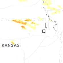

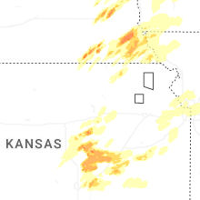
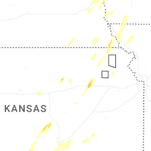


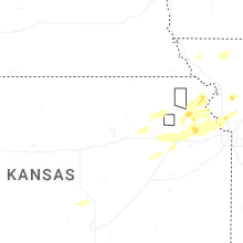


Connect with Interactive Hail Maps