

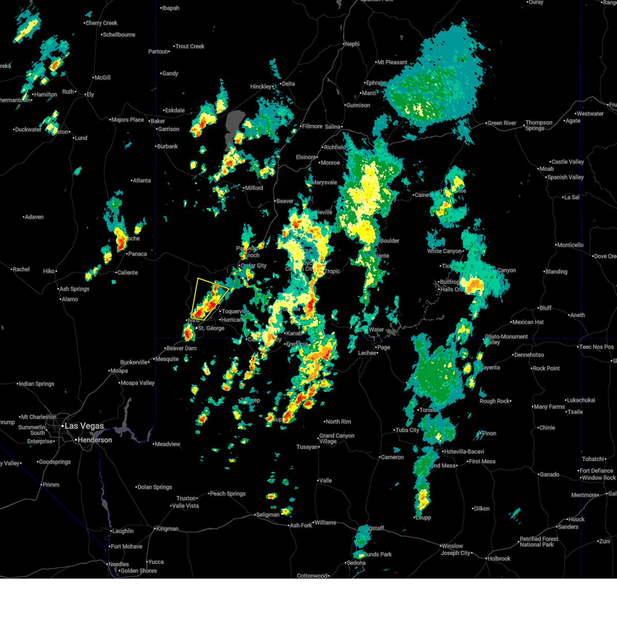
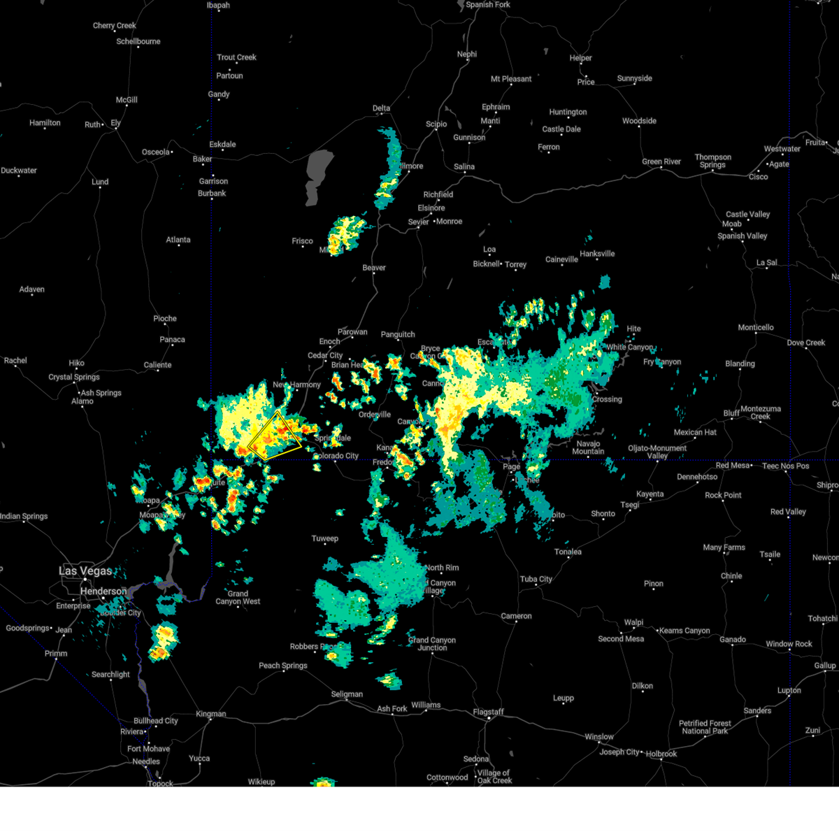
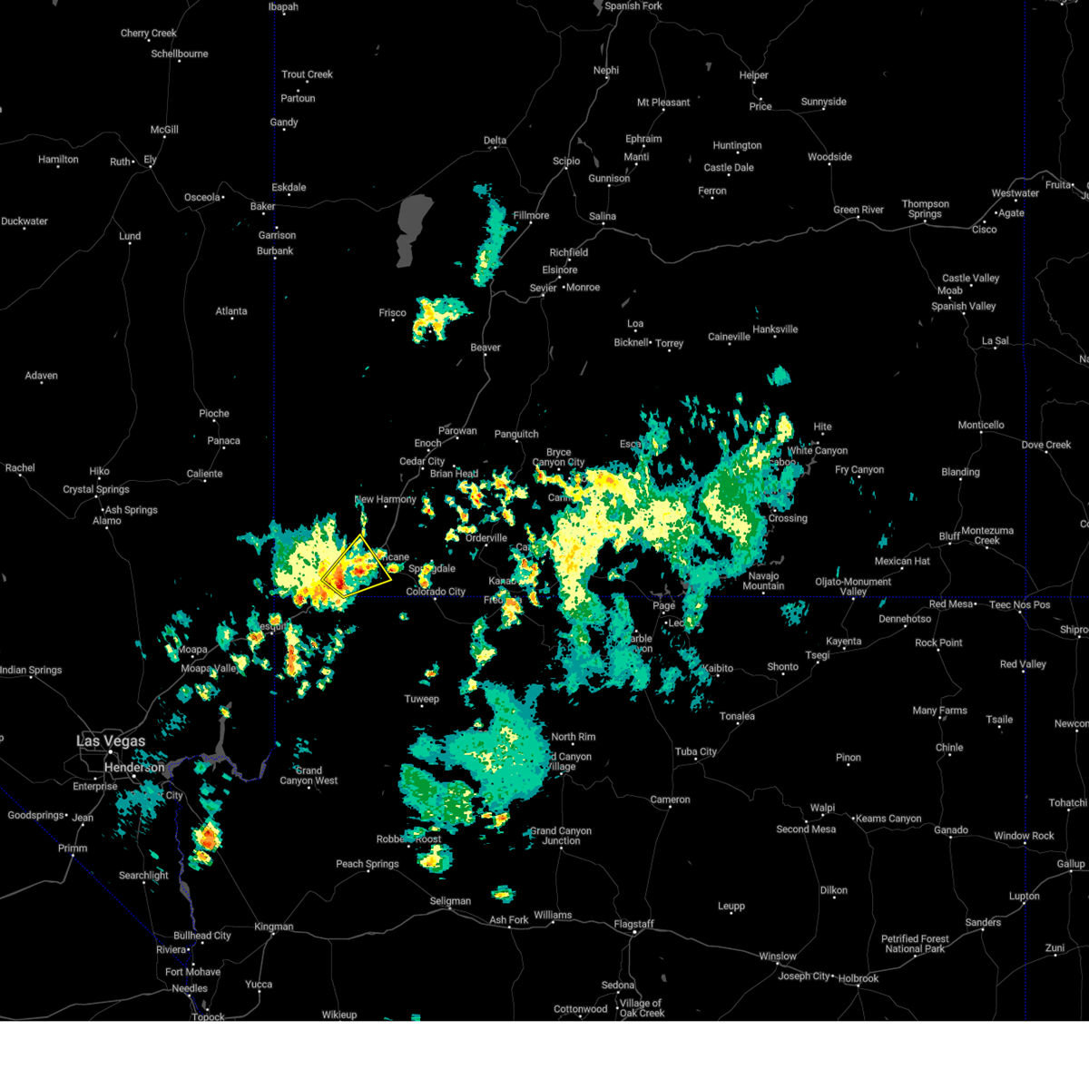
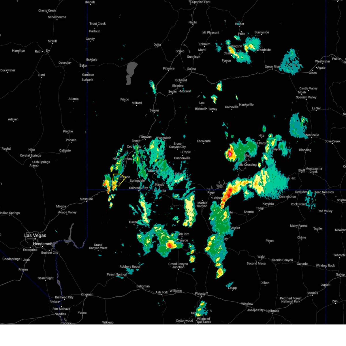
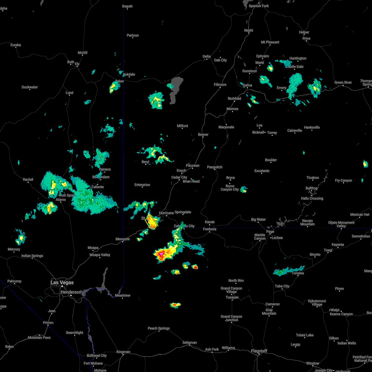
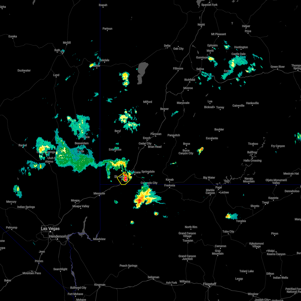
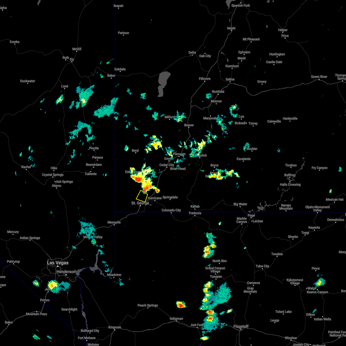
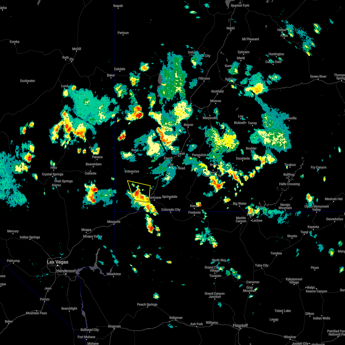
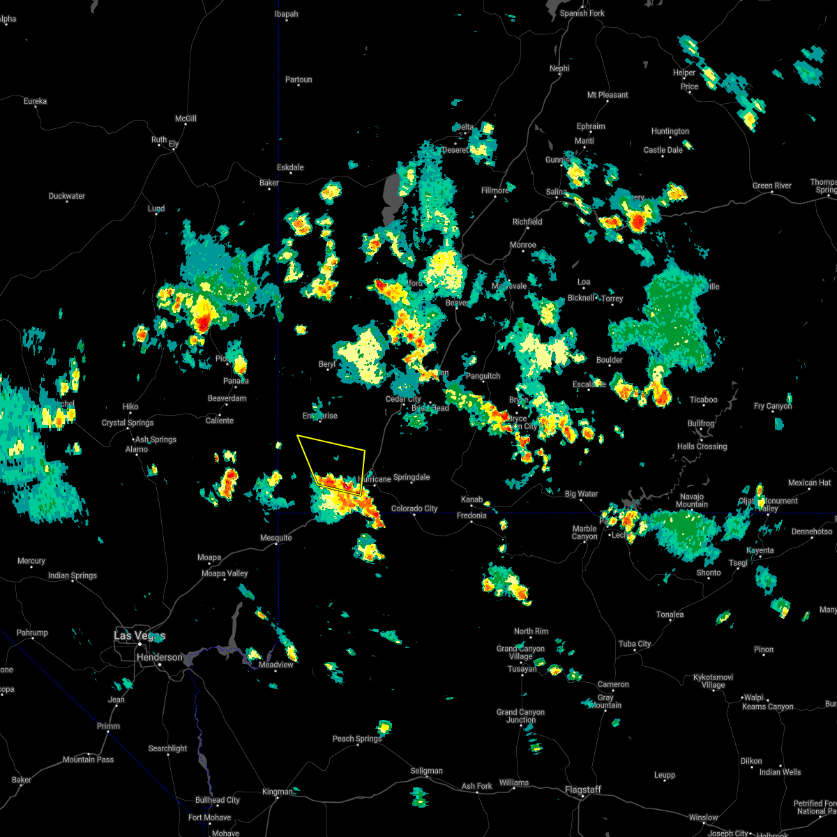
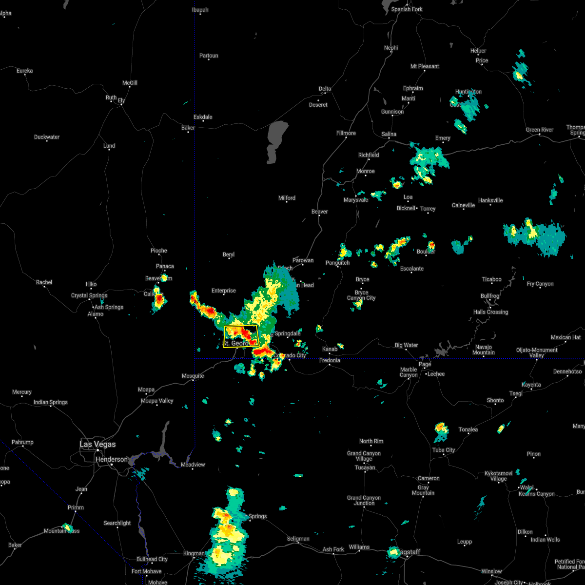
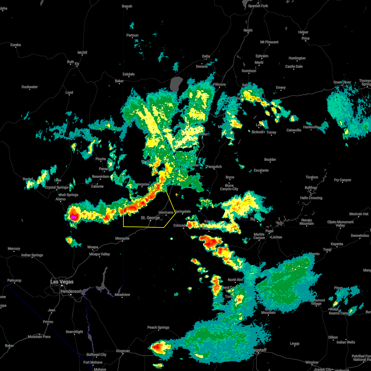
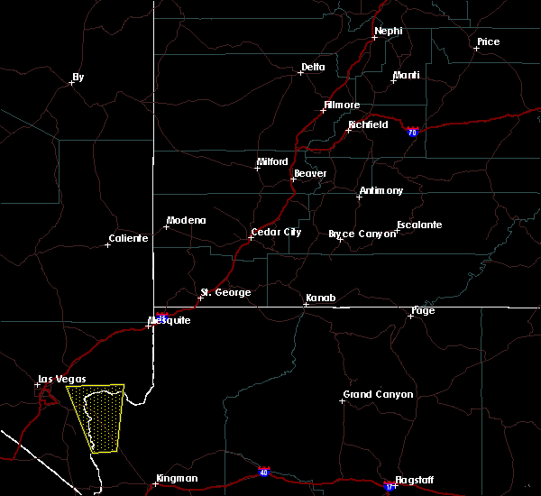
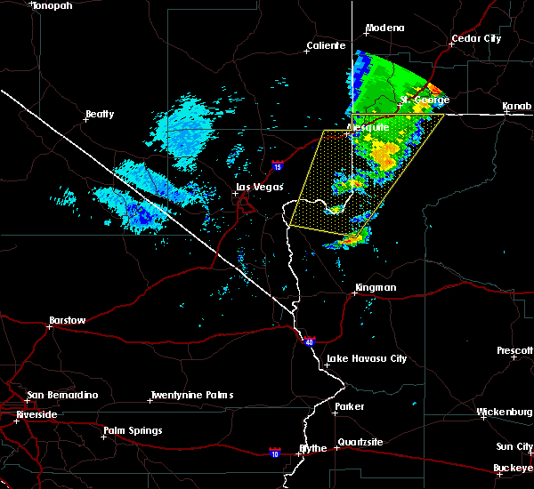
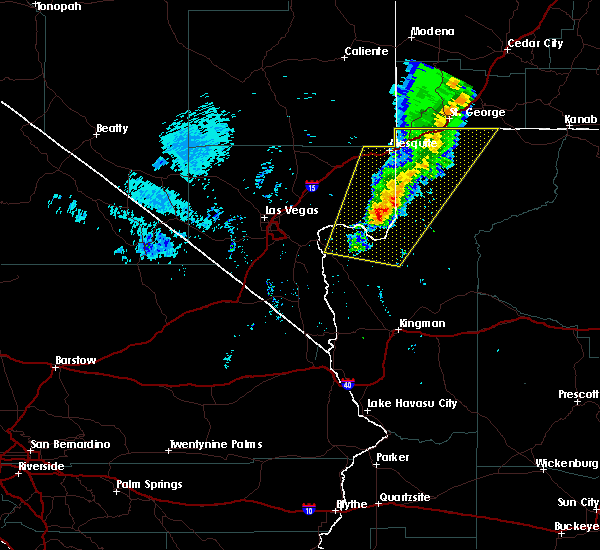
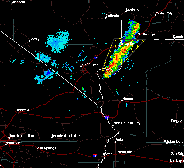
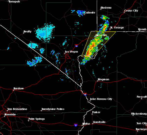
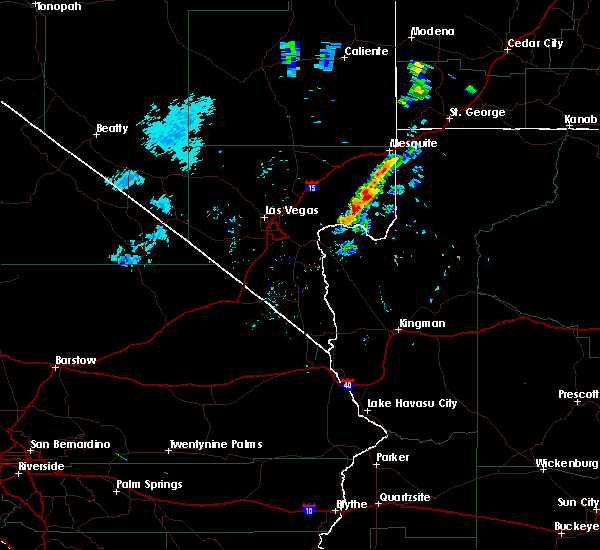
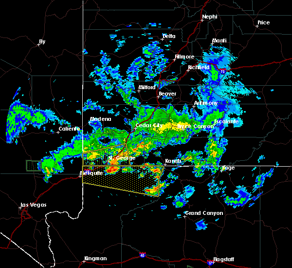
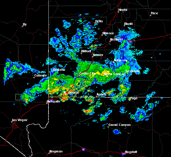
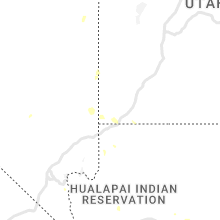
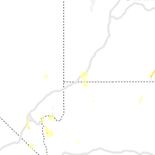
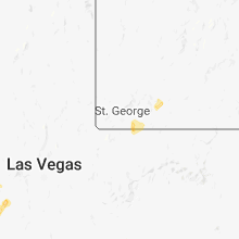
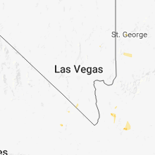
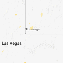
Hail Map for St. George, UT
The St. George, UT area has had 1 report of on-the-ground hail by trained spotters, and has been under severe weather warnings 0 times during the past 12 months. Doppler radar has detected hail at or near St. George, UT on 31 occasions.
| Name: | St. George, UT |
| Where Located: | 0.5 miles SW of Saint George, UT |
| Map: | Google Map for St. George, UT |
| Population: | 72897 |
| Housing Units: | 32089 |
| More Info: | Search Google for St. George, UT |
3
The Top Recent Hail Date for St. George, UT is Thursday, October 17, 2024 (2nd out of 31)

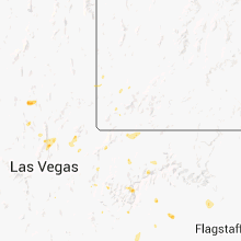
Hail and Wind Damage Spotted near St. George, UT
| Date / Time | Report Details |
|---|---|
| 6/5/2025 7:10 PM MDT | Picture on social media of broken 1 inch diameter tree branches in bloomingto in washington county UT, 3.8 miles NNE of St. George, UT |
| 6/5/2025 7:10 PM MDT | Broken 1 inch diameter tree branches reported via mpin in washington county UT, 1.7 miles NNW of St. George, UT |
| 8/17/2024 5:16 PM MDT |
 Svrslc the national weather service in salt lake city has issued a * severe thunderstorm warning for, central washington county in southwestern utah, * until 600 pm mdt. * at 516 pm mdt, a severe thunderstorm was located near washington, or 23 miles northeast of virgin river gorge, moving northeast at 25 mph (radar indicated). Hazards include 60 mph wind gusts and quarter size hail. Hail damage to vehicles is expected. Expect wind damage to roofs, siding, and trees. Svrslc the national weather service in salt lake city has issued a * severe thunderstorm warning for, central washington county in southwestern utah, * until 600 pm mdt. * at 516 pm mdt, a severe thunderstorm was located near washington, or 23 miles northeast of virgin river gorge, moving northeast at 25 mph (radar indicated). Hazards include 60 mph wind gusts and quarter size hail. Hail damage to vehicles is expected. Expect wind damage to roofs, siding, and trees.
|
| 8/31/2023 10:38 PM MST |
 The severe thunderstorm warning for north central mohave county will expire at 1045 pm mst, the storm which prompted the warning has weakened below severe limits, and no longer poses an immediate threat to life or property. therefore, the warning will be allowed to expire. however gusty winds are still possible with this thunderstorm. The severe thunderstorm warning for north central mohave county will expire at 1045 pm mst, the storm which prompted the warning has weakened below severe limits, and no longer poses an immediate threat to life or property. therefore, the warning will be allowed to expire. however gusty winds are still possible with this thunderstorm.
|
| 8/31/2023 10:25 PM MST |
 At 1023 pm mst, a severe thunderstorm was located 17 miles southeast of virgin river campground and gorge, moving northeast at 35 mph. this storm was still producing frequent cloud to ground lightning (radar indicated). Hazards include 60 mph wind gusts and frequent lightning. Expect damage to roofs and trees, heavy rainfall, and possible power outages due to cloud to ground lightning. this severe thunderstorm will remain over mainly rural areas of north central mohave county between littlefield and colorado city. this includes the following roads, mount trumbull loop road between mile markers 0 and 32. hail threat, radar indicated max hail size, <. 75 in wind threat, radar indicated max wind gust, 60 mph. At 1023 pm mst, a severe thunderstorm was located 17 miles southeast of virgin river campground and gorge, moving northeast at 35 mph. this storm was still producing frequent cloud to ground lightning (radar indicated). Hazards include 60 mph wind gusts and frequent lightning. Expect damage to roofs and trees, heavy rainfall, and possible power outages due to cloud to ground lightning. this severe thunderstorm will remain over mainly rural areas of north central mohave county between littlefield and colorado city. this includes the following roads, mount trumbull loop road between mile markers 0 and 32. hail threat, radar indicated max hail size, <. 75 in wind threat, radar indicated max wind gust, 60 mph.
|
| 8/31/2023 10:05 PM MST |
 At 1003 pm mst, a cluster of severe thunderstorms was located 20 miles east of littlefield, moving northeast at 35 mph (radar indicated). Hazards include 60 mph wind gusts and frequent cloud to ground lightning. Expect damage to roofs and trees and possible power outages from frequent cloud to ground lightning. this severe thunderstorm will remain over mainly rural areas of north central mohave county between littlefield and colorado city. this includes the following roads, mount trumbull loop road between mile markers 0 and 32. hail threat, radar indicated max hail size, <. 75 in wind threat, radar indicated max wind gust, 60 mph. At 1003 pm mst, a cluster of severe thunderstorms was located 20 miles east of littlefield, moving northeast at 35 mph (radar indicated). Hazards include 60 mph wind gusts and frequent cloud to ground lightning. Expect damage to roofs and trees and possible power outages from frequent cloud to ground lightning. this severe thunderstorm will remain over mainly rural areas of north central mohave county between littlefield and colorado city. this includes the following roads, mount trumbull loop road between mile markers 0 and 32. hail threat, radar indicated max hail size, <. 75 in wind threat, radar indicated max wind gust, 60 mph.
|
| 8/31/2023 9:35 PM MDT |
 At 934 pm mdt, a severe thunderstorm was located over st george, or 18 miles northeast of virgin river gorge, moving northeast at 25 mph (radar indicated). Hazards include 60 mph wind gusts and penny size hail. Expect damage to roofs, siding, and trees. locations impacted include, st george, washington, hurricane, santa clara, sand hollow state park, quail creek state park, ivins, bloomington and snow canyon state park. this includes the following highways, interstate 15 between mile markers 2 and 21. utah route 18 between mile markers 0 and 8. hail threat, radar indicated max hail size, 0. 75 in wind threat, radar indicated max wind gust, 60 mph. At 934 pm mdt, a severe thunderstorm was located over st george, or 18 miles northeast of virgin river gorge, moving northeast at 25 mph (radar indicated). Hazards include 60 mph wind gusts and penny size hail. Expect damage to roofs, siding, and trees. locations impacted include, st george, washington, hurricane, santa clara, sand hollow state park, quail creek state park, ivins, bloomington and snow canyon state park. this includes the following highways, interstate 15 between mile markers 2 and 21. utah route 18 between mile markers 0 and 8. hail threat, radar indicated max hail size, 0. 75 in wind threat, radar indicated max wind gust, 60 mph.
|
| 8/31/2023 9:22 PM MDT |
 At 922 pm mdt, a severe thunderstorm was located over st george, or 14 miles northeast of virgin river gorge, moving northeast at 15 mph (radar indicated). Hazards include 60 mph wind gusts and penny size hail. expect damage to roofs, siding, and trees At 922 pm mdt, a severe thunderstorm was located over st george, or 14 miles northeast of virgin river gorge, moving northeast at 15 mph (radar indicated). Hazards include 60 mph wind gusts and penny size hail. expect damage to roofs, siding, and trees
|
| 8/22/2023 6:22 PM MDT |
 The severe thunderstorm warning for south central washington county will expire at 630 pm mdt, the storm which prompted the warning has moved out of the area. therefore, the warning will be allowed to expire. to report severe weather, contact your nearest law enforcement agency. they will relay your report to the national weather service salt lake city. remember, a severe thunderstorm warning still remains in effect for north central washington county until 6:45 pm mdt. The severe thunderstorm warning for south central washington county will expire at 630 pm mdt, the storm which prompted the warning has moved out of the area. therefore, the warning will be allowed to expire. to report severe weather, contact your nearest law enforcement agency. they will relay your report to the national weather service salt lake city. remember, a severe thunderstorm warning still remains in effect for north central washington county until 6:45 pm mdt.
|
| 8/22/2023 5:57 PM MDT |
 At 557 pm mdt, a severe thunderstorm was located over sand hollow state park, or 24 miles northeast of virgin river gorge, moving north at 20 mph (radar indicated). Hazards include 60 mph wind gusts and quarter size hail. Hail damage to vehicles is expected. expect wind damage to roofs, siding, and trees. locations impacted include, washington, hurricane, la verkin, sand hollow state park, quail creek state park, toquerville, leeds and virgin. This includes interstate 15 between mile markers 12 and 24. At 557 pm mdt, a severe thunderstorm was located over sand hollow state park, or 24 miles northeast of virgin river gorge, moving north at 20 mph (radar indicated). Hazards include 60 mph wind gusts and quarter size hail. Hail damage to vehicles is expected. expect wind damage to roofs, siding, and trees. locations impacted include, washington, hurricane, la verkin, sand hollow state park, quail creek state park, toquerville, leeds and virgin. This includes interstate 15 between mile markers 12 and 24.
|
| 8/22/2023 5:46 PM MDT |
 At 546 pm mdt, a severe thunderstorm was located near sand hollow state park, or 20 miles east of virgin river gorge, moving north at 15 mph (radar indicated). Hazards include 60 mph wind gusts and quarter size hail. Hail damage to vehicles is expected. Expect wind damage to roofs, siding, and trees. At 546 pm mdt, a severe thunderstorm was located near sand hollow state park, or 20 miles east of virgin river gorge, moving north at 15 mph (radar indicated). Hazards include 60 mph wind gusts and quarter size hail. Hail damage to vehicles is expected. Expect wind damage to roofs, siding, and trees.
|
| 8/22/2022 5:40 PM MDT | The severe thunderstorm warning for south central washington county will expire at 545 pm mdt, the storm which prompted the warning has weakened below severe limits, and has exited the warned area. therefore, the warning will be allowed to expire. |
| 8/22/2022 5:32 PM MDT | At 531 pm mdt, a severe thunderstorm was located 8 miles southeast of st george, or 18 miles east of virgin river gorge, moving southeast at 25 mph (radar indicated). Hazards include 60 mph wind gusts and quarter size hail. Hail damage to vehicles is expected. expect wind damage to roofs, siding, and trees. locations impacted include, st george and washington. hail threat, radar indicated max hail size, 1. 00 in wind threat, radar indicated max wind gust, 60 mph. |
| 8/22/2022 5:16 PM MDT | At 515 pm mdt, a severe thunderstorm was located near st george, or 18 miles northeast of virgin river gorge, moving southeast at 25 mph (radar indicated). Hazards include 60 mph wind gusts and quarter size hail. Hail damage to vehicles is expected. Expect wind damage to roofs, siding, and trees. |
| 8/14/2021 7:25 PM MDT |
 At 725 pm mdt, a severe thunderstorm was located over st george, or 16 miles northeast of virgin river gorge, moving southwest at 10 mph (radar indicated). Hazards include 60 mph wind gusts and penny size hail. Expect damage to roofs, siding, and trees. locations impacted include, st george, washington, santa clara and bloomington. this includes the following highways, interstate 15 between mile markers 3 and 10. utah route 18 between mile markers 0 and 5. hail threat, radar indicated max hail size, 0. 75 in wind threat, radar indicated max wind gust, 60 mph. At 725 pm mdt, a severe thunderstorm was located over st george, or 16 miles northeast of virgin river gorge, moving southwest at 10 mph (radar indicated). Hazards include 60 mph wind gusts and penny size hail. Expect damage to roofs, siding, and trees. locations impacted include, st george, washington, santa clara and bloomington. this includes the following highways, interstate 15 between mile markers 3 and 10. utah route 18 between mile markers 0 and 5. hail threat, radar indicated max hail size, 0. 75 in wind threat, radar indicated max wind gust, 60 mph.
|
| 8/14/2021 7:12 PM MDT | Quarter sized hail reported 1.6 miles N of St. George, UT, viewer video submitted to news media with nickel and quarter sized hail reported. |
| 8/14/2021 7:01 PM MDT |
 At 701 pm mdt, a severe thunderstorm was located over st george, or 20 miles northeast of virgin river gorge, moving southwest at 10 mph (radar indicated). Hazards include 60 mph wind gusts and quarter size hail. Hail damage to vehicles is expected. Expect wind damage to roofs, siding, and trees. At 701 pm mdt, a severe thunderstorm was located over st george, or 20 miles northeast of virgin river gorge, moving southwest at 10 mph (radar indicated). Hazards include 60 mph wind gusts and quarter size hail. Hail damage to vehicles is expected. Expect wind damage to roofs, siding, and trees.
|
| 8/13/2021 5:14 PM MDT |
 The national weather service in salt lake city has issued a * severe thunderstorm warning for. central washington county in southwestern utah. Until 545 pm mdt * at 513 pm mdt, a severe thunderstorm was located near washington, or 26 miles northeast of virgin river gorge, moving south at 20. The national weather service in salt lake city has issued a * severe thunderstorm warning for. central washington county in southwestern utah. Until 545 pm mdt * at 513 pm mdt, a severe thunderstorm was located near washington, or 26 miles northeast of virgin river gorge, moving south at 20.
|
| 7/26/2021 4:17 PM MDT |
 At 417 pm mdt, severe thunderstorms were located along a line extending from dameron valley to 7 miles north of washington, moving north at 15 mph (radar indicated). Hazards include 60 mph wind gusts and half dollar size hail. Hail damage to vehicles is expected. expect wind damage to roofs, siding, and trees. locations impacted include, washington, hurricane, dameron valley, quail creek state park, ivins, veyo and snow canyon state park. this includes the following highways, interstate 15 between mile markers 14 and 20. Utah route 18 between mile markers 7 and 28. At 417 pm mdt, severe thunderstorms were located along a line extending from dameron valley to 7 miles north of washington, moving north at 15 mph (radar indicated). Hazards include 60 mph wind gusts and half dollar size hail. Hail damage to vehicles is expected. expect wind damage to roofs, siding, and trees. locations impacted include, washington, hurricane, dameron valley, quail creek state park, ivins, veyo and snow canyon state park. this includes the following highways, interstate 15 between mile markers 14 and 20. Utah route 18 between mile markers 7 and 28.
|
| 7/26/2021 4:00 PM MDT |
 At 400 pm mdt, severe thunderstorms were located along a line extending from near dameron valley to near washington, moving north at 15 mph (radar indicated). Hazards include 60 mph wind gusts and half dollar size hail. Hail damage to vehicles is expected. Expect wind damage to roofs, siding, and trees. At 400 pm mdt, severe thunderstorms were located along a line extending from near dameron valley to near washington, moving north at 15 mph (radar indicated). Hazards include 60 mph wind gusts and half dollar size hail. Hail damage to vehicles is expected. Expect wind damage to roofs, siding, and trees.
|
| 7/26/2021 3:30 PM MDT |
 At 330 pm mdt, a severe thunderstorm was located over washington, or 20 miles northeast of virgin river gorge, moving northwest at 10 mph (radar indicated). Hazards include 60 mph wind gusts and half dollar size hail. Hail damage to vehicles is expected. Expect wind damage to roofs, siding, and trees. At 330 pm mdt, a severe thunderstorm was located over washington, or 20 miles northeast of virgin river gorge, moving northwest at 10 mph (radar indicated). Hazards include 60 mph wind gusts and half dollar size hail. Hail damage to vehicles is expected. Expect wind damage to roofs, siding, and trees.
|
| 7/25/2021 5:53 PM MDT |
 At 553 pm mdt, a severe thunderstorm was located 7 miles northwest of quail creek state park, or 28 miles northeast of virgin river gorge, moving south at 10 mph (radar indicated). Hazards include 60 mph wind gusts and half dollar size hail. Hail damage to vehicles is expected. expect wind damage to roofs, siding, and trees. locations impacted include, st george, washington, hurricane, santa clara, sand hollow state park, quail creek state park, dameron valley, ivins, leeds and snow canyon state park. this includes the following highways, interstate 15 between mile markers 9 and 24. Utah route 18 between mile markers 2 and 16. At 553 pm mdt, a severe thunderstorm was located 7 miles northwest of quail creek state park, or 28 miles northeast of virgin river gorge, moving south at 10 mph (radar indicated). Hazards include 60 mph wind gusts and half dollar size hail. Hail damage to vehicles is expected. expect wind damage to roofs, siding, and trees. locations impacted include, st george, washington, hurricane, santa clara, sand hollow state park, quail creek state park, dameron valley, ivins, leeds and snow canyon state park. this includes the following highways, interstate 15 between mile markers 9 and 24. Utah route 18 between mile markers 2 and 16.
|
| 7/25/2021 5:42 PM MDT |
 At 541 pm mdt, a severe thunderstorm was located 9 miles east of dameron valley, or 30 miles northeast of virgin river gorge, moving south at 10 mph (radar indicated). Hazards include 60 mph wind gusts and half dollar size hail. Hail damage to vehicles is expected. Expect wind damage to roofs, siding, and trees. At 541 pm mdt, a severe thunderstorm was located 9 miles east of dameron valley, or 30 miles northeast of virgin river gorge, moving south at 10 mph (radar indicated). Hazards include 60 mph wind gusts and half dollar size hail. Hail damage to vehicles is expected. Expect wind damage to roofs, siding, and trees.
|
| 7/24/2021 3:31 PM MDT |
 At 331 pm mdt, a severe thunderstorm was located 9 miles southwest of new harmony, or 28 miles southwest of cedar city, moving north at 10 mph (radar indicated). Hazards include 60 mph wind gusts and quarter size hail. Hail damage to vehicles is expected. expect wind damage to roofs, siding, and trees. locations impacted include, washington, hurricane, new harmony, quail creek state park, ivins, toquerville, leeds, pine valley and snow canyon state park. this includes the following highways, interstate 15 between mile markers 18 and 25. Utah route 18 between mile markers 9 and 15. At 331 pm mdt, a severe thunderstorm was located 9 miles southwest of new harmony, or 28 miles southwest of cedar city, moving north at 10 mph (radar indicated). Hazards include 60 mph wind gusts and quarter size hail. Hail damage to vehicles is expected. expect wind damage to roofs, siding, and trees. locations impacted include, washington, hurricane, new harmony, quail creek state park, ivins, toquerville, leeds, pine valley and snow canyon state park. this includes the following highways, interstate 15 between mile markers 18 and 25. Utah route 18 between mile markers 9 and 15.
|
| 7/24/2021 3:16 PM MDT |
 At 315 pm mdt, a severe thunderstorm was located 11 miles southwest of new harmony, or 28 miles west of zion national park, and is nearly stationary (radar indicated). Hazards include 60 mph wind gusts and quarter size hail. Hail damage to vehicles is expected. Expect wind damage to roofs, siding, and trees. At 315 pm mdt, a severe thunderstorm was located 11 miles southwest of new harmony, or 28 miles west of zion national park, and is nearly stationary (radar indicated). Hazards include 60 mph wind gusts and quarter size hail. Hail damage to vehicles is expected. Expect wind damage to roofs, siding, and trees.
|
| 7/14/2021 8:40 PM MDT |
 At 840 pm mdt, severe thunderstorms were located along a line extending from 7 miles north of la verkin to st george to near virgin river gorge, moving east at 25 mph (radar indicated). Hazards include 60 mph wind gusts. Expect damage to roofs, siding, and trees. locations impacted include, st george, washington, hurricane, santa clara, la verkin, quail creek state park, sand hollow state park, ivins, toquerville, leeds, virgin, pintura, bloomington and snow canyon state park. this includes the following highways, interstate 15 between mile markers 1 and 35. Utah route 18 between mile markers 0 and 10. At 840 pm mdt, severe thunderstorms were located along a line extending from 7 miles north of la verkin to st george to near virgin river gorge, moving east at 25 mph (radar indicated). Hazards include 60 mph wind gusts. Expect damage to roofs, siding, and trees. locations impacted include, st george, washington, hurricane, santa clara, la verkin, quail creek state park, sand hollow state park, ivins, toquerville, leeds, virgin, pintura, bloomington and snow canyon state park. this includes the following highways, interstate 15 between mile markers 1 and 35. Utah route 18 between mile markers 0 and 10.
|
| 7/14/2021 8:38 PM MDT | Skylights blown off roof. heavy rain falling into hom in washington county UT, 1.6 miles N of St. George, UT |
| 7/14/2021 7:53 PM MDT |
 At 753 pm mdt, severe thunderstorms were located along a line extending from 7 miles northwest of new harmony to near dameron valley to 16 miles southwest of gunlock state park, moving southeast at 25 mph (radar indicated). Hazards include 60 mph wind gusts. expect damage to roofs, siding, and trees At 753 pm mdt, severe thunderstorms were located along a line extending from 7 miles northwest of new harmony to near dameron valley to 16 miles southwest of gunlock state park, moving southeast at 25 mph (radar indicated). Hazards include 60 mph wind gusts. expect damage to roofs, siding, and trees
|
| 7/13/2021 9:52 PM MST |
 The severe thunderstorm warning for northeastern mohave county will expire at 1000 pm mst, the storms which prompted the warning have weakened below severe limits. therefore, the warning will be allowed to expire. however gusty winds to 50 mph are still possible. The severe thunderstorm warning for northeastern mohave county will expire at 1000 pm mst, the storms which prompted the warning have weakened below severe limits. therefore, the warning will be allowed to expire. however gusty winds to 50 mph are still possible.
|
| 7/13/2021 8:29 PM MST |
 At 829 pm mst, a severe thunderstorm was located over littlefield, moving southeast at 15 mph (radar indicated). Hazards include 60 mph wind gusts. expect damage to roofs and trees At 829 pm mst, a severe thunderstorm was located over littlefield, moving southeast at 15 mph (radar indicated). Hazards include 60 mph wind gusts. expect damage to roofs and trees
|
| 6/5/2020 6:51 PM MDT | Awos station ksgu st george muni airpor in washington county UT, 4.5 miles WNW of St. George, UT |
| 4/29/2019 7:00 PM MDT |
 At 700 pm mdt, severe thunderstorms were located along a line extending from 17 miles north of santa clara to near la verkin, moving north at 25 mph (radar indicated). Hazards include 60 mph wind gusts and quarter size hail. Hail damage to vehicles is expected. expect wind damage to roofs, siding, and trees. Locations impacted include, washington, hurricane, la verkin, toquerville, leeds, virgin, pintura, pine valley, gunlock, veyo and snow canyon state park. At 700 pm mdt, severe thunderstorms were located along a line extending from 17 miles north of santa clara to near la verkin, moving north at 25 mph (radar indicated). Hazards include 60 mph wind gusts and quarter size hail. Hail damage to vehicles is expected. expect wind damage to roofs, siding, and trees. Locations impacted include, washington, hurricane, la verkin, toquerville, leeds, virgin, pintura, pine valley, gunlock, veyo and snow canyon state park.
|
| 4/29/2019 6:49 PM MDT |
 At 648 pm mdt, severe thunderstorms were located along a line extending from 12 miles northwest of santa clara to 7 miles southeast of hurricane, moving northeast at 20 mph (radar indicated). Hazards include 60 mph wind gusts and quarter size hail. Hail damage to vehicles is expected. expect wind damage to roofs, siding, and trees. Locations impacted include, st george, washington, hurricane, santa clara, la verkin, ivins, toquerville, leeds, virgin, pintura, bloomington, pine valley, gunlock, veyo and snow canyon state park. At 648 pm mdt, severe thunderstorms were located along a line extending from 12 miles northwest of santa clara to 7 miles southeast of hurricane, moving northeast at 20 mph (radar indicated). Hazards include 60 mph wind gusts and quarter size hail. Hail damage to vehicles is expected. expect wind damage to roofs, siding, and trees. Locations impacted include, st george, washington, hurricane, santa clara, la verkin, ivins, toquerville, leeds, virgin, pintura, bloomington, pine valley, gunlock, veyo and snow canyon state park.
|
| 4/29/2019 6:28 PM MDT |
 At 628 pm mdt, severe thunderstorms were located along a line extending from 10 miles west of santa clara to 11 miles south of hurricane, moving northeast at 20 mph (radar indicated). Hazards include 60 mph wind gusts and quarter size hail. Hail damage to vehicles is expected. Expect wind damage to roofs, siding, and trees. At 628 pm mdt, severe thunderstorms were located along a line extending from 10 miles west of santa clara to 11 miles south of hurricane, moving northeast at 20 mph (radar indicated). Hazards include 60 mph wind gusts and quarter size hail. Hail damage to vehicles is expected. Expect wind damage to roofs, siding, and trees.
|
| 8/11/2018 7:18 PM MDT |
 At 718 pm mdt, a severe thunderstorm was located 18 miles northwest of beaver dam, moving west at 55 mph (emergency management). Hazards include 60 mph wind gusts and quarter size hail. Hail damage to vehicles is expected. expect wind damage to roofs, siding, and trees. Locations impacted include, st george, washington, hurricane, santa clara, ivins, motoqua, bloomington, gunlock, veyo and snow canyon state park. At 718 pm mdt, a severe thunderstorm was located 18 miles northwest of beaver dam, moving west at 55 mph (emergency management). Hazards include 60 mph wind gusts and quarter size hail. Hail damage to vehicles is expected. expect wind damage to roofs, siding, and trees. Locations impacted include, st george, washington, hurricane, santa clara, ivins, motoqua, bloomington, gunlock, veyo and snow canyon state park.
|
| 8/11/2018 6:53 PM MDT |
 At 652 pm mdt, a severe thunderstorm was located over santa clara, or near st george, moving west at 40 mph (radar indicated). Hazards include 60 mph wind gusts and quarter size hail. Hail damage to vehicles is expected. Expect wind damage to roofs, siding, and trees. At 652 pm mdt, a severe thunderstorm was located over santa clara, or near st george, moving west at 40 mph (radar indicated). Hazards include 60 mph wind gusts and quarter size hail. Hail damage to vehicles is expected. Expect wind damage to roofs, siding, and trees.
|
| 3/30/2017 5:17 PM MDT | Saint george airport awos in washington county UT, 4.6 miles NW of St. George, UT |
| 3/30/2017 5:17 PM MDT | Large utility poles knocked down due to strong winds on river road. traffic diverted around the area... multiple power outage in washington county UT, 1.7 miles NNE of St. George, UT |
| 9/22/2016 4:23 PM MST |
 The severe thunderstorm warning for northwestern mohave and northeastern clark counties will expire at 430 pm pdt/430 pm mst/, the storms which prompted the warning have weakened. therefore the warning will be allowed to expire. The severe thunderstorm warning for northwestern mohave and northeastern clark counties will expire at 430 pm pdt/430 pm mst/, the storms which prompted the warning have weakened. therefore the warning will be allowed to expire.
|
| 9/22/2016 3:49 PM MST |
 At 348 pm pdt/348 pm mst/, doppler radar indicated severe thunderstorms capable of producing quarter size hail and damaging winds in excess of 60 mph. these storms were located along a line extending from near virgin river campground to near temple bar campground, moving northeast at 30 mph. locations impacted include, mesquite, beaver dam, littlefield, virgin river gorge, moapa valley, temple bar campground, meadview, echo bay, bunkerville, grand canyon ranch, overton beach, virgin river campground, south cove, echo bay campground, valley of fire and temple bar. At 348 pm pdt/348 pm mst/, doppler radar indicated severe thunderstorms capable of producing quarter size hail and damaging winds in excess of 60 mph. these storms were located along a line extending from near virgin river campground to near temple bar campground, moving northeast at 30 mph. locations impacted include, mesquite, beaver dam, littlefield, virgin river gorge, moapa valley, temple bar campground, meadview, echo bay, bunkerville, grand canyon ranch, overton beach, virgin river campground, south cove, echo bay campground, valley of fire and temple bar.
|
| 9/22/2016 3:25 PM MST |
 At 324 pm pdt/324 pm mst/, doppler radar indicated a line of severe thunderstorms capable of producing quarter size hail and damaging winds in excess of 60 mph. these storms were located along a line extending from near virgin river gorge to 8 miles west of temple bar campground, and moving northeast at 25 mph. At 324 pm pdt/324 pm mst/, doppler radar indicated a line of severe thunderstorms capable of producing quarter size hail and damaging winds in excess of 60 mph. these storms were located along a line extending from near virgin river gorge to 8 miles west of temple bar campground, and moving northeast at 25 mph.
|
| 9/22/2016 3:09 PM PDT |
 At 307 pm pdt/307 pm mst/, doppler radar indicated severe thunderstorms capable of producing quarter size hail and damaging winds in excess of 60 mph. these storms were located along a line extending from near mesquite to 7 miles northwest of temple bar campground, moving northeast at 25 mph. locations impacted include, mesquite, beaver dam, littlefield, virgin river gorge, moapa valley, temple bar campground, overton beach, virgin river campground, echo bay, bunkerville, echo bay campground, valley of fire and temple bar. At 307 pm pdt/307 pm mst/, doppler radar indicated severe thunderstorms capable of producing quarter size hail and damaging winds in excess of 60 mph. these storms were located along a line extending from near mesquite to 7 miles northwest of temple bar campground, moving northeast at 25 mph. locations impacted include, mesquite, beaver dam, littlefield, virgin river gorge, moapa valley, temple bar campground, overton beach, virgin river campground, echo bay, bunkerville, echo bay campground, valley of fire and temple bar.
|
| 9/22/2016 2:45 PM PDT |
 At 243 pm pdt/243 pm mst/, doppler radar indicated a line of severe thunderstorms capable of producing quarter size hail and damaging winds in excess of 60 mph. these storms were located along a line extending from 7 miles south of bunkerville to 6 miles southwest of echo bay campground, and moving northeast at 30 mph. At 243 pm pdt/243 pm mst/, doppler radar indicated a line of severe thunderstorms capable of producing quarter size hail and damaging winds in excess of 60 mph. these storms were located along a line extending from 7 miles south of bunkerville to 6 miles southwest of echo bay campground, and moving northeast at 30 mph.
|
| 8/10/2016 4:05 PM MDT |
 At 404 pm mdt, doppler radar indicated a severe thunderstorm capable of producing quarter size hail and gusty winds to 50 mph. this storm was located near st george, and moving northeast at 25 mph. At 404 pm mdt, doppler radar indicated a severe thunderstorm capable of producing quarter size hail and gusty winds to 50 mph. this storm was located near st george, and moving northeast at 25 mph.
|
| 7/30/2016 8:55 PM MST |
 The severe thunderstorm warning for northeastern mohave county will expire at 900 pm mst, the storm which prompted the warning has weakened below severe limits, and no longer poses an immediate threat to life or property. therefore the warning will be allowed to expire. however gusty winds and heavy rain are still possible with this thunderstorm and additional thunderstorms in the warned area. The severe thunderstorm warning for northeastern mohave county will expire at 900 pm mst, the storm which prompted the warning has weakened below severe limits, and no longer poses an immediate threat to life or property. therefore the warning will be allowed to expire. however gusty winds and heavy rain are still possible with this thunderstorm and additional thunderstorms in the warned area.
|
| 7/30/2016 8:41 PM MST |
 At 838 pm mst, doppler radar indicated a severe thunderstorm capable of producing quarter size hail and damaging winds in excess of 60 mph. this storm was located 14 miles south of st. george, or 15 miles south of st george, moving southeast at 10 mph. locations impacted include, colorado city, beaver dam, littlefield, virgin river gorge, virgin river campground, kaibab and pipe spring. At 838 pm mst, doppler radar indicated a severe thunderstorm capable of producing quarter size hail and damaging winds in excess of 60 mph. this storm was located 14 miles south of st. george, or 15 miles south of st george, moving southeast at 10 mph. locations impacted include, colorado city, beaver dam, littlefield, virgin river gorge, virgin river campground, kaibab and pipe spring.
|
| 7/30/2016 9:26 PM MDT |
 At 925 pm mdt, doppler radar indicated severe thunderstorms capable of still producing damaging winds in excess of 60 mph. these storms were located along a line extending from 10 miles northwest of zion national park to 15 miles west of santa clara, moving southeast at 25 mph. locations impacted include, st george, washington, hurricane, santa clara, la verkin, ivins, leeds, virgin, gunlock, snow canyon state park, bloomington. At 925 pm mdt, doppler radar indicated severe thunderstorms capable of still producing damaging winds in excess of 60 mph. these storms were located along a line extending from 10 miles northwest of zion national park to 15 miles west of santa clara, moving southeast at 25 mph. locations impacted include, st george, washington, hurricane, santa clara, la verkin, ivins, leeds, virgin, gunlock, snow canyon state park, bloomington.
|
| 7/30/2016 8:23 PM MST |
 At 821 pm mst, doppler radar indicated multiple severe thunderstorms capable of producing quarter size hail and damaging winds in excess of 60 mph. these storms were located from st george to hurricane, with additional thunderstorms developing towrad colorado city. storms are generally moving east at 35 mph. At 821 pm mst, doppler radar indicated multiple severe thunderstorms capable of producing quarter size hail and damaging winds in excess of 60 mph. these storms were located from st george to hurricane, with additional thunderstorms developing towrad colorado city. storms are generally moving east at 35 mph.
|
| 7/30/2016 9:06 PM MDT |
 At 905 pm mdt, doppler radar indicated a line of severe thunderstorms capable of producing damaging winds in excess of 60 mph. these storms were located along a line extending from 9 miles southeast of new harmony to 19 miles west of santa clara, and moving southeast at 20 mph. At 905 pm mdt, doppler radar indicated a line of severe thunderstorms capable of producing damaging winds in excess of 60 mph. these storms were located along a line extending from 9 miles southeast of new harmony to 19 miles west of santa clara, and moving southeast at 20 mph.
|
| 3/28/2016 7:15 PM MDT | St george airport awos ksgu in washington county UT, 4.2 miles WNW of St. George, UT |
| 7/18/2015 3:39 PM MST |
 The severe thunderstorm warning for north central mohave county will expire at 345 pm mst, the storm which prompted the warning is moving out of the warned area and into southwest utah. therefore the warning will be allowed to expire at 345 pm. however gusty winds are still possible with this thunderstorm in the virgin river gorge along interstate 15. The severe thunderstorm warning for north central mohave county will expire at 345 pm mst, the storm which prompted the warning is moving out of the warned area and into southwest utah. therefore the warning will be allowed to expire at 345 pm. however gusty winds are still possible with this thunderstorm in the virgin river gorge along interstate 15.
|
| 7/18/2015 3:32 PM MST |
 At 331 pm mst, doppler radar continued to indicated a severe thunderstorm capable of producing damaging winds in excess of 60 mph. this storm was located near virgin river gorge, moving northeast at 30 mph. locations impacted include, beaver dam, littlefield, virgin river gorge and virgin river campground. this includes interstate 15 in arizona between mile markers 0 and 29. At 331 pm mst, doppler radar continued to indicated a severe thunderstorm capable of producing damaging winds in excess of 60 mph. this storm was located near virgin river gorge, moving northeast at 30 mph. locations impacted include, beaver dam, littlefield, virgin river gorge and virgin river campground. this includes interstate 15 in arizona between mile markers 0 and 29.
|
| 7/18/2015 3:19 PM MST |
 At 318 pm mst, doppler radar indicated a severe thunderstorm capable of producing damaging winds in excess of 60 mph. this storm was located over littlefield, and moving northeast at 30 mph. At 318 pm mst, doppler radar indicated a severe thunderstorm capable of producing damaging winds in excess of 60 mph. this storm was located over littlefield, and moving northeast at 30 mph.
|
| 7/24/2012 1:30 PM MDT | Storm damage reported in washington county UT, 6.5 miles N of St. George, UT |
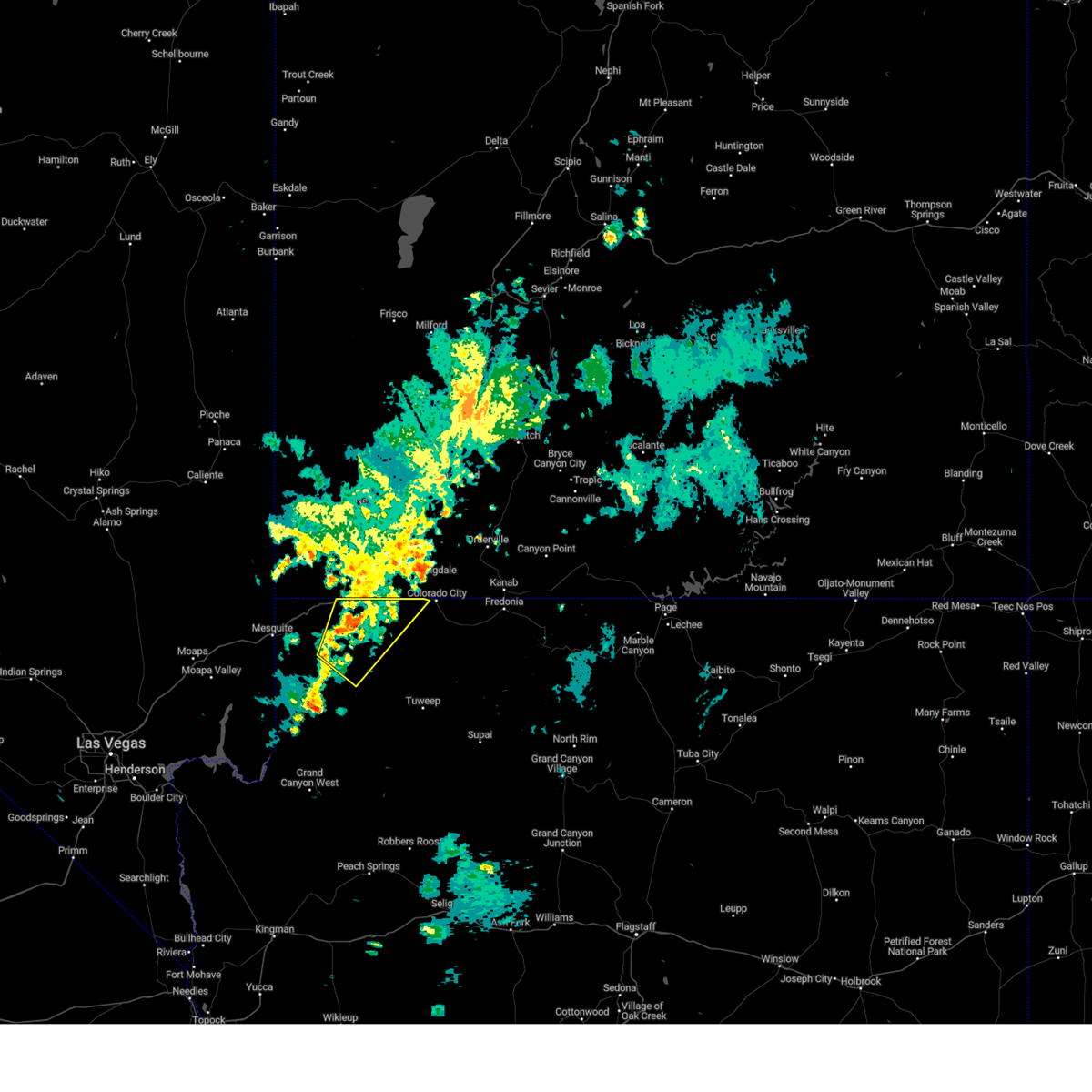
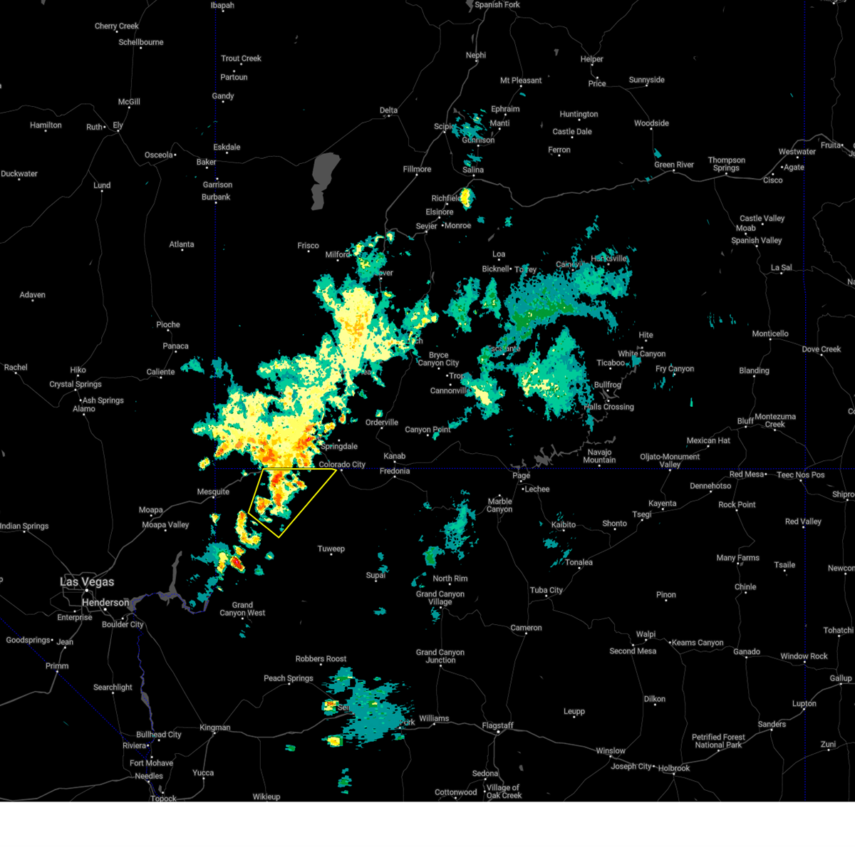
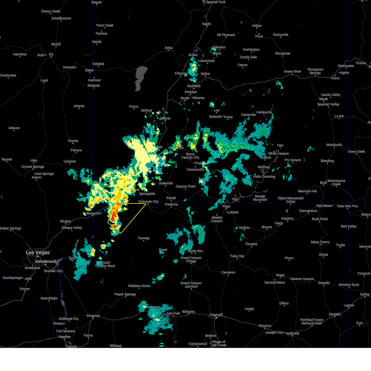
Hail Maps for St. George, UT


Connect with Interactive Hail Maps