

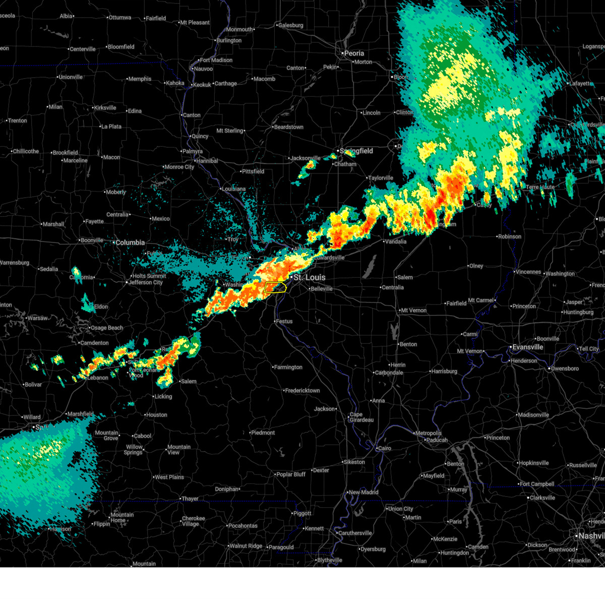
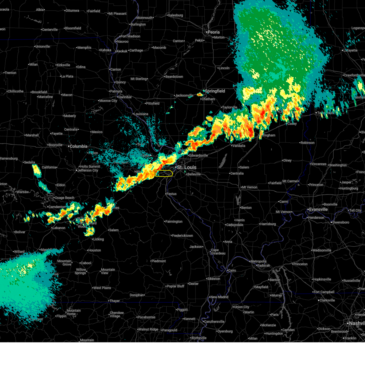
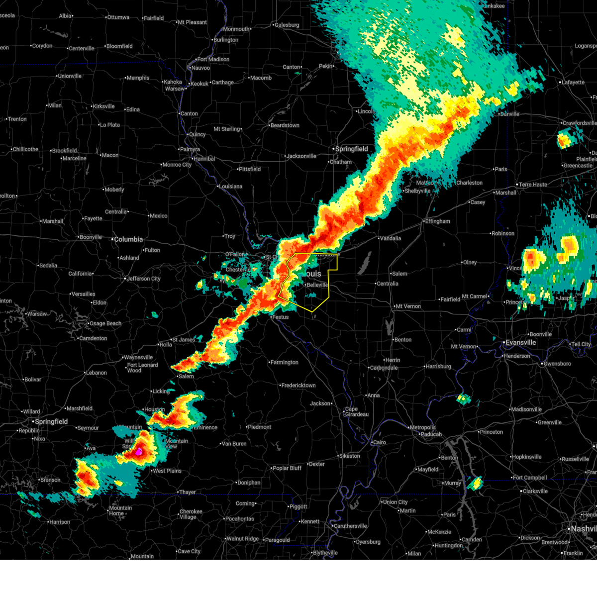
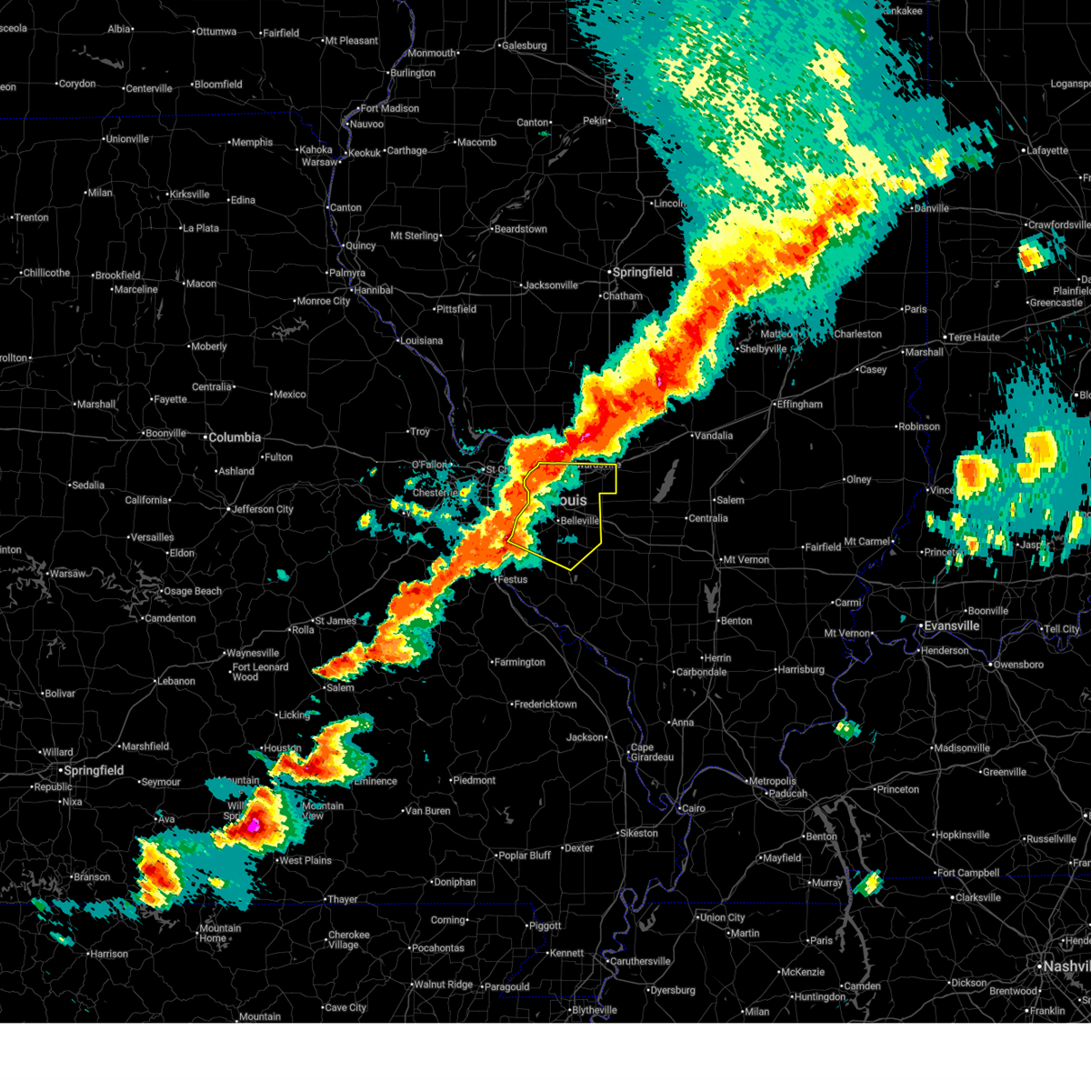
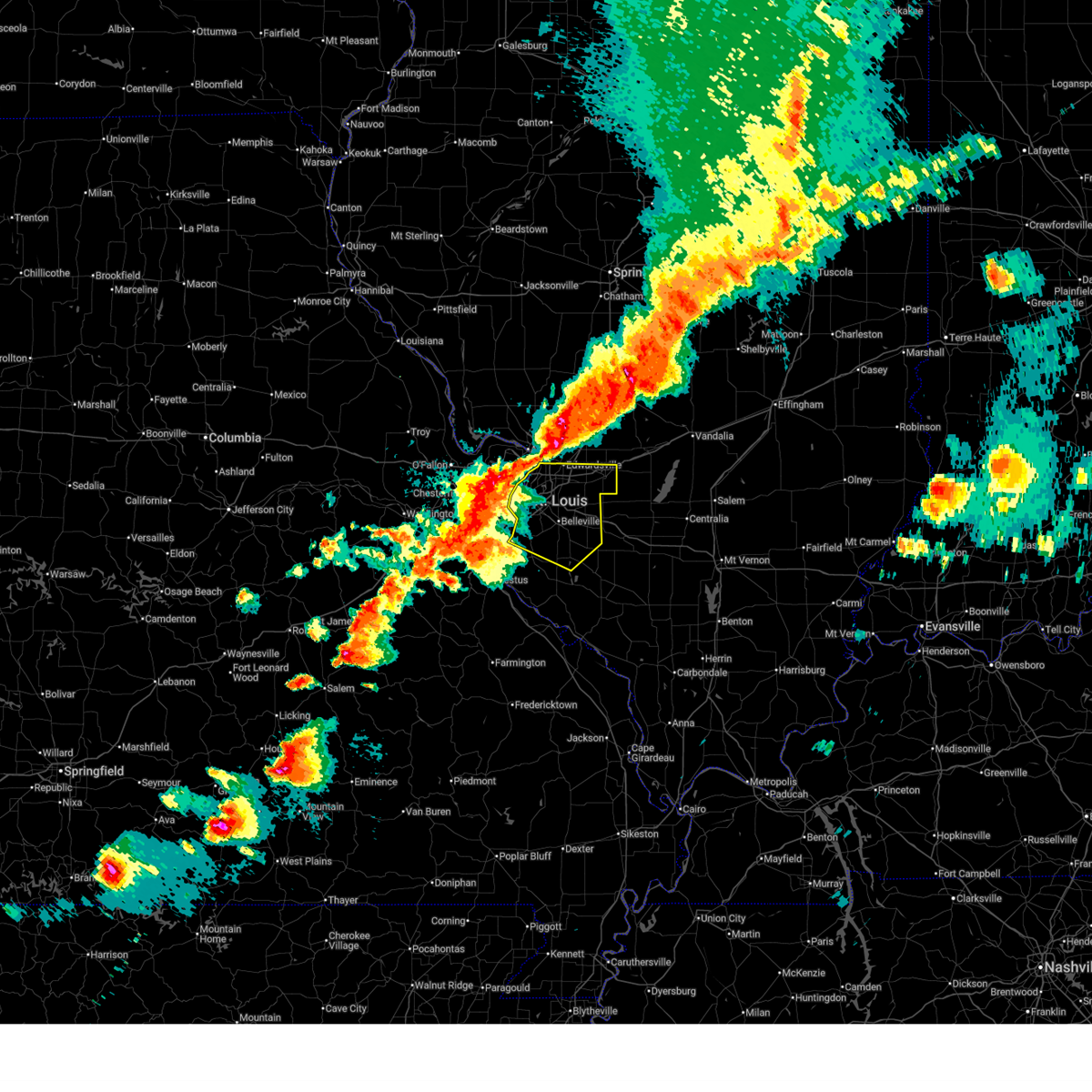
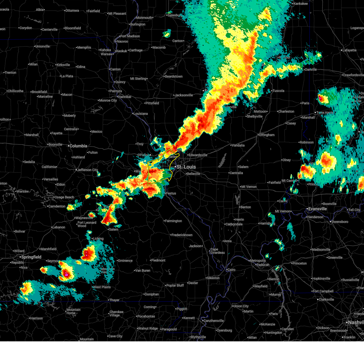
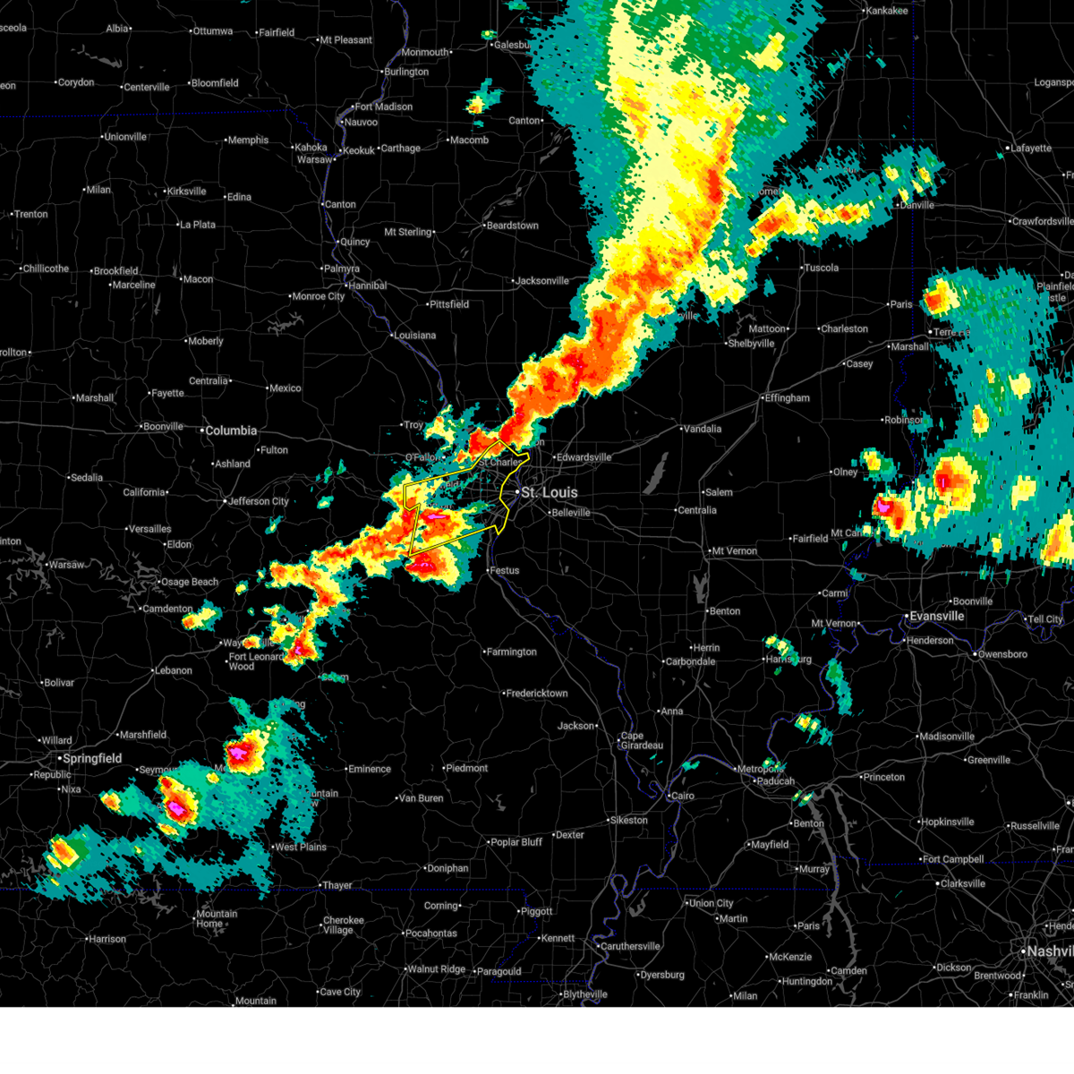
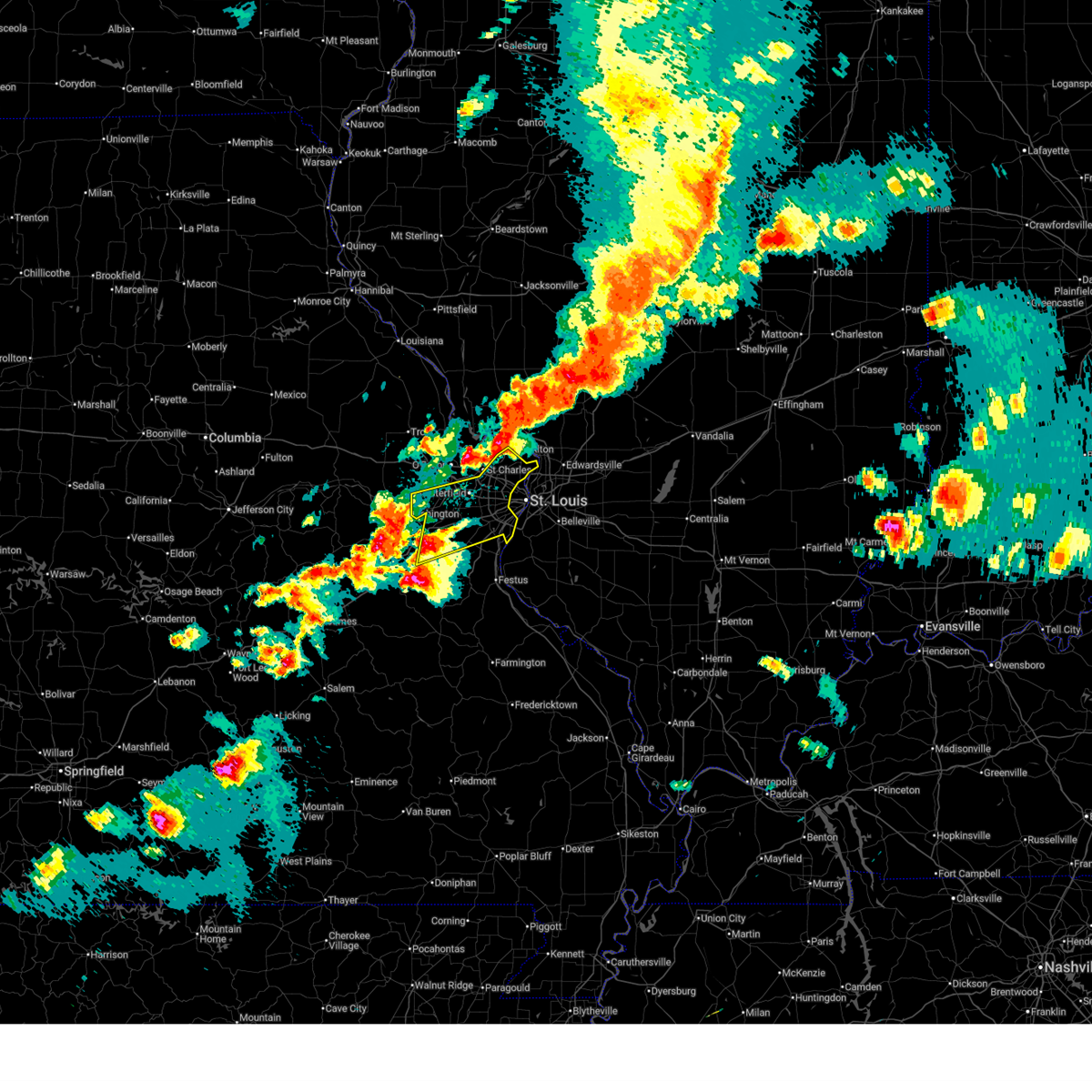
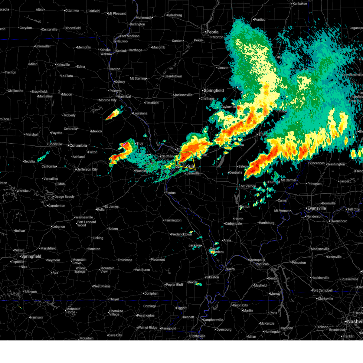
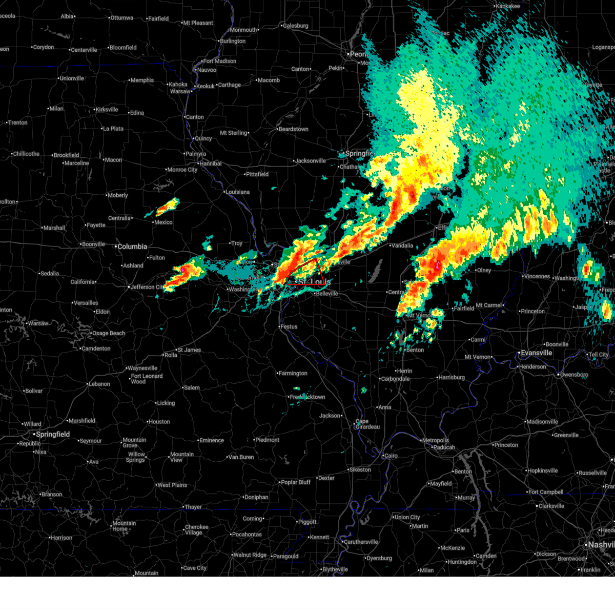
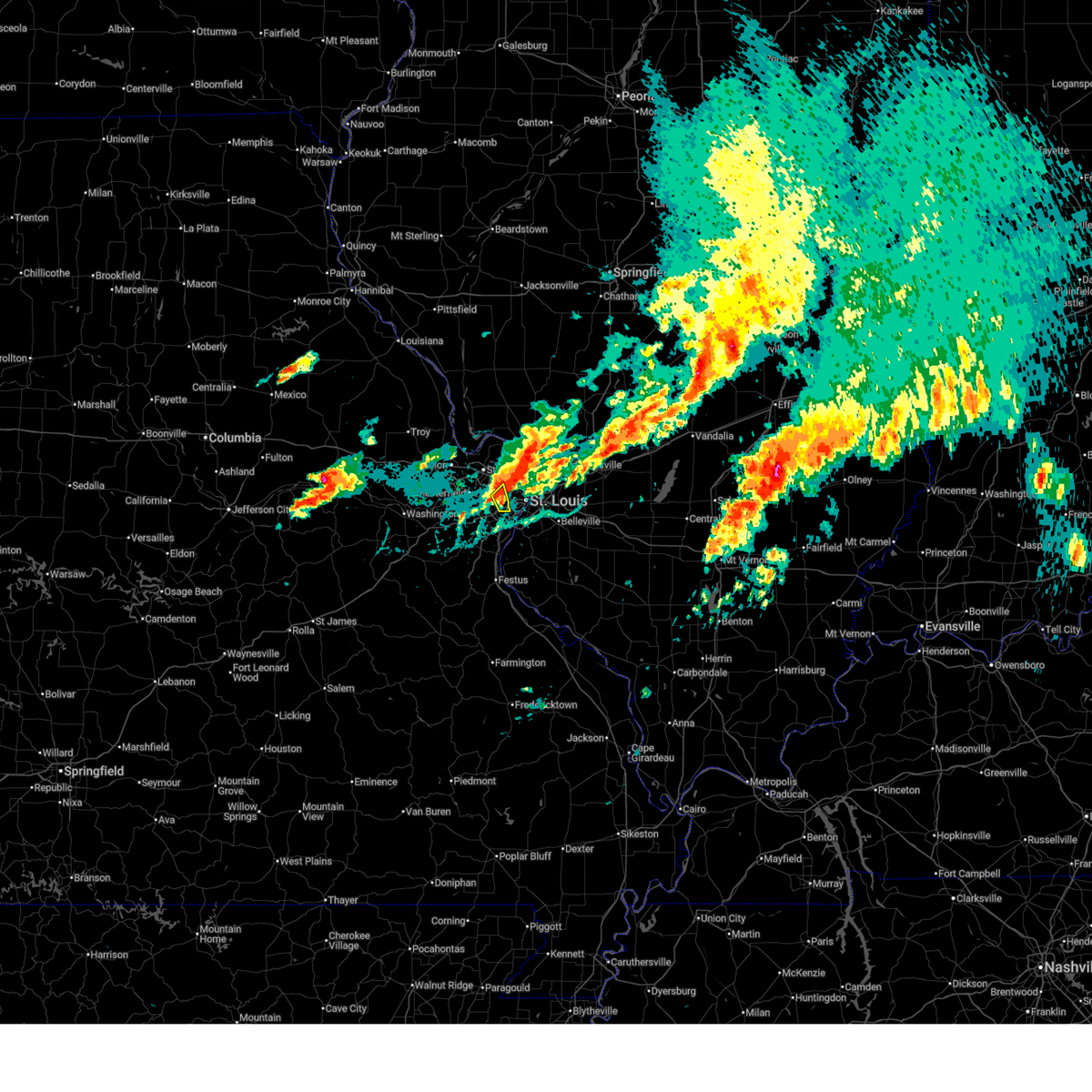
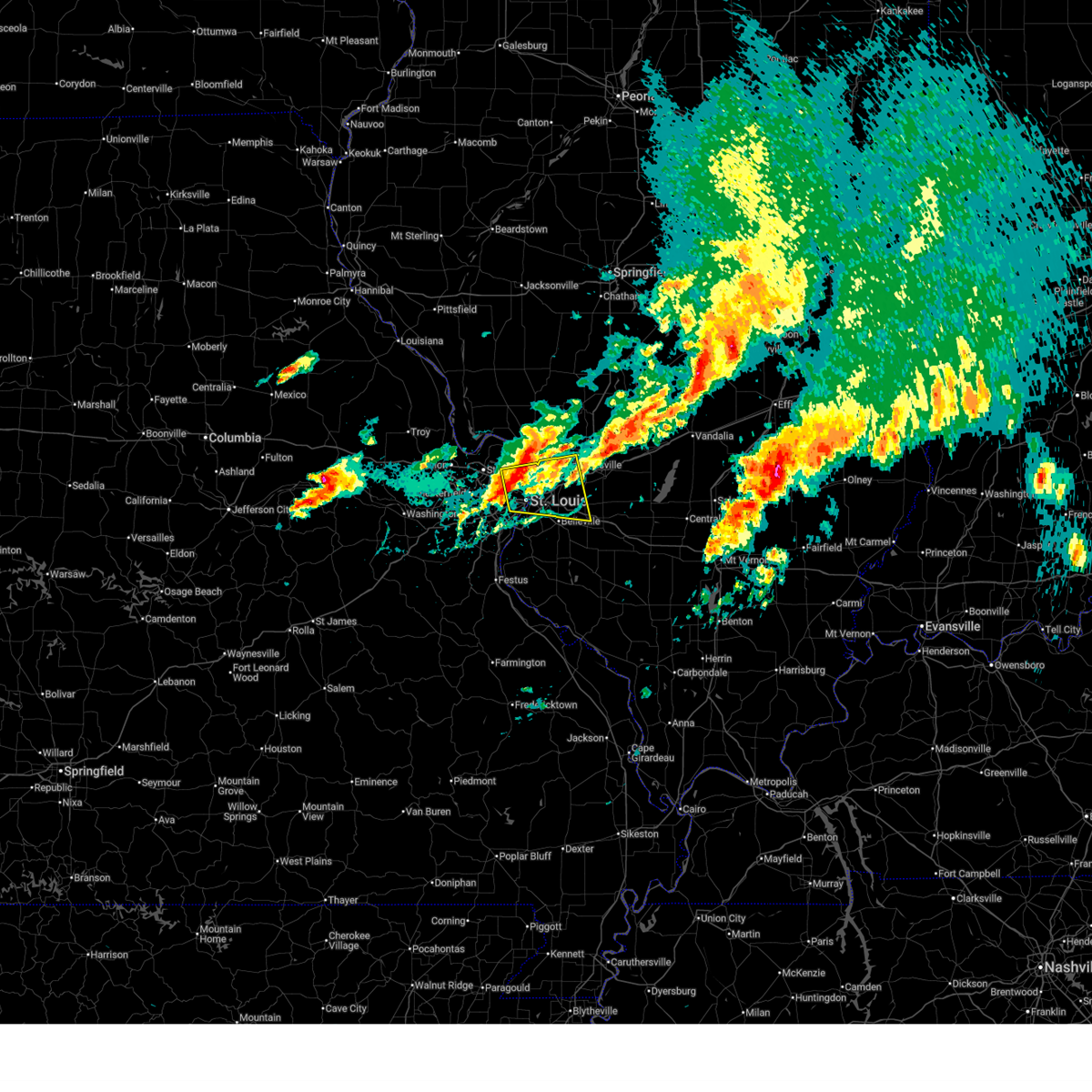
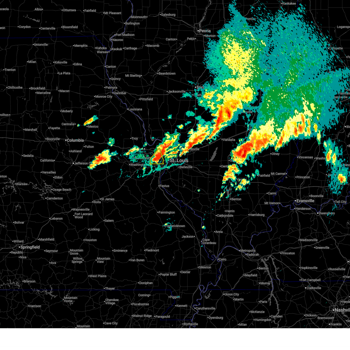
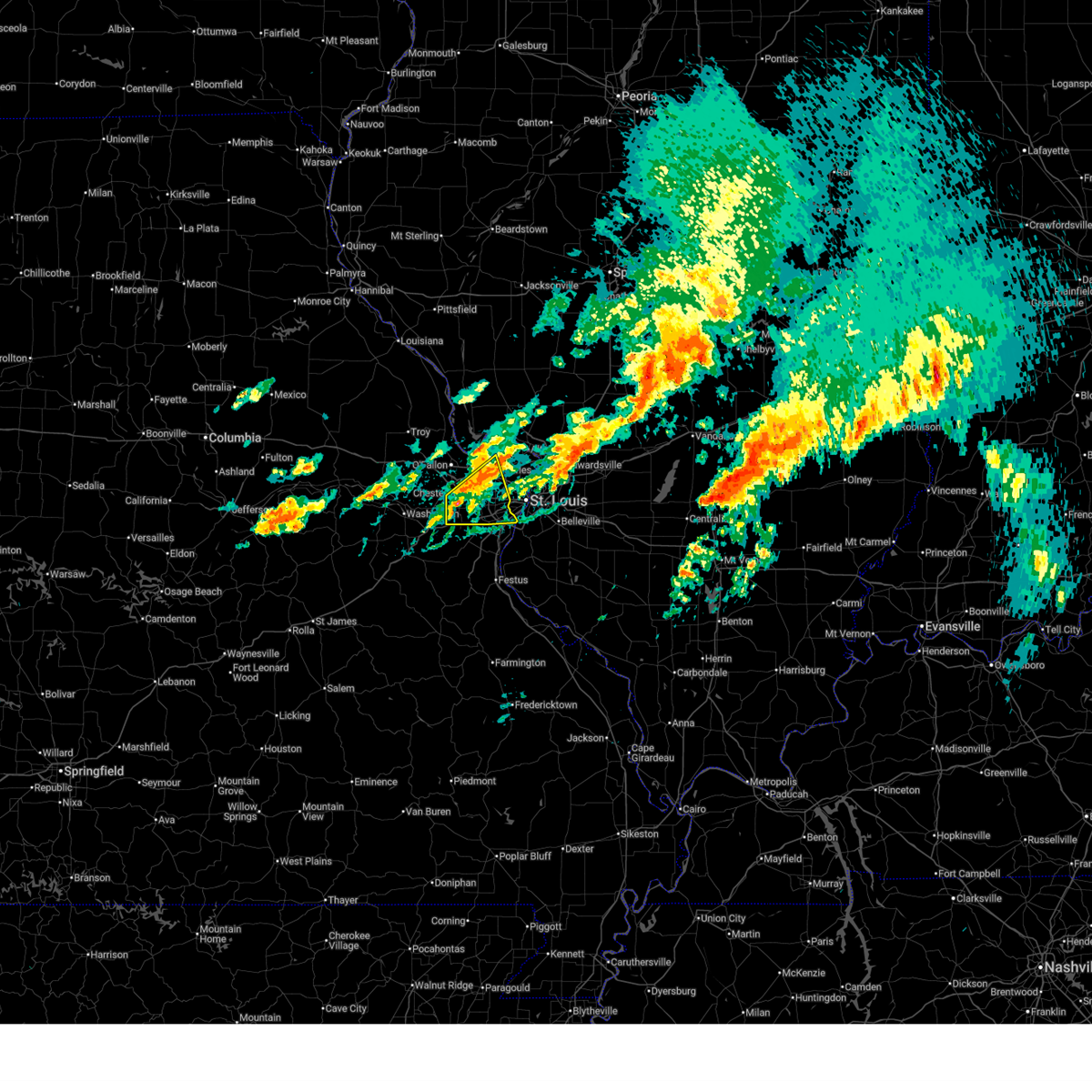
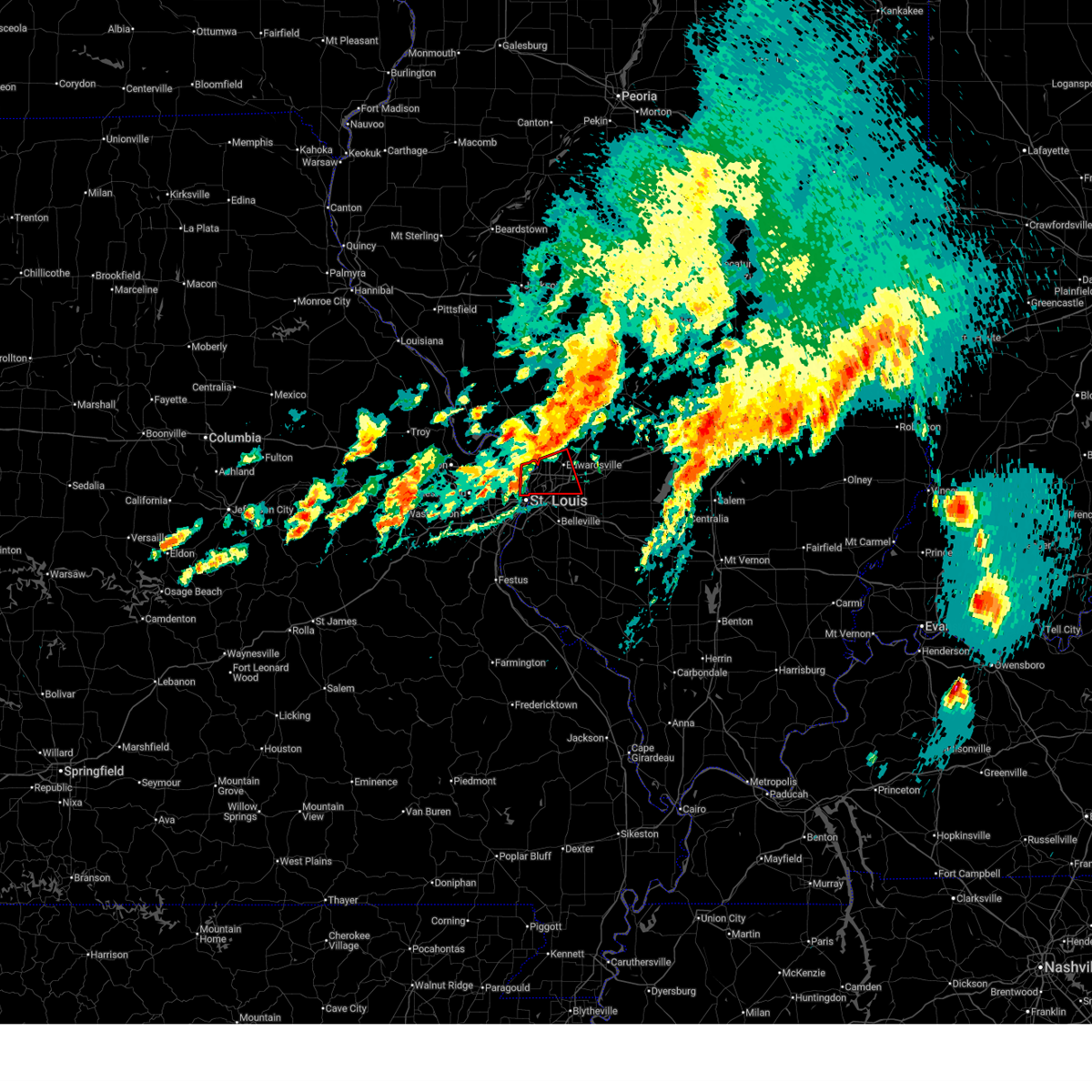
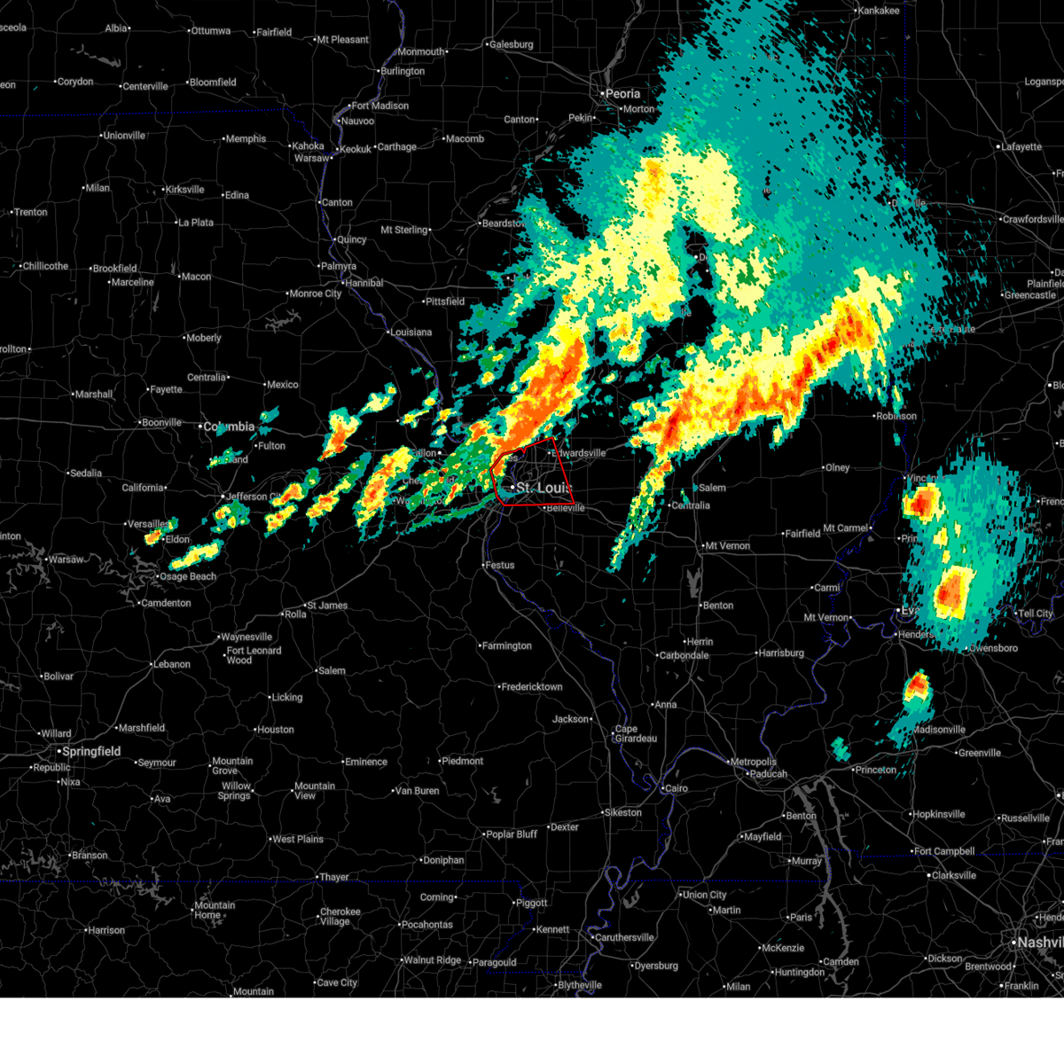
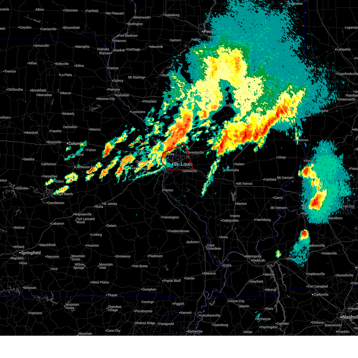
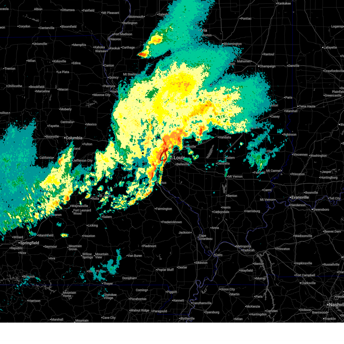
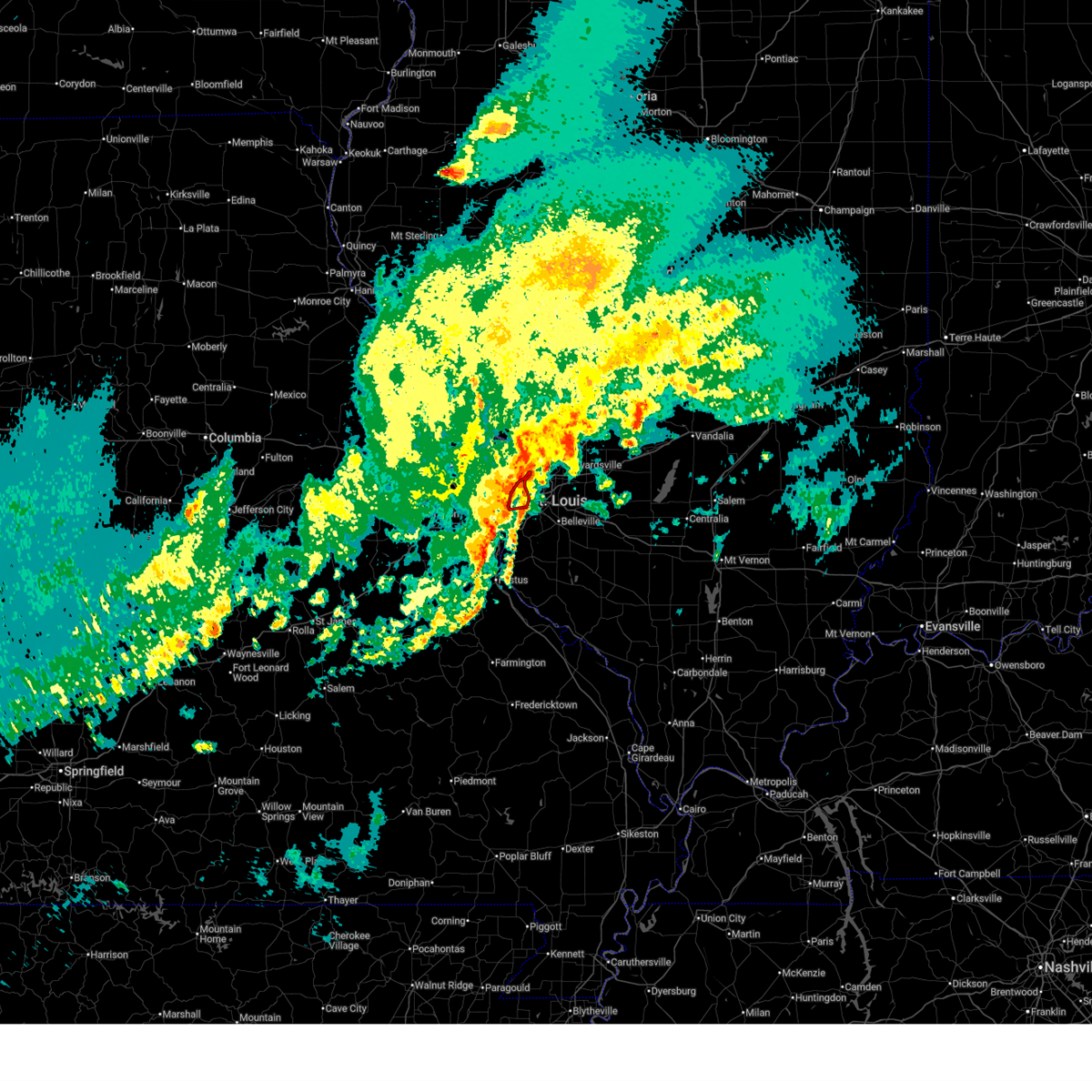
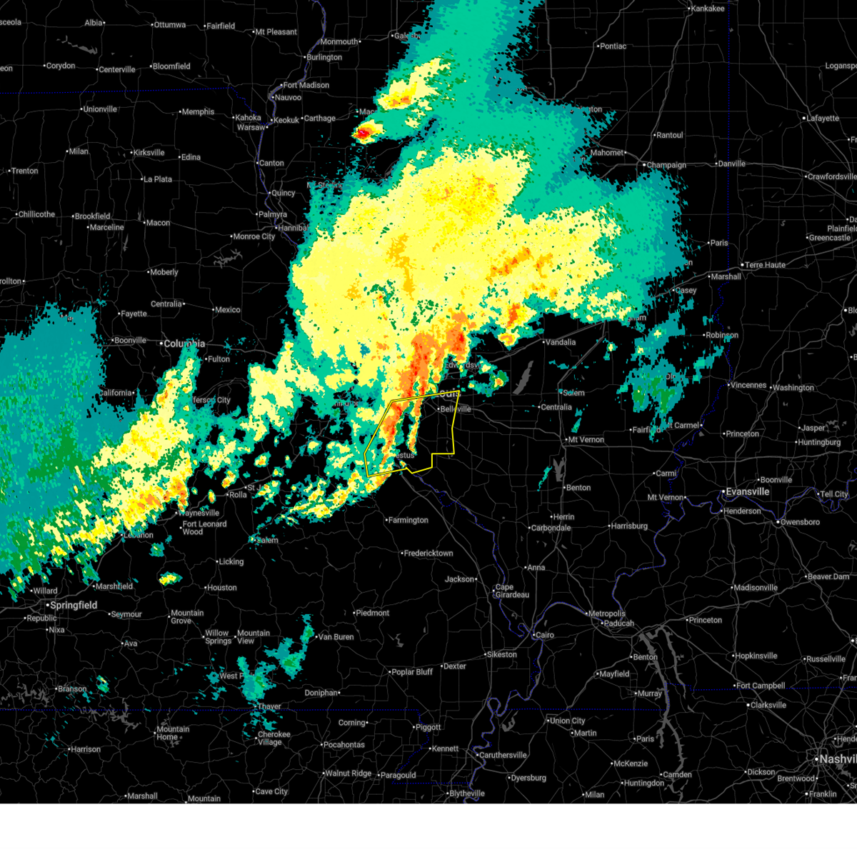
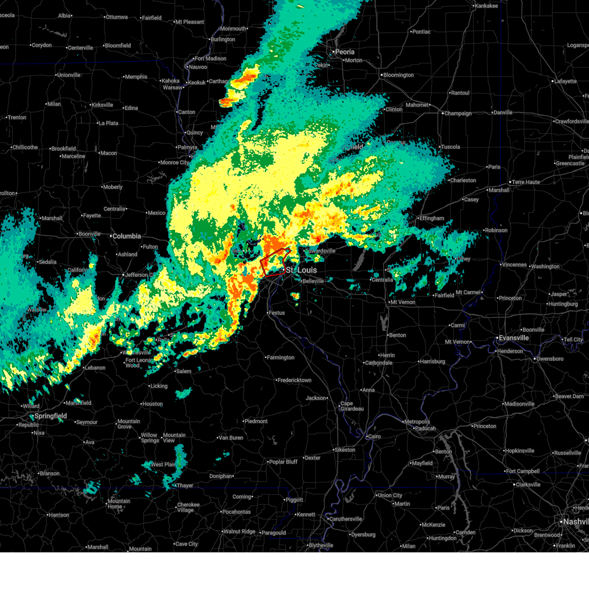
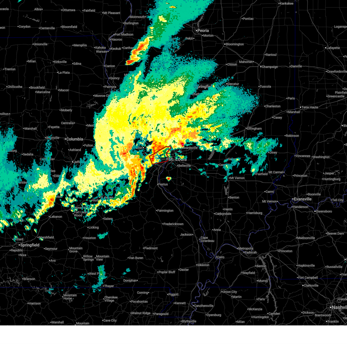
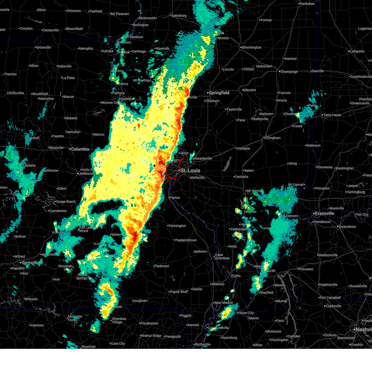
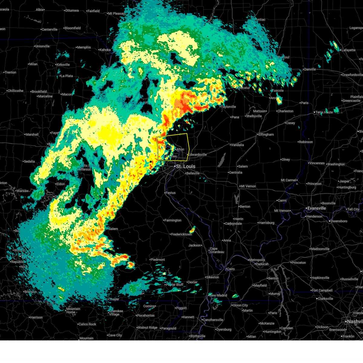
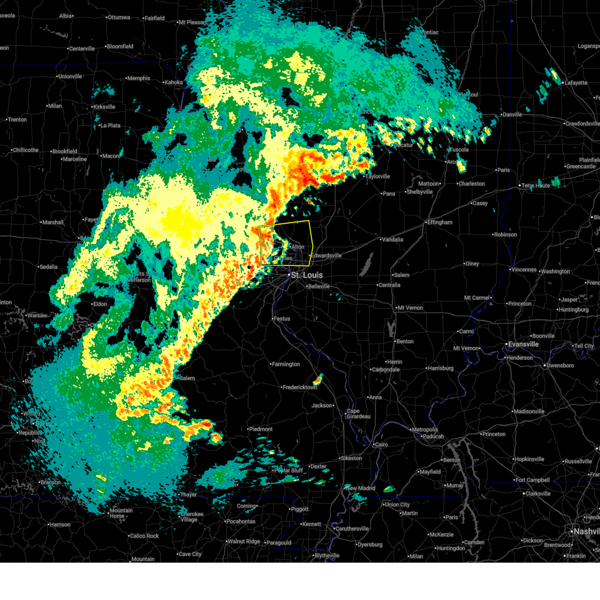
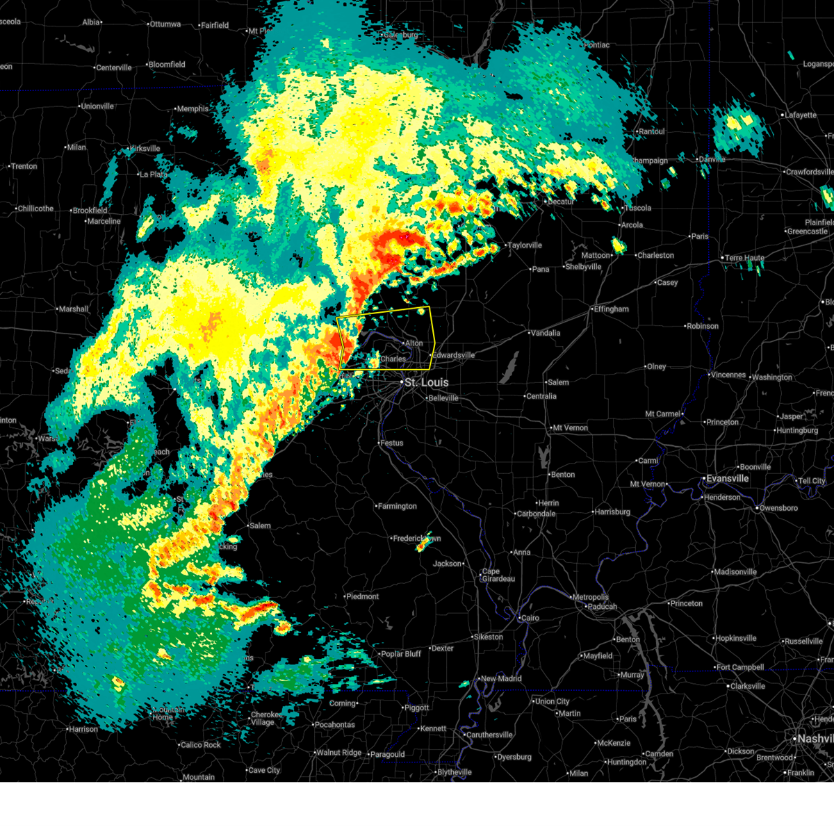
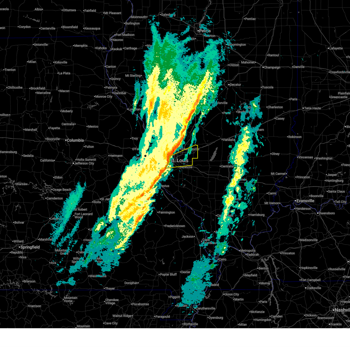
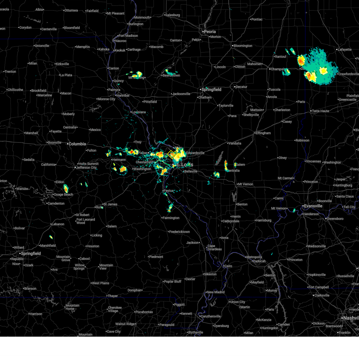
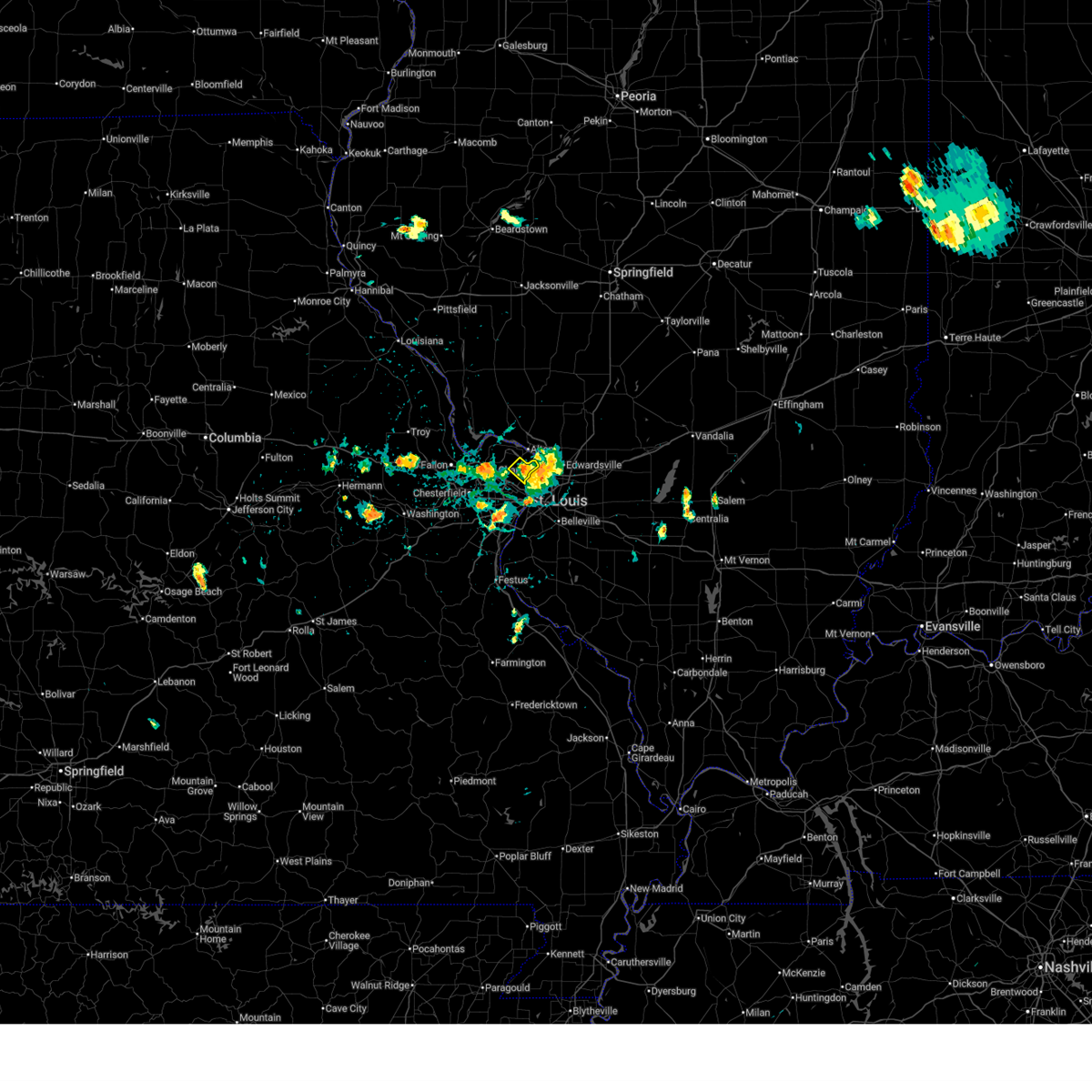
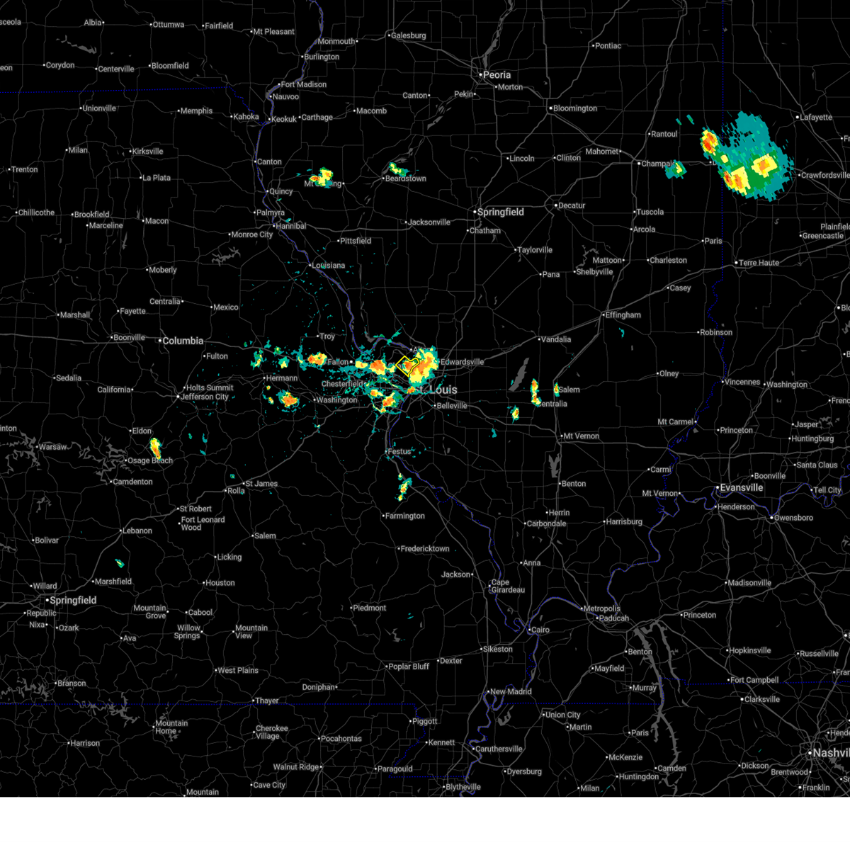
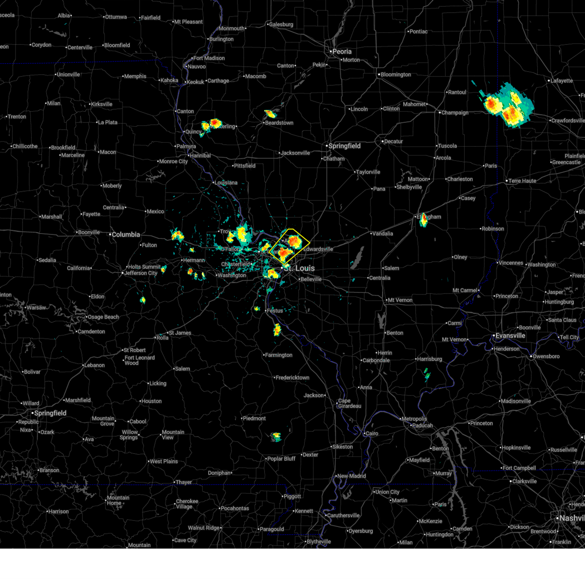
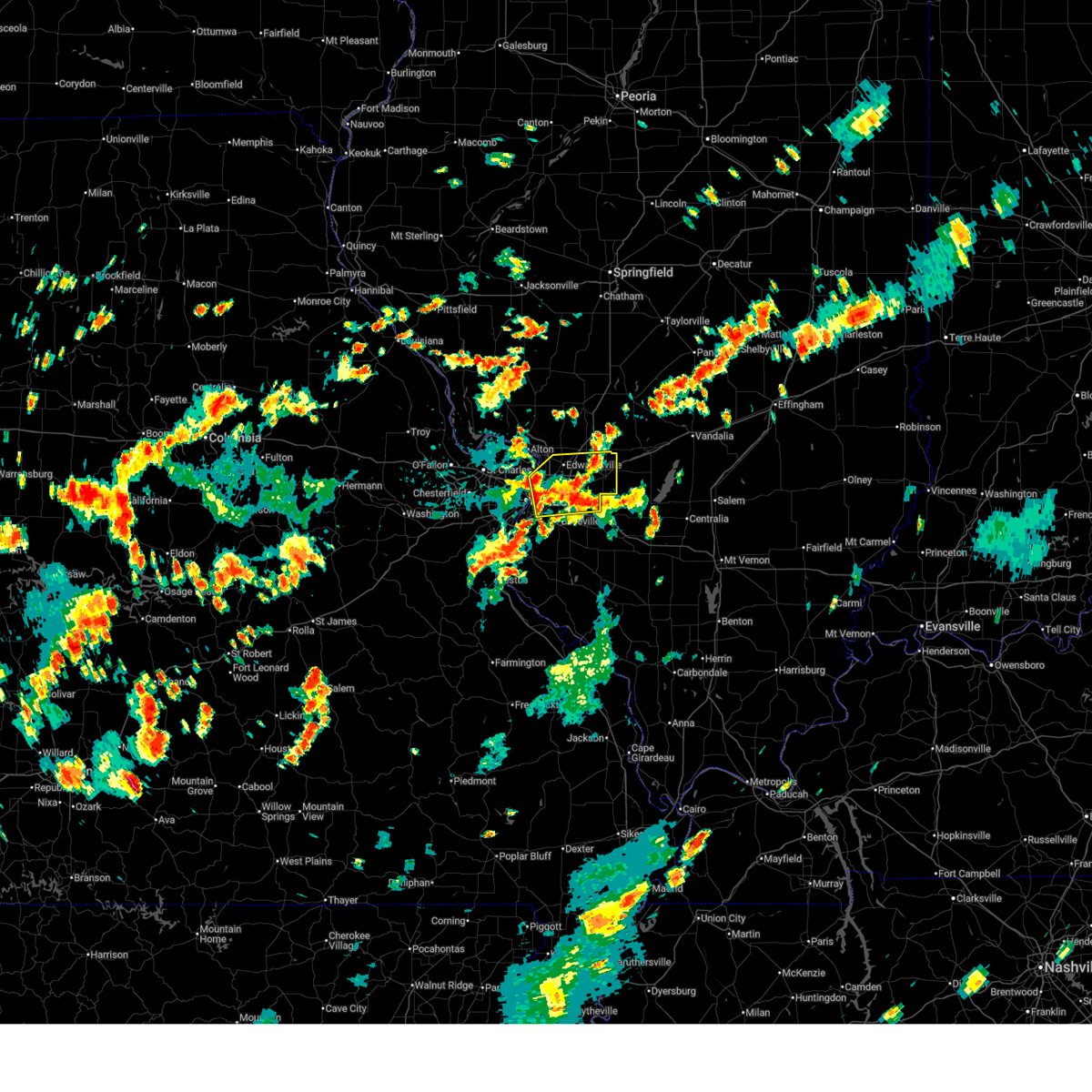
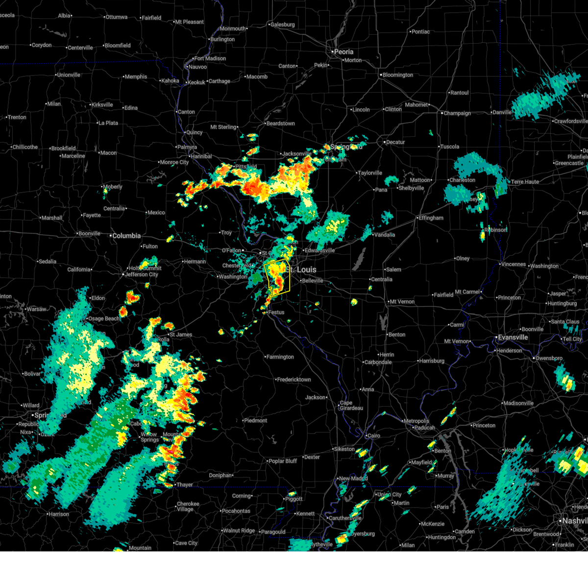
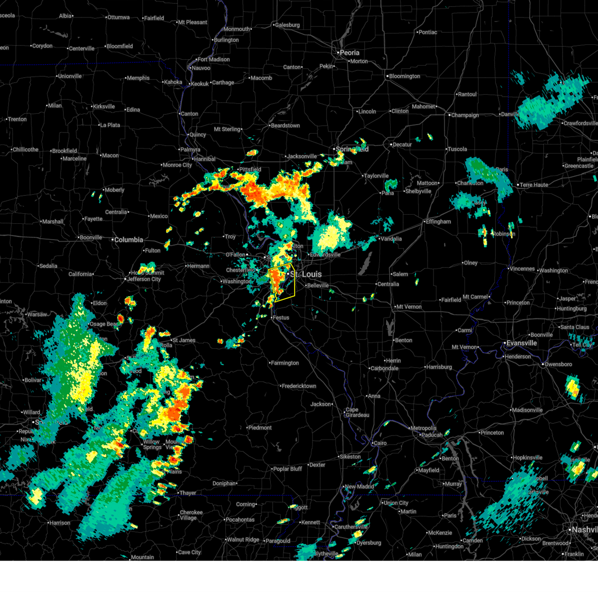
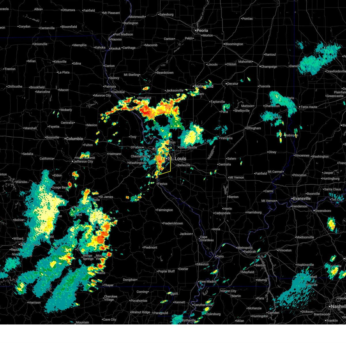
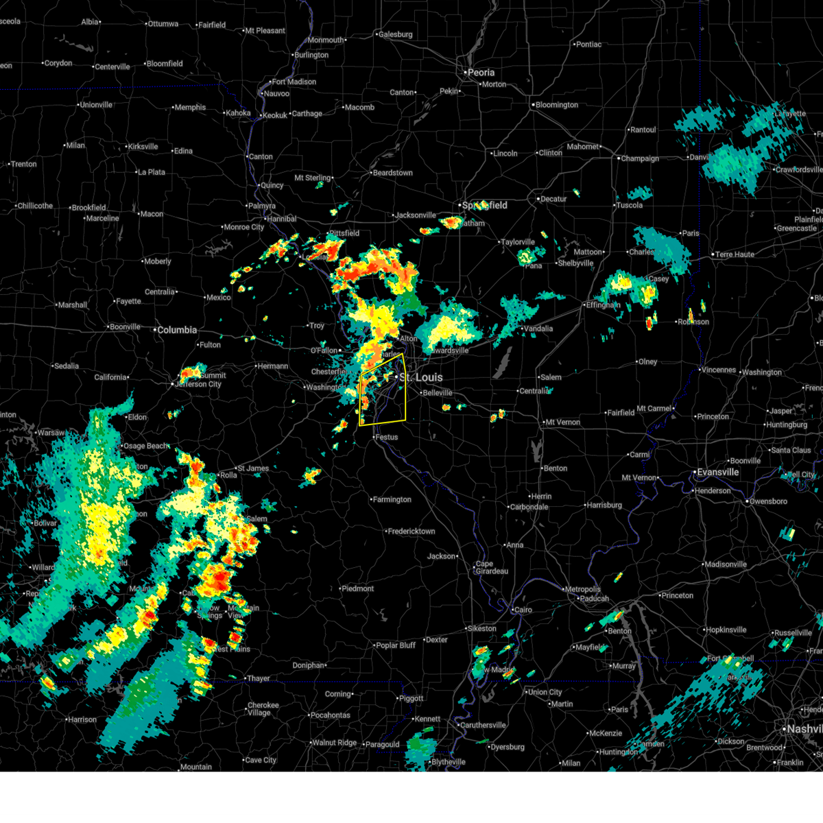
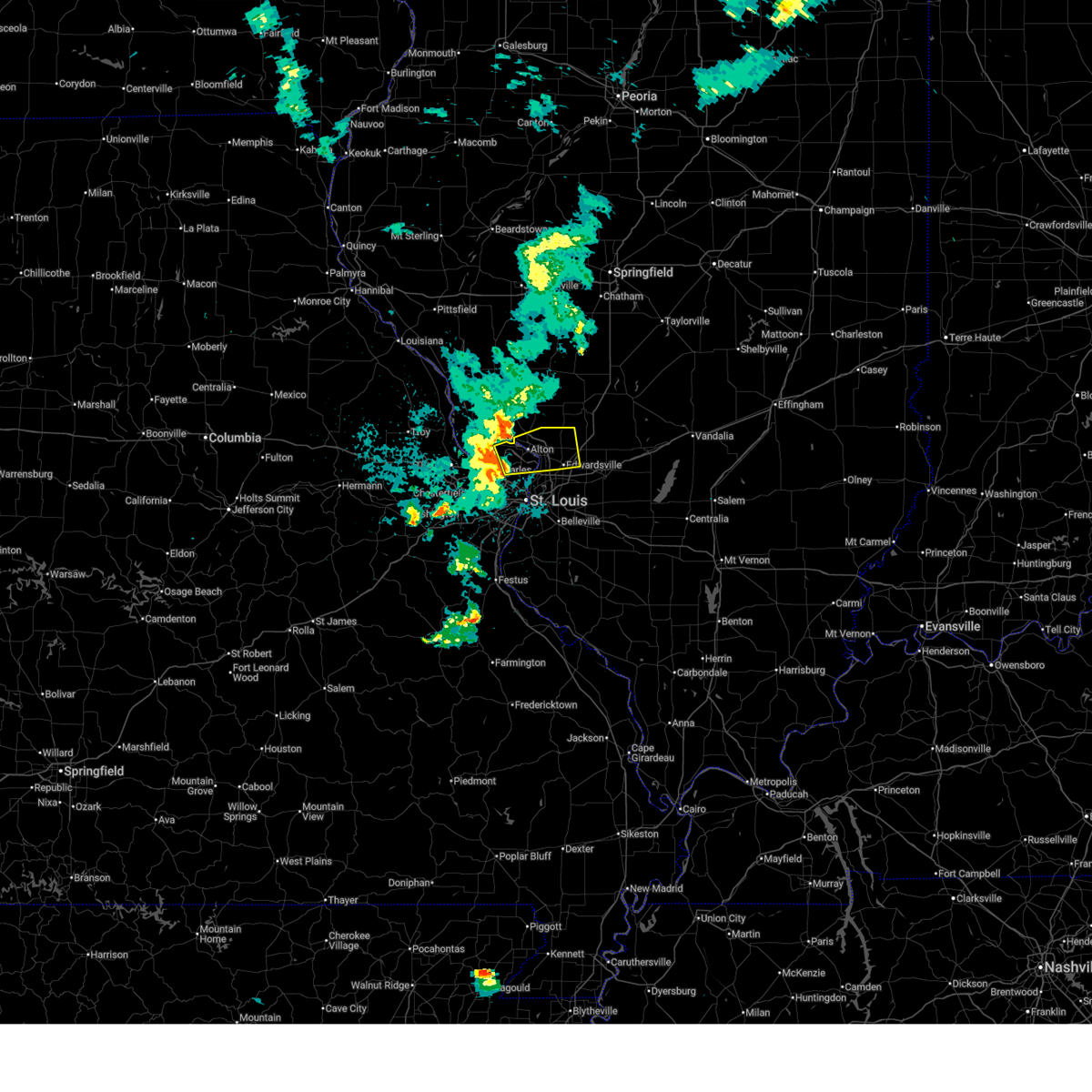
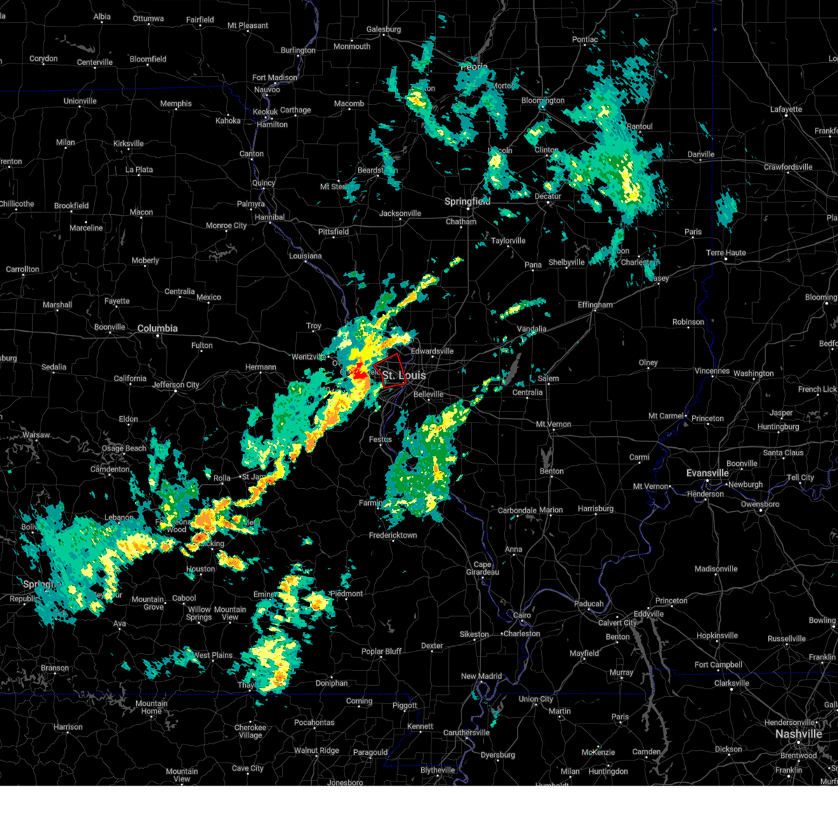
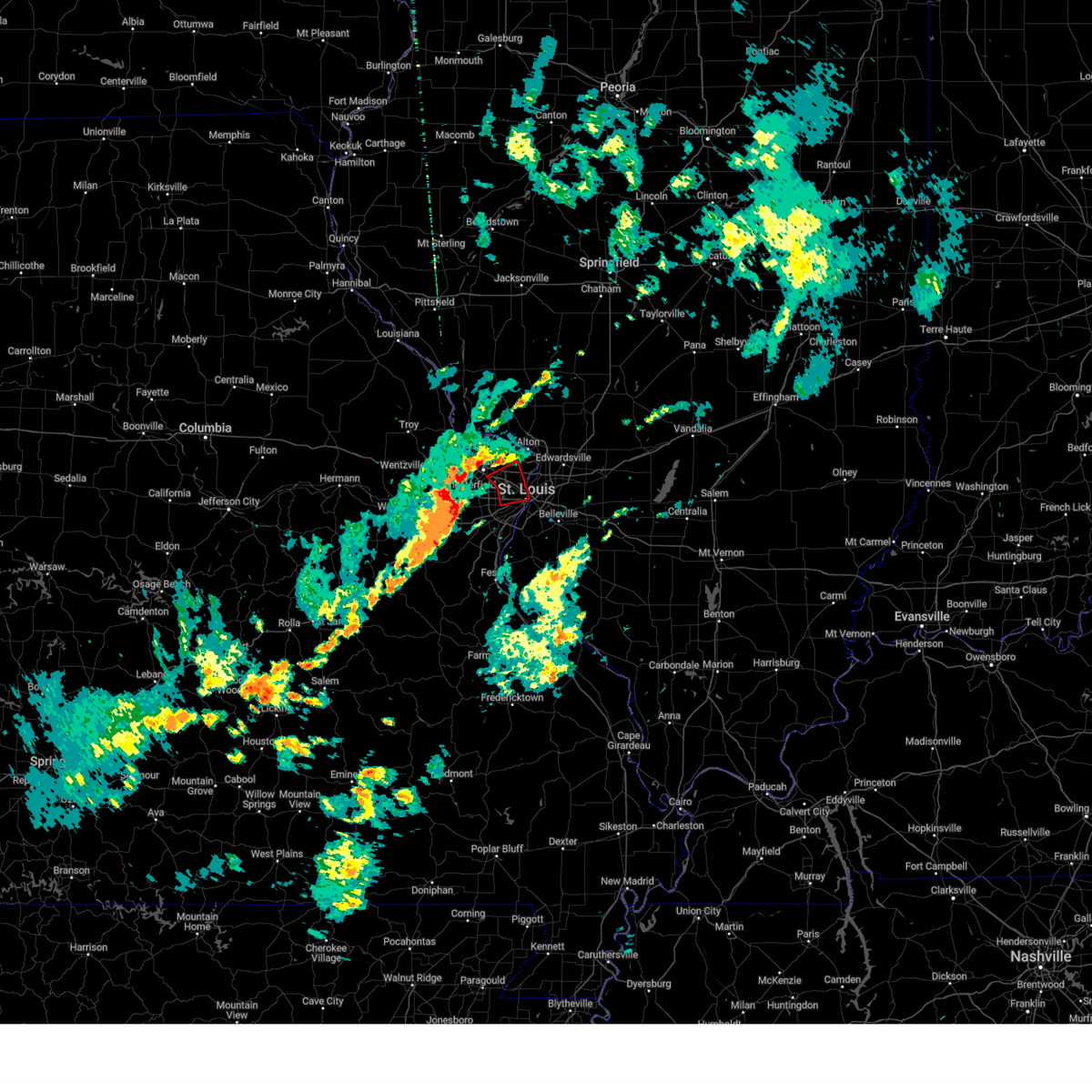
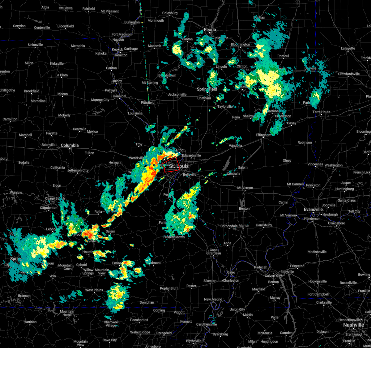
Hail Map for St. Louis, MO
The St. Louis, MO area has had 65 reports of on-the-ground hail by trained spotters, and has been under severe weather warnings 52 times during the past 12 months. Doppler radar has detected hail at or near St. Louis, MO on 146 occasions, including 10 occasions during the past year.
| Name: | St. Louis, MO |
| Where Located: | 3.8 miles WNW of Saint Louis, MO |
| Map: | Google Map for St. Louis, MO |
| Population: | 319294 |
| Housing Units: | 176002 |
| More Info: | Search Google for St. Louis, MO |
1
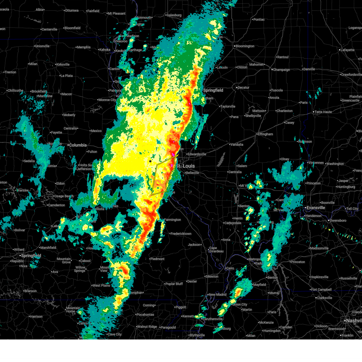
The Top Recent Hail Date for St. Louis, MO is Monday, April 27, 2026 (43rd out of 146)

Hail and Wind Damage Spotted near St. Louis, MO
| Date / Time | Report Details |
|---|---|
| 6/11/2026 10:07 PM CDT |
 The storm which prompted the warning has weakened below severe limits, and no longer poses an immediate threat to life or property. therefore, the warning will be allowed to expire. The storm which prompted the warning has weakened below severe limits, and no longer poses an immediate threat to life or property. therefore, the warning will be allowed to expire.
|
| 6/11/2026 9:49 PM CDT |
 At 949 pm cdt, a severe thunderstorm was located over fenton, moving east at 35 mph (radar indicated). Hazards include 60 mph wind gusts and small hail. Expect damage to roofs, siding, and trees. locations impacted include, valley park, manchester, fenton, murphy, sunset hills, kirkwood, crestwood, oakland, webster groves, marlborough, green park, lakeshire, shrewsbury, mehlville, affton, st. george and lemay. This includes interstate 44 in missouri between exits 272 and 277. At 949 pm cdt, a severe thunderstorm was located over fenton, moving east at 35 mph (radar indicated). Hazards include 60 mph wind gusts and small hail. Expect damage to roofs, siding, and trees. locations impacted include, valley park, manchester, fenton, murphy, sunset hills, kirkwood, crestwood, oakland, webster groves, marlborough, green park, lakeshire, shrewsbury, mehlville, affton, st. george and lemay. This includes interstate 44 in missouri between exits 272 and 277.
|
| 6/11/2026 9:40 PM CDT |
 Svrlsx the national weather service in st louis has issued a * severe thunderstorm warning for, north central jefferson county in east central missouri, southwestern saint louis county in east central missouri, * until 1015 pm cdt. * at 940 pm cdt, a severe thunderstorm was located near ellisville, or near eureka, moving east at 35 mph (radar indicated). Hazards include 60 mph wind gusts and small hail. expect damage to roofs, siding, and trees Svrlsx the national weather service in st louis has issued a * severe thunderstorm warning for, north central jefferson county in east central missouri, southwestern saint louis county in east central missouri, * until 1015 pm cdt. * at 940 pm cdt, a severe thunderstorm was located near ellisville, or near eureka, moving east at 35 mph (radar indicated). Hazards include 60 mph wind gusts and small hail. expect damage to roofs, siding, and trees
|
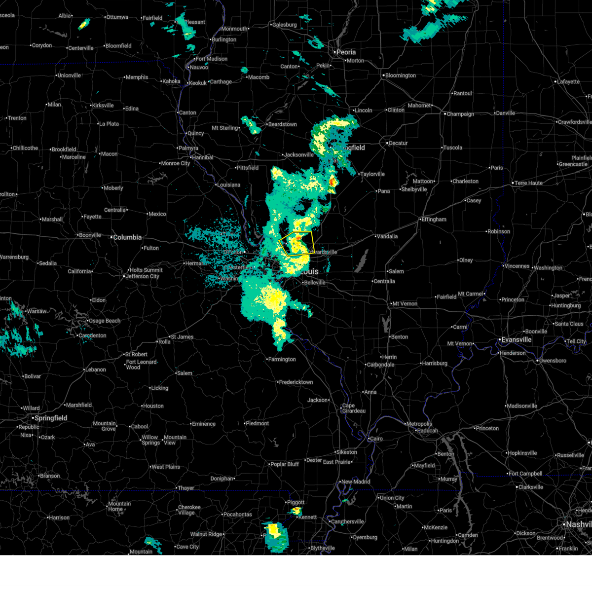
| 4/27/2026 7:31 PM CDT |
 At 731 pm cdt, severe thunderstorms were located along a line from over collinsville to over fountain, or along a line from over collinsville to 6 miles west of waterloo, moving east at 35 mph (radar indicated). Hazards include 70 mph wind gusts and quarter size hail. Hail damage to vehicles is expected. expect considerable tree damage. wind damage is also likely to mobile homes, roofs, and outbuildings. locations impacted include, granite city, cahokia, east st. louis, columbia, centreville, edwardsville, pontoon beach, collinsville, glen carbon, belleville, fairview heights, maryville, waterloo, troy, swansea, o'fallon, shiloh, mascoutah and highland. this includes the following state parks, horseshoe lake state park. this includes the following highways, interstate 64 in illinois between exits 9 and 27. interstate 55 in illinois near exit 23. Interstate 70 in illinois between exits 21 and 30. At 731 pm cdt, severe thunderstorms were located along a line from over collinsville to over fountain, or along a line from over collinsville to 6 miles west of waterloo, moving east at 35 mph (radar indicated). Hazards include 70 mph wind gusts and quarter size hail. Hail damage to vehicles is expected. expect considerable tree damage. wind damage is also likely to mobile homes, roofs, and outbuildings. locations impacted include, granite city, cahokia, east st. louis, columbia, centreville, edwardsville, pontoon beach, collinsville, glen carbon, belleville, fairview heights, maryville, waterloo, troy, swansea, o'fallon, shiloh, mascoutah and highland. this includes the following state parks, horseshoe lake state park. this includes the following highways, interstate 64 in illinois between exits 9 and 27. interstate 55 in illinois near exit 23. Interstate 70 in illinois between exits 21 and 30.
|
| 4/27/2026 7:31 PM CDT |
 the severe thunderstorm warning has been cancelled and is no longer in effect the severe thunderstorm warning has been cancelled and is no longer in effect
|
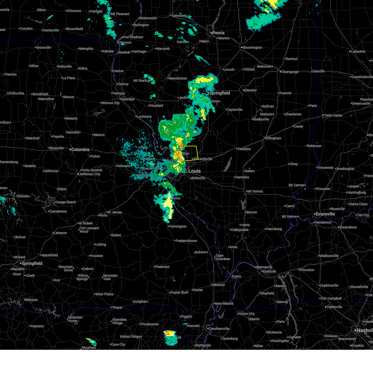
| 4/27/2026 7:14 PM CDT |
 At 714 pm cdt, a severe thunderstorm was located over bridgeton, or over hazelwood, moving northeast at 60 mph (radar indicated). Hazards include golf ball size hail and 70 mph wind gusts. People and animals outdoors will be injured. expect hail damage to roofs, siding, windows, and vehicles. expect considerable tree damage. wind damage is also likely to mobile homes, roofs, and outbuildings. this severe thunderstorm will be near, hazelwood, bridgeton, st. charles, lambert-st. louis international airport, maryland heights, champ, berkeley, st. ann, edmundson and woodson terrace around 715 pm cdt. florissant and black jack around 720 pm cdt. west alton and spanish lake around 725 pm cdt. this includes the following state parks, route 66 state park and castlewood state park. this includes the following highways, interstate 70 in missouri near exit 231. interstate 44 in missouri between exits 264 and 277. Interstate 55 in missouri near exit 191. At 714 pm cdt, a severe thunderstorm was located over bridgeton, or over hazelwood, moving northeast at 60 mph (radar indicated). Hazards include golf ball size hail and 70 mph wind gusts. People and animals outdoors will be injured. expect hail damage to roofs, siding, windows, and vehicles. expect considerable tree damage. wind damage is also likely to mobile homes, roofs, and outbuildings. this severe thunderstorm will be near, hazelwood, bridgeton, st. charles, lambert-st. louis international airport, maryland heights, champ, berkeley, st. ann, edmundson and woodson terrace around 715 pm cdt. florissant and black jack around 720 pm cdt. west alton and spanish lake around 725 pm cdt. this includes the following state parks, route 66 state park and castlewood state park. this includes the following highways, interstate 70 in missouri near exit 231. interstate 44 in missouri between exits 264 and 277. Interstate 55 in missouri near exit 191.
|
| 4/27/2026 7:12 PM CDT |
 Svrlsx the national weather service in st louis has issued a * severe thunderstorm warning for, southern madison county in southwestern illinois, northern monroe county in southwestern illinois, saint clair county in southwestern illinois, saint louis city in east central missouri, * until 815 pm cdt. * at 712 pm cdt, severe thunderstorms were located along a line from over moline acres to near antonia, or along a line from over bellefontaine neighbors to near antonia, moving east at 35 mph (radar indicated). Hazards include 70 mph wind gusts and quarter size hail. Hail damage to vehicles is expected. expect considerable tree damage. Wind damage is also likely to mobile homes, roofs, and outbuildings. Svrlsx the national weather service in st louis has issued a * severe thunderstorm warning for, southern madison county in southwestern illinois, northern monroe county in southwestern illinois, saint clair county in southwestern illinois, saint louis city in east central missouri, * until 815 pm cdt. * at 712 pm cdt, severe thunderstorms were located along a line from over moline acres to near antonia, or along a line from over bellefontaine neighbors to near antonia, moving east at 35 mph (radar indicated). Hazards include 70 mph wind gusts and quarter size hail. Hail damage to vehicles is expected. expect considerable tree damage. Wind damage is also likely to mobile homes, roofs, and outbuildings.
|
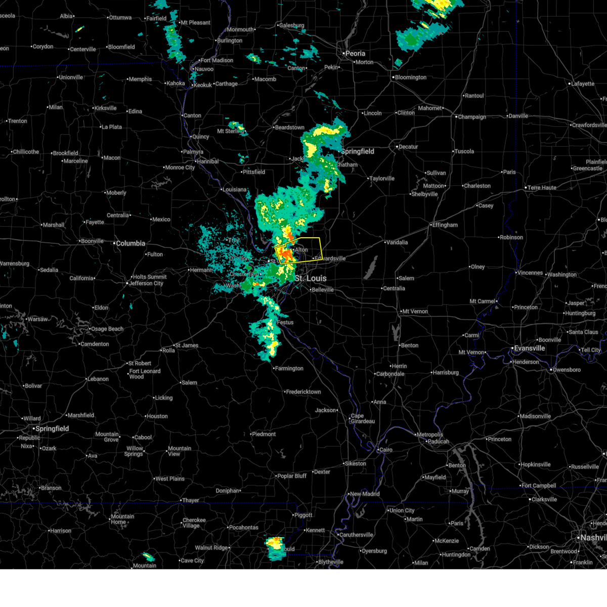
| 4/27/2026 7:01 PM CDT |
 At 701 pm cdt, a severe thunderstorm was located over chesterfield, moving northeast at 60 mph (radar indicated). Hazards include golf ball size hail and 70 mph wind gusts. People and animals outdoors will be injured. expect hail damage to roofs, siding, windows, and vehicles. expect considerable tree damage. wind damage is also likely to mobile homes, roofs, and outbuildings. this severe thunderstorm will be near, chesterfield, town and country, creve coeur, st. peters, weldon spring, clarkson valley, ballwin, wildwood, spirit of st. louis airport and ellisville around 705 pm cdt. maryland heights, champ, st. charles, st. ann, overland, olivette, ladue and sycamore hills around 710 pm cdt. hazelwood, bridgeton, lambert-st. louis international airport, berkeley, edmundson, woodson terrace, breckenridge hills, calverton park, ferguson and st. john around 715 pm cdt. this includes the following state parks, babler memorial state park, route 66 state park and castlewood state park. this includes the following highways, interstate 70 in missouri near exit 231. interstate 44 in missouri between exits 261 and 277. Interstate 55 in missouri near exit 191. At 701 pm cdt, a severe thunderstorm was located over chesterfield, moving northeast at 60 mph (radar indicated). Hazards include golf ball size hail and 70 mph wind gusts. People and animals outdoors will be injured. expect hail damage to roofs, siding, windows, and vehicles. expect considerable tree damage. wind damage is also likely to mobile homes, roofs, and outbuildings. this severe thunderstorm will be near, chesterfield, town and country, creve coeur, st. peters, weldon spring, clarkson valley, ballwin, wildwood, spirit of st. louis airport and ellisville around 705 pm cdt. maryland heights, champ, st. charles, st. ann, overland, olivette, ladue and sycamore hills around 710 pm cdt. hazelwood, bridgeton, lambert-st. louis international airport, berkeley, edmundson, woodson terrace, breckenridge hills, calverton park, ferguson and st. john around 715 pm cdt. this includes the following state parks, babler memorial state park, route 66 state park and castlewood state park. this includes the following highways, interstate 70 in missouri near exit 231. interstate 44 in missouri between exits 261 and 277. Interstate 55 in missouri near exit 191.
|
| 4/27/2026 6:52 PM CDT |
 At 652 pm cdt, a severe thunderstorm was located over wildwood, moving northeast at 60 mph (radar indicated). Hazards include golf ball size hail and 70 mph wind gusts. People and animals outdoors will be injured. expect hail damage to roofs, siding, windows, and vehicles. expect considerable tree damage. wind damage is also likely to mobile homes, roofs, and outbuildings. this severe thunderstorm will be near, wildwood, ellisville, eureka, pacific, defiance and gray summit around 655 pm cdt. clarkson valley, chesterfield, ballwin, spirit of st. louis airport, weldon spring, manchester, winchester, weldon spring heights, o'fallon and twin oaks around 700 pm cdt. town and country, creve coeur, st. peters, westwood, country life acres, frontenac, des peres and crystal lake park around 705 pm cdt. other locations impacted by the severe thunderstorm include matson. this includes the following state parks, babler memorial state park, route 66 state park, castlewood state park and robertsville state park. this includes the following highways, interstate 70 in missouri near exit 231. interstate 44 in missouri between exits 251 and 277. Interstate 55 in missouri near exit 191. At 652 pm cdt, a severe thunderstorm was located over wildwood, moving northeast at 60 mph (radar indicated). Hazards include golf ball size hail and 70 mph wind gusts. People and animals outdoors will be injured. expect hail damage to roofs, siding, windows, and vehicles. expect considerable tree damage. wind damage is also likely to mobile homes, roofs, and outbuildings. this severe thunderstorm will be near, wildwood, ellisville, eureka, pacific, defiance and gray summit around 655 pm cdt. clarkson valley, chesterfield, ballwin, spirit of st. louis airport, weldon spring, manchester, winchester, weldon spring heights, o'fallon and twin oaks around 700 pm cdt. town and country, creve coeur, st. peters, westwood, country life acres, frontenac, des peres and crystal lake park around 705 pm cdt. other locations impacted by the severe thunderstorm include matson. this includes the following state parks, babler memorial state park, route 66 state park, castlewood state park and robertsville state park. this includes the following highways, interstate 70 in missouri near exit 231. interstate 44 in missouri between exits 251 and 277. Interstate 55 in missouri near exit 191.
|
| 4/27/2026 6:46 PM CDT |
 At 646 pm cdt, a severe thunderstorm was located over pacific, moving northeast at 55 mph (radar indicated). Hazards include golf ball size hail and 60 mph wind gusts. People and animals outdoors will be injured. expect hail damage to roofs, siding, windows, and vehicles. expect wind damage to roofs, siding, and trees. this severe thunderstorm will be near, wildwood, eureka, pacific, gray summit and villa ridge around 650 pm cdt. byrnes mill and high ridge around 655 pm cdt. ellisville, ballwin, clarkson valley, winchester, valley park, twin oaks, spirit of st. louis airport, murphy and weldon spring around 700 pm cdt. other locations impacted by the severe thunderstorm include catawissa, parkdale and peerless park. this includes the following state parks, babler memorial state park, route 66 state park, castlewood state park and robertsville state park. this includes the following highways, interstate 70 in missouri near exit 231. interstate 44 in missouri between exits 251 and 277. Interstate 55 in missouri near exit 191. At 646 pm cdt, a severe thunderstorm was located over pacific, moving northeast at 55 mph (radar indicated). Hazards include golf ball size hail and 60 mph wind gusts. People and animals outdoors will be injured. expect hail damage to roofs, siding, windows, and vehicles. expect wind damage to roofs, siding, and trees. this severe thunderstorm will be near, wildwood, eureka, pacific, gray summit and villa ridge around 650 pm cdt. byrnes mill and high ridge around 655 pm cdt. ellisville, ballwin, clarkson valley, winchester, valley park, twin oaks, spirit of st. louis airport, murphy and weldon spring around 700 pm cdt. other locations impacted by the severe thunderstorm include catawissa, parkdale and peerless park. this includes the following state parks, babler memorial state park, route 66 state park, castlewood state park and robertsville state park. this includes the following highways, interstate 70 in missouri near exit 231. interstate 44 in missouri between exits 251 and 277. Interstate 55 in missouri near exit 191.
|
| 4/27/2026 6:40 PM CDT |
 Svrlsx the national weather service in st louis has issued a * severe thunderstorm warning for, southeastern franklin county in east central missouri, northwestern jefferson county in east central missouri, central saint charles county in east central missouri, saint louis county in east central missouri, * until 745 pm cdt. * at 640 pm cdt, a severe thunderstorm was located near villa ridge, moving northeast at 55 mph (radar indicated). Hazards include 60 mph wind gusts and half dollar size hail. Hail damage to vehicles is expected. expect wind damage to roofs, siding, and trees. this severe thunderstorm will be near, pacific, gray summit and villa ridge around 645 pm cdt. wildwood and eureka around 650 pm cdt. byrnes mill and high ridge around 655 pm cdt. other locations impacted by the severe thunderstorm include catawissa, robertsville, parkdale and peerless park. this includes the following state parks, babler memorial state park, route 66 state park, castlewood state park and robertsville state park. this includes the following highways, interstate 70 in missouri near exit 231. interstate 44 in missouri between exits 251 and 277. Interstate 55 in missouri near exit 191. Svrlsx the national weather service in st louis has issued a * severe thunderstorm warning for, southeastern franklin county in east central missouri, northwestern jefferson county in east central missouri, central saint charles county in east central missouri, saint louis county in east central missouri, * until 745 pm cdt. * at 640 pm cdt, a severe thunderstorm was located near villa ridge, moving northeast at 55 mph (radar indicated). Hazards include 60 mph wind gusts and half dollar size hail. Hail damage to vehicles is expected. expect wind damage to roofs, siding, and trees. this severe thunderstorm will be near, pacific, gray summit and villa ridge around 645 pm cdt. wildwood and eureka around 650 pm cdt. byrnes mill and high ridge around 655 pm cdt. other locations impacted by the severe thunderstorm include catawissa, robertsville, parkdale and peerless park. this includes the following state parks, babler memorial state park, route 66 state park, castlewood state park and robertsville state park. this includes the following highways, interstate 70 in missouri near exit 231. interstate 44 in missouri between exits 251 and 277. Interstate 55 in missouri near exit 191.
|
| 4/27/2026 2:13 PM CDT |
 At 213 pm cdt, a severe thunderstorm was located over granite city, moving east at 30 mph (radar indicated). Hazards include 60 mph wind gusts and quarter size hail. Hail damage to vehicles is expected. expect wind damage to roofs, siding, and trees. locations impacted include, east st. louis, granite city, madison, venice, fairmont city, washington park, pontoon beach, hartford, fairview heights, south roxana, roxana, collinsville, edwardsville, caseyville, maryville, glen carbon, troy, o'fallon and lebanon. this includes the following state parks, horseshoe lake state park. This includes interstate 55 in illinois near exit 23. At 213 pm cdt, a severe thunderstorm was located over granite city, moving east at 30 mph (radar indicated). Hazards include 60 mph wind gusts and quarter size hail. Hail damage to vehicles is expected. expect wind damage to roofs, siding, and trees. locations impacted include, east st. louis, granite city, madison, venice, fairmont city, washington park, pontoon beach, hartford, fairview heights, south roxana, roxana, collinsville, edwardsville, caseyville, maryville, glen carbon, troy, o'fallon and lebanon. this includes the following state parks, horseshoe lake state park. This includes interstate 55 in illinois near exit 23.
|
| 4/27/2026 2:06 PM CDT |
 At 206 pm cdt, a severe thunderstorm was located over venice, moving east at 30 mph (radar indicated). Hazards include 60 mph wind gusts and quarter size hail. Hail damage to vehicles is expected. expect wind damage to roofs, siding, and trees. locations impacted include, st. louis, jennings, bellefontaine neighbors, east st. louis, granite city, centreville, pontoon beach, fairview heights, collinsville, edwardsville, maryville, swansea, shiloh, glen carbon, troy, o'fallon, mascoutah and lebanon. this includes the following state parks, scott joplin historic site and horseshoe lake state park. this includes the following highways, interstate 64 in illinois between exits 9 and 23. Interstate 55 in illinois near exit 23. At 206 pm cdt, a severe thunderstorm was located over venice, moving east at 30 mph (radar indicated). Hazards include 60 mph wind gusts and quarter size hail. Hail damage to vehicles is expected. expect wind damage to roofs, siding, and trees. locations impacted include, st. louis, jennings, bellefontaine neighbors, east st. louis, granite city, centreville, pontoon beach, fairview heights, collinsville, edwardsville, maryville, swansea, shiloh, glen carbon, troy, o'fallon, mascoutah and lebanon. this includes the following state parks, scott joplin historic site and horseshoe lake state park. this includes the following highways, interstate 64 in illinois between exits 9 and 23. Interstate 55 in illinois near exit 23.
|
| 4/27/2026 2:02 PM CDT |
 the severe thunderstorm warning has been cancelled and is no longer in effect the severe thunderstorm warning has been cancelled and is no longer in effect
|
| 4/27/2026 2:01 PM CDT |
 Torlsx the national weather service in st louis has issued a * tornado warning for, southwestern madison county in southwestern illinois, northwestern saint clair county in southwestern illinois, saint louis city in east central missouri, * until 245 pm cdt. * at 201 pm cdt, a severe thunderstorm capable of producing a tornado was located over st. louis, moving east at 30 mph (radar indicated rotation). Hazards include tornado and quarter size hail. Flying debris will be dangerous to those caught without shelter. mobile homes will be damaged or destroyed. damage to roofs, windows and vehicles will occur. Tree damage is likely. Torlsx the national weather service in st louis has issued a * tornado warning for, southwestern madison county in southwestern illinois, northwestern saint clair county in southwestern illinois, saint louis city in east central missouri, * until 245 pm cdt. * at 201 pm cdt, a severe thunderstorm capable of producing a tornado was located over st. louis, moving east at 30 mph (radar indicated rotation). Hazards include tornado and quarter size hail. Flying debris will be dangerous to those caught without shelter. mobile homes will be damaged or destroyed. damage to roofs, windows and vehicles will occur. Tree damage is likely.
|
| 4/27/2026 1:58 PM CDT |
 At 158 pm cdt, a severe thunderstorm was located over university city, moving east at 35 mph (radar indicated). Hazards include 60 mph wind gusts and quarter size hail. Hail damage to vehicles is expected. expect wind damage to roofs, siding, and trees. this severe thunderstorm will be near, university city, vinita park, clayton, overland, ladue, charlack, olivette, st. john, richmond heights and sycamore hills around 200 pm cdt. st. Louis around 205 pm cdt. At 158 pm cdt, a severe thunderstorm was located over university city, moving east at 35 mph (radar indicated). Hazards include 60 mph wind gusts and quarter size hail. Hail damage to vehicles is expected. expect wind damage to roofs, siding, and trees. this severe thunderstorm will be near, university city, vinita park, clayton, overland, ladue, charlack, olivette, st. john, richmond heights and sycamore hills around 200 pm cdt. st. Louis around 205 pm cdt.
|
| 4/27/2026 1:55 PM CDT |
 Svrlsx the national weather service in st louis has issued a * severe thunderstorm warning for, southwestern madison county in southwestern illinois, northern saint clair county in southwestern illinois, northeastern saint louis county in east central missouri, saint louis city in east central missouri, * until 300 pm cdt. * at 155 pm cdt, a severe thunderstorm was located over clayton, moving east at 25 mph (radar indicated). Hazards include 60 mph wind gusts and quarter size hail. Hail damage to vehicles is expected. Expect wind damage to roofs, siding, and trees. Svrlsx the national weather service in st louis has issued a * severe thunderstorm warning for, southwestern madison county in southwestern illinois, northern saint clair county in southwestern illinois, northeastern saint louis county in east central missouri, saint louis city in east central missouri, * until 300 pm cdt. * at 155 pm cdt, a severe thunderstorm was located over clayton, moving east at 25 mph (radar indicated). Hazards include 60 mph wind gusts and quarter size hail. Hail damage to vehicles is expected. Expect wind damage to roofs, siding, and trees.
|
| 4/27/2026 1:42 PM CDT |
 At 142 pm cdt, a severe thunderstorm was located over chesterfield, moving east at 30 mph (radar indicated). Hazards include ping pong ball size hail and 60 mph wind gusts. People and animals outdoors will be injured. expect hail damage to roofs, siding, windows, and vehicles. expect wind damage to roofs, siding, and trees. this severe thunderstorm will be near, chesterfield, ballwin, manchester, clarkson valley, ellisville, winchester, twin oaks and valley park around 145 pm cdt. creve coeur, town and country, country life acres and des peres around 150 pm cdt. westwood, frontenac, crystal lake park, huntleigh, warson woods, kirkwood, champ, glendale, oakland and crestwood around 155 pm cdt. This includes interstate 70 in missouri near exit 231. At 142 pm cdt, a severe thunderstorm was located over chesterfield, moving east at 30 mph (radar indicated). Hazards include ping pong ball size hail and 60 mph wind gusts. People and animals outdoors will be injured. expect hail damage to roofs, siding, windows, and vehicles. expect wind damage to roofs, siding, and trees. this severe thunderstorm will be near, chesterfield, ballwin, manchester, clarkson valley, ellisville, winchester, twin oaks and valley park around 145 pm cdt. creve coeur, town and country, country life acres and des peres around 150 pm cdt. westwood, frontenac, crystal lake park, huntleigh, warson woods, kirkwood, champ, glendale, oakland and crestwood around 155 pm cdt. This includes interstate 70 in missouri near exit 231.
|
| 4/27/2026 1:37 PM CDT |
 At 137 pm cdt, a severe thunderstorm was located over clarkson valley, moving east at 30 mph (radar indicated). Hazards include ping pong ball size hail and 60 mph wind gusts. People and animals outdoors will be injured. expect hail damage to roofs, siding, windows, and vehicles. expect wind damage to roofs, siding, and trees. this severe thunderstorm will be near, chesterfield, clarkson valley, ballwin, wildwood, ellisville, spirit of st. louis airport, weldon spring and st. peters around 140 pm cdt. manchester, winchester, twin oaks and valley park around 145 pm cdt. creve coeur, town and country, country life acres, des peres, st. charles, fenton and sunset hills around 150 pm cdt. other locations impacted by the severe thunderstorm include peerless park. this includes the following state parks, babler memorial state park, route 66 state park, castlewood state park and first missouri state capitol historic site. this includes the following highways, interstate 70 in missouri between exits 228 and 231. Interstate 44 in missouri between exits 261 and 277. At 137 pm cdt, a severe thunderstorm was located over clarkson valley, moving east at 30 mph (radar indicated). Hazards include ping pong ball size hail and 60 mph wind gusts. People and animals outdoors will be injured. expect hail damage to roofs, siding, windows, and vehicles. expect wind damage to roofs, siding, and trees. this severe thunderstorm will be near, chesterfield, clarkson valley, ballwin, wildwood, ellisville, spirit of st. louis airport, weldon spring and st. peters around 140 pm cdt. manchester, winchester, twin oaks and valley park around 145 pm cdt. creve coeur, town and country, country life acres, des peres, st. charles, fenton and sunset hills around 150 pm cdt. other locations impacted by the severe thunderstorm include peerless park. this includes the following state parks, babler memorial state park, route 66 state park, castlewood state park and first missouri state capitol historic site. this includes the following highways, interstate 70 in missouri between exits 228 and 231. Interstate 44 in missouri between exits 261 and 277.
|
| 4/27/2026 1:04 PM CDT |
 At 104 pm cdt, a severe thunderstorm capable of producing a tornado was located over granite city, moving east at 25 mph (radar indicated rotation). Hazards include tornado. Flying debris will be dangerous to those caught without shelter. mobile homes will be damaged or destroyed. damage to roofs, windows and vehicles will occur. tree damage is likely. this tornado will be near, granite city, madison, st. louis, venice and brooklyn around 105 pm cdt. pontoon beach, edwardsville, hartford, south roxana, glen carbon, west alton, fairmont city, roxana, maryville and collinsville around 110 pm cdt. other locations impacted by the tornado include mitchell and poag. this includes the following state parks, horseshoe lake state park. This includes interstate 55 in illinois near exit 23. At 104 pm cdt, a severe thunderstorm capable of producing a tornado was located over granite city, moving east at 25 mph (radar indicated rotation). Hazards include tornado. Flying debris will be dangerous to those caught without shelter. mobile homes will be damaged or destroyed. damage to roofs, windows and vehicles will occur. tree damage is likely. this tornado will be near, granite city, madison, st. louis, venice and brooklyn around 105 pm cdt. pontoon beach, edwardsville, hartford, south roxana, glen carbon, west alton, fairmont city, roxana, maryville and collinsville around 110 pm cdt. other locations impacted by the tornado include mitchell and poag. this includes the following state parks, horseshoe lake state park. This includes interstate 55 in illinois near exit 23.
|
| 4/27/2026 12:59 PM CDT |
 At 1259 pm cdt, a severe thunderstorm capable of producing a tornado was located over granite city, moving east at 35 mph (radar indicated rotation). Hazards include tornado. Flying debris will be dangerous to those caught without shelter. mobile homes will be damaged or destroyed. damage to roofs, windows and vehicles will occur. tree damage is likely. this tornado will be near, granite city, madison, fairmont city, venice, hartford, st. louis, brooklyn, glasgow village, riverview and spanish lake around 100 pm cdt. pontoon beach, south roxana and roxana around 105 pm cdt. other locations impacted by the tornado include mitchell and poag. this includes the following state parks, horseshoe lake state park. This includes interstate 55 in illinois near exit 23. At 1259 pm cdt, a severe thunderstorm capable of producing a tornado was located over granite city, moving east at 35 mph (radar indicated rotation). Hazards include tornado. Flying debris will be dangerous to those caught without shelter. mobile homes will be damaged or destroyed. damage to roofs, windows and vehicles will occur. tree damage is likely. this tornado will be near, granite city, madison, fairmont city, venice, hartford, st. louis, brooklyn, glasgow village, riverview and spanish lake around 100 pm cdt. pontoon beach, south roxana and roxana around 105 pm cdt. other locations impacted by the tornado include mitchell and poag. this includes the following state parks, horseshoe lake state park. This includes interstate 55 in illinois near exit 23.
|
| 4/27/2026 12:59 PM CDT |
 the tornado warning has been cancelled and is no longer in effect the tornado warning has been cancelled and is no longer in effect
|
| 4/27/2026 12:47 PM CDT |
 At 1247 pm cdt, a severe thunderstorm capable of producing a tornado was located over pine lawn, or over northwoods, moving east at 35 mph (radar indicated rotation). Hazards include tornado and quarter size hail. Flying debris will be dangerous to those caught without shelter. mobile homes will be damaged or destroyed. damage to roofs, windows and vehicles will occur. tree damage is likely. this tornado will be near, st. louis, jennings, bellefontaine neighbors, pine lawn, flordell hills, northwoods, riverview, moline acres, uplands park and hillsdale around 1250 pm cdt. granite city, madison, venice, brooklyn, glasgow village, east st. louis, spanish lake and cahokia around 1255 pm cdt. other locations impacted by the tornado include sauget, mitchell and poag. this includes the following state parks, scott joplin historic site and horseshoe lake state park. this includes the following highways, interstate 64 in illinois between exits 9 and 23. Interstate 55 in illinois near exit 23. At 1247 pm cdt, a severe thunderstorm capable of producing a tornado was located over pine lawn, or over northwoods, moving east at 35 mph (radar indicated rotation). Hazards include tornado and quarter size hail. Flying debris will be dangerous to those caught without shelter. mobile homes will be damaged or destroyed. damage to roofs, windows and vehicles will occur. tree damage is likely. this tornado will be near, st. louis, jennings, bellefontaine neighbors, pine lawn, flordell hills, northwoods, riverview, moline acres, uplands park and hillsdale around 1250 pm cdt. granite city, madison, venice, brooklyn, glasgow village, east st. louis, spanish lake and cahokia around 1255 pm cdt. other locations impacted by the tornado include sauget, mitchell and poag. this includes the following state parks, scott joplin historic site and horseshoe lake state park. this includes the following highways, interstate 64 in illinois between exits 9 and 23. Interstate 55 in illinois near exit 23.
|
| 4/27/2026 12:39 PM CDT |
 At 1239 pm cdt, a severe thunderstorm capable of producing a tornado was located over vinita park, or over overland, moving east at 35 mph (radar indicated rotation). Hazards include tornado and quarter size hail. Flying debris will be dangerous to those caught without shelter. mobile homes will be damaged or destroyed. damage to roofs, windows and vehicles will occur. tree damage is likely. this tornado will be near, vinita park, vinita terrace, hanley hills, university city, overland, charlack, pagedale, bel-nor, st. john and sycamore hills around 1240 pm cdt. uplands park, pine lawn, velda village hills, hillsdale, beverly hills, northwoods, velda city, normandy, wellston and glen echo park around 1245 pm cdt. other locations impacted by the tornado include sauget, mitchell and poag. this includes the following state parks, scott joplin historic site, confluence state park and horseshoe lake state park. this includes the following highways, interstate 64 in illinois between exits 9 and 23. Interstate 55 in illinois near exit 23. At 1239 pm cdt, a severe thunderstorm capable of producing a tornado was located over vinita park, or over overland, moving east at 35 mph (radar indicated rotation). Hazards include tornado and quarter size hail. Flying debris will be dangerous to those caught without shelter. mobile homes will be damaged or destroyed. damage to roofs, windows and vehicles will occur. tree damage is likely. this tornado will be near, vinita park, vinita terrace, hanley hills, university city, overland, charlack, pagedale, bel-nor, st. john and sycamore hills around 1240 pm cdt. uplands park, pine lawn, velda village hills, hillsdale, beverly hills, northwoods, velda city, normandy, wellston and glen echo park around 1245 pm cdt. other locations impacted by the tornado include sauget, mitchell and poag. this includes the following state parks, scott joplin historic site, confluence state park and horseshoe lake state park. this includes the following highways, interstate 64 in illinois between exits 9 and 23. Interstate 55 in illinois near exit 23.
|
| 4/27/2026 12:32 PM CDT |
 At 1232 pm cdt, a severe thunderstorm capable of producing a tornado was located over st. ann, or over overland, moving east at 40 mph (radar indicated rotation). Hazards include tornado and quarter size hail. Flying debris will be dangerous to those caught without shelter. mobile homes will be damaged or destroyed. damage to roofs, windows and vehicles will occur. tree damage is likely. this tornado will be near, overland, st. ann, breckenridge hills, olivette, creve coeur, maryland heights, bridgeton, edmundson, ladue and clayton around 1235 pm cdt. bel-ridge, bel-nor, st. john, bellerive, charlack, greendale, vinita park, normandy, hanley hills and sycamore hills around 1240 pm cdt. other locations impacted by the tornado include mitchell and poag. this includes the following state parks, scott joplin historic site, confluence state park and horseshoe lake state park. this includes the following highways, interstate 64 in illinois between exits 9 and 23. interstate 55 in illinois near exit 23. Interstate 70 in missouri near exit 231. At 1232 pm cdt, a severe thunderstorm capable of producing a tornado was located over st. ann, or over overland, moving east at 40 mph (radar indicated rotation). Hazards include tornado and quarter size hail. Flying debris will be dangerous to those caught without shelter. mobile homes will be damaged or destroyed. damage to roofs, windows and vehicles will occur. tree damage is likely. this tornado will be near, overland, st. ann, breckenridge hills, olivette, creve coeur, maryland heights, bridgeton, edmundson, ladue and clayton around 1235 pm cdt. bel-ridge, bel-nor, st. john, bellerive, charlack, greendale, vinita park, normandy, hanley hills and sycamore hills around 1240 pm cdt. other locations impacted by the tornado include mitchell and poag. this includes the following state parks, scott joplin historic site, confluence state park and horseshoe lake state park. this includes the following highways, interstate 64 in illinois between exits 9 and 23. interstate 55 in illinois near exit 23. Interstate 70 in missouri near exit 231.
|
| 4/27/2026 12:27 PM CDT |
 Torlsx the national weather service in st louis has issued a * tornado warning for, western madison county in southwestern illinois, northern saint clair county in southwestern illinois, east central saint charles county in east central missouri, saint louis county in east central missouri, saint louis city in east central missouri, * until 115 pm cdt. * at 1227 pm cdt, a severe thunderstorm capable of producing a tornado was located over maryland heights, moving east at 40 mph (radar indicated rotation). Hazards include tornado and quarter size hail. Flying debris will be dangerous to those caught without shelter. mobile homes will be damaged or destroyed. damage to roofs, windows and vehicles will occur. tree damage is likely. this tornado will be near, maryland heights, bridgeton, champ, creve coeur, olivette, chesterfield, ladue, town and country, st. charles and westwood around 1230 pm cdt. woodson terrace, edmundson, breckenridge hills, st. ann, st. john, lambert-st. louis international airport, overland, charlack, sycamore hills and vinita park around 1235 pm cdt. ferguson, cool valley, normandy, kinloch, berkeley, dellwood, bellerive, norwood court, bel-ridge and calverton park around 1240 pm cdt. other locations impacted by the tornado include mitchell and poag. this includes the following state parks, scott joplin historic site, castlewood state park, confluence state park, first missouri state capitol historic site and horseshoe lake state park. this includes the following highways, interstate 64 in illinois between exits 9 and 23. interstate 55 in illinois near exit 23. interstate 70 in missouri between exits 225 and 231. Interstate 44 in missouri between exits 272 and 277. Torlsx the national weather service in st louis has issued a * tornado warning for, western madison county in southwestern illinois, northern saint clair county in southwestern illinois, east central saint charles county in east central missouri, saint louis county in east central missouri, saint louis city in east central missouri, * until 115 pm cdt. * at 1227 pm cdt, a severe thunderstorm capable of producing a tornado was located over maryland heights, moving east at 40 mph (radar indicated rotation). Hazards include tornado and quarter size hail. Flying debris will be dangerous to those caught without shelter. mobile homes will be damaged or destroyed. damage to roofs, windows and vehicles will occur. tree damage is likely. this tornado will be near, maryland heights, bridgeton, champ, creve coeur, olivette, chesterfield, ladue, town and country, st. charles and westwood around 1230 pm cdt. woodson terrace, edmundson, breckenridge hills, st. ann, st. john, lambert-st. louis international airport, overland, charlack, sycamore hills and vinita park around 1235 pm cdt. ferguson, cool valley, normandy, kinloch, berkeley, dellwood, bellerive, norwood court, bel-ridge and calverton park around 1240 pm cdt. other locations impacted by the tornado include mitchell and poag. this includes the following state parks, scott joplin historic site, castlewood state park, confluence state park, first missouri state capitol historic site and horseshoe lake state park. this includes the following highways, interstate 64 in illinois between exits 9 and 23. interstate 55 in illinois near exit 23. interstate 70 in missouri between exits 225 and 231. Interstate 44 in missouri between exits 272 and 277.
|
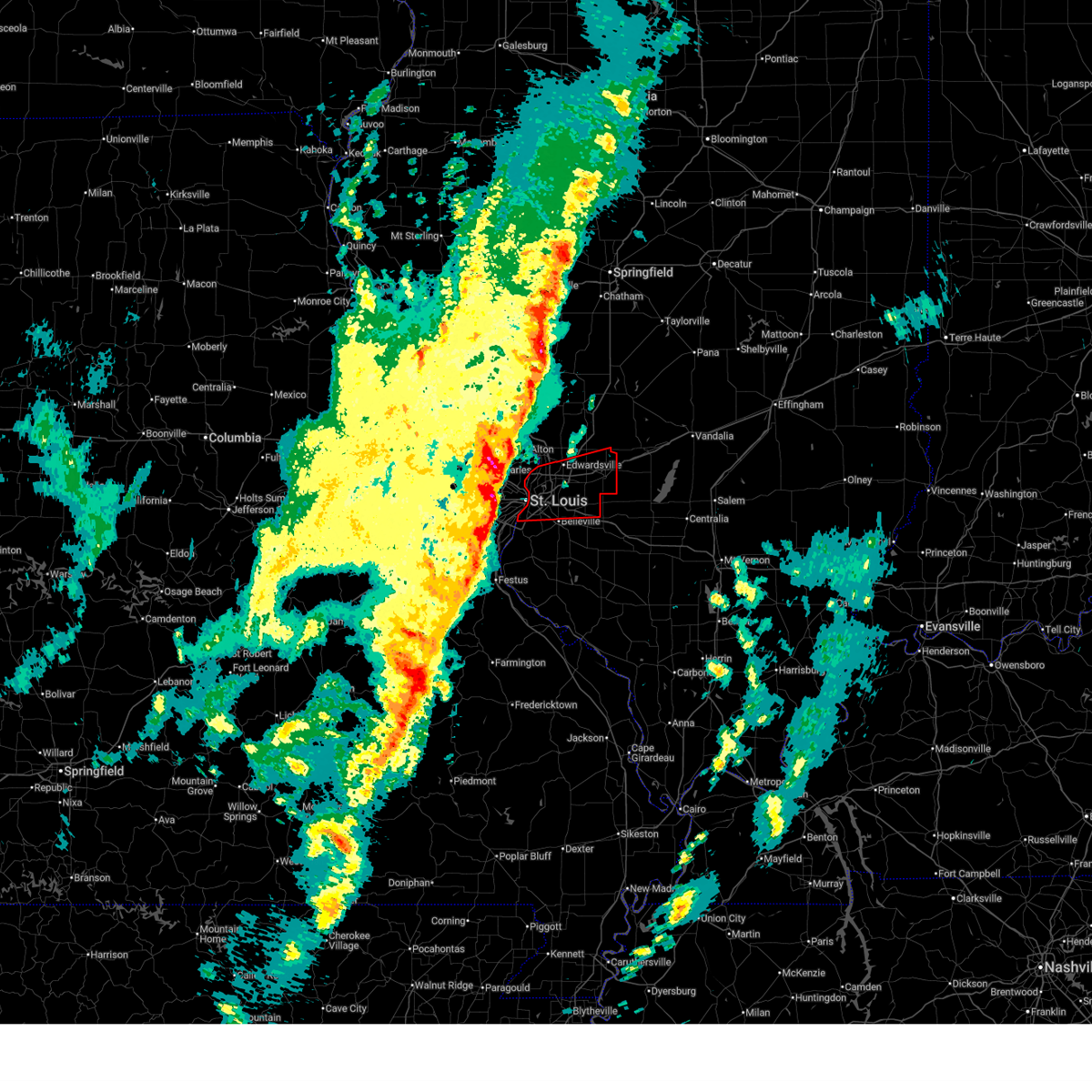
| 4/27/2026 6:20 AM CDT | Quarter sized hail reported 2.7 miles NE of St. Louis, MO |
| 4/15/2026 10:23 PM CDT |
 the tornado warning has been cancelled and is no longer in effect the tornado warning has been cancelled and is no longer in effect
|
| 4/15/2026 10:19 PM CDT |
 the tornado warning has been cancelled and is no longer in effect the tornado warning has been cancelled and is no longer in effect
|
| 4/15/2026 10:19 PM CDT |
 At 1019 pm cdt, severe thunderstorms capable of producing a tornado were located along a line from over riverview to over cahokia, moving east at 35 mph (radar indicated rotation). Hazards include tornado. Flying debris will be dangerous to those caught without shelter. mobile homes will be damaged or destroyed. damage to roofs, windows and vehicles will occur. tree damage is likely. locations impacted include, st. louis, wellston, riverview and glasgow village. This includes the following state parks, scott joplin historic site. At 1019 pm cdt, severe thunderstorms capable of producing a tornado were located along a line from over riverview to over cahokia, moving east at 35 mph (radar indicated rotation). Hazards include tornado. Flying debris will be dangerous to those caught without shelter. mobile homes will be damaged or destroyed. damage to roofs, windows and vehicles will occur. tree damage is likely. locations impacted include, st. louis, wellston, riverview and glasgow village. This includes the following state parks, scott joplin historic site.
|
| 4/15/2026 10:15 PM CDT |
 Svrlsx the national weather service in st louis has issued a * severe thunderstorm warning for, monroe county in southwestern illinois, central saint clair county in southwestern illinois, central jefferson county in east central missouri, south central saint louis county in east central missouri, southern saint louis city in east central missouri, * until 1100 pm cdt. * at 1015 pm cdt, severe thunderstorms were located along a line from over east carondelet to over olympian village, or along a line from near st. louis to 6 miles south of festus, moving east at 45 mph (radar indicated). Hazards include 60 mph wind gusts. expect damage to roofs, siding, and trees Svrlsx the national weather service in st louis has issued a * severe thunderstorm warning for, monroe county in southwestern illinois, central saint clair county in southwestern illinois, central jefferson county in east central missouri, south central saint louis county in east central missouri, southern saint louis city in east central missouri, * until 1100 pm cdt. * at 1015 pm cdt, severe thunderstorms were located along a line from over east carondelet to over olympian village, or along a line from near st. louis to 6 miles south of festus, moving east at 45 mph (radar indicated). Hazards include 60 mph wind gusts. expect damage to roofs, siding, and trees
|
| 4/15/2026 9:52 PM CDT |
 At 952 pm cdt, a severe thunderstorm capable of producing a tornado was located over ladue, moving east at 25 mph (radar indicated rotation). Hazards include tornado. Flying debris will be dangerous to those caught without shelter. mobile homes will be damaged or destroyed. damage to roofs, windows and vehicles will occur. tree damage is likely. locations impacted include, town and country, kirkwood, crestwood, creve coeur, webster groves, maryland heights, richmond heights, bridgeton, overland, st. ann, clayton, university city, st. louis, berkeley, jennings, ferguson, florissant and bellefontaine neighbors. This includes the following state parks, scott joplin historic site. At 952 pm cdt, a severe thunderstorm capable of producing a tornado was located over ladue, moving east at 25 mph (radar indicated rotation). Hazards include tornado. Flying debris will be dangerous to those caught without shelter. mobile homes will be damaged or destroyed. damage to roofs, windows and vehicles will occur. tree damage is likely. locations impacted include, town and country, kirkwood, crestwood, creve coeur, webster groves, maryland heights, richmond heights, bridgeton, overland, st. ann, clayton, university city, st. louis, berkeley, jennings, ferguson, florissant and bellefontaine neighbors. This includes the following state parks, scott joplin historic site.
|
| 4/15/2026 9:40 PM CDT |
 Torlsx the national weather service in st louis has issued a * tornado warning for, central saint louis county in east central missouri, saint louis city in east central missouri, * until 1030 pm cdt. * at 940 pm cdt, a severe thunderstorm capable of producing a tornado was located over town and country, moving east at 25 mph (radar indicated rotation). Hazards include tornado. Flying debris will be dangerous to those caught without shelter. mobile homes will be damaged or destroyed. damage to roofs, windows and vehicles will occur. Tree damage is likely. Torlsx the national weather service in st louis has issued a * tornado warning for, central saint louis county in east central missouri, saint louis city in east central missouri, * until 1030 pm cdt. * at 940 pm cdt, a severe thunderstorm capable of producing a tornado was located over town and country, moving east at 25 mph (radar indicated rotation). Hazards include tornado. Flying debris will be dangerous to those caught without shelter. mobile homes will be damaged or destroyed. damage to roofs, windows and vehicles will occur. Tree damage is likely.
|
| 3/15/2026 5:11 PM CDT |
 The storms which prompted the warning have moved out of the area. therefore, the warning will be allowed to expire. however, gusty winds are still possible with these thunderstorms. The storms which prompted the warning have moved out of the area. therefore, the warning will be allowed to expire. however, gusty winds are still possible with these thunderstorms.
|
| 3/15/2026 5:10 PM CDT |
 the tornado warning has been cancelled and is no longer in effect the tornado warning has been cancelled and is no longer in effect
|
| 3/15/2026 5:05 PM CDT |
 Torlsx the national weather service in st louis has issued a * tornado warning for, southern madison county in southwestern illinois, northern saint clair county in southwestern illinois, * until 545 pm cdt. * at 505 pm cdt, a severe thunderstorm capable of producing a tornado was located over madison, moving east at 45 mph (radar indicated rotation). Hazards include tornado. Flying debris will be dangerous to those caught without shelter. mobile homes will be damaged or destroyed. damage to roofs, windows and vehicles will occur. Tree damage is likely. Torlsx the national weather service in st louis has issued a * tornado warning for, southern madison county in southwestern illinois, northern saint clair county in southwestern illinois, * until 545 pm cdt. * at 505 pm cdt, a severe thunderstorm capable of producing a tornado was located over madison, moving east at 45 mph (radar indicated rotation). Hazards include tornado. Flying debris will be dangerous to those caught without shelter. mobile homes will be damaged or destroyed. damage to roofs, windows and vehicles will occur. Tree damage is likely.
|
| 3/15/2026 5:01 PM CDT |
 Svrlsx the national weather service in st louis has issued a * severe thunderstorm warning for, madison county in southwestern illinois, northwestern monroe county in southwestern illinois, saint clair county in southwestern illinois, northeastern saint charles county in east central missouri, eastern saint louis county in east central missouri, * until 545 pm cdt. * at 501 pm cdt, a severe thunderstorm was located over bella villa, or over lemay, moving east at 40 mph (radar indicated). Hazards include 60 mph wind gusts and small hail. expect damage to roofs, siding, and trees Svrlsx the national weather service in st louis has issued a * severe thunderstorm warning for, madison county in southwestern illinois, northwestern monroe county in southwestern illinois, saint clair county in southwestern illinois, northeastern saint charles county in east central missouri, eastern saint louis county in east central missouri, * until 545 pm cdt. * at 501 pm cdt, a severe thunderstorm was located over bella villa, or over lemay, moving east at 40 mph (radar indicated). Hazards include 60 mph wind gusts and small hail. expect damage to roofs, siding, and trees
|
| 3/15/2026 4:49 PM CDT |
 At 449 pm cdt, severe thunderstorms were located along a line from over oakland to near antonia, moving east at 45 mph (radar indicated). Hazards include 60 mph wind gusts. Expect damage to roofs, siding, and trees. locations impacted include, ballwin, chesterfield, manchester, town and country, kirkwood, crestwood, webster groves, creve coeur, arnold, festus, overland, st. louis, university city, clayton, jennings, ferguson and bellefontaine neighbors. this includes the following state parks, scott joplin historic site, castlewood state park, mastodon historic site, sandy creek covered bridge historic site and gov. dunklin's grave historic site. this includes the following highways, interstate 44 in missouri between exits 269 and 277. Interstate 55 in missouri between exits 178 and 191. At 449 pm cdt, severe thunderstorms were located along a line from over oakland to near antonia, moving east at 45 mph (radar indicated). Hazards include 60 mph wind gusts. Expect damage to roofs, siding, and trees. locations impacted include, ballwin, chesterfield, manchester, town and country, kirkwood, crestwood, webster groves, creve coeur, arnold, festus, overland, st. louis, university city, clayton, jennings, ferguson and bellefontaine neighbors. this includes the following state parks, scott joplin historic site, castlewood state park, mastodon historic site, sandy creek covered bridge historic site and gov. dunklin's grave historic site. this includes the following highways, interstate 44 in missouri between exits 269 and 277. Interstate 55 in missouri between exits 178 and 191.
|
| 3/15/2026 4:47 PM CDT |
 Torlsx the national weather service in st louis has issued a * tornado warning for, central saint louis county in east central missouri, saint louis city in east central missouri, * until 515 pm cdt. * at 447 pm cdt, severe thunderstorms capable of producing a tornado were located along a line from over olivette to over sunset hills, moving east at 45 mph (radar indicated rotation). Hazards include tornado. Flying debris will be dangerous to those caught without shelter. mobile homes will be damaged or destroyed. damage to roofs, windows and vehicles will occur. Tree damage is likely. Torlsx the national weather service in st louis has issued a * tornado warning for, central saint louis county in east central missouri, saint louis city in east central missouri, * until 515 pm cdt. * at 447 pm cdt, severe thunderstorms capable of producing a tornado were located along a line from over olivette to over sunset hills, moving east at 45 mph (radar indicated rotation). Hazards include tornado. Flying debris will be dangerous to those caught without shelter. mobile homes will be damaged or destroyed. damage to roofs, windows and vehicles will occur. Tree damage is likely.
|
| 3/15/2026 4:28 PM CDT |
 Svrlsx the national weather service in st louis has issued a * severe thunderstorm warning for, jefferson county in east central missouri, saint louis county in east central missouri, saint louis city in east central missouri, * until 515 pm cdt. * at 428 pm cdt, severe thunderstorms were located along a line from over eureka to 6 miles southeast of lonedell, or along a line from over eureka to 10 miles southwest of cedar hill, moving east at 45 mph (radar indicated). Hazards include 60 mph wind gusts. expect damage to roofs, siding, and trees Svrlsx the national weather service in st louis has issued a * severe thunderstorm warning for, jefferson county in east central missouri, saint louis county in east central missouri, saint louis city in east central missouri, * until 515 pm cdt. * at 428 pm cdt, severe thunderstorms were located along a line from over eureka to 6 miles southeast of lonedell, or along a line from over eureka to 10 miles southwest of cedar hill, moving east at 45 mph (radar indicated). Hazards include 60 mph wind gusts. expect damage to roofs, siding, and trees
|
| 3/11/2026 3:50 AM CDT |
 The storms which prompted the warning have weakened below severe limits, and no longer pose an immediate threat to life or property. therefore, the warning will be allowed to expire. however, gusty winds are still possible with these thunderstorms. The storms which prompted the warning have weakened below severe limits, and no longer pose an immediate threat to life or property. therefore, the warning will be allowed to expire. however, gusty winds are still possible with these thunderstorms.
|
| 3/11/2026 3:40 AM CDT |
 the severe thunderstorm warning has been cancelled and is no longer in effect the severe thunderstorm warning has been cancelled and is no longer in effect
|
| 3/11/2026 3:40 AM CDT |
 At 340 am cdt, severe thunderstorms were located along a line from near brighton to over riverview, or along a line from 5 miles north of godfrey to over riverview, moving east at 55 mph (radar indicated). Hazards include 60 mph wind gusts. Expect damage to roofs, siding, and trees. locations impacted include, florissant, berkeley, ferguson, godfrey, black jack, bellefontaine neighbors, jennings, alton, wood river, granite city, bethalto, pontoon beach, edwardsville, glen carbon and maryville. This includes the following state parks, confluence state park. At 340 am cdt, severe thunderstorms were located along a line from near brighton to over riverview, or along a line from 5 miles north of godfrey to over riverview, moving east at 55 mph (radar indicated). Hazards include 60 mph wind gusts. Expect damage to roofs, siding, and trees. locations impacted include, florissant, berkeley, ferguson, godfrey, black jack, bellefontaine neighbors, jennings, alton, wood river, granite city, bethalto, pontoon beach, edwardsville, glen carbon and maryville. This includes the following state parks, confluence state park.
|
| 3/11/2026 3:26 AM CDT |
 At 326 am cdt, severe thunderstorms were located along a line from near grafton to over champ, or along a line from 9 miles southwest of jerseyville to over maryland heights, moving east at 55 mph (radar indicated). Hazards include 60 mph wind gusts. Expect damage to roofs, siding, and trees. locations impacted include, st. charles, maryland heights, bridgeton, hazelwood, florissant, st. ann, berkeley, ferguson, godfrey, bellefontaine neighbors, jennings, alton, wood river, granite city, bethalto, edwardsville and glen carbon. this includes the following state parks, confluence state park, first missouri state capitol historic site and pere marquette state park. This includes interstate 70 in missouri between exits 227 and 231. At 326 am cdt, severe thunderstorms were located along a line from near grafton to over champ, or along a line from 9 miles southwest of jerseyville to over maryland heights, moving east at 55 mph (radar indicated). Hazards include 60 mph wind gusts. Expect damage to roofs, siding, and trees. locations impacted include, st. charles, maryland heights, bridgeton, hazelwood, florissant, st. ann, berkeley, ferguson, godfrey, bellefontaine neighbors, jennings, alton, wood river, granite city, bethalto, edwardsville and glen carbon. this includes the following state parks, confluence state park, first missouri state capitol historic site and pere marquette state park. This includes interstate 70 in missouri between exits 227 and 231.
|
| 3/11/2026 3:26 AM CDT |
 the severe thunderstorm warning has been cancelled and is no longer in effect the severe thunderstorm warning has been cancelled and is no longer in effect
|
| 3/11/2026 3:17 AM CDT |
 Svrlsx the national weather service in st louis has issued a * severe thunderstorm warning for, southeastern calhoun county in southwestern illinois, southern jersey county in southwestern illinois, southwestern macoupin county in southwestern illinois, western madison county in southwestern illinois, east central lincoln county in east central missouri, northeastern saint charles county in east central missouri, northeastern saint louis county in east central missouri, northeastern saint louis city in east central missouri, * until 400 am cdt. * at 317 am cdt, severe thunderstorms were located along a line from 6 miles northeast of winfield to over cottleville, or along a line from 13 miles southeast of elsberry to over cottleville, moving east at 55 mph (radar indicated). Hazards include 60 mph wind gusts. expect damage to roofs, siding, and trees Svrlsx the national weather service in st louis has issued a * severe thunderstorm warning for, southeastern calhoun county in southwestern illinois, southern jersey county in southwestern illinois, southwestern macoupin county in southwestern illinois, western madison county in southwestern illinois, east central lincoln county in east central missouri, northeastern saint charles county in east central missouri, northeastern saint louis county in east central missouri, northeastern saint louis city in east central missouri, * until 400 am cdt. * at 317 am cdt, severe thunderstorms were located along a line from 6 miles northeast of winfield to over cottleville, or along a line from 13 miles southeast of elsberry to over cottleville, moving east at 55 mph (radar indicated). Hazards include 60 mph wind gusts. expect damage to roofs, siding, and trees
|
| 12/18/2025 11:59 AM CST |
 Svrlsx the national weather service in st louis has issued a * severe thunderstorm warning for, southeastern madison county in southwestern illinois, northern saint clair county in southwestern illinois, * until 1245 pm cst. * at 1159 am cst, a severe thunderstorm was located over east st. louis, moving east at 50 mph (radar indicated). Hazards include 60 mph wind gusts. Expect damage to roofs, siding, and trees. this severe thunderstorm will be near, east st. louis, centreville, alorton, madison, st. louis, cahokia, cahokia parks airport, brooklyn, venice and dupo around 1200 pm cst. washington park, fairmont city, belleville, pontoon beach and granite city around 1205 pm cst. other locations impacted by the severe thunderstorm include sauget, kuhn, summerfield, grantfork and pierron. this includes the following state parks, horseshoe lake state park. this includes the following highways, interstate 64 in illinois between exits 9 and 23. Interstate 70 in illinois between exits 21 and 30. Svrlsx the national weather service in st louis has issued a * severe thunderstorm warning for, southeastern madison county in southwestern illinois, northern saint clair county in southwestern illinois, * until 1245 pm cst. * at 1159 am cst, a severe thunderstorm was located over east st. louis, moving east at 50 mph (radar indicated). Hazards include 60 mph wind gusts. Expect damage to roofs, siding, and trees. this severe thunderstorm will be near, east st. louis, centreville, alorton, madison, st. louis, cahokia, cahokia parks airport, brooklyn, venice and dupo around 1200 pm cst. washington park, fairmont city, belleville, pontoon beach and granite city around 1205 pm cst. other locations impacted by the severe thunderstorm include sauget, kuhn, summerfield, grantfork and pierron. this includes the following state parks, horseshoe lake state park. this includes the following highways, interstate 64 in illinois between exits 9 and 23. Interstate 70 in illinois between exits 21 and 30.
|
| 8/16/2025 4:22 PM CDT |
 The storm which prompted the warning has weakened below severe limits, and no longer poses an immediate threat to life or property. therefore, the warning will be allowed to expire. however, gusty winds are still possible with this thunderstorm. The storm which prompted the warning has weakened below severe limits, and no longer poses an immediate threat to life or property. therefore, the warning will be allowed to expire. however, gusty winds are still possible with this thunderstorm.
|
| 8/16/2025 4:17 PM CDT |
 At 417 pm cdt, a severe thunderstorm was located over spanish lake, nearly stationary (radar indicated). Hazards include 60 mph wind gusts and small hail. Expect damage to roofs, siding, and trees. this severe thunderstorm will be near, spanish lake, bellefontaine neighbors, west alton, glasgow village, st. louis, riverview and moline acres around 420 pm cdt. Black jack, castle point, ferguson, dellwood, florissant and jennings around 425 pm cdt. At 417 pm cdt, a severe thunderstorm was located over spanish lake, nearly stationary (radar indicated). Hazards include 60 mph wind gusts and small hail. Expect damage to roofs, siding, and trees. this severe thunderstorm will be near, spanish lake, bellefontaine neighbors, west alton, glasgow village, st. louis, riverview and moline acres around 420 pm cdt. Black jack, castle point, ferguson, dellwood, florissant and jennings around 425 pm cdt.
|
| 8/16/2025 4:17 PM CDT |
 the severe thunderstorm warning has been cancelled and is no longer in effect the severe thunderstorm warning has been cancelled and is no longer in effect
|
| 8/16/2025 3:48 PM CDT |
 Svrlsx the national weather service in st louis has issued a * severe thunderstorm warning for, western madison county in southwestern illinois, east central saint charles county in east central missouri, northeastern saint louis county in east central missouri, northeastern saint louis city in east central missouri, * until 430 pm cdt. * at 348 pm cdt, a severe thunderstorm was located over glasgow village, or over spanish lake. this storm was stationary (radar indicated). Hazards include 60 mph wind gusts and small hail. Expect damage to roofs, siding, and trees. this severe thunderstorm will be near, st. louis, spanish lake, glasgow village, madison, bellefontaine neighbors, riverview, granite city, west alton, hartford and castle point around 350 pm cdt. other locations impacted by the severe thunderstorm include mitchell and poag. This includes the following state parks, confluence state park. Svrlsx the national weather service in st louis has issued a * severe thunderstorm warning for, western madison county in southwestern illinois, east central saint charles county in east central missouri, northeastern saint louis county in east central missouri, northeastern saint louis city in east central missouri, * until 430 pm cdt. * at 348 pm cdt, a severe thunderstorm was located over glasgow village, or over spanish lake. this storm was stationary (radar indicated). Hazards include 60 mph wind gusts and small hail. Expect damage to roofs, siding, and trees. this severe thunderstorm will be near, st. louis, spanish lake, glasgow village, madison, bellefontaine neighbors, riverview, granite city, west alton, hartford and castle point around 350 pm cdt. other locations impacted by the severe thunderstorm include mitchell and poag. This includes the following state parks, confluence state park.
|
| 7/6/2025 4:11 PM CDT |
 Svrlsx the national weather service in st louis has issued a * severe thunderstorm warning for, southern madison county in southwestern illinois, northeastern saint clair county in southwestern illinois, * until 515 pm cdt. * at 411 pm cdt, severe thunderstorms were located along a line from near hartford to over centreville, or along a line from near granite city to over centreville, moving east at 15 mph (radar indicated). Hazards include 60 mph wind gusts and small hail. expect damage to roofs, siding, and trees Svrlsx the national weather service in st louis has issued a * severe thunderstorm warning for, southern madison county in southwestern illinois, northeastern saint clair county in southwestern illinois, * until 515 pm cdt. * at 411 pm cdt, severe thunderstorms were located along a line from near hartford to over centreville, or along a line from near granite city to over centreville, moving east at 15 mph (radar indicated). Hazards include 60 mph wind gusts and small hail. expect damage to roofs, siding, and trees
|
| 6/27/2025 3:43 PM CDT |
 The storms which prompted the warning have weakened below severe limits, and no longer pose an immediate threat to life or property. therefore, the warning will be allowed to expire. however, gusty winds and heavy rain are still possible with these thunderstorms. to report severe weather, contact your nearest law enforcement agency. they will send your report to the national weather service office. The storms which prompted the warning have weakened below severe limits, and no longer pose an immediate threat to life or property. therefore, the warning will be allowed to expire. however, gusty winds and heavy rain are still possible with these thunderstorms. to report severe weather, contact your nearest law enforcement agency. they will send your report to the national weather service office.
|
| 6/27/2025 3:35 PM CDT |
 At 335 pm cdt, severe thunderstorms were located along a line from over st. louis to near fountain, or along a line from over venice to near oakville, moving northeast at 30 mph (radar indicated). Hazards include 60 mph wind gusts. Expect damage to roofs, siding, and trees. locations impacted include, st. louis, university city, granite city, kirkwood, east st. louis, webster groves, arnold, creve coeur, overland, clayton, cahokia, jennings, crestwood, columbia, richmond heights, ladue, sunset hills, brentwood, maplewood and olivette. This includes the following state parks, scott joplin historic site. At 335 pm cdt, severe thunderstorms were located along a line from over st. louis to near fountain, or along a line from over venice to near oakville, moving northeast at 30 mph (radar indicated). Hazards include 60 mph wind gusts. Expect damage to roofs, siding, and trees. locations impacted include, st. louis, university city, granite city, kirkwood, east st. louis, webster groves, arnold, creve coeur, overland, clayton, cahokia, jennings, crestwood, columbia, richmond heights, ladue, sunset hills, brentwood, maplewood and olivette. This includes the following state parks, scott joplin historic site.
|
| 6/27/2025 3:35 PM CDT |
 the severe thunderstorm warning has been cancelled and is no longer in effect the severe thunderstorm warning has been cancelled and is no longer in effect
|
| 6/27/2025 3:28 PM CDT |
 At 328 pm cdt, severe thunderstorms were located along a line from over wellston to over fountain, or along a line from over st. louis to near arnold, moving northeast at 30 mph (radar indicated). Hazards include 60 mph wind gusts. Expect damage to roofs, siding, and trees. locations impacted include, st. louis, university city, granite city, kirkwood, east st. louis, webster groves, ferguson, arnold, creve coeur, overland, clayton, cahokia, jennings, crestwood, bellefontaine neighbors, town and country, waterloo, columbia, berkeley and richmond heights. this includes the following state parks, scott joplin historic site and mastodon historic site. this includes the following highways, interstate 44 in missouri between exits 276 and 277. Interstate 55 in missouri between exits 185 and 191. At 328 pm cdt, severe thunderstorms were located along a line from over wellston to over fountain, or along a line from over st. louis to near arnold, moving northeast at 30 mph (radar indicated). Hazards include 60 mph wind gusts. Expect damage to roofs, siding, and trees. locations impacted include, st. louis, university city, granite city, kirkwood, east st. louis, webster groves, ferguson, arnold, creve coeur, overland, clayton, cahokia, jennings, crestwood, bellefontaine neighbors, town and country, waterloo, columbia, berkeley and richmond heights. this includes the following state parks, scott joplin historic site and mastodon historic site. this includes the following highways, interstate 44 in missouri between exits 276 and 277. Interstate 55 in missouri between exits 185 and 191.
|
| 6/27/2025 3:12 PM CDT |
 Svrlsx the national weather service in st louis has issued a * severe thunderstorm warning for, southwestern madison county in southwestern illinois, northwestern monroe county in southwestern illinois, northwestern saint clair county in southwestern illinois, northeastern jefferson county in east central missouri, central saint louis county in east central missouri, saint louis city in east central missouri, * until 345 pm cdt. * at 312 pm cdt, severe thunderstorms were located along a line from over warson woods to over antonia, moving northeast at 30 mph (radar indicated). Hazards include 60 mph wind gusts. expect damage to roofs, siding, and trees Svrlsx the national weather service in st louis has issued a * severe thunderstorm warning for, southwestern madison county in southwestern illinois, northwestern monroe county in southwestern illinois, northwestern saint clair county in southwestern illinois, northeastern jefferson county in east central missouri, central saint louis county in east central missouri, saint louis city in east central missouri, * until 345 pm cdt. * at 312 pm cdt, severe thunderstorms were located along a line from over warson woods to over antonia, moving northeast at 30 mph (radar indicated). Hazards include 60 mph wind gusts. expect damage to roofs, siding, and trees
|
| 6/17/2025 10:18 PM CDT |
 the severe thunderstorm warning has been cancelled and is no longer in effect the severe thunderstorm warning has been cancelled and is no longer in effect
|
| 6/17/2025 10:09 PM CDT |
 At 1009 pm cdt, a severe thunderstorm was located over rosewood heights, or over bethalto, moving east at 30 mph (radar indicated). Hazards include 60 mph wind gusts. Expect damage to roofs, siding, and trees. locations impacted include, st. louis, granite city, alton, edwardsville, godfrey, wood river, bethalto, spanish lake, east alton, south roxana, roxana, hartford, west alton, rosewood heights, dorsey, prairietown, carpenter, fosterburg, poag and fruit. this includes the following state parks, confluence state park. This includes interstate 55 in illinois near exit 23. At 1009 pm cdt, a severe thunderstorm was located over rosewood heights, or over bethalto, moving east at 30 mph (radar indicated). Hazards include 60 mph wind gusts. Expect damage to roofs, siding, and trees. locations impacted include, st. louis, granite city, alton, edwardsville, godfrey, wood river, bethalto, spanish lake, east alton, south roxana, roxana, hartford, west alton, rosewood heights, dorsey, prairietown, carpenter, fosterburg, poag and fruit. this includes the following state parks, confluence state park. This includes interstate 55 in illinois near exit 23.
|
| 6/17/2025 9:57 PM CDT |
 At 957 pm cdt, a severe thunderstorm was located over alton, moving east at 30 mph (radar indicated). Hazards include 60 mph wind gusts. Expect damage to roofs, siding, and trees. locations impacted include, st. louis, florissant, granite city, alton, hazelwood, edwardsville, ferguson, godfrey, bellefontaine neighbors, wood river, bethalto, berkeley, black jack, dellwood, spanish lake, east alton, south roxana, roxana, hartford and calverton park. this includes the following state parks, confluence state park. This includes interstate 55 in illinois near exit 23. At 957 pm cdt, a severe thunderstorm was located over alton, moving east at 30 mph (radar indicated). Hazards include 60 mph wind gusts. Expect damage to roofs, siding, and trees. locations impacted include, st. louis, florissant, granite city, alton, hazelwood, edwardsville, ferguson, godfrey, bellefontaine neighbors, wood river, bethalto, berkeley, black jack, dellwood, spanish lake, east alton, south roxana, roxana, hartford and calverton park. this includes the following state parks, confluence state park. This includes interstate 55 in illinois near exit 23.
|
| 6/17/2025 9:41 PM CDT |
 Svrlsx the national weather service in st louis has issued a * severe thunderstorm warning for, northwestern madison county in southwestern illinois, northeastern saint charles county in east central missouri, northeastern saint louis county in east central missouri, * until 1030 pm cdt. * at 941 pm cdt, a severe thunderstorm was located near black jack, moving east at 35 mph (radar indicated). Hazards include 60 mph wind gusts. expect damage to roofs, siding, and trees Svrlsx the national weather service in st louis has issued a * severe thunderstorm warning for, northwestern madison county in southwestern illinois, northeastern saint charles county in east central missouri, northeastern saint louis county in east central missouri, * until 1030 pm cdt. * at 941 pm cdt, a severe thunderstorm was located near black jack, moving east at 35 mph (radar indicated). Hazards include 60 mph wind gusts. expect damage to roofs, siding, and trees
|
| 6/4/2025 3:27 PM CDT |
 The storm which prompted the warning has weakened below severe limits, and no longer appears capable of producing a tornado. therefore, the warning will be allowed to expire. however, gusty winds are still possible with this thunderstorm. The storm which prompted the warning has weakened below severe limits, and no longer appears capable of producing a tornado. therefore, the warning will be allowed to expire. however, gusty winds are still possible with this thunderstorm.
|
| 6/4/2025 3:20 PM CDT |
 At 320 pm cdt, a severe thunderstorm capable of producing a tornado was located over st. john, moving northeast at 30 mph (radar indicated rotation). Hazards include tornado. Flying debris will be dangerous to those caught without shelter. mobile homes will be damaged or destroyed. damage to roofs, windows and vehicles will occur. tree damage is likely. locations impacted include, st. louis, florissant, university city, maryland heights, hazelwood, webster groves, ferguson, overland, clayton, jennings, st. ann, bridgeton, bellefontaine neighbors, berkeley, richmond heights, ladue, brentwood, maplewood, olivette and black jack. This includes the following state parks, scott joplin historic site. At 320 pm cdt, a severe thunderstorm capable of producing a tornado was located over st. john, moving northeast at 30 mph (radar indicated rotation). Hazards include tornado. Flying debris will be dangerous to those caught without shelter. mobile homes will be damaged or destroyed. damage to roofs, windows and vehicles will occur. tree damage is likely. locations impacted include, st. louis, florissant, university city, maryland heights, hazelwood, webster groves, ferguson, overland, clayton, jennings, st. ann, bridgeton, bellefontaine neighbors, berkeley, richmond heights, ladue, brentwood, maplewood, olivette and black jack. This includes the following state parks, scott joplin historic site.
|
| 6/4/2025 3:11 PM CDT |
 the tornado warning has been cancelled and is no longer in effect the tornado warning has been cancelled and is no longer in effect
|
| 6/4/2025 3:11 PM CDT |
 At 311 pm cdt, a severe thunderstorm capable of producing a tornado was located over maryland heights, moving northeast at 35 mph (radar indicated rotation). Hazards include tornado. Flying debris will be dangerous to those caught without shelter. mobile homes will be damaged or destroyed. damage to roofs, windows and vehicles will occur. tree damage is likely. locations impacted include, st. louis, florissant, chesterfield, university city, kirkwood, maryland heights, hazelwood, webster groves, ferguson, creve coeur, overland, clayton, jennings, st. ann, bridgeton, bellefontaine neighbors, town and country, berkeley, richmond heights and ladue. This includes the following state parks, scott joplin historic site. At 311 pm cdt, a severe thunderstorm capable of producing a tornado was located over maryland heights, moving northeast at 35 mph (radar indicated rotation). Hazards include tornado. Flying debris will be dangerous to those caught without shelter. mobile homes will be damaged or destroyed. damage to roofs, windows and vehicles will occur. tree damage is likely. locations impacted include, st. louis, florissant, chesterfield, university city, kirkwood, maryland heights, hazelwood, webster groves, ferguson, creve coeur, overland, clayton, jennings, st. ann, bridgeton, bellefontaine neighbors, town and country, berkeley, richmond heights and ladue. This includes the following state parks, scott joplin historic site.
|
| 6/4/2025 3:03 PM CDT |
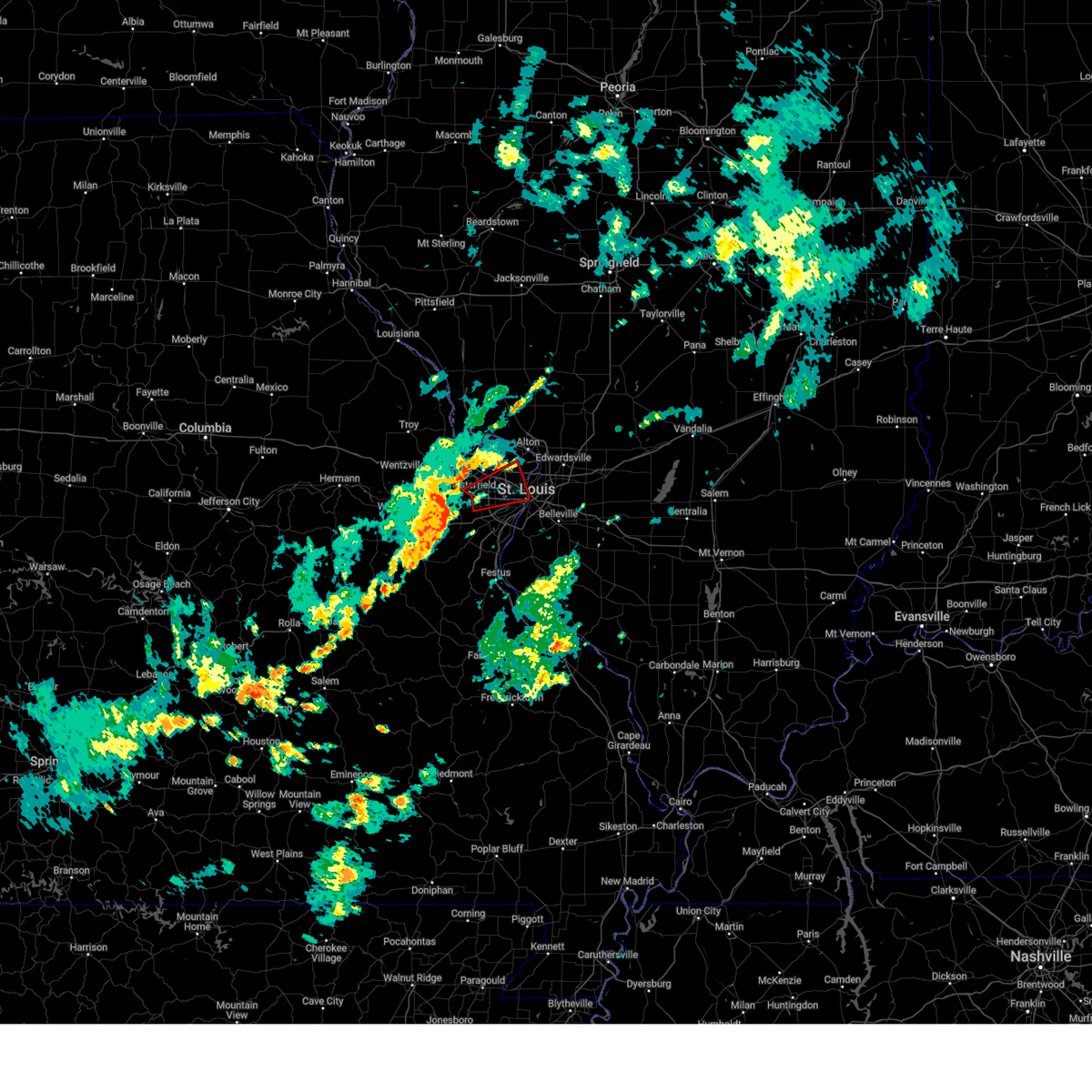 At 303 pm cdt, a tornado producing storm was located over chesterfield, moving northeast at 35 mph (radar confirmed tornado). Hazards include damaging tornado. Flying debris will be dangerous to those caught without shelter. mobile homes will be damaged or destroyed. damage to roofs, windows and vehicles will occur. tree damage is likely. locations impacted include, st. louis, florissant, chesterfield, university city, ballwin, kirkwood, maryland heights, hazelwood, webster groves, ferguson, manchester, creve coeur, overland, clayton, jennings, st. ann, bridgeton, bellefontaine neighbors, town and country and berkeley. This includes the following state parks, scott joplin historic site. At 303 pm cdt, a tornado producing storm was located over chesterfield, moving northeast at 35 mph (radar confirmed tornado). Hazards include damaging tornado. Flying debris will be dangerous to those caught without shelter. mobile homes will be damaged or destroyed. damage to roofs, windows and vehicles will occur. tree damage is likely. locations impacted include, st. louis, florissant, chesterfield, university city, ballwin, kirkwood, maryland heights, hazelwood, webster groves, ferguson, manchester, creve coeur, overland, clayton, jennings, st. ann, bridgeton, bellefontaine neighbors, town and country and berkeley. This includes the following state parks, scott joplin historic site.
|
| 6/4/2025 2:58 PM CDT |
 At 258 pm cdt, a tornado producing storm was located over chesterfield, moving northeast at 35 mph (radar confirmed tornado). Hazards include damaging tornado. Flying debris will be dangerous to those caught without shelter. mobile homes will be damaged or destroyed. damage to roofs, windows and vehicles will occur. tree damage is likely. locations impacted include, st. louis, florissant, chesterfield, wildwood, university city, ballwin, kirkwood, maryland heights, hazelwood, webster groves, ferguson, manchester, creve coeur, overland, clayton, jennings, st. ann, bridgeton, bellefontaine neighbors and town and country. this includes the following state parks, scott joplin historic site. This includes interstate 70 in missouri near exit 231. At 258 pm cdt, a tornado producing storm was located over chesterfield, moving northeast at 35 mph (radar confirmed tornado). Hazards include damaging tornado. Flying debris will be dangerous to those caught without shelter. mobile homes will be damaged or destroyed. damage to roofs, windows and vehicles will occur. tree damage is likely. locations impacted include, st. louis, florissant, chesterfield, wildwood, university city, ballwin, kirkwood, maryland heights, hazelwood, webster groves, ferguson, manchester, creve coeur, overland, clayton, jennings, st. ann, bridgeton, bellefontaine neighbors and town and country. this includes the following state parks, scott joplin historic site. This includes interstate 70 in missouri near exit 231.
|
| 6/4/2025 2:50 PM CDT |
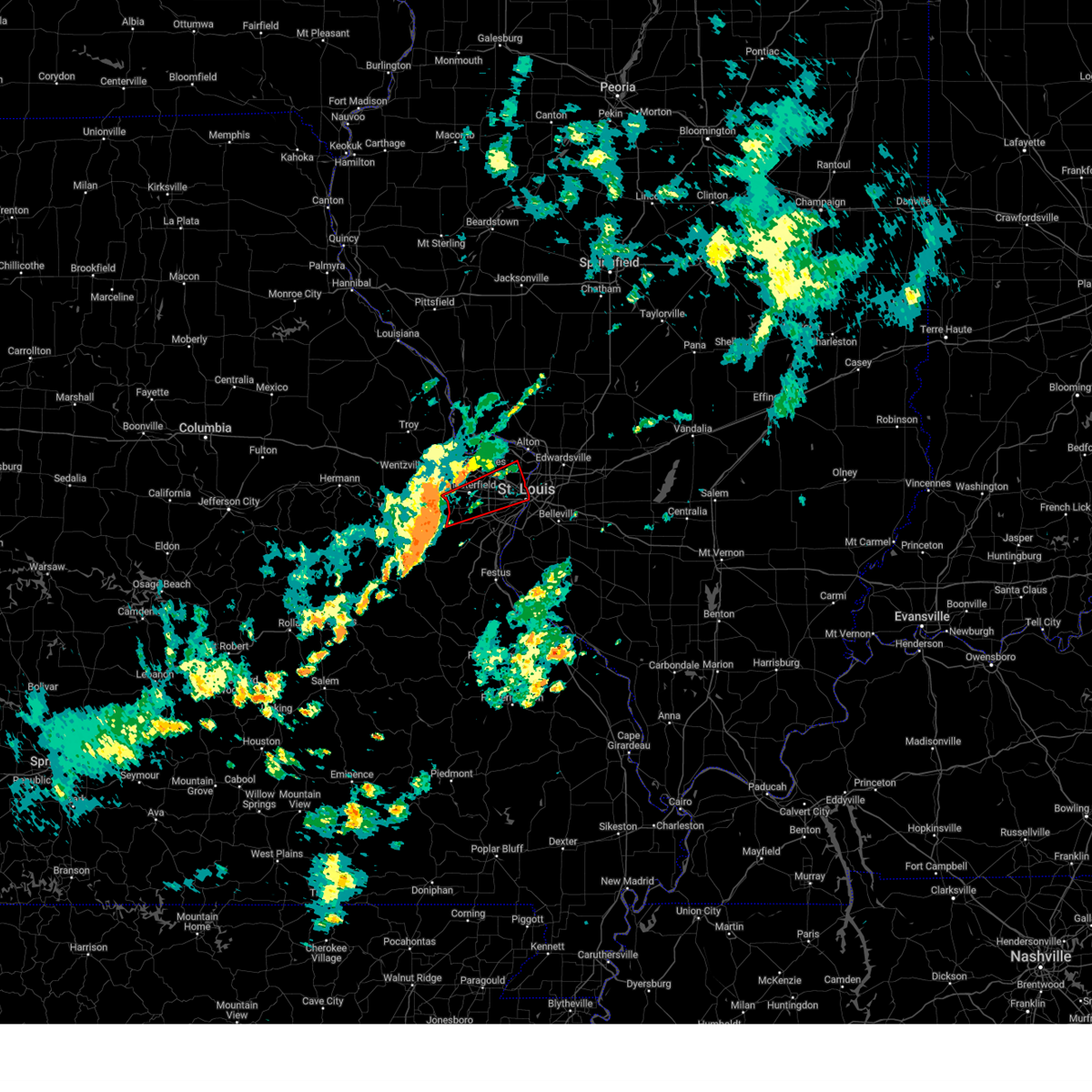 Torlsx the national weather service in st louis has issued a * tornado warning for, central saint charles county in east central missouri, saint louis county in east central missouri, saint louis city in east central missouri, * until 330 pm cdt. * at 250 pm cdt, a severe thunderstorm capable of producing a tornado was located over ellisville, moving northeast at 35 mph (radar indicated rotation). Hazards include tornado. Flying debris will be dangerous to those caught without shelter. mobile homes will be damaged or destroyed. damage to roofs, windows and vehicles will occur. Tree damage is likely. Torlsx the national weather service in st louis has issued a * tornado warning for, central saint charles county in east central missouri, saint louis county in east central missouri, saint louis city in east central missouri, * until 330 pm cdt. * at 250 pm cdt, a severe thunderstorm capable of producing a tornado was located over ellisville, moving northeast at 35 mph (radar indicated rotation). Hazards include tornado. Flying debris will be dangerous to those caught without shelter. mobile homes will be damaged or destroyed. damage to roofs, windows and vehicles will occur. Tree damage is likely.
|
| 5/19/2025 9:16 PM CDT |
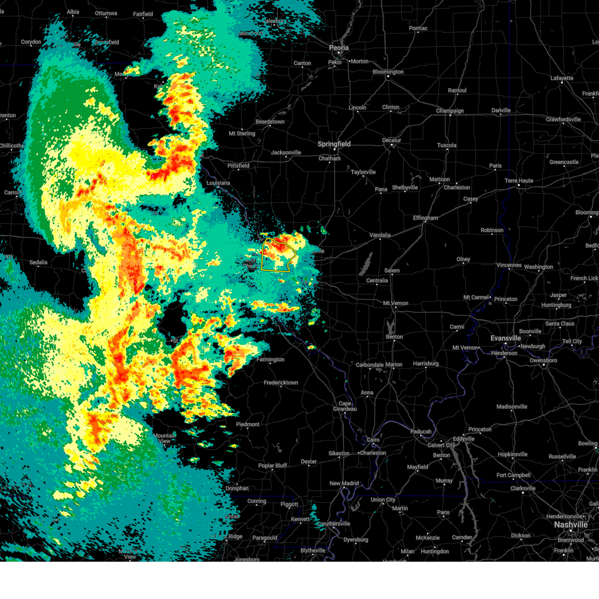 The storm which prompted the warning has moved out of the area. therefore, the warning has been allowed to expire. a tornado watch remains in effect until 300 am cdt tuesday for a portion of east central missouri. The storm which prompted the warning has moved out of the area. therefore, the warning has been allowed to expire. a tornado watch remains in effect until 300 am cdt tuesday for a portion of east central missouri.
|
| 5/19/2025 8:55 PM CDT |
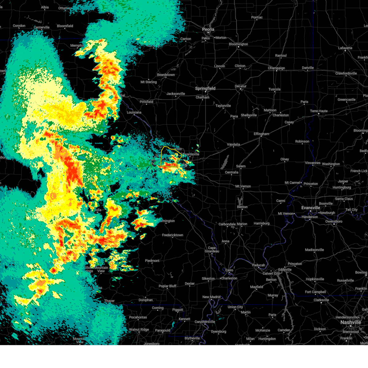 At 855 pm cdt, a severe thunderstorm was located over berkeley, moving north at 40 mph (radar indicated). Hazards include two inch hail and 60 mph wind gusts. People and animals outdoors will be injured. expect hail damage to roofs, siding, windows, and vehicles. expect wind damage to roofs, siding, and trees. this severe thunderstorm will be near, ladue, town and country and st. louis around 840 pm cdt. this includes the following state parks, confluence state park and first missouri state capitol historic site. This includes interstate 70 in missouri between exits 228 and 231. At 855 pm cdt, a severe thunderstorm was located over berkeley, moving north at 40 mph (radar indicated). Hazards include two inch hail and 60 mph wind gusts. People and animals outdoors will be injured. expect hail damage to roofs, siding, windows, and vehicles. expect wind damage to roofs, siding, and trees. this severe thunderstorm will be near, ladue, town and country and st. louis around 840 pm cdt. this includes the following state parks, confluence state park and first missouri state capitol historic site. This includes interstate 70 in missouri between exits 228 and 231.
|
| 5/19/2025 8:41 PM CDT |
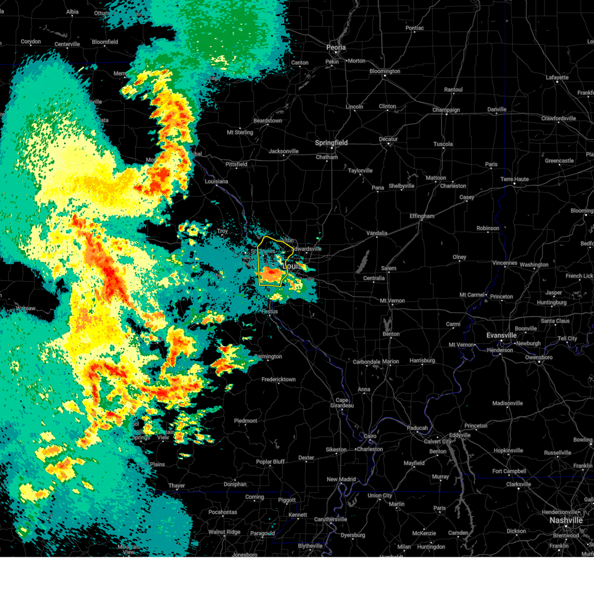 At 841 pm cdt, a severe thunderstorm was located over ladue, moving north at 40 mph (trained spotters reported golf ball sized hail north of kirkwood). Hazards include golf ball size hail and 70 mph wind gusts. People and animals outdoors will be injured. expect hail damage to roofs, siding, windows, and vehicles. expect considerable tree damage. wind damage is also likely to mobile homes, roofs, and outbuildings. this severe thunderstorm will be near, kirkwood, des peres, glendale, oakland, warson woods, crestwood, sunset hills, webster groves, fenton and manchester around 835 pm cdt. ladue, frontenac, huntleigh, westwood, crystal lake park, town and country, rock hill, richmond heights, brentwood and country life acres around 840 pm cdt. other locations impacted by the severe thunderstorm include peerless park. this includes the following state parks, scott joplin historic site, confluence state park and first missouri state capitol historic site. this includes the following highways, interstate 70 in missouri between exits 227 and 231. Interstate 44 in missouri between exits 272 and 277. At 841 pm cdt, a severe thunderstorm was located over ladue, moving north at 40 mph (trained spotters reported golf ball sized hail north of kirkwood). Hazards include golf ball size hail and 70 mph wind gusts. People and animals outdoors will be injured. expect hail damage to roofs, siding, windows, and vehicles. expect considerable tree damage. wind damage is also likely to mobile homes, roofs, and outbuildings. this severe thunderstorm will be near, kirkwood, des peres, glendale, oakland, warson woods, crestwood, sunset hills, webster groves, fenton and manchester around 835 pm cdt. ladue, frontenac, huntleigh, westwood, crystal lake park, town and country, rock hill, richmond heights, brentwood and country life acres around 840 pm cdt. other locations impacted by the severe thunderstorm include peerless park. this includes the following state parks, scott joplin historic site, confluence state park and first missouri state capitol historic site. this includes the following highways, interstate 70 in missouri between exits 227 and 231. Interstate 44 in missouri between exits 272 and 277.
|
| 5/19/2025 8:37 PM CDT |
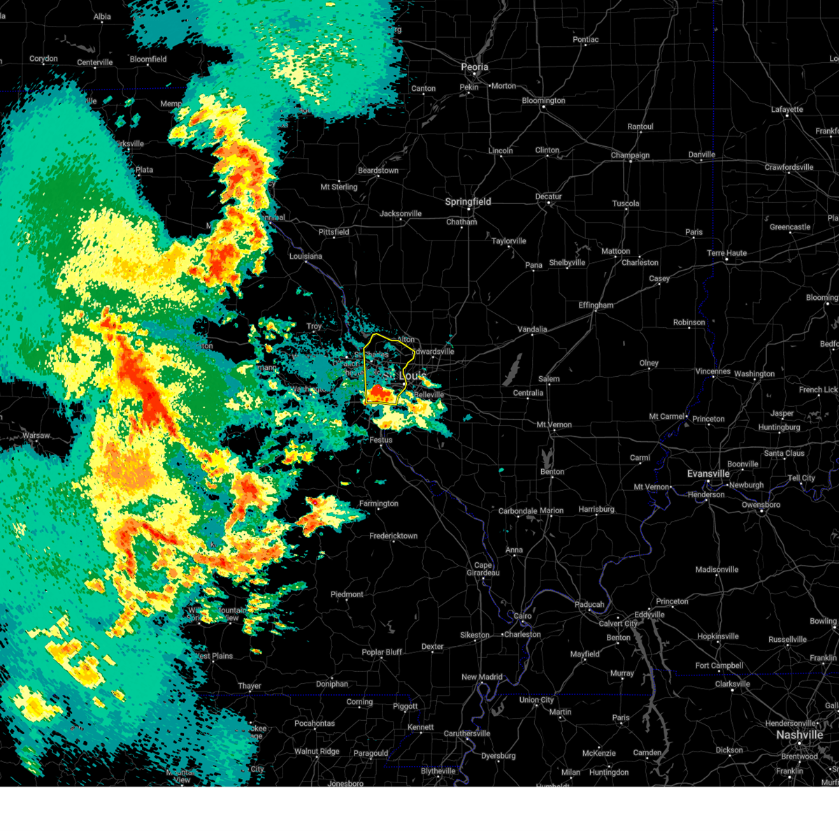 At 837 pm cdt, a severe thunderstorm was located over huntleigh, or over warson woods, moving north at 40 mph (radar indicated). Hazards include 70 mph wind gusts and ping pong ball size hail. People and animals outdoors will be injured. expect hail damage to roofs, siding, windows, and vehicles. expect considerable tree damage. wind damage is also likely to mobile homes, roofs, and outbuildings. this severe thunderstorm will be near, kirkwood, des peres, glendale, oakland, warson woods, crestwood, sunset hills, webster groves, fenton and manchester around 835 pm cdt. ladue, frontenac, huntleigh, westwood, crystal lake park, town and country, rock hill, richmond heights, brentwood and country life acres around 840 pm cdt. other locations impacted by the severe thunderstorm include peerless park. this includes the following state parks, scott joplin historic site, confluence state park and first missouri state capitol historic site. this includes the following highways, interstate 70 in missouri between exits 227 and 231. Interstate 44 in missouri between exits 272 and 277. At 837 pm cdt, a severe thunderstorm was located over huntleigh, or over warson woods, moving north at 40 mph (radar indicated). Hazards include 70 mph wind gusts and ping pong ball size hail. People and animals outdoors will be injured. expect hail damage to roofs, siding, windows, and vehicles. expect considerable tree damage. wind damage is also likely to mobile homes, roofs, and outbuildings. this severe thunderstorm will be near, kirkwood, des peres, glendale, oakland, warson woods, crestwood, sunset hills, webster groves, fenton and manchester around 835 pm cdt. ladue, frontenac, huntleigh, westwood, crystal lake park, town and country, rock hill, richmond heights, brentwood and country life acres around 840 pm cdt. other locations impacted by the severe thunderstorm include peerless park. this includes the following state parks, scott joplin historic site, confluence state park and first missouri state capitol historic site. this includes the following highways, interstate 70 in missouri between exits 227 and 231. Interstate 44 in missouri between exits 272 and 277.
|
| 5/19/2025 8:33 PM CDT |
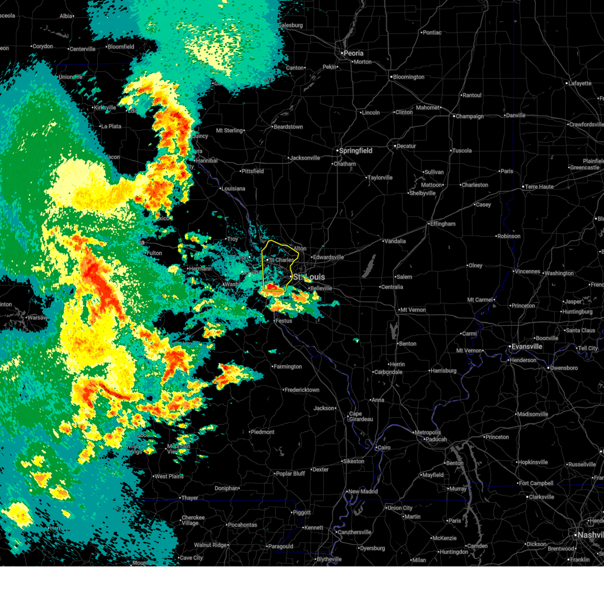 Svrlsx the national weather service in st louis has issued a * severe thunderstorm warning for, northeastern saint charles county in east central missouri, saint louis county in east central missouri, saint louis city in east central missouri, * until 915 pm cdt. * at 833 pm cdt, a severe thunderstorm was located over kirkwood, moving north at 40 mph (radar indicated). Hazards include ping pong ball size hail and 60 mph wind gusts. People and animals outdoors will be injured. expect hail damage to roofs, siding, windows, and vehicles. expect wind damage to roofs, siding, and trees. this severe thunderstorm will be near, kirkwood, des peres, glendale, oakland, warson woods, crestwood, sunset hills, webster groves, fenton and manchester around 835 pm cdt. ladue, frontenac, huntleigh, westwood, crystal lake park, town and country, rock hill, richmond heights, brentwood and country life acres around 840 pm cdt. other locations impacted by the severe thunderstorm include peerless park. this includes the following state parks, scott joplin historic site, confluence state park and first missouri state capitol historic site. this includes the following highways, interstate 70 in missouri between exits 227 and 231. Interstate 44 in missouri between exits 272 and 277. Svrlsx the national weather service in st louis has issued a * severe thunderstorm warning for, northeastern saint charles county in east central missouri, saint louis county in east central missouri, saint louis city in east central missouri, * until 915 pm cdt. * at 833 pm cdt, a severe thunderstorm was located over kirkwood, moving north at 40 mph (radar indicated). Hazards include ping pong ball size hail and 60 mph wind gusts. People and animals outdoors will be injured. expect hail damage to roofs, siding, windows, and vehicles. expect wind damage to roofs, siding, and trees. this severe thunderstorm will be near, kirkwood, des peres, glendale, oakland, warson woods, crestwood, sunset hills, webster groves, fenton and manchester around 835 pm cdt. ladue, frontenac, huntleigh, westwood, crystal lake park, town and country, rock hill, richmond heights, brentwood and country life acres around 840 pm cdt. other locations impacted by the severe thunderstorm include peerless park. this includes the following state parks, scott joplin historic site, confluence state park and first missouri state capitol historic site. this includes the following highways, interstate 70 in missouri between exits 227 and 231. Interstate 44 in missouri between exits 272 and 277.
|
| 5/16/2025 2:50 PM CDT | 4-foot diameter tree down at mcpherson avenue and taylor avenu in st. louis city county MO, 0.3 miles N of St. Louis, MO |
| 5/16/2025 2:50 PM CDT |
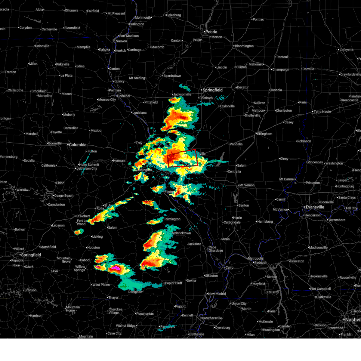 At 250 pm cdt, a confirmed and extremely dangerous tornado was located over venice, moving northeast at 50 mph. this is a particularly dangerous situation. take cover now! (radar confirmed tornado). Hazards include damaging tornado and golf ball size hail. You are in a life-threatening situation. flying debris may be deadly to those caught without shelter. mobile homes will be destroyed. considerable damage to homes, businesses, and vehicles is likely and complete destruction is possible. locations impacted include, st. louis, florissant, university city, granite city, o'fallon, east st. louis, hazelwood, collinsville, edwardsville, ferguson, fairview heights, clayton, jennings, glen carbon, bellefontaine neighbors, troy, berkeley, richmond heights, maplewood and maryville. this includes the following state parks, scott joplin historic site and horseshoe lake state park. this includes the following highways, interstate 64 in illinois near exit 9. interstate 55 in illinois near exit 23. Interstate 70 in illinois near exit 21. At 250 pm cdt, a confirmed and extremely dangerous tornado was located over venice, moving northeast at 50 mph. this is a particularly dangerous situation. take cover now! (radar confirmed tornado). Hazards include damaging tornado and golf ball size hail. You are in a life-threatening situation. flying debris may be deadly to those caught without shelter. mobile homes will be destroyed. considerable damage to homes, businesses, and vehicles is likely and complete destruction is possible. locations impacted include, st. louis, florissant, university city, granite city, o'fallon, east st. louis, hazelwood, collinsville, edwardsville, ferguson, fairview heights, clayton, jennings, glen carbon, bellefontaine neighbors, troy, berkeley, richmond heights, maplewood and maryville. this includes the following state parks, scott joplin historic site and horseshoe lake state park. this includes the following highways, interstate 64 in illinois near exit 9. interstate 55 in illinois near exit 23. Interstate 70 in illinois near exit 21.
|
| 5/16/2025 2:46 PM CDT | Multiple trees down... others broken off at the top... and cell phone tower damaged at courion industrie in st. louis city county MO, 1.7 miles WSW of St. Louis, MO |
| 5/16/2025 2:46 PM CDT | Missouri dot reported tree debris littering i-70 at carri in st. louis city county MO, 2.8 miles SW of St. Louis, MO |
| 5/16/2025 2:45 PM CDT |
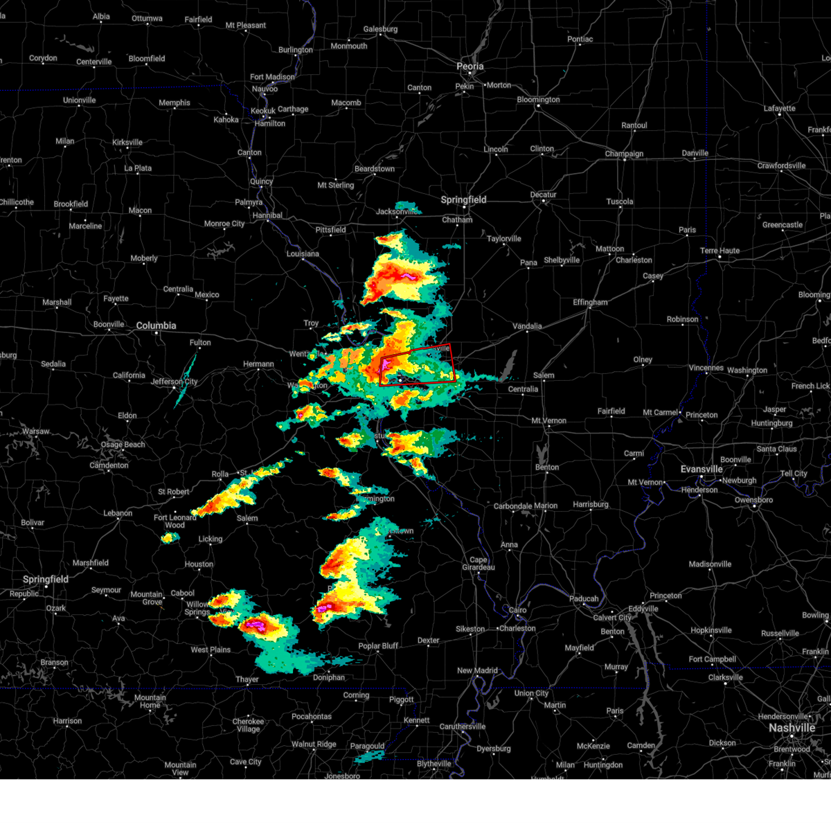 At 245 pm cdt, a confirmed and extremely dangerous tornado was located over st. louis, moving east at 50 mph. this is a particularly dangerous situation. take cover now! (radar confirmed tornado). Hazards include damaging tornado. You are in a life-threatening situation. flying debris may be deadly to those caught without shelter. mobile homes will be destroyed. considerable damage to homes, businesses, and vehicles is likely and complete destruction is possible. locations impacted include, st. louis, florissant, university city, granite city, o'fallon, east st. louis, hazelwood, collinsville, edwardsville, webster groves, ferguson, fairview heights, overland, clayton, jennings, glen carbon, bellefontaine neighbors, troy, berkeley and richmond heights. this includes the following state parks, scott joplin historic site and horseshoe lake state park. this includes the following highways, interstate 64 in illinois near exit 9. interstate 55 in illinois near exit 23. Interstate 70 in illinois near exit 21. At 245 pm cdt, a confirmed and extremely dangerous tornado was located over st. louis, moving east at 50 mph. this is a particularly dangerous situation. take cover now! (radar confirmed tornado). Hazards include damaging tornado. You are in a life-threatening situation. flying debris may be deadly to those caught without shelter. mobile homes will be destroyed. considerable damage to homes, businesses, and vehicles is likely and complete destruction is possible. locations impacted include, st. louis, florissant, university city, granite city, o'fallon, east st. louis, hazelwood, collinsville, edwardsville, webster groves, ferguson, fairview heights, overland, clayton, jennings, glen carbon, bellefontaine neighbors, troy, berkeley and richmond heights. this includes the following state parks, scott joplin historic site and horseshoe lake state park. this includes the following highways, interstate 64 in illinois near exit 9. interstate 55 in illinois near exit 23. Interstate 70 in illinois near exit 21.
|
| 5/16/2025 2:44 PM CDT | Significant front porch damage to residence along plymouth avenu in st. louis city county MO, 2 miles SE of St. Louis, MO |
| 5/16/2025 2:43 PM CDT | Northwest fire district relayed a report of large trees down off woodbourne drive just southwest of wydown boulevard and skinke in st. louis city county MO, 2.3 miles ENE of St. Louis, MO |
| 5/16/2025 2:43 PM CDT | Several large trees down on maryland ave in west st. loui in st. louis city county MO, 0.9 miles N of St. Louis, MO |
| 5/16/2025 2:42 PM CDT | 5655 pershing avenue in west st. louis experienced considerable wind damage to the apartment building... including windows blown ou in st. louis city county MO, 1.1 miles ENE of St. Louis, MO |
| 5/16/2025 2:41 PM CDT | Numerous trees down across the are in st. louis city county MO, 0.9 miles N of St. Louis, MO |
| 5/16/2025 2:41 PM CDT | Significant damage to apartment complex. what looks like parts of the building are laying within the complexs interior courtyard. balcony bars are bent and nearly falli in st. louis city county MO, 1.1 miles ENE of St. Louis, MO |
| 5/16/2025 2:34 PM CDT |
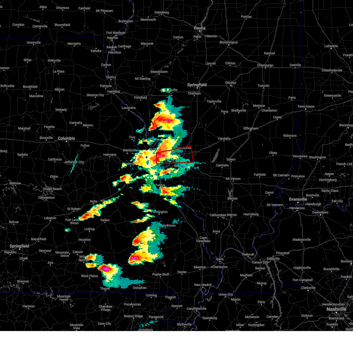 Torlsx the national weather service in st louis has issued a * tornado warning for, southern madison county in southwestern illinois, northern saint clair county in southwestern illinois, central saint louis county in east central missouri, saint louis city in east central missouri, * until 315 pm cdt. * at 234 pm cdt, a severe thunderstorm capable of producing a tornado was located over st. ann, or over overland, moving east at 50 mph (radar indicated rotation). Hazards include tornado. Flying debris will be dangerous to those caught without shelter. mobile homes will be damaged or destroyed. damage to roofs, windows and vehicles will occur. Tree damage is likely. Torlsx the national weather service in st louis has issued a * tornado warning for, southern madison county in southwestern illinois, northern saint clair county in southwestern illinois, central saint louis county in east central missouri, saint louis city in east central missouri, * until 315 pm cdt. * at 234 pm cdt, a severe thunderstorm capable of producing a tornado was located over st. ann, or over overland, moving east at 50 mph (radar indicated rotation). Hazards include tornado. Flying debris will be dangerous to those caught without shelter. mobile homes will be damaged or destroyed. damage to roofs, windows and vehicles will occur. Tree damage is likely.
|
| 5/16/2025 2:29 PM CDT |
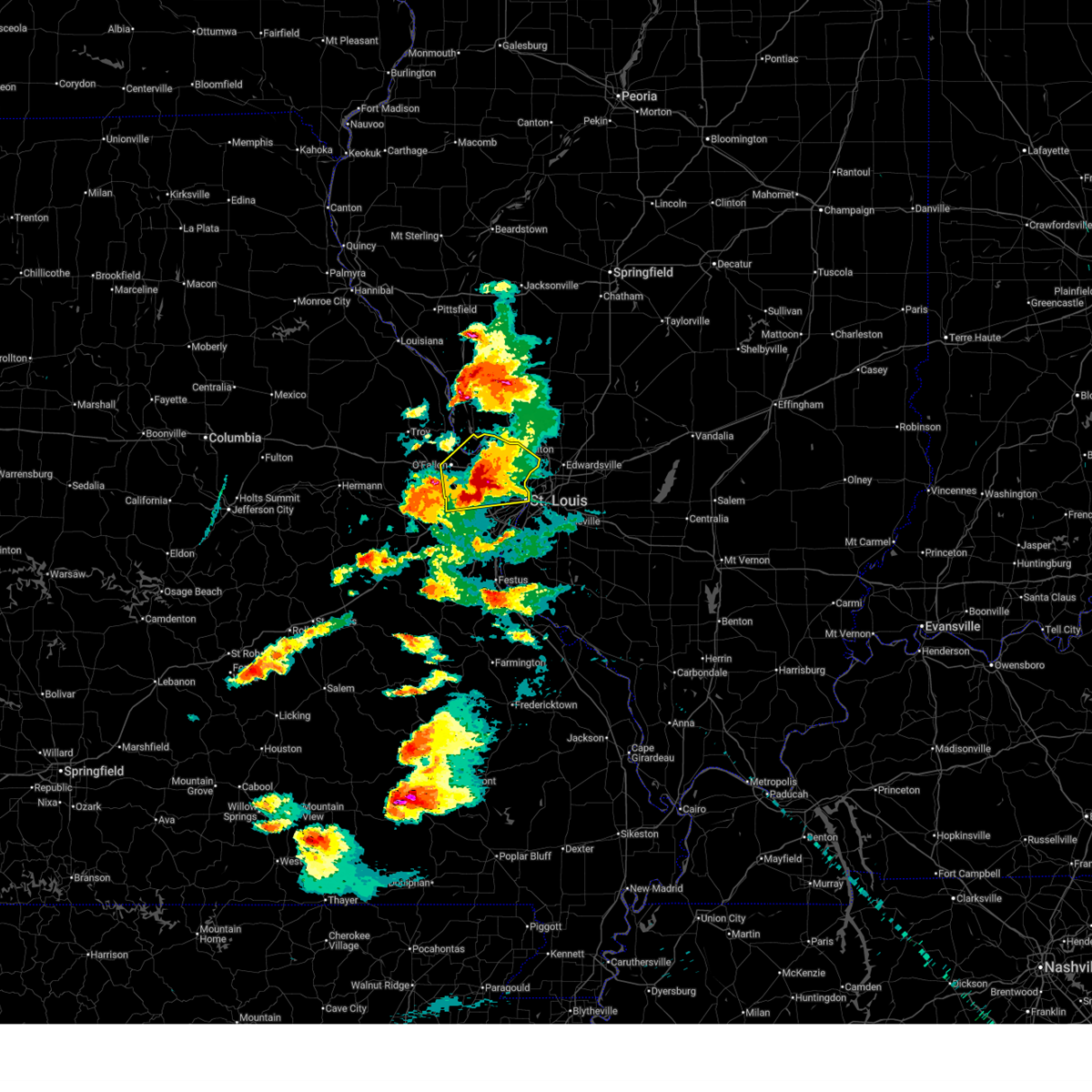 At 229 pm cdt, a severe thunderstorm was located over maryland heights, moving east at 45 mph (trained spotters reported). Hazards include tennis ball size hail and 60 mph wind gusts. People and animals outdoors will be injured. expect hail damage to roofs, siding, windows, and vehicles. expect wind damage to roofs, siding, and trees. locations impacted include, st. louis, o'fallon, st. charles, st. peters, florissant, chesterfield, wildwood, university city, ballwin, alton, kirkwood, maryland heights, east st. louis, hazelwood, webster groves, ferguson, manchester, godfrey, creve coeur and overland. this includes the following state parks, babler memorial state park, scott joplin historic site, confluence state park and first missouri state capitol historic site. This includes interstate 70 in missouri between exits 216 and 231. At 229 pm cdt, a severe thunderstorm was located over maryland heights, moving east at 45 mph (trained spotters reported). Hazards include tennis ball size hail and 60 mph wind gusts. People and animals outdoors will be injured. expect hail damage to roofs, siding, windows, and vehicles. expect wind damage to roofs, siding, and trees. locations impacted include, st. louis, o'fallon, st. charles, st. peters, florissant, chesterfield, wildwood, university city, ballwin, alton, kirkwood, maryland heights, east st. louis, hazelwood, webster groves, ferguson, manchester, godfrey, creve coeur and overland. this includes the following state parks, babler memorial state park, scott joplin historic site, confluence state park and first missouri state capitol historic site. This includes interstate 70 in missouri between exits 216 and 231.
|
| 5/16/2025 2:20 PM CDT |
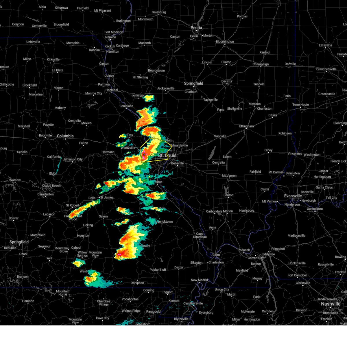 At 220 pm cdt, a severe thunderstorm was located over harvester, or near weldon spring, moving east at 50 mph (national weather service observed). Hazards include tennis ball size hail and 60 mph wind gusts. People and animals outdoors will be injured. expect hail damage to roofs, siding, windows, and vehicles. expect wind damage to roofs, siding, and trees. locations impacted include, st. louis, o'fallon, st. charles, st. peters, florissant, chesterfield, wildwood, university city, ballwin, alton, kirkwood, maryland heights, east st. louis, hazelwood, webster groves, ferguson, manchester, godfrey, creve coeur and overland. this includes the following state parks, babler memorial state park, scott joplin historic site, confluence state park and first missouri state capitol historic site. This includes interstate 70 in missouri between exits 216 and 231. At 220 pm cdt, a severe thunderstorm was located over harvester, or near weldon spring, moving east at 50 mph (national weather service observed). Hazards include tennis ball size hail and 60 mph wind gusts. People and animals outdoors will be injured. expect hail damage to roofs, siding, windows, and vehicles. expect wind damage to roofs, siding, and trees. locations impacted include, st. louis, o'fallon, st. charles, st. peters, florissant, chesterfield, wildwood, university city, ballwin, alton, kirkwood, maryland heights, east st. louis, hazelwood, webster groves, ferguson, manchester, godfrey, creve coeur and overland. this includes the following state parks, babler memorial state park, scott joplin historic site, confluence state park and first missouri state capitol historic site. This includes interstate 70 in missouri between exits 216 and 231.
|
| 5/16/2025 2:18 PM CDT |
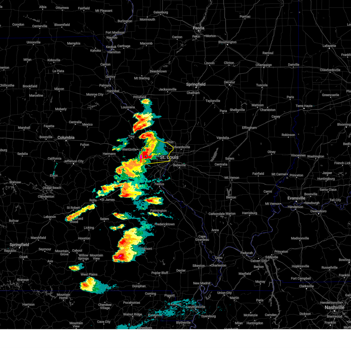 At 218 pm cdt, a severe thunderstorm was located over weldon spring, moving east at 50 mph (national weather service employees observed). Hazards include two inch hail and 60 mph wind gusts. People and animals outdoors will be injured. expect hail damage to roofs, siding, windows, and vehicles. expect wind damage to roofs, siding, and trees. locations impacted include, st. louis, o'fallon, st. charles, st. peters, florissant, chesterfield, wildwood, university city, ballwin, alton, kirkwood, maryland heights, east st. louis, hazelwood, webster groves, ferguson, manchester, godfrey, creve coeur and overland. this includes the following state parks, babler memorial state park, scott joplin historic site, confluence state park and first missouri state capitol historic site. This includes interstate 70 in missouri between exits 216 and 231. At 218 pm cdt, a severe thunderstorm was located over weldon spring, moving east at 50 mph (national weather service employees observed). Hazards include two inch hail and 60 mph wind gusts. People and animals outdoors will be injured. expect hail damage to roofs, siding, windows, and vehicles. expect wind damage to roofs, siding, and trees. locations impacted include, st. louis, o'fallon, st. charles, st. peters, florissant, chesterfield, wildwood, university city, ballwin, alton, kirkwood, maryland heights, east st. louis, hazelwood, webster groves, ferguson, manchester, godfrey, creve coeur and overland. this includes the following state parks, babler memorial state park, scott joplin historic site, confluence state park and first missouri state capitol historic site. This includes interstate 70 in missouri between exits 216 and 231.
|
| 5/16/2025 2:02 PM CDT |
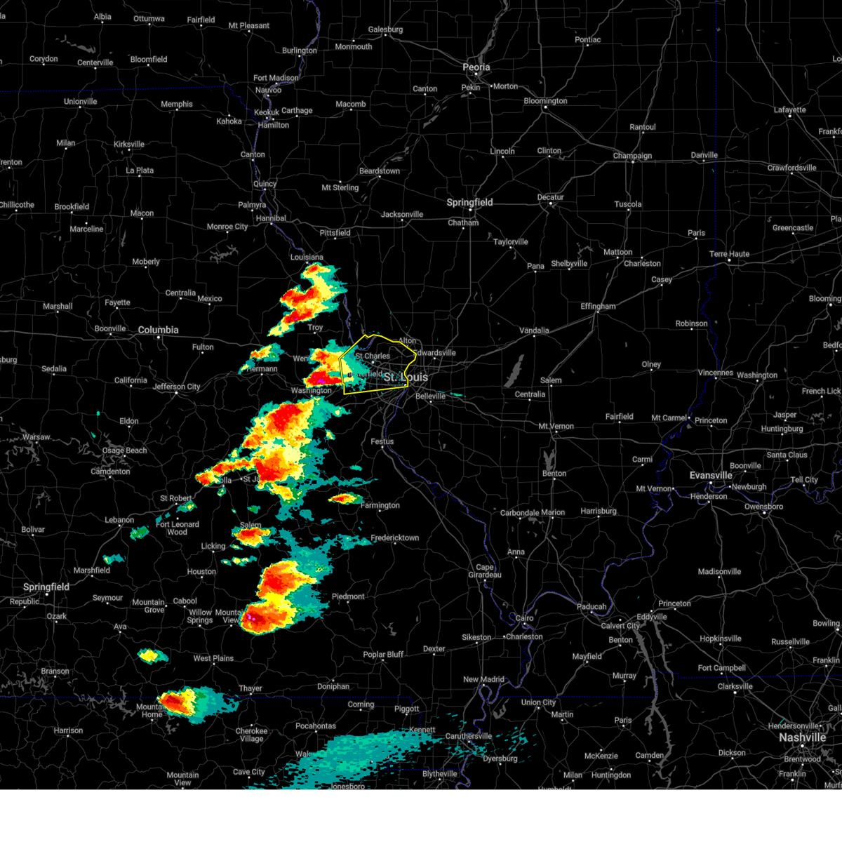 Svrlsx the national weather service in st louis has issued a * severe thunderstorm warning for, southeastern calhoun county in southwestern illinois, northeastern saint charles county in east central missouri, saint louis county in east central missouri, saint louis city in east central missouri, * until 245 pm cdt. * at 202 pm cdt, a severe thunderstorm was located over defiance, or 7 miles southwest of dardenne prairie, moving east at 55 mph (radar indicated). Hazards include two inch hail and 60 mph wind gusts. People and animals outdoors will be injured. expect hail damage to roofs, siding, windows, and vehicles. Expect wind damage to roofs, siding, and trees. Svrlsx the national weather service in st louis has issued a * severe thunderstorm warning for, southeastern calhoun county in southwestern illinois, northeastern saint charles county in east central missouri, saint louis county in east central missouri, saint louis city in east central missouri, * until 245 pm cdt. * at 202 pm cdt, a severe thunderstorm was located over defiance, or 7 miles southwest of dardenne prairie, moving east at 55 mph (radar indicated). Hazards include two inch hail and 60 mph wind gusts. People and animals outdoors will be injured. expect hail damage to roofs, siding, windows, and vehicles. Expect wind damage to roofs, siding, and trees.
|
| 4/20/2025 8:24 PM CDT |
 At 824 pm cdt, severe thunderstorms were located along a line from over fairview heights to near chester, moving east at 60 mph (radar indicated). Hazards include 60 mph wind gusts and small hail. Expect damage to roofs, siding, and trees. locations impacted include, st. louis, belleville, o'fallon, east st. louis, fairview heights, cahokia, swansea, shiloh, columbia, chester, mascoutah, centreville, lebanon, freeburg, sparta, dupo, millstadt, red bud, scott afb and cahokia parks airport. this includes the following highways, interstate 64 in illinois between exits 14 and 23. Interstate 55 in missouri near exit 141. At 824 pm cdt, severe thunderstorms were located along a line from over fairview heights to near chester, moving east at 60 mph (radar indicated). Hazards include 60 mph wind gusts and small hail. Expect damage to roofs, siding, and trees. locations impacted include, st. louis, belleville, o'fallon, east st. louis, fairview heights, cahokia, swansea, shiloh, columbia, chester, mascoutah, centreville, lebanon, freeburg, sparta, dupo, millstadt, red bud, scott afb and cahokia parks airport. this includes the following highways, interstate 64 in illinois between exits 14 and 23. Interstate 55 in missouri near exit 141.
|
| 4/20/2025 8:24 PM CDT |
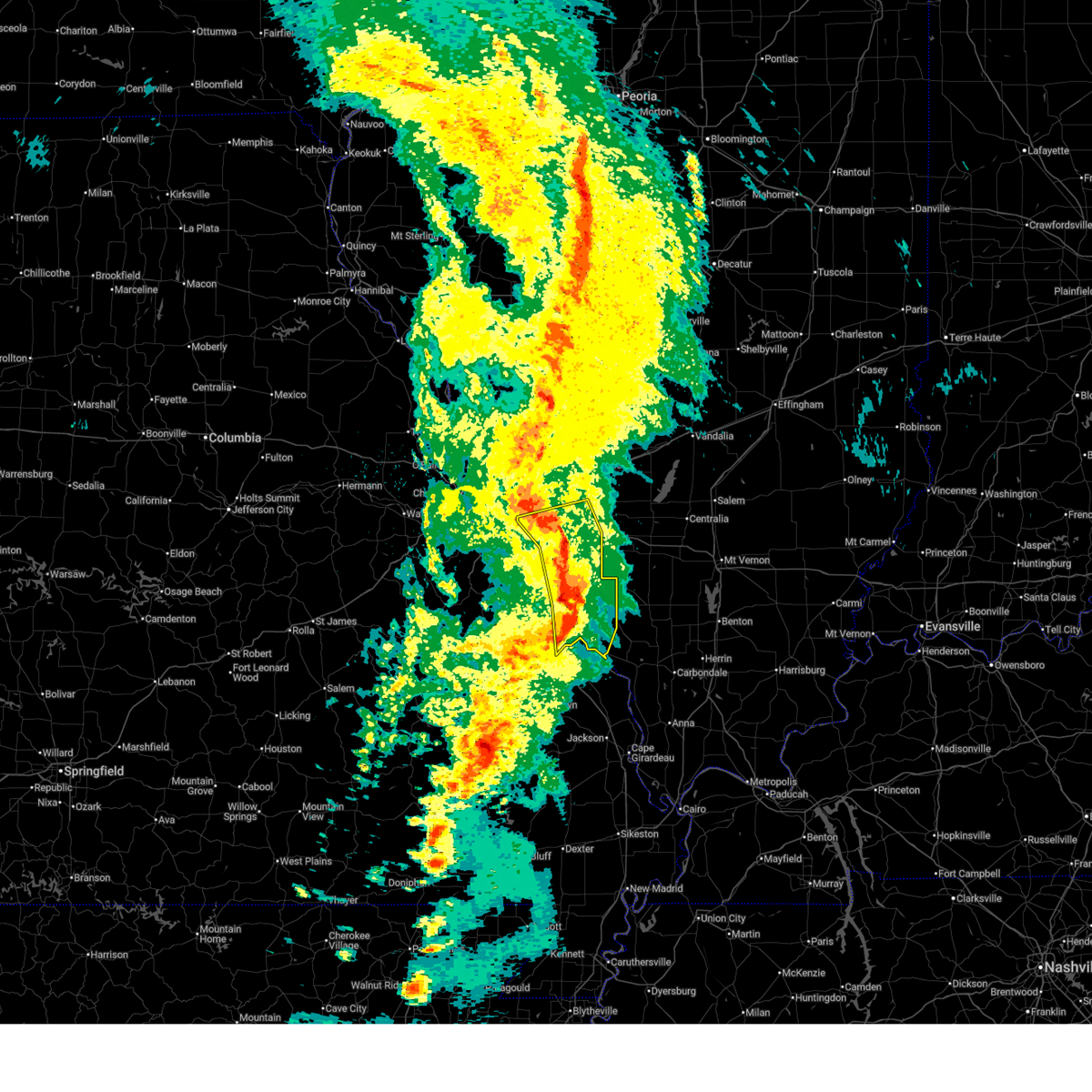 the severe thunderstorm warning has been cancelled and is no longer in effect the severe thunderstorm warning has been cancelled and is no longer in effect
|
| 4/20/2025 8:11 PM CDT |
 At 811 pm cdt, severe thunderstorms were located along a line from over east carondelet to near st. mary, or along a line from over lemay to 11 miles south of ste. genevieve, moving east at 60 mph (radar indicated). Hazards include 60 mph wind gusts and small hail. Expect damage to roofs, siding, and trees. locations impacted include, st. louis, belleville, o'fallon, east st. louis, arnold, fairview heights, cahokia, swansea, shiloh, waterloo, columbia, chester, sunset hills, mascoutah, centreville, lebanon, ste. genevieve, freeburg, sparta and dupo. this includes the following state parks, felix valle house state park. this includes the following highways, interstate 64 in illinois between exits 14 and 23. Interstate 55 in missouri between exits 141 and 150, and near exit 191. At 811 pm cdt, severe thunderstorms were located along a line from over east carondelet to near st. mary, or along a line from over lemay to 11 miles south of ste. genevieve, moving east at 60 mph (radar indicated). Hazards include 60 mph wind gusts and small hail. Expect damage to roofs, siding, and trees. locations impacted include, st. louis, belleville, o'fallon, east st. louis, arnold, fairview heights, cahokia, swansea, shiloh, waterloo, columbia, chester, sunset hills, mascoutah, centreville, lebanon, ste. genevieve, freeburg, sparta and dupo. this includes the following state parks, felix valle house state park. this includes the following highways, interstate 64 in illinois between exits 14 and 23. Interstate 55 in missouri between exits 141 and 150, and near exit 191.
|
| 4/20/2025 8:11 PM CDT |
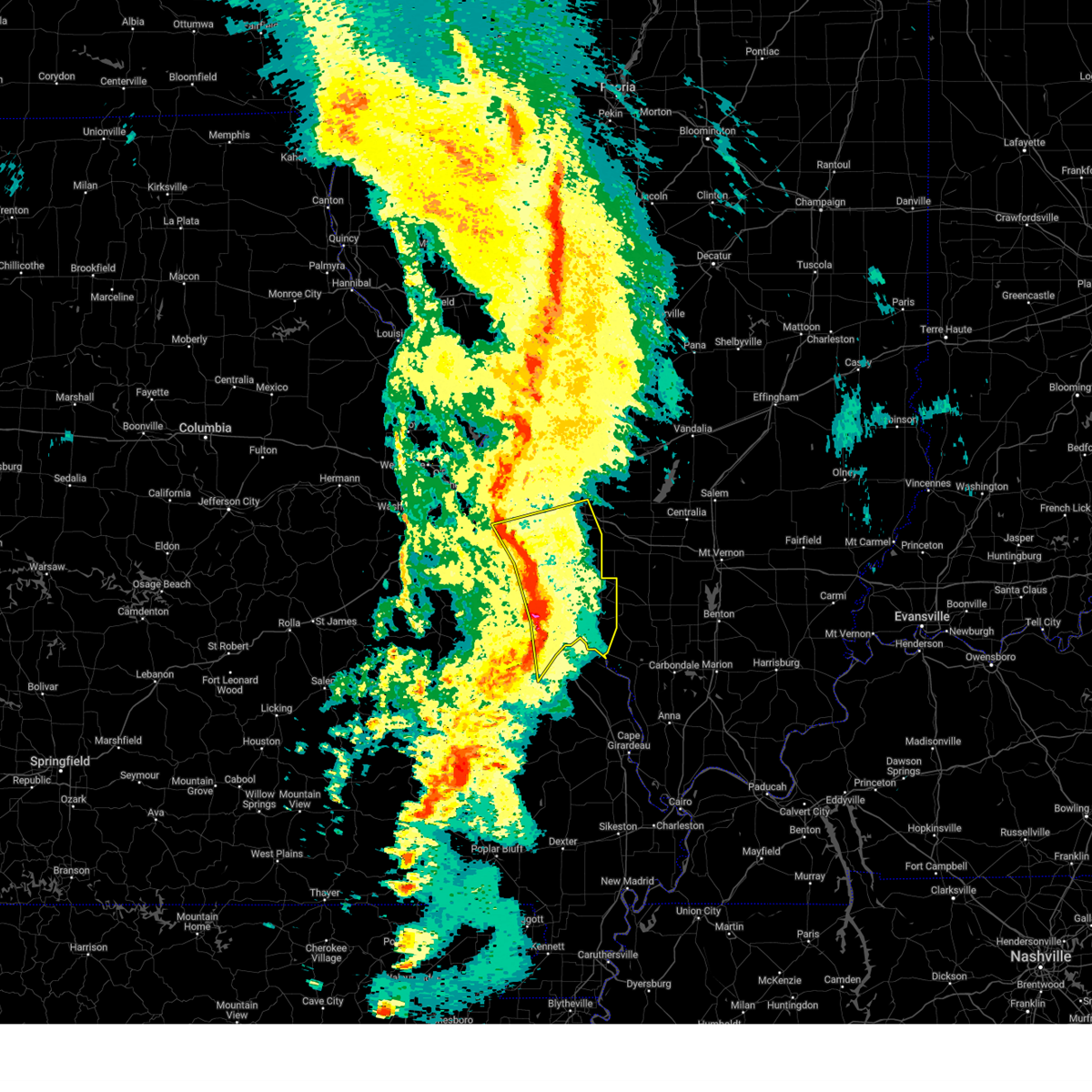 the severe thunderstorm warning has been cancelled and is no longer in effect the severe thunderstorm warning has been cancelled and is no longer in effect
|
| 4/20/2025 8:01 PM CDT |
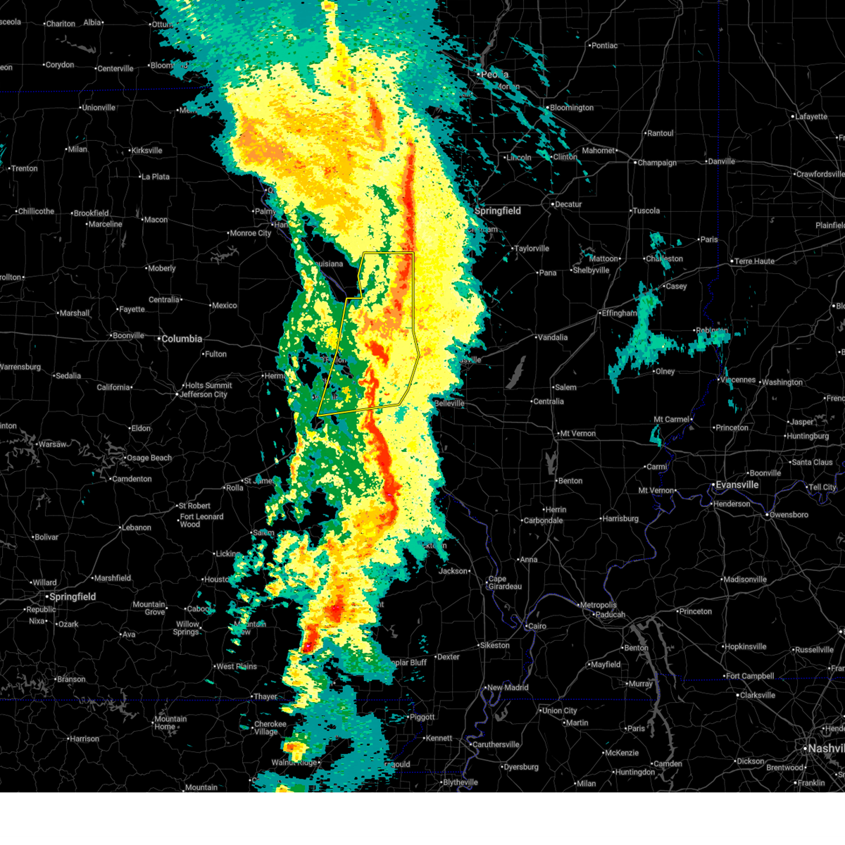 The storms which prompted the warning have weakened below severe limits, and no longer pose an immediate threat to life or property. therefore, the warning has been allowed to expire. however, gusty winds are still possible with these thunderstorms. The storms which prompted the warning have weakened below severe limits, and no longer pose an immediate threat to life or property. therefore, the warning has been allowed to expire. however, gusty winds are still possible with these thunderstorms.
|
| 4/20/2025 7:53 PM CDT |
 Svrlsx the national weather service in st louis has issued a * severe thunderstorm warning for, monroe county in southwestern illinois, randolph county in southwestern illinois, saint clair county in southwestern illinois, northeastern jefferson county in east central missouri, south central saint louis county in east central missouri, northern madison county in southeastern missouri, sainte genevieve county in southeastern missouri, southeastern saint francois county in southeastern missouri, * until 845 pm cdt. * at 753 pm cdt, severe thunderstorms were located along a line from over fenton to over womac, or along a line from over fenton to 10 miles northeast of fredericktown, moving east at 60 mph (radar indicated). Hazards include 60 mph wind gusts and small hail. expect damage to roofs, siding, and trees Svrlsx the national weather service in st louis has issued a * severe thunderstorm warning for, monroe county in southwestern illinois, randolph county in southwestern illinois, saint clair county in southwestern illinois, northeastern jefferson county in east central missouri, south central saint louis county in east central missouri, northern madison county in southeastern missouri, sainte genevieve county in southeastern missouri, southeastern saint francois county in southeastern missouri, * until 845 pm cdt. * at 753 pm cdt, severe thunderstorms were located along a line from over fenton to over womac, or along a line from over fenton to 10 miles northeast of fredericktown, moving east at 60 mph (radar indicated). Hazards include 60 mph wind gusts and small hail. expect damage to roofs, siding, and trees
|
| 4/20/2025 7:23 PM CDT |
 At 723 pm cdt, severe thunderstorms were located along a line from 7 miles west of carrollton to near pacific, or along a line from 11 miles southwest of white hall to near pacific, moving east at 40 mph (radar indicated). Hazards include 60 mph wind gusts and small hail. Expect damage to roofs, siding, and trees. locations impacted include, st. louis, o'fallon, st. charles, st. peters, florissant, chesterfield, wildwood, university city, ballwin, granite city, wentzville, alton, kirkwood, maryland heights, east st. louis, hazelwood, webster groves, ferguson, manchester and godfrey. this includes the following state parks, babler memorial state park, scott joplin historic site, route 66 state park, castlewood state park, confluence state park, first missouri state capitol historic site and pere marquette state park. this includes the following highways, interstate 70 in missouri between exits 212 and 231. Interstate 44 in missouri between exits 251 and 277. At 723 pm cdt, severe thunderstorms were located along a line from 7 miles west of carrollton to near pacific, or along a line from 11 miles southwest of white hall to near pacific, moving east at 40 mph (radar indicated). Hazards include 60 mph wind gusts and small hail. Expect damage to roofs, siding, and trees. locations impacted include, st. louis, o'fallon, st. charles, st. peters, florissant, chesterfield, wildwood, university city, ballwin, granite city, wentzville, alton, kirkwood, maryland heights, east st. louis, hazelwood, webster groves, ferguson, manchester and godfrey. this includes the following state parks, babler memorial state park, scott joplin historic site, route 66 state park, castlewood state park, confluence state park, first missouri state capitol historic site and pere marquette state park. this includes the following highways, interstate 70 in missouri between exits 212 and 231. Interstate 44 in missouri between exits 251 and 277.
|
| 4/20/2025 7:23 PM CDT |
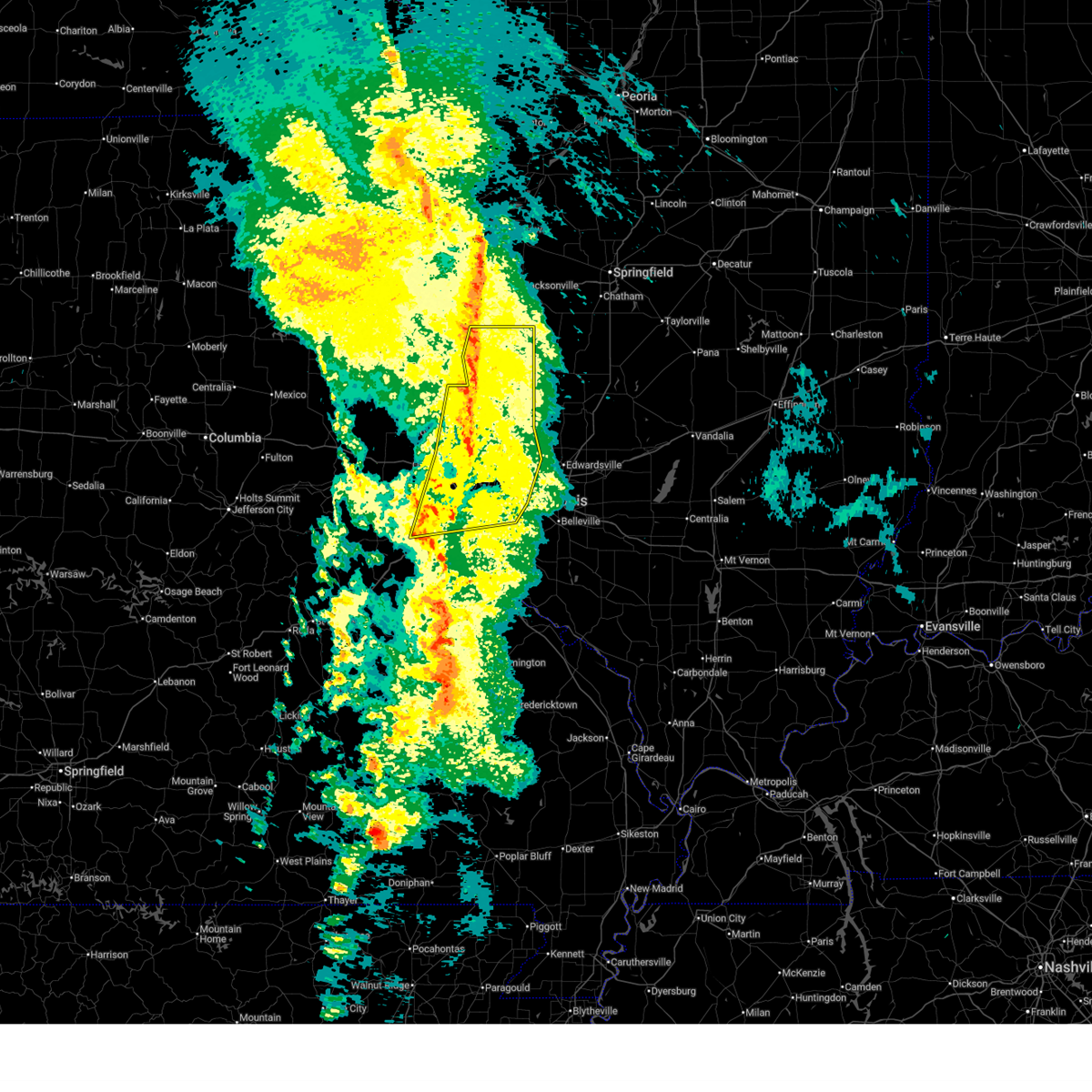 the severe thunderstorm warning has been cancelled and is no longer in effect the severe thunderstorm warning has been cancelled and is no longer in effect
|
| 4/20/2025 6:56 PM CDT |
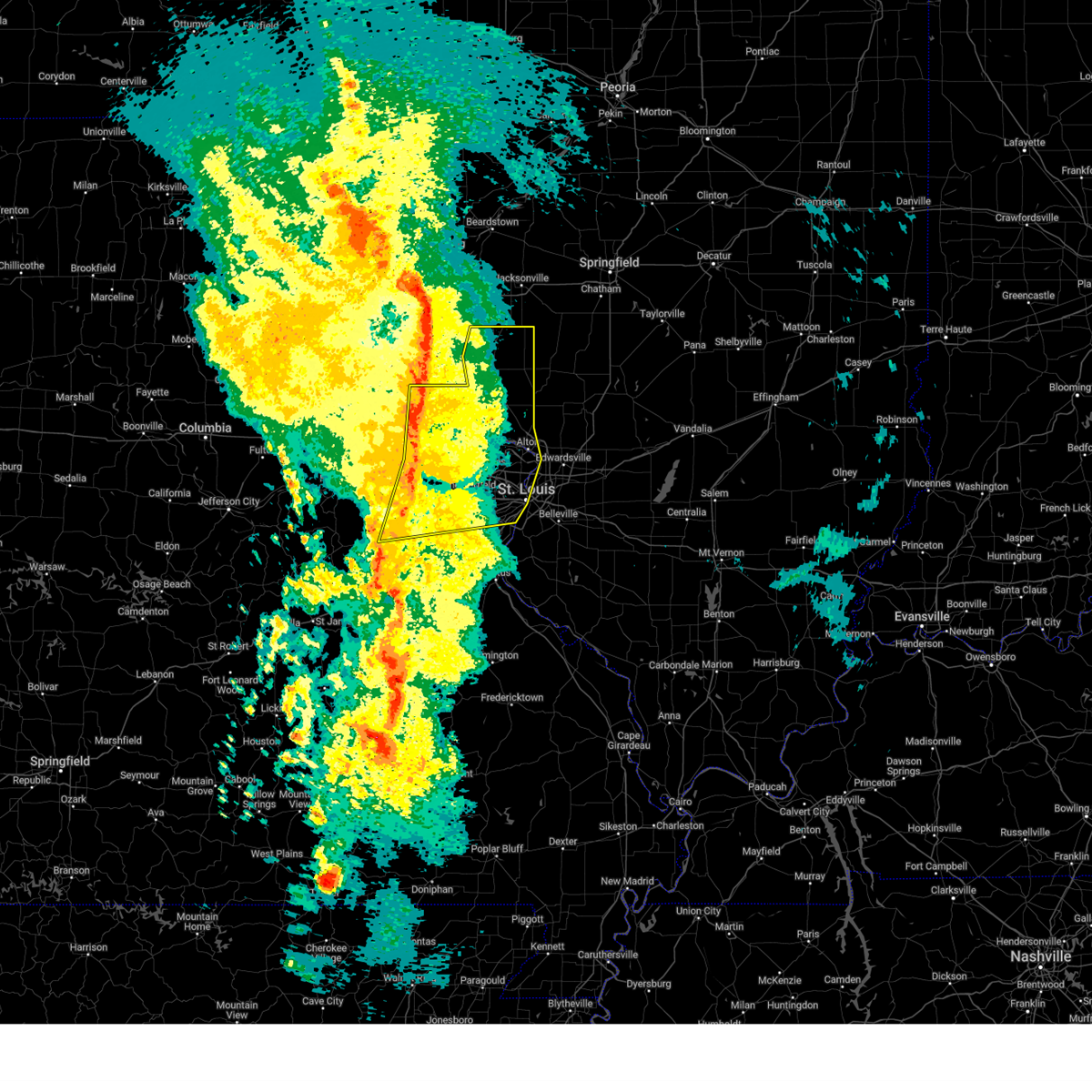 Svrlsx the national weather service in st louis has issued a * severe thunderstorm warning for, eastern calhoun county in southwestern illinois, greene county in southwestern illinois, jersey county in southwestern illinois, western madison county in southwestern illinois, northeastern franklin county in east central missouri, north central jefferson county in east central missouri, eastern lincoln county in east central missouri, saint charles county in east central missouri, saint louis county in east central missouri, southeastern warren county in east central missouri, saint louis city in east central missouri, * until 800 pm cdt. * at 656 pm cdt, severe thunderstorms were located along a line from 5 miles northwest of elsberry to over union, moving east at 40 mph (radar indicated). Hazards include 60 mph wind gusts and small hail. expect damage to roofs, siding, and trees Svrlsx the national weather service in st louis has issued a * severe thunderstorm warning for, eastern calhoun county in southwestern illinois, greene county in southwestern illinois, jersey county in southwestern illinois, western madison county in southwestern illinois, northeastern franklin county in east central missouri, north central jefferson county in east central missouri, eastern lincoln county in east central missouri, saint charles county in east central missouri, saint louis county in east central missouri, southeastern warren county in east central missouri, saint louis city in east central missouri, * until 800 pm cdt. * at 656 pm cdt, severe thunderstorms were located along a line from 5 miles northwest of elsberry to over union, moving east at 40 mph (radar indicated). Hazards include 60 mph wind gusts and small hail. expect damage to roofs, siding, and trees
|
| 4/10/2025 2:57 PM CDT |
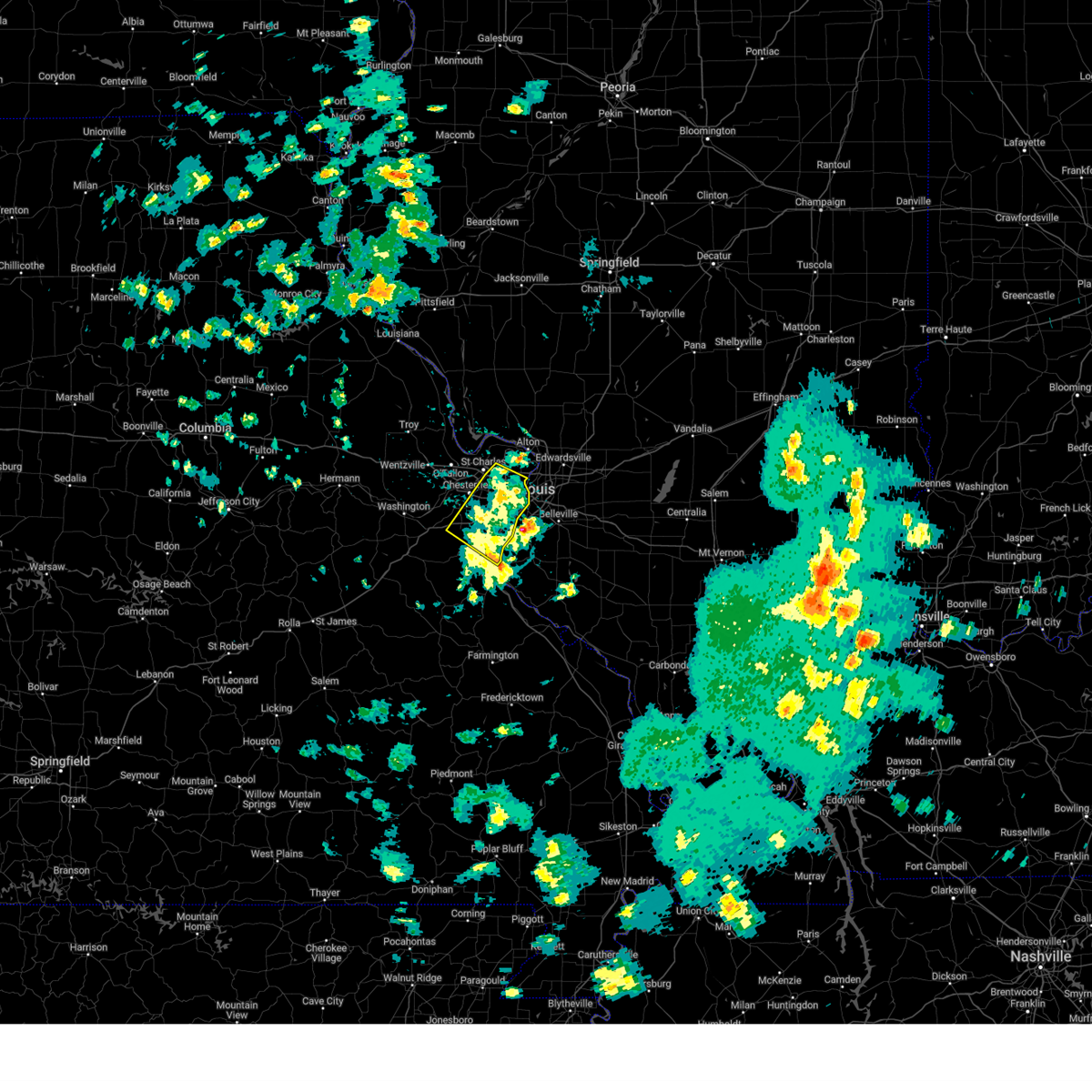 The storms which prompted the warning have moved out of the area. therefore, the warning will be allowed to expire. The storms which prompted the warning have moved out of the area. therefore, the warning will be allowed to expire.
|
| 4/10/2025 2:41 PM CDT |
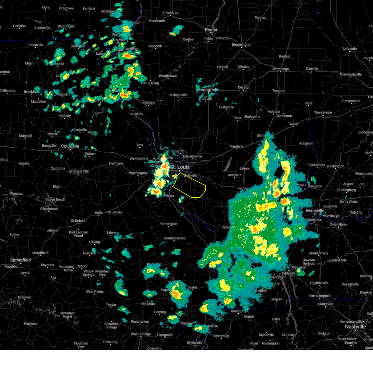 Svrlsx the national weather service in st louis has issued a * severe thunderstorm warning for, central monroe county in southwestern illinois, central saint clair county in southwestern illinois, * until 330 pm cdt. * at 241 pm cdt, a severe thunderstorm was located over east carondelet, or over dupo, moving southeast at 40 mph (radar indicated). Hazards include 60 mph wind gusts and quarter size hail. Hail damage to vehicles is expected. expect wind damage to roofs, siding, and trees. this severe thunderstorm will be near, dupo, columbia, east carondelet, lemay, cahokia, st. louis, oakville, cahokia parks airport and centreville around 245 pm cdt. millstadt, waterloo and swansea around 255 pm cdt. other locations impacted by the severe thunderstorm include sauget, new hanover, barr, floraville, paderborn, hecker, fayetteville, lenzburg and st. Libory. Svrlsx the national weather service in st louis has issued a * severe thunderstorm warning for, central monroe county in southwestern illinois, central saint clair county in southwestern illinois, * until 330 pm cdt. * at 241 pm cdt, a severe thunderstorm was located over east carondelet, or over dupo, moving southeast at 40 mph (radar indicated). Hazards include 60 mph wind gusts and quarter size hail. Hail damage to vehicles is expected. expect wind damage to roofs, siding, and trees. this severe thunderstorm will be near, dupo, columbia, east carondelet, lemay, cahokia, st. louis, oakville, cahokia parks airport and centreville around 245 pm cdt. millstadt, waterloo and swansea around 255 pm cdt. other locations impacted by the severe thunderstorm include sauget, new hanover, barr, floraville, paderborn, hecker, fayetteville, lenzburg and st. Libory.
|
| 4/10/2025 2:36 PM CDT |
 At 236 pm cdt, severe thunderstorms were located along a line from over country club hills to near antonia, or along a line from over jennings to near antonia, moving southeast at 40 mph (radar indicated). Hazards include 60 mph wind gusts and quarter size hail. Hail damage to vehicles is expected. expect wind damage to roofs, siding, and trees. this severe thunderstorm will be near, chesterfield, wildwood, ballwin, maryland heights, manchester, creve coeur, town and country, eureka, winchester and ellisville around 215 pm cdt. kirkwood, bridgeton, des peres, valley park, frontenac and crystal lake park around 220 pm cdt. other locations impacted by the severe thunderstorm include peerless park, parkdale, scotsdale, otto, kimmswick and sauget. this includes the following state parks, scott joplin historic site, route 66 state park, castlewood state park and mastodon historic site. this includes the following highways, interstate 70 in missouri near exit 231. interstate 44 in missouri between exits 261 and 277. Interstate 55 in missouri between exits 185 and 191. At 236 pm cdt, severe thunderstorms were located along a line from over country club hills to near antonia, or along a line from over jennings to near antonia, moving southeast at 40 mph (radar indicated). Hazards include 60 mph wind gusts and quarter size hail. Hail damage to vehicles is expected. expect wind damage to roofs, siding, and trees. this severe thunderstorm will be near, chesterfield, wildwood, ballwin, maryland heights, manchester, creve coeur, town and country, eureka, winchester and ellisville around 215 pm cdt. kirkwood, bridgeton, des peres, valley park, frontenac and crystal lake park around 220 pm cdt. other locations impacted by the severe thunderstorm include peerless park, parkdale, scotsdale, otto, kimmswick and sauget. this includes the following state parks, scott joplin historic site, route 66 state park, castlewood state park and mastodon historic site. this includes the following highways, interstate 70 in missouri near exit 231. interstate 44 in missouri between exits 261 and 277. Interstate 55 in missouri between exits 185 and 191.
|
| 4/10/2025 2:36 PM CDT |
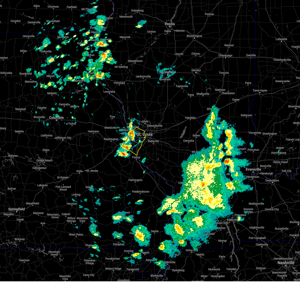 the severe thunderstorm warning has been cancelled and is no longer in effect the severe thunderstorm warning has been cancelled and is no longer in effect
|
| 4/10/2025 2:11 PM CDT |
 Svrlsx the national weather service in st louis has issued a * severe thunderstorm warning for, east central franklin county in east central missouri, northeastern jefferson county in east central missouri, central saint charles county in east central missouri, saint louis county in east central missouri, saint louis city in east central missouri, * until 300 pm cdt. * at 211 pm cdt, severe thunderstorms were located along a line from 6 miles north of st. peters to over gray summit, or along a line from 6 miles north of st. peters to over pacific, moving southeast at 40 mph (trained spotters reported. at 205 pm a 58 mph wind gust and quarter sized hail were reported in o'fallon). Hazards include 60 mph wind gusts and quarter size hail. Hail damage to vehicles is expected. expect wind damage to roofs, siding, and trees. this severe thunderstorm will be near, st. peters, chesterfield, wildwood, pacific, clarkson valley, gray summit, st. charles, harvester, ballwin and ellisville around 210 pm cdt. maryland heights, town and country, eureka, manchester and winchester around 215 pm cdt. other locations impacted by the severe thunderstorm include peerless park, parkdale, scotsdale, otto, kimmswick and sauget. this includes the following state parks, babler memorial state park, scott joplin historic site, route 66 state park, castlewood state park, mastodon historic site and first missouri state capitol historic site. this includes the following highways, interstate 70 in missouri between exits 227 and 231. interstate 44 in missouri between exits 261 and 277. Interstate 55 in missouri between exits 185 and 191. Svrlsx the national weather service in st louis has issued a * severe thunderstorm warning for, east central franklin county in east central missouri, northeastern jefferson county in east central missouri, central saint charles county in east central missouri, saint louis county in east central missouri, saint louis city in east central missouri, * until 300 pm cdt. * at 211 pm cdt, severe thunderstorms were located along a line from 6 miles north of st. peters to over gray summit, or along a line from 6 miles north of st. peters to over pacific, moving southeast at 40 mph (trained spotters reported. at 205 pm a 58 mph wind gust and quarter sized hail were reported in o'fallon). Hazards include 60 mph wind gusts and quarter size hail. Hail damage to vehicles is expected. expect wind damage to roofs, siding, and trees. this severe thunderstorm will be near, st. peters, chesterfield, wildwood, pacific, clarkson valley, gray summit, st. charles, harvester, ballwin and ellisville around 210 pm cdt. maryland heights, town and country, eureka, manchester and winchester around 215 pm cdt. other locations impacted by the severe thunderstorm include peerless park, parkdale, scotsdale, otto, kimmswick and sauget. this includes the following state parks, babler memorial state park, scott joplin historic site, route 66 state park, castlewood state park, mastodon historic site and first missouri state capitol historic site. this includes the following highways, interstate 70 in missouri between exits 227 and 231. interstate 44 in missouri between exits 261 and 277. Interstate 55 in missouri between exits 185 and 191.
|
| 3/14/2025 10:18 PM CDT |
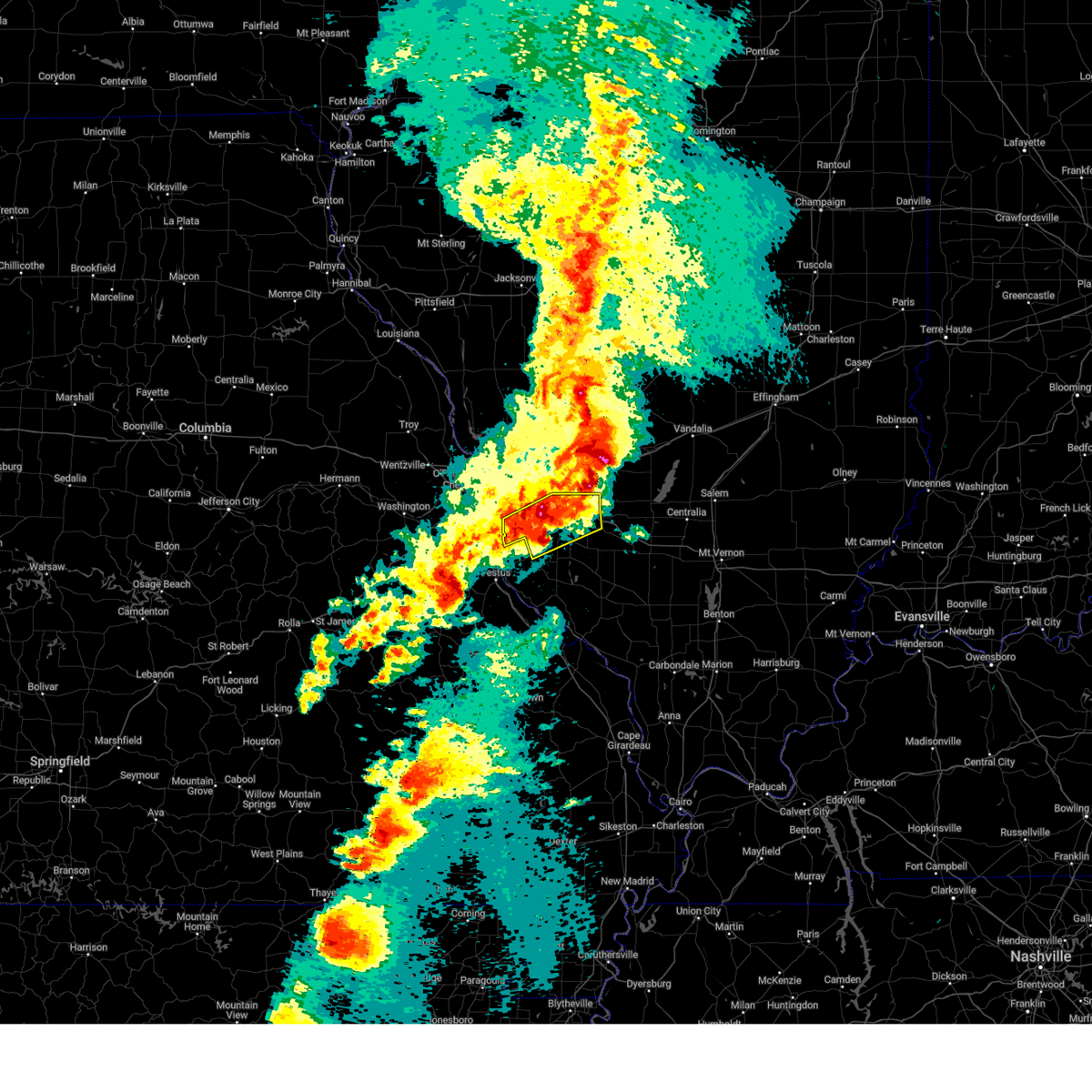 At 1018 pm cdt, a severe thunderstorm was located over belleville, moving northeast at 60 mph (radar indicated). Hazards include golf ball size hail and 70 mph wind gusts. People and animals outdoors will be injured. expect hail damage to roofs, siding, windows, and vehicles. expect considerable tree damage. wind damage is also likely to mobile homes, roofs, and outbuildings. locations impacted include, st. louis, belleville, o'fallon, east st. louis, collinsville, arnold, fairview heights, cahokia, swansea, shiloh, waterloo, columbia, mascoutah, centreville, lebanon, freeburg, caseyville, washington park, dupo and millstadt. This includes interstate 64 in illinois between exits 9 and 27. At 1018 pm cdt, a severe thunderstorm was located over belleville, moving northeast at 60 mph (radar indicated). Hazards include golf ball size hail and 70 mph wind gusts. People and animals outdoors will be injured. expect hail damage to roofs, siding, windows, and vehicles. expect considerable tree damage. wind damage is also likely to mobile homes, roofs, and outbuildings. locations impacted include, st. louis, belleville, o'fallon, east st. louis, collinsville, arnold, fairview heights, cahokia, swansea, shiloh, waterloo, columbia, mascoutah, centreville, lebanon, freeburg, caseyville, washington park, dupo and millstadt. This includes interstate 64 in illinois between exits 9 and 27.
|
| 3/14/2025 10:00 PM CDT |
 At 1000 pm cdt, a severe thunderstorm capable of producing a tornado was located over washington park, moving northeast at 50 mph (radar indicated rotation). Hazards include tornado and golf ball size hail. Flying debris will be dangerous to those caught without shelter. mobile homes will be damaged or destroyed. damage to roofs, windows and vehicles will occur. tree damage is likely. locations impacted include, st. louis, belleville, granite city, o'fallon, east st. louis, collinsville, fairview heights, swansea, glen carbon, shiloh, troy, maryville, mascoutah, pontoon beach, centreville, lebanon, caseyville, washington park, madison and new baden. this includes the following state parks, horseshoe lake state park. this includes the following highways, interstate 64 in illinois between exits 9 and 27. Interstate 70 in illinois near exit 21. At 1000 pm cdt, a severe thunderstorm capable of producing a tornado was located over washington park, moving northeast at 50 mph (radar indicated rotation). Hazards include tornado and golf ball size hail. Flying debris will be dangerous to those caught without shelter. mobile homes will be damaged or destroyed. damage to roofs, windows and vehicles will occur. tree damage is likely. locations impacted include, st. louis, belleville, granite city, o'fallon, east st. louis, collinsville, fairview heights, swansea, glen carbon, shiloh, troy, maryville, mascoutah, pontoon beach, centreville, lebanon, caseyville, washington park, madison and new baden. this includes the following state parks, horseshoe lake state park. this includes the following highways, interstate 64 in illinois between exits 9 and 27. Interstate 70 in illinois near exit 21.
|
| 3/14/2025 10:00 PM CDT |
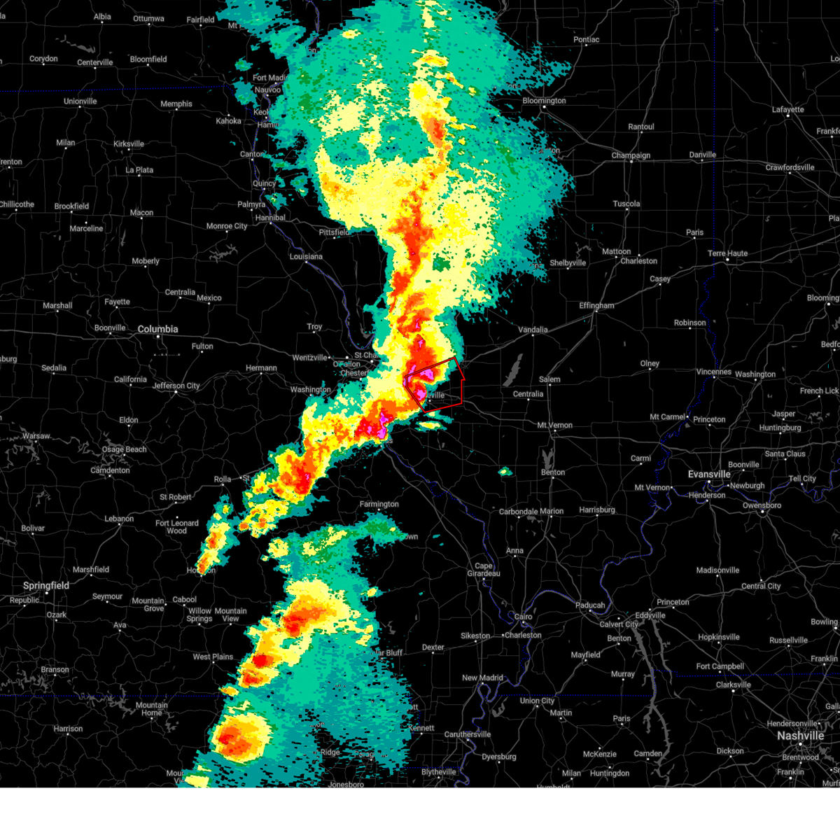 the tornado warning has been cancelled and is no longer in effect the tornado warning has been cancelled and is no longer in effect
|
| 3/14/2025 9:57 PM CDT |
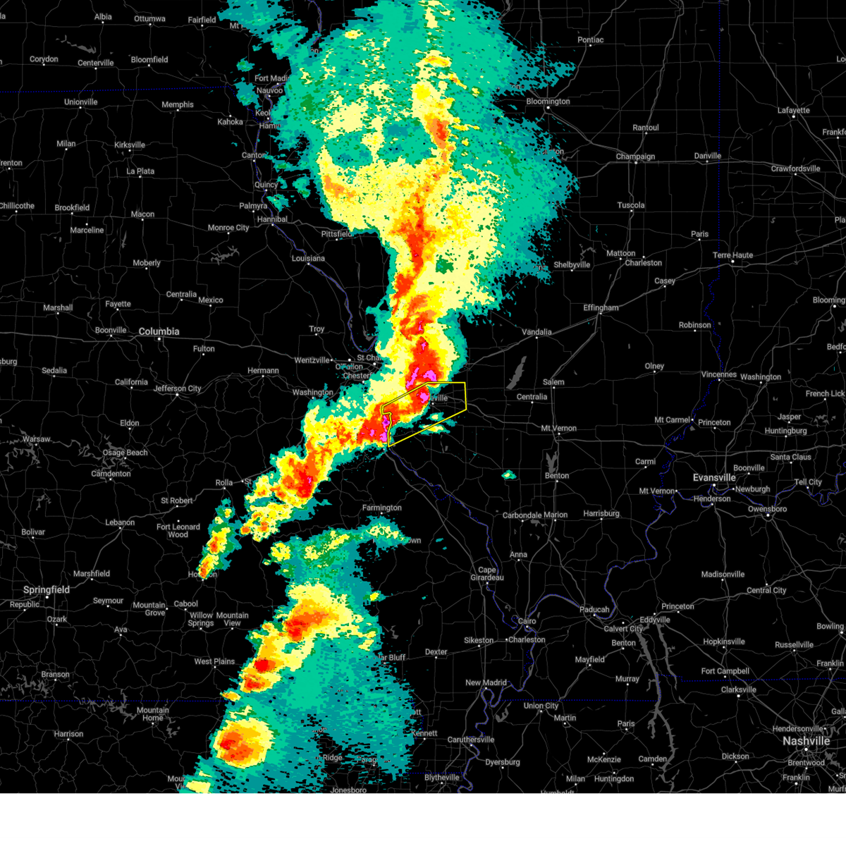 Svrlsx the national weather service in st louis has issued a * severe thunderstorm warning for, northwestern monroe county in southwestern illinois, saint clair county in southwestern illinois, south central saint louis county in east central missouri, south central saint louis city in east central missouri, * until 1045 pm cdt. * at 957 pm cdt, a severe thunderstorm was located over imperial, or over barnhart, moving northeast at 50 mph (emergency management reported). Hazards include golf ball size hail and 70 mph wind gusts. People and animals outdoors will be injured. expect hail damage to roofs, siding, windows, and vehicles. expect considerable tree damage. Wind damage is also likely to mobile homes, roofs, and outbuildings. Svrlsx the national weather service in st louis has issued a * severe thunderstorm warning for, northwestern monroe county in southwestern illinois, saint clair county in southwestern illinois, south central saint louis county in east central missouri, south central saint louis city in east central missouri, * until 1045 pm cdt. * at 957 pm cdt, a severe thunderstorm was located over imperial, or over barnhart, moving northeast at 50 mph (emergency management reported). Hazards include golf ball size hail and 70 mph wind gusts. People and animals outdoors will be injured. expect hail damage to roofs, siding, windows, and vehicles. expect considerable tree damage. Wind damage is also likely to mobile homes, roofs, and outbuildings.
|
| 3/14/2025 9:52 PM CDT |
 At 952 pm cdt, a severe thunderstorm capable of producing a tornado was located over alton, moving northeast at 55 mph (radar indicated rotation). Hazards include tornado and ping pong ball size hail. Flying debris will be dangerous to those caught without shelter. mobile homes will be damaged or destroyed. damage to roofs, windows and vehicles will occur. tree damage is likely. locations impacted include, st. louis, granite city, alton, edwardsville, godfrey, glen carbon, wood river, bethalto, pontoon beach, madison, venice, east alton, brighton, south roxana, roxana, hartford, shipman, west alton, rosewood heights and dorsey. this includes the following state parks, horseshoe lake state park. This includes interstate 55 in illinois near exit 23. At 952 pm cdt, a severe thunderstorm capable of producing a tornado was located over alton, moving northeast at 55 mph (radar indicated rotation). Hazards include tornado and ping pong ball size hail. Flying debris will be dangerous to those caught without shelter. mobile homes will be damaged or destroyed. damage to roofs, windows and vehicles will occur. tree damage is likely. locations impacted include, st. louis, granite city, alton, edwardsville, godfrey, glen carbon, wood river, bethalto, pontoon beach, madison, venice, east alton, brighton, south roxana, roxana, hartford, shipman, west alton, rosewood heights and dorsey. this includes the following state parks, horseshoe lake state park. This includes interstate 55 in illinois near exit 23.
|
| 3/14/2025 9:52 PM CDT |
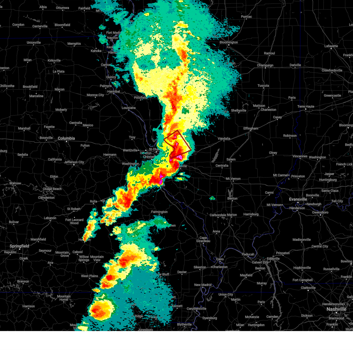 the tornado warning has been cancelled and is no longer in effect the tornado warning has been cancelled and is no longer in effect
|
| 3/14/2025 9:48 PM CDT |
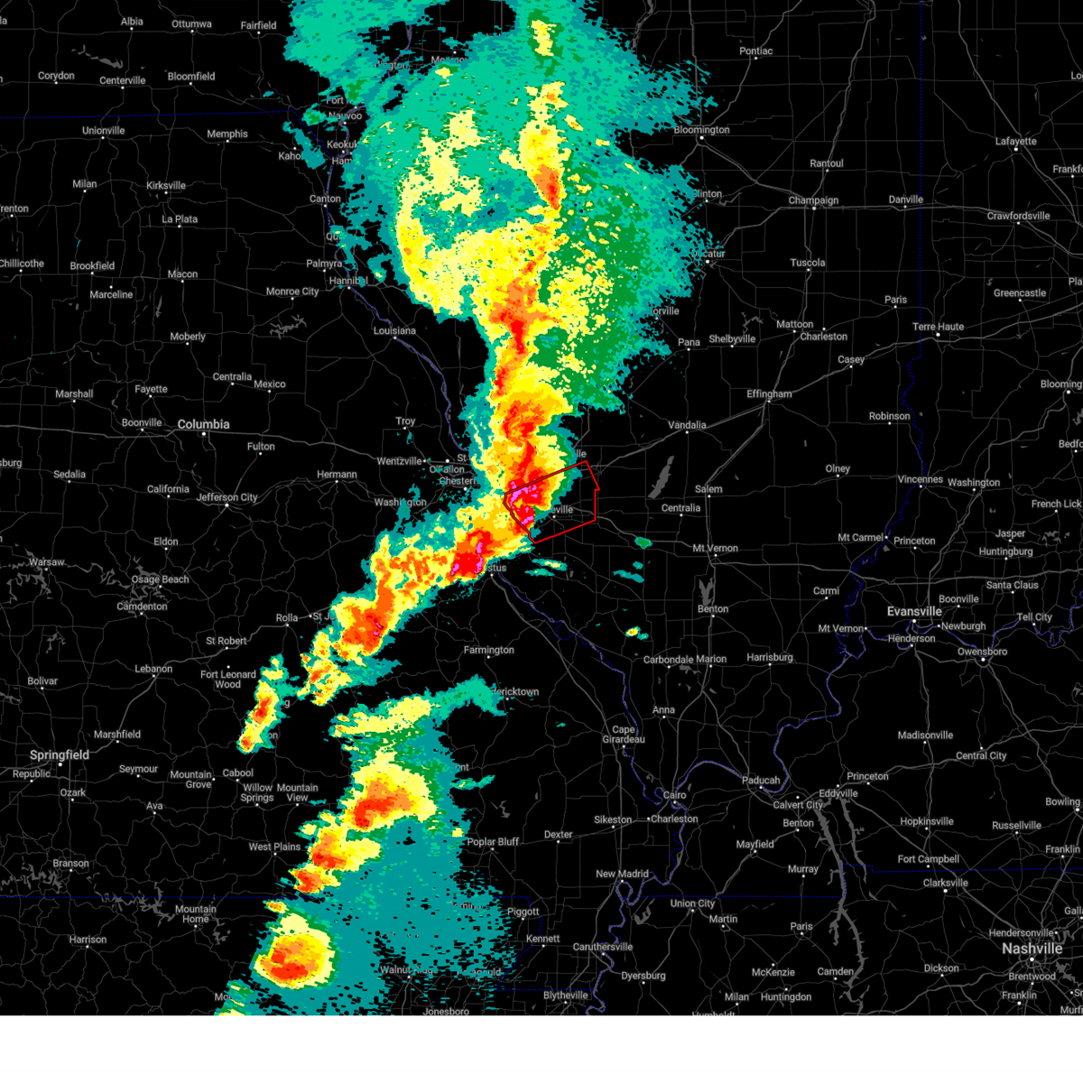 the tornado warning has been cancelled and is no longer in effect the tornado warning has been cancelled and is no longer in effect
|
| 3/14/2025 9:48 PM CDT |
 At 948 pm cdt, a confirmed tornado was located over east carondelet, or over cahokia, moving northeast at 50 mph (weather spotters confirmed tornado). Hazards include damaging tornado and golf ball size hail. Flying debris will be dangerous to those caught without shelter. mobile homes will be damaged or destroyed. damage to roofs, windows and vehicles will occur. tree damage is likely. locations impacted include, st. louis, belleville, granite city, o'fallon, east st. louis, collinsville, fairview heights, clayton, cahokia, swansea, glen carbon, shiloh, troy, columbia, richmond heights, maryville, mascoutah, shrewsbury, pontoon beach and centreville. this includes the following state parks, scott joplin historic site. this includes the following highways, interstate 64 in illinois between exits 9 and 27. Interstate 70 in illinois near exit 21. At 948 pm cdt, a confirmed tornado was located over east carondelet, or over cahokia, moving northeast at 50 mph (weather spotters confirmed tornado). Hazards include damaging tornado and golf ball size hail. Flying debris will be dangerous to those caught without shelter. mobile homes will be damaged or destroyed. damage to roofs, windows and vehicles will occur. tree damage is likely. locations impacted include, st. louis, belleville, granite city, o'fallon, east st. louis, collinsville, fairview heights, clayton, cahokia, swansea, glen carbon, shiloh, troy, columbia, richmond heights, maryville, mascoutah, shrewsbury, pontoon beach and centreville. this includes the following state parks, scott joplin historic site. this includes the following highways, interstate 64 in illinois between exits 9 and 27. Interstate 70 in illinois near exit 21.
|
| 3/14/2025 9:46 PM CDT | Quarter sized hail reported 5.8 miles N of St. Louis, MO |
| 3/14/2025 9:46 PM CDT |
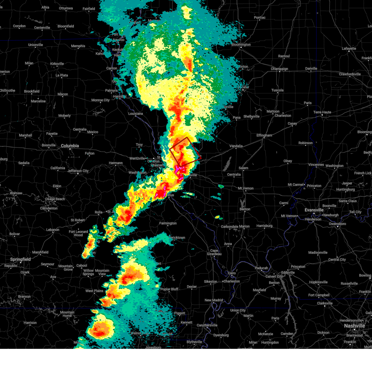 At 946 pm cdt, a confirmed tornado was located over west alton, or near alton, moving northeast at 55 mph (weather spotters confirmed tornado). Hazards include damaging tornado and ping pong ball size hail. Flying debris will be dangerous to those caught without shelter. mobile homes will be damaged or destroyed. damage to roofs, windows and vehicles will occur. tree damage is likely. locations impacted include, st. louis, granite city, alton, edwardsville, godfrey, glen carbon, bellefontaine neighbors, wood river, bethalto, black jack, pontoon beach, madison, riverview, venice, spanish lake, east alton, brighton, south roxana, roxana and hartford. this includes the following state parks, confluence state park and horseshoe lake state park. This includes interstate 55 in illinois near exit 23. At 946 pm cdt, a confirmed tornado was located over west alton, or near alton, moving northeast at 55 mph (weather spotters confirmed tornado). Hazards include damaging tornado and ping pong ball size hail. Flying debris will be dangerous to those caught without shelter. mobile homes will be damaged or destroyed. damage to roofs, windows and vehicles will occur. tree damage is likely. locations impacted include, st. louis, granite city, alton, edwardsville, godfrey, glen carbon, bellefontaine neighbors, wood river, bethalto, black jack, pontoon beach, madison, riverview, venice, spanish lake, east alton, brighton, south roxana, roxana and hartford. this includes the following state parks, confluence state park and horseshoe lake state park. This includes interstate 55 in illinois near exit 23.
|
| 3/14/2025 9:45 PM CDT | Ping Pong Ball sized hail reported 4.3 miles NNW of St. Louis, MO |
| 3/14/2025 9:44 PM CDT |
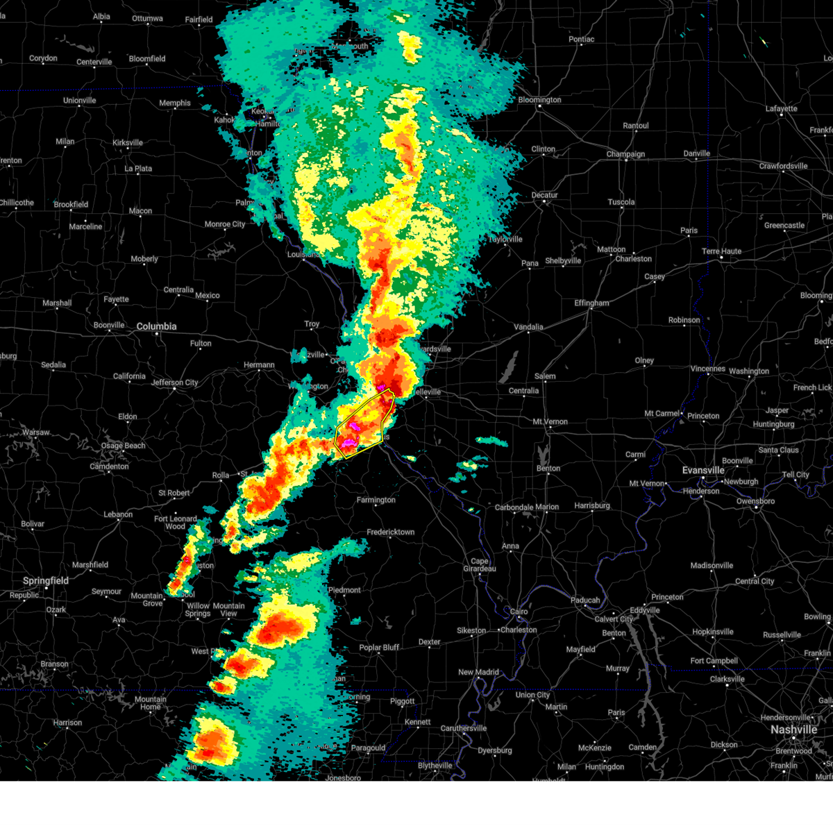 At 944 pm cdt, a severe thunderstorm was located near hillsboro, moving northeast at 60 mph (radar indicated). Hazards include 70 mph wind gusts and ping pong ball size hail. People and animals outdoors will be injured. expect hail damage to roofs, siding, windows, and vehicles. expect considerable tree damage. wind damage is also likely to mobile homes, roofs, and outbuildings. other locations impacted by the severe thunderstorm include fletcher, morse mill, oermann, grubville, victoria, hematite, mapaville, otto and kimmswick. this includes the following state parks, mastodon historic site, sandy creek covered bridge historic site and gov. dunklin's grave historic site. This includes interstate 55 in missouri between exits 175 and 191. At 944 pm cdt, a severe thunderstorm was located near hillsboro, moving northeast at 60 mph (radar indicated). Hazards include 70 mph wind gusts and ping pong ball size hail. People and animals outdoors will be injured. expect hail damage to roofs, siding, windows, and vehicles. expect considerable tree damage. wind damage is also likely to mobile homes, roofs, and outbuildings. other locations impacted by the severe thunderstorm include fletcher, morse mill, oermann, grubville, victoria, hematite, mapaville, otto and kimmswick. this includes the following state parks, mastodon historic site, sandy creek covered bridge historic site and gov. dunklin's grave historic site. This includes interstate 55 in missouri between exits 175 and 191.
|
| 3/14/2025 9:44 PM CDT |
 the severe thunderstorm warning has been cancelled and is no longer in effect the severe thunderstorm warning has been cancelled and is no longer in effect
|
| 3/14/2025 9:37 PM CDT |
 At 937 pm cdt, a confirmed tornado was located over florissant, moving northeast at 55 mph (weather spotters confirmed tornado, power flashes along i-70). Hazards include damaging tornado and ping pong ball size hail. Flying debris will be dangerous to those caught without shelter. mobile homes will be damaged or destroyed. damage to roofs, windows and vehicles will occur. tree damage is likely. locations impacted include, st. louis, st. charles, florissant, university city, granite city, alton, maryland heights, hazelwood, edwardsville, ferguson, godfrey, creve coeur, overland, clayton, jennings, st. ann, glen carbon, bridgeton, bellefontaine neighbors and wood river. this includes the following state parks, confluence state park, first missouri state capitol historic site and horseshoe lake state park. this includes the following highways, interstate 55 in illinois near exit 23. Interstate 70 in missouri near exit 231. At 937 pm cdt, a confirmed tornado was located over florissant, moving northeast at 55 mph (weather spotters confirmed tornado, power flashes along i-70). Hazards include damaging tornado and ping pong ball size hail. Flying debris will be dangerous to those caught without shelter. mobile homes will be damaged or destroyed. damage to roofs, windows and vehicles will occur. tree damage is likely. locations impacted include, st. louis, st. charles, florissant, university city, granite city, alton, maryland heights, hazelwood, edwardsville, ferguson, godfrey, creve coeur, overland, clayton, jennings, st. ann, glen carbon, bridgeton, bellefontaine neighbors and wood river. this includes the following state parks, confluence state park, first missouri state capitol historic site and horseshoe lake state park. this includes the following highways, interstate 55 in illinois near exit 23. Interstate 70 in missouri near exit 231.
|
| 3/14/2025 9:36 PM CDT |
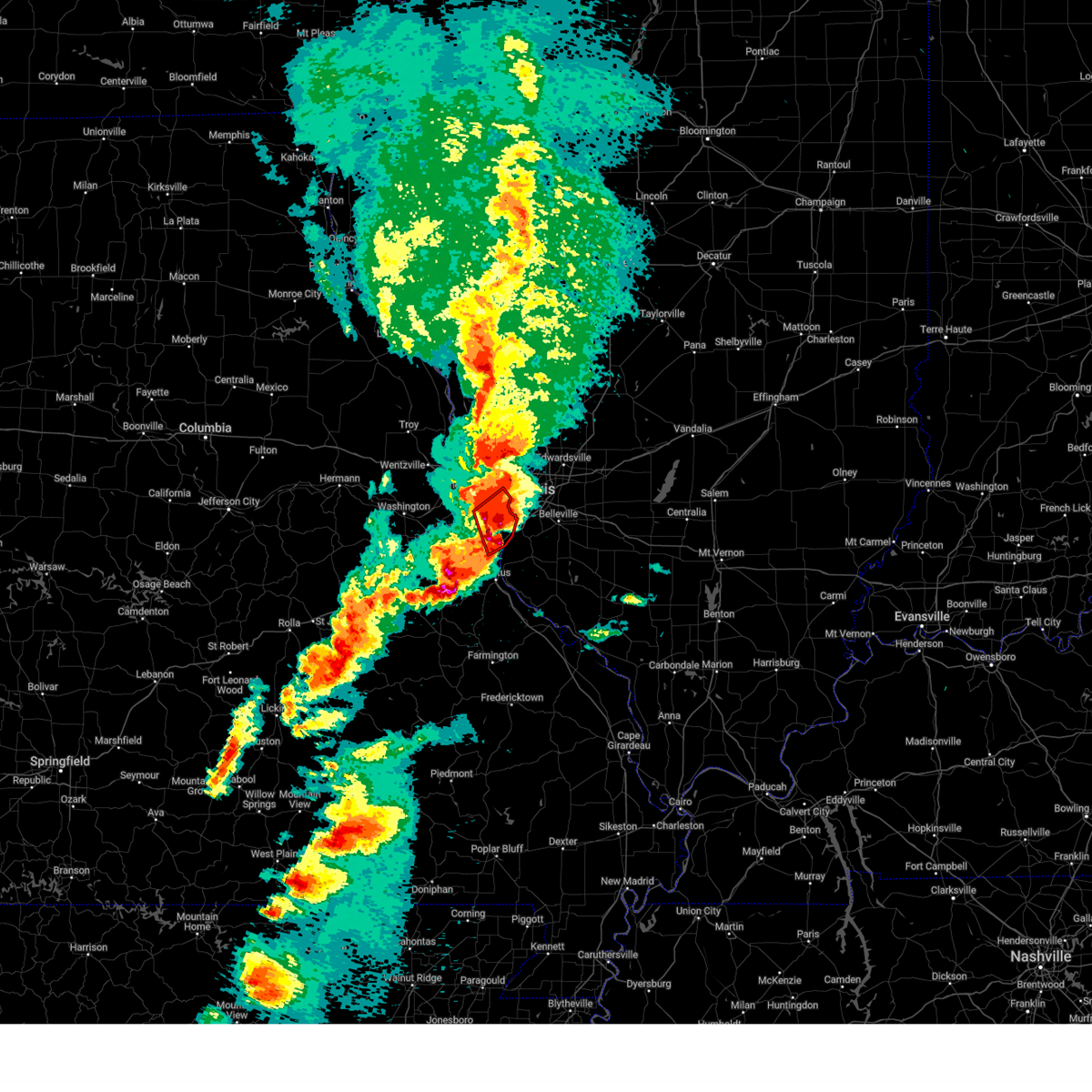 At 936 pm cdt, a confirmed tornado was located over arnold, moving northeast at 60 mph (weather spotters confirmed tornado, power flashes near arnold). Hazards include damaging tornado and golf ball size hail. Flying debris will be dangerous to those caught without shelter. mobile homes will be damaged or destroyed. damage to roofs, windows and vehicles will occur. tree damage is likely. locations impacted include, st. louis, university city, ballwin, kirkwood, webster groves, arnold, manchester, creve coeur, overland, clayton, crestwood, town and country, richmond heights, ladue, sunset hills, des peres, brentwood, maplewood, olivette and valley park. this includes the following state parks, mastodon historic site. this includes the following highways, interstate 44 in missouri between exits 272 and 277. Interstate 55 in missouri between exits 190 and 191. At 936 pm cdt, a confirmed tornado was located over arnold, moving northeast at 60 mph (weather spotters confirmed tornado, power flashes near arnold). Hazards include damaging tornado and golf ball size hail. Flying debris will be dangerous to those caught without shelter. mobile homes will be damaged or destroyed. damage to roofs, windows and vehicles will occur. tree damage is likely. locations impacted include, st. louis, university city, ballwin, kirkwood, webster groves, arnold, manchester, creve coeur, overland, clayton, crestwood, town and country, richmond heights, ladue, sunset hills, des peres, brentwood, maplewood, olivette and valley park. this includes the following state parks, mastodon historic site. this includes the following highways, interstate 44 in missouri between exits 272 and 277. Interstate 55 in missouri between exits 190 and 191.
|
| 3/14/2025 9:35 PM CDT |
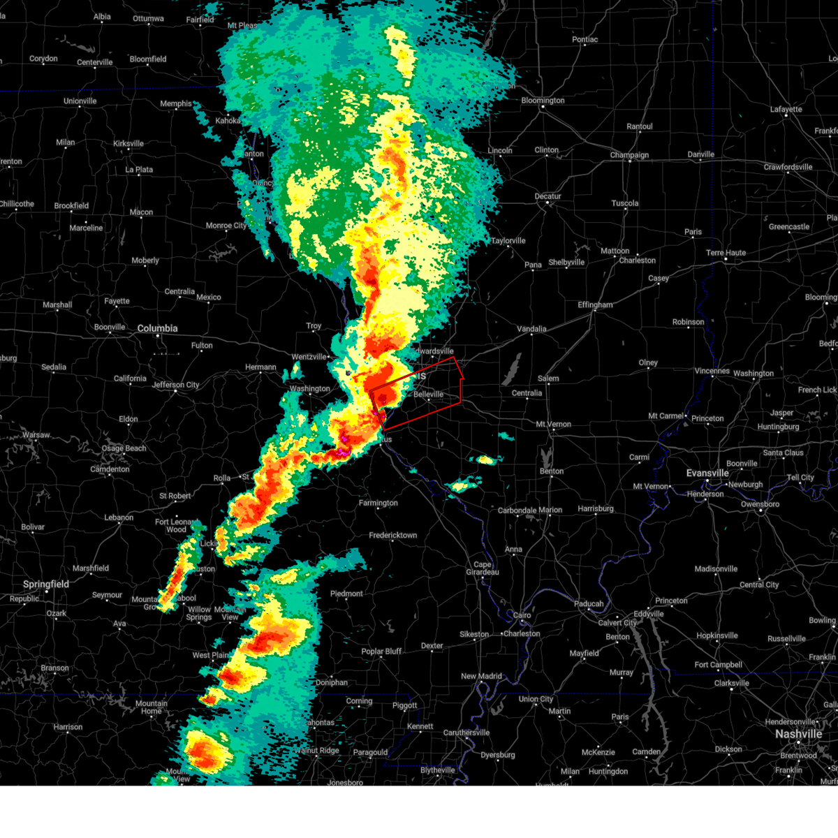 Torlsx the national weather service in st louis has issued a * tornado warning for, southeastern madison county in southwestern illinois, northwestern monroe county in southwestern illinois, saint clair county in southwestern illinois, northeastern jefferson county in east central missouri, south central saint louis county in east central missouri, saint louis city in east central missouri, * until 1015 pm cdt. * at 935 pm cdt, a confirmed tornado was located over arnold, moving northeast at 60 mph (weather spotters confirmed tornado, power flashers near arnold). Hazards include damaging tornado and golf ball size hail. Flying debris will be dangerous to those caught without shelter. mobile homes will be damaged or destroyed. damage to roofs, windows and vehicles will occur. Tree damage is likely. Torlsx the national weather service in st louis has issued a * tornado warning for, southeastern madison county in southwestern illinois, northwestern monroe county in southwestern illinois, saint clair county in southwestern illinois, northeastern jefferson county in east central missouri, south central saint louis county in east central missouri, saint louis city in east central missouri, * until 1015 pm cdt. * at 935 pm cdt, a confirmed tornado was located over arnold, moving northeast at 60 mph (weather spotters confirmed tornado, power flashers near arnold). Hazards include damaging tornado and golf ball size hail. Flying debris will be dangerous to those caught without shelter. mobile homes will be damaged or destroyed. damage to roofs, windows and vehicles will occur. Tree damage is likely.
|
| 3/14/2025 9:34 PM CDT |
 At 934 pm cdt, a severe thunderstorm was located 6 miles west of hillsboro, moving northeast at 60 mph (radar indicated). Hazards include 70 mph wind gusts and ping pong ball size hail. People and animals outdoors will be injured. expect hail damage to roofs, siding, windows, and vehicles. expect considerable tree damage. wind damage is also likely to mobile homes, roofs, and outbuildings. this severe thunderstorm will be near, richwoods around 925 pm cdt. other locations impacted by the severe thunderstorm include fletcher, morse mill, oermann, grubville, victoria, hematite, mapaville, otto and kimmswick. this includes the following state parks, mastodon historic site, sandy creek covered bridge historic site and gov. dunklin's grave historic site. This includes interstate 55 in missouri between exits 175 and 191. At 934 pm cdt, a severe thunderstorm was located 6 miles west of hillsboro, moving northeast at 60 mph (radar indicated). Hazards include 70 mph wind gusts and ping pong ball size hail. People and animals outdoors will be injured. expect hail damage to roofs, siding, windows, and vehicles. expect considerable tree damage. wind damage is also likely to mobile homes, roofs, and outbuildings. this severe thunderstorm will be near, richwoods around 925 pm cdt. other locations impacted by the severe thunderstorm include fletcher, morse mill, oermann, grubville, victoria, hematite, mapaville, otto and kimmswick. this includes the following state parks, mastodon historic site, sandy creek covered bridge historic site and gov. dunklin's grave historic site. This includes interstate 55 in missouri between exits 175 and 191.
|
| 3/14/2025 9:27 PM CDT |
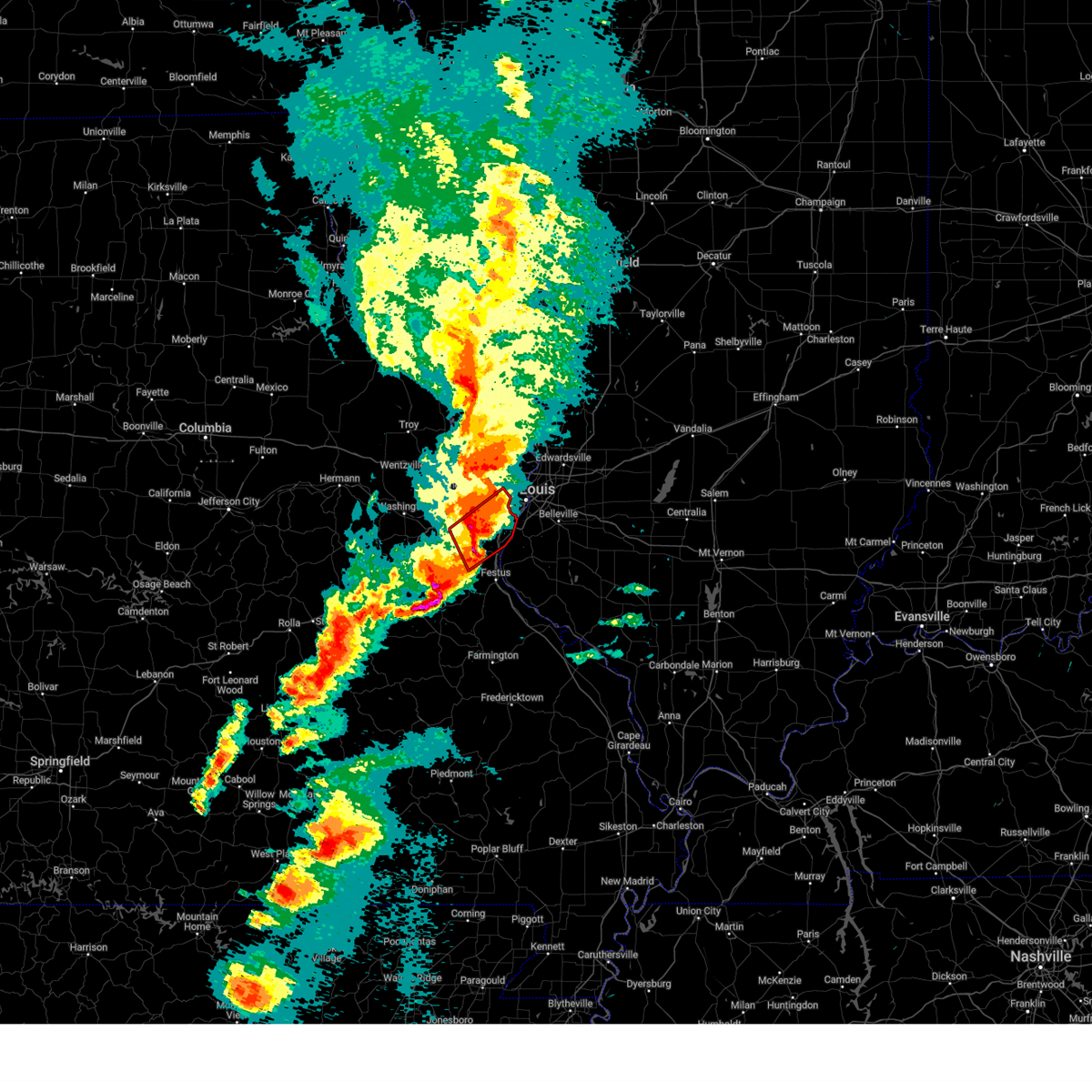 At 927 pm cdt, a severe thunderstorm capable of producing a tornado was located over antonia, moving northeast at 60 mph (radar indicated rotation). Hazards include tornado and quarter size hail. Flying debris will be dangerous to those caught without shelter. mobile homes will be damaged or destroyed. damage to roofs, windows and vehicles will occur. tree damage is likely. locations impacted include, st. louis, wildwood, university city, ballwin, kirkwood, webster groves, arnold, manchester, creve coeur, overland, clayton, crestwood, town and country, eureka, richmond heights, ladue, sunset hills, des peres, brentwood and maplewood. this includes the following state parks, route 66 state park, castlewood state park and mastodon historic site. this includes the following highways, interstate 44 in missouri between exits 264 and 277. Interstate 55 in missouri between exits 187 and 191. At 927 pm cdt, a severe thunderstorm capable of producing a tornado was located over antonia, moving northeast at 60 mph (radar indicated rotation). Hazards include tornado and quarter size hail. Flying debris will be dangerous to those caught without shelter. mobile homes will be damaged or destroyed. damage to roofs, windows and vehicles will occur. tree damage is likely. locations impacted include, st. louis, wildwood, university city, ballwin, kirkwood, webster groves, arnold, manchester, creve coeur, overland, clayton, crestwood, town and country, eureka, richmond heights, ladue, sunset hills, des peres, brentwood and maplewood. this includes the following state parks, route 66 state park, castlewood state park and mastodon historic site. this includes the following highways, interstate 44 in missouri between exits 264 and 277. Interstate 55 in missouri between exits 187 and 191.
|
| 3/14/2025 9:27 PM CDT |
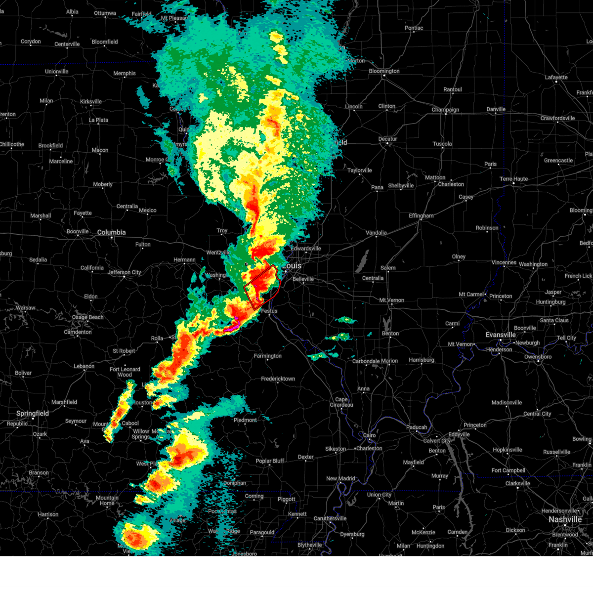 the tornado warning has been cancelled and is no longer in effect the tornado warning has been cancelled and is no longer in effect
|
| 3/14/2025 9:24 PM CDT |
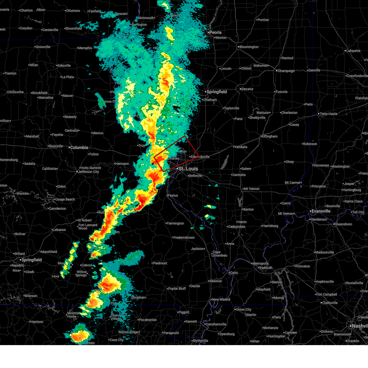 Torlsx the national weather service in st louis has issued a * tornado warning for, southeastern jersey county in southwestern illinois, southwestern macoupin county in southwestern illinois, western madison county in southwestern illinois, northeastern saint charles county in east central missouri, northeastern saint louis county in east central missouri, northern saint louis city in east central missouri, * until 1015 pm cdt. * at 924 pm cdt, a severe thunderstorm capable of producing a tornado was located over maryland heights, moving northeast at 60 mph (radar indicated rotation). Hazards include tornado and ping pong ball size hail. Flying debris will be dangerous to those caught without shelter. mobile homes will be damaged or destroyed. damage to roofs, windows and vehicles will occur. Tree damage is likely. Torlsx the national weather service in st louis has issued a * tornado warning for, southeastern jersey county in southwestern illinois, southwestern macoupin county in southwestern illinois, western madison county in southwestern illinois, northeastern saint charles county in east central missouri, northeastern saint louis county in east central missouri, northern saint louis city in east central missouri, * until 1015 pm cdt. * at 924 pm cdt, a severe thunderstorm capable of producing a tornado was located over maryland heights, moving northeast at 60 mph (radar indicated rotation). Hazards include tornado and ping pong ball size hail. Flying debris will be dangerous to those caught without shelter. mobile homes will be damaged or destroyed. damage to roofs, windows and vehicles will occur. Tree damage is likely.
|
| 3/14/2025 9:20 PM CDT |
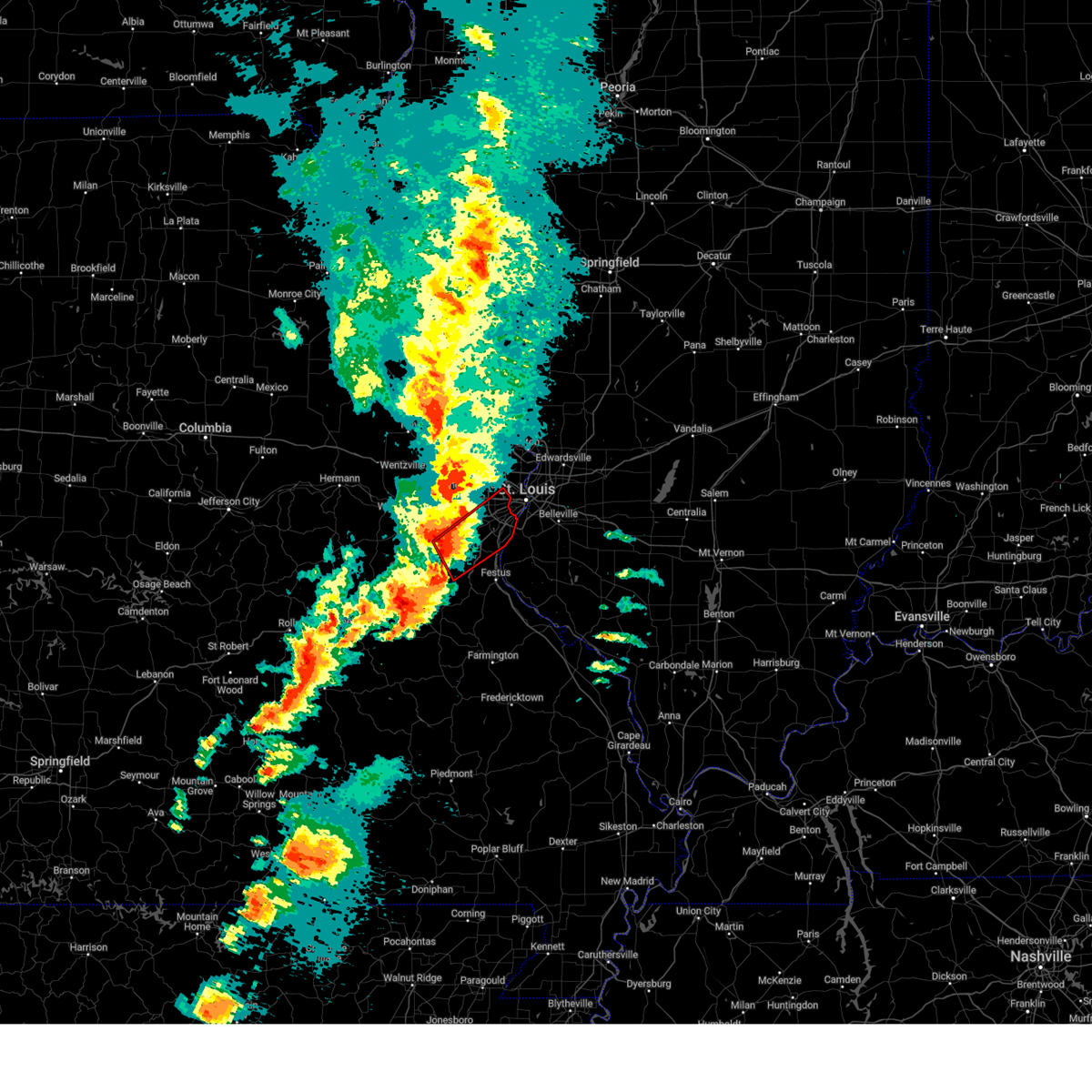 At 920 pm cdt, a severe thunderstorm capable of producing a tornado was located near cedar hill lakes, or near cedar hill, moving northeast at 60 mph (radar indicated rotation). Hazards include tornado and quarter size hail. Flying debris will be dangerous to those caught without shelter. mobile homes will be damaged or destroyed. damage to roofs, windows and vehicles will occur. tree damage is likely. locations impacted include, st. louis, wildwood, university city, ballwin, kirkwood, webster groves, arnold, manchester, creve coeur, overland, clayton, crestwood, town and country, eureka, richmond heights, ladue, sunset hills, des peres, brentwood and maplewood. this includes the following state parks, route 66 state park, castlewood state park and mastodon historic site. this includes the following highways, interstate 44 in missouri between exits 264 and 277. Interstate 55 in missouri between exits 187 and 191. At 920 pm cdt, a severe thunderstorm capable of producing a tornado was located near cedar hill lakes, or near cedar hill, moving northeast at 60 mph (radar indicated rotation). Hazards include tornado and quarter size hail. Flying debris will be dangerous to those caught without shelter. mobile homes will be damaged or destroyed. damage to roofs, windows and vehicles will occur. tree damage is likely. locations impacted include, st. louis, wildwood, university city, ballwin, kirkwood, webster groves, arnold, manchester, creve coeur, overland, clayton, crestwood, town and country, eureka, richmond heights, ladue, sunset hills, des peres, brentwood and maplewood. this includes the following state parks, route 66 state park, castlewood state park and mastodon historic site. this includes the following highways, interstate 44 in missouri between exits 264 and 277. Interstate 55 in missouri between exits 187 and 191.
|
| 3/14/2025 9:20 PM CDT |
 the tornado warning has been cancelled and is no longer in effect the tornado warning has been cancelled and is no longer in effect
|
| 3/14/2025 9:13 PM CDT |
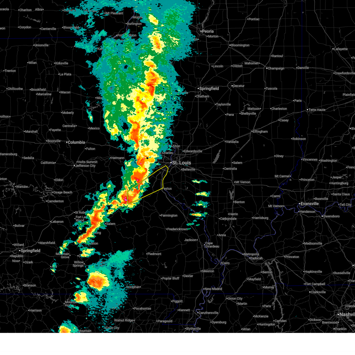 Svrlsx the national weather service in st louis has issued a * severe thunderstorm warning for, southeastern franklin county in east central missouri, jefferson county in east central missouri, south central saint louis county in east central missouri, northern washington county in east central missouri, * until 1000 pm cdt. * at 913 pm cdt, a severe thunderstorm was located near anthonies mill, moving northeast at 65 mph (at 859 pm, trained spotters reported two inch hail in steelville). Hazards include golf ball size hail and 70 mph wind gusts. People and animals outdoors will be injured. expect hail damage to roofs, siding, windows, and vehicles. expect considerable tree damage. wind damage is also likely to mobile homes, roofs, and outbuildings. this severe thunderstorm will be near, anthonies mill around 915 pm cdt. richwoods around 925 pm cdt. other locations impacted by the severe thunderstorm include grubville, fletcher, morse mill, oermann, scotsdale, mapaville, otto and kimmswick. this includes the following state parks, mastodon historic site, sandy creek covered bridge historic site and gov. dunklin's grave historic site. This includes interstate 55 in missouri between exits 175 and 191. Svrlsx the national weather service in st louis has issued a * severe thunderstorm warning for, southeastern franklin county in east central missouri, jefferson county in east central missouri, south central saint louis county in east central missouri, northern washington county in east central missouri, * until 1000 pm cdt. * at 913 pm cdt, a severe thunderstorm was located near anthonies mill, moving northeast at 65 mph (at 859 pm, trained spotters reported two inch hail in steelville). Hazards include golf ball size hail and 70 mph wind gusts. People and animals outdoors will be injured. expect hail damage to roofs, siding, windows, and vehicles. expect considerable tree damage. wind damage is also likely to mobile homes, roofs, and outbuildings. this severe thunderstorm will be near, anthonies mill around 915 pm cdt. richwoods around 925 pm cdt. other locations impacted by the severe thunderstorm include grubville, fletcher, morse mill, oermann, scotsdale, mapaville, otto and kimmswick. this includes the following state parks, mastodon historic site, sandy creek covered bridge historic site and gov. dunklin's grave historic site. This includes interstate 55 in missouri between exits 175 and 191.
|
| 3/14/2025 9:07 PM CDT |
 Torlsx the national weather service in st louis has issued a * tornado warning for, southeastern franklin county in east central missouri, northern jefferson county in east central missouri, southwestern saint louis county in east central missouri, northeastern washington county in east central missouri, * until 945 pm cdt. * at 907 pm cdt, a severe thunderstorm capable of producing a tornado was located near lonedell, or 11 miles southeast of st. clair, moving northeast at 60 mph (radar indicated rotation). Hazards include tornado and quarter size hail. Flying debris will be dangerous to those caught without shelter. mobile homes will be damaged or destroyed. damage to roofs, windows and vehicles will occur. Tree damage is likely. Torlsx the national weather service in st louis has issued a * tornado warning for, southeastern franklin county in east central missouri, northern jefferson county in east central missouri, southwestern saint louis county in east central missouri, northeastern washington county in east central missouri, * until 945 pm cdt. * at 907 pm cdt, a severe thunderstorm capable of producing a tornado was located near lonedell, or 11 miles southeast of st. clair, moving northeast at 60 mph (radar indicated rotation). Hazards include tornado and quarter size hail. Flying debris will be dangerous to those caught without shelter. mobile homes will be damaged or destroyed. damage to roofs, windows and vehicles will occur. Tree damage is likely.
|
| 10/31/2024 2:54 AM CDT |
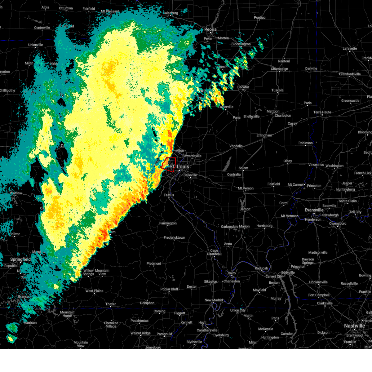 the tornado warning has been cancelled and is no longer in effect the tornado warning has been cancelled and is no longer in effect
|
| 10/31/2024 2:54 AM CDT |
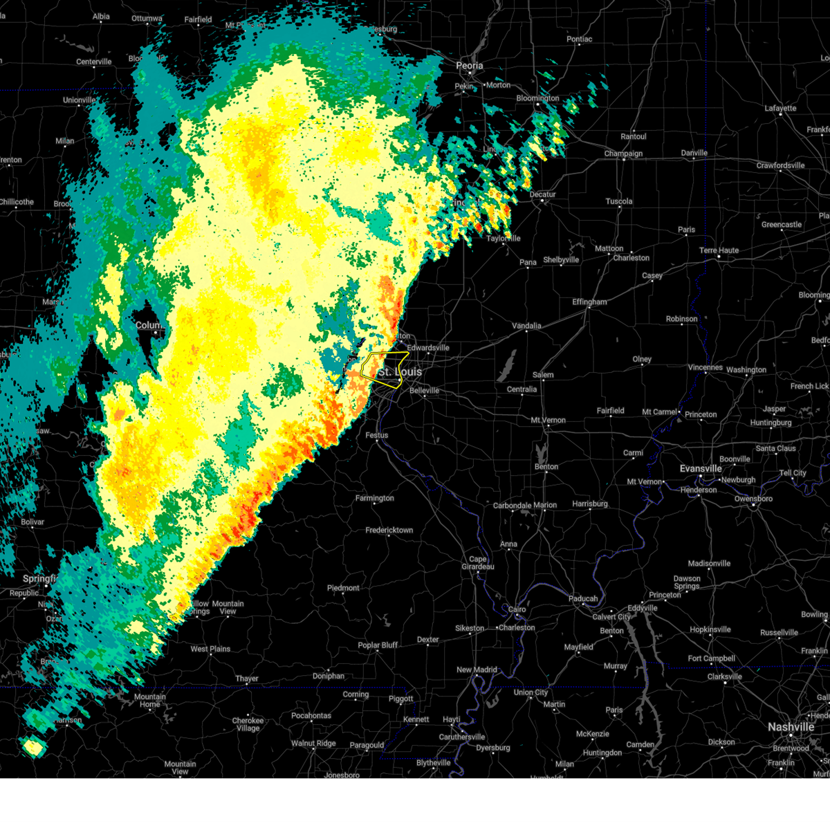 the severe thunderstorm warning has been cancelled and is no longer in effect the severe thunderstorm warning has been cancelled and is no longer in effect
|
| 10/31/2024 2:44 AM CDT |
 the tornado warning has been cancelled and is no longer in effect the tornado warning has been cancelled and is no longer in effect
|
| 10/31/2024 2:44 AM CDT |
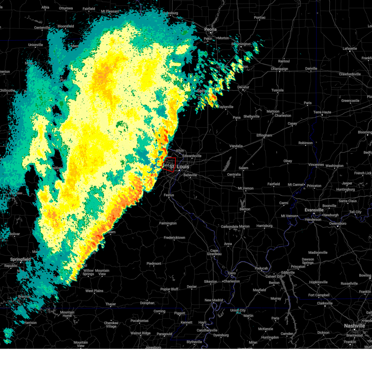 At 244 am cdt, a severe thunderstorm capable of producing a tornado was located over creve coeur, moving east at 45 mph (radar indicated rotation). Hazards include tornado. Flying debris will be dangerous to those caught without shelter. mobile homes will be damaged or destroyed. damage to roofs, windows and vehicles will occur. tree damage is likely. locations impacted include, st. louis, st. charles, florissant, chesterfield, university city, maryland heights, hazelwood, webster groves, ferguson, creve coeur, overland, clayton, jennings, st. ann, bridgeton, town and country, berkeley, richmond heights, ladue and brentwood. This includes interstate 70 in missouri near exit 231. At 244 am cdt, a severe thunderstorm capable of producing a tornado was located over creve coeur, moving east at 45 mph (radar indicated rotation). Hazards include tornado. Flying debris will be dangerous to those caught without shelter. mobile homes will be damaged or destroyed. damage to roofs, windows and vehicles will occur. tree damage is likely. locations impacted include, st. louis, st. charles, florissant, chesterfield, university city, maryland heights, hazelwood, webster groves, ferguson, creve coeur, overland, clayton, jennings, st. ann, bridgeton, town and country, berkeley, richmond heights, ladue and brentwood. This includes interstate 70 in missouri near exit 231.
|
| 10/31/2024 2:44 AM CDT |
 the severe thunderstorm warning has been cancelled and is no longer in effect the severe thunderstorm warning has been cancelled and is no longer in effect
|
| 10/31/2024 2:44 AM CDT |
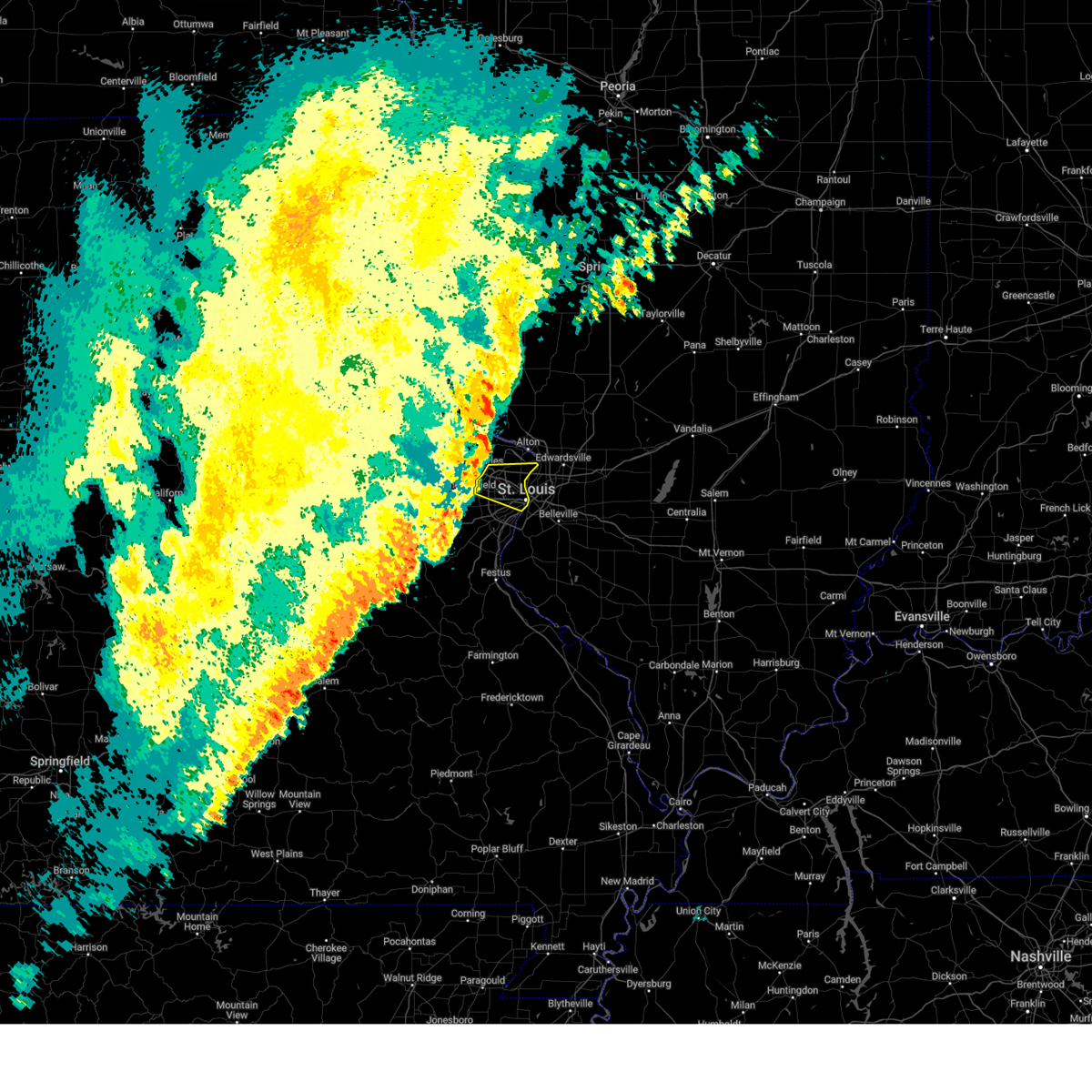 At 244 am cdt, severe thunderstorms were located along a line from over orchard farms to over manchester, or along a line from 6 miles north of hazelwood to over manchester, moving east at 45 mph (radar indicated). Hazards include 60 mph wind gusts and small hail. Expect damage to roofs, siding, and trees. locations impacted include, st. louis, st. charles, florissant, chesterfield, university city, maryland heights, hazelwood, webster groves, ferguson, creve coeur, overland, clayton, jennings, st. ann, bridgeton, bellefontaine neighbors, town and country, berkeley, richmond heights and ladue. this includes the following state parks, scott joplin historic site. This includes interstate 70 in missouri near exit 231. At 244 am cdt, severe thunderstorms were located along a line from over orchard farms to over manchester, or along a line from 6 miles north of hazelwood to over manchester, moving east at 45 mph (radar indicated). Hazards include 60 mph wind gusts and small hail. Expect damage to roofs, siding, and trees. locations impacted include, st. louis, st. charles, florissant, chesterfield, university city, maryland heights, hazelwood, webster groves, ferguson, creve coeur, overland, clayton, jennings, st. ann, bridgeton, bellefontaine neighbors, town and country, berkeley, richmond heights and ladue. this includes the following state parks, scott joplin historic site. This includes interstate 70 in missouri near exit 231.
|
| 10/31/2024 2:35 AM CDT |
 the severe thunderstorm warning has been cancelled and is no longer in effect the severe thunderstorm warning has been cancelled and is no longer in effect
|
| 10/31/2024 2:35 AM CDT |
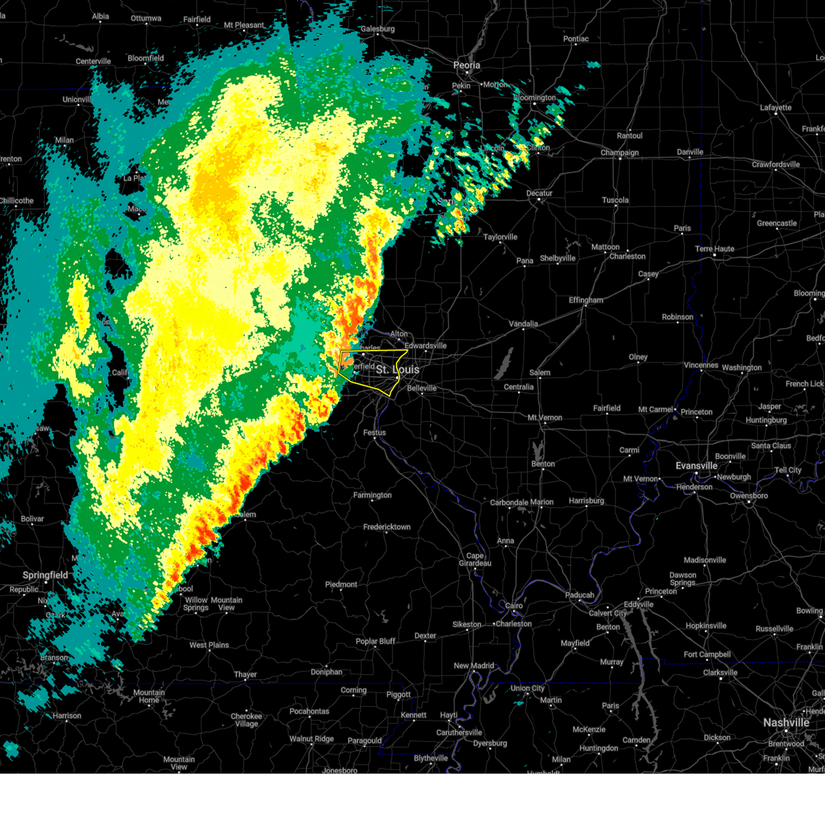 At 235 am cdt, severe thunderstorms were located along a line from 6 miles north of st. charles to over ellisville, moving east at 45 mph (radar indicated). Hazards include 60 mph wind gusts and small hail. Expect damage to roofs, siding, and trees. locations impacted include, st. louis, o'fallon, st. charles, st. peters, florissant, chesterfield, wildwood, university city, ballwin, kirkwood, maryland heights, hazelwood, webster groves, ferguson, manchester, creve coeur, overland, clayton, jennings and st. ann. this includes the following state parks, scott joplin historic site and first missouri state capitol historic site. this includes the following highways, interstate 70 in missouri between exits 219 and 231. Interstate 44 in missouri near exit 277. At 235 am cdt, severe thunderstorms were located along a line from 6 miles north of st. charles to over ellisville, moving east at 45 mph (radar indicated). Hazards include 60 mph wind gusts and small hail. Expect damage to roofs, siding, and trees. locations impacted include, st. louis, o'fallon, st. charles, st. peters, florissant, chesterfield, wildwood, university city, ballwin, kirkwood, maryland heights, hazelwood, webster groves, ferguson, manchester, creve coeur, overland, clayton, jennings and st. ann. this includes the following state parks, scott joplin historic site and first missouri state capitol historic site. this includes the following highways, interstate 70 in missouri between exits 219 and 231. Interstate 44 in missouri near exit 277.
|
| 10/31/2024 2:26 AM CDT |
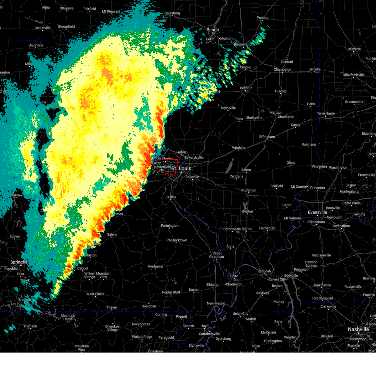 Torlsx the national weather service in st louis has issued a * tornado warning for, central saint charles county in east central missouri, central saint louis county in east central missouri, * until 300 am cdt. * at 226 am cdt, a severe thunderstorm capable of producing a tornado was located over cottleville, moving east at 45 mph (radar indicated rotation). Hazards include tornado. Flying debris will be dangerous to those caught without shelter. mobile homes will be damaged or destroyed. damage to roofs, windows and vehicles will occur. Tree damage is likely. Torlsx the national weather service in st louis has issued a * tornado warning for, central saint charles county in east central missouri, central saint louis county in east central missouri, * until 300 am cdt. * at 226 am cdt, a severe thunderstorm capable of producing a tornado was located over cottleville, moving east at 45 mph (radar indicated rotation). Hazards include tornado. Flying debris will be dangerous to those caught without shelter. mobile homes will be damaged or destroyed. damage to roofs, windows and vehicles will occur. Tree damage is likely.
|
| 10/31/2024 2:15 AM CDT |
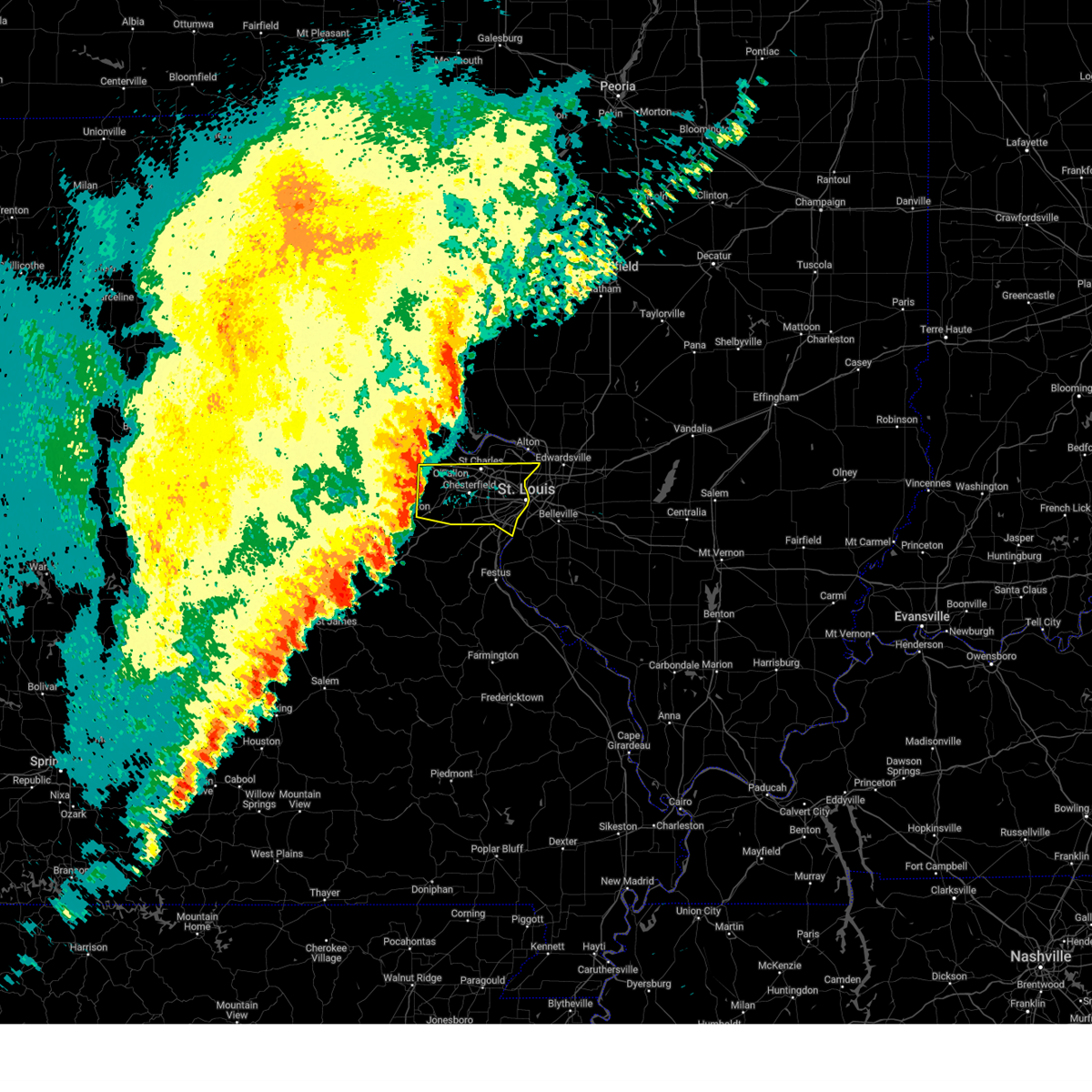 Svrlsx the national weather service in st louis has issued a * severe thunderstorm warning for, east central franklin county in east central missouri, southern saint charles county in east central missouri, saint louis county in east central missouri, saint louis city in east central missouri, * until 315 am cdt. * at 215 am cdt, severe thunderstorms were located along a line from over josephville to over augusta, or along a line from near wentzville to 6 miles northwest of gray summit, moving east at 45 mph (radar indicated). Hazards include 60 mph wind gusts and small hail. expect damage to roofs, siding, and trees Svrlsx the national weather service in st louis has issued a * severe thunderstorm warning for, east central franklin county in east central missouri, southern saint charles county in east central missouri, saint louis county in east central missouri, saint louis city in east central missouri, * until 315 am cdt. * at 215 am cdt, severe thunderstorms were located along a line from over josephville to over augusta, or along a line from near wentzville to 6 miles northwest of gray summit, moving east at 45 mph (radar indicated). Hazards include 60 mph wind gusts and small hail. expect damage to roofs, siding, and trees
|
| 8/29/2024 4:25 PM CDT |
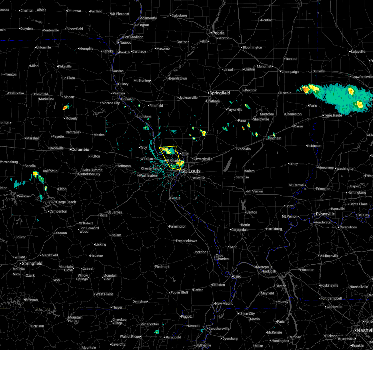 the severe thunderstorm warning has been cancelled and is no longer in effect the severe thunderstorm warning has been cancelled and is no longer in effect
|
| 8/29/2024 3:59 PM CDT |
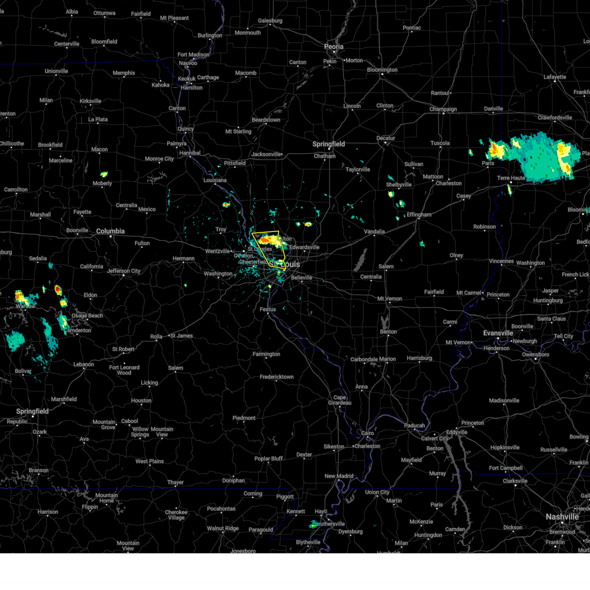 Svrlsx the national weather service in st louis has issued a * severe thunderstorm warning for, southeastern calhoun county in southwestern illinois, southwestern jersey county in southwestern illinois, central st. louis city in east central missouri, northeastern st. charles county in east central missouri, northeastern st. louis county in east central missouri, * until 445 pm cdt. * at 359 pm cdt, a severe thunderstorm was located over jennings, moving north at 10 mph (radar indicated). Hazards include 60 mph wind gusts and quarter size hail. Hail damage to vehicles is expected. expect wind damage to roofs, siding, and trees. this severe thunderstorm will be near, st. louis, florissant, ferguson, bellefontaine neighbors, black jack, dellwood, riverview, spanish lake, moline acres, and calverton park around 405 pm cdt. west alton around 415 pm cdt. This also includes pere marquette state park. Svrlsx the national weather service in st louis has issued a * severe thunderstorm warning for, southeastern calhoun county in southwestern illinois, southwestern jersey county in southwestern illinois, central st. louis city in east central missouri, northeastern st. charles county in east central missouri, northeastern st. louis county in east central missouri, * until 445 pm cdt. * at 359 pm cdt, a severe thunderstorm was located over jennings, moving north at 10 mph (radar indicated). Hazards include 60 mph wind gusts and quarter size hail. Hail damage to vehicles is expected. expect wind damage to roofs, siding, and trees. this severe thunderstorm will be near, st. louis, florissant, ferguson, bellefontaine neighbors, black jack, dellwood, riverview, spanish lake, moline acres, and calverton park around 405 pm cdt. west alton around 415 pm cdt. This also includes pere marquette state park.
|
| 7/30/2024 5:03 PM CDT |
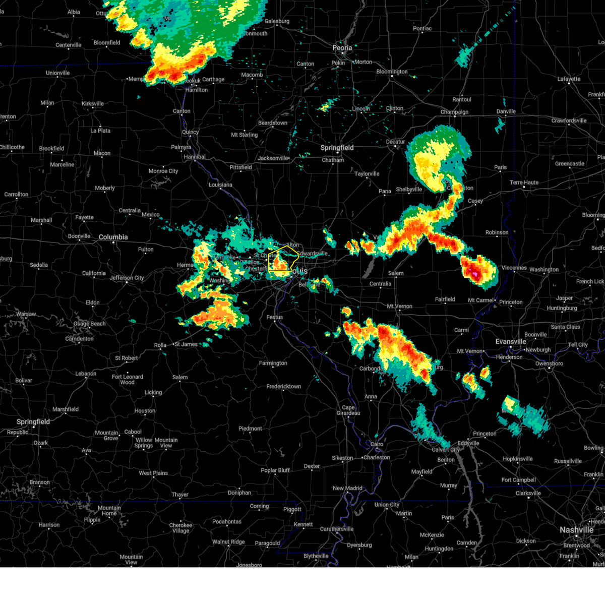 the severe thunderstorm warning has been cancelled and is no longer in effect the severe thunderstorm warning has been cancelled and is no longer in effect
|
| 7/30/2024 4:53 PM CDT |
 At 453 pm cdt, a severe thunderstorm was located over hazelwood, moving east at 30 mph (radar indicated). Hazards include 60 mph wind gusts and quarter size hail. Hail damage to vehicles is expected. expect wind damage to roofs, siding, and trees. locations impacted include, st. louis, st. charles, florissant, university city, maryland heights, hazelwood, ferguson, creve coeur, overland, jennings, st. ann, bridgeton, bellefontaine neighbors, berkeley, olivette, black jack, st. john, dellwood, normandy, and northwoods. this also includes confluence state park. This includes interstate 70 in missouri near exit 231. At 453 pm cdt, a severe thunderstorm was located over hazelwood, moving east at 30 mph (radar indicated). Hazards include 60 mph wind gusts and quarter size hail. Hail damage to vehicles is expected. expect wind damage to roofs, siding, and trees. locations impacted include, st. louis, st. charles, florissant, university city, maryland heights, hazelwood, ferguson, creve coeur, overland, jennings, st. ann, bridgeton, bellefontaine neighbors, berkeley, olivette, black jack, st. john, dellwood, normandy, and northwoods. this also includes confluence state park. This includes interstate 70 in missouri near exit 231.
|
| 7/30/2024 4:37 PM CDT |
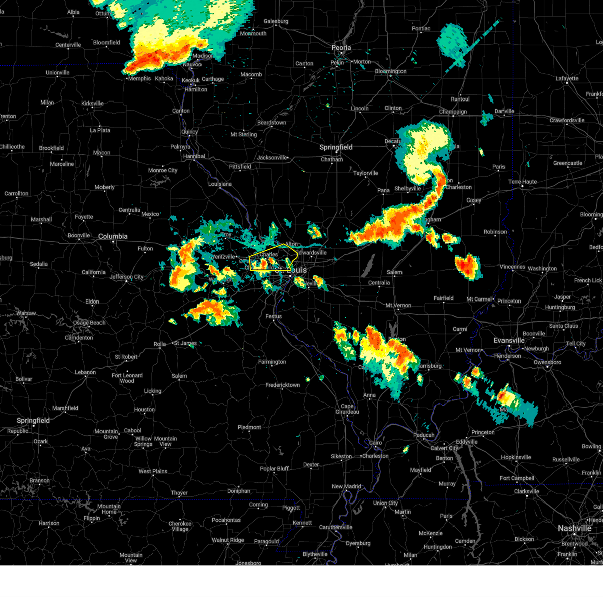 Svrlsx the national weather service in st louis has issued a * severe thunderstorm warning for, northeastern st. louis city in east central missouri, central st. charles county in east central missouri, northern st. louis county in east central missouri, * until 515 pm cdt. * at 437 pm cdt, a severe thunderstorm was located over st. charles, moving east at 25 mph (radar indicated). Hazards include 60 mph wind gusts and quarter size hail. Hail damage to vehicles is expected. Expect wind damage to roofs, siding, and trees. Svrlsx the national weather service in st louis has issued a * severe thunderstorm warning for, northeastern st. louis city in east central missouri, central st. charles county in east central missouri, northern st. louis county in east central missouri, * until 515 pm cdt. * at 437 pm cdt, a severe thunderstorm was located over st. charles, moving east at 25 mph (radar indicated). Hazards include 60 mph wind gusts and quarter size hail. Hail damage to vehicles is expected. Expect wind damage to roofs, siding, and trees.
|
| 7/8/2024 5:32 PM CDT |
 the severe thunderstorm warning has been cancelled and is no longer in effect the severe thunderstorm warning has been cancelled and is no longer in effect
|
| 7/8/2024 5:32 PM CDT |
 At 532 pm cdt, a severe thunderstorm was located over centreville, moving east at 25 mph (radar indicated). Hazards include 60 mph wind gusts and penny size hail. Expect damage to roofs, siding, and trees. locations impacted include, belleville, o'fallon, east st. louis, collinsville, fairview heights, cahokia, swansea, centreville, caseyville, washington park, dupo, madison, cahokia parks airport, fairmont city, alorton, brooklyn, east carondelet, and sauget. This includes interstate 64 in illinois between exits 9 and 12. At 532 pm cdt, a severe thunderstorm was located over centreville, moving east at 25 mph (radar indicated). Hazards include 60 mph wind gusts and penny size hail. Expect damage to roofs, siding, and trees. locations impacted include, belleville, o'fallon, east st. louis, collinsville, fairview heights, cahokia, swansea, centreville, caseyville, washington park, dupo, madison, cahokia parks airport, fairmont city, alorton, brooklyn, east carondelet, and sauget. This includes interstate 64 in illinois between exits 9 and 12.
|
| 7/8/2024 5:17 PM CDT |
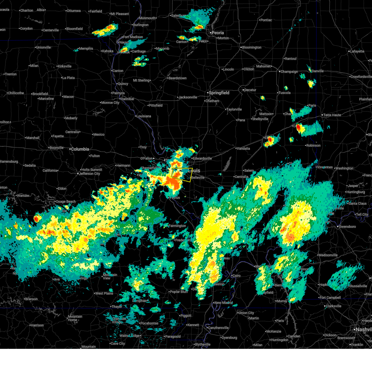 Svrlsx the national weather service in st louis has issued a * severe thunderstorm warning for, northwestern st. clair county in southwestern illinois, st. louis city in east central missouri, central st. louis county in east central missouri, * until 545 pm cdt. * at 517 pm cdt, a severe thunderstorm was located over cahokia heights, moving east at 20 mph (radar indicated). Hazards include 60 mph wind gusts and penny size hail. expect damage to roofs, siding, and trees Svrlsx the national weather service in st louis has issued a * severe thunderstorm warning for, northwestern st. clair county in southwestern illinois, st. louis city in east central missouri, central st. louis county in east central missouri, * until 545 pm cdt. * at 517 pm cdt, a severe thunderstorm was located over cahokia heights, moving east at 20 mph (radar indicated). Hazards include 60 mph wind gusts and penny size hail. expect damage to roofs, siding, and trees
|
| 7/8/2024 4:53 PM CDT |
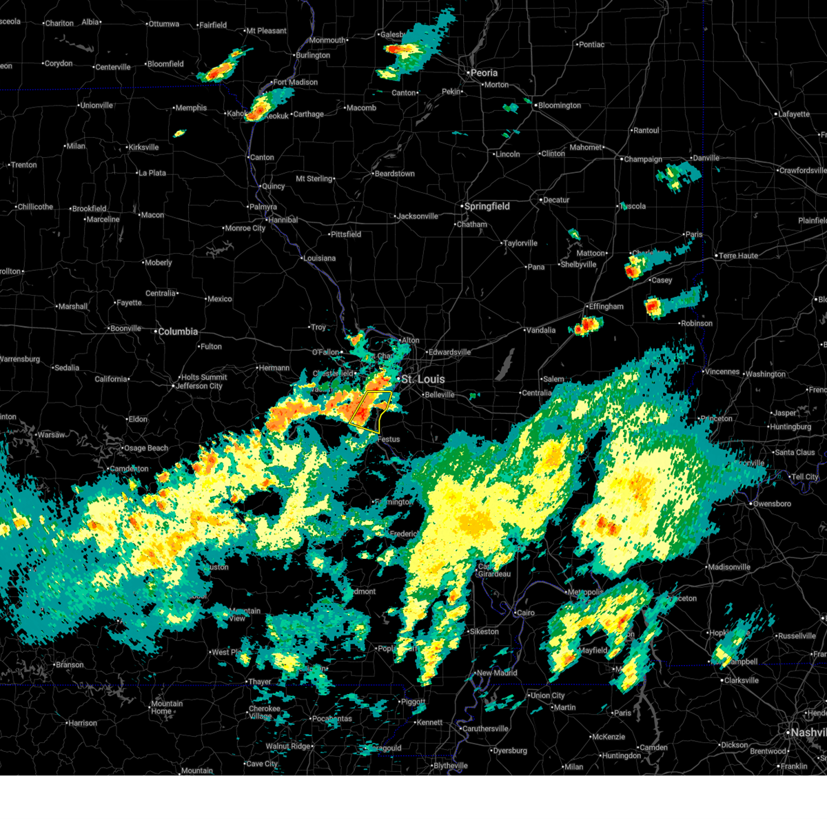 At 453 pm cdt, a severe thunderstorm was located over imperial, moving east at 20 mph (radar indicated). Hazards include 60 mph wind gusts and quarter size hail. Hail damage to vehicles is expected. expect wind damage to roofs, siding, and trees. locations impacted include, arnold, sunset hills, pevely, fenton, herculaneum, lakeshire, barnhart, lemay, mehlville, oakville, murphy, antonia, high ridge, affton, green park, st. george, concord, sappington, horine, and imperial. this also includes mastodon historic site and gov. dunklin's grave historic site. This includes interstate 55 in missouri between exits 180 and 191. At 453 pm cdt, a severe thunderstorm was located over imperial, moving east at 20 mph (radar indicated). Hazards include 60 mph wind gusts and quarter size hail. Hail damage to vehicles is expected. expect wind damage to roofs, siding, and trees. locations impacted include, arnold, sunset hills, pevely, fenton, herculaneum, lakeshire, barnhart, lemay, mehlville, oakville, murphy, antonia, high ridge, affton, green park, st. george, concord, sappington, horine, and imperial. this also includes mastodon historic site and gov. dunklin's grave historic site. This includes interstate 55 in missouri between exits 180 and 191.
|
| 7/8/2024 4:40 PM CDT |
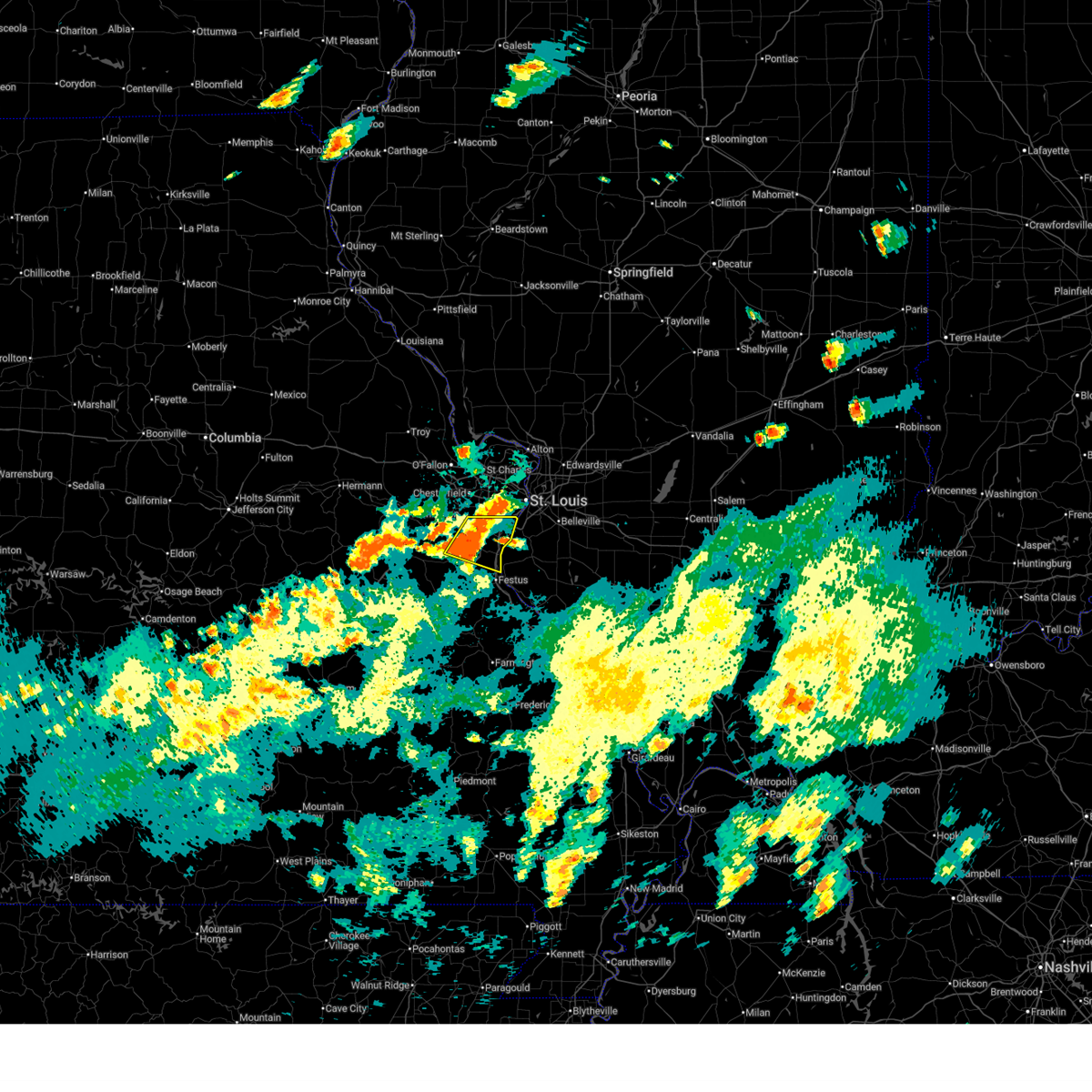 At 440 pm cdt, a severe thunderstorm was located near house springs, moving east at 15 mph (radar indicated). Hazards include 60 mph wind gusts and quarter size hail. Hail damage to vehicles is expected. expect wind damage to roofs, siding, and trees. locations impacted include, arnold, eureka, sunset hills, pevely, fenton, herculaneum, byrnes mill, lakeshire, high ridge, barnhart, cedar hill, murphy, lemay, mehlville, oakville, antonia, affton, green park, st. george, and cedar hill lakes. this also includes route 66 state park, mastodon historic site, and gov. dunklin's grave historic site. this includes the following highways, interstate 44 in missouri between exits 265 and 272. Interstate 55 in missouri between exits 180 and 191. At 440 pm cdt, a severe thunderstorm was located near house springs, moving east at 15 mph (radar indicated). Hazards include 60 mph wind gusts and quarter size hail. Hail damage to vehicles is expected. expect wind damage to roofs, siding, and trees. locations impacted include, arnold, eureka, sunset hills, pevely, fenton, herculaneum, byrnes mill, lakeshire, high ridge, barnhart, cedar hill, murphy, lemay, mehlville, oakville, antonia, affton, green park, st. george, and cedar hill lakes. this also includes route 66 state park, mastodon historic site, and gov. dunklin's grave historic site. this includes the following highways, interstate 44 in missouri between exits 265 and 272. Interstate 55 in missouri between exits 180 and 191.
|
| 7/8/2024 4:30 PM CDT |
 Svrlsx the national weather service in st louis has issued a * severe thunderstorm warning for, northern jefferson county in east central missouri, southwestern st. louis county in east central missouri, * until 500 pm cdt. * at 429 pm cdt, a severe thunderstorm was located over house springs, moving east at 20 mph (public. at 4:25 pm ping pong ball sized hail was reported in byrnes mill). Hazards include 70 mph wind gusts and ping pong ball size hail. People and animals outdoors will be injured. expect hail damage to roofs, siding, windows, and vehicles. expect considerable tree damage. Wind damage is also likely to mobile homes, roofs, and outbuildings. Svrlsx the national weather service in st louis has issued a * severe thunderstorm warning for, northern jefferson county in east central missouri, southwestern st. louis county in east central missouri, * until 500 pm cdt. * at 429 pm cdt, a severe thunderstorm was located over house springs, moving east at 20 mph (public. at 4:25 pm ping pong ball sized hail was reported in byrnes mill). Hazards include 70 mph wind gusts and ping pong ball size hail. People and animals outdoors will be injured. expect hail damage to roofs, siding, windows, and vehicles. expect considerable tree damage. Wind damage is also likely to mobile homes, roofs, and outbuildings.
|
| 5/26/2024 6:17 PM CDT |
 the tornado warning has been cancelled and is no longer in effect the tornado warning has been cancelled and is no longer in effect
|
| 5/26/2024 6:17 PM CDT |
 At 617 pm cdt, a severe thunderstorm capable of producing a tornado was located near belleville, moving east at 35 mph (radar indicated rotation). Hazards include tornado and tennis ball size hail. Flying debris will be dangerous to those caught without shelter. mobile homes will be damaged or destroyed. damage to roofs, windows, and vehicles will occur. tree damage is likely. this dangerous storm will be near, belleville around 620 pm cdt. This includes interstate 64 in illinois near exit 9. At 617 pm cdt, a severe thunderstorm capable of producing a tornado was located near belleville, moving east at 35 mph (radar indicated rotation). Hazards include tornado and tennis ball size hail. Flying debris will be dangerous to those caught without shelter. mobile homes will be damaged or destroyed. damage to roofs, windows, and vehicles will occur. tree damage is likely. this dangerous storm will be near, belleville around 620 pm cdt. This includes interstate 64 in illinois near exit 9.
|
| 5/26/2024 6:13 PM CDT |
 At 613 pm cdt, a severe thunderstorm capable of producing a tornado was located near centreville, moving east at 35 mph (radar indicated rotation). Hazards include tornado and tennis ball size hail. Flying debris will be dangerous to those caught without shelter. mobile homes will be damaged or destroyed. damage to roofs, windows, and vehicles will occur. tree damage is likely. this dangerous storm will be near, belleville around 620 pm cdt. this also includes scott joplin historic site. This includes interstate 64 in illinois near exit 9. At 613 pm cdt, a severe thunderstorm capable of producing a tornado was located near centreville, moving east at 35 mph (radar indicated rotation). Hazards include tornado and tennis ball size hail. Flying debris will be dangerous to those caught without shelter. mobile homes will be damaged or destroyed. damage to roofs, windows, and vehicles will occur. tree damage is likely. this dangerous storm will be near, belleville around 620 pm cdt. this also includes scott joplin historic site. This includes interstate 64 in illinois near exit 9.
|
| 5/26/2024 6:13 PM CDT |
 the tornado warning has been cancelled and is no longer in effect the tornado warning has been cancelled and is no longer in effect
|
| 5/26/2024 6:07 PM CDT | Hen Egg sized hail reported 6.5 miles N of St. Louis, MO, time estimated by radar. |
| 5/26/2024 6:07 PM CDT | Ping Pong Ball sized hail reported 6.6 miles N of St. Louis, MO, time estimated by radar. |
| 5/26/2024 6:07 PM CDT | Quarter sized hail reported 6.7 miles NNE of St. Louis, MO |
| 5/26/2024 6:07 PM CDT | Quarter sized hail reported 5.1 miles N of St. Louis, MO |
| 5/26/2024 6:07 PM CDT | Golf Ball sized hail reported 6.5 miles N of St. Louis, MO |
| 5/26/2024 6:06 PM CDT | Half Dollar sized hail reported 4.5 miles NNW of St. Louis, MO |
| 5/26/2024 6:05 PM CDT | Quarter sized hail reported 4.7 miles NNE of St. Louis, MO |
| 5/26/2024 6:05 PM CDT | 4 inch tree limbs down. time estimated from rada in st. louis city county MO, 6.6 miles N of St. Louis, MO |
| 5/26/2024 6:05 PM CDT | Quarter sized hail reported 3.9 miles NNE of St. Louis, MO |
| 5/26/2024 6:04 PM CDT |
 At 604 pm cdt, a severe thunderstorm capable of producing a tornado was located over dupo, moving east at 35 mph (radar indicated rotation). Hazards include tornado and tennis ball size hail. Flying debris will be dangerous to those caught without shelter. mobile homes will be damaged or destroyed. damage to roofs, windows, and vehicles will occur. tree damage is likely. this dangerous storm will be near, belleville, cahokia, centreville, cahokia parks airport, and alorton around 610 pm cdt. other locations in the path of this tornadic thunderstorm include millstadt. this also includes scott joplin historic site. this includes the following highways, interstate 64 in illinois near exit 9. Interstate 44 in missouri near exit 277. At 604 pm cdt, a severe thunderstorm capable of producing a tornado was located over dupo, moving east at 35 mph (radar indicated rotation). Hazards include tornado and tennis ball size hail. Flying debris will be dangerous to those caught without shelter. mobile homes will be damaged or destroyed. damage to roofs, windows, and vehicles will occur. tree damage is likely. this dangerous storm will be near, belleville, cahokia, centreville, cahokia parks airport, and alorton around 610 pm cdt. other locations in the path of this tornadic thunderstorm include millstadt. this also includes scott joplin historic site. this includes the following highways, interstate 64 in illinois near exit 9. Interstate 44 in missouri near exit 277.
|
| 5/26/2024 5:54 PM CDT |
 At 553 pm cdt, a confirmed tornado was located over green park, moving east at 35 mph (radar confirmed tornado). Hazards include damaging tornado and tennis ball size hail. Flying debris will be dangerous to those caught without shelter. mobile homes will be damaged or destroyed. damage to roofs, windows, and vehicles will occur. tree damage is likely. this tornado will be near, st. louis, cahokia, columbia, dupo, mehlville, lemay, oakville, bella villa, and east carondelet around 600 pm cdt. other locations in the path of this tornadic thunderstorm include centreville, cahokia parks airport, belleville and alorton. this also includes scott joplin historic site. this includes the following highways, interstate 64 in illinois near exit 9. Interstate 44 in missouri near exit 277. At 553 pm cdt, a confirmed tornado was located over green park, moving east at 35 mph (radar confirmed tornado). Hazards include damaging tornado and tennis ball size hail. Flying debris will be dangerous to those caught without shelter. mobile homes will be damaged or destroyed. damage to roofs, windows, and vehicles will occur. tree damage is likely. this tornado will be near, st. louis, cahokia, columbia, dupo, mehlville, lemay, oakville, bella villa, and east carondelet around 600 pm cdt. other locations in the path of this tornadic thunderstorm include centreville, cahokia parks airport, belleville and alorton. this also includes scott joplin historic site. this includes the following highways, interstate 64 in illinois near exit 9. Interstate 44 in missouri near exit 277.
|
| 5/26/2024 5:49 PM CDT |
 the severe thunderstorm warning has been cancelled and is no longer in effect the severe thunderstorm warning has been cancelled and is no longer in effect
|
| 5/26/2024 5:43 PM CDT |
 Torlsx the national weather service in st louis has issued a * tornado warning for, northwestern monroe county in southwestern illinois, northwestern st. clair county in southwestern illinois, st. louis city in east central missouri, south central st. louis county in east central missouri, * until 630 pm cdt. * at 543 pm cdt, a severe thunderstorm capable of producing a tornado was located over fenton, moving east at 35 mph (radar indicated rotation). Hazards include tornado and tennis ball size hail. Flying debris will be dangerous to those caught without shelter. mobile homes will be damaged or destroyed. damage to roofs, windows, and vehicles will occur. tree damage is likely. this dangerous storm will be near, kirkwood, webster groves, crestwood, sunset hills, shrewsbury, lakeshire, oakland, affton, mehlville, and lemay around 550 pm cdt. st. louis, columbia, dupo, and east carondelet around 555 pm cdt. cahokia around 600 pm cdt. other locations in the path of this tornadic thunderstorm include cahokia parks airport, belleville, centreville, millstadt and alorton. this also includes scott joplin historic site. this includes the following highways, interstate 64 in illinois near exit 9. Interstate 44 in missouri near exit 277. Torlsx the national weather service in st louis has issued a * tornado warning for, northwestern monroe county in southwestern illinois, northwestern st. clair county in southwestern illinois, st. louis city in east central missouri, south central st. louis county in east central missouri, * until 630 pm cdt. * at 543 pm cdt, a severe thunderstorm capable of producing a tornado was located over fenton, moving east at 35 mph (radar indicated rotation). Hazards include tornado and tennis ball size hail. Flying debris will be dangerous to those caught without shelter. mobile homes will be damaged or destroyed. damage to roofs, windows, and vehicles will occur. tree damage is likely. this dangerous storm will be near, kirkwood, webster groves, crestwood, sunset hills, shrewsbury, lakeshire, oakland, affton, mehlville, and lemay around 550 pm cdt. st. louis, columbia, dupo, and east carondelet around 555 pm cdt. cahokia around 600 pm cdt. other locations in the path of this tornadic thunderstorm include cahokia parks airport, belleville, centreville, millstadt and alorton. this also includes scott joplin historic site. this includes the following highways, interstate 64 in illinois near exit 9. Interstate 44 in missouri near exit 277.
|
| 5/26/2024 5:41 PM CDT |
 At 540 pm cdt, a severe thunderstorm was located near granite city, moving east at 30 mph (radar indicated). Hazards include 60 mph wind gusts and quarter size hail. Hail damage to vehicles is expected. expect wind damage to roofs, siding, and trees. locations impacted include, edwardsville, pontoon beach, south roxana, roxana and hartford. This also includes horseshoe lake state park. At 540 pm cdt, a severe thunderstorm was located near granite city, moving east at 30 mph (radar indicated). Hazards include 60 mph wind gusts and quarter size hail. Hail damage to vehicles is expected. expect wind damage to roofs, siding, and trees. locations impacted include, edwardsville, pontoon beach, south roxana, roxana and hartford. This also includes horseshoe lake state park.
|
| 5/26/2024 5:41 PM CDT |
 the severe thunderstorm warning has been cancelled and is no longer in effect the severe thunderstorm warning has been cancelled and is no longer in effect
|
| 5/26/2024 5:21 PM CDT |
 At 520 pm cdt, a severe thunderstorm was located over dellwood, moving east at 30 mph (trained weather spotters. at 520 pm ping pong ball sized hail was reported in hazelwood). Hazards include 70 mph wind gusts and ping pong ball size hail. People and animals outdoors will be injured. expect hail damage to roofs, siding, windows, and vehicles. expect considerable tree damage. wind damage is also likely to mobile homes, roofs, and outbuildings. this severe storm will be near, st. louis, ferguson, jennings, bellefontaine neighbors, black jack, dellwood, madison, riverview, spanish lake, and moline acres around 525 pm cdt. granite city and west alton around 530 pm cdt. other locations in the path of this severe thunderstorm include edwardsville, pontoon beach, south roxana, hartford and roxana. this also includes scott joplin historic site, confluence state park, and horseshoe lake state park. This includes interstate 64 in illinois near exit 9. At 520 pm cdt, a severe thunderstorm was located over dellwood, moving east at 30 mph (trained weather spotters. at 520 pm ping pong ball sized hail was reported in hazelwood). Hazards include 70 mph wind gusts and ping pong ball size hail. People and animals outdoors will be injured. expect hail damage to roofs, siding, windows, and vehicles. expect considerable tree damage. wind damage is also likely to mobile homes, roofs, and outbuildings. this severe storm will be near, st. louis, ferguson, jennings, bellefontaine neighbors, black jack, dellwood, madison, riverview, spanish lake, and moline acres around 525 pm cdt. granite city and west alton around 530 pm cdt. other locations in the path of this severe thunderstorm include edwardsville, pontoon beach, south roxana, hartford and roxana. this also includes scott joplin historic site, confluence state park, and horseshoe lake state park. This includes interstate 64 in illinois near exit 9.
|
| 5/26/2024 5:11 PM CDT |
 Svrlsx the national weather service in st louis has issued a * severe thunderstorm warning for, western madison county in southwestern illinois, northwestern st. clair county in southwestern illinois, st. louis city in east central missouri, northeastern st. charles county in east central missouri, northeastern st. louis county in east central missouri, * until 600 pm cdt. * at 511 pm cdt, a severe thunderstorm was located over lambert-st. louis international airport, moving east at 30 mph (radar indicated). Hazards include two inch hail and 70 mph wind gusts. People and animals outdoors will be injured. expect hail damage to roofs, siding, windows, and vehicles. expect considerable tree damage. wind damage is also likely to mobile homes, roofs, and outbuildings. this severe thunderstorm will be near, florissant, hazelwood, ferguson, overland, jennings, berkeley, black jack, st. john, dellwood, and normandy around 515 pm cdt. st. louis, bellefontaine neighbors, riverview, spanish lake, pine lawn, moline acres, flordell hills, and glasgow village around 520 pm cdt. madison around 525 pm cdt. granite city and west alton around 530 pm cdt. other locations in the path of this severe thunderstorm include pontoon beach, hartford, edwardsville, south roxana and roxana. this includes the following highways, interstate 64 in illinois near exit 9. interstate 70 in missouri near exit 231. This also includes scott joplin historic site, confluence state park, and horseshoe lake state park. Svrlsx the national weather service in st louis has issued a * severe thunderstorm warning for, western madison county in southwestern illinois, northwestern st. clair county in southwestern illinois, st. louis city in east central missouri, northeastern st. charles county in east central missouri, northeastern st. louis county in east central missouri, * until 600 pm cdt. * at 511 pm cdt, a severe thunderstorm was located over lambert-st. louis international airport, moving east at 30 mph (radar indicated). Hazards include two inch hail and 70 mph wind gusts. People and animals outdoors will be injured. expect hail damage to roofs, siding, windows, and vehicles. expect considerable tree damage. wind damage is also likely to mobile homes, roofs, and outbuildings. this severe thunderstorm will be near, florissant, hazelwood, ferguson, overland, jennings, berkeley, black jack, st. john, dellwood, and normandy around 515 pm cdt. st. louis, bellefontaine neighbors, riverview, spanish lake, pine lawn, moline acres, flordell hills, and glasgow village around 520 pm cdt. madison around 525 pm cdt. granite city and west alton around 530 pm cdt. other locations in the path of this severe thunderstorm include pontoon beach, hartford, edwardsville, south roxana and roxana. this includes the following highways, interstate 64 in illinois near exit 9. interstate 70 in missouri near exit 231. This also includes scott joplin historic site, confluence state park, and horseshoe lake state park.
|
| 5/24/2024 9:51 PM CDT |
 Svrlsx the national weather service in st louis has issued a * severe thunderstorm warning for, southwestern madison county in southwestern illinois, north central st. clair county in southwestern illinois, * until 1030 pm cdt. * at 951 pm cdt, a severe thunderstorm was located over granite city, moving east at 25 mph (radar indicated). Hazards include 60 mph wind gusts and quarter size hail. Hail damage to vehicles is expected. expect wind damage to roofs, siding, and trees. this severe thunderstorm will be near, granite city, collinsville, edwardsville, pontoon beach, madison, and fairmont city around 955 pm cdt. glen carbon and maryville around 1000 pm cdt. caseyville around 1005 pm cdt. troy around 1010 pm cdt. other locations in the path of this severe thunderstorm include o'fallon. this includes interstate 70 in illinois near exit 21. This also includes horseshoe lake state park. Svrlsx the national weather service in st louis has issued a * severe thunderstorm warning for, southwestern madison county in southwestern illinois, north central st. clair county in southwestern illinois, * until 1030 pm cdt. * at 951 pm cdt, a severe thunderstorm was located over granite city, moving east at 25 mph (radar indicated). Hazards include 60 mph wind gusts and quarter size hail. Hail damage to vehicles is expected. expect wind damage to roofs, siding, and trees. this severe thunderstorm will be near, granite city, collinsville, edwardsville, pontoon beach, madison, and fairmont city around 955 pm cdt. glen carbon and maryville around 1000 pm cdt. caseyville around 1005 pm cdt. troy around 1010 pm cdt. other locations in the path of this severe thunderstorm include o'fallon. this includes interstate 70 in illinois near exit 21. This also includes horseshoe lake state park.
|
| 5/7/2024 4:05 AM CDT |
 Svrlsx the national weather service in st louis has issued a * severe thunderstorm warning for, western monroe county in southwestern illinois, st. louis city in east central missouri, jefferson county in east central missouri, st. louis county in east central missouri, * until 445 am cdt. * at 405 am cdt, severe thunderstorms were located along a line extending from near washington to lonedell to near potosi, moving northeast at 55 mph (radar indicated). Hazards include 60 mph wind gusts. Expect damage to roofs, siding, and trees. severe thunderstorms will be near, dittmer around 410 am cdt. wildwood, eureka, pacific, de soto, cedar hill, and cedar hill lakes around 415 am cdt. hillsboro, byrnes mill, and house springs around 420 am cdt. chesterfield, ballwin, ellisville, weldon spring, clarkson valley, murphy, high ridge, spirit of st. louis airport, and olympian village around 425 am cdt. other locations in the path of these severe thunderstorms include arnold, manchester, festus, town and country, sunset hills, valley park, pevely, crystal city, fenton, herculaneum, kirkwood, maryland heights, creve coeur, crestwood, des peres, glendale, frontenac, warson woods, oakland, mehlville, webster groves, ladue and green park. this includes the following highways, interstate 44 in missouri between exits 261 and 277. interstate 55 in missouri between exits 170 and 191. interstate 70 in missouri near exit 231. this also includes babler memorial state park, scott joplin historic site, route 66 state park, castlewood state park, mastodon historic site, sandy creek covered bridge historic site, and gov. Dunklin's grave historic site. Svrlsx the national weather service in st louis has issued a * severe thunderstorm warning for, western monroe county in southwestern illinois, st. louis city in east central missouri, jefferson county in east central missouri, st. louis county in east central missouri, * until 445 am cdt. * at 405 am cdt, severe thunderstorms were located along a line extending from near washington to lonedell to near potosi, moving northeast at 55 mph (radar indicated). Hazards include 60 mph wind gusts. Expect damage to roofs, siding, and trees. severe thunderstorms will be near, dittmer around 410 am cdt. wildwood, eureka, pacific, de soto, cedar hill, and cedar hill lakes around 415 am cdt. hillsboro, byrnes mill, and house springs around 420 am cdt. chesterfield, ballwin, ellisville, weldon spring, clarkson valley, murphy, high ridge, spirit of st. louis airport, and olympian village around 425 am cdt. other locations in the path of these severe thunderstorms include arnold, manchester, festus, town and country, sunset hills, valley park, pevely, crystal city, fenton, herculaneum, kirkwood, maryland heights, creve coeur, crestwood, des peres, glendale, frontenac, warson woods, oakland, mehlville, webster groves, ladue and green park. this includes the following highways, interstate 44 in missouri between exits 261 and 277. interstate 55 in missouri between exits 170 and 191. interstate 70 in missouri near exit 231. this also includes babler memorial state park, scott joplin historic site, route 66 state park, castlewood state park, mastodon historic site, sandy creek covered bridge historic site, and gov. Dunklin's grave historic site.
|
| 5/4/2024 4:38 PM CDT |
 Svrlsx the national weather service in st louis has issued a * severe thunderstorm warning for, northern madison county in southwestern illinois, southern macoupin county in southwestern illinois, east central st. charles county in east central missouri, eastern st. louis county in east central missouri, * until 545 pm cdt. * at 438 pm cdt, severe thunderstorms were located along a line extending from near kemper to near dorsey to near granite city, moving east at 20 mph (radar indicated). Hazards include 60 mph wind gusts and quarter size hail. Hail damage to vehicles is expected. expect wind damage to roofs, siding, and trees. severe thunderstorms will be near, granite city, edwardsville, wood river, bethalto, pontoon beach, south roxana, bunker hill, roxana, hartford, and shipman around 445 pm cdt. glen carbon and prairietown around 450 pm cdt. other locations in the path of these severe thunderstorms include wilsonville, carpenter, gillespie, worden, mount clare, staunton, benld, sawyerville, east gillespie, livingston, eagarville, mount olive, marine and alhambra. this includes the following highways, interstate 70 in illinois near exit 21. interstate 55 in illinois between exits 23 and 44. This also includes confluence state park and beaver dam state park. Svrlsx the national weather service in st louis has issued a * severe thunderstorm warning for, northern madison county in southwestern illinois, southern macoupin county in southwestern illinois, east central st. charles county in east central missouri, eastern st. louis county in east central missouri, * until 545 pm cdt. * at 438 pm cdt, severe thunderstorms were located along a line extending from near kemper to near dorsey to near granite city, moving east at 20 mph (radar indicated). Hazards include 60 mph wind gusts and quarter size hail. Hail damage to vehicles is expected. expect wind damage to roofs, siding, and trees. severe thunderstorms will be near, granite city, edwardsville, wood river, bethalto, pontoon beach, south roxana, bunker hill, roxana, hartford, and shipman around 445 pm cdt. glen carbon and prairietown around 450 pm cdt. other locations in the path of these severe thunderstorms include wilsonville, carpenter, gillespie, worden, mount clare, staunton, benld, sawyerville, east gillespie, livingston, eagarville, mount olive, marine and alhambra. this includes the following highways, interstate 70 in illinois near exit 21. interstate 55 in illinois between exits 23 and 44. This also includes confluence state park and beaver dam state park.
|
| 4/18/2024 6:06 PM CDT |
 the severe thunderstorm warning has been cancelled and is no longer in effect the severe thunderstorm warning has been cancelled and is no longer in effect
|
| 4/18/2024 6:06 PM CDT |
 At 605 pm cdt, severe thunderstorms were located along a line extending from staunton to columbia, moving east at 55 mph (radar indicated). Hazards include 60 mph wind gusts and quarter size hail. Hail damage to vehicles is expected. expect wind damage to roofs, siding, and trees. locations impacted include, st. louis, belleville, granite city, o'fallon, east st. louis, collinsville, edwardsville, fairview heights, cahokia, swansea, glen carbon, shiloh, wood river, highland, troy, waterloo, columbia, bethalto, maryville, and mascoutah. this also includes horseshoe lake state park. this includes the following highways, interstate 70 in illinois between exits 21 and 30. interstate 55 in illinois between exits 23 and 37. Interstate 64 in illinois between exits 9 and 23. At 605 pm cdt, severe thunderstorms were located along a line extending from staunton to columbia, moving east at 55 mph (radar indicated). Hazards include 60 mph wind gusts and quarter size hail. Hail damage to vehicles is expected. expect wind damage to roofs, siding, and trees. locations impacted include, st. louis, belleville, granite city, o'fallon, east st. louis, collinsville, edwardsville, fairview heights, cahokia, swansea, glen carbon, shiloh, wood river, highland, troy, waterloo, columbia, bethalto, maryville, and mascoutah. this also includes horseshoe lake state park. this includes the following highways, interstate 70 in illinois between exits 21 and 30. interstate 55 in illinois between exits 23 and 37. Interstate 64 in illinois between exits 9 and 23.
|
| 4/18/2024 6:06 PM CDT |
 the severe thunderstorm warning has been cancelled and is no longer in effect the severe thunderstorm warning has been cancelled and is no longer in effect
|
| 4/18/2024 6:06 PM CDT |
 At 606 pm cdt, a severe thunderstorm was located over venice, moving northeast at 25 mph (radar indicated). Hazards include 60 mph wind gusts and quarter size hail. Hail damage to vehicles is expected. expect wind damage to roofs, siding, and trees. locations impacted include, granite city, east st. louis, collinsville, cahokia, pontoon beach, caseyville, washington park, madison, venice, fairmont city, brooklyn, and sauget. This also includes horseshoe lake state park. At 606 pm cdt, a severe thunderstorm was located over venice, moving northeast at 25 mph (radar indicated). Hazards include 60 mph wind gusts and quarter size hail. Hail damage to vehicles is expected. expect wind damage to roofs, siding, and trees. locations impacted include, granite city, east st. louis, collinsville, cahokia, pontoon beach, caseyville, washington park, madison, venice, fairmont city, brooklyn, and sauget. This also includes horseshoe lake state park.
|
| 4/18/2024 5:59 PM CDT |
 the tornado warning has been cancelled and is no longer in effect the tornado warning has been cancelled and is no longer in effect
|
| 4/18/2024 5:59 PM CDT |
 At 558 pm cdt, a severe thunderstorm capable of producing a tornado was located over lemay, moving east at 30 mph (radar indicated rotation). Hazards include tornado. Flying debris will be dangerous to those caught without shelter. mobile homes will be damaged or destroyed. damage to roofs, windows, and vehicles will occur. tree damage is likely. this dangerous storm will be near, cahokia, columbia, dupo, and cahokia parks airport around 605 pm cdt. other locations in the path of this tornadic thunderstorm include east st. louis, centreville, alorton, belleville, fairview heights, caseyville and swansea. This includes interstate 64 in illinois near exit 9. At 558 pm cdt, a severe thunderstorm capable of producing a tornado was located over lemay, moving east at 30 mph (radar indicated rotation). Hazards include tornado. Flying debris will be dangerous to those caught without shelter. mobile homes will be damaged or destroyed. damage to roofs, windows, and vehicles will occur. tree damage is likely. this dangerous storm will be near, cahokia, columbia, dupo, and cahokia parks airport around 605 pm cdt. other locations in the path of this tornadic thunderstorm include east st. louis, centreville, alorton, belleville, fairview heights, caseyville and swansea. This includes interstate 64 in illinois near exit 9.
|
| 4/18/2024 5:58 PM CDT |
 the tornado warning has been cancelled and is no longer in effect the tornado warning has been cancelled and is no longer in effect
|
| 4/18/2024 5:51 PM CDT |
 At 551 pm cdt, severe thunderstorms were located along a line extending from near bunker hill to near arnold, moving east at 55 mph (radar indicated). Hazards include 60 mph wind gusts and quarter size hail. Hail damage to vehicles is expected. expect wind damage to roofs, siding, and trees. locations impacted include, st. louis, florissant, belleville, university city, granite city, o'fallon, alton, kirkwood, east st. louis, hazelwood, collinsville, edwardsville, webster groves, ferguson, arnold, manchester, godfrey, creve coeur, fairview heights, and overland. this also includes scott joplin historic site, confluence state park, mastodon historic site, and horseshoe lake state park. this includes the following highways, interstate 70 in illinois between exits 21 and 30. interstate 55 in illinois between exits 23 and 37. interstate 64 in illinois between exits 9 and 23. interstate 44 in missouri between exits 269 and 277. Interstate 55 in missouri between exits 187 and 191. At 551 pm cdt, severe thunderstorms were located along a line extending from near bunker hill to near arnold, moving east at 55 mph (radar indicated). Hazards include 60 mph wind gusts and quarter size hail. Hail damage to vehicles is expected. expect wind damage to roofs, siding, and trees. locations impacted include, st. louis, florissant, belleville, university city, granite city, o'fallon, alton, kirkwood, east st. louis, hazelwood, collinsville, edwardsville, webster groves, ferguson, arnold, manchester, godfrey, creve coeur, fairview heights, and overland. this also includes scott joplin historic site, confluence state park, mastodon historic site, and horseshoe lake state park. this includes the following highways, interstate 70 in illinois between exits 21 and 30. interstate 55 in illinois between exits 23 and 37. interstate 64 in illinois between exits 9 and 23. interstate 44 in missouri between exits 269 and 277. Interstate 55 in missouri between exits 187 and 191.
|
| 4/18/2024 5:49 PM CDT |
 Torlsx the national weather service in st louis has issued a * tornado warning for, northwestern monroe county in southwestern illinois, northwestern st. clair county in southwestern illinois, southern st. louis city in east central missouri, * until 630 pm cdt. * at 549 pm cdt, a severe thunderstorm capable of producing a tornado was located over sappington, moving east at 30 mph (radar indicated rotation). Hazards include tornado. Flying debris will be dangerous to those caught without shelter. mobile homes will be damaged or destroyed. damage to roofs, windows, and vehicles will occur. tree damage is likely. this dangerous storm will be near, st. louis and east carondelet around 555 pm cdt. cahokia, columbia, and dupo around 600 pm cdt. cahokia parks airport around 605 pm cdt. other locations in the path of this tornadic thunderstorm include east st. louis, centreville, belleville, alorton, fairview heights, caseyville and washington park. this also includes scott joplin historic site. This includes interstate 64 in illinois near exit 9. Torlsx the national weather service in st louis has issued a * tornado warning for, northwestern monroe county in southwestern illinois, northwestern st. clair county in southwestern illinois, southern st. louis city in east central missouri, * until 630 pm cdt. * at 549 pm cdt, a severe thunderstorm capable of producing a tornado was located over sappington, moving east at 30 mph (radar indicated rotation). Hazards include tornado. Flying debris will be dangerous to those caught without shelter. mobile homes will be damaged or destroyed. damage to roofs, windows, and vehicles will occur. tree damage is likely. this dangerous storm will be near, st. louis and east carondelet around 555 pm cdt. cahokia, columbia, and dupo around 600 pm cdt. cahokia parks airport around 605 pm cdt. other locations in the path of this tornadic thunderstorm include east st. louis, centreville, belleville, alorton, fairview heights, caseyville and washington park. this also includes scott joplin historic site. This includes interstate 64 in illinois near exit 9.
|
| 4/18/2024 5:45 PM CDT |
 Torlsx the national weather service in st louis has issued a * tornado warning for, southwestern madison county in southwestern illinois, * until 630 pm cdt. * at 545 pm cdt, a severe thunderstorm capable of producing a tornado was located over granite city, moving east at 30 mph (radar indicated rotation). Hazards include tornado. Flying debris will be dangerous to those caught without shelter. mobile homes will be damaged or destroyed. damage to roofs, windows, and vehicles will occur. tree damage is likely. this dangerous storm will be near, granite city, edwardsville, pontoon beach, and madison around 550 pm cdt. collinsville, glen carbon, maryville, and south roxana around 555 pm cdt. troy around 605 pm cdt. this also includes horseshoe lake state park. this includes the following highways, interstate 70 in illinois near exit 21. Interstate 55 in illinois near exit 23. Torlsx the national weather service in st louis has issued a * tornado warning for, southwestern madison county in southwestern illinois, * until 630 pm cdt. * at 545 pm cdt, a severe thunderstorm capable of producing a tornado was located over granite city, moving east at 30 mph (radar indicated rotation). Hazards include tornado. Flying debris will be dangerous to those caught without shelter. mobile homes will be damaged or destroyed. damage to roofs, windows, and vehicles will occur. tree damage is likely. this dangerous storm will be near, granite city, edwardsville, pontoon beach, and madison around 550 pm cdt. collinsville, glen carbon, maryville, and south roxana around 555 pm cdt. troy around 605 pm cdt. this also includes horseshoe lake state park. this includes the following highways, interstate 70 in illinois near exit 21. Interstate 55 in illinois near exit 23.
|
| 4/18/2024 5:43 PM CDT |
 At 543 pm cdt, a confirmed tornado was located over murphy, moving east at 40 mph (radar confirmed tornado). Hazards include damaging tornado and quarter size hail. Flying debris will be dangerous to those caught without shelter. mobile homes will be damaged or destroyed. damage to roofs, windows, and vehicles will occur. tree damage is likely. this tornado will be near, arnold, sunset hills, fenton, lakeshire, affton, mehlville, oakville, green park, concord, and sappington around 550 pm cdt. other locations in the path of this tornadic thunderstorm include lemay and st. george. this also includes mastodon historic site. This includes interstate 55 in missouri between exits 187 and 191. At 543 pm cdt, a confirmed tornado was located over murphy, moving east at 40 mph (radar confirmed tornado). Hazards include damaging tornado and quarter size hail. Flying debris will be dangerous to those caught without shelter. mobile homes will be damaged or destroyed. damage to roofs, windows, and vehicles will occur. tree damage is likely. this tornado will be near, arnold, sunset hills, fenton, lakeshire, affton, mehlville, oakville, green park, concord, and sappington around 550 pm cdt. other locations in the path of this tornadic thunderstorm include lemay and st. george. this also includes mastodon historic site. This includes interstate 55 in missouri between exits 187 and 191.
|
| 4/18/2024 5:39 PM CDT |
 Svrlsx the national weather service in st louis has issued a * severe thunderstorm warning for, northwestern monroe county in southwestern illinois, madison county in southwestern illinois, st. clair county in southwestern illinois, st. louis city in east central missouri, east central st. charles county in east central missouri, northeastern jefferson county in east central missouri, central st. louis county in east central missouri, * until 645 pm cdt. * at 539 pm cdt, severe thunderstorms were located along a line extending from near brighton to high ridge, moving east at 55 mph (radar indicated). Hazards include 60 mph wind gusts and quarter size hail. Hail damage to vehicles is expected. Expect wind damage to roofs, siding, and trees. Svrlsx the national weather service in st louis has issued a * severe thunderstorm warning for, northwestern monroe county in southwestern illinois, madison county in southwestern illinois, st. clair county in southwestern illinois, st. louis city in east central missouri, east central st. charles county in east central missouri, northeastern jefferson county in east central missouri, central st. louis county in east central missouri, * until 645 pm cdt. * at 539 pm cdt, severe thunderstorms were located along a line extending from near brighton to high ridge, moving east at 55 mph (radar indicated). Hazards include 60 mph wind gusts and quarter size hail. Hail damage to vehicles is expected. Expect wind damage to roofs, siding, and trees.
|
| 4/18/2024 5:34 PM CDT |
 At 534 pm cdt, a confirmed tornado was located over byrnes mill, moving east at 40 mph (radar confirmed tornado). Hazards include damaging tornado. Flying debris will be dangerous to those caught without shelter. mobile homes will be damaged or destroyed. damage to roofs, windows, and vehicles will occur. tree damage is likely. this tornado will be near, fenton, byrnes mill, murphy, and high ridge around 540 pm cdt. arnold, sunset hills, mehlville, oakville, concord, and sappington around 545 pm cdt. lakeshire, affton, and green park around 550 pm cdt. other locations in the path of this tornadic thunderstorm include lemay and st. george. this also includes route 66 state park and mastodon historic site. this includes the following highways, interstate 44 in missouri between exits 264 and 269. Interstate 55 in missouri between exits 187 and 191. At 534 pm cdt, a confirmed tornado was located over byrnes mill, moving east at 40 mph (radar confirmed tornado). Hazards include damaging tornado. Flying debris will be dangerous to those caught without shelter. mobile homes will be damaged or destroyed. damage to roofs, windows, and vehicles will occur. tree damage is likely. this tornado will be near, fenton, byrnes mill, murphy, and high ridge around 540 pm cdt. arnold, sunset hills, mehlville, oakville, concord, and sappington around 545 pm cdt. lakeshire, affton, and green park around 550 pm cdt. other locations in the path of this tornadic thunderstorm include lemay and st. george. this also includes route 66 state park and mastodon historic site. this includes the following highways, interstate 44 in missouri between exits 264 and 269. Interstate 55 in missouri between exits 187 and 191.
|
| 4/18/2024 5:33 PM CDT |
 Torlsx the national weather service in st louis has issued a * tornado warning for, northeastern jefferson county in east central missouri, southwestern st. louis county in east central missouri, * until 615 pm cdt. * at 533 pm cdt, a severe thunderstorm capable of producing a tornado was located over byrnes mill, moving east at 40 mph (radar indicated rotation). Hazards include tornado. Flying debris will be dangerous to those caught without shelter. mobile homes will be damaged or destroyed. damage to roofs, windows, and vehicles will occur. tree damage is likely. this dangerous storm will be near, fenton, byrnes mill, murphy, and high ridge around 540 pm cdt. arnold, sunset hills, oakville, concord, and sappington around 545 pm cdt. mehlville and green park around 550 pm cdt. other locations in the path of this tornadic thunderstorm include affton, lemay and st. george. this also includes route 66 state park, castlewood state park, and mastodon historic site. this includes the following highways, interstate 44 in missouri between exits 264 and 276. Interstate 55 in missouri between exits 187 and 191. Torlsx the national weather service in st louis has issued a * tornado warning for, northeastern jefferson county in east central missouri, southwestern st. louis county in east central missouri, * until 615 pm cdt. * at 533 pm cdt, a severe thunderstorm capable of producing a tornado was located over byrnes mill, moving east at 40 mph (radar indicated rotation). Hazards include tornado. Flying debris will be dangerous to those caught without shelter. mobile homes will be damaged or destroyed. damage to roofs, windows, and vehicles will occur. tree damage is likely. this dangerous storm will be near, fenton, byrnes mill, murphy, and high ridge around 540 pm cdt. arnold, sunset hills, oakville, concord, and sappington around 545 pm cdt. mehlville and green park around 550 pm cdt. other locations in the path of this tornadic thunderstorm include affton, lemay and st. george. this also includes route 66 state park, castlewood state park, and mastodon historic site. this includes the following highways, interstate 44 in missouri between exits 264 and 276. Interstate 55 in missouri between exits 187 and 191.
|
| 4/18/2024 5:25 PM CDT |
 Svrlsx the national weather service in st louis has issued a * severe thunderstorm warning for, southwestern madison county in southwestern illinois, northwestern st. clair county in southwestern illinois, st. louis city in east central missouri, southeastern st. louis county in east central missouri, * until 630 pm cdt. * at 524 pm cdt, a severe thunderstorm was located over sunset hills, moving northeast at 25 mph (radar indicated). Hazards include 60 mph wind gusts and quarter size hail. Hail damage to vehicles is expected. Expect wind damage to roofs, siding, and trees. Svrlsx the national weather service in st louis has issued a * severe thunderstorm warning for, southwestern madison county in southwestern illinois, northwestern st. clair county in southwestern illinois, st. louis city in east central missouri, southeastern st. louis county in east central missouri, * until 630 pm cdt. * at 524 pm cdt, a severe thunderstorm was located over sunset hills, moving northeast at 25 mph (radar indicated). Hazards include 60 mph wind gusts and quarter size hail. Hail damage to vehicles is expected. Expect wind damage to roofs, siding, and trees.
|
| 4/18/2024 4:58 PM CDT |
 Svrlsx the national weather service in st louis has issued a * severe thunderstorm warning for, northeastern st. charles county in east central missouri, northern st. louis county in east central missouri, * until 545 pm cdt. * at 458 pm cdt, a severe thunderstorm was located over town and country, moving northeast at 25 mph (radar indicated). Hazards include 60 mph wind gusts and quarter size hail. Hail damage to vehicles is expected. Expect wind damage to roofs, siding, and trees. Svrlsx the national weather service in st louis has issued a * severe thunderstorm warning for, northeastern st. charles county in east central missouri, northern st. louis county in east central missouri, * until 545 pm cdt. * at 458 pm cdt, a severe thunderstorm was located over town and country, moving northeast at 25 mph (radar indicated). Hazards include 60 mph wind gusts and quarter size hail. Hail damage to vehicles is expected. Expect wind damage to roofs, siding, and trees.
|
| 4/16/2024 3:57 PM CDT |
 the severe thunderstorm warning has been cancelled and is no longer in effect the severe thunderstorm warning has been cancelled and is no longer in effect
|
| 4/16/2024 3:52 PM CDT |
 At 352 pm cdt, a severe thunderstorm was located over imperial, moving northeast at 70 mph (radar indicated). Hazards include 60 mph wind gusts and penny size hail. Expect damage to roofs, siding, and trees. locations impacted include, arnold, festus, waterloo, columbia, pevely, crystal city, herculaneum, hillsboro, lakeshire, barnhart, lemay, mehlville, oakville, antonia, affton, green park, st. george, valmeyer, bella villa, and east carondelet. this also includes mastodon historic site, sandy creek covered bridge historic site, and gov. dunklin's grave historic site. This includes interstate 55 in missouri between exits 175 and 191. At 352 pm cdt, a severe thunderstorm was located over imperial, moving northeast at 70 mph (radar indicated). Hazards include 60 mph wind gusts and penny size hail. Expect damage to roofs, siding, and trees. locations impacted include, arnold, festus, waterloo, columbia, pevely, crystal city, herculaneum, hillsboro, lakeshire, barnhart, lemay, mehlville, oakville, antonia, affton, green park, st. george, valmeyer, bella villa, and east carondelet. this also includes mastodon historic site, sandy creek covered bridge historic site, and gov. dunklin's grave historic site. This includes interstate 55 in missouri between exits 175 and 191.
|
| 4/16/2024 3:41 PM CDT |
 At 341 pm cdt, a severe thunderstorm was located over hillsboro, moving northeast at 70 mph (radar indicated). Hazards include 60 mph wind gusts and quarter size hail. Hail damage to vehicles is expected. expect wind damage to roofs, siding, and trees. locations impacted include, arnold, festus, waterloo, columbia, de soto, pevely, crystal city, herculaneum, hillsboro, lakeshire, barnhart, affton, lemay, mehlville, oakville, antonia, green park, st. george, valmeyer, and bella villa. this also includes mastodon historic site, sandy creek covered bridge historic site, and gov. dunklin's grave historic site. This includes interstate 55 in missouri between exits 174 and 191. At 341 pm cdt, a severe thunderstorm was located over hillsboro, moving northeast at 70 mph (radar indicated). Hazards include 60 mph wind gusts and quarter size hail. Hail damage to vehicles is expected. expect wind damage to roofs, siding, and trees. locations impacted include, arnold, festus, waterloo, columbia, de soto, pevely, crystal city, herculaneum, hillsboro, lakeshire, barnhart, affton, lemay, mehlville, oakville, antonia, green park, st. george, valmeyer, and bella villa. this also includes mastodon historic site, sandy creek covered bridge historic site, and gov. dunklin's grave historic site. This includes interstate 55 in missouri between exits 174 and 191.
|
| 4/16/2024 3:41 PM CDT |
 the severe thunderstorm warning has been cancelled and is no longer in effect the severe thunderstorm warning has been cancelled and is no longer in effect
|
| 4/16/2024 3:29 PM CDT |
 Svrlsx the national weather service in st louis has issued a * severe thunderstorm warning for, northwestern monroe county in southwestern illinois, central jefferson county in east central missouri, northeastern washington county in east central missouri, south central st. louis county in east central missouri, * until 415 pm cdt. * at 329 pm cdt, a severe thunderstorm was located near richwoods, moving northeast at 75 mph (radar indicated). Hazards include 60 mph wind gusts and quarter size hail. Hail damage to vehicles is expected. Expect wind damage to roofs, siding, and trees. Svrlsx the national weather service in st louis has issued a * severe thunderstorm warning for, northwestern monroe county in southwestern illinois, central jefferson county in east central missouri, northeastern washington county in east central missouri, south central st. louis county in east central missouri, * until 415 pm cdt. * at 329 pm cdt, a severe thunderstorm was located near richwoods, moving northeast at 75 mph (radar indicated). Hazards include 60 mph wind gusts and quarter size hail. Hail damage to vehicles is expected. Expect wind damage to roofs, siding, and trees.
|
| 4/2/2024 2:04 AM CDT |
 the severe thunderstorm warning has been cancelled and is no longer in effect the severe thunderstorm warning has been cancelled and is no longer in effect
|
| 4/2/2024 2:04 AM CDT |
 At 203 am cdt, a severe thunderstorm was located near millstadt, moving east at 50 mph (public. one inch hail was reported north of columbia at 158 am). Hazards include golf ball size hail and 60 mph wind gusts. People and animals outdoors will be injured. expect hail damage to roofs, siding, windows, and vehicles. expect wind damage to roofs, siding, and trees. locations impacted include, belleville, o'fallon, east st. louis, collinsville, fairview heights, cahokia, swansea, shiloh, highland, waterloo, columbia, mascoutah, centreville, lebanon, freeburg, caseyville, washington park, dupo, millstadt, and madison. This includes interstate 64 in illinois between exits 9 and 34. At 203 am cdt, a severe thunderstorm was located near millstadt, moving east at 50 mph (public. one inch hail was reported north of columbia at 158 am). Hazards include golf ball size hail and 60 mph wind gusts. People and animals outdoors will be injured. expect hail damage to roofs, siding, windows, and vehicles. expect wind damage to roofs, siding, and trees. locations impacted include, belleville, o'fallon, east st. louis, collinsville, fairview heights, cahokia, swansea, shiloh, highland, waterloo, columbia, mascoutah, centreville, lebanon, freeburg, caseyville, washington park, dupo, millstadt, and madison. This includes interstate 64 in illinois between exits 9 and 34.
|
| 4/2/2024 2:00 AM CDT |
 The storms which prompted the warning have moved out of the area. therefore, the warning has been allowed to expire. however, small hail and gusty winds are still possible with these thunderstorms. a tornado watch remains in effect until 300 am cdt for southwestern illinois, and east central missouri. The storms which prompted the warning have moved out of the area. therefore, the warning has been allowed to expire. however, small hail and gusty winds are still possible with these thunderstorms. a tornado watch remains in effect until 300 am cdt for southwestern illinois, and east central missouri.
|
| 4/2/2024 1:57 AM CDT |
 Svrlsx the national weather service in st louis has issued a * severe thunderstorm warning for, western clinton county in south central illinois, northern monroe county in southwestern illinois, southeastern madison county in southwestern illinois, west central washington county in south central illinois, st. clair county in southwestern illinois, southern st. louis city in east central missouri, northeastern jefferson county in east central missouri, south central st. louis county in east central missouri, * until 245 am cdt. * at 157 am cdt, a severe thunderstorm was located over dupo, moving east at 50 mph (radar indicated). Hazards include golf ball size hail and 60 mph wind gusts. People and animals outdoors will be injured. expect hail damage to roofs, siding, windows, and vehicles. Expect wind damage to roofs, siding, and trees. Svrlsx the national weather service in st louis has issued a * severe thunderstorm warning for, western clinton county in south central illinois, northern monroe county in southwestern illinois, southeastern madison county in southwestern illinois, west central washington county in south central illinois, st. clair county in southwestern illinois, southern st. louis city in east central missouri, northeastern jefferson county in east central missouri, south central st. louis county in east central missouri, * until 245 am cdt. * at 157 am cdt, a severe thunderstorm was located over dupo, moving east at 50 mph (radar indicated). Hazards include golf ball size hail and 60 mph wind gusts. People and animals outdoors will be injured. expect hail damage to roofs, siding, windows, and vehicles. Expect wind damage to roofs, siding, and trees.
|
| 4/2/2024 1:12 AM CDT |
 Svrlsx the national weather service in st louis has issued a * severe thunderstorm warning for, northwestern monroe county in southwestern illinois, jefferson county in east central missouri, southeastern franklin county in east central missouri, southwestern st. louis county in east central missouri, * until 200 am cdt. * at 112 am cdt, severe thunderstorms were located along a line extending from near union to near lonedell to 7 miles east of richwoods, moving northeast at 45 mph (radar indicated). Hazards include 60 mph wind gusts and quarter size hail. Hail damage to vehicles is expected. Expect wind damage to roofs, siding, and trees. Svrlsx the national weather service in st louis has issued a * severe thunderstorm warning for, northwestern monroe county in southwestern illinois, jefferson county in east central missouri, southeastern franklin county in east central missouri, southwestern st. louis county in east central missouri, * until 200 am cdt. * at 112 am cdt, severe thunderstorms were located along a line extending from near union to near lonedell to 7 miles east of richwoods, moving northeast at 45 mph (radar indicated). Hazards include 60 mph wind gusts and quarter size hail. Hail damage to vehicles is expected. Expect wind damage to roofs, siding, and trees.
|
| 4/2/2024 12:00 AM CDT |
 the severe thunderstorm warning has been cancelled and is no longer in effect the severe thunderstorm warning has been cancelled and is no longer in effect
|
| 4/1/2024 11:54 PM CDT |
 At 1153 pm cdt, a severe thunderstorm was located over ellisville, moving east at 40 mph (radar indicated). Hazards include 60 mph wind gusts and quarter size hail. Hail damage to vehicles is expected. expect wind damage to roofs, siding, and trees. locations impacted include, st. louis, chesterfield, wildwood, university city, ballwin, kirkwood, maryland heights, webster groves, ferguson, manchester, creve coeur, overland, clayton, jennings, st. ann, crestwood, bridgeton, bellefontaine neighbors, town and country, and eureka. this also includes babler memorial state park, scott joplin historic site, route 66 state park, and castlewood state park. This includes interstate 44 in missouri between exits 261 and 277. At 1153 pm cdt, a severe thunderstorm was located over ellisville, moving east at 40 mph (radar indicated). Hazards include 60 mph wind gusts and quarter size hail. Hail damage to vehicles is expected. expect wind damage to roofs, siding, and trees. locations impacted include, st. louis, chesterfield, wildwood, university city, ballwin, kirkwood, maryland heights, webster groves, ferguson, manchester, creve coeur, overland, clayton, jennings, st. ann, crestwood, bridgeton, bellefontaine neighbors, town and country, and eureka. this also includes babler memorial state park, scott joplin historic site, route 66 state park, and castlewood state park. This includes interstate 44 in missouri between exits 261 and 277.
|
| 4/1/2024 11:54 PM CDT |
 the severe thunderstorm warning has been cancelled and is no longer in effect the severe thunderstorm warning has been cancelled and is no longer in effect
|
| 4/1/2024 11:46 PM CDT |
 the severe thunderstorm warning has been cancelled and is no longer in effect the severe thunderstorm warning has been cancelled and is no longer in effect
|
| 4/1/2024 11:43 PM CDT |
 At 1143 pm cdt, a severe thunderstorm was located over pacific, moving east at 40 mph (public reported quarter sized hail 1 mile east of villa ridge). Hazards include 60 mph wind gusts and quarter size hail. Hail damage to vehicles is expected. expect wind damage to roofs, siding, and trees. locations impacted include, st. louis, chesterfield, wildwood, university city, ballwin, kirkwood, maryland heights, east st. louis, webster groves, ferguson, manchester, creve coeur, overland, clayton, jennings, st. ann, crestwood, bridgeton, bellefontaine neighbors, and town and country. this also includes scott joplin historic site, route 66 state park, castlewood state park, and robertsville state park. This includes interstate 44 in missouri between exits 253 and 277. At 1143 pm cdt, a severe thunderstorm was located over pacific, moving east at 40 mph (public reported quarter sized hail 1 mile east of villa ridge). Hazards include 60 mph wind gusts and quarter size hail. Hail damage to vehicles is expected. expect wind damage to roofs, siding, and trees. locations impacted include, st. louis, chesterfield, wildwood, university city, ballwin, kirkwood, maryland heights, east st. louis, webster groves, ferguson, manchester, creve coeur, overland, clayton, jennings, st. ann, crestwood, bridgeton, bellefontaine neighbors, and town and country. this also includes scott joplin historic site, route 66 state park, castlewood state park, and robertsville state park. This includes interstate 44 in missouri between exits 253 and 277.
|
| 4/1/2024 11:38 PM CDT |
 Svrlsx the national weather service in st louis has issued a * severe thunderstorm warning for, st. louis city in east central missouri, northwestern jefferson county in east central missouri, east central franklin county in east central missouri, st. louis county in east central missouri, * until 1245 am cdt. * at 1137 pm cdt, a severe thunderstorm was located over gray summit, moving east at 40 mph (radar indicated). Hazards include 60 mph wind gusts and quarter size hail. Hail damage to vehicles is expected. Expect wind damage to roofs, siding, and trees. Svrlsx the national weather service in st louis has issued a * severe thunderstorm warning for, st. louis city in east central missouri, northwestern jefferson county in east central missouri, east central franklin county in east central missouri, st. louis county in east central missouri, * until 1245 am cdt. * at 1137 pm cdt, a severe thunderstorm was located over gray summit, moving east at 40 mph (radar indicated). Hazards include 60 mph wind gusts and quarter size hail. Hail damage to vehicles is expected. Expect wind damage to roofs, siding, and trees.
|
| 4/1/2024 11:31 PM CDT |
 At 1131 pm cdt, a severe thunderstorm was located over st. louis, moving northeast at 50 mph (trained weather spotters reported quarter sized hail in rock hill and kirkwood). Hazards include 60 mph wind gusts and quarter size hail. Hail damage to vehicles is expected. expect wind damage to roofs, siding, and trees. locations impacted include, st. louis, belleville, granite city, o'fallon, east st. louis, collinsville, edwardsville, fairview heights, cahokia, glen carbon, wood river, highland, troy, maryville, pontoon beach, centreville, lebanon, caseyville, washington park, and madison. this also includes horseshoe lake state park. this includes the following highways, interstate 70 in illinois between exits 21 and 30. interstate 55 in illinois between exits 23 and 33. Interstate 64 in illinois between exits 9 and 14. At 1131 pm cdt, a severe thunderstorm was located over st. louis, moving northeast at 50 mph (trained weather spotters reported quarter sized hail in rock hill and kirkwood). Hazards include 60 mph wind gusts and quarter size hail. Hail damage to vehicles is expected. expect wind damage to roofs, siding, and trees. locations impacted include, st. louis, belleville, granite city, o'fallon, east st. louis, collinsville, edwardsville, fairview heights, cahokia, glen carbon, wood river, highland, troy, maryville, pontoon beach, centreville, lebanon, caseyville, washington park, and madison. this also includes horseshoe lake state park. this includes the following highways, interstate 70 in illinois between exits 21 and 30. interstate 55 in illinois between exits 23 and 33. Interstate 64 in illinois between exits 9 and 14.
|
| 4/1/2024 11:30 PM CDT |
 At 1130 pm cdt, a severe thunderstorm was located over st. louis, moving east at 50 mph (trained weather spotters reported quarter sized hail in rock hill and kirkwood). Hazards include 60 mph wind gusts and quarter size hail. Hail damage to vehicles is expected. expect wind damage to roofs, siding, and trees. locations impacted include, st. louis, florissant, chesterfield, wildwood, university city, ballwin, kirkwood, maryland heights, hazelwood, webster groves, ferguson, arnold, manchester, creve coeur, overland, clayton, cahokia, jennings, st. ann, and crestwood. this also includes babler memorial state park, scott joplin historic site, route 66 state park, castlewood state park, and robertsville state park. this includes the following highways, interstate 44 in missouri between exits 253 and 277. Interstate 55 in missouri between exits 190 and 191. At 1130 pm cdt, a severe thunderstorm was located over st. louis, moving east at 50 mph (trained weather spotters reported quarter sized hail in rock hill and kirkwood). Hazards include 60 mph wind gusts and quarter size hail. Hail damage to vehicles is expected. expect wind damage to roofs, siding, and trees. locations impacted include, st. louis, florissant, chesterfield, wildwood, university city, ballwin, kirkwood, maryland heights, hazelwood, webster groves, ferguson, arnold, manchester, creve coeur, overland, clayton, cahokia, jennings, st. ann, and crestwood. this also includes babler memorial state park, scott joplin historic site, route 66 state park, castlewood state park, and robertsville state park. this includes the following highways, interstate 44 in missouri between exits 253 and 277. Interstate 55 in missouri between exits 190 and 191.
|
| 4/1/2024 11:26 PM CDT |
 Svrlsx the national weather service in st louis has issued a * severe thunderstorm warning for, madison county in southwestern illinois, northern st. clair county in southwestern illinois, * until 1215 am cdt. * at 1126 pm cdt, a severe thunderstorm was located over richmond heights, moving east at 50 mph (trained weather spotters). Hazards include 60 mph wind gusts and quarter size hail. Hail damage to vehicles is expected. Expect wind damage to roofs, siding, and trees. Svrlsx the national weather service in st louis has issued a * severe thunderstorm warning for, madison county in southwestern illinois, northern st. clair county in southwestern illinois, * until 1215 am cdt. * at 1126 pm cdt, a severe thunderstorm was located over richmond heights, moving east at 50 mph (trained weather spotters). Hazards include 60 mph wind gusts and quarter size hail. Hail damage to vehicles is expected. Expect wind damage to roofs, siding, and trees.
|
| 4/1/2024 11:21 PM CDT |
 At 1121 pm cdt, a severe thunderstorm was located over des peres, moving east at 45 mph (trained weather spotters). Hazards include 60 mph wind gusts and quarter size hail. Hail damage to vehicles is expected. expect wind damage to roofs, siding, and trees. locations impacted include, st. louis, florissant, chesterfield, wildwood, university city, ballwin, kirkwood, maryland heights, hazelwood, webster groves, ferguson, arnold, manchester, creve coeur, overland, clayton, cahokia, jennings, st. ann, and crestwood. this also includes babler memorial state park, scott joplin historic site, route 66 state park, castlewood state park, and robertsville state park. this includes the following highways, interstate 44 in missouri between exits 253 and 277. Interstate 55 in missouri between exits 190 and 191. At 1121 pm cdt, a severe thunderstorm was located over des peres, moving east at 45 mph (trained weather spotters). Hazards include 60 mph wind gusts and quarter size hail. Hail damage to vehicles is expected. expect wind damage to roofs, siding, and trees. locations impacted include, st. louis, florissant, chesterfield, wildwood, university city, ballwin, kirkwood, maryland heights, hazelwood, webster groves, ferguson, arnold, manchester, creve coeur, overland, clayton, cahokia, jennings, st. ann, and crestwood. this also includes babler memorial state park, scott joplin historic site, route 66 state park, castlewood state park, and robertsville state park. this includes the following highways, interstate 44 in missouri between exits 253 and 277. Interstate 55 in missouri between exits 190 and 191.
|
| 4/1/2024 11:17 PM CDT |
 At 1116 pm cdt, a severe thunderstorm was located over manchester, moving east at 45 mph (radar indicated). Hazards include 60 mph wind gusts and quarter size hail. Hail damage to vehicles is expected. expect wind damage to roofs, siding, and trees. locations impacted include, st. louis, florissant, chesterfield, wildwood, university city, ballwin, kirkwood, maryland heights, hazelwood, webster groves, ferguson, arnold, manchester, creve coeur, overland, clayton, cahokia, jennings, st. ann, and crestwood. this also includes babler memorial state park, scott joplin historic site, route 66 state park, castlewood state park, and robertsville state park. this includes the following highways, interstate 44 in missouri between exits 253 and 277. Interstate 55 in missouri between exits 190 and 191. At 1116 pm cdt, a severe thunderstorm was located over manchester, moving east at 45 mph (radar indicated). Hazards include 60 mph wind gusts and quarter size hail. Hail damage to vehicles is expected. expect wind damage to roofs, siding, and trees. locations impacted include, st. louis, florissant, chesterfield, wildwood, university city, ballwin, kirkwood, maryland heights, hazelwood, webster groves, ferguson, arnold, manchester, creve coeur, overland, clayton, cahokia, jennings, st. ann, and crestwood. this also includes babler memorial state park, scott joplin historic site, route 66 state park, castlewood state park, and robertsville state park. this includes the following highways, interstate 44 in missouri between exits 253 and 277. Interstate 55 in missouri between exits 190 and 191.
|
| 4/1/2024 10:47 PM CDT |
 Svrlsx the national weather service in st louis has issued a * severe thunderstorm warning for, st. louis city in east central missouri, northern jefferson county in east central missouri, east central franklin county in east central missouri, st. louis county in east central missouri, * until 1145 pm cdt. * at 1046 pm cdt, a severe thunderstorm was located over villa ridge, moving east at 45 mph (radar indicated). Hazards include 60 mph wind gusts and quarter size hail. Hail damage to vehicles is expected. Expect wind damage to roofs, siding, and trees. Svrlsx the national weather service in st louis has issued a * severe thunderstorm warning for, st. louis city in east central missouri, northern jefferson county in east central missouri, east central franklin county in east central missouri, st. louis county in east central missouri, * until 1145 pm cdt. * at 1046 pm cdt, a severe thunderstorm was located over villa ridge, moving east at 45 mph (radar indicated). Hazards include 60 mph wind gusts and quarter size hail. Hail damage to vehicles is expected. Expect wind damage to roofs, siding, and trees.
|
| 4/1/2024 7:23 PM CDT |
 the severe thunderstorm warning has been cancelled and is no longer in effect the severe thunderstorm warning has been cancelled and is no longer in effect
|
| 4/1/2024 7:14 PM CDT |
 The storm which prompted the warning has moved out of the area. therefore, the warning will be allowed to expire. a tornado watch remains in effect until midnight cdt for southwestern illinois, and east central missouri. The storm which prompted the warning has moved out of the area. therefore, the warning will be allowed to expire. a tornado watch remains in effect until midnight cdt for southwestern illinois, and east central missouri.
|
| 4/1/2024 7:13 PM CDT |
 At 713 pm cdt, a severe thunderstorm was located over hartford, moving east at 35 mph (radar indicated). Hazards include ping pong ball size hail and 60 mph wind gusts. People and animals outdoors will be injured. expect hail damage to roofs, siding, windows, and vehicles. expect wind damage to roofs, siding, and trees. locations impacted include, granite city, edwardsville, glen carbon, wood river, highland, bethalto, pontoon beach, madison, east alton, south roxana, roxana, hartford, worden, marine, livingston, alhambra, rosewood heights, carpenter, hamel, and grantfork. This includes interstate 55 in illinois between exits 23 and 33. At 713 pm cdt, a severe thunderstorm was located over hartford, moving east at 35 mph (radar indicated). Hazards include ping pong ball size hail and 60 mph wind gusts. People and animals outdoors will be injured. expect hail damage to roofs, siding, windows, and vehicles. expect wind damage to roofs, siding, and trees. locations impacted include, granite city, edwardsville, glen carbon, wood river, highland, bethalto, pontoon beach, madison, east alton, south roxana, roxana, hartford, worden, marine, livingston, alhambra, rosewood heights, carpenter, hamel, and grantfork. This includes interstate 55 in illinois between exits 23 and 33.
|
| 4/1/2024 7:10 PM CDT |
 The storm which prompted the warning has moved out of the area. therefore, the warning will be allowed to expire. a tornado watch remains in effect until midnight cdt for southwestern illinois, and east central missouri. remember, a severe thunderstorm warning still remains in effect for northeastern st. louis county and northern st. louis city until 715 pm. The storm which prompted the warning has moved out of the area. therefore, the warning will be allowed to expire. a tornado watch remains in effect until midnight cdt for southwestern illinois, and east central missouri. remember, a severe thunderstorm warning still remains in effect for northeastern st. louis county and northern st. louis city until 715 pm.
|
| 4/1/2024 6:59 PM CDT |
 At 659 pm cdt, a severe thunderstorm was located over riverview, moving east at 40 mph (radar indicated). Hazards include ping pong ball size hail and 60 mph wind gusts. People and animals outdoors will be injured. expect hail damage to roofs, siding, windows, and vehicles. expect wind damage to roofs, siding, and trees. locations impacted include, st. louis, florissant, hazelwood, ferguson, jennings, bellefontaine neighbors, berkeley, black jack, dellwood, normandy, northwoods, riverview, hillsdale, cool valley, kinloch, spanish lake, pagedale, pine lawn, moline acres, and wellston. This also includes confluence state park. At 659 pm cdt, a severe thunderstorm was located over riverview, moving east at 40 mph (radar indicated). Hazards include ping pong ball size hail and 60 mph wind gusts. People and animals outdoors will be injured. expect hail damage to roofs, siding, windows, and vehicles. expect wind damage to roofs, siding, and trees. locations impacted include, st. louis, florissant, hazelwood, ferguson, jennings, bellefontaine neighbors, berkeley, black jack, dellwood, normandy, northwoods, riverview, hillsdale, cool valley, kinloch, spanish lake, pagedale, pine lawn, moline acres, and wellston. This also includes confluence state park.
|
| 4/1/2024 6:58 PM CDT |
 At 658 pm cdt, a severe thunderstorm capable of producing a tornado was located over flordell hills, moving east at 35 mph (radar indicated rotation). Hazards include tornado and ping pong ball size hail. Flying debris will be dangerous to those caught without shelter. mobile homes will be damaged or destroyed. damage to roofs, windows, and vehicles will occur. tree damage is likely. this dangerous storm will be near, st. Louis, bellefontaine neighbors, riverview, spanish lake, and glasgow village around 705 pm cdt. At 658 pm cdt, a severe thunderstorm capable of producing a tornado was located over flordell hills, moving east at 35 mph (radar indicated rotation). Hazards include tornado and ping pong ball size hail. Flying debris will be dangerous to those caught without shelter. mobile homes will be damaged or destroyed. damage to roofs, windows, and vehicles will occur. tree damage is likely. this dangerous storm will be near, st. Louis, bellefontaine neighbors, riverview, spanish lake, and glasgow village around 705 pm cdt.
|
| 4/1/2024 6:53 PM CDT |
 Svrlsx the national weather service in st louis has issued a * severe thunderstorm warning for, madison county in southwestern illinois, * until 800 pm cdt. * at 652 pm cdt, a severe thunderstorm was located over dellwood, moving east at 40 mph (radar indicated). Hazards include ping pong ball size hail and 60 mph wind gusts. People and animals outdoors will be injured. expect hail damage to roofs, siding, windows, and vehicles. Expect wind damage to roofs, siding, and trees. Svrlsx the national weather service in st louis has issued a * severe thunderstorm warning for, madison county in southwestern illinois, * until 800 pm cdt. * at 652 pm cdt, a severe thunderstorm was located over dellwood, moving east at 40 mph (radar indicated). Hazards include ping pong ball size hail and 60 mph wind gusts. People and animals outdoors will be injured. expect hail damage to roofs, siding, windows, and vehicles. Expect wind damage to roofs, siding, and trees.
|
| 4/1/2024 6:47 PM CDT |
 At 647 pm cdt, a severe thunderstorm was located over st. john, moving east at 40 mph (radar indicated). Hazards include ping pong ball size hail and 60 mph wind gusts. People and animals outdoors will be injured. expect hail damage to roofs, siding, windows, and vehicles. expect wind damage to roofs, siding, and trees. locations impacted include, st. louis, st. charles, florissant, university city, maryland heights, hazelwood, ferguson, creve coeur, overland, jennings, st. ann, bridgeton, bellefontaine neighbors, berkeley, olivette, black jack, st. john, dellwood, normandy, and northwoods. this also includes confluence state park and first missouri state capitol historic site. This includes interstate 70 in missouri near exit 231. At 647 pm cdt, a severe thunderstorm was located over st. john, moving east at 40 mph (radar indicated). Hazards include ping pong ball size hail and 60 mph wind gusts. People and animals outdoors will be injured. expect hail damage to roofs, siding, windows, and vehicles. expect wind damage to roofs, siding, and trees. locations impacted include, st. louis, st. charles, florissant, university city, maryland heights, hazelwood, ferguson, creve coeur, overland, jennings, st. ann, bridgeton, bellefontaine neighbors, berkeley, olivette, black jack, st. john, dellwood, normandy, and northwoods. this also includes confluence state park and first missouri state capitol historic site. This includes interstate 70 in missouri near exit 231.
|
| 4/1/2024 6:45 PM CDT |
 At 645 pm cdt, a severe thunderstorm capable of producing a tornado was located over creve coeur, moving east at 20 mph (radar indicated rotation). Hazards include tornado and ping pong ball size hail. Flying debris will be dangerous to those caught without shelter. mobile homes will be damaged or destroyed. damage to roofs, windows, and vehicles will occur. tree damage is likely. this dangerous storm will be near, university city, maryland heights, creve coeur, overland, st. ann, bridgeton, ladue, olivette, st. john, and woodson terrace around 650 pm cdt. clayton, berkeley, bel-ridge, lambert-st. louis international airport, pagedale, hanley hills, bel-nor, greendale, vinita terrace, and bellerive around 655 pm cdt. other locations in the path of this tornadic thunderstorm include ferguson, jennings, normandy, northwoods, hillsdale, cool valley, kinloch, wellston, velda city, velda village hills, st. Louis, dellwood, pine lawn, country club hills, flordell hills, uplands park, bellefontaine neighbors, moline acres, castle point, riverview, spanish lake and glasgow village. At 645 pm cdt, a severe thunderstorm capable of producing a tornado was located over creve coeur, moving east at 20 mph (radar indicated rotation). Hazards include tornado and ping pong ball size hail. Flying debris will be dangerous to those caught without shelter. mobile homes will be damaged or destroyed. damage to roofs, windows, and vehicles will occur. tree damage is likely. this dangerous storm will be near, university city, maryland heights, creve coeur, overland, st. ann, bridgeton, ladue, olivette, st. john, and woodson terrace around 650 pm cdt. clayton, berkeley, bel-ridge, lambert-st. louis international airport, pagedale, hanley hills, bel-nor, greendale, vinita terrace, and bellerive around 655 pm cdt. other locations in the path of this tornadic thunderstorm include ferguson, jennings, normandy, northwoods, hillsdale, cool valley, kinloch, wellston, velda city, velda village hills, st. Louis, dellwood, pine lawn, country club hills, flordell hills, uplands park, bellefontaine neighbors, moline acres, castle point, riverview, spanish lake and glasgow village.
|
| 4/1/2024 6:39 PM CDT |
 At 639 pm cdt, a confirmed tornado was located over creve coeur, moving east at 25 mph (radar confirmed tornado). Hazards include damaging tornado and golf ball size hail. Flying debris will be dangerous to those caught without shelter. mobile homes will be damaged or destroyed. damage to roofs, windows, and vehicles will occur. tree damage is likely. this tornado will be near, university city, maryland heights, creve coeur, overland, clayton, st. ann, bridgeton, town and country, richmond heights, and ladue around 645 pm cdt. berkeley, brentwood, normandy, woodson terrace, bel-ridge, lambert-st. louis international airport, pagedale, wellston, hanley hills, and bel-nor around 650 pm cdt. other locations in the path of this tornadic thunderstorm include st. louis, ferguson, jennings, northwoods, hillsdale, cool valley, kinloch, pine lawn, velda city, country club hills, bellefontaine neighbors, dellwood, flordell hills, riverview, moline acres, castle point and glasgow village. This also includes scott joplin historic site. At 639 pm cdt, a confirmed tornado was located over creve coeur, moving east at 25 mph (radar confirmed tornado). Hazards include damaging tornado and golf ball size hail. Flying debris will be dangerous to those caught without shelter. mobile homes will be damaged or destroyed. damage to roofs, windows, and vehicles will occur. tree damage is likely. this tornado will be near, university city, maryland heights, creve coeur, overland, clayton, st. ann, bridgeton, town and country, richmond heights, and ladue around 645 pm cdt. berkeley, brentwood, normandy, woodson terrace, bel-ridge, lambert-st. louis international airport, pagedale, wellston, hanley hills, and bel-nor around 650 pm cdt. other locations in the path of this tornadic thunderstorm include st. louis, ferguson, jennings, northwoods, hillsdale, cool valley, kinloch, pine lawn, velda city, country club hills, bellefontaine neighbors, dellwood, flordell hills, riverview, moline acres, castle point and glasgow village. This also includes scott joplin historic site.
|
| 4/1/2024 6:33 PM CDT |
 Torlsx the national weather service in st louis has issued a * tornado warning for, st. louis city in east central missouri, central st. louis county in east central missouri, * until 715 pm cdt. * at 633 pm cdt, a severe thunderstorm capable of producing a tornado was located over chesterfield, moving east at 30 mph (radar indicated rotation). Hazards include tornado and golf ball size hail. Flying debris will be dangerous to those caught without shelter. mobile homes will be damaged or destroyed. damage to roofs, windows, and vehicles will occur. tree damage is likely. this dangerous storm will be near, chesterfield, maryland heights, creve coeur, overland, town and country, ladue, des peres, olivette, frontenac, and crystal lake park around 640 pm cdt. university city, clayton, st. ann, bridgeton, richmond heights, brentwood, warson woods, breckenridge hills, vinita park, and sycamore hills around 645 pm cdt. st. louis, berkeley, maplewood, st. john, normandy, woodson terrace, bel-ridge, rock hill, pagedale, and wellston around 650 pm cdt. other locations in the path of this tornadic thunderstorm include ferguson, jennings, northwoods, hillsdale, cool valley, kinloch, pine lawn, velda city, country club hills, velda village hills, bellefontaine neighbors, flordell hills, riverview, moline acres and glasgow village. This also includes scott joplin historic site. Torlsx the national weather service in st louis has issued a * tornado warning for, st. louis city in east central missouri, central st. louis county in east central missouri, * until 715 pm cdt. * at 633 pm cdt, a severe thunderstorm capable of producing a tornado was located over chesterfield, moving east at 30 mph (radar indicated rotation). Hazards include tornado and golf ball size hail. Flying debris will be dangerous to those caught without shelter. mobile homes will be damaged or destroyed. damage to roofs, windows, and vehicles will occur. tree damage is likely. this dangerous storm will be near, chesterfield, maryland heights, creve coeur, overland, town and country, ladue, des peres, olivette, frontenac, and crystal lake park around 640 pm cdt. university city, clayton, st. ann, bridgeton, richmond heights, brentwood, warson woods, breckenridge hills, vinita park, and sycamore hills around 645 pm cdt. st. louis, berkeley, maplewood, st. john, normandy, woodson terrace, bel-ridge, rock hill, pagedale, and wellston around 650 pm cdt. other locations in the path of this tornadic thunderstorm include ferguson, jennings, northwoods, hillsdale, cool valley, kinloch, pine lawn, velda city, country club hills, velda village hills, bellefontaine neighbors, flordell hills, riverview, moline acres and glasgow village. This also includes scott joplin historic site.
|
| 4/1/2024 6:31 PM CDT |
 At 630 pm cdt, a severe thunderstorm was located over chesterfield, moving east at 40 mph (radar indicated). Hazards include golf ball size hail and 60 mph wind gusts. People and animals outdoors will be injured. expect hail damage to roofs, siding, windows, and vehicles. expect wind damage to roofs, siding, and trees. locations impacted include, st. louis, st. charles, florissant, university city, kirkwood, maryland heights, hazelwood, webster groves, ferguson, creve coeur, overland, clayton, jennings, st. ann, bridgeton, bellefontaine neighbors, town and country, berkeley, richmond heights, and ladue. this also includes scott joplin historic site, confluence state park, and first missouri state capitol historic site. This includes interstate 70 in missouri near exit 231. At 630 pm cdt, a severe thunderstorm was located over chesterfield, moving east at 40 mph (radar indicated). Hazards include golf ball size hail and 60 mph wind gusts. People and animals outdoors will be injured. expect hail damage to roofs, siding, windows, and vehicles. expect wind damage to roofs, siding, and trees. locations impacted include, st. louis, st. charles, florissant, university city, kirkwood, maryland heights, hazelwood, webster groves, ferguson, creve coeur, overland, clayton, jennings, st. ann, bridgeton, bellefontaine neighbors, town and country, berkeley, richmond heights, and ladue. this also includes scott joplin historic site, confluence state park, and first missouri state capitol historic site. This includes interstate 70 in missouri near exit 231.
|
| 4/1/2024 6:26 PM CDT |
 Svrlsx the national weather service in st louis has issued a * severe thunderstorm warning for, st. louis city in east central missouri, east central st. charles county in east central missouri, northeastern st. louis county in east central missouri, * until 715 pm cdt. * at 626 pm cdt, a severe thunderstorm was located over spirit of st. louis airport, moving east at 40 mph (radar indicated). Hazards include golf ball size hail and 60 mph wind gusts. People and animals outdoors will be injured. expect hail damage to roofs, siding, windows, and vehicles. Expect wind damage to roofs, siding, and trees. Svrlsx the national weather service in st louis has issued a * severe thunderstorm warning for, st. louis city in east central missouri, east central st. charles county in east central missouri, northeastern st. louis county in east central missouri, * until 715 pm cdt. * at 626 pm cdt, a severe thunderstorm was located over spirit of st. louis airport, moving east at 40 mph (radar indicated). Hazards include golf ball size hail and 60 mph wind gusts. People and animals outdoors will be injured. expect hail damage to roofs, siding, windows, and vehicles. Expect wind damage to roofs, siding, and trees.
|
| 3/14/2024 6:42 PM CDT |
 Svrlsx the national weather service in st louis has issued a * severe thunderstorm warning for, central madison county in southwestern illinois, northeastern st. charles county in east central missouri, northeastern st. louis county in east central missouri, * until 730 pm cdt. * at 642 pm cdt, a severe thunderstorm was located over black jack, moving east at 55 mph (radar indicated). Hazards include 60 mph wind gusts and quarter size hail. Hail damage to vehicles is expected. Expect wind damage to roofs, siding, and trees. Svrlsx the national weather service in st louis has issued a * severe thunderstorm warning for, central madison county in southwestern illinois, northeastern st. charles county in east central missouri, northeastern st. louis county in east central missouri, * until 730 pm cdt. * at 642 pm cdt, a severe thunderstorm was located over black jack, moving east at 55 mph (radar indicated). Hazards include 60 mph wind gusts and quarter size hail. Hail damage to vehicles is expected. Expect wind damage to roofs, siding, and trees.
|
| 3/14/2024 6:14 PM CDT | the severe thunderstorm warning has been cancelled and is no longer in effect |
| 3/14/2024 6:06 PM CDT |
 the severe thunderstorm warning has been cancelled and is no longer in effect the severe thunderstorm warning has been cancelled and is no longer in effect
|
| 3/14/2024 6:06 PM CDT |
 At 606 pm cdt, a severe thunderstorm was located over collinsville, moving northeast at 45 mph (radar indicated). Hazards include 60 mph wind gusts and half dollar size hail. Hail damage to vehicles is expected. expect wind damage to roofs, siding, and trees. locations impacted include, belleville, granite city, o'fallon, east st. louis, collinsville, fairview heights, cahokia, swansea, shiloh, highland, troy, maryville, pontoon beach, centreville, lebanon, caseyville, washington park, madison, venice, and cahokia parks airport. This includes interstate 64 in illinois between exits 9 and 19. At 606 pm cdt, a severe thunderstorm was located over collinsville, moving northeast at 45 mph (radar indicated). Hazards include 60 mph wind gusts and half dollar size hail. Hail damage to vehicles is expected. expect wind damage to roofs, siding, and trees. locations impacted include, belleville, granite city, o'fallon, east st. louis, collinsville, fairview heights, cahokia, swansea, shiloh, highland, troy, maryville, pontoon beach, centreville, lebanon, caseyville, washington park, madison, venice, and cahokia parks airport. This includes interstate 64 in illinois between exits 9 and 19.
|
| 3/14/2024 6:00 PM CDT |
 Svrlsx the national weather service in st louis has issued a * severe thunderstorm warning for, northwestern monroe county in southwestern illinois, west central st. clair county in southwestern illinois, south central st. louis city in east central missouri, south central st. louis county in east central missouri, * until 630 pm cdt. * at 600 pm cdt, a severe thunderstorm was located over columbia, moving northeast at 40 mph (radar indicated). Hazards include 60 mph wind gusts and quarter size hail. Hail damage to vehicles is expected. Expect wind damage to roofs, siding, and trees. Svrlsx the national weather service in st louis has issued a * severe thunderstorm warning for, northwestern monroe county in southwestern illinois, west central st. clair county in southwestern illinois, south central st. louis city in east central missouri, south central st. louis county in east central missouri, * until 630 pm cdt. * at 600 pm cdt, a severe thunderstorm was located over columbia, moving northeast at 40 mph (radar indicated). Hazards include 60 mph wind gusts and quarter size hail. Hail damage to vehicles is expected. Expect wind damage to roofs, siding, and trees.
|
| 3/14/2024 5:59 PM CDT |
 At 559 pm cdt, a severe thunderstorm was located over granite city, moving east at 25 mph (radar indicated). Hazards include 60 mph wind gusts and quarter size hail. Hail damage to vehicles is expected. expect wind damage to roofs, siding, and trees. locations impacted include, granite city, edwardsville, glen carbon, maryville, pontoon beach, madison, venice, south roxana, roxana, hartford, poag, and mitchell. This also includes horseshoe lake state park. At 559 pm cdt, a severe thunderstorm was located over granite city, moving east at 25 mph (radar indicated). Hazards include 60 mph wind gusts and quarter size hail. Hail damage to vehicles is expected. expect wind damage to roofs, siding, and trees. locations impacted include, granite city, edwardsville, glen carbon, maryville, pontoon beach, madison, venice, south roxana, roxana, hartford, poag, and mitchell. This also includes horseshoe lake state park.
|
| 3/14/2024 5:59 PM CDT |
 the severe thunderstorm warning has been cancelled and is no longer in effect the severe thunderstorm warning has been cancelled and is no longer in effect
|
| 3/14/2024 5:55 PM CDT | Quarter sized hail reported 3.1 miles N of St. Louis, MO, report from mping: quarter (1.00 in.). |
| 3/14/2024 5:55 PM CDT |
 At 554 pm cdt, a severe thunderstorm was located over east st. louis, moving northeast at 40 mph (trained weather spotters reported quarter size hail in south st. louis city). Hazards include ping pong ball size hail and 60 mph wind gusts. People and animals outdoors will be injured. expect hail damage to roofs, siding, windows, and vehicles. expect wind damage to roofs, siding, and trees. locations impacted include, st. louis, belleville, granite city, o'fallon, east st. louis, collinsville, fairview heights, cahokia, swansea, shiloh, highland, troy, maryville, pontoon beach, centreville, lebanon, caseyville, washington park, madison, and venice. this also includes scott joplin historic site and horseshoe lake state park. This includes interstate 64 in illinois between exits 9 and 19. At 554 pm cdt, a severe thunderstorm was located over east st. louis, moving northeast at 40 mph (trained weather spotters reported quarter size hail in south st. louis city). Hazards include ping pong ball size hail and 60 mph wind gusts. People and animals outdoors will be injured. expect hail damage to roofs, siding, windows, and vehicles. expect wind damage to roofs, siding, and trees. locations impacted include, st. louis, belleville, granite city, o'fallon, east st. louis, collinsville, fairview heights, cahokia, swansea, shiloh, highland, troy, maryville, pontoon beach, centreville, lebanon, caseyville, washington park, madison, and venice. this also includes scott joplin historic site and horseshoe lake state park. This includes interstate 64 in illinois between exits 9 and 19.
|
| 3/14/2024 5:53 PM CDT | Quarter sized hail reported 4.7 miles NNE of St. Louis, MO, delayed report... quarters reported at hampton ave and i-44 in st. louis city. |
| 3/14/2024 5:52 PM CDT | Quarter sized hail reported 3.4 miles NNW of St. Louis, MO, delayed report... quarter sized hail reported at i-44 and jefferson ave in st. louis city. |
| 3/14/2024 5:51 PM CDT | Quarter sized hail reported 3.1 miles N of St. Louis, MO, report from mping: quarter (1.00 in.). |
| 3/14/2024 5:48 PM CDT | Quarter sized hail reported 4.7 miles NNE of St. Louis, MO, delayed report... quarter sized hail at devonshire and january. |
| 3/14/2024 5:48 PM CDT |
 The severe thunderstorm which prompted the warning has moved out of the warned area. therefore, the warning has been cancelled. a tornado watch remains in effect until 900 pm cdt for southwestern illinois, and east central missouri. The severe thunderstorm which prompted the warning has moved out of the warned area. therefore, the warning has been cancelled. a tornado watch remains in effect until 900 pm cdt for southwestern illinois, and east central missouri.
|
| 3/14/2024 5:48 PM CDT |
 At 547 pm cdt, a severe thunderstorm was located over cahokia, moving northeast at 45 mph (trained weather spotters reported golf ball hail in crestwood). Hazards include golf ball size hail and 60 mph wind gusts. People and animals outdoors will be injured. expect hail damage to roofs, siding, windows, and vehicles. expect wind damage to roofs, siding, and trees. locations impacted include, st. louis, kirkwood, webster groves, cahokia, crestwood, columbia, richmond heights, sunset hills, brentwood, maplewood, shrewsbury, glendale, dupo, fenton, millstadt, lakeshire, oakland, affton, lemay, and mehlville. This includes interstate 44 in missouri between exits 276 and 277. At 547 pm cdt, a severe thunderstorm was located over cahokia, moving northeast at 45 mph (trained weather spotters reported golf ball hail in crestwood). Hazards include golf ball size hail and 60 mph wind gusts. People and animals outdoors will be injured. expect hail damage to roofs, siding, windows, and vehicles. expect wind damage to roofs, siding, and trees. locations impacted include, st. louis, kirkwood, webster groves, cahokia, crestwood, columbia, richmond heights, sunset hills, brentwood, maplewood, shrewsbury, glendale, dupo, fenton, millstadt, lakeshire, oakland, affton, lemay, and mehlville. This includes interstate 44 in missouri between exits 276 and 277.
|
| 3/14/2024 5:44 PM CDT | Quarter sized hail reported 6.4 miles NNE of St. Louis, MO |
| 3/14/2024 5:43 PM CDT |
 the severe thunderstorm warning has been cancelled and is no longer in effect the severe thunderstorm warning has been cancelled and is no longer in effect
|
| 3/14/2024 5:43 PM CDT |
 At 542 pm cdt, a severe thunderstorm was located over lemay, moving northeast at 35 mph (trained weather spotters). Hazards include ping pong ball size hail and 60 mph wind gusts. numerous reports of one inch hail in south st. louis county. People and animals outdoors will be injured. expect hail damage to roofs, siding, windows, and vehicles. expect wind damage to roofs, siding, and trees. locations impacted include, st. louis, kirkwood, webster groves, cahokia, crestwood, columbia, richmond heights, sunset hills, brentwood, maplewood, shrewsbury, glendale, dupo, fenton, millstadt, lakeshire, oakland, affton, lemay, and mehlville. This includes interstate 44 in missouri between exits 276 and 277. At 542 pm cdt, a severe thunderstorm was located over lemay, moving northeast at 35 mph (trained weather spotters). Hazards include ping pong ball size hail and 60 mph wind gusts. numerous reports of one inch hail in south st. louis county. People and animals outdoors will be injured. expect hail damage to roofs, siding, windows, and vehicles. expect wind damage to roofs, siding, and trees. locations impacted include, st. louis, kirkwood, webster groves, cahokia, crestwood, columbia, richmond heights, sunset hills, brentwood, maplewood, shrewsbury, glendale, dupo, fenton, millstadt, lakeshire, oakland, affton, lemay, and mehlville. This includes interstate 44 in missouri between exits 276 and 277.
|
| 3/14/2024 5:42 PM CDT |
 Svrlsx the national weather service in st louis has issued a * severe thunderstorm warning for, southwestern madison county in southwestern illinois, northern st. louis city in east central missouri, northeastern st. louis county in east central missouri, * until 630 pm cdt. * at 542 pm cdt, a severe thunderstorm was located over normandy, moving east at 25 mph (radar indicated). Hazards include 60 mph wind gusts and quarter size hail. Hail damage to vehicles is expected. Expect wind damage to roofs, siding, and trees. Svrlsx the national weather service in st louis has issued a * severe thunderstorm warning for, southwestern madison county in southwestern illinois, northern st. louis city in east central missouri, northeastern st. louis county in east central missouri, * until 630 pm cdt. * at 542 pm cdt, a severe thunderstorm was located over normandy, moving east at 25 mph (radar indicated). Hazards include 60 mph wind gusts and quarter size hail. Hail damage to vehicles is expected. Expect wind damage to roofs, siding, and trees.
|
| 3/14/2024 5:40 PM CDT |
 Svrlsx the national weather service in st louis has issued a * severe thunderstorm warning for, southeastern madison county in southwestern illinois, northwestern st. clair county in southwestern illinois, southern st. louis city in east central missouri, * until 630 pm cdt. * at 539 pm cdt, a cluster of severe thunderstorms were located near east carondelet, moving northeast at 45 mph (trained weather spotters. numerous reports of large hail). Hazards include ping pong ball size hail and 60 mph wind gusts. People and animals outdoors will be injured. expect hail damage to roofs, siding, windows, and vehicles. Expect wind damage to roofs, siding, and trees. Svrlsx the national weather service in st louis has issued a * severe thunderstorm warning for, southeastern madison county in southwestern illinois, northwestern st. clair county in southwestern illinois, southern st. louis city in east central missouri, * until 630 pm cdt. * at 539 pm cdt, a cluster of severe thunderstorms were located near east carondelet, moving northeast at 45 mph (trained weather spotters. numerous reports of large hail). Hazards include ping pong ball size hail and 60 mph wind gusts. People and animals outdoors will be injured. expect hail damage to roofs, siding, windows, and vehicles. Expect wind damage to roofs, siding, and trees.
|
| 3/14/2024 5:29 PM CDT |
 At 529 pm cdt, a severe thunderstorm was located near arnold, moving northeast at 35 mph (trained weather spotters). Hazards include ping pong ball size hail and 60 mph wind gusts. quarter size hail was reported in imperial. People and animals outdoors will be injured. expect hail damage to roofs, siding, windows, and vehicles. expect wind damage to roofs, siding, and trees. locations impacted include, st. louis, kirkwood, webster groves, arnold, cahokia, crestwood, columbia, richmond heights, sunset hills, brentwood, maplewood, shrewsbury, glendale, dupo, fenton, millstadt, lakeshire, oakland, affton, and murphy. this includes the following highways, interstate 44 in missouri between exits 274 and 277. Interstate 55 in missouri between exits 190 and 191. At 529 pm cdt, a severe thunderstorm was located near arnold, moving northeast at 35 mph (trained weather spotters). Hazards include ping pong ball size hail and 60 mph wind gusts. quarter size hail was reported in imperial. People and animals outdoors will be injured. expect hail damage to roofs, siding, windows, and vehicles. expect wind damage to roofs, siding, and trees. locations impacted include, st. louis, kirkwood, webster groves, arnold, cahokia, crestwood, columbia, richmond heights, sunset hills, brentwood, maplewood, shrewsbury, glendale, dupo, fenton, millstadt, lakeshire, oakland, affton, and murphy. this includes the following highways, interstate 44 in missouri between exits 274 and 277. Interstate 55 in missouri between exits 190 and 191.
|
| 3/14/2024 5:23 PM CDT |
 At 522 pm cdt, a severe thunderstorm was located near high ridge, moving northeast at 35 mph (trained weather spotters reported ping pong ball size hail in high ridge). Hazards include ping pong ball size hail and 60 mph wind gusts. People and animals outdoors will be injured. expect hail damage to roofs, siding, windows, and vehicles. expect wind damage to roofs, siding, and trees. locations impacted include, st. louis, kirkwood, webster groves, arnold, cahokia, crestwood, columbia, richmond heights, sunset hills, brentwood, maplewood, shrewsbury, glendale, dupo, fenton, millstadt, byrnes mill, lakeshire, oakland, and high ridge. this also includes mastodon historic site. this includes the following highways, interstate 44 in missouri between exits 274 and 277. Interstate 55 in missouri between exits 185 and 191. At 522 pm cdt, a severe thunderstorm was located near high ridge, moving northeast at 35 mph (trained weather spotters reported ping pong ball size hail in high ridge). Hazards include ping pong ball size hail and 60 mph wind gusts. People and animals outdoors will be injured. expect hail damage to roofs, siding, windows, and vehicles. expect wind damage to roofs, siding, and trees. locations impacted include, st. louis, kirkwood, webster groves, arnold, cahokia, crestwood, columbia, richmond heights, sunset hills, brentwood, maplewood, shrewsbury, glendale, dupo, fenton, millstadt, byrnes mill, lakeshire, oakland, and high ridge. this also includes mastodon historic site. this includes the following highways, interstate 44 in missouri between exits 274 and 277. Interstate 55 in missouri between exits 185 and 191.
|
| 3/14/2024 5:17 PM CDT |
 Svrlsx the national weather service in st louis has issued a * severe thunderstorm warning for, northwestern monroe county in southwestern illinois, west central st. clair county in southwestern illinois, southwestern st. louis city in east central missouri, northeastern jefferson county in east central missouri, south central st. louis county in east central missouri, * until 600 pm cdt. * at 517 pm cdt, a severe thunderstorm was located over house springs, moving northeast at 35 mph (radar indicated). Hazards include 60 mph wind gusts and quarter size hail. Hail damage to vehicles is expected. Expect wind damage to roofs, siding, and trees. Svrlsx the national weather service in st louis has issued a * severe thunderstorm warning for, northwestern monroe county in southwestern illinois, west central st. clair county in southwestern illinois, southwestern st. louis city in east central missouri, northeastern jefferson county in east central missouri, south central st. louis county in east central missouri, * until 600 pm cdt. * at 517 pm cdt, a severe thunderstorm was located over house springs, moving northeast at 35 mph (radar indicated). Hazards include 60 mph wind gusts and quarter size hail. Hail damage to vehicles is expected. Expect wind damage to roofs, siding, and trees.
|
| 3/14/2024 4:57 PM CDT |
 the severe thunderstorm warning has been cancelled and is no longer in effect the severe thunderstorm warning has been cancelled and is no longer in effect
|
| 3/14/2024 4:52 PM CDT |
 the tornado warning has been cancelled and is no longer in effect the tornado warning has been cancelled and is no longer in effect
|
| 3/14/2024 4:49 PM CDT |
 the severe thunderstorm warning has been cancelled and is no longer in effect the severe thunderstorm warning has been cancelled and is no longer in effect
|
| 3/14/2024 4:49 PM CDT |
 At 449 pm cdt, a severe thunderstorm was located over cahokia parks airport, moving northeast at 30 mph (radar indicated). Hazards include golf ball size hail and 60 mph wind gusts. People and animals outdoors will be injured. expect hail damage to roofs, siding, windows, and vehicles. expect wind damage to roofs, siding, and trees. Locations impacted include, belleville, cahokia, columbia, centreville, dupo, millstadt, cahokia parks airport, east carondelet, and sauget. At 449 pm cdt, a severe thunderstorm was located over cahokia parks airport, moving northeast at 30 mph (radar indicated). Hazards include golf ball size hail and 60 mph wind gusts. People and animals outdoors will be injured. expect hail damage to roofs, siding, windows, and vehicles. expect wind damage to roofs, siding, and trees. Locations impacted include, belleville, cahokia, columbia, centreville, dupo, millstadt, cahokia parks airport, east carondelet, and sauget.
|
| 3/14/2024 4:42 PM CDT |
 the tornado warning has been cancelled and is no longer in effect the tornado warning has been cancelled and is no longer in effect
|
| 3/14/2024 4:42 PM CDT |
 At 441 pm cdt, a severe thunderstorm capable of producing a tornado was located over hazelwood, moving east at 45 mph (radar indicated rotation). Hazards include tornado and three inch hail. Flying debris will be dangerous to those caught without shelter. mobile homes will be damaged or destroyed. damage to roofs, windows, and vehicles will occur. tree damage is likely. this dangerous storm will be near, florissant, hazelwood, and black jack around 445 pm cdt. spanish lake and west alton around 450 pm cdt. This also includes confluence state park. At 441 pm cdt, a severe thunderstorm capable of producing a tornado was located over hazelwood, moving east at 45 mph (radar indicated rotation). Hazards include tornado and three inch hail. Flying debris will be dangerous to those caught without shelter. mobile homes will be damaged or destroyed. damage to roofs, windows, and vehicles will occur. tree damage is likely. this dangerous storm will be near, florissant, hazelwood, and black jack around 445 pm cdt. spanish lake and west alton around 450 pm cdt. This also includes confluence state park.
|
| 3/14/2024 4:33 PM CDT |
 At 433 pm cdt, a severe thunderstorm capable of producing a tornado was located over st. charles, moving east at 45 mph (radar indicated rotation). Hazards include tornado and three inch hail. Flying debris will be dangerous to those caught without shelter. mobile homes will be damaged or destroyed. damage to roofs, windows, and vehicles will occur. tree damage is likely. this dangerous storm will be near, florissant, hazelwood, bridgeton, berkeley, lambert-st. louis international airport, and champ around 440 pm cdt. ferguson, black jack, dellwood, and calverton park around 445 pm cdt. other locations in the path of this tornadic thunderstorm include bellefontaine neighbors, spanish lake, west alton, castle point and glasgow village. this also includes confluence state park and first missouri state capitol historic site. This includes interstate 70 in missouri between exits 224 and 231. At 433 pm cdt, a severe thunderstorm capable of producing a tornado was located over st. charles, moving east at 45 mph (radar indicated rotation). Hazards include tornado and three inch hail. Flying debris will be dangerous to those caught without shelter. mobile homes will be damaged or destroyed. damage to roofs, windows, and vehicles will occur. tree damage is likely. this dangerous storm will be near, florissant, hazelwood, bridgeton, berkeley, lambert-st. louis international airport, and champ around 440 pm cdt. ferguson, black jack, dellwood, and calverton park around 445 pm cdt. other locations in the path of this tornadic thunderstorm include bellefontaine neighbors, spanish lake, west alton, castle point and glasgow village. this also includes confluence state park and first missouri state capitol historic site. This includes interstate 70 in missouri between exits 224 and 231.
|
| 3/14/2024 4:32 PM CDT |
 Svrlsx the national weather service in st louis has issued a * severe thunderstorm warning for, northwestern monroe county in southwestern illinois, northwestern st. clair county in southwestern illinois, southern st. louis city in east central missouri, south central st. louis county in east central missouri, * until 515 pm cdt. * at 431 pm cdt, a severe thunderstorm was located over mehlville, moving northeast at 30 mph (at 428 pm, trained weather spotters reported up to golf ball sized hail in mehlville, mo). Hazards include golf ball size hail and 60 mph wind gusts. People and animals outdoors will be injured. expect hail damage to roofs, siding, windows, and vehicles. Expect wind damage to roofs, siding, and trees. Svrlsx the national weather service in st louis has issued a * severe thunderstorm warning for, northwestern monroe county in southwestern illinois, northwestern st. clair county in southwestern illinois, southern st. louis city in east central missouri, south central st. louis county in east central missouri, * until 515 pm cdt. * at 431 pm cdt, a severe thunderstorm was located over mehlville, moving northeast at 30 mph (at 428 pm, trained weather spotters reported up to golf ball sized hail in mehlville, mo). Hazards include golf ball size hail and 60 mph wind gusts. People and animals outdoors will be injured. expect hail damage to roofs, siding, windows, and vehicles. Expect wind damage to roofs, siding, and trees.
|
| 3/14/2024 4:25 PM CDT |
 Svrlsx the national weather service in st louis has issued a * severe thunderstorm warning for, madison county in southwestern illinois, northern st. clair county in southwestern illinois, southeastern st. louis city in east central missouri, * until 530 pm cdt. * at 425 pm cdt, a severe thunderstorm was located over brooklyn, moving northeast at 35 mph (radar indicated). Hazards include ping pong ball size hail and 60 mph wind gusts. People and animals outdoors will be injured. expect hail damage to roofs, siding, windows, and vehicles. Expect wind damage to roofs, siding, and trees. Svrlsx the national weather service in st louis has issued a * severe thunderstorm warning for, madison county in southwestern illinois, northern st. clair county in southwestern illinois, southeastern st. louis city in east central missouri, * until 530 pm cdt. * at 425 pm cdt, a severe thunderstorm was located over brooklyn, moving northeast at 35 mph (radar indicated). Hazards include ping pong ball size hail and 60 mph wind gusts. People and animals outdoors will be injured. expect hail damage to roofs, siding, windows, and vehicles. Expect wind damage to roofs, siding, and trees.
|
| 3/14/2024 4:25 PM CDT |
 At 425 pm cdt, a severe thunderstorm capable of producing a tornado was located over st. peters, moving east at 45 mph (radar indicated rotation). Hazards include tornado and three inch hail. Flying debris will be dangerous to those caught without shelter. mobile homes will be damaged or destroyed. damage to roofs, windows, and vehicles will occur. tree damage is likely. this dangerous storm will be near, st. charles, st. peters, maryland heights, bridgeton, and harvester around 430 pm cdt. hazelwood and champ around 435 pm cdt. florissant, berkeley, and lambert-st. louis international airport around 440 pm cdt. other locations in the path of this tornadic thunderstorm include ferguson, black jack, calverton park, bellefontaine neighbors, dellwood, spanish lake, west alton, castle point and glasgow village. this also includes confluence state park and first missouri state capitol historic site. This includes interstate 70 in missouri between exits 217 and 231. At 425 pm cdt, a severe thunderstorm capable of producing a tornado was located over st. peters, moving east at 45 mph (radar indicated rotation). Hazards include tornado and three inch hail. Flying debris will be dangerous to those caught without shelter. mobile homes will be damaged or destroyed. damage to roofs, windows, and vehicles will occur. tree damage is likely. this dangerous storm will be near, st. charles, st. peters, maryland heights, bridgeton, and harvester around 430 pm cdt. hazelwood and champ around 435 pm cdt. florissant, berkeley, and lambert-st. louis international airport around 440 pm cdt. other locations in the path of this tornadic thunderstorm include ferguson, black jack, calverton park, bellefontaine neighbors, dellwood, spanish lake, west alton, castle point and glasgow village. this also includes confluence state park and first missouri state capitol historic site. This includes interstate 70 in missouri between exits 217 and 231.
|
| 3/14/2024 4:21 PM CDT |
 At 421 pm cdt, a severe thunderstorm capable of producing a tornado was located over o'fallon, moving east at 45 mph (radar indicated rotation). Hazards include tornado and two inch hail. Flying debris will be dangerous to those caught without shelter. mobile homes will be damaged or destroyed. damage to roofs, windows, and vehicles will occur. tree damage is likely. this dangerous storm will be near, o'fallon, st. charles, st. peters, cottleville, and harvester around 425 pm cdt. other locations in the path of this tornadic thunderstorm include maryland heights, hazelwood, bridgeton, champ, florissant, lambert-st. louis international airport, ferguson, berkeley, black jack, calverton park, bellefontaine neighbors, dellwood, spanish lake, west alton, castle point and glasgow village. this also includes confluence state park and first missouri state capitol historic site. This includes interstate 70 in missouri between exits 214 and 231. At 421 pm cdt, a severe thunderstorm capable of producing a tornado was located over o'fallon, moving east at 45 mph (radar indicated rotation). Hazards include tornado and two inch hail. Flying debris will be dangerous to those caught without shelter. mobile homes will be damaged or destroyed. damage to roofs, windows, and vehicles will occur. tree damage is likely. this dangerous storm will be near, o'fallon, st. charles, st. peters, cottleville, and harvester around 425 pm cdt. other locations in the path of this tornadic thunderstorm include maryland heights, hazelwood, bridgeton, champ, florissant, lambert-st. louis international airport, ferguson, berkeley, black jack, calverton park, bellefontaine neighbors, dellwood, spanish lake, west alton, castle point and glasgow village. this also includes confluence state park and first missouri state capitol historic site. This includes interstate 70 in missouri between exits 214 and 231.
|
| 3/14/2024 4:11 PM CDT |
 Torlsx the national weather service in st louis has issued a * tornado warning for, southeastern calhoun county in southwestern illinois, northern st. charles county in east central missouri, northeastern st. louis county in east central missouri, * until 515 pm cdt. * at 411 pm cdt, a severe thunderstorm capable of producing a tornado was located over wentzville, moving east at 45 mph (radar indicated rotation). Hazards include tornado and golf ball size hail. Flying debris will be dangerous to those caught without shelter. mobile homes will be damaged or destroyed. damage to roofs, windows, and vehicles will occur. tree damage is likely. this dangerous storm will be near, o'fallon, lake st. louis, dardenne prairie, st. paul, and josephville around 415 pm cdt. st. peters and cottleville around 420 pm cdt. st. charles and harvester around 425 pm cdt. other locations in the path of this tornadic thunderstorm include maryland heights, hazelwood, bridgeton, champ, florissant, lambert-st. louis international airport, ferguson, berkeley, black jack, calverton park, bellefontaine neighbors, dellwood, spanish lake, west alton, castle point, riverview and glasgow village. this also includes confluence state park and first missouri state capitol historic site. This includes interstate 70 in missouri between exits 214 and 231. Torlsx the national weather service in st louis has issued a * tornado warning for, southeastern calhoun county in southwestern illinois, northern st. charles county in east central missouri, northeastern st. louis county in east central missouri, * until 515 pm cdt. * at 411 pm cdt, a severe thunderstorm capable of producing a tornado was located over wentzville, moving east at 45 mph (radar indicated rotation). Hazards include tornado and golf ball size hail. Flying debris will be dangerous to those caught without shelter. mobile homes will be damaged or destroyed. damage to roofs, windows, and vehicles will occur. tree damage is likely. this dangerous storm will be near, o'fallon, lake st. louis, dardenne prairie, st. paul, and josephville around 415 pm cdt. st. peters and cottleville around 420 pm cdt. st. charles and harvester around 425 pm cdt. other locations in the path of this tornadic thunderstorm include maryland heights, hazelwood, bridgeton, champ, florissant, lambert-st. louis international airport, ferguson, berkeley, black jack, calverton park, bellefontaine neighbors, dellwood, spanish lake, west alton, castle point, riverview and glasgow village. this also includes confluence state park and first missouri state capitol historic site. This includes interstate 70 in missouri between exits 214 and 231.
|
| 3/14/2024 8:23 AM CDT |
 The storms which prompted the warning have moved out of the area. therefore, the warning will be allowed to expire. a severe thunderstorm watch remains in effect until noon cdt for southwestern illinois, and east central missouri. The storms which prompted the warning have moved out of the area. therefore, the warning will be allowed to expire. a severe thunderstorm watch remains in effect until noon cdt for southwestern illinois, and east central missouri.
|
| 3/14/2024 8:03 AM CDT |
 At 803 am cdt, severe thunderstorms were located along a line extending from near hartford to valmeyer, moving east at 45 mph (radar indicated). Hazards include 60 mph wind gusts. Expect damage to roofs, siding, and trees. locations impacted include, st. louis, belleville, granite city, o'fallon, alton, east st. louis, collinsville, edwardsville, fairview heights, cahokia, swansea, glen carbon, shiloh, wood river, troy, waterloo, columbia, bethalto, maryville, and pontoon beach. this also includes horseshoe lake state park. this includes the following highways, interstate 70 in illinois near exit 21. interstate 55 in illinois between exits 23 and 33. Interstate 64 in illinois between exits 9 and 19. At 803 am cdt, severe thunderstorms were located along a line extending from near hartford to valmeyer, moving east at 45 mph (radar indicated). Hazards include 60 mph wind gusts. Expect damage to roofs, siding, and trees. locations impacted include, st. louis, belleville, granite city, o'fallon, alton, east st. louis, collinsville, edwardsville, fairview heights, cahokia, swansea, glen carbon, shiloh, wood river, troy, waterloo, columbia, bethalto, maryville, and pontoon beach. this also includes horseshoe lake state park. this includes the following highways, interstate 70 in illinois near exit 21. interstate 55 in illinois between exits 23 and 33. Interstate 64 in illinois between exits 9 and 19.
|
| 3/14/2024 8:03 AM CDT |
 the severe thunderstorm warning has been cancelled and is no longer in effect the severe thunderstorm warning has been cancelled and is no longer in effect
|
| 3/14/2024 7:47 AM CDT |
 Svrlsx the national weather service in st louis has issued a * severe thunderstorm warning for, northern monroe county in southwestern illinois, central madison county in southwestern illinois, western st. clair county in southwestern illinois, st. louis city in east central missouri, east central st. charles county in east central missouri, northeastern jefferson county in east central missouri, eastern st. louis county in east central missouri, * until 830 am cdt. * at 746 am cdt, severe thunderstorms were located along a line extending from calverton park to near hillsboro, moving east at 45 mph (radar indicated). Hazards include 60 mph wind gusts. expect damage to roofs, siding, and trees Svrlsx the national weather service in st louis has issued a * severe thunderstorm warning for, northern monroe county in southwestern illinois, central madison county in southwestern illinois, western st. clair county in southwestern illinois, st. louis city in east central missouri, east central st. charles county in east central missouri, northeastern jefferson county in east central missouri, eastern st. louis county in east central missouri, * until 830 am cdt. * at 746 am cdt, severe thunderstorms were located along a line extending from calverton park to near hillsboro, moving east at 45 mph (radar indicated). Hazards include 60 mph wind gusts. expect damage to roofs, siding, and trees
|
| 3/13/2024 8:04 PM CDT |
 At 804 pm cdt, a severe thunderstorm was located over glasgow village, moving northeast at 15 mph (radar indicated). Hazards include 60 mph wind gusts and quarter size hail. Hail damage to vehicles is expected. expect wind damage to roofs, siding, and trees. Locations impacted include, granite city, edwardsville, glen carbon, wood river, pontoon beach, madison, spanish lake, south roxana, roxana, hartford, poag, and mitchell. At 804 pm cdt, a severe thunderstorm was located over glasgow village, moving northeast at 15 mph (radar indicated). Hazards include 60 mph wind gusts and quarter size hail. Hail damage to vehicles is expected. expect wind damage to roofs, siding, and trees. Locations impacted include, granite city, edwardsville, glen carbon, wood river, pontoon beach, madison, spanish lake, south roxana, roxana, hartford, poag, and mitchell.
|
| 3/13/2024 8:04 PM CDT |
 the severe thunderstorm warning has been cancelled and is no longer in effect the severe thunderstorm warning has been cancelled and is no longer in effect
|
| 3/13/2024 7:52 PM CDT |
 At 752 pm cdt, a severe thunderstorm was located over glasgow village, moving northeast at 50 mph (radar indicated). Hazards include 60 mph wind gusts and quarter size hail. Hail damage to vehicles is expected. expect wind damage to roofs, siding, and trees. locations impacted include, st. louis, granite city, alton, collinsville, edwardsville, ferguson, jennings, glen carbon, bellefontaine neighbors, wood river, troy, bethalto, maryville, black jack, pontoon beach, dellwood, madison, riverview, spanish lake, and east alton. This also includes confluence state park and horseshoe lake state park. At 752 pm cdt, a severe thunderstorm was located over glasgow village, moving northeast at 50 mph (radar indicated). Hazards include 60 mph wind gusts and quarter size hail. Hail damage to vehicles is expected. expect wind damage to roofs, siding, and trees. locations impacted include, st. louis, granite city, alton, collinsville, edwardsville, ferguson, jennings, glen carbon, bellefontaine neighbors, wood river, troy, bethalto, maryville, black jack, pontoon beach, dellwood, madison, riverview, spanish lake, and east alton. This also includes confluence state park and horseshoe lake state park.
|
| 3/13/2024 7:35 PM CDT |
 At 735 pm cdt, a severe thunderstorm was located over moline acres, moving northeast at 35 mph (radar indicated). Hazards include 60 mph wind gusts and quarter size hail. Hail damage to vehicles is expected. expect wind damage to roofs, siding, and trees. locations impacted include, st. louis, florissant, granite city, alton, collinsville, edwardsville, ferguson, jennings, glen carbon, bellefontaine neighbors, wood river, troy, bethalto, berkeley, maryville, black jack, pontoon beach, dellwood, normandy, and northwoods. This also includes confluence state park and horseshoe lake state park. At 735 pm cdt, a severe thunderstorm was located over moline acres, moving northeast at 35 mph (radar indicated). Hazards include 60 mph wind gusts and quarter size hail. Hail damage to vehicles is expected. expect wind damage to roofs, siding, and trees. locations impacted include, st. louis, florissant, granite city, alton, collinsville, edwardsville, ferguson, jennings, glen carbon, bellefontaine neighbors, wood river, troy, bethalto, berkeley, maryville, black jack, pontoon beach, dellwood, normandy, and northwoods. This also includes confluence state park and horseshoe lake state park.
|
| 3/13/2024 7:24 PM CDT |
 Svrlsx the national weather service in st louis has issued a * severe thunderstorm warning for, western madison county in southwestern illinois, northern st. louis city in east central missouri, east central st. charles county in east central missouri, northeastern st. louis county in east central missouri, * until 815 pm cdt. * at 724 pm cdt, a severe thunderstorm was located over flordell hills, moving northeast at 40 mph (radar indicated). Hazards include 60 mph wind gusts and quarter size hail. Hail damage to vehicles is expected. Expect wind damage to roofs, siding, and trees. Svrlsx the national weather service in st louis has issued a * severe thunderstorm warning for, western madison county in southwestern illinois, northern st. louis city in east central missouri, east central st. charles county in east central missouri, northeastern st. louis county in east central missouri, * until 815 pm cdt. * at 724 pm cdt, a severe thunderstorm was located over flordell hills, moving northeast at 40 mph (radar indicated). Hazards include 60 mph wind gusts and quarter size hail. Hail damage to vehicles is expected. Expect wind damage to roofs, siding, and trees.
|
| 8/12/2023 5:18 AM CDT |
 At 517 am cdt, severe thunderstorms were located along a line extending from near lebanon to smithton to valmeyer to near lonedell, moving southeast at 50 mph (radar indicated). Hazards include 60 mph wind gusts. Expect damage to roofs, siding, and trees. locations impacted include, belleville, o`fallon, east st. louis, collinsville, arnold, fairview heights, cahokia, swansea, shiloh, festus, eureka, waterloo, columbia, mascoutah, pacific, de soto, pevely, centreville, crystal city, and lebanon. this also includes mastodon historic site, sandy creek covered bridge historic site, gov. dunklin`s grave historic site, and robertsville state park. this includes the following highways, interstate 64 in illinois between exits 9 and 27. interstate 44 in missouri between exits 251 and 253. interstate 55 in missouri between exits 170 and 191. hail threat, radar indicated max hail size, <. 75 in wind threat, radar indicated max wind gust, 60 mph. At 517 am cdt, severe thunderstorms were located along a line extending from near lebanon to smithton to valmeyer to near lonedell, moving southeast at 50 mph (radar indicated). Hazards include 60 mph wind gusts. Expect damage to roofs, siding, and trees. locations impacted include, belleville, o`fallon, east st. louis, collinsville, arnold, fairview heights, cahokia, swansea, shiloh, festus, eureka, waterloo, columbia, mascoutah, pacific, de soto, pevely, centreville, crystal city, and lebanon. this also includes mastodon historic site, sandy creek covered bridge historic site, gov. dunklin`s grave historic site, and robertsville state park. this includes the following highways, interstate 64 in illinois between exits 9 and 27. interstate 44 in missouri between exits 251 and 253. interstate 55 in missouri between exits 170 and 191. hail threat, radar indicated max hail size, <. 75 in wind threat, radar indicated max wind gust, 60 mph.
|
| 8/12/2023 5:04 AM CDT |
 At 503 am cdt, severe thunderstorms were located along a line extending from near pontoon beach to columbia to antonia to near lonedell, moving southeast at 55 mph (trained weather spotters). Hazards include 60 mph wind gusts. Expect damage to roofs, siding, and trees. locations impacted include, st. louis, florissant, chesterfield, wildwood, university city, ballwin, kirkwood, maryland heights, hazelwood, webster groves, ferguson, arnold, manchester, creve coeur, overland, clayton, jennings, st. ann, crestwood, and bridgeton. this also includes babler memorial state park, scott joplin historic site, route 66 state park, castlewood state park, and mastodon historic site. this includes the following highways, interstate 44 in missouri between exits 257 and 277. interstate 55 in missouri between exits 185 and 191. hail threat, radar indicated max hail size, <. 75 in wind threat, observed max wind gust, 60 mph. At 503 am cdt, severe thunderstorms were located along a line extending from near pontoon beach to columbia to antonia to near lonedell, moving southeast at 55 mph (trained weather spotters). Hazards include 60 mph wind gusts. Expect damage to roofs, siding, and trees. locations impacted include, st. louis, florissant, chesterfield, wildwood, university city, ballwin, kirkwood, maryland heights, hazelwood, webster groves, ferguson, arnold, manchester, creve coeur, overland, clayton, jennings, st. ann, crestwood, and bridgeton. this also includes babler memorial state park, scott joplin historic site, route 66 state park, castlewood state park, and mastodon historic site. this includes the following highways, interstate 44 in missouri between exits 257 and 277. interstate 55 in missouri between exits 185 and 191. hail threat, radar indicated max hail size, <. 75 in wind threat, observed max wind gust, 60 mph.
|
| 8/12/2023 4:52 AM CDT |
 At 452 am cdt, severe thunderstorms were located along a line extending from near glasgow village to bella villa to byrnes mill to villa ridge, moving southeast at 55 mph (trained weather spotters). Hazards include 60 mph wind gusts. Expect damage to roofs, siding, and trees. locations impacted include, st. louis, o`fallon, st. charles, st. peters, florissant, chesterfield, wildwood, university city, ballwin, wentzville, kirkwood, maryland heights, hazelwood, webster groves, ferguson, arnold, manchester, creve coeur, overland, and clayton. this also includes babler memorial state park, scott joplin historic site, route 66 state park, castlewood state park, confluence state park, mastodon historic site, and first missouri state capitol historic site. this includes the following highways, interstate 44 in missouri between exits 257 and 277. interstate 55 in missouri between exits 185 and 191. interstate 70 in missouri between exits 216 and 231. hail threat, radar indicated max hail size, <. 75 in wind threat, observed max wind gust, 60 mph. At 452 am cdt, severe thunderstorms were located along a line extending from near glasgow village to bella villa to byrnes mill to villa ridge, moving southeast at 55 mph (trained weather spotters). Hazards include 60 mph wind gusts. Expect damage to roofs, siding, and trees. locations impacted include, st. louis, o`fallon, st. charles, st. peters, florissant, chesterfield, wildwood, university city, ballwin, wentzville, kirkwood, maryland heights, hazelwood, webster groves, ferguson, arnold, manchester, creve coeur, overland, and clayton. this also includes babler memorial state park, scott joplin historic site, route 66 state park, castlewood state park, confluence state park, mastodon historic site, and first missouri state capitol historic site. this includes the following highways, interstate 44 in missouri between exits 257 and 277. interstate 55 in missouri between exits 185 and 191. interstate 70 in missouri between exits 216 and 231. hail threat, radar indicated max hail size, <. 75 in wind threat, observed max wind gust, 60 mph.
|
| 8/12/2023 4:46 AM CDT |
 At 446 am cdt, severe thunderstorms were located along a line extending from glasgow village to fenton to villa ridge, moving southeast at 60 mph (trained weather spotters). Hazards include 60 mph wind gusts. expect damage to roofs, siding, and trees At 446 am cdt, severe thunderstorms were located along a line extending from glasgow village to fenton to villa ridge, moving southeast at 60 mph (trained weather spotters). Hazards include 60 mph wind gusts. expect damage to roofs, siding, and trees
|
| 8/12/2023 4:34 AM CDT |
 At 434 am cdt, severe thunderstorms were located along a line extending from near hardin to near orchard farms to near maryland heights to near augusta, moving southeast at 60 mph (radar indicated). Hazards include 70 mph wind gusts. Expect considerable tree damage. damage is likely to mobile homes, roofs, and outbuildings. locations impacted include, st. louis, o`fallon, st. charles, st. peters, florissant, chesterfield, wildwood, university city, ballwin, wentzville, alton, kirkwood, maryland heights, hazelwood, webster groves, ferguson, arnold, manchester, godfrey, and creve coeur. this also includes babler memorial state park, scott joplin historic site, route 66 state park, castlewood state park, confluence state park, mastodon historic site, first missouri state capitol historic site, and pere marquette state park. this includes the following highways, interstate 44 in missouri between exits 257 and 277. interstate 55 in missouri between exits 185 and 191. interstate 70 in missouri between exits 203 and 231. thunderstorm damage threat, considerable hail threat, radar indicated max hail size, <. 75 in wind threat, observed max wind gust, 70 mph. At 434 am cdt, severe thunderstorms were located along a line extending from near hardin to near orchard farms to near maryland heights to near augusta, moving southeast at 60 mph (radar indicated). Hazards include 70 mph wind gusts. Expect considerable tree damage. damage is likely to mobile homes, roofs, and outbuildings. locations impacted include, st. louis, o`fallon, st. charles, st. peters, florissant, chesterfield, wildwood, university city, ballwin, wentzville, alton, kirkwood, maryland heights, hazelwood, webster groves, ferguson, arnold, manchester, godfrey, and creve coeur. this also includes babler memorial state park, scott joplin historic site, route 66 state park, castlewood state park, confluence state park, mastodon historic site, first missouri state capitol historic site, and pere marquette state park. this includes the following highways, interstate 44 in missouri between exits 257 and 277. interstate 55 in missouri between exits 185 and 191. interstate 70 in missouri between exits 203 and 231. thunderstorm damage threat, considerable hail threat, radar indicated max hail size, <. 75 in wind threat, observed max wind gust, 70 mph.
|
| 8/12/2023 4:22 AM CDT |
 At 421 am cdt, severe thunderstorms were located along a line extending from elsberry to near st. paul to near treloar, moving southeast at 60 mph (radar indicated. at 403 am, news media reported trees down in troy missouri). Hazards include 70 mph wind gusts. Expect considerable tree damage. damage is likely to mobile homes, roofs, and outbuildings. locations impacted include, st. louis, o`fallon, st. charles, st. peters, florissant, chesterfield, wildwood, university city, ballwin, wentzville, alton, kirkwood, maryland heights, hazelwood, webster groves, ferguson, arnold, manchester, godfrey, and creve coeur. this also includes babler memorial state park, scott joplin historic site, route 66 state park, castlewood state park, confluence state park, mastodon historic site, first missouri state capitol historic site, and pere marquette state park. this includes the following highways, interstate 44 in missouri between exits 257 and 277. interstate 55 in missouri between exits 185 and 191. interstate 70 in missouri between exits 203 and 231. thunderstorm damage threat, considerable hail threat, radar indicated max hail size, <. 75 in wind threat, radar indicated max wind gust, 70 mph. At 421 am cdt, severe thunderstorms were located along a line extending from elsberry to near st. paul to near treloar, moving southeast at 60 mph (radar indicated. at 403 am, news media reported trees down in troy missouri). Hazards include 70 mph wind gusts. Expect considerable tree damage. damage is likely to mobile homes, roofs, and outbuildings. locations impacted include, st. louis, o`fallon, st. charles, st. peters, florissant, chesterfield, wildwood, university city, ballwin, wentzville, alton, kirkwood, maryland heights, hazelwood, webster groves, ferguson, arnold, manchester, godfrey, and creve coeur. this also includes babler memorial state park, scott joplin historic site, route 66 state park, castlewood state park, confluence state park, mastodon historic site, first missouri state capitol historic site, and pere marquette state park. this includes the following highways, interstate 44 in missouri between exits 257 and 277. interstate 55 in missouri between exits 185 and 191. interstate 70 in missouri between exits 203 and 231. thunderstorm damage threat, considerable hail threat, radar indicated max hail size, <. 75 in wind threat, radar indicated max wind gust, 70 mph.
|
| 8/12/2023 4:08 AM CDT |
 At 408 am cdt, severe thunderstorms were located along a line extending from near elsberry to fountain n` lakes to 6 miles south of jonesburg, moving southeast at 65 mph (radar indicated). Hazards include 70 mph wind gusts. Expect considerable tree damage. Damage is likely to mobile homes, roofs, and outbuildings. At 408 am cdt, severe thunderstorms were located along a line extending from near elsberry to fountain n` lakes to 6 miles south of jonesburg, moving southeast at 65 mph (radar indicated). Hazards include 70 mph wind gusts. Expect considerable tree damage. Damage is likely to mobile homes, roofs, and outbuildings.
|
| 7/29/2023 4:15 PM CDT | Lost power. location is approximat in st. louis city county MO, 3.4 miles NNE of St. Louis, MO |
| 7/29/2023 4:12 PM CDT | Storm damage reported in st. louis city county MO, 4.7 miles NNE of St. Louis, MO |
| 7/29/2023 3:57 PM CDT |
 At 356 pm cdt, severe thunderstorms were located along a line extending from near jerseyville to madison to oakville, moving southeast at 45 mph (trained weather spotters. widespread wind damage reported across northern st. charles county). Hazards include 70 mph wind gusts and quarter size hail. Hail damage to vehicles is expected. expect considerable tree damage. wind damage is also likely to mobile homes, roofs, and outbuildings. severe thunderstorms will be near, belleville, granite city, alton, east st. louis, collinsville, edwardsville, godfrey, fairview heights, cahokia, and glen carbon around 400 pm cdt. o`fallon, swansea, maryville, and millstadt around 405 pm cdt. shiloh, troy, smithton, and dorsey around 410 pm cdt. lebanon, freeburg, scott afb, and prairietown around 415 pm cdt. other locations in the path of these severe thunderstorms include mascoutah, new athens, carpenter, new baden, st. jacob, worden, marine, highland, marissa and alhambra. this includes the following highways, interstate 70 in illinois between exits 21 and 30. interstate 55 in illinois between exits 23 and 41. interstate 64 in illinois between exits 9 and 27. interstate 44 in missouri between exits 272 and 277. interstate 55 in missouri between exits 170 and 191. this also includes scott joplin historic site, confluence state park, mastodon historic site, sandy creek covered bridge historic site, gov. dunklin`s grave historic site, and horseshoe lake state park. thunderstorm damage threat, considerable hail threat, radar indicated max hail size, 1. 00 in wind threat, observed max wind gust, 70 mph. At 356 pm cdt, severe thunderstorms were located along a line extending from near jerseyville to madison to oakville, moving southeast at 45 mph (trained weather spotters. widespread wind damage reported across northern st. charles county). Hazards include 70 mph wind gusts and quarter size hail. Hail damage to vehicles is expected. expect considerable tree damage. wind damage is also likely to mobile homes, roofs, and outbuildings. severe thunderstorms will be near, belleville, granite city, alton, east st. louis, collinsville, edwardsville, godfrey, fairview heights, cahokia, and glen carbon around 400 pm cdt. o`fallon, swansea, maryville, and millstadt around 405 pm cdt. shiloh, troy, smithton, and dorsey around 410 pm cdt. lebanon, freeburg, scott afb, and prairietown around 415 pm cdt. other locations in the path of these severe thunderstorms include mascoutah, new athens, carpenter, new baden, st. jacob, worden, marine, highland, marissa and alhambra. this includes the following highways, interstate 70 in illinois between exits 21 and 30. interstate 55 in illinois between exits 23 and 41. interstate 64 in illinois between exits 9 and 27. interstate 44 in missouri between exits 272 and 277. interstate 55 in missouri between exits 170 and 191. this also includes scott joplin historic site, confluence state park, mastodon historic site, sandy creek covered bridge historic site, gov. dunklin`s grave historic site, and horseshoe lake state park. thunderstorm damage threat, considerable hail threat, radar indicated max hail size, 1. 00 in wind threat, observed max wind gust, 70 mph.
|
| 7/29/2023 3:37 PM CDT |
 At 335 pm cdt, severe thunderstorms were located along a line extending from 8 miles southeast of belleview to near orchard farms to ellisville to lonedell, moving east at 40 mph (trained weather spotters. at 335 pm a wind gust of 72 mph was reported in new town, st. charles, missouri). Hazards include 70 mph wind gusts and quarter size hail. Hail damage to vehicles is expected. expect considerable tree damage. wind damage is also likely to mobile homes, roofs, and outbuildings. these severe storms will be near, florissant, chesterfield, wildwood, ballwin, kirkwood, maryland heights, hazelwood, ferguson, manchester, and creve coeur around 340 pm cdt. other locations in the path of these severe thunderstorms include university city, webster groves, godfrey, clayton, jennings, crestwood, bellefontaine neighbors, richmond heights, sunset hills, jerseyville, st. louis, alton, arnold, shrewsbury, riverview, hillsboro, lakeshire, affton, mehlville, antonia, granite city, cahokia, madison, venice, lemay, oakville, barnhart, east alton, hartford, brooklyn, east st. louis, edwardsville, festus, wood river, columbia, pontoon beach, pevely, dupo, herculaneum, cahokia parks airport, collinsville, glen carbon, bethalto, maryville, centreville, crystal city, caseyville, washington park, alorton and valmeyer. this also includes babler memorial state park, scott joplin historic site, route 66 state park, castlewood state park, confluence state park, mastodon historic site, sandy creek covered bridge historic site, gov. dunklin`s grave historic site, first missouri state capitol historic site, robertsville state park, pere marquette state park, and horseshoe lake state park. this includes the following highways, interstate 55 in illinois near exit 23. interstate 64 in illinois between exits 9 and 19. interstate 44 in missouri between exits 247 and 277. interstate 55 in missouri between exits 170 and 191. interstate 70 in missouri between exits 216 and 231. thunderstorm damage threat, considerable hail threat, radar indicated max hail size, 1. 00 in wind threat, observed max wind gust, 70 mph. At 335 pm cdt, severe thunderstorms were located along a line extending from 8 miles southeast of belleview to near orchard farms to ellisville to lonedell, moving east at 40 mph (trained weather spotters. at 335 pm a wind gust of 72 mph was reported in new town, st. charles, missouri). Hazards include 70 mph wind gusts and quarter size hail. Hail damage to vehicles is expected. expect considerable tree damage. wind damage is also likely to mobile homes, roofs, and outbuildings. these severe storms will be near, florissant, chesterfield, wildwood, ballwin, kirkwood, maryland heights, hazelwood, ferguson, manchester, and creve coeur around 340 pm cdt. other locations in the path of these severe thunderstorms include university city, webster groves, godfrey, clayton, jennings, crestwood, bellefontaine neighbors, richmond heights, sunset hills, jerseyville, st. louis, alton, arnold, shrewsbury, riverview, hillsboro, lakeshire, affton, mehlville, antonia, granite city, cahokia, madison, venice, lemay, oakville, barnhart, east alton, hartford, brooklyn, east st. louis, edwardsville, festus, wood river, columbia, pontoon beach, pevely, dupo, herculaneum, cahokia parks airport, collinsville, glen carbon, bethalto, maryville, centreville, crystal city, caseyville, washington park, alorton and valmeyer. this also includes babler memorial state park, scott joplin historic site, route 66 state park, castlewood state park, confluence state park, mastodon historic site, sandy creek covered bridge historic site, gov. dunklin`s grave historic site, first missouri state capitol historic site, robertsville state park, pere marquette state park, and horseshoe lake state park. this includes the following highways, interstate 55 in illinois near exit 23. interstate 64 in illinois between exits 9 and 19. interstate 44 in missouri between exits 247 and 277. interstate 55 in missouri between exits 170 and 191. interstate 70 in missouri between exits 216 and 231. thunderstorm damage threat, considerable hail threat, radar indicated max hail size, 1. 00 in wind threat, observed max wind gust, 70 mph.
|
| 7/29/2023 3:24 PM CDT |
 At 321 pm cdt, severe thunderstorms were located along a line extending from near belleview to near st. peters to near defiance to parkway, moving east at 40 mph (trained weather spotters. at 315 pm tree damage was reported in saint paul, missouri). Hazards include 70 mph wind gusts and quarter size hail. Hail damage to vehicles is expected. expect considerable tree damage. wind damage is also likely to mobile homes, roofs, and outbuildings. severe thunderstorms will be near, st. charles, st. peters, chesterfield, wildwood, ballwin, maryland heights, bridgeton, eureka, ellisville, and pacific around 325 pm cdt. florissant, hazelwood, manchester, creve coeur, town and country, lambert-st. louis international airport, winchester, grafton, and champ around 330 pm cdt. overland, st. ann, berkeley, des peres, valley park, woodson terrace, frontenac, byrnes mill, cedar hill, and high ridge around 335 pm cdt. university city, kirkwood, ferguson, clayton, richmond heights, ladue, sunset hills, brentwood, olivette, and black jack around 340 pm cdt. other locations in the path of these severe thunderstorms include st. louis, webster groves, godfrey, jennings, crestwood, bellefontaine neighbors, jerseyville, maplewood, shrewsbury, northwoods, alton, arnold, madison, hillsboro, lakeshire, mehlville, antonia, lemay, oakville and green park. this includes the following highways, interstate 55 in illinois near exit 23. interstate 64 in illinois between exits 9 and 19. interstate 44 in missouri between exits 247 and 277. interstate 55 in missouri between exits 170 and 191. interstate 70 in missouri between exits 216 and 231. this also includes babler memorial state park, scott joplin historic site, route 66 state park, castlewood state park, confluence state park, mastodon historic site, sandy creek covered bridge historic site, gov. dunklin`s grave historic site, first missouri state capitol historic site, robertsville state park, pere marquette state park, and horseshoe lake state park. thunderstorm damage threat, considerable hail threat, radar indicated max hail size, 1. 00 in wind threat, observed max wind gust, 70 mph. At 321 pm cdt, severe thunderstorms were located along a line extending from near belleview to near st. peters to near defiance to parkway, moving east at 40 mph (trained weather spotters. at 315 pm tree damage was reported in saint paul, missouri). Hazards include 70 mph wind gusts and quarter size hail. Hail damage to vehicles is expected. expect considerable tree damage. wind damage is also likely to mobile homes, roofs, and outbuildings. severe thunderstorms will be near, st. charles, st. peters, chesterfield, wildwood, ballwin, maryland heights, bridgeton, eureka, ellisville, and pacific around 325 pm cdt. florissant, hazelwood, manchester, creve coeur, town and country, lambert-st. louis international airport, winchester, grafton, and champ around 330 pm cdt. overland, st. ann, berkeley, des peres, valley park, woodson terrace, frontenac, byrnes mill, cedar hill, and high ridge around 335 pm cdt. university city, kirkwood, ferguson, clayton, richmond heights, ladue, sunset hills, brentwood, olivette, and black jack around 340 pm cdt. other locations in the path of these severe thunderstorms include st. louis, webster groves, godfrey, jennings, crestwood, bellefontaine neighbors, jerseyville, maplewood, shrewsbury, northwoods, alton, arnold, madison, hillsboro, lakeshire, mehlville, antonia, lemay, oakville and green park. this includes the following highways, interstate 55 in illinois near exit 23. interstate 64 in illinois between exits 9 and 19. interstate 44 in missouri between exits 247 and 277. interstate 55 in missouri between exits 170 and 191. interstate 70 in missouri between exits 216 and 231. this also includes babler memorial state park, scott joplin historic site, route 66 state park, castlewood state park, confluence state park, mastodon historic site, sandy creek covered bridge historic site, gov. dunklin`s grave historic site, first missouri state capitol historic site, robertsville state park, pere marquette state park, and horseshoe lake state park. thunderstorm damage threat, considerable hail threat, radar indicated max hail size, 1. 00 in wind threat, observed max wind gust, 70 mph.
|
| 7/17/2023 3:36 PM CDT |
 At 335 pm cdt, a severe thunderstorm was located over belleville, moving southeast at 30 mph (public). Hazards include two inch hail and 70 mph wind gusts. People and animals outdoors will be injured. expect hail damage to roofs, siding, windows, and vehicles. expect considerable tree damage. wind damage is also likely to mobile homes, roofs, and outbuildings. locations impacted include, belleville, east st. louis, collinsville, fairview heights, centreville, caseyville, washington park, madison, fairmont city, alorton, brooklyn, and sauget. this includes interstate 64 in illinois between exits 9 and 12. thunderstorm damage threat, considerable hail threat, radar indicated max hail size, 2. 00 in wind threat, radar indicated max wind gust, 70 mph. At 335 pm cdt, a severe thunderstorm was located over belleville, moving southeast at 30 mph (public). Hazards include two inch hail and 70 mph wind gusts. People and animals outdoors will be injured. expect hail damage to roofs, siding, windows, and vehicles. expect considerable tree damage. wind damage is also likely to mobile homes, roofs, and outbuildings. locations impacted include, belleville, east st. louis, collinsville, fairview heights, centreville, caseyville, washington park, madison, fairmont city, alorton, brooklyn, and sauget. this includes interstate 64 in illinois between exits 9 and 12. thunderstorm damage threat, considerable hail threat, radar indicated max hail size, 2. 00 in wind threat, radar indicated max wind gust, 70 mph.
|
| 7/17/2023 3:20 PM CDT |
 The severe thunderstorm warning for southwestern madison county in southwestern illinois and east central st. louis counties in east central missouri and northeastern st. louis city will expire at 330 pm cdt, the storm which prompted the warning has moved out of the area. therefore, the warning will be allowed to expire. a severe thunderstorm watch remains in effect until 900 pm cdt for southwestern illinois, and east central missouri. The severe thunderstorm warning for southwestern madison county in southwestern illinois and east central st. louis counties in east central missouri and northeastern st. louis city will expire at 330 pm cdt, the storm which prompted the warning has moved out of the area. therefore, the warning will be allowed to expire. a severe thunderstorm watch remains in effect until 900 pm cdt for southwestern illinois, and east central missouri.
|
| 7/17/2023 3:17 PM CDT |
 At 317 pm cdt, a severe thunderstorm was located over east st. louis, moving southeast at 30 mph (radar indicated). Hazards include two inch hail and 70 mph wind gusts. People and animals outdoors will be injured. expect hail damage to roofs, siding, windows, and vehicles. expect considerable tree damage. Wind damage is also likely to mobile homes, roofs, and outbuildings. At 317 pm cdt, a severe thunderstorm was located over east st. louis, moving southeast at 30 mph (radar indicated). Hazards include two inch hail and 70 mph wind gusts. People and animals outdoors will be injured. expect hail damage to roofs, siding, windows, and vehicles. expect considerable tree damage. Wind damage is also likely to mobile homes, roofs, and outbuildings.
|
| 7/17/2023 3:08 PM CDT |
 At 308 pm cdt, a severe thunderstorm was located over venice, moving southeast at 25 mph (public). Hazards include ping pong ball size hail and 60 mph wind gusts. People and animals outdoors will be injured. expect hail damage to roofs, siding, windows, and vehicles. expect wind damage to roofs, siding, and trees. locations impacted include, belleville, granite city, east st. louis, collinsville, edwardsville, fairview heights, glen carbon, troy, maryville, pontoon beach, centreville, caseyville, washington park, madison, venice, fairmont city, south roxana, alorton, roxana, and brooklyn. this also includes horseshoe lake state park. this includes interstate 64 in illinois between exits 9 and 12. hail threat, radar indicated max hail size, 1. 50 in wind threat, radar indicated max wind gust, 60 mph. At 308 pm cdt, a severe thunderstorm was located over venice, moving southeast at 25 mph (public). Hazards include ping pong ball size hail and 60 mph wind gusts. People and animals outdoors will be injured. expect hail damage to roofs, siding, windows, and vehicles. expect wind damage to roofs, siding, and trees. locations impacted include, belleville, granite city, east st. louis, collinsville, edwardsville, fairview heights, glen carbon, troy, maryville, pontoon beach, centreville, caseyville, washington park, madison, venice, fairmont city, south roxana, alorton, roxana, and brooklyn. this also includes horseshoe lake state park. this includes interstate 64 in illinois between exits 9 and 12. hail threat, radar indicated max hail size, 1. 50 in wind threat, radar indicated max wind gust, 60 mph.
|
| 7/17/2023 3:06 PM CDT |
 At 306 pm cdt, a severe thunderstorm was located over venice, moving southeast at 25 mph (public). Hazards include ping pong ball size hail and 60 mph wind gusts. People and animals outdoors will be injured. expect hail damage to roofs, siding, windows, and vehicles. expect wind damage to roofs, siding, and trees. locations impacted include, st. louis, granite city, ferguson, jennings, bellefontaine neighbors, madison, riverview, venice, spanish lake, moline acres, south roxana, roxana, hartford, country club hills, flordell hills, castle point, and glasgow village. hail threat, radar indicated max hail size, 1. 50 in wind threat, radar indicated max wind gust, 60 mph. At 306 pm cdt, a severe thunderstorm was located over venice, moving southeast at 25 mph (public). Hazards include ping pong ball size hail and 60 mph wind gusts. People and animals outdoors will be injured. expect hail damage to roofs, siding, windows, and vehicles. expect wind damage to roofs, siding, and trees. locations impacted include, st. louis, granite city, ferguson, jennings, bellefontaine neighbors, madison, riverview, venice, spanish lake, moline acres, south roxana, roxana, hartford, country club hills, flordell hills, castle point, and glasgow village. hail threat, radar indicated max hail size, 1. 50 in wind threat, radar indicated max wind gust, 60 mph.
|
| 7/17/2023 2:57 PM CDT |
 At 256 pm cdt, a severe thunderstorm was located over granite city, moving southeast at 25 mph (public). Hazards include two inch hail and 60 mph wind gusts. People and animals outdoors will be injured. expect hail damage to roofs, siding, windows, and vehicles. Expect wind damage to roofs, siding, and trees. At 256 pm cdt, a severe thunderstorm was located over granite city, moving southeast at 25 mph (public). Hazards include two inch hail and 60 mph wind gusts. People and animals outdoors will be injured. expect hail damage to roofs, siding, windows, and vehicles. Expect wind damage to roofs, siding, and trees.
|
| 7/17/2023 2:50 PM CDT |
 At 249 pm cdt, a severe thunderstorm was located over black jack, moving southeast at 25 mph (radar indicated). Hazards include 60 mph wind gusts and half dollar size hail. Hail damage to vehicles is expected. expect wind damage to roofs, siding, and trees. locations impacted include, st. louis, florissant, granite city, alton, hazelwood, ferguson, godfrey, jennings, bellefontaine neighbors, wood river, berkeley, black jack, dellwood, normandy, northwoods, madison, riverview, venice, cool valley, and kinloch. this also includes confluence state park. hail threat, radar indicated max hail size, 1. 25 in wind threat, radar indicated max wind gust, 60 mph. At 249 pm cdt, a severe thunderstorm was located over black jack, moving southeast at 25 mph (radar indicated). Hazards include 60 mph wind gusts and half dollar size hail. Hail damage to vehicles is expected. expect wind damage to roofs, siding, and trees. locations impacted include, st. louis, florissant, granite city, alton, hazelwood, ferguson, godfrey, jennings, bellefontaine neighbors, wood river, berkeley, black jack, dellwood, normandy, northwoods, madison, riverview, venice, cool valley, and kinloch. this also includes confluence state park. hail threat, radar indicated max hail size, 1. 25 in wind threat, radar indicated max wind gust, 60 mph.
|
| 7/17/2023 2:42 PM CDT |
 At 242 pm cdt, a severe thunderstorm was located over black jack, moving southeast at 20 mph (radar indicated). Hazards include 60 mph wind gusts and quarter size hail. Hail damage to vehicles is expected. Expect wind damage to roofs, siding, and trees. At 242 pm cdt, a severe thunderstorm was located over black jack, moving southeast at 20 mph (radar indicated). Hazards include 60 mph wind gusts and quarter size hail. Hail damage to vehicles is expected. Expect wind damage to roofs, siding, and trees.
|
| 7/16/2023 3:48 PM CDT |
 At 348 pm cdt, a severe thunderstorm was located over dupo, moving east at 30 mph (radar indicated). Hazards include 60 mph wind gusts. Expect damage to roofs, siding, and trees. locations impacted include, belleville, o`fallon, east st. louis, fairview heights, cahokia, swansea, shiloh, waterloo, columbia, mascoutah, centreville, lebanon, freeburg, caseyville, dupo, millstadt, new baden, scott afb, cahokia parks airport, and oakville. this includes interstate 64 in illinois between exits 12 and 27. hail threat, radar indicated max hail size, <. 75 in wind threat, radar indicated max wind gust, 60 mph. At 348 pm cdt, a severe thunderstorm was located over dupo, moving east at 30 mph (radar indicated). Hazards include 60 mph wind gusts. Expect damage to roofs, siding, and trees. locations impacted include, belleville, o`fallon, east st. louis, fairview heights, cahokia, swansea, shiloh, waterloo, columbia, mascoutah, centreville, lebanon, freeburg, caseyville, dupo, millstadt, new baden, scott afb, cahokia parks airport, and oakville. this includes interstate 64 in illinois between exits 12 and 27. hail threat, radar indicated max hail size, <. 75 in wind threat, radar indicated max wind gust, 60 mph.
|
| 7/16/2023 3:33 PM CDT |
 At 332 pm cdt, severe thunderstorms were located along a line extending from spanish lake to st. louis to concord, moving east at 35 mph (radar indicated). Hazards include 60 mph wind gusts and nickel size hail. expect damage to roofs, siding, and trees At 332 pm cdt, severe thunderstorms were located along a line extending from spanish lake to st. louis to concord, moving east at 35 mph (radar indicated). Hazards include 60 mph wind gusts and nickel size hail. expect damage to roofs, siding, and trees
|
| 7/16/2023 3:32 PM CDT | Wind estimated 50-60 mph at hampton ave and i-4 in st. louis city county MO, 2.8 miles NE of St. Louis, MO |
| 7/16/2023 3:29 PM CDT |
 At 329 pm cdt, severe thunderstorms were located along a line extending from spanish lake to pine lawn to valley park, moving east at 45 mph (emergency management). Hazards include 60 mph wind gusts and nickel size hail. Expect damage to roofs, siding, and trees. locations impacted include, st. louis, st. charles, florissant, chesterfield, wildwood, university city, ballwin, kirkwood, maryland heights, hazelwood, webster groves, ferguson, arnold, manchester, creve coeur, overland, clayton, jennings, st. ann, and crestwood. this also includes babler memorial state park, scott joplin historic site, route 66 state park, castlewood state park, and first missouri state capitol historic site. this includes the following highways, interstate 44 in missouri between exits 261 and 277. interstate 70 in missouri between exits 229 and 231. hail threat, radar indicated max hail size, 0. 88 in wind threat, radar indicated max wind gust, 60 mph. At 329 pm cdt, severe thunderstorms were located along a line extending from spanish lake to pine lawn to valley park, moving east at 45 mph (emergency management). Hazards include 60 mph wind gusts and nickel size hail. Expect damage to roofs, siding, and trees. locations impacted include, st. louis, st. charles, florissant, chesterfield, wildwood, university city, ballwin, kirkwood, maryland heights, hazelwood, webster groves, ferguson, arnold, manchester, creve coeur, overland, clayton, jennings, st. ann, and crestwood. this also includes babler memorial state park, scott joplin historic site, route 66 state park, castlewood state park, and first missouri state capitol historic site. this includes the following highways, interstate 44 in missouri between exits 261 and 277. interstate 70 in missouri between exits 229 and 231. hail threat, radar indicated max hail size, 0. 88 in wind threat, radar indicated max wind gust, 60 mph.
|
| 7/16/2023 3:17 PM CDT |
 At 317 pm cdt, severe thunderstorms were located along a line extending from near florissant to near olivette to near eureka, moving east at 50 mph (trained weather spotters). Hazards include 60 mph wind gusts and nickel size hail. Expect damage to roofs, siding, and trees. locations impacted include, st. louis, st. charles, florissant, chesterfield, wildwood, university city, ballwin, kirkwood, maryland heights, hazelwood, webster groves, ferguson, arnold, manchester, creve coeur, overland, clayton, jennings, st. ann, and crestwood. this also includes babler memorial state park, scott joplin historic site, route 66 state park, castlewood state park, and first missouri state capitol historic site. this includes the following highways, interstate 44 in missouri between exits 261 and 277. interstate 70 in missouri between exits 228 and 231. hail threat, radar indicated max hail size, 0. 88 in wind threat, radar indicated max wind gust, 60 mph. At 317 pm cdt, severe thunderstorms were located along a line extending from near florissant to near olivette to near eureka, moving east at 50 mph (trained weather spotters). Hazards include 60 mph wind gusts and nickel size hail. Expect damage to roofs, siding, and trees. locations impacted include, st. louis, st. charles, florissant, chesterfield, wildwood, university city, ballwin, kirkwood, maryland heights, hazelwood, webster groves, ferguson, arnold, manchester, creve coeur, overland, clayton, jennings, st. ann, and crestwood. this also includes babler memorial state park, scott joplin historic site, route 66 state park, castlewood state park, and first missouri state capitol historic site. this includes the following highways, interstate 44 in missouri between exits 261 and 277. interstate 70 in missouri between exits 228 and 231. hail threat, radar indicated max hail size, 0. 88 in wind threat, radar indicated max wind gust, 60 mph.
|
| 7/16/2023 2:59 PM CDT |
 At 258 pm cdt, severe thunderstorms were located along a line extending from near st. charles to near augusta, moving east at 50 mph (radar indicated). Hazards include 70 mph wind gusts and nickel size hail. Expect considerable tree damage. Damage is likely to mobile homes, roofs, and outbuildings. At 258 pm cdt, severe thunderstorms were located along a line extending from near st. charles to near augusta, moving east at 50 mph (radar indicated). Hazards include 70 mph wind gusts and nickel size hail. Expect considerable tree damage. Damage is likely to mobile homes, roofs, and outbuildings.
|
| 7/14/2023 10:01 PM CDT |
 At 1001 pm cdt, a severe thunderstorm was located over westwood, moving northeast at 15 mph (radar indicated). Hazards include 60 mph wind gusts and penny size hail. Expect damage to roofs, siding, and trees. locations impacted include, university city, maryland heights, creve coeur, overland, clayton, st. ann, bridgeton, town and country, richmond heights, ladue, des peres, brentwood, olivette, frontenac, warson woods, breckenridge hills, pagedale, wellston, hanley hills, and vinita park. hail threat, radar indicated max hail size, 0. 75 in wind threat, radar indicated max wind gust, 60 mph. At 1001 pm cdt, a severe thunderstorm was located over westwood, moving northeast at 15 mph (radar indicated). Hazards include 60 mph wind gusts and penny size hail. Expect damage to roofs, siding, and trees. locations impacted include, university city, maryland heights, creve coeur, overland, clayton, st. ann, bridgeton, town and country, richmond heights, ladue, des peres, brentwood, olivette, frontenac, warson woods, breckenridge hills, pagedale, wellston, hanley hills, and vinita park. hail threat, radar indicated max hail size, 0. 75 in wind threat, radar indicated max wind gust, 60 mph.
|
| 7/14/2023 9:52 PM CDT |
 At 952 pm cdt, a severe thunderstorm was located over country life acres, moving northeast at 15 mph (radar indicated). Hazards include 60 mph wind gusts and penny size hail. expect damage to roofs, siding, and trees At 952 pm cdt, a severe thunderstorm was located over country life acres, moving northeast at 15 mph (radar indicated). Hazards include 60 mph wind gusts and penny size hail. expect damage to roofs, siding, and trees
|
| 7/14/2023 8:40 PM CDT |
 At 840 pm cdt, a severe thunderstorm was located over lebanon, moving northeast at 35 mph (radar indicated). Hazards include 60 mph wind gusts and penny size hail. Expect damage to roofs, siding, and trees. this severe thunderstorm will be near, lebanon around 845 pm cdt. st. jacob around 850 pm cdt. highland around 855 pm cdt. this includes the following highways, interstate 70 in illinois between exits 21 and 30. interstate 64 in illinois between exits 9 and 27. hail threat, radar indicated max hail size, 0. 75 in wind threat, radar indicated max wind gust, 60 mph. At 840 pm cdt, a severe thunderstorm was located over lebanon, moving northeast at 35 mph (radar indicated). Hazards include 60 mph wind gusts and penny size hail. Expect damage to roofs, siding, and trees. this severe thunderstorm will be near, lebanon around 845 pm cdt. st. jacob around 850 pm cdt. highland around 855 pm cdt. this includes the following highways, interstate 70 in illinois between exits 21 and 30. interstate 64 in illinois between exits 9 and 27. hail threat, radar indicated max hail size, 0. 75 in wind threat, radar indicated max wind gust, 60 mph.
|
| 7/14/2023 7:54 PM CDT |
 The severe thunderstorm warning for southwestern madison county in southwestern illinois, east central st. charles and northeastern st. louis counties in east central missouri and northeastern st. louis city will expire at 800 pm cdt, the storm which prompted the warning has weakened below severe limits, and no longer poses an immediate threat to life or property. therefore, the warning will be allowed to expire. however, gusty winds and heavy rain are still possible with this thunderstorm. The severe thunderstorm warning for southwestern madison county in southwestern illinois, east central st. charles and northeastern st. louis counties in east central missouri and northeastern st. louis city will expire at 800 pm cdt, the storm which prompted the warning has weakened below severe limits, and no longer poses an immediate threat to life or property. therefore, the warning will be allowed to expire. however, gusty winds and heavy rain are still possible with this thunderstorm.
|
| 7/14/2023 7:45 PM CDT |
 At 745 pm cdt, a severe thunderstorm was located over granite city, moving east at 15 mph (radar indicated). Hazards include 60 mph wind gusts and quarter size hail. Hail damage to vehicles is expected. expect wind damage to roofs, siding, and trees. locations impacted include, granite city, edwardsville, pontoon beach, madison, collinsville, glen carbon and maryville. this also includes confluence state park and horseshoe lake state park. hail threat, radar indicated max hail size, 1. 00 in wind threat, radar indicated max wind gust, 60 mph. At 745 pm cdt, a severe thunderstorm was located over granite city, moving east at 15 mph (radar indicated). Hazards include 60 mph wind gusts and quarter size hail. Hail damage to vehicles is expected. expect wind damage to roofs, siding, and trees. locations impacted include, granite city, edwardsville, pontoon beach, madison, collinsville, glen carbon and maryville. this also includes confluence state park and horseshoe lake state park. hail threat, radar indicated max hail size, 1. 00 in wind threat, radar indicated max wind gust, 60 mph.
|
| 7/14/2023 7:24 PM CDT |
 At 723 pm cdt, a severe thunderstorm was located over spanish lake, moving east at 10 mph (radar indicated). Hazards include 60 mph wind gusts and quarter size hail. Hail damage to vehicles is expected. expect wind damage to roofs, siding, and trees. this severe thunderstorm will be near, st. louis, granite city, madison, hartford, and west alton around 730 pm cdt. wood river and roxana around 735 pm cdt. this also includes confluence state park and horseshoe lake state park. hail threat, radar indicated max hail size, 1. 00 in wind threat, radar indicated max wind gust, 60 mph. At 723 pm cdt, a severe thunderstorm was located over spanish lake, moving east at 10 mph (radar indicated). Hazards include 60 mph wind gusts and quarter size hail. Hail damage to vehicles is expected. expect wind damage to roofs, siding, and trees. this severe thunderstorm will be near, st. louis, granite city, madison, hartford, and west alton around 730 pm cdt. wood river and roxana around 735 pm cdt. this also includes confluence state park and horseshoe lake state park. hail threat, radar indicated max hail size, 1. 00 in wind threat, radar indicated max wind gust, 60 mph.
|
| 7/14/2023 7:06 PM CDT |
 The severe thunderstorm warning for western madison county in southwestern illinois, northeastern st. charles and northeastern st. louis counties in east central missouri will expire at 715 pm cdt, the storm which prompted the warning has weakened below severe limits, and no longer poses an immediate threat to life or property. therefore, the warning will be allowed to expire. however, gusty winds are still possible with this thunderstorm. The severe thunderstorm warning for western madison county in southwestern illinois, northeastern st. charles and northeastern st. louis counties in east central missouri will expire at 715 pm cdt, the storm which prompted the warning has weakened below severe limits, and no longer poses an immediate threat to life or property. therefore, the warning will be allowed to expire. however, gusty winds are still possible with this thunderstorm.
|
| 7/14/2023 6:56 PM CDT |
 At 655 pm cdt, a severe thunderstorm was located over roxana, moving east at 20 mph (radar indicated). Hazards include 60 mph wind gusts and nickel size hail. Expect damage to roofs, siding, and trees. locations impacted include, edwardsville, wood river, bethalto, south roxana, roxana and glen carbon. this also includes confluence state park. hail threat, radar indicated max hail size, 0. 88 in wind threat, radar indicated max wind gust, 60 mph. At 655 pm cdt, a severe thunderstorm was located over roxana, moving east at 20 mph (radar indicated). Hazards include 60 mph wind gusts and nickel size hail. Expect damage to roofs, siding, and trees. locations impacted include, edwardsville, wood river, bethalto, south roxana, roxana and glen carbon. this also includes confluence state park. hail threat, radar indicated max hail size, 0. 88 in wind threat, radar indicated max wind gust, 60 mph.
|
| 7/14/2023 6:34 PM CDT |
 At 634 pm cdt, a severe thunderstorm was located over west alton, moving east at 30 mph (radar indicated). Hazards include 60 mph wind gusts and quarter size hail. Hail damage to vehicles is expected. expect wind damage to roofs, siding, and trees. this severe thunderstorm will be near, granite city, alton, wood river, spanish lake, east alton, roxana, hartford, west alton, and rosewood heights around 640 pm cdt. edwardsville, bethalto, and south roxana around 645 pm cdt. other locations in the path of this severe thunderstorm include glen carbon. this includes interstate 55 in illinois between exits 23 and 30. this also includes confluence state park. hail threat, radar indicated max hail size, 1. 00 in wind threat, radar indicated max wind gust, 60 mph. At 634 pm cdt, a severe thunderstorm was located over west alton, moving east at 30 mph (radar indicated). Hazards include 60 mph wind gusts and quarter size hail. Hail damage to vehicles is expected. expect wind damage to roofs, siding, and trees. this severe thunderstorm will be near, granite city, alton, wood river, spanish lake, east alton, roxana, hartford, west alton, and rosewood heights around 640 pm cdt. edwardsville, bethalto, and south roxana around 645 pm cdt. other locations in the path of this severe thunderstorm include glen carbon. this includes interstate 55 in illinois between exits 23 and 30. this also includes confluence state park. hail threat, radar indicated max hail size, 1. 00 in wind threat, radar indicated max wind gust, 60 mph.
|
| 7/14/2023 1:21 PM CDT |
 At 121 pm cdt, a severe thunderstorm was located over venice, moving north at 15 mph (trained weather spotter reported quarter-sized hail in st. louis city). Hazards include 60 mph wind gusts and quarter size hail. Hail damage to vehicles is expected. expect wind damage to roofs, siding, and trees. locations impacted include, st. louis, granite city, east st. louis, glen carbon, pontoon beach, madison, venice, fairmont city, and brooklyn. this also includes scott joplin historic site and horseshoe lake state park. hail threat, radar indicated max hail size, 1. 00 in wind threat, radar indicated max wind gust, 60 mph. At 121 pm cdt, a severe thunderstorm was located over venice, moving north at 15 mph (trained weather spotter reported quarter-sized hail in st. louis city). Hazards include 60 mph wind gusts and quarter size hail. Hail damage to vehicles is expected. expect wind damage to roofs, siding, and trees. locations impacted include, st. louis, granite city, east st. louis, glen carbon, pontoon beach, madison, venice, fairmont city, and brooklyn. this also includes scott joplin historic site and horseshoe lake state park. hail threat, radar indicated max hail size, 1. 00 in wind threat, radar indicated max wind gust, 60 mph.
|
| 7/14/2023 1:14 PM CDT | Quarter sized hail reported 3.2 miles WNW of St. Louis, MO, report from mping: quarter (1.00 in.). |
| 7/14/2023 1:13 PM CDT |
 At 113 pm cdt, a severe thunderstorm was located over venice, moving north at 10 mph (radar indicated). Hazards include 60 mph wind gusts and penny size hail. expect damage to roofs, siding, and trees At 113 pm cdt, a severe thunderstorm was located over venice, moving north at 10 mph (radar indicated). Hazards include 60 mph wind gusts and penny size hail. expect damage to roofs, siding, and trees
|
| 7/2/2023 12:51 AM CDT |
 At 1250 am cdt, severe thunderstorms were located along a line extending from spanish lake to near millstadt, moving east at 50 mph (radar indicated). Hazards include 60 mph wind gusts and quarter size hail. Hail damage to vehicles is expected. expect wind damage to roofs, siding, and trees. locations impacted include, st. louis, florissant, university city, hazelwood, webster groves, ferguson, overland, clayton, cahokia, jennings, st. ann, bridgeton, bellefontaine neighbors, columbia, berkeley, richmond heights, ladue, brentwood, maplewood, and olivette. this also includes scott joplin historic site and confluence state park. hail threat, radar indicated max hail size, 1. 00 in wind threat, radar indicated max wind gust, 60 mph. At 1250 am cdt, severe thunderstorms were located along a line extending from spanish lake to near millstadt, moving east at 50 mph (radar indicated). Hazards include 60 mph wind gusts and quarter size hail. Hail damage to vehicles is expected. expect wind damage to roofs, siding, and trees. locations impacted include, st. louis, florissant, university city, hazelwood, webster groves, ferguson, overland, clayton, cahokia, jennings, st. ann, bridgeton, bellefontaine neighbors, columbia, berkeley, richmond heights, ladue, brentwood, maplewood, and olivette. this also includes scott joplin historic site and confluence state park. hail threat, radar indicated max hail size, 1. 00 in wind threat, radar indicated max wind gust, 60 mph.
|
| 7/2/2023 12:45 AM CDT |
 At 1245 am cdt, severe thunderstorms were located along a line extending from black jack to near columbia, moving northeast at 50 mph (radar indicated). Hazards include 60 mph wind gusts and nickel size hail. expect damage to roofs, siding, and trees At 1245 am cdt, severe thunderstorms were located along a line extending from black jack to near columbia, moving northeast at 50 mph (radar indicated). Hazards include 60 mph wind gusts and nickel size hail. expect damage to roofs, siding, and trees
|
| 7/2/2023 12:28 AM CDT |
 At 1228 am cdt, severe thunderstorms were located along a line extending from maryland heights to barnhart, moving east at 50 mph (radar indicated). Hazards include 60 mph wind gusts and quarter size hail. Hail damage to vehicles is expected. Expect wind damage to roofs, siding, and trees. At 1228 am cdt, severe thunderstorms were located along a line extending from maryland heights to barnhart, moving east at 50 mph (radar indicated). Hazards include 60 mph wind gusts and quarter size hail. Hail damage to vehicles is expected. Expect wind damage to roofs, siding, and trees.
|
| 7/1/2023 3:49 PM CDT |
 At 349 pm cdt, a severe thunderstorm was located over granite city, moving east at 40 mph (radar indicated). Hazards include 70 mph wind gusts and nickel size hail. Expect considerable tree damage. damage is likely to mobile homes, roofs, and outbuildings. locations impacted include, st. louis, florissant, granite city, collinsville, edwardsville, ferguson, jennings, glen carbon, bellefontaine neighbors, wood river, troy, bethalto, maryville, black jack, pontoon beach, dellwood, madison, riverview, venice, and spanish lake. This also includes confluence state park and horseshoe lake state park. At 349 pm cdt, a severe thunderstorm was located over granite city, moving east at 40 mph (radar indicated). Hazards include 70 mph wind gusts and nickel size hail. Expect considerable tree damage. damage is likely to mobile homes, roofs, and outbuildings. locations impacted include, st. louis, florissant, granite city, collinsville, edwardsville, ferguson, jennings, glen carbon, bellefontaine neighbors, wood river, troy, bethalto, maryville, black jack, pontoon beach, dellwood, madison, riverview, venice, and spanish lake. This also includes confluence state park and horseshoe lake state park.
|
| 7/1/2023 3:40 PM CDT |
 At 340 pm cdt, a severe thunderstorm was located over riverview, moving east at 35 mph (radar indicated). Hazards include 60 mph wind gusts and nickel size hail. Expect damage to roofs, siding, and trees. locations impacted include, st. louis, granite city, pontoon beach, madison, venice, spanish lake, glasgow village, collinsville, edwardsville, glen carbon, maryville, south roxana and troy. This also includes scott joplin historic site, confluence state park, and horseshoe lake state park. At 340 pm cdt, a severe thunderstorm was located over riverview, moving east at 35 mph (radar indicated). Hazards include 60 mph wind gusts and nickel size hail. Expect damage to roofs, siding, and trees. locations impacted include, st. louis, granite city, pontoon beach, madison, venice, spanish lake, glasgow village, collinsville, edwardsville, glen carbon, maryville, south roxana and troy. This also includes scott joplin historic site, confluence state park, and horseshoe lake state park.
|
| 7/1/2023 3:39 PM CDT |
 At 339 pm cdt, a severe thunderstorm was located over brooklyn, moving east at 45 mph (radar indicated). Hazards include 60 mph wind gusts and nickel size hail. expect damage to roofs, siding, and trees At 339 pm cdt, a severe thunderstorm was located over brooklyn, moving east at 45 mph (radar indicated). Hazards include 60 mph wind gusts and nickel size hail. expect damage to roofs, siding, and trees
|
| 7/1/2023 3:37 PM CDT | *** 1 fatal *** law enforcement reported a tree fell on a parked car and crushed a vehicle. a woman who was inside the vehicle die in st. louis city county MO, 1.7 miles NNW of St. Louis, MO |
| 7/1/2023 3:20 PM CDT |
 At 320 pm cdt, a severe thunderstorm was located over maryland heights, moving east at 35 mph (radar indicated). Hazards include 60 mph wind gusts and quarter size hail. Hail damage to vehicles is expected. expect wind damage to roofs, siding, and trees. this severe thunderstorm will be near, university city, maryland heights, hazelwood, creve coeur, overland, st. ann, bridgeton, berkeley, ladue, and olivette around 325 pm cdt. florissant, ferguson, jennings, dellwood, normandy, northwoods, hillsdale, cool valley, pagedale, and pine lawn around 330 pm cdt. st. louis, bellefontaine neighbors, black jack, riverview, spanish lake, moline acres, flordell hills, and castle point around 335 pm cdt. madison and glasgow village around 340 pm cdt. other locations in the path of this severe thunderstorm include granite city, pontoon beach, hartford, edwardsville and south roxana. this includes interstate 70 in missouri between exits 227 and 231. this also includes scott joplin historic site, confluence state park, first missouri state capitol historic site, and horseshoe lake state park. hail threat, radar indicated max hail size, 1. 00 in wind threat, radar indicated max wind gust, 60 mph. At 320 pm cdt, a severe thunderstorm was located over maryland heights, moving east at 35 mph (radar indicated). Hazards include 60 mph wind gusts and quarter size hail. Hail damage to vehicles is expected. expect wind damage to roofs, siding, and trees. this severe thunderstorm will be near, university city, maryland heights, hazelwood, creve coeur, overland, st. ann, bridgeton, berkeley, ladue, and olivette around 325 pm cdt. florissant, ferguson, jennings, dellwood, normandy, northwoods, hillsdale, cool valley, pagedale, and pine lawn around 330 pm cdt. st. louis, bellefontaine neighbors, black jack, riverview, spanish lake, moline acres, flordell hills, and castle point around 335 pm cdt. madison and glasgow village around 340 pm cdt. other locations in the path of this severe thunderstorm include granite city, pontoon beach, hartford, edwardsville and south roxana. this includes interstate 70 in missouri between exits 227 and 231. this also includes scott joplin historic site, confluence state park, first missouri state capitol historic site, and horseshoe lake state park. hail threat, radar indicated max hail size, 1. 00 in wind threat, radar indicated max wind gust, 60 mph.
|
| 6/30/2023 10:05 PM CDT |
 At 1005 pm cdt, a severe thunderstorm was located over highland, moving east at 20 mph (radar indicated). Hazards include 60 mph wind gusts and half dollar size hail. Hail damage to vehicles is expected. expect wind damage to roofs, siding, and trees. locations impacted include, st. louis, belleville, granite city, o`fallon, east st. louis, collinsville, edwardsville, fairview heights, cahokia, glen carbon, shiloh, highland, troy, maryville, pontoon beach, centreville, lebanon, caseyville, washington park, and madison. this also includes horseshoe lake state park. this includes the following highways, interstate 70 in illinois between exits 21 and 30. interstate 55 in illinois near exit 23. interstate 64 in illinois between exits 9 and 14. hail threat, radar indicated max hail size, 1. 25 in wind threat, radar indicated max wind gust, 60 mph. At 1005 pm cdt, a severe thunderstorm was located over highland, moving east at 20 mph (radar indicated). Hazards include 60 mph wind gusts and half dollar size hail. Hail damage to vehicles is expected. expect wind damage to roofs, siding, and trees. locations impacted include, st. louis, belleville, granite city, o`fallon, east st. louis, collinsville, edwardsville, fairview heights, cahokia, glen carbon, shiloh, highland, troy, maryville, pontoon beach, centreville, lebanon, caseyville, washington park, and madison. this also includes horseshoe lake state park. this includes the following highways, interstate 70 in illinois between exits 21 and 30. interstate 55 in illinois near exit 23. interstate 64 in illinois between exits 9 and 14. hail threat, radar indicated max hail size, 1. 25 in wind threat, radar indicated max wind gust, 60 mph.
|
| 6/30/2023 9:56 PM CDT |
 At 955 pm cdt, a severe thunderstorm was located over highland, moving east at 20 mph (radar indicated). Hazards include 60 mph wind gusts and half dollar size hail. Hail damage to vehicles is expected. expect wind damage to roofs, siding, and trees. locations impacted include, st. louis, belleville, granite city, o`fallon, east st. louis, collinsville, edwardsville, fairview heights, cahokia, glen carbon, shiloh, highland, troy, maryville, pontoon beach, centreville, lebanon, caseyville, washington park, and madison. this also includes scott joplin historic site and horseshoe lake state park. this includes the following highways, interstate 70 in illinois between exits 21 and 30. interstate 55 in illinois near exit 23. interstate 64 in illinois between exits 9 and 14. hail threat, radar indicated max hail size, 1. 25 in wind threat, radar indicated max wind gust, 60 mph. At 955 pm cdt, a severe thunderstorm was located over highland, moving east at 20 mph (radar indicated). Hazards include 60 mph wind gusts and half dollar size hail. Hail damage to vehicles is expected. expect wind damage to roofs, siding, and trees. locations impacted include, st. louis, belleville, granite city, o`fallon, east st. louis, collinsville, edwardsville, fairview heights, cahokia, glen carbon, shiloh, highland, troy, maryville, pontoon beach, centreville, lebanon, caseyville, washington park, and madison. this also includes scott joplin historic site and horseshoe lake state park. this includes the following highways, interstate 70 in illinois between exits 21 and 30. interstate 55 in illinois near exit 23. interstate 64 in illinois between exits 9 and 14. hail threat, radar indicated max hail size, 1. 25 in wind threat, radar indicated max wind gust, 60 mph.
|
| 6/30/2023 9:44 PM CDT |
 At 944 pm cdt, a severe thunderstorm was located over collinsville, moving east at 30 mph (radar indicated). Hazards include 60 mph wind gusts and quarter size hail. Hail damage to vehicles is expected. expect wind damage to roofs, siding, and trees. locations impacted include, st. louis, belleville, granite city, o`fallon, east st. louis, collinsville, edwardsville, fairview heights, cahokia, glen carbon, shiloh, highland, troy, maryville, pontoon beach, centreville, lebanon, caseyville, washington park, and madison. this also includes scott joplin historic site and horseshoe lake state park. this includes the following highways, interstate 70 in illinois between exits 21 and 30. interstate 55 in illinois near exit 23. interstate 64 in illinois between exits 9 and 14. hail threat, radar indicated max hail size, 1. 00 in wind threat, radar indicated max wind gust, 60 mph. At 944 pm cdt, a severe thunderstorm was located over collinsville, moving east at 30 mph (radar indicated). Hazards include 60 mph wind gusts and quarter size hail. Hail damage to vehicles is expected. expect wind damage to roofs, siding, and trees. locations impacted include, st. louis, belleville, granite city, o`fallon, east st. louis, collinsville, edwardsville, fairview heights, cahokia, glen carbon, shiloh, highland, troy, maryville, pontoon beach, centreville, lebanon, caseyville, washington park, and madison. this also includes scott joplin historic site and horseshoe lake state park. this includes the following highways, interstate 70 in illinois between exits 21 and 30. interstate 55 in illinois near exit 23. interstate 64 in illinois between exits 9 and 14. hail threat, radar indicated max hail size, 1. 00 in wind threat, radar indicated max wind gust, 60 mph.
|
| 6/30/2023 9:30 PM CDT |
 At 930 pm cdt, a severe thunderstorm was located over fairmont city, moving east at 30 mph (radar indicated). Hazards include 60 mph wind gusts and penny size hail. expect damage to roofs, siding, and trees At 930 pm cdt, a severe thunderstorm was located over fairmont city, moving east at 30 mph (radar indicated). Hazards include 60 mph wind gusts and penny size hail. expect damage to roofs, siding, and trees
|
| 6/30/2023 9:18 PM CDT |
 At 918 pm cdt, a severe thunderstorm was located over venice, moving east at 30 mph (trained weather spotters). Hazards include 60 mph wind gusts and quarter size hail. Hail damage to vehicles is expected. expect wind damage to roofs, siding, and trees. locations impacted include, st. louis, university city, east st. louis, webster groves, ferguson, overland, clayton, jennings, bellefontaine neighbors, berkeley, richmond heights, brentwood, maplewood, st. john, shrewsbury, dellwood, normandy, northwoods, woodson terrace, and riverview. this also includes scott joplin historic site. hail threat, radar indicated max hail size, 1. 00 in wind threat, radar indicated max wind gust, 60 mph. At 918 pm cdt, a severe thunderstorm was located over venice, moving east at 30 mph (trained weather spotters). Hazards include 60 mph wind gusts and quarter size hail. Hail damage to vehicles is expected. expect wind damage to roofs, siding, and trees. locations impacted include, st. louis, university city, east st. louis, webster groves, ferguson, overland, clayton, jennings, bellefontaine neighbors, berkeley, richmond heights, brentwood, maplewood, st. john, shrewsbury, dellwood, normandy, northwoods, woodson terrace, and riverview. this also includes scott joplin historic site. hail threat, radar indicated max hail size, 1. 00 in wind threat, radar indicated max wind gust, 60 mph.
|
| 6/30/2023 9:18 PM CDT |
 At 917 pm cdt, a severe thunderstorm was located over calverton park, moving northeast at 20 mph (trained weather spotters reported quarter sized hail in overland and ferguson). Hazards include quarter size hail. Damage to vehicles is expected. locations impacted include, florissant, alton, hazelwood, ferguson, berkeley, black jack, spanish lake, lambert-st. louis international airport, east alton, calverton park, and west alton. this also includes confluence state park. hail threat, radar indicated max hail size, 1. 00 in wind threat, radar indicated max wind gust, <50 mph. At 917 pm cdt, a severe thunderstorm was located over calverton park, moving northeast at 20 mph (trained weather spotters reported quarter sized hail in overland and ferguson). Hazards include quarter size hail. Damage to vehicles is expected. locations impacted include, florissant, alton, hazelwood, ferguson, berkeley, black jack, spanish lake, lambert-st. louis international airport, east alton, calverton park, and west alton. this also includes confluence state park. hail threat, radar indicated max hail size, 1. 00 in wind threat, radar indicated max wind gust, <50 mph.
|
| 6/30/2023 9:12 PM CDT |
 At 912 pm cdt, a severe thunderstorm was located over hillsdale, moving east at 30 mph (trained weather spotters reported one inch hail in st. john). Hazards include 60 mph wind gusts and quarter size hail. Hail damage to vehicles is expected. expect wind damage to roofs, siding, and trees. locations impacted include, st. louis, university city, east st. louis, webster groves, ferguson, overland, clayton, jennings, st. ann, bridgeton, bellefontaine neighbors, berkeley, richmond heights, ladue, brentwood, maplewood, olivette, st. john, shrewsbury, and glendale. this also includes scott joplin historic site. hail threat, radar indicated max hail size, 1. 00 in wind threat, radar indicated max wind gust, 60 mph. At 912 pm cdt, a severe thunderstorm was located over hillsdale, moving east at 30 mph (trained weather spotters reported one inch hail in st. john). Hazards include 60 mph wind gusts and quarter size hail. Hail damage to vehicles is expected. expect wind damage to roofs, siding, and trees. locations impacted include, st. louis, university city, east st. louis, webster groves, ferguson, overland, clayton, jennings, st. ann, bridgeton, bellefontaine neighbors, berkeley, richmond heights, ladue, brentwood, maplewood, olivette, st. john, shrewsbury, and glendale. this also includes scott joplin historic site. hail threat, radar indicated max hail size, 1. 00 in wind threat, radar indicated max wind gust, 60 mph.
|
| 6/30/2023 9:09 PM CDT |
 At 909 pm cdt, a severe thunderstorm was located over lambert-st. louis international airport, moving northeast at 20 mph (radar indicated). Hazards include ping pong ball size hail. People and animals outdoors will be injured. Expect damage to roofs, siding, windows, and vehicles. At 909 pm cdt, a severe thunderstorm was located over lambert-st. louis international airport, moving northeast at 20 mph (radar indicated). Hazards include ping pong ball size hail. People and animals outdoors will be injured. Expect damage to roofs, siding, windows, and vehicles.
|
| 6/30/2023 9:06 PM CDT |
 At 906 pm cdt, a severe thunderstorm was located over university city, moving east at 30 mph (radar indicated). Hazards include 60 mph wind gusts and quarter size hail. Hail damage to vehicles is expected. expect wind damage to roofs, siding, and trees. locations impacted include, st. louis, university city, kirkwood, maryland heights, east st. louis, webster groves, ferguson, creve coeur, overland, clayton, jennings, st. ann, bridgeton, bellefontaine neighbors, berkeley, richmond heights, ladue, des peres, brentwood, and maplewood. this also includes scott joplin historic site. hail threat, radar indicated max hail size, 1. 00 in wind threat, radar indicated max wind gust, 60 mph. At 906 pm cdt, a severe thunderstorm was located over university city, moving east at 30 mph (radar indicated). Hazards include 60 mph wind gusts and quarter size hail. Hail damage to vehicles is expected. expect wind damage to roofs, siding, and trees. locations impacted include, st. louis, university city, kirkwood, maryland heights, east st. louis, webster groves, ferguson, creve coeur, overland, clayton, jennings, st. ann, bridgeton, bellefontaine neighbors, berkeley, richmond heights, ladue, des peres, brentwood, and maplewood. this also includes scott joplin historic site. hail threat, radar indicated max hail size, 1. 00 in wind threat, radar indicated max wind gust, 60 mph.
|
| 6/30/2023 8:56 PM CDT |
 At 856 pm cdt, a severe thunderstorm was located over creve coeur, moving east at 30 mph (radar indicated). Hazards include 60 mph wind gusts and quarter size hail. Hail damage to vehicles is expected. Expect wind damage to roofs, siding, and trees. At 856 pm cdt, a severe thunderstorm was located over creve coeur, moving east at 30 mph (radar indicated). Hazards include 60 mph wind gusts and quarter size hail. Hail damage to vehicles is expected. Expect wind damage to roofs, siding, and trees.
|
| 6/30/2023 7:04 PM CDT |
 At 703 pm cdt, a severe thunderstorm was located near waterloo, moving east at 25 mph (trained weather spotters reported tree damage in columbia, illinois). Hazards include 70 mph wind gusts and ping pong ball size hail. People and animals outdoors will be injured. expect hail damage to roofs, siding, windows, and vehicles. expect considerable tree damage. wind damage is also likely to mobile homes, roofs, and outbuildings. locations impacted include, belleville, waterloo, columbia, freeburg, dupo, millstadt, lemay, smithton, new athens, east carondelet, hecker, barr, floraville, new hanover, and paderborn. thunderstorm damage threat, considerable hail threat, radar indicated max hail size, 1. 50 in wind threat, radar indicated max wind gust, 70 mph. At 703 pm cdt, a severe thunderstorm was located near waterloo, moving east at 25 mph (trained weather spotters reported tree damage in columbia, illinois). Hazards include 70 mph wind gusts and ping pong ball size hail. People and animals outdoors will be injured. expect hail damage to roofs, siding, windows, and vehicles. expect considerable tree damage. wind damage is also likely to mobile homes, roofs, and outbuildings. locations impacted include, belleville, waterloo, columbia, freeburg, dupo, millstadt, lemay, smithton, new athens, east carondelet, hecker, barr, floraville, new hanover, and paderborn. thunderstorm damage threat, considerable hail threat, radar indicated max hail size, 1. 50 in wind threat, radar indicated max wind gust, 70 mph.
|
| 6/30/2023 6:59 PM CDT |
 At 658 pm cdt, a severe thunderstorm was located near waterloo, moving east at 25 mph (trained weather spotters reported tree damage and 60 mph winds in oakville, missouri and columbia, illinos). Hazards include 70 mph wind gusts and ping pong ball size hail. People and animals outdoors will be injured. expect hail damage to roofs, siding, windows, and vehicles. expect considerable tree damage. wind damage is also likely to mobile homes, roofs, and outbuildings. locations impacted include, belleville, arnold, crestwood, waterloo, columbia, freeburg, dupo, millstadt, lakeshire, affton, lemay, mehlville, oakville, smithton, green park, new athens, st. george, valmeyer, grantwood village, and bella villa. thunderstorm damage threat, considerable hail threat, radar indicated max hail size, 1. 50 in wind threat, radar indicated max wind gust, 70 mph. At 658 pm cdt, a severe thunderstorm was located near waterloo, moving east at 25 mph (trained weather spotters reported tree damage and 60 mph winds in oakville, missouri and columbia, illinos). Hazards include 70 mph wind gusts and ping pong ball size hail. People and animals outdoors will be injured. expect hail damage to roofs, siding, windows, and vehicles. expect considerable tree damage. wind damage is also likely to mobile homes, roofs, and outbuildings. locations impacted include, belleville, arnold, crestwood, waterloo, columbia, freeburg, dupo, millstadt, lakeshire, affton, lemay, mehlville, oakville, smithton, green park, new athens, st. george, valmeyer, grantwood village, and bella villa. thunderstorm damage threat, considerable hail threat, radar indicated max hail size, 1. 50 in wind threat, radar indicated max wind gust, 70 mph.
|
| 6/30/2023 6:52 PM CDT |
 At 651 pm cdt, a severe thunderstorm was located near fountain, moving east at 25 mph (radar indicated). Hazards include 70 mph wind gusts and ping pong ball size hail. People and animals outdoors will be injured. expect hail damage to roofs, siding, windows, and vehicles. expect considerable tree damage. wind damage is also likely to mobile homes, roofs, and outbuildings. locations impacted include, belleville, arnold, crestwood, waterloo, columbia, freeburg, dupo, millstadt, lakeshire, affton, lemay, mehlville, oakville, smithton, green park, new athens, st. george, valmeyer, grantwood village, and bella villa. thunderstorm damage threat, considerable hail threat, radar indicated max hail size, 1. 50 in wind threat, radar indicated max wind gust, 70 mph. At 651 pm cdt, a severe thunderstorm was located near fountain, moving east at 25 mph (radar indicated). Hazards include 70 mph wind gusts and ping pong ball size hail. People and animals outdoors will be injured. expect hail damage to roofs, siding, windows, and vehicles. expect considerable tree damage. wind damage is also likely to mobile homes, roofs, and outbuildings. locations impacted include, belleville, arnold, crestwood, waterloo, columbia, freeburg, dupo, millstadt, lakeshire, affton, lemay, mehlville, oakville, smithton, green park, new athens, st. george, valmeyer, grantwood village, and bella villa. thunderstorm damage threat, considerable hail threat, radar indicated max hail size, 1. 50 in wind threat, radar indicated max wind gust, 70 mph.
|
| 6/30/2023 6:44 PM CDT |
 At 644 pm cdt, a severe thunderstorm was located over oakville, moving east at 25 mph (radar indicated). Hazards include golf ball size hail and 70 mph wind gusts. People and animals outdoors will be injured. expect hail damage to roofs, siding, windows, and vehicles. expect considerable tree damage. wind damage is also likely to mobile homes, roofs, and outbuildings. locations impacted include, belleville, arnold, crestwood, waterloo, columbia, sunset hills, pevely, freeburg, dupo, fenton, millstadt, lakeshire, oakland, barnhart, affton, lemay, mehlville, oakville, antonia, and murphy. this also includes mastodon historic site and gov. dunklin`s grave historic site. this includes interstate 55 in missouri between exits 185 and 191. thunderstorm damage threat, considerable hail threat, radar indicated max hail size, 1. 75 in wind threat, radar indicated max wind gust, 70 mph. At 644 pm cdt, a severe thunderstorm was located over oakville, moving east at 25 mph (radar indicated). Hazards include golf ball size hail and 70 mph wind gusts. People and animals outdoors will be injured. expect hail damage to roofs, siding, windows, and vehicles. expect considerable tree damage. wind damage is also likely to mobile homes, roofs, and outbuildings. locations impacted include, belleville, arnold, crestwood, waterloo, columbia, sunset hills, pevely, freeburg, dupo, fenton, millstadt, lakeshire, oakland, barnhart, affton, lemay, mehlville, oakville, antonia, and murphy. this also includes mastodon historic site and gov. dunklin`s grave historic site. this includes interstate 55 in missouri between exits 185 and 191. thunderstorm damage threat, considerable hail threat, radar indicated max hail size, 1. 75 in wind threat, radar indicated max wind gust, 70 mph.
|
| 6/30/2023 6:33 PM CDT |
 At 633 pm cdt, a severe thunderstorm was located over concord, moving east at 25 mph (trained weather spotters reported trees down in high ridge). Hazards include 70 mph wind gusts and ping pong ball size hail. People and animals outdoors will be injured. expect hail damage to roofs, siding, windows, and vehicles. expect considerable tree damage. wind damage is also likely to mobile homes, roofs, and outbuildings. locations impacted include, wildwood, ballwin, kirkwood, arnold, manchester, crestwood, eureka, ellisville, sunset hills, des peres, valley park, fenton, byrnes mill, lakeshire, high ridge, affton, murphy, lemay, mehlville, and oakville. this also includes route 66 state park, castlewood state park, and mastodon historic site. this includes the following highways, interstate 44 in missouri between exits 266 and 277. interstate 55 in missouri between exits 187 and 191. thunderstorm damage threat, considerable hail threat, radar indicated max hail size, 1. 50 in wind threat, radar indicated max wind gust, 70 mph. At 633 pm cdt, a severe thunderstorm was located over concord, moving east at 25 mph (trained weather spotters reported trees down in high ridge). Hazards include 70 mph wind gusts and ping pong ball size hail. People and animals outdoors will be injured. expect hail damage to roofs, siding, windows, and vehicles. expect considerable tree damage. wind damage is also likely to mobile homes, roofs, and outbuildings. locations impacted include, wildwood, ballwin, kirkwood, arnold, manchester, crestwood, eureka, ellisville, sunset hills, des peres, valley park, fenton, byrnes mill, lakeshire, high ridge, affton, murphy, lemay, mehlville, and oakville. this also includes route 66 state park, castlewood state park, and mastodon historic site. this includes the following highways, interstate 44 in missouri between exits 266 and 277. interstate 55 in missouri between exits 187 and 191. thunderstorm damage threat, considerable hail threat, radar indicated max hail size, 1. 50 in wind threat, radar indicated max wind gust, 70 mph.
|
| 6/30/2023 6:31 PM CDT |
 At 631 pm cdt, a severe thunderstorm was located over arnold, moving east at 25 mph (radar indicated). Hazards include 70 mph wind gusts and half dollar size hail. Hail damage to vehicles is expected. expect considerable tree damage. Wind damage is also likely to mobile homes, roofs, and outbuildings. At 631 pm cdt, a severe thunderstorm was located over arnold, moving east at 25 mph (radar indicated). Hazards include 70 mph wind gusts and half dollar size hail. Hail damage to vehicles is expected. expect considerable tree damage. Wind damage is also likely to mobile homes, roofs, and outbuildings.
|
| 6/30/2023 6:24 PM CDT |
 At 623 pm cdt, a severe thunderstorm was located over murphy, moving east at 25 mph (trained weather spotters). Hazards include 70 mph wind gusts and ping pong ball size hail. People and animals outdoors will be injured. expect hail damage to roofs, siding, windows, and vehicles. expect considerable tree damage. wind damage is also likely to mobile homes, roofs, and outbuildings. locations impacted include, wildwood, ballwin, kirkwood, arnold, manchester, crestwood, eureka, ellisville, sunset hills, des peres, pacific, valley park, fenton, byrnes mill, lakeshire, high ridge, affton, murphy, lemay, and mehlville. this also includes route 66 state park, castlewood state park, and mastodon historic site. this includes the following highways, interstate 44 in missouri between exits 261 and 277. interstate 55 in missouri between exits 187 and 191. thunderstorm damage threat, considerable hail threat, radar indicated max hail size, 1. 50 in wind threat, radar indicated max wind gust, 70 mph. At 623 pm cdt, a severe thunderstorm was located over murphy, moving east at 25 mph (trained weather spotters). Hazards include 70 mph wind gusts and ping pong ball size hail. People and animals outdoors will be injured. expect hail damage to roofs, siding, windows, and vehicles. expect considerable tree damage. wind damage is also likely to mobile homes, roofs, and outbuildings. locations impacted include, wildwood, ballwin, kirkwood, arnold, manchester, crestwood, eureka, ellisville, sunset hills, des peres, pacific, valley park, fenton, byrnes mill, lakeshire, high ridge, affton, murphy, lemay, and mehlville. this also includes route 66 state park, castlewood state park, and mastodon historic site. this includes the following highways, interstate 44 in missouri between exits 261 and 277. interstate 55 in missouri between exits 187 and 191. thunderstorm damage threat, considerable hail threat, radar indicated max hail size, 1. 50 in wind threat, radar indicated max wind gust, 70 mph.
|
| 6/30/2023 6:08 PM CDT |
 At 608 pm cdt, a severe thunderstorm was located near eureka, moving east at 25 mph (trained weather spotters reported ping ball sized hail in eureka). Hazards include ping pong ball size hail and 60 mph wind gusts. People and animals outdoors will be injured. expect hail damage to roofs, siding, windows, and vehicles. expect wind damage to roofs, siding, and trees. locations impacted include, wildwood, ballwin, kirkwood, arnold, manchester, crestwood, eureka, ellisville, sunset hills, des peres, pacific, valley park, fenton, byrnes mill, lakeshire, high ridge, affton, murphy, lemay, and mehlville. this also includes route 66 state park, castlewood state park, and mastodon historic site. this includes the following highways, interstate 44 in missouri between exits 261 and 277. interstate 55 in missouri between exits 187 and 191. hail threat, radar indicated max hail size, 1. 50 in wind threat, radar indicated max wind gust, 60 mph. At 608 pm cdt, a severe thunderstorm was located near eureka, moving east at 25 mph (trained weather spotters reported ping ball sized hail in eureka). Hazards include ping pong ball size hail and 60 mph wind gusts. People and animals outdoors will be injured. expect hail damage to roofs, siding, windows, and vehicles. expect wind damage to roofs, siding, and trees. locations impacted include, wildwood, ballwin, kirkwood, arnold, manchester, crestwood, eureka, ellisville, sunset hills, des peres, pacific, valley park, fenton, byrnes mill, lakeshire, high ridge, affton, murphy, lemay, and mehlville. this also includes route 66 state park, castlewood state park, and mastodon historic site. this includes the following highways, interstate 44 in missouri between exits 261 and 277. interstate 55 in missouri between exits 187 and 191. hail threat, radar indicated max hail size, 1. 50 in wind threat, radar indicated max wind gust, 60 mph.
|
| 6/30/2023 6:05 PM CDT |
 At 604 pm cdt, a severe thunderstorm was located over eureka, moving east at 25 mph (radar indicated). Hazards include ping pong ball size hail and 60 mph wind gusts. People and animals outdoors will be injured. expect hail damage to roofs, siding, windows, and vehicles. Expect wind damage to roofs, siding, and trees. At 604 pm cdt, a severe thunderstorm was located over eureka, moving east at 25 mph (radar indicated). Hazards include ping pong ball size hail and 60 mph wind gusts. People and animals outdoors will be injured. expect hail damage to roofs, siding, windows, and vehicles. Expect wind damage to roofs, siding, and trees.
|
| 6/30/2023 5:45 PM CDT |
 At 544 pm cdt, a severe thunderstorm was located over wildwood, moving east at 30 mph (radar indicated). Hazards include ping pong ball size hail and 60 mph wind gusts. People and animals outdoors will be injured. expect hail damage to roofs, siding, windows, and vehicles. expect wind damage to roofs, siding, and trees. locations impacted include, chesterfield, wildwood, university city, ballwin, kirkwood, maryland heights, webster groves, manchester, creve coeur, overland, clayton, crestwood, town and country, eureka, ellisville, richmond heights, ladue, sunset hills, des peres, and brentwood. this also includes route 66 state park and castlewood state park. this includes interstate 44 in missouri between exits 261 and 277. hail threat, radar indicated max hail size, 1. 50 in wind threat, radar indicated max wind gust, 60 mph. At 544 pm cdt, a severe thunderstorm was located over wildwood, moving east at 30 mph (radar indicated). Hazards include ping pong ball size hail and 60 mph wind gusts. People and animals outdoors will be injured. expect hail damage to roofs, siding, windows, and vehicles. expect wind damage to roofs, siding, and trees. locations impacted include, chesterfield, wildwood, university city, ballwin, kirkwood, maryland heights, webster groves, manchester, creve coeur, overland, clayton, crestwood, town and country, eureka, ellisville, richmond heights, ladue, sunset hills, des peres, and brentwood. this also includes route 66 state park and castlewood state park. this includes interstate 44 in missouri between exits 261 and 277. hail threat, radar indicated max hail size, 1. 50 in wind threat, radar indicated max wind gust, 60 mph.
|
| 6/30/2023 5:37 PM CDT |
 At 536 pm cdt, a severe thunderstorm was located near wildwood, moving east at 30 mph (radar indicated). Hazards include 60 mph wind gusts and quarter size hail. Hail damage to vehicles is expected. Expect wind damage to roofs, siding, and trees. At 536 pm cdt, a severe thunderstorm was located near wildwood, moving east at 30 mph (radar indicated). Hazards include 60 mph wind gusts and quarter size hail. Hail damage to vehicles is expected. Expect wind damage to roofs, siding, and trees.
|
| 6/4/2023 3:40 PM CDT | Quarter sized hail reported 2.8 miles NE of St. Louis, MO, photo on facebook shows several hail stones next to a ruler... with the largest stone being an inch in diameter. time estimated from radar. |
| 6/4/2023 3:07 PM CDT | Images on twitter show large portions of the roof and wall of a church damaged... as well as several trees and large tree branches snapped in the sherman park area. tim in st. louis city county MO, 0.7 miles SE of St. Louis, MO |
| 5/13/2023 3:30 PM CDT |
 At 330 pm cdt, a severe thunderstorm was located over lemay, moving east at 25 mph (radar indicated). Hazards include 60 mph wind gusts and half dollar size hail. Hail damage to vehicles is expected. Expect wind damage to roofs, siding, and trees. At 330 pm cdt, a severe thunderstorm was located over lemay, moving east at 25 mph (radar indicated). Hazards include 60 mph wind gusts and half dollar size hail. Hail damage to vehicles is expected. Expect wind damage to roofs, siding, and trees.
|
| 5/13/2023 3:29 PM CDT | Half Dollar sized hail reported 4.4 miles N of St. Louis, MO, report from mping: half dollar (1.25 in.). |
| 5/13/2023 3:18 PM CDT |
 At 318 pm cdt, a severe thunderstorm was located over sunset hills, moving east at 20 mph (radar indicated). Hazards include golf ball size hail and 60 mph wind gusts. People and animals outdoors will be injured. expect hail damage to roofs, siding, windows, and vehicles. expect wind damage to roofs, siding, and trees. locations impacted include, st. louis, kirkwood, webster groves, arnold, manchester, cahokia, crestwood, town and country, ladue, sunset hills, des peres, brentwood, maplewood, valley park, shrewsbury, glendale, fenton, frontenac, warson woods, and lakeshire. this includes interstate 44 in missouri between exits 274 and 277. thunderstorm damage threat, considerable hail threat, radar indicated max hail size, 1. 75 in wind threat, radar indicated max wind gust, 60 mph. At 318 pm cdt, a severe thunderstorm was located over sunset hills, moving east at 20 mph (radar indicated). Hazards include golf ball size hail and 60 mph wind gusts. People and animals outdoors will be injured. expect hail damage to roofs, siding, windows, and vehicles. expect wind damage to roofs, siding, and trees. locations impacted include, st. louis, kirkwood, webster groves, arnold, manchester, cahokia, crestwood, town and country, ladue, sunset hills, des peres, brentwood, maplewood, valley park, shrewsbury, glendale, fenton, frontenac, warson woods, and lakeshire. this includes interstate 44 in missouri between exits 274 and 277. thunderstorm damage threat, considerable hail threat, radar indicated max hail size, 1. 75 in wind threat, radar indicated max wind gust, 60 mph.
|
| 5/13/2023 3:12 PM CDT |
 The severe thunderstorm warning for southwestern madison county in southwestern illinois and northeastern st. louis counties in east central missouri and st. louis city will expire at 315 pm cdt, the storm which prompted the warning has moved out of the area. therefore, the warning will be allowed to expire. a severe thunderstorm watch remains in effect until 700 pm cdt for southwestern illinois, and east central missouri. remember, a severe thunderstorm warning still remains in effect for portions of madison county. The severe thunderstorm warning for southwestern madison county in southwestern illinois and northeastern st. louis counties in east central missouri and st. louis city will expire at 315 pm cdt, the storm which prompted the warning has moved out of the area. therefore, the warning will be allowed to expire. a severe thunderstorm watch remains in effect until 700 pm cdt for southwestern illinois, and east central missouri. remember, a severe thunderstorm warning still remains in effect for portions of madison county.
|
| 5/13/2023 3:07 PM CDT |
 At 307 pm cdt, a severe thunderstorm was located over pontoon beach, moving east at 25 mph (radar indicated). Hazards include golf ball size hail and 60 mph wind gusts. People and animals outdoors will be injured. expect hail damage to roofs, siding, windows, and vehicles. expect wind damage to roofs, siding, and trees. locations impacted include, granite city, o`fallon, east st. louis, collinsville, edwardsville, fairview heights, glen carbon, shiloh, troy, maryville, mascoutah, pontoon beach, centreville, lebanon, caseyville, washington park, madison, venice, scott afb, and fairmont city. this also includes horseshoe lake state park. this includes the following highways, interstate 55 in illinois near exit 23. interstate 64 in illinois between exits 9 and 19. thunderstorm damage threat, considerable hail threat, radar indicated max hail size, 1. 75 in wind threat, radar indicated max wind gust, 60 mph. At 307 pm cdt, a severe thunderstorm was located over pontoon beach, moving east at 25 mph (radar indicated). Hazards include golf ball size hail and 60 mph wind gusts. People and animals outdoors will be injured. expect hail damage to roofs, siding, windows, and vehicles. expect wind damage to roofs, siding, and trees. locations impacted include, granite city, o`fallon, east st. louis, collinsville, edwardsville, fairview heights, glen carbon, shiloh, troy, maryville, mascoutah, pontoon beach, centreville, lebanon, caseyville, washington park, madison, venice, scott afb, and fairmont city. this also includes horseshoe lake state park. this includes the following highways, interstate 55 in illinois near exit 23. interstate 64 in illinois between exits 9 and 19. thunderstorm damage threat, considerable hail threat, radar indicated max hail size, 1. 75 in wind threat, radar indicated max wind gust, 60 mph.
|
| 5/13/2023 2:58 PM CDT |
 At 257 pm cdt, a severe thunderstorm was located over valley park, moving east at 20 mph (radar indicated. at 255 pm cdt, ping pong ball size hail was reported near valley park). Hazards include golf ball size hail and 60 mph wind gusts. People and animals outdoors will be injured. expect hail damage to roofs, siding, windows, and vehicles. expect wind damage to roofs, siding, and trees. locations impacted include, st. louis, chesterfield, wildwood, university city, ballwin, kirkwood, webster groves, arnold, manchester, creve coeur, clayton, cahokia, crestwood, town and country, eureka, ellisville, richmond heights, ladue, sunset hills, and des peres. this also includes scott joplin historic site, route 66 state park, and castlewood state park. this includes interstate 44 in missouri between exits 266 and 277. thunderstorm damage threat, considerable hail threat, observed max hail size, 1. 75 in wind threat, radar indicated max wind gust, 60 mph. At 257 pm cdt, a severe thunderstorm was located over valley park, moving east at 20 mph (radar indicated. at 255 pm cdt, ping pong ball size hail was reported near valley park). Hazards include golf ball size hail and 60 mph wind gusts. People and animals outdoors will be injured. expect hail damage to roofs, siding, windows, and vehicles. expect wind damage to roofs, siding, and trees. locations impacted include, st. louis, chesterfield, wildwood, university city, ballwin, kirkwood, webster groves, arnold, manchester, creve coeur, clayton, cahokia, crestwood, town and country, eureka, ellisville, richmond heights, ladue, sunset hills, and des peres. this also includes scott joplin historic site, route 66 state park, and castlewood state park. this includes interstate 44 in missouri between exits 266 and 277. thunderstorm damage threat, considerable hail threat, observed max hail size, 1. 75 in wind threat, radar indicated max wind gust, 60 mph.
|
| 5/13/2023 2:51 PM CDT |
 At 251 pm cdt, a severe thunderstorm was located over riverview, moving east at 20 mph (radar indicated). Hazards include golf ball size hail and 60 mph wind gusts. People and animals outdoors will be injured. expect hail damage to roofs, siding, windows, and vehicles. expect wind damage to roofs, siding, and trees. locations impacted include, st. louis, university city, granite city, ferguson, clayton, jennings, bellefontaine neighbors, richmond heights, dellwood, normandy, northwoods, madison, riverview, venice, hillsdale, cool valley, spanish lake, pagedale, pine lawn, and moline acres. this also includes scott joplin historic site. thunderstorm damage threat, considerable hail threat, observed max hail size, 1. 75 in wind threat, radar indicated max wind gust, 60 mph. At 251 pm cdt, a severe thunderstorm was located over riverview, moving east at 20 mph (radar indicated). Hazards include golf ball size hail and 60 mph wind gusts. People and animals outdoors will be injured. expect hail damage to roofs, siding, windows, and vehicles. expect wind damage to roofs, siding, and trees. locations impacted include, st. louis, university city, granite city, ferguson, clayton, jennings, bellefontaine neighbors, richmond heights, dellwood, normandy, northwoods, madison, riverview, venice, hillsdale, cool valley, spanish lake, pagedale, pine lawn, and moline acres. this also includes scott joplin historic site. thunderstorm damage threat, considerable hail threat, observed max hail size, 1. 75 in wind threat, radar indicated max wind gust, 60 mph.
|
| 5/13/2023 2:49 PM CDT |
 At 249 pm cdt, a severe thunderstorm was located over riverview, moving east at 25 mph (radar indicated). Hazards include ping pong ball size hail and 60 mph wind gusts. People and animals outdoors will be injured. expect hail damage to roofs, siding, windows, and vehicles. Expect wind damage to roofs, siding, and trees. At 249 pm cdt, a severe thunderstorm was located over riverview, moving east at 25 mph (radar indicated). Hazards include ping pong ball size hail and 60 mph wind gusts. People and animals outdoors will be injured. expect hail damage to roofs, siding, windows, and vehicles. Expect wind damage to roofs, siding, and trees.
|
| 5/13/2023 2:45 PM CDT |
 At 245 pm cdt, a severe thunderstorm was located over twin oaks, moving east at 20 mph (radar indicated). Hazards include 60 mph wind gusts and quarter size hail. Hail damage to vehicles is expected. Expect wind damage to roofs, siding, and trees. At 245 pm cdt, a severe thunderstorm was located over twin oaks, moving east at 20 mph (radar indicated). Hazards include 60 mph wind gusts and quarter size hail. Hail damage to vehicles is expected. Expect wind damage to roofs, siding, and trees.
|
| 5/13/2023 2:26 PM CDT |
 At 225 pm cdt, a severe thunderstorm was located over lambert-st. louis international airport, moving east at 20 mph (trained weather spotters. at 220 pm cdt, golf ball size hail was reported near bridgeton). Hazards include golf ball size hail and 60 mph wind gusts. People and animals outdoors will be injured. expect hail damage to roofs, siding, windows, and vehicles. Expect wind damage to roofs, siding, and trees. At 225 pm cdt, a severe thunderstorm was located over lambert-st. louis international airport, moving east at 20 mph (trained weather spotters. at 220 pm cdt, golf ball size hail was reported near bridgeton). Hazards include golf ball size hail and 60 mph wind gusts. People and animals outdoors will be injured. expect hail damage to roofs, siding, windows, and vehicles. Expect wind damage to roofs, siding, and trees.
|
| 4/15/2023 7:04 PM CDT |
 At 703 pm cdt, a severe thunderstorm capable of producing a tornado was located over pontoon beach, moving northeast at 40 mph (radar indicated rotation). Hazards include tornado and quarter size hail. Flying debris will be dangerous to those caught without shelter. mobile homes will be damaged or destroyed. damage to roofs, windows, and vehicles will occur. tree damage is likely. locations impacted include, collinsville, edwardsville, glen carbon, troy, maryville and pontoon beach. this also includes horseshoe lake state park. this includes the following highways, interstate 55 in illinois near exit 23. Interstate 64 in illinois between exits 9 and 19. At 703 pm cdt, a severe thunderstorm capable of producing a tornado was located over pontoon beach, moving northeast at 40 mph (radar indicated rotation). Hazards include tornado and quarter size hail. Flying debris will be dangerous to those caught without shelter. mobile homes will be damaged or destroyed. damage to roofs, windows, and vehicles will occur. tree damage is likely. locations impacted include, collinsville, edwardsville, glen carbon, troy, maryville and pontoon beach. this also includes horseshoe lake state park. this includes the following highways, interstate 55 in illinois near exit 23. Interstate 64 in illinois between exits 9 and 19.
|
| 4/15/2023 7:00 PM CDT | Quarter sized hail reported 4.4 miles N of St. Louis, MO, report from mping: quarter (1.00 in.). |
| 4/15/2023 7:00 PM CDT | Report from mping: trees uprooted or snapped; roof blown of in st. louis city county MO, 4.4 miles N of St. Louis, MO |
| 4/15/2023 6:58 PM CDT |
 At 658 pm cdt, severe thunderstorms were located along a line extending from fairview heights to near new design, moving east at 45 mph (trained weather spotters). Hazards include 60 mph wind gusts and quarter size hail. Hail damage to vehicles is expected. expect wind damage to roofs, siding, and trees. locations impacted include, belleville, o`fallon, east st. louis, fairview heights, cahokia, swansea, shiloh, waterloo, columbia, mascoutah, centreville, lebanon, freeburg, caseyville, dupo, millstadt, red bud, new baden, scott afb, and cahokia parks airport. This includes interstate 64 in illinois between exits 12 and 27. At 658 pm cdt, severe thunderstorms were located along a line extending from fairview heights to near new design, moving east at 45 mph (trained weather spotters). Hazards include 60 mph wind gusts and quarter size hail. Hail damage to vehicles is expected. expect wind damage to roofs, siding, and trees. locations impacted include, belleville, o`fallon, east st. louis, fairview heights, cahokia, swansea, shiloh, waterloo, columbia, mascoutah, centreville, lebanon, freeburg, caseyville, dupo, millstadt, red bud, new baden, scott afb, and cahokia parks airport. This includes interstate 64 in illinois between exits 12 and 27.
|
| 4/15/2023 6:57 PM CDT |
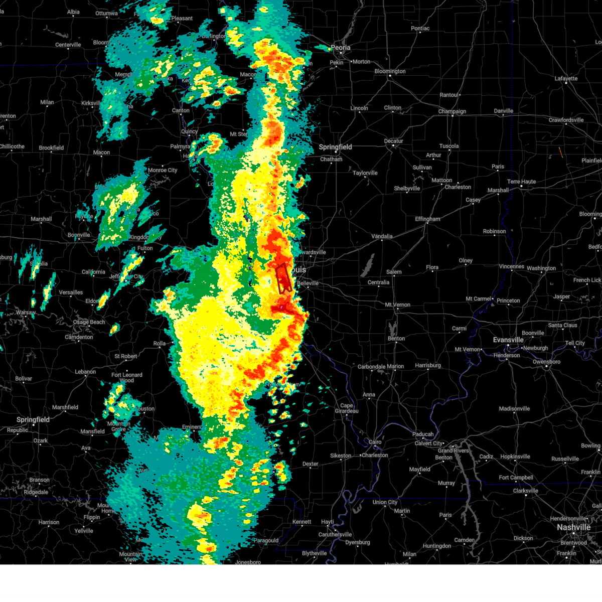 The tornado warning for west central st. clair and south central st. louis counties and southwestern st. louis city will expire at 700 pm cdt, the storm which prompted the warning has moved out of the area. therefore, the warning will be allowed to expire. a tornado watch remains in effect until 1000 pm cdt for southwestern illinois, and east central missouri. The tornado warning for west central st. clair and south central st. louis counties and southwestern st. louis city will expire at 700 pm cdt, the storm which prompted the warning has moved out of the area. therefore, the warning will be allowed to expire. a tornado watch remains in effect until 1000 pm cdt for southwestern illinois, and east central missouri.
|
| 4/15/2023 6:56 PM CDT | Quarter sized hail reported 3.7 miles N of St. Louis, MO, also 30-40 mph winds. |
| 4/15/2023 6:55 PM CDT | I-44 and hampto in st. louis city county MO, 2.8 miles NE of St. Louis, MO |
| 4/15/2023 6:47 PM CDT | Report from mping: 3-inch tree limbs broken; power poles broke in st. louis city county MO, 0.7 miles SE of St. Louis, MO |
| 4/15/2023 6:45 PM CDT |
 At 644 pm cdt, a severe thunderstorm was located over warson woods, moving northeast at 25 mph (radar indicated). Hazards include 60 mph wind gusts and quarter size hail. Hail damage to vehicles is expected. expect wind damage to roofs, siding, and trees. locations impacted include, chesterfield, university city, kirkwood, maryland heights, webster groves, creve coeur, overland, clayton, st. ann, crestwood, bridgeton, town and country, richmond heights, ladue, sunset hills, des peres, brentwood, maplewood, olivette, and shrewsbury. this includes interstate 44 in missouri between exits 276 and 277. hail threat, radar indicated max hail size, 1. 00 in wind threat, radar indicated max wind gust, 60 mph. At 644 pm cdt, a severe thunderstorm was located over warson woods, moving northeast at 25 mph (radar indicated). Hazards include 60 mph wind gusts and quarter size hail. Hail damage to vehicles is expected. expect wind damage to roofs, siding, and trees. locations impacted include, chesterfield, university city, kirkwood, maryland heights, webster groves, creve coeur, overland, clayton, st. ann, crestwood, bridgeton, town and country, richmond heights, ladue, sunset hills, des peres, brentwood, maplewood, olivette, and shrewsbury. this includes interstate 44 in missouri between exits 276 and 277. hail threat, radar indicated max hail size, 1. 00 in wind threat, radar indicated max wind gust, 60 mph.
|
| 4/15/2023 6:42 PM CDT | Images on twitter show several large trees and tree limbs snapped. time estimated from rada in st. louis city county MO, 5.2 miles NNE of St. Louis, MO |
| 4/15/2023 6:42 PM CDT |
 At 641 pm cdt, a severe thunderstorm capable of producing a tornado was located over marlborough, moving northeast at 20 mph (radar indicated rotation). Hazards include tornado and quarter size hail. Flying debris will be dangerous to those caught without shelter. mobile homes will be damaged or destroyed. damage to roofs, windows, and vehicles will occur. tree damage is likely. this dangerous storm will be near, st. louis, webster groves, richmond heights, brentwood, maplewood, shrewsbury, affton, mehlville, lemay, and marlborough around 645 pm cdt. Clayton and cahokia around 650 pm cdt. At 641 pm cdt, a severe thunderstorm capable of producing a tornado was located over marlborough, moving northeast at 20 mph (radar indicated rotation). Hazards include tornado and quarter size hail. Flying debris will be dangerous to those caught without shelter. mobile homes will be damaged or destroyed. damage to roofs, windows, and vehicles will occur. tree damage is likely. this dangerous storm will be near, st. louis, webster groves, richmond heights, brentwood, maplewood, shrewsbury, affton, mehlville, lemay, and marlborough around 645 pm cdt. Clayton and cahokia around 650 pm cdt.
|
| 4/15/2023 6:39 PM CDT |
 At 639 pm cdt, a severe thunderstorm capable of producing a tornado was located over maplewood, moving northeast at 40 mph (radar indicated rotation). Hazards include tornado and quarter size hail. Flying debris will be dangerous to those caught without shelter. mobile homes will be damaged or destroyed. damage to roofs, windows, and vehicles will occur. tree damage is likely. this dangerous storm will be near, st. louis, granite city, east st. louis, cahokia, madison, venice, fairmont city, wellston, and brooklyn around 645 pm cdt. collinsville, pontoon beach, and washington park around 650 pm cdt. caseyville around 655 pm cdt. other locations in the path of this tornadic thunderstorm include edwardsville, glen carbon, maryville and troy. this also includes scott joplin historic site and horseshoe lake state park. this includes the following highways, interstate 55 in illinois near exit 23. Interstate 64 in illinois between exits 9 and 19. At 639 pm cdt, a severe thunderstorm capable of producing a tornado was located over maplewood, moving northeast at 40 mph (radar indicated rotation). Hazards include tornado and quarter size hail. Flying debris will be dangerous to those caught without shelter. mobile homes will be damaged or destroyed. damage to roofs, windows, and vehicles will occur. tree damage is likely. this dangerous storm will be near, st. louis, granite city, east st. louis, cahokia, madison, venice, fairmont city, wellston, and brooklyn around 645 pm cdt. collinsville, pontoon beach, and washington park around 650 pm cdt. caseyville around 655 pm cdt. other locations in the path of this tornadic thunderstorm include edwardsville, glen carbon, maryville and troy. this also includes scott joplin historic site and horseshoe lake state park. this includes the following highways, interstate 55 in illinois near exit 23. Interstate 64 in illinois between exits 9 and 19.
|
| 4/15/2023 6:36 PM CDT |
 At 635 pm cdt, severe thunderstorms were located along a line extending from near grafton to near portage des sioux to st. john, moving northeast at 45 mph (trained weather spotters reported quarter sized hail in st. peters and st. charles, missouri). Hazards include 60 mph wind gusts and quarter size hail. Hail damage to vehicles is expected. Expect wind damage to roofs, siding, and trees. At 635 pm cdt, severe thunderstorms were located along a line extending from near grafton to near portage des sioux to st. john, moving northeast at 45 mph (trained weather spotters reported quarter sized hail in st. peters and st. charles, missouri). Hazards include 60 mph wind gusts and quarter size hail. Hail damage to vehicles is expected. Expect wind damage to roofs, siding, and trees.
|
| 4/15/2023 6:31 PM CDT |
 At 630 pm cdt, a confirmed tornado was located over sunset hills, moving east at 25 mph (radar confirmed tornado. one circulation is evident near kirkwood, missouri and another is evident near sunset hills, missouri). Hazards include damaging tornado and quarter size hail. Flying debris will be dangerous to those caught without shelter. mobile homes will be damaged or destroyed. damage to roofs, windows, and vehicles will occur. tree damage is likely. this tornado will be near, st. louis, webster groves, crestwood, sunset hills, shrewsbury, glendale, lakeshire, oakland, affton, and mehlville around 635 pm cdt. east carondelet around 640 pm cdt. other locations in the path of this tornadic thunderstorm include cahokia, dupo and columbia. This includes interstate 44 in missouri between exits 276 and 277. At 630 pm cdt, a confirmed tornado was located over sunset hills, moving east at 25 mph (radar confirmed tornado. one circulation is evident near kirkwood, missouri and another is evident near sunset hills, missouri). Hazards include damaging tornado and quarter size hail. Flying debris will be dangerous to those caught without shelter. mobile homes will be damaged or destroyed. damage to roofs, windows, and vehicles will occur. tree damage is likely. this tornado will be near, st. louis, webster groves, crestwood, sunset hills, shrewsbury, glendale, lakeshire, oakland, affton, and mehlville around 635 pm cdt. east carondelet around 640 pm cdt. other locations in the path of this tornadic thunderstorm include cahokia, dupo and columbia. This includes interstate 44 in missouri between exits 276 and 277.
|
| 4/15/2023 6:23 PM CDT |
 At 623 pm cdt, a confirmed tornado was located over valley park, moving northeast at 20 mph (radar confirmed tornado). Hazards include damaging tornado and quarter size hail. Flying debris will be dangerous to those caught without shelter. mobile homes will be damaged or destroyed. damage to roofs, windows, and vehicles will occur. tree damage is likely. this tornado will be near, kirkwood, webster groves, crestwood, town and country, ladue, sunset hills, des peres, glendale, frontenac, and warson woods around 630 pm cdt. st. louis, richmond heights, brentwood, maplewood, shrewsbury, lakeshire, and mackenzie around 635 pm cdt. other locations in the path of this tornadic thunderstorm include clayton, green park, wilbur park, university city, lemay, wellston and pagedale. This includes interstate 44 in missouri between exits 272 and 277. At 623 pm cdt, a confirmed tornado was located over valley park, moving northeast at 20 mph (radar confirmed tornado). Hazards include damaging tornado and quarter size hail. Flying debris will be dangerous to those caught without shelter. mobile homes will be damaged or destroyed. damage to roofs, windows, and vehicles will occur. tree damage is likely. this tornado will be near, kirkwood, webster groves, crestwood, town and country, ladue, sunset hills, des peres, glendale, frontenac, and warson woods around 630 pm cdt. st. louis, richmond heights, brentwood, maplewood, shrewsbury, lakeshire, and mackenzie around 635 pm cdt. other locations in the path of this tornadic thunderstorm include clayton, green park, wilbur park, university city, lemay, wellston and pagedale. This includes interstate 44 in missouri between exits 272 and 277.
|
| 4/15/2023 6:19 PM CDT |
 At 618 pm cdt, a severe thunderstorm capable of producing a tornado was located over valley park, moving northeast at 20 mph (radar indicated rotation). Hazards include tornado and quarter size hail. Flying debris will be dangerous to those caught without shelter. mobile homes will be damaged or destroyed. damage to roofs, windows, and vehicles will occur. tree damage is likely. this dangerous storm will be near, kirkwood, manchester, crestwood, town and country, sunset hills, des peres, valley park, glendale, fenton, and frontenac around 625 pm cdt. webster groves, ladue, warson woods, affton, rock hill, marlborough, grantwood village, crystal lake park, huntleigh, and concord around 630 pm cdt. brentwood, maplewood, shrewsbury, lakeshire, and green park around 635 pm cdt. other locations in the path of this tornadic thunderstorm include st. louis, clayton, richmond heights, st. george, wilbur park, mackenzie, university city, lemay and wellston. this also includes castlewood state park. This includes interstate 44 in missouri between exits 266 and 277. At 618 pm cdt, a severe thunderstorm capable of producing a tornado was located over valley park, moving northeast at 20 mph (radar indicated rotation). Hazards include tornado and quarter size hail. Flying debris will be dangerous to those caught without shelter. mobile homes will be damaged or destroyed. damage to roofs, windows, and vehicles will occur. tree damage is likely. this dangerous storm will be near, kirkwood, manchester, crestwood, town and country, sunset hills, des peres, valley park, glendale, fenton, and frontenac around 625 pm cdt. webster groves, ladue, warson woods, affton, rock hill, marlborough, grantwood village, crystal lake park, huntleigh, and concord around 630 pm cdt. brentwood, maplewood, shrewsbury, lakeshire, and green park around 635 pm cdt. other locations in the path of this tornadic thunderstorm include st. louis, clayton, richmond heights, st. george, wilbur park, mackenzie, university city, lemay and wellston. this also includes castlewood state park. This includes interstate 44 in missouri between exits 266 and 277.
|
| 4/15/2023 6:11 PM CDT |
 At 610 pm cdt, a severe thunderstorm was located over eureka, moving northeast at 25 mph (at 612 pm, trained weather spotters reported half dollar sized hail in ballwin, missouri). Hazards include half dollar size hail. damage to vehicles is expected At 610 pm cdt, a severe thunderstorm was located over eureka, moving northeast at 25 mph (at 612 pm, trained weather spotters reported half dollar sized hail in ballwin, missouri). Hazards include half dollar size hail. damage to vehicles is expected
|
| 4/5/2023 8:12 AM CDT |
 At 812 am cdt, severe thunderstorms were located along a line extending from dupo to near fountain to near crystal city, moving east at 60 mph (radar indicated). Hazards include 60 mph wind gusts and penny size hail. Expect damage to roofs, siding, and trees. these severe storms will be near, cahokia, waterloo, centreville, millstadt, cahokia parks airport and alorton around 815 am cdt. east st. louis and fairview heights around 820 am cdt. other locations in the path of these severe thunderstorms include belleville, swansea, shiloh, freeburg, smithton, new design, mascoutah, lebanon, red bud, scott afb, new athens, new baden and marissa. This includes interstate 64 in illinois between exits 14 and 27. At 812 am cdt, severe thunderstorms were located along a line extending from dupo to near fountain to near crystal city, moving east at 60 mph (radar indicated). Hazards include 60 mph wind gusts and penny size hail. Expect damage to roofs, siding, and trees. these severe storms will be near, cahokia, waterloo, centreville, millstadt, cahokia parks airport and alorton around 815 am cdt. east st. louis and fairview heights around 820 am cdt. other locations in the path of these severe thunderstorms include belleville, swansea, shiloh, freeburg, smithton, new design, mascoutah, lebanon, red bud, scott afb, new athens, new baden and marissa. This includes interstate 64 in illinois between exits 14 and 27.
|
| 4/5/2023 8:00 AM CDT |
 At 800 am cdt, severe thunderstorms were located along a line extending from mehlville to barnhart to near hillsboro, moving east at 60 mph (radar indicated). Hazards include 60 mph wind gusts and penny size hail. Expect damage to roofs, siding, and trees. severe thunderstorms will be near, columbia, lemay, oakville, mehlville, affton, st. george, valmeyer, bella villa, east carondelet and wilbur park around 805 am cdt. cahokia, centreville, dupo, millstadt, cahokia parks airport and alorton around 810 am cdt. east st. louis, fairview heights and waterloo around 815 am cdt. belleville, swansea, shiloh, smithton and new design around 820 am cdt. other locations in the path of these severe thunderstorms include o`fallon, mascoutah, freeburg, red bud, scott afb, lebanon, new baden, new athens and marissa. this includes the following highways, interstate 64 in illinois between exits 14 and 27. interstate 55 in missouri between exits 178 and 191. this also includes mastodon historic site and gov. Dunklin`s grave historic site. At 800 am cdt, severe thunderstorms were located along a line extending from mehlville to barnhart to near hillsboro, moving east at 60 mph (radar indicated). Hazards include 60 mph wind gusts and penny size hail. Expect damage to roofs, siding, and trees. severe thunderstorms will be near, columbia, lemay, oakville, mehlville, affton, st. george, valmeyer, bella villa, east carondelet and wilbur park around 805 am cdt. cahokia, centreville, dupo, millstadt, cahokia parks airport and alorton around 810 am cdt. east st. louis, fairview heights and waterloo around 815 am cdt. belleville, swansea, shiloh, smithton and new design around 820 am cdt. other locations in the path of these severe thunderstorms include o`fallon, mascoutah, freeburg, red bud, scott afb, lebanon, new baden, new athens and marissa. this includes the following highways, interstate 64 in illinois between exits 14 and 27. interstate 55 in missouri between exits 178 and 191. this also includes mastodon historic site and gov. Dunklin`s grave historic site.
|
| 8/25/2022 8:40 PM CDT | The severe thunderstorm warning for north central jefferson and south central st. louis counties and southwestern st. louis city will expire at 845 pm cdt, the storm which prompted the warning has weakened below severe limits, and no longer poses an immediate threat to life or property. therefore, the warning will be allowed to expire. |
| 8/25/2022 8:24 PM CDT | At 824 pm cdt, a severe thunderstorm was located over sappington, moving southeast at 10 mph (radar indicated). Hazards include 60 mph wind gusts and penny size hail. Expect damage to roofs, siding, and trees. locations impacted include, lakeshire, affton, green park, wilbur park, concord, mehlville, lemay, st. george, arnold, bella villa and oakville. this includes the following highways, interstate 44 in missouri between exits 274 and 277. interstate 55 in missouri between exits 190 and 191. hail threat, radar indicated max hail size, 0. 75 in wind threat, radar indicated max wind gust, 60 mph. |
| 8/25/2022 8:06 PM CDT | At 806 pm cdt, a severe thunderstorm was located over kirkwood, moving southeast at 15 mph (radar indicated). Hazards include 60 mph wind gusts and penny size hail. Expect damage to roofs, siding, and trees. this severe thunderstorm will be near, webster groves, crestwood, richmond heights, sunset hills, brentwood, maplewood and oakland around 810 pm cdt. shrewsbury around 815 pm cdt. affton, marlborough, grantwood village, mackenzie and sappington around 820 pm cdt. lakeshire, green park and concord around 825 pm cdt. other locations in the path of this severe thunderstorm include mehlville, st. george, wilbur park, arnold, lemay, bella villa and oakville. this includes the following highways, interstate 44 in missouri between exits 272 and 277. interstate 55 in missouri between exits 190 and 191. hail threat, radar indicated max hail size, 0. 75 in wind threat, radar indicated max wind gust, 60 mph. |
| 8/3/2022 10:57 PM CDT |
 The severe thunderstorm warning for north central monroe, northwestern st. clair and south central st. louis counties and st. louis city will expire at 1100 pm cdt, the storm which prompted the warning has weakened below severe limits, and no longer poses an immediate threat to life or property. therefore, the warning will be allowed to expire. The severe thunderstorm warning for north central monroe, northwestern st. clair and south central st. louis counties and st. louis city will expire at 1100 pm cdt, the storm which prompted the warning has weakened below severe limits, and no longer poses an immediate threat to life or property. therefore, the warning will be allowed to expire.
|
| 8/3/2022 10:37 PM CDT |
 At 1037 pm cdt, a severe thunderstorm was located over mackenzie, moving east at 20 mph (radar indicated). Hazards include 60 mph wind gusts. Expect damage to roofs, siding, and trees. this severe storm will be near, lemay and bella villa around 1040 pm cdt. other locations in the path of this severe thunderstorm include east carondelet, columbia, dupo, brooklyn, cahokia, cahokia parks airport, centreville, fairmont city, alorton, washington park and east st. louis. this also includes scott joplin historic site. hail threat, radar indicated max hail size, <. 75 in wind threat, radar indicated max wind gust, 60 mph. At 1037 pm cdt, a severe thunderstorm was located over mackenzie, moving east at 20 mph (radar indicated). Hazards include 60 mph wind gusts. Expect damage to roofs, siding, and trees. this severe storm will be near, lemay and bella villa around 1040 pm cdt. other locations in the path of this severe thunderstorm include east carondelet, columbia, dupo, brooklyn, cahokia, cahokia parks airport, centreville, fairmont city, alorton, washington park and east st. louis. this also includes scott joplin historic site. hail threat, radar indicated max hail size, <. 75 in wind threat, radar indicated max wind gust, 60 mph.
|
| 8/3/2022 10:20 PM CDT |
 At 1020 pm cdt, a severe thunderstorm was located over kirkwood, moving east at 20 mph (radar indicated). Hazards include 60 mph wind gusts. Expect damage to roofs, siding, and trees. this severe thunderstorm will be near, crestwood, ladue, olivette, glendale and oakland around 1025 pm cdt. university city, webster groves, clayton, richmond heights, brentwood, rock hill, grantwood village, concord and sappington around 1030 pm cdt. maplewood, shrewsbury, lakeshire, affton, pagedale, green park, marlborough and mackenzie around 1035 pm cdt. lemay, mehlville, oakville, st. george, bella villa and wilbur park around 1040 pm cdt. other locations in the path of this severe thunderstorm include east carondelet, columbia, dupo, brooklyn, east st. louis, cahokia, centreville, washington park, cahokia parks airport, fairmont city and alorton. this includes interstate 44 in missouri between exits 272 and 277. this also includes scott joplin historic site. hail threat, radar indicated max hail size, <. 75 in wind threat, radar indicated max wind gust, 60 mph. At 1020 pm cdt, a severe thunderstorm was located over kirkwood, moving east at 20 mph (radar indicated). Hazards include 60 mph wind gusts. Expect damage to roofs, siding, and trees. this severe thunderstorm will be near, crestwood, ladue, olivette, glendale and oakland around 1025 pm cdt. university city, webster groves, clayton, richmond heights, brentwood, rock hill, grantwood village, concord and sappington around 1030 pm cdt. maplewood, shrewsbury, lakeshire, affton, pagedale, green park, marlborough and mackenzie around 1035 pm cdt. lemay, mehlville, oakville, st. george, bella villa and wilbur park around 1040 pm cdt. other locations in the path of this severe thunderstorm include east carondelet, columbia, dupo, brooklyn, east st. louis, cahokia, centreville, washington park, cahokia parks airport, fairmont city and alorton. this includes interstate 44 in missouri between exits 272 and 277. this also includes scott joplin historic site. hail threat, radar indicated max hail size, <. 75 in wind threat, radar indicated max wind gust, 60 mph.
|
| 8/3/2022 4:57 PM CDT |
 At 457 pm cdt, a severe thunderstorm was located over south roxana, moving east at 30 mph (broadcast media). Hazards include 70 mph wind gusts and nickel size hail. Expect considerable tree damage. damage is likely to mobile homes, roofs, and outbuildings. locations impacted include, granite city, alton, edwardsville, godfrey, glen carbon, wood river, bethalto, pontoon beach, madison, spanish lake, east alton, south roxana, roxana, hartford, west alton, dorsey, rosewood heights, glasgow village, poag and kuhn. this also includes confluence state park. this includes interstate 55 in illinois near exit 23. thunderstorm damage threat, considerable hail threat, radar indicated max hail size, 0. 88 in wind threat, observed max wind gust, 70 mph. At 457 pm cdt, a severe thunderstorm was located over south roxana, moving east at 30 mph (broadcast media). Hazards include 70 mph wind gusts and nickel size hail. Expect considerable tree damage. damage is likely to mobile homes, roofs, and outbuildings. locations impacted include, granite city, alton, edwardsville, godfrey, glen carbon, wood river, bethalto, pontoon beach, madison, spanish lake, east alton, south roxana, roxana, hartford, west alton, dorsey, rosewood heights, glasgow village, poag and kuhn. this also includes confluence state park. this includes interstate 55 in illinois near exit 23. thunderstorm damage threat, considerable hail threat, radar indicated max hail size, 0. 88 in wind threat, observed max wind gust, 70 mph.
|
| 8/3/2022 4:51 PM CDT |
 At 451 pm cdt, severe thunderstorms were located along a line extending from alton to near spanish lake, moving east at 25 mph (radar indicated). Hazards include 60 mph wind gusts and nickel size hail. Expect damage to roofs, siding, and trees. locations impacted include, wood river, east alton, rosewood heights, bethalto, hartford, pontoon beach, south roxana, roxana, dorsey, edwardsville and glen carbon. this also includes confluence state park. this includes interstate 55 in illinois near exit 23. hail threat, radar indicated max hail size, 0. 88 in wind threat, radar indicated max wind gust, 60 mph. At 451 pm cdt, severe thunderstorms were located along a line extending from alton to near spanish lake, moving east at 25 mph (radar indicated). Hazards include 60 mph wind gusts and nickel size hail. Expect damage to roofs, siding, and trees. locations impacted include, wood river, east alton, rosewood heights, bethalto, hartford, pontoon beach, south roxana, roxana, dorsey, edwardsville and glen carbon. this also includes confluence state park. this includes interstate 55 in illinois near exit 23. hail threat, radar indicated max hail size, 0. 88 in wind threat, radar indicated max wind gust, 60 mph.
|
| 8/3/2022 4:29 PM CDT |
 At 429 pm cdt, a severe thunderstorm was located over west alton, moving east at 30 mph (radar indicated). Hazards include 60 mph wind gusts and nickel size hail. Expect damage to roofs, siding, and trees. this severe thunderstorm will be near, alton, godfrey and east alton around 440 pm cdt. wood river, pontoon beach, south roxana and hartford around 445 pm cdt. other locations in the path of this severe thunderstorm include bethalto, roxana, rosewood heights, edwardsville and dorsey. this includes interstate 55 in illinois near exit 23. this also includes confluence state park. hail threat, radar indicated max hail size, 0. 88 in wind threat, radar indicated max wind gust, 60 mph. At 429 pm cdt, a severe thunderstorm was located over west alton, moving east at 30 mph (radar indicated). Hazards include 60 mph wind gusts and nickel size hail. Expect damage to roofs, siding, and trees. this severe thunderstorm will be near, alton, godfrey and east alton around 440 pm cdt. wood river, pontoon beach, south roxana and hartford around 445 pm cdt. other locations in the path of this severe thunderstorm include bethalto, roxana, rosewood heights, edwardsville and dorsey. this includes interstate 55 in illinois near exit 23. this also includes confluence state park. hail threat, radar indicated max hail size, 0. 88 in wind threat, radar indicated max wind gust, 60 mph.
|
| 8/3/2022 3:38 PM CDT |
 At 338 pm cdt, a severe thunderstorm was located over black jack, moving northeast at 20 mph (radar indicated). Hazards include 60 mph wind gusts and penny size hail. Expect damage to roofs, siding, and trees. locations impacted include, bellefontaine neighbors, riverview, spanish lake, glasgow village, madison, granite city, alton, godfrey, pontoon beach, east alton, wood river and hartford. this also includes confluence state park and horseshoe lake state park. hail threat, radar indicated max hail size, 0. 75 in wind threat, radar indicated max wind gust, 60 mph. At 338 pm cdt, a severe thunderstorm was located over black jack, moving northeast at 20 mph (radar indicated). Hazards include 60 mph wind gusts and penny size hail. Expect damage to roofs, siding, and trees. locations impacted include, bellefontaine neighbors, riverview, spanish lake, glasgow village, madison, granite city, alton, godfrey, pontoon beach, east alton, wood river and hartford. this also includes confluence state park and horseshoe lake state park. hail threat, radar indicated max hail size, 0. 75 in wind threat, radar indicated max wind gust, 60 mph.
|
| 8/3/2022 3:21 PM CDT |
 At 320 pm cdt, a severe thunderstorm was located over lambert-st. louis international airport, moving east at 10 mph (radar indicated). Hazards include 60 mph wind gusts and penny size hail. Expect damage to roofs, siding, and trees. this severe thunderstorm will be near, university city, clayton, st. john, vinita park, charlack, sycamore hills and vinita terrace around 325 pm cdt. florissant, pagedale and hanley hills around 330 pm cdt. berkeley, bel-ridge, kinloch, wellston, bel-nor, greendale and bellerive around 335 pm cdt. normandy, hillsdale, cool valley, velda city, calverton park, velda village hills, norwood court, pasadena hills, beverly hills and pasadena park around 340 pm cdt. other locations in the path of this severe thunderstorm include ferguson, northwoods, pine lawn, country club hills, jennings, dellwood, flordell hills, moline acres, castle point, st. louis, granite city, bellefontaine neighbors, black jack, madison, riverview, venice, spanish lake and glasgow village. this includes interstate 70 in missouri between exits 229 and 231. this also includes confluence state park, first missouri state capitol historic site, and horseshoe lake state park. hail threat, radar indicated max hail size, 0. 75 in wind threat, radar indicated max wind gust, 60 mph. At 320 pm cdt, a severe thunderstorm was located over lambert-st. louis international airport, moving east at 10 mph (radar indicated). Hazards include 60 mph wind gusts and penny size hail. Expect damage to roofs, siding, and trees. this severe thunderstorm will be near, university city, clayton, st. john, vinita park, charlack, sycamore hills and vinita terrace around 325 pm cdt. florissant, pagedale and hanley hills around 330 pm cdt. berkeley, bel-ridge, kinloch, wellston, bel-nor, greendale and bellerive around 335 pm cdt. normandy, hillsdale, cool valley, velda city, calverton park, velda village hills, norwood court, pasadena hills, beverly hills and pasadena park around 340 pm cdt. other locations in the path of this severe thunderstorm include ferguson, northwoods, pine lawn, country club hills, jennings, dellwood, flordell hills, moline acres, castle point, st. louis, granite city, bellefontaine neighbors, black jack, madison, riverview, venice, spanish lake and glasgow village. this includes interstate 70 in missouri between exits 229 and 231. this also includes confluence state park, first missouri state capitol historic site, and horseshoe lake state park. hail threat, radar indicated max hail size, 0. 75 in wind threat, radar indicated max wind gust, 60 mph.
|
| 6/17/2022 5:37 AM CDT |
 The severe thunderstorm warning for central madison, eastern macoupin counties in southwestern illinois and st. louis counties in east central missouri and st. louis city will expire at 545 am cdt, the storms which prompted the warning have moved out of the area. therefore, the warning will be allowed to expire. a severe thunderstorm watch remains in effect until 800 am cdt for south central and southwestern illinois, and east central missouri. The severe thunderstorm warning for central madison, eastern macoupin counties in southwestern illinois and st. louis counties in east central missouri and st. louis city will expire at 545 am cdt, the storms which prompted the warning have moved out of the area. therefore, the warning will be allowed to expire. a severe thunderstorm watch remains in effect until 800 am cdt for south central and southwestern illinois, and east central missouri.
|
| 6/17/2022 5:27 AM CDT |
 At 526 am cdt, severe thunderstorms were located along a line extending from near girard to near carlinville to shipman to west alton, moving east at 40 mph (trained weather spotters). Hazards include 60 mph wind gusts. Expect damage to roofs, siding, and trees. locations impacted include, st. louis, florissant, chesterfield, wildwood, university city, ballwin, granite city, alton, kirkwood, maryland heights, hazelwood, collinsville, edwardsville, webster groves, ferguson, arnold, manchester, creve coeur, overland and clayton. this also includes babler memorial state park, scott joplin historic site, route 66 state park, castlewood state park, confluence state park, and horseshoe lake state park. this includes the following highways, interstate 55 in illinois between exits 23 and 44. interstate 44 in missouri between exits 261 and 277. hail threat, radar indicated max hail size, <. 75 in wind threat, radar indicated max wind gust, 60 mph. At 526 am cdt, severe thunderstorms were located along a line extending from near girard to near carlinville to shipman to west alton, moving east at 40 mph (trained weather spotters). Hazards include 60 mph wind gusts. Expect damage to roofs, siding, and trees. locations impacted include, st. louis, florissant, chesterfield, wildwood, university city, ballwin, granite city, alton, kirkwood, maryland heights, hazelwood, collinsville, edwardsville, webster groves, ferguson, arnold, manchester, creve coeur, overland and clayton. this also includes babler memorial state park, scott joplin historic site, route 66 state park, castlewood state park, confluence state park, and horseshoe lake state park. this includes the following highways, interstate 55 in illinois between exits 23 and 44. interstate 44 in missouri between exits 261 and 277. hail threat, radar indicated max hail size, <. 75 in wind threat, radar indicated max wind gust, 60 mph.
|
| 6/17/2022 5:14 AM CDT |
 At 513 am cdt, severe thunderstorms were located along a line extending from near palmyra to 6 miles northwest of carlinville to near jerseyville to near portage des sioux, moving east at 40 mph (the automated station at lambert field reported a wind gust of 60 mph at 957 am). Hazards include 60 mph wind gusts. Expect damage to roofs, siding, and trees. locations impacted include, carlinville, palmyra, virden, girard, alton, wood river, east alton, bunker hill, hartford, bethalto, south roxana, roxana, rosewood heights, staunton, gillespie, wilsonville, mount clare, east gillespie, dorsey, edwardsville, benld, sawyerville, eagarville, prairietown, glen carbon, mount olive, carpenter and worden. this also includes babler memorial state park, scott joplin historic site, route 66 state park, castlewood state park, confluence state park, beaver dam state park, and horseshoe lake state park. this includes the following highways, interstate 55 in illinois between exits 23 and 44. interstate 44 in missouri between exits 261 and 277. interstate 70 in missouri between exits 229 and 231. hail threat, radar indicated max hail size, <. 75 in wind threat, radar indicated max wind gust, 60 mph. At 513 am cdt, severe thunderstorms were located along a line extending from near palmyra to 6 miles northwest of carlinville to near jerseyville to near portage des sioux, moving east at 40 mph (the automated station at lambert field reported a wind gust of 60 mph at 957 am). Hazards include 60 mph wind gusts. Expect damage to roofs, siding, and trees. locations impacted include, carlinville, palmyra, virden, girard, alton, wood river, east alton, bunker hill, hartford, bethalto, south roxana, roxana, rosewood heights, staunton, gillespie, wilsonville, mount clare, east gillespie, dorsey, edwardsville, benld, sawyerville, eagarville, prairietown, glen carbon, mount olive, carpenter and worden. this also includes babler memorial state park, scott joplin historic site, route 66 state park, castlewood state park, confluence state park, beaver dam state park, and horseshoe lake state park. this includes the following highways, interstate 55 in illinois between exits 23 and 44. interstate 44 in missouri between exits 261 and 277. interstate 70 in missouri between exits 229 and 231. hail threat, radar indicated max hail size, <. 75 in wind threat, radar indicated max wind gust, 60 mph.
|
| 6/17/2022 5:10 AM CDT | Large tree down in south st. louis city near grand and eichelberger. time estimated from rada in st. louis city county MO, 5.8 miles N of St. Louis, MO |
| 6/17/2022 5:07 AM CDT |
 At 507 am cdt, severe thunderstorms were located along a line extending from near south roxana to st. louis to pacific, moving east at 35 mph (trained weather spotters). Hazards include 60 mph wind gusts and penny size hail. Expect damage to roofs, siding, and trees. severe thunderstorms will be near, granite city, cahokia, pontoon beach, dupo, madison, venice, cahokia parks airport, lemay, brooklyn and east carondelet around 515 am cdt. edwardsville, maryville, centreville, fairmont city and alorton around 520 am cdt. east st. louis, glen carbon, troy and washington park around 525 am cdt. other locations in the path of these severe thunderstorms include collinsville, fairview heights, caseyville, high ridge, belleville, swansea, shiloh, fenton, murphy, antonia, st. jacob, marine, o`fallon, arnold, barnhart, highland, lebanon, lakeshire, scott afb, green park, imperial, sappington, concord, oakville, mehlville, st. george, valmeyer, bella villa and fountain. this includes the following highways, interstate 70 in illinois between exits 21 and 30. interstate 55 in illinois near exit 23. interstate 64 in illinois between exits 9 and 27. interstate 44 in missouri between exits 251 and 277. interstate 55 in missouri between exits 178 and 191. this also includes route 66 state park, castlewood state park, mastodon historic site, sandy creek covered bridge historic site, gov. dunklin`s grave historic site, robertsville state park, and horseshoe lake state park. hail threat, radar indicated max hail size, 0. 75 in wind threat, radar indicated max wind gust, 60 mph. At 507 am cdt, severe thunderstorms were located along a line extending from near south roxana to st. louis to pacific, moving east at 35 mph (trained weather spotters). Hazards include 60 mph wind gusts and penny size hail. Expect damage to roofs, siding, and trees. severe thunderstorms will be near, granite city, cahokia, pontoon beach, dupo, madison, venice, cahokia parks airport, lemay, brooklyn and east carondelet around 515 am cdt. edwardsville, maryville, centreville, fairmont city and alorton around 520 am cdt. east st. louis, glen carbon, troy and washington park around 525 am cdt. other locations in the path of these severe thunderstorms include collinsville, fairview heights, caseyville, high ridge, belleville, swansea, shiloh, fenton, murphy, antonia, st. jacob, marine, o`fallon, arnold, barnhart, highland, lebanon, lakeshire, scott afb, green park, imperial, sappington, concord, oakville, mehlville, st. george, valmeyer, bella villa and fountain. this includes the following highways, interstate 70 in illinois between exits 21 and 30. interstate 55 in illinois near exit 23. interstate 64 in illinois between exits 9 and 27. interstate 44 in missouri between exits 251 and 277. interstate 55 in missouri between exits 178 and 191. this also includes route 66 state park, castlewood state park, mastodon historic site, sandy creek covered bridge historic site, gov. dunklin`s grave historic site, robertsville state park, and horseshoe lake state park. hail threat, radar indicated max hail size, 0. 75 in wind threat, radar indicated max wind gust, 60 mph.
|
| 6/17/2022 4:56 AM CDT |
 At 455 am cdt, severe thunderstorms were located along a line extending from near athensville to greenfield to near old kane to 8 miles west of orchard farms, moving east at 40 mph (trained weather spotters reported power outages across several towns and a national weather service employee estimated 60 mph gusts). Hazards include 60 mph wind gusts and penny size hail. Expect damage to roofs, siding, and trees. these severe storms will be near, greenfield around 500 am cdt. grafton around 510 am cdt. other locations in the path of these severe thunderstorms include florissant, hazelwood, berkeley, palmyra, elsah, portage des sioux, kemper, ferguson, carlinville, brighton, calverton park, west alton, bellefontaine neighbors, black jack, spanish lake, castle point, st. louis, godfrey, virden, girard, shipman, glasgow village, alton, wood river, madison, east alton, bunker hill, hartford, bethalto, pontoon beach, south roxana, roxana and rosewood heights. this also includes babler memorial state park, scott joplin historic site, route 66 state park, castlewood state park, confluence state park, first missouri state capitol historic site, beaver dam state park, and horseshoe lake state park. this includes the following highways, interstate 55 in illinois between exits 23 and 44. interstate 44 in missouri between exits 261 and 277. interstate 70 in missouri between exits 216 and 231. hail threat, radar indicated max hail size, 0. 75 in wind threat, radar indicated max wind gust, 60 mph. At 455 am cdt, severe thunderstorms were located along a line extending from near athensville to greenfield to near old kane to 8 miles west of orchard farms, moving east at 40 mph (trained weather spotters reported power outages across several towns and a national weather service employee estimated 60 mph gusts). Hazards include 60 mph wind gusts and penny size hail. Expect damage to roofs, siding, and trees. these severe storms will be near, greenfield around 500 am cdt. grafton around 510 am cdt. other locations in the path of these severe thunderstorms include florissant, hazelwood, berkeley, palmyra, elsah, portage des sioux, kemper, ferguson, carlinville, brighton, calverton park, west alton, bellefontaine neighbors, black jack, spanish lake, castle point, st. louis, godfrey, virden, girard, shipman, glasgow village, alton, wood river, madison, east alton, bunker hill, hartford, bethalto, pontoon beach, south roxana, roxana and rosewood heights. this also includes babler memorial state park, scott joplin historic site, route 66 state park, castlewood state park, confluence state park, first missouri state capitol historic site, beaver dam state park, and horseshoe lake state park. this includes the following highways, interstate 55 in illinois between exits 23 and 44. interstate 44 in missouri between exits 261 and 277. interstate 70 in missouri between exits 216 and 231. hail threat, radar indicated max hail size, 0. 75 in wind threat, radar indicated max wind gust, 60 mph.
|
| 6/17/2022 4:51 AM CDT |
 At 451 am cdt, severe thunderstorms were located along a line extending from near manchester to greenfield to 6 miles southwest of old kane to 6 miles northeast of st. paul, moving east at 40 mph (radar indicated). Hazards include 60 mph wind gusts and penny size hail. Expect damage to roofs, siding, and trees. these severe storms will be near, greenfield and athensville around 455 am cdt. old kane around 500 am cdt. other locations in the path of these severe thunderstorms include jerseyville, grafton, orchard farms, florissant, hazelwood, palmyra, elsah, portage des sioux, kemper, carlinville, brighton, west alton, black jack, spanish lake, godfrey, virden, girard and shipman. this also includes babler memorial state park, scott joplin historic site, route 66 state park, castlewood state park, confluence state park, first missouri state capitol historic site, pere marquette state park, beaver dam state park, and horseshoe lake state park. this includes the following highways, interstate 55 in illinois between exits 23 and 44. interstate 44 in missouri between exits 261 and 277. interstate 70 in missouri between exits 214 and 231. hail threat, radar indicated max hail size, 0. 75 in wind threat, radar indicated max wind gust, 60 mph. At 451 am cdt, severe thunderstorms were located along a line extending from near manchester to greenfield to 6 miles southwest of old kane to 6 miles northeast of st. paul, moving east at 40 mph (radar indicated). Hazards include 60 mph wind gusts and penny size hail. Expect damage to roofs, siding, and trees. these severe storms will be near, greenfield and athensville around 455 am cdt. old kane around 500 am cdt. other locations in the path of these severe thunderstorms include jerseyville, grafton, orchard farms, florissant, hazelwood, palmyra, elsah, portage des sioux, kemper, carlinville, brighton, west alton, black jack, spanish lake, godfrey, virden, girard and shipman. this also includes babler memorial state park, scott joplin historic site, route 66 state park, castlewood state park, confluence state park, first missouri state capitol historic site, pere marquette state park, beaver dam state park, and horseshoe lake state park. this includes the following highways, interstate 55 in illinois between exits 23 and 44. interstate 44 in missouri between exits 261 and 277. interstate 70 in missouri between exits 214 and 231. hail threat, radar indicated max hail size, 0. 75 in wind threat, radar indicated max wind gust, 60 mph.
|
| 6/17/2022 4:40 AM CDT |
 At 440 am cdt, severe thunderstorms were located along a line extending from roodhouse to near carrollton to hardin to near chain of rocks, moving east at 40 mph (radar indicated). Hazards include 60 mph wind gusts and penny size hail. Expect damage to roofs, siding, and trees. severe thunderstorms will be near, carrollton around 445 am cdt. greenfield around 450 am cdt. athensville around 455 am cdt. st. charles, jerseyville and old kane around 500 am cdt. other locations in the path of these severe thunderstorms include orchard farms, bridgeton, grafton, elsah, florissant, hazelwood, berkeley, palmyra, portage des sioux, kemper, ferguson, carlinville, dellwood, brighton, calverton park and west alton. this includes the following highways, interstate 55 in illinois between exits 23 and 44. interstate 44 in missouri between exits 261 and 277. interstate 70 in missouri between exits 208 and 231. this also includes babler memorial state park, scott joplin historic site, route 66 state park, castlewood state park, confluence state park, first missouri state capitol historic site, pere marquette state park, beaver dam state park, and horseshoe lake state park. hail threat, radar indicated max hail size, 0. 75 in wind threat, radar indicated max wind gust, 60 mph. At 440 am cdt, severe thunderstorms were located along a line extending from roodhouse to near carrollton to hardin to near chain of rocks, moving east at 40 mph (radar indicated). Hazards include 60 mph wind gusts and penny size hail. Expect damage to roofs, siding, and trees. severe thunderstorms will be near, carrollton around 445 am cdt. greenfield around 450 am cdt. athensville around 455 am cdt. st. charles, jerseyville and old kane around 500 am cdt. other locations in the path of these severe thunderstorms include orchard farms, bridgeton, grafton, elsah, florissant, hazelwood, berkeley, palmyra, portage des sioux, kemper, ferguson, carlinville, dellwood, brighton, calverton park and west alton. this includes the following highways, interstate 55 in illinois between exits 23 and 44. interstate 44 in missouri between exits 261 and 277. interstate 70 in missouri between exits 208 and 231. this also includes babler memorial state park, scott joplin historic site, route 66 state park, castlewood state park, confluence state park, first missouri state capitol historic site, pere marquette state park, beaver dam state park, and horseshoe lake state park. hail threat, radar indicated max hail size, 0. 75 in wind threat, radar indicated max wind gust, 60 mph.
|
| 5/25/2022 5:03 PM CDT |
 At 503 pm cdt, a severe thunderstorm was located over black jack, moving northwest at 40 mph (radar indicated). Hazards include 60 mph wind gusts and nickel size hail. Expect damage to roofs, siding, and trees. locations impacted include, portage des sioux. hail threat, radar indicated max hail size, 0. 88 in wind threat, radar indicated max wind gust, 60 mph. At 503 pm cdt, a severe thunderstorm was located over black jack, moving northwest at 40 mph (radar indicated). Hazards include 60 mph wind gusts and nickel size hail. Expect damage to roofs, siding, and trees. locations impacted include, portage des sioux. hail threat, radar indicated max hail size, 0. 88 in wind threat, radar indicated max wind gust, 60 mph.
|
| 5/25/2022 4:52 PM CDT |
 At 451 pm cdt, a severe thunderstorm was located over riverview, moving northwest at 50 mph (radar indicated). Hazards include 60 mph wind gusts and nickel size hail. Expect damage to roofs, siding, and trees. this severe storm will be near, ferguson, st. john, dellwood, woodson terrace, kinloch and edmundson around 455 pm cdt. alton, hazelwood, berkeley, black jack, spanish lake and calverton park around 500 pm cdt. other locations in the path of this severe thunderstorm include florissant, west alton, portage des sioux and orchard farms. this also includes scott joplin historic site and horseshoe lake state park. hail threat, radar indicated max hail size, 0. 88 in wind threat, radar indicated max wind gust, 60 mph. At 451 pm cdt, a severe thunderstorm was located over riverview, moving northwest at 50 mph (radar indicated). Hazards include 60 mph wind gusts and nickel size hail. Expect damage to roofs, siding, and trees. this severe storm will be near, ferguson, st. john, dellwood, woodson terrace, kinloch and edmundson around 455 pm cdt. alton, hazelwood, berkeley, black jack, spanish lake and calverton park around 500 pm cdt. other locations in the path of this severe thunderstorm include florissant, west alton, portage des sioux and orchard farms. this also includes scott joplin historic site and horseshoe lake state park. hail threat, radar indicated max hail size, 0. 88 in wind threat, radar indicated max wind gust, 60 mph.
|
| 5/25/2022 4:44 PM CDT |
 At 443 pm cdt, a severe thunderstorm was located over brooklyn, moving northwest at 45 mph (radar indicated). Hazards include 60 mph wind gusts and nickel size hail. Expect damage to roofs, siding, and trees. this severe thunderstorm will be near, clayton, hillsdale, wellston, velda village hills and uplands park around 450 pm cdt. university city, overland, jennings, bellefontaine neighbors, st. john, dellwood, normandy, northwoods, riverview and bel-ridge around 455 pm cdt. ferguson, st. ann, berkeley, black jack, woodson terrace, kinloch, spanish lake, lambert-st. louis international airport, breckenridge hills and calverton park around 500 pm cdt. other locations in the path of this severe thunderstorm include florissant, hazelwood, bridgeton, west alton, orchard farms and portage des sioux. this includes interstate 64 in illinois near exit 9. this also includes scott joplin historic site and horseshoe lake state park. hail threat, radar indicated max hail size, 0. 88 in wind threat, radar indicated max wind gust, 60 mph. At 443 pm cdt, a severe thunderstorm was located over brooklyn, moving northwest at 45 mph (radar indicated). Hazards include 60 mph wind gusts and nickel size hail. Expect damage to roofs, siding, and trees. this severe thunderstorm will be near, clayton, hillsdale, wellston, velda village hills and uplands park around 450 pm cdt. university city, overland, jennings, bellefontaine neighbors, st. john, dellwood, normandy, northwoods, riverview and bel-ridge around 455 pm cdt. ferguson, st. ann, berkeley, black jack, woodson terrace, kinloch, spanish lake, lambert-st. louis international airport, breckenridge hills and calverton park around 500 pm cdt. other locations in the path of this severe thunderstorm include florissant, hazelwood, bridgeton, west alton, orchard farms and portage des sioux. this includes interstate 64 in illinois near exit 9. this also includes scott joplin historic site and horseshoe lake state park. hail threat, radar indicated max hail size, 0. 88 in wind threat, radar indicated max wind gust, 60 mph.
|
| 5/19/2022 5:35 PM CDT |
 At 534 pm cdt, a severe thunderstorm capable of producing a tornado was located over granite city, moving northeast at 30 mph (radar indicated rotation). Hazards include tornado. Flying debris will be dangerous to those caught without shelter. mobile homes will be damaged or destroyed. damage to roofs, windows, and vehicles will occur. tree damage is likely. locations impacted include, pontoon beach, south roxana, hartford, alton, edwardsville, wood river, east alton, roxana, godfrey, bethalto and rosewood heights. This also includes confluence state park and horseshoe lake state park. At 534 pm cdt, a severe thunderstorm capable of producing a tornado was located over granite city, moving northeast at 30 mph (radar indicated rotation). Hazards include tornado. Flying debris will be dangerous to those caught without shelter. mobile homes will be damaged or destroyed. damage to roofs, windows, and vehicles will occur. tree damage is likely. locations impacted include, pontoon beach, south roxana, hartford, alton, edwardsville, wood river, east alton, roxana, godfrey, bethalto and rosewood heights. This also includes confluence state park and horseshoe lake state park.
|
| 5/19/2022 5:16 PM CDT |
 At 516 pm cdt, a severe thunderstorm capable of producing a tornado was located over st. louis, moving northeast at 30 mph (radar indicated rotation). Hazards include tornado. Flying debris will be dangerous to those caught without shelter. mobile homes will be damaged or destroyed. damage to roofs, windows, and vehicles will occur. tree damage is likely. this dangerous storm will be near, east st. louis, northwoods, washington park, hillsdale, pine lawn, velda city, country club hills, velda village hills, norwood court and pasadena hills around 525 pm cdt. jennings, venice, fairmont city, moline acres and flordell hills around 530 pm cdt. collinsville, bellefontaine neighbors, riverview and castle point around 535 pm cdt. other locations in the path of this tornadic thunderstorm include st. louis, granite city, madison, spanish lake, glasgow village, alton, wood river, bethalto, maryville, pontoon beach, east alton, south roxana, roxana, hartford and rosewood heights. This also includes scott joplin historic site, confluence state park, and horseshoe lake state park. At 516 pm cdt, a severe thunderstorm capable of producing a tornado was located over st. louis, moving northeast at 30 mph (radar indicated rotation). Hazards include tornado. Flying debris will be dangerous to those caught without shelter. mobile homes will be damaged or destroyed. damage to roofs, windows, and vehicles will occur. tree damage is likely. this dangerous storm will be near, east st. louis, northwoods, washington park, hillsdale, pine lawn, velda city, country club hills, velda village hills, norwood court and pasadena hills around 525 pm cdt. jennings, venice, fairmont city, moline acres and flordell hills around 530 pm cdt. collinsville, bellefontaine neighbors, riverview and castle point around 535 pm cdt. other locations in the path of this tornadic thunderstorm include st. louis, granite city, madison, spanish lake, glasgow village, alton, wood river, bethalto, maryville, pontoon beach, east alton, south roxana, roxana, hartford and rosewood heights. This also includes scott joplin historic site, confluence state park, and horseshoe lake state park.
|
| 5/19/2022 4:59 PM CDT |
 At 459 pm cdt, severe thunderstorms were located along a line extending from weldon spring heights to manchester to mehlville to herculaneum, moving northeast at 50 mph (radar indicated). Hazards include 60 mph wind gusts and penny size hail. Expect damage to roofs, siding, and trees. locations impacted include, webster groves, crestwood, columbia, ladue, glendale, frontenac, warson woods, lakeshire, oakland, lemay, university city, creve coeur, overland, clayton, st. ann, richmond heights, brentwood, maplewood, olivette, st. john, st. charles, maryland heights, ferguson, cahokia, jennings, waterloo, berkeley, centreville, normandy, northwoods, east st. louis, hazelwood, bridgeton, lambert-st. louis international airport, st. louis, millstadt and smithton. this also includes babler memorial state park, scott joplin historic site, route 66 state park, castlewood state park, mastodon historic site, sandy creek covered bridge historic site, gov. dunklin`s grave historic site, and first missouri state capitol historic site. this includes the following highways, interstate 44 in missouri between exits 251 and 277. interstate 55 in missouri between exits 178 and 191. Interstate 70 in missouri between exits 203 and 231. At 459 pm cdt, severe thunderstorms were located along a line extending from weldon spring heights to manchester to mehlville to herculaneum, moving northeast at 50 mph (radar indicated). Hazards include 60 mph wind gusts and penny size hail. Expect damage to roofs, siding, and trees. locations impacted include, webster groves, crestwood, columbia, ladue, glendale, frontenac, warson woods, lakeshire, oakland, lemay, university city, creve coeur, overland, clayton, st. ann, richmond heights, brentwood, maplewood, olivette, st. john, st. charles, maryland heights, ferguson, cahokia, jennings, waterloo, berkeley, centreville, normandy, northwoods, east st. louis, hazelwood, bridgeton, lambert-st. louis international airport, st. louis, millstadt and smithton. this also includes babler memorial state park, scott joplin historic site, route 66 state park, castlewood state park, mastodon historic site, sandy creek covered bridge historic site, gov. dunklin`s grave historic site, and first missouri state capitol historic site. this includes the following highways, interstate 44 in missouri between exits 251 and 277. interstate 55 in missouri between exits 178 and 191. Interstate 70 in missouri between exits 203 and 231.
|
| 5/19/2022 4:38 PM CDT |
 At 437 pm cdt, severe thunderstorms were located along a line extending from near washington to pacific to hillsboro, moving northeast at 50 mph (radar indicated). Hazards include 60 mph wind gusts and penny size hail. Expect damage to roofs, siding, and trees. severe thunderstorms will be near, festus, crystal city and horine around 445 pm cdt. eureka, pevely, herculaneum, antonia and barnhart around 450 pm cdt. wildwood, ballwin, ellisville, clarkson valley, spirit of st. louis airport, valmeyer, new melle, imperial and defiance around 455 pm cdt. other locations in the path of these severe thunderstorms include arnold, manchester, valley park, fenton, winchester, twin oaks, fountain, chesterfield, wentzville, kirkwood, lake st. louis, crestwood, town and country, sunset hills, des peres, glendale, warson woods, o`fallon, st. peters, maryland heights, webster groves, creve coeur, clayton, dardenne prairie, columbia, richmond heights, ladue, university city, overland, cahokia, st. ann, bridgeton, st. john, dupo, woodson terrace, millstadt, bel-ridge, st. charles, hazelwood, ferguson, jennings, berkeley, centreville, normandy, northwoods, cool valley and kinloch. this includes the following highways, interstate 44 in missouri between exits 247 and 277. interstate 55 in missouri between exits 178 and 191. interstate 70 in missouri between exits 199 and 231. this also includes babler memorial state park, scott joplin historic site, route 66 state park, castlewood state park, mastodon historic site, sandy creek covered bridge historic site, gov. Dunklin`s grave historic site, first missouri state capitol historic site, and robertsville state park. At 437 pm cdt, severe thunderstorms were located along a line extending from near washington to pacific to hillsboro, moving northeast at 50 mph (radar indicated). Hazards include 60 mph wind gusts and penny size hail. Expect damage to roofs, siding, and trees. severe thunderstorms will be near, festus, crystal city and horine around 445 pm cdt. eureka, pevely, herculaneum, antonia and barnhart around 450 pm cdt. wildwood, ballwin, ellisville, clarkson valley, spirit of st. louis airport, valmeyer, new melle, imperial and defiance around 455 pm cdt. other locations in the path of these severe thunderstorms include arnold, manchester, valley park, fenton, winchester, twin oaks, fountain, chesterfield, wentzville, kirkwood, lake st. louis, crestwood, town and country, sunset hills, des peres, glendale, warson woods, o`fallon, st. peters, maryland heights, webster groves, creve coeur, clayton, dardenne prairie, columbia, richmond heights, ladue, university city, overland, cahokia, st. ann, bridgeton, st. john, dupo, woodson terrace, millstadt, bel-ridge, st. charles, hazelwood, ferguson, jennings, berkeley, centreville, normandy, northwoods, cool valley and kinloch. this includes the following highways, interstate 44 in missouri between exits 247 and 277. interstate 55 in missouri between exits 178 and 191. interstate 70 in missouri between exits 199 and 231. this also includes babler memorial state park, scott joplin historic site, route 66 state park, castlewood state park, mastodon historic site, sandy creek covered bridge historic site, gov. Dunklin`s grave historic site, first missouri state capitol historic site, and robertsville state park.
|
| 5/19/2022 11:55 AM CDT |
 At 1155 am cdt, a severe thunderstorm was located over dellwood, moving northeast at 50 mph (radar indicated). Hazards include 60 mph wind gusts and penny size hail. Expect damage to roofs, siding, and trees. this severe storm will be near, spanish lake around 1200 pm cdt. this includes interstate 70 in missouri near exit 231. hail threat, radar indicated max hail size, 0. 75 in wind threat, radar indicated max wind gust, 60 mph. At 1155 am cdt, a severe thunderstorm was located over dellwood, moving northeast at 50 mph (radar indicated). Hazards include 60 mph wind gusts and penny size hail. Expect damage to roofs, siding, and trees. this severe storm will be near, spanish lake around 1200 pm cdt. this includes interstate 70 in missouri near exit 231. hail threat, radar indicated max hail size, 0. 75 in wind threat, radar indicated max wind gust, 60 mph.
|
| 5/19/2022 11:40 AM CDT |
 At 1139 am cdt, a severe thunderstorm was located over maryland heights, moving northeast at 50 mph (radar indicated. at 1128 am spirit of st. louis airport reported a 60 mph wind). Hazards include 60 mph wind gusts and nickel size hail. Expect damage to roofs, siding, and trees. this severe storm will be near, university city, overland, clayton, olivette, lambert-st. louis international airport and breckenridge hills around 1145 am cdt. other locations in the path of this severe thunderstorm include florissant, hazelwood, st. ann, bridgeton, berkeley, st. john, normandy, northwoods, woodson terrace, bel-ridge, ferguson, jennings, bellefontaine neighbors, dellwood, riverview, moline acres, calverton park, flordell hills, castle point, black jack, madison, spanish lake, glasgow village, granite city, alton, godfrey and hartford. this also includes first missouri state capitol historic site. this includes interstate 70 in missouri between exits 222 and 231. hail threat, radar indicated max hail size, 0. 88 in wind threat, observed max wind gust, 60 mph. At 1139 am cdt, a severe thunderstorm was located over maryland heights, moving northeast at 50 mph (radar indicated. at 1128 am spirit of st. louis airport reported a 60 mph wind). Hazards include 60 mph wind gusts and nickel size hail. Expect damage to roofs, siding, and trees. this severe storm will be near, university city, overland, clayton, olivette, lambert-st. louis international airport and breckenridge hills around 1145 am cdt. other locations in the path of this severe thunderstorm include florissant, hazelwood, st. ann, bridgeton, berkeley, st. john, normandy, northwoods, woodson terrace, bel-ridge, ferguson, jennings, bellefontaine neighbors, dellwood, riverview, moline acres, calverton park, flordell hills, castle point, black jack, madison, spanish lake, glasgow village, granite city, alton, godfrey and hartford. this also includes first missouri state capitol historic site. this includes interstate 70 in missouri between exits 222 and 231. hail threat, radar indicated max hail size, 0. 88 in wind threat, observed max wind gust, 60 mph.
|
| 5/19/2022 11:37 AM CDT |
 At 1137 am cdt, a severe thunderstorm was located over lemay, moving northeast at 30 mph (radar indicated). Hazards include 60 mph wind gusts and quarter size hail. Hail damage to vehicles is expected. expect wind damage to roofs, siding, and trees. this severe thunderstorm will be near, dupo and east carondelet around 1145 am cdt. millstadt and cahokia parks airport around 1150 am cdt. cahokia, alorton and brooklyn around 1155 am cdt. other locations in the path of this severe thunderstorm include centreville, venice, belleville, east st. louis, washington park, fairmont city, fairview heights, swansea, shiloh, o`fallon, collinsville and caseyville. this includes the following highways, interstate 64 in illinois between exits 9 and 12. interstate 44 in missouri between exits 272 and 277. this also includes scott joplin historic site. hail threat, radar indicated max hail size, 1. 00 in wind threat, radar indicated max wind gust, 60 mph. At 1137 am cdt, a severe thunderstorm was located over lemay, moving northeast at 30 mph (radar indicated). Hazards include 60 mph wind gusts and quarter size hail. Hail damage to vehicles is expected. expect wind damage to roofs, siding, and trees. this severe thunderstorm will be near, dupo and east carondelet around 1145 am cdt. millstadt and cahokia parks airport around 1150 am cdt. cahokia, alorton and brooklyn around 1155 am cdt. other locations in the path of this severe thunderstorm include centreville, venice, belleville, east st. louis, washington park, fairmont city, fairview heights, swansea, shiloh, o`fallon, collinsville and caseyville. this includes the following highways, interstate 64 in illinois between exits 9 and 12. interstate 44 in missouri between exits 272 and 277. this also includes scott joplin historic site. hail threat, radar indicated max hail size, 1. 00 in wind threat, radar indicated max wind gust, 60 mph.
|
| 5/19/2022 11:27 AM CDT |
 At 1126 am cdt, a severe thunderstorm was located over spirit of st. louis airport, moving northeast at 50 mph (radar indicated). Hazards include 60 mph wind gusts and nickel size hail. Expect damage to roofs, siding, and trees. this severe thunderstorm will be near, ballwin and cottleville around 1130 am cdt. st. peters, chesterfield, town and country and harvester around 1135 am cdt. st. charles, maryland heights, creve coeur, olivette and champ around 1140 am cdt. overland, st. ann, bridgeton, st. john, woodson terrace, bel-ridge, lambert-st. louis international airport, breckenridge hills, charlack and edmundson around 1145 am cdt. other locations in the path of this severe thunderstorm include florissant, hazelwood, ferguson, berkeley, dellwood, kinloch, calverton park, bellefontaine neighbors, black jack, spanish lake, elsah, west alton, portage des sioux, castle point, alton and godfrey. this includes interstate 70 in missouri between exits 216 and 231. this also includes first missouri state capitol historic site and pere marquette state park. hail threat, radar indicated max hail size, 0. 88 in wind threat, radar indicated max wind gust, 60 mph. At 1126 am cdt, a severe thunderstorm was located over spirit of st. louis airport, moving northeast at 50 mph (radar indicated). Hazards include 60 mph wind gusts and nickel size hail. Expect damage to roofs, siding, and trees. this severe thunderstorm will be near, ballwin and cottleville around 1130 am cdt. st. peters, chesterfield, town and country and harvester around 1135 am cdt. st. charles, maryland heights, creve coeur, olivette and champ around 1140 am cdt. overland, st. ann, bridgeton, st. john, woodson terrace, bel-ridge, lambert-st. louis international airport, breckenridge hills, charlack and edmundson around 1145 am cdt. other locations in the path of this severe thunderstorm include florissant, hazelwood, ferguson, berkeley, dellwood, kinloch, calverton park, bellefontaine neighbors, black jack, spanish lake, elsah, west alton, portage des sioux, castle point, alton and godfrey. this includes interstate 70 in missouri between exits 216 and 231. this also includes first missouri state capitol historic site and pere marquette state park. hail threat, radar indicated max hail size, 0. 88 in wind threat, radar indicated max wind gust, 60 mph.
|
| 8/26/2021 3:52 PM CDT |
 The severe thunderstorm warning for central st. louis county will expire at 400 pm cdt, the storm which prompted the warning has weakened below severe limits, and no longer poses an immediate threat to life or property. therefore, the warning will be allowed to expire. however heavy rain is still possible with this thunderstorm. The severe thunderstorm warning for central st. louis county will expire at 400 pm cdt, the storm which prompted the warning has weakened below severe limits, and no longer poses an immediate threat to life or property. therefore, the warning will be allowed to expire. however heavy rain is still possible with this thunderstorm.
|
| 8/26/2021 3:35 PM CDT |
 At 334 pm cdt, a severe thunderstorm was located over maryland heights, moving northwest at 5 mph (radar indicated). Hazards include 60 mph wind gusts. Expect damage to roofs, siding, and trees. this severe thunderstorm will remain over mainly rural areas of central st. louis county. this includes the following highways, interstate 44 in missouri near exit 277. interstate 70 in missouri near exit 231. hail threat, radar indicated max hail size, <. 75 in wind threat, radar indicated max wind gust, 60 mph. At 334 pm cdt, a severe thunderstorm was located over maryland heights, moving northwest at 5 mph (radar indicated). Hazards include 60 mph wind gusts. Expect damage to roofs, siding, and trees. this severe thunderstorm will remain over mainly rural areas of central st. louis county. this includes the following highways, interstate 44 in missouri near exit 277. interstate 70 in missouri near exit 231. hail threat, radar indicated max hail size, <. 75 in wind threat, radar indicated max wind gust, 60 mph.
|
| 8/26/2021 3:10 PM CDT |
 At 310 pm cdt, a severe thunderstorm was located over creve coeur, moving southwest at 15 mph (radar indicated). Hazards include 60 mph wind gusts. Expect damage to roofs, siding, and trees. this severe thunderstorm will be near, kirkwood and des peres around 315 pm cdt. chesterfield, town and country and country life acres around 320 pm cdt. this includes the following highways, interstate 44 in missouri near exit 277. interstate 70 in missouri near exit 231. hail threat, radar indicated max hail size, <. 75 in wind threat, radar indicated max wind gust, 60 mph. At 310 pm cdt, a severe thunderstorm was located over creve coeur, moving southwest at 15 mph (radar indicated). Hazards include 60 mph wind gusts. Expect damage to roofs, siding, and trees. this severe thunderstorm will be near, kirkwood and des peres around 315 pm cdt. chesterfield, town and country and country life acres around 320 pm cdt. this includes the following highways, interstate 44 in missouri near exit 277. interstate 70 in missouri near exit 231. hail threat, radar indicated max hail size, <. 75 in wind threat, radar indicated max wind gust, 60 mph.
|
| 8/26/2021 2:42 PM CDT |
 At 242 pm cdt, a severe thunderstorm was located over bel-ridge, moving southwest at 15 mph (radar indicated). Hazards include 60 mph wind gusts. Expect damage to roofs, siding, and trees. locations impacted include, university city, overland, champ, clayton and olivette. hail threat, radar indicated max hail size, <. 75 in wind threat, radar indicated max wind gust, 60 mph. At 242 pm cdt, a severe thunderstorm was located over bel-ridge, moving southwest at 15 mph (radar indicated). Hazards include 60 mph wind gusts. Expect damage to roofs, siding, and trees. locations impacted include, university city, overland, champ, clayton and olivette. hail threat, radar indicated max hail size, <. 75 in wind threat, radar indicated max wind gust, 60 mph.
|
| 8/26/2021 2:25 PM CDT |
 At 224 pm cdt, a severe thunderstorm was located over ferguson, moving southwest at 15 mph (radar indicated). Hazards include 60 mph wind gusts. Expect damage to roofs, siding, and trees. this severe thunderstorm will be near, hazelwood, berkeley, normandy, cool valley, kinloch, pasadena hills, pasadena park and bellerive around 230 pm cdt. bel-ridge, hillsdale, wellston, bel-nor, velda city, velda village hills, greendale, beverly hills, uplands park and glen echo park around 235 pm cdt. st. ann, bridgeton, st. john, woodson terrace, lambert-st. louis international airport, pagedale, hanley hills, charlack and edmundson around 240 pm cdt. other locations in the path of this severe thunderstorm include university city, breckenridge hills, vinita park, sycamore hills, vinita terrace, overland, clayton, champ, maryland heights and olivette. hail threat, radar indicated max hail size, <. 75 in wind threat, radar indicated max wind gust, 60 mph. At 224 pm cdt, a severe thunderstorm was located over ferguson, moving southwest at 15 mph (radar indicated). Hazards include 60 mph wind gusts. Expect damage to roofs, siding, and trees. this severe thunderstorm will be near, hazelwood, berkeley, normandy, cool valley, kinloch, pasadena hills, pasadena park and bellerive around 230 pm cdt. bel-ridge, hillsdale, wellston, bel-nor, velda city, velda village hills, greendale, beverly hills, uplands park and glen echo park around 235 pm cdt. st. ann, bridgeton, st. john, woodson terrace, lambert-st. louis international airport, pagedale, hanley hills, charlack and edmundson around 240 pm cdt. other locations in the path of this severe thunderstorm include university city, breckenridge hills, vinita park, sycamore hills, vinita terrace, overland, clayton, champ, maryland heights and olivette. hail threat, radar indicated max hail size, <. 75 in wind threat, radar indicated max wind gust, 60 mph.
|
| 8/23/2021 3:33 PM CDT |
 At 332 pm cdt, a severe thunderstorm was located over pine lawn, and is nearly stationary (radar indicated). Hazards include 60 mph wind gusts. Expect damage to roofs, siding, and trees. this severe thunderstorm will be near, st. louis around 340 pm cdt. this also includes scott joplin historic site. hail threat, radar indicated max hail size, <. 75 in wind threat, radar indicated max wind gust, 60 mph. At 332 pm cdt, a severe thunderstorm was located over pine lawn, and is nearly stationary (radar indicated). Hazards include 60 mph wind gusts. Expect damage to roofs, siding, and trees. this severe thunderstorm will be near, st. louis around 340 pm cdt. this also includes scott joplin historic site. hail threat, radar indicated max hail size, <. 75 in wind threat, radar indicated max wind gust, 60 mph.
|
| 8/12/2021 6:58 PM CDT | 1 to 3 inch limbs dow in st. louis city county MO, 5.8 miles N of St. Louis, MO |
| 8/12/2021 6:44 PM CDT | Several trees down across mccausland av in st. louis city county MO, 3.6 miles NE of St. Louis, MO |
| 8/12/2021 6:37 PM CDT |
 At 636 pm cdt, severe thunderstorms were located along a line extending from east alton to near valley park to near st. clair, moving southeast at 40 mph (this line of storms has a history of damaging wind gusts). Hazards include 60 mph wind gusts and penny size hail. Expect damage to roofs, siding, and trees. severe thunderstorms will be near, st. louis, kirkwood, sunset hills, des peres, valley park, fenton, byrnes mill, oakland, murphy and high ridge around 640 pm cdt. granite city, crestwood, madison, affton, south roxana, grantwood village, sappington and concord around 645 pm cdt. edwardsville, arnold, pontoon beach, lakeshire, mehlville, antonia, green park and st. george around 650 pm cdt. collinsville, maryville, oakville, barnhart, imperial and dittmer around 655 pm cdt. other locations in the path of these severe thunderstorms include glen carbon, troy, columbia, caseyville, cedar hill lakes, fountain, o`fallon, valmeyer, waterloo, hillsboro, st. jacob, de soto, lebanon and scott afb. this includes the following highways, interstate 64 in illinois between exits 9 and 41. interstate 44 in missouri between exits 239 and 247, and between exits 257 and 277. interstate 55 in missouri between exits 170 and 191. this also includes scott joplin historic site, route 66 state park, castlewood state park, confluence state park, mastodon historic site, sandy creek covered bridge historic site, gov. dunklin`s grave historic site, robertsville state park, and horseshoe lake state park. hail threat, radar indicated max hail size, 0. 75 in wind threat, radar indicated max wind gust, 60 mph. At 636 pm cdt, severe thunderstorms were located along a line extending from east alton to near valley park to near st. clair, moving southeast at 40 mph (this line of storms has a history of damaging wind gusts). Hazards include 60 mph wind gusts and penny size hail. Expect damage to roofs, siding, and trees. severe thunderstorms will be near, st. louis, kirkwood, sunset hills, des peres, valley park, fenton, byrnes mill, oakland, murphy and high ridge around 640 pm cdt. granite city, crestwood, madison, affton, south roxana, grantwood village, sappington and concord around 645 pm cdt. edwardsville, arnold, pontoon beach, lakeshire, mehlville, antonia, green park and st. george around 650 pm cdt. collinsville, maryville, oakville, barnhart, imperial and dittmer around 655 pm cdt. other locations in the path of these severe thunderstorms include glen carbon, troy, columbia, caseyville, cedar hill lakes, fountain, o`fallon, valmeyer, waterloo, hillsboro, st. jacob, de soto, lebanon and scott afb. this includes the following highways, interstate 64 in illinois between exits 9 and 41. interstate 44 in missouri between exits 239 and 247, and between exits 257 and 277. interstate 55 in missouri between exits 170 and 191. this also includes scott joplin historic site, route 66 state park, castlewood state park, confluence state park, mastodon historic site, sandy creek covered bridge historic site, gov. dunklin`s grave historic site, robertsville state park, and horseshoe lake state park. hail threat, radar indicated max hail size, 0. 75 in wind threat, radar indicated max wind gust, 60 mph.
|
| 7/10/2021 1:16 AM CDT |
 At 115 am cdt, severe thunderstorms were located along a line extending from near roxana to near belleville to near arnold, moving east at 30 mph (trained weather spotters). Hazards include 70 mph wind gusts. Expect considerable tree damage. damage is likely to mobile homes, roofs, and outbuildings. locations impacted include, fairview heights, millstadt, belleville, edwardsville, swansea, shiloh, columbia, maryville, freeburg, smithton, glen carbon, troy, waterloo, lebanon, scott afb, mascoutah, marine, new design, new baden, st. jacob and highland. this also includes mastodon historic site, gov. dunklin`s grave historic site, and horseshoe lake state park. this includes the following highways, interstate 70 in illinois between exits 21 and 36. interstate 55 in illinois near exit 23. interstate 64 in illinois between exits 9 and 41. Interstate 55 in missouri between exits 180 and 190. At 115 am cdt, severe thunderstorms were located along a line extending from near roxana to near belleville to near arnold, moving east at 30 mph (trained weather spotters). Hazards include 70 mph wind gusts. Expect considerable tree damage. damage is likely to mobile homes, roofs, and outbuildings. locations impacted include, fairview heights, millstadt, belleville, edwardsville, swansea, shiloh, columbia, maryville, freeburg, smithton, glen carbon, troy, waterloo, lebanon, scott afb, mascoutah, marine, new design, new baden, st. jacob and highland. this also includes mastodon historic site, gov. dunklin`s grave historic site, and horseshoe lake state park. this includes the following highways, interstate 70 in illinois between exits 21 and 36. interstate 55 in illinois near exit 23. interstate 64 in illinois between exits 9 and 41. Interstate 55 in missouri between exits 180 and 190.
|
| 7/10/2021 12:54 AM CDT |
 At 1254 am cdt, severe thunderstorms were located along a line extending from alton to near east carondelet to high ridge, moving east at 30 mph (lambert airport reported a wind gust near 70 mph). Hazards include 70 mph wind gusts. Expect considerable tree damage. damage is likely to mobile homes, roofs, and outbuildings. these severe storms will be near, cahokia, columbia, dupo, cahokia parks airport, east alton, fairmont city, brooklyn and east carondelet around 100 am cdt. other locations in the path of these severe thunderstorms include wood river, centreville, washington park, alorton, hartford, rosewood heights, east st. louis, bethalto, pontoon beach, millstadt, south roxana, roxana, fairview heights, oakville, swansea, valmeyer, fountain, belleville, edwardsville, shiloh, maryville, smithton, glen carbon, troy, waterloo, freeburg, lebanon and scott afb. this also includes scott joplin historic site, mastodon historic site, gov. dunklin`s grave historic site, and horseshoe lake state park. this includes the following highways, interstate 70 in illinois between exits 21 and 36. interstate 55 in illinois near exit 23. interstate 64 in illinois between exits 9 and 41. Interstate 55 in missouri between exits 180 and 191. At 1254 am cdt, severe thunderstorms were located along a line extending from alton to near east carondelet to high ridge, moving east at 30 mph (lambert airport reported a wind gust near 70 mph). Hazards include 70 mph wind gusts. Expect considerable tree damage. damage is likely to mobile homes, roofs, and outbuildings. these severe storms will be near, cahokia, columbia, dupo, cahokia parks airport, east alton, fairmont city, brooklyn and east carondelet around 100 am cdt. other locations in the path of these severe thunderstorms include wood river, centreville, washington park, alorton, hartford, rosewood heights, east st. louis, bethalto, pontoon beach, millstadt, south roxana, roxana, fairview heights, oakville, swansea, valmeyer, fountain, belleville, edwardsville, shiloh, maryville, smithton, glen carbon, troy, waterloo, freeburg, lebanon and scott afb. this also includes scott joplin historic site, mastodon historic site, gov. dunklin`s grave historic site, and horseshoe lake state park. this includes the following highways, interstate 70 in illinois between exits 21 and 36. interstate 55 in illinois near exit 23. interstate 64 in illinois between exits 9 and 41. Interstate 55 in missouri between exits 180 and 191.
|
| 7/10/2021 12:52 AM CDT | The steeple on the centenary united methodist church partially collapsed due to damaging thunderstorm winds near the intersection of pine street and n. 17th stree in st. louis city county MO, 3.7 miles WNW of St. Louis, MO |
| 7/10/2021 12:51 AM CDT | Storm damage reported in st. louis city county MO, 2.8 miles SW of St. Louis, MO |
| 7/10/2021 12:42 AM CDT |
 At 1242 am cdt, severe thunderstorms were located along a line extending from near portage des sioux to mackenzie to near byrnes mill, moving east at 30 mph (trained weather spotters). Hazards include 60 mph wind gusts. Expect damage to roofs, siding, and trees. severe thunderstorms will be near, lemay, mehlville, affton, spanish lake, green park, st. george, bella villa, west alton and east carondelet around 1250 am cdt. cahokia, columbia, dupo, cahokia parks airport and brooklyn around 1255 am cdt. st. louis, alton, centreville, east alton, fairmont city and alorton around 100 am cdt. other locations in the path of these severe thunderstorms include arnold, wood river, washington park, south roxana, roxana, hartford, rosewood heights, east st. louis, fairview heights, bethalto, pontoon beach, millstadt, barnhart, oakville, imperial, belleville, edwardsville, swansea, shiloh, valmeyer, fountain, maryville, freeburg, smithton, glen carbon, troy and waterloo. this includes the following highways, interstate 70 in illinois between exits 21 and 36. interstate 55 in illinois near exit 23. interstate 64 in illinois between exits 9 and 41. interstate 55 in missouri between exits 180 and 191. this also includes scott joplin historic site, mastodon historic site, gov. Dunklin`s grave historic site, and horseshoe lake state park. At 1242 am cdt, severe thunderstorms were located along a line extending from near portage des sioux to mackenzie to near byrnes mill, moving east at 30 mph (trained weather spotters). Hazards include 60 mph wind gusts. Expect damage to roofs, siding, and trees. severe thunderstorms will be near, lemay, mehlville, affton, spanish lake, green park, st. george, bella villa, west alton and east carondelet around 1250 am cdt. cahokia, columbia, dupo, cahokia parks airport and brooklyn around 1255 am cdt. st. louis, alton, centreville, east alton, fairmont city and alorton around 100 am cdt. other locations in the path of these severe thunderstorms include arnold, wood river, washington park, south roxana, roxana, hartford, rosewood heights, east st. louis, fairview heights, bethalto, pontoon beach, millstadt, barnhart, oakville, imperial, belleville, edwardsville, swansea, shiloh, valmeyer, fountain, maryville, freeburg, smithton, glen carbon, troy and waterloo. this includes the following highways, interstate 70 in illinois between exits 21 and 36. interstate 55 in illinois near exit 23. interstate 64 in illinois between exits 9 and 41. interstate 55 in missouri between exits 180 and 191. this also includes scott joplin historic site, mastodon historic site, gov. Dunklin`s grave historic site, and horseshoe lake state park.
|
| 7/10/2021 12:31 AM CDT |
 At 1231 am cdt, severe thunderstorms were located along a line extending from near orchard farms to clarkson valley to near union to near beaufort, moving south at 30 mph (trained weather spotters). Hazards include 70 mph wind gusts. Expect considerable tree damage. damage is likely to mobile homes, roofs, and outbuildings. locations impacted include, st. louis, o`fallon, st. charles, st. peters, florissant, chesterfield, wildwood, university city, ballwin, granite city, alton, kirkwood, maryland heights, hazelwood, collinsville, edwardsville, webster groves, ferguson, arnold and manchester. this also includes babler memorial state park, scott joplin historic site, route 66 state park, castlewood state park, confluence state park, mastodon historic site, first missouri state capitol historic site, robertsville state park, and horseshoe lake state park. this includes the following highways, interstate 44 in missouri between exits 230 and 277. interstate 55 in missouri between exits 187 and 191. Interstate 70 in missouri between exits 220 and 231. At 1231 am cdt, severe thunderstorms were located along a line extending from near orchard farms to clarkson valley to near union to near beaufort, moving south at 30 mph (trained weather spotters). Hazards include 70 mph wind gusts. Expect considerable tree damage. damage is likely to mobile homes, roofs, and outbuildings. locations impacted include, st. louis, o`fallon, st. charles, st. peters, florissant, chesterfield, wildwood, university city, ballwin, granite city, alton, kirkwood, maryland heights, hazelwood, collinsville, edwardsville, webster groves, ferguson, arnold and manchester. this also includes babler memorial state park, scott joplin historic site, route 66 state park, castlewood state park, confluence state park, mastodon historic site, first missouri state capitol historic site, robertsville state park, and horseshoe lake state park. this includes the following highways, interstate 44 in missouri between exits 230 and 277. interstate 55 in missouri between exits 187 and 191. Interstate 70 in missouri between exits 220 and 231.
|
| 7/10/2021 12:19 AM CDT |
 At 1219 am cdt, severe thunderstorms were located along a line extending from orchard farms to weldon spring to near washington to near beaufort, moving southeast at 50 mph (trained weather spotters). Hazards include 70 mph wind gusts and penny size hail. Expect considerable tree damage. damage is likely to mobile homes, roofs, and outbuildings. locations impacted include, wildwood, ballwin, town and country, ellisville, clarkson valley, villa ridge, kirkwood, ferguson, manchester, st. ann, eureka, berkeley, des peres, valley park, black jack, st. clair, university city, creve coeur, overland, jennings, bellefontaine neighbors, ladue, sunset hills, olivette, sullivan, st. john, webster groves, clayton, richmond heights, brentwood, maplewood, glendale, frontenac, byrnes mill, warson woods, venice, arnold, crestwood, shrewsbury, oakland, affton, marlborough, grantwood village, brooklyn, wilbur park, mackenzie, cahokia, lakeshire, barnhart, antonia, lemay, mehlville, green park, st. george, bella villa, east carondelet and oakville. this also includes babler memorial state park, scott joplin historic site, route 66 state park, castlewood state park, confluence state park, mastodon historic site, first missouri state capitol historic site, robertsville state park, and horseshoe lake state park. this includes the following highways, interstate 44 in missouri between exits 230 and 277. interstate 55 in missouri between exits 187 and 191. Interstate 70 in missouri between exits 216 and 231. At 1219 am cdt, severe thunderstorms were located along a line extending from orchard farms to weldon spring to near washington to near beaufort, moving southeast at 50 mph (trained weather spotters). Hazards include 70 mph wind gusts and penny size hail. Expect considerable tree damage. damage is likely to mobile homes, roofs, and outbuildings. locations impacted include, wildwood, ballwin, town and country, ellisville, clarkson valley, villa ridge, kirkwood, ferguson, manchester, st. ann, eureka, berkeley, des peres, valley park, black jack, st. clair, university city, creve coeur, overland, jennings, bellefontaine neighbors, ladue, sunset hills, olivette, sullivan, st. john, webster groves, clayton, richmond heights, brentwood, maplewood, glendale, frontenac, byrnes mill, warson woods, venice, arnold, crestwood, shrewsbury, oakland, affton, marlborough, grantwood village, brooklyn, wilbur park, mackenzie, cahokia, lakeshire, barnhart, antonia, lemay, mehlville, green park, st. george, bella villa, east carondelet and oakville. this also includes babler memorial state park, scott joplin historic site, route 66 state park, castlewood state park, confluence state park, mastodon historic site, first missouri state capitol historic site, robertsville state park, and horseshoe lake state park. this includes the following highways, interstate 44 in missouri between exits 230 and 277. interstate 55 in missouri between exits 187 and 191. Interstate 70 in missouri between exits 216 and 231.
|
| 7/9/2021 11:59 PM CDT |
 At 1158 pm cdt, severe thunderstorms were located along a line extending from near grafton to near chain of rocks to innsbrook to near treloar, moving south at 30 mph (trained weather spotters). Hazards include 70 mph wind gusts and penny size hail. Expect considerable tree damage. damage is likely to mobile homes, roofs, and outbuildings. severe thunderstorms will be near, innsbrook and treloar around 1205 am cdt. new haven and josephville around 1210 am cdt. wentzville, lake st. louis and marthasville around 1215 am cdt. other locations in the path of these severe thunderstorms include dardenne prairie, dutzow, st. charles, florissant, washington, new melle, hazelwood, maryland heights, ferguson, bridgeton, berkeley, lambert-st. louis international airport, calverton park, st. ann, union, st. john, normandy, woodson terrace, bel-ridge, cool valley, kinloch, breckenridge hills and edmundson. this includes the following highways, interstate 44 in missouri between exits 230 and 277. interstate 55 in missouri between exits 187 and 191. interstate 70 in missouri between exits 199 and 231. This also includes babler memorial state park, scott joplin historic site, route 66 state park, castlewood state park, confluence state park, mastodon historic site, first missouri state capitol historic site, robertsville state park, pere marquette state park, and horseshoe lake state park. At 1158 pm cdt, severe thunderstorms were located along a line extending from near grafton to near chain of rocks to innsbrook to near treloar, moving south at 30 mph (trained weather spotters). Hazards include 70 mph wind gusts and penny size hail. Expect considerable tree damage. damage is likely to mobile homes, roofs, and outbuildings. severe thunderstorms will be near, innsbrook and treloar around 1205 am cdt. new haven and josephville around 1210 am cdt. wentzville, lake st. louis and marthasville around 1215 am cdt. other locations in the path of these severe thunderstorms include dardenne prairie, dutzow, st. charles, florissant, washington, new melle, hazelwood, maryland heights, ferguson, bridgeton, berkeley, lambert-st. louis international airport, calverton park, st. ann, union, st. john, normandy, woodson terrace, bel-ridge, cool valley, kinloch, breckenridge hills and edmundson. this includes the following highways, interstate 44 in missouri between exits 230 and 277. interstate 55 in missouri between exits 187 and 191. interstate 70 in missouri between exits 199 and 231. This also includes babler memorial state park, scott joplin historic site, route 66 state park, castlewood state park, confluence state park, mastodon historic site, first missouri state capitol historic site, robertsville state park, pere marquette state park, and horseshoe lake state park.
|
| 7/9/2021 9:55 PM CDT |
 At 955 pm cdt, a severe thunderstorm was located over huntleigh, moving south at 15 mph (trained weather spotters). Hazards include quarter size hail. Damage to vehicles is expected. locations impacted include, kirkwood, webster groves, valley park, shrewsbury, oakland, crestwood, sunset hills, marlborough, mackenzie, fenton, affton, grantwood village, lakeshire, lemay, green park, bella villa, wilbur park, sappington, concord, mehlville and st. george. This includes interstate 44 in missouri between exits 272 and 277. At 955 pm cdt, a severe thunderstorm was located over huntleigh, moving south at 15 mph (trained weather spotters). Hazards include quarter size hail. Damage to vehicles is expected. locations impacted include, kirkwood, webster groves, valley park, shrewsbury, oakland, crestwood, sunset hills, marlborough, mackenzie, fenton, affton, grantwood village, lakeshire, lemay, green park, bella villa, wilbur park, sappington, concord, mehlville and st. george. This includes interstate 44 in missouri between exits 272 and 277.
|
| 7/9/2021 9:33 PM CDT |
 At 933 pm cdt, a severe thunderstorm was located over creve coeur, moving south at 15 mph (trained weather spotters). Hazards include two inch hail near maryland heights. People and animals outdoors will be injured. expect damage to roofs, siding, windows, and vehicles. locations impacted include, university city, maryland heights, creve coeur, overland, clayton, st. ann, bridgeton, ladue, olivette, st. John, normandy, northwoods, woodson terrace, frontenac, bel-ridge, hillsdale, breckenridge hills, pagedale, pine lawn and wellston. At 933 pm cdt, a severe thunderstorm was located over creve coeur, moving south at 15 mph (trained weather spotters). Hazards include two inch hail near maryland heights. People and animals outdoors will be injured. expect damage to roofs, siding, windows, and vehicles. locations impacted include, university city, maryland heights, creve coeur, overland, clayton, st. ann, bridgeton, ladue, olivette, st. John, normandy, northwoods, woodson terrace, frontenac, bel-ridge, hillsdale, breckenridge hills, pagedale, pine lawn and wellston.
|
| 7/9/2021 9:32 PM CDT |
 At 932 pm cdt, a severe thunderstorm was located over creve coeur, moving south at 20 mph (trained weather spotters near maryland heights). Hazards include two inch hail. People and animals outdoors will be injured. expect damage to roofs, siding, windows, and vehicles. this severe storm will be near, chesterfield, university city, creve coeur, town and country, pagedale and wellston around 935 pm cdt. clayton, ladue, frontenac and westwood around 940 pm cdt. other locations in the path of this severe thunderstorm include richmond heights, des peres, brentwood, crystal lake park, huntleigh, country life acres, kirkwood, webster groves, manchester, maplewood, glendale, warson woods, rock hill, winchester, valley park, shrewsbury, oakland, twin oaks, mackenzie, crestwood, sunset hills, affton, marlborough, grantwood village, fenton, lakeshire, lemay, green park, st. george, bella villa, wilbur park, sappington, concord and mehlville. This includes interstate 44 in missouri between exits 272 and 277. At 932 pm cdt, a severe thunderstorm was located over creve coeur, moving south at 20 mph (trained weather spotters near maryland heights). Hazards include two inch hail. People and animals outdoors will be injured. expect damage to roofs, siding, windows, and vehicles. this severe storm will be near, chesterfield, university city, creve coeur, town and country, pagedale and wellston around 935 pm cdt. clayton, ladue, frontenac and westwood around 940 pm cdt. other locations in the path of this severe thunderstorm include richmond heights, des peres, brentwood, crystal lake park, huntleigh, country life acres, kirkwood, webster groves, manchester, maplewood, glendale, warson woods, rock hill, winchester, valley park, shrewsbury, oakland, twin oaks, mackenzie, crestwood, sunset hills, affton, marlborough, grantwood village, fenton, lakeshire, lemay, green park, st. george, bella villa, wilbur park, sappington, concord and mehlville. This includes interstate 44 in missouri between exits 272 and 277.
|
| 7/9/2021 9:24 PM CDT |
 At 924 pm cdt, a severe thunderstorm was located over st. ann, moving south at 15 mph (trained weather spotters). Hazards include golf ball size hail. People and animals outdoors will be injured. expect damage to roofs, siding, windows, and vehicles. locations impacted include, university city, maryland heights, hazelwood, ferguson, creve coeur, overland, clayton, jennings, st. ann, bridgeton, berkeley, ladue, olivette, st. john, normandy, northwoods, woodson terrace, frontenac, bel-ridge and hillsdale. This includes interstate 70 in missouri near exit 231. At 924 pm cdt, a severe thunderstorm was located over st. ann, moving south at 15 mph (trained weather spotters). Hazards include golf ball size hail. People and animals outdoors will be injured. expect damage to roofs, siding, windows, and vehicles. locations impacted include, university city, maryland heights, hazelwood, ferguson, creve coeur, overland, clayton, jennings, st. ann, bridgeton, berkeley, ladue, olivette, st. john, normandy, northwoods, woodson terrace, frontenac, bel-ridge and hillsdale. This includes interstate 70 in missouri near exit 231.
|
| 7/9/2021 9:23 PM CDT |
 At 923 pm cdt, a severe thunderstorm was located over champ, moving south at 15 mph (trained weather spotters reported golf ball sized hail). Hazards include golf ball size hail. People and animals outdoors will be injured. expect damage to roofs, siding, windows, and vehicles. this severe storm will be near, normandy around 930 pm cdt. other locations in the path of this severe thunderstorm include chesterfield, university city, creve coeur, town and country, hillsdale, pagedale, wellston, ladue, clayton, richmond heights, frontenac, westwood, manchester, des peres, brentwood, maplewood, crystal lake park, huntleigh, country life acres, kirkwood, webster groves, glendale, warson woods, rock hill, winchester, shrewsbury, oakland, crestwood, valley park, affton, marlborough, twin oaks and mackenzie. This includes interstate 44 in missouri between exits 272 and 277. At 923 pm cdt, a severe thunderstorm was located over champ, moving south at 15 mph (trained weather spotters reported golf ball sized hail). Hazards include golf ball size hail. People and animals outdoors will be injured. expect damage to roofs, siding, windows, and vehicles. this severe storm will be near, normandy around 930 pm cdt. other locations in the path of this severe thunderstorm include chesterfield, university city, creve coeur, town and country, hillsdale, pagedale, wellston, ladue, clayton, richmond heights, frontenac, westwood, manchester, des peres, brentwood, maplewood, crystal lake park, huntleigh, country life acres, kirkwood, webster groves, glendale, warson woods, rock hill, winchester, shrewsbury, oakland, crestwood, valley park, affton, marlborough, twin oaks and mackenzie. This includes interstate 44 in missouri between exits 272 and 277.
|
| 7/9/2021 9:22 PM CDT |
 At 922 pm cdt, a severe thunderstorm was located over st. ann, moving south at 25 mph (trained weather spotters have reported severe hail in north st. louis county with this thunderstorm). Hazards include ping pong ball size hail. People and animals outdoors will be injured. expect damage to roofs, siding, windows, and vehicles. locations impacted include, university city, maryland heights, hazelwood, ferguson, creve coeur, overland, clayton, jennings, st. ann, bridgeton, berkeley, ladue, olivette, st. john, normandy, northwoods, woodson terrace, frontenac, bel-ridge and hillsdale. This includes interstate 70 in missouri near exit 231. At 922 pm cdt, a severe thunderstorm was located over st. ann, moving south at 25 mph (trained weather spotters have reported severe hail in north st. louis county with this thunderstorm). Hazards include ping pong ball size hail. People and animals outdoors will be injured. expect damage to roofs, siding, windows, and vehicles. locations impacted include, university city, maryland heights, hazelwood, ferguson, creve coeur, overland, clayton, jennings, st. ann, bridgeton, berkeley, ladue, olivette, st. john, normandy, northwoods, woodson terrace, frontenac, bel-ridge and hillsdale. This includes interstate 70 in missouri near exit 231.
|
| 7/9/2021 9:15 PM CDT |
 At 915 pm cdt, a severe thunderstorm was located over bridgeton, moving southeast at 20 mph (radar indicated). Hazards include ping pong ball size hail. People and animals outdoors will be injured. expect damage to roofs, siding, windows, and vehicles. locations impacted include, ferguson, berkeley, lambert-st. louis international airport, calverton park, st. ann, dellwood, woodson terrace, kinloch, breckenridge hills, edmundson, creve coeur, overland, jennings, st. john, normandy, bel-ridge, cool valley, charlack, bellerive, ladue, olivette, northwoods, hanley hills, vinita park, bel-nor, country club hills, norwood court, pasadena hills, flordell hills, university city, frontenac, hillsdale, pagedale, pine lawn, wellston, velda city, velda village hills, uplands park, glen echo park and clayton. This includes interstate 70 in missouri near exit 231. At 915 pm cdt, a severe thunderstorm was located over bridgeton, moving southeast at 20 mph (radar indicated). Hazards include ping pong ball size hail. People and animals outdoors will be injured. expect damage to roofs, siding, windows, and vehicles. locations impacted include, ferguson, berkeley, lambert-st. louis international airport, calverton park, st. ann, dellwood, woodson terrace, kinloch, breckenridge hills, edmundson, creve coeur, overland, jennings, st. john, normandy, bel-ridge, cool valley, charlack, bellerive, ladue, olivette, northwoods, hanley hills, vinita park, bel-nor, country club hills, norwood court, pasadena hills, flordell hills, university city, frontenac, hillsdale, pagedale, pine lawn, wellston, velda city, velda village hills, uplands park, glen echo park and clayton. This includes interstate 70 in missouri near exit 231.
|
| 7/9/2021 9:14 PM CDT |
 At 914 pm cdt, a severe thunderstorm was located over bridgeton, moving south at 15 mph (radar indicated). Hazards include ping pong ball size hail. People and animals outdoors will be injured. expect damage to roofs, siding, windows, and vehicles. this severe thunderstorm will be near, maryland heights around 920 pm cdt. other locations in the path of this severe thunderstorm include chesterfield, creve coeur, university city, town and country, pagedale, wellston, clayton, ladue, frontenac, westwood, ballwin, richmond heights, country life acres, manchester, des peres, brentwood, maplewood, rock hill, crystal lake park, huntleigh, kirkwood, webster groves, shrewsbury, glendale, warson woods, winchester, valley park, oakland, twin oaks and mackenzie. this includes interstate 44 in missouri between exits 272 and 277. This also includes scott joplin historic site. At 914 pm cdt, a severe thunderstorm was located over bridgeton, moving south at 15 mph (radar indicated). Hazards include ping pong ball size hail. People and animals outdoors will be injured. expect damage to roofs, siding, windows, and vehicles. this severe thunderstorm will be near, maryland heights around 920 pm cdt. other locations in the path of this severe thunderstorm include chesterfield, creve coeur, university city, town and country, pagedale, wellston, clayton, ladue, frontenac, westwood, ballwin, richmond heights, country life acres, manchester, des peres, brentwood, maplewood, rock hill, crystal lake park, huntleigh, kirkwood, webster groves, shrewsbury, glendale, warson woods, winchester, valley park, oakland, twin oaks and mackenzie. this includes interstate 44 in missouri between exits 272 and 277. This also includes scott joplin historic site.
|
| 7/9/2021 8:58 PM CDT |
 At 857 pm cdt, a severe thunderstorm was located near st. charles, moving southeast at 20 mph (radar indicated). Hazards include quarter size hail. Damage to vehicles is expected. this severe thunderstorm will be near, maryland heights around 905 pm cdt. florissant, hazelwood, bridgeton and champ around 915 pm cdt. other locations in the path of this severe thunderstorm include lambert-st. louis international airport, overland, st. ann, berkeley, breckenridge hills, calverton park, edmundson, ferguson, creve coeur, ladue, olivette, black jack, st. john, woodson terrace, kinloch, dellwood, normandy, frontenac, bel-ridge, cool valley, spanish lake, hanley hills, vinita park, charlack, sycamore hills, university city, clayton, jennings, bellefontaine neighbors, northwoods, pagedale, moline acres, bel-nor, velda city, country club hills, st. louis, riverview, hillsdale, pine lawn, wellston, velda village hills, uplands park and glasgow village. this includes interstate 70 in missouri between exits 229 and 231. This also includes first missouri state capitol historic site. At 857 pm cdt, a severe thunderstorm was located near st. charles, moving southeast at 20 mph (radar indicated). Hazards include quarter size hail. Damage to vehicles is expected. this severe thunderstorm will be near, maryland heights around 905 pm cdt. florissant, hazelwood, bridgeton and champ around 915 pm cdt. other locations in the path of this severe thunderstorm include lambert-st. louis international airport, overland, st. ann, berkeley, breckenridge hills, calverton park, edmundson, ferguson, creve coeur, ladue, olivette, black jack, st. john, woodson terrace, kinloch, dellwood, normandy, frontenac, bel-ridge, cool valley, spanish lake, hanley hills, vinita park, charlack, sycamore hills, university city, clayton, jennings, bellefontaine neighbors, northwoods, pagedale, moline acres, bel-nor, velda city, country club hills, st. louis, riverview, hillsdale, pine lawn, wellston, velda village hills, uplands park and glasgow village. this includes interstate 70 in missouri between exits 229 and 231. This also includes first missouri state capitol historic site.
|
| 6/19/2021 8:00 PM CDT |
 At 759 pm cdt, a severe thunderstorm was located over st. paul, moving southeast at 30 mph (radar indicated). Hazards include 60 mph wind gusts and nickel size hail. Expect damage to roofs, siding, and trees. this severe thunderstorm will be near, o`fallon around 810 pm cdt. cottleville around 815 pm cdt. other locations in the path of this severe thunderstorm include st. charles, st. peters, weldon spring, harvester, maryland heights, orchard farms, chesterfield, town and country, champ, florissant, hazelwood, bridgeton, lambert-st. louis international airport, university city, ferguson, creve coeur, overland, clayton, jennings, st. ann, bellefontaine neighbors, berkeley and richmond heights. this includes the following highways, interstate 44 in missouri between exits 257 and 269. interstate 70 in missouri between exits 216 and 231. This also includes babler memorial state park, route 66 state park, castlewood state park, and first missouri state capitol historic site. At 759 pm cdt, a severe thunderstorm was located over st. paul, moving southeast at 30 mph (radar indicated). Hazards include 60 mph wind gusts and nickel size hail. Expect damage to roofs, siding, and trees. this severe thunderstorm will be near, o`fallon around 810 pm cdt. cottleville around 815 pm cdt. other locations in the path of this severe thunderstorm include st. charles, st. peters, weldon spring, harvester, maryland heights, orchard farms, chesterfield, town and country, champ, florissant, hazelwood, bridgeton, lambert-st. louis international airport, university city, ferguson, creve coeur, overland, clayton, jennings, st. ann, bellefontaine neighbors, berkeley and richmond heights. this includes the following highways, interstate 44 in missouri between exits 257 and 269. interstate 70 in missouri between exits 216 and 231. This also includes babler memorial state park, route 66 state park, castlewood state park, and first missouri state capitol historic site.
|
| 6/19/2021 6:00 PM CDT |
 At 558 pm cdt, a severe thunderstorm was located over murphy, moving southeast at 25 mph (local observations and trained weather spotter reported widespread wind damage with this storm, including downed trees and power lines). Hazards include 60 mph wind gusts and quarter size hail. Hail damage to vehicles is expected. expect wind damage to roofs, siding, and trees. this severe thunderstorm will be near, arnold around 615 pm cdt. other locations in the path of this severe thunderstorm include antonia, imperial, barnhart, pevely, fountain, horine, herculaneum and valmeyer. this includes the following highways, interstate 44 in missouri between exits 264 and 277. interstate 55 in missouri between exits 180 and 191. this also includes route 66 state park, mastodon historic site, sandy creek covered bridge historic site, and gov. Dunklin`s grave historic site. At 558 pm cdt, a severe thunderstorm was located over murphy, moving southeast at 25 mph (local observations and trained weather spotter reported widespread wind damage with this storm, including downed trees and power lines). Hazards include 60 mph wind gusts and quarter size hail. Hail damage to vehicles is expected. expect wind damage to roofs, siding, and trees. this severe thunderstorm will be near, arnold around 615 pm cdt. other locations in the path of this severe thunderstorm include antonia, imperial, barnhart, pevely, fountain, horine, herculaneum and valmeyer. this includes the following highways, interstate 44 in missouri between exits 264 and 277. interstate 55 in missouri between exits 180 and 191. this also includes route 66 state park, mastodon historic site, sandy creek covered bridge historic site, and gov. Dunklin`s grave historic site.
|
| 6/19/2021 5:41 PM CDT |
 At 541 pm cdt, a severe thunderstorm was located over maplewood, moving east at 30 mph (the spirit of st. louis airport reported a 60 mph wind gust). Hazards include 60 mph wind gusts and quarter size hail. Hail damage to vehicles is expected. expect wind damage to roofs, siding, and trees. locations impacted include, lemay, bella villa, brooklyn, east carondelet, cahokia, centreville, dupo, cahokia parks airport, fairmont city, alorton, washington park, east st. louis, fairview heights and belleville. this also includes scott joplin historic site. this includes the following highways, interstate 64 in illinois between exits 9 and 12. Interstate 70 in missouri near exit 231. At 541 pm cdt, a severe thunderstorm was located over maplewood, moving east at 30 mph (the spirit of st. louis airport reported a 60 mph wind gust). Hazards include 60 mph wind gusts and quarter size hail. Hail damage to vehicles is expected. expect wind damage to roofs, siding, and trees. locations impacted include, lemay, bella villa, brooklyn, east carondelet, cahokia, centreville, dupo, cahokia parks airport, fairmont city, alorton, washington park, east st. louis, fairview heights and belleville. this also includes scott joplin historic site. this includes the following highways, interstate 64 in illinois between exits 9 and 12. Interstate 70 in missouri near exit 231.
|
| 6/19/2021 5:25 PM CDT |
 At 524 pm cdt, a severe thunderstorm was located over winchester, moving southeast at 25 mph (trained weather spotters reported 60 mph winds in st. charles county). Hazards include 60 mph wind gusts and quarter size hail. Hail damage to vehicles is expected. expect wind damage to roofs, siding, and trees. this severe thunderstorm will be near, des peres, valley park and twin oaks around 530 pm cdt. kirkwood around 535 pm cdt. glendale, fenton, byrnes mill, oakland and high ridge around 540 pm cdt. other locations in the path of this severe thunderstorm include crestwood, sunset hills, murphy, affton, marlborough, grantwood village, sappington, concord, lakeshire, mehlville, green park, st. george, arnold and oakville. this includes the following highways, interstate 44 in missouri between exits 264 and 277. interstate 55 in missouri between exits 190 and 191. This also includes route 66 state park and castlewood state park. At 524 pm cdt, a severe thunderstorm was located over winchester, moving southeast at 25 mph (trained weather spotters reported 60 mph winds in st. charles county). Hazards include 60 mph wind gusts and quarter size hail. Hail damage to vehicles is expected. expect wind damage to roofs, siding, and trees. this severe thunderstorm will be near, des peres, valley park and twin oaks around 530 pm cdt. kirkwood around 535 pm cdt. glendale, fenton, byrnes mill, oakland and high ridge around 540 pm cdt. other locations in the path of this severe thunderstorm include crestwood, sunset hills, murphy, affton, marlborough, grantwood village, sappington, concord, lakeshire, mehlville, green park, st. george, arnold and oakville. this includes the following highways, interstate 44 in missouri between exits 264 and 277. interstate 55 in missouri between exits 190 and 191. This also includes route 66 state park and castlewood state park.
|
| 6/19/2021 5:17 PM CDT |
 At 516 pm cdt, a severe thunderstorm was located over st. ann, moving southeast at 25 mph (radar indicated). Hazards include 60 mph wind gusts and quarter size hail. Hail damage to vehicles is expected. expect wind damage to roofs, siding, and trees. this severe thunderstorm will be near, ferguson, overland, berkeley, olivette, st. john, woodson terrace, kinloch, breckenridge hills and calverton park around 520 pm cdt. ladue, des peres, dellwood, normandy, frontenac, bel-ridge, cool valley, hanley hills, vinita park and charlack around 525 pm cdt. university city, kirkwood, clayton, jennings, northwoods, warson woods, pagedale, bel-nor, velda city and country club hills around 530 pm cdt. webster groves, richmond heights, brentwood, glendale, hillsdale, rock hill, pine lawn, wellston, velda village hills and uplands park around 535 pm cdt. other locations in the path of this severe thunderstorm include maplewood, shrewsbury, affton, marlborough, mackenzie, brooklyn, wilbur park, lemay and bella villa. this includes the following highways, interstate 64 in illinois between exits 9 and 12. interstate 70 in missouri near exit 231. This also includes scott joplin historic site. At 516 pm cdt, a severe thunderstorm was located over st. ann, moving southeast at 25 mph (radar indicated). Hazards include 60 mph wind gusts and quarter size hail. Hail damage to vehicles is expected. expect wind damage to roofs, siding, and trees. this severe thunderstorm will be near, ferguson, overland, berkeley, olivette, st. john, woodson terrace, kinloch, breckenridge hills and calverton park around 520 pm cdt. ladue, des peres, dellwood, normandy, frontenac, bel-ridge, cool valley, hanley hills, vinita park and charlack around 525 pm cdt. university city, kirkwood, clayton, jennings, northwoods, warson woods, pagedale, bel-nor, velda city and country club hills around 530 pm cdt. webster groves, richmond heights, brentwood, glendale, hillsdale, rock hill, pine lawn, wellston, velda village hills and uplands park around 535 pm cdt. other locations in the path of this severe thunderstorm include maplewood, shrewsbury, affton, marlborough, mackenzie, brooklyn, wilbur park, lemay and bella villa. this includes the following highways, interstate 64 in illinois between exits 9 and 12. interstate 70 in missouri near exit 231. This also includes scott joplin historic site.
|
| 6/19/2021 4:46 PM CDT |
 At 446 pm cdt, a severe thunderstorm was located near west alton, moving southeast at 15 mph (radar indicated). Hazards include 60 mph wind gusts and quarter size hail. Hail damage to vehicles is expected. expect wind damage to roofs, siding, and trees. locations impacted include, west alton, ferguson, calverton park, godfrey, black jack, dellwood, bellefontaine neighbors, spanish lake, moline acres, castle point, alton, riverview, east alton, st. louis, wood river and glasgow village. This also includes pere marquette state park. At 446 pm cdt, a severe thunderstorm was located near west alton, moving southeast at 15 mph (radar indicated). Hazards include 60 mph wind gusts and quarter size hail. Hail damage to vehicles is expected. expect wind damage to roofs, siding, and trees. locations impacted include, west alton, ferguson, calverton park, godfrey, black jack, dellwood, bellefontaine neighbors, spanish lake, moline acres, castle point, alton, riverview, east alton, st. louis, wood river and glasgow village. This also includes pere marquette state park.
|
| 6/19/2021 4:43 PM CDT |
 At 442 pm cdt, a severe thunderstorm was located over st. paul, moving southeast at 30 mph (radar indicated). Hazards include 60 mph wind gusts and quarter size hail. Hail damage to vehicles is expected. expect wind damage to roofs, siding, and trees. this severe thunderstorm will be near, st. charles, st. peters, weldon spring and harvester around 455 pm cdt. maryland heights around 500 pm cdt. other locations in the path of this severe thunderstorm include chesterfield, town and country, champ, florissant, hazelwood, overland, st. ann, bridgeton, berkeley, lambert-st. louis international airport, kirkwood, ferguson, creve coeur, ladue, des peres, olivette, st. john, woodson terrace, frontenac, bel-ridge, university city, clayton, jennings, bellefontaine neighbors, richmond heights, brentwood, glendale, dellwood, normandy and northwoods. this includes interstate 70 in missouri between exits 214 and 231. This also includes first missouri state capitol historic site. At 442 pm cdt, a severe thunderstorm was located over st. paul, moving southeast at 30 mph (radar indicated). Hazards include 60 mph wind gusts and quarter size hail. Hail damage to vehicles is expected. expect wind damage to roofs, siding, and trees. this severe thunderstorm will be near, st. charles, st. peters, weldon spring and harvester around 455 pm cdt. maryland heights around 500 pm cdt. other locations in the path of this severe thunderstorm include chesterfield, town and country, champ, florissant, hazelwood, overland, st. ann, bridgeton, berkeley, lambert-st. louis international airport, kirkwood, ferguson, creve coeur, ladue, des peres, olivette, st. john, woodson terrace, frontenac, bel-ridge, university city, clayton, jennings, bellefontaine neighbors, richmond heights, brentwood, glendale, dellwood, normandy and northwoods. this includes interstate 70 in missouri between exits 214 and 231. This also includes first missouri state capitol historic site.
|
| 6/19/2021 4:16 PM CDT |
 At 415 pm cdt, a severe thunderstorm was located near orchard farms, moving southeast at 25 mph (law enforcement reported wind damage with this storm in calhoun county). Hazards include 60 mph wind gusts and quarter size hail. Hail damage to vehicles is expected. expect wind damage to roofs, siding, and trees. this severe thunderstorm will be near, elsah and portage des sioux around 425 pm cdt. other locations in the path of this severe thunderstorm include florissant, west alton, hazelwood, berkeley, ferguson, calverton park, st. louis, alton, godfrey, jennings, bellefontaine neighbors, black jack, dellwood, riverview, spanish lake and east alton. This also includes confluence state park and pere marquette state park. At 415 pm cdt, a severe thunderstorm was located near orchard farms, moving southeast at 25 mph (law enforcement reported wind damage with this storm in calhoun county). Hazards include 60 mph wind gusts and quarter size hail. Hail damage to vehicles is expected. expect wind damage to roofs, siding, and trees. this severe thunderstorm will be near, elsah and portage des sioux around 425 pm cdt. other locations in the path of this severe thunderstorm include florissant, west alton, hazelwood, berkeley, ferguson, calverton park, st. louis, alton, godfrey, jennings, bellefontaine neighbors, black jack, dellwood, riverview, spanish lake and east alton. This also includes confluence state park and pere marquette state park.
|
| 5/27/2021 12:09 PM CDT |
 At 1208 pm cdt, severe thunderstorms were located along a line extending from near palmyra to near orchard farms to dutzow, moving east at 45 mph (radar indicated). Hazards include 70 mph wind gusts and quarter size hail. Hail damage to vehicles is expected. expect considerable tree damage. wind damage is also likely to mobile homes, roofs, and outbuildings. locations impacted include, florissant, elsah, portage des sioux, black jack, spanish lake, west alton, new melle, east alton, girard, alton, godfrey, wood river, brighton, roxana, hartford, wildwood, bethalto, spirit of st. louis airport, weldon spring heights, rosewood heights, o`fallon, st. peters, ballwin, ellisville, weldon spring, cottleville, clarkson valley, winchester, dorsey, manchester, town and country, bunker hill, prairietown, harvester, chesterfield, kirkwood, maryland heights, des peres, frontenac, warson woods, crystal lake park, huntleigh, westwood and country life acres. this also includes babler memorial state park, scott joplin historic site, castlewood state park, confluence state park, first missouri state capitol historic site, pere marquette state park, beaver dam state park, and horseshoe lake state park. this includes the following highways, interstate 44 in missouri between exits 272 and 277. Interstate 70 in missouri between exits 209 and 231. At 1208 pm cdt, severe thunderstorms were located along a line extending from near palmyra to near orchard farms to dutzow, moving east at 45 mph (radar indicated). Hazards include 70 mph wind gusts and quarter size hail. Hail damage to vehicles is expected. expect considerable tree damage. wind damage is also likely to mobile homes, roofs, and outbuildings. locations impacted include, florissant, elsah, portage des sioux, black jack, spanish lake, west alton, new melle, east alton, girard, alton, godfrey, wood river, brighton, roxana, hartford, wildwood, bethalto, spirit of st. louis airport, weldon spring heights, rosewood heights, o`fallon, st. peters, ballwin, ellisville, weldon spring, cottleville, clarkson valley, winchester, dorsey, manchester, town and country, bunker hill, prairietown, harvester, chesterfield, kirkwood, maryland heights, des peres, frontenac, warson woods, crystal lake park, huntleigh, westwood and country life acres. this also includes babler memorial state park, scott joplin historic site, castlewood state park, confluence state park, first missouri state capitol historic site, pere marquette state park, beaver dam state park, and horseshoe lake state park. this includes the following highways, interstate 44 in missouri between exits 272 and 277. Interstate 70 in missouri between exits 209 and 231.
|
| 5/27/2021 11:50 AM CDT |
 At 1150 am cdt, severe thunderstorms were located along a line extending from greenfield to near grafton to new melle, moving east at 45 mph (radar indicated). Hazards include 70 mph wind gusts and quarter size hail. Hail damage to vehicles is expected. expect considerable tree damage. wind damage is also likely to mobile homes, roofs, and outbuildings. severe thunderstorms will be near, greenfield and grafton around 1155 am cdt. jerseyville, st. paul, weldon spring heights and old kane around 1205 pm cdt. o`fallon, weldon spring and cottleville around 1210 pm cdt. other locations in the path of these severe thunderstorms include st. peters, brighton, harvester, st. charles, maryland heights, kemper, girard, shipman, champ, florissant, hazelwood, bridgeton, orchard farms, elsah and portage des sioux. this includes the following highways, interstate 44 in missouri between exits 272 and 277. interstate 70 in missouri between exits 203 and 231. This also includes babler memorial state park, scott joplin historic site, castlewood state park, confluence state park, first missouri state capitol historic site, pere marquette state park, beaver dam state park, and horseshoe lake state park. At 1150 am cdt, severe thunderstorms were located along a line extending from greenfield to near grafton to new melle, moving east at 45 mph (radar indicated). Hazards include 70 mph wind gusts and quarter size hail. Hail damage to vehicles is expected. expect considerable tree damage. wind damage is also likely to mobile homes, roofs, and outbuildings. severe thunderstorms will be near, greenfield and grafton around 1155 am cdt. jerseyville, st. paul, weldon spring heights and old kane around 1205 pm cdt. o`fallon, weldon spring and cottleville around 1210 pm cdt. other locations in the path of these severe thunderstorms include st. peters, brighton, harvester, st. charles, maryland heights, kemper, girard, shipman, champ, florissant, hazelwood, bridgeton, orchard farms, elsah and portage des sioux. this includes the following highways, interstate 44 in missouri between exits 272 and 277. interstate 70 in missouri between exits 203 and 231. This also includes babler memorial state park, scott joplin historic site, castlewood state park, confluence state park, first missouri state capitol historic site, pere marquette state park, beaver dam state park, and horseshoe lake state park.
|
| 4/7/2021 7:08 PM CDT |
 At 708 pm cdt, a severe thunderstorm was located over maryville, moving northeast at 50 mph (radar indicated). Hazards include 60 mph wind gusts and nickel size hail. Expect damage to roofs, siding, and trees. locations impacted include, granite city, collinsville, edwardsville, glen carbon, troy, maryville, pontoon beach, madison, venice, fairmont city, south roxana, roxana, hartford, brooklyn, poag and mitchell. This also includes horseshoe lake state park. At 708 pm cdt, a severe thunderstorm was located over maryville, moving northeast at 50 mph (radar indicated). Hazards include 60 mph wind gusts and nickel size hail. Expect damage to roofs, siding, and trees. locations impacted include, granite city, collinsville, edwardsville, glen carbon, troy, maryville, pontoon beach, madison, venice, fairmont city, south roxana, roxana, hartford, brooklyn, poag and mitchell. This also includes horseshoe lake state park.
|
| 4/7/2021 6:53 PM CDT |
 At 653 pm cdt, a severe thunderstorm was located over cahokia parks airport, moving northeast at 50 mph (radar indicated). Hazards include 60 mph wind gusts and nickel size hail. Expect damage to roofs, siding, and trees. locations impacted include, st. louis, belleville, university city, granite city, o`fallon, east st. louis, collinsville, edwardsville, webster groves, fairview heights, clayton, cahokia, jennings, swansea, glen carbon, shiloh, bellefontaine neighbors, troy, columbia and richmond heights. this also includes scott joplin historic site and horseshoe lake state park. This includes interstate 64 in illinois between exits 9 and 19. At 653 pm cdt, a severe thunderstorm was located over cahokia parks airport, moving northeast at 50 mph (radar indicated). Hazards include 60 mph wind gusts and nickel size hail. Expect damage to roofs, siding, and trees. locations impacted include, st. louis, belleville, university city, granite city, o`fallon, east st. louis, collinsville, edwardsville, webster groves, fairview heights, clayton, cahokia, jennings, swansea, glen carbon, shiloh, bellefontaine neighbors, troy, columbia and richmond heights. this also includes scott joplin historic site and horseshoe lake state park. This includes interstate 64 in illinois between exits 9 and 19.
|
| 4/7/2021 6:27 PM CDT |
 At 626 pm cdt, a severe thunderstorm was located over barnhart, moving northeast at 50 mph (radar indicated). Hazards include 60 mph wind gusts and nickel size hail. expect damage to roofs, siding, and trees At 626 pm cdt, a severe thunderstorm was located over barnhart, moving northeast at 50 mph (radar indicated). Hazards include 60 mph wind gusts and nickel size hail. expect damage to roofs, siding, and trees
|
| 3/27/2021 5:47 PM CDT |
 At 546 pm cdt, a severe thunderstorm was located over south roxana, moving east at 55 mph (trained weather spotters). Hazards include golf ball size hail and 60 mph wind gusts. People and animals outdoors will be injured. expect hail damage to roofs, siding, windows, and vehicles. expect wind damage to roofs, siding, and trees. locations impacted include, granite city, alton, edwardsville, glen carbon, wood river, bethalto, pontoon beach, madison, spanish lake, east alton, south roxana, roxana, hartford, west alton, rosewood heights, poag and mitchell. this also includes confluence state park. This includes interstate 55 in illinois near exit 23. At 546 pm cdt, a severe thunderstorm was located over south roxana, moving east at 55 mph (trained weather spotters). Hazards include golf ball size hail and 60 mph wind gusts. People and animals outdoors will be injured. expect hail damage to roofs, siding, windows, and vehicles. expect wind damage to roofs, siding, and trees. locations impacted include, granite city, alton, edwardsville, glen carbon, wood river, bethalto, pontoon beach, madison, spanish lake, east alton, south roxana, roxana, hartford, west alton, rosewood heights, poag and mitchell. this also includes confluence state park. This includes interstate 55 in illinois near exit 23.
|
| 3/27/2021 5:26 PM CDT |
 At 526 pm cdt, a severe thunderstorm was located over lambert-st. louis international airport, moving east at 45 mph (trained weather spotters). Hazards include golf ball size hail and 60 mph wind gusts. People and animals outdoors will be injured. expect hail damage to roofs, siding, windows, and vehicles. Expect wind damage to roofs, siding, and trees. At 526 pm cdt, a severe thunderstorm was located over lambert-st. louis international airport, moving east at 45 mph (trained weather spotters). Hazards include golf ball size hail and 60 mph wind gusts. People and animals outdoors will be injured. expect hail damage to roofs, siding, windows, and vehicles. Expect wind damage to roofs, siding, and trees.
|
| 3/27/2021 5:06 PM CDT |
 At 505 pm cdt, a severe thunderstorm was located over weldon spring, moving east at 50 mph (trained weather spotters). Hazards include golf ball size hail and 60 mph wind gusts. People and animals outdoors will be injured. expect hail damage to roofs, siding, windows, and vehicles. expect wind damage to roofs, siding, and trees. locations impacted include, o`fallon, st. charles, st. peters, florissant, chesterfield, wildwood, granite city, alton, maryland heights, hazelwood, ferguson, godfrey, creve coeur, overland, jennings, lake st. louis, st. ann, bridgeton, dardenne prairie and bellefontaine neighbors. this also includes first missouri state capitol historic site. This includes interstate 70 in missouri between exits 214 and 231. At 505 pm cdt, a severe thunderstorm was located over weldon spring, moving east at 50 mph (trained weather spotters). Hazards include golf ball size hail and 60 mph wind gusts. People and animals outdoors will be injured. expect hail damage to roofs, siding, windows, and vehicles. expect wind damage to roofs, siding, and trees. locations impacted include, o`fallon, st. charles, st. peters, florissant, chesterfield, wildwood, granite city, alton, maryland heights, hazelwood, ferguson, godfrey, creve coeur, overland, jennings, lake st. louis, st. ann, bridgeton, dardenne prairie and bellefontaine neighbors. this also includes first missouri state capitol historic site. This includes interstate 70 in missouri between exits 214 and 231.
|
| 3/27/2021 4:52 PM CDT |
 At 451 pm cdt, a severe thunderstorm was located over new melle, moving east at 50 mph (radar indicated). Hazards include 60 mph wind gusts and quarter size hail. Hail damage to vehicles is expected. Expect wind damage to roofs, siding, and trees. At 451 pm cdt, a severe thunderstorm was located over new melle, moving east at 50 mph (radar indicated). Hazards include 60 mph wind gusts and quarter size hail. Hail damage to vehicles is expected. Expect wind damage to roofs, siding, and trees.
|
| 8/10/2020 6:22 PM CDT |
 At 622 pm cdt, severe thunderstorms were located along a line extending from glen carbon to near waterloo to near olympian village, moving east at 40 mph (trained weather spotters). Hazards include 70 mph wind gusts. Expect considerable tree damage. damage is likely to mobile homes, roofs, and outbuildings. locations impacted include, st. louis, belleville, granite city, o`fallon, east st. louis, collinsville, fairview heights, cahokia, swansea, glen carbon, shiloh, highland, troy, waterloo, columbia, maryville, mascoutah, pontoon beach, centreville and breese. this also includes scott joplin historic site, carlyle lake recreational area, and horseshoe lake state park. This includes interstate 64 in illinois between exits 9 and 61. At 622 pm cdt, severe thunderstorms were located along a line extending from glen carbon to near waterloo to near olympian village, moving east at 40 mph (trained weather spotters). Hazards include 70 mph wind gusts. Expect considerable tree damage. damage is likely to mobile homes, roofs, and outbuildings. locations impacted include, st. louis, belleville, granite city, o`fallon, east st. louis, collinsville, fairview heights, cahokia, swansea, glen carbon, shiloh, highland, troy, waterloo, columbia, maryville, mascoutah, pontoon beach, centreville and breese. this also includes scott joplin historic site, carlyle lake recreational area, and horseshoe lake state park. This includes interstate 64 in illinois between exits 9 and 61.
|
| 8/10/2020 6:12 PM CDT |
 At 612 pm cdt, severe thunderstorms were located along a line extending from near hartford to near fountain to de soto, moving east at 40 mph (trained weather spotters reported trees and power lines down in arnold). Hazards include 60 mph wind gusts. Expect damage to roofs, siding, and trees. locations impacted include, st. louis, belleville, university city, granite city, o`fallon, east st. louis, collinsville, edwardsville, webster groves, ferguson, arnold, fairview heights, clayton, cahokia, jennings, swansea, glen carbon, shiloh, crestwood and festus. this also includes scott joplin historic site, mastodon historic site, gov. dunklin`s grave historic site, carlyle lake recreational area, and horseshoe lake state park. this includes the following highways, interstate 70 in illinois between exits 21 and 30. interstate 55 in illinois near exit 23. interstate 64 in illinois between exits 9 and 61. Interstate 55 in missouri between exits 170 and 191. At 612 pm cdt, severe thunderstorms were located along a line extending from near hartford to near fountain to de soto, moving east at 40 mph (trained weather spotters reported trees and power lines down in arnold). Hazards include 60 mph wind gusts. Expect damage to roofs, siding, and trees. locations impacted include, st. louis, belleville, university city, granite city, o`fallon, east st. louis, collinsville, edwardsville, webster groves, ferguson, arnold, fairview heights, clayton, cahokia, jennings, swansea, glen carbon, shiloh, crestwood and festus. this also includes scott joplin historic site, mastodon historic site, gov. dunklin`s grave historic site, carlyle lake recreational area, and horseshoe lake state park. this includes the following highways, interstate 70 in illinois between exits 21 and 30. interstate 55 in illinois near exit 23. interstate 64 in illinois between exits 9 and 61. Interstate 55 in missouri between exits 170 and 191.
|
| 8/10/2020 6:00 PM CDT | Power pole down at the 3800 block of shaw blv in st. louis city county MO, 2.4 miles NNW of St. Louis, MO |
| 8/10/2020 6:00 PM CDT | Power lines reported down near highlands plaza drive south of i-64/40. power was out in the are in st. louis city county MO, 2 miles NNE of St. Louis, MO |
| 8/10/2020 5:59 PM CDT |
 At 559 pm cdt, severe thunderstorms were located along a line extending from black jack to near antonia to near de soto, moving east at 40 mph (trained weather spotters). Hazards include 60 mph wind gusts. expect damage to roofs, siding, and trees At 559 pm cdt, severe thunderstorms were located along a line extending from black jack to near antonia to near de soto, moving east at 40 mph (trained weather spotters). Hazards include 60 mph wind gusts. expect damage to roofs, siding, and trees
|
| 8/10/2020 5:55 PM CDT | 5-6 inch tree limb down in tower grove sout in st. louis city county MO, 3.8 miles N of St. Louis, MO |
| 8/10/2020 5:35 PM CDT |
 At 535 pm cdt, severe thunderstorms were located along a line extending from worden to chesterfield to near miramiguoa park, moving southeast at 45 mph (trained weather spotters reported power outages and roof damge in st. charles county). Hazards include 60 mph wind gusts. Expect damage to roofs, siding, and trees. locations impacted include, st. louis, st. charles, st. peters, florissant, chesterfield, belleville, wildwood, university city, ballwin, granite city, wentzville, o`fallon, alton, kirkwood, maryland heights, east st. louis, hazelwood, collinsville, edwardsville and webster groves. this also includes babler memorial state park, scott joplin historic site, route 66 state park, castlewood state park, confluence state park, mastodon historic site, sandy creek covered bridge historic site, gov. dunklin`s grave historic site, first missouri state capitol historic site, robertsville state park, and horseshoe lake state park. this includes the following highways, interstate 70 in illinois between exits 21 and 30. interstate 55 in illinois between exits 23 and 44. interstate 64 in illinois between exits 9 and 27. interstate 44 in missouri between exits 230 and 277. interstate 55 in missouri between exits 175 and 191. Interstate 70 in missouri between exits 212 and 231. At 535 pm cdt, severe thunderstorms were located along a line extending from worden to chesterfield to near miramiguoa park, moving southeast at 45 mph (trained weather spotters reported power outages and roof damge in st. charles county). Hazards include 60 mph wind gusts. Expect damage to roofs, siding, and trees. locations impacted include, st. louis, st. charles, st. peters, florissant, chesterfield, belleville, wildwood, university city, ballwin, granite city, wentzville, o`fallon, alton, kirkwood, maryland heights, east st. louis, hazelwood, collinsville, edwardsville and webster groves. this also includes babler memorial state park, scott joplin historic site, route 66 state park, castlewood state park, confluence state park, mastodon historic site, sandy creek covered bridge historic site, gov. dunklin`s grave historic site, first missouri state capitol historic site, robertsville state park, and horseshoe lake state park. this includes the following highways, interstate 70 in illinois between exits 21 and 30. interstate 55 in illinois between exits 23 and 44. interstate 64 in illinois between exits 9 and 27. interstate 44 in missouri between exits 230 and 277. interstate 55 in missouri between exits 175 and 191. Interstate 70 in missouri between exits 212 and 231.
|
| 8/10/2020 5:16 PM CDT |
 At 514 pm cdt, severe thunderstorms were located along a line extending from near bunker hill to near st. paul to beaufort, moving southeast at 45 mph (law enforcement). Hazards include 60 mph wind gusts. expect damage to roofs, siding, and trees At 514 pm cdt, severe thunderstorms were located along a line extending from near bunker hill to near st. paul to beaufort, moving southeast at 45 mph (law enforcement). Hazards include 60 mph wind gusts. expect damage to roofs, siding, and trees
|
| 7/19/2020 8:08 PM CDT |
 At 808 pm cdt, a severe thunderstorm was located over cahokia parks airport, moving northeast at 20 mph (radar indicated). Hazards include 60 mph wind gusts and quarter size hail. Hail damage to vehicles is expected. Expect wind damage to roofs, siding, and trees. At 808 pm cdt, a severe thunderstorm was located over cahokia parks airport, moving northeast at 20 mph (radar indicated). Hazards include 60 mph wind gusts and quarter size hail. Hail damage to vehicles is expected. Expect wind damage to roofs, siding, and trees.
|
| 7/19/2020 7:56 PM CDT |
 At 755 pm cdt, a severe thunderstorm was located over crystal lake park, moving northeast at 15 mph (trained weather spotters reported wind damage and large hail in the fenton and valley park areas). Hazards include 60 mph wind gusts and quarter size hail. Hail damage to vehicles is expected. expect wind damage to roofs, siding, and trees. locations impacted include, st. louis, st. charles, st. peters, florissant, chesterfield, wildwood, university city, ballwin, kirkwood, maryland heights, hazelwood, webster groves, ferguson, manchester, creve coeur, overland, clayton, jennings, st. ann and crestwood. this also includes castlewood state park and first missouri state capitol historic site. this includes the following highways, interstate 44 in missouri between exits 269 and 277. Interstate 70 in missouri between exits 227 and 231. At 755 pm cdt, a severe thunderstorm was located over crystal lake park, moving northeast at 15 mph (trained weather spotters reported wind damage and large hail in the fenton and valley park areas). Hazards include 60 mph wind gusts and quarter size hail. Hail damage to vehicles is expected. expect wind damage to roofs, siding, and trees. locations impacted include, st. louis, st. charles, st. peters, florissant, chesterfield, wildwood, university city, ballwin, kirkwood, maryland heights, hazelwood, webster groves, ferguson, manchester, creve coeur, overland, clayton, jennings, st. ann and crestwood. this also includes castlewood state park and first missouri state capitol historic site. this includes the following highways, interstate 44 in missouri between exits 269 and 277. Interstate 70 in missouri between exits 227 and 231.
|
| 7/19/2020 7:32 PM CDT |
 At 732 pm cdt, a severe thunderstorm was located over fenton, moving northeast at 25 mph (radar indicated). Hazards include 60 mph wind gusts and quarter size hail. Hail damage to vehicles is expected. Expect wind damage to roofs, siding, and trees. At 732 pm cdt, a severe thunderstorm was located over fenton, moving northeast at 25 mph (radar indicated). Hazards include 60 mph wind gusts and quarter size hail. Hail damage to vehicles is expected. Expect wind damage to roofs, siding, and trees.
|
| 7/15/2020 4:41 PM CDT |
 At 440 pm cdt, severe thunderstorms were located along a line extending from near dorsey to near edwardsville to pontoon beach to east st. louis to imperial, moving east at 55 mph (trained weather spotters. wind damage has been reported around alton, wood river, and roxana). Hazards include 70 mph wind gusts and nickel size hail. Expect considerable tree damage. damage is likely to mobile homes, roofs, and outbuildings. locations impacted include, st. louis, belleville, granite city, o`fallon, alton, east st. louis, collinsville, edwardsville, fairview heights, cahokia, swansea, glen carbon, shiloh, wood river, highland, troy, waterloo, columbia, bethalto and maryville. this also includes horseshoe lake state park. this includes the following highways, interstate 70 in illinois between exits 21 and 30. interstate 55 in illinois between exits 23 and 37. Interstate 64 in illinois between exits 9 and 27. At 440 pm cdt, severe thunderstorms were located along a line extending from near dorsey to near edwardsville to pontoon beach to east st. louis to imperial, moving east at 55 mph (trained weather spotters. wind damage has been reported around alton, wood river, and roxana). Hazards include 70 mph wind gusts and nickel size hail. Expect considerable tree damage. damage is likely to mobile homes, roofs, and outbuildings. locations impacted include, st. louis, belleville, granite city, o`fallon, alton, east st. louis, collinsville, edwardsville, fairview heights, cahokia, swansea, glen carbon, shiloh, wood river, highland, troy, waterloo, columbia, bethalto and maryville. this also includes horseshoe lake state park. this includes the following highways, interstate 70 in illinois between exits 21 and 30. interstate 55 in illinois between exits 23 and 37. Interstate 64 in illinois between exits 9 and 27.
|
| 7/15/2020 4:30 PM CDT |
 At 429 pm cdt, severe thunderstorms were located along a line extending from near alton to fountain, moving east at 50 mph (radar indicated). Hazards include 70 mph wind gusts and nickel size hail. Expect considerable tree damage. damage is likely to mobile homes, roofs, and outbuildings. locations impacted include, st. louis, belleville, granite city, o`fallon, alton, east st. louis, collinsville, edwardsville, godfrey, fairview heights, cahokia, swansea, glen carbon, shiloh, wood river, highland, troy, waterloo, columbia and bethalto. this also includes horseshoe lake state park. this includes the following highways, interstate 70 in illinois between exits 21 and 30. interstate 55 in illinois between exits 23 and 37. Interstate 64 in illinois between exits 9 and 27. At 429 pm cdt, severe thunderstorms were located along a line extending from near alton to fountain, moving east at 50 mph (radar indicated). Hazards include 70 mph wind gusts and nickel size hail. Expect considerable tree damage. damage is likely to mobile homes, roofs, and outbuildings. locations impacted include, st. louis, belleville, granite city, o`fallon, alton, east st. louis, collinsville, edwardsville, godfrey, fairview heights, cahokia, swansea, glen carbon, shiloh, wood river, highland, troy, waterloo, columbia and bethalto. this also includes horseshoe lake state park. this includes the following highways, interstate 70 in illinois between exits 21 and 30. interstate 55 in illinois between exits 23 and 37. Interstate 64 in illinois between exits 9 and 27.
|
| 7/15/2020 4:20 PM CDT |
 At 420 pm cdt, severe thunderstorms were located along a line extending from near godfrey to near antonia, moving east at 45 mph (radar indicated). Hazards include 60 mph wind gusts and nickel size hail. expect damage to roofs, siding, and trees At 420 pm cdt, severe thunderstorms were located along a line extending from near godfrey to near antonia, moving east at 45 mph (radar indicated). Hazards include 60 mph wind gusts and nickel size hail. expect damage to roofs, siding, and trees
|
| 7/15/2020 4:07 PM CDT |
 A severe thunderstorm warning remains in effect until 430 pm cdt for northeastern st. charles and st. louis counties and st. louis city. at 406 pm cdt, a severe thunderstorm was located over maryland heights, moving east at 45 mph. hazard. 60 mph wind gusts and nickel size hail. A severe thunderstorm warning remains in effect until 430 pm cdt for northeastern st. charles and st. louis counties and st. louis city. at 406 pm cdt, a severe thunderstorm was located over maryland heights, moving east at 45 mph. hazard. 60 mph wind gusts and nickel size hail.
|
| 7/15/2020 3:51 PM CDT |
 At 351 pm cdt, a severe thunderstorm was located over weldon spring heights, moving east at 45 mph (public). Hazards include 60 mph wind gusts and nickel size hail. expect damage to roofs, siding, and trees At 351 pm cdt, a severe thunderstorm was located over weldon spring heights, moving east at 45 mph (public). Hazards include 60 mph wind gusts and nickel size hail. expect damage to roofs, siding, and trees
|
| 5/5/2020 8:40 PM CDT | Quarter sized hail reported 4.1 miles WNW of St. Louis, MO, at 4th street and washington. an aggregate irregularly shaped hail stone. this was the largest stone that fell... most were much smaller. |
| 4/28/2020 8:04 PM CDT | Metal sheeting blown from a roof and tree blown down per local media. damage occurred near the intersection of cherokee and illinois. time estimated by rada in st. louis city county MO, 4.9 miles NNW of St. Louis, MO |
| 4/8/2020 7:13 PM CDT |
 At 713 pm cdt, a severe thunderstorm was located over augusta, moving east at 35 mph (radar indicated). Hazards include 60 mph wind gusts and quarter size hail. Hail damage to vehicles is expected. Expect wind damage to roofs, siding, and trees. At 713 pm cdt, a severe thunderstorm was located over augusta, moving east at 35 mph (radar indicated). Hazards include 60 mph wind gusts and quarter size hail. Hail damage to vehicles is expected. Expect wind damage to roofs, siding, and trees.
|
| 3/27/2020 3:36 AM CDT |
 At 335 am cdt, severe thunderstorms were located near pocahontas and wood river, moving east at 60 mph (public). Hazards include quarter size hail. Damage to vehicles is expected. locations impacted include, granite city, alton, collinsville, edwardsville, godfrey, glen carbon, wood river, highland, troy, bethalto, maryville, pontoon beach, staunton, madison, venice, east alton, south roxana, roxana, hartford and st. jacob. this also includes horseshoe lake state park. this includes the following highways, interstate 70 in illinois between exits 21 and 30. Interstate 55 in illinois between exits 23 and 37. At 335 am cdt, severe thunderstorms were located near pocahontas and wood river, moving east at 60 mph (public). Hazards include quarter size hail. Damage to vehicles is expected. locations impacted include, granite city, alton, collinsville, edwardsville, godfrey, glen carbon, wood river, highland, troy, bethalto, maryville, pontoon beach, staunton, madison, venice, east alton, south roxana, roxana, hartford and st. jacob. this also includes horseshoe lake state park. this includes the following highways, interstate 70 in illinois between exits 21 and 30. Interstate 55 in illinois between exits 23 and 37.
|
| 3/27/2020 3:24 AM CDT |
 At 322 am cdt, severe thunderstorms were located near carpenter, il, north of bridgeton, mo, and southwest of old monroe, mo, all moving east at 60 mph (public). Hazards include quarter size hail. Damage to vehicles is expected. locations impacted include, st. louis, o`fallon, st. charles, st. peters, florissant, chesterfield, university city, granite city, wentzville, alton, maryland heights, hazelwood, collinsville, edwardsville, ferguson, godfrey, creve coeur, overland, jennings and lake st. louis. this also includes confluence state park, first missouri state capitol historic site, pere marquette state park, and horseshoe lake state park. this includes the following highways, interstate 70 in illinois between exits 21 and 30. interstate 55 in illinois between exits 23 and 37. Interstate 70 in missouri between exits 203 and 231. At 322 am cdt, severe thunderstorms were located near carpenter, il, north of bridgeton, mo, and southwest of old monroe, mo, all moving east at 60 mph (public). Hazards include quarter size hail. Damage to vehicles is expected. locations impacted include, st. louis, o`fallon, st. charles, st. peters, florissant, chesterfield, university city, granite city, wentzville, alton, maryland heights, hazelwood, collinsville, edwardsville, ferguson, godfrey, creve coeur, overland, jennings and lake st. louis. this also includes confluence state park, first missouri state capitol historic site, pere marquette state park, and horseshoe lake state park. this includes the following highways, interstate 70 in illinois between exits 21 and 30. interstate 55 in illinois between exits 23 and 37. Interstate 70 in missouri between exits 203 and 231.
|
| 3/27/2020 2:51 AM CDT |
 At 250 am cdt, a severe thunderstorm was located near bridgeton, moving east at 60 mph (public). Hazards include quarter size hail. damage to vehicles is expected At 250 am cdt, a severe thunderstorm was located near bridgeton, moving east at 60 mph (public). Hazards include quarter size hail. damage to vehicles is expected
|
| 8/30/2019 7:11 PM CDT |
 The severe thunderstorm warning for south central madison and northern st. clair counties in southwestern illinois will expire at 715 pm cdt, the storm which prompted the warning has weakened below severe limits, and no longer poses an immediate threat to life or property. therefore, the warning will be allowed to expire. however heavy rain is still possible with this thunderstorm. a severe thunderstorm watch remains in effect until 800 pm cdt for southwestern illinois, and east central missouri. The severe thunderstorm warning for south central madison and northern st. clair counties in southwestern illinois will expire at 715 pm cdt, the storm which prompted the warning has weakened below severe limits, and no longer poses an immediate threat to life or property. therefore, the warning will be allowed to expire. however heavy rain is still possible with this thunderstorm. a severe thunderstorm watch remains in effect until 800 pm cdt for southwestern illinois, and east central missouri.
|
| 8/30/2019 6:43 PM CDT |
 At 643 pm cdt, a severe thunderstorm was located over washington park, moving northeast at 15 mph (radar indicated). Hazards include 60 mph wind gusts and penny size hail. Expect damage to roofs, siding, and trees. locations impacted include, belleville, o`fallon, east st. louis, collinsville, edwardsville, fairview heights, cahokia, swansea, glen carbon, shiloh, troy, maryville, pontoon beach, centreville, lebanon, caseyville, washington park, dupo, madison and cahokia parks airport. this includes the following highways, interstate 55 in illinois near exit 23. Interstate 64 in illinois between exits 9 and 14. At 643 pm cdt, a severe thunderstorm was located over washington park, moving northeast at 15 mph (radar indicated). Hazards include 60 mph wind gusts and penny size hail. Expect damage to roofs, siding, and trees. locations impacted include, belleville, o`fallon, east st. louis, collinsville, edwardsville, fairview heights, cahokia, swansea, glen carbon, shiloh, troy, maryville, pontoon beach, centreville, lebanon, caseyville, washington park, dupo, madison and cahokia parks airport. this includes the following highways, interstate 55 in illinois near exit 23. Interstate 64 in illinois between exits 9 and 14.
|
| 8/30/2019 6:26 PM CDT |
 At 626 pm cdt, a severe thunderstorm was located over east st. louis, moving northeast at 25 mph (radar indicated). Hazards include 60 mph wind gusts and quarter size hail. Hail damage to vehicles is expected. Expect wind damage to roofs, siding, and trees. At 626 pm cdt, a severe thunderstorm was located over east st. louis, moving northeast at 25 mph (radar indicated). Hazards include 60 mph wind gusts and quarter size hail. Hail damage to vehicles is expected. Expect wind damage to roofs, siding, and trees.
|
| 8/30/2019 5:54 PM CDT |
 The severe thunderstorm warning for southwestern madison, northwestern st. clair counties in southwestern illinois and southeastern st. louis counties in east central missouri and st. louis city will expire at 600 pm cdt, the storms which prompted the warning have weakened below severe limits, and no longer pose an immediate threat to life or property. therefore, the warning will be allowed to expire. however small hail, gusty winds and heavy rain are still possible with these thunderstorms. a severe thunderstorm watch remains in effect until 800 pm cdt for southwestern illinois, and east central missouri. to report severe weather, contact your nearest law enforcement agency. they will relay your report to the national weather service st louis. The severe thunderstorm warning for southwestern madison, northwestern st. clair counties in southwestern illinois and southeastern st. louis counties in east central missouri and st. louis city will expire at 600 pm cdt, the storms which prompted the warning have weakened below severe limits, and no longer pose an immediate threat to life or property. therefore, the warning will be allowed to expire. however small hail, gusty winds and heavy rain are still possible with these thunderstorms. a severe thunderstorm watch remains in effect until 800 pm cdt for southwestern illinois, and east central missouri. to report severe weather, contact your nearest law enforcement agency. they will relay your report to the national weather service st louis.
|
| 8/30/2019 5:42 PM CDT |
 At 541 pm cdt, severe thunderstorms were located along a line extending from webster groves to mehlville, moving northeast at 15 mph (radar indicated). Hazards include 60 mph wind gusts and penny size hail. Expect damage to roofs, siding, and trees. locations impacted include, st. louis, belleville, university city, granite city, kirkwood, east st. louis, collinsville, webster groves, fairview heights, clayton, cahokia, jennings, crestwood, bellefontaine neighbors, columbia, richmond heights, sunset hills, brentwood, maplewood and shrewsbury. this also includes scott joplin historic site and horseshoe lake state park. this includes the following highways, interstate 64 in illinois near exit 9. Interstate 44 in missouri between exits 276 and 277. At 541 pm cdt, severe thunderstorms were located along a line extending from webster groves to mehlville, moving northeast at 15 mph (radar indicated). Hazards include 60 mph wind gusts and penny size hail. Expect damage to roofs, siding, and trees. locations impacted include, st. louis, belleville, university city, granite city, kirkwood, east st. louis, collinsville, webster groves, fairview heights, clayton, cahokia, jennings, crestwood, bellefontaine neighbors, columbia, richmond heights, sunset hills, brentwood, maplewood and shrewsbury. this also includes scott joplin historic site and horseshoe lake state park. this includes the following highways, interstate 64 in illinois near exit 9. Interstate 44 in missouri between exits 276 and 277.
|
| 8/30/2019 5:28 PM CDT |
 At 528 pm cdt, severe thunderstorms were located along a line extending from crestwood to sappington, moving northeast at 15 mph (radar indicated). Hazards include 60 mph wind gusts and quarter size hail. Hail damage to vehicles is expected. Expect wind damage to roofs, siding, and trees. At 528 pm cdt, severe thunderstorms were located along a line extending from crestwood to sappington, moving northeast at 15 mph (radar indicated). Hazards include 60 mph wind gusts and quarter size hail. Hail damage to vehicles is expected. Expect wind damage to roofs, siding, and trees.
|
| 8/17/2019 7:20 AM CDT |
 A severe thunderstorm warning remains in effect until 745 am cdt for western madison county in southwestern illinois. east central st. charles and northeastern st. louis counties in east central missouri and northern st. louis city. At 720 am cdt, a severe thunderstorm was located over jennings, moving northeast at 35 mph. A severe thunderstorm warning remains in effect until 745 am cdt for western madison county in southwestern illinois. east central st. charles and northeastern st. louis counties in east central missouri and northern st. louis city. At 720 am cdt, a severe thunderstorm was located over jennings, moving northeast at 35 mph.
|
| 8/17/2019 7:01 AM CDT |
 The national weather service in st louis has issued a * severe thunderstorm warning for. western madison county in southwestern illinois. st. louis city in east central missouri. east central st. charles county in east central missouri. central st. Louis county in east central missouri. The national weather service in st louis has issued a * severe thunderstorm warning for. western madison county in southwestern illinois. st. louis city in east central missouri. east central st. charles county in east central missouri. central st. Louis county in east central missouri.
|
| 8/17/2019 7:01 AM CDT |
 At 701 am cdt, a severe thunderstorm was located over westwood, moving east at 35 mph (radar indicated). Hazards include 60 mph wind gusts and quarter size hail. Hail damage to vehicles is expected. Expect wind damage to roofs, siding, and trees. At 701 am cdt, a severe thunderstorm was located over westwood, moving east at 35 mph (radar indicated). Hazards include 60 mph wind gusts and quarter size hail. Hail damage to vehicles is expected. Expect wind damage to roofs, siding, and trees.
|
| 8/13/2019 2:22 AM CDT |
 The severe thunderstorm warning for central st. charles and central st. louis counties will expire at 230 am cdt, the storm which prompted the warning has weakened below severe limits, and no longer poses an immediate threat to life or property. therefore, the warning will be allowed to expire. The severe thunderstorm warning for central st. charles and central st. louis counties will expire at 230 am cdt, the storm which prompted the warning has weakened below severe limits, and no longer poses an immediate threat to life or property. therefore, the warning will be allowed to expire.
|
| 8/13/2019 2:08 AM CDT |
 At 208 am cdt, a severe thunderstorm was located over harvester, moving east at 45 mph (radar indicated). Hazards include 60 mph wind gusts and penny size hail. Expect damage to roofs, siding, and trees. locations impacted include, st. louis, st. charles, st. peters, florissant, chesterfield, wildwood, university city, ballwin, kirkwood, maryland heights, hazelwood, webster groves, ferguson, manchester, creve coeur, overland, clayton, jennings, st. ann and crestwood. this also includes first missouri state capitol historic site. this includes the following highways, interstate 44 in missouri near exit 277. Interstate 70 in missouri between exits 222 and 231. At 208 am cdt, a severe thunderstorm was located over harvester, moving east at 45 mph (radar indicated). Hazards include 60 mph wind gusts and penny size hail. Expect damage to roofs, siding, and trees. locations impacted include, st. louis, st. charles, st. peters, florissant, chesterfield, wildwood, university city, ballwin, kirkwood, maryland heights, hazelwood, webster groves, ferguson, manchester, creve coeur, overland, clayton, jennings, st. ann and crestwood. this also includes first missouri state capitol historic site. this includes the following highways, interstate 44 in missouri near exit 277. Interstate 70 in missouri between exits 222 and 231.
|
| 8/13/2019 1:46 AM CDT |
 At 146 am cdt, a severe thunderstorm was located over wentzville, moving east at 45 mph (radar indicated). Hazards include 60 mph wind gusts and penny size hail. expect damage to roofs, siding, and trees At 146 am cdt, a severe thunderstorm was located over wentzville, moving east at 45 mph (radar indicated). Hazards include 60 mph wind gusts and penny size hail. expect damage to roofs, siding, and trees
|
| 7/17/2019 6:41 PM CDT |
 The severe thunderstorm warning for monroe, southwestern st. clair, jefferson, northeastern washington, eastern franklin and st. louis counties and southwestern st. louis city will expire at 645 pm cdt, the storms which prompted the warning have moved out of most of the area. a new warning has replaced southern portions of this warning. a severe thunderstorm watch remains in effect until 900 pm cdt for southwestern illinois, and southeastern and east central missouri. The severe thunderstorm warning for monroe, southwestern st. clair, jefferson, northeastern washington, eastern franklin and st. louis counties and southwestern st. louis city will expire at 645 pm cdt, the storms which prompted the warning have moved out of most of the area. a new warning has replaced southern portions of this warning. a severe thunderstorm watch remains in effect until 900 pm cdt for southwestern illinois, and southeastern and east central missouri.
|
| 7/17/2019 6:18 PM CDT |
 At 618 pm cdt, severe thunderstorms were located along a line extending from cahokia parks airport to near parkway, moving southeast at 65 mph (radar indicated). Hazards include 60 mph wind gusts. Expect damage to roofs, siding, and trees. locations impacted include, st. louis, st. charles, chesterfield, wildwood, university city, ballwin, kirkwood, maryland heights, webster groves, arnold, manchester, creve coeur, overland, clayton, washington, crestwood, festus, town and country, union and eureka. this also includes babler memorial state park, washington state park, route 66 state park, castlewood state park, mastodon historic site, sandy creek covered bridge historic site, gov. dunklin`s grave historic site, and robertsville state park. this includes the following highways, interstate 44 in missouri between exits 247 and 277. interstate 55 in missouri between exits 170 and 191. Interstate 70 in missouri near exit 231. At 618 pm cdt, severe thunderstorms were located along a line extending from cahokia parks airport to near parkway, moving southeast at 65 mph (radar indicated). Hazards include 60 mph wind gusts. Expect damage to roofs, siding, and trees. locations impacted include, st. louis, st. charles, chesterfield, wildwood, university city, ballwin, kirkwood, maryland heights, webster groves, arnold, manchester, creve coeur, overland, clayton, washington, crestwood, festus, town and country, union and eureka. this also includes babler memorial state park, washington state park, route 66 state park, castlewood state park, mastodon historic site, sandy creek covered bridge historic site, gov. dunklin`s grave historic site, and robertsville state park. this includes the following highways, interstate 44 in missouri between exits 247 and 277. interstate 55 in missouri between exits 170 and 191. Interstate 70 in missouri near exit 231.
|
| 7/17/2019 6:03 PM CDT |
 At 603 pm cdt, severe thunderstorms were located along a line extending from near reno to near cahokia, moving southeast at 45 mph (radar indicated). Hazards include 60 mph wind gusts. Expect damage to roofs, siding, and trees. locations impacted include, st. louis, st. charles, florissant, belleville, university city, granite city, o`fallon, alton, maryland heights, east st. louis, hazelwood, collinsville, edwardsville, ferguson, creve coeur, fairview heights, overland, clayton, cahokia and jennings. this also includes scott joplin historic site, confluence state park, first missouri state capitol historic site, and horseshoe lake state park. this includes the following highways, interstate 70 in illinois between exits 21 and 45. interstate 55 in illinois between exits 23 and 44. interstate 64 in illinois between exits 9 and 12. Interstate 70 in missouri near exit 231. At 603 pm cdt, severe thunderstorms were located along a line extending from near reno to near cahokia, moving southeast at 45 mph (radar indicated). Hazards include 60 mph wind gusts. Expect damage to roofs, siding, and trees. locations impacted include, st. louis, st. charles, florissant, belleville, university city, granite city, o`fallon, alton, maryland heights, east st. louis, hazelwood, collinsville, edwardsville, ferguson, creve coeur, fairview heights, overland, clayton, cahokia and jennings. this also includes scott joplin historic site, confluence state park, first missouri state capitol historic site, and horseshoe lake state park. this includes the following highways, interstate 70 in illinois between exits 21 and 45. interstate 55 in illinois between exits 23 and 44. interstate 64 in illinois between exits 9 and 12. Interstate 70 in missouri near exit 231.
|
| 7/17/2019 6:01 PM CDT | Large tree dow in st. louis city county MO, 1.1 miles ENE of St. Louis, MO |
| 7/17/2019 6:01 PM CDT |
 At 601 pm cdt, severe thunderstorms were located along a line extending from overland to near beaufort, moving southeast at 65 mph (radar indicated). Hazards include 60 mph wind gusts. expect damage to roofs, siding, and trees At 601 pm cdt, severe thunderstorms were located along a line extending from overland to near beaufort, moving southeast at 65 mph (radar indicated). Hazards include 60 mph wind gusts. expect damage to roofs, siding, and trees
|
| 7/17/2019 6:01 PM CDT |
 The national weather service in st louis has issued a * severe thunderstorm warning for. monroe county in southwestern illinois. southwestern st. clair county in southwestern illinois. southwestern st. louis city in east central missouri. southwestern st. Charles county in east central missouri. The national weather service in st louis has issued a * severe thunderstorm warning for. monroe county in southwestern illinois. southwestern st. clair county in southwestern illinois. southwestern st. louis city in east central missouri. southwestern st. Charles county in east central missouri.
|
| 7/17/2019 6:00 PM CDT | Wires dow in st. louis city county MO, 3.2 miles S of St. Louis, MO |
| 7/17/2019 5:52 PM CDT |
 At 551 pm cdt, severe thunderstorms were located along a line extending from near sorento to pagedale, moving southeast at 45 mph (radar indicated). Hazards include 60 mph wind gusts. Expect damage to roofs, siding, and trees. locations impacted include, st. louis, st. charles, florissant, belleville, university city, granite city, o`fallon, alton, maryland heights, east st. louis, hazelwood, collinsville, edwardsville, ferguson, godfrey, creve coeur, fairview heights, overland, clayton and cahokia. this also includes scott joplin historic site, confluence state park, first missouri state capitol historic site, and horseshoe lake state park. this includes the following highways, interstate 70 in illinois between exits 21 and 45. interstate 55 in illinois between exits 23 and 44. interstate 64 in illinois between exits 9 and 12. Interstate 70 in missouri near exit 231. At 551 pm cdt, severe thunderstorms were located along a line extending from near sorento to pagedale, moving southeast at 45 mph (radar indicated). Hazards include 60 mph wind gusts. Expect damage to roofs, siding, and trees. locations impacted include, st. louis, st. charles, florissant, belleville, university city, granite city, o`fallon, alton, maryland heights, east st. louis, hazelwood, collinsville, edwardsville, ferguson, godfrey, creve coeur, fairview heights, overland, clayton and cahokia. this also includes scott joplin historic site, confluence state park, first missouri state capitol historic site, and horseshoe lake state park. this includes the following highways, interstate 70 in illinois between exits 21 and 45. interstate 55 in illinois between exits 23 and 44. interstate 64 in illinois between exits 9 and 12. Interstate 70 in missouri near exit 231.
|
| 7/17/2019 5:42 PM CDT |
 At 541 pm cdt, severe thunderstorms were located along a line extending from near mount olive to bridgeton, moving southeast at 45 mph (radar indicated). Hazards include 60 mph wind gusts. Expect damage to roofs, siding, and trees. locations impacted include, st. louis, st. charles, florissant, belleville, university city, granite city, o`fallon, alton, maryland heights, east st. louis, hazelwood, collinsville, edwardsville, ferguson, godfrey, creve coeur, fairview heights, overland, clayton and cahokia. this also includes scott joplin historic site, confluence state park, first missouri state capitol historic site, and horseshoe lake state park. this includes the following highways, interstate 70 in illinois between exits 21 and 45. interstate 55 in illinois between exits 23 and 44. interstate 64 in illinois between exits 9 and 12. Interstate 70 in missouri near exit 231. At 541 pm cdt, severe thunderstorms were located along a line extending from near mount olive to bridgeton, moving southeast at 45 mph (radar indicated). Hazards include 60 mph wind gusts. Expect damage to roofs, siding, and trees. locations impacted include, st. louis, st. charles, florissant, belleville, university city, granite city, o`fallon, alton, maryland heights, east st. louis, hazelwood, collinsville, edwardsville, ferguson, godfrey, creve coeur, fairview heights, overland, clayton and cahokia. this also includes scott joplin historic site, confluence state park, first missouri state capitol historic site, and horseshoe lake state park. this includes the following highways, interstate 70 in illinois between exits 21 and 45. interstate 55 in illinois between exits 23 and 44. interstate 64 in illinois between exits 9 and 12. Interstate 70 in missouri near exit 231.
|
| 7/17/2019 5:27 PM CDT |
 At 526 pm cdt, severe thunderstorms were located along a line extending from near carlinville to near orchard farms, moving southeast at 45 mph (trained weather spotters reported damage across northeast missouri and western illinois with this line of storms). Hazards include 60 mph wind gusts. expect damage to roofs, siding, and trees At 526 pm cdt, severe thunderstorms were located along a line extending from near carlinville to near orchard farms, moving southeast at 45 mph (trained weather spotters reported damage across northeast missouri and western illinois with this line of storms). Hazards include 60 mph wind gusts. expect damage to roofs, siding, and trees
|
| 7/1/2019 3:03 PM CDT | Quarter sized hail reported 5.2 miles NNE of St. Louis, MO |
| 6/26/2019 3:58 PM CDT |
 At 358 pm cdt, severe thunderstorms were located along a line extending from near west alton to washington park, moving northeast at 25 mph (radar indicated). Hazards include 60 mph wind gusts and quarter size hail. Hail damage to vehicles is expected. Expect wind damage to roofs, siding, and trees. At 358 pm cdt, severe thunderstorms were located along a line extending from near west alton to washington park, moving northeast at 25 mph (radar indicated). Hazards include 60 mph wind gusts and quarter size hail. Hail damage to vehicles is expected. Expect wind damage to roofs, siding, and trees.
|
| 6/26/2019 3:43 PM CDT | Quarter sized hail reported 5.8 miles N of St. Louis, MO, hail varied from half inch to 1 inch in diameter. |
| 6/26/2019 3:38 PM CDT |
 At 338 pm cdt, a severe thunderstorm was located over east carondelet, moving northeast at 25 mph (radar indicated). Hazards include 60 mph wind gusts and quarter size hail. Hail damage to vehicles is expected. expect wind damage to roofs, siding, and trees. locations impacted include, st. louis, florissant, chesterfield, university city, ballwin, granite city, alton, kirkwood, maryland heights, east st. louis, hazelwood, collinsville, edwardsville, webster groves, ferguson, manchester, godfrey, creve coeur, overland and clayton. this also includes scott joplin historic site, confluence state park, and horseshoe lake state park. This includes interstate 44 in missouri between exits 276 and 277. At 338 pm cdt, a severe thunderstorm was located over east carondelet, moving northeast at 25 mph (radar indicated). Hazards include 60 mph wind gusts and quarter size hail. Hail damage to vehicles is expected. expect wind damage to roofs, siding, and trees. locations impacted include, st. louis, florissant, chesterfield, university city, ballwin, granite city, alton, kirkwood, maryland heights, east st. louis, hazelwood, collinsville, edwardsville, webster groves, ferguson, manchester, godfrey, creve coeur, overland and clayton. this also includes scott joplin historic site, confluence state park, and horseshoe lake state park. This includes interstate 44 in missouri between exits 276 and 277.
|
| 6/26/2019 3:17 PM CDT |
 At 317 pm cdt, a severe thunderstorm was located over rock hill, moving northeast at 25 mph (radar indicated). Hazards include 60 mph wind gusts and quarter size hail. Hail damage to vehicles is expected. Expect wind damage to roofs, siding, and trees. At 317 pm cdt, a severe thunderstorm was located over rock hill, moving northeast at 25 mph (radar indicated). Hazards include 60 mph wind gusts and quarter size hail. Hail damage to vehicles is expected. Expect wind damage to roofs, siding, and trees.
|
| 6/21/2019 12:58 PM CDT |
 The severe thunderstorm warning for west central bond county in south central illinois, north central monroe, central madison, st. clair counties in southwestern illinois and south central st. louis counties in east central missouri and southern st. louis city will expire at 100 pm cdt, the storms which prompted the warning have weakened below severe limits, and no longer pose an immediate threat to life or property. therefore, the warning will be allowed to expire. however heavy rain and lightning are still possible with these thunderstorms. a severe thunderstorm watch remains in effect until 400 pm cdt for south central and southwestern illinois, and east central missouri. The severe thunderstorm warning for west central bond county in south central illinois, north central monroe, central madison, st. clair counties in southwestern illinois and south central st. louis counties in east central missouri and southern st. louis city will expire at 100 pm cdt, the storms which prompted the warning have weakened below severe limits, and no longer pose an immediate threat to life or property. therefore, the warning will be allowed to expire. however heavy rain and lightning are still possible with these thunderstorms. a severe thunderstorm watch remains in effect until 400 pm cdt for south central and southwestern illinois, and east central missouri.
|
| 6/21/2019 12:52 PM CDT |
 At 1251 pm cdt, severe thunderstorms were located along a line extending from near highland to smithton, moving southeast at 45 mph (radar indicated). Hazards include 60 mph wind gusts and penny size hail. Expect damage to roofs, siding, and trees. locations impacted include, st. louis, belleville, granite city, o`fallon, east st. louis, collinsville, edwardsville, fairview heights, cahokia, swansea, glen carbon, shiloh, highland, troy, columbia, sunset hills, maryville, mascoutah, pontoon beach and centreville. this also includes scott joplin historic site and horseshoe lake state park. this includes the following highways, interstate 70 in illinois between exits 21 and 24. interstate 55 in illinois between exits 23 and 37. Interstate 64 in illinois between exits 9 and 23. At 1251 pm cdt, severe thunderstorms were located along a line extending from near highland to smithton, moving southeast at 45 mph (radar indicated). Hazards include 60 mph wind gusts and penny size hail. Expect damage to roofs, siding, and trees. locations impacted include, st. louis, belleville, granite city, o`fallon, east st. louis, collinsville, edwardsville, fairview heights, cahokia, swansea, glen carbon, shiloh, highland, troy, columbia, sunset hills, maryville, mascoutah, pontoon beach and centreville. this also includes scott joplin historic site and horseshoe lake state park. this includes the following highways, interstate 70 in illinois between exits 21 and 24. interstate 55 in illinois between exits 23 and 37. Interstate 64 in illinois between exits 9 and 23.
|
| 6/21/2019 11:54 AM CDT |
 At 1154 am cdt, severe thunderstorms were located along a line extending from near elsah to near defiance, moving southeast at 45 mph (radar indicated). Hazards include 60 mph wind gusts and penny size hail. expect damage to roofs, siding, and trees At 1154 am cdt, severe thunderstorms were located along a line extending from near elsah to near defiance, moving southeast at 45 mph (radar indicated). Hazards include 60 mph wind gusts and penny size hail. expect damage to roofs, siding, and trees
|
| 6/5/2019 7:33 PM CDT |
 At 733 pm cdt, severe thunderstorms were located along a line extending from collinsville to pagedale to weldon spring heights, moving south at 15 mph (radar indicated). Hazards include 60 mph wind gusts. Expect damage to roofs, siding, and trees. locations impacted include, st. louis, o`fallon, st. charles, st. peters, florissant, chesterfield, university city, granite city, maryland heights, hazelwood, collinsville, ferguson, creve coeur, overland, jennings, st. ann, bridgeton, dardenne prairie, bellefontaine neighbors and berkeley. this also includes first missouri state capitol historic site and horseshoe lake state park. This includes interstate 70 in missouri between exits 227 and 231. At 733 pm cdt, severe thunderstorms were located along a line extending from collinsville to pagedale to weldon spring heights, moving south at 15 mph (radar indicated). Hazards include 60 mph wind gusts. Expect damage to roofs, siding, and trees. locations impacted include, st. louis, o`fallon, st. charles, st. peters, florissant, chesterfield, university city, granite city, maryland heights, hazelwood, collinsville, ferguson, creve coeur, overland, jennings, st. ann, bridgeton, dardenne prairie, bellefontaine neighbors and berkeley. this also includes first missouri state capitol historic site and horseshoe lake state park. This includes interstate 70 in missouri between exits 227 and 231.
|
| 6/5/2019 7:23 PM CDT |
 At 722 pm cdt, severe thunderstorms were located along a line extending from near freeburg to near sunset hills to near new melle, moving south at 35 mph (radar indicated). Hazards include 60 mph wind gusts. Expect damage to roofs, siding, and trees. locations impacted include, st. louis, chesterfield, belleville, wildwood, university city, ballwin, o`fallon, kirkwood, east st. louis, collinsville, webster groves, arnold, manchester, creve coeur, fairview heights, clayton, cahokia, swansea, shiloh and crestwood. this also includes babler memorial state park, scott joplin historic site, route 66 state park, castlewood state park, mastodon historic site, sandy creek covered bridge historic site, gov. dunklin`s grave historic site, and robertsville state park. this includes the following highways, interstate 64 in illinois between exits 9 and 27. interstate 44 in missouri between exits 242 and 277. Interstate 55 in missouri between exits 178 and 191. At 722 pm cdt, severe thunderstorms were located along a line extending from near freeburg to near sunset hills to near new melle, moving south at 35 mph (radar indicated). Hazards include 60 mph wind gusts. Expect damage to roofs, siding, and trees. locations impacted include, st. louis, chesterfield, belleville, wildwood, university city, ballwin, o`fallon, kirkwood, east st. louis, collinsville, webster groves, arnold, manchester, creve coeur, fairview heights, clayton, cahokia, swansea, shiloh and crestwood. this also includes babler memorial state park, scott joplin historic site, route 66 state park, castlewood state park, mastodon historic site, sandy creek covered bridge historic site, gov. dunklin`s grave historic site, and robertsville state park. this includes the following highways, interstate 64 in illinois between exits 9 and 27. interstate 44 in missouri between exits 242 and 277. Interstate 55 in missouri between exits 178 and 191.
|
| 6/5/2019 7:18 PM CDT |
 At 717 pm cdt, severe thunderstorms were located along a line extending from near caseyville to creve coeur to o`fallon, moving east at 20 mph (radar indicated). Hazards include 60 mph wind gusts. expect damage to roofs, siding, and trees At 717 pm cdt, severe thunderstorms were located along a line extending from near caseyville to creve coeur to o`fallon, moving east at 20 mph (radar indicated). Hazards include 60 mph wind gusts. expect damage to roofs, siding, and trees
|
| 6/5/2019 7:06 PM CDT |
 At 706 pm cdt, severe thunderstorms were located along a line extending from madison to maryland heights to st. paul, moving south at 25 mph (radar indicated). Hazards include 60 mph wind gusts. Expect damage to roofs, siding, and trees. locations impacted include, st. louis, o`fallon, st. charles, st. peters, florissant, chesterfield, university city, granite city, alton, maryland heights, hazelwood, collinsville, edwardsville, ferguson, godfrey, creve coeur, overland, jennings, st. ann and bridgeton. this also includes confluence state park, first missouri state capitol historic site, and horseshoe lake state park. This includes interstate 70 in missouri between exits 216 and 231. At 706 pm cdt, severe thunderstorms were located along a line extending from madison to maryland heights to st. paul, moving south at 25 mph (radar indicated). Hazards include 60 mph wind gusts. Expect damage to roofs, siding, and trees. locations impacted include, st. louis, o`fallon, st. charles, st. peters, florissant, chesterfield, university city, granite city, alton, maryland heights, hazelwood, collinsville, edwardsville, ferguson, godfrey, creve coeur, overland, jennings, st. ann and bridgeton. this also includes confluence state park, first missouri state capitol historic site, and horseshoe lake state park. This includes interstate 70 in missouri between exits 216 and 231.
|
| 6/5/2019 7:03 PM CDT |
 At 703 pm cdt, severe thunderstorms were located along a line extending from o`fallon to clayton, moving south at 40 mph (radar indicated). Hazards include 60 mph wind gusts. expect damage to roofs, siding, and trees At 703 pm cdt, severe thunderstorms were located along a line extending from o`fallon to clayton, moving south at 40 mph (radar indicated). Hazards include 60 mph wind gusts. expect damage to roofs, siding, and trees
|
| 6/5/2019 6:45 PM CDT |
 At 645 pm cdt, severe thunderstorms were located along a line extending from near west alton to 7 miles northeast of st. paul, moving southeast at 20 mph (radar indicated). Hazards include 60 mph wind gusts. expect damage to roofs, siding, and trees At 645 pm cdt, severe thunderstorms were located along a line extending from near west alton to 7 miles northeast of st. paul, moving southeast at 20 mph (radar indicated). Hazards include 60 mph wind gusts. expect damage to roofs, siding, and trees
|
| 6/1/2019 8:55 PM CDT |
 At 855 pm cdt, severe thunderstorms were located along a line extending from fairview heights to near waterloo to near chesterfield, moving southeast at 30 mph (radar indicated). Hazards include 60 mph wind gusts and quarter size hail. Hail damage to vehicles is expected. expect wind damage to roofs, siding, and trees. locations impacted include, st. louis, chesterfield, belleville, university city, ballwin, granite city, o`fallon, kirkwood, maryland heights, east st. louis, collinsville, webster groves, arnold, manchester, creve coeur, fairview heights, overland, clayton, cahokia and jennings. this also includes scott joplin historic site, mastodon historic site, and horseshoe lake state park. this includes the following highways, interstate 64 in illinois between exits 9 and 23. interstate 44 in missouri between exits 272 and 277. Interstate 55 in missouri between exits 187 and 191. At 855 pm cdt, severe thunderstorms were located along a line extending from fairview heights to near waterloo to near chesterfield, moving southeast at 30 mph (radar indicated). Hazards include 60 mph wind gusts and quarter size hail. Hail damage to vehicles is expected. expect wind damage to roofs, siding, and trees. locations impacted include, st. louis, chesterfield, belleville, university city, ballwin, granite city, o`fallon, kirkwood, maryland heights, east st. louis, collinsville, webster groves, arnold, manchester, creve coeur, fairview heights, overland, clayton, cahokia and jennings. this also includes scott joplin historic site, mastodon historic site, and horseshoe lake state park. this includes the following highways, interstate 64 in illinois between exits 9 and 23. interstate 44 in missouri between exits 272 and 277. Interstate 55 in missouri between exits 187 and 191.
|
| 6/1/2019 8:35 PM CDT |
 At 833 pm cdt, severe thunderstorms were located along a line extending from granite city to green park to dardenne prairie, moving southeast at 30 mph (radar indicated). Hazards include 60 mph wind gusts and quarter size hail. Hail damage to vehicles is expected. expect wind damage to roofs, siding, and trees. locations impacted include, st. louis, st. charles, st. peters, florissant, chesterfield, belleville, wildwood, university city, ballwin, granite city, wentzville, o`fallon, kirkwood, maryland heights, east st. louis, hazelwood, collinsville, edwardsville, webster groves and ferguson. this also includes babler memorial state park, scott joplin historic site, castlewood state park, mastodon historic site, first missouri state capitol historic site, and horseshoe lake state park. this includes the following highways, interstate 64 in illinois between exits 9 and 23. interstate 44 in missouri between exits 269 and 277. interstate 55 in missouri between exits 185 and 191. Interstate 70 in missouri between exits 212 and 231. At 833 pm cdt, severe thunderstorms were located along a line extending from granite city to green park to dardenne prairie, moving southeast at 30 mph (radar indicated). Hazards include 60 mph wind gusts and quarter size hail. Hail damage to vehicles is expected. expect wind damage to roofs, siding, and trees. locations impacted include, st. louis, st. charles, st. peters, florissant, chesterfield, belleville, wildwood, university city, ballwin, granite city, wentzville, o`fallon, kirkwood, maryland heights, east st. louis, hazelwood, collinsville, edwardsville, webster groves and ferguson. this also includes babler memorial state park, scott joplin historic site, castlewood state park, mastodon historic site, first missouri state capitol historic site, and horseshoe lake state park. this includes the following highways, interstate 64 in illinois between exits 9 and 23. interstate 44 in missouri between exits 269 and 277. interstate 55 in missouri between exits 185 and 191. Interstate 70 in missouri between exits 212 and 231.
|
| 6/1/2019 8:19 PM CDT |
 At 819 pm cdt, severe thunderstorms were located along a line extending from black jack to huntleigh to wentzville, moving southeast at 30 mph (radar indicated). Hazards include ping pong ball size hail and 60 mph wind gusts. People and animals outdoors will be injured. expect hail damage to roofs, siding, windows, and vehicles. expect wind damage to roofs, siding, and trees. locations impacted include, st. louis, st. charles, st. peters, florissant, chesterfield, belleville, wildwood, university city, ballwin, granite city, wentzville, o`fallon, alton, kirkwood, maryland heights, east st. louis, hazelwood, collinsville, edwardsville and webster groves. this also includes babler memorial state park, scott joplin historic site, castlewood state park, confluence state park, mastodon historic site, first missouri state capitol historic site, and horseshoe lake state park. this includes the following highways, interstate 64 in illinois between exits 9 and 23. interstate 44 in missouri between exits 269 and 277. interstate 55 in missouri between exits 185 and 191. Interstate 70 in missouri between exits 208 and 231. At 819 pm cdt, severe thunderstorms were located along a line extending from black jack to huntleigh to wentzville, moving southeast at 30 mph (radar indicated). Hazards include ping pong ball size hail and 60 mph wind gusts. People and animals outdoors will be injured. expect hail damage to roofs, siding, windows, and vehicles. expect wind damage to roofs, siding, and trees. locations impacted include, st. louis, st. charles, st. peters, florissant, chesterfield, belleville, wildwood, university city, ballwin, granite city, wentzville, o`fallon, alton, kirkwood, maryland heights, east st. louis, hazelwood, collinsville, edwardsville and webster groves. this also includes babler memorial state park, scott joplin historic site, castlewood state park, confluence state park, mastodon historic site, first missouri state capitol historic site, and horseshoe lake state park. this includes the following highways, interstate 64 in illinois between exits 9 and 23. interstate 44 in missouri between exits 269 and 277. interstate 55 in missouri between exits 185 and 191. Interstate 70 in missouri between exits 208 and 231.
|
| 6/1/2019 8:10 PM CDT |
 At 809 pm cdt, severe thunderstorms were located along a line extending from near black jack to richmond heights to near harvester, moving southeast at 30 mph (radar indicated). Hazards include 60 mph wind gusts and quarter size hail. Hail damage to vehicles is expected. Expect wind damage to roofs, siding, and trees. At 809 pm cdt, severe thunderstorms were located along a line extending from near black jack to richmond heights to near harvester, moving southeast at 30 mph (radar indicated). Hazards include 60 mph wind gusts and quarter size hail. Hail damage to vehicles is expected. Expect wind damage to roofs, siding, and trees.
|
| 6/1/2019 8:01 PM CDT |
 At 800 pm cdt, severe thunderstorms were located along a line extending from near orchard farms to champ to st. paul, moving southeast at 30 mph (radar indicated). Hazards include 60 mph wind gusts and quarter size hail. Hail damage to vehicles is expected. expect wind damage to roofs, siding, and trees. locations impacted include, st. louis, o`fallon, st. charles, st. peters, florissant, chesterfield, belleville, wildwood, university city, ballwin, granite city, wentzville, alton, kirkwood, maryland heights, east st. louis, hazelwood, collinsville, edwardsville and webster groves. this also includes scott joplin historic site, confluence state park, first missouri state capitol historic site, and horseshoe lake state park. this includes the following highways, interstate 64 in illinois between exits 9 and 14. interstate 44 in missouri between exits 274 and 277. Interstate 70 in missouri between exits 208 and 231. At 800 pm cdt, severe thunderstorms were located along a line extending from near orchard farms to champ to st. paul, moving southeast at 30 mph (radar indicated). Hazards include 60 mph wind gusts and quarter size hail. Hail damage to vehicles is expected. expect wind damage to roofs, siding, and trees. locations impacted include, st. louis, o`fallon, st. charles, st. peters, florissant, chesterfield, belleville, wildwood, university city, ballwin, granite city, wentzville, alton, kirkwood, maryland heights, east st. louis, hazelwood, collinsville, edwardsville and webster groves. this also includes scott joplin historic site, confluence state park, first missouri state capitol historic site, and horseshoe lake state park. this includes the following highways, interstate 64 in illinois between exits 9 and 14. interstate 44 in missouri between exits 274 and 277. Interstate 70 in missouri between exits 208 and 231.
|
| 6/1/2019 7:50 PM CDT |
 At 731 pm cdt, severe thunderstorms were located along a line extending from 8 miles east of winfield to 6 miles north of st. peters to near troy, moving southeast at 30 mph (radar indicated). Hazards include 70 mph wind gusts and ping pong ball size hail. People and animals outdoors will be injured. expect hail damage to roofs, siding, windows, and vehicles. expect considerable tree damage. wind damage is also likely to mobile homes, roofs, and outbuildings. these severe storms will be near, o`fallon around 740 pm cdt. cottleville around 745 pm cdt. st. charles, st. peters, weldon spring, harvester and orchard farms around 750 pm cdt. maryland heights, st. paul and josephville around 755 pm cdt. florissant, wentzville and lake st. louis around 800 pm cdt. chesterfield, ballwin, hazelwood, bridgeton, town and country, new melle and champ around 805 pm cdt. ferguson, manchester, dardenne prairie, berkeley, ladue, frontenac, lambert-st. louis international airport, winchester, calverton park and westwood around 810 pm cdt. wildwood, university city, kirkwood, webster groves, creve coeur, overland, clayton, jennings, st. ann and crestwood around 815 pm cdt. other locations impacted by these severe thunderstorms include sauget, peerless park, matson, golden eagle, poag, mitchell, deer plain, flint hill, kampville and brussels. this also includes babler memorial state park, scott joplin historic site, castlewood state park, confluence state park, first missouri state capitol historic site, and horseshoe lake state park. this includes the following highways, interstate 64 in illinois between exits 9 and 14. interstate 44 in missouri between exits 269 and 277. Interstate 70 in missouri between exits 208 and 231. At 731 pm cdt, severe thunderstorms were located along a line extending from 8 miles east of winfield to 6 miles north of st. peters to near troy, moving southeast at 30 mph (radar indicated). Hazards include 70 mph wind gusts and ping pong ball size hail. People and animals outdoors will be injured. expect hail damage to roofs, siding, windows, and vehicles. expect considerable tree damage. wind damage is also likely to mobile homes, roofs, and outbuildings. these severe storms will be near, o`fallon around 740 pm cdt. cottleville around 745 pm cdt. st. charles, st. peters, weldon spring, harvester and orchard farms around 750 pm cdt. maryland heights, st. paul and josephville around 755 pm cdt. florissant, wentzville and lake st. louis around 800 pm cdt. chesterfield, ballwin, hazelwood, bridgeton, town and country, new melle and champ around 805 pm cdt. ferguson, manchester, dardenne prairie, berkeley, ladue, frontenac, lambert-st. louis international airport, winchester, calverton park and westwood around 810 pm cdt. wildwood, university city, kirkwood, webster groves, creve coeur, overland, clayton, jennings, st. ann and crestwood around 815 pm cdt. other locations impacted by these severe thunderstorms include sauget, peerless park, matson, golden eagle, poag, mitchell, deer plain, flint hill, kampville and brussels. this also includes babler memorial state park, scott joplin historic site, castlewood state park, confluence state park, first missouri state capitol historic site, and horseshoe lake state park. this includes the following highways, interstate 64 in illinois between exits 9 and 14. interstate 44 in missouri between exits 269 and 277. Interstate 70 in missouri between exits 208 and 231.
|
| 6/1/2019 7:31 PM CDT |
 At 712 pm cdt, severe thunderstorms were located along a line extending from near hardin to winfield to davis, moving southeast at 35 mph (radar indicated). Hazards include 70 mph wind gusts and ping pong ball size hail. People and animals outdoors will be injured. expect hail damage to roofs, siding, windows, and vehicles. expect considerable tree damage. wind damage is also likely to mobile homes, roofs, and outbuildings. severe thunderstorms will be near, o`fallon around 735 pm cdt. cottleville around 740 pm cdt. st. charles, st. peters, weldon spring, harvester and orchard farms around 745 pm cdt. wentzville, lake st. louis, st. paul and josephville around 750 pm cdt. florissant, chesterfield, maryland heights, town and country, clarkson valley and new melle around 755 pm cdt. ballwin, hazelwood, bridgeton, dardenne prairie, ellisville, berkeley, lambert-st. louis international airport, westwood and champ around 800 pm cdt. kirkwood, ferguson, manchester, overland, st. ann, des peres, st. john, dellwood, woodson terrace and warson woods around 805 pm cdt. wildwood, university city, creve coeur, jennings, crestwood, ladue, olivette, valley park, normandy and northwoods around 810 pm cdt. other locations impacted by these severe thunderstorms include sauget, peerless park, matson, golden eagle, poag, mitchell, deer plain, flint hill, kampville and brussels. this includes the following highways, interstate 64 in illinois between exits 9 and 14. interstate 44 in missouri between exits 269 and 277. interstate 70 in missouri between exits 208 and 231. This also includes babler memorial state park, scott joplin historic site, castlewood state park, confluence state park, first missouri state capitol historic site, and horseshoe lake state park. At 712 pm cdt, severe thunderstorms were located along a line extending from near hardin to winfield to davis, moving southeast at 35 mph (radar indicated). Hazards include 70 mph wind gusts and ping pong ball size hail. People and animals outdoors will be injured. expect hail damage to roofs, siding, windows, and vehicles. expect considerable tree damage. wind damage is also likely to mobile homes, roofs, and outbuildings. severe thunderstorms will be near, o`fallon around 735 pm cdt. cottleville around 740 pm cdt. st. charles, st. peters, weldon spring, harvester and orchard farms around 745 pm cdt. wentzville, lake st. louis, st. paul and josephville around 750 pm cdt. florissant, chesterfield, maryland heights, town and country, clarkson valley and new melle around 755 pm cdt. ballwin, hazelwood, bridgeton, dardenne prairie, ellisville, berkeley, lambert-st. louis international airport, westwood and champ around 800 pm cdt. kirkwood, ferguson, manchester, overland, st. ann, des peres, st. john, dellwood, woodson terrace and warson woods around 805 pm cdt. wildwood, university city, creve coeur, jennings, crestwood, ladue, olivette, valley park, normandy and northwoods around 810 pm cdt. other locations impacted by these severe thunderstorms include sauget, peerless park, matson, golden eagle, poag, mitchell, deer plain, flint hill, kampville and brussels. this includes the following highways, interstate 64 in illinois between exits 9 and 14. interstate 44 in missouri between exits 269 and 277. interstate 70 in missouri between exits 208 and 231. This also includes babler memorial state park, scott joplin historic site, castlewood state park, confluence state park, first missouri state capitol historic site, and horseshoe lake state park.
|
| 6/1/2019 7:12 PM CDT |
 The national weather service in st louis has issued a * severe thunderstorm warning for. southeastern calhoun county in southwestern illinois. western madison county in southwestern illinois. southeastern jersey county in southwestern illinois. northwestern st. Clair county in southwestern illinois. The national weather service in st louis has issued a * severe thunderstorm warning for. southeastern calhoun county in southwestern illinois. western madison county in southwestern illinois. southeastern jersey county in southwestern illinois. northwestern st. Clair county in southwestern illinois.
|
| 5/29/2019 5:57 PM CDT | Large portion of tree blown down in hyde park. via twitter with pictur in st. louis city county MO, 3.3 miles W of St. Louis, MO |
| 5/23/2019 4:27 AM CDT |
 The severe thunderstorm warning for northwestern monroe and northwestern st. clair counties will expire at 430 am cdt, the storm which prompted the warning has moved out of the area. therefore, the warning will be allowed to expire. a tornado watch remains in effect until 500 am cdt for southwestern illinois, and east central missouri. remember, a severe thunderstorm warning still remains in effect for eastern st. clair county until 445 am cdt. The severe thunderstorm warning for northwestern monroe and northwestern st. clair counties will expire at 430 am cdt, the storm which prompted the warning has moved out of the area. therefore, the warning will be allowed to expire. a tornado watch remains in effect until 500 am cdt for southwestern illinois, and east central missouri. remember, a severe thunderstorm warning still remains in effect for eastern st. clair county until 445 am cdt.
|
| 5/23/2019 4:15 AM CDT |
 At 415 am cdt, a severe thunderstorm was located over cahokia parks airport, moving east at 40 mph (radar indicated). Hazards include 60 mph wind gusts and nickel size hail. Expect damage to roofs, siding, and trees. locations impacted include, east st. Louis, cahokia, columbia, centreville, dupo, millstadt, madison, cahokia parks airport, lemay, oakville, mehlville, fairmont city, alorton, brooklyn, east carondelet, barr, sauget and new hanover. At 415 am cdt, a severe thunderstorm was located over cahokia parks airport, moving east at 40 mph (radar indicated). Hazards include 60 mph wind gusts and nickel size hail. Expect damage to roofs, siding, and trees. locations impacted include, east st. Louis, cahokia, columbia, centreville, dupo, millstadt, madison, cahokia parks airport, lemay, oakville, mehlville, fairmont city, alorton, brooklyn, east carondelet, barr, sauget and new hanover.
|
| 5/23/2019 3:41 AM CDT |
 At 341 am cdt, a severe thunderstorm was located over high ridge, moving east at 40 mph (radar indicated). Hazards include 60 mph wind gusts and nickel size hail. expect damage to roofs, siding, and trees At 341 am cdt, a severe thunderstorm was located over high ridge, moving east at 40 mph (radar indicated). Hazards include 60 mph wind gusts and nickel size hail. expect damage to roofs, siding, and trees
|
| 5/23/2019 3:32 AM CDT |
 At 332 am cdt, a severe thunderstorm was located over eureka, moving east at 40 mph (radar indicated). Hazards include 60 mph wind gusts and nickel size hail. Expect damage to roofs, siding, and trees. locations impacted include, st. louis, chesterfield, wildwood, university city, ballwin, kirkwood, maryland heights, webster groves, ferguson, manchester, creve coeur, overland, clayton, jennings, st. ann, crestwood, bridgeton, bellefontaine neighbors, town and country and eureka. this also includes scott joplin historic site, route 66 state park, and castlewood state park. This includes interstate 44 in missouri between exits 261 and 277. At 332 am cdt, a severe thunderstorm was located over eureka, moving east at 40 mph (radar indicated). Hazards include 60 mph wind gusts and nickel size hail. Expect damage to roofs, siding, and trees. locations impacted include, st. louis, chesterfield, wildwood, university city, ballwin, kirkwood, maryland heights, webster groves, ferguson, manchester, creve coeur, overland, clayton, jennings, st. ann, crestwood, bridgeton, bellefontaine neighbors, town and country and eureka. this also includes scott joplin historic site, route 66 state park, and castlewood state park. This includes interstate 44 in missouri between exits 261 and 277.
|
| 5/23/2019 3:19 AM CDT |
 At 319 am cdt, a severe thunderstorm was located over pacific, moving east at 45 mph (radar indicated). Hazards include 60 mph wind gusts and quarter size hail. Hail damage to vehicles is expected. expect wind damage to roofs, siding, and trees. locations impacted include, st. louis, chesterfield, wildwood, university city, ballwin, kirkwood, maryland heights, webster groves, ferguson, manchester, creve coeur, overland, clayton, cahokia, jennings, st. ann, crestwood, bridgeton, bellefontaine neighbors and town and country. this also includes babler memorial state park, scott joplin historic site, route 66 state park, castlewood state park, and robertsville state park. This includes interstate 44 in missouri between exits 251 and 277. At 319 am cdt, a severe thunderstorm was located over pacific, moving east at 45 mph (radar indicated). Hazards include 60 mph wind gusts and quarter size hail. Hail damage to vehicles is expected. expect wind damage to roofs, siding, and trees. locations impacted include, st. louis, chesterfield, wildwood, university city, ballwin, kirkwood, maryland heights, webster groves, ferguson, manchester, creve coeur, overland, clayton, cahokia, jennings, st. ann, crestwood, bridgeton, bellefontaine neighbors and town and country. this also includes babler memorial state park, scott joplin historic site, route 66 state park, castlewood state park, and robertsville state park. This includes interstate 44 in missouri between exits 251 and 277.
|
| 5/23/2019 2:54 AM CDT |
 At 254 am cdt, a severe thunderstorm was located near gray summit, moving east at 45 mph (radar indicated). Hazards include 60 mph wind gusts and quarter size hail. Hail damage to vehicles is expected. Expect wind damage to roofs, siding, and trees. At 254 am cdt, a severe thunderstorm was located near gray summit, moving east at 45 mph (radar indicated). Hazards include 60 mph wind gusts and quarter size hail. Hail damage to vehicles is expected. Expect wind damage to roofs, siding, and trees.
|
| 5/21/2019 2:20 PM CDT |
 At 720 pm cdt, severe thunderstorms were located along a line extending from granite city to near coffman, moving east at 30 mph (radar indicated). Hazards include 60 mph wind gusts. Expect damage to roofs, siding, and trees. locations impacted include, st. louis, belleville, university city, granite city, o`fallon, east st. louis, collinsville, edwardsville, fairview heights, clayton, cahokia, swansea, glen carbon, shiloh, bellefontaine neighbors, troy, waterloo, columbia, richmond heights and chester. this also includes scott joplin historic site, felix valle house state park, and horseshoe lake state park. this includes the following highways, interstate 64 in illinois between exits 9 and 27. Interstate 55 in missouri between exits 141 and 162. At 720 pm cdt, severe thunderstorms were located along a line extending from granite city to near coffman, moving east at 30 mph (radar indicated). Hazards include 60 mph wind gusts. Expect damage to roofs, siding, and trees. locations impacted include, st. louis, belleville, university city, granite city, o`fallon, east st. louis, collinsville, edwardsville, fairview heights, clayton, cahokia, swansea, glen carbon, shiloh, bellefontaine neighbors, troy, waterloo, columbia, richmond heights and chester. this also includes scott joplin historic site, felix valle house state park, and horseshoe lake state park. this includes the following highways, interstate 64 in illinois between exits 9 and 27. Interstate 55 in missouri between exits 141 and 162.
|
| 5/21/2019 2:10 PM CDT |
 At 710 pm cdt, severe thunderstorms were located along a line extending from caseyville to near grassy, moving east at 45 mph (radar indicated). Hazards include 60 mph wind gusts. Expect damage to roofs, siding, and trees. locations impacted include, st. louis, belleville, university city, granite city, o`fallon, kirkwood, east st. louis, collinsville, edwardsville, webster groves, arnold, fairview heights, clayton, cahokia, jennings, swansea, glen carbon, shiloh, crestwood and festus. this also includes scott joplin historic site, hawn state park, felix valle house state park, mastodon historic site, gov. dunklin`s grave historic site, and horseshoe lake state park. this includes the following highways, interstate 64 in illinois between exits 9 and 27. interstate 44 in missouri near exit 277. Interstate 55 in missouri between exits 141 and 191. At 710 pm cdt, severe thunderstorms were located along a line extending from caseyville to near grassy, moving east at 45 mph (radar indicated). Hazards include 60 mph wind gusts. Expect damage to roofs, siding, and trees. locations impacted include, st. louis, belleville, university city, granite city, o`fallon, kirkwood, east st. louis, collinsville, edwardsville, webster groves, arnold, fairview heights, clayton, cahokia, jennings, swansea, glen carbon, shiloh, crestwood and festus. this also includes scott joplin historic site, hawn state park, felix valle house state park, mastodon historic site, gov. dunklin`s grave historic site, and horseshoe lake state park. this includes the following highways, interstate 64 in illinois between exits 9 and 27. interstate 44 in missouri near exit 277. Interstate 55 in missouri between exits 141 and 191.
|
| 5/21/2019 2:08 PM CDT |
 At 708 pm cdt, a severe thunderstorm capable of producing a tornado was located over madison, moving northeast at 45 mph (radar indicated rotation). Hazards include tornado. Flying debris will be dangerous to those caught without shelter. mobile homes will be damaged or destroyed. damage to roofs, windows, and vehicles will occur. tree damage is likely. this dangerous storm will be near, collinsville around 715 pm cdt. maryville and south roxana around 720 pm cdt. edwardsville and troy around 725 pm cdt. glen carbon around 730 pm cdt. marine around 735 pm cdt. highland around 740 pm cdt. other locations impacted by this tornadic thunderstorm include kaufman, kuhn, poag, fruit, mitchell and hamel. this also includes horseshoe lake state park. this includes the following highways, interstate 70 in illinois between exits 21 and 24. interstate 55 in illinois between exits 23 and 30. Interstate 64 in illinois between exits 9 and 14. At 708 pm cdt, a severe thunderstorm capable of producing a tornado was located over madison, moving northeast at 45 mph (radar indicated rotation). Hazards include tornado. Flying debris will be dangerous to those caught without shelter. mobile homes will be damaged or destroyed. damage to roofs, windows, and vehicles will occur. tree damage is likely. this dangerous storm will be near, collinsville around 715 pm cdt. maryville and south roxana around 720 pm cdt. edwardsville and troy around 725 pm cdt. glen carbon around 730 pm cdt. marine around 735 pm cdt. highland around 740 pm cdt. other locations impacted by this tornadic thunderstorm include kaufman, kuhn, poag, fruit, mitchell and hamel. this also includes horseshoe lake state park. this includes the following highways, interstate 70 in illinois between exits 21 and 24. interstate 55 in illinois between exits 23 and 30. Interstate 64 in illinois between exits 9 and 14.
|
| 5/21/2019 2:03 PM CDT |
 At 702 pm cdt, severe thunderstorms capable of producing tornadoes were located along a line extending from near venice to near waterloo, moving northeast at 65 mph (radar indicated rotation). Hazards include tornado. Flying debris will be dangerous to those caught without shelter. mobile homes will be damaged or destroyed. damage to roofs, windows, and vehicles will occur. tree damage is likely. locations impacted include, st. louis, belleville, university city, east st. louis, webster groves, clayton, cahokia, swansea, crestwood, waterloo, columbia, richmond heights, ladue, brentwood, maplewood, shrewsbury, glendale, centreville, freeburg and washington park. This also includes scott joplin historic site. At 702 pm cdt, severe thunderstorms capable of producing tornadoes were located along a line extending from near venice to near waterloo, moving northeast at 65 mph (radar indicated rotation). Hazards include tornado. Flying debris will be dangerous to those caught without shelter. mobile homes will be damaged or destroyed. damage to roofs, windows, and vehicles will occur. tree damage is likely. locations impacted include, st. louis, belleville, university city, east st. louis, webster groves, clayton, cahokia, swansea, crestwood, waterloo, columbia, richmond heights, ladue, brentwood, maplewood, shrewsbury, glendale, centreville, freeburg and washington park. This also includes scott joplin historic site.
|
| 5/21/2019 1:55 PM CDT |
 At 655 pm cdt, a severe thunderstorm capable of producing a tornado was located over florissant, moving northeast at 35 mph (radar indicated rotation). Hazards include tornado and quarter size hail. Flying debris will be dangerous to those caught without shelter. mobile homes will be damaged or destroyed. damage to roofs, windows, and vehicles will occur. tree damage is likely. this dangerous storm will be near, spanish lake around 700 pm cdt. west alton around 705 pm cdt. alton, east alton and hartford around 710 pm cdt. godfrey, wood river and roxana around 715 pm cdt. bethalto and rosewood heights around 720 pm cdt. brighton around 725 pm cdt. dorsey around 730 pm cdt. bunker hill, shipman and prairietown around 735 pm cdt. other locations impacted by this tornadic thunderstorm include miles station, delhi, mcclusky, fosterburg and piasa. This also includes confluence state park. At 655 pm cdt, a severe thunderstorm capable of producing a tornado was located over florissant, moving northeast at 35 mph (radar indicated rotation). Hazards include tornado and quarter size hail. Flying debris will be dangerous to those caught without shelter. mobile homes will be damaged or destroyed. damage to roofs, windows, and vehicles will occur. tree damage is likely. this dangerous storm will be near, spanish lake around 700 pm cdt. west alton around 705 pm cdt. alton, east alton and hartford around 710 pm cdt. godfrey, wood river and roxana around 715 pm cdt. bethalto and rosewood heights around 720 pm cdt. brighton around 725 pm cdt. dorsey around 730 pm cdt. bunker hill, shipman and prairietown around 735 pm cdt. other locations impacted by this tornadic thunderstorm include miles station, delhi, mcclusky, fosterburg and piasa. This also includes confluence state park.
|
| 5/21/2019 1:32 PM CDT |
 At 631 pm cdt, severe thunderstorms were located along a line extending from clarkson valley to near sam a. baker state park, moving east at 45 mph (radar indicated). Hazards include 60 mph wind gusts and penny size hail. expect damage to roofs, siding, and trees At 631 pm cdt, severe thunderstorms were located along a line extending from clarkson valley to near sam a. baker state park, moving east at 45 mph (radar indicated). Hazards include 60 mph wind gusts and penny size hail. expect damage to roofs, siding, and trees
|
| 4/18/2019 1:24 AM CDT |
 At 124 am cdt, a severe thunderstorm was located over washington park, moving northeast at 60 mph (radar indicated). Hazards include quarter size hail. damage to vehicles is expected At 124 am cdt, a severe thunderstorm was located over washington park, moving northeast at 60 mph (radar indicated). Hazards include quarter size hail. damage to vehicles is expected
|
| 3/28/2019 5:42 PM CDT |
 At 542 pm cdt, severe thunderstorms were located along a line extending from chain of rocks to near new melle, moving east at 50 mph (radar indicated). Hazards include 60 mph wind gusts. expect damage to roofs, siding, and trees At 542 pm cdt, severe thunderstorms were located along a line extending from chain of rocks to near new melle, moving east at 50 mph (radar indicated). Hazards include 60 mph wind gusts. expect damage to roofs, siding, and trees
|
| 3/9/2019 3:50 PM CST |
 At 350 pm cst, severe thunderstorms were located along a line extending from near brighton to spanish lake, moving northeast at 70 mph (radar indicated). Hazards include 60 mph wind gusts and penny size hail. Expect damage to roofs, siding, and trees. locations impacted include, granite city, alton, edwardsville, ferguson, godfrey, jennings, glen carbon, bellefontaine neighbors, wood river, bethalto, black jack, pontoon beach, staunton, dellwood, madison, gillespie, riverview, spanish lake, east alton and moline acres. this also includes confluence state park. This includes interstate 55 in illinois between exits 23 and 33. At 350 pm cst, severe thunderstorms were located along a line extending from near brighton to spanish lake, moving northeast at 70 mph (radar indicated). Hazards include 60 mph wind gusts and penny size hail. Expect damage to roofs, siding, and trees. locations impacted include, granite city, alton, edwardsville, ferguson, godfrey, jennings, glen carbon, bellefontaine neighbors, wood river, bethalto, black jack, pontoon beach, staunton, dellwood, madison, gillespie, riverview, spanish lake, east alton and moline acres. this also includes confluence state park. This includes interstate 55 in illinois between exits 23 and 33.
|
| 3/9/2019 3:37 PM CST |
 At 337 pm cst, severe thunderstorms were located along a line extending from near grafton to st. ann, moving east at 50 mph (radar indicated). Hazards include 60 mph wind gusts and penny size hail. expect damage to roofs, siding, and trees At 337 pm cst, severe thunderstorms were located along a line extending from near grafton to st. ann, moving east at 50 mph (radar indicated). Hazards include 60 mph wind gusts and penny size hail. expect damage to roofs, siding, and trees
|
| 11/25/2018 4:46 PM CST |
 At 445 pm cst, a severe thunderstorm capable of producing a tornado was located over maryland heights, moving northeast at 40 mph (radar indicated rotation). Hazards include tornado. Flying debris will be dangerous to those caught without shelter. mobile homes will be damaged or destroyed. damage to roofs, windows, and vehicles will occur. tree damage is likely. this dangerous storm will be near, overland, st. ann, st. john, lambert-st. louis international airport, breckenridge hills, vinita park, charlack and sycamore hills around 450 pm cst. hazelwood, bridgeton, berkeley, woodson terrace, bel-ridge, kinloch, lambert field, calverton park and edmundson around 455 pm cst. florissant, ferguson, dellwood and orchard farms around 500 pm cst. black jack, spanish lake and portage des sioux around 505 pm cst. elsah and west alton around 510 pm cst. this also includes confluence state park and first missouri state capitol historic site. This includes interstate 70 in missouri between exits 225 and 231. At 445 pm cst, a severe thunderstorm capable of producing a tornado was located over maryland heights, moving northeast at 40 mph (radar indicated rotation). Hazards include tornado. Flying debris will be dangerous to those caught without shelter. mobile homes will be damaged or destroyed. damage to roofs, windows, and vehicles will occur. tree damage is likely. this dangerous storm will be near, overland, st. ann, st. john, lambert-st. louis international airport, breckenridge hills, vinita park, charlack and sycamore hills around 450 pm cst. hazelwood, bridgeton, berkeley, woodson terrace, bel-ridge, kinloch, lambert field, calverton park and edmundson around 455 pm cst. florissant, ferguson, dellwood and orchard farms around 500 pm cst. black jack, spanish lake and portage des sioux around 505 pm cst. elsah and west alton around 510 pm cst. this also includes confluence state park and first missouri state capitol historic site. This includes interstate 70 in missouri between exits 225 and 231.
|
| 8/10/2018 4:27 PM CDT |
 At 426 pm cdt, a severe thunderstorm was located over granite city, moving east at 15 mph (radar indicated). Hazards include 60 mph wind gusts and quarter size hail. Hail damage to vehicles is expected. expect wind damage to roofs, siding, and trees. locations impacted include, st. louis, florissant, belleville, university city, granite city, east st. louis, hazelwood, collinsville, edwardsville, webster groves, ferguson, creve coeur, fairview heights, overland, clayton, cahokia, jennings, st. ann, glen carbon and bridgeton. this also includes scott joplin historic site and horseshoe lake state park. This includes interstate 64 in illinois near exit 9. At 426 pm cdt, a severe thunderstorm was located over granite city, moving east at 15 mph (radar indicated). Hazards include 60 mph wind gusts and quarter size hail. Hail damage to vehicles is expected. expect wind damage to roofs, siding, and trees. locations impacted include, st. louis, florissant, belleville, university city, granite city, east st. louis, hazelwood, collinsville, edwardsville, webster groves, ferguson, creve coeur, fairview heights, overland, clayton, cahokia, jennings, st. ann, glen carbon and bridgeton. this also includes scott joplin historic site and horseshoe lake state park. This includes interstate 64 in illinois near exit 9.
|
| 8/10/2018 4:02 PM CDT |
 At 402 pm cdt, a severe thunderstorm was located over jennings, moving east at 15 mph (radar indicated). Hazards include 60 mph wind gusts and quarter size hail. Hail damage to vehicles is expected. Expect wind damage to roofs, siding, and trees. At 402 pm cdt, a severe thunderstorm was located over jennings, moving east at 15 mph (radar indicated). Hazards include 60 mph wind gusts and quarter size hail. Hail damage to vehicles is expected. Expect wind damage to roofs, siding, and trees.
|
| 8/2/2018 5:32 PM CDT |
 At 531 pm cdt, a severe thunderstorm was located near millstadt, moving southeast at 15 mph (radar indicated). Hazards include 60 mph wind gusts and quarter size hail. Hail damage to vehicles is expected. expect wind damage to roofs, siding, and trees. Locations impacted include, belleville, cahokia, swansea, columbia, centreville, dupo, millstadt, cahokia parks airport, east carondelet and sauget. At 531 pm cdt, a severe thunderstorm was located near millstadt, moving southeast at 15 mph (radar indicated). Hazards include 60 mph wind gusts and quarter size hail. Hail damage to vehicles is expected. expect wind damage to roofs, siding, and trees. Locations impacted include, belleville, cahokia, swansea, columbia, centreville, dupo, millstadt, cahokia parks airport, east carondelet and sauget.
|
| 8/2/2018 5:18 PM CDT |
 At 517 pm cdt, a severe thunderstorm was located over dupo, moving southeast at 15 mph (radar indicated). Hazards include 60 mph wind gusts and quarter size hail. Hail damage to vehicles is expected. Expect wind damage to roofs, siding, and trees. At 517 pm cdt, a severe thunderstorm was located over dupo, moving southeast at 15 mph (radar indicated). Hazards include 60 mph wind gusts and quarter size hail. Hail damage to vehicles is expected. Expect wind damage to roofs, siding, and trees.
|
| 7/14/2018 6:03 PM CDT |
 At 602 pm cdt, severe thunderstorms were located along a line extending from edwardsville to fairview heights to near millstadt, moving east at 25 mph (radar indicated). Hazards include 60 mph wind gusts and penny size hail. Expect damage to roofs, siding, and trees. locations impacted include, st. louis, florissant, belleville, university city, granite city, o`fallon, alton, east st. louis, hazelwood, collinsville, edwardsville, webster groves, ferguson, arnold, fairview heights, clayton, cahokia, jennings, swansea and glen carbon. this also includes scott joplin historic site, confluence state park, and horseshoe lake state park. this includes the following highways, interstate 70 in illinois between exits 21 and 24. interstate 55 in illinois between exits 23 and 37. Interstate 64 in illinois between exits 9 and 23. At 602 pm cdt, severe thunderstorms were located along a line extending from edwardsville to fairview heights to near millstadt, moving east at 25 mph (radar indicated). Hazards include 60 mph wind gusts and penny size hail. Expect damage to roofs, siding, and trees. locations impacted include, st. louis, florissant, belleville, university city, granite city, o`fallon, alton, east st. louis, hazelwood, collinsville, edwardsville, webster groves, ferguson, arnold, fairview heights, clayton, cahokia, jennings, swansea and glen carbon. this also includes scott joplin historic site, confluence state park, and horseshoe lake state park. this includes the following highways, interstate 70 in illinois between exits 21 and 24. interstate 55 in illinois between exits 23 and 37. Interstate 64 in illinois between exits 9 and 23.
|
| 7/14/2018 6:03 PM CDT |
 At 544 pm cdt, severe thunderstorms were located along a line extending from near south roxana to centreville to near columbia, moving east at 30 mph (radar indicated). Hazards include 60 mph wind gusts and penny size hail. expect damage to roofs, siding, and trees At 544 pm cdt, severe thunderstorms were located along a line extending from near south roxana to centreville to near columbia, moving east at 30 mph (radar indicated). Hazards include 60 mph wind gusts and penny size hail. expect damage to roofs, siding, and trees
|
| 7/14/2018 5:44 PM CDT |
 At 544 pm cdt, severe thunderstorms were located along a line extending from near south roxana to centreville to near columbia, moving east at 30 mph (radar indicated). Hazards include 60 mph wind gusts and penny size hail. expect damage to roofs, siding, and trees At 544 pm cdt, severe thunderstorms were located along a line extending from near south roxana to centreville to near columbia, moving east at 30 mph (radar indicated). Hazards include 60 mph wind gusts and penny size hail. expect damage to roofs, siding, and trees
|
| 7/14/2018 4:08 PM CDT |
 At 407 pm cdt, a severe thunderstorm was located over granite city, moving northeast at 30 mph (radar indicated). Hazards include 60 mph wind gusts and quarter size hail. Hail damage to vehicles is expected. expect wind damage to roofs, siding, and trees. locations impacted include, st. louis, belleville, granite city, alton, east st. louis, collinsville, edwardsville, fairview heights, cahokia, glen carbon, wood river, troy, bethalto, maryville, pontoon beach, centreville, caseyville, washington park, madison and riverview. this also includes horseshoe lake state park. this includes the following highways, interstate 70 in illinois near exit 21. interstate 55 in illinois between exits 23 and 30. Interstate 64 in illinois between exits 9 and 12. At 407 pm cdt, a severe thunderstorm was located over granite city, moving northeast at 30 mph (radar indicated). Hazards include 60 mph wind gusts and quarter size hail. Hail damage to vehicles is expected. expect wind damage to roofs, siding, and trees. locations impacted include, st. louis, belleville, granite city, alton, east st. louis, collinsville, edwardsville, fairview heights, cahokia, glen carbon, wood river, troy, bethalto, maryville, pontoon beach, centreville, caseyville, washington park, madison and riverview. this also includes horseshoe lake state park. this includes the following highways, interstate 70 in illinois near exit 21. interstate 55 in illinois between exits 23 and 30. Interstate 64 in illinois between exits 9 and 12.
|
| 7/14/2018 3:52 PM CDT | Large tree snapped at bas in st. louis city county MO, 3.2 miles WNW of St. Louis, MO |
| 7/14/2018 3:52 PM CDT | Numerous limbs down near forest park... including one tree snapped near union and washingto in st. louis city county MO, 1.1 miles ENE of St. Louis, MO |
| 7/14/2018 3:49 PM CDT | Streetlight blown ove in st. louis city county MO, 3.7 miles WNW of St. Louis, MO |
| 7/14/2018 3:49 PM CDT |
 At 349 pm cdt, a severe thunderstorm was located over venice, moving northeast at 20 mph (radar indicated). Hazards include 60 mph wind gusts and quarter size hail. Hail damage to vehicles is expected. Expect wind damage to roofs, siding, and trees. At 349 pm cdt, a severe thunderstorm was located over venice, moving northeast at 20 mph (radar indicated). Hazards include 60 mph wind gusts and quarter size hail. Hail damage to vehicles is expected. Expect wind damage to roofs, siding, and trees.
|
| 7/14/2018 3:27 PM CDT | Large tree branch snapped reported via twitte in st. louis city county MO, 1.1 miles NNW of St. Louis, MO |
| 6/28/2018 6:28 PM CDT |
 At 628 pm cdt, severe thunderstorms were located along a line extending from near watson to near kinmundy to near okawville to cahokia, moving southeast at 60 mph (trained weather spotters. many trees and power lines have been reported down). Hazards include 60 mph wind gusts. Expect damage to roofs, siding, and trees. locations impacted include, st. louis, belleville, o`fallon, east st. louis, collinsville, fairview heights, cahokia, swansea, centralia, shiloh, highland, waterloo, columbia, salem, mascoutah, centreville, breese, lebanon, freeburg and caseyville. this also includes carlyle lake recreational area. this includes the following highways, interstate 57 in illinois between exits 116 and 135. Interstate 64 in illinois between exits 9 and 41. At 628 pm cdt, severe thunderstorms were located along a line extending from near watson to near kinmundy to near okawville to cahokia, moving southeast at 60 mph (trained weather spotters. many trees and power lines have been reported down). Hazards include 60 mph wind gusts. Expect damage to roofs, siding, and trees. locations impacted include, st. louis, belleville, o`fallon, east st. louis, collinsville, fairview heights, cahokia, swansea, centralia, shiloh, highland, waterloo, columbia, salem, mascoutah, centreville, breese, lebanon, freeburg and caseyville. this also includes carlyle lake recreational area. this includes the following highways, interstate 57 in illinois between exits 116 and 135. Interstate 64 in illinois between exits 9 and 41.
|
| 6/28/2018 6:25 PM CDT |
 A severe thunderstorm warning remains in effect until 645 pm cdt for clinton and southern bond counties in south central illinois. monroe county in southwestern illinois. northern washington county in south central illinois. southeastern madison county in southwestern illinois. marion and southern fayette counties in south central illinois. st. Clair county in southwestern illinois. A severe thunderstorm warning remains in effect until 645 pm cdt for clinton and southern bond counties in south central illinois. monroe county in southwestern illinois. northern washington county in south central illinois. southeastern madison county in southwestern illinois. marion and southern fayette counties in south central illinois. st. Clair county in southwestern illinois.
|
| 6/28/2018 6:09 PM CDT |
 The severe thunderstorm warning for northwestern madison county in southwestern illinois, northeastern st. charles and northeastern st. louis counties in east central missouri will expire at 615 pm cdt, the storms which prompted the warning have moved out of the area. therefore, the warning will be allowed to expire. a severe thunderstorm watch remains in effect until 800 pm cdt for southwestern illinois, and east central missouri. remember, a severe thunderstorm warning still remains in effect for portions of these counties. The severe thunderstorm warning for northwestern madison county in southwestern illinois, northeastern st. charles and northeastern st. louis counties in east central missouri will expire at 615 pm cdt, the storms which prompted the warning have moved out of the area. therefore, the warning will be allowed to expire. a severe thunderstorm watch remains in effect until 800 pm cdt for southwestern illinois, and east central missouri. remember, a severe thunderstorm warning still remains in effect for portions of these counties.
|
| 6/28/2018 6:06 PM CDT |
 A severe thunderstorm warning remains in effect until 645 pm cdt for bond county in south central illinois. monroe county in southwestern illinois. southeastern montgomery county in south central illinois. st. clair county in southwestern illinois. clinton and northern washington counties in south central illinois. southeastern madison county in southwestern illinois. Marion and. A severe thunderstorm warning remains in effect until 645 pm cdt for bond county in south central illinois. monroe county in southwestern illinois. southeastern montgomery county in south central illinois. st. clair county in southwestern illinois. clinton and northern washington counties in south central illinois. southeastern madison county in southwestern illinois. Marion and.
|
| 6/28/2018 6:06 PM CDT |
 At 605 pm cdt, severe thunderstorms were located along a line extending from 6 miles east of cowden to near mulberry grove to highland to st. louis, moving south at 35 mph (trained weather spotters. numerous trees and power lines have been reported down across the area). Hazards include 60 mph wind gusts. Expect damage to roofs, siding, and trees. locations impacted include, st. louis, chesterfield, belleville, university city, ballwin, granite city, o`fallon, kirkwood, maryland heights, east st. louis, collinsville, edwardsville, webster groves, ferguson, arnold, manchester, creve coeur, fairview heights, overland and clayton. this also includes scott joplin historic site, mastodon historic site, carlyle lake recreational area, and horseshoe lake state park. this includes the following highways, interstate 70 in illinois between exits 21 and 76. interstate 55 in illinois near exit 23. interstate 57 in illinois between exits 116 and 135. interstate 64 in illinois between exits 9 and 41. interstate 44 in missouri between exits 272 and 277. Interstate 55 in missouri between exits 187 and 191. At 605 pm cdt, severe thunderstorms were located along a line extending from 6 miles east of cowden to near mulberry grove to highland to st. louis, moving south at 35 mph (trained weather spotters. numerous trees and power lines have been reported down across the area). Hazards include 60 mph wind gusts. Expect damage to roofs, siding, and trees. locations impacted include, st. louis, chesterfield, belleville, university city, ballwin, granite city, o`fallon, kirkwood, maryland heights, east st. louis, collinsville, edwardsville, webster groves, ferguson, arnold, manchester, creve coeur, fairview heights, overland and clayton. this also includes scott joplin historic site, mastodon historic site, carlyle lake recreational area, and horseshoe lake state park. this includes the following highways, interstate 70 in illinois between exits 21 and 76. interstate 55 in illinois near exit 23. interstate 57 in illinois between exits 116 and 135. interstate 64 in illinois between exits 9 and 41. interstate 44 in missouri between exits 272 and 277. Interstate 55 in missouri between exits 187 and 191.
|
| 6/28/2018 6:04 PM CDT |
 At 603 pm cdt, severe thunderstorms were located along a line extending from near mount olive to near glen carbon to st. charles, moving southeast at 40 mph (trained weather spotters. numerous trees and power lines have been reported down with this storm). Hazards include 60 mph wind gusts. Expect damage to roofs, siding, and trees. locations impacted include, st. charles, st. peters, florissant, granite city, alton, maryland heights, hazelwood, edwardsville, ferguson, godfrey, st. ann, bridgeton, bellefontaine neighbors, wood river, bethalto, berkeley, black jack, weldon spring, dellwood and lambert field. this also includes confluence state park and first missouri state capitol historic site. This includes interstate 70 in missouri between exits 225 and 231. At 603 pm cdt, severe thunderstorms were located along a line extending from near mount olive to near glen carbon to st. charles, moving southeast at 40 mph (trained weather spotters. numerous trees and power lines have been reported down with this storm). Hazards include 60 mph wind gusts. Expect damage to roofs, siding, and trees. locations impacted include, st. charles, st. peters, florissant, granite city, alton, maryland heights, hazelwood, edwardsville, ferguson, godfrey, st. ann, bridgeton, bellefontaine neighbors, wood river, bethalto, berkeley, black jack, weldon spring, dellwood and lambert field. this also includes confluence state park and first missouri state capitol historic site. This includes interstate 70 in missouri between exits 225 and 231.
|
| 6/28/2018 5:56 PM CDT | Large healthy trees topple in st. louis city county MO, 0.4 miles S of St. Louis, MO |
| 6/28/2018 5:54 PM CDT | Media report via social media. trees and power lines down. time estimated from rada in st. louis city county MO, 1.7 miles WSW of St. Louis, MO |
| 6/28/2018 5:48 PM CDT |
 At 547 pm cdt, severe thunderstorms were located along a line extending from east gillespie to near west alton to near st. paul, moving southeast at 40 mph (trained weather spotters. many trees and power lines have been reported down across the area when this storm moved through). Hazards include 60 mph wind gusts and nickel size hail. Expect damage to roofs, siding, and trees. locations impacted include, o`fallon, st. charles, st. peters, florissant, granite city, alton, maryland heights, hazelwood, edwardsville, ferguson, godfrey, st. ann, bridgeton, bellefontaine neighbors, wood river, bethalto, berkeley, black jack, weldon spring and dellwood. this also includes confluence state park, first missouri state capitol historic site, and pere marquette state park. This includes interstate 70 in missouri between exits 217 and 231. At 547 pm cdt, severe thunderstorms were located along a line extending from east gillespie to near west alton to near st. paul, moving southeast at 40 mph (trained weather spotters. many trees and power lines have been reported down across the area when this storm moved through). Hazards include 60 mph wind gusts and nickel size hail. Expect damage to roofs, siding, and trees. locations impacted include, o`fallon, st. charles, st. peters, florissant, granite city, alton, maryland heights, hazelwood, edwardsville, ferguson, godfrey, st. ann, bridgeton, bellefontaine neighbors, wood river, bethalto, berkeley, black jack, weldon spring and dellwood. this also includes confluence state park, first missouri state capitol historic site, and pere marquette state park. This includes interstate 70 in missouri between exits 217 and 231.
|
| 6/28/2018 5:42 PM CDT | Light pole snapped near base. time estimated from radar. twitter repor in st. louis city county MO, 4.1 miles WNW of St. Louis, MO |
| 6/28/2018 5:41 PM CDT | Large tree uprooted blocking fountain avenu in st. louis city county MO, 0.4 miles S of St. Louis, MO |
| 6/28/2018 5:41 PM CDT |
 At 541 pm cdt, a severe thunderstorm capable of producing a tornado was located over madison, moving southeast at 40 mph (weather spotters reported a funnel cloud). Hazards include tornado. Flying debris will be dangerous to those caught without shelter. mobile homes will be damaged or destroyed. damage to roofs, windows, and vehicles will occur. tree damage is likely. locations impacted include, st. louis, granite city, jennings, bellefontaine neighbors, pontoon beach, madison, riverview, venice, spanish lake, moline acres, flordell hills, brooklyn, glasgow village and castle point. This also includes horseshoe lake state park. At 541 pm cdt, a severe thunderstorm capable of producing a tornado was located over madison, moving southeast at 40 mph (weather spotters reported a funnel cloud). Hazards include tornado. Flying debris will be dangerous to those caught without shelter. mobile homes will be damaged or destroyed. damage to roofs, windows, and vehicles will occur. tree damage is likely. locations impacted include, st. louis, granite city, jennings, bellefontaine neighbors, pontoon beach, madison, riverview, venice, spanish lake, moline acres, flordell hills, brooklyn, glasgow village and castle point. This also includes horseshoe lake state park.
|
| 6/28/2018 5:34 PM CDT |
 At 534 pm cdt, a severe thunderstorm capable of producing a tornado was located over riverview, moving southeast at 45 mph (weather spotters reported a funnel cloud). Hazards include tornado. Flying debris will be dangerous to those caught without shelter. mobile homes will be damaged or destroyed. damage to roofs, windows, and vehicles will occur. tree damage is likely. locations impacted include, st. louis, florissant, granite city, hazelwood, ferguson, jennings, bellefontaine neighbors, black jack, pontoon beach, dellwood, madison, riverview, venice, spanish lake, moline acres, calverton park, brooklyn, castle point, glasgow village and mitchell. This also includes horseshoe lake state park. At 534 pm cdt, a severe thunderstorm capable of producing a tornado was located over riverview, moving southeast at 45 mph (weather spotters reported a funnel cloud). Hazards include tornado. Flying debris will be dangerous to those caught without shelter. mobile homes will be damaged or destroyed. damage to roofs, windows, and vehicles will occur. tree damage is likely. locations impacted include, st. louis, florissant, granite city, hazelwood, ferguson, jennings, bellefontaine neighbors, black jack, pontoon beach, dellwood, madison, riverview, venice, spanish lake, moline acres, calverton park, brooklyn, castle point, glasgow village and mitchell. This also includes horseshoe lake state park.
|
| 6/28/2018 5:29 PM CDT |
 At 528 pm cdt, a severe thunderstorm capable of producing a tornado was located over black jack, moving southeast at 40 mph (weather spotters reported funnel cloud). Hazards include tornado. Flying debris will be dangerous to those caught without shelter. mobile homes will be damaged or destroyed. damage to roofs, windows, and vehicles will occur. Tree damage is likely. At 528 pm cdt, a severe thunderstorm capable of producing a tornado was located over black jack, moving southeast at 40 mph (weather spotters reported funnel cloud). Hazards include tornado. Flying debris will be dangerous to those caught without shelter. mobile homes will be damaged or destroyed. damage to roofs, windows, and vehicles will occur. Tree damage is likely.
|
| 6/28/2018 5:28 PM CDT | High voltage power lines down; pole to pole. time estimated by rada in st. louis city county MO, 3.3 miles WSW of St. Louis, MO |
| 6/28/2018 5:22 PM CDT |
 At 521 pm cdt, severe thunderstorms were located along a line extending from near taylorville to witt to near carlinville to near orchard farms, moving southeast at 60 mph (trained weather spotters. numerous trees and power lines have been reported down when this line of storms moved through parts of missouri and illinois). Hazards include 60 mph wind gusts. expect damage to roofs, siding, and trees At 521 pm cdt, severe thunderstorms were located along a line extending from near taylorville to witt to near carlinville to near orchard farms, moving southeast at 60 mph (trained weather spotters. numerous trees and power lines have been reported down when this line of storms moved through parts of missouri and illinois). Hazards include 60 mph wind gusts. expect damage to roofs, siding, and trees
|
| 6/28/2018 5:02 PM CDT |
 At 502 pm cdt, severe thunderstorms were located along a line extending from near greenfield to 6 miles south of hardin to 7 miles west of davis, moving southeast at 40 mph (trained weather spotters. trees were reported down when this storm moved through elsberry). Hazards include 60 mph wind gusts and nickel size hail. expect damage to roofs, siding, and trees At 502 pm cdt, severe thunderstorms were located along a line extending from near greenfield to 6 miles south of hardin to 7 miles west of davis, moving southeast at 40 mph (trained weather spotters. trees were reported down when this storm moved through elsberry). Hazards include 60 mph wind gusts and nickel size hail. expect damage to roofs, siding, and trees
|
| 6/25/2018 7:24 PM CDT |
 At 723 pm cdt, a severe thunderstorm was located over university city, moving east at 15 mph (radar indicated). Hazards include 60 mph wind gusts and quarter size hail. Hail damage to vehicles is expected. expect wind damage to roofs, siding, and trees. locations impacted include, st. Louis, university city, creve coeur, overland, clayton, jennings, town and country, richmond heights, ladue, brentwood, maplewood, olivette, normandy, northwoods, frontenac, hillsdale, pagedale, pine lawn, wellston and hanley hills. At 723 pm cdt, a severe thunderstorm was located over university city, moving east at 15 mph (radar indicated). Hazards include 60 mph wind gusts and quarter size hail. Hail damage to vehicles is expected. expect wind damage to roofs, siding, and trees. locations impacted include, st. Louis, university city, creve coeur, overland, clayton, jennings, town and country, richmond heights, ladue, brentwood, maplewood, olivette, normandy, northwoods, frontenac, hillsdale, pagedale, pine lawn, wellston and hanley hills.
|
| 6/25/2018 7:04 PM CDT |
 At 704 pm cdt, a severe thunderstorm was located over westwood, moving east at 15 mph (radar indicated). Hazards include 60 mph wind gusts and half dollar size hail. Hail damage to vehicles is expected. Expect wind damage to roofs, siding, and trees. At 704 pm cdt, a severe thunderstorm was located over westwood, moving east at 15 mph (radar indicated). Hazards include 60 mph wind gusts and half dollar size hail. Hail damage to vehicles is expected. Expect wind damage to roofs, siding, and trees.
|
| 6/19/2018 7:12 PM CDT |
 At 711 pm cdt, a severe thunderstorm was located over east carondelet, moving east at 30 mph (radar indicated). Hazards include 60 mph wind gusts and penny size hail. expect damage to roofs, siding, and trees At 711 pm cdt, a severe thunderstorm was located over east carondelet, moving east at 30 mph (radar indicated). Hazards include 60 mph wind gusts and penny size hail. expect damage to roofs, siding, and trees
|
| 6/19/2018 7:07 PM CDT | Large tree... approximately 3 feet in diameter... toppled onto a house and ca in st. louis county MO, 6.4 miles NNE of St. Louis, MO |
| 6/9/2018 11:44 AM CDT |
 At 1143 am cdt, a severe thunderstorm was located over dupo, moving east at 15 mph (trained weather spotters reported quarter size hail near east carondelet). Hazards include 60 mph wind gusts and quarter size hail. Hail damage to vehicles is expected. expect wind damage to roofs, siding, and trees. locations impacted include, belleville, east st. Louis, arnold, fairview heights, cahokia, crestwood, waterloo, columbia, sunset hills, centreville, dupo, millstadt, lakeshire, affton, lemay, mehlville, oakville, cahokia parks airport, green park and alorton. At 1143 am cdt, a severe thunderstorm was located over dupo, moving east at 15 mph (trained weather spotters reported quarter size hail near east carondelet). Hazards include 60 mph wind gusts and quarter size hail. Hail damage to vehicles is expected. expect wind damage to roofs, siding, and trees. locations impacted include, belleville, east st. Louis, arnold, fairview heights, cahokia, crestwood, waterloo, columbia, sunset hills, centreville, dupo, millstadt, lakeshire, affton, lemay, mehlville, oakville, cahokia parks airport, green park and alorton.
|
| 6/9/2018 11:35 AM CDT | Tree blown on to hous in st. louis city county MO, 5.2 miles NNE of St. Louis, MO |
| 6/9/2018 11:25 AM CDT |
 At 1125 am cdt, a severe thunderstorm was located over lemay, moving east at 15 mph (radar indicated). Hazards include 60 mph wind gusts and quarter size hail. Hail damage to vehicles is expected. Expect wind damage to roofs, siding, and trees. At 1125 am cdt, a severe thunderstorm was located over lemay, moving east at 15 mph (radar indicated). Hazards include 60 mph wind gusts and quarter size hail. Hail damage to vehicles is expected. Expect wind damage to roofs, siding, and trees.
|
| 6/9/2018 11:22 AM CDT | Tree blown on to house. corrected tim in st. louis city county MO, 5.2 miles NNE of St. Louis, MO |
| 6/9/2018 11:22 AM CDT | Large tree limbs blown down. one fell onto an unoccupied car damaging it on loran avenu in st. louis city county MO, 5.5 miles NNE of St. Louis, MO |
| 6/9/2018 11:15 AM CDT | Multiple tents and canopies blown over at church even in st. louis city county MO, 4.9 miles NNE of St. Louis, MO |
| 5/27/2018 6:11 PM CDT |
 At 610 pm cdt, severe thunderstorms were located along a line extending from near rosewood heights to near mascoutah, moving southwest at 15 mph (trained weather spotters. a 68 mph wind gust was reported at alton regional airport). Hazards include 60 mph wind gusts and quarter size hail. Hail damage to vehicles is expected. Expect wind damage to roofs, siding, and trees. At 610 pm cdt, severe thunderstorms were located along a line extending from near rosewood heights to near mascoutah, moving southwest at 15 mph (trained weather spotters. a 68 mph wind gust was reported at alton regional airport). Hazards include 60 mph wind gusts and quarter size hail. Hail damage to vehicles is expected. Expect wind damage to roofs, siding, and trees.
|
| 5/27/2018 3:47 PM CDT |
 At 347 pm cdt, a severe thunderstorm was located over mehlville, and is nearly stationary (public reported quarter-sized hail in affton). Hazards include 60 mph wind gusts and quarter size hail. Hail damage to vehicles is expected. expect wind damage to roofs, siding, and trees. locations impacted include, st. louis, kirkwood, webster groves, arnold, crestwood, sunset hills, maplewood, valley park, shrewsbury, glendale, fenton, lakeshire, oakland, affton, murphy, lemay, mehlville, oakville, green park and marlborough. this includes the following highways, interstate 44 in missouri between exits 272 and 277. Interstate 55 in missouri between exits 190 and 191. At 347 pm cdt, a severe thunderstorm was located over mehlville, and is nearly stationary (public reported quarter-sized hail in affton). Hazards include 60 mph wind gusts and quarter size hail. Hail damage to vehicles is expected. expect wind damage to roofs, siding, and trees. locations impacted include, st. louis, kirkwood, webster groves, arnold, crestwood, sunset hills, maplewood, valley park, shrewsbury, glendale, fenton, lakeshire, oakland, affton, murphy, lemay, mehlville, oakville, green park and marlborough. this includes the following highways, interstate 44 in missouri between exits 272 and 277. Interstate 55 in missouri between exits 190 and 191.
|
| 5/27/2018 3:45 PM CDT |
 At 347 pm cdt, a severe thunderstorm was located over mehlville, and is nearly stationary (public reported quarter-sized hail in affton). Hazards include 60 mph wind gusts and quarter size hail. Hail damage to vehicles is expected. expect wind damage to roofs, siding, and trees. locations impacted include, st. louis, kirkwood, webster groves, arnold, crestwood, sunset hills, maplewood, valley park, shrewsbury, glendale, fenton, lakeshire, oakland, affton, murphy, lemay, mehlville, oakville, green park and marlborough. this includes the following highways, interstate 44 in missouri between exits 272 and 277. Interstate 55 in missouri between exits 190 and 191. At 347 pm cdt, a severe thunderstorm was located over mehlville, and is nearly stationary (public reported quarter-sized hail in affton). Hazards include 60 mph wind gusts and quarter size hail. Hail damage to vehicles is expected. expect wind damage to roofs, siding, and trees. locations impacted include, st. louis, kirkwood, webster groves, arnold, crestwood, sunset hills, maplewood, valley park, shrewsbury, glendale, fenton, lakeshire, oakland, affton, murphy, lemay, mehlville, oakville, green park and marlborough. this includes the following highways, interstate 44 in missouri between exits 272 and 277. Interstate 55 in missouri between exits 190 and 191.
|
| 5/27/2018 3:28 PM CDT |
 At 328 pm cdt, a severe thunderstorm was located over mehlville, and is nearly stationary (radar indicated). Hazards include 60 mph wind gusts and quarter size hail. Hail damage to vehicles is expected. Expect wind damage to roofs, siding, and trees. At 328 pm cdt, a severe thunderstorm was located over mehlville, and is nearly stationary (radar indicated). Hazards include 60 mph wind gusts and quarter size hail. Hail damage to vehicles is expected. Expect wind damage to roofs, siding, and trees.
|
| 5/27/2018 2:24 AM CDT | Quarter sized hail reported 2.3 miles ENE of St. Louis, MO, quarter size hill near bevo mill area. |
| 5/27/2018 2:19 AM CDT |
 At 219 am cdt, a severe thunderstorm was located over bella villa, moving southeast at 20 mph (radar indicated). Hazards include quarter size hail. Damage to vehicles is expected. locations impacted include, st. louis, kirkwood, east st. Louis, webster groves, arnold, cahokia, crestwood, columbia, brentwood, maplewood, shrewsbury, glendale, centreville, dupo, millstadt, warson woods, lakeshire, oakland, affton and lemay. At 219 am cdt, a severe thunderstorm was located over bella villa, moving southeast at 20 mph (radar indicated). Hazards include quarter size hail. Damage to vehicles is expected. locations impacted include, st. louis, kirkwood, east st. Louis, webster groves, arnold, cahokia, crestwood, columbia, brentwood, maplewood, shrewsbury, glendale, centreville, dupo, millstadt, warson woods, lakeshire, oakland, affton and lemay.
|
| 5/27/2018 2:17 AM CDT | Quarter sized hail reported 3.7 miles N of St. Louis, MO, quarter size hail cracked a window pane. |
| 5/27/2018 2:07 AM CDT | Ameren reports tree on power line near franz park. time estimated from rada in st. louis city county MO, 3.6 miles NE of St. Louis, MO |
| 5/27/2018 2:07 AM CDT | Quarter sized hail reported 4.7 miles NNE of St. Louis, MO, hampton village. |
| 5/27/2018 1:58 AM CDT |
 At 158 am cdt, a severe thunderstorm was located over maplewood, moving south at 20 mph (radar indicated). Hazards include quarter size hail. damage to vehicles is expected At 158 am cdt, a severe thunderstorm was located over maplewood, moving south at 20 mph (radar indicated). Hazards include quarter size hail. damage to vehicles is expected
|
| 5/14/2018 6:29 PM CDT |
 At 629 pm cdt, severe thunderstorms were located along a line extending from near centreville to near richwoods, moving southeast at 30 mph (radar indicated). Hazards include 60 mph wind gusts. expect damage to roofs, siding, and trees At 629 pm cdt, severe thunderstorms were located along a line extending from near centreville to near richwoods, moving southeast at 30 mph (radar indicated). Hazards include 60 mph wind gusts. expect damage to roofs, siding, and trees
|
| 5/14/2018 6:06 PM CDT | Large tree blown down on gast place. took some power lines down as wel in st. louis city county MO, 4.9 miles SSW of St. Louis, MO |
| 5/14/2018 6:01 PM CDT |
 At 600 pm cdt, severe thunderstorms were located along a line extending from near greenfield to spanish lake, moving east at 45 mph (trained weather spotters). Hazards include 60 mph wind gusts. expect damage to roofs, siding, and trees At 600 pm cdt, severe thunderstorms were located along a line extending from near greenfield to spanish lake, moving east at 45 mph (trained weather spotters). Hazards include 60 mph wind gusts. expect damage to roofs, siding, and trees
|
| 5/14/2018 5:33 PM CDT |
 At 532 pm cdt, severe thunderstorms were located along a line extending from 7 miles southwest of white hall to near st. peters, moving east at 45 mph (trained weather spotters). Hazards include 70 mph wind gusts. Expect considerable tree damage. damage is likely to mobile homes, roofs, and outbuildings. locations impacted include, o`fallon, st. charles, st. peters, florissant, chesterfield, granite city, alton, maryland heights, hazelwood, ferguson, godfrey, st. ann, bridgeton, bellefontaine neighbors, wood river, berkeley, jerseyville, black jack, weldon spring and dellwood. this also includes confluence state park, first missouri state capitol historic site, and pere marquette state park. This includes interstate 70 in missouri between exits 219 and 231. At 532 pm cdt, severe thunderstorms were located along a line extending from 7 miles southwest of white hall to near st. peters, moving east at 45 mph (trained weather spotters). Hazards include 70 mph wind gusts. Expect considerable tree damage. damage is likely to mobile homes, roofs, and outbuildings. locations impacted include, o`fallon, st. charles, st. peters, florissant, chesterfield, granite city, alton, maryland heights, hazelwood, ferguson, godfrey, st. ann, bridgeton, bellefontaine neighbors, wood river, berkeley, jerseyville, black jack, weldon spring and dellwood. this also includes confluence state park, first missouri state capitol historic site, and pere marquette state park. This includes interstate 70 in missouri between exits 219 and 231.
|
| 5/14/2018 5:19 PM CDT |
 At 519 pm cdt, severe thunderstorms were located along a line extending from near belleview to o`fallon, moving east at 45 mph (trained weather spotters). Hazards include 70 mph wind gusts. Expect considerable tree damage. Damage is likely to mobile homes, roofs, and outbuildings. At 519 pm cdt, severe thunderstorms were located along a line extending from near belleview to o`fallon, moving east at 45 mph (trained weather spotters). Hazards include 70 mph wind gusts. Expect considerable tree damage. Damage is likely to mobile homes, roofs, and outbuildings.
|
| 4/13/2018 10:55 PM CDT |
 The severe thunderstorm warning for southwestern madison and northwestern st. clair counties in southwestern illinois, central st. charles and central st. louis counties in east central missouri and st. louis city will expire at 1100 pm cdt, the storms which prompted the warning have weakened below severe limits, and no longer pose an immediate threat to life or property. therefore the warning will be allowed to expire. however gusty winds are still possible with these thunderstorms. a tornado watch remains in effect until 100 am cdt for southwestern illinois, and east central missouri. The severe thunderstorm warning for southwestern madison and northwestern st. clair counties in southwestern illinois, central st. charles and central st. louis counties in east central missouri and st. louis city will expire at 1100 pm cdt, the storms which prompted the warning have weakened below severe limits, and no longer pose an immediate threat to life or property. therefore the warning will be allowed to expire. however gusty winds are still possible with these thunderstorms. a tornado watch remains in effect until 100 am cdt for southwestern illinois, and east central missouri.
|
| 4/13/2018 10:51 PM CDT |
 At 1051 pm cdt, severe thunderstorms were located along a line extending from spirit of st. louis airport to near creve coeur to dupo, moving north at 40 mph (radar indicated). Hazards include 60 mph wind gusts. Expect damage to roofs, siding, and trees. locations impacted include, st. louis, st. charles, st. peters, florissant, chesterfield, belleville, university city, ballwin, granite city, kirkwood, maryland heights, east st. louis, hazelwood, webster groves, ferguson, creve coeur, overland, clayton, cahokia and jennings. this also includes scott joplin historic site and first missouri state capitol historic site. this includes the following highways, interstate 44 in missouri near exit 277. interstate 70 in missouri between exits 222 and 231. A tornado watch remains in effect until 100 am cdt for southwestern illinois, and east central missouri. At 1051 pm cdt, severe thunderstorms were located along a line extending from spirit of st. louis airport to near creve coeur to dupo, moving north at 40 mph (radar indicated). Hazards include 60 mph wind gusts. Expect damage to roofs, siding, and trees. locations impacted include, st. louis, st. charles, st. peters, florissant, chesterfield, belleville, university city, ballwin, granite city, kirkwood, maryland heights, east st. louis, hazelwood, webster groves, ferguson, creve coeur, overland, clayton, cahokia and jennings. this also includes scott joplin historic site and first missouri state capitol historic site. this includes the following highways, interstate 44 in missouri near exit 277. interstate 70 in missouri between exits 222 and 231. A tornado watch remains in effect until 100 am cdt for southwestern illinois, and east central missouri.
|
| 4/13/2018 10:31 PM CDT |
 At 1030 pm cdt, severe thunderstorms were located along a line extending from wentzville to chesterfield to near arnold to near valmeyer, moving north at 45 mph (radar indicated). Hazards include 60 mph wind gusts. Expect damage to roofs, siding, and trees. locations impacted include, st. louis, o`fallon, st. charles, st. peters, florissant, chesterfield, belleville, wildwood, university city, ballwin, granite city, wentzville, kirkwood, maryland heights, east st. louis, hazelwood, webster groves, ferguson, arnold and manchester. this also includes babler memorial state park, scott joplin historic site, castlewood state park, mastodon historic site, gov. dunklin`s grave historic site, and first missouri state capitol historic site. this includes the following highways, interstate 44 in missouri between exits 269 and 277. interstate 55 in missouri between exits 178 and 191. interstate 70 in missouri between exits 208 and 231. A tornado watch remains in effect until 100 am cdt for southwestern illinois, and east central missouri. At 1030 pm cdt, severe thunderstorms were located along a line extending from wentzville to chesterfield to near arnold to near valmeyer, moving north at 45 mph (radar indicated). Hazards include 60 mph wind gusts. Expect damage to roofs, siding, and trees. locations impacted include, st. louis, o`fallon, st. charles, st. peters, florissant, chesterfield, belleville, wildwood, university city, ballwin, granite city, wentzville, kirkwood, maryland heights, east st. louis, hazelwood, webster groves, ferguson, arnold and manchester. this also includes babler memorial state park, scott joplin historic site, castlewood state park, mastodon historic site, gov. dunklin`s grave historic site, and first missouri state capitol historic site. this includes the following highways, interstate 44 in missouri between exits 269 and 277. interstate 55 in missouri between exits 178 and 191. interstate 70 in missouri between exits 208 and 231. A tornado watch remains in effect until 100 am cdt for southwestern illinois, and east central missouri.
|
| 4/13/2018 10:13 PM CDT |
 At 1013 pm cdt, severe thunderstorms were located along a line extending from near marthasville to gray summit to near cedar hill lakes to near de soto to desloge, moving northeast at 50 mph (radar indicated). Hazards include 60 mph wind gusts. Expect damage to roofs, siding, and trees. locations impacted include, st. louis, o`fallon, st. charles, st. peters, florissant, chesterfield, belleville, wildwood, university city, ballwin, granite city, wentzville, kirkwood, maryland heights, east st. louis, hazelwood, webster groves, ferguson, arnold and manchester. this also includes babler memorial state park, scott joplin historic site, route 66 state park, castlewood state park, mastodon historic site, sandy creek covered bridge historic site, gov. dunklin`s grave historic site, first missouri state capitol historic site, and robertsville state park. this includes the following highways, interstate 44 in missouri between exits 251 and 277. interstate 55 in missouri between exits 170 and 191. interstate 70 in missouri between exits 203 and 231. A tornado watch remains in effect until 100 am cdt for southwestern illinois, and southeastern and east central missouri. At 1013 pm cdt, severe thunderstorms were located along a line extending from near marthasville to gray summit to near cedar hill lakes to near de soto to desloge, moving northeast at 50 mph (radar indicated). Hazards include 60 mph wind gusts. Expect damage to roofs, siding, and trees. locations impacted include, st. louis, o`fallon, st. charles, st. peters, florissant, chesterfield, belleville, wildwood, university city, ballwin, granite city, wentzville, kirkwood, maryland heights, east st. louis, hazelwood, webster groves, ferguson, arnold and manchester. this also includes babler memorial state park, scott joplin historic site, route 66 state park, castlewood state park, mastodon historic site, sandy creek covered bridge historic site, gov. dunklin`s grave historic site, first missouri state capitol historic site, and robertsville state park. this includes the following highways, interstate 44 in missouri between exits 251 and 277. interstate 55 in missouri between exits 170 and 191. interstate 70 in missouri between exits 203 and 231. A tornado watch remains in effect until 100 am cdt for southwestern illinois, and southeastern and east central missouri.
|
| 4/13/2018 9:53 PM CDT |
 At 953 pm cdt, severe thunderstorms were located along a line extending from near washington to near lonedell to old mines to near belleview, moving northeast at 50 mph (radar indicated). Hazards include 60 mph wind gusts. expect damage to roofs, siding, and trees At 953 pm cdt, severe thunderstorms were located along a line extending from near washington to near lonedell to old mines to near belleview, moving northeast at 50 mph (radar indicated). Hazards include 60 mph wind gusts. expect damage to roofs, siding, and trees
|
| 11/5/2017 3:56 PM CDT |
 At 256 pm cst, a severe thunderstorm was located near arnold, moving east at 40 mph (radar indicated). Hazards include 60 mph wind gusts and half dollar size hail. Hail damage to vehicles is expected. expect wind damage to roofs, siding, and trees. locations impacted include, kirkwood, webster groves, arnold, manchester, crestwood, sunset hills, des peres, valley park, shrewsbury, glendale, fenton, byrnes mill, lakeshire, oakland, high ridge, affton, murphy, lemay, mehlville and oakville. this also includes mastodon historic site. this includes the following highways, interstate 44 in missouri between exits 269 and 277. interstate 55 in missouri between exits 187 and 191. A tornado watch remains in effect until 700 pm cst for southwestern illinois, and east central missouri. At 256 pm cst, a severe thunderstorm was located near arnold, moving east at 40 mph (radar indicated). Hazards include 60 mph wind gusts and half dollar size hail. Hail damage to vehicles is expected. expect wind damage to roofs, siding, and trees. locations impacted include, kirkwood, webster groves, arnold, manchester, crestwood, sunset hills, des peres, valley park, shrewsbury, glendale, fenton, byrnes mill, lakeshire, oakland, high ridge, affton, murphy, lemay, mehlville and oakville. this also includes mastodon historic site. this includes the following highways, interstate 44 in missouri between exits 269 and 277. interstate 55 in missouri between exits 187 and 191. A tornado watch remains in effect until 700 pm cst for southwestern illinois, and east central missouri.
|
| 11/5/2017 3:45 PM CDT |
 At 243 pm cst, a severe thunderstorm was located over byrnes mill, moving east at 40 mph (radar indicated). Hazards include 60 mph wind gusts and quarter size hail. Hail damage to vehicles is expected. expect wind damage to roofs, siding, and trees. locations impacted include, wildwood, kirkwood, webster groves, arnold, manchester, crestwood, eureka, sunset hills, des peres, pacific, valley park, shrewsbury, glendale, fenton, byrnes mill, warson woods, lakeshire, oakland, high ridge and affton. this also includes route 66 state park, castlewood state park, and mastodon historic site. this includes the following highways, interstate 44 in missouri between exits 261 and 277. interstate 55 in missouri between exits 187 and 191. A tornado watch remains in effect until 700 pm cst for southwestern illinois, and east central missouri. At 243 pm cst, a severe thunderstorm was located over byrnes mill, moving east at 40 mph (radar indicated). Hazards include 60 mph wind gusts and quarter size hail. Hail damage to vehicles is expected. expect wind damage to roofs, siding, and trees. locations impacted include, wildwood, kirkwood, webster groves, arnold, manchester, crestwood, eureka, sunset hills, des peres, pacific, valley park, shrewsbury, glendale, fenton, byrnes mill, warson woods, lakeshire, oakland, high ridge and affton. this also includes route 66 state park, castlewood state park, and mastodon historic site. this includes the following highways, interstate 44 in missouri between exits 261 and 277. interstate 55 in missouri between exits 187 and 191. A tornado watch remains in effect until 700 pm cst for southwestern illinois, and east central missouri.
|
| 11/5/2017 3:41 PM CDT |
 At 240 pm cst, a severe thunderstorm was located over pontoon beach, moving east at 55 mph (trained weather spotters. numerous reports of large hail have been received with this storm). Hazards include golf ball size hail and 60 mph wind gusts. People and animals outdoors will be injured. expect hail damage to roofs, siding, windows, and vehicles. expect wind damage to roofs, siding, and trees. locations impacted include, st. louis, granite city, o`fallon, east st. louis, collinsville, edwardsville, fairview heights, glen carbon, troy, maryville, pontoon beach, centreville, lebanon, caseyville, washington park, madison, venice, fairmont city, south roxana and roxana. this also includes horseshoe lake state park. this includes the following highways, interstate 70 in illinois between exits 21 and 24. interstate 55 in illinois near exit 23. interstate 64 in illinois near exit 9. A tornado watch remains in effect until 700 pm cst for south central and southwestern illinois, and east central missouri. At 240 pm cst, a severe thunderstorm was located over pontoon beach, moving east at 55 mph (trained weather spotters. numerous reports of large hail have been received with this storm). Hazards include golf ball size hail and 60 mph wind gusts. People and animals outdoors will be injured. expect hail damage to roofs, siding, windows, and vehicles. expect wind damage to roofs, siding, and trees. locations impacted include, st. louis, granite city, o`fallon, east st. louis, collinsville, edwardsville, fairview heights, glen carbon, troy, maryville, pontoon beach, centreville, lebanon, caseyville, washington park, madison, venice, fairmont city, south roxana and roxana. this also includes horseshoe lake state park. this includes the following highways, interstate 70 in illinois between exits 21 and 24. interstate 55 in illinois near exit 23. interstate 64 in illinois near exit 9. A tornado watch remains in effect until 700 pm cst for south central and southwestern illinois, and east central missouri.
|
| 11/5/2017 3:41 PM CDT |
 The severe thunderstorm warning for central st. charles and central st. louis counties and st. louis city will expire at 245 pm cst, the storm which prompted the warning has moved out of the area. therefore the warning will be allowed to expire. a tornado watch remains in effect until 700 pm cst for southwestern illinois, and east central missouri. The severe thunderstorm warning for central st. charles and central st. louis counties and st. louis city will expire at 245 pm cst, the storm which prompted the warning has moved out of the area. therefore the warning will be allowed to expire. a tornado watch remains in effect until 700 pm cst for southwestern illinois, and east central missouri.
|
| 11/5/2017 3:28 PM CDT | Quarter sized hail reported 1.5 miles NW of St. Louis, MO, pershing avenue area. |
| 11/5/2017 3:27 PM CDT |
 At 227 pm cst, a severe thunderstorm was located over northwoods, moving east at 40 mph (radar indicated). Hazards include golf ball size hail and 60 mph wind gusts. People and animals outdoors will be injured. expect hail damage to roofs, siding, windows, and vehicles. Expect wind damage to roofs, siding, and trees. At 227 pm cst, a severe thunderstorm was located over northwoods, moving east at 40 mph (radar indicated). Hazards include golf ball size hail and 60 mph wind gusts. People and animals outdoors will be injured. expect hail damage to roofs, siding, windows, and vehicles. Expect wind damage to roofs, siding, and trees.
|
| 11/5/2017 3:24 PM CDT |
 At 224 pm cst, a severe thunderstorm was located near villa ridge, moving east at 40 mph (radar indicated). Hazards include 60 mph wind gusts and quarter size hail. Hail damage to vehicles is expected. Expect wind damage to roofs, siding, and trees. At 224 pm cst, a severe thunderstorm was located near villa ridge, moving east at 40 mph (radar indicated). Hazards include 60 mph wind gusts and quarter size hail. Hail damage to vehicles is expected. Expect wind damage to roofs, siding, and trees.
|
| 11/5/2017 3:17 PM CDT |
 At 217 pm cst, a severe thunderstorm was located over creve coeur, moving east at 45 mph (radar indicated). Hazards include golf ball size hail and 60 mph wind gusts. People and animals outdoors will be injured. expect hail damage to roofs, siding, windows, and vehicles. expect wind damage to roofs, siding, and trees. locations impacted include, st. louis, st. charles, st. peters, florissant, chesterfield, wildwood, university city, ballwin, kirkwood, maryland heights, hazelwood, webster groves, ferguson, manchester, creve coeur, overland, clayton, jennings, st. ann and bridgeton. this also includes scott joplin historic site, confluence state park, and first missouri state capitol historic site. this includes interstate 70 in missouri between exits 228 and 231. A tornado watch remains in effect until 700 pm cst for southwestern illinois, and east central missouri. At 217 pm cst, a severe thunderstorm was located over creve coeur, moving east at 45 mph (radar indicated). Hazards include golf ball size hail and 60 mph wind gusts. People and animals outdoors will be injured. expect hail damage to roofs, siding, windows, and vehicles. expect wind damage to roofs, siding, and trees. locations impacted include, st. louis, st. charles, st. peters, florissant, chesterfield, wildwood, university city, ballwin, kirkwood, maryland heights, hazelwood, webster groves, ferguson, manchester, creve coeur, overland, clayton, jennings, st. ann and bridgeton. this also includes scott joplin historic site, confluence state park, and first missouri state capitol historic site. this includes interstate 70 in missouri between exits 228 and 231. A tornado watch remains in effect until 700 pm cst for southwestern illinois, and east central missouri.
|
| 11/5/2017 2:59 PM CDT |
 At 159 pm cst, a severe thunderstorm was located over chesterfield, moving east at 40 mph (radar indicated). Hazards include 60 mph wind gusts and quarter size hail. Hail damage to vehicles is expected. Expect wind damage to roofs, siding, and trees. At 159 pm cst, a severe thunderstorm was located over chesterfield, moving east at 40 mph (radar indicated). Hazards include 60 mph wind gusts and quarter size hail. Hail damage to vehicles is expected. Expect wind damage to roofs, siding, and trees.
|
| 10/9/2017 7:58 PM CDT |
 At 756 pm cdt, a severe thunderstorm was located over hartford, moving north at 35 mph (trained weather spotters reported ping pong ball sized hail in granite city, illinois, and wind damage has been reported in saint louis city). Hazards include ping pong ball size hail and 60 mph wind gusts. People and animals outdoors will be injured. expect hail damage to roofs, siding, windows, and vehicles. Expect wind damage to roofs, siding, and trees. At 756 pm cdt, a severe thunderstorm was located over hartford, moving north at 35 mph (trained weather spotters reported ping pong ball sized hail in granite city, illinois, and wind damage has been reported in saint louis city). Hazards include ping pong ball size hail and 60 mph wind gusts. People and animals outdoors will be injured. expect hail damage to roofs, siding, windows, and vehicles. Expect wind damage to roofs, siding, and trees.
|
| 10/9/2017 7:47 PM CDT | 1.5 to 2 ft diameter tree snapped near the slu campus. spotter reports that the tree was not rotten insid in st. louis city county MO, 1.5 miles NW of St. Louis, MO |
| 10/9/2017 7:40 PM CDT | Observed on the slu campus. spotter reported that some lamp posts were visibly rockin in st. louis city county MO, 1.5 miles NW of St. Louis, MO |
| 10/9/2017 7:33 PM CDT | Hen Egg sized hail reported 1.5 miles NW of St. Louis, MO, hailstones were found near the i44 and i55 interchange in south st. louis city after some melting had already occurred. several pictures were posted to social media inc |
| 10/9/2017 7:33 PM CDT |
 At 733 pm cdt, a severe thunderstorm was located over brooklyn, moving north at 40 mph (radar indicated). Hazards include ping pong ball size hail and 60 mph wind gusts. People and animals outdoors will be injured. expect hail damage to roofs, siding, windows, and vehicles. expect wind damage to roofs, siding, and trees. locations impacted include, st. louis, belleville, granite city, east st. louis, collinsville, edwardsville, ferguson, fairview heights, cahokia, jennings, glen carbon, bellefontaine neighbors, maryville, black jack, pontoon beach, centreville, dellwood, caseyville, washington park and dupo. this also includes scott joplin historic site and horseshoe lake state park. This includes interstate 64 in illinois near exit 9. At 733 pm cdt, a severe thunderstorm was located over brooklyn, moving north at 40 mph (radar indicated). Hazards include ping pong ball size hail and 60 mph wind gusts. People and animals outdoors will be injured. expect hail damage to roofs, siding, windows, and vehicles. expect wind damage to roofs, siding, and trees. locations impacted include, st. louis, belleville, granite city, east st. louis, collinsville, edwardsville, ferguson, fairview heights, cahokia, jennings, glen carbon, bellefontaine neighbors, maryville, black jack, pontoon beach, centreville, dellwood, caseyville, washington park and dupo. this also includes scott joplin historic site and horseshoe lake state park. This includes interstate 64 in illinois near exit 9.
|
| 10/9/2017 7:30 PM CDT | Ping Pong Ball sized hail reported 1.5 miles NW of St. Louis, MO, spotter posted a picture to social media showing 1.5 inch hail in downtown st. louis. |
| 10/9/2017 7:30 PM CDT | Numerous reports of power lines down in st. louis city. a few power poles were also damage in st. louis city county MO, 1.5 miles NW of St. Louis, MO |
| 10/9/2017 7:18 PM CDT |
 At 718 pm cdt, a severe thunderstorm was located over dupo, moving north at 40 mph (radar indicated). Hazards include 60 mph wind gusts and quarter size hail. Hail damage to vehicles is expected. Expect wind damage to roofs, siding, and trees. At 718 pm cdt, a severe thunderstorm was located over dupo, moving north at 40 mph (radar indicated). Hazards include 60 mph wind gusts and quarter size hail. Hail damage to vehicles is expected. Expect wind damage to roofs, siding, and trees.
|
| 9/4/2017 6:53 PM CDT |
 At 652 pm cdt, severe thunderstorms were located along a line extending from near reno to alton, moving southeast at 25 mph (radar indicated). Hazards include 60 mph wind gusts and nickel size hail. expect damage to roofs, siding, and trees At 652 pm cdt, severe thunderstorms were located along a line extending from near reno to alton, moving southeast at 25 mph (radar indicated). Hazards include 60 mph wind gusts and nickel size hail. expect damage to roofs, siding, and trees
|
| 7/23/2017 3:42 AM CDT |
 At 341 am cdt, a severe thunderstorm was located near edwardsville, moving east at 35 mph (radar indicated. at 333 am a wind gust of 61 mph was reported at alton regional airport). Hazards include 70 mph wind gusts and half dollar size hail. Hail damage to vehicles is expected. expect considerable tree damage. wind damage is also likely to mobile homes, roofs, and outbuildings. locations impacted include, granite city, alton, collinsville, edwardsville, glen carbon, wood river, highland, troy, bethalto, maryville, pontoon beach, staunton, madison, venice, east alton, fairmont city, south roxana, roxana, hartford and st. jacob. this also includes horseshoe lake state park. this includes the following highways, interstate 70 in illinois between exits 21 and 30. Interstate 55 in illinois between exits 23 and 37. At 341 am cdt, a severe thunderstorm was located near edwardsville, moving east at 35 mph (radar indicated. at 333 am a wind gust of 61 mph was reported at alton regional airport). Hazards include 70 mph wind gusts and half dollar size hail. Hail damage to vehicles is expected. expect considerable tree damage. wind damage is also likely to mobile homes, roofs, and outbuildings. locations impacted include, granite city, alton, collinsville, edwardsville, glen carbon, wood river, highland, troy, bethalto, maryville, pontoon beach, staunton, madison, venice, east alton, fairmont city, south roxana, roxana, hartford and st. jacob. this also includes horseshoe lake state park. this includes the following highways, interstate 70 in illinois between exits 21 and 30. Interstate 55 in illinois between exits 23 and 37.
|
| 7/23/2017 3:19 AM CDT |
 At 319 am cdt, a severe thunderstorm was located over millstadt, moving east at 35 mph (radar indicated). Hazards include 60 mph wind gusts and quarter size hail. Hail damage to vehicles is expected. Expect wind damage to roofs, siding, and trees. At 319 am cdt, a severe thunderstorm was located over millstadt, moving east at 35 mph (radar indicated). Hazards include 60 mph wind gusts and quarter size hail. Hail damage to vehicles is expected. Expect wind damage to roofs, siding, and trees.
|
| 7/23/2017 3:14 AM CDT |
 At 314 am cdt, a severe thunderstorm was located over hartford, moving east at 45 mph (radar indicated). Hazards include 70 mph wind gusts and quarter size hail. Hail damage to vehicles is expected. expect considerable tree damage. Wind damage is also likely to mobile homes, roofs, and outbuildings. At 314 am cdt, a severe thunderstorm was located over hartford, moving east at 45 mph (radar indicated). Hazards include 70 mph wind gusts and quarter size hail. Hail damage to vehicles is expected. expect considerable tree damage. Wind damage is also likely to mobile homes, roofs, and outbuildings.
|
| 7/23/2017 2:48 AM CDT |
 At 248 am cdt, severe thunderstorms were located along a line extending from near atlas to near elsberry to wentzville, moving east at 50 mph (radar indicated). Hazards include 60 mph wind gusts and quarter size hail. Hail damage to vehicles is expected. Expect wind damage to roofs, siding, and trees. At 248 am cdt, severe thunderstorms were located along a line extending from near atlas to near elsberry to wentzville, moving east at 50 mph (radar indicated). Hazards include 60 mph wind gusts and quarter size hail. Hail damage to vehicles is expected. Expect wind damage to roofs, siding, and trees.
|
| 7/23/2017 2:38 AM CDT |
 At 238 am cdt, a severe thunderstorm was located over clarkson valley, moving east at 25 mph (radar indicated). Hazards include 60 mph wind gusts and quarter size hail. Hail damage to vehicles is expected. Expect wind damage to roofs, siding, and trees. At 238 am cdt, a severe thunderstorm was located over clarkson valley, moving east at 25 mph (radar indicated). Hazards include 60 mph wind gusts and quarter size hail. Hail damage to vehicles is expected. Expect wind damage to roofs, siding, and trees.
|
| 6/29/2017 10:22 AM CDT |
 At 322 pm cdt, severe thunderstorms were located along a line extending from near marthasville to near washington, moving east at 40 mph (radar indicated). Hazards include 60 mph wind gusts and quarter size hail. Hail damage to vehicles is expected. Expect wind damage to roofs, siding, and trees. At 322 pm cdt, severe thunderstorms were located along a line extending from near marthasville to near washington, moving east at 40 mph (radar indicated). Hazards include 60 mph wind gusts and quarter size hail. Hail damage to vehicles is expected. Expect wind damage to roofs, siding, and trees.
|
| 6/16/2017 4:36 PM CDT |
 At 436 pm cdt, a severe thunderstorm was located over hartford, and is nearly stationary (radar indicated). Hazards include 60 mph wind gusts and quarter size hail. Hail damage to vehicles is expected. Expect wind damage to roofs, siding, and trees. At 436 pm cdt, a severe thunderstorm was located over hartford, and is nearly stationary (radar indicated). Hazards include 60 mph wind gusts and quarter size hail. Hail damage to vehicles is expected. Expect wind damage to roofs, siding, and trees.
|
| 6/14/2017 1:21 PM CDT |
 The severe thunderstorm warning for madison and southern macoupin counties in southwestern illinois, east central st. charles and northeastern st. louis counties in east central missouri will expire at 130 pm cdt, the storms which prompted the warning have weakened below severe limits, and no longer pose an immediate threat to life or property. therefore the warning will be allowed to expire. a severe thunderstorm watch remains in effect until 800 pm cdt for southwestern illinois, and east central missouri. The severe thunderstorm warning for madison and southern macoupin counties in southwestern illinois, east central st. charles and northeastern st. louis counties in east central missouri will expire at 130 pm cdt, the storms which prompted the warning have weakened below severe limits, and no longer pose an immediate threat to life or property. therefore the warning will be allowed to expire. a severe thunderstorm watch remains in effect until 800 pm cdt for southwestern illinois, and east central missouri.
|
| 6/14/2017 12:56 PM CDT |
 The severe thunderstorm warning for southwestern madison county in southwestern illinois, northeastern st. charles and northeastern st. louis counties in east central missouri and northeastern st. louis city will expire at 100 pm cdt, the severe thunderstorm which prompted the warning has moved out of the warned area. therefore, the warning will be allowed to expire. remember, a severe thunderstorm warning still remains in effect for portions of madison county in illinois. The severe thunderstorm warning for southwestern madison county in southwestern illinois, northeastern st. charles and northeastern st. louis counties in east central missouri and northeastern st. louis city will expire at 100 pm cdt, the severe thunderstorm which prompted the warning has moved out of the warned area. therefore, the warning will be allowed to expire. remember, a severe thunderstorm warning still remains in effect for portions of madison county in illinois.
|
| 6/14/2017 12:51 PM CDT |
 At 1250 pm cdt, severe thunderstorms were located along a line extending from near shipman to moline acres, moving northeast at 55 mph (trained weather spotters. spotters reported 60 mph winds in st. louis county near the airport). Hazards include 60 mph wind gusts and nickel size hail. expect damage to roofs, siding, and trees At 1250 pm cdt, severe thunderstorms were located along a line extending from near shipman to moline acres, moving northeast at 55 mph (trained weather spotters. spotters reported 60 mph winds in st. louis county near the airport). Hazards include 60 mph wind gusts and nickel size hail. expect damage to roofs, siding, and trees
|
| 6/14/2017 12:31 PM CDT |
 At 1231 pm cdt, a severe thunderstorm was located over hazelwood, moving east at 30 mph (radar indicated). Hazards include 60 mph wind gusts. expect damage to roofs, siding, and trees At 1231 pm cdt, a severe thunderstorm was located over hazelwood, moving east at 30 mph (radar indicated). Hazards include 60 mph wind gusts. expect damage to roofs, siding, and trees
|
| 5/27/2017 1:56 PM CDT |
 At 156 pm cdt, a severe thunderstorm was located near spirit of st. louis airport, moving east at 30 mph (radar indicated). Hazards include 60 mph wind gusts and quarter size hail. Hail damage to vehicles is expected. Expect wind damage to roofs, siding, and trees. At 156 pm cdt, a severe thunderstorm was located near spirit of st. louis airport, moving east at 30 mph (radar indicated). Hazards include 60 mph wind gusts and quarter size hail. Hail damage to vehicles is expected. Expect wind damage to roofs, siding, and trees.
|
| 5/19/2017 5:42 AM CDT |
 The severe thunderstorm warning for southeastern calhoun, monroe, northeastern st. charles, eastern jefferson and st. louis counties and st. louis city will expire at 545 am cdt, the storms which prompted the warning have moved out of the area. therefore the warning will be allowed to expire. however gusty winds are still possible with these thunderstorms. a severe thunderstorm watch remains in effect until 1000 am cdt for southwestern illinois, and east central missouri. The severe thunderstorm warning for southeastern calhoun, monroe, northeastern st. charles, eastern jefferson and st. louis counties and st. louis city will expire at 545 am cdt, the storms which prompted the warning have moved out of the area. therefore the warning will be allowed to expire. however gusty winds are still possible with these thunderstorms. a severe thunderstorm watch remains in effect until 1000 am cdt for southwestern illinois, and east central missouri.
|
| 5/19/2017 5:30 AM CDT |
 At 530 am cdt, severe thunderstorms were located along a line extending from old kane to near freeburg, moving northeast at 55 mph. these are very dangerous storms (radar indicated). Hazards include 80 mph wind gusts. Flying debris will be dangerous to those caught without shelter. mobile homes will be heavily damaged. expect considerable damage to roofs, windows, and vehicles. extensive tree damage and power outages are likely. locations impacted include, st. louis, belleville, granite city, o`fallon, alton, east st. louis, collinsville, edwardsville, godfrey, fairview heights, cahokia, swansea, glen carbon, shiloh, wood river, highland, troy, columbia, bethalto and jerseyville. this also includes horseshoe lake state park. this includes the following highways, interstate 70 in illinois between exits 21 and 30. interstate 55 in illinois between exits 23 and 37. Interstate 64 in illinois between exits 9 and 27. At 530 am cdt, severe thunderstorms were located along a line extending from old kane to near freeburg, moving northeast at 55 mph. these are very dangerous storms (radar indicated). Hazards include 80 mph wind gusts. Flying debris will be dangerous to those caught without shelter. mobile homes will be heavily damaged. expect considerable damage to roofs, windows, and vehicles. extensive tree damage and power outages are likely. locations impacted include, st. louis, belleville, granite city, o`fallon, alton, east st. louis, collinsville, edwardsville, godfrey, fairview heights, cahokia, swansea, glen carbon, shiloh, wood river, highland, troy, columbia, bethalto and jerseyville. this also includes horseshoe lake state park. this includes the following highways, interstate 70 in illinois between exits 21 and 30. interstate 55 in illinois between exits 23 and 37. Interstate 64 in illinois between exits 9 and 27.
|
| 5/19/2017 5:19 AM CDT |
 At 519 am cdt, severe thunderstorms were located along a line extending from near grafton to near red bud, moving northeast at 60 mph (radar indicated). Hazards include 70 mph wind gusts. Expect considerable tree damage. damage is likely to mobile homes, roofs, and outbuildings. locations impacted include, st. louis, o`fallon, st. charles, st. peters, florissant, chesterfield, university city, ballwin, kirkwood, maryland heights, hazelwood, webster groves, ferguson, arnold, manchester, creve coeur, overland, clayton, jennings and st. ann. this also includes scott joplin historic site, confluence state park, mastodon historic site, gov. dunklin`s grave historic site, and first missouri state capitol historic site. this includes the following highways, interstate 44 in missouri between exits 272 and 277. interstate 55 in missouri between exits 170 and 191. Interstate 70 in missouri between exits 220 and 231. At 519 am cdt, severe thunderstorms were located along a line extending from near grafton to near red bud, moving northeast at 60 mph (radar indicated). Hazards include 70 mph wind gusts. Expect considerable tree damage. damage is likely to mobile homes, roofs, and outbuildings. locations impacted include, st. louis, o`fallon, st. charles, st. peters, florissant, chesterfield, university city, ballwin, kirkwood, maryland heights, hazelwood, webster groves, ferguson, arnold, manchester, creve coeur, overland, clayton, jennings and st. ann. this also includes scott joplin historic site, confluence state park, mastodon historic site, gov. dunklin`s grave historic site, and first missouri state capitol historic site. this includes the following highways, interstate 44 in missouri between exits 272 and 277. interstate 55 in missouri between exits 170 and 191. Interstate 70 in missouri between exits 220 and 231.
|
| 5/19/2017 5:13 AM CDT |
 At 513 am cdt, severe thunderstorms were located along a line extending from near hardin to near waterloo, moving northeast at 60 mph (radar indicated). Hazards include 70 mph wind gusts. Expect considerable tree damage. Damage is likely to mobile homes, roofs, and outbuildings. At 513 am cdt, severe thunderstorms were located along a line extending from near hardin to near waterloo, moving northeast at 60 mph (radar indicated). Hazards include 70 mph wind gusts. Expect considerable tree damage. Damage is likely to mobile homes, roofs, and outbuildings.
|
| 5/19/2017 5:02 AM CDT |
 At 502 am cdt, severe thunderstorms were located along a line extending from near st. paul to 9 miles southeast of crystal city, moving east at 55 mph (radar indicated). Hazards include 70 mph wind gusts. Expect considerable tree damage. damage is likely to mobile homes, roofs, and outbuildings. locations impacted include, st. louis, o`fallon, st. charles, st. peters, florissant, chesterfield, wildwood, university city, ballwin, wentzville, kirkwood, maryland heights, hazelwood, webster groves, ferguson, arnold, manchester, creve coeur, overland and clayton. this also includes babler memorial state park, scott joplin historic site, route 66 state park, castlewood state park, confluence state park, mastodon historic site, sandy creek covered bridge historic site, gov. dunklin`s grave historic site, first missouri state capitol historic site, and robertsville state park. this includes the following highways, interstate 44 in missouri between exits 251 and 277. interstate 55 in missouri between exits 170 and 191. Interstate 70 in missouri between exits 203 and 231. At 502 am cdt, severe thunderstorms were located along a line extending from near st. paul to 9 miles southeast of crystal city, moving east at 55 mph (radar indicated). Hazards include 70 mph wind gusts. Expect considerable tree damage. damage is likely to mobile homes, roofs, and outbuildings. locations impacted include, st. louis, o`fallon, st. charles, st. peters, florissant, chesterfield, wildwood, university city, ballwin, wentzville, kirkwood, maryland heights, hazelwood, webster groves, ferguson, arnold, manchester, creve coeur, overland and clayton. this also includes babler memorial state park, scott joplin historic site, route 66 state park, castlewood state park, confluence state park, mastodon historic site, sandy creek covered bridge historic site, gov. dunklin`s grave historic site, first missouri state capitol historic site, and robertsville state park. this includes the following highways, interstate 44 in missouri between exits 251 and 277. interstate 55 in missouri between exits 170 and 191. Interstate 70 in missouri between exits 203 and 231.
|
| 5/19/2017 4:39 AM CDT |
 At 439 am cdt, severe thunderstorms were located along a line extending from near truesdale to near de soto, moving east at 55 mph (radar indicated). Hazards include 70 mph wind gusts. Expect considerable tree damage. Damage is likely to mobile homes, roofs, and outbuildings. At 439 am cdt, severe thunderstorms were located along a line extending from near truesdale to near de soto, moving east at 55 mph (radar indicated). Hazards include 70 mph wind gusts. Expect considerable tree damage. Damage is likely to mobile homes, roofs, and outbuildings.
|
| 4/29/2017 4:06 PM CDT |
 At 406 pm cdt, severe thunderstorms were located along a line extending from near jerseyville to near bethalto to south roxana, moving northeast at 50 mph (trained weather spotters). Hazards include 60 mph wind gusts and quarter size hail. Hail damage to vehicles is expected. expect wind damage to roofs, siding, and trees. locations impacted include, st. louis, granite city, alton, edwardsville, ferguson, godfrey, jennings, bellefontaine neighbors, wood river, bethalto, jerseyville, black jack, dellwood, madison, riverview, spanish lake, east alton, pine lawn, moline acres and brighton. This also includes confluence state park. At 406 pm cdt, severe thunderstorms were located along a line extending from near jerseyville to near bethalto to south roxana, moving northeast at 50 mph (trained weather spotters). Hazards include 60 mph wind gusts and quarter size hail. Hail damage to vehicles is expected. expect wind damage to roofs, siding, and trees. locations impacted include, st. louis, granite city, alton, edwardsville, ferguson, godfrey, jennings, bellefontaine neighbors, wood river, bethalto, jerseyville, black jack, dellwood, madison, riverview, spanish lake, east alton, pine lawn, moline acres and brighton. This also includes confluence state park.
|
| 4/29/2017 3:50 PM CDT |
 At 349 pm cdt, severe thunderstorms were located along a line extending from 7 miles west of jerseyville to west alton to flordell hills, moving northeast at 50 mph (trained weather spotters observed quarter size hail in bridgeton and cars and boats were overturned in northern st. charles county north of kampville). Hazards include 60 mph wind gusts and quarter size hail. Hail damage to vehicles is expected. expect wind damage to roofs, siding, and trees. locations impacted include, st. louis, florissant, university city, granite city, alton, hazelwood, collinsville, edwardsville, ferguson, godfrey, overland, clayton, jennings, glen carbon, bellefontaine neighbors, wood river, troy, bethalto, berkeley and jerseyville. This also includes confluence state park and horseshoe lake state park. At 349 pm cdt, severe thunderstorms were located along a line extending from 7 miles west of jerseyville to west alton to flordell hills, moving northeast at 50 mph (trained weather spotters observed quarter size hail in bridgeton and cars and boats were overturned in northern st. charles county north of kampville). Hazards include 60 mph wind gusts and quarter size hail. Hail damage to vehicles is expected. expect wind damage to roofs, siding, and trees. locations impacted include, st. louis, florissant, university city, granite city, alton, hazelwood, collinsville, edwardsville, ferguson, godfrey, overland, clayton, jennings, glen carbon, bellefontaine neighbors, wood river, troy, bethalto, berkeley and jerseyville. This also includes confluence state park and horseshoe lake state park.
|
| 4/29/2017 3:42 PM CDT |
 At 341 pm cdt, severe thunderstorms were located along a line extending from 8 miles southeast of hardin to florissant to university city, moving northeast at 50 mph (trained weather spotters reported quarter size hail in bridgeton). Hazards include 60 mph wind gusts and quarter size hail. Hail damage to vehicles is expected. expect wind damage to roofs, siding, and trees. locations impacted include, st. louis, st. charles, florissant, university city, granite city, alton, maryland heights, hazelwood, collinsville, edwardsville, ferguson, godfrey, creve coeur, overland, clayton, jennings, st. ann, glen carbon, bridgeton and bellefontaine neighbors. this also includes confluence state park, pere marquette state park, and horseshoe lake state park. This includes interstate 70 in missouri near exit 231. At 341 pm cdt, severe thunderstorms were located along a line extending from 8 miles southeast of hardin to florissant to university city, moving northeast at 50 mph (trained weather spotters reported quarter size hail in bridgeton). Hazards include 60 mph wind gusts and quarter size hail. Hail damage to vehicles is expected. expect wind damage to roofs, siding, and trees. locations impacted include, st. louis, st. charles, florissant, university city, granite city, alton, maryland heights, hazelwood, collinsville, edwardsville, ferguson, godfrey, creve coeur, overland, clayton, jennings, st. ann, glen carbon, bridgeton and bellefontaine neighbors. this also includes confluence state park, pere marquette state park, and horseshoe lake state park. This includes interstate 70 in missouri near exit 231.
|
| 4/29/2017 3:24 PM CDT |
 At 323 pm cdt, severe thunderstorms were located along a line extending from near winfield to harvester to ballwin, moving northeast at 50 mph (radar indicated). Hazards include 60 mph wind gusts and penny size hail. expect damage to roofs, siding, and trees At 323 pm cdt, severe thunderstorms were located along a line extending from near winfield to harvester to ballwin, moving northeast at 50 mph (radar indicated). Hazards include 60 mph wind gusts and penny size hail. expect damage to roofs, siding, and trees
|
| 4/5/2017 12:43 AM CDT |
 At 1242 am cdt, severe thunderstorms were located along a line extending from twin oaks to near valmeyer to near bloomsdale, moving northeast at 50 mph (radar indicated). Hazards include 60 mph wind gusts and penny size hail. Expect damage to roofs, siding, and trees. locations impacted include, st. louis, chesterfield, wildwood, university city, ballwin, kirkwood, east st. louis, webster groves, arnold, manchester, creve coeur, overland, clayton, cahokia, jennings, crestwood, festus, bellefontaine neighbors, town and country and eureka. this also includes scott joplin historic site, route 66 state park, castlewood state park, mastodon historic site, and gov. dunklin`s grave historic site. this includes the following highways, interstate 44 in missouri between exits 264 and 277. Interstate 55 in missouri between exits 154 and 191. At 1242 am cdt, severe thunderstorms were located along a line extending from twin oaks to near valmeyer to near bloomsdale, moving northeast at 50 mph (radar indicated). Hazards include 60 mph wind gusts and penny size hail. Expect damage to roofs, siding, and trees. locations impacted include, st. louis, chesterfield, wildwood, university city, ballwin, kirkwood, east st. louis, webster groves, arnold, manchester, creve coeur, overland, clayton, cahokia, jennings, crestwood, festus, bellefontaine neighbors, town and country and eureka. this also includes scott joplin historic site, route 66 state park, castlewood state park, mastodon historic site, and gov. dunklin`s grave historic site. this includes the following highways, interstate 44 in missouri between exits 264 and 277. Interstate 55 in missouri between exits 154 and 191.
|
| 4/5/2017 12:30 AM CDT |
 At 1230 am cdt, severe thunderstorms were located along a line extending from near eureka to near hillsboro to 8 miles northeast of bonne terre, moving northeast at 45 mph (radar indicated). Hazards include 60 mph wind gusts and nickel size hail. Expect damage to roofs, siding, and trees. locations impacted include, st. louis, chesterfield, wildwood, university city, ballwin, kirkwood, east st. louis, webster groves, arnold, manchester, creve coeur, overland, clayton, cahokia, jennings, crestwood, festus, bellefontaine neighbors, town and country and eureka. this also includes scott joplin historic site, route 66 state park, castlewood state park, mastodon historic site, sandy creek covered bridge historic site, and gov. dunklin`s grave historic site. this includes the following highways, interstate 44 in missouri between exits 261 and 277. Interstate 55 in missouri between exits 154 and 191. At 1230 am cdt, severe thunderstorms were located along a line extending from near eureka to near hillsboro to 8 miles northeast of bonne terre, moving northeast at 45 mph (radar indicated). Hazards include 60 mph wind gusts and nickel size hail. Expect damage to roofs, siding, and trees. locations impacted include, st. louis, chesterfield, wildwood, university city, ballwin, kirkwood, east st. louis, webster groves, arnold, manchester, creve coeur, overland, clayton, cahokia, jennings, crestwood, festus, bellefontaine neighbors, town and country and eureka. this also includes scott joplin historic site, route 66 state park, castlewood state park, mastodon historic site, sandy creek covered bridge historic site, and gov. dunklin`s grave historic site. this includes the following highways, interstate 44 in missouri between exits 261 and 277. Interstate 55 in missouri between exits 154 and 191.
|
| 4/5/2017 12:20 AM CDT |
 At 1220 am cdt, severe thunderstorms were located along a line extending from near pacific to near hillsboro to near bonne terre, moving northeast at 45 mph (radar indicated). Hazards include 60 mph wind gusts and nickel size hail. expect damage to roofs, siding, and trees At 1220 am cdt, severe thunderstorms were located along a line extending from near pacific to near hillsboro to near bonne terre, moving northeast at 45 mph (radar indicated). Hazards include 60 mph wind gusts and nickel size hail. expect damage to roofs, siding, and trees
|
| 3/30/2017 12:37 PM CDT |
 At 1237 pm cdt, a severe thunderstorm was located over pontoon beach, moving northeast at 40 mph (radar indicated). Hazards include 60 mph wind gusts and quarter size hail. Hail damage to vehicles is expected. Expect wind damage to roofs, siding, and trees. At 1237 pm cdt, a severe thunderstorm was located over pontoon beach, moving northeast at 40 mph (radar indicated). Hazards include 60 mph wind gusts and quarter size hail. Hail damage to vehicles is expected. Expect wind damage to roofs, siding, and trees.
|
| 3/7/2017 1:07 AM CST |
 At 106 am cst, severe thunderstorms were located along a line extending from near east carondelet to near valmeyer, moving east at 55 mph (radar indicated). Hazards include 60 mph wind gusts and quarter size hail. Hail damage to vehicles is expected. expect wind damage to roofs, siding, and trees. locations impacted include, belleville, o`fallon, east st. louis, fairview heights, cahokia, swansea, shiloh, waterloo, columbia, mascoutah, centreville, lebanon, freeburg, dupo, millstadt, scott afb, cahokia parks airport, lemay, oakville and mehlville. this includes interstate 64 in illinois between exits 12 and 23. A tornado watch remains in effect until 400 am cst for southwestern illinois, and east central missouri. At 106 am cst, severe thunderstorms were located along a line extending from near east carondelet to near valmeyer, moving east at 55 mph (radar indicated). Hazards include 60 mph wind gusts and quarter size hail. Hail damage to vehicles is expected. expect wind damage to roofs, siding, and trees. locations impacted include, belleville, o`fallon, east st. louis, fairview heights, cahokia, swansea, shiloh, waterloo, columbia, mascoutah, centreville, lebanon, freeburg, dupo, millstadt, scott afb, cahokia parks airport, lemay, oakville and mehlville. this includes interstate 64 in illinois between exits 12 and 23. A tornado watch remains in effect until 400 am cst for southwestern illinois, and east central missouri.
|
| 3/7/2017 12:59 AM CST |
 At 1259 am cst, severe thunderstorms were located along a line extending from mackenzie to valmeyer, moving east at 55 mph (radar indicated). Hazards include 60 mph wind gusts and quarter size hail. Hail damage to vehicles is expected. expect wind damage to roofs, siding, and trees. locations impacted include, belleville, o`fallon, east st. louis, arnold, fairview heights, cahokia, swansea, shiloh, waterloo, columbia, mascoutah, centreville, lebanon, freeburg, dupo, millstadt, red bud, scott afb, mehlville and oakville. this includes interstate 64 in illinois between exits 12 and 23. A tornado watch remains in effect until 400 am cst for southwestern illinois, and east central missouri. At 1259 am cst, severe thunderstorms were located along a line extending from mackenzie to valmeyer, moving east at 55 mph (radar indicated). Hazards include 60 mph wind gusts and quarter size hail. Hail damage to vehicles is expected. expect wind damage to roofs, siding, and trees. locations impacted include, belleville, o`fallon, east st. louis, arnold, fairview heights, cahokia, swansea, shiloh, waterloo, columbia, mascoutah, centreville, lebanon, freeburg, dupo, millstadt, red bud, scott afb, mehlville and oakville. this includes interstate 64 in illinois between exits 12 and 23. A tornado watch remains in effect until 400 am cst for southwestern illinois, and east central missouri.
|
| 3/7/2017 12:48 AM CST |
 At 1247 am cst, severe thunderstorms were located along a line extending from valley park to near horine, moving east at 55 mph (radar indicated). Hazards include 60 mph wind gusts and penny size hail. expect damage to roofs, siding, and trees At 1247 am cst, severe thunderstorms were located along a line extending from valley park to near horine, moving east at 55 mph (radar indicated). Hazards include 60 mph wind gusts and penny size hail. expect damage to roofs, siding, and trees
|
| 3/1/2017 2:15 AM CST |
 At 214 am cst, a severe thunderstorm was located over east carondelet, moving east at 55 mph (radar indicated). Hazards include 60 mph wind gusts. expect damage to roofs, siding, and trees At 214 am cst, a severe thunderstorm was located over east carondelet, moving east at 55 mph (radar indicated). Hazards include 60 mph wind gusts. expect damage to roofs, siding, and trees
|
| 2/28/2017 5:29 PM CST |
 At 529 pm cst, a severe thunderstorm was located over alorton, moving northeast at 65 mph (trained weather spotters). Hazards include golf ball size hail and 60 mph wind gusts. People and animals outdoors will be injured. expect hail damage to roofs, siding, windows, and vehicles. Expect wind damage to roofs, siding, and trees. At 529 pm cst, a severe thunderstorm was located over alorton, moving northeast at 65 mph (trained weather spotters). Hazards include golf ball size hail and 60 mph wind gusts. People and animals outdoors will be injured. expect hail damage to roofs, siding, windows, and vehicles. Expect wind damage to roofs, siding, and trees.
|
| 2/28/2017 5:25 PM CST | Quarter sized hail reported 7.8 miles N of St. Louis, MO |
| 2/28/2017 5:21 PM CST |
 At 521 pm cst, a severe thunderstorm was located over columbia, moving northeast at 50 mph (trained weather spotters. golf ball size hail was reported in the southern tip of st. louis city). Hazards include golf ball size hail and 60 mph wind gusts. People and animals outdoors will be injured. expect hail damage to roofs, siding, windows, and vehicles. expect wind damage to roofs, siding, and trees. locations impacted include, st. louis, belleville, o`fallon, east st. louis, collinsville, arnold, fairview heights, cahokia, swansea, shiloh, waterloo, columbia, sunset hills, mascoutah, pevely, centreville, freeburg, caseyville, washington park and dupo. this also includes mastodon historic site and gov. dunklin`s grave historic site. this includes the following highways, interstate 64 in illinois between exits 9 and 19. interstate 55 in missouri between exits 180 and 191. A tornado watch remains in effect until 900 pm cst for southwestern illinois, and east central missouri. At 521 pm cst, a severe thunderstorm was located over columbia, moving northeast at 50 mph (trained weather spotters. golf ball size hail was reported in the southern tip of st. louis city). Hazards include golf ball size hail and 60 mph wind gusts. People and animals outdoors will be injured. expect hail damage to roofs, siding, windows, and vehicles. expect wind damage to roofs, siding, and trees. locations impacted include, st. louis, belleville, o`fallon, east st. louis, collinsville, arnold, fairview heights, cahokia, swansea, shiloh, waterloo, columbia, sunset hills, mascoutah, pevely, centreville, freeburg, caseyville, washington park and dupo. this also includes mastodon historic site and gov. dunklin`s grave historic site. this includes the following highways, interstate 64 in illinois between exits 9 and 19. interstate 55 in missouri between exits 180 and 191. A tornado watch remains in effect until 900 pm cst for southwestern illinois, and east central missouri.
|
| 2/28/2017 5:18 PM CST | Golf Ball sized hail reported 7.8 miles N of St. Louis, MO |
| 2/28/2017 5:10 PM CST |
 At 510 pm cst, a severe thunderstorm was located over imperial, moving northeast at 50 mph (radar indicated). Hazards include ping pong ball size hail and 60 mph wind gusts. People and animals outdoors will be injured. expect hail damage to roofs, siding, windows, and vehicles. Expect wind damage to roofs, siding, and trees. At 510 pm cst, a severe thunderstorm was located over imperial, moving northeast at 50 mph (radar indicated). Hazards include ping pong ball size hail and 60 mph wind gusts. People and animals outdoors will be injured. expect hail damage to roofs, siding, windows, and vehicles. Expect wind damage to roofs, siding, and trees.
|
| 7/19/2016 9:08 PM CDT |
 The severe thunderstorm warning for northern st. clair, southwestern madison and northwestern monroe counties in southwestern illinois, st. louis, northern jefferson, southwestern st. charles, and east central franklin counties in east central missouri and st. louis city will expire at 915 pm cdt, the storms which prompted the warning have weakened below severe limits, and no longer pose an immediate threat to life or property. therefore the warning will be allowed to expire. The severe thunderstorm warning for northern st. clair, southwestern madison and northwestern monroe counties in southwestern illinois, st. louis, northern jefferson, southwestern st. charles, and east central franklin counties in east central missouri and st. louis city will expire at 915 pm cdt, the storms which prompted the warning have weakened below severe limits, and no longer pose an immediate threat to life or property. therefore the warning will be allowed to expire.
|
| 7/19/2016 8:59 PM CDT |
 At 859 pm cdt, severe thunderstorms were located along a line extending from near lebanon to near cedar hill, moving southeast at 35 mph (radar indicated). Hazards include 60 mph wind gusts. Expect damage to roofs. siding. and trees. locations impacted include, st. louis, chesterfield, belleville, wildwood, university city, ballwin, granite city, o`fallon, kirkwood, maryland heights, east st. louis, collinsville, webster groves, ferguson, arnold, manchester, creve coeur, fairview heights, overland and clayton. this also includes babler memorial state park, scott joplin historic site, route 66 state park, castlewood state park, mastodon historic site, and horseshoe lake state park. this includes the following highways, interstate 64 in illinois between exits 9 and 27. interstate 44 in missouri between exits 257 and 277. Interstate 55 in missouri between exits 187 and 191. At 859 pm cdt, severe thunderstorms were located along a line extending from near lebanon to near cedar hill, moving southeast at 35 mph (radar indicated). Hazards include 60 mph wind gusts. Expect damage to roofs. siding. and trees. locations impacted include, st. louis, chesterfield, belleville, wildwood, university city, ballwin, granite city, o`fallon, kirkwood, maryland heights, east st. louis, collinsville, webster groves, ferguson, arnold, manchester, creve coeur, fairview heights, overland and clayton. this also includes babler memorial state park, scott joplin historic site, route 66 state park, castlewood state park, mastodon historic site, and horseshoe lake state park. this includes the following highways, interstate 64 in illinois between exits 9 and 27. interstate 44 in missouri between exits 257 and 277. Interstate 55 in missouri between exits 187 and 191.
|
| 7/19/2016 8:26 PM CDT |
 At 825 pm cdt, severe thunderstorms were located along a line extending from bethalto to near new melle, moving southeast at 30 mph (radar indicated). Hazards include 60 mph wind gusts. Expect damage to roofs. siding. And trees. At 825 pm cdt, severe thunderstorms were located along a line extending from bethalto to near new melle, moving southeast at 30 mph (radar indicated). Hazards include 60 mph wind gusts. Expect damage to roofs. siding. And trees.
|
| 7/19/2016 8:08 PM CDT |
 At 808 pm cdt, severe thunderstorms were located along a line extending from elsah to near moscow mills, moving southeast at 35 mph (radar indicated). Hazards include 70 mph wind gusts. Expect considerable tree damage. damage is likely to mobile homes, roofs, and outbuildings. locations impacted include, o`fallon, st. charles, st. peters, florissant, wentzville, maryland heights, hazelwood, ferguson, lake st. louis, bridgeton, dardenne prairie, bellefontaine neighbors, troy, berkeley, black jack, weldon spring, dellwood, cottleville, st. paul and spanish lake. this also includes confluence state park, first missouri state capitol historic site, and pere marquette state park. This includes interstate 70 in missouri between exits 208 and 231. At 808 pm cdt, severe thunderstorms were located along a line extending from elsah to near moscow mills, moving southeast at 35 mph (radar indicated). Hazards include 70 mph wind gusts. Expect considerable tree damage. damage is likely to mobile homes, roofs, and outbuildings. locations impacted include, o`fallon, st. charles, st. peters, florissant, wentzville, maryland heights, hazelwood, ferguson, lake st. louis, bridgeton, dardenne prairie, bellefontaine neighbors, troy, berkeley, black jack, weldon spring, dellwood, cottleville, st. paul and spanish lake. this also includes confluence state park, first missouri state capitol historic site, and pere marquette state park. This includes interstate 70 in missouri between exits 208 and 231.
|
| 7/19/2016 7:47 PM CDT |
 At 747 pm cdt, severe thunderstorms were located along a line extending from 7 miles southwest of old kane to near davis, moving southeast at 25 mph (radar indicated). Hazards include 60 mph wind gusts. Expect damage to roofs. siding. And trees. At 747 pm cdt, severe thunderstorms were located along a line extending from 7 miles southwest of old kane to near davis, moving southeast at 25 mph (radar indicated). Hazards include 60 mph wind gusts. Expect damage to roofs. siding. And trees.
|
| 7/13/2016 4:11 PM CDT | Large tree limbs down throughout tower grove park in st. louis city county MO, 1.5 miles NW of St. Louis, MO |
| 7/13/2016 3:45 PM CDT | 10 limbs down near lindell and kingshighway in st. louis city county MO, 1.5 miles NW of St. Louis, MO |
| 7/13/2016 3:45 PM CDT | Numerous trees...tree limbs and power lines throughout the south part of the city in st. louis city county MO, 5.2 miles NNW of St. Louis, MO |
| 7/13/2016 3:45 PM CDT | Power pole snapped and trees down in soulard in st. louis city county MO, 6.6 miles N of St. Louis, MO |
| 7/13/2016 3:43 PM CDT | Trees down in forest park near zo in st. louis city county MO, 1.5 miles NW of St. Louis, MO |
| 7/13/2016 3:40 PM CDT | 6 inch branches down in st. louis city county MO, 1.5 miles NW of St. Louis, MO |
| 7/13/2016 3:39 PM CDT |
 At 338 pm cdt, severe thunderstorms were located along a line extending from near new berlin to crystal city, moving east at 60 mph (trained weather spotters. numerous reports of wind damage and measured winds of 60 to 70 mph. one gust to 72 mph). Hazards include 70 mph wind gusts. Expect considerable tree damage. damage is likely to mobile homes, roofs, and outbuildings. locations impacted include, st. louis, o`fallon, st. charles, st. peters, florissant, belleville, wildwood, university city, ballwin, granite city, alton, kirkwood, maryland heights, east st. louis, hazelwood, collinsville, edwardsville, webster groves, ferguson and arnold. this also includes babler memorial state park, scott joplin historic site, route 66 state park, castlewood state park, confluence state park, mastodon historic site, sandy creek covered bridge historic site, gov. dunklin`s grave historic site, first missouri state capitol historic site, pere marquette state park, beaver dam state park, and horseshoe lake state park. this includes the following highways, interstate 64 in illinois between exits 9 and 12. interstate 44 in missouri between exits 261 and 277. interstate 55 in missouri between exits 174 and 191. Interstate 70 in missouri between exits 220 and 231. At 338 pm cdt, severe thunderstorms were located along a line extending from near new berlin to crystal city, moving east at 60 mph (trained weather spotters. numerous reports of wind damage and measured winds of 60 to 70 mph. one gust to 72 mph). Hazards include 70 mph wind gusts. Expect considerable tree damage. damage is likely to mobile homes, roofs, and outbuildings. locations impacted include, st. louis, o`fallon, st. charles, st. peters, florissant, belleville, wildwood, university city, ballwin, granite city, alton, kirkwood, maryland heights, east st. louis, hazelwood, collinsville, edwardsville, webster groves, ferguson and arnold. this also includes babler memorial state park, scott joplin historic site, route 66 state park, castlewood state park, confluence state park, mastodon historic site, sandy creek covered bridge historic site, gov. dunklin`s grave historic site, first missouri state capitol historic site, pere marquette state park, beaver dam state park, and horseshoe lake state park. this includes the following highways, interstate 64 in illinois between exits 9 and 12. interstate 44 in missouri between exits 261 and 277. interstate 55 in missouri between exits 174 and 191. Interstate 70 in missouri between exits 220 and 231.
|
| 7/13/2016 3:15 PM CDT |
 At 314 pm cdt, severe thunderstorms were located along a line extending from near chapin to near richwoods, moving east at 55 mph (trained weather spotters. numeruus reports of trees down and winds in excess of 60 mph). Hazards include 70 mph wind gusts. Expect considerable tree damage. damage is likely to mobile homes, roofs, and outbuildings. locations impacted include, st. louis, o`fallon, st. charles, st. peters, florissant, belleville, wildwood, university city, ballwin, granite city, wentzville, alton, kirkwood, maryland heights, east st. louis, hazelwood, collinsville, edwardsville, webster groves and ferguson. this also includes babler memorial state park, scott joplin historic site, route 66 state park, castlewood state park, confluence state park, mastodon historic site, sandy creek covered bridge historic site, gov. dunklin`s grave historic site, first missouri state capitol historic site, robertsville state park, meramec state park, pere marquette state park, beaver dam state park, and horseshoe lake state park. this includes the following highways, interstate 64 in illinois between exits 9 and 12. interstate 44 in missouri between exits 230 and 277. interstate 55 in missouri between exits 174 and 191. Interstate 70 in missouri between exits 208 and 231. At 314 pm cdt, severe thunderstorms were located along a line extending from near chapin to near richwoods, moving east at 55 mph (trained weather spotters. numeruus reports of trees down and winds in excess of 60 mph). Hazards include 70 mph wind gusts. Expect considerable tree damage. damage is likely to mobile homes, roofs, and outbuildings. locations impacted include, st. louis, o`fallon, st. charles, st. peters, florissant, belleville, wildwood, university city, ballwin, granite city, wentzville, alton, kirkwood, maryland heights, east st. louis, hazelwood, collinsville, edwardsville, webster groves and ferguson. this also includes babler memorial state park, scott joplin historic site, route 66 state park, castlewood state park, confluence state park, mastodon historic site, sandy creek covered bridge historic site, gov. dunklin`s grave historic site, first missouri state capitol historic site, robertsville state park, meramec state park, pere marquette state park, beaver dam state park, and horseshoe lake state park. this includes the following highways, interstate 64 in illinois between exits 9 and 12. interstate 44 in missouri between exits 230 and 277. interstate 55 in missouri between exits 174 and 191. Interstate 70 in missouri between exits 208 and 231.
|
| 7/13/2016 2:58 PM CDT |
 At 258 pm cdt, severe thunderstorms were located along a line extending from naples to near miramiguoa park, moving east at 55 mph (trained weather spotters). Hazards include 70 mph wind gusts. Expect considerable tree damage. Damage is likely to mobile homes, roofs, and outbuildings. At 258 pm cdt, severe thunderstorms were located along a line extending from naples to near miramiguoa park, moving east at 55 mph (trained weather spotters). Hazards include 70 mph wind gusts. Expect considerable tree damage. Damage is likely to mobile homes, roofs, and outbuildings.
|
| 7/13/2016 2:38 PM CDT |
 At 237 pm cdt, severe thunderstorms were located along a line extending from near barry to troy to 8 miles northwest of bourbon, moving east at 40 mph (trained weather spotters). Hazards include 70 mph wind gusts and penny size hail. Expect considerable tree damage. damage is likely to mobile homes, roofs, and outbuildings. locations impacted include, st. louis, o`fallon, st. charles, st. peters, florissant, chesterfield, wildwood, university city, ballwin, granite city, wentzville, alton, kirkwood, maryland heights, east st. louis, hazelwood, webster groves, ferguson, arnold and manchester. this also includes babler memorial state park, scott joplin historic site, route 66 state park, cuivre river state park, castlewood state park, mastodon historic site, sandy creek covered bridge historic site, gov. dunklin`s grave historic site, first missouri state capitol historic site, robertsville state park, meramec state park, and pere marquette state park. this includes the following highways, interstate 72 between exits 20 and 35. interstate 44 in missouri between exits 225 and 277. interstate 55 in missouri between exits 170 and 191. Interstate 70 in missouri between exits 188 and 231. At 237 pm cdt, severe thunderstorms were located along a line extending from near barry to troy to 8 miles northwest of bourbon, moving east at 40 mph (trained weather spotters). Hazards include 70 mph wind gusts and penny size hail. Expect considerable tree damage. damage is likely to mobile homes, roofs, and outbuildings. locations impacted include, st. louis, o`fallon, st. charles, st. peters, florissant, chesterfield, wildwood, university city, ballwin, granite city, wentzville, alton, kirkwood, maryland heights, east st. louis, hazelwood, webster groves, ferguson, arnold and manchester. this also includes babler memorial state park, scott joplin historic site, route 66 state park, cuivre river state park, castlewood state park, mastodon historic site, sandy creek covered bridge historic site, gov. dunklin`s grave historic site, first missouri state capitol historic site, robertsville state park, meramec state park, and pere marquette state park. this includes the following highways, interstate 72 between exits 20 and 35. interstate 44 in missouri between exits 225 and 277. interstate 55 in missouri between exits 170 and 191. Interstate 70 in missouri between exits 188 and 231.
|
| 7/13/2016 2:06 PM CDT |
 At 206 pm cdt, severe thunderstorms were located along a line extending from near hannibal to bellflower to near belle, moving east at 50 mph (trained weather spotters). Hazards include 70 mph wind gusts and penny size hail. Expect considerable tree damage. Damage is likely to mobile homes, roofs, and outbuildings. At 206 pm cdt, severe thunderstorms were located along a line extending from near hannibal to bellflower to near belle, moving east at 50 mph (trained weather spotters). Hazards include 70 mph wind gusts and penny size hail. Expect considerable tree damage. Damage is likely to mobile homes, roofs, and outbuildings.
|
| 5/26/2016 6:53 AM CDT |
 At 653 am cdt, severe thunderstorms were located along a line extending from near orchard farms to clarkson valley, moving east at 45 mph (radar indicated). Hazards include 60 mph wind gusts and nickel size hail. Expect damage to roofs. siding. and trees. locations impacted include, st. charles, st. peters, florissant, chesterfield, wildwood, university city, ballwin, kirkwood, maryland heights, hazelwood, webster groves, ferguson, creve coeur, overland, clayton, jennings, st. ann, bridgeton, town and country and berkeley. this also includes first missouri state capitol historic site. This includes interstate 70 in missouri between exits 222 and 231. At 653 am cdt, severe thunderstorms were located along a line extending from near orchard farms to clarkson valley, moving east at 45 mph (radar indicated). Hazards include 60 mph wind gusts and nickel size hail. Expect damage to roofs. siding. and trees. locations impacted include, st. charles, st. peters, florissant, chesterfield, wildwood, university city, ballwin, kirkwood, maryland heights, hazelwood, webster groves, ferguson, creve coeur, overland, clayton, jennings, st. ann, bridgeton, town and country and berkeley. this also includes first missouri state capitol historic site. This includes interstate 70 in missouri between exits 222 and 231.
|
| 5/26/2016 6:41 AM CDT |
 At 641 am cdt, severe thunderstorms were located along a line extending from st. paul to near defiance, moving east at 25 mph (radar indicated). Hazards include 60 mph wind gusts and quarter size hail. Hail damage to vehicles is expected. Expect wind damage to roofs, siding, and trees. At 641 am cdt, severe thunderstorms were located along a line extending from st. paul to near defiance, moving east at 25 mph (radar indicated). Hazards include 60 mph wind gusts and quarter size hail. Hail damage to vehicles is expected. Expect wind damage to roofs, siding, and trees.
|
| 5/11/2016 8:49 PM CDT |
 At 848 pm cdt, a severe thunderstorm was located over south roxana, moving east at 40 mph (radar indicated). Hazards include 60 mph wind gusts and penny size hail. Expect damage to roofs. siding. and trees. locations impacted include, st. louis, granite city, alton, collinsville, edwardsville, godfrey, glen carbon, bellefontaine neighbors, wood river, troy, bethalto, maryville, black jack, pontoon beach, madison, riverview, venice, spanish lake, east alton and fairmont city. this also includes confluence state park and horseshoe lake state park. This includes interstate 55 in illinois near exit 23. At 848 pm cdt, a severe thunderstorm was located over south roxana, moving east at 40 mph (radar indicated). Hazards include 60 mph wind gusts and penny size hail. Expect damage to roofs. siding. and trees. locations impacted include, st. louis, granite city, alton, collinsville, edwardsville, godfrey, glen carbon, bellefontaine neighbors, wood river, troy, bethalto, maryville, black jack, pontoon beach, madison, riverview, venice, spanish lake, east alton and fairmont city. this also includes confluence state park and horseshoe lake state park. This includes interstate 55 in illinois near exit 23.
|
| 5/11/2016 8:15 PM CDT |
 At 814 pm cdt, a severe thunderstorm was located over st. charles, moving northeast at 40 mph (trained weather spotters). Hazards include 60 mph wind gusts and quarter size hail. Hail damage to vehicles is expected. Expect wind damage to roofs, siding, and trees. At 814 pm cdt, a severe thunderstorm was located over st. charles, moving northeast at 40 mph (trained weather spotters). Hazards include 60 mph wind gusts and quarter size hail. Hail damage to vehicles is expected. Expect wind damage to roofs, siding, and trees.
|
| 5/11/2016 1:55 PM CDT |
 At 154 pm cdt, a severe thunderstorm was located near columbia, moving east at 25 mph (radar indicated). Hazards include two inch hail and 60 mph wind gusts. this storm has a history of large hail. People and animals outdoors will be injured. expect hail damage to roofs, siding, windows, and vehicles. Expect wind damage to roofs, siding, and trees. At 154 pm cdt, a severe thunderstorm was located near columbia, moving east at 25 mph (radar indicated). Hazards include two inch hail and 60 mph wind gusts. this storm has a history of large hail. People and animals outdoors will be injured. expect hail damage to roofs, siding, windows, and vehicles. Expect wind damage to roofs, siding, and trees.
|
| 5/11/2016 1:51 PM CDT |
 At 151 pm cdt, a severe thunderstorm was located over castle point, moving east at 25 mph (radar indicated. this storm has a long history of large hail). Hazards include golf ball size hail and 60 mph wind gusts. People and animals outdoors will be injured. expect hail damage to roofs, siding, windows, and vehicles. Expect wind damage to roofs, siding, and trees. At 151 pm cdt, a severe thunderstorm was located over castle point, moving east at 25 mph (radar indicated. this storm has a long history of large hail). Hazards include golf ball size hail and 60 mph wind gusts. People and animals outdoors will be injured. expect hail damage to roofs, siding, windows, and vehicles. Expect wind damage to roofs, siding, and trees.
|
| 5/11/2016 1:46 PM CDT |
 At 146 pm cdt, a severe thunderstorm was located over bellerive, moving east at 25 mph (radar indicated). Hazards include two inch hail and 60 mph wind gusts. People and animals outdoors will be injured. expect hail damage to roofs, siding, windows, and vehicles. expect wind damage to roofs, siding, and trees. locations impacted include, st. louis, florissant, chesterfield, wildwood, university city, ballwin, granite city, alton, kirkwood, maryland heights, east st. louis, hazelwood, collinsville, webster groves, ferguson, manchester, godfrey, creve coeur, overland and clayton. this also includes scott joplin historic site, castlewood state park, confluence state park, and horseshoe lake state park. This includes interstate 70 in missouri near exit 231. At 146 pm cdt, a severe thunderstorm was located over bellerive, moving east at 25 mph (radar indicated). Hazards include two inch hail and 60 mph wind gusts. People and animals outdoors will be injured. expect hail damage to roofs, siding, windows, and vehicles. expect wind damage to roofs, siding, and trees. locations impacted include, st. louis, florissant, chesterfield, wildwood, university city, ballwin, granite city, alton, kirkwood, maryland heights, east st. louis, hazelwood, collinsville, webster groves, ferguson, manchester, godfrey, creve coeur, overland and clayton. this also includes scott joplin historic site, castlewood state park, confluence state park, and horseshoe lake state park. This includes interstate 70 in missouri near exit 231.
|
| 5/11/2016 1:41 PM CDT | Tree down in skinker-debaliviere neighborhood in st. louis city county MO, 1.5 miles NW of St. Louis, MO |
| 5/11/2016 1:38 PM CDT |
 At 138 pm cdt, a severe thunderstorm was located over arnold, moving east at 35 mph (trained weather spotters. multiple reports of hail to the size of golfballs near arnold). Hazards include tennis ball size hail and 60 mph wind gusts. People and animals outdoors will be injured. expect hail damage to roofs, siding, windows, and vehicles. expect wind damage to roofs, siding, and trees. locations impacted include, belleville, wildwood, kirkwood, east st. louis, arnold, cahokia, crestwood, eureka, waterloo, columbia, sunset hills, valley park, pevely, centreville, dupo, fenton, millstadt, herculaneum, byrnes mill and lakeshire. this also includes route 66 state park, mastodon historic site, sandy creek covered bridge historic site, and gov. dunklin`s grave historic site. this includes the following highways, interstate 44 in missouri between exits 264 and 276. Interstate 55 in missouri between exits 180 and 191. At 138 pm cdt, a severe thunderstorm was located over arnold, moving east at 35 mph (trained weather spotters. multiple reports of hail to the size of golfballs near arnold). Hazards include tennis ball size hail and 60 mph wind gusts. People and animals outdoors will be injured. expect hail damage to roofs, siding, windows, and vehicles. expect wind damage to roofs, siding, and trees. locations impacted include, belleville, wildwood, kirkwood, east st. louis, arnold, cahokia, crestwood, eureka, waterloo, columbia, sunset hills, valley park, pevely, centreville, dupo, fenton, millstadt, herculaneum, byrnes mill and lakeshire. this also includes route 66 state park, mastodon historic site, sandy creek covered bridge historic site, and gov. dunklin`s grave historic site. this includes the following highways, interstate 44 in missouri between exits 264 and 276. Interstate 55 in missouri between exits 180 and 191.
|
| 5/11/2016 1:30 PM CDT |
 At 130 pm cdt, a severe thunderstorm was located over creve coeur, moving east at 25 mph (trained weather spotters. this storm has a history of hail to the size of baseballs). Hazards include tennis ball size hail and 60 mph wind gusts. People and animals outdoors will be injured. expect hail damage to roofs, siding, windows, and vehicles. expect wind damage to roofs, siding, and trees. locations impacted include, st. louis, st. charles, florissant, chesterfield, wildwood, university city, ballwin, granite city, alton, kirkwood, maryland heights, east st. louis, hazelwood, collinsville, webster groves, ferguson, manchester, godfrey, creve coeur and overland. this also includes scott joplin historic site, castlewood state park, confluence state park, first missouri state capitol historic site, and horseshoe lake state park. this includes the following highways, interstate 44 in missouri near exit 277. Interstate 70 in missouri between exits 228 and 231. At 130 pm cdt, a severe thunderstorm was located over creve coeur, moving east at 25 mph (trained weather spotters. this storm has a history of hail to the size of baseballs). Hazards include tennis ball size hail and 60 mph wind gusts. People and animals outdoors will be injured. expect hail damage to roofs, siding, windows, and vehicles. expect wind damage to roofs, siding, and trees. locations impacted include, st. louis, st. charles, florissant, chesterfield, wildwood, university city, ballwin, granite city, alton, kirkwood, maryland heights, east st. louis, hazelwood, collinsville, webster groves, ferguson, manchester, godfrey, creve coeur and overland. this also includes scott joplin historic site, castlewood state park, confluence state park, first missouri state capitol historic site, and horseshoe lake state park. this includes the following highways, interstate 44 in missouri near exit 277. Interstate 70 in missouri between exits 228 and 231.
|
| 5/11/2016 1:27 PM CDT |
 At 127 pm cdt, a severe thunderstorm was located over arnold, moving east at 30 mph (radar indicated). Hazards include tennis ball size hail and 60 mph wind gusts. People and animals outdoors will be injured. expect hail damage to roofs, siding, windows, and vehicles. expect wind damage to roofs, siding, and trees. locations impacted include, belleville, wildwood, kirkwood, east st. louis, arnold, cahokia, crestwood, eureka, waterloo, columbia, sunset hills, valley park, pevely, centreville, dupo, fenton, millstadt, herculaneum, byrnes mill and lakeshire. this also includes route 66 state park, mastodon historic site, sandy creek covered bridge historic site, and gov. dunklin`s grave historic site. this includes the following highways, interstate 44 in missouri between exits 264 and 276. Interstate 55 in missouri between exits 180 and 191. At 127 pm cdt, a severe thunderstorm was located over arnold, moving east at 30 mph (radar indicated). Hazards include tennis ball size hail and 60 mph wind gusts. People and animals outdoors will be injured. expect hail damage to roofs, siding, windows, and vehicles. expect wind damage to roofs, siding, and trees. locations impacted include, belleville, wildwood, kirkwood, east st. louis, arnold, cahokia, crestwood, eureka, waterloo, columbia, sunset hills, valley park, pevely, centreville, dupo, fenton, millstadt, herculaneum, byrnes mill and lakeshire. this also includes route 66 state park, mastodon historic site, sandy creek covered bridge historic site, and gov. dunklin`s grave historic site. this includes the following highways, interstate 44 in missouri between exits 264 and 276. Interstate 55 in missouri between exits 180 and 191.
|
| 5/11/2016 1:12 PM CDT |
 At 112 pm cdt, a severe thunderstorm was located near house springs, moving east at 30 mph (radar indicated). Hazards include quarter size hail. damage to vehicles is expected At 112 pm cdt, a severe thunderstorm was located near house springs, moving east at 30 mph (radar indicated). Hazards include quarter size hail. damage to vehicles is expected
|
| 5/11/2016 1:08 PM CDT |
 At 108 pm cdt, a severe thunderstorm was located over weldon spring, moving east at 25 mph. this is a very dangerous storm (trained weather spotters). Hazards include baseball size hail and 60 mph wind gusts. People and animals outdoors will be severely injured. Expect shattered windows, extensive damage to roofs, siding, and vehicles. At 108 pm cdt, a severe thunderstorm was located over weldon spring, moving east at 25 mph. this is a very dangerous storm (trained weather spotters). Hazards include baseball size hail and 60 mph wind gusts. People and animals outdoors will be severely injured. Expect shattered windows, extensive damage to roofs, siding, and vehicles.
|
| 5/7/2016 4:58 PM CDT |
 At 457 pm cdt, severe thunderstorms were located along a line extending from 6 miles southeast of witt to near caseyville, moving southeast at 55 mph (trained weather spotters). Hazards include 70 mph wind gusts. Expect considerable tree damage. Damage is likely to mobile homes, roofs, and outbuildings. At 457 pm cdt, severe thunderstorms were located along a line extending from 6 miles southeast of witt to near caseyville, moving southeast at 55 mph (trained weather spotters). Hazards include 70 mph wind gusts. Expect considerable tree damage. Damage is likely to mobile homes, roofs, and outbuildings.
|
| 5/7/2016 4:52 PM CDT |
 At 451 pm cdt, severe thunderstorms were located along a line extending from alhambra to near pontoon beach, moving southeast at 60 mph (trained weather spotters). Hazards include 70 mph wind gusts. Expect considerable tree damage. damage is likely to mobile homes, roofs, and outbuildings. locations impacted include, granite city, collinsville, edwardsville, glen carbon, wood river, highland, troy, maryville, pontoon beach, madison, venice, south roxana, roxana, hartford, st. jacob, worden, marine, livingston, alhambra and carpenter. this also includes horseshoe lake state park. this includes the following highways, interstate 70 in illinois between exits 21 and 30. Interstate 55 in illinois between exits 23 and 33. At 451 pm cdt, severe thunderstorms were located along a line extending from alhambra to near pontoon beach, moving southeast at 60 mph (trained weather spotters). Hazards include 70 mph wind gusts. Expect considerable tree damage. damage is likely to mobile homes, roofs, and outbuildings. locations impacted include, granite city, collinsville, edwardsville, glen carbon, wood river, highland, troy, maryville, pontoon beach, madison, venice, south roxana, roxana, hartford, st. jacob, worden, marine, livingston, alhambra and carpenter. this also includes horseshoe lake state park. this includes the following highways, interstate 70 in illinois between exits 21 and 30. Interstate 55 in illinois between exits 23 and 33.
|
| 5/7/2016 4:45 PM CDT | One to two inch diameter tree limbs downed at arsenal and watson in st. louis city county MO, 1.5 miles NW of St. Louis, MO |
| 5/7/2016 4:24 PM CDT |
 At 424 pm cdt, severe thunderstorms were located along a line extending from near brighton to 6 miles west of orchard farms, moving southeast at 55 mph (nws observation). Hazards include 70 mph wind gusts. Expect considerable tree damage. Damage is likely to mobile homes, roofs, and outbuildings. At 424 pm cdt, severe thunderstorms were located along a line extending from near brighton to 6 miles west of orchard farms, moving southeast at 55 mph (nws observation). Hazards include 70 mph wind gusts. Expect considerable tree damage. Damage is likely to mobile homes, roofs, and outbuildings.
|
| 4/30/2016 8:31 PM CDT |
 At 830 pm cdt, a severe thunderstorm was located over dupo, moving east at 20 mph (trained weather spotters). Hazards include quarter size hail. damage to vehicles is expected At 830 pm cdt, a severe thunderstorm was located over dupo, moving east at 20 mph (trained weather spotters). Hazards include quarter size hail. damage to vehicles is expected
|
| 4/30/2016 8:02 PM CDT |
 At 802 pm cdt, a severe thunderstorm was located over antonia, moving east at 20 mph (trained weather spotters). Hazards include quarter size hail. Damage to vehicles is expected. locations impacted include, belleville, east st. louis, arnold, cahokia, festus, waterloo, columbia, sunset hills, de soto, pevely, centreville, crystal city, washington park, dupo, fenton, millstadt, herculaneum, hillsboro, byrnes mill and lakeshire. this also includes mastodon historic site, sandy creek covered bridge historic site, and gov. dunklin`s grave historic site. This includes interstate 55 in missouri between exits 174 and 191. At 802 pm cdt, a severe thunderstorm was located over antonia, moving east at 20 mph (trained weather spotters). Hazards include quarter size hail. Damage to vehicles is expected. locations impacted include, belleville, east st. louis, arnold, cahokia, festus, waterloo, columbia, sunset hills, de soto, pevely, centreville, crystal city, washington park, dupo, fenton, millstadt, herculaneum, hillsboro, byrnes mill and lakeshire. this also includes mastodon historic site, sandy creek covered bridge historic site, and gov. dunklin`s grave historic site. This includes interstate 55 in missouri between exits 174 and 191.
|
| 4/30/2016 7:47 PM CDT |
 At 747 pm cdt, a severe thunderstorm was located over pontoon beach, moving east at 30 mph (trained weather spotters). Hazards include half dollar size hail. Damage to vehicles is expected. locations impacted include, st. louis, florissant, chesterfield, university city, granite city, o`fallon, alton, kirkwood, maryland heights, east st. louis, hazelwood, collinsville, edwardsville, webster groves, ferguson, creve coeur, fairview heights, overland, clayton and cahokia. this also includes scott joplin historic site, confluence state park, and horseshoe lake state park. this includes the following highways, interstate 55 in illinois near exit 23. interstate 64 in illinois near exit 9. interstate 44 in missouri between exits 276 and 277. Interstate 70 in missouri near exit 231. At 747 pm cdt, a severe thunderstorm was located over pontoon beach, moving east at 30 mph (trained weather spotters). Hazards include half dollar size hail. Damage to vehicles is expected. locations impacted include, st. louis, florissant, chesterfield, university city, granite city, o`fallon, alton, kirkwood, maryland heights, east st. louis, hazelwood, collinsville, edwardsville, webster groves, ferguson, creve coeur, fairview heights, overland, clayton and cahokia. this also includes scott joplin historic site, confluence state park, and horseshoe lake state park. this includes the following highways, interstate 55 in illinois near exit 23. interstate 64 in illinois near exit 9. interstate 44 in missouri between exits 276 and 277. Interstate 70 in missouri near exit 231.
|
| 4/30/2016 7:43 PM CDT |
 At 743 pm cdt, a severe thunderstorm was located near house springs, moving east at 20 mph (trained weather spotters). Hazards include quarter size hail. damage to vehicles is expected At 743 pm cdt, a severe thunderstorm was located near house springs, moving east at 20 mph (trained weather spotters). Hazards include quarter size hail. damage to vehicles is expected
|
| 4/30/2016 7:25 PM CDT |
 At 725 pm cdt, a severe thunderstorm was located over flordell hills, moving northeast at 20 mph (trained weather spotters). Hazards include half dollar size hail. damage to vehicles is expected At 725 pm cdt, a severe thunderstorm was located over flordell hills, moving northeast at 20 mph (trained weather spotters). Hazards include half dollar size hail. damage to vehicles is expected
|
| 4/30/2016 7:04 PM CDT |
 At 704 pm cdt, a severe thunderstorm was located over ladue, moving east at 20 mph (trained weather spotters). Hazards include quarter size hail. Damage to vehicles is expected. locations impacted include, st. louis, st. charles, st. peters, florissant, chesterfield, belleville, university city, ballwin, granite city, o`fallon, alton, kirkwood, maryland heights, east st. louis, hazelwood, collinsville, edwardsville, webster groves, ferguson and manchester. this also includes scott joplin historic site, castlewood state park, confluence state park, first missouri state capitol historic site, and horseshoe lake state park. this includes the following highways, interstate 64 in illinois between exits 9 and 12. interstate 44 in missouri between exits 269 and 277. Interstate 70 in missouri between exits 229 and 231. At 704 pm cdt, a severe thunderstorm was located over ladue, moving east at 20 mph (trained weather spotters). Hazards include quarter size hail. Damage to vehicles is expected. locations impacted include, st. louis, st. charles, st. peters, florissant, chesterfield, belleville, university city, ballwin, granite city, o`fallon, alton, kirkwood, maryland heights, east st. louis, hazelwood, collinsville, edwardsville, webster groves, ferguson and manchester. this also includes scott joplin historic site, castlewood state park, confluence state park, first missouri state capitol historic site, and horseshoe lake state park. this includes the following highways, interstate 64 in illinois between exits 9 and 12. interstate 44 in missouri between exits 269 and 277. Interstate 70 in missouri between exits 229 and 231.
|
| 4/30/2016 6:41 PM CDT |
 At 641 pm cdt, a severe thunderstorm was located over town and country, moving east at 30 mph (trained weather spotters). Hazards include quarter size hail. damage to vehicles is expected At 641 pm cdt, a severe thunderstorm was located over town and country, moving east at 30 mph (trained weather spotters). Hazards include quarter size hail. damage to vehicles is expected
|
| 4/27/2016 10:59 PM CDT |
 At 1058 pm cdt, a severe thunderstorm was located over oakville, moving east at 25 mph (trained weather spotters). Hazards include 60 mph wind gusts and quarter size hail. Hail damage to vehicles is expected. Expect wind damage to roofs, siding, and trees. At 1058 pm cdt, a severe thunderstorm was located over oakville, moving east at 25 mph (trained weather spotters). Hazards include 60 mph wind gusts and quarter size hail. Hail damage to vehicles is expected. Expect wind damage to roofs, siding, and trees.
|
| 4/26/2016 2:41 PM CDT |
 The severe thunderstorm warning for northwestern st. clair and southwestern madison counties in southwestern illinois, central st. louis, and east central st. charles counties in east central missouri and st. louis city will expire at 245 pm cdt, the storms which prompted the warning have moved out of the area. therefore the warning will be allowed to expire. a severe thunderstorm watch remains in effect until 700 pm cdt for southwestern illinois, and east central missouri. The severe thunderstorm warning for northwestern st. clair and southwestern madison counties in southwestern illinois, central st. louis, and east central st. charles counties in east central missouri and st. louis city will expire at 245 pm cdt, the storms which prompted the warning have moved out of the area. therefore the warning will be allowed to expire. a severe thunderstorm watch remains in effect until 700 pm cdt for southwestern illinois, and east central missouri.
|
| 4/26/2016 2:23 PM CDT |
 At 223 pm cdt, severe thunderstorms were located along a line extending from near bridgeton to brooklyn to near fountain, moving east at 45 mph (trained weather spotters. a 60 mph wind gust was reported at lambert airport). Hazards include 60 mph wind gusts and quarter size hail. Hail damage to vehicles is expected. expect wind damage to roofs, siding, and trees. locations impacted include, st. louis, st. charles, florissant, university city, granite city, kirkwood, maryland heights, east st. louis, hazelwood, webster groves, ferguson, creve coeur, overland, clayton, cahokia, jennings, st. ann, crestwood, bridgeton and bellefontaine neighbors. this also includes scott joplin historic site. this includes the following highways, interstate 44 in missouri between exits 276 and 277. Interstate 70 in missouri near exit 231. At 223 pm cdt, severe thunderstorms were located along a line extending from near bridgeton to brooklyn to near fountain, moving east at 45 mph (trained weather spotters. a 60 mph wind gust was reported at lambert airport). Hazards include 60 mph wind gusts and quarter size hail. Hail damage to vehicles is expected. expect wind damage to roofs, siding, and trees. locations impacted include, st. louis, st. charles, florissant, university city, granite city, kirkwood, maryland heights, east st. louis, hazelwood, webster groves, ferguson, creve coeur, overland, clayton, cahokia, jennings, st. ann, crestwood, bridgeton and bellefontaine neighbors. this also includes scott joplin historic site. this includes the following highways, interstate 44 in missouri between exits 276 and 277. Interstate 70 in missouri near exit 231.
|
| 4/26/2016 2:14 PM CDT |
 At 213 pm cdt, severe thunderstorms were located along a line extending from st. peters to richmond heights to imperial, moving east at 45 mph (trained weather spotters reported quarter size hail in maryland heights). Hazards include 60 mph wind gusts and quarter size hail. Hail damage to vehicles is expected. expect wind damage to roofs, siding, and trees. locations impacted include, st. louis, st. charles, florissant, university city, granite city, kirkwood, maryland heights, east st. louis, hazelwood, webster groves, ferguson, creve coeur, overland, clayton, cahokia, jennings, st. ann, crestwood, bridgeton and bellefontaine neighbors. this also includes scott joplin historic site. this includes the following highways, interstate 44 in missouri between exits 276 and 277. Interstate 70 in missouri near exit 231. At 213 pm cdt, severe thunderstorms were located along a line extending from st. peters to richmond heights to imperial, moving east at 45 mph (trained weather spotters reported quarter size hail in maryland heights). Hazards include 60 mph wind gusts and quarter size hail. Hail damage to vehicles is expected. expect wind damage to roofs, siding, and trees. locations impacted include, st. louis, st. charles, florissant, university city, granite city, kirkwood, maryland heights, east st. louis, hazelwood, webster groves, ferguson, creve coeur, overland, clayton, cahokia, jennings, st. ann, crestwood, bridgeton and bellefontaine neighbors. this also includes scott joplin historic site. this includes the following highways, interstate 44 in missouri between exits 276 and 277. Interstate 70 in missouri near exit 231.
|
| 4/26/2016 2:00 PM CDT |
 At 200 pm cdt, severe thunderstorms were located along a line extending from lake st. louis to town and country to near antonia, moving east at 45 mph (trained weather spotters). Hazards include 60 mph wind gusts. Expect damage to roofs. siding. And trees. At 200 pm cdt, severe thunderstorms were located along a line extending from lake st. louis to town and country to near antonia, moving east at 45 mph (trained weather spotters). Hazards include 60 mph wind gusts. Expect damage to roofs. siding. And trees.
|
| 8/31/2015 3:45 PM CDT | Roof blown off an industrial type building near brannon and arsena in st. louis city county MO, 1.5 miles NW of St. Louis, MO |
| 8/18/2015 4:10 PM CDT | Power poles and power lines down in the lafayette square are in st. louis city county MO, 1.5 miles NW of St. Louis, MO |
| 8/9/2015 8:58 PM CDT |
 At 857 pm cdt, severe thunderstorms were located along a line extending from godfrey to near edwardsville to near collinsville, moving east at 45 mph (radar indicated). Hazards include 60 mph wind gusts. Expect damage to roofs. siding and trees. locations impacted include, st. louis, florissant, belleville, granite city, o`fallon, alton, east st. louis, collinsville, edwardsville, ferguson, godfrey, fairview heights, cahokia, jennings, swansea, glen carbon, shiloh, bellefontaine neighbors, wood river and highland. this warning also includes , scott joplin historic site, confluence state park, and horseshoe lake state park. this includes the following highways, interstate 70 in illinois between exits 21 and 24. interstate 55 in illinois between exits 23 and 33. Interstate 64 in illinois between exits 9 and 19. At 857 pm cdt, severe thunderstorms were located along a line extending from godfrey to near edwardsville to near collinsville, moving east at 45 mph (radar indicated). Hazards include 60 mph wind gusts. Expect damage to roofs. siding and trees. locations impacted include, st. louis, florissant, belleville, granite city, o`fallon, alton, east st. louis, collinsville, edwardsville, ferguson, godfrey, fairview heights, cahokia, jennings, swansea, glen carbon, shiloh, bellefontaine neighbors, wood river and highland. this warning also includes , scott joplin historic site, confluence state park, and horseshoe lake state park. this includes the following highways, interstate 70 in illinois between exits 21 and 24. interstate 55 in illinois between exits 23 and 33. Interstate 64 in illinois between exits 9 and 19.
|
| 8/9/2015 8:35 PM CDT |
 At 835 pm cdt, severe thunderstorms were located along a line extending from grafton to black jack to st. louis, moving east at 30 mph (radar indicated). Hazards include 60 mph wind gusts. Expect damage to roofs. Siding and trees. At 835 pm cdt, severe thunderstorms were located along a line extending from grafton to black jack to st. louis, moving east at 30 mph (radar indicated). Hazards include 60 mph wind gusts. Expect damage to roofs. Siding and trees.
|
| 7/27/2015 5:53 PM CDT |
 At 553 pm cdt, a severe thunderstorm was located over town and country, moving northeast at 15 mph (radar indicated). Hazards include 60 mph wind gusts. Expect damage to roofs. Siding and trees. At 553 pm cdt, a severe thunderstorm was located over town and country, moving northeast at 15 mph (radar indicated). Hazards include 60 mph wind gusts. Expect damage to roofs. Siding and trees.
|
| 7/20/2015 10:14 AM CDT |
 At 1013 am cdt, severe thunderstorms were located along a line extending from near east alton to pontoon beach to swansea, moving east at 35 mph (radar indicated). Hazards include 60 mph wind gusts. Expect damage to roofs. siding and trees. locations impacted include, st. louis, florissant, belleville, granite city, o`fallon, alton, east st. louis, collinsville, edwardsville, fairview heights, swansea, glen carbon, shiloh, bellefontaine neighbors, wood river, troy, bethalto, maryville, mascoutah and black jack. this warning also includes confluence state park and horseshoe lake state park. this includes the following highways, interstate 70 in illinois near exit 21. interstate 55 in illinois near exit 23. Interstate 64 in illinois between exits 9 and 27. At 1013 am cdt, severe thunderstorms were located along a line extending from near east alton to pontoon beach to swansea, moving east at 35 mph (radar indicated). Hazards include 60 mph wind gusts. Expect damage to roofs. siding and trees. locations impacted include, st. louis, florissant, belleville, granite city, o`fallon, alton, east st. louis, collinsville, edwardsville, fairview heights, swansea, glen carbon, shiloh, bellefontaine neighbors, wood river, troy, bethalto, maryville, mascoutah and black jack. this warning also includes confluence state park and horseshoe lake state park. this includes the following highways, interstate 70 in illinois near exit 21. interstate 55 in illinois near exit 23. Interstate 64 in illinois between exits 9 and 27.
|
| 7/20/2015 9:43 AM CDT |
 At 943 am cdt, severe thunderstorms were located along a line extending from near st. peters to breckenridge hills to maplewood, moving east at 35 mph (radar indicated). Hazards include 60 mph wind gusts. Expect damage to roofs. Siding and trees. At 943 am cdt, severe thunderstorms were located along a line extending from near st. peters to breckenridge hills to maplewood, moving east at 35 mph (radar indicated). Hazards include 60 mph wind gusts. Expect damage to roofs. Siding and trees.
|
| 7/1/2015 7:50 PM CDT |
 At 750 pm cdt, a severe thunderstorm was located over st. louis, moving southeast at 20 mph (trained weather spotters). Hazards include 60 mph wind gusts and quarter size hail. Hail damage to vehicles is expected. expect wind damage to roofs, siding and trees. locations impacted include, st. louis, university city, granite city, east st. louis, collinsville, webster groves, ferguson, overland, clayton, cahokia, jennings, bellefontaine neighbors, berkeley, richmond heights, ladue, brentwood, maplewood, olivette, st. john and shrewsbury. This warning also includes scott joplin historic site and horseshoe lake state park. At 750 pm cdt, a severe thunderstorm was located over st. louis, moving southeast at 20 mph (trained weather spotters). Hazards include 60 mph wind gusts and quarter size hail. Hail damage to vehicles is expected. expect wind damage to roofs, siding and trees. locations impacted include, st. louis, university city, granite city, east st. louis, collinsville, webster groves, ferguson, overland, clayton, cahokia, jennings, bellefontaine neighbors, berkeley, richmond heights, ladue, brentwood, maplewood, olivette, st. john and shrewsbury. This warning also includes scott joplin historic site and horseshoe lake state park.
|
| 7/1/2015 7:48 PM CDT | Tree down ontu two homes. time estimated from rada in st. louis city county MO, 1.5 miles NW of St. Louis, MO |
| 7/1/2015 7:48 PM CDT | Tree down near intersection of lindell and unio in st. louis city county MO, 1.5 miles NW of St. Louis, MO |
| 7/1/2015 7:38 PM CDT |
 At 737 pm cdt, a severe thunderstorm was located over vinita terrace, moving southeast at 25 mph (radar indicated). Hazards include 60 mph wind gusts and quarter size hail. Hail damage to vehicles is expected. Expect wind damage to roofs, siding and trees. At 737 pm cdt, a severe thunderstorm was located over vinita terrace, moving southeast at 25 mph (radar indicated). Hazards include 60 mph wind gusts and quarter size hail. Hail damage to vehicles is expected. Expect wind damage to roofs, siding and trees.
|
| 6/28/2015 9:05 PM CDT | Ping Pong Ball sized hail reported 1.5 miles NW of St. Louis, MO, tower grove park |
| 6/28/2015 9:02 PM CDT |
 At 859 pm cdt, a severe thunderstorm was located near shrewsbury, and moving southeast at 30 mph (radar indicated). Hazards include golf ball size hail and 60 mph wind gusts. hail the size of walnuts has been reported. People and animals outdoors will be injured. expect hail damage to roofs, siding, windows and vehicles. expect wind damage to roofs, siding and trees. locations impacted include, cahokia, dupo, east st. louis, columbia, washington park, centreville, fairview heights, millstadt, brooklyn, east carondelet, sauget and barr. this warning includes scott joplin historic site. This warning also includes, interstate 64 in illinois from exit 9 to exit 12. At 859 pm cdt, a severe thunderstorm was located near shrewsbury, and moving southeast at 30 mph (radar indicated). Hazards include golf ball size hail and 60 mph wind gusts. hail the size of walnuts has been reported. People and animals outdoors will be injured. expect hail damage to roofs, siding, windows and vehicles. expect wind damage to roofs, siding and trees. locations impacted include, cahokia, dupo, east st. louis, columbia, washington park, centreville, fairview heights, millstadt, brooklyn, east carondelet, sauget and barr. this warning includes scott joplin historic site. This warning also includes, interstate 64 in illinois from exit 9 to exit 12.
|
| 6/28/2015 8:58 PM CDT | Quarter sized hail reported 1.5 miles NW of St. Louis, MO, arsenal and hampton |
| 6/28/2015 8:58 PM CDT | Half Dollar sized hail reported 1.5 miles NW of St. Louis, MO, arsenal and hampton |
| 6/28/2015 8:54 PM CDT | Ping Pong Ball sized hail reported 1.5 miles NW of St. Louis, MO, highway 40 and mccausland. |
| 6/28/2015 8:52 PM CDT |
 At 849 pm cdt, a severe thunderstorm capable of producing a tornado was located near warson woods, and moving southeast at 30 mph (radar indicated rotation). Hazards include tornado and golf ball size hail. large hail has been reported. Flying debris will be dangerous to those caught without shelter. mobile homes will be damaged or destroyed. damage to roofs, windows and vehicles will occur. tree damage is likely. this dangerous storm will affect mainly rural areas of central st. Louis county. At 849 pm cdt, a severe thunderstorm capable of producing a tornado was located near warson woods, and moving southeast at 30 mph (radar indicated rotation). Hazards include tornado and golf ball size hail. large hail has been reported. Flying debris will be dangerous to those caught without shelter. mobile homes will be damaged or destroyed. damage to roofs, windows and vehicles will occur. tree damage is likely. this dangerous storm will affect mainly rural areas of central st. Louis county.
|
| 6/28/2015 8:48 PM CDT |
 At 845 pm cdt, a severe thunderstorm was located near ladue, and moving southeast at 30 mph (radar indicated). Hazards include golf ball size hail and 60 mph wind gusts. People and animals outdoors will be injured. expect hail damage to roofs, siding, windows and vehicles. Expect wind damage to roofs, siding and trees. At 845 pm cdt, a severe thunderstorm was located near ladue, and moving southeast at 30 mph (radar indicated). Hazards include golf ball size hail and 60 mph wind gusts. People and animals outdoors will be injured. expect hail damage to roofs, siding, windows and vehicles. Expect wind damage to roofs, siding and trees.
|
| 6/28/2015 8:34 PM CDT |
 At 833 pm cdt, a severe thunderstorm capable of producing a tornado was located near creve coeur, and moving southeast at 30 mph (radar indicated rotation). Hazards include tornado and ping pong ball size hail. Flying debris will be dangerous to those caught without shelter. mobile homes will be damaged or destroyed. damage to roofs, windows and vehicles will occur. tree damage is likely. this dangerous storm will be near, ladue and olivette around 840 pm cdt. richmond heights and brentwood around 845 pm cdt. This warning also includes, interstate 70 in missouri near exit 231. At 833 pm cdt, a severe thunderstorm capable of producing a tornado was located near creve coeur, and moving southeast at 30 mph (radar indicated rotation). Hazards include tornado and ping pong ball size hail. Flying debris will be dangerous to those caught without shelter. mobile homes will be damaged or destroyed. damage to roofs, windows and vehicles will occur. tree damage is likely. this dangerous storm will be near, ladue and olivette around 840 pm cdt. richmond heights and brentwood around 845 pm cdt. This warning also includes, interstate 70 in missouri near exit 231.
|
| 6/28/2015 8:26 PM CDT |
 At 823 pm cdt, a severe thunderstorm capable of producing a tornado was located near maryland heights, and moving east at 20 mph (radar indicated rotation). Hazards include tornado and ping pong ball size hail. Flying debris will be dangerous to those caught without shelter. mobile homes will be damaged or destroyed. damage to roofs, windows and vehicles will occur. tree damage is likely. this dangerous storm will be near, bridgeton around 835 pm cdt. st. ann and creve coeur around 840 pm cdt. overland and olivette around 845 pm cdt. st. john and bel-ridge around 850 pm cdt. university city and hillsdale around 855 pm cdt. jennings around 900 pm cdt. this warning includes first missouri state capitol historic site. This warning also includes, interstate 70 in missouri from exit 225 to exit 231. At 823 pm cdt, a severe thunderstorm capable of producing a tornado was located near maryland heights, and moving east at 20 mph (radar indicated rotation). Hazards include tornado and ping pong ball size hail. Flying debris will be dangerous to those caught without shelter. mobile homes will be damaged or destroyed. damage to roofs, windows and vehicles will occur. tree damage is likely. this dangerous storm will be near, bridgeton around 835 pm cdt. st. ann and creve coeur around 840 pm cdt. overland and olivette around 845 pm cdt. st. john and bel-ridge around 850 pm cdt. university city and hillsdale around 855 pm cdt. jennings around 900 pm cdt. this warning includes first missouri state capitol historic site. This warning also includes, interstate 70 in missouri from exit 225 to exit 231.
|
| 6/25/2015 9:36 PM CDT |
 At 932 pm cdt, severe thunderstorms were located along a line extending from 7 miles east of winfield to bridgeton to ballwin to pacific, and moving east at 30 mph (radar indicated). Hazards include 60 mph wind gusts. Expect damage to roofs. siding and trees. locations impacted include, manchester, town and country, st. ann, creve coeur, eureka, lambert field, frontenac, woodson terrace, des peres, overland, olivette, hazelwood, berkeley, kinloch, st. john, valley park, kirkwood, ladue, warson woods and bel-ridge. this warning includes castlewood state park and route 66 state park. this warning also includes, interstate 70 in missouri near exit 231. Interstate 44 from exit 257 to exit 277. At 932 pm cdt, severe thunderstorms were located along a line extending from 7 miles east of winfield to bridgeton to ballwin to pacific, and moving east at 30 mph (radar indicated). Hazards include 60 mph wind gusts. Expect damage to roofs. siding and trees. locations impacted include, manchester, town and country, st. ann, creve coeur, eureka, lambert field, frontenac, woodson terrace, des peres, overland, olivette, hazelwood, berkeley, kinloch, st. john, valley park, kirkwood, ladue, warson woods and bel-ridge. this warning includes castlewood state park and route 66 state park. this warning also includes, interstate 70 in missouri near exit 231. Interstate 44 from exit 257 to exit 277.
|
| 6/25/2015 9:03 PM CDT |
 At 901 pm cdt, severe thunderstorms were located along a line extending from 7 miles southwest of elsberry to st. paul to new melle to dutzow, and moving east at 30 mph (radar indicated). Hazards include 60 mph wind gusts. Expect damage to roofs. Siding and trees. At 901 pm cdt, severe thunderstorms were located along a line extending from 7 miles southwest of elsberry to st. paul to new melle to dutzow, and moving east at 30 mph (radar indicated). Hazards include 60 mph wind gusts. Expect damage to roofs. Siding and trees.
|
| 6/25/2015 7:29 PM CDT |
 At 727 pm cdt, a severe thunderstorm was located near o`fallon, and moving southeast at 35 mph (trained weather spotters reported tree damage in collinsville and quarter size hail in fairview heights). Hazards include 60 mph wind gusts and quarter size hail. Hail damage to vehicles is expected. expect wind damage to roofs, siding and trees. locations impacted include, scott afb, lebanon, mascoutah, new baden, st. jacob, trenton and summerfield. this warning includes horseshoe lake state park. This warning also includes, interstate 64 in illinois from exit 9 to exit 34. At 727 pm cdt, a severe thunderstorm was located near o`fallon, and moving southeast at 35 mph (trained weather spotters reported tree damage in collinsville and quarter size hail in fairview heights). Hazards include 60 mph wind gusts and quarter size hail. Hail damage to vehicles is expected. expect wind damage to roofs, siding and trees. locations impacted include, scott afb, lebanon, mascoutah, new baden, st. jacob, trenton and summerfield. this warning includes horseshoe lake state park. This warning also includes, interstate 64 in illinois from exit 9 to exit 34.
|
| 6/25/2015 7:05 PM CDT |
 At 701 pm cdt, a severe thunderstorm was located near madison, and moving southeast at 35 mph (radar indicated). Hazards include 60 mph wind gusts and quarter size hail. Hail damage to vehicles is expected. Expect wind damage to roofs, siding and trees. At 701 pm cdt, a severe thunderstorm was located near madison, and moving southeast at 35 mph (radar indicated). Hazards include 60 mph wind gusts and quarter size hail. Hail damage to vehicles is expected. Expect wind damage to roofs, siding and trees.
|
| 6/25/2015 5:51 PM CDT |
 At 550 pm cdt, a severe thunderstorm was located near grafton, and moving southeast at 40 mph (radar indicated). Hazards include 60 mph wind gusts and nickel size hail. Expect damage to roofs. Siding and trees. At 550 pm cdt, a severe thunderstorm was located near grafton, and moving southeast at 40 mph (radar indicated). Hazards include 60 mph wind gusts and nickel size hail. Expect damage to roofs. Siding and trees.
|
| 6/12/2015 5:06 PM CDT |
 At 504 pm cdt, a severe thunderstorm was located near st. charles, and moving northeast at 35 mph (radar indicated). Hazards include 60 mph wind gusts and penny size hail. Expect damage to roofs. siding and trees. locations impacted include, overland, st. ann, bridgeton, st. john, woodson terrace, lambert field, bel-ridge, normandy, berkeley, kinloch, cool valley, hazelwood, ferguson, jennings, dellwood, florissant, bellefontaine neighbors, riverview, black jack and spanish lake. this warning includes babler memorial state park, first missouri state capitol historic site and pere marquette state park. This warning also includes, interstate 70 in missouri from exit 216 to exit 231. At 504 pm cdt, a severe thunderstorm was located near st. charles, and moving northeast at 35 mph (radar indicated). Hazards include 60 mph wind gusts and penny size hail. Expect damage to roofs. siding and trees. locations impacted include, overland, st. ann, bridgeton, st. john, woodson terrace, lambert field, bel-ridge, normandy, berkeley, kinloch, cool valley, hazelwood, ferguson, jennings, dellwood, florissant, bellefontaine neighbors, riverview, black jack and spanish lake. this warning includes babler memorial state park, first missouri state capitol historic site and pere marquette state park. This warning also includes, interstate 70 in missouri from exit 216 to exit 231.
|
| 6/12/2015 4:48 PM CDT |
 At 447 pm cdt, a severe thunderstorm was located near weldon spring, and moving northeast at 35 mph (radar indicated). Hazards include 60 mph wind gusts and penny size hail. Expect damage to roofs. Siding and trees. At 447 pm cdt, a severe thunderstorm was located near weldon spring, and moving northeast at 35 mph (radar indicated). Hazards include 60 mph wind gusts and penny size hail. Expect damage to roofs. Siding and trees.
|
| 5/10/2015 5:19 PM CDT | At 517 pm cdt, a severe thunderstorm was located near ferguson, and moving northeast at 55 mph (radar indicated). Hazards include 60 mph wind gusts. Expect damage to roofs. Siding and trees. |
| 5/10/2015 5:19 PM CDT | At 517 pm cdt, a severe thunderstorm was located near ferguson, and moving northeast at 55 mph (radar indicated). Hazards include 60 mph wind gusts. Expect damage to roofs. Siding and trees. |
| 4/9/2015 7:49 PM CDT | A severe thunderstorm warning remains in effect for southwestern montgomery and madison counties until 815 pm cdt. at 747 pm cdt. a severe thunderstorm was located near edwardsville. and moving east at 60 mph. hazard. 70 mph wind gusts and nickel size hail. source. Trained weather spotters. |
| 4/9/2015 7:39 PM CDT | A severe thunderstorm warning remains in effect for northern st. louis city. northeastern st. louis. extreme east central st. charles. southwestern montgomery and madison counties until 815 pm cdt. at 736 pm cdt. a severe thunderstorm was located near riverview. And moving east at 60 mph. |
| 4/9/2015 7:39 PM CDT | A severe thunderstorm warning remains in effect for northern st. louis city. northeastern st. louis. extreme east central st. charles. southwestern montgomery and madison counties until 815 pm cdt. at 736 pm cdt. a severe thunderstorm was located near riverview. And moving east at 60 mph. |
| 4/9/2015 7:27 PM CDT | The national weather service in st louis has issued a * severe thunderstorm warning for. madison county in southwest illinois. southwestern montgomery county in south central illinois. east central st. charles county in east central missouri. northeastern st. Louis county in east central missouri. |
| 4/9/2015 7:27 PM CDT | The national weather service in st louis has issued a * severe thunderstorm warning for. madison county in southwest illinois. southwestern montgomery county in south central illinois. east central st. charles county in east central missouri. northeastern st. Louis county in east central missouri. |
| 4/7/2015 10:34 AM CDT | A severe thunderstorm warning remains in effect for southeastern st. louis. northwestern st. clair and north central monroe counties until 1045 am cdt. at 1032 am cdt. a severe thunderstorm was located near cahokia. and moving east at 25 mph. hazard. Quarter size hail. |
| 4/7/2015 10:34 AM CDT | A severe thunderstorm warning remains in effect for southeastern st. louis. northwestern st. clair and north central monroe counties until 1045 am cdt. at 1032 am cdt. a severe thunderstorm was located near cahokia. and moving east at 25 mph. hazard. Quarter size hail. |
| 4/7/2015 10:17 AM CDT | A severe thunderstorm warning remains in effect for st. louis city. south central st. louis. northwestern st. clair and north central monroe counties until 1045 am cdt. at 1015 am cdt. a severe thunderstorm was located near east carondelet. and moving east at 25 mph. hazard. Quarter size hail. |
| 4/7/2015 10:17 AM CDT | A severe thunderstorm warning remains in effect for st. louis city. south central st. louis. northwestern st. clair and north central monroe counties until 1045 am cdt. at 1015 am cdt. a severe thunderstorm was located near east carondelet. and moving east at 25 mph. hazard. Quarter size hail. |
| 4/7/2015 10:03 AM CDT | The national weather service in st louis has issued a * severe thunderstorm warning for. north central monroe county in southwest illinois. northwestern st. clair county in southwest illinois. south central st. louis county in east central missouri. st. Louis city in east central missouri. |
| 4/7/2015 10:03 AM CDT | The national weather service in st louis has issued a * severe thunderstorm warning for. north central monroe county in southwest illinois. northwestern st. clair county in southwest illinois. south central st. louis county in east central missouri. st. Louis city in east central missouri. |
| 4/7/2015 9:43 AM CDT | A severe thunderstorm warning remains in effect for st. louis city. southern st. louis and northeastern jefferson counties until 1015 am cdt. at 942 am cdt. a severe thunderstorm was located near kirkwood. and moving east at 30 mph. hazard. Golf ball size hail. |
| 4/7/2015 9:34 AM CDT | A severe thunderstorm warning remains in effect for st. louis city. southern st. louis and northeastern jefferson counties until 1015 am cdt. at 932 am cdt. a severe thunderstorm was located near valley park. and moving east at 30 mph. hazard. Golf ball size hail. |
| 4/7/2015 9:26 AM CDT | The national weather service in st louis has issued a * severe thunderstorm warning for. northeastern jefferson county in east central missouri. southern st. louis county in east central missouri. st. louis city in east central missouri. Until 1015 am cdt. |
| 4/2/2015 4:42 PM CDT | The severe thunderstorm warning for st. louis city and central st. louis counties will expire at 445 pm cdt. the storm which prompted the warning has weakened and moved out of the warned area. however. Small hail and heavy rain are still possible with this thunderstorm. |
| 4/2/2015 4:29 PM CDT | A severe thunderstorm warning remains in effect for st. louis city and central st. louis counties until 445 pm cdt. at 427 pm cdt. a severe thunderstorm was located near maplewood. and moving east at 40 mph. hazard. quarter size hail. source. Trained weather spotters. |
| 4/2/2015 4:14 PM CDT | The national weather service in st louis has issued a * severe thunderstorm warning for. central st. louis county in east central missouri. st. louis city in east central missouri. until 445 pm cdt * at 412 pm cdt. A severe thunderstorm was located near. |
| 9/5/2014 7:33 PM CDT | A couple of trees down...size unknown. at intersection of hawthorne blvd and milton blv in st. louis city county MO, 3.4 miles NNW of St. Louis, MO |
| 9/1/2014 11:07 PM CDT | Golf Ball sized hail reported 1.5 miles NW of St. Louis, MO, new ballwin and big bend. |
| 9/1/2014 10:54 PM CDT | Quarter sized hail reported 1.5 miles NW of St. Louis, MO, big bend at sulfer springs road. |
| 7/7/2014 7:05 PM CDT | Quarter sized hail reported 1.5 miles NW of St. Louis, MO, walsh st. and mackland ave |
| 7/7/2014 6:58 PM CDT | Half Dollar sized hail reported 1.5 miles NW of St. Louis, MO, south saint louis city. |
| 4/28/2014 3:50 PM CDT | Industrial building had a wall and part of its roof blown down off near the intersection of natural bridge and darb in st. louis city county MO, 1.1 miles WNW of St. Louis, MO |
| 4/2/2014 1:20 PM CDT | Quarter sized hail reported 1.5 miles NW of St. Louis, MO, around 1 minute of torrential 1 inch hail at the goodfellow federal complex in north st. louis. |
| 4/2/2014 1:17 PM CDT | Quarter sized hail reported 1.5 miles NW of St. Louis, MO, lindbergh at olive |
| 4/2/2014 1:13 PM CDT | Golf Ball sized hail reported 1.5 miles NW of St. Louis, MO, golf ball sized hail at broadway and i-70 |
| 4/2/2014 1:00 PM CDT | Quarter sized hail reported 1.5 miles NW of St. Louis, MO, st. mercy hospital 270 at i-64 |
| 11/17/2013 12:15 PM CST | Multiple trees down some as big as twelve inches in diamete in st. louis city county MO, 1.5 miles NW of St. Louis, MO |
| 11/17/2013 11:42 AM CST | Minor shingle and fascia damage across south st. louis city in st. louis city county MO, 1.5 miles NW of St. Louis, MO |
| 11/17/2013 11:40 AM CST | Large tree uprooted at the 4500 block of magnoli in st. louis city county MO, 1.5 miles NW of St. Louis, MO |
| 6/23/2013 5:55 PM CDT | Large tree limb fell on a car in tower grove in st. louis city county MO, 1.5 miles NW of St. Louis, MO |
| 10/22/2012 2:12 PM CDT | Quarter sized hail reported 1.5 miles NW of St. Louis, MO, south side of city at intersection of gustine and hartford |
| 8/16/2012 3:44 PM CDT | Quarter sized hail reported 1.5 miles NW of St. Louis, MO, a few quarter size hail at south grand and chippewa in south st. louis... mostly dime size. |
| 4/28/2012 6:33 PM CDT | Quarter sized hail reported 1.5 miles NW of St. Louis, MO, from the kmov weather camera. |
| 4/28/2012 6:30 PM CDT | Golf Ball sized hail reported 1.5 miles NW of St. Louis, MO, hampton and i-44. |
| 4/28/2012 6:30 PM CDT | Golf Ball sized hail reported 1.5 miles NW of St. Louis, MO |
| 4/28/2012 6:29 PM CDT | Golf Ball sized hail reported 3.7 miles WNW of St. Louis, MO, golfball sized hail at tucker and market. |
| 4/28/2012 6:29 PM CDT | Tea Cup sized hail reported 1.5 miles NW of St. Louis, MO, on north side of town. |
| 4/28/2012 6:24 PM CDT | Golf Ball sized hail reported 1.5 miles NW of St. Louis, MO, north city. |
| 4/28/2012 6:24 PM CDT | A large tree was blown over onto a house on pernod avenue...causing moderate damag in st. louis city county MO, 3.9 miles NNE of St. Louis, MO |
| 4/28/2012 6:24 PM CDT | Large tree was blown over onto an unoccupied car on marquette avenu in st. louis city county MO, 4 miles NNE of St. Louis, MO |
| 4/28/2012 6:24 PM CDT | Large tree was uprooted onto a house causing minor roof damage on potomac avenu in st. louis city county MO, 4.3 miles NNE of St. Louis, MO |
| 4/28/2012 6:21 PM CDT | Half Dollar sized hail reported 1.5 miles NW of St. Louis, MO |
| 4/28/2012 6:20 PM CDT | 15 inch tree snapped near intersection of mackland and southwest avenue. time approximate from rada in st. louis city county MO, 1.5 miles NW of St. Louis, MO |
| 4/28/2012 6:20 PM CDT | Golf Ball sized hail reported 1.5 miles NW of St. Louis, MO, near big bend and kings highway |
| 4/28/2012 6:20 PM CDT | Tea Cup sized hail reported 1.5 miles NW of St. Louis, MO, near edwards jones dome |
| 4/28/2012 6:19 PM CDT | Golf Ball sized hail reported 1.5 miles NW of St. Louis, MO, washington university |
| 4/28/2012 3:25 PM CDT | Two trees snapped at the base with 1 ft trunk diameter in st. louis city county MO, 1.5 miles NW of St. Louis, MO |
| 3/17/2012 2:00 PM CDT | Quarter sized hail reported 1.5 miles NW of St. Louis, MO, hail reported at lindbergh at hwy 44. |
| 1/1/0001 12:00 AM | Softball sized hail reported 1.5 miles NW of St. Louis, MO, baseball to softball size hail on south side of city. |
| 1/1/0001 12:00 AM | Baseball sized hail reported 1.5 miles NW of St. Louis, MO, at the st. louis university campus. |
| 1/1/0001 12:00 AM | Tennis Ball sized hail reported 1.5 miles NW of St. Louis, MO, at the intersection of i-44 and grand blvd. |
| 1/1/0001 12:00 AM | Quarter sized hail reported 1.5 miles NW of St. Louis, MO, downtown |
| 1/1/0001 12:00 AM | Tea Cup sized hail reported 1.5 miles NW of St. Louis, MO, near i44 and kingshighway |
| 1/1/0001 12:00 AM | Several 4-6 inch branches down in the area of st. louis university hospita in st. louis city county MO, 1.5 miles NW of St. Louis, MO |
| 1/1/0001 12:00 AM | Numerous trees... branches... and power outages throughout the city from ksdk channel in st. louis city county MO, 1.5 miles NW of St. Louis, MO |
| 1/1/0001 12:00 AM | Large tree uprooted onto home in tower grov in st. louis city county MO, 1.5 miles NW of St. Louis, MO |
| 1/1/0001 12:00 AM | 20 inch diameter tree down blocking traffic at arsenal and branno in st. louis city county MO, 1.5 miles NW of St. Louis, MO |
| 1/1/0001 12:00 AM | Quarter sized hail reported 1.5 miles NW of St. Louis, MO, at 7th and washington. time estimated |
| 1/1/0001 12:00 AM | Quarter sized hail reported 1.5 miles NW of St. Louis, MO, hail in st. louis city at broadway and hwy 55. |
| 1/1/0001 12:00 AM | I-44 closed in both directions between hampton and kings highway...debris in the highwa in st. louis city county MO, 1.5 miles NW of St. Louis, MO |
Hail Maps for St. Louis, MO
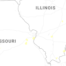

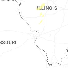
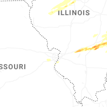
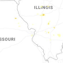
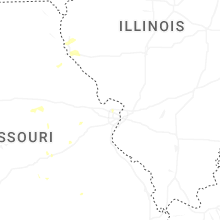
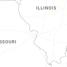
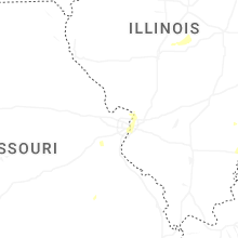
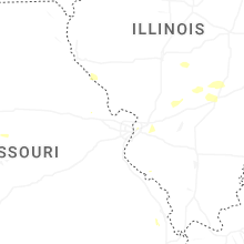
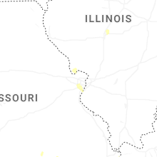
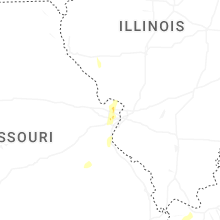

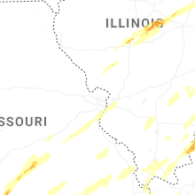


Connect with Interactive Hail Maps