

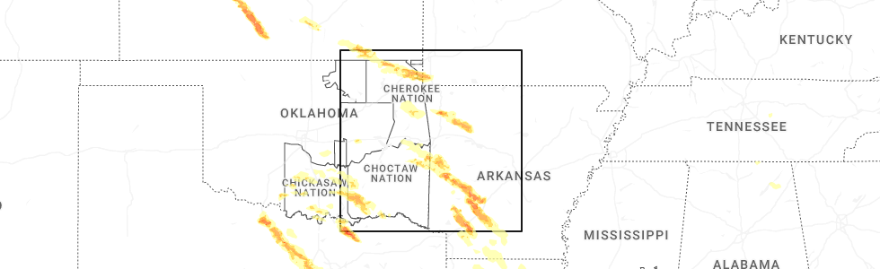
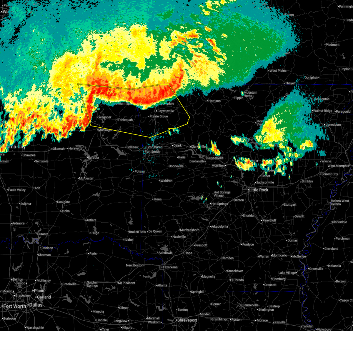
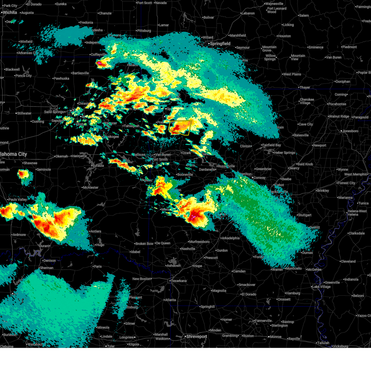
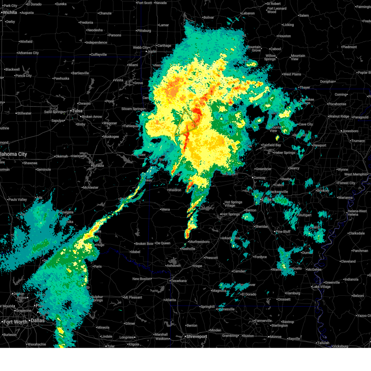
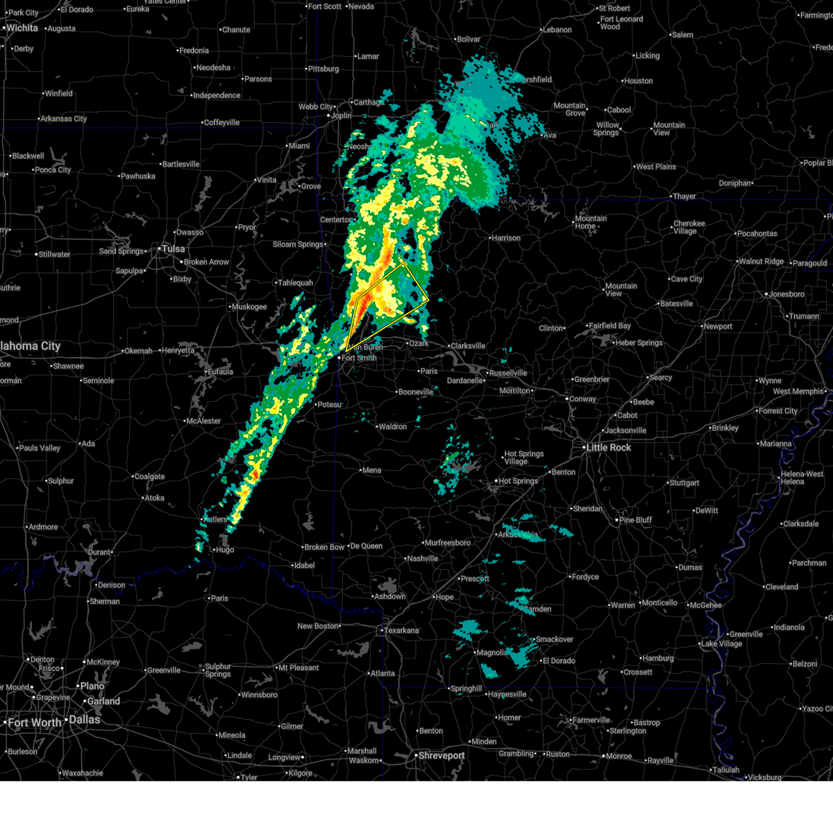
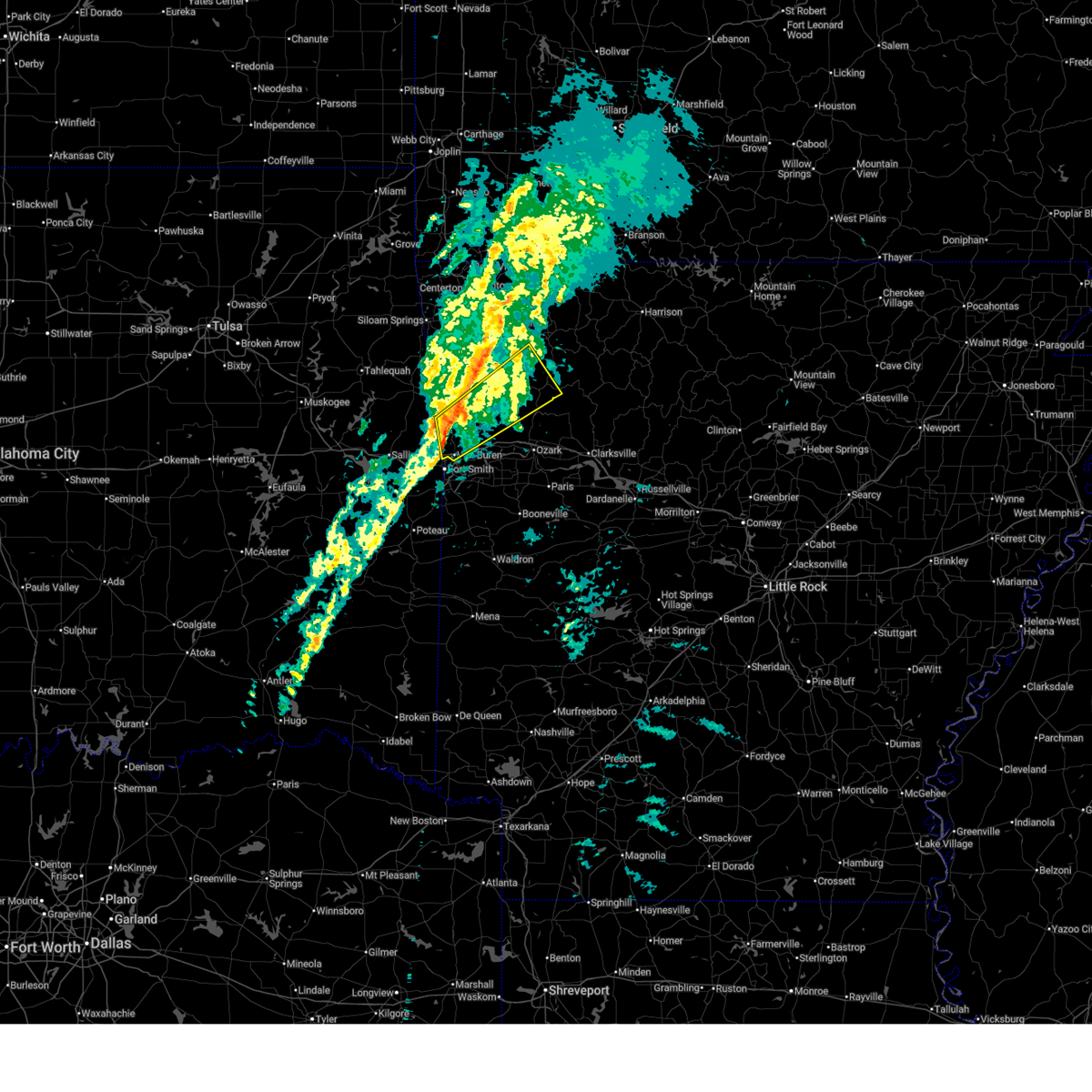
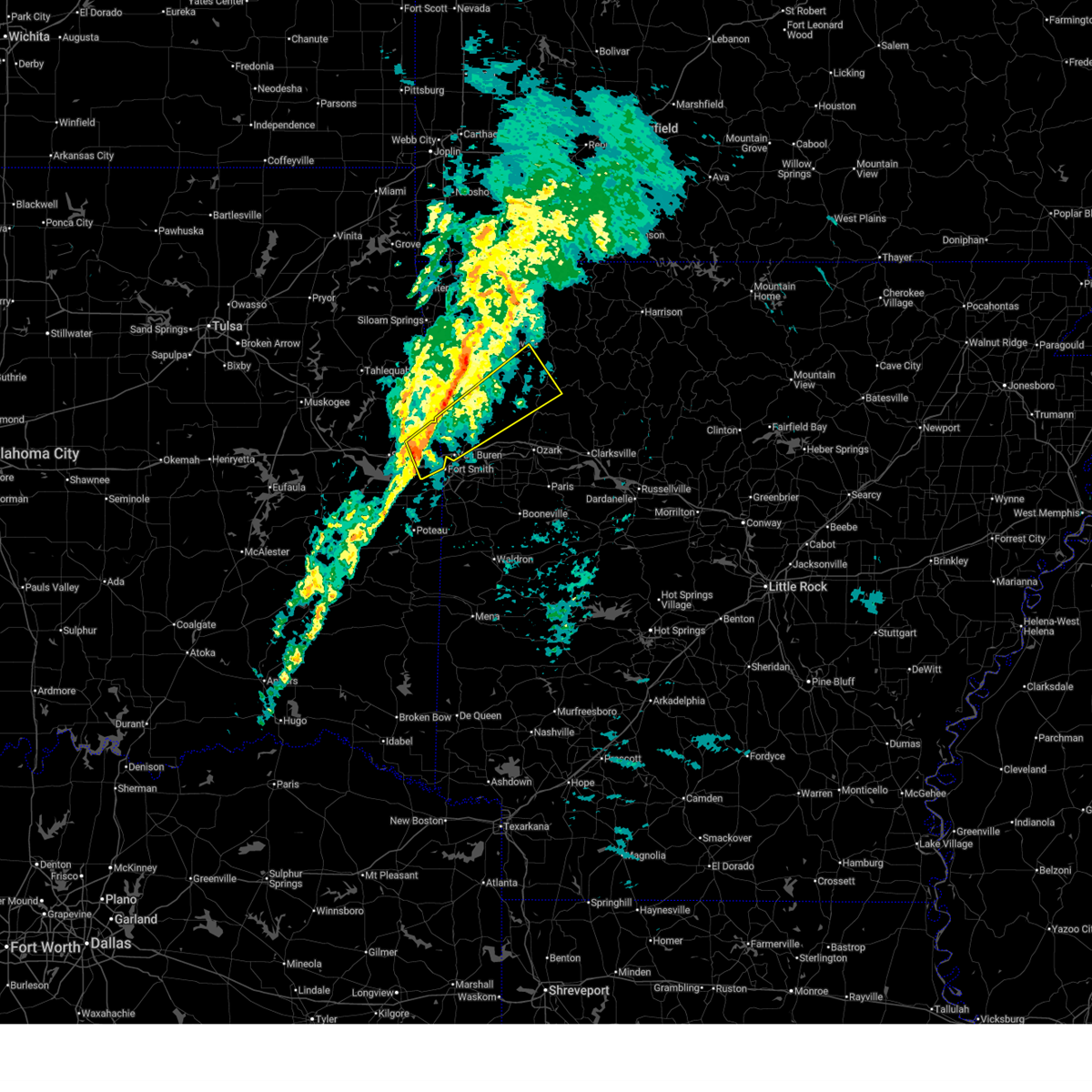
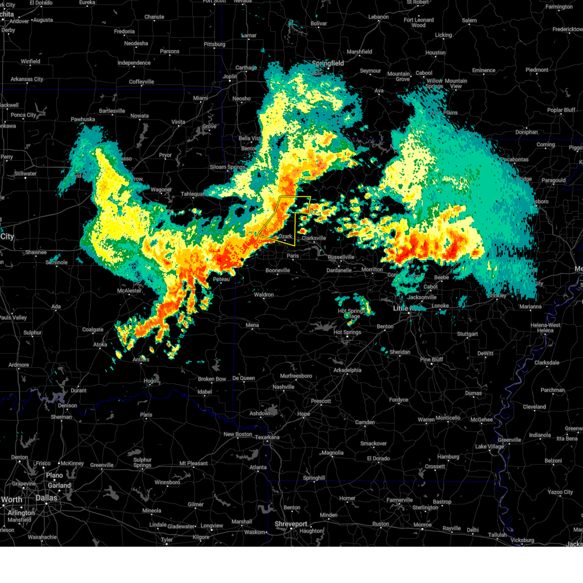
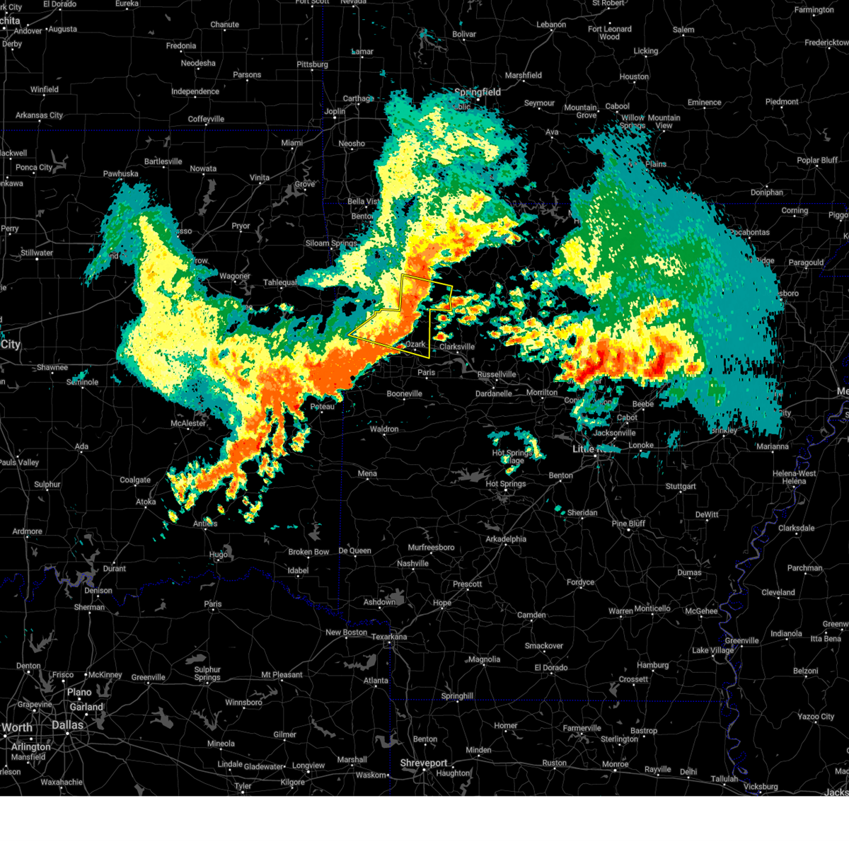
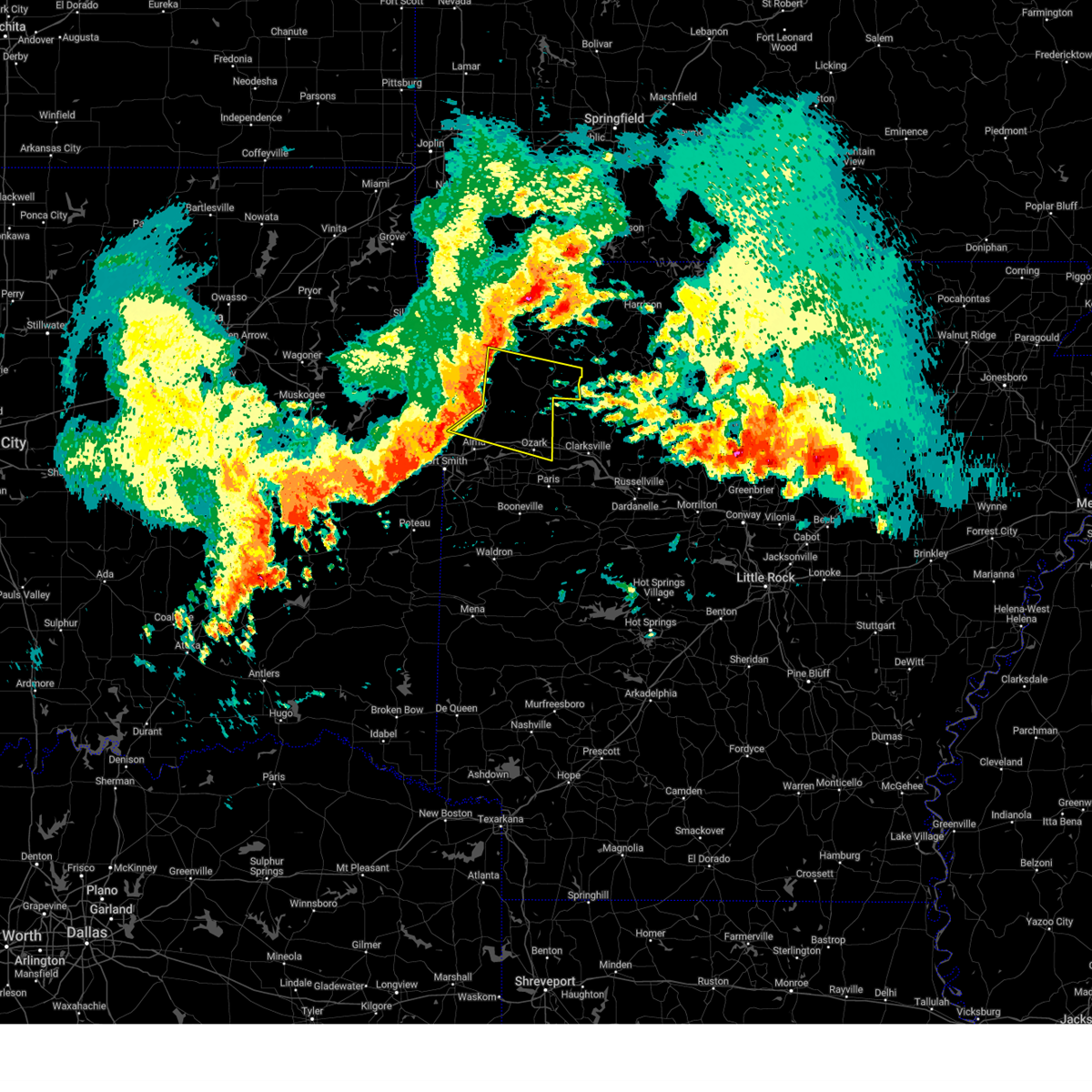
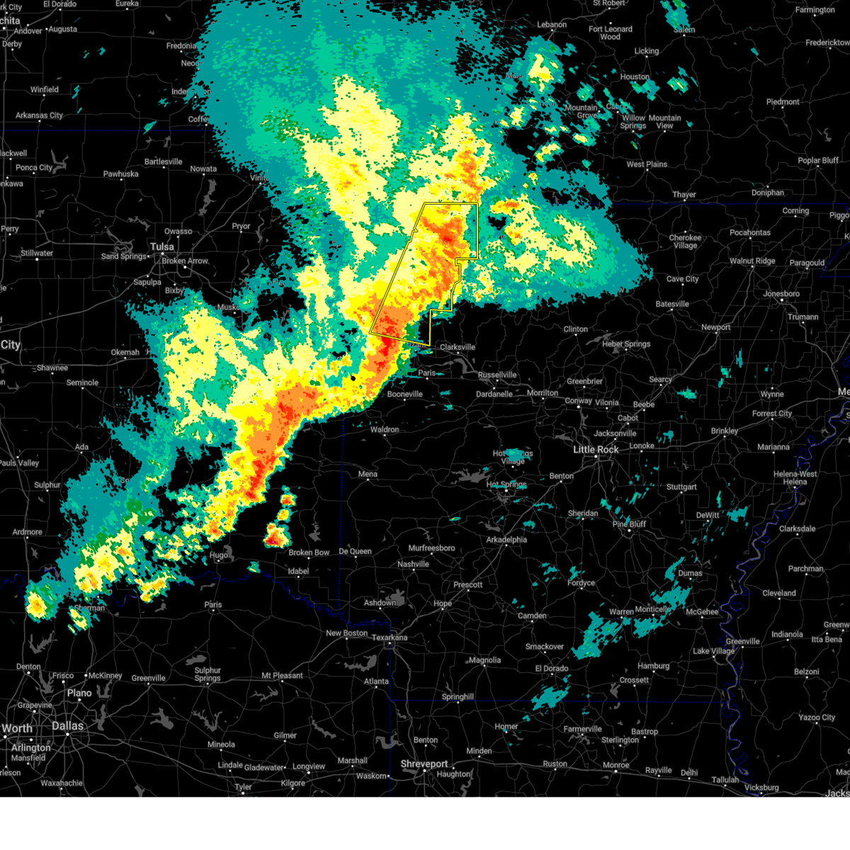
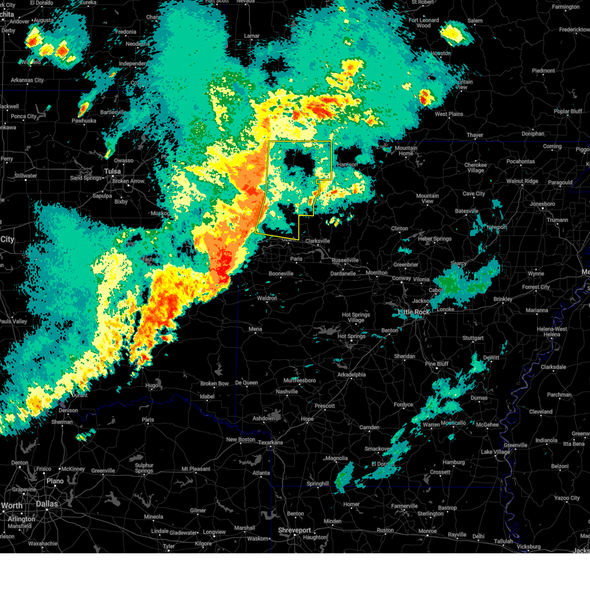
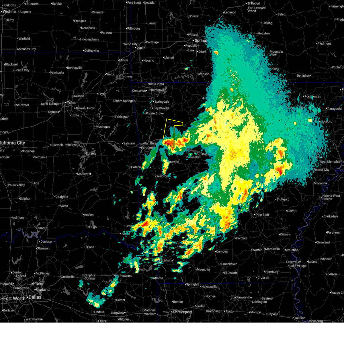
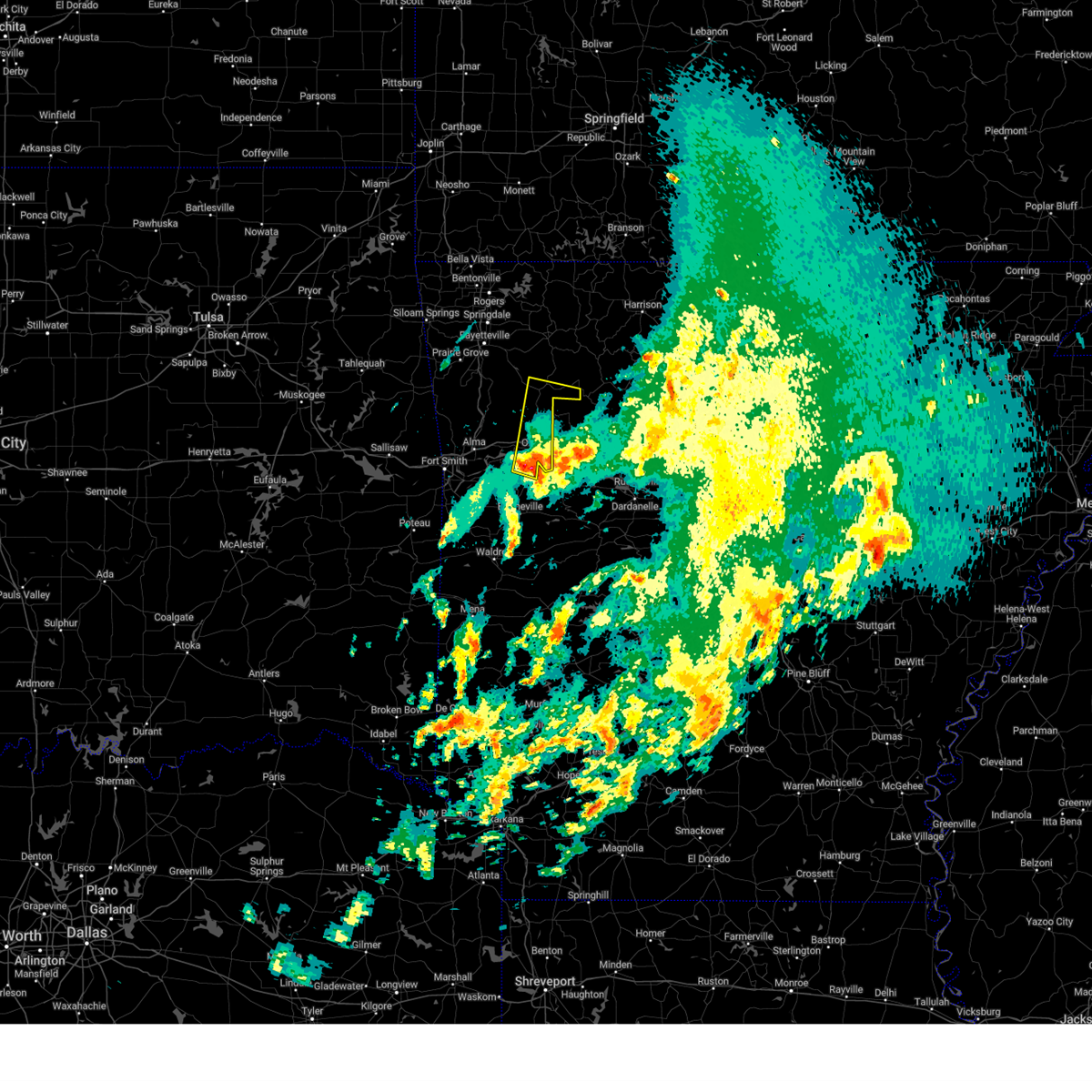
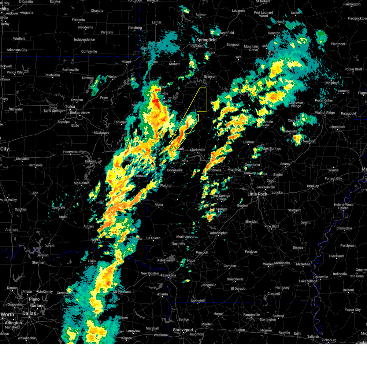
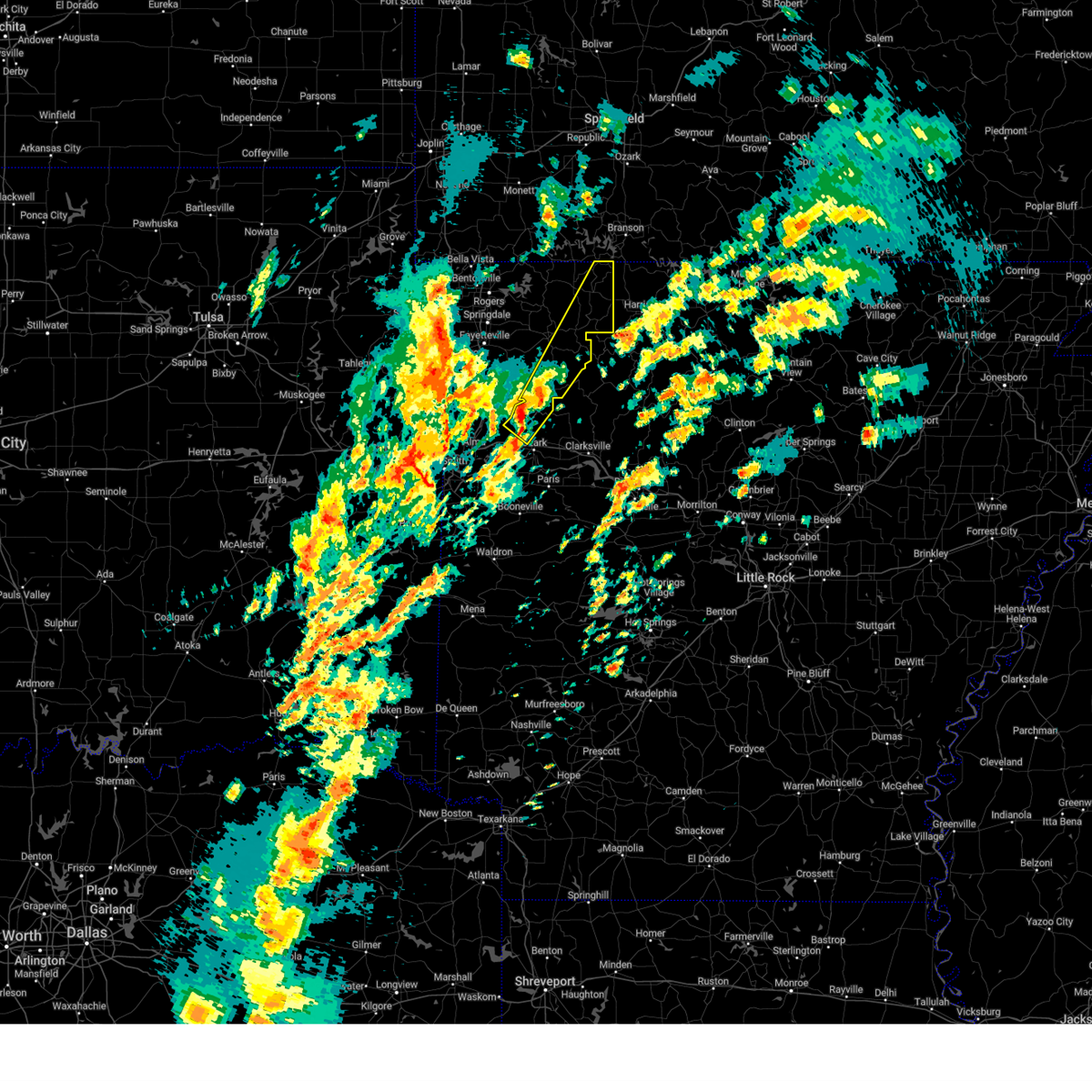
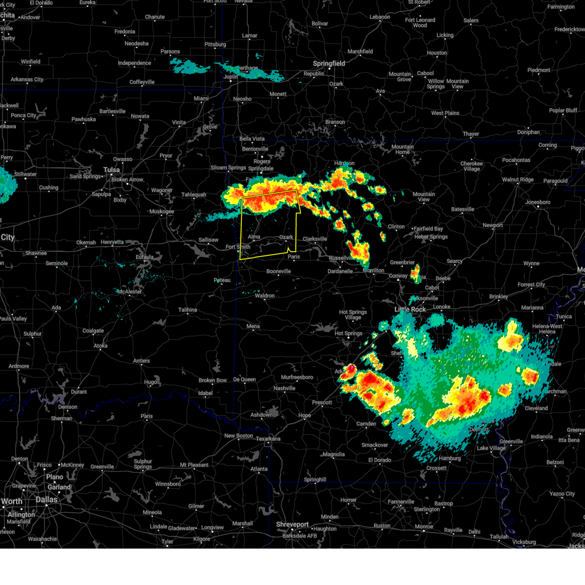
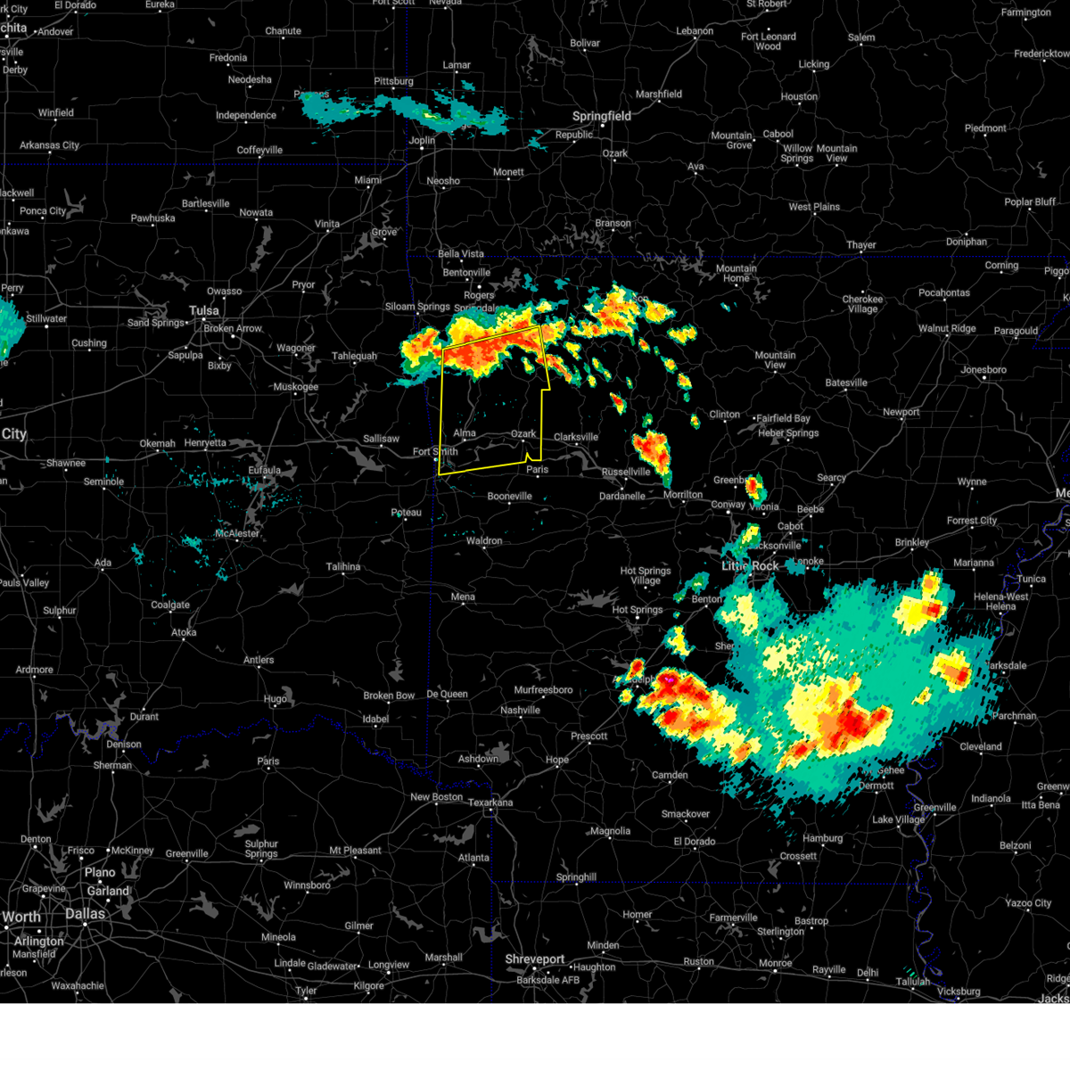
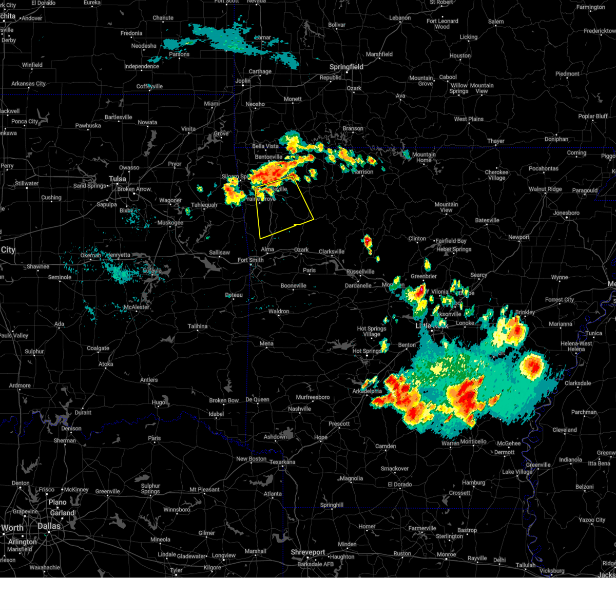
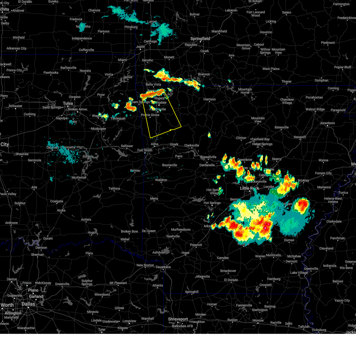
Hail Map for St. Paul, AR
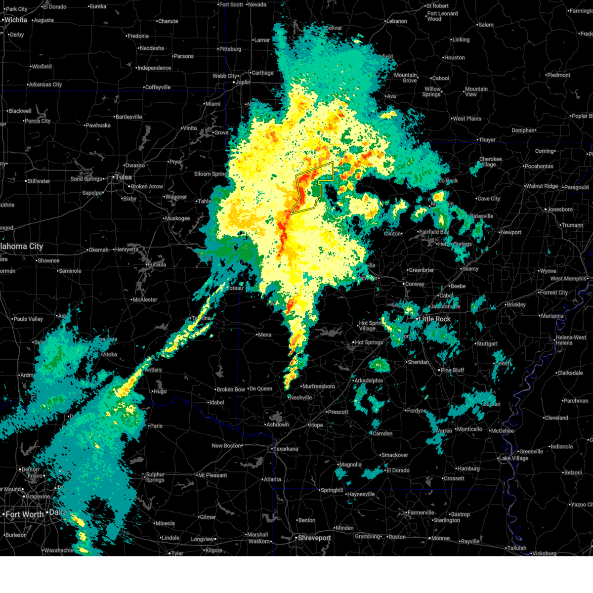
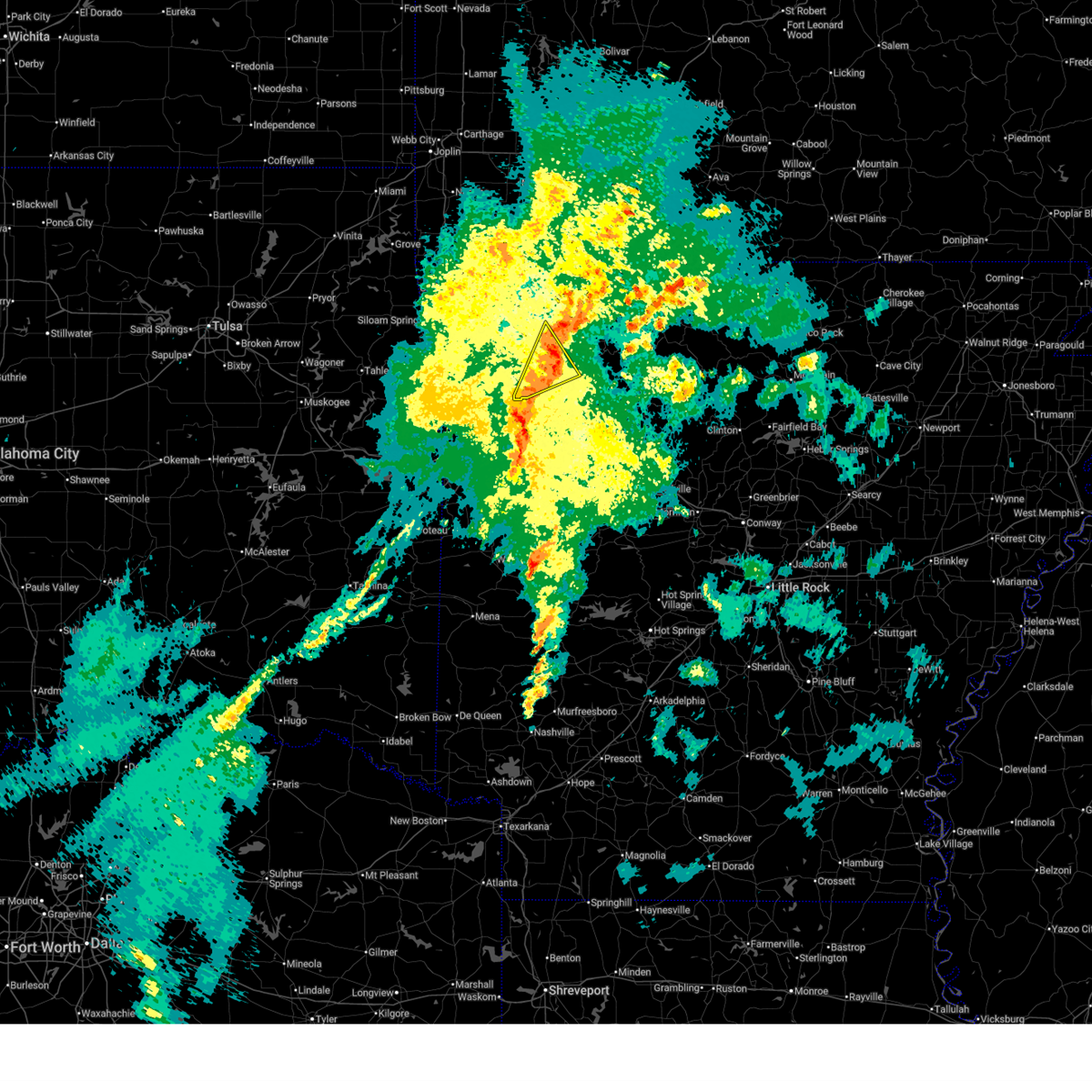
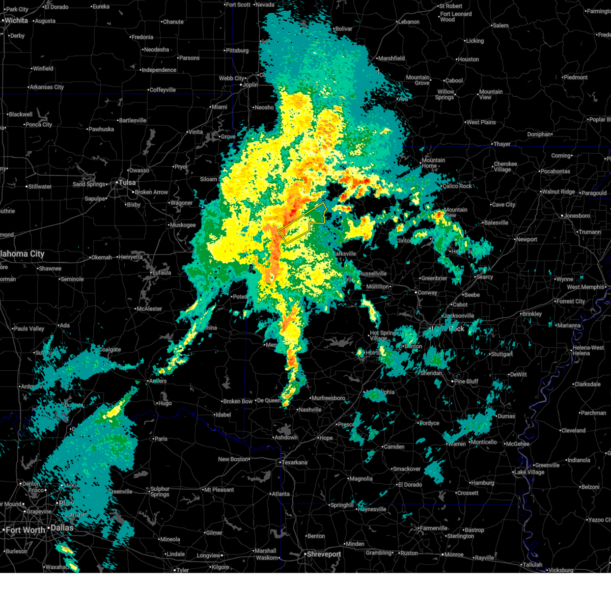
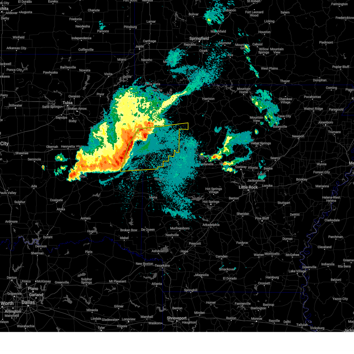
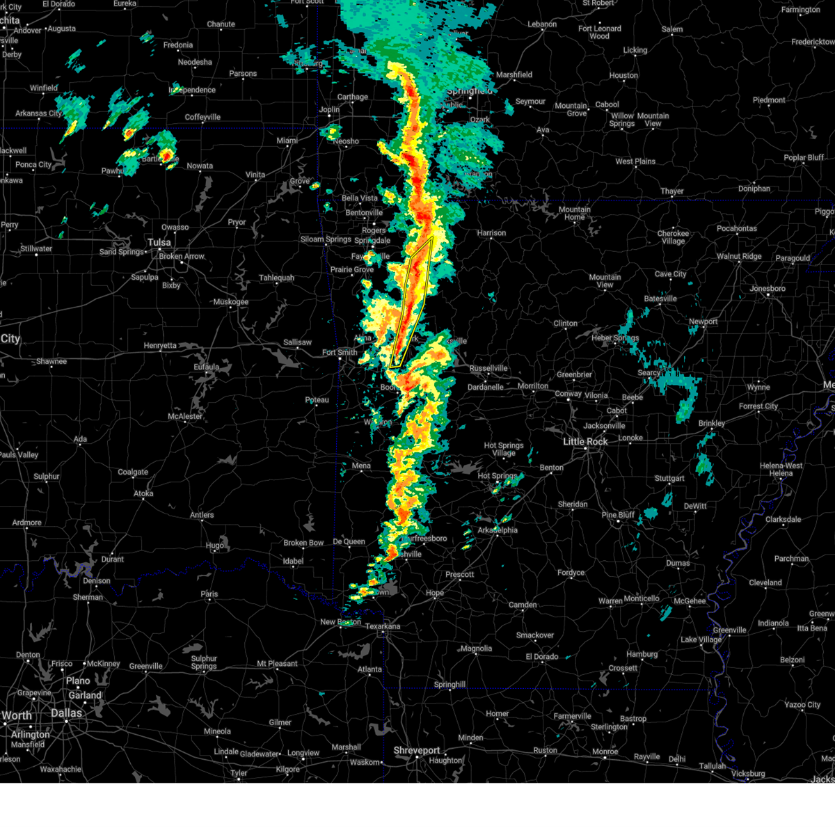
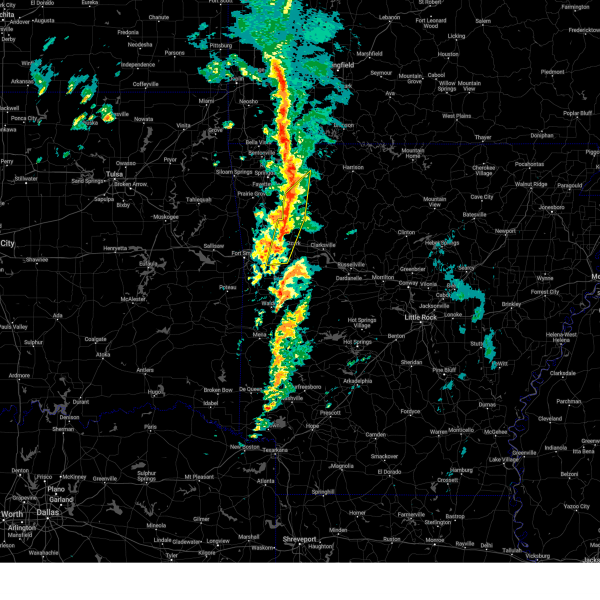
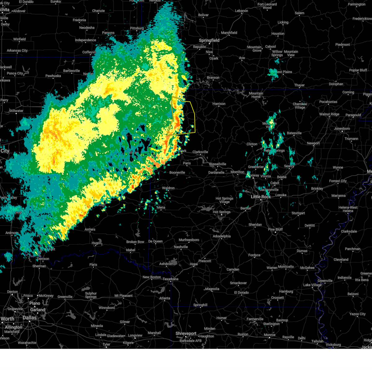
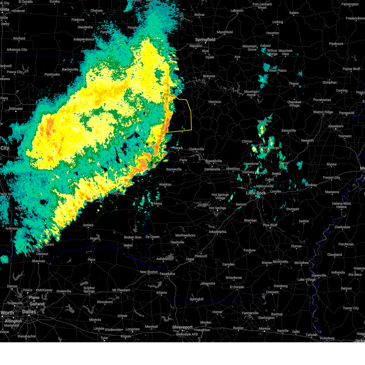
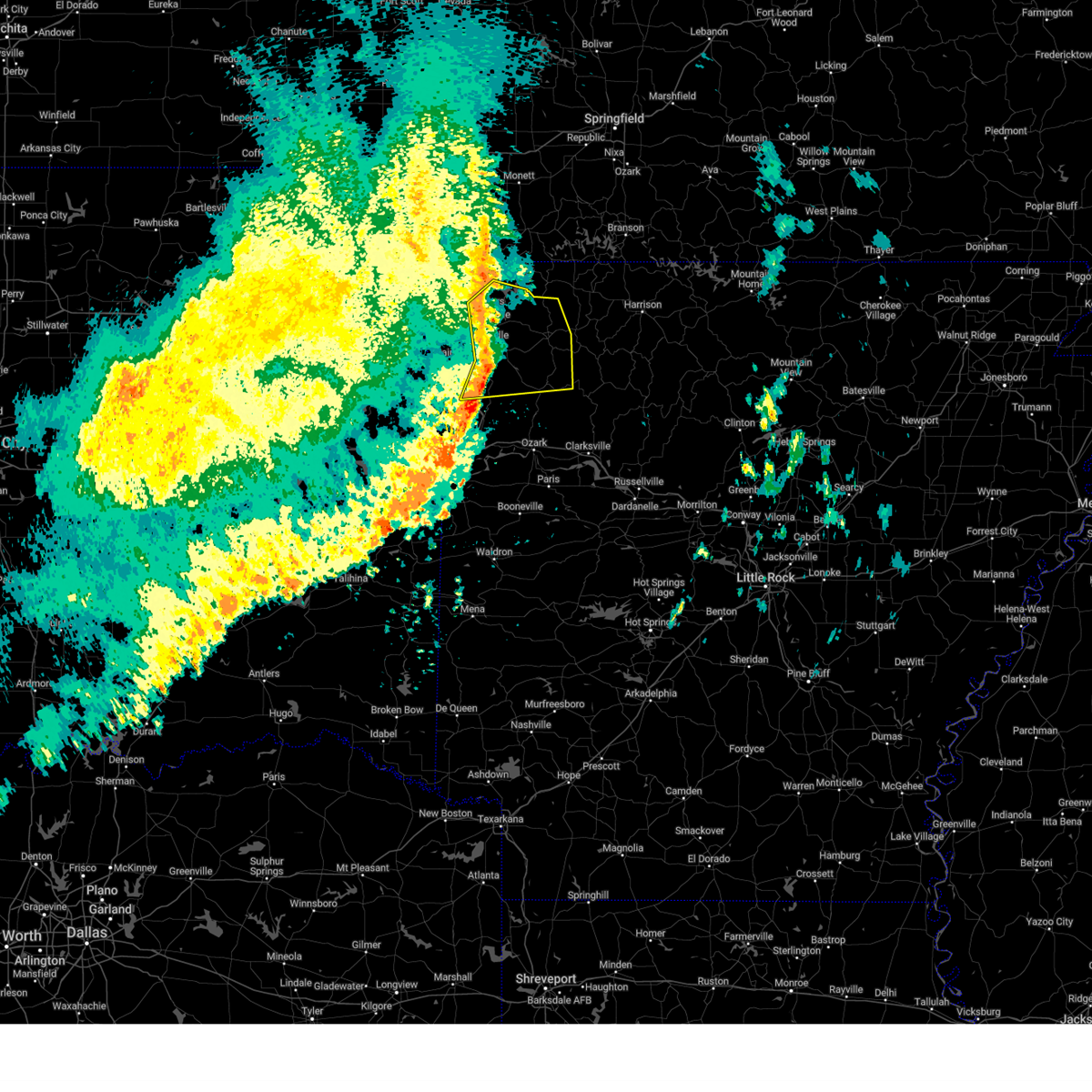
The St. Paul, AR area has had 6 reports of on-the-ground hail by trained spotters, and has been under severe weather warnings 33 times during the past 12 months. Doppler radar has detected hail at or near St. Paul, AR on 68 occasions, including 4 occasions during the past year.
| Name: | St. Paul, AR |
| Where Located: | 47.8 miles NE of Fort Smith, AR |
| Map: | Google Map for St. Paul, AR |
| Population: | 113 |
| Housing Units: | 70 |
| More Info: | Search Google for St. Paul, AR |
2
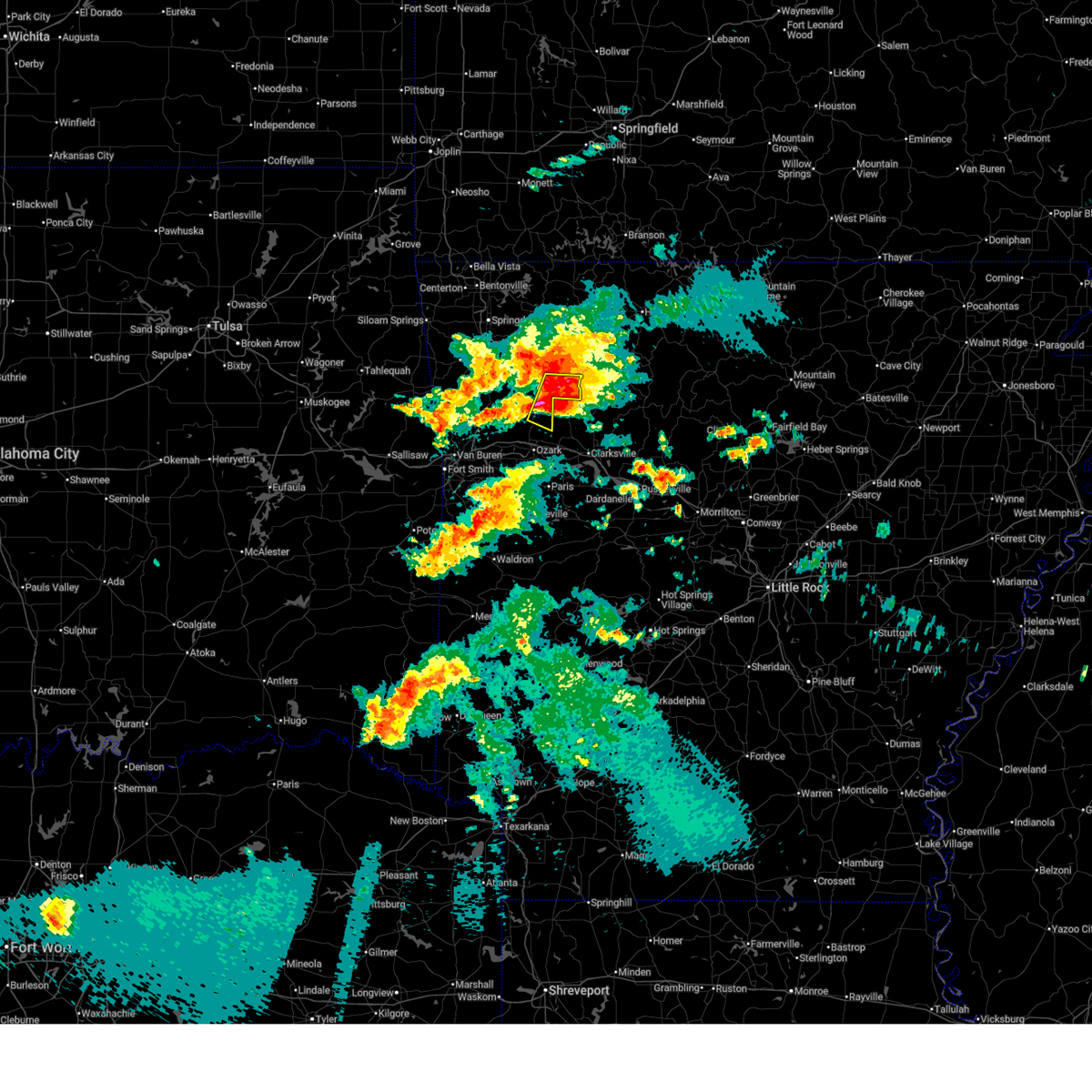
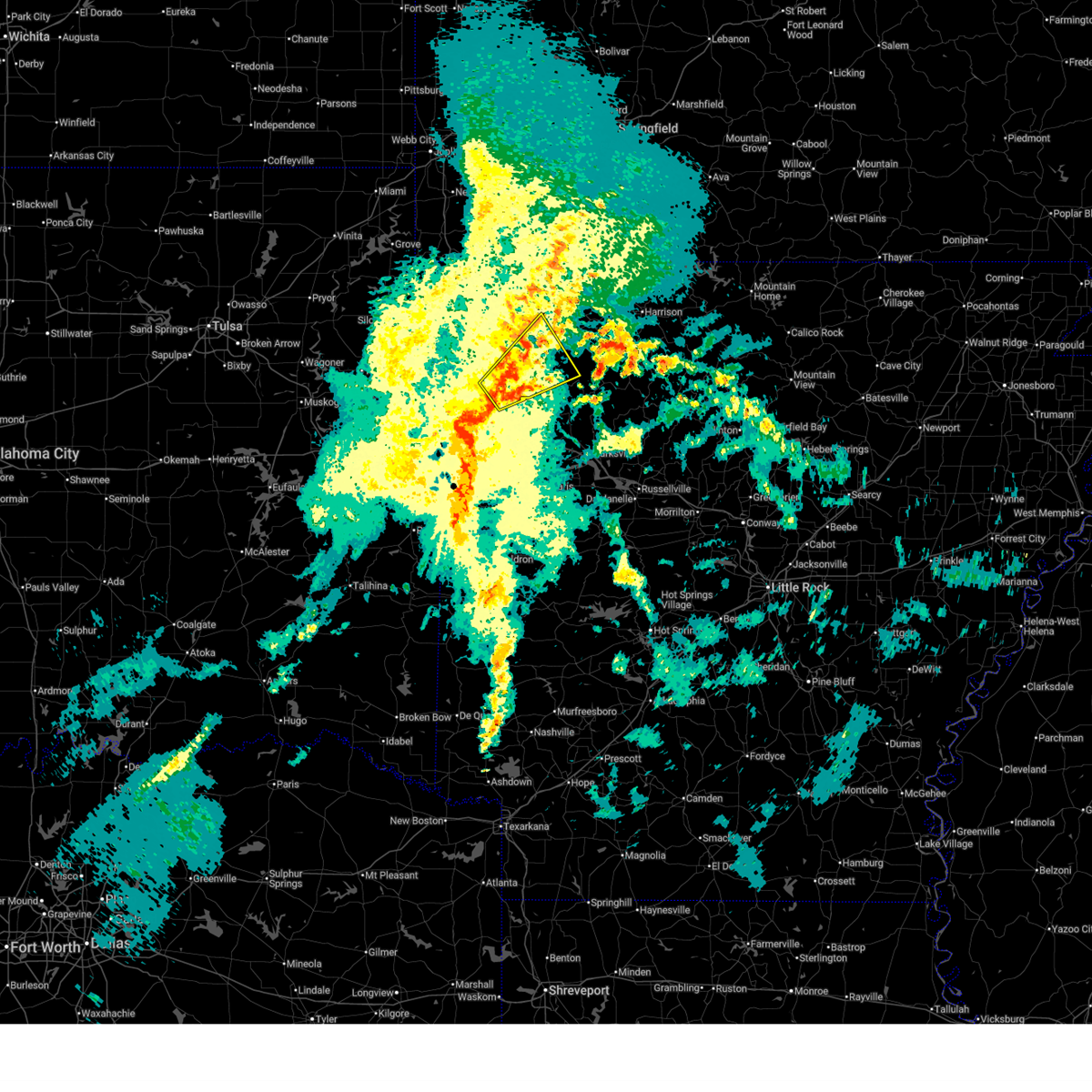
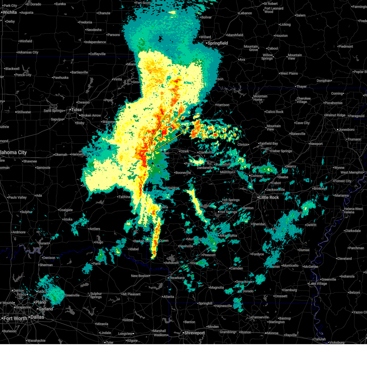
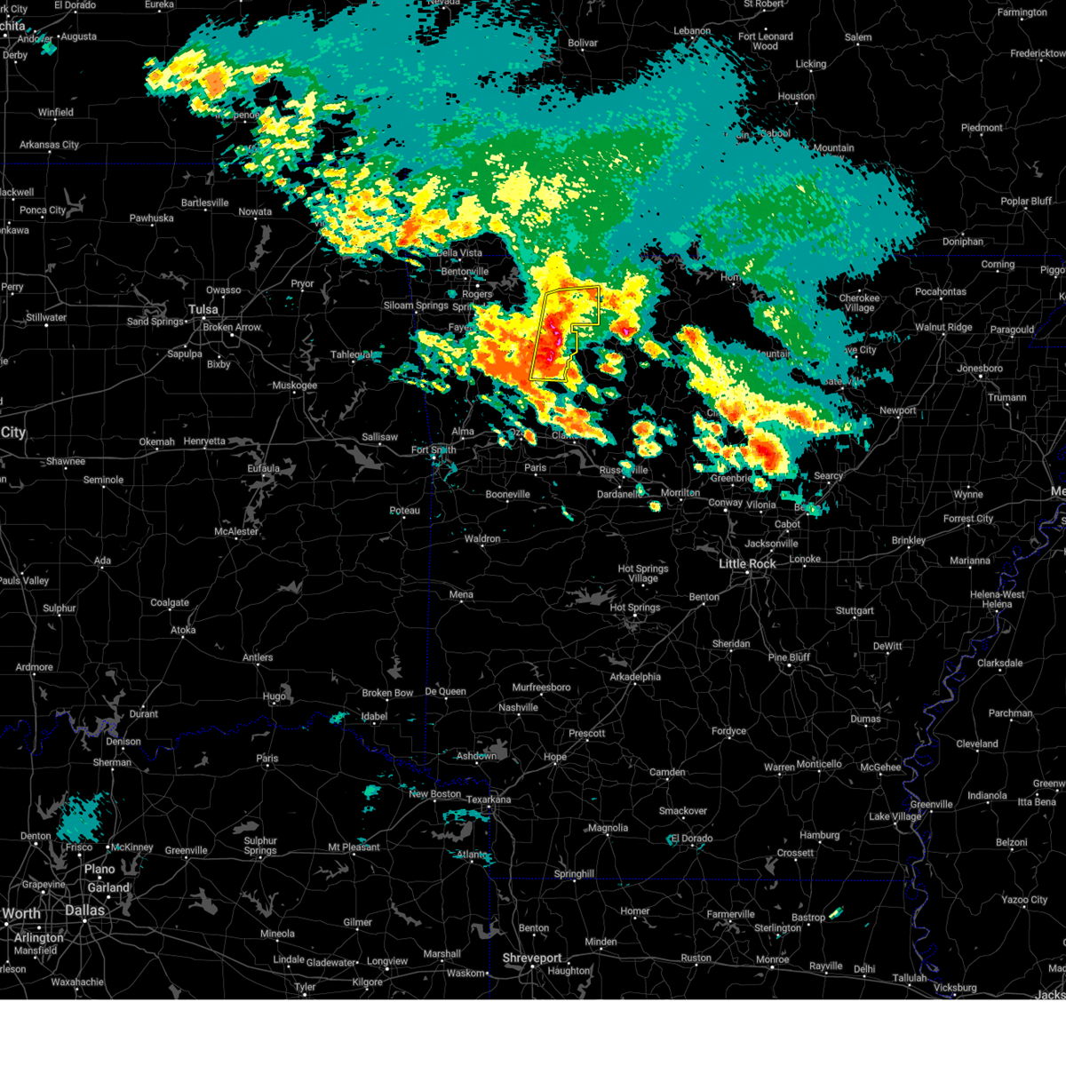
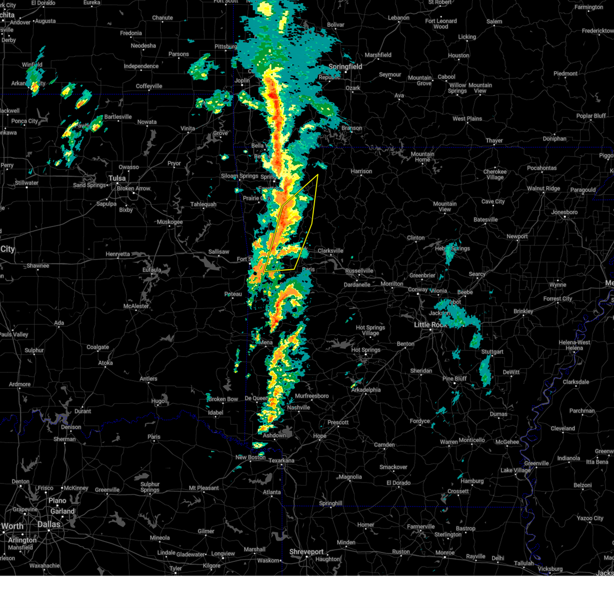
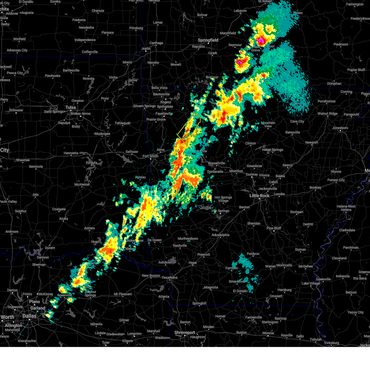
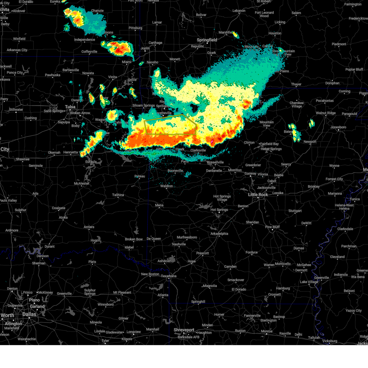
The Top Recent Hail Date for St. Paul, AR is Saturday, April 25, 2026 (4th out of 68)
Hail and Wind Damage Spotted near St. Paul, AR
| Date / Time | Report Details |
|---|---|
| 6/14/2026 1:12 AM CDT |
 At 112 am cdt, severe thunderstorms were located along a line extending from 7 miles south of kingston to 2 miles northwest of devils den state park to 6 miles north of sequoyah state park, moving south at 25 mph (radar indicated). Hazards include 60 mph wind gusts. Expect damage to roofs, siding, and trees. Locations in or near the path include, fayetteville, muskogee, tahlequah, siloam springs, stilwell, cedarville, mountainburg, natural dam, farmington, prairie grove, fort gibson, elkins, west fork, lincoln, westville, locust grove, greenland, okay, hulbert, winslow, this includes interstate 49 between mile markers 25 and 69. At 112 am cdt, severe thunderstorms were located along a line extending from 7 miles south of kingston to 2 miles northwest of devils den state park to 6 miles north of sequoyah state park, moving south at 25 mph (radar indicated). Hazards include 60 mph wind gusts. Expect damage to roofs, siding, and trees. Locations in or near the path include, fayetteville, muskogee, tahlequah, siloam springs, stilwell, cedarville, mountainburg, natural dam, farmington, prairie grove, fort gibson, elkins, west fork, lincoln, westville, locust grove, greenland, okay, hulbert, winslow, this includes interstate 49 between mile markers 25 and 69.
|
| 6/14/2026 12:53 AM CDT |
 Svrtsa the national weather service in tulsa has issued a * severe thunderstorm warning for, southern benton county in northwestern arkansas, madison county in northwestern arkansas, northern franklin county in west central arkansas, northern crawford county in northwestern arkansas, washington county in northwestern arkansas, southern delaware county in northeastern oklahoma, northeastern sequoyah county in east central oklahoma, mayes county in northeastern oklahoma, adair county in northeastern oklahoma, eastern wagoner county in northeastern oklahoma, cherokee county in east central oklahoma, northeastern muskogee county in east central oklahoma, * until 130 am cdt. * at 1253 am cdt, severe thunderstorms were located along a line extending from 2 miles south of marble to 4 miles northeast of strickler to 8 miles west of peggs, moving south at 35 mph (radar indicated). Hazards include 70 mph wind gusts. Expect considerable tree damage. damage is likely to mobile homes, roofs, and outbuildings. Locations in or near the path include, fayetteville, springdale, rogers, muskogee, bentonville, tahlequah, siloam springs, wagoner, stilwell, huntsville, cedarville, mountainburg, pryor, natural dam, pryor creek, lowell, farmington, prairie grove, fort gibson, gentry, this includes interstate 49 between mile markers 25 and 84. Svrtsa the national weather service in tulsa has issued a * severe thunderstorm warning for, southern benton county in northwestern arkansas, madison county in northwestern arkansas, northern franklin county in west central arkansas, northern crawford county in northwestern arkansas, washington county in northwestern arkansas, southern delaware county in northeastern oklahoma, northeastern sequoyah county in east central oklahoma, mayes county in northeastern oklahoma, adair county in northeastern oklahoma, eastern wagoner county in northeastern oklahoma, cherokee county in east central oklahoma, northeastern muskogee county in east central oklahoma, * until 130 am cdt. * at 1253 am cdt, severe thunderstorms were located along a line extending from 2 miles south of marble to 4 miles northeast of strickler to 8 miles west of peggs, moving south at 35 mph (radar indicated). Hazards include 70 mph wind gusts. Expect considerable tree damage. damage is likely to mobile homes, roofs, and outbuildings. Locations in or near the path include, fayetteville, springdale, rogers, muskogee, bentonville, tahlequah, siloam springs, wagoner, stilwell, huntsville, cedarville, mountainburg, pryor, natural dam, pryor creek, lowell, farmington, prairie grove, fort gibson, gentry, this includes interstate 49 between mile markers 25 and 84.
|
| 6/14/2026 12:35 AM CDT |
 At 1235 am cdt, severe thunderstorms were located along a line extending from 4 miles northeast of hindsville to 4 miles west of lincoln to 3 miles east of inola, moving southeast at 45 mph (emergency management). Hazards include 70 mph wind gusts. Expect considerable tree damage. damage is likely to mobile homes, roofs, and outbuildings. locations in or near the path include, fayetteville, springdale, rogers, muskogee, bentonville, claremore, tahlequah, siloam springs, wagoner, stilwell, jay, huntsville, mountainburg, pryor, natural dam, bella vista, pryor creek, lowell, farmington, pea ridge, this includes the following highways, interstate 44 between mile markers 243 and 268. Interstate 49 between mile markers 33 and 93. At 1235 am cdt, severe thunderstorms were located along a line extending from 4 miles northeast of hindsville to 4 miles west of lincoln to 3 miles east of inola, moving southeast at 45 mph (emergency management). Hazards include 70 mph wind gusts. Expect considerable tree damage. damage is likely to mobile homes, roofs, and outbuildings. locations in or near the path include, fayetteville, springdale, rogers, muskogee, bentonville, claremore, tahlequah, siloam springs, wagoner, stilwell, jay, huntsville, mountainburg, pryor, natural dam, bella vista, pryor creek, lowell, farmington, pea ridge, this includes the following highways, interstate 44 between mile markers 243 and 268. Interstate 49 between mile markers 33 and 93.
|
| 6/14/2026 12:21 AM CDT |
 Svrtsa the national weather service in tulsa has issued a * severe thunderstorm warning for, benton county in northwestern arkansas, madison county in northwestern arkansas, west central carroll county in northwestern arkansas, northern crawford county in northwestern arkansas, washington county in northwestern arkansas, central rogers county in northeastern oklahoma, southern delaware county in northeastern oklahoma, mayes county in northeastern oklahoma, adair county in northeastern oklahoma, eastern wagoner county in northeastern oklahoma, cherokee county in east central oklahoma, northeastern muskogee county in east central oklahoma, * until 100 am cdt. * at 1221 am cdt, severe thunderstorms were located along a line extending from 4 miles northeast of war eagle to near watts to tiawah, moving southeast at 45 mph (radar indicated). Hazards include 60 mph wind gusts. Expect damage to roofs, siding, and trees. locations in or near the path include, fayetteville, springdale, rogers, muskogee, bentonville, claremore, tahlequah, siloam springs, wagoner, stilwell, jay, huntsville, mountainburg, pryor, natural dam, bella vista, pryor creek, lowell, farmington, pea ridge, this includes the following highways, interstate 44 between mile markers 243 and 268. Interstate 49 between mile markers 33 and 93. Svrtsa the national weather service in tulsa has issued a * severe thunderstorm warning for, benton county in northwestern arkansas, madison county in northwestern arkansas, west central carroll county in northwestern arkansas, northern crawford county in northwestern arkansas, washington county in northwestern arkansas, central rogers county in northeastern oklahoma, southern delaware county in northeastern oklahoma, mayes county in northeastern oklahoma, adair county in northeastern oklahoma, eastern wagoner county in northeastern oklahoma, cherokee county in east central oklahoma, northeastern muskogee county in east central oklahoma, * until 100 am cdt. * at 1221 am cdt, severe thunderstorms were located along a line extending from 4 miles northeast of war eagle to near watts to tiawah, moving southeast at 45 mph (radar indicated). Hazards include 60 mph wind gusts. Expect damage to roofs, siding, and trees. locations in or near the path include, fayetteville, springdale, rogers, muskogee, bentonville, claremore, tahlequah, siloam springs, wagoner, stilwell, jay, huntsville, mountainburg, pryor, natural dam, bella vista, pryor creek, lowell, farmington, pea ridge, this includes the following highways, interstate 44 between mile markers 243 and 268. Interstate 49 between mile markers 33 and 93.
|
| 4/28/2026 5:57 PM CDT |
 Svrtsa the national weather service in tulsa has issued a * severe thunderstorm warning for, southeastern madison county in northwestern arkansas, northeastern franklin county in west central arkansas, * until 615 pm cdt. * at 557 pm cdt, a severe thunderstorm was located 4 miles northeast of cass, moving east at 25 mph (radar indicated). Hazards include golf ball size hail and 70 mph wind gusts. People and animals outdoors will be injured. expect hail damage to roofs, siding, windows, and vehicles. expect considerable tree damage. wind damage is also likely to mobile homes, roofs, and outbuildings. locations in or near the path include, st. Paul, cass, pettigrew, boston, dutton, barnes, red star, redding, turners bend, taft,. Svrtsa the national weather service in tulsa has issued a * severe thunderstorm warning for, southeastern madison county in northwestern arkansas, northeastern franklin county in west central arkansas, * until 615 pm cdt. * at 557 pm cdt, a severe thunderstorm was located 4 miles northeast of cass, moving east at 25 mph (radar indicated). Hazards include golf ball size hail and 70 mph wind gusts. People and animals outdoors will be injured. expect hail damage to roofs, siding, windows, and vehicles. expect considerable tree damage. wind damage is also likely to mobile homes, roofs, and outbuildings. locations in or near the path include, st. Paul, cass, pettigrew, boston, dutton, barnes, red star, redding, turners bend, taft,.
|
| 4/28/2026 5:42 PM CDT |
 At 542 pm cdt, a severe thunderstorm was located 6 miles northwest of cass, moving east at 45 mph (radar indicated). Hazards include golf ball size hail and 70 mph wind gusts. People and animals outdoors will be injured. expect hail damage to roofs, siding, windows, and vehicles. expect considerable tree damage. wind damage is also likely to mobile homes, roofs, and outbuildings. locations in or near the path include, st. Paul, cass, pettigrew, japton, witter, boston, dutton, red star, delaney, brashears, crosses, patrick, combs,. At 542 pm cdt, a severe thunderstorm was located 6 miles northwest of cass, moving east at 45 mph (radar indicated). Hazards include golf ball size hail and 70 mph wind gusts. People and animals outdoors will be injured. expect hail damage to roofs, siding, windows, and vehicles. expect considerable tree damage. wind damage is also likely to mobile homes, roofs, and outbuildings. locations in or near the path include, st. Paul, cass, pettigrew, japton, witter, boston, dutton, red star, delaney, brashears, crosses, patrick, combs,.
|
| 4/28/2026 5:22 PM CDT |
 Svrtsa the national weather service in tulsa has issued a * severe thunderstorm warning for, southern madison county in northwestern arkansas, northeastern franklin county in west central arkansas, northeastern crawford county in northwestern arkansas, southeastern washington county in northwestern arkansas, * until 600 pm cdt. * at 521 pm cdt, a severe thunderstorm was located over winslow, moving east at 40 mph (radar indicated). Hazards include golf ball size hail and 70 mph wind gusts. People and animals outdoors will be injured. expect hail damage to roofs, siding, windows, and vehicles. expect considerable tree damage. wind damage is also likely to mobile homes, roofs, and outbuildings. locations in or near the path include, winslow, st. Paul, cass, pettigrew, brentwood, japton, witter, blackburn, boston, dutton, wyola, red star, woolsey, bidville, weathers, delaney, arnett, brashears, crosses, patrick, this includes interstate 49 between mile markers 36 and 50. Svrtsa the national weather service in tulsa has issued a * severe thunderstorm warning for, southern madison county in northwestern arkansas, northeastern franklin county in west central arkansas, northeastern crawford county in northwestern arkansas, southeastern washington county in northwestern arkansas, * until 600 pm cdt. * at 521 pm cdt, a severe thunderstorm was located over winslow, moving east at 40 mph (radar indicated). Hazards include golf ball size hail and 70 mph wind gusts. People and animals outdoors will be injured. expect hail damage to roofs, siding, windows, and vehicles. expect considerable tree damage. wind damage is also likely to mobile homes, roofs, and outbuildings. locations in or near the path include, winslow, st. Paul, cass, pettigrew, brentwood, japton, witter, blackburn, boston, dutton, wyola, red star, woolsey, bidville, weathers, delaney, arnett, brashears, crosses, patrick, this includes interstate 49 between mile markers 36 and 50.
|
| 4/25/2026 8:46 PM CDT |
 the severe thunderstorm warning has been cancelled and is no longer in effect the severe thunderstorm warning has been cancelled and is no longer in effect
|
| 4/25/2026 8:25 PM CDT |
 Svrtsa the national weather service in tulsa has issued a * severe thunderstorm warning for, southwestern madison county in northwestern arkansas, southeastern washington county in northwestern arkansas, * until 915 pm cdt. * at 824 pm cdt, a severe thunderstorm was located 5 miles south of elkins, another severe thunderstorm was located 4 miles southwest of japton. both storms were moving east at 20 mph (radar indicated). Hazards include 60 mph wind gusts and quarter size hail. Hail damage to vehicles is expected. expect wind damage to roofs, siding, and trees. locations in or near the path include, st. Paul, japton, witter, aurora, georgetown, dutton, wyola, sulphur city, delaney, arnett, hicks, brashears, crosses, patrick, combs, durham,. Svrtsa the national weather service in tulsa has issued a * severe thunderstorm warning for, southwestern madison county in northwestern arkansas, southeastern washington county in northwestern arkansas, * until 915 pm cdt. * at 824 pm cdt, a severe thunderstorm was located 5 miles south of elkins, another severe thunderstorm was located 4 miles southwest of japton. both storms were moving east at 20 mph (radar indicated). Hazards include 60 mph wind gusts and quarter size hail. Hail damage to vehicles is expected. expect wind damage to roofs, siding, and trees. locations in or near the path include, st. Paul, japton, witter, aurora, georgetown, dutton, wyola, sulphur city, delaney, arnett, hicks, brashears, crosses, patrick, combs, durham,.
|
| 4/15/2026 1:10 AM CDT |
 At 109 am cdt, severe thunderstorms were located along a line extending from 3 miles west of green forest to 4 miles northeast of kingston to boston, moving east at 45 to 50 mph (radar indicated). Hazards include 60 mph wind gusts. Expect damage to roofs, siding, and trees. Locations in or near the path include, dutton, carrollton, dryfork, rudd, red star, cabanal, pettigrew, metalton, weathers, kingston, connor, witter, marble, aurora, coin, alabam, osage, delmar, green forest, rule,. At 109 am cdt, severe thunderstorms were located along a line extending from 3 miles west of green forest to 4 miles northeast of kingston to boston, moving east at 45 to 50 mph (radar indicated). Hazards include 60 mph wind gusts. Expect damage to roofs, siding, and trees. Locations in or near the path include, dutton, carrollton, dryfork, rudd, red star, cabanal, pettigrew, metalton, weathers, kingston, connor, witter, marble, aurora, coin, alabam, osage, delmar, green forest, rule,.
|
| 4/15/2026 12:34 AM CDT |
 Svrtsa the national weather service in tulsa has issued a * severe thunderstorm warning for, madison county in northwestern arkansas, southeastern carroll county in northwestern arkansas, * until 130 am cdt. * at 1234 am cdt, severe thunderstorms were located along a line extending from near hobbs state park to near wesley to 5 miles southeast of winslow, moving east at 55 mph (radar indicated). Hazards include 60 mph wind gusts. Expect damage to roofs, siding, and trees. Locations in or near the path include, hindsville, huntsville, carrollton, dryfork, rudd, red star, metalton, kingston, connor, forum, aurora, coin, crosses, alabam, combs, delmar, best, clifty, georgetown, boston,. Svrtsa the national weather service in tulsa has issued a * severe thunderstorm warning for, madison county in northwestern arkansas, southeastern carroll county in northwestern arkansas, * until 130 am cdt. * at 1234 am cdt, severe thunderstorms were located along a line extending from near hobbs state park to near wesley to 5 miles southeast of winslow, moving east at 55 mph (radar indicated). Hazards include 60 mph wind gusts. Expect damage to roofs, siding, and trees. Locations in or near the path include, hindsville, huntsville, carrollton, dryfork, rudd, red star, metalton, kingston, connor, forum, aurora, coin, crosses, alabam, combs, delmar, best, clifty, georgetown, boston,.
|
| 3/11/2026 2:24 AM CDT |
 the severe thunderstorm warning has been cancelled and is no longer in effect the severe thunderstorm warning has been cancelled and is no longer in effect
|
| 3/11/2026 2:24 AM CDT |
 At 224 am cdt, a severe thunderstorm was located 6 miles southwest of pettigrew, moving northeast at 55 mph (radar indicated). Hazards include 60 mph wind gusts. Expect damage to roofs, siding, and trees. locations in or near the path include, dutton, red star, brashears, pettigrew, st. Paul, boston,. At 224 am cdt, a severe thunderstorm was located 6 miles southwest of pettigrew, moving northeast at 55 mph (radar indicated). Hazards include 60 mph wind gusts. Expect damage to roofs, siding, and trees. locations in or near the path include, dutton, red star, brashears, pettigrew, st. Paul, boston,.
|
| 3/11/2026 2:23 AM CDT |
 The storm which prompted the warning has moved out of the area. therefore, the warning will be allowed to expire. however, gusty winds are still possible with this thunderstorm. a tornado watch remains in effect until 400 am cdt for northwestern and west central arkansas. remember, a severe thunderstorm warning still remains in effect for eastern madison county. The storm which prompted the warning has moved out of the area. therefore, the warning will be allowed to expire. however, gusty winds are still possible with this thunderstorm. a tornado watch remains in effect until 400 am cdt for northwestern and west central arkansas. remember, a severe thunderstorm warning still remains in effect for eastern madison county.
|
| 3/11/2026 2:14 AM CDT |
 Svrtsa the national weather service in tulsa has issued a * severe thunderstorm warning for, eastern madison county in northwestern arkansas, southeastern carroll county in northwestern arkansas, * until 245 am cdt. * at 214 am cdt, severe thunderstorms were located along a line extending from 2 miles southwest of rule to 5 miles southwest of kingston to 2 miles northwest of pettigrew, moving northeast at 110 mph (radar indicated). Hazards include 60 mph wind gusts. Expect damage to roofs, siding, and trees. locations in or near the path include, dutton, withrow springs state park, carrollton, dryfork, rudd, red star, st. Paul, metalton, weathers, kingston, connor, witter, marble, brashears, forum, aurora, alabam, osage, delmar, boston,. Svrtsa the national weather service in tulsa has issued a * severe thunderstorm warning for, eastern madison county in northwestern arkansas, southeastern carroll county in northwestern arkansas, * until 245 am cdt. * at 214 am cdt, severe thunderstorms were located along a line extending from 2 miles southwest of rule to 5 miles southwest of kingston to 2 miles northwest of pettigrew, moving northeast at 110 mph (radar indicated). Hazards include 60 mph wind gusts. Expect damage to roofs, siding, and trees. locations in or near the path include, dutton, withrow springs state park, carrollton, dryfork, rudd, red star, st. Paul, metalton, weathers, kingston, connor, witter, marble, brashears, forum, aurora, alabam, osage, delmar, boston,.
|
| 3/11/2026 2:09 AM CDT |
 the severe thunderstorm warning has been cancelled and is no longer in effect the severe thunderstorm warning has been cancelled and is no longer in effect
|
| 3/11/2026 2:09 AM CDT |
 At 209 am cdt, a severe thunderstorm was located 4 miles north of japton, moving northeast at 45 mph (radar indicated). Hazards include 60 mph wind gusts. Expect damage to roofs, siding, and trees. locations in or near the path include, aurora, patrick, huntsville, combs, st. Paul, japton, delaney, witter, brashears, georgetown, crosses,. At 209 am cdt, a severe thunderstorm was located 4 miles north of japton, moving northeast at 45 mph (radar indicated). Hazards include 60 mph wind gusts. Expect damage to roofs, siding, and trees. locations in or near the path include, aurora, patrick, huntsville, combs, st. Paul, japton, delaney, witter, brashears, georgetown, crosses,.
|
| 3/11/2026 2:06 AM CDT |
 Svrtsa the national weather service in tulsa has issued a * severe thunderstorm warning for, southeastern madison county in northwestern arkansas, northern franklin county in west central arkansas, northeastern crawford county in northwestern arkansas, * until 245 am cdt. * at 206 am cdt, a severe thunderstorm was located 4 miles southeast of fern, moving northeast at 45 mph (radar indicated). Hazards include 60 mph wind gusts. Expect damage to roofs, siding, and trees. locations in or near the path include, dutton, jethro, cass, red star, pettigrew, st. Paul, redding, brashears, turners bend, fern, paradise, boston, barnes,. Svrtsa the national weather service in tulsa has issued a * severe thunderstorm warning for, southeastern madison county in northwestern arkansas, northern franklin county in west central arkansas, northeastern crawford county in northwestern arkansas, * until 245 am cdt. * at 206 am cdt, a severe thunderstorm was located 4 miles southeast of fern, moving northeast at 45 mph (radar indicated). Hazards include 60 mph wind gusts. Expect damage to roofs, siding, and trees. locations in or near the path include, dutton, jethro, cass, red star, pettigrew, st. Paul, redding, brashears, turners bend, fern, paradise, boston, barnes,.
|
| 3/11/2026 1:39 AM CDT |
 Svrtsa the national weather service in tulsa has issued a * severe thunderstorm warning for, southwestern madison county in northwestern arkansas, northeastern crawford county in northwestern arkansas, southeastern washington county in northwestern arkansas, * until 230 am cdt. * at 139 am cdt, a severe thunderstorm was located near winslow, moving northeast at 45 mph (radar indicated). Hazards include 60 mph wind gusts. Expect damage to roofs, siding, and trees. locations in or near the path include, wyola, wesley, huntsville, tuttle, bidville, sulphur city, st. Paul, brentwood, japton, delaney, witter, arnett, hicks, brashears, aurora, crosses, patrick, winslow, combs, mount gayler, this includes interstate 49 near mile marker 47. Svrtsa the national weather service in tulsa has issued a * severe thunderstorm warning for, southwestern madison county in northwestern arkansas, northeastern crawford county in northwestern arkansas, southeastern washington county in northwestern arkansas, * until 230 am cdt. * at 139 am cdt, a severe thunderstorm was located near winslow, moving northeast at 45 mph (radar indicated). Hazards include 60 mph wind gusts. Expect damage to roofs, siding, and trees. locations in or near the path include, wyola, wesley, huntsville, tuttle, bidville, sulphur city, st. Paul, brentwood, japton, delaney, witter, arnett, hicks, brashears, aurora, crosses, patrick, winslow, combs, mount gayler, this includes interstate 49 near mile marker 47.
|
| 3/11/2026 1:26 AM CDT |
 At 125 am cdt, a severe thunderstorm was located over winslow, moving northeast at 45 mph (radar indicated). Hazards include 60 mph wind gusts and penny size hail. Expect damage to roofs, siding, and trees. locations in or near the path include, bidville, woolsey, west fork, elkins, mountainburg, blackburn, crosses, winslow, lee creek, combs, locke, mount gayler, wyola, sulphur city, devils den state park, st. Paul, brentwood, lake fort smith, delaney, arnett, this includes interstate 49 between mile markers 25 and 52. At 125 am cdt, a severe thunderstorm was located over winslow, moving northeast at 45 mph (radar indicated). Hazards include 60 mph wind gusts and penny size hail. Expect damage to roofs, siding, and trees. locations in or near the path include, bidville, woolsey, west fork, elkins, mountainburg, blackburn, crosses, winslow, lee creek, combs, locke, mount gayler, wyola, sulphur city, devils den state park, st. Paul, brentwood, lake fort smith, delaney, arnett, this includes interstate 49 between mile markers 25 and 52.
|
| 3/11/2026 1:03 AM CDT |
 Svrtsa the national weather service in tulsa has issued a * severe thunderstorm warning for, southwestern madison county in northwestern arkansas, northwestern franklin county in west central arkansas, northern crawford county in northwestern arkansas, southeastern washington county in northwestern arkansas, * until 145 am cdt. * at 102 am cdt, a severe thunderstorm was located 3 miles northeast of cedarville, moving northeast at 45 mph (radar indicated). Hazards include 60 mph wind gusts and quarter size hail. Hail damage to vehicles is expected. expect wind damage to roofs, siding, and trees. locations in or near the path include, bidville, woolsey, west fork, elkins, mountainburg, blackburn, crosses, winslow, lee creek, combs, uniontown, locke, mount gayler, wyola, sulphur city, natural dam, devils den state park, st. Paul, brentwood, lake fort smith, this includes interstate 49 between mile markers 25 and 53. Svrtsa the national weather service in tulsa has issued a * severe thunderstorm warning for, southwestern madison county in northwestern arkansas, northwestern franklin county in west central arkansas, northern crawford county in northwestern arkansas, southeastern washington county in northwestern arkansas, * until 145 am cdt. * at 102 am cdt, a severe thunderstorm was located 3 miles northeast of cedarville, moving northeast at 45 mph (radar indicated). Hazards include 60 mph wind gusts and quarter size hail. Hail damage to vehicles is expected. expect wind damage to roofs, siding, and trees. locations in or near the path include, bidville, woolsey, west fork, elkins, mountainburg, blackburn, crosses, winslow, lee creek, combs, uniontown, locke, mount gayler, wyola, sulphur city, natural dam, devils den state park, st. Paul, brentwood, lake fort smith, this includes interstate 49 between mile markers 25 and 53.
|
| 1/8/2026 12:21 PM CST |
 The storm which prompted the warning has weakened below severe limits, and no longer poses an immediate threat to life or property. therefore, the warning will be allowed to expire. however, gusty winds to 40 mph are still possible with this thunderstorm. The storm which prompted the warning has weakened below severe limits, and no longer poses an immediate threat to life or property. therefore, the warning will be allowed to expire. however, gusty winds to 40 mph are still possible with this thunderstorm.
|
| 1/8/2026 12:02 PM CST |
 At 1201 pm cst, a severe thunderstorm was located 4 miles southeast of winslow, moving northeast at 65 mph (radar indicated). Hazards include 60 mph wind gusts. Expect damage to roofs, siding, and trees. locations in or near the path include, bidville, mountainburg, blackburn, crosses, winslow, combs, locke, mount gayler, van buren, georgetown, rudy, wyola, dutton, devils den state park, st. paul, brentwood, japton, lake fort smith, delaney, arnett, this includes the following highways, interstate 40 in arkansas between mile markers 5 and 7. interstate 540 near mile marker 1. Interstate 49 between mile markers 22 and 47. At 1201 pm cst, a severe thunderstorm was located 4 miles southeast of winslow, moving northeast at 65 mph (radar indicated). Hazards include 60 mph wind gusts. Expect damage to roofs, siding, and trees. locations in or near the path include, bidville, mountainburg, blackburn, crosses, winslow, combs, locke, mount gayler, van buren, georgetown, rudy, wyola, dutton, devils den state park, st. paul, brentwood, japton, lake fort smith, delaney, arnett, this includes the following highways, interstate 40 in arkansas between mile markers 5 and 7. interstate 540 near mile marker 1. Interstate 49 between mile markers 22 and 47.
|
| 1/8/2026 11:48 AM CST |
 At 1147 am cst, a severe thunderstorm was located 3 miles northeast of cedarville, moving northeast at 65 mph (radar indicated). Hazards include 60 mph wind gusts. Expect damage to roofs, siding, and trees. locations in or near the path include, bidville, mountainburg, blackburn, crosses, winslow, lee creek, combs, uniontown, locke, mount gayler, van buren, georgetown, rudy, wyola, dutton, natural dam, devils den state park, st. paul, brentwood, japton, this includes the following highways, interstate 40 in arkansas between mile markers 0 and 7. interstate 540 near mile marker 1. Interstate 49 between mile markers 22 and 47. At 1147 am cst, a severe thunderstorm was located 3 miles northeast of cedarville, moving northeast at 65 mph (radar indicated). Hazards include 60 mph wind gusts. Expect damage to roofs, siding, and trees. locations in or near the path include, bidville, mountainburg, blackburn, crosses, winslow, lee creek, combs, uniontown, locke, mount gayler, van buren, georgetown, rudy, wyola, dutton, natural dam, devils den state park, st. paul, brentwood, japton, this includes the following highways, interstate 40 in arkansas between mile markers 0 and 7. interstate 540 near mile marker 1. Interstate 49 between mile markers 22 and 47.
|
| 1/8/2026 11:48 AM CST |
 the severe thunderstorm warning has been cancelled and is no longer in effect the severe thunderstorm warning has been cancelled and is no longer in effect
|
| 1/8/2026 11:35 AM CST |
 Svrtsa the national weather service in tulsa has issued a * severe thunderstorm warning for, southwestern madison county in northwestern arkansas, northern franklin county in west central arkansas, crawford county in northwestern arkansas, southeastern washington county in northwestern arkansas, eastern sequoyah county in east central oklahoma, * until 1230 pm cst. * at 1135 am cst, a severe thunderstorm was located 5 miles north of roland, moving northeast at 65 mph (radar indicated). Hazards include 60 mph wind gusts. Expect damage to roofs, siding, and trees. locations in or near the path include, bidville, mountainburg, blackburn, crosses, winslow, moffett, lee creek, combs, uniontown, locke, mount gayler, van buren, muldrow, georgetown, short, rudy, wyola, dutton, natural dam, devils den state park, this includes the following highways, interstate 40 in arkansas between mile markers 0 and 7. interstate 40 in oklahoma between mile markers 319 and 328. interstate 540 near mile marker 1. Interstate 49 between mile markers 22 and 47. Svrtsa the national weather service in tulsa has issued a * severe thunderstorm warning for, southwestern madison county in northwestern arkansas, northern franklin county in west central arkansas, crawford county in northwestern arkansas, southeastern washington county in northwestern arkansas, eastern sequoyah county in east central oklahoma, * until 1230 pm cst. * at 1135 am cst, a severe thunderstorm was located 5 miles north of roland, moving northeast at 65 mph (radar indicated). Hazards include 60 mph wind gusts. Expect damage to roofs, siding, and trees. locations in or near the path include, bidville, mountainburg, blackburn, crosses, winslow, moffett, lee creek, combs, uniontown, locke, mount gayler, van buren, muldrow, georgetown, short, rudy, wyola, dutton, natural dam, devils den state park, this includes the following highways, interstate 40 in arkansas between mile markers 0 and 7. interstate 40 in oklahoma between mile markers 319 and 328. interstate 540 near mile marker 1. Interstate 49 between mile markers 22 and 47.
|
| 9/23/2025 5:18 PM CDT | the severe thunderstorm warning has been cancelled and is no longer in effect |
| 9/23/2025 5:18 PM CDT | At 516 pm cdt, a severe thunderstorm was located 9 miles northeast of wiederkehr village, moving southeast at 35 mph (radar indicated). Hazards include 60 mph wind gusts and nickel size hail. Expect damage to roofs, siding, and trees. locations in or near the path include, dutton, jethro, cass, altus, denning, bidville, alix, barnes, pettigrew, st. Paul, redding, watalula, brashears, combs, turners bend, wiederkehr village, lonelm, taft, ozark, cravens, this includes interstate 40 in arkansas between mile markers 29 and 42. |
| 9/23/2025 4:52 PM CDT | Svrtsa the national weather service in tulsa has issued a * severe thunderstorm warning for, southwestern madison county in northwestern arkansas, northern franklin county in west central arkansas, northeastern crawford county in northwestern arkansas, southeastern washington county in northwestern arkansas, * until 530 pm cdt. * at 451 pm cdt, a severe thunderstorm was located over cass, moving southeast at 30 mph (radar indicated). Hazards include 70 mph wind gusts and nickel size hail. Expect considerable tree damage. damage is likely to mobile homes, roofs, and outbuildings. locations in or near the path include, dutton, jethro, cass, altus, denning, bidville, alix, barnes, pettigrew, st. Paul, redding, watalula, delaney, brashears, patrick, combs, turners bend, mount gayler, wiederkehr village, lonelm, this includes interstate 40 in arkansas between mile markers 29 and 42. |
| 9/23/2025 4:38 PM CDT | At 438 pm cdt, severe thunderstorms were located along a line extending from 2 miles southwest of kingston to 9 miles southwest of japton to 3 miles west of devils den state park, moving east at 35 mph (radar indicated). Hazards include 60 mph wind gusts and penny size hail. Expect damage to roofs, siding, and trees. locations in or near the path include, bidville, woolsey, red star, kingston, blackburn, aurora, crosses, winslow, lee creek, combs, mount gayler, georgetown, boston, wyola, dutton, natural dam, devils den state park, pettigrew, st. Paul, brentwood, this includes interstate 49 between mile markers 35 and 52. |
| 9/23/2025 4:38 PM CDT | the severe thunderstorm warning has been cancelled and is no longer in effect |
| 9/23/2025 4:20 PM CDT | Svrtsa the national weather service in tulsa has issued a * severe thunderstorm warning for, madison county in northwestern arkansas, southeastern carroll county in northwestern arkansas, northern crawford county in northwestern arkansas, southern washington county in northwestern arkansas, * until 500 pm cdt. * at 419 pm cdt, severe thunderstorms were located along a line extending from 2 miles northwest of aurora to 6 miles east of adair state park, moving east at 35 mph (radar indicated). Hazards include 60 mph wind gusts and half dollar size hail. Hail damage to vehicles is expected. expect wind damage to roofs, siding, and trees. Locations in or near the path include, wesley, woolsey, elkins, aurora, winslow, combs, odell, mount gayler, lincoln, georgetown, boston, dutton, natural dam, devils den state park, brentwood, strickler, delaney, marble, arnett, brashears, this includes interstate 49 between mile markers 35 and 58. |
| 9/23/2025 2:44 PM CDT | Svrtsa the national weather service in tulsa has issued a * severe thunderstorm warning for, south central madison county in northwestern arkansas, northeastern franklin county in west central arkansas, * until 300 pm cdt. * at 244 pm cdt, a severe thunderstorm was located 4 miles southwest of pettigrew, moving east at 35 mph (radar indicated). Hazards include 60 mph wind gusts and quarter size hail. Hail damage to vehicles is expected. expect wind damage to roofs, siding, and trees. locations in or near the path include, dutton, brashears, combs, pettigrew, st. Paul,. |
| 6/7/2025 6:39 AM CDT |
 At 639 am cdt, severe thunderstorms were located along a line extending from 2 miles southwest of witter to 3 miles east of cass to 5 miles northwest of ozark, moving east at 50 mph (radar indicated). Hazards include 60 mph wind gusts. Expect damage to roofs, siding, and trees. locations in or near the path include, jethro, cass, red star, crosses, combs, turners bend, lonelm, boston, dutton, altus, barnes, pettigrew, st. Paul, redding, watalula, delaney, brashears, piney, patrick, toney, this includes interstate 40 in arkansas between mile markers 21 and 42. At 639 am cdt, severe thunderstorms were located along a line extending from 2 miles southwest of witter to 3 miles east of cass to 5 miles northwest of ozark, moving east at 50 mph (radar indicated). Hazards include 60 mph wind gusts. Expect damage to roofs, siding, and trees. locations in or near the path include, jethro, cass, red star, crosses, combs, turners bend, lonelm, boston, dutton, altus, barnes, pettigrew, st. Paul, redding, watalula, delaney, brashears, piney, patrick, toney, this includes interstate 40 in arkansas between mile markers 21 and 42.
|
| 6/7/2025 6:33 AM CDT |
 At 633 am cdt, severe thunderstorms were located along a line extending from 2 miles south of japton to near cass to 4 miles south of fern, moving east at 50 mph (radar indicated). Hazards include 70 mph wind gusts and nickel size hail. Expect considerable tree damage. damage is likely to mobile homes, roofs, and outbuildings. locations in or near the path include, jethro, cass, bidville, red star, mountainburg, crosses, combs, locke, turners bend, mount gayler, lonelm, boston, dutton, altus, barnes, pettigrew, st. paul, redding, japton, lake fort smith, this includes the following highways, interstate 40 in arkansas between mile markers 20 and 42. Interstate 49 between mile markers 25 and 37. At 633 am cdt, severe thunderstorms were located along a line extending from 2 miles south of japton to near cass to 4 miles south of fern, moving east at 50 mph (radar indicated). Hazards include 70 mph wind gusts and nickel size hail. Expect considerable tree damage. damage is likely to mobile homes, roofs, and outbuildings. locations in or near the path include, jethro, cass, bidville, red star, mountainburg, crosses, combs, locke, turners bend, mount gayler, lonelm, boston, dutton, altus, barnes, pettigrew, st. paul, redding, japton, lake fort smith, this includes the following highways, interstate 40 in arkansas between mile markers 20 and 42. Interstate 49 between mile markers 25 and 37.
|
| 6/7/2025 6:33 AM CDT |
 the severe thunderstorm warning has been cancelled and is no longer in effect the severe thunderstorm warning has been cancelled and is no longer in effect
|
| 6/7/2025 6:15 AM CDT |
 Svrtsa the national weather service in tulsa has issued a * severe thunderstorm warning for, southern madison county in northwestern arkansas, northern franklin county in west central arkansas, northern crawford county in northwestern arkansas, southeastern washington county in northwestern arkansas, * until 700 am cdt. * at 615 am cdt, severe thunderstorms were located along a line extending from 4 miles southwest of elkins to 4 miles northeast of lake fort smith to 4 miles north of rudy, moving east at 50 mph (radar indicated). Hazards include 70 mph wind gusts and nickel size hail. Expect considerable tree damage. damage is likely to mobile homes, roofs, and outbuildings. locations in or near the path include, jethro, cass, bidville, red star, elkins, mountainburg, crosses, winslow, combs, locke, turners bend, mount gayler, lonelm, boston, wyola, dutton, altus, sulphur city, barnes, pettigrew, this includes the following highways, interstate 40 in arkansas between mile markers 20 and 42. Interstate 49 between mile markers 25 and 37. Svrtsa the national weather service in tulsa has issued a * severe thunderstorm warning for, southern madison county in northwestern arkansas, northern franklin county in west central arkansas, northern crawford county in northwestern arkansas, southeastern washington county in northwestern arkansas, * until 700 am cdt. * at 615 am cdt, severe thunderstorms were located along a line extending from 4 miles southwest of elkins to 4 miles northeast of lake fort smith to 4 miles north of rudy, moving east at 50 mph (radar indicated). Hazards include 70 mph wind gusts and nickel size hail. Expect considerable tree damage. damage is likely to mobile homes, roofs, and outbuildings. locations in or near the path include, jethro, cass, bidville, red star, elkins, mountainburg, crosses, winslow, combs, locke, turners bend, mount gayler, lonelm, boston, wyola, dutton, altus, sulphur city, barnes, pettigrew, this includes the following highways, interstate 40 in arkansas between mile markers 20 and 42. Interstate 49 between mile markers 25 and 37.
|
| 5/19/2025 8:28 PM CDT |
 Svrtsa the national weather service in tulsa has issued a * severe thunderstorm warning for, madison county in northwestern arkansas, northern franklin county in west central arkansas, carroll county in northwestern arkansas, northeastern crawford county in northwestern arkansas, southeastern washington county in northwestern arkansas, * until 900 pm cdt. * at 828 pm cdt, severe thunderstorms were located along a line extending from 5 miles west of roberson hollow to 5 miles east of boston to 5 miles north of ozark, moving east at 30 mph (radar indicated). Hazards include 60 mph wind gusts. Expect damage to roofs, siding, and trees. Locations in or near the path include, jethro, wesley, carrollton, rudd, metalton, connor, forum, aurora, coin, pleasant ridge, combs, locke, turners bend, mount gayler, best, clifty, georgetown, boston, dutton, rockhouse, this includes interstate 49 between mile markers 29 and 35. Svrtsa the national weather service in tulsa has issued a * severe thunderstorm warning for, madison county in northwestern arkansas, northern franklin county in west central arkansas, carroll county in northwestern arkansas, northeastern crawford county in northwestern arkansas, southeastern washington county in northwestern arkansas, * until 900 pm cdt. * at 828 pm cdt, severe thunderstorms were located along a line extending from 5 miles west of roberson hollow to 5 miles east of boston to 5 miles north of ozark, moving east at 30 mph (radar indicated). Hazards include 60 mph wind gusts. Expect damage to roofs, siding, and trees. Locations in or near the path include, jethro, wesley, carrollton, rudd, metalton, connor, forum, aurora, coin, pleasant ridge, combs, locke, turners bend, mount gayler, best, clifty, georgetown, boston, dutton, rockhouse, this includes interstate 49 between mile markers 29 and 35.
|
| 5/19/2025 7:37 PM CDT |
 Svrtsa the national weather service in tulsa has issued a * severe thunderstorm warning for, northeastern benton county in northwestern arkansas, madison county in northwestern arkansas, northern franklin county in west central arkansas, carroll county in northwestern arkansas, northeastern crawford county in northwestern arkansas, eastern washington county in northwestern arkansas, * until 830 pm cdt. * at 737 pm cdt, severe thunderstorms were located along a line extending from 2 miles northwest of garfield to 3 miles southwest of elkins to lake fort smith, moving east at 40 mph (radar indicated). Hazards include 70 mph wind gusts. Expect considerable tree damage. damage is likely to mobile homes, roofs, and outbuildings. Locations in or near the path include, jethro, wesley, carrollton, rudd, beaver lake, metalton, elkins, connor, forum, aurora, larue, coin, winslow, pleasant ridge, combs, locke, hobbs state park, turners bend, mount gayler, best, this includes interstate 49 between mile markers 28 and 37. Svrtsa the national weather service in tulsa has issued a * severe thunderstorm warning for, northeastern benton county in northwestern arkansas, madison county in northwestern arkansas, northern franklin county in west central arkansas, carroll county in northwestern arkansas, northeastern crawford county in northwestern arkansas, eastern washington county in northwestern arkansas, * until 830 pm cdt. * at 737 pm cdt, severe thunderstorms were located along a line extending from 2 miles northwest of garfield to 3 miles southwest of elkins to lake fort smith, moving east at 40 mph (radar indicated). Hazards include 70 mph wind gusts. Expect considerable tree damage. damage is likely to mobile homes, roofs, and outbuildings. Locations in or near the path include, jethro, wesley, carrollton, rudd, beaver lake, metalton, elkins, connor, forum, aurora, larue, coin, winslow, pleasant ridge, combs, locke, hobbs state park, turners bend, mount gayler, best, this includes interstate 49 between mile markers 28 and 37.
|
| 5/18/2025 5:31 PM CDT |
 the severe thunderstorm warning has been cancelled and is no longer in effect the severe thunderstorm warning has been cancelled and is no longer in effect
|
| 5/18/2025 5:14 PM CDT |
 At 514 pm cdt, a severe thunderstorm was located 3 miles southeast of kingston, moving east at 50 mph (radar indicated). Hazards include 70 mph wind gusts and half dollar size hail. Hail damage to vehicles is expected. expect considerable tree damage. wind damage is also likely to mobile homes, roofs, and outbuildings. locations in or near the path include, carrollton, dryfork, rudd, red star, cabanal, pettigrew, st. Paul, metalton, weathers, kingston, connor, witter, marble, aurora, alabam, osage, delmar, rule, boston, dutton,. At 514 pm cdt, a severe thunderstorm was located 3 miles southeast of kingston, moving east at 50 mph (radar indicated). Hazards include 70 mph wind gusts and half dollar size hail. Hail damage to vehicles is expected. expect considerable tree damage. wind damage is also likely to mobile homes, roofs, and outbuildings. locations in or near the path include, carrollton, dryfork, rudd, red star, cabanal, pettigrew, st. Paul, metalton, weathers, kingston, connor, witter, marble, aurora, alabam, osage, delmar, rule, boston, dutton,.
|
| 5/18/2025 4:58 PM CDT |
 Svrtsa the national weather service in tulsa has issued a * severe thunderstorm warning for, madison county in northwestern arkansas, southern carroll county in northwestern arkansas, * until 545 pm cdt. * at 458 pm cdt, a severe thunderstorm was located near huntsville, moving east at 45 mph (radar indicated). Hazards include golf ball size hail and 70 mph wind gusts. People and animals outdoors will be injured. expect hail damage to roofs, siding, windows, and vehicles. expect considerable tree damage. wind damage is also likely to mobile homes, roofs, and outbuildings. Locations in or near the path include, hindsville, huntsville, carrollton, dryfork, rudd, red star, metalton, kingston, connor, forum, aurora, crosses, alabam, combs, delmar, clifty, georgetown, boston, rockhouse, withrow springs state park,. Svrtsa the national weather service in tulsa has issued a * severe thunderstorm warning for, madison county in northwestern arkansas, southern carroll county in northwestern arkansas, * until 545 pm cdt. * at 458 pm cdt, a severe thunderstorm was located near huntsville, moving east at 45 mph (radar indicated). Hazards include golf ball size hail and 70 mph wind gusts. People and animals outdoors will be injured. expect hail damage to roofs, siding, windows, and vehicles. expect considerable tree damage. wind damage is also likely to mobile homes, roofs, and outbuildings. Locations in or near the path include, hindsville, huntsville, carrollton, dryfork, rudd, red star, metalton, kingston, connor, forum, aurora, crosses, alabam, combs, delmar, clifty, georgetown, boston, rockhouse, withrow springs state park,.
|
| 5/18/2025 4:11 AM CDT |
 Svrtsa the national weather service in tulsa has issued a * severe thunderstorm warning for, southern madison county in northwestern arkansas, franklin county in west central arkansas, crawford county in northwestern arkansas, sebastian county in west central arkansas, southeastern washington county in northwestern arkansas, eastern sequoyah county in east central oklahoma, southeastern adair county in northeastern oklahoma, northeastern le flore county in southeastern oklahoma, * until 500 am cdt. * at 410 am cdt, severe thunderstorms were located along a line extending from 3 miles northwest of natural dam to 3 miles north of muldrow to 3 miles south of bokoshe, moving east at 70 mph (radar indicated). Hazards include 60 mph wind gusts and quarter size hail. Hail damage to vehicles is expected. expect wind damage to roofs, siding, and trees. locations in or near the path include, alma, charleston, shibley, dyer, kibler, spiro, winslow, moffett, panama, locke, odell, turners bend, mount gayler, vesta, ursula, gans, rudy, boston, dutton, altus, this includes the following highways, interstate 40 in arkansas between mile markers 0 and 42. interstate 40 in oklahoma between mile markers 309 and 328. interstate 540 between mile markers 1 and 14. Interstate 49 between mile markers 22 and 44. Svrtsa the national weather service in tulsa has issued a * severe thunderstorm warning for, southern madison county in northwestern arkansas, franklin county in west central arkansas, crawford county in northwestern arkansas, sebastian county in west central arkansas, southeastern washington county in northwestern arkansas, eastern sequoyah county in east central oklahoma, southeastern adair county in northeastern oklahoma, northeastern le flore county in southeastern oklahoma, * until 500 am cdt. * at 410 am cdt, severe thunderstorms were located along a line extending from 3 miles northwest of natural dam to 3 miles north of muldrow to 3 miles south of bokoshe, moving east at 70 mph (radar indicated). Hazards include 60 mph wind gusts and quarter size hail. Hail damage to vehicles is expected. expect wind damage to roofs, siding, and trees. locations in or near the path include, alma, charleston, shibley, dyer, kibler, spiro, winslow, moffett, panama, locke, odell, turners bend, mount gayler, vesta, ursula, gans, rudy, boston, dutton, altus, this includes the following highways, interstate 40 in arkansas between mile markers 0 and 42. interstate 40 in oklahoma between mile markers 309 and 328. interstate 540 between mile markers 1 and 14. Interstate 49 between mile markers 22 and 44.
|
| 4/20/2025 3:26 PM CDT |
 the severe thunderstorm warning has been cancelled and is no longer in effect the severe thunderstorm warning has been cancelled and is no longer in effect
|
| 4/20/2025 3:26 PM CDT |
 At 326 pm cdt, severe thunderstorms were located along a line extending from 2 miles east of forum to 7 miles southwest of ozark, moving east at 45 mph (radar indicated). Hazards include 60 mph wind gusts and nickel size hail. Expect damage to roofs, siding, and trees. locations in or near the path include, dutton, jethro, cass, huntsville, barnes, st. Paul, redding, japton, watalula, witter, brashears, meg, aurora, alabam, peter pender, combs, turners bend, cecil, ozark, cravens, this includes interstate 40 in arkansas between mile markers 30 and 36. At 326 pm cdt, severe thunderstorms were located along a line extending from 2 miles east of forum to 7 miles southwest of ozark, moving east at 45 mph (radar indicated). Hazards include 60 mph wind gusts and nickel size hail. Expect damage to roofs, siding, and trees. locations in or near the path include, dutton, jethro, cass, huntsville, barnes, st. Paul, redding, japton, watalula, witter, brashears, meg, aurora, alabam, peter pender, combs, turners bend, cecil, ozark, cravens, this includes interstate 40 in arkansas between mile markers 30 and 36.
|
| 4/20/2025 3:10 PM CDT |
 At 310 pm cdt, severe thunderstorms were located along a line extending from 2 miles northwest of huntsville to 3 miles southeast of mulberry, moving northeast at 65 mph (radar indicated). Hazards include 60 mph wind gusts and nickel size hail. Expect damage to roofs, siding, and trees. locations in or near the path include, jethro, cass, huntsville, bidville, aurora, alabam, crosses, combs, turners bend, vesta, cecil, lonelm, ursula, georgetown, dutton, withrow springs state park, mulberry, barnes, st. Paul, redding, this includes interstate 40 in arkansas between mile markers 21 and 36. At 310 pm cdt, severe thunderstorms were located along a line extending from 2 miles northwest of huntsville to 3 miles southeast of mulberry, moving northeast at 65 mph (radar indicated). Hazards include 60 mph wind gusts and nickel size hail. Expect damage to roofs, siding, and trees. locations in or near the path include, jethro, cass, huntsville, bidville, aurora, alabam, crosses, combs, turners bend, vesta, cecil, lonelm, ursula, georgetown, dutton, withrow springs state park, mulberry, barnes, st. Paul, redding, this includes interstate 40 in arkansas between mile markers 21 and 36.
|
| 4/20/2025 3:10 PM CDT |
 the severe thunderstorm warning has been cancelled and is no longer in effect the severe thunderstorm warning has been cancelled and is no longer in effect
|
| 4/20/2025 2:54 PM CDT |
 Svrtsa the national weather service in tulsa has issued a * severe thunderstorm warning for, western madison county in northwestern arkansas, franklin county in west central arkansas, eastern crawford county in northwestern arkansas, northeastern sebastian county in west central arkansas, southeastern washington county in northwestern arkansas, * until 345 pm cdt. * at 254 pm cdt, severe thunderstorms were located along a line extending from 4 miles south of elkins to 3 miles east of barling, moving northeast at 60 mph (radar indicated). Hazards include 60 mph wind gusts and nickel size hail. Expect damage to roofs, siding, and trees. Locations in or near the path include, jethro, cass, dyer, huntsville, bidville, aurora, alabam, crosses, combs, locke, turners bend, mount gayler, vesta, cecil, lonelm, ursula, georgetown, dutton, wyola, lavaca, this includes interstate 40 in arkansas between mile markers 15 and 36. Svrtsa the national weather service in tulsa has issued a * severe thunderstorm warning for, western madison county in northwestern arkansas, franklin county in west central arkansas, eastern crawford county in northwestern arkansas, northeastern sebastian county in west central arkansas, southeastern washington county in northwestern arkansas, * until 345 pm cdt. * at 254 pm cdt, severe thunderstorms were located along a line extending from 4 miles south of elkins to 3 miles east of barling, moving northeast at 60 mph (radar indicated). Hazards include 60 mph wind gusts and nickel size hail. Expect damage to roofs, siding, and trees. Locations in or near the path include, jethro, cass, dyer, huntsville, bidville, aurora, alabam, crosses, combs, locke, turners bend, mount gayler, vesta, cecil, lonelm, ursula, georgetown, dutton, wyola, lavaca, this includes interstate 40 in arkansas between mile markers 15 and 36.
|
| 4/5/2025 2:38 AM CDT |
 Svrtsa the national weather service in tulsa has issued a * severe thunderstorm warning for, southeastern madison county in northwestern arkansas, eastern franklin county in west central arkansas, * until 330 am cdt. * at 237 am cdt, a severe thunderstorm was located 4 miles southwest of denning, moving north at 60 mph (radar indicated). Hazards include golf ball size hail and 60 mph wind gusts. People and animals outdoors will be injured. expect hail damage to roofs, siding, windows, and vehicles. expect wind damage to roofs, siding, and trees. locations in or near the path include, cass, red star, aurora, turners bend, boston, dutton, altus, denning, etna, alix, barnes, pettigrew, st. Paul, redding, weathers, watalula, witter, brashears, meg, peter pender, this includes interstate 40 in arkansas between mile markers 32 and 42. Svrtsa the national weather service in tulsa has issued a * severe thunderstorm warning for, southeastern madison county in northwestern arkansas, eastern franklin county in west central arkansas, * until 330 am cdt. * at 237 am cdt, a severe thunderstorm was located 4 miles southwest of denning, moving north at 60 mph (radar indicated). Hazards include golf ball size hail and 60 mph wind gusts. People and animals outdoors will be injured. expect hail damage to roofs, siding, windows, and vehicles. expect wind damage to roofs, siding, and trees. locations in or near the path include, cass, red star, aurora, turners bend, boston, dutton, altus, denning, etna, alix, barnes, pettigrew, st. Paul, redding, weathers, watalula, witter, brashears, meg, peter pender, this includes interstate 40 in arkansas between mile markers 32 and 42.
|
| 4/5/2025 1:20 AM CDT |
 The storm which prompted the warning has moved out of the area. therefore, the warning will be allowed to expire. The storm which prompted the warning has moved out of the area. therefore, the warning will be allowed to expire.
|
| 4/5/2025 1:14 AM CDT | Ping Pong Ball sized hail reported 6.4 miles W of St. Paul, AR, timing estimated from radar. |
| 4/5/2025 1:04 AM CDT |
 At 104 am cdt, a severe thunderstorm was located 6 miles east of cass, moving northeast at 45 mph (radar indicated). Hazards include half dollar size hail. Damage to vehicles is expected. locations in or near the path include, dutton, cass, barnes, pettigrew, st. Paul, redding, watalula, taft, paradise,. At 104 am cdt, a severe thunderstorm was located 6 miles east of cass, moving northeast at 45 mph (radar indicated). Hazards include half dollar size hail. Damage to vehicles is expected. locations in or near the path include, dutton, cass, barnes, pettigrew, st. Paul, redding, watalula, taft, paradise,.
|
| 4/5/2025 12:49 AM CDT |
 At 1249 am cdt, a severe thunderstorm was located over ozark, moving north at 40 mph (emergency management). Hazards include half dollar size hail. Damage to vehicles is expected. locations in or near the path include, dutton, jethro, altus, cass, denning, alix, barnes, pettigrew, st. Paul, redding, watalula, brashears, combs, turners bend, wiederkehr village, taft, ozark, cravens, paradise, this includes interstate 40 in arkansas between mile markers 30 and 42. At 1249 am cdt, a severe thunderstorm was located over ozark, moving north at 40 mph (emergency management). Hazards include half dollar size hail. Damage to vehicles is expected. locations in or near the path include, dutton, jethro, altus, cass, denning, alix, barnes, pettigrew, st. Paul, redding, watalula, brashears, combs, turners bend, wiederkehr village, taft, ozark, cravens, paradise, this includes interstate 40 in arkansas between mile markers 30 and 42.
|
| 4/5/2025 12:39 AM CDT |
 Svrtsa the national weather service in tulsa has issued a * severe thunderstorm warning for, southwestern madison county in northwestern arkansas, northeastern franklin county in west central arkansas, * until 130 am cdt. * at 1238 am cdt, a severe thunderstorm was located 6 miles south of ozark, moving north at 40 mph (radar indicated). Hazards include quarter size hail. Damage to vehicles is expected. locations in or near the path include, dutton, jethro, altus, cass, denning, etna, alix, barnes, pettigrew, st. Paul, redding, watalula, brashears, meg, combs, turners bend, wiederkehr village, cecil, taft, ozark, this includes interstate 40 in arkansas between mile markers 30 and 42. Svrtsa the national weather service in tulsa has issued a * severe thunderstorm warning for, southwestern madison county in northwestern arkansas, northeastern franklin county in west central arkansas, * until 130 am cdt. * at 1238 am cdt, a severe thunderstorm was located 6 miles south of ozark, moving north at 40 mph (radar indicated). Hazards include quarter size hail. Damage to vehicles is expected. locations in or near the path include, dutton, jethro, altus, cass, denning, etna, alix, barnes, pettigrew, st. Paul, redding, watalula, brashears, meg, combs, turners bend, wiederkehr village, cecil, taft, ozark, this includes interstate 40 in arkansas between mile markers 30 and 42.
|
| 4/4/2025 3:59 PM CDT |
 the severe thunderstorm warning has been cancelled and is no longer in effect the severe thunderstorm warning has been cancelled and is no longer in effect
|
| 4/4/2025 3:46 PM CDT |
 Svrtsa the national weather service in tulsa has issued a * severe thunderstorm warning for, southeastern madison county in northwestern arkansas, northern franklin county in west central arkansas, eastern carroll county in northwestern arkansas, * until 445 pm cdt. * at 345 pm cdt, a severe thunderstorm was located 3 miles west of cass, moving northeast at 65 mph (radar indicated). Hazards include 60 mph wind gusts and quarter size hail. Hail damage to vehicles is expected. expect wind damage to roofs, siding, and trees. locations in or near the path include, jethro, cass, carrollton, dryfork, rudd, metalton, kingston, connor, aurora, coin, combs, turners bend, delmar, denver, boston, dutton, barnes, cabanal, pettigrew, st. Paul,. Svrtsa the national weather service in tulsa has issued a * severe thunderstorm warning for, southeastern madison county in northwestern arkansas, northern franklin county in west central arkansas, eastern carroll county in northwestern arkansas, * until 445 pm cdt. * at 345 pm cdt, a severe thunderstorm was located 3 miles west of cass, moving northeast at 65 mph (radar indicated). Hazards include 60 mph wind gusts and quarter size hail. Hail damage to vehicles is expected. expect wind damage to roofs, siding, and trees. locations in or near the path include, jethro, cass, carrollton, dryfork, rudd, metalton, kingston, connor, aurora, coin, combs, turners bend, delmar, denver, boston, dutton, barnes, cabanal, pettigrew, st. Paul,.
|
| 4/2/2025 1:53 PM CDT |
 Svrtsa the national weather service in tulsa has issued a * severe thunderstorm warning for, southeastern madison county in northwestern arkansas, northeastern franklin county in west central arkansas, * until 230 pm cdt. * at 153 pm cdt, a severe thunderstorm was located 6 miles northeast of cass, moving northeast at 60 mph (radar indicated). Hazards include 60 mph wind gusts and quarter size hail. Hail damage to vehicles is expected. expect wind damage to roofs, siding, and trees. locations in or near the path include, dutton, red star, combs, pettigrew, st. Paul, redding, weathers, kingston, witter, taft, brashears, boston,. Svrtsa the national weather service in tulsa has issued a * severe thunderstorm warning for, southeastern madison county in northwestern arkansas, northeastern franklin county in west central arkansas, * until 230 pm cdt. * at 153 pm cdt, a severe thunderstorm was located 6 miles northeast of cass, moving northeast at 60 mph (radar indicated). Hazards include 60 mph wind gusts and quarter size hail. Hail damage to vehicles is expected. expect wind damage to roofs, siding, and trees. locations in or near the path include, dutton, red star, combs, pettigrew, st. Paul, redding, weathers, kingston, witter, taft, brashears, boston,.
|
| 11/3/2024 6:35 AM CST |
 The storms which prompted the warning have weakened below severe limits, and no longer pose an immediate threat to life or property. therefore, the warning will be allowed to expire. a tornado watch remains in effect until 900 am cst for northwestern arkansas. The storms which prompted the warning have weakened below severe limits, and no longer pose an immediate threat to life or property. therefore, the warning will be allowed to expire. a tornado watch remains in effect until 900 am cst for northwestern arkansas.
|
| 11/3/2024 6:31 AM CST |
 At 631 am cst, severe thunderstorms were located along a line extending from 2 miles northwest of war eagle to near wesley to 7 miles west of saint paul, moving east at 40 mph (radar indicated). Hazards include 60 mph wind gusts. Expect damage to roofs, siding, and trees. locations in or near the path include, huntsville, elkins, st. Paul, hindsville, wesley, saint paul, forum, aurora, hobbs state park, clifty, boston, withrow springs state park, war eagle, pettigrew, japton, witter, goshen, georgetown, larue, alabam,. At 631 am cst, severe thunderstorms were located along a line extending from 2 miles northwest of war eagle to near wesley to 7 miles west of saint paul, moving east at 40 mph (radar indicated). Hazards include 60 mph wind gusts. Expect damage to roofs, siding, and trees. locations in or near the path include, huntsville, elkins, st. Paul, hindsville, wesley, saint paul, forum, aurora, hobbs state park, clifty, boston, withrow springs state park, war eagle, pettigrew, japton, witter, goshen, georgetown, larue, alabam,.
|
| 11/3/2024 6:21 AM CST |
 At 621 am cst, severe thunderstorms were located along a line extending from 4 miles east of lowell to near elkins to 6 miles southeast of brentwood, moving east at 40 mph (radar indicated). Hazards include 60 mph wind gusts. Expect damage to roofs, siding, and trees. locations in or near the path include, fayetteville, springdale, rogers, huntsville, lowell, elkins, winslow, st. Paul, hindsville, wesley, saint paul, forum, aurora, hobbs state park, clifty, boston, withrow springs state park, war eagle, pettigrew, brentwood,. At 621 am cst, severe thunderstorms were located along a line extending from 4 miles east of lowell to near elkins to 6 miles southeast of brentwood, moving east at 40 mph (radar indicated). Hazards include 60 mph wind gusts. Expect damage to roofs, siding, and trees. locations in or near the path include, fayetteville, springdale, rogers, huntsville, lowell, elkins, winslow, st. Paul, hindsville, wesley, saint paul, forum, aurora, hobbs state park, clifty, boston, withrow springs state park, war eagle, pettigrew, brentwood,.
|
| 11/3/2024 6:10 AM CST |
 At 609 am cst, severe thunderstorms were located along a line extending from 2 miles west of lowell to 2 miles east of drake field airport to winslow, moving east at 40 mph (radar indicated). Hazards include 60 mph wind gusts. Expect damage to roofs, siding, and trees. locations in or near the path include, fayetteville, springdale, rogers, huntsville, lowell, farmington, elkins, tontitown, west fork, cave springs, greenland, winslow, st. Paul, hindsville, wesley, saint paul, forum, aurora, hobbs state park, clifty, this includes interstate 49 between mile markers 42 and 84. At 609 am cst, severe thunderstorms were located along a line extending from 2 miles west of lowell to 2 miles east of drake field airport to winslow, moving east at 40 mph (radar indicated). Hazards include 60 mph wind gusts. Expect damage to roofs, siding, and trees. locations in or near the path include, fayetteville, springdale, rogers, huntsville, lowell, farmington, elkins, tontitown, west fork, cave springs, greenland, winslow, st. Paul, hindsville, wesley, saint paul, forum, aurora, hobbs state park, clifty, this includes interstate 49 between mile markers 42 and 84.
|
| 8/18/2024 6:54 PM CDT |
 At 654 pm cdt, a severe thunderstorm was located 3 miles northeast of lake fort smith, moving south at 45 mph (radar indicated). Hazards include 70 mph wind gusts and half dollar size hail. Hail damage to vehicles is expected. expect considerable tree damage. wind damage is also likely to mobile homes, roofs, and outbuildings. locations in or near the path include, fort smith, van buren, ozark, cedarville, mountainburg, alma, barling, west fork, lavaca, mulberry, dyer, altus, winslow, denning, chester, st. paul, rudy, wiederkehr village, saint paul, aurora, this includes the following highways, interstate 40 in arkansas between mile markers 3 and 42. interstate 540 between mile markers 1 and 12. Interstate 49 between mile markers 22 and 53. At 654 pm cdt, a severe thunderstorm was located 3 miles northeast of lake fort smith, moving south at 45 mph (radar indicated). Hazards include 70 mph wind gusts and half dollar size hail. Hail damage to vehicles is expected. expect considerable tree damage. wind damage is also likely to mobile homes, roofs, and outbuildings. locations in or near the path include, fort smith, van buren, ozark, cedarville, mountainburg, alma, barling, west fork, lavaca, mulberry, dyer, altus, winslow, denning, chester, st. paul, rudy, wiederkehr village, saint paul, aurora, this includes the following highways, interstate 40 in arkansas between mile markers 3 and 42. interstate 540 between mile markers 1 and 12. Interstate 49 between mile markers 22 and 53.
|
| 8/18/2024 6:43 PM CDT |
 Svrtsa the national weather service in tulsa has issued a * severe thunderstorm warning for, southwestern madison county in northwestern arkansas, franklin county in west central arkansas, crawford county in northwestern arkansas, northern sebastian county in west central arkansas, southeastern washington county in northwestern arkansas, * until 730 pm cdt. * at 642 pm cdt, a severe thunderstorm was located near winslow, moving south at 45 mph. this storm has a history of producing 60- 70 mph wind gusts (radar indicated). Hazards include 70 mph wind gusts and penny size hail. Expect considerable tree damage. damage is likely to mobile homes, roofs, and outbuildings. locations in or near the path include, fort smith, fayetteville, van buren, ozark, huntsville, cedarville, mountainburg, alma, barling, prairie grove, elkins, west fork, lavaca, mulberry, greenland, dyer, altus, winslow, denning, chester, this includes the following highways, interstate 40 in arkansas between mile markers 3 and 42. interstate 540 between mile markers 1 and 12. Interstate 49 between mile markers 22 and 59. Svrtsa the national weather service in tulsa has issued a * severe thunderstorm warning for, southwestern madison county in northwestern arkansas, franklin county in west central arkansas, crawford county in northwestern arkansas, northern sebastian county in west central arkansas, southeastern washington county in northwestern arkansas, * until 730 pm cdt. * at 642 pm cdt, a severe thunderstorm was located near winslow, moving south at 45 mph. this storm has a history of producing 60- 70 mph wind gusts (radar indicated). Hazards include 70 mph wind gusts and penny size hail. Expect considerable tree damage. damage is likely to mobile homes, roofs, and outbuildings. locations in or near the path include, fort smith, fayetteville, van buren, ozark, huntsville, cedarville, mountainburg, alma, barling, prairie grove, elkins, west fork, lavaca, mulberry, greenland, dyer, altus, winslow, denning, chester, this includes the following highways, interstate 40 in arkansas between mile markers 3 and 42. interstate 540 between mile markers 1 and 12. Interstate 49 between mile markers 22 and 59.
|
| 8/18/2024 6:23 PM CDT |
 At 622 pm cdt, a severe thunderstorm was located over fayetteville, moving southeast at 45 mph (measured). Hazards include 70 mph wind gusts and nickel size hail. Expect considerable tree damage. damage is likely to mobile homes, roofs, and outbuildings. locations in or near the path include, fayetteville, springdale, farmington, prairie grove, elkins, west fork, greenland, winslow, chester, st. Paul, wesley, saint paul, blackburn, devils den state park, brentwood, japton, strickler, drake field airport, johnson, goshen, this includes interstate 49 between mile markers 35 and 70. At 622 pm cdt, a severe thunderstorm was located over fayetteville, moving southeast at 45 mph (measured). Hazards include 70 mph wind gusts and nickel size hail. Expect considerable tree damage. damage is likely to mobile homes, roofs, and outbuildings. locations in or near the path include, fayetteville, springdale, farmington, prairie grove, elkins, west fork, greenland, winslow, chester, st. Paul, wesley, saint paul, blackburn, devils den state park, brentwood, japton, strickler, drake field airport, johnson, goshen, this includes interstate 49 between mile markers 35 and 70.
|
| 8/18/2024 6:23 PM CDT |
 the severe thunderstorm warning has been cancelled and is no longer in effect the severe thunderstorm warning has been cancelled and is no longer in effect
|
| 8/18/2024 6:12 PM CDT |
 At 611 pm cdt, a severe thunderstorm was located over tontitown, moving southeast at 45 mph. a wind gust of 65 mph was recently reported at nwa national airport (measured). Hazards include 70 mph wind gusts and nickel size hail. Expect considerable tree damage. damage is likely to mobile homes, roofs, and outbuildings. locations in or near the path include, fayetteville, springdale, rogers, bentonville, lowell, farmington, prairie grove, gentry, elkins, tontitown, west fork, cave springs, greenland, highfill, winslow, chester, st. Paul, springtown, wesley, saint paul, this includes interstate 49 between mile markers 35 and 87. At 611 pm cdt, a severe thunderstorm was located over tontitown, moving southeast at 45 mph. a wind gust of 65 mph was recently reported at nwa national airport (measured). Hazards include 70 mph wind gusts and nickel size hail. Expect considerable tree damage. damage is likely to mobile homes, roofs, and outbuildings. locations in or near the path include, fayetteville, springdale, rogers, bentonville, lowell, farmington, prairie grove, gentry, elkins, tontitown, west fork, cave springs, greenland, highfill, winslow, chester, st. Paul, springtown, wesley, saint paul, this includes interstate 49 between mile markers 35 and 87.
|
| 8/18/2024 6:05 PM CDT |
 Svrtsa the national weather service in tulsa has issued a * severe thunderstorm warning for, central benton county in northwestern arkansas, southwestern madison county in northwestern arkansas, northeastern crawford county in northwestern arkansas, washington county in northwestern arkansas, * until 645 pm cdt. * at 605 pm cdt, a severe thunderstorm was located over cave springs, moving southeast at 45 mph (radar indicated). Hazards include 60 mph wind gusts and nickel size hail. Expect damage to roofs, siding, and trees. locations in or near the path include, fayetteville, springdale, rogers, bentonville, lowell, farmington, prairie grove, gentry, elkins, tontitown, west fork, cave springs, greenland, highfill, winslow, chester, st. Paul, springtown, wesley, saint paul, this includes interstate 49 between mile markers 35 and 87. Svrtsa the national weather service in tulsa has issued a * severe thunderstorm warning for, central benton county in northwestern arkansas, southwestern madison county in northwestern arkansas, northeastern crawford county in northwestern arkansas, washington county in northwestern arkansas, * until 645 pm cdt. * at 605 pm cdt, a severe thunderstorm was located over cave springs, moving southeast at 45 mph (radar indicated). Hazards include 60 mph wind gusts and nickel size hail. Expect damage to roofs, siding, and trees. locations in or near the path include, fayetteville, springdale, rogers, bentonville, lowell, farmington, prairie grove, gentry, elkins, tontitown, west fork, cave springs, greenland, highfill, winslow, chester, st. Paul, springtown, wesley, saint paul, this includes interstate 49 between mile markers 35 and 87.
|
| 8/16/2024 10:56 PM CDT |
 The storms which prompted the warning have moved out of the area. therefore, the warning will be allowed to expire. however, heavy rain is still possible with these thunderstorms. a severe thunderstorm watch remains in effect until 200 am cdt for northwestern and west central arkansas. to report severe weather, contact your nearest law enforcement agency. they will relay your report to the national weather service tulsa. The storms which prompted the warning have moved out of the area. therefore, the warning will be allowed to expire. however, heavy rain is still possible with these thunderstorms. a severe thunderstorm watch remains in effect until 200 am cdt for northwestern and west central arkansas. to report severe weather, contact your nearest law enforcement agency. they will relay your report to the national weather service tulsa.
|
| 8/16/2024 10:46 PM CDT |
 At 1046 pm cdt, severe thunderstorms were located along a line extending from 3 miles north of cass to 3 miles southwest of fern to natural dam, moving southeast at 35 mph (radar indicated). Hazards include 70 mph wind gusts and nickel size hail. Expect considerable tree damage. damage is likely to mobile homes, roofs, and outbuildings. locations in or near the path include, fort smith, van buren, stilwell, ozark, cedarville, mountainburg, natural dam, alma, roland, mulberry, dyer, altus, winslow, denning, chester, moffett, st. paul, rudy, wiederkehr village, saint paul, this includes the following highways, interstate 40 in arkansas between mile markers 0 and 42. interstate 40 in oklahoma between mile markers 324 and 328. interstate 540 between mile markers 1 and 8. Interstate 49 between mile markers 22 and 45. At 1046 pm cdt, severe thunderstorms were located along a line extending from 3 miles north of cass to 3 miles southwest of fern to natural dam, moving southeast at 35 mph (radar indicated). Hazards include 70 mph wind gusts and nickel size hail. Expect considerable tree damage. damage is likely to mobile homes, roofs, and outbuildings. locations in or near the path include, fort smith, van buren, stilwell, ozark, cedarville, mountainburg, natural dam, alma, roland, mulberry, dyer, altus, winslow, denning, chester, moffett, st. paul, rudy, wiederkehr village, saint paul, this includes the following highways, interstate 40 in arkansas between mile markers 0 and 42. interstate 40 in oklahoma between mile markers 324 and 328. interstate 540 between mile markers 1 and 8. Interstate 49 between mile markers 22 and 45.
|
| 8/16/2024 10:40 PM CDT |
 Svrtsa the national weather service in tulsa has issued a * severe thunderstorm warning for, southwestern madison county in northwestern arkansas, franklin county in west central arkansas, crawford county in northwestern arkansas, northern sebastian county in west central arkansas, southern washington county in northwestern arkansas, northeastern sequoyah county in east central oklahoma, southern adair county in northeastern oklahoma, * until 1130 pm cdt. * at 1039 pm cdt, severe thunderstorms were located along a line extending from 6 miles southwest of saint paul to near lake fort smith to 2 miles northwest of natural dam, moving southeast at 35 mph (radar indicated). Hazards include 60 mph wind gusts and nickel size hail. Expect damage to roofs, siding, and trees. locations in or near the path include, fort smith, van buren, stilwell, ozark, cedarville, mountainburg, natural dam, alma, roland, mulberry, dyer, altus, winslow, denning, chester, moffett, st. paul, rudy, wiederkehr village, saint paul, this includes the following highways, interstate 40 in arkansas between mile markers 0 and 42. interstate 40 in oklahoma between mile markers 324 and 328. interstate 540 between mile markers 1 and 8. Interstate 49 between mile markers 22 and 45. Svrtsa the national weather service in tulsa has issued a * severe thunderstorm warning for, southwestern madison county in northwestern arkansas, franklin county in west central arkansas, crawford county in northwestern arkansas, northern sebastian county in west central arkansas, southern washington county in northwestern arkansas, northeastern sequoyah county in east central oklahoma, southern adair county in northeastern oklahoma, * until 1130 pm cdt. * at 1039 pm cdt, severe thunderstorms were located along a line extending from 6 miles southwest of saint paul to near lake fort smith to 2 miles northwest of natural dam, moving southeast at 35 mph (radar indicated). Hazards include 60 mph wind gusts and nickel size hail. Expect damage to roofs, siding, and trees. locations in or near the path include, fort smith, van buren, stilwell, ozark, cedarville, mountainburg, natural dam, alma, roland, mulberry, dyer, altus, winslow, denning, chester, moffett, st. paul, rudy, wiederkehr village, saint paul, this includes the following highways, interstate 40 in arkansas between mile markers 0 and 42. interstate 40 in oklahoma between mile markers 324 and 328. interstate 540 between mile markers 1 and 8. Interstate 49 between mile markers 22 and 45.
|
| 8/16/2024 10:34 PM CDT |
 the severe thunderstorm warning has been cancelled and is no longer in effect the severe thunderstorm warning has been cancelled and is no longer in effect
|
| 8/16/2024 10:34 PM CDT |
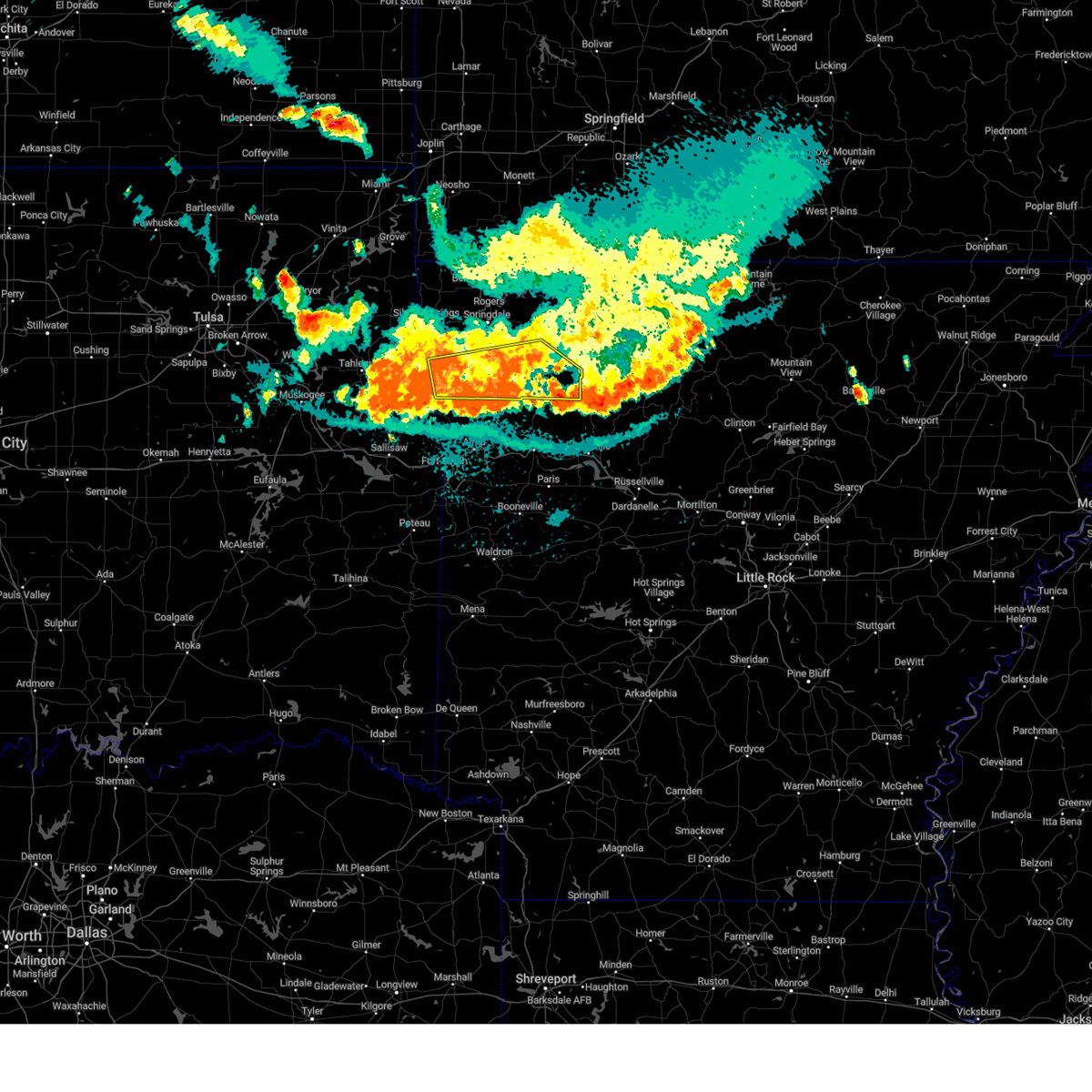 At 1034 pm cdt, severe thunderstorms were located along a line extending from near huntsville to near brentwood to 7 miles southwest of lincoln, moving south at 40 mph (radar indicated). Hazards include 60 mph wind gusts and nickel size hail. Expect damage to roofs, siding, and trees. locations in or near the path include, fayetteville, prairie grove, elkins, west fork, lincoln, greenland, winslow, st. Paul, wesley, saint paul, blackburn, aurora, boston, devils den state park, pettigrew, brentwood, japton, strickler, witter, drake field airport, this includes interstate 49 between mile markers 42 and 59. At 1034 pm cdt, severe thunderstorms were located along a line extending from near huntsville to near brentwood to 7 miles southwest of lincoln, moving south at 40 mph (radar indicated). Hazards include 60 mph wind gusts and nickel size hail. Expect damage to roofs, siding, and trees. locations in or near the path include, fayetteville, prairie grove, elkins, west fork, lincoln, greenland, winslow, st. Paul, wesley, saint paul, blackburn, aurora, boston, devils den state park, pettigrew, brentwood, japton, strickler, witter, drake field airport, this includes interstate 49 between mile markers 42 and 59.
|
| 8/16/2024 10:09 PM CDT |
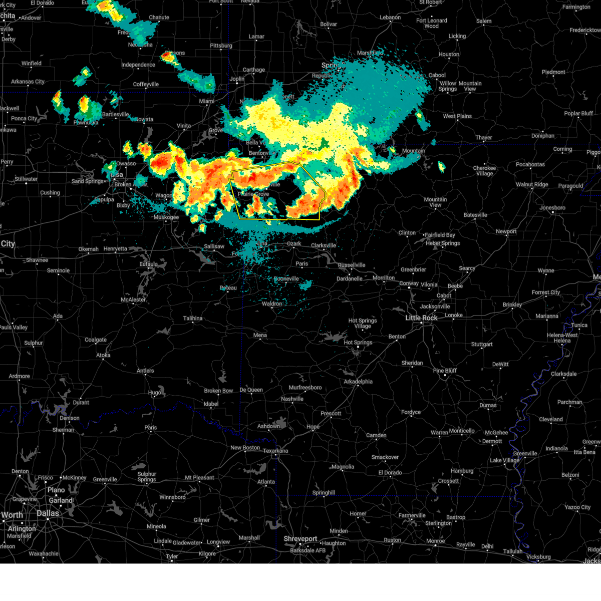 Svrtsa the national weather service in tulsa has issued a * severe thunderstorm warning for, southern benton county in northwestern arkansas, madison county in northwestern arkansas, washington county in northwestern arkansas, northeastern adair county in northeastern oklahoma, * until 1100 pm cdt. * at 1009 pm cdt, severe thunderstorms were located along a line extending from 4 miles north of clifty to near fayetteville to 3 miles north of cincinnati, moving southeast at 35 mph (radar indicated). Hazards include 60 mph wind gusts and quarter size hail. Hail damage to vehicles is expected. expect wind damage to roofs, siding, and trees. locations in or near the path include, fayetteville, springdale, rogers, siloam springs, huntsville, lowell, farmington, prairie grove, elkins, tontitown, west fork, lincoln, cave springs, greenland, highfill, winslow, watts, st. Paul, hindsville, wesley, this includes interstate 49 between mile markers 42 and 80. Svrtsa the national weather service in tulsa has issued a * severe thunderstorm warning for, southern benton county in northwestern arkansas, madison county in northwestern arkansas, washington county in northwestern arkansas, northeastern adair county in northeastern oklahoma, * until 1100 pm cdt. * at 1009 pm cdt, severe thunderstorms were located along a line extending from 4 miles north of clifty to near fayetteville to 3 miles north of cincinnati, moving southeast at 35 mph (radar indicated). Hazards include 60 mph wind gusts and quarter size hail. Hail damage to vehicles is expected. expect wind damage to roofs, siding, and trees. locations in or near the path include, fayetteville, springdale, rogers, siloam springs, huntsville, lowell, farmington, prairie grove, elkins, tontitown, west fork, lincoln, cave springs, greenland, highfill, winslow, watts, st. Paul, hindsville, wesley, this includes interstate 49 between mile markers 42 and 80.
|
| 8/16/2024 10:02 PM CDT |
 the severe thunderstorm warning has been cancelled and is no longer in effect the severe thunderstorm warning has been cancelled and is no longer in effect
|
| 8/16/2024 10:02 PM CDT |
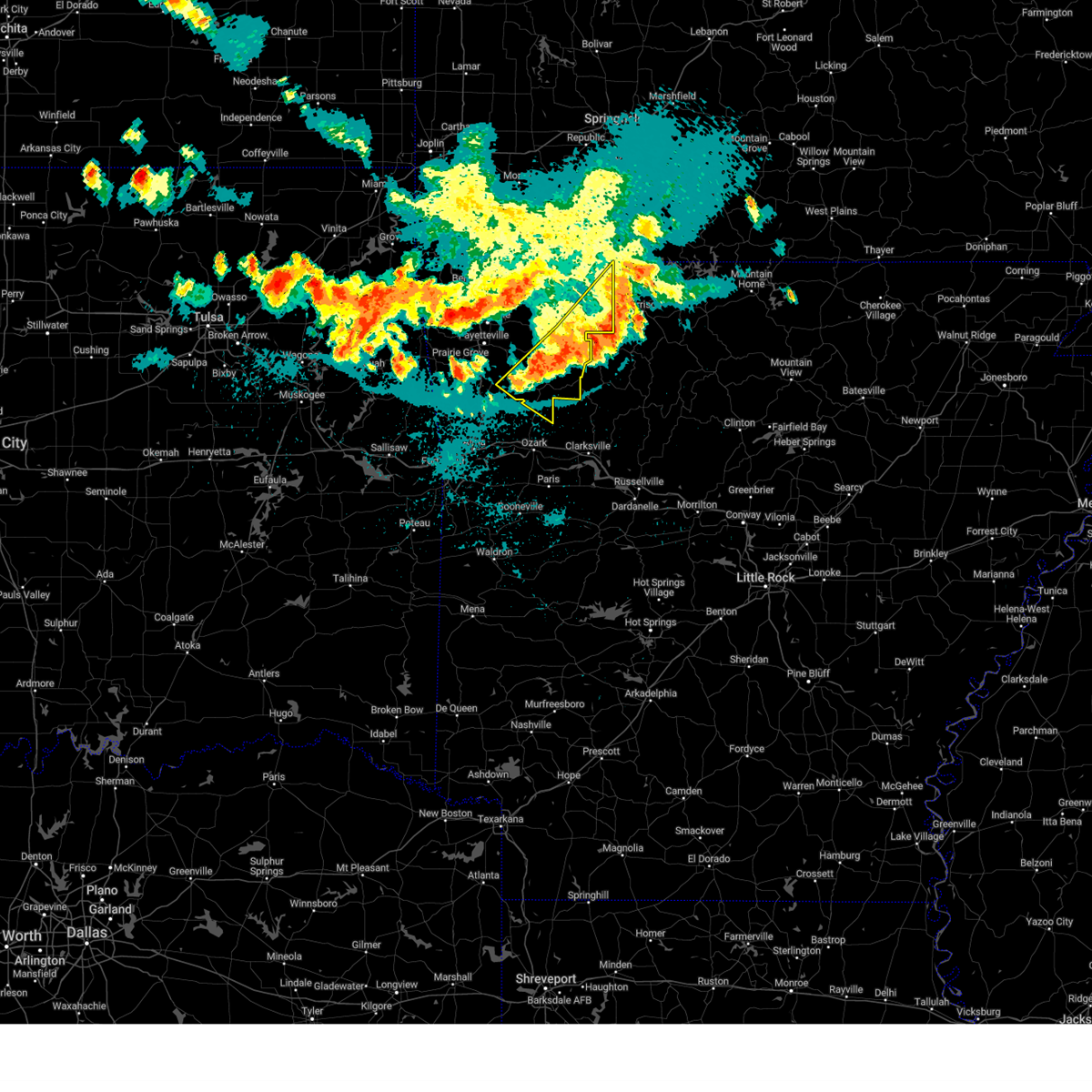 At 1001 pm cdt, severe thunderstorms were located along a line extending from 3 miles east of harrison to 3 miles southeast of upper buffalo wilderness area to 2 miles east of st. paul, moving southeast at 45 mph (radar indicated). Hazards include 60 mph wind gusts and quarter size hail. Hail damage to vehicles is expected. expect wind damage to roofs, siding, and trees. locations in or near the path include, huntsville, green forest, st. Paul, carrollton, rudd, saint paul, kingston, aurora, boston, pettigrew, japton, witter, marble, osage, rule, georgetown, dryfork, red star, metalton, connor,. At 1001 pm cdt, severe thunderstorms were located along a line extending from 3 miles east of harrison to 3 miles southeast of upper buffalo wilderness area to 2 miles east of st. paul, moving southeast at 45 mph (radar indicated). Hazards include 60 mph wind gusts and quarter size hail. Hail damage to vehicles is expected. expect wind damage to roofs, siding, and trees. locations in or near the path include, huntsville, green forest, st. Paul, carrollton, rudd, saint paul, kingston, aurora, boston, pettigrew, japton, witter, marble, osage, rule, georgetown, dryfork, red star, metalton, connor,.
|
| 8/16/2024 9:42 PM CDT |
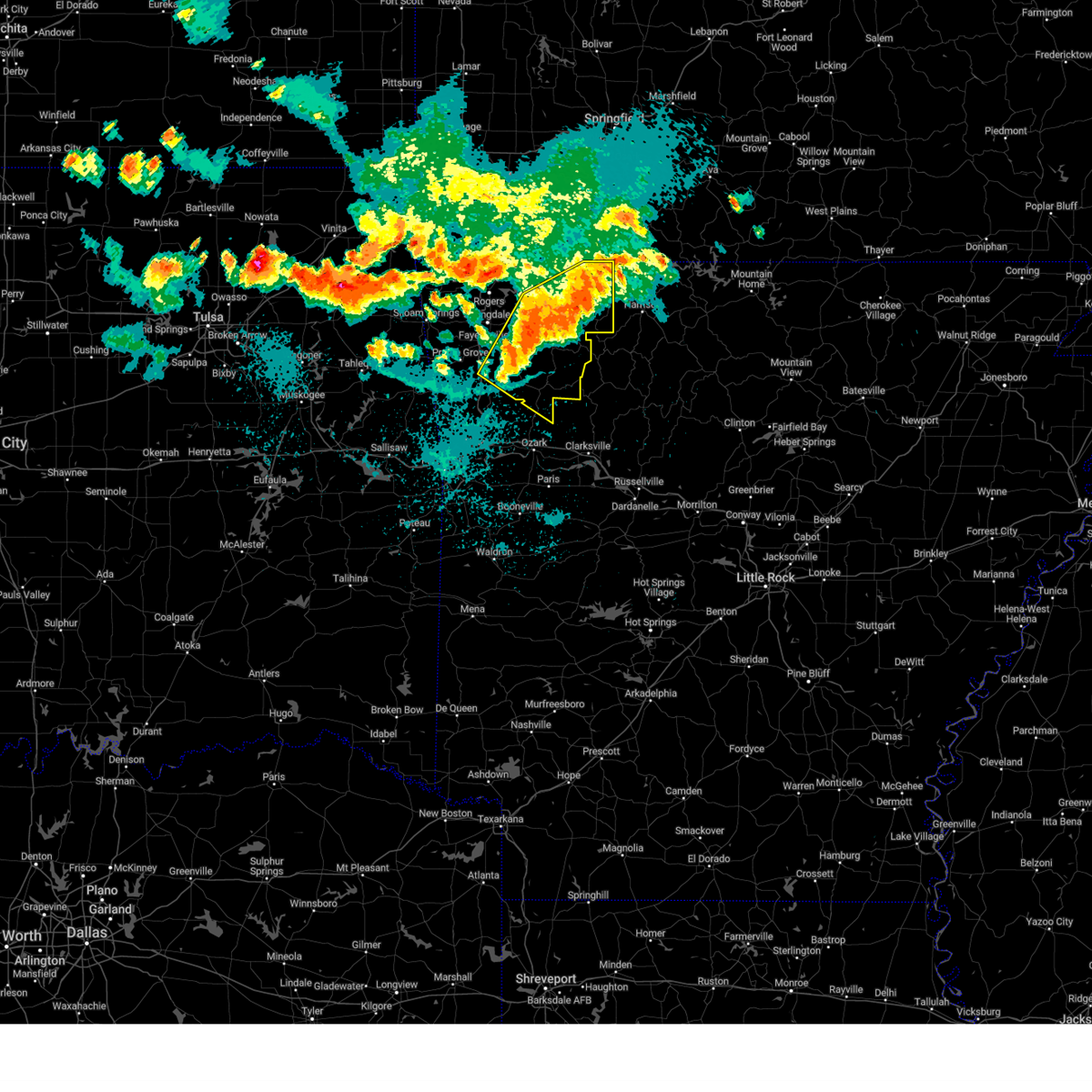 At 942 pm cdt, severe thunderstorms were located along a line extending from 7 miles northeast of carrollton to kingston to near saint paul, moving southeast at 45 mph (radar indicated). Hazards include 60 mph wind gusts and quarter size hail. Hail damage to vehicles is expected. expect wind damage to roofs, siding, and trees. locations in or near the path include, fayetteville, berryville, huntsville, eureka springs, green forest, elkins, west fork, st. Paul, hindsville, wesley, carrollton, rudd, saint paul, forum, aurora, hobbs state park, clifty, boston, withrow springs state park, war eagle, this includes interstate 49 near mile marker 51. At 942 pm cdt, severe thunderstorms were located along a line extending from 7 miles northeast of carrollton to kingston to near saint paul, moving southeast at 45 mph (radar indicated). Hazards include 60 mph wind gusts and quarter size hail. Hail damage to vehicles is expected. expect wind damage to roofs, siding, and trees. locations in or near the path include, fayetteville, berryville, huntsville, eureka springs, green forest, elkins, west fork, st. Paul, hindsville, wesley, carrollton, rudd, saint paul, forum, aurora, hobbs state park, clifty, boston, withrow springs state park, war eagle, this includes interstate 49 near mile marker 51.
|
| 8/16/2024 9:24 PM CDT |
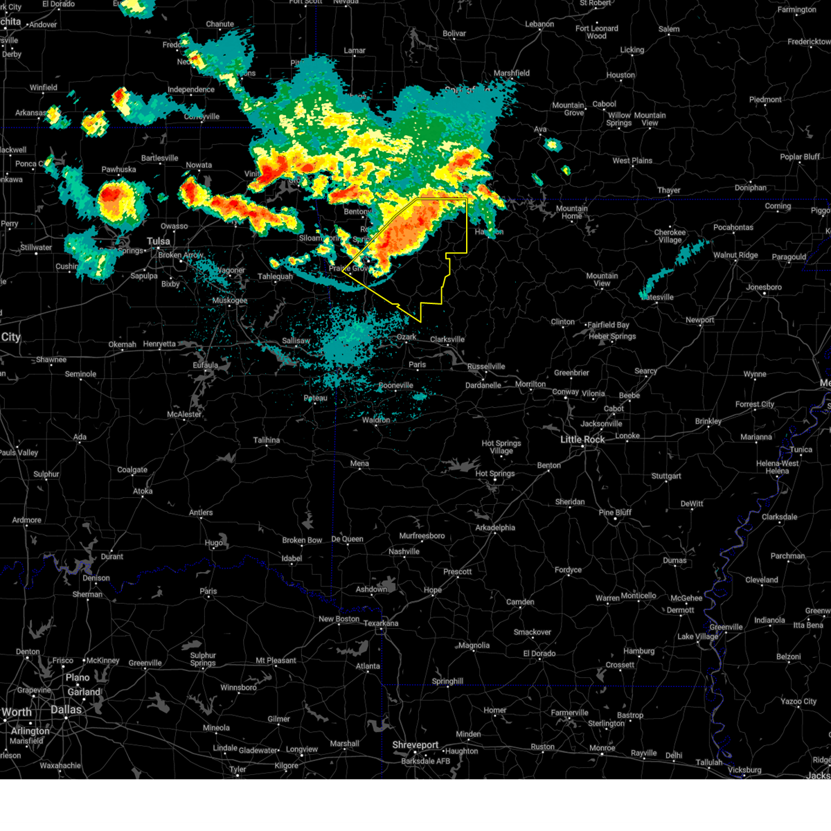 Svrtsa the national weather service in tulsa has issued a * severe thunderstorm warning for, east central benton county in northwestern arkansas, madison county in northwestern arkansas, northeastern franklin county in west central arkansas, carroll county in northwestern arkansas, eastern washington county in northwestern arkansas, * until 1015 pm cdt. * at 923 pm cdt, severe thunderstorms were located along a line extending from 5 miles northeast of urbanette to near forum to 4 miles south of elkins, moving southeast at 45 mph (radar indicated). Hazards include 60 mph wind gusts and quarter size hail. Hail damage to vehicles is expected. expect wind damage to roofs, siding, and trees. locations in or near the path include, fayetteville, springdale, berryville, huntsville, eureka springs, farmington, prairie grove, green forest, elkins, west fork, greenland, st. Paul, beaver, hindsville, wesley, carrollton, rudd, saint paul, forum, aurora, this includes interstate 49 between mile markers 50 and 70. Svrtsa the national weather service in tulsa has issued a * severe thunderstorm warning for, east central benton county in northwestern arkansas, madison county in northwestern arkansas, northeastern franklin county in west central arkansas, carroll county in northwestern arkansas, eastern washington county in northwestern arkansas, * until 1015 pm cdt. * at 923 pm cdt, severe thunderstorms were located along a line extending from 5 miles northeast of urbanette to near forum to 4 miles south of elkins, moving southeast at 45 mph (radar indicated). Hazards include 60 mph wind gusts and quarter size hail. Hail damage to vehicles is expected. expect wind damage to roofs, siding, and trees. locations in or near the path include, fayetteville, springdale, berryville, huntsville, eureka springs, farmington, prairie grove, green forest, elkins, west fork, greenland, st. Paul, beaver, hindsville, wesley, carrollton, rudd, saint paul, forum, aurora, this includes interstate 49 between mile markers 50 and 70.
|
| 5/22/2024 10:12 AM CDT |
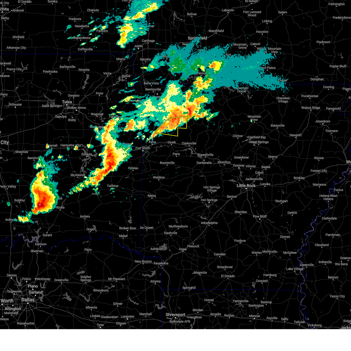 At 1012 am cdt, a severe thunderstorm was located 3 miles west of saint paul, moving east at 45 mph (radar indicated). Hazards include 60 mph wind gusts and penny size hail. Expect damage to roofs, siding, and trees. locations in or near the path include, st. Paul, cass, saint paul, pettigrew, witter, boston, dutton, bidville, red star, redding, weathers, delaney, brashears, crosses, patrick, combs, turners bend, mount gayler, taft,. At 1012 am cdt, a severe thunderstorm was located 3 miles west of saint paul, moving east at 45 mph (radar indicated). Hazards include 60 mph wind gusts and penny size hail. Expect damage to roofs, siding, and trees. locations in or near the path include, st. Paul, cass, saint paul, pettigrew, witter, boston, dutton, bidville, red star, redding, weathers, delaney, brashears, crosses, patrick, combs, turners bend, mount gayler, taft,.
|
| 5/22/2024 9:53 AM CDT |
 Svrtsa the national weather service in tulsa has issued a * severe thunderstorm warning for, southern madison county in northwestern arkansas, northeastern franklin county in west central arkansas, northeastern crawford county in northwestern arkansas, southeastern washington county in northwestern arkansas, * until 1045 am cdt. * at 953 am cdt, a severe thunderstorm was located near winslow, moving east at 45 mph (radar indicated). Hazards include 60 mph wind gusts and nickel size hail. Expect damage to roofs, siding, and trees. locations in or near the path include, west fork, winslow, st. Paul, cass, saint paul, boston, pettigrew, brentwood, witter, bidville, woolsey, red star, crosses, combs, turners bend, mount gayler, dutton, wyola, redding, weathers, this includes interstate 49 between mile markers 36 and 50. Svrtsa the national weather service in tulsa has issued a * severe thunderstorm warning for, southern madison county in northwestern arkansas, northeastern franklin county in west central arkansas, northeastern crawford county in northwestern arkansas, southeastern washington county in northwestern arkansas, * until 1045 am cdt. * at 953 am cdt, a severe thunderstorm was located near winslow, moving east at 45 mph (radar indicated). Hazards include 60 mph wind gusts and nickel size hail. Expect damage to roofs, siding, and trees. locations in or near the path include, west fork, winslow, st. Paul, cass, saint paul, boston, pettigrew, brentwood, witter, bidville, woolsey, red star, crosses, combs, turners bend, mount gayler, dutton, wyola, redding, weathers, this includes interstate 49 between mile markers 36 and 50.
|
| 5/21/2024 4:03 PM CDT |
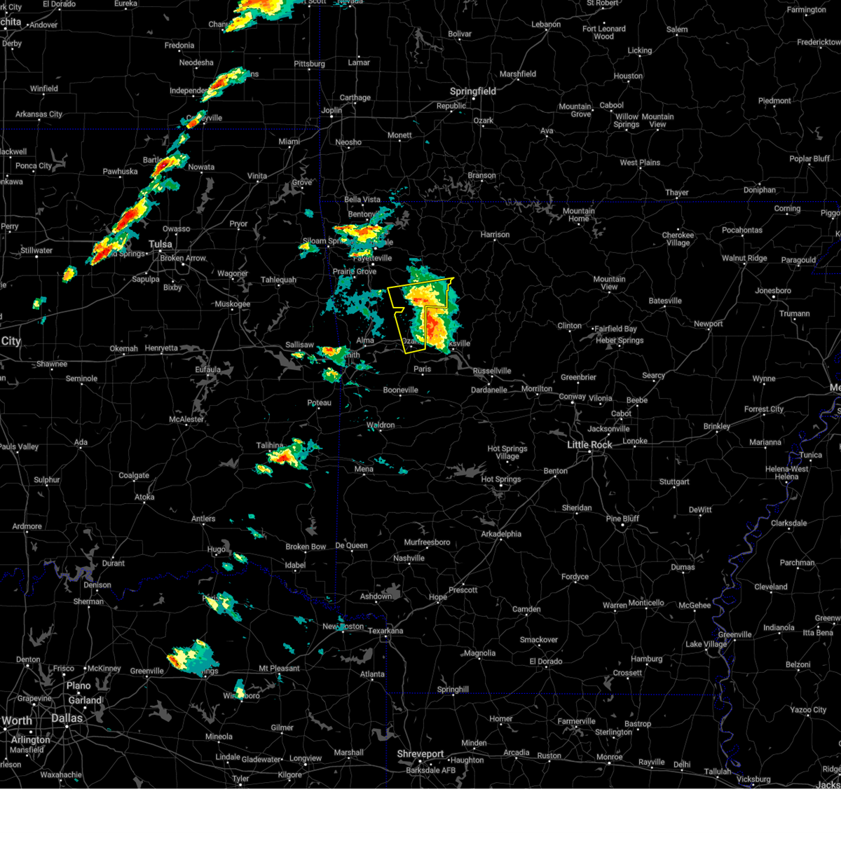 the severe thunderstorm warning has been cancelled and is no longer in effect the severe thunderstorm warning has been cancelled and is no longer in effect
|
| 5/21/2024 3:48 PM CDT |
 At 348 pm cdt, severe thunderstorms were located along a line extending from 6 miles east of brentwood to 3 miles northwest of ozark, moving east at 65 mph (radar indicated). Hazards include 60 mph wind gusts and quarter size hail. Hail damage to vehicles is expected. expect wind damage to roofs, siding, and trees. locations in or near the path include, ozark, altus, st. Paul, wiederkehr village, cass, saint paul, boston, pettigrew, witter, jethro, red star, crosses, combs, turners bend, dutton, barnes, redding, weathers, watalula, delaney, this includes interstate 40 in arkansas between mile markers 31 and 42. At 348 pm cdt, severe thunderstorms were located along a line extending from 6 miles east of brentwood to 3 miles northwest of ozark, moving east at 65 mph (radar indicated). Hazards include 60 mph wind gusts and quarter size hail. Hail damage to vehicles is expected. expect wind damage to roofs, siding, and trees. locations in or near the path include, ozark, altus, st. Paul, wiederkehr village, cass, saint paul, boston, pettigrew, witter, jethro, red star, crosses, combs, turners bend, dutton, barnes, redding, weathers, watalula, delaney, this includes interstate 40 in arkansas between mile markers 31 and 42.
|
| 5/21/2024 3:48 PM CDT |
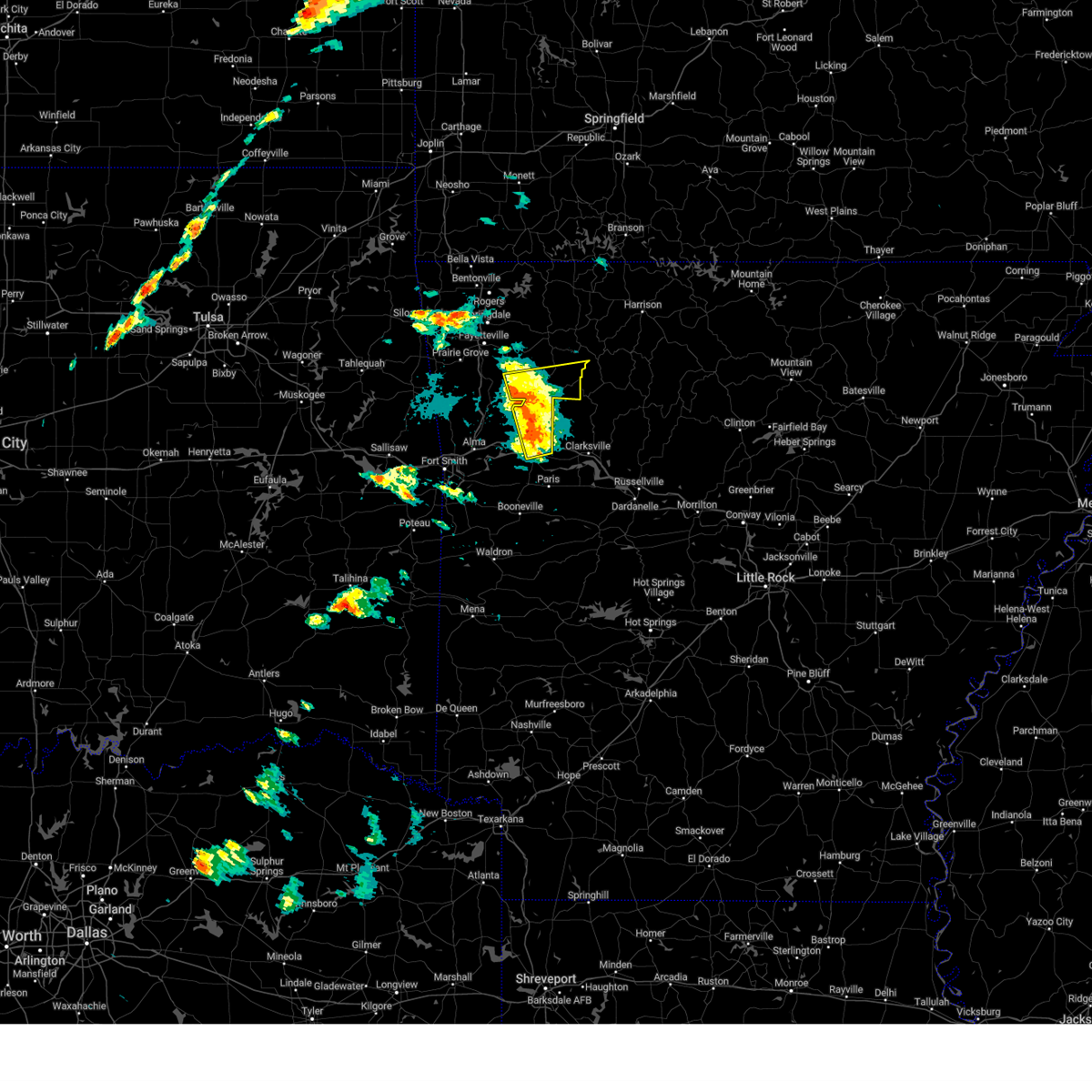 the severe thunderstorm warning has been cancelled and is no longer in effect the severe thunderstorm warning has been cancelled and is no longer in effect
|
| 5/21/2024 3:41 PM CDT |
 At 341 pm cdt, severe thunderstorms were located along a line extending from 2 miles northeast of winslow to 5 miles east of mulberry, moving east at 65 mph (radar indicated). Hazards include 60 mph wind gusts and quarter size hail. Hail damage to vehicles is expected. expect wind damage to roofs, siding, and trees. locations in or near the path include, ozark, west fork, mulberry, altus, winslow, st. paul, wiederkehr village, cass, saint paul, kingston, aurora, boston, pettigrew, brentwood, japton, witter, fern, georgetown, jethro, bidville, this includes the following highways, interstate 40 in arkansas between mile markers 23 and 42. Interstate 49 between mile markers 48 and 51. At 341 pm cdt, severe thunderstorms were located along a line extending from 2 miles northeast of winslow to 5 miles east of mulberry, moving east at 65 mph (radar indicated). Hazards include 60 mph wind gusts and quarter size hail. Hail damage to vehicles is expected. expect wind damage to roofs, siding, and trees. locations in or near the path include, ozark, west fork, mulberry, altus, winslow, st. paul, wiederkehr village, cass, saint paul, kingston, aurora, boston, pettigrew, brentwood, japton, witter, fern, georgetown, jethro, bidville, this includes the following highways, interstate 40 in arkansas between mile markers 23 and 42. Interstate 49 between mile markers 48 and 51.
|
| 5/21/2024 3:34 PM CDT |
 Svrtsa the national weather service in tulsa has issued a * severe thunderstorm warning for, madison county in northwestern arkansas, franklin county in west central arkansas, eastern crawford county in northwestern arkansas, southeastern washington county in northwestern arkansas, * until 415 pm cdt. * at 334 pm cdt, severe thunderstorms were located along a line extending from near blackburn to 2 miles south of mulberry, moving east at 65 mph (radar indicated). Hazards include 60 mph wind gusts and half dollar size hail. Hail damage to vehicles is expected. expect wind damage to roofs, siding, and trees. locations in or near the path include, ozark, huntsville, mountainburg, west fork, mulberry, dyer, altus, winslow, chester, st. paul, wiederkehr village, saint paul, aurora, boston, devils den state park, brentwood, lake fort smith, cass, kingston, blackburn, this includes the following highways, interstate 40 in arkansas between mile markers 18 and 42. Interstate 49 between mile markers 30 and 52. Svrtsa the national weather service in tulsa has issued a * severe thunderstorm warning for, madison county in northwestern arkansas, franklin county in west central arkansas, eastern crawford county in northwestern arkansas, southeastern washington county in northwestern arkansas, * until 415 pm cdt. * at 334 pm cdt, severe thunderstorms were located along a line extending from near blackburn to 2 miles south of mulberry, moving east at 65 mph (radar indicated). Hazards include 60 mph wind gusts and half dollar size hail. Hail damage to vehicles is expected. expect wind damage to roofs, siding, and trees. locations in or near the path include, ozark, huntsville, mountainburg, west fork, mulberry, dyer, altus, winslow, chester, st. paul, wiederkehr village, saint paul, aurora, boston, devils den state park, brentwood, lake fort smith, cass, kingston, blackburn, this includes the following highways, interstate 40 in arkansas between mile markers 18 and 42. Interstate 49 between mile markers 30 and 52.
|
| 5/7/2024 3:23 AM CDT |
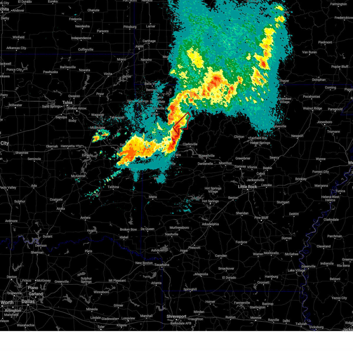 At 323 am cdt, a severe thunderstorm capable of producing a tornado was located 3 miles southwest of pettigrew, moving northeast at 45 mph (radar indicated rotation). Hazards include tornado and quarter size hail. Flying debris will be dangerous to those caught without shelter. mobile homes will be damaged or destroyed. damage to roofs, windows, and vehicles will occur. tree damage is likely. locations in or near the path include, st. Paul, saint paul, pettigrew, boston, dutton, red star, weathers,. At 323 am cdt, a severe thunderstorm capable of producing a tornado was located 3 miles southwest of pettigrew, moving northeast at 45 mph (radar indicated rotation). Hazards include tornado and quarter size hail. Flying debris will be dangerous to those caught without shelter. mobile homes will be damaged or destroyed. damage to roofs, windows, and vehicles will occur. tree damage is likely. locations in or near the path include, st. Paul, saint paul, pettigrew, boston, dutton, red star, weathers,.
|
| 5/7/2024 3:22 AM CDT |
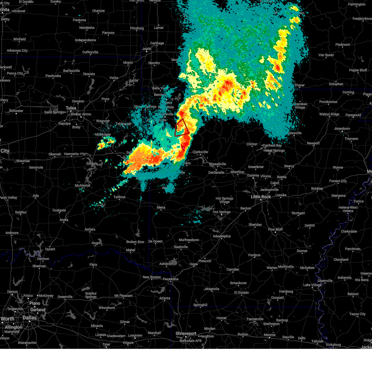 The storm which prompted the warning has weakened below severe limits, and no longer appears capable of producing a tornado. therefore, the warning will be allowed to expire. a tornado watch remains in effect until 500 am cdt for northwestern and west central arkansas. The storm which prompted the warning has weakened below severe limits, and no longer appears capable of producing a tornado. therefore, the warning will be allowed to expire. a tornado watch remains in effect until 500 am cdt for northwestern and west central arkansas.
|
| 5/7/2024 3:14 AM CDT |
 the tornado warning has been cancelled and is no longer in effect the tornado warning has been cancelled and is no longer in effect
|
| 5/7/2024 3:14 AM CDT |
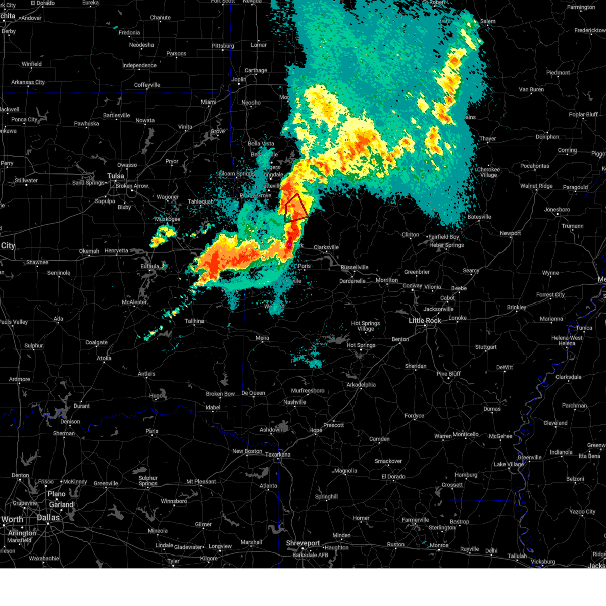 At 314 am cdt, a confirmed tornado was located 7 miles west of saint paul, moving northeast at 35 mph (radar confirmed tornado). Hazards include damaging tornado. Flying debris will be dangerous to those caught without shelter. mobile homes will be damaged or destroyed. damage to roofs, windows, and vehicles will occur. tree damage is likely. locations in or near the path include, st. Paul, saint paul, japton, georgetown, crosses, patrick, combs, delaney, brashears, dutton,. At 314 am cdt, a confirmed tornado was located 7 miles west of saint paul, moving northeast at 35 mph (radar confirmed tornado). Hazards include damaging tornado. Flying debris will be dangerous to those caught without shelter. mobile homes will be damaged or destroyed. damage to roofs, windows, and vehicles will occur. tree damage is likely. locations in or near the path include, st. Paul, saint paul, japton, georgetown, crosses, patrick, combs, delaney, brashears, dutton,.
|
| 5/7/2024 3:06 AM CDT |
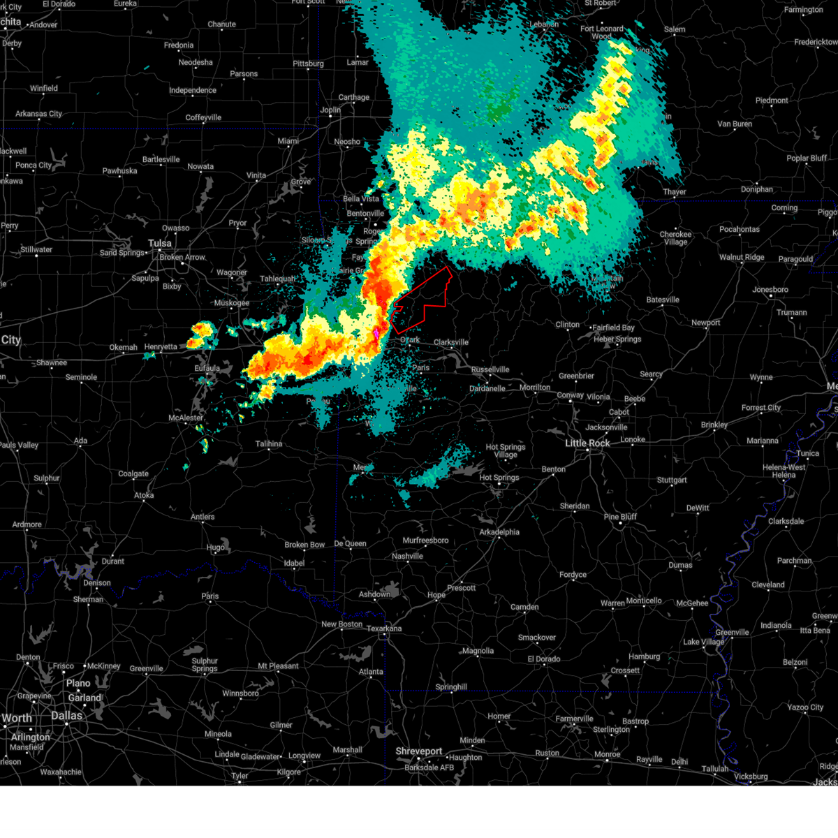 Tortsa the national weather service in tulsa has issued a * tornado warning for, southern madison county in northwestern arkansas, northeastern franklin county in west central arkansas, * until 345 am cdt. * at 306 am cdt, a confirmed tornado was located 5 miles west of cass, moving northeast at 35 mph (radar confirmed tornado). Hazards include damaging tornado and golf ball size hail. Flying debris will be dangerous to those caught without shelter. mobile homes will be damaged or destroyed. damage to roofs, windows, and vehicles will occur. tree damage is likely. locations in or near the path include, st. Paul, cass, saint paul, pettigrew, witter, boston, dutton, jethro, barnes, red star, redding, weathers, brashears, combs, turners bend, taft, paradise,. Tortsa the national weather service in tulsa has issued a * tornado warning for, southern madison county in northwestern arkansas, northeastern franklin county in west central arkansas, * until 345 am cdt. * at 306 am cdt, a confirmed tornado was located 5 miles west of cass, moving northeast at 35 mph (radar confirmed tornado). Hazards include damaging tornado and golf ball size hail. Flying debris will be dangerous to those caught without shelter. mobile homes will be damaged or destroyed. damage to roofs, windows, and vehicles will occur. tree damage is likely. locations in or near the path include, st. Paul, cass, saint paul, pettigrew, witter, boston, dutton, jethro, barnes, red star, redding, weathers, brashears, combs, turners bend, taft, paradise,.
|
| 5/7/2024 3:01 AM CDT |
 Tortsa the national weather service in tulsa has issued a * tornado warning for, southwestern madison county in northwestern arkansas, southeastern washington county in northwestern arkansas, * until 330 am cdt. * at 301 am cdt, a severe thunderstorm capable of producing a tornado was located 4 miles east of winslow, moving northeast at 35 mph (radar indicated rotation). Hazards include tornado. Flying debris will be dangerous to those caught without shelter. mobile homes will be damaged or destroyed. damage to roofs, windows, and vehicles will occur. tree damage is likely. locations in or near the path include, st. Paul, saint paul, japton, georgetown, crosses, patrick, combs, delaney, brashears, dutton,. Tortsa the national weather service in tulsa has issued a * tornado warning for, southwestern madison county in northwestern arkansas, southeastern washington county in northwestern arkansas, * until 330 am cdt. * at 301 am cdt, a severe thunderstorm capable of producing a tornado was located 4 miles east of winslow, moving northeast at 35 mph (radar indicated rotation). Hazards include tornado. Flying debris will be dangerous to those caught without shelter. mobile homes will be damaged or destroyed. damage to roofs, windows, and vehicles will occur. tree damage is likely. locations in or near the path include, st. Paul, saint paul, japton, georgetown, crosses, patrick, combs, delaney, brashears, dutton,.
|
| 4/26/2024 9:38 AM CDT |
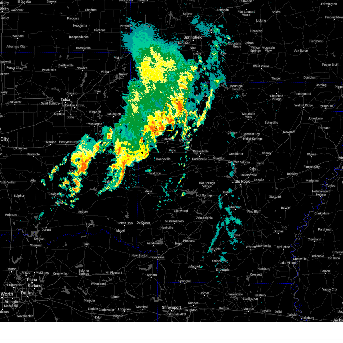 The storms which prompted the warning have weakened below severe limits, and no longer pose an immediate threat to life or property. therefore, the warning will be allowed to expire. however, gusty winds are still possible with these thunderstorms. The storms which prompted the warning have weakened below severe limits, and no longer pose an immediate threat to life or property. therefore, the warning will be allowed to expire. however, gusty winds are still possible with these thunderstorms.
|
| 4/26/2024 9:27 AM CDT |
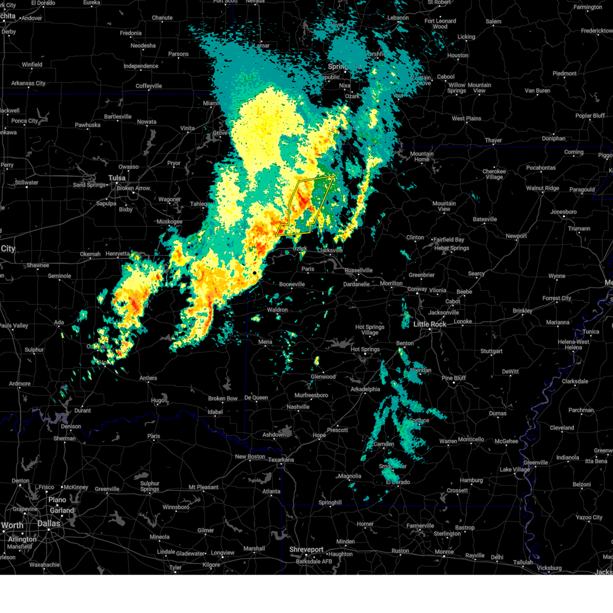 the severe thunderstorm warning has been cancelled and is no longer in effect the severe thunderstorm warning has been cancelled and is no longer in effect
|
| 4/26/2024 9:27 AM CDT |
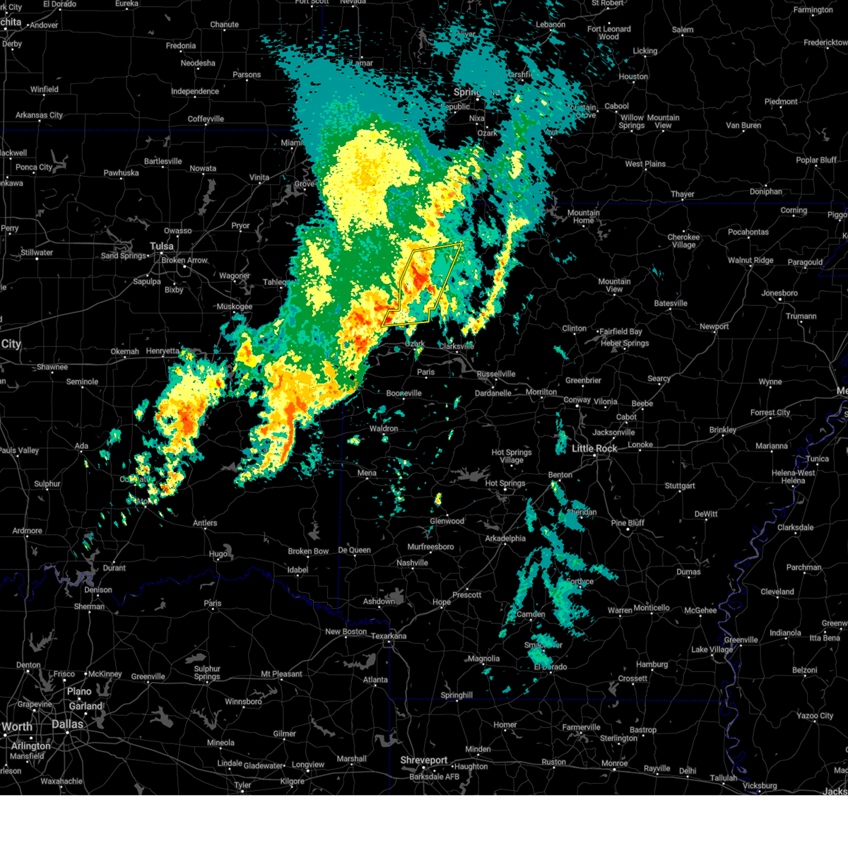 At 927 am cdt, severe thunderstorms were located along a line extending from 2 miles east of forum to 3 miles southwest of witter to 4 miles northeast of fern, moving east at 35 mph (radar indicated). Hazards include 60 mph wind gusts. Expect damage to roofs, siding, and trees. locations in or near the path include, huntsville, st. Paul, cass, saint paul, kingston, forum, aurora, withrow springs state park, pettigrew, japton, witter, marble, rudd, georgetown, dryfork, bidville, alabam, crosses, combs, locke,. At 927 am cdt, severe thunderstorms were located along a line extending from 2 miles east of forum to 3 miles southwest of witter to 4 miles northeast of fern, moving east at 35 mph (radar indicated). Hazards include 60 mph wind gusts. Expect damage to roofs, siding, and trees. locations in or near the path include, huntsville, st. Paul, cass, saint paul, kingston, forum, aurora, withrow springs state park, pettigrew, japton, witter, marble, rudd, georgetown, dryfork, bidville, alabam, crosses, combs, locke,.
|
| 4/26/2024 9:00 AM CDT |
 Svrtsa the national weather service in tulsa has issued a * severe thunderstorm warning for, madison county in northwestern arkansas, northern franklin county in west central arkansas, south central carroll county in northwestern arkansas, northeastern crawford county in northwestern arkansas, southeastern washington county in northwestern arkansas, * until 945 am cdt. * at 900 am cdt, severe thunderstorms were located along a line extending from 5 miles north of wesley to near chester, moving east at 40 mph (radar indicated). Hazards include 60 mph wind gusts. Expect damage to roofs, siding, and trees. locations in or near the path include, huntsville, mountainburg, elkins, winslow, chester, st. Paul, hindsville, wesley, cass, rudd, saint paul, kingston, forum, aurora, withrow springs state park, pettigrew, brentwood, japton, lake fort smith, witter, this includes interstate 49 between mile markers 32 and 42. Svrtsa the national weather service in tulsa has issued a * severe thunderstorm warning for, madison county in northwestern arkansas, northern franklin county in west central arkansas, south central carroll county in northwestern arkansas, northeastern crawford county in northwestern arkansas, southeastern washington county in northwestern arkansas, * until 945 am cdt. * at 900 am cdt, severe thunderstorms were located along a line extending from 5 miles north of wesley to near chester, moving east at 40 mph (radar indicated). Hazards include 60 mph wind gusts. Expect damage to roofs, siding, and trees. locations in or near the path include, huntsville, mountainburg, elkins, winslow, chester, st. Paul, hindsville, wesley, cass, rudd, saint paul, kingston, forum, aurora, withrow springs state park, pettigrew, brentwood, japton, lake fort smith, witter, this includes interstate 49 between mile markers 32 and 42.
|
| 4/2/2024 1:50 AM CDT |
 At 149 am cdt, a severe thunderstorm with strong low level rotation that could produce a tornado at any time was located 5 miles southwest of japton, moving east at 55 mph (radar indicated rotation). Hazards include tornado and quarter size hail. Flying debris will be dangerous to those caught without shelter. mobile homes will be damaged or destroyed. damage to roofs, windows, and vehicles will occur. tree damage is likely. locations in or near the path include, st. Paul, saint paul, japton, kingston, witter, aurora, boston, red star, weathers, delaney, brashears, crosses, patrick, combs,. At 149 am cdt, a severe thunderstorm with strong low level rotation that could produce a tornado at any time was located 5 miles southwest of japton, moving east at 55 mph (radar indicated rotation). Hazards include tornado and quarter size hail. Flying debris will be dangerous to those caught without shelter. mobile homes will be damaged or destroyed. damage to roofs, windows, and vehicles will occur. tree damage is likely. locations in or near the path include, st. Paul, saint paul, japton, kingston, witter, aurora, boston, red star, weathers, delaney, brashears, crosses, patrick, combs,.
|
| 4/2/2024 1:50 AM CDT |
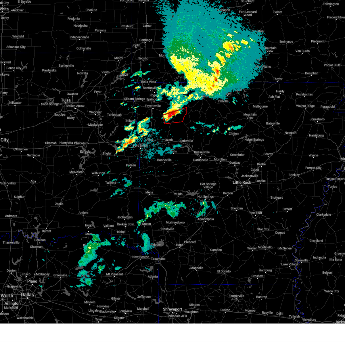 the tornado warning has been cancelled and is no longer in effect the tornado warning has been cancelled and is no longer in effect
|
| 4/2/2024 1:34 AM CDT |
 Tortsa the national weather service in tulsa has issued a * tornado warning for, southern madison county in northwestern arkansas, southeastern washington county in northwestern arkansas, * until 230 am cdt. * at 134 am cdt, a severe thunderstorm capable of producing a tornado was located near brentwood, moving east at 50 mph (radar indicated rotation). Hazards include tornado and quarter size hail. Flying debris will be dangerous to those caught without shelter. mobile homes will be damaged or destroyed. damage to roofs, windows, and vehicles will occur. tree damage is likely. locations in or near the path include, west fork, winslow, st. Paul, saint paul, brentwood, japton, kingston, witter, aurora, boston, wyola, woolsey, red star, weathers, delaney, arnett, crosses, patrick, combs, durham, this includes interstate 49 between mile markers 45 and 50. Tortsa the national weather service in tulsa has issued a * tornado warning for, southern madison county in northwestern arkansas, southeastern washington county in northwestern arkansas, * until 230 am cdt. * at 134 am cdt, a severe thunderstorm capable of producing a tornado was located near brentwood, moving east at 50 mph (radar indicated rotation). Hazards include tornado and quarter size hail. Flying debris will be dangerous to those caught without shelter. mobile homes will be damaged or destroyed. damage to roofs, windows, and vehicles will occur. tree damage is likely. locations in or near the path include, west fork, winslow, st. Paul, saint paul, brentwood, japton, kingston, witter, aurora, boston, wyola, woolsey, red star, weathers, delaney, arnett, crosses, patrick, combs, durham, this includes interstate 49 between mile markers 45 and 50.
|
| 3/14/2024 4:06 PM CDT |
 The storms which prompted the warning have weakened below severe limits, and no longer pose an immediate threat to life or property. therefore, the warning will be allowed to expire. however, small hail is still possible with these thunderstorms. a tornado watch remains in effect until 600 pm cdt for northeastern oklahoma. a tornado watch also remains in effect until 900 pm cdt for northwestern and west central arkansas. The storms which prompted the warning have weakened below severe limits, and no longer pose an immediate threat to life or property. therefore, the warning will be allowed to expire. however, small hail is still possible with these thunderstorms. a tornado watch remains in effect until 600 pm cdt for northeastern oklahoma. a tornado watch also remains in effect until 900 pm cdt for northwestern and west central arkansas.
|
| 3/14/2024 3:29 PM CDT |
 Svrtsa the national weather service in tulsa has issued a * severe thunderstorm warning for, madison county in northwestern arkansas, northern franklin county in west central arkansas, southeastern carroll county in northwestern arkansas, northern crawford county in northwestern arkansas, washington county in northwestern arkansas, southeastern adair county in northeastern oklahoma, * until 415 pm cdt. * at 329 pm cdt, severe thunderstorms were located along a line extending from near lowell to 2 miles northeast of blackburn to 7 miles northwest of short, moving east at 50 mph (radar indicated). Hazards include 60 mph wind gusts and quarter size hail. Hail damage to vehicles is expected. expect wind damage to roofs, siding, and trees. locations in or near the path include, fayetteville, springdale, huntsville, mountainburg, natural dam, farmington, prairie grove, elkins, tontitown, west fork, lincoln, greenland, winslow, chester, st. Paul, hindsville, wesley, rudd, saint paul, forum, this includes interstate 49 between mile markers 32 and 73. Svrtsa the national weather service in tulsa has issued a * severe thunderstorm warning for, madison county in northwestern arkansas, northern franklin county in west central arkansas, southeastern carroll county in northwestern arkansas, northern crawford county in northwestern arkansas, washington county in northwestern arkansas, southeastern adair county in northeastern oklahoma, * until 415 pm cdt. * at 329 pm cdt, severe thunderstorms were located along a line extending from near lowell to 2 miles northeast of blackburn to 7 miles northwest of short, moving east at 50 mph (radar indicated). Hazards include 60 mph wind gusts and quarter size hail. Hail damage to vehicles is expected. expect wind damage to roofs, siding, and trees. locations in or near the path include, fayetteville, springdale, huntsville, mountainburg, natural dam, farmington, prairie grove, elkins, tontitown, west fork, lincoln, greenland, winslow, chester, st. Paul, hindsville, wesley, rudd, saint paul, forum, this includes interstate 49 between mile markers 32 and 73.
|
| 8/7/2023 5:52 AM CDT |
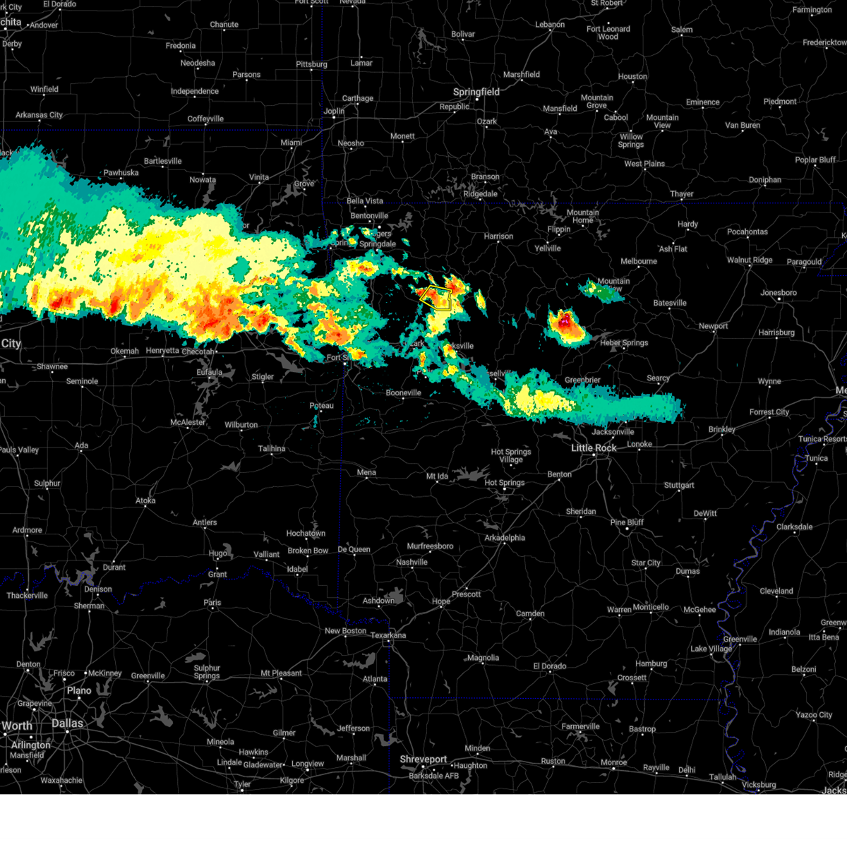 At 552 am cdt, a severe thunderstorm was located 3 miles northwest of pettigrew, moving east at 35 mph (radar indicated). Hazards include 60 mph wind gusts and half dollar size hail. Hail damage to vehicles is expected. expect wind damage to roofs, siding, and trees. locations in or near the path include, st. paul, pettigrew, boston, dutton, red star, hail threat, radar indicated max hail size, 1. 25 in wind threat, radar indicated max wind gust, 60 mph. At 552 am cdt, a severe thunderstorm was located 3 miles northwest of pettigrew, moving east at 35 mph (radar indicated). Hazards include 60 mph wind gusts and half dollar size hail. Hail damage to vehicles is expected. expect wind damage to roofs, siding, and trees. locations in or near the path include, st. paul, pettigrew, boston, dutton, red star, hail threat, radar indicated max hail size, 1. 25 in wind threat, radar indicated max wind gust, 60 mph.
|
| 6/25/2023 4:23 PM CDT |
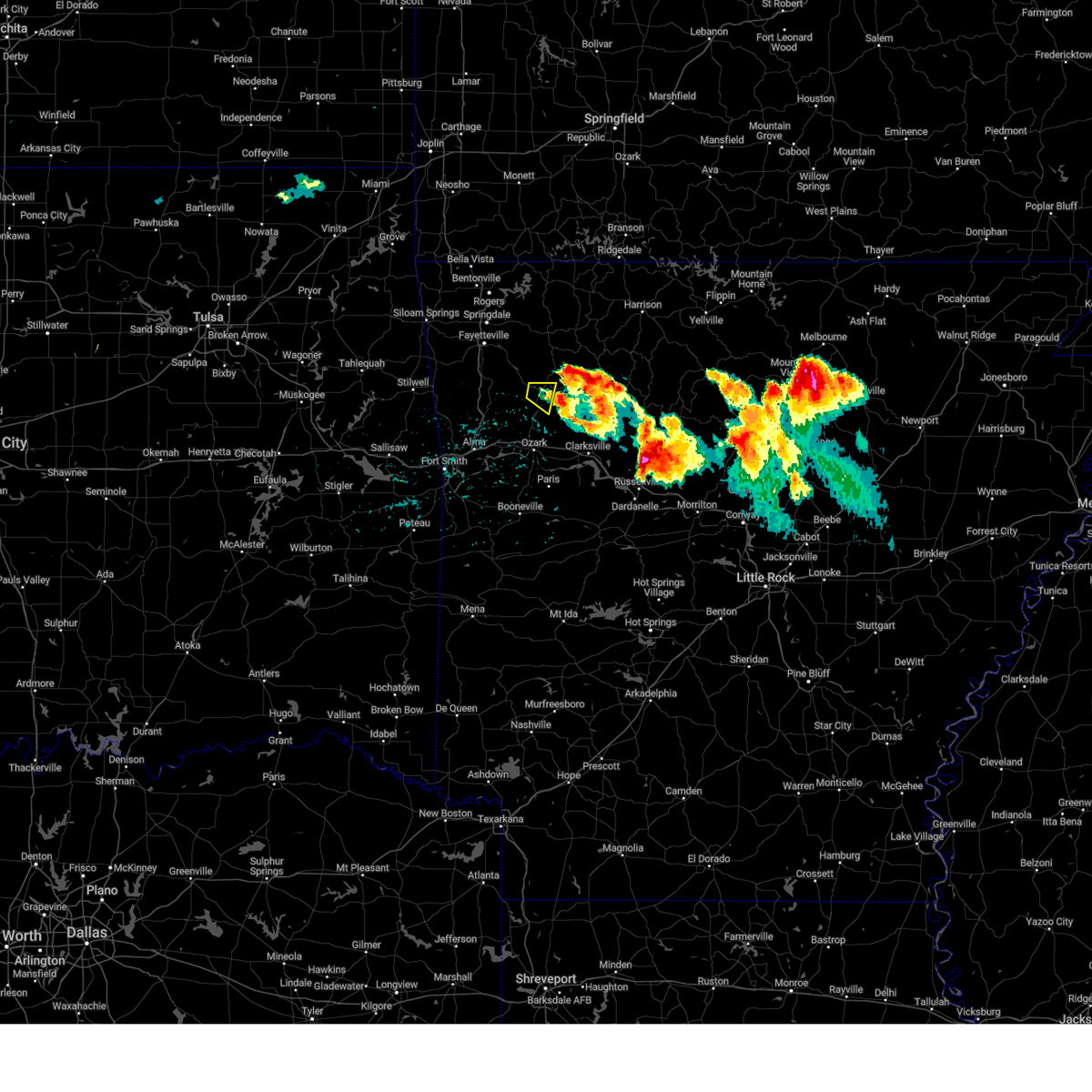 The severe thunderstorm warning for south central madison and northeastern franklin counties will expire at 430 pm cdt, the storm which prompted the warning has moved out of the area. therefore, the warning will be allowed to expire. a severe thunderstorm watch remains in effect until 1000 pm cdt for northwestern and west central arkansas. to report severe weather, contact your nearest law enforcement agency. they will relay your report to the national weather service tulsa. The severe thunderstorm warning for south central madison and northeastern franklin counties will expire at 430 pm cdt, the storm which prompted the warning has moved out of the area. therefore, the warning will be allowed to expire. a severe thunderstorm watch remains in effect until 1000 pm cdt for northwestern and west central arkansas. to report severe weather, contact your nearest law enforcement agency. they will relay your report to the national weather service tulsa.
|
| 6/25/2023 4:10 PM CDT |
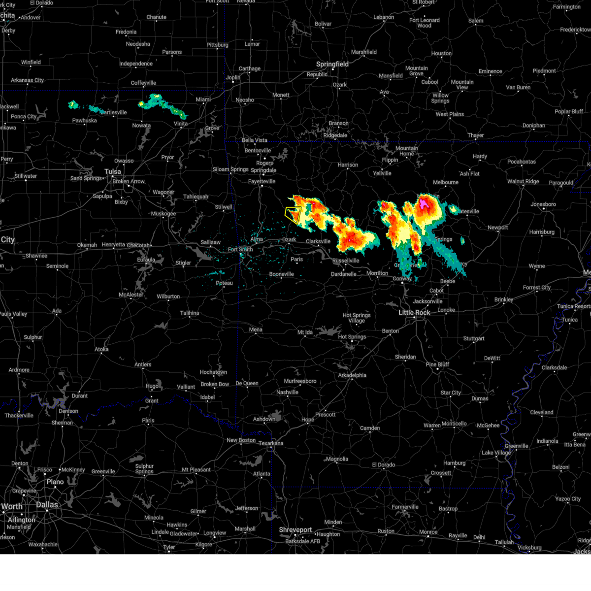 At 410 pm cdt, a severe thunderstorm was located over saint paul, moving east at 25 mph (radar indicated). Hazards include 60 mph wind gusts and quarter size hail. Hail damage to vehicles is expected. expect wind damage to roofs, siding, and trees. locations in or near the path include, st. paul, saint paul, dutton, brashears, combs, hail threat, radar indicated max hail size, 1. 00 in wind threat, radar indicated max wind gust, 60 mph. At 410 pm cdt, a severe thunderstorm was located over saint paul, moving east at 25 mph (radar indicated). Hazards include 60 mph wind gusts and quarter size hail. Hail damage to vehicles is expected. expect wind damage to roofs, siding, and trees. locations in or near the path include, st. paul, saint paul, dutton, brashears, combs, hail threat, radar indicated max hail size, 1. 00 in wind threat, radar indicated max wind gust, 60 mph.
|
| 6/25/2023 3:57 PM CDT |
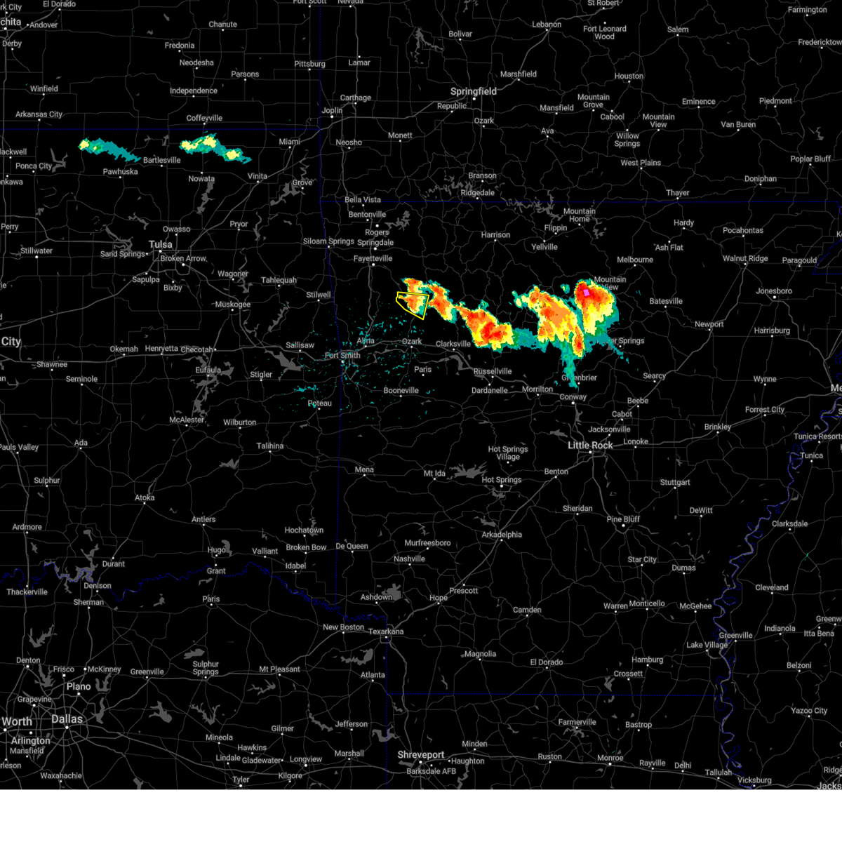 At 357 pm cdt, a severe thunderstorm was located 5 miles west of saint paul, moving east at 25 mph (radar indicated). Hazards include 60 mph wind gusts and half dollar size hail. Hail damage to vehicles is expected. expect wind damage to roofs, siding, and trees. locations in or near the path include, st. paul, saint paul, dutton, patrick, combs, delaney, brashears, hail threat, radar indicated max hail size, 1. 25 in wind threat, radar indicated max wind gust, 60 mph. At 357 pm cdt, a severe thunderstorm was located 5 miles west of saint paul, moving east at 25 mph (radar indicated). Hazards include 60 mph wind gusts and half dollar size hail. Hail damage to vehicles is expected. expect wind damage to roofs, siding, and trees. locations in or near the path include, st. paul, saint paul, dutton, patrick, combs, delaney, brashears, hail threat, radar indicated max hail size, 1. 25 in wind threat, radar indicated max wind gust, 60 mph.
|
| 6/25/2023 3:52 PM CDT | Ping Pong Ball sized hail reported 4.1 miles W of St. Paul, AR |
| 6/25/2023 3:46 PM CDT |
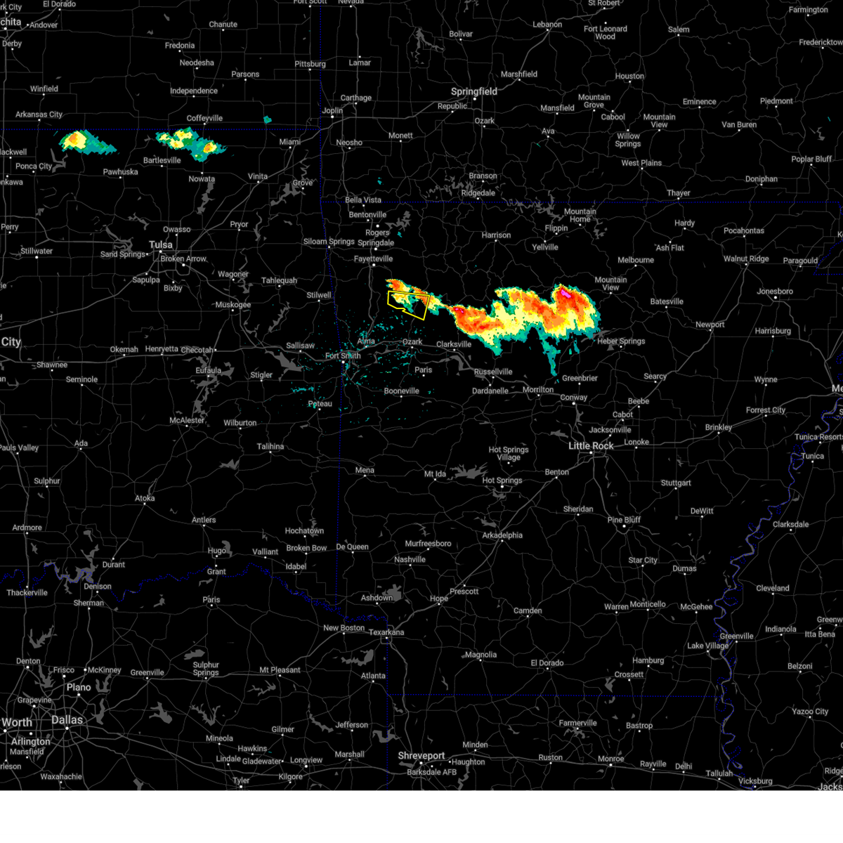 At 346 pm cdt, a severe thunderstorm was located 9 miles west of saint paul, moving east at 25 mph (radar indicated). Hazards include 60 mph wind gusts and half dollar size hail. Hail damage to vehicles is expected. expect wind damage to roofs, siding, and trees. locations in or near the path include, st. paul, saint paul, dutton, patrick, combs, delaney, brashears, hail threat, radar indicated max hail size, 1. 25 in wind threat, radar indicated max wind gust, 60 mph. At 346 pm cdt, a severe thunderstorm was located 9 miles west of saint paul, moving east at 25 mph (radar indicated). Hazards include 60 mph wind gusts and half dollar size hail. Hail damage to vehicles is expected. expect wind damage to roofs, siding, and trees. locations in or near the path include, st. paul, saint paul, dutton, patrick, combs, delaney, brashears, hail threat, radar indicated max hail size, 1. 25 in wind threat, radar indicated max wind gust, 60 mph.
|
| 6/25/2023 3:38 PM CDT |
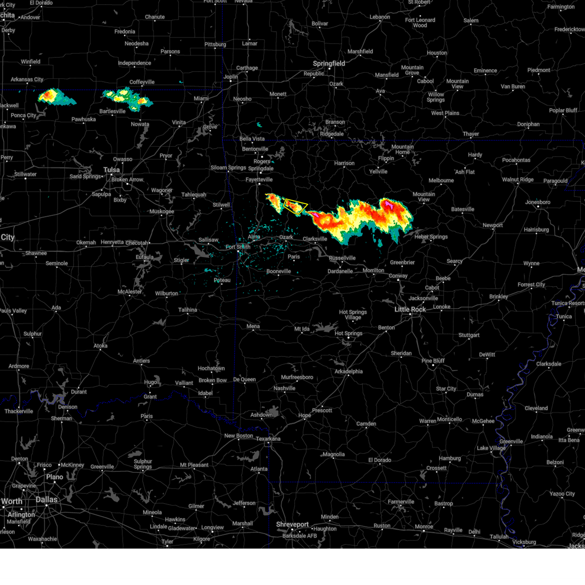 At 338 pm cdt, a severe thunderstorm was located near st. paul, moving east at 30 mph (radar indicated). Hazards include 60 mph wind gusts and half dollar size hail. Hail damage to vehicles is expected. expect wind damage to roofs, siding, and trees. locations in or near the path include, st. paul, saint paul, pettigrew, boston, dutton, brashears, hail threat, radar indicated max hail size, 1. 25 in wind threat, radar indicated max wind gust, 60 mph. At 338 pm cdt, a severe thunderstorm was located near st. paul, moving east at 30 mph (radar indicated). Hazards include 60 mph wind gusts and half dollar size hail. Hail damage to vehicles is expected. expect wind damage to roofs, siding, and trees. locations in or near the path include, st. paul, saint paul, pettigrew, boston, dutton, brashears, hail threat, radar indicated max hail size, 1. 25 in wind threat, radar indicated max wind gust, 60 mph.
|
| 6/25/2023 3:27 PM CDT |
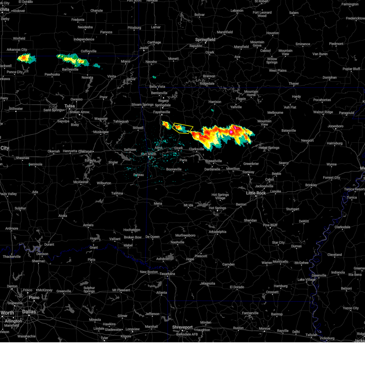 At 326 pm cdt, a severe thunderstorm was located 3 miles northwest of saint paul, moving east at 25 mph (radar indicated). Hazards include 60 mph wind gusts and quarter size hail. Hail damage to vehicles is expected. expect wind damage to roofs, siding, and trees. locations in or near the path include, st. paul, saint paul, pettigrew, boston, dutton, crosses, patrick, combs, delaney, brashears, hail threat, radar indicated max hail size, 1. 00 in wind threat, radar indicated max wind gust, 60 mph. At 326 pm cdt, a severe thunderstorm was located 3 miles northwest of saint paul, moving east at 25 mph (radar indicated). Hazards include 60 mph wind gusts and quarter size hail. Hail damage to vehicles is expected. expect wind damage to roofs, siding, and trees. locations in or near the path include, st. paul, saint paul, pettigrew, boston, dutton, crosses, patrick, combs, delaney, brashears, hail threat, radar indicated max hail size, 1. 00 in wind threat, radar indicated max wind gust, 60 mph.
|
| 6/25/2023 2:45 PM CDT |
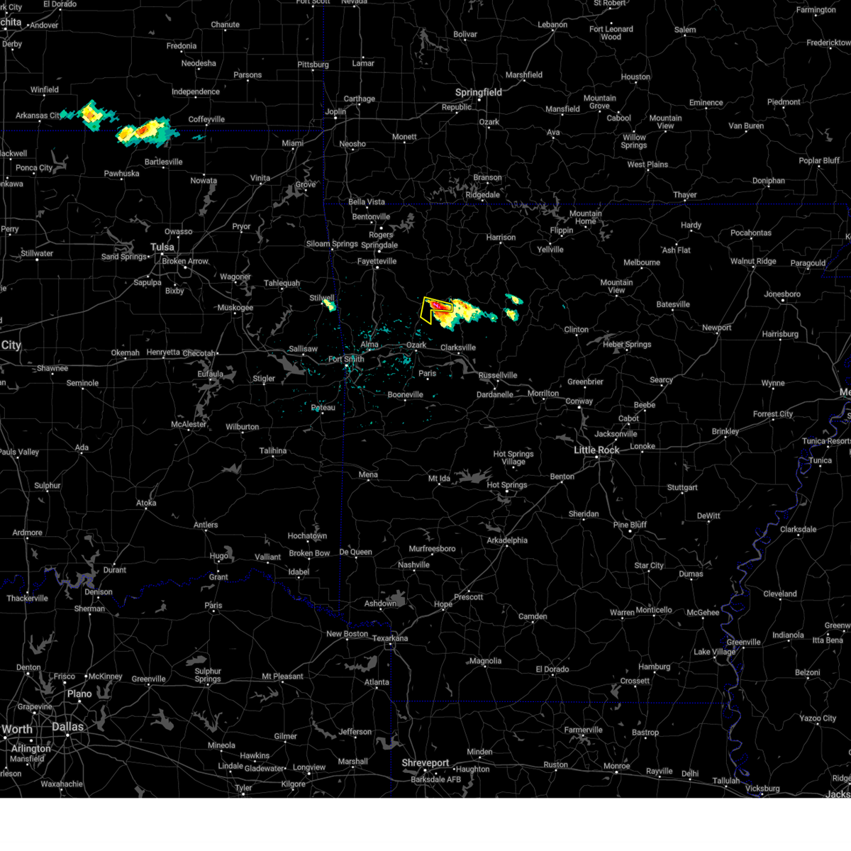 At 244 pm cdt, a severe thunderstorm was located near pettigrew, moving east at 20 mph (radar indicated). Hazards include two inch hail and 60 mph wind gusts. People and animals outdoors will be injured. expect hail damage to roofs, siding, windows, and vehicles. expect wind damage to roofs, siding, and trees. locations in or near the path include, st. paul, pettigrew, dutton, thunderstorm damage threat, considerable hail threat, radar indicated max hail size, 2. 00 in wind threat, radar indicated max wind gust, 60 mph. At 244 pm cdt, a severe thunderstorm was located near pettigrew, moving east at 20 mph (radar indicated). Hazards include two inch hail and 60 mph wind gusts. People and animals outdoors will be injured. expect hail damage to roofs, siding, windows, and vehicles. expect wind damage to roofs, siding, and trees. locations in or near the path include, st. paul, pettigrew, dutton, thunderstorm damage threat, considerable hail threat, radar indicated max hail size, 2. 00 in wind threat, radar indicated max wind gust, 60 mph.
|
| 6/25/2023 2:25 PM CDT |
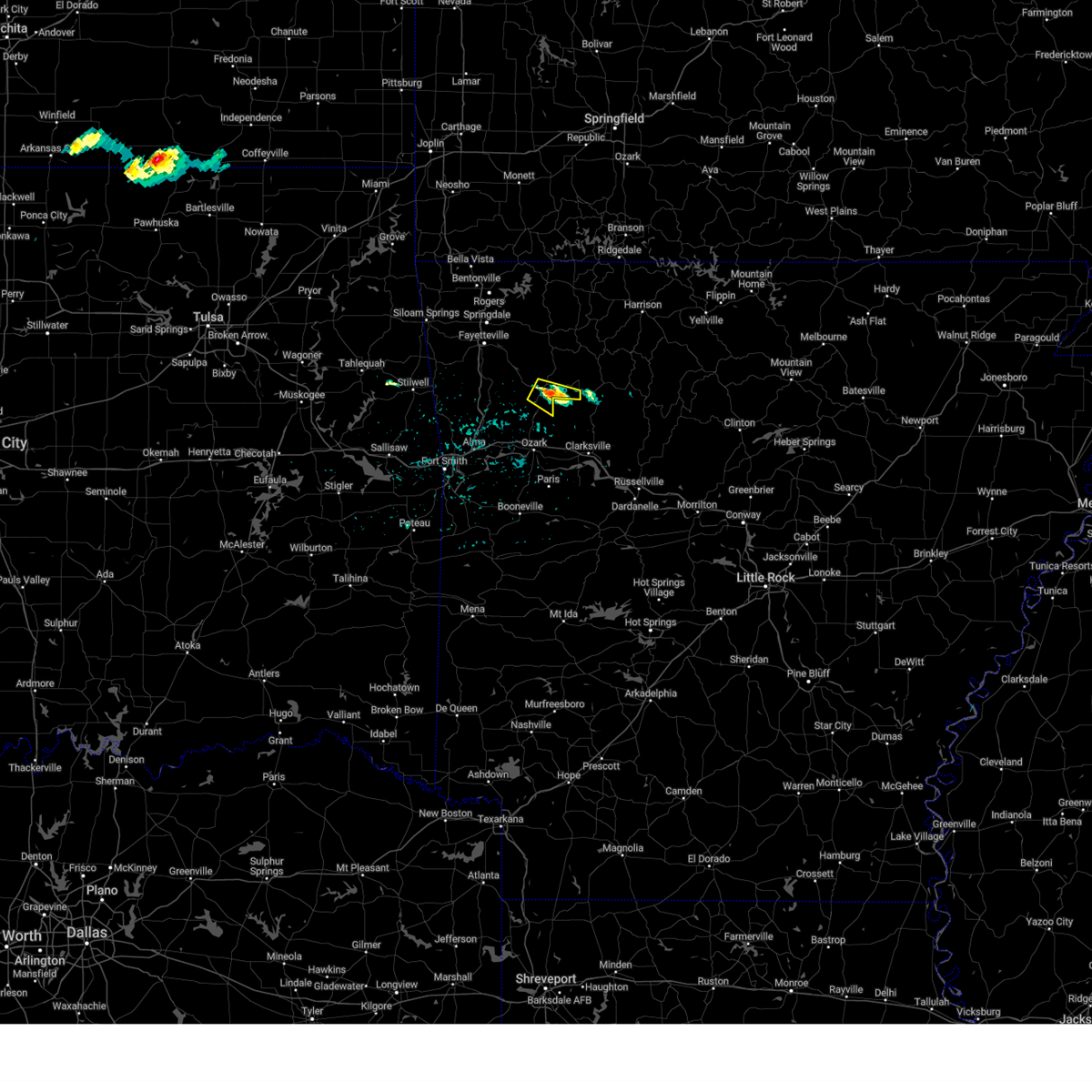 At 225 pm cdt, a severe thunderstorm was located 4 miles southeast of saint paul, moving southeast at 20 mph (radar indicated). Hazards include 60 mph wind gusts and quarter size hail. Hail damage to vehicles is expected. expect wind damage to roofs, siding, and trees. locations in or near the path include, st. paul, saint paul, pettigrew, dutton, brashears, hail threat, radar indicated max hail size, 1. 00 in wind threat, radar indicated max wind gust, 60 mph. At 225 pm cdt, a severe thunderstorm was located 4 miles southeast of saint paul, moving southeast at 20 mph (radar indicated). Hazards include 60 mph wind gusts and quarter size hail. Hail damage to vehicles is expected. expect wind damage to roofs, siding, and trees. locations in or near the path include, st. paul, saint paul, pettigrew, dutton, brashears, hail threat, radar indicated max hail size, 1. 00 in wind threat, radar indicated max wind gust, 60 mph.
|
| 6/18/2023 12:42 AM CDT |
 At 1241 am cdt, severe thunderstorms were located along a line extending from 6 miles southwest of short to near fort chaffee, moving northeast at 55 mph (radar indicated). Hazards include 60 mph wind gusts and quarter size hail. Hail damage to vehicles is expected. expect wind damage to roofs, siding, and trees. locations in or near the path include, fort smith, fayetteville, van buren, ozark, charleston, cedarville, mountainburg, natural dam, greenwood, alma, barling, roland, elkins, west fork, lavaca, mulberry, dyer, altus, winslow, branch, this includes the following highways, interstate 40 in arkansas between mile markers 0 and 42. interstate 40 in oklahoma between mile markers 323 and 328. interstate 540 between mile markers 1 and 11. interstate 49 between mile markers 22 and 54. hail threat, radar indicated max hail size, 1. 00 in wind threat, radar indicated max wind gust, 60 mph. At 1241 am cdt, severe thunderstorms were located along a line extending from 6 miles southwest of short to near fort chaffee, moving northeast at 55 mph (radar indicated). Hazards include 60 mph wind gusts and quarter size hail. Hail damage to vehicles is expected. expect wind damage to roofs, siding, and trees. locations in or near the path include, fort smith, fayetteville, van buren, ozark, charleston, cedarville, mountainburg, natural dam, greenwood, alma, barling, roland, elkins, west fork, lavaca, mulberry, dyer, altus, winslow, branch, this includes the following highways, interstate 40 in arkansas between mile markers 0 and 42. interstate 40 in oklahoma between mile markers 323 and 328. interstate 540 between mile markers 1 and 11. interstate 49 between mile markers 22 and 54. hail threat, radar indicated max hail size, 1. 00 in wind threat, radar indicated max wind gust, 60 mph.
|
| 6/14/2023 9:45 PM CDT |
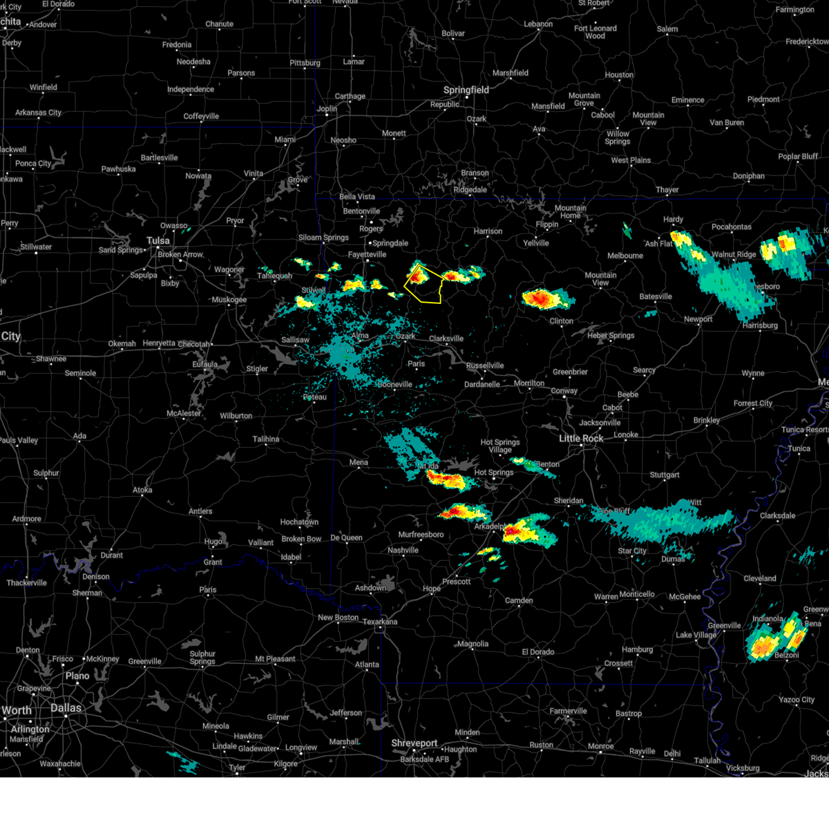 At 944 pm cdt, a severe thunderstorm was located over witter, moving southeast at 25 mph (radar indicated). Hazards include half dollar size hail. Damage to vehicles is expected. locations in or near the path include, st. paul, aurora, pettigrew, witter, boston, dutton, red star, hail threat, radar indicated max hail size, 1. 25 in wind threat, radar indicated max wind gust, <50 mph. At 944 pm cdt, a severe thunderstorm was located over witter, moving southeast at 25 mph (radar indicated). Hazards include half dollar size hail. Damage to vehicles is expected. locations in or near the path include, st. paul, aurora, pettigrew, witter, boston, dutton, red star, hail threat, radar indicated max hail size, 1. 25 in wind threat, radar indicated max wind gust, <50 mph.
|
| 6/14/2023 9:31 PM CDT |
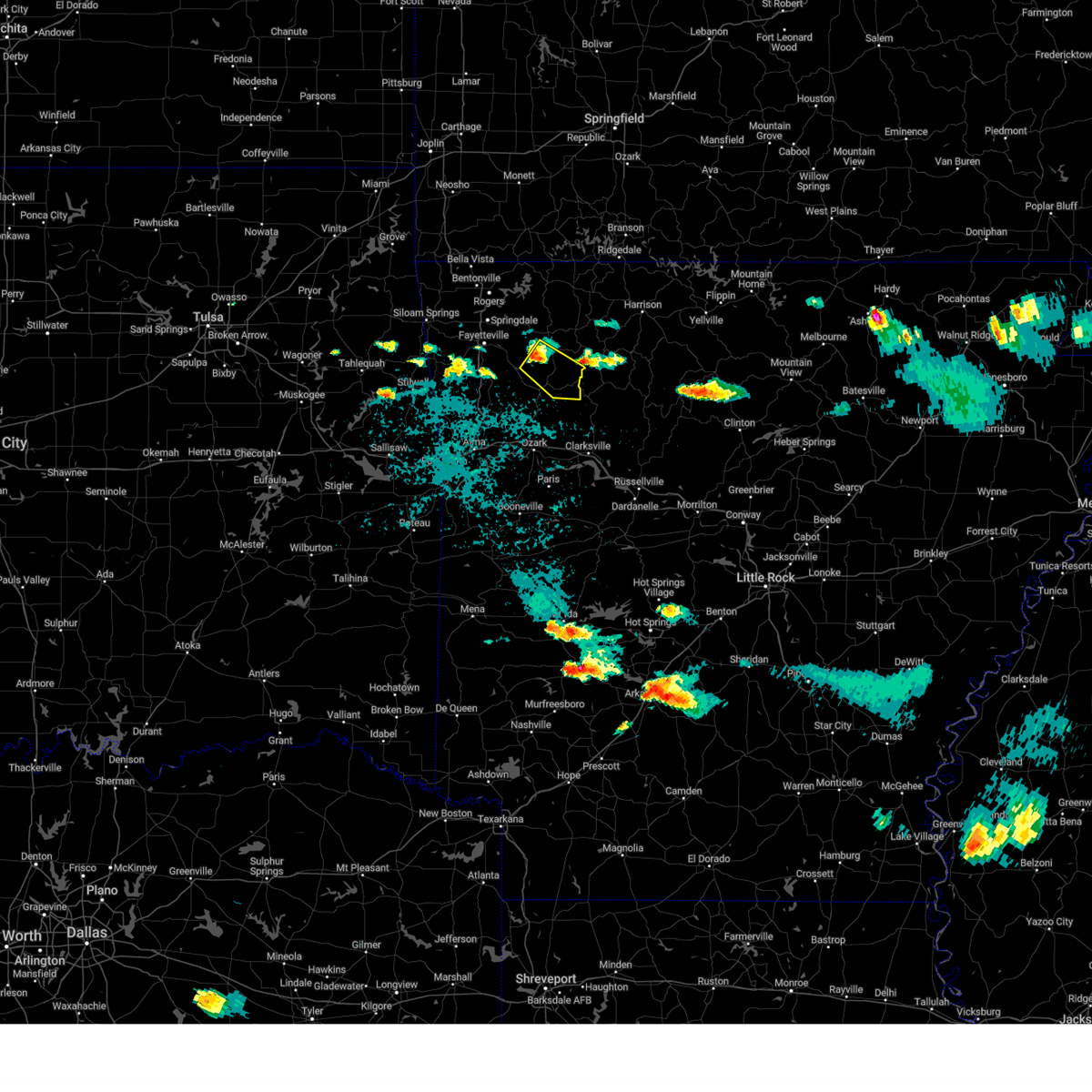 At 931 pm cdt, a severe thunderstorm was located over japton, moving southeast at 25 mph (radar indicated). Hazards include quarter size hail. Damage to vehicles is expected. locations in or near the path include, st. paul, aurora, pettigrew, japton, witter, boston, saint paul, georgetown, dutton, red star, hail threat, radar indicated max hail size, 1. 00 in wind threat, radar indicated max wind gust, <50 mph. At 931 pm cdt, a severe thunderstorm was located over japton, moving southeast at 25 mph (radar indicated). Hazards include quarter size hail. Damage to vehicles is expected. locations in or near the path include, st. paul, aurora, pettigrew, japton, witter, boston, saint paul, georgetown, dutton, red star, hail threat, radar indicated max hail size, 1. 00 in wind threat, radar indicated max wind gust, <50 mph.
|
| 6/14/2023 4:21 AM CDT |
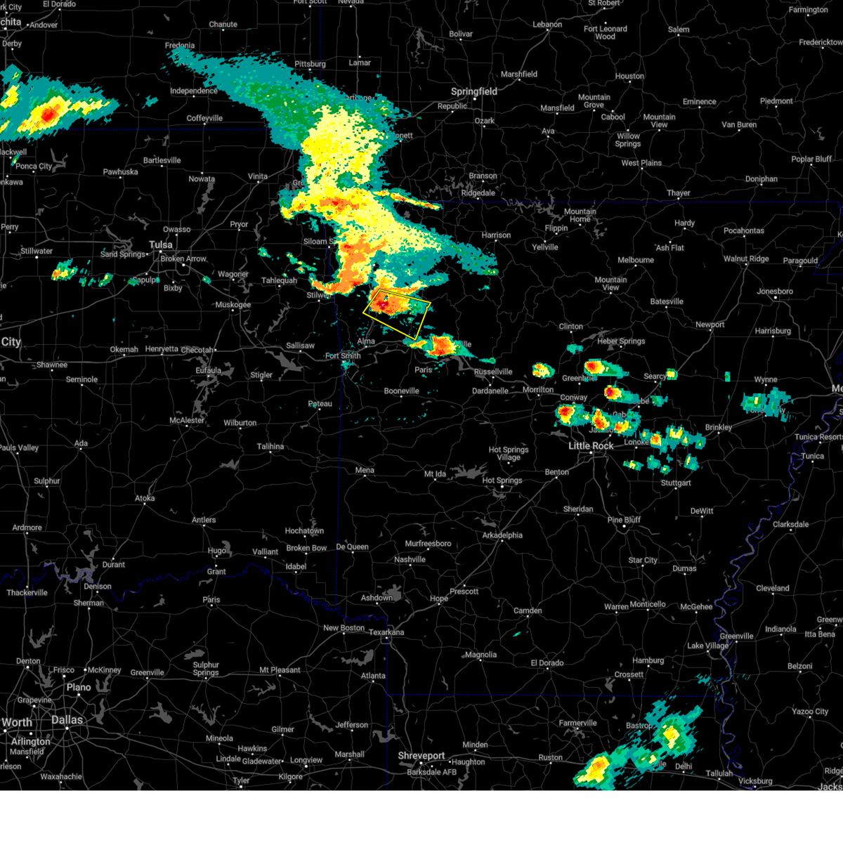 At 421 am cdt, a severe thunderstorm was located 4 miles southeast of winslow, moving east at 30 mph (radar indicated). Hazards include two inch hail. People and animals outdoors will be injured. expect damage to roofs, siding, windows, and vehicles. locations in or near the path include, winslow, cass, saint paul, brentwood, fern, wyola, jethro, bidville, barnes, redding, watalula, brashears, patrick, combs, locke, turners bend, mount gayler, paradise, this includes interstate 49 between mile markers 38 and 43. thunderstorm damage threat, considerable hail threat, radar indicated max hail size, 2. 00 in wind threat, radar indicated max wind gust, <50 mph. At 421 am cdt, a severe thunderstorm was located 4 miles southeast of winslow, moving east at 30 mph (radar indicated). Hazards include two inch hail. People and animals outdoors will be injured. expect damage to roofs, siding, windows, and vehicles. locations in or near the path include, winslow, cass, saint paul, brentwood, fern, wyola, jethro, bidville, barnes, redding, watalula, brashears, patrick, combs, locke, turners bend, mount gayler, paradise, this includes interstate 49 between mile markers 38 and 43. thunderstorm damage threat, considerable hail threat, radar indicated max hail size, 2. 00 in wind threat, radar indicated max wind gust, <50 mph.
|
| 6/14/2023 4:12 AM CDT |
 At 412 am cdt, a severe thunderstorm was located over winslow, moving east at 30 mph (radar indicated). Hazards include tennis ball size hail. People and animals outdoors will be injured. expect damage to roofs, siding, windows, and vehicles. locations in or near the path include, west fork, winslow, st. paul, cass, saint paul, blackburn, devils den state park, brentwood, strickler, fern, jethro, bidville, woolsey, combs, locke, turners bend, mount gayler, wyola, barnes, redding, this includes interstate 49 between mile markers 38 and 51. thunderstorm damage threat, considerable hail threat, radar indicated max hail size, 2. 50 in wind threat, radar indicated max wind gust, <50 mph. At 412 am cdt, a severe thunderstorm was located over winslow, moving east at 30 mph (radar indicated). Hazards include tennis ball size hail. People and animals outdoors will be injured. expect damage to roofs, siding, windows, and vehicles. locations in or near the path include, west fork, winslow, st. paul, cass, saint paul, blackburn, devils den state park, brentwood, strickler, fern, jethro, bidville, woolsey, combs, locke, turners bend, mount gayler, wyola, barnes, redding, this includes interstate 49 between mile markers 38 and 51. thunderstorm damage threat, considerable hail threat, radar indicated max hail size, 2. 50 in wind threat, radar indicated max wind gust, <50 mph.
|
| 6/14/2023 4:05 AM CDT |
 At 404 am cdt, a severe thunderstorm was located over blackburn, moving east at 30 mph (radar indicated). Hazards include two inch hail. People and animals outdoors will be injured. expect damage to roofs, siding, windows, and vehicles. locations in or near the path include, west fork, winslow, st. paul, cass, saint paul, blackburn, devils den state park, brentwood, strickler, fern, jethro, bidville, woolsey, combs, locke, turners bend, mount gayler, wyola, barnes, redding, this includes interstate 49 between mile markers 38 and 51. thunderstorm damage threat, considerable hail threat, radar indicated max hail size, 2. 00 in wind threat, radar indicated max wind gust, <50 mph. At 404 am cdt, a severe thunderstorm was located over blackburn, moving east at 30 mph (radar indicated). Hazards include two inch hail. People and animals outdoors will be injured. expect damage to roofs, siding, windows, and vehicles. locations in or near the path include, west fork, winslow, st. paul, cass, saint paul, blackburn, devils den state park, brentwood, strickler, fern, jethro, bidville, woolsey, combs, locke, turners bend, mount gayler, wyola, barnes, redding, this includes interstate 49 between mile markers 38 and 51. thunderstorm damage threat, considerable hail threat, radar indicated max hail size, 2. 00 in wind threat, radar indicated max wind gust, <50 mph.
|
| 4/15/2023 3:54 PM CDT |
 At 354 pm cdt, a severe thunderstorm was located 4 miles southwest of saint paul, moving east at 40 mph (radar indicated). Hazards include 60 mph wind gusts and quarter size hail. Hail damage to vehicles is expected. expect wind damage to roofs, siding, and trees. locations in or near the path include, st. paul, saint paul, pettigrew, boston, dutton, red star, brashears, hail threat, radar indicated max hail size, 1. 00 in wind threat, radar indicated max wind gust, 60 mph. At 354 pm cdt, a severe thunderstorm was located 4 miles southwest of saint paul, moving east at 40 mph (radar indicated). Hazards include 60 mph wind gusts and quarter size hail. Hail damage to vehicles is expected. expect wind damage to roofs, siding, and trees. locations in or near the path include, st. paul, saint paul, pettigrew, boston, dutton, red star, brashears, hail threat, radar indicated max hail size, 1. 00 in wind threat, radar indicated max wind gust, 60 mph.
|
| 4/15/2023 3:36 PM CDT |
 At 336 pm cdt, a severe thunderstorm was located 5 miles south of elkins, moving east at 20 mph (radar indicated). Hazards include 60 mph wind gusts and half dollar size hail. Hail damage to vehicles is expected. expect wind damage to roofs, siding, and trees. locations in or near the path include, fayetteville, huntsville, elkins, west fork, greenland, winslow, st. paul, wesley, saint paul, aurora, boston, withrow springs state park, pettigrew, brentwood, japton, witter, drake field airport, goshen, georgetown, alabam, hail threat, radar indicated max hail size, 1. 25 in wind threat, radar indicated max wind gust, 60 mph. At 336 pm cdt, a severe thunderstorm was located 5 miles south of elkins, moving east at 20 mph (radar indicated). Hazards include 60 mph wind gusts and half dollar size hail. Hail damage to vehicles is expected. expect wind damage to roofs, siding, and trees. locations in or near the path include, fayetteville, huntsville, elkins, west fork, greenland, winslow, st. paul, wesley, saint paul, aurora, boston, withrow springs state park, pettigrew, brentwood, japton, witter, drake field airport, goshen, georgetown, alabam, hail threat, radar indicated max hail size, 1. 25 in wind threat, radar indicated max wind gust, 60 mph.
|
| 4/15/2023 3:33 PM CDT |
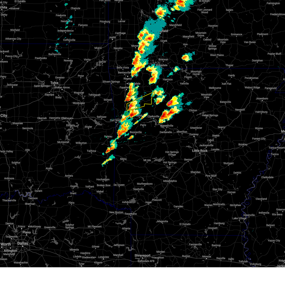 At 333 pm cdt, a severe thunderstorm was located 4 miles northwest of fern, moving east at 30 mph (radar indicated). Hazards include 60 mph wind gusts and quarter size hail. Hail damage to vehicles is expected. expect wind damage to roofs, siding, and trees. locations in or near the path include, st. paul, saint paul, pettigrew, boston, witter, dutton, bidville, red star, weathers, delaney, brashears, patrick, combs, locke, mount gayler, hail threat, radar indicated max hail size, 1. 00 in wind threat, radar indicated max wind gust, 60 mph. At 333 pm cdt, a severe thunderstorm was located 4 miles northwest of fern, moving east at 30 mph (radar indicated). Hazards include 60 mph wind gusts and quarter size hail. Hail damage to vehicles is expected. expect wind damage to roofs, siding, and trees. locations in or near the path include, st. paul, saint paul, pettigrew, boston, witter, dutton, bidville, red star, weathers, delaney, brashears, patrick, combs, locke, mount gayler, hail threat, radar indicated max hail size, 1. 00 in wind threat, radar indicated max wind gust, 60 mph.
|
| 2/27/2023 1:57 AM CST |
 The severe thunderstorm warning for madison, eastern franklin and central carroll counties will expire at 200 am cst, the storms which prompted the warning have weakened below severe limits, and no longer pose an immediate threat to life or property. therefore, the warning will be allowed to expire. however gusty winds are still possible with these thunderstorms. The severe thunderstorm warning for madison, eastern franklin and central carroll counties will expire at 200 am cst, the storms which prompted the warning have weakened below severe limits, and no longer pose an immediate threat to life or property. therefore, the warning will be allowed to expire. however gusty winds are still possible with these thunderstorms.
|
| 2/27/2023 1:45 AM CST |
 At 144 am cst, severe thunderstorms were located along a line extending from 5 miles northeast of cassville to 2 miles south of war eagle to 6 miles southeast of fern, moving northeast at 45 mph (radar indicated). Hazards include 60 mph wind gusts. Expect damage to roofs, siding, and trees. locations in or near the path include, berryville, ozark, huntsville, eureka springs, altus, denning, st. paul, hindsville, wiederkehr village, wesley, cass, saint paul, forum, aurora, clifty, boston, withrow springs state park, pettigrew, japton, witter, this includes interstate 40 in arkansas between mile markers 30 and 42. hail threat, radar indicated max hail size, <. 75 in wind threat, radar indicated max wind gust, 60 mph. At 144 am cst, severe thunderstorms were located along a line extending from 5 miles northeast of cassville to 2 miles south of war eagle to 6 miles southeast of fern, moving northeast at 45 mph (radar indicated). Hazards include 60 mph wind gusts. Expect damage to roofs, siding, and trees. locations in or near the path include, berryville, ozark, huntsville, eureka springs, altus, denning, st. paul, hindsville, wiederkehr village, wesley, cass, saint paul, forum, aurora, clifty, boston, withrow springs state park, pettigrew, japton, witter, this includes interstate 40 in arkansas between mile markers 30 and 42. hail threat, radar indicated max hail size, <. 75 in wind threat, radar indicated max wind gust, 60 mph.
|
| 2/27/2023 1:33 AM CST |
 At 132 am cst, severe thunderstorms were located along a line extending from 2 miles southeast of exeter to 4 miles east of springdale to mulberry, moving northeast at 55 mph (radar indicated). Hazards include 60 mph wind gusts. Expect damage to roofs, siding, and trees. locations in or near the path include, fayetteville, springdale, berryville, ozark, charleston, huntsville, eureka springs, elkins, mulberry, altus, branch, denning, st. paul, beaver, hindsville, wiederkehr village, wesley, saint paul, forum, aurora, this includes interstate 40 in arkansas between mile markers 22 and 42. hail threat, radar indicated max hail size, <. 75 in wind threat, radar indicated max wind gust, 60 mph. At 132 am cst, severe thunderstorms were located along a line extending from 2 miles southeast of exeter to 4 miles east of springdale to mulberry, moving northeast at 55 mph (radar indicated). Hazards include 60 mph wind gusts. Expect damage to roofs, siding, and trees. locations in or near the path include, fayetteville, springdale, berryville, ozark, charleston, huntsville, eureka springs, elkins, mulberry, altus, branch, denning, st. paul, beaver, hindsville, wiederkehr village, wesley, saint paul, forum, aurora, this includes interstate 40 in arkansas between mile markers 22 and 42. hail threat, radar indicated max hail size, <. 75 in wind threat, radar indicated max wind gust, 60 mph.
|
| 2/27/2023 1:10 AM CST |
 At 110 am cst, severe thunderstorms were located along a line extending from 4 miles northwest of pea ridge to 4 miles northwest of prairie grove to near barling, moving northeast at 45 mph (radar indicated). Hazards include 60 mph wind gusts. Expect damage to roofs, siding, and trees. locations in or near the path include, fayetteville, springdale, rogers, bentonville, berryville, ozark, charleston, huntsville, eureka springs, mountainburg, lowell, farmington, alma, pea ridge, prairie grove, elkins, tontitown, west fork, lavaca, cave springs, this includes the following highways, interstate 40 in arkansas between mile markers 11 and 42. interstate 49 between mile markers 22 and 89. hail threat, radar indicated max hail size, <. 75 in wind threat, radar indicated max wind gust, 60 mph. At 110 am cst, severe thunderstorms were located along a line extending from 4 miles northwest of pea ridge to 4 miles northwest of prairie grove to near barling, moving northeast at 45 mph (radar indicated). Hazards include 60 mph wind gusts. Expect damage to roofs, siding, and trees. locations in or near the path include, fayetteville, springdale, rogers, bentonville, berryville, ozark, charleston, huntsville, eureka springs, mountainburg, lowell, farmington, alma, pea ridge, prairie grove, elkins, tontitown, west fork, lavaca, cave springs, this includes the following highways, interstate 40 in arkansas between mile markers 11 and 42. interstate 49 between mile markers 22 and 89. hail threat, radar indicated max hail size, <. 75 in wind threat, radar indicated max wind gust, 60 mph.
|
| 2/16/2023 2:01 AM CST | Debris was noted along with downed trees near fallsville. possible tornad in newton county AR, 17.7 miles W of St. Paul, AR |
| 2/16/2023 12:44 AM CST |
 At 1244 am cst, a severe thunderstorm was located 3 miles south of pettigrew, moving east at 45 mph (radar indicated). Hazards include 60 mph wind gusts and quarter size hail. Hail damage to vehicles is expected. expect wind damage to roofs, siding, and trees. locations in or near the path include, st. paul, cass, saint paul, pettigrew, boston, dutton, jethro, barnes, red star, redding, watalula, brashears, turners bend, lonelm, taft, cravens, paradise, hail threat, radar indicated max hail size, 1. 00 in wind threat, radar indicated max wind gust, 60 mph. At 1244 am cst, a severe thunderstorm was located 3 miles south of pettigrew, moving east at 45 mph (radar indicated). Hazards include 60 mph wind gusts and quarter size hail. Hail damage to vehicles is expected. expect wind damage to roofs, siding, and trees. locations in or near the path include, st. paul, cass, saint paul, pettigrew, boston, dutton, jethro, barnes, red star, redding, watalula, brashears, turners bend, lonelm, taft, cravens, paradise, hail threat, radar indicated max hail size, 1. 00 in wind threat, radar indicated max wind gust, 60 mph.
|
| 2/16/2023 12:23 AM CST |
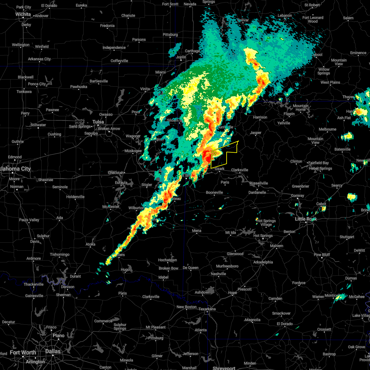 At 1223 am cst, a severe thunderstorm was located 5 miles northeast of fern, moving east at 45 mph (radar indicated). Hazards include 60 mph wind gusts and quarter size hail. Hail damage to vehicles is expected. expect wind damage to roofs, siding, and trees. locations in or near the path include, st. paul, cass, saint paul, pettigrew, boston, dutton, jethro, barnes, red star, redding, watalula, brashears, turners bend, lonelm, taft, cravens, paradise, hail threat, radar indicated max hail size, 1. 00 in wind threat, radar indicated max wind gust, 60 mph. At 1223 am cst, a severe thunderstorm was located 5 miles northeast of fern, moving east at 45 mph (radar indicated). Hazards include 60 mph wind gusts and quarter size hail. Hail damage to vehicles is expected. expect wind damage to roofs, siding, and trees. locations in or near the path include, st. paul, cass, saint paul, pettigrew, boston, dutton, jethro, barnes, red star, redding, watalula, brashears, turners bend, lonelm, taft, cravens, paradise, hail threat, radar indicated max hail size, 1. 00 in wind threat, radar indicated max wind gust, 60 mph.
|
| 1/11/2023 9:00 PM CST |
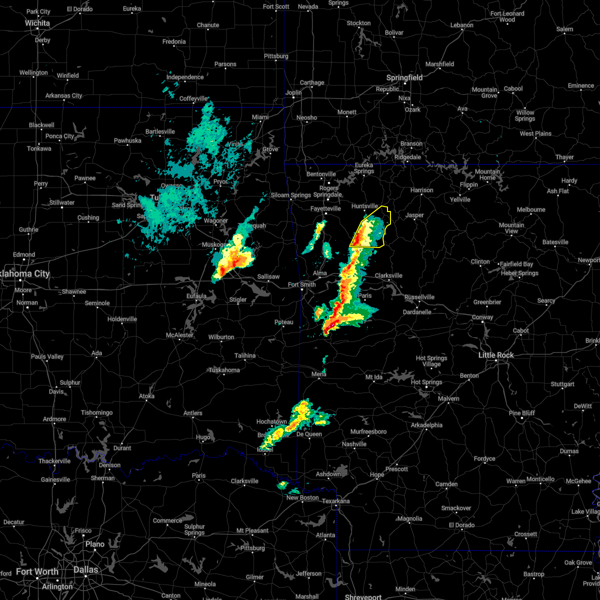 At 900 pm cst, a severe thunderstorm was located 3 miles northeast of st. paul, moving northeast at 55 mph (radar indicated). Hazards include 60 mph wind gusts and quarter size hail. Hail damage to vehicles is expected. expect wind damage to roofs, siding, and trees. locations in or near the path include, st. paul, aurora, saint paul, pettigrew, kingston, witter, boston, dutton, red star, combs, weathers, brashears, hail threat, radar indicated max hail size, 1. 00 in wind threat, radar indicated max wind gust, 60 mph. At 900 pm cst, a severe thunderstorm was located 3 miles northeast of st. paul, moving northeast at 55 mph (radar indicated). Hazards include 60 mph wind gusts and quarter size hail. Hail damage to vehicles is expected. expect wind damage to roofs, siding, and trees. locations in or near the path include, st. paul, aurora, saint paul, pettigrew, kingston, witter, boston, dutton, red star, combs, weathers, brashears, hail threat, radar indicated max hail size, 1. 00 in wind threat, radar indicated max wind gust, 60 mph.
|
| 1/11/2023 8:49 PM CST |
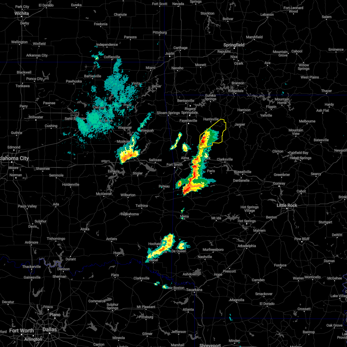 At 849 pm cst, a severe thunderstorm was located 5 miles southwest of saint paul, moving northeast at 55 mph (radar indicated). Hazards include 60 mph wind gusts and quarter size hail. Hail damage to vehicles is expected. expect wind damage to roofs, siding, and trees. locations in or near the path include, st. paul, saint paul, pettigrew, japton, kingston, witter, aurora, boston, dutton, red star, weathers, delaney, brashears, crosses, patrick, combs, hail threat, radar indicated max hail size, 1. 00 in wind threat, radar indicated max wind gust, 60 mph. At 849 pm cst, a severe thunderstorm was located 5 miles southwest of saint paul, moving northeast at 55 mph (radar indicated). Hazards include 60 mph wind gusts and quarter size hail. Hail damage to vehicles is expected. expect wind damage to roofs, siding, and trees. locations in or near the path include, st. paul, saint paul, pettigrew, japton, kingston, witter, aurora, boston, dutton, red star, weathers, delaney, brashears, crosses, patrick, combs, hail threat, radar indicated max hail size, 1. 00 in wind threat, radar indicated max wind gust, 60 mph.
|
| 11/4/2022 7:30 PM CDT |
 At 730 pm cdt, severe thunderstorms were located along a line extending from 2 miles northwest of marble to 5 miles east of witter to 4 miles northeast of ozark, moving northeast at 60 mph (radar indicated). Hazards include 60 mph wind gusts. Expect damage to roofs, siding, and trees. locations in or near the path include, ozark, huntsville, st. paul, cass, rudd, saint paul, kingston, aurora, boston, withrow springs state park, pettigrew, witter, marble, forum, jethro, dryfork, red star, metalton, alabam, turners bend, this includes interstate 40 in arkansas between mile markers 26 and 33. hail threat, radar indicated max hail size, <. 75 in wind threat, radar indicated max wind gust, 60 mph. At 730 pm cdt, severe thunderstorms were located along a line extending from 2 miles northwest of marble to 5 miles east of witter to 4 miles northeast of ozark, moving northeast at 60 mph (radar indicated). Hazards include 60 mph wind gusts. Expect damage to roofs, siding, and trees. locations in or near the path include, ozark, huntsville, st. paul, cass, rudd, saint paul, kingston, aurora, boston, withrow springs state park, pettigrew, witter, marble, forum, jethro, dryfork, red star, metalton, alabam, turners bend, this includes interstate 40 in arkansas between mile markers 26 and 33. hail threat, radar indicated max hail size, <. 75 in wind threat, radar indicated max wind gust, 60 mph.
|
| 11/4/2022 7:19 PM CDT |
 At 718 pm cdt, severe thunderstorms were located along a line extending from near huntsville to 4 miles northeast of st. paul to 4 miles northwest of ozark, moving northeast at 55 mph (radar indicated). Hazards include 60 mph wind gusts. Expect damage to roofs, siding, and trees. locations in or near the path include, ozark, huntsville, st. paul, cass, rudd, saint paul, kingston, aurora, boston, withrow springs state park, pettigrew, japton, witter, marble, georgetown, jethro, dryfork, red star, metalton, alabam, this includes interstate 40 in arkansas between mile markers 26 and 33. hail threat, radar indicated max hail size, <. 75 in wind threat, radar indicated max wind gust, 60 mph. At 718 pm cdt, severe thunderstorms were located along a line extending from near huntsville to 4 miles northeast of st. paul to 4 miles northwest of ozark, moving northeast at 55 mph (radar indicated). Hazards include 60 mph wind gusts. Expect damage to roofs, siding, and trees. locations in or near the path include, ozark, huntsville, st. paul, cass, rudd, saint paul, kingston, aurora, boston, withrow springs state park, pettigrew, japton, witter, marble, georgetown, jethro, dryfork, red star, metalton, alabam, this includes interstate 40 in arkansas between mile markers 26 and 33. hail threat, radar indicated max hail size, <. 75 in wind threat, radar indicated max wind gust, 60 mph.
|
| 11/4/2022 6:55 PM CDT |
 At 654 pm cdt, severe thunderstorms were located along a line extending from 4 miles north of brentwood to 5 miles southeast of winslow to near dyer, moving northeast at 65 mph (radar indicated). Hazards include 60 mph wind gusts. Expect damage to roofs, siding, and trees. locations in or near the path include, ozark, huntsville, mountainburg, elkins, west fork, mulberry, dyer, winslow, chester, st. paul, wesley, rudd, saint paul, aurora, boston, withrow springs state park, brentwood, lake fort smith, marble, cass, this includes the following highways, interstate 40 in arkansas between mile markers 15 and 34. interstate 49 between mile markers 29 and 44, and between mile markers 46 and 48. hail threat, radar indicated max hail size, <. 75 in wind threat, radar indicated max wind gust, 60 mph. At 654 pm cdt, severe thunderstorms were located along a line extending from 4 miles north of brentwood to 5 miles southeast of winslow to near dyer, moving northeast at 65 mph (radar indicated). Hazards include 60 mph wind gusts. Expect damage to roofs, siding, and trees. locations in or near the path include, ozark, huntsville, mountainburg, elkins, west fork, mulberry, dyer, winslow, chester, st. paul, wesley, rudd, saint paul, aurora, boston, withrow springs state park, brentwood, lake fort smith, marble, cass, this includes the following highways, interstate 40 in arkansas between mile markers 15 and 34. interstate 49 between mile markers 29 and 44, and between mile markers 46 and 48. hail threat, radar indicated max hail size, <. 75 in wind threat, radar indicated max wind gust, 60 mph.
|
| 10/12/2022 9:42 AM CDT |
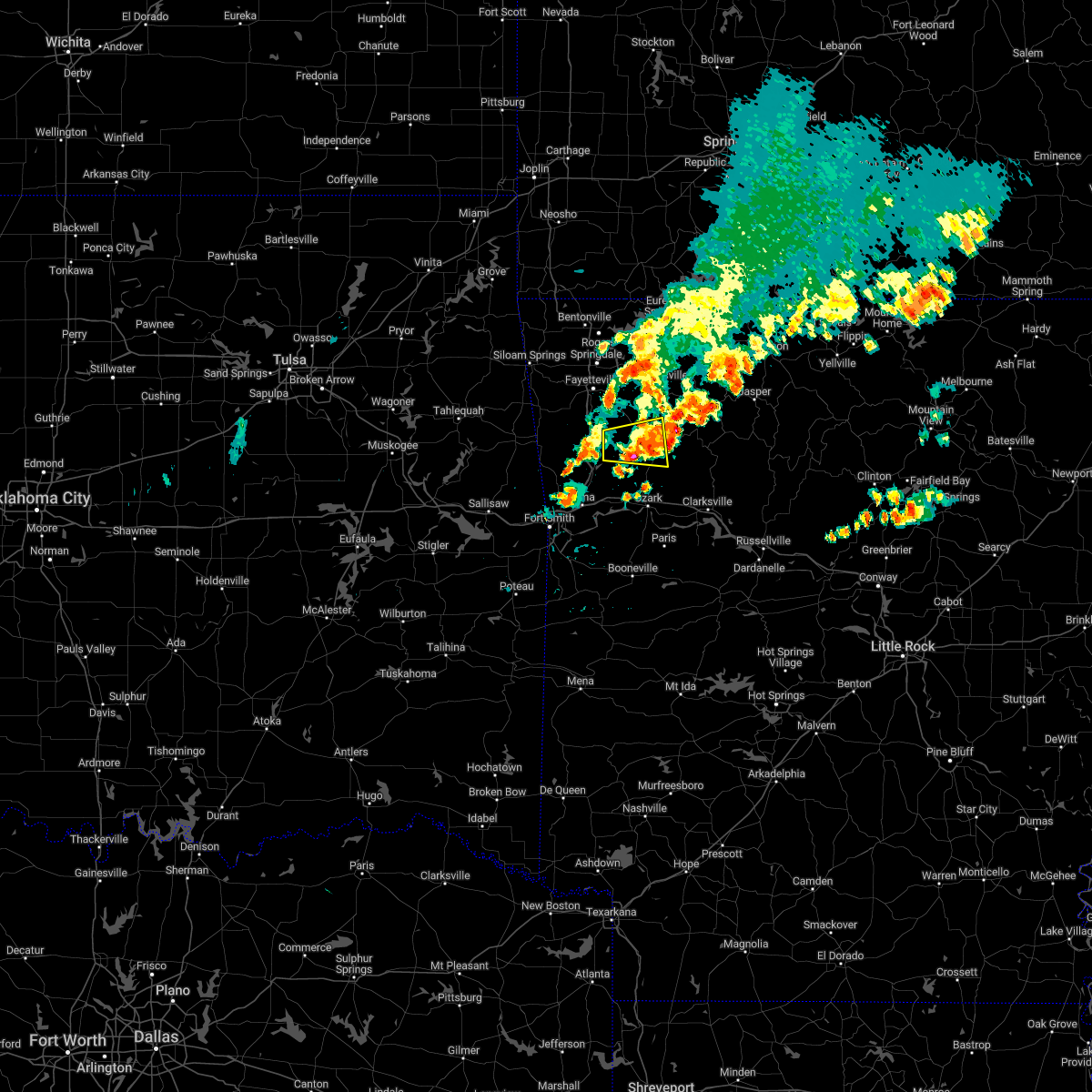 The severe thunderstorm warning for southwestern madison, northeastern franklin, northeastern crawford and southeastern washington counties will expire at 945 am cdt, the storm which prompted the warning has weakened below severe limits, and no longer poses an immediate threat to life or property. therefore, the warning will be allowed to expire. The severe thunderstorm warning for southwestern madison, northeastern franklin, northeastern crawford and southeastern washington counties will expire at 945 am cdt, the storm which prompted the warning has weakened below severe limits, and no longer poses an immediate threat to life or property. therefore, the warning will be allowed to expire.
|
| 10/12/2022 9:20 AM CDT |
 At 920 am cdt, a severe thunderstorm was located 5 miles east of winslow, moving east at 40 mph (radar indicated). Hazards include half dollar size hail. Damage to vehicles is expected. locations in or near the path include, st. paul, saint paul, cass, wyola, crosses, patrick, bidville, combs, mount gayler, delaney, brashears, hail threat, radar indicated max hail size, 1. 25 in wind threat, radar indicated max wind gust, <50 mph. At 920 am cdt, a severe thunderstorm was located 5 miles east of winslow, moving east at 40 mph (radar indicated). Hazards include half dollar size hail. Damage to vehicles is expected. locations in or near the path include, st. paul, saint paul, cass, wyola, crosses, patrick, bidville, combs, mount gayler, delaney, brashears, hail threat, radar indicated max hail size, 1. 25 in wind threat, radar indicated max wind gust, <50 mph.
|
| 8/29/2022 6:54 PM CDT |
 At 653 pm cdt, severe thunderstorms were located along a line extending from 4 miles northeast of aurora to 3 miles west of saint paul, moving northeast at 20 mph (radar indicated). Hazards include 60 mph wind gusts. Expect damage to roofs, siding, and trees. locations in or near the path include, huntsville, st. paul, wesley, saint paul, pettigrew, japton, kingston, witter, marble, aurora, boston, georgetown, dutton, red star, weathers, delaney, brashears, crosses, patrick, combs, hail threat, radar indicated max hail size, <. 75 in wind threat, radar indicated max wind gust, 60 mph. At 653 pm cdt, severe thunderstorms were located along a line extending from 4 miles northeast of aurora to 3 miles west of saint paul, moving northeast at 20 mph (radar indicated). Hazards include 60 mph wind gusts. Expect damage to roofs, siding, and trees. locations in or near the path include, huntsville, st. paul, wesley, saint paul, pettigrew, japton, kingston, witter, marble, aurora, boston, georgetown, dutton, red star, weathers, delaney, brashears, crosses, patrick, combs, hail threat, radar indicated max hail size, <. 75 in wind threat, radar indicated max wind gust, 60 mph.
|
| 8/29/2022 6:10 PM CDT |
 At 609 pm cdt, severe thunderstorms were located along a line extending from near wesley to winslow, moving northeast at 20 mph (radar indicated). Hazards include 60 mph wind gusts. Expect damage to roofs, siding, and trees. locations in or near the path include, huntsville, elkins, winslow, st. paul, wesley, saint paul, kingston, aurora, boston, pettigrew, brentwood, japton, witter, marble, georgetown, woolsey, red star, crosses, combs, dutton, this includes interstate 49 between mile markers 42 and 49. hail threat, radar indicated max hail size, <. 75 in wind threat, radar indicated max wind gust, 60 mph. At 609 pm cdt, severe thunderstorms were located along a line extending from near wesley to winslow, moving northeast at 20 mph (radar indicated). Hazards include 60 mph wind gusts. Expect damage to roofs, siding, and trees. locations in or near the path include, huntsville, elkins, winslow, st. paul, wesley, saint paul, kingston, aurora, boston, pettigrew, brentwood, japton, witter, marble, georgetown, woolsey, red star, crosses, combs, dutton, this includes interstate 49 between mile markers 42 and 49. hail threat, radar indicated max hail size, <. 75 in wind threat, radar indicated max wind gust, 60 mph.
|
| 7/29/2022 12:51 AM CDT |
 The severe thunderstorm warning for madison and southeastern washington counties will expire at 100 am cdt, the storms which prompted the warning have weakened below severe limits, and have started to exit the warned area. therefore, the warning will be allowed to expire. however gusty winds and very heavy rain are still possible with these thunderstorms. The severe thunderstorm warning for madison and southeastern washington counties will expire at 100 am cdt, the storms which prompted the warning have weakened below severe limits, and have started to exit the warned area. therefore, the warning will be allowed to expire. however gusty winds and very heavy rain are still possible with these thunderstorms.
|
| 7/29/2022 12:03 AM CDT |
 At 1203 am cdt, severe thunderstorms were located along a line extending from near huntsville to 2 miles northwest of winslow, moving east at 25 mph (radar indicated). Hazards include 60 mph wind gusts and quarter size hail. Hail damage to vehicles is expected. expect wind damage to roofs, siding, and trees. locations in or near the path include, huntsville, winslow, st. paul, wesley, saint paul, kingston, aurora, boston, devils den state park, pettigrew, brentwood, japton, witter, marble, georgetown, red star, alabam, crosses, combs, dutton, this includes interstate 49 between mile markers 41 and 46. hail threat, radar indicated max hail size, 1. 00 in wind threat, radar indicated max wind gust, 60 mph. At 1203 am cdt, severe thunderstorms were located along a line extending from near huntsville to 2 miles northwest of winslow, moving east at 25 mph (radar indicated). Hazards include 60 mph wind gusts and quarter size hail. Hail damage to vehicles is expected. expect wind damage to roofs, siding, and trees. locations in or near the path include, huntsville, winslow, st. paul, wesley, saint paul, kingston, aurora, boston, devils den state park, pettigrew, brentwood, japton, witter, marble, georgetown, red star, alabam, crosses, combs, dutton, this includes interstate 49 between mile markers 41 and 46. hail threat, radar indicated max hail size, 1. 00 in wind threat, radar indicated max wind gust, 60 mph.
|
| 7/17/2022 8:19 PM CDT |
 At 819 pm cdt, a severe thunderstorm was located near wesley, moving east at 30 mph (radar indicated). Hazards include 60 mph wind gusts. Expect damage to roofs, siding, and trees. locations in or near the path include, elkins, st. paul, wesley, pettigrew, japton, witter, goshen, georgetown, dutton, tuttle, sulphur city, arnett, hicks, crosses, durham, hail threat, radar indicated max hail size, <. 75 in wind threat, radar indicated max wind gust, 60 mph. At 819 pm cdt, a severe thunderstorm was located near wesley, moving east at 30 mph (radar indicated). Hazards include 60 mph wind gusts. Expect damage to roofs, siding, and trees. locations in or near the path include, elkins, st. paul, wesley, pettigrew, japton, witter, goshen, georgetown, dutton, tuttle, sulphur city, arnett, hicks, crosses, durham, hail threat, radar indicated max hail size, <. 75 in wind threat, radar indicated max wind gust, 60 mph.
|
| 7/17/2022 7:59 PM CDT |
 At 758 pm cdt, a severe thunderstorm was located near fayetteville, moving southeast at 40 mph (trained weather spotters. drake field reported a 60 mph wind gust). Hazards include 60 mph wind gusts. Expect damage to roofs, siding, and trees. locations in or near the path include, fayetteville, springdale, farmington, elkins, greenland, st. paul, wesley, saint paul, boston, pettigrew, japton, witter, drake field airport, johnson, goshen, georgetown, crosses, combs, dutton, tuttle, this includes interstate 49 between mile markers 58 and 68. hail threat, radar indicated max hail size, <. 75 in wind threat, radar indicated max wind gust, 60 mph. At 758 pm cdt, a severe thunderstorm was located near fayetteville, moving southeast at 40 mph (trained weather spotters. drake field reported a 60 mph wind gust). Hazards include 60 mph wind gusts. Expect damage to roofs, siding, and trees. locations in or near the path include, fayetteville, springdale, farmington, elkins, greenland, st. paul, wesley, saint paul, boston, pettigrew, japton, witter, drake field airport, johnson, goshen, georgetown, crosses, combs, dutton, tuttle, this includes interstate 49 between mile markers 58 and 68. hail threat, radar indicated max hail size, <. 75 in wind threat, radar indicated max wind gust, 60 mph.
|
| 5/15/2022 7:54 PM CDT |
 At 754 pm cdt, a severe thunderstorm was located over fayetteville, moving east at 35 mph (trained weather spotters). Hazards include quarter size hail. Damage to vehicles is expected. locations in or near the path include, fayetteville, springdale, huntsville, farmington, elkins, tontitown, west fork, greenland, st. paul, hindsville, wesley, saint paul, aurora, japton, drake field airport, johnson, elm springs, goshen, georgetown, walnut grove, this includes interstate 49 between mile markers 55 and 73. hail threat, observed max hail size, 1. 00 in wind threat, radar indicated max wind gust, <50 mph. At 754 pm cdt, a severe thunderstorm was located over fayetteville, moving east at 35 mph (trained weather spotters). Hazards include quarter size hail. Damage to vehicles is expected. locations in or near the path include, fayetteville, springdale, huntsville, farmington, elkins, tontitown, west fork, greenland, st. paul, hindsville, wesley, saint paul, aurora, japton, drake field airport, johnson, elm springs, goshen, georgetown, walnut grove, this includes interstate 49 between mile markers 55 and 73. hail threat, observed max hail size, 1. 00 in wind threat, radar indicated max wind gust, <50 mph.
|
| 5/15/2022 7:40 PM CDT |
 At 740 pm cdt, a severe thunderstorm was located 4 miles southwest of tontitown, moving east at 40 mph (radar indicated). Hazards include quarter size hail. Damage to vehicles is expected. locations in or near the path include, fayetteville, springdale, huntsville, farmington, elkins, tontitown, west fork, greenland, st. paul, hindsville, wesley, saint paul, aurora, japton, drake field airport, johnson, elm springs, goshen, georgetown, walnut grove, this includes interstate 49 between mile markers 55 and 73. hail threat, radar indicated max hail size, 1. 00 in wind threat, radar indicated max wind gust, <50 mph. At 740 pm cdt, a severe thunderstorm was located 4 miles southwest of tontitown, moving east at 40 mph (radar indicated). Hazards include quarter size hail. Damage to vehicles is expected. locations in or near the path include, fayetteville, springdale, huntsville, farmington, elkins, tontitown, west fork, greenland, st. paul, hindsville, wesley, saint paul, aurora, japton, drake field airport, johnson, elm springs, goshen, georgetown, walnut grove, this includes interstate 49 between mile markers 55 and 73. hail threat, radar indicated max hail size, 1. 00 in wind threat, radar indicated max wind gust, <50 mph.
|
| 5/15/2022 2:16 PM CDT |
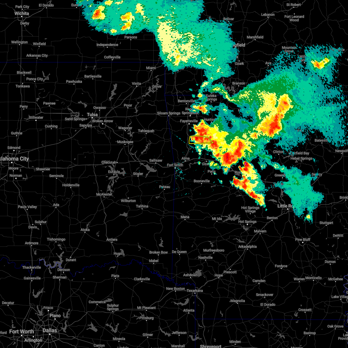 At 216 pm cdt, a severe thunderstorm was located 6 miles east of brentwood, moving southeast at 20 mph (radar indicated). Hazards include 60 mph wind gusts and quarter size hail. Hail damage to vehicles is expected. expect wind damage to roofs, siding, and trees. locations in or near the path include, winslow, st. paul, saint paul, brentwood, wyola, patrick, combs, delaney, brashears, hail threat, radar indicated max hail size, 1. 00 in wind threat, radar indicated max wind gust, 60 mph. At 216 pm cdt, a severe thunderstorm was located 6 miles east of brentwood, moving southeast at 20 mph (radar indicated). Hazards include 60 mph wind gusts and quarter size hail. Hail damage to vehicles is expected. expect wind damage to roofs, siding, and trees. locations in or near the path include, winslow, st. paul, saint paul, brentwood, wyola, patrick, combs, delaney, brashears, hail threat, radar indicated max hail size, 1. 00 in wind threat, radar indicated max wind gust, 60 mph.
|
| 5/15/2022 2:04 PM CDT |
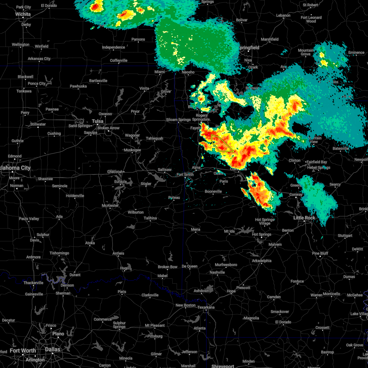 At 203 pm cdt, severe thunderstorms were located along a line extending from 3 miles southwest of japton to 2 miles east of st. paul, moving south at 10 mph (radar indicated). Hazards include 60 mph wind gusts and quarter size hail. Hail damage to vehicles is expected. expect wind damage to roofs, siding, and trees. locations in or near the path include, st. paul, saint paul, pettigrew, japton, dutton, crosses, combs, brashears, patrick, hail threat, radar indicated max hail size, 1. 00 in wind threat, radar indicated max wind gust, 60 mph. At 203 pm cdt, severe thunderstorms were located along a line extending from 3 miles southwest of japton to 2 miles east of st. paul, moving south at 10 mph (radar indicated). Hazards include 60 mph wind gusts and quarter size hail. Hail damage to vehicles is expected. expect wind damage to roofs, siding, and trees. locations in or near the path include, st. paul, saint paul, pettigrew, japton, dutton, crosses, combs, brashears, patrick, hail threat, radar indicated max hail size, 1. 00 in wind threat, radar indicated max wind gust, 60 mph.
|
| 5/15/2022 2:00 PM CDT |
 At 200 pm cdt, severe thunderstorms were located along a line extending from elkins to near brentwood, moving southeast at 25 mph (radar indicated). Hazards include 60 mph wind gusts and quarter size hail. Hail damage to vehicles is expected. expect wind damage to roofs, siding, and trees. locations in or near the path include, fayetteville, elkins, west fork, greenland, winslow, st. paul, wesley, saint paul, pettigrew, brentwood, japton, drake field airport, goshen, woolsey, crosses, combs, dutton, wyola, tuttle, sulphur city, this includes interstate 49 between mile markers 46 and 50, and between mile markers 59 and 60. hail threat, radar indicated max hail size, 1. 00 in wind threat, radar indicated max wind gust, 60 mph. At 200 pm cdt, severe thunderstorms were located along a line extending from elkins to near brentwood, moving southeast at 25 mph (radar indicated). Hazards include 60 mph wind gusts and quarter size hail. Hail damage to vehicles is expected. expect wind damage to roofs, siding, and trees. locations in or near the path include, fayetteville, elkins, west fork, greenland, winslow, st. paul, wesley, saint paul, pettigrew, brentwood, japton, drake field airport, goshen, woolsey, crosses, combs, dutton, wyola, tuttle, sulphur city, this includes interstate 49 between mile markers 46 and 50, and between mile markers 59 and 60. hail threat, radar indicated max hail size, 1. 00 in wind threat, radar indicated max wind gust, 60 mph.
|
| 5/15/2022 1:51 PM CDT |
 At 151 pm cdt, severe thunderstorms were located along a line extending from 2 miles south of tontitown to near elkins, moving southeast at 30 mph (radar indicated). Hazards include golf ball size hail and 60 mph wind gusts. People and animals outdoors will be injured. expect hail damage to roofs, siding, windows, and vehicles. expect wind damage to roofs, siding, and trees. locations in or near the path include, fayetteville, springdale, farmington, elkins, tontitown, west fork, greenland, winslow, st. paul, wesley, saint paul, pettigrew, brentwood, japton, drake field airport, johnson, goshen, walnut grove, woolsey, crosses, this includes interstate 49 between mile markers 46 and 72. thunderstorm damage threat, considerable hail threat, radar indicated max hail size, 1. 75 in wind threat, radar indicated max wind gust, 60 mph. At 151 pm cdt, severe thunderstorms were located along a line extending from 2 miles south of tontitown to near elkins, moving southeast at 30 mph (radar indicated). Hazards include golf ball size hail and 60 mph wind gusts. People and animals outdoors will be injured. expect hail damage to roofs, siding, windows, and vehicles. expect wind damage to roofs, siding, and trees. locations in or near the path include, fayetteville, springdale, farmington, elkins, tontitown, west fork, greenland, winslow, st. paul, wesley, saint paul, pettigrew, brentwood, japton, drake field airport, johnson, goshen, walnut grove, woolsey, crosses, this includes interstate 49 between mile markers 46 and 72. thunderstorm damage threat, considerable hail threat, radar indicated max hail size, 1. 75 in wind threat, radar indicated max wind gust, 60 mph.
|
| 5/15/2022 1:43 PM CDT |
 At 142 pm cdt, severe thunderstorms were located along a line extending from 2 miles west of japton to 2 miles southeast of witter, moving south at 30 mph (radar indicated). Hazards include 60 mph wind gusts and quarter size hail. Hail damage to vehicles is expected. expect wind damage to roofs, siding, and trees. locations in or near the path include, st. paul, saint paul, pettigrew, japton, witter, aurora, boston, georgetown, dutton, red star, weathers, brashears, crosses, combs, patrick, hail threat, radar indicated max hail size, 1. 00 in wind threat, radar indicated max wind gust, 60 mph. At 142 pm cdt, severe thunderstorms were located along a line extending from 2 miles west of japton to 2 miles southeast of witter, moving south at 30 mph (radar indicated). Hazards include 60 mph wind gusts and quarter size hail. Hail damage to vehicles is expected. expect wind damage to roofs, siding, and trees. locations in or near the path include, st. paul, saint paul, pettigrew, japton, witter, aurora, boston, georgetown, dutton, red star, weathers, brashears, crosses, combs, patrick, hail threat, radar indicated max hail size, 1. 00 in wind threat, radar indicated max wind gust, 60 mph.
|
| 5/15/2022 1:41 PM CDT |
 At 140 pm cdt, severe thunderstorms were located along a line extending from 2 miles west of tontitown to 3 miles east of fayetteville, moving southeast at 30 mph (radar indicated). Hazards include 60 mph wind gusts and quarter size hail. Hail damage to vehicles is expected. expect wind damage to roofs, siding, and trees. locations in or near the path include, fayetteville, springdale, farmington, elkins, tontitown, west fork, greenland, winslow, st. paul, wesley, saint paul, pettigrew, brentwood, japton, drake field airport, johnson, goshen, walnut grove, woolsey, crosses, this includes interstate 49 between mile markers 46 and 72. hail threat, radar indicated max hail size, 1. 00 in wind threat, radar indicated max wind gust, 60 mph. At 140 pm cdt, severe thunderstorms were located along a line extending from 2 miles west of tontitown to 3 miles east of fayetteville, moving southeast at 30 mph (radar indicated). Hazards include 60 mph wind gusts and quarter size hail. Hail damage to vehicles is expected. expect wind damage to roofs, siding, and trees. locations in or near the path include, fayetteville, springdale, farmington, elkins, tontitown, west fork, greenland, winslow, st. paul, wesley, saint paul, pettigrew, brentwood, japton, drake field airport, johnson, goshen, walnut grove, woolsey, crosses, this includes interstate 49 between mile markers 46 and 72. hail threat, radar indicated max hail size, 1. 00 in wind threat, radar indicated max wind gust, 60 mph.
|
| 5/15/2022 1:08 PM CDT |
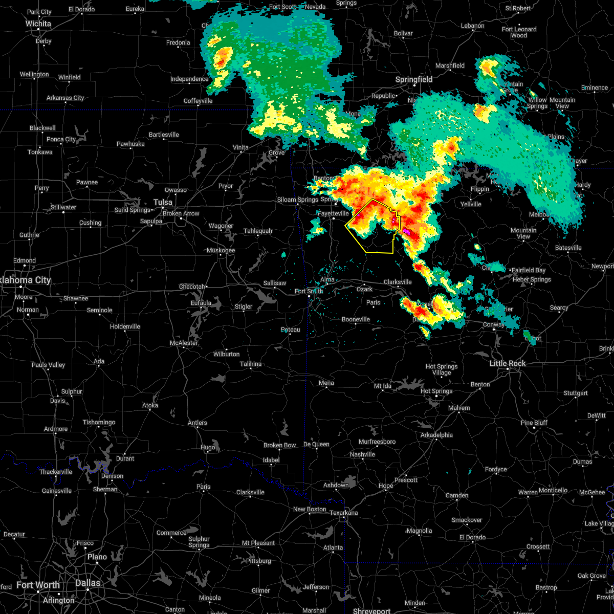 At 108 pm cdt, severe thunderstorms were located along a line extending from 3 miles north of wesley to near forum, moving southeast at 15 mph (radar indicated). Hazards include 60 mph wind gusts and half dollar size hail. Hail damage to vehicles is expected. expect wind damage to roofs, siding, and trees. locations in or near the path include, huntsville, elkins, st. paul, wesley, saint paul, kingston, forum, aurora, boston, withrow springs state park, pettigrew, japton, witter, marble, georgetown, red star, alabam, crosses, combs, dutton, hail threat, radar indicated max hail size, 1. 25 in wind threat, radar indicated max wind gust, 60 mph. At 108 pm cdt, severe thunderstorms were located along a line extending from 3 miles north of wesley to near forum, moving southeast at 15 mph (radar indicated). Hazards include 60 mph wind gusts and half dollar size hail. Hail damage to vehicles is expected. expect wind damage to roofs, siding, and trees. locations in or near the path include, huntsville, elkins, st. paul, wesley, saint paul, kingston, forum, aurora, boston, withrow springs state park, pettigrew, japton, witter, marble, georgetown, red star, alabam, crosses, combs, dutton, hail threat, radar indicated max hail size, 1. 25 in wind threat, radar indicated max wind gust, 60 mph.
|
| 5/2/2022 11:07 PM CDT |
 At 1106 pm cdt, severe thunderstorms were located along a line extending from 6 miles northwest of rudd to near kingston to 2 miles southeast of pettigrew, moving east at 45 mph (radar indicated). Hazards include 60 mph wind gusts and penny size hail. Expect damage to roofs, siding, and trees. locations in or near the path include, huntsville, green forest, st. paul, carrollton, rudd, saint paul, kingston, forum, aurora, boston, withrow springs state park, pettigrew, witter, marble, osage, rule, dryfork, red star, metalton, connor, hail threat, radar indicated max hail size, 0. 75 in wind threat, radar indicated max wind gust, 60 mph. At 1106 pm cdt, severe thunderstorms were located along a line extending from 6 miles northwest of rudd to near kingston to 2 miles southeast of pettigrew, moving east at 45 mph (radar indicated). Hazards include 60 mph wind gusts and penny size hail. Expect damage to roofs, siding, and trees. locations in or near the path include, huntsville, green forest, st. paul, carrollton, rudd, saint paul, kingston, forum, aurora, boston, withrow springs state park, pettigrew, witter, marble, osage, rule, dryfork, red star, metalton, connor, hail threat, radar indicated max hail size, 0. 75 in wind threat, radar indicated max wind gust, 60 mph.
|
| 5/2/2022 10:41 PM CDT |
 At 1041 pm cdt, severe thunderstorms were located along a line extending from near hobbs state park to 3 miles northwest of japton to 6 miles north of fern, moving east at 45 mph (radar indicated). Hazards include 60 mph wind gusts and penny size hail. Expect damage to roofs, siding, and trees. locations in or near the path include, fayetteville, huntsville, green forest, elkins, winslow, st. paul, hindsville, wesley, carrollton, rudd, saint paul, forum, aurora, clifty, boston, withrow springs state park, devils den state park, brentwood, marble, rule, this includes interstate 49 between mile markers 36 and 48. hail threat, radar indicated max hail size, 0. 75 in wind threat, radar indicated max wind gust, 60 mph. At 1041 pm cdt, severe thunderstorms were located along a line extending from near hobbs state park to 3 miles northwest of japton to 6 miles north of fern, moving east at 45 mph (radar indicated). Hazards include 60 mph wind gusts and penny size hail. Expect damage to roofs, siding, and trees. locations in or near the path include, fayetteville, huntsville, green forest, elkins, winslow, st. paul, hindsville, wesley, carrollton, rudd, saint paul, forum, aurora, clifty, boston, withrow springs state park, devils den state park, brentwood, marble, rule, this includes interstate 49 between mile markers 36 and 48. hail threat, radar indicated max hail size, 0. 75 in wind threat, radar indicated max wind gust, 60 mph.
|
| 5/2/2022 10:12 PM CDT |
 At 1012 pm cdt, severe thunderstorms were located along a line extending from near tontitown to near west fork to near lee creek, moving east at 50 mph (radar indicated). Hazards include 60 mph wind gusts and nickel size hail. Expect damage to roofs, siding, and trees. locations in or near the path include, fayetteville, springdale, huntsville, farmington, prairie grove, elkins, tontitown, west fork, greenland, winslow, st. paul, hindsville, wesley, saint paul, forum, aurora, clifty, withrow springs state park, devils den state park, brentwood, this includes interstate 49 between mile markers 37 and 74. hail threat, radar indicated max hail size, 0. 88 in wind threat, radar indicated max wind gust, 60 mph. At 1012 pm cdt, severe thunderstorms were located along a line extending from near tontitown to near west fork to near lee creek, moving east at 50 mph (radar indicated). Hazards include 60 mph wind gusts and nickel size hail. Expect damage to roofs, siding, and trees. locations in or near the path include, fayetteville, springdale, huntsville, farmington, prairie grove, elkins, tontitown, west fork, greenland, winslow, st. paul, hindsville, wesley, saint paul, forum, aurora, clifty, withrow springs state park, devils den state park, brentwood, this includes interstate 49 between mile markers 37 and 74. hail threat, radar indicated max hail size, 0. 88 in wind threat, radar indicated max wind gust, 60 mph.
|
| 3/6/2022 9:04 PM CST |
 At 904 pm cst, a severe thunderstorm was located 3 miles northwest of boston, moving northeast at 55 mph (radar indicated). Hazards include 60 mph wind gusts and quarter size hail. Hail damage to vehicles is expected. expect wind damage to roofs, siding, and trees. locations in or near the path include, st. Paul, saint paul, pettigrew, boston, dutton, red star, weathers,. At 904 pm cst, a severe thunderstorm was located 3 miles northwest of boston, moving northeast at 55 mph (radar indicated). Hazards include 60 mph wind gusts and quarter size hail. Hail damage to vehicles is expected. expect wind damage to roofs, siding, and trees. locations in or near the path include, st. Paul, saint paul, pettigrew, boston, dutton, red star, weathers,.
|
| 3/6/2022 8:56 PM CST |
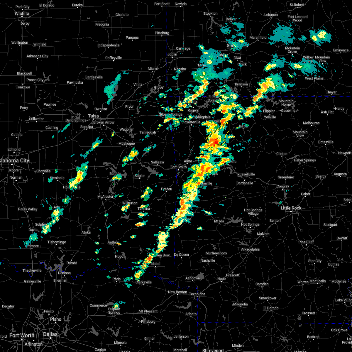 At 856 pm cst, a severe thunderstorm was located over st. paul, moving northeast at 55 mph (radar indicated). Hazards include 60 mph wind gusts and quarter size hail. Hail damage to vehicles is expected. expect wind damage to roofs, siding, and trees. locations in or near the path include, st. paul, saint paul, pettigrew, kingston, witter, boston, dutton, red star, combs, weathers, brashears, hail threat, radar indicated max hail size, 1. 00 in wind threat, radar indicated max wind gust, 60 mph. At 856 pm cst, a severe thunderstorm was located over st. paul, moving northeast at 55 mph (radar indicated). Hazards include 60 mph wind gusts and quarter size hail. Hail damage to vehicles is expected. expect wind damage to roofs, siding, and trees. locations in or near the path include, st. paul, saint paul, pettigrew, kingston, witter, boston, dutton, red star, combs, weathers, brashears, hail threat, radar indicated max hail size, 1. 00 in wind threat, radar indicated max wind gust, 60 mph.
|
| 3/6/2022 8:50 PM CST |
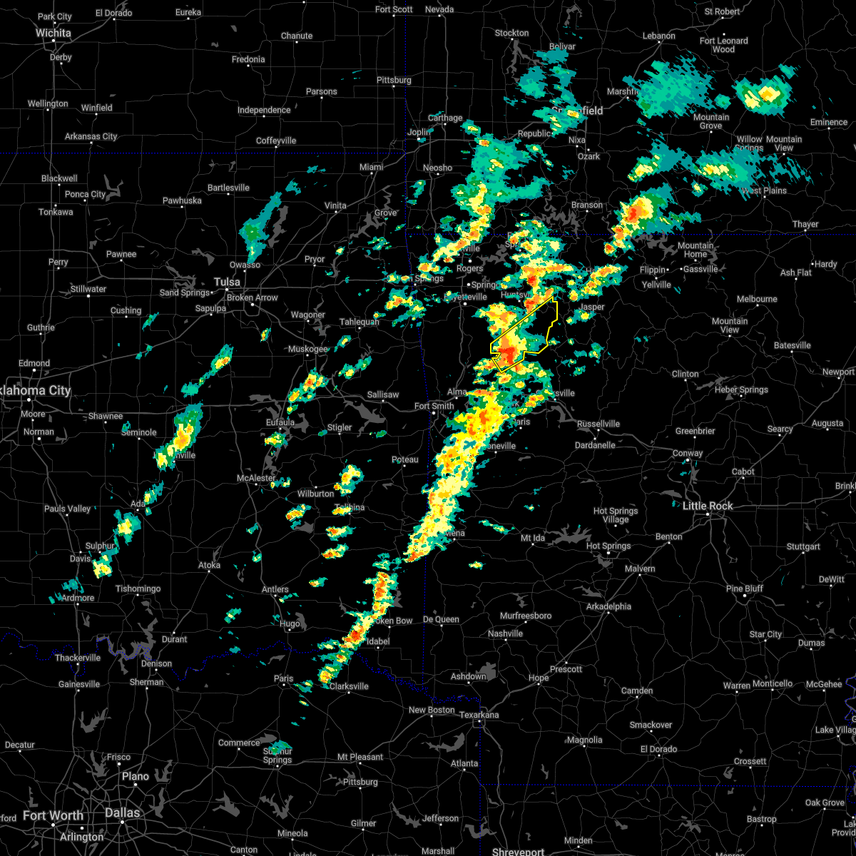 At 850 pm cst, a severe thunderstorm was located 5 miles southwest of saint paul, moving northeast at 55 mph (radar indicated). Hazards include 60 mph wind gusts and quarter size hail. Hail damage to vehicles is expected. expect wind damage to roofs, siding, and trees. locations in or near the path include, st. paul, cass, saint paul, pettigrew, kingston, witter, boston, dutton, red star, weathers, delaney, brashears, patrick, combs, turners bend, hail threat, radar indicated max hail size, 1. 00 in wind threat, radar indicated max wind gust, 60 mph. At 850 pm cst, a severe thunderstorm was located 5 miles southwest of saint paul, moving northeast at 55 mph (radar indicated). Hazards include 60 mph wind gusts and quarter size hail. Hail damage to vehicles is expected. expect wind damage to roofs, siding, and trees. locations in or near the path include, st. paul, cass, saint paul, pettigrew, kingston, witter, boston, dutton, red star, weathers, delaney, brashears, patrick, combs, turners bend, hail threat, radar indicated max hail size, 1. 00 in wind threat, radar indicated max wind gust, 60 mph.
|
| 3/6/2022 8:43 PM CST |
 At 843 pm cst, a severe thunderstorm was located 6 miles northeast of fern, moving northeast at 55 mph (radar indicated). Hazards include 60 mph wind gusts and half dollar size hail. Hail damage to vehicles is expected. expect wind damage to roofs, siding, and trees. locations in or near the path include, st. paul, cass, saint paul, pettigrew, kingston, witter, boston, dutton, bidville, red star, weathers, delaney, brashears, patrick, combs, turners bend, hail threat, radar indicated max hail size, 1. 25 in wind threat, radar indicated max wind gust, 60 mph. At 843 pm cst, a severe thunderstorm was located 6 miles northeast of fern, moving northeast at 55 mph (radar indicated). Hazards include 60 mph wind gusts and half dollar size hail. Hail damage to vehicles is expected. expect wind damage to roofs, siding, and trees. locations in or near the path include, st. paul, cass, saint paul, pettigrew, kingston, witter, boston, dutton, bidville, red star, weathers, delaney, brashears, patrick, combs, turners bend, hail threat, radar indicated max hail size, 1. 25 in wind threat, radar indicated max wind gust, 60 mph.
|
| 10/15/2021 5:44 AM CDT |
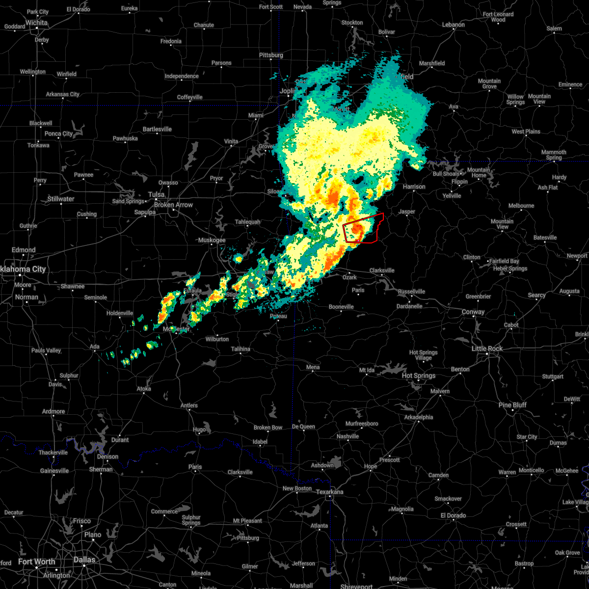 At 544 am cdt, a severe thunderstorm capable of producing a tornado was located near st. paul, moving east at 35 mph (radar indicated rotation). Hazards include tornado and half dollar size hail. Flying debris will be dangerous to those caught without shelter. mobile homes will be damaged or destroyed. damage to roofs, windows, and vehicles will occur. tree damage is likely. locations in or near the path include, st. Paul, saint paul, pettigrew, witter, boston, dutton, red star, combs, weathers, brashears,. At 544 am cdt, a severe thunderstorm capable of producing a tornado was located near st. paul, moving east at 35 mph (radar indicated rotation). Hazards include tornado and half dollar size hail. Flying debris will be dangerous to those caught without shelter. mobile homes will be damaged or destroyed. damage to roofs, windows, and vehicles will occur. tree damage is likely. locations in or near the path include, st. Paul, saint paul, pettigrew, witter, boston, dutton, red star, combs, weathers, brashears,.
|
| 10/15/2021 5:32 AM CDT |
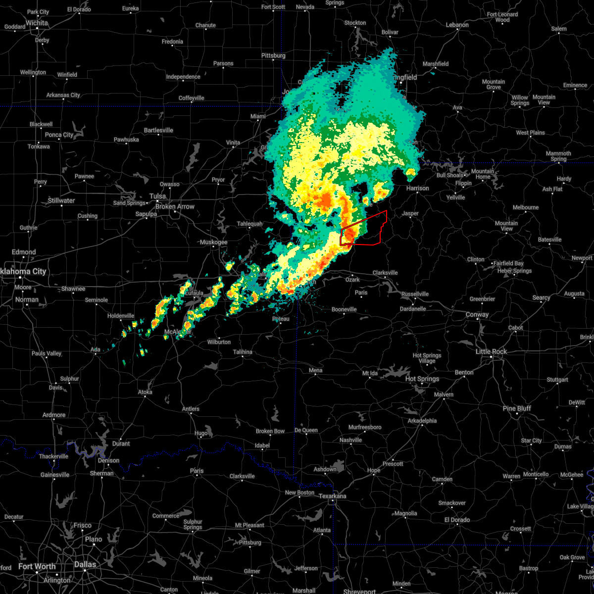 At 532 am cdt, a severe thunderstorm capable of producing a tornado was located 8 miles west of saint paul, moving east at 30 mph (radar indicated rotation). Hazards include tornado. Flying debris will be dangerous to those caught without shelter. mobile homes will be damaged or destroyed. damage to roofs, windows, and vehicles will occur. tree damage is likely. locations in or near the path include, st. Paul, saint paul, pettigrew, witter, boston, dutton, red star, weathers, delaney, brashears, crosses, patrick, combs,. At 532 am cdt, a severe thunderstorm capable of producing a tornado was located 8 miles west of saint paul, moving east at 30 mph (radar indicated rotation). Hazards include tornado. Flying debris will be dangerous to those caught without shelter. mobile homes will be damaged or destroyed. damage to roofs, windows, and vehicles will occur. tree damage is likely. locations in or near the path include, st. Paul, saint paul, pettigrew, witter, boston, dutton, red star, weathers, delaney, brashears, crosses, patrick, combs,.
|
| 5/27/2021 7:25 PM CDT |
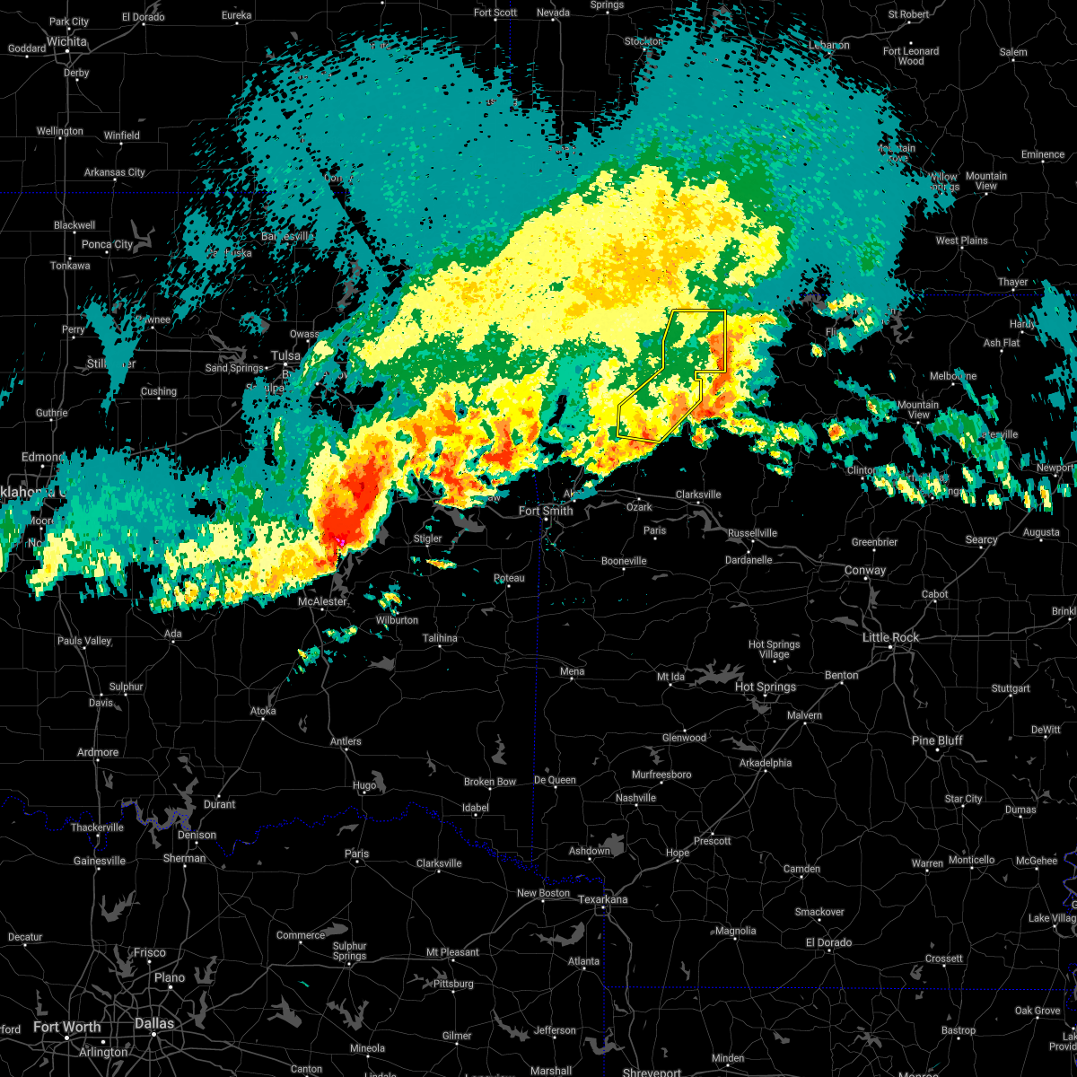 The severe thunderstorm warning for madison and eastern carroll counties will expire at 730 pm cdt, the storms which prompted the warning have weakened below severe limits, and have exited the warned area. therefore the warning will be allowed to expire. however gusty winds are still possible with these thunderstorms. a severe thunderstorm watch remains in effect until 100 am cdt for northwestern arkansas. The severe thunderstorm warning for madison and eastern carroll counties will expire at 730 pm cdt, the storms which prompted the warning have weakened below severe limits, and have exited the warned area. therefore the warning will be allowed to expire. however gusty winds are still possible with these thunderstorms. a severe thunderstorm watch remains in effect until 100 am cdt for northwestern arkansas.
|
| 5/27/2021 7:02 PM CDT |
 At 701 pm cdt, severe thunderstorms were located along a line extending from 2 miles south of urbanette to 3 miles east of marble to 9 miles east of brentwood, moving east at 35 mph (radar indicated). Hazards include 60 mph wind gusts and quarter size hail. Hail damage to vehicles is expected. expect wind damage to roofs, siding, and trees. locations in or near the path include, berryville, huntsville, green forest, st. Paul, carrollton, rudd, saint paul, kingston, aurora, pettigrew, japton, witter, marble, osage, urbanette, rule, georgetown, dryfork, metalton, connor,. At 701 pm cdt, severe thunderstorms were located along a line extending from 2 miles south of urbanette to 3 miles east of marble to 9 miles east of brentwood, moving east at 35 mph (radar indicated). Hazards include 60 mph wind gusts and quarter size hail. Hail damage to vehicles is expected. expect wind damage to roofs, siding, and trees. locations in or near the path include, berryville, huntsville, green forest, st. Paul, carrollton, rudd, saint paul, kingston, aurora, pettigrew, japton, witter, marble, osage, urbanette, rule, georgetown, dryfork, metalton, connor,.
|
| 5/27/2021 6:48 PM CDT |
 At 647 pm cdt, severe thunderstorms were located along a line extending from 3 miles southwest of grandview to 2 miles southeast of forum to 3 miles northeast of winslow, moving east at 35 mph (radar indicated). Hazards include 60 mph wind gusts and quarter size hail. Hail damage to vehicles is expected. expect wind damage to roofs, siding, and trees. locations in or near the path include, fayetteville, berryville, huntsville, eureka springs, green forest, elkins, west fork, winslow, st. Paul, hindsville, wesley, carrollton, rudd, saint paul, forum, aurora, clifty, withrow springs state park, brentwood, strickler, this includes interstate 49 between mile markers 45 and 53. At 647 pm cdt, severe thunderstorms were located along a line extending from 3 miles southwest of grandview to 2 miles southeast of forum to 3 miles northeast of winslow, moving east at 35 mph (radar indicated). Hazards include 60 mph wind gusts and quarter size hail. Hail damage to vehicles is expected. expect wind damage to roofs, siding, and trees. locations in or near the path include, fayetteville, berryville, huntsville, eureka springs, green forest, elkins, west fork, winslow, st. Paul, hindsville, wesley, carrollton, rudd, saint paul, forum, aurora, clifty, withrow springs state park, brentwood, strickler, this includes interstate 49 between mile markers 45 and 53.
|
| 5/27/2021 6:29 PM CDT |
 At 629 pm cdt, severe thunderstorms were located along a line extending from 3 miles east of gateway to 2 miles southwest of clifty to 5 miles southwest of strickler, moving east at 35 mph (radar indicated). Hazards include 60 mph wind gusts and quarter size hail. Hail damage to vehicles is expected. expect wind damage to roofs, siding, and trees. locations in or near the path include, fayetteville, berryville, huntsville, eureka springs, green forest, elkins, west fork, greenland, winslow, st. Paul, hindsville, wesley, carrollton, rudd, saint paul, forum, aurora, hobbs state park, clifty, withrow springs state park, this includes interstate 49 between mile markers 45 and 60. At 629 pm cdt, severe thunderstorms were located along a line extending from 3 miles east of gateway to 2 miles southwest of clifty to 5 miles southwest of strickler, moving east at 35 mph (radar indicated). Hazards include 60 mph wind gusts and quarter size hail. Hail damage to vehicles is expected. expect wind damage to roofs, siding, and trees. locations in or near the path include, fayetteville, berryville, huntsville, eureka springs, green forest, elkins, west fork, greenland, winslow, st. Paul, hindsville, wesley, carrollton, rudd, saint paul, forum, aurora, hobbs state park, clifty, withrow springs state park, this includes interstate 49 between mile markers 45 and 60.
|
| 5/9/2021 3:49 AM CDT |
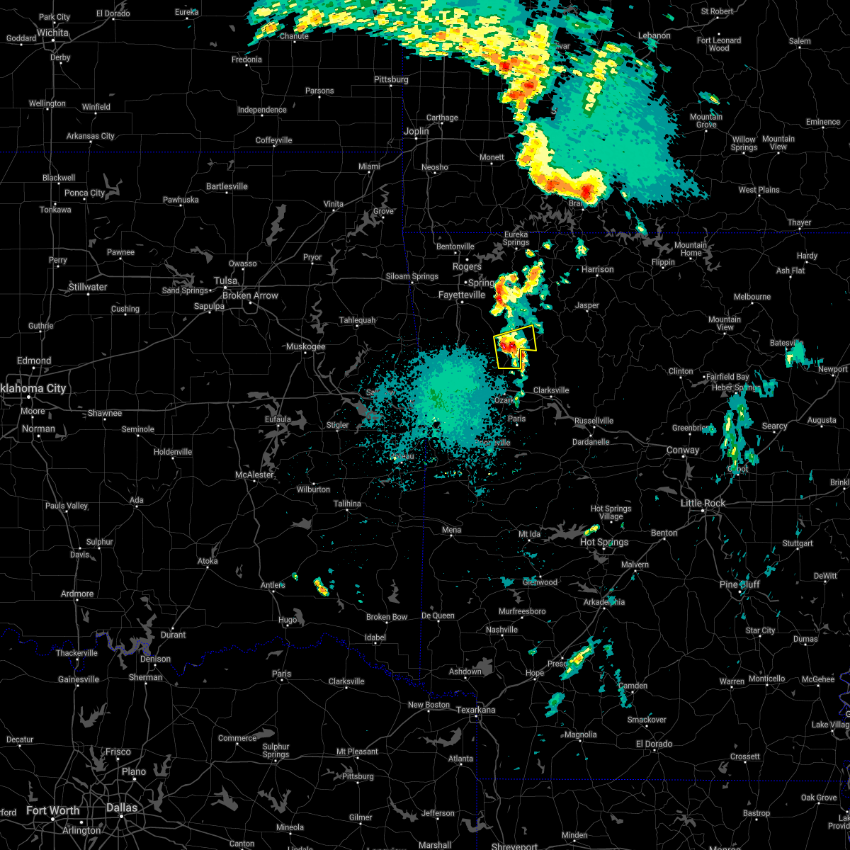 A severe thunderstorm warning remains in effect until 400 am cdt for southwestern madison and northeastern franklin counties. at 348 am cdt, a severe thunderstorm was located 5 miles north of cass, moving east at 45 mph. hazard. 60 mph wind gusts and quarter size hail. source. Radar indicated. A severe thunderstorm warning remains in effect until 400 am cdt for southwestern madison and northeastern franklin counties. at 348 am cdt, a severe thunderstorm was located 5 miles north of cass, moving east at 45 mph. hazard. 60 mph wind gusts and quarter size hail. source. Radar indicated.
|
| 5/9/2021 3:30 AM CDT |
 At 329 am cdt, a severe thunderstorm was located 4 miles northeast of lake fort smith, moving east at 45 mph (radar indicated). Hazards include 60 mph wind gusts and quarter size hail. Hail damage to vehicles is expected. expect wind damage to roofs, siding, and trees. locations in or near the path include, winslow, st. Paul, cass, saint paul, pettigrew, boston, dutton, bidville, redding, delaney, brashears, patrick, combs, locke, turners bend, mount gayler, taft,. At 329 am cdt, a severe thunderstorm was located 4 miles northeast of lake fort smith, moving east at 45 mph (radar indicated). Hazards include 60 mph wind gusts and quarter size hail. Hail damage to vehicles is expected. expect wind damage to roofs, siding, and trees. locations in or near the path include, winslow, st. Paul, cass, saint paul, pettigrew, boston, dutton, bidville, redding, delaney, brashears, patrick, combs, locke, turners bend, mount gayler, taft,.
|
| 5/9/2021 3:17 AM CDT |
 At 317 am cdt, a severe thunderstorm was located 4 miles west of chester, moving east at 45 mph (radar indicated). Hazards include 60 mph wind gusts and quarter size hail. Hail damage to vehicles is expected. expect wind damage to roofs, siding, and trees. locations in or near the path include, mountainburg, winslow, chester, st. Paul, cass, saint paul, pettigrew, devils den state park, lake fort smith, lee creek, fern, boston, dutton, bidville, redding, delaney, brashears, patrick, combs, locke, this includes interstate 49 between mile markers 30 and 43. At 317 am cdt, a severe thunderstorm was located 4 miles west of chester, moving east at 45 mph (radar indicated). Hazards include 60 mph wind gusts and quarter size hail. Hail damage to vehicles is expected. expect wind damage to roofs, siding, and trees. locations in or near the path include, mountainburg, winslow, chester, st. Paul, cass, saint paul, pettigrew, devils den state park, lake fort smith, lee creek, fern, boston, dutton, bidville, redding, delaney, brashears, patrick, combs, locke, this includes interstate 49 between mile markers 30 and 43.
|
| 5/3/2021 11:04 PM CDT |
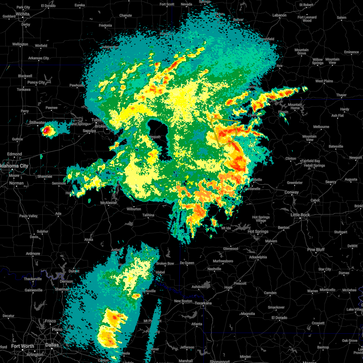 At 1103 pm cdt, severe thunderstorms were located along a line extending from 2 miles southeast of clifty to 5 miles northeast of boston, moving east at 30 mph (radar indicated). Hazards include 60 mph wind gusts. Expect damage to roofs, siding, and trees. locations in or near the path include, huntsville, st. Paul, hindsville, withrow springs state park, japton, kingston, witter, marble, forum, aurora, georgetown, dryfork, weathers, alabam,. At 1103 pm cdt, severe thunderstorms were located along a line extending from 2 miles southeast of clifty to 5 miles northeast of boston, moving east at 30 mph (radar indicated). Hazards include 60 mph wind gusts. Expect damage to roofs, siding, and trees. locations in or near the path include, huntsville, st. Paul, hindsville, withrow springs state park, japton, kingston, witter, marble, forum, aurora, georgetown, dryfork, weathers, alabam,.
|
| 5/3/2021 10:46 PM CDT |
 At 1046 pm cdt, severe thunderstorms were located along a line extending from 3 miles south of hobbs state park to 3 miles east of st. paul, moving east at 30 mph (radar indicated). Hazards include 60 mph wind gusts. Expect damage to roofs, siding, and trees. locations in or near the path include, huntsville, st. Paul, hindsville, wesley, saint paul, kingston, forum, aurora, withrow springs state park, japton, witter, marble, goshen, georgetown, dryfork, alabam, crosses, combs, dutton, tuttle,. At 1046 pm cdt, severe thunderstorms were located along a line extending from 3 miles south of hobbs state park to 3 miles east of st. paul, moving east at 30 mph (radar indicated). Hazards include 60 mph wind gusts. Expect damage to roofs, siding, and trees. locations in or near the path include, huntsville, st. Paul, hindsville, wesley, saint paul, kingston, forum, aurora, withrow springs state park, japton, witter, marble, goshen, georgetown, dryfork, alabam, crosses, combs, dutton, tuttle,.
|
| 5/3/2021 10:31 PM CDT |
 At 1031 pm cdt, a severe thunderstorm was located over wesley, moving east at 30 mph (radar indicated). Hazards include 60 mph wind gusts. Expect damage to roofs, siding, and trees. locations in or near the path include, huntsville, st. Paul, hindsville, wesley, saint paul, kingston, forum, aurora, withrow springs state park, japton, witter, marble, goshen, georgetown, dryfork, alabam, crosses, combs, dutton, tuttle,. At 1031 pm cdt, a severe thunderstorm was located over wesley, moving east at 30 mph (radar indicated). Hazards include 60 mph wind gusts. Expect damage to roofs, siding, and trees. locations in or near the path include, huntsville, st. Paul, hindsville, wesley, saint paul, kingston, forum, aurora, withrow springs state park, japton, witter, marble, goshen, georgetown, dryfork, alabam, crosses, combs, dutton, tuttle,.
|
| 4/9/2021 10:07 PM CDT |
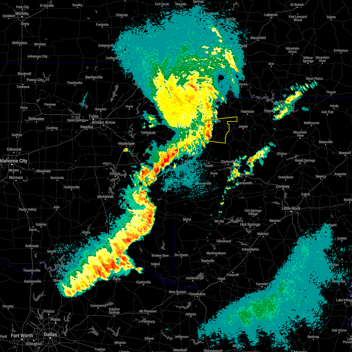 At 1006 pm cdt, a severe thunderstorm was located near japton, moving east at 50 mph (radar indicated). Hazards include 60 mph wind gusts. Expect damage to roofs, siding, and trees. locations in or near the path include, huntsville, st. Paul, hindsville, saint paul, pettigrew, japton, kingston, witter, marble, aurora, boston, georgetown, dutton, dryfork, red star, weathers, delaney, alabam, crosses, patrick,. At 1006 pm cdt, a severe thunderstorm was located near japton, moving east at 50 mph (radar indicated). Hazards include 60 mph wind gusts. Expect damage to roofs, siding, and trees. locations in or near the path include, huntsville, st. Paul, hindsville, saint paul, pettigrew, japton, kingston, witter, marble, aurora, boston, georgetown, dutton, dryfork, red star, weathers, delaney, alabam, crosses, patrick,.
|
| 11/14/2020 10:52 PM CST |
 At 1051 pm cst, severe thunderstorms were located along a line extending from upper buffalo wilderness area to 3 miles west of ozark to 2 miles northwest of lake wister state park, moving southeast at 45 mph. a wind gust to 61 mph was just measured at the fort smith regional airport (radar indicated). Hazards include 60 mph wind gusts. Expect damage to roofs, siding, and trees. locations in or near the path include, fort smith, van buren, poteau, ozark, charleston, greenwood, alma, barling, pocola, roland, lavaca, spiro, arkoma, mulberry, dyer, hackett, bonanza, midland, cameron, moffett, this includes the following highways, interstate 40 in arkansas between mile markers 0 and 38. interstate 40 in oklahoma between mile markers 322 and 328. interstate 540 between mile markers 1 and 14. interstate 49 between mile markers 22 and 26. A tornado watch remains in effect until midnight cst for northwestern and west central arkansas, and east central oklahoma. At 1051 pm cst, severe thunderstorms were located along a line extending from upper buffalo wilderness area to 3 miles west of ozark to 2 miles northwest of lake wister state park, moving southeast at 45 mph. a wind gust to 61 mph was just measured at the fort smith regional airport (radar indicated). Hazards include 60 mph wind gusts. Expect damage to roofs, siding, and trees. locations in or near the path include, fort smith, van buren, poteau, ozark, charleston, greenwood, alma, barling, pocola, roland, lavaca, spiro, arkoma, mulberry, dyer, hackett, bonanza, midland, cameron, moffett, this includes the following highways, interstate 40 in arkansas between mile markers 0 and 38. interstate 40 in oklahoma between mile markers 322 and 328. interstate 540 between mile markers 1 and 14. interstate 49 between mile markers 22 and 26. A tornado watch remains in effect until midnight cst for northwestern and west central arkansas, and east central oklahoma.
|
| 11/14/2020 10:49 PM CST |
 At 1049 pm cst, severe thunderstorms were located along a line extending from 2 miles northwest of upper buffalo wilderness area to 5 miles west of ozark to 4 miles east of fanshawe, moving southeast at 45 mph (radar indicated). Hazards include 60 mph wind gusts. Expect damage to roofs, siding, and trees. locations in or near the path include, fort smith, van buren, poteau, ozark, charleston, greenwood, alma, barling, pocola, roland, lavaca, spiro, arkoma, mulberry, dyer, hackett, bonanza, midland, cameron, moffett, this includes the following highways, interstate 40 in arkansas between mile markers 0 and 38. interstate 40 in oklahoma between mile markers 322 and 328. interstate 540 between mile markers 1 and 14. interstate 49 between mile markers 22 and 26. A tornado watch remains in effect until midnight cst for northwestern and west central arkansas, and east central oklahoma. At 1049 pm cst, severe thunderstorms were located along a line extending from 2 miles northwest of upper buffalo wilderness area to 5 miles west of ozark to 4 miles east of fanshawe, moving southeast at 45 mph (radar indicated). Hazards include 60 mph wind gusts. Expect damage to roofs, siding, and trees. locations in or near the path include, fort smith, van buren, poteau, ozark, charleston, greenwood, alma, barling, pocola, roland, lavaca, spiro, arkoma, mulberry, dyer, hackett, bonanza, midland, cameron, moffett, this includes the following highways, interstate 40 in arkansas between mile markers 0 and 38. interstate 40 in oklahoma between mile markers 322 and 328. interstate 540 between mile markers 1 and 14. interstate 49 between mile markers 22 and 26. A tornado watch remains in effect until midnight cst for northwestern and west central arkansas, and east central oklahoma.
|
| 11/14/2020 10:45 PM CST |
 At 1045 pm cst, severe thunderstorms were located along a line extending from 3 miles northwest of upper buffalo wilderness area to 6 miles northwest of ozark to 4 miles northeast of fanshawe, moving southeast at 45 mph (radar indicated). Hazards include 60 mph wind gusts. Expect damage to roofs, siding, and trees. locations in or near the path include, fort smith, van buren, poteau, ozark, charleston, mountainburg, greenwood, alma, barling, pocola, muldrow, roland, lavaca, spiro, arkoma, mulberry, panama, wister, dyer, hackett, this includes the following highways, interstate 40 in arkansas between mile markers 0 and 38. interstate 40 in oklahoma between mile markers 319 and 328. interstate 540 between mile markers 1 and 14. interstate 49 between mile markers 22 and 32. A tornado watch remains in effect until midnight cst for northwestern and west central arkansas, and east central oklahoma. At 1045 pm cst, severe thunderstorms were located along a line extending from 3 miles northwest of upper buffalo wilderness area to 6 miles northwest of ozark to 4 miles northeast of fanshawe, moving southeast at 45 mph (radar indicated). Hazards include 60 mph wind gusts. Expect damage to roofs, siding, and trees. locations in or near the path include, fort smith, van buren, poteau, ozark, charleston, mountainburg, greenwood, alma, barling, pocola, muldrow, roland, lavaca, spiro, arkoma, mulberry, panama, wister, dyer, hackett, this includes the following highways, interstate 40 in arkansas between mile markers 0 and 38. interstate 40 in oklahoma between mile markers 319 and 328. interstate 540 between mile markers 1 and 14. interstate 49 between mile markers 22 and 32. A tornado watch remains in effect until midnight cst for northwestern and west central arkansas, and east central oklahoma.
|
| 11/14/2020 10:43 PM CST |
 At 1039 pm cst, severe thunderstorms were located along a line extending from 2 miles north of red bank to 5 miles northeast of mulberry to 4 miles north of fanshawe, moving southeast at 45 mph. wind gusts of 40 to 50 mph were occurring along much of the line. the strongest part of the line extended from near fort smith to mulberry to northern franklin county. wind gust to near 60 mph are most likely with these stronger storms (radar indicated). Hazards include 60 mph wind gusts. Expect damage to roofs, siding, and trees. locations in or near the path include, fort smith, van buren, poteau, ozark, charleston, cedarville, mountainburg, greenwood, alma, barling, pocola, muldrow, roland, lavaca, spiro, arkoma, mulberry, panama, wister, dyer, this includes the following highways, interstate 40 in arkansas between mile markers 0 and 38. interstate 40 in oklahoma between mile markers 314 and 328. interstate 540 between mile markers 1 and 14. interstate 49 between mile markers 22 and 33. A tornado watch remains in effect until midnight cst for northwestern and west central arkansas, and east central oklahoma. At 1039 pm cst, severe thunderstorms were located along a line extending from 2 miles north of red bank to 5 miles northeast of mulberry to 4 miles north of fanshawe, moving southeast at 45 mph. wind gusts of 40 to 50 mph were occurring along much of the line. the strongest part of the line extended from near fort smith to mulberry to northern franklin county. wind gust to near 60 mph are most likely with these stronger storms (radar indicated). Hazards include 60 mph wind gusts. Expect damage to roofs, siding, and trees. locations in or near the path include, fort smith, van buren, poteau, ozark, charleston, cedarville, mountainburg, greenwood, alma, barling, pocola, muldrow, roland, lavaca, spiro, arkoma, mulberry, panama, wister, dyer, this includes the following highways, interstate 40 in arkansas between mile markers 0 and 38. interstate 40 in oklahoma between mile markers 314 and 328. interstate 540 between mile markers 1 and 14. interstate 49 between mile markers 22 and 33. A tornado watch remains in effect until midnight cst for northwestern and west central arkansas, and east central oklahoma.
|
| 11/14/2020 10:34 PM CST |
 At 1034 pm cst, severe thunderstorms were located along a line extending from carrollton to 3 miles south of fern to 6 miles south of mccurtain, moving southeast at 45 mph (radar indicated). Hazards include 60 mph wind gusts. Expect damage to roofs, siding, and trees. locations in or near the path include, fort smith, van buren, poteau, berryville, ozark, charleston, huntsville, cedarville, mountainburg, natural dam, greenwood, alma, barling, pocola, muldrow, roland, green forest, lavaca, spiro, arkoma, this includes the following highways, interstate 40 in arkansas between mile markers 0 and 38. interstate 40 in oklahoma between mile markers 311 and 328. interstate 540 between mile markers 1 and 14. interstate 49 between mile markers 22 and 42. A tornado watch remains in effect until midnight cst for northwestern and west central arkansas, and east central oklahoma. At 1034 pm cst, severe thunderstorms were located along a line extending from carrollton to 3 miles south of fern to 6 miles south of mccurtain, moving southeast at 45 mph (radar indicated). Hazards include 60 mph wind gusts. Expect damage to roofs, siding, and trees. locations in or near the path include, fort smith, van buren, poteau, berryville, ozark, charleston, huntsville, cedarville, mountainburg, natural dam, greenwood, alma, barling, pocola, muldrow, roland, green forest, lavaca, spiro, arkoma, this includes the following highways, interstate 40 in arkansas between mile markers 0 and 38. interstate 40 in oklahoma between mile markers 311 and 328. interstate 540 between mile markers 1 and 14. interstate 49 between mile markers 22 and 42. A tornado watch remains in effect until midnight cst for northwestern and west central arkansas, and east central oklahoma.
|
| 11/14/2020 10:29 PM CST |
 At 1028 pm cst, severe thunderstorms were located along a line extending from 3 miles west of carrollton to 2 miles southeast of lake fort smith to 4 miles south of mccurtain, moving southeast at 45 mph. other smaller storms from north fort smith to near rudy were also capable of producing winds of 50 to 60 mph (radar indicated). Hazards include 60 mph wind gusts. Expect damage to roofs, siding, and trees. locations in or near the path include, fort smith, fayetteville, van buren, sallisaw, poteau, berryville, ozark, charleston, huntsville, cedarville, mountainburg, natural dam, greenwood, alma, barling, pocola, muldrow, roland, green forest, elkins, this includes the following highways, interstate 40 in arkansas between mile markers 0 and 38. interstate 40 in oklahoma between mile markers 306 and 328. interstate 540 between mile markers 1 and 14. interstate 49 between mile markers 22 and 53. A tornado watch remains in effect until midnight cst for northwestern and west central arkansas, and northeastern and east central oklahoma. At 1028 pm cst, severe thunderstorms were located along a line extending from 3 miles west of carrollton to 2 miles southeast of lake fort smith to 4 miles south of mccurtain, moving southeast at 45 mph. other smaller storms from north fort smith to near rudy were also capable of producing winds of 50 to 60 mph (radar indicated). Hazards include 60 mph wind gusts. Expect damage to roofs, siding, and trees. locations in or near the path include, fort smith, fayetteville, van buren, sallisaw, poteau, berryville, ozark, charleston, huntsville, cedarville, mountainburg, natural dam, greenwood, alma, barling, pocola, muldrow, roland, green forest, elkins, this includes the following highways, interstate 40 in arkansas between mile markers 0 and 38. interstate 40 in oklahoma between mile markers 306 and 328. interstate 540 between mile markers 1 and 14. interstate 49 between mile markers 22 and 53. A tornado watch remains in effect until midnight cst for northwestern and west central arkansas, and northeastern and east central oklahoma.
|
| 11/14/2020 10:23 PM CST |
 At 1022 pm cst, severe thunderstorms were located along a line extending from green forest to near chester to 2 miles southeast of mccurtain, moving southeast at 45 mph. wind gusts of 50 to 60 mph have occurred at many locations along this line of storms (radar indicated). Hazards include 60 mph wind gusts. Expect damage to roofs, siding, and trees. locations in or near the path include, fort smith, fayetteville, van buren, sallisaw, poteau, berryville, ozark, charleston, huntsville, cedarville, mountainburg, natural dam, greenwood, alma, barling, pocola, muldrow, roland, green forest, elkins, this includes the following highways, interstate 40 in arkansas between mile markers 0 and 38. interstate 40 in oklahoma between mile markers 306 and 328. interstate 540 between mile markers 1 and 14. interstate 49 between mile markers 22 and 53. A tornado watch remains in effect until midnight cst for northwestern and west central arkansas, and northeastern and east central oklahoma. At 1022 pm cst, severe thunderstorms were located along a line extending from green forest to near chester to 2 miles southeast of mccurtain, moving southeast at 45 mph. wind gusts of 50 to 60 mph have occurred at many locations along this line of storms (radar indicated). Hazards include 60 mph wind gusts. Expect damage to roofs, siding, and trees. locations in or near the path include, fort smith, fayetteville, van buren, sallisaw, poteau, berryville, ozark, charleston, huntsville, cedarville, mountainburg, natural dam, greenwood, alma, barling, pocola, muldrow, roland, green forest, elkins, this includes the following highways, interstate 40 in arkansas between mile markers 0 and 38. interstate 40 in oklahoma between mile markers 306 and 328. interstate 540 between mile markers 1 and 14. interstate 49 between mile markers 22 and 53. A tornado watch remains in effect until midnight cst for northwestern and west central arkansas, and northeastern and east central oklahoma.
|
| 11/14/2020 10:11 PM CST |
 At 1009 pm cst, severe thunderstorms were located along a line extending from near urbanette to near devils den state park to 5 miles northwest of mccurtain, moving southeast at 45 mph (radar indicated). Hazards include 60 mph wind gusts. Expect damage to roofs, siding, and trees. locations in or near the path include, fort smith, fayetteville, van buren, sallisaw, poteau, berryville, ozark, charleston, huntsville, cedarville, mountainburg, natural dam, greenwood, alma, barling, pocola, muldrow, roland, green forest, elkins, this includes the following highways, interstate 40 in arkansas between mile markers 0 and 38. interstate 40 in oklahoma between mile markers 306 and 328. interstate 540 between mile markers 1 and 14. interstate 49 between mile markers 22 and 53. A tornado watch remains in effect until midnight cst for northwestern and west central arkansas, and northeastern and east central oklahoma. At 1009 pm cst, severe thunderstorms were located along a line extending from near urbanette to near devils den state park to 5 miles northwest of mccurtain, moving southeast at 45 mph (radar indicated). Hazards include 60 mph wind gusts. Expect damage to roofs, siding, and trees. locations in or near the path include, fort smith, fayetteville, van buren, sallisaw, poteau, berryville, ozark, charleston, huntsville, cedarville, mountainburg, natural dam, greenwood, alma, barling, pocola, muldrow, roland, green forest, elkins, this includes the following highways, interstate 40 in arkansas between mile markers 0 and 38. interstate 40 in oklahoma between mile markers 306 and 328. interstate 540 between mile markers 1 and 14. interstate 49 between mile markers 22 and 53. A tornado watch remains in effect until midnight cst for northwestern and west central arkansas, and northeastern and east central oklahoma.
|
| 4/28/2020 8:09 PM CDT |
 At 809 pm cdt, severe thunderstorms were located along a line extending from 3 miles northeast of rogers to 3 miles northeast of brentwood to 8 miles southeast of stilwell, moving east at 55 mph (radar indicated). Hazards include 60 mph wind gusts and quarter size hail. Hail damage to vehicles is expected. expect wind damage to roofs, siding, and trees. locations in or near the path include, fayetteville, springdale, rogers, bentonville, berryville, stilwell, huntsville, eureka springs, cedarville, mountainburg, natural dam, lowell, farmington, pea ridge, prairie grove, elkins, bethel heights, west fork, lincoln, greenland, this includes interstate 49 between mile markers 26 and 82, and near mile marker 87. A tornado watch remains in effect until 1100 pm cdt for northwestern and west central arkansas, and northeastern and east central oklahoma. At 809 pm cdt, severe thunderstorms were located along a line extending from 3 miles northeast of rogers to 3 miles northeast of brentwood to 8 miles southeast of stilwell, moving east at 55 mph (radar indicated). Hazards include 60 mph wind gusts and quarter size hail. Hail damage to vehicles is expected. expect wind damage to roofs, siding, and trees. locations in or near the path include, fayetteville, springdale, rogers, bentonville, berryville, stilwell, huntsville, eureka springs, cedarville, mountainburg, natural dam, lowell, farmington, pea ridge, prairie grove, elkins, bethel heights, west fork, lincoln, greenland, this includes interstate 49 between mile markers 26 and 82, and near mile marker 87. A tornado watch remains in effect until 1100 pm cdt for northwestern and west central arkansas, and northeastern and east central oklahoma.
|
| 4/28/2020 7:37 PM CDT |
 At 736 pm cdt, severe thunderstorms were located along a line extending from 3 miles northeast of maysville to near westville to 6 miles northwest of cherokee landing state park, moving east at 55 mph (radar indicated). Hazards include 60 mph wind gusts and quarter size hail. Hail damage to vehicles is expected. expect wind damage to roofs, siding, and trees. locations in or near the path include, fayetteville, springdale, rogers, bentonville, siloam springs, berryville, stilwell, huntsville, eureka springs, cedarville, mountainburg, natural dam, bella vista, lowell, farmington, pea ridge, prairie grove, gentry, elkins, tontitown, this includes interstate 49 between mile markers 26 and 93. A tornado watch remains in effect until 1100 pm cdt for northwestern and west central arkansas, and northeastern and east central oklahoma. At 736 pm cdt, severe thunderstorms were located along a line extending from 3 miles northeast of maysville to near westville to 6 miles northwest of cherokee landing state park, moving east at 55 mph (radar indicated). Hazards include 60 mph wind gusts and quarter size hail. Hail damage to vehicles is expected. expect wind damage to roofs, siding, and trees. locations in or near the path include, fayetteville, springdale, rogers, bentonville, siloam springs, berryville, stilwell, huntsville, eureka springs, cedarville, mountainburg, natural dam, bella vista, lowell, farmington, pea ridge, prairie grove, gentry, elkins, tontitown, this includes interstate 49 between mile markers 26 and 93. A tornado watch remains in effect until 1100 pm cdt for northwestern and west central arkansas, and northeastern and east central oklahoma.
|
| 4/24/2020 9:10 PM CDT |
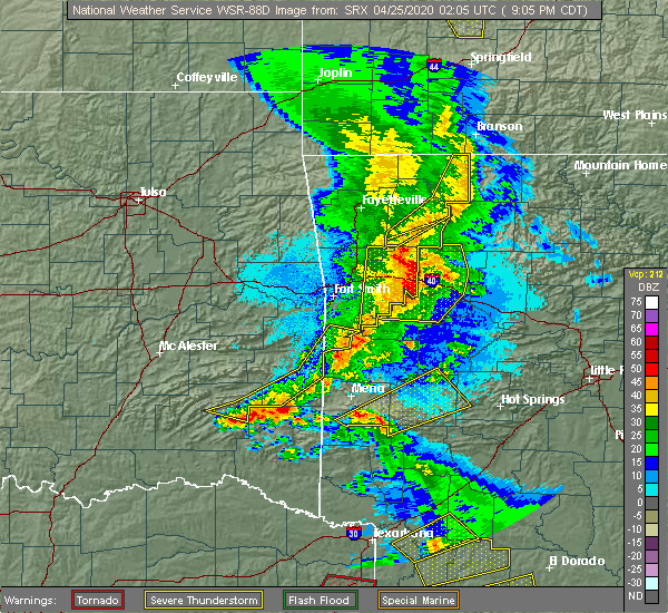 The severe thunderstorm warning for southern madison and eastern carroll counties will expire at 915 pm cdt, the storms which prompted the warning have weakened below severe limits, and no longer pose an immediate threat to life or property. therefore the warning will be allowed to expire. however gusty winds are still possible with these thunderstorms. a severe thunderstorm watch remains in effect until 1100 pm cdt for northwestern and west central arkansas. to report severe weather, contact your nearest law enforcement agency. they will relay your report to the national weather service tulsa. The severe thunderstorm warning for southern madison and eastern carroll counties will expire at 915 pm cdt, the storms which prompted the warning have weakened below severe limits, and no longer pose an immediate threat to life or property. therefore the warning will be allowed to expire. however gusty winds are still possible with these thunderstorms. a severe thunderstorm watch remains in effect until 1100 pm cdt for northwestern and west central arkansas. to report severe weather, contact your nearest law enforcement agency. they will relay your report to the national weather service tulsa.
|
| 4/24/2020 9:04 PM CDT |
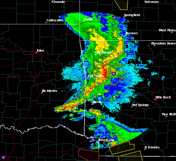 At 903 pm cdt, severe thunderstorms were located along a line extending from 7 miles northwest of roberson hollow to 2 miles east of rudd to 7 miles southwest of japton, moving east at 45 mph (radar indicated). Hazards include 60 mph wind gusts. Expect damage to roofs, siding, and trees. locations in or near the path include, green forest, st. Paul, carrollton, rudd, japton, kingston, witter, marble, aurora, osage, rule, dryfork, metalton, connor, delaney, brashears, coin, crosses, patrick, combs,. At 903 pm cdt, severe thunderstorms were located along a line extending from 7 miles northwest of roberson hollow to 2 miles east of rudd to 7 miles southwest of japton, moving east at 45 mph (radar indicated). Hazards include 60 mph wind gusts. Expect damage to roofs, siding, and trees. locations in or near the path include, green forest, st. Paul, carrollton, rudd, japton, kingston, witter, marble, aurora, osage, rule, dryfork, metalton, connor, delaney, brashears, coin, crosses, patrick, combs,.
|
| 4/24/2020 8:50 PM CDT |
 At 849 pm cdt, severe thunderstorms were located along a line extending from 6 miles north of urbanette to 4 miles north of marble to 3 miles east of brentwood, moving east at 45 mph (radar indicated). Hazards include 60 mph wind gusts and penny size hail. Expect damage to roofs, siding, and trees. locations in or near the path include, berryville, huntsville, green forest, elkins, west fork, winslow, st. Paul, hindsville, wesley, carrollton, rudd, kingston, blackburn, forum, aurora, withrow springs state park, brentwood, japton, witter, marble, this includes interstate 49 between mile markers 45 and 51. At 849 pm cdt, severe thunderstorms were located along a line extending from 6 miles north of urbanette to 4 miles north of marble to 3 miles east of brentwood, moving east at 45 mph (radar indicated). Hazards include 60 mph wind gusts and penny size hail. Expect damage to roofs, siding, and trees. locations in or near the path include, berryville, huntsville, green forest, elkins, west fork, winslow, st. Paul, hindsville, wesley, carrollton, rudd, kingston, blackburn, forum, aurora, withrow springs state park, brentwood, japton, witter, marble, this includes interstate 49 between mile markers 45 and 51.
|
| 4/24/2020 8:46 PM CDT |
 At 846 pm cdt, severe thunderstorms were located along a line extending from near lake fort smith to 5 miles south of mulberry to 3 miles north of burnville, moving east at 35 mph (radar indicated). Hazards include 60 mph wind gusts and quarter size hail. Hail damage to vehicles is expected. expect wind damage to roofs, siding, and trees. locations in or near the path include, ozark, charleston, mulberry, dyer, altus, branch, denning, st. Paul, wiederkehr village, cass, saint paul, boston, bloomer, pettigrew, washburn, fern, fort chaffee, jethro, bidville, red star, this includes interstate 40 in arkansas between mile markers 19 and 42. At 846 pm cdt, severe thunderstorms were located along a line extending from near lake fort smith to 5 miles south of mulberry to 3 miles north of burnville, moving east at 35 mph (radar indicated). Hazards include 60 mph wind gusts and quarter size hail. Hail damage to vehicles is expected. expect wind damage to roofs, siding, and trees. locations in or near the path include, ozark, charleston, mulberry, dyer, altus, branch, denning, st. Paul, wiederkehr village, cass, saint paul, boston, bloomer, pettigrew, washburn, fern, fort chaffee, jethro, bidville, red star, this includes interstate 40 in arkansas between mile markers 19 and 42.
|
| 4/24/2020 8:34 PM CDT |
 At 834 pm cdt, severe thunderstorms were located along a line extending from 2 miles northeast of beaver to 2 miles south of clifty to 3 miles north of blackburn, moving east at 40 mph (radar indicated). Hazards include 60 mph wind gusts and nickel size hail. Expect damage to roofs, siding, and trees. locations in or near the path include, fayetteville, berryville, huntsville, eureka springs, green forest, elkins, west fork, greenland, winslow, st. Paul, beaver, hindsville, wesley, carrollton, rudd, forum, aurora, hobbs state park, clifty, withrow springs state park, this includes interstate 49 between mile markers 44 and 60. At 834 pm cdt, severe thunderstorms were located along a line extending from 2 miles northeast of beaver to 2 miles south of clifty to 3 miles north of blackburn, moving east at 40 mph (radar indicated). Hazards include 60 mph wind gusts and nickel size hail. Expect damage to roofs, siding, and trees. locations in or near the path include, fayetteville, berryville, huntsville, eureka springs, green forest, elkins, west fork, greenland, winslow, st. Paul, beaver, hindsville, wesley, carrollton, rudd, forum, aurora, hobbs state park, clifty, withrow springs state park, this includes interstate 49 between mile markers 44 and 60.
|
| 4/24/2020 8:07 PM CDT |
 At 807 pm cdt, severe thunderstorms were located along a line extending from 3 miles northeast of pea ridge to springdale to 4 miles east of adair state park, moving east at 40 mph (radar indicated). Hazards include 60 mph wind gusts and nickel size hail. Expect damage to roofs, siding, and trees. Locations in or near the path include, fayetteville, springdale, rogers, bentonville, berryville, stilwell, huntsville, eureka springs, lowell, farmington, pea ridge, prairie grove, green forest, elkins, tontitown, bethel heights, west fork, lincoln, cave springs, greenland, this includes interstate 49 between mile markers 44 and 89. At 807 pm cdt, severe thunderstorms were located along a line extending from 3 miles northeast of pea ridge to springdale to 4 miles east of adair state park, moving east at 40 mph (radar indicated). Hazards include 60 mph wind gusts and nickel size hail. Expect damage to roofs, siding, and trees. Locations in or near the path include, fayetteville, springdale, rogers, bentonville, berryville, stilwell, huntsville, eureka springs, lowell, farmington, pea ridge, prairie grove, green forest, elkins, tontitown, bethel heights, west fork, lincoln, cave springs, greenland, this includes interstate 49 between mile markers 44 and 89.
|
| 3/19/2020 5:58 PM CDT |
 At 558 pm cdt, a severe thunderstorm was located over pettigrew, moving northeast at 40 mph (radar indicated). Hazards include 60 mph wind gusts. Expect damage to roofs, siding, and trees. Locations in or near the path include, pettigrew, boston, dutton, red star, a tornado watch remains in effect until 1000 pm cdt for northwestern arkansas. At 558 pm cdt, a severe thunderstorm was located over pettigrew, moving northeast at 40 mph (radar indicated). Hazards include 60 mph wind gusts. Expect damage to roofs, siding, and trees. Locations in or near the path include, pettigrew, boston, dutton, red star, a tornado watch remains in effect until 1000 pm cdt for northwestern arkansas.
|
| 3/19/2020 5:47 PM CDT |
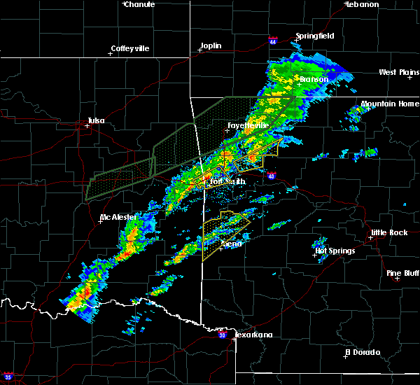 At 547 pm cdt, a severe thunderstorm was located 3 miles northeast of cass, moving northeast at 40 mph (radar indicated). Hazards include 60 mph wind gusts. Expect damage to roofs, siding, and trees. locations in or near the path include, st. Paul, cass, saint paul, pettigrew, boston, dutton, red star, brashears, redding, a tornado watch remains in effect until 1000 pm cdt for northwestern and west central arkansas. At 547 pm cdt, a severe thunderstorm was located 3 miles northeast of cass, moving northeast at 40 mph (radar indicated). Hazards include 60 mph wind gusts. Expect damage to roofs, siding, and trees. locations in or near the path include, st. Paul, cass, saint paul, pettigrew, boston, dutton, red star, brashears, redding, a tornado watch remains in effect until 1000 pm cdt for northwestern and west central arkansas.
|
| 3/19/2020 5:31 PM CDT |
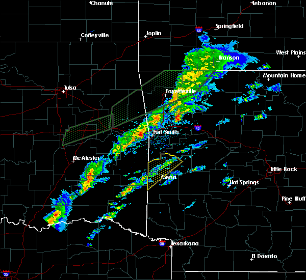 At 531 pm cdt, a severe thunderstorm was located 5 miles east of fern, moving northeast at 40 mph (radar indicated). Hazards include 60 mph wind gusts. Expect damage to roofs, siding, and trees. locations in or near the path include, st. Paul, cass, saint paul, pettigrew, fern, boston, dutton, jethro, barnes, red star, redding, brashears, turners bend, taft, paradise, a tornado watch remains in effect until 1000 pm cdt for northwestern and west central arkansas. At 531 pm cdt, a severe thunderstorm was located 5 miles east of fern, moving northeast at 40 mph (radar indicated). Hazards include 60 mph wind gusts. Expect damage to roofs, siding, and trees. locations in or near the path include, st. Paul, cass, saint paul, pettigrew, fern, boston, dutton, jethro, barnes, red star, redding, brashears, turners bend, taft, paradise, a tornado watch remains in effect until 1000 pm cdt for northwestern and west central arkansas.
|
| 3/11/2020 7:30 AM CDT |
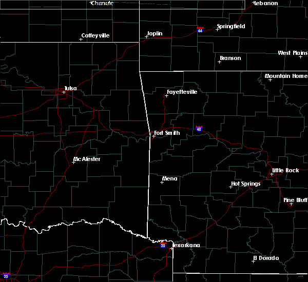 At 730 am cdt, severe thunderstorms were located along a line extending from 2 miles east of lost valley state park to 3 miles east of boston to 3 miles north of st. paul, moving southeast at 35 mph (radar indicated). Hazards include 60 mph wind gusts and quarter size hail. Hail damage to vehicles is expected. expect wind damage to roofs, siding, and trees. locations in or near the path include, st. Paul, pettigrew, witter, boston, dutton, red star, weathers,. At 730 am cdt, severe thunderstorms were located along a line extending from 2 miles east of lost valley state park to 3 miles east of boston to 3 miles north of st. paul, moving southeast at 35 mph (radar indicated). Hazards include 60 mph wind gusts and quarter size hail. Hail damage to vehicles is expected. expect wind damage to roofs, siding, and trees. locations in or near the path include, st. Paul, pettigrew, witter, boston, dutton, red star, weathers,.
|
| 3/11/2020 7:12 AM CDT |
 At 711 am cdt, severe thunderstorms were located along a line extending from marble to near witter to 3 miles west of japton, moving southeast at 35 mph (radar indicated). Hazards include 60 mph wind gusts and quarter size hail. Hail damage to vehicles is expected. expect wind damage to roofs, siding, and trees. locations in or near the path include, huntsville, st. Paul, pettigrew, japton, kingston, witter, marble, aurora, boston, georgetown, dutton, red star, weathers,. At 711 am cdt, severe thunderstorms were located along a line extending from marble to near witter to 3 miles west of japton, moving southeast at 35 mph (radar indicated). Hazards include 60 mph wind gusts and quarter size hail. Hail damage to vehicles is expected. expect wind damage to roofs, siding, and trees. locations in or near the path include, huntsville, st. Paul, pettigrew, japton, kingston, witter, marble, aurora, boston, georgetown, dutton, red star, weathers,.
|
| 3/11/2020 6:56 AM CDT |
 At 656 am cdt, severe thunderstorms were located along a line extending from 5 miles south of berryville to 2 miles east of elkins, moving southeast at 45 mph (radar indicated). Hazards include 60 mph wind gusts and quarter size hail. Hail damage to vehicles is expected. expect wind damage to roofs, siding, and trees. locations in or near the path include, huntsville, elkins, st. Paul, hindsville, wesley, rudd, saint paul, kingston, forum, aurora, clifty, withrow springs state park, japton, witter, marble, osage, goshen, georgetown, dryfork, metalton,. At 656 am cdt, severe thunderstorms were located along a line extending from 5 miles south of berryville to 2 miles east of elkins, moving southeast at 45 mph (radar indicated). Hazards include 60 mph wind gusts and quarter size hail. Hail damage to vehicles is expected. expect wind damage to roofs, siding, and trees. locations in or near the path include, huntsville, elkins, st. Paul, hindsville, wesley, rudd, saint paul, kingston, forum, aurora, clifty, withrow springs state park, japton, witter, marble, osage, goshen, georgetown, dryfork, metalton,.
|
| 3/11/2020 6:45 AM CDT |
 At 645 am cdt, severe thunderstorms were located along a line extending from 4 miles southwest of grandview to 6 miles east of fayetteville, moving southeast at 45 mph (radar indicated). Hazards include 60 mph wind gusts and quarter size hail. Hail damage to vehicles is expected. expect wind damage to roofs, siding, and trees. locations in or near the path include, fayetteville, springdale, berryville, huntsville, eureka springs, elkins, st. Paul, hindsville, wesley, rudd, saint paul, kingston, forum, aurora, hobbs state park, clifty, withrow springs state park, war eagle, japton, witter,. At 645 am cdt, severe thunderstorms were located along a line extending from 4 miles southwest of grandview to 6 miles east of fayetteville, moving southeast at 45 mph (radar indicated). Hazards include 60 mph wind gusts and quarter size hail. Hail damage to vehicles is expected. expect wind damage to roofs, siding, and trees. locations in or near the path include, fayetteville, springdale, berryville, huntsville, eureka springs, elkins, st. Paul, hindsville, wesley, rudd, saint paul, kingston, forum, aurora, hobbs state park, clifty, withrow springs state park, war eagle, japton, witter,.
|
| 3/11/2020 6:28 AM CDT |
 At 627 am cdt, severe thunderstorms were located along a line extending from 2 miles northwest of beaver to near tontitown, moving southeast at 45 mph (radar indicated). Hazards include 60 mph wind gusts and quarter size hail. Hail damage to vehicles is expected. expect wind damage to roofs, siding, and trees. locations in or near the path include, fayetteville, springdale, rogers, berryville, huntsville, eureka springs, lowell, elkins, tontitown, bethel heights, cave springs, gateway, st. Paul, beaver, hindsville, wesley, rudd, saint paul, forum, aurora, this includes interstate 49 between mile markers 64 and 82. At 627 am cdt, severe thunderstorms were located along a line extending from 2 miles northwest of beaver to near tontitown, moving southeast at 45 mph (radar indicated). Hazards include 60 mph wind gusts and quarter size hail. Hail damage to vehicles is expected. expect wind damage to roofs, siding, and trees. locations in or near the path include, fayetteville, springdale, rogers, berryville, huntsville, eureka springs, lowell, elkins, tontitown, bethel heights, cave springs, gateway, st. Paul, beaver, hindsville, wesley, rudd, saint paul, forum, aurora, this includes interstate 49 between mile markers 64 and 82.
|
| 1/10/2020 5:10 PM CST |
 At 510 pm cst, severe thunderstorms were located along a line extending from 3 miles southeast of garfield to 5 miles east of brentwood, moving northeast at 60 mph (radar indicated). Hazards include 60 mph wind gusts and nickel size hail. Expect damage to roofs, siding, and trees. locations in or near the path include, fayetteville, rogers, berryville, huntsville, eureka springs, green forest, elkins, st. Paul, beaver, hindsville, wesley, carrollton, rudd, saint paul, forum, aurora, hobbs state park, clifty, boston, withrow springs state park, a tornado watch remains in effect until 600 pm cst for northwestern and west central arkansas. At 510 pm cst, severe thunderstorms were located along a line extending from 3 miles southeast of garfield to 5 miles east of brentwood, moving northeast at 60 mph (radar indicated). Hazards include 60 mph wind gusts and nickel size hail. Expect damage to roofs, siding, and trees. locations in or near the path include, fayetteville, rogers, berryville, huntsville, eureka springs, green forest, elkins, st. Paul, beaver, hindsville, wesley, carrollton, rudd, saint paul, forum, aurora, hobbs state park, clifty, boston, withrow springs state park, a tornado watch remains in effect until 600 pm cst for northwestern and west central arkansas.
|
| 10/21/2019 1:25 AM CDT |
 At 125 am cdt, severe thunderstorms were located along a line extending from 7 miles north of carrollton to 6 miles north of branch, moving east at 50 mph (radar indicated). Hazards include 60 mph wind gusts and nickel size hail. Expect damage to roofs, siding, and trees. locations in or near the path include, berryville, ozark, charleston, huntsville, barling, green forest, lavaca, mulberry, dyer, altus, branch, denning, st. paul, wiederkehr village, carrollton, rudd, saint paul, forum, aurora, boston, this includes interstate 40 in arkansas between mile markers 15 and 42. A tornado watch remains in effect until 300 am cdt for northwestern and west central arkansas. At 125 am cdt, severe thunderstorms were located along a line extending from 7 miles north of carrollton to 6 miles north of branch, moving east at 50 mph (radar indicated). Hazards include 60 mph wind gusts and nickel size hail. Expect damage to roofs, siding, and trees. locations in or near the path include, berryville, ozark, charleston, huntsville, barling, green forest, lavaca, mulberry, dyer, altus, branch, denning, st. paul, wiederkehr village, carrollton, rudd, saint paul, forum, aurora, boston, this includes interstate 40 in arkansas between mile markers 15 and 42. A tornado watch remains in effect until 300 am cdt for northwestern and west central arkansas.
|
| 10/21/2019 1:07 AM CDT |
 At 106 am cdt, severe thunderstorms were located along a line extending from 11 miles northeast of beaver to near urbanette to 4 miles southwest of marble to 2 miles north of mulberry, moving east at 70 mph (radar indicated). Hazards include 60 mph wind gusts and nickel size hail. Expect damage to roofs, siding, and trees. locations in or near the path include, fort smith, van buren, berryville, ozark, huntsville, eureka springs, cedarville, mountainburg, alma, roland, green forest, mulberry, dyer, altus, winslow, denning, chester, moffett, st. paul, rudy, this includes the following highways, interstate 40 in arkansas between mile markers 0 and 42. interstate 40 in oklahoma between mile markers 324 and 328. interstate 540 between mile markers 1 and 8. interstate 49 between mile markers 22 and 39. A tornado watch remains in effect until 300 am cdt for northwestern and west central arkansas, and southeastern oklahoma. At 106 am cdt, severe thunderstorms were located along a line extending from 11 miles northeast of beaver to near urbanette to 4 miles southwest of marble to 2 miles north of mulberry, moving east at 70 mph (radar indicated). Hazards include 60 mph wind gusts and nickel size hail. Expect damage to roofs, siding, and trees. locations in or near the path include, fort smith, van buren, berryville, ozark, huntsville, eureka springs, cedarville, mountainburg, alma, roland, green forest, mulberry, dyer, altus, winslow, denning, chester, moffett, st. paul, rudy, this includes the following highways, interstate 40 in arkansas between mile markers 0 and 42. interstate 40 in oklahoma between mile markers 324 and 328. interstate 540 between mile markers 1 and 8. interstate 49 between mile markers 22 and 39. A tornado watch remains in effect until 300 am cdt for northwestern and west central arkansas, and southeastern oklahoma.
|
| 10/21/2019 12:55 AM CDT |
 At 1254 am cdt, severe thunderstorms were located along a line extending from 5 miles east of seligman to 3 miles southeast of eureka springs to 4 miles east of wesley to near alma, moving east at 65 mph (radar indicated). Hazards include 70 mph wind gusts and quarter size hail. Hail damage to vehicles is expected. expect considerable tree damage. wind damage is also likely to mobile homes, roofs, and outbuildings. locations in or near the path include, fort smith, fayetteville, springdale, van buren, berryville, ozark, huntsville, eureka springs, cedarville, mountainburg, natural dam, alma, muldrow, roland, green forest, elkins, west fork, mulberry, greenland, dyer, this includes the following highways, interstate 40 in arkansas between mile markers 0 and 42. interstate 40 in oklahoma between mile markers 316 and 328. interstate 540 between mile markers 1 and 8. interstate 49 between mile markers 22 and 60. A tornado watch remains in effect until 300 am cdt for northwestern and west central arkansas, and southeastern, northeastern and east central oklahoma. At 1254 am cdt, severe thunderstorms were located along a line extending from 5 miles east of seligman to 3 miles southeast of eureka springs to 4 miles east of wesley to near alma, moving east at 65 mph (radar indicated). Hazards include 70 mph wind gusts and quarter size hail. Hail damage to vehicles is expected. expect considerable tree damage. wind damage is also likely to mobile homes, roofs, and outbuildings. locations in or near the path include, fort smith, fayetteville, springdale, van buren, berryville, ozark, huntsville, eureka springs, cedarville, mountainburg, natural dam, alma, muldrow, roland, green forest, elkins, west fork, mulberry, greenland, dyer, this includes the following highways, interstate 40 in arkansas between mile markers 0 and 42. interstate 40 in oklahoma between mile markers 316 and 328. interstate 540 between mile markers 1 and 8. interstate 49 between mile markers 22 and 60. A tornado watch remains in effect until 300 am cdt for northwestern and west central arkansas, and southeastern, northeastern and east central oklahoma.
|
| 10/21/2019 12:41 AM CDT |
 At 1241 am cdt, severe thunderstorms were located along a line extending from 3 miles northeast of pea ridge to 2 miles northeast of war eagle to 4 miles southwest of elkins to moffett, moving east at 70 mph (radar indicated). Hazards include 70 mph wind gusts and quarter size hail. Hail damage to vehicles is expected. expect considerable tree damage. wind damage is also likely to mobile homes, roofs, and outbuildings. locations in or near the path include, fort smith, fayetteville, springdale, rogers, bentonville, van buren, sallisaw, berryville, ozark, huntsville, eureka springs, cedarville, mountainburg, natural dam, bella vista, lowell, farmington, alma, pea ridge, prairie grove, this includes the following highways, interstate 40 in arkansas between mile markers 0 and 42. interstate 40 in oklahoma between mile markers 304 and 328. interstate 540 between mile markers 1 and 8. interstate 49 between mile markers 22 and 93. A tornado watch remains in effect until 300 am cdt for northwestern and west central arkansas, and southeastern, northeastern and east central oklahoma. At 1241 am cdt, severe thunderstorms were located along a line extending from 3 miles northeast of pea ridge to 2 miles northeast of war eagle to 4 miles southwest of elkins to moffett, moving east at 70 mph (radar indicated). Hazards include 70 mph wind gusts and quarter size hail. Hail damage to vehicles is expected. expect considerable tree damage. wind damage is also likely to mobile homes, roofs, and outbuildings. locations in or near the path include, fort smith, fayetteville, springdale, rogers, bentonville, van buren, sallisaw, berryville, ozark, huntsville, eureka springs, cedarville, mountainburg, natural dam, bella vista, lowell, farmington, alma, pea ridge, prairie grove, this includes the following highways, interstate 40 in arkansas between mile markers 0 and 42. interstate 40 in oklahoma between mile markers 304 and 328. interstate 540 between mile markers 1 and 8. interstate 49 between mile markers 22 and 93. A tornado watch remains in effect until 300 am cdt for northwestern and west central arkansas, and southeastern, northeastern and east central oklahoma.
|
| 10/21/2019 12:33 AM CDT |
 At 1232 am cdt, severe thunderstorms were located along a line extending from 3 miles southwest of lowell to 4 miles north of fayetteville to 3 miles north of blackburn to 4 miles southwest of figure five, moving east at 60 mph (radar indicated). Hazards include 70 mph wind gusts. Expect considerable tree damage. damage is likely to mobile homes, roofs, and outbuildings. locations in or near the path include, fort smith, fayetteville, springdale, rogers, bentonville, van buren, siloam springs, sallisaw, stilwell, huntsville, eureka springs, cedarville, mountainburg, natural dam, bella vista, lowell, farmington, alma, pea ridge, prairie grove, this includes the following highways, interstate 40 in arkansas between mile markers 0 and 31. interstate 40 in oklahoma between mile markers 298 and 328. interstate 540 between mile markers 1 and 7. interstate 49 between mile markers 22 and 93. A tornado watch remains in effect until 300 am cdt for northwestern and west central arkansas, and southeastern, northeastern and east central oklahoma. At 1232 am cdt, severe thunderstorms were located along a line extending from 3 miles southwest of lowell to 4 miles north of fayetteville to 3 miles north of blackburn to 4 miles southwest of figure five, moving east at 60 mph (radar indicated). Hazards include 70 mph wind gusts. Expect considerable tree damage. damage is likely to mobile homes, roofs, and outbuildings. locations in or near the path include, fort smith, fayetteville, springdale, rogers, bentonville, van buren, siloam springs, sallisaw, stilwell, huntsville, eureka springs, cedarville, mountainburg, natural dam, bella vista, lowell, farmington, alma, pea ridge, prairie grove, this includes the following highways, interstate 40 in arkansas between mile markers 0 and 31. interstate 40 in oklahoma between mile markers 298 and 328. interstate 540 between mile markers 1 and 7. interstate 49 between mile markers 22 and 93. A tornado watch remains in effect until 300 am cdt for northwestern and west central arkansas, and southeastern, northeastern and east central oklahoma.
|
| 10/21/2019 12:04 AM CDT |
 At 1204 am cdt, severe thunderstorms were located along a line extending from 3 miles west of west siloam springs to 5 miles northwest of westville to 5 miles west of stilwell to 5 miles east of tamaha, moving east at 60 mph (radar indicated). Hazards include 70 mph wind gusts. Expect considerable tree damage. damage is likely to mobile homes, roofs, and outbuildings. locations in or near the path include, fort smith, fayetteville, springdale, rogers, bentonville, van buren, siloam springs, sallisaw, stilwell, huntsville, eureka springs, cedarville, mountainburg, natural dam, bella vista, lowell, farmington, alma, pea ridge, prairie grove, this includes the following highways, interstate 40 in arkansas between mile markers 0 and 31. interstate 40 in oklahoma between mile markers 295 and 328. interstate 540 between mile markers 1 and 7. interstate 49 between mile markers 22 and 93. A tornado watch remains in effect until 300 am cdt for northwestern and west central arkansas, and southeastern, northeastern and east central oklahoma. At 1204 am cdt, severe thunderstorms were located along a line extending from 3 miles west of west siloam springs to 5 miles northwest of westville to 5 miles west of stilwell to 5 miles east of tamaha, moving east at 60 mph (radar indicated). Hazards include 70 mph wind gusts. Expect considerable tree damage. damage is likely to mobile homes, roofs, and outbuildings. locations in or near the path include, fort smith, fayetteville, springdale, rogers, bentonville, van buren, siloam springs, sallisaw, stilwell, huntsville, eureka springs, cedarville, mountainburg, natural dam, bella vista, lowell, farmington, alma, pea ridge, prairie grove, this includes the following highways, interstate 40 in arkansas between mile markers 0 and 31. interstate 40 in oklahoma between mile markers 295 and 328. interstate 540 between mile markers 1 and 7. interstate 49 between mile markers 22 and 93. A tornado watch remains in effect until 300 am cdt for northwestern and west central arkansas, and southeastern, northeastern and east central oklahoma.
|
| 9/26/2019 2:22 AM CDT |
 At 221 am cdt, severe thunderstorms were located along a line extending from 9 miles southwest of japton to 3 miles northeast of lake fort smith to 2 miles northwest of short, moving southeast at 35 mph (radar indicated). Hazards include 60 mph wind gusts and penny size hail. Expect damage to roofs, siding, and trees. locations in or near the path include, fort smith, van buren, ozark, cedarville, mountainburg, natural dam, alma, mulberry, dyer, chester, moffett, st. paul, rudy, wiederkehr village, saint paul, short, lake fort smith, figure five, cass, fort smith regional airport, this includes the following highways, interstate 40 in arkansas between mile markers 0 and 38. interstate 40 in oklahoma between mile markers 327 and 328. interstate 540 between mile markers 1 and 10. Interstate 49 between mile markers 22 and 37. At 221 am cdt, severe thunderstorms were located along a line extending from 9 miles southwest of japton to 3 miles northeast of lake fort smith to 2 miles northwest of short, moving southeast at 35 mph (radar indicated). Hazards include 60 mph wind gusts and penny size hail. Expect damage to roofs, siding, and trees. locations in or near the path include, fort smith, van buren, ozark, cedarville, mountainburg, natural dam, alma, mulberry, dyer, chester, moffett, st. paul, rudy, wiederkehr village, saint paul, short, lake fort smith, figure five, cass, fort smith regional airport, this includes the following highways, interstate 40 in arkansas between mile markers 0 and 38. interstate 40 in oklahoma between mile markers 327 and 328. interstate 540 between mile markers 1 and 10. Interstate 49 between mile markers 22 and 37.
|
| 9/26/2019 1:56 AM CDT |
 At 155 am cdt, severe thunderstorms were located along a line extending from 2 miles east of drake field airport to strickler to 4 miles northeast of bunch, moving southeast at 35 mph (radar indicated). Hazards include 60 mph wind gusts and penny size hail. Expect damage to roofs, siding, and trees. locations in or near the path include, fort smith, fayetteville, van buren, stilwell, ozark, cedarville, mountainburg, natural dam, alma, elkins, west fork, arkoma, mulberry, greenland, dyer, winslow, chester, moffett, st. paul, rudy, this includes the following highways, interstate 40 in arkansas between mile markers 0 and 38. interstate 40 in oklahoma between mile markers 325 and 328. interstate 540 between mile markers 1 and 11. Interstate 49 between mile markers 22 and 59. At 155 am cdt, severe thunderstorms were located along a line extending from 2 miles east of drake field airport to strickler to 4 miles northeast of bunch, moving southeast at 35 mph (radar indicated). Hazards include 60 mph wind gusts and penny size hail. Expect damage to roofs, siding, and trees. locations in or near the path include, fort smith, fayetteville, van buren, stilwell, ozark, cedarville, mountainburg, natural dam, alma, elkins, west fork, arkoma, mulberry, greenland, dyer, winslow, chester, moffett, st. paul, rudy, this includes the following highways, interstate 40 in arkansas between mile markers 0 and 38. interstate 40 in oklahoma between mile markers 325 and 328. interstate 540 between mile markers 1 and 11. Interstate 49 between mile markers 22 and 59.
|
| 8/27/2019 12:12 AM CDT |
 The severe thunderstorm warning for madison, northern franklin, northeastern crawford, carroll and southeastern washington counties will expire at 1215 am cdt, the storms which prompted the warning have weakened below severe limits, and no longer pose an immediate threat to life or property. therefore the warning will be allowed to expire. however gusty winds and heavy rain are still possible with these thunderstorms. a severe thunderstorm watch remains in effect until 600 am cdt for northwestern and west central arkansas. The severe thunderstorm warning for madison, northern franklin, northeastern crawford, carroll and southeastern washington counties will expire at 1215 am cdt, the storms which prompted the warning have weakened below severe limits, and no longer pose an immediate threat to life or property. therefore the warning will be allowed to expire. however gusty winds and heavy rain are still possible with these thunderstorms. a severe thunderstorm watch remains in effect until 600 am cdt for northwestern and west central arkansas.
|
| 8/26/2019 11:53 PM CDT |
 At 1153 pm cdt, severe thunderstorms were located along a line extending from near grandview to 3 miles southeast of marble to 8 miles northwest of cass to 2 miles southeast of devils den state park, moving east at 45 mph (radar indicated). Hazards include 60 mph wind gusts. Expect damage to roofs, siding, and trees. locations in or near the path include, berryville, huntsville, eureka springs, mountainburg, green forest, elkins, winslow, chester, st. Paul, beaver, wesley, carrollton, rudd, saint paul, forum, aurora, clifty, boston, withrow springs state park, brentwood, this includes interstate 49 between mile markers 24 and 48. At 1153 pm cdt, severe thunderstorms were located along a line extending from near grandview to 3 miles southeast of marble to 8 miles northwest of cass to 2 miles southeast of devils den state park, moving east at 45 mph (radar indicated). Hazards include 60 mph wind gusts. Expect damage to roofs, siding, and trees. locations in or near the path include, berryville, huntsville, eureka springs, mountainburg, green forest, elkins, winslow, chester, st. Paul, beaver, wesley, carrollton, rudd, saint paul, forum, aurora, clifty, boston, withrow springs state park, brentwood, this includes interstate 49 between mile markers 24 and 48.
|
| 8/26/2019 11:34 PM CDT |
 At 1134 pm cdt, severe thunderstorms were located along a line extending from 4 miles east of gateway to near withrow springs state park to near winslow to 6 miles west of strickler, moving east at 45 mph (radar indicated). Hazards include 60 mph wind gusts. Expect damage to roofs, siding, and trees. locations in or near the path include, berryville, ozark, huntsville, eureka springs, cedarville, mountainburg, natural dam, alma, green forest, elkins, mulberry, dyer, winslow, chester, st. paul, beaver, rudy, wesley, carrollton, rudd, this includes the following highways, interstate 40 in arkansas between mile markers 7 and 35. Interstate 49 between mile markers 22 and 48. At 1134 pm cdt, severe thunderstorms were located along a line extending from 4 miles east of gateway to near withrow springs state park to near winslow to 6 miles west of strickler, moving east at 45 mph (radar indicated). Hazards include 60 mph wind gusts. Expect damage to roofs, siding, and trees. locations in or near the path include, berryville, ozark, huntsville, eureka springs, cedarville, mountainburg, natural dam, alma, green forest, elkins, mulberry, dyer, winslow, chester, st. paul, beaver, rudy, wesley, carrollton, rudd, this includes the following highways, interstate 40 in arkansas between mile markers 7 and 35. Interstate 49 between mile markers 22 and 48.
|
| 8/26/2019 11:28 PM CDT |
 At 1128 pm cdt, severe thunderstorms were located along a line extending from 4 miles northeast of clifty to near blackburn to 8 miles west of strickler to 4 miles south of eldon, moving southeast at 50 mph (radar indicated). Hazards include 60 mph wind gusts and penny size hail. Expect damage to roofs, siding, and trees. locations in or near the path include, fayetteville, tahlequah, stilwell, huntsville, cedarville, mountainburg, natural dam, farmington, prairie grove, elkins, west fork, lincoln, greenland, winslow, marble city, chester, st. Paul, rudy, hindsville, wesley, this includes interstate 49 between mile markers 22 and 62. At 1128 pm cdt, severe thunderstorms were located along a line extending from 4 miles northeast of clifty to near blackburn to 8 miles west of strickler to 4 miles south of eldon, moving southeast at 50 mph (radar indicated). Hazards include 60 mph wind gusts and penny size hail. Expect damage to roofs, siding, and trees. locations in or near the path include, fayetteville, tahlequah, stilwell, huntsville, cedarville, mountainburg, natural dam, farmington, prairie grove, elkins, west fork, lincoln, greenland, winslow, marble city, chester, st. Paul, rudy, hindsville, wesley, this includes interstate 49 between mile markers 22 and 62.
|
| 8/26/2019 11:28 PM CDT |
 At 1107 pm cdt, severe thunderstorms were located along a line extending from 3 miles southwest of garfield to 4 miles northwest of lincoln to 2 miles southwest of christie to 5 miles south of peggs, moving southeast at 50 mph (radar indicated). Hazards include 70 mph wind gusts and penny size hail. Expect considerable tree damage. damage is likely to mobile homes, roofs, and outbuildings. Locations in or near the path include, fayetteville, springdale, rogers, bentonville, tahlequah, stilwell, huntsville, cedarville, mountainburg, natural dam, lowell, farmington, pea ridge, prairie grove, elkins, tontitown, bethel heights, west fork, lincoln, cave springs, this includes interstate 49 between mile markers 22 and 89. At 1107 pm cdt, severe thunderstorms were located along a line extending from 3 miles southwest of garfield to 4 miles northwest of lincoln to 2 miles southwest of christie to 5 miles south of peggs, moving southeast at 50 mph (radar indicated). Hazards include 70 mph wind gusts and penny size hail. Expect considerable tree damage. damage is likely to mobile homes, roofs, and outbuildings. Locations in or near the path include, fayetteville, springdale, rogers, bentonville, tahlequah, stilwell, huntsville, cedarville, mountainburg, natural dam, lowell, farmington, pea ridge, prairie grove, elkins, tontitown, bethel heights, west fork, lincoln, cave springs, this includes interstate 49 between mile markers 22 and 89.
|
| 8/26/2019 11:08 PM CDT |
 At 1107 pm cdt, severe thunderstorms were located along a line extending from 3 miles southwest of garfield to 4 miles northwest of lincoln to 2 miles southwest of christie to 5 miles south of peggs, moving southeast at 50 mph (radar indicated). Hazards include 70 mph wind gusts and penny size hail. Expect considerable tree damage. damage is likely to mobile homes, roofs, and outbuildings. Locations in or near the path include, fayetteville, springdale, rogers, bentonville, tahlequah, stilwell, huntsville, cedarville, mountainburg, natural dam, lowell, farmington, pea ridge, prairie grove, elkins, tontitown, bethel heights, west fork, lincoln, cave springs, this includes interstate 49 between mile markers 22 and 89. At 1107 pm cdt, severe thunderstorms were located along a line extending from 3 miles southwest of garfield to 4 miles northwest of lincoln to 2 miles southwest of christie to 5 miles south of peggs, moving southeast at 50 mph (radar indicated). Hazards include 70 mph wind gusts and penny size hail. Expect considerable tree damage. damage is likely to mobile homes, roofs, and outbuildings. Locations in or near the path include, fayetteville, springdale, rogers, bentonville, tahlequah, stilwell, huntsville, cedarville, mountainburg, natural dam, lowell, farmington, pea ridge, prairie grove, elkins, tontitown, bethel heights, west fork, lincoln, cave springs, this includes interstate 49 between mile markers 22 and 89.
|
| 8/26/2019 11:00 PM CDT |
 At 1100 pm cdt, severe thunderstorms were located along a line extending from 3 miles east of pea ridge to near cincinnati to near proctor to 3 miles southwest of peggs, moving southeast at 50 mph (radar indicated). Hazards include 70 mph wind gusts and penny size hail. Expect considerable tree damage. damage is likely to mobile homes, roofs, and outbuildings. Locations in or near the path include, fayetteville, springdale, rogers, bentonville, tahlequah, stilwell, huntsville, cedarville, mountainburg, natural dam, lowell, farmington, pea ridge, prairie grove, elkins, tontitown, bethel heights, west fork, lincoln, cave springs, this includes interstate 49 between mile markers 22 and 89. At 1100 pm cdt, severe thunderstorms were located along a line extending from 3 miles east of pea ridge to near cincinnati to near proctor to 3 miles southwest of peggs, moving southeast at 50 mph (radar indicated). Hazards include 70 mph wind gusts and penny size hail. Expect considerable tree damage. damage is likely to mobile homes, roofs, and outbuildings. Locations in or near the path include, fayetteville, springdale, rogers, bentonville, tahlequah, stilwell, huntsville, cedarville, mountainburg, natural dam, lowell, farmington, pea ridge, prairie grove, elkins, tontitown, bethel heights, west fork, lincoln, cave springs, this includes interstate 49 between mile markers 22 and 89.
|
| 6/23/2019 11:38 AM CDT |
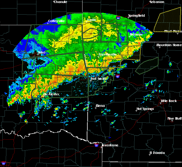 At 1137 am cdt, severe thunderstorms were located along a line extending from near japton to 6 miles northwest of cass, moving east at 30 mph (radar indicated). Hazards include 60 mph wind gusts. Expect damage to roofs, siding, and trees. locations in or near the path include, st. Paul, saint paul, pettigrew, japton, witter, aurora, boston, dutton, red star, weathers, delaney, brashears, patrick, combs,. At 1137 am cdt, severe thunderstorms were located along a line extending from near japton to 6 miles northwest of cass, moving east at 30 mph (radar indicated). Hazards include 60 mph wind gusts. Expect damage to roofs, siding, and trees. locations in or near the path include, st. Paul, saint paul, pettigrew, japton, witter, aurora, boston, dutton, red star, weathers, delaney, brashears, patrick, combs,.
|
| 6/23/2019 11:18 AM CDT |
 At 1118 am cdt, severe thunderstorms were located along a line extending from 4 miles south of wesley to 5 miles southeast of winslow, moving east at 30 mph (radar indicated). Hazards include 60 mph wind gusts. Expect damage to roofs, siding, and trees. locations in or near the path include, st. Paul, saint paul, pettigrew, japton, witter, aurora, boston, dutton, bidville, red star, weathers, delaney, brashears, crosses, patrick, combs, durham,. At 1118 am cdt, severe thunderstorms were located along a line extending from 4 miles south of wesley to 5 miles southeast of winslow, moving east at 30 mph (radar indicated). Hazards include 60 mph wind gusts. Expect damage to roofs, siding, and trees. locations in or near the path include, st. Paul, saint paul, pettigrew, japton, witter, aurora, boston, dutton, bidville, red star, weathers, delaney, brashears, crosses, patrick, combs, durham,.
|
| 5/29/2019 12:50 PM CDT |
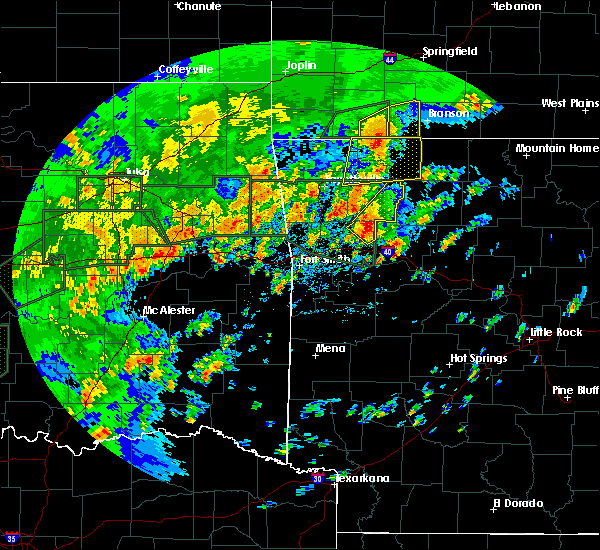 At 1250 pm cdt, a severe thunderstorm was located 3 miles east of cass, moving northeast at 30 mph (radar indicated). Hazards include 60 mph wind gusts and quarter size hail. Hail damage to vehicles is expected. expect wind damage to roofs, siding, and trees. locations in or near the path include, st. Paul, cass, saint paul, pettigrew, kingston, witter, boston, dutton, barnes, red star, redding, weathers, brashears, combs, turners bend, taft, paradise, a tornado watch remains in effect until 800 pm cdt for northwestern and west central arkansas. At 1250 pm cdt, a severe thunderstorm was located 3 miles east of cass, moving northeast at 30 mph (radar indicated). Hazards include 60 mph wind gusts and quarter size hail. Hail damage to vehicles is expected. expect wind damage to roofs, siding, and trees. locations in or near the path include, st. Paul, cass, saint paul, pettigrew, kingston, witter, boston, dutton, barnes, red star, redding, weathers, brashears, combs, turners bend, taft, paradise, a tornado watch remains in effect until 800 pm cdt for northwestern and west central arkansas.
|
| 5/29/2019 3:42 AM CDT |
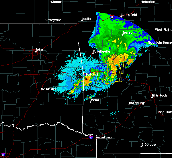 At 341 am cdt, severe thunderstorms were located along a line extending from 3 miles southeast of aurora to 2 miles south of woodland, moving northeast at 45 mph (radar indicated). Hazards include 70 mph wind gusts. Expect considerable tree damage. damage is likely to mobile homes, roofs, and outbuildings. locations in or near the path include, st. Paul, pettigrew, witter, boston, dutton, red star, weathers,. At 341 am cdt, severe thunderstorms were located along a line extending from 3 miles southeast of aurora to 2 miles south of woodland, moving northeast at 45 mph (radar indicated). Hazards include 70 mph wind gusts. Expect considerable tree damage. damage is likely to mobile homes, roofs, and outbuildings. locations in or near the path include, st. Paul, pettigrew, witter, boston, dutton, red star, weathers,.
|
| 5/29/2019 3:27 AM CDT |
 The severe thunderstorm warning for southwestern madison, franklin, eastern crawford and southeastern washington counties will expire at 330 am cdt, the storms which prompted the warning have moved out of the area. therefore the warning will be allowed to expire. however gusty winds are still possible with these thunderstorms. a severe thunderstorm watch remains in effect until 600 am cdt for northwestern and west central arkansas. The severe thunderstorm warning for southwestern madison, franklin, eastern crawford and southeastern washington counties will expire at 330 am cdt, the storms which prompted the warning have moved out of the area. therefore the warning will be allowed to expire. however gusty winds are still possible with these thunderstorms. a severe thunderstorm watch remains in effect until 600 am cdt for northwestern and west central arkansas.
|
| 5/29/2019 3:26 AM CDT |
 At 326 am cdt, severe thunderstorms were located along a line extending from 2 miles south of japton to 2 miles west of hartman, moving northeast at 45 mph (radar indicated). Hazards include 70 mph wind gusts. Expect considerable tree damage. damage is likely to mobile homes, roofs, and outbuildings. locations in or near the path include, ozark, altus, denning, st. Paul, wiederkehr village, cass, saint paul, boston, pettigrew, witter, jethro, red star, crosses, combs, turners bend, dutton, barnes, alix, redding, weathers, this includes interstate 40 in arkansas between mile markers 34 and 42. At 326 am cdt, severe thunderstorms were located along a line extending from 2 miles south of japton to 2 miles west of hartman, moving northeast at 45 mph (radar indicated). Hazards include 70 mph wind gusts. Expect considerable tree damage. damage is likely to mobile homes, roofs, and outbuildings. locations in or near the path include, ozark, altus, denning, st. Paul, wiederkehr village, cass, saint paul, boston, pettigrew, witter, jethro, red star, crosses, combs, turners bend, dutton, barnes, alix, redding, weathers, this includes interstate 40 in arkansas between mile markers 34 and 42.
|
| 5/29/2019 3:14 AM CDT |
 At 313 am cdt, severe thunderstorms were located along a line extending from 6 miles northeast of brentwood to 5 miles northeast of ozark, moving northeast at 55 mph (radar indicated). Hazards include 70 mph wind gusts and quarter size hail. Hail damage to vehicles is expected. expect considerable tree damage. wind damage is also likely to mobile homes, roofs, and outbuildings. locations in or near the path include, ozark, charleston, mulberry, altus, winslow, branch, denning, st. Paul, wiederkehr village, cass, saint paul, pettigrew, lake fort smith, fern, jethro, bidville, crosses, combs, locke, turners bend, this includes interstate 40 in arkansas between mile markers 19 and 42. At 313 am cdt, severe thunderstorms were located along a line extending from 6 miles northeast of brentwood to 5 miles northeast of ozark, moving northeast at 55 mph (radar indicated). Hazards include 70 mph wind gusts and quarter size hail. Hail damage to vehicles is expected. expect considerable tree damage. wind damage is also likely to mobile homes, roofs, and outbuildings. locations in or near the path include, ozark, charleston, mulberry, altus, winslow, branch, denning, st. Paul, wiederkehr village, cass, saint paul, pettigrew, lake fort smith, fern, jethro, bidville, crosses, combs, locke, turners bend, this includes interstate 40 in arkansas between mile markers 19 and 42.
|
| 5/29/2019 2:59 AM CDT |
 At 258 am cdt, severe thunderstorms were located along a line extending from 2 miles northeast of blackburn to near charleston, moving east at 50 mph. at 239 am, the fort smith regional airport gusted to 61 mph (radar indicated). Hazards include 70 mph wind gusts and quarter size hail. Hail damage to vehicles is expected. expect considerable tree damage. wind damage is also likely to mobile homes, roofs, and outbuildings. locations in or near the path include, fort smith, van buren, ozark, charleston, cedarville, mountainburg, natural dam, alma, barling, lavaca, mulberry, dyer, altus, winslow, branch, denning, chester, st. paul, rudy, wiederkehr village, this includes the following highways, interstate 40 in arkansas between mile markers 5 and 42. interstate 540 between mile markers 1 and 3. Interstate 49 between mile markers 22 and 44. At 258 am cdt, severe thunderstorms were located along a line extending from 2 miles northeast of blackburn to near charleston, moving east at 50 mph. at 239 am, the fort smith regional airport gusted to 61 mph (radar indicated). Hazards include 70 mph wind gusts and quarter size hail. Hail damage to vehicles is expected. expect considerable tree damage. wind damage is also likely to mobile homes, roofs, and outbuildings. locations in or near the path include, fort smith, van buren, ozark, charleston, cedarville, mountainburg, natural dam, alma, barling, lavaca, mulberry, dyer, altus, winslow, branch, denning, chester, st. paul, rudy, wiederkehr village, this includes the following highways, interstate 40 in arkansas between mile markers 5 and 42. interstate 540 between mile markers 1 and 3. Interstate 49 between mile markers 22 and 44.
|
| 5/29/2019 2:51 AM CDT |
 At 251 am cdt, severe thunderstorms were located along a line extending from 2 miles west of blackburn to near bloomer, moving east at 50 mph (radar indicated). Hazards include 70 mph wind gusts and quarter size hail. Hail damage to vehicles is expected. expect considerable tree damage. wind damage is also likely to mobile homes, roofs, and outbuildings. locations in or near the path include, fort smith, van buren, ozark, charleston, cedarville, mountainburg, natural dam, alma, barling, lavaca, mulberry, dyer, altus, winslow, branch, denning, chester, st. paul, rudy, wiederkehr village, this includes the following highways, interstate 40 in arkansas between mile markers 5 and 42. interstate 540 between mile markers 1 and 3. Interstate 49 between mile markers 22 and 44. At 251 am cdt, severe thunderstorms were located along a line extending from 2 miles west of blackburn to near bloomer, moving east at 50 mph (radar indicated). Hazards include 70 mph wind gusts and quarter size hail. Hail damage to vehicles is expected. expect considerable tree damage. wind damage is also likely to mobile homes, roofs, and outbuildings. locations in or near the path include, fort smith, van buren, ozark, charleston, cedarville, mountainburg, natural dam, alma, barling, lavaca, mulberry, dyer, altus, winslow, branch, denning, chester, st. paul, rudy, wiederkehr village, this includes the following highways, interstate 40 in arkansas between mile markers 5 and 42. interstate 540 between mile markers 1 and 3. Interstate 49 between mile markers 22 and 44.
|
| 5/21/2019 12:12 PM CDT |
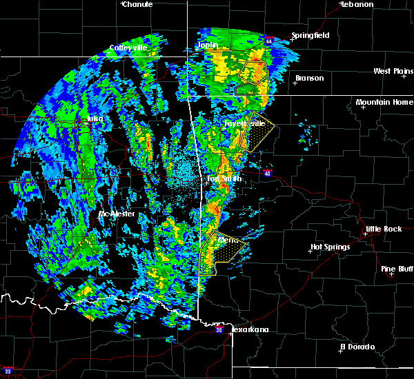 At 1212 pm cdt, a severe thunderstorm was located 7 miles northwest of saint paul, moving northeast at 55 mph (radar indicated). Hazards include 60 mph wind gusts. Expect damage to roofs, siding, and trees. locations in or near the path include, huntsville, st. Paul, withrow springs state park, saint paul, japton, witter, marble, forum, aurora, georgetown, delaney, brashears, alabam, crosses, patrick, combs, a tornado watch remains in effect until 200 pm cdt for northwestern and west central arkansas. At 1212 pm cdt, a severe thunderstorm was located 7 miles northwest of saint paul, moving northeast at 55 mph (radar indicated). Hazards include 60 mph wind gusts. Expect damage to roofs, siding, and trees. locations in or near the path include, huntsville, st. Paul, withrow springs state park, saint paul, japton, witter, marble, forum, aurora, georgetown, delaney, brashears, alabam, crosses, patrick, combs, a tornado watch remains in effect until 200 pm cdt for northwestern and west central arkansas.
|
| 5/18/2019 3:00 PM CDT |
 A severe thunderstorm warning remains in effect until 315 pm cdt for southern madison and northeastern franklin counties. at 259 pm cdt, severe thunderstorms were located along a line extending from 4 miles east of aurora to 9 miles southeast of pettigrew, moving northeast at 50 mph. hazard. 60 mph wind gusts. A severe thunderstorm warning remains in effect until 315 pm cdt for southern madison and northeastern franklin counties. at 259 pm cdt, severe thunderstorms were located along a line extending from 4 miles east of aurora to 9 miles southeast of pettigrew, moving northeast at 50 mph. hazard. 60 mph wind gusts.
|
| 5/18/2019 2:43 PM CDT |
 At 242 pm cdt, severe thunderstorms were located along a line extending from 3 miles west of japton to 3 miles south of denning, moving northeast at 40 mph (radar indicated). Hazards include 60 mph wind gusts. Expect damage to roofs, siding, and trees. locations in or near the path include, ozark, altus, branch, denning, st. paul, wiederkehr village, cass, saint paul, aurora, boston, pettigrew, brentwood, japton, witter, fern, caulksville, jethro, bidville, red star, crosses, this includes interstate 40 in arkansas between mile markers 26 and 42. A tornado watch remains in effect until 500 pm cdt for northwestern and west central arkansas. At 242 pm cdt, severe thunderstorms were located along a line extending from 3 miles west of japton to 3 miles south of denning, moving northeast at 40 mph (radar indicated). Hazards include 60 mph wind gusts. Expect damage to roofs, siding, and trees. locations in or near the path include, ozark, altus, branch, denning, st. paul, wiederkehr village, cass, saint paul, aurora, boston, pettigrew, brentwood, japton, witter, fern, caulksville, jethro, bidville, red star, crosses, this includes interstate 40 in arkansas between mile markers 26 and 42. A tornado watch remains in effect until 500 pm cdt for northwestern and west central arkansas.
|
| 5/18/2019 2:29 PM CDT |
 At 229 pm cdt, severe thunderstorms were located along a line extending from 2 miles south of wesley to 2 miles northwest of magazine, moving east at 60 mph (radar indicated). Hazards include 60 mph wind gusts. Expect damage to roofs, siding, and trees. locations in or near the path include, ozark, charleston, mountainburg, greenwood, alma, west fork, lavaca, mulberry, mansfield, dyer, altus, winslow, branch, denning, chester, st. paul, wiederkehr village, saint paul, aurora, boston, this includes the following highways, interstate 40 in arkansas between mile markers 13 and 42. interstate 49 between mile markers 24 and 54. A tornado watch remains in effect until 500 pm cdt for northwestern and west central arkansas. At 229 pm cdt, severe thunderstorms were located along a line extending from 2 miles south of wesley to 2 miles northwest of magazine, moving east at 60 mph (radar indicated). Hazards include 60 mph wind gusts. Expect damage to roofs, siding, and trees. locations in or near the path include, ozark, charleston, mountainburg, greenwood, alma, west fork, lavaca, mulberry, mansfield, dyer, altus, winslow, branch, denning, chester, st. paul, wiederkehr village, saint paul, aurora, boston, this includes the following highways, interstate 40 in arkansas between mile markers 13 and 42. interstate 49 between mile markers 24 and 54. A tornado watch remains in effect until 500 pm cdt for northwestern and west central arkansas.
|
| 5/18/2019 2:11 PM CDT |
 At 211 pm cdt, severe thunderstorms were located along a line extending from near west fork to echo, moving east at 55 mph (radar indicated). Hazards include 60 mph wind gusts. Expect damage to roofs, siding, and trees. locations in or near the path include, fort smith, van buren, ozark, charleston, cedarville, mountainburg, natural dam, greenwood, alma, barling, west fork, lavaca, lincoln, mulberry, mansfield, dyer, hackett, altus, hartford, huntington, this includes the following highways, interstate 40 in arkansas between mile markers 0 and 42. interstate 540 between mile markers 1 and 14. interstate 49 between mile markers 22 and 54. A tornado watch remains in effect until 500 pm cdt for northwestern and west central arkansas. At 211 pm cdt, severe thunderstorms were located along a line extending from near west fork to echo, moving east at 55 mph (radar indicated). Hazards include 60 mph wind gusts. Expect damage to roofs, siding, and trees. locations in or near the path include, fort smith, van buren, ozark, charleston, cedarville, mountainburg, natural dam, greenwood, alma, barling, west fork, lavaca, lincoln, mulberry, mansfield, dyer, hackett, altus, hartford, huntington, this includes the following highways, interstate 40 in arkansas between mile markers 0 and 42. interstate 540 between mile markers 1 and 14. interstate 49 between mile markers 22 and 54. A tornado watch remains in effect until 500 pm cdt for northwestern and west central arkansas.
|
| 3/24/2019 6:45 PM CDT | Quarter sized hail reported 6.4 miles W of St. Paul, AR, hail appeared to be at least a quarter if not bigger from a video relayed on twitter via broadcast media. |
| 3/24/2019 6:45 PM CDT | Golf Ball sized hail reported 6.4 miles W of St. Paul, AR, one of three hail stones pictured posed next to a dime appeared to be the size of a golf ball with the two others closer to a ping pong ball. |
| 3/24/2019 6:35 PM CDT |
 At 635 pm cdt, a severe thunderstorm was located over st. paul, moving east at 40 mph (radar indicated). Hazards include golf ball size hail and 60 mph wind gusts. People and animals outdoors will be injured. expect hail damage to roofs, siding, windows, and vehicles. expect wind damage to roofs, siding, and trees. locations in or near the path include, st. Paul, saint paul, pettigrew, boston, dutton, red star, brashears,. At 635 pm cdt, a severe thunderstorm was located over st. paul, moving east at 40 mph (radar indicated). Hazards include golf ball size hail and 60 mph wind gusts. People and animals outdoors will be injured. expect hail damage to roofs, siding, windows, and vehicles. expect wind damage to roofs, siding, and trees. locations in or near the path include, st. Paul, saint paul, pettigrew, boston, dutton, red star, brashears,.
|
| 3/24/2019 6:21 PM CDT |
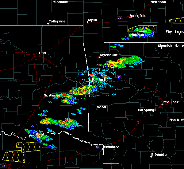 At 621 pm cdt, a severe thunderstorm was located 6 miles west of saint paul, moving east at 25 mph (radar indicated). Hazards include 60 mph wind gusts and half dollar size hail. Hail damage to vehicles is expected. expect wind damage to roofs, siding, and trees. locations in or near the path include, st. Paul, saint paul, pettigrew, dutton, crosses, patrick, combs, delaney, brashears,. At 621 pm cdt, a severe thunderstorm was located 6 miles west of saint paul, moving east at 25 mph (radar indicated). Hazards include 60 mph wind gusts and half dollar size hail. Hail damage to vehicles is expected. expect wind damage to roofs, siding, and trees. locations in or near the path include, st. Paul, saint paul, pettigrew, dutton, crosses, patrick, combs, delaney, brashears,.
|
| 3/24/2019 6:00 PM CDT |
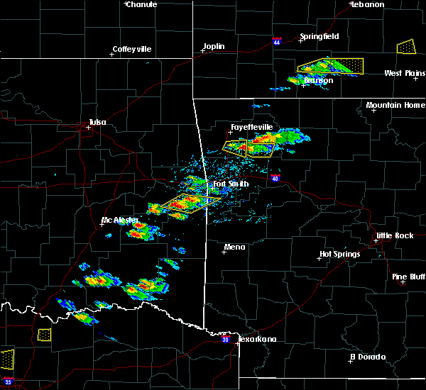 At 600 pm cdt, a severe thunderstorm was located 5 miles east of brentwood, moving east at 30 mph (radar indicated). Hazards include 60 mph wind gusts and half dollar size hail. Hail damage to vehicles is expected. expect wind damage to roofs, siding, and trees. locations in or near the path include, st. Paul, saint paul, pettigrew, dutton, crosses, patrick, combs, delaney, brashears,. At 600 pm cdt, a severe thunderstorm was located 5 miles east of brentwood, moving east at 30 mph (radar indicated). Hazards include 60 mph wind gusts and half dollar size hail. Hail damage to vehicles is expected. expect wind damage to roofs, siding, and trees. locations in or near the path include, st. Paul, saint paul, pettigrew, dutton, crosses, patrick, combs, delaney, brashears,.
|
| 2/7/2019 3:13 AM CST |
 At 312 am cst, severe thunderstorms were located along a line extending from 4 miles west of beaver to 3 miles north of cass to 3 miles east of mulberry, moving east at 60 mph (radar indicated). Hazards include 60 mph wind gusts. Expect damage to roofs, siding, and trees. locations in or near the path include, berryville, ozark, huntsville, eureka springs, green forest, mulberry, altus, st. Paul, beaver, hindsville, wiederkehr village, carrollton, rudd, saint paul, forum, aurora, hobbs state park, clifty, boston, withrow springs state park, this includes interstate 40 in arkansas between mile markers 25 and 42. At 312 am cst, severe thunderstorms were located along a line extending from 4 miles west of beaver to 3 miles north of cass to 3 miles east of mulberry, moving east at 60 mph (radar indicated). Hazards include 60 mph wind gusts. Expect damage to roofs, siding, and trees. locations in or near the path include, berryville, ozark, huntsville, eureka springs, green forest, mulberry, altus, st. Paul, beaver, hindsville, wiederkehr village, carrollton, rudd, saint paul, forum, aurora, hobbs state park, clifty, boston, withrow springs state park, this includes interstate 40 in arkansas between mile markers 25 and 42.
|
| 2/7/2019 2:50 AM CST |
 At 249 am cst, severe thunderstorms were located along a line extending from 3 miles west of farmington to 2 miles east of rudy to 2 miles west of moffett, moving east at 45 mph (radar indicated). Hazards include 60 mph wind gusts. Expect damage to roofs, siding, and trees. locations in or near the path include, fort smith, fayetteville, springdale, van buren, cedarville, mountainburg, natural dam, farmington, alma, prairie grove, roland, elkins, tontitown, west fork, lincoln, mulberry, greenland, dyer, winslow, chester, this includes the following highways, interstate 40 in arkansas between mile markers 0 and 31. interstate 40 in oklahoma between mile markers 320 and 328. interstate 540 between mile markers 1 and 8. Interstate 49 between mile markers 22 and 71. At 249 am cst, severe thunderstorms were located along a line extending from 3 miles west of farmington to 2 miles east of rudy to 2 miles west of moffett, moving east at 45 mph (radar indicated). Hazards include 60 mph wind gusts. Expect damage to roofs, siding, and trees. locations in or near the path include, fort smith, fayetteville, springdale, van buren, cedarville, mountainburg, natural dam, farmington, alma, prairie grove, roland, elkins, tontitown, west fork, lincoln, mulberry, greenland, dyer, winslow, chester, this includes the following highways, interstate 40 in arkansas between mile markers 0 and 31. interstate 40 in oklahoma between mile markers 320 and 328. interstate 540 between mile markers 1 and 8. Interstate 49 between mile markers 22 and 71.
|
| 2/7/2019 2:29 AM CST |
 At 228 am cst, severe thunderstorms were located along a line extending from near westville to 2 miles north of roland to 4 miles east of mc curtain, moving east at 50 mph (radar indicated). Hazards include 60 mph wind gusts. Expect damage to roofs, siding, and trees. locations in or near the path include, fort smith, fayetteville, springdale, van buren, stilwell, ozark, huntsville, cedarville, mountainburg, natural dam, greenwood, farmington, alma, barling, prairie grove, pocola, muldrow, roland, elkins, tontitown, this includes the following highways, interstate 40 in arkansas between mile markers 0 and 35. interstate 40 in oklahoma between mile markers 318 and 328. interstate 540 between mile markers 1 and 14. Interstate 49 between mile markers 22 and 73. At 228 am cst, severe thunderstorms were located along a line extending from near westville to 2 miles north of roland to 4 miles east of mc curtain, moving east at 50 mph (radar indicated). Hazards include 60 mph wind gusts. Expect damage to roofs, siding, and trees. locations in or near the path include, fort smith, fayetteville, springdale, van buren, stilwell, ozark, huntsville, cedarville, mountainburg, natural dam, greenwood, farmington, alma, barling, prairie grove, pocola, muldrow, roland, elkins, tontitown, this includes the following highways, interstate 40 in arkansas between mile markers 0 and 35. interstate 40 in oklahoma between mile markers 318 and 328. interstate 540 between mile markers 1 and 14. Interstate 49 between mile markers 22 and 73.
|
| 12/1/2018 12:09 AM CST |
 The severe thunderstorm warning for madison county will expire at 1215 am cst, the storms which prompted the warning will have moved out of the area. therefore the warning will be allowed to expire. a tornado watch remains in effect until 200 am cst for northwestern arkansas. The severe thunderstorm warning for madison county will expire at 1215 am cst, the storms which prompted the warning will have moved out of the area. therefore the warning will be allowed to expire. a tornado watch remains in effect until 200 am cst for northwestern arkansas.
|
| 11/30/2018 11:59 PM CST |
 At 1159 pm cst, severe thunderstorms were located along a line extending from 3 miles east of hindsville to 2 miles southwest of pettigrew, moving east at 70 mph (radar indicated). Hazards include 60 mph wind gusts. Expect damage to roofs, siding, and trees. locations in or near the path include, huntsville, st. Paul, saint paul, pettigrew, japton, kingston, witter, marble, aurora, boston, georgetown, dutton, red star, weathers, a tornado watch remains in effect until 200 am cst for northwestern arkansas. At 1159 pm cst, severe thunderstorms were located along a line extending from 3 miles east of hindsville to 2 miles southwest of pettigrew, moving east at 70 mph (radar indicated). Hazards include 60 mph wind gusts. Expect damage to roofs, siding, and trees. locations in or near the path include, huntsville, st. Paul, saint paul, pettigrew, japton, kingston, witter, marble, aurora, boston, georgetown, dutton, red star, weathers, a tornado watch remains in effect until 200 am cst for northwestern arkansas.
|
| 11/30/2018 11:40 PM CST |
 At 1140 pm cst, severe thunderstorms were located along a line extending from 5 miles northeast of fayetteville to 6 miles northwest of cass, moving east at 70 mph (radar indicated). Hazards include 60 mph wind gusts. Expect damage to roofs, siding, and trees. locations in or near the path include, fayetteville, huntsville, farmington, elkins, west fork, greenland, winslow, st. paul, wesley, saint paul, kingston, aurora, boston, pettigrew, brentwood, japton, witter, drake field airport, marble, johnson, this includes interstate 49 between mile markers 53 and 68. A tornado watch remains in effect until 200 am cst for northwestern and west central arkansas. At 1140 pm cst, severe thunderstorms were located along a line extending from 5 miles northeast of fayetteville to 6 miles northwest of cass, moving east at 70 mph (radar indicated). Hazards include 60 mph wind gusts. Expect damage to roofs, siding, and trees. locations in or near the path include, fayetteville, huntsville, farmington, elkins, west fork, greenland, winslow, st. paul, wesley, saint paul, kingston, aurora, boston, pettigrew, brentwood, japton, witter, drake field airport, marble, johnson, this includes interstate 49 between mile markers 53 and 68. A tornado watch remains in effect until 200 am cst for northwestern and west central arkansas.
|
| 11/30/2018 11:19 PM CST |
 At 1119 pm cst, severe thunderstorms were located along a line extending from 2 miles north of cincinnati to 2 miles south of lee creek, moving east at 70 mph (radar indicated). Hazards include 60 mph wind gusts. Expect damage to roofs, siding, and trees. locations in or near the path include, fayetteville, huntsville, farmington, prairie grove, elkins, west fork, lincoln, greenland, winslow, st. paul, wesley, saint paul, cincinnati, aurora, boston, devils den state park, brentwood, strickler, drake field airport, kingston, this includes interstate 49 between mile markers 37 and 68. A tornado watch remains in effect until 200 am cst for northwestern and west central arkansas. At 1119 pm cst, severe thunderstorms were located along a line extending from 2 miles north of cincinnati to 2 miles south of lee creek, moving east at 70 mph (radar indicated). Hazards include 60 mph wind gusts. Expect damage to roofs, siding, and trees. locations in or near the path include, fayetteville, huntsville, farmington, prairie grove, elkins, west fork, lincoln, greenland, winslow, st. paul, wesley, saint paul, cincinnati, aurora, boston, devils den state park, brentwood, strickler, drake field airport, kingston, this includes interstate 49 between mile markers 37 and 68. A tornado watch remains in effect until 200 am cst for northwestern and west central arkansas.
|
| 10/9/2018 4:20 PM CDT |
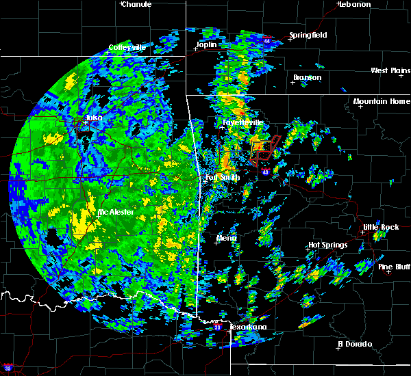 A severe thunderstorm warning remains in effect until 430 pm cdt for southeastern madison county. at 420 pm cdt, a severe thunderstorm was located over pettigrew, moving north at 30 mph. hazard. 60 mph wind gusts. source. Radar indicated. A severe thunderstorm warning remains in effect until 430 pm cdt for southeastern madison county. at 420 pm cdt, a severe thunderstorm was located over pettigrew, moving north at 30 mph. hazard. 60 mph wind gusts. source. Radar indicated.
|
| 10/9/2018 3:58 PM CDT |
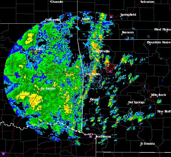 At 358 pm cdt, a severe thunderstorm was located 7 miles east of cass, moving north at 35 mph (radar indicated). Hazards include 60 mph wind gusts. Expect damage to roofs, siding, and trees. locations in or near the path include, st. Paul, pettigrew, boston, dutton, red star, redding, taft, a tornado watch remains in effect until 800 pm cdt for northwestern and west central arkansas. At 358 pm cdt, a severe thunderstorm was located 7 miles east of cass, moving north at 35 mph (radar indicated). Hazards include 60 mph wind gusts. Expect damage to roofs, siding, and trees. locations in or near the path include, st. Paul, pettigrew, boston, dutton, red star, redding, taft, a tornado watch remains in effect until 800 pm cdt for northwestern and west central arkansas.
|
| 8/19/2018 6:14 PM CDT |
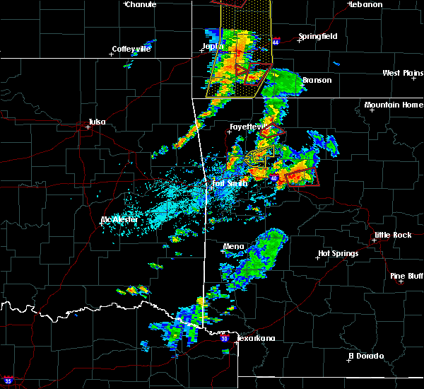 At 614 pm cdt, a severe thunderstorm was located 4 miles south of saint paul, moving east at 25 mph (radar indicated). Hazards include 60 mph wind gusts and quarter size hail. Hail damage to vehicles is expected. expect wind damage to roofs, siding, and trees. locations in or near the path include, st. Paul, saint paul, pettigrew, boston, dutton, brashears, a tornado watch remains in effect until 900 pm cdt for northwestern and west central arkansas. At 614 pm cdt, a severe thunderstorm was located 4 miles south of saint paul, moving east at 25 mph (radar indicated). Hazards include 60 mph wind gusts and quarter size hail. Hail damage to vehicles is expected. expect wind damage to roofs, siding, and trees. locations in or near the path include, st. Paul, saint paul, pettigrew, boston, dutton, brashears, a tornado watch remains in effect until 900 pm cdt for northwestern and west central arkansas.
|
| 8/19/2018 6:00 PM CDT |
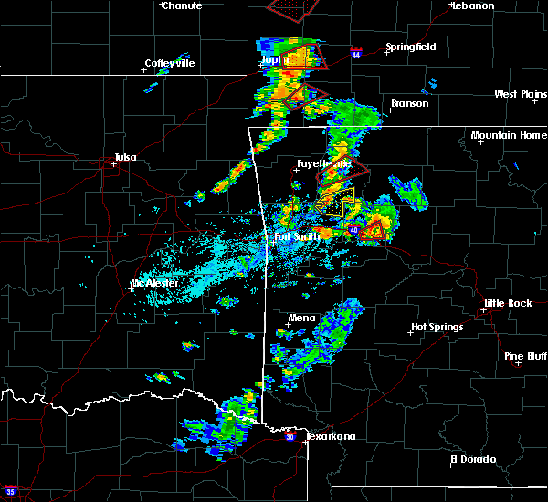 At 600 pm cdt, a severe thunderstorm was located 4 miles northwest of cass, moving east at 20 mph (radar indicated). Hazards include 60 mph wind gusts and half dollar size hail. Hail damage to vehicles is expected. expect wind damage to roofs, siding, and trees. locations in or near the path include, st. Paul, cass, saint paul, pettigrew, boston, dutton, combs, redding, turners bend, taft, brashears, a tornado watch remains in effect until 900 pm cdt for northwestern and west central arkansas. At 600 pm cdt, a severe thunderstorm was located 4 miles northwest of cass, moving east at 20 mph (radar indicated). Hazards include 60 mph wind gusts and half dollar size hail. Hail damage to vehicles is expected. expect wind damage to roofs, siding, and trees. locations in or near the path include, st. Paul, cass, saint paul, pettigrew, boston, dutton, combs, redding, turners bend, taft, brashears, a tornado watch remains in effect until 900 pm cdt for northwestern and west central arkansas.
|
| 8/19/2018 5:41 PM CDT |
 At 541 pm cdt, a severe thunderstorm was located 5 miles northeast of fern, moving east at 25 mph (radar indicated). Hazards include 70 mph wind gusts and ping pong ball size hail. People and animals outdoors will be injured. expect hail damage to roofs, siding, windows, and vehicles. expect considerable tree damage. wind damage is also likely to mobile homes, roofs, and outbuildings. locations in or near the path include, st. Paul, cass, saint paul, pettigrew, boston, dutton, barnes, bidville, redding, brashears, combs, locke, turners bend, taft, paradise, a tornado watch remains in effect until 900 pm cdt for northwestern and west central arkansas. At 541 pm cdt, a severe thunderstorm was located 5 miles northeast of fern, moving east at 25 mph (radar indicated). Hazards include 70 mph wind gusts and ping pong ball size hail. People and animals outdoors will be injured. expect hail damage to roofs, siding, windows, and vehicles. expect considerable tree damage. wind damage is also likely to mobile homes, roofs, and outbuildings. locations in or near the path include, st. Paul, cass, saint paul, pettigrew, boston, dutton, barnes, bidville, redding, brashears, combs, locke, turners bend, taft, paradise, a tornado watch remains in effect until 900 pm cdt for northwestern and west central arkansas.
|
| 7/21/2018 3:08 AM CDT |
 At 307 am cdt, severe thunderstorms were located along a line extending from 2 miles west of lincoln to 3 miles east of west fork to near wesley, moving southeast at 50 mph (radar indicated). Hazards include 60 mph wind gusts. Expect damage to roofs, siding, and trees. locations in or near the path include, fayetteville, springdale, lowell, farmington, prairie grove, elkins, tontitown, bethel heights, west fork, lincoln, greenland, st. Paul, wesley, saint paul, cincinnati, boston, brentwood, drake field airport, pettigrew, japton, this includes interstate 49 between mile markers 48 and 77. At 307 am cdt, severe thunderstorms were located along a line extending from 2 miles west of lincoln to 3 miles east of west fork to near wesley, moving southeast at 50 mph (radar indicated). Hazards include 60 mph wind gusts. Expect damage to roofs, siding, and trees. locations in or near the path include, fayetteville, springdale, lowell, farmington, prairie grove, elkins, tontitown, bethel heights, west fork, lincoln, greenland, st. Paul, wesley, saint paul, cincinnati, boston, brentwood, drake field airport, pettigrew, japton, this includes interstate 49 between mile markers 48 and 77.
|
| 7/21/2018 2:53 AM CDT |
 At 253 am cdt, severe thunderstorms were located along a line extending from 2 miles southeast of kansas to 3 miles south of springdale, moving southeast at 45 mph (radar indicated). Hazards include 60 mph wind gusts and nickel size hail. Expect damage to roofs, siding, and trees. Locations in or near the path include, fayetteville, springdale, rogers, bentonville, siloam springs, lowell, farmington, prairie grove, gentry, elkins, tontitown, bethel heights, west fork, lincoln, cave springs, decatur, westville, greenland, west siloam springs, colcord, this includes interstate 49 between mile markers 48 and 87. At 253 am cdt, severe thunderstorms were located along a line extending from 2 miles southeast of kansas to 3 miles south of springdale, moving southeast at 45 mph (radar indicated). Hazards include 60 mph wind gusts and nickel size hail. Expect damage to roofs, siding, and trees. Locations in or near the path include, fayetteville, springdale, rogers, bentonville, siloam springs, lowell, farmington, prairie grove, gentry, elkins, tontitown, bethel heights, west fork, lincoln, cave springs, decatur, westville, greenland, west siloam springs, colcord, this includes interstate 49 between mile markers 48 and 87.
|
| 7/21/2018 2:39 AM CDT |
 The national weather service in tulsa has issued a * severe thunderstorm warning for. central benton county in northwestern arkansas. southern madison county in northwestern arkansas. washington county in northwestern arkansas. Southern delaware county in northeastern oklahoma. The national weather service in tulsa has issued a * severe thunderstorm warning for. central benton county in northwestern arkansas. southern madison county in northwestern arkansas. washington county in northwestern arkansas. Southern delaware county in northeastern oklahoma.
|
| 7/21/2018 2:39 AM CDT |
 At 239 am cdt, severe thunderstorms were located along a line extending from 4 miles north of leach to 3 miles northwest of tontitown, moving southeast at 45 mph (radar indicated). Hazards include 60 mph wind gusts and quarter size hail. Hail damage to vehicles is expected. expect wind damage to roofs, siding, and trees. Locations in or near the path include, fayetteville, springdale, rogers, bentonville, siloam springs, huntsville, lowell, farmington, prairie grove, gentry, elkins, tontitown, bethel heights, west fork, lincoln, cave springs, decatur, westville, greenland, west siloam springs, this includes interstate 49 between mile markers 48 and 91. At 239 am cdt, severe thunderstorms were located along a line extending from 4 miles north of leach to 3 miles northwest of tontitown, moving southeast at 45 mph (radar indicated). Hazards include 60 mph wind gusts and quarter size hail. Hail damage to vehicles is expected. expect wind damage to roofs, siding, and trees. Locations in or near the path include, fayetteville, springdale, rogers, bentonville, siloam springs, huntsville, lowell, farmington, prairie grove, gentry, elkins, tontitown, bethel heights, west fork, lincoln, cave springs, decatur, westville, greenland, west siloam springs, this includes interstate 49 between mile markers 48 and 91.
|
| 7/21/2018 2:20 AM CDT |
 The severe thunderstorm warning for southwestern madison, northeastern franklin and southeastern washington counties will expire at 230 am cdt, the storm which prompted the warning has weakened below severe limits, and no longer poses an immediate threat to life or property. therefore the warning will be allowed to expire. however gusty winds are still possible with this thunderstorm. The severe thunderstorm warning for southwestern madison, northeastern franklin and southeastern washington counties will expire at 230 am cdt, the storm which prompted the warning has weakened below severe limits, and no longer poses an immediate threat to life or property. therefore the warning will be allowed to expire. however gusty winds are still possible with this thunderstorm.
|
| 7/21/2018 2:06 AM CDT |
 At 206 am cdt, a severe thunderstorm was located 8 miles east of brentwood, moving southeast at 35 mph (radar indicated). Hazards include 60 mph wind gusts and quarter size hail. Hail damage to vehicles is expected. expect wind damage to roofs, siding, and trees. locations in or near the path include, st. Paul, cass, saint paul, wyola, redding, delaney, arnett, brashears, crosses, patrick, combs, turners bend, durham,. At 206 am cdt, a severe thunderstorm was located 8 miles east of brentwood, moving southeast at 35 mph (radar indicated). Hazards include 60 mph wind gusts and quarter size hail. Hail damage to vehicles is expected. expect wind damage to roofs, siding, and trees. locations in or near the path include, st. Paul, cass, saint paul, wyola, redding, delaney, arnett, brashears, crosses, patrick, combs, turners bend, durham,.
|
| 7/21/2018 1:50 AM CDT |
 At 150 am cdt, a severe thunderstorm was located 3 miles southwest of elkins, moving southeast at 40 mph (radar indicated). Hazards include 60 mph wind gusts and quarter size hail. Hail damage to vehicles is expected. expect wind damage to roofs, siding, and trees. locations in or near the path include, fayetteville, elkins, st. Paul, cass, saint paul, pettigrew, dutton, wyola, sulphur city, redding, delaney, arnett, hicks, brashears, crosses, patrick, combs, turners bend, durham,. At 150 am cdt, a severe thunderstorm was located 3 miles southwest of elkins, moving southeast at 40 mph (radar indicated). Hazards include 60 mph wind gusts and quarter size hail. Hail damage to vehicles is expected. expect wind damage to roofs, siding, and trees. locations in or near the path include, fayetteville, elkins, st. Paul, cass, saint paul, pettigrew, dutton, wyola, sulphur city, redding, delaney, arnett, hicks, brashears, crosses, patrick, combs, turners bend, durham,.
|
| 7/21/2018 1:11 AM CDT |
 At 111 am cdt, a severe thunderstorm was located 4 miles west of saint paul, moving southeast at 35 mph (radar indicated). Hazards include two inch hail and 60 mph wind gusts. People and animals outdoors will be injured. expect hail damage to roofs, siding, windows, and vehicles. expect wind damage to roofs, siding, and trees. locations in or near the path include, ozark, altus, denning, st. Paul, wiederkehr village, cass, saint paul, jethro, barnes, alix, redding, watalula, delaney, brashears, crosses, patrick, combs, turners bend, taft, paradise, this includes interstate 40 in arkansas between mile markers 33 and 42. At 111 am cdt, a severe thunderstorm was located 4 miles west of saint paul, moving southeast at 35 mph (radar indicated). Hazards include two inch hail and 60 mph wind gusts. People and animals outdoors will be injured. expect hail damage to roofs, siding, windows, and vehicles. expect wind damage to roofs, siding, and trees. locations in or near the path include, ozark, altus, denning, st. Paul, wiederkehr village, cass, saint paul, jethro, barnes, alix, redding, watalula, delaney, brashears, crosses, patrick, combs, turners bend, taft, paradise, this includes interstate 40 in arkansas between mile markers 33 and 42.
|
| 7/21/2018 1:04 AM CDT |
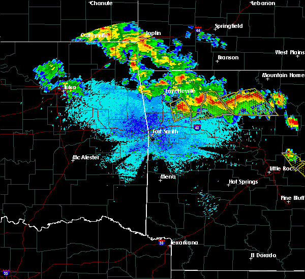 At 104 am cdt, a severe thunderstorm was located 9 miles west of saint paul, moving south at 30 mph. this is a very dangerous storm (radar indicated). Hazards include baseball size hail and 60 mph wind gusts. People and animals outdoors will be severely injured. expect shattered windows, extensive damage to roofs, siding, and vehicles. locations in or near the path include, st. Paul, cass, saint paul, japton, georgetown, bidville, delaney, arnett, brashears, crosses, patrick, combs, durham, dutton,. At 104 am cdt, a severe thunderstorm was located 9 miles west of saint paul, moving south at 30 mph. this is a very dangerous storm (radar indicated). Hazards include baseball size hail and 60 mph wind gusts. People and animals outdoors will be severely injured. expect shattered windows, extensive damage to roofs, siding, and vehicles. locations in or near the path include, st. Paul, cass, saint paul, japton, georgetown, bidville, delaney, arnett, brashears, crosses, patrick, combs, durham, dutton,.
|
| 7/21/2018 12:53 AM CDT |
 At 1252 am cdt, a severe thunderstorm was located 7 miles southeast of elkins, moving southeast at 45 mph. this is a very dangerous storm (radar indicated). Hazards include baseball size hail and 60 mph wind gusts. People and animals outdoors will be severely injured. expect shattered windows, extensive damage to roofs, siding, and vehicles. locations in or near the path include, elkins, st. Paul, wesley, cass, saint paul, japton, georgetown, tuttle, bidville, sulphur city, delaney, arnett, hicks, brashears, crosses, patrick, combs, durham, dutton,. At 1252 am cdt, a severe thunderstorm was located 7 miles southeast of elkins, moving southeast at 45 mph. this is a very dangerous storm (radar indicated). Hazards include baseball size hail and 60 mph wind gusts. People and animals outdoors will be severely injured. expect shattered windows, extensive damage to roofs, siding, and vehicles. locations in or near the path include, elkins, st. Paul, wesley, cass, saint paul, japton, georgetown, tuttle, bidville, sulphur city, delaney, arnett, hicks, brashears, crosses, patrick, combs, durham, dutton,.
|
| 7/21/2018 12:51 AM CDT |
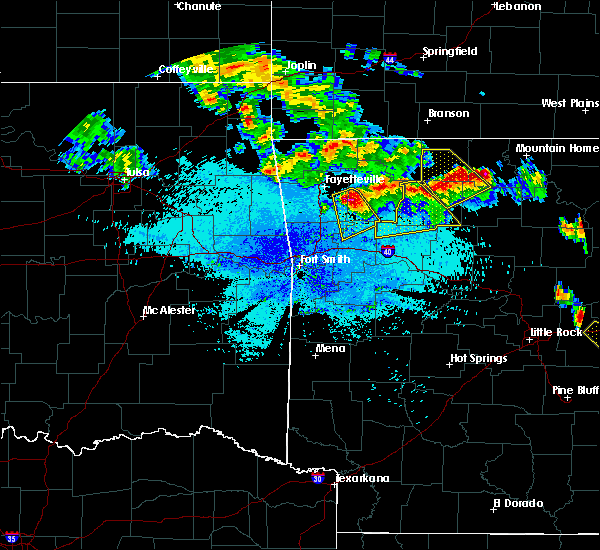 At 1251 am cdt, a severe thunderstorm was located 6 miles southeast of elkins, moving southeast at 45 mph (radar indicated). Hazards include tennis ball size hail and 60 mph wind gusts. People and animals outdoors will be injured. expect hail damage to roofs, siding, windows, and vehicles. expect wind damage to roofs, siding, and trees. locations in or near the path include, elkins, st. Paul, wesley, cass, saint paul, japton, georgetown, tuttle, bidville, sulphur city, delaney, arnett, hicks, brashears, crosses, patrick, combs, durham, dutton,. At 1251 am cdt, a severe thunderstorm was located 6 miles southeast of elkins, moving southeast at 45 mph (radar indicated). Hazards include tennis ball size hail and 60 mph wind gusts. People and animals outdoors will be injured. expect hail damage to roofs, siding, windows, and vehicles. expect wind damage to roofs, siding, and trees. locations in or near the path include, elkins, st. Paul, wesley, cass, saint paul, japton, georgetown, tuttle, bidville, sulphur city, delaney, arnett, hicks, brashears, crosses, patrick, combs, durham, dutton,.
|
| 7/21/2018 12:46 AM CDT |
 At 1245 am cdt, a severe thunderstorm was located near elkins, moving southeast at 40 mph (radar indicated). Hazards include two inch hail and 60 mph wind gusts. People and animals outdoors will be injured. expect hail damage to roofs, siding, windows, and vehicles. expect wind damage to roofs, siding, and trees. locations in or near the path include, fayetteville, elkins, st. Paul, wesley, cass, saint paul, japton, goshen, georgetown, tuttle, bidville, sulphur city, delaney, arnett, hicks, brashears, crosses, patrick, combs, durham,. At 1245 am cdt, a severe thunderstorm was located near elkins, moving southeast at 40 mph (radar indicated). Hazards include two inch hail and 60 mph wind gusts. People and animals outdoors will be injured. expect hail damage to roofs, siding, windows, and vehicles. expect wind damage to roofs, siding, and trees. locations in or near the path include, fayetteville, elkins, st. Paul, wesley, cass, saint paul, japton, goshen, georgetown, tuttle, bidville, sulphur city, delaney, arnett, hicks, brashears, crosses, patrick, combs, durham,.
|
| 7/21/2018 12:42 AM CDT |
 At 1245 am cdt, a severe thunderstorm was located near elkins, moving southeast at 40 mph (radar indicated). Hazards include two inch hail and 60 mph wind gusts. People and animals outdoors will be injured. expect hail damage to roofs, siding, windows, and vehicles. expect wind damage to roofs, siding, and trees. locations in or near the path include, fayetteville, elkins, st. Paul, wesley, cass, saint paul, japton, goshen, georgetown, tuttle, bidville, sulphur city, delaney, arnett, hicks, brashears, crosses, patrick, combs, durham,. At 1245 am cdt, a severe thunderstorm was located near elkins, moving southeast at 40 mph (radar indicated). Hazards include two inch hail and 60 mph wind gusts. People and animals outdoors will be injured. expect hail damage to roofs, siding, windows, and vehicles. expect wind damage to roofs, siding, and trees. locations in or near the path include, fayetteville, elkins, st. Paul, wesley, cass, saint paul, japton, goshen, georgetown, tuttle, bidville, sulphur city, delaney, arnett, hicks, brashears, crosses, patrick, combs, durham,.
|
| 7/21/2018 12:33 AM CDT |
 At 1233 am cdt, a severe thunderstorm was located 4 miles north of elkins, moving southeast at 45 mph (radar indicated). Hazards include golf ball size hail and 60 mph wind gusts. People and animals outdoors will be injured. expect hail damage to roofs, siding, windows, and vehicles. expect wind damage to roofs, siding, and trees. locations in or near the path include, fayetteville, springdale, elkins, st. Paul, hindsville, wesley, cass, saint paul, japton, johnson, goshen, georgetown, bidville, crosses, combs, sonora, dutton, wyola, tuttle, sulphur city,. At 1233 am cdt, a severe thunderstorm was located 4 miles north of elkins, moving southeast at 45 mph (radar indicated). Hazards include golf ball size hail and 60 mph wind gusts. People and animals outdoors will be injured. expect hail damage to roofs, siding, windows, and vehicles. expect wind damage to roofs, siding, and trees. locations in or near the path include, fayetteville, springdale, elkins, st. Paul, hindsville, wesley, cass, saint paul, japton, johnson, goshen, georgetown, bidville, crosses, combs, sonora, dutton, wyola, tuttle, sulphur city,.
|
| 6/24/2018 6:32 PM CDT |
 At 631 pm cdt, severe thunderstorms were located along a line extending from 4 miles northwest of cass to 10 miles north of woodland, moving northeast at 30 mph (radar indicated). Hazards include 60 mph wind gusts. Expect damage to roofs, siding, and trees. locations in or near the path include, st. Paul, aurora, saint paul, pettigrew, kingston, witter, marble, boston, dutton, red star, weathers, brashears,. At 631 pm cdt, severe thunderstorms were located along a line extending from 4 miles northwest of cass to 10 miles north of woodland, moving northeast at 30 mph (radar indicated). Hazards include 60 mph wind gusts. Expect damage to roofs, siding, and trees. locations in or near the path include, st. Paul, aurora, saint paul, pettigrew, kingston, witter, marble, boston, dutton, red star, weathers, brashears,.
|
| 5/25/2018 4:24 PM CDT |
 At 423 pm cdt, severe thunderstorms were located along a line extending from 7 miles north of fern to 3 miles north of cass, moving northeast at 25 mph (radar indicated). Hazards include 60 mph wind gusts and nickel size hail. Expect damage to roofs, siding, and trees. locations in or near the path include, st. Paul, saint paul, pettigrew, dutton, crosses, patrick, bidville, combs, delaney, brashears,. At 423 pm cdt, severe thunderstorms were located along a line extending from 7 miles north of fern to 3 miles north of cass, moving northeast at 25 mph (radar indicated). Hazards include 60 mph wind gusts and nickel size hail. Expect damage to roofs, siding, and trees. locations in or near the path include, st. Paul, saint paul, pettigrew, dutton, crosses, patrick, bidville, combs, delaney, brashears,.
|
| 4/13/2018 4:34 PM CDT |
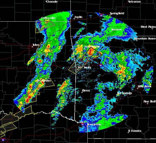 At 433 pm cdt, a severe thunderstorm capable of producing a tornado was located 8 miles east of brentwood, moving northeast at 55 mph (radar indicated rotation). Hazards include tornado and quarter size hail. Flying debris will be dangerous to those caught without shelter. mobile homes will be damaged or destroyed. damage to roofs, windows, and vehicles will occur. tree damage is likely. locations in or near the path include, winslow, st. Paul, wesley, saint paul, japton, witter, georgetown, wyola, tuttle, delaney, arnett, brashears, crosses, patrick, combs, durham,. At 433 pm cdt, a severe thunderstorm capable of producing a tornado was located 8 miles east of brentwood, moving northeast at 55 mph (radar indicated rotation). Hazards include tornado and quarter size hail. Flying debris will be dangerous to those caught without shelter. mobile homes will be damaged or destroyed. damage to roofs, windows, and vehicles will occur. tree damage is likely. locations in or near the path include, winslow, st. Paul, wesley, saint paul, japton, witter, georgetown, wyola, tuttle, delaney, arnett, brashears, crosses, patrick, combs, durham,.
|
| 4/13/2018 4:17 PM CDT |
 At 417 pm cdt, a confirmed tornado was located over lake fort smith, moving northeast at 45 mph (radar confirmed tornado). Hazards include damaging tornado and half dollar size hail. Flying debris will be dangerous to those caught without shelter. mobile homes will be damaged or destroyed. damage to roofs, windows, and vehicles will occur. tree damage is likely. locations in or near the path include, mountainburg, elkins, winslow, chester, st. Paul, wesley, saint paul, boston, pettigrew, brentwood, japton, lake fort smith, witter, fern, goshen, georgetown, bidville, crosses, combs, locke, this includes interstate 49 between mile markers 30 and 43. At 417 pm cdt, a confirmed tornado was located over lake fort smith, moving northeast at 45 mph (radar confirmed tornado). Hazards include damaging tornado and half dollar size hail. Flying debris will be dangerous to those caught without shelter. mobile homes will be damaged or destroyed. damage to roofs, windows, and vehicles will occur. tree damage is likely. locations in or near the path include, mountainburg, elkins, winslow, chester, st. Paul, wesley, saint paul, boston, pettigrew, brentwood, japton, lake fort smith, witter, fern, goshen, georgetown, bidville, crosses, combs, locke, this includes interstate 49 between mile markers 30 and 43.
|
| 4/13/2018 4:10 PM CDT |
 At 410 pm cdt, a severe thunderstorm with strong low level rotation that could produce a tornado at any time was located near mountainburg, moving northeast at 45 mph (radar indicated rotation). Hazards include tornado and half dollar size hail. Flying debris will be dangerous to those caught without shelter. mobile homes will be damaged or destroyed. damage to roofs, windows, and vehicles will occur. tree damage is likely. locations in or near the path include, mountainburg, alma, elkins, mulberry, dyer, winslow, chester, st. paul, wesley, saint paul, boston, pettigrew, brentwood, japton, lake fort smith, witter, fern, goshen, georgetown, bidville, this includes the following highways, interstate 40 in arkansas between mile markers 13 and 18. Interstate 49 between mile markers 22 and 43. At 410 pm cdt, a severe thunderstorm with strong low level rotation that could produce a tornado at any time was located near mountainburg, moving northeast at 45 mph (radar indicated rotation). Hazards include tornado and half dollar size hail. Flying debris will be dangerous to those caught without shelter. mobile homes will be damaged or destroyed. damage to roofs, windows, and vehicles will occur. tree damage is likely. locations in or near the path include, mountainburg, alma, elkins, mulberry, dyer, winslow, chester, st. paul, wesley, saint paul, boston, pettigrew, brentwood, japton, lake fort smith, witter, fern, goshen, georgetown, bidville, this includes the following highways, interstate 40 in arkansas between mile markers 13 and 18. Interstate 49 between mile markers 22 and 43.
|
| 4/3/2018 1:54 PM CDT |
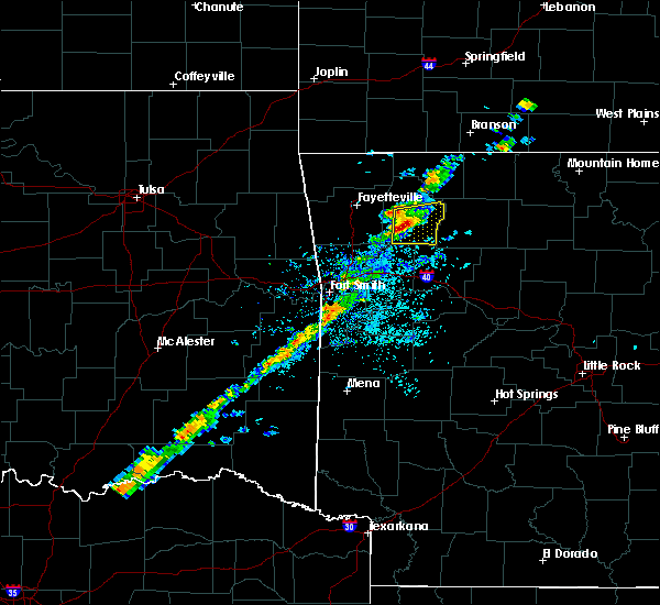 At 154 pm cdt, a severe thunderstorm was located 4 miles southwest of witter, moving east at 50 mph (radar indicated). Hazards include 60 mph wind gusts and quarter size hail. Hail damage to vehicles is expected. expect wind damage to roofs, siding, and trees. locations in or near the path include, st. Paul, saint paul, pettigrew, japton, kingston, witter, aurora, boston, georgetown, dutton, red star, weathers, brashears, combs,. At 154 pm cdt, a severe thunderstorm was located 4 miles southwest of witter, moving east at 50 mph (radar indicated). Hazards include 60 mph wind gusts and quarter size hail. Hail damage to vehicles is expected. expect wind damage to roofs, siding, and trees. locations in or near the path include, st. Paul, saint paul, pettigrew, japton, kingston, witter, aurora, boston, georgetown, dutton, red star, weathers, brashears, combs,.
|
| 4/3/2018 1:41 PM CDT |
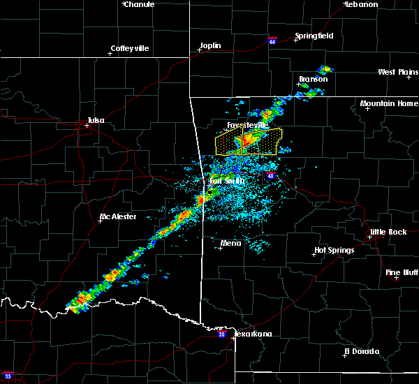 The national weather service in tulsa has issued a * severe thunderstorm warning for. madison county in northwestern arkansas. Until 215 pm cdt * at 140 pm cdt, a severe thunderstorm was located 9 miles southwest of japton, moving east at 50 mph. The national weather service in tulsa has issued a * severe thunderstorm warning for. madison county in northwestern arkansas. Until 215 pm cdt * at 140 pm cdt, a severe thunderstorm was located 9 miles southwest of japton, moving east at 50 mph.
|
| 10/22/2017 2:07 AM CDT |
 The severe thunderstorm warning for southern madison, franklin, eastern crawford, northeastern sebastian and southeastern washington counties will expire at 215 am cdt, the storms which prompted the warning have moved out of the area. therefore the warning will be allowed to expire. however gusty winds and heavy rain are still possible with these thunderstorms. a severe thunderstorm watch remains in effect until 700 am cdt for northwestern and west central arkansas. The severe thunderstorm warning for southern madison, franklin, eastern crawford, northeastern sebastian and southeastern washington counties will expire at 215 am cdt, the storms which prompted the warning have moved out of the area. therefore the warning will be allowed to expire. however gusty winds and heavy rain are still possible with these thunderstorms. a severe thunderstorm watch remains in effect until 700 am cdt for northwestern and west central arkansas.
|
| 10/22/2017 1:42 AM CDT |
 At 141 am cdt, severe thunderstorms were located along a line extending from 3 miles northwest of aurora to 2 miles west of echo, moving east at 40 mph (radar indicated). Hazards include 60 mph wind gusts and quarter size hail. Hail damage to vehicles is expected. expect wind damage to roofs, siding, and trees. locations in or near the path include, ozark, charleston, greenwood, lavaca, mulberry, dyer, altus, huntington, branch, denning, st. Paul, wiederkehr village, wesley, saint paul, aurora, boston, bloomer, burnville, cass, pettigrew, this includes interstate 40 in arkansas between mile markers 16 and 42. At 141 am cdt, severe thunderstorms were located along a line extending from 3 miles northwest of aurora to 2 miles west of echo, moving east at 40 mph (radar indicated). Hazards include 60 mph wind gusts and quarter size hail. Hail damage to vehicles is expected. expect wind damage to roofs, siding, and trees. locations in or near the path include, ozark, charleston, greenwood, lavaca, mulberry, dyer, altus, huntington, branch, denning, st. Paul, wiederkehr village, wesley, saint paul, aurora, boston, bloomer, burnville, cass, pettigrew, this includes interstate 40 in arkansas between mile markers 16 and 42.
|
| 10/22/2017 1:27 AM CDT |
 At 121 am cdt, severe thunderstorms were located along a line extending from near wesley to 2 miles northeast of midland, moving east at 35 mph (trained weather spotters). Hazards include 70 mph wind gusts. Expect considerable tree damage. damage is likely to mobile homes, roofs, and outbuildings. locations in or near the path include, fort smith, fayetteville, van buren, poteau, ozark, charleston, cedarville, mountainburg, natural dam, greenwood, farmington, alma, barling, prairie grove, pocola, heavener, roland, elkins, west fork, lavaca, this includes the following highways, interstate 40 in arkansas between mile markers 0 and 42. interstate 40 in oklahoma between mile markers 323 and 328. interstate 540 between mile markers 1 and 14. interstate 49 between mile markers 22 and 63. a tornado watch remains in effect until 200 am cdt for southeastern and east central oklahoma. A severe thunderstorm watch remains in effect until 700 am cdt for west central arkansas. At 121 am cdt, severe thunderstorms were located along a line extending from near wesley to 2 miles northeast of midland, moving east at 35 mph (trained weather spotters). Hazards include 70 mph wind gusts. Expect considerable tree damage. damage is likely to mobile homes, roofs, and outbuildings. locations in or near the path include, fort smith, fayetteville, van buren, poteau, ozark, charleston, cedarville, mountainburg, natural dam, greenwood, farmington, alma, barling, prairie grove, pocola, heavener, roland, elkins, west fork, lavaca, this includes the following highways, interstate 40 in arkansas between mile markers 0 and 42. interstate 40 in oklahoma between mile markers 323 and 328. interstate 540 between mile markers 1 and 14. interstate 49 between mile markers 22 and 63. a tornado watch remains in effect until 200 am cdt for southeastern and east central oklahoma. A severe thunderstorm watch remains in effect until 700 am cdt for west central arkansas.
|
| 10/22/2017 1:08 AM CDT |
 At 106 am cdt, severe thunderstorms were located along a line extending from 6 miles southeast of elkins to 6 miles east of heavener runestone state park, moving east at 45 mph (spotter reports and radar indicated). Hazards include 70 mph wind gusts. Expect considerable tree damage. damage is likely to mobile homes, roofs, and outbuildings. locations in or near the path include, fort smith, fayetteville, van buren, poteau, ozark, charleston, cedarville, mountainburg, natural dam, greenwood, farmington, alma, barling, prairie grove, pocola, heavener, roland, elkins, west fork, lavaca, this includes the following highways, interstate 40 in arkansas between mile markers 0 and 42. interstate 40 in oklahoma between mile markers 323 and 328. interstate 540 between mile markers 1 and 14. interstate 49 between mile markers 22 and 63. A tornado watch remains in effect until 200 am cdt for southeastern and east central oklahoma. At 106 am cdt, severe thunderstorms were located along a line extending from 6 miles southeast of elkins to 6 miles east of heavener runestone state park, moving east at 45 mph (spotter reports and radar indicated). Hazards include 70 mph wind gusts. Expect considerable tree damage. damage is likely to mobile homes, roofs, and outbuildings. locations in or near the path include, fort smith, fayetteville, van buren, poteau, ozark, charleston, cedarville, mountainburg, natural dam, greenwood, farmington, alma, barling, prairie grove, pocola, heavener, roland, elkins, west fork, lavaca, this includes the following highways, interstate 40 in arkansas between mile markers 0 and 42. interstate 40 in oklahoma between mile markers 323 and 328. interstate 540 between mile markers 1 and 14. interstate 49 between mile markers 22 and 63. A tornado watch remains in effect until 200 am cdt for southeastern and east central oklahoma.
|
| 6/16/2017 12:54 AM CDT |
 The severe thunderstorm warning for south central madison, franklin, crawford and sebastian counties will expire at 100 am cdt, the storms which prompted the warning have weakened below severe limits, and no longer pose an immediate threat to life or property. therefore the warning will be allowed to expire. however gusty winds to 45 mph and heavy rain are still possible with these thunderstorms. a severe thunderstorm watch remains in effect until 200 am cdt for northwestern and west central arkansas. The severe thunderstorm warning for south central madison, franklin, crawford and sebastian counties will expire at 100 am cdt, the storms which prompted the warning have weakened below severe limits, and no longer pose an immediate threat to life or property. therefore the warning will be allowed to expire. however gusty winds to 45 mph and heavy rain are still possible with these thunderstorms. a severe thunderstorm watch remains in effect until 200 am cdt for northwestern and west central arkansas.
|
| 6/16/2017 12:48 AM CDT |
 At 1248 am cdt, severe thunderstorms were located along a line extending from near st. paul to 7 miles northeast of mulberry to 2 miles north of jenny lind, moving southeast at 50 mph (radar indicated). Hazards include 60 mph wind gusts. Expect damage to roofs, siding, and trees. locations in or near the path include, fort smith, van buren, ozark, charleston, mountainburg, greenwood, alma, barling, lavaca, mulberry, mansfield, dyer, hackett, altus, hartford, huntington, bonanza, branch, midland, denning, this includes the following highways, interstate 40 in arkansas between mile markers 0 and 42. interstate 540 between mile markers 1 and 14. Interstate 49 between mile markers 22 and 34. At 1248 am cdt, severe thunderstorms were located along a line extending from near st. paul to 7 miles northeast of mulberry to 2 miles north of jenny lind, moving southeast at 50 mph (radar indicated). Hazards include 60 mph wind gusts. Expect damage to roofs, siding, and trees. locations in or near the path include, fort smith, van buren, ozark, charleston, mountainburg, greenwood, alma, barling, lavaca, mulberry, mansfield, dyer, hackett, altus, hartford, huntington, bonanza, branch, midland, denning, this includes the following highways, interstate 40 in arkansas between mile markers 0 and 42. interstate 540 between mile markers 1 and 14. Interstate 49 between mile markers 22 and 34.
|
| 6/16/2017 12:07 AM CDT |
 At 1206 am cdt, severe thunderstorms were located along a line extending from 6 miles northeast of fayetteville to 2 miles west of devils den state park to 5 miles north of muldrow, moving southeast at 15 mph (radar indicated). Hazards include 60 mph wind gusts. Expect damage to roofs, siding, and trees. locations in or near the path include, fort smith, fayetteville, van buren, ozark, charleston, huntsville, cedarville, mountainburg, natural dam, greenwood, alma, barling, elkins, west fork, lavaca, mulberry, mansfield, dyer, hackett, altus, this includes the following highways, interstate 40 in arkansas between mile markers 0 and 42. interstate 540 between mile markers 1 and 14. Interstate 49 between mile markers 22 and 51. At 1206 am cdt, severe thunderstorms were located along a line extending from 6 miles northeast of fayetteville to 2 miles west of devils den state park to 5 miles north of muldrow, moving southeast at 15 mph (radar indicated). Hazards include 60 mph wind gusts. Expect damage to roofs, siding, and trees. locations in or near the path include, fort smith, fayetteville, van buren, ozark, charleston, huntsville, cedarville, mountainburg, natural dam, greenwood, alma, barling, elkins, west fork, lavaca, mulberry, mansfield, dyer, hackett, altus, this includes the following highways, interstate 40 in arkansas between mile markers 0 and 42. interstate 540 between mile markers 1 and 14. Interstate 49 between mile markers 22 and 51.
|
| 5/28/2017 12:19 AM CDT |
 At 1219 am cdt, severe thunderstorms were located along a line extending from 9 miles west of saint paul to 5 miles south of cass to 3 miles southwest of ozark, moving east at 60 mph (radar indicated). Hazards include 60 mph wind gusts. Expect damage to roofs, siding, and trees. locations in or near the path include, ozark, altus, denning, st. paul, wiederkehr village, cass, saint paul, pettigrew, boston, jethro, dutton, etna, alix, barnes, redding, watalula, brashears, meg, patrick, combs, this includes interstate 40 in arkansas between mile markers 31 and 42. A tornado watch remains in effect until 200 am cdt for northwestern and west central arkansas. At 1219 am cdt, severe thunderstorms were located along a line extending from 9 miles west of saint paul to 5 miles south of cass to 3 miles southwest of ozark, moving east at 60 mph (radar indicated). Hazards include 60 mph wind gusts. Expect damage to roofs, siding, and trees. locations in or near the path include, ozark, altus, denning, st. paul, wiederkehr village, cass, saint paul, pettigrew, boston, jethro, dutton, etna, alix, barnes, redding, watalula, brashears, meg, patrick, combs, this includes interstate 40 in arkansas between mile markers 31 and 42. A tornado watch remains in effect until 200 am cdt for northwestern and west central arkansas.
|
| 5/19/2017 11:43 PM CDT |
 At 1142 pm cdt, a severe thunderstorm was located 9 miles southwest of japton, moving north at 50 mph (radar indicated). Hazards include 60 mph wind gusts and quarter size hail. Hail damage to vehicles is expected. expect wind damage to roofs, siding, and trees. locations in or near the path include, huntsville, elkins, st. Paul, hindsville, wesley, saint paul, japton, witter, aurora, goshen, georgetown, tuttle, harmony, mayfield, delaney, arnett, brashears, crosses, patrick, combs, a tornado watch remains in effect until 500 am cdt for northwestern and west central arkansas. At 1142 pm cdt, a severe thunderstorm was located 9 miles southwest of japton, moving north at 50 mph (radar indicated). Hazards include 60 mph wind gusts and quarter size hail. Hail damage to vehicles is expected. expect wind damage to roofs, siding, and trees. locations in or near the path include, huntsville, elkins, st. Paul, hindsville, wesley, saint paul, japton, witter, aurora, goshen, georgetown, tuttle, harmony, mayfield, delaney, arnett, brashears, crosses, patrick, combs, a tornado watch remains in effect until 500 am cdt for northwestern and west central arkansas.
|
| 5/19/2017 11:28 PM CDT |
 At 1128 pm cdt, a severe thunderstorm was located 5 miles northeast of fern, moving north at 45 mph (radar indicated). Hazards include golf ball size hail and 60 mph wind gusts. People and animals outdoors will be injured. expect hail damage to roofs, siding, windows, and vehicles. expect wind damage to roofs, siding, and trees. locations in or near the path include, huntsville, elkins, st. Paul, hindsville, cass, wesley, saint paul, aurora, japton, witter, fern, goshen, georgetown, jethro, bidville, crosses, combs, turners bend, locke, wyola, a tornado watch remains in effect until 500 am cdt for northwestern and west central arkansas. At 1128 pm cdt, a severe thunderstorm was located 5 miles northeast of fern, moving north at 45 mph (radar indicated). Hazards include golf ball size hail and 60 mph wind gusts. People and animals outdoors will be injured. expect hail damage to roofs, siding, windows, and vehicles. expect wind damage to roofs, siding, and trees. locations in or near the path include, huntsville, elkins, st. Paul, hindsville, cass, wesley, saint paul, aurora, japton, witter, fern, goshen, georgetown, jethro, bidville, crosses, combs, turners bend, locke, wyola, a tornado watch remains in effect until 500 am cdt for northwestern and west central arkansas.
|
| 5/19/2017 1:00 AM CDT |
 At 100 am cdt, severe thunderstorms were located along a line extending from 4 miles north of emerald beach to 3 miles east of berryville to 2 miles west of lost valley state park to 2 miles north of hartman, moving east at 50 mph (radar indicated). Hazards include 60 mph wind gusts and quarter size hail. Hail damage to vehicles is expected. expect wind damage to roofs, siding, and trees. locations in or near the path include, berryville, ozark, charleston, huntsville, eureka springs, green forest, mulberry, altus, gateway, branch, denning, st. paul, beaver, hindsville, wiederkehr village, carrollton, rudd, saint paul, forum, aurora, this includes interstate 40 in arkansas between mile markers 23 and 42. A tornado watch remains in effect until 600 am cdt for northwestern and west central arkansas. At 100 am cdt, severe thunderstorms were located along a line extending from 4 miles north of emerald beach to 3 miles east of berryville to 2 miles west of lost valley state park to 2 miles north of hartman, moving east at 50 mph (radar indicated). Hazards include 60 mph wind gusts and quarter size hail. Hail damage to vehicles is expected. expect wind damage to roofs, siding, and trees. locations in or near the path include, berryville, ozark, charleston, huntsville, eureka springs, green forest, mulberry, altus, gateway, branch, denning, st. paul, beaver, hindsville, wiederkehr village, carrollton, rudd, saint paul, forum, aurora, this includes interstate 40 in arkansas between mile markers 23 and 42. A tornado watch remains in effect until 600 am cdt for northwestern and west central arkansas.
|
| 5/19/2017 12:08 AM CDT |
 At 1207 am cdt, severe thunderstorms were located along a line extending from 3 miles east of gravette to 2 miles east of tontitown to near winslow to jenny lind, moving east at 50 mph (radar indicated). Hazards include 70 mph wind gusts and quarter size hail. Hail damage to vehicles is expected. expect considerable tree damage. wind damage is also likely to mobile homes, roofs, and outbuildings. locations in or near the path include, fayetteville, springdale, rogers, bentonville, berryville, ozark, charleston, huntsville, eureka springs, bella vista, greenwood, lowell, pea ridge, green forest, elkins, bethel heights, lavaca, mulberry, dyer, altus, this includes the following highways, interstate 40 in arkansas between mile markers 18 and 42. interstate 49 between mile markers 79 and 81, near mile marker 84, and between mile markers 86 and 93. A tornado watch remains in effect until 300 am cdt for northwestern and west central arkansas. At 1207 am cdt, severe thunderstorms were located along a line extending from 3 miles east of gravette to 2 miles east of tontitown to near winslow to jenny lind, moving east at 50 mph (radar indicated). Hazards include 70 mph wind gusts and quarter size hail. Hail damage to vehicles is expected. expect considerable tree damage. wind damage is also likely to mobile homes, roofs, and outbuildings. locations in or near the path include, fayetteville, springdale, rogers, bentonville, berryville, ozark, charleston, huntsville, eureka springs, bella vista, greenwood, lowell, pea ridge, green forest, elkins, bethel heights, lavaca, mulberry, dyer, altus, this includes the following highways, interstate 40 in arkansas between mile markers 18 and 42. interstate 49 between mile markers 79 and 81, near mile marker 84, and between mile markers 86 and 93. A tornado watch remains in effect until 300 am cdt for northwestern and west central arkansas.
|
| 4/4/2017 9:10 PM CDT |
 The severe thunderstorm warning for southwestern madison, franklin, sebastian, central crawford and east central le flore counties will expire at 915 pm cdt, the storms which prompted the warning have moved out of the area. therefore the warning will be allowed to expire. a severe thunderstorm watch remains in effect until 1100 pm cdt for northwestern and west central arkansas, and southeastern oklahoma. The severe thunderstorm warning for southwestern madison, franklin, sebastian, central crawford and east central le flore counties will expire at 915 pm cdt, the storms which prompted the warning have moved out of the area. therefore the warning will be allowed to expire. a severe thunderstorm watch remains in effect until 1100 pm cdt for northwestern and west central arkansas, and southeastern oklahoma.
|
| 4/4/2017 8:44 PM CDT |
 At 844 pm cdt, severe thunderstorms were located along a line extending from near cass to 3 miles northeast of ratcliff to 3 miles southwest of excelsior, moving east at 75 mph (radar indicated). Hazards include 60 mph wind gusts and quarter size hail. Hail damage to vehicles is expected. expect wind damage to roofs, siding, and trees. locations in or near the path include, fort smith, van buren, poteau, ozark, charleston, mountainburg, greenwood, alma, barling, pocola, lavaca, mulberry, mansfield, wister, dyer, hackett, howe, altus, hartford, huntington, this includes the following highways, interstate 40 in arkansas between mile markers 7 and 42. interstate 540 between mile markers 1 and 14. Interstate 49 between mile markers 22 and 29. At 844 pm cdt, severe thunderstorms were located along a line extending from near cass to 3 miles northeast of ratcliff to 3 miles southwest of excelsior, moving east at 75 mph (radar indicated). Hazards include 60 mph wind gusts and quarter size hail. Hail damage to vehicles is expected. expect wind damage to roofs, siding, and trees. locations in or near the path include, fort smith, van buren, poteau, ozark, charleston, mountainburg, greenwood, alma, barling, pocola, lavaca, mulberry, mansfield, wister, dyer, hackett, howe, altus, hartford, huntington, this includes the following highways, interstate 40 in arkansas between mile markers 7 and 42. interstate 540 between mile markers 1 and 14. Interstate 49 between mile markers 22 and 29.
|
| 4/4/2017 8:42 PM CDT |
 At 842 pm cdt, severe thunderstorms were located along a line extending from 3 miles northeast of eureka springs to 3 miles southeast of huntsville to 3 miles northwest of st. paul, moving east at 35 mph (radar indicated). Hazards include 60 mph wind gusts and quarter size hail. Hail damage to vehicles is expected. expect wind damage to roofs, siding, and trees. locations in or near the path include, berryville, huntsville, eureka springs, green forest, st. Paul, carrollton, rudd, saint paul, kingston, forum, aurora, clifty, boston, withrow springs state park, pettigrew, japton, marble, witter, osage, urbanette,. At 842 pm cdt, severe thunderstorms were located along a line extending from 3 miles northeast of eureka springs to 3 miles southeast of huntsville to 3 miles northwest of st. paul, moving east at 35 mph (radar indicated). Hazards include 60 mph wind gusts and quarter size hail. Hail damage to vehicles is expected. expect wind damage to roofs, siding, and trees. locations in or near the path include, berryville, huntsville, eureka springs, green forest, st. Paul, carrollton, rudd, saint paul, kingston, forum, aurora, clifty, boston, withrow springs state park, pettigrew, japton, marble, witter, osage, urbanette,.
|
| 4/4/2017 8:41 PM CDT |
 At 840 pm cdt, severe thunderstorms were located along a line extending from 2 miles east of gateway to near hobbs state park to wesley, moving northeast at 40 mph (radar indicated). Hazards include 60 mph wind gusts and quarter size hail. Hail damage to vehicles is expected. expect wind damage to roofs, siding, and trees. locations in or near the path include, huntsville, eureka springs, st. Paul, beaver, hindsville, withrow springs state park, wesley, saint paul, japton, clifty, georgetown, delaney, brashears, crosses, patrick, combs, best, busch,. At 840 pm cdt, severe thunderstorms were located along a line extending from 2 miles east of gateway to near hobbs state park to wesley, moving northeast at 40 mph (radar indicated). Hazards include 60 mph wind gusts and quarter size hail. Hail damage to vehicles is expected. expect wind damage to roofs, siding, and trees. locations in or near the path include, huntsville, eureka springs, st. Paul, beaver, hindsville, withrow springs state park, wesley, saint paul, japton, clifty, georgetown, delaney, brashears, crosses, patrick, combs, best, busch,.
|
| 4/4/2017 8:29 PM CDT |
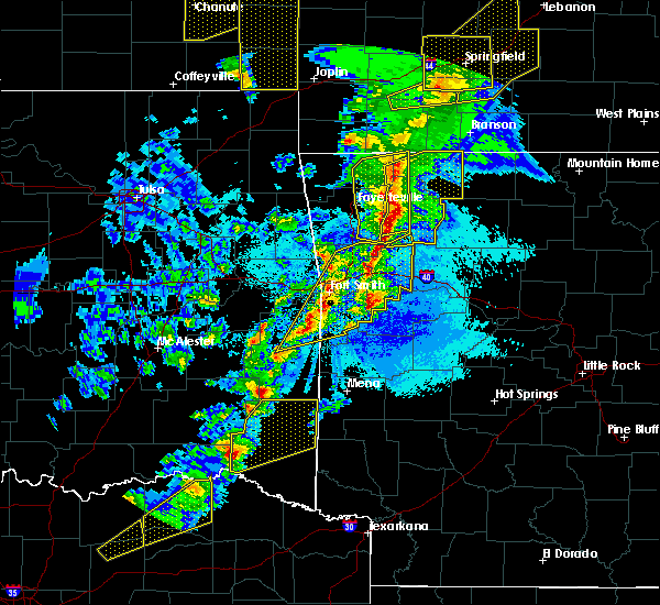 At 828 pm cdt, severe thunderstorms were located along a line extending from 7 miles southwest of eureka springs to 5 miles southwest of huntsville to 8 miles west of saint paul, moving east at 35 mph (radar indicated). Hazards include 60 mph wind gusts and quarter size hail. Hail damage to vehicles is expected. expect wind damage to roofs, siding, and trees. locations in or near the path include, berryville, huntsville, eureka springs, green forest, st. Paul, hindsville, carrollton, rudd, saint paul, forum, aurora, hobbs state park, clifty, boston, withrow springs state park, marble, rule, kingston, pettigrew, japton,. At 828 pm cdt, severe thunderstorms were located along a line extending from 7 miles southwest of eureka springs to 5 miles southwest of huntsville to 8 miles west of saint paul, moving east at 35 mph (radar indicated). Hazards include 60 mph wind gusts and quarter size hail. Hail damage to vehicles is expected. expect wind damage to roofs, siding, and trees. locations in or near the path include, berryville, huntsville, eureka springs, green forest, st. Paul, hindsville, carrollton, rudd, saint paul, forum, aurora, hobbs state park, clifty, boston, withrow springs state park, marble, rule, kingston, pettigrew, japton,.
|
| 4/4/2017 8:17 PM CDT |
 At 817 pm cdt, severe thunderstorms were located along a line extending from 5 miles northwest of war eagle to 2 miles north of elkins to 3 miles east of brentwood, moving northeast at 30 mph (radar indicated). Hazards include golf ball size hail and 60 mph wind gusts. People and animals outdoors will be injured. expect hail damage to roofs, siding, windows, and vehicles. expect wind damage to roofs, siding, and trees. locations in or near the path include, fayetteville, springdale, rogers, bentonville, huntsville, eureka springs, lowell, elkins, bethel heights, garfield, winslow, st. Paul, beaver, hindsville, wesley, saint paul, hobbs state park, clifty, withrow springs state park, war eagle, this includes interstate 49 between mile markers 77 and 81, and near mile marker 86. At 817 pm cdt, severe thunderstorms were located along a line extending from 5 miles northwest of war eagle to 2 miles north of elkins to 3 miles east of brentwood, moving northeast at 30 mph (radar indicated). Hazards include golf ball size hail and 60 mph wind gusts. People and animals outdoors will be injured. expect hail damage to roofs, siding, windows, and vehicles. expect wind damage to roofs, siding, and trees. locations in or near the path include, fayetteville, springdale, rogers, bentonville, huntsville, eureka springs, lowell, elkins, bethel heights, garfield, winslow, st. Paul, beaver, hindsville, wesley, saint paul, hobbs state park, clifty, withrow springs state park, war eagle, this includes interstate 49 between mile markers 77 and 81, and near mile marker 86.
|
| 4/4/2017 8:15 PM CDT |
 At 815 pm cdt, severe thunderstorms were located along a line extending from 2 miles southeast of devils den state park to 2 miles southeast of wister, moving northeast at 60 mph (radar indicated). Hazards include 60 mph wind gusts and quarter size hail. Hail damage to vehicles is expected. expect wind damage to roofs, siding, and trees. locations in or near the path include, fort smith, van buren, poteau, ozark, charleston, cedarville, mountainburg, greenwood, alma, barling, pocola, lavaca, arkoma, mulberry, mansfield, wister, dyer, hackett, howe, altus, this includes the following highways, interstate 40 in arkansas between mile markers 0 and 42. interstate 40 in oklahoma near mile marker 328. interstate 540 between mile markers 1 and 14. Interstate 49 between mile markers 22 and 39. At 815 pm cdt, severe thunderstorms were located along a line extending from 2 miles southeast of devils den state park to 2 miles southeast of wister, moving northeast at 60 mph (radar indicated). Hazards include 60 mph wind gusts and quarter size hail. Hail damage to vehicles is expected. expect wind damage to roofs, siding, and trees. locations in or near the path include, fort smith, van buren, poteau, ozark, charleston, cedarville, mountainburg, greenwood, alma, barling, pocola, lavaca, arkoma, mulberry, mansfield, wister, dyer, hackett, howe, altus, this includes the following highways, interstate 40 in arkansas between mile markers 0 and 42. interstate 40 in oklahoma near mile marker 328. interstate 540 between mile markers 1 and 14. Interstate 49 between mile markers 22 and 39.
|
| 4/4/2017 8:11 PM CDT |
 At 811 pm cdt, severe thunderstorms were located along a line extending from pea ridge to 2 miles northeast of bethel heights to 3 miles west of elkins to 2 miles southeast of winslow, moving northeast at 45 mph (radar indicated). Hazards include 60 mph wind gusts and quarter size hail. Hail damage to vehicles is expected. expect wind damage to roofs, siding, and trees. locations in or near the path include, fayetteville, springdale, rogers, bentonville, huntsville, eureka springs, bella vista, lowell, farmington, pea ridge, elkins, tontitown, bethel heights, west fork, cave springs, greenland, garfield, gateway, winslow, st. Paul, this includes interstate 49 between mile markers 41 and 84, and between mile markers 86 and 93. At 811 pm cdt, severe thunderstorms were located along a line extending from pea ridge to 2 miles northeast of bethel heights to 3 miles west of elkins to 2 miles southeast of winslow, moving northeast at 45 mph (radar indicated). Hazards include 60 mph wind gusts and quarter size hail. Hail damage to vehicles is expected. expect wind damage to roofs, siding, and trees. locations in or near the path include, fayetteville, springdale, rogers, bentonville, huntsville, eureka springs, bella vista, lowell, farmington, pea ridge, elkins, tontitown, bethel heights, west fork, cave springs, greenland, garfield, gateway, winslow, st. Paul, this includes interstate 49 between mile markers 41 and 84, and between mile markers 86 and 93.
|
| 4/4/2017 7:58 PM CDT |
 At 758 pm cdt, severe thunderstorms were located along a line extending from 2 miles south of bella vista to 2 miles south of tontitown to 2 miles southwest of west fork to 4 miles east of lee creek, moving northeast at 40 mph (radar indicated). Hazards include 60 mph wind gusts and quarter size hail. Hail damage to vehicles is expected. expect wind damage to roofs, siding, and trees. Locations in or near the path include, fayetteville, springdale, rogers, bentonville, huntsville, eureka springs, mountainburg, bella vista, lowell, farmington, pea ridge, elkins, tontitown, bethel heights, west fork, cave springs, greenland, garfield, gateway, winslow, this includes interstate 49 between mile markers 32 and 84, and between mile markers 86 and 93. At 758 pm cdt, severe thunderstorms were located along a line extending from 2 miles south of bella vista to 2 miles south of tontitown to 2 miles southwest of west fork to 4 miles east of lee creek, moving northeast at 40 mph (radar indicated). Hazards include 60 mph wind gusts and quarter size hail. Hail damage to vehicles is expected. expect wind damage to roofs, siding, and trees. Locations in or near the path include, fayetteville, springdale, rogers, bentonville, huntsville, eureka springs, mountainburg, bella vista, lowell, farmington, pea ridge, elkins, tontitown, bethel heights, west fork, cave springs, greenland, garfield, gateway, winslow, this includes interstate 49 between mile markers 32 and 84, and between mile markers 86 and 93.
|
| 3/24/2017 7:37 PM CDT |
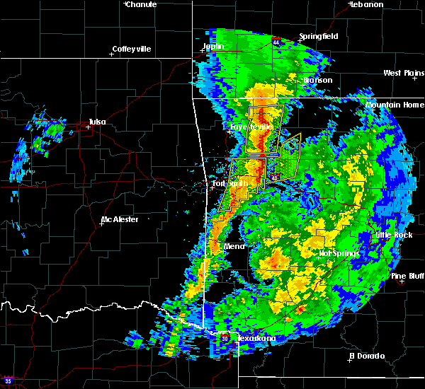 At 736 pm cdt, severe thunderstorms were located along a line extending from 2 miles east of eureka springs to 2 miles east of st. paul, moving northeast at 45 mph (radar indicated). Hazards include 60 mph wind gusts. Expect damage to roofs, siding, and trees. locations in or near the path include, berryville, huntsville, eureka springs, st. Paul, hindsville, wesley, saint paul, forum, aurora, hobbs state park, clifty, boston, withrow springs state park, pettigrew, japton, marble, witter, georgetown, beaver lake, metalton,. At 736 pm cdt, severe thunderstorms were located along a line extending from 2 miles east of eureka springs to 2 miles east of st. paul, moving northeast at 45 mph (radar indicated). Hazards include 60 mph wind gusts. Expect damage to roofs, siding, and trees. locations in or near the path include, berryville, huntsville, eureka springs, st. Paul, hindsville, wesley, saint paul, forum, aurora, hobbs state park, clifty, boston, withrow springs state park, pettigrew, japton, marble, witter, georgetown, beaver lake, metalton,.
|
| 3/24/2017 7:13 PM CDT |
 At 712 pm cdt, severe thunderstorms were located along a line extending from 3 miles southwest of hobbs state park to 9 miles north of fern, moving northeast at 50 mph (radar indicated). Hazards include 60 mph wind gusts. Expect damage to roofs, siding, and trees. locations in or near the path include, fayetteville, berryville, huntsville, eureka springs, elkins, st. Paul, hindsville, wesley, saint paul, forum, aurora, hobbs state park, clifty, boston, withrow springs state park, war eagle, pettigrew, japton, marble, witter,. At 712 pm cdt, severe thunderstorms were located along a line extending from 3 miles southwest of hobbs state park to 9 miles north of fern, moving northeast at 50 mph (radar indicated). Hazards include 60 mph wind gusts. Expect damage to roofs, siding, and trees. locations in or near the path include, fayetteville, berryville, huntsville, eureka springs, elkins, st. Paul, hindsville, wesley, saint paul, forum, aurora, hobbs state park, clifty, boston, withrow springs state park, war eagle, pettigrew, japton, marble, witter,.
|
| 3/9/2017 9:48 PM CST |
 At 948 pm cst, severe thunderstorms were located along a line extending from 5 miles northeast of brentwood to 3 miles southwest of pettigrew, moving southeast at 30 mph (radar indicated). Hazards include 60 mph wind gusts and quarter size hail. Hail damage to vehicles is expected. expect wind damage to roofs, siding, and trees. locations in or near the path include, west fork, winslow, st. Paul, saint paul, pettigrew, brentwood, japton, boston, cass, dutton, wyola, bidville, woolsey, delaney, arnett, brashears, crosses, patrick, combs, locke, this includes interstate 49 between mile markers 46 and 50. At 948 pm cst, severe thunderstorms were located along a line extending from 5 miles northeast of brentwood to 3 miles southwest of pettigrew, moving southeast at 30 mph (radar indicated). Hazards include 60 mph wind gusts and quarter size hail. Hail damage to vehicles is expected. expect wind damage to roofs, siding, and trees. locations in or near the path include, west fork, winslow, st. Paul, saint paul, pettigrew, brentwood, japton, boston, cass, dutton, wyola, bidville, woolsey, delaney, arnett, brashears, crosses, patrick, combs, locke, this includes interstate 49 between mile markers 46 and 50.
|
| 3/9/2017 9:22 PM CST |
 At 922 pm cst, severe thunderstorms were located along a line extending from 2 miles west of greenland to 7 miles southwest of japton, moving southeast at 30 mph (radar indicated). Hazards include 60 mph wind gusts and quarter size hail. Hail damage to vehicles is expected. expect wind damage to roofs, siding, and trees. locations in or near the path include, fayetteville, farmington, prairie grove, elkins, west fork, greenland, winslow, st. Paul, wesley, saint paul, boston, pettigrew, brentwood, japton, cass, black oak, georgetown, walnut grove, bidville, woolsey, this includes interstate 49 between mile markers 45 and 60. At 922 pm cst, severe thunderstorms were located along a line extending from 2 miles west of greenland to 7 miles southwest of japton, moving southeast at 30 mph (radar indicated). Hazards include 60 mph wind gusts and quarter size hail. Hail damage to vehicles is expected. expect wind damage to roofs, siding, and trees. locations in or near the path include, fayetteville, farmington, prairie grove, elkins, west fork, greenland, winslow, st. Paul, wesley, saint paul, boston, pettigrew, brentwood, japton, cass, black oak, georgetown, walnut grove, bidville, woolsey, this includes interstate 49 between mile markers 45 and 60.
|
| 3/7/2017 12:28 AM CST |
 At 1228 am cst, severe thunderstorms were located along a line extending from 2 miles south of omaha to 3 miles southeast of enterprise, moving east at 70 mph (radar indicated). Hazards include 60 mph wind gusts. Expect damage to roofs, siding, and trees. locations in or near the path include, fort smith, van buren, sallisaw, poteau, ozark, stigler, charleston, huntsville, cedarville, mountainburg, natural dam, greenwood, alma, barling, pocola, muldrow, roland, green forest, lavaca, spiro, this includes the following highways, interstate 40 in arkansas between mile markers 0 and 40. interstate 40 in oklahoma between mile markers 299 and 328. interstate 540 between mile markers 1 and 14. interstate 49 between mile markers 22 and 49. A tornado watch remains in effect until 300 am cst for northwestern and west central arkansas, and southeastern, northeastern and east central oklahoma. At 1228 am cst, severe thunderstorms were located along a line extending from 2 miles south of omaha to 3 miles southeast of enterprise, moving east at 70 mph (radar indicated). Hazards include 60 mph wind gusts. Expect damage to roofs, siding, and trees. locations in or near the path include, fort smith, van buren, sallisaw, poteau, ozark, stigler, charleston, huntsville, cedarville, mountainburg, natural dam, greenwood, alma, barling, pocola, muldrow, roland, green forest, lavaca, spiro, this includes the following highways, interstate 40 in arkansas between mile markers 0 and 40. interstate 40 in oklahoma between mile markers 299 and 328. interstate 540 between mile markers 1 and 14. interstate 49 between mile markers 22 and 49. A tornado watch remains in effect until 300 am cst for northwestern and west central arkansas, and southeastern, northeastern and east central oklahoma.
|
| 3/6/2017 11:24 PM CST |
 At 1124 pm cst, severe thunderstorms were located along a line extending from 3 miles east of pea ridge to 5 miles south of tahlequah, moving east at 70 mph (radar indicated). Hazards include 60 mph wind gusts and quarter size hail. Hail damage to vehicles is expected. expect wind damage to roofs, siding, and trees. locations in or near the path include, fayetteville, springdale, rogers, bentonville, tahlequah, siloam springs, berryville, stilwell, huntsville, eureka springs, lowell, farmington, pea ridge, prairie grove, green forest, elkins, tontitown, bethel heights, west fork, lincoln, this includes interstate 49 between mile markers 41 and 84, and between mile markers 86 and 91. A tornado watch remains in effect until 300 am cst for northwestern and west central arkansas, and northeastern and east central oklahoma. At 1124 pm cst, severe thunderstorms were located along a line extending from 3 miles east of pea ridge to 5 miles south of tahlequah, moving east at 70 mph (radar indicated). Hazards include 60 mph wind gusts and quarter size hail. Hail damage to vehicles is expected. expect wind damage to roofs, siding, and trees. locations in or near the path include, fayetteville, springdale, rogers, bentonville, tahlequah, siloam springs, berryville, stilwell, huntsville, eureka springs, lowell, farmington, pea ridge, prairie grove, green forest, elkins, tontitown, bethel heights, west fork, lincoln, this includes interstate 49 between mile markers 41 and 84, and between mile markers 86 and 91. A tornado watch remains in effect until 300 am cst for northwestern and west central arkansas, and northeastern and east central oklahoma.
|
| 3/6/2017 11:01 PM CST |
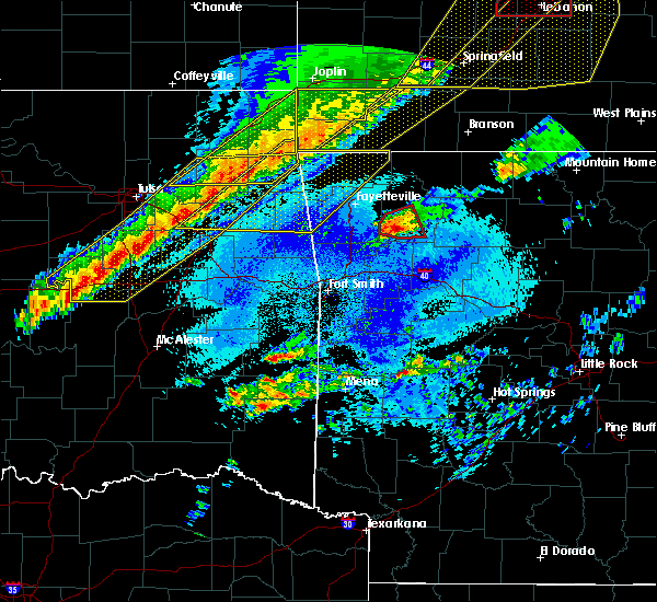 At 1100 pm cst, a severe thunderstorm capable of producing a tornado was located 8 miles west of saint paul, moving northeast at 30 mph. it appears that the storm may have produced a tornado near the madison and washibngton county line as we briefly noted what appeared to be debris in the radar data (radar indicated rotation). Hazards include tornado and quarter size hail. Flying debris will be dangerous to those caught without shelter. mobile homes will be damaged or destroyed. damage to roofs, windows, and vehicles will occur. tree damage is likely. locations in or near the path include, st. Paul, saint paul, pettigrew, japton, witter, aurora, boston, georgetown, dutton, delaney, brashears, crosses, patrick, combs,. At 1100 pm cst, a severe thunderstorm capable of producing a tornado was located 8 miles west of saint paul, moving northeast at 30 mph. it appears that the storm may have produced a tornado near the madison and washibngton county line as we briefly noted what appeared to be debris in the radar data (radar indicated rotation). Hazards include tornado and quarter size hail. Flying debris will be dangerous to those caught without shelter. mobile homes will be damaged or destroyed. damage to roofs, windows, and vehicles will occur. tree damage is likely. locations in or near the path include, st. Paul, saint paul, pettigrew, japton, witter, aurora, boston, georgetown, dutton, delaney, brashears, crosses, patrick, combs,.
|
| 3/6/2017 10:45 PM CST |
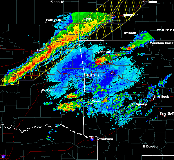 At 1045 pm cst, a severe thunderstorm capable of producing a tornado was located 4 miles east of winslow, moving east at 35 mph (radar indicated rotation). Hazards include tornado and quarter size hail. Flying debris will be dangerous to those caught without shelter. mobile homes will be damaged or destroyed. damage to roofs, windows, and vehicles will occur. tree damage is likely. locations in or near the path include, st. Paul, saint paul, pettigrew, brentwood, japton, witter, aurora, boston, georgetown, dutton, wyola, delaney, arnett, brashears, crosses, patrick, combs, durham, hicks,. At 1045 pm cst, a severe thunderstorm capable of producing a tornado was located 4 miles east of winslow, moving east at 35 mph (radar indicated rotation). Hazards include tornado and quarter size hail. Flying debris will be dangerous to those caught without shelter. mobile homes will be damaged or destroyed. damage to roofs, windows, and vehicles will occur. tree damage is likely. locations in or near the path include, st. Paul, saint paul, pettigrew, brentwood, japton, witter, aurora, boston, georgetown, dutton, wyola, delaney, arnett, brashears, crosses, patrick, combs, durham, hicks,.
|
| 3/1/2017 1:39 AM CST |
 The severe thunderstorm warning for southeastern madison, franklin, central sebastian and eastern crawford counties will expire at 145 am cst, the storms which prompted the warning have weakened below severe limits, and have exited the warned area. therefore the warning will be allowed to expire. however gusty winds are still possible with these thunderstorms. a tornado watch remains in effect until 400 am cst for northwestern arkansas. a tornado watch also remains in effect until 600 am cst for northwestern and west central arkansas. The severe thunderstorm warning for southeastern madison, franklin, central sebastian and eastern crawford counties will expire at 145 am cst, the storms which prompted the warning have weakened below severe limits, and have exited the warned area. therefore the warning will be allowed to expire. however gusty winds are still possible with these thunderstorms. a tornado watch remains in effect until 400 am cst for northwestern arkansas. a tornado watch also remains in effect until 600 am cst for northwestern and west central arkansas.
|
| 3/1/2017 1:09 AM CST |
 At 109 am cst, severe thunderstorms were located along a line extending from 4 miles southwest of saint paul to 3 miles north of charleston to 2 miles southwest of hackett, moving east at 40 mph (radar indicated). Hazards include 70 mph wind gusts and quarter size hail. Hail damage to vehicles is expected. expect considerable tree damage. wind damage is also likely to mobile homes, roofs, and outbuildings. locations in or near the path include, ozark, charleston, greenwood, lavaca, mulberry, hackett, altus, branch, denning, st. paul, wiederkehr village, cass, saint paul, excelsior, boston, bloomer, pettigrew, washburn, burnville, fort chaffee, this includes interstate 40 in arkansas between mile markers 21 and 42. a tornado watch remains in effect until 400 am cst for northwestern arkansas. A tornado watch also remains in effect until 600 am cst for northwestern and west central arkansas. At 109 am cst, severe thunderstorms were located along a line extending from 4 miles southwest of saint paul to 3 miles north of charleston to 2 miles southwest of hackett, moving east at 40 mph (radar indicated). Hazards include 70 mph wind gusts and quarter size hail. Hail damage to vehicles is expected. expect considerable tree damage. wind damage is also likely to mobile homes, roofs, and outbuildings. locations in or near the path include, ozark, charleston, greenwood, lavaca, mulberry, hackett, altus, branch, denning, st. paul, wiederkehr village, cass, saint paul, excelsior, boston, bloomer, pettigrew, washburn, burnville, fort chaffee, this includes interstate 40 in arkansas between mile markers 21 and 42. a tornado watch remains in effect until 400 am cst for northwestern arkansas. A tornado watch also remains in effect until 600 am cst for northwestern and west central arkansas.
|
| 7/14/2016 3:32 PM CDT |
 At 331 pm cdt, severe thunderstorms were located along a line extending from 7 miles east of brentwood to fern to 2 miles south of excelsior, moving east at 35 mph (radar indicated). Hazards include 60 mph wind gusts and quarter size hail. Hail damage to vehicles is expected. expect wind damage to roofs, siding, and trees. locations in or near the path include, ozark, charleston, greenwood, barling, lavaca, mulberry, mansfield, dyer, altus, hartford, huntington, branch, midland, denning, st. Paul, wiederkehr village, pettigrew, washburn, cass, witter, this includes interstate 40 in arkansas between mile markers 16 and 42. At 331 pm cdt, severe thunderstorms were located along a line extending from 7 miles east of brentwood to fern to 2 miles south of excelsior, moving east at 35 mph (radar indicated). Hazards include 60 mph wind gusts and quarter size hail. Hail damage to vehicles is expected. expect wind damage to roofs, siding, and trees. locations in or near the path include, ozark, charleston, greenwood, barling, lavaca, mulberry, mansfield, dyer, altus, hartford, huntington, branch, midland, denning, st. Paul, wiederkehr village, pettigrew, washburn, cass, witter, this includes interstate 40 in arkansas between mile markers 16 and 42.
|
| 4/29/2016 5:12 PM CDT | The severe thunderstorm warning for southwestern madison, north central franklin and eastern washington counties will expire at 515 pm cdt, the storm which prompted the warning has weakened below severe limits, and no longer poses an immediate threat to life or property. therefore the warning will be allowed to expire. |
| 4/29/2016 5:01 PM CDT |
 At 501 pm cdt, a severe thunderstorm was located 8 miles northwest of cass, moving northeast at 50 mph (radar indicated). Hazards include quarter size hail. Damage to vehicles is expected. locations in or near the path include, elkins, st. Paul, wesley, japton, aurora, witter, saint paul, goshen, georgetown, crosses, delaney, combs, durham, brashears, mayfield, patrick, tuttle,. At 501 pm cdt, a severe thunderstorm was located 8 miles northwest of cass, moving northeast at 50 mph (radar indicated). Hazards include quarter size hail. Damage to vehicles is expected. locations in or near the path include, elkins, st. Paul, wesley, japton, aurora, witter, saint paul, goshen, georgetown, crosses, delaney, combs, durham, brashears, mayfield, patrick, tuttle,.
|
| 4/29/2016 4:36 PM CDT |
 At 435 pm cdt, a severe thunderstorm was located near mountainburg, moving northeast at 55 mph (radar indicated). Hazards include golf ball size hail. People and animals outdoors will be injured. expect damage to roofs, siding, windows, and vehicles. this storm has a history of producing large damaging hail in the fort smith area. locations in or near the path include, fayetteville, mountainburg, elkins, mulberry, dyer, winslow, chester, st. paul, wesley, aurora, witter, saint paul, lake fort smith, fern, brentwood, japton, goshen, black oak, georgetown, crosses, this includes the following highways, interstate 40 in arkansas between mile markers 16 and 21. Interstate 49 between mile markers 24 and 43. At 435 pm cdt, a severe thunderstorm was located near mountainburg, moving northeast at 55 mph (radar indicated). Hazards include golf ball size hail. People and animals outdoors will be injured. expect damage to roofs, siding, windows, and vehicles. this storm has a history of producing large damaging hail in the fort smith area. locations in or near the path include, fayetteville, mountainburg, elkins, mulberry, dyer, winslow, chester, st. paul, wesley, aurora, witter, saint paul, lake fort smith, fern, brentwood, japton, goshen, black oak, georgetown, crosses, this includes the following highways, interstate 40 in arkansas between mile markers 16 and 21. Interstate 49 between mile markers 24 and 43.
|
| 4/27/2016 2:25 AM CDT |
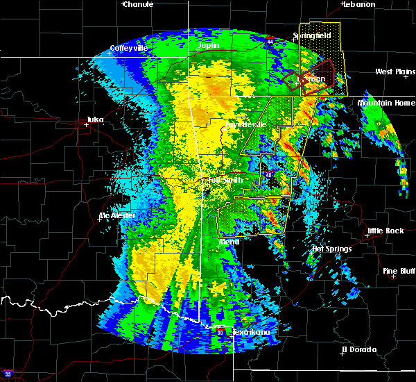 The severe thunderstorm warning for madison, northeastern franklin and carroll counties will expire at 230 am cdt, the storms which prompted the warning have moved out of the area. therefore the warning will be allowed to expire. a severe thunderstorm watch remains in effect until 500 am cdt for northwestern arkansas. The severe thunderstorm warning for madison, northeastern franklin and carroll counties will expire at 230 am cdt, the storms which prompted the warning have moved out of the area. therefore the warning will be allowed to expire. a severe thunderstorm watch remains in effect until 500 am cdt for northwestern arkansas.
|
| 4/27/2016 1:54 AM CDT |
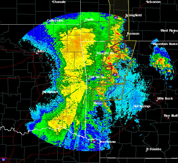 At 154 am cdt, severe thunderstorms were located along a line extending from 6 miles northeast of urbanette to 3 miles northwest of woodland, moving east at 55 mph (radar indicated). Hazards include 70 mph wind gusts. Expect considerable tree damage. damage is likely to mobile homes, roofs, and outbuildings. locations in or near the path include, berryville, huntsville, green forest, st. Paul, pettigrew, urbanette, rudd, forum, boston, aurora, withrow springs state park, witter, saint paul, osage, kingston, rule, japton, marble, carrollton, blue eye,. At 154 am cdt, severe thunderstorms were located along a line extending from 6 miles northeast of urbanette to 3 miles northwest of woodland, moving east at 55 mph (radar indicated). Hazards include 70 mph wind gusts. Expect considerable tree damage. damage is likely to mobile homes, roofs, and outbuildings. locations in or near the path include, berryville, huntsville, green forest, st. Paul, pettigrew, urbanette, rudd, forum, boston, aurora, withrow springs state park, witter, saint paul, osage, kingston, rule, japton, marble, carrollton, blue eye,.
|
| 4/27/2016 1:31 AM CDT |
 At 130 am cdt, severe thunderstorms were located along a line extending from 3 miles northwest of grandview to 2 miles east of huntsville to 4 miles west of saint paul, moving east at 35 mph (radar indicated). Hazards include 60 mph wind gusts and penny size hail. Expect damage to roofs. siding. and trees. locations in or near the path include, berryville, huntsville, eureka springs, green forest, st. Paul, beaver, hindsville, pettigrew, urbanette, wesley, clifty, aurora, witter, grandview, rudd, forum, boston, withrow springs state park, saint paul, osage,. At 130 am cdt, severe thunderstorms were located along a line extending from 3 miles northwest of grandview to 2 miles east of huntsville to 4 miles west of saint paul, moving east at 35 mph (radar indicated). Hazards include 60 mph wind gusts and penny size hail. Expect damage to roofs. siding. and trees. locations in or near the path include, berryville, huntsville, eureka springs, green forest, st. Paul, beaver, hindsville, pettigrew, urbanette, wesley, clifty, aurora, witter, grandview, rudd, forum, boston, withrow springs state park, saint paul, osage,.
|
| 4/27/2016 1:00 AM CDT |
 At 100 am cdt, severe thunderstorms were located along a line extending from 3 miles northwest of garfield to 4 miles east of winslow, moving east at 45 mph (radar indicated). Hazards include 60 mph wind gusts and penny size hail. Expect damage to roofs. siding. and trees. Locations in or near the path include, fayetteville, springdale, rogers, bentonville, berryville, huntsville, eureka springs, bella vista, lowell, farmington, pea ridge, prairie grove, green forest, elkins, tontitown, bethel heights, west fork, cave springs, greenland, highfill, this includes interstate 49 between mile markers 43 and 84, and between mile markers 86 and 93. At 100 am cdt, severe thunderstorms were located along a line extending from 3 miles northwest of garfield to 4 miles east of winslow, moving east at 45 mph (radar indicated). Hazards include 60 mph wind gusts and penny size hail. Expect damage to roofs. siding. and trees. Locations in or near the path include, fayetteville, springdale, rogers, bentonville, berryville, huntsville, eureka springs, bella vista, lowell, farmington, pea ridge, prairie grove, green forest, elkins, tontitown, bethel heights, west fork, cave springs, greenland, highfill, this includes interstate 49 between mile markers 43 and 84, and between mile markers 86 and 93.
|
| 6/26/2015 5:08 PM CDT | At 507 pm cdt, severe thunderstorms were located along a line extending from near witter to 7 miles southeast of cass to 3 miles southwest of denning, moving east at 30 mph (trained weather spotters reported trees and power lines down north of ozark at about 445 pm). Hazards include 70 mph wind gusts. Expect considerable tree damage. damage is likely to mobile homes, roofs and outbuildings. locations impacted include, ozark, altus, denning, st. Paul, wiederkehr village, cass, saint paul, alix, watalula, dutton, combs, redding, brashears, barnes, paradise, taft, patrick and turners bend. |
| 6/26/2015 4:52 PM CDT | At 452 pm cdt, severe thunderstorms were located along a line extending from 2 miles south of japton to 5 miles south of cass to 4 miles north of ratcliff, moving east at 45 mph (radar indicated). Hazards include 60 mph wind gusts. Expect damage to roofs. siding and trees. locations impacted include, ozark, charleston, west fork, mulberry, altus, winslow, branch, denning, st. Paul, wiederkehr village, aurora, cass, saint paul, fern, brentwood, japton, caulksville, woolsey, crosses and delaney. |
| 6/26/2015 4:36 PM CDT | At 436 pm cdt, severe thunderstorms were located along a line extending from 2 miles west of winslow to 2 miles southwest of dyer to near greenwood, moving east at 30 mph (radar indicated). Hazards include 60 mph wind gusts. Expect damage to roofs. siding and trees. Locations impacted include, fort smith, van buren, ozark, charleston, cedarville, mountainburg, natural dam, greenwood, alma, barling, west fork, lavaca, mulberry, dyer, hackett, altus, bonanza, winslow, branch and denning. |
| 6/26/2015 4:15 PM CDT | At 415 pm cdt, severe thunderstorms were located along a line extending from 5 miles north of lee creek to van buren to hackett, moving east at 25 mph (radar indicated). Hazards include 70 mph wind gusts and quarter size hail. Hail damage to vehicles is expected. expect considerable tree damage. Wind damage is also likely to mobile homes, roofs and outbuildings. |
| 6/26/2015 4:15 PM CDT | At 415 pm cdt, severe thunderstorms were located along a line extending from 5 miles north of lee creek to van buren to hackett, moving east at 25 mph (radar indicated). Hazards include 70 mph wind gusts and quarter size hail. Hail damage to vehicles is expected. expect considerable tree damage. Wind damage is also likely to mobile homes, roofs and outbuildings. |
| 5/25/2015 7:57 PM CDT | At 754 pm cdt, severe thunderstorms were located along a line extending from wesley to 7 miles southeast of boston, and moving north at 35 mph (radar indicated). Hazards include 60 mph wind gusts. Expect damage to roofs. siding and trees. Locations in or near the path include, japton, wesley, georgetown, witter, red star, aurora and weathers. |
| 5/25/2015 7:28 PM CDT | At 726 pm cdt, severe thunderstorms were located along a line extending from 9 miles northwest of cass to wiederkehr village, and moving northeast at 40 mph (radar indicated). Hazards include 60 mph wind gusts. Expect damage to roofs. siding and trees. Locations in or near the path include, cass, mountain top, redding, taft, delaney, patrick, combs, crosses, brashears, saint paul, dutton, wesley, japton, pettigrew, georgetown, boston, witter, aurora, red star and weathers. |
| 5/10/2015 11:57 AM CDT | At 1154 am cdt, severe thunderstorms were located along a line extending from japton to saint paul, and moving east at 50 mph (radar indicated). Hazards include 60 mph wind gusts. Expect damage to roofs. siding and trees. locations in or near the path include, dutton, pettigrew, witter, boston, red star and weathers. 75in. |
| 4/9/2015 5:13 PM CDT | A severe thunderstorm warning remains in effect for southern madison and northeastern franklin counties until 545 pm cdt. at 510 pm cdt. a severe thunderstorm was located near pettigrew. and moving east at 45 mph. hazard. golf ball size hail and 60 mph wind gusts. source. Radar indicated. |
| 4/9/2015 5:08 PM CDT | Quarter sized hail reported 6.4 miles W of St. Paul, AR, relayed via social media with picture |
| 4/9/2015 4:53 PM CDT | The national weather service in tulsa has issued a * severe thunderstorm warning for. northeastern crawford county in northwest arkansas. northeastern franklin county in west central arkansas. southern madison county in northwest arkansas. Southeastern washington county in northwest arkansas. |
| 3/25/2015 9:39 PM CDT | A severe thunderstorm warning remains in effect for southeastern washington and madison counties in northwest arkansas until 1000 pm cdt. at 936 pm cdt. severe thunderstorms were located along a line extending from marble to 6 miles south of kingston to boston. And moving east at 45 mph. |
| 3/25/2015 9:36 PM CDT | A severe thunderstorm warning remains in effect for eastern washington and madison counties in northwest arkansas until 1000 pm cdt. at 934 pm cdt. severe thunderstorms were located along a line extending from marble to kingston to boston. And moving east at 45 mph. |
| 3/25/2015 9:20 PM CDT | A severe thunderstorm warning remains in effect for eastern washington. madison. southeastern carroll and southeastern benton counties in northwest arkansas until 1000 pm cdt. at 917 pm cdt. severe thunderstorms were located along a line extending from hindsville to aurora to saint paul. And moving east at 45 mph. |
| 3/25/2015 9:04 PM CDT | The national weather service in tulsa has issued a * severe thunderstorm warning for. south central benton county in northwest arkansas. southeastern carroll county in northwest arkansas. madison county in northwest arkansas. Eastern washington county in northwest arkansas. |
| 3/25/2015 4:06 PM CDT | A severe thunderstorm warning remains in effect for southeastern madison and northeastern franklin counties until 445 pm cdt. at 404 pm cdt. a severe thunderstorm was located near cass. and moving northeast at 30 mph. hazard. golf ball size hail and 60 mph wind gusts. source. Radar indicated. |
| 3/25/2015 3:58 PM CDT | A severe thunderstorm warning remains in effect for southeastern madison and northern franklin counties until 445 pm cdt. at 355 pm cdt. a severe thunderstorm was located 7 miles southwest of cass. and moving northeast at 15 mph. hazard. 60 mph wind gusts and half dollar size hail. source. Radar indicated. |
| 3/25/2015 3:42 PM CDT | The national weather service in tulsa has issued a * severe thunderstorm warning for. northern franklin county in west central arkansas. southeastern madison county in northwest arkansas. until 445 pm cdt * at 340 pm cdt. A severe thunderstorm was located 7 miles southeast. |
| 3/24/2015 7:07 PM CDT | A severe thunderstorm warning remains in effect for central madison county until 745 pm cdt. at 704 pm cdt. a severe thunderstorm was located 7 miles southwest of japton. and moving east at 45 mph. hazard. 60 mph wind gusts and quarter size hail. source. Radar indicated. |
| 3/24/2015 6:59 PM CDT | The national weather service in tulsa has issued a * severe thunderstorm warning for. central madison county in northwest arkansas. east central washington county in northwest arkansas. until 745 pm cdt * at 658 pm cdt. A severe thunderstorm was located 8 miles east of. |
| 3/24/2015 6:55 PM CDT | A severe thunderstorm warning remains in effect for east central washington and central madison counties in northwest arkansas until 700 pm cdt. at 653 pm cdt. a severe thunderstorm was located near japton. and moving east at 45 mph. hazard. Quarter size hail. |
| 3/24/2015 6:31 PM CDT | A severe thunderstorm warning remains in effect for central washington and central madison counties in northwest arkansas until 700 pm cdt. at 627 pm cdt. a severe thunderstorm was located near west fork. and moving east at 40 mph. hazard. 60 mph wind gusts and half dollar size hail. |
| 3/24/2015 6:13 PM CDT | The national weather service in tulsa has issued a * severe thunderstorm warning for. central madison county in northwest arkansas. central washington county in northwest arkansas. until 700 pm cdt * at 611 pm cdt. A severe thunderstorm was located 5 miles southeast. |
| 7/10/2013 7:50 PM CDT | Numerous trees down and power outages along highway 16. time estimated via rada in madison county AR, 7.9 miles ESE of St. Paul, AR |
| 6/1/2013 2:14 AM CDT | Tree down in madison county AR, 11.6 miles W of St. Paul, AR |
| 6/1/2013 2:01 AM CDT | Several trees damaged in madison county AR, 6.9 miles W of St. Paul, AR |
| 6/1/2013 2:01 AM CDT | Tree downed in madison county AR, 8.6 miles W of St. Paul, AR |
| 6/1/2013 1:56 AM CDT | Extensive damage to one home and one mobile home overturne in madison county AR, 0.5 miles NE of St. Paul, AR |
| 6/1/2013 1:56 AM CDT | Several trees downed in madison county AR, 2.6 miles SW of St. Paul, AR |
| 6/1/2013 1:52 AM CDT | Many trees damaged in and around tow in madison county AR, 0.5 miles NE of St. Paul, AR |
| 6/1/2013 1:47 AM CDT | Tree down in franklin county AR, 7.2 miles NNE of St. Paul, AR |
| 10/13/2012 10:35 PM CDT | Several trees blown down in franklin county AR, 9.8 miles NNE of St. Paul, AR |
| 8/16/2012 7:55 PM CDT | Several trees down around tow in madison county AR, 0.5 miles NE of St. Paul, AR |
| 7/19/2012 7:20 PM CDT | Damage to bar in madison county AR, 4.6 miles S of St. Paul, AR |
| 7/19/2012 6:30 PM CDT | At county rd 5395 and hwy 74 junction...6 large trees snapped or uprooted. two hay barns destroyed in madison county AR, 6.2 miles SE of St. Paul, AR |
| 1/1/0001 12:00 AM | 16 inch diameter trees down... reported by knwa storm chase in madison county AR, 10.9 miles W of St. Paul, AR |
| 1/1/0001 12:00 AM | Quarter sized hail reported 16.9 miles WNW of St. Paul, AR |
Hail Maps for St. Paul, AR

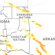
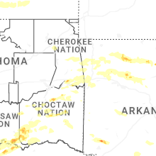


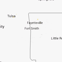


Connect with Interactive Hail Maps