

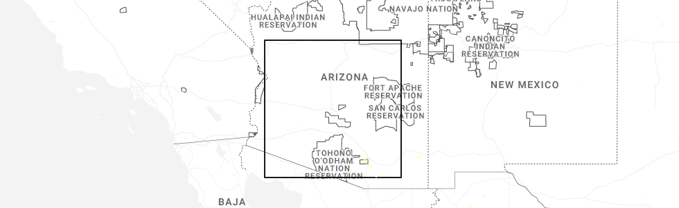
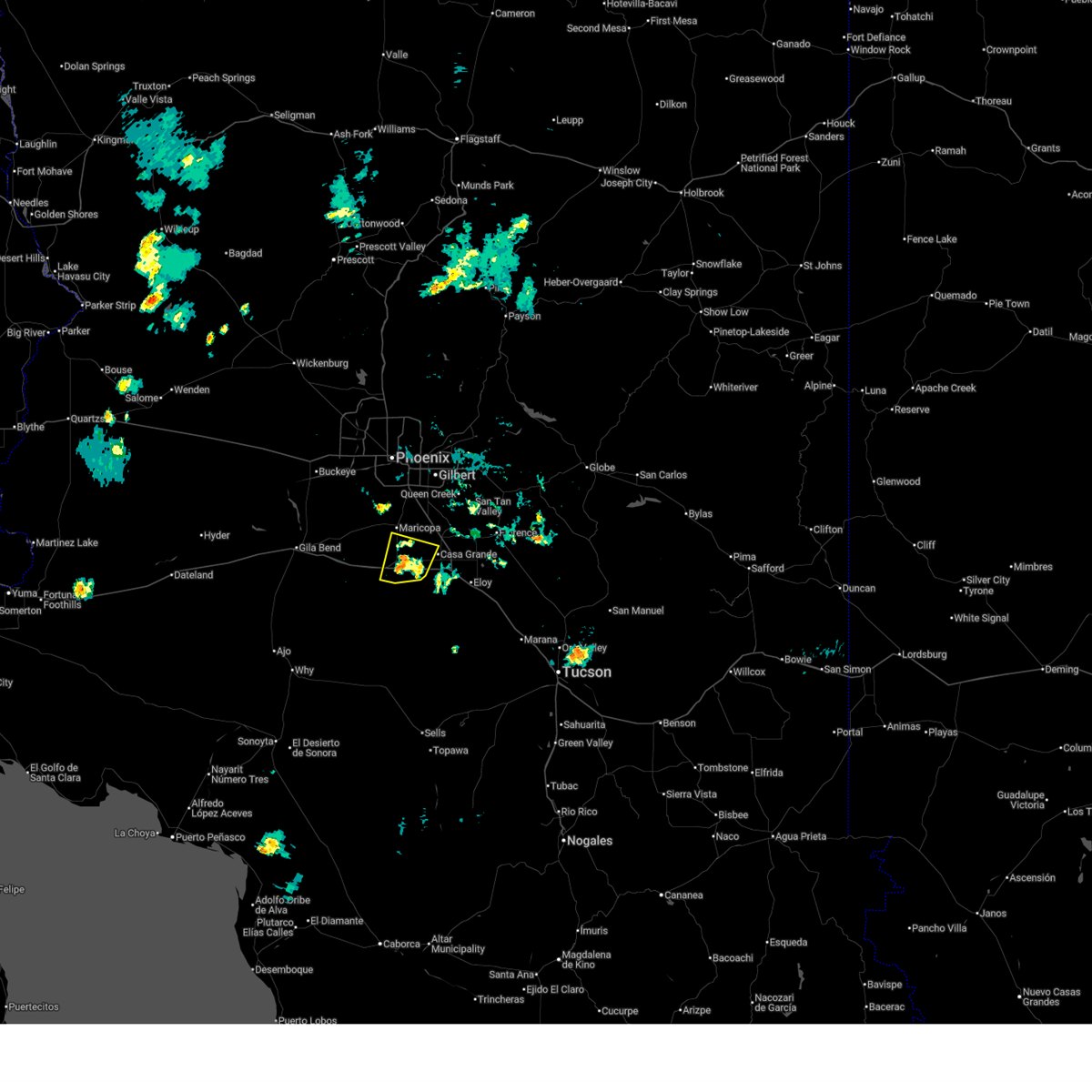
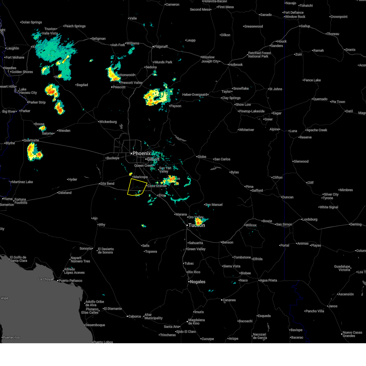
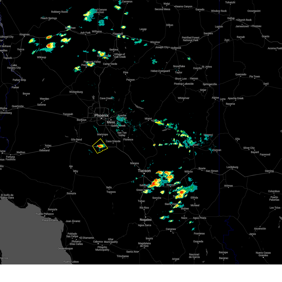
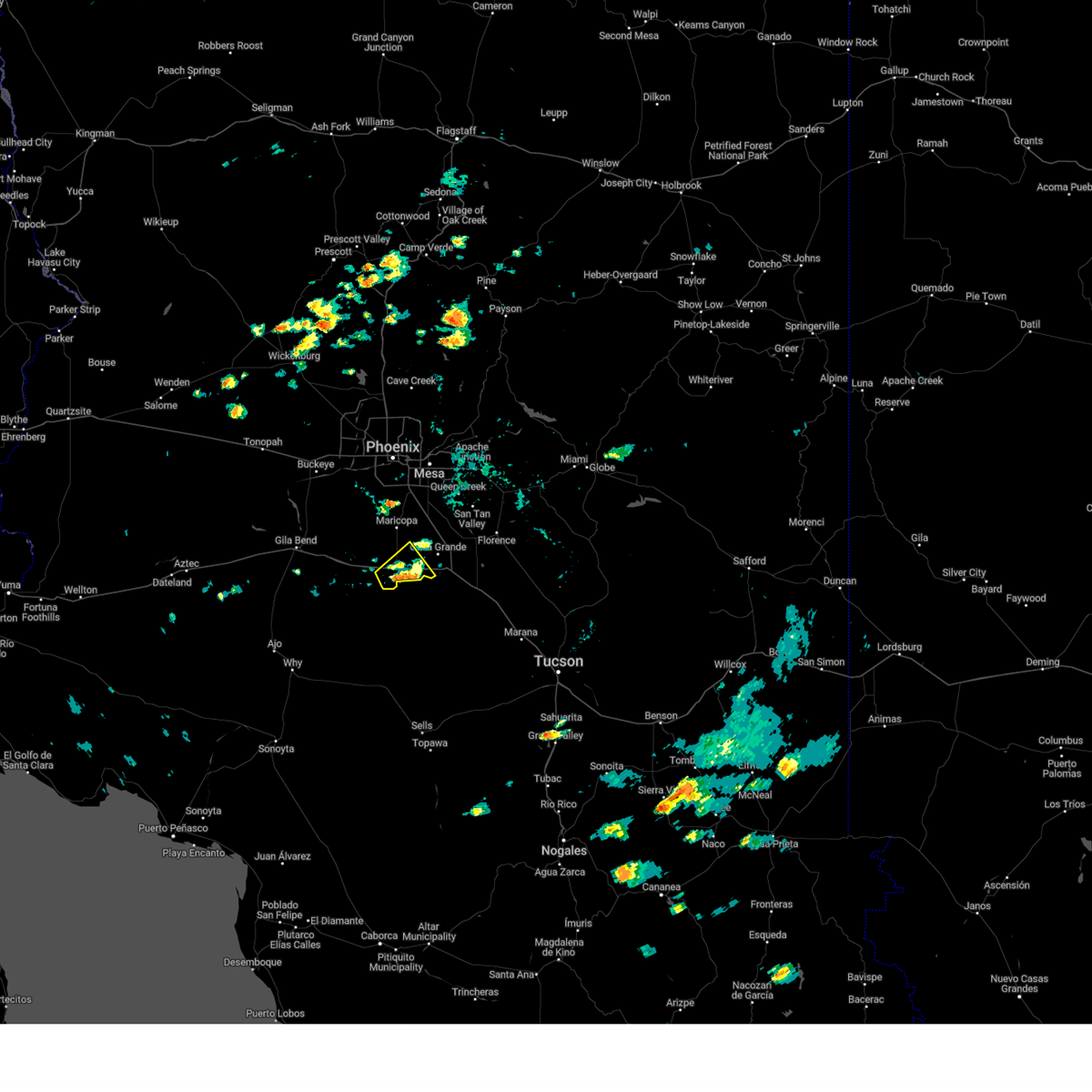
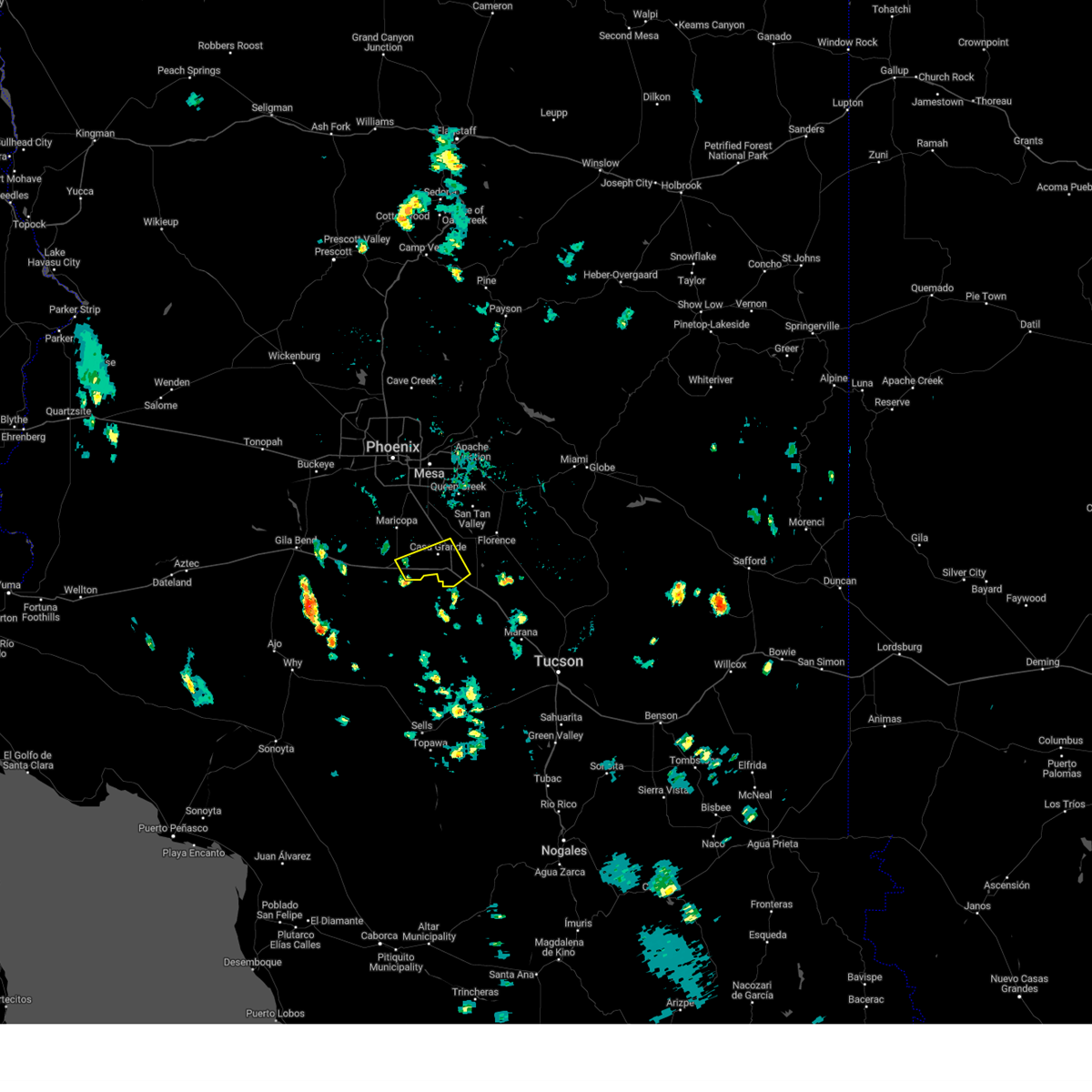
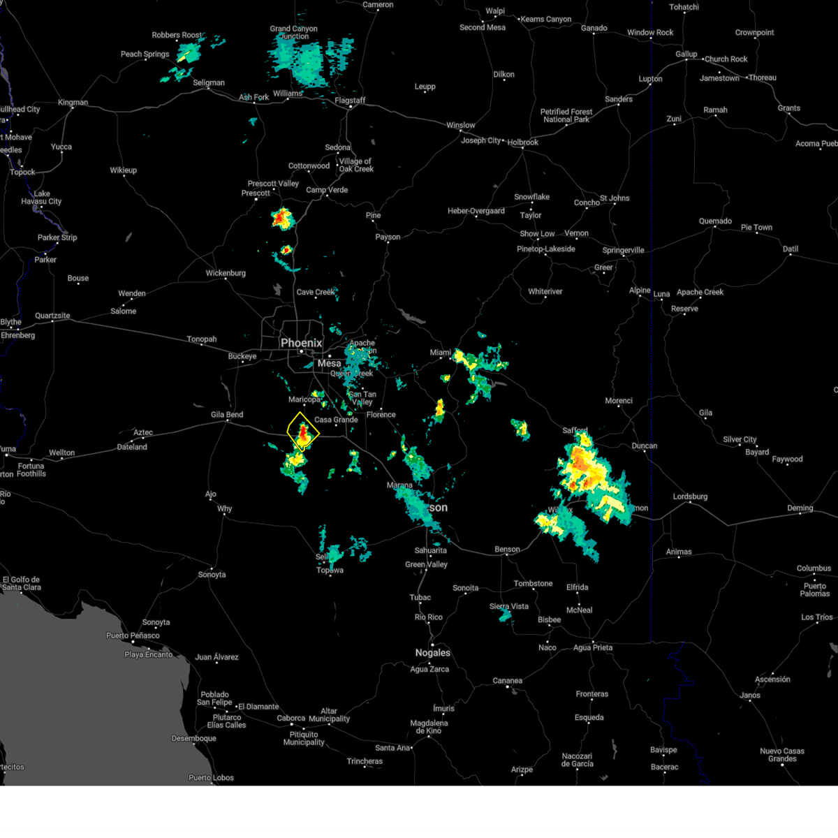
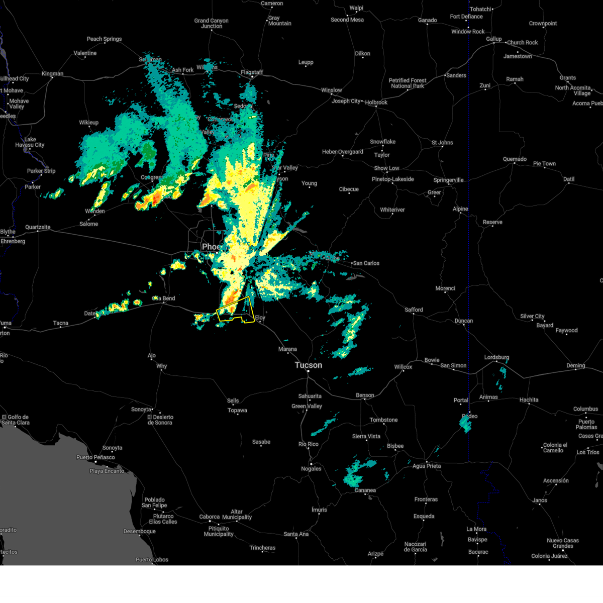
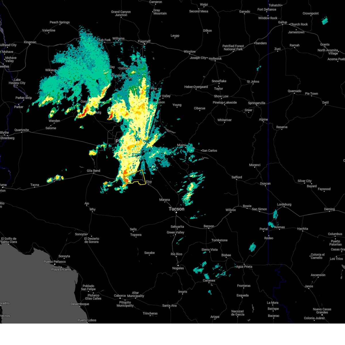
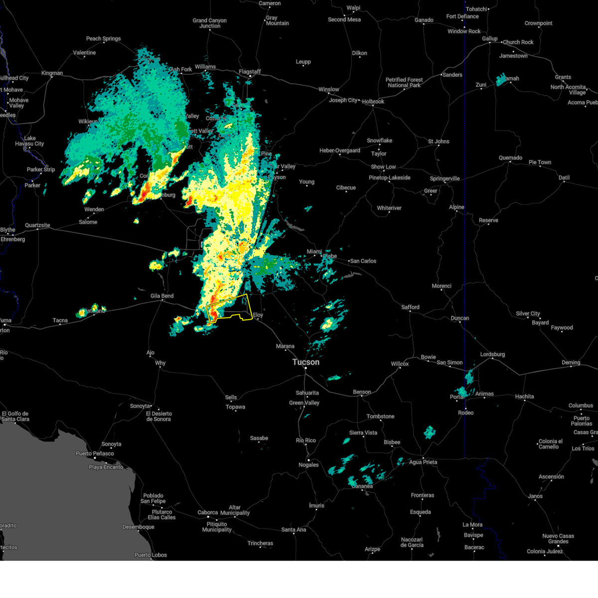
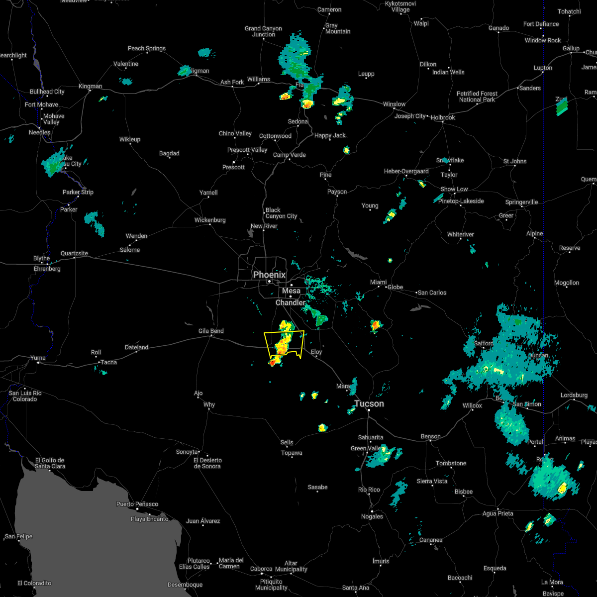
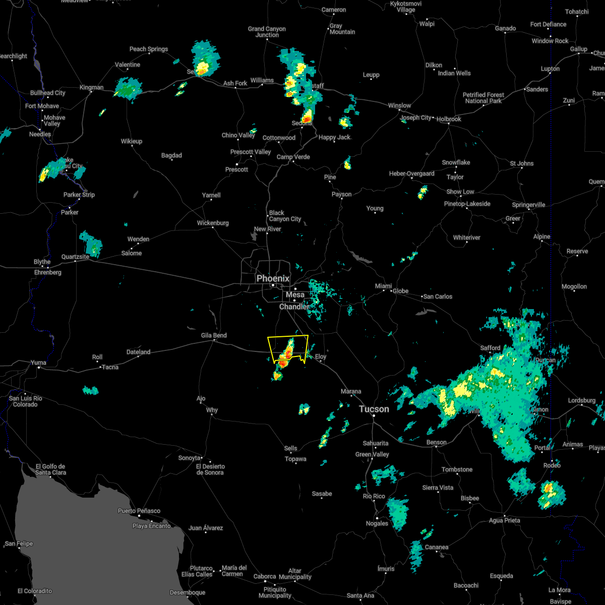
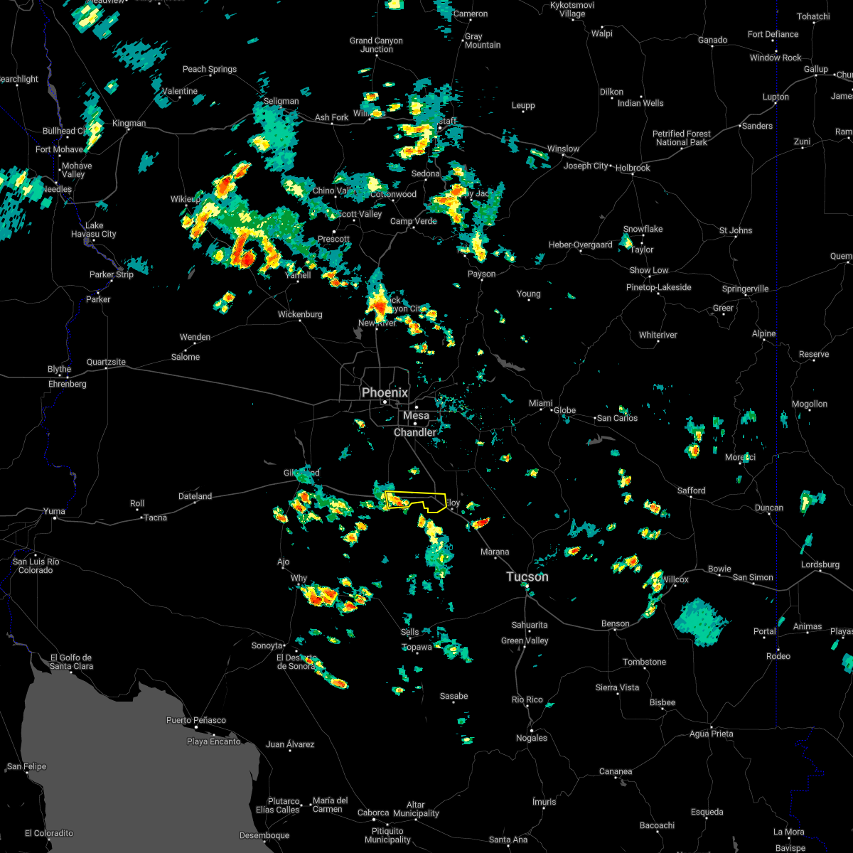
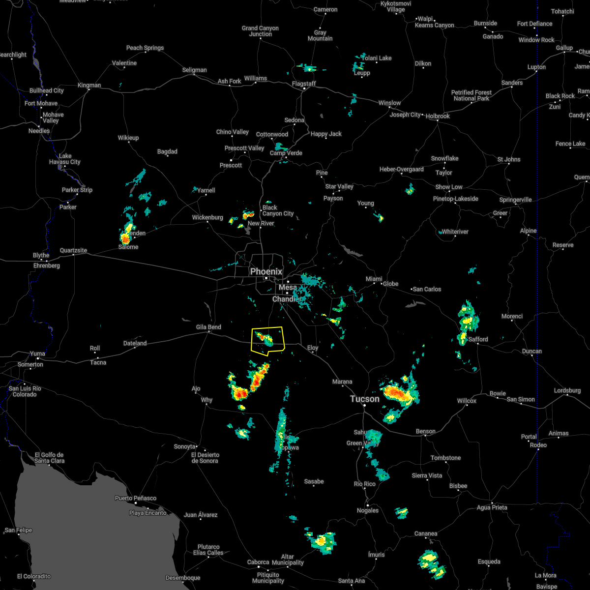
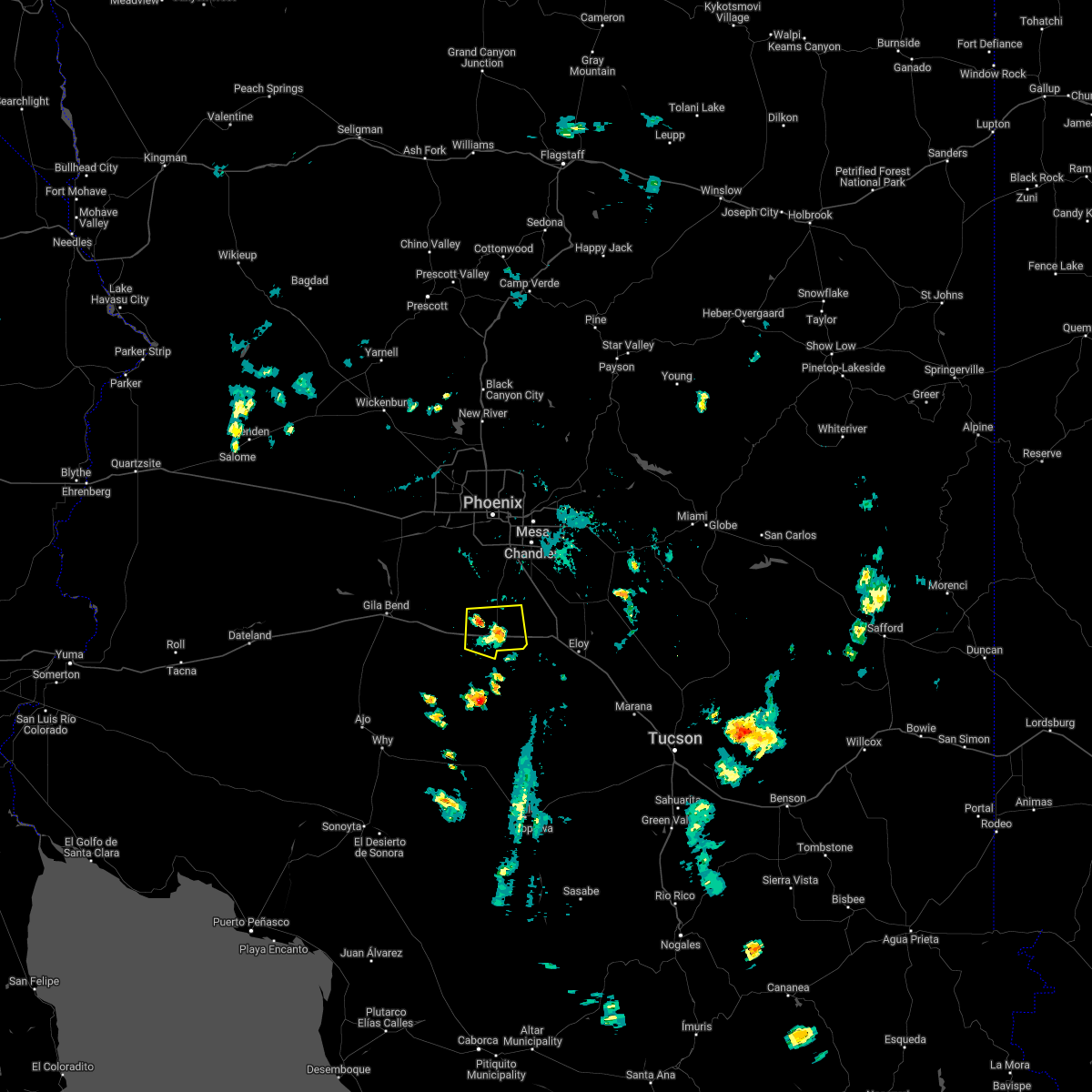
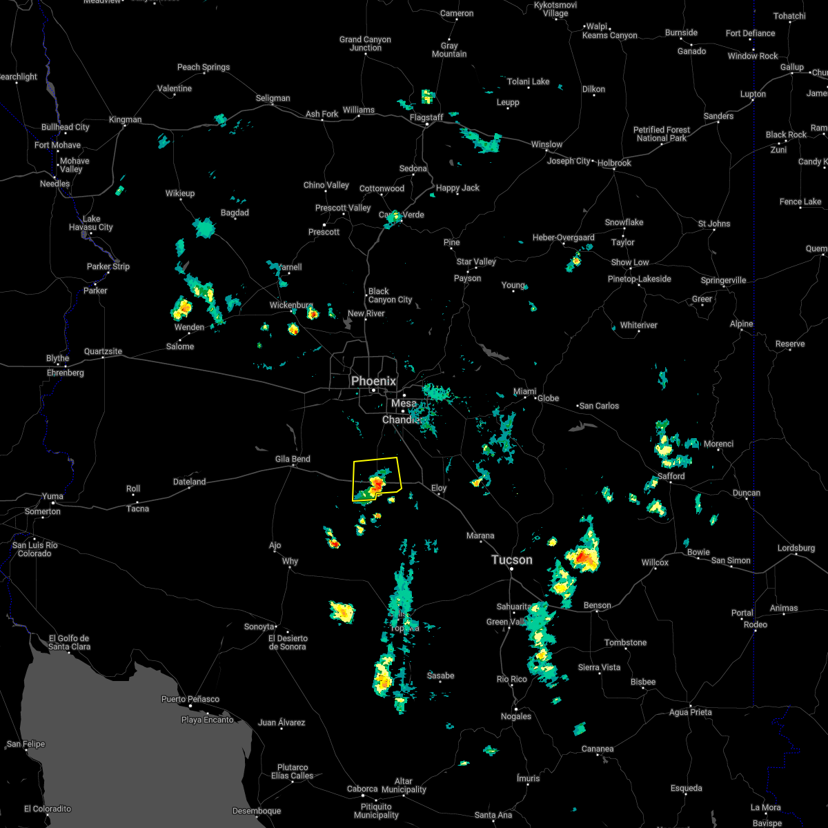
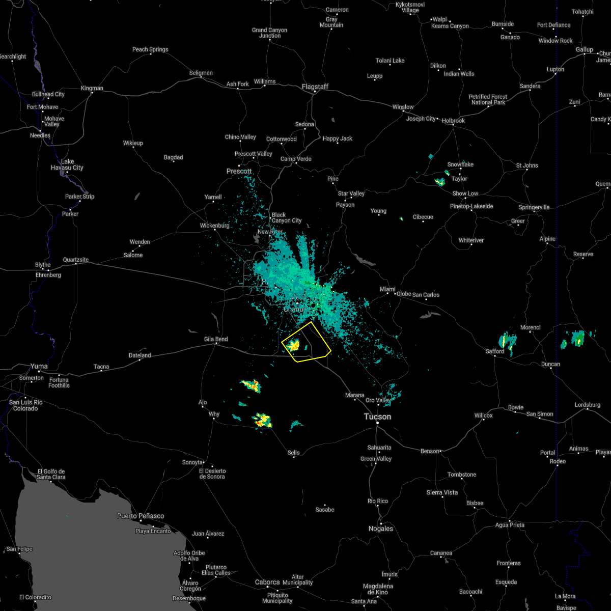
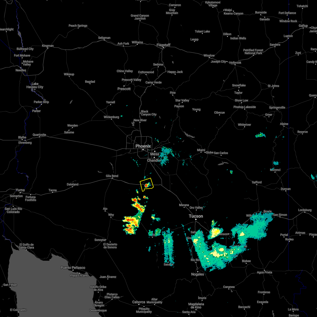
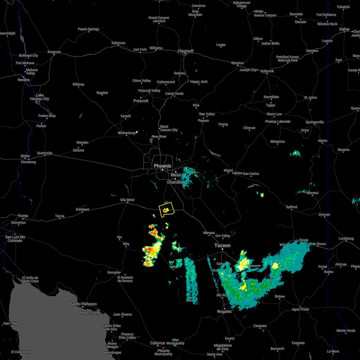
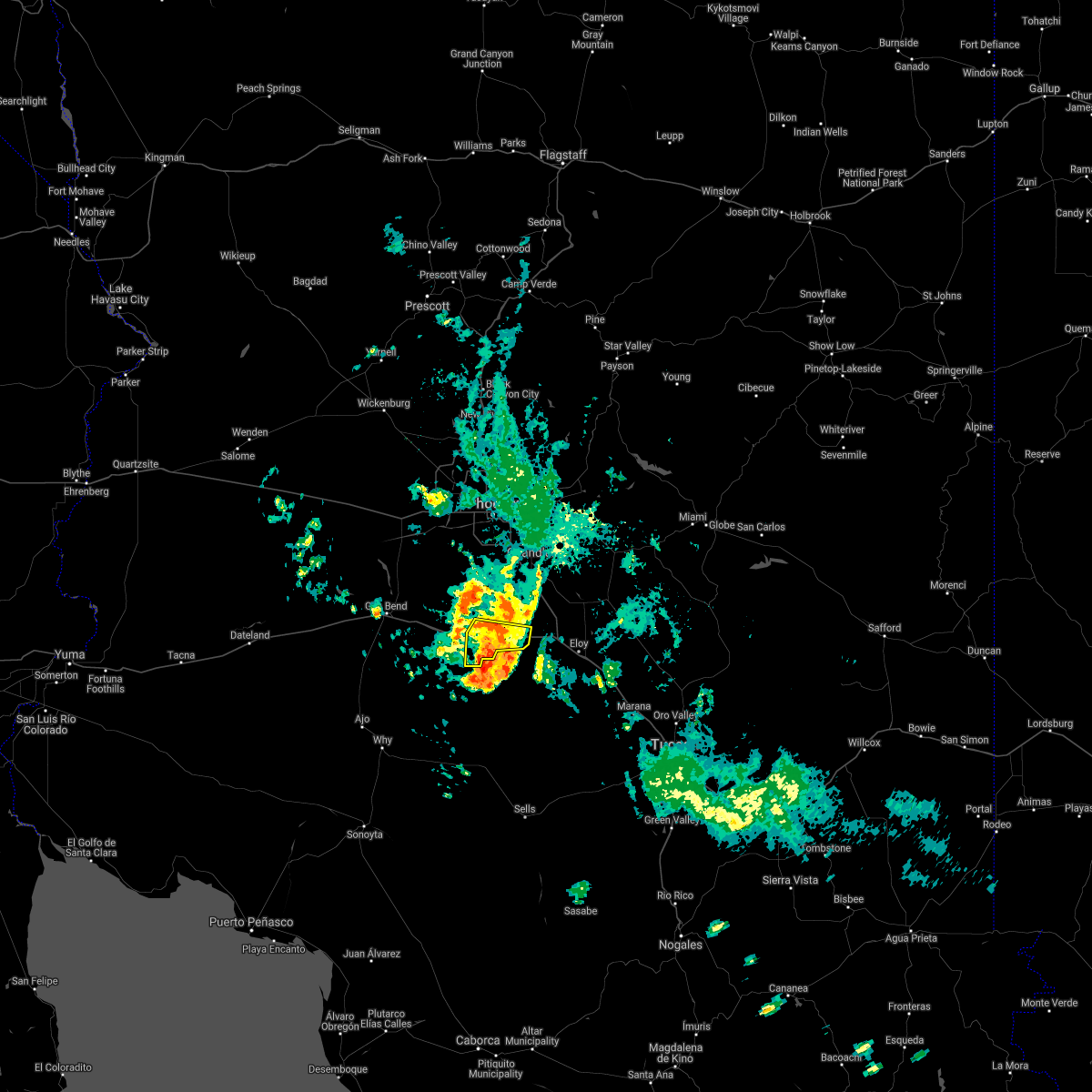
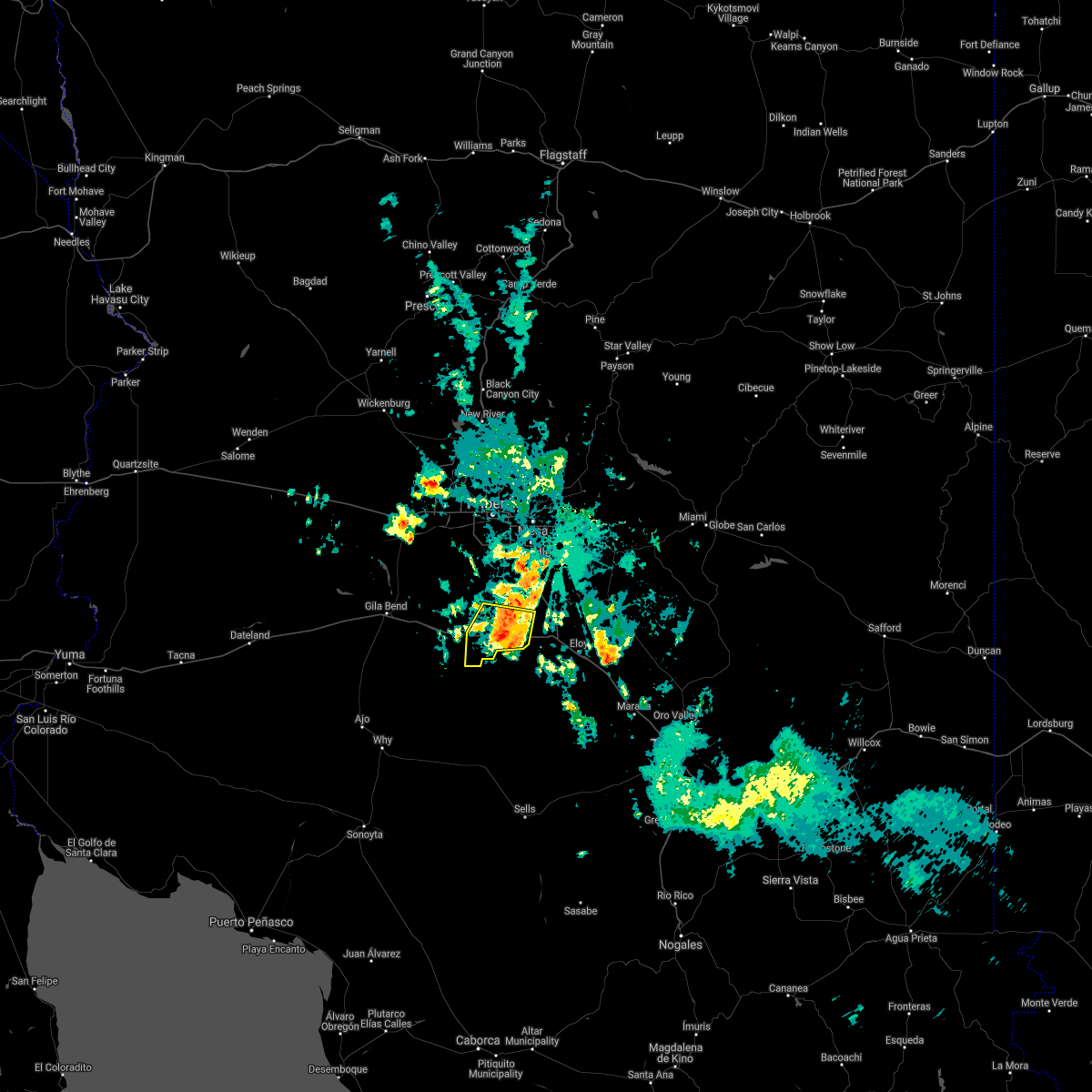
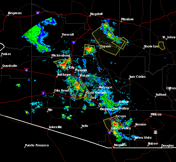
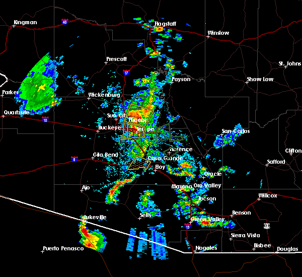
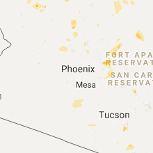
Hail Map for Stanfield, AZ
The Stanfield, AZ area has had 0 reports of on-the-ground hail by trained spotters, and has been under severe weather warnings 3 times during the past 12 months. Doppler radar has detected hail at or near Stanfield, AZ on 26 occasions, including 1 occasion during the past year.
| Name: | Stanfield, AZ |
| Where Located: | 39.7 miles S of Phoenix, AZ |
| Map: | Google Map for Stanfield, AZ |
| Population: | 740 |
| Housing Units: | 222 |
| More Info: | Search Google for Stanfield, AZ |
0
The Top Recent Hail Date for Stanfield, AZ is Wednesday, June 17, 2026 (12th out of 26)
Hail and Wind Damage Spotted near Stanfield, AZ
| Date / Time | Report Details |
|---|---|
| 9/3/2025 7:28 PM MST |
 The storm which prompted the warning has weakened below severe limits, and no longer poses an immediate threat to life or property. therefore, the warning will be allowed to expire. however, gusty winds and heavy rain are still possible with this thunderstorm. The storm which prompted the warning has weakened below severe limits, and no longer poses an immediate threat to life or property. therefore, the warning will be allowed to expire. however, gusty winds and heavy rain are still possible with this thunderstorm.
|
| 9/3/2025 7:17 PM MST |
 At 717 pm mst, a severe thunderstorm was located 13 miles south of maricopa, or 15 miles west of casa grande, moving north at 5 mph (radar indicated). Hazards include 60 mph wind gusts. Expect damage to roofs, siding, and trees. locations impacted include, casa grande, stanfield, and ak-chin village. this includes the following highways, az interstate 8 between mile markers 152 and 168. Az route 347 between mile markers 161 and 171. At 717 pm mst, a severe thunderstorm was located 13 miles south of maricopa, or 15 miles west of casa grande, moving north at 5 mph (radar indicated). Hazards include 60 mph wind gusts. Expect damage to roofs, siding, and trees. locations impacted include, casa grande, stanfield, and ak-chin village. this includes the following highways, az interstate 8 between mile markers 152 and 168. Az route 347 between mile markers 161 and 171.
|
| 9/3/2025 7:01 PM MST |
 Svrpsr the national weather service in phoenix has issued a * severe thunderstorm warning for, pinal county in southeastern arizona, * until 730 pm mst. * at 701 pm mst, a severe thunderstorm was located 12 miles northwest of chui-chu, or 14 miles west of casa grande, moving north at 5 mph (radar indicated). Hazards include 60 mph wind gusts. expect damage to roofs, siding, and trees Svrpsr the national weather service in phoenix has issued a * severe thunderstorm warning for, pinal county in southeastern arizona, * until 730 pm mst. * at 701 pm mst, a severe thunderstorm was located 12 miles northwest of chui-chu, or 14 miles west of casa grande, moving north at 5 mph (radar indicated). Hazards include 60 mph wind gusts. expect damage to roofs, siding, and trees
|
| 7/25/2024 7:26 PM MST |
 The storm which prompted the warning has weakened below severe limits, and no longer poses an immediate threat to life or property. therefore, the warning will be allowed to expire. however, gusty winds and heavy rain are still possible with this thunderstorm. The storm which prompted the warning has weakened below severe limits, and no longer poses an immediate threat to life or property. therefore, the warning will be allowed to expire. however, gusty winds and heavy rain are still possible with this thunderstorm.
|
| 7/25/2024 6:49 PM MST |
 Svrpsr the national weather service in phoenix has issued a * severe thunderstorm warning for, maricopa county in south central arizona, pinal county in southeastern arizona, * until 730 pm mst. * at 649 pm mst, a severe thunderstorm was located near maricopa, or 19 miles southwest of sun lakes, moving southeast at 15 mph (radar indicated). Hazards include 60 mph wind gusts. expect damage to roofs, siding, and trees Svrpsr the national weather service in phoenix has issued a * severe thunderstorm warning for, maricopa county in south central arizona, pinal county in southeastern arizona, * until 730 pm mst. * at 649 pm mst, a severe thunderstorm was located near maricopa, or 19 miles southwest of sun lakes, moving southeast at 15 mph (radar indicated). Hazards include 60 mph wind gusts. expect damage to roofs, siding, and trees
|
| 7/24/2024 9:29 PM MST |
 the severe thunderstorm warning has been cancelled and is no longer in effect the severe thunderstorm warning has been cancelled and is no longer in effect
|
| 7/24/2024 9:03 PM MST |
 Svrpsr the national weather service in phoenix has issued a * severe thunderstorm warning for, maricopa county in south central arizona, pinal county in southeastern arizona, * until 945 pm mst. * at 903 pm mst, a severe thunderstorm was located near maricopa, or 19 miles southwest of sun lakes, moving southwest at 10 mph (radar indicated). Hazards include 60 mph wind gusts and penny size hail. expect damage to roofs, siding, and trees Svrpsr the national weather service in phoenix has issued a * severe thunderstorm warning for, maricopa county in south central arizona, pinal county in southeastern arizona, * until 945 pm mst. * at 903 pm mst, a severe thunderstorm was located near maricopa, or 19 miles southwest of sun lakes, moving southwest at 10 mph (radar indicated). Hazards include 60 mph wind gusts and penny size hail. expect damage to roofs, siding, and trees
|
| 7/24/2024 8:20 PM MST |
 Svrpsr the national weather service in phoenix has issued a * severe thunderstorm warning for, pinal county in southeastern arizona, * until 900 pm mst. * at 820 pm mst, a severe thunderstorm was located near maricopa, or 12 miles southwest of sun lakes, moving southwest at 5 mph (radar indicated). Hazards include 60 mph wind gusts and penny size hail. expect damage to roofs, siding, and trees Svrpsr the national weather service in phoenix has issued a * severe thunderstorm warning for, pinal county in southeastern arizona, * until 900 pm mst. * at 820 pm mst, a severe thunderstorm was located near maricopa, or 12 miles southwest of sun lakes, moving southwest at 5 mph (radar indicated). Hazards include 60 mph wind gusts and penny size hail. expect damage to roofs, siding, and trees
|
| 7/14/2024 8:13 PM MST |
 Svrpsr the national weather service in phoenix has issued a * severe thunderstorm warning for, maricopa county in south central arizona, pinal county in southeastern arizona, * until 900 pm mst. * at 813 pm mst, a severe thunderstorm was located 9 miles northwest of chui-chu, or 13 miles southwest of casa grande, moving northwest at 15 mph (radar indicated). Hazards include 60 mph wind gusts and penny size hail. expect damage to roofs, siding, and trees Svrpsr the national weather service in phoenix has issued a * severe thunderstorm warning for, maricopa county in south central arizona, pinal county in southeastern arizona, * until 900 pm mst. * at 813 pm mst, a severe thunderstorm was located 9 miles northwest of chui-chu, or 13 miles southwest of casa grande, moving northwest at 15 mph (radar indicated). Hazards include 60 mph wind gusts and penny size hail. expect damage to roofs, siding, and trees
|
| 9/13/2023 12:51 PM MST |
 At 1251 pm mst, a severe thunderstorm was located 9 miles east of freeman, or 22 miles west of casa grande, moving northeast at 5 mph (radar indicated). Hazards include 60 mph wind gusts and nickel size hail. expect damage to roofs, siding, and trees At 1251 pm mst, a severe thunderstorm was located 9 miles east of freeman, or 22 miles west of casa grande, moving northeast at 5 mph (radar indicated). Hazards include 60 mph wind gusts and nickel size hail. expect damage to roofs, siding, and trees
|
| 9/12/2023 2:54 PM MST |
 At 254 pm mst, a severe thunderstorm was located 13 miles west of chui-chu, or 17 miles southwest of casa grande, moving east at 10 mph (radar indicated). Hazards include 60 mph wind gusts and nickel size hail. Expect damage to roofs, siding, and trees. locations impacted include, stanfield. this includes the following highways, az interstate 8 between mile markers 151 and 169. az route 347 between mile markers 161 and 163. hail threat, radar indicated max hail size, 0. 88 in wind threat, radar indicated max wind gust, 60 mph. At 254 pm mst, a severe thunderstorm was located 13 miles west of chui-chu, or 17 miles southwest of casa grande, moving east at 10 mph (radar indicated). Hazards include 60 mph wind gusts and nickel size hail. Expect damage to roofs, siding, and trees. locations impacted include, stanfield. this includes the following highways, az interstate 8 between mile markers 151 and 169. az route 347 between mile markers 161 and 163. hail threat, radar indicated max hail size, 0. 88 in wind threat, radar indicated max wind gust, 60 mph.
|
| 9/12/2023 2:14 PM MST |
 At 214 pm mst, a severe thunderstorm was located 12 miles east of freeman, or 21 miles west of casa grande, moving east at 10 mph (radar indicated). Hazards include 60 mph wind gusts and nickel size hail. expect damage to roofs, siding, and trees At 214 pm mst, a severe thunderstorm was located 12 miles east of freeman, or 21 miles west of casa grande, moving east at 10 mph (radar indicated). Hazards include 60 mph wind gusts and nickel size hail. expect damage to roofs, siding, and trees
|
| 8/31/2023 9:12 PM MST |
 The severe thunderstorm warning for maricopa and pinal counties will expire at 915 pm mst, the storms which prompted the warning have weakened below severe limits, and no longer pose an immediate threat to life or property. therefore, the warning will be allowed to expire. The severe thunderstorm warning for maricopa and pinal counties will expire at 915 pm mst, the storms which prompted the warning have weakened below severe limits, and no longer pose an immediate threat to life or property. therefore, the warning will be allowed to expire.
|
| 8/31/2023 8:02 PM MST |
 At 802 pm mst, severe thunderstorms were located along a line extending from near florence to near casa grande to 11 miles south of freeman, moving north at 40 mph (radar indicated). Hazards include 70 mph wind gusts and penny size hail. Expect considerable tree damage. Damage is likely to mobile homes, roofs, and outbuildings. At 802 pm mst, severe thunderstorms were located along a line extending from near florence to near casa grande to 11 miles south of freeman, moving north at 40 mph (radar indicated). Hazards include 70 mph wind gusts and penny size hail. Expect considerable tree damage. Damage is likely to mobile homes, roofs, and outbuildings.
|
| 8/31/2023 7:30 PM MST |
 At 729 pm mst, a severe thunderstorm was located near chui-chu, or 10 miles south of casa grande, moving north at 25 mph (radar indicated). Hazards include 70 mph wind gusts and penny size hail. Expect considerable tree damage. damage is likely to mobile homes, roofs, and outbuildings. locations impacted include, casa grande, florence, coolidge, arizona city, la palma, blackwater, toltec, coolidge airport, arizola, randolph, valley farms, stanfield, and east chui-chu. this includes the following highways, az interstate 8 between mile markers 145 and 178. az route 87 between mile markers 124 and 147. az route 79 between mile markers 129 and 136. az route 347 between mile markers 161 and 167. this includes az interstate 10 between 181 and 204. thunderstorm damage threat, considerable hail threat, radar indicated max hail size, 0. 75 in wind threat, radar indicated max wind gust, 70 mph. At 729 pm mst, a severe thunderstorm was located near chui-chu, or 10 miles south of casa grande, moving north at 25 mph (radar indicated). Hazards include 70 mph wind gusts and penny size hail. Expect considerable tree damage. damage is likely to mobile homes, roofs, and outbuildings. locations impacted include, casa grande, florence, coolidge, arizona city, la palma, blackwater, toltec, coolidge airport, arizola, randolph, valley farms, stanfield, and east chui-chu. this includes the following highways, az interstate 8 between mile markers 145 and 178. az route 87 between mile markers 124 and 147. az route 79 between mile markers 129 and 136. az route 347 between mile markers 161 and 167. this includes az interstate 10 between 181 and 204. thunderstorm damage threat, considerable hail threat, radar indicated max hail size, 0. 75 in wind threat, radar indicated max wind gust, 70 mph.
|
| 8/31/2023 7:15 PM MST |
 At 714 pm mst, a severe thunderstorm was located 11 miles south of arizona city, or 21 miles south of casa grande, moving north at 5 mph (radar indicated). Hazards include 60 mph wind gusts and penny size hail. expect damage to roofs, siding, and trees At 714 pm mst, a severe thunderstorm was located 11 miles south of arizona city, or 21 miles south of casa grande, moving north at 5 mph (radar indicated). Hazards include 60 mph wind gusts and penny size hail. expect damage to roofs, siding, and trees
|
| 8/17/2023 5:26 PM MST |
 The severe thunderstorm warning for pinal county will expire at 530 pm mst, the storm which prompted the warning has weakened below severe limits, and no longer poses an immediate threat to life or property. therefore, the warning will be allowed to expire. however gusty winds are still possible with this thunderstorm. The severe thunderstorm warning for pinal county will expire at 530 pm mst, the storm which prompted the warning has weakened below severe limits, and no longer poses an immediate threat to life or property. therefore, the warning will be allowed to expire. however gusty winds are still possible with this thunderstorm.
|
| 8/17/2023 5:11 PM MST |
 At 510 pm mst, a severe thunderstorm was located near arizola, or near casa grande, moving north at 10 mph (radar indicated). Hazards include 60 mph wind gusts. Expect damage to roofs, siding, and trees. locations impacted include, casa grande, arizona city, arizola, toltec, and stanfield. this includes the following highways, az interstate 10 between mile markers 187 and 204. az interstate 8 between mile markers 158 and 178. az route 347 near mile marker 161. hail threat, radar indicated max hail size, <. 75 in wind threat, radar indicated max wind gust, 60 mph. At 510 pm mst, a severe thunderstorm was located near arizola, or near casa grande, moving north at 10 mph (radar indicated). Hazards include 60 mph wind gusts. Expect damage to roofs, siding, and trees. locations impacted include, casa grande, arizona city, arizola, toltec, and stanfield. this includes the following highways, az interstate 10 between mile markers 187 and 204. az interstate 8 between mile markers 158 and 178. az route 347 near mile marker 161. hail threat, radar indicated max hail size, <. 75 in wind threat, radar indicated max wind gust, 60 mph.
|
| 8/17/2023 4:41 PM MST |
 At 441 pm mst, a severe thunderstorm was located near arizona city, or 11 miles south of casa grande, moving northwest at 10 mph (radar indicated). Hazards include 60 mph wind gusts and penny size hail. expect damage to roofs, siding, and trees At 441 pm mst, a severe thunderstorm was located near arizona city, or 11 miles south of casa grande, moving northwest at 10 mph (radar indicated). Hazards include 60 mph wind gusts and penny size hail. expect damage to roofs, siding, and trees
|
| 7/17/2023 7:50 PM MST | ***delayed report*** approximately a dozen power poles were reported down near barnes road and stanfield road. timing estimated from rada in pinal county AZ, 2.8 miles S of Stanfield, AZ |
| 7/17/2023 7:30 PM MST |
 At 730 pm mst, a severe thunderstorm was located 12 miles east of freeman, or 19 miles west of casa grande, moving northwest at 10 mph (radar indicated). Hazards include 60 mph wind gusts and nickel size hail. expect damage to roofs, siding, and trees At 730 pm mst, a severe thunderstorm was located 12 miles east of freeman, or 19 miles west of casa grande, moving northwest at 10 mph (radar indicated). Hazards include 60 mph wind gusts and nickel size hail. expect damage to roofs, siding, and trees
|
| 3/15/2023 9:11 PM MST |
 The severe thunderstorm warning for pinal county will expire at 915 pm mst, the storm which prompted the warning has weakened below severe limits, and no longer poses an immediate threat to life or property. therefore, the warning will be allowed to expire. however gusty winds are still possible with this thunderstorm. The severe thunderstorm warning for pinal county will expire at 915 pm mst, the storm which prompted the warning has weakened below severe limits, and no longer poses an immediate threat to life or property. therefore, the warning will be allowed to expire. however gusty winds are still possible with this thunderstorm.
|
| 3/15/2023 8:57 PM MST |
 At 856 pm mst, a severe thunderstorm was located 11 miles northwest of chui-chu, or 13 miles west of casa grande, moving east at 40 mph (radar indicated). Hazards include 60 mph wind gusts. Expect damage to roofs, siding, and trees. locations impacted include, casa grande, arizona city, arizola and stanfield. this includes the following highways, az interstate 10 between mile markers 187 and 203. az interstate 8 between mile markers 156 and 178. Az route 347 near mile marker 161. At 856 pm mst, a severe thunderstorm was located 11 miles northwest of chui-chu, or 13 miles west of casa grande, moving east at 40 mph (radar indicated). Hazards include 60 mph wind gusts. Expect damage to roofs, siding, and trees. locations impacted include, casa grande, arizona city, arizola and stanfield. this includes the following highways, az interstate 10 between mile markers 187 and 203. az interstate 8 between mile markers 156 and 178. Az route 347 near mile marker 161.
|
| 3/15/2023 8:49 PM MST |
 At 848 pm mst, a severe thunderstorm was located 14 miles east of freeman, or 18 miles west of casa grande, moving east at 40 mph (radar indicated). Hazards include 60 mph wind gusts. expect damage to roofs, siding, and trees At 848 pm mst, a severe thunderstorm was located 14 miles east of freeman, or 18 miles west of casa grande, moving east at 40 mph (radar indicated). Hazards include 60 mph wind gusts. expect damage to roofs, siding, and trees
|
| 3/1/2023 7:22 PM MST |
 The severe thunderstorm warning for pinal county will expire at 730 pm mst, the storm which prompted the warning has moved out of the area. therefore, the warning will be allowed to expire. The severe thunderstorm warning for pinal county will expire at 730 pm mst, the storm which prompted the warning has moved out of the area. therefore, the warning will be allowed to expire.
|
| 3/1/2023 7:00 PM MST |
 At 700 pm mst, a severe thunderstorm was located 8 miles south of maricopa, or 16 miles west of casa grande, moving northeast at 45 mph (radar indicated). Hazards include 60 mph wind gusts. expect damage to roofs, siding, and trees At 700 pm mst, a severe thunderstorm was located 8 miles south of maricopa, or 16 miles west of casa grande, moving northeast at 45 mph (radar indicated). Hazards include 60 mph wind gusts. expect damage to roofs, siding, and trees
|
| 10/15/2022 4:00 PM MST |
 At 400 pm mst, severe thunderstorms were located along a line extending from 6 miles southeast of la palma to near chui-chu, moving north at 35 mph (radar indicated). Hazards include 70 mph wind gusts and quarter size hail. Hail damage to vehicles is expected. expect considerable tree damage. wind damage is also likely to mobile homes, roofs, and outbuildings. locations impacted include, casa grande, florence, coolidge, maricopa, queen creek, arizona city, la palma, blackwater, toltec, magma, san tan valley, coolidge airport, bapchule, olberg and arizola. this includes the following highways, az interstate 10 between mile markers 172 and 204. az interstate 8 between mile markers 160 and 178. Us highway 60 between mile markers 214 and 217. At 400 pm mst, severe thunderstorms were located along a line extending from 6 miles southeast of la palma to near chui-chu, moving north at 35 mph (radar indicated). Hazards include 70 mph wind gusts and quarter size hail. Hail damage to vehicles is expected. expect considerable tree damage. wind damage is also likely to mobile homes, roofs, and outbuildings. locations impacted include, casa grande, florence, coolidge, maricopa, queen creek, arizona city, la palma, blackwater, toltec, magma, san tan valley, coolidge airport, bapchule, olberg and arizola. this includes the following highways, az interstate 10 between mile markers 172 and 204. az interstate 8 between mile markers 160 and 178. Us highway 60 between mile markers 214 and 217.
|
| 10/15/2022 3:49 PM MST |
 At 349 pm mst, severe thunderstorms were located along a line extending from near picacho to near chui-chu, moving north at 35 mph (radar indicated). Hazards include 60 mph wind gusts and quarter size hail. Hail damage to vehicles is expected. Expect wind damage to roofs, siding, and trees. At 349 pm mst, severe thunderstorms were located along a line extending from near picacho to near chui-chu, moving north at 35 mph (radar indicated). Hazards include 60 mph wind gusts and quarter size hail. Hail damage to vehicles is expected. Expect wind damage to roofs, siding, and trees.
|
| 10/6/2022 6:17 PM MST |
 At 617 pm mst, a severe thunderstorm was located 8 miles west of casa grande, moving southwest at 20 mph (radar indicated). Hazards include 60 mph wind gusts and quarter size hail. Hail damage to vehicles is expected. Expect wind damage to roofs, siding, and trees. At 617 pm mst, a severe thunderstorm was located 8 miles west of casa grande, moving southwest at 20 mph (radar indicated). Hazards include 60 mph wind gusts and quarter size hail. Hail damage to vehicles is expected. Expect wind damage to roofs, siding, and trees.
|
| 9/12/2022 6:50 PM MST |
 The severe thunderstorm warning for pinal county will expire at 700 pm mst, the storm which prompted the warning has weakened below severe limits, and no longer poses an immediate threat to life or property. therefore, the warning will be allowed to expire. The severe thunderstorm warning for pinal county will expire at 700 pm mst, the storm which prompted the warning has weakened below severe limits, and no longer poses an immediate threat to life or property. therefore, the warning will be allowed to expire.
|
| 9/12/2022 6:14 PM MST |
 At 614 pm mst, a severe thunderstorm was located 8 miles northwest of chui-chu, or 11 miles southwest of casa grande, moving north at 10 mph (radar indicated). Hazards include 60 mph wind gusts and quarter size hail. Hail damage to vehicles is expected. Expect wind damage to roofs, siding, and trees. At 614 pm mst, a severe thunderstorm was located 8 miles northwest of chui-chu, or 11 miles southwest of casa grande, moving north at 10 mph (radar indicated). Hazards include 60 mph wind gusts and quarter size hail. Hail damage to vehicles is expected. Expect wind damage to roofs, siding, and trees.
|
| 9/11/2022 7:44 PM MST |
 At 744 pm mst, a severe thunderstorm was located 10 miles southeast of maricopa, or 12 miles west of casa grande, moving north at 15 mph (radar indicated). Hazards include 60 mph wind gusts and quarter size hail. Hail damage to vehicles is expected. Expect wind damage to roofs, siding, and trees. At 744 pm mst, a severe thunderstorm was located 10 miles southeast of maricopa, or 12 miles west of casa grande, moving north at 15 mph (radar indicated). Hazards include 60 mph wind gusts and quarter size hail. Hail damage to vehicles is expected. Expect wind damage to roofs, siding, and trees.
|
| 8/17/2022 6:16 PM MST | Road sign blown over. supports snapped in hal in pinal county AZ, 10.6 miles ENE of Stanfield, AZ |
| 8/12/2022 1:38 PM MST |
 At 138 pm mst, a severe thunderstorm was located over chui-chu, or 12 miles south of casa grande, and is nearly stationary (radar indicated). Hazards include 60 mph wind gusts. expect damage to roofs, siding, and trees At 138 pm mst, a severe thunderstorm was located over chui-chu, or 12 miles south of casa grande, and is nearly stationary (radar indicated). Hazards include 60 mph wind gusts. expect damage to roofs, siding, and trees
|
| 7/30/2022 5:25 PM MST |
 The severe thunderstorm warning for pinal county will expire at 530 pm mst, the storm which prompted the warning has moved out of the area. therefore, the warning will be allowed to expire. however gusty winds are still possible with this thunderstorm. The severe thunderstorm warning for pinal county will expire at 530 pm mst, the storm which prompted the warning has moved out of the area. therefore, the warning will be allowed to expire. however gusty winds are still possible with this thunderstorm.
|
| 7/30/2022 4:39 PM MST |
 At 439 pm mst, a severe thunderstorm was located 7 miles northwest of chui-chu, or 9 miles southwest of casa grande, moving northwest at 5 mph (radar indicated). Hazards include 60 mph wind gusts. expect damage to roofs, siding, and trees At 439 pm mst, a severe thunderstorm was located 7 miles northwest of chui-chu, or 9 miles southwest of casa grande, moving northwest at 5 mph (radar indicated). Hazards include 60 mph wind gusts. expect damage to roofs, siding, and trees
|
| 7/17/2022 9:07 PM MST |
 The severe thunderstorm warning for maricopa and pinal counties will expire at 915 pm mst, the storm which prompted the warning has weakened below severe limits, and has exited the warned area. therefore, the warning will be allowed to expire. however gusty winds are still possible with this thunderstorm. The severe thunderstorm warning for maricopa and pinal counties will expire at 915 pm mst, the storm which prompted the warning has weakened below severe limits, and has exited the warned area. therefore, the warning will be allowed to expire. however gusty winds are still possible with this thunderstorm.
|
| 7/17/2022 8:48 PM MST |
 At 848 pm mst, a severe thunderstorm was located 11 miles east of freeman, or 20 miles west of casa grande, moving northwest at 25 mph (radar indicated). Hazards include 60 mph wind gusts. Expect damage to roofs, siding, and trees. locations impacted include, maricopa, estrella sailport, freeman, stanfield and ak-chin village. this includes the following highways, az interstate 8 between mile markers 140 and 165. az route 238 between mile markers 37 and 44. az route 347 between mile markers 161 and 174. hail threat, radar indicated max hail size, <. 75 in wind threat, radar indicated max wind gust, 60 mph. At 848 pm mst, a severe thunderstorm was located 11 miles east of freeman, or 20 miles west of casa grande, moving northwest at 25 mph (radar indicated). Hazards include 60 mph wind gusts. Expect damage to roofs, siding, and trees. locations impacted include, maricopa, estrella sailport, freeman, stanfield and ak-chin village. this includes the following highways, az interstate 8 between mile markers 140 and 165. az route 238 between mile markers 37 and 44. az route 347 between mile markers 161 and 174. hail threat, radar indicated max hail size, <. 75 in wind threat, radar indicated max wind gust, 60 mph.
|
| 7/17/2022 8:22 PM MST |
 At 822 pm mst, a severe thunderstorm was located 7 miles northwest of chui-chu, or 12 miles southwest of casa grande, moving northwest at 25 mph (radar indicated). Hazards include 60 mph wind gusts and nickel size hail. expect damage to roofs, siding, and trees At 822 pm mst, a severe thunderstorm was located 7 miles northwest of chui-chu, or 12 miles southwest of casa grande, moving northwest at 25 mph (radar indicated). Hazards include 60 mph wind gusts and nickel size hail. expect damage to roofs, siding, and trees
|
| 7/17/2022 8:05 PM MST |
 At 805 pm mst, a severe thunderstorm was located 8 miles west of casa grande, moving northwest at 15 mph (radar indicated). Hazards include 60 mph wind gusts. Expect damage to roofs, siding, and trees. locations impacted include, casa grande, maricopa, stanfield and ak-chin village. this includes the following highways, az interstate 8 between mile markers 160 and 173. az route 347 between mile markers 161 and 173. hail threat, radar indicated max hail size, <. 75 in wind threat, radar indicated max wind gust, 60 mph. At 805 pm mst, a severe thunderstorm was located 8 miles west of casa grande, moving northwest at 15 mph (radar indicated). Hazards include 60 mph wind gusts. Expect damage to roofs, siding, and trees. locations impacted include, casa grande, maricopa, stanfield and ak-chin village. this includes the following highways, az interstate 8 between mile markers 160 and 173. az route 347 between mile markers 161 and 173. hail threat, radar indicated max hail size, <. 75 in wind threat, radar indicated max wind gust, 60 mph.
|
| 7/17/2022 7:47 PM MST |
 At 747 pm mst, a severe thunderstorm was located near casa grande, moving northwest at 20 mph (radar indicated). Hazards include 60 mph wind gusts and penny size hail. expect damage to roofs, siding, and trees At 747 pm mst, a severe thunderstorm was located near casa grande, moving northwest at 20 mph (radar indicated). Hazards include 60 mph wind gusts and penny size hail. expect damage to roofs, siding, and trees
|
| 7/13/2022 6:27 PM MST |
 The severe thunderstorm warning for maricopa and pinal counties will expire at 630 pm mst, the storm which prompted the warning has weakened below severe limits, and no longer poses an immediate threat to life or property. therefore, the warning will be allowed to expire. however gusty winds are still possible with this thunderstorm. The severe thunderstorm warning for maricopa and pinal counties will expire at 630 pm mst, the storm which prompted the warning has weakened below severe limits, and no longer poses an immediate threat to life or property. therefore, the warning will be allowed to expire. however gusty winds are still possible with this thunderstorm.
|
| 7/13/2022 6:09 PM MST |
 At 609 pm mst, a severe thunderstorm was located 11 miles south of maricopa, or 18 miles west of casa grande, moving north at 5 mph (radar indicated). Hazards include 60 mph wind gusts. Expect damage to roofs, siding, and trees. locations impacted include, stanfield. this includes the following highways, az interstate 8 between mile markers 146 and 166. az route 347 between mile markers 161 and 168. hail threat, radar indicated max hail size, <. 75 in wind threat, radar indicated max wind gust, 60 mph. At 609 pm mst, a severe thunderstorm was located 11 miles south of maricopa, or 18 miles west of casa grande, moving north at 5 mph (radar indicated). Hazards include 60 mph wind gusts. Expect damage to roofs, siding, and trees. locations impacted include, stanfield. this includes the following highways, az interstate 8 between mile markers 146 and 166. az route 347 between mile markers 161 and 168. hail threat, radar indicated max hail size, <. 75 in wind threat, radar indicated max wind gust, 60 mph.
|
| 7/13/2022 5:44 PM MST |
 At 543 pm mst, a severe thunderstorm was located 13 miles east of freeman, or 19 miles west of casa grande, moving north at 15 mph (radar indicated). Hazards include 60 mph wind gusts. expect damage to roofs, siding, and trees At 543 pm mst, a severe thunderstorm was located 13 miles east of freeman, or 19 miles west of casa grande, moving north at 15 mph (radar indicated). Hazards include 60 mph wind gusts. expect damage to roofs, siding, and trees
|
| 6/26/2022 6:39 PM MST |
 At 639 pm mst, a severe thunderstorm was located 11 miles east of freeman, or 20 miles west of casa grande, and is nearly stationary (radar indicated). Hazards include 60 mph wind gusts. Expect damage to roofs, siding, and trees. locations impacted include, stanfield and ak-chin village. this includes the following highways, az interstate 8 between mile markers 144 and 165. az route 347 between mile markers 161 and 171. hail threat, radar indicated max hail size, <. 75 in wind threat, radar indicated max wind gust, 60 mph. At 639 pm mst, a severe thunderstorm was located 11 miles east of freeman, or 20 miles west of casa grande, and is nearly stationary (radar indicated). Hazards include 60 mph wind gusts. Expect damage to roofs, siding, and trees. locations impacted include, stanfield and ak-chin village. this includes the following highways, az interstate 8 between mile markers 144 and 165. az route 347 between mile markers 161 and 171. hail threat, radar indicated max hail size, <. 75 in wind threat, radar indicated max wind gust, 60 mph.
|
| 6/26/2022 6:19 PM MST |
 At 618 pm mst, a severe thunderstorm was located 12 miles east of freeman, or 19 miles west of casa grande, and is nearly stationary (radar indicated). Hazards include 60 mph wind gusts. expect damage to roofs, siding, and trees At 618 pm mst, a severe thunderstorm was located 12 miles east of freeman, or 19 miles west of casa grande, and is nearly stationary (radar indicated). Hazards include 60 mph wind gusts. expect damage to roofs, siding, and trees
|
| 6/23/2022 3:11 PM MST |
 The severe thunderstorm warning for maricopa and pinal counties will expire at 315 pm mst, the storm which prompted the warning has weakened below severe limits, and has exited the warned area. therefore, the warning will be allowed to expire. however gusty winds are still possible with this thunderstorm. to report severe weather, contact your nearest law enforcement agency. they will relay your report to the national weather service phoenix. The severe thunderstorm warning for maricopa and pinal counties will expire at 315 pm mst, the storm which prompted the warning has weakened below severe limits, and has exited the warned area. therefore, the warning will be allowed to expire. however gusty winds are still possible with this thunderstorm. to report severe weather, contact your nearest law enforcement agency. they will relay your report to the national weather service phoenix.
|
| 6/23/2022 2:41 PM MST |
 At 241 pm mst, a severe thunderstorm was located near maricopa, or 16 miles southwest of sun lakes, moving northeast at 20 mph (radar indicated). Hazards include 60 mph wind gusts. Expect damage to roofs, siding, and trees. locations impacted include, maricopa, estrella sailport, olberg, stanfield and ak-chin village. this includes the following highways, az interstate 10 between mile markers 177 and 178. az interstate 8 between mile markers 144 and 165. az route 238 between mile markers 34 and 44. hail threat, radar indicated max hail size, <. 75 in wind threat, radar indicated max wind gust, 60 mph. At 241 pm mst, a severe thunderstorm was located near maricopa, or 16 miles southwest of sun lakes, moving northeast at 20 mph (radar indicated). Hazards include 60 mph wind gusts. Expect damage to roofs, siding, and trees. locations impacted include, maricopa, estrella sailport, olberg, stanfield and ak-chin village. this includes the following highways, az interstate 10 between mile markers 177 and 178. az interstate 8 between mile markers 144 and 165. az route 238 between mile markers 34 and 44. hail threat, radar indicated max hail size, <. 75 in wind threat, radar indicated max wind gust, 60 mph.
|
| 6/23/2022 2:24 PM MST |
 At 223 pm mst, a severe thunderstorm was located 7 miles south of maricopa, or 20 miles west of casa grande, moving north at 20 mph (radar indicated). Hazards include 60 mph wind gusts. expect damage to roofs, siding, and trees At 223 pm mst, a severe thunderstorm was located 7 miles south of maricopa, or 20 miles west of casa grande, moving north at 20 mph (radar indicated). Hazards include 60 mph wind gusts. expect damage to roofs, siding, and trees
|
| 9/29/2021 10:27 PM MST |
 At 1027 pm mst, a severe thunderstorm was located near casa grande, moving east at 15 mph (radar indicated). Hazards include 60 mph wind gusts and quarter size hail. Hail damage to vehicles is expected. Expect wind damage to roofs, siding, and trees. At 1027 pm mst, a severe thunderstorm was located near casa grande, moving east at 15 mph (radar indicated). Hazards include 60 mph wind gusts and quarter size hail. Hail damage to vehicles is expected. Expect wind damage to roofs, siding, and trees.
|
| 8/17/2021 12:09 AM MST |
 At 1209 am mst, severe thunderstorms were located along a line extending from near palo verde nuclear generation station to near cotton center to near gila bend to 9 miles southwest of big horn to near kaka, moving southwest at 35 mph (radar indicated). Hazards include 60 mph wind gusts. Expect damage to roofs, siding, and trees. locations impacted include, avondale, goodyear, buckeye, gila bend, maricopa, estrella, palo verde, big horn, cotton center, liberty, estrella sailport, estrella mountain park, palo verde nuclear generation station, estrella mountain ranch and bosque. this includes the following highways, az interstate 8 between mile markers 100 and 173. az route 238 between mile markers 1 and 41. az route 85 between mile markers 1 and 16, and between mile markers 119 and 153. hail threat, radar indicated max hail size, <. 75 in wind threat, radar indicated max wind gust, 60 mph. At 1209 am mst, severe thunderstorms were located along a line extending from near palo verde nuclear generation station to near cotton center to near gila bend to 9 miles southwest of big horn to near kaka, moving southwest at 35 mph (radar indicated). Hazards include 60 mph wind gusts. Expect damage to roofs, siding, and trees. locations impacted include, avondale, goodyear, buckeye, gila bend, maricopa, estrella, palo verde, big horn, cotton center, liberty, estrella sailport, estrella mountain park, palo verde nuclear generation station, estrella mountain ranch and bosque. this includes the following highways, az interstate 8 between mile markers 100 and 173. az route 238 between mile markers 1 and 41. az route 85 between mile markers 1 and 16, and between mile markers 119 and 153. hail threat, radar indicated max hail size, <. 75 in wind threat, radar indicated max wind gust, 60 mph.
|
| 8/16/2021 11:41 PM MST |
 At 1140 pm mst, severe thunderstorms were located along a line extending from near white tank mountain park to near palo verde to 10 miles northeast of cotton center to near estrella to 11 miles west of chui-chu, moving southwest at 35 mph (radar indicated). Hazards include 70 mph wind gusts and nickel size hail. Expect considerable tree damage. Damage is likely to mobile homes, roofs, and outbuildings. At 1140 pm mst, severe thunderstorms were located along a line extending from near white tank mountain park to near palo verde to 10 miles northeast of cotton center to near estrella to 11 miles west of chui-chu, moving southwest at 35 mph (radar indicated). Hazards include 70 mph wind gusts and nickel size hail. Expect considerable tree damage. Damage is likely to mobile homes, roofs, and outbuildings.
|
| 8/16/2021 11:33 PM MST |
 At 1133 pm mst, severe thunderstorms were located along a line extending from near white tank mountain park to near liberty to 9 miles south of estrella mountain ranch to 7 miles west of estrella sailport to 8 miles northwest of chui-chu, moving southwest at 35 mph (radar indicated). Hazards include 70 mph wind gusts and nickel size hail. Expect considerable tree damage. damage is likely to mobile homes, roofs, and outbuildings. locations impacted include, phoenix, mesa, chandler, glendale, scottsdale, gilbert, tempe, peoria, surprise, avondale, goodyear, buckeye, casa grande, el mirage and paradise valley. this includes the following highways, az interstate 10 between mile markers 117 and 204. az interstate 17 between mile markers 195 and 219. az interstate 8 between mile markers 146 and 178. thunderstorm damage threat, considerable hail threat, radar indicated max hail size, 0. 88 in wind threat, radar indicated max wind gust, 70 mph. At 1133 pm mst, severe thunderstorms were located along a line extending from near white tank mountain park to near liberty to 9 miles south of estrella mountain ranch to 7 miles west of estrella sailport to 8 miles northwest of chui-chu, moving southwest at 35 mph (radar indicated). Hazards include 70 mph wind gusts and nickel size hail. Expect considerable tree damage. damage is likely to mobile homes, roofs, and outbuildings. locations impacted include, phoenix, mesa, chandler, glendale, scottsdale, gilbert, tempe, peoria, surprise, avondale, goodyear, buckeye, casa grande, el mirage and paradise valley. this includes the following highways, az interstate 10 between mile markers 117 and 204. az interstate 17 between mile markers 195 and 219. az interstate 8 between mile markers 146 and 178. thunderstorm damage threat, considerable hail threat, radar indicated max hail size, 0. 88 in wind threat, radar indicated max wind gust, 70 mph.
|
| 8/16/2021 10:54 PM MST |
 At 1054 pm mst, severe thunderstorms were located along a line extending from near deer valley airport to arizona state fairgrounds to south phoenix to 6 miles east of bapchule, moving southwest at 30 mph. these are destructive storms for phoenix metro area (radar indicated). Hazards include 80 mph wind gusts and quarter size hail. Flying debris will be dangerous to those caught without shelter. mobile homes will be heavily damaged. expect considerable damage to roofs, windows, and vehicles. Extensive tree damage and power outages are likely. At 1054 pm mst, severe thunderstorms were located along a line extending from near deer valley airport to arizona state fairgrounds to south phoenix to 6 miles east of bapchule, moving southwest at 30 mph. these are destructive storms for phoenix metro area (radar indicated). Hazards include 80 mph wind gusts and quarter size hail. Flying debris will be dangerous to those caught without shelter. mobile homes will be heavily damaged. expect considerable damage to roofs, windows, and vehicles. Extensive tree damage and power outages are likely.
|
| 8/6/2021 7:00 PM MST |
 At 700 pm mst, a severe thunderstorm was located 13 miles northwest of chui-chu, or 16 miles west of casa grande, and is nearly stationary (radar indicated). Hazards include 60 mph wind gusts. Expect damage to roofs, siding, and trees. locations impacted include, stanfield. this includes the following highways, az interstate 8 between mile markers 153 and 166. az route 347 between mile markers 161 and 163. hail threat, radar indicated max hail size, <. 75 in wind threat, radar indicated max wind gust, 60 mph. At 700 pm mst, a severe thunderstorm was located 13 miles northwest of chui-chu, or 16 miles west of casa grande, and is nearly stationary (radar indicated). Hazards include 60 mph wind gusts. Expect damage to roofs, siding, and trees. locations impacted include, stanfield. this includes the following highways, az interstate 8 between mile markers 153 and 166. az route 347 between mile markers 161 and 163. hail threat, radar indicated max hail size, <. 75 in wind threat, radar indicated max wind gust, 60 mph.
|
| 8/6/2021 6:47 PM MST |
 At 647 pm mst, a severe thunderstorm was located 14 miles northwest of chui-chu, or 16 miles west of casa grande, and is nearly stationary (radar indicated). Hazards include 60 mph wind gusts. expect damage to roofs, siding, and trees At 647 pm mst, a severe thunderstorm was located 14 miles northwest of chui-chu, or 16 miles west of casa grande, and is nearly stationary (radar indicated). Hazards include 60 mph wind gusts. expect damage to roofs, siding, and trees
|
| 7/10/2021 9:29 PM MST |
 At 928 pm mst, the leading edge of strong outflow winds from strong thunderstorms was located along a line extending from near cotton center to near gila bend auxiliary field to 13 miles southwest of big horn, moving west at 40 mph (radar indicated). Hazards include 60 mph wind gusts. Expect damage to roofs, siding, and trees. locations impacted include, gila bend, maricopa, estrella, freeman, big horn, gila bend auxiliary field, bosque, estrella sailport, sonoran national monument, stanfield, ak-chin village and mobile. this includes the following highways, az interstate 8 between mile markers 100 and 168. az route 238 between mile markers 1 and 44. Az route 85 between mile markers 1 and 24, and between mile markers 119 and 127. At 928 pm mst, the leading edge of strong outflow winds from strong thunderstorms was located along a line extending from near cotton center to near gila bend auxiliary field to 13 miles southwest of big horn, moving west at 40 mph (radar indicated). Hazards include 60 mph wind gusts. Expect damage to roofs, siding, and trees. locations impacted include, gila bend, maricopa, estrella, freeman, big horn, gila bend auxiliary field, bosque, estrella sailport, sonoran national monument, stanfield, ak-chin village and mobile. this includes the following highways, az interstate 8 between mile markers 100 and 168. az route 238 between mile markers 1 and 44. Az route 85 between mile markers 1 and 24, and between mile markers 119 and 127.
|
| 7/10/2021 9:00 PM MST |
 At 859 pm mst, the leading edge of strong outflow winds from strong thunderstorms were located along a line extending from 10 miles south of estrella mountain ranch to estrella to freeman, moving west at 40 mph (radar indicated). Hazards include 60 mph wind gusts. expect damage to roofs, siding, and trees At 859 pm mst, the leading edge of strong outflow winds from strong thunderstorms were located along a line extending from 10 miles south of estrella mountain ranch to estrella to freeman, moving west at 40 mph (radar indicated). Hazards include 60 mph wind gusts. expect damage to roofs, siding, and trees
|
| 7/10/2021 8:41 PM MST |
 At 840 pm mst, the leading edge of very strong outflow winds from thunderstorms was located along a line extending from 7 miles west of south mountain park to 11 miles southeast of estrella mountain park to near estrella sailport to 11 miles east of freeman, moving west at 40 mph (radar indicated). Hazards include 70 mph wind gusts and penny size hail. Expect considerable tree damage. damage is likely to mobile homes, roofs, and outbuildings. locations impacted include, phoenix, mesa, chandler, glendale, scottsdale, gilbert, tempe, avondale, goodyear, buckeye, casa grande, apache junction, paradise valley, coolidge and tolleson. this includes the following highways, az interstate 10 between mile markers 121 and 199. az interstate 17 between mile markers 195 and 209. Az interstate 8 between mile markers 135 and 178. At 840 pm mst, the leading edge of very strong outflow winds from thunderstorms was located along a line extending from 7 miles west of south mountain park to 11 miles southeast of estrella mountain park to near estrella sailport to 11 miles east of freeman, moving west at 40 mph (radar indicated). Hazards include 70 mph wind gusts and penny size hail. Expect considerable tree damage. damage is likely to mobile homes, roofs, and outbuildings. locations impacted include, phoenix, mesa, chandler, glendale, scottsdale, gilbert, tempe, avondale, goodyear, buckeye, casa grande, apache junction, paradise valley, coolidge and tolleson. this includes the following highways, az interstate 10 between mile markers 121 and 199. az interstate 17 between mile markers 195 and 209. Az interstate 8 between mile markers 135 and 178.
|
| 7/10/2021 8:16 PM MST |
 At 816 pm mst, severe thunderstorms were located along a line extending from falcon field airport to queen creek to blackwater, moving west at 20 mph (radar indicated). Hazards include 60 mph wind gusts and penny size hail. expect damage to roofs, siding, and trees At 816 pm mst, severe thunderstorms were located along a line extending from falcon field airport to queen creek to blackwater, moving west at 20 mph (radar indicated). Hazards include 60 mph wind gusts and penny size hail. expect damage to roofs, siding, and trees
|
| 7/10/2021 7:45 PM MST |
 At 744 pm mst, severe thunderstorms were located along a line extending from downtown peoria to fiesta mall to near san tan mountain park, moving southwest at 40 mph (radar indicated). Hazards include 70 mph wind gusts and nickel size hail. Expect considerable tree damage. Damage is likely to mobile homes, roofs, and outbuildings. At 744 pm mst, severe thunderstorms were located along a line extending from downtown peoria to fiesta mall to near san tan mountain park, moving southwest at 40 mph (radar indicated). Hazards include 70 mph wind gusts and nickel size hail. Expect considerable tree damage. Damage is likely to mobile homes, roofs, and outbuildings.
|
| 7/9/2021 11:19 PM MST |
 At 1119 pm mst, a severe thunderstorm was located 8 miles south of olberg, or 9 miles northwest of casa grande, moving southwest at 20 mph (radar indicated). Hazards include 60 mph wind gusts. expect damage to roofs, siding, and trees At 1119 pm mst, a severe thunderstorm was located 8 miles south of olberg, or 9 miles northwest of casa grande, moving southwest at 20 mph (radar indicated). Hazards include 60 mph wind gusts. expect damage to roofs, siding, and trees
|
| 7/9/2021 10:44 PM MST |
 At 1044 pm mst, severe thunderstorms were located along a line extending from 8 miles south of south mountain park to near maricopa to 11 miles west of casa grande, moving west at 55 mph (radar indicated). Hazards include 60 mph wind gusts. expect damage to roofs, siding, and trees At 1044 pm mst, severe thunderstorms were located along a line extending from 8 miles south of south mountain park to near maricopa to 11 miles west of casa grande, moving west at 55 mph (radar indicated). Hazards include 60 mph wind gusts. expect damage to roofs, siding, and trees
|
| 7/9/2021 10:36 PM MST |
 At 1036 pm mst, severe thunderstorms were located along a line extending from 6 miles southwest of chandler fashion center mall to near maricopa to near casa grande, moving west at 55 mph (radar indicated). Hazards include 70 mph wind gusts. Expect considerable tree damage. damage is likely to mobile homes, roofs, and outbuildings. locations impacted include, phoenix, mesa, chandler, gilbert, tempe, casa grande, apache junction, florence, coolidge, gold canyon, sun lakes, east mesa, maricopa, queen creek and south phoenix. this includes the following highways, az interstate 10 between mile markers 154 and 197. az interstate 8 between mile markers 156 and 176. Us highway 60 between mile markers 173 and 207. At 1036 pm mst, severe thunderstorms were located along a line extending from 6 miles southwest of chandler fashion center mall to near maricopa to near casa grande, moving west at 55 mph (radar indicated). Hazards include 70 mph wind gusts. Expect considerable tree damage. damage is likely to mobile homes, roofs, and outbuildings. locations impacted include, phoenix, mesa, chandler, gilbert, tempe, casa grande, apache junction, florence, coolidge, gold canyon, sun lakes, east mesa, maricopa, queen creek and south phoenix. this includes the following highways, az interstate 10 between mile markers 154 and 197. az interstate 8 between mile markers 156 and 176. Us highway 60 between mile markers 173 and 207.
|
| 7/9/2021 10:06 PM MST |
 At 1006 pm mst, severe thunderstorms were located along a line extending from near apache junction to near san tan valley to near florence, moving west at 55 mph (radar indicated). Hazards include 70 mph wind gusts and nickel size hail. Expect considerable tree damage. Damage is likely to mobile homes, roofs, and outbuildings. At 1006 pm mst, severe thunderstorms were located along a line extending from near apache junction to near san tan valley to near florence, moving west at 55 mph (radar indicated). Hazards include 70 mph wind gusts and nickel size hail. Expect considerable tree damage. Damage is likely to mobile homes, roofs, and outbuildings.
|
| 8/20/2020 9:36 PM MST |
 At 936 pm mst, a severe thunderstorm was located 12 miles southeast of freeman, or 23 miles southwest of casa grande, moving southwest at 15 mph (radar indicated). Hazards include 60 mph wind gusts. Expect damage to roofs, siding, and trees. locations impacted include, stanfield. this includes the following highways, az interstate 8 between mile markers 147 and 168. Az route 347 between mile markers 161 and 162. At 936 pm mst, a severe thunderstorm was located 12 miles southeast of freeman, or 23 miles southwest of casa grande, moving southwest at 15 mph (radar indicated). Hazards include 60 mph wind gusts. Expect damage to roofs, siding, and trees. locations impacted include, stanfield. this includes the following highways, az interstate 8 between mile markers 147 and 168. Az route 347 between mile markers 161 and 162.
|
| 8/20/2020 9:09 PM MST |
 At 909 pm mst, a severe thunderstorm was located 14 miles northwest of chui-chu, or 16 miles west of casa grande, moving southwest at 15 mph (radar indicated). Hazards include 60 mph wind gusts. expect damage to roofs, siding, and trees At 909 pm mst, a severe thunderstorm was located 14 miles northwest of chui-chu, or 16 miles west of casa grande, moving southwest at 15 mph (radar indicated). Hazards include 60 mph wind gusts. expect damage to roofs, siding, and trees
|
| 9/14/2019 4:59 PM MST |
 A severe thunderstorm warning remains in effect until 530 pm mst for maricopa and pinal counties. at 459 pm mst, a severe thunderstorm was located near maricopa, or 19 miles southwest of sun lakes, moving west at 15 mph. hazard. 60 mph wind gusts. source. Radar indicated. A severe thunderstorm warning remains in effect until 530 pm mst for maricopa and pinal counties. at 459 pm mst, a severe thunderstorm was located near maricopa, or 19 miles southwest of sun lakes, moving west at 15 mph. hazard. 60 mph wind gusts. source. Radar indicated.
|
| 9/14/2019 4:50 PM MST |
 At 449 pm mst, a severe thunderstorm was located near maricopa, or 17 miles southwest of sun lakes, moving west at 15 mph (radar indicated). Hazards include 60 mph wind gusts. expect damage to roofs, siding, and trees At 449 pm mst, a severe thunderstorm was located near maricopa, or 17 miles southwest of sun lakes, moving west at 15 mph (radar indicated). Hazards include 60 mph wind gusts. expect damage to roofs, siding, and trees
|
| 10/21/2018 6:40 PM MST |
 At 640 pm mst, a severe thunderstorm was located 7 miles southwest of casa grande, moving north at 20 mph (radar indicated). Hazards include 60 mph wind gusts and quarter size hail. Hail damage to vehicles is expected. Expect wind damage to roofs, siding, and trees. At 640 pm mst, a severe thunderstorm was located 7 miles southwest of casa grande, moving north at 20 mph (radar indicated). Hazards include 60 mph wind gusts and quarter size hail. Hail damage to vehicles is expected. Expect wind damage to roofs, siding, and trees.
|
| 8/12/2018 6:58 PM MST |
 At 657 pm mst, a severe thunderstorm was located near olberg, or 9 miles northwest of casa grande, moving southwest at 25 mph (radar indicated). Hazards include 60 mph wind gusts and penny size hail. Expect damage to roofs, siding, and trees. locations impacted include, casa grande, sun lakes, maricopa, arizona city, toltec, bapchule, estrella sailport, olberg, arizola, sacaton, santan, stanfield and ak-chin village. this includes the following highways, az interstate 10 between mile markers 169 and 204. az interstate 8 between mile markers 154 and 178. Az route 87 between mile markers 152 and 160. At 657 pm mst, a severe thunderstorm was located near olberg, or 9 miles northwest of casa grande, moving southwest at 25 mph (radar indicated). Hazards include 60 mph wind gusts and penny size hail. Expect damage to roofs, siding, and trees. locations impacted include, casa grande, sun lakes, maricopa, arizona city, toltec, bapchule, estrella sailport, olberg, arizola, sacaton, santan, stanfield and ak-chin village. this includes the following highways, az interstate 10 between mile markers 169 and 204. az interstate 8 between mile markers 154 and 178. Az route 87 between mile markers 152 and 160.
|
| 8/12/2018 6:39 PM MST |
 At 639 pm mst, a severe thunderstorm was located near bapchule, or 7 miles southeast of sun lakes, moving southwest at 30 mph (radar indicated). Hazards include 60 mph wind gusts and penny size hail. expect damage to roofs, siding, and trees At 639 pm mst, a severe thunderstorm was located near bapchule, or 7 miles southeast of sun lakes, moving southwest at 30 mph (radar indicated). Hazards include 60 mph wind gusts and penny size hail. expect damage to roofs, siding, and trees
|
| 8/2/2018 5:43 PM MST |
 At 543 pm mst, severe thunderstorms were located along a line extending from near estrella sailport to 14 miles west of casa grande, moving east at 5 mph (radar indicated). Hazards include 60 mph wind gusts and penny size hail. expect damage to roofs, siding, and trees At 543 pm mst, severe thunderstorms were located along a line extending from near estrella sailport to 14 miles west of casa grande, moving east at 5 mph (radar indicated). Hazards include 60 mph wind gusts and penny size hail. expect damage to roofs, siding, and trees
|
| 8/2/2018 5:19 PM MST |
 At 518 pm mst, a severe thunderstorm was located near freeman, or 24 miles east of gila bend, moving northeast at 15 mph (radar indicated). Hazards include 60 mph wind gusts and penny size hail. expect damage to roofs, siding, and trees At 518 pm mst, a severe thunderstorm was located near freeman, or 24 miles east of gila bend, moving northeast at 15 mph (radar indicated). Hazards include 60 mph wind gusts and penny size hail. expect damage to roofs, siding, and trees
|
| 7/9/2018 4:33 PM MST |
 At 433 pm mst, a severe thunderstorm was located near casa grande, moving northwest at 20 mph (radar indicated). Hazards include 60 mph wind gusts and penny size hail. expect damage to roofs, siding, and trees At 433 pm mst, a severe thunderstorm was located near casa grande, moving northwest at 20 mph (radar indicated). Hazards include 60 mph wind gusts and penny size hail. expect damage to roofs, siding, and trees
|
| 6/11/2016 12:17 PM MST |
 At 1216 pm mst, doppler radar indicated a severe thunderstorm capable of producing destructive winds in excess of 70 mph. this storm was located 7 miles south of maricopa, or 16 miles west of casa grande, and moving northeast at 20 mph. nickel size hail may also accompany the damaging winds. At 1216 pm mst, doppler radar indicated a severe thunderstorm capable of producing destructive winds in excess of 70 mph. this storm was located 7 miles south of maricopa, or 16 miles west of casa grande, and moving northeast at 20 mph. nickel size hail may also accompany the damaging winds.
|
| 10/29/2015 1:26 PM MST | The severe thunderstorm warning for southwestern pinal county will expire at 130 pm mst, the storm which prompted the warning has weakened below severe limits, and no longer poses an immediate threat to life or property. therefore the warning will be allowed to expire. however gusty winds are still possible with this thunderstorm. |
| 10/29/2015 1:03 PM MST |
 At 103 pm mst, doppler radar indicated a severe thunderstorm capable of producing damaging winds in excess of 60 mph. this storm was located 10 miles west of casa grande, moving northeast at 20 mph. nickel size hail may also accompany the damaging winds. locations impacted include, casa grande and stanfield. At 103 pm mst, doppler radar indicated a severe thunderstorm capable of producing damaging winds in excess of 60 mph. this storm was located 10 miles west of casa grande, moving northeast at 20 mph. nickel size hail may also accompany the damaging winds. locations impacted include, casa grande and stanfield.
|
| 10/29/2015 12:38 PM MST |
 At 1238 pm mst, doppler radar indicated a severe thunderstorm capable of producing damaging winds in excess of 60 mph. this storm was located 14 miles west of casa grande, and moving northeast at 20 mph. nickel size hail may also accompany the damaging winds. At 1238 pm mst, doppler radar indicated a severe thunderstorm capable of producing damaging winds in excess of 60 mph. this storm was located 14 miles west of casa grande, and moving northeast at 20 mph. nickel size hail may also accompany the damaging winds.
|
| 6/30/2015 10:30 PM MST |
 At 1030 pm mst, doppler radar indicated a severe thunderstorm capable of producing quarter size hail and damaging winds in excess of 60 mph. this storm was located 11 miles south of maricopa, or 18 miles west of casa grande, and moving west at 30 mph. At 1030 pm mst, doppler radar indicated a severe thunderstorm capable of producing quarter size hail and damaging winds in excess of 60 mph. this storm was located 11 miles south of maricopa, or 18 miles west of casa grande, and moving west at 30 mph.
|
| 6/30/2015 10:23 PM MST | Storm damage reported in pinal county AZ, 3.5 miles S of Stanfield, AZ |
| 8/27/2013 4:30 PM MST | Delayed report...wind gusts to 60mph...blowing dust with visibilities below 1 mil in pinal county AZ, 0.5 miles W of Stanfield, AZ |
Hail Maps for Stanfield, AZ


Connect with Interactive Hail Maps