

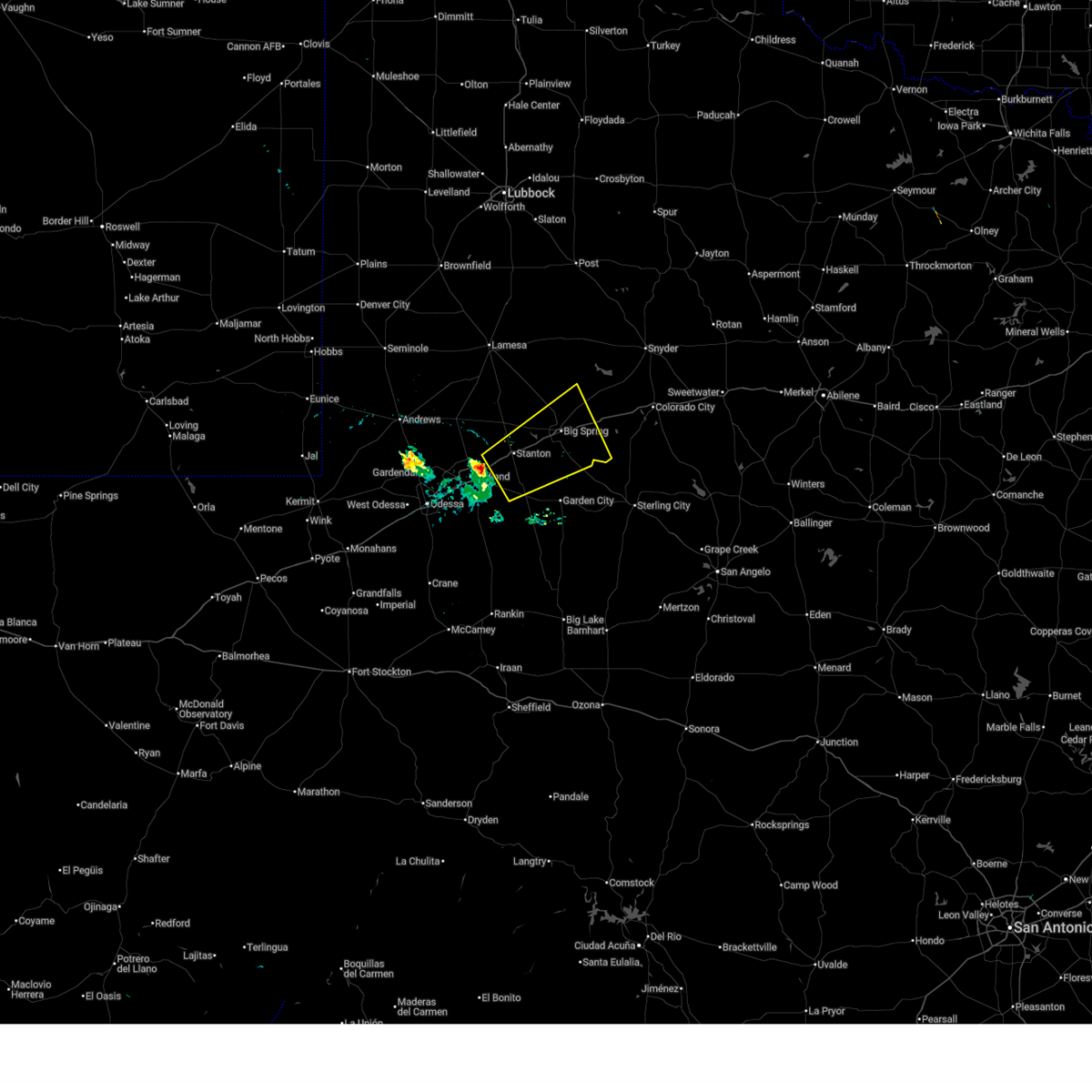
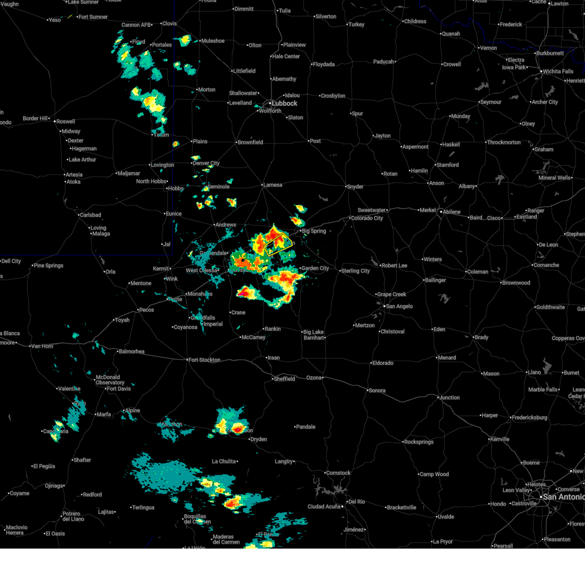
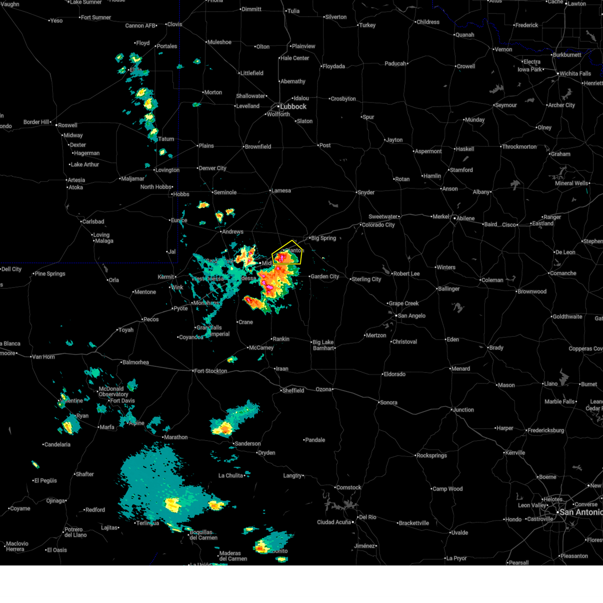
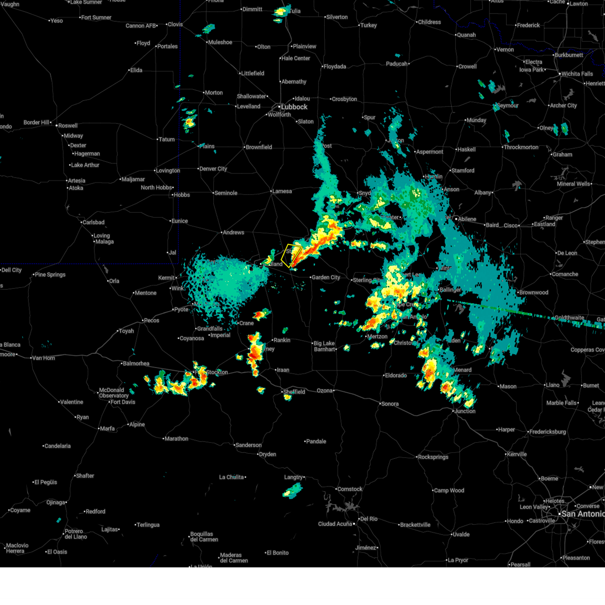
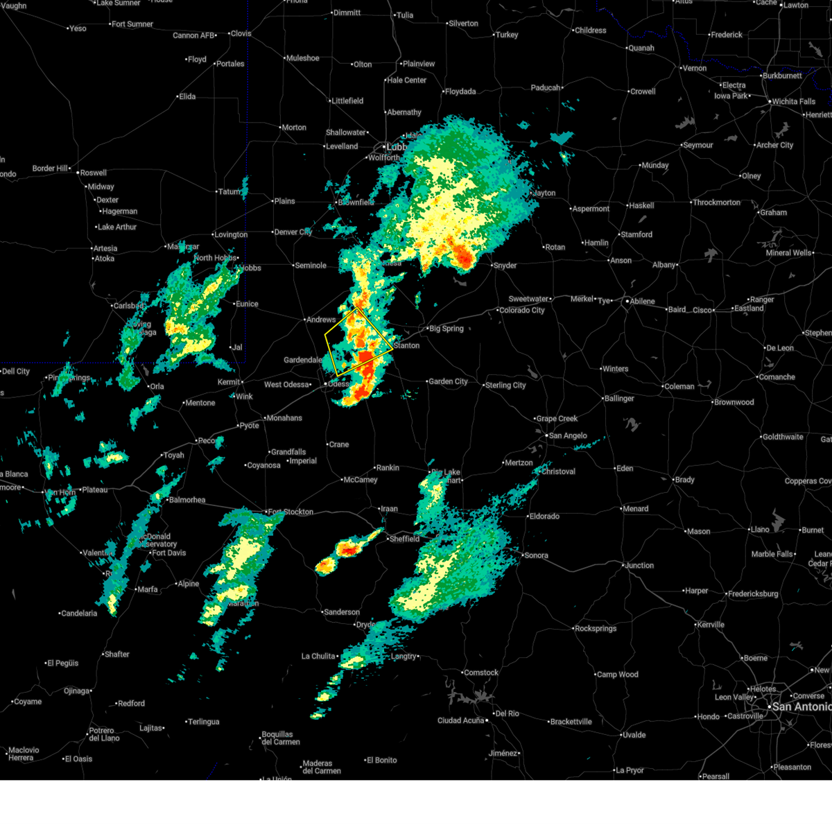
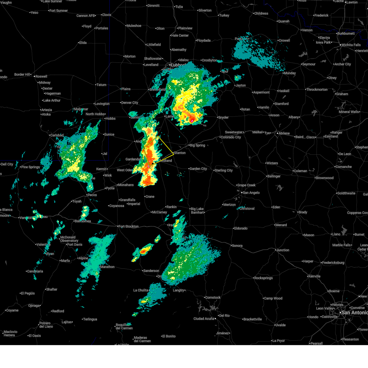
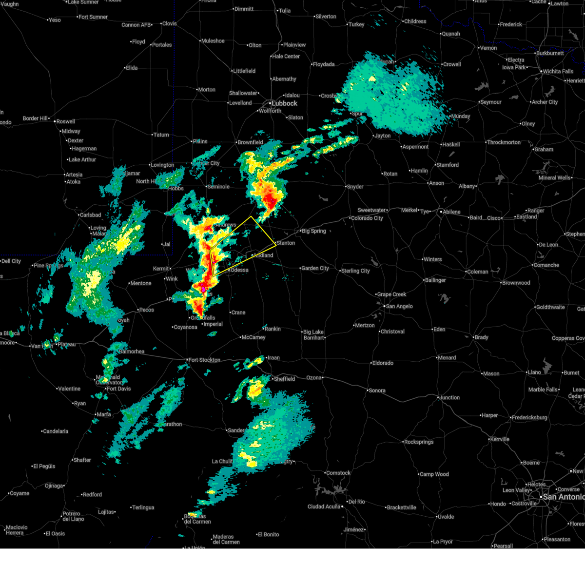
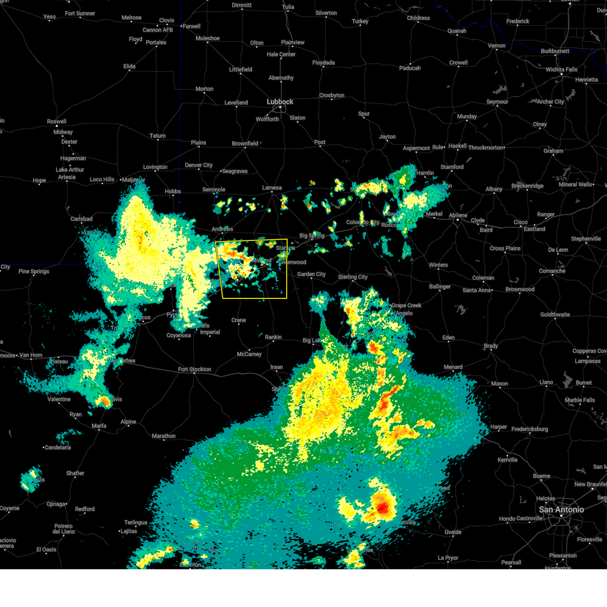
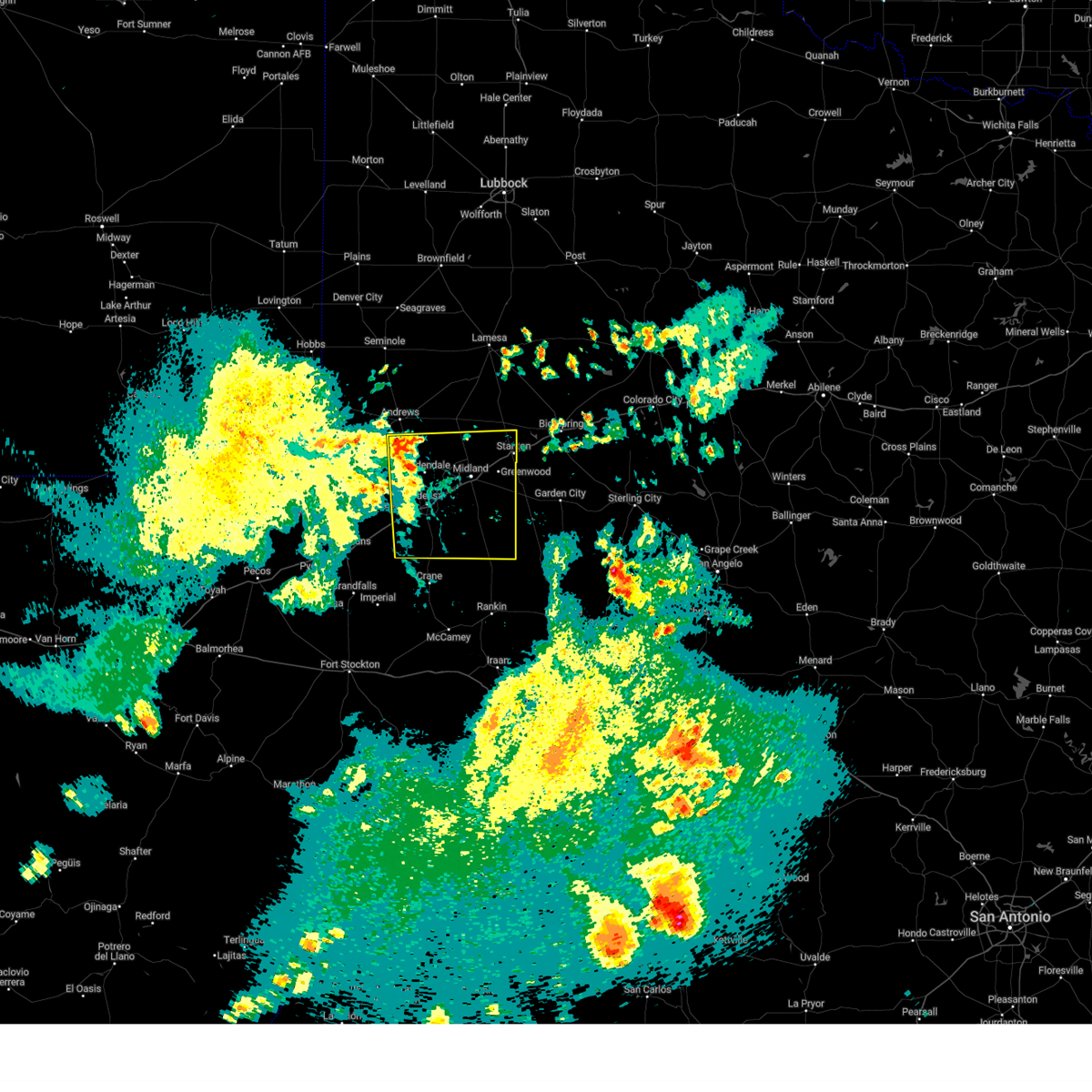
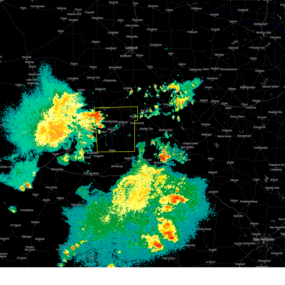
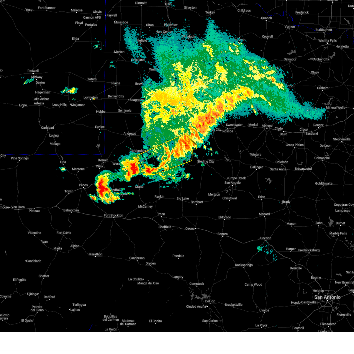
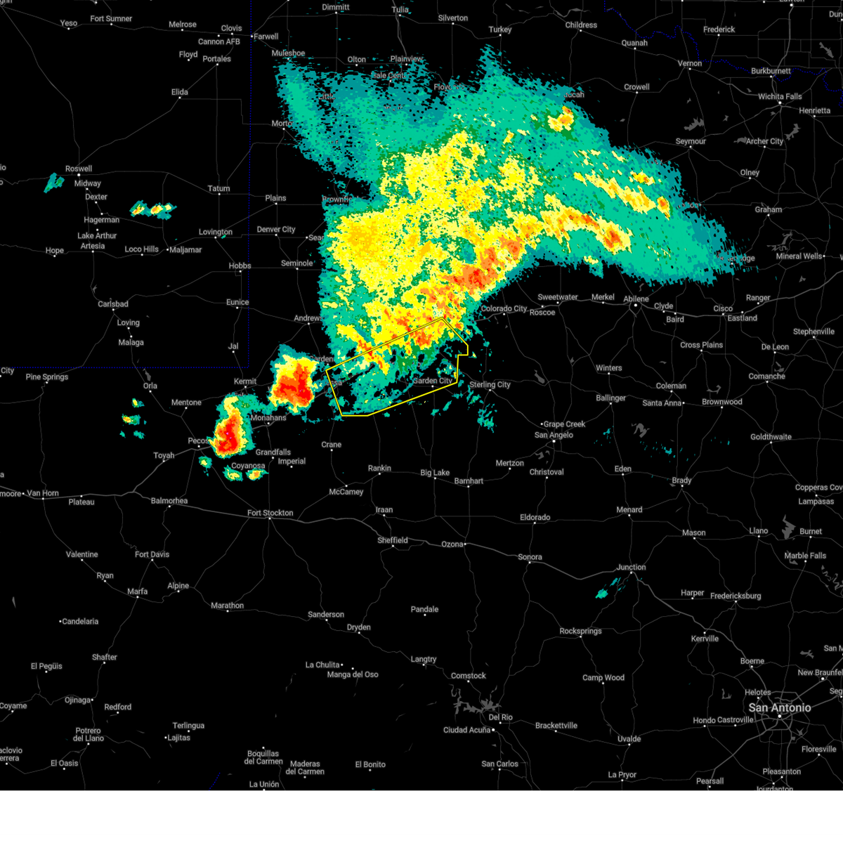
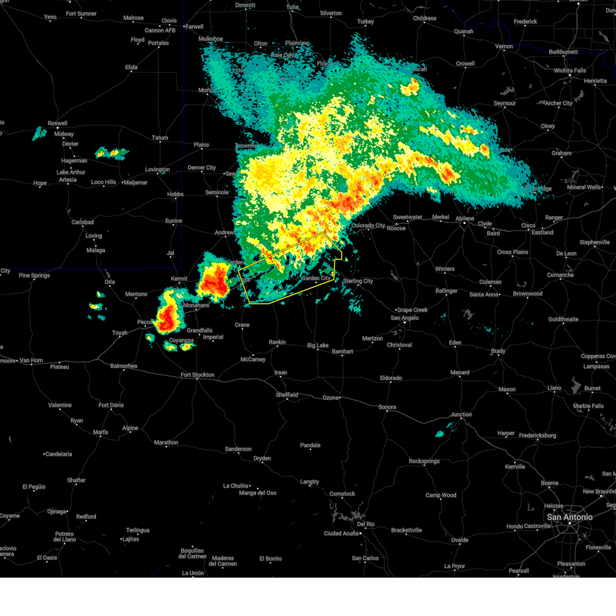
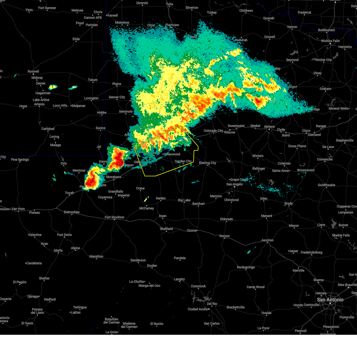
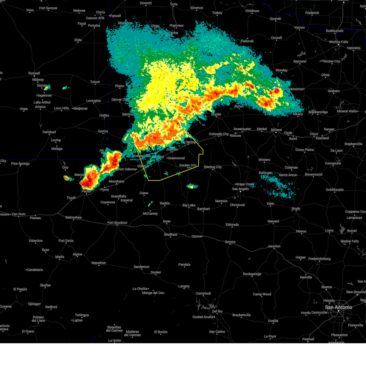
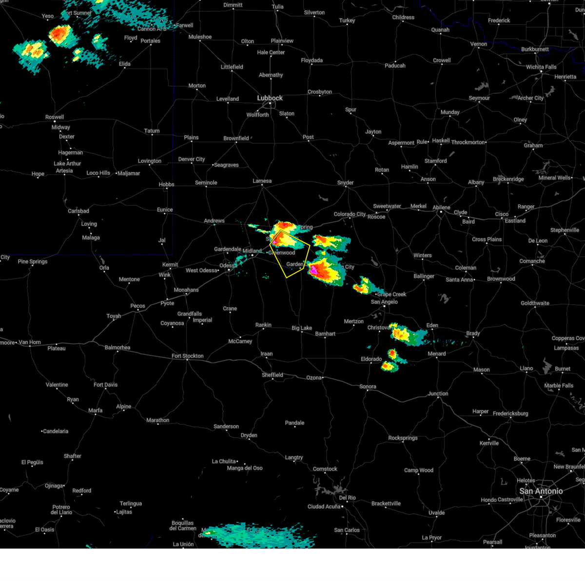
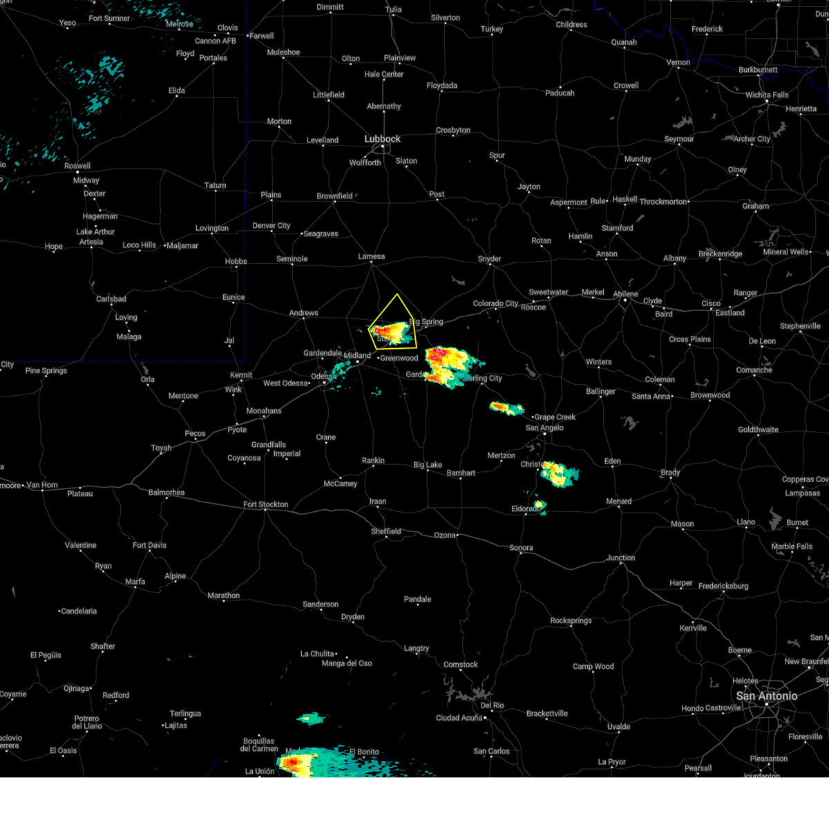
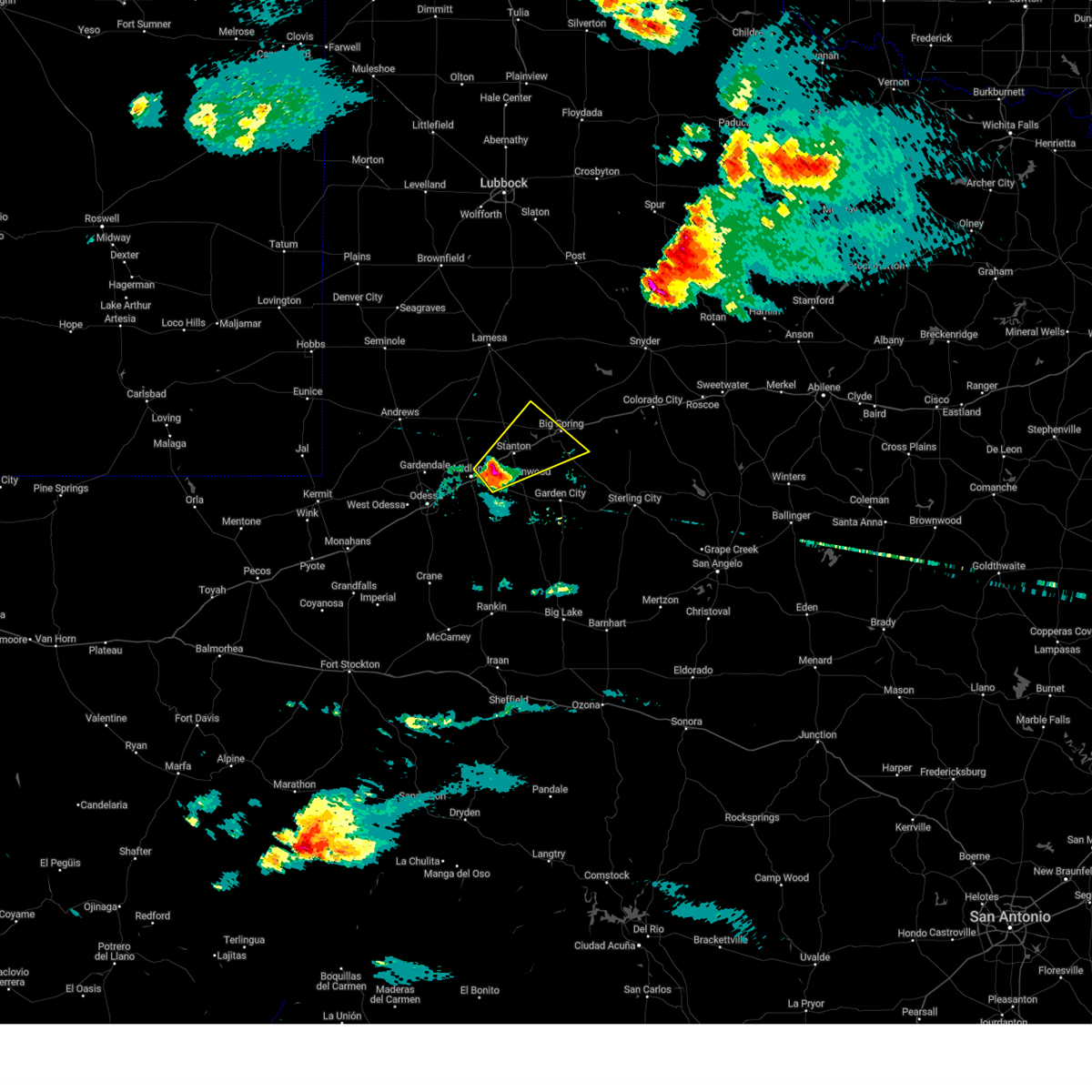
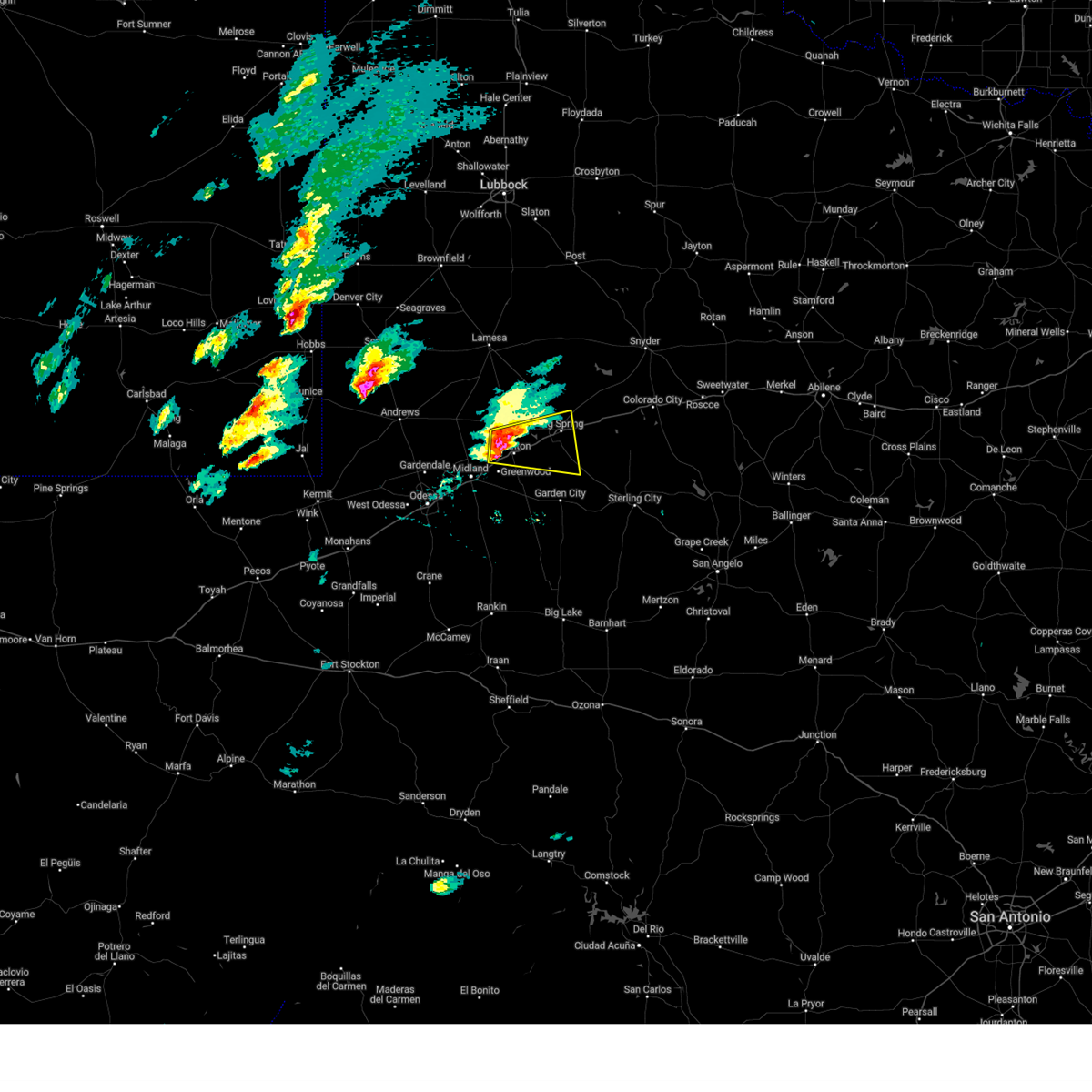
Hail Map for Stanton, TX
The Stanton, TX area has had 26 reports of on-the-ground hail by trained spotters, and has been under severe weather warnings 19 times during the past 12 months. Doppler radar has detected hail at or near Stanton, TX on 88 occasions, including 4 occasions during the past year.
| Name: | Stanton, TX |
| Where Located: | 39.2 miles ENE of Odessa, TX |
| Map: | Google Map for Stanton, TX |
| Population: | 2492 |
| Housing Units: | 980 |
| More Info: | Search Google for Stanton, TX |
2
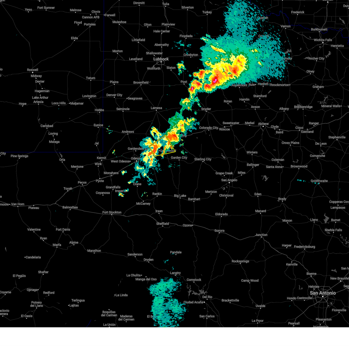
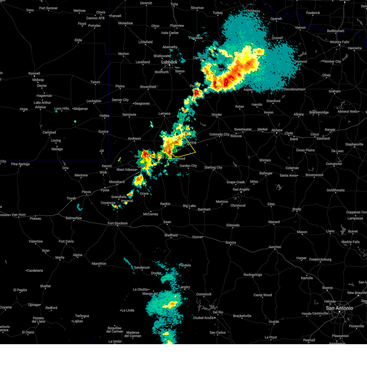
The Top Recent Hail Date for Stanton, TX is Saturday, May 23, 2026 (13th out of 88)
Hail and Wind Damage Spotted near Stanton, TX
| Date / Time | Report Details |
|---|---|
| 6/22/2026 7:41 PM CDT |
 Svrmaf the national weather service in midland has issued a * severe thunderstorm warning for, northern glasscock county in western texas, southwestern mitchell county in western texas, northeastern midland county in western texas, southeastern martin county in western texas, howard county in western texas, * until 830 pm cdt. * at 740 pm cdt, a severe thunderstorm was located near greenwood, moving northeast at 45 mph (radar indicated). Hazards include 60 mph wind gusts and quarter size hail. Hail damage to vehicles is expected. Expect wind damage to roofs, siding, and trees. Svrmaf the national weather service in midland has issued a * severe thunderstorm warning for, northern glasscock county in western texas, southwestern mitchell county in western texas, northeastern midland county in western texas, southeastern martin county in western texas, howard county in western texas, * until 830 pm cdt. * at 740 pm cdt, a severe thunderstorm was located near greenwood, moving northeast at 45 mph (radar indicated). Hazards include 60 mph wind gusts and quarter size hail. Hail damage to vehicles is expected. Expect wind damage to roofs, siding, and trees.
|
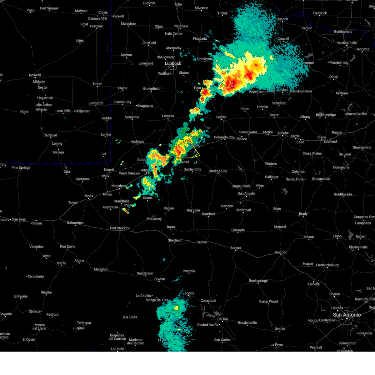
| 5/23/2026 5:58 PM CDT |
 At 558 pm cdt, a severe thunderstorm was located over stanton, or 10 miles northeast of greenwood, moving northeast at 10 mph (radar indicated). Hazards include 60 mph wind gusts and quarter size hail. Hail damage to vehicles is expected. expect wind damage to roofs, siding, and trees. locations impacted include, stanton and lomax. This includes interstate 20 between mile markers 149 and 166. At 558 pm cdt, a severe thunderstorm was located over stanton, or 10 miles northeast of greenwood, moving northeast at 10 mph (radar indicated). Hazards include 60 mph wind gusts and quarter size hail. Hail damage to vehicles is expected. expect wind damage to roofs, siding, and trees. locations impacted include, stanton and lomax. This includes interstate 20 between mile markers 149 and 166.
|
| 5/23/2026 5:50 PM CDT | Golf Ball sized hail reported 1.7 miles ENE of Stanton, TX |
| 5/23/2026 5:41 PM CDT | Quarter sized hail reported 0.3 miles WNW of Stanton, TX |
| 5/23/2026 5:12 PM CDT | Golf Ball sized hail reported 1.7 miles ENE of Stanton, TX, corrects previous hail report from 2 wsw stanton. |
| 5/23/2026 5:12 PM CDT |
 Svrmaf the national weather service in midland has issued a * severe thunderstorm warning for, northwestern glasscock county in western texas, northeastern midland county in western texas, southeastern martin county in western texas, southwestern howard county in western texas, * until 615 pm cdt. * at 512 pm cdt, a severe thunderstorm was located near greenwood, and is nearly stationary (radar indicated). Hazards include golf ball size hail and 60 mph wind gusts. People and animals outdoors will be injured. expect hail damage to roofs, siding, windows, and vehicles. Expect wind damage to roofs, siding, and trees. Svrmaf the national weather service in midland has issued a * severe thunderstorm warning for, northwestern glasscock county in western texas, northeastern midland county in western texas, southeastern martin county in western texas, southwestern howard county in western texas, * until 615 pm cdt. * at 512 pm cdt, a severe thunderstorm was located near greenwood, and is nearly stationary (radar indicated). Hazards include golf ball size hail and 60 mph wind gusts. People and animals outdoors will be injured. expect hail damage to roofs, siding, windows, and vehicles. Expect wind damage to roofs, siding, and trees.
|
| 5/21/2026 2:05 PM CDT |
 The storm which prompted the warning has weakened below severe limits, and has exited the warned area. therefore, the warning will be allowed to expire. The storm which prompted the warning has weakened below severe limits, and has exited the warned area. therefore, the warning will be allowed to expire.
|
| 5/21/2026 1:46 PM CDT |
 At 145 pm cdt, a severe thunderstorm was located near stanton, or 10 miles northeast of greenwood, moving southeast at 15 mph (radar indicated. at 123pm, penny sized hail was reported off of i-20 near stanton). Hazards include 60 mph wind gusts and quarter size hail. Hail damage to vehicles is expected. expect wind damage to roofs, siding, and trees. locations impacted include, stanton and lomax. This includes interstate 20 between mile markers 158 and 166. At 145 pm cdt, a severe thunderstorm was located near stanton, or 10 miles northeast of greenwood, moving southeast at 15 mph (radar indicated. at 123pm, penny sized hail was reported off of i-20 near stanton). Hazards include 60 mph wind gusts and quarter size hail. Hail damage to vehicles is expected. expect wind damage to roofs, siding, and trees. locations impacted include, stanton and lomax. This includes interstate 20 between mile markers 158 and 166.
|
| 5/21/2026 1:12 PM CDT |
 Svrmaf the national weather service in midland has issued a * severe thunderstorm warning for, northwestern glasscock county in western texas, northeastern midland county in western texas, southeastern martin county in western texas, southwestern howard county in western texas, * until 215 pm cdt. * at 112 pm cdt, a severe thunderstorm was located over stanton, or 7 miles northeast of greenwood, moving southeast at 10 mph (radar indicated). Hazards include 60 mph wind gusts and quarter size hail. Hail damage to vehicles is expected. Expect wind damage to roofs, siding, and trees. Svrmaf the national weather service in midland has issued a * severe thunderstorm warning for, northwestern glasscock county in western texas, northeastern midland county in western texas, southeastern martin county in western texas, southwestern howard county in western texas, * until 215 pm cdt. * at 112 pm cdt, a severe thunderstorm was located over stanton, or 7 miles northeast of greenwood, moving southeast at 10 mph (radar indicated). Hazards include 60 mph wind gusts and quarter size hail. Hail damage to vehicles is expected. Expect wind damage to roofs, siding, and trees.
|
| 4/1/2026 8:00 PM CDT |
 Svrmaf the national weather service in midland has issued a * severe thunderstorm warning for, northwestern glasscock county in western texas, northeastern midland county in western texas, southeastern martin county in western texas, southwestern howard county in western texas, * until 830 pm cdt. * at 800 pm cdt, a severe thunderstorm was located over stanton, or 11 miles northeast of greenwood, moving northeast at 40 mph (radar indicated). Hazards include 60 mph wind gusts and nickel size hail. expect damage to roofs, siding, and trees Svrmaf the national weather service in midland has issued a * severe thunderstorm warning for, northwestern glasscock county in western texas, northeastern midland county in western texas, southeastern martin county in western texas, southwestern howard county in western texas, * until 830 pm cdt. * at 800 pm cdt, a severe thunderstorm was located over stanton, or 11 miles northeast of greenwood, moving northeast at 40 mph (radar indicated). Hazards include 60 mph wind gusts and nickel size hail. expect damage to roofs, siding, and trees
|
| 2/13/2026 10:58 PM CST |
 The storm which prompted the warning has weakened below severe limits, and has exited the warned area. therefore, the warning will be allowed to expire. The storm which prompted the warning has weakened below severe limits, and has exited the warned area. therefore, the warning will be allowed to expire.
|
| 2/13/2026 10:40 PM CST |
 At 1040 pm cst, a severe thunderstorm was located 11 miles north of midland, moving northeast at 50 mph (radar indicated). Hazards include 60 mph wind gusts and penny size hail. Expect damage to roofs, siding, and trees. locations impacted include, midland, stanton, midland international air and space port, courtney, warfield, and midland airpark. This includes interstate 20 between mile markers 132 and 134, and between mile markers 141 and 155. At 1040 pm cst, a severe thunderstorm was located 11 miles north of midland, moving northeast at 50 mph (radar indicated). Hazards include 60 mph wind gusts and penny size hail. Expect damage to roofs, siding, and trees. locations impacted include, midland, stanton, midland international air and space port, courtney, warfield, and midland airpark. This includes interstate 20 between mile markers 132 and 134, and between mile markers 141 and 155.
|
| 2/13/2026 10:12 PM CST |
 Svrmaf the national weather service in midland has issued a * severe thunderstorm warning for, northeastern ector county in western texas, southeastern andrews county in western texas, northwestern midland county in western texas, southwestern martin county in western texas, * until 1100 pm cst. * at 1012 pm cst, a severe thunderstorm was located 8 miles east of goldsmith, or 9 miles northwest of odessa, moving northeast at 50 mph (radar indicated). Hazards include 60 mph wind gusts and quarter size hail. Hail damage to vehicles is expected. Expect wind damage to roofs, siding, and trees. Svrmaf the national weather service in midland has issued a * severe thunderstorm warning for, northeastern ector county in western texas, southeastern andrews county in western texas, northwestern midland county in western texas, southwestern martin county in western texas, * until 1100 pm cst. * at 1012 pm cst, a severe thunderstorm was located 8 miles east of goldsmith, or 9 miles northwest of odessa, moving northeast at 50 mph (radar indicated). Hazards include 60 mph wind gusts and quarter size hail. Hail damage to vehicles is expected. Expect wind damage to roofs, siding, and trees.
|
| 10/24/2025 2:23 PM CDT | The storm which prompted the warning has moved out of the area. therefore, the warning will be allowed to expire. however, gusty winds are still possible with this thunderstorm. a severe thunderstorm watch remains in effect until 700 pm cdt for western texas. |
| 10/24/2025 2:12 PM CDT | At 211 pm cdt, a severe thunderstorm was located 7 miles southeast of lenorah, or 17 miles west of big spring, moving northeast at 45 mph (radar indicated). Hazards include 60 mph wind gusts and nickel size hail. Expect damage to roofs, siding, and trees. locations impacted include, midland, greenwood, stanton, lomax, lenorah, tarzan, courtney, and stanton municipal aiport. This includes interstate 20 between mile markers 141 and 169. |
| 10/24/2025 2:12 PM CDT | the severe thunderstorm warning has been cancelled and is no longer in effect |
| 10/24/2025 1:40 PM CDT | Svrmaf the national weather service in midland has issued a * severe thunderstorm warning for, northwestern glasscock county in western texas, southeastern andrews county in western texas, northeastern midland county in western texas, southern martin county in western texas, southwestern howard county in western texas, * until 230 pm cdt. * at 140 pm cdt, a severe thunderstorm was located over midland, moving northeast at 45 mph (radar indicated). Hazards include 60 mph wind gusts and nickel size hail. expect damage to roofs, siding, and trees |
| 10/24/2025 1:25 PM CDT | At 124 pm cdt, a severe thunderstorm was located over midland international air and space port, or 8 miles northeast of odessa, moving northeast at 50 mph (odessa asos observed a 66mph wind gust). Hazards include 60 mph wind gusts and nickel size hail. Expect damage to roofs, siding, and trees. locations impacted include, midland, odessa, greenwood, stanton, midland international air and space port, tarzan, courtney, cotton flat, warfield, and midland airpark. This includes interstate 20 between mile markers 120 and 155. |
| 10/24/2025 1:04 PM CDT | Svrmaf the national weather service in midland has issued a * severe thunderstorm warning for, western glasscock county in western texas, central ector county in western texas, southeastern andrews county in western texas, northern midland county in western texas, southwestern martin county in western texas, * until 145 pm cdt. * at 104 pm cdt, a severe thunderstorm was located near west odessa, or near odessa, moving northeast at 55 mph (radar indicated). Hazards include 60 mph wind gusts and nickel size hail. expect damage to roofs, siding, and trees |
| 10/23/2025 8:06 PM CDT | At 806 pm cdt, a severe thunderstorm was located over stanton, or near greenwood, moving east at 45 mph (radar indicated). Hazards include 60 mph wind gusts and quarter size hail. Hail damage to vehicles is expected. expect wind damage to roofs, siding, and trees. locations impacted include, midland, greenwood, stanton, courtney, midland airpark, stanton municipal aiport, and spraberry. This includes interstate 20 between mile markers 133 and 158. |
| 10/23/2025 7:24 PM CDT | Svrmaf the national weather service in midland has issued a * severe thunderstorm warning for, northeastern ector county in western texas, southeastern andrews county in western texas, northern midland county in western texas, southern martin county in western texas, * until 830 pm cdt. * at 724 pm cdt, a severe thunderstorm was located 16 miles southeast of andrews, moving east at 45 mph (radar indicated). Hazards include 70 mph wind gusts and quarter size hail. Hail damage to vehicles is expected. expect considerable tree damage. Wind damage is also likely to mobile homes, roofs, and outbuildings. |
| 10/23/2025 7:06 PM CDT | Svrmaf the national weather service in midland has issued a * severe thunderstorm warning for, southeastern andrews county in western texas, martin county in western texas, * until 800 pm cdt. * at 706 pm cdt, a severe thunderstorm was located 16 miles east of andrews, moving east at 30 mph (radar indicated). Hazards include 60 mph wind gusts and quarter size hail. Hail damage to vehicles is expected. Expect wind damage to roofs, siding, and trees. |
| 6/10/2025 8:35 PM CDT |
 the severe thunderstorm warning has been cancelled and is no longer in effect the severe thunderstorm warning has been cancelled and is no longer in effect
|
| 6/10/2025 8:35 PM CDT |
 At 834 pm cdt, outflow from severe thunderstorms was located along a line extending from 11 miles north of midland to 22 miles southeast of midland international air and space port, moving east at 40 mph (radar indicated). Hazards include 60 mph wind gusts. Expect damage to roofs, siding, and trees. locations impacted include, midland, odessa, greenwood, stanton, midland international air and space port, west odessa, cotton flat, warfield, midland airpark, skywest airport, courtney, odessa schlemeyer field, stanton municipal aiport, spraberry, and pleasant farms. This includes interstate 20 between mile markers 104 and 158. At 834 pm cdt, outflow from severe thunderstorms was located along a line extending from 11 miles north of midland to 22 miles southeast of midland international air and space port, moving east at 40 mph (radar indicated). Hazards include 60 mph wind gusts. Expect damage to roofs, siding, and trees. locations impacted include, midland, odessa, greenwood, stanton, midland international air and space port, west odessa, cotton flat, warfield, midland airpark, skywest airport, courtney, odessa schlemeyer field, stanton municipal aiport, spraberry, and pleasant farms. This includes interstate 20 between mile markers 104 and 158.
|
| 6/10/2025 8:15 PM CDT |
 At 814 pm cdt, outflow from severe thunderstorms was located along a line extending from 13 miles southeast of andrews to 16 miles south of odessa, moving east at 40 mph (radar indicated). Hazards include 60 mph wind gusts. blowing dust restricting visibility to near zero. Expect damage to roofs, siding, and trees. locations impacted include, midland, odessa, greenwood, stanton, midland international air and space port, west odessa, cotton flat, midkiff, warfield, midland airpark, skywest airport, courtney, odessa schlemeyer field, penwell, stanton municipal aiport, spraberry, and pleasant farms. This includes interstate 20 between mile markers 101 and 158. At 814 pm cdt, outflow from severe thunderstorms was located along a line extending from 13 miles southeast of andrews to 16 miles south of odessa, moving east at 40 mph (radar indicated). Hazards include 60 mph wind gusts. blowing dust restricting visibility to near zero. Expect damage to roofs, siding, and trees. locations impacted include, midland, odessa, greenwood, stanton, midland international air and space port, west odessa, cotton flat, midkiff, warfield, midland airpark, skywest airport, courtney, odessa schlemeyer field, penwell, stanton municipal aiport, spraberry, and pleasant farms. This includes interstate 20 between mile markers 101 and 158.
|
| 6/10/2025 7:51 PM CDT |
 Svrmaf the national weather service in midland has issued a * severe thunderstorm warning for, ector county in western texas, southeastern andrews county in western texas, midland county in western texas, martin county in western texas, northern crane county in western texas, northern upton county in western texas, * until 845 pm cdt. * at 750 pm cdt, severe thunderstorms produced an outflow of strong winds that were located along a line extending from 7 miles south of andrews to 12 miles south of west odessa, moving east at 45 mph (radar indicated). Hazards include 70 mph wind gusts and penny size hail. blowing dust restricting visibility to near zero. Expect considerable tree damage. Damage is likely to mobile homes, roofs, and outbuildings. Svrmaf the national weather service in midland has issued a * severe thunderstorm warning for, ector county in western texas, southeastern andrews county in western texas, midland county in western texas, martin county in western texas, northern crane county in western texas, northern upton county in western texas, * until 845 pm cdt. * at 750 pm cdt, severe thunderstorms produced an outflow of strong winds that were located along a line extending from 7 miles south of andrews to 12 miles south of west odessa, moving east at 45 mph (radar indicated). Hazards include 70 mph wind gusts and penny size hail. blowing dust restricting visibility to near zero. Expect considerable tree damage. Damage is likely to mobile homes, roofs, and outbuildings.
|
| 6/10/2025 3:20 AM CDT |
 The storms which prompted the warning have weakened below severe limits, and no longer pose an immediate threat to life or property. therefore, the warning will be allowed to expire. The storms which prompted the warning have weakened below severe limits, and no longer pose an immediate threat to life or property. therefore, the warning will be allowed to expire.
|
| 6/10/2025 3:02 AM CDT |
 the severe thunderstorm warning has been cancelled and is no longer in effect the severe thunderstorm warning has been cancelled and is no longer in effect
|
| 6/10/2025 3:02 AM CDT |
 At 301 am cdt, severe thunderstorms were located along a line extending from 10 miles southeast of coahoma to 20 miles southeast of midland international air and space port, moving east at 50 mph (multiple automated weather stations are reporting wind gusts of 50 to 60 mph). Hazards include 60 mph wind gusts. Expect damage to roofs, siding, and trees. locations impacted include, midland, odessa, big spring, greenwood, garden city, stanton, coahoma, forsan, sand springs, lomax, midland international air and space port, cotton flat, warfield, midland airpark, skywest airport, big spring country club, courtney, big spring mcmahon-wrinkle airpark, stanton municipal aiport, and elbow. This includes interstate 20 between mile markers 119 and 187. At 301 am cdt, severe thunderstorms were located along a line extending from 10 miles southeast of coahoma to 20 miles southeast of midland international air and space port, moving east at 50 mph (multiple automated weather stations are reporting wind gusts of 50 to 60 mph). Hazards include 60 mph wind gusts. Expect damage to roofs, siding, and trees. locations impacted include, midland, odessa, big spring, greenwood, garden city, stanton, coahoma, forsan, sand springs, lomax, midland international air and space port, cotton flat, warfield, midland airpark, skywest airport, big spring country club, courtney, big spring mcmahon-wrinkle airpark, stanton municipal aiport, and elbow. This includes interstate 20 between mile markers 119 and 187.
|
| 6/10/2025 2:39 AM CDT |
 At 238 am cdt, severe thunderstorms were located along a line extending from near sand springs to 6 miles northwest of midland international air and space port, moving southeast at 45 mph (midland international airport measured a gust of 60 mph). Hazards include 60 mph wind gusts and penny size hail. Expect damage to roofs, siding, and trees. locations impacted include, midland, odessa, big spring, greenwood, garden city, stanton, coahoma, forsan, sand springs, lomax, lenorah, midland international air and space port, cotton flat, midland airpark, big spring mcmahon-wrinkle airpark, knott, stanton municipal aiport, elbow, tarzan, and warfield. This includes interstate 20 between mile markers 118 and 188. At 238 am cdt, severe thunderstorms were located along a line extending from near sand springs to 6 miles northwest of midland international air and space port, moving southeast at 45 mph (midland international airport measured a gust of 60 mph). Hazards include 60 mph wind gusts and penny size hail. Expect damage to roofs, siding, and trees. locations impacted include, midland, odessa, big spring, greenwood, garden city, stanton, coahoma, forsan, sand springs, lomax, lenorah, midland international air and space port, cotton flat, midland airpark, big spring mcmahon-wrinkle airpark, knott, stanton municipal aiport, elbow, tarzan, and warfield. This includes interstate 20 between mile markers 118 and 188.
|
| 6/10/2025 2:25 AM CDT |
 Svrmaf the national weather service in midland has issued a * severe thunderstorm warning for, glasscock county in western texas, northeastern ector county in western texas, southeastern andrews county in western texas, midland county in western texas, southern martin county in western texas, howard county in western texas, * until 330 am cdt. * at 225 am cdt, severe thunderstorms were located along a line extending from 6 miles southwest of luther to 15 miles northwest of midland international air and space port, moving southeast at 40 mph (national weather service employee reported 60 mph winds in gardendale). Hazards include 60 mph wind gusts and penny size hail. expect damage to roofs, siding, and trees Svrmaf the national weather service in midland has issued a * severe thunderstorm warning for, glasscock county in western texas, northeastern ector county in western texas, southeastern andrews county in western texas, midland county in western texas, southern martin county in western texas, howard county in western texas, * until 330 am cdt. * at 225 am cdt, severe thunderstorms were located along a line extending from 6 miles southwest of luther to 15 miles northwest of midland international air and space port, moving southeast at 40 mph (national weather service employee reported 60 mph winds in gardendale). Hazards include 60 mph wind gusts and penny size hail. expect damage to roofs, siding, and trees
|
| 6/9/2025 7:41 PM CDT |
 Svrmaf the national weather service in midland has issued a * severe thunderstorm warning for, northwestern glasscock county in western texas, northeastern midland county in western texas, southeastern martin county in western texas, southwestern howard county in western texas, * until 845 pm cdt. * at 740 pm cdt, a severe thunderstorm was located over stanton, or 9 miles northeast of greenwood, moving southeast at 15 mph. this is a destructive storm for stanton (radar indicated). Hazards include 80 mph wind gusts and baseball size hail. Flying debris will be dangerous to those caught without shelter. mobile homes will be heavily damaged. expect considerable damage to roofs, windows, and vehicles. Extensive tree damage and power outages are likely. Svrmaf the national weather service in midland has issued a * severe thunderstorm warning for, northwestern glasscock county in western texas, northeastern midland county in western texas, southeastern martin county in western texas, southwestern howard county in western texas, * until 845 pm cdt. * at 740 pm cdt, a severe thunderstorm was located over stanton, or 9 miles northeast of greenwood, moving southeast at 15 mph. this is a destructive storm for stanton (radar indicated). Hazards include 80 mph wind gusts and baseball size hail. Flying debris will be dangerous to those caught without shelter. mobile homes will be heavily damaged. expect considerable damage to roofs, windows, and vehicles. Extensive tree damage and power outages are likely.
|
| 6/9/2025 7:40 PM CDT | Tennis Ball sized hail reported 0.9 miles W of Stanton, TX, multiple pictures on social media of tennis ball size hail. time estimated by radar. |
| 6/9/2025 7:35 PM CDT | Golf Ball sized hail reported 0.8 miles NNW of Stanton, TX, time estimated by radar. |
| 6/9/2025 7:02 PM CDT | Tennis Ball sized hail reported 9.6 miles SE of Stanton, TX, time estimated by radar. |
| 6/9/2025 7:02 PM CDT |
 At 701 pm cdt, a severe thunderstorm was located near lenorah, or 13 miles north of greenwood, moving east at 10 mph. this is a destructive storm for southern martin county (radar indicated). Hazards include baseball size hail and 70 mph wind gusts. People and animals outdoors will be severely injured. expect shattered windows, extensive damage to roofs, siding, and vehicles. locations impacted include, stanton, lomax, lenorah, courtney, and stanton municipal aiport. This includes interstate 20 between mile markers 151 and 171. At 701 pm cdt, a severe thunderstorm was located near lenorah, or 13 miles north of greenwood, moving east at 10 mph. this is a destructive storm for southern martin county (radar indicated). Hazards include baseball size hail and 70 mph wind gusts. People and animals outdoors will be severely injured. expect shattered windows, extensive damage to roofs, siding, and vehicles. locations impacted include, stanton, lomax, lenorah, courtney, and stanton municipal aiport. This includes interstate 20 between mile markers 151 and 171.
|
| 6/9/2025 7:00 PM CDT | Hen Egg sized hail reported 10.5 miles SE of Stanton, TX, an off duty nws employee reported hen egg size hail. time estimated by radar. |
| 6/9/2025 6:51 PM CDT |
 At 650 pm cdt, a severe thunderstorm was located near lenorah, or 14 miles north of greenwood, moving east at 10 mph (radar indicated). Hazards include two inch hail and 70 mph wind gusts. People and animals outdoors will be injured. expect hail damage to roofs, siding, windows, and vehicles. expect considerable tree damage. wind damage is also likely to mobile homes, roofs, and outbuildings. locations impacted include, stanton, lomax, lenorah, courtney, and stanton municipal aiport. This includes interstate 20 between mile markers 151 and 171. At 650 pm cdt, a severe thunderstorm was located near lenorah, or 14 miles north of greenwood, moving east at 10 mph (radar indicated). Hazards include two inch hail and 70 mph wind gusts. People and animals outdoors will be injured. expect hail damage to roofs, siding, windows, and vehicles. expect considerable tree damage. wind damage is also likely to mobile homes, roofs, and outbuildings. locations impacted include, stanton, lomax, lenorah, courtney, and stanton municipal aiport. This includes interstate 20 between mile markers 151 and 171.
|
| 6/9/2025 6:44 PM CDT |
 Svrmaf the national weather service in midland has issued a * severe thunderstorm warning for, eastern martin county in western texas, southwestern howard county in western texas, * until 745 pm cdt. * at 644 pm cdt, a severe thunderstorm was located near lenorah, or 13 miles north of greenwood, moving east at 10 mph (radar indicated). Hazards include ping pong ball size hail and 60 mph wind gusts. People and animals outdoors will be injured. expect hail damage to roofs, siding, windows, and vehicles. Expect wind damage to roofs, siding, and trees. Svrmaf the national weather service in midland has issued a * severe thunderstorm warning for, eastern martin county in western texas, southwestern howard county in western texas, * until 745 pm cdt. * at 644 pm cdt, a severe thunderstorm was located near lenorah, or 13 miles north of greenwood, moving east at 10 mph (radar indicated). Hazards include ping pong ball size hail and 60 mph wind gusts. People and animals outdoors will be injured. expect hail damage to roofs, siding, windows, and vehicles. Expect wind damage to roofs, siding, and trees.
|
| 6/8/2025 7:36 PM CDT |
 At 736 pm cdt, a severe thunderstorm was located near lomax, or 13 miles southwest of big spring, moving northeast at 50 mph (radar indicated). Hazards include two inch hail and 70 mph wind gusts. People and animals outdoors will be injured. expect hail damage to roofs, siding, windows, and vehicles. expect considerable tree damage. wind damage is also likely to mobile homes, roofs, and outbuildings. locations impacted include, big spring, stanton, lomax, big spring country club, big spring mcmahon-wrinkle airpark, stanton municipal aiport, and elbow. This includes interstate 20 between mile markers 157 and 178. At 736 pm cdt, a severe thunderstorm was located near lomax, or 13 miles southwest of big spring, moving northeast at 50 mph (radar indicated). Hazards include two inch hail and 70 mph wind gusts. People and animals outdoors will be injured. expect hail damage to roofs, siding, windows, and vehicles. expect considerable tree damage. wind damage is also likely to mobile homes, roofs, and outbuildings. locations impacted include, big spring, stanton, lomax, big spring country club, big spring mcmahon-wrinkle airpark, stanton municipal aiport, and elbow. This includes interstate 20 between mile markers 157 and 178.
|
| 6/8/2025 7:36 PM CDT |
 the severe thunderstorm warning has been cancelled and is no longer in effect the severe thunderstorm warning has been cancelled and is no longer in effect
|
| 6/8/2025 7:19 PM CDT |
 At 719 pm cdt, a severe thunderstorm was located over greenwood, moving northeast at 45 mph (public). Hazards include two inch hail and 70 mph wind gusts. People and animals outdoors will be injured. expect hail damage to roofs, siding, windows, and vehicles. expect considerable tree damage. wind damage is also likely to mobile homes, roofs, and outbuildings. locations impacted include, midland, big spring, greenwood, stanton, forsan, lomax, big spring country club, courtney, big spring mcmahon-wrinkle airpark, stanton municipal aiport, and elbow. This includes interstate 20 between mile markers 141 and 178. At 719 pm cdt, a severe thunderstorm was located over greenwood, moving northeast at 45 mph (public). Hazards include two inch hail and 70 mph wind gusts. People and animals outdoors will be injured. expect hail damage to roofs, siding, windows, and vehicles. expect considerable tree damage. wind damage is also likely to mobile homes, roofs, and outbuildings. locations impacted include, midland, big spring, greenwood, stanton, forsan, lomax, big spring country club, courtney, big spring mcmahon-wrinkle airpark, stanton municipal aiport, and elbow. This includes interstate 20 between mile markers 141 and 178.
|
| 6/8/2025 7:10 PM CDT |
 Svrmaf the national weather service in midland has issued a * severe thunderstorm warning for, northwestern glasscock county in western texas, northeastern midland county in western texas, southeastern martin county in western texas, southwestern howard county in western texas, * until 815 pm cdt. * at 710 pm cdt, a severe thunderstorm was located near midland, moving northeast at 45 mph (public). Hazards include golf ball size hail and 70 mph wind gusts. People and animals outdoors will be injured. expect hail damage to roofs, siding, windows, and vehicles. expect considerable tree damage. Wind damage is also likely to mobile homes, roofs, and outbuildings. Svrmaf the national weather service in midland has issued a * severe thunderstorm warning for, northwestern glasscock county in western texas, northeastern midland county in western texas, southeastern martin county in western texas, southwestern howard county in western texas, * until 815 pm cdt. * at 710 pm cdt, a severe thunderstorm was located near midland, moving northeast at 45 mph (public). Hazards include golf ball size hail and 70 mph wind gusts. People and animals outdoors will be injured. expect hail damage to roofs, siding, windows, and vehicles. expect considerable tree damage. Wind damage is also likely to mobile homes, roofs, and outbuildings.
|
| 5/29/2025 8:09 PM CDT |
 Svrmaf the national weather service in midland has issued a * severe thunderstorm warning for, glasscock county in western texas, northern midland county in western texas, southeastern martin county in western texas, southern howard county in western texas, * until 915 pm cdt. * at 809 pm cdt, severe thunderstorms were located along a line extending from 7 miles north of stanton to 7 miles south of greenwood, moving southeast at 30 mph (radar indicated). Hazards include 60 mph wind gusts and quarter size hail. Hail damage to vehicles is expected. Expect wind damage to roofs, siding, and trees. Svrmaf the national weather service in midland has issued a * severe thunderstorm warning for, glasscock county in western texas, northern midland county in western texas, southeastern martin county in western texas, southern howard county in western texas, * until 915 pm cdt. * at 809 pm cdt, severe thunderstorms were located along a line extending from 7 miles north of stanton to 7 miles south of greenwood, moving southeast at 30 mph (radar indicated). Hazards include 60 mph wind gusts and quarter size hail. Hail damage to vehicles is expected. Expect wind damage to roofs, siding, and trees.
|
| 5/24/2025 10:21 PM CDT |
 the severe thunderstorm warning has been cancelled and is no longer in effect the severe thunderstorm warning has been cancelled and is no longer in effect
|
| 5/24/2025 9:54 PM CDT |
 Svrmaf the national weather service in midland has issued a * severe thunderstorm warning for, northwestern glasscock county in western texas, northeastern midland county in western texas, southeastern martin county in western texas, southwestern howard county in western texas, * until 1045 pm cdt. * at 954 pm cdt, a severe thunderstorm was located near greenwood, moving northeast at 20 mph (radar indicated). Hazards include 60 mph wind gusts and quarter size hail. Hail damage to vehicles is expected. Expect wind damage to roofs, siding, and trees. Svrmaf the national weather service in midland has issued a * severe thunderstorm warning for, northwestern glasscock county in western texas, northeastern midland county in western texas, southeastern martin county in western texas, southwestern howard county in western texas, * until 1045 pm cdt. * at 954 pm cdt, a severe thunderstorm was located near greenwood, moving northeast at 20 mph (radar indicated). Hazards include 60 mph wind gusts and quarter size hail. Hail damage to vehicles is expected. Expect wind damage to roofs, siding, and trees.
|
| 5/24/2025 9:43 PM CDT |
 the severe thunderstorm warning has been cancelled and is no longer in effect the severe thunderstorm warning has been cancelled and is no longer in effect
|
| 5/24/2025 9:43 PM CDT |
 At 943 pm cdt, a severe thunderstorm was located near lomax, or 12 miles west of big spring, moving east at 25 mph (radar indicated). Hazards include 60 mph wind gusts and quarter size hail. Hail damage to vehicles is expected. expect wind damage to roofs, siding, and trees. locations impacted include, big spring, stanton, lomax, big spring country club, big spring mcmahon-wrinkle airpark, elbow, and stanton municipal aiport. This includes interstate 20 between mile markers 157 and 180. At 943 pm cdt, a severe thunderstorm was located near lomax, or 12 miles west of big spring, moving east at 25 mph (radar indicated). Hazards include 60 mph wind gusts and quarter size hail. Hail damage to vehicles is expected. expect wind damage to roofs, siding, and trees. locations impacted include, big spring, stanton, lomax, big spring country club, big spring mcmahon-wrinkle airpark, elbow, and stanton municipal aiport. This includes interstate 20 between mile markers 157 and 180.
|
| 5/24/2025 9:24 PM CDT |
 Svrmaf the national weather service in midland has issued a * severe thunderstorm warning for, northwestern glasscock county in western texas, southeastern martin county in western texas, southwestern howard county in western texas, * until 1015 pm cdt. * at 924 pm cdt, a severe thunderstorm was located over stanton, or 10 miles northeast of greenwood, moving northeast at 20 mph (radar indicated). Hazards include 60 mph wind gusts and quarter size hail. Hail damage to vehicles is expected. Expect wind damage to roofs, siding, and trees. Svrmaf the national weather service in midland has issued a * severe thunderstorm warning for, northwestern glasscock county in western texas, southeastern martin county in western texas, southwestern howard county in western texas, * until 1015 pm cdt. * at 924 pm cdt, a severe thunderstorm was located over stanton, or 10 miles northeast of greenwood, moving northeast at 20 mph (radar indicated). Hazards include 60 mph wind gusts and quarter size hail. Hail damage to vehicles is expected. Expect wind damage to roofs, siding, and trees.
|
| 5/5/2025 7:03 PM CDT |
 the severe thunderstorm warning has been cancelled and is no longer in effect the severe thunderstorm warning has been cancelled and is no longer in effect
|
| 5/5/2025 7:03 PM CDT |
 At 703 pm cdt, a severe thunderstorm was located over stanton, or 12 miles northeast of greenwood, moving east at 20 mph (public). Hazards include golf ball size hail and 60 mph wind gusts. People and animals outdoors will be injured. expect hail damage to roofs, siding, windows, and vehicles. expect wind damage to roofs, siding, and trees. locations impacted include, big spring, stanton, forsan, lomax, big spring country club, big spring mcmahon-wrinkle airpark, stanton municipal aiport, and elbow. This includes interstate 20 between mile markers 153 and 183. At 703 pm cdt, a severe thunderstorm was located over stanton, or 12 miles northeast of greenwood, moving east at 20 mph (public). Hazards include golf ball size hail and 60 mph wind gusts. People and animals outdoors will be injured. expect hail damage to roofs, siding, windows, and vehicles. expect wind damage to roofs, siding, and trees. locations impacted include, big spring, stanton, forsan, lomax, big spring country club, big spring mcmahon-wrinkle airpark, stanton municipal aiport, and elbow. This includes interstate 20 between mile markers 153 and 183.
|
| 5/5/2025 7:01 PM CDT | Golf Ball sized hail reported 0.3 miles WNW of Stanton, TX, golf ball size hail reported in stanton by the public. time was estimated by report and radar. |
| 5/5/2025 6:50 PM CDT |
 Svrmaf the national weather service in midland has issued a * severe thunderstorm warning for, northern glasscock county in western texas, northeastern midland county in western texas, southeastern martin county in western texas, southwestern howard county in western texas, * until 745 pm cdt. * at 650 pm cdt, a severe thunderstorm was located near stanton, or 9 miles north of greenwood, moving east at 20 mph (radar indicated). Hazards include 60 mph wind gusts and half dollar size hail. Hail damage to vehicles is expected. Expect wind damage to roofs, siding, and trees. Svrmaf the national weather service in midland has issued a * severe thunderstorm warning for, northern glasscock county in western texas, northeastern midland county in western texas, southeastern martin county in western texas, southwestern howard county in western texas, * until 745 pm cdt. * at 650 pm cdt, a severe thunderstorm was located near stanton, or 9 miles north of greenwood, moving east at 20 mph (radar indicated). Hazards include 60 mph wind gusts and half dollar size hail. Hail damage to vehicles is expected. Expect wind damage to roofs, siding, and trees.
|
| 4/4/2025 2:53 AM CDT |
 the severe thunderstorm warning has been cancelled and is no longer in effect the severe thunderstorm warning has been cancelled and is no longer in effect
|
| 4/4/2025 2:53 AM CDT |
 At 252 am cdt, a severe thunderstorm was located near midland, moving northeast at 55 mph (public). Hazards include quarter size hail. Damage to vehicles is expected. locations impacted include, tarzan, courtney, midland international air and space port, midland, cotton flat, greenwood, stanton, lenorah, warfield, midland airpark, and stanton municipal aiport. This includes interstate 20 between mile markers 126 and 160. At 252 am cdt, a severe thunderstorm was located near midland, moving northeast at 55 mph (public). Hazards include quarter size hail. Damage to vehicles is expected. locations impacted include, tarzan, courtney, midland international air and space port, midland, cotton flat, greenwood, stanton, lenorah, warfield, midland airpark, and stanton municipal aiport. This includes interstate 20 between mile markers 126 and 160.
|
| 4/4/2025 2:36 AM CDT |
 Svrmaf the national weather service in midland has issued a * severe thunderstorm warning for, east central ector county in western texas, northern midland county in western texas, southern martin county in western texas, * until 315 am cdt. * at 236 am cdt, a severe thunderstorm was located over odessa, moving northeast at 55 mph (public). Hazards include quarter size hail. damage to vehicles is expected Svrmaf the national weather service in midland has issued a * severe thunderstorm warning for, east central ector county in western texas, northern midland county in western texas, southern martin county in western texas, * until 315 am cdt. * at 236 am cdt, a severe thunderstorm was located over odessa, moving northeast at 55 mph (public). Hazards include quarter size hail. damage to vehicles is expected
|
| 6/16/2024 12:58 AM CDT |
 the severe thunderstorm warning has been cancelled and is no longer in effect the severe thunderstorm warning has been cancelled and is no longer in effect
|
| 6/16/2024 12:43 AM CDT | Quarter sized hail reported 4.9 miles ENE of Stanton, TX |
| 6/16/2024 12:40 AM CDT |
 At 1240 am cdt, a severe thunderstorm was located near stanton, or 7 miles north of greenwood, moving southeast at 25 mph (radar indicated). Hazards include 60 mph wind gusts and quarter size hail. Hail damage to vehicles is expected. expect wind damage to roofs, siding, and trees. locations impacted include, greenwood, stanton, lomax, courtney, stanton municipal aiport, and spraberry. This includes interstate 20 between mile markers 145 and 163. At 1240 am cdt, a severe thunderstorm was located near stanton, or 7 miles north of greenwood, moving southeast at 25 mph (radar indicated). Hazards include 60 mph wind gusts and quarter size hail. Hail damage to vehicles is expected. expect wind damage to roofs, siding, and trees. locations impacted include, greenwood, stanton, lomax, courtney, stanton municipal aiport, and spraberry. This includes interstate 20 between mile markers 145 and 163.
|
| 6/16/2024 12:29 AM CDT |
 Svrmaf the national weather service in midland has issued a * severe thunderstorm warning for, northwestern glasscock county in western texas, northeastern midland county in western texas, southern martin county in western texas, southwestern howard county in western texas, * until 115 am cdt. * at 1229 am cdt, a severe thunderstorm was located 7 miles northwest of stanton, or 10 miles north of greenwood, moving southeast at 25 mph (radar indicated). Hazards include golf ball size hail and 60 mph wind gusts. People and animals outdoors will be injured. expect hail damage to roofs, siding, windows, and vehicles. Expect wind damage to roofs, siding, and trees. Svrmaf the national weather service in midland has issued a * severe thunderstorm warning for, northwestern glasscock county in western texas, northeastern midland county in western texas, southern martin county in western texas, southwestern howard county in western texas, * until 115 am cdt. * at 1229 am cdt, a severe thunderstorm was located 7 miles northwest of stanton, or 10 miles north of greenwood, moving southeast at 25 mph (radar indicated). Hazards include golf ball size hail and 60 mph wind gusts. People and animals outdoors will be injured. expect hail damage to roofs, siding, windows, and vehicles. Expect wind damage to roofs, siding, and trees.
|
| 6/1/2024 2:19 AM CDT |
 the severe thunderstorm warning has been cancelled and is no longer in effect the severe thunderstorm warning has been cancelled and is no longer in effect
|
| 6/1/2024 1:52 AM CDT |
 the severe thunderstorm warning has been cancelled and is no longer in effect the severe thunderstorm warning has been cancelled and is no longer in effect
|
| 6/1/2024 1:52 AM CDT |
 At 151 am cdt, a severe thunderstorm was located 11 miles north of midland, moving southeast at 25 mph (radar indicated). Hazards include 60 mph wind gusts and quarter size hail. Hail damage to vehicles is expected. expect wind damage to roofs, siding, and trees. locations impacted include, midland, greenwood, stanton, lenorah, tarzan, courtney, midland airpark, stanton municipal aiport, and spraberry. This includes interstate 20 between mile markers 140 and 163. At 151 am cdt, a severe thunderstorm was located 11 miles north of midland, moving southeast at 25 mph (radar indicated). Hazards include 60 mph wind gusts and quarter size hail. Hail damage to vehicles is expected. expect wind damage to roofs, siding, and trees. locations impacted include, midland, greenwood, stanton, lenorah, tarzan, courtney, midland airpark, stanton municipal aiport, and spraberry. This includes interstate 20 between mile markers 140 and 163.
|
| 6/1/2024 1:29 AM CDT |
 Svrmaf the national weather service in midland has issued a * severe thunderstorm warning for, southeastern andrews county in western texas, northeastern midland county in western texas, southern martin county in western texas, * until 230 am cdt. * at 129 am cdt, a severe thunderstorm was located 17 miles east of andrews, moving southeast at 25 mph (radar indicated). Hazards include ping pong ball size hail and 60 mph wind gusts. People and animals outdoors will be injured. expect hail damage to roofs, siding, windows, and vehicles. Expect wind damage to roofs, siding, and trees. Svrmaf the national weather service in midland has issued a * severe thunderstorm warning for, southeastern andrews county in western texas, northeastern midland county in western texas, southern martin county in western texas, * until 230 am cdt. * at 129 am cdt, a severe thunderstorm was located 17 miles east of andrews, moving southeast at 25 mph (radar indicated). Hazards include ping pong ball size hail and 60 mph wind gusts. People and animals outdoors will be injured. expect hail damage to roofs, siding, windows, and vehicles. Expect wind damage to roofs, siding, and trees.
|
| 6/1/2024 12:59 AM CDT |
 the severe thunderstorm warning has been cancelled and is no longer in effect the severe thunderstorm warning has been cancelled and is no longer in effect
|
| 6/1/2024 12:59 AM CDT |
 At 1258 am cdt, severe thunderstorms were located along a line extending from near luther to 8 miles east of andrews, moving east at 30 mph (tarzan mesonet reported a 61 mph wind gust at 1245 am cdt). Hazards include 60 mph wind gusts and penny size hail. Expect damage to roofs, siding, and trees. locations impacted include, big spring, ackerly, stanton, lomax, lenorah, tarzan, sparenberg, patricia, courtney, tenmile, big spring mcmahon-wrinkle airpark, knott, vealmoor, elbow, stanton municipal aiport, and klondike. This includes interstate 20 between mile markers 151 and 177. At 1258 am cdt, severe thunderstorms were located along a line extending from near luther to 8 miles east of andrews, moving east at 30 mph (tarzan mesonet reported a 61 mph wind gust at 1245 am cdt). Hazards include 60 mph wind gusts and penny size hail. Expect damage to roofs, siding, and trees. locations impacted include, big spring, ackerly, stanton, lomax, lenorah, tarzan, sparenberg, patricia, courtney, tenmile, big spring mcmahon-wrinkle airpark, knott, vealmoor, elbow, stanton municipal aiport, and klondike. This includes interstate 20 between mile markers 151 and 177.
|
| 6/1/2024 12:23 AM CDT |
 Svrmaf the national weather service in midland has issued a * severe thunderstorm warning for, eastern andrews county in western texas, southeastern gaines county in western texas, southwestern borden county in western texas, martin county in western texas, western howard county in western texas, southern dawson county in western texas, * until 130 am cdt. * at 1223 am cdt, severe thunderstorms were located along a line extending from 10 miles southwest of gail to 13 miles north of andrews, moving south at 30 mph (radar indicated). Hazards include 60 mph wind gusts and penny size hail. expect damage to roofs, siding, and trees Svrmaf the national weather service in midland has issued a * severe thunderstorm warning for, eastern andrews county in western texas, southeastern gaines county in western texas, southwestern borden county in western texas, martin county in western texas, western howard county in western texas, southern dawson county in western texas, * until 130 am cdt. * at 1223 am cdt, severe thunderstorms were located along a line extending from 10 miles southwest of gail to 13 miles north of andrews, moving south at 30 mph (radar indicated). Hazards include 60 mph wind gusts and penny size hail. expect damage to roofs, siding, and trees
|
| 5/16/2024 6:45 PM CDT |
 Svrmaf the national weather service in midland has issued a * severe thunderstorm warning for, northern glasscock county in western texas, northern midland county in western texas, southern martin county in western texas, howard county in western texas, * until 745 pm cdt. * at 644 pm cdt, a severe thunderstorm was located over midland, moving east at 15 mph (kmaf asos measured several wind gusts near 70 mph). Hazards include 70 mph wind gusts and nickel size hail. Expect considerable tree damage. Damage is likely to mobile homes, roofs, and outbuildings. Svrmaf the national weather service in midland has issued a * severe thunderstorm warning for, northern glasscock county in western texas, northern midland county in western texas, southern martin county in western texas, howard county in western texas, * until 745 pm cdt. * at 644 pm cdt, a severe thunderstorm was located over midland, moving east at 15 mph (kmaf asos measured several wind gusts near 70 mph). Hazards include 70 mph wind gusts and nickel size hail. Expect considerable tree damage. Damage is likely to mobile homes, roofs, and outbuildings.
|
| 5/16/2024 6:28 PM CDT |
 At 628 pm cdt, a severe thunderstorm was located over greenwood, moving east at 40 mph. this is a destructive storm for midland/odesssa (80 mph winds measured at midland international air and space port). Hazards include 80 mph wind gusts and nickel size hail. Flying debris will be dangerous to those caught without shelter. mobile homes will be heavily damaged. expect considerable damage to roofs, windows, and vehicles. extensive tree damage and power outages are likely. locations impacted include, midland, odessa, greenwood, stanton, midland international air and space port, courtney, cotton flat, warfield, midland airpark, stanton municipal aiport, skywest airport, and spraberry. This includes interstate 20 between mile markers 123 and 162. At 628 pm cdt, a severe thunderstorm was located over greenwood, moving east at 40 mph. this is a destructive storm for midland/odesssa (80 mph winds measured at midland international air and space port). Hazards include 80 mph wind gusts and nickel size hail. Flying debris will be dangerous to those caught without shelter. mobile homes will be heavily damaged. expect considerable damage to roofs, windows, and vehicles. extensive tree damage and power outages are likely. locations impacted include, midland, odessa, greenwood, stanton, midland international air and space port, courtney, cotton flat, warfield, midland airpark, stanton municipal aiport, skywest airport, and spraberry. This includes interstate 20 between mile markers 123 and 162.
|
| 5/16/2024 6:12 PM CDT |
 the severe thunderstorm warning has been cancelled and is no longer in effect the severe thunderstorm warning has been cancelled and is no longer in effect
|
| 5/16/2024 6:12 PM CDT |
 At 611 pm cdt, a severe thunderstorm was located over midland, moving east at 40 mph (several reports of quarter size hail across odessa and western midland. asos measured 65mph wind gusts at kodo and kmaf). Hazards include 70 mph wind gusts and half dollar size hail. Hail damage to vehicles is expected. expect considerable tree damage. wind damage is also likely to mobile homes, roofs, and outbuildings. locations impacted include, midland, odessa, greenwood, stanton, midland international air and space port, courtney, cotton flat, warfield, midland airpark, stanton municipal aiport, skywest airport, and spraberry. This includes interstate 20 between mile markers 123 and 162. At 611 pm cdt, a severe thunderstorm was located over midland, moving east at 40 mph (several reports of quarter size hail across odessa and western midland. asos measured 65mph wind gusts at kodo and kmaf). Hazards include 70 mph wind gusts and half dollar size hail. Hail damage to vehicles is expected. expect considerable tree damage. wind damage is also likely to mobile homes, roofs, and outbuildings. locations impacted include, midland, odessa, greenwood, stanton, midland international air and space port, courtney, cotton flat, warfield, midland airpark, stanton municipal aiport, skywest airport, and spraberry. This includes interstate 20 between mile markers 123 and 162.
|
| 5/16/2024 5:52 PM CDT |
 At 551 pm cdt, a severe thunderstorm was located near midland international air and space port, or near odessa, moving east at 40 mph (several reports of quarter to golf ball sized hail in odessa). Hazards include 70 mph wind gusts and half dollar size hail. Hail damage to vehicles is expected. expect considerable tree damage. wind damage is also likely to mobile homes, roofs, and outbuildings. locations impacted include, midland, odessa, greenwood, stanton, midland international air and space port, west odessa, cotton flat, warfield, midland airpark, skywest airport, courtney, odessa schlemeyer field, stanton municipal aiport, and spraberry. This includes interstate 20 between mile markers 112 and 162. At 551 pm cdt, a severe thunderstorm was located near midland international air and space port, or near odessa, moving east at 40 mph (several reports of quarter to golf ball sized hail in odessa). Hazards include 70 mph wind gusts and half dollar size hail. Hail damage to vehicles is expected. expect considerable tree damage. wind damage is also likely to mobile homes, roofs, and outbuildings. locations impacted include, midland, odessa, greenwood, stanton, midland international air and space port, west odessa, cotton flat, warfield, midland airpark, skywest airport, courtney, odessa schlemeyer field, stanton municipal aiport, and spraberry. This includes interstate 20 between mile markers 112 and 162.
|
| 5/16/2024 5:48 PM CDT |
 Svrmaf the national weather service in midland has issued a * severe thunderstorm warning for, northwestern glasscock county in western texas, northeastern ector county in western texas, northern midland county in western texas, southern martin county in western texas, * until 645 pm cdt. * at 548 pm cdt, a severe thunderstorm was located near odessa, moving east at 40 mph (radar indicated). Hazards include 70 mph wind gusts and half dollar size hail. Hail damage to vehicles is expected. expect considerable tree damage. Wind damage is also likely to mobile homes, roofs, and outbuildings. Svrmaf the national weather service in midland has issued a * severe thunderstorm warning for, northwestern glasscock county in western texas, northeastern ector county in western texas, northern midland county in western texas, southern martin county in western texas, * until 645 pm cdt. * at 548 pm cdt, a severe thunderstorm was located near odessa, moving east at 40 mph (radar indicated). Hazards include 70 mph wind gusts and half dollar size hail. Hail damage to vehicles is expected. expect considerable tree damage. Wind damage is also likely to mobile homes, roofs, and outbuildings.
|
| 12/23/2023 6:22 PM CST |
 At 621 pm cst, a severe thunderstorm was located near greenwood, moving northeast at 40 mph (radar indicated). Hazards include 60 mph wind gusts and quarter size hail. Hail damage to vehicles is expected. expect wind damage to roofs, siding, and trees. locations impacted include, greenwood, stanton, lomax, elbow, and spraberry. this includes interstate 20 between mile markers 149 and 172. hail threat, radar indicated max hail size, 1. 00 in wind threat, radar indicated max wind gust, 60 mph. At 621 pm cst, a severe thunderstorm was located near greenwood, moving northeast at 40 mph (radar indicated). Hazards include 60 mph wind gusts and quarter size hail. Hail damage to vehicles is expected. expect wind damage to roofs, siding, and trees. locations impacted include, greenwood, stanton, lomax, elbow, and spraberry. this includes interstate 20 between mile markers 149 and 172. hail threat, radar indicated max hail size, 1. 00 in wind threat, radar indicated max wind gust, 60 mph.
|
| 12/23/2023 6:01 PM CST |
 At 600 pm cst, a severe thunderstorm was located 9 miles southwest of greenwood, moving northeast at 40 mph (radar indicated). Hazards include 60 mph wind gusts and quarter size hail. Hail damage to vehicles is expected. Expect wind damage to roofs, siding, and trees. At 600 pm cst, a severe thunderstorm was located 9 miles southwest of greenwood, moving northeast at 40 mph (radar indicated). Hazards include 60 mph wind gusts and quarter size hail. Hail damage to vehicles is expected. Expect wind damage to roofs, siding, and trees.
|
| 12/23/2023 5:34 PM CST |
 At 533 pm cst, a severe thunderstorm was located 8 miles southwest of greenwood, moving northeast at 45 mph. another strong thunderstorm was located just northeast of pleasant farms, moving northeast at 40 mph (public). Hazards include 60 mph wind gusts and quarter size hail. Hail damage to vehicles is expected. expect wind damage to roofs, siding, and trees. locations impacted include, midland, greenwood, stanton, cotton flat, skywest airport, and spraberry. this includes interstate 20 near mile marker 139, and between mile markers 151 and 160. hail threat, radar indicated max hail size, 1. 00 in wind threat, radar indicated max wind gust, 60 mph. At 533 pm cst, a severe thunderstorm was located 8 miles southwest of greenwood, moving northeast at 45 mph. another strong thunderstorm was located just northeast of pleasant farms, moving northeast at 40 mph (public). Hazards include 60 mph wind gusts and quarter size hail. Hail damage to vehicles is expected. expect wind damage to roofs, siding, and trees. locations impacted include, midland, greenwood, stanton, cotton flat, skywest airport, and spraberry. this includes interstate 20 near mile marker 139, and between mile markers 151 and 160. hail threat, radar indicated max hail size, 1. 00 in wind threat, radar indicated max wind gust, 60 mph.
|
| 12/23/2023 5:10 PM CST |
 At 509 pm cst, a severe thunderstorm was located 11 miles south of midland international air and space port, or 12 miles southeast of odessa, moving northeast at 45 mph (public). Hazards include 60 mph wind gusts and quarter size hail. Hail damage to vehicles is expected. Expect wind damage to roofs, siding, and trees. At 509 pm cst, a severe thunderstorm was located 11 miles south of midland international air and space port, or 12 miles southeast of odessa, moving northeast at 45 mph (public). Hazards include 60 mph wind gusts and quarter size hail. Hail damage to vehicles is expected. Expect wind damage to roofs, siding, and trees.
|
| 10/3/2023 5:54 PM CDT |
 At 553 pm cdt, a severe thunderstorm was located near lenorah, or 14 miles north of greenwood, moving northeast at 40 mph (trained weather spotters). Hazards include two inch hail and 70 mph wind gusts. People and animals outdoors will be injured. expect hail damage to roofs, siding, windows, and vehicles. expect considerable tree damage. Wind damage is also likely to mobile homes, roofs, and outbuildings. At 553 pm cdt, a severe thunderstorm was located near lenorah, or 14 miles north of greenwood, moving northeast at 40 mph (trained weather spotters). Hazards include two inch hail and 70 mph wind gusts. People and animals outdoors will be injured. expect hail damage to roofs, siding, windows, and vehicles. expect considerable tree damage. Wind damage is also likely to mobile homes, roofs, and outbuildings.
|
| 10/3/2023 5:35 PM CDT |
 At 535 pm cdt, a severe thunderstorm was located near midland, moving north at 35 mph (trained weather spotters). Hazards include two inch hail and 70 mph wind gusts. People and animals outdoors will be injured. expect hail damage to roofs, siding, windows, and vehicles. expect considerable tree damage. wind damage is also likely to mobile homes, roofs, and outbuildings. locations impacted include, midland, greenwood, stanton, lenorah, tarzan, courtney, cotton flat, midland airpark, and stanton municipal aiport. this includes interstate 20 between mile markers 133 and 159. thunderstorm damage threat, considerable hail threat, radar indicated max hail size, 2. 00 in wind threat, radar indicated max wind gust, 70 mph. At 535 pm cdt, a severe thunderstorm was located near midland, moving north at 35 mph (trained weather spotters). Hazards include two inch hail and 70 mph wind gusts. People and animals outdoors will be injured. expect hail damage to roofs, siding, windows, and vehicles. expect considerable tree damage. wind damage is also likely to mobile homes, roofs, and outbuildings. locations impacted include, midland, greenwood, stanton, lenorah, tarzan, courtney, cotton flat, midland airpark, and stanton municipal aiport. this includes interstate 20 between mile markers 133 and 159. thunderstorm damage threat, considerable hail threat, radar indicated max hail size, 2. 00 in wind threat, radar indicated max wind gust, 70 mph.
|
| 10/3/2023 5:20 PM CDT |
 At 520 pm cdt, a severe thunderstorm was located near midland international air and space port, or near midland, moving north at 35 mph (radar indicated). Hazards include two inch hail and 70 mph wind gusts. People and animals outdoors will be injured. expect hail damage to roofs, siding, windows, and vehicles. expect considerable tree damage. Wind damage is also likely to mobile homes, roofs, and outbuildings. At 520 pm cdt, a severe thunderstorm was located near midland international air and space port, or near midland, moving north at 35 mph (radar indicated). Hazards include two inch hail and 70 mph wind gusts. People and animals outdoors will be injured. expect hail damage to roofs, siding, windows, and vehicles. expect considerable tree damage. Wind damage is also likely to mobile homes, roofs, and outbuildings.
|
| 10/3/2023 4:55 PM CDT |
 At 455 pm cdt, a severe thunderstorm was located over stanton, or 11 miles northeast of greenwood, moving northeast at 15 mph (radar indicated). Hazards include 60 mph wind gusts and half dollar size hail. Hail damage to vehicles is expected. Expect wind damage to roofs, siding, and trees. At 455 pm cdt, a severe thunderstorm was located over stanton, or 11 miles northeast of greenwood, moving northeast at 15 mph (radar indicated). Hazards include 60 mph wind gusts and half dollar size hail. Hail damage to vehicles is expected. Expect wind damage to roofs, siding, and trees.
|
| 6/7/2023 10:20 PM CDT |
 At 1020 pm cdt, a severe thunderstorm was located near greenwood, moving east at 35 mph (radar indicated). Hazards include 70 mph wind gusts and quarter size hail. Hail damage to vehicles is expected. expect considerable tree damage. wind damage is also likely to mobile homes, roofs, and outbuildings. locations impacted include, midland, big spring, greenwood, stanton, lomax, lenorah, tarzan, courtney, big spring mcmahon-wrinkle airpark, stanton municipal aiport, elbow and spraberry. this includes interstate 20 between mile markers 139 and 179. thunderstorm damage threat, considerable hail threat, radar indicated max hail size, 1. 00 in wind threat, radar indicated max wind gust, 70 mph. At 1020 pm cdt, a severe thunderstorm was located near greenwood, moving east at 35 mph (radar indicated). Hazards include 70 mph wind gusts and quarter size hail. Hail damage to vehicles is expected. expect considerable tree damage. wind damage is also likely to mobile homes, roofs, and outbuildings. locations impacted include, midland, big spring, greenwood, stanton, lomax, lenorah, tarzan, courtney, big spring mcmahon-wrinkle airpark, stanton municipal aiport, elbow and spraberry. this includes interstate 20 between mile markers 139 and 179. thunderstorm damage threat, considerable hail threat, radar indicated max hail size, 1. 00 in wind threat, radar indicated max wind gust, 70 mph.
|
| 6/7/2023 10:05 PM CDT |
 At 1004 pm cdt, a severe thunderstorm was located 7 miles north of midland, moving east at 35 mph. this is a destructive storm for midland, greenwood, tarzan, lenorah, and surrounding areas (tarzan mesonet reported a wind gust of 68 mph). Hazards include 80 mph wind gusts and quarter size hail. Flying debris will be dangerous to those caught without shelter. mobile homes will be heavily damaged. expect considerable damage to roofs, windows, and vehicles. extensive tree damage and power outages are likely. locations impacted include, midland, odessa, big spring, greenwood, stanton, lomax, lenorah, midland international air and space port, tarzan, cotton flat, warfield, midland airpark, skywest airport, courtney, big spring mcmahon-wrinkle airpark, stanton municipal aiport, elbow and spraberry. this includes interstate 20 between mile markers 124 and 179. thunderstorm damage threat, destructive hail threat, radar indicated max hail size, 1. 00 in wind threat, observed max wind gust, 80 mph. At 1004 pm cdt, a severe thunderstorm was located 7 miles north of midland, moving east at 35 mph. this is a destructive storm for midland, greenwood, tarzan, lenorah, and surrounding areas (tarzan mesonet reported a wind gust of 68 mph). Hazards include 80 mph wind gusts and quarter size hail. Flying debris will be dangerous to those caught without shelter. mobile homes will be heavily damaged. expect considerable damage to roofs, windows, and vehicles. extensive tree damage and power outages are likely. locations impacted include, midland, odessa, big spring, greenwood, stanton, lomax, lenorah, midland international air and space port, tarzan, cotton flat, warfield, midland airpark, skywest airport, courtney, big spring mcmahon-wrinkle airpark, stanton municipal aiport, elbow and spraberry. this includes interstate 20 between mile markers 124 and 179. thunderstorm damage threat, destructive hail threat, radar indicated max hail size, 1. 00 in wind threat, observed max wind gust, 80 mph.
|
| 6/7/2023 9:42 PM CDT |
 At 941 pm cdt, a severe thunderstorm was located 15 miles northwest of midland international air and space port, or 16 miles northwest of midland, moving east at 35 mph. this is a destructive storm for gardendale, midland, odessa, and surrounding areas (radar indicated). Hazards include 80 mph wind gusts and quarter size hail. Flying debris will be dangerous to those caught without shelter. mobile homes will be heavily damaged. expect considerable damage to roofs, windows, and vehicles. Extensive tree damage and power outages are likely. At 941 pm cdt, a severe thunderstorm was located 15 miles northwest of midland international air and space port, or 16 miles northwest of midland, moving east at 35 mph. this is a destructive storm for gardendale, midland, odessa, and surrounding areas (radar indicated). Hazards include 80 mph wind gusts and quarter size hail. Flying debris will be dangerous to those caught without shelter. mobile homes will be heavily damaged. expect considerable damage to roofs, windows, and vehicles. Extensive tree damage and power outages are likely.
|
| 6/2/2023 6:24 PM CDT |
 At 624 pm cdt, a severe thunderstorm was located near greenwood, moving east at 30 mph (radar indicated). Hazards include ping pong ball size hail and 60 mph wind gusts. People and animals outdoors will be injured. expect hail damage to roofs, siding, windows, and vehicles. expect wind damage to roofs, siding, and trees. locations impacted include, midland, stanton, courtney, midland airpark and stanton municipal aiport. This includes interstate 20 between mile markers 145 and 158. At 624 pm cdt, a severe thunderstorm was located near greenwood, moving east at 30 mph (radar indicated). Hazards include ping pong ball size hail and 60 mph wind gusts. People and animals outdoors will be injured. expect hail damage to roofs, siding, windows, and vehicles. expect wind damage to roofs, siding, and trees. locations impacted include, midland, stanton, courtney, midland airpark and stanton municipal aiport. This includes interstate 20 between mile markers 145 and 158.
|
| 6/2/2023 6:10 PM CDT |
 At 609 pm cdt, a severe thunderstorm was located near midland, moving southeast at 30 mph (off duty nws meteorologist reported half dollar sized hail in gardendale at 6:02 pm cdt). Hazards include 60 mph wind gusts and half dollar size hail. Hail damage to vehicles is expected. expect wind damage to roofs, siding, and trees. locations impacted include, midland, stanton, goldsmith, courtney, midland airpark and stanton municipal aiport. This includes interstate 20 between mile markers 145 and 158. At 609 pm cdt, a severe thunderstorm was located near midland, moving southeast at 30 mph (off duty nws meteorologist reported half dollar sized hail in gardendale at 6:02 pm cdt). Hazards include 60 mph wind gusts and half dollar size hail. Hail damage to vehicles is expected. expect wind damage to roofs, siding, and trees. locations impacted include, midland, stanton, goldsmith, courtney, midland airpark and stanton municipal aiport. This includes interstate 20 between mile markers 145 and 158.
|
| 6/2/2023 5:51 PM CDT |
 At 551 pm cdt, a severe thunderstorm was located near midland, moving southeast at 30 mph (radar indicated). Hazards include 60 mph wind gusts and quarter size hail. Hail damage to vehicles is expected. Expect wind damage to roofs, siding, and trees. At 551 pm cdt, a severe thunderstorm was located near midland, moving southeast at 30 mph (radar indicated). Hazards include 60 mph wind gusts and quarter size hail. Hail damage to vehicles is expected. Expect wind damage to roofs, siding, and trees.
|
| 4/9/2023 11:23 PM CDT |
 At 1122 pm cdt, a severe thunderstorm was located near lomax, or 13 miles northeast of greenwood, moving south at 20 mph (radar indicated). Hazards include 60 mph wind gusts and nickel size hail. Expect damage to roofs, siding, and trees. locations impacted include, big spring, stanton, forsan, lomax, big spring country club, big spring mcmahon-wrinkle airpark, stanton municipal aiport and elbow. this includes interstate 20 between mile markers 155 and 181. hail threat, radar indicated max hail size, 0. 88 in wind threat, radar indicated max wind gust, 60 mph. At 1122 pm cdt, a severe thunderstorm was located near lomax, or 13 miles northeast of greenwood, moving south at 20 mph (radar indicated). Hazards include 60 mph wind gusts and nickel size hail. Expect damage to roofs, siding, and trees. locations impacted include, big spring, stanton, forsan, lomax, big spring country club, big spring mcmahon-wrinkle airpark, stanton municipal aiport and elbow. this includes interstate 20 between mile markers 155 and 181. hail threat, radar indicated max hail size, 0. 88 in wind threat, radar indicated max wind gust, 60 mph.
|
| 4/9/2023 10:41 PM CDT |
 At 1040 pm cdt, a severe thunderstorm was located 11 miles east of lenorah, or 13 miles south of ackerly, moving south at 25 mph (radar indicated). Hazards include 60 mph wind gusts and nickel size hail. expect damage to roofs, siding, and trees At 1040 pm cdt, a severe thunderstorm was located 11 miles east of lenorah, or 13 miles south of ackerly, moving south at 25 mph (radar indicated). Hazards include 60 mph wind gusts and nickel size hail. expect damage to roofs, siding, and trees
|
| 8/28/2022 7:20 PM CDT | At 720 pm cdt, severe thunderstorms were located along a line extending from near lenorah to 7 miles northeast of midland to near midland international air and space port, moving east at 10 mph (radar indicated). Hazards include 60 mph wind gusts and quarter size hail. Hail damage to vehicles is expected. expect wind damage to roofs, siding, and trees. locations impacted include, midland, big spring, greenwood, stanton, forsan, lomax, lenorah, midland international air and space port, tarzan, cotton flat, warfield, midland airpark, skywest airport, courtney, big spring mcmahon-wrinkle airpark, elbow, stanton municipal aiport, spraberry and big spring country club. this includes interstate 20 between mile markers 127 and 174. hail threat, radar indicated max hail size, 1. 00 in wind threat, radar indicated max wind gust, 60 mph. |
| 8/28/2022 6:50 PM CDT | At 649 pm cdt, severe thunderstorms were located along a line extending from near lenorah to 7 miles north of midland to 12 miles northwest of midland international air and space port, moving southeast at 30 mph (radar indicated). Hazards include 60 mph wind gusts and quarter size hail. Hail damage to vehicles is expected. Expect wind damage to roofs, siding, and trees. |
| 7/14/2022 6:03 PM CDT |
 At 602 pm cdt, a severe thunderstorm was located over midland international air and space port, or 8 miles east of odessa, moving southwest at 30 mph (airport observation). Hazards include 65 mph wind gusts. Expect damage to roofs, siding, and trees. locations impacted include, midland, odessa, greenwood, stanton, midland international air and space port, courtney, cotton flat, warfield, midland airpark and skywest airport. this includes interstate 20 between mile markers 123 and 157. hail threat, radar indicated max hail size, <. 75 in wind threat, radar indicated max wind gust, 60 mph. At 602 pm cdt, a severe thunderstorm was located over midland international air and space port, or 8 miles east of odessa, moving southwest at 30 mph (airport observation). Hazards include 65 mph wind gusts. Expect damage to roofs, siding, and trees. locations impacted include, midland, odessa, greenwood, stanton, midland international air and space port, courtney, cotton flat, warfield, midland airpark and skywest airport. this includes interstate 20 between mile markers 123 and 157. hail threat, radar indicated max hail size, <. 75 in wind threat, radar indicated max wind gust, 60 mph.
|
| 7/14/2022 5:44 PM CDT |
 At 543 pm cdt, a severe thunderstorm was located over midland, moving southwest at 30 mph (radar indicated). Hazards include 60 mph wind gusts. expect damage to roofs, siding, and trees At 543 pm cdt, a severe thunderstorm was located over midland, moving southwest at 30 mph (radar indicated). Hazards include 60 mph wind gusts. expect damage to roofs, siding, and trees
|
| 6/3/2022 9:14 PM CDT |
 At 914 pm cdt, a severe thunderstorm was located 9 miles northwest of greenwood, moving southeast at 25 mph (radar indicated). Hazards include ping pong ball size hail and 60 mph wind gusts. People and animals outdoors will be injured. expect hail damage to roofs, siding, windows, and vehicles. expect wind damage to roofs, siding, and trees. locations impacted include, midland, greenwood, stanton, courtney and stanton municipal aiport. this includes interstate 20 between mile markers 140 and 161. hail threat, radar indicated max hail size, 1. 50 in wind threat, radar indicated max wind gust, 60 mph. At 914 pm cdt, a severe thunderstorm was located 9 miles northwest of greenwood, moving southeast at 25 mph (radar indicated). Hazards include ping pong ball size hail and 60 mph wind gusts. People and animals outdoors will be injured. expect hail damage to roofs, siding, windows, and vehicles. expect wind damage to roofs, siding, and trees. locations impacted include, midland, greenwood, stanton, courtney and stanton municipal aiport. this includes interstate 20 between mile markers 140 and 161. hail threat, radar indicated max hail size, 1. 50 in wind threat, radar indicated max wind gust, 60 mph.
|
| 6/3/2022 9:02 PM CDT |
 At 902 pm cdt, a severe thunderstorm was located 10 miles southwest of lenorah, or 14 miles north of midland, moving southeast at 25 mph (radar indicated). Hazards include ping pong ball size hail and 60 mph wind gusts. People and animals outdoors will be injured. expect hail damage to roofs, siding, windows, and vehicles. expect wind damage to roofs, siding, and trees. locations impacted include, midland, greenwood, stanton, tarzan, courtney and stanton municipal aiport. this includes interstate 20 between mile markers 140 and 161. hail threat, radar indicated max hail size, 1. 50 in wind threat, radar indicated max wind gust, 60 mph. At 902 pm cdt, a severe thunderstorm was located 10 miles southwest of lenorah, or 14 miles north of midland, moving southeast at 25 mph (radar indicated). Hazards include ping pong ball size hail and 60 mph wind gusts. People and animals outdoors will be injured. expect hail damage to roofs, siding, windows, and vehicles. expect wind damage to roofs, siding, and trees. locations impacted include, midland, greenwood, stanton, tarzan, courtney and stanton municipal aiport. this includes interstate 20 between mile markers 140 and 161. hail threat, radar indicated max hail size, 1. 50 in wind threat, radar indicated max wind gust, 60 mph.
|
| 6/3/2022 8:39 PM CDT |
 At 838 pm cdt, a severe thunderstorm was located 14 miles west of lenorah, or 21 miles north of midland, moving southeast at 25 mph (radar indicated). Hazards include 60 mph wind gusts and half dollar size hail. Hail damage to vehicles is expected. Expect wind damage to roofs, siding, and trees. At 838 pm cdt, a severe thunderstorm was located 14 miles west of lenorah, or 21 miles north of midland, moving southeast at 25 mph (radar indicated). Hazards include 60 mph wind gusts and half dollar size hail. Hail damage to vehicles is expected. Expect wind damage to roofs, siding, and trees.
|
| 5/24/2022 5:51 PM CDT |
 At 550 pm cdt, severe thunderstorms were located along a line extending from stanton to 8 miles southeast of greenwood to 12 miles southeast of midland, moving southeast at 40 mph. these are destructive storms for eastern midland, greenwood, stanton, and sprarberry (public). Hazards include 80 mph wind gusts and baseball size hail. Flying debris will be dangerous to those caught without shelter. mobile homes will be heavily damaged. expect considerable damage to roofs, windows, and vehicles. extensive tree damage and power outages are likely. locations impacted include, midland, greenwood, garden city, stanton, forsan, lomax, courtney, cotton flat, elbow, stanton municipal aiport and spraberry. this includes interstate 20 between mile markers 141 and 166. thunderstorm damage threat, destructive hail threat, observed max hail size, 2. 75 in wind threat, radar indicated max wind gust, 80 mph. At 550 pm cdt, severe thunderstorms were located along a line extending from stanton to 8 miles southeast of greenwood to 12 miles southeast of midland, moving southeast at 40 mph. these are destructive storms for eastern midland, greenwood, stanton, and sprarberry (public). Hazards include 80 mph wind gusts and baseball size hail. Flying debris will be dangerous to those caught without shelter. mobile homes will be heavily damaged. expect considerable damage to roofs, windows, and vehicles. extensive tree damage and power outages are likely. locations impacted include, midland, greenwood, garden city, stanton, forsan, lomax, courtney, cotton flat, elbow, stanton municipal aiport and spraberry. this includes interstate 20 between mile markers 141 and 166. thunderstorm damage threat, destructive hail threat, observed max hail size, 2. 75 in wind threat, radar indicated max wind gust, 80 mph.
|
| 5/24/2022 5:35 PM CDT |
 At 534 pm cdt, severe thunderstorms were located along a line extending from 8 miles southwest of lenorah to near midland to near midland international air and space port, moving east at 30 mph (public). Hazards include tennis ball size hail and 70 mph wind gusts. People and animals outdoors will be injured. expect hail damage to roofs, siding, windows, and vehicles. expect considerable tree damage. Wind damage is also likely to mobile homes, roofs, and outbuildings. At 534 pm cdt, severe thunderstorms were located along a line extending from 8 miles southwest of lenorah to near midland to near midland international air and space port, moving east at 30 mph (public). Hazards include tennis ball size hail and 70 mph wind gusts. People and animals outdoors will be injured. expect hail damage to roofs, siding, windows, and vehicles. expect considerable tree damage. Wind damage is also likely to mobile homes, roofs, and outbuildings.
|
| 5/23/2022 2:23 PM CDT |
 The severe thunderstorm warning for northwestern glasscock, northeastern midland, southeastern martin and southwestern howard counties will expire at 230 pm cdt, the storm which prompted the warning has weakened below severe limits, and has exited the warned area. therefore, the warning will be allowed to expire. however gusty winds are still possible with this thunderstorm. The severe thunderstorm warning for northwestern glasscock, northeastern midland, southeastern martin and southwestern howard counties will expire at 230 pm cdt, the storm which prompted the warning has weakened below severe limits, and has exited the warned area. therefore, the warning will be allowed to expire. however gusty winds are still possible with this thunderstorm.
|
| 5/23/2022 1:42 PM CDT |
 At 141 pm cdt, a severe thunderstorm was located near stanton, or 9 miles east of greenwood, moving north at 20 mph (radar indicated). Hazards include 60 mph wind gusts and quarter size hail. Hail damage to vehicles is expected. expect wind damage to roofs, siding, and trees. locations impacted include, big spring, stanton, forsan, lomax, big spring country club, big spring mcmahon-wrinkle airpark, knott and elbow. this includes interstate 20 between mile markers 158 and 180. hail threat, radar indicated max hail size, 1. 00 in wind threat, radar indicated max wind gust, 60 mph. At 141 pm cdt, a severe thunderstorm was located near stanton, or 9 miles east of greenwood, moving north at 20 mph (radar indicated). Hazards include 60 mph wind gusts and quarter size hail. Hail damage to vehicles is expected. expect wind damage to roofs, siding, and trees. locations impacted include, big spring, stanton, forsan, lomax, big spring country club, big spring mcmahon-wrinkle airpark, knott and elbow. this includes interstate 20 between mile markers 158 and 180. hail threat, radar indicated max hail size, 1. 00 in wind threat, radar indicated max wind gust, 60 mph.
|
| 5/23/2022 1:25 PM CDT |
 At 124 pm cdt, a severe thunderstorm was located 9 miles southeast of greenwood, moving northeast at 20 mph (radar indicated). Hazards include 60 mph wind gusts and quarter size hail. Hail damage to vehicles is expected. Expect wind damage to roofs, siding, and trees. At 124 pm cdt, a severe thunderstorm was located 9 miles southeast of greenwood, moving northeast at 20 mph (radar indicated). Hazards include 60 mph wind gusts and quarter size hail. Hail damage to vehicles is expected. Expect wind damage to roofs, siding, and trees.
|
| 2/16/2022 10:07 PM CST |
 At 1007 pm cst, severe thunderstorms were located along a line extending from near fluvanna to 10 miles southwest of j b thomas reservoir to 6 miles northeast of lomax, moving east at 50 mph (trained weather spotters). Hazards include 60 mph wind gusts and nickel size hail. Expect damage to roofs, siding, and trees. locations impacted include, big spring, ackerly, gail, stanton, coahoma, forsan, sand springs, fluvanna, lomax, j b thomas reservoir, luther, vincent, knapp, big spring country club, big spring mcmahon-wrinkle airpark, knott, vealmoor and elbow. this includes interstate 20 between mile markers 158 and 195. hail threat, radar indicated max hail size, 0. 88 in wind threat, radar indicated max wind gust, 60 mph. At 1007 pm cst, severe thunderstorms were located along a line extending from near fluvanna to 10 miles southwest of j b thomas reservoir to 6 miles northeast of lomax, moving east at 50 mph (trained weather spotters). Hazards include 60 mph wind gusts and nickel size hail. Expect damage to roofs, siding, and trees. locations impacted include, big spring, ackerly, gail, stanton, coahoma, forsan, sand springs, fluvanna, lomax, j b thomas reservoir, luther, vincent, knapp, big spring country club, big spring mcmahon-wrinkle airpark, knott, vealmoor and elbow. this includes interstate 20 between mile markers 158 and 195. hail threat, radar indicated max hail size, 0. 88 in wind threat, radar indicated max wind gust, 60 mph.
|
| 2/16/2022 9:49 PM CST |
 At 949 pm cst, severe thunderstorms were located along a line extending from near o`donnell to 8 miles northeast of lenorah to near midland, moving east at 40 mph (trained weather spotters). Hazards include 70 mph wind gusts and nickel size hail. Expect considerable tree damage. damage is likely to mobile homes, roofs, and outbuildings. locations impacted include, lamesa, ackerly, stanton, lenorah, lamesa municipal airport, welch, los ybanez, tarzan, sparenberg, punkin center, patricia, arvana, hancock, courtney, tenmile, stanton municipal aiport, key and klondike. this includes interstate 20 between mile markers 151 and 162. thunderstorm damage threat, considerable hail threat, radar indicated max hail size, 0. 88 in wind threat, radar indicated max wind gust, 70 mph. At 949 pm cst, severe thunderstorms were located along a line extending from near o`donnell to 8 miles northeast of lenorah to near midland, moving east at 40 mph (trained weather spotters). Hazards include 70 mph wind gusts and nickel size hail. Expect considerable tree damage. damage is likely to mobile homes, roofs, and outbuildings. locations impacted include, lamesa, ackerly, stanton, lenorah, lamesa municipal airport, welch, los ybanez, tarzan, sparenberg, punkin center, patricia, arvana, hancock, courtney, tenmile, stanton municipal aiport, key and klondike. this includes interstate 20 between mile markers 151 and 162. thunderstorm damage threat, considerable hail threat, radar indicated max hail size, 0. 88 in wind threat, radar indicated max wind gust, 70 mph.
|
| 2/16/2022 9:48 PM CST |
 At 947 pm cst, severe thunderstorms were located along a line extending from 10 miles north of gail to near luther to near stanton, moving east at 45 mph (trained weather spotters). Hazards include 70 mph wind gusts and nickel size hail. Expect considerable tree damage. Damage is likely to mobile homes, roofs, and outbuildings. At 947 pm cst, severe thunderstorms were located along a line extending from 10 miles north of gail to near luther to near stanton, moving east at 45 mph (trained weather spotters). Hazards include 70 mph wind gusts and nickel size hail. Expect considerable tree damage. Damage is likely to mobile homes, roofs, and outbuildings.
|
| 2/16/2022 9:28 PM CST |
 At 928 pm cst, a severe thunderstorm was located 16 miles north of midland, moving east at 40 mph (radar indicated). Hazards include 60 mph wind gusts and penny size hail. expect damage to roofs, siding, and trees At 928 pm cst, a severe thunderstorm was located 16 miles north of midland, moving east at 40 mph (radar indicated). Hazards include 60 mph wind gusts and penny size hail. expect damage to roofs, siding, and trees
|
| 9/30/2021 12:43 PM CDT |
 At 1242 pm cdt, a severe thunderstorm was located near lenorah, or 15 miles north of greenwood, moving northeast at 25 mph (radar indicated). Hazards include 60 mph wind gusts and quarter size hail. Hail damage to vehicles is expected. expect wind damage to roofs, siding, and trees. locations impacted include, stanton, lomax, lenorah, courtney and stanton municipal aiport. this includes interstate 20 between mile markers 151 and 170. hail threat, radar indicated max hail size, 1. 00 in wind threat, radar indicated max wind gust, 60 mph. At 1242 pm cdt, a severe thunderstorm was located near lenorah, or 15 miles north of greenwood, moving northeast at 25 mph (radar indicated). Hazards include 60 mph wind gusts and quarter size hail. Hail damage to vehicles is expected. expect wind damage to roofs, siding, and trees. locations impacted include, stanton, lomax, lenorah, courtney and stanton municipal aiport. this includes interstate 20 between mile markers 151 and 170. hail threat, radar indicated max hail size, 1. 00 in wind threat, radar indicated max wind gust, 60 mph.
|
| 9/30/2021 12:22 PM CDT |
 At 1222 pm cdt, a severe thunderstorm was located 10 miles southwest of lenorah, or 13 miles northwest of greenwood, moving northeast at 20 mph (radar indicated). Hazards include 60 mph wind gusts and quarter size hail. Hail damage to vehicles is expected. Expect wind damage to roofs, siding, and trees. At 1222 pm cdt, a severe thunderstorm was located 10 miles southwest of lenorah, or 13 miles northwest of greenwood, moving northeast at 20 mph (radar indicated). Hazards include 60 mph wind gusts and quarter size hail. Hail damage to vehicles is expected. Expect wind damage to roofs, siding, and trees.
|
| 6/26/2021 7:57 PM CDT |
 At 756 pm cdt, a severe thunderstorm was located near stanton, or 7 miles north of greenwood, moving northeast at 10 mph (radar indicated). Hazards include 60 mph wind gusts and penny size hail. Expect damage to roofs, siding, and trees. locations impacted include, midland, greenwood, stanton, lomax, courtney and stanton municipal aiport. This includes interstate 20 between mile markers 140 and 165. At 756 pm cdt, a severe thunderstorm was located near stanton, or 7 miles north of greenwood, moving northeast at 10 mph (radar indicated). Hazards include 60 mph wind gusts and penny size hail. Expect damage to roofs, siding, and trees. locations impacted include, midland, greenwood, stanton, lomax, courtney and stanton municipal aiport. This includes interstate 20 between mile markers 140 and 165.
|
| 6/26/2021 7:41 PM CDT |
 At 740 pm cdt, a severe thunderstorm was located 7 miles north of greenwood, moving northeast at 10 mph (radar indicated). Hazards include 70 mph wind gusts and quarter size hail. Hail damage to vehicles is expected. expect considerable tree damage. Wind damage is also likely to mobile homes, roofs, and outbuildings. At 740 pm cdt, a severe thunderstorm was located 7 miles north of greenwood, moving northeast at 10 mph (radar indicated). Hazards include 70 mph wind gusts and quarter size hail. Hail damage to vehicles is expected. expect considerable tree damage. Wind damage is also likely to mobile homes, roofs, and outbuildings.
|
| 5/31/2021 11:26 AM CDT |
 At 1125 am cdt, a severe thunderstorm was located near midland international air and space port, or 9 miles southwest of midland, moving east at 25 mph (radar indicated). Hazards include 70 mph wind gusts and half dollar size hail. Hail damage to vehicles is expected. expect considerable tree damage. Wind damage is also likely to mobile homes, roofs, and outbuildings. At 1125 am cdt, a severe thunderstorm was located near midland international air and space port, or 9 miles southwest of midland, moving east at 25 mph (radar indicated). Hazards include 70 mph wind gusts and half dollar size hail. Hail damage to vehicles is expected. expect considerable tree damage. Wind damage is also likely to mobile homes, roofs, and outbuildings.
|
| 5/28/2021 11:17 PM CDT |
 At 1116 pm cdt, a severe thunderstorm was located 10 miles southwest of lenorah, or 11 miles northwest of greenwood, moving southeast at 40 mph (radar indicated). Hazards include 60 mph wind gusts and quarter size hail. Hail damage to vehicles is expected. expect wind damage to roofs, siding, and trees. locations impacted include, midland, odessa, andrews, lamesa, ackerly, greenwood, gail, stanton, goldsmith, lenorah, midland international air and space port, west odessa, lamesa municipal airport, los ybanez, cotton flat, patricia, arvana, hancock, midland airpark and penwell. This includes interstate 20 between mile markers 99 and 163. At 1116 pm cdt, a severe thunderstorm was located 10 miles southwest of lenorah, or 11 miles northwest of greenwood, moving southeast at 40 mph (radar indicated). Hazards include 60 mph wind gusts and quarter size hail. Hail damage to vehicles is expected. expect wind damage to roofs, siding, and trees. locations impacted include, midland, odessa, andrews, lamesa, ackerly, greenwood, gail, stanton, goldsmith, lenorah, midland international air and space port, west odessa, lamesa municipal airport, los ybanez, cotton flat, patricia, arvana, hancock, midland airpark and penwell. This includes interstate 20 between mile markers 99 and 163.
|
| 5/28/2021 10:45 PM CDT |
 At 1043 pm cdt, a group of severe thunderstorms were located 11 miles south of andrews, to sand, to welch moving south at 45 mph (radar indicated). Hazards include 60 mph wind gusts and quarter size hail. Hail damage to vehicles is expected. Expect wind damage to roofs, siding, and trees. At 1043 pm cdt, a group of severe thunderstorms were located 11 miles south of andrews, to sand, to welch moving south at 45 mph (radar indicated). Hazards include 60 mph wind gusts and quarter size hail. Hail damage to vehicles is expected. Expect wind damage to roofs, siding, and trees.
|
| 5/27/2021 5:22 PM CDT |
 At 522 pm cdt, a severe thunderstorm was located near lenorah, or 15 miles north of greenwood, moving northeast at 20 mph (radar indicated). Hazards include golf ball size hail and 60 mph wind gusts. People and animals outdoors will be injured. expect hail damage to roofs, siding, windows, and vehicles. expect wind damage to roofs, siding, and trees. locations impacted include, stanton, lenorah, courtney, big spring mcmahon-wrinkle airpark, knott, stanton municipal aiport and elbow. This includes interstate 20 between mile markers 152 and 174. At 522 pm cdt, a severe thunderstorm was located near lenorah, or 15 miles north of greenwood, moving northeast at 20 mph (radar indicated). Hazards include golf ball size hail and 60 mph wind gusts. People and animals outdoors will be injured. expect hail damage to roofs, siding, windows, and vehicles. expect wind damage to roofs, siding, and trees. locations impacted include, stanton, lenorah, courtney, big spring mcmahon-wrinkle airpark, knott, stanton municipal aiport and elbow. This includes interstate 20 between mile markers 152 and 174.
|
| 5/27/2021 5:01 PM CDT |
 At 501 pm cdt, a severe thunderstorm was located 7 miles northwest of stanton, or 11 miles north of greenwood, moving northeast at 15 mph (radar indicated). Hazards include 60 mph wind gusts and quarter size hail. Hail damage to vehicles is expected. Expect wind damage to roofs, siding, and trees. At 501 pm cdt, a severe thunderstorm was located 7 miles northwest of stanton, or 11 miles north of greenwood, moving northeast at 15 mph (radar indicated). Hazards include 60 mph wind gusts and quarter size hail. Hail damage to vehicles is expected. Expect wind damage to roofs, siding, and trees.
|
| 5/25/2021 7:00 PM CDT |
 At 659 pm cdt, a severe thunderstorm was located 9 miles north of garden city, moving east at 35 mph (radar indicated). Hazards include 60 mph wind gusts and half dollar size hail. Hail damage to vehicles is expected. expect wind damage to roofs, siding, and trees. locations impacted include, midland, big spring, greenwood, garden city, stanton, forsan, lomax, big spring country club, big spring mcmahon-wrinkle airpark, stanton municipal aiport, elbow and spraberry. This includes interstate 20 between mile markers 142 and 184. At 659 pm cdt, a severe thunderstorm was located 9 miles north of garden city, moving east at 35 mph (radar indicated). Hazards include 60 mph wind gusts and half dollar size hail. Hail damage to vehicles is expected. expect wind damage to roofs, siding, and trees. locations impacted include, midland, big spring, greenwood, garden city, stanton, forsan, lomax, big spring country club, big spring mcmahon-wrinkle airpark, stanton municipal aiport, elbow and spraberry. This includes interstate 20 between mile markers 142 and 184.
|
| 5/25/2021 6:36 PM CDT |
 At 636 pm cdt, a severe thunderstorm was located 12 miles southeast of greenwood, moving east at 35 mph (radar indicated). Hazards include golf ball size hail and 60 mph wind gusts. People and animals outdoors will be injured. expect hail damage to roofs, siding, windows, and vehicles. expect wind damage to roofs, siding, and trees. locations impacted include, midland, big spring, greenwood, garden city, stanton, forsan, lomax, big spring country club, big spring mcmahon-wrinkle airpark, stanton municipal aiport, elbow and spraberry. This includes interstate 20 between mile markers 141 and 184. At 636 pm cdt, a severe thunderstorm was located 12 miles southeast of greenwood, moving east at 35 mph (radar indicated). Hazards include golf ball size hail and 60 mph wind gusts. People and animals outdoors will be injured. expect hail damage to roofs, siding, windows, and vehicles. expect wind damage to roofs, siding, and trees. locations impacted include, midland, big spring, greenwood, garden city, stanton, forsan, lomax, big spring country club, big spring mcmahon-wrinkle airpark, stanton municipal aiport, elbow and spraberry. This includes interstate 20 between mile markers 141 and 184.
|
| 5/25/2021 6:19 PM CDT |
 At 618 pm cdt, a severe thunderstorm was located 9 miles south of greenwood, moving east at 35 mph (radar indicated). Hazards include two inch hail and 60 mph wind gusts. People and animals outdoors will be injured. expect hail damage to roofs, siding, windows, and vehicles. Expect wind damage to roofs, siding, and trees. At 618 pm cdt, a severe thunderstorm was located 9 miles south of greenwood, moving east at 35 mph (radar indicated). Hazards include two inch hail and 60 mph wind gusts. People and animals outdoors will be injured. expect hail damage to roofs, siding, windows, and vehicles. Expect wind damage to roofs, siding, and trees.
|
| 5/25/2021 6:02 PM CDT |
 At 601 pm cdt, a severe thunderstorm was located near midland, moving northeast at 35 mph. this is a very dangerous storm (radar indicated). Hazards include baseball size hail and 70 mph wind gusts. People and animals outdoors will be severely injured. expect shattered windows, extensive damage to roofs, siding, and vehicles. locations impacted include, midland, odessa, greenwood, stanton, midland international air and space port, west odessa, cotton flat, warfield, midland airpark, skywest airport, courtney, odessa schlemeyer field and pleasant farms. This includes interstate 20 between mile markers 104 and 155. At 601 pm cdt, a severe thunderstorm was located near midland, moving northeast at 35 mph. this is a very dangerous storm (radar indicated). Hazards include baseball size hail and 70 mph wind gusts. People and animals outdoors will be severely injured. expect shattered windows, extensive damage to roofs, siding, and vehicles. locations impacted include, midland, odessa, greenwood, stanton, midland international air and space port, west odessa, cotton flat, warfield, midland airpark, skywest airport, courtney, odessa schlemeyer field and pleasant farms. This includes interstate 20 between mile markers 104 and 155.
|
| 5/25/2021 5:54 PM CDT |
 At 553 pm cdt, a severe thunderstorm was located 7 miles southeast of midland international air and space port, or 10 miles south of midland, moving northeast at 35 mph. this is a very dangerous storm (radar indicated). Hazards include baseball size hail and 70 mph wind gusts. People and animals outdoors will be severely injured. expect shattered windows, extensive damage to roofs, siding, and vehicles. locations impacted include, midland, odessa, greenwood, stanton, midland international air and space port, west odessa, cotton flat, warfield, midland airpark, skywest airport, courtney, odessa schlemeyer field and pleasant farms. This includes interstate 20 between mile markers 104 and 155. At 553 pm cdt, a severe thunderstorm was located 7 miles southeast of midland international air and space port, or 10 miles south of midland, moving northeast at 35 mph. this is a very dangerous storm (radar indicated). Hazards include baseball size hail and 70 mph wind gusts. People and animals outdoors will be severely injured. expect shattered windows, extensive damage to roofs, siding, and vehicles. locations impacted include, midland, odessa, greenwood, stanton, midland international air and space port, west odessa, cotton flat, warfield, midland airpark, skywest airport, courtney, odessa schlemeyer field and pleasant farms. This includes interstate 20 between mile markers 104 and 155.
|
| 5/25/2021 5:32 PM CDT |
 At 530 pm cdt, a severe thunderstorm was located 10 miles southeast of odessa, moving north at 30 mph. this is a very dangerous storm (trained weather spotters repoted baseball size hail in pleasant farms). Hazards include baseball size hail and 70 mph wind gusts. People and animals outdoors will be severely injured. expect shattered windows, extensive damage to roofs, siding, and vehicles. locations impacted include, midland, odessa, greenwood, stanton, midland international air and space port, west odessa, cotton flat, warfield, midland airpark, skywest airport, courtney, odessa schlemeyer field and pleasant farms. This includes interstate 20 between mile markers 104 and 155. At 530 pm cdt, a severe thunderstorm was located 10 miles southeast of odessa, moving north at 30 mph. this is a very dangerous storm (trained weather spotters repoted baseball size hail in pleasant farms). Hazards include baseball size hail and 70 mph wind gusts. People and animals outdoors will be severely injured. expect shattered windows, extensive damage to roofs, siding, and vehicles. locations impacted include, midland, odessa, greenwood, stanton, midland international air and space port, west odessa, cotton flat, warfield, midland airpark, skywest airport, courtney, odessa schlemeyer field and pleasant farms. This includes interstate 20 between mile markers 104 and 155.
|
| 5/25/2021 5:26 PM CDT |
 At 525 pm cdt, a severe thunderstorm was located 10 miles south of odessa, moving north at 30 mph (radar indicated). Hazards include 70 mph wind gusts and half dollar size hail. Hail damage to vehicles is expected. expect considerable tree damage. Wind damage is also likely to mobile homes, roofs, and outbuildings. At 525 pm cdt, a severe thunderstorm was located 10 miles south of odessa, moving north at 30 mph (radar indicated). Hazards include 70 mph wind gusts and half dollar size hail. Hail damage to vehicles is expected. expect considerable tree damage. Wind damage is also likely to mobile homes, roofs, and outbuildings.
|
| 5/18/2021 4:25 AM CDT |
 The severe thunderstorm warning for north central glasscock, southern howard and southeastern martin counties will expire at 430 am cdt, the storm which prompted the warning has weakened below severe limits, and no longer poses an immediate threat to life or property. therefore, the warning will be allowed to expire. however gusty winds are still possible with this thunderstorm. a severe thunderstorm watch remains in effect until 600 am cdt for western texas. The severe thunderstorm warning for north central glasscock, southern howard and southeastern martin counties will expire at 430 am cdt, the storm which prompted the warning has weakened below severe limits, and no longer poses an immediate threat to life or property. therefore, the warning will be allowed to expire. however gusty winds are still possible with this thunderstorm. a severe thunderstorm watch remains in effect until 600 am cdt for western texas.
|
| 5/18/2021 3:44 AM CDT |
 At 344 am cdt, a severe thunderstorm was located over lomax, or 12 miles southwest of big spring, moving northeast at 25 mph. this storm has a history of producing winds in excess of 80 mph near lomax. this is a very dangerous storm (radar indicated). Hazards include 80 mph wind gusts and quarter size hail. Flying debris will be dangerous to those caught without shelter. mobile homes will be heavily damaged. expect considerable damage to roofs, windows, and vehicles. Extensive tree damage and power outages are likely. At 344 am cdt, a severe thunderstorm was located over lomax, or 12 miles southwest of big spring, moving northeast at 25 mph. this storm has a history of producing winds in excess of 80 mph near lomax. this is a very dangerous storm (radar indicated). Hazards include 80 mph wind gusts and quarter size hail. Flying debris will be dangerous to those caught without shelter. mobile homes will be heavily damaged. expect considerable damage to roofs, windows, and vehicles. Extensive tree damage and power outages are likely.
|
| 5/17/2021 7:07 PM CDT | At 706 pm cdt, a severe thunderstorm was located over stanton, or 11 miles northeast of greenwood, moving northeast at 35 mph. another storm within the warning is currently near lomax with very large hail as well. this is a very dangerous storm (radar indicated). Hazards include baseball size hail and 60 mph wind gusts. People and animals outdoors will be severely injured. expect shattered windows, extensive damage to roofs, siding, and vehicles. locations impacted include, stanton, lomax, courtney and stanton municipal aiport. This includes interstate 20 between mile markers 148 and 173. |
| 5/17/2021 6:53 PM CDT | At 653 pm cdt, a severe thunderstorm was located near greenwood, moving northeast at 40 mph (radar indicated). Hazards include tennis ball size hail and 60 mph wind gusts. People and animals outdoors will be injured. expect hail damage to roofs, siding, windows, and vehicles. expect wind damage to roofs, siding, and trees. locations impacted include, midland, greenwood, stanton, lomax, courtney, stanton municipal aiport and spraberry. This includes interstate 20 between mile markers 142 and 173. |
| 5/17/2021 6:43 PM CDT | At 643 pm cdt, a severe thunderstorm was located near greenwood, moving northeast at 45 mph (radar indicated). Hazards include golf ball size hail and 60 mph wind gusts. People and animals outdoors will be injured. expect hail damage to roofs, siding, windows, and vehicles. expect wind damage to roofs, siding, and trees. locations impacted include, midland, greenwood, stanton, lomax, courtney, cotton flat, midland airpark, stanton municipal aiport and spraberry. This includes interstate 20 between mile markers 136 and 173. |
| 5/17/2021 6:31 PM CDT | At 631 pm cdt, a severe thunderstorm was located over midland, moving northeast at 45 mph (radar indicated). Hazards include 60 mph wind gusts and half dollar size hail. Hail damage to vehicles is expected. Expect wind damage to roofs, siding, and trees. |
| 5/17/2021 5:18 PM CDT | At 517 pm cdt, a severe thunderstorm was located 9 miles west of big spring, moving northeast at 40 mph. trained spotters reported tennis ball sized hail 8 miles west of lenorah (trained weather spotters). Hazards include tennis ball size hail and 60 mph wind gusts. People and animals outdoors will be injured. expect hail damage to roofs, siding, windows, and vehicles. expect wind damage to roofs, siding, and trees. locations impacted include, big spring, ackerly, stanton, lenorah, luther, tarzan, courtney, big spring mcmahon-wrinkle airpark, knott, vealmoor and stanton municipal aiport. This includes interstate 20 between mile markers 151 and 182. |
| 5/17/2021 5:14 PM CDT | Tennis Ball sized hail reported 12.7 miles SSW of Stanton, TX |
| 5/17/2021 5:01 PM CDT | At 501 pm cdt, a severe thunderstorm was located near forsan, or 11 miles southeast of big spring, moving north-northeast at 35 mph (radar indicated). Hazards include two inch hail and 60 mph wind gusts. People and animals outdoors will be injured. expect hail damage to roofs, siding, windows, and vehicles. expect wind damage to roofs, siding, and trees. locations impacted include, big spring, stanton, lomax, big spring country club, elbow and big spring mcmahon-wrinkle airpark. This includes interstate 20 between mile markers 151 and 183. |
| 5/17/2021 4:59 PM CDT | At 459 pm cdt, a severe thunderstorm was located near stanton, or 12 miles northeast of greenwood, moving northeast at 35 mph (radar indicated). Hazards include two inch hail and 60 mph wind gusts. People and animals outdoors will be injured. expect hail damage to roofs, siding, windows, and vehicles. expect wind damage to roofs, siding, and trees. locations impacted include, big spring, ackerly, greenwood, stanton, lenorah, luther, tarzan, courtney, big spring mcmahon-wrinkle airpark, knott, vealmoor and stanton municipal aiport. This includes interstate 20 between mile markers 147 and 182. |
| 5/17/2021 4:51 PM CDT | Tennis Ball sized hail reported 0.7 miles SSE of Stanton, TX, spotter report of 2 1/2 inch hail 1 nw stanton. |
| 5/17/2021 4:43 PM CDT | At 442 pm cdt, a severe thunderstorm was located near greenwood, moving northeast at 40 mph (radar indicated). Hazards include two inch hail and 60 mph wind gusts. People and animals outdoors will be injured. expect hail damage to roofs, siding, windows, and vehicles. Expect wind damage to roofs, siding, and trees. |
| 5/17/2021 4:37 PM CDT | At 428 pm cdt, a severe thunderstorm was located near lomax, or 15 miles northwest of garden city, moving northeast at 35 mph. spotters reporting tennis ball sized hail southwest of stanton. this is a very dangerous storm (trained weather spotters). Hazards include three inch hail and 60 mph wind gusts. People and animals outdoors will be severely injured. expect shattered windows, extensive damage to roofs, siding, and vehicles. locations impacted include, big spring, greenwood, stanton, forsan, lomax, big spring country club, big spring mcmahon-wrinkle airpark and elbow. This includes interstate 20 between mile markers 145 and 183. |
| 5/17/2021 4:29 PM CDT | At 424 pm cdt, a severe thunderstorm was located near lomax, or 14 miles east of greenwood, moving northeast at 30 mph (radar indicated). Hazards include golf ball size hail and 60 mph wind gusts. People and animals outdoors will be injured. expect hail damage to roofs, siding, windows, and vehicles. expect wind damage to roofs, siding, and trees. locations impacted include, big spring, greenwood, stanton, forsan, lomax, big spring country club, big spring mcmahon-wrinkle airpark and elbow. This includes interstate 20 between mile markers 145 and 183. |
| 5/17/2021 4:28 PM CDT | Tennis Ball sized hail reported 4.3 miles NW of Stanton, TX, spotter reported 2 1/2 inch hail s of stanton on hwy 137. |
| 5/17/2021 4:24 PM CDT | At 424 pm cdt, a severe thunderstorm was located near lomax, or 14 miles east of greenwood, moving northeast at 30 mph (radar indicated). Hazards include golf ball size hail and 60 mph wind gusts. People and animals outdoors will be injured. expect hail damage to roofs, siding, windows, and vehicles. expect wind damage to roofs, siding, and trees. locations impacted include, big spring, greenwood, stanton, forsan, lomax, big spring country club, big spring mcmahon-wrinkle airpark and elbow. This includes interstate 20 between mile markers 145 and 183. |
| 5/17/2021 4:11 PM CDT | At 410 pm cdt, a severe thunderstorm was located 7 miles east of greenwood, moving northeast at 30 mph (radar indicated). Hazards include 60 mph wind gusts and quarter size hail. Hail damage to vehicles is expected. Expect wind damage to roofs, siding, and trees. |
| 4/27/2021 8:19 PM CDT |
 At 818 pm cdt, a severe thunderstorm was located near midland, moving northeast at 40 mph (trained weather spotters). Hazards include 60 mph wind gusts and nickel size hail. Expect damage to roofs, siding, and trees. locations impacted include, midland, greenwood, stanton, lenorah, courtney, cotton flat, midland airpark and stanton municipal aiport. This includes interstate 20 between mile markers 133 and 162. At 818 pm cdt, a severe thunderstorm was located near midland, moving northeast at 40 mph (trained weather spotters). Hazards include 60 mph wind gusts and nickel size hail. Expect damage to roofs, siding, and trees. locations impacted include, midland, greenwood, stanton, lenorah, courtney, cotton flat, midland airpark and stanton municipal aiport. This includes interstate 20 between mile markers 133 and 162.
|
| 4/27/2021 8:05 PM CDT |
 At 805 pm cdt, a severe thunderstorm was located over midland international air and space port, or near midland, moving northeast at 40 mph (trained weather spotters). Hazards include 60 mph wind gusts and nickel size hail. expect damage to roofs, siding, and trees At 805 pm cdt, a severe thunderstorm was located over midland international air and space port, or near midland, moving northeast at 40 mph (trained weather spotters). Hazards include 60 mph wind gusts and nickel size hail. expect damage to roofs, siding, and trees
|
| 3/13/2021 5:04 PM CST |
 At 504 pm cst, severe thunderstorms were located along a line extending from 7 miles northeast of luther to big spring to near garden city to 28 miles southeast of greenwood, moving east at 35 mph (radar indicated). Hazards include 70 mph wind gusts and quarter size hail. Hail damage to vehicles is expected. expect considerable tree damage. wind damage is also likely to mobile homes, roofs, and outbuildings. locations impacted include, big spring, garden city, stanton, coahoma, forsan, sand springs, lomax, luther, big spring country club, big spring mcmahon-wrinkle airpark, knott, vealmoor, saint lawrence, elbow and spraberry. This includes interstate 20 between mile markers 157 and 192. At 504 pm cst, severe thunderstorms were located along a line extending from 7 miles northeast of luther to big spring to near garden city to 28 miles southeast of greenwood, moving east at 35 mph (radar indicated). Hazards include 70 mph wind gusts and quarter size hail. Hail damage to vehicles is expected. expect considerable tree damage. wind damage is also likely to mobile homes, roofs, and outbuildings. locations impacted include, big spring, garden city, stanton, coahoma, forsan, sand springs, lomax, luther, big spring country club, big spring mcmahon-wrinkle airpark, knott, vealmoor, saint lawrence, elbow and spraberry. This includes interstate 20 between mile markers 157 and 192.
|
| 3/13/2021 4:53 PM CST | Storm damage reported in martin county TX, 0.9 miles E of Stanton, TX |
| 3/13/2021 4:43 PM CST |
 At 442 pm cst, severe thunderstorms were located along a line extending from 8 miles northwest of luther to 6 miles north of lomax to 12 miles southeast of greenwood to 26 miles southwest of garden city, moving east at 35 mph (radar indicated). Hazards include 70 mph wind gusts and quarter size hail. Hail damage to vehicles is expected. expect considerable tree damage. Wind damage is also likely to mobile homes, roofs, and outbuildings. At 442 pm cst, severe thunderstorms were located along a line extending from 8 miles northwest of luther to 6 miles north of lomax to 12 miles southeast of greenwood to 26 miles southwest of garden city, moving east at 35 mph (radar indicated). Hazards include 70 mph wind gusts and quarter size hail. Hail damage to vehicles is expected. expect considerable tree damage. Wind damage is also likely to mobile homes, roofs, and outbuildings.
|
| 3/13/2021 4:23 PM CST |
 At 423 pm cst, severe thunderstorms were located along a line extending from 10 miles south of ackerly to stanton to 7 miles south of greenwood to 20 miles southeast of midland, moving northeast at 40 mph (radar indicated). Hazards include 70 mph wind gusts and quarter size hail. Hail damage to vehicles is expected. expect considerable tree damage. wind damage is also likely to mobile homes, roofs, and outbuildings. locations impacted include, midland, greenwood, stanton, lomax, lenorah, tarzan, cotton flat, midland airpark, skywest airport, courtney, knott, stanton municipal aiport and spraberry. This includes interstate 20 between mile markers 131 and 170. At 423 pm cst, severe thunderstorms were located along a line extending from 10 miles south of ackerly to stanton to 7 miles south of greenwood to 20 miles southeast of midland, moving northeast at 40 mph (radar indicated). Hazards include 70 mph wind gusts and quarter size hail. Hail damage to vehicles is expected. expect considerable tree damage. wind damage is also likely to mobile homes, roofs, and outbuildings. locations impacted include, midland, greenwood, stanton, lomax, lenorah, tarzan, cotton flat, midland airpark, skywest airport, courtney, knott, stanton municipal aiport and spraberry. This includes interstate 20 between mile markers 131 and 170.
|
| 3/13/2021 3:53 PM CST |
 At 353 pm cst, severe thunderstorms were located along a line extending from 7 miles west of lenorah to near midland to 9 miles southeast of midland international air and space port to 17 miles southeast of odessa, moving east at 40 mph (radar indicated). Hazards include 70 mph wind gusts and quarter size hail. Hail damage to vehicles is expected. expect considerable tree damage. Wind damage is also likely to mobile homes, roofs, and outbuildings. At 353 pm cst, severe thunderstorms were located along a line extending from 7 miles west of lenorah to near midland to 9 miles southeast of midland international air and space port to 17 miles southeast of odessa, moving east at 40 mph (radar indicated). Hazards include 70 mph wind gusts and quarter size hail. Hail damage to vehicles is expected. expect considerable tree damage. Wind damage is also likely to mobile homes, roofs, and outbuildings.
|
| 6/23/2020 12:57 AM CDT |
 At 1256 am cdt, a severe thunderstorm was located near ackerly, moving southeast at 50 mph. this is a very dangerous storm (radar indicated). Hazards include 80 mph wind gusts and penny size hail. Flying debris will be dangerous to those caught without shelter. mobile homes will be heavily damaged. expect considerable damage to roofs, windows, and vehicles. Extensive tree damage and power outages are likely. At 1256 am cdt, a severe thunderstorm was located near ackerly, moving southeast at 50 mph. this is a very dangerous storm (radar indicated). Hazards include 80 mph wind gusts and penny size hail. Flying debris will be dangerous to those caught without shelter. mobile homes will be heavily damaged. expect considerable damage to roofs, windows, and vehicles. Extensive tree damage and power outages are likely.
|
| 6/22/2020 11:42 PM CDT |
 At 1141 pm cdt, a severe thunderstorm was located 10 miles southwest of lenorah, or 11 miles northwest of greenwood, moving east at 20 mph (radar indicated). Hazards include 60 mph wind gusts and quarter size hail. Hail damage to vehicles is expected. expect wind damage to roofs, siding, and trees. locations impacted include, stanton, lenorah, tarzan, courtney and stanton municipal aiport. This includes interstate 20 between mile markers 151 and 161. At 1141 pm cdt, a severe thunderstorm was located 10 miles southwest of lenorah, or 11 miles northwest of greenwood, moving east at 20 mph (radar indicated). Hazards include 60 mph wind gusts and quarter size hail. Hail damage to vehicles is expected. expect wind damage to roofs, siding, and trees. locations impacted include, stanton, lenorah, tarzan, courtney and stanton municipal aiport. This includes interstate 20 between mile markers 151 and 161.
|
| 6/22/2020 11:14 PM CDT |
 At 1112 pm cdt, a severe thunderstorm was located 9 miles north of midland, moving east at 20 mph (radar indicated). Hazards include 60 mph wind gusts and quarter size hail. Hail damage to vehicles is expected. Expect wind damage to roofs, siding, and trees. At 1112 pm cdt, a severe thunderstorm was located 9 miles north of midland, moving east at 20 mph (radar indicated). Hazards include 60 mph wind gusts and quarter size hail. Hail damage to vehicles is expected. Expect wind damage to roofs, siding, and trees.
|
| 6/19/2020 6:57 PM CDT |
 At 656 pm cdt, severe thunderstorms were located along a line extending from near ackerly to 7 miles east of lenorah to near stanton, moving southeast at 15 mph (radar indicated). Hazards include 70 mph wind gusts and quarter size hail. Hail damage to vehicles is expected. expect considerable tree damage. Wind damage is also likely to mobile homes, roofs, and outbuildings. At 656 pm cdt, severe thunderstorms were located along a line extending from near ackerly to 7 miles east of lenorah to near stanton, moving southeast at 15 mph (radar indicated). Hazards include 70 mph wind gusts and quarter size hail. Hail damage to vehicles is expected. expect considerable tree damage. Wind damage is also likely to mobile homes, roofs, and outbuildings.
|
| 6/19/2020 6:38 PM CDT | Quarter inch hail and tree damage as wel in martin county TX, 13.3 miles SSE of Stanton, TX |
| 6/18/2020 9:03 PM CDT |
 At 903 pm cdt, a cluster of severe thunderstorms was located near sand springs, or near big spring, moving northeast at 20 mph (radar indicated). Hazards include 60 mph wind gusts and quarter size hail. Hail damage to vehicles is expected. expect wind damage to roofs, siding, and trees. locations impacted include, big spring, stanton, coahoma, forsan, sand springs, lomax, big spring country club, big spring mcmahon-wrinkle airpark and elbow. This includes interstate 20 between mile markers 158 and 193. At 903 pm cdt, a cluster of severe thunderstorms was located near sand springs, or near big spring, moving northeast at 20 mph (radar indicated). Hazards include 60 mph wind gusts and quarter size hail. Hail damage to vehicles is expected. expect wind damage to roofs, siding, and trees. locations impacted include, big spring, stanton, coahoma, forsan, sand springs, lomax, big spring country club, big spring mcmahon-wrinkle airpark and elbow. This includes interstate 20 between mile markers 158 and 193.
|
| 6/18/2020 8:45 PM CDT |
 At 845 pm cdt, a cluster of severe thunderstorms was located over big spring, moving northeast at 10 mph (radar indicated). Hazards include 60 mph wind gusts and quarter size hail. Hail damage to vehicles is expected. Expect wind damage to roofs, siding, and trees. At 845 pm cdt, a cluster of severe thunderstorms was located over big spring, moving northeast at 10 mph (radar indicated). Hazards include 60 mph wind gusts and quarter size hail. Hail damage to vehicles is expected. Expect wind damage to roofs, siding, and trees.
|
| 6/18/2020 8:34 PM CDT |
 At 834 pm cdt, a severe thunderstorm was located over lomax, or 14 miles northeast of greenwood, and is nearly stationary (radar indicated). Hazards include 60 mph wind gusts and quarter size hail. Hail damage to vehicles is expected. expect wind damage to roofs, siding, and trees. locations impacted include, big spring, stanton, lomax, big spring country club, elbow and big spring mcmahon-wrinkle airpark. This includes interstate 20 between mile markers 158 and 182. At 834 pm cdt, a severe thunderstorm was located over lomax, or 14 miles northeast of greenwood, and is nearly stationary (radar indicated). Hazards include 60 mph wind gusts and quarter size hail. Hail damage to vehicles is expected. expect wind damage to roofs, siding, and trees. locations impacted include, big spring, stanton, lomax, big spring country club, elbow and big spring mcmahon-wrinkle airpark. This includes interstate 20 between mile markers 158 and 182.
|
| 6/18/2020 8:01 PM CDT |
 At 800 pm cdt, a severe thunderstorm was located over lomax, or 11 miles southwest of big spring, moving north at 20 mph. this is a very dangerous storm (83 mph winds were measured by the west texas mesonet in lomax). Hazards include 80 mph wind gusts and quarter size hail. Flying debris will be dangerous to those caught without shelter. mobile homes will be heavily damaged. expect considerable damage to roofs, windows, and vehicles. extensive tree damage and power outages are likely. locations impacted include, big spring, stanton, lomax, big spring country club, elbow and big spring mcmahon-wrinkle airpark. This includes interstate 20 between mile markers 158 and 182. At 800 pm cdt, a severe thunderstorm was located over lomax, or 11 miles southwest of big spring, moving north at 20 mph. this is a very dangerous storm (83 mph winds were measured by the west texas mesonet in lomax). Hazards include 80 mph wind gusts and quarter size hail. Flying debris will be dangerous to those caught without shelter. mobile homes will be heavily damaged. expect considerable damage to roofs, windows, and vehicles. extensive tree damage and power outages are likely. locations impacted include, big spring, stanton, lomax, big spring country club, elbow and big spring mcmahon-wrinkle airpark. This includes interstate 20 between mile markers 158 and 182.
|
| 6/18/2020 7:56 PM CDT |
 At 755 pm cdt, a severe thunderstorm was located over lomax, or 13 miles southwest of big spring, moving north at 20 mph (radar indicated). Hazards include 60 mph wind gusts and quarter size hail. Hail damage to vehicles is expected. Expect wind damage to roofs, siding, and trees. At 755 pm cdt, a severe thunderstorm was located over lomax, or 13 miles southwest of big spring, moving north at 20 mph (radar indicated). Hazards include 60 mph wind gusts and quarter size hail. Hail damage to vehicles is expected. Expect wind damage to roofs, siding, and trees.
|
| 5/24/2020 5:39 PM CDT |
 At 538 pm cdt, a severe thunderstorm was located 8 miles south of lomax, or 13 miles northwest of garden city, moving northeast at 20 mph (radar indicated). Hazards include 60 mph wind gusts and quarter size hail. Hail damage to vehicles is expected. expect wind damage to roofs, siding, and trees. Locations impacted include, forsan, lomax, and elbow. At 538 pm cdt, a severe thunderstorm was located 8 miles south of lomax, or 13 miles northwest of garden city, moving northeast at 20 mph (radar indicated). Hazards include 60 mph wind gusts and quarter size hail. Hail damage to vehicles is expected. expect wind damage to roofs, siding, and trees. Locations impacted include, forsan, lomax, and elbow.
|
| 5/24/2020 5:22 PM CDT | Quarter sized hail reported 11.6 miles NNW of Stanton, TX |
| 5/24/2020 5:19 PM CDT |
 At 518 pm cdt, a severe thunderstorm was located 13 miles southeast of greenwood, moving northeast at 35 mph (radar indicated). Hazards include 60 mph wind gusts and quarter size hail. Hail damage to vehicles is expected. Expect wind damage to roofs, siding, and trees. At 518 pm cdt, a severe thunderstorm was located 13 miles southeast of greenwood, moving northeast at 35 mph (radar indicated). Hazards include 60 mph wind gusts and quarter size hail. Hail damage to vehicles is expected. Expect wind damage to roofs, siding, and trees.
|
| 5/15/2020 5:16 PM CDT |
 At 516 pm cdt, a severe thunderstorm was located near stanton, or 15 miles northeast of greenwood, moving north at 20 mph (radar indicated). Hazards include golf ball size hail and 70 mph wind gusts. People and animals outdoors will be injured. expect hail damage to roofs, siding, windows, and vehicles. expect considerable tree damage. wind damage is also likely to mobile homes, roofs, and outbuildings. locations impacted include, midland, ackerly, greenwood, stanton, lomax, lenorah, courtney, knott, vealmoor, stanton municipal aiport and big spring mcmahon-wrinkle airpark. This includes interstate 20 between mile markers 142 and 174. At 516 pm cdt, a severe thunderstorm was located near stanton, or 15 miles northeast of greenwood, moving north at 20 mph (radar indicated). Hazards include golf ball size hail and 70 mph wind gusts. People and animals outdoors will be injured. expect hail damage to roofs, siding, windows, and vehicles. expect considerable tree damage. wind damage is also likely to mobile homes, roofs, and outbuildings. locations impacted include, midland, ackerly, greenwood, stanton, lomax, lenorah, courtney, knott, vealmoor, stanton municipal aiport and big spring mcmahon-wrinkle airpark. This includes interstate 20 between mile markers 142 and 174.
|
| 5/15/2020 4:59 PM CDT |
 A severe thunderstorm warning remains in effect until 530 pm cdt for northwestern glasscock. northeastern midland. western howard and martin counties. at 459 pm cdt, a severe thunderstorm was located over stanton, or 10 miles northeast of greenwood, moving north at 15 mph. hazard. Two inch hail and 60 mph wind gusts. A severe thunderstorm warning remains in effect until 530 pm cdt for northwestern glasscock. northeastern midland. western howard and martin counties. at 459 pm cdt, a severe thunderstorm was located over stanton, or 10 miles northeast of greenwood, moving north at 15 mph. hazard. Two inch hail and 60 mph wind gusts.
|
| 5/15/2020 4:39 PM CDT |
 At 439 pm cdt, a severe thunderstorm was located over stanton, or 11 miles northeast of greenwood, moving north at 10 mph (public). Hazards include two inch hail and 60 mph wind gusts. People and animals outdoors will be injured. expect hail damage to roofs, siding, windows, and vehicles. expect wind damage to roofs, siding, and trees. locations impacted include, midland, lamesa, ackerly, greenwood, stanton, lomax, lenorah, lamesa municipal airport, los ybanez, sparenberg, tarzan, patricia, punkin center, arvana, hancock, courtney, tenmile, knott, vealmoor and stanton municipal aiport. This includes interstate 20 between mile markers 142 and 174. At 439 pm cdt, a severe thunderstorm was located over stanton, or 11 miles northeast of greenwood, moving north at 10 mph (public). Hazards include two inch hail and 60 mph wind gusts. People and animals outdoors will be injured. expect hail damage to roofs, siding, windows, and vehicles. expect wind damage to roofs, siding, and trees. locations impacted include, midland, lamesa, ackerly, greenwood, stanton, lomax, lenorah, lamesa municipal airport, los ybanez, sparenberg, tarzan, patricia, punkin center, arvana, hancock, courtney, tenmile, knott, vealmoor and stanton municipal aiport. This includes interstate 20 between mile markers 142 and 174.
|
| 5/15/2020 4:32 PM CDT | Golf Ball sized hail reported 0.3 miles WNW of Stanton, TX |
| 5/15/2020 4:31 PM CDT |
 At 431 pm cdt, a severe thunderstorm was located over stanton, or 10 miles northeast of greenwood, moving north at 20 mph (radar indicated). Hazards include ping pong ball size hail and 60 mph wind gusts. People and animals outdoors will be injured. expect hail damage to roofs, siding, windows, and vehicles. Expect wind damage to roofs, siding, and trees. At 431 pm cdt, a severe thunderstorm was located over stanton, or 10 miles northeast of greenwood, moving north at 20 mph (radar indicated). Hazards include ping pong ball size hail and 60 mph wind gusts. People and animals outdoors will be injured. expect hail damage to roofs, siding, windows, and vehicles. Expect wind damage to roofs, siding, and trees.
|
| 5/15/2020 4:05 PM CDT | Half Dollar sized hail reported 0.3 miles WNW of Stanton, TX |
| 5/15/2020 3:59 PM CDT | Half Dollar sized hail reported 0.3 miles WNW of Stanton, TX |
| 5/15/2020 3:58 PM CDT |
 At 358 pm cdt, a severe thunderstorm was located near lenorah, or 13 miles north of greenwood, moving north at 20 mph (radar indicated). Hazards include ping pong ball size hail and 60 mph wind gusts. People and animals outdoors will be injured. expect hail damage to roofs, siding, windows, and vehicles. expect wind damage to roofs, siding, and trees. locations impacted include, greenwood, stanton, lenorah, tarzan, courtney, knott and stanton municipal aiport. This includes interstate 20 between mile markers 148 and 166. At 358 pm cdt, a severe thunderstorm was located near lenorah, or 13 miles north of greenwood, moving north at 20 mph (radar indicated). Hazards include ping pong ball size hail and 60 mph wind gusts. People and animals outdoors will be injured. expect hail damage to roofs, siding, windows, and vehicles. expect wind damage to roofs, siding, and trees. locations impacted include, greenwood, stanton, lenorah, tarzan, courtney, knott and stanton municipal aiport. This includes interstate 20 between mile markers 148 and 166.
|
| 5/15/2020 3:26 PM CDT |
 At 325 pm cdt, a severe thunderstorm was located near stanton, or 7 miles east of greenwood, moving north at 20 mph (radar indicated). Hazards include ping pong ball size hail and 60 mph wind gusts. People and animals outdoors will be injured. expect hail damage to roofs, siding, windows, and vehicles. Expect wind damage to roofs, siding, and trees. At 325 pm cdt, a severe thunderstorm was located near stanton, or 7 miles east of greenwood, moving north at 20 mph (radar indicated). Hazards include ping pong ball size hail and 60 mph wind gusts. People and animals outdoors will be injured. expect hail damage to roofs, siding, windows, and vehicles. Expect wind damage to roofs, siding, and trees.
|
| 5/15/2020 3:05 PM CDT |
 At 304 pm cdt, a severe thunderstorm was located over lomax, or 11 miles southwest of big spring, moving northeast at 20 mph (radar indicated). Hazards include 60 mph wind gusts and half dollar size hail. Hail damage to vehicles is expected. expect wind damage to roofs, siding, and trees. locations impacted include, big spring, stanton, lomax, big spring country club, elbow and big spring mcmahon-wrinkle airpark. This includes interstate 20 between mile markers 158 and 180. At 304 pm cdt, a severe thunderstorm was located over lomax, or 11 miles southwest of big spring, moving northeast at 20 mph (radar indicated). Hazards include 60 mph wind gusts and half dollar size hail. Hail damage to vehicles is expected. expect wind damage to roofs, siding, and trees. locations impacted include, big spring, stanton, lomax, big spring country club, elbow and big spring mcmahon-wrinkle airpark. This includes interstate 20 between mile markers 158 and 180.
|
| 5/15/2020 2:48 PM CDT |
 At 248 pm cdt, a severe thunderstorm was located near stanton, or near greenwood, moving northeast at 15 mph (radar indicated). Hazards include 60 mph wind gusts and half dollar size hail. Hail damage to vehicles is expected. Expect wind damage to roofs, siding, and trees. At 248 pm cdt, a severe thunderstorm was located near stanton, or near greenwood, moving northeast at 15 mph (radar indicated). Hazards include 60 mph wind gusts and half dollar size hail. Hail damage to vehicles is expected. Expect wind damage to roofs, siding, and trees.
|
| 4/12/2020 12:57 AM CDT |
 At 1257 am cdt, severe thunderstorms were located along a line extending from 7 miles east of gail to near greenwood, moving east at 35 mph (radar indicated). Hazards include 60 mph wind gusts and quarter size hail. Hail damage to vehicles is expected. Expect wind damage to roofs, siding, and trees. At 1257 am cdt, severe thunderstorms were located along a line extending from 7 miles east of gail to near greenwood, moving east at 35 mph (radar indicated). Hazards include 60 mph wind gusts and quarter size hail. Hail damage to vehicles is expected. Expect wind damage to roofs, siding, and trees.
|
| 6/21/2019 6:56 PM CDT |
 At 655 pm cdt, a severe thunderstorm was located near stanton, moving northeast at 35 mph (radar indicated). Hazards include 60 mph wind gusts and quarter size hail. Hail damage to vehicles is expected. expect wind damage to roofs, siding, and trees. this severe thunderstorm will be near, big spring around 720 pm cdt. luther and sand springs around 735 pm cdt. coahoma around 740 pm cdt. Other locations impacted by this severe thunderstorm include big spring country club, knott, fairview, midway, big spring mcmahon-wrinkle airpark and stanton municipal aiport. At 655 pm cdt, a severe thunderstorm was located near stanton, moving northeast at 35 mph (radar indicated). Hazards include 60 mph wind gusts and quarter size hail. Hail damage to vehicles is expected. expect wind damage to roofs, siding, and trees. this severe thunderstorm will be near, big spring around 720 pm cdt. luther and sand springs around 735 pm cdt. coahoma around 740 pm cdt. Other locations impacted by this severe thunderstorm include big spring country club, knott, fairview, midway, big spring mcmahon-wrinkle airpark and stanton municipal aiport.
|
| 6/5/2019 8:39 PM CDT |
 The severe thunderstorm warning for glasscock, mitchell, scurry, northeastern midland, borden, howard and southeastern martin counties will expire at 845 pm cdt, the storms which prompted the warning have moved out of the area. therefore, the warning will be allowed to expire. however small hail, gusty winds and heavy rain are still possible with these thunderstorms. The severe thunderstorm warning for glasscock, mitchell, scurry, northeastern midland, borden, howard and southeastern martin counties will expire at 845 pm cdt, the storms which prompted the warning have moved out of the area. therefore, the warning will be allowed to expire. however small hail, gusty winds and heavy rain are still possible with these thunderstorms.
|
| 6/5/2019 8:30 PM CDT |
 At 829 pm cdt, severe thunderstorms were located along a line extending from 7 miles northwest of snyder to near garden city, moving southeast at 55 mph (radar indicated). Hazards include 70 mph wind gusts and quarter size hail. Hail damage to vehicles is expected. expect considerable tree damage. wind damage is also likely to mobile homes, roofs, and outbuildings. locations impacted include, big spring, snyder, colorado city, garden city, gail, stanton, coahoma, loraine, forsan, sand springs, lomax, lake colorado city, lake colorado city state park, inadale, luther, fluvanna, colorado city airport, j b thomas reservoir, champion creek reservoir and westbrook. This includes interstate 20 between mile markers 158 and 228. At 829 pm cdt, severe thunderstorms were located along a line extending from 7 miles northwest of snyder to near garden city, moving southeast at 55 mph (radar indicated). Hazards include 70 mph wind gusts and quarter size hail. Hail damage to vehicles is expected. expect considerable tree damage. wind damage is also likely to mobile homes, roofs, and outbuildings. locations impacted include, big spring, snyder, colorado city, garden city, gail, stanton, coahoma, loraine, forsan, sand springs, lomax, lake colorado city, lake colorado city state park, inadale, luther, fluvanna, colorado city airport, j b thomas reservoir, champion creek reservoir and westbrook. This includes interstate 20 between mile markers 158 and 228.
|
| 6/5/2019 8:15 PM CDT |
 At 814 pm cdt, severe thunderstorms were located along a line extending from near fluvanna to 8 miles northwest of garden city, moving southeast at 70 mph (radar indicated). Hazards include 70 mph wind gusts and quarter size hail. Hail damage to vehicles is expected. expect considerable tree damage. wind damage is also likely to mobile homes, roofs, and outbuildings. locations impacted include, big spring, snyder, colorado city, ackerly, greenwood, garden city, gail, stanton, coahoma, loraine, forsan, sand springs, lomax, lake colorado city, lake colorado city state park, inadale, luther, fluvanna, colorado city airport and j b thomas reservoir. This includes interstate 20 between mile markers 146 and 228. At 814 pm cdt, severe thunderstorms were located along a line extending from near fluvanna to 8 miles northwest of garden city, moving southeast at 70 mph (radar indicated). Hazards include 70 mph wind gusts and quarter size hail. Hail damage to vehicles is expected. expect considerable tree damage. wind damage is also likely to mobile homes, roofs, and outbuildings. locations impacted include, big spring, snyder, colorado city, ackerly, greenwood, garden city, gail, stanton, coahoma, loraine, forsan, sand springs, lomax, lake colorado city, lake colorado city state park, inadale, luther, fluvanna, colorado city airport and j b thomas reservoir. This includes interstate 20 between mile markers 146 and 228.
|
| 6/5/2019 7:47 PM CDT |
 At 747 pm cdt, severe thunderstorms were located along a line extending from 10 miles southeast of grassland to 8 miles west of stanton, moving southeast at 70 mph (radar indicated). Hazards include 60 mph wind gusts and quarter size hail. Hail damage to vehicles is expected. Expect wind damage to roofs, siding, and trees. At 747 pm cdt, severe thunderstorms were located along a line extending from 10 miles southeast of grassland to 8 miles west of stanton, moving southeast at 70 mph (radar indicated). Hazards include 60 mph wind gusts and quarter size hail. Hail damage to vehicles is expected. Expect wind damage to roofs, siding, and trees.
|
| 5/29/2019 3:27 AM CDT |
 At 326 am cdt, a severe thunderstorm was located near stanton, or 13 miles northeast of greenwood, moving northeast at 40 mph (radar indicated). Hazards include 60 mph wind gusts and quarter size hail. Hail damage to vehicles is expected. Expect wind damage to roofs, siding, and trees. At 326 am cdt, a severe thunderstorm was located near stanton, or 13 miles northeast of greenwood, moving northeast at 40 mph (radar indicated). Hazards include 60 mph wind gusts and quarter size hail. Hail damage to vehicles is expected. Expect wind damage to roofs, siding, and trees.
|
| 5/29/2019 3:08 AM CDT |
 At 306 am cdt, a severe thunderstorm was located near big spring, moving northeast at 35 mph. at 2:45am cdt, public reported quarter size hail in stanton (radar indicated). Hazards include 60 mph wind gusts and quarter size hail. Hail damage to vehicles is expected. expect wind damage to roofs, siding, and trees. locations impacted include, midland, big spring, greenwood, stanton, coahoma, sand springs, lomax, luther, vincent, big spring country club, courtney, big spring mcmahon-wrinkle airpark, knott, stanton municipal aiport and elbow. This includes interstate 20 between mile markers 140 and 203. At 306 am cdt, a severe thunderstorm was located near big spring, moving northeast at 35 mph. at 2:45am cdt, public reported quarter size hail in stanton (radar indicated). Hazards include 60 mph wind gusts and quarter size hail. Hail damage to vehicles is expected. expect wind damage to roofs, siding, and trees. locations impacted include, midland, big spring, greenwood, stanton, coahoma, sand springs, lomax, luther, vincent, big spring country club, courtney, big spring mcmahon-wrinkle airpark, knott, stanton municipal aiport and elbow. This includes interstate 20 between mile markers 140 and 203.
|
| 5/29/2019 2:45 AM CDT | Quarter sized hail reported 0.3 miles WNW of Stanton, TX, nickel to quarter size hail reported near city park |
| 5/29/2019 2:28 AM CDT |
 At 227 am cdt, a severe thunderstorm was located near greenwood, moving northeast at 35 mph (radar indicated). Hazards include 60 mph wind gusts and quarter size hail. Hail damage to vehicles is expected. Expect wind damage to roofs, siding, and trees. At 227 am cdt, a severe thunderstorm was located near greenwood, moving northeast at 35 mph (radar indicated). Hazards include 60 mph wind gusts and quarter size hail. Hail damage to vehicles is expected. Expect wind damage to roofs, siding, and trees.
|
| 5/20/2019 10:32 PM CDT |
 At 1032 pm cdt, severe thunderstorms were located along a line extending from near ackerly to 7 miles west of stanton to near midland international air and space port, moving east at 40 mph (trained weather spotters. at 1025 pm cdt, golf ball size hail was reported at grande stadium in midland). Hazards include golf ball size hail and 70 mph wind gusts. People and animals outdoors will be injured. expect hail damage to roofs, siding, windows, and vehicles. expect considerable tree damage. wind damage is also likely to mobile homes, roofs, and outbuildings. locations impacted include, midland, odessa, big spring, ackerly, greenwood, garden city, gail, stanton, sand springs, lomax, lenorah, midland international air and space port, luther, cotton flat, midland airpark, big spring mcmahon-wrinkle airpark, knott, vealmoor, stanton municipal aiport and elbow. This includes interstate 20 between mile markers 114 and 186. At 1032 pm cdt, severe thunderstorms were located along a line extending from near ackerly to 7 miles west of stanton to near midland international air and space port, moving east at 40 mph (trained weather spotters. at 1025 pm cdt, golf ball size hail was reported at grande stadium in midland). Hazards include golf ball size hail and 70 mph wind gusts. People and animals outdoors will be injured. expect hail damage to roofs, siding, windows, and vehicles. expect considerable tree damage. wind damage is also likely to mobile homes, roofs, and outbuildings. locations impacted include, midland, odessa, big spring, ackerly, greenwood, garden city, gail, stanton, sand springs, lomax, lenorah, midland international air and space port, luther, cotton flat, midland airpark, big spring mcmahon-wrinkle airpark, knott, vealmoor, stanton municipal aiport and elbow. This includes interstate 20 between mile markers 114 and 186.
|
| 5/20/2019 10:24 PM CDT |
 At 1023 pm cdt, severe thunderstorms were located along a line extending from near ackerly to 8 miles northeast of midland to 6 miles south of midland international air and space port, moving northeast at 40 mph (trained weather spotters. at 1023 pm cdt, ping pong ball size hail was observed at the national weather service office in midland). Hazards include 70 mph wind gusts and ping pong ball size hail. People and animals outdoors will be injured. expect hail damage to roofs, siding, windows, and vehicles. expect considerable tree damage. wind damage is also likely to mobile homes, roofs, and outbuildings. locations impacted include, midland, odessa, big spring, ackerly, greenwood, garden city, gail, stanton, sand springs, lomax, lenorah, midland international air and space port, luther, cotton flat, midland airpark, big spring mcmahon-wrinkle airpark, knott, vealmoor, stanton municipal aiport and elbow. This includes interstate 20 between mile markers 114 and 186. At 1023 pm cdt, severe thunderstorms were located along a line extending from near ackerly to 8 miles northeast of midland to 6 miles south of midland international air and space port, moving northeast at 40 mph (trained weather spotters. at 1023 pm cdt, ping pong ball size hail was observed at the national weather service office in midland). Hazards include 70 mph wind gusts and ping pong ball size hail. People and animals outdoors will be injured. expect hail damage to roofs, siding, windows, and vehicles. expect considerable tree damage. wind damage is also likely to mobile homes, roofs, and outbuildings. locations impacted include, midland, odessa, big spring, ackerly, greenwood, garden city, gail, stanton, sand springs, lomax, lenorah, midland international air and space port, luther, cotton flat, midland airpark, big spring mcmahon-wrinkle airpark, knott, vealmoor, stanton municipal aiport and elbow. This includes interstate 20 between mile markers 114 and 186.
|
| 5/20/2019 10:13 PM CDT |
 At 1012 pm cdt, severe thunderstorms were located along a line extending from 8 miles west of ackerly to near midland to near odessa, moving northeast at 45 mph (radar indicated). Hazards include 70 mph wind gusts and quarter size hail. Hail damage to vehicles is expected. expect considerable tree damage. Wind damage is also likely to mobile homes, roofs, and outbuildings. At 1012 pm cdt, severe thunderstorms were located along a line extending from 8 miles west of ackerly to near midland to near odessa, moving northeast at 45 mph (radar indicated). Hazards include 70 mph wind gusts and quarter size hail. Hail damage to vehicles is expected. expect considerable tree damage. Wind damage is also likely to mobile homes, roofs, and outbuildings.
|
| 5/20/2019 9:43 PM CDT |
 At 942 pm cdt, severe thunderstorms were located along a line extending from 19 miles west of lenorah to 8 miles northwest of midland international air and space port to 7 miles south of west odessa, moving northeast at 55 mph (radar indicated). Hazards include 70 mph wind gusts and ping pong ball size hail. People and animals outdoors will be injured. expect hail damage to roofs, siding, windows, and vehicles. expect considerable tree damage. wind damage is also likely to mobile homes, roofs, and outbuildings. locations impacted include, midland, odessa, ackerly, greenwood, stanton, lenorah, midland international air and space port, west odessa, tarzan, sparenberg, cotton flat, patricia, warfield, midland airpark, skywest airport, courtney, odessa schlemeyer field, tenmile, penwell and stanton municipal aiport. This includes interstate 20 between mile markers 95 and 162. At 942 pm cdt, severe thunderstorms were located along a line extending from 19 miles west of lenorah to 8 miles northwest of midland international air and space port to 7 miles south of west odessa, moving northeast at 55 mph (radar indicated). Hazards include 70 mph wind gusts and ping pong ball size hail. People and animals outdoors will be injured. expect hail damage to roofs, siding, windows, and vehicles. expect considerable tree damage. wind damage is also likely to mobile homes, roofs, and outbuildings. locations impacted include, midland, odessa, ackerly, greenwood, stanton, lenorah, midland international air and space port, west odessa, tarzan, sparenberg, cotton flat, patricia, warfield, midland airpark, skywest airport, courtney, odessa schlemeyer field, tenmile, penwell and stanton municipal aiport. This includes interstate 20 between mile markers 95 and 162.
|
| 5/20/2019 9:29 PM CDT |
 At 929 pm cdt, severe thunderstorms were located along a line extending from 10 miles east of andrews to 8 miles east of goldsmith to 12 miles east of monahans, moving northeast at 55 mph (radar indicated). Hazards include two inch hail and 70 mph wind gusts. People and animals outdoors will be injured. expect hail damage to roofs, siding, windows, and vehicles. expect considerable tree damage. wind damage is also likely to mobile homes, roofs, and outbuildings. locations impacted include, midland, odessa, andrews, ackerly, greenwood, stanton, goldsmith, lenorah, midland international air and space port, west odessa, cotton flat, patricia, midland airpark, penwell, stanton municipal aiport, tarzan, sparenberg, warfield, skywest airport and courtney. This includes interstate 20 between mile markers 90 and 162. At 929 pm cdt, severe thunderstorms were located along a line extending from 10 miles east of andrews to 8 miles east of goldsmith to 12 miles east of monahans, moving northeast at 55 mph (radar indicated). Hazards include two inch hail and 70 mph wind gusts. People and animals outdoors will be injured. expect hail damage to roofs, siding, windows, and vehicles. expect considerable tree damage. wind damage is also likely to mobile homes, roofs, and outbuildings. locations impacted include, midland, odessa, andrews, ackerly, greenwood, stanton, goldsmith, lenorah, midland international air and space port, west odessa, cotton flat, patricia, midland airpark, penwell, stanton municipal aiport, tarzan, sparenberg, warfield, skywest airport and courtney. This includes interstate 20 between mile markers 90 and 162.
|
| 5/20/2019 9:21 PM CDT |
 At 921 pm cdt, severe thunderstorms were located along a line extending from near andrews to near goldsmith to 7 miles east of monahans, moving northeast at 55 mph (radar indicated). Hazards include 70 mph wind gusts and half dollar size hail. Hail damage to vehicles is expected. expect considerable tree damage. Wind damage is also likely to mobile homes, roofs, and outbuildings. At 921 pm cdt, severe thunderstorms were located along a line extending from near andrews to near goldsmith to 7 miles east of monahans, moving northeast at 55 mph (radar indicated). Hazards include 70 mph wind gusts and half dollar size hail. Hail damage to vehicles is expected. expect considerable tree damage. Wind damage is also likely to mobile homes, roofs, and outbuildings.
|
| 5/20/2019 9:02 PM CDT |
 At 902 pm cdt, a severe thunderstorm was located 8 miles northeast of stanton, or 14 miles west of big spring, moving northeast at 45 mph (radar indicated). Hazards include 60 mph wind gusts and half dollar size hail. Hail damage to vehicles is expected. expect wind damage to roofs, siding, and trees. locations impacted include, greenwood, stanton, courtney and stanton municipal aiport. This includes interstate 20 between mile markers 149 and 163. At 902 pm cdt, a severe thunderstorm was located 8 miles northeast of stanton, or 14 miles west of big spring, moving northeast at 45 mph (radar indicated). Hazards include 60 mph wind gusts and half dollar size hail. Hail damage to vehicles is expected. expect wind damage to roofs, siding, and trees. locations impacted include, greenwood, stanton, courtney and stanton municipal aiport. This includes interstate 20 between mile markers 149 and 163.
|
| 5/20/2019 8:58 PM CDT |
 At 858 pm cdt, a severe thunderstorm was located near stanton, or 14 miles northeast of greenwood, moving northeast at 40 mph (radar indicated). Hazards include 60 mph wind gusts and half dollar size hail. Hail damage to vehicles is expected. expect wind damage to roofs, siding, and trees. locations impacted include, midland, greenwood, stanton, courtney, cotton flat, midland airpark and stanton municipal aiport. This includes interstate 20 between mile markers 135 and 163. At 858 pm cdt, a severe thunderstorm was located near stanton, or 14 miles northeast of greenwood, moving northeast at 40 mph (radar indicated). Hazards include 60 mph wind gusts and half dollar size hail. Hail damage to vehicles is expected. expect wind damage to roofs, siding, and trees. locations impacted include, midland, greenwood, stanton, courtney, cotton flat, midland airpark and stanton municipal aiport. This includes interstate 20 between mile markers 135 and 163.
|
| 5/20/2019 8:50 PM CDT | Hen Egg sized hail reported 9.6 miles SE of Stanton, TX |
| 5/20/2019 8:46 PM CDT |
 At 845 pm cdt, a severe thunderstorm was located near stanton, moving northeast at 45 mph (radar indicated). Hazards include 60 mph wind gusts and quarter size hail. Hail damage to vehicles is expected. expect wind damage to roofs, siding, and trees. locations impacted include, midland, greenwood, stanton, courtney, cotton flat, midland airpark and stanton municipal aiport. This includes interstate 20 between mile markers 135 and 163. At 845 pm cdt, a severe thunderstorm was located near stanton, moving northeast at 45 mph (radar indicated). Hazards include 60 mph wind gusts and quarter size hail. Hail damage to vehicles is expected. expect wind damage to roofs, siding, and trees. locations impacted include, midland, greenwood, stanton, courtney, cotton flat, midland airpark and stanton municipal aiport. This includes interstate 20 between mile markers 135 and 163.
|
| 5/20/2019 8:34 PM CDT |
 At 833 pm cdt, a severe thunderstorm was located near midland, moving northeast at 45 mph (radar indicated). Hazards include 60 mph wind gusts and quarter size hail. Hail damage to vehicles is expected. Expect wind damage to roofs, siding, and trees. At 833 pm cdt, a severe thunderstorm was located near midland, moving northeast at 45 mph (radar indicated). Hazards include 60 mph wind gusts and quarter size hail. Hail damage to vehicles is expected. Expect wind damage to roofs, siding, and trees.
|
| 5/20/2019 7:58 PM CDT |
 At 757 pm cdt, a severe thunderstorm was located near greenwood, moving northeast at 40 mph (radar indicated). Hazards include golf ball size hail and 60 mph wind gusts. People and animals outdoors will be injured. expect hail damage to roofs, siding, windows, and vehicles. expect wind damage to roofs, siding, and trees. locations impacted include, greenwood, stanton, stanton municipal aiport and spraberry. This includes interstate 20 between mile markers 146 and 163. At 757 pm cdt, a severe thunderstorm was located near greenwood, moving northeast at 40 mph (radar indicated). Hazards include golf ball size hail and 60 mph wind gusts. People and animals outdoors will be injured. expect hail damage to roofs, siding, windows, and vehicles. expect wind damage to roofs, siding, and trees. locations impacted include, greenwood, stanton, stanton municipal aiport and spraberry. This includes interstate 20 between mile markers 146 and 163.
|
| 5/20/2019 7:54 PM CDT |
 At 754 pm cdt, a severe thunderstorm was located near greenwood, moving northeast at 50 mph. this is a very dangerous storm (radar indicated). Hazards include baseball size hail and 60 mph wind gusts. People and animals outdoors will be severely injured. Expect shattered windows, extensive damage to roofs, siding, and vehicles. At 754 pm cdt, a severe thunderstorm was located near greenwood, moving northeast at 50 mph. this is a very dangerous storm (radar indicated). Hazards include baseball size hail and 60 mph wind gusts. People and animals outdoors will be severely injured. Expect shattered windows, extensive damage to roofs, siding, and vehicles.
|
| 5/20/2019 7:12 PM CDT |
 At 712 pm cdt, a severe thunderstorm was located over big spring, moving northeast at 60 mph (radar indicated). Hazards include two inch hail and 60 mph wind gusts. People and animals outdoors will be injured. expect hail damage to roofs, siding, windows, and vehicles. Expect wind damage to roofs, siding, and trees. At 712 pm cdt, a severe thunderstorm was located over big spring, moving northeast at 60 mph (radar indicated). Hazards include two inch hail and 60 mph wind gusts. People and animals outdoors will be injured. expect hail damage to roofs, siding, windows, and vehicles. Expect wind damage to roofs, siding, and trees.
|
| 5/20/2019 7:05 PM CDT |
 At 704 pm cdt, severe thunderstorms were located near lomax and spraberry, moving northeast at 30 mph (radar indicated). Hazards include two inch hail and 60 mph wind gusts. People and animals outdoors will be injured. expect hail damage to roofs, siding, windows, and vehicles. expect wind damage to roofs, siding, and trees. locations impacted include, midland, big spring, greenwood, stanton, lomax, courtney, cotton flat, big spring mcmahon-wrinkle airpark, stanton municipal aiport, elbow, spraberry and skywest airport. This includes interstate 20 between mile markers 140 and 178. At 704 pm cdt, severe thunderstorms were located near lomax and spraberry, moving northeast at 30 mph (radar indicated). Hazards include two inch hail and 60 mph wind gusts. People and animals outdoors will be injured. expect hail damage to roofs, siding, windows, and vehicles. expect wind damage to roofs, siding, and trees. locations impacted include, midland, big spring, greenwood, stanton, lomax, courtney, cotton flat, big spring mcmahon-wrinkle airpark, stanton municipal aiport, elbow, spraberry and skywest airport. This includes interstate 20 between mile markers 140 and 178.
|
| 5/20/2019 6:49 PM CDT |
 At 631 pm cdt, a severe thunderstorm was located over greenwood, moving northeast at 30 mph (radar indicated). Hazards include golf ball size hail and 60 mph wind gusts. People and animals outdoors will be injured. expect hail damage to roofs, siding, windows, and vehicles. expect wind damage to roofs, siding, and trees. locations impacted include, midland, big spring, greenwood, stanton, lomax, courtney, cotton flat, big spring mcmahon-wrinkle airpark, stanton municipal aiport, elbow, spraberry and skywest airport. This includes interstate 20 between mile markers 140 and 178. At 631 pm cdt, a severe thunderstorm was located over greenwood, moving northeast at 30 mph (radar indicated). Hazards include golf ball size hail and 60 mph wind gusts. People and animals outdoors will be injured. expect hail damage to roofs, siding, windows, and vehicles. expect wind damage to roofs, siding, and trees. locations impacted include, midland, big spring, greenwood, stanton, lomax, courtney, cotton flat, big spring mcmahon-wrinkle airpark, stanton municipal aiport, elbow, spraberry and skywest airport. This includes interstate 20 between mile markers 140 and 178.
|
| 5/20/2019 6:32 PM CDT |
 At 631 pm cdt, a severe thunderstorm was located over greenwood, moving northeast at 30 mph (radar indicated). Hazards include golf ball size hail and 60 mph wind gusts. People and animals outdoors will be injured. expect hail damage to roofs, siding, windows, and vehicles. expect wind damage to roofs, siding, and trees. locations impacted include, midland, big spring, greenwood, stanton, lomax, courtney, cotton flat, big spring mcmahon-wrinkle airpark, stanton municipal aiport, elbow, spraberry and skywest airport. This includes interstate 20 between mile markers 140 and 178. At 631 pm cdt, a severe thunderstorm was located over greenwood, moving northeast at 30 mph (radar indicated). Hazards include golf ball size hail and 60 mph wind gusts. People and animals outdoors will be injured. expect hail damage to roofs, siding, windows, and vehicles. expect wind damage to roofs, siding, and trees. locations impacted include, midland, big spring, greenwood, stanton, lomax, courtney, cotton flat, big spring mcmahon-wrinkle airpark, stanton municipal aiport, elbow, spraberry and skywest airport. This includes interstate 20 between mile markers 140 and 178.
|
| 5/20/2019 6:15 PM CDT |
 At 615 pm cdt, a severe thunderstorm was located 8 miles southeast of midland, moving northeast at 30 mph (radar indicated). Hazards include ping pong ball size hail and 60 mph wind gusts. People and animals outdoors will be injured. expect hail damage to roofs, siding, windows, and vehicles. Expect wind damage to roofs, siding, and trees. At 615 pm cdt, a severe thunderstorm was located 8 miles southeast of midland, moving northeast at 30 mph (radar indicated). Hazards include ping pong ball size hail and 60 mph wind gusts. People and animals outdoors will be injured. expect hail damage to roofs, siding, windows, and vehicles. Expect wind damage to roofs, siding, and trees.
|
| 5/20/2019 5:52 PM CDT |
 At 551 pm cdt, a severe thunderstorm was located near south midland, moving northeast at 25 mph. this storm has a history of producing large hail and a tornado was reported earlier with it (radar indicated). Hazards include half dollar size hail. Damage to vehicles is expected. locations impacted include, midland, odessa, big spring, greenwood, stanton, lomax, midland international air and space port, cotton flat, warfield, midland airpark, skywest airport, courtney, stanton municipal aiport, spraberry, pleasant farms and big spring mcmahon-wrinkle airpark. This includes interstate 20 between mile markers 114 and 177. At 551 pm cdt, a severe thunderstorm was located near south midland, moving northeast at 25 mph. this storm has a history of producing large hail and a tornado was reported earlier with it (radar indicated). Hazards include half dollar size hail. Damage to vehicles is expected. locations impacted include, midland, odessa, big spring, greenwood, stanton, lomax, midland international air and space port, cotton flat, warfield, midland airpark, skywest airport, courtney, stanton municipal aiport, spraberry, pleasant farms and big spring mcmahon-wrinkle airpark. This includes interstate 20 between mile markers 114 and 177.
|
| 5/20/2019 5:23 PM CDT |
 At 522 pm cdt, a severe thunderstorm was located over midland, moving northeast at 40 mph (radar indicated). Hazards include half dollar size hail. damage to vehicles is expected At 522 pm cdt, a severe thunderstorm was located over midland, moving northeast at 40 mph (radar indicated). Hazards include half dollar size hail. damage to vehicles is expected
|
| 5/18/2019 3:59 AM CDT |
 At 358 am cdt, a severe thunderstorm was located 7 miles north of lenorah, or 12 miles southwest of ackerly, moving northeast at 25 mph (radar indicated). Hazards include 60 mph wind gusts and half dollar size hail. Hail damage to vehicles is expected. Expect wind damage to roofs, siding, and trees. At 358 am cdt, a severe thunderstorm was located 7 miles north of lenorah, or 12 miles southwest of ackerly, moving northeast at 25 mph (radar indicated). Hazards include 60 mph wind gusts and half dollar size hail. Hail damage to vehicles is expected. Expect wind damage to roofs, siding, and trees.
|
| 4/23/2019 5:35 PM CDT |
 The severe thunderstorm warning for northwestern glasscock, northeastern midland, southwestern howard and southeastern martin counties will expire at 545 pm cdt, the storm which prompted the warning has moved out of the area. therefore, the warning will be allowed to expire. however heavy rain is still possible with this thunderstorm. a severe thunderstorm watch remains in effect until 1100 pm cdt for western texas. The severe thunderstorm warning for northwestern glasscock, northeastern midland, southwestern howard and southeastern martin counties will expire at 545 pm cdt, the storm which prompted the warning has moved out of the area. therefore, the warning will be allowed to expire. however heavy rain is still possible with this thunderstorm. a severe thunderstorm watch remains in effect until 1100 pm cdt for western texas.
|
| 4/23/2019 5:02 PM CDT |
 At 501 pm cdt, a severe thunderstorm was located near stanton, or 12 miles northeast of greenwood, moving north at 30 mph (radar indicated). Hazards include 60 mph wind gusts and quarter size hail. Hail damage to vehicles is expected. expect wind damage to roofs, siding, and trees. locations impacted include, stanton, lomax and stanton municipal aiport. This includes interstate 20 between mile markers 152 and 172. At 501 pm cdt, a severe thunderstorm was located near stanton, or 12 miles northeast of greenwood, moving north at 30 mph (radar indicated). Hazards include 60 mph wind gusts and quarter size hail. Hail damage to vehicles is expected. expect wind damage to roofs, siding, and trees. locations impacted include, stanton, lomax and stanton municipal aiport. This includes interstate 20 between mile markers 152 and 172.
|
| 4/23/2019 4:45 PM CDT |
 At 445 pm cdt, a severe thunderstorm was located near stanton, or near greenwood, moving north at 30 mph (radar indicated). Hazards include 60 mph wind gusts and quarter size hail. Hail damage to vehicles is expected. Expect wind damage to roofs, siding, and trees. At 445 pm cdt, a severe thunderstorm was located near stanton, or near greenwood, moving north at 30 mph (radar indicated). Hazards include 60 mph wind gusts and quarter size hail. Hail damage to vehicles is expected. Expect wind damage to roofs, siding, and trees.
|
| 8/27/2018 8:17 PM CDT |
 At 816 pm cdt, a severe thunderstorm was located near midland, moving northeast at 20 mph (radar indicated). Hazards include 60 mph wind gusts and nickel size hail. Expect damage to roofs, siding, and trees. locations impacted include, midland, odessa, greenwood, stanton, midland international air and space port, west odessa, cotton flat, warfield, midland airpark, skywest airport, courtney, odessa schlemeyer field, stanton municipal aiport and pleasant farms. This includes interstate 20 between mile markers 109 and 157. At 816 pm cdt, a severe thunderstorm was located near midland, moving northeast at 20 mph (radar indicated). Hazards include 60 mph wind gusts and nickel size hail. Expect damage to roofs, siding, and trees. locations impacted include, midland, odessa, greenwood, stanton, midland international air and space port, west odessa, cotton flat, warfield, midland airpark, skywest airport, courtney, odessa schlemeyer field, stanton municipal aiport and pleasant farms. This includes interstate 20 between mile markers 109 and 157.
|
| 8/27/2018 7:44 PM CDT |
 At 743 pm cdt, a severe thunderstorm was located over odessa, moving east at 10 mph (radar indicated). Hazards include 70 mph wind gusts and nickel size hail. Expect considerable tree damage. Damage is likely to mobile homes, roofs, and outbuildings. At 743 pm cdt, a severe thunderstorm was located over odessa, moving east at 10 mph (radar indicated). Hazards include 70 mph wind gusts and nickel size hail. Expect considerable tree damage. Damage is likely to mobile homes, roofs, and outbuildings.
|
| 6/3/2018 10:22 PM CDT |
 At 1021 pm cdt, a severe thunderstorm was located near stanton, or 14 miles northeast of greenwood, moving northeast at 30 mph (public reported 2 inch diameter hail in greenwood. large hail remains possible with this storm). Hazards include two inch hail and 70 mph wind gusts. People and animals outdoors will be injured. expect hail damage to roofs, siding, windows, and vehicles. expect considerable tree damage. wind damage is also likely to mobile homes, roofs, and outbuildings. locations impacted include, stanton, lenorah and stanton municipal aiport. This includes interstate 20 between mile markers 157 and 168. At 1021 pm cdt, a severe thunderstorm was located near stanton, or 14 miles northeast of greenwood, moving northeast at 30 mph (public reported 2 inch diameter hail in greenwood. large hail remains possible with this storm). Hazards include two inch hail and 70 mph wind gusts. People and animals outdoors will be injured. expect hail damage to roofs, siding, windows, and vehicles. expect considerable tree damage. wind damage is also likely to mobile homes, roofs, and outbuildings. locations impacted include, stanton, lenorah and stanton municipal aiport. This includes interstate 20 between mile markers 157 and 168.
|
| 6/3/2018 9:58 PM CDT |
 At 957 pm cdt, a severe thunderstorm was located near greenwood, moving northeast at 30 mph (public reported hen egg sized hail in greenwood with this storm). Hazards include two inch hail and 70 mph wind gusts. People and animals outdoors will be injured. expect hail damage to roofs, siding, windows, and vehicles. expect considerable tree damage. Wind damage is also likely to mobile homes, roofs, and outbuildings. At 957 pm cdt, a severe thunderstorm was located near greenwood, moving northeast at 30 mph (public reported hen egg sized hail in greenwood with this storm). Hazards include two inch hail and 70 mph wind gusts. People and animals outdoors will be injured. expect hail damage to roofs, siding, windows, and vehicles. expect considerable tree damage. Wind damage is also likely to mobile homes, roofs, and outbuildings.
|
| 8/16/2017 9:15 PM CDT | Golf Ball sized hail reported 6.8 miles ENE of Stanton, TX |
| 7/4/2017 10:38 PM CDT |
 At 1035 pm cdt/935 pm mdt/, doppler radar was tracking a large gust front from near mesquite, patricia, andrews west to eunice. the gust front was moving to the south at 60 mph (radar indicated). Hazards include 60 mph wind gusts. Expect damage to roofs, siding, and trees. locations impacted include, big spring, andrews, lamesa, eunice, stanton, jal, ackerly, gail, los ybanez, flower grove, patricia, hancock, lenorah, eunice airport, jal airport, vealmoor, luther, sparenberg, lamesa municipal airport and frankel city. This includes interstate 20 between mile markers 156 and 158, and between mile markers 160 and 182. At 1035 pm cdt/935 pm mdt/, doppler radar was tracking a large gust front from near mesquite, patricia, andrews west to eunice. the gust front was moving to the south at 60 mph (radar indicated). Hazards include 60 mph wind gusts. Expect damage to roofs, siding, and trees. locations impacted include, big spring, andrews, lamesa, eunice, stanton, jal, ackerly, gail, los ybanez, flower grove, patricia, hancock, lenorah, eunice airport, jal airport, vealmoor, luther, sparenberg, lamesa municipal airport and frankel city. This includes interstate 20 between mile markers 156 and 158, and between mile markers 160 and 182.
|
| 7/4/2017 10:20 PM CDT |
 At 1017 pm cdt/917 pm mdt/, at 1005 pm cdt/905 pm mdt/, doppler radar was tracking a large gust front ahead of a line of strong thunderstorms from near welch to seagraves to denver city. the gust front was moving to the south at 60 mph (radar indicated). Hazards include 60 mph wind gusts. expect damage to roofs, siding, and trees At 1017 pm cdt/917 pm mdt/, at 1005 pm cdt/905 pm mdt/, doppler radar was tracking a large gust front ahead of a line of strong thunderstorms from near welch to seagraves to denver city. the gust front was moving to the south at 60 mph (radar indicated). Hazards include 60 mph wind gusts. expect damage to roofs, siding, and trees
|
| 6/23/2017 7:26 PM CDT |
 At 726 pm cdt, a severe thunderstorm was located 9 miles west of big spring, moving east at 15 mph (radar indicated). Hazards include 60 mph wind gusts and quarter size hail. Hail damage to vehicles is expected. expect wind damage to roofs, siding, and trees. locations impacted include, big spring, stanton, ackerly, coahoma, sand springs, flower grove, lomax, lees, south haven, lenorah, elbow, brown, tarzan, fairview, big spring country club, courtney, grady, big spring mcmahon-wrinkle airpark, knott and midway. This includes interstate 20 between mile markers 154 and 192. At 726 pm cdt, a severe thunderstorm was located 9 miles west of big spring, moving east at 15 mph (radar indicated). Hazards include 60 mph wind gusts and quarter size hail. Hail damage to vehicles is expected. expect wind damage to roofs, siding, and trees. locations impacted include, big spring, stanton, ackerly, coahoma, sand springs, flower grove, lomax, lees, south haven, lenorah, elbow, brown, tarzan, fairview, big spring country club, courtney, grady, big spring mcmahon-wrinkle airpark, knott and midway. This includes interstate 20 between mile markers 154 and 192.
|
| 6/23/2017 6:49 PM CDT |
 At 649 pm cdt, a severe thunderstorm was located over lenorah, or 12 miles northwest of stanton, moving southeast at 10 mph (radar indicated). Hazards include 60 mph wind gusts and quarter size hail. Hail damage to vehicles is expected. Expect wind damage to roofs, siding, and trees. At 649 pm cdt, a severe thunderstorm was located over lenorah, or 12 miles northwest of stanton, moving southeast at 10 mph (radar indicated). Hazards include 60 mph wind gusts and quarter size hail. Hail damage to vehicles is expected. Expect wind damage to roofs, siding, and trees.
|
| 6/23/2017 6:47 PM CDT |
 At 646 pm cdt, a severe thunderstorm was located near garden city, moving southeast at 10 mph (radar indicated). Hazards include 60 mph wind gusts. Expect damage to roofs, siding, and trees. locations impacted include, garden city. This includes interstate 20 between mile markers 115 and 159. At 646 pm cdt, a severe thunderstorm was located near garden city, moving southeast at 10 mph (radar indicated). Hazards include 60 mph wind gusts. Expect damage to roofs, siding, and trees. locations impacted include, garden city. This includes interstate 20 between mile markers 115 and 159.
|
| 6/23/2017 5:54 PM CDT |
 At 553 pm cdt, a severe thunderstorm was located over cotton flat, or near midland, moving south at 20 mph (radar indicated). Hazards include 70 mph wind gusts and quarter size hail. Hail damage to vehicles is expected. expect considerable tree damage. Wind damage is also likely to mobile homes, roofs, and outbuildings. At 553 pm cdt, a severe thunderstorm was located over cotton flat, or near midland, moving south at 20 mph (radar indicated). Hazards include 70 mph wind gusts and quarter size hail. Hail damage to vehicles is expected. expect considerable tree damage. Wind damage is also likely to mobile homes, roofs, and outbuildings.
|
| 6/23/2017 5:48 PM CDT |
 At 535 pm cdt/435 pm mdt/, a severe thunderstorm produced a 74 mph gust at midland airpark. at 545 pm cdt/445 pm mdt/ was located over midland, moving south at 20 mph. another severe thunderstorm was located 7 miles northwest of notrees, moving southeast at 20 mph (radar indicated). Hazards include 70 mph wind gusts and quarter size hail. Hail damage to vehicles is expected. expect considerable tree damage. wind damage is also likely to mobile homes, roofs, and outbuildings. locations impacted include, midland, odessa, andrews, stanton, greenwood, west odessa, goldsmith, cotton flat, lenorah, midland international air and space port, notrees, frankel city, tarzan, florey, warfield, midland airpark, skywest airport, courtney, mission dorado and grady. This includes interstate 20 between mile markers 117 and 162. At 535 pm cdt/435 pm mdt/, a severe thunderstorm produced a 74 mph gust at midland airpark. at 545 pm cdt/445 pm mdt/ was located over midland, moving south at 20 mph. another severe thunderstorm was located 7 miles northwest of notrees, moving southeast at 20 mph (radar indicated). Hazards include 70 mph wind gusts and quarter size hail. Hail damage to vehicles is expected. expect considerable tree damage. wind damage is also likely to mobile homes, roofs, and outbuildings. locations impacted include, midland, odessa, andrews, stanton, greenwood, west odessa, goldsmith, cotton flat, lenorah, midland international air and space port, notrees, frankel city, tarzan, florey, warfield, midland airpark, skywest airport, courtney, mission dorado and grady. This includes interstate 20 between mile markers 117 and 162.
|
| 6/23/2017 5:34 PM CDT |
 At 525 pm cdt/425 pm mdt/, a severe thunderstorm produced 62 mph winds at the mesonet station, 2 miles east of andrews. at 531 pm cdt/431 pm mdt/, another severe thunderstorm was located 2 miles north of midland, moving south at 10 mph (radar indicated). Hazards include 60 mph wind gusts and quarter size hail. Hail damage to vehicles is expected. expect wind damage to roofs, siding, and trees. locations impacted include, midland, odessa, andrews, stanton, greenwood, west odessa, goldsmith, cotton flat, lenorah, midland international air and space port, notrees, frankel city, tarzan, florey, warfield, midland airpark, skywest airport, courtney, mission dorado and grady. This includes interstate 20 between mile markers 117 and 162. At 525 pm cdt/425 pm mdt/, a severe thunderstorm produced 62 mph winds at the mesonet station, 2 miles east of andrews. at 531 pm cdt/431 pm mdt/, another severe thunderstorm was located 2 miles north of midland, moving south at 10 mph (radar indicated). Hazards include 60 mph wind gusts and quarter size hail. Hail damage to vehicles is expected. expect wind damage to roofs, siding, and trees. locations impacted include, midland, odessa, andrews, stanton, greenwood, west odessa, goldsmith, cotton flat, lenorah, midland international air and space port, notrees, frankel city, tarzan, florey, warfield, midland airpark, skywest airport, courtney, mission dorado and grady. This includes interstate 20 between mile markers 117 and 162.
|
| 6/23/2017 5:05 PM CDT |
 At 503 pm cdt/403 pm mdt/, a severe thunderstorm was located 14 miles northeast of jal airport, or 16 miles northeast of jal, moving southeast at 15 mph. additional severe thunderstorms were located 9 miles northeast of midland and 8 miles north of andrews, moving south at 15 mph (radar indicated). Hazards include 60 mph wind gusts and quarter size hail. Hail damage to vehicles is expected. Expect wind damage to roofs, siding, and trees. At 503 pm cdt/403 pm mdt/, a severe thunderstorm was located 14 miles northeast of jal airport, or 16 miles northeast of jal, moving southeast at 15 mph. additional severe thunderstorms were located 9 miles northeast of midland and 8 miles north of andrews, moving south at 15 mph (radar indicated). Hazards include 60 mph wind gusts and quarter size hail. Hail damage to vehicles is expected. Expect wind damage to roofs, siding, and trees.
|
| 6/15/2017 9:25 PM CDT |
 At 924 pm cdt, a severe thunderstorm was located near lomax, or near stanton, moving east at 40 mph (radar indicated). Hazards include 60 mph wind gusts and quarter size hail. Hail damage to vehicles is expected. expect wind damage to roofs, siding, and trees. locations impacted include, stanton and lomax. This includes interstate 20 between mile markers 157 and 171. At 924 pm cdt, a severe thunderstorm was located near lomax, or near stanton, moving east at 40 mph (radar indicated). Hazards include 60 mph wind gusts and quarter size hail. Hail damage to vehicles is expected. expect wind damage to roofs, siding, and trees. locations impacted include, stanton and lomax. This includes interstate 20 between mile markers 157 and 171.
|
| 6/15/2017 9:09 PM CDT |
 At 909 pm cdt, a severe thunderstorm was located near greenwood, moving east at 35 mph (radar indicated). Hazards include 60 mph wind gusts and quarter size hail. Hail damage to vehicles is expected. Expect wind damage to roofs, siding, and trees. At 909 pm cdt, a severe thunderstorm was located near greenwood, moving east at 35 mph (radar indicated). Hazards include 60 mph wind gusts and quarter size hail. Hail damage to vehicles is expected. Expect wind damage to roofs, siding, and trees.
|
| 6/14/2017 7:21 PM CDT |
 At 720 pm cdt, a severe thunderstorm was located just north of midland, or 8 miles northwest of greenwood, moving northeast at 25 mph (radar indicated). Hazards include two inch hail and 70 mph wind gusts. People and animals outdoors will be injured. expect hail damage to roofs, siding, windows, and vehicles. expect considerable tree damage. Wind damage is also likely to mobile homes, roofs, and outbuildings. At 720 pm cdt, a severe thunderstorm was located just north of midland, or 8 miles northwest of greenwood, moving northeast at 25 mph (radar indicated). Hazards include two inch hail and 70 mph wind gusts. People and animals outdoors will be injured. expect hail damage to roofs, siding, windows, and vehicles. expect considerable tree damage. Wind damage is also likely to mobile homes, roofs, and outbuildings.
|
| 5/22/2017 9:36 PM CDT |
 At 936 pm cdt, a severe thunderstorm was located 11 miles northwest of midland, moving southeast at 15 mph (radar indicated). Hazards include 60 mph wind gusts and nickel size hail. expect damage to roofs, siding, and trees At 936 pm cdt, a severe thunderstorm was located 11 miles northwest of midland, moving southeast at 15 mph (radar indicated). Hazards include 60 mph wind gusts and nickel size hail. expect damage to roofs, siding, and trees
|
| 5/19/2017 4:56 AM CDT |
 The severe thunderstorm warning for northern glasscock, southwestern mitchell, northern midland, howard and southeastern martin counties will expire at 500 am cdt, the storms which prompted the warning have weakened below severe limits, and no longer poses an immediate threat to life or property. therefore the warning will be allowed to expire. a severe thunderstorm watch remains in effect until 900 am cdt for western texas. The severe thunderstorm warning for northern glasscock, southwestern mitchell, northern midland, howard and southeastern martin counties will expire at 500 am cdt, the storms which prompted the warning have weakened below severe limits, and no longer poses an immediate threat to life or property. therefore the warning will be allowed to expire. a severe thunderstorm watch remains in effect until 900 am cdt for western texas.
|
| 5/19/2017 4:34 AM CDT |
 At 433 am cdt, severe thunderstorms were located from just south of midland to south of coahoma, moving northeast at 15 mph (radar indicated). Hazards include 60 mph wind gusts and quarter size hail. Hail damage to vehicles is expected. expect wind damage to roofs, siding, and trees. locations impacted include, midland, big spring, stanton, greenwood, coahoma, forsan, sand springs, lomax, lees, cotton flat, south haven, elbow, spraberry, midland international air and space port, midland airpark, skywest airport, fairview, big spring country club, courtney and big spring mcmahon-wrinkle airpark. This includes interstate 20 between mile markers 129 and 198. At 433 am cdt, severe thunderstorms were located from just south of midland to south of coahoma, moving northeast at 15 mph (radar indicated). Hazards include 60 mph wind gusts and quarter size hail. Hail damage to vehicles is expected. expect wind damage to roofs, siding, and trees. locations impacted include, midland, big spring, stanton, greenwood, coahoma, forsan, sand springs, lomax, lees, cotton flat, south haven, elbow, spraberry, midland international air and space port, midland airpark, skywest airport, fairview, big spring country club, courtney and big spring mcmahon-wrinkle airpark. This includes interstate 20 between mile markers 129 and 198.
|
| 5/19/2017 4:04 AM CDT |
 At 402 am cdt, severe thunderstorms were located from south of midland to southeast of coahoma, moving northeast at 10 mph (radar indicated). Hazards include ping pong ball size hail and 60 mph wind gusts. People and animals outdoors will be injured. expect hail damage to roofs, siding, windows, and vehicles. Expect wind damage to roofs, siding, and trees. At 402 am cdt, severe thunderstorms were located from south of midland to southeast of coahoma, moving northeast at 10 mph (radar indicated). Hazards include ping pong ball size hail and 60 mph wind gusts. People and animals outdoors will be injured. expect hail damage to roofs, siding, windows, and vehicles. Expect wind damage to roofs, siding, and trees.
|
| 5/19/2017 3:35 AM CDT |
 At 333 am cdt, a severe thunderstorms were located from eastern midland county thru western mitchell county, moving northeast at 15 mph (law enforcement). Hazards include quarter size hail. Damage to vehicles is expected. locations impacted include, midland, big spring, stanton, greenwood, coahoma, westbrook, forsan, sand springs, lomax, cotton flat, lenorah, midland international air and space port, luther, elbow, lees, south haven, spraberry, brown, cuthbert and midland airpark. This includes interstate 20 between mile markers 127 and 208. At 333 am cdt, a severe thunderstorms were located from eastern midland county thru western mitchell county, moving northeast at 15 mph (law enforcement). Hazards include quarter size hail. Damage to vehicles is expected. locations impacted include, midland, big spring, stanton, greenwood, coahoma, westbrook, forsan, sand springs, lomax, cotton flat, lenorah, midland international air and space port, luther, elbow, lees, south haven, spraberry, brown, cuthbert and midland airpark. This includes interstate 20 between mile markers 127 and 208.
|
| 5/19/2017 3:07 AM CDT |
 At 307 am cdt, a severe thunderstorm was located near spraberry, or near greenwood, moving northeast at 15 mph (radar indicated). Hazards include 60 mph wind gusts and half dollar size hail. Hail damage to vehicles is expected. Expect wind damage to roofs, siding, and trees. At 307 am cdt, a severe thunderstorm was located near spraberry, or near greenwood, moving northeast at 15 mph (radar indicated). Hazards include 60 mph wind gusts and half dollar size hail. Hail damage to vehicles is expected. Expect wind damage to roofs, siding, and trees.
|
| 5/16/2017 10:02 PM CDT |
 At 1001 pm cdt, severe thunderstorms were located along a line extending from near j b thomas reservoir to 8 miles southwest of rankin, moving east at 75 mph (trained weather spotters and nws employees). Hazards include golf ball size hail. People and animals outdoors will be injured. expect damage to roofs, siding, windows, and vehicles. locations impacted include, big spring, colorado city, big lake, stanton, mccamey, rankin, greenwood, garden city, china grove, coahoma, valley view, loraine, westbrook, forsan, sand springs, lomax, bigby corner, lake colorado city, lake colorado city state park and inadale. This includes interstate 20 between mile markers 152 and 228. At 1001 pm cdt, severe thunderstorms were located along a line extending from near j b thomas reservoir to 8 miles southwest of rankin, moving east at 75 mph (trained weather spotters and nws employees). Hazards include golf ball size hail. People and animals outdoors will be injured. expect damage to roofs, siding, windows, and vehicles. locations impacted include, big spring, colorado city, big lake, stanton, mccamey, rankin, greenwood, garden city, china grove, coahoma, valley view, loraine, westbrook, forsan, sand springs, lomax, bigby corner, lake colorado city, lake colorado city state park and inadale. This includes interstate 20 between mile markers 152 and 228.
|
| 5/16/2017 9:39 PM CDT |
 At 937 pm cdt, severe thunderstorms were located along a line extending from near ackerly to 7 miles northwest of girvin, moving east at 50 mph (trained weather spotters and nws employees). Hazards include golf ball size hail. People and animals outdoors will be injured. Expect damage to roofs, siding, windows, and vehicles. At 937 pm cdt, severe thunderstorms were located along a line extending from near ackerly to 7 miles northwest of girvin, moving east at 50 mph (trained weather spotters and nws employees). Hazards include golf ball size hail. People and animals outdoors will be injured. Expect damage to roofs, siding, windows, and vehicles.
|
| 5/16/2017 9:20 PM CDT |
 At 920 pm cdt, severe thunderstorms was located over midland international air and space port, or near midland, moving northeast at 55 mph (trained weather spotters). Hazards include ping pong ball size hail. People and animals outdoors will be injured. Expect damage to roofs, siding, windows, and vehicles. At 920 pm cdt, severe thunderstorms was located over midland international air and space port, or near midland, moving northeast at 55 mph (trained weather spotters). Hazards include ping pong ball size hail. People and animals outdoors will be injured. Expect damage to roofs, siding, windows, and vehicles.
|
| 4/16/2017 7:30 PM CDT | Quarter sized hail reported 13.3 miles SSE of Stanton, TX |
| 3/28/2017 7:26 PM CDT |
 At 726 pm cdt, a severe thunderstorm was located near lenorah, or 7 miles north of stanton, moving northeast at 55 mph (radar indicated). Hazards include 60 mph wind gusts and quarter size hail. Hail damage to vehicles is expected. expect wind damage to roofs, siding, and trees. locations impacted include, big spring, stanton, greenwood, lenorah, lomax, courtney, stanton municipal aiport and big spring mcmahon-wrinkle airpark. This includes interstate 20 between mile markers 146 and 177. At 726 pm cdt, a severe thunderstorm was located near lenorah, or 7 miles north of stanton, moving northeast at 55 mph (radar indicated). Hazards include 60 mph wind gusts and quarter size hail. Hail damage to vehicles is expected. expect wind damage to roofs, siding, and trees. locations impacted include, big spring, stanton, greenwood, lenorah, lomax, courtney, stanton municipal aiport and big spring mcmahon-wrinkle airpark. This includes interstate 20 between mile markers 146 and 177.
|
| 3/28/2017 7:16 PM CDT |
 At 716 pm cdt, a severe thunderstorm was located near greenwood, moving northeast at 50 mph (radar indicated). Hazards include 60 mph wind gusts and quarter size hail. Hail damage to vehicles is expected. Expect wind damage to roofs, siding, and trees. At 716 pm cdt, a severe thunderstorm was located near greenwood, moving northeast at 50 mph (radar indicated). Hazards include 60 mph wind gusts and quarter size hail. Hail damage to vehicles is expected. Expect wind damage to roofs, siding, and trees.
|
| 3/28/2017 7:07 PM CDT |
 At 706 pm cdt, a severe thunderstorm was located near midland, moving north at 40 mph (radar indicated). Hazards include 70 mph wind gusts and quarter size hail. Hail damage to vehicles is expected. expect considerable tree damage. wind damage is also likely to mobile homes, roofs, and outbuildings. locations impacted include, midland, stanton, greenwood, cotton flat, midkiff, spraberry, courtney, skywest airport and pleasant farms. This includes interstate 20 between mile markers 136 and 155. At 706 pm cdt, a severe thunderstorm was located near midland, moving north at 40 mph (radar indicated). Hazards include 70 mph wind gusts and quarter size hail. Hail damage to vehicles is expected. expect considerable tree damage. wind damage is also likely to mobile homes, roofs, and outbuildings. locations impacted include, midland, stanton, greenwood, cotton flat, midkiff, spraberry, courtney, skywest airport and pleasant farms. This includes interstate 20 between mile markers 136 and 155.
|
| 3/28/2017 6:42 PM CDT |
 At 642 pm cdt, a severe thunderstorm was located 13 miles south of cotton flat, or 17 miles southeast of odessa, moving north at 50 mph (radar indicated). Hazards include 70 mph wind gusts and quarter size hail. Hail damage to vehicles is expected. expect considerable tree damage. Wind damage is also likely to mobile homes, roofs, and outbuildings. At 642 pm cdt, a severe thunderstorm was located 13 miles south of cotton flat, or 17 miles southeast of odessa, moving north at 50 mph (radar indicated). Hazards include 70 mph wind gusts and quarter size hail. Hail damage to vehicles is expected. expect considerable tree damage. Wind damage is also likely to mobile homes, roofs, and outbuildings.
|
| 3/28/2017 6:35 PM CDT |
 At 635 pm cdt, a severe thunderstorm was located over midland international air and space port, or near midland, moving northeast at 40 mph (radar indicated). Hazards include 70 mph wind gusts and quarter size hail. Hail damage to vehicles is expected. expect considerable tree damage. wind damage is also likely to mobile homes, roofs, and outbuildings. locations impacted include, midland, odessa, stanton, west odessa, midland international air and space port, cotton flat, courtney, mission dorado, odessa schelemeyer field, north cowden, warfield and midland airpark. This includes interstate 20 between mile markers 106 and 159. At 635 pm cdt, a severe thunderstorm was located over midland international air and space port, or near midland, moving northeast at 40 mph (radar indicated). Hazards include 70 mph wind gusts and quarter size hail. Hail damage to vehicles is expected. expect considerable tree damage. wind damage is also likely to mobile homes, roofs, and outbuildings. locations impacted include, midland, odessa, stanton, west odessa, midland international air and space port, cotton flat, courtney, mission dorado, odessa schelemeyer field, north cowden, warfield and midland airpark. This includes interstate 20 between mile markers 106 and 159.
|
| 3/28/2017 6:15 PM CDT |
 At 614 pm cdt, a severe thunderstorm was located near odessa, moving northeast at 40 mph (radar indicated). Hazards include 70 mph wind gusts and quarter size hail. Hail damage to vehicles is expected. expect considerable tree damage. Wind damage is also likely to mobile homes, roofs, and outbuildings. At 614 pm cdt, a severe thunderstorm was located near odessa, moving northeast at 40 mph (radar indicated). Hazards include 70 mph wind gusts and quarter size hail. Hail damage to vehicles is expected. expect considerable tree damage. Wind damage is also likely to mobile homes, roofs, and outbuildings.
|
| 1/1/2017 8:54 PM CST |
 At 854 pm cst, severe thunderstorms were located along a line extending from near welch to near patricia to 15 miles northwest of midland, moving east at 55 mph (radar indicated). Hazards include 60 mph wind gusts and penny size hail. Expect damage to roofs, siding, and trees. locations impacted include, midland, lamesa, stanton, ackerly, los ybanez, flower grove, patricia, lenorah, hancock, welch, sparenberg, lamesa municipal airport, brown, sand, arvana, union, friendship, pride, grady and midway. This includes interstate 20 between mile markers 151 and 162. At 854 pm cst, severe thunderstorms were located along a line extending from near welch to near patricia to 15 miles northwest of midland, moving east at 55 mph (radar indicated). Hazards include 60 mph wind gusts and penny size hail. Expect damage to roofs, siding, and trees. locations impacted include, midland, lamesa, stanton, ackerly, los ybanez, flower grove, patricia, lenorah, hancock, welch, sparenberg, lamesa municipal airport, brown, sand, arvana, union, friendship, pride, grady and midway. This includes interstate 20 between mile markers 151 and 162.
|
| 1/1/2017 8:24 PM CST |
 At 823 pm cst, severe thunderstorms were located along a line extending from seagraves airport to 10 miles north of andrews to 9 miles northwest of goldsmith, moving east at 55 mph (radar indicated). Hazards include 60 mph wind gusts and penny size hail. expect damage to roofs, siding, and trees At 823 pm cst, severe thunderstorms were located along a line extending from seagraves airport to 10 miles north of andrews to 9 miles northwest of goldsmith, moving east at 55 mph (radar indicated). Hazards include 60 mph wind gusts and penny size hail. expect damage to roofs, siding, and trees
|
| 7/5/2016 6:52 PM CDT |
 At 652 pm cdt, a severe thunderstorm was located over spraberry, or 16 miles south of stanton, moving south at 25 mph (radar indicated). Hazards include 60 mph wind gusts and quarter size hail. Hail damage to vehicles is expected. expect wind damage to roofs, siding, and trees. locations impacted include, stanton, courtney, greenwood, spraberry and stanton municipal aiport. This includes interstate 20 between mile markers 146 and 162. At 652 pm cdt, a severe thunderstorm was located over spraberry, or 16 miles south of stanton, moving south at 25 mph (radar indicated). Hazards include 60 mph wind gusts and quarter size hail. Hail damage to vehicles is expected. expect wind damage to roofs, siding, and trees. locations impacted include, stanton, courtney, greenwood, spraberry and stanton municipal aiport. This includes interstate 20 between mile markers 146 and 162.
|
| 7/5/2016 6:32 PM CDT | Roof partially blown off of a home in stanton. large tree also blown down. time estimated from rada in martin county TX, 0.3 miles WNW of Stanton, TX |
| 7/5/2016 6:24 PM CDT |
 At 624 pm cdt, a severe thunderstorm was located near greenwood, or near stanton, moving south at 25 mph (radar indicated). Hazards include 70 mph wind gusts and quarter size hail. Hail damage to vehicles is expected. expect considerable tree damage. Wind damage is also likely to mobile homes, roofs, and outbuildings. At 624 pm cdt, a severe thunderstorm was located near greenwood, or near stanton, moving south at 25 mph (radar indicated). Hazards include 70 mph wind gusts and quarter size hail. Hail damage to vehicles is expected. expect considerable tree damage. Wind damage is also likely to mobile homes, roofs, and outbuildings.
|
| 6/15/2016 8:49 PM CDT |
 At 848 pm cdt, a severe thunderstorm was located near stanton, moving east at 25 mph (radar indicated). Hazards include 60 mph wind gusts and quarter size hail. Hail damage to vehicles is expected. Expect wind damage to roofs, siding, and trees. At 848 pm cdt, a severe thunderstorm was located near stanton, moving east at 25 mph (radar indicated). Hazards include 60 mph wind gusts and quarter size hail. Hail damage to vehicles is expected. Expect wind damage to roofs, siding, and trees.
|
| 6/15/2016 8:27 PM CDT | In merrick... lasting 5 to 10 minute in martin county TX, 19.9 miles S of Stanton, TX |
| 6/15/2016 8:25 PM CDT | Storm damage reported in martin county TX, 0.3 miles WNW of Stanton, TX |
| 5/30/2016 11:44 PM CDT | Quarter sized hail reported 3.7 miles SE of Stanton, TX |
| 5/30/2016 11:29 PM CDT |
 At 1128 pm cdt, a severe thunderstorm was located near lenorah, or 8 miles northwest of stanton, moving east at 25 mph (radar indicated). Hazards include 60 mph wind gusts and quarter size hail. Hail damage to vehicles is expected. Expect wind damage to roofs, siding, and trees. At 1128 pm cdt, a severe thunderstorm was located near lenorah, or 8 miles northwest of stanton, moving east at 25 mph (radar indicated). Hazards include 60 mph wind gusts and quarter size hail. Hail damage to vehicles is expected. Expect wind damage to roofs, siding, and trees.
|
| 5/28/2016 10:47 PM CDT |
 At 1045 pm cdt, a severe thunderstorm was located 4 miles northeast of midland airpark, .moving east at 10 mph (radar indicated). Hazards include 60 mph wind gusts and half dollar size hail. Hail damage to vehicles is expected. expect wind damage to roofs, siding, and trees. locations impacted include, far northeast midland, stanton, courtney, greenwood. This includes interstate 20 between mile markers 143 and 157. At 1045 pm cdt, a severe thunderstorm was located 4 miles northeast of midland airpark, .moving east at 10 mph (radar indicated). Hazards include 60 mph wind gusts and half dollar size hail. Hail damage to vehicles is expected. expect wind damage to roofs, siding, and trees. locations impacted include, far northeast midland, stanton, courtney, greenwood. This includes interstate 20 between mile markers 143 and 157.
|
| 5/28/2016 10:16 PM CDT |
 At 1015 pm cdt, a severe thunderstorm was located 7 miles north of midland, moving east at 10 mph (radar indicated). Hazards include 60 mph wind gusts and half dollar size hail. Hail damage to vehicles is expected. Expect wind damage to roofs, siding, and trees. At 1015 pm cdt, a severe thunderstorm was located 7 miles north of midland, moving east at 10 mph (radar indicated). Hazards include 60 mph wind gusts and half dollar size hail. Hail damage to vehicles is expected. Expect wind damage to roofs, siding, and trees.
|
| 5/22/2016 8:08 PM CDT | A severe thunderstorm warning remains in effect until 830 pm cdt for southern howard. southeastern martin and northeastern glasscock counties. at 808 pm cdt. a severe thunderstorm was located near lees. or 12 miles southwest of big spring. and is nearly stationary. This is a very dangerous storm. |
| 5/22/2016 7:36 PM CDT |
 At 736 pm cdt, a severe thunderstorm was located near lomax, or 9 miles southwest of big spring, and is nearly stationary. this is a very dangerous storm (trained weather spotters). Hazards include 80 mph wind gusts and three inch hail. Flying debris will be dangerous to those caught without shelter. mobile homes will be heavily damaged. expect considerable damage to roofs, windows, and vehicles. Extensive tree damage and power outages are likely. At 736 pm cdt, a severe thunderstorm was located near lomax, or 9 miles southwest of big spring, and is nearly stationary. this is a very dangerous storm (trained weather spotters). Hazards include 80 mph wind gusts and three inch hail. Flying debris will be dangerous to those caught without shelter. mobile homes will be heavily damaged. expect considerable damage to roofs, windows, and vehicles. Extensive tree damage and power outages are likely.
|
| 5/22/2016 7:01 PM CDT | The national weather service in midland has issued a * severe thunderstorm warning for. howard county in western texas. southeastern martin county in western texas. northern glasscock county in western texas. Until 745 pm cdt. |
| 9/18/2015 7:50 PM CDT | Broken tree limbs and damaged car ports in stanton in martin county TX, 0.3 miles WNW of Stanton, TX |
| 6/12/2015 6:51 PM CDT |
 At 648 pm cdt, a severe thunderstorm was located 8 miles southwest of tarzan, and moving northeast at 35 mph (radar indicated). Hazards include 60 mph wind gusts and quarter size hail. Hail damage to vehicles is expected. expect wind damage to roofs, siding and trees. the severe thunderstorm will be near, tarzan around 700 pm cdt. grady around 705 pm cdt. three leagues around 720 pm cdt. Flower grove around 730 pm cdt. At 648 pm cdt, a severe thunderstorm was located 8 miles southwest of tarzan, and moving northeast at 35 mph (radar indicated). Hazards include 60 mph wind gusts and quarter size hail. Hail damage to vehicles is expected. expect wind damage to roofs, siding and trees. the severe thunderstorm will be near, tarzan around 700 pm cdt. grady around 705 pm cdt. three leagues around 720 pm cdt. Flower grove around 730 pm cdt.
|
| 5/30/2015 12:35 AM CDT | At 1234 am cdt, severe thunderstorms were located along a line extending from loraine to 7 miles southwest of lomax to midland airpark to 13 miles southwest of andrews, and moving south at 35 mph (public reported wind gusts to 60 mph in snyder with this line of storms). Hazards include 70 mph wind gusts and quarter size hail. Hail damage to vehicles is expected. expect considerable tree damage. wind damage is also likely to mobile homes, roofs and outbuildings. Locations impacted include, midland, garden city, odessa, west odessa, greenwood, loraine, lees, valley view, champion creek reservoir, gardendale, cotton flat, spraberry, midland international, warfield, north cowden, mission dorado, odessa schelemeyer field, goldsmith, bigby corner and notrees. |
| 5/29/2015 11:58 PM CDT | At 1153 pm cdt, severe thunderstorms were located along a line extending from winston field to lenorah to 12 miles east of andrews county airport to 9 miles northwest of frankel city, and moving south at 50 mph (radar indicated). Hazards include 70 mph wind gusts and quarter size hail. Hail damage to vehicles is expected. expect considerable tree damage. Wind damage is also likely to mobile homes, roofs and outbuildings. |
| 5/25/2015 8:30 AM CDT | At 825 am cdt, a severe thunderstorm was located near midland international, and moving east at 30 mph (radar indicated). Hazards include 60 mph wind gusts and quarter size hail. Hail damage to vehicles is expected. expect wind damage to roofs, siding and trees. Locations impacted include, midland, stanton, midland airpark, cotton flat, valley view, greenwood, spraberry, courtney, stanton municipal aiport and skywest airport. |
| 5/25/2015 8:01 AM CDT | At 755 am cdt, a severe thunderstorm was located near midland international, and moving east at 30 mph. at 800 am cdt, trained weather spotter reported quarter size (national weather service employee). Hazards include quarter size hail. Damage to vehicles is expected. Locations impacted include, midland, stanton, midland airpark, cotton flat, valley view, greenwood, courtney, spraberry, stanton municipal airport and skywest airport. |
| 5/25/2015 7:54 AM CDT | At 752 am cdt, a severe thunderstorm was located near midland international, and moving east at 30 mph (radar indicated). Hazards include 60 mph wind gusts and quarter size hail. Hail damage to vehicles is expected. Expect wind damage to roofs, siding and trees. |
| 5/25/2015 6:25 AM CDT | At 622 am cdt, a severe thunderstorm was located 5 miles north of lomax, and moving northeast at 30 mph (radar indicated). Hazards include 60 mph wind gusts and quarter size hail. Hail damage to vehicles is expected. expect wind damage to roofs, siding and trees. Locations impacted include, big spring, elbow, south haven, big spring mcmahon-wrinkle airpark, big spring country club, fairview in mitchell county, fairview and knott. |
| 5/25/2015 6:22 AM CDT | At 618 am cdt, a severe thunderstorm was located 10 miles west of courtney, and moving northeast at 35 mph (radar indicated). Hazards include 60 mph wind gusts and quarter size hail. Hail damage to vehicles is expected. Expect wind damage to roofs, siding and trees. |
| 5/25/2015 6:00 AM CDT | At 557 am cdt, a severe thunderstorm was located 7 miles south of stanton, and moving northeast at 30 mph (radar indicated). Hazards include 60 mph wind gusts and quarter size hail. Hail damage to vehicles is expected. Expect wind damage to roofs, siding and trees. |
| 5/8/2015 10:45 PM CDT | Ping Pong Ball sized hail reported 4 miles WSW of Stanton, TX, the martin county so reported ping pong ball size hail on interstate 20 at mile marker 161. |
| 5/8/2015 10:25 PM CDT | At 1019 pm cdt, a severe thunderstorm was located near stanton, and moving northeast at 25 mph (radar indicated). Hazards include tennis ball size hail. People and animals outdoors will be injured. expect damage to roofs, siding, windows and vehicles. locations impacted include, lomax. 2. 50in. |
| 5/8/2015 10:12 PM CDT | At 1007 pm cdt, the public reported tennis ball size hail in the town of greenwood. at 1009 pm cdt doppler radar indicated a severe thunderstorm near greenwood, and moving northeast at 25 mph (public). Hazards include tennis ball size hail and 60 mph wind gusts. People and animals outdoors will be injured. expect hail damage to roofs, siding, windows and vehicles. expect wind damage to roofs, siding and trees. locations impacted include, stanton, stanton municipal aiport and lomax. 2. 50in. |
| 5/8/2015 9:58 PM CDT | At 956 pm cdt, a severe thunderstorm was located near greenwood, and moving northeast at 30 mph (radar indicated). Hazards include golf ball size hail and 60 mph wind gusts. People and animals outdoors will be injured. expect hail damage to roofs, siding, windows and vehicles. Expect wind damage to roofs, siding and trees. |
| 5/6/2015 7:52 PM CDT | At 748 pm cdt, a severe thunderstorm was located near lomax, and moving northeast at 45 mph. billard ball size hail was reported in stanton at 748 pm (media report). Hazards include billard ball size hail. People and animals outdoors will be injured. expect damage to roofs, siding, windows and vehicles. locations impacted include, big spring, lees, elbow, big spring mcmahon-wrinkle airpark, south haven, big spring country club, midway in howard county, midway, sand springs and coahoma. 2. 50in. |
| 5/6/2015 7:48 PM CDT | Tennis Ball sized hail reported 0.3 miles WNW of Stanton, TX |
| 5/6/2015 7:40 PM CDT | At 735 pm cdt, a severe thunderstorm was located 6 miles east of greenwood, and moving northeast at 40 mph. staton is in the path of this storm (radar indicated). Hazards include golf ball size hail and 60 mph wind gusts. People and animals outdoors will be injured. expect hail damage to roofs, siding, windows and vehicles. Expect wind damage to roofs, siding and trees. |
| 4/8/2015 7:37 PM CDT | A severe thunderstorm warning remains in effect for northern midland. southern martin. northwestern glasscock and eastern ector counties until 800 pm cdt. at 734 pm cdt. a severe thunderstorm was located near cotton flat. and moving northeast at 45 mph. at 730 pm cdt. Dime sized hail was reported at the weather service. |
| 4/8/2015 7:09 PM CDT | The national weather service in midland has issued a * severe thunderstorm warning for. eastern ector county in west texas. northwestern glasscock county in west texas. southern martin county in west texas. Northern midland county in west texas. |
| 10/10/2014 5:32 PM CDT | Half Dollar sized hail reported 2.6 miles NE of Stanton, TX |
| 6/25/2013 8:52 PM CDT | Quarter sized hail reported 19.6 miles S of Stanton, TX |
| 3/19/2012 1:50 AM CDT | Hen Egg sized hail reported 13.3 miles SSE of Stanton, TX, pea size to 2 inches covering the ground. |
Hail Maps for Stanton, TX
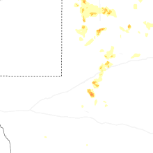
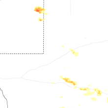
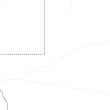
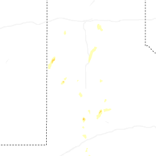
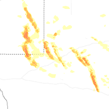

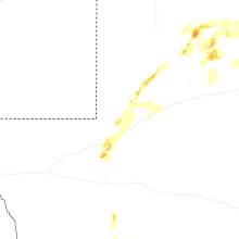
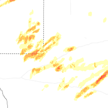
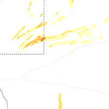


Connect with Interactive Hail Maps