

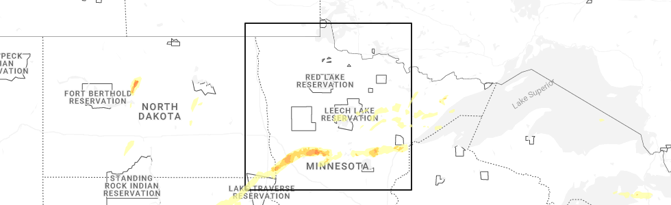
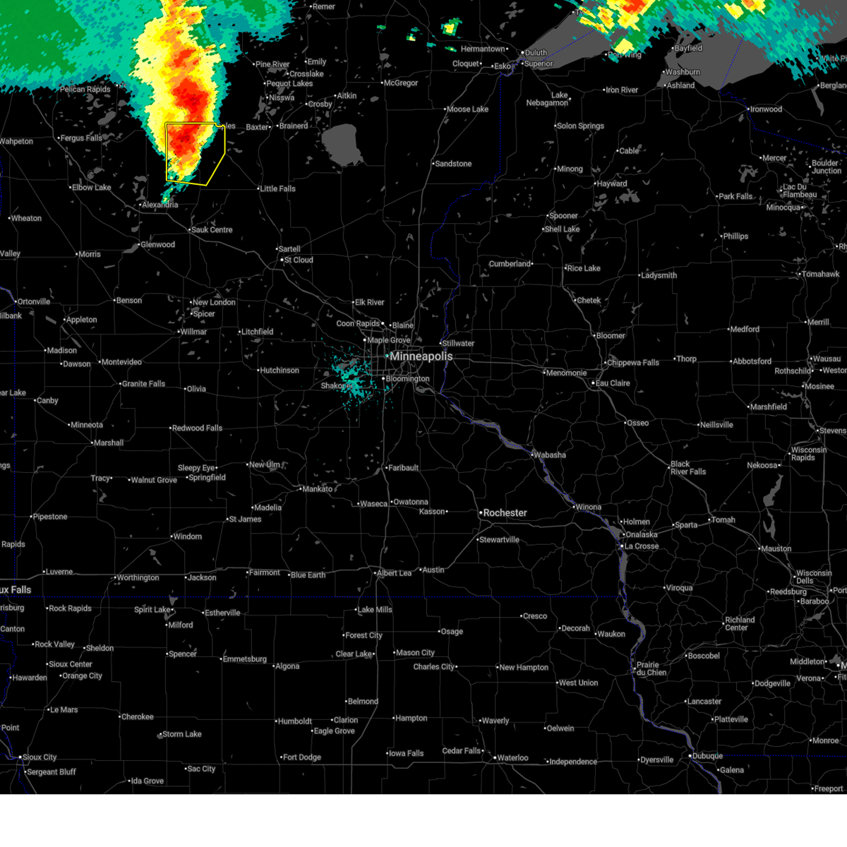
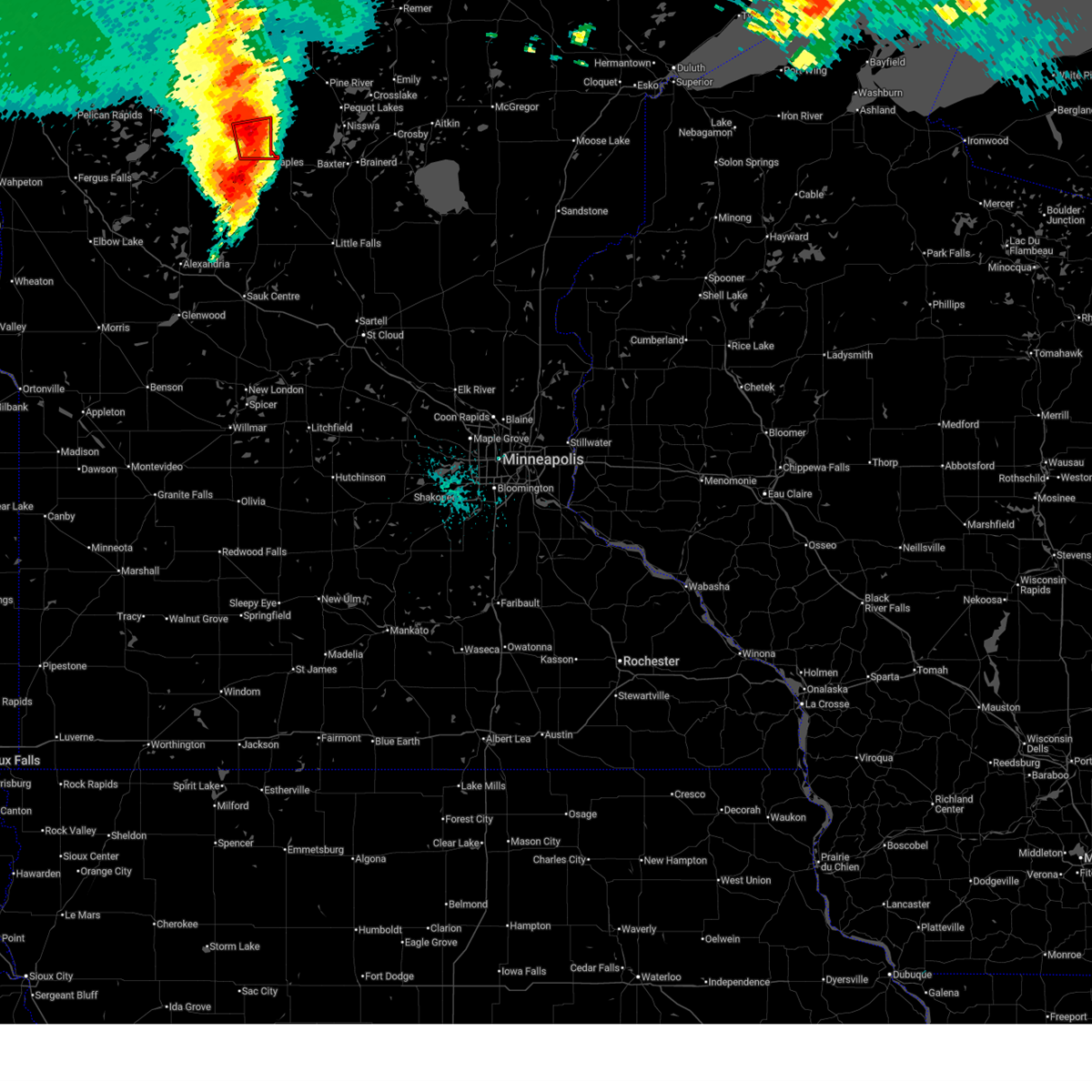
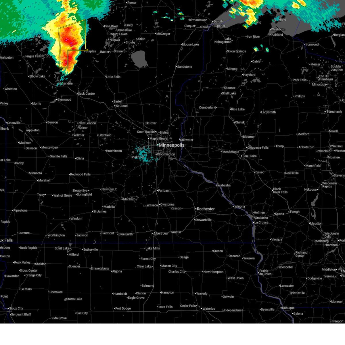
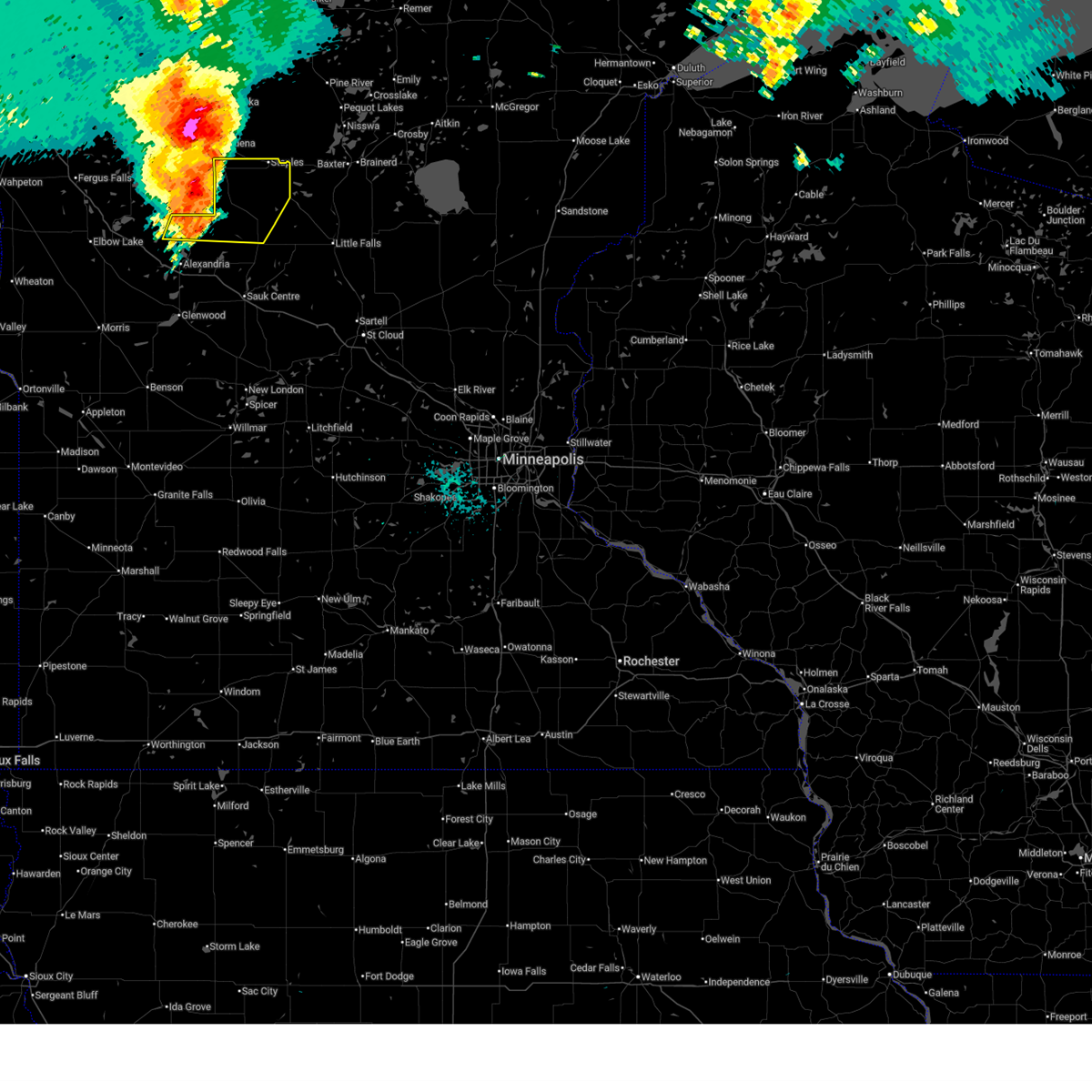
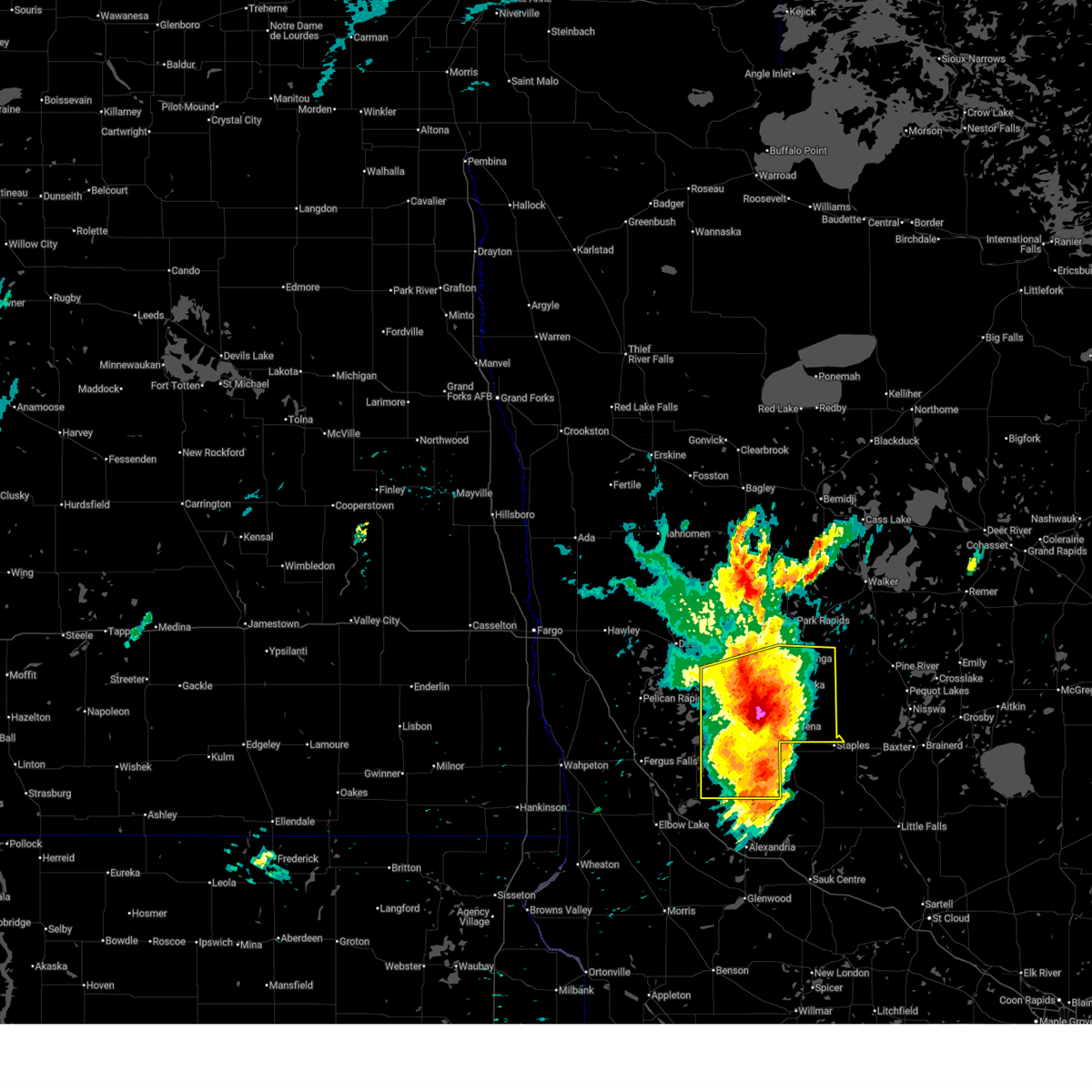
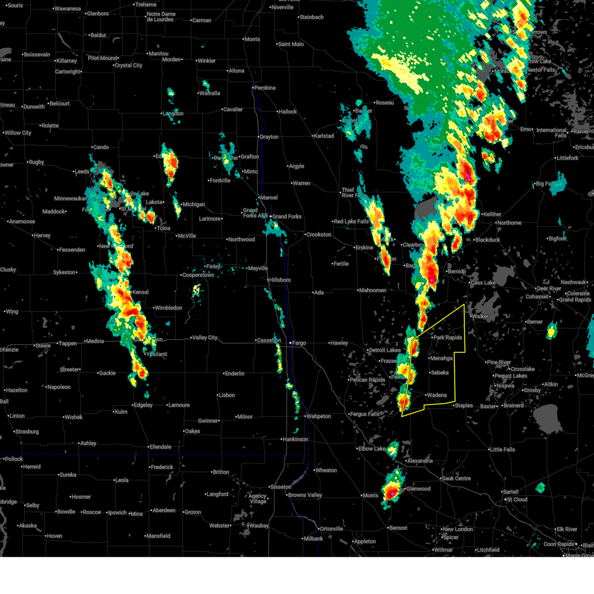
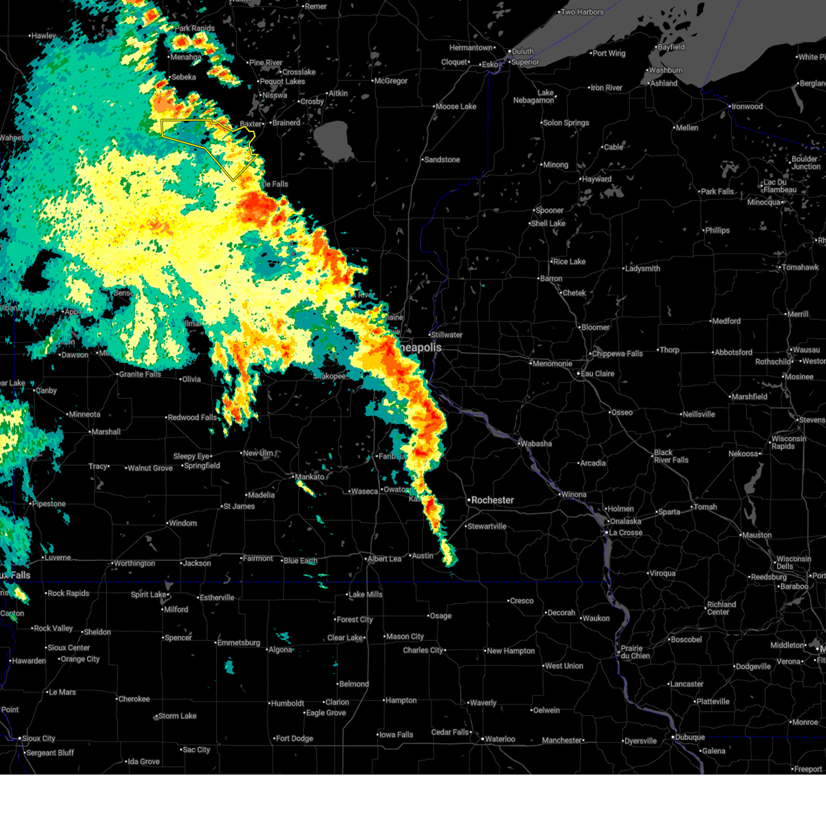
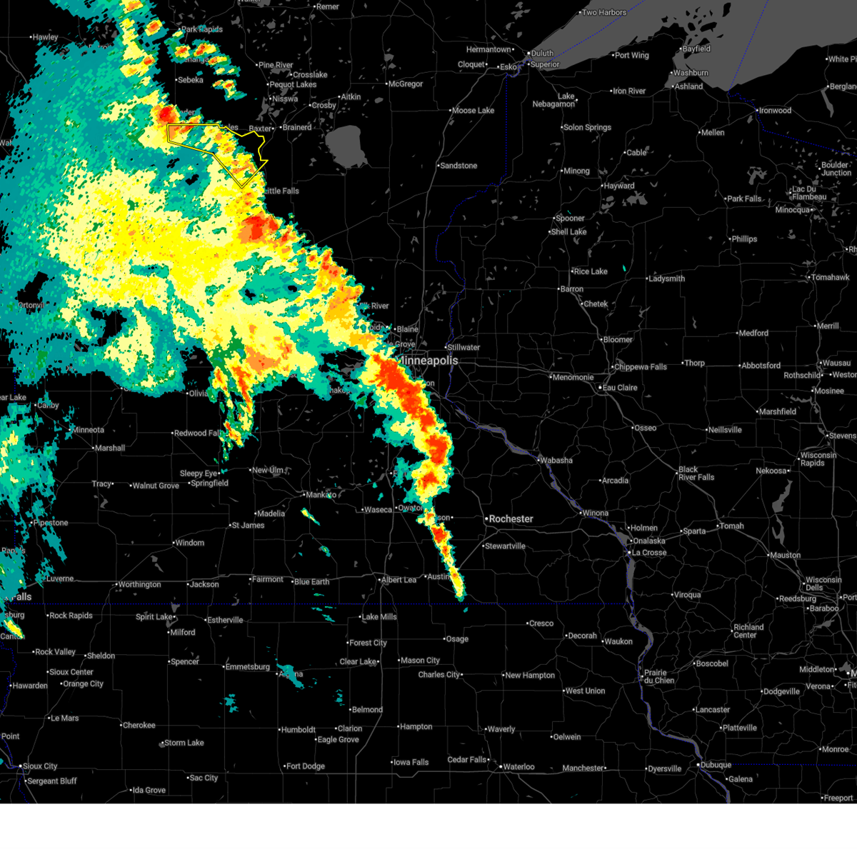
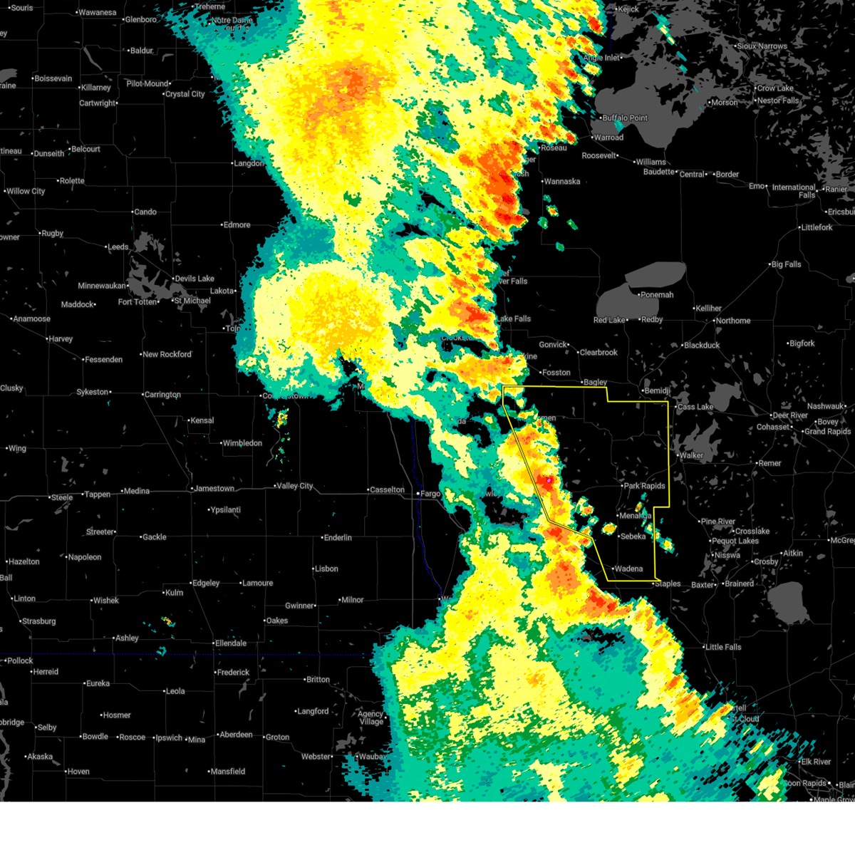
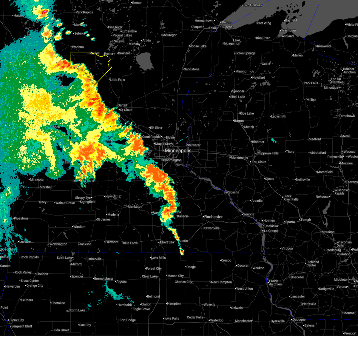
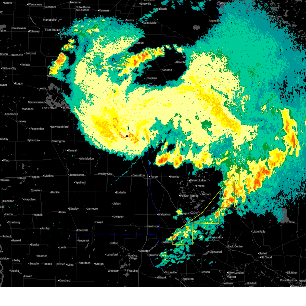
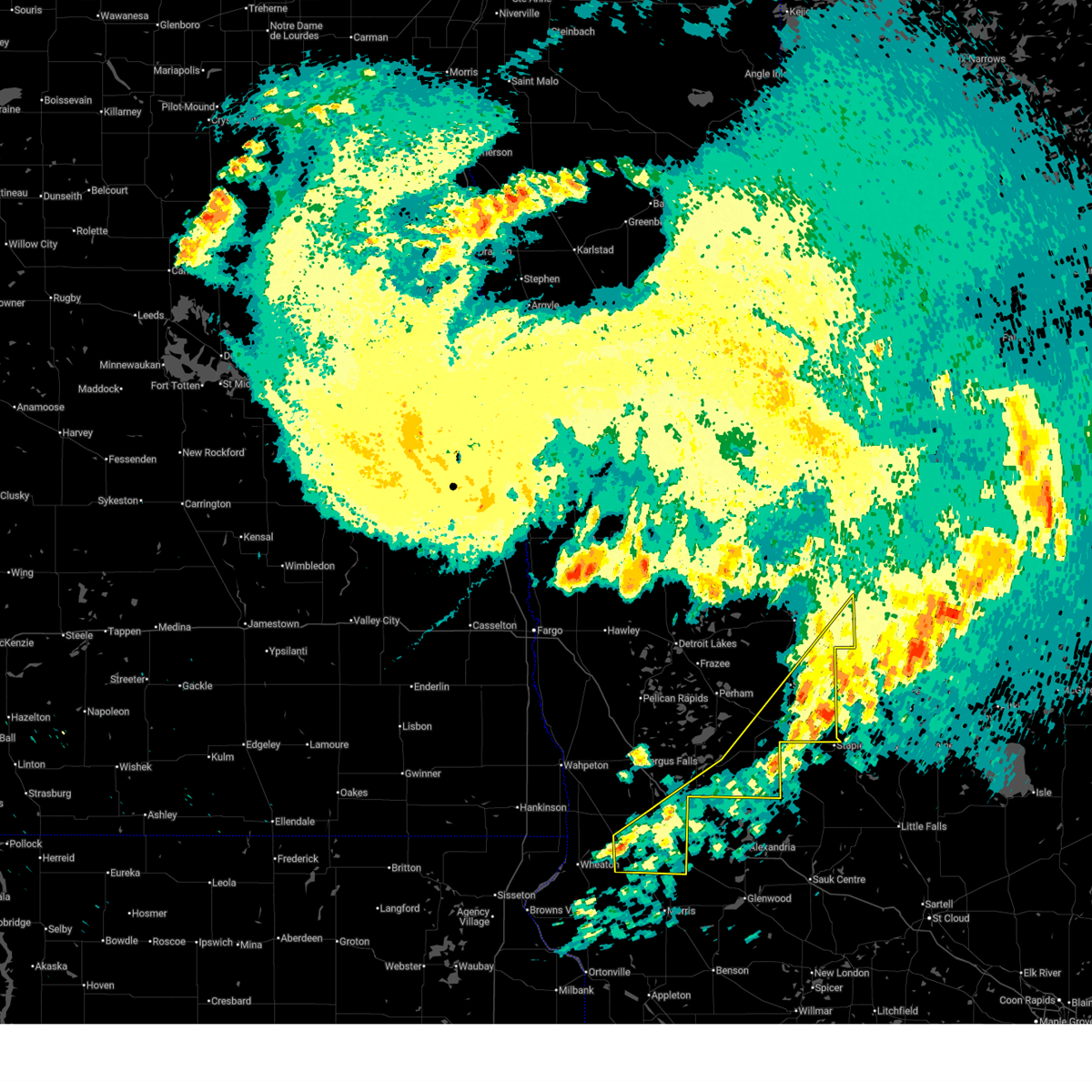
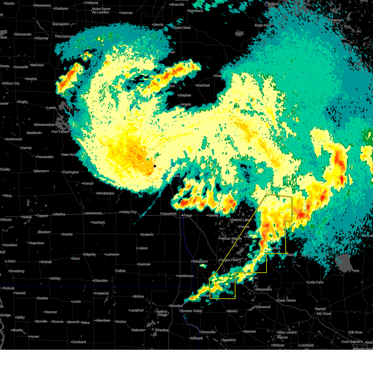
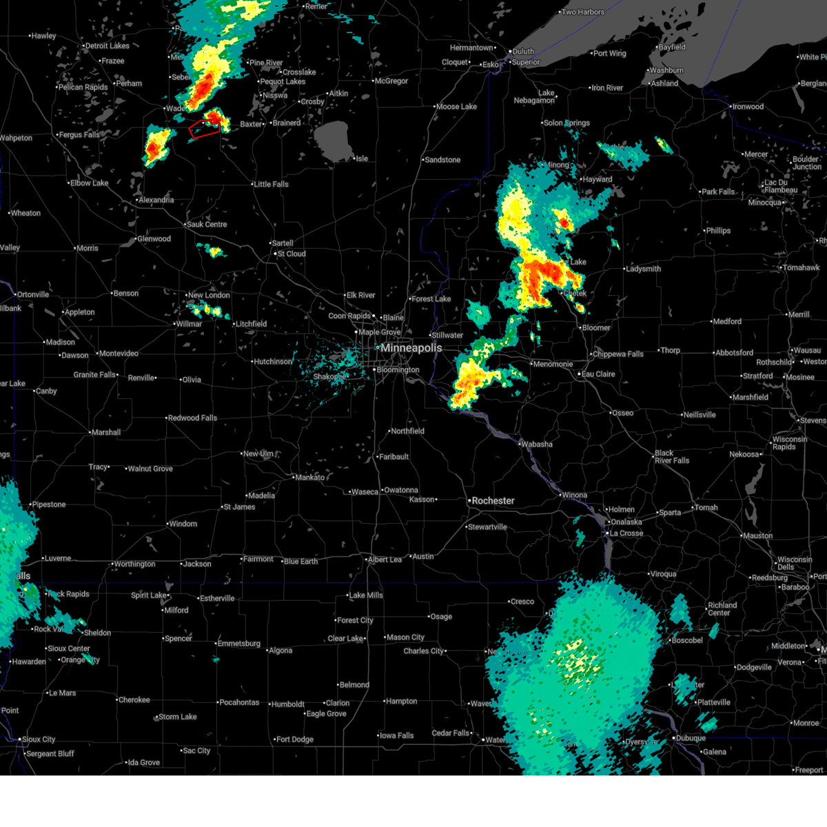
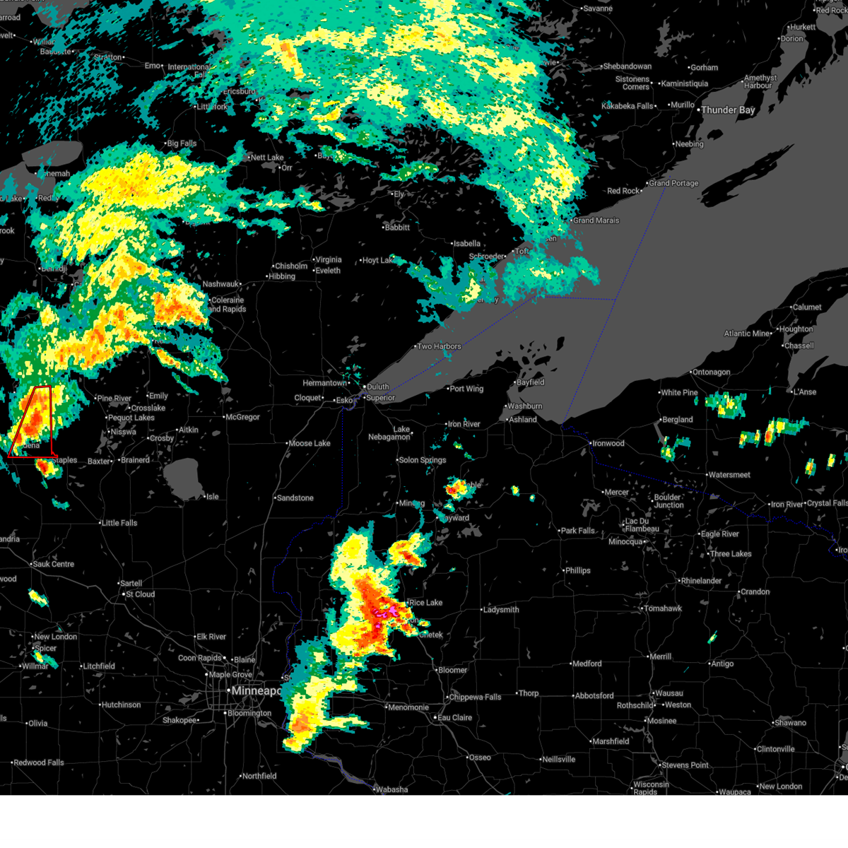
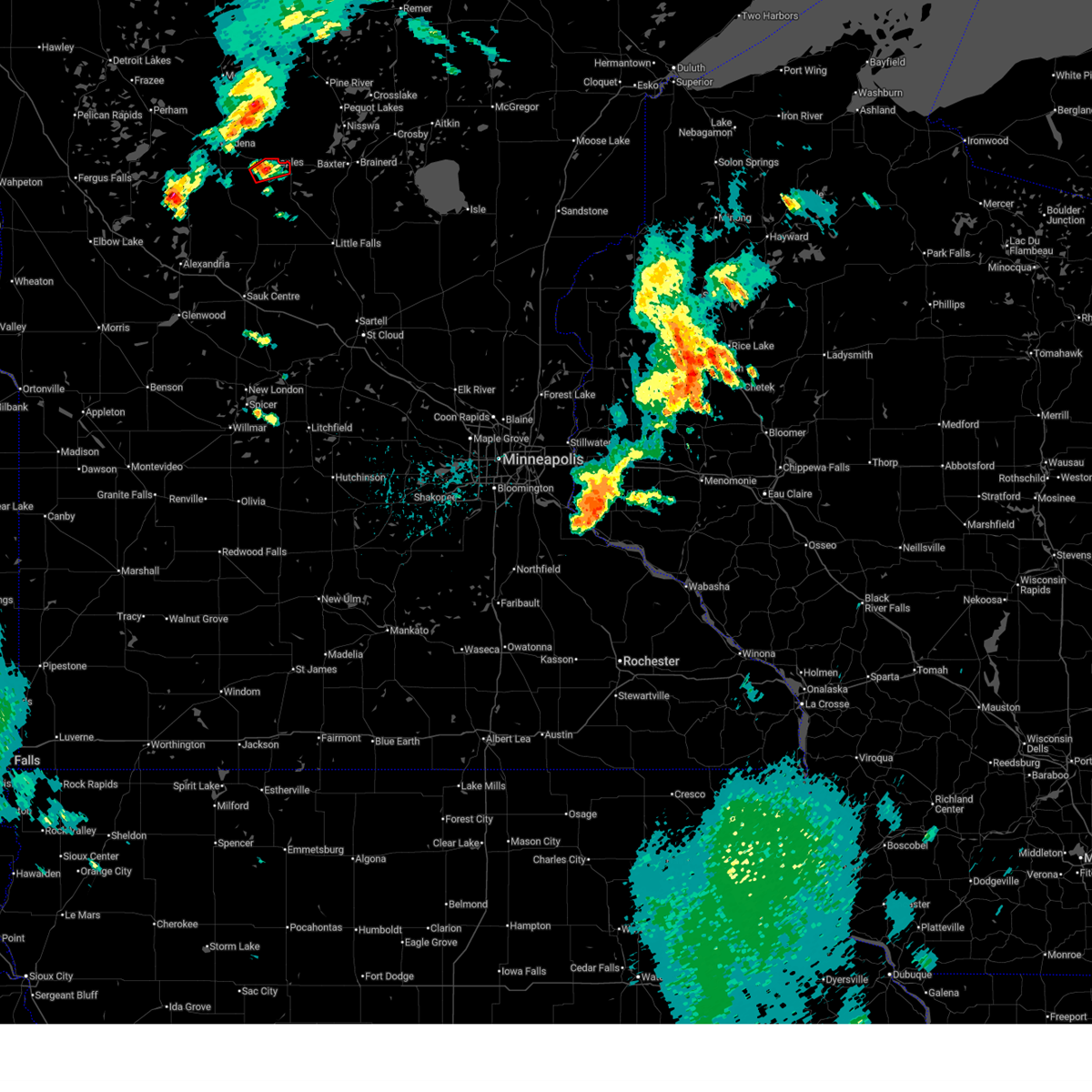
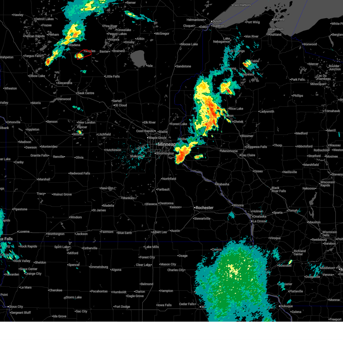
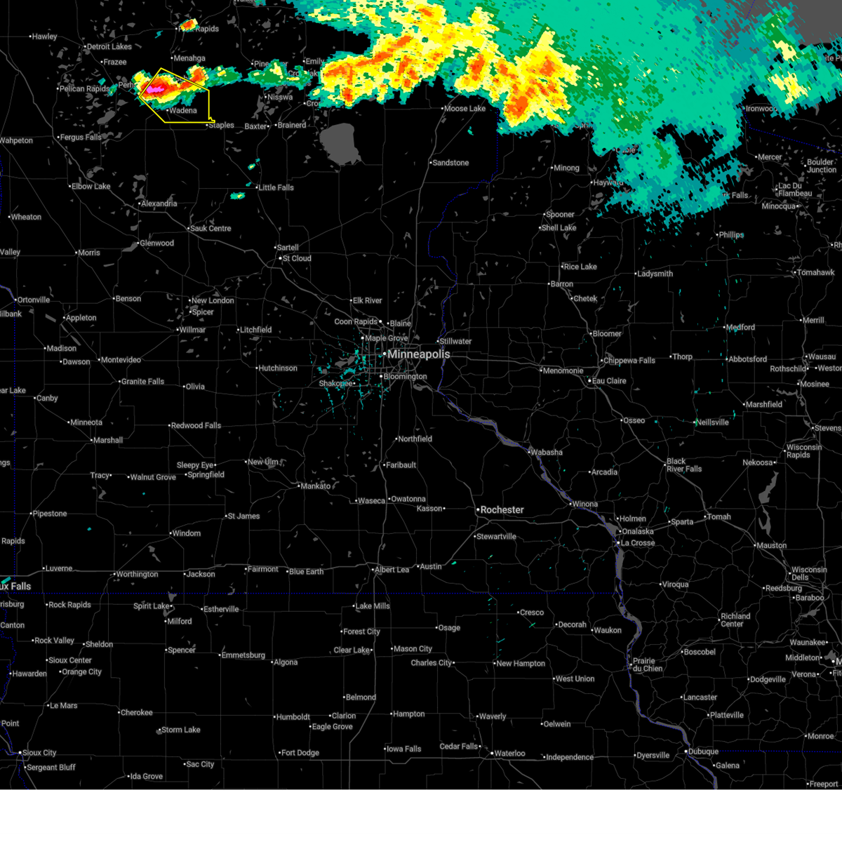
Hail Map for Staples, MN
The Staples, MN area has had 7 reports of on-the-ground hail by trained spotters, and has been under severe weather warnings 31 times during the past 12 months. Doppler radar has detected hail at or near Staples, MN on 65 occasions, including 5 occasions during the past year.
| Name: | Staples, MN |
| Where Located: | 76.9 miles S of Bemidji, MN |
| Map: | Google Map for Staples, MN |
| Population: | 2981 |
| Housing Units: | 1469 |
| More Info: | Search Google for Staples, MN |
2
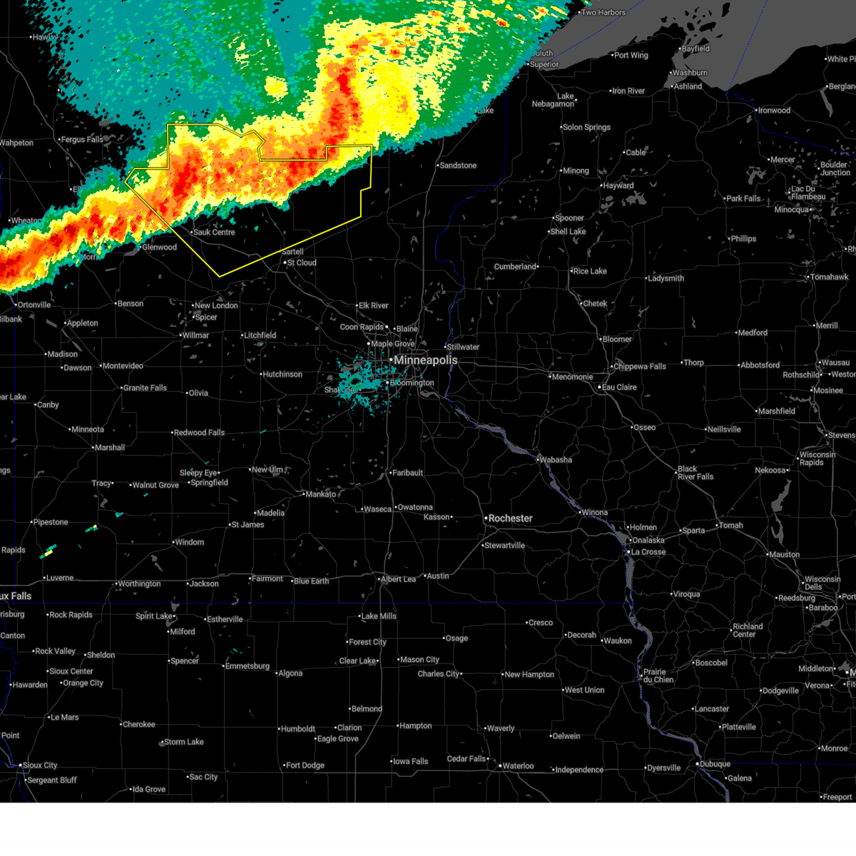
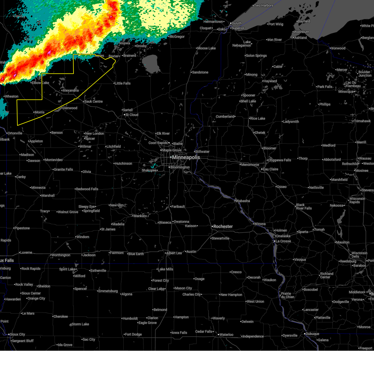
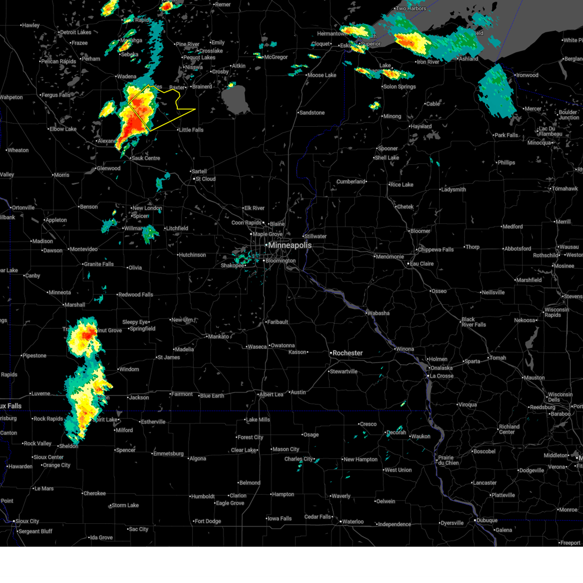
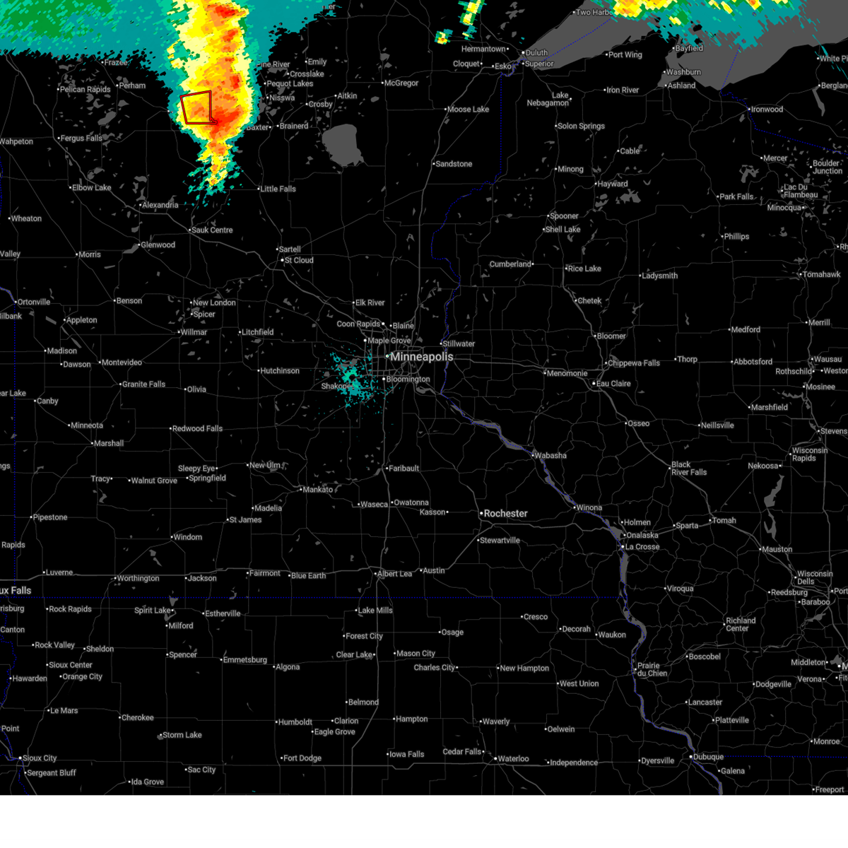
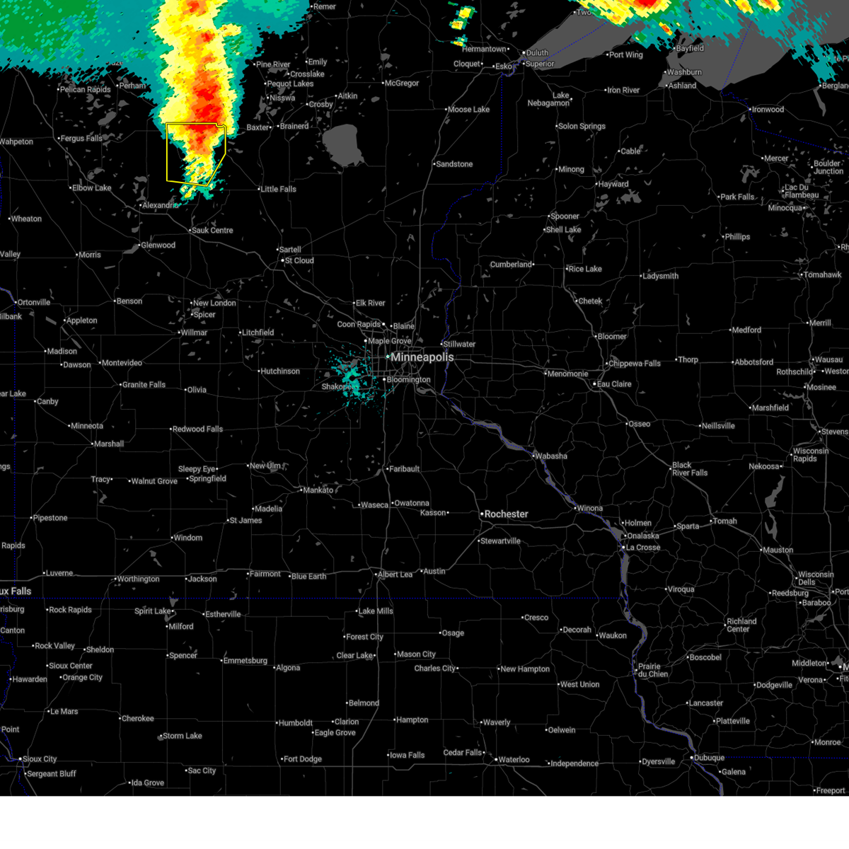
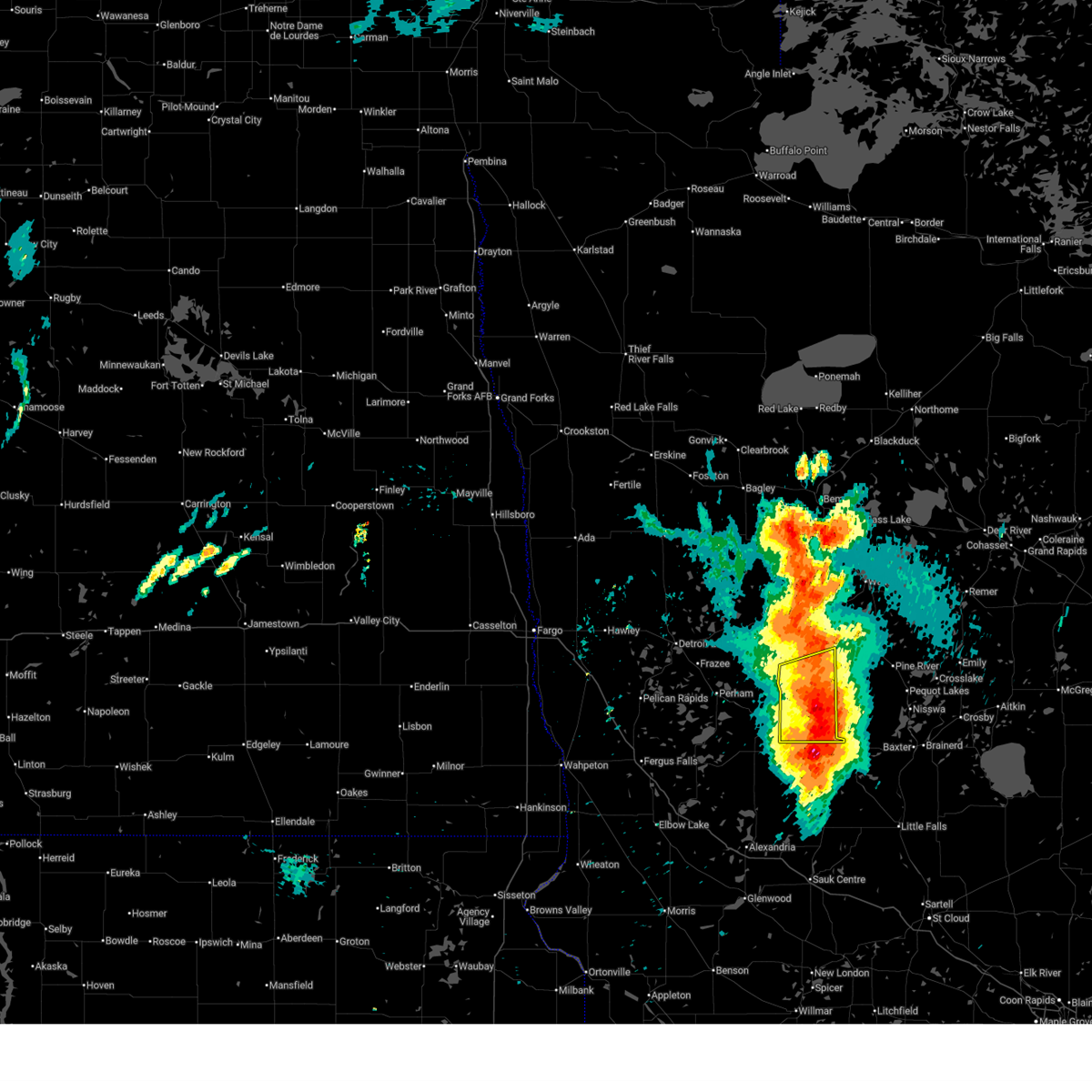
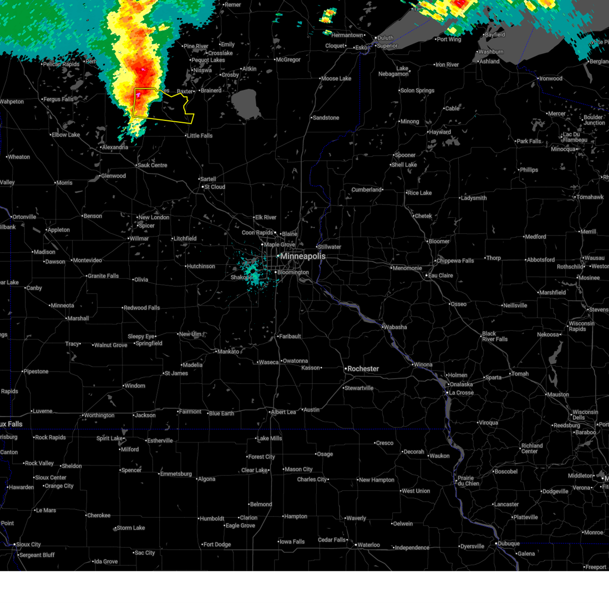
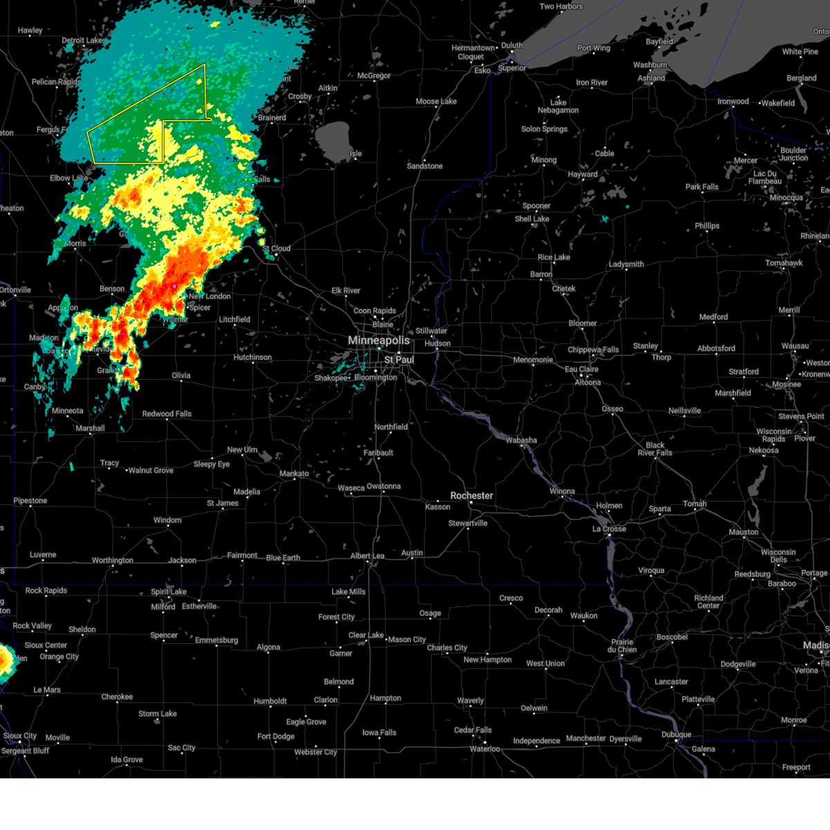
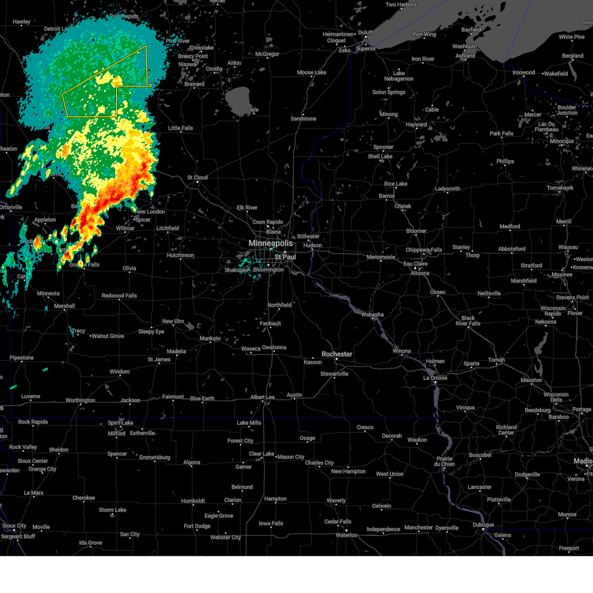
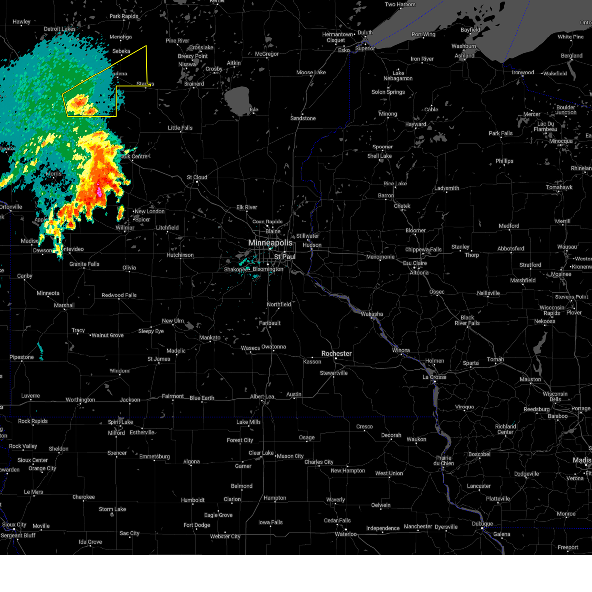
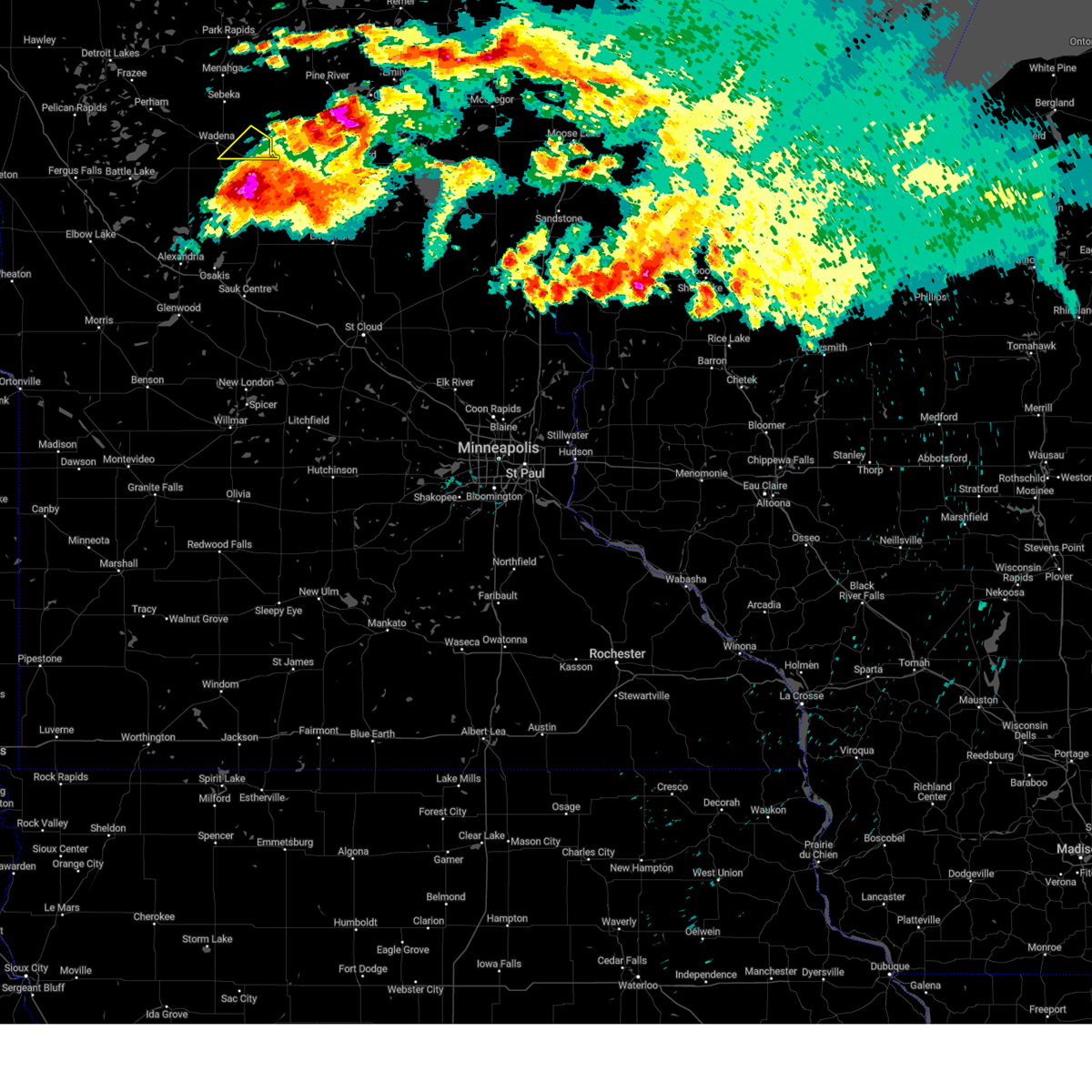
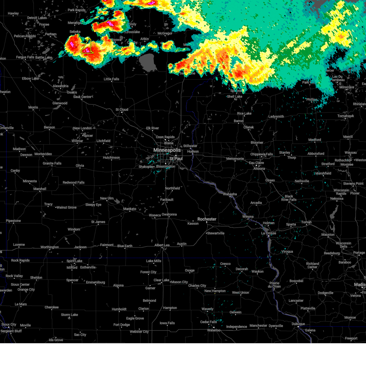
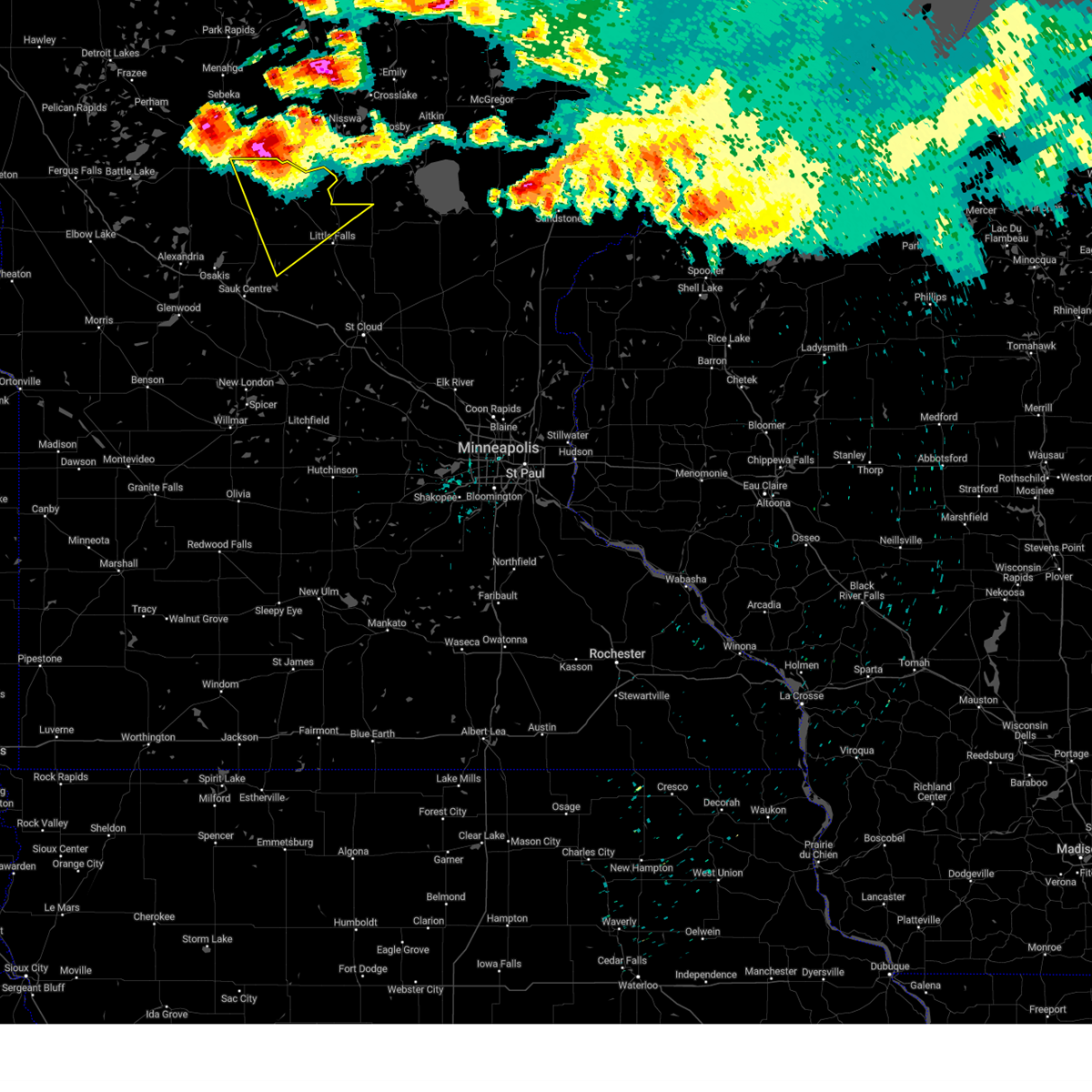
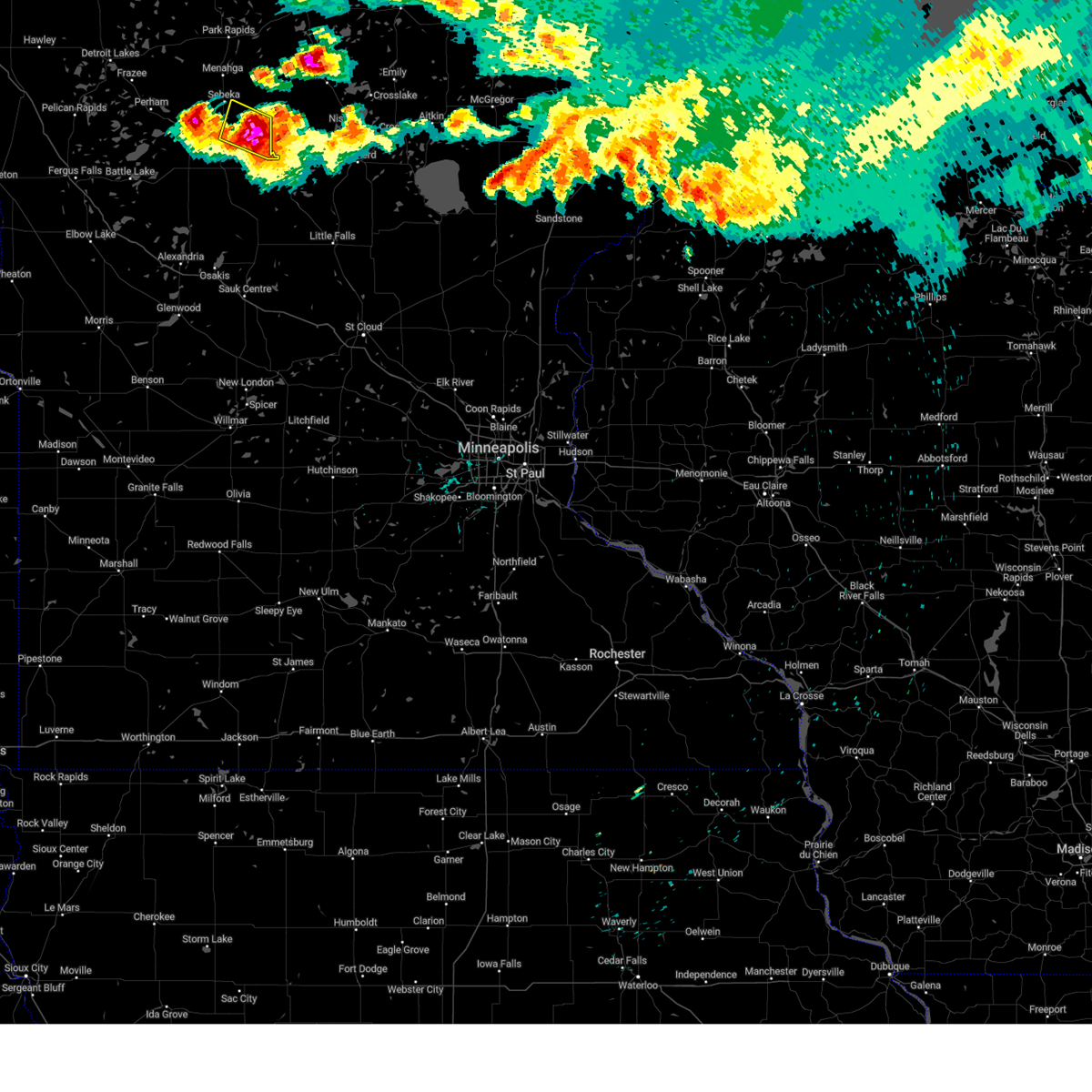
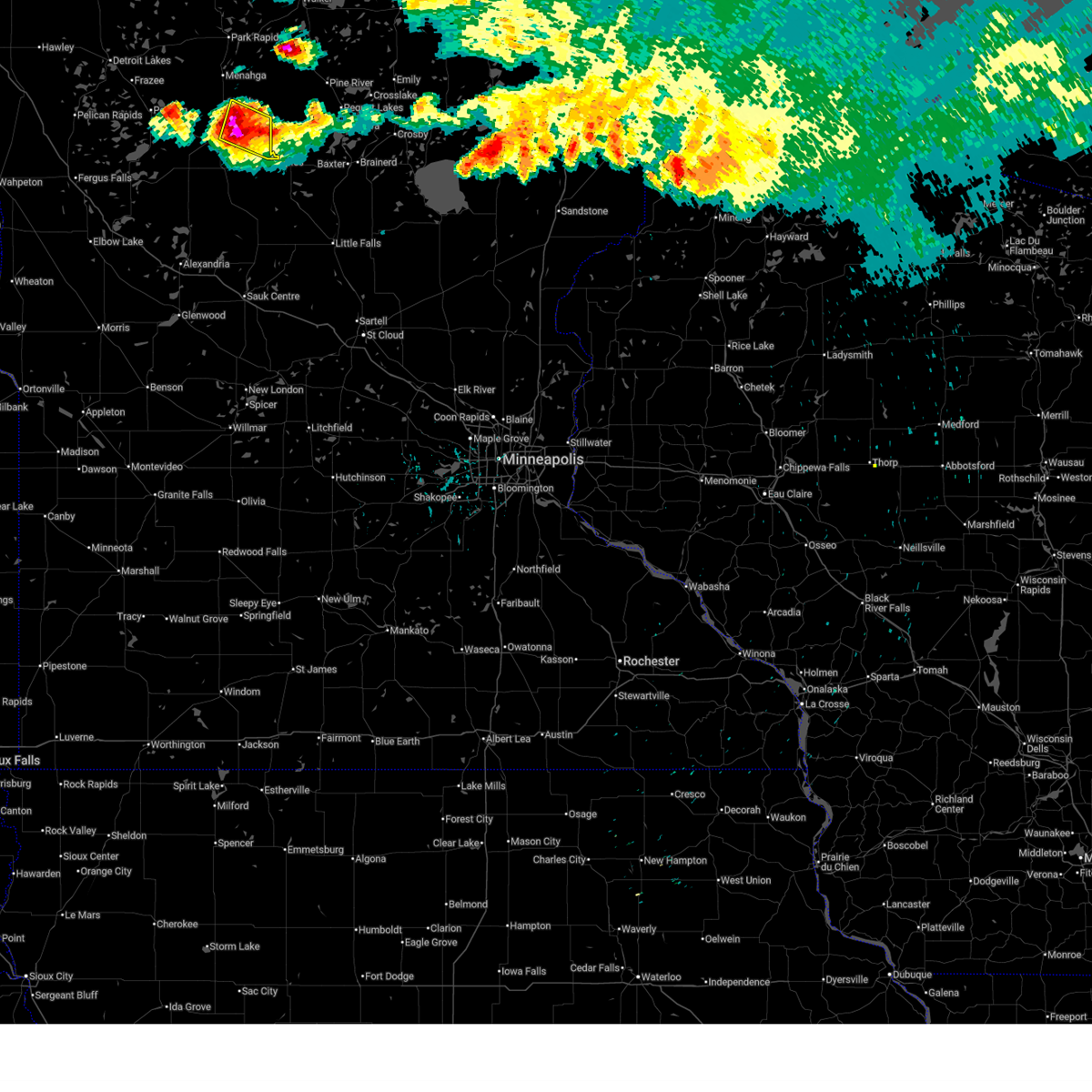
The Top Recent Hail Date for Staples, MN is Monday, June 29, 2026 (12th out of 65)
Hail and Wind Damage Spotted near Staples, MN
| Date / Time | Report Details |
|---|---|
| 7/6/2026 10:07 PM CDT |
 Svrmpx the national weather service in the twin cities has issued a * severe thunderstorm warning for, northern benton county in central minnesota, morrison county in central minnesota, northern stearns county in central minnesota, todd county in central minnesota, mille lacs county in east central minnesota, northeastern douglas county in west central minnesota, * until 1045 pm cdt. * at 1007 pm cdt, severe thunderstorms were located along a line from 17 miles north of isle to 5 miles northwest of alexandria, or along a line from 48 miles northeast of little falls to 5 miles northwest of alexandria, moving south at 30 mph (radar indicated). Hazards include 60 mph wind gusts and small hail. expect damage to roofs, siding, and trees Svrmpx the national weather service in the twin cities has issued a * severe thunderstorm warning for, northern benton county in central minnesota, morrison county in central minnesota, northern stearns county in central minnesota, todd county in central minnesota, mille lacs county in east central minnesota, northeastern douglas county in west central minnesota, * until 1045 pm cdt. * at 1007 pm cdt, severe thunderstorms were located along a line from 17 miles north of isle to 5 miles northwest of alexandria, or along a line from 48 miles northeast of little falls to 5 miles northwest of alexandria, moving south at 30 mph (radar indicated). Hazards include 60 mph wind gusts and small hail. expect damage to roofs, siding, and trees
|
| 7/6/2026 9:35 PM CDT |
 At 935 pm cdt, severe thunderstorms were located along a line from over motley to 17 miles northwest of chokio, or along a line from 30 miles northwest of little falls to 27 miles northwest of morris, moving south at 30 mph (radar indicated). Hazards include 60 mph wind gusts and quarter size hail. Hail damage to vehicles is expected. expect wind damage to roofs, siding, and trees. Locations impacted include, hewitt, bertha, staples, evansville, motley, eagle bend, brandon, clarissa, alexandria, carlos, donnelly, browerville, kensington, chokio, long prairie, morris, lowry, cyrus and starbuck. At 935 pm cdt, severe thunderstorms were located along a line from over motley to 17 miles northwest of chokio, or along a line from 30 miles northwest of little falls to 27 miles northwest of morris, moving south at 30 mph (radar indicated). Hazards include 60 mph wind gusts and quarter size hail. Hail damage to vehicles is expected. expect wind damage to roofs, siding, and trees. Locations impacted include, hewitt, bertha, staples, evansville, motley, eagle bend, brandon, clarissa, alexandria, carlos, donnelly, browerville, kensington, chokio, long prairie, morris, lowry, cyrus and starbuck.
|
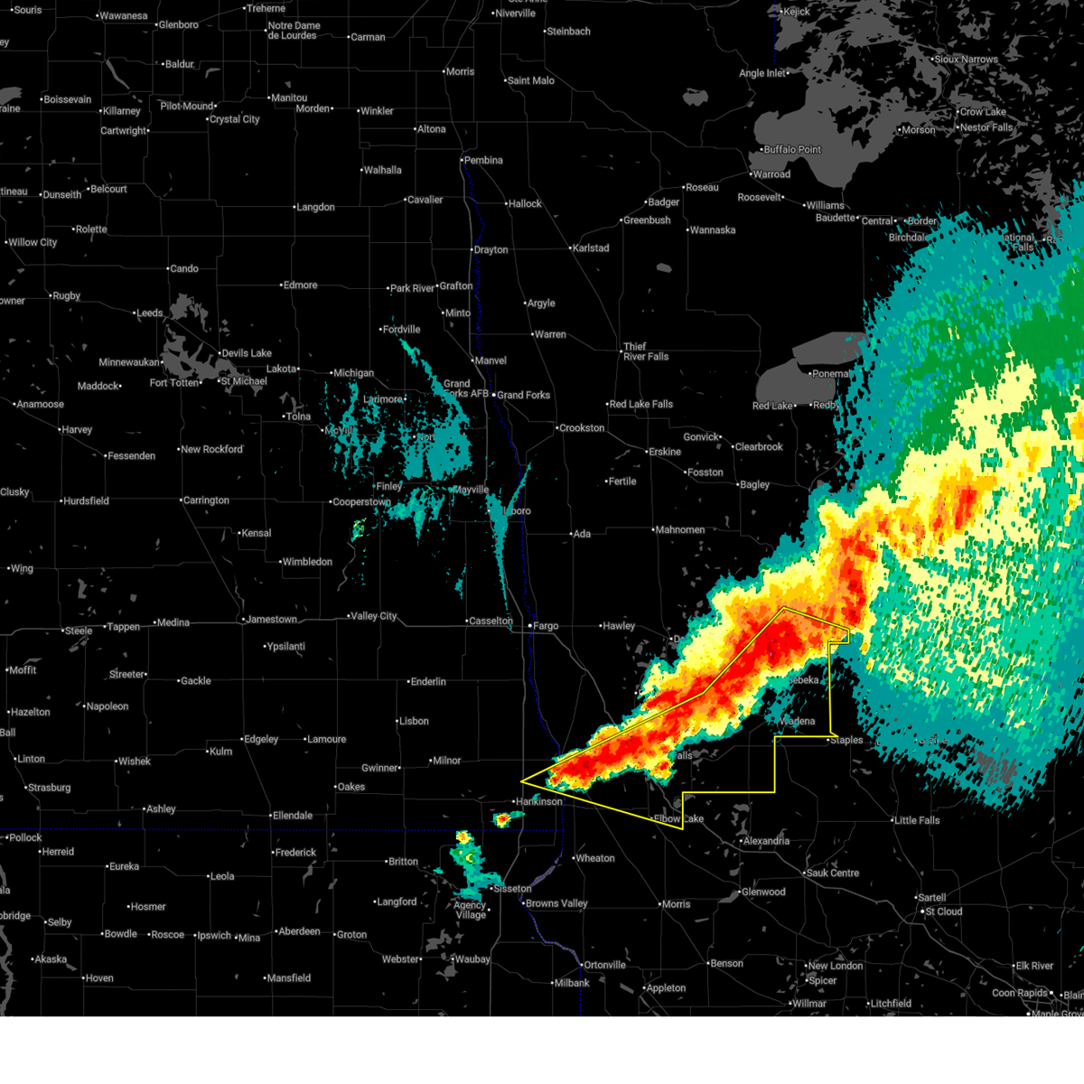
| 7/6/2026 9:33 PM CDT |
 At 933 pm cdt, severe thunderstorms were located along a line extending from near lower hay lake to near philbrook to near erdahl, moving east at 45 mph (radar indicated). Hazards include 60 mph wind gusts and quarter size hail. Hail damage to vehicles is expected. expect wind damage to roofs, siding, and trees. locations impacted include, fergus falls, wadena, ottertail lake, new york mills, elbow lake, parkers prairie, and battle lake. This includes interstate 94 in minnesota between mile markers 58 and 80. At 933 pm cdt, severe thunderstorms were located along a line extending from near lower hay lake to near philbrook to near erdahl, moving east at 45 mph (radar indicated). Hazards include 60 mph wind gusts and quarter size hail. Hail damage to vehicles is expected. expect wind damage to roofs, siding, and trees. locations impacted include, fergus falls, wadena, ottertail lake, new york mills, elbow lake, parkers prairie, and battle lake. This includes interstate 94 in minnesota between mile markers 58 and 80.
|
| 7/6/2026 9:25 PM CDT |
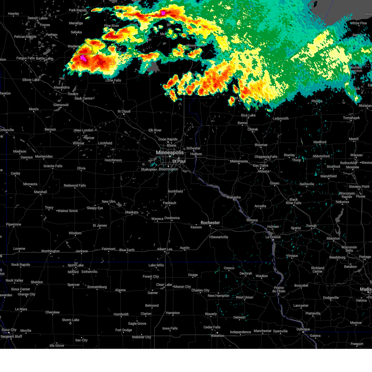
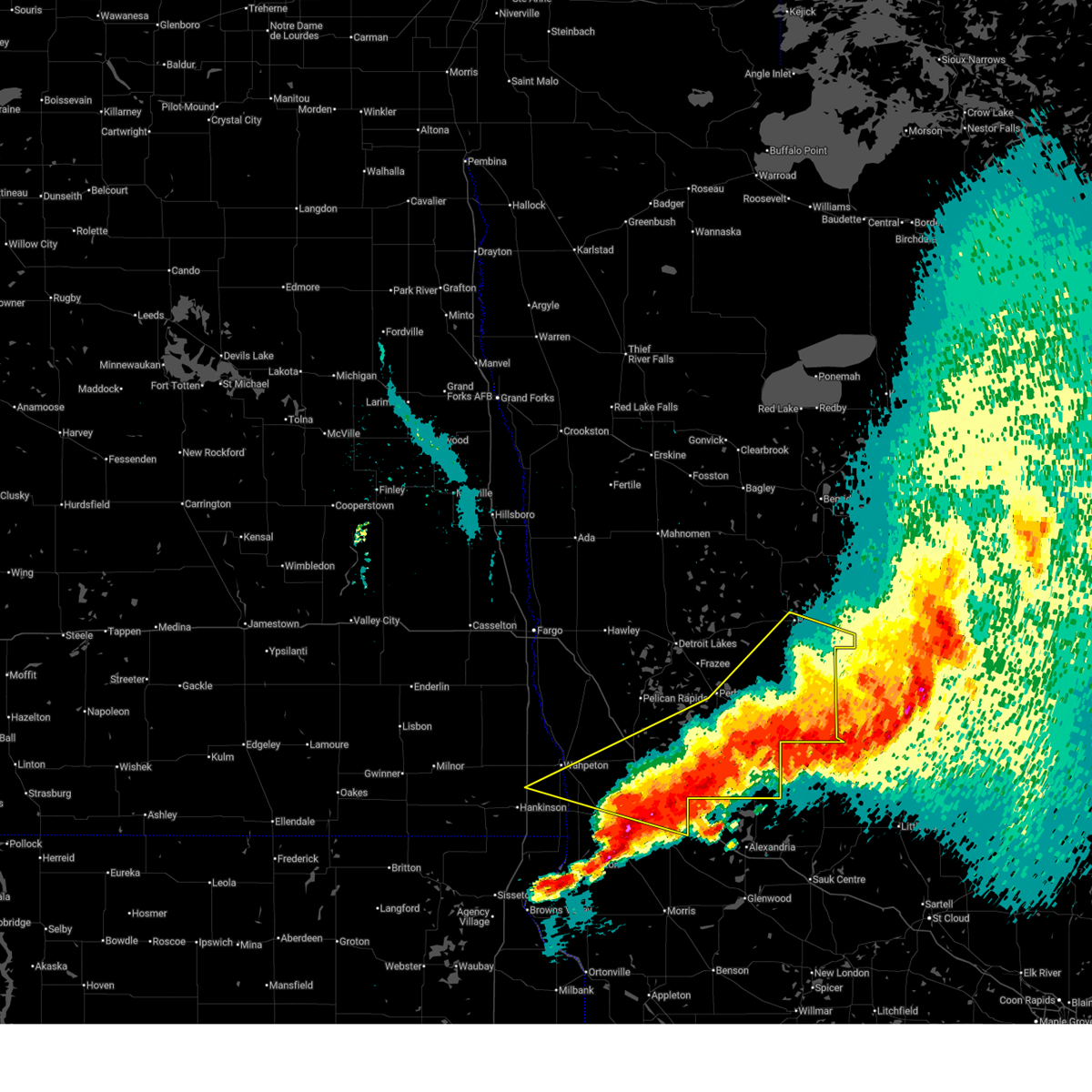 At 924 pm cdt, severe thunderstorms were located along a line extending from near jenkins to staples to near erdahl, moving east at 45 mph (radar indicated). Hazards include 60 mph wind gusts and quarter size hail. Hail damage to vehicles is expected. expect wind damage to roofs, siding, and trees. locations impacted include, fergus falls, wahpeton, wadena, park rapids, perham, ottertail lake, and menahga. This includes interstate 94 in minnesota between mile markers 47 and 80. At 924 pm cdt, severe thunderstorms were located along a line extending from near jenkins to staples to near erdahl, moving east at 45 mph (radar indicated). Hazards include 60 mph wind gusts and quarter size hail. Hail damage to vehicles is expected. expect wind damage to roofs, siding, and trees. locations impacted include, fergus falls, wahpeton, wadena, park rapids, perham, ottertail lake, and menahga. This includes interstate 94 in minnesota between mile markers 47 and 80.
|
| 7/6/2026 9:02 PM CDT |
 Svrmpx the national weather service in the twin cities has issued a * severe thunderstorm warning for, northwestern morrison county in central minnesota, todd county in central minnesota, douglas county in west central minnesota, northern pope county in west central minnesota, stevens county in west central minnesota, * until 1000 pm cdt. * at 902 pm cdt, severe thunderstorms were located along a line from 14 miles north of staples to 32 miles northwest of chokio, or along a line from 45 miles northwest of little falls to 39 miles northwest of morris, moving south at 30 mph (radar indicated). Hazards include 60 mph wind gusts and quarter size hail. Hail damage to vehicles is expected. Expect wind damage to roofs, siding, and trees. Svrmpx the national weather service in the twin cities has issued a * severe thunderstorm warning for, northwestern morrison county in central minnesota, todd county in central minnesota, douglas county in west central minnesota, northern pope county in west central minnesota, stevens county in west central minnesota, * until 1000 pm cdt. * at 902 pm cdt, severe thunderstorms were located along a line from 14 miles north of staples to 32 miles northwest of chokio, or along a line from 45 miles northwest of little falls to 39 miles northwest of morris, moving south at 30 mph (radar indicated). Hazards include 60 mph wind gusts and quarter size hail. Hail damage to vehicles is expected. Expect wind damage to roofs, siding, and trees.
|
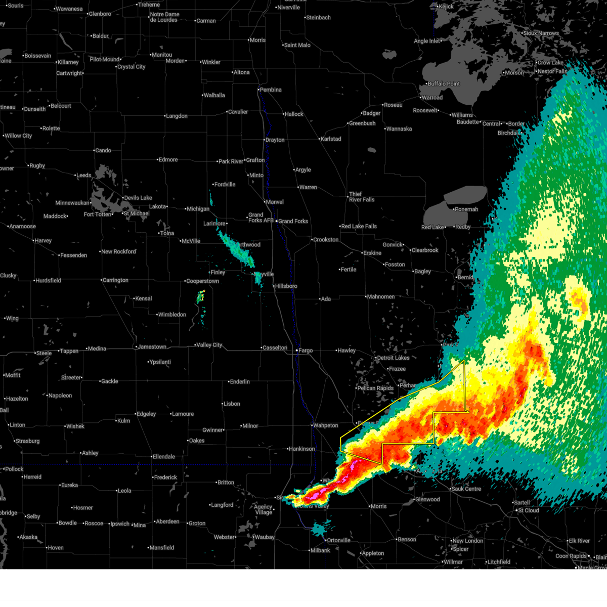
| 7/6/2026 8:39 PM CDT |
 Svrfgf the national weather service in grand forks has issued a * severe thunderstorm warning for, southern hubbard county in north central minnesota, wadena county in central minnesota, otter tail county in west central minnesota, northern grant county in west central minnesota, southeastern wilkin county in west central minnesota, southeastern becker county in northwestern minnesota, east central richland county in southeastern north dakota, * until 1000 pm cdt. * at 839 pm cdt, severe thunderstorms were located along a line extending from near hubbard to new york mills to doran, moving east at 45 mph (radar indicated). Hazards include 60 mph wind gusts and quarter size hail. Hail damage to vehicles is expected. Expect wind damage to roofs, siding, and trees. Svrfgf the national weather service in grand forks has issued a * severe thunderstorm warning for, southern hubbard county in north central minnesota, wadena county in central minnesota, otter tail county in west central minnesota, northern grant county in west central minnesota, southeastern wilkin county in west central minnesota, southeastern becker county in northwestern minnesota, east central richland county in southeastern north dakota, * until 1000 pm cdt. * at 839 pm cdt, severe thunderstorms were located along a line extending from near hubbard to new york mills to doran, moving east at 45 mph (radar indicated). Hazards include 60 mph wind gusts and quarter size hail. Hail damage to vehicles is expected. Expect wind damage to roofs, siding, and trees.
|
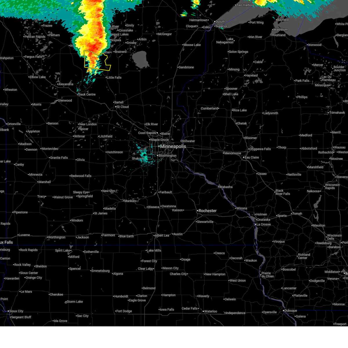
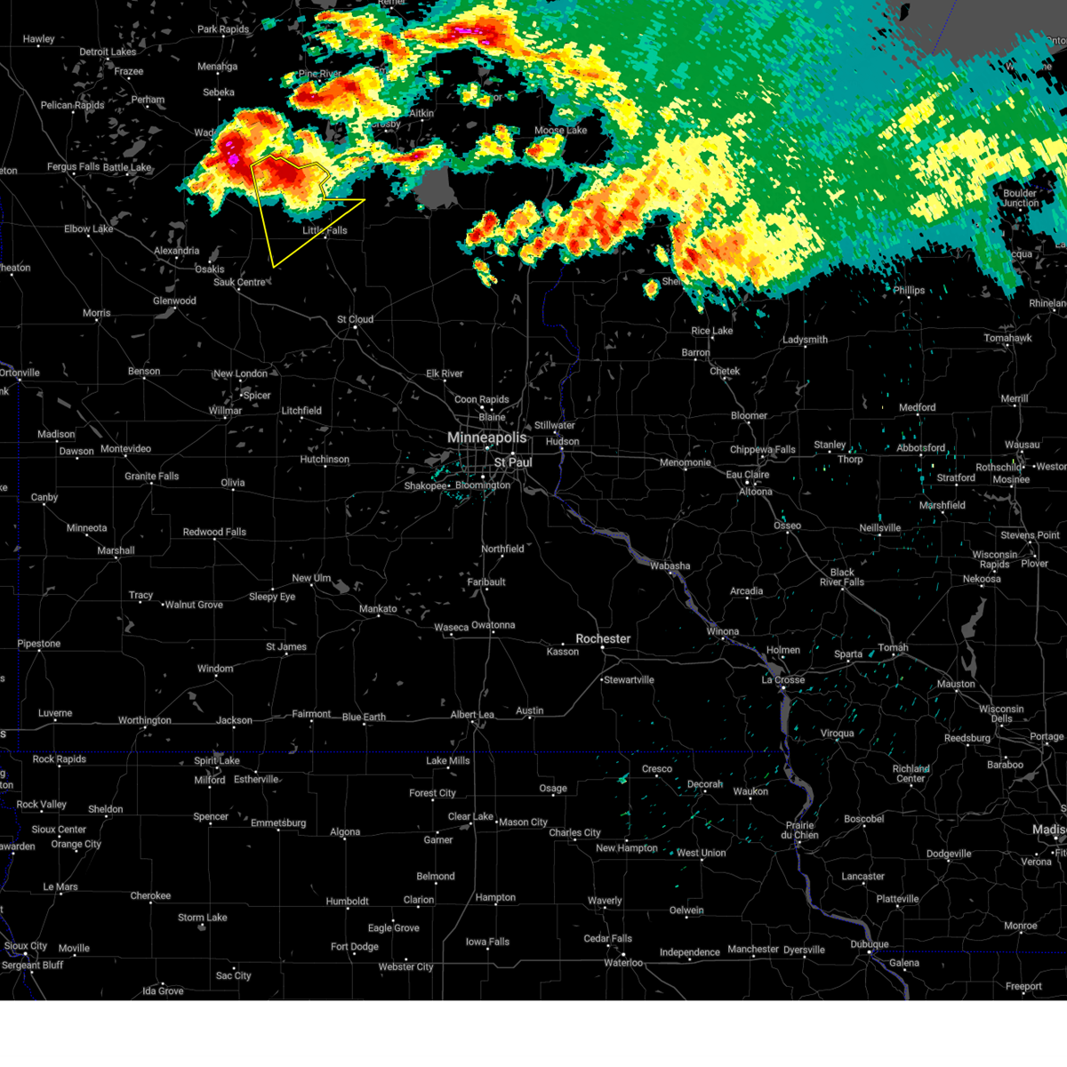
| 6/29/2026 10:27 PM CDT |
 Svrmpx the national weather service in the twin cities has issued a * severe thunderstorm warning for, northwestern morrison county in central minnesota, northeastern todd county in central minnesota, * until 1115 pm cdt. * at 1027 pm cdt, a severe thunderstorm was located over browerville, or 24 miles west of little falls, moving northeast at 60 mph (trained spotters reported). Hazards include golf ball size hail and 60 mph wind gusts. People and animals outdoors will be injured. expect hail damage to roofs, siding, windows, and vehicles. Expect wind damage to roofs, siding, and trees. Svrmpx the national weather service in the twin cities has issued a * severe thunderstorm warning for, northwestern morrison county in central minnesota, northeastern todd county in central minnesota, * until 1115 pm cdt. * at 1027 pm cdt, a severe thunderstorm was located over browerville, or 24 miles west of little falls, moving northeast at 60 mph (trained spotters reported). Hazards include golf ball size hail and 60 mph wind gusts. People and animals outdoors will be injured. expect hail damage to roofs, siding, windows, and vehicles. Expect wind damage to roofs, siding, and trees.
|
| 6/29/2026 11:57 AM CDT |
 At 1157 am cdt, severe thunderstorms were located along a line from 9 miles northeast of motley to 8 miles west of randall, or along a line from 34 miles north of little falls to 17 miles northwest of little falls, moving east at 30 mph (radar indicated). Hazards include 60 mph wind gusts and quarter size hail. Hail damage to vehicles is expected. expect wind damage to roofs, siding, and trees. this severe thunderstorm will be near, motley around 1200 pm cdt. randall around 1210 pm cdt. Camp ripley around 1225 pm cdt. At 1157 am cdt, severe thunderstorms were located along a line from 9 miles northeast of motley to 8 miles west of randall, or along a line from 34 miles north of little falls to 17 miles northwest of little falls, moving east at 30 mph (radar indicated). Hazards include 60 mph wind gusts and quarter size hail. Hail damage to vehicles is expected. expect wind damage to roofs, siding, and trees. this severe thunderstorm will be near, motley around 1200 pm cdt. randall around 1210 pm cdt. Camp ripley around 1225 pm cdt.
|
| 6/29/2026 11:51 AM CDT |
 The tornadic thunderstorm which prompted the warning has moved out of the warned area. therefore, the warning will be allowed to expire. however, gusty winds are still possible with this thunderstorm. a severe thunderstorm watch remains in effect until 400 pm cdt for central minnesota. remember, a severe thunderstorm warning still remains in effect for wadena county until 1215 pm cdt. The tornadic thunderstorm which prompted the warning has moved out of the warned area. therefore, the warning will be allowed to expire. however, gusty winds are still possible with this thunderstorm. a severe thunderstorm watch remains in effect until 400 pm cdt for central minnesota. remember, a severe thunderstorm warning still remains in effect for wadena county until 1215 pm cdt.
|
| 6/29/2026 11:44 AM CDT |
 The severe thunderstorm warning that was previously in effect has been reissued for todd county and is in effect until 1230 pm cdt. please refer to that bulletin for the latest severe weather information. The severe thunderstorm warning that was previously in effect has been reissued for todd county and is in effect until 1230 pm cdt. please refer to that bulletin for the latest severe weather information.
|
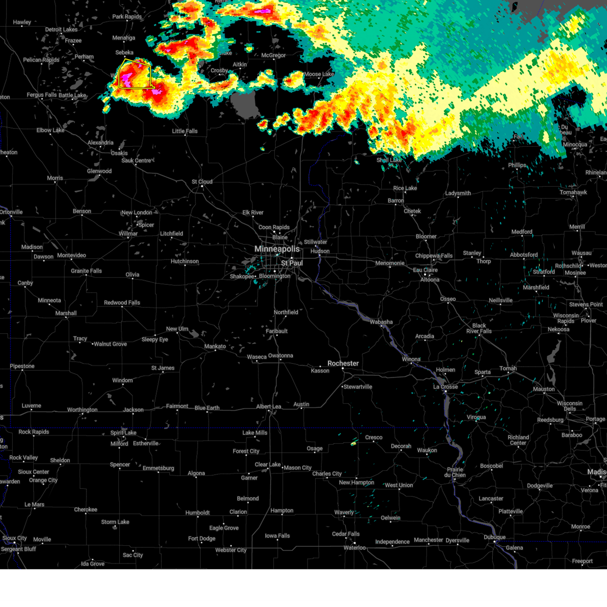
| 6/29/2026 11:44 AM CDT |
 At 1143 am cdt, severe thunderstorms were located along a line extending from near oshawa to near casino to 6 miles southwest of cushing, moving east at 45 mph (radar indicated). Hazards include 70 mph wind gusts and half dollar size hail. Hail damage to vehicles is expected. expect considerable tree damage. wind damage is also likely to mobile homes, roofs, and outbuildings. Locations impacted include, wadena, sebeka, verndale, staples airport, huntersville, nimrod, and aldrich. At 1143 am cdt, severe thunderstorms were located along a line extending from near oshawa to near casino to 6 miles southwest of cushing, moving east at 45 mph (radar indicated). Hazards include 70 mph wind gusts and half dollar size hail. Hail damage to vehicles is expected. expect considerable tree damage. wind damage is also likely to mobile homes, roofs, and outbuildings. Locations impacted include, wadena, sebeka, verndale, staples airport, huntersville, nimrod, and aldrich.
|
| 6/29/2026 11:41 AM CDT |
 Svrmpx the national weather service in the twin cities has issued a * severe thunderstorm warning for, northwestern morrison county in central minnesota, northeastern todd county in central minnesota, * until 1230 pm cdt. * at 1141 am cdt, severe thunderstorms were located along a line from 6 miles north of staples to near browerville, or along a line from 37 miles northwest of little falls to 25 miles northwest of little falls, moving east at 30 mph (radar indicated). Hazards include 60 mph wind gusts and quarter size hail. Hail damage to vehicles is expected. expect wind damage to roofs, siding, and trees. this severe thunderstorm will be near, staples around 1145 am cdt. motley around 1150 am cdt. Randall around 1210 pm cdt. Svrmpx the national weather service in the twin cities has issued a * severe thunderstorm warning for, northwestern morrison county in central minnesota, northeastern todd county in central minnesota, * until 1230 pm cdt. * at 1141 am cdt, severe thunderstorms were located along a line from 6 miles north of staples to near browerville, or along a line from 37 miles northwest of little falls to 25 miles northwest of little falls, moving east at 30 mph (radar indicated). Hazards include 60 mph wind gusts and quarter size hail. Hail damage to vehicles is expected. expect wind damage to roofs, siding, and trees. this severe thunderstorm will be near, staples around 1145 am cdt. motley around 1150 am cdt. Randall around 1210 pm cdt.
|
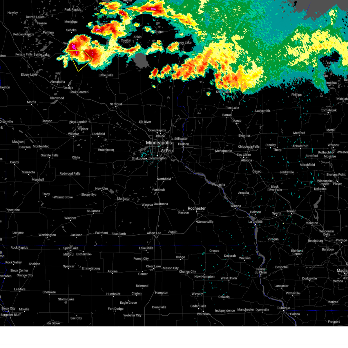
| 6/29/2026 11:33 AM CDT |
 At 1133 am cdt, severe thunderstorms were located along a line from near staples to near clarissa, or along a line from 37 miles northwest of little falls to 23 miles northeast of alexandria, moving east at 30 mph (radar indicated). Hazards include 60 mph wind gusts and quarter size hail. Hail damage to vehicles is expected. expect wind damage to roofs, siding, and trees. this severe thunderstorm will be near, staples and clarissa around 1135 am cdt. Browerville around 1140 am cdt. At 1133 am cdt, severe thunderstorms were located along a line from near staples to near clarissa, or along a line from 37 miles northwest of little falls to 23 miles northeast of alexandria, moving east at 30 mph (radar indicated). Hazards include 60 mph wind gusts and quarter size hail. Hail damage to vehicles is expected. expect wind damage to roofs, siding, and trees. this severe thunderstorm will be near, staples and clarissa around 1135 am cdt. Browerville around 1140 am cdt.
|
| 6/29/2026 11:33 AM CDT |
 Torfgf the national weather service in grand forks has issued a * tornado warning for, southeastern wadena county in central minnesota, * until noon cdt. * at 1133 am cdt, a severe thunderstorm capable of producing a tornado was located near esterdy, or 32 miles west of brainerd, moving east at 45 mph (radar indicated rotation). Hazards include tornado and half dollar size hail. Flying debris will be dangerous to those caught without shelter. mobile homes will be damaged or destroyed. damage to roofs, windows, and vehicles will occur. Tree damage is likely. Torfgf the national weather service in grand forks has issued a * tornado warning for, southeastern wadena county in central minnesota, * until noon cdt. * at 1133 am cdt, a severe thunderstorm capable of producing a tornado was located near esterdy, or 32 miles west of brainerd, moving east at 45 mph (radar indicated rotation). Hazards include tornado and half dollar size hail. Flying debris will be dangerous to those caught without shelter. mobile homes will be damaged or destroyed. damage to roofs, windows, and vehicles will occur. Tree damage is likely.
|
| 6/29/2026 11:22 AM CDT |
 Svrfgf the national weather service in grand forks has issued a * severe thunderstorm warning for, wadena county in central minnesota, eastern otter tail county in west central minnesota, * until 1215 pm cdt. * at 1121 am cdt, severe thunderstorms were located along a line extending from near menahga to near verndale to near eagle bend, moving east at 45 mph (public). Hazards include 70 mph wind gusts and half dollar size hail. Hail damage to vehicles is expected. expect considerable tree damage. Wind damage is also likely to mobile homes, roofs, and outbuildings. Svrfgf the national weather service in grand forks has issued a * severe thunderstorm warning for, wadena county in central minnesota, eastern otter tail county in west central minnesota, * until 1215 pm cdt. * at 1121 am cdt, severe thunderstorms were located along a line extending from near menahga to near verndale to near eagle bend, moving east at 45 mph (public). Hazards include 70 mph wind gusts and half dollar size hail. Hail damage to vehicles is expected. expect considerable tree damage. Wind damage is also likely to mobile homes, roofs, and outbuildings.
|
| 6/29/2026 11:11 AM CDT |
 At 1111 am cdt, severe thunderstorms were located along a line from 7 miles north of hewitt to near carlos, or along a line from 39 miles northeast of alexandria to 10 miles northeast of alexandria, moving east at 45 mph (radar indicated). Hazards include 60 mph wind gusts and small hail. Expect damage to roofs, siding, and trees. this severe thunderstorm will be near, eagle bend, bertha and hewitt around 1115 am cdt. clarissa around 1120 am cdt. staples and browerville around 1130 am cdt. Long prairie around 1135 am cdt. At 1111 am cdt, severe thunderstorms were located along a line from 7 miles north of hewitt to near carlos, or along a line from 39 miles northeast of alexandria to 10 miles northeast of alexandria, moving east at 45 mph (radar indicated). Hazards include 60 mph wind gusts and small hail. Expect damage to roofs, siding, and trees. this severe thunderstorm will be near, eagle bend, bertha and hewitt around 1115 am cdt. clarissa around 1120 am cdt. staples and browerville around 1130 am cdt. Long prairie around 1135 am cdt.
|
| 6/29/2026 11:07 AM CDT |
 At 1106 am cdt, severe thunderstorms were located along a line extending from midway to near wadena to near rose city, moving east at 45 mph (public). Hazards include ping pong ball size hail and 60 mph wind gusts. People and animals outdoors will be injured. expect hail damage to roofs, siding, windows, and vehicles. expect wind damage to roofs, siding, and trees. Locations impacted include, wadena, perham, ottertail lake, menahga, new york mills, parkers prairie, and henning. At 1106 am cdt, severe thunderstorms were located along a line extending from midway to near wadena to near rose city, moving east at 45 mph (public). Hazards include ping pong ball size hail and 60 mph wind gusts. People and animals outdoors will be injured. expect hail damage to roofs, siding, windows, and vehicles. expect wind damage to roofs, siding, and trees. Locations impacted include, wadena, perham, ottertail lake, menahga, new york mills, parkers prairie, and henning.
|
| 6/29/2026 10:52 AM CDT |
 Svrmpx the national weather service in the twin cities has issued a * severe thunderstorm warning for, northern todd county in central minnesota, northern douglas county in west central minnesota, * until 1145 am cdt. * at 1052 am cdt, severe thunderstorms were located along a line from 12 miles northwest of hewitt to 6 miles northeast of brandon, or along a line from 37 miles north of alexandria to 9 miles northwest of alexandria, moving east at 45 mph (radar indicated). Hazards include 60 mph wind gusts and small hail. Expect damage to roofs, siding, and trees. this severe thunderstorm will be near, bertha and hewitt around 1110 am cdt. eagle bend around 1115 am cdt. staples and clarissa around 1125 am cdt. Browerville around 1130 am cdt. Svrmpx the national weather service in the twin cities has issued a * severe thunderstorm warning for, northern todd county in central minnesota, northern douglas county in west central minnesota, * until 1145 am cdt. * at 1052 am cdt, severe thunderstorms were located along a line from 12 miles northwest of hewitt to 6 miles northeast of brandon, or along a line from 37 miles north of alexandria to 9 miles northwest of alexandria, moving east at 45 mph (radar indicated). Hazards include 60 mph wind gusts and small hail. Expect damage to roofs, siding, and trees. this severe thunderstorm will be near, bertha and hewitt around 1110 am cdt. eagle bend around 1115 am cdt. staples and clarissa around 1125 am cdt. Browerville around 1130 am cdt.
|
| 6/29/2026 10:37 AM CDT |
 Svrfgf the national weather service in grand forks has issued a * severe thunderstorm warning for, wadena county in central minnesota, otter tail county in west central minnesota, southeastern becker county in northwestern minnesota, * until 1130 am cdt. * at 1036 am cdt, severe thunderstorms were located along a line extending from near vergas to ottertail to near millerville, moving east at 65 mph (radar indicated). Hazards include ping pong ball size hail and 60 mph wind gusts. People and animals outdoors will be injured. expect hail damage to roofs, siding, windows, and vehicles. Expect wind damage to roofs, siding, and trees. Svrfgf the national weather service in grand forks has issued a * severe thunderstorm warning for, wadena county in central minnesota, otter tail county in west central minnesota, southeastern becker county in northwestern minnesota, * until 1130 am cdt. * at 1036 am cdt, severe thunderstorms were located along a line extending from near vergas to ottertail to near millerville, moving east at 65 mph (radar indicated). Hazards include ping pong ball size hail and 60 mph wind gusts. People and animals outdoors will be injured. expect hail damage to roofs, siding, windows, and vehicles. Expect wind damage to roofs, siding, and trees.
|
| 6/10/2026 4:50 PM CDT |
 At 449 pm cdt, severe thunderstorms were located along a line extending from dorset to near huntersville to near blue grass, moving northeast at 45 mph (radar indicated). Hazards include ping pong ball size hail and 60 mph wind gusts. People and animals outdoors will be injured. expect hail damage to roofs, siding, windows, and vehicles. expect wind damage to roofs, siding, and trees. Locations impacted include, wadena, park rapids, menahga, sebeka, verndale, akeley, and nevis. At 449 pm cdt, severe thunderstorms were located along a line extending from dorset to near huntersville to near blue grass, moving northeast at 45 mph (radar indicated). Hazards include ping pong ball size hail and 60 mph wind gusts. People and animals outdoors will be injured. expect hail damage to roofs, siding, windows, and vehicles. expect wind damage to roofs, siding, and trees. Locations impacted include, wadena, park rapids, menahga, sebeka, verndale, akeley, and nevis.
|
| 6/10/2026 4:27 PM CDT |
 Svrfgf the national weather service in grand forks has issued a * severe thunderstorm warning for, southern hubbard county in north central minnesota, wadena county in central minnesota, northeastern otter tail county in west central minnesota, southeastern becker county in northwestern minnesota, * until 515 pm cdt. * at 426 pm cdt, severe thunderstorms were located along a line extending from near osage to near hillview to near deer creek, moving northeast at 45 mph (radar indicated). Hazards include 60 mph wind gusts and quarter size hail. Hail damage to vehicles is expected. Expect wind damage to roofs, siding, and trees. Svrfgf the national weather service in grand forks has issued a * severe thunderstorm warning for, southern hubbard county in north central minnesota, wadena county in central minnesota, northeastern otter tail county in west central minnesota, southeastern becker county in northwestern minnesota, * until 515 pm cdt. * at 426 pm cdt, severe thunderstorms were located along a line extending from near osage to near hillview to near deer creek, moving northeast at 45 mph (radar indicated). Hazards include 60 mph wind gusts and quarter size hail. Hail damage to vehicles is expected. Expect wind damage to roofs, siding, and trees.
|
| 6/10/2026 3:20 AM CDT |
 The storm which prompted the warning has weakened below severe limits, and has exited the warned area. therefore, the warning will be allowed to expire. however, gusty winds and heavy rain are still possible with this thunderstorm. a severe thunderstorm watch remains in effect until 700 am cdt for a portion of central minnesota. The storm which prompted the warning has weakened below severe limits, and has exited the warned area. therefore, the warning will be allowed to expire. however, gusty winds and heavy rain are still possible with this thunderstorm. a severe thunderstorm watch remains in effect until 700 am cdt for a portion of central minnesota.
|
| 6/10/2026 3:07 AM CDT |
 At 307 am cdt, a severe thunderstorm was located near motley, or 25 miles northwest of little falls, moving northeast at 50 mph (radar indicated). Hazards include 60 mph wind gusts and small hail. Expect damage to roofs, siding, and trees. Locations impacted include, bertha, hewitt, randall, cushing, philbrook, staples, motley and crow wing state park. At 307 am cdt, a severe thunderstorm was located near motley, or 25 miles northwest of little falls, moving northeast at 50 mph (radar indicated). Hazards include 60 mph wind gusts and small hail. Expect damage to roofs, siding, and trees. Locations impacted include, bertha, hewitt, randall, cushing, philbrook, staples, motley and crow wing state park.
|
| 6/10/2026 2:59 AM CDT |
 Svrfgf the national weather service in grand forks has issued a * severe thunderstorm warning for, hubbard county in north central minnesota, wadena county in central minnesota, northeastern otter tail county in west central minnesota, mahnomen county in northwestern minnesota, becker county in northwestern minnesota, southern clearwater county in northwestern minnesota, * until 400 am cdt. * at 258 am cdt, severe thunderstorms were located along a line extending from white earth nation to bluffton, moving east at 65 mph (radar indicated). Hazards include 60 mph wind gusts. expect damage to roofs, siding, and trees Svrfgf the national weather service in grand forks has issued a * severe thunderstorm warning for, hubbard county in north central minnesota, wadena county in central minnesota, northeastern otter tail county in west central minnesota, mahnomen county in northwestern minnesota, becker county in northwestern minnesota, southern clearwater county in northwestern minnesota, * until 400 am cdt. * at 258 am cdt, severe thunderstorms were located along a line extending from white earth nation to bluffton, moving east at 65 mph (radar indicated). Hazards include 60 mph wind gusts. expect damage to roofs, siding, and trees
|
| 6/10/2026 2:49 AM CDT |
 Svrmpx the national weather service in the twin cities has issued a * severe thunderstorm warning for, northwestern morrison county in central minnesota, northern todd county in central minnesota, * until 330 am cdt. * at 249 am cdt, a severe thunderstorm was located near browerville, or 25 miles northwest of little falls, moving northeast at 50 mph (radar indicated). Hazards include 60 mph wind gusts and small hail. expect damage to roofs, siding, and trees Svrmpx the national weather service in the twin cities has issued a * severe thunderstorm warning for, northwestern morrison county in central minnesota, northern todd county in central minnesota, * until 330 am cdt. * at 249 am cdt, a severe thunderstorm was located near browerville, or 25 miles northwest of little falls, moving northeast at 50 mph (radar indicated). Hazards include 60 mph wind gusts and small hail. expect damage to roofs, siding, and trees
|
| 9/12/2025 9:36 AM CDT | The storms which prompted the warning have weakened below severe limits, and no longer pose an immediate threat to life or property. therefore, the warning will be allowed to expire. however, heavy rain is still possible with these thunderstorms. |
| 9/12/2025 9:14 AM CDT | the severe thunderstorm warning has been cancelled and is no longer in effect |
| 9/12/2025 9:14 AM CDT | At 914 am cdt, severe thunderstorms were located along a line extending from near blue grass to 6 miles north of verndale to near wadena, moving east at 35 mph (radar indicated). Hazards include 60 mph wind gusts and quarter size hail. Hail damage to vehicles is expected. expect wind damage to roofs, siding, and trees. Locations impacted include, wadena, verndale, staples airport, aldrich, blue grass, and oylen. |
| 9/12/2025 9:00 AM CDT | the severe thunderstorm warning has been cancelled and is no longer in effect |
| 9/12/2025 9:00 AM CDT | At 900 am cdt, severe thunderstorms were located along a line extending from near badoura to near nimrod to wadena, moving east at 35 mph (radar indicated). Hazards include 60 mph wind gusts and quarter size hail. Hail damage to vehicles is expected. expect wind damage to roofs, siding, and trees. Locations impacted include, wadena, verndale, staples airport, deer creek, bluffton, huntersville, and nimrod. |
| 9/12/2025 8:41 AM CDT | Svrfgf the national weather service in grand forks has issued a * severe thunderstorm warning for, southeastern hubbard county in north central minnesota, wadena county in central minnesota, northeastern otter tail county in west central minnesota, * until 945 am cdt. * at 841 am cdt, severe thunderstorms were located along a line extending from near menahga to near blue grass to near deer creek, moving east at 35 mph (radar indicated). Hazards include 60 mph wind gusts and quarter size hail. Hail damage to vehicles is expected. Expect wind damage to roofs, siding, and trees. |
| 6/21/2025 1:47 AM CDT |
 the severe thunderstorm warning has been cancelled and is no longer in effect the severe thunderstorm warning has been cancelled and is no longer in effect
|
| 6/21/2025 1:47 AM CDT |
 At 147 am cdt, severe thunderstorms were located along a line extending from near pine river to near rose city to 6 miles northeast of donnelly, moving east at 70 mph (radar indicated). Hazards include 60 mph wind gusts. Expect damage to roofs, siding, and trees. locations impacted include, wadena, elbow lake, parkers prairie, henning, sebeka, hoffman, and verndale. this includes the following highways, interstate 94 in north dakota between mile markers 71 and 80. Interstate 94 in minnesota between mile markers 71 and 80. At 147 am cdt, severe thunderstorms were located along a line extending from near pine river to near rose city to 6 miles northeast of donnelly, moving east at 70 mph (radar indicated). Hazards include 60 mph wind gusts. Expect damage to roofs, siding, and trees. locations impacted include, wadena, elbow lake, parkers prairie, henning, sebeka, hoffman, and verndale. this includes the following highways, interstate 94 in north dakota between mile markers 71 and 80. Interstate 94 in minnesota between mile markers 71 and 80.
|
| 6/21/2025 1:29 AM CDT |
 Svrfgf the national weather service in grand forks has issued a * severe thunderstorm warning for, southern hubbard county in north central minnesota, wadena county in central minnesota, otter tail county in west central minnesota, grant county in west central minnesota, southeastern becker county in northwestern minnesota, * until 200 am cdt. * at 128 am cdt, severe thunderstorms were located along a line extending from near nimrod to near leaf valley to 7 miles east of dumont, moving east at 70 mph (radar indicated. at various weather sensors in west central minnesota 60+ mph winds were reported). Hazards include 60 mph wind gusts. expect damage to roofs, siding, and trees Svrfgf the national weather service in grand forks has issued a * severe thunderstorm warning for, southern hubbard county in north central minnesota, wadena county in central minnesota, otter tail county in west central minnesota, grant county in west central minnesota, southeastern becker county in northwestern minnesota, * until 200 am cdt. * at 128 am cdt, severe thunderstorms were located along a line extending from near nimrod to near leaf valley to 7 miles east of dumont, moving east at 70 mph (radar indicated. at various weather sensors in west central minnesota 60+ mph winds were reported). Hazards include 60 mph wind gusts. expect damage to roofs, siding, and trees
|
| 6/16/2025 4:08 PM CDT |
 The storm which prompted the warning has moved out of the area. therefore, the warning will be allowed to expire. a tornado watch remains in effect until 900 pm cdt monday for a portion of central minnesota. The storm which prompted the warning has moved out of the area. therefore, the warning will be allowed to expire. a tornado watch remains in effect until 900 pm cdt monday for a portion of central minnesota.
|
| 6/16/2025 3:55 PM CDT |
 Torfgf the national weather service in grand forks has issued a * tornado warning for, wadena county in central minnesota, * until 430 pm cdt. * at 354 pm cdt, severe thunderstorms capable of producing a tornado were located along a line extending from near badoura to oylen to near verndale, moving east at 40 mph (radar indicated rotation). Hazards include tornado. Flying debris will be dangerous to those caught without shelter. mobile homes will be damaged or destroyed. damage to roofs, windows, and vehicles will occur. Tree damage is likely. Torfgf the national weather service in grand forks has issued a * tornado warning for, wadena county in central minnesota, * until 430 pm cdt. * at 354 pm cdt, severe thunderstorms capable of producing a tornado were located along a line extending from near badoura to oylen to near verndale, moving east at 40 mph (radar indicated rotation). Hazards include tornado. Flying debris will be dangerous to those caught without shelter. mobile homes will be damaged or destroyed. damage to roofs, windows, and vehicles will occur. Tree damage is likely.
|
| 6/16/2025 3:52 PM CDT |
 At 352 pm cdt, a severe thunderstorm capable of producing a tornado was located near staples, or 33 miles northwest of little falls, moving northeast at 30 mph (radar indicated rotation). Hazards include tornado. Flying debris will be dangerous to those caught without shelter. mobile homes will be damaged or destroyed. damage to roofs, windows and vehicles will occur. tree damage is likely. Locations impacted include, staples. At 352 pm cdt, a severe thunderstorm capable of producing a tornado was located near staples, or 33 miles northwest of little falls, moving northeast at 30 mph (radar indicated rotation). Hazards include tornado. Flying debris will be dangerous to those caught without shelter. mobile homes will be damaged or destroyed. damage to roofs, windows and vehicles will occur. tree damage is likely. Locations impacted include, staples.
|
| 6/16/2025 3:42 PM CDT |
 Tormpx the national weather service in the twin cities has issued a * tornado warning for, northeastern todd county in central minnesota, * until 415 pm cdt. * at 342 pm cdt, a confirmed tornado was located 7 miles southwest of staples, or 32 miles northwest of little falls, moving northeast at 30 mph (public confirmed tornado). Hazards include damaging tornado. Flying debris will be dangerous to those caught without shelter. mobile homes will be damaged or destroyed. damage to roofs, windows and vehicles will occur. Tree damage is likely. Tormpx the national weather service in the twin cities has issued a * tornado warning for, northeastern todd county in central minnesota, * until 415 pm cdt. * at 342 pm cdt, a confirmed tornado was located 7 miles southwest of staples, or 32 miles northwest of little falls, moving northeast at 30 mph (public confirmed tornado). Hazards include damaging tornado. Flying debris will be dangerous to those caught without shelter. mobile homes will be damaged or destroyed. damage to roofs, windows and vehicles will occur. Tree damage is likely.
|
| 6/2/2025 3:35 PM CDT |
 The storms which prompted the warning have weakened below severe limits, and no longer pose an immediate threat to life or property. therefore, the warning will be allowed to expire. however, gusty winds are still possible with these thunderstorms. a severe thunderstorm watch remains in effect until 700 pm cdt for central and west central minnesota. The storms which prompted the warning have weakened below severe limits, and no longer pose an immediate threat to life or property. therefore, the warning will be allowed to expire. however, gusty winds are still possible with these thunderstorms. a severe thunderstorm watch remains in effect until 700 pm cdt for central and west central minnesota.
|
| 6/2/2025 3:11 PM CDT |
 At 311 pm cdt, severe thunderstorms were located along a line extending from near sebeka to 6 miles west of cushing, moving northeast at 60 mph (radar indicated). Hazards include 60 mph wind gusts and quarter size hail. Hail damage to vehicles is expected. expect wind damage to roofs, siding, and trees. Locations impacted include, wadena, parkers prairie, battle lake, henning, verndale, staples airport, and deer creek. At 311 pm cdt, severe thunderstorms were located along a line extending from near sebeka to 6 miles west of cushing, moving northeast at 60 mph (radar indicated). Hazards include 60 mph wind gusts and quarter size hail. Hail damage to vehicles is expected. expect wind damage to roofs, siding, and trees. Locations impacted include, wadena, parkers prairie, battle lake, henning, verndale, staples airport, and deer creek.
|
| 6/2/2025 2:41 PM CDT |
 Svrfgf the national weather service in grand forks has issued a * severe thunderstorm warning for, wadena county in central minnesota, southeastern otter tail county in west central minnesota, * until 345 pm cdt. * at 240 pm cdt, severe thunderstorms were located along a line extending from near henning to near lake osakis, moving northeast at 60 mph (radar indicated). Hazards include 70 mph wind gusts and quarter size hail. Hail damage to vehicles is expected. expect considerable tree damage. Wind damage is also likely to mobile homes, roofs, and outbuildings. Svrfgf the national weather service in grand forks has issued a * severe thunderstorm warning for, wadena county in central minnesota, southeastern otter tail county in west central minnesota, * until 345 pm cdt. * at 240 pm cdt, severe thunderstorms were located along a line extending from near henning to near lake osakis, moving northeast at 60 mph (radar indicated). Hazards include 70 mph wind gusts and quarter size hail. Hail damage to vehicles is expected. expect considerable tree damage. Wind damage is also likely to mobile homes, roofs, and outbuildings.
|
| 8/3/2024 7:04 PM CDT |
 the severe thunderstorm warning has been cancelled and is no longer in effect the severe thunderstorm warning has been cancelled and is no longer in effect
|
| 8/3/2024 7:00 PM CDT | Public reported tree debris and 3-4 inch diameter branches broken off near southern staples train station via faceboo in todd county MN, 0.8 miles NNW of Staples, MN |
| 8/3/2024 6:56 PM CDT |
 At 655 pm cdt, a severe thunderstorm was located over staples airport, or 29 miles west of brainerd, moving east at 30 mph (trained weather spotters). Hazards include golf ball size hail and 60 mph wind gusts. People and animals outdoors will be injured. expect hail damage to roofs, siding, windows, and vehicles. expect wind damage to roofs, siding, and trees. Locations impacted include, verndale, staples airport, and aldrich. At 655 pm cdt, a severe thunderstorm was located over staples airport, or 29 miles west of brainerd, moving east at 30 mph (trained weather spotters). Hazards include golf ball size hail and 60 mph wind gusts. People and animals outdoors will be injured. expect hail damage to roofs, siding, windows, and vehicles. expect wind damage to roofs, siding, and trees. Locations impacted include, verndale, staples airport, and aldrich.
|
| 8/3/2024 6:49 PM CDT |
 At 649 pm cdt, a severe thunderstorm was located near motley, or 20 miles west of brainerd, moving southeast at 30 mph (trained weather spotters). Hazards include golf ball size hail and 60 mph wind gusts. People and animals outdoors will be injured. expect hail damage to roofs, siding, windows, and vehicles. expect wind damage to roofs, siding, and trees. Locations impacted include, staples, motley, randall, swanville, flensburg, camp ripley, cushing, burtrum, philbrook, camp ripley junction, and crow wing state park. At 649 pm cdt, a severe thunderstorm was located near motley, or 20 miles west of brainerd, moving southeast at 30 mph (trained weather spotters). Hazards include golf ball size hail and 60 mph wind gusts. People and animals outdoors will be injured. expect hail damage to roofs, siding, windows, and vehicles. expect wind damage to roofs, siding, and trees. Locations impacted include, staples, motley, randall, swanville, flensburg, camp ripley, cushing, burtrum, philbrook, camp ripley junction, and crow wing state park.
|
| 8/3/2024 6:47 PM CDT |
 Svrmpx the national weather service in the twin cities has issued a * severe thunderstorm warning for, northern todd county in central minnesota, * until 715 pm cdt. * at 647 pm cdt, a severe thunderstorm was located near verndale, or 35 miles northeast of alexandria, moving southeast at 35 mph. this is a destructive storm for hewitt and bertha minnesota (trained weather spotters). Hazards include three inch hail and 60 mph wind gusts. People and animals outdoors will be severely injured. Expect shattered windows, extensive damage to roofs, siding, and vehicles. Svrmpx the national weather service in the twin cities has issued a * severe thunderstorm warning for, northern todd county in central minnesota, * until 715 pm cdt. * at 647 pm cdt, a severe thunderstorm was located near verndale, or 35 miles northeast of alexandria, moving southeast at 35 mph. this is a destructive storm for hewitt and bertha minnesota (trained weather spotters). Hazards include three inch hail and 60 mph wind gusts. People and animals outdoors will be severely injured. Expect shattered windows, extensive damage to roofs, siding, and vehicles.
|
| 8/3/2024 6:46 PM CDT |
 At 645 pm cdt, a severe thunderstorm was located near aldrich, or 34 miles west of brainerd, moving east at 30 mph. this is a destructive storm for wadena, verandale and staples (trained weather spotters. at 6:40 pm reported up to 3.0 inch hail). Hazards include three inch hail and 60 mph wind gusts. People and animals outdoors will be severely injured. expect shattered windows, extensive damage to roofs, siding, and vehicles. Locations impacted include, verndale, staples airport, aldrich, and blue grass. At 645 pm cdt, a severe thunderstorm was located near aldrich, or 34 miles west of brainerd, moving east at 30 mph. this is a destructive storm for wadena, verandale and staples (trained weather spotters. at 6:40 pm reported up to 3.0 inch hail). Hazards include three inch hail and 60 mph wind gusts. People and animals outdoors will be severely injured. expect shattered windows, extensive damage to roofs, siding, and vehicles. Locations impacted include, verndale, staples airport, aldrich, and blue grass.
|
| 8/3/2024 6:39 PM CDT |
 The storm which prompted the warning has moved out of the area. therefore, the warning will be allowed to expire. however, small hail is still possible with this thunderstorm. a severe thunderstorm watch remains in effect until 100 am cdt for central minnesota. remember, a severe thunderstorm warning still remains in effect for crow wing and todd counties. The storm which prompted the warning has moved out of the area. therefore, the warning will be allowed to expire. however, small hail is still possible with this thunderstorm. a severe thunderstorm watch remains in effect until 100 am cdt for central minnesota. remember, a severe thunderstorm warning still remains in effect for crow wing and todd counties.
|
| 8/3/2024 6:38 PM CDT |
 the severe thunderstorm warning has been cancelled and is no longer in effect the severe thunderstorm warning has been cancelled and is no longer in effect
|
| 8/3/2024 6:38 PM CDT |
 At 637 pm cdt, a severe thunderstorm was located near verndale, or 39 miles west of brainerd, moving southeast at 30 mph (public reported. at the wadena golf course golfball size hail was reported at 6:35 pm). Hazards include golf ball size hail and 60 mph wind gusts. People and animals outdoors will be injured. expect hail damage to roofs, siding, windows, and vehicles. expect wind damage to roofs, siding, and trees. Locations impacted include, wadena, verndale, staples airport, aldrich, and blue grass. At 637 pm cdt, a severe thunderstorm was located near verndale, or 39 miles west of brainerd, moving southeast at 30 mph (public reported. at the wadena golf course golfball size hail was reported at 6:35 pm). Hazards include golf ball size hail and 60 mph wind gusts. People and animals outdoors will be injured. expect hail damage to roofs, siding, windows, and vehicles. expect wind damage to roofs, siding, and trees. Locations impacted include, wadena, verndale, staples airport, aldrich, and blue grass.
|
| 8/3/2024 6:27 PM CDT |
 At 626 pm cdt, a severe thunderstorm was located over staples airport, or 28 miles west of brainerd, moving southeast at 30 mph (radar indicated). Hazards include two inch hail and 60 mph wind gusts. People and animals outdoors will be injured. expect hail damage to roofs, siding, windows, and vehicles. expect wind damage to roofs, siding, and trees. Locations impacted include, staples airport and aldrich. At 626 pm cdt, a severe thunderstorm was located over staples airport, or 28 miles west of brainerd, moving southeast at 30 mph (radar indicated). Hazards include two inch hail and 60 mph wind gusts. People and animals outdoors will be injured. expect hail damage to roofs, siding, windows, and vehicles. expect wind damage to roofs, siding, and trees. Locations impacted include, staples airport and aldrich.
|
| 8/3/2024 6:25 PM CDT | Golf Ball sized hail reported 7.6 miles S of Staples, MN, reported golf ball sized hail ongoing. |
| 8/3/2024 6:25 PM CDT |
 Svrmpx the national weather service in the twin cities has issued a * severe thunderstorm warning for, eastern todd county in central minnesota, northwestern morrison county in central minnesota, * until 730 pm cdt. * at 624 pm cdt, a severe thunderstorm was located over staples, or 29 miles west of brainerd, moving southeast at 30 mph (radar indicated). Hazards include golf ball size hail and 60 mph wind gusts. People and animals outdoors will be injured. expect hail damage to roofs, siding, windows, and vehicles. Expect wind damage to roofs, siding, and trees. Svrmpx the national weather service in the twin cities has issued a * severe thunderstorm warning for, eastern todd county in central minnesota, northwestern morrison county in central minnesota, * until 730 pm cdt. * at 624 pm cdt, a severe thunderstorm was located over staples, or 29 miles west of brainerd, moving southeast at 30 mph (radar indicated). Hazards include golf ball size hail and 60 mph wind gusts. People and animals outdoors will be injured. expect hail damage to roofs, siding, windows, and vehicles. Expect wind damage to roofs, siding, and trees.
|
| 8/3/2024 6:24 PM CDT |
 Svrfgf the national weather service in grand forks has issued a * severe thunderstorm warning for, southern wadena county in central minnesota, east central otter tail county in west central minnesota, * until 715 pm cdt. * at 623 pm cdt, a severe thunderstorm was located near wadena, or 39 miles southeast of detroit lakes, moving east at 30 mph (radar indicated). Hazards include 60 mph wind gusts and half dollar size hail. Hail damage to vehicles is expected. Expect wind damage to roofs, siding, and trees. Svrfgf the national weather service in grand forks has issued a * severe thunderstorm warning for, southern wadena county in central minnesota, east central otter tail county in west central minnesota, * until 715 pm cdt. * at 623 pm cdt, a severe thunderstorm was located near wadena, or 39 miles southeast of detroit lakes, moving east at 30 mph (radar indicated). Hazards include 60 mph wind gusts and half dollar size hail. Hail damage to vehicles is expected. Expect wind damage to roofs, siding, and trees.
|
| 8/3/2024 6:20 PM CDT | Golf Ball sized hail reported 2.1 miles SSE of Staples, MN, delayed report. location estimated. |
| 8/3/2024 6:13 PM CDT |
 The severe thunderstorm which prompted the warning has moved out of the warned area.therefore, the warning will be allowed to expire. however, large hail is still possible with this thunderstorm. remember, a severe thunderstorm warning still remains in effect for wadena county until 6:45 pm. The severe thunderstorm which prompted the warning has moved out of the warned area.therefore, the warning will be allowed to expire. however, large hail is still possible with this thunderstorm. remember, a severe thunderstorm warning still remains in effect for wadena county until 6:45 pm.
|
| 8/3/2024 6:11 PM CDT |
 Svrfgf the national weather service in grand forks has issued a * severe thunderstorm warning for, southeastern wadena county in central minnesota, * until 645 pm cdt. * at 611 pm cdt, a severe thunderstorm was located 7 miles southeast of blue grass, or 34 miles west of brainerd, moving southeast at 30 mph (radar indicated). Hazards include two inch hail and 60 mph wind gusts. People and animals outdoors will be injured. expect hail damage to roofs, siding, windows, and vehicles. Expect wind damage to roofs, siding, and trees. Svrfgf the national weather service in grand forks has issued a * severe thunderstorm warning for, southeastern wadena county in central minnesota, * until 645 pm cdt. * at 611 pm cdt, a severe thunderstorm was located 7 miles southeast of blue grass, or 34 miles west of brainerd, moving southeast at 30 mph (radar indicated). Hazards include two inch hail and 60 mph wind gusts. People and animals outdoors will be injured. expect hail damage to roofs, siding, windows, and vehicles. Expect wind damage to roofs, siding, and trees.
|
| 8/3/2024 6:08 PM CDT | Quarter sized hail reported 10.4 miles SSE of Staples, MN, facebook report. |
| 8/3/2024 5:57 PM CDT |
 At 557 pm cdt, a severe thunderstorm was located over blue grass, or 39 miles west of brainerd, moving east at 35 mph (radar indicated). Hazards include golf ball size hail and 60 mph wind gusts. People and animals outdoors will be injured. expect hail damage to roofs, siding, windows, and vehicles. expect wind damage to roofs, siding, and trees. Locations impacted include, staples airport and blue grass. At 557 pm cdt, a severe thunderstorm was located over blue grass, or 39 miles west of brainerd, moving east at 35 mph (radar indicated). Hazards include golf ball size hail and 60 mph wind gusts. People and animals outdoors will be injured. expect hail damage to roofs, siding, windows, and vehicles. expect wind damage to roofs, siding, and trees. Locations impacted include, staples airport and blue grass.
|
| 8/3/2024 5:57 PM CDT |
 the severe thunderstorm warning has been cancelled and is no longer in effect the severe thunderstorm warning has been cancelled and is no longer in effect
|
| 8/3/2024 5:36 PM CDT |
 Svrfgf the national weather service in grand forks has issued a * severe thunderstorm warning for, southern wadena county in central minnesota, east central otter tail county in west central minnesota, * until 615 pm cdt. * at 536 pm cdt, a severe thunderstorm was located near blue grass, or 39 miles southeast of detroit lakes, moving southeast at 40 mph (radar indicated). Hazards include 60 mph wind gusts and quarter size hail. Hail damage to vehicles is expected. Expect wind damage to roofs, siding, and trees. Svrfgf the national weather service in grand forks has issued a * severe thunderstorm warning for, southern wadena county in central minnesota, east central otter tail county in west central minnesota, * until 615 pm cdt. * at 536 pm cdt, a severe thunderstorm was located near blue grass, or 39 miles southeast of detroit lakes, moving southeast at 40 mph (radar indicated). Hazards include 60 mph wind gusts and quarter size hail. Hail damage to vehicles is expected. Expect wind damage to roofs, siding, and trees.
|
| 7/31/2024 2:52 PM CDT |
 The storms which prompted the warning have weakened below severe limits, and have exited the warned area. therefore, the warning will be allowed to expire. however, gusty winds and heavy rain are still possible with these thunderstorms. a severe thunderstorm watch remains in effect until 700 pm cdt for central minnesota. The storms which prompted the warning have weakened below severe limits, and have exited the warned area. therefore, the warning will be allowed to expire. however, gusty winds and heavy rain are still possible with these thunderstorms. a severe thunderstorm watch remains in effect until 700 pm cdt for central minnesota.
|
| 7/31/2024 2:44 PM CDT |
 At 244 pm cdt, severe thunderstorms were located along a line extending from 5 miles north of staples airport to 7 miles northwest of randall to near grey eagle, moving east at 40 mph (radar indicated). Hazards include 60 mph wind gusts. Expect damage to roofs, siding, and trees. Locations impacted include, long prairie, staples, browerville, clarissa, staples airport, grey eagle, little sauk, round prairie, burtrum, pleasant beach, philbrook, and long prairie airport. At 244 pm cdt, severe thunderstorms were located along a line extending from 5 miles north of staples airport to 7 miles northwest of randall to near grey eagle, moving east at 40 mph (radar indicated). Hazards include 60 mph wind gusts. Expect damage to roofs, siding, and trees. Locations impacted include, long prairie, staples, browerville, clarissa, staples airport, grey eagle, little sauk, round prairie, burtrum, pleasant beach, philbrook, and long prairie airport.
|
| 7/31/2024 2:32 PM CDT |
 the severe thunderstorm warning has been cancelled and is no longer in effect the severe thunderstorm warning has been cancelled and is no longer in effect
|
| 7/31/2024 2:32 PM CDT |
 At 232 pm cdt, severe thunderstorms were located along a line extending from near hitterdal to near vergas to near rose city, moving northeast at 50 mph (radar indicated). Hazards include 60 mph wind gusts and nickel size hail. Expect damage to roofs, siding, and trees. Locations impacted include, detroit lakes, wadena, park rapids, perham, ottertail lake, hawley, and bagley. At 232 pm cdt, severe thunderstorms were located along a line extending from near hitterdal to near vergas to near rose city, moving northeast at 50 mph (radar indicated). Hazards include 60 mph wind gusts and nickel size hail. Expect damage to roofs, siding, and trees. Locations impacted include, detroit lakes, wadena, park rapids, perham, ottertail lake, hawley, and bagley.
|
| 7/31/2024 2:22 PM CDT |
 At 222 pm cdt, severe thunderstorms were located along a line extending from wadena to clarissa to near lake osakis, moving northeast at 50 mph (radar indicated). Hazards include 60 mph wind gusts. Expect damage to roofs, siding, and trees. Locations impacted include, long prairie, staples, browerville, clarissa, eagle bend, staples airport, bertha, grey eagle, hewitt, lake osakis, little sauk, and round prairie. At 222 pm cdt, severe thunderstorms were located along a line extending from wadena to clarissa to near lake osakis, moving northeast at 50 mph (radar indicated). Hazards include 60 mph wind gusts. Expect damage to roofs, siding, and trees. Locations impacted include, long prairie, staples, browerville, clarissa, eagle bend, staples airport, bertha, grey eagle, hewitt, lake osakis, little sauk, and round prairie.
|
| 7/31/2024 2:09 PM CDT |
 Svrfgf the national weather service in grand forks has issued a * severe thunderstorm warning for, southern clay county in northwestern minnesota, wadena county in central minnesota, hubbard county in north central minnesota, otter tail county in west central minnesota, northeastern wilkin county in west central minnesota, southern mahnomen county in northwestern minnesota, becker county in northwestern minnesota, southern clearwater county in northwestern minnesota, * until 300 pm cdt. * at 209 pm cdt, severe thunderstorms were located along a line extending from sabin to near maplewood state park to garfield, moving northeast at 50 mph (radar indicated). Hazards include 70 mph wind gusts and nickel size hail. Expect considerable tree damage. Damage is likely to mobile homes, roofs, and outbuildings. Svrfgf the national weather service in grand forks has issued a * severe thunderstorm warning for, southern clay county in northwestern minnesota, wadena county in central minnesota, hubbard county in north central minnesota, otter tail county in west central minnesota, northeastern wilkin county in west central minnesota, southern mahnomen county in northwestern minnesota, becker county in northwestern minnesota, southern clearwater county in northwestern minnesota, * until 300 pm cdt. * at 209 pm cdt, severe thunderstorms were located along a line extending from sabin to near maplewood state park to garfield, moving northeast at 50 mph (radar indicated). Hazards include 70 mph wind gusts and nickel size hail. Expect considerable tree damage. Damage is likely to mobile homes, roofs, and outbuildings.
|
| 7/31/2024 2:07 PM CDT |
 Svrmpx the national weather service in the twin cities has issued a * severe thunderstorm warning for, todd county in central minnesota, * until 300 pm cdt. * at 205 pm cdt, severe thunderstorms were located along a line extending from near henning to 8 miles northeast of carlos to 8 miles south of alexandria, moving northeast at 55 mph (radar indicated). Hazards include 60 mph wind gusts. expect damage to roofs, siding, and trees Svrmpx the national weather service in the twin cities has issued a * severe thunderstorm warning for, todd county in central minnesota, * until 300 pm cdt. * at 205 pm cdt, severe thunderstorms were located along a line extending from near henning to 8 miles northeast of carlos to 8 miles south of alexandria, moving northeast at 55 mph (radar indicated). Hazards include 60 mph wind gusts. expect damage to roofs, siding, and trees
|
| 7/13/2024 10:10 PM CDT |
 Svrfgf the national weather service in grand forks has issued a * severe thunderstorm warning for, southwestern wadena county in central minnesota, southeastern otter tail county in west central minnesota, * until 1045 pm cdt. * at 1010 pm cdt, severe thunderstorms were located along a line extending from near wadena to near wrightstown to near urbank, moving southeast at 30 mph (radar indicated). Hazards include 70 mph wind gusts and quarter size hail. Hail damage to vehicles is expected. expect considerable tree damage. Wind damage is also likely to mobile homes, roofs, and outbuildings. Svrfgf the national weather service in grand forks has issued a * severe thunderstorm warning for, southwestern wadena county in central minnesota, southeastern otter tail county in west central minnesota, * until 1045 pm cdt. * at 1010 pm cdt, severe thunderstorms were located along a line extending from near wadena to near wrightstown to near urbank, moving southeast at 30 mph (radar indicated). Hazards include 70 mph wind gusts and quarter size hail. Hail damage to vehicles is expected. expect considerable tree damage. Wind damage is also likely to mobile homes, roofs, and outbuildings.
|
| 6/18/2024 5:45 AM CDT |
 The storms which prompted the warning have moved out of the area. therefore, the warning has been allowed to expire. The storms which prompted the warning have moved out of the area. therefore, the warning has been allowed to expire.
|
| 6/18/2024 5:31 AM CDT |
 the severe thunderstorm warning has been cancelled and is no longer in effect the severe thunderstorm warning has been cancelled and is no longer in effect
|
| 6/18/2024 5:31 AM CDT |
 At 530 am cdt, severe thunderstorms were located along a line extending from near shooks to near benedict to near deer creek, moving east at 25 mph (radar indicated). Hazards include 60 mph wind gusts. Expect damage to roofs, siding, and trees. Locations impacted include, wadena, park rapids, menahga, new york mills, sebeka, verndale, and staples airport. At 530 am cdt, severe thunderstorms were located along a line extending from near shooks to near benedict to near deer creek, moving east at 25 mph (radar indicated). Hazards include 60 mph wind gusts. Expect damage to roofs, siding, and trees. Locations impacted include, wadena, park rapids, menahga, new york mills, sebeka, verndale, and staples airport.
|
| 6/18/2024 5:14 AM CDT |
 Svrfgf the national weather service in grand forks has issued a * severe thunderstorm warning for, wadena county in central minnesota, hubbard county in north central minnesota, northeastern otter tail county in west central minnesota, southeastern beltrami county in north central minnesota, eastern becker county in northwestern minnesota, * until 545 am cdt. * at 514 am cdt, severe thunderstorms were located along a line extending from near shooks to 6 miles northwest of akeley to henning, moving east at 30 mph (radar indicated). Hazards include 60 mph wind gusts. expect damage to roofs, siding, and trees Svrfgf the national weather service in grand forks has issued a * severe thunderstorm warning for, wadena county in central minnesota, hubbard county in north central minnesota, northeastern otter tail county in west central minnesota, southeastern beltrami county in north central minnesota, eastern becker county in northwestern minnesota, * until 545 am cdt. * at 514 am cdt, severe thunderstorms were located along a line extending from near shooks to 6 miles northwest of akeley to henning, moving east at 30 mph (radar indicated). Hazards include 60 mph wind gusts. expect damage to roofs, siding, and trees
|
| 6/18/2024 4:57 AM CDT |
 At 457 am cdt, severe thunderstorms were located along a line extending from near perham to 6 miles northeast of donnelly, moving east at 35 mph (radar indicated). Hazards include 60 mph wind gusts. Expect damage to roofs, siding, and trees. locations impacted include, fergus falls, wadena, perham, pelican rapids, ottertail lake, lake lida, and new york mills. This includes interstate 94 in minnesota between mile markers 40 and 80. At 457 am cdt, severe thunderstorms were located along a line extending from near perham to 6 miles northeast of donnelly, moving east at 35 mph (radar indicated). Hazards include 60 mph wind gusts. Expect damage to roofs, siding, and trees. locations impacted include, fergus falls, wadena, perham, pelican rapids, ottertail lake, lake lida, and new york mills. This includes interstate 94 in minnesota between mile markers 40 and 80.
|
| 6/18/2024 4:57 AM CDT |
 the severe thunderstorm warning has been cancelled and is no longer in effect the severe thunderstorm warning has been cancelled and is no longer in effect
|
| 6/18/2024 4:27 AM CDT |
 Svrfgf the national weather service in grand forks has issued a * severe thunderstorm warning for, southeastern clay county in northwestern minnesota, southern wadena county in central minnesota, otter tail county in west central minnesota, grant county in west central minnesota, wilkin county in west central minnesota, richland county in southeastern north dakota, southeastern sargent county in southeastern north dakota, * until 530 am cdt. * at 427 am cdt, severe thunderstorms were located along a line extending from near vergas to near barry, moving southeast at 50 mph (radar indicated). Hazards include 60 mph wind gusts. expect damage to roofs, siding, and trees Svrfgf the national weather service in grand forks has issued a * severe thunderstorm warning for, southeastern clay county in northwestern minnesota, southern wadena county in central minnesota, otter tail county in west central minnesota, grant county in west central minnesota, wilkin county in west central minnesota, richland county in southeastern north dakota, southeastern sargent county in southeastern north dakota, * until 530 am cdt. * at 427 am cdt, severe thunderstorms were located along a line extending from near vergas to near barry, moving southeast at 50 mph (radar indicated). Hazards include 60 mph wind gusts. expect damage to roofs, siding, and trees
|
| 7/12/2022 4:45 PM CDT | Quarter sized hail reported 4.4 miles WNW of Staples, MN, report relayed from social media. |
| 7/10/2022 10:18 AM CDT |
 At 1017 am cdt, severe thunderstorms were located along a line extending from lavinia to near akeley to near blue grass, moving east at 55 mph (radar indicated). Hazards include 70 mph wind gusts and quarter size hail. Hail damage to vehicles is expected. expect considerable tree damage. wind damage is also likely to mobile homes, roofs, and outbuildings. locations impacted include, bemidji, wadena, park rapids, menahga, sebeka, staples airport and nevis. thunderstorm damage threat, considerable hail threat, radar indicated max hail size, 1. 00 in wind threat, radar indicated max wind gust, 70 mph. At 1017 am cdt, severe thunderstorms were located along a line extending from lavinia to near akeley to near blue grass, moving east at 55 mph (radar indicated). Hazards include 70 mph wind gusts and quarter size hail. Hail damage to vehicles is expected. expect considerable tree damage. wind damage is also likely to mobile homes, roofs, and outbuildings. locations impacted include, bemidji, wadena, park rapids, menahga, sebeka, staples airport and nevis. thunderstorm damage threat, considerable hail threat, radar indicated max hail size, 1. 00 in wind threat, radar indicated max wind gust, 70 mph.
|
| 7/10/2022 10:06 AM CDT |
 At 1006 am cdt, severe thunderstorms were located along a line extending from wilton to near emmaville to near sebeka, moving east at 70 mph (radar indicated). Hazards include 70 mph wind gusts and quarter size hail. Hail damage to vehicles is expected. expect considerable tree damage. wind damage is also likely to mobile homes, roofs, and outbuildings. locations impacted include, bemidji, nevis, lavinia, rosby, oylen and nimrod. thunderstorm damage threat, considerable hail threat, radar indicated max hail size, 1. 00 in wind threat, radar indicated max wind gust, 70 mph. At 1006 am cdt, severe thunderstorms were located along a line extending from wilton to near emmaville to near sebeka, moving east at 70 mph (radar indicated). Hazards include 70 mph wind gusts and quarter size hail. Hail damage to vehicles is expected. expect considerable tree damage. wind damage is also likely to mobile homes, roofs, and outbuildings. locations impacted include, bemidji, nevis, lavinia, rosby, oylen and nimrod. thunderstorm damage threat, considerable hail threat, radar indicated max hail size, 1. 00 in wind threat, radar indicated max wind gust, 70 mph.
|
| 7/10/2022 9:32 AM CDT |
 At 932 am cdt, severe thunderstorms were located along a line extending from lengby to white earth nation to near big mcdonald lake, moving east at 55 mph (radar indicated). Hazards include 70 mph wind gusts and quarter size hail. Hail damage to vehicles is expected. expect considerable tree damage. wind damage is also likely to mobile homes, roofs, and outbuildings. severe thunderstorms will be near, many point lake and pine bend around 935 am cdt. ebro, pine point and ponsford around 940 am cdt. other locations in the path of these severe thunderstorms include bagley, perham, richville, two inlets and shevlin. thunderstorm damage threat, considerable hail threat, radar indicated max hail size, 1. 00 in wind threat, radar indicated max wind gust, 70 mph. At 932 am cdt, severe thunderstorms were located along a line extending from lengby to white earth nation to near big mcdonald lake, moving east at 55 mph (radar indicated). Hazards include 70 mph wind gusts and quarter size hail. Hail damage to vehicles is expected. expect considerable tree damage. wind damage is also likely to mobile homes, roofs, and outbuildings. severe thunderstorms will be near, many point lake and pine bend around 935 am cdt. ebro, pine point and ponsford around 940 am cdt. other locations in the path of these severe thunderstorms include bagley, perham, richville, two inlets and shevlin. thunderstorm damage threat, considerable hail threat, radar indicated max hail size, 1. 00 in wind threat, radar indicated max wind gust, 70 mph.
|
| 7/10/2022 9:24 AM CDT |
 At 924 am cdt, severe thunderstorms were located along a line extending from near fosston to white earth nation to lake lida, moving east at 55 mph (radar indicated). Hazards include 60 mph wind gusts and quarter size hail. Hail damage to vehicles is expected. expect wind damage to roofs, siding, and trees. severe thunderstorms will be near, lengby, many point lake and island lake in mahnomen county around 930 am cdt. ebro, dent and vergas around 935 am cdt. pine point, ponsford and richville around 940 am cdt. other locations in the path of these severe thunderstorms include bagley, perham, shevlin and two inlets. hail threat, radar indicated max hail size, 1. 00 in wind threat, radar indicated max wind gust, 60 mph. At 924 am cdt, severe thunderstorms were located along a line extending from near fosston to white earth nation to lake lida, moving east at 55 mph (radar indicated). Hazards include 60 mph wind gusts and quarter size hail. Hail damage to vehicles is expected. expect wind damage to roofs, siding, and trees. severe thunderstorms will be near, lengby, many point lake and island lake in mahnomen county around 930 am cdt. ebro, dent and vergas around 935 am cdt. pine point, ponsford and richville around 940 am cdt. other locations in the path of these severe thunderstorms include bagley, perham, shevlin and two inlets. hail threat, radar indicated max hail size, 1. 00 in wind threat, radar indicated max wind gust, 60 mph.
|
| 6/24/2022 11:55 PM CDT |
 At 1154 pm cdt, severe thunderstorms were located along a line extending from near butler to near urbank to near herman, moving east at 45 mph (radar indicated). Hazards include 60 mph wind gusts and nickel size hail. Expect damage to roofs, siding, and trees. locations impacted include, hillview, butler, urbank, parkers prairie, almora, menahga, sebeka, wrightstown and hoffman. this includes interstate 94 in minnesota between mile markers 64 and 80. hail threat, radar indicated max hail size, 0. 88 in wind threat, radar indicated max wind gust, 60 mph. At 1154 pm cdt, severe thunderstorms were located along a line extending from near butler to near urbank to near herman, moving east at 45 mph (radar indicated). Hazards include 60 mph wind gusts and nickel size hail. Expect damage to roofs, siding, and trees. locations impacted include, hillview, butler, urbank, parkers prairie, almora, menahga, sebeka, wrightstown and hoffman. this includes interstate 94 in minnesota between mile markers 64 and 80. hail threat, radar indicated max hail size, 0. 88 in wind threat, radar indicated max wind gust, 60 mph.
|
| 6/24/2022 11:38 PM CDT |
 The severe thunderstorm warning for northern todd county will expire at 1145 pm cdt, the storms which prompted the warning have weakened below severe limits, and no longer pose an immediate threat to life or property. therefore, the warning will be allowed to expire. however gusty winds and heavy rain are still possible with these thunderstorms. a severe thunderstorm watch remains in effect until 300 am cdt for central minnesota. The severe thunderstorm warning for northern todd county will expire at 1145 pm cdt, the storms which prompted the warning have weakened below severe limits, and no longer pose an immediate threat to life or property. therefore, the warning will be allowed to expire. however gusty winds and heavy rain are still possible with these thunderstorms. a severe thunderstorm watch remains in effect until 300 am cdt for central minnesota.
|
| 6/24/2022 11:30 PM CDT |
 At 1129 pm cdt, severe thunderstorms were located along a line extending from near vergas to near battle lake to immanuel church, moving east at 65 mph (radar indicated). Hazards include 60 mph wind gusts and nickel size hail. Expect damage to roofs, siding, and trees. severe thunderstorms will be near, vergas, frazee and clitherall around 1135 pm cdt. vining, perham and urbank around 1140 pm cdt. wendell and henning around 1145 pm cdt. other locations in the path of these severe thunderstorms include almora, elbow lake, butler, erdahl, wrightstown and hillview. this includes interstate 94 in minnesota between mile markers 62 and 80. hail threat, radar indicated max hail size, 0. 88 in wind threat, radar indicated max wind gust, 60 mph. At 1129 pm cdt, severe thunderstorms were located along a line extending from near vergas to near battle lake to immanuel church, moving east at 65 mph (radar indicated). Hazards include 60 mph wind gusts and nickel size hail. Expect damage to roofs, siding, and trees. severe thunderstorms will be near, vergas, frazee and clitherall around 1135 pm cdt. vining, perham and urbank around 1140 pm cdt. wendell and henning around 1145 pm cdt. other locations in the path of these severe thunderstorms include almora, elbow lake, butler, erdahl, wrightstown and hillview. this includes interstate 94 in minnesota between mile markers 62 and 80. hail threat, radar indicated max hail size, 0. 88 in wind threat, radar indicated max wind gust, 60 mph.
|
| 6/24/2022 11:23 PM CDT |
 At 1123 pm cdt, severe thunderstorms were located along a line extending from near leader to near hewitt to 6 miles southeast of clitherall, moving southeast at 25 mph (radar indicated. at 1105 pm a 59 mph wind gust was reported at wadena). Hazards include 60 mph wind gusts and penny size hail. Expect damage to roofs, siding, and trees. locations impacted include, staples, clarissa, eagle bend, staples airport, bertha, hewitt and philbrook. hail threat, radar indicated max hail size, 0. 75 in wind threat, radar indicated max wind gust, 60 mph. At 1123 pm cdt, severe thunderstorms were located along a line extending from near leader to near hewitt to 6 miles southeast of clitherall, moving southeast at 25 mph (radar indicated. at 1105 pm a 59 mph wind gust was reported at wadena). Hazards include 60 mph wind gusts and penny size hail. Expect damage to roofs, siding, and trees. locations impacted include, staples, clarissa, eagle bend, staples airport, bertha, hewitt and philbrook. hail threat, radar indicated max hail size, 0. 75 in wind threat, radar indicated max wind gust, 60 mph.
|
| 6/24/2022 11:18 PM CDT |
 At 1118 pm cdt, a severe thunderstorm was located near blue grass, or 42 miles southeast of detroit lakes, moving east at 50 mph (radar indicated). Hazards include 60 mph wind gusts and quarter size hail. Hail damage to vehicles is expected. expect wind damage to roofs, siding, and trees. locations impacted include, blue grass, verndale and oylen. hail threat, radar indicated max hail size, 1. 00 in wind threat, radar indicated max wind gust, 60 mph. At 1118 pm cdt, a severe thunderstorm was located near blue grass, or 42 miles southeast of detroit lakes, moving east at 50 mph (radar indicated). Hazards include 60 mph wind gusts and quarter size hail. Hail damage to vehicles is expected. expect wind damage to roofs, siding, and trees. locations impacted include, blue grass, verndale and oylen. hail threat, radar indicated max hail size, 1. 00 in wind threat, radar indicated max wind gust, 60 mph.
|
| 6/24/2022 10:59 PM CDT |
 At 1058 pm cdt, severe thunderstorms were located along a line extending from near poplar to near wadena to 5 miles southwest of battle lake, moving southeast at 30 mph (radar indicated). Hazards include 60 mph wind gusts and penny size hail. Expect damage to roofs, siding, and trees. locations impacted include, staples, clarissa, eagle bend, bertha, hewitt and philbrook. hail threat, radar indicated max hail size, 0. 75 in wind threat, radar indicated max wind gust, 60 mph. At 1058 pm cdt, severe thunderstorms were located along a line extending from near poplar to near wadena to 5 miles southwest of battle lake, moving southeast at 30 mph (radar indicated). Hazards include 60 mph wind gusts and penny size hail. Expect damage to roofs, siding, and trees. locations impacted include, staples, clarissa, eagle bend, bertha, hewitt and philbrook. hail threat, radar indicated max hail size, 0. 75 in wind threat, radar indicated max wind gust, 60 mph.
|
| 6/24/2022 10:59 PM CDT |
 At 1058 pm cdt, a severe thunderstorm was located over bluffton, or 36 miles southeast of detroit lakes, moving east at 45 mph (radar indicated). Hazards include 60 mph wind gusts and quarter size hail. Hail damage to vehicles is expected. expect wind damage to roofs, siding, and trees. this severe thunderstorm will be near, wadena around 1105 pm cdt. blue grass and verndale around 1115 pm cdt. other locations in the path of this severe thunderstorm include oylen. hail threat, radar indicated max hail size, 1. 00 in wind threat, radar indicated max wind gust, 60 mph. At 1058 pm cdt, a severe thunderstorm was located over bluffton, or 36 miles southeast of detroit lakes, moving east at 45 mph (radar indicated). Hazards include 60 mph wind gusts and quarter size hail. Hail damage to vehicles is expected. expect wind damage to roofs, siding, and trees. this severe thunderstorm will be near, wadena around 1105 pm cdt. blue grass and verndale around 1115 pm cdt. other locations in the path of this severe thunderstorm include oylen. hail threat, radar indicated max hail size, 1. 00 in wind threat, radar indicated max wind gust, 60 mph.
|
| 6/24/2022 10:48 PM CDT |
 At 1048 pm cdt, severe thunderstorms were located along a line extending from near benedict to near nimrod to near ottertail, moving east at 45 mph (radar indicated). Hazards include 60 mph wind gusts and quarter size hail. Hail damage to vehicles is expected. expect wind damage to roofs, siding, and trees. locations impacted include, benedict, huntersville, akeley, nimrod, deer creek, oylen, almora, wrightstown and aldrich. hail threat, radar indicated max hail size, 1. 00 in wind threat, radar indicated max wind gust, 60 mph. At 1048 pm cdt, severe thunderstorms were located along a line extending from near benedict to near nimrod to near ottertail, moving east at 45 mph (radar indicated). Hazards include 60 mph wind gusts and quarter size hail. Hail damage to vehicles is expected. expect wind damage to roofs, siding, and trees. locations impacted include, benedict, huntersville, akeley, nimrod, deer creek, oylen, almora, wrightstown and aldrich. hail threat, radar indicated max hail size, 1. 00 in wind threat, radar indicated max wind gust, 60 mph.
|
| 6/24/2022 10:40 PM CDT |
 At 1039 pm cdt, severe thunderstorms were located along a line extending from 5 miles east of park rapids to near bluffton to near underwood, moving southeast at 35 mph (radar indicated). Hazards include 60 mph wind gusts and penny size hail. expect damage to roofs, siding, and trees At 1039 pm cdt, severe thunderstorms were located along a line extending from 5 miles east of park rapids to near bluffton to near underwood, moving southeast at 35 mph (radar indicated). Hazards include 60 mph wind gusts and penny size hail. expect damage to roofs, siding, and trees
|
| 6/24/2022 10:03 PM CDT |
 At 1003 pm cdt, severe thunderstorms were located along a line extending from near two inlets to near frazee to near erhard, moving east at 50 mph (radar indicated). Hazards include 60 mph wind gusts and half dollar size hail. Hail damage to vehicles is expected. expect wind damage to roofs, siding, and trees. severe thunderstorms will be near, perham around 1005 pm cdt. evergreen around 1010 pm cdt. emmaville and butler around 1015 pm cdt. hillview, dorset and southeastern star lake around 1020 pm cdt. other locations in the path of these severe thunderstorms include phelps, nevis and underwood. this includes interstate 94 in minnesota between mile markers 43 and 53. hail threat, radar indicated max hail size, 1. 25 in wind threat, radar indicated max wind gust, 60 mph. At 1003 pm cdt, severe thunderstorms were located along a line extending from near two inlets to near frazee to near erhard, moving east at 50 mph (radar indicated). Hazards include 60 mph wind gusts and half dollar size hail. Hail damage to vehicles is expected. expect wind damage to roofs, siding, and trees. severe thunderstorms will be near, perham around 1005 pm cdt. evergreen around 1010 pm cdt. emmaville and butler around 1015 pm cdt. hillview, dorset and southeastern star lake around 1020 pm cdt. other locations in the path of these severe thunderstorms include phelps, nevis and underwood. this includes interstate 94 in minnesota between mile markers 43 and 53. hail threat, radar indicated max hail size, 1. 25 in wind threat, radar indicated max wind gust, 60 mph.
|
| 6/21/2022 12:17 AM CDT |
 At 1217 am cdt, severe thunderstorms were located along a line extending from near snellman to near hillview to near bertha, moving east at 45 mph. these are destructive storms for eastern otter tail and wadena counties (radar indicated). Hazards include 80 mph wind gusts and quarter size hail. Flying debris will be dangerous to those caught without shelter. mobile homes will be heavily damaged. expect considerable damage to roofs, windows, and vehicles. extensive tree damage and power outages are likely. locations impacted include, wadena, park rapids, menahga, new york mills, henning, sebeka and verndale. thunderstorm damage threat, destructive hail threat, radar indicated max hail size, 1. 00 in wind threat, radar indicated max wind gust, 80 mph. At 1217 am cdt, severe thunderstorms were located along a line extending from near snellman to near hillview to near bertha, moving east at 45 mph. these are destructive storms for eastern otter tail and wadena counties (radar indicated). Hazards include 80 mph wind gusts and quarter size hail. Flying debris will be dangerous to those caught without shelter. mobile homes will be heavily damaged. expect considerable damage to roofs, windows, and vehicles. extensive tree damage and power outages are likely. locations impacted include, wadena, park rapids, menahga, new york mills, henning, sebeka and verndale. thunderstorm damage threat, destructive hail threat, radar indicated max hail size, 1. 00 in wind threat, radar indicated max wind gust, 80 mph.
|
| 6/21/2022 12:02 AM CDT |
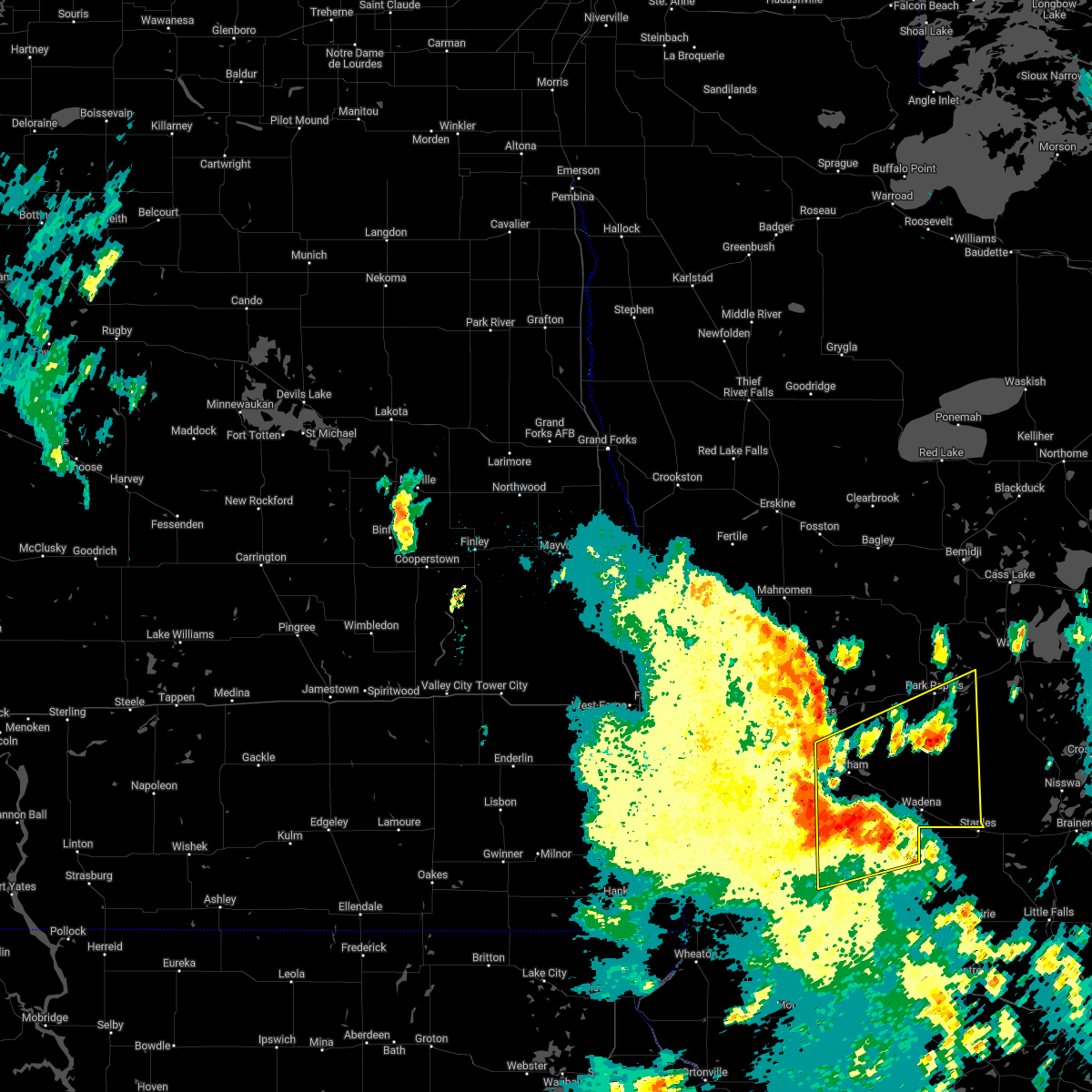 At 1201 am cdt, severe thunderstorms were located along a line extending from near height of land lake to near perham to near wrightstown, moving northeast at 55 mph. these are destructive storms for eastern otter tail and wadena counties (radar indicated). Hazards include 80 mph wind gusts and quarter size hail. Flying debris will be dangerous to those caught without shelter. mobile homes will be heavily damaged. expect considerable damage to roofs, windows, and vehicles. extensive tree damage and power outages are likely. locations impacted include, wrightstown, new york mills, butler, hillview, aldrich, verndale, staples airport and midway. thunderstorm damage threat, destructive hail threat, radar indicated max hail size, 1. 00 in wind threat, radar indicated max wind gust, 80 mph. At 1201 am cdt, severe thunderstorms were located along a line extending from near height of land lake to near perham to near wrightstown, moving northeast at 55 mph. these are destructive storms for eastern otter tail and wadena counties (radar indicated). Hazards include 80 mph wind gusts and quarter size hail. Flying debris will be dangerous to those caught without shelter. mobile homes will be heavily damaged. expect considerable damage to roofs, windows, and vehicles. extensive tree damage and power outages are likely. locations impacted include, wrightstown, new york mills, butler, hillview, aldrich, verndale, staples airport and midway. thunderstorm damage threat, destructive hail threat, radar indicated max hail size, 1. 00 in wind threat, radar indicated max wind gust, 80 mph.
|
| 6/20/2022 11:34 PM CDT |
 At 1133 pm cdt, severe thunderstorms were located along a line extending from dunvilla to near edwards to near millerville, moving east at 45 mph. these are destructive storms for eastern ottertail and wadena counties (radar indicated). Hazards include 80 mph wind gusts and quarter size hail. Flying debris will be dangerous to those caught without shelter. mobile homes will be heavily damaged. expect considerable damage to roofs, windows, and vehicles. extensive tree damage and power outages are likely. severe thunderstorms will be near, phelps around 1145 pm cdt. amor, star lake and vergas around 1150 pm cdt. other locations in the path of these severe thunderstorms include frazee, dent, big mcdonald lake, richville, ottertail, wrightstown and perham. thunderstorm damage threat, destructive hail threat, radar indicated max hail size, 1. 00 in wind threat, radar indicated max wind gust, 80 mph. At 1133 pm cdt, severe thunderstorms were located along a line extending from dunvilla to near edwards to near millerville, moving east at 45 mph. these are destructive storms for eastern ottertail and wadena counties (radar indicated). Hazards include 80 mph wind gusts and quarter size hail. Flying debris will be dangerous to those caught without shelter. mobile homes will be heavily damaged. expect considerable damage to roofs, windows, and vehicles. extensive tree damage and power outages are likely. severe thunderstorms will be near, phelps around 1145 pm cdt. amor, star lake and vergas around 1150 pm cdt. other locations in the path of these severe thunderstorms include frazee, dent, big mcdonald lake, richville, ottertail, wrightstown and perham. thunderstorm damage threat, destructive hail threat, radar indicated max hail size, 1. 00 in wind threat, radar indicated max wind gust, 80 mph.
|
| 6/20/2022 9:10 PM CDT |
 The severe thunderstorm warning for wadena and east central otter tail counties will expire at 915 pm cdt, the storm which prompted the warning has moved out of the area. therefore, the warning will be allowed to expire. a severe thunderstorm watch remains in effect until 1000 pm cdt for central and west central minnesota. a severe thunderstorm watch also remains in effect until 400 am cdt for central and west central minnesota. The severe thunderstorm warning for wadena and east central otter tail counties will expire at 915 pm cdt, the storm which prompted the warning has moved out of the area. therefore, the warning will be allowed to expire. a severe thunderstorm watch remains in effect until 1000 pm cdt for central and west central minnesota. a severe thunderstorm watch also remains in effect until 400 am cdt for central and west central minnesota.
|
| 6/20/2022 8:59 PM CDT |
 At 858 pm cdt, a severe thunderstorm was located near oylen, or 48 miles east of detroit lakes, moving northeast at 60 mph (radar indicated). Hazards include 60 mph wind gusts and quarter size hail. Hail damage to vehicles is expected. expect wind damage to roofs, siding, and trees. this severe storm will be near, nimrod around 900 pm cdt. other locations in the path of this severe thunderstorm include oylen. hail threat, radar indicated max hail size, 1. 00 in wind threat, radar indicated max wind gust, 60 mph. At 858 pm cdt, a severe thunderstorm was located near oylen, or 48 miles east of detroit lakes, moving northeast at 60 mph (radar indicated). Hazards include 60 mph wind gusts and quarter size hail. Hail damage to vehicles is expected. expect wind damage to roofs, siding, and trees. this severe storm will be near, nimrod around 900 pm cdt. other locations in the path of this severe thunderstorm include oylen. hail threat, radar indicated max hail size, 1. 00 in wind threat, radar indicated max wind gust, 60 mph.
|
| 6/20/2022 8:44 PM CDT |
 At 844 pm cdt, a severe thunderstorm was located over wadena, or 40 miles southeast of detroit lakes, moving northeast at 60 mph (radar indicated). Hazards include 60 mph wind gusts and quarter size hail. Hail damage to vehicles is expected. expect wind damage to roofs, siding, and trees. this severe thunderstorm will be near, verndale around 850 pm cdt. blue grass around 855 pm cdt. nimrod around 900 pm cdt. other locations in the path of this severe thunderstorm include oylen. hail threat, radar indicated max hail size, 1. 00 in wind threat, radar indicated max wind gust, 60 mph. At 844 pm cdt, a severe thunderstorm was located over wadena, or 40 miles southeast of detroit lakes, moving northeast at 60 mph (radar indicated). Hazards include 60 mph wind gusts and quarter size hail. Hail damage to vehicles is expected. expect wind damage to roofs, siding, and trees. this severe thunderstorm will be near, verndale around 850 pm cdt. blue grass around 855 pm cdt. nimrod around 900 pm cdt. other locations in the path of this severe thunderstorm include oylen. hail threat, radar indicated max hail size, 1. 00 in wind threat, radar indicated max wind gust, 60 mph.
|
| 6/20/2022 8:33 PM CDT |
 At 833 pm cdt, a severe thunderstorm was located near bluffton, or 37 miles southeast of detroit lakes, moving northeast at 35 mph (radar indicated). Hazards include 60 mph wind gusts and quarter size hail. Hail damage to vehicles is expected. expect wind damage to roofs, siding, and trees. locations impacted include, wadena, ottertail lake, new york mills, parkers prairie, battle lake, henning and verndale. This includes interstate 94 in minnesota between mile markers 65 and 70. At 833 pm cdt, a severe thunderstorm was located near bluffton, or 37 miles southeast of detroit lakes, moving northeast at 35 mph (radar indicated). Hazards include 60 mph wind gusts and quarter size hail. Hail damage to vehicles is expected. expect wind damage to roofs, siding, and trees. locations impacted include, wadena, ottertail lake, new york mills, parkers prairie, battle lake, henning and verndale. This includes interstate 94 in minnesota between mile markers 65 and 70.
|
| 6/20/2022 8:16 PM CDT |
 At 816 pm cdt, a severe thunderstorm was located near deer creek, or 34 miles southeast of detroit lakes, moving northeast at 35 mph (radar indicated). Hazards include 60 mph wind gusts and quarter size hail. Hail damage to vehicles is expected. expect wind damage to roofs, siding, and trees. locations impacted include, wadena, ottertail lake, new york mills, elbow lake, parkers prairie, battle lake and henning. This includes interstate 94 in minnesota between mile markers 66 and 80. At 816 pm cdt, a severe thunderstorm was located near deer creek, or 34 miles southeast of detroit lakes, moving northeast at 35 mph (radar indicated). Hazards include 60 mph wind gusts and quarter size hail. Hail damage to vehicles is expected. expect wind damage to roofs, siding, and trees. locations impacted include, wadena, ottertail lake, new york mills, elbow lake, parkers prairie, battle lake and henning. This includes interstate 94 in minnesota between mile markers 66 and 80.
|
| 6/20/2022 7:57 PM CDT |
 At 756 pm cdt, a severe thunderstorm was located near clitherall, or 23 miles east of fergus falls, moving northeast at 35 mph (radar indicated). Hazards include 60 mph wind gusts and quarter size hail. Hail damage to vehicles is expected. expect wind damage to roofs, siding, and trees. locations impacted include, ottertail, henning, deer creek, new york mills, bluffton and wadena. This includes interstate 94 in minnesota between mile markers 63 and 80. At 756 pm cdt, a severe thunderstorm was located near clitherall, or 23 miles east of fergus falls, moving northeast at 35 mph (radar indicated). Hazards include 60 mph wind gusts and quarter size hail. Hail damage to vehicles is expected. expect wind damage to roofs, siding, and trees. locations impacted include, ottertail, henning, deer creek, new york mills, bluffton and wadena. This includes interstate 94 in minnesota between mile markers 63 and 80.
|
| 6/20/2022 7:43 PM CDT |
 At 742 pm cdt, a severe thunderstorm was located over battle lake, or 15 miles east of fergus falls, moving northeast at 35 mph. a second severe storm was also located near wadena, moving northeast at 35 mph (radar indicated). Hazards include 60 mph wind gusts and quarter size hail. Hail damage to vehicles is expected. expect wind damage to roofs, siding, and trees. this severe thunderstorm will be near, battle lake, clitherall and ottertail lake around 750 pm cdt. vining around 755 pm cdt. other locations in the path of this severe thunderstorm include ottertail, henning, deer creek and new york mills. this includes interstate 94 in minnesota between mile markers 63 and 80. hail threat, radar indicated max hail size, 1. 00 in wind threat, radar indicated max wind gust, 60 mph. At 742 pm cdt, a severe thunderstorm was located over battle lake, or 15 miles east of fergus falls, moving northeast at 35 mph. a second severe storm was also located near wadena, moving northeast at 35 mph (radar indicated). Hazards include 60 mph wind gusts and quarter size hail. Hail damage to vehicles is expected. expect wind damage to roofs, siding, and trees. this severe thunderstorm will be near, battle lake, clitherall and ottertail lake around 750 pm cdt. vining around 755 pm cdt. other locations in the path of this severe thunderstorm include ottertail, henning, deer creek and new york mills. this includes interstate 94 in minnesota between mile markers 63 and 80. hail threat, radar indicated max hail size, 1. 00 in wind threat, radar indicated max wind gust, 60 mph.
|
| 5/30/2022 5:29 PM CDT |
 At 529 pm cdt, severe thunderstorms capable of producing tornadoes were located along a line extending from near staples to 9 miles northeast of browerville to near grey eagle, moving northeast at 55 mph (radar indicated rotation). Hazards include tornado and half dollar size hail. Flying debris will be dangerous to those caught without shelter. mobile homes will be damaged or destroyed. damage to roofs, windows, and vehicles will occur. tree damage is likely. these dangerous storms will be near, staples, motley and staples airport around 535 pm cdt. randall around 550 pm cdt. Other locations impacted by these tornadic storms include philbrook, burtrum, long prairie airport, round prairie, little sauk and cushing. At 529 pm cdt, severe thunderstorms capable of producing tornadoes were located along a line extending from near staples to 9 miles northeast of browerville to near grey eagle, moving northeast at 55 mph (radar indicated rotation). Hazards include tornado and half dollar size hail. Flying debris will be dangerous to those caught without shelter. mobile homes will be damaged or destroyed. damage to roofs, windows, and vehicles will occur. tree damage is likely. these dangerous storms will be near, staples, motley and staples airport around 535 pm cdt. randall around 550 pm cdt. Other locations impacted by these tornadic storms include philbrook, burtrum, long prairie airport, round prairie, little sauk and cushing.
|
| 5/30/2022 5:23 PM CDT |
 At 522 pm cdt, severe thunderstorms were located along a line extending from near snellman to near philbrook, moving northeast at 75 mph (radar indicated). Hazards include 70 mph wind gusts and quarter size hail. Hail damage to vehicles is expected. expect considerable tree damage. wind damage is also likely to mobile homes, roofs, and outbuildings. locations impacted include, wadena, park rapids, menahga, new york mills, sebeka, verndale and toad lake. thunderstorm damage threat, considerable hail threat, radar indicated max hail size, 1. 00 in wind threat, radar indicated max wind gust, 70 mph. At 522 pm cdt, severe thunderstorms were located along a line extending from near snellman to near philbrook, moving northeast at 75 mph (radar indicated). Hazards include 70 mph wind gusts and quarter size hail. Hail damage to vehicles is expected. expect considerable tree damage. wind damage is also likely to mobile homes, roofs, and outbuildings. locations impacted include, wadena, park rapids, menahga, new york mills, sebeka, verndale and toad lake. thunderstorm damage threat, considerable hail threat, radar indicated max hail size, 1. 00 in wind threat, radar indicated max wind gust, 70 mph.
|
| 5/30/2022 5:21 PM CDT | Quarter sized hail and wind gusts at 60 to 70 mp in wadena county MN, 3.8 miles ESE of Staples, MN |
| 5/30/2022 5:19 PM CDT |
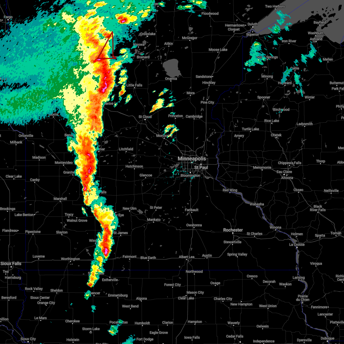 At 518 pm cdt, a severe thunderstorm capable of producing a tornado was located over staples airport, or 55 miles southeast of detroit lakes, moving northeast at 75 mph (radar indicated rotation). Hazards include tornado and quarter size hail. Flying debris will be dangerous to those caught without shelter. mobile homes will be damaged or destroyed. damage to roofs, windows, and vehicles will occur. Tree damage is likely. At 518 pm cdt, a severe thunderstorm capable of producing a tornado was located over staples airport, or 55 miles southeast of detroit lakes, moving northeast at 75 mph (radar indicated rotation). Hazards include tornado and quarter size hail. Flying debris will be dangerous to those caught without shelter. mobile homes will be damaged or destroyed. damage to roofs, windows, and vehicles will occur. Tree damage is likely.
|
| 5/30/2022 5:17 PM CDT |
 At 517 pm cdt, severe thunderstorms capable of producing a tornado were located along a line extending from browerville to 5 miles south of long prairie, moving northeast at 40 mph (radar indicated rotation). Hazards include tornado and ping pong ball size hail. Flying debris will be dangerous to those caught without shelter. mobile homes will be damaged or destroyed. damage to roofs, windows, and vehicles will occur. tree damage is likely. these dangerous storms will be near, browerville around 520 pm cdt. motley and randall around 550 pm cdt. Other locations impacted by these tornadic storms include philbrook, burtrum, long prairie airport, round prairie, little sauk and cushing. At 517 pm cdt, severe thunderstorms capable of producing a tornado were located along a line extending from browerville to 5 miles south of long prairie, moving northeast at 40 mph (radar indicated rotation). Hazards include tornado and ping pong ball size hail. Flying debris will be dangerous to those caught without shelter. mobile homes will be damaged or destroyed. damage to roofs, windows, and vehicles will occur. tree damage is likely. these dangerous storms will be near, browerville around 520 pm cdt. motley and randall around 550 pm cdt. Other locations impacted by these tornadic storms include philbrook, burtrum, long prairie airport, round prairie, little sauk and cushing.
|
| 5/30/2022 5:07 PM CDT |
 At 507 pm cdt, severe thunderstorms were located along a line extending from frazee to near clarissa, moving northeast at 75 mph (radar indicated). Hazards include 60 mph wind gusts. expect damage to roofs, siding, and trees At 507 pm cdt, severe thunderstorms were located along a line extending from frazee to near clarissa, moving northeast at 75 mph (radar indicated). Hazards include 60 mph wind gusts. expect damage to roofs, siding, and trees
|
| 5/30/2022 5:09 AM CDT |
 The severe thunderstorm warning for central douglas, todd and western morrison counties will expire at 515 am cdt, the storms which prompted the warning have moved out of the area. therefore, the warning will be allowed to expire. a severe thunderstorm watch remains in effect until 800 am cdt for central and west central minnesota. to report severe weather, contact your nearest law enforcement agency. they will relay your report to the national weather service the twin cities. The severe thunderstorm warning for central douglas, todd and western morrison counties will expire at 515 am cdt, the storms which prompted the warning have moved out of the area. therefore, the warning will be allowed to expire. a severe thunderstorm watch remains in effect until 800 am cdt for central and west central minnesota. to report severe weather, contact your nearest law enforcement agency. they will relay your report to the national weather service the twin cities.
|
| 5/30/2022 5:01 AM CDT |
 At 500 am cdt, severe thunderstorms were located along a line extending from randall to 5 miles southwest of parkers prairie, moving north at 65 mph (radar indicated). Hazards include 70 mph wind gusts. Expect considerable tree damage. damage is likely to mobile homes, roofs, and outbuildings. locations impacted include, camp ripley. thunderstorm damage threat, considerable hail threat, radar indicated max hail size, <. 75 in wind threat, radar indicated max wind gust, 70 mph. At 500 am cdt, severe thunderstorms were located along a line extending from randall to 5 miles southwest of parkers prairie, moving north at 65 mph (radar indicated). Hazards include 70 mph wind gusts. Expect considerable tree damage. damage is likely to mobile homes, roofs, and outbuildings. locations impacted include, camp ripley. thunderstorm damage threat, considerable hail threat, radar indicated max hail size, <. 75 in wind threat, radar indicated max wind gust, 70 mph.
|
| 5/30/2022 4:37 AM CDT |
 At 437 am cdt, severe thunderstorms were located along a line extending from near freeport to near lowry, moving north at 50 mph (radar indicated). Hazards include 70 mph wind gusts. Expect considerable tree damage. damage is likely to mobile homes, roofs, and outbuildings. severe thunderstorms will be near, upsala and grey eagle around 445 am cdt. brandon, swanville and flensburg around 455 am cdt. other locations in the path of these severe thunderstorms include randall. thunderstorm damage threat, considerable hail threat, radar indicated max hail size, <. 75 in wind threat, radar indicated max wind gust, 70 mph. At 437 am cdt, severe thunderstorms were located along a line extending from near freeport to near lowry, moving north at 50 mph (radar indicated). Hazards include 70 mph wind gusts. Expect considerable tree damage. damage is likely to mobile homes, roofs, and outbuildings. severe thunderstorms will be near, upsala and grey eagle around 445 am cdt. brandon, swanville and flensburg around 455 am cdt. other locations in the path of these severe thunderstorms include randall. thunderstorm damage threat, considerable hail threat, radar indicated max hail size, <. 75 in wind threat, radar indicated max wind gust, 70 mph.
|
| 5/12/2022 8:06 PM CDT |
 At 805 pm cdt, severe thunderstorms were located along a line extending from near horace to near blue grass, moving north at 45 mph (radar indicated). Hazards include 70 mph wind gusts. Expect considerable tree damage. damage is likely to mobile homes, roofs, and outbuildings. locations impacted include, nimrod, frontier, west fargo, prairie rose, huntersville, reile`s acres, mapleton, harwood, hubbard, prosper and brooktree park. this includes the following highways, interstate 29 between mile markers 48 and 100. interstate 94 in north dakota between mile markers 333 and 352. Interstate 94 in minnesota between mile markers 1 and 32. At 805 pm cdt, severe thunderstorms were located along a line extending from near horace to near blue grass, moving north at 45 mph (radar indicated). Hazards include 70 mph wind gusts. Expect considerable tree damage. damage is likely to mobile homes, roofs, and outbuildings. locations impacted include, nimrod, frontier, west fargo, prairie rose, huntersville, reile`s acres, mapleton, harwood, hubbard, prosper and brooktree park. this includes the following highways, interstate 29 between mile markers 48 and 100. interstate 94 in north dakota between mile markers 333 and 352. Interstate 94 in minnesota between mile markers 1 and 32.
|
| 5/12/2022 7:47 PM CDT |
 At 747 pm cdt, severe thunderstorms were located along a line extending from near walcott to verndale, moving north at 55 mph (radar indicated). Hazards include 70 mph wind gusts. Expect considerable tree damage. damage is likely to mobile homes, roofs, and outbuildings. severe thunderstorms will be near, wadena around 750 pm cdt. kindred around 755 pm cdt. blue grass, davenport and hickson around 800 pm cdt. horace and wild rice around 805 pm cdt. other locations in the path of these severe thunderstorms include nimrod, sebeka and prairie rose. this includes the following highways, interstate 29 between mile markers 31 and 100. interstate 94 in north dakota between mile markers 333 and 352. Interstate 94 in minnesota between mile markers 1 and 55. At 747 pm cdt, severe thunderstorms were located along a line extending from near walcott to verndale, moving north at 55 mph (radar indicated). Hazards include 70 mph wind gusts. Expect considerable tree damage. damage is likely to mobile homes, roofs, and outbuildings. severe thunderstorms will be near, wadena around 750 pm cdt. kindred around 755 pm cdt. blue grass, davenport and hickson around 800 pm cdt. horace and wild rice around 805 pm cdt. other locations in the path of these severe thunderstorms include nimrod, sebeka and prairie rose. this includes the following highways, interstate 29 between mile markers 31 and 100. interstate 94 in north dakota between mile markers 333 and 352. Interstate 94 in minnesota between mile markers 1 and 55.
|
| 5/12/2022 7:31 PM CDT |
 At 731 pm cdt, severe thunderstorms were located along a line extending from near bertha to 5 miles east of long prairie to near avon, moving northeast at 75 mph (radar indicated). Hazards include 70 mph wind gusts. Expect considerable tree damage. damage is likely to mobile homes, roofs, and outbuildings. severe thunderstorms will be near, bertha and hewitt around 735 pm cdt. royalton around 740 pm cdt. staples airport around 745 pm cdt. motley around 750 pm cdt. thunderstorm damage threat, considerable hail threat, radar indicated max hail size, <. 75 in wind threat, radar indicated max wind gust, 70 mph. At 731 pm cdt, severe thunderstorms were located along a line extending from near bertha to 5 miles east of long prairie to near avon, moving northeast at 75 mph (radar indicated). Hazards include 70 mph wind gusts. Expect considerable tree damage. damage is likely to mobile homes, roofs, and outbuildings. severe thunderstorms will be near, bertha and hewitt around 735 pm cdt. royalton around 740 pm cdt. staples airport around 745 pm cdt. motley around 750 pm cdt. thunderstorm damage threat, considerable hail threat, radar indicated max hail size, <. 75 in wind threat, radar indicated max wind gust, 70 mph.
|
| 7/24/2021 2:18 AM CDT |
 At 218 am cdt, a severe thunderstorm was located near sebeka, or 35 miles southeast of detroit lakes, moving east at 45 mph (radar indicated). Hazards include 60 mph wind gusts. Expect damage to roofs, siding, and trees. Locations impacted include, sebeka, blue grass, nimrod and oylen. At 218 am cdt, a severe thunderstorm was located near sebeka, or 35 miles southeast of detroit lakes, moving east at 45 mph (radar indicated). Hazards include 60 mph wind gusts. Expect damage to roofs, siding, and trees. Locations impacted include, sebeka, blue grass, nimrod and oylen.
|
| 7/24/2021 1:51 AM CDT |
 At 151 am cdt, a severe thunderstorm was located over perham, or 19 miles southeast of detroit lakes, moving east at 45 mph (radar indicated). Hazards include 60 mph wind gusts. Expect damage to roofs, siding, and trees. this severe thunderstorm will be near, new york mills around 205 am cdt. Other locations in the path of this severe thunderstorm include hillview, bluffton, sebeka, blue grass and nimrod. At 151 am cdt, a severe thunderstorm was located over perham, or 19 miles southeast of detroit lakes, moving east at 45 mph (radar indicated). Hazards include 60 mph wind gusts. Expect damage to roofs, siding, and trees. this severe thunderstorm will be near, new york mills around 205 am cdt. Other locations in the path of this severe thunderstorm include hillview, bluffton, sebeka, blue grass and nimrod.
|
| 6/9/2021 6:41 PM CDT |
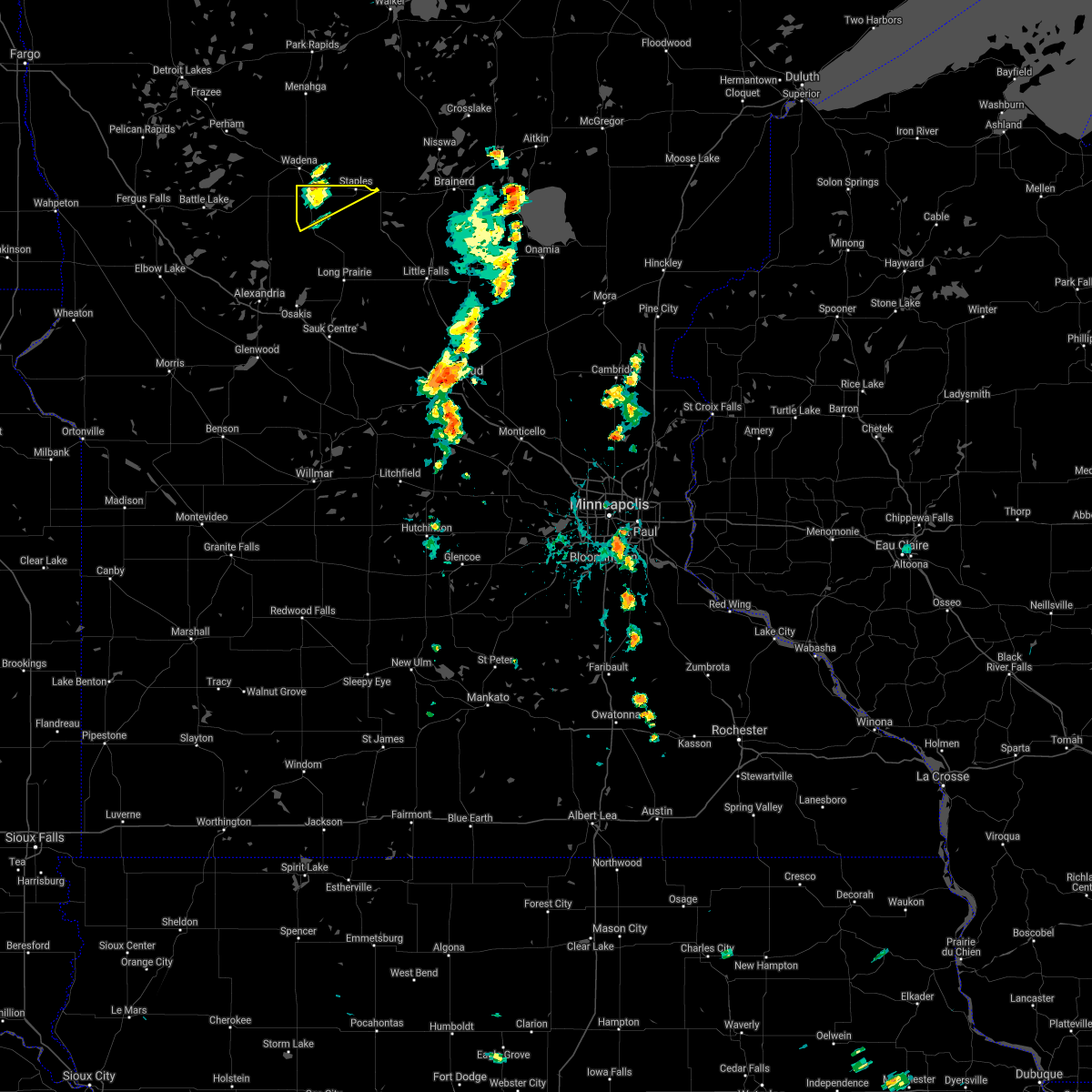 The severe thunderstorm warning for northern todd county will expire at 645 pm cdt, the storm which prompted the warning has weakened below severe limits, and no longer poses an immediate threat to life or property. therefore, the warning will be allowed to expire. The severe thunderstorm warning for northern todd county will expire at 645 pm cdt, the storm which prompted the warning has weakened below severe limits, and no longer poses an immediate threat to life or property. therefore, the warning will be allowed to expire.
|
| 6/9/2021 6:26 PM CDT |
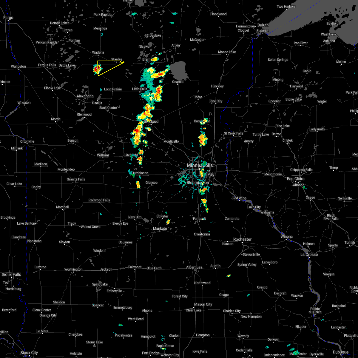 At 626 pm cdt, a severe thunderstorm was located over hewitt, or 31 miles northeast of alexandria, moving northeast at 40 mph (radar indicated). Hazards include 60 mph wind gusts and quarter size hail. Hail damage to vehicles is expected. expect wind damage to roofs, siding, and trees. This severe thunderstorm will be near, staples and staples airport around 645 pm cdt. At 626 pm cdt, a severe thunderstorm was located over hewitt, or 31 miles northeast of alexandria, moving northeast at 40 mph (radar indicated). Hazards include 60 mph wind gusts and quarter size hail. Hail damage to vehicles is expected. expect wind damage to roofs, siding, and trees. This severe thunderstorm will be near, staples and staples airport around 645 pm cdt.
|
| 6/8/2021 12:17 AM CDT |
 At 1216 am cdt, severe thunderstorms were located along a line extending from near butler to near ottertail to near ashby, moving east at 55 mph (radar indicated). Hazards include 60 mph wind gusts. expect damage to roofs, siding, and trees At 1216 am cdt, severe thunderstorms were located along a line extending from near butler to near ottertail to near ashby, moving east at 55 mph (radar indicated). Hazards include 60 mph wind gusts. expect damage to roofs, siding, and trees
|
| 10/11/2020 7:59 PM CDT |
 At 745 pm cdt, severe thunderstorms were located along a line extending from 5 miles southeast of parkers prairie to near lake osakis to 9 miles east of lake hassel, moving northeast at 45 mph (radar indicated). Hazards include 60 mph wind gusts. Expect damage to roofs, siding, and trees. these severe storms will be near, lake osakis around 750 pm cdt. eagle bend around 800 pm cdt. long prairie, brooten, bertha and hewitt around 805 pm cdt. browerville, belgrade and clarissa around 810 pm cdt. staples around 825 pm cdt. Other locations impacted by these severe thunderstorms include glenwood airport, westport, nelson, round prairie, grove lake, villard, miltona, padua, rose city and clotho. At 745 pm cdt, severe thunderstorms were located along a line extending from 5 miles southeast of parkers prairie to near lake osakis to 9 miles east of lake hassel, moving northeast at 45 mph (radar indicated). Hazards include 60 mph wind gusts. Expect damage to roofs, siding, and trees. these severe storms will be near, lake osakis around 750 pm cdt. eagle bend around 800 pm cdt. long prairie, brooten, bertha and hewitt around 805 pm cdt. browerville, belgrade and clarissa around 810 pm cdt. staples around 825 pm cdt. Other locations impacted by these severe thunderstorms include glenwood airport, westport, nelson, round prairie, grove lake, villard, miltona, padua, rose city and clotho.
|
| 10/11/2020 7:46 PM CDT |
 At 745 pm cdt, severe thunderstorms were located along a line extending from 5 miles southeast of parkers prairie to near lake osakis to 9 miles east of lake hassel, moving northeast at 45 mph (radar indicated). Hazards include 60 mph wind gusts. Expect damage to roofs, siding, and trees. these severe storms will be near, lake osakis around 750 pm cdt. eagle bend around 800 pm cdt. long prairie, brooten, bertha and hewitt around 805 pm cdt. browerville, belgrade and clarissa around 810 pm cdt. staples around 825 pm cdt. Other locations impacted by these severe thunderstorms include glenwood airport, westport, nelson, round prairie, grove lake, villard, miltona, padua, rose city and clotho. At 745 pm cdt, severe thunderstorms were located along a line extending from 5 miles southeast of parkers prairie to near lake osakis to 9 miles east of lake hassel, moving northeast at 45 mph (radar indicated). Hazards include 60 mph wind gusts. Expect damage to roofs, siding, and trees. these severe storms will be near, lake osakis around 750 pm cdt. eagle bend around 800 pm cdt. long prairie, brooten, bertha and hewitt around 805 pm cdt. browerville, belgrade and clarissa around 810 pm cdt. staples around 825 pm cdt. Other locations impacted by these severe thunderstorms include glenwood airport, westport, nelson, round prairie, grove lake, villard, miltona, padua, rose city and clotho.
|
| 10/11/2020 7:28 PM CDT |
 At 727 pm cdt, severe thunderstorms were located along a line extending from 6 miles northeast of brandon to near alexandria to 6 miles northeast of lowry to 5 miles northeast of lake hassel, moving northeast at 45 mph (radar indicated. a personal weather station measured a 65 mph gust in garfield). Hazards include 60 mph wind gusts. Expect damage to roofs, siding, and trees. severe thunderstorms will be near, alexandria and carlos around 735 pm cdt. glenwood around 745 pm cdt. lake osakis around 750 pm cdt. eagle bend around 800 pm cdt. bertha and hewitt around 805 pm cdt. sauk centre, staples, browerville and clarissa around 815 pm cdt. Other locations impacted by these severe thunderstorms include glenwood airport, westport, nelson, round prairie, grove lake, villard, miltona, padua, rose city and clotho. At 727 pm cdt, severe thunderstorms were located along a line extending from 6 miles northeast of brandon to near alexandria to 6 miles northeast of lowry to 5 miles northeast of lake hassel, moving northeast at 45 mph (radar indicated. a personal weather station measured a 65 mph gust in garfield). Hazards include 60 mph wind gusts. Expect damage to roofs, siding, and trees. severe thunderstorms will be near, alexandria and carlos around 735 pm cdt. glenwood around 745 pm cdt. lake osakis around 750 pm cdt. eagle bend around 800 pm cdt. bertha and hewitt around 805 pm cdt. sauk centre, staples, browerville and clarissa around 815 pm cdt. Other locations impacted by these severe thunderstorms include glenwood airport, westport, nelson, round prairie, grove lake, villard, miltona, padua, rose city and clotho.
|
| 10/11/2020 7:27 PM CDT |
 At 726 pm cdt, a severe thunderstorm was located over leaf valley, or 34 miles southeast of fergus falls, moving northeast at 55 mph (radar indicated). Hazards include 60 mph wind gusts. expect damage to roofs, siding, and trees At 726 pm cdt, a severe thunderstorm was located over leaf valley, or 34 miles southeast of fergus falls, moving northeast at 55 mph (radar indicated). Hazards include 60 mph wind gusts. expect damage to roofs, siding, and trees
|
| 8/14/2020 1:20 AM CDT |
 At 119 am cdt, severe thunderstorms were located along a line extending from near camp wilderness to wadena to near melby, moving southeast at 25 mph (public). Hazards include golf ball size hail and 60 mph wind gusts. People and animals outdoors will be injured. expect hail damage to roofs, siding, windows, and vehicles. expect wind damage to roofs, siding, and trees. Locations impacted include, wadena, verndale, staples airport, akeley, nevis, huntersville and hubbard. At 119 am cdt, severe thunderstorms were located along a line extending from near camp wilderness to wadena to near melby, moving southeast at 25 mph (public). Hazards include golf ball size hail and 60 mph wind gusts. People and animals outdoors will be injured. expect hail damage to roofs, siding, windows, and vehicles. expect wind damage to roofs, siding, and trees. Locations impacted include, wadena, verndale, staples airport, akeley, nevis, huntersville and hubbard.
|
| 8/14/2020 1:10 AM CDT |
 At 110 am cdt, severe thunderstorms were located along a line extending from near emmaville to near bluffton to near ashby, moving southeast at 25 mph (radar indicated). Hazards include 60 mph wind gusts and penny size hail. Expect damage to roofs, siding, and trees. locations impacted include, wadena, park rapids, menahga, parkers prairie, henning, sebeka and verndale. This includes interstate 94 in minnesota between mile markers 68 and 74. At 110 am cdt, severe thunderstorms were located along a line extending from near emmaville to near bluffton to near ashby, moving southeast at 25 mph (radar indicated). Hazards include 60 mph wind gusts and penny size hail. Expect damage to roofs, siding, and trees. locations impacted include, wadena, park rapids, menahga, parkers prairie, henning, sebeka and verndale. This includes interstate 94 in minnesota between mile markers 68 and 74.
|
| 8/14/2020 12:54 AM CDT |
 At 1254 am cdt, severe thunderstorms were located along a line extending from near lake george to near new york mills to dalton, moving southeast at 25 mph (radar indicated). Hazards include 60 mph wind gusts and penny size hail. Expect damage to roofs, siding, and trees. locations impacted include, wadena, park rapids, ottertail lake, menahga, new york mills, parkers prairie and battle lake. This includes interstate 94 in minnesota between mile markers 62 and 80. At 1254 am cdt, severe thunderstorms were located along a line extending from near lake george to near new york mills to dalton, moving southeast at 25 mph (radar indicated). Hazards include 60 mph wind gusts and penny size hail. Expect damage to roofs, siding, and trees. locations impacted include, wadena, park rapids, ottertail lake, menahga, new york mills, parkers prairie and battle lake. This includes interstate 94 in minnesota between mile markers 62 and 80.
|
| 8/14/2020 12:29 AM CDT |
 The national weather service in grand forks has issued a * severe thunderstorm warning for. hubbard county in north central minnesota. wadena county in central minnesota. otter tail county in west central minnesota. Northeastern grant county in west central minnesota. The national weather service in grand forks has issued a * severe thunderstorm warning for. hubbard county in north central minnesota. wadena county in central minnesota. otter tail county in west central minnesota. Northeastern grant county in west central minnesota.
|
| 7/25/2020 4:41 AM CDT |
 The severe thunderstorm warning for central wadena county will expire at 445 am cdt, the storms which prompted the warning have moved out of the area. therefore, the warning will be allowed to expire. The severe thunderstorm warning for central wadena county will expire at 445 am cdt, the storms which prompted the warning have moved out of the area. therefore, the warning will be allowed to expire.
|
| 7/25/2020 4:23 AM CDT |
 At 423 am cdt, severe thunderstorms were located along a line extending from near huntersville to near aldrich, moving east at 25 mph (radar indicated). Hazards include 60 mph wind gusts. Expect damage to roofs, siding, and trees. Locations impacted include, sebeka, staples airport, nimrod, blue grass and oylen. At 423 am cdt, severe thunderstorms were located along a line extending from near huntersville to near aldrich, moving east at 25 mph (radar indicated). Hazards include 60 mph wind gusts. Expect damage to roofs, siding, and trees. Locations impacted include, sebeka, staples airport, nimrod, blue grass and oylen.
|
| 7/25/2020 4:01 AM CDT |
 At 400 am cdt, severe thunderstorms were located along a line extending from near menahga to near wadena, moving east at 25 mph (radar indicated). Hazards include 60 mph wind gusts. expect damage to roofs, siding, and trees At 400 am cdt, severe thunderstorms were located along a line extending from near menahga to near wadena, moving east at 25 mph (radar indicated). Hazards include 60 mph wind gusts. expect damage to roofs, siding, and trees
|
| 7/25/2020 3:39 AM CDT |
 A severe thunderstorm warning remains in effect until 400 am cdt for wadena and eastern otter tail counties. at 338 am cdt, severe thunderstorms were located along a line extending from near sebeka to near wadena to near wrightstown, moving east at 40 mph. hazard. 70 mph wind gusts. A severe thunderstorm warning remains in effect until 400 am cdt for wadena and eastern otter tail counties. at 338 am cdt, severe thunderstorms were located along a line extending from near sebeka to near wadena to near wrightstown, moving east at 40 mph. hazard. 70 mph wind gusts.
|
| 7/25/2020 3:00 AM CDT |
 At 259 am cdt, severe thunderstorms were located along a line extending from near perham to near richville to near dalton, moving east at 40 mph (radar indicated). Hazards include 70 mph wind gusts. Expect considerable tree damage. Damage is likely to mobile homes, roofs, and outbuildings. At 259 am cdt, severe thunderstorms were located along a line extending from near perham to near richville to near dalton, moving east at 40 mph (radar indicated). Hazards include 70 mph wind gusts. Expect considerable tree damage. Damage is likely to mobile homes, roofs, and outbuildings.
|
| 7/17/2020 10:13 PM CDT |
 At 1012 pm cdt, severe thunderstorms were located along a line extending from near nisswa to motley to clarissa, moving east at 25 mph (law enforcement. at 910 pm cdt, trees and power lines were coming down in staples). Hazards include 70 mph wind gusts. Expect considerable tree damage. damage is likely to mobile homes, roofs, and outbuildings. severe thunderstorms will be near, randall around 1110 pm cdt. Camp ripley around 1115 pm cdt. At 1012 pm cdt, severe thunderstorms were located along a line extending from near nisswa to motley to clarissa, moving east at 25 mph (law enforcement. at 910 pm cdt, trees and power lines were coming down in staples). Hazards include 70 mph wind gusts. Expect considerable tree damage. damage is likely to mobile homes, roofs, and outbuildings. severe thunderstorms will be near, randall around 1110 pm cdt. Camp ripley around 1115 pm cdt.
|
| 7/17/2020 10:08 PM CDT | Trees beginning to be reported going down and taking out power line in todd county MN, 0.7 miles SSE of Staples, MN |
| 7/17/2020 10:00 PM CDT |
 At 1000 pm cdt, severe thunderstorms were located along a line extending from near staples airport to near bertha, moving east at 30 mph (radar indicated). Hazards include 60 mph wind gusts and quarter size hail. Hail damage to vehicles is expected. expect wind damage to roofs, siding, and trees. These severe storms will be near, browerville around 1020 pm cdt. At 1000 pm cdt, severe thunderstorms were located along a line extending from near staples airport to near bertha, moving east at 30 mph (radar indicated). Hazards include 60 mph wind gusts and quarter size hail. Hail damage to vehicles is expected. expect wind damage to roofs, siding, and trees. These severe storms will be near, browerville around 1020 pm cdt.
|
| 7/17/2020 9:58 PM CDT |
 The severe thunderstorm warning for wadena county will expire at 1000 pm cdt, the storms which prompted the warning have weakened below severe limits, and have exited the warned area. therefore, the warning will be allowed to expire. however gusty winds are still possible with these thunderstorms. a severe thunderstorm watch remains in effect until 100 am cdt for central and west central minnesota. The severe thunderstorm warning for wadena county will expire at 1000 pm cdt, the storms which prompted the warning have weakened below severe limits, and have exited the warned area. therefore, the warning will be allowed to expire. however gusty winds are still possible with these thunderstorms. a severe thunderstorm watch remains in effect until 100 am cdt for central and west central minnesota.
|
| 7/17/2020 9:40 PM CDT |
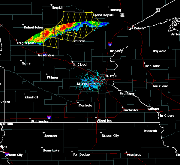 At 939 pm cdt, severe thunderstorms were located along a line extending from near lake shore to bertha, moving east at 35 mph (radar indicated). Hazards include 70 mph wind gusts. Expect considerable tree damage. damage is likely to mobile homes, roofs, and outbuildings. Locations impacted include, wadena, sebeka, verndale, staples airport, nimrod, aldrich and blue grass. At 939 pm cdt, severe thunderstorms were located along a line extending from near lake shore to bertha, moving east at 35 mph (radar indicated). Hazards include 70 mph wind gusts. Expect considerable tree damage. damage is likely to mobile homes, roofs, and outbuildings. Locations impacted include, wadena, sebeka, verndale, staples airport, nimrod, aldrich and blue grass.
|
| 7/17/2020 9:34 PM CDT |
 At 934 pm cdt, severe thunderstorms were located along a line extending from near wadena to near hewitt, moving southeast at 40 mph (radar indicated). Hazards include 70 mph wind gusts. Expect considerable tree damage. damage is likely to mobile homes, roofs, and outbuildings. these severe storms will be near, bertha around 945 pm cdt. eagle bend around 950 pm cdt. staples and staples airport around 955 pm cdt. clarissa around 1000 pm cdt. Browerville around 1005 pm cdt. At 934 pm cdt, severe thunderstorms were located along a line extending from near wadena to near hewitt, moving southeast at 40 mph (radar indicated). Hazards include 70 mph wind gusts. Expect considerable tree damage. damage is likely to mobile homes, roofs, and outbuildings. these severe storms will be near, bertha around 945 pm cdt. eagle bend around 950 pm cdt. staples and staples airport around 955 pm cdt. clarissa around 1000 pm cdt. Browerville around 1005 pm cdt.
|
| 7/17/2020 9:22 PM CDT |
 At 921 pm cdt, severe thunderstorms were located along a line extending from near bluffton to near deer creek, moving southeast at 40 mph (radar indicated). Hazards include 70 mph wind gusts. Expect considerable tree damage. damage is likely to mobile homes, roofs, and outbuildings. severe thunderstorms will be near, hewitt around 940 pm cdt. bertha around 945 pm cdt. eagle bend around 950 pm cdt. staples, clarissa and staples airport around 955 pm cdt. Browerville around 1005 pm cdt. At 921 pm cdt, severe thunderstorms were located along a line extending from near bluffton to near deer creek, moving southeast at 40 mph (radar indicated). Hazards include 70 mph wind gusts. Expect considerable tree damage. damage is likely to mobile homes, roofs, and outbuildings. severe thunderstorms will be near, hewitt around 940 pm cdt. bertha around 945 pm cdt. eagle bend around 950 pm cdt. staples, clarissa and staples airport around 955 pm cdt. Browerville around 1005 pm cdt.
|
| 7/17/2020 9:07 PM CDT |
 At 907 pm cdt, severe thunderstorms were located along a line extending from near poplar to near henning, moving east at 35 mph (radar indicated). Hazards include 70 mph wind gusts. Expect considerable tree damage. Damage is likely to mobile homes, roofs, and outbuildings. At 907 pm cdt, severe thunderstorms were located along a line extending from near poplar to near henning, moving east at 35 mph (radar indicated). Hazards include 70 mph wind gusts. Expect considerable tree damage. Damage is likely to mobile homes, roofs, and outbuildings.
|
| 7/13/2020 9:24 PM CDT |
 At 923 pm cdt, a severe thunderstorm was located near esterdy, or 54 miles southeast of detroit lakes, moving east at 40 mph (radar indicated). Hazards include ping pong ball size hail and 60 mph wind gusts. People and animals outdoors will be injured. expect hail damage to roofs, siding, windows, and vehicles. expect wind damage to roofs, siding, and trees. This severe thunderstorm will remain over mainly rural areas of wadena county. At 923 pm cdt, a severe thunderstorm was located near esterdy, or 54 miles southeast of detroit lakes, moving east at 40 mph (radar indicated). Hazards include ping pong ball size hail and 60 mph wind gusts. People and animals outdoors will be injured. expect hail damage to roofs, siding, windows, and vehicles. expect wind damage to roofs, siding, and trees. This severe thunderstorm will remain over mainly rural areas of wadena county.
|
| 7/13/2020 9:13 PM CDT |
 At 912 pm cdt, a severe thunderstorm was located near blue grass, or 47 miles southeast of detroit lakes, moving east at 40 mph (radar indicated). Hazards include ping pong ball size hail and 60 mph wind gusts. People and animals outdoors will be injured. expect hail damage to roofs, siding, windows, and vehicles. expect wind damage to roofs, siding, and trees. This severe storm will be near, oylen and staples airport around 925 pm cdt. At 912 pm cdt, a severe thunderstorm was located near blue grass, or 47 miles southeast of detroit lakes, moving east at 40 mph (radar indicated). Hazards include ping pong ball size hail and 60 mph wind gusts. People and animals outdoors will be injured. expect hail damage to roofs, siding, windows, and vehicles. expect wind damage to roofs, siding, and trees. This severe storm will be near, oylen and staples airport around 925 pm cdt.
|
| 7/13/2020 8:39 PM CDT |
 At 838 pm cdt, a severe thunderstorm was located near new york mills, or 28 miles southeast of detroit lakes, moving east at 40 mph (radar indicated). Hazards include 60 mph wind gusts and quarter size hail. Hail damage to vehicles is expected. expect wind damage to roofs, siding, and trees. this severe thunderstorm will be near, new york mills around 845 pm cdt. deer creek around 850 pm cdt. bluffton around 855 pm cdt. wadena around 900 pm cdt. Blue grass and verndale around 910 pm cdt. At 838 pm cdt, a severe thunderstorm was located near new york mills, or 28 miles southeast of detroit lakes, moving east at 40 mph (radar indicated). Hazards include 60 mph wind gusts and quarter size hail. Hail damage to vehicles is expected. expect wind damage to roofs, siding, and trees. this severe thunderstorm will be near, new york mills around 845 pm cdt. deer creek around 850 pm cdt. bluffton around 855 pm cdt. wadena around 900 pm cdt. Blue grass and verndale around 910 pm cdt.
|
| 7/8/2020 6:59 PM CDT |
 The national weather service in the twin cities has issued a * severe thunderstorm warning for. northeastern todd county in central minnesota. northwestern morrison county in central minnesota. until 730 pm cdt. At 658 pm cdt, a severe thunderstorm was located near motley, or 23. The national weather service in the twin cities has issued a * severe thunderstorm warning for. northeastern todd county in central minnesota. northwestern morrison county in central minnesota. until 730 pm cdt. At 658 pm cdt, a severe thunderstorm was located near motley, or 23.
|
| 7/8/2020 5:55 AM CDT |
 The tornado warning for southwestern hubbard, wadena, eastern otter tail and southeastern becker counties will expire at 600 am cdt, the tornado threat has diminished and the tornado warning has been cancelled. however, damaging winds remain likely and a severe thunderstorm warning remains in effect for the area. a severe thunderstorm watch remains in effect until 600 am cdt for central, north central, northwestern and west central minnesota. The tornado warning for southwestern hubbard, wadena, eastern otter tail and southeastern becker counties will expire at 600 am cdt, the tornado threat has diminished and the tornado warning has been cancelled. however, damaging winds remain likely and a severe thunderstorm warning remains in effect for the area. a severe thunderstorm watch remains in effect until 600 am cdt for central, north central, northwestern and west central minnesota.
|
| 7/8/2020 5:53 AM CDT |
 At 553 am cdt, severe thunderstorms were located along a line extending from near menahga to near verndale to eagle bend, moving east at 35 mph (radar indicated). Hazards include 60 mph wind gusts. expect damage to roofs, siding, and trees At 553 am cdt, severe thunderstorms were located along a line extending from near menahga to near verndale to eagle bend, moving east at 35 mph (radar indicated). Hazards include 60 mph wind gusts. expect damage to roofs, siding, and trees
|
| 7/8/2020 5:42 AM CDT |
 At 542 am cdt, severe thunderstorms capable of producing tornadoes were located along a line extending from butler to near bluffton to parkers prairie, moving east at 30 mph (radar indicated rotation). Hazards include tornado. Expect damage to mobile homes, roofs, and vehicles. Locations impacted include, wadena, menahga, new york mills, parkers prairie, sebeka, verndale and staples airport. At 542 am cdt, severe thunderstorms capable of producing tornadoes were located along a line extending from butler to near bluffton to parkers prairie, moving east at 30 mph (radar indicated rotation). Hazards include tornado. Expect damage to mobile homes, roofs, and vehicles. Locations impacted include, wadena, menahga, new york mills, parkers prairie, sebeka, verndale and staples airport.
|
| 7/8/2020 5:20 AM CDT |
 At 520 am cdt, severe thunderstorms capable of producing a tornado were located along a line extending from near perham to near ottertail to urbank, moving east at 30 mph (radar indicated rotation). Hazards include tornado and quarter size hail. expect damage to mobile homes, roofs, and vehicles At 520 am cdt, severe thunderstorms capable of producing a tornado were located along a line extending from near perham to near ottertail to urbank, moving east at 30 mph (radar indicated rotation). Hazards include tornado and quarter size hail. expect damage to mobile homes, roofs, and vehicles
|
| 4/7/2020 4:24 AM CDT |
 The severe thunderstorm warning for southeastern wadena county will expire at 430 am cdt, the storm which prompted the warning has moved out of the area. therefore, the warning will be allowed to expire. The severe thunderstorm warning for southeastern wadena county will expire at 430 am cdt, the storm which prompted the warning has moved out of the area. therefore, the warning will be allowed to expire.
|
| 4/7/2020 4:08 AM CDT |
 At 408 am cdt, a severe thunderstorm was located near esterdy, or 52 miles southeast of detroit lakes, moving east at 35 mph (public). Hazards include quarter size hail. damage to vehicles is expected At 408 am cdt, a severe thunderstorm was located near esterdy, or 52 miles southeast of detroit lakes, moving east at 35 mph (public). Hazards include quarter size hail. damage to vehicles is expected
|
| 4/7/2020 3:53 AM CDT |
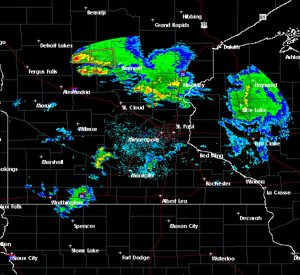 At 352 am cdt, a severe thunderstorm was located near wadena, or 44 miles southeast of detroit lakes, moving east at 40 mph (radar indicated). Hazards include quarter size hail. Damage to vehicles is expected. Locations impacted include, wadena, verndale, staples airport, aldrich, blue grass and oylen. At 352 am cdt, a severe thunderstorm was located near wadena, or 44 miles southeast of detroit lakes, moving east at 40 mph (radar indicated). Hazards include quarter size hail. Damage to vehicles is expected. Locations impacted include, wadena, verndale, staples airport, aldrich, blue grass and oylen.
|
| 4/7/2020 3:32 AM CDT |
 At 332 am cdt, a severe thunderstorm was located over wadena, or 43 miles southeast of detroit lakes, moving east at 35 mph (radar indicated). Hazards include quarter size hail. damage to vehicles is expected At 332 am cdt, a severe thunderstorm was located over wadena, or 43 miles southeast of detroit lakes, moving east at 35 mph (radar indicated). Hazards include quarter size hail. damage to vehicles is expected
|
| 8/20/2019 6:39 AM CDT |
 The severe thunderstorm warning for southeastern wadena county will expire at 645 am cdt, the storm which prompted the warning has moved out of the area. therefore, the warning will be allowed to expire. to report severe weather, contact your nearest law enforcement agency. they will relay your report to the national weather service grand forks. The severe thunderstorm warning for southeastern wadena county will expire at 645 am cdt, the storm which prompted the warning has moved out of the area. therefore, the warning will be allowed to expire. to report severe weather, contact your nearest law enforcement agency. they will relay your report to the national weather service grand forks.
|
| 8/20/2019 6:36 AM CDT |
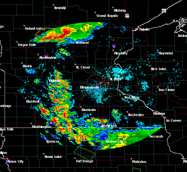 A severe thunderstorm warning remains in effect until 645 am cdt for southeastern wadena county. at 636 am cdt, a severe thunderstorm was located near aldrich, or 51 miles southeast of detroit lakes, moving southeast at 45 mph. hazard. 60 mph wind gusts and quarter size hail. source. Radar indicated. A severe thunderstorm warning remains in effect until 645 am cdt for southeastern wadena county. at 636 am cdt, a severe thunderstorm was located near aldrich, or 51 miles southeast of detroit lakes, moving southeast at 45 mph. hazard. 60 mph wind gusts and quarter size hail. source. Radar indicated.
|
| 8/20/2019 6:25 AM CDT |
 At 608 am cdt, a severe thunderstorm was located near sebeka, or 35 miles southeast of detroit lakes, moving southeast at 50 mph (radar indicated). Hazards include 60 mph wind gusts and quarter size hail. Hail damage to vehicles is expected. expect wind damage to roofs, siding, and trees. this severe thunderstorm will be near, sebeka around 610 am cdt. blue grass and nimrod around 620 am cdt. oylen around 630 am cdt. Staples airport around 635 am cdt. At 608 am cdt, a severe thunderstorm was located near sebeka, or 35 miles southeast of detroit lakes, moving southeast at 50 mph (radar indicated). Hazards include 60 mph wind gusts and quarter size hail. Hail damage to vehicles is expected. expect wind damage to roofs, siding, and trees. this severe thunderstorm will be near, sebeka around 610 am cdt. blue grass and nimrod around 620 am cdt. oylen around 630 am cdt. Staples airport around 635 am cdt.
|
| 8/20/2019 6:10 AM CDT |
 The severe thunderstorm warning for hubbard, wadena, northeastern otter tail and southeastern becker counties will expire at 615 am cdt, the storms which prompted the warning have weakened below severe limits. therefore, the warning will be allowed to expire. to report severe weather, contact your nearest law enforcement agency. they will relay your report to the national weather service grand forks. remember, a severe thunderstorm warning still remains in effect for portions of wadena and northeast ottertail counties. The severe thunderstorm warning for hubbard, wadena, northeastern otter tail and southeastern becker counties will expire at 615 am cdt, the storms which prompted the warning have weakened below severe limits. therefore, the warning will be allowed to expire. to report severe weather, contact your nearest law enforcement agency. they will relay your report to the national weather service grand forks. remember, a severe thunderstorm warning still remains in effect for portions of wadena and northeast ottertail counties.
|
| 8/20/2019 6:09 AM CDT |
 At 608 am cdt, a severe thunderstorm was located near sebeka, or 35 miles southeast of detroit lakes, moving southeast at 50 mph (radar indicated). Hazards include 60 mph wind gusts and quarter size hail. Hail damage to vehicles is expected. expect wind damage to roofs, siding, and trees. this severe thunderstorm will be near, sebeka around 610 am cdt. blue grass and nimrod around 620 am cdt. oylen around 630 am cdt. Staples airport around 635 am cdt. At 608 am cdt, a severe thunderstorm was located near sebeka, or 35 miles southeast of detroit lakes, moving southeast at 50 mph (radar indicated). Hazards include 60 mph wind gusts and quarter size hail. Hail damage to vehicles is expected. expect wind damage to roofs, siding, and trees. this severe thunderstorm will be near, sebeka around 610 am cdt. blue grass and nimrod around 620 am cdt. oylen around 630 am cdt. Staples airport around 635 am cdt.
|
| 8/20/2019 6:02 AM CDT |
 At 602 am cdt, severe thunderstorms were located along a line extending from near new york mills to near huntersville to wilkinson, moving east at 60 mph (radar indicated). Hazards include 70 mph wind gusts and quarter size hail. Hail damage to vehicles is expected. expect considerable tree damage. wind damage is also likely to mobile homes, roofs, and outbuildings. Locations impacted include, wadena, park rapids, menahga, new york mills, sebeka, verndale and staples airport. At 602 am cdt, severe thunderstorms were located along a line extending from near new york mills to near huntersville to wilkinson, moving east at 60 mph (radar indicated). Hazards include 70 mph wind gusts and quarter size hail. Hail damage to vehicles is expected. expect considerable tree damage. wind damage is also likely to mobile homes, roofs, and outbuildings. Locations impacted include, wadena, park rapids, menahga, new york mills, sebeka, verndale and staples airport.
|
| 8/20/2019 5:46 AM CDT |
 At 545 am cdt, severe thunderstorms were located along a line extending from near bluffton to near badoura to near benedict, moving east at 70 mph (radar indicated). Hazards include 70 mph wind gusts and quarter size hail. Hail damage to vehicles is expected. expect considerable tree damage. wind damage is also likely to mobile homes, roofs, and outbuildings. Locations impacted include, wadena, park rapids, perham, frazee, menahga, new york mills and sebeka. At 545 am cdt, severe thunderstorms were located along a line extending from near bluffton to near badoura to near benedict, moving east at 70 mph (radar indicated). Hazards include 70 mph wind gusts and quarter size hail. Hail damage to vehicles is expected. expect considerable tree damage. wind damage is also likely to mobile homes, roofs, and outbuildings. Locations impacted include, wadena, park rapids, perham, frazee, menahga, new york mills and sebeka.
|
| 8/20/2019 5:32 AM CDT |
 At 531 am cdt, severe thunderstorms were located along a line extending from near perham to near park rapids to near lake george, moving east at 70 mph. these are very dangerous storms (radar indicated). Hazards include 80 mph wind gusts and quarter size hail. Flying debris will be dangerous to those caught without shelter. mobile homes will be heavily damaged. expect considerable damage to roofs, windows, and vehicles. extensive tree damage and power outages are likely. Locations impacted include, detroit lakes, wadena, park rapids, perham, frazee, menahga and new york mills. At 531 am cdt, severe thunderstorms were located along a line extending from near perham to near park rapids to near lake george, moving east at 70 mph. these are very dangerous storms (radar indicated). Hazards include 80 mph wind gusts and quarter size hail. Flying debris will be dangerous to those caught without shelter. mobile homes will be heavily damaged. expect considerable damage to roofs, windows, and vehicles. extensive tree damage and power outages are likely. Locations impacted include, detroit lakes, wadena, park rapids, perham, frazee, menahga and new york mills.
|
| 8/20/2019 5:13 AM CDT |
 The national weather service in grand forks has issued a * severe thunderstorm warning for. hubbard county in north central minnesota. wadena county in central minnesota. northeastern otter tail county in west central minnesota. Southeastern mahnomen county in northwestern minnesota. The national weather service in grand forks has issued a * severe thunderstorm warning for. hubbard county in north central minnesota. wadena county in central minnesota. northeastern otter tail county in west central minnesota. Southeastern mahnomen county in northwestern minnesota.
|
| 7/19/2019 3:06 PM CDT |
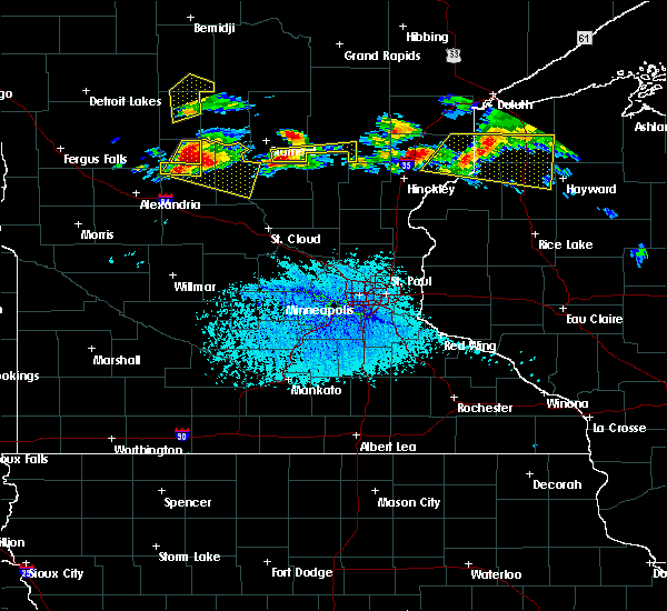 At 306 pm cdt, a severe thunderstorm was located near staples, or 32 miles west of brainerd, moving east at 40 mph (radar indicated). Hazards include two inch hail and 60 mph wind gusts. People and animals outdoors will be injured. expect hail damage to roofs, siding, windows, and vehicles. expect wind damage to roofs, siding, and trees. Locations impacted include, staples and eagle bend. At 306 pm cdt, a severe thunderstorm was located near staples, or 32 miles west of brainerd, moving east at 40 mph (radar indicated). Hazards include two inch hail and 60 mph wind gusts. People and animals outdoors will be injured. expect hail damage to roofs, siding, windows, and vehicles. expect wind damage to roofs, siding, and trees. Locations impacted include, staples and eagle bend.
|
| 7/19/2019 3:05 PM CDT |
 At 305 pm cdt, a severe thunderstorm was located near clarissa, or 27 miles northwest of little falls, moving east at 40 mph (radar indicated). Hazards include two inch hail and 60 mph wind gusts. People and animals outdoors will be injured. expect hail damage to roofs, siding, windows, and vehicles. Expect wind damage to roofs, siding, and trees. At 305 pm cdt, a severe thunderstorm was located near clarissa, or 27 miles northwest of little falls, moving east at 40 mph (radar indicated). Hazards include two inch hail and 60 mph wind gusts. People and animals outdoors will be injured. expect hail damage to roofs, siding, windows, and vehicles. Expect wind damage to roofs, siding, and trees.
|
| 7/19/2019 2:49 PM CDT |
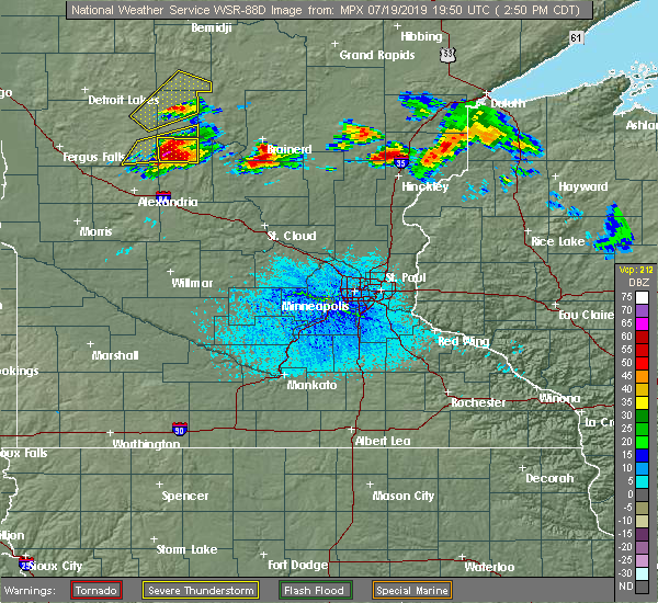 At 248 pm cdt, a severe thunderstorm was located over hewitt moving east at 35 mph. half dollar sized hail has been reported with this thunderstorm (radar indicated). Hazards include tennis ball size hail and 60 mph wind gusts. People and animals outdoors will be injured. expect hail damage to roofs, siding, windows, and vehicles. expect wind damage to roofs, siding, and trees. this severe storm will be near, verndale around 255 pm cdt. aldrich around 300 pm cdt. Staples airport around 310 pm cdt. At 248 pm cdt, a severe thunderstorm was located over hewitt moving east at 35 mph. half dollar sized hail has been reported with this thunderstorm (radar indicated). Hazards include tennis ball size hail and 60 mph wind gusts. People and animals outdoors will be injured. expect hail damage to roofs, siding, windows, and vehicles. expect wind damage to roofs, siding, and trees. this severe storm will be near, verndale around 255 pm cdt. aldrich around 300 pm cdt. Staples airport around 310 pm cdt.
|
| 7/19/2019 2:38 PM CDT |
 At 238 pm cdt, a severe thunderstorm was located over wrightstown moving east at 35 mph (radar indicated). Hazards include tennis ball size hail and 60 mph wind gusts. People and animals outdoors will be injured. expect hail damage to roofs, siding, windows, and vehicles. expect wind damage to roofs, siding, and trees. this severe storm will be near, aldrich and verndale around 300 pm cdt. Staples airport around 310 pm cdt. At 238 pm cdt, a severe thunderstorm was located over wrightstown moving east at 35 mph (radar indicated). Hazards include tennis ball size hail and 60 mph wind gusts. People and animals outdoors will be injured. expect hail damage to roofs, siding, windows, and vehicles. expect wind damage to roofs, siding, and trees. this severe storm will be near, aldrich and verndale around 300 pm cdt. Staples airport around 310 pm cdt.
|
| 7/19/2019 2:24 PM CDT |
 At 223 pm cdt, a severe thunderstorm was located over almora, or 32 miles east of fergus falls, moving east at 35 mph (radar indicated). Hazards include two inch hail and 60 mph wind gusts. People and animals outdoors will be injured. expect hail damage to roofs, siding, windows, and vehicles. expect wind damage to roofs, siding, and trees. this severe storm will be near, almora and parkers prairie around 225 pm cdt. wrightstown around 240 pm cdt. aldrich and verndale around 300 pm cdt. Staples airport around 315 pm cdt. At 223 pm cdt, a severe thunderstorm was located over almora, or 32 miles east of fergus falls, moving east at 35 mph (radar indicated). Hazards include two inch hail and 60 mph wind gusts. People and animals outdoors will be injured. expect hail damage to roofs, siding, windows, and vehicles. expect wind damage to roofs, siding, and trees. this severe storm will be near, almora and parkers prairie around 225 pm cdt. wrightstown around 240 pm cdt. aldrich and verndale around 300 pm cdt. Staples airport around 315 pm cdt.
|
| 7/19/2019 2:22 PM CDT |
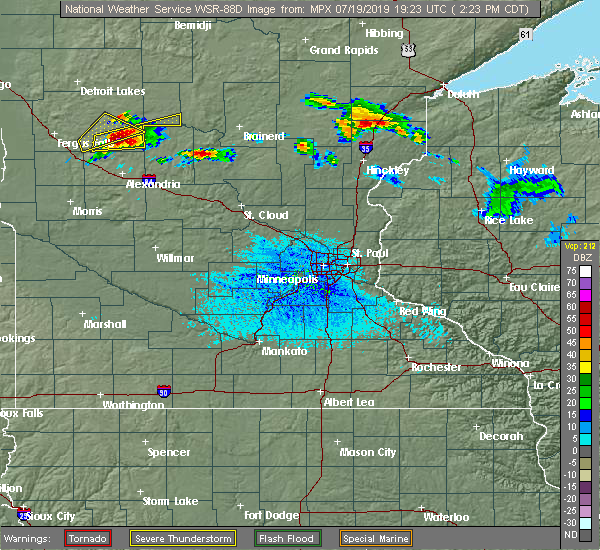 At 222 pm cdt, a severe thunderstorm was located near henning, or 22 miles north of alexandria, moving east at 40 mph (radar indicated). Hazards include two inch hail and 60 mph wind gusts. People and animals outdoors will be injured. expect hail damage to roofs, siding, windows, and vehicles. Expect wind damage to roofs, siding, and trees. At 222 pm cdt, a severe thunderstorm was located near henning, or 22 miles north of alexandria, moving east at 40 mph (radar indicated). Hazards include two inch hail and 60 mph wind gusts. People and animals outdoors will be injured. expect hail damage to roofs, siding, windows, and vehicles. Expect wind damage to roofs, siding, and trees.
|
| 7/19/2019 2:16 PM CDT |
 At 216 pm cdt, a severe thunderstorm was located near vining, or 28 miles east of fergus falls, moving east at 35 mph (radar indicated). Hazards include two inch hail and 60 mph wind gusts. People and animals outdoors will be injured. expect hail damage to roofs, siding, windows, and vehicles. expect wind damage to roofs, siding, and trees. this severe thunderstorm will be near, almora, parkers prairie and henning around 225 pm cdt. wrightstown around 240 pm cdt. aldrich and verndale around 300 pm cdt. Staples airport around 315 pm cdt. At 216 pm cdt, a severe thunderstorm was located near vining, or 28 miles east of fergus falls, moving east at 35 mph (radar indicated). Hazards include two inch hail and 60 mph wind gusts. People and animals outdoors will be injured. expect hail damage to roofs, siding, windows, and vehicles. expect wind damage to roofs, siding, and trees. this severe thunderstorm will be near, almora, parkers prairie and henning around 225 pm cdt. wrightstown around 240 pm cdt. aldrich and verndale around 300 pm cdt. Staples airport around 315 pm cdt.
|
| 7/9/2019 12:23 AM CDT |
 At 1223 am cdt, severe thunderstorms were located along a line extending from midway to near vining to erdahl, moving east at 30 mph (radar indicated). Hazards include 60 mph wind gusts. Expect damage to roofs, siding, and trees. locations impacted include, wadena, perham, ottertail lake, frazee, menahga, new york mills and elbow lake. This includes interstate 94 in minnesota between mile markers 63 and 80. At 1223 am cdt, severe thunderstorms were located along a line extending from midway to near vining to erdahl, moving east at 30 mph (radar indicated). Hazards include 60 mph wind gusts. Expect damage to roofs, siding, and trees. locations impacted include, wadena, perham, ottertail lake, frazee, menahga, new york mills and elbow lake. This includes interstate 94 in minnesota between mile markers 63 and 80.
|
| 7/8/2019 11:43 PM CDT |
 At 1143 pm cdt, severe thunderstorms were located along a line extending from height of land lake to near phelps to western, moving east at 40 mph (radar indicated). Hazards include 60 mph wind gusts. expect damage to roofs, siding, and trees At 1143 pm cdt, severe thunderstorms were located along a line extending from height of land lake to near phelps to western, moving east at 40 mph (radar indicated). Hazards include 60 mph wind gusts. expect damage to roofs, siding, and trees
|
| 8/31/2018 6:22 PM CDT |
 The severe thunderstorm warning for wadena county will expire at 630 pm cdt, the storms which prompted the warning have moved out of the area. therefore, the warning will be allowed to expire. to report severe weather, contact your nearest law enforcement agency. they will relay your report to the national weather service grand forks. The severe thunderstorm warning for wadena county will expire at 630 pm cdt, the storms which prompted the warning have moved out of the area. therefore, the warning will be allowed to expire. to report severe weather, contact your nearest law enforcement agency. they will relay your report to the national weather service grand forks.
|
| 8/31/2018 6:11 PM CDT |
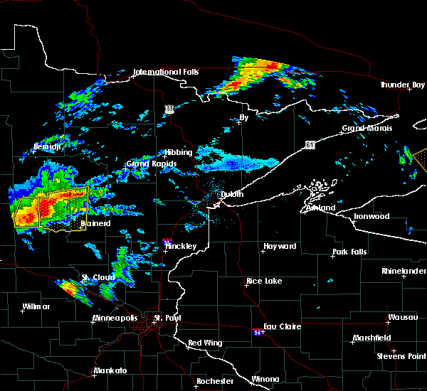 At 611 pm cdt, severe thunderstorms were located along a line extending from near backus to wadena, moving northeast at 45 mph (radar indicated). Hazards include 60 mph wind gusts and quarter size hail. Hail damage to vehicles is expected. expect wind damage to roofs, siding, and trees. These severe storms will be near, oylen around 630 pm cdt. At 611 pm cdt, severe thunderstorms were located along a line extending from near backus to wadena, moving northeast at 45 mph (radar indicated). Hazards include 60 mph wind gusts and quarter size hail. Hail damage to vehicles is expected. expect wind damage to roofs, siding, and trees. These severe storms will be near, oylen around 630 pm cdt.
|
| 8/31/2018 5:57 PM CDT |
 At 556 pm cdt, severe thunderstorms were located along a line extending from oshawa to near deer creek, moving northeast at 45 mph (radar indicated). Hazards include 60 mph wind gusts and half dollar size hail. Hail damage to vehicles is expected. expect wind damage to roofs, siding, and trees. severe thunderstorms will be near, verndale around 615 pm cdt. blue grass and aldrich around 620 pm cdt. Oylen around 630 pm cdt. At 556 pm cdt, severe thunderstorms were located along a line extending from oshawa to near deer creek, moving northeast at 45 mph (radar indicated). Hazards include 60 mph wind gusts and half dollar size hail. Hail damage to vehicles is expected. expect wind damage to roofs, siding, and trees. severe thunderstorms will be near, verndale around 615 pm cdt. blue grass and aldrich around 620 pm cdt. Oylen around 630 pm cdt.
|
| 8/26/2018 11:55 AM CDT |
 The severe thunderstorm warning for southern hubbard, wadena, eastern otter tail and southeastern becker counties will expire at noon cdt, the storms which prompted the warning have weakened. therefore, the warning will be allowed to expire. however gusty winds, small hail, and heavy rain are still possible with these thunderstorms. The severe thunderstorm warning for southern hubbard, wadena, eastern otter tail and southeastern becker counties will expire at noon cdt, the storms which prompted the warning have weakened. therefore, the warning will be allowed to expire. however gusty winds, small hail, and heavy rain are still possible with these thunderstorms.
|
| 8/26/2018 11:40 AM CDT |
 At 1140 am cdt, severe thunderstorms were located along a line extending from near evergreen to near hillview to deer creek to miltona, moving east at 60 mph (radar indicated). Hazards include 60 mph wind gusts and penny size hail. Expect damage to roofs, siding, and trees. Locations impacted include, detroit lakes, wadena, park rapids, perham, frazee, menahga and new york mills. At 1140 am cdt, severe thunderstorms were located along a line extending from near evergreen to near hillview to deer creek to miltona, moving east at 60 mph (radar indicated). Hazards include 60 mph wind gusts and penny size hail. Expect damage to roofs, siding, and trees. Locations impacted include, detroit lakes, wadena, park rapids, perham, frazee, menahga and new york mills.
|
| 8/26/2018 11:30 AM CDT |
 At 1129 am cdt, severe thunderstorms were located along a line extending from near rochert to near butler to near henning to leaf valley, moving northeast at 65 mph (radar indicated). Hazards include 60 mph wind gusts and penny size hail. Expect damage to roofs, siding, and trees. Locations impacted include, detroit lakes, wadena, park rapids, perham, ottertail lake, frazee and menahga. At 1129 am cdt, severe thunderstorms were located along a line extending from near rochert to near butler to near henning to leaf valley, moving northeast at 65 mph (radar indicated). Hazards include 60 mph wind gusts and penny size hail. Expect damage to roofs, siding, and trees. Locations impacted include, detroit lakes, wadena, park rapids, perham, ottertail lake, frazee and menahga.
|
| 8/26/2018 11:01 AM CDT |
 At 1101 am cdt, severe thunderstorms were located along a line extending from near dunvilla to maplewood state park to near fergus falls to near barrett, moving east at 70 mph (radar indicated). Hazards include 70 mph wind gusts and quarter size hail. Hail damage to vehicles is expected. expect considerable tree damage. Wind damage is also likely to mobile homes, roofs, and outbuildings. At 1101 am cdt, severe thunderstorms were located along a line extending from near dunvilla to maplewood state park to near fergus falls to near barrett, moving east at 70 mph (radar indicated). Hazards include 70 mph wind gusts and quarter size hail. Hail damage to vehicles is expected. expect considerable tree damage. Wind damage is also likely to mobile homes, roofs, and outbuildings.
|
| 7/8/2018 8:57 PM CDT |
 At 826 pm cdt, severe thunderstorms were located along a line extending from oylen to near ottertail lake, moving southeast at 35 mph (radar indicated). Hazards include 60 mph wind gusts and nickel size hail. Expect damage to roofs, siding, and trees. severe thunderstorms will be near, oylen and nimrod around 830 pm cdt. vining around 845 pm cdt. henning and deer creek around 850 pm cdt. Almora and wrightstown around 900 pm cdt. At 826 pm cdt, severe thunderstorms were located along a line extending from oylen to near ottertail lake, moving southeast at 35 mph (radar indicated). Hazards include 60 mph wind gusts and nickel size hail. Expect damage to roofs, siding, and trees. severe thunderstorms will be near, oylen and nimrod around 830 pm cdt. vining around 845 pm cdt. henning and deer creek around 850 pm cdt. Almora and wrightstown around 900 pm cdt.
|
| 7/8/2018 8:26 PM CDT |
 At 826 pm cdt, severe thunderstorms were located along a line extending from oylen to near ottertail lake, moving southeast at 35 mph (radar indicated). Hazards include 60 mph wind gusts and nickel size hail. Expect damage to roofs, siding, and trees. severe thunderstorms will be near, oylen and nimrod around 830 pm cdt. vining around 845 pm cdt. henning and deer creek around 850 pm cdt. Almora and wrightstown around 900 pm cdt. At 826 pm cdt, severe thunderstorms were located along a line extending from oylen to near ottertail lake, moving southeast at 35 mph (radar indicated). Hazards include 60 mph wind gusts and nickel size hail. Expect damage to roofs, siding, and trees. severe thunderstorms will be near, oylen and nimrod around 830 pm cdt. vining around 845 pm cdt. henning and deer creek around 850 pm cdt. Almora and wrightstown around 900 pm cdt.
|
| 6/30/2018 12:47 AM CDT |
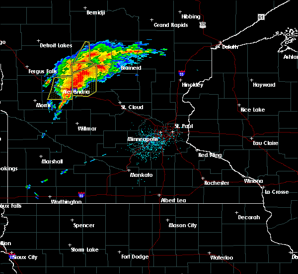 At 1246 am cdt, a severe thunderstorm was located near staples, or 31 miles west of brainerd, moving northeast at 30 mph (radar indicated). Hazards include 60 mph wind gusts and quarter size hail. Hail damage to vehicles is expected. expect wind damage to roofs, siding, and trees. Locations impacted include, staples, staples airport, bertha and hewitt. At 1246 am cdt, a severe thunderstorm was located near staples, or 31 miles west of brainerd, moving northeast at 30 mph (radar indicated). Hazards include 60 mph wind gusts and quarter size hail. Hail damage to vehicles is expected. expect wind damage to roofs, siding, and trees. Locations impacted include, staples, staples airport, bertha and hewitt.
|
| 6/30/2018 12:37 AM CDT |
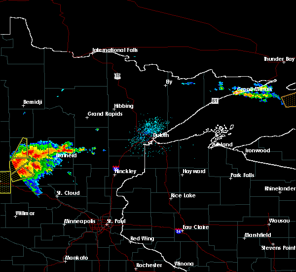 At 1236 am cdt, a severe thunderstorm was located 5 miles north of staples, or 55 miles southeast of detroit lakes, moving north at 15 mph (radar indicated). Hazards include 60 mph wind gusts and quarter size hail. Hail damage to vehicles is expected. expect wind damage to roofs, siding, and trees. this severe storm will be near, oylen around 110 am cdt. Nimrod around 115 am cdt. At 1236 am cdt, a severe thunderstorm was located 5 miles north of staples, or 55 miles southeast of detroit lakes, moving north at 15 mph (radar indicated). Hazards include 60 mph wind gusts and quarter size hail. Hail damage to vehicles is expected. expect wind damage to roofs, siding, and trees. this severe storm will be near, oylen around 110 am cdt. Nimrod around 115 am cdt.
|
| 6/30/2018 12:18 AM CDT |
 At 1217 am cdt, a severe thunderstorm was located over bertha, or 29 miles northeast of alexandria, moving northeast at 30 mph (radar indicated). Hazards include ping pong ball size hail and 60 mph wind gusts. People and animals outdoors will be injured. expect hail damage to roofs, siding, windows, and vehicles. Expect wind damage to roofs, siding, and trees. At 1217 am cdt, a severe thunderstorm was located over bertha, or 29 miles northeast of alexandria, moving northeast at 30 mph (radar indicated). Hazards include ping pong ball size hail and 60 mph wind gusts. People and animals outdoors will be injured. expect hail damage to roofs, siding, windows, and vehicles. Expect wind damage to roofs, siding, and trees.
|
| 6/30/2018 12:15 AM CDT |
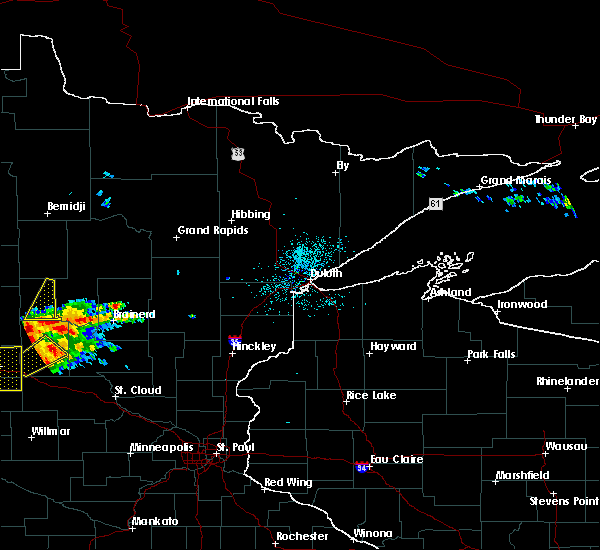 At 1215 am cdt, a severe thunderstorm was located near hewitt, or 50 miles east of fergus falls, moving northeast at 30 mph (radar indicated). Hazards include 60 mph wind gusts and quarter size hail. Hail damage to vehicles is expected. expect wind damage to roofs, siding, and trees. this severe thunderstorm will be near, aldrich and verndale around 1225 am cdt. blue grass around 1245 am cdt. oylen around 100 am cdt. Nimrod around 105 am cdt. At 1215 am cdt, a severe thunderstorm was located near hewitt, or 50 miles east of fergus falls, moving northeast at 30 mph (radar indicated). Hazards include 60 mph wind gusts and quarter size hail. Hail damage to vehicles is expected. expect wind damage to roofs, siding, and trees. this severe thunderstorm will be near, aldrich and verndale around 1225 am cdt. blue grass around 1245 am cdt. oylen around 100 am cdt. Nimrod around 105 am cdt.
|
| 6/29/2018 5:25 AM CDT |
 At 525 am cdt, severe thunderstorms were located along a line extending from near westbury to near dunvilla to near pelican rapids, moving east at 55 mph (public. this storm has a history of producing measured wind gusts up to 60 mph). Hazards include 60 mph wind gusts and penny size hail. Expect damage to roofs, siding, and trees. these severe storms will be near, detroit lakes around 530 am cdt. height of land lake, vergas and rochert around 535 am cdt. frazee around 540 am cdt. big mcdonald lake, toad lake and snellman around 545 am cdt. Richville, wolf lake and evergreen around 550 am cdt. At 525 am cdt, severe thunderstorms were located along a line extending from near westbury to near dunvilla to near pelican rapids, moving east at 55 mph (public. this storm has a history of producing measured wind gusts up to 60 mph). Hazards include 60 mph wind gusts and penny size hail. Expect damage to roofs, siding, and trees. these severe storms will be near, detroit lakes around 530 am cdt. height of land lake, vergas and rochert around 535 am cdt. frazee around 540 am cdt. big mcdonald lake, toad lake and snellman around 545 am cdt. Richville, wolf lake and evergreen around 550 am cdt.
|
| 6/29/2018 4:57 AM CDT |
 At 456 am cdt, severe thunderstorms were located along a line extending from near hitterdal to near barnesville to near great bend, moving east at 60 mph (radar indicated). Hazards include 60 mph wind gusts and penny size hail. Expect damage to roofs, siding, and trees. severe thunderstorms will be near, lawndale, barnesville and hawley around 500 am cdt. dale around 505 am cdt. everdell and lake park around 510 am cdt. pelican rapids, dunvilla and lake lida around 515 am cdt. western around 520 am cdt. other locations impacted by these severe thunderstorms include fergus falls airport. this includes interstate 94 in minnesota between mile markers 9 and 69. This storm has a history of producing measured wind gusts around 60 mph. At 456 am cdt, severe thunderstorms were located along a line extending from near hitterdal to near barnesville to near great bend, moving east at 60 mph (radar indicated). Hazards include 60 mph wind gusts and penny size hail. Expect damage to roofs, siding, and trees. severe thunderstorms will be near, lawndale, barnesville and hawley around 500 am cdt. dale around 505 am cdt. everdell and lake park around 510 am cdt. pelican rapids, dunvilla and lake lida around 515 am cdt. western around 520 am cdt. other locations impacted by these severe thunderstorms include fergus falls airport. this includes interstate 94 in minnesota between mile markers 9 and 69. This storm has a history of producing measured wind gusts around 60 mph.
|
| 6/17/2018 12:22 PM CDT |
 At 1222 pm cdt, a severe thunderstorm was located over long prairie, or 24 miles west of little falls, moving east at 35 mph (radar indicated). Hazards include 60 mph wind gusts and half dollar size hail. Hail damage to vehicles is expected. expect wind damage to roofs, siding, and trees. this severe thunderstorm will be near, randall around 1255 pm cdt. Little falls and camp ripley around 100 pm cdt. At 1222 pm cdt, a severe thunderstorm was located over long prairie, or 24 miles west of little falls, moving east at 35 mph (radar indicated). Hazards include 60 mph wind gusts and half dollar size hail. Hail damage to vehicles is expected. expect wind damage to roofs, siding, and trees. this severe thunderstorm will be near, randall around 1255 pm cdt. Little falls and camp ripley around 100 pm cdt.
|
| 6/6/2018 2:57 AM CDT |
 The severe thunderstorm warning for douglas and todd counties will expire at 300 am cdt, the storms which prompted the warning have weakened below severe limits, and no longer pose an immediate threat to life or property. therefore the warning will be allowed to expire. however wind gusts to 45 mph are still possible with these thunderstorms. a severe thunderstorm watch remains in effect until 600 am cdt for central and west central minnesota. The severe thunderstorm warning for douglas and todd counties will expire at 300 am cdt, the storms which prompted the warning have weakened below severe limits, and no longer pose an immediate threat to life or property. therefore the warning will be allowed to expire. however wind gusts to 45 mph are still possible with these thunderstorms. a severe thunderstorm watch remains in effect until 600 am cdt for central and west central minnesota.
|
| 6/6/2018 2:28 AM CDT |
 At 228 am cdt, severe thunderstorms were located along a line extending from near bertha to near carlos to 6 miles southwest of hoffman, moving east at 45 mph (radar indicated). Hazards include 60 mph wind gusts. Expect damage to roofs, siding, and trees. these severe storms will be near, carlos around 235 am cdt. staples around 240 am cdt. lake osakis around 250 am cdt. long prairie around 300 am cdt. Other locations impacted by these severe thunderstorms include nelson, garfield, melby, miltona, rose city, holmes city, clotho, philbrook and forada. At 228 am cdt, severe thunderstorms were located along a line extending from near bertha to near carlos to 6 miles southwest of hoffman, moving east at 45 mph (radar indicated). Hazards include 60 mph wind gusts. Expect damage to roofs, siding, and trees. these severe storms will be near, carlos around 235 am cdt. staples around 240 am cdt. lake osakis around 250 am cdt. long prairie around 300 am cdt. Other locations impacted by these severe thunderstorms include nelson, garfield, melby, miltona, rose city, holmes city, clotho, philbrook and forada.
|
| 6/6/2018 2:09 AM CDT |
 At 209 am cdt, severe thunderstorms were located along a line extending from near deer creek to near evansville to near herman, moving east at 45 mph (radar indicated). Hazards include 60 mph wind gusts. Expect damage to roofs, siding, and trees. severe thunderstorms will be near, hewitt around 220 am cdt. bertha around 225 am cdt. staples, carlos, and kensington around 235 am cdt. lake osakis around 245 am cdt. long prairie around 300 am cdt. other locations impacted by these severe thunderstorms include alexandria airport, nelson, garfield, melby, miltona, rose city, holmes city, clotho, philbrook and forada. this includes the following highways, interstate 94 in minnesota between mile markers 81 and 119. u. s. highway 10 in minnesota between mile markers 103 and 114, between mile markers 117 and 118, and between mile markers 123 and 125. u. s. Highway 71 between mile markers 185 and 219. At 209 am cdt, severe thunderstorms were located along a line extending from near deer creek to near evansville to near herman, moving east at 45 mph (radar indicated). Hazards include 60 mph wind gusts. Expect damage to roofs, siding, and trees. severe thunderstorms will be near, hewitt around 220 am cdt. bertha around 225 am cdt. staples, carlos, and kensington around 235 am cdt. lake osakis around 245 am cdt. long prairie around 300 am cdt. other locations impacted by these severe thunderstorms include alexandria airport, nelson, garfield, melby, miltona, rose city, holmes city, clotho, philbrook and forada. this includes the following highways, interstate 94 in minnesota between mile markers 81 and 119. u. s. highway 10 in minnesota between mile markers 103 and 114, between mile markers 117 and 118, and between mile markers 123 and 125. u. s. Highway 71 between mile markers 185 and 219.
|
| 5/29/2018 3:39 PM CDT |
 At 338 pm cdt, a severe thunderstorm was located near nimrod, or 34 miles northwest of brainerd, moving north at 35 mph (radar indicated). Hazards include 60 mph wind gusts and quarter size hail. Hail damage to vehicles is expected. expect wind damage to roofs, siding, and trees. Locations impacted include, staples airport, huntersville, nimrod and oylen. At 338 pm cdt, a severe thunderstorm was located near nimrod, or 34 miles northwest of brainerd, moving north at 35 mph (radar indicated). Hazards include 60 mph wind gusts and quarter size hail. Hail damage to vehicles is expected. expect wind damage to roofs, siding, and trees. Locations impacted include, staples airport, huntersville, nimrod and oylen.
|
| 5/29/2018 3:27 PM CDT |
 At 327 pm cdt, a severe thunderstorm was located near staples airport, or 29 miles west of brainerd, moving northeast at 25 mph (radar indicated). Hazards include 60 mph wind gusts and quarter size hail. Hail damage to vehicles is expected. Expect wind damage to roofs, siding, and trees. At 327 pm cdt, a severe thunderstorm was located near staples airport, or 29 miles west of brainerd, moving northeast at 25 mph (radar indicated). Hazards include 60 mph wind gusts and quarter size hail. Hail damage to vehicles is expected. Expect wind damage to roofs, siding, and trees.
|
| 5/29/2018 3:13 PM CDT |
 At 312 pm cdt, a severe thunderstorm was located near blue grass, or 34 miles north of long prairie, moving north at 35 mph (trained weather spotters. at 302 pm...estimated 60 mph winds were reported 5 miles north of verndale). Hazards include 60 mph wind gusts and quarter size hail. Hail damage to vehicles is expected. expect wind damage to roofs, siding, and trees. Locations impacted include, sebeka, verndale, staples airport, huntersville, nimrod, aldrich and blue grass. At 312 pm cdt, a severe thunderstorm was located near blue grass, or 34 miles north of long prairie, moving north at 35 mph (trained weather spotters. at 302 pm...estimated 60 mph winds were reported 5 miles north of verndale). Hazards include 60 mph wind gusts and quarter size hail. Hail damage to vehicles is expected. expect wind damage to roofs, siding, and trees. Locations impacted include, sebeka, verndale, staples airport, huntersville, nimrod, aldrich and blue grass.
|
| 5/29/2018 2:56 PM CDT |
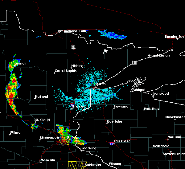 At 256 pm cdt, a severe thunderstorm was located near verndale, or 32 miles north of long prairie, moving northeast at 20 mph (radar indicated). Hazards include 60 mph wind gusts and quarter size hail. Hail damage to vehicles is expected. expect wind damage to roofs, siding, and trees. Locations impacted include, sebeka, verndale, staples airport, huntersville, nimrod, aldrich and blue grass. At 256 pm cdt, a severe thunderstorm was located near verndale, or 32 miles north of long prairie, moving northeast at 20 mph (radar indicated). Hazards include 60 mph wind gusts and quarter size hail. Hail damage to vehicles is expected. expect wind damage to roofs, siding, and trees. Locations impacted include, sebeka, verndale, staples airport, huntersville, nimrod, aldrich and blue grass.
|
| 5/29/2018 2:38 PM CDT |
 At 238 pm cdt, a severe thunderstorm was located over aldrich, or 28 miles north of long prairie, moving north at 25 mph (radar indicated). Hazards include 60 mph wind gusts and quarter size hail. Hail damage to vehicles is expected. Expect wind damage to roofs, siding, and trees. At 238 pm cdt, a severe thunderstorm was located over aldrich, or 28 miles north of long prairie, moving north at 25 mph (radar indicated). Hazards include 60 mph wind gusts and quarter size hail. Hail damage to vehicles is expected. Expect wind damage to roofs, siding, and trees.
|
| 9/22/2017 4:31 AM CDT |
 At 431 am cdt, a severe thunderstorm was located over staples, or 30 miles west of brainerd, moving northeast at 35 mph (radar indicated). Hazards include 60 mph wind gusts and quarter size hail. Hail damage to vehicles is expected. expect wind damage to roofs, siding, and trees. this severe storm will be near, staples around 435 am cdt. Staples airport around 440 am cdt. At 431 am cdt, a severe thunderstorm was located over staples, or 30 miles west of brainerd, moving northeast at 35 mph (radar indicated). Hazards include 60 mph wind gusts and quarter size hail. Hail damage to vehicles is expected. expect wind damage to roofs, siding, and trees. this severe storm will be near, staples around 435 am cdt. Staples airport around 440 am cdt.
|
| 9/22/2017 4:14 AM CDT |
 At 414 am cdt, a severe thunderstorm was located near eagle bend, or 29 miles northeast of alexandria, moving northeast at 35 mph (radar indicated). Hazards include 60 mph wind gusts and quarter size hail. Hail damage to vehicles is expected. expect wind damage to roofs, siding, and trees. this severe thunderstorm will be near, staples around 435 am cdt. staples airport around 440 am cdt. other locations impacted by this severe thunderstorm include philbrook. this includes the following highways, u. s. highway 10 in minnesota between mile markers 103 and 114. u. s. Highway 71 between mile markers 196 and 197, and between mile markers 207 and 219. At 414 am cdt, a severe thunderstorm was located near eagle bend, or 29 miles northeast of alexandria, moving northeast at 35 mph (radar indicated). Hazards include 60 mph wind gusts and quarter size hail. Hail damage to vehicles is expected. expect wind damage to roofs, siding, and trees. this severe thunderstorm will be near, staples around 435 am cdt. staples airport around 440 am cdt. other locations impacted by this severe thunderstorm include philbrook. this includes the following highways, u. s. highway 10 in minnesota between mile markers 103 and 114. u. s. Highway 71 between mile markers 196 and 197, and between mile markers 207 and 219.
|
| 7/17/2017 5:29 PM CDT |
 At 529 pm cdt, a severe thunderstorm was located over clarissa, or 26 miles northeast of alexandria, moving east at 20 mph (radar indicated). Hazards include golf ball size hail and 60 mph wind gusts. People and animals outdoors will be injured. expect hail damage to roofs, siding, windows, and vehicles. expect wind damage to roofs, siding, and trees. this severe thunderstorm will be near, browerville around 540 pm cdt. randall and fort ripley around 630 pm cdt. Other locations impacted by this severe thunderstorm include philbrook, cushing, clotho and crow wing state park. At 529 pm cdt, a severe thunderstorm was located over clarissa, or 26 miles northeast of alexandria, moving east at 20 mph (radar indicated). Hazards include golf ball size hail and 60 mph wind gusts. People and animals outdoors will be injured. expect hail damage to roofs, siding, windows, and vehicles. expect wind damage to roofs, siding, and trees. this severe thunderstorm will be near, browerville around 540 pm cdt. randall and fort ripley around 630 pm cdt. Other locations impacted by this severe thunderstorm include philbrook, cushing, clotho and crow wing state park.
|
| 7/17/2017 5:15 PM CDT |
 At 514 pm cdt, a severe thunderstorm was located over eagle bend, or 25 miles northeast of alexandria, moving east at 25 mph (radar indicated). Hazards include ping pong ball size hail and 60 mph wind gusts. People and animals outdoors will be injured. expect hail damage to roofs, siding, windows, and vehicles. expect wind damage to roofs, siding, and trees. this severe storm will be near, clarissa around 520 pm cdt. Other locations impacted by this severe thunderstorm include philbrook. At 514 pm cdt, a severe thunderstorm was located over eagle bend, or 25 miles northeast of alexandria, moving east at 25 mph (radar indicated). Hazards include ping pong ball size hail and 60 mph wind gusts. People and animals outdoors will be injured. expect hail damage to roofs, siding, windows, and vehicles. expect wind damage to roofs, siding, and trees. this severe storm will be near, clarissa around 520 pm cdt. Other locations impacted by this severe thunderstorm include philbrook.
|
| 7/17/2017 4:59 PM CDT |
 At 459 pm cdt, a severe thunderstorm was located near eagle bend, or 23 miles northeast of alexandria, moving northeast at 25 mph (radar indicated). Hazards include golf ball size hail and 60 mph wind gusts. People and animals outdoors will be injured. expect hail damage to roofs, siding, windows, and vehicles. expect wind damage to roofs, siding, and trees. this severe storm will be near, eagle bend around 505 pm cdt. bertha around 510 pm cdt. hewitt around 515 pm cdt. staples and staples airport around 530 pm cdt. Other locations impacted by this severe thunderstorm include philbrook. At 459 pm cdt, a severe thunderstorm was located near eagle bend, or 23 miles northeast of alexandria, moving northeast at 25 mph (radar indicated). Hazards include golf ball size hail and 60 mph wind gusts. People and animals outdoors will be injured. expect hail damage to roofs, siding, windows, and vehicles. expect wind damage to roofs, siding, and trees. this severe storm will be near, eagle bend around 505 pm cdt. bertha around 510 pm cdt. hewitt around 515 pm cdt. staples and staples airport around 530 pm cdt. Other locations impacted by this severe thunderstorm include philbrook.
|
| 7/17/2017 4:50 PM CDT |
 At 450 pm cdt, a severe thunderstorm was located near eagle bend, or 22 miles northeast of alexandria, moving northeast at 30 mph (public). Hazards include golf ball size hail and 60 mph wind gusts. People and animals outdoors will be injured. expect hail damage to roofs, siding, windows, and vehicles. expect wind damage to roofs, siding, and trees. this severe thunderstorm will be near, eagle bend around 455 pm cdt. bertha around 500 pm cdt. clarissa and hewitt around 505 pm cdt. staples and staples airport around 530 pm cdt. Other locations impacted by this severe thunderstorm include philbrook. At 450 pm cdt, a severe thunderstorm was located near eagle bend, or 22 miles northeast of alexandria, moving northeast at 30 mph (public). Hazards include golf ball size hail and 60 mph wind gusts. People and animals outdoors will be injured. expect hail damage to roofs, siding, windows, and vehicles. expect wind damage to roofs, siding, and trees. this severe thunderstorm will be near, eagle bend around 455 pm cdt. bertha around 500 pm cdt. clarissa and hewitt around 505 pm cdt. staples and staples airport around 530 pm cdt. Other locations impacted by this severe thunderstorm include philbrook.
|
| 7/11/2017 11:09 PM CDT |
 The severe thunderstorm warning for wadena, northeastern otter tail and southeastern becker counties will expire at 1115 pm cdt, the storm which prompted the warning has weakened below severe limits, and no longer pose an immediate threat to life or property. therefore the warning will be allowed to expire. The severe thunderstorm warning for wadena, northeastern otter tail and southeastern becker counties will expire at 1115 pm cdt, the storm which prompted the warning has weakened below severe limits, and no longer pose an immediate threat to life or property. therefore the warning will be allowed to expire.
|
| 7/11/2017 10:48 PM CDT |
 At 1048 pm cdt, a severe thunderstorm was located near sebeka, or 37 miles southeast of detroit lakes, moving east at 20 mph (radar indicated). Hazards include ping pong ball size hail and 60 mph wind gusts. People and animals outdoors will be injured. expect hail damage to roofs, siding, windows, and vehicles. expect wind damage to roofs, siding, and trees. this severe storm will be near, sebeka around 1055 pm cdt. blue grass around 1105 pm cdt. A tornado watch remains in effect until 1100 pm cdt for central, northwestern and west central minnesota. At 1048 pm cdt, a severe thunderstorm was located near sebeka, or 37 miles southeast of detroit lakes, moving east at 20 mph (radar indicated). Hazards include ping pong ball size hail and 60 mph wind gusts. People and animals outdoors will be injured. expect hail damage to roofs, siding, windows, and vehicles. expect wind damage to roofs, siding, and trees. this severe storm will be near, sebeka around 1055 pm cdt. blue grass around 1105 pm cdt. A tornado watch remains in effect until 1100 pm cdt for central, northwestern and west central minnesota.
|
| 7/11/2017 10:35 PM CDT |
 At 1035 pm cdt, a severe thunderstorm was located near sebeka, or 34 miles southeast of detroit lakes, moving southeast at 45 mph. this is a very dangerous storm (radar indicated). Hazards include 80 mph wind gusts and ping pong ball size hail. Flying debris will be dangerous to those caught without shelter. mobile homes will be heavily damaged. expect considerable damage to roofs, windows, and vehicles. extensive tree damage and power outages are likely. this severe storm will be near, wadena and blue grass around 1045 pm cdt. verndale around 1055 pm cdt. aldrich around 1100 pm cdt. staples airport around 1110 pm cdt. A tornado watch remains in effect until 1100 pm cdt for central, northwestern and west central minnesota. At 1035 pm cdt, a severe thunderstorm was located near sebeka, or 34 miles southeast of detroit lakes, moving southeast at 45 mph. this is a very dangerous storm (radar indicated). Hazards include 80 mph wind gusts and ping pong ball size hail. Flying debris will be dangerous to those caught without shelter. mobile homes will be heavily damaged. expect considerable damage to roofs, windows, and vehicles. extensive tree damage and power outages are likely. this severe storm will be near, wadena and blue grass around 1045 pm cdt. verndale around 1055 pm cdt. aldrich around 1100 pm cdt. staples airport around 1110 pm cdt. A tornado watch remains in effect until 1100 pm cdt for central, northwestern and west central minnesota.
|
| 7/11/2017 10:08 PM CDT |
 At 1008 pm cdt, a severe thunderstorm was located over evergreen, or 16 miles east of detroit lakes, moving southeast at 45 mph. this is a very dangerous storm (radar indicated). Hazards include 80 mph wind gusts and ping pong ball size hail. Flying debris will be dangerous to those caught without shelter. mobile homes will be heavily damaged. expect considerable damage to roofs, windows, and vehicles. extensive tree damage and power outages are likely. this severe thunderstorm will be near, evergreen around 1010 pm cdt. wolf lake around 1015 pm cdt. butler around 1020 pm cdt. hillview around 1025 pm cdt. new york mills around 1030 pm cdt. A tornado watch remains in effect until 1100 pm cdt for central, north central, northwestern and west central minnesota. At 1008 pm cdt, a severe thunderstorm was located over evergreen, or 16 miles east of detroit lakes, moving southeast at 45 mph. this is a very dangerous storm (radar indicated). Hazards include 80 mph wind gusts and ping pong ball size hail. Flying debris will be dangerous to those caught without shelter. mobile homes will be heavily damaged. expect considerable damage to roofs, windows, and vehicles. extensive tree damage and power outages are likely. this severe thunderstorm will be near, evergreen around 1010 pm cdt. wolf lake around 1015 pm cdt. butler around 1020 pm cdt. hillview around 1025 pm cdt. new york mills around 1030 pm cdt. A tornado watch remains in effect until 1100 pm cdt for central, north central, northwestern and west central minnesota.
|
| 8/4/2016 2:40 AM CDT |
 At 240 am cdt, severe thunderstorms were located along a line extending from near motley to near long prairie, moving east at 45 mph (radar indicated). Hazards include 60 mph wind gusts and nickel size hail. Expect damage to roofs. siding. and trees. severe thunderstorms will be near, motley around 245 am cdt. swanville around 250 am cdt. flensburg around 255 am cdt. randall around 300 am cdt. little falls and crow wing state park around 305 am cdt. other locations impacted by these severe thunderstorms include cushing, little falls airport, round prairie, long prairie airport, sobieski, philbrook and camp ripley junction. this includes the following highways, u. s. highway 10 in minnesota between mile markers 107 and 153. u. s. Highway 71 between mile markers 181 and 196. At 240 am cdt, severe thunderstorms were located along a line extending from near motley to near long prairie, moving east at 45 mph (radar indicated). Hazards include 60 mph wind gusts and nickel size hail. Expect damage to roofs. siding. and trees. severe thunderstorms will be near, motley around 245 am cdt. swanville around 250 am cdt. flensburg around 255 am cdt. randall around 300 am cdt. little falls and crow wing state park around 305 am cdt. other locations impacted by these severe thunderstorms include cushing, little falls airport, round prairie, long prairie airport, sobieski, philbrook and camp ripley junction. this includes the following highways, u. s. highway 10 in minnesota between mile markers 107 and 153. u. s. Highway 71 between mile markers 181 and 196.
|
| 7/21/2016 4:58 AM CDT |
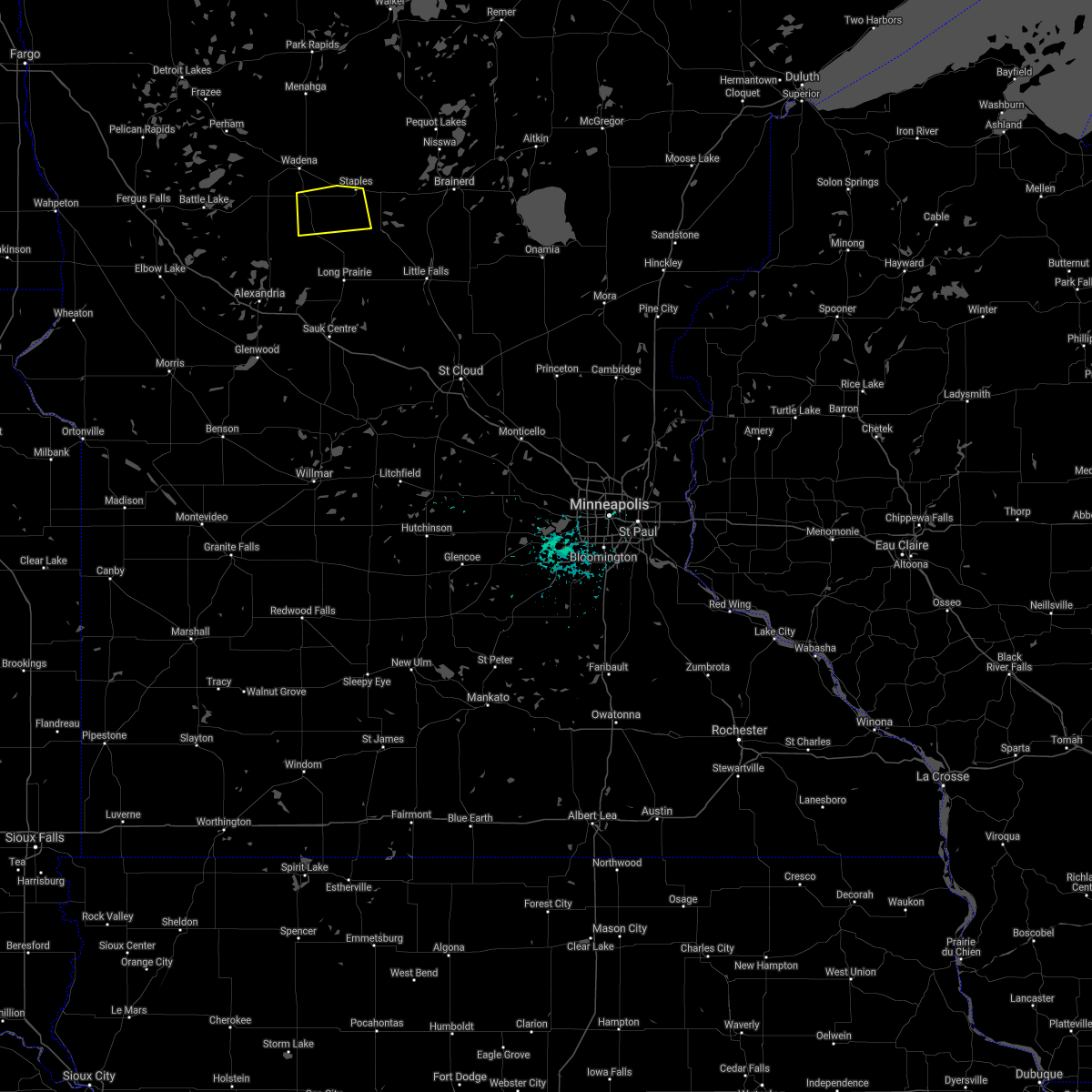 The severe thunderstorm warning for northern todd county will expire at 500 am cdt. the storm which prompted the warning has moved out of the area. therefore the warning will be allowed to expire. A severe thunderstorm watch remains in effect until 700 am cdt for central minnesota. The severe thunderstorm warning for northern todd county will expire at 500 am cdt. the storm which prompted the warning has moved out of the area. therefore the warning will be allowed to expire. A severe thunderstorm watch remains in effect until 700 am cdt for central minnesota.
|
| 7/21/2016 4:27 AM CDT |
 At 427 am cdt, a severe thunderstorm was located near bertha, or 25 miles northeast of alexandria, moving east at 25 mph (radar indicated). Hazards include 60 mph wind gusts and quarter size hail. Hail damage to vehicles is expected. expect wind damage to roofs, siding, and trees. this severe thunderstorm will be near, hewitt around 430 am cdt. eagle bend and bertha around 435 am cdt. staples around 500 am cdt. this includes the following highways, u. s. highway 10 in minnesota between mile markers 103 and 109. u. s. Highway 71 between mile markers 205 and 217. At 427 am cdt, a severe thunderstorm was located near bertha, or 25 miles northeast of alexandria, moving east at 25 mph (radar indicated). Hazards include 60 mph wind gusts and quarter size hail. Hail damage to vehicles is expected. expect wind damage to roofs, siding, and trees. this severe thunderstorm will be near, hewitt around 430 am cdt. eagle bend and bertha around 435 am cdt. staples around 500 am cdt. this includes the following highways, u. s. highway 10 in minnesota between mile markers 103 and 109. u. s. Highway 71 between mile markers 205 and 217.
|
| 7/21/2016 2:27 AM CDT |
 The severe thunderstorm warning for todd, douglas and northwestern morrison counties will expire at 230 am cdt, the storms which prompted the warning have weakened below severe limits, and no longer pose an immediate threat to life or property. therefore the warning will be allowed to expire. however gusty winds are still possible with these thunderstorms. a severe thunderstorm watch remains in effect until 700 am cdt for central minnesota. The severe thunderstorm warning for todd, douglas and northwestern morrison counties will expire at 230 am cdt, the storms which prompted the warning have weakened below severe limits, and no longer pose an immediate threat to life or property. therefore the warning will be allowed to expire. however gusty winds are still possible with these thunderstorms. a severe thunderstorm watch remains in effect until 700 am cdt for central minnesota.
|
| 7/21/2016 1:51 AM CDT |
 At 151 am cdt, severe thunderstorms were located along a line extending from near motley to near rose city to near campbell, moving southeast at 50 mph (radar indicated). Hazards include 60 mph wind gusts. Expect damage to roofs. siding. and trees. severe thunderstorms will be near, motley and eagle bend around 155 am cdt. clarissa around 200 am cdt. crow wing state park and long prairie around 210 am cdt. randall around 215 am cdt. camp ripley around 220 am cdt. other locations impacted by these severe thunderstorms include garfield, round prairie, nelson, clotho, alexandria airport, rose city, leaf valley, melby, miltona and holmes city. this includes the following highways, interstate 94 in minnesota between mile markers 81 and 117. u. s. highway 10 in minnesota between mile markers 104 and 138. u. s. Highway 71 between mile markers 181 and 219. At 151 am cdt, severe thunderstorms were located along a line extending from near motley to near rose city to near campbell, moving southeast at 50 mph (radar indicated). Hazards include 60 mph wind gusts. Expect damage to roofs. siding. and trees. severe thunderstorms will be near, motley and eagle bend around 155 am cdt. clarissa around 200 am cdt. crow wing state park and long prairie around 210 am cdt. randall around 215 am cdt. camp ripley around 220 am cdt. other locations impacted by these severe thunderstorms include garfield, round prairie, nelson, clotho, alexandria airport, rose city, leaf valley, melby, miltona and holmes city. this includes the following highways, interstate 94 in minnesota between mile markers 81 and 117. u. s. highway 10 in minnesota between mile markers 104 and 138. u. s. Highway 71 between mile markers 181 and 219.
|
| 7/21/2016 1:49 AM CDT |
 At 148 am cdt, severe thunderstorms were located along a line extending from near motley to 6 miles south of wrightstown to near campbell, moving southeast at 45 mph (radar indicated). Hazards include 60 mph wind gusts and penny size hail. Expect damage to roofs. siding. and trees. these severe storms will be near, wrightstown around 150 am cdt. western around 155 am cdt. wendell and charlesville around 205 am cdt. elbow lake and barrett around 215 am cdt. Also includes interstate 94 in minnesota between mile markers 24 and 80. At 148 am cdt, severe thunderstorms were located along a line extending from near motley to 6 miles south of wrightstown to near campbell, moving southeast at 45 mph (radar indicated). Hazards include 60 mph wind gusts and penny size hail. Expect damage to roofs. siding. and trees. these severe storms will be near, wrightstown around 150 am cdt. western around 155 am cdt. wendell and charlesville around 205 am cdt. elbow lake and barrett around 215 am cdt. Also includes interstate 94 in minnesota between mile markers 24 and 80.
|
| 7/21/2016 1:20 AM CDT |
 At 120 am cdt, severe thunderstorms were located along a line extending from near nimrod to near ottertail to near brushvale, moving southeast at 45 mph (radar indicated). Hazards include 60 mph wind gusts and penny size hail. Expect damage to roofs. siding. and trees. severe thunderstorms will be near, henning, ottertail and blue grass around 125 am cdt. deer creek around 130 am cdt. almora around 135 am cdt. parkers prairie, staples airport and wrightstown around 140 am cdt. western around 145 am cdt. Also includes interstate 94 in minnesota between mile markers 24 and 80. At 120 am cdt, severe thunderstorms were located along a line extending from near nimrod to near ottertail to near brushvale, moving southeast at 45 mph (radar indicated). Hazards include 60 mph wind gusts and penny size hail. Expect damage to roofs. siding. and trees. severe thunderstorms will be near, henning, ottertail and blue grass around 125 am cdt. deer creek around 130 am cdt. almora around 135 am cdt. parkers prairie, staples airport and wrightstown around 140 am cdt. western around 145 am cdt. Also includes interstate 94 in minnesota between mile markers 24 and 80.
|
| 7/11/2016 3:27 PM CDT |
 At 326 pm cdt, a severe thunderstorm was located over wadena, or 37 miles north of long prairie, moving northeast at 35 mph (radar indicated). Hazards include quarter size hail. Damage to vehicles is expected. this severe thunderstorm will be near, sebeka and blue grass around 340 pm cdt. Oylen and nimrod around 355 pm cdt. At 326 pm cdt, a severe thunderstorm was located over wadena, or 37 miles north of long prairie, moving northeast at 35 mph (radar indicated). Hazards include quarter size hail. Damage to vehicles is expected. this severe thunderstorm will be near, sebeka and blue grass around 340 pm cdt. Oylen and nimrod around 355 pm cdt.
|
| 7/11/2016 3:05 PM CDT |
 At 305 pm cdt, a severe thunderstorm was located near henning, or 26 miles east of fergus falls, moving northeast at 40 mph (radar indicated). Hazards include quarter size hail. Damage to vehicles is expected. this severe thunderstorm will be near, deer creek around 320 pm cdt. new york mills around 325 pm cdt. bluffton around 330 pm cdt. wadena around 335 pm cdt. Sebeka and blue grass around 350 pm cdt. At 305 pm cdt, a severe thunderstorm was located near henning, or 26 miles east of fergus falls, moving northeast at 40 mph (radar indicated). Hazards include quarter size hail. Damage to vehicles is expected. this severe thunderstorm will be near, deer creek around 320 pm cdt. new york mills around 325 pm cdt. bluffton around 330 pm cdt. wadena around 335 pm cdt. Sebeka and blue grass around 350 pm cdt.
|
| 7/11/2016 3:04 AM CDT |
 At 303 am cdt, severe thunderstorms were located along a line extending from near guthrie to near oshawa to 6 miles west of eagle bend, moving east at 40 mph (radar indicated). Hazards include 70 mph wind gusts and penny size hail. Expect considerable tree damage. damage is likely to mobile homes, roofs, and outbuildings. These severe thunderstorms will remain over mainly rural areas of southeastern otter tail, wadena and eastern hubbard counties. At 303 am cdt, severe thunderstorms were located along a line extending from near guthrie to near oshawa to 6 miles west of eagle bend, moving east at 40 mph (radar indicated). Hazards include 70 mph wind gusts and penny size hail. Expect considerable tree damage. damage is likely to mobile homes, roofs, and outbuildings. These severe thunderstorms will remain over mainly rural areas of southeastern otter tail, wadena and eastern hubbard counties.
|
| 7/11/2016 2:46 AM CDT |
 At 245 am cdt, severe thunderstorms were located along a line extending from near nary to near badoura to near wrightstown, moving east at 60 mph (radar indicated). Hazards include 70 mph wind gusts and penny size hail. Expect considerable tree damage. damage is likely to mobile homes, roofs, and outbuildings. severe thunderstorms will be near, chamberlain, badoura and guthrie around 250 am cdt. Staples airport around 310 am cdt. At 245 am cdt, severe thunderstorms were located along a line extending from near nary to near badoura to near wrightstown, moving east at 60 mph (radar indicated). Hazards include 70 mph wind gusts and penny size hail. Expect considerable tree damage. damage is likely to mobile homes, roofs, and outbuildings. severe thunderstorms will be near, chamberlain, badoura and guthrie around 250 am cdt. Staples airport around 310 am cdt.
|
| 7/11/2016 2:34 AM CDT |
 At 233 am cdt, severe thunderstorms were located along a line extending from near becida to hubbard to near almora, moving east at 55 mph (radar indicated). Hazards include 70 mph wind gusts and penny size hail. Expect considerable tree damage. damage is likely to mobile homes, roofs, and outbuildings. these severe storms will be near, lake george, park rapids and menahga around 235 am cdt. huntersville, kabekona and dorset around 240 am cdt. laporte, wrightstown and badoura around 245 am cdt. Also includes interstate 94 in minnesota between mile markers 42 and 58. At 233 am cdt, severe thunderstorms were located along a line extending from near becida to hubbard to near almora, moving east at 55 mph (radar indicated). Hazards include 70 mph wind gusts and penny size hail. Expect considerable tree damage. damage is likely to mobile homes, roofs, and outbuildings. these severe storms will be near, lake george, park rapids and menahga around 235 am cdt. huntersville, kabekona and dorset around 240 am cdt. laporte, wrightstown and badoura around 245 am cdt. Also includes interstate 94 in minnesota between mile markers 42 and 58.
|
| 7/11/2016 1:45 AM CDT |
 At 143 am cdt, severe thunderstorms were located along a line extending from near faith to just east of lake park to near elizabeth, moving east at 60 mph. these are very dangerous storms (radar indicated). Hazards include 80 mph wind gusts. Flying debris will be dangerous to those caught without shelter. mobile homes will be heavily damaged. expect considerable damage to roofs, windows, and vehicles. extensive tree damage and power outages are likely. a trained spotter measured 91 mph wind gust near 2 miles west of lake park. severe thunderstorms will be near, shoreham and westbury around 145 am cdt. detroit lakes and waubun around 150 am cdt. rochert around 155 am cdt. underwood, height of land lake and phelps around 200 am cdt. toad lake, battle lake and naytahwaush around 205 am cdt. Also includes interstate 94 in minnesota between mile markers 42 and 58. At 143 am cdt, severe thunderstorms were located along a line extending from near faith to just east of lake park to near elizabeth, moving east at 60 mph. these are very dangerous storms (radar indicated). Hazards include 80 mph wind gusts. Flying debris will be dangerous to those caught without shelter. mobile homes will be heavily damaged. expect considerable damage to roofs, windows, and vehicles. extensive tree damage and power outages are likely. a trained spotter measured 91 mph wind gust near 2 miles west of lake park. severe thunderstorms will be near, shoreham and westbury around 145 am cdt. detroit lakes and waubun around 150 am cdt. rochert around 155 am cdt. underwood, height of land lake and phelps around 200 am cdt. toad lake, battle lake and naytahwaush around 205 am cdt. Also includes interstate 94 in minnesota between mile markers 42 and 58.
|
| 7/10/2016 12:52 AM CDT |
 At 1251 am cdt, severe thunderstorms were located along a line extending from 6 miles west of doran to near melby to 6 miles southeast of blue grass, moving south at 10 mph (radar indicated). Hazards include 60 mph wind gusts and quarter size hail. Hail damage to vehicles is expected. expect wind damage to roofs, siding, and trees. severe thunderstorms will be near, ashby around 1255 am cdt. verndale around 120 am cdt. erdahl around 125 am cdt. aldrich around 130 am cdt. staples airport and tenney around 135 am cdt. Also includes interstate 94 in minnesota between mile markers 63 and 80. At 1251 am cdt, severe thunderstorms were located along a line extending from 6 miles west of doran to near melby to 6 miles southeast of blue grass, moving south at 10 mph (radar indicated). Hazards include 60 mph wind gusts and quarter size hail. Hail damage to vehicles is expected. expect wind damage to roofs, siding, and trees. severe thunderstorms will be near, ashby around 1255 am cdt. verndale around 120 am cdt. erdahl around 125 am cdt. aldrich around 130 am cdt. staples airport and tenney around 135 am cdt. Also includes interstate 94 in minnesota between mile markers 63 and 80.
|
| 6/25/2016 3:24 PM CDT |
 At 324 pm cdt, a severe thunderstorm was located near philbrook, or 24 miles west of crow wing state park, moving northeast at 30 mph (radar indicated). Hazards include 60 mph wind gusts. Expect damage to roofs. siding. and trees. this severe storm will be near, staples and staples airport around 335 pm cdt. motley around 345 pm cdt. other locations impacted by this severe thunderstorm include philbrook. A tornado watch remains in effect until 900 pm cdt for central minnesota. At 324 pm cdt, a severe thunderstorm was located near philbrook, or 24 miles west of crow wing state park, moving northeast at 30 mph (radar indicated). Hazards include 60 mph wind gusts. Expect damage to roofs. siding. and trees. this severe storm will be near, staples and staples airport around 335 pm cdt. motley around 345 pm cdt. other locations impacted by this severe thunderstorm include philbrook. A tornado watch remains in effect until 900 pm cdt for central minnesota.
|
| 6/25/2016 3:14 PM CDT |
 At 314 pm cdt, a severe thunderstorm was located near clarissa, or 28 miles west of crow wing state park, moving northeast at 25 mph (radar indicated). Hazards include 60 mph wind gusts and quarter size hail. Hail damage to vehicles is expected. expect wind damage to roofs, siding, and trees. this severe thunderstorm will be near, staples and staples airport around 340 pm cdt. motley around 350 pm cdt. other locations impacted by this severe thunderstorm include philbrook. this includes u. s. highway 10 in minnesota between mile markers 106 and 122. A tornado watch remains in effect until 900 pm cdt for central minnesota. At 314 pm cdt, a severe thunderstorm was located near clarissa, or 28 miles west of crow wing state park, moving northeast at 25 mph (radar indicated). Hazards include 60 mph wind gusts and quarter size hail. Hail damage to vehicles is expected. expect wind damage to roofs, siding, and trees. this severe thunderstorm will be near, staples and staples airport around 340 pm cdt. motley around 350 pm cdt. other locations impacted by this severe thunderstorm include philbrook. this includes u. s. highway 10 in minnesota between mile markers 106 and 122. A tornado watch remains in effect until 900 pm cdt for central minnesota.
|
| 6/19/2016 6:25 PM CDT | Quarter sized hail reported 10.3 miles S of Staples, MN, a few minutes of dime to quater sized hail. |
| 6/19/2016 6:15 PM CDT | Baseball sized hail reported 11.3 miles SSE of Staples, MN |
| 6/19/2016 5:59 PM CDT |
 At 558 pm cdt, a severe thunderstorm capable of producing a tornado was located near verndale, or 34 miles north of long prairie, moving east at 30 mph (radar indicated rotation). Hazards include tornado and golf ball size hail. Expect damage to mobile homes. roofs. and vehicles. this dangerous storm will be near, blue grass and aldrich around 605 pm cdt. Oylen around 625 pm cdt. At 558 pm cdt, a severe thunderstorm capable of producing a tornado was located near verndale, or 34 miles north of long prairie, moving east at 30 mph (radar indicated rotation). Hazards include tornado and golf ball size hail. Expect damage to mobile homes. roofs. and vehicles. this dangerous storm will be near, blue grass and aldrich around 605 pm cdt. Oylen around 625 pm cdt.
|
| 6/17/2016 1:45 PM CDT |
 At 144 pm cdt, severe thunderstorms were located along a line extending from verndale to near wrightstown to 6 miles southwest of clitherall, moving east at 30 mph (radar indicated). Hazards include 60 mph wind gusts and quarter size hail. Hail damage to vehicles is expected. expect wind damage to roofs, siding, and trees. at 140 pm cdt, ping pong ball sized hail was reported 7 miles north of parkers prairie these severe storms will be near, verndale and wrightstown around 145 pm cdt. vining around 155 pm cdt. staples airport and urbank around 205 pm cdt. Parkers prairie around 215 pm cdt. At 144 pm cdt, severe thunderstorms were located along a line extending from verndale to near wrightstown to 6 miles southwest of clitherall, moving east at 30 mph (radar indicated). Hazards include 60 mph wind gusts and quarter size hail. Hail damage to vehicles is expected. expect wind damage to roofs, siding, and trees. at 140 pm cdt, ping pong ball sized hail was reported 7 miles north of parkers prairie these severe storms will be near, verndale and wrightstown around 145 pm cdt. vining around 155 pm cdt. staples airport and urbank around 205 pm cdt. Parkers prairie around 215 pm cdt.
|
| 6/17/2016 1:18 PM CDT |
 At 118 pm cdt, severe thunderstorms were located along a line extending from bluffton to dalton, moving east at 20 mph (radar indicated). Hazards include 60 mph wind gusts and quarter size hail. Hail damage to vehicles is expected. expect wind damage to roofs, siding, and trees. severe thunderstorms will be near, bluffton around 120 pm cdt. wadena around 130 pm cdt. blue grass around 140 pm cdt. verndale around 150 pm cdt. aldrich around 200 pm cdt. Also includes interstate 94 in minnesota between mile markers 61 and 80. At 118 pm cdt, severe thunderstorms were located along a line extending from bluffton to dalton, moving east at 20 mph (radar indicated). Hazards include 60 mph wind gusts and quarter size hail. Hail damage to vehicles is expected. expect wind damage to roofs, siding, and trees. severe thunderstorms will be near, bluffton around 120 pm cdt. wadena around 130 pm cdt. blue grass around 140 pm cdt. verndale around 150 pm cdt. aldrich around 200 pm cdt. Also includes interstate 94 in minnesota between mile markers 61 and 80.
|
| 6/17/2016 11:13 AM CDT |
 The national weather service in the twin cities has issued a * severe thunderstorm warning for. northern todd county in central minnesota. until noon cdt * at 1113 am cdt. a severe thunderstorm was located near eagle bend. or 28 miles northeast of alexandria. Moving east at 30 mph. The national weather service in the twin cities has issued a * severe thunderstorm warning for. northern todd county in central minnesota. until noon cdt * at 1113 am cdt. a severe thunderstorm was located near eagle bend. or 28 miles northeast of alexandria. Moving east at 30 mph.
|
| 6/17/2016 10:32 AM CDT |
 At 1031 am cdt, a severe thunderstorm was located near bluffton, or 36 miles southeast of detroit lakes, moving east at 30 mph (radar indicated). Hazards include ping pong ball size hail and 60 mph wind gusts. People and animals outdoors will be injured. expect hail damage to roofs, siding, windows, and vehicles. expect wind damage to roofs, siding, and trees. this severe storm will be near, wadena around 1035 am cdt. sebeka around 1040 am cdt. Blue grass around 1045 am cdt. At 1031 am cdt, a severe thunderstorm was located near bluffton, or 36 miles southeast of detroit lakes, moving east at 30 mph (radar indicated). Hazards include ping pong ball size hail and 60 mph wind gusts. People and animals outdoors will be injured. expect hail damage to roofs, siding, windows, and vehicles. expect wind damage to roofs, siding, and trees. this severe storm will be near, wadena around 1035 am cdt. sebeka around 1040 am cdt. Blue grass around 1045 am cdt.
|
| 6/17/2016 10:05 AM CDT |
 At 1003 am cdt, severe thunderstorms were located along a line extending from near wilton to ottertail, moving east at 50 mph (radar indicated. the highest threat for large hail is currently near new york mills in northeastern ottertail county). Hazards include ping pong ball size hail and 60 mph wind gusts. People and animals outdoors will be injured. expect hail damage to roofs, siding, windows, and vehicles. expect wind damage to roofs, siding, and trees. these severe storms will be near, new york mills, deer creek and rosby around 1015 am cdt. bluffton around 1020 am cdt. wadena around 1025 am cdt. sebeka and blue grass around 1035 am cdt. Oylen and nimrod around 1045 am cdt. At 1003 am cdt, severe thunderstorms were located along a line extending from near wilton to ottertail, moving east at 50 mph (radar indicated. the highest threat for large hail is currently near new york mills in northeastern ottertail county). Hazards include ping pong ball size hail and 60 mph wind gusts. People and animals outdoors will be injured. expect hail damage to roofs, siding, windows, and vehicles. expect wind damage to roofs, siding, and trees. these severe storms will be near, new york mills, deer creek and rosby around 1015 am cdt. bluffton around 1020 am cdt. wadena around 1025 am cdt. sebeka and blue grass around 1035 am cdt. Oylen and nimrod around 1045 am cdt.
|
| 6/17/2016 9:51 AM CDT |
 At 951 am cdt, severe thunderstorms were located along a line extending from alida to amor, moving east at 50 mph (radar indicated). Hazards include 60 mph wind gusts and quarter size hail. Hail damage to vehicles is expected. expect wind damage to roofs, siding, and trees. severe thunderstorms will be near, alida and upper rice lake around 955 am cdt. becida around 1000 am cdt. new york mills, deer creek and rosby around 1015 am cdt. bluffton around 1020 am cdt. Wadena around 1025 am cdt. At 951 am cdt, severe thunderstorms were located along a line extending from alida to amor, moving east at 50 mph (radar indicated). Hazards include 60 mph wind gusts and quarter size hail. Hail damage to vehicles is expected. expect wind damage to roofs, siding, and trees. severe thunderstorms will be near, alida and upper rice lake around 955 am cdt. becida around 1000 am cdt. new york mills, deer creek and rosby around 1015 am cdt. bluffton around 1020 am cdt. Wadena around 1025 am cdt.
|
| 8/16/2015 1:12 AM CDT | The severe thunderstorm warning for southeastern wadena county will expire at 115 am cdt, the storm which prompted the warning has moved out of the area. therefore the warning will be allowed to expire. |
| 8/16/2015 1:02 AM CDT |
 At 101 am cdt, a severe thunderstorm was located near staples airport, or 26 miles west of brainerd, moving east at 35 mph (radar indicated). Hazards include 60 mph wind gusts and quarter size hail. Hail damage to vehicles is expected. expect wind damage to roofs, siding and trees. This severe thunderstorm will remain over mainly rural areas of southeastern wadena county. At 101 am cdt, a severe thunderstorm was located near staples airport, or 26 miles west of brainerd, moving east at 35 mph (radar indicated). Hazards include 60 mph wind gusts and quarter size hail. Hail damage to vehicles is expected. expect wind damage to roofs, siding and trees. This severe thunderstorm will remain over mainly rural areas of southeastern wadena county.
|
| 8/16/2015 12:46 AM CDT |
 At 1245 am cdt, a severe thunderstorm was located over wrightstown, or 29 miles north of alexandria, moving east at 35 mph (radar indicated). Hazards include 60 mph wind gusts and quarter size hail. Hail damage to vehicles is expected. expect wind damage to roofs, siding and trees. this severe thunderstorm will be near, verndale around 1255 am cdt. aldrich around 100 am cdt. Staples airport around 110 am cdt. At 1245 am cdt, a severe thunderstorm was located over wrightstown, or 29 miles north of alexandria, moving east at 35 mph (radar indicated). Hazards include 60 mph wind gusts and quarter size hail. Hail damage to vehicles is expected. expect wind damage to roofs, siding and trees. this severe thunderstorm will be near, verndale around 1255 am cdt. aldrich around 100 am cdt. Staples airport around 110 am cdt.
|
| 8/13/2015 1:06 AM CDT |
 At 105 am cdt, a severe thunderstorm was located near wadena, or 33 miles north of alexandria, moving southeast at 40 mph (radar indicated). Hazards include golf ball size hail. People and animals outdoors will be injured. expect damage to roofs, siding, windows and vehicles. This severe storm will be near, wrightstown around 115 am cdt. At 105 am cdt, a severe thunderstorm was located near wadena, or 33 miles north of alexandria, moving southeast at 40 mph (radar indicated). Hazards include golf ball size hail. People and animals outdoors will be injured. expect damage to roofs, siding, windows and vehicles. This severe storm will be near, wrightstown around 115 am cdt.
|
| 8/13/2015 12:42 AM CDT |
 At 1241 am cdt, a severe thunderstorm was located between sebeka and new york mills, or 34 miles southeast of detroit lakes, moving southeast at 35 mph (radar indicated). Hazards include two inch hail. People and animals outdoors will be injured. expect damage to roofs, siding, windows and vehicles. this severe thunderstorm will be near, bluffton around 1250 am cdt. wadena and blue grass around 1255 am cdt. verndale around 105 am cdt. aldrich around 110 am cdt. Staples airport around 115 am cdt. At 1241 am cdt, a severe thunderstorm was located between sebeka and new york mills, or 34 miles southeast of detroit lakes, moving southeast at 35 mph (radar indicated). Hazards include two inch hail. People and animals outdoors will be injured. expect damage to roofs, siding, windows and vehicles. this severe thunderstorm will be near, bluffton around 1250 am cdt. wadena and blue grass around 1255 am cdt. verndale around 105 am cdt. aldrich around 110 am cdt. Staples airport around 115 am cdt.
|
| 7/24/2015 2:17 AM CDT |
 At 215 am cdt, severe thunderstorms were located along a line extending from 7 miles southeast of hines to walker to near hillview, moving east at 50 mph (public). Hazards include 70 mph wind gusts and penny size hail. Expect considerable tree damage. damage is likely to mobile homes, roofs and outbuildings. damage has been reported in mahnomen and lake park. These severe storms will be near, huntersville and nimrod around 225 am cdt. At 215 am cdt, severe thunderstorms were located along a line extending from 7 miles southeast of hines to walker to near hillview, moving east at 50 mph (public). Hazards include 70 mph wind gusts and penny size hail. Expect considerable tree damage. damage is likely to mobile homes, roofs and outbuildings. damage has been reported in mahnomen and lake park. These severe storms will be near, huntersville and nimrod around 225 am cdt.
|
| 7/24/2015 1:55 AM CDT |
 At 153 am cdt, severe thunderstorms were located along a line extending from near puposky to near emmaville to near frazee, moving east at 45 mph (public). Hazards include 70 mph wind gusts and penny size hail. Expect considerable tree damage. damage is likely to mobile homes, roofs and outbuildings. power outages have been reported in lake park in becker county. these severe storms will be near, lake george, emmaville and puposky around 155 am cdt. turtle river, lavinia and nevis around 205 am cdt. tenstrike and butler around 210 am cdt. akeley, hillview, benedict, hines and midway around 215 am cdt. Sebeka, menahga and pennington around 225 am cdt. At 153 am cdt, severe thunderstorms were located along a line extending from near puposky to near emmaville to near frazee, moving east at 45 mph (public). Hazards include 70 mph wind gusts and penny size hail. Expect considerable tree damage. damage is likely to mobile homes, roofs and outbuildings. power outages have been reported in lake park in becker county. these severe storms will be near, lake george, emmaville and puposky around 155 am cdt. turtle river, lavinia and nevis around 205 am cdt. tenstrike and butler around 210 am cdt. akeley, hillview, benedict, hines and midway around 215 am cdt. Sebeka, menahga and pennington around 225 am cdt.
|
| 7/24/2015 1:24 AM CDT |
 At 123 am cdt, severe thunderstorms were located along a line extending from near leonard to near bad medicine lake to near cormorant, moving east at 55 mph (radar indicated). Hazards include 70 mph wind gusts and penny size hail. Expect considerable tree damage. damage is likely to mobile homes, roofs and outbuildings. severe thunderstorms will be near, bad medicine lake, clearbrook, many point lake, leonard and long lost lake around 125 am cdt. debs around 130 am cdt. detroit lakes, pinewood and two inlets around 135 am cdt. frazee, vergas and rochert around 140 am cdt. Lake george, height of land lake, puposky and nebish around 145 am cdt. At 123 am cdt, severe thunderstorms were located along a line extending from near leonard to near bad medicine lake to near cormorant, moving east at 55 mph (radar indicated). Hazards include 70 mph wind gusts and penny size hail. Expect considerable tree damage. damage is likely to mobile homes, roofs and outbuildings. severe thunderstorms will be near, bad medicine lake, clearbrook, many point lake, leonard and long lost lake around 125 am cdt. debs around 130 am cdt. detroit lakes, pinewood and two inlets around 135 am cdt. frazee, vergas and rochert around 140 am cdt. Lake george, height of land lake, puposky and nebish around 145 am cdt.
|
| 7/12/2015 7:23 PM CDT | Two 6 inch trees uprooted in todd county MN, 0.2 miles ENE of Staples, MN |
| 7/12/2015 6:52 PM CDT | Widespread tree damage along cr2... north of the staples airpor in wadena county MN, 3.4 miles SE of Staples, MN |
| 7/12/2015 6:25 PM CDT |
 At 625 pm cdt, a severe thunderstorm capable of producing a tornado was located over wadena, or 37 miles north of alexandria, moving east at 35 mph (radar indicated rotation). Hazards include tornado and half dollar size hail. Expect damage to mobile homes. roofs and vehicles. this dangerous storm will be near, verndale and blue grass around 640 pm cdt. aldrich around 645 pm cdt. Staples airport around 700 pm cdt. At 625 pm cdt, a severe thunderstorm capable of producing a tornado was located over wadena, or 37 miles north of alexandria, moving east at 35 mph (radar indicated rotation). Hazards include tornado and half dollar size hail. Expect damage to mobile homes. roofs and vehicles. this dangerous storm will be near, verndale and blue grass around 640 pm cdt. aldrich around 645 pm cdt. Staples airport around 700 pm cdt.
|
| 7/12/2015 6:24 PM CDT |
 At 624 pm cdt, a severe thunderstorm capable of producing a tornado was located near parkers prairie, or 19 miles north of alexandria, moving east at 40 mph (radar indicated rotation). Hazards include tornado and half dollar size hail. Flying debris will be dangerous to those caught without shelter. mobile homes will be damaged or destroyed. damage to roofs, windows and vehicles will occur. tree damage is likely. this dangerous storm will be near, eagle bend and bertha around 640 pm cdt. clarissa and hewitt around 645 pm cdt. staples around 705 pm cdt. Other locations impacted by this tornadic thunderstorm include rose city and philbrook. At 624 pm cdt, a severe thunderstorm capable of producing a tornado was located near parkers prairie, or 19 miles north of alexandria, moving east at 40 mph (radar indicated rotation). Hazards include tornado and half dollar size hail. Flying debris will be dangerous to those caught without shelter. mobile homes will be damaged or destroyed. damage to roofs, windows and vehicles will occur. tree damage is likely. this dangerous storm will be near, eagle bend and bertha around 640 pm cdt. clarissa and hewitt around 645 pm cdt. staples around 705 pm cdt. Other locations impacted by this tornadic thunderstorm include rose city and philbrook.
|
| 7/12/2015 6:03 PM CDT |
 At 602 pm cdt, a confirmed tornado was located near deer creek, or 32 miles east of fergus falls, moving east at 30 mph (public confirmed funnel clouds over otter tail lake). Hazards include tornado and golf ball size hail. Expect damage to mobile homes. roofs and vehicles. this tornado will be near, deer creek and new york mills around 610 pm cdt. bluffton around 620 pm cdt. wadena around 625 pm cdt. Verndale around 630 pm cdt. At 602 pm cdt, a confirmed tornado was located near deer creek, or 32 miles east of fergus falls, moving east at 30 mph (public confirmed funnel clouds over otter tail lake). Hazards include tornado and golf ball size hail. Expect damage to mobile homes. roofs and vehicles. this tornado will be near, deer creek and new york mills around 610 pm cdt. bluffton around 620 pm cdt. wadena around 625 pm cdt. Verndale around 630 pm cdt.
|
| 7/12/2015 5:49 PM CDT |
 At 548 pm cdt, a severe thunderstorm capable of producing a tornado was located over ottertail, or 26 miles northeast of fergus falls, moving northeast at 30 mph (radar indicated rotation). Hazards include tornado and golf ball size hail. Expect damage to mobile homes. roofs and vehicles. this dangerous storm will be near, new york mills and deer creek around 605 pm cdt. bluffton around 615 pm cdt. Sebeka and blue grass around 630 pm cdt. At 548 pm cdt, a severe thunderstorm capable of producing a tornado was located over ottertail, or 26 miles northeast of fergus falls, moving northeast at 30 mph (radar indicated rotation). Hazards include tornado and golf ball size hail. Expect damage to mobile homes. roofs and vehicles. this dangerous storm will be near, new york mills and deer creek around 605 pm cdt. bluffton around 615 pm cdt. Sebeka and blue grass around 630 pm cdt.
|
| 9/4/2014 6:40 AM CDT | Still gusting above severe levels at staples airpor in todd county MN, 0.2 miles ENE of Staples, MN |
| 9/4/2014 6:31 AM CDT | Storm damage reported in todd county MN, 0.2 miles ENE of Staples, MN |
| 7/21/2014 11:25 PM CDT | Power outages and roof damage in todd county MN, 0.8 miles NNE of Staples, MN |
| 6/11/2014 6:22 PM CDT | Quarter sized hail reported 13.1 miles S of Staples, MN |
Hail Maps for Staples, MN
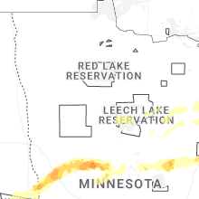
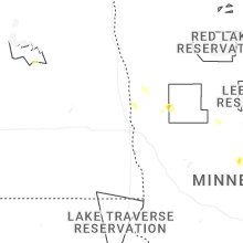
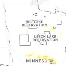
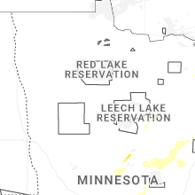
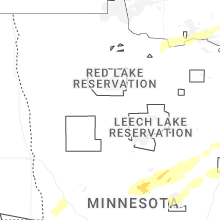
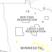


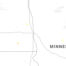


Connect with Interactive Hail Maps