

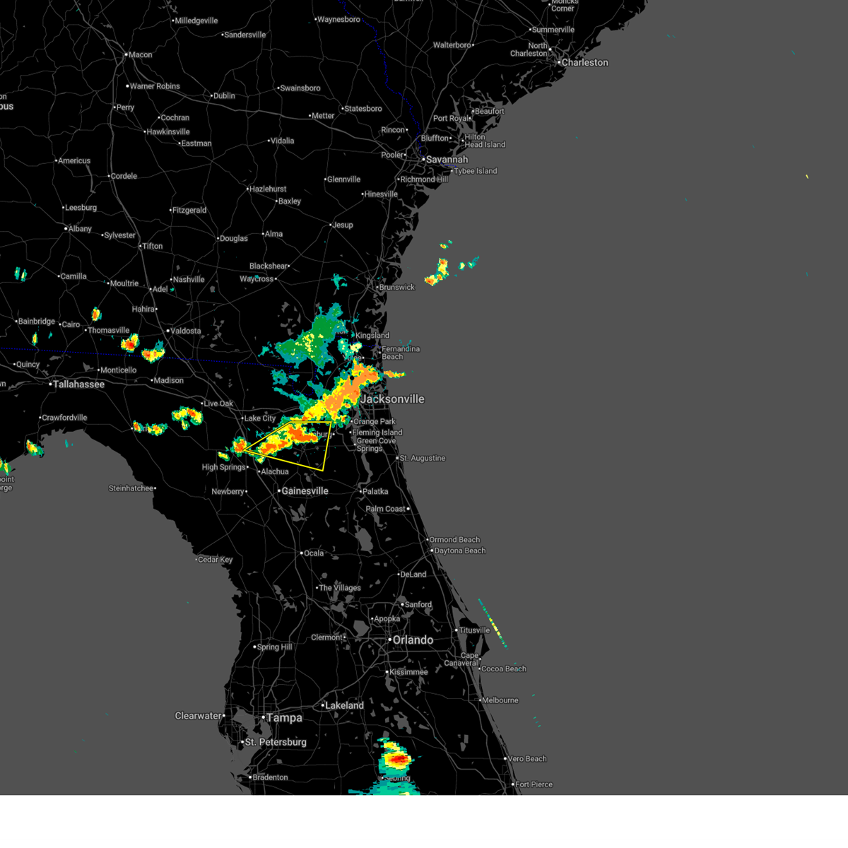
Hail Map for Starke, FL
The Starke, FL area has had 4 reports of on-the-ground hail by trained spotters, and has been under severe weather warnings 7 times during the past 12 months. Doppler radar has detected hail at or near Starke, FL on 51 occasions, including 2 occasions during the past year.
| Name: | Starke, FL |
| Where Located: | 38.8 miles SW of Jacksonville, FL |
| Map: | Google Map for Starke, FL |
| Population: | 5449 |
| Housing Units: | 2492 |
| More Info: | Search Google for Starke, FL |
0
The Top Recent Hail Date for Starke, FL is Wednesday, July 9, 2025 (51st out of 51)

Hail and Wind Damage Spotted near Starke, FL
| Date / Time | Report Details |
|---|---|
| 6/23/2026 5:44 PM EDT | Bradford county dispatch reported a tree down on a powerline near the intersection of us-301 and nw 197th s in bradford county FL, 4.4 miles SSW of Starke, FL |
| 6/23/2026 5:36 PM EDT | Bradford county dispatch reported a tree down near the intersection of deer run rd and north walnut s in bradford county FL, 1 miles NNW of Starke, FL |
| 6/23/2026 5:29 PM EDT |
 At 528 pm edt, a severe thunderstorm was located over beasley, or near raiford, moving east at 35 mph (radar indicated). Hazards include 60 mph wind gusts. Expect damage to roofs, siding, and trees. Locations impacted include, starke, lake butler, keystone heights, raiford, worthington spring, middleburg, worthington springs, groves, beasley, and new river. At 528 pm edt, a severe thunderstorm was located over beasley, or near raiford, moving east at 35 mph (radar indicated). Hazards include 60 mph wind gusts. Expect damage to roofs, siding, and trees. Locations impacted include, starke, lake butler, keystone heights, raiford, worthington spring, middleburg, worthington springs, groves, beasley, and new river.
|
| 6/23/2026 5:11 PM EDT |
 Svrjax the national weather service in jacksonville has issued a * severe thunderstorm warning for, bradford county in northern florida, north central alachua county in northern florida, southern baker county in northeastern florida, union county in northern florida, western clay county in northeastern florida, southeastern columbia county in northern florida, * until 545 pm edt. * at 511 pm edt, a severe thunderstorm was located over groves, or near lake butler, moving east at 35 mph (radar indicated). Hazards include 60 mph wind gusts. expect damage to roofs, siding, and trees Svrjax the national weather service in jacksonville has issued a * severe thunderstorm warning for, bradford county in northern florida, north central alachua county in northern florida, southern baker county in northeastern florida, union county in northern florida, western clay county in northeastern florida, southeastern columbia county in northern florida, * until 545 pm edt. * at 511 pm edt, a severe thunderstorm was located over groves, or near lake butler, moving east at 35 mph (radar indicated). Hazards include 60 mph wind gusts. expect damage to roofs, siding, and trees
|
| 3/16/2026 2:45 PM EDT | Several trees down off sw county road 18 in bradford county. time estimated via radar and reported gust of 55mph at nearby keystone heights airpor in bradford county FL, 6.8 miles NNW of Starke, FL |
| 7/13/2025 9:05 PM EDT |
 The storm which prompted the warning has weakened below severe limits, and no longer poses an immediate threat to life or property. therefore, the warning will be allowed to expire. however, gusty winds and heavy rain are still possible with this thunderstorm. The storm which prompted the warning has weakened below severe limits, and no longer poses an immediate threat to life or property. therefore, the warning will be allowed to expire. however, gusty winds and heavy rain are still possible with this thunderstorm.
|
| 7/13/2025 8:59 PM EDT |
 the severe thunderstorm warning has been cancelled and is no longer in effect the severe thunderstorm warning has been cancelled and is no longer in effect
|
| 7/13/2025 8:59 PM EDT |
 At 859 pm edt, a severe thunderstorm was located over sampson, or near starke, moving south at 15 mph (radar indicated). Hazards include 60 mph wind gusts. Expect damage to roofs, siding, and trees. Locations impacted include, starke, sampson, and hampton. At 859 pm edt, a severe thunderstorm was located over sampson, or near starke, moving south at 15 mph (radar indicated). Hazards include 60 mph wind gusts. Expect damage to roofs, siding, and trees. Locations impacted include, starke, sampson, and hampton.
|
| 7/13/2025 8:50 PM EDT |
 At 850 pm edt, a severe thunderstorm was located near sampson, or near starke, moving south at 15 mph (radar indicated). Hazards include 60 mph wind gusts. Expect damage to roofs, siding, and trees. Locations impacted include, starke, beasley, new river, sampson, and hampton. At 850 pm edt, a severe thunderstorm was located near sampson, or near starke, moving south at 15 mph (radar indicated). Hazards include 60 mph wind gusts. Expect damage to roofs, siding, and trees. Locations impacted include, starke, beasley, new river, sampson, and hampton.
|
| 7/13/2025 8:32 PM EDT |
 Svrjax the national weather service in jacksonville has issued a * severe thunderstorm warning for, bradford county in northern florida, northeastern alachua county in northern florida, eastern union county in northern florida, west central clay county in northeastern florida, * until 915 pm edt. * at 832 pm edt, a severe thunderstorm was located over raiford, moving south at 15 mph (radar indicated). Hazards include 60 mph wind gusts. expect damage to roofs, siding, and trees Svrjax the national weather service in jacksonville has issued a * severe thunderstorm warning for, bradford county in northern florida, northeastern alachua county in northern florida, eastern union county in northern florida, west central clay county in northeastern florida, * until 915 pm edt. * at 832 pm edt, a severe thunderstorm was located over raiford, moving south at 15 mph (radar indicated). Hazards include 60 mph wind gusts. expect damage to roofs, siding, and trees
|
| 5/10/2025 6:35 PM EDT |
 the severe thunderstorm warning has been cancelled and is no longer in effect the severe thunderstorm warning has been cancelled and is no longer in effect
|
| 5/10/2025 6:35 PM EDT |
 At 635 pm edt, severe thunderstorms were located along a line extending from near keystone heights to near palestine community, moving north at 20 mph (radar indicated). Hazards include 60 mph wind gusts and penny size hail. Expect damage to roofs, siding, and trees. Locations impacted include, starke, keystone heights, middleburg, kingsley, camp blanding, penney farms, lawtey, hampton, asbury lake, and ellerbee. At 635 pm edt, severe thunderstorms were located along a line extending from near keystone heights to near palestine community, moving north at 20 mph (radar indicated). Hazards include 60 mph wind gusts and penny size hail. Expect damage to roofs, siding, and trees. Locations impacted include, starke, keystone heights, middleburg, kingsley, camp blanding, penney farms, lawtey, hampton, asbury lake, and ellerbee.
|
| 5/10/2025 6:19 PM EDT |
 Svrjax the national weather service in jacksonville has issued a * severe thunderstorm warning for, bradford county in northern florida, northeastern alachua county in northern florida, southern baker county in northeastern florida, northwestern putnam county in northeastern florida, union county in northern florida, western clay county in northeastern florida, east central columbia county in northern florida, * until 645 pm edt. * at 619 pm edt, severe thunderstorms were located along a line extending from lake geneva to groves, moving north at 20 mph (radar indicated). Hazards include 60 mph wind gusts and penny size hail. expect damage to roofs, siding, and trees Svrjax the national weather service in jacksonville has issued a * severe thunderstorm warning for, bradford county in northern florida, northeastern alachua county in northern florida, southern baker county in northeastern florida, northwestern putnam county in northeastern florida, union county in northern florida, western clay county in northeastern florida, east central columbia county in northern florida, * until 645 pm edt. * at 619 pm edt, severe thunderstorms were located along a line extending from lake geneva to groves, moving north at 20 mph (radar indicated). Hazards include 60 mph wind gusts and penny size hail. expect damage to roofs, siding, and trees
|
| 7/22/2024 4:07 PM EDT |
 The storm which prompted the warning has weakened below severe limits, and no longer poses an immediate threat to life or property. therefore, the warning will be allowed to expire. however, gusty winds and heavy rain are still possible with this thunderstorm. The storm which prompted the warning has weakened below severe limits, and no longer poses an immediate threat to life or property. therefore, the warning will be allowed to expire. however, gusty winds and heavy rain are still possible with this thunderstorm.
|
| 7/22/2024 3:51 PM EDT |
 Svrjax the national weather service in jacksonville has issued a * severe thunderstorm warning for, northeastern bradford county in northern florida, northeastern union county in northern florida, west central clay county in northeastern florida, * until 415 pm edt. * at 351 pm edt, a severe thunderstorm was located over starke, moving northeast at 10 mph (radar indicated). Hazards include 60 mph wind gusts. expect damage to roofs, siding, and trees Svrjax the national weather service in jacksonville has issued a * severe thunderstorm warning for, northeastern bradford county in northern florida, northeastern union county in northern florida, west central clay county in northeastern florida, * until 415 pm edt. * at 351 pm edt, a severe thunderstorm was located over starke, moving northeast at 10 mph (radar indicated). Hazards include 60 mph wind gusts. expect damage to roofs, siding, and trees
|
| 5/10/2024 8:44 AM EDT |
 Svrjax the national weather service in jacksonville has issued a * severe thunderstorm warning for, nassau county in northeastern florida, bradford county in northern florida, alachua county in northern florida, north central marion county in northern florida, baker county in northeastern florida, northwestern putnam county in northeastern florida, union county in northern florida, western clay county in northeastern florida, western duval county in northeastern florida, southwestern camden county in southeastern georgia, southeastern ware county in southeastern georgia, charlton county in southeastern georgia, * until 915 am edt. * at 843 am edt, severe thunderstorms were located along a line extending from 9 miles south of argyle to near lulu to 7 miles southeast of cross city, moving east at 70 mph. these are destructive storms for lake butler, starke, gainesville, macclenny, baldwin, and hilliard. (radar indicated). Hazards include 80 mph wind gusts and quarter size hail. Flying debris will be dangerous to those caught without shelter. mobile homes will be heavily damaged. expect considerable damage to roofs, windows, and vehicles. Extensive tree damage and power outages are likely. Svrjax the national weather service in jacksonville has issued a * severe thunderstorm warning for, nassau county in northeastern florida, bradford county in northern florida, alachua county in northern florida, north central marion county in northern florida, baker county in northeastern florida, northwestern putnam county in northeastern florida, union county in northern florida, western clay county in northeastern florida, western duval county in northeastern florida, southwestern camden county in southeastern georgia, southeastern ware county in southeastern georgia, charlton county in southeastern georgia, * until 915 am edt. * at 843 am edt, severe thunderstorms were located along a line extending from 9 miles south of argyle to near lulu to 7 miles southeast of cross city, moving east at 70 mph. these are destructive storms for lake butler, starke, gainesville, macclenny, baldwin, and hilliard. (radar indicated). Hazards include 80 mph wind gusts and quarter size hail. Flying debris will be dangerous to those caught without shelter. mobile homes will be heavily damaged. expect considerable damage to roofs, windows, and vehicles. Extensive tree damage and power outages are likely.
|
| 4/3/2024 11:44 AM EDT |
 The storms which prompted the warning have weakened below severe limits, and no longer pose an immediate threat to life or property. therefore, the warning will be allowed to expire. however, gusty winds and heavy rain are still possible with these thunderstorms. a tornado watch remains in effect until 500 pm edt for northern and northeastern florida. The storms which prompted the warning have weakened below severe limits, and no longer pose an immediate threat to life or property. therefore, the warning will be allowed to expire. however, gusty winds and heavy rain are still possible with these thunderstorms. a tornado watch remains in effect until 500 pm edt for northern and northeastern florida.
|
| 4/3/2024 11:21 AM EDT |
 the severe thunderstorm warning has been cancelled and is no longer in effect the severe thunderstorm warning has been cancelled and is no longer in effect
|
| 4/3/2024 11:21 AM EDT |
 At 1120 am edt, severe thunderstorms were located along a line extending from near normandy to near starke, moving east at 40 mph (radar indicated). Hazards include 60 mph wind gusts. Expect damage to roofs, siding, and trees. Locations impacted include, orange park, green cove springs, starke, keystone heights, unf, mandarin, fruit cove, middleburg, ponte vedra beach, and jacksonville beach. At 1120 am edt, severe thunderstorms were located along a line extending from near normandy to near starke, moving east at 40 mph (radar indicated). Hazards include 60 mph wind gusts. Expect damage to roofs, siding, and trees. Locations impacted include, orange park, green cove springs, starke, keystone heights, unf, mandarin, fruit cove, middleburg, ponte vedra beach, and jacksonville beach.
|
| 4/3/2024 11:04 AM EDT |
 Svrjax the national weather service in jacksonville has issued a * severe thunderstorm warning for, bradford county in northern florida, northeastern alachua county in northern florida, northwestern st. johns county in northeastern florida, southeastern baker county in northeastern florida, north central putnam county in northeastern florida, northeastern union county in northern florida, clay county in northeastern florida, southern duval county in northeastern florida, * until 1145 am edt. * at 1103 am edt, severe thunderstorms were located along a line extending from near maxville to sampson, moving east at 40 mph (radar indicated). Hazards include 60 mph wind gusts. expect damage to roofs, siding, and trees Svrjax the national weather service in jacksonville has issued a * severe thunderstorm warning for, bradford county in northern florida, northeastern alachua county in northern florida, northwestern st. johns county in northeastern florida, southeastern baker county in northeastern florida, north central putnam county in northeastern florida, northeastern union county in northern florida, clay county in northeastern florida, southern duval county in northeastern florida, * until 1145 am edt. * at 1103 am edt, severe thunderstorms were located along a line extending from near maxville to sampson, moving east at 40 mph (radar indicated). Hazards include 60 mph wind gusts. expect damage to roofs, siding, and trees
|
| 2/4/2024 3:32 PM EST |
 At 332 pm est, a severe thunderstorm was located near sampson, or 7 miles west of keystone heights, moving northeast at 25 mph (radar indicated). Hazards include 60 mph wind gusts and quarter size hail. Hail damage to vehicles is expected. expect wind damage to roofs, siding, and trees. Locations impacted include, starke, keystone heights, waldo, and hampton. At 332 pm est, a severe thunderstorm was located near sampson, or 7 miles west of keystone heights, moving northeast at 25 mph (radar indicated). Hazards include 60 mph wind gusts and quarter size hail. Hail damage to vehicles is expected. expect wind damage to roofs, siding, and trees. Locations impacted include, starke, keystone heights, waldo, and hampton.
|
| 2/4/2024 3:20 PM EST |
 At 320 pm est, a severe thunderstorm was located near orange heights, or 9 miles northeast of gainesville, moving northeast at 25 mph (radar indicated). Hazards include 60 mph wind gusts and quarter size hail. Hail damage to vehicles is expected. expect wind damage to roofs, siding, and trees. Locations impacted include, starke, keystone heights, waldo, and hampton. At 320 pm est, a severe thunderstorm was located near orange heights, or 9 miles northeast of gainesville, moving northeast at 25 mph (radar indicated). Hazards include 60 mph wind gusts and quarter size hail. Hail damage to vehicles is expected. expect wind damage to roofs, siding, and trees. Locations impacted include, starke, keystone heights, waldo, and hampton.
|
| 2/4/2024 3:09 PM EST |
 At 309 pm est, a severe thunderstorm was located near gainesville airport, or near gainesville, moving northeast at 25 mph (radar indicated). Hazards include 60 mph wind gusts and quarter size hail. Hail damage to vehicles is expected. Expect wind damage to roofs, siding, and trees. At 309 pm est, a severe thunderstorm was located near gainesville airport, or near gainesville, moving northeast at 25 mph (radar indicated). Hazards include 60 mph wind gusts and quarter size hail. Hail damage to vehicles is expected. Expect wind damage to roofs, siding, and trees.
|
| 1/9/2024 3:12 PM EST |
 A severe thunderstorm warning remains in effect until 345 pm est for nassau. eastern bradford. northeastern alachua. west central st. johns. north central putnam. clay. duval and southeastern camden counties. At 311 pm est, severe thunderstorms were located along a line extending from near hilliard to near sampson, moving east at 35 mph. A severe thunderstorm warning remains in effect until 345 pm est for nassau. eastern bradford. northeastern alachua. west central st. johns. north central putnam. clay. duval and southeastern camden counties. At 311 pm est, severe thunderstorms were located along a line extending from near hilliard to near sampson, moving east at 35 mph.
|
| 1/9/2024 3:12 PM EST |
 At 311 pm est, severe thunderstorms were located along a line extending from near hilliard to near sampson, moving east at 35 mph (radar indicated). Hazards include 60 mph wind gusts. Expect damage to roofs, siding, and trees. locations impacted include, jacksonville, st. Marys, fernandina beach, orange park, green cove springs, starke, hilliard, keystone heights, callahan, and jacksonville international arpt. At 311 pm est, severe thunderstorms were located along a line extending from near hilliard to near sampson, moving east at 35 mph (radar indicated). Hazards include 60 mph wind gusts. Expect damage to roofs, siding, and trees. locations impacted include, jacksonville, st. Marys, fernandina beach, orange park, green cove springs, starke, hilliard, keystone heights, callahan, and jacksonville international arpt.
|
| 1/9/2024 2:44 PM EST |
 At 244 pm est, severe thunderstorms were located along a line extending from 11 miles northwest of st. george to near alachua, moving east at 35 mph (radar indicated). Hazards include 60 mph wind gusts. expect damage to roofs, siding, and trees At 244 pm est, severe thunderstorms were located along a line extending from 11 miles northwest of st. george to near alachua, moving east at 35 mph (radar indicated). Hazards include 60 mph wind gusts. expect damage to roofs, siding, and trees
|
| 1/9/2024 2:02 PM EST |
 At 201 pm est, severe thunderstorms were located along a line extending from 7 miles north of taylor to near high springs, moving east at 40 mph (radar indicated). Hazards include 60 mph wind gusts. expect damage to roofs, siding, and trees At 201 pm est, severe thunderstorms were located along a line extending from 7 miles north of taylor to near high springs, moving east at 40 mph (radar indicated). Hazards include 60 mph wind gusts. expect damage to roofs, siding, and trees
|
| 7/31/2023 3:17 PM EDT |
 At 317 pm edt, a severe thunderstorm was located over sampson, or near starke, moving northeast at 10 mph (radar indicated). Hazards include 60 mph wind gusts and quarter size hail. Hail damage to vehicles is expected. expect wind damage to roofs, siding, and trees. locations impacted include, starke, sampson and hampton. hail threat, radar indicated max hail size, 1. 00 in wind threat, radar indicated max wind gust, 60 mph. At 317 pm edt, a severe thunderstorm was located over sampson, or near starke, moving northeast at 10 mph (radar indicated). Hazards include 60 mph wind gusts and quarter size hail. Hail damage to vehicles is expected. expect wind damage to roofs, siding, and trees. locations impacted include, starke, sampson and hampton. hail threat, radar indicated max hail size, 1. 00 in wind threat, radar indicated max wind gust, 60 mph.
|
| 7/31/2023 3:09 PM EDT |
 At 309 pm edt, a severe thunderstorm was located over sampson, or near starke, moving northeast at 10 mph (radar indicated). Hazards include 60 mph wind gusts and quarter size hail. Hail damage to vehicles is expected. Expect wind damage to roofs, siding, and trees. At 309 pm edt, a severe thunderstorm was located over sampson, or near starke, moving northeast at 10 mph (radar indicated). Hazards include 60 mph wind gusts and quarter size hail. Hail damage to vehicles is expected. Expect wind damage to roofs, siding, and trees.
|
| 7/30/2023 9:21 PM EDT |
 The severe thunderstorm warning for bradford, alachua, northeastern marion, western putnam, union and southwestern clay counties will expire at 930 pm edt, the storms which prompted the warning have weakened below severe limits, and no longer pose an immediate threat to life or property. therefore, the warning will be allowed to expire. however gusty winds and heavy rain are still possible with these thunderstorms. The severe thunderstorm warning for bradford, alachua, northeastern marion, western putnam, union and southwestern clay counties will expire at 930 pm edt, the storms which prompted the warning have weakened below severe limits, and no longer pose an immediate threat to life or property. therefore, the warning will be allowed to expire. however gusty winds and heavy rain are still possible with these thunderstorms.
|
| 7/30/2023 8:55 PM EDT |
 At 855 pm edt, severe thunderstorms were located along a line extending from near worthington spring to near lake delancy, moving southwest at 20 mph (radar indicated). Hazards include 60 mph wind gusts. expect damage to roofs, siding, and trees At 855 pm edt, severe thunderstorms were located along a line extending from near worthington spring to near lake delancy, moving southwest at 20 mph (radar indicated). Hazards include 60 mph wind gusts. expect damage to roofs, siding, and trees
|
| 7/30/2023 8:28 PM EDT |
 At 828 pm edt, severe thunderstorms were located along a line extending from near raiford to near florahome, moving southwest at 10 mph (radar indicated). Hazards include 60 mph wind gusts. expect damage to roofs, siding, and trees At 828 pm edt, severe thunderstorms were located along a line extending from near raiford to near florahome, moving southwest at 10 mph (radar indicated). Hazards include 60 mph wind gusts. expect damage to roofs, siding, and trees
|
| 7/30/2023 8:02 PM EDT |
 At 801 pm edt, a severe thunderstorm was located over starke, moving southwest at 15 mph (radar indicated). Hazards include 60 mph wind gusts and penny size hail. expect damage to roofs, siding, and trees At 801 pm edt, a severe thunderstorm was located over starke, moving southwest at 15 mph (radar indicated). Hazards include 60 mph wind gusts and penny size hail. expect damage to roofs, siding, and trees
|
| 7/30/2023 6:51 PM EDT |
 At 650 pm edt, severe thunderstorms were located along a line extending from 7 miles south of maxville to bostwick, moving southeast at 5 mph (radar indicated). Hazards include 60 mph wind gusts and nickel size hail. expect damage to roofs, siding, and trees At 650 pm edt, severe thunderstorms were located along a line extending from 7 miles south of maxville to bostwick, moving southeast at 5 mph (radar indicated). Hazards include 60 mph wind gusts and nickel size hail. expect damage to roofs, siding, and trees
|
| 6/27/2023 7:02 PM EDT |
 At 702 pm edt, a severe thunderstorm was located near raiford, moving east at 30 mph (radar indicated). Hazards include golf ball size hail and 70 mph wind gusts. People and animals outdoors will be injured. expect hail damage to roofs, siding, windows, and vehicles. expect considerable tree damage. wind damage is also likely to mobile homes, roofs, and outbuildings. locations impacted include, orange park, green cove springs, starke, raiford, middleburg, maxville, fleming island, oakleaf plantation, bellair-meadowbrook terrace and camp blanding. thunderstorm damage threat, considerable hail threat, radar indicated max hail size, 1. 75 in wind threat, radar indicated max wind gust, 70 mph. At 702 pm edt, a severe thunderstorm was located near raiford, moving east at 30 mph (radar indicated). Hazards include golf ball size hail and 70 mph wind gusts. People and animals outdoors will be injured. expect hail damage to roofs, siding, windows, and vehicles. expect considerable tree damage. wind damage is also likely to mobile homes, roofs, and outbuildings. locations impacted include, orange park, green cove springs, starke, raiford, middleburg, maxville, fleming island, oakleaf plantation, bellair-meadowbrook terrace and camp blanding. thunderstorm damage threat, considerable hail threat, radar indicated max hail size, 1. 75 in wind threat, radar indicated max wind gust, 70 mph.
|
| 6/27/2023 6:55 PM EDT |
 At 654 pm edt, a severe thunderstorm was located 7 miles northeast of raiford, moving east at 30 mph (radar indicated). Hazards include 70 mph wind gusts and ping pong ball size hail. People and animals outdoors will be injured. expect hail damage to roofs, siding, windows, and vehicles. expect considerable tree damage. Wind damage is also likely to mobile homes, roofs, and outbuildings. At 654 pm edt, a severe thunderstorm was located 7 miles northeast of raiford, moving east at 30 mph (radar indicated). Hazards include 70 mph wind gusts and ping pong ball size hail. People and animals outdoors will be injured. expect hail damage to roofs, siding, windows, and vehicles. expect considerable tree damage. Wind damage is also likely to mobile homes, roofs, and outbuildings.
|
| 6/14/2023 10:55 PM EDT |
 At 1054 pm edt, severe thunderstorms were located along a line extending from near watertown to 6 miles southwest of high springs to 8 miles south of cross city, moving southeast at 40 mph (radar indicated). Hazards include 60 mph wind gusts. expect damage to roofs, siding, and trees At 1054 pm edt, severe thunderstorms were located along a line extending from near watertown to 6 miles southwest of high springs to 8 miles south of cross city, moving southeast at 40 mph (radar indicated). Hazards include 60 mph wind gusts. expect damage to roofs, siding, and trees
|
| 4/27/2023 9:13 PM EDT |
 At 913 pm edt, severe thunderstorms were located along a line extending from near orange heights to near ocala, moving east at 45 mph (radar indicated). Hazards include 60 mph wind gusts. Expect damage to roofs, siding, and trees. locations impacted include, gainesville, interlachen, keystone heights, melrose, fort mccoy, citra, hawthorne, sparr, florahome and melrose landing. hail threat, radar indicated max hail size, <. 75 in wind threat, radar indicated max wind gust, 60 mph. At 913 pm edt, severe thunderstorms were located along a line extending from near orange heights to near ocala, moving east at 45 mph (radar indicated). Hazards include 60 mph wind gusts. Expect damage to roofs, siding, and trees. locations impacted include, gainesville, interlachen, keystone heights, melrose, fort mccoy, citra, hawthorne, sparr, florahome and melrose landing. hail threat, radar indicated max hail size, <. 75 in wind threat, radar indicated max wind gust, 60 mph.
|
| 4/27/2023 8:57 PM EDT |
 At 857 pm edt, severe thunderstorms were located along a line extending from gainesville to 8 miles southeast of williston, moving northeast at 40 mph (radar indicated). Hazards include 60 mph wind gusts. expect damage to roofs, siding, and trees At 857 pm edt, severe thunderstorms were located along a line extending from gainesville to 8 miles southeast of williston, moving northeast at 40 mph (radar indicated). Hazards include 60 mph wind gusts. expect damage to roofs, siding, and trees
|
| 4/22/2023 4:57 PM EDT |
 The severe thunderstorm warning for north central bradford, south central baker and eastern union counties will expire at 500 pm edt, the storm which prompted the warning has weakened below severe limits, and no longer poses an immediate threat to life or property. therefore, the warning will be allowed to expire. however small hail and gusty winds are still possible with this thunderstorm. The severe thunderstorm warning for north central bradford, south central baker and eastern union counties will expire at 500 pm edt, the storm which prompted the warning has weakened below severe limits, and no longer poses an immediate threat to life or property. therefore, the warning will be allowed to expire. however small hail and gusty winds are still possible with this thunderstorm.
|
| 4/22/2023 4:42 PM EDT |
 At 442 pm edt, a severe thunderstorm was located near lake butler, moving east at 30 mph (radar indicated). Hazards include 60 mph wind gusts and penny size hail. Expect damage to roofs, siding, and trees. locations impacted include, lake butler, raiford, beasley, new river, johnstown and ellerbee. hail threat, radar indicated max hail size, 0. 75 in wind threat, radar indicated max wind gust, 60 mph. At 442 pm edt, a severe thunderstorm was located near lake butler, moving east at 30 mph (radar indicated). Hazards include 60 mph wind gusts and penny size hail. Expect damage to roofs, siding, and trees. locations impacted include, lake butler, raiford, beasley, new river, johnstown and ellerbee. hail threat, radar indicated max hail size, 0. 75 in wind threat, radar indicated max wind gust, 60 mph.
|
| 4/22/2023 4:28 PM EDT |
 At 428 pm edt, a severe thunderstorm was located over palestine community, or 7 miles northwest of lake butler, moving east at 30 mph (radar indicated). Hazards include 60 mph wind gusts and quarter size hail. Hail damage to vehicles is expected. Expect wind damage to roofs, siding, and trees. At 428 pm edt, a severe thunderstorm was located over palestine community, or 7 miles northwest of lake butler, moving east at 30 mph (radar indicated). Hazards include 60 mph wind gusts and quarter size hail. Hail damage to vehicles is expected. Expect wind damage to roofs, siding, and trees.
|
| 1/4/2023 3:44 PM EST |
 At 344 pm est, severe thunderstorms were located along a line extending from near ratliff to near middleburg to 6 miles north of gainesville airport, moving northeast at 55 mph (radar indicated). Hazards include 70 mph wind gusts and penny size hail. Expect considerable tree damage. Damage is likely to mobile homes, roofs, and outbuildings. At 344 pm est, severe thunderstorms were located along a line extending from near ratliff to near middleburg to 6 miles north of gainesville airport, moving northeast at 55 mph (radar indicated). Hazards include 70 mph wind gusts and penny size hail. Expect considerable tree damage. Damage is likely to mobile homes, roofs, and outbuildings.
|
| 1/4/2023 3:36 PM EST |
 At 336 pm est, severe thunderstorms were located along a line extending from near bryceville to near camp blanding to near sampson, moving east at 40 mph (radar indicated). Hazards include 70 mph wind gusts and quarter size hail. possible tornado. Hail damage to vehicles is expected. expect considerable tree damage. wind damage is also likely to mobile homes, roofs, and outbuildings. Locations impacted include, starke, callahan, middleburg, macclenny, maxville, bryceville, camp blanding, cecil field, kingsley and sampson. At 336 pm est, severe thunderstorms were located along a line extending from near bryceville to near camp blanding to near sampson, moving east at 40 mph (radar indicated). Hazards include 70 mph wind gusts and quarter size hail. possible tornado. Hail damage to vehicles is expected. expect considerable tree damage. wind damage is also likely to mobile homes, roofs, and outbuildings. Locations impacted include, starke, callahan, middleburg, macclenny, maxville, bryceville, camp blanding, cecil field, kingsley and sampson.
|
| 1/4/2023 3:11 PM EST |
 At 310 pm est, a severe thunderstorm was located near lake butler, moving northeast at 50 mph (radar indicated). Hazards include 70 mph wind gusts and quarter size hail. possible tornado. Hail damage to vehicles is expected. expect considerable tree damage. Wind damage is also likely to mobile homes, roofs, and outbuildings. At 310 pm est, a severe thunderstorm was located near lake butler, moving northeast at 50 mph (radar indicated). Hazards include 70 mph wind gusts and quarter size hail. possible tornado. Hail damage to vehicles is expected. expect considerable tree damage. Wind damage is also likely to mobile homes, roofs, and outbuildings.
|
| 9/9/2022 9:37 PM EDT |
 The severe thunderstorm warning for northeastern bradford, northwestern clay and southwestern duval counties will expire at 945 pm edt, the storm which prompted the warning has weakened below severe limits, and no longer poses an immediate threat to life or property. therefore, the warning will be allowed to expire. however gusty winds are still possible with this thunderstorm. The severe thunderstorm warning for northeastern bradford, northwestern clay and southwestern duval counties will expire at 945 pm edt, the storm which prompted the warning has weakened below severe limits, and no longer poses an immediate threat to life or property. therefore, the warning will be allowed to expire. however gusty winds are still possible with this thunderstorm.
|
| 9/9/2022 9:10 PM EDT |
 At 910 pm edt, a severe thunderstorm was located near starke, moving northeast at 20 mph (radar indicated). Hazards include 60 mph wind gusts. expect damage to roofs, siding, and trees At 910 pm edt, a severe thunderstorm was located near starke, moving northeast at 20 mph (radar indicated). Hazards include 60 mph wind gusts. expect damage to roofs, siding, and trees
|
| 9/9/2022 8:45 PM EDT |
 At 845 pm edt, a severe thunderstorm was located near sampson, or 8 miles southwest of starke, moving northeast at 25 mph (radar indicated). Hazards include 60 mph wind gusts. expect damage to roofs, siding, and trees At 845 pm edt, a severe thunderstorm was located near sampson, or 8 miles southwest of starke, moving northeast at 25 mph (radar indicated). Hazards include 60 mph wind gusts. expect damage to roofs, siding, and trees
|
| 6/24/2022 3:04 PM EDT |
 At 304 pm edt, a severe thunderstorm was located 8 miles southeast of worthington spring, moving west at 15 mph (radar indicated). Hazards include 60 mph wind gusts and quarter size hail. Hail damage to vehicles is expected. Expect wind damage to roofs, siding, and trees. At 304 pm edt, a severe thunderstorm was located 8 miles southeast of worthington spring, moving west at 15 mph (radar indicated). Hazards include 60 mph wind gusts and quarter size hail. Hail damage to vehicles is expected. Expect wind damage to roofs, siding, and trees.
|
| 6/10/2022 3:50 PM EDT | Clay county sheriffs office reports a tree down blocking both lanes of sr 16w near the intersection of mary dot lane. tree has been cleare in clay county FL, 6.6 miles WSW of Starke, FL |
| 5/6/2022 10:21 PM EDT |
 The severe thunderstorm warning for northeastern bradford and northwestern clay counties will expire at 1030 pm edt, the storm which prompted the warning has moved out of the area. therefore, the warning will be allowed to expire. however gusty winds and heavy rain are still possible with this thunderstorm. remember, a severe thunderstorm warning still remains in effect for eastern clay county until 1100 pm edt. The severe thunderstorm warning for northeastern bradford and northwestern clay counties will expire at 1030 pm edt, the storm which prompted the warning has moved out of the area. therefore, the warning will be allowed to expire. however gusty winds and heavy rain are still possible with this thunderstorm. remember, a severe thunderstorm warning still remains in effect for eastern clay county until 1100 pm edt.
|
| 5/6/2022 10:01 PM EDT |
 At 1000 pm edt, a severe thunderstorm was located near kingsley, or near keystone heights, moving east at 40 mph (radar indicated). Hazards include 60 mph wind gusts and penny size hail. Expect damage to roofs, siding, and trees. Locations impacted include, starke, middleburg, kingsley, camp blanding, penney farms, lawtey, hampton and asbury lake. At 1000 pm edt, a severe thunderstorm was located near kingsley, or near keystone heights, moving east at 40 mph (radar indicated). Hazards include 60 mph wind gusts and penny size hail. Expect damage to roofs, siding, and trees. Locations impacted include, starke, middleburg, kingsley, camp blanding, penney farms, lawtey, hampton and asbury lake.
|
| 5/6/2022 9:49 PM EDT |
 At 949 pm edt, a severe thunderstorm was located near sampson, or near starke, moving east at 40 mph (radar indicated). Hazards include 60 mph wind gusts and penny size hail. Expect damage to roofs, siding, and trees. Locations impacted include, starke, middleburg, kingsley, sampson, camp blanding, penney farms, lawtey, hampton and asbury lake. At 949 pm edt, a severe thunderstorm was located near sampson, or near starke, moving east at 40 mph (radar indicated). Hazards include 60 mph wind gusts and penny size hail. Expect damage to roofs, siding, and trees. Locations impacted include, starke, middleburg, kingsley, sampson, camp blanding, penney farms, lawtey, hampton and asbury lake.
|
| 5/6/2022 9:40 PM EDT |
 At 940 pm edt, a severe thunderstorm was located near sampson, or 9 miles southwest of starke, moving east at 40 mph (radar indicated). Hazards include 60 mph wind gusts and penny size hail. expect damage to roofs, siding, and trees At 940 pm edt, a severe thunderstorm was located near sampson, or 9 miles southwest of starke, moving east at 40 mph (radar indicated). Hazards include 60 mph wind gusts and penny size hail. expect damage to roofs, siding, and trees
|
| 12/8/2021 5:29 PM EST |
 At 528 pm est, a severe thunderstorm was located near starke, moving east at 35 mph (radar indicated). Hazards include 60 mph wind gusts. Expect damage to roofs, siding, and trees. Locations impacted include, starke, keystone heights, kingsley, lake geneva, camp blanding, waldo and hampton. At 528 pm est, a severe thunderstorm was located near starke, moving east at 35 mph (radar indicated). Hazards include 60 mph wind gusts. Expect damage to roofs, siding, and trees. Locations impacted include, starke, keystone heights, kingsley, lake geneva, camp blanding, waldo and hampton.
|
| 12/8/2021 5:25 PM EST | County emergency management has reported several trees downed between the end of south church st to redgrave st in southeastern starke fl. at least one home has sustain in bradford county FL, 1 miles WNW of Starke, FL |
| 12/8/2021 5:18 PM EST |
 At 518 pm est, a severe thunderstorm was located over sampson, or near starke, moving east at 35 mph (radar indicated). Hazards include 60 mph wind gusts. expect damage to roofs, siding, and trees At 518 pm est, a severe thunderstorm was located over sampson, or near starke, moving east at 35 mph (radar indicated). Hazards include 60 mph wind gusts. expect damage to roofs, siding, and trees
|
| 7/23/2021 5:44 PM EDT |
 At 544 pm edt, a severe thunderstorm was located near camp blanding, or near middleburg, moving south at 25 mph (radar indicated). Hazards include 60 mph wind gusts. Expect damage to roofs, siding, and trees. Locations impacted include, keystone heights, kingsley, camp blanding and lawtey. At 544 pm edt, a severe thunderstorm was located near camp blanding, or near middleburg, moving south at 25 mph (radar indicated). Hazards include 60 mph wind gusts. Expect damage to roofs, siding, and trees. Locations impacted include, keystone heights, kingsley, camp blanding and lawtey.
|
| 7/23/2021 5:20 PM EDT |
 At 520 pm edt, a severe thunderstorm was located near middleburg, moving south at 15 mph (radar indicated). Hazards include 60 mph wind gusts. expect damage to roofs, siding, and trees At 520 pm edt, a severe thunderstorm was located near middleburg, moving south at 15 mph (radar indicated). Hazards include 60 mph wind gusts. expect damage to roofs, siding, and trees
|
| 6/22/2021 12:52 PM EDT |
 The severe thunderstorm warning for northern bradford, southeastern baker and eastern union counties will expire at 100 pm edt, the storm which prompted the warning has weakened below severe limits, and no longer poses an immediate threat to life or property. therefore, the warning will be allowed to expire. however gusty winds and heavy rain are still possible with this thunderstorm. The severe thunderstorm warning for northern bradford, southeastern baker and eastern union counties will expire at 100 pm edt, the storm which prompted the warning has weakened below severe limits, and no longer poses an immediate threat to life or property. therefore, the warning will be allowed to expire. however gusty winds and heavy rain are still possible with this thunderstorm.
|
| 6/22/2021 12:47 PM EDT |
 At 1247 pm edt, a severe thunderstorm was located over raiford, moving east at 20 mph (radar indicated). Hazards include 60 mph wind gusts. Expect damage to roofs, siding, and trees. Locations impacted include, starke, lake butler, raiford, beasley, new river, lawtey, ellerbee and johnstown. At 1247 pm edt, a severe thunderstorm was located over raiford, moving east at 20 mph (radar indicated). Hazards include 60 mph wind gusts. Expect damage to roofs, siding, and trees. Locations impacted include, starke, lake butler, raiford, beasley, new river, lawtey, ellerbee and johnstown.
|
| 6/22/2021 12:22 PM EDT |
 At 1222 pm edt, a severe thunderstorm was located over lake butler, moving east at 20 mph (radar indicated). Hazards include 60 mph wind gusts. expect damage to roofs, siding, and trees At 1222 pm edt, a severe thunderstorm was located over lake butler, moving east at 20 mph (radar indicated). Hazards include 60 mph wind gusts. expect damage to roofs, siding, and trees
|
| 6/15/2021 4:34 PM EDT |
 At 434 pm edt, severe thunderstorms were located along a line extending from raiford to 7 miles southeast of worthington spring, moving east at 20 mph (radar indicated). Hazards include 60 mph wind gusts and quarter size hail. Hail damage to vehicles is expected. expect wind damage to roofs, siding, and trees. Locations impacted include, starke, lake butler, raiford, beasley, new river, sampson, hampton, la crosse, brooker and johnstown. At 434 pm edt, severe thunderstorms were located along a line extending from raiford to 7 miles southeast of worthington spring, moving east at 20 mph (radar indicated). Hazards include 60 mph wind gusts and quarter size hail. Hail damage to vehicles is expected. expect wind damage to roofs, siding, and trees. Locations impacted include, starke, lake butler, raiford, beasley, new river, sampson, hampton, la crosse, brooker and johnstown.
|
| 6/15/2021 4:25 PM EDT | 911 call center reported a tree down near the intersection of nw 180th st & northwest 75th avenue. time estimate based on rada in bradford county FL, 3.6 miles SE of Starke, FL |
| 6/15/2021 4:20 PM EDT | 911 call center reported a tree down near the intersection of nw cr 229 and cr 229a. time estimate based on rada in bradford county FL, 5.6 miles SE of Starke, FL |
| 6/15/2021 4:19 PM EDT |
 At 419 pm edt, severe thunderstorms were located along a line extending from near raiford to 6 miles south of worthington spring, moving east at 20 mph (radar indicated). Hazards include 60 mph wind gusts and quarter size hail. Hail damage to vehicles is expected. Expect wind damage to roofs, siding, and trees. At 419 pm edt, severe thunderstorms were located along a line extending from near raiford to 6 miles south of worthington spring, moving east at 20 mph (radar indicated). Hazards include 60 mph wind gusts and quarter size hail. Hail damage to vehicles is expected. Expect wind damage to roofs, siding, and trees.
|
| 3/18/2021 3:57 PM EDT |
 At 356 pm edt, a severe thunderstorm was located near maxville, or 10 miles northwest of middleburg, moving northeast at 55 mph (radar indicated). Hazards include 60 mph wind gusts. possible tornado. expect damage to roofs, siding, and trees At 356 pm edt, a severe thunderstorm was located near maxville, or 10 miles northwest of middleburg, moving northeast at 55 mph (radar indicated). Hazards include 60 mph wind gusts. possible tornado. expect damage to roofs, siding, and trees
|
| 3/18/2021 3:53 PM EDT |
 At 352 pm edt, a severe thunderstorm was located near starke, moving northeast at 50 mph (radar indicated). Hazards include 60 mph wind gusts. Expect damage to roofs, siding, and trees. Locations impacted include, starke, middleburg, kingsley, camp blanding and lawtey. At 352 pm edt, a severe thunderstorm was located near starke, moving northeast at 50 mph (radar indicated). Hazards include 60 mph wind gusts. Expect damage to roofs, siding, and trees. Locations impacted include, starke, middleburg, kingsley, camp blanding and lawtey.
|
| 3/18/2021 3:46 PM EDT |
 At 346 pm edt, a severe thunderstorm was located near camp blanding, or 8 miles west of middleburg, moving northeast at 50 mph (radar indicated). Hazards include 60 mph wind gusts. Expect damage to roofs, siding, and trees. Locations impacted include, starke, middleburg, kingsley, camp blanding and lawtey. At 346 pm edt, a severe thunderstorm was located near camp blanding, or 8 miles west of middleburg, moving northeast at 50 mph (radar indicated). Hazards include 60 mph wind gusts. Expect damage to roofs, siding, and trees. Locations impacted include, starke, middleburg, kingsley, camp blanding and lawtey.
|
| 3/18/2021 3:43 PM EDT |
 The severe thunderstorm warning for central bradford and southeastern union counties will expire at 345 pm edt, the storm which prompted the warning has moved out of the area. therefore, the warning will be allowed to expire. however heavy rain is still possible with this thunderstorm. a tornado watch remains in effect until 600 pm edt for northern florida. to report severe weather, contact your nearest law enforcement agency. they will relay your report to the national weather service jacksonville. The severe thunderstorm warning for central bradford and southeastern union counties will expire at 345 pm edt, the storm which prompted the warning has moved out of the area. therefore, the warning will be allowed to expire. however heavy rain is still possible with this thunderstorm. a tornado watch remains in effect until 600 pm edt for northern florida. to report severe weather, contact your nearest law enforcement agency. they will relay your report to the national weather service jacksonville.
|
| 3/18/2021 3:32 PM EDT |
 At 332 pm edt, a severe thunderstorm was located over new river, or 8 miles southeast of lake butler, moving northeast at 40 mph (radar indicated). Hazards include 60 mph wind gusts. Expect damage to roofs, siding, and trees. Locations impacted include, lake butler, raiford, worthington spring, worthington springs, new river, beasley, sampson, hampton, brooker and johnstown. At 332 pm edt, a severe thunderstorm was located over new river, or 8 miles southeast of lake butler, moving northeast at 40 mph (radar indicated). Hazards include 60 mph wind gusts. Expect damage to roofs, siding, and trees. Locations impacted include, lake butler, raiford, worthington spring, worthington springs, new river, beasley, sampson, hampton, brooker and johnstown.
|
| 3/18/2021 3:22 PM EDT |
 At 322 pm edt, a severe thunderstorm was located over new river, or near starke, moving northeast at 55 mph (radar indicated). Hazards include 60 mph wind gusts. expect damage to roofs, siding, and trees At 322 pm edt, a severe thunderstorm was located over new river, or near starke, moving northeast at 55 mph (radar indicated). Hazards include 60 mph wind gusts. expect damage to roofs, siding, and trees
|
| 3/18/2021 2:58 PM EDT |
 At 258 pm edt, a severe thunderstorm was located over high springs, or 15 miles southwest of worthington spring, moving northeast at 40 mph (radar indicated). Hazards include 60 mph wind gusts. expect damage to roofs, siding, and trees At 258 pm edt, a severe thunderstorm was located over high springs, or 15 miles southwest of worthington spring, moving northeast at 40 mph (radar indicated). Hazards include 60 mph wind gusts. expect damage to roofs, siding, and trees
|
| 2/6/2021 5:43 PM EST |
 The severe thunderstorm warning for bradford, northern alachua and southern union counties will expire at 545 pm est, the storm which prompted the warning has weakened below severe limits, and no longer poses an immediate threat to life or property. therefore, the warning will be allowed to expire. however small hail and heavy rain are still possible with this thunderstorm. a tornado watch remains in effect until midnight est for northern florida. to report severe weather, contact your nearest law enforcement agency. they will relay your report to the national weather service jacksonville. The severe thunderstorm warning for bradford, northern alachua and southern union counties will expire at 545 pm est, the storm which prompted the warning has weakened below severe limits, and no longer poses an immediate threat to life or property. therefore, the warning will be allowed to expire. however small hail and heavy rain are still possible with this thunderstorm. a tornado watch remains in effect until midnight est for northern florida. to report severe weather, contact your nearest law enforcement agency. they will relay your report to the national weather service jacksonville.
|
| 2/6/2021 5:23 PM EST |
 At 523 pm est, a severe thunderstorm was located near worthington spring, moving northeast at 50 mph (radar indicated). Hazards include quarter size hail. Damage to vehicles is expected. Locations impacted include, starke, lake butler, raiford, worthington spring, alachua, high springs, worthington springs, groves, new river and beasley. At 523 pm est, a severe thunderstorm was located near worthington spring, moving northeast at 50 mph (radar indicated). Hazards include quarter size hail. Damage to vehicles is expected. Locations impacted include, starke, lake butler, raiford, worthington spring, alachua, high springs, worthington springs, groves, new river and beasley.
|
| 2/6/2021 5:08 PM EST |
 At 508 pm est, a severe thunderstorm was located near high springs, or 11 miles southwest of worthington spring, moving northeast at 55 mph (radar indicated). Hazards include quarter size hail. Damage to vehicles is expected. Locations impacted include, starke, trenton, lake butler, bell, raiford, worthington spring, alachua, high springs, worthington springs and groves. At 508 pm est, a severe thunderstorm was located near high springs, or 11 miles southwest of worthington spring, moving northeast at 55 mph (radar indicated). Hazards include quarter size hail. Damage to vehicles is expected. Locations impacted include, starke, trenton, lake butler, bell, raiford, worthington spring, alachua, high springs, worthington springs and groves.
|
| 2/6/2021 4:59 PM EST |
 At 459 pm est, a severe thunderstorm was located near high springs, or 13 miles east of bell, moving northeast at 55 mph (radar indicated). Hazards include 60 mph wind gusts and quarter size hail. Hail damage to vehicles is expected. Expect wind damage to roofs, siding, and trees. At 459 pm est, a severe thunderstorm was located near high springs, or 13 miles east of bell, moving northeast at 55 mph (radar indicated). Hazards include 60 mph wind gusts and quarter size hail. Hail damage to vehicles is expected. Expect wind damage to roofs, siding, and trees.
|
| 12/24/2020 7:20 PM EST | *** 2 inj *** severe weather damages reported to three homes in the starke area due to a possible tornado touchdown. two of the home4s have sustained moderate damage an in bradford county FL, 1.8 miles WNW of Starke, FL |
| 12/24/2020 6:29 PM EST | Multiple reports of trees and power lines down in east hampton along with a reported runaway inflatable snowma in bradford county FL, 5.9 miles N of Starke, FL |
| 12/24/2020 6:28 PM EST |
 At 627 pm est, severe thunderstorms were located along a line extending from 10 miles west of woodbine to near orange heights, moving northeast at 55 mph (radar indicated). Hazards include 60 mph wind gusts. expect damage to roofs, siding, and trees At 627 pm est, severe thunderstorms were located along a line extending from 10 miles west of woodbine to near orange heights, moving northeast at 55 mph (radar indicated). Hazards include 60 mph wind gusts. expect damage to roofs, siding, and trees
|
| 12/24/2020 6:03 PM EST |
 At 602 pm est, severe thunderstorms were located along a line extending from 10 miles southeast of stephen foster state park to near sanderson to alachua, moving east at 60 mph (radar indicated). Hazards include 60 mph wind gusts. Expect damage to roofs, siding, and trees. Locations impacted include, starke, hilliard, lake butler, keystone heights, callahan, raiford, worthington spring, taylor, alachua and macclenny. At 602 pm est, severe thunderstorms were located along a line extending from 10 miles southeast of stephen foster state park to near sanderson to alachua, moving east at 60 mph (radar indicated). Hazards include 60 mph wind gusts. Expect damage to roofs, siding, and trees. Locations impacted include, starke, hilliard, lake butler, keystone heights, callahan, raiford, worthington spring, taylor, alachua and macclenny.
|
| 12/24/2020 5:42 PM EST |
 At 542 pm est, severe thunderstorms were located along a line extending from 6 miles southeast of fargo to near watertown to 6 miles northeast of trenton, moving east at 55 mph (radar indicated). Hazards include 60 mph wind gusts. expect damage to roofs, siding, and trees At 542 pm est, severe thunderstorms were located along a line extending from 6 miles southeast of fargo to near watertown to 6 miles northeast of trenton, moving east at 55 mph (radar indicated). Hazards include 60 mph wind gusts. expect damage to roofs, siding, and trees
|
| 6/12/2020 10:38 PM EDT |
 At 1038 pm edt, a severe thunderstorm was located over cecil field, or 9 miles north of middleburg, moving southwest at 30 mph (radar indicated). Hazards include 60 mph wind gusts. expect damage to roofs, siding, and trees At 1038 pm edt, a severe thunderstorm was located over cecil field, or 9 miles north of middleburg, moving southwest at 30 mph (radar indicated). Hazards include 60 mph wind gusts. expect damage to roofs, siding, and trees
|
| 5/23/2020 4:55 PM EDT | Awos station k42j keystone heights airpor in bradford county FL, 7.9 miles NW of Starke, FL |
| 4/23/2020 10:39 PM EDT |
 The tornado warning for bradford, northeastern alachua and west central clay counties will expire at 1045 pm edt, the storm which prompted the warning has weakened below severe limits, and no longer appears capable of producing a tornado. therefore, the warning will be allowed to expire. however gusty winds and heavy rain are still possible with this thunderstorm. a tornado watch remains in effect until midnight edt for northern and northeastern florida. The tornado warning for bradford, northeastern alachua and west central clay counties will expire at 1045 pm edt, the storm which prompted the warning has weakened below severe limits, and no longer appears capable of producing a tornado. therefore, the warning will be allowed to expire. however gusty winds and heavy rain are still possible with this thunderstorm. a tornado watch remains in effect until midnight edt for northern and northeastern florida.
|
| 4/23/2020 10:23 PM EDT |
 At 1022 pm edt, a severe thunderstorm capable of producing a tornado was located over sampson, or 8 miles southwest of starke, moving east at 45 mph (radar indicated rotation). Hazards include tornado. Flying debris will be dangerous to those caught without shelter. mobile homes will be damaged or destroyed. damage to roofs, windows, and vehicles will occur. tree damage is likely. this dangerous storm will be near, starke around 1035 pm edt. camp blanding and kingsley around 1045 pm edt. Other locations impacted by this tornadic thunderstorm include lawtey, la crosse, waldo, hampton and brooker. At 1022 pm edt, a severe thunderstorm capable of producing a tornado was located over sampson, or 8 miles southwest of starke, moving east at 45 mph (radar indicated rotation). Hazards include tornado. Flying debris will be dangerous to those caught without shelter. mobile homes will be damaged or destroyed. damage to roofs, windows, and vehicles will occur. tree damage is likely. this dangerous storm will be near, starke around 1035 pm edt. camp blanding and kingsley around 1045 pm edt. Other locations impacted by this tornadic thunderstorm include lawtey, la crosse, waldo, hampton and brooker.
|
| 4/23/2020 10:12 PM EDT |
 The tornado warning for northern bradford, north central alachua, south central baker and union counties will expire at 1015 pm edt, the tornado threat has diminished and the tornado warning has been cancelled. however, hail and damaging winds remain likely and a severe thunderstorm warning remains in effect for the area. a tornado watch remains in effect until midnight edt for northern and northeastern florida. remember, a severe thunderstorm warning still remains in effect. The tornado warning for northern bradford, north central alachua, south central baker and union counties will expire at 1015 pm edt, the tornado threat has diminished and the tornado warning has been cancelled. however, hail and damaging winds remain likely and a severe thunderstorm warning remains in effect for the area. a tornado watch remains in effect until midnight edt for northern and northeastern florida. remember, a severe thunderstorm warning still remains in effect.
|
| 4/23/2020 10:09 PM EDT |
 At 1008 pm edt, a severe thunderstorm capable of producing a tornado was located near worthington spring, moving east at 40 mph (radar indicated rotation). Hazards include tornado. Flying debris will be dangerous to those caught without shelter. mobile homes will be damaged or destroyed. damage to roofs, windows, and vehicles will occur. tree damage is likely. this dangerous storm will be near, new river and beasley around 1020 pm edt. sampson around 1025 pm edt. starke around 1040 pm edt. kingsley and camp blanding around 1045 pm edt. Other locations impacted by this tornadic thunderstorm include lawtey, la crosse, waldo, hampton and brooker. At 1008 pm edt, a severe thunderstorm capable of producing a tornado was located near worthington spring, moving east at 40 mph (radar indicated rotation). Hazards include tornado. Flying debris will be dangerous to those caught without shelter. mobile homes will be damaged or destroyed. damage to roofs, windows, and vehicles will occur. tree damage is likely. this dangerous storm will be near, new river and beasley around 1020 pm edt. sampson around 1025 pm edt. starke around 1040 pm edt. kingsley and camp blanding around 1045 pm edt. Other locations impacted by this tornadic thunderstorm include lawtey, la crosse, waldo, hampton and brooker.
|
| 4/23/2020 9:58 PM EDT |
 At 958 pm edt, a severe thunderstorm capable of producing a tornado was located near lake butler, moving east at 40 mph (radar indicated rotation). Hazards include tornado. Flying debris will be dangerous to those caught without shelter. mobile homes will be damaged or destroyed. damage to roofs, windows, and vehicles will occur. tree damage is likely. this dangerous storm will be near, raiford around 1005 pm edt. Other locations impacted by this tornadic thunderstorm include johnstown, dukes and ellerbee. At 958 pm edt, a severe thunderstorm capable of producing a tornado was located near lake butler, moving east at 40 mph (radar indicated rotation). Hazards include tornado. Flying debris will be dangerous to those caught without shelter. mobile homes will be damaged or destroyed. damage to roofs, windows, and vehicles will occur. tree damage is likely. this dangerous storm will be near, raiford around 1005 pm edt. Other locations impacted by this tornadic thunderstorm include johnstown, dukes and ellerbee.
|
| 4/23/2020 9:37 PM EDT |
 At 937 pm edt, a severe thunderstorm capable of producing a tornado was located over providence, or 9 miles northwest of worthington spring, moving east at 40 mph (radar indicated rotation). Hazards include tornado. Flying debris will be dangerous to those caught without shelter. mobile homes will be damaged or destroyed. damage to roofs, windows, and vehicles will occur. tree damage is likely. this dangerous storm will be near, palestine community, lulu and groves around 945 pm edt. lake butler around 955 pm edt. beasley around 1000 pm edt. raiford around 1005 pm edt. Other locations impacted by this tornadic thunderstorm include johnstown, dukes and ellerbee. At 937 pm edt, a severe thunderstorm capable of producing a tornado was located over providence, or 9 miles northwest of worthington spring, moving east at 40 mph (radar indicated rotation). Hazards include tornado. Flying debris will be dangerous to those caught without shelter. mobile homes will be damaged or destroyed. damage to roofs, windows, and vehicles will occur. tree damage is likely. this dangerous storm will be near, palestine community, lulu and groves around 945 pm edt. lake butler around 955 pm edt. beasley around 1000 pm edt. raiford around 1005 pm edt. Other locations impacted by this tornadic thunderstorm include johnstown, dukes and ellerbee.
|
| 4/23/2020 9:23 PM EDT |
 At 922 pm edt, a severe thunderstorm capable of producing a tornado was located near ichetucknee spring, moving east at 40 mph (radar indicated rotation). Hazards include tornado. Flying debris will be dangerous to those caught without shelter. mobile homes will be damaged or destroyed. damage to roofs, windows, and vehicles will occur. tree damage is likely. this dangerous storm will be near, providence around 935 pm edt. upland pines around 940 pm edt. lulu around 945 pm edt. palestine community and groves around 950 pm edt. lake butler and beasley around 1000 pm edt. raiford around 1010 pm edt. Other locations impacted by this tornadic thunderstorm include johnstown, dukes and ellerbee. At 922 pm edt, a severe thunderstorm capable of producing a tornado was located near ichetucknee spring, moving east at 40 mph (radar indicated rotation). Hazards include tornado. Flying debris will be dangerous to those caught without shelter. mobile homes will be damaged or destroyed. damage to roofs, windows, and vehicles will occur. tree damage is likely. this dangerous storm will be near, providence around 935 pm edt. upland pines around 940 pm edt. lulu around 945 pm edt. palestine community and groves around 950 pm edt. lake butler and beasley around 1000 pm edt. raiford around 1010 pm edt. Other locations impacted by this tornadic thunderstorm include johnstown, dukes and ellerbee.
|
| 4/13/2020 4:28 PM EDT |
 The severe thunderstorm warning for southeastern bradford county will expire at 430 pm edt, the storm which prompted the warning has moved out of the area. therefore, the warning will be allowed to expire. however heavy rain is still possible with this thunderstorm. The severe thunderstorm warning for southeastern bradford county will expire at 430 pm edt, the storm which prompted the warning has moved out of the area. therefore, the warning will be allowed to expire. however heavy rain is still possible with this thunderstorm.
|
| 4/13/2020 4:23 PM EDT | Tree down and blocking sr 100 in bradford county... f in bradford county FL, 4.6 miles NW of Starke, FL |
| 4/13/2020 4:20 PM EDT |
 At 420 pm edt, a severe thunderstorm was located near starke, moving northeast at 40 mph (radar indicated). Hazards include 60 mph wind gusts and quarter size hail. Hail damage to vehicles is expected. expect wind damage to roofs, siding, and trees. Locations impacted include, hampton. At 420 pm edt, a severe thunderstorm was located near starke, moving northeast at 40 mph (radar indicated). Hazards include 60 mph wind gusts and quarter size hail. Hail damage to vehicles is expected. expect wind damage to roofs, siding, and trees. Locations impacted include, hampton.
|
| 4/13/2020 4:16 PM EDT |
 At 416 pm edt, a severe thunderstorm was located near starke, moving east at 35 mph (radar indicated). Hazards include 60 mph wind gusts and quarter size hail. Hail damage to vehicles is expected. expect wind damage to roofs, siding, and trees. Locations impacted include, waldo and hampton. At 416 pm edt, a severe thunderstorm was located near starke, moving east at 35 mph (radar indicated). Hazards include 60 mph wind gusts and quarter size hail. Hail damage to vehicles is expected. expect wind damage to roofs, siding, and trees. Locations impacted include, waldo and hampton.
|
| 4/13/2020 4:06 PM EDT |
 At 406 pm edt, a severe thunderstorm was located near sampson, or 8 miles southwest of starke, moving northeast at 40 mph (radar indicated). Hazards include 60 mph wind gusts and quarter size hail. Hail damage to vehicles is expected. expect wind damage to roofs, siding, and trees. Locations impacted include, starke, sampson, waldo and hampton. At 406 pm edt, a severe thunderstorm was located near sampson, or 8 miles southwest of starke, moving northeast at 40 mph (radar indicated). Hazards include 60 mph wind gusts and quarter size hail. Hail damage to vehicles is expected. expect wind damage to roofs, siding, and trees. Locations impacted include, starke, sampson, waldo and hampton.
|
| 4/13/2020 3:57 PM EDT |
 At 357 pm edt, a severe thunderstorm was located 8 miles north of gainesville airport, or 10 miles north of gainesville, moving northeast at 40 mph (radar indicated). Hazards include 60 mph wind gusts and quarter size hail. Hail damage to vehicles is expected. Expect wind damage to roofs, siding, and trees. At 357 pm edt, a severe thunderstorm was located 8 miles north of gainesville airport, or 10 miles north of gainesville, moving northeast at 40 mph (radar indicated). Hazards include 60 mph wind gusts and quarter size hail. Hail damage to vehicles is expected. Expect wind damage to roofs, siding, and trees.
|
| 3/31/2020 6:31 PM EDT |
 At 630 pm edt, a severe thunderstorm was located 8 miles southwest of maxville, or 8 miles northeast of raiford, moving east at 35 mph (radar indicated). Hazards include 70 mph wind gusts. Expect considerable tree damage. damage is likely to mobile homes, roofs, and outbuildings. Locations impacted include, jacksonville, orange park, green cove springs, starke, unf, mandarin, fruit cove, arlington, middleburg and world golf village. At 630 pm edt, a severe thunderstorm was located 8 miles southwest of maxville, or 8 miles northeast of raiford, moving east at 35 mph (radar indicated). Hazards include 70 mph wind gusts. Expect considerable tree damage. damage is likely to mobile homes, roofs, and outbuildings. Locations impacted include, jacksonville, orange park, green cove springs, starke, unf, mandarin, fruit cove, arlington, middleburg and world golf village.
|
| 3/31/2020 6:28 PM EDT |
 At 628 pm edt, a severe thunderstorm was located 7 miles southwest of maxville, or 8 miles northeast of raiford, moving east at 50 mph (radar indicated). Hazards include 60 mph wind gusts. expect damage to roofs, siding, and trees At 628 pm edt, a severe thunderstorm was located 7 miles southwest of maxville, or 8 miles northeast of raiford, moving east at 50 mph (radar indicated). Hazards include 60 mph wind gusts. expect damage to roofs, siding, and trees
|
| 2/6/2020 10:22 PM EST |
 At 1021 pm est, severe thunderstorms were located along a line extending from near yulee to near hawthorne, moving east at 45 mph (radar indicated. at 1012 pm, jacksonville international airport reported a gust to 58 mph). Hazards include 70 mph wind gusts. Expect considerable tree damage. damage is likely to mobile homes, roofs, and outbuildings. Locations impacted include, jacksonville, saint augustine, fernandina beach, palatka, orange park, green cove springs, starke, interlachen, keystone heights and callahan. At 1021 pm est, severe thunderstorms were located along a line extending from near yulee to near hawthorne, moving east at 45 mph (radar indicated. at 1012 pm, jacksonville international airport reported a gust to 58 mph). Hazards include 70 mph wind gusts. Expect considerable tree damage. damage is likely to mobile homes, roofs, and outbuildings. Locations impacted include, jacksonville, saint augustine, fernandina beach, palatka, orange park, green cove springs, starke, interlachen, keystone heights and callahan.
|
| 2/6/2020 9:56 PM EST |
 At 955 pm est, severe thunderstorms were located along a line extending from near callahan to rochelle, moving east at 50 mph (radar indicated). Hazards include 70 mph wind gusts. Expect considerable tree damage. Damage is likely to mobile homes, roofs, and outbuildings. At 955 pm est, severe thunderstorms were located along a line extending from near callahan to rochelle, moving east at 50 mph (radar indicated). Hazards include 70 mph wind gusts. Expect considerable tree damage. Damage is likely to mobile homes, roofs, and outbuildings.
|
| 2/6/2020 9:55 PM EST | Bradford county 911/dispatch reports that the whiskey river saloon in starke has lost a portion of its roof and has major water damage inside the structure. numerous tr in bradford county FL, 1 miles WSW of Starke, FL |
| 2/6/2020 9:44 PM EST |
 At 944 pm est, severe thunderstorms were located along a line extending from near st. george to 6 miles northeast of archer, moving east at 35 mph. some storms could potentially produce brief tornadoes (radar indicated). Hazards include 70 mph wind gusts. Expect considerable tree damage. damage is likely to mobile homes, roofs, and outbuildings. Locations impacted include, gainesville, starke, lake butler, keystone heights, callahan, raiford, melrose, worthington spring, taylor and alachua. At 944 pm est, severe thunderstorms were located along a line extending from near st. george to 6 miles northeast of archer, moving east at 35 mph. some storms could potentially produce brief tornadoes (radar indicated). Hazards include 70 mph wind gusts. Expect considerable tree damage. damage is likely to mobile homes, roofs, and outbuildings. Locations impacted include, gainesville, starke, lake butler, keystone heights, callahan, raiford, melrose, worthington spring, taylor and alachua.
|
| 2/6/2020 9:22 PM EST |
 At 920 pm est, severe thunderstorms were located along a line extending from 10 miles northwest of taylor to near high springs, moving east at 45 mph. some storms could potentially produce brief tornadoes (radar indicated). Hazards include 70 mph wind gusts. Expect considerable tree damage. Damage is likely to mobile homes, roofs, and outbuildings. At 920 pm est, severe thunderstorms were located along a line extending from 10 miles northwest of taylor to near high springs, moving east at 45 mph. some storms could potentially produce brief tornadoes (radar indicated). Hazards include 70 mph wind gusts. Expect considerable tree damage. Damage is likely to mobile homes, roofs, and outbuildings.
|
| 5/5/2019 11:15 AM EDT |
 At 1114 am edt, severe thunderstorms were located along a line extending from sanderson to near glen st. mary to near maxville to near starke, moving northeast at 45 mph (radar indicated). Hazards include 60 to 70 mph wind gusts. Expect considerable tree damage. Damage is likely to mobile homes, roofs, and outbuildings. At 1114 am edt, severe thunderstorms were located along a line extending from sanderson to near glen st. mary to near maxville to near starke, moving northeast at 45 mph (radar indicated). Hazards include 60 to 70 mph wind gusts. Expect considerable tree damage. Damage is likely to mobile homes, roofs, and outbuildings.
|
| 5/5/2019 11:04 AM EDT |
 At 1104 am edt, a severe thunderstorm was located near raiford, moving northeast at 45 mph (radar indicated). Hazards include 60 mph wind gusts. Expect damage to roofs, siding, and trees. Locations impacted include, raiford, middleburg, macclenny, maxville, lawtey, ellerbee and johnstown. At 1104 am edt, a severe thunderstorm was located near raiford, moving northeast at 45 mph (radar indicated). Hazards include 60 mph wind gusts. Expect damage to roofs, siding, and trees. Locations impacted include, raiford, middleburg, macclenny, maxville, lawtey, ellerbee and johnstown.
|
| 5/5/2019 10:53 AM EDT |
 At 1053 am edt, a severe thunderstorm was located over beasley, or near lake butler, moving northeast at 40 mph (radar indicated). Hazards include 60 mph wind gusts. expect damage to roofs, siding, and trees At 1053 am edt, a severe thunderstorm was located over beasley, or near lake butler, moving northeast at 40 mph (radar indicated). Hazards include 60 mph wind gusts. expect damage to roofs, siding, and trees
|
| 4/19/2019 12:15 PM EDT | Storm spotter relayed a report of a tree down in front of a home at 1721 glendale s in bradford county FL, 1.4 miles SW of Starke, FL |
| 4/19/2019 11:54 AM EDT | Bradford county warning point reported that a tree fell on a home in starke. no injuries reported. time is estimated based on radar imager in bradford county FL, 0.4 miles NW of Starke, FL |
| 4/19/2019 11:29 AM EDT |
 At 1129 am edt, severe thunderstorms were located along a line extending from near raybon to near raiford, moving northeast at 55 mph (radar indicated). Hazards include 70 mph wind gusts. Expect considerable tree damage. damage is likely to mobile homes, roofs, and outbuildings. Locations impacted include, gainesville, starke, folkston, lake butler, raiford, worthington spring, stephen foster state park, taylor, alachua and macclenny. At 1129 am edt, severe thunderstorms were located along a line extending from near raybon to near raiford, moving northeast at 55 mph (radar indicated). Hazards include 70 mph wind gusts. Expect considerable tree damage. damage is likely to mobile homes, roofs, and outbuildings. Locations impacted include, gainesville, starke, folkston, lake butler, raiford, worthington spring, stephen foster state park, taylor, alachua and macclenny.
|
| 4/19/2019 11:15 AM EDT |
 At 1114 am edt, severe thunderstorms were located along a line extending from near braganza to near alachua, moving northeast at 55 mph (radar indicated). Hazards include 70 mph wind gusts. Expect considerable tree damage. damage is likely to mobile homes, roofs, and outbuildings. Locations impacted include, gainesville, starke, folkston, lake butler, raiford, worthington spring, stephen foster state park, taylor, alachua and macclenny. At 1114 am edt, severe thunderstorms were located along a line extending from near braganza to near alachua, moving northeast at 55 mph (radar indicated). Hazards include 70 mph wind gusts. Expect considerable tree damage. damage is likely to mobile homes, roofs, and outbuildings. Locations impacted include, gainesville, starke, folkston, lake butler, raiford, worthington spring, stephen foster state park, taylor, alachua and macclenny.
|
| 4/19/2019 11:00 AM EDT |
 At 1100 am edt, severe thunderstorms were located along a line extending from 8 miles west of stephen foster state park to 7 miles north of bronson, moving northeast at 55 mph (radar indicated). Hazards include 70 mph wind gusts. Expect considerable tree damage. Damage is likely to mobile homes, roofs, and outbuildings. At 1100 am edt, severe thunderstorms were located along a line extending from 8 miles west of stephen foster state park to 7 miles north of bronson, moving northeast at 55 mph (radar indicated). Hazards include 70 mph wind gusts. Expect considerable tree damage. Damage is likely to mobile homes, roofs, and outbuildings.
|
| 10/10/2018 4:52 PM EDT |
 The tornado warning for southeastern bradford and southwestern clay counties will expire at 500 pm edt, the storm which prompted the warning has moved out of the area. therefore, the warning will be allowed to expire. however gusty winds are still possible with this thunderstorm. a tornado watch remains in effect until 200 am edt for northern and northeastern florida. The tornado warning for southeastern bradford and southwestern clay counties will expire at 500 pm edt, the storm which prompted the warning has moved out of the area. therefore, the warning will be allowed to expire. however gusty winds are still possible with this thunderstorm. a tornado watch remains in effect until 200 am edt for northern and northeastern florida.
|
| 10/10/2018 4:45 PM EDT |
 At 445 pm edt, a severe thunderstorm capable of producing a tornado was located near keystone heights, moving north at 35 mph (radar indicated rotation). Hazards include tornado. Flying debris will be dangerous to those caught without shelter. mobile homes will be damaged or destroyed. damage to roofs, windows, and vehicles will occur. tree damage is likely. this dangerous storm will be near, starke around 455 pm edt. Other locations impacted by this tornadic thunderstorm include hampton. At 445 pm edt, a severe thunderstorm capable of producing a tornado was located near keystone heights, moving north at 35 mph (radar indicated rotation). Hazards include tornado. Flying debris will be dangerous to those caught without shelter. mobile homes will be damaged or destroyed. damage to roofs, windows, and vehicles will occur. tree damage is likely. this dangerous storm will be near, starke around 455 pm edt. Other locations impacted by this tornadic thunderstorm include hampton.
|
| 10/10/2018 4:25 PM EDT |
 At 424 pm edt, a severe thunderstorm capable of producing a tornado was located over orange heights, or near melrose, moving north at 35 mph (radar indicated rotation). Hazards include tornado. Flying debris will be dangerous to those caught without shelter. mobile homes will be damaged or destroyed. damage to roofs, windows, and vehicles will occur. tree damage is likely. this dangerous storm will be near, lake geneva around 435 pm edt. keystone heights around 440 pm edt. starke around 455 pm edt. Other locations impacted by this tornadic thunderstorm include hampton. At 424 pm edt, a severe thunderstorm capable of producing a tornado was located over orange heights, or near melrose, moving north at 35 mph (radar indicated rotation). Hazards include tornado. Flying debris will be dangerous to those caught without shelter. mobile homes will be damaged or destroyed. damage to roofs, windows, and vehicles will occur. tree damage is likely. this dangerous storm will be near, lake geneva around 435 pm edt. keystone heights around 440 pm edt. starke around 455 pm edt. Other locations impacted by this tornadic thunderstorm include hampton.
|
| 10/10/2018 4:10 PM EDT |
 At 409 pm edt, a severe thunderstorm capable of producing a tornado was located near cross creek, or 10 miles north of citra, moving north at 35 mph (radar indicated rotation). Hazards include tornado. Flying debris will be dangerous to those caught without shelter. mobile homes will be damaged or destroyed. damage to roofs, windows, and vehicles will occur. tree damage is likely. this dangerous storm will be near, hawthorne around 420 pm edt. melrose and orange heights around 430 pm edt. keystone heights and lake geneva around 440 pm edt. starke around 455 pm edt. Other locations impacted by this tornadic thunderstorm include hampton, grove park and waldo. At 409 pm edt, a severe thunderstorm capable of producing a tornado was located near cross creek, or 10 miles north of citra, moving north at 35 mph (radar indicated rotation). Hazards include tornado. Flying debris will be dangerous to those caught without shelter. mobile homes will be damaged or destroyed. damage to roofs, windows, and vehicles will occur. tree damage is likely. this dangerous storm will be near, hawthorne around 420 pm edt. melrose and orange heights around 430 pm edt. keystone heights and lake geneva around 440 pm edt. starke around 455 pm edt. Other locations impacted by this tornadic thunderstorm include hampton, grove park and waldo.
|
| 10/10/2018 2:53 PM EDT |
 At 252 pm edt, a severe thunderstorm capable of producing a tornado was located near starke, moving north at 40 mph (radar indicated rotation). Hazards include tornado. Flying debris will be dangerous to those caught without shelter. mobile homes will be damaged or destroyed. damage to roofs, windows, and vehicles will occur. tree damage is likely. this dangerous storm will be near, kingsley around 300 pm edt. Other locations impacted by this tornadic thunderstorm include lawtey. At 252 pm edt, a severe thunderstorm capable of producing a tornado was located near starke, moving north at 40 mph (radar indicated rotation). Hazards include tornado. Flying debris will be dangerous to those caught without shelter. mobile homes will be damaged or destroyed. damage to roofs, windows, and vehicles will occur. tree damage is likely. this dangerous storm will be near, kingsley around 300 pm edt. Other locations impacted by this tornadic thunderstorm include lawtey.
|
| 10/10/2018 2:42 PM EDT |
 At 242 pm edt, a severe thunderstorm capable of producing a tornado was located near keystone heights, moving north at 35 mph (radar indicated rotation). Hazards include tornado. Flying debris will be dangerous to those caught without shelter. mobile homes will be damaged or destroyed. damage to roofs, windows, and vehicles will occur. tree damage is likely. this dangerous storm will be near, starke around 300 pm edt. kingsley around 305 pm edt. Other locations impacted by this tornadic thunderstorm include hampton and lawtey. At 242 pm edt, a severe thunderstorm capable of producing a tornado was located near keystone heights, moving north at 35 mph (radar indicated rotation). Hazards include tornado. Flying debris will be dangerous to those caught without shelter. mobile homes will be damaged or destroyed. damage to roofs, windows, and vehicles will occur. tree damage is likely. this dangerous storm will be near, starke around 300 pm edt. kingsley around 305 pm edt. Other locations impacted by this tornadic thunderstorm include hampton and lawtey.
|
| 7/26/2018 1:34 PM EDT |
 At 134 pm edt, a severe thunderstorm was located over beasley, or near lake butler, moving northeast at 10 mph (radar indicated). Hazards include 60 mph wind gusts. Expect damage to roofs, siding, and trees. Locations impacted include, starke, lake butler, raiford, new river, beasley, sampson, brooker, ellerbee and johnstown. At 134 pm edt, a severe thunderstorm was located over beasley, or near lake butler, moving northeast at 10 mph (radar indicated). Hazards include 60 mph wind gusts. Expect damage to roofs, siding, and trees. Locations impacted include, starke, lake butler, raiford, new river, beasley, sampson, brooker, ellerbee and johnstown.
|
| 7/26/2018 1:25 PM EDT |
 At 124 pm edt, a severe thunderstorm was located near beasley, or near lake butler, moving northeast at 10 mph (radar indicated). Hazards include 60 mph wind gusts and penny size hail. expect damage to roofs, siding, and trees At 124 pm edt, a severe thunderstorm was located near beasley, or near lake butler, moving northeast at 10 mph (radar indicated). Hazards include 60 mph wind gusts and penny size hail. expect damage to roofs, siding, and trees
|
| 7/22/2018 2:32 PM EDT |
 At 232 pm edt, a severe thunderstorm was located over lulu, or 10 miles northwest of lake butler, moving east at 25 mph (radar indicated). Hazards include 60 mph wind gusts and quarter size hail. Hail damage to vehicles is expected. Expect wind damage to roofs, siding, and trees. At 232 pm edt, a severe thunderstorm was located over lulu, or 10 miles northwest of lake butler, moving east at 25 mph (radar indicated). Hazards include 60 mph wind gusts and quarter size hail. Hail damage to vehicles is expected. Expect wind damage to roofs, siding, and trees.
|
| 7/22/2018 12:58 PM EDT |
 At 1257 pm edt, a severe thunderstorm was located over alachua, or 8 miles south of worthington spring, moving east at 50 mph (radar indicated). Hazards include 60 mph wind gusts and quarter size hail. Hail damage to vehicles is expected. Expect wind damage to roofs, siding, and trees. At 1257 pm edt, a severe thunderstorm was located over alachua, or 8 miles south of worthington spring, moving east at 50 mph (radar indicated). Hazards include 60 mph wind gusts and quarter size hail. Hail damage to vehicles is expected. Expect wind damage to roofs, siding, and trees.
|
| 6/2/2018 6:00 PM EDT | Bradford county 911/dispatch reports a large tree limb downed across county road 233 and also over orange street in the vicinity of starke. time of damage based on rada in bradford county FL, 4.1 miles SSE of Starke, FL |
| 6/2/2018 5:55 PM EDT |
 At 555 pm edt, a severe thunderstorm was located near raiford, moving northeast at 20 mph (radar indicated). Hazards include 60 mph wind gusts and nickel size hail. Expect damage to roofs, siding, and trees. Locations impacted include, starke, raiford, middleburg, kingsley, sampson, camp blanding, lawtey, ellerbee and johnstown. At 555 pm edt, a severe thunderstorm was located near raiford, moving northeast at 20 mph (radar indicated). Hazards include 60 mph wind gusts and nickel size hail. Expect damage to roofs, siding, and trees. Locations impacted include, starke, raiford, middleburg, kingsley, sampson, camp blanding, lawtey, ellerbee and johnstown.
|
| 6/2/2018 5:40 PM EDT |
 At 539 pm edt, a clustered of severe thunderstorm were located near new river, or near raiford, moving east at 15 mph (radar indicated). Hazards include 60 mph wind gusts and nickel size hail. expect damage to roofs, siding, and trees At 539 pm edt, a clustered of severe thunderstorm were located near new river, or near raiford, moving east at 15 mph (radar indicated). Hazards include 60 mph wind gusts and nickel size hail. expect damage to roofs, siding, and trees
|
| 5/16/2018 3:21 PM EDT |
 At 321 pm edt, a severe thunderstorm was located near starke, moving northeast at 30 mph (radar indicated). Hazards include 60 mph wind gusts. expect damage to roofs, siding, and trees At 321 pm edt, a severe thunderstorm was located near starke, moving northeast at 30 mph (radar indicated). Hazards include 60 mph wind gusts. expect damage to roofs, siding, and trees
|
| 4/15/2018 2:16 PM EDT |
 At 216 pm edt, a severe thunderstorm was located over sampson, or 7 miles southwest of starke, moving northeast at 45 mph (radar indicated). Hazards include 60 mph wind gusts. expect damage to roofs, siding, and trees At 216 pm edt, a severe thunderstorm was located over sampson, or 7 miles southwest of starke, moving northeast at 45 mph (radar indicated). Hazards include 60 mph wind gusts. expect damage to roofs, siding, and trees
|
| 3/20/2018 3:11 PM EDT |
 The severe thunderstorm warning for gilchrist, northern alachua, bradford, southern baker, union and southern columbia counties will expire at 315 pm edt, the storms which prompted the warning have weakened below severe limits, and have exited the warned area. therefore the warning will be allowed to expire. however small hail, gusty winds and heavy rain are still possible with these thunderstorms. a tornado watch remains in effect until 700 pm edt for northern and northeastern florida. The severe thunderstorm warning for gilchrist, northern alachua, bradford, southern baker, union and southern columbia counties will expire at 315 pm edt, the storms which prompted the warning have weakened below severe limits, and have exited the warned area. therefore the warning will be allowed to expire. however small hail, gusty winds and heavy rain are still possible with these thunderstorms. a tornado watch remains in effect until 700 pm edt for northern and northeastern florida.
|
| 3/20/2018 2:44 PM EDT |
 At 243 pm edt, severe thunderstorms were located along a line extending from 6 miles southeast of columbia to 9 miles northeast of trenton, moving northeast at 55 mph (radar indicated). Hazards include ping pong ball size hail and 60 mph wind gusts. People and animals outdoors will be injured. expect hail damage to roofs, siding, windows, and vehicles. expect wind damage to roofs, siding, and trees. locations impacted include, gainesville, starke, trenton, lake butler, bell, raiford, worthington spring, ichetucknee spring, columbia and alachua. A tornado watch remains in effect until 700 pm edt for northern and northeastern florida. At 243 pm edt, severe thunderstorms were located along a line extending from 6 miles southeast of columbia to 9 miles northeast of trenton, moving northeast at 55 mph (radar indicated). Hazards include ping pong ball size hail and 60 mph wind gusts. People and animals outdoors will be injured. expect hail damage to roofs, siding, windows, and vehicles. expect wind damage to roofs, siding, and trees. locations impacted include, gainesville, starke, trenton, lake butler, bell, raiford, worthington spring, ichetucknee spring, columbia and alachua. A tornado watch remains in effect until 700 pm edt for northern and northeastern florida.
|
| 3/20/2018 2:23 PM EDT |
 At 223 pm edt, severe thunderstorms were located along a line extending from 8 miles north of bell to near manattee road, moving northeast at 55 mph (radar indicated). Hazards include ping pong ball size hail and 60 mph wind gusts. People and animals outdoors will be injured. expect hail damage to roofs, siding, windows, and vehicles. Expect wind damage to roofs, siding, and trees. At 223 pm edt, severe thunderstorms were located along a line extending from 8 miles north of bell to near manattee road, moving northeast at 55 mph (radar indicated). Hazards include ping pong ball size hail and 60 mph wind gusts. People and animals outdoors will be injured. expect hail damage to roofs, siding, windows, and vehicles. Expect wind damage to roofs, siding, and trees.
|
| 3/20/2018 2:20 PM EDT |
 The severe thunderstorm warning for north central alachua, bradford and southeastern union counties will expire at 230 pm edt, the storm which prompted the warning has weakened below severe limits, and no longer poses an immediate threat to life or property. therefore the warning will be allowed to expire. however small hail, gusty winds and heavy rain are still possible with this thunderstorm. a tornado watch remains in effect until 700 pm edt for northern and northeastern florida. The severe thunderstorm warning for north central alachua, bradford and southeastern union counties will expire at 230 pm edt, the storm which prompted the warning has weakened below severe limits, and no longer poses an immediate threat to life or property. therefore the warning will be allowed to expire. however small hail, gusty winds and heavy rain are still possible with this thunderstorm. a tornado watch remains in effect until 700 pm edt for northern and northeastern florida.
|
| 3/20/2018 2:07 PM EDT |
 At 207 pm edt, a severe thunderstorm was located near new river, or near worthington spring, moving northeast at 55 mph (radar indicated). Hazards include ping pong ball size hail and 60 mph wind gusts. People and animals outdoors will be injured. expect hail damage to roofs, siding, windows, and vehicles. expect wind damage to roofs, siding, and trees. locations impacted include, starke, worthington spring, worthington springs, beasley, new river, sampson, lawtey, hampton and brooker. A tornado watch remains in effect until 700 pm edt for northern and northeastern florida. At 207 pm edt, a severe thunderstorm was located near new river, or near worthington spring, moving northeast at 55 mph (radar indicated). Hazards include ping pong ball size hail and 60 mph wind gusts. People and animals outdoors will be injured. expect hail damage to roofs, siding, windows, and vehicles. expect wind damage to roofs, siding, and trees. locations impacted include, starke, worthington spring, worthington springs, beasley, new river, sampson, lawtey, hampton and brooker. A tornado watch remains in effect until 700 pm edt for northern and northeastern florida.
|
| 3/20/2018 1:51 PM EDT |
 At 151 pm edt, a severe thunderstorm was located over alachua, or 12 miles southwest of worthington spring, moving northeast at 55 mph (radar indicated). Hazards include 60 mph wind gusts and quarter size hail. Hail damage to vehicles is expected. Expect wind damage to roofs, siding, and trees. At 151 pm edt, a severe thunderstorm was located over alachua, or 12 miles southwest of worthington spring, moving northeast at 55 mph (radar indicated). Hazards include 60 mph wind gusts and quarter size hail. Hail damage to vehicles is expected. Expect wind damage to roofs, siding, and trees.
|
| 3/20/2018 1:20 PM EDT |
 At 120 pm edt, a severe thunderstorm was located over kingsley, or near starke, moving northeast at 50 mph (radar indicated). Hazards include 60 mph wind gusts and penny size hail. expect damage to roofs, siding, and trees At 120 pm edt, a severe thunderstorm was located over kingsley, or near starke, moving northeast at 50 mph (radar indicated). Hazards include 60 mph wind gusts and penny size hail. expect damage to roofs, siding, and trees
|
| 9/1/2017 12:55 PM EDT |
 The severe thunderstorm warning for bradford and southeastern union counties will expire at 100 pm edt, the storm which prompted the warning has weakened below severe limits, and no longer poses an immediate threat to life or property. therefore the warning will be allowed to expire. however small hail, gusty winds and heavy rain are still possible with this thunderstorm. The severe thunderstorm warning for bradford and southeastern union counties will expire at 100 pm edt, the storm which prompted the warning has weakened below severe limits, and no longer poses an immediate threat to life or property. therefore the warning will be allowed to expire. however small hail, gusty winds and heavy rain are still possible with this thunderstorm.
|
| 9/1/2017 12:38 PM EDT |
 At 1237 pm edt, a severe thunderstorm was located over new river, or near lake butler, moving east at 20 mph (radar indicated). Hazards include 60 mph wind gusts and penny size hail. Expect damage to roofs, siding, and trees. Locations impacted include, starke, lake butler, raiford, new river, beasley, sampson, hampton, brooker and johnstown. At 1237 pm edt, a severe thunderstorm was located over new river, or near lake butler, moving east at 20 mph (radar indicated). Hazards include 60 mph wind gusts and penny size hail. Expect damage to roofs, siding, and trees. Locations impacted include, starke, lake butler, raiford, new river, beasley, sampson, hampton, brooker and johnstown.
|
| 9/1/2017 12:25 PM EDT |
 At 1225 pm edt, a severe thunderstorm was located near worthington springs, or near worthington spring, moving east at 20 mph (radar indicated). Hazards include 60 mph wind gusts and penny size hail. expect damage to roofs, siding, and trees At 1225 pm edt, a severe thunderstorm was located near worthington springs, or near worthington spring, moving east at 20 mph (radar indicated). Hazards include 60 mph wind gusts and penny size hail. expect damage to roofs, siding, and trees
|
| 8/9/2017 3:25 PM EDT |
 At 325 pm edt, a severe thunderstorm was located over kingsley, or near starke, and is nearly stationary (radar indicated). Hazards include 60 mph wind gusts. expect damage to roofs, siding, and trees At 325 pm edt, a severe thunderstorm was located over kingsley, or near starke, and is nearly stationary (radar indicated). Hazards include 60 mph wind gusts. expect damage to roofs, siding, and trees
|
| 4/4/2017 7:37 AM EDT |
 The severe thunderstorm warning for northeastern alachua, bradford, northern putnam and southern clay counties will expire at 745 am edt, the storm which prompted the warning has weakened below severe limits, and no longer poses an immediate threat to life or property. therefore the warning will be allowed to expire. however heavy rain is still possible with this thunderstorm. The severe thunderstorm warning for northeastern alachua, bradford, northern putnam and southern clay counties will expire at 745 am edt, the storm which prompted the warning has weakened below severe limits, and no longer poses an immediate threat to life or property. therefore the warning will be allowed to expire. however heavy rain is still possible with this thunderstorm.
|
| 4/4/2017 6:59 AM EDT |
 At 658 am edt, a severe thunderstorm was located near keystone heights, moving east at 45 mph (radar indicated). Hazards include 60 mph wind gusts. expect damage to roofs, siding, and trees At 658 am edt, a severe thunderstorm was located near keystone heights, moving east at 45 mph (radar indicated). Hazards include 60 mph wind gusts. expect damage to roofs, siding, and trees
|
| 2/7/2017 10:42 PM EST | Several power lines down in bradford county FL, 5.3 miles S of Starke, FL |
| 1/22/2017 6:46 PM EST |
 At 646 pm est, severe thunderstorms were located along a line extending from near yulee to interlachen, moving northeast at 70 mph (radar indicated). Hazards include 60 mph wind gusts and quarter size hail. Hail damage to vehicles is expected. expect wind damage to roofs, siding, and trees. locations impacted include, jacksonville, saint augustine, fernandina beach, palatka, orange park, green cove springs, starke, interlachen, keystone heights and callahan. A tornado watch remains in effect until 800 pm est for northeastern and northern florida, and southeastern georgia. At 646 pm est, severe thunderstorms were located along a line extending from near yulee to interlachen, moving northeast at 70 mph (radar indicated). Hazards include 60 mph wind gusts and quarter size hail. Hail damage to vehicles is expected. expect wind damage to roofs, siding, and trees. locations impacted include, jacksonville, saint augustine, fernandina beach, palatka, orange park, green cove springs, starke, interlachen, keystone heights and callahan. A tornado watch remains in effect until 800 pm est for northeastern and northern florida, and southeastern georgia.
|
| 1/22/2017 6:32 PM EST |
 At 631 pm est, severe thunderstorms were located along a line extending from 6 miles west of ratliff to cross creek, moving northeast at 70 mph (radar indicated). Hazards include 60 mph wind gusts and quarter size hail. Hail damage to vehicles is expected. expect wind damage to roofs, siding, and trees. locations impacted include, jacksonville, gainesville, saint augustine, fernandina beach, palatka, orange park, green cove springs, starke, lake butler and interlachen. A tornado watch remains in effect until 800 pm est for northeastern and northern florida, and southeastern georgia. At 631 pm est, severe thunderstorms were located along a line extending from 6 miles west of ratliff to cross creek, moving northeast at 70 mph (radar indicated). Hazards include 60 mph wind gusts and quarter size hail. Hail damage to vehicles is expected. expect wind damage to roofs, siding, and trees. locations impacted include, jacksonville, gainesville, saint augustine, fernandina beach, palatka, orange park, green cove springs, starke, lake butler and interlachen. A tornado watch remains in effect until 800 pm est for northeastern and northern florida, and southeastern georgia.
|
| 1/22/2017 6:17 PM EST |
 At 617 pm est, severe thunderstorms were located along a line extending from 8 miles north of macclenny to near williston, moving northeast at 70 mph (radar indicated). Hazards include 60 mph wind gusts and quarter size hail. Hail damage to vehicles is expected. expect wind damage to roofs, siding, and trees. locations impacted include, jacksonville, gainesville, saint augustine, fernandina beach, palatka, orange park, green cove springs, starke, lake butler and interlachen. A tornado watch remains in effect until 800 pm est for northeastern and northern florida, and southeastern georgia. At 617 pm est, severe thunderstorms were located along a line extending from 8 miles north of macclenny to near williston, moving northeast at 70 mph (radar indicated). Hazards include 60 mph wind gusts and quarter size hail. Hail damage to vehicles is expected. expect wind damage to roofs, siding, and trees. locations impacted include, jacksonville, gainesville, saint augustine, fernandina beach, palatka, orange park, green cove springs, starke, lake butler and interlachen. A tornado watch remains in effect until 800 pm est for northeastern and northern florida, and southeastern georgia.
|
| 1/22/2017 6:06 PM EST |
 At 605 pm est, severe thunderstorms were located along a line extending from near sanderson to near williston highlands, moving northeast at 70 mph (radar indicated). Hazards include 60 mph wind gusts and quarter size hail. Hail damage to vehicles is expected. Expect wind damage to roofs, siding, and trees. At 605 pm est, severe thunderstorms were located along a line extending from near sanderson to near williston highlands, moving northeast at 70 mph (radar indicated). Hazards include 60 mph wind gusts and quarter size hail. Hail damage to vehicles is expected. Expect wind damage to roofs, siding, and trees.
|
| 1/3/2017 9:22 AM EST |
 At 922 am est, a severe thunderstorm was located near starke, moving northeast at 35 mph (radar indicated). Hazards include 60 mph wind gusts. Expect damage to roofs, siding, and trees. Locations impacted include, starke, new river and sampson. At 922 am est, a severe thunderstorm was located near starke, moving northeast at 35 mph (radar indicated). Hazards include 60 mph wind gusts. Expect damage to roofs, siding, and trees. Locations impacted include, starke, new river and sampson.
|
| 1/3/2017 9:02 AM EST |
 At 902 am est, a severe thunderstorm was located over beasley, or near lake butler, moving east at 35 mph (radar indicated). Hazards include 60 mph wind gusts. Expect damage to roofs, siding, and trees. Locations impacted include, starke, lake butler, raiford, new river, sampson, beasley, brooker, johnstown and dukes. At 902 am est, a severe thunderstorm was located over beasley, or near lake butler, moving east at 35 mph (radar indicated). Hazards include 60 mph wind gusts. Expect damage to roofs, siding, and trees. Locations impacted include, starke, lake butler, raiford, new river, sampson, beasley, brooker, johnstown and dukes.
|
| 1/3/2017 8:52 AM EST |
 At 852 am est, a severe thunderstorm was located over worthington springs, or near worthington spring, moving east at 35 mph (radar indicated). Hazards include 60 mph wind gusts. Expect damage to roofs, siding, and trees. Locations impacted include, starke, lake butler, raiford, worthington spring, worthington springs, groves, beasley, new river, sampson and la crosse. At 852 am est, a severe thunderstorm was located over worthington springs, or near worthington spring, moving east at 35 mph (radar indicated). Hazards include 60 mph wind gusts. Expect damage to roofs, siding, and trees. Locations impacted include, starke, lake butler, raiford, worthington spring, worthington springs, groves, beasley, new river, sampson and la crosse.
|
| 1/3/2017 8:43 AM EST |
 At 843 am est, a severe thunderstorm was located over worthington springs, or over worthington spring, moving east at 30 mph (radar indicated). Hazards include 60 mph wind gusts. expect damage to roofs, siding, and trees At 843 am est, a severe thunderstorm was located over worthington springs, or over worthington spring, moving east at 30 mph (radar indicated). Hazards include 60 mph wind gusts. expect damage to roofs, siding, and trees
|
| 7/17/2016 4:00 PM EDT | Emergency manager reported two trees down near the intersection of county road 225 and state road 10 in bradford county FL, 5.4 miles ESE of Starke, FL |
| 7/17/2016 3:53 PM EDT | Emergency manager reported a tree down on two powerlines on polk street in stark in bradford county FL, 1 miles WSW of Starke, FL |
| 7/15/2016 4:00 PM EDT |
 At 400 pm edt, a severe thunderstorm was located over sampson, or near starke, moving northwest at 5 mph (radar indicated). Hazards include 70 mph wind gusts and penny size hail. Expect considerable tree damage. damage is likely to mobile homes, roofs, and outbuildings. Locations impacted include, starke, lake butler, raiford, new river, sampson, beasley, lawtey, hampton, johnstown and ellerbee. At 400 pm edt, a severe thunderstorm was located over sampson, or near starke, moving northwest at 5 mph (radar indicated). Hazards include 70 mph wind gusts and penny size hail. Expect considerable tree damage. damage is likely to mobile homes, roofs, and outbuildings. Locations impacted include, starke, lake butler, raiford, new river, sampson, beasley, lawtey, hampton, johnstown and ellerbee.
|
| 7/15/2016 3:50 PM EDT | Public reported tree down on a home at the intersection of hwy 301 and cr 22 in bradford county FL, 3.2 miles NNE of Starke, FL |
| 7/15/2016 3:48 PM EDT |
 At 348 pm edt, a severe thunderstorm was located over sampson, or near starke, moving north at 10 mph (radar indicated). Hazards include 60 mph wind gusts and penny size hail. Expect damage to roofs. siding. And trees. At 348 pm edt, a severe thunderstorm was located over sampson, or near starke, moving north at 10 mph (radar indicated). Hazards include 60 mph wind gusts and penny size hail. Expect damage to roofs. siding. And trees.
|
| 6/6/2016 2:01 PM EDT |
 At 200 pm edt, a severe thunderstorm capable of producing a tornado was located near starke, moving northeast at 25 mph (radar indicated rotation). Hazards include tornado. Flying debris will be dangerous to those caught without shelter. mobile homes will be damaged or destroyed. damage to roofs, windows, and vehicles will occur. tree damage is likely. This tornadic thunderstorm will remain over mainly rural areas of northeastern bradford, southeastern baker and northwestern clay counties, including the following locations: lawtey. At 200 pm edt, a severe thunderstorm capable of producing a tornado was located near starke, moving northeast at 25 mph (radar indicated rotation). Hazards include tornado. Flying debris will be dangerous to those caught without shelter. mobile homes will be damaged or destroyed. damage to roofs, windows, and vehicles will occur. tree damage is likely. This tornadic thunderstorm will remain over mainly rural areas of northeastern bradford, southeastern baker and northwestern clay counties, including the following locations: lawtey.
|
| 6/6/2016 1:45 PM EDT |
 At 144 pm edt, a severe thunderstorm capable of producing a tornado was located near sampson, or 7 miles southwest of starke, moving northeast at 30 mph (radar indicated rotation). Hazards include tornado. Flying debris will be dangerous to those caught without shelter. mobile homes will be damaged or destroyed. damage to roofs, windows, and vehicles will occur. tree damage is likely. this dangerous storm will be near, starke around 200 pm edt. Other locations impacted by this tornadic thunderstorm include hampton and lawtey. At 144 pm edt, a severe thunderstorm capable of producing a tornado was located near sampson, or 7 miles southwest of starke, moving northeast at 30 mph (radar indicated rotation). Hazards include tornado. Flying debris will be dangerous to those caught without shelter. mobile homes will be damaged or destroyed. damage to roofs, windows, and vehicles will occur. tree damage is likely. this dangerous storm will be near, starke around 200 pm edt. Other locations impacted by this tornadic thunderstorm include hampton and lawtey.
|
| 6/6/2016 1:31 PM EDT |
 The national weather service in jacksonville has issued a * tornado warning for. northeastern alachua county in northern florida. bradford county in northern florida. northwestern clay county in northeastern florida. Until 200 pm edt. The national weather service in jacksonville has issued a * tornado warning for. northeastern alachua county in northern florida. bradford county in northern florida. northwestern clay county in northeastern florida. Until 200 pm edt.
|
| 6/6/2016 1:31 PM EDT |
 At 131 pm edt, a severe thunderstorm capable of producing a tornado was located 7 miles south of sampson, or 10 miles west of keystone heights, moving north at 45 mph (radar indicated rotation). Hazards include tornado. Flying debris will be dangerous to those caught without shelter. mobile homes will be damaged or destroyed. damage to roofs, windows, and vehicles will occur. tree damage is likely. this dangerous storm will be near, sampson around 140 pm edt. new river around 145 pm edt. starke around 150 pm edt. Other locations impacted by this tornadic thunderstorm include hampton, waldo and lawtey. At 131 pm edt, a severe thunderstorm capable of producing a tornado was located 7 miles south of sampson, or 10 miles west of keystone heights, moving north at 45 mph (radar indicated rotation). Hazards include tornado. Flying debris will be dangerous to those caught without shelter. mobile homes will be damaged or destroyed. damage to roofs, windows, and vehicles will occur. tree damage is likely. this dangerous storm will be near, sampson around 140 pm edt. new river around 145 pm edt. starke around 150 pm edt. Other locations impacted by this tornadic thunderstorm include hampton, waldo and lawtey.
|
| 5/31/2016 7:43 PM EDT |
 At 743 pm edt, severe thunderstorms were located along a line extending from near sampson to near newnans lake, moving south at 10 mph (radar indicated). Hazards include 60 mph wind gusts. Expect damage to roofs. siding. and trees. Locations impacted include, gainesville, starke, new river, sampson, gainesville airport, newnans lake, orange heights, waldo and hampton. At 743 pm edt, severe thunderstorms were located along a line extending from near sampson to near newnans lake, moving south at 10 mph (radar indicated). Hazards include 60 mph wind gusts. Expect damage to roofs. siding. and trees. Locations impacted include, gainesville, starke, new river, sampson, gainesville airport, newnans lake, orange heights, waldo and hampton.
|
| 5/31/2016 7:21 PM EDT |
 At 720 pm edt, severe thunderstorms were located along a line extending from near sampson to near orange heights, and are nearly stationary (radar indicated). Hazards include 60 mph wind gusts and penny size hail. Expect damage to roofs. siding. And trees. At 720 pm edt, severe thunderstorms were located along a line extending from near sampson to near orange heights, and are nearly stationary (radar indicated). Hazards include 60 mph wind gusts and penny size hail. Expect damage to roofs. siding. And trees.
|
| 5/17/2016 3:18 PM EDT | Camp blanding weather observer reported wind gust to 64 knots/74 mph. a couple of trees were reported dow in clay county FL, 8.9 miles WSW of Starke, FL |
| 4/2/2016 9:21 AM EDT |
 At 921 am edt, a severe thunderstorm was located over new river, or near raiford, moving east at 65 mph (radar indicated). Hazards include 60 mph wind gusts and quarter size hail. Hail damage to vehicles is expected. Expect wind damage to roofs, siding, and trees. At 921 am edt, a severe thunderstorm was located over new river, or near raiford, moving east at 65 mph (radar indicated). Hazards include 60 mph wind gusts and quarter size hail. Hail damage to vehicles is expected. Expect wind damage to roofs, siding, and trees.
|
| 2/24/2016 7:36 AM EST |
 At 735 am est, a severe thunderstorm was located near starke, moving northeast at 45 mph (radar indicated). Hazards include 70 mph wind gusts. Expect considerable tree damage. Damage is likely to mobile homes, roofs and outbuildings. At 735 am est, a severe thunderstorm was located near starke, moving northeast at 45 mph (radar indicated). Hazards include 70 mph wind gusts. Expect considerable tree damage. Damage is likely to mobile homes, roofs and outbuildings.
|
| 2/24/2016 7:09 AM EST |
 At 709 am est, a severe thunderstorm was located near worthington spring, moving northeast at 55 mph (radar indicated). Hazards include 60 mph wind gusts. Expect damage to roofs. Siding and trees. At 709 am est, a severe thunderstorm was located near worthington spring, moving northeast at 55 mph (radar indicated). Hazards include 60 mph wind gusts. Expect damage to roofs. Siding and trees.
|
| 9/12/2015 1:45 PM EDT | The local media received reports from the sheriffs office of a possible tornado touch down near county road 225 and northwest 180th street. there were multiple trees an in bradford county FL, 4.1 miles SE of Starke, FL |
| 9/12/2015 1:42 PM EDT |
 At 141 pm edt, doppler radar indicated a severe thunderstorm capable of producing damaging winds in excess of 60 mph. this storm was located near starke, and moving northeast at 30 mph. At 141 pm edt, doppler radar indicated a severe thunderstorm capable of producing damaging winds in excess of 60 mph. this storm was located near starke, and moving northeast at 30 mph.
|
| 8/13/2015 4:06 PM EDT |
 At 405 pm edt, doppler radar indicated a severe thunderstorm capable of producing damaging winds in excess of 60 mph. this storm was located over camp blanding, or near middleburg, moving southwest at 15 mph. penny size hail may also accompany the damaging winds. locations impacted include, starke, middleburg, kingsley, camp blanding, penney farms, lawtey and asbury lake. At 405 pm edt, doppler radar indicated a severe thunderstorm capable of producing damaging winds in excess of 60 mph. this storm was located over camp blanding, or near middleburg, moving southwest at 15 mph. penny size hail may also accompany the damaging winds. locations impacted include, starke, middleburg, kingsley, camp blanding, penney farms, lawtey and asbury lake.
|
| 8/13/2015 3:47 PM EDT |
 At 347 pm edt, doppler radar indicated a severe thunderstorm capable of producing damaging winds in excess of 60 mph. this storm was located over middleburg, and moving southwest at 5 mph. penny size hail may also accompany the damaging winds. At 347 pm edt, doppler radar indicated a severe thunderstorm capable of producing damaging winds in excess of 60 mph. this storm was located over middleburg, and moving southwest at 5 mph. penny size hail may also accompany the damaging winds.
|
| 8/7/2015 6:01 PM EDT |
 At 600 pm edt, doppler radar indicated a line of severe thunderstorms capable of producing damaging winds in excess of 60 mph. these storms were located along a line extending from near maxville to near alachua, moving southeast at 30 mph. locations impacted include, gainesville, starke, lake butler, keystone heights, raiford, middleburg, worthington spring, melrose, alachua, high springs, hawthorne, worthington springs, george`s lake, groves, lake geneva, upland pines, kingsley, university of florida, camp blanding and orange heights. At 600 pm edt, doppler radar indicated a line of severe thunderstorms capable of producing damaging winds in excess of 60 mph. these storms were located along a line extending from near maxville to near alachua, moving southeast at 30 mph. locations impacted include, gainesville, starke, lake butler, keystone heights, raiford, middleburg, worthington spring, melrose, alachua, high springs, hawthorne, worthington springs, george`s lake, groves, lake geneva, upland pines, kingsley, university of florida, camp blanding and orange heights.
|
| 8/7/2015 5:39 PM EDT |
 At 539 pm edt, doppler radar indicated a line of severe thunderstorms capable of producing damaging winds in excess of 60 mph. these storms were located along a line extending from near glen st. mary to near upland pines, and moving southeast at 30 mph. At 539 pm edt, doppler radar indicated a line of severe thunderstorms capable of producing damaging winds in excess of 60 mph. these storms were located along a line extending from near glen st. mary to near upland pines, and moving southeast at 30 mph.
|
| 7/22/2015 5:40 PM EDT | Emergency manager reports tree blown down across powerlines that came down across the road near lakeshore drive and lakewood drive. the tree also took the power pole do in bradford county FL, 1.5 miles ESE of Starke, FL |
| 7/22/2015 5:40 PM EDT | Reports of 2 powerlines down in the city of starke one of which is near state road 100 and laura street and have caused multiple traffic lights out in the city of stark in bradford county FL, 1 miles WSW of Starke, FL |
| 7/22/2015 5:25 PM EDT | A tree was blown down at the intersection of sw 160th street and sw 65th avenue on the northside of crosby lak in bradford county FL, 1.5 miles ESE of Starke, FL |
| 7/22/2015 5:16 PM EDT |
 At 515 pm edt, doppler radar indicated a severe thunderstorm capable of producing damaging winds in excess of 60 mph. this storm was located near sampson, or near starke, and moving east at 20 mph. penny size hail may also accompany the damaging winds. At 515 pm edt, doppler radar indicated a severe thunderstorm capable of producing damaging winds in excess of 60 mph. this storm was located near sampson, or near starke, and moving east at 20 mph. penny size hail may also accompany the damaging winds.
|
| 7/11/2015 5:00 PM EDT |
 At 500 pm edt, doppler radar indicated a severe thunderstorm capable of producing damaging winds in excess of 60 mph. this storm was located near sampson, or near starke, and moving south at 5 mph. penny size hail may also accompany the damaging winds. At 500 pm edt, doppler radar indicated a severe thunderstorm capable of producing damaging winds in excess of 60 mph. this storm was located near sampson, or near starke, and moving south at 5 mph. penny size hail may also accompany the damaging winds.
|
| 6/28/2015 1:12 PM EDT |
 At 112 pm edt, doppler radar indicated a line of severe thunderstorms capable of producing damaging winds in excess of 60 mph. these storms were located along a line extending from near st. george to near maxville to near kingsley, moving east at 30 mph. locations impacted include, jacksonville, st. marys, saint augustine, fernandina beach, orange park, green cove springs, starke, hilliard, callahan, jacksonville international arpt, unf, middleburg, ponte vedra beach, fruit cove, mandarin, arlington, yulee, neptune beach, world golf village and macclenny. At 112 pm edt, doppler radar indicated a line of severe thunderstorms capable of producing damaging winds in excess of 60 mph. these storms were located along a line extending from near st. george to near maxville to near kingsley, moving east at 30 mph. locations impacted include, jacksonville, st. marys, saint augustine, fernandina beach, orange park, green cove springs, starke, hilliard, callahan, jacksonville international arpt, unf, middleburg, ponte vedra beach, fruit cove, mandarin, arlington, yulee, neptune beach, world golf village and macclenny.
|
| 6/28/2015 12:59 PM EDT |
 At 1258 pm edt, doppler radar indicated a line of severe thunderstorms capable of producing damaging winds in excess of 60 mph. these storms were located along a line extending from 6 miles west of st. george to near maxville to 6 miles south of kingsley, and moving northeast at 40 mph. At 1258 pm edt, doppler radar indicated a line of severe thunderstorms capable of producing damaging winds in excess of 60 mph. these storms were located along a line extending from 6 miles west of st. george to near maxville to 6 miles south of kingsley, and moving northeast at 40 mph.
|
| 6/24/2015 4:41 PM EDT |
 At 441 pm edt, doppler radar indicated a severe thunderstorm capable of producing quarter size hail and damaging winds in excess of 60 mph. this storm was located near starke, moving northeast at 15 mph. locations impacted include, starke, keystone heights, middleburg, kingsley, oakleaf plantation, camp blanding, beasley, doctors inlet, new river, sampson, lakeside, lawtey, hampton and asbury lake. At 441 pm edt, doppler radar indicated a severe thunderstorm capable of producing quarter size hail and damaging winds in excess of 60 mph. this storm was located near starke, moving northeast at 15 mph. locations impacted include, starke, keystone heights, middleburg, kingsley, oakleaf plantation, camp blanding, beasley, doctors inlet, new river, sampson, lakeside, lawtey, hampton and asbury lake.
|
| 6/24/2015 4:31 PM EDT |
 At 431 pm edt, doppler radar indicated a severe thunderstorm capable of producing quarter size hail and damaging winds in excess of 60 mph. this storm was located near starke, and moving northeast at 30 mph. At 431 pm edt, doppler radar indicated a severe thunderstorm capable of producing quarter size hail and damaging winds in excess of 60 mph. this storm was located near starke, and moving northeast at 30 mph.
|
| 6/12/2015 5:52 PM EDT |
 At 552 pm edt, doppler radar indicated a severe thunderstorm capable of producing damaging winds in excess of 60 mph. this storm was located near lake geneva, or near keystone heights, and moving northwest at 25 mph. penny size hail may also accompany the damaging winds. At 552 pm edt, doppler radar indicated a severe thunderstorm capable of producing damaging winds in excess of 60 mph. this storm was located near lake geneva, or near keystone heights, and moving northwest at 25 mph. penny size hail may also accompany the damaging winds.
|
| 6/21/2014 4:20 PM EDT | Em reported powerlines downed in roadwa in bradford county FL, 3.2 miles NW of Starke, FL |
| 6/21/2014 4:20 PM EDT | Em reported two trees downed near downtown stark in bradford county FL, 1 miles WSW of Starke, FL |
| 6/21/2014 4:20 PM EDT | Em reported a tree and powerlines downed off of nw cr 22 in bradford county FL, 4.1 miles SE of Starke, FL |
| 6/8/2014 4:10 PM EDT | Powerlines were reported down near brownley and weldon street in stark in bradford county FL, 1 miles WSW of Starke, FL |
| 5/29/2014 3:31 PM EDT | Quarter sized hail reported 1.6 miles WSW of Starke, FL |
| 5/29/2014 3:15 PM EDT | Quarter sized hail reported 1 miles WSW of Starke, FL, dime to quarter size hail report at 581 north temple ave |
| 5/29/2014 3:08 PM EDT | Golf Ball sized hail reported 1 miles WSW of Starke, FL, golf ball size hail reported at the best barn at the intersection of pratt and orange streets. vehicle windows were busted. |
| 5/29/2014 3:08 PM EDT | Powerlines were down in three different locations. an awning was blown off a school near pratt and todd. also a large tree was down on broadway and prat in bradford county FL, 1 miles WSW of Starke, FL |
| 5/18/2013 8:50 PM EDT | 11600 sw 103rd ave...large tree taking down power lines in bradford county FL, 5.3 miles ENE of Starke, FL |
| 5/29/2012 4:10 PM EDT | Emergency manager reported tree and powerline down on state road 16 in heilbron springs. time is estimated from rada in bradford county FL, 6.3 miles SSE of Starke, FL |
| 5/29/2012 4:10 PM EDT | Bradford county emergency management reported a tree into a power line along state road 16 in heilbron spring in bradford county FL, 6.3 miles SSE of Starke, FL |
| 5/29/2012 4:10 PM EDT | Bradford county emergency management reported a tree into a power line along state road 16 in heilbron spring in bradford county FL, 1.6 miles WSW of Starke, FL |
| 1/1/0001 12:00 AM | Tree limb down on power lines on north epperson s in bradford county FL, 1.1 miles SSW of Starke, FL |
| 1/1/0001 12:00 AM | Tree down in roadway on nw 203rd wa in bradford county FL, 4.7 miles SE of Starke, FL |
| 1/1/0001 12:00 AM | Tree down blocking state road 230 near valley roa in bradford county FL, 2.8 miles W of Starke, FL |
| 1/1/0001 12:00 AM | Tree down acoss power lines on sw county road 100a in bradford county FL, 1 miles WSW of Starke, FL |
| 1/1/0001 12:00 AM | 2 trees were reported blown down at the bradford motel and campground in starke. one tree fell on a vehicle. another tree was reported down on ne 28th ave near this are in bradford county FL, 1.9 miles SW of Starke, FL |
| 1/1/0001 12:00 AM | 911 call center confirmed that several trees and powerlines were down across the count in bradford county FL, 1 miles WSW of Starke, FL |
| 1/1/0001 12:00 AM | 911 call center reported trees down on se county road 100a. time estimated from rada in bradford county FL, 2.3 miles WNW of Starke, FL |
| 1/1/0001 12:00 AM | 911 call center reported trees down on nw county road 229. time estimated from rada in bradford county FL, 4.7 miles SE of Starke, FL |
| 1/1/0001 12:00 AM | 911 call center reported trees down on sw 101st avenue. time estimated from rada in bradford county FL, 5.1 miles E of Starke, FL |
| 1/1/0001 12:00 AM | Quarter sized hail reported 12.3 miles SW of Starke, FL, nickel to quarter size hail reported by the general public west of middleburg. localized flooding also reported. |
Hail Maps for Starke, FL
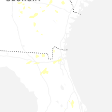
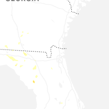
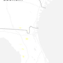


Connect with Interactive Hail Maps