

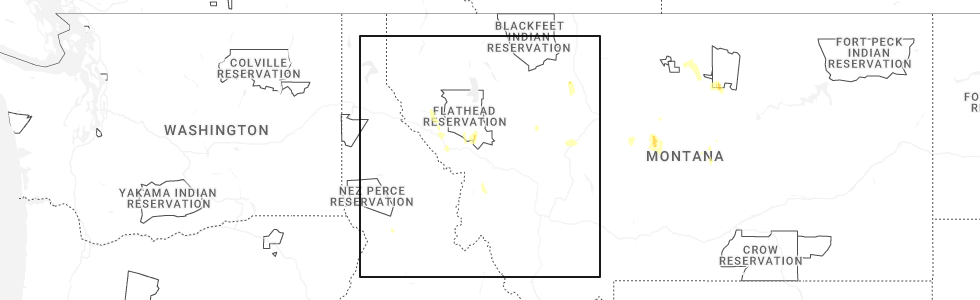
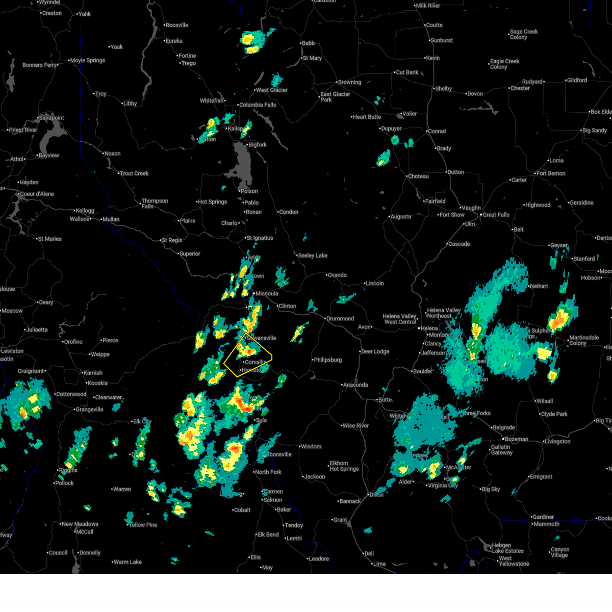
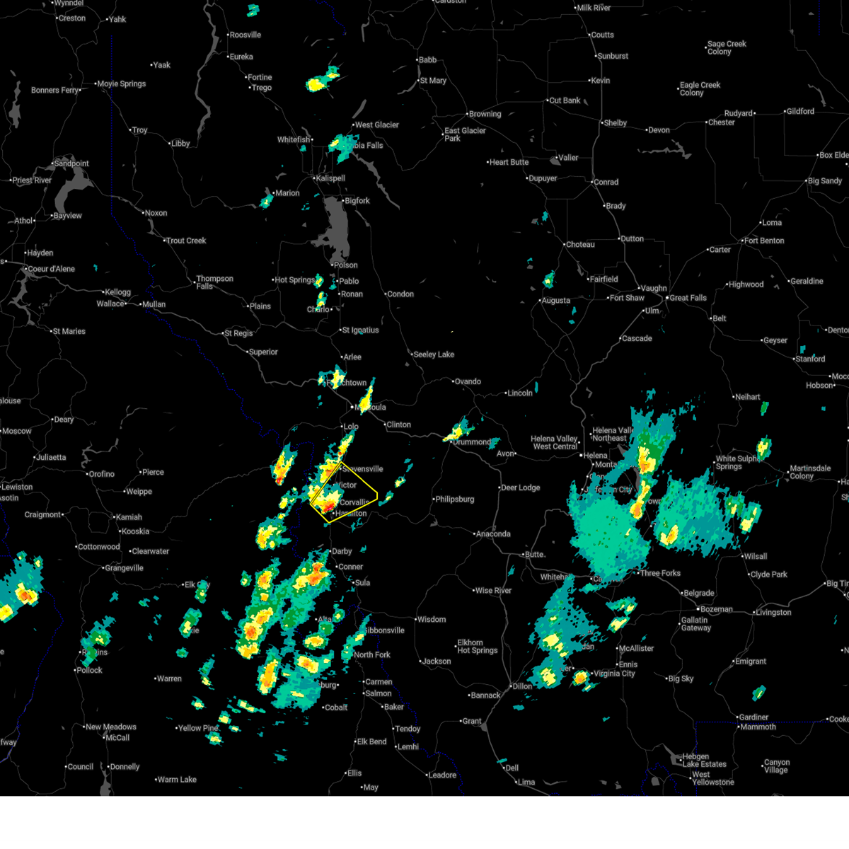
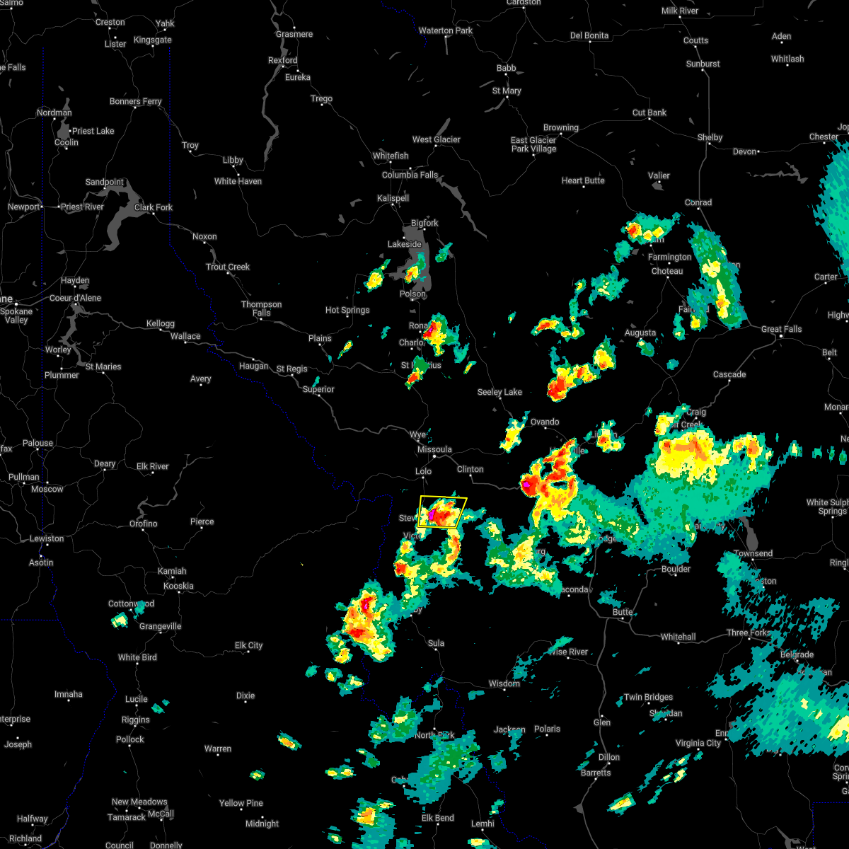
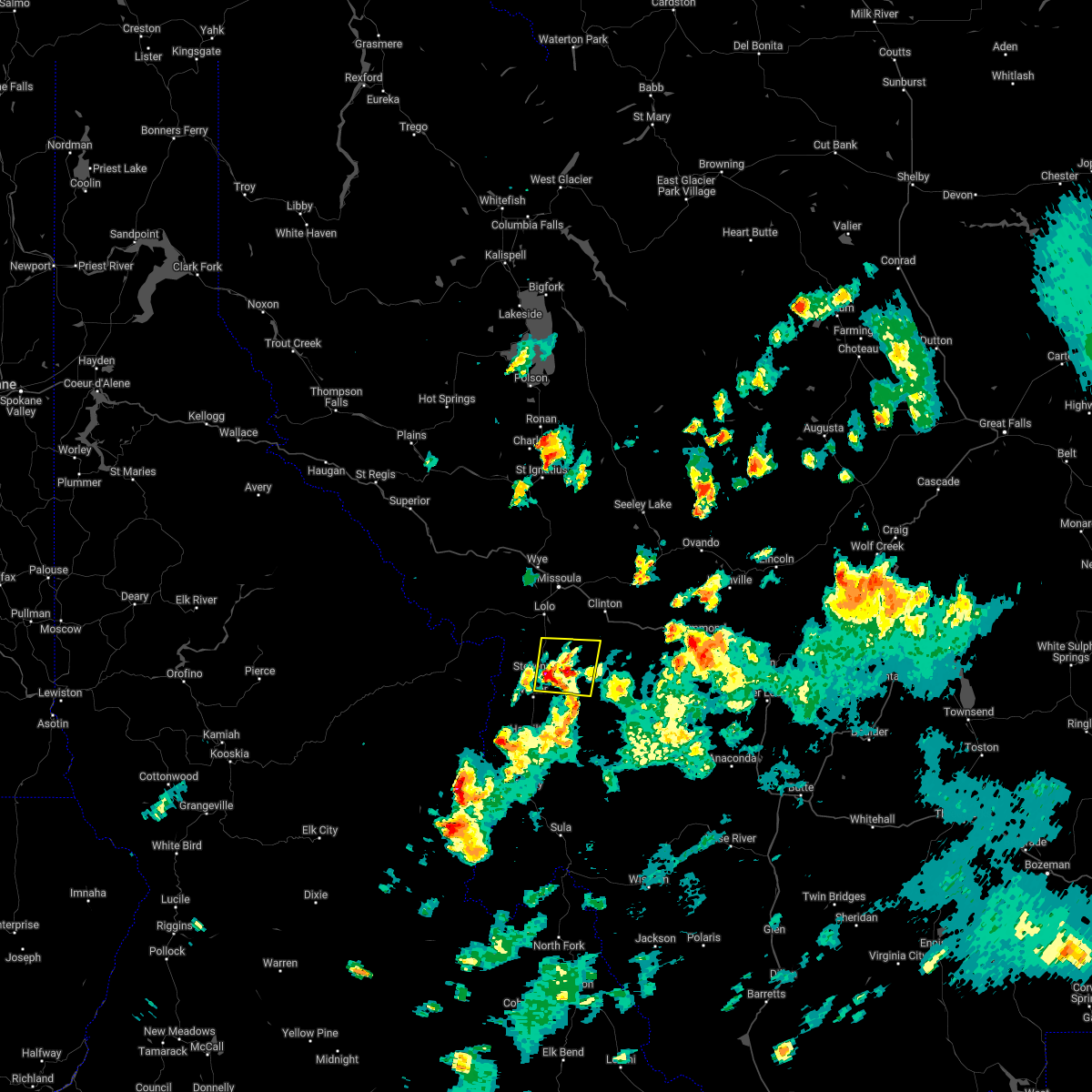
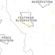
Hail Map for Stevensville, MT
The Stevensville, MT area has had 8 reports of on-the-ground hail by trained spotters, and has been under severe weather warnings 2 times during the past 12 months. Doppler radar has detected hail at or near Stevensville, MT on 10 occasions, including 1 occasion during the past year.
| Name: | Stevensville, MT |
| Where Located: | 25.7 miles S of Missoula, MT |
| Map: | Google Map for Stevensville, MT |
| Population: | 1809 |
| Housing Units: | 935 |
| More Info: | Search Google for Stevensville, MT |
0
The Top Recent Hail Date for Stevensville, MT is Friday, May 29, 2026 (5th out of 10)
Hail and Wind Damage Spotted near Stevensville, MT
| Date / Time | Report Details |
|---|---|
| 7/2/2025 4:26 PM MDT |
 The severe thunderstorm which prompted the warning has weakened. therefore, the warning will be allowed to expire. The severe thunderstorm which prompted the warning has weakened. therefore, the warning will be allowed to expire.
|
| 7/2/2025 3:56 PM MDT |
 Svrmso the national weather service in missoula has issued a * severe thunderstorm warning for, northwestern ravalli county in west central montana, * until 430 pm mdt. * at 356 pm mdt, a severe thunderstorm was located near woodside, or near hamilton, moving northeast at 20 mph (radar indicated). Hazards include 60 mph wind gusts and penny size hail. expect damage to roofs, siding, and trees Svrmso the national weather service in missoula has issued a * severe thunderstorm warning for, northwestern ravalli county in west central montana, * until 430 pm mdt. * at 356 pm mdt, a severe thunderstorm was located near woodside, or near hamilton, moving northeast at 20 mph (radar indicated). Hazards include 60 mph wind gusts and penny size hail. expect damage to roofs, siding, and trees
|
| 8/23/2024 3:17 PM MDT |
 Svrmso the national weather service in missoula has issued a * severe thunderstorm warning for, northeastern idaho county in central idaho, south central missoula county in west central montana, northwestern granite county in west central montana, northern ravalli county in west central montana, * until 345 pm mdt/245 pm pdt/. * at 317 pm mdt/217 pm pdt/, severe thunderstorms were located along a line extending from 15 miles west of philipsburg to 8 miles west of hamilton, moving north at 40 mph (trained weather spotters). Hazards include 70 mph wind gusts. Expect considerable tree damage. Damage is likely to mobile homes, roofs, and outbuildings. Svrmso the national weather service in missoula has issued a * severe thunderstorm warning for, northeastern idaho county in central idaho, south central missoula county in west central montana, northwestern granite county in west central montana, northern ravalli county in west central montana, * until 345 pm mdt/245 pm pdt/. * at 317 pm mdt/217 pm pdt/, severe thunderstorms were located along a line extending from 15 miles west of philipsburg to 8 miles west of hamilton, moving north at 40 mph (trained weather spotters). Hazards include 70 mph wind gusts. Expect considerable tree damage. Damage is likely to mobile homes, roofs, and outbuildings.
|
| 7/24/2024 9:07 PM MDT |
 the severe thunderstorm warning has been cancelled and is no longer in effect the severe thunderstorm warning has been cancelled and is no longer in effect
|
| 7/24/2024 9:05 PM MDT |
 The severe thunderstorm which prompted the warning has therefore, the warning will be allowed to expire. The severe thunderstorm which prompted the warning has therefore, the warning will be allowed to expire.
|
| 7/24/2024 8:57 PM MDT |
 Svrmso the national weather service in missoula has issued a * severe thunderstorm warning for, north central ravalli county in west central montana, * until 930 pm mdt. * at 856 pm mdt, a severe thunderstorm was located near stevensville, or 20 miles north of hamilton, moving northeast at 25 mph (radar indicated). Hazards include 60 mph wind gusts. gusts in excess of 60 mph is occuring in the missoula valley. take shelter now. expect damage to roofs, siding, and trees Svrmso the national weather service in missoula has issued a * severe thunderstorm warning for, north central ravalli county in west central montana, * until 930 pm mdt. * at 856 pm mdt, a severe thunderstorm was located near stevensville, or 20 miles north of hamilton, moving northeast at 25 mph (radar indicated). Hazards include 60 mph wind gusts. gusts in excess of 60 mph is occuring in the missoula valley. take shelter now. expect damage to roofs, siding, and trees
|
| 7/24/2024 8:49 PM MDT |
 Svrmso the national weather service in missoula has issued a * severe thunderstorm warning for, north central ravalli county in west central montana, * until 915 pm mdt. * at 849 pm mdt, a severe thunderstorm was located near stevensville, or 18 miles north of hamilton, moving northeast at 25 mph (radar indicated). Hazards include 60 mph wind gusts. expect damage to roofs, siding, and trees Svrmso the national weather service in missoula has issued a * severe thunderstorm warning for, north central ravalli county in west central montana, * until 915 pm mdt. * at 849 pm mdt, a severe thunderstorm was located near stevensville, or 18 miles north of hamilton, moving northeast at 25 mph (radar indicated). Hazards include 60 mph wind gusts. expect damage to roofs, siding, and trees
|
| 7/9/2022 7:54 PM MDT |
 At 754 pm mdt, a severe thunderstorm was located near stevensville, or 19 miles northeast of hamilton, moving northeast at 30 mph (radar indicated). Hazards include 60 mph wind gusts and half dollar size hail. Hail damage to vehicles is expected. expect wind damage to roofs, siding, and trees. locations impacted include, stevensville, victor, bell crossing and corvallis. hail threat, radar indicated max hail size, 1. 25 in wind threat, radar indicated max wind gust, 60 mph. At 754 pm mdt, a severe thunderstorm was located near stevensville, or 19 miles northeast of hamilton, moving northeast at 30 mph (radar indicated). Hazards include 60 mph wind gusts and half dollar size hail. Hail damage to vehicles is expected. expect wind damage to roofs, siding, and trees. locations impacted include, stevensville, victor, bell crossing and corvallis. hail threat, radar indicated max hail size, 1. 25 in wind threat, radar indicated max wind gust, 60 mph.
|
| 7/9/2022 7:49 PM MDT |
 At 749 pm mdt, a severe thunderstorm was located near stevensville, or 18 miles north of hamilton, moving northeast at 30 mph (radar indicated). Hazards include 60 mph wind gusts and quarter size hail. Hail damage to vehicles is expected. Expect wind damage to roofs, siding, and trees. At 749 pm mdt, a severe thunderstorm was located near stevensville, or 18 miles north of hamilton, moving northeast at 30 mph (radar indicated). Hazards include 60 mph wind gusts and quarter size hail. Hail damage to vehicles is expected. Expect wind damage to roofs, siding, and trees.
|
| 7/7/2022 7:20 PM MDT | Strong winds causing power outage and a broken cottonwood tre in ravalli county MT, 3.6 miles WSW of Stevensville, MT |
| 7/7/2022 7:15 PM MDT | Quarter sized hail reported 3.6 miles WSW of Stevensville, MT, sent in by twitter. |
| 7/7/2022 7:08 PM MDT |
 At 707 pm mdt, a severe thunderstorm was located near stevensville, or 20 miles south of missoula, moving northeast at 20 mph (radar indicated). Hazards include tennis ball size hail and 70 mph wind gusts. People and animals outdoors will be injured. expect hail damage to roofs, siding, windows, and vehicles. expect considerable tree damage. wind damage is also likely to mobile homes, roofs, and outbuildings. locations impacted include, stevensville and florence. thunderstorm damage threat, considerable hail threat, radar indicated max hail size, 2. 50 in wind threat, radar indicated max wind gust, 70 mph. At 707 pm mdt, a severe thunderstorm was located near stevensville, or 20 miles south of missoula, moving northeast at 20 mph (radar indicated). Hazards include tennis ball size hail and 70 mph wind gusts. People and animals outdoors will be injured. expect hail damage to roofs, siding, windows, and vehicles. expect considerable tree damage. wind damage is also likely to mobile homes, roofs, and outbuildings. locations impacted include, stevensville and florence. thunderstorm damage threat, considerable hail threat, radar indicated max hail size, 2. 50 in wind threat, radar indicated max wind gust, 70 mph.
|
| 7/7/2022 7:06 PM MDT | Ping Pong Ball sized hail reported 6 miles SSW of Stevensville, MT |
| 7/7/2022 7:01 PM MDT |
 At 701 pm mdt, a severe thunderstorm was located near stevensville, or 22 miles south of missoula, moving northeast at 20 mph (radar indicated). Hazards include two inch hail and 70 mph wind gusts. People and animals outdoors will be injured. expect hail damage to roofs, siding, windows, and vehicles. expect considerable tree damage. wind damage is also likely to mobile homes, roofs, and outbuildings. locations impacted include, stevensville and florence. thunderstorm damage threat, considerable hail threat, radar indicated max hail size, 2. 00 in wind threat, radar indicated max wind gust, 70 mph. At 701 pm mdt, a severe thunderstorm was located near stevensville, or 22 miles south of missoula, moving northeast at 20 mph (radar indicated). Hazards include two inch hail and 70 mph wind gusts. People and animals outdoors will be injured. expect hail damage to roofs, siding, windows, and vehicles. expect considerable tree damage. wind damage is also likely to mobile homes, roofs, and outbuildings. locations impacted include, stevensville and florence. thunderstorm damage threat, considerable hail threat, radar indicated max hail size, 2. 00 in wind threat, radar indicated max wind gust, 70 mph.
|
| 7/7/2022 6:57 PM MDT |
 At 656 pm mdt, a severe thunderstorm was located over stevensville, or 20 miles north of hamilton, moving northeast at 20 mph (radar indicated). Hazards include ping pong ball size hail and 60 mph wind gusts. People and animals outdoors will be injured. expect hail damage to roofs, siding, windows, and vehicles. Expect wind damage to roofs, siding, and trees. At 656 pm mdt, a severe thunderstorm was located over stevensville, or 20 miles north of hamilton, moving northeast at 20 mph (radar indicated). Hazards include ping pong ball size hail and 60 mph wind gusts. People and animals outdoors will be injured. expect hail damage to roofs, siding, windows, and vehicles. Expect wind damage to roofs, siding, and trees.
|
| 6/18/2022 1:38 PM MDT |
 The severe thunderstorm warning for south central missoula and north central ravalli counties will expire at 145 pm mdt, the severe thunderstorm which prompted the warning has moved out of the warned area. therefore, the warning will be allowed to expire. a severe thunderstorm watch remains in effect until 700 pm mdt for west central montana. The severe thunderstorm warning for south central missoula and north central ravalli counties will expire at 145 pm mdt, the severe thunderstorm which prompted the warning has moved out of the warned area. therefore, the warning will be allowed to expire. a severe thunderstorm watch remains in effect until 700 pm mdt for west central montana.
|
| 6/18/2022 1:28 PM MDT | Quarter sized hail reported 3.9 miles SSW of Stevensville, MT |
| 6/18/2022 1:27 PM MDT | Quarter sized hail reported 2.4 miles SW of Stevensville, MT |
| 6/18/2022 1:27 PM MDT | Quarter sized hail reported 2.2 miles ESE of Stevensville, MT |
| 6/18/2022 1:13 PM MDT |
 At 112 pm mdt, a severe thunderstorm was located over victor, or 14 miles north of hamilton, moving northeast at 25 mph (radar indicated). Hazards include quarter size hail. winds gusting to 40 mph and heavy rain are also expected. damage to vehicles is expected At 112 pm mdt, a severe thunderstorm was located over victor, or 14 miles north of hamilton, moving northeast at 25 mph (radar indicated). Hazards include quarter size hail. winds gusting to 40 mph and heavy rain are also expected. damage to vehicles is expected
|
| 7/30/2019 7:20 PM MDT | Quarter sized hail reported 3.8 miles SW of Stevensville, MT |
| 7/30/2019 7:15 PM MDT | Quarter sized hail reported 1.9 miles W of Stevensville, MT |
| 7/15/2017 4:27 PM MDT |
 At 426 pm mdt, a severe thunderstorm was located 8 miles west of stevensville, or 19 miles north of hamilton, moving northeast at 45 mph (radar indicated). Hazards include 65 mph wind gusts and penny size hail. expect damage to roofs, siding, and trees At 426 pm mdt, a severe thunderstorm was located 8 miles west of stevensville, or 19 miles north of hamilton, moving northeast at 45 mph (radar indicated). Hazards include 65 mph wind gusts and penny size hail. expect damage to roofs, siding, and trees
|
| 7/17/2016 9:51 PM MDT |
 At 951 pm mdt, multiple trained weather spotters reported a severe thunderstorm producing quarter size hail and damaging winds in excess of 60 mph. this storm was located 10 miles northeast of bonner-west riverside, or 15 miles east of missoula, moving northeast at 55 mph. locations impacted include, missoula, lolo, stevensville, evaro, wye, bonner-west riverside, frenchtown, florence, east missoula, arlee, twin creeks, clinton, potomac and turah. At 951 pm mdt, multiple trained weather spotters reported a severe thunderstorm producing quarter size hail and damaging winds in excess of 60 mph. this storm was located 10 miles northeast of bonner-west riverside, or 15 miles east of missoula, moving northeast at 55 mph. locations impacted include, missoula, lolo, stevensville, evaro, wye, bonner-west riverside, frenchtown, florence, east missoula, arlee, twin creeks, clinton, potomac and turah.
|
| 7/17/2016 9:27 PM MDT |
 At 926 pm mdt, doppler radar indicated a severe thunderstorm capable of producing damaging winds in excess of 60 mph. this storm was located over lolo, or 10 miles south of missoula, and moving northeast at 55 mph. nickel size to quarter size hail may also accompany the damaging winds. At 926 pm mdt, doppler radar indicated a severe thunderstorm capable of producing damaging winds in excess of 60 mph. this storm was located over lolo, or 10 miles south of missoula, and moving northeast at 55 mph. nickel size to quarter size hail may also accompany the damaging winds.
|
| 8/10/2015 6:04 PM MDT |
 At 602 pm mdt, doppler radar indicated a severe thunderstorm capable of producing damaging winds in excess of 60 mph. this storm was located near stevensville, or 17 miles north of hamilton, and moving north at 25 mph. this storm has a history of damaging winds, causing downed power lines and downed trees. At 602 pm mdt, doppler radar indicated a severe thunderstorm capable of producing damaging winds in excess of 60 mph. this storm was located near stevensville, or 17 miles north of hamilton, and moving north at 25 mph. this storm has a history of damaging winds, causing downed power lines and downed trees.
|
| 8/10/2015 5:45 PM MDT |
 At 544 pm mdt /444 pm pdt/, local law enforcement reported a severe thunderstorm producing damaging winds in excess of 60 mph. this storm was located near hamilton, moving north at 30 mph. this storm has caused downed power lines and downed trees in locations down the bitterroot valley from strong outflow winds. locations impacted include, hamilton, stevensville, woodside, victor, pinesdale, corvallis, bell crossing and grantsdale. At 544 pm mdt /444 pm pdt/, local law enforcement reported a severe thunderstorm producing damaging winds in excess of 60 mph. this storm was located near hamilton, moving north at 30 mph. this storm has caused downed power lines and downed trees in locations down the bitterroot valley from strong outflow winds. locations impacted include, hamilton, stevensville, woodside, victor, pinesdale, corvallis, bell crossing and grantsdale.
|
| 8/10/2015 5:00 PM MDT |
 At 459 pm mdt /359 pm pdt/, doppler radar indicated a severe thunderstorm capable of producing damaging winds in excess of 60 mph. this storm was located near conner, or 26 miles south of hamilton, and moving north at 30 mph. At 459 pm mdt /359 pm pdt/, doppler radar indicated a severe thunderstorm capable of producing damaging winds in excess of 60 mph. this storm was located near conner, or 26 miles south of hamilton, and moving north at 30 mph.
|
| 6/9/2015 6:58 PM MDT |
 At 658 pm mdt, doppler radar indicated a severe thunderstorm capable of producing quarter size hail. this storm was located over victor, or 12 miles north of hamilton, and moving east at 10 mph. At 658 pm mdt, doppler radar indicated a severe thunderstorm capable of producing quarter size hail. this storm was located over victor, or 12 miles north of hamilton, and moving east at 10 mph.
|
| 7/22/2012 7:30 PM MDT | Numerous trees (p in ravalli county MT, 6.7 miles WNW of Stevensville, MT |
| 6/4/2012 3:33 PM MDT | Quarter sized hail reported 8.9 miles NNW of Stevensville, MT |
Hail Maps for Stevensville, MT


Connect with Interactive Hail Maps