

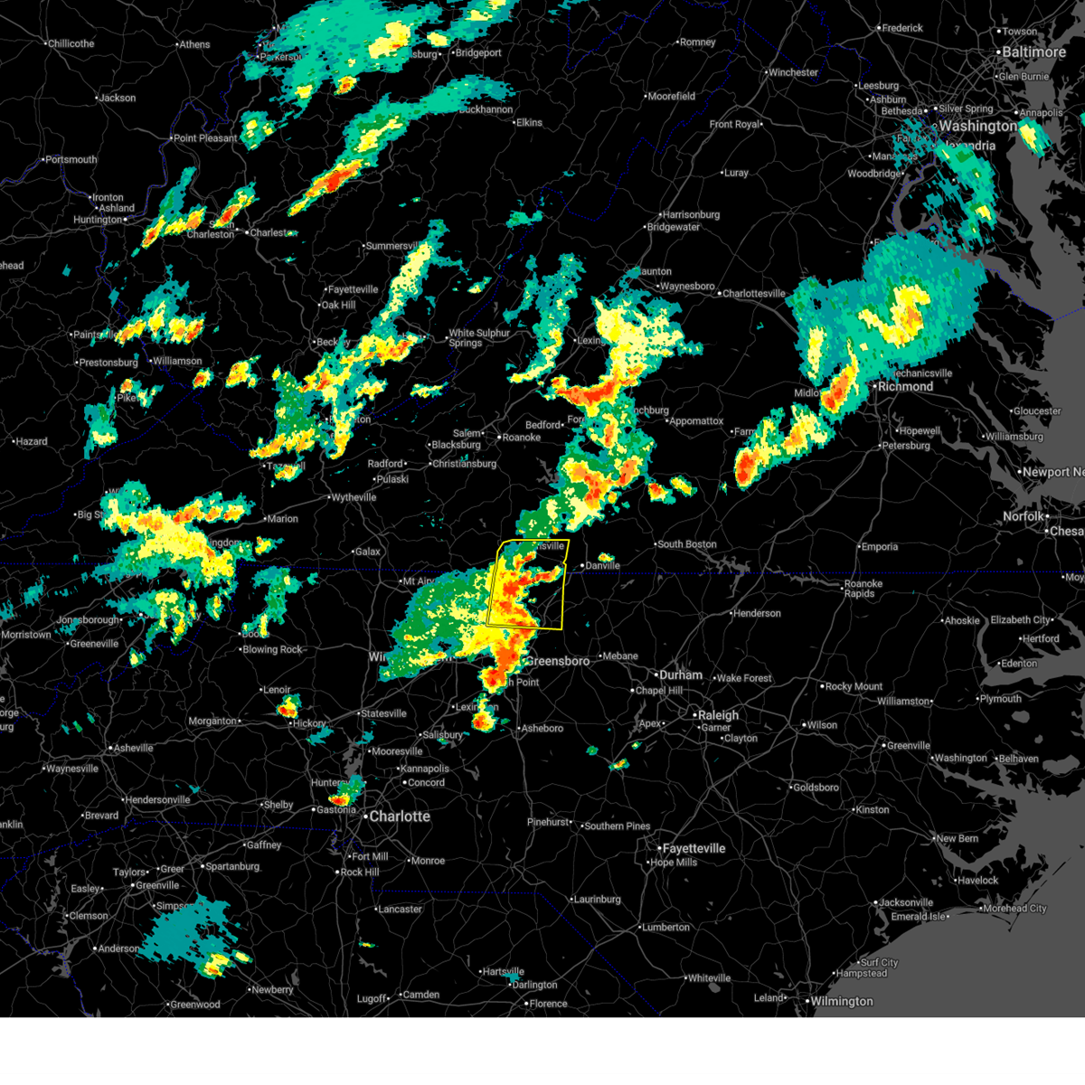
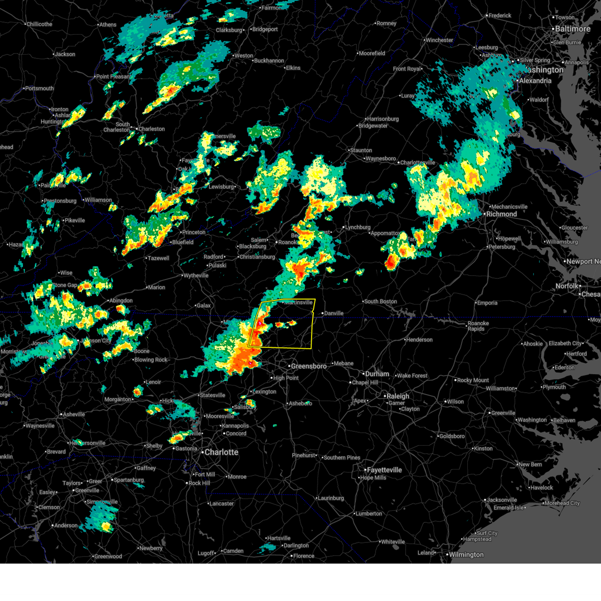
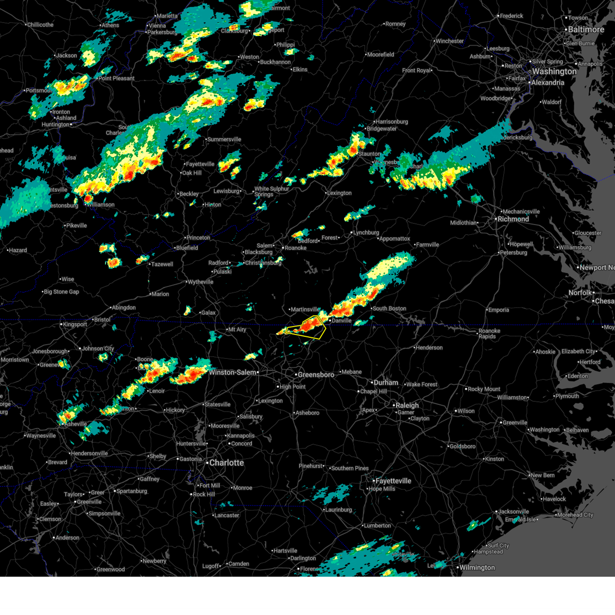
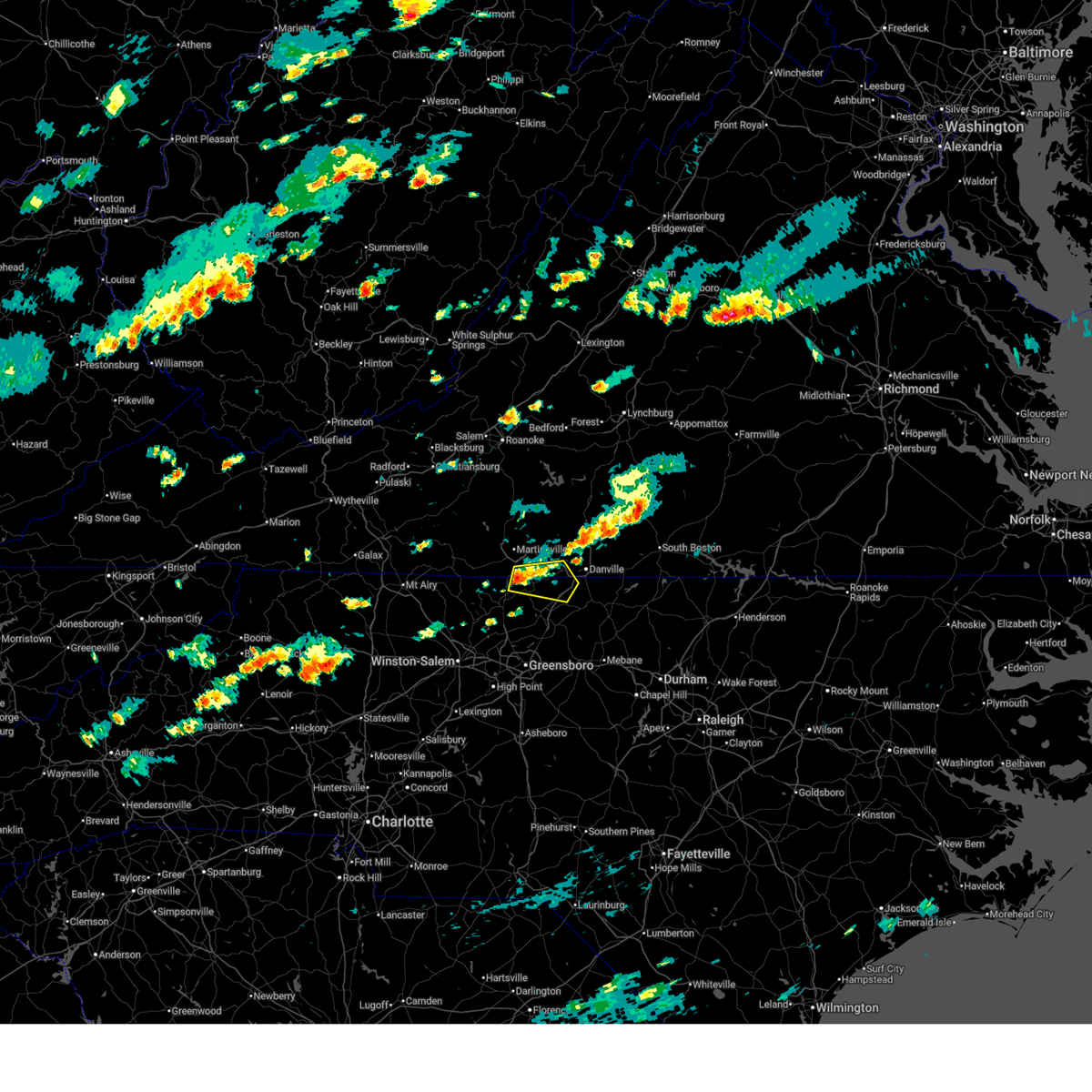
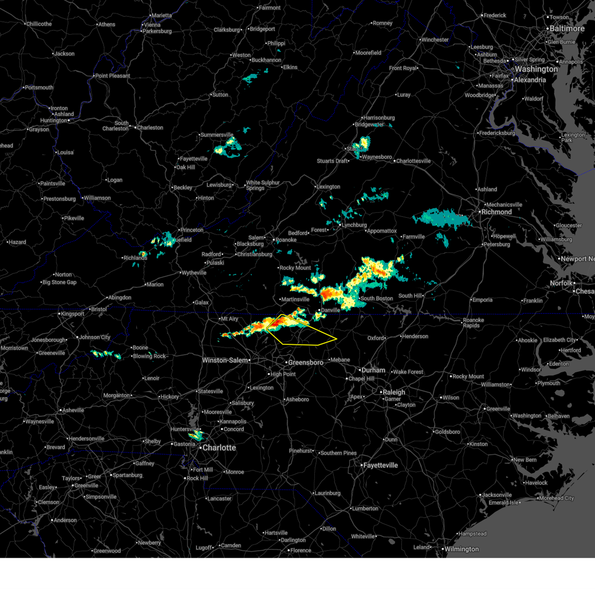
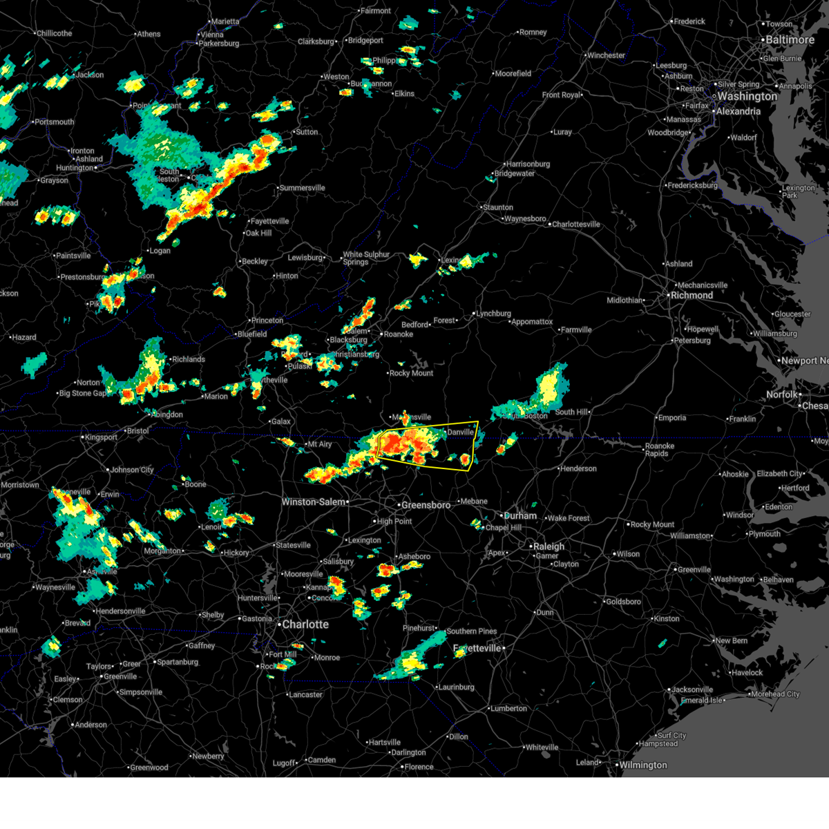
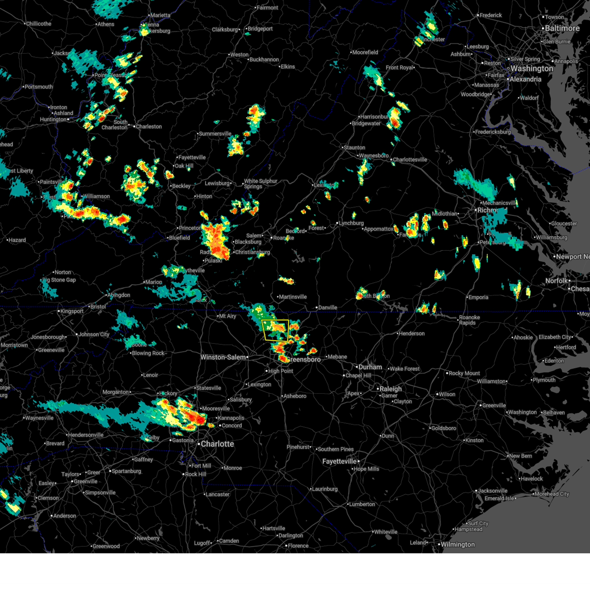
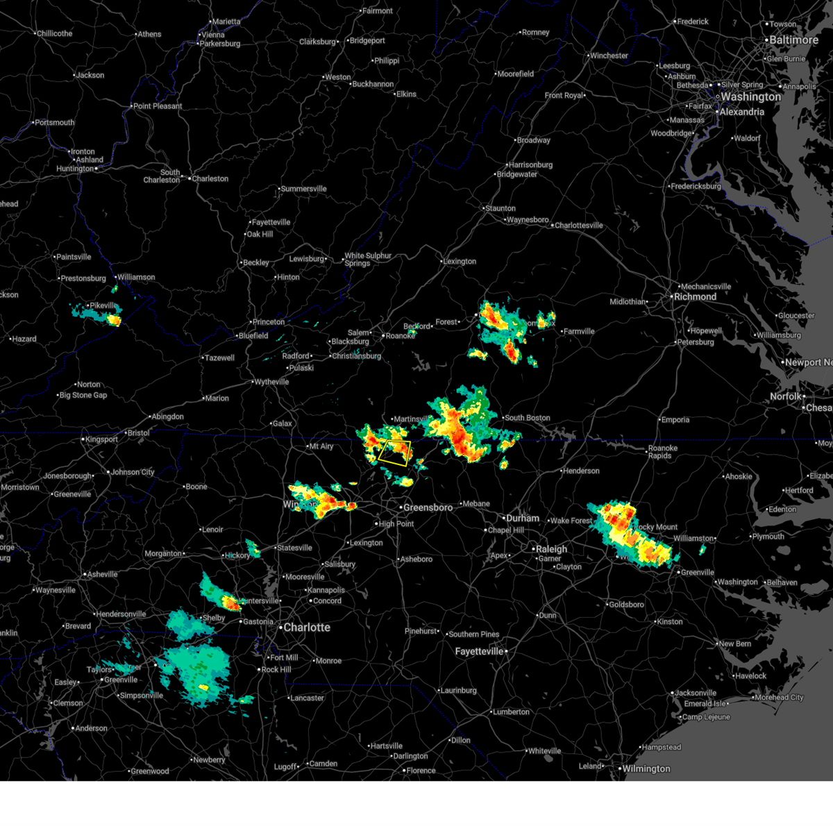
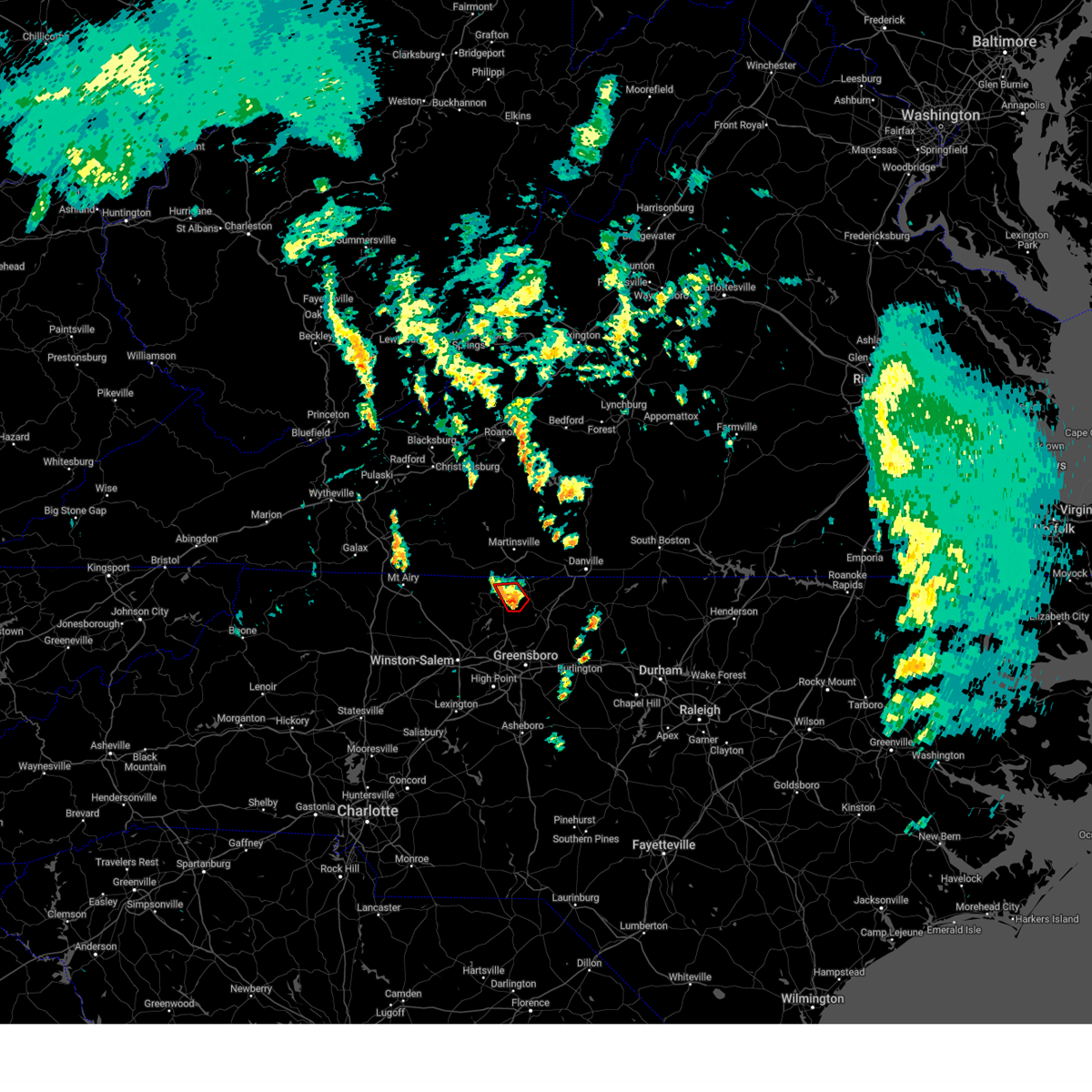
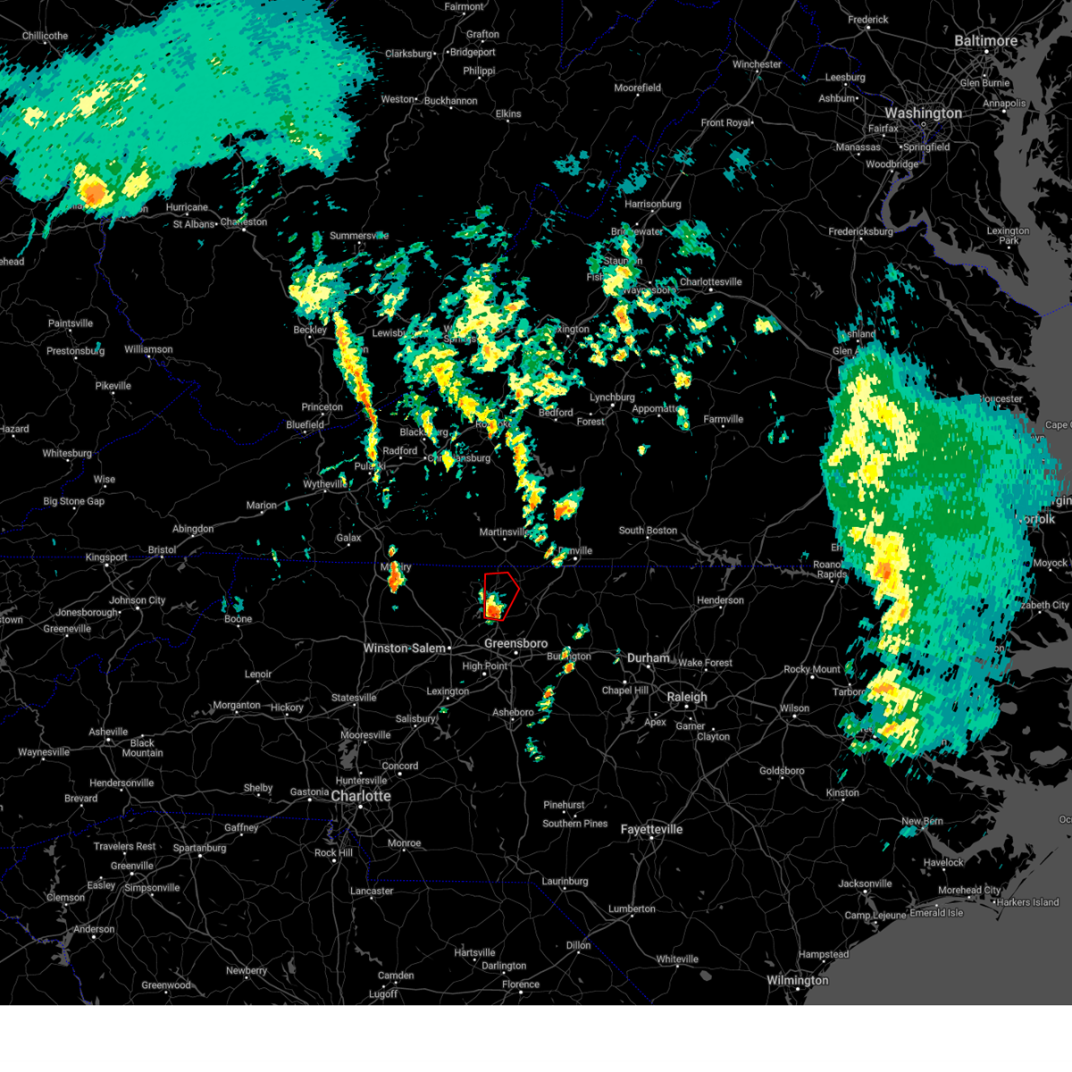
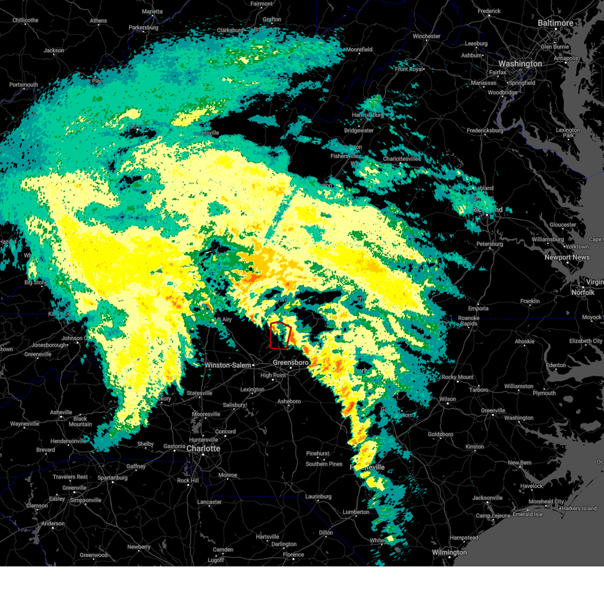
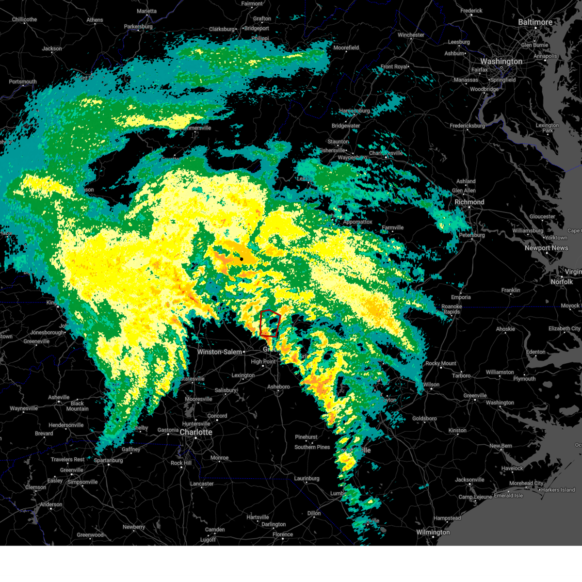
Hail Map for Stoneville, NC
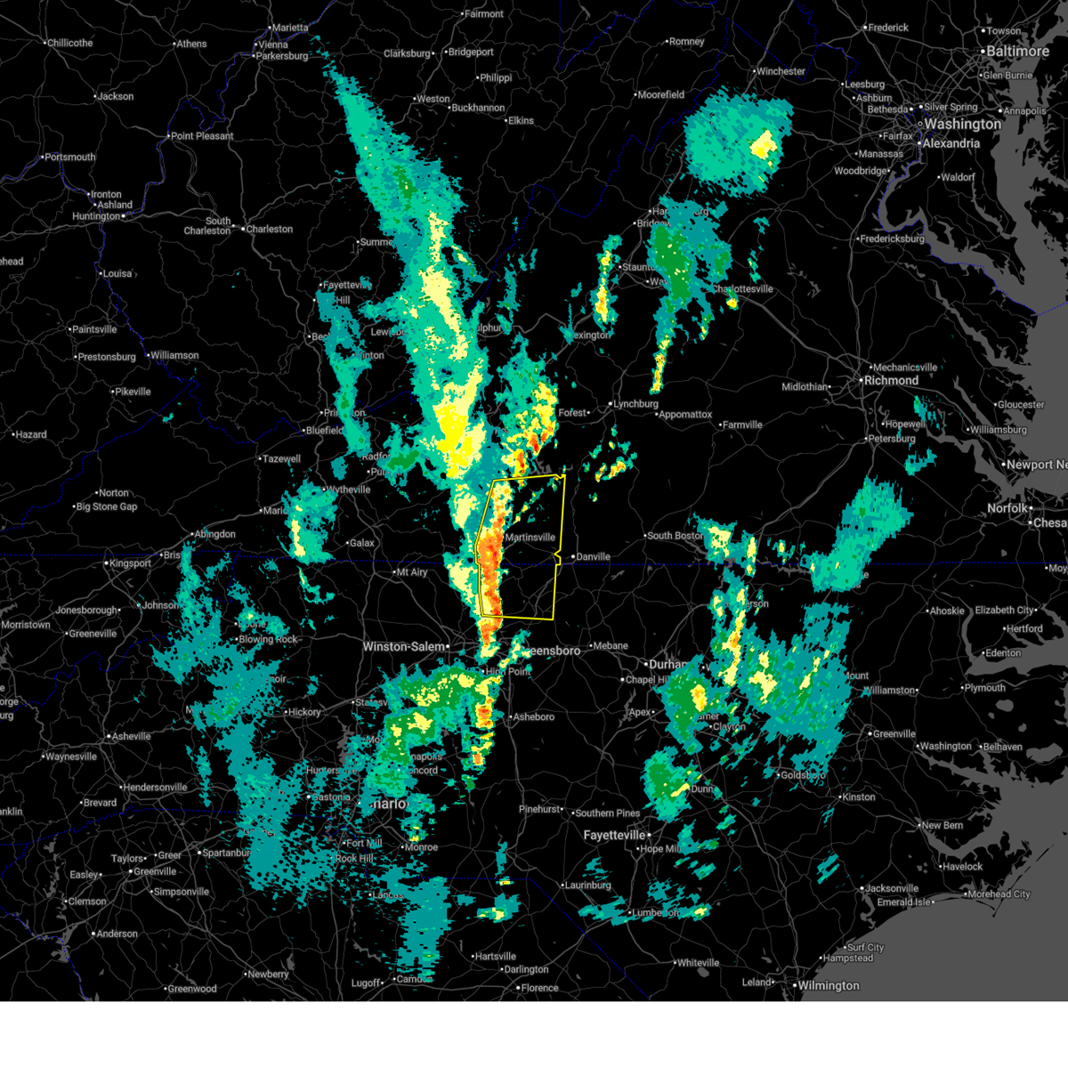
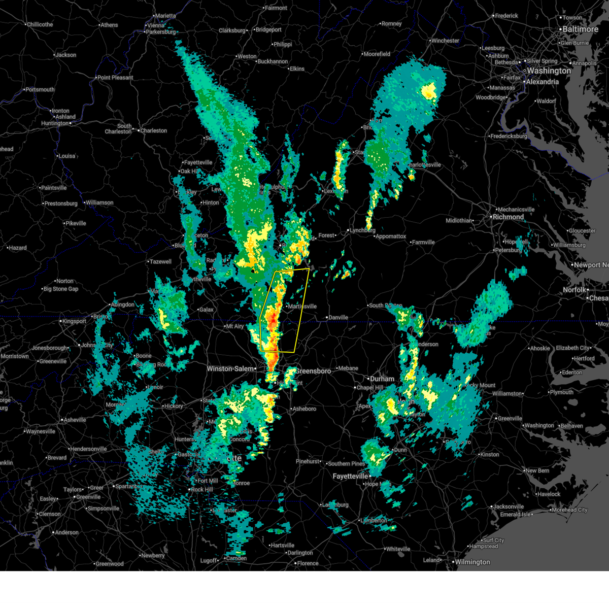
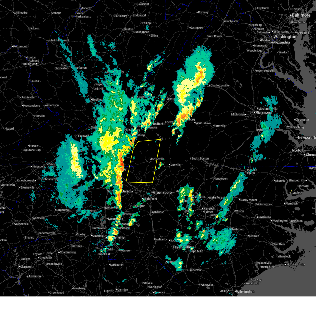
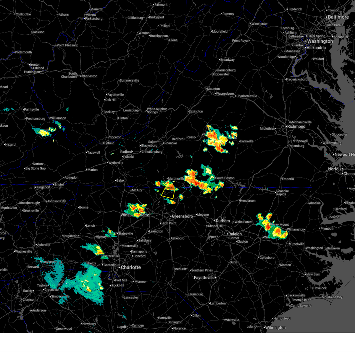
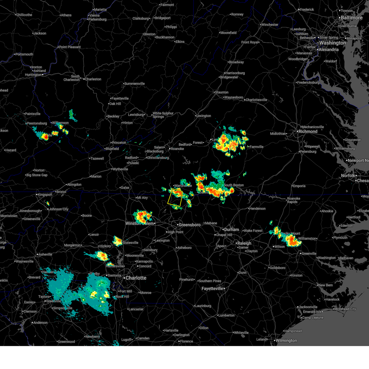
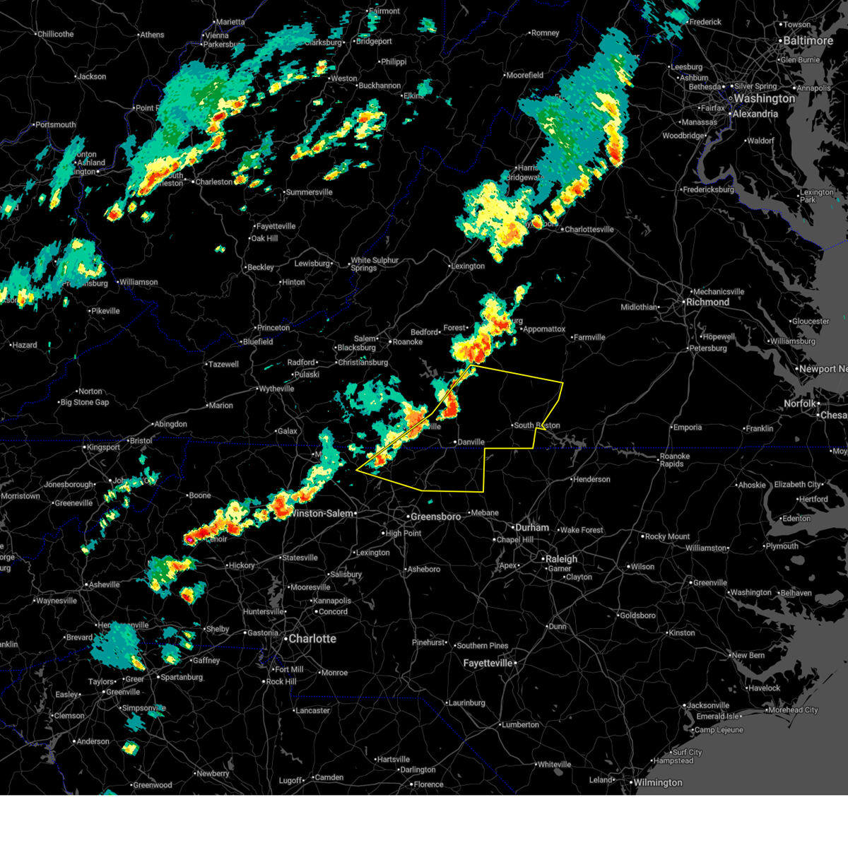
The Stoneville, NC area has had 4 reports of on-the-ground hail by trained spotters, and has been under severe weather warnings 22 times during the past 12 months. Doppler radar has detected hail at or near Stoneville, NC on 49 occasions, including 4 occasions during the past year.
| Name: | Stoneville, NC |
| Where Located: | 55.5 miles S of Roanoke, VA |
| Map: | Google Map for Stoneville, NC |
| Population: | 1056 |
| Housing Units: | 537 |
| More Info: | Search Google for Stoneville, NC |
4
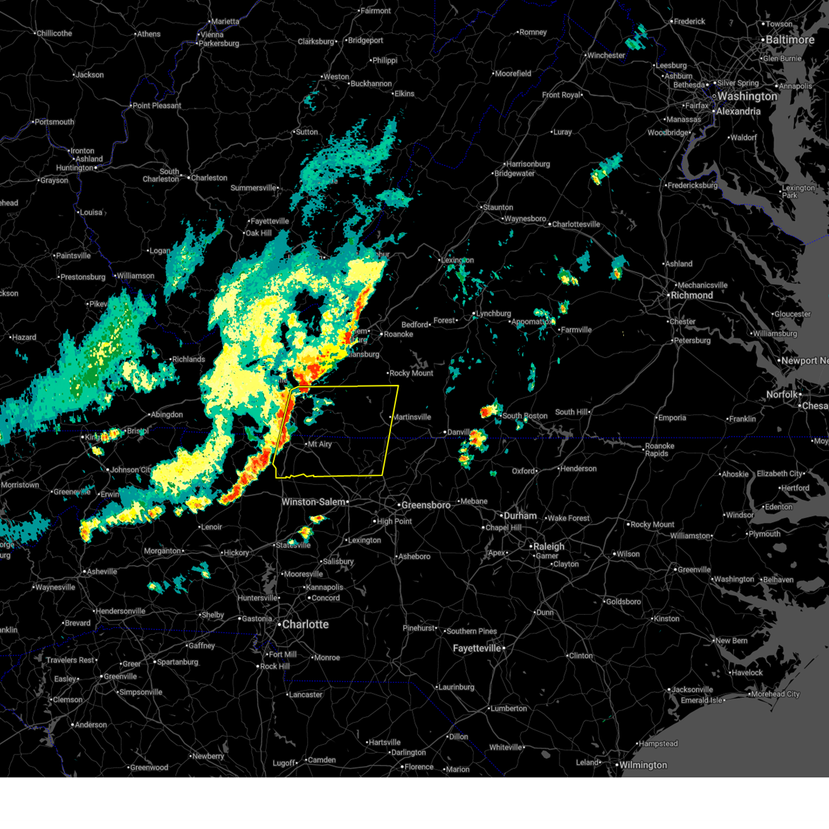
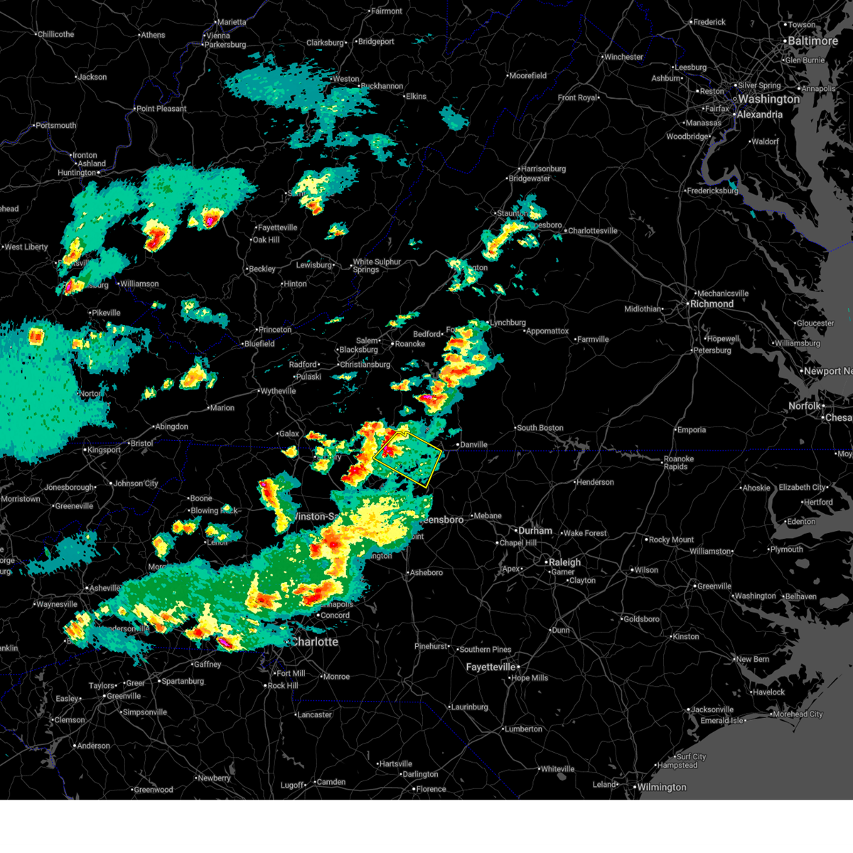
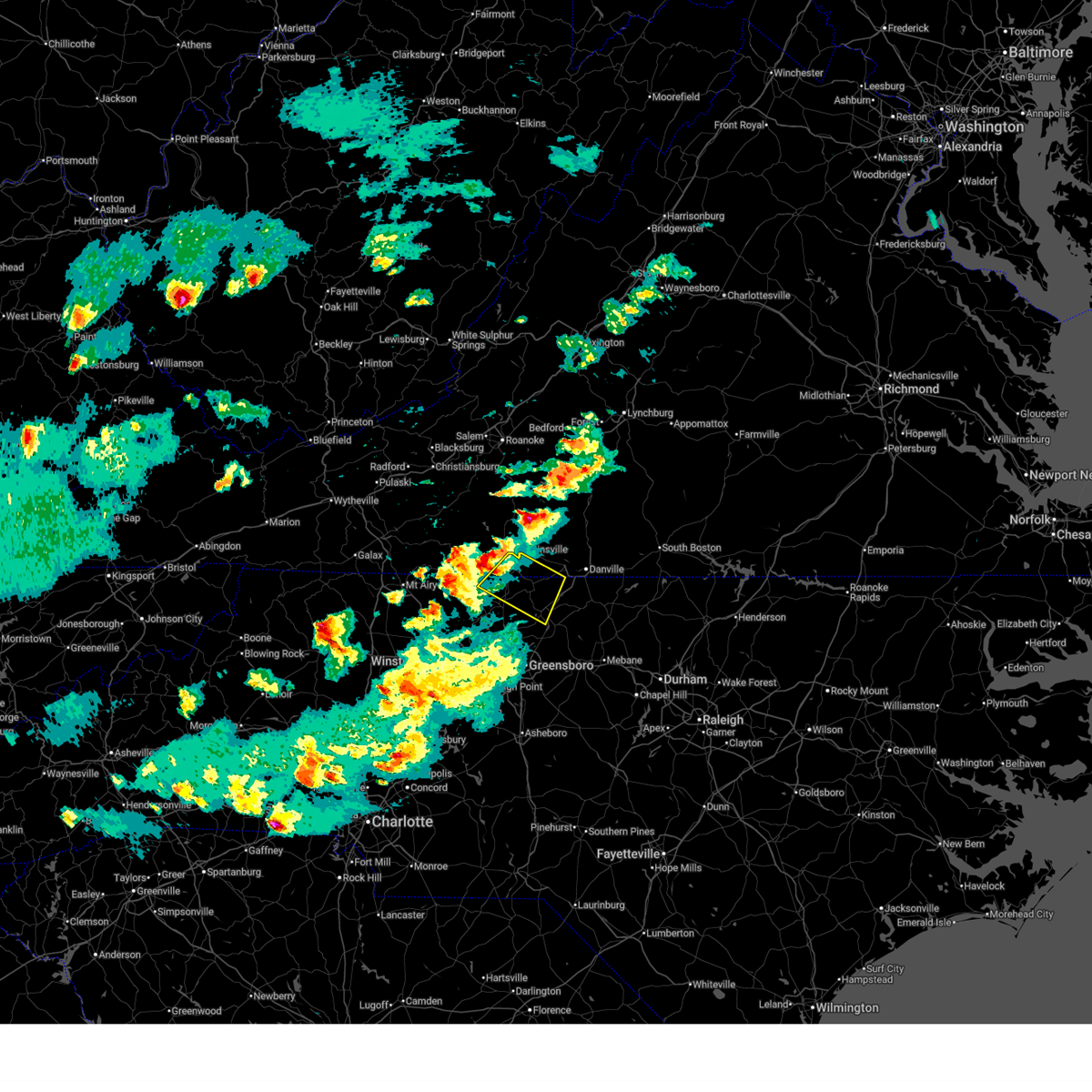
The Top Recent Hail Date for Stoneville, NC is Wednesday, April 29, 2026 (5th out of 49)

Hail and Wind Damage Spotted near Stoneville, NC
| Date / Time | Report Details |
|---|---|
| 6/22/2026 7:02 PM EDT |
 At 702 pm edt, a severe thunderstorm was located over wentworth, moving east at 30 mph (radar indicated). Hazards include 60 mph wind gusts. Expect damage to roofs, siding, and trees. Locations impacted include, eden, reidsville, martinsville, wentworth, mayodan, madison, and stoneville. At 702 pm edt, a severe thunderstorm was located over wentworth, moving east at 30 mph (radar indicated). Hazards include 60 mph wind gusts. Expect damage to roofs, siding, and trees. Locations impacted include, eden, reidsville, martinsville, wentworth, mayodan, madison, and stoneville.
|
| 6/22/2026 6:52 PM EDT | 911 call center reported a tree down at the intersection of taylor road and simpson street in the stoneville area of rockingham county north carolin in rockingham county NC, 0.2 miles SSW of Stoneville, NC |
| 6/22/2026 6:52 PM EDT | 911 call center reported a tree down on stone mountain road in the stoneville area of rockingham county north carolin in rockingham county NC, 2 miles NNW of Stoneville, NC |
| 6/22/2026 6:24 PM EDT |
 Svrrnk the national weather service in blacksburg has issued a * severe thunderstorm warning for, eastern stokes county in north central north carolina, rockingham county in north central north carolina, southwestern pittsylvania county in south central virginia, the city of martinsville in south central virginia, southern henry county in south central virginia, southeastern patrick county in southwestern virginia, * until 730 pm edt. * at 624 pm edt, a severe thunderstorm was located near meadows, or near danbury, moving east at 30 mph (radar indicated). Hazards include 60 mph wind gusts. expect damage to roofs, siding, and trees Svrrnk the national weather service in blacksburg has issued a * severe thunderstorm warning for, eastern stokes county in north central north carolina, rockingham county in north central north carolina, southwestern pittsylvania county in south central virginia, the city of martinsville in south central virginia, southern henry county in south central virginia, southeastern patrick county in southwestern virginia, * until 730 pm edt. * at 624 pm edt, a severe thunderstorm was located near meadows, or near danbury, moving east at 30 mph (radar indicated). Hazards include 60 mph wind gusts. expect damage to roofs, siding, and trees
|
| 5/27/2026 4:17 PM EDT |
 The storms which prompted the warning have moved out of the area. therefore, the warning has been allowed to expire. a severe thunderstorm watch remains in effect until 900 pm edt for south central, southwestern and west central virginia. remember, a newer severe thunderstorm warning still remains in effect for northern caswell county until 500 pm edt. The storms which prompted the warning have moved out of the area. therefore, the warning has been allowed to expire. a severe thunderstorm watch remains in effect until 900 pm edt for south central, southwestern and west central virginia. remember, a newer severe thunderstorm warning still remains in effect for northern caswell county until 500 pm edt.
|
| 5/27/2026 3:51 PM EDT |
 At 350 pm edt, severe thunderstorms were located along a line extending from near westover hills to near stoneville, moving east at 20 mph (radar indicated). Hazards include 60 mph wind gusts. Expect damage to roofs, siding, and trees. Locations impacted include, eden, stoneville, mayfield, oregon hill, ruffin, draper, and pelham. At 350 pm edt, severe thunderstorms were located along a line extending from near westover hills to near stoneville, moving east at 20 mph (radar indicated). Hazards include 60 mph wind gusts. Expect damage to roofs, siding, and trees. Locations impacted include, eden, stoneville, mayfield, oregon hill, ruffin, draper, and pelham.
|
| 5/27/2026 3:28 PM EDT |
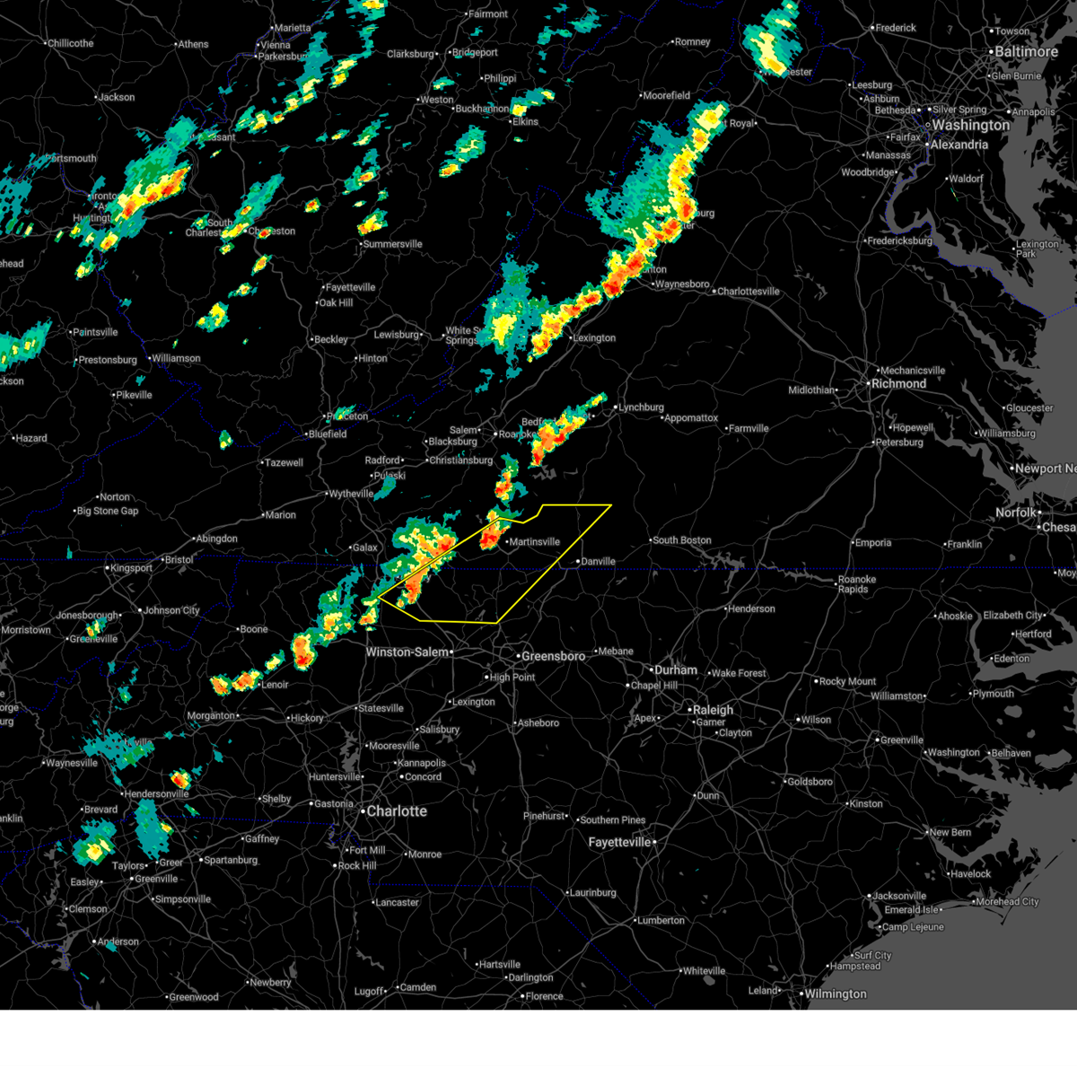
 Svrrnk the national weather service in blacksburg has issued a * severe thunderstorm warning for, northeastern rockingham county in north central north carolina, northwestern caswell county in north central north carolina, southwestern pittsylvania county in south central virginia, southeastern henry county in south central virginia, * until 415 pm edt. * at 328 pm edt, a severe thunderstorm was located near ridgeway, or near eden, moving east at 25 mph (radar indicated). Hazards include 60 mph wind gusts. expect damage to roofs, siding, and trees Svrrnk the national weather service in blacksburg has issued a * severe thunderstorm warning for, northeastern rockingham county in north central north carolina, northwestern caswell county in north central north carolina, southwestern pittsylvania county in south central virginia, southeastern henry county in south central virginia, * until 415 pm edt. * at 328 pm edt, a severe thunderstorm was located near ridgeway, or near eden, moving east at 25 mph (radar indicated). Hazards include 60 mph wind gusts. expect damage to roofs, siding, and trees
|
| 4/29/2026 9:08 PM EDT | One tree down. time adjusted with rada in rockingham county NC, 0.5 miles ESE of Stoneville, NC |
| 4/29/2026 8:56 PM EDT |
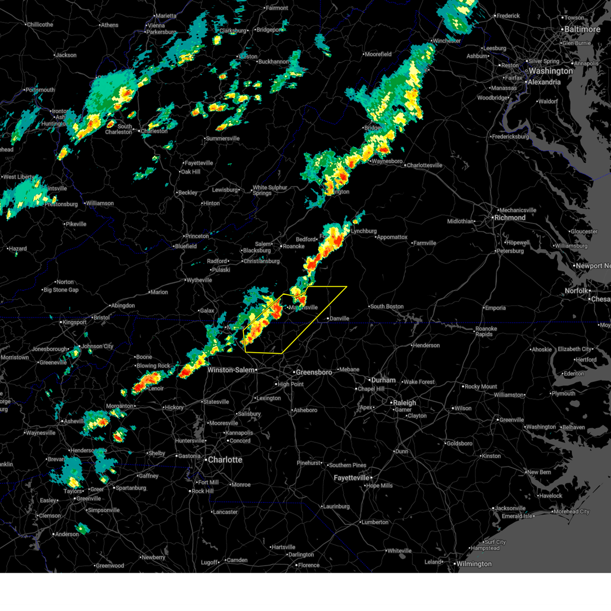
 Svrrnk the national weather service in blacksburg has issued a * severe thunderstorm warning for, rockingham county in north central north carolina, southern caswell county in north central north carolina, * until 1000 pm edt. * at 856 pm edt, a severe thunderstorm was located over stoneville, moving southeast at 30 mph (radar indicated). Hazards include 60 mph wind gusts and quarter size hail. Hail damage to vehicles is expected. Expect wind damage to roofs, siding, and trees. Svrrnk the national weather service in blacksburg has issued a * severe thunderstorm warning for, rockingham county in north central north carolina, southern caswell county in north central north carolina, * until 1000 pm edt. * at 856 pm edt, a severe thunderstorm was located over stoneville, moving southeast at 30 mph (radar indicated). Hazards include 60 mph wind gusts and quarter size hail. Hail damage to vehicles is expected. Expect wind damage to roofs, siding, and trees.
|
| 4/29/2026 8:50 PM EDT | Tree down near intersection of hen road and nc-770. time is estimated from rada in rockingham county NC, 3.8 miles E of Stoneville, NC |
| 3/16/2026 10:44 AM EDT |
 Svrrnk the national weather service in blacksburg has issued a * severe thunderstorm warning for, rockingham county in north central north carolina, western pittsylvania county in south central virginia, the city of martinsville in south central virginia, henry county in south central virginia, southeastern franklin county in west central virginia, * until 1130 am edt. * at 1043 am edt, severe thunderstorms were located along a line extending from near sontag to near bethany, moving east at 40 mph (radar indicated). Hazards include 60 mph wind gusts. expect damage to roofs, siding, and trees Svrrnk the national weather service in blacksburg has issued a * severe thunderstorm warning for, rockingham county in north central north carolina, western pittsylvania county in south central virginia, the city of martinsville in south central virginia, henry county in south central virginia, southeastern franklin county in west central virginia, * until 1130 am edt. * at 1043 am edt, severe thunderstorms were located along a line extending from near sontag to near bethany, moving east at 40 mph (radar indicated). Hazards include 60 mph wind gusts. expect damage to roofs, siding, and trees
|
| 3/16/2026 10:35 AM EDT |
 At 1033 am edt, severe thunderstorms were located along a line extending from near sydnorsville to near ellisboro, moving east at 45 mph. this is a separate warning from the tornado warning currently issued for the city of martinsville and central henry county (radar indicated). Hazards include 60 mph wind gusts. Expect damage to roofs, siding, and trees. Locations impacted include, eden, martinsville, rocky mount, wentworth, mayodan, madison, and walnut cove. At 1033 am edt, severe thunderstorms were located along a line extending from near sydnorsville to near ellisboro, moving east at 45 mph. this is a separate warning from the tornado warning currently issued for the city of martinsville and central henry county (radar indicated). Hazards include 60 mph wind gusts. Expect damage to roofs, siding, and trees. Locations impacted include, eden, martinsville, rocky mount, wentworth, mayodan, madison, and walnut cove.
|
| 3/16/2026 10:04 AM EDT |
 Svrrnk the national weather service in blacksburg has issued a * severe thunderstorm warning for, stokes county in north central north carolina, western rockingham county in north central north carolina, the city of martinsville in south central virginia, henry county in south central virginia, eastern patrick county in southwestern virginia, franklin county in west central virginia, * until 1045 am edt. * at 1004 am edt, severe thunderstorms were located along a line extending from near rocky knob summit to king, moving east at 45 mph (radar indicated). Hazards include 60 mph wind gusts. expect damage to roofs, siding, and trees Svrrnk the national weather service in blacksburg has issued a * severe thunderstorm warning for, stokes county in north central north carolina, western rockingham county in north central north carolina, the city of martinsville in south central virginia, henry county in south central virginia, eastern patrick county in southwestern virginia, franklin county in west central virginia, * until 1045 am edt. * at 1004 am edt, severe thunderstorms were located along a line extending from near rocky knob summit to king, moving east at 45 mph (radar indicated). Hazards include 60 mph wind gusts. expect damage to roofs, siding, and trees
|
| 3/16/2026 9:00 AM EDT |
 The storms which prompted the warning have moved out of the area. therefore, the warning has been allowed to expire. however, gusty winds are still possible with these thunderstorms. a tornado watch remains in effect until 200 pm edt for north central north carolina, and central, south central, southwestern and west central virginia. a severe thunderstorm watch remains in effect until 1100 am edt for northwestern north carolina, and southwestern virginia. The storms which prompted the warning have moved out of the area. therefore, the warning has been allowed to expire. however, gusty winds are still possible with these thunderstorms. a tornado watch remains in effect until 200 pm edt for north central north carolina, and central, south central, southwestern and west central virginia. a severe thunderstorm watch remains in effect until 1100 am edt for northwestern north carolina, and southwestern virginia.
|
| 3/16/2026 8:24 AM EDT |
 At 822 am edt, severe thunderstorms were located along a line extending from near buchanan to near penhook to prestonville, moving northeast at 55 mph (radar indicated). Hazards include 60 mph wind gusts. Expect damage to roofs, siding, and trees. Locations impacted include, eden, reidsville, martinsville, bedford, rocky mount, wentworth, and mayodan. At 822 am edt, severe thunderstorms were located along a line extending from near buchanan to near penhook to prestonville, moving northeast at 55 mph (radar indicated). Hazards include 60 mph wind gusts. Expect damage to roofs, siding, and trees. Locations impacted include, eden, reidsville, martinsville, bedford, rocky mount, wentworth, and mayodan.
|
| 3/16/2026 8:24 AM EDT |
 the severe thunderstorm warning has been cancelled and is no longer in effect the severe thunderstorm warning has been cancelled and is no longer in effect
|
| 9/4/2025 4:26 PM EDT |
 The storms which prompted the warning have weakened below severe limits, and no longer pose an immediate threat to life or property. therefore, the warning will be allowed to expire. however, gusty winds and heavy rain are still possible with these thunderstorms. The storms which prompted the warning have weakened below severe limits, and no longer pose an immediate threat to life or property. therefore, the warning will be allowed to expire. however, gusty winds and heavy rain are still possible with these thunderstorms.
|
| 9/4/2025 4:06 PM EDT |
 the severe thunderstorm warning has been cancelled and is no longer in effect the severe thunderstorm warning has been cancelled and is no longer in effect
|
| 9/4/2025 4:06 PM EDT |
 At 405 pm edt, severe thunderstorms were located along a line extending from near sago to draper to near kernersville, moving east at 35 mph (radar indicated). Hazards include 60 mph wind gusts. Expect damage to roofs, siding, and trees. Locations impacted include, danville, eden, reidsville, martinsville, wentworth, mayodan, and madison. At 405 pm edt, severe thunderstorms were located along a line extending from near sago to draper to near kernersville, moving east at 35 mph (radar indicated). Hazards include 60 mph wind gusts. Expect damage to roofs, siding, and trees. Locations impacted include, danville, eden, reidsville, martinsville, wentworth, mayodan, and madison.
|
| 9/4/2025 3:32 PM EDT |
 Svrrnk the national weather service in blacksburg has issued a * severe thunderstorm warning for, southeastern surry county in northwestern north carolina, stokes county in north central north carolina, rockingham county in north central north carolina, northwestern caswell county in north central north carolina, the city of danville in south central virginia, pittsylvania county in south central virginia, the city of martinsville in south central virginia, henry county in south central virginia, southeastern patrick county in southwestern virginia, southeastern franklin county in west central virginia, * until 430 pm edt. * at 331 pm edt, severe thunderstorms were located along a line extending from near sydnorsville to near price to near enon, moving east at 35 mph (radar indicated). Hazards include 60 mph wind gusts. expect damage to roofs, siding, and trees Svrrnk the national weather service in blacksburg has issued a * severe thunderstorm warning for, southeastern surry county in northwestern north carolina, stokes county in north central north carolina, rockingham county in north central north carolina, northwestern caswell county in north central north carolina, the city of danville in south central virginia, pittsylvania county in south central virginia, the city of martinsville in south central virginia, henry county in south central virginia, southeastern patrick county in southwestern virginia, southeastern franklin county in west central virginia, * until 430 pm edt. * at 331 pm edt, severe thunderstorms were located along a line extending from near sydnorsville to near price to near enon, moving east at 35 mph (radar indicated). Hazards include 60 mph wind gusts. expect damage to roofs, siding, and trees
|
| 9/4/2025 3:06 PM EDT |
 At 306 pm edt, severe thunderstorms were located along a line extending from near check to francisco to burch, moving east at 55 mph (radar indicated). Hazards include 60 mph wind gusts. Expect damage to roofs, siding, and trees. Locations impacted include, martinsville, mount airy, elkin, fairview, flat rock, mayodan, and madison. At 306 pm edt, severe thunderstorms were located along a line extending from near check to francisco to burch, moving east at 55 mph (radar indicated). Hazards include 60 mph wind gusts. Expect damage to roofs, siding, and trees. Locations impacted include, martinsville, mount airy, elkin, fairview, flat rock, mayodan, and madison.
|
| 9/4/2025 2:33 PM EDT |
 Svrrnk the national weather service in blacksburg has issued a * severe thunderstorm warning for, surry county in northwestern north carolina, stokes county in north central north carolina, western rockingham county in north central north carolina, southern floyd county in southwestern virginia, the city of martinsville in south central virginia, carroll county in southwestern virginia, western henry county in south central virginia, patrick county in southwestern virginia, southwestern franklin county in west central virginia, * until 330 pm edt. * at 232 pm edt, severe thunderstorms were located along a line extending from near sylvatus to near mountain park, moving east at 50 mph. this storm has a history of wind damage including damage to trees and powerlines (law enforcement). Hazards include 60 mph wind gusts. expect damage to roofs, siding, and trees Svrrnk the national weather service in blacksburg has issued a * severe thunderstorm warning for, surry county in northwestern north carolina, stokes county in north central north carolina, western rockingham county in north central north carolina, southern floyd county in southwestern virginia, the city of martinsville in south central virginia, carroll county in southwestern virginia, western henry county in south central virginia, patrick county in southwestern virginia, southwestern franklin county in west central virginia, * until 330 pm edt. * at 232 pm edt, severe thunderstorms were located along a line extending from near sylvatus to near mountain park, moving east at 50 mph. this storm has a history of wind damage including damage to trees and powerlines (law enforcement). Hazards include 60 mph wind gusts. expect damage to roofs, siding, and trees
|
| 7/17/2025 3:29 PM EDT |
 Svrrnk the national weather service in blacksburg has issued a * severe thunderstorm warning for, northern rockingham county in north central north carolina, caswell county in north central north carolina, the city of danville in south central virginia, southern pittsylvania county in south central virginia, southwestern halifax county in south central virginia, southeastern henry county in south central virginia, * until 430 pm edt. * at 328 pm edt, clusters of severe thunderstorms were located along a line extending from near ridgeway to sandy level to near eden to near stoneville. additional clusters of severe thunderstorms were located from aiken summit to reidsville. movement was east at 40 mph (radar indicated). Hazards include 60 mph wind gusts. expect damage to roofs, siding, and trees Svrrnk the national weather service in blacksburg has issued a * severe thunderstorm warning for, northern rockingham county in north central north carolina, caswell county in north central north carolina, the city of danville in south central virginia, southern pittsylvania county in south central virginia, southwestern halifax county in south central virginia, southeastern henry county in south central virginia, * until 430 pm edt. * at 328 pm edt, clusters of severe thunderstorms were located along a line extending from near ridgeway to sandy level to near eden to near stoneville. additional clusters of severe thunderstorms were located from aiken summit to reidsville. movement was east at 40 mph (radar indicated). Hazards include 60 mph wind gusts. expect damage to roofs, siding, and trees
|
| 7/17/2025 3:15 PM EDT | Tree down near the intersection of belthrop road and taylor road near stoneville... n in rockingham county NC, 1.1 miles SW of Stoneville, NC |
| 7/9/2025 5:32 PM EDT |
 At 532 pm edt, a severe thunderstorm was located over stoneville, moving northeast at 20 mph (radar indicated). Hazards include 60 mph wind gusts and quarter size hail. Hail damage to vehicles is expected. expect wind damage to roofs, siding, and trees. Locations impacted include, eden, wentworth, mayodan, madison, stoneville, intelligence, and price. At 532 pm edt, a severe thunderstorm was located over stoneville, moving northeast at 20 mph (radar indicated). Hazards include 60 mph wind gusts and quarter size hail. Hail damage to vehicles is expected. expect wind damage to roofs, siding, and trees. Locations impacted include, eden, wentworth, mayodan, madison, stoneville, intelligence, and price.
|
| 7/9/2025 5:32 PM EDT |
 the severe thunderstorm warning has been cancelled and is no longer in effect the severe thunderstorm warning has been cancelled and is no longer in effect
|
| 7/9/2025 4:52 PM EDT |
 Svrrnk the national weather service in blacksburg has issued a * severe thunderstorm warning for, eastern stokes county in north central north carolina, western rockingham county in north central north carolina, * until 545 pm edt. * at 452 pm edt, a severe thunderstorm was located over walnut cove, moving northeast at 20 mph (radar indicated). Hazards include 60 mph wind gusts and quarter size hail. Hail damage to vehicles is expected. Expect wind damage to roofs, siding, and trees. Svrrnk the national weather service in blacksburg has issued a * severe thunderstorm warning for, eastern stokes county in north central north carolina, western rockingham county in north central north carolina, * until 545 pm edt. * at 452 pm edt, a severe thunderstorm was located over walnut cove, moving northeast at 20 mph (radar indicated). Hazards include 60 mph wind gusts and quarter size hail. Hail damage to vehicles is expected. Expect wind damage to roofs, siding, and trees.
|
| 6/26/2025 5:56 PM EDT |
 The storm which prompted the warning has weakened below severe limits, and no longer poses an immediate threat to life or property. therefore, the warning will be allowed to expire. The storm which prompted the warning has weakened below severe limits, and no longer poses an immediate threat to life or property. therefore, the warning will be allowed to expire.
|
| 6/26/2025 5:48 PM EDT |
 At 548 pm edt, a severe thunderstorm was located near wentworth, moving east at 5 mph (radar indicated). Hazards include 60 mph wind gusts. Expect damage to roofs, siding, and trees. Locations impacted include, wentworth, mayodan, madison, stoneville, intelligence, ellisboro, and bethany. At 548 pm edt, a severe thunderstorm was located near wentworth, moving east at 5 mph (radar indicated). Hazards include 60 mph wind gusts. Expect damage to roofs, siding, and trees. Locations impacted include, wentworth, mayodan, madison, stoneville, intelligence, ellisboro, and bethany.
|
| 6/26/2025 5:30 PM EDT |
 At 530 pm edt, a severe thunderstorm was located near wentworth, moving east at 20 mph (radar indicated). Hazards include 60 mph wind gusts. Expect damage to roofs, siding, and trees. Locations impacted include, eden, wentworth, mayodan, madison, stoneville, sandy ridge, and intelligence. At 530 pm edt, a severe thunderstorm was located near wentworth, moving east at 20 mph (radar indicated). Hazards include 60 mph wind gusts. Expect damage to roofs, siding, and trees. Locations impacted include, eden, wentworth, mayodan, madison, stoneville, sandy ridge, and intelligence.
|
| 6/26/2025 5:03 PM EDT |
 Svrrnk the national weather service in blacksburg has issued a * severe thunderstorm warning for, stokes county in north central north carolina, western rockingham county in north central north carolina, * until 600 pm edt. * at 503 pm edt, severe thunderstorms were located along a line extending from danbury to near intelligence, and are nearly stationary (radar indicated). Hazards include 60 mph wind gusts. expect damage to roofs, siding, and trees Svrrnk the national weather service in blacksburg has issued a * severe thunderstorm warning for, stokes county in north central north carolina, western rockingham county in north central north carolina, * until 600 pm edt. * at 503 pm edt, severe thunderstorms were located along a line extending from danbury to near intelligence, and are nearly stationary (radar indicated). Hazards include 60 mph wind gusts. expect damage to roofs, siding, and trees
|
| 6/26/2025 12:12 AM EDT |
 The storm which prompted the warning has weakened below severe limits, and no longer poses an immediate threat to life or property. therefore, the warning will be allowed to expire. however, gusty winds and heavy rain are still possible with this thunderstorm. The storm which prompted the warning has weakened below severe limits, and no longer poses an immediate threat to life or property. therefore, the warning will be allowed to expire. however, gusty winds and heavy rain are still possible with this thunderstorm.
|
| 6/25/2025 11:57 PM EDT |
 the severe thunderstorm warning has been cancelled and is no longer in effect the severe thunderstorm warning has been cancelled and is no longer in effect
|
| 6/25/2025 11:57 PM EDT |
 At 1157 pm edt, a severe thunderstorm was located over eden, moving south at 10 mph (radar indicated). Hazards include 60 mph wind gusts. Expect damage to roofs, siding, and trees. Locations impacted include, eden, wentworth, mayodan, stoneville, and price. At 1157 pm edt, a severe thunderstorm was located over eden, moving south at 10 mph (radar indicated). Hazards include 60 mph wind gusts. Expect damage to roofs, siding, and trees. Locations impacted include, eden, wentworth, mayodan, stoneville, and price.
|
| 6/25/2025 11:36 PM EDT |
 Svrrnk the national weather service in blacksburg has issued a * severe thunderstorm warning for, northwestern rockingham county in north central north carolina, southeastern henry county in south central virginia, * until 1215 am edt. * at 1136 pm edt, a severe thunderstorm was located near sandy level, or near eden, moving south at 5 mph (radar indicated). Hazards include 60 mph wind gusts. expect damage to roofs, siding, and trees Svrrnk the national weather service in blacksburg has issued a * severe thunderstorm warning for, northwestern rockingham county in north central north carolina, southeastern henry county in south central virginia, * until 1215 am edt. * at 1136 pm edt, a severe thunderstorm was located near sandy level, or near eden, moving south at 5 mph (radar indicated). Hazards include 60 mph wind gusts. expect damage to roofs, siding, and trees
|
| 6/19/2025 3:13 PM EDT |
 Svrrnk the national weather service in blacksburg has issued a * severe thunderstorm warning for, east central stokes county in north central north carolina, rockingham county in north central north carolina, caswell county in north central north carolina, the city of danville in south central virginia, central charlotte county in south central virginia, south central campbell county in central virginia, pittsylvania county in south central virginia, halifax county in south central virginia, southeastern henry county in south central virginia, * until 415 pm edt. * at 313 pm edt, severe thunderstorms were located along a line extending from near hurt to dry fork to dillard, moving east at 50 mph (radar indicated). Hazards include 60 mph wind gusts. expect damage to roofs, siding, and trees Svrrnk the national weather service in blacksburg has issued a * severe thunderstorm warning for, east central stokes county in north central north carolina, rockingham county in north central north carolina, caswell county in north central north carolina, the city of danville in south central virginia, central charlotte county in south central virginia, south central campbell county in central virginia, pittsylvania county in south central virginia, halifax county in south central virginia, southeastern henry county in south central virginia, * until 415 pm edt. * at 313 pm edt, severe thunderstorms were located along a line extending from near hurt to dry fork to dillard, moving east at 50 mph (radar indicated). Hazards include 60 mph wind gusts. expect damage to roofs, siding, and trees
|
| 6/19/2025 2:50 PM EDT |
 At 249 pm edt, severe thunderstorms were located along a line extending from mountain valley to near francisco, moving northeast at 40 mph (radar indicated). Hazards include 60 mph wind gusts and quarter size hail. Hail damage to vehicles is expected. expect wind damage to roofs, siding, and trees. Locations impacted include, eden, martinsville, wentworth, mayodan, madison, walnut cove, and chatham. At 249 pm edt, severe thunderstorms were located along a line extending from mountain valley to near francisco, moving northeast at 40 mph (radar indicated). Hazards include 60 mph wind gusts and quarter size hail. Hail damage to vehicles is expected. expect wind damage to roofs, siding, and trees. Locations impacted include, eden, martinsville, wentworth, mayodan, madison, walnut cove, and chatham.
|
| 6/19/2025 2:50 PM EDT |
 the severe thunderstorm warning has been cancelled and is no longer in effect the severe thunderstorm warning has been cancelled and is no longer in effect
|
| 6/19/2025 2:22 PM EDT |
 Svrrnk the national weather service in blacksburg has issued a * severe thunderstorm warning for, southeastern surry county in northwestern north carolina, stokes county in north central north carolina, western rockingham county in north central north carolina, southern pittsylvania county in south central virginia, the city of martinsville in south central virginia, henry county in south central virginia, southeastern patrick county in southwestern virginia, * until 315 pm edt. * at 222 pm edt, severe thunderstorms were located along a line extending from near fieldale to ararat, moving northeast at 40 mph (radar indicated). Hazards include 60 mph wind gusts and quarter size hail. Hail damage to vehicles is expected. Expect wind damage to roofs, siding, and trees. Svrrnk the national weather service in blacksburg has issued a * severe thunderstorm warning for, southeastern surry county in northwestern north carolina, stokes county in north central north carolina, western rockingham county in north central north carolina, southern pittsylvania county in south central virginia, the city of martinsville in south central virginia, henry county in south central virginia, southeastern patrick county in southwestern virginia, * until 315 pm edt. * at 222 pm edt, severe thunderstorms were located along a line extending from near fieldale to ararat, moving northeast at 40 mph (radar indicated). Hazards include 60 mph wind gusts and quarter size hail. Hail damage to vehicles is expected. Expect wind damage to roofs, siding, and trees.
|
| 5/8/2025 7:55 PM EDT |
 The storm which prompted the warning has weakened below severe limits, and no longer poses an immediate threat to life or property. therefore, the warning will be allowed to expire. however, gusty winds and heavy rain are still possible with this thunderstorm. a severe thunderstorm watch remains in effect until midnight edt for north central north carolina, and south central, southwestern and west central virginia. The storm which prompted the warning has weakened below severe limits, and no longer poses an immediate threat to life or property. therefore, the warning will be allowed to expire. however, gusty winds and heavy rain are still possible with this thunderstorm. a severe thunderstorm watch remains in effect until midnight edt for north central north carolina, and south central, southwestern and west central virginia.
|
| 5/8/2025 7:33 PM EDT |
 the severe thunderstorm warning has been cancelled and is no longer in effect the severe thunderstorm warning has been cancelled and is no longer in effect
|
| 5/8/2025 7:33 PM EDT |
 At 733 pm edt, a severe thunderstorm was located over stoneville, moving southeast at 15 mph (radar indicated). Hazards include 60 mph wind gusts and quarter size hail. Hail damage to vehicles is expected. expect wind damage to roofs, siding, and trees. Locations impacted include, eden, reidsville, wentworth, stoneville, mayfield, oregon hill, and harrisons crossroads. At 733 pm edt, a severe thunderstorm was located over stoneville, moving southeast at 15 mph (radar indicated). Hazards include 60 mph wind gusts and quarter size hail. Hail damage to vehicles is expected. expect wind damage to roofs, siding, and trees. Locations impacted include, eden, reidsville, wentworth, stoneville, mayfield, oregon hill, and harrisons crossroads.
|
| 5/8/2025 7:31 PM EDT | Tree downed by thunderstorm winds on taylor road near stonevill in rockingham county NC, 1.7 miles SSW of Stoneville, NC |
| 5/8/2025 7:12 PM EDT |
 At 711 pm edt, a severe thunderstorm was located near price, or near stoneville, moving southeast at 20 mph (radar indicated). Hazards include 60 mph wind gusts and quarter size hail. Hail damage to vehicles is expected. expect wind damage to roofs, siding, and trees. locations impacted include, eden, reidsville, wentworth, stoneville, mayfield, ridgeway, and harrisons crossroads. This includes the following locations the martinsville speedway and martinsville airport. At 711 pm edt, a severe thunderstorm was located near price, or near stoneville, moving southeast at 20 mph (radar indicated). Hazards include 60 mph wind gusts and quarter size hail. Hail damage to vehicles is expected. expect wind damage to roofs, siding, and trees. locations impacted include, eden, reidsville, wentworth, stoneville, mayfield, ridgeway, and harrisons crossroads. This includes the following locations the martinsville speedway and martinsville airport.
|
| 5/8/2025 6:57 PM EDT |
 Svrrnk the national weather service in blacksburg has issued a * severe thunderstorm warning for, northeastern stokes county in north central north carolina, northeastern rockingham county in north central north carolina, southwestern pittsylvania county in south central virginia, southeastern henry county in south central virginia, * until 800 pm edt. * at 657 pm edt, a severe thunderstorm was located near spencer, moving southeast at 20 mph (radar indicated). Hazards include 60 mph wind gusts and quarter size hail. Hail damage to vehicles is expected. Expect wind damage to roofs, siding, and trees. Svrrnk the national weather service in blacksburg has issued a * severe thunderstorm warning for, northeastern stokes county in north central north carolina, northeastern rockingham county in north central north carolina, southwestern pittsylvania county in south central virginia, southeastern henry county in south central virginia, * until 800 pm edt. * at 657 pm edt, a severe thunderstorm was located near spencer, moving southeast at 20 mph (radar indicated). Hazards include 60 mph wind gusts and quarter size hail. Hail damage to vehicles is expected. Expect wind damage to roofs, siding, and trees.
|
| 3/5/2025 9:01 AM EST |
 At 901 am est, a severe thunderstorm was located near intelligence, or near stoneville, moving northeast at 50 mph (radar indicated). Hazards include 60 mph wind gusts. Expect damage to roofs, siding, and trees. locations impacted include, danville, eden, reidsville, martinsville, wentworth, mayodan, and madison. This includes the following locations the martinsville speedway and martinsville airport. At 901 am est, a severe thunderstorm was located near intelligence, or near stoneville, moving northeast at 50 mph (radar indicated). Hazards include 60 mph wind gusts. Expect damage to roofs, siding, and trees. locations impacted include, danville, eden, reidsville, martinsville, wentworth, mayodan, and madison. This includes the following locations the martinsville speedway and martinsville airport.
|
| 3/5/2025 8:39 AM EST |
 Svrrnk the national weather service in blacksburg has issued a * severe thunderstorm warning for, eastern stokes county in north central north carolina, rockingham county in north central north carolina, northwestern caswell county in north central north carolina, the west central city of danville in south central virginia, southwestern pittsylvania county in south central virginia, the city of martinsville in south central virginia, henry county in south central virginia, southeastern patrick county in southwestern virginia, * until 945 am est. * at 839 am est, a severe thunderstorm was located near walnut cove, moving northeast at 50 mph (radar indicated). Hazards include 60 mph wind gusts. expect damage to roofs, siding, and trees Svrrnk the national weather service in blacksburg has issued a * severe thunderstorm warning for, eastern stokes county in north central north carolina, rockingham county in north central north carolina, northwestern caswell county in north central north carolina, the west central city of danville in south central virginia, southwestern pittsylvania county in south central virginia, the city of martinsville in south central virginia, henry county in south central virginia, southeastern patrick county in southwestern virginia, * until 945 am est. * at 839 am est, a severe thunderstorm was located near walnut cove, moving northeast at 50 mph (radar indicated). Hazards include 60 mph wind gusts. expect damage to roofs, siding, and trees
|
| 9/27/2024 3:28 PM EDT |
 Torrnk the national weather service in blacksburg has issued a * tornado warning for, north central rockingham county in north central north carolina, western pittsylvania county in south central virginia, the eastern city of martinsville in south central virginia, southeastern henry county in south central virginia, * until 400 pm edt. * at 328 pm edt, a severe thunderstorm capable of producing a tornado was located near eden, moving north at 35 mph (radar indicated rotation). Hazards include tornado. Flying debris will be dangerous to those caught without shelter. mobile homes will be damaged or destroyed. damage to roofs, windows, and vehicles will occur. Tree damage is likely. Torrnk the national weather service in blacksburg has issued a * tornado warning for, north central rockingham county in north central north carolina, western pittsylvania county in south central virginia, the eastern city of martinsville in south central virginia, southeastern henry county in south central virginia, * until 400 pm edt. * at 328 pm edt, a severe thunderstorm capable of producing a tornado was located near eden, moving north at 35 mph (radar indicated rotation). Hazards include tornado. Flying debris will be dangerous to those caught without shelter. mobile homes will be damaged or destroyed. damage to roofs, windows, and vehicles will occur. Tree damage is likely.
|
| 9/27/2024 3:14 PM EDT |
 At 313 pm edt, a severe thunderstorm capable of producing a tornado was located over intelligence, or near madison, moving north at 30 mph (radar indicated rotation). Hazards include tornado and quarter size hail. Flying debris will be dangerous to those caught without shelter. mobile homes will be damaged or destroyed. damage to roofs, windows, and vehicles will occur. tree damage is likely. Locations impacted include, wentworth, stoneville, and intelligence. At 313 pm edt, a severe thunderstorm capable of producing a tornado was located over intelligence, or near madison, moving north at 30 mph (radar indicated rotation). Hazards include tornado and quarter size hail. Flying debris will be dangerous to those caught without shelter. mobile homes will be damaged or destroyed. damage to roofs, windows, and vehicles will occur. tree damage is likely. Locations impacted include, wentworth, stoneville, and intelligence.
|
| 9/27/2024 2:57 PM EDT |
 Torrnk the national weather service in blacksburg has issued a * tornado warning for, western rockingham county in north central north carolina, * until 330 pm edt. * at 257 pm edt, a severe thunderstorm capable of producing a tornado was located near ellisboro, or 7 miles south of madison, moving north at 30 mph (radar indicated rotation). Hazards include tornado. Flying debris will be dangerous to those caught without shelter. mobile homes will be damaged or destroyed. damage to roofs, windows, and vehicles will occur. Tree damage is likely. Torrnk the national weather service in blacksburg has issued a * tornado warning for, western rockingham county in north central north carolina, * until 330 pm edt. * at 257 pm edt, a severe thunderstorm capable of producing a tornado was located near ellisboro, or 7 miles south of madison, moving north at 30 mph (radar indicated rotation). Hazards include tornado. Flying debris will be dangerous to those caught without shelter. mobile homes will be damaged or destroyed. damage to roofs, windows, and vehicles will occur. Tree damage is likely.
|
| 9/27/2024 10:37 AM EDT |
 The storm which prompted the warning has weakened below severe limits, and no longer appears capable of producing a tornado. therefore, the warning will be allowed to expire. a tornado watch remains in effect until 600 pm edt for north central north carolina, and south central, southwestern and west central virginia. The storm which prompted the warning has weakened below severe limits, and no longer appears capable of producing a tornado. therefore, the warning will be allowed to expire. a tornado watch remains in effect until 600 pm edt for north central north carolina, and south central, southwestern and west central virginia.
|
| 9/27/2024 10:19 AM EDT |
 Torrnk the national weather service in blacksburg has issued a * tornado warning for, western rockingham county in north central north carolina, * until 1045 am edt. * at 1018 am edt, a severe thunderstorm capable of producing a tornado was located 7 miles south of ellisboro, or 10 miles south of madison, moving north at 30 mph (radar indicated rotation). Hazards include tornado. Flying debris will be dangerous to those caught without shelter. mobile homes will be damaged or destroyed. damage to roofs, windows, and vehicles will occur. Tree damage is likely. Torrnk the national weather service in blacksburg has issued a * tornado warning for, western rockingham county in north central north carolina, * until 1045 am edt. * at 1018 am edt, a severe thunderstorm capable of producing a tornado was located 7 miles south of ellisboro, or 10 miles south of madison, moving north at 30 mph (radar indicated rotation). Hazards include tornado. Flying debris will be dangerous to those caught without shelter. mobile homes will be damaged or destroyed. damage to roofs, windows, and vehicles will occur. Tree damage is likely.
|
| 8/30/2024 4:49 PM EDT | Tree down on power lin in rockingham county NC, 2.7 miles SE of Stoneville, NC |
| 8/30/2024 4:36 PM EDT | Tree on power line in rockingham county NC, 3.6 miles SE of Stoneville, NC |
| 7/4/2024 6:42 PM EDT |
 The storms which prompted the warning are weakening. however, gusty winds and heavy rain are still possible. wind gusts up to 40 mph and very heavy rain may continue through 7:00 pm. The storms which prompted the warning are weakening. however, gusty winds and heavy rain are still possible. wind gusts up to 40 mph and very heavy rain may continue through 7:00 pm.
|
| 7/4/2024 6:20 PM EDT |
 the severe thunderstorm warning has been cancelled and is no longer in effect the severe thunderstorm warning has been cancelled and is no longer in effect
|
| 7/4/2024 6:20 PM EDT |
 At 615 pm edt, severe thunderstorms were located between meadows of dan and martinsville, moving east at 25 mph. other storms were located between mt. airy and roaring gap (radar indicated). Hazards include 60 mph wind gusts. Expect damage to roofs, siding, and trees. locations impacted include, eden, martinsville, mount airy, fairview, flat rock, wentworth, and mayodan. This includes the following locations the martinsville speedway and martinsville airport. At 615 pm edt, severe thunderstorms were located between meadows of dan and martinsville, moving east at 25 mph. other storms were located between mt. airy and roaring gap (radar indicated). Hazards include 60 mph wind gusts. Expect damage to roofs, siding, and trees. locations impacted include, eden, martinsville, mount airy, fairview, flat rock, wentworth, and mayodan. This includes the following locations the martinsville speedway and martinsville airport.
|
| 7/4/2024 5:49 PM EDT |
 At 548 pm edt, a severe thunderstorm was located near laurel fork, or near ararat, moving east at 25 mph (radar indicated). Hazards include 60 mph wind gusts. Expect damage to roofs, siding, and trees. locations impacted include, eden, martinsville, mount airy, fairview, flat rock, wentworth, and mayodan. This includes the following locations the martinsville speedway and martinsville airport. At 548 pm edt, a severe thunderstorm was located near laurel fork, or near ararat, moving east at 25 mph (radar indicated). Hazards include 60 mph wind gusts. Expect damage to roofs, siding, and trees. locations impacted include, eden, martinsville, mount airy, fairview, flat rock, wentworth, and mayodan. This includes the following locations the martinsville speedway and martinsville airport.
|
| 7/4/2024 5:28 PM EDT |
 Svrrnk the national weather service in blacksburg has issued a * severe thunderstorm warning for, surry county in northwestern north carolina, stokes county in north central north carolina, western rockingham county in north central north carolina, the city of martinsville in south central virginia, southeastern carroll county in southwestern virginia, henry county in south central virginia, patrick county in southwestern virginia, * until 645 pm edt. * at 527 pm edt, a severe thunderstorm was located over fancy gap, moving east at 25 mph (radar indicated). Hazards include 60 mph wind gusts. expect damage to roofs, siding, and trees Svrrnk the national weather service in blacksburg has issued a * severe thunderstorm warning for, surry county in northwestern north carolina, stokes county in north central north carolina, western rockingham county in north central north carolina, the city of martinsville in south central virginia, southeastern carroll county in southwestern virginia, henry county in south central virginia, patrick county in southwestern virginia, * until 645 pm edt. * at 527 pm edt, a severe thunderstorm was located over fancy gap, moving east at 25 mph (radar indicated). Hazards include 60 mph wind gusts. expect damage to roofs, siding, and trees
|
| 4/11/2024 9:15 PM EDT |
 the severe thunderstorm warning has been cancelled and is no longer in effect the severe thunderstorm warning has been cancelled and is no longer in effect
|
| 4/11/2024 9:00 PM EDT |
 Svrrnk the national weather service in blacksburg has issued a * severe thunderstorm warning for, rockingham county in north central north carolina, caswell county in north central north carolina, the city of danville in south central virginia, southwestern pittsylvania county in south central virginia, the city of martinsville in south central virginia, eastern henry county in south central virginia, * until 1000 pm edt. * at 900 pm edt, severe thunderstorms were located along a line extending from horse pasture to near eden to 7 miles south of ellisboro, moving east at 45 mph (radar indicated). Hazards include 60 mph wind gusts. expect damage to roofs, siding, and trees Svrrnk the national weather service in blacksburg has issued a * severe thunderstorm warning for, rockingham county in north central north carolina, caswell county in north central north carolina, the city of danville in south central virginia, southwestern pittsylvania county in south central virginia, the city of martinsville in south central virginia, eastern henry county in south central virginia, * until 1000 pm edt. * at 900 pm edt, severe thunderstorms were located along a line extending from horse pasture to near eden to 7 miles south of ellisboro, moving east at 45 mph (radar indicated). Hazards include 60 mph wind gusts. expect damage to roofs, siding, and trees
|
| 4/11/2024 8:44 PM EDT |
 At 844 pm edt, severe thunderstorms were located along a line extending from penns store to near mayodan to near pine hall, moving east at 45 mph (radar indicated). Hazards include 60 mph wind gusts. Expect damage to roofs, siding, and trees. Locations impacted include, mayodan, madison, walnut cove, stoneville, spencer, sandy ridge, and ridgeway. At 844 pm edt, severe thunderstorms were located along a line extending from penns store to near mayodan to near pine hall, moving east at 45 mph (radar indicated). Hazards include 60 mph wind gusts. Expect damage to roofs, siding, and trees. Locations impacted include, mayodan, madison, walnut cove, stoneville, spencer, sandy ridge, and ridgeway.
|
| 4/11/2024 8:24 PM EDT |
 Svrrnk the national weather service in blacksburg has issued a * severe thunderstorm warning for, stokes county in north central north carolina, western rockingham county in north central north carolina, southwestern henry county in south central virginia, southeastern patrick county in southwestern virginia, * until 930 pm edt. * at 823 pm edt, severe thunderstorms were located along a line extending from collinstown to hanging rock state park to near germanton, moving east at 45 mph (radar indicated). Hazards include 60 mph wind gusts. expect damage to roofs, siding, and trees Svrrnk the national weather service in blacksburg has issued a * severe thunderstorm warning for, stokes county in north central north carolina, western rockingham county in north central north carolina, southwestern henry county in south central virginia, southeastern patrick county in southwestern virginia, * until 930 pm edt. * at 823 pm edt, severe thunderstorms were located along a line extending from collinstown to hanging rock state park to near germanton, moving east at 45 mph (radar indicated). Hazards include 60 mph wind gusts. expect damage to roofs, siding, and trees
|
| 1/9/2024 2:26 PM EST |
 At 226 pm est, severe thunderstorms were located along a line extending from laurel park to near intelligence, moving northeast at 45 mph (radar indicated). Hazards include 60 mph wind gusts. Expect damage to roofs, siding, and trees. locations impacted include, danville, eden, reidsville, martinsville, wentworth, madison, and yanceyville. this includes the following locations the martinsville speedway, martinsville airport, and danville airport. hail threat, radar indicated max hail size, <. 75 in wind threat, radar indicated max wind gust, 60 mph. At 226 pm est, severe thunderstorms were located along a line extending from laurel park to near intelligence, moving northeast at 45 mph (radar indicated). Hazards include 60 mph wind gusts. Expect damage to roofs, siding, and trees. locations impacted include, danville, eden, reidsville, martinsville, wentworth, madison, and yanceyville. this includes the following locations the martinsville speedway, martinsville airport, and danville airport. hail threat, radar indicated max hail size, <. 75 in wind threat, radar indicated max wind gust, 60 mph.
|
| 1/9/2024 2:10 PM EST |
 The severe thunderstorm warning for east central surry, stokes, northwestern rockingham, southwestern henry and southeastern patrick counties will expire at 215 pm est, the storm which prompted the warning has moved out of the area. therefore, the warning will be allowed to expire. however, gusty winds are still possible with this thunderstorm. a tornado watch remains in effect until 900 pm est for north central north carolina, and south central virginia. remember, a severe thunderstorm warning still remains in effect for western rockingham county and southern henry county. The severe thunderstorm warning for east central surry, stokes, northwestern rockingham, southwestern henry and southeastern patrick counties will expire at 215 pm est, the storm which prompted the warning has moved out of the area. therefore, the warning will be allowed to expire. however, gusty winds are still possible with this thunderstorm. a tornado watch remains in effect until 900 pm est for north central north carolina, and south central virginia. remember, a severe thunderstorm warning still remains in effect for western rockingham county and southern henry county.
|
| 1/9/2024 2:09 PM EST |
 At 209 pm est, severe thunderstorms were located along a line extending from near horse pasture to near walnut cove, moving northeast at 45 mph (radar indicated). Hazards include 60 mph wind gusts. expect damage to roofs, siding, and trees At 209 pm est, severe thunderstorms were located along a line extending from near horse pasture to near walnut cove, moving northeast at 45 mph (radar indicated). Hazards include 60 mph wind gusts. expect damage to roofs, siding, and trees
|
| 1/9/2024 1:57 PM EST |
 At 157 pm est, a severe thunderstorm capable of producing a tornado was located over sandy ridge, moving northeast at 55 mph (radar indicated rotation). Hazards include tornado. Flying debris will be dangerous to those caught without shelter. mobile homes will be damaged or destroyed. damage to roofs, windows, and vehicles will occur. Tree damage is likely. At 157 pm est, a severe thunderstorm capable of producing a tornado was located over sandy ridge, moving northeast at 55 mph (radar indicated rotation). Hazards include tornado. Flying debris will be dangerous to those caught without shelter. mobile homes will be damaged or destroyed. damage to roofs, windows, and vehicles will occur. Tree damage is likely.
|
| 1/9/2024 1:32 PM EST |
 At 132 pm est, a severe thunderstorm was located over king, or 9 miles southeast of pilot mountain, moving northeast at 55 mph (radar indicated). Hazards include 60 mph wind gusts. Expect damage to roofs, siding, and trees. locations impacted include, eden, wentworth, mayodan, madison, pilot mountain, walnut cove, and stoneville. hail threat, radar indicated max hail size, <. 75 in wind threat, radar indicated max wind gust, 60 mph. At 132 pm est, a severe thunderstorm was located over king, or 9 miles southeast of pilot mountain, moving northeast at 55 mph (radar indicated). Hazards include 60 mph wind gusts. Expect damage to roofs, siding, and trees. locations impacted include, eden, wentworth, mayodan, madison, pilot mountain, walnut cove, and stoneville. hail threat, radar indicated max hail size, <. 75 in wind threat, radar indicated max wind gust, 60 mph.
|
| 1/9/2024 1:24 PM EST |
 At 123 pm est, a severe thunderstorm was located over enon, or near east bend, moving northeast at 55 mph (radar indicated). Hazards include 60 mph wind gusts. expect damage to roofs, siding, and trees At 123 pm est, a severe thunderstorm was located over enon, or near east bend, moving northeast at 55 mph (radar indicated). Hazards include 60 mph wind gusts. expect damage to roofs, siding, and trees
|
| 8/7/2023 5:42 PM EDT |
 The severe thunderstorm warning for northeastern stokes, northwestern rockingham, southwestern henry and southeastern patrick counties will expire at 545 pm edt, the storm which prompted the warning has weakened below severe limits, and no longer poses an immediate threat to life or property. therefore, the warning will be allowed to expire. a tornado watch remains in effect until 900 pm edt for north central and northwestern north carolina, and south central, southwestern and west central virginia. The severe thunderstorm warning for northeastern stokes, northwestern rockingham, southwestern henry and southeastern patrick counties will expire at 545 pm edt, the storm which prompted the warning has weakened below severe limits, and no longer poses an immediate threat to life or property. therefore, the warning will be allowed to expire. a tornado watch remains in effect until 900 pm edt for north central and northwestern north carolina, and south central, southwestern and west central virginia.
|
| 8/7/2023 5:14 PM EDT |
 At 514 pm edt, a severe thunderstorm was located over penns store, or near spencer, moving east at 30 mph (radar indicated). Hazards include 60 mph wind gusts and quarter size hail. Hail damage to vehicles is expected. expect wind damage to roofs, siding, and trees. locations impacted include, eden, stoneville, sandy ridge, spencer, ridgeway, penns store, and price. This includes the following locations the martinsville speedway and martinsville airport. At 514 pm edt, a severe thunderstorm was located over penns store, or near spencer, moving east at 30 mph (radar indicated). Hazards include 60 mph wind gusts and quarter size hail. Hail damage to vehicles is expected. expect wind damage to roofs, siding, and trees. locations impacted include, eden, stoneville, sandy ridge, spencer, ridgeway, penns store, and price. This includes the following locations the martinsville speedway and martinsville airport.
|
| 8/7/2023 4:57 PM EDT |
 At 457 pm edt, a severe thunderstorm was located near patrick springs, or near stuart, moving east at 40 mph (radar indicated). Hazards include 60 mph wind gusts and quarter size hail. Hail damage to vehicles is expected. Expect wind damage to roofs, siding, and trees. At 457 pm edt, a severe thunderstorm was located near patrick springs, or near stuart, moving east at 40 mph (radar indicated). Hazards include 60 mph wind gusts and quarter size hail. Hail damage to vehicles is expected. Expect wind damage to roofs, siding, and trees.
|
| 7/29/2023 7:43 PM EDT |
 The severe thunderstorm warning for southeastern stokes, rockingham and south central henry counties will expire at 745 pm edt, the storms which prompted the warning have moved out of the area. therefore, the warning will be allowed to expire. however, heavy rain is still possible with these thunderstorms. a severe thunderstorm watch remains in effect until 1000 pm edt for north central and northwestern north carolina, and south central, southwestern and west central virginia. The severe thunderstorm warning for southeastern stokes, rockingham and south central henry counties will expire at 745 pm edt, the storms which prompted the warning have moved out of the area. therefore, the warning will be allowed to expire. however, heavy rain is still possible with these thunderstorms. a severe thunderstorm watch remains in effect until 1000 pm edt for north central and northwestern north carolina, and south central, southwestern and west central virginia.
|
| 7/29/2023 7:14 PM EDT |
 At 713 pm edt, severe thunderstorms were located along a line extending from near eden to near germanton, moving east at 45 mph (radar indicated). Hazards include 60 mph wind gusts. Expect damage to roofs, siding, and trees. locations impacted include, eden, reidsville, wentworth, mayodan, madison, walnut cove, and stoneville. hail threat, radar indicated max hail size, <. 75 in wind threat, radar indicated max wind gust, 60 mph. At 713 pm edt, severe thunderstorms were located along a line extending from near eden to near germanton, moving east at 45 mph (radar indicated). Hazards include 60 mph wind gusts. Expect damage to roofs, siding, and trees. locations impacted include, eden, reidsville, wentworth, mayodan, madison, walnut cove, and stoneville. hail threat, radar indicated max hail size, <. 75 in wind threat, radar indicated max wind gust, 60 mph.
|
| 7/29/2023 6:47 PM EDT |
 At 647 pm edt, severe thunderstorms were located along a line extending from near spencer to near level cross, moving southeast at 40 mph (radar indicated). Hazards include 60 mph wind gusts. expect damage to roofs, siding, and trees At 647 pm edt, severe thunderstorms were located along a line extending from near spencer to near level cross, moving southeast at 40 mph (radar indicated). Hazards include 60 mph wind gusts. expect damage to roofs, siding, and trees
|
| 7/29/2023 5:33 PM EDT |
 At 532 pm edt, a severe thunderstorm was located near patrick springs, or near stuart, moving east at 30 mph (radar indicated). Hazards include 60 mph wind gusts. expect damage to roofs, siding, and trees At 532 pm edt, a severe thunderstorm was located near patrick springs, or near stuart, moving east at 30 mph (radar indicated). Hazards include 60 mph wind gusts. expect damage to roofs, siding, and trees
|
| 7/28/2023 6:22 PM EDT |
 At 622 pm edt, severe thunderstorms were located along a line extending from rocky mount to near buffalo ridge to near gladesboro, moving southeast at 40 mph (radar indicated). Hazards include 60 mph wind gusts. expect damage to roofs, siding, and trees At 622 pm edt, severe thunderstorms were located along a line extending from rocky mount to near buffalo ridge to near gladesboro, moving southeast at 40 mph (radar indicated). Hazards include 60 mph wind gusts. expect damage to roofs, siding, and trees
|
| 7/2/2023 2:02 PM EDT |
 At 201 pm edt, severe thunderstorms were located along a line extending from near chatham to swansonville to aiken summit to stoneville to meadows, moving east at 20 mph (radar indicated). Hazards include 60 mph wind gusts and quarter size hail. Hail damage to vehicles is expected. expect wind damage to roofs, siding, and trees. locations impacted include, danville, eden, reidsville, martinsville, wentworth, mayodan, and madison. this includes the following locations the martinsville speedway, martinsville airport, and danville airport. hail threat, radar indicated max hail size, 1. 00 in wind threat, radar indicated max wind gust, 60 mph. At 201 pm edt, severe thunderstorms were located along a line extending from near chatham to swansonville to aiken summit to stoneville to meadows, moving east at 20 mph (radar indicated). Hazards include 60 mph wind gusts and quarter size hail. Hail damage to vehicles is expected. expect wind damage to roofs, siding, and trees. locations impacted include, danville, eden, reidsville, martinsville, wentworth, mayodan, and madison. this includes the following locations the martinsville speedway, martinsville airport, and danville airport. hail threat, radar indicated max hail size, 1. 00 in wind threat, radar indicated max wind gust, 60 mph.
|
| 7/2/2023 1:58 PM EDT | Thunderstorm wind blew a tree down at the intersection of tayler road and dudley driv in rockingham county NC, 1.1 miles SW of Stoneville, NC |
| 7/2/2023 1:58 PM EDT | Thunderstorm winds blew tree limbs down at the intersection of stone mountain road and nc highway 13 in rockingham county NC, 2.9 miles NNW of Stoneville, NC |
| 7/2/2023 1:45 PM EDT |
 At 144 pm edt, severe thunderstorms were located along a line extending from near climax to near sandy river to near ridgeway to near ayersville to capella, moving east at 20 mph (radar indicated). Hazards include 60 mph wind gusts and quarter size hail. Hail damage to vehicles is expected. Expect wind damage to roofs, siding, and trees. At 144 pm edt, severe thunderstorms were located along a line extending from near climax to near sandy river to near ridgeway to near ayersville to capella, moving east at 20 mph (radar indicated). Hazards include 60 mph wind gusts and quarter size hail. Hail damage to vehicles is expected. Expect wind damage to roofs, siding, and trees.
|
| 6/19/2023 1:48 PM EDT |
 At 147 pm edt, a severe thunderstorm was located near wentworth, moving northeast at 30 mph (radar indicated). Hazards include 60 mph wind gusts. Expect damage to roofs, siding, and trees. locations impacted include, eden, reidsville, wentworth, madison, stoneville, mayfield, and intelligence. hail threat, radar indicated max hail size, <. 75 in wind threat, radar indicated max wind gust, 60 mph. At 147 pm edt, a severe thunderstorm was located near wentworth, moving northeast at 30 mph (radar indicated). Hazards include 60 mph wind gusts. Expect damage to roofs, siding, and trees. locations impacted include, eden, reidsville, wentworth, madison, stoneville, mayfield, and intelligence. hail threat, radar indicated max hail size, <. 75 in wind threat, radar indicated max wind gust, 60 mph.
|
| 6/19/2023 1:22 PM EDT |
 At 122 pm edt, a severe thunderstorm was located near ellisboro, or 8 miles south of madison, moving northeast at 30 mph (radar indicated). Hazards include 60 mph wind gusts and quarter size hail. Hail damage to vehicles is expected. Expect wind damage to roofs, siding, and trees. At 122 pm edt, a severe thunderstorm was located near ellisboro, or 8 miles south of madison, moving northeast at 30 mph (radar indicated). Hazards include 60 mph wind gusts and quarter size hail. Hail damage to vehicles is expected. Expect wind damage to roofs, siding, and trees.
|
| 6/3/2023 7:18 PM EDT |
 At 718 pm edt, a severe thunderstorm was located over intelligence, or over madison, moving southwest at 25 mph (radar indicated). Hazards include 60 mph wind gusts and quarter size hail. Hail damage to vehicles is expected. expect wind damage to roofs, siding, and trees. locations impacted include, eden, reidsville, wentworth, mayodan, madison, stoneville, and intelligence. hail threat, radar indicated max hail size, 1. 00 in wind threat, radar indicated max wind gust, 60 mph. At 718 pm edt, a severe thunderstorm was located over intelligence, or over madison, moving southwest at 25 mph (radar indicated). Hazards include 60 mph wind gusts and quarter size hail. Hail damage to vehicles is expected. expect wind damage to roofs, siding, and trees. locations impacted include, eden, reidsville, wentworth, mayodan, madison, stoneville, and intelligence. hail threat, radar indicated max hail size, 1. 00 in wind threat, radar indicated max wind gust, 60 mph.
|
| 6/3/2023 7:00 PM EDT |
 At 659 pm edt, a severe thunderstorm was located near stoneville, moving southwest at 15 mph (radar indicated). Hazards include 60 mph wind gusts and quarter size hail. Hail damage to vehicles is expected. expect wind damage to roofs, siding, and trees. locations impacted include, eden, reidsville, wentworth, mayodan, madison, stoneville, and mayfield. hail threat, radar indicated max hail size, 1. 00 in wind threat, radar indicated max wind gust, 60 mph. At 659 pm edt, a severe thunderstorm was located near stoneville, moving southwest at 15 mph (radar indicated). Hazards include 60 mph wind gusts and quarter size hail. Hail damage to vehicles is expected. expect wind damage to roofs, siding, and trees. locations impacted include, eden, reidsville, wentworth, mayodan, madison, stoneville, and mayfield. hail threat, radar indicated max hail size, 1. 00 in wind threat, radar indicated max wind gust, 60 mph.
|
| 6/3/2023 6:37 PM EDT |
 At 637 pm edt, a severe thunderstorm was located over draper, or over eden, moving southwest at 15 mph (radar indicated). Hazards include 60 mph wind gusts and quarter size hail. Hail damage to vehicles is expected. Expect wind damage to roofs, siding, and trees. At 637 pm edt, a severe thunderstorm was located over draper, or over eden, moving southwest at 15 mph (radar indicated). Hazards include 60 mph wind gusts and quarter size hail. Hail damage to vehicles is expected. Expect wind damage to roofs, siding, and trees.
|
| 5/16/2023 8:55 PM EDT |
 The severe thunderstorm warning for eastern surry, stokes, southeastern wilkes, northwestern rockingham and yadkin counties will expire at 900 pm edt, the storms which prompted the warning have weakened below severe limits, and have exited the warned area. therefore, the warning will be allowed to expire. a severe thunderstorm watch remains in effect until 1000 pm edt for north central and northwestern north carolina, and south central, southwestern and west central virginia. The severe thunderstorm warning for eastern surry, stokes, southeastern wilkes, northwestern rockingham and yadkin counties will expire at 900 pm edt, the storms which prompted the warning have weakened below severe limits, and have exited the warned area. therefore, the warning will be allowed to expire. a severe thunderstorm watch remains in effect until 1000 pm edt for north central and northwestern north carolina, and south central, southwestern and west central virginia.
|
| 5/16/2023 8:20 PM EDT |
 At 819 pm edt, severe thunderstorms were located along a line extending from danbury to harmony, moving east at 50 mph (radar indicated). Hazards include 60 mph wind gusts. Expect damage to roofs, siding, and trees. locations impacted include, eden, north wilkesboro, elkin, wilkesboro, fairview, yadkinville, and mayodan. hail threat, radar indicated max hail size, <. 75 in wind threat, radar indicated max wind gust, 60 mph. At 819 pm edt, severe thunderstorms were located along a line extending from danbury to harmony, moving east at 50 mph (radar indicated). Hazards include 60 mph wind gusts. Expect damage to roofs, siding, and trees. locations impacted include, eden, north wilkesboro, elkin, wilkesboro, fairview, yadkinville, and mayodan. hail threat, radar indicated max hail size, <. 75 in wind threat, radar indicated max wind gust, 60 mph.
|
| 5/16/2023 7:56 PM EDT |
 At 755 pm edt, severe thunderstorms were located along a line extending from near flat rock to near windy gap, moving east at 50 mph (radar indicated). Hazards include 60 mph wind gusts. expect damage to roofs, siding, and trees At 755 pm edt, severe thunderstorms were located along a line extending from near flat rock to near windy gap, moving east at 50 mph (radar indicated). Hazards include 60 mph wind gusts. expect damage to roofs, siding, and trees
|
| 4/6/2023 6:11 PM EDT |
 The severe thunderstorm warning for north central rockingham and southern henry counties and the city of martinsville will expire at 615 pm edt, the storm which prompted the warning has moved out of the area. therefore, the warning will be allowed to expire. a severe thunderstorm watch remains in effect until 1000 pm edt for north central north carolina, and south central virginia. The severe thunderstorm warning for north central rockingham and southern henry counties and the city of martinsville will expire at 615 pm edt, the storm which prompted the warning has moved out of the area. therefore, the warning will be allowed to expire. a severe thunderstorm watch remains in effect until 1000 pm edt for north central north carolina, and south central virginia.
|
| 4/6/2023 5:53 PM EDT |
 At 553 pm edt, a severe thunderstorm was located over ridgeway, or near martinsville, moving northeast at 35 mph (radar indicated). Hazards include 60 mph wind gusts and quarter size hail. Hail damage to vehicles is expected. expect wind damage to roofs, siding, and trees. locations impacted include, eden, martinsville, axton, spencer, ridgeway, villa heights, and chatmoss. this includes the following locations the martinsville speedway and martinsville airport. hail threat, radar indicated max hail size, 1. 00 in wind threat, radar indicated max wind gust, 60 mph. At 553 pm edt, a severe thunderstorm was located over ridgeway, or near martinsville, moving northeast at 35 mph (radar indicated). Hazards include 60 mph wind gusts and quarter size hail. Hail damage to vehicles is expected. expect wind damage to roofs, siding, and trees. locations impacted include, eden, martinsville, axton, spencer, ridgeway, villa heights, and chatmoss. this includes the following locations the martinsville speedway and martinsville airport. hail threat, radar indicated max hail size, 1. 00 in wind threat, radar indicated max wind gust, 60 mph.
|
| 4/6/2023 5:39 PM EDT |
 At 539 pm edt, a severe thunderstorm was located near ayersville, or near spencer, moving northeast at 35 mph (radar indicated). Hazards include 60 mph wind gusts and quarter size hail. Hail damage to vehicles is expected. Expect wind damage to roofs, siding, and trees. At 539 pm edt, a severe thunderstorm was located near ayersville, or near spencer, moving northeast at 35 mph (radar indicated). Hazards include 60 mph wind gusts and quarter size hail. Hail damage to vehicles is expected. Expect wind damage to roofs, siding, and trees.
|
| 6/17/2022 5:54 PM EDT |
 The severe thunderstorm warning for stokes, rockingham, western caswell, yadkin, pittsylvania and henry counties, the city of danville and the city of martinsville will expire at 600 pm edt, the storms which prompted the warning have moved southeast and out of the warned area. therefore, the warning will be allowed to expire. at 545 pm edt, regional radars indicated severe thunderstorms were moving southeast through southside virginia and into the northern piedmont of north carolina between south boston, virginia, and burlington, north carolina, moving southeast at 50 mph. The severe thunderstorm warning for stokes, rockingham, western caswell, yadkin, pittsylvania and henry counties, the city of danville and the city of martinsville will expire at 600 pm edt, the storms which prompted the warning have moved southeast and out of the warned area. therefore, the warning will be allowed to expire. at 545 pm edt, regional radars indicated severe thunderstorms were moving southeast through southside virginia and into the northern piedmont of north carolina between south boston, virginia, and burlington, north carolina, moving southeast at 50 mph.
|
| 6/17/2022 5:16 PM EDT |
 At 510 pm edt, strong winds were being produced by thunderstorms that were aligned just east of the blue ridge, and were moving into southside virginia and then piedmont of north carolina. wind gusts of 40 to 60 mph were being reported with these storms (radar indicated). Hazards include 60 mph wind gusts and penny size hail. Expect damage to roofs, siding, and trees. locations impacted include, danville, eden, reidsville, martinsville, yadkinville, wentworth, and mayodan. this includes the following locations the martinsville speedway, martinsville airport, and danville airport. hail threat, radar indicated max hail size, 0. 75 in wind threat, radar indicated max wind gust, 60 mph. At 510 pm edt, strong winds were being produced by thunderstorms that were aligned just east of the blue ridge, and were moving into southside virginia and then piedmont of north carolina. wind gusts of 40 to 60 mph were being reported with these storms (radar indicated). Hazards include 60 mph wind gusts and penny size hail. Expect damage to roofs, siding, and trees. locations impacted include, danville, eden, reidsville, martinsville, yadkinville, wentworth, and mayodan. this includes the following locations the martinsville speedway, martinsville airport, and danville airport. hail threat, radar indicated max hail size, 0. 75 in wind threat, radar indicated max wind gust, 60 mph.
|
| 6/17/2022 4:40 PM EDT |
 At 436 pm edt, severe thunderstorms were located along a line extending from near rocky mount virginia to wilkesboro north carolina, moving southeast at 50 mph. additional thunderstorms were developing ahead of this line, near wentworth and yadkinville, north carolina (radar indicated). Hazards include 60 mph wind gusts and quarter size hail. Hail damage to vehicles is expected. Expect wind damage to roofs, siding, and trees. At 436 pm edt, severe thunderstorms were located along a line extending from near rocky mount virginia to wilkesboro north carolina, moving southeast at 50 mph. additional thunderstorms were developing ahead of this line, near wentworth and yadkinville, north carolina (radar indicated). Hazards include 60 mph wind gusts and quarter size hail. Hail damage to vehicles is expected. Expect wind damage to roofs, siding, and trees.
|
| 6/16/2022 3:20 PM EDT |
 At 320 pm edt, a severe thunderstorm was located near stoneville, moving east at 30 mph (radar indicated). Hazards include 60 mph wind gusts and quarter size hail. Hail damage to vehicles is expected. expect wind damage to roofs, siding, and trees. locations impacted include, eden, reidsville, wentworth, mayodan, madison, stoneville, and camp springs. hail threat, radar indicated max hail size, 1. 00 in wind threat, radar indicated max wind gust, 60 mph. At 320 pm edt, a severe thunderstorm was located near stoneville, moving east at 30 mph (radar indicated). Hazards include 60 mph wind gusts and quarter size hail. Hail damage to vehicles is expected. expect wind damage to roofs, siding, and trees. locations impacted include, eden, reidsville, wentworth, mayodan, madison, stoneville, and camp springs. hail threat, radar indicated max hail size, 1. 00 in wind threat, radar indicated max wind gust, 60 mph.
|
| 6/16/2022 3:14 PM EDT | One tree down due to thunderstorm winds along cheney loop roa in rockingham county NC, 2.7 miles E of Stoneville, NC |
| 6/16/2022 2:54 PM EDT |
 The severe thunderstorm warning for northeastern stokes, northwestern rockingham, southwestern henry and southeastern patrick counties will expire at 300 pm edt, the storm which prompted the warning has moved out of the area. therefore, the warning will be allowed to expire. however small hail, gusty winds and heavy rain are still possible with this thunderstorm. remember, a severe thunderstorm warning still remains in effect for portions of patrick., henry, stokes, and surry counties until 345 pm edt. The severe thunderstorm warning for northeastern stokes, northwestern rockingham, southwestern henry and southeastern patrick counties will expire at 300 pm edt, the storm which prompted the warning has moved out of the area. therefore, the warning will be allowed to expire. however small hail, gusty winds and heavy rain are still possible with this thunderstorm. remember, a severe thunderstorm warning still remains in effect for portions of patrick., henry, stokes, and surry counties until 345 pm edt.
|
| 6/16/2022 2:52 PM EDT |
 At 252 pm edt, a severe thunderstorm was located over ayersville, or near mayodan, moving southeast at 35 mph (radar indicated). Hazards include 60 mph wind gusts and quarter size hail. Hail damage to vehicles is expected. Expect wind damage to roofs, siding, and trees. At 252 pm edt, a severe thunderstorm was located over ayersville, or near mayodan, moving southeast at 35 mph (radar indicated). Hazards include 60 mph wind gusts and quarter size hail. Hail damage to vehicles is expected. Expect wind damage to roofs, siding, and trees.
|
| 6/16/2022 2:19 PM EDT |
 At 219 pm edt, a severe thunderstorm was located near ayersville, or near sandy ridge, moving southeast at 10 mph (radar indicated). Hazards include 60 mph wind gusts and half dollar size hail. Hail damage to vehicles is expected. expect wind damage to roofs, siding, and trees. locations impacted include, mayodan, madison, stoneville, sandy ridge, spencer, penns store, and price. hail threat, radar indicated max hail size, 1. 25 in wind threat, radar indicated max wind gust, 60 mph. At 219 pm edt, a severe thunderstorm was located near ayersville, or near sandy ridge, moving southeast at 10 mph (radar indicated). Hazards include 60 mph wind gusts and half dollar size hail. Hail damage to vehicles is expected. expect wind damage to roofs, siding, and trees. locations impacted include, mayodan, madison, stoneville, sandy ridge, spencer, penns store, and price. hail threat, radar indicated max hail size, 1. 25 in wind threat, radar indicated max wind gust, 60 mph.
|
| 6/16/2022 2:02 PM EDT |
 At 201 pm edt, a severe thunderstorm was located over penns store, or near spencer, moving southeast at 10 mph (radar indicated). Hazards include 60 mph wind gusts and half dollar size hail. Hail damage to vehicles is expected. Expect wind damage to roofs, siding, and trees. At 201 pm edt, a severe thunderstorm was located over penns store, or near spencer, moving southeast at 10 mph (radar indicated). Hazards include 60 mph wind gusts and half dollar size hail. Hail damage to vehicles is expected. Expect wind damage to roofs, siding, and trees.
|
| 6/2/2022 7:26 PM EDT |
 At 726 pm edt, severe thunderstorms were located along a line extending from near ridgeway to near wentworth, moving east at 35 mph (radar indicated). Hazards include 60 mph wind gusts and quarter size hail. Hail damage to vehicles is expected. expect wind damage to roofs, siding, and trees. locations impacted include, eden, reidsville, wentworth, stoneville, mayfield, intelligence, and harrisons crossroads. hail threat, radar indicated max hail size, 1. 00 in wind threat, radar indicated max wind gust, 60 mph. At 726 pm edt, severe thunderstorms were located along a line extending from near ridgeway to near wentworth, moving east at 35 mph (radar indicated). Hazards include 60 mph wind gusts and quarter size hail. Hail damage to vehicles is expected. expect wind damage to roofs, siding, and trees. locations impacted include, eden, reidsville, wentworth, stoneville, mayfield, intelligence, and harrisons crossroads. hail threat, radar indicated max hail size, 1. 00 in wind threat, radar indicated max wind gust, 60 mph.
|
| 6/2/2022 6:54 PM EDT |
 At 654 pm edt, severe thunderstorms were located along a line extending from prestonville to near pine hall, moving east at 35 mph (radar indicated). Hazards include 60 mph wind gusts and quarter size hail. Hail damage to vehicles is expected. Expect wind damage to roofs, siding, and trees. At 654 pm edt, severe thunderstorms were located along a line extending from prestonville to near pine hall, moving east at 35 mph (radar indicated). Hazards include 60 mph wind gusts and quarter size hail. Hail damage to vehicles is expected. Expect wind damage to roofs, siding, and trees.
|
| 5/27/2022 7:28 AM EDT |
 The severe thunderstorm warning for rockingham, northwestern caswell, southwestern pittsylvania and southeastern henry counties will expire at 730 am edt, the storm which prompted the warning has weakened below severe limits, and no longer poses an immediate threat to life or property. therefore, the warning will be allowed to expire. however gusty winds and heavy rain are still possible with this thunderstorm. a tornado watch remains in effect until 200 pm edt for north central north carolina, and south central and west central virginia. The severe thunderstorm warning for rockingham, northwestern caswell, southwestern pittsylvania and southeastern henry counties will expire at 730 am edt, the storm which prompted the warning has weakened below severe limits, and no longer poses an immediate threat to life or property. therefore, the warning will be allowed to expire. however gusty winds and heavy rain are still possible with this thunderstorm. a tornado watch remains in effect until 200 pm edt for north central north carolina, and south central and west central virginia.
|
| 5/27/2022 7:10 AM EDT |
 At 709 am edt, a severe thunderstorm was located over wentworth, moving northeast at 55 mph (radar indicated). Hazards include 60 mph wind gusts. Expect damage to roofs, siding, and trees. Locations impacted include, eden, reidsville, wentworth, bethel, stoneville, mayfield, and quick. At 709 am edt, a severe thunderstorm was located over wentworth, moving northeast at 55 mph (radar indicated). Hazards include 60 mph wind gusts. Expect damage to roofs, siding, and trees. Locations impacted include, eden, reidsville, wentworth, bethel, stoneville, mayfield, and quick.
|
| 5/27/2022 6:48 AM EDT |
 At 647 am edt, a severe thunderstorm was located near ellisboro, or 9 miles south of madison, moving northeast at 45 mph (radar indicated). Hazards include 60 mph wind gusts. expect damage to roofs, siding, and trees At 647 am edt, a severe thunderstorm was located near ellisboro, or 9 miles south of madison, moving northeast at 45 mph (radar indicated). Hazards include 60 mph wind gusts. expect damage to roofs, siding, and trees
|
| 5/26/2022 11:13 PM EDT |
 The severe thunderstorm warning for rockingham, western pittsylvania, southwestern bedford, henry and franklin counties and the city of martinsville will expire at 1115 pm edt, the storms which prompted the warning have weakened below severe limits, and have exited the warned area. therefore, the warning will be allowed to expire. however small hail, gusty winds and heavy rain are still possible with these thunderstorms. The severe thunderstorm warning for rockingham, western pittsylvania, southwestern bedford, henry and franklin counties and the city of martinsville will expire at 1115 pm edt, the storms which prompted the warning have weakened below severe limits, and have exited the warned area. therefore, the warning will be allowed to expire. however small hail, gusty winds and heavy rain are still possible with these thunderstorms.
|
| 5/26/2022 10:45 PM EDT |
 At 1045 pm edt, severe thunderstorms were located along a line extending from burnt chimney to near wentworth, moving northeast at 35 mph (radar indicated). Hazards include 60 mph wind gusts. Expect damage to roofs, siding, and trees. locations impacted include, eden, reidsville, martinsville, rocky mount, wentworth, stoneville, and ferrum. This includes the following locations the martinsville speedway and martinsville airport. At 1045 pm edt, severe thunderstorms were located along a line extending from burnt chimney to near wentworth, moving northeast at 35 mph (radar indicated). Hazards include 60 mph wind gusts. Expect damage to roofs, siding, and trees. locations impacted include, eden, reidsville, martinsville, rocky mount, wentworth, stoneville, and ferrum. This includes the following locations the martinsville speedway and martinsville airport.
|
| 5/26/2022 10:13 PM EDT |
 At 1013 pm edt, severe thunderstorms were located along a line extending from near callaway to near pine hall, moving east at 25 mph (radar indicated). Hazards include 60 mph wind gusts. expect damage to roofs, siding, and trees At 1013 pm edt, severe thunderstorms were located along a line extending from near callaway to near pine hall, moving east at 25 mph (radar indicated). Hazards include 60 mph wind gusts. expect damage to roofs, siding, and trees
|
| 5/26/2022 10:02 PM EDT |
 At 1001 pm edt, severe thunderstorms were located along a line extending from near endicott to near mayodan, moving northeast at 40 mph (radar indicated). Hazards include 60 mph wind gusts. Expect damage to roofs, siding, and trees. Locations impacted include, mayodan, madison, walnut cove, stuart, stoneville, floyd, and danbury. At 1001 pm edt, severe thunderstorms were located along a line extending from near endicott to near mayodan, moving northeast at 40 mph (radar indicated). Hazards include 60 mph wind gusts. Expect damage to roofs, siding, and trees. Locations impacted include, mayodan, madison, walnut cove, stuart, stoneville, floyd, and danbury.
|
| 5/26/2022 9:35 PM EDT |
 At 934 pm edt, severe thunderstorms were located along a line extending from near willis to near germanton, moving northeast at 35 mph (radar indicated). Hazards include 60 mph wind gusts. Expect damage to roofs, siding, and trees. Locations impacted include, mayodan, madison, pilot mountain, walnut cove, stuart, stoneville, and floyd. At 934 pm edt, severe thunderstorms were located along a line extending from near willis to near germanton, moving northeast at 35 mph (radar indicated). Hazards include 60 mph wind gusts. Expect damage to roofs, siding, and trees. Locations impacted include, mayodan, madison, pilot mountain, walnut cove, stuart, stoneville, and floyd.
|
| 5/26/2022 9:11 PM EDT |
 At 910 pm edt, severe thunderstorms were located along a line extending from near laurel fork to huntsville, moving northeast at 40 mph (radar indicated). Hazards include 60 mph wind gusts. expect damage to roofs, siding, and trees At 910 pm edt, severe thunderstorms were located along a line extending from near laurel fork to huntsville, moving northeast at 40 mph (radar indicated). Hazards include 60 mph wind gusts. expect damage to roofs, siding, and trees
|
| 5/21/2022 6:25 PM EDT |
 At 625 pm edt, a severe thunderstorm was located over dillard, or near danbury, moving northeast at 20 mph (radar indicated). Hazards include 60 mph wind gusts and quarter size hail. Hail damage to vehicles is expected. expect wind damage to roofs, siding, and trees. locations impacted include, eden, reidsville, martinsville, wentworth, mayodan, madison, and pilot mountain. this includes the following locations the martinsville speedway and martinsville airport. hail threat, radar indicated max hail size, 1. 00 in wind threat, radar indicated max wind gust, 60 mph. At 625 pm edt, a severe thunderstorm was located over dillard, or near danbury, moving northeast at 20 mph (radar indicated). Hazards include 60 mph wind gusts and quarter size hail. Hail damage to vehicles is expected. expect wind damage to roofs, siding, and trees. locations impacted include, eden, reidsville, martinsville, wentworth, mayodan, madison, and pilot mountain. this includes the following locations the martinsville speedway and martinsville airport. hail threat, radar indicated max hail size, 1. 00 in wind threat, radar indicated max wind gust, 60 mph.
|
| 5/21/2022 5:51 PM EDT |
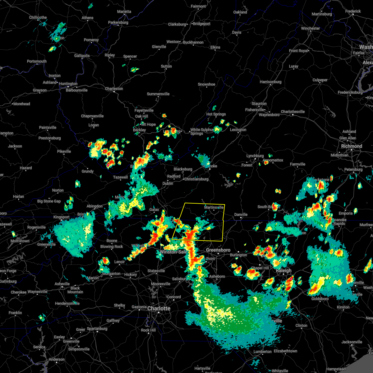 At 550 pm edt, a severe thunderstorm was located over capella, or 7 miles southeast of pilot mountain, moving northeast at 30 mph (radar indicated). Hazards include 60 mph wind gusts and quarter size hail. Hail damage to vehicles is expected. expect wind damage to roofs, siding, and trees. locations impacted include, eden, reidsville, martinsville, wentworth, mayodan, madison, and pilot mountain. this includes the following locations the martinsville speedway and martinsville airport. hail threat, radar indicated max hail size, 1. 00 in wind threat, radar indicated max wind gust, 60 mph. At 550 pm edt, a severe thunderstorm was located over capella, or 7 miles southeast of pilot mountain, moving northeast at 30 mph (radar indicated). Hazards include 60 mph wind gusts and quarter size hail. Hail damage to vehicles is expected. expect wind damage to roofs, siding, and trees. locations impacted include, eden, reidsville, martinsville, wentworth, mayodan, madison, and pilot mountain. this includes the following locations the martinsville speedway and martinsville airport. hail threat, radar indicated max hail size, 1. 00 in wind threat, radar indicated max wind gust, 60 mph.
|
| 5/21/2022 5:39 PM EDT |
 At 539 pm edt, a severe thunderstorm was located over king, or 7 miles east of east bend, moving northeast at 30 mph (radar indicated). Hazards include 60 mph wind gusts and quarter size hail. Hail damage to vehicles is expected. Expect wind damage to roofs, siding, and trees. At 539 pm edt, a severe thunderstorm was located over king, or 7 miles east of east bend, moving northeast at 30 mph (radar indicated). Hazards include 60 mph wind gusts and quarter size hail. Hail damage to vehicles is expected. Expect wind damage to roofs, siding, and trees.
|
| 5/19/2022 9:23 PM EDT |
 The severe thunderstorm warning for western rockingham county will expire at 930 pm edt, the storm which prompted the warning has weakened below severe limits and has exited the warned area. therefore, the warning will be allowed to expire. however, small hail and heavy rain are still possible with this thunderstorm. The severe thunderstorm warning for western rockingham county will expire at 930 pm edt, the storm which prompted the warning has weakened below severe limits and has exited the warned area. therefore, the warning will be allowed to expire. however, small hail and heavy rain are still possible with this thunderstorm.
|
| 5/19/2022 9:11 PM EDT |
 At 911 pm edt, a severe thunderstorm was located over mayodan, moving east at 40 mph (radar indicated). Hazards include 60 mph wind gusts and quarter size hail. Hail damage to vehicles is expected. expect wind damage to roofs, siding, and trees. locations impacted include, eden, wentworth, mayodan, madison, stoneville, intelligence, and ellisboro. hail threat, radar indicated max hail size, 1. 00 in wind threat, radar indicated max wind gust, 60 mph. At 911 pm edt, a severe thunderstorm was located over mayodan, moving east at 40 mph (radar indicated). Hazards include 60 mph wind gusts and quarter size hail. Hail damage to vehicles is expected. expect wind damage to roofs, siding, and trees. locations impacted include, eden, wentworth, mayodan, madison, stoneville, intelligence, and ellisboro. hail threat, radar indicated max hail size, 1. 00 in wind threat, radar indicated max wind gust, 60 mph.
|
| 5/19/2022 8:59 PM EDT |
 At 859 pm edt, a severe thunderstorm was located over danbury, moving east at 30 mph (radar indicated). Hazards include 60 mph wind gusts and quarter size hail. Hail damage to vehicles is expected. expect wind damage to roofs, siding, and trees. locations impacted include, eden, wentworth, mayodan, madison, stoneville, danbury, and francisco. hail threat, radar indicated max hail size, 1. 00 in wind threat, radar indicated max wind gust, 60 mph. At 859 pm edt, a severe thunderstorm was located over danbury, moving east at 30 mph (radar indicated). Hazards include 60 mph wind gusts and quarter size hail. Hail damage to vehicles is expected. expect wind damage to roofs, siding, and trees. locations impacted include, eden, wentworth, mayodan, madison, stoneville, danbury, and francisco. hail threat, radar indicated max hail size, 1. 00 in wind threat, radar indicated max wind gust, 60 mph.
|
| 5/19/2022 8:37 PM EDT |
 At 837 pm edt, a severe thunderstorm was located near francisco, moving east at 30 mph (radar indicated). Hazards include 60 mph wind gusts and quarter size hail. Hail damage to vehicles is expected. Expect wind damage to roofs, siding, and trees. At 837 pm edt, a severe thunderstorm was located near francisco, moving east at 30 mph (radar indicated). Hazards include 60 mph wind gusts and quarter size hail. Hail damage to vehicles is expected. Expect wind damage to roofs, siding, and trees.
|
| 5/16/2022 3:11 PM EDT |
 At 310 pm edt, a severe thunderstorm was located over draper, or over eden, moving east at 45 mph (radar indicated). Hazards include 60 mph wind gusts and quarter size hail. Hail damage to vehicles is expected. expect wind damage to roofs, siding, and trees. locations impacted include, danville, eden, wentworth, yanceyville, bethel, stoneville, and providence. this includes the following location danville airport. hail threat, radar indicated max hail size, 1. 00 in wind threat, radar indicated max wind gust, 60 mph. At 310 pm edt, a severe thunderstorm was located over draper, or over eden, moving east at 45 mph (radar indicated). Hazards include 60 mph wind gusts and quarter size hail. Hail damage to vehicles is expected. expect wind damage to roofs, siding, and trees. locations impacted include, danville, eden, wentworth, yanceyville, bethel, stoneville, and providence. this includes the following location danville airport. hail threat, radar indicated max hail size, 1. 00 in wind threat, radar indicated max wind gust, 60 mph.
|
| 5/16/2022 3:00 PM EDT | Multiple trees down... relayed via twitte in rockingham county NC, 0.5 miles ESE of Stoneville, NC |
| 5/16/2022 2:49 PM EDT |
 At 248 pm edt, a severe thunderstorm was located over price, or near stoneville, moving east at 40 mph (radar indicated). Hazards include 60 mph wind gusts and quarter size hail. Hail damage to vehicles is expected. Expect wind damage to roofs, siding, and trees. At 248 pm edt, a severe thunderstorm was located over price, or near stoneville, moving east at 40 mph (radar indicated). Hazards include 60 mph wind gusts and quarter size hail. Hail damage to vehicles is expected. Expect wind damage to roofs, siding, and trees.
|
| 5/6/2022 8:06 PM EDT |
 At 806 pm edt, a severe thunderstorm was located near ayersville, or near stoneville, moving northeast at 30 mph (radar indicated). Hazards include 60 mph wind gusts and quarter size hail. Hail damage to vehicles is expected. Expect wind damage to roofs, siding, and trees. At 806 pm edt, a severe thunderstorm was located near ayersville, or near stoneville, moving northeast at 30 mph (radar indicated). Hazards include 60 mph wind gusts and quarter size hail. Hail damage to vehicles is expected. Expect wind damage to roofs, siding, and trees.
|
| 5/6/2022 7:42 PM EDT |
 At 742 pm edt, a confirmed tornado was located over wentworth, moving northeast at 30 mph (radar confirmed tornado). Hazards include damaging tornado and half dollar size hail. Flying debris will be dangerous to those caught without shelter. mobile homes will be damaged or destroyed. damage to roofs, windows, and vehicles will occur. tree damage is likely. Locations impacted include, eden, reidsville, wentworth, stoneville, oregon hill, harrisons crossroads, and lawsonville. At 742 pm edt, a confirmed tornado was located over wentworth, moving northeast at 30 mph (radar confirmed tornado). Hazards include damaging tornado and half dollar size hail. Flying debris will be dangerous to those caught without shelter. mobile homes will be damaged or destroyed. damage to roofs, windows, and vehicles will occur. tree damage is likely. Locations impacted include, eden, reidsville, wentworth, stoneville, oregon hill, harrisons crossroads, and lawsonville.
|
| 5/6/2022 7:33 PM EDT |
 At 732 pm edt, a tornado producing storm was located over intelligence, or near madison, moving east at 30 mph (radar confirmed tornado). Hazards include damaging tornado and half dollar size hail. Flying debris will be dangerous to those caught without shelter. mobile homes will be damaged or destroyed. damage to roofs, windows, and vehicles will occur. Tree damage is likely. At 732 pm edt, a tornado producing storm was located over intelligence, or near madison, moving east at 30 mph (radar confirmed tornado). Hazards include damaging tornado and half dollar size hail. Flying debris will be dangerous to those caught without shelter. mobile homes will be damaged or destroyed. damage to roofs, windows, and vehicles will occur. Tree damage is likely.
|
| 5/6/2022 7:26 PM EDT |
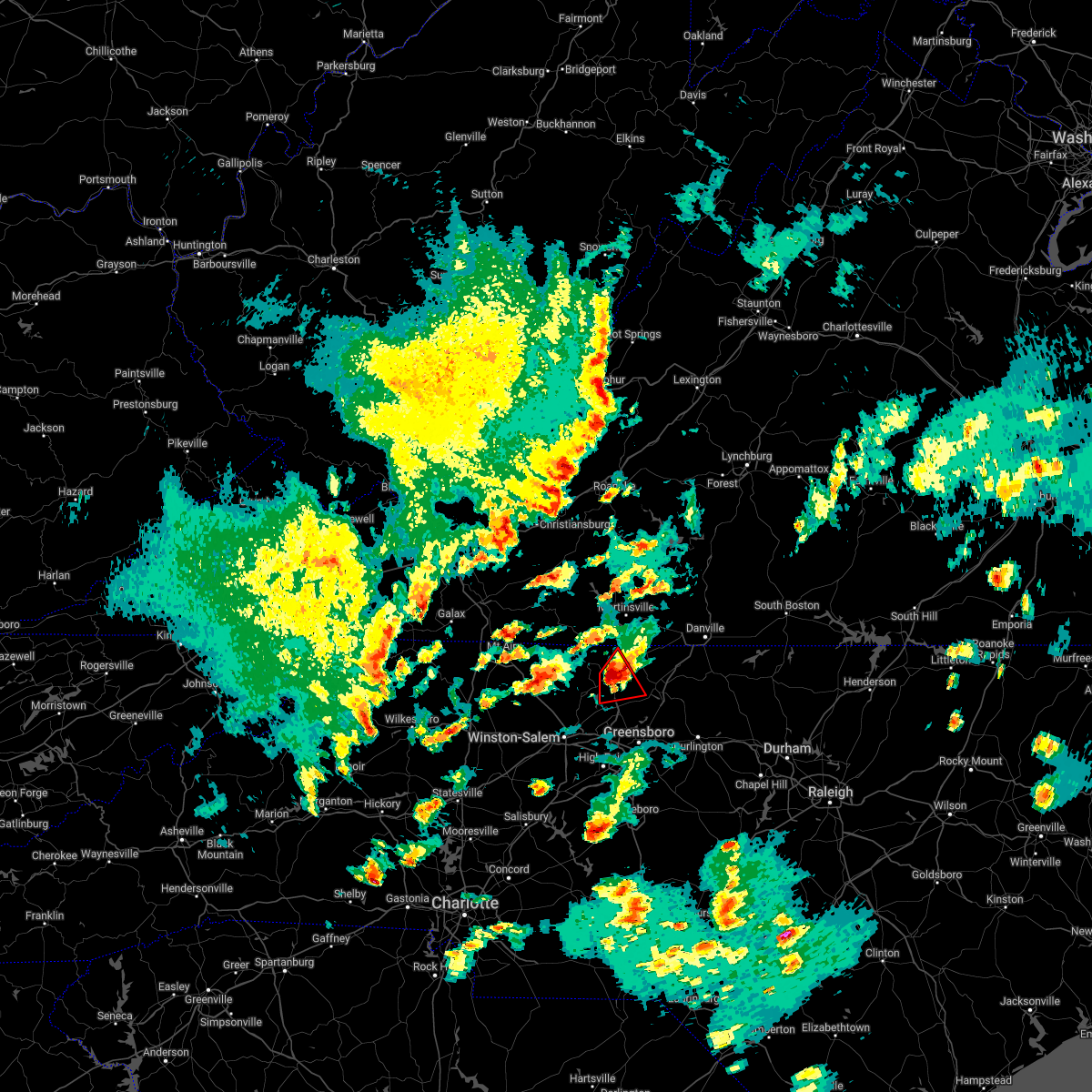 At 725 pm edt, a confirmed tornado was located over ellisboro, or over madison, moving northeast at 35 mph (radar confirmed tornado). Hazards include damaging tornado and half dollar size hail. Flying debris will be dangerous to those caught without shelter. mobile homes will be damaged or destroyed. damage to roofs, windows, and vehicles will occur. tree damage is likely. Locations impacted include, mayodan, madison, stoneville, intelligence, ellisboro, bethany, and price. At 725 pm edt, a confirmed tornado was located over ellisboro, or over madison, moving northeast at 35 mph (radar confirmed tornado). Hazards include damaging tornado and half dollar size hail. Flying debris will be dangerous to those caught without shelter. mobile homes will be damaged or destroyed. damage to roofs, windows, and vehicles will occur. tree damage is likely. Locations impacted include, mayodan, madison, stoneville, intelligence, ellisboro, bethany, and price.
|
| 5/6/2022 7:19 PM EDT |
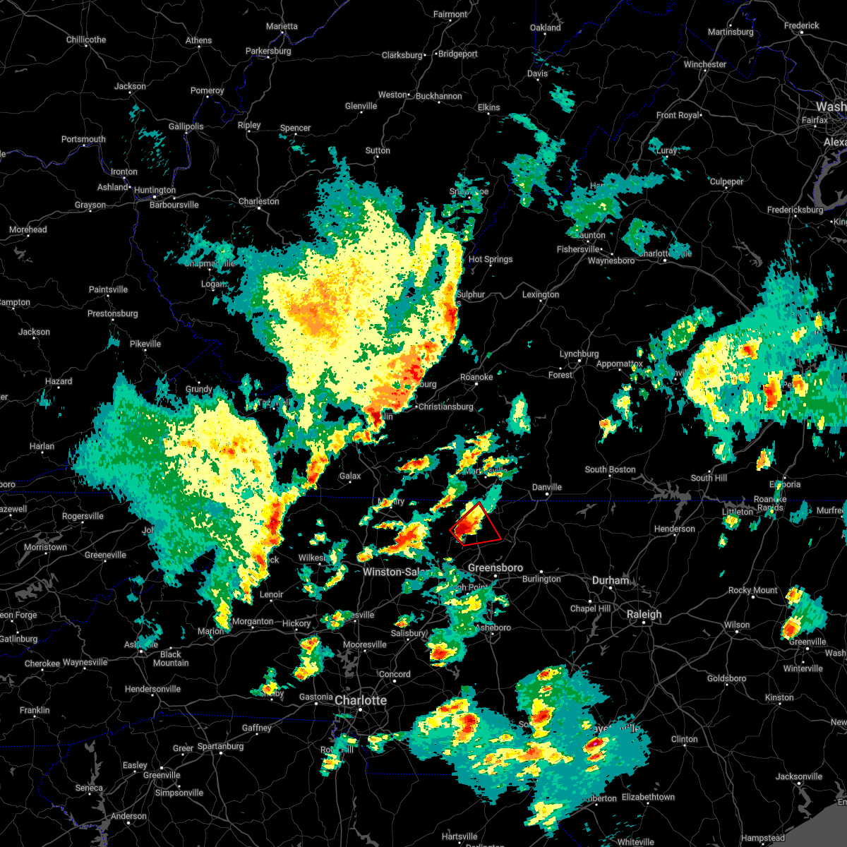 At 719 pm edt, a severe thunderstorm capable of producing a tornado was located over ellisboro, or near madison, moving northeast at 30 mph (radar indicated rotation). Hazards include tornado and half dollar size hail. Flying debris will be dangerous to those caught without shelter. mobile homes will be damaged or destroyed. damage to roofs, windows, and vehicles will occur. tree damage is likely. Locations impacted include, mayodan, madison, stoneville, pine hall, intelligence, ellisboro, and bethany. At 719 pm edt, a severe thunderstorm capable of producing a tornado was located over ellisboro, or near madison, moving northeast at 30 mph (radar indicated rotation). Hazards include tornado and half dollar size hail. Flying debris will be dangerous to those caught without shelter. mobile homes will be damaged or destroyed. damage to roofs, windows, and vehicles will occur. tree damage is likely. Locations impacted include, mayodan, madison, stoneville, pine hall, intelligence, ellisboro, and bethany.
|
| 5/6/2022 7:10 PM EDT |
 At 710 pm edt, a severe thunderstorm capable of producing a tornado was located over pine hall, or over walnut cove, moving northeast at 35 mph (radar indicated rotation). Hazards include tornado and quarter size hail. Flying debris will be dangerous to those caught without shelter. mobile homes will be damaged or destroyed. damage to roofs, windows, and vehicles will occur. Tree damage is likely. At 710 pm edt, a severe thunderstorm capable of producing a tornado was located over pine hall, or over walnut cove, moving northeast at 35 mph (radar indicated rotation). Hazards include tornado and quarter size hail. Flying debris will be dangerous to those caught without shelter. mobile homes will be damaged or destroyed. damage to roofs, windows, and vehicles will occur. Tree damage is likely.
|
| 7/17/2021 9:18 PM EDT |
 At 918 pm edt, a severe thunderstorm was located over stoneville, moving northeast at 30 mph (radar indicated). Hazards include 60 mph wind gusts. Expect damage to roofs, siding, and trees. Locations impacted include, eden, wentworth, mayodan, madison, stoneville, intelligence, and monroeton. At 918 pm edt, a severe thunderstorm was located over stoneville, moving northeast at 30 mph (radar indicated). Hazards include 60 mph wind gusts. Expect damage to roofs, siding, and trees. Locations impacted include, eden, wentworth, mayodan, madison, stoneville, intelligence, and monroeton.
|
| 7/17/2021 9:14 PM EDT | Multiple trees down in the stoneville are in rockingham county NC, 0.5 miles ESE of Stoneville, NC |
| 7/17/2021 9:10 PM EDT |
 At 910 pm edt, a severe thunderstorm was located over mayodan, moving northeast at 30 mph (radar indicated). Hazards include 60 mph wind gusts. Expect damage to roofs, siding, and trees. Locations impacted include, eden, wentworth, mayodan, madison, walnut cove, stoneville, and sandy ridge. At 910 pm edt, a severe thunderstorm was located over mayodan, moving northeast at 30 mph (radar indicated). Hazards include 60 mph wind gusts. Expect damage to roofs, siding, and trees. Locations impacted include, eden, wentworth, mayodan, madison, walnut cove, stoneville, and sandy ridge.
|
| 7/17/2021 8:42 PM EDT |
 At 841 pm edt, a severe thunderstorm was located near meadows, or near walnut cove, moving northeast at 25 mph (radar indicated). Hazards include 60 mph wind gusts. expect damage to roofs, siding, and trees At 841 pm edt, a severe thunderstorm was located near meadows, or near walnut cove, moving northeast at 25 mph (radar indicated). Hazards include 60 mph wind gusts. expect damage to roofs, siding, and trees
|
| 7/17/2021 8:37 PM EDT |
 At 836 pm edt, severe thunderstorms were located along a line extending from near figsboro to near price, moving east at 30 mph (law enforcement reported a tree down near the martinsville airport). Hazards include 60 mph wind gusts. Expect damage to roofs, siding, and trees. locations impacted include, eden, martinsville, stoneville, callands, axton, leatherwood, and villa heights. This includes the following locations the martinsville speedway and martinsville airport. At 836 pm edt, severe thunderstorms were located along a line extending from near figsboro to near price, moving east at 30 mph (law enforcement reported a tree down near the martinsville airport). Hazards include 60 mph wind gusts. Expect damage to roofs, siding, and trees. locations impacted include, eden, martinsville, stoneville, callands, axton, leatherwood, and villa heights. This includes the following locations the martinsville speedway and martinsville airport.
|
| 7/17/2021 8:14 PM EDT |
 At 814 pm edt, severe thunderstorms were located along a line extending from near fieldale to near ayersville, moving east at 30 mph (radar indicated). Hazards include 60 mph wind gusts. expect damage to roofs, siding, and trees At 814 pm edt, severe thunderstorms were located along a line extending from near fieldale to near ayersville, moving east at 30 mph (radar indicated). Hazards include 60 mph wind gusts. expect damage to roofs, siding, and trees
|
| 6/13/2021 10:25 PM EDT |
 At 1025 pm edt, severe thunderstorms were located along a line extending from price to capella to near bottom, moving south at 20 mph (radar indicated). Hazards include 60 mph wind gusts. Expect damage to roofs, siding, and trees. locations impacted include, eden, reidsville, martinsville, mount airy, elkin, fairview, and flat rock. This includes the following locations the martinsville speedway and martinsville airport. At 1025 pm edt, severe thunderstorms were located along a line extending from price to capella to near bottom, moving south at 20 mph (radar indicated). Hazards include 60 mph wind gusts. Expect damage to roofs, siding, and trees. locations impacted include, eden, reidsville, martinsville, mount airy, elkin, fairview, and flat rock. This includes the following locations the martinsville speedway and martinsville airport.
|
| 6/13/2021 9:58 PM EDT |
 At 956 pm edt, severe thunderstorms were located along a line extending from martinsville to near galax along highway 58, moving south at 35 to 40 mph (radar indicated). Hazards include 60 mph wind gusts. expect damage to roofs, siding, and trees At 956 pm edt, severe thunderstorms were located along a line extending from martinsville to near galax along highway 58, moving south at 35 to 40 mph (radar indicated). Hazards include 60 mph wind gusts. expect damage to roofs, siding, and trees
|
| 6/11/2021 2:10 PM EDT |
 At 210 pm edt, a severe thunderstorm was located over draper, or over eden, moving east at 15 mph (radar indicated). Hazards include 60 mph wind gusts. Expect damage to roofs, siding, and trees. locations impacted include, danville, eden, wentworth, yanceyville, bethel, providence, and mayfield. This includes the following location danville airport. At 210 pm edt, a severe thunderstorm was located over draper, or over eden, moving east at 15 mph (radar indicated). Hazards include 60 mph wind gusts. Expect damage to roofs, siding, and trees. locations impacted include, danville, eden, wentworth, yanceyville, bethel, providence, and mayfield. This includes the following location danville airport.
|
| 6/11/2021 2:10 PM EDT |
 At 146 pm edt, a severe thunderstorm was located over eden, moving east at 15 mph (radar indicated). Hazards include 60 mph wind gusts and quarter size hail. Hail damage to vehicles is expected. Expect wind damage to roofs, siding, and trees. At 146 pm edt, a severe thunderstorm was located over eden, moving east at 15 mph (radar indicated). Hazards include 60 mph wind gusts and quarter size hail. Hail damage to vehicles is expected. Expect wind damage to roofs, siding, and trees.
|
| 6/11/2021 1:46 PM EDT |
 At 146 pm edt, a severe thunderstorm was located over eden, moving east at 15 mph (radar indicated). Hazards include 60 mph wind gusts and quarter size hail. Hail damage to vehicles is expected. Expect wind damage to roofs, siding, and trees. At 146 pm edt, a severe thunderstorm was located over eden, moving east at 15 mph (radar indicated). Hazards include 60 mph wind gusts and quarter size hail. Hail damage to vehicles is expected. Expect wind damage to roofs, siding, and trees.
|
| 3/27/2021 3:50 PM EDT |
 The severe thunderstorm warning for southeastern stokes, western rockingham, southeastern roanoke, central henry and eastern franklin counties and the city of martinsville will expire at 400 pm edt, the storms which prompted the warning have moved out of the area. therefore, the warning will be allowed to expire. however heavy rain is still possible with these thunderstorms. a severe thunderstorm watch remains in effect until 800 pm edt for north central and northwestern north carolina, and south central, southwestern and west central virginia. when it is safe to do so, please send your reports of hail of any size, as well as reports of any wind damage, including downed trees or large limbs, to the national weather service by calling toll free at 1, 8 6 6, 2 1 5, 4 3 2 4. reports and pictures can also be shared on the national weather service blacksburg facebook page and on twitter. The severe thunderstorm warning for southeastern stokes, western rockingham, southeastern roanoke, central henry and eastern franklin counties and the city of martinsville will expire at 400 pm edt, the storms which prompted the warning have moved out of the area. therefore, the warning will be allowed to expire. however heavy rain is still possible with these thunderstorms. a severe thunderstorm watch remains in effect until 800 pm edt for north central and northwestern north carolina, and south central, southwestern and west central virginia. when it is safe to do so, please send your reports of hail of any size, as well as reports of any wind damage, including downed trees or large limbs, to the national weather service by calling toll free at 1, 8 6 6, 2 1 5, 4 3 2 4. reports and pictures can also be shared on the national weather service blacksburg facebook page and on twitter.
|
| 3/27/2021 3:40 PM EDT |
 At 340 pm edt, severe thunderstorms were located along a line extending from near goodview to near sontag to near leatherwood to pine hall, moving east at 50 mph (radar indicated). Hazards include 60 mph wind gusts. Expect damage to roofs, siding, and trees. locations impacted include, eden, martinsville, rocky mount, mayodan, madison, walnut cove, and stoneville. This includes the following locations the martinsville speedway and martinsville airport. At 340 pm edt, severe thunderstorms were located along a line extending from near goodview to near sontag to near leatherwood to pine hall, moving east at 50 mph (radar indicated). Hazards include 60 mph wind gusts. Expect damage to roofs, siding, and trees. locations impacted include, eden, martinsville, rocky mount, mayodan, madison, walnut cove, and stoneville. This includes the following locations the martinsville speedway and martinsville airport.
|
| 3/27/2021 3:24 PM EDT |
 At 323 pm edt, severe thunderstorms were located along a line extending from roanoke mountain to stanleytown to germanton, moving east at 55 mph (radar indicated). Hazards include 60 mph wind gusts. Expect damage to roofs, siding, and trees. locations impacted include, eden, martinsville, rocky mount, mayodan, madison, walnut cove, and stoneville. This includes the following locations the martinsville speedway and martinsville airport. At 323 pm edt, severe thunderstorms were located along a line extending from roanoke mountain to stanleytown to germanton, moving east at 55 mph (radar indicated). Hazards include 60 mph wind gusts. Expect damage to roofs, siding, and trees. locations impacted include, eden, martinsville, rocky mount, mayodan, madison, walnut cove, and stoneville. This includes the following locations the martinsville speedway and martinsville airport.
|
| 3/27/2021 3:06 PM EDT |
 At 305 pm edt, severe thunderstorms were located along a line extending from terrys fork to near stuart to near courtney, moving east at 50 mph (radar indicated). Hazards include 60 mph wind gusts. Expect damage to roofs, siding, and trees. locations impacted include, christiansburg, eden, martinsville, mount airy, rocky mount, elkin, and fairview. This includes the following locations the martinsville speedway and martinsville airport. At 305 pm edt, severe thunderstorms were located along a line extending from terrys fork to near stuart to near courtney, moving east at 50 mph (radar indicated). Hazards include 60 mph wind gusts. Expect damage to roofs, siding, and trees. locations impacted include, christiansburg, eden, martinsville, mount airy, rocky mount, elkin, and fairview. This includes the following locations the martinsville speedway and martinsville airport.
|
| 3/27/2021 2:56 PM EDT |
 At 256 pm edt, severe thunderstorms were located along a line extending from near pilot to ararat to near buck shoals, moving east at 50 mph (radar indicated). Hazards include 60 mph wind gusts. expect damage to roofs, siding, and trees At 256 pm edt, severe thunderstorms were located along a line extending from near pilot to ararat to near buck shoals, moving east at 50 mph (radar indicated). Hazards include 60 mph wind gusts. expect damage to roofs, siding, and trees
|
| 10/29/2020 11:03 AM EDT |
 At 1102 am edt, a severe thunderstorm was located over sandy river, or near axton, moving northeast at 45 mph. this is a very dangerous storm (emergency management). Hazards include 80 mph wind gusts. Flying debris will be dangerous to those caught without shelter. mobile homes will be heavily damaged. expect considerable damage to roofs, windows, and vehicles. extensive tree damage and power outages are likely. locations impacted include, eden, martinsville, mayodan, madison, chatham, gretna, and stoneville. This includes the following locations the martinsville speedway and martinsville airport. At 1102 am edt, a severe thunderstorm was located over sandy river, or near axton, moving northeast at 45 mph. this is a very dangerous storm (emergency management). Hazards include 80 mph wind gusts. Flying debris will be dangerous to those caught without shelter. mobile homes will be heavily damaged. expect considerable damage to roofs, windows, and vehicles. extensive tree damage and power outages are likely. locations impacted include, eden, martinsville, mayodan, madison, chatham, gretna, and stoneville. This includes the following locations the martinsville speedway and martinsville airport.
|
| 10/29/2020 10:36 AM EDT |
 At 1033 am edt, a severe thunderstorm was located over horse pasture, or over spencer, moving northeast at 35 mph. this is a very dangerous storm (radar indicated). Hazards include 80 mph wind gusts. Flying debris will be dangerous to those caught without shelter. mobile homes will be heavily damaged. expect considerable damage to roofs, windows, and vehicles. extensive tree damage and power outages are likely. locations impacted include, eden, martinsville, rocky mount, mayodan, madison, walnut cove, and stuart. This includes the following locations the martinsville speedway and martinsville airport. At 1033 am edt, a severe thunderstorm was located over horse pasture, or over spencer, moving northeast at 35 mph. this is a very dangerous storm (radar indicated). Hazards include 80 mph wind gusts. Flying debris will be dangerous to those caught without shelter. mobile homes will be heavily damaged. expect considerable damage to roofs, windows, and vehicles. extensive tree damage and power outages are likely. locations impacted include, eden, martinsville, rocky mount, mayodan, madison, walnut cove, and stuart. This includes the following locations the martinsville speedway and martinsville airport.
|
| 10/29/2020 9:50 AM EDT |
 At 947 am edt, a severe thunderstorm was located near pilot mountain, moving northeast at 55 mph. this is a very dangerous storm (radar indicated). Hazards include 80 mph wind gusts. Flying debris will be dangerous to those caught without shelter. mobile homes will be heavily damaged. expect considerable damage to roofs, windows, and vehicles. Extensive tree damage and power outages are likely. At 947 am edt, a severe thunderstorm was located near pilot mountain, moving northeast at 55 mph. this is a very dangerous storm (radar indicated). Hazards include 80 mph wind gusts. Flying debris will be dangerous to those caught without shelter. mobile homes will be heavily damaged. expect considerable damage to roofs, windows, and vehicles. Extensive tree damage and power outages are likely.
|
| 8/3/2020 1:18 PM EDT |
 At 117 pm edt, severe thunderstorms were located along a line extending from near mayfield to near prestonville, moving north at 30 mph (radar indicated). Hazards include 60 mph wind gusts. expect damage to roofs, siding, and trees At 117 pm edt, severe thunderstorms were located along a line extending from near mayfield to near prestonville, moving north at 30 mph (radar indicated). Hazards include 60 mph wind gusts. expect damage to roofs, siding, and trees
|
| 7/28/2020 2:48 PM EDT |
 At 247 pm edt, severe thunderstorms were located along a line extending from near chalk level to near stoneville, moving east at 25 mph (radar indicated). Hazards include 60 mph wind gusts. expect damage to roofs, siding, and trees At 247 pm edt, severe thunderstorms were located along a line extending from near chalk level to near stoneville, moving east at 25 mph (radar indicated). Hazards include 60 mph wind gusts. expect damage to roofs, siding, and trees
|
| 7/21/2020 8:54 PM EDT |
 At 851 pm edt, a severe thunderstorm was located over stoneville, moving northeast at 15 mph (radar indicated). Hazards include 60 mph wind gusts and quarter size hail. Hail damage to vehicles is expected. expect wind damage to roofs, siding, and trees. locations impacted include, eden, wentworth, mayodan, madison, stoneville, mayfield, and oregon hill. due to the slow storm movement, rainfall amounts of 1 to 2 inches are also possible. This will likely result in ponding of water on roads and flooding of poor drainage areas. At 851 pm edt, a severe thunderstorm was located over stoneville, moving northeast at 15 mph (radar indicated). Hazards include 60 mph wind gusts and quarter size hail. Hail damage to vehicles is expected. expect wind damage to roofs, siding, and trees. locations impacted include, eden, wentworth, mayodan, madison, stoneville, mayfield, and oregon hill. due to the slow storm movement, rainfall amounts of 1 to 2 inches are also possible. This will likely result in ponding of water on roads and flooding of poor drainage areas.
|
| 7/21/2020 8:28 PM EDT |
 At 828 pm edt, a severe thunderstorm was located over mayodan, moving east at 15 mph (radar indicated). Hazards include 60 mph wind gusts and quarter size hail. Hail damage to vehicles is expected. Expect wind damage to roofs, siding, and trees. At 828 pm edt, a severe thunderstorm was located over mayodan, moving east at 15 mph (radar indicated). Hazards include 60 mph wind gusts and quarter size hail. Hail damage to vehicles is expected. Expect wind damage to roofs, siding, and trees.
|
| 7/10/2020 7:45 PM EDT |
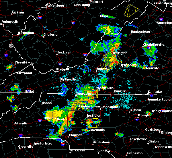 At 744 pm edt, a severe thunderstorm was located over spencer, moving east at 15 mph (radar indicated). Hazards include 60 mph wind gusts and quarter size hail. Hail damage to vehicles is expected. expect wind damage to roofs, siding, and trees. Locations impacted include, stoneville, sandy ridge, spencer, penns store, critz, price, and fieldale. At 744 pm edt, a severe thunderstorm was located over spencer, moving east at 15 mph (radar indicated). Hazards include 60 mph wind gusts and quarter size hail. Hail damage to vehicles is expected. expect wind damage to roofs, siding, and trees. Locations impacted include, stoneville, sandy ridge, spencer, penns store, critz, price, and fieldale.
|
| 7/10/2020 7:22 PM EDT |
 At 722 pm edt, a severe thunderstorm was located near stuart, moving east at 15 mph (radar indicated). Hazards include 60 mph wind gusts and quarter size hail. Hail damage to vehicles is expected. Expect wind damage to roofs, siding, and trees. At 722 pm edt, a severe thunderstorm was located near stuart, moving east at 15 mph (radar indicated). Hazards include 60 mph wind gusts and quarter size hail. Hail damage to vehicles is expected. Expect wind damage to roofs, siding, and trees.
|
| 7/10/2020 7:22 PM EDT |
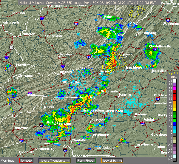 At 722 pm edt, a severe thunderstorm was located near stuart, moving east at 15 mph (radar indicated). Hazards include 60 mph wind gusts and quarter size hail. Hail damage to vehicles is expected. Expect wind damage to roofs, siding, and trees. At 722 pm edt, a severe thunderstorm was located near stuart, moving east at 15 mph (radar indicated). Hazards include 60 mph wind gusts and quarter size hail. Hail damage to vehicles is expected. Expect wind damage to roofs, siding, and trees.
|
| 7/5/2020 8:05 PM EDT |
 The severe thunderstorm warning for northeastern stokes, western rockingham, southwestern henry and southeastern patrick counties will expire at 815 pm edt, the storm which prompted the warning has weakened below severe limits, and no longer poses an immediate threat to life or property. therefore, the warning will be allowed to expire. however heavy rain is still possible with this thunderstorm. when it is safe to do so, please send your reports of hail of any size, as well as reports of any wind damage, including downed trees or large limbs, to the national weather service by calling toll free at 1, 8 6 6, 2 1 5, 4 3 2 4. reports and pictures can also be shared on the national weather service blacksburg facebook page and on twitter. The severe thunderstorm warning for northeastern stokes, western rockingham, southwestern henry and southeastern patrick counties will expire at 815 pm edt, the storm which prompted the warning has weakened below severe limits, and no longer poses an immediate threat to life or property. therefore, the warning will be allowed to expire. however heavy rain is still possible with this thunderstorm. when it is safe to do so, please send your reports of hail of any size, as well as reports of any wind damage, including downed trees or large limbs, to the national weather service by calling toll free at 1, 8 6 6, 2 1 5, 4 3 2 4. reports and pictures can also be shared on the national weather service blacksburg facebook page and on twitter.
|
| 7/5/2020 8:05 PM EDT |
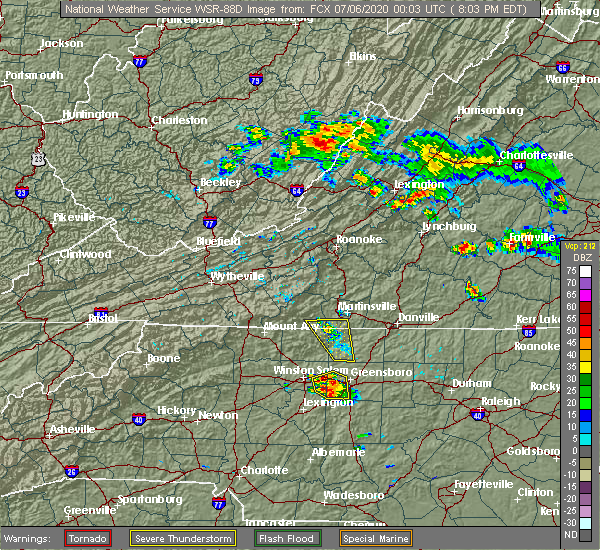 The severe thunderstorm warning for northeastern stokes, western rockingham, southwestern henry and southeastern patrick counties will expire at 815 pm edt, the storm which prompted the warning has weakened below severe limits, and no longer poses an immediate threat to life or property. therefore, the warning will be allowed to expire. however heavy rain is still possible with this thunderstorm. when it is safe to do so, please send your reports of hail of any size, as well as reports of any wind damage, including downed trees or large limbs, to the national weather service by calling toll free at 1, 8 6 6, 2 1 5, 4 3 2 4. reports and pictures can also be shared on the national weather service blacksburg facebook page and on twitter. The severe thunderstorm warning for northeastern stokes, western rockingham, southwestern henry and southeastern patrick counties will expire at 815 pm edt, the storm which prompted the warning has weakened below severe limits, and no longer poses an immediate threat to life or property. therefore, the warning will be allowed to expire. however heavy rain is still possible with this thunderstorm. when it is safe to do so, please send your reports of hail of any size, as well as reports of any wind damage, including downed trees or large limbs, to the national weather service by calling toll free at 1, 8 6 6, 2 1 5, 4 3 2 4. reports and pictures can also be shared on the national weather service blacksburg facebook page and on twitter.
|
| 7/5/2020 7:37 PM EDT |
 At 736 pm edt, a severe thunderstorm was located near ayersville, or near stoneville, moving north at 15 mph (radar indicated). Hazards include 60 mph wind gusts and quarter size hail. Hail damage to vehicles is expected. expect wind damage to roofs, siding, and trees. Locations impacted include, mayodan, madison, stoneville, spencer, sandy ridge, intelligence, and ayersville. At 736 pm edt, a severe thunderstorm was located near ayersville, or near stoneville, moving north at 15 mph (radar indicated). Hazards include 60 mph wind gusts and quarter size hail. Hail damage to vehicles is expected. expect wind damage to roofs, siding, and trees. Locations impacted include, mayodan, madison, stoneville, spencer, sandy ridge, intelligence, and ayersville.
|
| 7/5/2020 7:37 PM EDT |
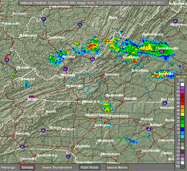 At 736 pm edt, a severe thunderstorm was located near ayersville, or near stoneville, moving north at 15 mph (radar indicated). Hazards include 60 mph wind gusts and quarter size hail. Hail damage to vehicles is expected. expect wind damage to roofs, siding, and trees. Locations impacted include, mayodan, madison, stoneville, spencer, sandy ridge, intelligence, and ayersville. At 736 pm edt, a severe thunderstorm was located near ayersville, or near stoneville, moving north at 15 mph (radar indicated). Hazards include 60 mph wind gusts and quarter size hail. Hail damage to vehicles is expected. expect wind damage to roofs, siding, and trees. Locations impacted include, mayodan, madison, stoneville, spencer, sandy ridge, intelligence, and ayersville.
|
| 7/5/2020 7:14 PM EDT |
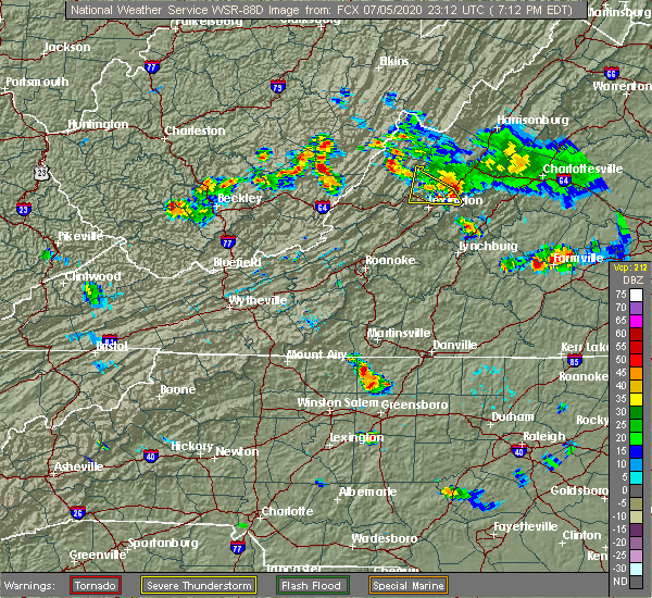 The national weather service in blacksburg has issued a * severe thunderstorm warning for. northeastern stokes county in north central north carolina. western rockingham county in north central north carolina. southwestern henry county in south central virginia. Southeastern patrick county in southwestern virginia. The national weather service in blacksburg has issued a * severe thunderstorm warning for. northeastern stokes county in north central north carolina. western rockingham county in north central north carolina. southwestern henry county in south central virginia. Southeastern patrick county in southwestern virginia.
|
| 5/24/2020 7:43 PM EDT |
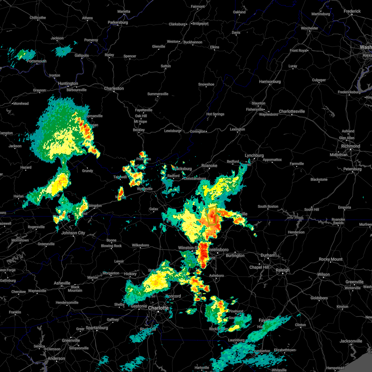 The severe thunderstorm warning for northwestern rockingham and southwestern henry counties and the city of martinsville will expire at 745 pm edt, the storm which prompted the warning has weakened below severe limits, and no longer poses an immediate threat to life or property. therefore, the warning will be allowed to expire. however small hail, gusty winds and heavy rain are still possible with this thunderstorm. when it is safe to do so, please send your reports of hail of any size, as well as reports of any wind damage, including downed trees or large limbs, to the national weather service by calling toll free at 1, 8 6 6, 2 1 5, 4 3 2 4. reports and pictures can also be shared on the national weather service blacksburg facebook page and on twitter. The severe thunderstorm warning for northwestern rockingham and southwestern henry counties and the city of martinsville will expire at 745 pm edt, the storm which prompted the warning has weakened below severe limits, and no longer poses an immediate threat to life or property. therefore, the warning will be allowed to expire. however small hail, gusty winds and heavy rain are still possible with this thunderstorm. when it is safe to do so, please send your reports of hail of any size, as well as reports of any wind damage, including downed trees or large limbs, to the national weather service by calling toll free at 1, 8 6 6, 2 1 5, 4 3 2 4. reports and pictures can also be shared on the national weather service blacksburg facebook page and on twitter.
|
| 5/24/2020 7:31 PM EDT |
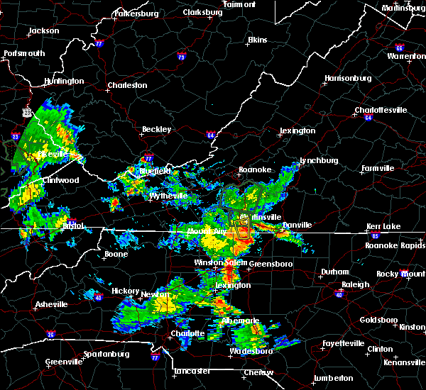 At 731 pm edt, a severe thunderstorm was located over price, or near stoneville, moving southeast at 30 mph (radar indicated). Hazards include 60 mph wind gusts and quarter size hail. Hail damage to vehicles is expected. expect wind damage to roofs, siding, and trees. locations impacted include, martinsville, stoneville, price, villa heights, fieldale, horse pasture, and collinsville. This includes the following locations the martinsville speedway and martinsville airport. At 731 pm edt, a severe thunderstorm was located over price, or near stoneville, moving southeast at 30 mph (radar indicated). Hazards include 60 mph wind gusts and quarter size hail. Hail damage to vehicles is expected. expect wind damage to roofs, siding, and trees. locations impacted include, martinsville, stoneville, price, villa heights, fieldale, horse pasture, and collinsville. This includes the following locations the martinsville speedway and martinsville airport.
|
| 5/24/2020 7:11 PM EDT |
 At 710 pm edt, severe thunderstorms were located along a line extending from stanleytown to price, moving northeast at 5 mph (radar indicated). Hazards include 60 mph wind gusts and half dollar size hail. Hail damage to vehicles is expected. Expect wind damage to roofs, siding, and trees. At 710 pm edt, severe thunderstorms were located along a line extending from stanleytown to price, moving northeast at 5 mph (radar indicated). Hazards include 60 mph wind gusts and half dollar size hail. Hail damage to vehicles is expected. Expect wind damage to roofs, siding, and trees.
|
| 4/13/2020 5:27 AM EDT |
 At 527 am edt, a severe thunderstorm capable of producing a tornado was located near eden, moving northeast at 55 mph (radar indicated rotation). Hazards include tornado. Flying debris will be dangerous to those caught without shelter. mobile homes will be damaged or destroyed. damage to roofs, windows, and vehicles will occur. tree damage is likely. Locations impacted include, eden, wentworth, stoneville, axton, callands, swansonville, and draper. At 527 am edt, a severe thunderstorm capable of producing a tornado was located near eden, moving northeast at 55 mph (radar indicated rotation). Hazards include tornado. Flying debris will be dangerous to those caught without shelter. mobile homes will be damaged or destroyed. damage to roofs, windows, and vehicles will occur. tree damage is likely. Locations impacted include, eden, wentworth, stoneville, axton, callands, swansonville, and draper.
|
| 4/13/2020 5:24 AM EDT |
 At 523 am edt, severe thunderstorms were located along a line extending from near leesville to near ellisboro, moving northeast at 35 mph (radar indicated). Hazards include 60 mph wind gusts. Expect damage to roofs, siding, and trees. locations impacted include, eden, martinsville, altavista, wentworth, mayodan, madison, and walnut cove. this includes the following locations the martinsville speedway and martinsville airport. A tornado watch remains in effect until noon edt for north central north carolina, and central and south central virginia. At 523 am edt, severe thunderstorms were located along a line extending from near leesville to near ellisboro, moving northeast at 35 mph (radar indicated). Hazards include 60 mph wind gusts. Expect damage to roofs, siding, and trees. locations impacted include, eden, martinsville, altavista, wentworth, mayodan, madison, and walnut cove. this includes the following locations the martinsville speedway and martinsville airport. A tornado watch remains in effect until noon edt for north central north carolina, and central and south central virginia.
|
| 4/13/2020 5:19 AM EDT |
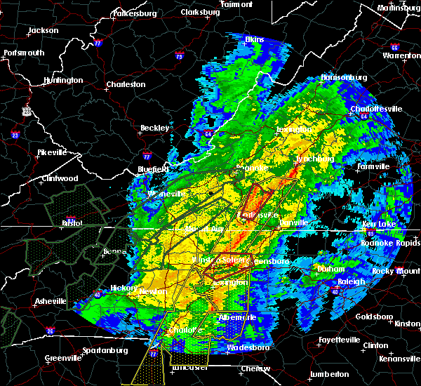 At 519 am edt, a severe thunderstorm capable of producing a tornado was located over intelligence, or near mayodan, moving northeast at 55 mph (radar indicated rotation). Hazards include tornado. Flying debris will be dangerous to those caught without shelter. mobile homes will be damaged or destroyed. damage to roofs, windows, and vehicles will occur. Tree damage is likely. At 519 am edt, a severe thunderstorm capable of producing a tornado was located over intelligence, or near mayodan, moving northeast at 55 mph (radar indicated rotation). Hazards include tornado. Flying debris will be dangerous to those caught without shelter. mobile homes will be damaged or destroyed. damage to roofs, windows, and vehicles will occur. Tree damage is likely.
|
| 4/13/2020 5:15 AM EDT |
 At 514 am edt, severe thunderstorms were located along a line extending from leesville to near pine hall, moving northeast at 35 mph (radar indicated). Hazards include 60 mph wind gusts. Expect damage to roofs, siding, and trees. locations impacted include, eden, martinsville, altavista, wentworth, mayodan, madison, and walnut cove. this includes the following locations the martinsville speedway and martinsville airport. A tornado watch remains in effect until noon edt for north central north carolina, and central and south central virginia. At 514 am edt, severe thunderstorms were located along a line extending from leesville to near pine hall, moving northeast at 35 mph (radar indicated). Hazards include 60 mph wind gusts. Expect damage to roofs, siding, and trees. locations impacted include, eden, martinsville, altavista, wentworth, mayodan, madison, and walnut cove. this includes the following locations the martinsville speedway and martinsville airport. A tornado watch remains in effect until noon edt for north central north carolina, and central and south central virginia.
|
| 4/13/2020 4:46 AM EDT |
 At 445 am edt, severe thunderstorms were located along a line extending from near penhook to near winston-salem, moving northeast at 35 mph (radar indicated). Hazards include 60 mph wind gusts. Expect damage to roofs, siding, and trees. locations impacted include, eden, martinsville, altavista, wentworth, mayodan, madison, and walnut cove. This includes the following locations the martinsville speedway and martinsville airport. At 445 am edt, severe thunderstorms were located along a line extending from near penhook to near winston-salem, moving northeast at 35 mph (radar indicated). Hazards include 60 mph wind gusts. Expect damage to roofs, siding, and trees. locations impacted include, eden, martinsville, altavista, wentworth, mayodan, madison, and walnut cove. This includes the following locations the martinsville speedway and martinsville airport.
|
| 4/13/2020 4:35 AM EDT |
 At 435 am edt, severe thunderstorms were located along a line extending from near sontag to near clemmons, moving northeast at 35 mph (radar indicated). Hazards include 60 mph wind gusts. expect damage to roofs, siding, and trees At 435 am edt, severe thunderstorms were located along a line extending from near sontag to near clemmons, moving northeast at 35 mph (radar indicated). Hazards include 60 mph wind gusts. expect damage to roofs, siding, and trees
|
| 2/6/2020 11:39 AM EST |
 At 1139 am est, severe thunderstorms were located along a line extending from near ferrum to near sanville, moving northeast at 80 mph (radar indicated). Hazards include 60 mph wind gusts. Expect damage to roofs, siding, and trees. locations impacted include, eden, wentworth, mayodan, madison, and walnut cove. A tornado watch remains in effect until 500 pm est for north central and northwestern north carolina, and south central virginia. At 1139 am est, severe thunderstorms were located along a line extending from near ferrum to near sanville, moving northeast at 80 mph (radar indicated). Hazards include 60 mph wind gusts. Expect damage to roofs, siding, and trees. locations impacted include, eden, wentworth, mayodan, madison, and walnut cove. A tornado watch remains in effect until 500 pm est for north central and northwestern north carolina, and south central virginia.
|
| 2/6/2020 10:57 AM EST |
 At 1057 am est, severe thunderstorms were located along a line extending from pilot mountain state park to courtney, moving northeast at 80 mph (radar indicated). Hazards include 60 mph wind gusts. expect damage to roofs, siding, and trees At 1057 am est, severe thunderstorms were located along a line extending from pilot mountain state park to courtney, moving northeast at 80 mph (radar indicated). Hazards include 60 mph wind gusts. expect damage to roofs, siding, and trees
|
| 1/11/2020 11:08 PM EST |
 The severe thunderstorm warning for eastern stokes, rockingham, western pittsylvania, southwestern bedford, henry, franklin and southeastern patrick counties and the city of martinsville will expire at 1115 pm est, the storms which prompted the warning have moved out of the area. therefore, the warning will be allowed to expire. however gusty winds are still possible with these thunderstorms. a severe thunderstorm watch remains in effect until 100 am est for north central and northwestern north carolina, and south central, central, southwestern and west central virginia. when it is safe to do so, please send your reports of hail of any size, as well as reports of any wind damage, including downed trees or large limbs, to the national weather service by calling toll free at 1, 8 6 6, 2 1 5, 4 3 2 4. reports and pictures can also be shared on the national weather service blacksburg facebook page and on twitter. The severe thunderstorm warning for eastern stokes, rockingham, western pittsylvania, southwestern bedford, henry, franklin and southeastern patrick counties and the city of martinsville will expire at 1115 pm est, the storms which prompted the warning have moved out of the area. therefore, the warning will be allowed to expire. however gusty winds are still possible with these thunderstorms. a severe thunderstorm watch remains in effect until 100 am est for north central and northwestern north carolina, and south central, central, southwestern and west central virginia. when it is safe to do so, please send your reports of hail of any size, as well as reports of any wind damage, including downed trees or large limbs, to the national weather service by calling toll free at 1, 8 6 6, 2 1 5, 4 3 2 4. reports and pictures can also be shared on the national weather service blacksburg facebook page and on twitter.
|
| 1/11/2020 11:06 PM EST | Numerous trees downed... utility poles snapped... and power lines down along the nc highway 135 corridor between stoneville and eden. in addition... two transformers we in rockingham county NC, 2.6 miles WNW of Stoneville, NC |
| 1/11/2020 10:40 PM EST |
 At 1039 pm est, severe thunderstorms were located along a line extending from near arcadia to near bethany, moving east at 45 mph (radar indicated). Hazards include 60 mph wind gusts. expect damage to roofs, siding, and trees At 1039 pm est, severe thunderstorms were located along a line extending from near arcadia to near bethany, moving east at 45 mph (radar indicated). Hazards include 60 mph wind gusts. expect damage to roofs, siding, and trees
|
| 1/11/2020 9:43 PM EST |
 At 942 pm est, severe thunderstorms were located along a line extending from near huffman to near courtney, moving northeast at 50 mph (radar indicated). Hazards include 70 mph wind gusts. Expect considerable tree damage. Damage is likely to mobile homes, roofs, and outbuildings. At 942 pm est, severe thunderstorms were located along a line extending from near huffman to near courtney, moving northeast at 50 mph (radar indicated). Hazards include 70 mph wind gusts. Expect considerable tree damage. Damage is likely to mobile homes, roofs, and outbuildings.
|
| 10/31/2019 6:12 PM EDT |
 At 612 pm edt, a severe thunderstorm was located near pine hall, or 8 miles southeast of walnut cove, moving northeast at 60 mph (radar indicated). Hazards include 60 mph wind gusts. expect damage to roofs, siding, and trees At 612 pm edt, a severe thunderstorm was located near pine hall, or 8 miles southeast of walnut cove, moving northeast at 60 mph (radar indicated). Hazards include 60 mph wind gusts. expect damage to roofs, siding, and trees
|
| 8/23/2019 6:48 PM EDT | Tree blown down damaging power lines along bryan street. time estimated from rada in rockingham county NC, 1 miles E of Stoneville, NC |
| 8/23/2019 6:43 PM EDT |
 At 642 pm edt, severe thunderstorms were located along a line extending from near keeling to near eden, moving east at 30 mph (radar indicated). Hazards include 60 mph wind gusts. Expect damage to roofs, siding, and trees. locations impacted include, danville, eden, reidsville, wentworth, and mayodan. This includes the following location danville airport. At 642 pm edt, severe thunderstorms were located along a line extending from near keeling to near eden, moving east at 30 mph (radar indicated). Hazards include 60 mph wind gusts. Expect damage to roofs, siding, and trees. locations impacted include, danville, eden, reidsville, wentworth, and mayodan. This includes the following location danville airport.
|
| 8/23/2019 6:21 PM EDT |
 At 621 pm edt, severe thunderstorms were located along a line extending from near blairs to near price, moving east at 30 mph (radar indicated). Hazards include 60 mph wind gusts. expect damage to roofs, siding, and trees At 621 pm edt, severe thunderstorms were located along a line extending from near blairs to near price, moving east at 30 mph (radar indicated). Hazards include 60 mph wind gusts. expect damage to roofs, siding, and trees
|
| 8/22/2019 4:13 PM EDT |
 At 412 pm edt, a severe thunderstorm was located near pine hall, moving east at 30 mph (radar indicated). Hazards include 60 mph wind gusts and quarter size hail. Hail damage to vehicles is expected. Expect wind damage to roofs, siding, and trees. At 412 pm edt, a severe thunderstorm was located near pine hall, moving east at 30 mph (radar indicated). Hazards include 60 mph wind gusts and quarter size hail. Hail damage to vehicles is expected. Expect wind damage to roofs, siding, and trees.
|
| 8/21/2019 5:25 PM EDT |
 A severe thunderstorm warning remains in effect until 545 pm edt for rockingham and western caswell counties. at 523 pm edt, a severe thunderstorm was located over reidsville, moving southeast at 35 mph. At 520 pm edt, law enforcement reported widespread damage to trees in rockingham county. A severe thunderstorm warning remains in effect until 545 pm edt for rockingham and western caswell counties. at 523 pm edt, a severe thunderstorm was located over reidsville, moving southeast at 35 mph. At 520 pm edt, law enforcement reported widespread damage to trees in rockingham county.
|
| 8/21/2019 5:10 PM EDT |
 At 509 pm edt, a severe thunderstorm was located near wentworth, moving southeast at 30 mph (radar indicated). Hazards include 60 mph wind gusts. Expect damage to roofs, siding, and trees. Locations impacted include, eden, reidsville, wentworth, mayodan, and madison. At 509 pm edt, a severe thunderstorm was located near wentworth, moving southeast at 30 mph (radar indicated). Hazards include 60 mph wind gusts. Expect damage to roofs, siding, and trees. Locations impacted include, eden, reidsville, wentworth, mayodan, and madison.
|
| 8/21/2019 4:55 PM EDT | Trees down along anglin mill roa in rockingham county NC, 5.7 miles SE of Stoneville, NC |
| 8/21/2019 4:52 PM EDT |
 At 452 pm edt, a severe thunderstorm was located near ayersville, moving southeast at 35 mph (radar indicated). Hazards include 60 mph wind gusts. expect damage to roofs, siding, and trees At 452 pm edt, a severe thunderstorm was located near ayersville, moving southeast at 35 mph (radar indicated). Hazards include 60 mph wind gusts. expect damage to roofs, siding, and trees
|
| 8/13/2019 3:39 PM EDT |
 At 339 pm edt, severe thunderstorms were located along a line extending from semora to near eden to capella, moving east at 25 mph (radar indicated). Hazards include 60 mph wind gusts and quarter size hail. Hail damage to vehicles is expected. Expect wind damage to roofs, siding, and trees. At 339 pm edt, severe thunderstorms were located along a line extending from semora to near eden to capella, moving east at 25 mph (radar indicated). Hazards include 60 mph wind gusts and quarter size hail. Hail damage to vehicles is expected. Expect wind damage to roofs, siding, and trees.
|
| 8/13/2019 3:22 PM EDT |
 At 322 pm edt, severe thunderstorms were located along a line extending from near keeling to near pilot mountain, moving east at 25 mph (radar indicated). Hazards include 60 mph wind gusts and quarter size hail. Hail damage to vehicles is expected. expect wind damage to roofs, siding, and trees. locations impacted include, danville, eden, martinsville, south boston, and mayodan. This includes the following locations the martinsville speedway, martinsville airport, and danville airport. At 322 pm edt, severe thunderstorms were located along a line extending from near keeling to near pilot mountain, moving east at 25 mph (radar indicated). Hazards include 60 mph wind gusts and quarter size hail. Hail damage to vehicles is expected. expect wind damage to roofs, siding, and trees. locations impacted include, danville, eden, martinsville, south boston, and mayodan. This includes the following locations the martinsville speedway, martinsville airport, and danville airport.
|
| 8/13/2019 3:22 PM EDT |
 A severe thunderstorm warning remains in effect until 345 pm edt for east central surry. stokes. northern rockingham. southern pittsylvania. southwestern halifax. henry and southeastern patrick counties. the city of danville and the city of martinsville. At 322 pm edt, severe thunderstorms were located along a line extending from near keeling to near pilot mountain, moving east at 25. A severe thunderstorm warning remains in effect until 345 pm edt for east central surry. stokes. northern rockingham. southern pittsylvania. southwestern halifax. henry and southeastern patrick counties. the city of danville and the city of martinsville. At 322 pm edt, severe thunderstorms were located along a line extending from near keeling to near pilot mountain, moving east at 25.
|
| 8/13/2019 2:54 PM EDT |
 The national weather service in blacksburg has issued a * severe thunderstorm warning for. northeastern surry county in northwestern north carolina. stokes county in north central north carolina. northern rockingham county in north central north carolina. The city of danville in south central virginia. The national weather service in blacksburg has issued a * severe thunderstorm warning for. northeastern surry county in northwestern north carolina. stokes county in north central north carolina. northern rockingham county in north central north carolina. The city of danville in south central virginia.
|
| 8/13/2019 2:54 PM EDT |
 At 253 pm edt, severe thunderstorms were located along a line extending from dry fork to white plains, moving east at 25 mph (radar indicated). Hazards include 60 mph wind gusts and quarter size hail. Hail damage to vehicles is expected. Expect wind damage to roofs, siding, and trees. At 253 pm edt, severe thunderstorms were located along a line extending from dry fork to white plains, moving east at 25 mph (radar indicated). Hazards include 60 mph wind gusts and quarter size hail. Hail damage to vehicles is expected. Expect wind damage to roofs, siding, and trees.
|
| 7/22/2019 6:29 PM EDT |
 At 629 pm edt, a severe thunderstorm was located over mayodan, moving northeast at 20 mph (radar indicated). Hazards include 60 mph wind gusts. Expect damage to roofs, siding, and trees. Locations impacted include, eden, mayodan, madison, walnut cove, and stoneville. At 629 pm edt, a severe thunderstorm was located over mayodan, moving northeast at 20 mph (radar indicated). Hazards include 60 mph wind gusts. Expect damage to roofs, siding, and trees. Locations impacted include, eden, mayodan, madison, walnut cove, and stoneville.
|
| 7/22/2019 6:22 PM EDT | Tree down along brushy mountain road near north carolina highway 770. time estimated from rada in rockingham county NC, 3.9 miles ESE of Stoneville, NC |
| 7/22/2019 5:46 PM EDT |
 At 546 pm edt, a severe thunderstorm was located over meadows, moving northeast at 20 mph (radar indicated). Hazards include 60 mph wind gusts and quarter size hail. Hail damage to vehicles is expected. Expect wind damage to roofs, siding, and trees. At 546 pm edt, a severe thunderstorm was located over meadows, moving northeast at 20 mph (radar indicated). Hazards include 60 mph wind gusts and quarter size hail. Hail damage to vehicles is expected. Expect wind damage to roofs, siding, and trees.
|
| 6/20/2019 2:11 PM EDT |
 At 158 pm edt, a severe thunderstorm was located over draper, moving east at 55 mph (radar indicated). Hazards include 60 mph wind gusts and quarter size hail. Hail damage to vehicles is expected. expect wind damage to roofs, siding, and trees. Locations impacted include, eden, reidsville, wentworth, mayodan, and madison. At 158 pm edt, a severe thunderstorm was located over draper, moving east at 55 mph (radar indicated). Hazards include 60 mph wind gusts and quarter size hail. Hail damage to vehicles is expected. expect wind damage to roofs, siding, and trees. Locations impacted include, eden, reidsville, wentworth, mayodan, and madison.
|
| 6/20/2019 2:11 PM EDT |
 The severe thunderstorm warning for eastern stokes, rockingham, western caswell, southwestern pittsylvania and southern henry counties will expire at 215 pm edt, the storm which prompted the warning has moved out of the area. therefore, the warning will be allowed to expire. a severe thunderstorm watch remains in effect until 1000 pm edt for north central north carolina, and south central virginia. when it is safe to do so, please send your reports of hail of any size, as well as reports of any wind damage, including downed trees or large limbs, to the national weather service by calling toll free at 1, 8 6 6, 2 1 5, 4 3 2 4. reports and pictures can also be shared on the national weather service blacksburg facebook page and on twitter. remember, a severe thunderstorm warning still remains in effect for southwestern pittsylvania, eastern rockingham and caswell counties. The severe thunderstorm warning for eastern stokes, rockingham, western caswell, southwestern pittsylvania and southern henry counties will expire at 215 pm edt, the storm which prompted the warning has moved out of the area. therefore, the warning will be allowed to expire. a severe thunderstorm watch remains in effect until 1000 pm edt for north central north carolina, and south central virginia. when it is safe to do so, please send your reports of hail of any size, as well as reports of any wind damage, including downed trees or large limbs, to the national weather service by calling toll free at 1, 8 6 6, 2 1 5, 4 3 2 4. reports and pictures can also be shared on the national weather service blacksburg facebook page and on twitter. remember, a severe thunderstorm warning still remains in effect for southwestern pittsylvania, eastern rockingham and caswell counties.
|
| 6/20/2019 1:59 PM EDT |
 At 158 pm edt, a severe thunderstorm was located over draper, moving east at 55 mph (radar indicated). Hazards include 60 mph wind gusts and quarter size hail. Hail damage to vehicles is expected. expect wind damage to roofs, siding, and trees. Locations impacted include, eden, reidsville, wentworth, mayodan, and madison. At 158 pm edt, a severe thunderstorm was located over draper, moving east at 55 mph (radar indicated). Hazards include 60 mph wind gusts and quarter size hail. Hail damage to vehicles is expected. expect wind damage to roofs, siding, and trees. Locations impacted include, eden, reidsville, wentworth, mayodan, and madison.
|
| 6/20/2019 1:59 PM EDT |
 A severe thunderstorm warning remains in effect until 215 pm edt for eastern stokes. rockingham. western caswell. southwestern pittsylvania and southern henry counties. At 158 pm edt, a severe thunderstorm was located over draper, moving east at 55 mph. A severe thunderstorm warning remains in effect until 215 pm edt for eastern stokes. rockingham. western caswell. southwestern pittsylvania and southern henry counties. At 158 pm edt, a severe thunderstorm was located over draper, moving east at 55 mph.
|
| 6/20/2019 1:40 PM EDT |
 At 139 pm edt, a severe thunderstorm was located over ayersville, moving east at 55 mph (radar indicated). Hazards include 60 mph wind gusts and quarter size hail. Hail damage to vehicles is expected. Expect wind damage to roofs, siding, and trees. At 139 pm edt, a severe thunderstorm was located over ayersville, moving east at 55 mph (radar indicated). Hazards include 60 mph wind gusts and quarter size hail. Hail damage to vehicles is expected. Expect wind damage to roofs, siding, and trees.
|
| 5/31/2019 3:28 PM EDT |
 At 328 pm edt, a severe thunderstorm was located over wentworth, moving east at 30 mph (radar indicated). Hazards include 60 mph wind gusts and quarter size hail. Hail damage to vehicles is expected. expect wind damage to roofs, siding, and trees. Locations impacted include, danville, eden, reidsville, wentworth, and bethel. At 328 pm edt, a severe thunderstorm was located over wentworth, moving east at 30 mph (radar indicated). Hazards include 60 mph wind gusts and quarter size hail. Hail damage to vehicles is expected. expect wind damage to roofs, siding, and trees. Locations impacted include, danville, eden, reidsville, wentworth, and bethel.
|
| 5/31/2019 3:14 PM EDT |
 At 313 pm edt, a severe thunderstorm was located over mayodan, moving east at 30 mph. this storm has a history of damaging winds and quarter size hail (radar indicated). Hazards include 60 mph wind gusts and quarter size hail. Hail damage to vehicles is expected. Expect wind damage to roofs, siding, and trees. At 313 pm edt, a severe thunderstorm was located over mayodan, moving east at 30 mph. this storm has a history of damaging winds and quarter size hail (radar indicated). Hazards include 60 mph wind gusts and quarter size hail. Hail damage to vehicles is expected. Expect wind damage to roofs, siding, and trees.
|
| 5/31/2019 2:58 PM EDT |
 At 257 pm edt, a severe thunderstorm was located over ayersville, moving east at 35 mph. this storm has a history of damaging winds (radar indicated). Hazards include 60 mph wind gusts and half dollar size hail. Hail damage to vehicles is expected. expect wind damage to roofs, siding, and trees. Locations impacted include, eden, wentworth, mayodan, madison, and stoneville. At 257 pm edt, a severe thunderstorm was located over ayersville, moving east at 35 mph. this storm has a history of damaging winds (radar indicated). Hazards include 60 mph wind gusts and half dollar size hail. Hail damage to vehicles is expected. expect wind damage to roofs, siding, and trees. Locations impacted include, eden, wentworth, mayodan, madison, and stoneville.
|
| 5/31/2019 2:45 PM EDT |
 At 243 pm edt, a severe thunderstorm was located over prestonville, moving east at 35 mph. a tree was blown down by this storm at 2:30 pm near danbury (radar indicated). Hazards include 60 mph wind gusts and half dollar size hail. Hail damage to vehicles is expected. Expect wind damage to roofs, siding, and trees. At 243 pm edt, a severe thunderstorm was located over prestonville, moving east at 35 mph. a tree was blown down by this storm at 2:30 pm near danbury (radar indicated). Hazards include 60 mph wind gusts and half dollar size hail. Hail damage to vehicles is expected. Expect wind damage to roofs, siding, and trees.
|
| 5/29/2019 6:55 PM EDT |
 At 654 pm edt, severe thunderstorms were located along a line extending from near darlington heights to near nathalie to near chatham to near danbury, moving east at 40 mph (radar indicated). Hazards include 60 mph wind gusts and quarter size hail. Hail damage to vehicles is expected. Expect wind damage to roofs, siding, and trees. At 654 pm edt, severe thunderstorms were located along a line extending from near darlington heights to near nathalie to near chatham to near danbury, moving east at 40 mph (radar indicated). Hazards include 60 mph wind gusts and quarter size hail. Hail damage to vehicles is expected. Expect wind damage to roofs, siding, and trees.
|
| 5/12/2019 7:45 PM EDT |
 At 736 pm edt, severe thunderstorms were located along a line extending from near eden to near wentworth to near ellisboro, moving east at 25 mph (radar indicated). Hazards include 60 mph wind gusts and quarter size hail. Hail damage to vehicles is expected. expect wind damage to roofs, siding, and trees. these severe storms will be near, eden around 740 pm edt. wentworth around 745 pm edt. draper around 750 pm edt. Other locations impacted by these severe thunderstorms include haw river state park and belews lake. At 736 pm edt, severe thunderstorms were located along a line extending from near eden to near wentworth to near ellisboro, moving east at 25 mph (radar indicated). Hazards include 60 mph wind gusts and quarter size hail. Hail damage to vehicles is expected. expect wind damage to roofs, siding, and trees. these severe storms will be near, eden around 740 pm edt. wentworth around 745 pm edt. draper around 750 pm edt. Other locations impacted by these severe thunderstorms include haw river state park and belews lake.
|
| 5/12/2019 7:36 PM EDT |
 At 736 pm edt, severe thunderstorms were located along a line extending from near eden to near wentworth to near ellisboro, moving east at 25 mph (radar indicated). Hazards include 60 mph wind gusts and quarter size hail. Hail damage to vehicles is expected. expect wind damage to roofs, siding, and trees. these severe storms will be near, eden around 740 pm edt. wentworth around 745 pm edt. draper around 750 pm edt. Other locations impacted by these severe thunderstorms include haw river state park and belews lake. At 736 pm edt, severe thunderstorms were located along a line extending from near eden to near wentworth to near ellisboro, moving east at 25 mph (radar indicated). Hazards include 60 mph wind gusts and quarter size hail. Hail damage to vehicles is expected. expect wind damage to roofs, siding, and trees. these severe storms will be near, eden around 740 pm edt. wentworth around 745 pm edt. draper around 750 pm edt. Other locations impacted by these severe thunderstorms include haw river state park and belews lake.
|
| 5/12/2019 7:15 PM EDT |
 At 715 pm edt, severe thunderstorms were located along a line extending from near price to pine hall, moving east at 25 mph (radar indicated). Hazards include 60 mph wind gusts and quarter size hail. Hail damage to vehicles is expected. Expect wind damage to roofs, siding, and trees. At 715 pm edt, severe thunderstorms were located along a line extending from near price to pine hall, moving east at 25 mph (radar indicated). Hazards include 60 mph wind gusts and quarter size hail. Hail damage to vehicles is expected. Expect wind damage to roofs, siding, and trees.
|
| 4/19/2019 3:26 PM EDT |
 The severe thunderstorm warning for western rockingham and henry counties and the city of martinsville will expire at 330 pm edt, the storm which prompted the warning has moved out of the area. therefore, the warning will be allowed to expire. a tornado watch remains in effect until 500 pm edt for north central north carolina, and south central, southwestern and west central virginia. when it is safe to do so, please send your reports of hail of any size, as well as reports of any wind damage, including downed trees or large limbs, to the national weather service by calling toll free at 1, 8 6 6, 2 1 5, 4 3 2 4. reports and pictures can also be shared on the national weather service blacksburg facebook page and on twitter. The severe thunderstorm warning for western rockingham and henry counties and the city of martinsville will expire at 330 pm edt, the storm which prompted the warning has moved out of the area. therefore, the warning will be allowed to expire. a tornado watch remains in effect until 500 pm edt for north central north carolina, and south central, southwestern and west central virginia. when it is safe to do so, please send your reports of hail of any size, as well as reports of any wind damage, including downed trees or large limbs, to the national weather service by calling toll free at 1, 8 6 6, 2 1 5, 4 3 2 4. reports and pictures can also be shared on the national weather service blacksburg facebook page and on twitter.
|
| 4/19/2019 3:21 PM EDT |
 At 321 pm edt, a severe thunderstorm was located over spencer, moving north at 50 mph (radar indicated). Hazards include 60 mph wind gusts. Expect damage to roofs, siding, and trees. locations impacted include, martinsville, mayodan, madison, stoneville, and spencer. this includes the following locations the martinsville speedway and martinsville airport. A tornado watch remains in effect until 500 pm edt for north central north carolina, and south central, southwestern and west central virginia. At 321 pm edt, a severe thunderstorm was located over spencer, moving north at 50 mph (radar indicated). Hazards include 60 mph wind gusts. Expect damage to roofs, siding, and trees. locations impacted include, martinsville, mayodan, madison, stoneville, and spencer. this includes the following locations the martinsville speedway and martinsville airport. A tornado watch remains in effect until 500 pm edt for north central north carolina, and south central, southwestern and west central virginia.
|
| 4/19/2019 3:12 PM EDT |
 At 312 pm edt, a severe thunderstorm was located near sandy ridge, moving northeast at 55 mph (radar indicated). Hazards include 60 mph wind gusts. Expect damage to roofs, siding, and trees. locations impacted include, martinsville, mayodan, madison, stoneville, and spencer. this includes the following locations the martinsville speedway and martinsville airport. A tornado watch remains in effect until 500 pm edt for north central and northwestern north carolina, and south central, southwestern and west central virginia. At 312 pm edt, a severe thunderstorm was located near sandy ridge, moving northeast at 55 mph (radar indicated). Hazards include 60 mph wind gusts. Expect damage to roofs, siding, and trees. locations impacted include, martinsville, mayodan, madison, stoneville, and spencer. this includes the following locations the martinsville speedway and martinsville airport. A tornado watch remains in effect until 500 pm edt for north central and northwestern north carolina, and south central, southwestern and west central virginia.
|
| 4/19/2019 2:37 PM EDT |
 At 237 pm edt, a severe thunderstorm was located near winston-salem, moving north at 50 mph (radar indicated). Hazards include 60 mph wind gusts and quarter size hail. Hail damage to vehicles is expected. Expect wind damage to roofs, siding, and trees. At 237 pm edt, a severe thunderstorm was located near winston-salem, moving north at 50 mph (radar indicated). Hazards include 60 mph wind gusts and quarter size hail. Hail damage to vehicles is expected. Expect wind damage to roofs, siding, and trees.
|
| 4/8/2019 3:37 PM EDT |
 At 336 pm edt, severe thunderstorms were located along a line extending from near germanton to near ellisboro, moving east at 30 mph (radar indicated). Hazards include 60 mph wind gusts and quarter size hail. Hail damage to vehicles is expected. Expect wind damage to roofs, siding, and trees. At 336 pm edt, severe thunderstorms were located along a line extending from near germanton to near ellisboro, moving east at 30 mph (radar indicated). Hazards include 60 mph wind gusts and quarter size hail. Hail damage to vehicles is expected. Expect wind damage to roofs, siding, and trees.
|
| 10/11/2018 4:11 PM EDT |
 At 408 pm edt, severe thunderstorms were located along a line extending from halifax to near lawsonville, moving south at 40 mph (radar indicated). Hazards include 70 mph wind gusts. Expect considerable tree damage. Damage is likely to mobile homes, roofs, and outbuildings. At 408 pm edt, severe thunderstorms were located along a line extending from halifax to near lawsonville, moving south at 40 mph (radar indicated). Hazards include 70 mph wind gusts. Expect considerable tree damage. Damage is likely to mobile homes, roofs, and outbuildings.
|
| 10/11/2018 4:06 PM EDT |
 At 405 pm edt, severe storms were located along a line extending from near halifax to quick, moving southeast at 35 mph (radar indicated). Hazards include 70 mph wind gusts. Expect considerable tree damage. damage is likely to mobile homes, roofs, and outbuildings. locations impacted include, danville, eden, reidsville, south boston, and wentworth. this includes the following location danville airport. A tornado watch remains in effect until 900 pm edt for north central north carolina, and central and south central virginia. At 405 pm edt, severe storms were located along a line extending from near halifax to quick, moving southeast at 35 mph (radar indicated). Hazards include 70 mph wind gusts. Expect considerable tree damage. damage is likely to mobile homes, roofs, and outbuildings. locations impacted include, danville, eden, reidsville, south boston, and wentworth. this includes the following location danville airport. A tornado watch remains in effect until 900 pm edt for north central north carolina, and central and south central virginia.
|
| 10/11/2018 3:10 PM EDT |
 At 308 pm edt, band of showers with damaging winds were located along a line extending from near turbeville to near camp springs, moving south at 35 mph (radar indicated). Hazards include 70 mph wind gusts. Expect considerable tree damage. Damage is likely to mobile homes, roofs, and outbuildings. At 308 pm edt, band of showers with damaging winds were located along a line extending from near turbeville to near camp springs, moving south at 35 mph (radar indicated). Hazards include 70 mph wind gusts. Expect considerable tree damage. Damage is likely to mobile homes, roofs, and outbuildings.
|
| 9/1/2018 6:22 PM EDT |
 The severe thunderstorm warning for southeastern stokes and southwestern rockingham counties will expire at 630 pm edt, the storms which prompted the warning have weakened below severe limits, and no longer pose an immediate threat to life or property. therefore, the warning will be allowed to expire. when it is safe to do so, please send your reports of hail of any size, as well as reports of any wind damage, including downed trees or large limbs, to the national weather service by calling toll free at 1, 8 6 6, 2 1 5, 4 3 2 4. reports and pictures can also be shared on the national weather service blacksburg facebook page and on twitter. The severe thunderstorm warning for southeastern stokes and southwestern rockingham counties will expire at 630 pm edt, the storms which prompted the warning have weakened below severe limits, and no longer pose an immediate threat to life or property. therefore, the warning will be allowed to expire. when it is safe to do so, please send your reports of hail of any size, as well as reports of any wind damage, including downed trees or large limbs, to the national weather service by calling toll free at 1, 8 6 6, 2 1 5, 4 3 2 4. reports and pictures can also be shared on the national weather service blacksburg facebook page and on twitter.
|
| 9/1/2018 6:08 PM EDT |
 At 608 pm edt, severe thunderstorms were located along a line extending from stoneville to near walnut cove, moving southeast at 10 mph (radar indicated). Hazards include 60 mph wind gusts. Expect damage to roofs, siding, and trees. Locations impacted include, wentworth, mayodan, madison, walnut cove, and stoneville. At 608 pm edt, severe thunderstorms were located along a line extending from stoneville to near walnut cove, moving southeast at 10 mph (radar indicated). Hazards include 60 mph wind gusts. Expect damage to roofs, siding, and trees. Locations impacted include, wentworth, mayodan, madison, walnut cove, and stoneville.
|
| 9/1/2018 5:32 PM EDT |
 At 532 pm edt, severe thunderstorms were located along a line extending from ayersville to germanton, moving southeast at 10 mph (radar indicated). Hazards include 60 mph wind gusts and quarter size hail. Hail damage to vehicles is expected. Expect wind damage to roofs, siding, and trees. At 532 pm edt, severe thunderstorms were located along a line extending from ayersville to germanton, moving southeast at 10 mph (radar indicated). Hazards include 60 mph wind gusts and quarter size hail. Hail damage to vehicles is expected. Expect wind damage to roofs, siding, and trees.
|
| 9/1/2018 4:55 PM EDT |
 The severe thunderstorm warning for northwestern rockingham and south central henry counties will expire at 500 pm edt, the storms which prompted the warning have weakened below severe limits, and no longer pose an immediate threat to life or property. therefore, the warning will be allowed to expire. however heavy rain is still possible with these thunderstorms and flooding and/or flash flooding remains possible as the heavy rainfall continues. when it is safe to do so, please send your reports of hail of any size, as well as reports of any wind damage, including downed trees or large limbs, to the national weather service by calling toll free at 1, 8 6 6, 2 1 5, 4 3 2 4. reports and pictures can also be shared on the national weather service blacksburg facebook page and on twitter. remember, a flood advisory remains in effect for much of southwestern and southern henry county until 745 pm edt. The severe thunderstorm warning for northwestern rockingham and south central henry counties will expire at 500 pm edt, the storms which prompted the warning have weakened below severe limits, and no longer pose an immediate threat to life or property. therefore, the warning will be allowed to expire. however heavy rain is still possible with these thunderstorms and flooding and/or flash flooding remains possible as the heavy rainfall continues. when it is safe to do so, please send your reports of hail of any size, as well as reports of any wind damage, including downed trees or large limbs, to the national weather service by calling toll free at 1, 8 6 6, 2 1 5, 4 3 2 4. reports and pictures can also be shared on the national weather service blacksburg facebook page and on twitter. remember, a flood advisory remains in effect for much of southwestern and southern henry county until 745 pm edt.
|
| 9/1/2018 4:42 PM EDT |
 At 441 pm edt, severe thunderstorms were located along a line extending from near price to near sandy ridge, and are only drifting very slowly southeast at 5 mph or less (radar indicated). Hazards include 60 mph wind gusts and quarter size hail. Hail damage to vehicles is expected. expect wind damage to roofs, siding, and trees. Locations impacted include, eden, wentworth, mayodan, madison, and stoneville. At 441 pm edt, severe thunderstorms were located along a line extending from near price to near sandy ridge, and are only drifting very slowly southeast at 5 mph or less (radar indicated). Hazards include 60 mph wind gusts and quarter size hail. Hail damage to vehicles is expected. expect wind damage to roofs, siding, and trees. Locations impacted include, eden, wentworth, mayodan, madison, and stoneville.
|
| 9/1/2018 4:27 PM EDT |
 At 426 pm edt, severe thunderstorms were located along a line extending from just southeast of martinsville to ayersville, and are nearly stationary (radar indicated). Hazards include 60 mph wind gusts and quarter size hail. Hail damage to vehicles is expected. expect wind damage to roofs, siding, and trees. locations impacted include, eden, wentworth, mayodan, madison, and stoneville. This includes the following locations the martinsville speedway and martinsville airport. At 426 pm edt, severe thunderstorms were located along a line extending from just southeast of martinsville to ayersville, and are nearly stationary (radar indicated). Hazards include 60 mph wind gusts and quarter size hail. Hail damage to vehicles is expected. expect wind damage to roofs, siding, and trees. locations impacted include, eden, wentworth, mayodan, madison, and stoneville. This includes the following locations the martinsville speedway and martinsville airport.
|
| 9/1/2018 4:05 PM EDT |
 The national weather service in blacksburg has issued a * severe thunderstorm warning for. northwestern rockingham county in north central north carolina. the city of martinsville in south central virginia. southeastern henry county in south central virginia. Until 500 pm edt. The national weather service in blacksburg has issued a * severe thunderstorm warning for. northwestern rockingham county in north central north carolina. the city of martinsville in south central virginia. southeastern henry county in south central virginia. Until 500 pm edt.
|
| 9/1/2018 1:07 AM EDT |
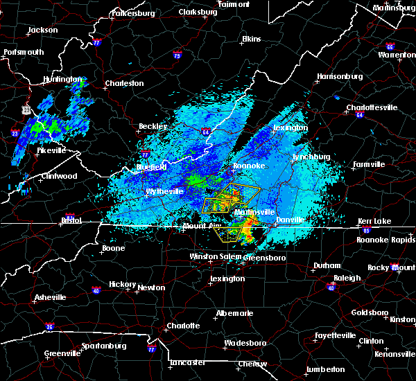 The severe thunderstorm warning for northeastern stokes and northwestern rockingham counties will expire at 115 am edt, the storm which prompted the warning has moved out of the area. therefore, the warning will be allowed to expire. when it is safe to do so, please send your reports of hail of any size, as well as reports of any wind damage, including downed trees or large limbs, to the national weather service by calling toll free at 1, 8 6 6, 2 1 5, 4 3 2 4. reports and pictures can also be shared on the national weather service blacksburg facebook page and on twitter. The severe thunderstorm warning for northeastern stokes and northwestern rockingham counties will expire at 115 am edt, the storm which prompted the warning has moved out of the area. therefore, the warning will be allowed to expire. when it is safe to do so, please send your reports of hail of any size, as well as reports of any wind damage, including downed trees or large limbs, to the national weather service by calling toll free at 1, 8 6 6, 2 1 5, 4 3 2 4. reports and pictures can also be shared on the national weather service blacksburg facebook page and on twitter.
|
| 9/1/2018 12:41 AM EDT |
 At 1216 am edt, a severe thunderstorm was located over dillard, moving north at 10 mph (radar indicated). Hazards include 60 mph wind gusts and quarter size hail. Hail damage to vehicles is expected. Expect wind damage to roofs, siding, and trees. At 1216 am edt, a severe thunderstorm was located over dillard, moving north at 10 mph (radar indicated). Hazards include 60 mph wind gusts and quarter size hail. Hail damage to vehicles is expected. Expect wind damage to roofs, siding, and trees.
|
| 9/1/2018 12:16 AM EDT |
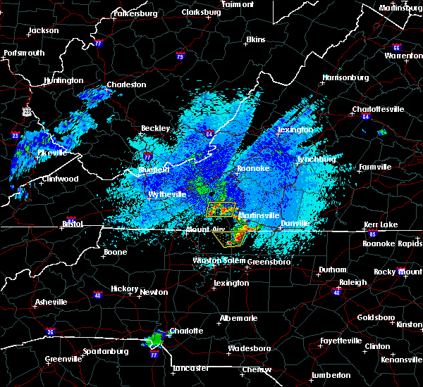 At 1216 am edt, a severe thunderstorm was located over dillard, moving north at 10 mph (radar indicated). Hazards include 60 mph wind gusts and quarter size hail. Hail damage to vehicles is expected. Expect wind damage to roofs, siding, and trees. At 1216 am edt, a severe thunderstorm was located over dillard, moving north at 10 mph (radar indicated). Hazards include 60 mph wind gusts and quarter size hail. Hail damage to vehicles is expected. Expect wind damage to roofs, siding, and trees.
|
| 8/12/2018 4:50 PM EDT | One tree down on price rd in stoneville are in rockingham county NC, 3.7 miles SW of Stoneville, NC |
| 8/8/2018 6:09 PM EDT |
 The severe thunderstorm warning for east central stokes and southwestern rockingham counties will expire at 615 pm edt, the storm which prompted the warning has weakened below severe limits, and no longer poses an immediate threat to life or property. therefore, the warning will be allowed to expire. when it is safe to do so, please send your reports of hail of any size, as well as reports of any wind damage, including downed trees or large limbs, to the national weather service by calling toll free at 1, 8 6 6, 2 1 5, 4 3 2 4. reports and pictures can also be shared on the national weather service blacksburg facebook page and on twitter. The severe thunderstorm warning for east central stokes and southwestern rockingham counties will expire at 615 pm edt, the storm which prompted the warning has weakened below severe limits, and no longer poses an immediate threat to life or property. therefore, the warning will be allowed to expire. when it is safe to do so, please send your reports of hail of any size, as well as reports of any wind damage, including downed trees or large limbs, to the national weather service by calling toll free at 1, 8 6 6, 2 1 5, 4 3 2 4. reports and pictures can also be shared on the national weather service blacksburg facebook page and on twitter.
|
| 8/8/2018 5:51 PM EDT |
 At 550 pm edt, a severe thunderstorm was located over madison, moving southeast at 20 mph (radar indicated). Hazards include 60 mph wind gusts. Expect damage to roofs, siding, and trees. Locations impacted include, mayodan, madison, pine hall, intelligence, and dillard. At 550 pm edt, a severe thunderstorm was located over madison, moving southeast at 20 mph (radar indicated). Hazards include 60 mph wind gusts. Expect damage to roofs, siding, and trees. Locations impacted include, mayodan, madison, pine hall, intelligence, and dillard.
|
| 8/8/2018 2:17 PM EDT |
 At 217 pm edt, a severe thunderstorm was located over intelligence, moving southeast at 35 mph (radar indicated). Hazards include 60 mph wind gusts and quarter size hail. Hail damage to vehicles is expected. Expect wind damage to roofs, siding, and trees. At 217 pm edt, a severe thunderstorm was located over intelligence, moving southeast at 35 mph (radar indicated). Hazards include 60 mph wind gusts and quarter size hail. Hail damage to vehicles is expected. Expect wind damage to roofs, siding, and trees.
|
| 8/2/2018 4:51 PM EDT |
 At 450 pm edt, severe thunderstorms were located along a line extending from near ayersville to near ellisboro, moving northeast at 20 mph (radar indicated). Hazards include 60 mph wind gusts. expect damage to roofs, siding, and trees At 450 pm edt, severe thunderstorms were located along a line extending from near ayersville to near ellisboro, moving northeast at 20 mph (radar indicated). Hazards include 60 mph wind gusts. expect damage to roofs, siding, and trees
|
| 8/2/2018 4:43 PM EDT |
 At 443 pm edt, severe thunderstorms were located along a line extending from near meadows to 6 miles south of pine hall, moving northeast at 15 mph (radar indicated). Hazards include 60 mph wind gusts. Expect damage to roofs, siding, and trees. Locations impacted include, mayodan, madison, walnut cove, stoneville, and sandy ridge. At 443 pm edt, severe thunderstorms were located along a line extending from near meadows to 6 miles south of pine hall, moving northeast at 15 mph (radar indicated). Hazards include 60 mph wind gusts. Expect damage to roofs, siding, and trees. Locations impacted include, mayodan, madison, walnut cove, stoneville, and sandy ridge.
|
| 8/2/2018 4:18 PM EDT |
 At 418 pm edt, severe thunderstorms were located along a line extending from near germanton to near kernersville, moving northeast at 15 mph (radar indicated). Hazards include 60 mph wind gusts. expect damage to roofs, siding, and trees At 418 pm edt, severe thunderstorms were located along a line extending from near germanton to near kernersville, moving northeast at 15 mph (radar indicated). Hazards include 60 mph wind gusts. expect damage to roofs, siding, and trees
|
| 8/1/2018 5:57 PM EDT |
 At 555 pm edt, severe thunderstorms were located along a line extending from fairy stone state park to penns store to near meadows, moving northeast at 25 mph (radar indicated). Hazards include 60 mph wind gusts. expect damage to roofs, siding, and trees At 555 pm edt, severe thunderstorms were located along a line extending from fairy stone state park to penns store to near meadows, moving northeast at 25 mph (radar indicated). Hazards include 60 mph wind gusts. expect damage to roofs, siding, and trees
|
| 8/1/2018 5:48 PM EDT |
 At 548 pm edt, severe thunderstorms were located along a line extending from near fairy stone state park to near dillard, moving northeast at 40 mph (radar indicated). Hazards include 60 mph wind gusts. Expect damage to roofs, siding, and trees. Locations impacted include, mayodan, madison, stuart, stoneville, and danbury. At 548 pm edt, severe thunderstorms were located along a line extending from near fairy stone state park to near dillard, moving northeast at 40 mph (radar indicated). Hazards include 60 mph wind gusts. Expect damage to roofs, siding, and trees. Locations impacted include, mayodan, madison, stuart, stoneville, and danbury.
|
| 8/1/2018 5:34 PM EDT |
 At 533 pm edt, severe thunderstorms were located along a line extending from near buffalo ridge to near walnut cove, moving northeast at 40 mph (radar indicated). Hazards include 60 mph wind gusts. Expect damage to roofs, siding, and trees. Locations impacted include, mayodan, madison, walnut cove, stuart, and stoneville. At 533 pm edt, severe thunderstorms were located along a line extending from near buffalo ridge to near walnut cove, moving northeast at 40 mph (radar indicated). Hazards include 60 mph wind gusts. Expect damage to roofs, siding, and trees. Locations impacted include, mayodan, madison, walnut cove, stuart, and stoneville.
|
| 8/1/2018 5:10 PM EDT |
 The national weather service in blacksburg has issued a * severe thunderstorm warning for. eastern surry county in northwestern north carolina. stokes county in north central north carolina. northwestern rockingham county in north central north carolina. Western henry county in south central virginia. The national weather service in blacksburg has issued a * severe thunderstorm warning for. eastern surry county in northwestern north carolina. stokes county in north central north carolina. northwestern rockingham county in north central north carolina. Western henry county in south central virginia.
|
| 8/1/2018 5:10 PM EDT |
 At 510 pm edt, severe thunderstorms were located along a line extending from near ararat to near king, moving northeast at 40 mph (radar indicated). Hazards include 60 mph wind gusts. expect damage to roofs, siding, and trees At 510 pm edt, severe thunderstorms were located along a line extending from near ararat to near king, moving northeast at 40 mph (radar indicated). Hazards include 60 mph wind gusts. expect damage to roofs, siding, and trees
|
| 7/31/2018 5:33 PM EDT |
 At 533 pm edt, a severe thunderstorm was located near walnut cove, moving northeast at 15 mph (radar indicated). Hazards include 60 mph wind gusts. expect damage to roofs, siding, and trees At 533 pm edt, a severe thunderstorm was located near walnut cove, moving northeast at 15 mph (radar indicated). Hazards include 60 mph wind gusts. expect damage to roofs, siding, and trees
|
| 7/22/2018 9:21 PM EDT |
 The severe thunderstorm warning for northeastern stokes, rockingham and caswell counties will expire at 930 pm edt, the storms which prompted the warning have moved out of the area. therefore, the warning will be allowed to expire. when it is safe to do so, please send your reports of hail of any size, as well as reports of any wind damage, including downed trees or large limbs, to the national weather service by calling toll free at 1, 8 6 6, 2 1 5, 4 3 2 4. reports and pictures can also be shared on the national weather service blacksburg facebook page and on twitter. The severe thunderstorm warning for northeastern stokes, rockingham and caswell counties will expire at 930 pm edt, the storms which prompted the warning have moved out of the area. therefore, the warning will be allowed to expire. when it is safe to do so, please send your reports of hail of any size, as well as reports of any wind damage, including downed trees or large limbs, to the national weather service by calling toll free at 1, 8 6 6, 2 1 5, 4 3 2 4. reports and pictures can also be shared on the national weather service blacksburg facebook page and on twitter.
|
| 7/22/2018 9:14 PM EDT |
 At 914 pm edt, severe thunderstorms were located along a line extending from near yanceyville to near ayersville, moving north at 20 mph (radar indicated). Hazards include 60 mph wind gusts and quarter size hail. Hail damage to vehicles is expected. expect wind damage to roofs, siding, and trees. Locations impacted include, eden, reidsville, wentworth, mayodan, and madison. At 914 pm edt, severe thunderstorms were located along a line extending from near yanceyville to near ayersville, moving north at 20 mph (radar indicated). Hazards include 60 mph wind gusts and quarter size hail. Hail damage to vehicles is expected. expect wind damage to roofs, siding, and trees. Locations impacted include, eden, reidsville, wentworth, mayodan, and madison.
|
| 7/22/2018 8:42 PM EDT |
 At 841 pm edt, severe thunderstorms were located along a line extending from near camp springs to near pine hall, moving north at 25 mph (radar indicated). Hazards include 60 mph wind gusts and quarter size hail. Hail damage to vehicles is expected. expect wind damage to roofs, siding, and trees. Locations impacted include, eden, reidsville, wentworth, mayodan, and madison. At 841 pm edt, severe thunderstorms were located along a line extending from near camp springs to near pine hall, moving north at 25 mph (radar indicated). Hazards include 60 mph wind gusts and quarter size hail. Hail damage to vehicles is expected. expect wind damage to roofs, siding, and trees. Locations impacted include, eden, reidsville, wentworth, mayodan, and madison.
|
| 7/22/2018 8:15 PM EDT |
 At 814 pm edt, severe thunderstorms were located along a line extending from elon college to near kernersville, moving north at 25 mph (radar indicated). Hazards include 60 mph wind gusts and quarter size hail. Hail damage to vehicles is expected. Expect wind damage to roofs, siding, and trees. At 814 pm edt, severe thunderstorms were located along a line extending from elon college to near kernersville, moving north at 25 mph (radar indicated). Hazards include 60 mph wind gusts and quarter size hail. Hail damage to vehicles is expected. Expect wind damage to roofs, siding, and trees.
|
| 7/6/2018 2:55 PM EDT |
 The severe thunderstorm warning for southeastern stokes and rockingham counties will expire at 300 pm edt, the storms which prompted the warning have moved out of the area. therefore, the warning will be allowed to expire. however small hail, gusty winds and heavy rain are still possible with these thunderstorms. when it is safe to do so, please send your reports of hail of any size, as well as reports of any wind damage, including downed trees or large limbs, to the national weather service by calling toll free at 1, 8 6 6, 2 1 5, 4 3 2 4. reports and pictures can also be shared on the national weather service blacksburg facebook page and on twitter. remember, a severe thunderstorm warning still remains in effect for northeastern rockingham county until 345 pm from a cluster of storms centered near mayfield, nc. The severe thunderstorm warning for southeastern stokes and rockingham counties will expire at 300 pm edt, the storms which prompted the warning have moved out of the area. therefore, the warning will be allowed to expire. however small hail, gusty winds and heavy rain are still possible with these thunderstorms. when it is safe to do so, please send your reports of hail of any size, as well as reports of any wind damage, including downed trees or large limbs, to the national weather service by calling toll free at 1, 8 6 6, 2 1 5, 4 3 2 4. reports and pictures can also be shared on the national weather service blacksburg facebook page and on twitter. remember, a severe thunderstorm warning still remains in effect for northeastern rockingham county until 345 pm from a cluster of storms centered near mayfield, nc.
|
| 7/6/2018 2:38 PM EDT |
 At 237 pm edt, severe thunderstorms were clustered along a line extending from near harrisons crossroads to eden to near ellisboro, moving south at 20 mph (radar indicated). Hazards include 60 mph wind gusts and quarter size hail. Hail damage to vehicles is expected. expect wind damage to roofs, siding, and trees. Locations impacted include, eden, reidsville, wentworth, mayodan, and madison. At 237 pm edt, severe thunderstorms were clustered along a line extending from near harrisons crossroads to eden to near ellisboro, moving south at 20 mph (radar indicated). Hazards include 60 mph wind gusts and quarter size hail. Hail damage to vehicles is expected. expect wind damage to roofs, siding, and trees. Locations impacted include, eden, reidsville, wentworth, mayodan, and madison.
|
| 7/6/2018 2:23 PM EDT | Rockingham county communications reported several trees down in stoneville... none of which fell on any structures. time estimated from rada in rockingham county NC, 0.5 miles ESE of Stoneville, NC |
| 7/6/2018 2:07 PM EDT |
 The national weather service in blacksburg has issued a * severe thunderstorm warning for. southeastern stokes county in north central north carolina. rockingham county in north central north carolina. Until 300 pm edt * at 206 pm edt, severe thunderstorms were located along a line. The national weather service in blacksburg has issued a * severe thunderstorm warning for. southeastern stokes county in north central north carolina. rockingham county in north central north carolina. Until 300 pm edt * at 206 pm edt, severe thunderstorms were located along a line.
|
| 5/10/2018 4:05 PM EDT |
 At 404 pm edt, severe thunderstorms were located along a line extending from cluster springs to baynes, moving east at 30 mph (radar indicated). Hazards include 60 mph wind gusts and quarter size hail. Hail damage to vehicles is expected. expect wind damage to roofs, siding, and trees. locations impacted include, danville, eden, reidsville, wentworth, and mayodan. This includes the following location danville airport. At 404 pm edt, severe thunderstorms were located along a line extending from cluster springs to baynes, moving east at 30 mph (radar indicated). Hazards include 60 mph wind gusts and quarter size hail. Hail damage to vehicles is expected. expect wind damage to roofs, siding, and trees. locations impacted include, danville, eden, reidsville, wentworth, and mayodan. This includes the following location danville airport.
|
| 5/10/2018 3:46 PM EDT |
 At 345 pm edt, severe thunderstorms were located along a line extending from laurel park to meadows, moving east at 30 mph (radar indicated). Hazards include 60 mph wind gusts and quarter size hail. Hail damage to vehicles is expected. expect wind damage to roofs, siding, and trees. locations impacted include, danville, eden, reidsville, martinsville, and wentworth. This includes the following locations the martinsville speedway, martinsville airport, and danville airport. At 345 pm edt, severe thunderstorms were located along a line extending from laurel park to meadows, moving east at 30 mph (radar indicated). Hazards include 60 mph wind gusts and quarter size hail. Hail damage to vehicles is expected. expect wind damage to roofs, siding, and trees. locations impacted include, danville, eden, reidsville, martinsville, and wentworth. This includes the following locations the martinsville speedway, martinsville airport, and danville airport.
|
| 5/10/2018 3:29 PM EDT |
 At 329 pm edt, severe thunderstorms were located along a line extending from near collinsville to hanging rock state park, moving east at 30 mph (radar indicated). Hazards include 60 mph wind gusts and quarter size hail. Hail damage to vehicles is expected. Expect wind damage to roofs, siding, and trees. At 329 pm edt, severe thunderstorms were located along a line extending from near collinsville to hanging rock state park, moving east at 30 mph (radar indicated). Hazards include 60 mph wind gusts and quarter size hail. Hail damage to vehicles is expected. Expect wind damage to roofs, siding, and trees.
|
| 4/15/2018 5:32 PM EDT |
 At 532 pm edt, a severe thunderstorm was located over stoneville, moving northeast at 50 mph (radar indicated). Hazards include 60 mph wind gusts and quarter size hail. Hail damage to vehicles is expected. expect wind damage to roofs, siding, and trees. locations impacted include, eden, wentworth, mayodan, madison, and stoneville. A tornado watch remains in effect until 1100 pm edt for north central north carolina, and south central, southwestern and west central virginia. At 532 pm edt, a severe thunderstorm was located over stoneville, moving northeast at 50 mph (radar indicated). Hazards include 60 mph wind gusts and quarter size hail. Hail damage to vehicles is expected. expect wind damage to roofs, siding, and trees. locations impacted include, eden, wentworth, mayodan, madison, and stoneville. A tornado watch remains in effect until 1100 pm edt for north central north carolina, and south central, southwestern and west central virginia.
|
| 4/15/2018 5:18 PM EDT |
 At 518 pm edt, a severe thunderstorm was located over pine hall, moving northeast at 65 mph (radar indicated). Hazards include 60 mph wind gusts and quarter size hail. Hail damage to vehicles is expected. Expect wind damage to roofs, siding, and trees. At 518 pm edt, a severe thunderstorm was located over pine hall, moving northeast at 65 mph (radar indicated). Hazards include 60 mph wind gusts and quarter size hail. Hail damage to vehicles is expected. Expect wind damage to roofs, siding, and trees.
|
| 3/17/2018 10:31 PM EDT |
 At 1030 pm edt, severe thunderstorms were located along a line extending from near oregon hill to near reidsville, moving east at 30 mph. other strong to severe thunderstorms extended from stoneville to madison (radar indicated). Hazards include 60 mph wind gusts and quarter size hail. Hail damage to vehicles is expected. Expect wind damage to roofs, siding, and trees. At 1030 pm edt, severe thunderstorms were located along a line extending from near oregon hill to near reidsville, moving east at 30 mph. other strong to severe thunderstorms extended from stoneville to madison (radar indicated). Hazards include 60 mph wind gusts and quarter size hail. Hail damage to vehicles is expected. Expect wind damage to roofs, siding, and trees.
|
| 10/23/2017 7:43 PM EDT |
 The severe thunderstorm warning for northeastern stokes. rockingham. east central floyd. southwestern pittsylvania. henry. franklin and eastern patrick counties and the city of martinsville will expire at 745 pm edt. the storms which prompted the warning have moved out of the area. Therefore the warning will be allowed to expire. The severe thunderstorm warning for northeastern stokes. rockingham. east central floyd. southwestern pittsylvania. henry. franklin and eastern patrick counties and the city of martinsville will expire at 745 pm edt. the storms which prompted the warning have moved out of the area. Therefore the warning will be allowed to expire.
|
| 10/23/2017 6:46 PM EDT |
 At 645 pm edt, severe thunderstorms were located along a line extending from near floyd to near ellisboro, moving northeast at 15 mph (radar indicated). Hazards include 60 mph wind gusts and quarter size hail. Hail damage to vehicles is expected. Expect wind damage to roofs, siding, and trees. At 645 pm edt, severe thunderstorms were located along a line extending from near floyd to near ellisboro, moving northeast at 15 mph (radar indicated). Hazards include 60 mph wind gusts and quarter size hail. Hail damage to vehicles is expected. Expect wind damage to roofs, siding, and trees.
|
| 7/28/2017 7:36 PM EDT |
 The severe thunderstorm warning for northwestern rockingham county will expire at 745 pm edt, the storms which prompted the warning have weakened and moved northeast out of the warned area. therefore, the warning will be allowed to expire. moderate to heavy rain and occasional lightning will continue in the area for another 30 minutes or so. when it is safe to do so, please send your reports of hail of any size, as well as reports of any wind damage, including downed trees or large limbs, to the national weather service by calling toll free at 1, 8 6 6, 2 1 5, 4 3 2 4. reports and pictures can also be shared on the national weather service blacksburg facebook page and on twitter. The severe thunderstorm warning for northwestern rockingham county will expire at 745 pm edt, the storms which prompted the warning have weakened and moved northeast out of the warned area. therefore, the warning will be allowed to expire. moderate to heavy rain and occasional lightning will continue in the area for another 30 minutes or so. when it is safe to do so, please send your reports of hail of any size, as well as reports of any wind damage, including downed trees or large limbs, to the national weather service by calling toll free at 1, 8 6 6, 2 1 5, 4 3 2 4. reports and pictures can also be shared on the national weather service blacksburg facebook page and on twitter.
|
| 7/28/2017 7:28 PM EDT |
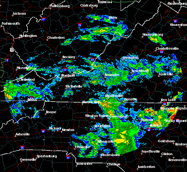 At 727 pm edt, severe thunderstorms were located along a line extending from near penns store to near stoneville, moving northeast at 25 mph (radar indicated). Hazards include 60 mph wind gusts. Expect damage to roofs, siding, and trees. Locations impacted include, stoneville, and price. At 727 pm edt, severe thunderstorms were located along a line extending from near penns store to near stoneville, moving northeast at 25 mph (radar indicated). Hazards include 60 mph wind gusts. Expect damage to roofs, siding, and trees. Locations impacted include, stoneville, and price.
|
| 7/28/2017 7:07 PM EDT |
 At 706 pm edt, severe thunderstorms were located along a line extending from near sandy ridge to near madison, moving northeast at 25 mph (radar indicated). Hazards include 60 mph wind gusts. Expect damage to roofs, siding, and trees. Locations impacted include, mayodan, madison, stoneville, sandy ridge, and intelligence. At 706 pm edt, severe thunderstorms were located along a line extending from near sandy ridge to near madison, moving northeast at 25 mph (radar indicated). Hazards include 60 mph wind gusts. Expect damage to roofs, siding, and trees. Locations impacted include, mayodan, madison, stoneville, sandy ridge, and intelligence.
|
| 7/28/2017 6:44 PM EDT |
 At 643 pm edt, severe thunderstorms were located along a line extending from near hanging rock state park to walnut cove, moving northeast at 25 mph (radar indicated). Hazards include 60 mph wind gusts. expect damage to roofs, siding, and trees At 643 pm edt, severe thunderstorms were located along a line extending from near hanging rock state park to walnut cove, moving northeast at 25 mph (radar indicated). Hazards include 60 mph wind gusts. expect damage to roofs, siding, and trees
|
| 6/15/2017 9:05 PM EDT |
 The severe thunderstorm warning for northwestern rockingham and south central henry counties will expire at 915 pm edt, the storm which prompted the warning has weakened below severe limits, and has exited the warned area. therefore, the warning will be allowed to expire. when it is safe to do so, please send your reports of hail of any size, as well as reports of any wind damage, including downed trees or large limbs, to the national weather service by calling toll free at 1, 8 6 6, 2 1 5, 4 3 2 4. reports and pictures can also be shared on the national weather service blacksburg facebook page and on twitter. The severe thunderstorm warning for northwestern rockingham and south central henry counties will expire at 915 pm edt, the storm which prompted the warning has weakened below severe limits, and has exited the warned area. therefore, the warning will be allowed to expire. when it is safe to do so, please send your reports of hail of any size, as well as reports of any wind damage, including downed trees or large limbs, to the national weather service by calling toll free at 1, 8 6 6, 2 1 5, 4 3 2 4. reports and pictures can also be shared on the national weather service blacksburg facebook page and on twitter.
|
| 6/15/2017 8:38 PM EDT | Quarter sized hail reported 0.5 miles ESE of Stoneville, NC |
| 6/15/2017 8:23 PM EDT |
 At 823 pm edt, a severe thunderstorm was located near price, moving northeast at 20 mph (radar indicated). Hazards include 60 mph wind gusts and quarter size hail. Hail damage to vehicles is expected. expect wind damage to roofs, siding, and trees. Locations impacted include, stoneville, and price. At 823 pm edt, a severe thunderstorm was located near price, moving northeast at 20 mph (radar indicated). Hazards include 60 mph wind gusts and quarter size hail. Hail damage to vehicles is expected. expect wind damage to roofs, siding, and trees. Locations impacted include, stoneville, and price.
|
| 6/15/2017 8:10 PM EDT |
 At 810 pm edt, a severe thunderstorm was located over ayersville, moving east at 15 mph (radar indicated). Hazards include 60 mph wind gusts and quarter size hail. Hail damage to vehicles is expected. Expect wind damage to roofs, siding, and trees. At 810 pm edt, a severe thunderstorm was located over ayersville, moving east at 15 mph (radar indicated). Hazards include 60 mph wind gusts and quarter size hail. Hail damage to vehicles is expected. Expect wind damage to roofs, siding, and trees.
|
| 5/31/2017 6:46 PM EDT |
 At 646 pm edt, severe thunderstorms were located along a line extending from near ayersville to near dillard to capella, moving east at 25 mph (radar indicated). Hazards include ping pong ball size hail and 60 mph wind gusts. People and animals outdoors will be injured. expect hail damage to roofs, siding, windows, and vehicles. expect wind damage to roofs, siding, and trees. Locations impacted include, eden, wentworth, mayodan, madison, and stoneville. At 646 pm edt, severe thunderstorms were located along a line extending from near ayersville to near dillard to capella, moving east at 25 mph (radar indicated). Hazards include ping pong ball size hail and 60 mph wind gusts. People and animals outdoors will be injured. expect hail damage to roofs, siding, windows, and vehicles. expect wind damage to roofs, siding, and trees. Locations impacted include, eden, wentworth, mayodan, madison, and stoneville.
|
| 5/31/2017 6:34 PM EDT |
 At 634 pm edt, severe thunderstorms were located along a line extending from near sandy ridge to near prestonville to near capella, moving east at 25 mph (radar indicated). Hazards include 60 mph wind gusts and quarter size hail. Hail damage to vehicles is expected. expect wind damage to roofs, siding, and trees. Locations impacted include, eden, wentworth, mayodan, madison, and walnut cove. At 634 pm edt, severe thunderstorms were located along a line extending from near sandy ridge to near prestonville to near capella, moving east at 25 mph (radar indicated). Hazards include 60 mph wind gusts and quarter size hail. Hail damage to vehicles is expected. expect wind damage to roofs, siding, and trees. Locations impacted include, eden, wentworth, mayodan, madison, and walnut cove.
|
| 5/31/2017 6:10 PM EDT |
 At 609 pm edt, severe thunderstorms were located along a line extending from near collinstown to near francisco to ararat, moving east at 25 mph (radar indicated). Hazards include 60 mph wind gusts and quarter size hail. Hail damage to vehicles is expected. Expect wind damage to roofs, siding, and trees. At 609 pm edt, severe thunderstorms were located along a line extending from near collinstown to near francisco to ararat, moving east at 25 mph (radar indicated). Hazards include 60 mph wind gusts and quarter size hail. Hail damage to vehicles is expected. Expect wind damage to roofs, siding, and trees.
|
| 5/11/2017 8:12 PM EDT |
 At 811 pm edt, a severe thunderstorm was located over wentworth, moving south at 20 mph (radar indicated). Hazards include 60 mph wind gusts and quarter size hail. Minor damage to vehicles is possible. expect wind damage to trees and power lines. Locations impacted include, eden, reidsville, wentworth, mayodan, and madison. At 811 pm edt, a severe thunderstorm was located over wentworth, moving south at 20 mph (radar indicated). Hazards include 60 mph wind gusts and quarter size hail. Minor damage to vehicles is possible. expect wind damage to trees and power lines. Locations impacted include, eden, reidsville, wentworth, mayodan, and madison.
|
| 5/11/2017 7:38 PM EDT |
 At 737 pm edt, a severe thunderstorm was located near eden, moving south at 20 mph (emergency management officials reported multiple trees downed and damage to transformers in southeastern henry county). Hazards include 60 mph wind gusts and quarter size hail. Minor damage to vehicles is possible. expect wind damage to trees and power lines. Locations impacted include, eden, reidsville, wentworth, mayodan, and madison. At 737 pm edt, a severe thunderstorm was located near eden, moving south at 20 mph (emergency management officials reported multiple trees downed and damage to transformers in southeastern henry county). Hazards include 60 mph wind gusts and quarter size hail. Minor damage to vehicles is possible. expect wind damage to trees and power lines. Locations impacted include, eden, reidsville, wentworth, mayodan, and madison.
|
| 5/11/2017 7:28 PM EDT |
 At 727 pm edt, a severe thunderstorm was located near price, moving south at 20 mph (radar indicated). Hazards include 60 mph wind gusts and quarter size hail. Minor damage to vehicles is possible. Expect wind damage to trees and power lines. At 727 pm edt, a severe thunderstorm was located near price, moving south at 20 mph (radar indicated). Hazards include 60 mph wind gusts and quarter size hail. Minor damage to vehicles is possible. Expect wind damage to trees and power lines.
|
| 5/1/2017 6:07 PM EDT |
 At 607 pm edt, severe thunderstorms were located along a line extending from near rocky mount to near price to near kernersville, moving northeast at 45 mph (law enforcement). Hazards include 60 mph wind gusts and quarter size hail. Minor damage to vehicles is possible. expect wind damage to trees and power lines. Locations impacted include, danville, eden, reidsville, martinsville, and wentworth. At 607 pm edt, severe thunderstorms were located along a line extending from near rocky mount to near price to near kernersville, moving northeast at 45 mph (law enforcement). Hazards include 60 mph wind gusts and quarter size hail. Minor damage to vehicles is possible. expect wind damage to trees and power lines. Locations impacted include, danville, eden, reidsville, martinsville, and wentworth.
|
| 5/1/2017 5:32 PM EDT |
 At 530 pm edt, severe thunderstorms were located along a line extending from near woolwine to near hanging rock state park to 7 miles east of mocksville, moving northeast at 45 mph (law enforcement. at 504 pm, yadkin nc county warning point reported multiple trees down in east bend). Hazards include 60 mph wind gusts and quarter size hail. Minor damage to vehicles is possible. Expect wind damage to trees and power lines. At 530 pm edt, severe thunderstorms were located along a line extending from near woolwine to near hanging rock state park to 7 miles east of mocksville, moving northeast at 45 mph (law enforcement. at 504 pm, yadkin nc county warning point reported multiple trees down in east bend). Hazards include 60 mph wind gusts and quarter size hail. Minor damage to vehicles is possible. Expect wind damage to trees and power lines.
|
| 4/6/2017 6:03 AM EDT |
 At 602 am edt, a severe thunderstorm was located near dry fork, moving northeast at 40 mph (radar indicated). Hazards include 60 mph wind gusts and quarter size hail. Hail damage to vehicles is expected. expect wind damage to roofs, siding, and trees. Locations impacted include, danville, eden, wentworth, mayodan, and madison. At 602 am edt, a severe thunderstorm was located near dry fork, moving northeast at 40 mph (radar indicated). Hazards include 60 mph wind gusts and quarter size hail. Hail damage to vehicles is expected. expect wind damage to roofs, siding, and trees. Locations impacted include, danville, eden, wentworth, mayodan, and madison.
|
| 4/6/2017 5:31 AM EDT |
 At 531 am edt, a severe thunderstorm was located near sandy level, moving northeast at 40 mph (radar indicated). Hazards include 60 mph wind gusts and quarter size hail. Hail damage to vehicles is expected. Expect wind damage to roofs, siding, and trees. At 531 am edt, a severe thunderstorm was located near sandy level, moving northeast at 40 mph (radar indicated). Hazards include 60 mph wind gusts and quarter size hail. Hail damage to vehicles is expected. Expect wind damage to roofs, siding, and trees.
|
| 9/29/2016 4:43 PM EDT |
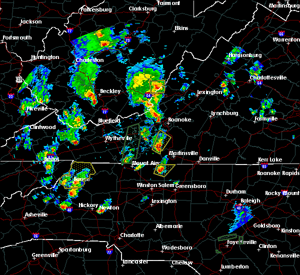 At 443 pm edt, a severe thunderstorm was located over dillard, moving north at 10 mph (radar indicated). Hazards include 60 mph wind gusts and quarter size hail. Hail damage to vehicles is expected. expect wind damage to roofs, siding, and trees. Locations impacted include, mayodan, madison, stoneville, sandy ridge, and dillard. At 443 pm edt, a severe thunderstorm was located over dillard, moving north at 10 mph (radar indicated). Hazards include 60 mph wind gusts and quarter size hail. Hail damage to vehicles is expected. expect wind damage to roofs, siding, and trees. Locations impacted include, mayodan, madison, stoneville, sandy ridge, and dillard.
|
| 9/29/2016 4:13 PM EDT |
 At 412 pm edt, a severe thunderstorm was located over walnut cove, moving north at 10 mph (radar indicated). Hazards include 60 mph wind gusts and quarter size hail. Hail damage to vehicles is expected. Expect wind damage to roofs, siding, and trees. At 412 pm edt, a severe thunderstorm was located over walnut cove, moving north at 10 mph (radar indicated). Hazards include 60 mph wind gusts and quarter size hail. Hail damage to vehicles is expected. Expect wind damage to roofs, siding, and trees.
|
| 8/17/2016 3:43 PM EDT |
 At 343 pm edt, severe thunderstorms were located along a line extending from near oak level to prestonville, moving east at 25 mph (radar indicated). Hazards include 60 mph wind gusts and quarter size hail. Hail damage to vehicles is expected. Expect wind damage to roofs, siding, and trees. At 343 pm edt, severe thunderstorms were located along a line extending from near oak level to prestonville, moving east at 25 mph (radar indicated). Hazards include 60 mph wind gusts and quarter size hail. Hail damage to vehicles is expected. Expect wind damage to roofs, siding, and trees.
|
| 7/27/2016 6:33 PM EDT |
 At 633 pm edt, a severe thunderstorm was located near pine hall, moving east at 10 mph (radar indicated). Hazards include 60 mph wind gusts and quarter size hail. Hail damage to vehicles is expected. Expect wind damage to roofs, siding, and trees. At 633 pm edt, a severe thunderstorm was located near pine hall, moving east at 10 mph (radar indicated). Hazards include 60 mph wind gusts and quarter size hail. Hail damage to vehicles is expected. Expect wind damage to roofs, siding, and trees.
|
| 7/19/2016 6:26 PM EDT |
 At 625 pm edt, severe thunderstorms were located along a line extending from meadows to near madison to near ayersville, moving southeast at 30 mph (radar indicated). Hazards include 60 mph wind gusts. Expect damage to roofs. siding. And trees. At 625 pm edt, severe thunderstorms were located along a line extending from meadows to near madison to near ayersville, moving southeast at 30 mph (radar indicated). Hazards include 60 mph wind gusts. Expect damage to roofs. siding. And trees.
|
| 7/15/2016 5:27 PM EDT |
 At 526 pm edt, a severe thunderstorm was located near intelligence, moving east at 20 mph (radar indicated). Hazards include 60 mph wind gusts. Expect damage to roofs. siding. and trees. Locations impacted include, eden, reidsville, wentworth, mayodan, and madison. At 526 pm edt, a severe thunderstorm was located near intelligence, moving east at 20 mph (radar indicated). Hazards include 60 mph wind gusts. Expect damage to roofs. siding. and trees. Locations impacted include, eden, reidsville, wentworth, mayodan, and madison.
|
| 7/15/2016 5:10 PM EDT |
 At 510 pm edt, a severe thunderstorm was located over stoneville, moving east at 30 mph (radar indicated). Hazards include 60 mph wind gusts. Expect damage to roofs. siding. and trees. Locations impacted include, eden, reidsville, wentworth, mayodan, and madison. At 510 pm edt, a severe thunderstorm was located over stoneville, moving east at 30 mph (radar indicated). Hazards include 60 mph wind gusts. Expect damage to roofs. siding. and trees. Locations impacted include, eden, reidsville, wentworth, mayodan, and madison.
|
| 7/15/2016 4:45 PM EDT |
 At 445 pm edt, a severe thunderstorm was located over prestonville, moving east at 30 mph (radar indicated). Hazards include 60 mph wind gusts. Expect damage to roofs. siding. And trees. At 445 pm edt, a severe thunderstorm was located over prestonville, moving east at 30 mph (radar indicated). Hazards include 60 mph wind gusts. Expect damage to roofs. siding. And trees.
|
| 7/8/2016 6:56 PM EDT |
 The severe thunderstorm warning for eastern stokes and rockingham counties will expire at 700 pm edt, the storms which prompted the warning has been replaced with a new warning for southeastern stokes county, southwestern caswell county and southern rockingham county in north carolina a severe thunderstorm watch remains in effect until 1000 pm edt for north carolina and virginia. when it is safe to do so, please send your reports of hail of any size, as well as any reports of wind damage, including downed trees or large limbs, to the national weather service by calling toll free at 1, 8 6 6, 2 1 5, 4 3 2 4. reports and pictures can also be shared on the national weather service blacksburg facebook page and on twitter. The severe thunderstorm warning for eastern stokes and rockingham counties will expire at 700 pm edt, the storms which prompted the warning has been replaced with a new warning for southeastern stokes county, southwestern caswell county and southern rockingham county in north carolina a severe thunderstorm watch remains in effect until 1000 pm edt for north carolina and virginia. when it is safe to do so, please send your reports of hail of any size, as well as any reports of wind damage, including downed trees or large limbs, to the national weather service by calling toll free at 1, 8 6 6, 2 1 5, 4 3 2 4. reports and pictures can also be shared on the national weather service blacksburg facebook page and on twitter.
|
| 7/8/2016 6:43 PM EDT |
 At 642 pm edt, severe thunderstorms were located along a line extending from harrisons crossroads to mayodan to hanging rock state park, moving southeast at 30 mph (radar indicated). Hazards include 60 mph wind gusts and quarter size hail. Hail damage to vehicles is expected. expect wind damage to roofs, siding, and trees. Locations impacted include, eden, reidsville, wentworth, mayodan, and madison. At 642 pm edt, severe thunderstorms were located along a line extending from harrisons crossroads to mayodan to hanging rock state park, moving southeast at 30 mph (radar indicated). Hazards include 60 mph wind gusts and quarter size hail. Hail damage to vehicles is expected. expect wind damage to roofs, siding, and trees. Locations impacted include, eden, reidsville, wentworth, mayodan, and madison.
|
| 7/8/2016 6:19 PM EDT |
 At 618 pm edt, severe thunderstorms were located along a line extending from near price to near sandy ridge to francisco, moving southeast at 30 mph (radar indicated). Hazards include 60 mph wind gusts and quarter size hail. Hail damage to vehicles is expected. expect wind damage to roofs, siding, and trees. locations impacted include, eden, reidsville, martinsville, wentworth, and mayodan. This includes the martinsville speedway and martinsville airport. At 618 pm edt, severe thunderstorms were located along a line extending from near price to near sandy ridge to francisco, moving southeast at 30 mph (radar indicated). Hazards include 60 mph wind gusts and quarter size hail. Hail damage to vehicles is expected. expect wind damage to roofs, siding, and trees. locations impacted include, eden, reidsville, martinsville, wentworth, and mayodan. This includes the martinsville speedway and martinsville airport.
|
| 7/8/2016 6:09 PM EDT |
 At 609 pm edt, severe thunderstorms were located along a line extending from near horse pasture to near penns store to near woodville, moving southeast at 30 mph (radar indicated). Hazards include 60 mph wind gusts and quarter size hail. Hail damage to vehicles is expected. expect wind damage to roofs, siding, and trees. locations impacted include, eden, reidsville, martinsville, wentworth, and mayodan. This includes the martinsville speedway and martinsville airport. At 609 pm edt, severe thunderstorms were located along a line extending from near horse pasture to near penns store to near woodville, moving southeast at 30 mph (radar indicated). Hazards include 60 mph wind gusts and quarter size hail. Hail damage to vehicles is expected. expect wind damage to roofs, siding, and trees. locations impacted include, eden, reidsville, martinsville, wentworth, and mayodan. This includes the martinsville speedway and martinsville airport.
|
| 7/8/2016 6:01 PM EDT |
 At 601 pm edt, severe thunderstorms were located along a line extending from near horse pasture to near critz to near ararat, moving southeast at 30 mph (radar indicated). Hazards include 60 mph wind gusts and quarter size hail. Hail damage to vehicles is expected. expect wind damage to roofs, siding, and trees. locations impacted include, eden, reidsville, martinsville, wentworth, and mayodan. This includes the martinsville speedway and martinsville airport. At 601 pm edt, severe thunderstorms were located along a line extending from near horse pasture to near critz to near ararat, moving southeast at 30 mph (radar indicated). Hazards include 60 mph wind gusts and quarter size hail. Hail damage to vehicles is expected. expect wind damage to roofs, siding, and trees. locations impacted include, eden, reidsville, martinsville, wentworth, and mayodan. This includes the martinsville speedway and martinsville airport.
|
| 7/8/2016 5:48 PM EDT |
 At 548 pm edt, severe thunderstorms were located along a line extending from fieldale to stuart to ararat, moving southeast at 30 mph (radar indicated). Hazards include 60 mph wind gusts and quarter size hail. Hail damage to vehicles is expected. Expect wind damage to roofs, siding, and trees. At 548 pm edt, severe thunderstorms were located along a line extending from fieldale to stuart to ararat, moving southeast at 30 mph (radar indicated). Hazards include 60 mph wind gusts and quarter size hail. Hail damage to vehicles is expected. Expect wind damage to roofs, siding, and trees.
|
| 7/3/2016 12:20 AM EDT |
 At 1218 am edt, severe thunderstorms were located along a line extending from near turbeville to gatewood to eden, moving east at 50 mph (radar indicated). Hazards include 60 mph wind gusts. Expect damage to roofs. siding. and trees. locations impacted include, danville, eden, martinsville, mayodan, and madison. this includes the following locations the martinsville speedway, martinsville airport, and danville airport. Wind gusts to 60 mph, frequent cloud-to-ground lightning, and torrential rainfall area likely in the danville city area during the next 30 minutes. At 1218 am edt, severe thunderstorms were located along a line extending from near turbeville to gatewood to eden, moving east at 50 mph (radar indicated). Hazards include 60 mph wind gusts. Expect damage to roofs. siding. and trees. locations impacted include, danville, eden, martinsville, mayodan, and madison. this includes the following locations the martinsville speedway, martinsville airport, and danville airport. Wind gusts to 60 mph, frequent cloud-to-ground lightning, and torrential rainfall area likely in the danville city area during the next 30 minutes.
|
| 7/2/2016 11:47 PM EDT |
 At 1147 pm edt, severe thunderstorms were located along a line extending from near dry fork to near price to near patrick springs, moving east-southeast at 50 mph (radar indicated). Hazards include 60 mph wind gusts. Expect damage to roofs. siding. And trees. At 1147 pm edt, severe thunderstorms were located along a line extending from near dry fork to near price to near patrick springs, moving east-southeast at 50 mph (radar indicated). Hazards include 60 mph wind gusts. Expect damage to roofs. siding. And trees.
|
| 7/1/2016 1:55 AM EDT |
 At 153 am edt, severe thunderstorms were located near wentworth, moving northeast at 15 mph (radar indicated). Hazards include 60 mph wind gusts. Expect damage to roofs. siding. and trees. Locations impacted include, wentworth, stoneville, intelligence, bethany, and monroeton. At 153 am edt, severe thunderstorms were located near wentworth, moving northeast at 15 mph (radar indicated). Hazards include 60 mph wind gusts. Expect damage to roofs. siding. and trees. Locations impacted include, wentworth, stoneville, intelligence, bethany, and monroeton.
|
| 7/1/2016 1:09 AM EDT |
 At 109 am edt, a severe thunderstorm was located over pine hall, moving east at 35 mph (radar indicated). Hazards include 60 mph wind gusts. Expect damage to roofs. siding. And trees. At 109 am edt, a severe thunderstorm was located over pine hall, moving east at 35 mph (radar indicated). Hazards include 60 mph wind gusts. Expect damage to roofs. siding. And trees.
|
| 6/29/2016 5:09 PM EDT |
 At 508 pm edt, a severe thunderstorm was located over harrisons crossroads, moving east at 30 mph (radar indicated). Hazards include 60 mph wind gusts and penny size hail. Expect damage to roofs. siding. and trees. Locations impacted include, eden, reidsville, wentworth, mayfield, and lawsonville. At 508 pm edt, a severe thunderstorm was located over harrisons crossroads, moving east at 30 mph (radar indicated). Hazards include 60 mph wind gusts and penny size hail. Expect damage to roofs. siding. and trees. Locations impacted include, eden, reidsville, wentworth, mayfield, and lawsonville.
|
| 6/29/2016 5:00 PM EDT |
 At 459 pm edt, a severe thunderstorm was located over eden, moving east at 25 mph (radar indicated). Hazards include 60 mph wind gusts and penny size hail. Expect damage to roofs. siding. and trees. Locations impacted include, eden, reidsville, wentworth, stoneville, and mayfield. At 459 pm edt, a severe thunderstorm was located over eden, moving east at 25 mph (radar indicated). Hazards include 60 mph wind gusts and penny size hail. Expect damage to roofs. siding. and trees. Locations impacted include, eden, reidsville, wentworth, stoneville, and mayfield.
|
| 6/29/2016 4:35 PM EDT |
 At 435 pm edt, a severe thunderstorm was located over ayersville, moving east at 25 mph (radar indicated). Hazards include 60 mph wind gusts and quarter size hail. Hail damage to vehicles is expected. Expect wind damage to roofs, siding, and trees. At 435 pm edt, a severe thunderstorm was located over ayersville, moving east at 25 mph (radar indicated). Hazards include 60 mph wind gusts and quarter size hail. Hail damage to vehicles is expected. Expect wind damage to roofs, siding, and trees.
|
| 1/1/0001 12:00 AM | Rockingham county 911 center reported that one tree was down on north carolina highway 770 in stonevill in rockingham county NC, 0.5 miles ESE of Stoneville, NC |
| 6/4/2016 9:16 PM EDT |
 At 914 pm edt, a severe thunderstorm was located over mayodan, moving northeast at 25 mph (radar indicated). Hazards include 60 mph wind gusts and quarter size hail. Hail damage to vehicles is expected. expect wind damage to roofs, siding, and trees. Locations impacted include, eden, reidsville, wentworth, mayodan, and madison. At 914 pm edt, a severe thunderstorm was located over mayodan, moving northeast at 25 mph (radar indicated). Hazards include 60 mph wind gusts and quarter size hail. Hail damage to vehicles is expected. expect wind damage to roofs, siding, and trees. Locations impacted include, eden, reidsville, wentworth, mayodan, and madison.
|
| 6/4/2016 8:47 PM EDT |
 At 846 pm edt, a severe thunderstorm was located over pine hall, moving northeast at 20 mph (radar indicated). Hazards include 60 mph wind gusts and quarter size hail. Hail damage to vehicles is expected. Expect wind damage to roofs, siding, and trees. At 846 pm edt, a severe thunderstorm was located over pine hall, moving northeast at 20 mph (radar indicated). Hazards include 60 mph wind gusts and quarter size hail. Hail damage to vehicles is expected. Expect wind damage to roofs, siding, and trees.
|
| 5/12/2016 7:26 PM EDT |
 The severe thunderstorm warning for eastern stokes and rockingham counties will expire at 730 pm edt, the storm which prompted the warning has weakened below severe limits, and has exited the warned area. therefore the warning will be allowed to expire. however heavy rain is still possible with this thunderstorm. when it is safe to do so, please send your reports of hail of any size, as well as any reports of wind damage, including downed trees or large limbs, to the national weather service by calling toll free at 1, 8 6 6, 2 1 5, 4 3 2 4. reports and pictures can also be shared on the national weather service blacksburg facebook page and on twitter. The severe thunderstorm warning for eastern stokes and rockingham counties will expire at 730 pm edt, the storm which prompted the warning has weakened below severe limits, and has exited the warned area. therefore the warning will be allowed to expire. however heavy rain is still possible with this thunderstorm. when it is safe to do so, please send your reports of hail of any size, as well as any reports of wind damage, including downed trees or large limbs, to the national weather service by calling toll free at 1, 8 6 6, 2 1 5, 4 3 2 4. reports and pictures can also be shared on the national weather service blacksburg facebook page and on twitter.
|
| 5/12/2016 6:49 PM EDT |
 At 649 pm edt, a severe thunderstorm was located over intelligence, moving northeast at 25 mph (radar indicated). Hazards include 60 mph wind gusts and quarter size hail. Hail damage to vehicles is expected. expect wind damage to roofs, siding, and trees. Locations impacted include, eden, reidsville, wentworth, mayodan, and madison. At 649 pm edt, a severe thunderstorm was located over intelligence, moving northeast at 25 mph (radar indicated). Hazards include 60 mph wind gusts and quarter size hail. Hail damage to vehicles is expected. expect wind damage to roofs, siding, and trees. Locations impacted include, eden, reidsville, wentworth, mayodan, and madison.
|
| 5/12/2016 6:23 PM EDT |
 At 622 pm edt, a severe thunderstorm was located near pine hall, moving northeast at 30 mph (radar indicated). Hazards include 60 mph wind gusts and quarter size hail. Hail damage to vehicles is expected. Expect wind damage to roofs, siding, and trees. At 622 pm edt, a severe thunderstorm was located near pine hall, moving northeast at 30 mph (radar indicated). Hazards include 60 mph wind gusts and quarter size hail. Hail damage to vehicles is expected. Expect wind damage to roofs, siding, and trees.
|
| 4/28/2016 3:58 PM EDT |
 At 358 pm edt, a severe thunderstorm was located near danbury, moving southeast at 30 mph (radar indicated). Hazards include 60 mph wind gusts and quarter size hail. Hail damage to vehicles is expected. Expect wind damage to roofs, siding, and trees. At 358 pm edt, a severe thunderstorm was located near danbury, moving southeast at 30 mph (radar indicated). Hazards include 60 mph wind gusts and quarter size hail. Hail damage to vehicles is expected. Expect wind damage to roofs, siding, and trees.
|
| 3/14/2016 8:00 PM EDT | At 759 pm edt, a severe thunderstorm was located near price, moving northeast at 30 mph (radar indicated). Hazards include 60 mph wind gusts and quarter size hail. Hail damage to vehicles is expected. expect wind damage to roofs, siding, and trees. locations impacted include, martinsville, stoneville, martinsville city, axton, and spencer. This includes the martinsville speedway and martinsville airport. |
| 3/14/2016 8:00 PM EDT | At 759 pm edt, a severe thunderstorm was located near price, moving northeast at 30 mph (radar indicated). Hazards include 60 mph wind gusts and quarter size hail. Hail damage to vehicles is expected. expect wind damage to roofs, siding, and trees. locations impacted include, martinsville, stoneville, martinsville city, axton, and spencer. This includes the martinsville speedway and martinsville airport. |
| 3/14/2016 7:49 PM EDT | At 749 pm edt, a severe thunderstorm was located over ayersville, moving northeast at 25 mph (radar indicated). Hazards include 60 mph wind gusts and quarter size hail. Hail damage to vehicles is expected. Expect wind damage to roofs, siding, and trees. |
| 3/14/2016 7:49 PM EDT | At 749 pm edt, a severe thunderstorm was located over ayersville, moving northeast at 25 mph (radar indicated). Hazards include 60 mph wind gusts and quarter size hail. Hail damage to vehicles is expected. Expect wind damage to roofs, siding, and trees. |
| 2/24/2016 2:10 PM EST | Several trees and powerlines down in the stoneville area in rockingham county NC, 2.9 miles W of Stoneville, NC |
| 2/24/2016 1:52 PM EST |
 The severe thunderstorm warning for eastern stokes and northwestern rockingham counties will expire at 200 pm est, the storm which prompted the warning has weakened below severe limits, and no longer poses an immediate threat to life or property. therefore the warning will be allowed to expire. a tornado watch remains in effect until 700 pm est for north central north carolina. a tornado watch also remains in effect until 900 pm est for south central virginia. when it is safe to do so, please send your reports of hail of any size, as well as any reports of wind damage, including downed trees or large limbs, to the national weather service by calling toll free at 1, 8 6 6, 2 1 5, 4 3 2 4. reports and pictures can also be shared on the national weather service blacksburg facebook page and on twitter. The severe thunderstorm warning for eastern stokes and northwestern rockingham counties will expire at 200 pm est, the storm which prompted the warning has weakened below severe limits, and no longer poses an immediate threat to life or property. therefore the warning will be allowed to expire. a tornado watch remains in effect until 700 pm est for north central north carolina. a tornado watch also remains in effect until 900 pm est for south central virginia. when it is safe to do so, please send your reports of hail of any size, as well as any reports of wind damage, including downed trees or large limbs, to the national weather service by calling toll free at 1, 8 6 6, 2 1 5, 4 3 2 4. reports and pictures can also be shared on the national weather service blacksburg facebook page and on twitter.
|
| 2/24/2016 1:43 PM EST |
 At 143 pm est, a severe thunderstorm was located over sandy ridge, moving northeast at 30 mph (radar indicated). Hazards include 60 mph wind gusts and quarter size hail. Hail damage to vehicles is expected. expect wind damage to roofs, siding, and trees. locations impacted include, mayodan, walnut cove, stoneville, danbury, and sandy ridge. a tornado watch remains in effect until 700 pm est for north central north carolina. A tornado watch also remains in effect until 900 pm est for south central virginia. At 143 pm est, a severe thunderstorm was located over sandy ridge, moving northeast at 30 mph (radar indicated). Hazards include 60 mph wind gusts and quarter size hail. Hail damage to vehicles is expected. expect wind damage to roofs, siding, and trees. locations impacted include, mayodan, walnut cove, stoneville, danbury, and sandy ridge. a tornado watch remains in effect until 700 pm est for north central north carolina. A tornado watch also remains in effect until 900 pm est for south central virginia.
|
| 2/24/2016 1:34 PM EST |
 At 133 pm est, a severe thunderstorm was located over sandy ridge, moving northeast at 55 mph (radar indicated). Hazards include 60 mph wind gusts and quarter size hail. Hail damage to vehicles is expected. expect wind damage to roofs, siding, and trees. locations impacted include, mayodan, walnut cove, stoneville, danbury, and sandy ridge. A tornado watch remains in effect until 700 pm est for north central north carolina. At 133 pm est, a severe thunderstorm was located over sandy ridge, moving northeast at 55 mph (radar indicated). Hazards include 60 mph wind gusts and quarter size hail. Hail damage to vehicles is expected. expect wind damage to roofs, siding, and trees. locations impacted include, mayodan, walnut cove, stoneville, danbury, and sandy ridge. A tornado watch remains in effect until 700 pm est for north central north carolina.
|
| 2/24/2016 1:21 PM EST |
 At 120 pm est, a severe thunderstorm was located near capella, moving northeast at 40 mph (radar indicated). Hazards include 60 mph wind gusts and quarter size hail. Hail damage to vehicles is expected. Expect wind damage to roofs, siding, and trees. At 120 pm est, a severe thunderstorm was located near capella, moving northeast at 40 mph (radar indicated). Hazards include 60 mph wind gusts and quarter size hail. Hail damage to vehicles is expected. Expect wind damage to roofs, siding, and trees.
|
| 9/12/2015 2:58 AM EDT |
 At 258 am edt, a severe thunderstorm was located near price, moving northeast at 30 mph (radar indicated). Hazards include half dollar size hail. Damage to vehicles is expected. Locations impacted include, eden, wentworth, stoneville, and sandy level. At 258 am edt, a severe thunderstorm was located near price, moving northeast at 30 mph (radar indicated). Hazards include half dollar size hail. Damage to vehicles is expected. Locations impacted include, eden, wentworth, stoneville, and sandy level.
|
| 9/12/2015 2:45 AM EDT |
 At 244 am edt, a severe thunderstorm was located over stoneville, moving northeast at 30 mph (radar indicated). Hazards include quarter size hail. damage to vehicles is expected At 244 am edt, a severe thunderstorm was located over stoneville, moving northeast at 30 mph (radar indicated). Hazards include quarter size hail. damage to vehicles is expected
|
| 9/4/2015 5:35 PM EDT |
 The severe thunderstorm warning for northeastern yadkin, southern stokes and southwestern rockingham counties will expire at 545 pm edt, the storm which prompted the warning has weakened below severe limits, and has exited the warned area. therefore the warning will be allowed to expire. when it is safe to do so, please send your reports of hail of any size, as well as any reports of wind damage, including downed trees or large limbs, to the national weather service by calling toll free at 1, 8 6 6, 2 1 5, 4 3 2 4. reports and pictures can also be shared on the national weather service blacksburg facebook page and on twitter. The severe thunderstorm warning for northeastern yadkin, southern stokes and southwestern rockingham counties will expire at 545 pm edt, the storm which prompted the warning has weakened below severe limits, and has exited the warned area. therefore the warning will be allowed to expire. when it is safe to do so, please send your reports of hail of any size, as well as any reports of wind damage, including downed trees or large limbs, to the national weather service by calling toll free at 1, 8 6 6, 2 1 5, 4 3 2 4. reports and pictures can also be shared on the national weather service blacksburg facebook page and on twitter.
|
| 9/4/2015 5:23 PM EDT |
 At 523 pm edt, a severe thunderstorm was located over germanton, moving southwest at 30 mph (radar indicated). Hazards include 60 mph wind gusts and quarter size hail. Hail damage to vehicles is expected. expect wind damage to roofs, siding and trees. Locations impacted include, king, mayodan, madison, walnut cove, and stoneville. At 523 pm edt, a severe thunderstorm was located over germanton, moving southwest at 30 mph (radar indicated). Hazards include 60 mph wind gusts and quarter size hail. Hail damage to vehicles is expected. expect wind damage to roofs, siding and trees. Locations impacted include, king, mayodan, madison, walnut cove, and stoneville.
|
| 9/4/2015 4:54 PM EDT |
 At 454 pm edt, a severe thunderstorm was located over pine hall, moving southwest at 30 mph (radar indicated). Hazards include 60 mph wind gusts and quarter size hail. Hail damage to vehicles is expected. expect wind damage to roofs, siding and trees. Locations impacted include, king, wentworth, mayodan, madison, and walnut cove. At 454 pm edt, a severe thunderstorm was located over pine hall, moving southwest at 30 mph (radar indicated). Hazards include 60 mph wind gusts and quarter size hail. Hail damage to vehicles is expected. expect wind damage to roofs, siding and trees. Locations impacted include, king, wentworth, mayodan, madison, and walnut cove.
|
| 9/4/2015 4:44 PM EDT |
 At 443 pm edt, a severe thunderstorm was located over madison, moving southwest at 30 mph (radar indicated). Hazards include 60 mph wind gusts and quarter size hail. Hail damage to vehicles is expected. Expect wind damage to roofs, siding and trees. At 443 pm edt, a severe thunderstorm was located over madison, moving southwest at 30 mph (radar indicated). Hazards include 60 mph wind gusts and quarter size hail. Hail damage to vehicles is expected. Expect wind damage to roofs, siding and trees.
|
| 8/11/2015 5:02 PM EDT |
 At 501 pm edt, a severe thunderstorm was located over eden, moving southeast at 30 mph (radar indicated). Hazards include 60 mph wind gusts and quarter size hail. Hail damage to vehicles is expected. expect wind damage to roofs, siding and trees. locations impacted include, danville, eden, wentworth, mayodan, and madison. This includes danville airport. At 501 pm edt, a severe thunderstorm was located over eden, moving southeast at 30 mph (radar indicated). Hazards include 60 mph wind gusts and quarter size hail. Hail damage to vehicles is expected. expect wind damage to roofs, siding and trees. locations impacted include, danville, eden, wentworth, mayodan, and madison. This includes danville airport.
|
| 8/11/2015 4:28 PM EDT |
 At 427 pm edt, a severe thunderstorm was located near martinsville airport, moving southeast at 15 mph (radar indicated). Hazards include 60 mph wind gusts and quarter size hail. Hail damage to vehicles is expected. expect wind damage to roofs, siding and trees. locations impacted include, danville, eden, martinsville, wentworth, and mayodan. This includes the following locations the martinsville speedway, martinsville airport, and danville airport. At 427 pm edt, a severe thunderstorm was located near martinsville airport, moving southeast at 15 mph (radar indicated). Hazards include 60 mph wind gusts and quarter size hail. Hail damage to vehicles is expected. expect wind damage to roofs, siding and trees. locations impacted include, danville, eden, martinsville, wentworth, and mayodan. This includes the following locations the martinsville speedway, martinsville airport, and danville airport.
|
| 8/11/2015 4:12 PM EDT |
 At 412 pm edt, a severe thunderstorm was located over martinsville airport, moving southeast at 10 mph (radar indicated). Hazards include 60 mph wind gusts and quarter size hail. Hail damage to vehicles is expected. Expect wind damage to roofs, siding and trees. At 412 pm edt, a severe thunderstorm was located over martinsville airport, moving southeast at 10 mph (radar indicated). Hazards include 60 mph wind gusts and quarter size hail. Hail damage to vehicles is expected. Expect wind damage to roofs, siding and trees.
|
| 8/5/2015 9:12 PM EDT |
 At 911 pm edt, a severe thunderstorm was located over sandy ridge, moving northeast at 25 mph (radar indicated). Hazards include 60 mph wind gusts and quarter size hail. Hail damage to vehicles is expected. expect wind damage to roofs, siding and trees. Locations impacted include, mayodan, madison, walnut cove, stoneville, and danbury. At 911 pm edt, a severe thunderstorm was located over sandy ridge, moving northeast at 25 mph (radar indicated). Hazards include 60 mph wind gusts and quarter size hail. Hail damage to vehicles is expected. expect wind damage to roofs, siding and trees. Locations impacted include, mayodan, madison, walnut cove, stoneville, and danbury.
|
| 8/5/2015 8:54 PM EDT |
 At 854 pm edt, a severe thunderstorm was located over hanging rock state park, moving east at 25 mph (radar indicated). Hazards include 60 mph wind gusts and quarter size hail. Hail damage to vehicles is expected. Expect wind damage to roofs, siding and trees. At 854 pm edt, a severe thunderstorm was located over hanging rock state park, moving east at 25 mph (radar indicated). Hazards include 60 mph wind gusts and quarter size hail. Hail damage to vehicles is expected. Expect wind damage to roofs, siding and trees.
|
| 7/13/2015 8:26 PM EDT |
 At 825 pm edt, severe thunderstorms were located along a line extending from near cascade to 6 miles southeast of belews lake, moving southeast at 65 mph (radar indicated). Hazards include 60 mph wind gusts and quarter size hail. Hail damage to vehicles is expected. Expect wind damage to roofs, siding and trees. At 825 pm edt, severe thunderstorms were located along a line extending from near cascade to 6 miles southeast of belews lake, moving southeast at 65 mph (radar indicated). Hazards include 60 mph wind gusts and quarter size hail. Hail damage to vehicles is expected. Expect wind damage to roofs, siding and trees.
|
| 5/11/2015 9:40 PM EDT | Tree down on settlebridge road in rockingham county NC, 0.5 miles ESE of Stoneville, NC |
| 5/11/2015 9:27 PM EDT | The severe thunderstorm warning for western rockingham county will expire at 930 pm edt, the storms which prompted the warning have moved into eastern rockingham county and weakened. therefore the warning will be allowed to expire. however small hail, gusty winds and heavy rain are still possible with these thunderstorms, along with frequent cloud-to-ground lightning. when it is safe to do so, please send your reports of hail of any size, as well as any reports of wind damage, including downed trees or large limbs, to the national weather service by calling toll free at 1, 8 6 6, 2 1 5, 4 3 2 4. reports and pictures can also be shared on the national weather service blacksburg facebook page and on twitter. |
| 5/11/2015 9:07 PM EDT | At 906 pm edt, severe thunderstorms were located along a line extending from near spencer to near ellisboro, moving east at 20 mph (radar indicated). Hazards include 60 mph wind gusts and quarter size hail. Hail damage to vehicles is expected. expect wind damage to roofs, siding and trees. locations impacted include, eden, wentworth, mayodan, madison, and stoneville. 1. 00in. |
| 5/11/2015 8:35 PM EDT | At 835 pm edt, severe thunderstorms were located along a line extending from near sandy ridge to near walnut cove, moving east at 20 mph (radar indicated). Hazards include 60 mph wind gusts and quarter size hail. Hail damage to vehicles is expected. Expect wind damage to roofs, siding and trees. |
| 6/19/2014 4:35 PM EDT | One tree blown down on rakestraw roa in rockingham county NC, 2.8 miles SW of Stoneville, NC |
| 9/21/2013 6:50 PM EDT | Trees down in rockingham county NC, 0.5 miles ESE of Stoneville, NC |
| 4/12/2013 4:25 AM EDT | A tree was blown down near the intersection of stone mountain road and ponderosa roa in rockingham county NC, 1.2 miles N of Stoneville, NC |
| 7/21/2012 4:52 PM EDT | Tree down on smith road in rockingham county NC, 3.9 miles SE of Stoneville, NC |
| 6/24/2012 9:35 PM EDT | Trees down on settlement loop in rockingham county NC, 2.5 miles WSW of Stoneville, NC |
| 1/1/0001 12:00 AM | Quarter sized hail reported 3 miles NW of Stoneville, NC |
| 1/1/0001 12:00 AM | Ping Pong Ball sized hail reported 4.3 miles NW of Stoneville, NC |
| 1/1/0001 12:00 AM | Quarter sized hail reported 4.8 miles NNW of Stoneville, NC |
| 1/1/0001 12:00 AM | One tree down in rockingham county NC, 0.5 miles ESE of Stoneville, NC |
| 1/1/0001 12:00 AM | One tree down in rockingham county NC, 0.5 miles ESE of Stoneville, NC |
| 1/1/0001 12:00 AM | Large trees were blown down in the town of stoneville. one tree fell across powerline in rockingham county NC, 0.5 miles ESE of Stoneville, NC |
| 1/1/0001 12:00 AM | Trees down near the intersection of highway 135 and leprechaun lan in rockingham county NC, 2.6 miles NW of Stoneville, NC |
| 1/1/0001 12:00 AM | Powerlines reported down in the community of stonevill in rockingham county NC, 0.5 miles ESE of Stoneville, NC |
Hail Maps for Stoneville, NC
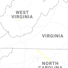
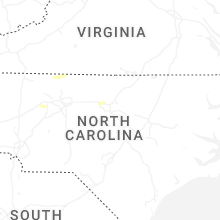
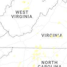


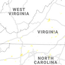


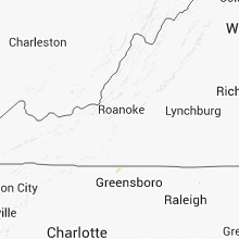


Connect with Interactive Hail Maps