

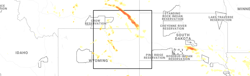
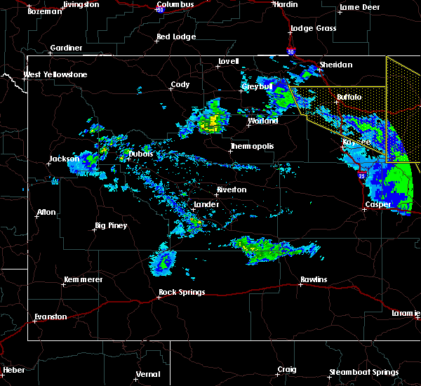
Hail Map for Story, WY
The Story, WY area has had 9 reports of on-the-ground hail by trained spotters, and has been under severe weather warnings 3 times during the past 12 months. Doppler radar has detected hail at or near Story, WY on 32 occasions, including 3 occasions during the past year.
| Name: | Story, WY |
| Where Located: | 72 miles WNW of Gillette, WY |
| Map: | Google Map for Story, WY |
| Population: | 828 |
| Housing Units: | 647 |
| More Info: | Search Google for Story, WY |
2
The Top Recent Hail Date for Story, WY is Tuesday, July 29, 2025 (12th out of 32)
Hail and Wind Damage Spotted near Story, WY
| Date / Time | Report Details |
|---|---|
| 6/7/2026 7:43 PM MDT |
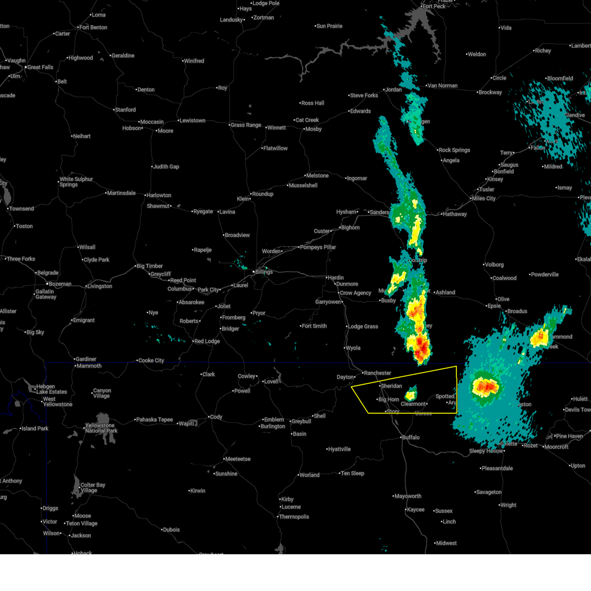
 The damaging winds which prompted the warning have weakened below severe limits, and no longer poses an immediate threat to life or property. therefore, the warning will be allowed to expire. however, gusty winds are still possible for the next half hour or so, especially across far eastern sheridan county. The damaging winds which prompted the warning have weakened below severe limits, and no longer poses an immediate threat to life or property. therefore, the warning will be allowed to expire. however, gusty winds are still possible for the next half hour or so, especially across far eastern sheridan county.
|
| 6/7/2026 7:26 PM MDT |
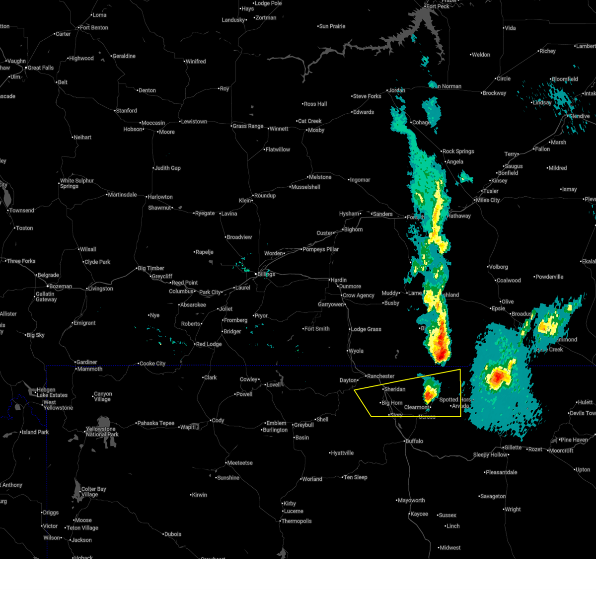
 At 726 pm mdt, severe thunderstorm winds were moving south across sheridan county at 725 pm mdt (a gust to 66 mph was reported at the sheridan airport at 653 pm mdt). Hazards include 70 mph wind gusts. Expect considerable tree damage. damage is likely to mobile homes, roofs, and outbuildings. Locations impacted include, sheridan, big horn, clearmont, leiter, banner and arvada. At 726 pm mdt, severe thunderstorm winds were moving south across sheridan county at 725 pm mdt (a gust to 66 mph was reported at the sheridan airport at 653 pm mdt). Hazards include 70 mph wind gusts. Expect considerable tree damage. damage is likely to mobile homes, roofs, and outbuildings. Locations impacted include, sheridan, big horn, clearmont, leiter, banner and arvada.
|
| 6/7/2026 7:04 PM MDT |
 Svrbyz the national weather service in billings has issued a * severe thunderstorm warning for, eastern sheridan county in north central wyoming, * until 745 pm mdt. * at 704 pm mdt, severe thunderstorm winds were moving south across sheridan county at 7 pm mdt (a gust to 66 mph was reported at the sheridan airport at 653 pm mdt. this gust came from thunderstorms along the montana and wyoming line). Hazards include 70 mph wind gusts. Expect considerable tree damage. Damage is likely to mobile homes, roofs, and outbuildings. Svrbyz the national weather service in billings has issued a * severe thunderstorm warning for, eastern sheridan county in north central wyoming, * until 745 pm mdt. * at 704 pm mdt, severe thunderstorm winds were moving south across sheridan county at 7 pm mdt (a gust to 66 mph was reported at the sheridan airport at 653 pm mdt. this gust came from thunderstorms along the montana and wyoming line). Hazards include 70 mph wind gusts. Expect considerable tree damage. Damage is likely to mobile homes, roofs, and outbuildings.
|
| 6/7/2026 7:02 PM MDT | Mesonet station wy55 2.9 n banner (wydot in sheridan county WY, 4.9 miles SSW of Story, WY |
| 6/6/2026 7:56 PM MDT | Mesonet station dhs i-90 piney creek (dot in johnson county WY, 6.6 miles NW of Story, WY |
| 5/13/2026 6:56 PM MDT | Mesonet station wy55 2.9 n banner (wydot in sheridan county WY, 4.9 miles SSW of Story, WY |
| 7/3/2024 5:41 PM MDT |
 the severe thunderstorm warning has been cancelled and is no longer in effect the severe thunderstorm warning has been cancelled and is no longer in effect
|
| 7/3/2024 5:26 PM MDT |
 At 523 pm mdt, a severe thunderstorm was located over sheridan, moving southeast at 30 mph (radar indicated. at 5:12 pm mdt, a peak gust of 54 mph was reported at the city of sheridan airport). Hazards include 60 mph wind gusts. Expect damage to roofs, siding, and trees. Locations impacted include, sheridan, big horn, story, and banner. At 523 pm mdt, a severe thunderstorm was located over sheridan, moving southeast at 30 mph (radar indicated. at 5:12 pm mdt, a peak gust of 54 mph was reported at the city of sheridan airport). Hazards include 60 mph wind gusts. Expect damage to roofs, siding, and trees. Locations impacted include, sheridan, big horn, story, and banner.
|
| 7/3/2024 4:55 PM MDT |
 Svrbyz the national weather service in billings has issued a * severe thunderstorm warning for, central sheridan county in north central wyoming, * until 600 pm mdt. * at 454 pm mdt, a severe thunderstorm was located over ranchester, or 13 miles northwest of sheridan, moving southeast at 30 mph (radar indicated. gust to 68 mph was report at the montana state line). Hazards include 70 mph wind gusts. Expect considerable tree damage. Damage is likely to mobile homes, roofs, and outbuildings. Svrbyz the national weather service in billings has issued a * severe thunderstorm warning for, central sheridan county in north central wyoming, * until 600 pm mdt. * at 454 pm mdt, a severe thunderstorm was located over ranchester, or 13 miles northwest of sheridan, moving southeast at 30 mph (radar indicated. gust to 68 mph was report at the montana state line). Hazards include 70 mph wind gusts. Expect considerable tree damage. Damage is likely to mobile homes, roofs, and outbuildings.
|
| 6/27/2024 4:52 PM MDT |
 The storm which prompted the warning has moved out of the area. therefore, the warning will be allowed to expire. however, gusty winds are still possible with this thunderstorm. remember, a severe thunderstorm warning still remains in effect for central and northeast portions of johnson county. The storm which prompted the warning has moved out of the area. therefore, the warning will be allowed to expire. however, gusty winds are still possible with this thunderstorm. remember, a severe thunderstorm warning still remains in effect for central and northeast portions of johnson county.
|
| 6/27/2024 4:37 PM MDT |
 At 435 pm mdt, a severe thunderstorm was located near lake de smet, which is 10 miles north of buffalo, moving southeast at 20 mph (radar indicated. at 4:25 pm mdt, a 59 mph wind gust was reported at buffalo - johnson county airport). Hazards include 60 mph wind gusts. Expect damage to roofs, siding, and trees. this severe thunderstorm will remain over mainly rural areas of north central johnson county, including the following locations, buffalo johnson county airport and johnson county fairgrounds. this includes the following highways, interstate 25 between mile markers 296 and 299. Interstate 90 between mile markers 42 and 60. At 435 pm mdt, a severe thunderstorm was located near lake de smet, which is 10 miles north of buffalo, moving southeast at 20 mph (radar indicated. at 4:25 pm mdt, a 59 mph wind gust was reported at buffalo - johnson county airport). Hazards include 60 mph wind gusts. Expect damage to roofs, siding, and trees. this severe thunderstorm will remain over mainly rural areas of north central johnson county, including the following locations, buffalo johnson county airport and johnson county fairgrounds. this includes the following highways, interstate 25 between mile markers 296 and 299. Interstate 90 between mile markers 42 and 60.
|
| 6/27/2024 4:15 PM MDT |
 Svrriw the national weather service in riverton has issued a * severe thunderstorm warning for, north central johnson county in north central wyoming, * until 500 pm mdt. * at 415 pm mdt, a severe thunderstorm was located over fort phil kearny historical site, which is 13 miles north of buffalo, moving southeast at 30 mph (radar indicated). Hazards include 60 mph wind gusts. Expect damage to roofs, siding, and trees. this severe thunderstorm will be near, lake de smet around 420 pm mdt. this includes the following highways, interstate 25 between mile markers 296 and 299. Interstate 90 between mile markers 42 and 60. Svrriw the national weather service in riverton has issued a * severe thunderstorm warning for, north central johnson county in north central wyoming, * until 500 pm mdt. * at 415 pm mdt, a severe thunderstorm was located over fort phil kearny historical site, which is 13 miles north of buffalo, moving southeast at 30 mph (radar indicated). Hazards include 60 mph wind gusts. Expect damage to roofs, siding, and trees. this severe thunderstorm will be near, lake de smet around 420 pm mdt. this includes the following highways, interstate 25 between mile markers 296 and 299. Interstate 90 between mile markers 42 and 60.
|
| 6/27/2024 4:09 PM MDT |
 At 407 pm mdt, severe thunderstorms were located along a line extending from 22 miles northeast of sheridan to 9 miles northeast of lake de smet, moving east at 45 mph (mesonet and spotter reports. wind gusts to 60 mph along with tree and power line damage have been reported with these storms). Hazards include 60 mph wind gusts. Expect damage to roofs, siding, and trees. locations impacted include, clearmont, leiter, arvada, story, banner, and ucross. Storms have generally moved east of i-90. At 407 pm mdt, severe thunderstorms were located along a line extending from 22 miles northeast of sheridan to 9 miles northeast of lake de smet, moving east at 45 mph (mesonet and spotter reports. wind gusts to 60 mph along with tree and power line damage have been reported with these storms). Hazards include 60 mph wind gusts. Expect damage to roofs, siding, and trees. locations impacted include, clearmont, leiter, arvada, story, banner, and ucross. Storms have generally moved east of i-90.
|
| 6/27/2024 3:54 PM MDT |
 Svrbyz the national weather service in billings has issued a * severe thunderstorm warning for, eastern sheridan county in north central wyoming, * until 500 pm mdt. * at 353 pm mdt, severe thunderstorms were located along a line extending from 15 miles northeast of sheridan to near fort phil kearny historical site, moving east at 45 mph (radar indicated). Hazards include 65 mph wind gusts. expect damage to roofs, siding, and trees Svrbyz the national weather service in billings has issued a * severe thunderstorm warning for, eastern sheridan county in north central wyoming, * until 500 pm mdt. * at 353 pm mdt, severe thunderstorms were located along a line extending from 15 miles northeast of sheridan to near fort phil kearny historical site, moving east at 45 mph (radar indicated). Hazards include 65 mph wind gusts. expect damage to roofs, siding, and trees
|
| 7/6/2023 3:56 PM MDT |
 The severe thunderstorm warning for south central sheridan county will expire at 400 pm mdt, the storm which prompted the warning has weakened below severe limits, and no longer poses an immediate threat to life or property. therefore, the warning will be allowed to expire. however small hail, gusty winds and heavy rain are still possible with this thunderstorm as it tracks east of story. a severe thunderstorm watch remains in effect until 900 pm mdt for north central wyoming. The severe thunderstorm warning for south central sheridan county will expire at 400 pm mdt, the storm which prompted the warning has weakened below severe limits, and no longer poses an immediate threat to life or property. therefore, the warning will be allowed to expire. however small hail, gusty winds and heavy rain are still possible with this thunderstorm as it tracks east of story. a severe thunderstorm watch remains in effect until 900 pm mdt for north central wyoming.
|
| 7/6/2023 3:38 PM MDT |
 At 337 pm mdt, a severe thunderstorm was located 8 miles north of fort phil kearny historical site, or 11 miles southeast of sheridan, moving southeast at 10 mph (trained weather spotters reported quarter size hail earlier in big horn). Hazards include 60 mph wind gusts and quarter size hail, along with very heavy rain. Hail damage to vehicles is expected. expect wind damage to roofs, siding, and trees. locations impacted include, story and banner. hail threat, radar indicated max hail size, 1. 00 in wind threat, radar indicated max wind gust, 60 mph. At 337 pm mdt, a severe thunderstorm was located 8 miles north of fort phil kearny historical site, or 11 miles southeast of sheridan, moving southeast at 10 mph (trained weather spotters reported quarter size hail earlier in big horn). Hazards include 60 mph wind gusts and quarter size hail, along with very heavy rain. Hail damage to vehicles is expected. expect wind damage to roofs, siding, and trees. locations impacted include, story and banner. hail threat, radar indicated max hail size, 1. 00 in wind threat, radar indicated max wind gust, 60 mph.
|
| 7/6/2023 3:37 PM MDT | Golf Ball sized hail reported 1.2 miles E of Story, WY |
| 7/6/2023 3:32 PM MDT | Half Dollar sized hail reported 1.3 miles ENE of Story, WY, mainly pea to nickel with a few half dollar |
| 7/6/2023 3:21 PM MDT |
 At 320 pm mdt, a severe thunderstorm was located 9 miles north of fort phil kearny historical site, or 9 miles south of sheridan, moving southeast at 5 mph (trained weather spotters). Hazards include 60 mph wind gusts and quarter size hail, along with very heavy rain. Hail damage to vehicles is expected. Expect wind damage to roofs, siding, and trees. At 320 pm mdt, a severe thunderstorm was located 9 miles north of fort phil kearny historical site, or 9 miles south of sheridan, moving southeast at 5 mph (trained weather spotters). Hazards include 60 mph wind gusts and quarter size hail, along with very heavy rain. Hail damage to vehicles is expected. Expect wind damage to roofs, siding, and trees.
|
| 7/15/2022 6:39 PM MDT |
 The severe thunderstorm warning for southeastern big horn, southwestern custer, western powder river, rosebud and central sheridan counties will expire at 645 pm mdt, the outflow which prompted the warning have weakened below severe limits, and no longer pose an immediate threat to life or property. therefore, the warning will be allowed to expire. however gusty winds up to 55 mph are still possible with this outflow. a severe thunderstorm watch remains in effect until 900 pm mdt for south central and southeastern montana. The severe thunderstorm warning for southeastern big horn, southwestern custer, western powder river, rosebud and central sheridan counties will expire at 645 pm mdt, the outflow which prompted the warning have weakened below severe limits, and no longer pose an immediate threat to life or property. therefore, the warning will be allowed to expire. however gusty winds up to 55 mph are still possible with this outflow. a severe thunderstorm watch remains in effect until 900 pm mdt for south central and southeastern montana.
|
| 7/15/2022 6:21 PM MDT |
 At 619 pm mdt, severe thunderstorms were located along a line extending from near hillside to 19 miles northwest of miles city to near ashland to 33 miles south of lame deer to 9 miles south of sheridan, moving east at 35 mph (weather station. at 601 pm there sheridan airport report a 59 mph wind gust). Hazards include 60 mph wind gusts. Expect damage to roofs, siding, and trees. locations impacted include, sheridan, ashland, big horn, rosebud, birney, banner, cartersville, birney village, hathaway, otter, brandenberg, moon creek ranch, story and northern cheyenne indian reservation. hail threat, radar indicated max hail size, <. 75 in wind threat, observed max wind gust, 60 mph. At 619 pm mdt, severe thunderstorms were located along a line extending from near hillside to 19 miles northwest of miles city to near ashland to 33 miles south of lame deer to 9 miles south of sheridan, moving east at 35 mph (weather station. at 601 pm there sheridan airport report a 59 mph wind gust). Hazards include 60 mph wind gusts. Expect damage to roofs, siding, and trees. locations impacted include, sheridan, ashland, big horn, rosebud, birney, banner, cartersville, birney village, hathaway, otter, brandenberg, moon creek ranch, story and northern cheyenne indian reservation. hail threat, radar indicated max hail size, <. 75 in wind threat, observed max wind gust, 60 mph.
|
| 7/15/2022 6:16 PM MDT | Storm damage reported in sheridan county WY, 4.9 miles SSW of Story, WY |
| 7/15/2022 5:43 PM MDT |
 At 543 pm mdt, severe thunderstorms were located along a line extending from 19 miles south of sand springs to 21 miles northwest of forsyth to 6 miles northwest of lame deer to 7 miles east of busby to near ranchester, moving east at 20 mph (weather station. between 500 pm and 530 pm reports of 55 to 65 mph winds have been reported by weather station. these outflow winds have a history of damage). Hazards include 70 mph wind gusts. Expect considerable tree damage. Damage is likely to mobile homes, roofs, and outbuildings. At 543 pm mdt, severe thunderstorms were located along a line extending from 19 miles south of sand springs to 21 miles northwest of forsyth to 6 miles northwest of lame deer to 7 miles east of busby to near ranchester, moving east at 20 mph (weather station. between 500 pm and 530 pm reports of 55 to 65 mph winds have been reported by weather station. these outflow winds have a history of damage). Hazards include 70 mph wind gusts. Expect considerable tree damage. Damage is likely to mobile homes, roofs, and outbuildings.
|
| 7/15/2022 5:18 PM MDT |
 At 517 pm mdt, severe thunderstorms were located along a line extending from 13 miles northwest of colstrip to 12 miles north of ranchester, moving east at 40 mph (weather station. at 430 pm, 64 mph wind gust was reported 5 miles north of hardin from the hardin n mda weather station). Hazards include 70 mph wind gusts. Expect considerable tree damage. damage is likely to mobile homes, roofs, and outbuildings. locations impacted include, sheridan, colstrip, ranchester, dayton, lame deer, busby, ashland, big horn, birney, wyola, parkman, tongue river reservoir, banner, birney village, brandenberg, kirby, muddy cluster, rosebud battlefield park, story and northern cheyenne indian reservation. thunderstorm damage threat, considerable hail threat, radar indicated max hail size, <. 75 in wind threat, observed max wind gust, 70 mph. At 517 pm mdt, severe thunderstorms were located along a line extending from 13 miles northwest of colstrip to 12 miles north of ranchester, moving east at 40 mph (weather station. at 430 pm, 64 mph wind gust was reported 5 miles north of hardin from the hardin n mda weather station). Hazards include 70 mph wind gusts. Expect considerable tree damage. damage is likely to mobile homes, roofs, and outbuildings. locations impacted include, sheridan, colstrip, ranchester, dayton, lame deer, busby, ashland, big horn, birney, wyola, parkman, tongue river reservoir, banner, birney village, brandenberg, kirby, muddy cluster, rosebud battlefield park, story and northern cheyenne indian reservation. thunderstorm damage threat, considerable hail threat, radar indicated max hail size, <. 75 in wind threat, observed max wind gust, 70 mph.
|
| 7/15/2022 4:55 PM MDT |
 At 452 pm mdt, a gust front ahead of strong thunderstorms was located along a line extending from 19 miles south of hysham to 14 miles southwest of lodge grass, moving east at 40 mph (weather station. at 430 pm, 64 mph wind gust was reported 5 miles north of hardin from the hardin n mda weather station). Hazards include 70 mph wind gusts. Expect considerable tree damage. Damage is likely to mobile homes, roofs, and outbuildings. At 452 pm mdt, a gust front ahead of strong thunderstorms was located along a line extending from 19 miles south of hysham to 14 miles southwest of lodge grass, moving east at 40 mph (weather station. at 430 pm, 64 mph wind gust was reported 5 miles north of hardin from the hardin n mda weather station). Hazards include 70 mph wind gusts. Expect considerable tree damage. Damage is likely to mobile homes, roofs, and outbuildings.
|
| 6/29/2022 12:48 AM MDT | Storm damage reported in sheridan county WY, 4.9 miles SSW of Story, WY |
| 6/20/2022 2:55 PM MDT |
 At 254 pm mdt, severe thunderstorms were located along a line extending from 10 miles northeast of ranchester to near sheridan to near fort phil kearny historical site, moving east at 20 mph (trained weather spotters in dayton reported hail up to quarter size with these storms). Hazards include 60 mph wind gusts and quarter size hail. Hail damage to vehicles is expected. expect wind damage to roofs, siding, and trees. locations impacted include, sheridan, big horn, story and banner. hail threat, observed max hail size, 1. 00 in wind threat, radar indicated max wind gust, 60 mph. At 254 pm mdt, severe thunderstorms were located along a line extending from 10 miles northeast of ranchester to near sheridan to near fort phil kearny historical site, moving east at 20 mph (trained weather spotters in dayton reported hail up to quarter size with these storms). Hazards include 60 mph wind gusts and quarter size hail. Hail damage to vehicles is expected. expect wind damage to roofs, siding, and trees. locations impacted include, sheridan, big horn, story and banner. hail threat, observed max hail size, 1. 00 in wind threat, radar indicated max wind gust, 60 mph.
|
| 6/20/2022 2:27 PM MDT |
 At 227 pm mdt, severe thunderstorms were located along a line extending from 6 miles northwest of dayton to 12 miles northwest of fort phil kearny historical site, moving east at 10 mph (trained weather spotters report quarter size hail in dayton with these storms). Hazards include 60 mph wind gusts and quarter size hail. Hail damage to vehicles is expected. Expect wind damage to roofs, siding, and trees. At 227 pm mdt, severe thunderstorms were located along a line extending from 6 miles northwest of dayton to 12 miles northwest of fort phil kearny historical site, moving east at 10 mph (trained weather spotters report quarter size hail in dayton with these storms). Hazards include 60 mph wind gusts and quarter size hail. Hail damage to vehicles is expected. Expect wind damage to roofs, siding, and trees.
|
| 8/8/2021 9:26 PM MDT | Storm damage reported in sheridan county WY, 4.3 miles W of Story, WY |
| 7/9/2021 5:12 PM MDT |
 At 512 pm mdt, a severe thunderstorm was located over fort phil kearny historical site, or 13 miles north of buffalo, moving east at 35 mph (trained weather spotters). Hazards include 60 mph wind gusts and quarter size hail. Hail damage to vehicles is expected. expect wind damage to roofs, siding, and trees. this severe thunderstorm will remain over mainly rural areas of north central johnson county, including the following locations, buffalo johnson county airport and johnson county fairgrounds. this includes the following highways, interstate 25 between mile markers 296 and 299. Interstate 90 between mile markers 42 and 72. At 512 pm mdt, a severe thunderstorm was located over fort phil kearny historical site, or 13 miles north of buffalo, moving east at 35 mph (trained weather spotters). Hazards include 60 mph wind gusts and quarter size hail. Hail damage to vehicles is expected. expect wind damage to roofs, siding, and trees. this severe thunderstorm will remain over mainly rural areas of north central johnson county, including the following locations, buffalo johnson county airport and johnson county fairgrounds. this includes the following highways, interstate 25 between mile markers 296 and 299. Interstate 90 between mile markers 42 and 72.
|
| 7/6/2021 9:13 PM MDT |
 At 912 pm mdt, a severe thunderstorm was located near ranchester, or 10 miles northwest of sheridan, moving southeast at 20 mph (trained weather spotters). Hazards include 60 mph wind gusts and quarter size hail. Hail damage to vehicles is expected. Expect wind damage to roofs, siding, and trees. At 912 pm mdt, a severe thunderstorm was located near ranchester, or 10 miles northwest of sheridan, moving southeast at 20 mph (trained weather spotters). Hazards include 60 mph wind gusts and quarter size hail. Hail damage to vehicles is expected. Expect wind damage to roofs, siding, and trees.
|
| 5/28/2021 7:10 PM MDT | Storm damage reported in sheridan county WY, 4.3 miles W of Story, WY |
| 5/28/2021 7:08 PM MDT | Storm damage reported in sheridan county WY, 4.3 miles W of Story, WY |
| 5/28/2021 7:06 PM MDT | Storm damage reported in sheridan county WY, 4.3 miles W of Story, WY |
| 8/6/2020 6:04 PM MDT | Storm damage reported in sheridan county WY, 4.3 miles W of Story, WY |
| 6/6/2020 5:22 PM MDT |
 At 518 pm mdt, severe thunderstorms were located along a line extending from 7 miles northwest of cloud peak to 12 miles northwest of savageton, moving north at 60 mph (radar indicated. at 5 pm the weather sensor at deadhorse reported a wind gust of 73 mph). Hazards include 60 mph wind gusts and pea size hail. Expect damage to roofs, siding, and trees. these severe storms will be near, powder river rest area around 550 pm mdt. other locations impacted by these severe thunderstorms include buffalo, south fork campground, buffalo johnson county airport, lost cabin campground and johnson county fairgrounds. this includes the following highways, interstate 25 between mile markers 266 and 299. Interstate 90 between mile markers 42 and 95. At 518 pm mdt, severe thunderstorms were located along a line extending from 7 miles northwest of cloud peak to 12 miles northwest of savageton, moving north at 60 mph (radar indicated. at 5 pm the weather sensor at deadhorse reported a wind gust of 73 mph). Hazards include 60 mph wind gusts and pea size hail. Expect damage to roofs, siding, and trees. these severe storms will be near, powder river rest area around 550 pm mdt. other locations impacted by these severe thunderstorms include buffalo, south fork campground, buffalo johnson county airport, lost cabin campground and johnson county fairgrounds. this includes the following highways, interstate 25 between mile markers 266 and 299. Interstate 90 between mile markers 42 and 95.
|
| 6/6/2020 5:02 PM MDT |
 At 459 pm mdt, severe thunderstorms were located along a line extending from 7 miles southwest of cloud peak to 6 miles northwest of pumpkin buttes, moving north at 35 mph (radar indicated. at 446 pm a wind gust of 57 mph was reported at the johnson county airport near buffalo). Hazards include 60 to 70 mph wind gusts and pea size hail. Expect damage to roofs, siding, and trees. severe thunderstorms will be near, cloud peak around 510 pm mdt. powder river rest area around 545 pm mdt. other locations impacted by these severe thunderstorms include buffalo, south fork campground, buffalo johnson county airport, lost cabin campground and johnson county fairgrounds. this includes the following highways, interstate 25 between mile markers 266 and 299. Interstate 90 between mile markers 42 and 95. At 459 pm mdt, severe thunderstorms were located along a line extending from 7 miles southwest of cloud peak to 6 miles northwest of pumpkin buttes, moving north at 35 mph (radar indicated. at 446 pm a wind gust of 57 mph was reported at the johnson county airport near buffalo). Hazards include 60 to 70 mph wind gusts and pea size hail. Expect damage to roofs, siding, and trees. severe thunderstorms will be near, cloud peak around 510 pm mdt. powder river rest area around 545 pm mdt. other locations impacted by these severe thunderstorms include buffalo, south fork campground, buffalo johnson county airport, lost cabin campground and johnson county fairgrounds. this includes the following highways, interstate 25 between mile markers 266 and 299. Interstate 90 between mile markers 42 and 95.
|
| 7/15/2019 5:53 PM MDT |
 The severe thunderstorm warning for north central johnson county will expire at 600 pm mdt, the storm which prompted the warning has weakened below severe limits, and no longer poses an immediate threat to life or property. therefore, the warning will be allowed to expire. however gusty winds are still possible with this thunderstorm. a severe thunderstorm watch remains in effect until 1000 pm mdt for north central wyoming. The severe thunderstorm warning for north central johnson county will expire at 600 pm mdt, the storm which prompted the warning has weakened below severe limits, and no longer poses an immediate threat to life or property. therefore, the warning will be allowed to expire. however gusty winds are still possible with this thunderstorm. a severe thunderstorm watch remains in effect until 1000 pm mdt for north central wyoming.
|
| 7/15/2019 5:38 PM MDT |
 At 537 pm mdt, a severe thunderstorm was located near fort phil kearny historical site, which is 14 miles south of sheridan, moving southeast at 20 mph (radar indicated). Hazards include quarter size hail. Damage to vehicles is expected. this severe storm will be near, fort phil kearny historical site around 550 pm mdt. lake de smet around 600 pm mdt. This storm will cross i-90 near the johnson-sheridan county line. At 537 pm mdt, a severe thunderstorm was located near fort phil kearny historical site, which is 14 miles south of sheridan, moving southeast at 20 mph (radar indicated). Hazards include quarter size hail. Damage to vehicles is expected. this severe storm will be near, fort phil kearny historical site around 550 pm mdt. lake de smet around 600 pm mdt. This storm will cross i-90 near the johnson-sheridan county line.
|
| 7/15/2019 5:19 PM MDT |
 At 518 pm mdt, a severe thunderstorm was located 10 miles northwest of fort phil kearny historical site, which is 12 miles south of sheridan, moving southeast at 25 mph (radar indicated). Hazards include 60 mph wind gusts and half dollar size hail. Hail damage to vehicles is expected. expect wind damage to roofs, siding, and trees. this severe thunderstorm will be near, fort phil kearny historical site and saddlestring around 545 pm mdt. lake de smet around 555 pm mdt. This includes interstate 90 between mile markers 42 and 56. At 518 pm mdt, a severe thunderstorm was located 10 miles northwest of fort phil kearny historical site, which is 12 miles south of sheridan, moving southeast at 25 mph (radar indicated). Hazards include 60 mph wind gusts and half dollar size hail. Hail damage to vehicles is expected. expect wind damage to roofs, siding, and trees. this severe thunderstorm will be near, fort phil kearny historical site and saddlestring around 545 pm mdt. lake de smet around 555 pm mdt. This includes interstate 90 between mile markers 42 and 56.
|
| 7/15/2019 5:14 PM MDT |
 At 514 pm mdt, a severe thunderstorm was located 10 miles southwest of sheridan, moving southeast at 20 mph (radar indicated). Hazards include 60 mph wind gusts and half dollar size hail. Hail damage to vehicles is expected. expect wind damage to roofs, siding, and trees. Locations impacted include, big horn, story and banner. At 514 pm mdt, a severe thunderstorm was located 10 miles southwest of sheridan, moving southeast at 20 mph (radar indicated). Hazards include 60 mph wind gusts and half dollar size hail. Hail damage to vehicles is expected. expect wind damage to roofs, siding, and trees. Locations impacted include, big horn, story and banner.
|
| 7/15/2019 4:51 PM MDT |
 At 450 pm mdt, a severe thunderstorm was located 12 miles south of dayton, or 14 miles southwest of sheridan, moving east at 20 mph (radar indicated). Hazards include 60 mph wind gusts and quarter size hail. Hail damage to vehicles is expected. Expect wind damage to roofs, siding, and trees. At 450 pm mdt, a severe thunderstorm was located 12 miles south of dayton, or 14 miles southwest of sheridan, moving east at 20 mph (radar indicated). Hazards include 60 mph wind gusts and quarter size hail. Hail damage to vehicles is expected. Expect wind damage to roofs, siding, and trees.
|
| 8/14/2018 5:09 PM MDT |
 At 449 pm mdt, a severe thunderstorm was located 13 miles southwest of sheridan, moving east at 35 mph (radar indicated). Hazards include 60 mph wind gusts and half dollar size hail. Hail damage to vehicles is expected. expect wind damage to roofs, siding, and trees. Heavy rain may cause brief low land flooding. At 449 pm mdt, a severe thunderstorm was located 13 miles southwest of sheridan, moving east at 35 mph (radar indicated). Hazards include 60 mph wind gusts and half dollar size hail. Hail damage to vehicles is expected. expect wind damage to roofs, siding, and trees. Heavy rain may cause brief low land flooding.
|
| 8/14/2018 4:50 PM MDT |
 At 449 pm mdt, a severe thunderstorm was located 13 miles southwest of sheridan, moving east at 35 mph (radar indicated). Hazards include 60 mph wind gusts and half dollar size hail. Hail damage to vehicles is expected. expect wind damage to roofs, siding, and trees. Heavy rain may cause brief low land flooding. At 449 pm mdt, a severe thunderstorm was located 13 miles southwest of sheridan, moving east at 35 mph (radar indicated). Hazards include 60 mph wind gusts and half dollar size hail. Hail damage to vehicles is expected. expect wind damage to roofs, siding, and trees. Heavy rain may cause brief low land flooding.
|
| 8/3/2018 6:41 PM MDT |
 At 640 pm mdt, a gust front from severe thunderstorms was located along a line extending from 25 miles northeast of sheridan to near fort phil kearny historical site, moving southeast at 40 mph (radar indicated). Hazards include 60 mph wind gusts. expect damage to roofs, siding, and trees At 640 pm mdt, a gust front from severe thunderstorms was located along a line extending from 25 miles northeast of sheridan to near fort phil kearny historical site, moving southeast at 40 mph (radar indicated). Hazards include 60 mph wind gusts. expect damage to roofs, siding, and trees
|
| 7/28/2018 8:25 PM MDT |
 At 824 pm mdt, a severe thunderstorm was located 9 miles northeast of sheridan, moving southeast at 40 mph. this is a very dangerous storm (trained weather spotters reported wind gusts of 75 to 80 mph just south of decker in sheridan county at 820 pm mdt). Hazards include 80 mph wind gusts. Flying debris will be dangerous to those caught without shelter. mobile homes will be heavily damaged. expect considerable damage to roofs, windows, and vehicles. extensive tree damage and power outages are likely. Locations impacted include, sheridan, ranchester, dayton and big horn. At 824 pm mdt, a severe thunderstorm was located 9 miles northeast of sheridan, moving southeast at 40 mph. this is a very dangerous storm (trained weather spotters reported wind gusts of 75 to 80 mph just south of decker in sheridan county at 820 pm mdt). Hazards include 80 mph wind gusts. Flying debris will be dangerous to those caught without shelter. mobile homes will be heavily damaged. expect considerable damage to roofs, windows, and vehicles. extensive tree damage and power outages are likely. Locations impacted include, sheridan, ranchester, dayton and big horn.
|
| 7/28/2018 8:25 PM MDT |
 At 817 pm mdt, a severe thunderstorm was located 11 miles east of ranchester, or 11 miles north of sheridan, moving southeast at 40 mph (radar indicated). Hazards include 60 mph wind gusts. Expect damage to roofs, siding, and trees. Locations impacted include, sheridan, ranchester, dayton, big horn and parkman. At 817 pm mdt, a severe thunderstorm was located 11 miles east of ranchester, or 11 miles north of sheridan, moving southeast at 40 mph (radar indicated). Hazards include 60 mph wind gusts. Expect damage to roofs, siding, and trees. Locations impacted include, sheridan, ranchester, dayton, big horn and parkman.
|
| 7/28/2018 8:18 PM MDT |
 At 817 pm mdt, a severe thunderstorm was located 11 miles east of ranchester, or 11 miles north of sheridan, moving southeast at 40 mph (radar indicated). Hazards include 60 mph wind gusts. Expect damage to roofs, siding, and trees. Locations impacted include, sheridan, ranchester, dayton, big horn and parkman. At 817 pm mdt, a severe thunderstorm was located 11 miles east of ranchester, or 11 miles north of sheridan, moving southeast at 40 mph (radar indicated). Hazards include 60 mph wind gusts. Expect damage to roofs, siding, and trees. Locations impacted include, sheridan, ranchester, dayton, big horn and parkman.
|
| 7/28/2018 7:58 PM MDT |
 At 757 pm mdt, a severe thunderstorm was located 7 miles north of ranchester, or 18 miles northwest of sheridan, moving southeast at 40 mph (radar indicated). Hazards include 70 mph wind gusts and quarter size hail. Hail damage to vehicles is expected. expect considerable tree damage. Wind damage is also likely to mobile homes, roofs, and outbuildings. At 757 pm mdt, a severe thunderstorm was located 7 miles north of ranchester, or 18 miles northwest of sheridan, moving southeast at 40 mph (radar indicated). Hazards include 70 mph wind gusts and quarter size hail. Hail damage to vehicles is expected. expect considerable tree damage. Wind damage is also likely to mobile homes, roofs, and outbuildings.
|
| 7/27/2018 7:21 PM MDT |
 At 720 pm mdt, a severe thunderstorm was located just northwest of buffalo, moving southeast at 45 mph (trained weather spotters. golf ball size hail has been reported in saddlestring). Hazards include golf ball size hail and 60 mph wind gusts. People and animals outdoors will be injured. expect hail damage to roofs, siding, windows, and vehicles. expect wind damage to roofs, siding, and trees. this severe storm will be near, buffalo around 725 pm mdt. other locations impacted by this severe thunderstorm include buffalo johnson county airport and johnson county fairgrounds. this includes the following highways, interstate 25 between mile markers 285 and 299. Interstate 90 between mile markers 42 and 70. At 720 pm mdt, a severe thunderstorm was located just northwest of buffalo, moving southeast at 45 mph (trained weather spotters. golf ball size hail has been reported in saddlestring). Hazards include golf ball size hail and 60 mph wind gusts. People and animals outdoors will be injured. expect hail damage to roofs, siding, windows, and vehicles. expect wind damage to roofs, siding, and trees. this severe storm will be near, buffalo around 725 pm mdt. other locations impacted by this severe thunderstorm include buffalo johnson county airport and johnson county fairgrounds. this includes the following highways, interstate 25 between mile markers 285 and 299. Interstate 90 between mile markers 42 and 70.
|
| 7/27/2018 7:15 PM MDT |
 At 715 pm mdt, a severe thunderstorm was located 10 miles northeast of fort phil kearny historical site, or 16 miles southeast of sheridan, moving southeast at 45 mph (trained weather spotters). Hazards include 70 mph wind gusts and quarter size hail. Hail damage to vehicles is expected. expect considerable tree damage. wind damage is also likely to mobile homes, roofs, and outbuildings. Locations impacted include, sheridan, big horn, leiter, story and banner. At 715 pm mdt, a severe thunderstorm was located 10 miles northeast of fort phil kearny historical site, or 16 miles southeast of sheridan, moving southeast at 45 mph (trained weather spotters). Hazards include 70 mph wind gusts and quarter size hail. Hail damage to vehicles is expected. expect considerable tree damage. wind damage is also likely to mobile homes, roofs, and outbuildings. Locations impacted include, sheridan, big horn, leiter, story and banner.
|
| 7/27/2018 7:01 PM MDT |
 At 642 pm mdt, a severe thunderstorm was located near dayton, or 11 miles west of sheridan, moving southeast at 35 mph (trained weather spotters). Hazards include 60 mph wind gusts and quarter size hail. Hail damage to vehicles is expected. Expect wind damage to roofs, siding, and trees. At 642 pm mdt, a severe thunderstorm was located near dayton, or 11 miles west of sheridan, moving southeast at 35 mph (trained weather spotters). Hazards include 60 mph wind gusts and quarter size hail. Hail damage to vehicles is expected. Expect wind damage to roofs, siding, and trees.
|
| 7/27/2018 7:01 PM MDT |
 The national weather service in riverton has issued a * severe thunderstorm warning for. north central johnson county in north central wyoming. until 745 pm mdt. At 701 pm mdt, a severe thunderstorm was located near saddlestring, or 17 miles northwest of buffalo, moving southeast at 40 mph. The national weather service in riverton has issued a * severe thunderstorm warning for. north central johnson county in north central wyoming. until 745 pm mdt. At 701 pm mdt, a severe thunderstorm was located near saddlestring, or 17 miles northwest of buffalo, moving southeast at 40 mph.
|
| 7/27/2018 6:43 PM MDT |
 The national weather service in billings has issued a * severe thunderstorm warning for. south central big horn county in south central montana. sheridan county in north central wyoming. until 745 pm mdt. At 642 pm mdt, a severe thunderstorm was located near dayton, or 11. The national weather service in billings has issued a * severe thunderstorm warning for. south central big horn county in south central montana. sheridan county in north central wyoming. until 745 pm mdt. At 642 pm mdt, a severe thunderstorm was located near dayton, or 11.
|
| 6/6/2018 6:57 PM MDT |
 The national weather service in billings has issued a * severe thunderstorm warning for. southeastern big horn county in south central montana. southwestern powder river county in southeastern montana. southern rosebud county in southeastern montana. Eastern sheridan county in north central wyoming. The national weather service in billings has issued a * severe thunderstorm warning for. southeastern big horn county in south central montana. southwestern powder river county in southeastern montana. southern rosebud county in southeastern montana. Eastern sheridan county in north central wyoming.
|
| 6/6/2018 6:57 PM MDT |
 At 656 pm mdt, severe thunderstorms were located along a line extending from 32 miles south of lame deer to 10 miles southeast of sheridan, moving slowly northeast at 15 mph (radar indicated). Hazards include ping pong ball size hail and 60 mph wind gusts, along with heavy rain. localized flooding is possible due to the rainfall. People and animals outdoors may be injured. expect hail damage to roofs, siding, windows, and vehicles. Wind damage to roofs, siding, and trees is possible. At 656 pm mdt, severe thunderstorms were located along a line extending from 32 miles south of lame deer to 10 miles southeast of sheridan, moving slowly northeast at 15 mph (radar indicated). Hazards include ping pong ball size hail and 60 mph wind gusts, along with heavy rain. localized flooding is possible due to the rainfall. People and animals outdoors may be injured. expect hail damage to roofs, siding, windows, and vehicles. Wind damage to roofs, siding, and trees is possible.
|
| 8/7/2016 5:34 PM MDT |
 At 534 pm mdt, a severe thunderstorm was located near sheridan, moving east at 40 mph (radar indicated). Hazards include 60 mph wind gusts and quarter size hail. Hail damage to vehicles is expected. Expect wind damage to roofs, siding, and trees. At 534 pm mdt, a severe thunderstorm was located near sheridan, moving east at 40 mph (radar indicated). Hazards include 60 mph wind gusts and quarter size hail. Hail damage to vehicles is expected. Expect wind damage to roofs, siding, and trees.
|
| 7/4/2016 5:19 PM MDT |
 At 516 pm mdt, showers and thunderstorms were moving east across sheridan county at 45 mph. these showers have a history of producing very strong winds (radar indicated). Hazards include 60 mph wind gusts. Expect damage to roofs. siding. and trees. downed power lines are also possible. Locations impacted include, sheridan, ranchester, dayton, big horn, clearmont, story, parkman and banner. At 516 pm mdt, showers and thunderstorms were moving east across sheridan county at 45 mph. these showers have a history of producing very strong winds (radar indicated). Hazards include 60 mph wind gusts. Expect damage to roofs. siding. and trees. downed power lines are also possible. Locations impacted include, sheridan, ranchester, dayton, big horn, clearmont, story, parkman and banner.
|
| 7/4/2016 4:51 PM MDT |
 At 448 pm mdt, thunderstorms were moving across the big horn mountains moving east at 45 mph. these storms have a history of producing very strong wind gusts (radar indicated). Hazards include 60 to 70 mph wind gusts. Expect damage to roofs. siding. And trees. At 448 pm mdt, thunderstorms were moving across the big horn mountains moving east at 45 mph. these storms have a history of producing very strong wind gusts (radar indicated). Hazards include 60 to 70 mph wind gusts. Expect damage to roofs. siding. And trees.
|
| 6/9/2016 5:47 PM MDT |
 At 545 pm mdt, severe wind gusts were occurring at sheridan, due to a line of thunderstorms moving east of the bighorn mountains (measured at the sheridan airport). Hazards include 60 mph wind gusts. Damage to roofs. siding. And trees is possible. At 545 pm mdt, severe wind gusts were occurring at sheridan, due to a line of thunderstorms moving east of the bighorn mountains (measured at the sheridan airport). Hazards include 60 mph wind gusts. Damage to roofs. siding. And trees is possible.
|
| 6/18/2015 10:50 PM MDT | At 1048 pm mdt, a severe thunderstorm was located 24 miles northeast of sheridan, moving east at 45 mph (radar indicated). Hazards include golf ball size hail and 70 mph wind gusts. People and animals outdoors will be injured. expect hail damage to roofs, siding, windows and vehicles. expect considerable tree damage. wind damage is also likely to mobile homes, roofs and outbuildings. Locations impacted include, sheridan, ranchester, busby, big horn, birney, birney village, rosebud battlefield park, story, ucross, tongue river reservoir, kirby, banner and northern cheyenne indian reservation. |
| 6/18/2015 10:50 PM MDT | At 1048 pm mdt, a severe thunderstorm was located 24 miles northeast of sheridan, moving east at 45 mph (radar indicated). Hazards include golf ball size hail and 70 mph wind gusts. People and animals outdoors will be injured. expect hail damage to roofs, siding, windows and vehicles. expect considerable tree damage. wind damage is also likely to mobile homes, roofs and outbuildings. Locations impacted include, sheridan, ranchester, busby, big horn, birney, birney village, rosebud battlefield park, story, ucross, tongue river reservoir, kirby, banner and northern cheyenne indian reservation. |
| 6/18/2015 10:40 PM MDT | At 1037 pm mdt, a severe thunderstorm was located 19 miles northeast of ranchester, or 24 miles north of sheridan, moving east at 45 mph (radar indicated. at 1010 pm mdt a semi trailer was blown over 4 miles south southeast of lodge grass on i-90). Hazards include 70 mph wind gusts and quarter size hail. Hail damage to vehicles is expected. expect considerable tree damage. wind damage is also likely to mobile homes, roofs and outbuildings. Locations impacted include, sheridan, ranchester, dayton, busby, big horn, birney, parkman, birney village, rosebud battlefield park, story, ucross, tongue river reservoir, kirby, banner and northern cheyenne indian reservation. |
| 6/18/2015 10:40 PM MDT | At 1037 pm mdt, a severe thunderstorm was located 19 miles northeast of ranchester, or 24 miles north of sheridan, moving east at 45 mph (radar indicated. at 1010 pm mdt a semi trailer was blown over 4 miles south southeast of lodge grass on i-90). Hazards include 70 mph wind gusts and quarter size hail. Hail damage to vehicles is expected. expect considerable tree damage. wind damage is also likely to mobile homes, roofs and outbuildings. Locations impacted include, sheridan, ranchester, dayton, busby, big horn, birney, parkman, birney village, rosebud battlefield park, story, ucross, tongue river reservoir, kirby, banner and northern cheyenne indian reservation. |
| 6/18/2015 10:20 PM MDT | At 1019 pm mdt, a severe thunderstorm was located 10 miles southeast of lodge grass, or 30 miles northwest of sheridan, moving east at 45 mph (radar indicated). Hazards include 70 mph wind gusts and quarter size hail. Hail damage to vehicles is expected. expect wind damage to roofs, siding and trees. This warning replaces the previous warning for central big horn. |
| 6/18/2015 10:20 PM MDT | At 1019 pm mdt, a severe thunderstorm was located 10 miles southeast of lodge grass, or 30 miles northwest of sheridan, moving east at 45 mph (radar indicated). Hazards include 70 mph wind gusts and quarter size hail. Hail damage to vehicles is expected. expect wind damage to roofs, siding and trees. This warning replaces the previous warning for central big horn. |
| 5/30/2015 8:26 PM MDT | The severe thunderstorm warning for eastern sheridan county will expire at 830 pm mdt, the storm which prompted the warning has weakened below severe limits, and no longer poses an immediate threat to life or property. therefore the warning will be allowed to expire. however gusty wind and heavy rain are still possible with this thunderstorm. |
| 5/30/2015 8:04 PM MDT | At 804 pm mdt, a severe thunderstorm was located near sheridan, moving southeast at 35 mph (radar indicated). Hazards include 60 mph wind gusts and quarter size hail. hail damage to vehicles is expected |
| 5/26/2013 8:28 PM MDT | Quarter sized hail reported 0.3 miles SE of Story, WY |
| 5/26/2013 4:25 PM MDT | Tennis Ball sized hail reported 3.7 miles SW of Story, WY |
| 5/26/2013 3:50 PM MDT | Golf Ball sized hail reported 0.4 miles WSW of Story, WY |
| 5/26/2013 3:37 PM MDT | Golf Ball sized hail reported 0.3 miles SE of Story, WY |
| 5/26/2013 3:09 PM MDT | Golf Ball sized hail reported 0.3 miles SE of Story, WY |
| 5/26/2013 2:53 PM MDT | Golf Ball sized hail reported 0.4 miles WSW of Story, WY |
| 1/1/0001 12:00 AM | Quarter sized hail reported 4.4 miles SW of Story, WY, 0.70 inches of rain |
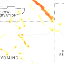
Hail Maps for Story, WY


Connect with Interactive Hail Maps