

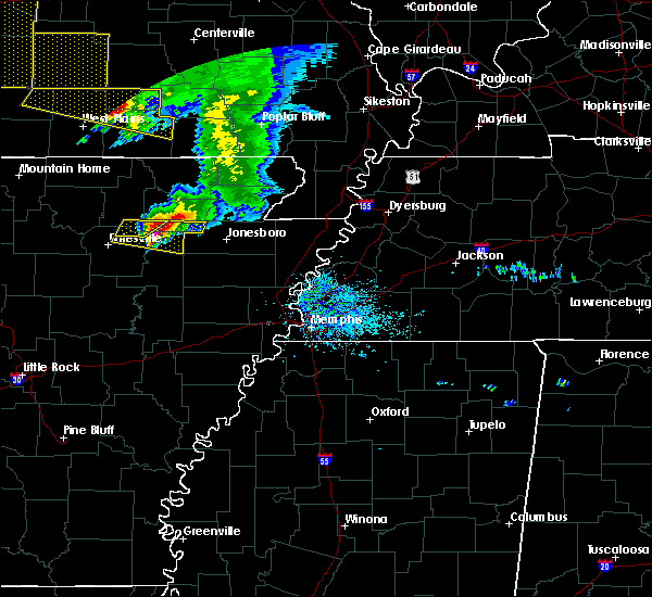
Hail Map for Strawberry, AR
The Strawberry, AR area has had 6 reports of on-the-ground hail by trained spotters, and has been under severe weather warnings 9 times during the past 12 months. Doppler radar has detected hail at or near Strawberry, AR on 57 occasions, including 3 occasions during the past year.
| Name: | Strawberry, AR |
| Where Located: | 91 miles NW of Memphis, TN |
| Map: | Google Map for Strawberry, AR |
| Population: | 302 |
| Housing Units: | 153 |
| More Info: | Search Google for Strawberry, AR |
3
The Top Recent Hail Date for Strawberry, AR is Sunday, June 25, 2023 (4th out of 57)

Hail and Wind Damage Spotted near Strawberry, AR
| Date / Time | Report Details |
|---|---|
| 8/26/2023 3:30 PM CDT |
 At 330 pm cdt, a severe thunderstorm was located near lynn, or 7 miles west of lake charles state park, moving southeast at 20 mph (radar indicated). Hazards include 60 mph wind gusts and nickel size hail. expect damage to roofs, siding, and trees At 330 pm cdt, a severe thunderstorm was located near lynn, or 7 miles west of lake charles state park, moving southeast at 20 mph (radar indicated). Hazards include 60 mph wind gusts and nickel size hail. expect damage to roofs, siding, and trees
|
| 8/9/2023 9:07 PM CDT |
 At 906 pm cdt, a severe thunderstorm was located near annieville, or near lake charles state park, moving southeast at 55 mph (radar indicated). Hazards include 70 mph wind gusts and quarter size hail. Hail damage to vehicles is possible. expect considerable tree damage. Wind damage is also likely to mobile homes, roofs, and outbuildings. At 906 pm cdt, a severe thunderstorm was located near annieville, or near lake charles state park, moving southeast at 55 mph (radar indicated). Hazards include 70 mph wind gusts and quarter size hail. Hail damage to vehicles is possible. expect considerable tree damage. Wind damage is also likely to mobile homes, roofs, and outbuildings.
|
| 7/18/2023 4:35 PM CDT |
 At 434 pm cdt, severe thunderstorms were located along a line extending from 6 miles northwest of walcott to lynn, moving southeast at 35 mph (radar indicated). Hazards include 60 mph wind gusts and quarter size hail. Hail damage to vehicles is expected. expect wind damage to roofs, siding, and trees. locations impacted include, walnut ridge, hoxie, black rock, lake charles state park, college city, portia, strawberry, lynn, alicia, minturn, sedgwick, smithville, powhatan, strangers home, whiskerville, giles spur, dicus, eaton, lauratown, clover bend, hail threat, radar indicated max hail size, 1. 00 in wind threat, radar indicated max wind gust, 60 mph. At 434 pm cdt, severe thunderstorms were located along a line extending from 6 miles northwest of walcott to lynn, moving southeast at 35 mph (radar indicated). Hazards include 60 mph wind gusts and quarter size hail. Hail damage to vehicles is expected. expect wind damage to roofs, siding, and trees. locations impacted include, walnut ridge, hoxie, black rock, lake charles state park, college city, portia, strawberry, lynn, alicia, minturn, sedgwick, smithville, powhatan, strangers home, whiskerville, giles spur, dicus, eaton, lauratown, clover bend, hail threat, radar indicated max hail size, 1. 00 in wind threat, radar indicated max wind gust, 60 mph.
|
| 7/18/2023 4:24 PM CDT |
 At 424 pm cdt, severe thunderstorms were located along a line extending from near o`kean to near strawberry, moving east at 35 mph (radar indicated). Hazards include 60 mph wind gusts and quarter size hail. Hail damage to vehicles is expected. expect wind damage to roofs, siding, and trees. locations impacted include, walnut ridge, hoxie, black rock, lake charles state park, imboden, college city, portia, strawberry, lynn, o`kean, alicia, minturn, annieville, sedgwick, smithville, powhatan, strangers home, whiskerville, giles spur, dicus, hail threat, radar indicated max hail size, 1. 00 in wind threat, radar indicated max wind gust, 60 mph. At 424 pm cdt, severe thunderstorms were located along a line extending from near o`kean to near strawberry, moving east at 35 mph (radar indicated). Hazards include 60 mph wind gusts and quarter size hail. Hail damage to vehicles is expected. expect wind damage to roofs, siding, and trees. locations impacted include, walnut ridge, hoxie, black rock, lake charles state park, imboden, college city, portia, strawberry, lynn, o`kean, alicia, minturn, annieville, sedgwick, smithville, powhatan, strangers home, whiskerville, giles spur, dicus, hail threat, radar indicated max hail size, 1. 00 in wind threat, radar indicated max wind gust, 60 mph.
|
| 7/18/2023 4:12 PM CDT |
 At 411 pm cdt, severe thunderstorms were located along a line extending from near college city to 9 miles northeast of sidney, moving east at 35 mph (radar indicated). Hazards include 60 mph wind gusts and quarter size hail. Hail damage to vehicles is expected. Expect wind damage to roofs, siding, and trees. At 411 pm cdt, severe thunderstorms were located along a line extending from near college city to 9 miles northeast of sidney, moving east at 35 mph (radar indicated). Hazards include 60 mph wind gusts and quarter size hail. Hail damage to vehicles is expected. Expect wind damage to roofs, siding, and trees.
|
| 6/25/2023 5:24 PM CDT |
 At 523 pm cdt, a severe thunderstorm was located over alicia, or 10 miles south of lake charles state park, moving east at 50 mph. this is a destructive storm for alicia and swifton (radar indicated). Hazards include three inch hail and 70 mph wind gusts. People and animals outdoors will be severely injured. expect shattered windows, extensive damage to roofs, siding, and vehicles. locations impacted include, walnut ridge, hoxie, black rock, lake charles state park, tuckerman, swifton, college city, portia, grubbs, strawberry, lynn, alicia, minturn, sedgwick, powhatan, strangers home, whiskerville, giles spur, dicus, kenyon, thunderstorm damage threat, destructive hail threat, radar indicated max hail size, 3. 00 in wind threat, radar indicated max wind gust, 70 mph. At 523 pm cdt, a severe thunderstorm was located over alicia, or 10 miles south of lake charles state park, moving east at 50 mph. this is a destructive storm for alicia and swifton (radar indicated). Hazards include three inch hail and 70 mph wind gusts. People and animals outdoors will be severely injured. expect shattered windows, extensive damage to roofs, siding, and vehicles. locations impacted include, walnut ridge, hoxie, black rock, lake charles state park, tuckerman, swifton, college city, portia, grubbs, strawberry, lynn, alicia, minturn, sedgwick, powhatan, strangers home, whiskerville, giles spur, dicus, kenyon, thunderstorm damage threat, destructive hail threat, radar indicated max hail size, 3. 00 in wind threat, radar indicated max wind gust, 70 mph.
|
| 6/25/2023 5:06 PM CDT |
 At 505 pm cdt, a severe thunderstorm was located near strawberry, or 16 miles southwest of lake charles state park, moving east at 45 mph. this is a destructive storm for strawberry, aetna, and alicia (radar indicated). Hazards include three inch hail and 70 mph wind gusts. People and animals outdoors will be severely injured. expect shattered windows, extensive damage to roofs, siding, and vehicles. locations impacted include, batesville, walnut ridge, hoxie, black rock, lake charles state park, tuckerman, newark, swifton, college city, portia, grubbs, strawberry, lynn, moorefield, alicia, minturn, sulphur rock, sedgwick, powhatan, aetna, thunderstorm damage threat, destructive hail threat, radar indicated max hail size, 3. 00 in wind threat, radar indicated max wind gust, 70 mph. At 505 pm cdt, a severe thunderstorm was located near strawberry, or 16 miles southwest of lake charles state park, moving east at 45 mph. this is a destructive storm for strawberry, aetna, and alicia (radar indicated). Hazards include three inch hail and 70 mph wind gusts. People and animals outdoors will be severely injured. expect shattered windows, extensive damage to roofs, siding, and vehicles. locations impacted include, batesville, walnut ridge, hoxie, black rock, lake charles state park, tuckerman, newark, swifton, college city, portia, grubbs, strawberry, lynn, moorefield, alicia, minturn, sulphur rock, sedgwick, powhatan, aetna, thunderstorm damage threat, destructive hail threat, radar indicated max hail size, 3. 00 in wind threat, radar indicated max wind gust, 70 mph.
|
| 6/25/2023 4:57 PM CDT |
 At 457 pm cdt, a severe thunderstorm was located near cave city, or 12 miles northeast of batesville, moving east at 50 mph. this is a destructive storm for cave city (radar indicated). Hazards include baseball size hail and 70 mph wind gusts. People and animals outdoors will be severely injured. expect shattered windows, extensive damage to roofs, siding, and vehicles. locations impacted include, batesville, walnut ridge, hoxie, black rock, lake charles state park, cave city, tuckerman, newark, swifton, college city, portia, grubbs, strawberry, lynn, magness, moorefield, alicia, minturn, southside in independence count, sulphur rock, thunderstorm damage threat, destructive hail threat, radar indicated max hail size, 2. 75 in wind threat, radar indicated max wind gust, 70 mph. At 457 pm cdt, a severe thunderstorm was located near cave city, or 12 miles northeast of batesville, moving east at 50 mph. this is a destructive storm for cave city (radar indicated). Hazards include baseball size hail and 70 mph wind gusts. People and animals outdoors will be severely injured. expect shattered windows, extensive damage to roofs, siding, and vehicles. locations impacted include, batesville, walnut ridge, hoxie, black rock, lake charles state park, cave city, tuckerman, newark, swifton, college city, portia, grubbs, strawberry, lynn, magness, moorefield, alicia, minturn, southside in independence count, sulphur rock, thunderstorm damage threat, destructive hail threat, radar indicated max hail size, 2. 75 in wind threat, radar indicated max wind gust, 70 mph.
|
| 6/25/2023 4:41 PM CDT |
 At 440 pm cdt, a severe thunderstorm was located near mount pleasant, or 9 miles north of batesville, moving east at 45 mph. this is a destructive storm for cave city (radar indicated). Hazards include baseball size hail and 70 mph wind gusts. People and animals outdoors will be severely injured. Expect shattered windows, extensive damage to roofs, siding, and vehicles. At 440 pm cdt, a severe thunderstorm was located near mount pleasant, or 9 miles north of batesville, moving east at 45 mph. this is a destructive storm for cave city (radar indicated). Hazards include baseball size hail and 70 mph wind gusts. People and animals outdoors will be severely injured. Expect shattered windows, extensive damage to roofs, siding, and vehicles.
|
| 4/15/2023 6:56 PM CDT |
 At 655 pm cdt, severe thunderstorms were located along a line extending from portia to near cash to 9 miles northwest of tupelo, moving east at 45 mph. this storm recently produced a 57 knot wind gust at the newport observation site in jackson county (radar indicated). Hazards include 60 mph wind gusts. Expect damage to roofs, siding, and trees. locations impacted include, newport, walnut ridge, hoxie, black rock, lake charles state park, tuckerman, diaz, newark, swifton, pangburn, college city, portia, grubbs, pleasant plains, strawberry, lynn, oil trough, jacksonport, magness, tupelo, hail threat, radar indicated max hail size, <. 75 in wind threat, observed max wind gust, 60 mph. At 655 pm cdt, severe thunderstorms were located along a line extending from portia to near cash to 9 miles northwest of tupelo, moving east at 45 mph. this storm recently produced a 57 knot wind gust at the newport observation site in jackson county (radar indicated). Hazards include 60 mph wind gusts. Expect damage to roofs, siding, and trees. locations impacted include, newport, walnut ridge, hoxie, black rock, lake charles state park, tuckerman, diaz, newark, swifton, pangburn, college city, portia, grubbs, pleasant plains, strawberry, lynn, oil trough, jacksonport, magness, tupelo, hail threat, radar indicated max hail size, <. 75 in wind threat, observed max wind gust, 60 mph.
|
| 4/15/2023 6:40 PM CDT |
 At 640 pm cdt, severe thunderstorms were located along a line extending from near lake charles state park to near tuckerman to 9 miles north of russell, moving east at 45 mph (radar indicated). Hazards include 60 mph wind gusts. Expect damage to roofs, siding, and trees. locations impacted include, batesville, newport, heber springs, walnut ridge, hoxie, black rock, lake charles state park, cave city, tuckerman, diaz, newark, swifton, pangburn, college city, portia, grubbs, pleasant plains, strawberry, lynn, oil trough, hail threat, radar indicated max hail size, <. 75 in wind threat, radar indicated max wind gust, 60 mph. At 640 pm cdt, severe thunderstorms were located along a line extending from near lake charles state park to near tuckerman to 9 miles north of russell, moving east at 45 mph (radar indicated). Hazards include 60 mph wind gusts. Expect damage to roofs, siding, and trees. locations impacted include, batesville, newport, heber springs, walnut ridge, hoxie, black rock, lake charles state park, cave city, tuckerman, diaz, newark, swifton, pangburn, college city, portia, grubbs, pleasant plains, strawberry, lynn, oil trough, hail threat, radar indicated max hail size, <. 75 in wind threat, radar indicated max wind gust, 60 mph.
|
| 4/15/2023 6:26 PM CDT |
 At 625 pm cdt, severe thunderstorms were located along a line extending from 7 miles northwest of strawberry to near newark to near steprock, moving east at 45 mph (radar indicated). Hazards include 60 mph wind gusts and quarter size hail. Hail damage to vehicles is expected. Expect wind damage to roofs, siding, and trees. At 625 pm cdt, severe thunderstorms were located along a line extending from 7 miles northwest of strawberry to near newark to near steprock, moving east at 45 mph (radar indicated). Hazards include 60 mph wind gusts and quarter size hail. Hail damage to vehicles is expected. Expect wind damage to roofs, siding, and trees.
|
| 4/15/2023 6:08 PM CDT |
 At 608 pm cdt, severe thunderstorms were located along a line extending from cushman to concord, moving east at 35 mph (radar indicated). Hazards include 60 mph wind gusts and quarter size hail. Hail damage to vehicles is expected. expect wind damage to roofs, siding, and trees. locations impacted include, batesville, cave city, newark, cushman, strawberry, lynn, concord, magness, moorefield, salado, southside in independence count, sulphur rock, bethesda, aetna, almond, charlotte, desha, pfeiffer, locust grove, sandtown, hail threat, radar indicated max hail size, 1. 00 in wind threat, radar indicated max wind gust, 60 mph. At 608 pm cdt, severe thunderstorms were located along a line extending from cushman to concord, moving east at 35 mph (radar indicated). Hazards include 60 mph wind gusts and quarter size hail. Hail damage to vehicles is expected. expect wind damage to roofs, siding, and trees. locations impacted include, batesville, cave city, newark, cushman, strawberry, lynn, concord, magness, moorefield, salado, southside in independence count, sulphur rock, bethesda, aetna, almond, charlotte, desha, pfeiffer, locust grove, sandtown, hail threat, radar indicated max hail size, 1. 00 in wind threat, radar indicated max wind gust, 60 mph.
|
| 4/15/2023 5:58 PM CDT |
 At 558 pm cdt, severe thunderstorms were located along a line extending from near cushman to near concord, moving east at 40 mph (radar indicated). Hazards include 60 mph wind gusts and quarter size hail. Hail damage to vehicles is expected. Expect wind damage to roofs, siding, and trees. At 558 pm cdt, severe thunderstorms were located along a line extending from near cushman to near concord, moving east at 40 mph (radar indicated). Hazards include 60 mph wind gusts and quarter size hail. Hail damage to vehicles is expected. Expect wind damage to roofs, siding, and trees.
|
| 4/5/2023 10:53 AM CDT |
 At 1052 am cdt, a severe thunderstorm was located over black rock, moving east at 55 mph (radar indicated). Hazards include 60 mph wind gusts. expect damage to roofs, siding, and trees At 1052 am cdt, a severe thunderstorm was located over black rock, moving east at 55 mph (radar indicated). Hazards include 60 mph wind gusts. expect damage to roofs, siding, and trees
|
| 11/4/2022 11:02 PM CDT |
 At 1102 pm cdt, severe thunderstorms were located along a line extending from near mountain view to near heber springs to near pickles gap, moving east at 65 mph (radar indicated). Hazards include 60 mph wind gusts. expect damage to roofs, siding, and trees At 1102 pm cdt, severe thunderstorms were located along a line extending from near mountain view to near heber springs to near pickles gap, moving east at 65 mph (radar indicated). Hazards include 60 mph wind gusts. expect damage to roofs, siding, and trees
|
| 10/15/2022 9:40 PM CDT |
 The severe thunderstorm warning for northeastern independence, northeastern jackson, southwestern lawrence and southeastern sharp counties will expire at 945 pm cdt, the storm which prompted the warning has weakened below severe limits, and no longer poses an immediate threat to life or property. therefore, the warning will be allowed to expire. however small hail is still possible with this thunderstorm. The severe thunderstorm warning for northeastern independence, northeastern jackson, southwestern lawrence and southeastern sharp counties will expire at 945 pm cdt, the storm which prompted the warning has weakened below severe limits, and no longer poses an immediate threat to life or property. therefore, the warning will be allowed to expire. however small hail is still possible with this thunderstorm.
|
| 10/15/2022 9:29 PM CDT |
 At 929 pm cdt, a severe thunderstorm was located 7 miles south of strawberry, or 16 miles southwest of lake charles state park, moving east at 30 mph (radar indicated). Hazards include quarter size hail. Damage to vehicles is expected. locations impacted include, tuckerman, strawberry, lynn, dowdy, kenyon, elgin, driftwood, cord, hail threat, radar indicated max hail size, 1. 00 in wind threat, radar indicated max wind gust, <50 mph. At 929 pm cdt, a severe thunderstorm was located 7 miles south of strawberry, or 16 miles southwest of lake charles state park, moving east at 30 mph (radar indicated). Hazards include quarter size hail. Damage to vehicles is expected. locations impacted include, tuckerman, strawberry, lynn, dowdy, kenyon, elgin, driftwood, cord, hail threat, radar indicated max hail size, 1. 00 in wind threat, radar indicated max wind gust, <50 mph.
|
| 10/15/2022 9:16 PM CDT |
 At 916 pm cdt, a severe thunderstorm was located 9 miles southwest of strawberry, or 14 miles east of batesville, moving northeast at 25 mph (radar indicated). Hazards include 60 mph wind gusts and quarter size hail. Hail damage to vehicles is expected. expect wind damage to roofs, siding, and trees. locations impacted include, tuckerman, newark, strawberry, lynn, magness, sulphur rock, aetna, charlotte, gainesboro, dowdy, kenyon, elgin, driftwood, cord, hail threat, radar indicated max hail size, 1. 00 in wind threat, radar indicated max wind gust, 60 mph. At 916 pm cdt, a severe thunderstorm was located 9 miles southwest of strawberry, or 14 miles east of batesville, moving northeast at 25 mph (radar indicated). Hazards include 60 mph wind gusts and quarter size hail. Hail damage to vehicles is expected. expect wind damage to roofs, siding, and trees. locations impacted include, tuckerman, newark, strawberry, lynn, magness, sulphur rock, aetna, charlotte, gainesboro, dowdy, kenyon, elgin, driftwood, cord, hail threat, radar indicated max hail size, 1. 00 in wind threat, radar indicated max wind gust, 60 mph.
|
| 10/15/2022 9:06 PM CDT |
 At 906 pm cdt, a severe thunderstorm was located near moorefield, or 7 miles east of batesville, moving east at 20 mph (radar indicated). Hazards include 60 mph wind gusts and quarter size hail. Hail damage to vehicles is expected. Expect wind damage to roofs, siding, and trees. At 906 pm cdt, a severe thunderstorm was located near moorefield, or 7 miles east of batesville, moving east at 20 mph (radar indicated). Hazards include 60 mph wind gusts and quarter size hail. Hail damage to vehicles is expected. Expect wind damage to roofs, siding, and trees.
|
| 10/12/2022 11:30 AM CDT | Quarter sized hail reported 4.3 miles NNW of Strawberry, AR |
| 10/12/2022 11:28 AM CDT |
 At 1127 am cdt, a severe thunderstorm was located near lynn, or 9 miles southwest of lake charles state park, moving east at 50 mph (radar indicated). Hazards include 60 mph wind gusts and quarter size hail. Hail damage to vehicles is expected. Expect wind damage to roofs, siding, and trees. At 1127 am cdt, a severe thunderstorm was located near lynn, or 9 miles southwest of lake charles state park, moving east at 50 mph (radar indicated). Hazards include 60 mph wind gusts and quarter size hail. Hail damage to vehicles is expected. Expect wind damage to roofs, siding, and trees.
|
| 10/12/2022 11:19 AM CDT |
 At 1119 am cdt, a severe thunderstorm was located near strawberry, or 16 miles southwest of lake charles state park, moving east at 50 mph (radar indicated). Hazards include quarter size hail. Damage to vehicles is expected. locations impacted include, strawberry, lynn, aetna, driftwood, dowdy, calamine, hail threat, radar indicated max hail size, 1. 00 in wind threat, radar indicated max wind gust, <50 mph. At 1119 am cdt, a severe thunderstorm was located near strawberry, or 16 miles southwest of lake charles state park, moving east at 50 mph (radar indicated). Hazards include quarter size hail. Damage to vehicles is expected. locations impacted include, strawberry, lynn, aetna, driftwood, dowdy, calamine, hail threat, radar indicated max hail size, 1. 00 in wind threat, radar indicated max wind gust, <50 mph.
|
| 10/12/2022 11:02 AM CDT |
 At 1102 am cdt, a severe thunderstorm was located near sidney, or 11 miles north of batesville, moving east at 45 mph (radar indicated). Hazards include quarter size hail. damage to vehicles is expected At 1102 am cdt, a severe thunderstorm was located near sidney, or 11 miles north of batesville, moving east at 45 mph (radar indicated). Hazards include quarter size hail. damage to vehicles is expected
|
| 7/17/2022 10:12 PM CDT |
 At 1012 pm cdt, severe thunderstorms were located along a line extending from ash flat to near sidney to near croker, moving east at 35 mph (radar indicated). Hazards include 60 mph wind gusts and penny size hail. expect damage to roofs, siding, and trees At 1012 pm cdt, severe thunderstorms were located along a line extending from ash flat to near sidney to near croker, moving east at 35 mph (radar indicated). Hazards include 60 mph wind gusts and penny size hail. expect damage to roofs, siding, and trees
|
| 5/21/2022 5:44 PM CDT |
 At 544 pm cdt, severe thunderstorms were located along a line extending from near thayer to 8 miles southeast of highland in sharp county to near cave city, moving east at 45 mph (radar indicated). Hazards include 70 mph wind gusts and quarter size hail. Hail damage to vehicles is expected. expect considerable tree damage. Wind damage is also likely to mobile homes, roofs, and outbuildings. At 544 pm cdt, severe thunderstorms were located along a line extending from near thayer to 8 miles southeast of highland in sharp county to near cave city, moving east at 45 mph (radar indicated). Hazards include 70 mph wind gusts and quarter size hail. Hail damage to vehicles is expected. expect considerable tree damage. Wind damage is also likely to mobile homes, roofs, and outbuildings.
|
| 4/21/2022 1:37 AM CDT |
 At 137 am cdt, severe thunderstorms were located along a line extending from near grubbs to near newport to jacksonport to near oil trough, moving southeast at 30 mph (radar indicated). Hazards include 60 mph wind gusts and quarter size hail. Hail damage to vehicles is expected. expect wind damage to roofs, siding, and trees. locations impacted include, batesville, newport, cave city, tuckerman, diaz, newark, swifton, cushman, grubbs, strawberry, lynn, oil trough, jacksonport, magness, moorefield, salado, southside in independence count, sulphur rock, campbell station, amagon, this includes us highway 67 between mile markers 76 and 100. hail threat, radar indicated max hail size, 1. 00 in wind threat, radar indicated max wind gust, 60 mph. At 137 am cdt, severe thunderstorms were located along a line extending from near grubbs to near newport to jacksonport to near oil trough, moving southeast at 30 mph (radar indicated). Hazards include 60 mph wind gusts and quarter size hail. Hail damage to vehicles is expected. expect wind damage to roofs, siding, and trees. locations impacted include, batesville, newport, cave city, tuckerman, diaz, newark, swifton, cushman, grubbs, strawberry, lynn, oil trough, jacksonport, magness, moorefield, salado, southside in independence count, sulphur rock, campbell station, amagon, this includes us highway 67 between mile markers 76 and 100. hail threat, radar indicated max hail size, 1. 00 in wind threat, radar indicated max wind gust, 60 mph.
|
| 4/21/2022 1:12 AM CDT |
 At 111 am cdt, severe thunderstorms were located along a line, the leading edge of which extended from 6 miles west of swifton to 9 miles northwest of tuckerman to near newark to near moorefield, moving southeast at 25 mph. another severe thunderstorm was located near cave city, also moving southeast at around 25 mph (radar indicated). Hazards include 60 mph wind gusts and quarter size hail. Hail damage to vehicles is expected. expect wind damage to roofs, siding, and trees. locations impacted include, batesville, newport, cave city, tuckerman, diaz, newark, swifton, cushman, grubbs, strawberry, lynn, oil trough, jacksonport, magness, moorefield, salado, southside in independence count, sulphur rock, campbell station, amagon, this includes us highway 67 between mile markers 76 and 100. hail threat, radar indicated max hail size, 1. 00 in wind threat, radar indicated max wind gust, 60 mph. At 111 am cdt, severe thunderstorms were located along a line, the leading edge of which extended from 6 miles west of swifton to 9 miles northwest of tuckerman to near newark to near moorefield, moving southeast at 25 mph. another severe thunderstorm was located near cave city, also moving southeast at around 25 mph (radar indicated). Hazards include 60 mph wind gusts and quarter size hail. Hail damage to vehicles is expected. expect wind damage to roofs, siding, and trees. locations impacted include, batesville, newport, cave city, tuckerman, diaz, newark, swifton, cushman, grubbs, strawberry, lynn, oil trough, jacksonport, magness, moorefield, salado, southside in independence count, sulphur rock, campbell station, amagon, this includes us highway 67 between mile markers 76 and 100. hail threat, radar indicated max hail size, 1. 00 in wind threat, radar indicated max wind gust, 60 mph.
|
| 4/21/2022 12:44 AM CDT |
 At 1244 am cdt, severe thunderstorms were located along a line extending from near strawberry to near cave city to 7 miles south of sidney to near mount pleasant, moving southeast at 35 mph (radar indicated). Hazards include 60 mph wind gusts and quarter size hail. Hail damage to vehicles is expected. Expect wind damage to roofs, siding, and trees. At 1244 am cdt, severe thunderstorms were located along a line extending from near strawberry to near cave city to 7 miles south of sidney to near mount pleasant, moving southeast at 35 mph (radar indicated). Hazards include 60 mph wind gusts and quarter size hail. Hail damage to vehicles is expected. Expect wind damage to roofs, siding, and trees.
|
| 4/6/2022 1:46 AM CDT |
 At 146 am cdt, a severe thunderstorm was located near cave city, or 8 miles north of batesville, moving east at 45 mph (radar indicated). Hazards include 60 mph wind gusts and quarter size hail. Hail damage to vehicles is expected. expect wind damage to roofs, siding, and trees. locations impacted include, batesville, cave city, strawberry, lynn, sidney, aetna, maxville, charlotte, gainesboro, calamine, pfeiffer, dowdy, driftwood, sandtown, cord, hail threat, radar indicated max hail size, 1. 00 in wind threat, radar indicated max wind gust, 60 mph. At 146 am cdt, a severe thunderstorm was located near cave city, or 8 miles north of batesville, moving east at 45 mph (radar indicated). Hazards include 60 mph wind gusts and quarter size hail. Hail damage to vehicles is expected. expect wind damage to roofs, siding, and trees. locations impacted include, batesville, cave city, strawberry, lynn, sidney, aetna, maxville, charlotte, gainesboro, calamine, pfeiffer, dowdy, driftwood, sandtown, cord, hail threat, radar indicated max hail size, 1. 00 in wind threat, radar indicated max wind gust, 60 mph.
|
| 4/6/2022 1:33 AM CDT |
 At 133 am cdt, a severe thunderstorm was located over cushman, or 12 miles northwest of batesville, moving east at 45 mph (radar indicated). Hazards include 60 mph wind gusts and quarter size hail. Hail damage to vehicles is expected. Expect wind damage to roofs, siding, and trees. At 133 am cdt, a severe thunderstorm was located over cushman, or 12 miles northwest of batesville, moving east at 45 mph (radar indicated). Hazards include 60 mph wind gusts and quarter size hail. Hail damage to vehicles is expected. Expect wind damage to roofs, siding, and trees.
|
| 7/31/2021 10:35 PM CDT |
 At 1034 pm cdt, a severe thunderstorm was located 8 miles west of annieville, or 13 miles west of lake charles state park, moving southeast at 35 mph (radar indicated). Hazards include 60 mph wind gusts. Expect damage to roofs, siding, and trees. Locations impacted include, cherokee village, black rock, lake charles state park, highland in sharp county, hardy, imboden, ravenden, strawberry, lynn, annieville, smithville, williford, center, calamine, poughkeepsie, eaton, birdell, ozark acres, nelsonville, sharum,. At 1034 pm cdt, a severe thunderstorm was located 8 miles west of annieville, or 13 miles west of lake charles state park, moving southeast at 35 mph (radar indicated). Hazards include 60 mph wind gusts. Expect damage to roofs, siding, and trees. Locations impacted include, cherokee village, black rock, lake charles state park, highland in sharp county, hardy, imboden, ravenden, strawberry, lynn, annieville, smithville, williford, center, calamine, poughkeepsie, eaton, birdell, ozark acres, nelsonville, sharum,.
|
| 7/31/2021 10:10 PM CDT |
 At 1009 pm cdt, a severe thunderstorm was located over ash flat, moving southeast at 40 mph (radar indicated). Hazards include 60 mph wind gusts. expect damage to roofs, siding, and trees At 1009 pm cdt, a severe thunderstorm was located over ash flat, moving southeast at 40 mph (radar indicated). Hazards include 60 mph wind gusts. expect damage to roofs, siding, and trees
|
| 6/9/2021 7:56 PM CDT |
 The severe thunderstorm warning for north central independence, southwestern lawrence and southern sharp counties will expire at 800 pm cdt, the storms which prompted the warning have moved out of the area. therefore, the warning will be allowed to expire. however heavy rain is still possible with these thunderstorms. The severe thunderstorm warning for north central independence, southwestern lawrence and southern sharp counties will expire at 800 pm cdt, the storms which prompted the warning have moved out of the area. therefore, the warning will be allowed to expire. however heavy rain is still possible with these thunderstorms.
|
| 6/9/2021 7:40 PM CDT |
 At 740 pm cdt, severe thunderstorms were located along a line extending from 6 miles west of strawberry to 6 miles southwest of cave city, moving south at 15 mph (radar indicated). Hazards include 60 mph wind gusts and quarter size hail. Hail damage to vehicles is expected. expect wind damage to roofs, siding, and trees. Locations impacted include, cave city, strawberry, lynn, aetna, sandtown, calamine,. At 740 pm cdt, severe thunderstorms were located along a line extending from 6 miles west of strawberry to 6 miles southwest of cave city, moving south at 15 mph (radar indicated). Hazards include 60 mph wind gusts and quarter size hail. Hail damage to vehicles is expected. expect wind damage to roofs, siding, and trees. Locations impacted include, cave city, strawberry, lynn, aetna, sandtown, calamine,.
|
| 6/9/2021 7:27 PM CDT |
 At 726 pm cdt, severe thunderstorms were located along a line extending from near strawberry to near sidney, moving southeast at 15 mph (radar indicated). Hazards include 60 mph wind gusts and quarter size hail. Hail damage to vehicles is expected. Expect wind damage to roofs, siding, and trees. At 726 pm cdt, severe thunderstorms were located along a line extending from near strawberry to near sidney, moving southeast at 15 mph (radar indicated). Hazards include 60 mph wind gusts and quarter size hail. Hail damage to vehicles is expected. Expect wind damage to roofs, siding, and trees.
|
| 6/9/2021 7:24 PM CDT |
 At 724 pm cdt, severe thunderstorms were located along a line extending from 6 miles northeast of cave city to near sidney, moving south at 15 mph (radar indicated). Hazards include 60 mph wind gusts and quarter size hail. Hail damage to vehicles is expected. expect wind damage to roofs, siding, and trees. Locations impacted include, cave city, strawberry, lynn, sidney, aetna, maxville, calamine, sandtown, poughkeepsie,. At 724 pm cdt, severe thunderstorms were located along a line extending from 6 miles northeast of cave city to near sidney, moving south at 15 mph (radar indicated). Hazards include 60 mph wind gusts and quarter size hail. Hail damage to vehicles is expected. expect wind damage to roofs, siding, and trees. Locations impacted include, cave city, strawberry, lynn, sidney, aetna, maxville, calamine, sandtown, poughkeepsie,.
|
| 6/9/2021 7:13 PM CDT |
 At 712 pm cdt, severe thunderstorms were located along a line extending from 8 miles northeast of cave city to sidney, moving south at 15 mph (radar indicated). Hazards include 60 mph wind gusts and quarter size hail. Hail damage to vehicles is expected. Expect wind damage to roofs, siding, and trees. At 712 pm cdt, severe thunderstorms were located along a line extending from 8 miles northeast of cave city to sidney, moving south at 15 mph (radar indicated). Hazards include 60 mph wind gusts and quarter size hail. Hail damage to vehicles is expected. Expect wind damage to roofs, siding, and trees.
|
| 5/4/2021 1:28 AM CDT |
 At 127 am cdt, severe thunderstorms were located along a line extending from near strawberry to 8 miles east of pleasant plains, moving east at 50 mph (radar indicated). Hazards include 60 mph wind gusts and quarter size hail. Hail damage to vehicles is expected. expect wind damage to roofs, siding, and trees. Locations impacted include, batesville, newport, hoxie, cave city, tuckerman, diaz, newark, swifton, grubbs, pleasant plains, strawberry, lynn, oil trough, jacksonport, magness, moorefield, alicia, minturn, algoa, salado, this includes us highway 67 between mile markers 71 and 101, and between mile markers 109 and 120. At 127 am cdt, severe thunderstorms were located along a line extending from near strawberry to 8 miles east of pleasant plains, moving east at 50 mph (radar indicated). Hazards include 60 mph wind gusts and quarter size hail. Hail damage to vehicles is expected. expect wind damage to roofs, siding, and trees. Locations impacted include, batesville, newport, hoxie, cave city, tuckerman, diaz, newark, swifton, grubbs, pleasant plains, strawberry, lynn, oil trough, jacksonport, magness, moorefield, alicia, minturn, algoa, salado, this includes us highway 67 between mile markers 71 and 101, and between mile markers 109 and 120.
|
| 5/4/2021 1:06 AM CDT |
 At 106 am cdt, severe thunderstorms were located along a line extending from 7 miles east of cushman to near pangburn, moving east at 50 mph (radar indicated). Hazards include 60 mph wind gusts and quarter size hail. Hail damage to vehicles is expected. Expect wind damage to roofs, siding, and trees. At 106 am cdt, severe thunderstorms were located along a line extending from 7 miles east of cushman to near pangburn, moving east at 50 mph (radar indicated). Hazards include 60 mph wind gusts and quarter size hail. Hail damage to vehicles is expected. Expect wind damage to roofs, siding, and trees.
|
| 3/27/2021 8:38 PM CDT |
 The severe thunderstorm warning for northeastern independence, south central randolph, north central jackson and western lawrence counties will expire at 845 pm cdt, the storm which prompted the warning has weakened below severe limits, and no longer poses an immediate threat to life or property. therefore, the warning will be allowed to expire. however small hail and gusty winds are still possible with this thunderstorm. a tornado watch remains in effect until 1100 pm cdt for eastern arkansas. The severe thunderstorm warning for northeastern independence, south central randolph, north central jackson and western lawrence counties will expire at 845 pm cdt, the storm which prompted the warning has weakened below severe limits, and no longer poses an immediate threat to life or property. therefore, the warning will be allowed to expire. however small hail and gusty winds are still possible with this thunderstorm. a tornado watch remains in effect until 1100 pm cdt for eastern arkansas.
|
| 3/27/2021 8:13 PM CDT |
 At 813 pm cdt, a severe thunderstorm was located near tuckerman, or 12 miles north of newport, moving northeast at 45 mph (radar indicated). Hazards include 60 mph wind gusts and quarter size hail. Hail damage to vehicles is expected. Expect wind damage to roofs, siding, and trees. At 813 pm cdt, a severe thunderstorm was located near tuckerman, or 12 miles north of newport, moving northeast at 45 mph (radar indicated). Hazards include 60 mph wind gusts and quarter size hail. Hail damage to vehicles is expected. Expect wind damage to roofs, siding, and trees.
|
| 11/15/2020 12:25 AM CST |
 At 1225 am cst, a severe thunderstorm was located over mount pleasant, or 10 miles southeast of melbourne, moving east at 55 mph (radar indicated). Hazards include 60 mph wind gusts and penny size hail. expect damage to roofs, siding, and trees At 1225 am cst, a severe thunderstorm was located over mount pleasant, or 10 miles southeast of melbourne, moving east at 55 mph (radar indicated). Hazards include 60 mph wind gusts and penny size hail. expect damage to roofs, siding, and trees
|
| 8/29/2020 2:53 PM CDT | Initial report of some trees dow in lawrence county AR, 3.8 miles W of Strawberry, AR |
| 8/29/2020 2:33 PM CDT |
 At 232 pm cdt, a severe thunderstorm was located near lake charles state park, moving east at 35 mph (radar indicated). Hazards include 60 mph wind gusts and quarter size hail. Hail damage to vehicles is expected. expect wind damage to roofs, siding, and trees. Locations impacted include, black rock, lake charles state park, imboden, portia, strawberry, lynn, annieville, smithville, powhatan, aetna, calamine, poughkeepsie, eaton, nelsonville, dowdy, sitka, driftwood, powhatan historic state park, davidsonville historic state pa,. At 232 pm cdt, a severe thunderstorm was located near lake charles state park, moving east at 35 mph (radar indicated). Hazards include 60 mph wind gusts and quarter size hail. Hail damage to vehicles is expected. expect wind damage to roofs, siding, and trees. Locations impacted include, black rock, lake charles state park, imboden, portia, strawberry, lynn, annieville, smithville, powhatan, aetna, calamine, poughkeepsie, eaton, nelsonville, dowdy, sitka, driftwood, powhatan historic state park, davidsonville historic state pa,.
|
| 8/29/2020 2:15 PM CDT |
 At 215 pm cdt, a severe thunderstorm was located 8 miles southwest of annieville, or 12 miles west of lake charles state park, moving southeast at 35 mph (radar indicated). Hazards include 60 mph wind gusts and quarter size hail. Hail damage to vehicles is expected. expect wind damage to roofs, siding, and trees. Locations impacted include, black rock, lake charles state park, highland in sharp county, imboden, portia, strawberry, lynn, annieville, evening shade, smithville, powhatan, aetna, center, calamine, poughkeepsie, eaton, nelsonville, dowdy, sitka, driftwood,. At 215 pm cdt, a severe thunderstorm was located 8 miles southwest of annieville, or 12 miles west of lake charles state park, moving southeast at 35 mph (radar indicated). Hazards include 60 mph wind gusts and quarter size hail. Hail damage to vehicles is expected. expect wind damage to roofs, siding, and trees. Locations impacted include, black rock, lake charles state park, highland in sharp county, imboden, portia, strawberry, lynn, annieville, evening shade, smithville, powhatan, aetna, center, calamine, poughkeepsie, eaton, nelsonville, dowdy, sitka, driftwood,.
|
| 8/29/2020 1:56 PM CDT |
 The national weather service in little rock has issued a * severe thunderstorm warning for. northeastern independence county in north central arkansas. south central randolph county in eastern arkansas. east central izard county in north central arkansas. Southeastern fulton county in north central arkansas. The national weather service in little rock has issued a * severe thunderstorm warning for. northeastern independence county in north central arkansas. south central randolph county in eastern arkansas. east central izard county in north central arkansas. Southeastern fulton county in north central arkansas.
|
| 8/27/2020 8:52 PM CDT |
 At 852 pm cdt, a severe thunderstorm capable of producing a tornado was located over minturn, or near hoxie, moving northwest at 55 mph (radar indicated rotation). Hazards include tornado. Flying debris will be dangerous to those caught without shelter. mobile homes will be damaged or destroyed. damage to roofs, windows, and vehicles will occur. Tree damage is likely. At 852 pm cdt, a severe thunderstorm capable of producing a tornado was located over minturn, or near hoxie, moving northwest at 55 mph (radar indicated rotation). Hazards include tornado. Flying debris will be dangerous to those caught without shelter. mobile homes will be damaged or destroyed. damage to roofs, windows, and vehicles will occur. Tree damage is likely.
|
| 8/27/2020 8:33 PM CDT |
 At 833 pm cdt, a severe thunderstorm capable of producing a tornado was located near lynn, or 8 miles southwest of lake charles state park, moving northwest at 45 mph (radar indicated rotation). Hazards include tornado. Flying debris will be dangerous to those caught without shelter. mobile homes will be damaged or destroyed. damage to roofs, windows, and vehicles will occur. Tree damage is likely. At 833 pm cdt, a severe thunderstorm capable of producing a tornado was located near lynn, or 8 miles southwest of lake charles state park, moving northwest at 45 mph (radar indicated rotation). Hazards include tornado. Flying debris will be dangerous to those caught without shelter. mobile homes will be damaged or destroyed. damage to roofs, windows, and vehicles will occur. Tree damage is likely.
|
| 5/4/2020 2:24 PM CDT |
 At 224 pm cdt, a severe thunderstorm was located near swifton, or 15 miles south of lake charles state park, moving east at 50 mph (radar indicated). Hazards include 60 mph wind gusts and quarter size hail. Hail damage to vehicles is expected. expect wind damage to roofs, siding, and trees. Locations impacted include, tuckerman, swifton, strawberry, alicia, minturn, calvin, strangers home, dowdy, kenyon, driftwood, cord, elgin, this includes us highway 67 between mile markers 96 and 100, and between mile markers 109 and 114. At 224 pm cdt, a severe thunderstorm was located near swifton, or 15 miles south of lake charles state park, moving east at 50 mph (radar indicated). Hazards include 60 mph wind gusts and quarter size hail. Hail damage to vehicles is expected. expect wind damage to roofs, siding, and trees. Locations impacted include, tuckerman, swifton, strawberry, alicia, minturn, calvin, strangers home, dowdy, kenyon, driftwood, cord, elgin, this includes us highway 67 between mile markers 96 and 100, and between mile markers 109 and 114.
|
| 5/4/2020 2:23 PM CDT |
 At 223 pm cdt, severe thunderstorms were located along a line extending from near lynn to 7 miles northwest of tuckerman, moving east at 55 mph (public). Hazards include 60 mph wind gusts and quarter size hail. Hail damage to vehicles is expected. expect wind damage to roofs, siding, and trees. Locations impacted include, strawberry, driftwood,. At 223 pm cdt, severe thunderstorms were located along a line extending from near lynn to 7 miles northwest of tuckerman, moving east at 55 mph (public). Hazards include 60 mph wind gusts and quarter size hail. Hail damage to vehicles is expected. expect wind damage to roofs, siding, and trees. Locations impacted include, strawberry, driftwood,.
|
| 5/4/2020 2:12 PM CDT |
 At 212 pm cdt, severe thunderstorms were located along a line extending from near lake charles state park to near cave city, moving east at 55 mph. quarter size hail has been reported with this storm (public). Hazards include 60 mph wind gusts and quarter size hail. Hail damage to vehicles is expected. expect wind damage to roofs, siding, and trees. Locations impacted include, cave city, strawberry, aetna, driftwood,. At 212 pm cdt, severe thunderstorms were located along a line extending from near lake charles state park to near cave city, moving east at 55 mph. quarter size hail has been reported with this storm (public). Hazards include 60 mph wind gusts and quarter size hail. Hail damage to vehicles is expected. expect wind damage to roofs, siding, and trees. Locations impacted include, cave city, strawberry, aetna, driftwood,.
|
| 5/4/2020 2:10 PM CDT |
 At 209 pm cdt, a severe thunderstorm was located near cave city, or 14 miles northeast of batesville, moving east at 50 mph. quarter size hail has been reported with this storm (public). Hazards include 60 mph wind gusts and quarter size hail. Hail damage to vehicles is expected. Expect wind damage to roofs, siding, and trees. At 209 pm cdt, a severe thunderstorm was located near cave city, or 14 miles northeast of batesville, moving east at 50 mph. quarter size hail has been reported with this storm (public). Hazards include 60 mph wind gusts and quarter size hail. Hail damage to vehicles is expected. Expect wind damage to roofs, siding, and trees.
|
| 5/4/2020 2:06 PM CDT |
 At 204 pm cdt, severe thunderstorms were located along a line extending from near lynn to 6 miles southwest of cave city, moving east at 55 mph. hail up to the size of quarters has been reported in cave city recently (public). Hazards include 60 mph wind gusts and quarter size hail. Hail damage to vehicles is expected. expect wind damage to roofs, siding, and trees. Locations impacted include, walnut ridge, black rock, lake charles state park, cave city, college city, portia, strawberry, lynn, sidney, annieville, smithville, powhatan, aetna, maxville, calamine, poughkeepsie, eaton, nelsonville, driftwood, sandtown,. At 204 pm cdt, severe thunderstorms were located along a line extending from near lynn to 6 miles southwest of cave city, moving east at 55 mph. hail up to the size of quarters has been reported in cave city recently (public). Hazards include 60 mph wind gusts and quarter size hail. Hail damage to vehicles is expected. expect wind damage to roofs, siding, and trees. Locations impacted include, walnut ridge, black rock, lake charles state park, cave city, college city, portia, strawberry, lynn, sidney, annieville, smithville, powhatan, aetna, maxville, calamine, poughkeepsie, eaton, nelsonville, driftwood, sandtown,.
|
| 5/4/2020 2:00 PM CDT |
 At 200 pm cdt, severe thunderstorms were located along a line extending from near lynn to 7 miles southwest of cave city, moving east at 55 mph (radar indicated). Hazards include 60 mph wind gusts and quarter size hail. Hail damage to vehicles is expected. expect wind damage to roofs, siding, and trees. Locations impacted include, walnut ridge, black rock, lake charles state park, cave city, college city, cushman, portia, strawberry, lynn, sidney, annieville, smithville, powhatan, aetna, maxville, calamine, poughkeepsie, eaton, nelsonville, driftwood,. At 200 pm cdt, severe thunderstorms were located along a line extending from near lynn to 7 miles southwest of cave city, moving east at 55 mph (radar indicated). Hazards include 60 mph wind gusts and quarter size hail. Hail damage to vehicles is expected. expect wind damage to roofs, siding, and trees. Locations impacted include, walnut ridge, black rock, lake charles state park, cave city, college city, cushman, portia, strawberry, lynn, sidney, annieville, smithville, powhatan, aetna, maxville, calamine, poughkeepsie, eaton, nelsonville, driftwood,.
|
| 5/4/2020 1:51 PM CDT |
 At 151 pm cdt, severe thunderstorms were located along a line extending from 11 miles northeast of cave city to near mount pleasant, moving east at 55 mph (radar indicated). Hazards include 60 mph wind gusts and quarter size hail. Hail damage to vehicles is expected. expect wind damage to roofs, siding, and trees. Locations impacted include, walnut ridge, black rock, lake charles state park, cave city, college city, cushman, portia, mount pleasant, strawberry, lynn, sidney, annieville, gid, stella, evening shade, smithville, powhatan, aetna, calamine, nelsonville,. At 151 pm cdt, severe thunderstorms were located along a line extending from 11 miles northeast of cave city to near mount pleasant, moving east at 55 mph (radar indicated). Hazards include 60 mph wind gusts and quarter size hail. Hail damage to vehicles is expected. expect wind damage to roofs, siding, and trees. Locations impacted include, walnut ridge, black rock, lake charles state park, cave city, college city, cushman, portia, mount pleasant, strawberry, lynn, sidney, annieville, gid, stella, evening shade, smithville, powhatan, aetna, calamine, nelsonville,.
|
| 5/4/2020 1:43 PM CDT |
 At 143 pm cdt, severe thunderstorms were located along a line extending from 10 miles southeast of ash flat to near croker, moving east at 55 mph (radar indicated). Hazards include 60 mph wind gusts and quarter size hail. Hail damage to vehicles is expected. Expect wind damage to roofs, siding, and trees. At 143 pm cdt, severe thunderstorms were located along a line extending from 10 miles southeast of ash flat to near croker, moving east at 55 mph (radar indicated). Hazards include 60 mph wind gusts and quarter size hail. Hail damage to vehicles is expected. Expect wind damage to roofs, siding, and trees.
|
| 5/3/2020 1:41 PM CDT |
 A severe thunderstorm warning remains in effect until 200 pm cdt for northeastern independence. north central jackson. southwestern lawrence and southeastern sharp counties. at 141 pm cdt, a severe thunderstorm was located over strawberry, or 11 miles southwest of lake charles state park, moving east at 50 mph. hazard. 60 mph wind gusts and quarter size hail. A severe thunderstorm warning remains in effect until 200 pm cdt for northeastern independence. north central jackson. southwestern lawrence and southeastern sharp counties. at 141 pm cdt, a severe thunderstorm was located over strawberry, or 11 miles southwest of lake charles state park, moving east at 50 mph. hazard. 60 mph wind gusts and quarter size hail.
|
| 5/3/2020 1:26 PM CDT |
 At 126 pm cdt, a severe thunderstorm was located near sidney, or 13 miles south of ash flat, moving east at 50 mph (radar indicated). Hazards include 60 mph wind gusts and quarter size hail. Hail damage to vehicles is expected. Expect wind damage to roofs, siding, and trees. At 126 pm cdt, a severe thunderstorm was located near sidney, or 13 miles south of ash flat, moving east at 50 mph (radar indicated). Hazards include 60 mph wind gusts and quarter size hail. Hail damage to vehicles is expected. Expect wind damage to roofs, siding, and trees.
|
| 4/28/2020 10:28 PM CDT |
 At 1028 pm cdt, severe thunderstorms were located along a line extending from near alicia to near southside in independence county to 8 miles southeast of concord, moving east at 50 mph (radar indicated). Hazards include 60 mph wind gusts. expect damage to roofs, siding, and trees At 1028 pm cdt, severe thunderstorms were located along a line extending from near alicia to near southside in independence county to 8 miles southeast of concord, moving east at 50 mph (radar indicated). Hazards include 60 mph wind gusts. expect damage to roofs, siding, and trees
|
| 4/8/2020 7:02 PM CDT |
 At 702 pm cdt, a severe thunderstorm was located near alicia, or 9 miles south of lake charles state park, moving southeast at 35 mph. baseball size hail is occurring with this storm! this is a very dangerous storm (trained weather spotters). Hazards include baseball size hail and 60 mph wind gusts. People and animals outdoors will be severely injured. expect shattered windows, extensive damage to roofs, siding, and vehicles. Locations impacted include, swifton, strawberry, lynn, alicia, minturn, smithville, clover bend, calvin, strangers home, driftwood, eaton, this includes us highway 67 between mile markers 98 and 100, and between mile markers 109 and 114. At 702 pm cdt, a severe thunderstorm was located near alicia, or 9 miles south of lake charles state park, moving southeast at 35 mph. baseball size hail is occurring with this storm! this is a very dangerous storm (trained weather spotters). Hazards include baseball size hail and 60 mph wind gusts. People and animals outdoors will be severely injured. expect shattered windows, extensive damage to roofs, siding, and vehicles. Locations impacted include, swifton, strawberry, lynn, alicia, minturn, smithville, clover bend, calvin, strangers home, driftwood, eaton, this includes us highway 67 between mile markers 98 and 100, and between mile markers 109 and 114.
|
| 4/8/2020 6:53 PM CDT | Quarter sized hail reported 0.2 miles SE of Strawberry, AR, report relayed by nws memphis. |
| 4/8/2020 6:51 PM CDT | Baseball sized hail reported 0.2 miles SE of Strawberry, AR, report relayed by nws memphis. |
| 4/8/2020 6:50 PM CDT |
 At 650 pm cdt, a severe thunderstorm was located over strawberry, or 10 miles southwest of lake charles state park, moving southeast at 35 mph (radar indicated). Hazards include golf ball size hail and 60 mph wind gusts. People and animals outdoors will be injured. expect hail damage to roofs, siding, windows, and vehicles. Expect wind damage to roofs, siding, and trees. At 650 pm cdt, a severe thunderstorm was located over strawberry, or 10 miles southwest of lake charles state park, moving southeast at 35 mph (radar indicated). Hazards include golf ball size hail and 60 mph wind gusts. People and animals outdoors will be injured. expect hail damage to roofs, siding, windows, and vehicles. Expect wind damage to roofs, siding, and trees.
|
| 4/8/2020 6:37 PM CDT |
 At 637 pm cdt, a severe thunderstorm was located 7 miles north of strawberry, or 12 miles west of lake charles state park, moving southeast at 35 mph (radar indicated). Hazards include 60 mph wind gusts and half dollar size hail. Hail damage to vehicles is expected. expect wind damage to roofs, siding, and trees. Locations impacted include, pocahontas, black rock, lake charles state park, imboden, ravenden, strawberry, lynn, ravenden springs, annieville, smithville, williford, powhatan, calamine, poughkeepsie, eaton, birdell, nelsonville, sharum, sitka, driftwood,. At 637 pm cdt, a severe thunderstorm was located 7 miles north of strawberry, or 12 miles west of lake charles state park, moving southeast at 35 mph (radar indicated). Hazards include 60 mph wind gusts and half dollar size hail. Hail damage to vehicles is expected. expect wind damage to roofs, siding, and trees. Locations impacted include, pocahontas, black rock, lake charles state park, imboden, ravenden, strawberry, lynn, ravenden springs, annieville, smithville, williford, powhatan, calamine, poughkeepsie, eaton, birdell, nelsonville, sharum, sitka, driftwood,.
|
| 4/8/2020 6:15 PM CDT |
 At 615 pm cdt, a severe thunderstorm was located near ash flat, moving east at 35 mph (radar indicated). Hazards include golf ball size hail and 60 mph wind gusts. People and animals outdoors will be injured. expect hail damage to roofs, siding, windows, and vehicles. Expect wind damage to roofs, siding, and trees. At 615 pm cdt, a severe thunderstorm was located near ash flat, moving east at 35 mph (radar indicated). Hazards include golf ball size hail and 60 mph wind gusts. People and animals outdoors will be injured. expect hail damage to roofs, siding, windows, and vehicles. Expect wind damage to roofs, siding, and trees.
|
| 3/28/2020 3:55 PM CDT |
 At 355 pm cdt, a severe thunderstorm was located near newark, or 10 miles northwest of newport, moving northeast at 60 mph (radar indicated). Hazards include 60 mph wind gusts and quarter size hail. Hail damage to vehicles is expected. Expect wind damage to roofs, siding, and trees. At 355 pm cdt, a severe thunderstorm was located near newark, or 10 miles northwest of newport, moving northeast at 60 mph (radar indicated). Hazards include 60 mph wind gusts and quarter size hail. Hail damage to vehicles is expected. Expect wind damage to roofs, siding, and trees.
|
| 3/19/2020 10:36 PM CDT |
 At 1035 pm cdt, a severe thunderstorm was located over lynn, or 7 miles southwest of lake charles state park, moving east at 45 mph (radar indicated). Hazards include 60 mph wind gusts and penny size hail. Expect damage to roofs, siding, and trees. Locations impacted include, walnut ridge, hoxie, black rock, lake charles state park, college city, portia, strawberry, lynn, o`kean, alicia, minturn, sedgwick, smithville, powhatan, strangers home, whiskerville, giles spur, dicus, elnora, eaton, this includes us highway 67 between mile markers 109 and 121. At 1035 pm cdt, a severe thunderstorm was located over lynn, or 7 miles southwest of lake charles state park, moving east at 45 mph (radar indicated). Hazards include 60 mph wind gusts and penny size hail. Expect damage to roofs, siding, and trees. Locations impacted include, walnut ridge, hoxie, black rock, lake charles state park, college city, portia, strawberry, lynn, o`kean, alicia, minturn, sedgwick, smithville, powhatan, strangers home, whiskerville, giles spur, dicus, elnora, eaton, this includes us highway 67 between mile markers 109 and 121.
|
| 3/19/2020 10:26 PM CDT |
 At 1026 pm cdt, a severe thunderstorm was located over strawberry, or 11 miles southwest of lake charles state park, moving east at 40 mph (radar indicated). Hazards include 60 mph wind gusts and penny size hail. expect damage to roofs, siding, and trees At 1026 pm cdt, a severe thunderstorm was located over strawberry, or 11 miles southwest of lake charles state park, moving east at 40 mph (radar indicated). Hazards include 60 mph wind gusts and penny size hail. expect damage to roofs, siding, and trees
|
| 3/12/2020 7:33 PM CDT |
 At 733 pm cdt, severe thunderstorms were located along a line extending from near croker to sidney to 8 miles west of annieville, moving east at 45 mph (radar indicated). Hazards include 60 mph wind gusts and quarter size hail. Hail damage to vehicles is expected. expect wind damage to roofs, siding, and trees. Locations impacted include, batesville, walnut ridge, mountain view, black rock, lake charles state park, cave city, imboden, college city, cushman, portia, mount pleasant, strawberry, lynn, sidney, annieville, croker, gid, herpel, stella, evening shade,. At 733 pm cdt, severe thunderstorms were located along a line extending from near croker to sidney to 8 miles west of annieville, moving east at 45 mph (radar indicated). Hazards include 60 mph wind gusts and quarter size hail. Hail damage to vehicles is expected. expect wind damage to roofs, siding, and trees. Locations impacted include, batesville, walnut ridge, mountain view, black rock, lake charles state park, cave city, imboden, college city, cushman, portia, mount pleasant, strawberry, lynn, sidney, annieville, croker, gid, herpel, stella, evening shade,.
|
| 3/12/2020 7:18 PM CDT |
 At 718 pm cdt, severe thunderstorms were located along a line extending from near mountain view to lunenburg to near sidney, moving east at 35 mph (radar indicated). Hazards include 60 mph wind gusts and quarter size hail. Hail damage to vehicles is expected. Expect wind damage to roofs, siding, and trees. At 718 pm cdt, severe thunderstorms were located along a line extending from near mountain view to lunenburg to near sidney, moving east at 35 mph (radar indicated). Hazards include 60 mph wind gusts and quarter size hail. Hail damage to vehicles is expected. Expect wind damage to roofs, siding, and trees.
|
| 3/12/2020 5:44 PM CDT |
 At 544 pm cdt, a severe thunderstorm was located near annieville, or 11 miles west of lake charles state park, moving east at 35 mph (radar indicated). Hazards include 60 mph wind gusts and quarter size hail. Hail damage to vehicles is expected. expect wind damage to roofs, siding, and trees. Locations impacted include, black rock, lake charles state park, highland in sharp county, imboden, ravenden, strawberry, lynn, annieville, smithville, williford, powhatan, center, calamine, poughkeepsie, eaton, ozark acres, nelsonville, sitka, driftwood, powhatan historic state park,. At 544 pm cdt, a severe thunderstorm was located near annieville, or 11 miles west of lake charles state park, moving east at 35 mph (radar indicated). Hazards include 60 mph wind gusts and quarter size hail. Hail damage to vehicles is expected. expect wind damage to roofs, siding, and trees. Locations impacted include, black rock, lake charles state park, highland in sharp county, imboden, ravenden, strawberry, lynn, annieville, smithville, williford, powhatan, center, calamine, poughkeepsie, eaton, ozark acres, nelsonville, sitka, driftwood, powhatan historic state park,.
|
| 3/12/2020 5:38 PM CDT |
 At 538 pm cdt, a severe thunderstorm capable of producing a tornado was located 7 miles northwest of lynn, or 11 miles west of lake charles state park, moving east at 40 mph (radar indicated rotation). Hazards include tornado and half dollar size hail. Flying debris will be dangerous to those caught without shelter. mobile homes will be damaged or destroyed. damage to roofs, windows, and vehicles will occur. tree damage is likely. Locations impacted include, walnut ridge, hoxie, black rock, lake charles state park, portia, strawberry, lynn, alicia, minturn, smithville, powhatan, strangers home, eaton, lauratown, clover bend, calvin, coffman, driftwood, arbor grove, powhatan historic state park, this includes us highway 67 between mile markers 109 and 121. At 538 pm cdt, a severe thunderstorm capable of producing a tornado was located 7 miles northwest of lynn, or 11 miles west of lake charles state park, moving east at 40 mph (radar indicated rotation). Hazards include tornado and half dollar size hail. Flying debris will be dangerous to those caught without shelter. mobile homes will be damaged or destroyed. damage to roofs, windows, and vehicles will occur. tree damage is likely. Locations impacted include, walnut ridge, hoxie, black rock, lake charles state park, portia, strawberry, lynn, alicia, minturn, smithville, powhatan, strangers home, eaton, lauratown, clover bend, calvin, coffman, driftwood, arbor grove, powhatan historic state park, this includes us highway 67 between mile markers 109 and 121.
|
| 3/12/2020 5:36 PM CDT |
 At 536 pm cdt, a severe thunderstorm was located 11 miles west of annieville, or 12 miles southeast of ash flat, moving east at 35 mph (radar indicated). Hazards include 60 mph wind gusts and half dollar size hail. Hail damage to vehicles is expected. expect wind damage to roofs, siding, and trees. Locations impacted include, cherokee village, ash flat, black rock, lake charles state park, horseshoe bend, highland in sharp county, hardy, imboden, ravenden, strawberry, lynn, franklin, ballard, annieville, myron, evening shade, smithville, williford, powhatan, agnos,. At 536 pm cdt, a severe thunderstorm was located 11 miles west of annieville, or 12 miles southeast of ash flat, moving east at 35 mph (radar indicated). Hazards include 60 mph wind gusts and half dollar size hail. Hail damage to vehicles is expected. expect wind damage to roofs, siding, and trees. Locations impacted include, cherokee village, ash flat, black rock, lake charles state park, horseshoe bend, highland in sharp county, hardy, imboden, ravenden, strawberry, lynn, franklin, ballard, annieville, myron, evening shade, smithville, williford, powhatan, agnos,.
|
| 3/12/2020 5:33 PM CDT |
 At 532 pm cdt, a severe thunderstorm was located 10 miles west of annieville, or 13 miles southeast of ash flat, moving east at 35 mph (radar indicated). Hazards include 60 mph wind gusts and half dollar size hail. Hail damage to vehicles is expected. expect wind damage to roofs, siding, and trees. Locations impacted include, cherokee village, ash flat, black rock, lake charles state park, horseshoe bend, cave city, highland in sharp county, hardy, imboden, ravenden, strawberry, lynn, franklin, sidney, ballard, annieville, myron, evening shade, smithville, williford,. At 532 pm cdt, a severe thunderstorm was located 10 miles west of annieville, or 13 miles southeast of ash flat, moving east at 35 mph (radar indicated). Hazards include 60 mph wind gusts and half dollar size hail. Hail damage to vehicles is expected. expect wind damage to roofs, siding, and trees. Locations impacted include, cherokee village, ash flat, black rock, lake charles state park, horseshoe bend, cave city, highland in sharp county, hardy, imboden, ravenden, strawberry, lynn, franklin, sidney, ballard, annieville, myron, evening shade, smithville, williford,.
|
| 3/12/2020 5:27 PM CDT |
 At 527 pm cdt, a severe thunderstorm capable of producing a tornado was located 10 miles southeast of ash flat, moving east at 35 mph (radar indicated rotation). Hazards include tornado and half dollar size hail. Flying debris will be dangerous to those caught without shelter. mobile homes will be damaged or destroyed. damage to roofs, windows, and vehicles will occur. Tree damage is likely. At 527 pm cdt, a severe thunderstorm capable of producing a tornado was located 10 miles southeast of ash flat, moving east at 35 mph (radar indicated rotation). Hazards include tornado and half dollar size hail. Flying debris will be dangerous to those caught without shelter. mobile homes will be damaged or destroyed. damage to roofs, windows, and vehicles will occur. Tree damage is likely.
|
| 3/12/2020 5:26 PM CDT |
 At 526 pm cdt, a severe thunderstorm was located 9 miles southeast of ash flat, moving east at 35 mph (radar indicated). Hazards include 60 mph wind gusts and half dollar size hail. Hail damage to vehicles is expected. Expect wind damage to roofs, siding, and trees. At 526 pm cdt, a severe thunderstorm was located 9 miles southeast of ash flat, moving east at 35 mph (radar indicated). Hazards include 60 mph wind gusts and half dollar size hail. Hail damage to vehicles is expected. Expect wind damage to roofs, siding, and trees.
|
| 1/11/2020 1:17 AM CST |
 At 116 am cst, severe thunderstorms were located along a line extending from near newark to near jacksonport to 7 miles northeast of russell to hurricane lake wma to near barrettsville, moving northeast at 25 mph (radar indicated). Hazards include 60 mph wind gusts. expect damage to roofs, siding, and trees At 116 am cst, severe thunderstorms were located along a line extending from near newark to near jacksonport to 7 miles northeast of russell to hurricane lake wma to near barrettsville, moving northeast at 25 mph (radar indicated). Hazards include 60 mph wind gusts. expect damage to roofs, siding, and trees
|
| 1/10/2020 11:30 PM CST |
 At 1130 pm cst, severe thunderstorms were located along a line extending from 11 miles northwest of dalton to near ravenden to near strawberry to near southside in independence county, moving east at 25 mph (radar indicated). Hazards include 60 mph wind gusts. expect damage to roofs, siding, and trees At 1130 pm cst, severe thunderstorms were located along a line extending from 11 miles northwest of dalton to near ravenden to near strawberry to near southside in independence county, moving east at 25 mph (radar indicated). Hazards include 60 mph wind gusts. expect damage to roofs, siding, and trees
|
| 1/10/2020 10:29 PM CST |
 At 1029 pm cst, severe thunderstorms were located along a line extending from near sturkie to near oxford to herpel to near fairfield bay, moving east at 45 mph (radar indicated). Hazards include 60 mph wind gusts. expect damage to roofs, siding, and trees At 1029 pm cst, severe thunderstorms were located along a line extending from near sturkie to near oxford to herpel to near fairfield bay, moving east at 45 mph (radar indicated). Hazards include 60 mph wind gusts. expect damage to roofs, siding, and trees
|
| 9/25/2019 5:58 PM CDT |
 At 557 pm cdt, severe thunderstorms were located along a line extending from cash to swifton to near batesville, moving east at 25 mph (radar indicated). Hazards include 60 mph wind gusts and quarter size hail. Hail damage to vehicles is expected. Expect wind damage to roofs, siding, and trees. At 557 pm cdt, severe thunderstorms were located along a line extending from cash to swifton to near batesville, moving east at 25 mph (radar indicated). Hazards include 60 mph wind gusts and quarter size hail. Hail damage to vehicles is expected. Expect wind damage to roofs, siding, and trees.
|
| 9/25/2019 5:25 PM CDT |
 At 525 pm cdt, severe thunderstorms were located along a line extending from near swifton to near strawberry to cushman, moving southeast at 30 mph (radar indicated). Hazards include 60 mph wind gusts and quarter size hail. Hail damage to vehicles is expected. expect wind damage to roofs, siding, and trees. Locations impacted include, batesville, cave city, tuckerman, newark, swifton, cushman, strawberry, moorefield, alicia, sulphur rock, aetna, charlotte, strangers home, gainesboro, pfeiffer, calvin, dowdy, kenyon, elgin, driftwood, this includes us highway 67 between mile markers 93 and 100, and between mile markers 109 and 113. At 525 pm cdt, severe thunderstorms were located along a line extending from near swifton to near strawberry to cushman, moving southeast at 30 mph (radar indicated). Hazards include 60 mph wind gusts and quarter size hail. Hail damage to vehicles is expected. expect wind damage to roofs, siding, and trees. Locations impacted include, batesville, cave city, tuckerman, newark, swifton, cushman, strawberry, moorefield, alicia, sulphur rock, aetna, charlotte, strangers home, gainesboro, pfeiffer, calvin, dowdy, kenyon, elgin, driftwood, this includes us highway 67 between mile markers 93 and 100, and between mile markers 109 and 113.
|
| 9/25/2019 5:09 PM CDT |
 At 509 pm cdt, severe thunderstorms were located along a line extending from near strawberry to cave city to near cushman, moving east at 25 mph (radar indicated). Hazards include 60 mph wind gusts and quarter size hail. Hail damage to vehicles is expected. Expect wind damage to roofs, siding, and trees. At 509 pm cdt, severe thunderstorms were located along a line extending from near strawberry to cave city to near cushman, moving east at 25 mph (radar indicated). Hazards include 60 mph wind gusts and quarter size hail. Hail damage to vehicles is expected. Expect wind damage to roofs, siding, and trees.
|
| 9/25/2019 4:53 PM CDT |
 At 453 pm cdt, severe thunderstorms were located along a line extending from hoxie to near egypt to near strawberry, moving southeast at 35 mph (radar indicated). Hazards include 70 mph wind gusts and quarter size hail. Hail damage to vehicles is expected. expect considerable tree damage. wind damage is also likely to mobile homes, roofs, and outbuildings. Locations impacted include, walnut ridge, hoxie, black rock, lake charles state park, cave city, swifton, college city, portia, strawberry, lynn, alicia, minturn, sedgwick, powhatan, aetna, strangers home, whiskerville, calamine, giles spur, dicus, this includes us highway 67 between mile markers 96 and 100, and between mile markers 109 and 121. At 453 pm cdt, severe thunderstorms were located along a line extending from hoxie to near egypt to near strawberry, moving southeast at 35 mph (radar indicated). Hazards include 70 mph wind gusts and quarter size hail. Hail damage to vehicles is expected. expect considerable tree damage. wind damage is also likely to mobile homes, roofs, and outbuildings. Locations impacted include, walnut ridge, hoxie, black rock, lake charles state park, cave city, swifton, college city, portia, strawberry, lynn, alicia, minturn, sedgwick, powhatan, aetna, strangers home, whiskerville, calamine, giles spur, dicus, this includes us highway 67 between mile markers 96 and 100, and between mile markers 109 and 121.
|
| 9/25/2019 4:38 PM CDT |
 At 438 pm cdt, severe thunderstorms were located along a line extending from near portia to near alicia to near strawberry, moving southeast at 35 mph (radar indicated). Hazards include 70 mph wind gusts and penny size hail. Expect considerable tree damage. damage is likely to mobile homes, roofs, and outbuildings. Locations impacted include, walnut ridge, hoxie, black rock, lake charles state park, cave city, swifton, college city, portia, strawberry, lynn, o`kean, alicia, minturn, sedgwick, smithville, powhatan, aetna, strangers home, whiskerville, calamine, this includes us highway 67 between mile markers 96 and 100, and between mile markers 109 and 121. At 438 pm cdt, severe thunderstorms were located along a line extending from near portia to near alicia to near strawberry, moving southeast at 35 mph (radar indicated). Hazards include 70 mph wind gusts and penny size hail. Expect considerable tree damage. damage is likely to mobile homes, roofs, and outbuildings. Locations impacted include, walnut ridge, hoxie, black rock, lake charles state park, cave city, swifton, college city, portia, strawberry, lynn, o`kean, alicia, minturn, sedgwick, smithville, powhatan, aetna, strangers home, whiskerville, calamine, this includes us highway 67 between mile markers 96 and 100, and between mile markers 109 and 121.
|
| 9/25/2019 4:26 PM CDT |
 At 426 pm cdt, severe thunderstorms were located along a line extending from near black rock to near lake charles state park to near strawberry, moving east at 30 mph (radar indicated). Hazards include 60 mph wind gusts and nickel size hail. expect damage to roofs, siding, and trees At 426 pm cdt, severe thunderstorms were located along a line extending from near black rock to near lake charles state park to near strawberry, moving east at 30 mph (radar indicated). Hazards include 60 mph wind gusts and nickel size hail. expect damage to roofs, siding, and trees
|
| 9/25/2019 4:18 PM CDT |
 At 418 pm cdt, severe thunderstorms were located along a line extending from 7 miles southeast of highland in sharp county to near sidney to near mount pleasant, moving east at 20 mph (radar indicated). Hazards include 60 mph wind gusts and quarter size hail. Hail damage to vehicles is expected. expect wind damage to roofs, siding, and trees. Locations impacted include, black rock, cave city, mount pleasant, strawberry, lynn, sidney, gid, stella, annieville, evening shade, smithville, aetna, maxville, calamine, poughkeepsie, sage, eaton, nelsonville, driftwood, sandtown,. At 418 pm cdt, severe thunderstorms were located along a line extending from 7 miles southeast of highland in sharp county to near sidney to near mount pleasant, moving east at 20 mph (radar indicated). Hazards include 60 mph wind gusts and quarter size hail. Hail damage to vehicles is expected. expect wind damage to roofs, siding, and trees. Locations impacted include, black rock, cave city, mount pleasant, strawberry, lynn, sidney, gid, stella, annieville, evening shade, smithville, aetna, maxville, calamine, poughkeepsie, sage, eaton, nelsonville, driftwood, sandtown,.
|
| 9/25/2019 3:59 PM CDT |
 At 359 pm cdt, severe thunderstorms were located along a line extending from near highland in sharp county to near stella to mount pleasant, moving east at 20 mph (radar indicated). Hazards include 60 mph wind gusts and quarter size hail. Hail damage to vehicles is expected. Expect wind damage to roofs, siding, and trees. At 359 pm cdt, severe thunderstorms were located along a line extending from near highland in sharp county to near stella to mount pleasant, moving east at 20 mph (radar indicated). Hazards include 60 mph wind gusts and quarter size hail. Hail damage to vehicles is expected. Expect wind damage to roofs, siding, and trees.
|
| 8/27/2019 2:22 AM CDT |
 At 221 am cdt, severe thunderstorms were located along a line extending from near walcott to 6 miles southeast of strawberry to near cushman, moving southeast at 45 mph (radar indicated). Hazards include 60 mph wind gusts. Expect damage to roofs, siding, and trees. Locations impacted include, batesville, newport, walnut ridge, hoxie, melbourne, ash flat, black rock, lake charles state park, horseshoe bend, cave city, tuckerman, diaz, newark, highland in sharp county, swifton, imboden, oxford, college city, cushman, portia, this includes us highway 67 between mile markers 81 and 101, and between mile markers 109 and 121. At 221 am cdt, severe thunderstorms were located along a line extending from near walcott to 6 miles southeast of strawberry to near cushman, moving southeast at 45 mph (radar indicated). Hazards include 60 mph wind gusts. Expect damage to roofs, siding, and trees. Locations impacted include, batesville, newport, walnut ridge, hoxie, melbourne, ash flat, black rock, lake charles state park, horseshoe bend, cave city, tuckerman, diaz, newark, highland in sharp county, swifton, imboden, oxford, college city, cushman, portia, this includes us highway 67 between mile markers 81 and 101, and between mile markers 109 and 121.
|
| 8/27/2019 1:55 AM CDT |
 At 155 am cdt, severe thunderstorms were located along a line extending from near pocahontas to 8 miles north of cave city to lacrosse, moving southeast at 50 mph (radar indicated). Hazards include 60 mph wind gusts. expect damage to roofs, siding, and trees At 155 am cdt, severe thunderstorms were located along a line extending from near pocahontas to 8 miles north of cave city to lacrosse, moving southeast at 50 mph (radar indicated). Hazards include 60 mph wind gusts. expect damage to roofs, siding, and trees
|
| 6/23/2019 2:18 PM CDT |
 At 218 pm cdt, severe thunderstorms were located along a line extending from near lynn to near oil trough, moving southeast at 55 mph (radar indicated). Hazards include 60 mph wind gusts and quarter size hail. Hail damage to vehicles is expected. Expect wind damage to roofs, siding, and trees. At 218 pm cdt, severe thunderstorms were located along a line extending from near lynn to near oil trough, moving southeast at 55 mph (radar indicated). Hazards include 60 mph wind gusts and quarter size hail. Hail damage to vehicles is expected. Expect wind damage to roofs, siding, and trees.
|
| 5/29/2019 5:56 AM CDT |
 At 556 am cdt, severe thunderstorms were located along a line extending from mount pleasant to near pangburn, moving east at 45 mph (radar indicated). Hazards include 60 mph wind gusts and quarter size hail. Hail damage to vehicles is expected. Expect wind damage to roofs, siding, and trees. At 556 am cdt, severe thunderstorms were located along a line extending from mount pleasant to near pangburn, moving east at 45 mph (radar indicated). Hazards include 60 mph wind gusts and quarter size hail. Hail damage to vehicles is expected. Expect wind damage to roofs, siding, and trees.
|
| 12/1/2018 2:19 AM CST |
 At 217 am cst, severe thunderstorms were located along a line extending from 8 miles northwest of dalton to near ravenden springs to annieville to 8 miles southwest of strawberry, moving east at 50 mph (radar indicated). Hazards include 70 mph wind gusts. Expect considerable tree damage. damage is likely to mobile homes, roofs, and outbuildings. locations impacted include, pocahontas, walnut ridge, hoxie, black rock, lake charles state park, swifton, imboden, ravenden, reyno, college city, portia, maynard, biggers, strawberry, lynn, o`kean, moorefield, alicia, ravenden springs, minturn, this includes us highway 67 between mile markers 109 and 121. A tornado watch remains in effect until 800 am cst for eastern and north central arkansas. At 217 am cst, severe thunderstorms were located along a line extending from 8 miles northwest of dalton to near ravenden springs to annieville to 8 miles southwest of strawberry, moving east at 50 mph (radar indicated). Hazards include 70 mph wind gusts. Expect considerable tree damage. damage is likely to mobile homes, roofs, and outbuildings. locations impacted include, pocahontas, walnut ridge, hoxie, black rock, lake charles state park, swifton, imboden, ravenden, reyno, college city, portia, maynard, biggers, strawberry, lynn, o`kean, moorefield, alicia, ravenden springs, minturn, this includes us highway 67 between mile markers 109 and 121. A tornado watch remains in effect until 800 am cst for eastern and north central arkansas.
|
| 12/1/2018 2:07 AM CST |
 At 207 am cst, severe thunderstorms were located along a line extending from near mammoth spring to 7 miles southeast of hardy to 7 miles west of annieville to near moorefield, moving northeast at 65 mph (radar indicated). Hazards include 60 mph wind gusts. expect damage to roofs, siding, and trees At 207 am cst, severe thunderstorms were located along a line extending from near mammoth spring to 7 miles southeast of hardy to 7 miles west of annieville to near moorefield, moving northeast at 65 mph (radar indicated). Hazards include 60 mph wind gusts. expect damage to roofs, siding, and trees
|
| 12/1/2018 1:26 AM CST |
 At 126 am cst, severe thunderstorms were located along a line extending from near bakersfield to near bexar to brandenberg to 8 miles north of greers ferry, moving east at 55 mph (radar indicated). Hazards include 60 mph wind gusts. expect damage to roofs, siding, and trees At 126 am cst, severe thunderstorms were located along a line extending from near bakersfield to near bexar to brandenberg to 8 miles north of greers ferry, moving east at 55 mph (radar indicated). Hazards include 60 mph wind gusts. expect damage to roofs, siding, and trees
|
| 6/28/2018 11:38 PM CDT |
 At 1138 pm cdt, a severe thunderstorm was located near greenfield, or near harrisburg, moving southwest at 55 mph (radar indicated). Hazards include 60 mph wind gusts. Expect damage to roofs, siding, and trees. Locations impacted include, jonesboro, paragould, trumann, walnut ridge, hoxie, marked tree, harrisburg, bono, lake city, lepanto, bay, brookland, monette, caraway, tyronza, black rock, lake charles state park, crowleys ridge state park, lake frierson state park and weiner. At 1138 pm cdt, a severe thunderstorm was located near greenfield, or near harrisburg, moving southwest at 55 mph (radar indicated). Hazards include 60 mph wind gusts. Expect damage to roofs, siding, and trees. Locations impacted include, jonesboro, paragould, trumann, walnut ridge, hoxie, marked tree, harrisburg, bono, lake city, lepanto, bay, brookland, monette, caraway, tyronza, black rock, lake charles state park, crowleys ridge state park, lake frierson state park and weiner.
|
| 6/28/2018 11:24 PM CDT |
 At 1124 pm cdt, a severe thunderstorm was located near bay, moving southwest at 55 mph (radar indicated). Hazards include 60 mph wind gusts. expect damage to roofs, siding, and trees At 1124 pm cdt, a severe thunderstorm was located near bay, moving southwest at 55 mph (radar indicated). Hazards include 60 mph wind gusts. expect damage to roofs, siding, and trees
|
| 6/24/2018 6:42 AM CDT |
 At 641 am cdt, a severe thunderstorm was located near lynn, or near lake charles state park, moving northeast at 25 mph (radar indicated). Hazards include 60 mph wind gusts. expect damage to roofs, siding, and trees At 641 am cdt, a severe thunderstorm was located near lynn, or near lake charles state park, moving northeast at 25 mph (radar indicated). Hazards include 60 mph wind gusts. expect damage to roofs, siding, and trees
|
| 5/20/2018 1:42 PM CDT |
 At 142 pm cdt, a severe thunderstorm was located over strawberry, or 13 miles southwest of lake charles state park, moving northeast at 25 mph (radar indicated). Hazards include 60 mph wind gusts and quarter size hail. Hail damage to vehicles is expected. Expect wind damage to roofs, siding, and trees. At 142 pm cdt, a severe thunderstorm was located over strawberry, or 13 miles southwest of lake charles state park, moving northeast at 25 mph (radar indicated). Hazards include 60 mph wind gusts and quarter size hail. Hail damage to vehicles is expected. Expect wind damage to roofs, siding, and trees.
|
| 5/20/2018 1:18 PM CDT |
 At 118 pm cdt, a severe thunderstorm was located over lake charles state park, moving east at 10 mph (radar indicated). Hazards include ping pong ball size hail and 60 mph wind gusts. People and animals outdoors will be injured. expect hail damage to roofs, siding, windows, and vehicles. expect wind damage to roofs, siding, and trees. Locations impacted include, walnut ridge, hoxie, black rock, lake charles state park, imboden, ravenden, college city, portia, strawberry, lynn, minturn, annieville, smithville, powhatan, eaton, lauratown, clover bend, dicus, coffman and driftwood. At 118 pm cdt, a severe thunderstorm was located over lake charles state park, moving east at 10 mph (radar indicated). Hazards include ping pong ball size hail and 60 mph wind gusts. People and animals outdoors will be injured. expect hail damage to roofs, siding, windows, and vehicles. expect wind damage to roofs, siding, and trees. Locations impacted include, walnut ridge, hoxie, black rock, lake charles state park, imboden, ravenden, college city, portia, strawberry, lynn, minturn, annieville, smithville, powhatan, eaton, lauratown, clover bend, dicus, coffman and driftwood.
|
| 5/20/2018 1:12 PM CDT |
 At 111 pm cdt, a severe thunderstorm was located near lake charles state park, moving east at 10 mph (radar indicated). Hazards include 60 mph wind gusts and quarter size hail. Hail damage to vehicles is expected. a brief tornado is possible. expect wind damage to roofs, siding, and trees. Locations impacted include, walnut ridge, hoxie, black rock, lake charles state park, imboden, ravenden, college city, portia, strawberry, lynn, minturn, annieville, smithville, powhatan, eaton, lauratown, clover bend, dicus, coffman and driftwood. At 111 pm cdt, a severe thunderstorm was located near lake charles state park, moving east at 10 mph (radar indicated). Hazards include 60 mph wind gusts and quarter size hail. Hail damage to vehicles is expected. a brief tornado is possible. expect wind damage to roofs, siding, and trees. Locations impacted include, walnut ridge, hoxie, black rock, lake charles state park, imboden, ravenden, college city, portia, strawberry, lynn, minturn, annieville, smithville, powhatan, eaton, lauratown, clover bend, dicus, coffman and driftwood.
|
| 5/20/2018 1:00 PM CDT |
 At 100 pm cdt, a severe thunderstorm was located near lynn, or near lake charles state park, moving east at 10 mph (radar indicated). Hazards include 60 mph wind gusts and quarter size hail. Hail damage to vehicles is expected. expect wind damage to roofs, siding, and trees. Locations impacted include, walnut ridge, hoxie, black rock, lake charles state park, imboden, ravenden, college city, portia, strawberry, lynn, minturn, annieville, smithville, powhatan, eaton, lauratown, clover bend, dicus, coffman and driftwood. At 100 pm cdt, a severe thunderstorm was located near lynn, or near lake charles state park, moving east at 10 mph (radar indicated). Hazards include 60 mph wind gusts and quarter size hail. Hail damage to vehicles is expected. expect wind damage to roofs, siding, and trees. Locations impacted include, walnut ridge, hoxie, black rock, lake charles state park, imboden, ravenden, college city, portia, strawberry, lynn, minturn, annieville, smithville, powhatan, eaton, lauratown, clover bend, dicus, coffman and driftwood.
|
| 5/20/2018 12:44 PM CDT |
 At 1244 pm cdt, a severe thunderstorm was located near lynn, or 7 miles west of lake charles state park, moving east at 10 mph (radar indicated). Hazards include 60 mph wind gusts and quarter size hail. Hail damage to vehicles is expected. Expect wind damage to roofs, siding, and trees. At 1244 pm cdt, a severe thunderstorm was located near lynn, or 7 miles west of lake charles state park, moving east at 10 mph (radar indicated). Hazards include 60 mph wind gusts and quarter size hail. Hail damage to vehicles is expected. Expect wind damage to roofs, siding, and trees.
|
| 4/3/2018 5:00 PM CDT | Quarter sized hail reported 0.2 miles SE of Strawberry, AR |
| 4/3/2018 4:30 PM CDT |
 At 430 pm cdt, a severe thunderstorm was located near cave city, or 16 miles south of ash flat, moving east at 50 mph (trained weather spotters). Hazards include golf ball size hail and 60 mph wind gusts. People and animals outdoors will be injured. expect hail damage to roofs, siding, windows, and vehicles. expect wind damage to roofs, siding, and trees. locations impacted include, walnut ridge, hoxie, black rock, lake charles state park, college city, portia, strawberry, lynn, alicia, minturn, annieville, sedgwick, smithville, powhatan, strangers home, giles spur, dicus, eaton, lauratown and clover bend. A tornado watch remains in effect until 800 pm cdt for eastern arkansas. At 430 pm cdt, a severe thunderstorm was located near cave city, or 16 miles south of ash flat, moving east at 50 mph (trained weather spotters). Hazards include golf ball size hail and 60 mph wind gusts. People and animals outdoors will be injured. expect hail damage to roofs, siding, windows, and vehicles. expect wind damage to roofs, siding, and trees. locations impacted include, walnut ridge, hoxie, black rock, lake charles state park, college city, portia, strawberry, lynn, alicia, minturn, annieville, sedgwick, smithville, powhatan, strangers home, giles spur, dicus, eaton, lauratown and clover bend. A tornado watch remains in effect until 800 pm cdt for eastern arkansas.
|
| 4/3/2018 4:24 PM CDT |
 At 424 pm cdt, a severe thunderstorm was located near sidney, or 15 miles south of ash flat, moving east at 50 mph (radar indicated). Hazards include golf ball size hail and 60 mph wind gusts. People and animals outdoors will be injured. expect hail damage to roofs, siding, windows, and vehicles. Expect wind damage to roofs, siding, and trees. At 424 pm cdt, a severe thunderstorm was located near sidney, or 15 miles south of ash flat, moving east at 50 mph (radar indicated). Hazards include golf ball size hail and 60 mph wind gusts. People and animals outdoors will be injured. expect hail damage to roofs, siding, windows, and vehicles. Expect wind damage to roofs, siding, and trees.
|
| 2/24/2018 4:33 PM CST |
 At 433 pm cst, a severe thunderstorm was located over newark, or 11 miles northwest of newport, moving northeast at 65 mph (radar indicated). Hazards include 60 mph wind gusts. expect damage to roofs, siding, and trees At 433 pm cst, a severe thunderstorm was located over newark, or 11 miles northwest of newport, moving northeast at 65 mph (radar indicated). Hazards include 60 mph wind gusts. expect damage to roofs, siding, and trees
|
| 6/23/2017 3:14 PM CDT |
 At 313 pm cdt, severe thunderstorms were located along a line extending from 7 miles northwest of ravenden springs to 9 miles southwest of croker, moving southeast at 30 mph (radar indicated). Hazards include 60 mph wind gusts. expect damage to roofs, siding, and trees At 313 pm cdt, severe thunderstorms were located along a line extending from 7 miles northwest of ravenden springs to 9 miles southwest of croker, moving southeast at 30 mph (radar indicated). Hazards include 60 mph wind gusts. expect damage to roofs, siding, and trees
|
| 5/27/2017 9:06 PM CDT |
 At 906 pm cdt, severe thunderstorms were located along a line extending from near doniphan to near pocahontas to near sidney, moving southeast at 60 mph (radar indicated). Hazards include 70 mph wind gusts. Expect considerable tree damage. Damage is likely to mobile homes, roofs, and outbuildings. At 906 pm cdt, severe thunderstorms were located along a line extending from near doniphan to near pocahontas to near sidney, moving southeast at 60 mph (radar indicated). Hazards include 70 mph wind gusts. Expect considerable tree damage. Damage is likely to mobile homes, roofs, and outbuildings.
|
| 5/27/2017 8:49 PM CDT |
 At 847 pm cdt, severe thunderstorms were located along a line extending from 7 miles southeast of handy to 7 miles southeast of hardy to near oxford, moving southeast at 65 mph. trees were blown down and quarter size hail were reported near thayer, mo with these thunderstorms (emergency management). Hazards include 70 mph wind gusts and quarter size hail. Hail damage to vehicles is expected. expect considerable tree damage. wind damage is also likely to mobile homes, roofs, and outbuildings. locations impacted include, pocahontas, walnut ridge, corning, hoxie, black rock, lake charles state park, imboden, ravenden, reyno, college city, portia, maynard, biggers, strawberry, lynn, o`kean, success, peach orchard, ravenden springs and delaplaine. A tornado watch remains in effect until 200 am cdt for eastern arkansas. At 847 pm cdt, severe thunderstorms were located along a line extending from 7 miles southeast of handy to 7 miles southeast of hardy to near oxford, moving southeast at 65 mph. trees were blown down and quarter size hail were reported near thayer, mo with these thunderstorms (emergency management). Hazards include 70 mph wind gusts and quarter size hail. Hail damage to vehicles is expected. expect considerable tree damage. wind damage is also likely to mobile homes, roofs, and outbuildings. locations impacted include, pocahontas, walnut ridge, corning, hoxie, black rock, lake charles state park, imboden, ravenden, reyno, college city, portia, maynard, biggers, strawberry, lynn, o`kean, success, peach orchard, ravenden springs and delaplaine. A tornado watch remains in effect until 200 am cdt for eastern arkansas.
|
| 5/27/2017 8:24 PM CDT |
 At 824 pm cdt, severe thunderstorms were located along a line extending from 9 miles northeast of alton to near mammoth spring to viola, moving southeast at 65 mph (radar indicated). Hazards include 70 mph wind gusts and quarter size hail. Hail damage to vehicles is expected. expect considerable tree damage. Wind damage is also likely to mobile homes, roofs, and outbuildings. At 824 pm cdt, severe thunderstorms were located along a line extending from 9 miles northeast of alton to near mammoth spring to viola, moving southeast at 65 mph (radar indicated). Hazards include 70 mph wind gusts and quarter size hail. Hail damage to vehicles is expected. expect considerable tree damage. Wind damage is also likely to mobile homes, roofs, and outbuildings.
|
| 5/27/2017 5:29 AM CDT |
 At 529 am cdt, severe thunderstorms were located along a line extending from near annieville to 6 miles south of strawberry, moving east at 45 mph (radar indicated). Hazards include 60 mph wind gusts and quarter size hail. Hail damage to vehicles is expected. Expect wind damage to roofs, siding, and trees. At 529 am cdt, severe thunderstorms were located along a line extending from near annieville to 6 miles south of strawberry, moving east at 45 mph (radar indicated). Hazards include 60 mph wind gusts and quarter size hail. Hail damage to vehicles is expected. Expect wind damage to roofs, siding, and trees.
|
| 3/7/2017 2:19 AM CST |
 At 218 am cst, a severe thunderstorm was located near annieville, or 9 miles northwest of lake charles state park, moving northeast at 50 mph (radar indicated). Hazards include 60 mph wind gusts and quarter size hail. Hail damage to vehicles is expected. Expect wind damage to roofs, siding, and trees. At 218 am cst, a severe thunderstorm was located near annieville, or 9 miles northwest of lake charles state park, moving northeast at 50 mph (radar indicated). Hazards include 60 mph wind gusts and quarter size hail. Hail damage to vehicles is expected. Expect wind damage to roofs, siding, and trees.
|
| 3/1/2017 3:06 AM CST |
 At 306 am cst, severe thunderstorms were located along a line extending from near mammoth spring state park to 6 miles southeast of pleasant plains, moving east at 70 mph (radar indicated). Hazards include 60 mph wind gusts. expect damage to roofs, siding, and trees At 306 am cst, severe thunderstorms were located along a line extending from near mammoth spring state park to 6 miles southeast of pleasant plains, moving east at 70 mph (radar indicated). Hazards include 60 mph wind gusts. expect damage to roofs, siding, and trees
|
| 6/15/2016 5:42 PM CDT |
 At 541 pm cdt, a severe thunderstorm was located over minturn, or near hoxie, moving east at 35 mph (radar indicated). Hazards include 60 mph wind gusts and quarter size hail. Hail damage to vehicles is expected. Expect wind damage to roofs, siding, and trees. At 541 pm cdt, a severe thunderstorm was located over minturn, or near hoxie, moving east at 35 mph (radar indicated). Hazards include 60 mph wind gusts and quarter size hail. Hail damage to vehicles is expected. Expect wind damage to roofs, siding, and trees.
|
| 6/15/2016 5:01 PM CDT |
 At 500 pm cdt, a severe thunderstorm was located near annieville, or 12 miles northwest of lake charles state park, moving east at 35 mph (radar indicated). Hazards include 60 mph wind gusts and quarter size hail. Hail damage to vehicles is expected. Expect wind damage to roofs, siding, and trees. At 500 pm cdt, a severe thunderstorm was located near annieville, or 12 miles northwest of lake charles state park, moving east at 35 mph (radar indicated). Hazards include 60 mph wind gusts and quarter size hail. Hail damage to vehicles is expected. Expect wind damage to roofs, siding, and trees.
|
| 6/12/2016 5:33 PM CDT |
 At 533 pm cdt, a severe thunderstorm was located near strawberry, or 12 miles southwest of lake charles state park, moving northeast at 15 mph (radar indicated). Hazards include 60 mph wind gusts and quarter size hail. Hail damage to vehicles is expected. Expect wind damage to roofs, siding, and trees. At 533 pm cdt, a severe thunderstorm was located near strawberry, or 12 miles southwest of lake charles state park, moving northeast at 15 mph (radar indicated). Hazards include 60 mph wind gusts and quarter size hail. Hail damage to vehicles is expected. Expect wind damage to roofs, siding, and trees.
|
| 5/1/2016 1:10 AM CDT |
 At 109 am cdt, a severe thunderstorm was located over strawberry, or 12 miles southwest of lake charles state park, moving northeast at 40 mph (radar indicated). Hazards include quarter size hail. damage to vehicles is possible At 109 am cdt, a severe thunderstorm was located over strawberry, or 12 miles southwest of lake charles state park, moving northeast at 40 mph (radar indicated). Hazards include quarter size hail. damage to vehicles is possible
|
| 12/23/2015 9:30 AM CST | A severe thunderstorm warning remains in effect until 945 am cst for randolph and lawrence counties. at 930 am cst. a severe thunderstorm was located near imboden. or 7 miles west of pocahontas. moving northeast at 60 mph. hazard. 60 mph wind gusts. source. Radar indicated. |
| 12/23/2015 9:14 AM CST | At 913 am cst, a severe thunderstorm was located 10 miles west of annieville, or 12 miles southeast of ash flat, moving northeast at 70 mph (radar indicated). Hazards include 70 mph wind gusts. Expect damage to roofs. siding and trees. this severe thunderstorm will be near, annieville around 920 am cst. imboden and ravenden around 925 am cst. ravenden springs around 930 am cst. pocahontas around 935 am cst. attica around 940 am cst. other locations impacted by this severe thunderstorm include giles spur, eaton, clover bend, dicus, hamil, elm store, elnora, eleven point, ingram and whiskerville. a tornado watch remains in effect until 100 pm cst for eastern arkansas. A tornado watch also remains in effect until 500 pm cst for eastern arkansas. |
| 7/14/2015 2:28 PM CDT |
 At 227 pm cdt, a severe thunderstorm was located near fontaine, or near walnut ridge, moving southeast at 60 mph (trained weather spotters). Hazards include 70 mph wind gusts and quarter size hail. Hail damage to vehicles is expected. expect considerable tree damage. wind damage is also likely to mobile homes, roofs and outbuildings. Locations impacted include, jonesboro, paragould, pocahontas, walnut ridge, hoxie, bono, lake city, bay, brookland, monette, black rock, lake charles state park, lake frierson state park, crowleys ridge state park, oak grove heights, weiner, imboden, ravenden, lafe and reyno. At 227 pm cdt, a severe thunderstorm was located near fontaine, or near walnut ridge, moving southeast at 60 mph (trained weather spotters). Hazards include 70 mph wind gusts and quarter size hail. Hail damage to vehicles is expected. expect considerable tree damage. wind damage is also likely to mobile homes, roofs and outbuildings. Locations impacted include, jonesboro, paragould, pocahontas, walnut ridge, hoxie, bono, lake city, bay, brookland, monette, black rock, lake charles state park, lake frierson state park, crowleys ridge state park, oak grove heights, weiner, imboden, ravenden, lafe and reyno.
|
| 7/14/2015 2:17 PM CDT |
 At 216 pm cdt, a severe thunderstorm was located near college city, or near pocahontas, moving southeast at 60 mph (trained weather spotters). Hazards include 60 mph wind gusts and quarter size hail. Hail damage to vehicles is expected. Expect wind damage to roofs, siding and trees. At 216 pm cdt, a severe thunderstorm was located near college city, or near pocahontas, moving southeast at 60 mph (trained weather spotters). Hazards include 60 mph wind gusts and quarter size hail. Hail damage to vehicles is expected. Expect wind damage to roofs, siding and trees.
|
| 7/8/2015 8:18 PM CDT |
 At 818 pm cdt, a severe thunderstorm was located over attica, or near pocahontas, moving northeast at 50 mph (radar indicated). Hazards include 60 mph wind gusts and penny size hail. Expect damage to roofs. Siding and trees. At 818 pm cdt, a severe thunderstorm was located over attica, or near pocahontas, moving northeast at 50 mph (radar indicated). Hazards include 60 mph wind gusts and penny size hail. Expect damage to roofs. Siding and trees.
|
| 7/8/2015 8:07 PM CDT |
 At 807 pm cdt, a severe thunderstorm was located over ravenden springs, or 14 miles west of pocahontas, moving northeast at 50 mph (radar indicated). Hazards include 60 mph wind gusts and penny size hail. Expect damage to roofs. siding and trees. Locations impacted include, pocahontas, walnut ridge, hoxie, black rock, lake charles state park, imboden, ravenden, portia, maynard, strawberry, lynn, alicia, ravenden springs, minturn, annieville, dalton, attica, smithville, powhatan and strangers home. At 807 pm cdt, a severe thunderstorm was located over ravenden springs, or 14 miles west of pocahontas, moving northeast at 50 mph (radar indicated). Hazards include 60 mph wind gusts and penny size hail. Expect damage to roofs. siding and trees. Locations impacted include, pocahontas, walnut ridge, hoxie, black rock, lake charles state park, imboden, ravenden, portia, maynard, strawberry, lynn, alicia, ravenden springs, minturn, annieville, dalton, attica, smithville, powhatan and strangers home.
|
| 7/8/2015 7:39 PM CDT |
 At 739 pm cdt, a severe thunderstorm was located 11 miles northwest of strawberry, or 19 miles west of lake charles state park, moving northeast at 50 mph (radar indicated). Hazards include 60 mph wind gusts and penny size hail. Expect damage to roofs. Siding and trees. At 739 pm cdt, a severe thunderstorm was located 11 miles northwest of strawberry, or 19 miles west of lake charles state park, moving northeast at 50 mph (radar indicated). Hazards include 60 mph wind gusts and penny size hail. Expect damage to roofs. Siding and trees.
|
| 6/26/2015 2:47 PM CDT | At 247 pm cdt, a severe thunderstorm was located near lynn, or near lake charles state park, moving east at 15 mph (radar indicated). Hazards include 60 mph wind gusts. Expect damage to roofs. Siding and trees. |
| 6/5/2015 7:11 PM CDT | The severe thunderstorm warning for craighead, southern greene, northern poinsett and lawrence counties will expire at 715 pm cdt, the storm which prompted the warning has weakened below severe limits, and no longer pose an immediate threat to life or property. therefore the warning will be allowed to expire. a severe thunderstorm watch remains in effect until 100 am cdt for eastern arkansas. |
| 6/5/2015 6:58 PM CDT | At 657 pm cdt, a severe thunderstorm was located near bay, moving southeast at 30 mph (trained weather spotters). Hazards include 60 mph wind gusts and penny size hail. Expect damage to roofs. siding and trees. Locations impacted include, jonesboro, paragould, trumann, walnut ridge, hoxie, bono, lake city, lepanto, bay, brookland, monette, caraway, lake charles state park, lake frierson state park, crowleys ridge state park, oak grove heights, portia, cash, strawberry and lynn. |
| 6/5/2015 6:32 PM CDT | At 631 pm cdt, a severe thunderstorm was located near lake frierson state park, moving southeast at 30 mph (trained weather spotters). Hazards include 60 mph wind gusts and penny size hail. Expect damage to roofs. Siding and trees. |
| 6/5/2015 6:28 PM CDT | At 628 pm cdt, a severe thunderstorm was located near fontaine, or near lake frierson state park, moving southeast at 20 mph (public). Hazards include 60 mph wind gusts and quarter size hail. Hail damage to vehicles is expected. expect wind damage to roofs, siding and trees. Locations impacted include, jonesboro, paragould, walnut ridge, hoxie, bono, brookland, marmaduke, black rock, lake charles state park, lake frierson state park, crowleys ridge state park, oak grove heights, lafe, college city, portia, cash, strawberry, lynn, o`kean and alicia. |
| 6/5/2015 6:05 PM CDT | At 605 pm cdt, a severe thunderstorm was located over college city, or near walnut ridge, moving southeast at 20 mph (public). Hazards include 60 mph wind gusts and half dollar size hail. Hail damage to vehicles is expected. Expect wind damage to roofs, siding and trees. |
| 6/5/2015 5:58 PM CDT | At 558 pm cdt, a severe thunderstorm was located over annieville, or 7 miles northwest of black rock, moving southeast at 20 mph (radar indicated). Hazards include 60 mph wind gusts and half dollar size hail. Hail damage to vehicles is expected. expect wind damage to roofs, siding and trees. Locations impacted include, walnut ridge, hoxie, black rock, lake charles state park, imboden, ravenden, college city, portia, strawberry, lynn, o`kean, alicia, ravenden springs, minturn, annieville, smithville, powhatan, giles spur, strangers home and calvin. |
| 6/5/2015 5:29 PM CDT | At 528 pm cdt, a severe thunderstorm was located near ravenden, or 16 miles northwest of black rock, moving southeast at 15 mph. additional severe thunderstorms are developing across southern and eastern lawrence county as well (radar indicated). Hazards include 60 mph wind gusts and quarter size hail. Hail damage to vehicles is expected. Expect wind damage to roofs, siding and trees. |
| 4/9/2015 7:05 PM CDT | The national weather service in memphis has issued a * severe thunderstorm warning for. lawrence county in eastern arkansas. until 745 pm cdt * at 705 pm cdt. a severe thunderstorm was located near strawberry. Or 17 miles southwest of lake charles state park. |
| 1/1/0001 12:00 AM | Ping Pong Ball sized hail reported 1.1 miles SE of Strawberry, AR |
| 1/1/0001 12:00 AM | Half Dollar sized hail reported 0.2 miles SE of Strawberry, AR |
| 1/1/0001 12:00 AM | Trees uprooted and powerlines downed. a few small sheds displaced and damage in sharp county AR, 5.5 miles ESE of Strawberry, AR |
| 1/1/0001 12:00 AM | *** 2 inj *** a house was leveled...with two occupants critically injure in sharp county AR, 5.3 miles E of Strawberry, AR |
Hail Maps for Strawberry, AR


Connect with Interactive Hail Maps