

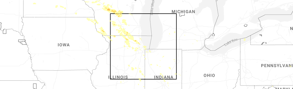
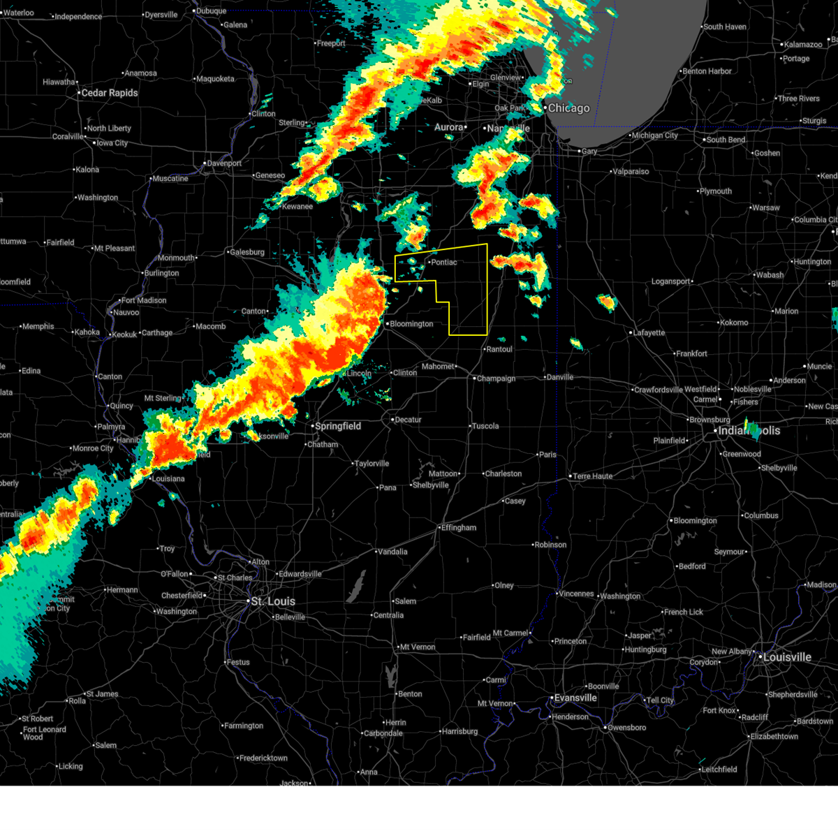
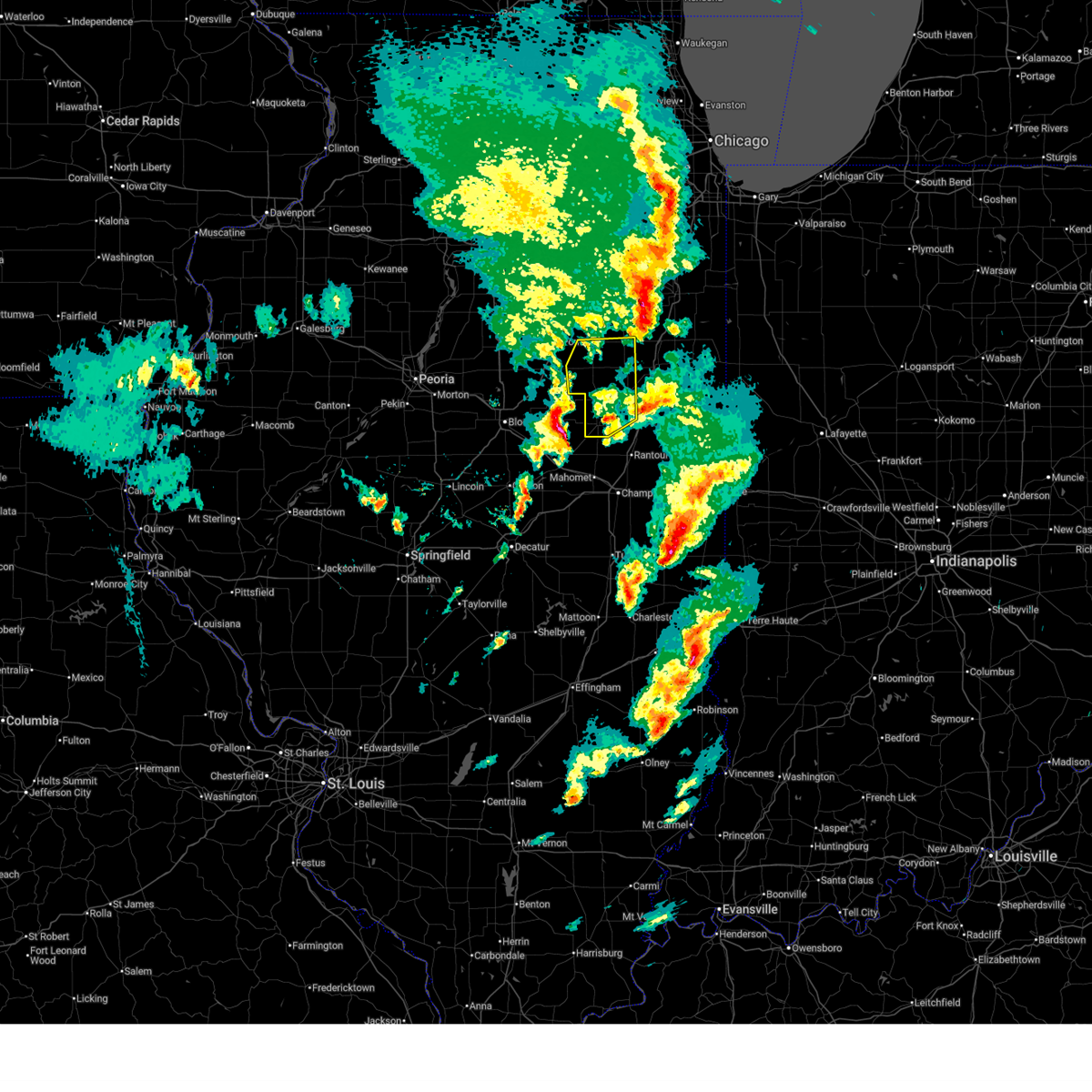
Hail Map for Strawn, IL
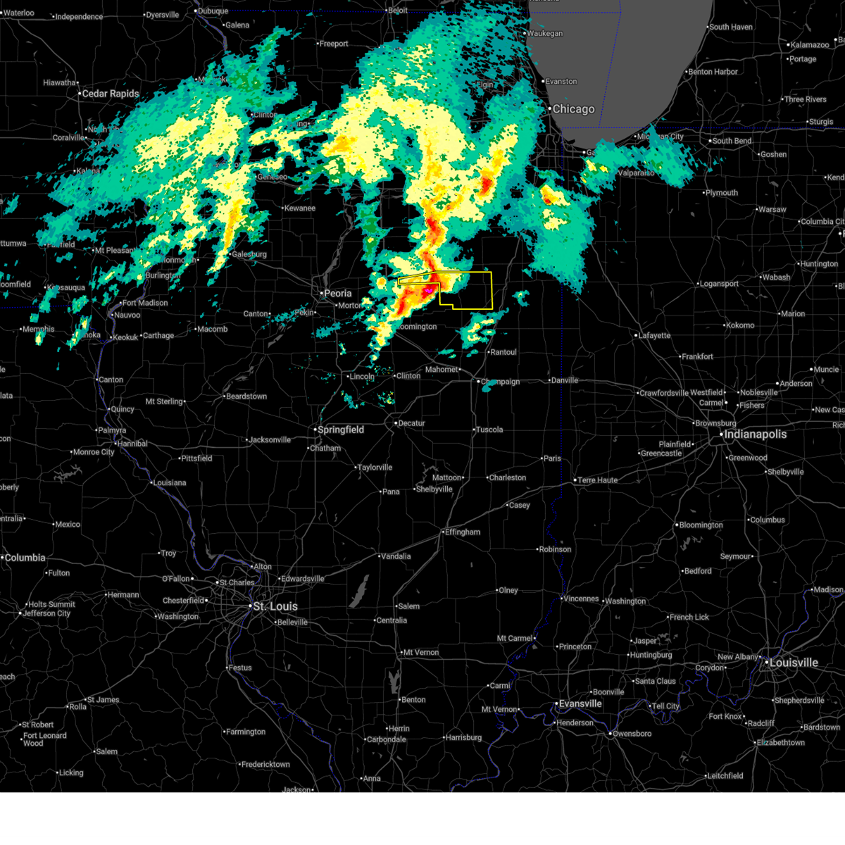
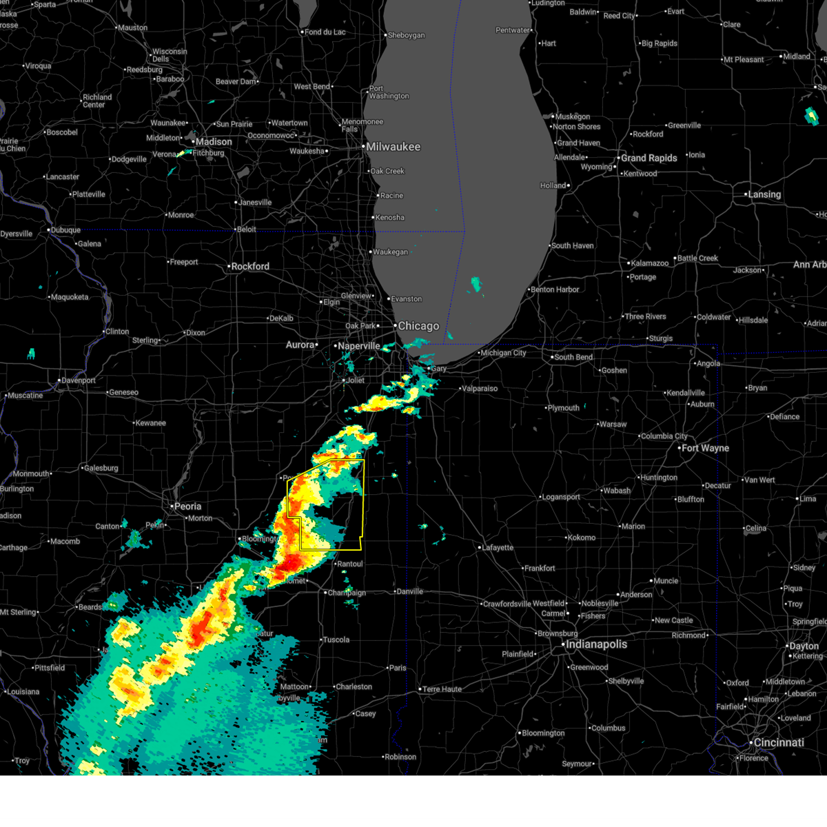
The Strawn, IL area has had 0 reports of on-the-ground hail by trained spotters, and has been under severe weather warnings 28 times during the past 12 months. Doppler radar has detected hail at or near Strawn, IL on 47 occasions, including 2 occasions during the past year.
| Name: | Strawn, IL |
| Where Located: | 62.5 miles E of Peoria, IL |
| Map: | Google Map for Strawn, IL |
| Population: | 100 |
| Housing Units: | 46 |
| More Info: | Search Google for Strawn, IL |
2
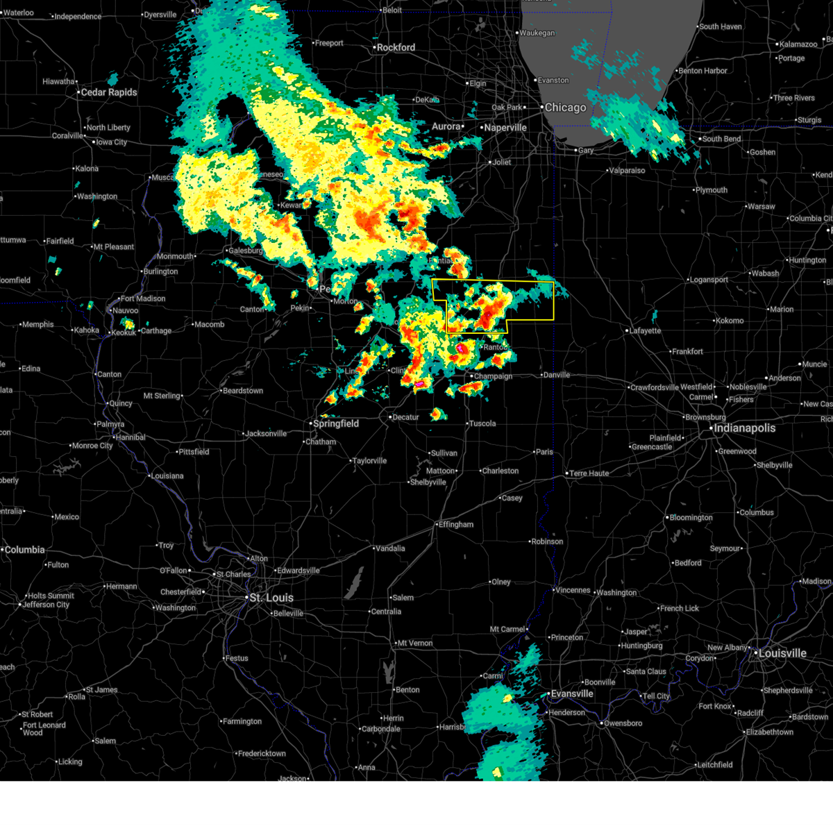
The Top Recent Hail Date for Strawn, IL is Saturday, August 16, 2025 (5th out of 47)
Hail and Wind Damage Spotted near Strawn, IL
| Date / Time | Report Details |
|---|---|
| 6/17/2026 10:43 AM CDT |
 At 1042 am cdt, a severe thunderstorm was located over fairbury, moving east at 50 mph (radar indicated). Hazards include 60 mph wind gusts. Expect damage to roofs, siding, and trees. Locations impacted include, pontiac, fairbury, chatsworth, forrest, odell, cullom, saunemin, campus, emington, and strawn. At 1042 am cdt, a severe thunderstorm was located over fairbury, moving east at 50 mph (radar indicated). Hazards include 60 mph wind gusts. Expect damage to roofs, siding, and trees. Locations impacted include, pontiac, fairbury, chatsworth, forrest, odell, cullom, saunemin, campus, emington, and strawn.
|
| 6/17/2026 10:30 AM CDT |
 At 1030 am cdt, a severe thunderstorm was located over chenoa, or 7 miles south of pontiac, moving east at 45 mph (radar indicated). Hazards include 60 mph wind gusts. Expect damage to roofs, siding, and trees. Locations impacted include, pontiac, fairbury, chatsworth, forrest, flanagan, odell, cullom, saunemin, campus, emington, and strawn. At 1030 am cdt, a severe thunderstorm was located over chenoa, or 7 miles south of pontiac, moving east at 45 mph (radar indicated). Hazards include 60 mph wind gusts. Expect damage to roofs, siding, and trees. Locations impacted include, pontiac, fairbury, chatsworth, forrest, flanagan, odell, cullom, saunemin, campus, emington, and strawn.
|
| 6/17/2026 10:02 AM CDT |
 Svrlot the national weather service in chicago has issued a * severe thunderstorm warning for, livingston county in central illinois, * until 1100 am cdt. * at 1001 am cdt, severe thunderstorms were located along a line extending from near toluca to near secor to near stanford, moving east at 50 mph (radar indicated). Hazards include 60 mph wind gusts. expect damage to roofs, siding, and trees Svrlot the national weather service in chicago has issued a * severe thunderstorm warning for, livingston county in central illinois, * until 1100 am cdt. * at 1001 am cdt, severe thunderstorms were located along a line extending from near toluca to near secor to near stanford, moving east at 50 mph (radar indicated). Hazards include 60 mph wind gusts. expect damage to roofs, siding, and trees
|
| 6/11/2026 7:25 PM CDT |
 At 725 pm cdt, severe thunderstorms were located along a line extending from piper city to 7 miles west of buckley to 6 miles southeast of gibson city to near fisher to near warrensburg, moving east at 60 mph (radar indicated). Hazards include 60 mph wind gusts. Expect damage to roofs, siding, and trees. Locations impacted include, gibson city, chatsworth, forrest, piper city, cullom, saunemin, melvin, roberts, elliott, sibley, cabery, kempton, emington, stelle, and strawn. At 725 pm cdt, severe thunderstorms were located along a line extending from piper city to 7 miles west of buckley to 6 miles southeast of gibson city to near fisher to near warrensburg, moving east at 60 mph (radar indicated). Hazards include 60 mph wind gusts. Expect damage to roofs, siding, and trees. Locations impacted include, gibson city, chatsworth, forrest, piper city, cullom, saunemin, melvin, roberts, elliott, sibley, cabery, kempton, emington, stelle, and strawn.
|
| 6/11/2026 7:11 PM CDT |
 Svrlot the national weather service in chicago has issued a * severe thunderstorm warning for, southeastern livingston county in central illinois, ford county in east central illinois, iroquois county in east central illinois, * until 815 pm cdt. * at 710 pm cdt, severe thunderstorms were located along a line extending from near saunemin to near chatsworth to near gibson city to near fisher to near white heath to near cisco, moving east at 60 mph (radar indicated). Hazards include 60 mph wind gusts. expect damage to roofs, siding, and trees Svrlot the national weather service in chicago has issued a * severe thunderstorm warning for, southeastern livingston county in central illinois, ford county in east central illinois, iroquois county in east central illinois, * until 815 pm cdt. * at 710 pm cdt, severe thunderstorms were located along a line extending from near saunemin to near chatsworth to near gibson city to near fisher to near white heath to near cisco, moving east at 60 mph (radar indicated). Hazards include 60 mph wind gusts. expect damage to roofs, siding, and trees
|
| 6/11/2026 7:09 PM CDT |
 At 709 pm cdt, severe thunderstorms were located along a line extending from fairbury to 9 miles east of colfax to saybrook to near farmer city to near cornland, moving east at 60 mph (radar indicated). Hazards include 60 mph wind gusts. Expect damage to roofs, siding, and trees. Locations impacted include, pontiac, fairbury, gibson city, chatsworth, forrest, piper city, cullom, saunemin, melvin, roberts, elliott, sibley, cabery, kempton, emington, stelle, and strawn. At 709 pm cdt, severe thunderstorms were located along a line extending from fairbury to 9 miles east of colfax to saybrook to near farmer city to near cornland, moving east at 60 mph (radar indicated). Hazards include 60 mph wind gusts. Expect damage to roofs, siding, and trees. Locations impacted include, pontiac, fairbury, gibson city, chatsworth, forrest, piper city, cullom, saunemin, melvin, roberts, elliott, sibley, cabery, kempton, emington, stelle, and strawn.
|
| 6/11/2026 6:52 PM CDT |
 At 652 pm cdt, severe thunderstorms were located along a line extending from near chenoa to near lexington to near downs to near heyworth to near sherman, moving east at 55 mph (radar indicated). Hazards include 60 mph wind gusts. Expect damage to roofs, siding, and trees. Locations impacted include, pontiac, fairbury, gibson city, chatsworth, forrest, flanagan, piper city, cullom, saunemin, melvin, roberts, elliott, sibley, cabery, kempton, emington, stelle, and strawn. At 652 pm cdt, severe thunderstorms were located along a line extending from near chenoa to near lexington to near downs to near heyworth to near sherman, moving east at 55 mph (radar indicated). Hazards include 60 mph wind gusts. Expect damage to roofs, siding, and trees. Locations impacted include, pontiac, fairbury, gibson city, chatsworth, forrest, flanagan, piper city, cullom, saunemin, melvin, roberts, elliott, sibley, cabery, kempton, emington, stelle, and strawn.
|
| 6/11/2026 6:37 PM CDT |
 Svrlot the national weather service in chicago has issued a * severe thunderstorm warning for, livingston county in central illinois, ford county in east central illinois, * until 745 pm cdt. * at 637 pm cdt, severe thunderstorms were located along a line extending from el paso to hudson to near bloomington to near atlanta to near pleasant plains, moving east at 60 mph (radar indicated). Hazards include 60 mph wind gusts. expect damage to roofs, siding, and trees Svrlot the national weather service in chicago has issued a * severe thunderstorm warning for, livingston county in central illinois, ford county in east central illinois, * until 745 pm cdt. * at 637 pm cdt, severe thunderstorms were located along a line extending from el paso to hudson to near bloomington to near atlanta to near pleasant plains, moving east at 60 mph (radar indicated). Hazards include 60 mph wind gusts. expect damage to roofs, siding, and trees
|
| 6/6/2026 5:57 AM CDT |
 At 557 am cdt, a severe thunderstorm was located near fairbury, moving southeast at 25 mph (radar indicated). Hazards include 60 mph wind gusts and nickel size hail. Expect damage to roofs, siding, and trees. Locations impacted include, fairbury, gilman, chatsworth, onarga, forrest, piper city, buckley, melvin, loda, roberts, sibley, thawville, and strawn. At 557 am cdt, a severe thunderstorm was located near fairbury, moving southeast at 25 mph (radar indicated). Hazards include 60 mph wind gusts and nickel size hail. Expect damage to roofs, siding, and trees. Locations impacted include, fairbury, gilman, chatsworth, onarga, forrest, piper city, buckley, melvin, loda, roberts, sibley, thawville, and strawn.
|
| 6/6/2026 5:47 AM CDT |
 At 545 am cdt, a cluster of severe thunderstorms extended from south of pontiac to fairbury toward chatsworth, and was moving southeast at around 35 mph (radar indicated). Hazards include 60 mph wind gusts and nickel size hail. Expect damage to roofs, siding, and trees. Locations impacted include, fairbury, gilman, clifton, chatsworth, onarga, forrest, piper city, ashkum, buckley, danforth, melvin, loda, roberts, sibley, cabery, thawville, kempton, stelle, and strawn. At 545 am cdt, a cluster of severe thunderstorms extended from south of pontiac to fairbury toward chatsworth, and was moving southeast at around 35 mph (radar indicated). Hazards include 60 mph wind gusts and nickel size hail. Expect damage to roofs, siding, and trees. Locations impacted include, fairbury, gilman, clifton, chatsworth, onarga, forrest, piper city, ashkum, buckley, danforth, melvin, loda, roberts, sibley, cabery, thawville, kempton, stelle, and strawn.
|
| 6/6/2026 5:26 AM CDT |
 At 525 am cdt, a cluster of severe thunderstorms was located from pontiac to stelle to forrest, moving southeast at 40 mph (radar indicated and automated wind measurements. this storm produced a measured wind gust of 57 mph in pontiac). Hazards include 60 mph wind gusts and nickel size hail. Expect damage to roofs, siding, and trees. Locations impacted include, fairbury, gilman, clifton, chatsworth, onarga, forrest, piper city, ashkum, buckley, danforth, melvin, loda, roberts, sibley, cabery, thawville, kempton, stelle, and strawn. At 525 am cdt, a cluster of severe thunderstorms was located from pontiac to stelle to forrest, moving southeast at 40 mph (radar indicated and automated wind measurements. this storm produced a measured wind gust of 57 mph in pontiac). Hazards include 60 mph wind gusts and nickel size hail. Expect damage to roofs, siding, and trees. Locations impacted include, fairbury, gilman, clifton, chatsworth, onarga, forrest, piper city, ashkum, buckley, danforth, melvin, loda, roberts, sibley, cabery, thawville, kempton, stelle, and strawn.
|
| 6/6/2026 5:12 AM CDT |
 Svrlot the national weather service in chicago has issued a * severe thunderstorm warning for, southeastern livingston county in central illinois, central ford county in east central illinois, western iroquois county in east central illinois, * until 615 am cdt. * at 512 am cdt, a severe thunderstorm was located near saunemin, or near pontiac, moving southeast at 35 mph (radar indicated). Hazards include 60 mph wind gusts and quarter size hail. Hail damage to vehicles is expected. Expect wind damage to roofs, siding, and trees. Svrlot the national weather service in chicago has issued a * severe thunderstorm warning for, southeastern livingston county in central illinois, central ford county in east central illinois, western iroquois county in east central illinois, * until 615 am cdt. * at 512 am cdt, a severe thunderstorm was located near saunemin, or near pontiac, moving southeast at 35 mph (radar indicated). Hazards include 60 mph wind gusts and quarter size hail. Hail damage to vehicles is expected. Expect wind damage to roofs, siding, and trees.
|
| 4/17/2026 9:35 PM CDT |
 At 934 pm cdt, a severe squall line capable of producing both tornadoes and extensive straight line wind damage was located along a line extending from saunemin to near chatsworth to gibson city, moving northeast at 70 mph (radar indicated rotation). Hazards include tornado. Flying debris will be dangerous to those caught without shelter. mobile homes will be damaged or destroyed. damage to roofs, windows, and vehicles will occur. tree damage is likely. Locations impacted include, chatsworth, piper city, cullom, gilman, onarga, ashkum, buckley, clifton and chebanse. At 934 pm cdt, a severe squall line capable of producing both tornadoes and extensive straight line wind damage was located along a line extending from saunemin to near chatsworth to gibson city, moving northeast at 70 mph (radar indicated rotation). Hazards include tornado. Flying debris will be dangerous to those caught without shelter. mobile homes will be damaged or destroyed. damage to roofs, windows, and vehicles will occur. tree damage is likely. Locations impacted include, chatsworth, piper city, cullom, gilman, onarga, ashkum, buckley, clifton and chebanse.
|
| 4/17/2026 9:28 PM CDT |
 At 928 pm cdt, severe thunderstorms were located along a line extending from near seneca to near odell to fairbury to saybrook, moving east at 55 mph (radar indicated). Hazards include 70 mph wind gusts. Expect considerable tree damage. damage is likely to mobile homes, roofs, and outbuildings. Locations impacted include, joliet, new lenox, channahon, pontiac, minooka, braidwood, wilmington, paxton, dwight, fairbury, gibson city, gilman, herscher, clifton, chatsworth, manhattan, diamond, elwood, limestone, onarga, lakewood shores, forrest, chebanse, odell, and piper city. At 928 pm cdt, severe thunderstorms were located along a line extending from near seneca to near odell to fairbury to saybrook, moving east at 55 mph (radar indicated). Hazards include 70 mph wind gusts. Expect considerable tree damage. damage is likely to mobile homes, roofs, and outbuildings. Locations impacted include, joliet, new lenox, channahon, pontiac, minooka, braidwood, wilmington, paxton, dwight, fairbury, gibson city, gilman, herscher, clifton, chatsworth, manhattan, diamond, elwood, limestone, onarga, lakewood shores, forrest, chebanse, odell, and piper city.
|
| 4/17/2026 9:16 PM CDT |
 At 916 pm cdt, tornado producing storms were located along a line extending from near lexington to near colfax to 9 miles west of saybrook to near le roy, moving east at 60 mph (radar confirmed tornado). Hazards include damaging tornado. Flying debris will be dangerous to those caught without shelter. mobile homes will be damaged or destroyed. damage to roofs, windows, and vehicles will occur. tree damage is likely. these tornadic storms will be near, fairbury and gibson city around 930 pm cdt. forrest around 935 pm cdt. Other locations in the path of these tornadic storms include chatsworth, paxton, piper city, onarga, buckley, gilman, cissna park and ashkum. At 916 pm cdt, tornado producing storms were located along a line extending from near lexington to near colfax to 9 miles west of saybrook to near le roy, moving east at 60 mph (radar confirmed tornado). Hazards include damaging tornado. Flying debris will be dangerous to those caught without shelter. mobile homes will be damaged or destroyed. damage to roofs, windows, and vehicles will occur. tree damage is likely. these tornadic storms will be near, fairbury and gibson city around 930 pm cdt. forrest around 935 pm cdt. Other locations in the path of these tornadic storms include chatsworth, paxton, piper city, onarga, buckley, gilman, cissna park and ashkum.
|
| 4/17/2026 9:05 PM CDT |
 Svrlot the national weather service in chicago has issued a * severe thunderstorm warning for, livingston county in central illinois, southwestern will county in northeastern illinois, western kankakee county in northeastern illinois, ford county in east central illinois, western iroquois county in east central illinois, * until 1015 pm cdt. * at 904 pm cdt, severe thunderstorms were located along a line extending from 6 miles northeast of wenona to near hudson to near bloomington, moving east at 55 mph (radar indicated). Hazards include 70 mph wind gusts. Expect considerable tree damage. Damage is likely to mobile homes, roofs, and outbuildings. Svrlot the national weather service in chicago has issued a * severe thunderstorm warning for, livingston county in central illinois, southwestern will county in northeastern illinois, western kankakee county in northeastern illinois, ford county in east central illinois, western iroquois county in east central illinois, * until 1015 pm cdt. * at 904 pm cdt, severe thunderstorms were located along a line extending from 6 miles northeast of wenona to near hudson to near bloomington, moving east at 55 mph (radar indicated). Hazards include 70 mph wind gusts. Expect considerable tree damage. Damage is likely to mobile homes, roofs, and outbuildings.
|
| 12/28/2025 3:30 PM CST |
 The storm which prompted the warning has moved out of the area. therefore, the warning has been allowed to expire. to report severe weather, contact your nearest law enforcement agency. they will relay your report to the national weather service chicago. The storm which prompted the warning has moved out of the area. therefore, the warning has been allowed to expire. to report severe weather, contact your nearest law enforcement agency. they will relay your report to the national weather service chicago.
|
| 12/28/2025 3:04 PM CST |
 At 304 pm cst, a severe thunderstorm was located near forrest, or near fairbury, moving east at 45 mph (radar indicated). Hazards include 60 mph wind gusts. Expect damage to roofs, siding, and trees. Locations impacted include, fairbury, chatsworth, forrest, cullom, saunemin, and strawn. At 304 pm cst, a severe thunderstorm was located near forrest, or near fairbury, moving east at 45 mph (radar indicated). Hazards include 60 mph wind gusts. Expect damage to roofs, siding, and trees. Locations impacted include, fairbury, chatsworth, forrest, cullom, saunemin, and strawn.
|
| 12/28/2025 2:49 PM CST |
 Svrlot the national weather service in chicago has issued a * severe thunderstorm warning for, southeastern livingston county in central illinois, * until 330 pm cst. * at 249 pm cst, a severe thunderstorm was located near chenoa, or 7 miles south of pontiac, moving east at 45 mph (radar indicated). Hazards include 60 mph wind gusts. expect damage to roofs, siding, and trees Svrlot the national weather service in chicago has issued a * severe thunderstorm warning for, southeastern livingston county in central illinois, * until 330 pm cst. * at 249 pm cst, a severe thunderstorm was located near chenoa, or 7 miles south of pontiac, moving east at 45 mph (radar indicated). Hazards include 60 mph wind gusts. expect damage to roofs, siding, and trees
|
| 12/28/2025 10:44 AM CST |
 At 1044 am cst, a severe thunderstorm was located over chatsworth, moving east at 55 mph (radar indicated). Hazards include 60 mph wind gusts and quarter size hail. Hail damage to vehicles is expected. expect wind damage to roofs, siding, and trees. Locations impacted include, fairbury, chatsworth, forrest, piper city, roberts, sibley, and strawn. At 1044 am cst, a severe thunderstorm was located over chatsworth, moving east at 55 mph (radar indicated). Hazards include 60 mph wind gusts and quarter size hail. Hail damage to vehicles is expected. expect wind damage to roofs, siding, and trees. Locations impacted include, fairbury, chatsworth, forrest, piper city, roberts, sibley, and strawn.
|
| 12/28/2025 10:26 AM CST |
 At 1025 am cst, a severe thunderstorm was located southwest of fairbury, moving east at 55 mph (radar indicated). Hazards include 60 mph wind gusts and quarter size hail. Hail damage to vehicles is expected. expect wind damage to roofs, siding, and trees. Locations impacted include, fairbury, chatsworth, forrest, piper city, roberts, sibley, and strawn. At 1025 am cst, a severe thunderstorm was located southwest of fairbury, moving east at 55 mph (radar indicated). Hazards include 60 mph wind gusts and quarter size hail. Hail damage to vehicles is expected. expect wind damage to roofs, siding, and trees. Locations impacted include, fairbury, chatsworth, forrest, piper city, roberts, sibley, and strawn.
|
| 12/28/2025 10:12 AM CST |
 Svrlot the national weather service in chicago has issued a * severe thunderstorm warning for, southern livingston county in central illinois, southwestern ford county in east central illinois, * until 1115 am cst. * at 1010 am cst, a severe thunderstorm was located near lexington, or 10 miles northeast of normal, moving east at 55 mph (radar indicated). Hazards include 60 mph wind gusts and quarter size hail. Hail damage to vehicles is expected. Expect wind damage to roofs, siding, and trees. Svrlot the national weather service in chicago has issued a * severe thunderstorm warning for, southern livingston county in central illinois, southwestern ford county in east central illinois, * until 1115 am cst. * at 1010 am cst, a severe thunderstorm was located near lexington, or 10 miles northeast of normal, moving east at 55 mph (radar indicated). Hazards include 60 mph wind gusts and quarter size hail. Hail damage to vehicles is expected. Expect wind damage to roofs, siding, and trees.
|
| 7/26/2025 12:54 AM CDT |
 The storm which prompted the warning has weakened below severe limits, and has exited the warned area. therefore, the warning will be allowed to expire. however, heavy rain is still possible with this thunderstorm. The storm which prompted the warning has weakened below severe limits, and has exited the warned area. therefore, the warning will be allowed to expire. however, heavy rain is still possible with this thunderstorm.
|
| 7/26/2025 12:38 AM CDT |
 At 1238 am cdt, a severe thunderstorm was located over forrest, or near fairbury, moving northeast at 35 mph (radar indicated). Hazards include 60 mph wind gusts. Expect damage to roofs, siding, and trees. Locations impacted include, melvin, forrest, saunemin, elliott, gibson city, chatsworth, sibley, strawn, and fairbury. At 1238 am cdt, a severe thunderstorm was located over forrest, or near fairbury, moving northeast at 35 mph (radar indicated). Hazards include 60 mph wind gusts. Expect damage to roofs, siding, and trees. Locations impacted include, melvin, forrest, saunemin, elliott, gibson city, chatsworth, sibley, strawn, and fairbury.
|
| 7/26/2025 12:23 AM CDT |
 At 1223 am cdt, a severe thunderstorm was located near fairbury, moving northeast at 35 mph (radar indicated). Hazards include 60 mph wind gusts. Expect damage to roofs, siding, and trees. Locations impacted include, melvin, forrest, pontiac, saunemin, elliott, gibson city, chatsworth, sibley, strawn, and fairbury. At 1223 am cdt, a severe thunderstorm was located near fairbury, moving northeast at 35 mph (radar indicated). Hazards include 60 mph wind gusts. Expect damage to roofs, siding, and trees. Locations impacted include, melvin, forrest, pontiac, saunemin, elliott, gibson city, chatsworth, sibley, strawn, and fairbury.
|
| 7/26/2025 12:09 AM CDT |
 Svrlot the national weather service in chicago has issued a * severe thunderstorm warning for, southern livingston county in central illinois, southwestern ford county in east central illinois, * until 100 am cdt. * at 1209 am cdt, a severe thunderstorm was located near colfax, or 13 miles southwest of fairbury, moving northeast at 35 mph (radar indicated). Hazards include 60 mph wind gusts. expect damage to roofs, siding, and trees Svrlot the national weather service in chicago has issued a * severe thunderstorm warning for, southern livingston county in central illinois, southwestern ford county in east central illinois, * until 100 am cdt. * at 1209 am cdt, a severe thunderstorm was located near colfax, or 13 miles southwest of fairbury, moving northeast at 35 mph (radar indicated). Hazards include 60 mph wind gusts. expect damage to roofs, siding, and trees
|
| 7/16/2025 3:55 PM CDT |
 At 355 pm cdt, severe thunderstorms were located along a line extending from 6 miles northeast of cullom to near piper city to 7 miles south of chatsworth, moving east at 40 mph (radar indicated). Hazards include 60 mph wind gusts. Expect damage to roofs, siding, and trees. Locations impacted include, onarga, thawville, forrest, cullom, piper city, gilman, stelle, kempton, chatsworth, ashkum, strawn, danforth, and roberts. At 355 pm cdt, severe thunderstorms were located along a line extending from 6 miles northeast of cullom to near piper city to 7 miles south of chatsworth, moving east at 40 mph (radar indicated). Hazards include 60 mph wind gusts. Expect damage to roofs, siding, and trees. Locations impacted include, onarga, thawville, forrest, cullom, piper city, gilman, stelle, kempton, chatsworth, ashkum, strawn, danforth, and roberts.
|
| 7/16/2025 3:41 PM CDT |
 Svrlot the national weather service in chicago has issued a * severe thunderstorm warning for, southeastern livingston county in central illinois, north central ford county in east central illinois, northwestern iroquois county in east central illinois, * until 430 pm cdt. * at 340 pm cdt, severe thunderstorms were located along a line extending from near saunemin to near chatsworth to forrest, moving east at 40 mph (radar indicated). Hazards include 60 mph wind gusts and penny size hail. expect damage to roofs, siding, and trees Svrlot the national weather service in chicago has issued a * severe thunderstorm warning for, southeastern livingston county in central illinois, north central ford county in east central illinois, northwestern iroquois county in east central illinois, * until 430 pm cdt. * at 340 pm cdt, severe thunderstorms were located along a line extending from near saunemin to near chatsworth to forrest, moving east at 40 mph (radar indicated). Hazards include 60 mph wind gusts and penny size hail. expect damage to roofs, siding, and trees
|
| 5/20/2025 4:25 PM CDT |
 At 425 pm cdt, multiple severe thunderstorms were located near gibson citgy and paxton, and were moving northeast at 35 mph (radar indicated). Hazards include 60 mph wind gusts and quarter size hail. Hail damage to vehicles is expected. expect wind damage to roofs, siding, and trees. Locations impacted include, onarga, melvin, buckley, thawville, loda, milford, claytonville, cissna park, gibson city, sibley, roberts, piper city, clarence, woodland, stockland, elliott, chatsworth, strawn, paxton, wellington, forrest, and gilman. At 425 pm cdt, multiple severe thunderstorms were located near gibson citgy and paxton, and were moving northeast at 35 mph (radar indicated). Hazards include 60 mph wind gusts and quarter size hail. Hail damage to vehicles is expected. expect wind damage to roofs, siding, and trees. Locations impacted include, onarga, melvin, buckley, thawville, loda, milford, claytonville, cissna park, gibson city, sibley, roberts, piper city, clarence, woodland, stockland, elliott, chatsworth, strawn, paxton, wellington, forrest, and gilman.
|
| 5/20/2025 4:14 PM CDT |
 Svrlot the national weather service in chicago has issued a * severe thunderstorm warning for, southeastern livingston county in central illinois, ford county in east central illinois, southern iroquois county in east central illinois, * until 530 pm cdt. * at 413 pm cdt, multiple severe thunderstorms were located over mclean, champaign, and ford counties, and all were moving northeast at 35 mph (radar indicated). Hazards include 60 mph wind gusts and quarter size hail with any storm. Hail damage to vehicles is expected. Expect wind damage to roofs, siding, and trees. Svrlot the national weather service in chicago has issued a * severe thunderstorm warning for, southeastern livingston county in central illinois, ford county in east central illinois, southern iroquois county in east central illinois, * until 530 pm cdt. * at 413 pm cdt, multiple severe thunderstorms were located over mclean, champaign, and ford counties, and all were moving northeast at 35 mph (radar indicated). Hazards include 60 mph wind gusts and quarter size hail with any storm. Hail damage to vehicles is expected. Expect wind damage to roofs, siding, and trees.
|
| 5/15/2025 7:31 PM CDT |
 At 730 pm cdt, a severe thunderstorm was located near fairbury, moving northeast at 50 mph. this is a destructive storm especially for south central livingston county (radar indicated). Hazards include baseball size hail and 70 mph wind gusts. the biggest hail will go through central livingston county. People and animals outdoors will be severely injured. expect shattered windows, extensive damage to roofs, siding, and vehicles. Locations impacted include, melvin, campus, forrest, pontiac, cullom, gibson city, sibley, roberts, fairbury, piper city, cabery, stelle, saunemin, elliott, kempton, odell, emington, dwight, chatsworth, strawn, reddick, and paxton. At 730 pm cdt, a severe thunderstorm was located near fairbury, moving northeast at 50 mph. this is a destructive storm especially for south central livingston county (radar indicated). Hazards include baseball size hail and 70 mph wind gusts. the biggest hail will go through central livingston county. People and animals outdoors will be severely injured. expect shattered windows, extensive damage to roofs, siding, and vehicles. Locations impacted include, melvin, campus, forrest, pontiac, cullom, gibson city, sibley, roberts, fairbury, piper city, cabery, stelle, saunemin, elliott, kempton, odell, emington, dwight, chatsworth, strawn, reddick, and paxton.
|
| 5/15/2025 7:21 PM CDT |
 At 719 pm cdt, a severe thunderstorm was located over lexington, or 14 miles northeast of normal, moving northeast at 50 mph. this is a destructive storm especially for south central livingston county (radar indicated). Hazards include baseball size hail and 70 mph wind gusts. the biggest hail will go through central livingston county. People and animals outdoors will be severely injured. expect shattered windows, extensive damage to roofs, siding, and vehicles. Locations impacted include, melvin, campus, forrest, pontiac, cullom, gibson city, sibley, roberts, fairbury, piper city, cabery, stelle, saunemin, elliott, kempton, odell, emington, dwight, chatsworth, strawn, reddick, and paxton. At 719 pm cdt, a severe thunderstorm was located over lexington, or 14 miles northeast of normal, moving northeast at 50 mph. this is a destructive storm especially for south central livingston county (radar indicated). Hazards include baseball size hail and 70 mph wind gusts. the biggest hail will go through central livingston county. People and animals outdoors will be severely injured. expect shattered windows, extensive damage to roofs, siding, and vehicles. Locations impacted include, melvin, campus, forrest, pontiac, cullom, gibson city, sibley, roberts, fairbury, piper city, cabery, stelle, saunemin, elliott, kempton, odell, emington, dwight, chatsworth, strawn, reddick, and paxton.
|
| 5/15/2025 7:08 PM CDT |
 Svrlot the national weather service in chicago has issued a * severe thunderstorm warning for, livingston county in central illinois, ford county in east central illinois, * until 830 pm cdt. * at 707 pm cdt, a severe thunderstorm was located over towanda, or near normal, moving northeast at 50 mph (radar indicated). Hazards include two inch hail and 70 mph wind gusts. People and animals outdoors will be injured. expect hail damage to roofs, siding, windows, and vehicles. expect considerable tree damage. Wind damage is also likely to mobile homes, roofs, and outbuildings. Svrlot the national weather service in chicago has issued a * severe thunderstorm warning for, livingston county in central illinois, ford county in east central illinois, * until 830 pm cdt. * at 707 pm cdt, a severe thunderstorm was located over towanda, or near normal, moving northeast at 50 mph (radar indicated). Hazards include two inch hail and 70 mph wind gusts. People and animals outdoors will be injured. expect hail damage to roofs, siding, windows, and vehicles. expect considerable tree damage. Wind damage is also likely to mobile homes, roofs, and outbuildings.
|
| 4/2/2025 4:20 PM CDT |
 At 420 pm cdt, severe thunderstorms were located along a line extending from near saunemin to near saybrook to near de land, moving northeast at 60 mph (radar indicated). Hazards include 70 mph wind gusts and quarter size hail. Hail damage to vehicles is expected. expect considerable tree damage. wind damage is also likely to mobile homes, roofs, and outbuildings. these severe storms will be near, gibson city, saunemin, chatsworth, cullom, and forrest around 425 pm cdt. piper city around 435 pm cdt. paxton around 440 pm cdt. buckley, ashkum, gilman, onarga, and clifton around 445 pm cdt. Chebanse around 450 pm cdt. At 420 pm cdt, severe thunderstorms were located along a line extending from near saunemin to near saybrook to near de land, moving northeast at 60 mph (radar indicated). Hazards include 70 mph wind gusts and quarter size hail. Hail damage to vehicles is expected. expect considerable tree damage. wind damage is also likely to mobile homes, roofs, and outbuildings. these severe storms will be near, gibson city, saunemin, chatsworth, cullom, and forrest around 425 pm cdt. piper city around 435 pm cdt. paxton around 440 pm cdt. buckley, ashkum, gilman, onarga, and clifton around 445 pm cdt. Chebanse around 450 pm cdt.
|
| 4/2/2025 4:15 PM CDT |
 At 415 pm cdt, severe thunderstorms were located along a line extending from near fairbury to near de land, moving northeast at 55 mph (radar indicated). Hazards include 60 mph wind gusts and quarter size hail. Hail damage to vehicles is expected. expect wind damage to roofs, siding, and trees. these severe storms will be near, saunemin, fairbury, and forrest around 420 pm cdt. gibson city, chatsworth, and cullom around 425 pm cdt. piper city around 435 pm cdt. paxton and gilman around 445 pm cdt. Buckley, ashkum, onarga, clifton, and chebanse around 450 pm cdt. At 415 pm cdt, severe thunderstorms were located along a line extending from near fairbury to near de land, moving northeast at 55 mph (radar indicated). Hazards include 60 mph wind gusts and quarter size hail. Hail damage to vehicles is expected. expect wind damage to roofs, siding, and trees. these severe storms will be near, saunemin, fairbury, and forrest around 420 pm cdt. gibson city, chatsworth, and cullom around 425 pm cdt. piper city around 435 pm cdt. paxton and gilman around 445 pm cdt. Buckley, ashkum, onarga, clifton, and chebanse around 450 pm cdt.
|
| 4/2/2025 4:02 PM CDT |
 Svrlot the national weather service in chicago has issued a * severe thunderstorm warning for, southern livingston county in central illinois, ford county in east central illinois, western iroquois county in east central illinois, * until 500 pm cdt. * at 402 pm cdt, severe thunderstorms were located along a line extending from 6 miles west of colfax to near maroa, moving east at 55 mph (radar indicated). Hazards include 60 mph wind gusts and quarter size hail. Hail damage to vehicles is expected. Expect wind damage to roofs, siding, and trees. Svrlot the national weather service in chicago has issued a * severe thunderstorm warning for, southern livingston county in central illinois, ford county in east central illinois, western iroquois county in east central illinois, * until 500 pm cdt. * at 402 pm cdt, severe thunderstorms were located along a line extending from 6 miles west of colfax to near maroa, moving east at 55 mph (radar indicated). Hazards include 60 mph wind gusts and quarter size hail. Hail damage to vehicles is expected. Expect wind damage to roofs, siding, and trees.
|
| 3/19/2025 5:32 PM CDT |
 At 532 pm cdt, severe thunderstorms were located along a line extending from 7 miles south of forrest to near gibson city, moving northeast at 55 mph (radar indicated). Hazards include 60 mph wind gusts and nickel size hail. Expect damage to roofs, siding, and trees. Locations impacted include, melvin, forrest, elliott, cullom, gibson city, chatsworth, sibley, roberts, strawn, piper city, and saunemin. At 532 pm cdt, severe thunderstorms were located along a line extending from 7 miles south of forrest to near gibson city, moving northeast at 55 mph (radar indicated). Hazards include 60 mph wind gusts and nickel size hail. Expect damage to roofs, siding, and trees. Locations impacted include, melvin, forrest, elliott, cullom, gibson city, chatsworth, sibley, roberts, strawn, piper city, and saunemin.
|
| 3/19/2025 5:17 PM CDT |
 Svrlot the national weather service in chicago has issued a * severe thunderstorm warning for, southeastern livingston county in central illinois, ford county in east central illinois, * until 600 pm cdt. * at 517 pm cdt, a severe thunderstorm was located over saybrook, or 9 miles west of gibson city, moving northeast at 60 mph (radar indicated). Hazards include 60 mph wind gusts and nickel size hail. expect damage to roofs, siding, and trees Svrlot the national weather service in chicago has issued a * severe thunderstorm warning for, southeastern livingston county in central illinois, ford county in east central illinois, * until 600 pm cdt. * at 517 pm cdt, a severe thunderstorm was located over saybrook, or 9 miles west of gibson city, moving northeast at 60 mph (radar indicated). Hazards include 60 mph wind gusts and nickel size hail. expect damage to roofs, siding, and trees
|
| 3/15/2025 12:07 AM CDT |
 At 1206 am cdt, severe thunderstorms were located along a line extending from lisle to romeoville to manhattan to 7 miles northwest of buckley, moving east at 40 mph (radar indicated). Hazards include 70 mph wind gusts. Expect considerable tree damage. damage is likely to mobile homes, roofs, and outbuildings. Locations impacted include, buckley, preston heights, plainfield, crest hill, limestone, cullom, piper city, cabery, channahon, kempton, wilmington, elwood, bonfield, union hill, thawville, symerton, clifton, gibson city, roberts, lakewood shores, shorewood, romeoville, manhattan, buckingham, and danforth. At 1206 am cdt, severe thunderstorms were located along a line extending from lisle to romeoville to manhattan to 7 miles northwest of buckley, moving east at 40 mph (radar indicated). Hazards include 70 mph wind gusts. Expect considerable tree damage. damage is likely to mobile homes, roofs, and outbuildings. Locations impacted include, buckley, preston heights, plainfield, crest hill, limestone, cullom, piper city, cabery, channahon, kempton, wilmington, elwood, bonfield, union hill, thawville, symerton, clifton, gibson city, roberts, lakewood shores, shorewood, romeoville, manhattan, buckingham, and danforth.
|
| 3/15/2025 12:07 AM CDT |
 the severe thunderstorm warning has been cancelled and is no longer in effect the severe thunderstorm warning has been cancelled and is no longer in effect
|
| 3/14/2025 11:39 PM CDT |
 At 1139 pm cdt, severe thunderstorms were located along a line extending from near sugar grove to 6 miles south of yorkville to near morris to 6 miles east of colfax, moving east at 50 mph (radar indicated). Hazards include 70 mph wind gusts. Expect considerable tree damage. damage is likely to mobile homes, roofs, and outbuildings. Locations impacted include, buckley, preston heights, plainfield, crest hill, millbrook, limestone, cullom, piper city, cabery, channahon, bristol, kempton, odell, dwight, morris, wilmington, elwood, bonfield, union hill, campus, coal city, thawville, forrest, lisbon, and symerton. At 1139 pm cdt, severe thunderstorms were located along a line extending from near sugar grove to 6 miles south of yorkville to near morris to 6 miles east of colfax, moving east at 50 mph (radar indicated). Hazards include 70 mph wind gusts. Expect considerable tree damage. damage is likely to mobile homes, roofs, and outbuildings. Locations impacted include, buckley, preston heights, plainfield, crest hill, millbrook, limestone, cullom, piper city, cabery, channahon, bristol, kempton, odell, dwight, morris, wilmington, elwood, bonfield, union hill, campus, coal city, thawville, forrest, lisbon, and symerton.
|
| 3/14/2025 11:13 PM CDT |
 Svrlot the national weather service in chicago has issued a * severe thunderstorm warning for, eastern livingston county in central illinois, kendall county in northeastern illinois, will county in northeastern illinois, grundy county in northeastern illinois, western kankakee county in northeastern illinois, ford county in east central illinois, western iroquois county in east central illinois, * until 1230 am cdt. * at 1111 pm cdt, severe thunderstorms were located along a line extending from near leland to near grand ridge to near downs, moving east at 40 mph. a 70 mph wind gust was reported with this line of storms at streator 1105 pm cdt (radar indicated). Hazards include 70 mph wind gusts. Expect considerable tree damage. Damage is likely to mobile homes, roofs, and outbuildings. Svrlot the national weather service in chicago has issued a * severe thunderstorm warning for, eastern livingston county in central illinois, kendall county in northeastern illinois, will county in northeastern illinois, grundy county in northeastern illinois, western kankakee county in northeastern illinois, ford county in east central illinois, western iroquois county in east central illinois, * until 1230 am cdt. * at 1111 pm cdt, severe thunderstorms were located along a line extending from near leland to near grand ridge to near downs, moving east at 40 mph. a 70 mph wind gust was reported with this line of storms at streator 1105 pm cdt (radar indicated). Hazards include 70 mph wind gusts. Expect considerable tree damage. Damage is likely to mobile homes, roofs, and outbuildings.
|
| 7/15/2024 9:43 PM CDT |
 The most dangerous part of the storms which prompted the warning have moved out of the area. herefore, the warning will be allowed to expire. however, gusty winds and heavy rain are still possible with these thunderstorms. a tornado watch remains in effect until 100 am cdt for central, north central, northeastern and east central illinois. The most dangerous part of the storms which prompted the warning have moved out of the area. herefore, the warning will be allowed to expire. however, gusty winds and heavy rain are still possible with these thunderstorms. a tornado watch remains in effect until 100 am cdt for central, north central, northeastern and east central illinois.
|
| 7/15/2024 9:09 PM CDT |
 At 908 pm cdt, severe thunderstorms were located along a line extending from 6 miles north of morris to near south streator to near chenoa, moving east at 70 mph (radar indicated). Hazards include 70 mph wind gusts. Expect considerable tree damage. damage is likely to mobile homes, roofs, and outbuildings. Locations impacted include, streator, morris, channahon, pontiac, minooka, braidwood, coal city, marseilles, dwight, fairbury, chatsworth, diamond, seneca, gardner, gridley, forrest, flanagan, wenona, odell, mazon, south streator, braceville, grand ridge, cullom, and cornell. At 908 pm cdt, severe thunderstorms were located along a line extending from 6 miles north of morris to near south streator to near chenoa, moving east at 70 mph (radar indicated). Hazards include 70 mph wind gusts. Expect considerable tree damage. damage is likely to mobile homes, roofs, and outbuildings. Locations impacted include, streator, morris, channahon, pontiac, minooka, braidwood, coal city, marseilles, dwight, fairbury, chatsworth, diamond, seneca, gardner, gridley, forrest, flanagan, wenona, odell, mazon, south streator, braceville, grand ridge, cullom, and cornell.
|
| 7/15/2024 8:43 PM CDT |
 Svrlot the national weather service in chicago has issued a * severe thunderstorm warning for, livingston county in central illinois, southeastern kendall county in northeastern illinois, central la salle county in north central illinois, grundy county in northeastern illinois, central ford county in east central illinois, * until 945 pm cdt. * at 843 pm cdt, severe thunderstorms were located along a line extending from peru to near washburn to near pekin, moving east at 60 mph (radar indicated). Hazards include 70 mph wind gusts. Expect considerable tree damage. Damage is likely to mobile homes, roofs, and outbuildings. Svrlot the national weather service in chicago has issued a * severe thunderstorm warning for, livingston county in central illinois, southeastern kendall county in northeastern illinois, central la salle county in north central illinois, grundy county in northeastern illinois, central ford county in east central illinois, * until 945 pm cdt. * at 843 pm cdt, severe thunderstorms were located along a line extending from peru to near washburn to near pekin, moving east at 60 mph (radar indicated). Hazards include 70 mph wind gusts. Expect considerable tree damage. Damage is likely to mobile homes, roofs, and outbuildings.
|
| 7/15/2024 12:50 AM CDT |
 At 1248 am cdt, severe thunderstorms were located along a line extending from near cullom to near chatsworth to 7 miles south of fairbury, moving east southeast at 50 mph (radar indicated). Hazards include 60 mph wind gusts. Expect damage to roofs, siding, and trees. locations impacted include, kankakee, bourbonnais, bradley, watseka, paxton, fairbury, gibson city, momence, gilman, herscher, clifton, chatsworth, limestone, onarga, st. Anne, forrest, chebanse, cissna park, piper city, ashkum, aroma park, hopkins park, buckley, cullom, and martinton. At 1248 am cdt, severe thunderstorms were located along a line extending from near cullom to near chatsworth to 7 miles south of fairbury, moving east southeast at 50 mph (radar indicated). Hazards include 60 mph wind gusts. Expect damage to roofs, siding, and trees. locations impacted include, kankakee, bourbonnais, bradley, watseka, paxton, fairbury, gibson city, momence, gilman, herscher, clifton, chatsworth, limestone, onarga, st. Anne, forrest, chebanse, cissna park, piper city, ashkum, aroma park, hopkins park, buckley, cullom, and martinton.
|
| 7/15/2024 12:50 AM CDT |
 the severe thunderstorm warning has been cancelled and is no longer in effect the severe thunderstorm warning has been cancelled and is no longer in effect
|
| 7/15/2024 12:35 AM CDT |
 the severe thunderstorm warning has been cancelled and is no longer in effect the severe thunderstorm warning has been cancelled and is no longer in effect
|
| 7/15/2024 12:35 AM CDT |
 At 1234 am cdt, severe thunderstorms were located along a line extending from gardner to near fairbury, moving southeast at 45 mph (automated weather observation). Hazards include 60 mph wind gusts. Expect damage to roofs, siding, and trees. locations impacted include, kankakee, bourbonnais, bradley, pontiac, manteno, braidwood, coal city, watseka, paxton, dwight, fairbury, gibson city, momence, gilman, herscher, clifton, chatsworth, diamond, limestone, gardner, onarga, lakewood shores, grant park, st. Anne, and forrest. At 1234 am cdt, severe thunderstorms were located along a line extending from gardner to near fairbury, moving southeast at 45 mph (automated weather observation). Hazards include 60 mph wind gusts. Expect damage to roofs, siding, and trees. locations impacted include, kankakee, bourbonnais, bradley, pontiac, manteno, braidwood, coal city, watseka, paxton, dwight, fairbury, gibson city, momence, gilman, herscher, clifton, chatsworth, diamond, limestone, gardner, onarga, lakewood shores, grant park, st. Anne, and forrest.
|
| 7/15/2024 12:28 AM CDT |
 Svrlot the national weather service in chicago has issued a * severe thunderstorm warning for, livingston county in central illinois, east central la salle county in north central illinois, southern will county in northeastern illinois, grundy county in northeastern illinois, kankakee county in northeastern illinois, ford county in east central illinois, iroquois county in east central illinois, * until 145 am cdt. * at 1227 am cdt, severe thunderstorms were located along a line extending from near gardner to near pontiac, moving southeast at 45 mph (radar indicated). Hazards include 60 mph wind gusts. expect damage to roofs, siding, and trees Svrlot the national weather service in chicago has issued a * severe thunderstorm warning for, livingston county in central illinois, east central la salle county in north central illinois, southern will county in northeastern illinois, grundy county in northeastern illinois, kankakee county in northeastern illinois, ford county in east central illinois, iroquois county in east central illinois, * until 145 am cdt. * at 1227 am cdt, severe thunderstorms were located along a line extending from near gardner to near pontiac, moving southeast at 45 mph (radar indicated). Hazards include 60 mph wind gusts. expect damage to roofs, siding, and trees
|
| 6/13/2024 9:15 PM CDT |
 The storms which prompted the warning have weakened below severe limits, and no longer pose an immediate threat to life or property. therefore, the warning has been allowed to expire. however, gusty winds and heavy rain are still possible with these thunderstorms. a severe thunderstorm watch remains in effect until 1000 pm cdt for central and north central illinois. The storms which prompted the warning have weakened below severe limits, and no longer pose an immediate threat to life or property. therefore, the warning has been allowed to expire. however, gusty winds and heavy rain are still possible with these thunderstorms. a severe thunderstorm watch remains in effect until 1000 pm cdt for central and north central illinois.
|
| 6/13/2024 8:53 PM CDT |
 At 853 pm cdt, severe thunderstorms were located along a line extending from near wenona to near saunemin to 9 miles south of forrest, moving east at 35 mph (radar indicated). Hazards include 60 mph wind gusts. Expect damage to roofs, siding, and trees. these severe storms will be near, streator, chatsworth, forrest, odell, south streator, cornell, and saunemin around 900 pm cdt. Other locations impacted by these severe thunderstorms include dana, strawn, rutland, and long point. At 853 pm cdt, severe thunderstorms were located along a line extending from near wenona to near saunemin to 9 miles south of forrest, moving east at 35 mph (radar indicated). Hazards include 60 mph wind gusts. Expect damage to roofs, siding, and trees. these severe storms will be near, streator, chatsworth, forrest, odell, south streator, cornell, and saunemin around 900 pm cdt. Other locations impacted by these severe thunderstorms include dana, strawn, rutland, and long point.
|
| 6/13/2024 8:31 PM CDT |
 At 831 pm cdt, severe thunderstorms were located along a line extending from toluca to near flanagan to near gridley to near lexington, moving northeast at 45 mph (radar indicated). Hazards include 60 mph wind gusts and penny size hail. Expect damage to roofs, siding, and trees. these severe storms will be near, pontiac, wenona, and cornell around 835 pm cdt. streator, fairbury, odell, and south streator around 845 pm cdt. forrest around 850 pm cdt. chatsworth and saunemin around 855 pm cdt. Other locations impacted by these severe thunderstorms include dana, strawn, rutland, and long point. At 831 pm cdt, severe thunderstorms were located along a line extending from toluca to near flanagan to near gridley to near lexington, moving northeast at 45 mph (radar indicated). Hazards include 60 mph wind gusts and penny size hail. Expect damage to roofs, siding, and trees. these severe storms will be near, pontiac, wenona, and cornell around 835 pm cdt. streator, fairbury, odell, and south streator around 845 pm cdt. forrest around 850 pm cdt. chatsworth and saunemin around 855 pm cdt. Other locations impacted by these severe thunderstorms include dana, strawn, rutland, and long point.
|
| 6/13/2024 8:13 PM CDT |
 Svrlot the national weather service in chicago has issued a * severe thunderstorm warning for, livingston county in central illinois, southern la salle county in north central illinois, * until 915 pm cdt. * at 813 pm cdt, severe thunderstorms were located along a line extending from near chillicothe to near roanoke to near el paso to near hudson, moving east at 40 mph (radar indicated). Hazards include 60 mph wind gusts and quarter size hail. Hail damage to vehicles is expected. expect wind damage to roofs, siding, and trees. severe thunderstorms will be near, gridley around 820 pm cdt. flanagan around 825 pm cdt. pontiac and wenona around 835 pm cdt. cornell around 840 pm cdt. fairbury around 845 pm cdt. streator and south streator around 850 pm cdt. forrest, odell, and saunemin around 855 pm cdt. Other locations impacted by these severe thunderstorms include dana, strawn, rutland, and long point. Svrlot the national weather service in chicago has issued a * severe thunderstorm warning for, livingston county in central illinois, southern la salle county in north central illinois, * until 915 pm cdt. * at 813 pm cdt, severe thunderstorms were located along a line extending from near chillicothe to near roanoke to near el paso to near hudson, moving east at 40 mph (radar indicated). Hazards include 60 mph wind gusts and quarter size hail. Hail damage to vehicles is expected. expect wind damage to roofs, siding, and trees. severe thunderstorms will be near, gridley around 820 pm cdt. flanagan around 825 pm cdt. pontiac and wenona around 835 pm cdt. cornell around 840 pm cdt. fairbury around 845 pm cdt. streator and south streator around 850 pm cdt. forrest, odell, and saunemin around 855 pm cdt. Other locations impacted by these severe thunderstorms include dana, strawn, rutland, and long point.
|
| 6/29/2023 1:39 PM CDT |
 At 139 pm cdt, severe thunderstorms were located along a line extending from near odell to near piper city to buckley to near rankin, moving east at 55 mph (radar indicated. at 138 pm, a 62 mph wind gust was observed at a mesonet site in paxton). Hazards include 60 mph wind gusts. Expect damage to roofs, siding, and trees. locations impacted include, streator, pontiac, paxton, dwight, fairbury, gibson city, chatsworth, gridley, forrest, flanagan, odell, south streator, piper city, cullom, cornell, saunemin, melvin, roberts, elliott and sibley. including the following interstates, i-55 between mile markers 188 and 217. I-57 between mile markers 258 and 263. At 139 pm cdt, severe thunderstorms were located along a line extending from near odell to near piper city to buckley to near rankin, moving east at 55 mph (radar indicated. at 138 pm, a 62 mph wind gust was observed at a mesonet site in paxton). Hazards include 60 mph wind gusts. Expect damage to roofs, siding, and trees. locations impacted include, streator, pontiac, paxton, dwight, fairbury, gibson city, chatsworth, gridley, forrest, flanagan, odell, south streator, piper city, cullom, cornell, saunemin, melvin, roberts, elliott and sibley. including the following interstates, i-55 between mile markers 188 and 217. I-57 between mile markers 258 and 263.
|
| 6/29/2023 1:30 PM CDT |
 At 128 pm cdt, severe thunderstorms were located along a line extending from near cornell to chatsworth to 7 miles west of buckley to near paxton, moving east at 55 to 60 mph (radar indicated). Hazards include 60 mph wind gusts and penny size hail. Expect damage to roofs, siding, and trees. locations impacted include, streator, pontiac, paxton, dwight, fairbury, gibson city, chatsworth, gridley, forrest, flanagan, odell, south streator, piper city, cullom, cornell, saunemin, melvin, roberts, elliott and sibley. including the following interstates, i-55 between mile markers 188 and 217. I-57 between mile markers 258 and 263. At 128 pm cdt, severe thunderstorms were located along a line extending from near cornell to chatsworth to 7 miles west of buckley to near paxton, moving east at 55 to 60 mph (radar indicated). Hazards include 60 mph wind gusts and penny size hail. Expect damage to roofs, siding, and trees. locations impacted include, streator, pontiac, paxton, dwight, fairbury, gibson city, chatsworth, gridley, forrest, flanagan, odell, south streator, piper city, cullom, cornell, saunemin, melvin, roberts, elliott and sibley. including the following interstates, i-55 between mile markers 188 and 217. I-57 between mile markers 258 and 263.
|
| 6/29/2023 1:14 PM CDT |
 At 114 pm cdt, severe thunderstorms were located along a line extending from near south streator to fairbury to 9 miles north of gibson city to near saybrook, moving east at 50 mph (radar indicated). Hazards include 70 mph wind gusts and penny size hail. Expect considerable tree damage. damage is likely to mobile homes, roofs, and outbuildings. locations impacted include, streator, pontiac, paxton, dwight, fairbury, gibson city, chatsworth, gridley, forrest, flanagan, wenona, odell, south streator, piper city, cullom, cornell, saunemin, melvin, roberts and rutland. those attending the ford county fair in melvin are in the path of these storms and should prepare for imminent dangerous weather conditions. seek shelter now! including the following interstates, i-55 between mile markers 188 and 217. I-57 between mile markers 258 and 263. At 114 pm cdt, severe thunderstorms were located along a line extending from near south streator to fairbury to 9 miles north of gibson city to near saybrook, moving east at 50 mph (radar indicated). Hazards include 70 mph wind gusts and penny size hail. Expect considerable tree damage. damage is likely to mobile homes, roofs, and outbuildings. locations impacted include, streator, pontiac, paxton, dwight, fairbury, gibson city, chatsworth, gridley, forrest, flanagan, wenona, odell, south streator, piper city, cullom, cornell, saunemin, melvin, roberts and rutland. those attending the ford county fair in melvin are in the path of these storms and should prepare for imminent dangerous weather conditions. seek shelter now! including the following interstates, i-55 between mile markers 188 and 217. I-57 between mile markers 258 and 263.
|
| 6/29/2023 12:58 PM CDT |
 At 1257 pm cdt, severe thunderstorms were located along a line extending from near wenona to near chenoa to cooksville to near le roy, moving east at 55 mph (radar indicated). Hazards include 70 mph wind gusts and quarter size hail. Hail damage to vehicles is expected. expect considerable tree damage. wind damage is also likely to mobile homes, roofs, and outbuildings. locations impacted include, streator, pontiac, paxton, dwight, fairbury, gibson city, chatsworth, gridley, forrest, flanagan, wenona, odell, south streator, piper city, cullom, cornell, saunemin, melvin, roberts and rutland. those attending the ford county fair are in the path of these storms and should prepare for imminent dangerous weather conditions. seek shelter now! including the following interstates, i-55 between mile markers 188 and 217. I-57 between mile markers 258 and 263. At 1257 pm cdt, severe thunderstorms were located along a line extending from near wenona to near chenoa to cooksville to near le roy, moving east at 55 mph (radar indicated). Hazards include 70 mph wind gusts and quarter size hail. Hail damage to vehicles is expected. expect considerable tree damage. wind damage is also likely to mobile homes, roofs, and outbuildings. locations impacted include, streator, pontiac, paxton, dwight, fairbury, gibson city, chatsworth, gridley, forrest, flanagan, wenona, odell, south streator, piper city, cullom, cornell, saunemin, melvin, roberts and rutland. those attending the ford county fair are in the path of these storms and should prepare for imminent dangerous weather conditions. seek shelter now! including the following interstates, i-55 between mile markers 188 and 217. I-57 between mile markers 258 and 263.
|
| 6/29/2023 12:43 PM CDT |
 At 1243 pm cdt, severe thunderstorms were located along a line extending from near varna to near el paso to towanda to near heyworth, moving east at 50 to 55 mph (radar indicated. at around 1235 pm, wind gusts near 60 mph were recorded by mesonet sites north of peoria). Hazards include 70 mph wind gusts and quarter size hail. Hail damage to vehicles is expected. expect considerable tree damage. wind damage is also likely to mobile homes, roofs, and outbuildings. locations impacted include, streator, pontiac, paxton, dwight, fairbury, gibson city, chatsworth, gridley, forrest, flanagan, wenona, odell, south streator, piper city, cullom, cornell, saunemin, melvin, roberts and rutland. those attending the ford county fair in melvin are in the path of these storms and should prepare for dangerous weather conditions. seek shelter now! including the following interstates, i-55 between mile markers 188 and 217. I-57 between mile markers 258 and 263. At 1243 pm cdt, severe thunderstorms were located along a line extending from near varna to near el paso to towanda to near heyworth, moving east at 50 to 55 mph (radar indicated. at around 1235 pm, wind gusts near 60 mph were recorded by mesonet sites north of peoria). Hazards include 70 mph wind gusts and quarter size hail. Hail damage to vehicles is expected. expect considerable tree damage. wind damage is also likely to mobile homes, roofs, and outbuildings. locations impacted include, streator, pontiac, paxton, dwight, fairbury, gibson city, chatsworth, gridley, forrest, flanagan, wenona, odell, south streator, piper city, cullom, cornell, saunemin, melvin, roberts and rutland. those attending the ford county fair in melvin are in the path of these storms and should prepare for dangerous weather conditions. seek shelter now! including the following interstates, i-55 between mile markers 188 and 217. I-57 between mile markers 258 and 263.
|
| 6/29/2023 12:27 PM CDT |
 At 1226 pm cdt, severe thunderstorms were located along a line extending from near roanoke to near danvers to near lincoln, moving east at 55 mph (radar indicated). Hazards include 70 mph wind gusts and quarter size hail. Hail damage to vehicles is expected. expect considerable tree damage. Wind damage is also likely to mobile homes, roofs, and outbuildings. At 1226 pm cdt, severe thunderstorms were located along a line extending from near roanoke to near danvers to near lincoln, moving east at 55 mph (radar indicated). Hazards include 70 mph wind gusts and quarter size hail. Hail damage to vehicles is expected. expect considerable tree damage. Wind damage is also likely to mobile homes, roofs, and outbuildings.
|
| 5/7/2023 10:03 PM CDT |
 At 1003 pm cdt, severe thunderstorms were located along a line extending from st. anne to 6 miles west of watseka to 6 miles southwest of paxton, moving east at 40 mph (radar indicated). Hazards include 60 mph wind gusts. Expect damage to roofs, siding, and trees. these severe storms will be near, watseka and martinton around 1010 pm cdt. sheldon around 1025 pm cdt. other locations impacted by these severe thunderstorms include melvin, papineau, campus, thawville, donovan, loda, claytonville, crescent city, sibley and roberts. including the following interstate, i-57 between mile markers 258 and 301. hail threat, radar indicated max hail size, <. 75 in wind threat, radar indicated max wind gust, 60 mph. At 1003 pm cdt, severe thunderstorms were located along a line extending from st. anne to 6 miles west of watseka to 6 miles southwest of paxton, moving east at 40 mph (radar indicated). Hazards include 60 mph wind gusts. Expect damage to roofs, siding, and trees. these severe storms will be near, watseka and martinton around 1010 pm cdt. sheldon around 1025 pm cdt. other locations impacted by these severe thunderstorms include melvin, papineau, campus, thawville, donovan, loda, claytonville, crescent city, sibley and roberts. including the following interstate, i-57 between mile markers 258 and 301. hail threat, radar indicated max hail size, <. 75 in wind threat, radar indicated max wind gust, 60 mph.
|
| 5/7/2023 9:44 PM CDT |
 At 943 pm cdt, severe thunderstorms were located along a line extending from near lakewood shores to near cullom to 7 miles south of forrest, moving southeast at 35 mph (radar indicated). Hazards include 60 mph wind gusts. Expect damage to roofs, siding, and trees. these severe thunderstorms will remain over mainly rural areas of livingston and southern grundy counties, including the following locations, campus, south wilmington, reddick, east brooklyn, verona, emington, strawn and godley. including the following interstate, i-55 between mile markers 189 and 197, and between mile markers 201 and 232. hail threat, radar indicated max hail size, <. 75 in wind threat, radar indicated max wind gust, 60 mph. At 943 pm cdt, severe thunderstorms were located along a line extending from near lakewood shores to near cullom to 7 miles south of forrest, moving southeast at 35 mph (radar indicated). Hazards include 60 mph wind gusts. Expect damage to roofs, siding, and trees. these severe thunderstorms will remain over mainly rural areas of livingston and southern grundy counties, including the following locations, campus, south wilmington, reddick, east brooklyn, verona, emington, strawn and godley. including the following interstate, i-55 between mile markers 189 and 197, and between mile markers 201 and 232. hail threat, radar indicated max hail size, <. 75 in wind threat, radar indicated max wind gust, 60 mph.
|
| 5/7/2023 9:42 PM CDT |
 At 941 pm cdt, severe thunderstorms were located along a line extending from near bourbonnais to near piper city to 6 miles southeast of colfax, moving east at 40 mph (radar indicated). Hazards include 60 mph wind gusts. Expect damage to roofs, siding, and trees. these severe storms will be near, bourbonnais, bradley and limestone around 945 pm cdt. kankakee, gilman and aroma park around 950 pm cdt. onarga and ashkum around 955 pm cdt. momence and st. anne around 1000 pm cdt. hopkins park around 1005 pm cdt. watseka around 1010 pm cdt. paxton around 1015 pm cdt. sheldon around 1025 pm cdt. other locations impacted by these severe thunderstorms include melvin, papineau, loda, claytonville, crescent city, irwin, clarence, woodland, cabery and south wilmington. including the following interstate, i-57 between mile markers 258 and 318. hail threat, radar indicated max hail size, <. 75 in wind threat, radar indicated max wind gust, 60 mph. At 941 pm cdt, severe thunderstorms were located along a line extending from near bourbonnais to near piper city to 6 miles southeast of colfax, moving east at 40 mph (radar indicated). Hazards include 60 mph wind gusts. Expect damage to roofs, siding, and trees. these severe storms will be near, bourbonnais, bradley and limestone around 945 pm cdt. kankakee, gilman and aroma park around 950 pm cdt. onarga and ashkum around 955 pm cdt. momence and st. anne around 1000 pm cdt. hopkins park around 1005 pm cdt. watseka around 1010 pm cdt. paxton around 1015 pm cdt. sheldon around 1025 pm cdt. other locations impacted by these severe thunderstorms include melvin, papineau, loda, claytonville, crescent city, irwin, clarence, woodland, cabery and south wilmington. including the following interstate, i-57 between mile markers 258 and 318. hail threat, radar indicated max hail size, <. 75 in wind threat, radar indicated max wind gust, 60 mph.
|
| 5/7/2023 9:19 PM CDT |
 At 918 pm cdt, severe thunderstorms were located along a line extending from near coal city to near saunemin to near fairbury, moving southeast at 35 mph (radar indicated). Hazards include 60 mph wind gusts. Expect damage to roofs, siding, and trees. these severe storms will be near, saunemin around 925 pm cdt. forrest around 930 pm cdt. cullom around 935 pm cdt. chatsworth around 940 pm cdt. including the following interstate, i-55 between mile markers 188 and 232. hail threat, radar indicated max hail size, <. 75 in wind threat, radar indicated max wind gust, 60 mph. At 918 pm cdt, severe thunderstorms were located along a line extending from near coal city to near saunemin to near fairbury, moving southeast at 35 mph (radar indicated). Hazards include 60 mph wind gusts. Expect damage to roofs, siding, and trees. these severe storms will be near, saunemin around 925 pm cdt. forrest around 930 pm cdt. cullom around 935 pm cdt. chatsworth around 940 pm cdt. including the following interstate, i-55 between mile markers 188 and 232. hail threat, radar indicated max hail size, <. 75 in wind threat, radar indicated max wind gust, 60 mph.
|
| 5/7/2023 9:16 PM CDT |
 At 914 pm cdt, severe thunderstorms were located along a line extending from near braceville to saunemin to near lexington, moving east at 40 mph. another, nearly stationary severe thunderstorm was located near st. anne and hopkins park (radar indicated). Hazards include 60 mph wind gusts and quarter size hail. Hail damage to vehicles is expected. expect wind damage to roofs, siding, and trees. severe thunderstorms will be near, chatsworth and cullom around 925 pm cdt. limestone and piper city around 935 pm cdt. kankakee, bourbonnais, bradley and gibson city around 945 pm cdt. gilman, onarga, ashkum and aroma park around 950 pm cdt. momence and st. anne around 1000 pm cdt. hopkins park around 1005 pm cdt. watseka, paxton and buckley around 1010 pm cdt. milford around 1015 pm cdt. including the following interstate, i-57 between mile markers 258 and 318. hail threat, radar indicated max hail size, 1. 00 in wind threat, radar indicated max wind gust, 60 mph. At 914 pm cdt, severe thunderstorms were located along a line extending from near braceville to saunemin to near lexington, moving east at 40 mph. another, nearly stationary severe thunderstorm was located near st. anne and hopkins park (radar indicated). Hazards include 60 mph wind gusts and quarter size hail. Hail damage to vehicles is expected. expect wind damage to roofs, siding, and trees. severe thunderstorms will be near, chatsworth and cullom around 925 pm cdt. limestone and piper city around 935 pm cdt. kankakee, bourbonnais, bradley and gibson city around 945 pm cdt. gilman, onarga, ashkum and aroma park around 950 pm cdt. momence and st. anne around 1000 pm cdt. hopkins park around 1005 pm cdt. watseka, paxton and buckley around 1010 pm cdt. milford around 1015 pm cdt. including the following interstate, i-57 between mile markers 258 and 318. hail threat, radar indicated max hail size, 1. 00 in wind threat, radar indicated max wind gust, 60 mph.
|
| 5/7/2023 9:01 PM CDT |
 At 901 pm cdt, severe thunderstorms were located along a line extending from near morris to odell to chenoa, moving southeast at 40 mph (radar indicated). Hazards include 60 mph wind gusts. Expect damage to roofs, siding, and trees. these severe storms will be near, fairbury, gardner and saunemin around 915 pm cdt. braceville around 920 pm cdt. forrest and cullom around 925 pm cdt. other locations impacted by these severe thunderstorms include campus, ransom, dana, south wilmington, kinsman, norway, reddick, east brooklyn, verona and emington. this includes, illini state park. including the following interstates, i-55 between mile markers 188 and 232. i-80 between mile markers 97 and 111. hail threat, radar indicated max hail size, <. 75 in wind threat, radar indicated max wind gust, 60 mph. At 901 pm cdt, severe thunderstorms were located along a line extending from near morris to odell to chenoa, moving southeast at 40 mph (radar indicated). Hazards include 60 mph wind gusts. Expect damage to roofs, siding, and trees. these severe storms will be near, fairbury, gardner and saunemin around 915 pm cdt. braceville around 920 pm cdt. forrest and cullom around 925 pm cdt. other locations impacted by these severe thunderstorms include campus, ransom, dana, south wilmington, kinsman, norway, reddick, east brooklyn, verona and emington. this includes, illini state park. including the following interstates, i-55 between mile markers 188 and 232. i-80 between mile markers 97 and 111. hail threat, radar indicated max hail size, <. 75 in wind threat, radar indicated max wind gust, 60 mph.
|
| 5/7/2023 8:42 PM CDT |
 At 841 pm cdt, severe thunderstorms were located along a line extending from 6 miles northeast of marseilles to near cornell to near minonk, moving southeast at 35 mph (radar indicated). Hazards include 60 mph wind gusts. Expect damage to roofs, siding, and trees. severe thunderstorms will be near, cornell around 845 pm cdt. gridley around 855 pm cdt. morris and odell around 900 pm cdt. other locations in the path of these severe thunderstorms include mazon, gardner, braceville, saunemin, fairbury, cullom and chatsworth. including the following interstates, i-55 between mile markers 188 and 232. i-80 between mile markers 97 and 111. hail threat, radar indicated max hail size, <. 75 in wind threat, radar indicated max wind gust, 60 mph. At 841 pm cdt, severe thunderstorms were located along a line extending from 6 miles northeast of marseilles to near cornell to near minonk, moving southeast at 35 mph (radar indicated). Hazards include 60 mph wind gusts. Expect damage to roofs, siding, and trees. severe thunderstorms will be near, cornell around 845 pm cdt. gridley around 855 pm cdt. morris and odell around 900 pm cdt. other locations in the path of these severe thunderstorms include mazon, gardner, braceville, saunemin, fairbury, cullom and chatsworth. including the following interstates, i-55 between mile markers 188 and 232. i-80 between mile markers 97 and 111. hail threat, radar indicated max hail size, <. 75 in wind threat, radar indicated max wind gust, 60 mph.
|
| 8/29/2022 2:05 PM CDT | At 205 pm cdt, severe thunderstorms were located along a line extending from near sheldon to near cissna park to 7 miles west of paxton, moving east at 35 mph (radar indicated). Hazards include 60 mph wind gusts and quarter size hail. Hail damage to vehicles is expected. expect wind damage to roofs, siding, and trees. locations impacted include, watseka, paxton, gibson city, gilman, milford, chatsworth, onarga, cissna park, piper city, buckley, stockland, crescent city, danforth, melvin, loda, roberts, woodland, elliott, sibley and wellington. including the following interstate, i-57 between mile markers 258 and 289. hail threat, radar indicated max hail size, 1. 00 in wind threat, radar indicated max wind gust, 60 mph. |
| 8/29/2022 1:41 PM CDT | At 140 pm cdt, severe thunderstorms were located along a line extending from near gilman to 7 miles south of piper city to near gibson city, moving southeast at 35 mph (radar indicated). Hazards include 60 mph wind gusts and quarter size hail. Hail damage to vehicles is expected. Expect wind damage to roofs, siding, and trees. |
| 8/3/2022 2:50 PM CDT |
 At 249 pm cdt, severe thunderstorms were located along a line extending from near lowell to near martinton to 6 miles west of paxton, moving east at 20 mph (radar indicated). Hazards include 60 mph wind gusts. Expect damage to roofs, siding, and trees. locations impacted include, kankakee, lowell, gibson city, momence, gilman, clifton, chatsworth, onarga, grant park, st. anne, chebanse, piper city, ashkum, aroma park, hopkins park, martinton, crescent city, danforth, sun river terrace and melvin. this includes, kankakee community college and kankakee county fairgrounds and speedway. including the following interstate, i-57 between mile markers 271 and 311. hail threat, radar indicated max hail size, <. 75 in wind threat, radar indicated max wind gust, 60 mph. At 249 pm cdt, severe thunderstorms were located along a line extending from near lowell to near martinton to 6 miles west of paxton, moving east at 20 mph (radar indicated). Hazards include 60 mph wind gusts. Expect damage to roofs, siding, and trees. locations impacted include, kankakee, lowell, gibson city, momence, gilman, clifton, chatsworth, onarga, grant park, st. anne, chebanse, piper city, ashkum, aroma park, hopkins park, martinton, crescent city, danforth, sun river terrace and melvin. this includes, kankakee community college and kankakee county fairgrounds and speedway. including the following interstate, i-57 between mile markers 271 and 311. hail threat, radar indicated max hail size, <. 75 in wind threat, radar indicated max wind gust, 60 mph.
|
| 8/3/2022 1:56 PM CDT |
 At 155 pm cdt, severe thunderstorms were located along a line extending from near manteno to 8 miles west of ashkum to near saybrook, moving east at 20 mph (radar indicated). Hazards include 60 mph wind gusts and quarter size hail. Hail damage to vehicles is expected. Expect wind damage to roofs, siding, and trees. At 155 pm cdt, severe thunderstorms were located along a line extending from near manteno to 8 miles west of ashkum to near saybrook, moving east at 20 mph (radar indicated). Hazards include 60 mph wind gusts and quarter size hail. Hail damage to vehicles is expected. Expect wind damage to roofs, siding, and trees.
|
| 7/23/2022 2:04 PM CDT |
 At 203 pm cdt, a severe thunderstorm was located near colfax, or 8 miles south of fairbury, moving south at 15 mph (radar indicated). Hazards include 60 mph wind gusts and quarter size hail. Hail damage to vehicles is expected. expect wind damage to roofs, siding, and trees. locations impacted include, strawn. hail threat, radar indicated max hail size, 1. 00 in wind threat, radar indicated max wind gust, 60 mph. At 203 pm cdt, a severe thunderstorm was located near colfax, or 8 miles south of fairbury, moving south at 15 mph (radar indicated). Hazards include 60 mph wind gusts and quarter size hail. Hail damage to vehicles is expected. expect wind damage to roofs, siding, and trees. locations impacted include, strawn. hail threat, radar indicated max hail size, 1. 00 in wind threat, radar indicated max wind gust, 60 mph.
|
| 7/23/2022 1:50 PM CDT |
 At 149 pm cdt, a severe thunderstorm was located near fairbury, moving south to southeast at 25 mph (radar indicated). Hazards include golf ball size hail and 70 mph wind gusts. People and animals outdoors will be injured. expect hail damage to roofs, siding, windows, and vehicles. expect considerable tree damage. wind damage is also likely to mobile homes, roofs, and outbuildings. Locations impacted include, fairbury, chatsworth, forrest and strawn. At 149 pm cdt, a severe thunderstorm was located near fairbury, moving south to southeast at 25 mph (radar indicated). Hazards include golf ball size hail and 70 mph wind gusts. People and animals outdoors will be injured. expect hail damage to roofs, siding, windows, and vehicles. expect considerable tree damage. wind damage is also likely to mobile homes, roofs, and outbuildings. Locations impacted include, fairbury, chatsworth, forrest and strawn.
|
| 7/23/2022 1:33 PM CDT |
 At 132 pm cdt, a severe thunderstorm was located over fairbury, moving east at 30 mph (radar indicated). Hazards include golf ball size hail and 70 mph wind gusts. the most intense part of the storm will move south of fairburty toward strawn. People and animals outdoors will be injured. expect hail damage to roofs, siding, windows, and vehicles. expect considerable tree damage. wind damage is also likely to mobile homes, roofs, and outbuildings. locations impacted include, fairbury, chatsworth, forrest and strawn. Including the following interstate, i-55 near mile marker 189. At 132 pm cdt, a severe thunderstorm was located over fairbury, moving east at 30 mph (radar indicated). Hazards include golf ball size hail and 70 mph wind gusts. the most intense part of the storm will move south of fairburty toward strawn. People and animals outdoors will be injured. expect hail damage to roofs, siding, windows, and vehicles. expect considerable tree damage. wind damage is also likely to mobile homes, roofs, and outbuildings. locations impacted include, fairbury, chatsworth, forrest and strawn. Including the following interstate, i-55 near mile marker 189.
|
| 7/23/2022 1:32 PM CDT |
 At 132 pm cdt, a severe thunderstorm capable of producing a tornado was located near chenoa, or 7 miles southwest of pontiac, moving southeast at 20 mph (radar indicated rotation). Hazards include tornado and golf ball size hail. Flying debris will be dangerous to those caught without shelter. mobile homes will be damaged or destroyed. damage to roofs, windows, and vehicles will occur. tree damage is likely. This tornadic thunderstorm will remain over mainly rural areas of south central livingston county. At 132 pm cdt, a severe thunderstorm capable of producing a tornado was located near chenoa, or 7 miles southwest of pontiac, moving southeast at 20 mph (radar indicated rotation). Hazards include tornado and golf ball size hail. Flying debris will be dangerous to those caught without shelter. mobile homes will be damaged or destroyed. damage to roofs, windows, and vehicles will occur. tree damage is likely. This tornadic thunderstorm will remain over mainly rural areas of south central livingston county.
|
| 7/23/2022 1:14 PM CDT |
 At 114 pm cdt, a severe thunderstorm was located near pontiac, moving southeast at 25 mph (radar indicated). Hazards include 60 mph wind gusts and quarter size hail. Hail damage to vehicles is expected. Expect wind damage to roofs, siding, and trees. At 114 pm cdt, a severe thunderstorm was located near pontiac, moving southeast at 25 mph (radar indicated). Hazards include 60 mph wind gusts and quarter size hail. Hail damage to vehicles is expected. Expect wind damage to roofs, siding, and trees.
|
| 7/4/2022 5:10 PM CDT |
 The severe thunderstorm warning for southeastern livingston county will expire at 515 pm cdt, the storm which prompted the warning has moved out of the area. therefore, the warning will be allowed to expire. a severe thunderstorm watch remains in effect until 700 pm cdt for central illinois. to report severe weather, contact your nearest law enforcement agency. they will relay your report to the national weather service chicago. The severe thunderstorm warning for southeastern livingston county will expire at 515 pm cdt, the storm which prompted the warning has moved out of the area. therefore, the warning will be allowed to expire. a severe thunderstorm watch remains in effect until 700 pm cdt for central illinois. to report severe weather, contact your nearest law enforcement agency. they will relay your report to the national weather service chicago.
|
| 7/4/2022 4:52 PM CDT |
 At 451 pm cdt, a severe thunderstorm was located near fairbury, moving southeast at 25 mph (radar indicated). Hazards include 60 mph wind gusts and quarter size hail. Hail damage to vehicles is expected. expect wind damage to roofs, siding, and trees. locations impacted include, strawn. hail threat, radar indicated max hail size, 1. 00 in wind threat, radar indicated max wind gust, 60 mph. At 451 pm cdt, a severe thunderstorm was located near fairbury, moving southeast at 25 mph (radar indicated). Hazards include 60 mph wind gusts and quarter size hail. Hail damage to vehicles is expected. expect wind damage to roofs, siding, and trees. locations impacted include, strawn. hail threat, radar indicated max hail size, 1. 00 in wind threat, radar indicated max wind gust, 60 mph.
|
| 7/4/2022 4:34 PM CDT |
 At 434 pm cdt, a severe thunderstorm was located near chenoa, or near fairbury, moving east at 30 mph (radar indicated). Hazards include 60 mph wind gusts and quarter size hail. Hail damage to vehicles is expected. Expect wind damage to roofs, siding, and trees. At 434 pm cdt, a severe thunderstorm was located near chenoa, or near fairbury, moving east at 30 mph (radar indicated). Hazards include 60 mph wind gusts and quarter size hail. Hail damage to vehicles is expected. Expect wind damage to roofs, siding, and trees.
|
| 4/30/2022 7:25 PM CDT |
 At 724 pm cdt, a severe thunderstorm was located over piper city, or near chatsworth, moving northeast at 35 mph (trained weather spotters. at 724 pm, quarter size hail was reported in chatsworth with this storm). Hazards include 60 mph wind gusts and quarter size hail. Hail damage to vehicles is expected. expect wind damage to roofs, siding, and trees. this severe storm will be near, gilman around 740 pm cdt. other locations impacted by this severe thunderstorm include thawville. including the following interstate, i-57 between mile markers 276 and 285. hail threat, observed max hail size, 1. 00 in wind threat, radar indicated max wind gust, 60 mph. At 724 pm cdt, a severe thunderstorm was located over piper city, or near chatsworth, moving northeast at 35 mph (trained weather spotters. at 724 pm, quarter size hail was reported in chatsworth with this storm). Hazards include 60 mph wind gusts and quarter size hail. Hail damage to vehicles is expected. expect wind damage to roofs, siding, and trees. this severe storm will be near, gilman around 740 pm cdt. other locations impacted by this severe thunderstorm include thawville. including the following interstate, i-57 between mile markers 276 and 285. hail threat, observed max hail size, 1. 00 in wind threat, radar indicated max wind gust, 60 mph.
|
| 4/30/2022 7:11 PM CDT |
 At 711 pm cdt, a severe thunderstorm was located near forrest, or near chatsworth, moving northeast at 50 mph (radar indicated). Hazards include 60 mph wind gusts and nickel size hail. Expect damage to roofs, siding, and trees. this severe storm will be near, chatsworth around 720 pm cdt. piper city around 725 pm cdt. other locations impacted by this severe thunderstorm include sibley, strawn and thawville. including the following interstate, i-57 between mile markers 276 and 285. hail threat, radar indicated max hail size, 0. 88 in wind threat, radar indicated max wind gust, 60 mph. At 711 pm cdt, a severe thunderstorm was located near forrest, or near chatsworth, moving northeast at 50 mph (radar indicated). Hazards include 60 mph wind gusts and nickel size hail. Expect damage to roofs, siding, and trees. this severe storm will be near, chatsworth around 720 pm cdt. piper city around 725 pm cdt. other locations impacted by this severe thunderstorm include sibley, strawn and thawville. including the following interstate, i-57 between mile markers 276 and 285. hail threat, radar indicated max hail size, 0. 88 in wind threat, radar indicated max wind gust, 60 mph.
|
| 4/30/2022 6:56 PM CDT |
 At 656 pm cdt, severe thunderstorms were located along a line extending from near fairbury to near saybrook to 8 miles northeast of le roy, moving northeast at 35 mph (radar indicated). Hazards include 60 mph wind gusts and nickel size hail. Expect damage to roofs, siding, and trees. severe thunderstorms will be near, fairbury around 705 pm cdt. forrest around 710 pm cdt. gibson city and chatsworth around 720 pm cdt. piper city around 735 pm cdt. gilman, onarga and buckley around 750 pm cdt. other locations impacted by these severe thunderstorms include melvin, thawville, loda, sibley, roberts, strawn and elliott. including the following interstate, i-57 between mile markers 265 and 285. hail threat, radar indicated max hail size, 0. 88 in wind threat, radar indicated max wind gust, 60 mph. At 656 pm cdt, severe thunderstorms were located along a line extending from near fairbury to near saybrook to 8 miles northeast of le roy, moving northeast at 35 mph (radar indicated). Hazards include 60 mph wind gusts and nickel size hail. Expect damage to roofs, siding, and trees. severe thunderstorms will be near, fairbury around 705 pm cdt. forrest around 710 pm cdt. gibson city and chatsworth around 720 pm cdt. piper city around 735 pm cdt. gilman, onarga and buckley around 750 pm cdt. other locations impacted by these severe thunderstorms include melvin, thawville, loda, sibley, roberts, strawn and elliott. including the following interstate, i-57 between mile markers 265 and 285. hail threat, radar indicated max hail size, 0. 88 in wind threat, radar indicated max wind gust, 60 mph.
|
| 10/11/2021 6:32 PM CDT |
 At 632 pm cdt, severe thunderstorms were located along a line extending from near mendota to near odell to chatsworth to 6 miles east of gibson city, moving northeast at 40 mph (radar indicated). Hazards include 60 mph wind gusts. Expect damage to roofs, siding, and trees. these severe storms will be near, paxton around 640 pm cdt. dwight and cullom around 645 pm cdt. gardner and mazon around 655 pm cdt. including the following interstates, i-39 between mile markers 43 and 64. i-55 between mile markers 200 and 229. i-57 between mile markers 258 and 263. I-80 between mile markers 74 and 90. At 632 pm cdt, severe thunderstorms were located along a line extending from near mendota to near odell to chatsworth to 6 miles east of gibson city, moving northeast at 40 mph (radar indicated). Hazards include 60 mph wind gusts. Expect damage to roofs, siding, and trees. these severe storms will be near, paxton around 640 pm cdt. dwight and cullom around 645 pm cdt. gardner and mazon around 655 pm cdt. including the following interstates, i-39 between mile markers 43 and 64. i-55 between mile markers 200 and 229. i-57 between mile markers 258 and 263. I-80 between mile markers 74 and 90.
|
| 10/11/2021 6:17 PM CDT |
 At 616 pm cdt, severe thunderstorms were located along a line extending from dalzell to near pontiac to 7 miles south of forrest to near fisher, moving northeast at 40 mph (radar indicated). Hazards include 70 mph wind gusts. Expect considerable tree damage. damage is likely to mobile homes, roofs, and outbuildings. these severe storms will be near, peru, la salle, oglesby and north utica around 620 pm cdt. forrest around 625 pm cdt. gibson city, chatsworth and odell around 630 pm cdt. piper city around 635 pm cdt. paxton around 640 pm cdt. dwight, gardner and cullom around 645 pm cdt. including the following interstates, i-39 between mile markers 41 and 64. i-55 between mile markers 191 and 229. i-57 between mile markers 258 and 263. I-80 between mile markers 73 and 90. At 616 pm cdt, severe thunderstorms were located along a line extending from dalzell to near pontiac to 7 miles south of forrest to near fisher, moving northeast at 40 mph (radar indicated). Hazards include 70 mph wind gusts. Expect considerable tree damage. damage is likely to mobile homes, roofs, and outbuildings. these severe storms will be near, peru, la salle, oglesby and north utica around 620 pm cdt. forrest around 625 pm cdt. gibson city, chatsworth and odell around 630 pm cdt. piper city around 635 pm cdt. paxton around 640 pm cdt. dwight, gardner and cullom around 645 pm cdt. including the following interstates, i-39 between mile markers 41 and 64. i-55 between mile markers 191 and 229. i-57 between mile markers 258 and 263. I-80 between mile markers 73 and 90.
|
| 10/11/2021 5:59 PM CDT |
 At 558 pm cdt, severe thunderstorms were located along a line extending from near depue to near flanagan to near saybrook to near mansfield, moving northeast at 45 mph (radar indicated). Hazards include 70 mph wind gusts. Expect considerable tree damage. damage is likely to mobile homes, roofs, and outbuildings. these severe storms will be near, spring valley around 605 pm cdt. pontiac around 610 pm cdt. cornell around 615 pm cdt. forrest and odell around 625 pm cdt. gibson city and chatsworth around 630 pm cdt. piper city around 635 pm cdt. paxton, dwight and cullom around 640 pm cdt. gardner and mazon around 650 pm cdt. including the following interstates, i-39 between mile markers 41 and 64. i-55 between mile markers 188 and 229. i-57 between mile markers 258 and 263. I-80 between mile markers 73 and 90. At 558 pm cdt, severe thunderstorms were located along a line extending from near depue to near flanagan to near saybrook to near mansfield, moving northeast at 45 mph (radar indicated). Hazards include 70 mph wind gusts. Expect considerable tree damage. damage is likely to mobile homes, roofs, and outbuildings. these severe storms will be near, spring valley around 605 pm cdt. pontiac around 610 pm cdt. cornell around 615 pm cdt. forrest and odell around 625 pm cdt. gibson city and chatsworth around 630 pm cdt. piper city around 635 pm cdt. paxton, dwight and cullom around 640 pm cdt. gardner and mazon around 650 pm cdt. including the following interstates, i-39 between mile markers 41 and 64. i-55 between mile markers 188 and 229. i-57 between mile markers 258 and 263. I-80 between mile markers 73 and 90.
|
| 10/11/2021 5:37 PM CDT |
 At 535 pm cdt, severe thunderstorms were located along a line extending from near el paso to near bloomington to near weldon, moving northeast at 40 mph (radar indicated). Hazards include 70 mph wind gusts. Expect considerable tree damage. Damage is likely to mobile homes, roofs, and outbuildings. At 535 pm cdt, severe thunderstorms were located along a line extending from near el paso to near bloomington to near weldon, moving northeast at 40 mph (radar indicated). Hazards include 70 mph wind gusts. Expect considerable tree damage. Damage is likely to mobile homes, roofs, and outbuildings.
|
| 9/7/2021 5:14 PM CDT |
 At 513 pm cdt, severe thunderstorms were located along a line extending from near piper city to colfax, moving southeast at 35 mph (radar indicated). Hazards include 60 mph wind gusts and quarter size hail. Hail damage to vehicles is expected. expect wind damage to roofs, siding, and trees. locations impacted include, paxton, gibson city, gilman, chatsworth, onarga, cissna park, piper city, buckley, melvin, loda, roberts, elliott, sibley, thawville, clarence, strawn and claytonville. hail threat, radar indicated max hail size, 1. 00 in wind threat, radar indicated max wind gust, 60 mph. At 513 pm cdt, severe thunderstorms were located along a line extending from near piper city to colfax, moving southeast at 35 mph (radar indicated). Hazards include 60 mph wind gusts and quarter size hail. Hail damage to vehicles is expected. expect wind damage to roofs, siding, and trees. locations impacted include, paxton, gibson city, gilman, chatsworth, onarga, cissna park, piper city, buckley, melvin, loda, roberts, elliott, sibley, thawville, clarence, strawn and claytonville. hail threat, radar indicated max hail size, 1. 00 in wind threat, radar indicated max wind gust, 60 mph.
|
| 9/7/2021 4:59 PM CDT |
 At 458 pm cdt, severe thunderstorms were located along a line extending from near cullom to near lexington, moving southeast at 35 mph (radar indicated). Hazards include 60 mph wind gusts and quarter size hail. Hail damage to vehicles is expected. Expect wind damage to roofs, siding, and trees. At 458 pm cdt, severe thunderstorms were located along a line extending from near cullom to near lexington, moving southeast at 35 mph (radar indicated). Hazards include 60 mph wind gusts and quarter size hail. Hail damage to vehicles is expected. Expect wind damage to roofs, siding, and trees.
|
| 6/26/2021 4:36 PM CDT |
 At 436 pm cdt, severe thunderstorms were located along a line extending from cullom to near chatsworth to near gibson city, moving northeast at 45 mph (radar indicated). Hazards include 70 mph wind gusts. Expect considerable tree damage. damage is likely to mobile homes, roofs, and outbuildings. Locations impacted include, fairbury, gibson city, clifton, chatsworth, forrest, chebanse, piper city, ashkum, cullom, saunemin, danforth, melvin, roberts, elliott, sibley, thawville, kempton, emington, stelle and strawn. At 436 pm cdt, severe thunderstorms were located along a line extending from cullom to near chatsworth to near gibson city, moving northeast at 45 mph (radar indicated). Hazards include 70 mph wind gusts. Expect considerable tree damage. damage is likely to mobile homes, roofs, and outbuildings. Locations impacted include, fairbury, gibson city, clifton, chatsworth, forrest, chebanse, piper city, ashkum, cullom, saunemin, danforth, melvin, roberts, elliott, sibley, thawville, kempton, emington, stelle and strawn.
|
| 6/26/2021 4:33 PM CDT |
 At 433 pm cdt, a severe thunderstorm capable of producing a tornado was located near forrest, or near chatsworth, moving northeast at 45 mph (radar indicated rotation). Hazards include tornado. Flying debris will be dangerous to those caught without shelter. mobile homes will be damaged or destroyed. damage to roofs, windows, and vehicles will occur. tree damage is likely. Locations impacted include, piper city. At 433 pm cdt, a severe thunderstorm capable of producing a tornado was located near forrest, or near chatsworth, moving northeast at 45 mph (radar indicated rotation). Hazards include tornado. Flying debris will be dangerous to those caught without shelter. mobile homes will be damaged or destroyed. damage to roofs, windows, and vehicles will occur. tree damage is likely. Locations impacted include, piper city.
|
| 6/26/2021 4:23 PM CDT |
 At 422 pm cdt, severe thunderstorms capable of producing a tornado were located along a line extending from 8 miles south of fairbury to near colfax, moving northeast at 45 mph (radar indicated rotation). Hazards include tornado. Flying debris will be dangerous to those caught without shelter. mobile homes will be damaged or destroyed. damage to roofs, windows, and vehicles will occur. tree damage is likely. these dangerous storms will be near, fairbury around 430 pm cdt. forrest around 435 pm cdt. Other locations in the path of these tornadic storms include chatsworth and piper city. At 422 pm cdt, severe thunderstorms capable of producing a tornado were located along a line extending from 8 miles south of fairbury to near colfax, moving northeast at 45 mph (radar indicated rotation). Hazards include tornado. Flying debris will be dangerous to those caught without shelter. mobile homes will be damaged or destroyed. damage to roofs, windows, and vehicles will occur. tree damage is likely. these dangerous storms will be near, fairbury around 430 pm cdt. forrest around 435 pm cdt. Other locations in the path of these tornadic storms include chatsworth and piper city.
|
| 6/26/2021 4:13 PM CDT |
 At 412 pm cdt, severe thunderstorms were located along a line extending from near fairbury to 8 miles northeast of colfax to 6 miles southeast of cooksville, moving northeast at 60 mph (radar indicated). Hazards include 70 mph wind gusts. Expect considerable tree damage. Damage is likely to mobile homes, roofs, and outbuildings. At 412 pm cdt, severe thunderstorms were located along a line extending from near fairbury to 8 miles northeast of colfax to 6 miles southeast of cooksville, moving northeast at 60 mph (radar indicated). Hazards include 70 mph wind gusts. Expect considerable tree damage. Damage is likely to mobile homes, roofs, and outbuildings.
|
| 8/10/2020 3:10 PM CDT |
 At 310 pm cdt, severe thunderstorms were located along a line extending from near sharon to near genoa to near morris to near chenoa, moving east at 75 mph (radar indicated). Hazards include 60 mph wind gusts. Expect damage to roofs, siding, and trees. Locations impacted include, streator, pontiac, dwight, fairbury, chatsworth, gridley, forrest, flanagan, odell, south streator, cullom, cornell, saunemin, long point, campus, emington and strawn. At 310 pm cdt, severe thunderstorms were located along a line extending from near sharon to near genoa to near morris to near chenoa, moving east at 75 mph (radar indicated). Hazards include 60 mph wind gusts. Expect damage to roofs, siding, and trees. Locations impacted include, streator, pontiac, dwight, fairbury, chatsworth, gridley, forrest, flanagan, odell, south streator, cullom, cornell, saunemin, long point, campus, emington and strawn.
|
| 8/10/2020 2:47 PM CDT |
 At 247 pm cdt, severe thunderstorms were located along a line extending from near durand to near davis junction to near north utica to roanoke, moving east at 75 mph (radar indicated). Hazards include 60 mph wind gusts. expect damage to roofs, siding, and trees At 247 pm cdt, severe thunderstorms were located along a line extending from near durand to near davis junction to near north utica to roanoke, moving east at 75 mph (radar indicated). Hazards include 60 mph wind gusts. expect damage to roofs, siding, and trees
|
| 7/11/2020 10:12 PM CDT |
 The severe thunderstorm warning for eastern livingston and ford counties will expire at 1015 pm cdt, the storms which prompted the warning have moved out of the area. therefore, the warning will be allowed to expire. a severe thunderstorm watch remains in effect until midnight cdt for central and east central illinois. The severe thunderstorm warning for eastern livingston and ford counties will expire at 1015 pm cdt, the storms which prompted the warning have moved out of the area. therefore, the warning will be allowed to expire. a severe thunderstorm watch remains in effect until midnight cdt for central and east central illinois.
|
| 7/11/2020 9:54 PM CDT |
 At 953 pm cdt, severe thunderstorms were located along a line extending from 8 miles west of herscher to near chatsworth to gibson city, moving southeast at 50 mph. 8 to 12 inch diameter tree limbs were reported down in fairbury by a trained spotter with this storm (radar indicated and spotter reported). Hazards include 60 mph wind gusts. Expect damage to roofs, siding, and trees. Locations impacted include, paxton, dwight, gibson city, chatsworth, forrest, piper city, cullom, melvin, roberts, elliott, sibley, cabery, kempton, campus, reddick, emington, clarence, stelle and strawn. At 953 pm cdt, severe thunderstorms were located along a line extending from 8 miles west of herscher to near chatsworth to gibson city, moving southeast at 50 mph. 8 to 12 inch diameter tree limbs were reported down in fairbury by a trained spotter with this storm (radar indicated and spotter reported). Hazards include 60 mph wind gusts. Expect damage to roofs, siding, and trees. Locations impacted include, paxton, dwight, gibson city, chatsworth, forrest, piper city, cullom, melvin, roberts, elliott, sibley, cabery, kempton, campus, reddick, emington, clarence, stelle and strawn.
|
| 7/11/2020 9:38 PM CDT |
 At 937 pm cdt, severe thunderstorms were located along a line extending from dwight to near forrest to near colfax, moving east at 50 mph (radar indicated). Hazards include 60 mph wind gusts. Expect damage to roofs, siding, and trees. Locations impacted include, pontiac, paxton, dwight, fairbury, gibson city, chatsworth, forrest, odell, piper city, cullom, saunemin, melvin, roberts, elliott, sibley, cabery, kempton, campus, reddick and emington. At 937 pm cdt, severe thunderstorms were located along a line extending from dwight to near forrest to near colfax, moving east at 50 mph (radar indicated). Hazards include 60 mph wind gusts. Expect damage to roofs, siding, and trees. Locations impacted include, pontiac, paxton, dwight, fairbury, gibson city, chatsworth, forrest, odell, piper city, cullom, saunemin, melvin, roberts, elliott, sibley, cabery, kempton, campus, reddick and emington.
|
| 7/11/2020 9:21 PM CDT |
 At 920 pm cdt, severe thunderstorms were located along a line extending from 8 miles northwest of dwight to near towanda to near hartsburg, moving southeast at 50 mph. the strongest portion of the storm is just west of fairbury and south of pontiac (radar indicated). Hazards include 60 mph wind gusts and nickel size hail. Expect damage to roofs, siding, and trees. Locations impacted include, pontiac, paxton, dwight, fairbury, gibson city, chatsworth, gridley, forrest, flanagan, odell, piper city, cullom, saunemin, melvin, roberts, elliott, sibley, cabery, kempton and campus. At 920 pm cdt, severe thunderstorms were located along a line extending from 8 miles northwest of dwight to near towanda to near hartsburg, moving southeast at 50 mph. the strongest portion of the storm is just west of fairbury and south of pontiac (radar indicated). Hazards include 60 mph wind gusts and nickel size hail. Expect damage to roofs, siding, and trees. Locations impacted include, pontiac, paxton, dwight, fairbury, gibson city, chatsworth, gridley, forrest, flanagan, odell, piper city, cullom, saunemin, melvin, roberts, elliott, sibley, cabery, kempton and campus.
|
| 7/11/2020 8:55 PM CDT |
 At 855 pm cdt, severe thunderstorms were located along a line extending from naplate to near eureka to green valley, moving southeast at 50 mph (radar indicated). Hazards include 70 mph wind gusts. Expect considerable tree damage. Damage is likely to mobile homes, roofs, and outbuildings. At 855 pm cdt, severe thunderstorms were located along a line extending from naplate to near eureka to green valley, moving southeast at 50 mph (radar indicated). Hazards include 70 mph wind gusts. Expect considerable tree damage. Damage is likely to mobile homes, roofs, and outbuildings.
|
| 7/11/2020 4:33 PM CDT |
 At 433 pm cdt, a severe thunderstorm was located near pontiac, moving east at 35 mph (radar indicated). Hazards include 60 mph wind gusts and quarter size hail. Hail damage to vehicles is expected. expect wind damage to roofs, siding, and trees. Locations impacted include, pontiac, fairbury, chatsworth, forrest and strawn. At 433 pm cdt, a severe thunderstorm was located near pontiac, moving east at 35 mph (radar indicated). Hazards include 60 mph wind gusts and quarter size hail. Hail damage to vehicles is expected. expect wind damage to roofs, siding, and trees. Locations impacted include, pontiac, fairbury, chatsworth, forrest and strawn.
|
| 7/11/2020 4:19 PM CDT |
 At 419 pm cdt, a severe thunderstorm was located over flanagan, or 10 miles west of pontiac, moving east at 35 mph (radar indicated). Hazards include 60 mph wind gusts and quarter size hail. Hail damage to vehicles is expected. Expect wind damage to roofs, siding, and trees. At 419 pm cdt, a severe thunderstorm was located over flanagan, or 10 miles west of pontiac, moving east at 35 mph (radar indicated). Hazards include 60 mph wind gusts and quarter size hail. Hail damage to vehicles is expected. Expect wind damage to roofs, siding, and trees.
|
| 7/11/2020 3:30 PM CDT |
 At 329 pm cdt, severe thunderstorms were located along a line extending from 8 miles south of forrest to paxton, moving east southeast at 25 mph (radar indicated). Hazards include 60 mph wind gusts and quarter size hail. Hail damage to vehicles is expected. expect wind damage to roofs, siding, and trees. these severe storms will be near, paxton around 335 pm cdt. Other locations impacted by these severe thunderstorms include melvin, loda, elliott, sibley, roberts, strawn and clarence. At 329 pm cdt, severe thunderstorms were located along a line extending from 8 miles south of forrest to paxton, moving east southeast at 25 mph (radar indicated). Hazards include 60 mph wind gusts and quarter size hail. Hail damage to vehicles is expected. expect wind damage to roofs, siding, and trees. these severe storms will be near, paxton around 335 pm cdt. Other locations impacted by these severe thunderstorms include melvin, loda, elliott, sibley, roberts, strawn and clarence.
|
| 7/11/2020 3:16 PM CDT |
 At 316 pm cdt, severe thunderstorms were located along a line extending from near fairbury to 6 miles west of paxton, moving southeast at 30 mph (radar indicated). Hazards include 60 mph wind gusts and quarter size hail. Hail damage to vehicles is expected. expect wind damage to roofs, siding, and trees. these severe storms will be near, paxton around 330 pm cdt. Other locations impacted by these severe thunderstorms include melvin, loda, elliott, sibley, roberts, strawn and clarence. At 316 pm cdt, severe thunderstorms were located along a line extending from near fairbury to 6 miles west of paxton, moving southeast at 30 mph (radar indicated). Hazards include 60 mph wind gusts and quarter size hail. Hail damage to vehicles is expected. expect wind damage to roofs, siding, and trees. these severe storms will be near, paxton around 330 pm cdt. Other locations impacted by these severe thunderstorms include melvin, loda, elliott, sibley, roberts, strawn and clarence.
|
| 7/11/2020 2:55 PM CDT |
 At 255 pm cdt, severe thunderstorms were located along a line extending from near chenoa to near gibson city, moving east at 25 mph (radar indicated). Hazards include 60 mph wind gusts and quarter size hail. Hail damage to vehicles is expected. expect wind damage to roofs, siding, and trees. severe thunderstorms will be near, gibson city around 300 pm cdt. forrest around 325 pm cdt. paxton around 330 pm cdt. buckley around 335 pm cdt. chatsworth around 340 pm cdt. Including the following interstate, i-57 between mile markers 258 and 273. At 255 pm cdt, severe thunderstorms were located along a line extending from near chenoa to near gibson city, moving east at 25 mph (radar indicated). Hazards include 60 mph wind gusts and quarter size hail. Hail damage to vehicles is expected. expect wind damage to roofs, siding, and trees. severe thunderstorms will be near, gibson city around 300 pm cdt. forrest around 325 pm cdt. paxton around 330 pm cdt. buckley around 335 pm cdt. chatsworth around 340 pm cdt. Including the following interstate, i-57 between mile markers 258 and 273.
|
| 9/28/2019 12:08 AM CDT |
 At 1208 am cdt, severe thunderstorms were located along a line extending from 7 miles south of odell to forrest to near gibson, moving east at 55 mph (radar indicated). Hazards include 60 mph wind gusts. Expect damage to roofs, siding, and trees. Locations impacted include, pontiac, paxton, fairbury, gibson city, piper city, forrest, chatsworth, cullom, gibson, melvin, saunemin, roberts, elliott, sibley, cabery, kempton, campus, emington and strawn. At 1208 am cdt, severe thunderstorms were located along a line extending from 7 miles south of odell to forrest to near gibson, moving east at 55 mph (radar indicated). Hazards include 60 mph wind gusts. Expect damage to roofs, siding, and trees. Locations impacted include, pontiac, paxton, fairbury, gibson city, piper city, forrest, chatsworth, cullom, gibson, melvin, saunemin, roberts, elliott, sibley, cabery, kempton, campus, emington and strawn.
|
| 9/27/2019 11:52 PM CDT |
 At 1152 pm cdt, severe thunderstorms were located along a line extending from near pontiac to chenoa to near cooksville, moving east at 50 mph (radar indicated). Hazards include 60 mph wind gusts. expect damage to roofs, siding, and trees At 1152 pm cdt, severe thunderstorms were located along a line extending from near pontiac to chenoa to near cooksville, moving east at 50 mph (radar indicated). Hazards include 60 mph wind gusts. expect damage to roofs, siding, and trees
|
| 7/6/2019 5:29 PM CDT |
 At 529 pm cdt, a severe thunderstorm was located near forrest, or 9 miles southeast of fairbury, moving southeast at 30 mph (radar indicated). Hazards include 60 mph wind gusts and quarter size hail. Hail damage to vehicles is expected. expect wind damage to roofs, siding, and trees. Locations impacted include, paxton, gibson city, forrest, chatsworth, gibson, melvin, loda, roberts, elliott, sibley and strawn. At 529 pm cdt, a severe thunderstorm was located near forrest, or 9 miles southeast of fairbury, moving southeast at 30 mph (radar indicated). Hazards include 60 mph wind gusts and quarter size hail. Hail damage to vehicles is expected. expect wind damage to roofs, siding, and trees. Locations impacted include, paxton, gibson city, forrest, chatsworth, gibson, melvin, loda, roberts, elliott, sibley and strawn.
|
| 7/6/2019 5:16 PM CDT |
 At 516 pm cdt, a severe thunderstorm was located over fairbury, moving southeast at 30 mph (radar indicated). Hazards include 60 mph wind gusts and quarter size hail. Hail damage to vehicles is expected. Expect wind damage to roofs, siding, and trees. At 516 pm cdt, a severe thunderstorm was located over fairbury, moving southeast at 30 mph (radar indicated). Hazards include 60 mph wind gusts and quarter size hail. Hail damage to vehicles is expected. Expect wind damage to roofs, siding, and trees.
|
| 6/30/2019 3:43 PM CDT |
 The severe thunderstorm warning for southeastern livingston and northwestern ford counties will expire at 345 pm cdt, the storms which prompted the warning have weakened below severe limits, and have exited the warned area. therefore, the warning will be allowed to expire. a severe thunderstorm watch remains in effect until 600 pm cdt for central, northeastern and east central illinois. The severe thunderstorm warning for southeastern livingston and northwestern ford counties will expire at 345 pm cdt, the storms which prompted the warning have weakened below severe limits, and have exited the warned area. therefore, the warning will be allowed to expire. a severe thunderstorm watch remains in effect until 600 pm cdt for central, northeastern and east central illinois.
|
| 6/30/2019 3:29 PM CDT |
 At 329 pm cdt, severe thunderstorms were located along a line extending from near colfax to near piper city, moving south at 15 mph (radar indicated). Hazards include 60 mph wind gusts. Expect damage to roofs, siding, and trees. Locations impacted include, fairbury, piper city, forrest, chatsworth, cullom, roberts, cabery, kempton and strawn. At 329 pm cdt, severe thunderstorms were located along a line extending from near colfax to near piper city, moving south at 15 mph (radar indicated). Hazards include 60 mph wind gusts. Expect damage to roofs, siding, and trees. Locations impacted include, fairbury, piper city, forrest, chatsworth, cullom, roberts, cabery, kempton and strawn.
|
| 6/30/2019 2:43 PM CDT |
 At 243 pm cdt, severe thunderstorms were located along a line extending from near flanagan to near chebanse, moving south at 50 mph (radar indicated). Hazards include 60 mph wind gusts. expect damage to roofs, siding, and trees At 243 pm cdt, severe thunderstorms were located along a line extending from near flanagan to near chebanse, moving south at 50 mph (radar indicated). Hazards include 60 mph wind gusts. expect damage to roofs, siding, and trees
|
| 5/23/2019 1:43 AM CDT |
 At 143 am cdt, severe thunderstorms were located along a line extending from 7 miles northwest of cullom to near piper city to near buckley to near thomasboro, moving northeast at 70 mph. in addition, brief tornado spin ups will be possible with this line of thunderstorms. these are very dangerous storms (radar indicated). Hazards include 80 mph wind gusts and nickel size hail. Flying debris will be dangerous to those caught without shelter. mobile homes will be heavily damaged. expect considerable damage to roofs, windows, and vehicles. extensive tree damage and power outages are likely. Locations impacted include, pontiac, watseka, paxton, fairbury, gibson city, piper city, claytonville, gilman, clifton, onarga, milford, forrest, chatsworth, chebanse, odell, cissna park, ashkum, buckley, cullom and gibson. At 143 am cdt, severe thunderstorms were located along a line extending from 7 miles northwest of cullom to near piper city to near buckley to near thomasboro, moving northeast at 70 mph. in addition, brief tornado spin ups will be possible with this line of thunderstorms. these are very dangerous storms (radar indicated). Hazards include 80 mph wind gusts and nickel size hail. Flying debris will be dangerous to those caught without shelter. mobile homes will be heavily damaged. expect considerable damage to roofs, windows, and vehicles. extensive tree damage and power outages are likely. Locations impacted include, pontiac, watseka, paxton, fairbury, gibson city, piper city, claytonville, gilman, clifton, onarga, milford, forrest, chatsworth, chebanse, odell, cissna park, ashkum, buckley, cullom and gibson.
|
| 5/23/2019 1:29 AM CDT |
 At 112 am cdt, severe thunderstorms were located along a line extending from near towanda to near cooksville to farmer city to near argenta, moving northeast at 65 mph. another thunderstorm, capable of producing a tornado, was located just northwest of chatsworth (radar indicated). Hazards include 70 mph wind gusts and nickel size hail. Expect considerable tree damage. Damage is likely to mobile homes, roofs, and outbuildings. At 112 am cdt, severe thunderstorms were located along a line extending from near towanda to near cooksville to farmer city to near argenta, moving northeast at 65 mph. another thunderstorm, capable of producing a tornado, was located just northwest of chatsworth (radar indicated). Hazards include 70 mph wind gusts and nickel size hail. Expect considerable tree damage. Damage is likely to mobile homes, roofs, and outbuildings.
|
| 5/23/2019 1:12 AM CDT |
 At 112 am cdt, severe thunderstorms were located along a line extending from near towanda to near cooksville to farmer city to near argenta, moving northeast at 65 mph. another thunderstorm, capable of producing a tornado, was located just northwest of chatsworth (radar indicated). Hazards include 70 mph wind gusts and nickel size hail. Expect considerable tree damage. Damage is likely to mobile homes, roofs, and outbuildings. At 112 am cdt, severe thunderstorms were located along a line extending from near towanda to near cooksville to farmer city to near argenta, moving northeast at 65 mph. another thunderstorm, capable of producing a tornado, was located just northwest of chatsworth (radar indicated). Hazards include 70 mph wind gusts and nickel size hail. Expect considerable tree damage. Damage is likely to mobile homes, roofs, and outbuildings.
|
| 6/10/2018 4:11 AM CDT |
 The severe thunderstorm warning for southeastern livingston and ford counties will expire at 415 am cdt, the storms which prompted the warning have weakened below severe limits, therefore the warning will be allowed to expire. however gusty winds and heavy rain are still possible with these thunderstorms. The severe thunderstorm warning for southeastern livingston and ford counties will expire at 415 am cdt, the storms which prompted the warning have weakened below severe limits, therefore the warning will be allowed to expire. however gusty winds and heavy rain are still possible with these thunderstorms.
|
| 6/10/2018 3:53 AM CDT |
 At 353 am cdt, severe thunderstorms were located along a line extending from near forrest to near gibson city to near saybrook, moving east at 45 mph (radar indicated). Hazards include 60 mph wind gusts. Expect damage to roofs, siding, and trees. these severe storms will be near, piper city around 405 am cdt. Other locations impacted by these severe thunderstorms include melvin, sibley, roberts, strawn and elliott. At 353 am cdt, severe thunderstorms were located along a line extending from near forrest to near gibson city to near saybrook, moving east at 45 mph (radar indicated). Hazards include 60 mph wind gusts. Expect damage to roofs, siding, and trees. these severe storms will be near, piper city around 405 am cdt. Other locations impacted by these severe thunderstorms include melvin, sibley, roberts, strawn and elliott.
|
| 6/10/2018 3:35 AM CDT |
 At 335 am cdt, severe thunderstorms were located along a line extending from near pontiac to near colfax to near cooksville, moving east at 45 mph (radar indicated). Hazards include 60 mph wind gusts. Expect damage to roofs, siding, and trees. severe thunderstorms will be near, fairbury around 345 am cdt. forrest around 350 am cdt. gibson city and gibson around 355 am cdt. chatsworth around 400 am cdt. piper city around 405 am cdt. Other locations impacted by these severe thunderstorms include melvin, sibley, roberts, strawn and elliott. At 335 am cdt, severe thunderstorms were located along a line extending from near pontiac to near colfax to near cooksville, moving east at 45 mph (radar indicated). Hazards include 60 mph wind gusts. Expect damage to roofs, siding, and trees. severe thunderstorms will be near, fairbury around 345 am cdt. forrest around 350 am cdt. gibson city and gibson around 355 am cdt. chatsworth around 400 am cdt. piper city around 405 am cdt. Other locations impacted by these severe thunderstorms include melvin, sibley, roberts, strawn and elliott.
|
| 10/14/2017 8:46 PM CDT |
 At 846 pm cdt, a severe thunderstorm was located over forrest, or near fairbury, moving east at 50 mph (radar indicated). Hazards include 60 mph wind gusts and penny size hail. Expect damage to roofs, siding, and trees. locations impacted include, fairbury, forrest, chatsworth and strawn. A tornado watch remains in effect until 100 am cdt for central and east central illinois. At 846 pm cdt, a severe thunderstorm was located over forrest, or near fairbury, moving east at 50 mph (radar indicated). Hazards include 60 mph wind gusts and penny size hail. Expect damage to roofs, siding, and trees. locations impacted include, fairbury, forrest, chatsworth and strawn. A tornado watch remains in effect until 100 am cdt for central and east central illinois.
|
| 10/14/2017 8:29 PM CDT |
 The national weather service in chicago has issued a * severe thunderstorm warning for. southeastern livingston county in central illinois. Until 900 pm cdt * at 829 pm cdt, a severe thunderstorm was located over chenoa, or 8 miles west of fairbury, moving east at 60 mph. The national weather service in chicago has issued a * severe thunderstorm warning for. southeastern livingston county in central illinois. Until 900 pm cdt * at 829 pm cdt, a severe thunderstorm was located over chenoa, or 8 miles west of fairbury, moving east at 60 mph.
|
| 6/17/2017 9:51 PM CDT |
 At 951 pm cdt, a severe thunderstorm was located 8 miles north of gibson city, moving east at 40 mph. this is a very dangerous storm (radar indicated). Hazards include 80 mph wind gusts. Flying debris will be dangerous to those caught without shelter. mobile homes will be heavily damaged. expect considerable damage to roofs, windows, and vehicles. extensive tree damage and power outages are likely. Locations impacted include, paxton, gibson city, onarga, forrest, cissna park, buckley, gibson, melvin, loda, roberts, elliott, sibley, thawville and strawn. At 951 pm cdt, a severe thunderstorm was located 8 miles north of gibson city, moving east at 40 mph. this is a very dangerous storm (radar indicated). Hazards include 80 mph wind gusts. Flying debris will be dangerous to those caught without shelter. mobile homes will be heavily damaged. expect considerable damage to roofs, windows, and vehicles. extensive tree damage and power outages are likely. Locations impacted include, paxton, gibson city, onarga, forrest, cissna park, buckley, gibson, melvin, loda, roberts, elliott, sibley, thawville and strawn.
|
| 6/17/2017 9:38 PM CDT |
 At 937 pm cdt, a severe thunderstorm was located near colfax, or 8 miles south of fairbury, moving east at 35 mph. this is a very dangerous storm (radar indicated). Hazards include 80 mph wind gusts. Flying debris will be dangerous to those caught without shelter. mobile homes will be heavily damaged. expect considerable damage to roofs, windows, and vehicles. extensive tree damage and power outages are likely. Locations impacted include, paxton, gibson city, onarga, forrest, cissna park, buckley, gibson, melvin, loda, roberts, elliott, sibley, thawville and strawn. At 937 pm cdt, a severe thunderstorm was located near colfax, or 8 miles south of fairbury, moving east at 35 mph. this is a very dangerous storm (radar indicated). Hazards include 80 mph wind gusts. Flying debris will be dangerous to those caught without shelter. mobile homes will be heavily damaged. expect considerable damage to roofs, windows, and vehicles. extensive tree damage and power outages are likely. Locations impacted include, paxton, gibson city, onarga, forrest, cissna park, buckley, gibson, melvin, loda, roberts, elliott, sibley, thawville and strawn.
|
| 6/17/2017 9:25 PM CDT |
 The national weather service in chicago has issued a * severe thunderstorm warning for. southeastern livingston county in central illinois. ford county in east central illinois. southwestern iroquois county in east central illinois. Until 1030 pm cdt. The national weather service in chicago has issued a * severe thunderstorm warning for. southeastern livingston county in central illinois. ford county in east central illinois. southwestern iroquois county in east central illinois. Until 1030 pm cdt.
|
| 5/26/2017 4:32 PM CDT |
 At 432 pm cdt, a severe thunderstorm was located 9 miles south of chatsworth, or 11 miles north of gibson city, moving east at 40 mph (radar indicated). Hazards include two inch hail and 60 mph wind gusts. People and animals outdoors will be injured. expect hail damage to roofs, siding, windows, and vehicles. expect wind damage to roofs, siding, and trees. locations impacted include, fairbury, piper city, forrest, chatsworth, melvin, roberts, sibley and strawn. A tornado watch remains in effect until 800 pm cdt for central and east central illinois. At 432 pm cdt, a severe thunderstorm was located 9 miles south of chatsworth, or 11 miles north of gibson city, moving east at 40 mph (radar indicated). Hazards include two inch hail and 60 mph wind gusts. People and animals outdoors will be injured. expect hail damage to roofs, siding, windows, and vehicles. expect wind damage to roofs, siding, and trees. locations impacted include, fairbury, piper city, forrest, chatsworth, melvin, roberts, sibley and strawn. A tornado watch remains in effect until 800 pm cdt for central and east central illinois.
|
| 5/26/2017 4:16 PM CDT |
 At 416 pm cdt, a severe thunderstorm was located near colfax, or 10 miles southwest of fairbury, moving east at 35 mph (radar indicated). Hazards include golf ball size hail and 60 mph wind gusts. People and animals outdoors will be injured. expect hail damage to roofs, siding, windows, and vehicles. expect wind damage to roofs, siding, and trees. locations impacted include, fairbury, piper city, forrest, chatsworth, melvin, roberts, sibley and strawn. A tornado watch remains in effect until 800 pm cdt for central and east central illinois. At 416 pm cdt, a severe thunderstorm was located near colfax, or 10 miles southwest of fairbury, moving east at 35 mph (radar indicated). Hazards include golf ball size hail and 60 mph wind gusts. People and animals outdoors will be injured. expect hail damage to roofs, siding, windows, and vehicles. expect wind damage to roofs, siding, and trees. locations impacted include, fairbury, piper city, forrest, chatsworth, melvin, roberts, sibley and strawn. A tornado watch remains in effect until 800 pm cdt for central and east central illinois.
|
| 5/26/2017 4:06 PM CDT |
 The national weather service in chicago has issued a * severe thunderstorm warning for. southeastern livingston county in central illinois. southwestern ford county in east central illinois. Until 445 pm cdt * at 406 pm cdt, a severe thunderstorm was located near lexington, or. The national weather service in chicago has issued a * severe thunderstorm warning for. southeastern livingston county in central illinois. southwestern ford county in east central illinois. Until 445 pm cdt * at 406 pm cdt, a severe thunderstorm was located near lexington, or.
|
| 3/7/2017 1:27 AM CST |
 At 127 am cst, severe thunderstorms were located along a line extending from near herscher to near gibson city, moving east at 65 mph (radar indicated). Hazards include 60 mph wind gusts. Expect damage to roofs, siding, and trees. these severe storms will be near, bourbonnais, chebanse and aroma park around 135 am cst. kankakee and bradley around 140 am cst. momence, hopkins park and buckley around 145 am cst. grant park and cissna park around 150 am cst. claytonville around 155 am cst. Stockland and milford around 200 am cst. At 127 am cst, severe thunderstorms were located along a line extending from near herscher to near gibson city, moving east at 65 mph (radar indicated). Hazards include 60 mph wind gusts. Expect damage to roofs, siding, and trees. these severe storms will be near, bourbonnais, chebanse and aroma park around 135 am cst. kankakee and bradley around 140 am cst. momence, hopkins park and buckley around 145 am cst. grant park and cissna park around 150 am cst. claytonville around 155 am cst. Stockland and milford around 200 am cst.
|
| 3/7/2017 1:08 AM CST |
 At 108 am cst, severe thunderstorms were located along a line extending from 7 miles north of cullom to 6 miles north of mansfield, moving east at 70 mph (radar indicated). Hazards include 60 mph wind gusts. Expect damage to roofs, siding, and trees. severe thunderstorms will be near, herscher around 115 am cst. bourbonnais and chebanse around 125 am cst. kankakee, bradley, paxton, st. anne and aroma park around 130 am cst. momence and hopkins park around 135 am cst. grant park and cissna park around 140 am cst. claytonville around 145 am cst. milford around 150 am cst. stockland around 155 am cst. Including the following interstate, i-57 between mile markers 258 and 316. At 108 am cst, severe thunderstorms were located along a line extending from 7 miles north of cullom to 6 miles north of mansfield, moving east at 70 mph (radar indicated). Hazards include 60 mph wind gusts. Expect damage to roofs, siding, and trees. severe thunderstorms will be near, herscher around 115 am cst. bourbonnais and chebanse around 125 am cst. kankakee, bradley, paxton, st. anne and aroma park around 130 am cst. momence and hopkins park around 135 am cst. grant park and cissna park around 140 am cst. claytonville around 145 am cst. milford around 150 am cst. stockland around 155 am cst. Including the following interstate, i-57 between mile markers 258 and 316.
|
| 7/13/2016 6:04 PM CDT |
 At 604 pm cdt, severe thunderstorms were located along a line extending from 8 miles west of cullom to near cissna park, moving northeast at 60 mph (radar indicated). Hazards include 60 mph wind gusts and quarter size hail. Hail damage to vehicles is expected. expect wind damage to roofs, siding, and trees. locations impacted include, kankakee, watseka, paxton, dwight, fairbury, piper city, stockland, claytonville, gilman, herscher, clifton, onarga, milford, st. anne, forrest, chatsworth, sheldon, chebanse, odell and cissna park. this includes, kankakee community college and kankakee county fairgrounds and speedway. including the following interstates, i-55 between mile markers 203 and 218. I-57 between mile markers 258 and 311. At 604 pm cdt, severe thunderstorms were located along a line extending from 8 miles west of cullom to near cissna park, moving northeast at 60 mph (radar indicated). Hazards include 60 mph wind gusts and quarter size hail. Hail damage to vehicles is expected. expect wind damage to roofs, siding, and trees. locations impacted include, kankakee, watseka, paxton, dwight, fairbury, piper city, stockland, claytonville, gilman, herscher, clifton, onarga, milford, st. anne, forrest, chatsworth, sheldon, chebanse, odell and cissna park. this includes, kankakee community college and kankakee county fairgrounds and speedway. including the following interstates, i-55 between mile markers 203 and 218. I-57 between mile markers 258 and 311.
|
| 7/13/2016 5:51 PM CDT |
 At 551 pm cdt, severe thunderstorms were located along a line extending from near lexington to near cissna park, moving northeast at 55 mph. an additional line of severe thunderstorms near pontiac were moving east into the area (radar indicated). Hazards include 60 mph wind gusts and quarter size hail. Hail damage to vehicles is expected. expect wind damage to roofs, siding, and trees. locations impacted include, kankakee, watseka, paxton, dwight, fairbury, gibson city, piper city, stockland, claytonville, gilman, herscher, clifton, onarga, milford, st. anne, forrest, chatsworth, sheldon, chebanse and odell. this includes, kankakee community college and kankakee county fairgrounds and speedway. including the following interstates, i-55 between mile markers 203 and 218. I-57 between mile markers 258 and 311. At 551 pm cdt, severe thunderstorms were located along a line extending from near lexington to near cissna park, moving northeast at 55 mph. an additional line of severe thunderstorms near pontiac were moving east into the area (radar indicated). Hazards include 60 mph wind gusts and quarter size hail. Hail damage to vehicles is expected. expect wind damage to roofs, siding, and trees. locations impacted include, kankakee, watseka, paxton, dwight, fairbury, gibson city, piper city, stockland, claytonville, gilman, herscher, clifton, onarga, milford, st. anne, forrest, chatsworth, sheldon, chebanse and odell. this includes, kankakee community college and kankakee county fairgrounds and speedway. including the following interstates, i-55 between mile markers 203 and 218. I-57 between mile markers 258 and 311.
|
| 7/13/2016 5:37 PM CDT |
 At 536 pm cdt, severe thunderstorms were located along a line extending from near hudson to 6 miles northwest of rantoul, moving northeast at 40 mph. an additional line of severe storms was near interstate 39 moving east at 40 mph (radar indicated). Hazards include 60 mph wind gusts and quarter size hail. Hail damage to vehicles is expected. Expect wind damage to roofs, siding, and trees. At 536 pm cdt, severe thunderstorms were located along a line extending from near hudson to 6 miles northwest of rantoul, moving northeast at 40 mph. an additional line of severe storms was near interstate 39 moving east at 40 mph (radar indicated). Hazards include 60 mph wind gusts and quarter size hail. Hail damage to vehicles is expected. Expect wind damage to roofs, siding, and trees.
|
| 6/22/2016 11:23 PM CDT |
 The tornado warning for southeastern livingston county will expire at 1130 pm cdt, the storm which prompted the warning has weakened below severe limits, and no longer appears capable of producing a tornado. therefore the warning will be allowed to expire. a tornado watch remains in effect until 100 am cdt for east central illinois. The tornado warning for southeastern livingston county will expire at 1130 pm cdt, the storm which prompted the warning has weakened below severe limits, and no longer appears capable of producing a tornado. therefore the warning will be allowed to expire. a tornado watch remains in effect until 100 am cdt for east central illinois.
|
| 6/22/2016 11:11 PM CDT |
 At 1110 pm cdt, a severe thunderstorm capable of producing a tornado was located near forrest, or 8 miles southeast of fairbury, moving southeast at 45 mph (radar indicated rotation). Hazards include tornado. Flying debris will be dangerous to those caught without shelter. mobile homes will be damaged or destroyed. damage to roofs, windows, and vehicles will occur. tree damage is likely. This tornadic thunderstorm will remain over mainly rural areas of southeastern livingston county, including the following locations: strawn. At 1110 pm cdt, a severe thunderstorm capable of producing a tornado was located near forrest, or 8 miles southeast of fairbury, moving southeast at 45 mph (radar indicated rotation). Hazards include tornado. Flying debris will be dangerous to those caught without shelter. mobile homes will be damaged or destroyed. damage to roofs, windows, and vehicles will occur. tree damage is likely. This tornadic thunderstorm will remain over mainly rural areas of southeastern livingston county, including the following locations: strawn.
|
| 6/22/2016 11:02 PM CDT |
 At 1101 pm cdt, a severe thunderstorm capable of producing a tornado was located over fairbury, moving southeast at 45 mph (radar indicated rotation). Hazards include tornado. Flying debris will be dangerous to those caught without shelter. mobile homes will be damaged or destroyed. damage to roofs, windows, and vehicles will occur. tree damage is likely. this dangerous storm will be near, forrest around 1105 pm cdt. Other locations impacted by this tornadic thunderstorm include strawn. At 1101 pm cdt, a severe thunderstorm capable of producing a tornado was located over fairbury, moving southeast at 45 mph (radar indicated rotation). Hazards include tornado. Flying debris will be dangerous to those caught without shelter. mobile homes will be damaged or destroyed. damage to roofs, windows, and vehicles will occur. tree damage is likely. this dangerous storm will be near, forrest around 1105 pm cdt. Other locations impacted by this tornadic thunderstorm include strawn.
|
| 6/22/2016 10:51 PM CDT |
 At 1051 pm cdt, a severe thunderstorm capable of producing a tornado was located near pontiac, moving southeast at 45 mph (radar indicated rotation). Hazards include tornado. Flying debris will be dangerous to those caught without shelter. mobile homes will be damaged or destroyed. damage to roofs, windows, and vehicles will occur. tree damage is likely. this dangerous storm will be near, fairbury around 1100 pm cdt. forrest around 1105 pm cdt. Other locations impacted by this tornadic thunderstorm include strawn. At 1051 pm cdt, a severe thunderstorm capable of producing a tornado was located near pontiac, moving southeast at 45 mph (radar indicated rotation). Hazards include tornado. Flying debris will be dangerous to those caught without shelter. mobile homes will be damaged or destroyed. damage to roofs, windows, and vehicles will occur. tree damage is likely. this dangerous storm will be near, fairbury around 1100 pm cdt. forrest around 1105 pm cdt. Other locations impacted by this tornadic thunderstorm include strawn.
|
| 6/22/2016 10:41 PM CDT |
 At 1040 pm cdt, a severe thunderstorm capable of producing a tornado was located just north of forrest and fairbury, moving southeast at 40 mph (radar indicated rotation). Hazards include tornado. Flying debris will be dangerous to those caught without shelter. mobile homes will be damaged or destroyed. damage to roofs, windows, and vehicles will occur. tree damage is likely. This dangerous storm will be near, chatsworth around 1050 pm cdt. At 1040 pm cdt, a severe thunderstorm capable of producing a tornado was located just north of forrest and fairbury, moving southeast at 40 mph (radar indicated rotation). Hazards include tornado. Flying debris will be dangerous to those caught without shelter. mobile homes will be damaged or destroyed. damage to roofs, windows, and vehicles will occur. tree damage is likely. This dangerous storm will be near, chatsworth around 1050 pm cdt.
|
| 3/15/2016 9:50 PM CDT |
 The severe thunderstorm warning for southwestern iroquois, southwestern ford and southeastern livingston counties will expire at 1000 pm cdt, the storm which prompted the warning has moved out of the area. therefore the warning will be allowed to expire. however gusty winds and heavy rain are still possible with this thunderstorm. a tornado watch remains in effect until 1100 pm cdt for central illinois. a severe thunderstorm watch remains in effect until 300 am cdt for east central illinois. The severe thunderstorm warning for southwestern iroquois, southwestern ford and southeastern livingston counties will expire at 1000 pm cdt, the storm which prompted the warning has moved out of the area. therefore the warning will be allowed to expire. however gusty winds and heavy rain are still possible with this thunderstorm. a tornado watch remains in effect until 1100 pm cdt for central illinois. a severe thunderstorm watch remains in effect until 300 am cdt for east central illinois.
|
| 3/15/2016 9:36 PM CDT |
 At 936 pm cdt, a severe thunderstorm was located 8 miles south of piper city, moving northeast at 45 mph (radar indicated). Hazards include 60 mph wind gusts and quarter size hail. Hail damage to vehicles is expected. expect wind damage to roofs, siding, and trees. locations impacted include, forrest, chatsworth, buckley, gibson, melvin, roberts, sibley, thawville and strawn. including the following interstate, i-57 between mile markers 269 and 272. A tornado watch remains in effect until 1100 pm cdt for central illinois. At 936 pm cdt, a severe thunderstorm was located 8 miles south of piper city, moving northeast at 45 mph (radar indicated). Hazards include 60 mph wind gusts and quarter size hail. Hail damage to vehicles is expected. expect wind damage to roofs, siding, and trees. locations impacted include, forrest, chatsworth, buckley, gibson, melvin, roberts, sibley, thawville and strawn. including the following interstate, i-57 between mile markers 269 and 272. A tornado watch remains in effect until 1100 pm cdt for central illinois.
|
| 3/15/2016 9:21 PM CDT |
 At 920 pm cdt, severe thunderstorms were located along a line extending from near colfax to near gibson, moving northeast at 40 mph (radar indicated). Hazards include 60 mph wind gusts and quarter size hail. Hail damage to vehicles is expected. Expect wind damage to roofs, siding, and trees. At 920 pm cdt, severe thunderstorms were located along a line extending from near colfax to near gibson, moving northeast at 40 mph (radar indicated). Hazards include 60 mph wind gusts and quarter size hail. Hail damage to vehicles is expected. Expect wind damage to roofs, siding, and trees.
|
| 12/23/2015 9:56 AM CST | At 956 am cst, a severe thunderstorm was located near forrest, or 8 miles east of fairbury, moving northeast at 55 mph (radar indicated). Hazards include 60 mph wind gusts. Expect damage to roofs. siding and trees. Locations impacted include, fairbury, piper city, forrest, chatsworth, odell, cullom, melvin, saunemin, roberts, elliott, sibley, kempton, emington and strawn. |
| 12/23/2015 9:40 AM CST | At 940 am cst, a severe thunderstorm was located 7 miles east of colfax, or 10 miles south of fairbury, moving northeast at 55 mph (radar indicated). Hazards include 60 mph wind gusts. Expect damage to roofs. siding and trees. Locations impacted include, fairbury, gibson city, piper city, forrest, chatsworth, odell, cullom, gibson, melvin, saunemin, roberts, elliott, sibley, kempton, emington and strawn. |
| 12/23/2015 9:25 AM CST | At 924 am cst, a severe thunderstorm was located near saybrook, or 12 miles west of gibson city, moving northeast at 55 mph (radar indicated). Hazards include 60 mph wind gusts. Expect damage to roofs. Siding and trees. |
| 6/20/2015 11:01 PM CDT |
 At 1101 pm cdt, severe thunderstorms were located along a line extending from near clifton to near rantoul, moving east at 50 mph (radar indicated). Hazards include 60 mph wind gusts. Expect damage to roofs. siding and trees. locations impacted include, watseka, paxton, gibson city, piper city, stockland, claytonville, gilman, clifton, onarga, milford, chatsworth, sheldon, cissna park, ashkum, buckley, cullom, gibson, crescent city, danforth and melvin. Including the following interstate, i-57 between mile markers 258 and 298. At 1101 pm cdt, severe thunderstorms were located along a line extending from near clifton to near rantoul, moving east at 50 mph (radar indicated). Hazards include 60 mph wind gusts. Expect damage to roofs. siding and trees. locations impacted include, watseka, paxton, gibson city, piper city, stockland, claytonville, gilman, clifton, onarga, milford, chatsworth, sheldon, cissna park, ashkum, buckley, cullom, gibson, crescent city, danforth and melvin. Including the following interstate, i-57 between mile markers 258 and 298.
|
| 6/20/2015 10:46 PM CDT |
 At 1045 pm cdt, severe thunderstorms were located along a line extending from piper city to near de land, moving east at 50 mph (radar indicated). Hazards include 60 mph wind gusts. Expect damage to roofs. Siding and trees. At 1045 pm cdt, severe thunderstorms were located along a line extending from piper city to near de land, moving east at 50 mph (radar indicated). Hazards include 60 mph wind gusts. Expect damage to roofs. Siding and trees.
|
| 6/8/2015 7:14 PM CDT | At 713 pm cdt, a severe thunderstorm was located near colfax, or 7 miles southwest of fairbury, moving southeast at 35 mph (radar indicated). Hazards include quarter size hail. Damage to vehicles is expected. this severe thunderstorm will be near, gibson city and gibson around 740 pm cdt. Other locations impacted by this severe thunderstorm include melvin, elliott and sibley. |
| 6/8/2015 6:58 PM CDT | The severe thunderstorm warning for ford, southeastern livingston and southwestern iroquois counties will expire at 700 pm cdt, the storm which prompted the warning has weakened below severe limits, and no longer pose an immediate threat to life or property. therefore the warning will be allowed to expire. however small hail and gusty winds are still possible with this thunderstorm. remember, a severe thunderstorm warning still remains in effect for southeastern iroquois county until 715 pm cdt. |
| 6/8/2015 6:43 PM CDT | At 642 pm cdt, multiple severe thunderstorms were located over the warned area and about 10 miles north of paxton, moving southeast at 30 mph (radar indicated). Hazards include 60 mph wind gusts and quarter size hail. Hail damage to vehicles is expected. expect wind damage to roofs, siding and trees. locations impacted include, paxton, piper city, onarga, forrest, chatsworth, buckley, melvin, loda, roberts, elliott, sibley, thawville and strawn. Including the following interstate, i-57 between mile markers 258 and 280. |
| 6/8/2015 6:25 PM CDT | At 625 pm cdt, a severe thunderstorm was located near piper city, moving east at 25 mph (radar indicated). Hazards include 60 mph wind gusts and quarter size hail. Hail damage to vehicles is expected. expect wind damage to roofs, siding and trees. locations impacted include, paxton, piper city, onarga, forrest, chatsworth, buckley, melvin, loda, roberts, elliott, sibley, thawville and strawn. Including the following interstate, i-57 between mile markers 258 and 280. |
| 6/8/2015 6:07 PM CDT | At 607 pm cdt, a severe thunderstorm was located near chatsworth, or 7 miles southwest of piper city, moving southeast at 30 mph (radar indicated). Hazards include 60 mph wind gusts and half dollar size hail. Hail damage to vehicles is expected. Expect wind damage to roofs, siding and trees. |
| 6/7/2015 5:36 PM CDT | At 535 pm cdt /635 pm edt/, severe thunderstorms were located along a line extending from 6 miles northeast of watseka to buckley to downs, moving east at 55 mph (radar indicated). Hazards include 60 mph wind gusts and quarter size hail. Hail damage to vehicles is expected. expect wind damage to roofs, siding and trees. locations impacted include, watseka, paxton, gibson city, kentland, piper city, stockland, percy junction, perkins, claytonville, wadena, raub, freeland park, gilman, onarga, milford, forrest, chatsworth, remington, sheldon and goodland. Including the following interstate, i-57 between mile markers 258 and 287. |
| 6/7/2015 5:36 PM CDT | At 535 pm cdt /635 pm edt/, severe thunderstorms were located along a line extending from 6 miles northeast of watseka to buckley to downs, moving east at 55 mph (radar indicated). Hazards include 60 mph wind gusts and quarter size hail. Hail damage to vehicles is expected. expect wind damage to roofs, siding and trees. locations impacted include, watseka, paxton, gibson city, kentland, piper city, stockland, percy junction, perkins, claytonville, wadena, raub, freeland park, gilman, onarga, milford, forrest, chatsworth, remington, sheldon and goodland. Including the following interstate, i-57 between mile markers 258 and 287. |
| 6/7/2015 5:19 PM CDT | At 519 pm cdt /619 pm edt/, severe thunderstorms were located along a line extending from near gilman to 9 miles south of forrest to near stanford, moving east at 50 mph (radar indicated). Hazards include 70 mph wind gusts and quarter size hail. Hail damage to vehicles is expected. expect considerable tree damage. Wind damage is also likely to mobile homes, roofs and outbuildings. |
| 6/7/2015 5:19 PM CDT | At 519 pm cdt /619 pm edt/, severe thunderstorms were located along a line extending from near gilman to 9 miles south of forrest to near stanford, moving east at 50 mph (radar indicated). Hazards include 70 mph wind gusts and quarter size hail. Hail damage to vehicles is expected. expect considerable tree damage. Wind damage is also likely to mobile homes, roofs and outbuildings. |
Hail Maps for Strawn, IL
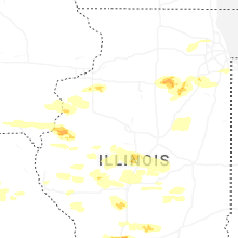


Connect with Interactive Hail Maps