

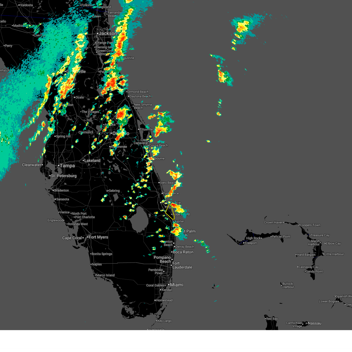
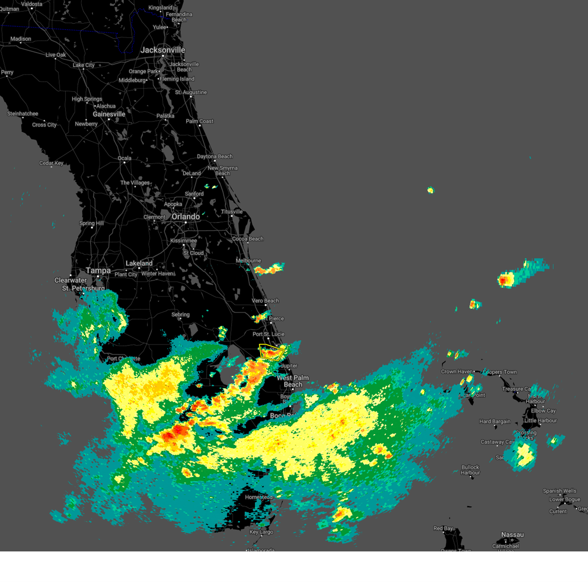
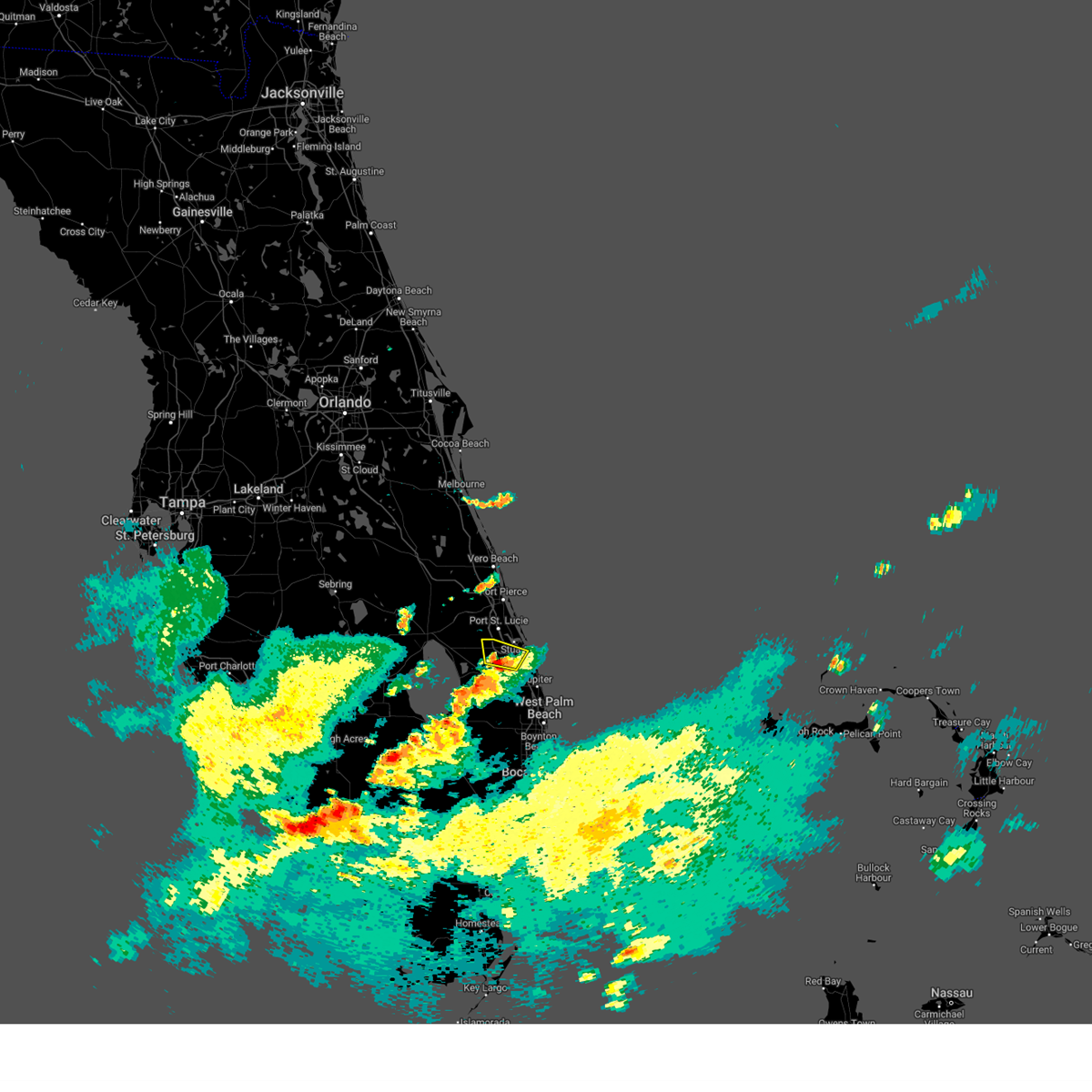
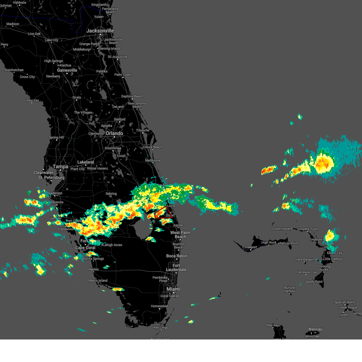
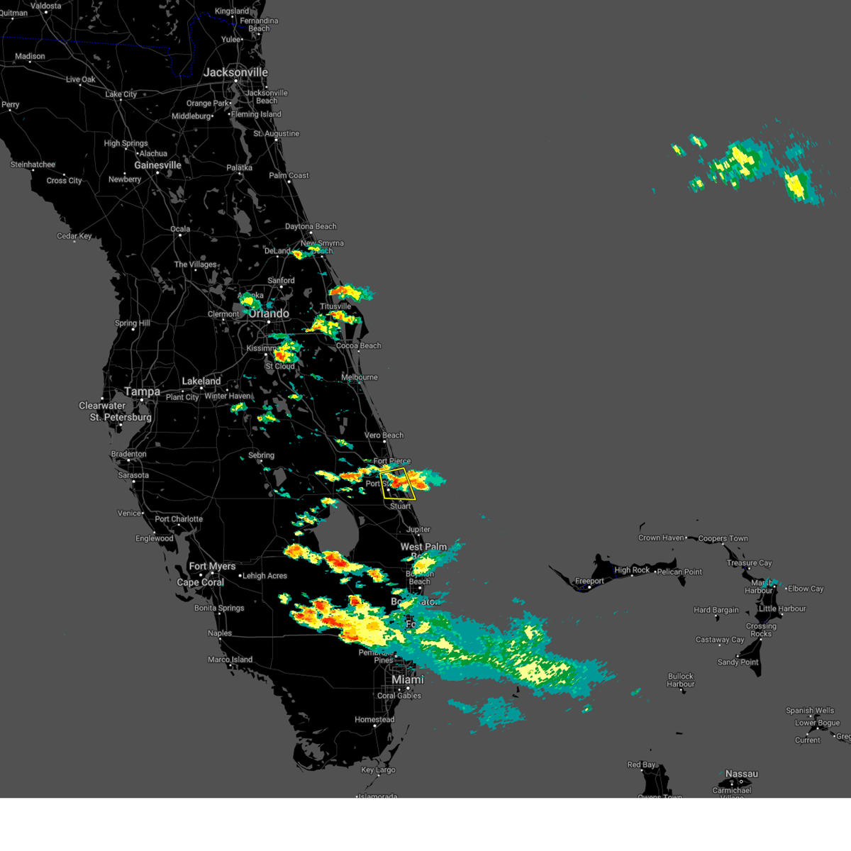
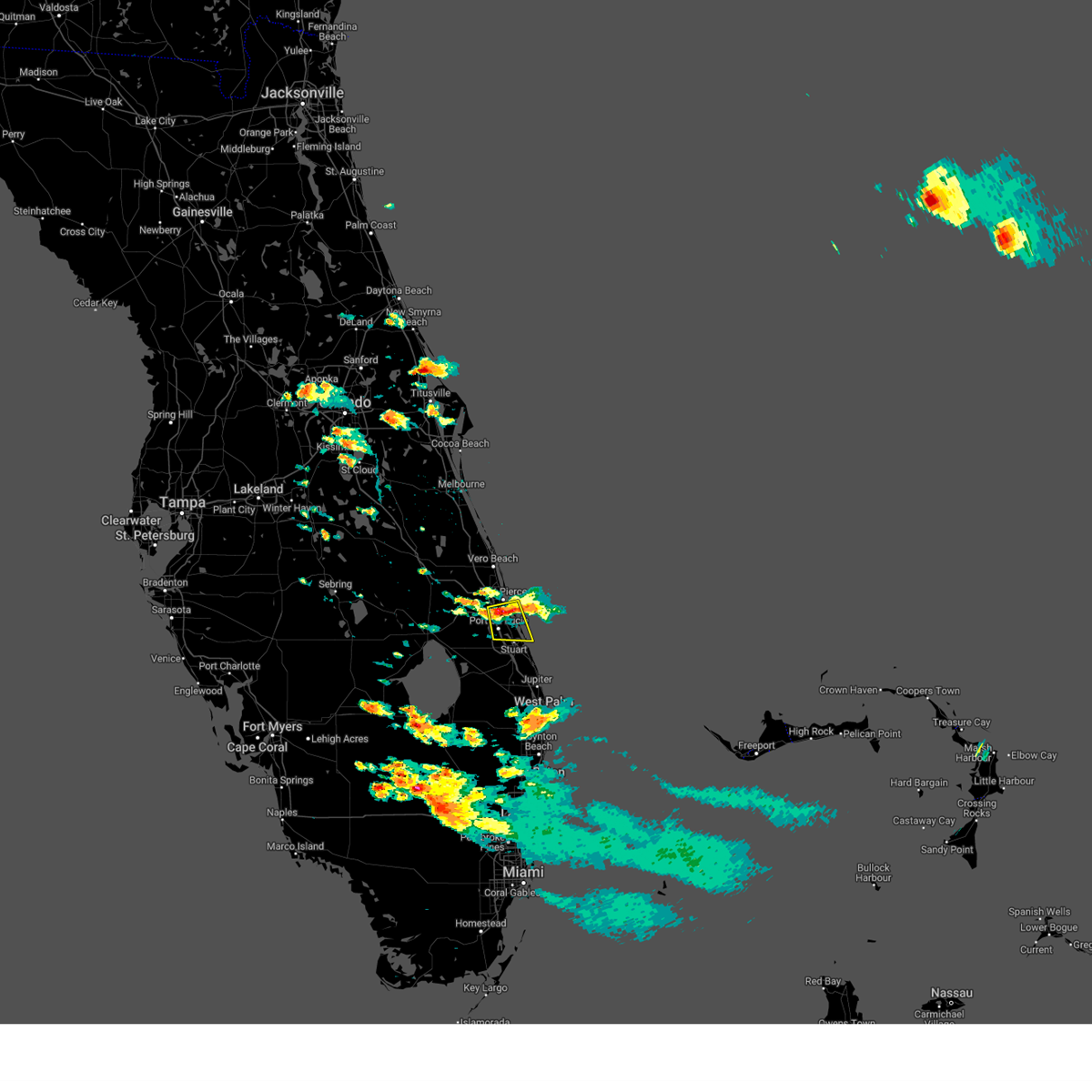
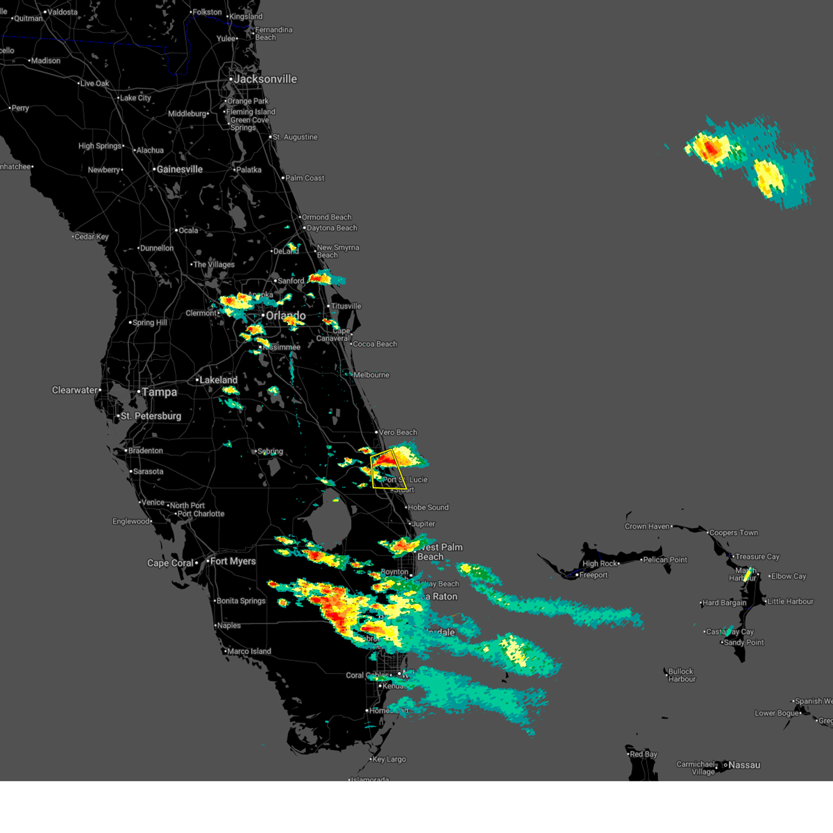
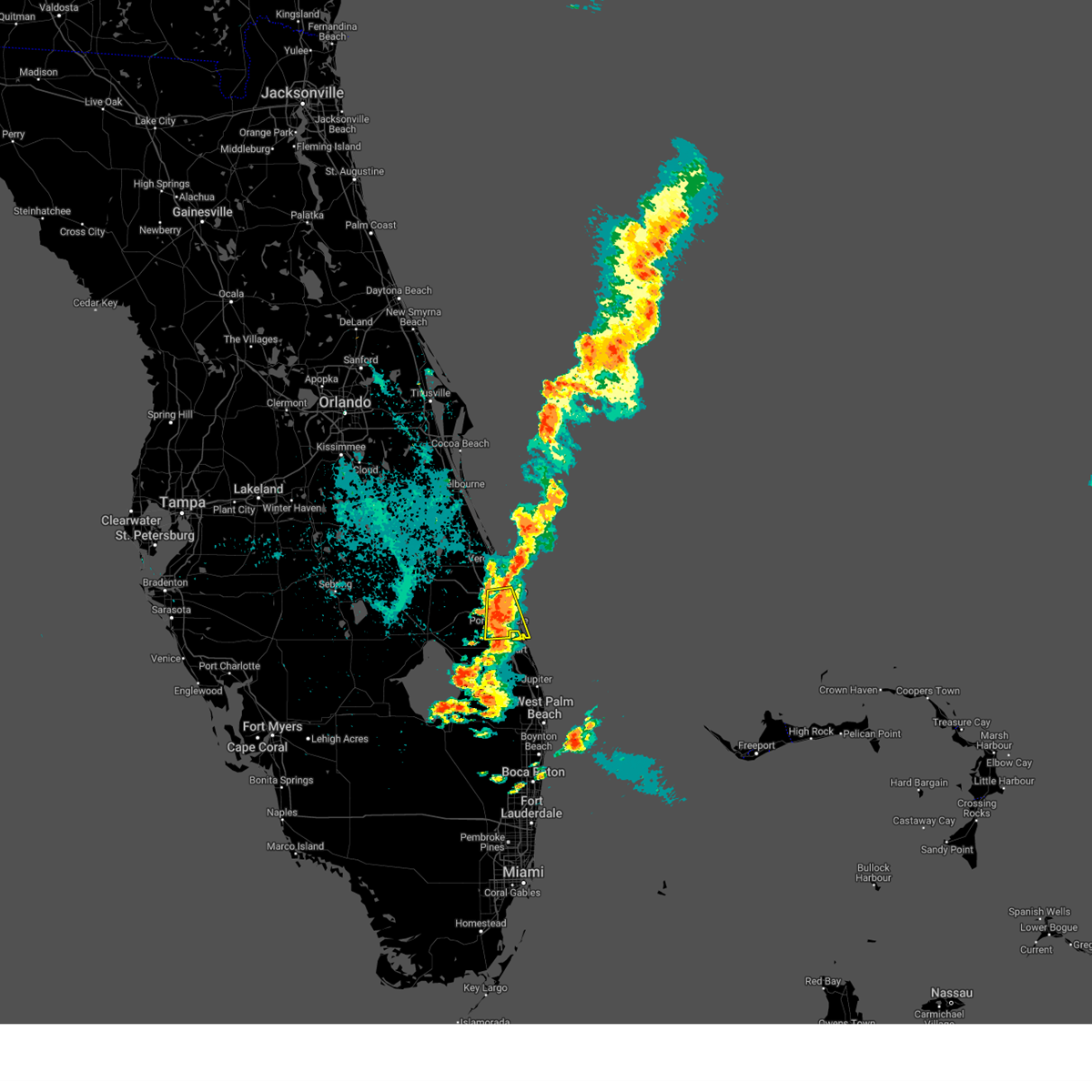
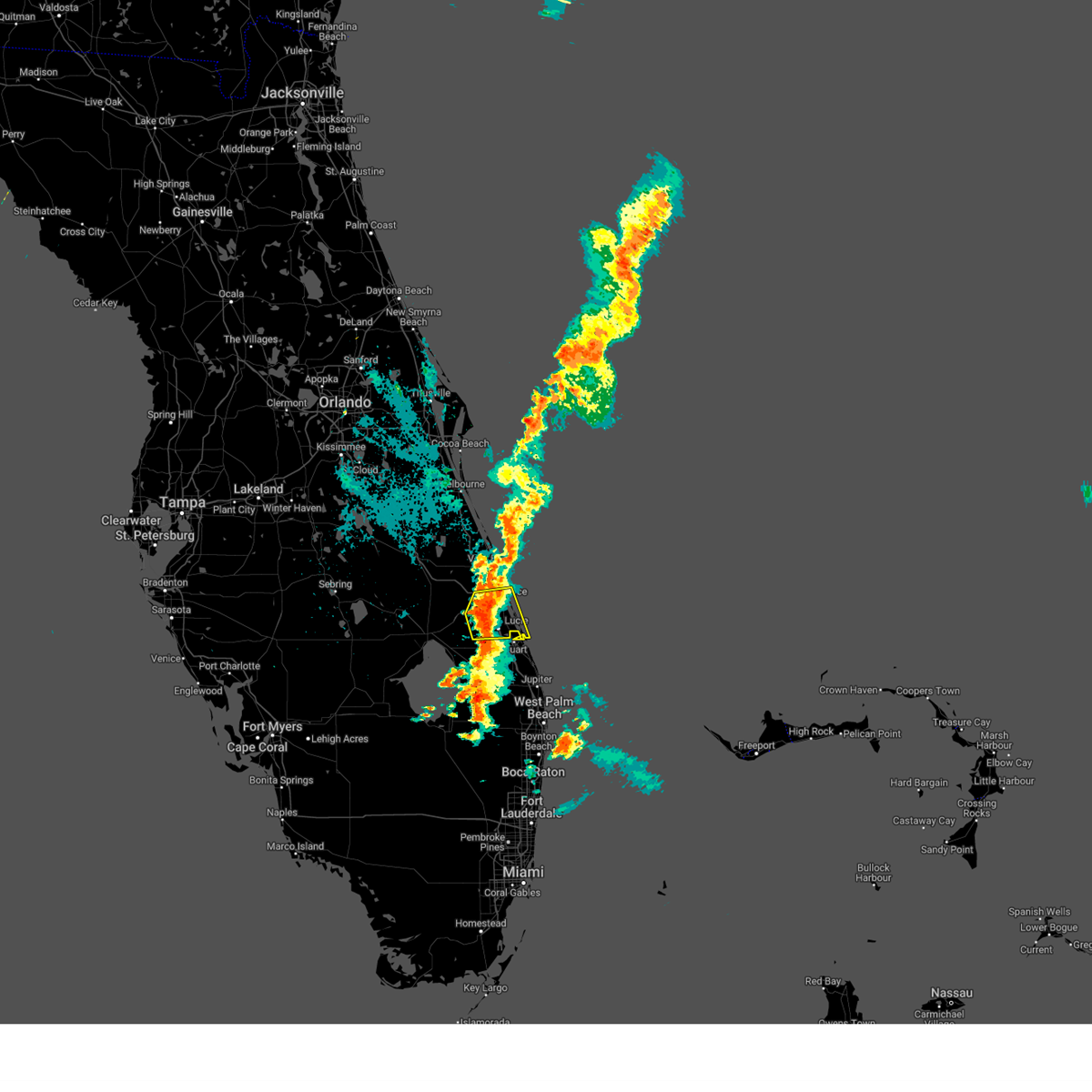
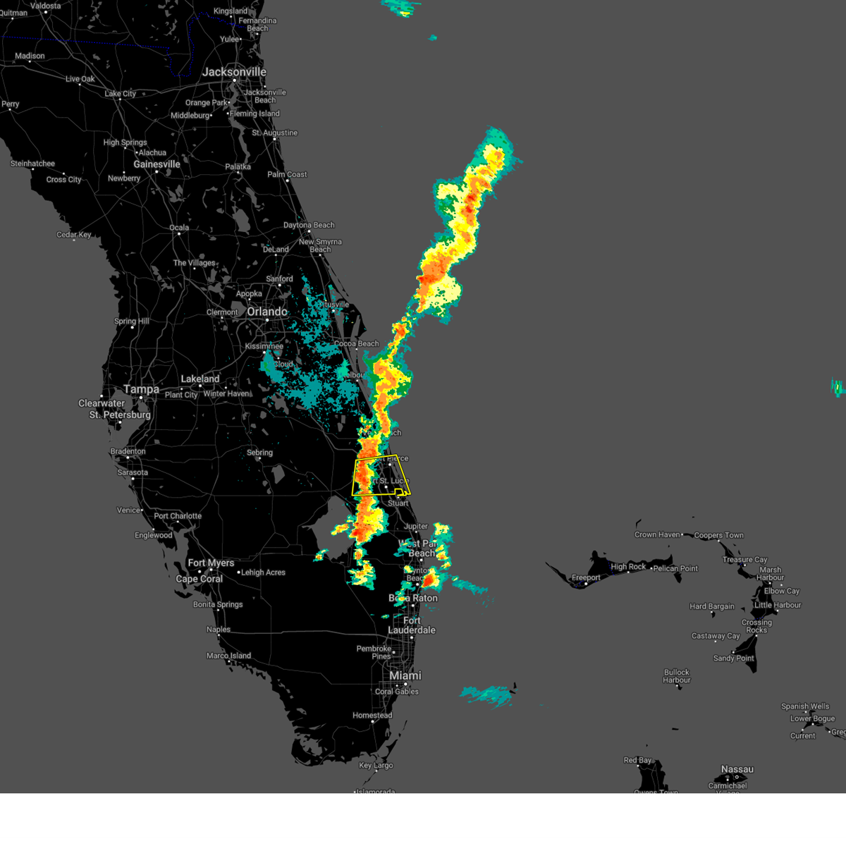
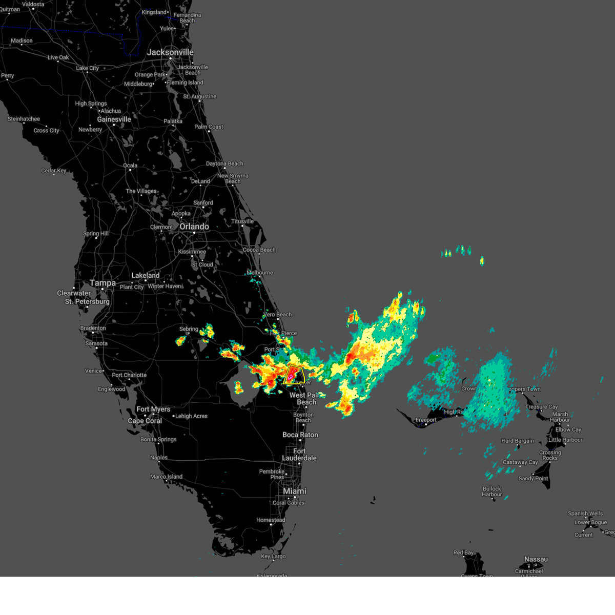
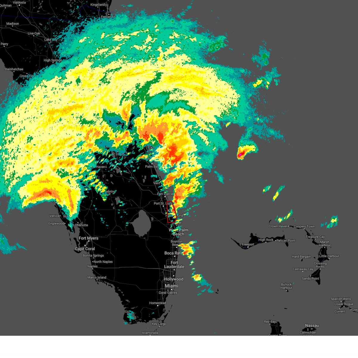
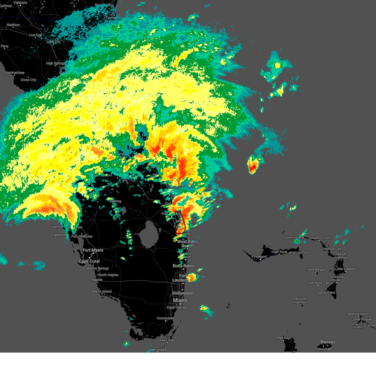
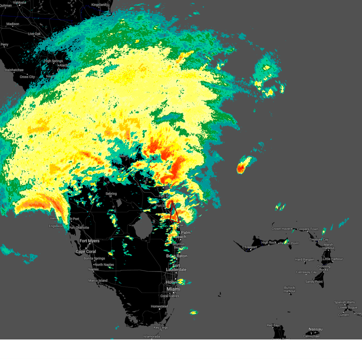
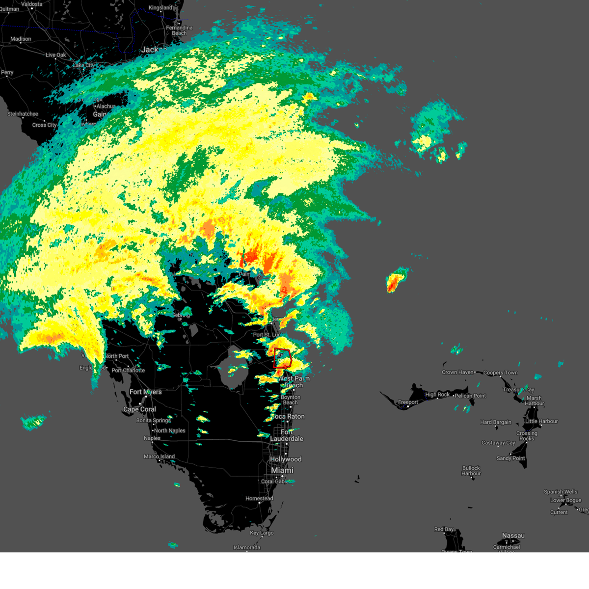
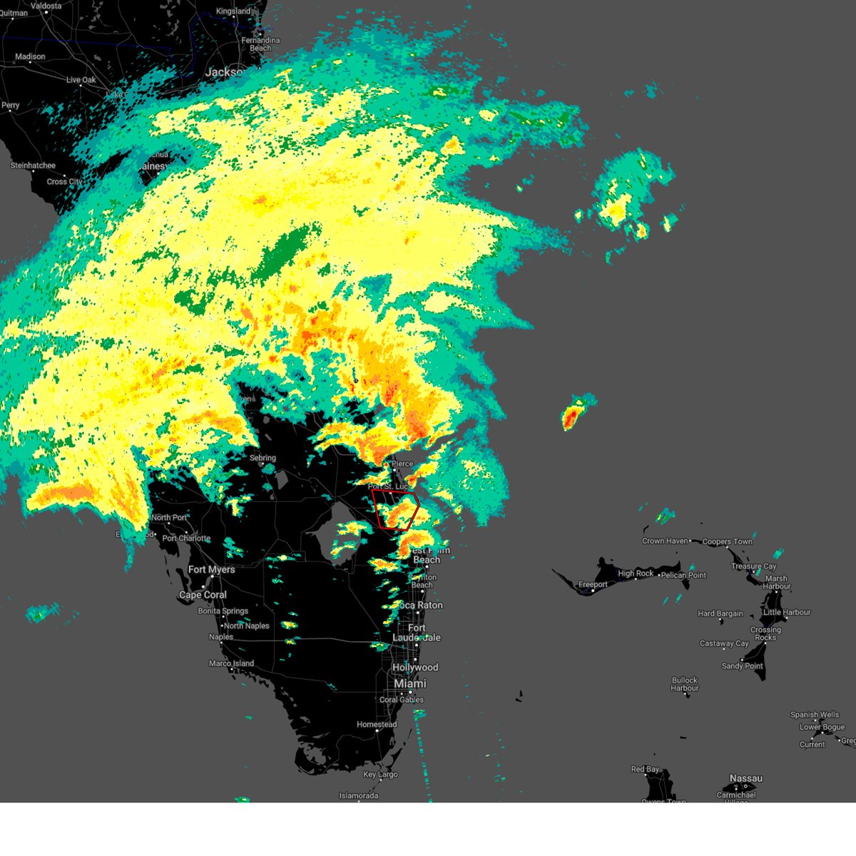
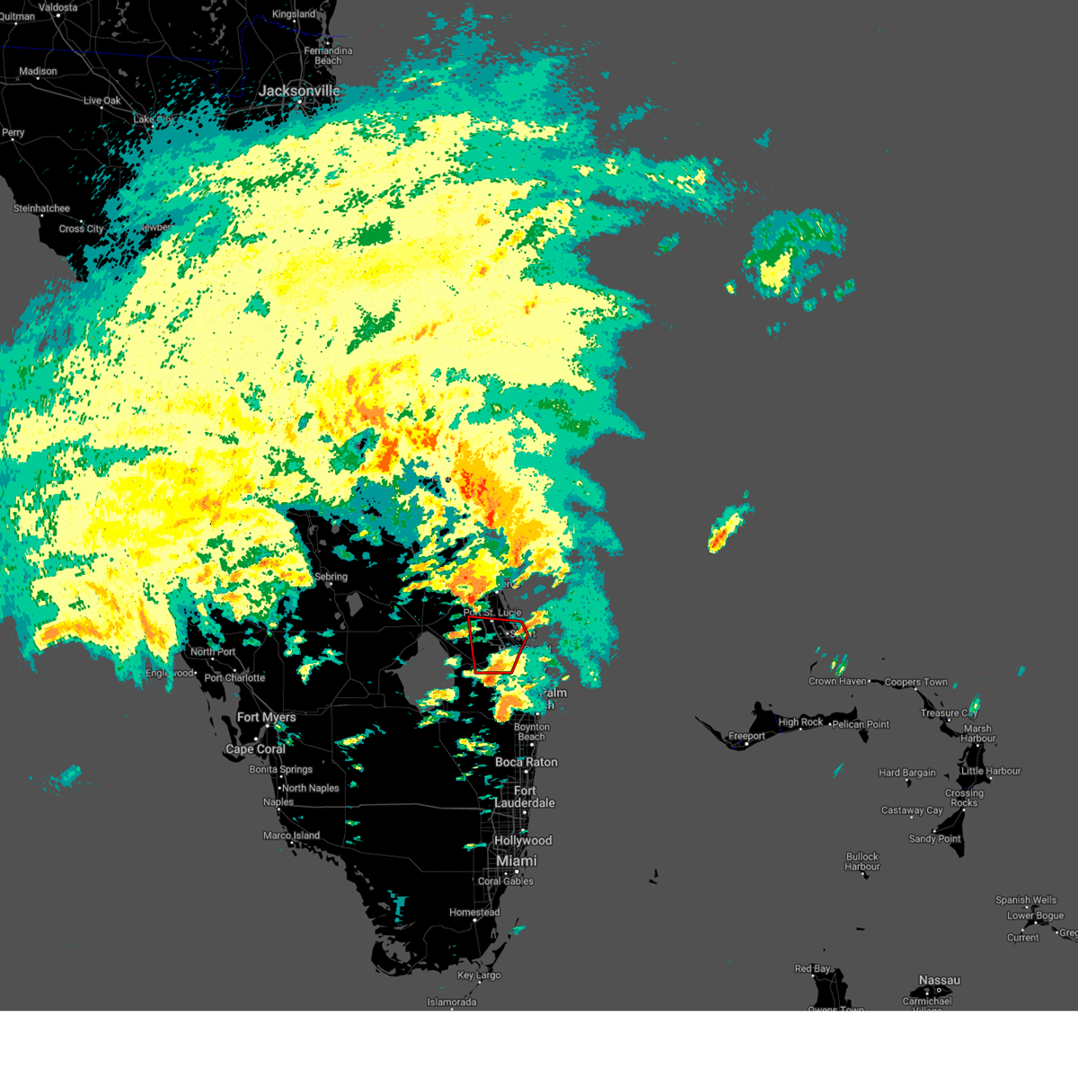
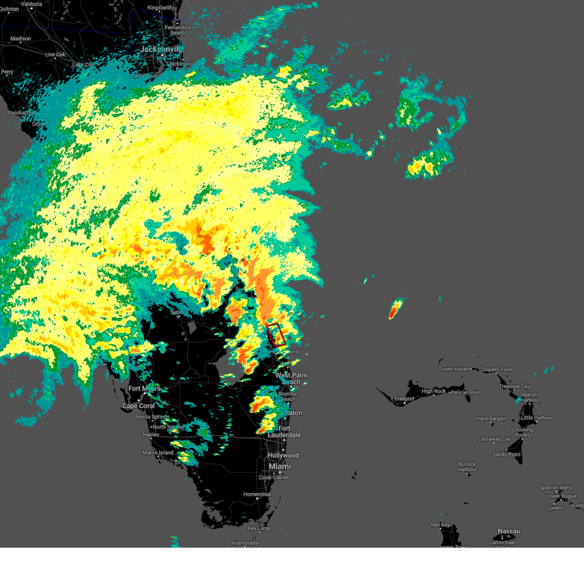
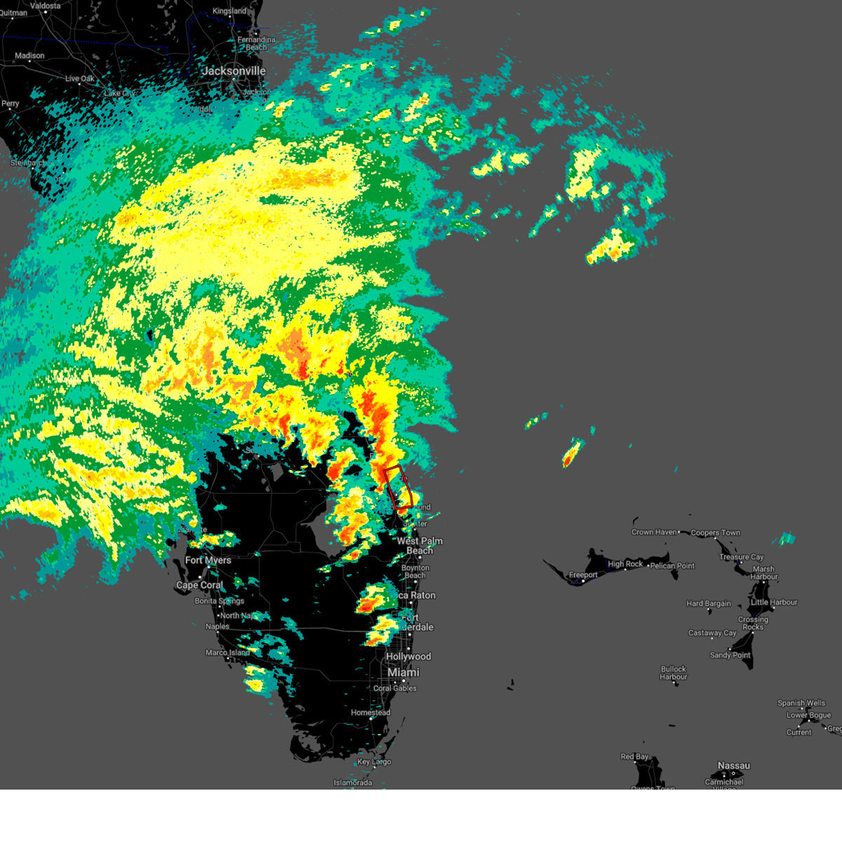
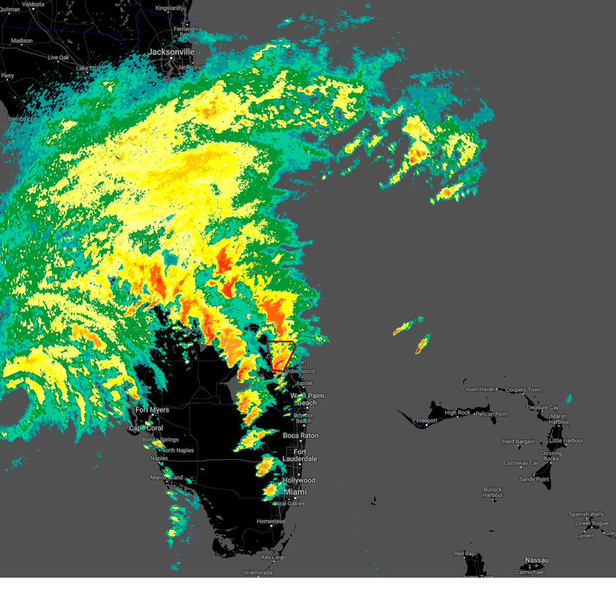
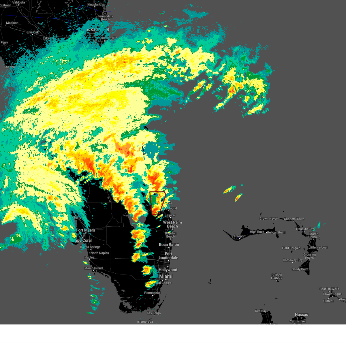
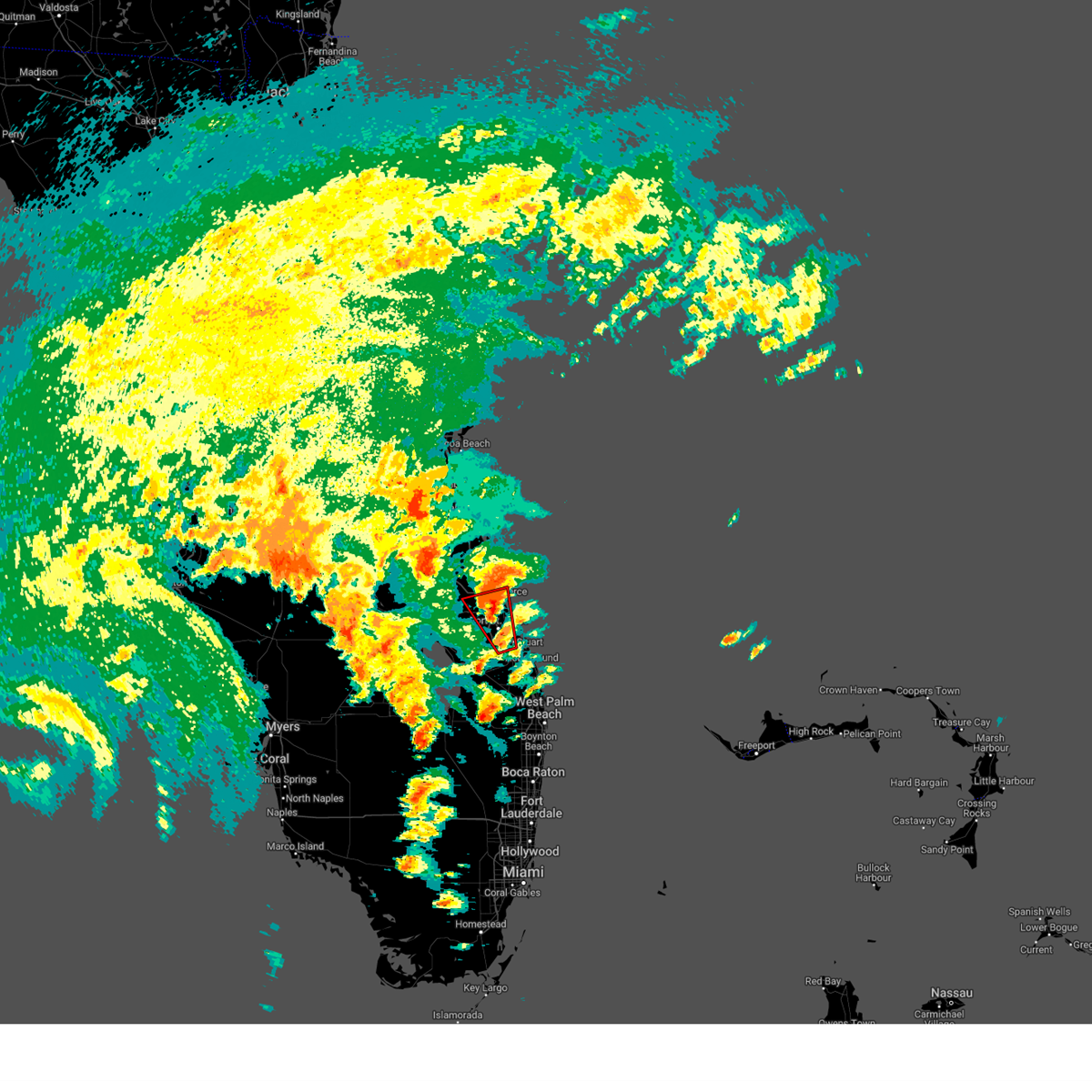
Hail Map for Stuart, FL
The Stuart, FL area has had 8 reports of on-the-ground hail by trained spotters, and has been under severe weather warnings 4 times during the past 12 months. Doppler radar has detected hail at or near Stuart, FL on 36 occasions, including 2 occasions during the past year.
| Name: | Stuart, FL |
| Where Located: | 9.6 miles SE of Port Saint Lucie, FL |
| Map: | Google Map for Stuart, FL |
| Population: | 15593 |
| Housing Units: | 9869 |
| More Info: | Search Google for Stuart, FL |
0
The Top Recent Hail Date for Stuart, FL is Tuesday, May 12, 2026 (33rd out of 36)

Hail and Wind Damage Spotted near Stuart, FL
| Date / Time | Report Details |
|---|---|
| 3/16/2026 2:32 PM EDT |
 the severe thunderstorm warning has been cancelled and is no longer in effect the severe thunderstorm warning has been cancelled and is no longer in effect
|
| 3/16/2026 2:17 PM EDT |
 At 217 pm edt, a severe thunderstorm was located over hobe sound beach, or over hobe sound, moving northeast at 40 mph (radar indicated). Hazards include 60 mph wind gusts and penny size hail. Expect damage to roofs, siding, and trees. Locations impacted include, stuart, tequesta, jupiter island, hobe sound, and port salerno. At 217 pm edt, a severe thunderstorm was located over hobe sound beach, or over hobe sound, moving northeast at 40 mph (radar indicated). Hazards include 60 mph wind gusts and penny size hail. Expect damage to roofs, siding, and trees. Locations impacted include, stuart, tequesta, jupiter island, hobe sound, and port salerno.
|
| 3/16/2026 2:05 PM EDT |
 Svrmlb the national weather service in melbourne has issued a * severe thunderstorm warning for, eastern martin county in east central florida, * until 245 pm edt. * at 205 pm edt, a severe thunderstorm was located near jonathan dickinson state park, or near tequesta, moving north at 25 mph (radar indicated). Hazards include 60 mph wind gusts and penny size hail. expect damage to roofs, siding, and trees Svrmlb the national weather service in melbourne has issued a * severe thunderstorm warning for, eastern martin county in east central florida, * until 245 pm edt. * at 205 pm edt, a severe thunderstorm was located near jonathan dickinson state park, or near tequesta, moving north at 25 mph (radar indicated). Hazards include 60 mph wind gusts and penny size hail. expect damage to roofs, siding, and trees
|
| 7/13/2025 6:31 PM EDT |
 Svrmlb the national weather service in melbourne has issued a * severe thunderstorm warning for, southern st. lucie county in east central florida, central martin county in east central florida, * until 700 pm edt. * at 630 pm edt, a severe thunderstorm was located over tradition, or near port saint lucie, moving south at 20 mph (radar indicated). Hazards include 60 mph wind gusts and penny size hail. expect damage to roofs, siding, and trees Svrmlb the national weather service in melbourne has issued a * severe thunderstorm warning for, southern st. lucie county in east central florida, central martin county in east central florida, * until 700 pm edt. * at 630 pm edt, a severe thunderstorm was located over tradition, or near port saint lucie, moving south at 20 mph (radar indicated). Hazards include 60 mph wind gusts and penny size hail. expect damage to roofs, siding, and trees
|
| 6/2/2025 5:36 PM EDT |
 The storm which prompted the warning has weakened below severe limits, and no longer poses an immediate threat to life or property. therefore, the warning will be allowed to expire. however small hail and gusty winds are still possible with this thunderstorm. The storm which prompted the warning has weakened below severe limits, and no longer poses an immediate threat to life or property. therefore, the warning will be allowed to expire. however small hail and gusty winds are still possible with this thunderstorm.
|
| 6/2/2025 5:16 PM EDT |
 Svrmlb the national weather service in melbourne has issued a * severe thunderstorm warning for, central martin county in east central florida, * until 545 pm edt. * at 516 pm edt, a severe thunderstorm was located 7 miles southwest of palm city, moving north at 15 mph (radar indicated). Hazards include 60 mph wind gusts and quarter size hail. Hail damage to vehicles is expected. Expect wind damage to roofs, siding, and trees. Svrmlb the national weather service in melbourne has issued a * severe thunderstorm warning for, central martin county in east central florida, * until 545 pm edt. * at 516 pm edt, a severe thunderstorm was located 7 miles southwest of palm city, moving north at 15 mph (radar indicated). Hazards include 60 mph wind gusts and quarter size hail. Hail damage to vehicles is expected. Expect wind damage to roofs, siding, and trees.
|
| 6/1/2025 7:28 AM EDT |
 Tormlb the national weather service in melbourne has issued a * tornado warning for, south central st. lucie county in east central florida, central martin county in east central florida, * until 800 am edt. * at 728 am edt, a severe thunderstorm capable of producing a tornado was located 7 miles north of indiantown, moving east at 25 mph (radar indicated rotation). Hazards include tornado. Flying debris will be dangerous to those caught without shelter. mobile homes will be damaged or destroyed. damage to roofs, windows, and vehicles will occur. tree damage is likely. This dangerous storm will be near, palm city around 740 am edt. Tormlb the national weather service in melbourne has issued a * tornado warning for, south central st. lucie county in east central florida, central martin county in east central florida, * until 800 am edt. * at 728 am edt, a severe thunderstorm capable of producing a tornado was located 7 miles north of indiantown, moving east at 25 mph (radar indicated rotation). Hazards include tornado. Flying debris will be dangerous to those caught without shelter. mobile homes will be damaged or destroyed. damage to roofs, windows, and vehicles will occur. tree damage is likely. This dangerous storm will be near, palm city around 740 am edt.
|
| 5/5/2025 5:27 PM EDT |
 the severe thunderstorm warning has been cancelled and is no longer in effect the severe thunderstorm warning has been cancelled and is no longer in effect
|
| 5/5/2025 5:09 PM EDT |
 At 509 pm edt, a severe thunderstorm was located over indian river estates, or over white city, moving southeast at 20 mph (radar indicated). Hazards include 60 mph wind gusts and quarter size hail. Hail damage to vehicles is expected. expect wind damage to roofs, siding, and trees. Locations impacted include, port saint lucie, walton, fort pierce, stuart, and white city. At 509 pm edt, a severe thunderstorm was located over indian river estates, or over white city, moving southeast at 20 mph (radar indicated). Hazards include 60 mph wind gusts and quarter size hail. Hail damage to vehicles is expected. expect wind damage to roofs, siding, and trees. Locations impacted include, port saint lucie, walton, fort pierce, stuart, and white city.
|
| 5/5/2025 4:57 PM EDT |
 Svrmlb the national weather service in melbourne has issued a * severe thunderstorm warning for, eastern st. lucie county in east central florida, northeastern martin county in east central florida, * until 545 pm edt. * at 457 pm edt, a severe thunderstorm was located over fort pierce south, or over fort pierce, moving southeast at 20 mph (radar indicated). Hazards include 60 mph wind gusts and quarter size hail. Hail damage to vehicles is expected. Expect wind damage to roofs, siding, and trees. Svrmlb the national weather service in melbourne has issued a * severe thunderstorm warning for, eastern st. lucie county in east central florida, northeastern martin county in east central florida, * until 545 pm edt. * at 457 pm edt, a severe thunderstorm was located over fort pierce south, or over fort pierce, moving southeast at 20 mph (radar indicated). Hazards include 60 mph wind gusts and quarter size hail. Hail damage to vehicles is expected. Expect wind damage to roofs, siding, and trees.
|
| 3/31/2025 9:46 PM EDT |
 The storm which prompted the warning has weakened below severe limits. therefore, the warning has been allowed to expire. however gusty winds are still possible with this thunderstorm. to report severe weather, contact your nearest law enforcement agency. they will relay your report to the national weather service melbourne. The storm which prompted the warning has weakened below severe limits. therefore, the warning has been allowed to expire. however gusty winds are still possible with this thunderstorm. to report severe weather, contact your nearest law enforcement agency. they will relay your report to the national weather service melbourne.
|
| 3/31/2025 9:39 PM EDT |
 At 939 pm edt, a severe thunderstorm was located over indian river estates, or over white city, moving east at 35 mph (radar indicated). Hazards include 60 mph wind gusts and nickel size hail. Expect damage to roofs, siding, and trees. Locations impacted include, fort pierce ocean park, tradition, fort pierce north, saint lucie airport, and pepper beach park. At 939 pm edt, a severe thunderstorm was located over indian river estates, or over white city, moving east at 35 mph (radar indicated). Hazards include 60 mph wind gusts and nickel size hail. Expect damage to roofs, siding, and trees. Locations impacted include, fort pierce ocean park, tradition, fort pierce north, saint lucie airport, and pepper beach park.
|
| 3/31/2025 9:25 PM EDT |
 At 925 pm edt, a severe thunderstorm was located near saint lucie west, or 7 miles west of white city, moving east at 25 mph (radar indicated). Hazards include 60 mph wind gusts and nickel size hail. Expect damage to roofs, siding, and trees. Locations impacted include, fort pierce ocean park, tradition, fort pierce north, saint lucie airport, and pepper beach park. At 925 pm edt, a severe thunderstorm was located near saint lucie west, or 7 miles west of white city, moving east at 25 mph (radar indicated). Hazards include 60 mph wind gusts and nickel size hail. Expect damage to roofs, siding, and trees. Locations impacted include, fort pierce ocean park, tradition, fort pierce north, saint lucie airport, and pepper beach park.
|
| 3/31/2025 9:12 PM EDT |
 Svrmlb the national weather service in melbourne has issued a * severe thunderstorm warning for, st. lucie county in east central florida, * until 945 pm edt. * at 912 pm edt, a severe thunderstorm was located near tradition, or 8 miles northwest of port saint lucie, moving east at 35 mph (radar indicated). Hazards include 60 mph wind gusts and nickel size hail. expect damage to roofs, siding, and trees Svrmlb the national weather service in melbourne has issued a * severe thunderstorm warning for, st. lucie county in east central florida, * until 945 pm edt. * at 912 pm edt, a severe thunderstorm was located near tradition, or 8 miles northwest of port saint lucie, moving east at 35 mph (radar indicated). Hazards include 60 mph wind gusts and nickel size hail. expect damage to roofs, siding, and trees
|
| 3/25/2025 7:52 PM EDT |
 Svrmlb the national weather service in melbourne has issued a * severe thunderstorm warning for, southeastern martin county in east central florida, * until 830 pm edt. * at 752 pm edt, a severe thunderstorm was located near hobe sound, moving southeast at 15 mph (radar indicated). Hazards include 60 mph wind gusts and quarter size hail. Hail damage to vehicles is expected. Expect wind damage to roofs, siding, and trees. Svrmlb the national weather service in melbourne has issued a * severe thunderstorm warning for, southeastern martin county in east central florida, * until 830 pm edt. * at 752 pm edt, a severe thunderstorm was located near hobe sound, moving southeast at 15 mph (radar indicated). Hazards include 60 mph wind gusts and quarter size hail. Hail damage to vehicles is expected. Expect wind damage to roofs, siding, and trees.
|
| 10/9/2024 6:20 PM EDT |
 The storm which prompted the warning has moved out of the area. therefore, the warning will be allowed to expire. a tornado watch remains in effect until 900 pm edt for east central florida. The storm which prompted the warning has moved out of the area. therefore, the warning will be allowed to expire. a tornado watch remains in effect until 900 pm edt for east central florida.
|
| 10/9/2024 6:01 PM EDT |
 Tormlb the national weather service in melbourne has issued a * tornado warning for, east central st. lucie county in east central florida, eastern martin county in east central florida, * until 630 pm edt. * at 601 pm edt, a severe thunderstorm capable of producing a tornado was located near hobe sound, moving north at 45 mph (radar indicated rotation). Hazards include tornado. Flying debris will be dangerous to those caught without shelter. mobile homes will be damaged or destroyed. damage to roofs, windows, and vehicles will occur. tree damage is likely. this dangerous storm will be near, stuart, jupiter island, and palm city around 610 pm edt. nettles island around 620 pm edt. Other locations impacted by this tornadic thunderstorm include rio. Tormlb the national weather service in melbourne has issued a * tornado warning for, east central st. lucie county in east central florida, eastern martin county in east central florida, * until 630 pm edt. * at 601 pm edt, a severe thunderstorm capable of producing a tornado was located near hobe sound, moving north at 45 mph (radar indicated rotation). Hazards include tornado. Flying debris will be dangerous to those caught without shelter. mobile homes will be damaged or destroyed. damage to roofs, windows, and vehicles will occur. tree damage is likely. this dangerous storm will be near, stuart, jupiter island, and palm city around 610 pm edt. nettles island around 620 pm edt. Other locations impacted by this tornadic thunderstorm include rio.
|
| 10/9/2024 5:40 PM EDT |
 Tormlb the national weather service in melbourne has issued a * tornado warning for, northeastern martin county in east central florida, * until 615 pm edt. * at 540 pm edt, a severe thunderstorm capable of producing a tornado was located over port salerno, moving north at 30 mph (radar indicated rotation). Hazards include tornado. Flying debris will be dangerous to those caught without shelter. mobile homes will be damaged or destroyed. damage to roofs, windows, and vehicles will occur. tree damage is likely. this dangerous storm will be near, stuart, jensen beach, and port salerno around 550 pm edt. nettles island around 600 pm edt. Other locations impacted by this tornadic thunderstorm include rio. Tormlb the national weather service in melbourne has issued a * tornado warning for, northeastern martin county in east central florida, * until 615 pm edt. * at 540 pm edt, a severe thunderstorm capable of producing a tornado was located over port salerno, moving north at 30 mph (radar indicated rotation). Hazards include tornado. Flying debris will be dangerous to those caught without shelter. mobile homes will be damaged or destroyed. damage to roofs, windows, and vehicles will occur. tree damage is likely. this dangerous storm will be near, stuart, jensen beach, and port salerno around 550 pm edt. nettles island around 600 pm edt. Other locations impacted by this tornadic thunderstorm include rio.
|
| 10/9/2024 5:25 PM EDT |
 Tormlb the national weather service in melbourne has issued a * tornado warning for, eastern st. lucie county in east central florida, northeastern martin county in east central florida, * until 600 pm edt. * at 524 pm edt, a tornado producing storm was located over north river shores, or over palm city, moving north at 30 mph (radar confirmed tornado). Hazards include damaging tornado. Flying debris will be dangerous to those caught without shelter. mobile homes will be damaged or destroyed. damage to roofs, windows, and vehicles will occur. tree damage is likely. this tornadic storm will be near, port saint lucie, walton, and stuart around 530 pm edt. fort pierce, saint lucie nuclear power plant, and white city around 540 pm edt. fort pierce inlet around 550 pm edt. queens cove around 600 pm edt. Other locations impacted by this tornadic thunderstorm include fort pierce ocean park. Tormlb the national weather service in melbourne has issued a * tornado warning for, eastern st. lucie county in east central florida, northeastern martin county in east central florida, * until 600 pm edt. * at 524 pm edt, a tornado producing storm was located over north river shores, or over palm city, moving north at 30 mph (radar confirmed tornado). Hazards include damaging tornado. Flying debris will be dangerous to those caught without shelter. mobile homes will be damaged or destroyed. damage to roofs, windows, and vehicles will occur. tree damage is likely. this tornadic storm will be near, port saint lucie, walton, and stuart around 530 pm edt. fort pierce, saint lucie nuclear power plant, and white city around 540 pm edt. fort pierce inlet around 550 pm edt. queens cove around 600 pm edt. Other locations impacted by this tornadic thunderstorm include fort pierce ocean park.
|
| 10/9/2024 5:20 PM EDT |
 At 519 pm edt, a confirmed tornado was located near north county airport, or near jupiter, moving north at 40 mph (radar confirmed tornado). Hazards include damaging tornado. Flying debris will be dangerous to those caught without shelter. mobile homes will be damaged or destroyed. damage to roofs, windows, and vehicles will occur. tree damage is likely. this tornado will be near, jupiter around 520 pm edt. jupiter island, port salerno, and hobe sound around 530 pm edt. stuart around 540 pm edt. Other locations impacted by this tornadic thunderstorm include hobe sound wildlife refuge. At 519 pm edt, a confirmed tornado was located near north county airport, or near jupiter, moving north at 40 mph (radar confirmed tornado). Hazards include damaging tornado. Flying debris will be dangerous to those caught without shelter. mobile homes will be damaged or destroyed. damage to roofs, windows, and vehicles will occur. tree damage is likely. this tornado will be near, jupiter around 520 pm edt. jupiter island, port salerno, and hobe sound around 530 pm edt. stuart around 540 pm edt. Other locations impacted by this tornadic thunderstorm include hobe sound wildlife refuge.
|
| 10/9/2024 5:16 PM EDT |
 Tormlb the national weather service in melbourne has issued a * tornado warning for, southeastern martin county in east central florida, * until 545 pm edt. * at 515 pm edt, a severe thunderstorm capable of producing a tornado was located over north county airport, or near palm beach gardens, moving north at 40 mph (radar indicated rotation). Hazards include tornado. Flying debris will be dangerous to those caught without shelter. mobile homes will be damaged or destroyed. damage to roofs, windows, and vehicles will occur. tree damage is likely. this dangerous storm will be near, jupiter around 520 pm edt. jupiter island, port salerno, and hobe sound around 530 pm edt. stuart around 540 pm edt. Other locations impacted by this tornadic thunderstorm include hobe sound wildlife refuge. Tormlb the national weather service in melbourne has issued a * tornado warning for, southeastern martin county in east central florida, * until 545 pm edt. * at 515 pm edt, a severe thunderstorm capable of producing a tornado was located over north county airport, or near palm beach gardens, moving north at 40 mph (radar indicated rotation). Hazards include tornado. Flying debris will be dangerous to those caught without shelter. mobile homes will be damaged or destroyed. damage to roofs, windows, and vehicles will occur. tree damage is likely. this dangerous storm will be near, jupiter around 520 pm edt. jupiter island, port salerno, and hobe sound around 530 pm edt. stuart around 540 pm edt. Other locations impacted by this tornadic thunderstorm include hobe sound wildlife refuge.
|
| 10/9/2024 5:13 PM EDT |
 At 513 pm edt, a confirmed tornado was located near palm city, moving north at 40 mph (radar confirmed tornado). Hazards include damaging tornado. Flying debris will be dangerous to those caught without shelter. mobile homes will be damaged or destroyed. damage to roofs, windows, and vehicles will occur. tree damage is likely. this tornado will be near, stuart, palm city, and jensen beach around 520 pm edt. port saint lucie around 530 pm edt. Other locations impacted by this tornadic thunderstorm include rio. At 513 pm edt, a confirmed tornado was located near palm city, moving north at 40 mph (radar confirmed tornado). Hazards include damaging tornado. Flying debris will be dangerous to those caught without shelter. mobile homes will be damaged or destroyed. damage to roofs, windows, and vehicles will occur. tree damage is likely. this tornado will be near, stuart, palm city, and jensen beach around 520 pm edt. port saint lucie around 530 pm edt. Other locations impacted by this tornadic thunderstorm include rio.
|
| 10/9/2024 4:59 PM EDT |
 Tormlb the national weather service in melbourne has issued a * tornado warning for, southeastern st. lucie county in east central florida, central martin county in east central florida, * until 530 pm edt. * at 458 pm edt, a severe thunderstorm capable of producing a tornado was located 8 miles southeast of indiantown, moving north at 40 mph (radar indicated rotation). Hazards include tornado. Flying debris will be dangerous to those caught without shelter. mobile homes will be damaged or destroyed. damage to roofs, windows, and vehicles will occur. tree damage is likely. this dangerous storm will be near, palm city around 510 pm edt. stuart, jensen beach, and north river shores around 520 pm edt. port saint lucie around 530 pm edt. Other locations impacted by this tornadic thunderstorm include rio. Tormlb the national weather service in melbourne has issued a * tornado warning for, southeastern st. lucie county in east central florida, central martin county in east central florida, * until 530 pm edt. * at 458 pm edt, a severe thunderstorm capable of producing a tornado was located 8 miles southeast of indiantown, moving north at 40 mph (radar indicated rotation). Hazards include tornado. Flying debris will be dangerous to those caught without shelter. mobile homes will be damaged or destroyed. damage to roofs, windows, and vehicles will occur. tree damage is likely. this dangerous storm will be near, palm city around 510 pm edt. stuart, jensen beach, and north river shores around 520 pm edt. port saint lucie around 530 pm edt. Other locations impacted by this tornadic thunderstorm include rio.
|
| 10/9/2024 4:12 PM EDT |
 At 412 pm edt, a confirmed tornado was located over jensen beach, moving north at 40 mph (public confirmed tornado). Hazards include damaging tornado. Flying debris will be dangerous to those caught without shelter. mobile homes will be damaged or destroyed. damage to roofs, windows, and vehicles will occur. tree damage is likely. this tornado will be near, walton, saint lucie nuclear power plant, and jensen beach around 420 pm edt. Other locations impacted by this tornadic thunderstorm include rio. At 412 pm edt, a confirmed tornado was located over jensen beach, moving north at 40 mph (public confirmed tornado). Hazards include damaging tornado. Flying debris will be dangerous to those caught without shelter. mobile homes will be damaged or destroyed. damage to roofs, windows, and vehicles will occur. tree damage is likely. this tornado will be near, walton, saint lucie nuclear power plant, and jensen beach around 420 pm edt. Other locations impacted by this tornadic thunderstorm include rio.
|
| 10/9/2024 4:07 PM EDT |
 Tormlb the national weather service in melbourne has issued a * tornado warning for, southeastern st. lucie county in east central florida, northeastern martin county in east central florida, * until 445 pm edt. * at 407 pm edt, a severe thunderstorm capable of producing a tornado was located over witham field, or over stuart, moving north at 40 mph (radar indicated rotation). Hazards include tornado. Flying debris will be dangerous to those caught without shelter. mobile homes will be damaged or destroyed. damage to roofs, windows, and vehicles will occur. tree damage is likely. this dangerous storm will be near, walton, stuart, and palm city around 410 pm edt. fort pierce, saint lucie nuclear power plant, and white city around 420 pm edt. Other locations impacted by this tornadic thunderstorm include rio. Tormlb the national weather service in melbourne has issued a * tornado warning for, southeastern st. lucie county in east central florida, northeastern martin county in east central florida, * until 445 pm edt. * at 407 pm edt, a severe thunderstorm capable of producing a tornado was located over witham field, or over stuart, moving north at 40 mph (radar indicated rotation). Hazards include tornado. Flying debris will be dangerous to those caught without shelter. mobile homes will be damaged or destroyed. damage to roofs, windows, and vehicles will occur. tree damage is likely. this dangerous storm will be near, walton, stuart, and palm city around 410 pm edt. fort pierce, saint lucie nuclear power plant, and white city around 420 pm edt. Other locations impacted by this tornadic thunderstorm include rio.
|
| 10/9/2024 3:35 PM EDT |
 At 334 pm edt, a confirmed tornado was located near palm city, moving north at 35 mph (radar confirmed tornado). Hazards include damaging tornado. Flying debris will be dangerous to those caught without shelter. mobile homes will be damaged or destroyed. damage to roofs, windows, and vehicles will occur. tree damage is likely. this tornado will be near, port saint lucie, palm city, and tradition around 340 pm edt. fort pierce, white city, and indian river estates around 350 pm edt. Other locations impacted by this tornadic thunderstorm include hutchinson island south. At 334 pm edt, a confirmed tornado was located near palm city, moving north at 35 mph (radar confirmed tornado). Hazards include damaging tornado. Flying debris will be dangerous to those caught without shelter. mobile homes will be damaged or destroyed. damage to roofs, windows, and vehicles will occur. tree damage is likely. this tornado will be near, port saint lucie, palm city, and tradition around 340 pm edt. fort pierce, white city, and indian river estates around 350 pm edt. Other locations impacted by this tornadic thunderstorm include hutchinson island south.
|
| 10/9/2024 3:21 PM EDT |
 Tormlb the national weather service in melbourne has issued a * tornado warning for, southeastern st. lucie county in east central florida, central martin county in east central florida, * until 400 pm edt. * at 321 pm edt, a tornado producing storm was located near indiantown, moving north at 40 mph (radar confirmed tornado). Hazards include damaging tornado. Flying debris will be dangerous to those caught without shelter. mobile homes will be damaged or destroyed. damage to roofs, windows, and vehicles will occur. tree damage is likely. this tornadic storm will be near, palm city around 330 pm edt. port saint lucie, walton, and stuart around 340 pm edt. fort pierce, saint lucie nuclear power plant, and fort pierce south around 350 pm edt. Other locations impacted by this tornadic thunderstorm include hutchinson island south. Tormlb the national weather service in melbourne has issued a * tornado warning for, southeastern st. lucie county in east central florida, central martin county in east central florida, * until 400 pm edt. * at 321 pm edt, a tornado producing storm was located near indiantown, moving north at 40 mph (radar confirmed tornado). Hazards include damaging tornado. Flying debris will be dangerous to those caught without shelter. mobile homes will be damaged or destroyed. damage to roofs, windows, and vehicles will occur. tree damage is likely. this tornadic storm will be near, palm city around 330 pm edt. port saint lucie, walton, and stuart around 340 pm edt. fort pierce, saint lucie nuclear power plant, and fort pierce south around 350 pm edt. Other locations impacted by this tornadic thunderstorm include hutchinson island south.
|
| 10/9/2024 2:53 PM EDT |
 Tormlb the national weather service in melbourne has issued a * tornado warning for, central st. lucie county in east central florida, north central martin county in east central florida, * until 330 pm edt. * at 252 pm edt, a severe thunderstorm capable of producing a tornado was located near north river shores, or near palm city, moving north at 35 mph (radar indicated rotation). Hazards include tornado. Flying debris will be dangerous to those caught without shelter. mobile homes will be damaged or destroyed. damage to roofs, windows, and vehicles will occur. tree damage is likely. this dangerous storm will be near, port saint lucie, jensen beach, and white city around 300 pm edt. fort pierce, fort pierce north, and fort pierce south around 310 pm edt. saint lucie airport around 320 pm edt. Other locations impacted by this tornadic thunderstorm include pepper beach park. Tormlb the national weather service in melbourne has issued a * tornado warning for, central st. lucie county in east central florida, north central martin county in east central florida, * until 330 pm edt. * at 252 pm edt, a severe thunderstorm capable of producing a tornado was located near north river shores, or near palm city, moving north at 35 mph (radar indicated rotation). Hazards include tornado. Flying debris will be dangerous to those caught without shelter. mobile homes will be damaged or destroyed. damage to roofs, windows, and vehicles will occur. tree damage is likely. this dangerous storm will be near, port saint lucie, jensen beach, and white city around 300 pm edt. fort pierce, fort pierce north, and fort pierce south around 310 pm edt. saint lucie airport around 320 pm edt. Other locations impacted by this tornadic thunderstorm include pepper beach park.
|
| 6/12/2024 10:32 AM EDT |
 Tormlb the national weather service in melbourne has issued a * tornado warning for, southeastern martin county in east central florida, * until 1100 am edt. * at 1032 am edt, a severe thunderstorm capable of producing a tornado was located over hobe sound, moving northeast at 15 mph (radar indicated rotation). Hazards include tornado. Flying debris will be dangerous to those caught without shelter. mobile homes will be damaged or destroyed. damage to roofs, windows, and vehicles will occur. tree damage is likely. this dangerous storm will be near, jupiter island, hobe sound, and hobe sound beach around 1040 am edt. Other locations impacted by this tornadic thunderstorm include hobe sound wildlife refuge. Tormlb the national weather service in melbourne has issued a * tornado warning for, southeastern martin county in east central florida, * until 1100 am edt. * at 1032 am edt, a severe thunderstorm capable of producing a tornado was located over hobe sound, moving northeast at 15 mph (radar indicated rotation). Hazards include tornado. Flying debris will be dangerous to those caught without shelter. mobile homes will be damaged or destroyed. damage to roofs, windows, and vehicles will occur. tree damage is likely. this dangerous storm will be near, jupiter island, hobe sound, and hobe sound beach around 1040 am edt. Other locations impacted by this tornadic thunderstorm include hobe sound wildlife refuge.
|
| 5/28/2024 5:57 PM EDT |
 The storm which prompted the warning has weakened below severe limits, and no longer poses an immediate threat to life or property. therefore, the warning will be allowed to expire. however gusty winds are still possible with this thunderstorm. to report severe weather, contact your nearest law enforcement agency. they will relay your report to the national weather service melbourne. The storm which prompted the warning has weakened below severe limits, and no longer poses an immediate threat to life or property. therefore, the warning will be allowed to expire. however gusty winds are still possible with this thunderstorm. to report severe weather, contact your nearest law enforcement agency. they will relay your report to the national weather service melbourne.
|
| 5/28/2024 5:41 PM EDT |
 At 541 pm edt, a severe thunderstorm was located near palm city, moving southeast at 25 mph (radar indicated). Hazards include 60 mph wind gusts and nickel size hail. Expect damage to roofs, siding, and trees. Locations impacted include, stuart, palm city, port salerno, jensen beach, and hobe sound. At 541 pm edt, a severe thunderstorm was located near palm city, moving southeast at 25 mph (radar indicated). Hazards include 60 mph wind gusts and nickel size hail. Expect damage to roofs, siding, and trees. Locations impacted include, stuart, palm city, port salerno, jensen beach, and hobe sound.
|
| 5/28/2024 5:41 PM EDT |
 the severe thunderstorm warning has been cancelled and is no longer in effect the severe thunderstorm warning has been cancelled and is no longer in effect
|
| 5/28/2024 5:33 PM EDT |
 At 532 pm edt, a severe thunderstorm was located near palm city, moving southeast at 25 mph (radar indicated). Hazards include 60 mph wind gusts and half dollar size hail. Hail damage to vehicles is expected. expect wind damage to roofs, siding, and trees. Locations impacted include, stuart, palm city, port salerno, hobe sound, and sewall's point. At 532 pm edt, a severe thunderstorm was located near palm city, moving southeast at 25 mph (radar indicated). Hazards include 60 mph wind gusts and half dollar size hail. Hail damage to vehicles is expected. expect wind damage to roofs, siding, and trees. Locations impacted include, stuart, palm city, port salerno, hobe sound, and sewall's point.
|
| 5/28/2024 5:30 PM EDT |
 At 530 pm edt, a severe thunderstorm was located near palm city, moving southeast at 25 mph (radar indicated). Hazards include 60 mph wind gusts and nickel size hail. Expect damage to roofs, siding, and trees. Locations impacted include, stuart, palm city, port salerno, hobe sound, and sewall's point. At 530 pm edt, a severe thunderstorm was located near palm city, moving southeast at 25 mph (radar indicated). Hazards include 60 mph wind gusts and nickel size hail. Expect damage to roofs, siding, and trees. Locations impacted include, stuart, palm city, port salerno, hobe sound, and sewall's point.
|
| 5/28/2024 5:25 PM EDT |
 Svrmlb the national weather service in melbourne has issued a * severe thunderstorm warning for, south central st. lucie county in east central florida, central martin county in east central florida, * until 600 pm edt. * at 524 pm edt, a severe thunderstorm was located near palm city, moving southeast at 25 mph (radar indicated). Hazards include 60 mph wind gusts. expect damage to roofs, siding, and trees Svrmlb the national weather service in melbourne has issued a * severe thunderstorm warning for, south central st. lucie county in east central florida, central martin county in east central florida, * until 600 pm edt. * at 524 pm edt, a severe thunderstorm was located near palm city, moving southeast at 25 mph (radar indicated). Hazards include 60 mph wind gusts. expect damage to roofs, siding, and trees
|
| 5/19/2024 7:00 PM EDT |
 the severe thunderstorm warning has been cancelled and is no longer in effect the severe thunderstorm warning has been cancelled and is no longer in effect
|
| 5/19/2024 6:55 PM EDT |
 At 655 pm edt, a severe thunderstorm was located near sewall's point, or near jensen beach, moving northeast at 25 mph (radar indicated). Hazards include 60 mph wind gusts and quarter size hail. Hail damage to vehicles is expected. expect wind damage to roofs, siding, and trees. Locations impacted include, stuart, jensen beach, sewall's point, witham field, and ocean breeze park. At 655 pm edt, a severe thunderstorm was located near sewall's point, or near jensen beach, moving northeast at 25 mph (radar indicated). Hazards include 60 mph wind gusts and quarter size hail. Hail damage to vehicles is expected. expect wind damage to roofs, siding, and trees. Locations impacted include, stuart, jensen beach, sewall's point, witham field, and ocean breeze park.
|
| 5/19/2024 6:45 PM EDT |
 the severe thunderstorm warning has been cancelled and is no longer in effect the severe thunderstorm warning has been cancelled and is no longer in effect
|
| 5/19/2024 6:45 PM EDT |
 At 643 pm edt, a severe thunderstorm was located over witham field, or over stuart, moving northeast at 35 mph (radar indicated). Hazards include golf ball size hail and 60 mph wind gusts. People and animals outdoors will be injured. expect hail damage to roofs, siding, windows, and vehicles. expect wind damage to roofs, siding, and trees. Locations impacted include, stuart, port salerno, jensen beach, palm city, and hobe sound. At 643 pm edt, a severe thunderstorm was located over witham field, or over stuart, moving northeast at 35 mph (radar indicated). Hazards include golf ball size hail and 60 mph wind gusts. People and animals outdoors will be injured. expect hail damage to roofs, siding, windows, and vehicles. expect wind damage to roofs, siding, and trees. Locations impacted include, stuart, port salerno, jensen beach, palm city, and hobe sound.
|
| 5/19/2024 6:35 PM EDT |
 At 635 pm edt, a severe thunderstorm was located over palm city, moving northeast at 30 mph (radar indicated). Hazards include golf ball size hail and 60 mph wind gusts. People and animals outdoors will be injured. expect hail damage to roofs, siding, windows, and vehicles. expect wind damage to roofs, siding, and trees. Locations impacted include, walton, stuart, jupiter island, palm city, and saint lucie nuclear power plant. At 635 pm edt, a severe thunderstorm was located over palm city, moving northeast at 30 mph (radar indicated). Hazards include golf ball size hail and 60 mph wind gusts. People and animals outdoors will be injured. expect hail damage to roofs, siding, windows, and vehicles. expect wind damage to roofs, siding, and trees. Locations impacted include, walton, stuart, jupiter island, palm city, and saint lucie nuclear power plant.
|
| 5/19/2024 6:23 PM EDT |
 Svrmlb the national weather service in melbourne has issued a * severe thunderstorm warning for, southeastern st. lucie county in east central florida, eastern martin county in east central florida, * until 715 pm edt. * at 623 pm edt, a severe thunderstorm was located 7 miles south of palm city, moving northeast at 30 mph (radar indicated). Hazards include ping pong ball size hail and 60 mph wind gusts. People and animals outdoors will be injured. expect hail damage to roofs, siding, windows, and vehicles. Expect wind damage to roofs, siding, and trees. Svrmlb the national weather service in melbourne has issued a * severe thunderstorm warning for, southeastern st. lucie county in east central florida, eastern martin county in east central florida, * until 715 pm edt. * at 623 pm edt, a severe thunderstorm was located 7 miles south of palm city, moving northeast at 30 mph (radar indicated). Hazards include ping pong ball size hail and 60 mph wind gusts. People and animals outdoors will be injured. expect hail damage to roofs, siding, windows, and vehicles. Expect wind damage to roofs, siding, and trees.
|
| 5/19/2024 3:34 PM EDT |
 the severe thunderstorm warning has been cancelled and is no longer in effect the severe thunderstorm warning has been cancelled and is no longer in effect
|
| 5/19/2024 3:25 PM EDT |
 At 324 pm edt, a severe thunderstorm was located near sewall's point, or near jensen beach, moving east at 35 mph (radar indicated. ping pong ball sized hail was reported near port st lucie and just north of stuart with this storm moments ago!). Hazards include 60 mph wind gusts and half dollar size hail. Hail damage to vehicles is expected. expect wind damage to roofs, siding, and trees. Locations impacted include, walton, stuart, palm city, port salerno, and jensen beach. At 324 pm edt, a severe thunderstorm was located near sewall's point, or near jensen beach, moving east at 35 mph (radar indicated. ping pong ball sized hail was reported near port st lucie and just north of stuart with this storm moments ago!). Hazards include 60 mph wind gusts and half dollar size hail. Hail damage to vehicles is expected. expect wind damage to roofs, siding, and trees. Locations impacted include, walton, stuart, palm city, port salerno, and jensen beach.
|
| 5/19/2024 3:18 PM EDT | Ping Pong Ball sized hail reported 1.5 miles WSW of Stuart, FL, trained spotter reports 1.5 inch hail near se ocean blvd and se monterey rd in stuart. |
| 5/19/2024 3:17 PM EDT | Golf Ball sized hail reported 1.5 miles WSW of Stuart, FL, public report via social media with picture and video of golf ball size hail near edgewood dr. hail lasted around 6 minutes. |
| 5/19/2024 3:08 PM EDT |
 Svrmlb the national weather service in melbourne has issued a * severe thunderstorm warning for, southeastern st. lucie county in east central florida, central martin county in east central florida, * until 345 pm edt. * at 308 pm edt, a severe thunderstorm was located over palm city, moving east at 35 mph (radar indicated). Hazards include 60 mph wind gusts and quarter size hail. Hail damage to vehicles is expected. Expect wind damage to roofs, siding, and trees. Svrmlb the national weather service in melbourne has issued a * severe thunderstorm warning for, southeastern st. lucie county in east central florida, central martin county in east central florida, * until 345 pm edt. * at 308 pm edt, a severe thunderstorm was located over palm city, moving east at 35 mph (radar indicated). Hazards include 60 mph wind gusts and quarter size hail. Hail damage to vehicles is expected. Expect wind damage to roofs, siding, and trees.
|
| 1/15/2024 6:16 PM EST |
 At 616 pm est, a severe thunderstorm capable of producing a tornado was located over jensen beach, moving east at 15 mph (radar indicated rotation). Hazards include tornado. Flying debris will be dangerous to those caught without shelter. mobile homes will be damaged or destroyed. damage to roofs, windows, and vehicles will occur. tree damage is likely. this dangerous storm will be near, walton, stuart, and jensen beach around 620 pm est. Other locations impacted by this tornadic thunderstorm include rio. At 616 pm est, a severe thunderstorm capable of producing a tornado was located over jensen beach, moving east at 15 mph (radar indicated rotation). Hazards include tornado. Flying debris will be dangerous to those caught without shelter. mobile homes will be damaged or destroyed. damage to roofs, windows, and vehicles will occur. tree damage is likely. this dangerous storm will be near, walton, stuart, and jensen beach around 620 pm est. Other locations impacted by this tornadic thunderstorm include rio.
|
| 1/15/2024 5:57 PM EST |
 At 557 pm est, a severe thunderstorm capable of producing a tornado was located over north river shores, or near stuart, moving east at 15 mph (radar indicated rotation). Hazards include tornado. Flying debris will be dangerous to those caught without shelter. mobile homes will be damaged or destroyed. damage to roofs, windows, and vehicles will occur. tree damage is likely. this dangerous storm will be near, walton, stuart, and palm city around 600 pm est. Other locations impacted by this tornadic thunderstorm include rio. At 557 pm est, a severe thunderstorm capable of producing a tornado was located over north river shores, or near stuart, moving east at 15 mph (radar indicated rotation). Hazards include tornado. Flying debris will be dangerous to those caught without shelter. mobile homes will be damaged or destroyed. damage to roofs, windows, and vehicles will occur. tree damage is likely. this dangerous storm will be near, walton, stuart, and palm city around 600 pm est. Other locations impacted by this tornadic thunderstorm include rio.
|
| 1/15/2024 5:49 PM EST |
 At 548 pm est, a severe thunderstorm capable of producing a tornado was located near port saint lucie, moving northeast at 20 mph (radar indicated rotation). Hazards include tornado. Flying debris will be dangerous to those caught without shelter. mobile homes will be damaged or destroyed. damage to roofs, windows, and vehicles will occur. tree damage is likely. this dangerous storm will be near, port saint lucie, walton, and stuart around 550 pm est. sewall`s point, indian river estates, and nettles island around 600 pm est. saint lucie nuclear power plant around 610 pm est. Other locations impacted by this tornadic thunderstorm include rio. At 548 pm est, a severe thunderstorm capable of producing a tornado was located near port saint lucie, moving northeast at 20 mph (radar indicated rotation). Hazards include tornado. Flying debris will be dangerous to those caught without shelter. mobile homes will be damaged or destroyed. damage to roofs, windows, and vehicles will occur. tree damage is likely. this dangerous storm will be near, port saint lucie, walton, and stuart around 550 pm est. sewall`s point, indian river estates, and nettles island around 600 pm est. saint lucie nuclear power plant around 610 pm est. Other locations impacted by this tornadic thunderstorm include rio.
|
| 1/15/2024 5:35 PM EST |
 At 535 pm est, a severe thunderstorm capable of producing a tornado was located near tradition, or near port saint lucie, moving east at 30 mph (radar indicated rotation). Hazards include tornado. Flying debris will be dangerous to those caught without shelter. mobile homes will be damaged or destroyed. damage to roofs, windows, and vehicles will occur. tree damage is likely. this dangerous storm will be near, stuart, palm city, and jensen beach around 540 pm est. port salerno, sewall`s point, and witham field around 550 pm est. Other locations impacted by this tornadic thunderstorm include rio. At 535 pm est, a severe thunderstorm capable of producing a tornado was located near tradition, or near port saint lucie, moving east at 30 mph (radar indicated rotation). Hazards include tornado. Flying debris will be dangerous to those caught without shelter. mobile homes will be damaged or destroyed. damage to roofs, windows, and vehicles will occur. tree damage is likely. this dangerous storm will be near, stuart, palm city, and jensen beach around 540 pm est. port salerno, sewall`s point, and witham field around 550 pm est. Other locations impacted by this tornadic thunderstorm include rio.
|
| 1/15/2024 5:03 PM EST |
 At 503 pm est, a confirmed tornado was located over north river shores, or near port saint lucie, moving northeast at 20 mph (public confirmed tornado). Hazards include damaging tornado. Flying debris will be dangerous to those caught without shelter. mobile homes will be damaged or destroyed. damage to roofs, windows, and vehicles will occur. tree damage is likely. the tornado will be near, port saint lucie, walton, and stuart around 510 pm est. Other locations impacted by this tornadic thunderstorm include hutchinson island south. At 503 pm est, a confirmed tornado was located over north river shores, or near port saint lucie, moving northeast at 20 mph (public confirmed tornado). Hazards include damaging tornado. Flying debris will be dangerous to those caught without shelter. mobile homes will be damaged or destroyed. damage to roofs, windows, and vehicles will occur. tree damage is likely. the tornado will be near, port saint lucie, walton, and stuart around 510 pm est. Other locations impacted by this tornadic thunderstorm include hutchinson island south.
|
| 1/9/2024 9:20 PM EST |
 At 919 pm est, severe thunderstorms were located along a line extending from 7 miles east of fort pierce inlet to 6 miles southwest of palm city, moving east at 40 mph (radar indicated). Hazards include 60 mph wind gusts. Expect damage to roofs, siding, and trees. locations impacted include, port saint lucie, walton, fort pierce, stuart, and jupiter island. hail threat, radar indicated max hail size, <. 75 in wind threat, radar indicated max wind gust, 60 mph. At 919 pm est, severe thunderstorms were located along a line extending from 7 miles east of fort pierce inlet to 6 miles southwest of palm city, moving east at 40 mph (radar indicated). Hazards include 60 mph wind gusts. Expect damage to roofs, siding, and trees. locations impacted include, port saint lucie, walton, fort pierce, stuart, and jupiter island. hail threat, radar indicated max hail size, <. 75 in wind threat, radar indicated max wind gust, 60 mph.
|
| 1/9/2024 9:07 PM EST |
 At 905 pm est, severe thunderstorms were located along a line extending from near fort pierce inlet, moving northeast at 70 mph (radar indicated). Hazards include 60 mph wind gusts. Expect damage to roofs, siding, and trees. Locations impacted include, port saint lucie, walton, fort pierce, stuart, and indiantown. At 905 pm est, severe thunderstorms were located along a line extending from near fort pierce inlet, moving northeast at 70 mph (radar indicated). Hazards include 60 mph wind gusts. Expect damage to roofs, siding, and trees. Locations impacted include, port saint lucie, walton, fort pierce, stuart, and indiantown.
|
| 1/9/2024 8:34 PM EST |
 At 833 pm est, severe thunderstorms were located along a line extending from pointe west to near treasure island, moving northeast at 70 mph (radar indicated). Hazards include 60 mph wind gusts. expect damage to roofs, siding, and trees At 833 pm est, severe thunderstorms were located along a line extending from pointe west to near treasure island, moving northeast at 70 mph (radar indicated). Hazards include 60 mph wind gusts. expect damage to roofs, siding, and trees
|
| 1/6/2024 2:24 PM EST |
 At 224 pm est, a severe thunderstorm capable of producing a tornado was located near palm city, moving east at 30 mph (radar indicated rotation). Hazards include tornado. Flying debris will be dangerous to those caught without shelter. mobile homes will be damaged or destroyed. damage to roofs, windows, and vehicles will occur. tree damage is likely. this dangerous storm will be near, stuart, palm city, and jensen beach around 230 pm est. Other locations impacted by this tornadic thunderstorm include rio. At 224 pm est, a severe thunderstorm capable of producing a tornado was located near palm city, moving east at 30 mph (radar indicated rotation). Hazards include tornado. Flying debris will be dangerous to those caught without shelter. mobile homes will be damaged or destroyed. damage to roofs, windows, and vehicles will occur. tree damage is likely. this dangerous storm will be near, stuart, palm city, and jensen beach around 230 pm est. Other locations impacted by this tornadic thunderstorm include rio.
|
| 1/6/2024 2:10 PM EST |
 At 210 pm est, a severe thunderstorm capable of producing a tornado was located near indiantown, moving east at 30 mph (radar indicated rotation). Hazards include tornado. Flying debris will be dangerous to those caught without shelter. mobile homes will be damaged or destroyed. damage to roofs, windows, and vehicles will occur. tree damage is likely. this dangerous storm will be near, stuart and palm city around 220 pm est. jensen beach, port salerno, and sewall`s point around 230 pm est. Other locations impacted by this tornadic thunderstorm include rio. At 210 pm est, a severe thunderstorm capable of producing a tornado was located near indiantown, moving east at 30 mph (radar indicated rotation). Hazards include tornado. Flying debris will be dangerous to those caught without shelter. mobile homes will be damaged or destroyed. damage to roofs, windows, and vehicles will occur. tree damage is likely. this dangerous storm will be near, stuart and palm city around 220 pm est. jensen beach, port salerno, and sewall`s point around 230 pm est. Other locations impacted by this tornadic thunderstorm include rio.
|
| 7/31/2023 4:39 PM EDT |
 The severe thunderstorm warning for southeastern st. lucie and northeastern martin counties will expire at 445 pm edt, the storm which prompted the warning has weakened below severe limits, and no longer poses an immediate threat to life or property. therefore, the warning will be allowed to expire. however gusty winds and heavy rain are still possible with this thunderstorm. The severe thunderstorm warning for southeastern st. lucie and northeastern martin counties will expire at 445 pm edt, the storm which prompted the warning has weakened below severe limits, and no longer poses an immediate threat to life or property. therefore, the warning will be allowed to expire. however gusty winds and heavy rain are still possible with this thunderstorm.
|
| 7/31/2023 4:22 PM EDT |
 At 422 pm edt, a severe thunderstorm was located over witham field, or over stuart, moving north at 10 mph (radar indicated). Hazards include 60 mph wind gusts and penny size hail. expect damage to roofs, siding, and trees At 422 pm edt, a severe thunderstorm was located over witham field, or over stuart, moving north at 10 mph (radar indicated). Hazards include 60 mph wind gusts and penny size hail. expect damage to roofs, siding, and trees
|
| 4/30/2023 9:24 AM EDT |
 The tornado warning for northeastern martin county will expire at 930 am edt, the storm which prompted the warning has moved out of the area. therefore, the warning will be allowed to expire. however gusty winds are still possible with this thunderstorm. a tornado watch remains in effect until 200 pm edt for east central florida. The tornado warning for northeastern martin county will expire at 930 am edt, the storm which prompted the warning has moved out of the area. therefore, the warning will be allowed to expire. however gusty winds are still possible with this thunderstorm. a tornado watch remains in effect until 200 pm edt for east central florida.
|
| 4/30/2023 9:18 AM EDT |
 At 918 am edt, a severe thunderstorm capable of producing a tornado was located over stuart, moving northeast at 40 mph (radar indicated rotation). Hazards include tornado. Flying debris will be dangerous to those caught without shelter. mobile homes will be damaged or destroyed. damage to roofs, windows, and vehicles will occur. tree damage is likely. Locations impacted include, stuart, jensen beach, port salerno, sewall`s point and witham field. At 918 am edt, a severe thunderstorm capable of producing a tornado was located over stuart, moving northeast at 40 mph (radar indicated rotation). Hazards include tornado. Flying debris will be dangerous to those caught without shelter. mobile homes will be damaged or destroyed. damage to roofs, windows, and vehicles will occur. tree damage is likely. Locations impacted include, stuart, jensen beach, port salerno, sewall`s point and witham field.
|
| 4/30/2023 9:13 AM EDT |
 At 913 am edt, a severe thunderstorm capable of producing a tornado was located over palm city, moving northeast at 45 mph (radar indicated rotation). Hazards include tornado. Flying debris will be dangerous to those caught without shelter. mobile homes will be damaged or destroyed. damage to roofs, windows, and vehicles will occur. tree damage is likely. This tornadic thunderstorm will remain over mainly rural areas of northeastern martin county, including the following locations, rio. At 913 am edt, a severe thunderstorm capable of producing a tornado was located over palm city, moving northeast at 45 mph (radar indicated rotation). Hazards include tornado. Flying debris will be dangerous to those caught without shelter. mobile homes will be damaged or destroyed. damage to roofs, windows, and vehicles will occur. tree damage is likely. This tornadic thunderstorm will remain over mainly rural areas of northeastern martin county, including the following locations, rio.
|
| 4/30/2023 8:51 AM EDT |
 The tornado warning for southeastern st. lucie and north central martin counties will expire at 900 am edt, the storm which prompted the warning has moved out of the area. therefore, the warning will be allowed to expire. however gusty winds are still possible with this thunderstorm. a tornado watch remains in effect until 200 pm edt for east central florida. The tornado warning for southeastern st. lucie and north central martin counties will expire at 900 am edt, the storm which prompted the warning has moved out of the area. therefore, the warning will be allowed to expire. however gusty winds are still possible with this thunderstorm. a tornado watch remains in effect until 200 pm edt for east central florida.
|
| 4/30/2023 8:34 AM EDT |
 At 833 am edt, a severe thunderstorm capable of producing a tornado was located over port saint lucie river park, or over walton, moving northeast at 35 mph. another circulation was moving toward north river shores (radar indicated rotation). Hazards include tornado. Flying debris will be dangerous to those caught without shelter. mobile homes will be damaged or destroyed. damage to roofs, windows, and vehicles will occur. tree damage is likely. this dangerous storm will be near, saint lucie nuclear power plant around 840 am edt. Other locations impacted by this tornadic thunderstorm include waveland. At 833 am edt, a severe thunderstorm capable of producing a tornado was located over port saint lucie river park, or over walton, moving northeast at 35 mph. another circulation was moving toward north river shores (radar indicated rotation). Hazards include tornado. Flying debris will be dangerous to those caught without shelter. mobile homes will be damaged or destroyed. damage to roofs, windows, and vehicles will occur. tree damage is likely. this dangerous storm will be near, saint lucie nuclear power plant around 840 am edt. Other locations impacted by this tornadic thunderstorm include waveland.
|
| 4/30/2023 8:22 AM EDT |
 At 820 am edt, a severe thunderstorm capable of producing a tornado was located over saint lucie west, or near port saint lucie, moving east at 25 mph. a strong secondary circulation was noted on the north-central martin county and south-central saint lucie county border. there may be additional circulations that continue to develop further southwestward along this cluster (radar indicated rotation). Hazards include tornado. Flying debris will be dangerous to those caught without shelter. mobile homes will be damaged or destroyed. damage to roofs, windows, and vehicles will occur. tree damage is likely. this dangerous storm will be near, port saint lucie river park around 830 am edt. jensen beach and indian river estates around 840 am edt. walton, saint lucie nuclear power plant and nettles island around 850 am edt. Other locations impacted by this tornadic thunderstorm include waveland. At 820 am edt, a severe thunderstorm capable of producing a tornado was located over saint lucie west, or near port saint lucie, moving east at 25 mph. a strong secondary circulation was noted on the north-central martin county and south-central saint lucie county border. there may be additional circulations that continue to develop further southwestward along this cluster (radar indicated rotation). Hazards include tornado. Flying debris will be dangerous to those caught without shelter. mobile homes will be damaged or destroyed. damage to roofs, windows, and vehicles will occur. tree damage is likely. this dangerous storm will be near, port saint lucie river park around 830 am edt. jensen beach and indian river estates around 840 am edt. walton, saint lucie nuclear power plant and nettles island around 850 am edt. Other locations impacted by this tornadic thunderstorm include waveland.
|
| 4/30/2023 7:54 AM EDT |
 At 753 am edt, a severe thunderstorm was located 12 miles northwest of tradition, or 13 miles west of white city, moving northeast at 60 mph (radar indicated). Hazards include 60 mph wind gusts and penny size hail. Expect damage to roofs, siding, and trees. Locations impacted include, port saint lucie, walton, fort pierce, sebastian and stuart. At 753 am edt, a severe thunderstorm was located 12 miles northwest of tradition, or 13 miles west of white city, moving northeast at 60 mph (radar indicated). Hazards include 60 mph wind gusts and penny size hail. Expect damage to roofs, siding, and trees. Locations impacted include, port saint lucie, walton, fort pierce, sebastian and stuart.
|
| 4/30/2023 7:24 AM EDT |
 At 724 am edt, a severe thunderstorm was located near buckhead ridge, moving northeast at 65 mph (radar indicated). Hazards include 60 mph wind gusts and penny size hail. expect damage to roofs, siding, and trees At 724 am edt, a severe thunderstorm was located near buckhead ridge, moving northeast at 65 mph (radar indicated). Hazards include 60 mph wind gusts and penny size hail. expect damage to roofs, siding, and trees
|
| 4/28/2023 7:53 PM EDT |
 The severe thunderstorm warning for eastern martin county will expire at 800 pm edt, the storm which prompted the warning has weakened below severe limits, and has exited the warned area. therefore, the warning will be allowed to expire. however gusty winds and heavy rain are still possible with this thunderstorm. The severe thunderstorm warning for eastern martin county will expire at 800 pm edt, the storm which prompted the warning has weakened below severe limits, and has exited the warned area. therefore, the warning will be allowed to expire. however gusty winds and heavy rain are still possible with this thunderstorm.
|
| 4/28/2023 7:39 PM EDT |
 At 739 pm edt, a severe thunderstorm was located near port salerno, moving east at 35 mph (radar indicated). Hazards include 60 mph wind gusts and quarter size hail. Hail damage to vehicles is expected. Expect wind damage to roofs, siding, and trees. At 739 pm edt, a severe thunderstorm was located near port salerno, moving east at 35 mph (radar indicated). Hazards include 60 mph wind gusts and quarter size hail. Hail damage to vehicles is expected. Expect wind damage to roofs, siding, and trees.
|
| 4/26/2023 5:57 PM EDT |
 The severe thunderstorm warning for southeastern st. lucie and northeastern martin counties will expire at 600 pm edt, the storm which prompted the warning has moved out of the area. therefore, the warning will be allowed to expire. a severe thunderstorm warning remains in effect for much of coastal martin county. a severe thunderstorm watch remains in effect until 900 pm edt for east central florida. The severe thunderstorm warning for southeastern st. lucie and northeastern martin counties will expire at 600 pm edt, the storm which prompted the warning has moved out of the area. therefore, the warning will be allowed to expire. a severe thunderstorm warning remains in effect for much of coastal martin county. a severe thunderstorm watch remains in effect until 900 pm edt for east central florida.
|
| 4/26/2023 5:46 PM EDT | Weatherflow station xjen measured a wind gust of 74kt/85mph from the nort in amz555 county FL, 3.3 miles SW of Stuart, FL |
| 4/26/2023 5:38 PM EDT |
 At 537 pm edt, a severe thunderstorm was located over sewall`s point, or near stuart, moving southeast at 30 mph (radar indicated). Hazards include 60 mph wind gusts and quarter size hail. Hail damage to vehicles is expected. Expect wind damage to roofs, siding, and trees. At 537 pm edt, a severe thunderstorm was located over sewall`s point, or near stuart, moving southeast at 30 mph (radar indicated). Hazards include 60 mph wind gusts and quarter size hail. Hail damage to vehicles is expected. Expect wind damage to roofs, siding, and trees.
|
| 4/26/2023 5:30 PM EDT |
 At 529 pm edt, a severe thunderstorm was located over saint lucie nuclear power plant, moving southeast at 20 mph (radar indicated). Hazards include 70 mph wind gusts and quarter size hail. Hail damage to vehicles is expected. expect considerable tree damage. wind damage is also likely to mobile homes, roofs, and outbuildings. locations impacted include, walton, fort pierce, stuart, white city and saint lucie nuclear power plant. thunderstorm damage threat, considerable hail threat, radar indicated max hail size, 1. 00 in wind threat, radar indicated max wind gust, 70 mph. At 529 pm edt, a severe thunderstorm was located over saint lucie nuclear power plant, moving southeast at 20 mph (radar indicated). Hazards include 70 mph wind gusts and quarter size hail. Hail damage to vehicles is expected. expect considerable tree damage. wind damage is also likely to mobile homes, roofs, and outbuildings. locations impacted include, walton, fort pierce, stuart, white city and saint lucie nuclear power plant. thunderstorm damage threat, considerable hail threat, radar indicated max hail size, 1. 00 in wind threat, radar indicated max wind gust, 70 mph.
|
| 4/26/2023 5:17 PM EDT |
 At 517 pm edt, a severe thunderstorm was located over indian river estates, or over saint lucie nuclear power plant, moving southeast at 20 mph (radar indicated). Hazards include 60 mph wind gusts and quarter size hail. Hail damage to vehicles is expected. Expect wind damage to roofs, siding, and trees. At 517 pm edt, a severe thunderstorm was located over indian river estates, or over saint lucie nuclear power plant, moving southeast at 20 mph (radar indicated). Hazards include 60 mph wind gusts and quarter size hail. Hail damage to vehicles is expected. Expect wind damage to roofs, siding, and trees.
|
| 4/25/2023 4:56 PM EDT |
 At 455 pm edt, a severe thunderstorm was located near saint lucie west, or near white city, moving southeast at 25 mph (radar indicated). Hazards include ping pong ball size hail and 60 mph wind gusts. People and animals outdoors will be injured. expect hail damage to roofs, siding, windows, and vehicles. Expect wind damage to roofs, siding, and trees. At 455 pm edt, a severe thunderstorm was located near saint lucie west, or near white city, moving southeast at 25 mph (radar indicated). Hazards include ping pong ball size hail and 60 mph wind gusts. People and animals outdoors will be injured. expect hail damage to roofs, siding, windows, and vehicles. Expect wind damage to roofs, siding, and trees.
|
| 4/24/2023 8:06 PM EDT |
 At 806 pm edt, a severe thunderstorm was located over port saint lucie river park, or over walton, moving southeast at 10 mph (radar indicated). Hazards include 60 mph wind gusts and quarter size hail. Hail damage to vehicles is expected. Expect wind damage to roofs, siding, and trees. At 806 pm edt, a severe thunderstorm was located over port saint lucie river park, or over walton, moving southeast at 10 mph (radar indicated). Hazards include 60 mph wind gusts and quarter size hail. Hail damage to vehicles is expected. Expect wind damage to roofs, siding, and trees.
|
| 4/16/2023 6:09 PM EDT |
 At 608 pm edt, a severe thunderstorm capable of producing a tornado was located over north river shores, or over jensen beach, moving southeast at 5 mph (radar indicated rotation). Hazards include tornado and quarter size hail. Flying debris will be dangerous to those caught without shelter. mobile homes will be damaged or destroyed. damage to roofs, windows, and vehicles will occur. tree damage is likely. this dangerous storm will be near, jensen beach and north river shores around 610 pm edt. nettles island around 630 pm edt. stuart and sewall`s point around 640 pm edt. Other locations impacted by this tornadic thunderstorm include waveland. At 608 pm edt, a severe thunderstorm capable of producing a tornado was located over north river shores, or over jensen beach, moving southeast at 5 mph (radar indicated rotation). Hazards include tornado and quarter size hail. Flying debris will be dangerous to those caught without shelter. mobile homes will be damaged or destroyed. damage to roofs, windows, and vehicles will occur. tree damage is likely. this dangerous storm will be near, jensen beach and north river shores around 610 pm edt. nettles island around 630 pm edt. stuart and sewall`s point around 640 pm edt. Other locations impacted by this tornadic thunderstorm include waveland.
|
| 4/16/2023 5:58 PM EDT |
 At 558 pm edt, a severe thunderstorm capable of producing a tornado was located over walton, and is nearly stationary (radar indicated rotation). Hazards include tornado and quarter size hail. Flying debris will be dangerous to those caught without shelter. mobile homes will be damaged or destroyed. damage to roofs, windows, and vehicles will occur. tree damage is likely. this dangerous storm will be near, north river shores around 600 pm edt. jensen beach around 610 pm edt. walton and nettles island around 630 pm edt. Other locations impacted by this tornadic thunderstorm include hutchinson island south. At 558 pm edt, a severe thunderstorm capable of producing a tornado was located over walton, and is nearly stationary (radar indicated rotation). Hazards include tornado and quarter size hail. Flying debris will be dangerous to those caught without shelter. mobile homes will be damaged or destroyed. damage to roofs, windows, and vehicles will occur. tree damage is likely. this dangerous storm will be near, north river shores around 600 pm edt. jensen beach around 610 pm edt. walton and nettles island around 630 pm edt. Other locations impacted by this tornadic thunderstorm include hutchinson island south.
|
| 4/16/2023 5:53 PM EDT |
 At 553 pm edt, a severe thunderstorm was located over indian river estates, or near saint lucie nuclear power plant, moving east at 5 mph (radar indicated). Hazards include 60 mph wind gusts and quarter size hail. Hail damage to vehicles is expected. Expect wind damage to roofs, siding, and trees. At 553 pm edt, a severe thunderstorm was located over indian river estates, or near saint lucie nuclear power plant, moving east at 5 mph (radar indicated). Hazards include 60 mph wind gusts and quarter size hail. Hail damage to vehicles is expected. Expect wind damage to roofs, siding, and trees.
|
| 4/13/2023 5:09 PM EDT |
 At 508 pm edt, a severe thunderstorm was located over port salerno, moving northeast at 25 mph (radar indicated). Hazards include 60 mph wind gusts and quarter size hail. Hail damage to vehicles is expected. Expect wind damage to roofs, siding, and trees. At 508 pm edt, a severe thunderstorm was located over port salerno, moving northeast at 25 mph (radar indicated). Hazards include 60 mph wind gusts and quarter size hail. Hail damage to vehicles is expected. Expect wind damage to roofs, siding, and trees.
|
| 9/27/2022 11:28 PM EDT |
 At 1128 pm edt, a severe thunderstorm capable of producing a tornado was located over jensen beach, moving northwest at 30 mph (radar indicated rotation). Hazards include tornado. Flying debris will be dangerous to those caught without shelter. mobile homes will be damaged or destroyed. damage to roofs, windows, and vehicles will occur. tree damage is likely. this dangerous storm will be near, nettles island around 1130 pm edt. port saint lucie, walton and port saint lucie river park around 1140 pm edt. white city, saint lucie west and indian river estates around 1150 pm edt. Other locations impacted by this tornadic thunderstorm include hutchinson island south. At 1128 pm edt, a severe thunderstorm capable of producing a tornado was located over jensen beach, moving northwest at 30 mph (radar indicated rotation). Hazards include tornado. Flying debris will be dangerous to those caught without shelter. mobile homes will be damaged or destroyed. damage to roofs, windows, and vehicles will occur. tree damage is likely. this dangerous storm will be near, nettles island around 1130 pm edt. port saint lucie, walton and port saint lucie river park around 1140 pm edt. white city, saint lucie west and indian river estates around 1150 pm edt. Other locations impacted by this tornadic thunderstorm include hutchinson island south.
|
| 9/27/2022 11:18 PM EDT |
 At 1118 pm edt, a severe thunderstorm capable of producing a tornado was located over witham field, or over port salerno, moving northwest at 30 mph (radar indicated rotation). Hazards include tornado. Flying debris will be dangerous to those caught without shelter. mobile homes will be damaged or destroyed. damage to roofs, windows, and vehicles will occur. tree damage is likely. this dangerous storm will be near, stuart, sewall`s point and witham field around 1120 pm edt. palm city, jensen beach and north river shores around 1130 pm edt. port saint lucie, walton and port saint lucie river park around 1140 pm edt. Other locations impacted by this tornadic thunderstorm include hutchinson island south. At 1118 pm edt, a severe thunderstorm capable of producing a tornado was located over witham field, or over port salerno, moving northwest at 30 mph (radar indicated rotation). Hazards include tornado. Flying debris will be dangerous to those caught without shelter. mobile homes will be damaged or destroyed. damage to roofs, windows, and vehicles will occur. tree damage is likely. this dangerous storm will be near, stuart, sewall`s point and witham field around 1120 pm edt. palm city, jensen beach and north river shores around 1130 pm edt. port saint lucie, walton and port saint lucie river park around 1140 pm edt. Other locations impacted by this tornadic thunderstorm include hutchinson island south.
|
| 6/6/2022 8:32 PM EDT |
 At 830 pm edt, a severe thunderstorm was located near sewall`s point, or near jensen beach, moving northeast at 25 mph (radar indicated. at 825 pm wxflow site at jensen beach measured a peak wind gust of 59 mph from the south). Hazards include 60 mph wind gusts and quarter size hail. Hail damage to vehicles is expected. expect wind damage to roofs, siding, and trees. locations impacted include, stuart, port salerno, jensen beach, sewall`s point and nettles island. hail threat, radar indicated max hail size, 1. 00 in wind threat, observed max wind gust, 60 mph. At 830 pm edt, a severe thunderstorm was located near sewall`s point, or near jensen beach, moving northeast at 25 mph (radar indicated. at 825 pm wxflow site at jensen beach measured a peak wind gust of 59 mph from the south). Hazards include 60 mph wind gusts and quarter size hail. Hail damage to vehicles is expected. expect wind damage to roofs, siding, and trees. locations impacted include, stuart, port salerno, jensen beach, sewall`s point and nettles island. hail threat, radar indicated max hail size, 1. 00 in wind threat, observed max wind gust, 60 mph.
|
| 6/6/2022 8:25 PM EDT | Xjen update: gust to 51kt/59mph from the sout in amz555 county FL, 3.3 miles SW of Stuart, FL |
| 6/6/2022 8:20 PM EDT | Weatheflow tempest mesonet in stuart on e 7th street measured a peak wind gust of 54kt/62mp in martin county FL, 0.7 miles W of Stuart, FL |
| 6/6/2022 8:10 PM EDT |
 At 809 pm edt, a severe thunderstorm was located over stuart, moving northeast at 25 mph (radar indicated). Hazards include 60 mph wind gusts and quarter size hail. Hail damage to vehicles is expected. Expect wind damage to roofs, siding, and trees. At 809 pm edt, a severe thunderstorm was located over stuart, moving northeast at 25 mph (radar indicated). Hazards include 60 mph wind gusts and quarter size hail. Hail damage to vehicles is expected. Expect wind damage to roofs, siding, and trees.
|
| 5/20/2022 2:52 PM EDT |
 The severe thunderstorm warning for southeastern st. lucie and northeastern martin counties will expire at 300 pm edt, the storm which prompted the warning has moved out of the area. therefore, the warning will be allowed to expire. The severe thunderstorm warning for southeastern st. lucie and northeastern martin counties will expire at 300 pm edt, the storm which prompted the warning has moved out of the area. therefore, the warning will be allowed to expire.
|
| 5/20/2022 2:31 PM EDT |
 At 231 pm edt, a severe thunderstorm was located over palm city, moving northeast at 20 mph (radar indicated). Hazards include 60 mph wind gusts and quarter size hail. Hail damage to vehicles is expected. expect wind damage to roofs, siding, and trees. locations impacted include, port saint lucie, stuart, palm city, port salerno and jensen beach. hail threat, radar indicated max hail size, 1. 00 in wind threat, radar indicated max wind gust, 60 mph. At 231 pm edt, a severe thunderstorm was located over palm city, moving northeast at 20 mph (radar indicated). Hazards include 60 mph wind gusts and quarter size hail. Hail damage to vehicles is expected. expect wind damage to roofs, siding, and trees. locations impacted include, port saint lucie, stuart, palm city, port salerno and jensen beach. hail threat, radar indicated max hail size, 1. 00 in wind threat, radar indicated max wind gust, 60 mph.
|
| 5/20/2022 2:26 PM EDT |
 At 226 pm edt, a severe thunderstorm was located over nettles island, or over walton, moving north at 35 mph (radar indicated). Hazards include 60 mph wind gusts and quarter size hail. Hail damage to vehicles is expected. Expect wind damage to roofs, siding, and trees. At 226 pm edt, a severe thunderstorm was located over nettles island, or over walton, moving north at 35 mph (radar indicated). Hazards include 60 mph wind gusts and quarter size hail. Hail damage to vehicles is expected. Expect wind damage to roofs, siding, and trees.
|
| 5/20/2022 2:20 PM EDT |
 At 219 pm edt, a severe thunderstorm was located over palm city, moving northeast at 30 mph (radar indicated). Hazards include 60 mph wind gusts and quarter size hail. Hail damage to vehicles is expected. expect wind damage to roofs, siding, and trees. locations impacted include, port saint lucie, stuart, tequesta, jupiter island and palm city. hail threat, radar indicated max hail size, 1. 00 in wind threat, radar indicated max wind gust, 60 mph. At 219 pm edt, a severe thunderstorm was located over palm city, moving northeast at 30 mph (radar indicated). Hazards include 60 mph wind gusts and quarter size hail. Hail damage to vehicles is expected. expect wind damage to roofs, siding, and trees. locations impacted include, port saint lucie, stuart, tequesta, jupiter island and palm city. hail threat, radar indicated max hail size, 1. 00 in wind threat, radar indicated max wind gust, 60 mph.
|
| 5/20/2022 2:05 PM EDT |
 At 205 pm edt, a severe thunderstorm was located 8 miles east of indiantown, moving northeast at 20 mph (radar indicated). Hazards include 60 mph wind gusts and quarter size hail. Hail damage to vehicles is expected. Expect wind damage to roofs, siding, and trees. At 205 pm edt, a severe thunderstorm was located 8 miles east of indiantown, moving northeast at 20 mph (radar indicated). Hazards include 60 mph wind gusts and quarter size hail. Hail damage to vehicles is expected. Expect wind damage to roofs, siding, and trees.
|
| 4/6/2022 3:38 PM EDT |
 The severe thunderstorm warning for southeastern st. lucie and northeastern martin counties will expire at 345 pm edt, the storm which prompted the warning has weakened below severe limits and has exited the warned area. therefore, the warning will be allowed to expire. The severe thunderstorm warning for southeastern st. lucie and northeastern martin counties will expire at 345 pm edt, the storm which prompted the warning has weakened below severe limits and has exited the warned area. therefore, the warning will be allowed to expire.
|
| 4/6/2022 3:25 PM EDT |
 At 325 pm edt, a severe thunderstorm was located over palm city, moving northeast at 30 mph (radar indicated). Hazards include 60 mph wind gusts and quarter size hail. Hail damage to vehicles is expected. expect wind damage to roofs, siding, and trees. locations impacted include, walton, stuart, jupiter island, palm city and saint lucie nuclear power plant. hail threat, radar indicated max hail size, 1. 00 in wind threat, radar indicated max wind gust, 60 mph. At 325 pm edt, a severe thunderstorm was located over palm city, moving northeast at 30 mph (radar indicated). Hazards include 60 mph wind gusts and quarter size hail. Hail damage to vehicles is expected. expect wind damage to roofs, siding, and trees. locations impacted include, walton, stuart, jupiter island, palm city and saint lucie nuclear power plant. hail threat, radar indicated max hail size, 1. 00 in wind threat, radar indicated max wind gust, 60 mph.
|
| 4/6/2022 3:08 PM EDT |
 At 308 pm edt, a severe thunderstorm was located 7 miles southwest of palm city, moving northeast at 30 mph (radar indicated). Hazards include 60 mph wind gusts and quarter size hail. Hail damage to vehicles is expected. Expect wind damage to roofs, siding, and trees. At 308 pm edt, a severe thunderstorm was located 7 miles southwest of palm city, moving northeast at 30 mph (radar indicated). Hazards include 60 mph wind gusts and quarter size hail. Hail damage to vehicles is expected. Expect wind damage to roofs, siding, and trees.
|
| 3/16/2022 3:55 PM EDT |
 The severe thunderstorm warning for eastern martin county will expire at 400 pm edt, the storm which prompted the warning has weakened below severe limits, and no longer poses an immediate threat to life or property. therefore, the warning will be allowed to expire. however gusty winds are still possible with this thunderstorm. a severe thunderstorm watch remains in effect until 800 pm edt for east central florida. The severe thunderstorm warning for eastern martin county will expire at 400 pm edt, the storm which prompted the warning has weakened below severe limits, and no longer poses an immediate threat to life or property. therefore, the warning will be allowed to expire. however gusty winds are still possible with this thunderstorm. a severe thunderstorm watch remains in effect until 800 pm edt for east central florida.
|
| 3/16/2022 3:34 PM EDT |
 At 334 pm edt, a severe thunderstorm was located near palm city, moving northeast at 35 mph (radar indicated). Hazards include 60 mph wind gusts and quarter size hail. Hail damage to vehicles is expected. expect wind damage to roofs, siding, and trees. locations impacted include, stuart, tequesta, jupiter island, palm city and hobe sound. hail threat, radar indicated max hail size, 1. 00 in wind threat, radar indicated max wind gust, 60 mph. At 334 pm edt, a severe thunderstorm was located near palm city, moving northeast at 35 mph (radar indicated). Hazards include 60 mph wind gusts and quarter size hail. Hail damage to vehicles is expected. expect wind damage to roofs, siding, and trees. locations impacted include, stuart, tequesta, jupiter island, palm city and hobe sound. hail threat, radar indicated max hail size, 1. 00 in wind threat, radar indicated max wind gust, 60 mph.
|
| 3/16/2022 3:16 PM EDT |
 At 315 pm edt, a severe thunderstorm was located 8 miles southeast of indiantown, moving northeast at 35 mph (radar indicated). Hazards include 60 mph wind gusts and quarter size hail. Hail damage to vehicles is expected. Expect wind damage to roofs, siding, and trees. At 315 pm edt, a severe thunderstorm was located 8 miles southeast of indiantown, moving northeast at 35 mph (radar indicated). Hazards include 60 mph wind gusts and quarter size hail. Hail damage to vehicles is expected. Expect wind damage to roofs, siding, and trees.
|
| 4/11/2021 3:10 PM EDT |
 The severe thunderstorm warning for st. lucie, southeastern okeechobee and martin counties will expire at 315 pm edt, the storm which prompted the warning has moved out of the area. therefore, the warning will be allowed to expire. however gusty winds over 40 mph are still occurring with this thunderstorm. a severe thunderstorm watch remains in effect until 400 pm edt for east central florida. to report severe weather, contact your nearest law enforcement agency. they will relay your report to the national weather service melbourne. The severe thunderstorm warning for st. lucie, southeastern okeechobee and martin counties will expire at 315 pm edt, the storm which prompted the warning has moved out of the area. therefore, the warning will be allowed to expire. however gusty winds over 40 mph are still occurring with this thunderstorm. a severe thunderstorm watch remains in effect until 400 pm edt for east central florida. to report severe weather, contact your nearest law enforcement agency. they will relay your report to the national weather service melbourne.
|
| 4/11/2021 2:56 PM EDT |
 At 256 pm edt, a severe thunderstorm was located near palm city, moving southeast at 45 mph (radar indicated). Hazards include 70 mph wind gusts and quarter size hail. Hail damage to vehicles is expected. expect considerable tree damage. wind damage is also likely to mobile homes, roofs, and outbuildings. Locations impacted include, port saint lucie, jupiter, walton, fort pierce and stuart. At 256 pm edt, a severe thunderstorm was located near palm city, moving southeast at 45 mph (radar indicated). Hazards include 70 mph wind gusts and quarter size hail. Hail damage to vehicles is expected. expect considerable tree damage. wind damage is also likely to mobile homes, roofs, and outbuildings. Locations impacted include, port saint lucie, jupiter, walton, fort pierce and stuart.
|
| 4/11/2021 2:54 PM EDT | Trained spotter measured a peak wind gust of 68mph/59kt at rocky point near stuart. peak sustained wind was 38mp in martin county FL, 3.7 miles WNW of Stuart, FL |
| 4/11/2021 2:52 PM EDT | Local broadcast media reported a very large tree was knocked down on a property near se st. lucie blvd in stuart... just south of the airport and golf course. time is e in martin county FL, 2.3 miles NW of Stuart, FL |
| 4/11/2021 2:52 PM EDT | A trained spotter reported numerous downed branches that were 4-5 inches in diameter... near sewall poin in martin county FL, 3.2 miles W of Stuart, FL |
| 4/11/2021 2:50 PM EDT | The awos at stuart witham field measured a peak wind gust of 55kt/63mph from the n in martin county FL, 1.4 miles WNW of Stuart, FL |
| 4/11/2021 2:49 PM EDT | Update to xjen weatherflow... now peak gust of 77mph or 67kt from the n in amz555 county FL, 3.3 miles SW of Stuart, FL |
| 4/11/2021 2:44 PM EDT | Weatherflow site xjen at jensen beach measured a peak wind gust of 73mph or 63kt from the n in amz555 county FL, 3.3 miles SW of Stuart, FL |
| 4/11/2021 2:17 PM EDT |
 At 217 pm edt, a severe thunderstorm was located 10 miles west of treasure coast airport, or 11 miles southwest of indrio, moving southeast at 45 mph (radar indicated). Hazards include 70 mph wind gusts. Expect considerable tree damage. Damage is likely to mobile homes, roofs, and outbuildings. At 217 pm edt, a severe thunderstorm was located 10 miles west of treasure coast airport, or 11 miles southwest of indrio, moving southeast at 45 mph (radar indicated). Hazards include 70 mph wind gusts. Expect considerable tree damage. Damage is likely to mobile homes, roofs, and outbuildings.
|
| 8/18/2020 7:01 PM EDT |
 At 641 pm edt, a severe thunderstorm was located near palm city, and is nearly stationary. additional severe storms are developing along a line from fort pierce south to stuart (radar indicated). Hazards include 60 mph wind gusts and quarter size hail. Hail damage to vehicles is expected. Expect wind damage to roofs, siding, and trees. At 641 pm edt, a severe thunderstorm was located near palm city, and is nearly stationary. additional severe storms are developing along a line from fort pierce south to stuart (radar indicated). Hazards include 60 mph wind gusts and quarter size hail. Hail damage to vehicles is expected. Expect wind damage to roofs, siding, and trees.
|
| 8/18/2020 6:42 PM EDT |
 At 641 pm edt, a severe thunderstorm was located near palm city, and is nearly stationary. additional severe storms are developing along a line from fort pierce south to stuart (radar indicated). Hazards include 60 mph wind gusts and quarter size hail. Hail damage to vehicles is expected. Expect wind damage to roofs, siding, and trees. At 641 pm edt, a severe thunderstorm was located near palm city, and is nearly stationary. additional severe storms are developing along a line from fort pierce south to stuart (radar indicated). Hazards include 60 mph wind gusts and quarter size hail. Hail damage to vehicles is expected. Expect wind damage to roofs, siding, and trees.
|
| 8/17/2020 4:09 PM EDT |
 At 408 pm edt, a severe thunderstorm was located near palm city, and is nearly stationary (radar indicated). Hazards include 60 mph wind gusts and quarter size hail. Hail damage to vehicles is expected. expect wind damage to roofs, siding, and trees. Locations impacted include, stuart, jupiter island, palm city, hobe sound and port salerno. At 408 pm edt, a severe thunderstorm was located near palm city, and is nearly stationary (radar indicated). Hazards include 60 mph wind gusts and quarter size hail. Hail damage to vehicles is expected. expect wind damage to roofs, siding, and trees. Locations impacted include, stuart, jupiter island, palm city, hobe sound and port salerno.
|
| 8/17/2020 3:53 PM EDT |
 At 353 pm edt, a severe thunderstorm was located near palm city, and is nearly stationary (radar indicated). Hazards include 60 mph wind gusts and quarter size hail. Hail damage to vehicles is expected. Expect wind damage to roofs, siding, and trees. At 353 pm edt, a severe thunderstorm was located near palm city, and is nearly stationary (radar indicated). Hazards include 60 mph wind gusts and quarter size hail. Hail damage to vehicles is expected. Expect wind damage to roofs, siding, and trees.
|
| 7/4/2020 7:53 PM EDT |
 The severe thunderstorm warning for eastern st. lucie and eastern martin counties will expire at 800 pm edt, the storm which prompted the warning has weakened below severe limits, and no longer poses an immediate threat to life or property. therefore, the warning will be allowed to expire. however gusty winds and heavy rain are still possible with this thunderstorm. The severe thunderstorm warning for eastern st. lucie and eastern martin counties will expire at 800 pm edt, the storm which prompted the warning has weakened below severe limits, and no longer poses an immediate threat to life or property. therefore, the warning will be allowed to expire. however gusty winds and heavy rain are still possible with this thunderstorm.
|
| 7/4/2020 7:25 PM EDT |
 At 724 pm edt, a severe thunderstorm was located over north river shores, or over jensen beach, moving east at 15 mph (radar indicated). Hazards include 60 mph wind gusts. expect damage to roofs, siding, and trees At 724 pm edt, a severe thunderstorm was located over north river shores, or over jensen beach, moving east at 15 mph (radar indicated). Hazards include 60 mph wind gusts. expect damage to roofs, siding, and trees
|
| 6/23/2020 9:18 PM EDT |
 At 918 pm edt, a severe thunderstorm was located 7 miles north of indiantown, moving northeast at 15 mph (radar indicated). Hazards include 60 mph wind gusts and nickel size hail. expect damage to roofs, siding, and trees At 918 pm edt, a severe thunderstorm was located 7 miles north of indiantown, moving northeast at 15 mph (radar indicated). Hazards include 60 mph wind gusts and nickel size hail. expect damage to roofs, siding, and trees
|
| 5/27/2020 4:06 PM EDT |
 At 406 pm edt, a severe thunderstorm was located over nettles island, or over walton, moving east at 25 mph (radar indicated). Hazards include 60 mph wind gusts and nickel size hail. expect damage to roofs, siding, and trees At 406 pm edt, a severe thunderstorm was located over nettles island, or over walton, moving east at 25 mph (radar indicated). Hazards include 60 mph wind gusts and nickel size hail. expect damage to roofs, siding, and trees
|
| 5/21/2020 3:09 PM EDT |
 At 309 pm edt, a severe thunderstorm was located 9 miles east of indiantown, moving north at 10 mph (radar indicated). Hazards include 60 mph wind gusts and quarter size hail. Hail damage to vehicles is expected. Expect wind damage to roofs, siding, and trees. At 309 pm edt, a severe thunderstorm was located 9 miles east of indiantown, moving north at 10 mph (radar indicated). Hazards include 60 mph wind gusts and quarter size hail. Hail damage to vehicles is expected. Expect wind damage to roofs, siding, and trees.
|
| 4/26/2020 10:30 AM EDT |
 At 1029 am edt, a severe thunderstorm was located over north river shores, or near stuart, moving east at 20 mph (trained weather spotters reported quarter size hail near st lucie high school). Hazards include quarter size hail and winds up to 40 mph. damage to vehicles is expected At 1029 am edt, a severe thunderstorm was located over north river shores, or near stuart, moving east at 20 mph (trained weather spotters reported quarter size hail near st lucie high school). Hazards include quarter size hail and winds up to 40 mph. damage to vehicles is expected
|
| 4/20/2020 5:36 PM EDT |
 At 535 pm edt, a severe thunderstorm capable of producing a tornado was located over palm city, moving east at 45 mph (radar indicated rotation). Hazards include tornado and quarter size hail. Flying debris will be dangerous to those caught without shelter. mobile homes will be damaged or destroyed. damage to roofs, windows, and vehicles will occur. tree damage is likely. this dangerous storm will be near, hobe sound around 540 pm edt. Other locations impacted by this tornadic thunderstorm include hobe sound wildlife refuge. At 535 pm edt, a severe thunderstorm capable of producing a tornado was located over palm city, moving east at 45 mph (radar indicated rotation). Hazards include tornado and quarter size hail. Flying debris will be dangerous to those caught without shelter. mobile homes will be damaged or destroyed. damage to roofs, windows, and vehicles will occur. tree damage is likely. this dangerous storm will be near, hobe sound around 540 pm edt. Other locations impacted by this tornadic thunderstorm include hobe sound wildlife refuge.
|
| 4/20/2020 5:32 PM EDT |
 At 532 pm edt, a severe thunderstorm was located over north river shores, or over stuart, moving east at 45 mph (radar indicated). Hazards include 60 mph wind gusts and quarter size hail. Hail damage to vehicles is expected. expect wind damage to roofs, siding, and trees. Locations impacted include, walton, stuart, palm city, port salerno and jensen beach. At 532 pm edt, a severe thunderstorm was located over north river shores, or over stuart, moving east at 45 mph (radar indicated). Hazards include 60 mph wind gusts and quarter size hail. Hail damage to vehicles is expected. expect wind damage to roofs, siding, and trees. Locations impacted include, walton, stuart, palm city, port salerno and jensen beach.
|
| 4/20/2020 5:28 PM EDT | Ksua awos reported a peak wind of 52 knots/60 mph from the west via air traffic control towe in martin county FL, 1.4 miles WNW of Stuart, FL |
| 4/20/2020 5:21 PM EDT |
 At 520 pm edt, a severe thunderstorm capable of producing a tornado was located 7 miles south of tradition, or 9 miles southwest of port saint lucie, moving east at 40 mph (radar indicated rotation). Hazards include tornado. Flying debris will be dangerous to those caught without shelter. mobile homes will be damaged or destroyed. damage to roofs, windows, and vehicles will occur. tree damage is likely. this dangerous storm will be near, palm city and north river shores around 530 pm edt. stuart, port salerno and sewall`s point around 540 pm edt. Other locations impacted by this tornadic thunderstorm include rio. At 520 pm edt, a severe thunderstorm capable of producing a tornado was located 7 miles south of tradition, or 9 miles southwest of port saint lucie, moving east at 40 mph (radar indicated rotation). Hazards include tornado. Flying debris will be dangerous to those caught without shelter. mobile homes will be damaged or destroyed. damage to roofs, windows, and vehicles will occur. tree damage is likely. this dangerous storm will be near, palm city and north river shores around 530 pm edt. stuart, port salerno and sewall`s point around 540 pm edt. Other locations impacted by this tornadic thunderstorm include rio.
|
| 4/20/2020 5:16 PM EDT |
 At 515 pm edt, a severe thunderstorm was located 8 miles south of tradition, or 9 miles north of indiantown, moving east at 45 mph (radar indicated). Hazards include 60 mph wind gusts. expect damage to roofs, siding, and trees At 515 pm edt, a severe thunderstorm was located 8 miles south of tradition, or 9 miles north of indiantown, moving east at 45 mph (radar indicated). Hazards include 60 mph wind gusts. expect damage to roofs, siding, and trees
|
| 11/5/2019 4:28 PM EST |
 The tornado warning for northeastern martin county will expire at 430 pm est, storms spotters have reported that the tornado has dissipated. therefore, the warning will be allowed to expire. The tornado warning for northeastern martin county will expire at 430 pm est, storms spotters have reported that the tornado has dissipated. therefore, the warning will be allowed to expire.
|
| 11/5/2019 4:20 PM EST |
 At 420 pm est, a confirmed waterspout was located just offshore over stuart beach, moving southwest at 20 mph (weather spotters confirmed waterspout moving onshore). Hazards include tornado. Flying debris will be dangerous to those caught without shelter. mobile homes will be damaged or destroyed. damage to roofs, windows, and vehicles will occur. tree damage is likely. This tornado will remain over mainly rural areas of northeastern martin county. At 420 pm est, a confirmed waterspout was located just offshore over stuart beach, moving southwest at 20 mph (weather spotters confirmed waterspout moving onshore). Hazards include tornado. Flying debris will be dangerous to those caught without shelter. mobile homes will be damaged or destroyed. damage to roofs, windows, and vehicles will occur. tree damage is likely. This tornado will remain over mainly rural areas of northeastern martin county.
|
| 7/11/2019 1:24 PM EDT |
 At 123 pm edt, a severe thunderstorm was located over hobe sound, moving north at 25 mph (radar indicated). Hazards include 60 mph wind gusts. expect damage to roofs, siding, and trees At 123 pm edt, a severe thunderstorm was located over hobe sound, moving north at 25 mph (radar indicated). Hazards include 60 mph wind gusts. expect damage to roofs, siding, and trees
|
| 5/13/2019 4:15 PM EDT |
 At 414 pm edt, a severe thunderstorm was located over saint lucie west, or over port saint lucie, moving east at 30 mph (radar indicated). Hazards include 60 mph wind gusts. Expect damage to roofs, siding, and trees. Locations impacted include, port saint lucie, walton, fort pierce, stuart and saint lucie nuclear power plant. At 414 pm edt, a severe thunderstorm was located over saint lucie west, or over port saint lucie, moving east at 30 mph (radar indicated). Hazards include 60 mph wind gusts. Expect damage to roofs, siding, and trees. Locations impacted include, port saint lucie, walton, fort pierce, stuart and saint lucie nuclear power plant.
|
| 5/13/2019 4:04 PM EDT |
 At 404 pm edt, a severe thunderstorm was located over tradition, or near port saint lucie, moving east at 35 mph (radar indicated). Hazards include 60 mph wind gusts. expect damage to roofs, siding, and trees At 404 pm edt, a severe thunderstorm was located over tradition, or near port saint lucie, moving east at 35 mph (radar indicated). Hazards include 60 mph wind gusts. expect damage to roofs, siding, and trees
|
| 5/3/2019 3:40 PM EDT | Mesonet site measured a wind gust of 50 kt/58 mph from the southwes in martin county FL, 4.4 miles W of Stuart, FL |
| 4/5/2019 5:02 PM EDT |
 At 502 pm edt, a severe thunderstorm was located over north river shores, or near port saint lucie, moving southeast at 15 mph (radar indicated). Hazards include 60 mph wind gusts and quarter size hail. Hail damage to vehicles is expected. Expect wind damage to roofs, siding, and trees. At 502 pm edt, a severe thunderstorm was located over north river shores, or near port saint lucie, moving southeast at 15 mph (radar indicated). Hazards include 60 mph wind gusts and quarter size hail. Hail damage to vehicles is expected. Expect wind damage to roofs, siding, and trees.
|
| 12/20/2018 4:05 PM EST | Public reported a tree falling over a shed in stuart... one mile wnw of the airpor in martin county FL, 0.6 miles E of Stuart, FL |
| 5/27/2018 5:52 PM EDT |
 At 551 pm edt, a severe thunderstorm was located near palm city, moving north at 30 mph (radar indicated). Hazards include 60 mph wind gusts. Expect damage to roofs, siding, and trees. Locations impacted include, stuart, palm city, port salerno, jensen beach and hobe sound. At 551 pm edt, a severe thunderstorm was located near palm city, moving north at 30 mph (radar indicated). Hazards include 60 mph wind gusts. Expect damage to roofs, siding, and trees. Locations impacted include, stuart, palm city, port salerno, jensen beach and hobe sound.
|
| 5/27/2018 5:32 PM EDT |
 At 532 pm edt, a severe thunderstorm was located 8 miles northwest of north county airport, or 12 miles southeast of indiantown, moving north at 30 mph (radar indicated). Hazards include 60 mph wind gusts. expect damage to roofs, siding, and trees At 532 pm edt, a severe thunderstorm was located 8 miles northwest of north county airport, or 12 miles southeast of indiantown, moving north at 30 mph (radar indicated). Hazards include 60 mph wind gusts. expect damage to roofs, siding, and trees
|
| 5/27/2018 4:04 PM EDT | Martin co fire rescue reports damage from near us1 and cove rd. powerlines and railroad signals damaged and trampoline moved. local media wptv reports numerous trees do in martin county FL, 4.5 miles NNW of Stuart, FL |
| 4/24/2018 3:21 PM EDT |
 At 240 pm edt, a severe thunderstorm was located 7 miles west of jonathan dickinson state park, or 7 miles southwest of hobe sound, moving east to northeast at 15 mph (radar indicated). Hazards include 60 mph wind gusts and quarter size hail. Hail damage to vehicles is expected. Expect wind damage to roofs, siding, and trees. At 240 pm edt, a severe thunderstorm was located 7 miles west of jonathan dickinson state park, or 7 miles southwest of hobe sound, moving east to northeast at 15 mph (radar indicated). Hazards include 60 mph wind gusts and quarter size hail. Hail damage to vehicles is expected. Expect wind damage to roofs, siding, and trees.
|
| 4/24/2018 2:40 PM EDT |
 At 240 pm edt, a severe thunderstorm was located 7 miles west of jonathan dickinson state park, or 7 miles southwest of hobe sound, moving east to northeast at 15 mph (radar indicated). Hazards include 60 mph wind gusts and quarter size hail. Hail damage to vehicles is expected. Expect wind damage to roofs, siding, and trees. At 240 pm edt, a severe thunderstorm was located 7 miles west of jonathan dickinson state park, or 7 miles southwest of hobe sound, moving east to northeast at 15 mph (radar indicated). Hazards include 60 mph wind gusts and quarter size hail. Hail damage to vehicles is expected. Expect wind damage to roofs, siding, and trees.
|
| 9/10/2017 4:28 PM EDT |
 At 427 pm edt, a two thunderstorms capable of producing a tornado was located over saint lucie nuclear power plant, and just east of sewall`s point, moving northwest at 60 mph (radar indicated rotation). Hazards include tornado. Flying debris will be dangerous to those caught without shelter. mobile homes will be damaged or destroyed. damage to roofs, windows, and vehicles will occur. tree damage is likely. this dangerous storm will be near, white city and indian river estates around 430 pm edt. fort pierce, indrio and saint lucie airport around 440 pm edt. Other locations impacted by this tornadic thunderstorm include fort pierce ocean park. At 427 pm edt, a two thunderstorms capable of producing a tornado was located over saint lucie nuclear power plant, and just east of sewall`s point, moving northwest at 60 mph (radar indicated rotation). Hazards include tornado. Flying debris will be dangerous to those caught without shelter. mobile homes will be damaged or destroyed. damage to roofs, windows, and vehicles will occur. tree damage is likely. this dangerous storm will be near, white city and indian river estates around 430 pm edt. fort pierce, indrio and saint lucie airport around 440 pm edt. Other locations impacted by this tornadic thunderstorm include fort pierce ocean park.
|
| 9/10/2017 2:39 PM EDT |
 At 238 pm edt, a severe thunderstorm capable of producing a tornado was located near nettles island, moving northwest at 40 mph (radar indicated rotation). Hazards include tornado. Flying debris will be dangerous to those caught without shelter. mobile homes will be damaged or destroyed. damage to roofs, windows, and vehicles will occur. Tree damage is likely. At 238 pm edt, a severe thunderstorm capable of producing a tornado was located near nettles island, moving northwest at 40 mph (radar indicated rotation). Hazards include tornado. Flying debris will be dangerous to those caught without shelter. mobile homes will be damaged or destroyed. damage to roofs, windows, and vehicles will occur. Tree damage is likely.
|
| 9/10/2017 1:45 PM EDT |
 At 145 pm edt, a severe thunderstorm capable of producing a tornado was located over port salerno, moving northwest at 60 mph (radar indicated rotation). Hazards include tornado. Flying debris will be dangerous to those caught without shelter. mobile homes will be damaged or destroyed. damage to roofs, windows, and vehicles will occur. tree damage is likely. Locations impacted include, port saint lucie, fort pierce, stuart, jupiter island and palm city. At 145 pm edt, a severe thunderstorm capable of producing a tornado was located over port salerno, moving northwest at 60 mph (radar indicated rotation). Hazards include tornado. Flying debris will be dangerous to those caught without shelter. mobile homes will be damaged or destroyed. damage to roofs, windows, and vehicles will occur. tree damage is likely. Locations impacted include, port saint lucie, fort pierce, stuart, jupiter island and palm city.
|
| 9/10/2017 1:42 PM EDT |
 At 142 pm edt, a severe thunderstorm capable of producing a tornado was located over port saint lucie, moving northwest at 50 mph (radar indicated rotation). Hazards include tornado. Flying debris will be dangerous to those caught without shelter. mobile homes will be damaged or destroyed. damage to roofs, windows, and vehicles will occur. tree damage is likely. this tornadic thunderstorm will remain over mainly rural areas of central st. Lucie and eastern martin counties, including the following locations: rio. At 142 pm edt, a severe thunderstorm capable of producing a tornado was located over port saint lucie, moving northwest at 50 mph (radar indicated rotation). Hazards include tornado. Flying debris will be dangerous to those caught without shelter. mobile homes will be damaged or destroyed. damage to roofs, windows, and vehicles will occur. tree damage is likely. this tornadic thunderstorm will remain over mainly rural areas of central st. Lucie and eastern martin counties, including the following locations: rio.
|
| 7/21/2017 2:19 PM EDT |
 At 217 pm edt, a severe thunderstorm was located over port salerno, moving north at 10 mph (radar indicated). Hazards include 60 mph wind gusts and quarter size hail. Hail damage to vehicles is expected. expect wind damage to roofs, siding, and trees. Locations impacted include, stuart, jupiter island, palm city, hobe sound and port salerno. At 217 pm edt, a severe thunderstorm was located over port salerno, moving north at 10 mph (radar indicated). Hazards include 60 mph wind gusts and quarter size hail. Hail damage to vehicles is expected. expect wind damage to roofs, siding, and trees. Locations impacted include, stuart, jupiter island, palm city, hobe sound and port salerno.
|
| 7/21/2017 2:01 PM EDT |
 At 201 pm edt, a severe thunderstorm was located over hobe sound, moving north at 10 mph (radar indicated). Hazards include 60 mph wind gusts and quarter size hail. Hail damage to vehicles is expected. Expect wind damage to roofs, siding, and trees. At 201 pm edt, a severe thunderstorm was located over hobe sound, moving north at 10 mph (radar indicated). Hazards include 60 mph wind gusts and quarter size hail. Hail damage to vehicles is expected. Expect wind damage to roofs, siding, and trees.
|
| 9/30/2016 5:19 PM EDT |
 At 518 pm edt, a severe thunderstorm was located 7 miles west of palm city, moving northeast at 10 mph (radar indicated). Hazards include 60 mph wind gusts and quarter size hail. Hail damage to vehicles is expected. Expect wind damage to roofs, siding, and trees. At 518 pm edt, a severe thunderstorm was located 7 miles west of palm city, moving northeast at 10 mph (radar indicated). Hazards include 60 mph wind gusts and quarter size hail. Hail damage to vehicles is expected. Expect wind damage to roofs, siding, and trees.
|
| 4/15/2016 5:08 PM EDT |
 At 506 pm edt, a severe thunderstorm was located near tradition, or 10 miles southwest of port saint lucie, moving east-southeast at 25 mph (radar indicated). Hazards include 60 mph wind gusts and quarter size hail. Hail damage to vehicles is expected. Expect wind damage to roofs, siding, and trees. At 506 pm edt, a severe thunderstorm was located near tradition, or 10 miles southwest of port saint lucie, moving east-southeast at 25 mph (radar indicated). Hazards include 60 mph wind gusts and quarter size hail. Hail damage to vehicles is expected. Expect wind damage to roofs, siding, and trees.
|
| 4/28/2015 12:59 PM EDT | At 1256 pm edt, doppler radar indicated severe thunderstorms capable of producing damaging winds in excess of 60 mph. these storms were just east of indiantown and near palm city. these storms were moving east at 35 to 40 mph toward the coast. locations impacted include, port saint lucie, walton, stuart, indiantown, hobe sound, and tequesta. |
| 4/28/2015 12:43 PM EDT | At 1240 pm edt, doppler radar indicated severe thunderstorms capable of producing damaging winds in excess of 60 mph. these storms were located near j and s fish camp, and just west of port saint lucie, moving east at 40 mph. |
| 4/27/2015 7:09 PM EDT | The severe thunderstorm warning for eastern martin county will expire at 715 pm edt, the storm which prompted the warning has moved out of the area across the atlantic waters. therefore the warning will be allowed to expire. |
| 4/27/2015 6:55 PM EDT | At 652 pm edt, doppler radar indicated a severe thunderstorm capable of producing quarter size hail and damaging winds in excess of 60 mph. this storm was located 10 miles west of jonathan dickinson state park moving east at 45 mph. locations impacted include, jonathan dickinson state park, port salerno, hobe sound and palm city. |
| 4/27/2015 6:40 PM EDT | Quarter sized hail reported 0.8 miles S of Stuart, FL, spotter estimates hail between 3/4 of an inch and 1 inch fell along se osceola st. and the st. lucie river in stuart. |
| 4/27/2015 6:39 PM EDT | Report of a tree uprooted and fell onto a vehicle near the intersection of us-1 se federal highway and se indian st. in stuart. person was temporarily trapped but was a in martin county FL, 2.3 miles NNW of Stuart, FL |
| 4/27/2015 6:35 PM EDT | Quarter sized hail reported 0.7 miles W of Stuart, FL, trained spotter reported nickel to quarter-sized hail near witham field airport. |
| 4/27/2015 6:33 PM EDT | Half Dollar sized hail reported 0.7 miles W of Stuart, FL, trained spotter just north of witham field airport in stuart reports half dollar sized hail. |
| 4/27/2015 6:28 PM EDT | At 625 pm edt, doppler radar indicated a severe thunderstorm capable of producing quarter size hail and damaging winds in excess of 60 mph. this storm was located 5 miles northwest of indiantown, and moving east at 50 mph. another severe storm was 5 miles west of stuart and also moving east at 50 mph. |
| 4/27/2015 6:20 PM EDT | Golf Ball sized hail reported 0.1 miles SSW of Stuart, FL, numerous storm spotter reports of hail varying in size from peas to as large as golf balls in the stuart...palm city...and port salerno area of martin county between 62 |
| 4/27/2015 6:15 PM EDT | At 613 pm edt, doppler radar indicated a severe thunderstorm capable of producing quarter size hail and damaging winds in excess of 60 mph. this storm was located 15 miles north of indiantown, moving east at 50 mph. an additional severe storm was near j and s fish camp moving east at 50 mph. locations impacted include, port saint lucie, stuart, jensen beach and port salerno. |
| 4/27/2015 5:27 PM EDT | At 526 pm edt, doppler radar indicated a severe thunderstorm capable of producing damaging winds in excess of 58 mph. this storm was located over okeechobee, and moving east at 50 mph. penny size hail may also accompany the damaging winds. |
| 5/19/2012 3:50 PM EDT | Quarter sized hail reported 4.9 miles NNE of Stuart, FL, skywarn spotter in southwest stuart measured one inch hail and wind gust to 34 mph. |
| 5/19/2012 3:20 PM EDT | Quarter sized hail reported 7.4 miles NNE of Stuart, FL, lasted for about 15 minutes |
Hail Maps for Stuart, FL
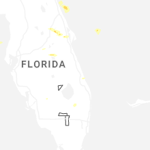
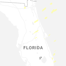
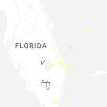


Connect with Interactive Hail Maps