

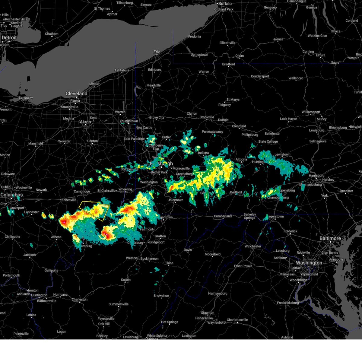
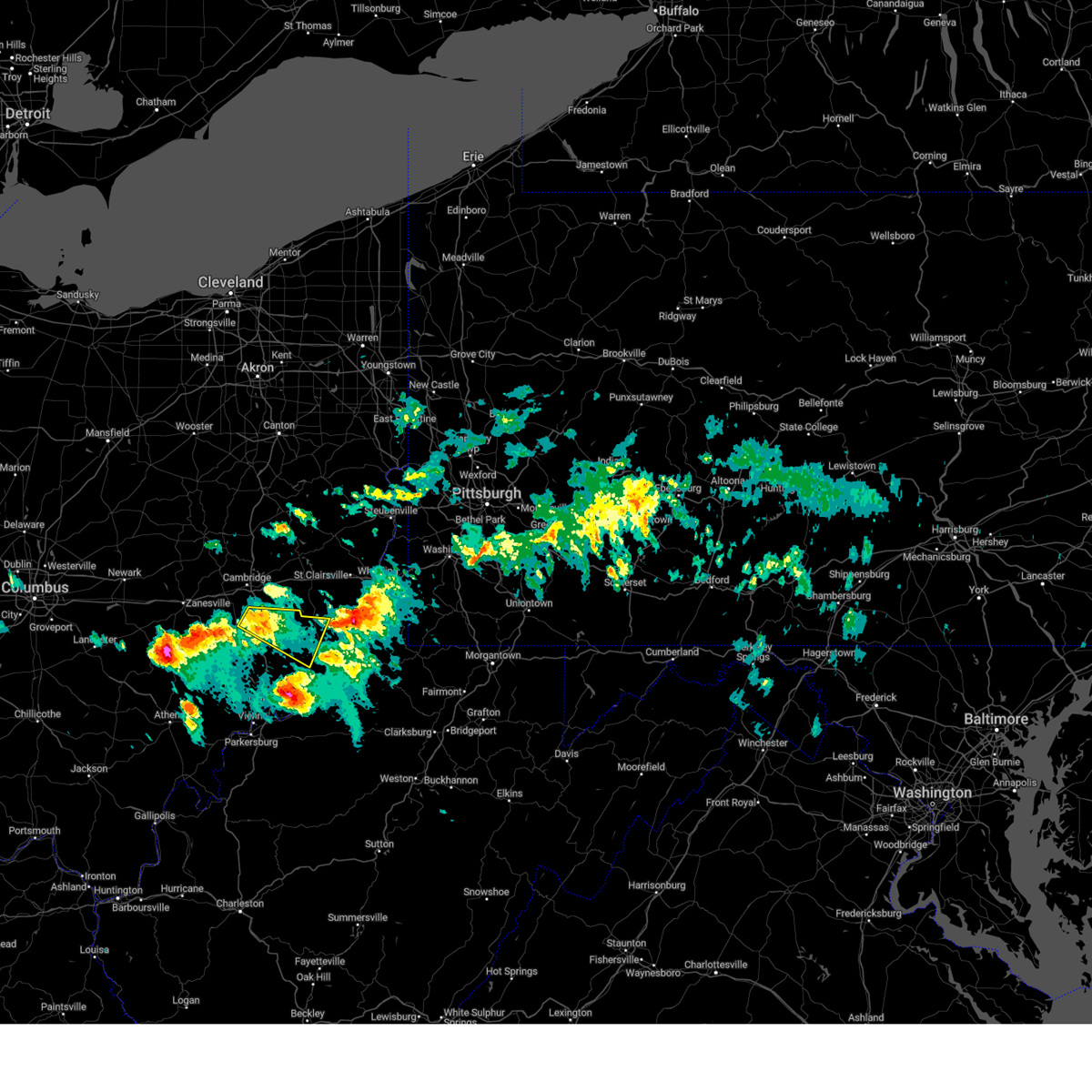
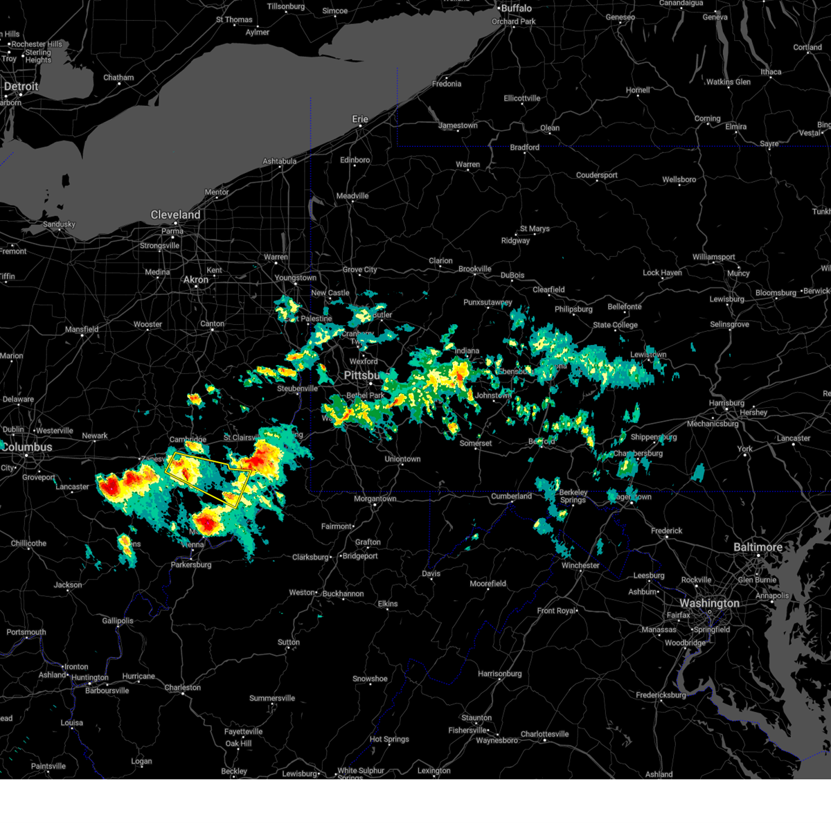
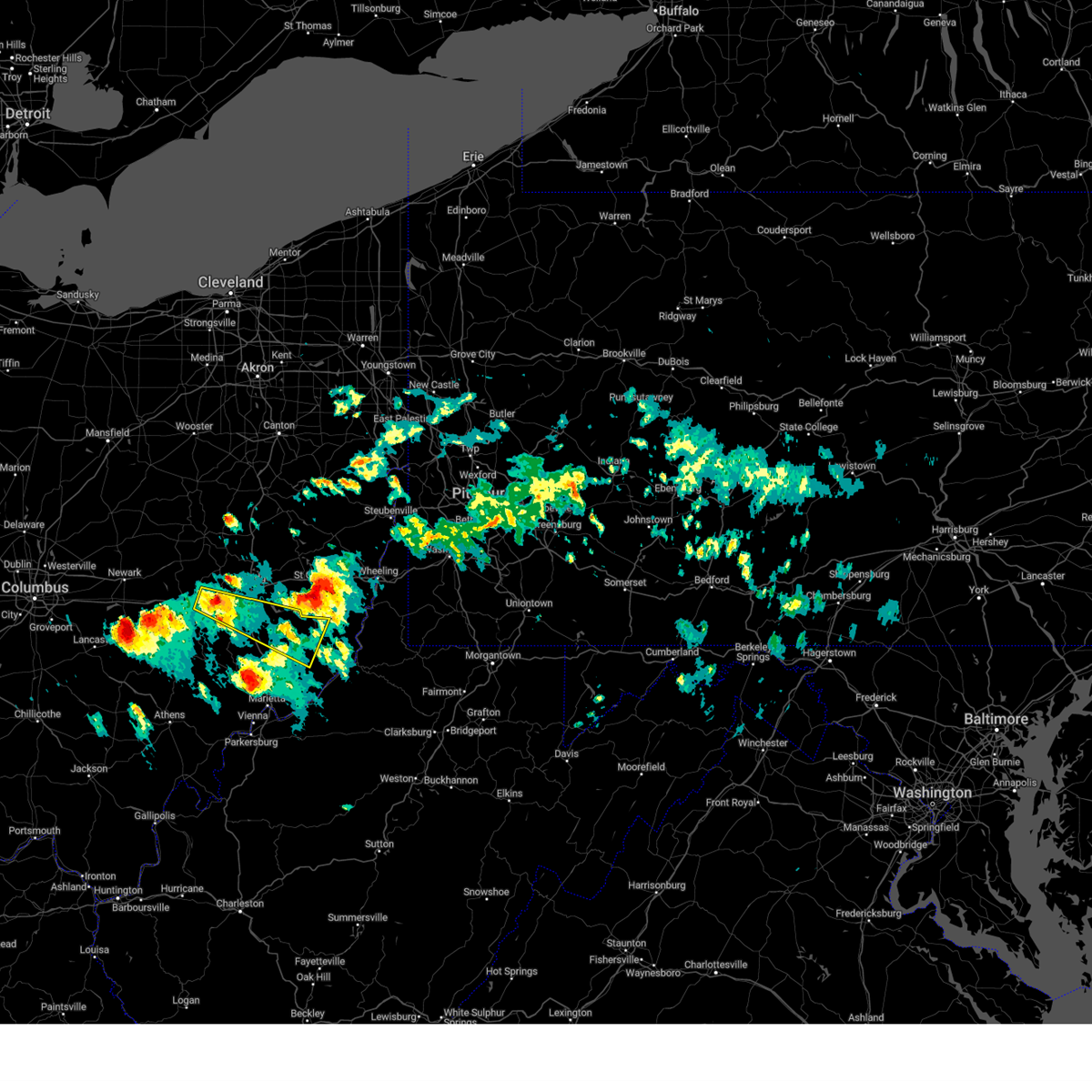
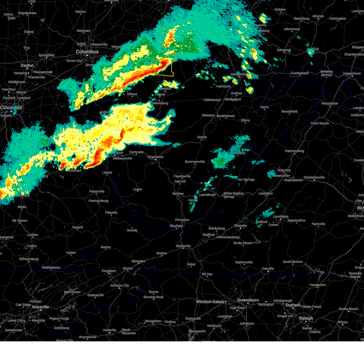
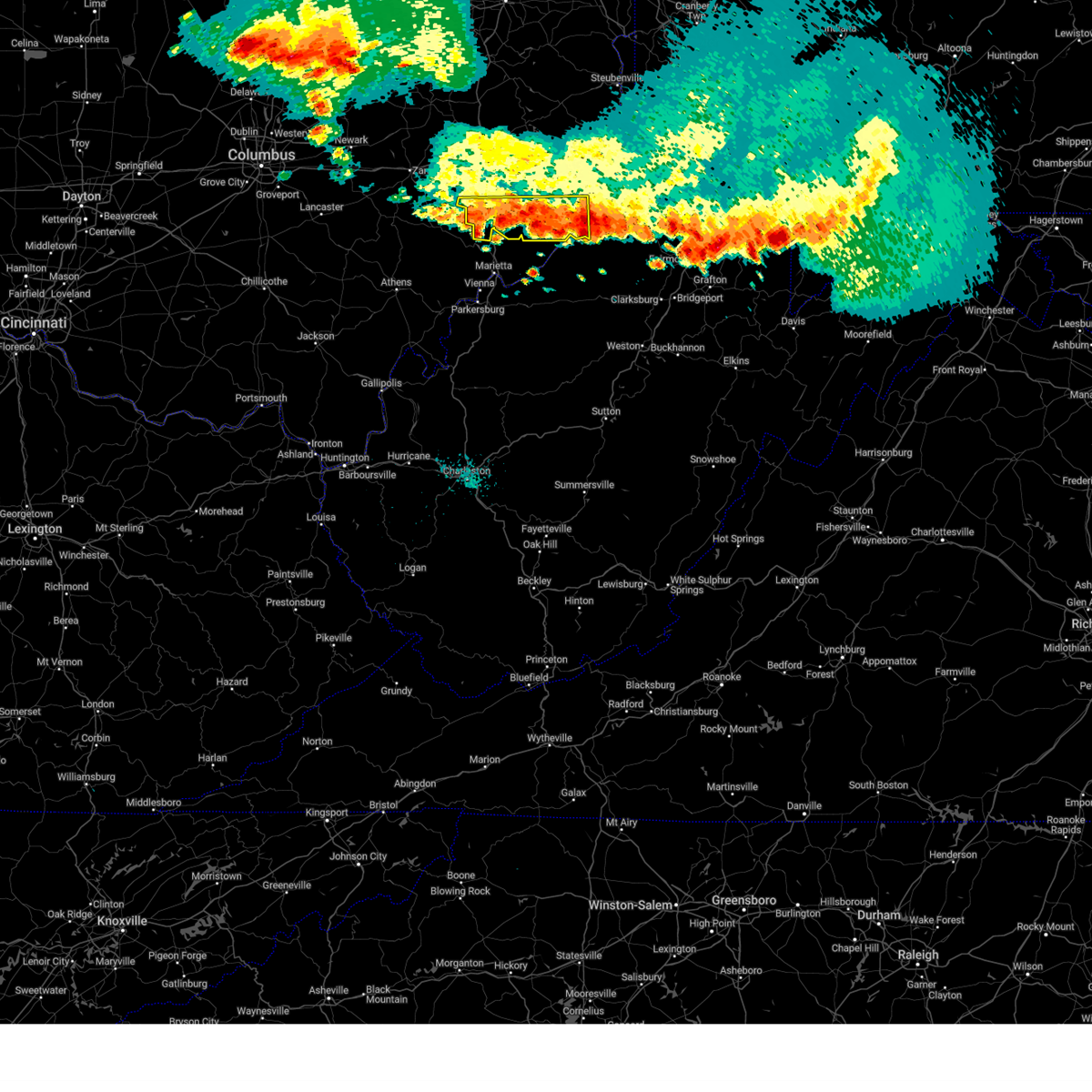
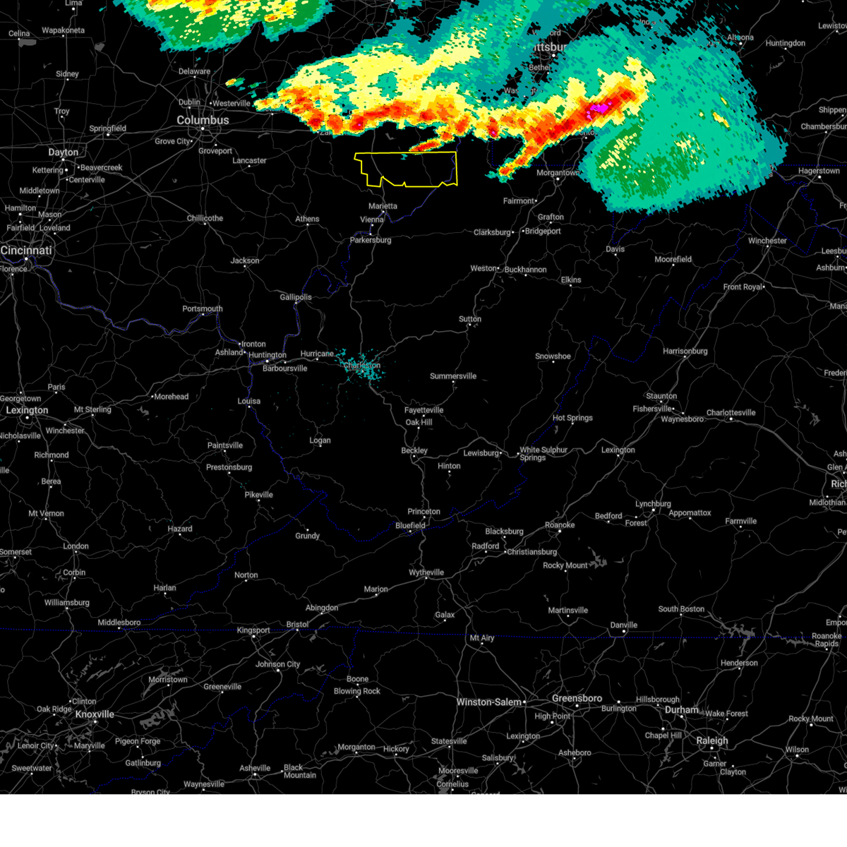
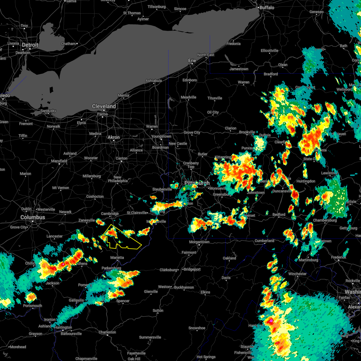
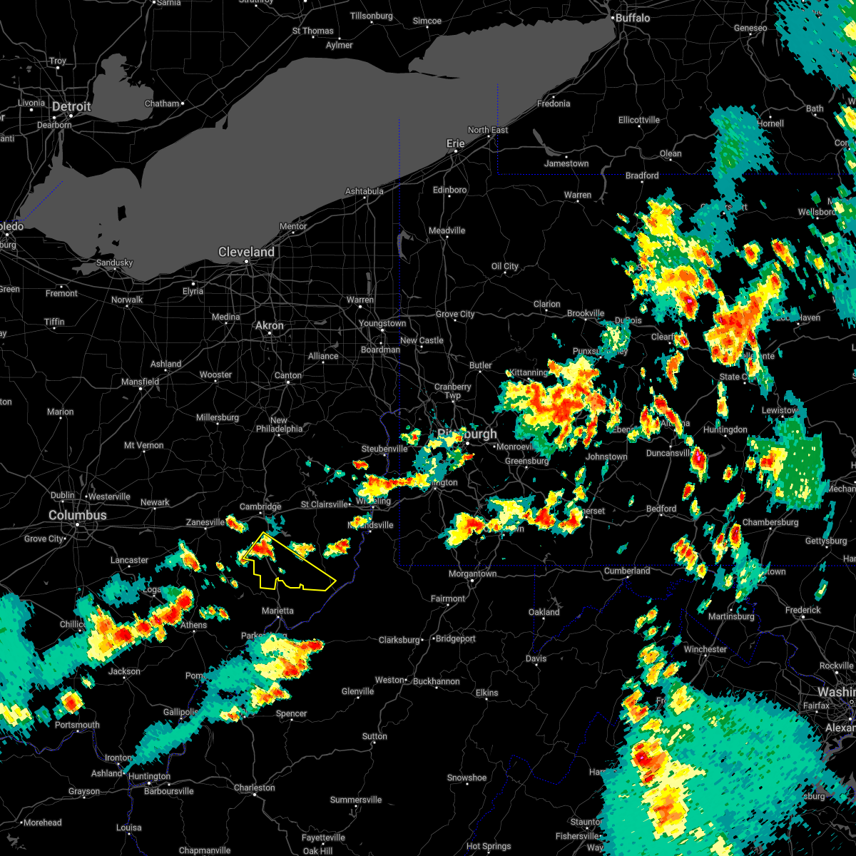
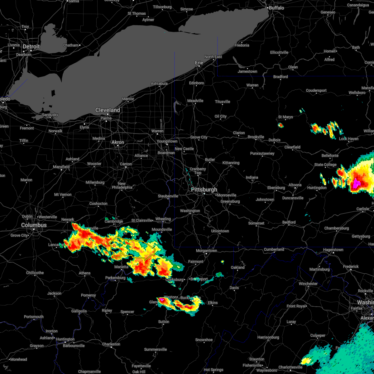
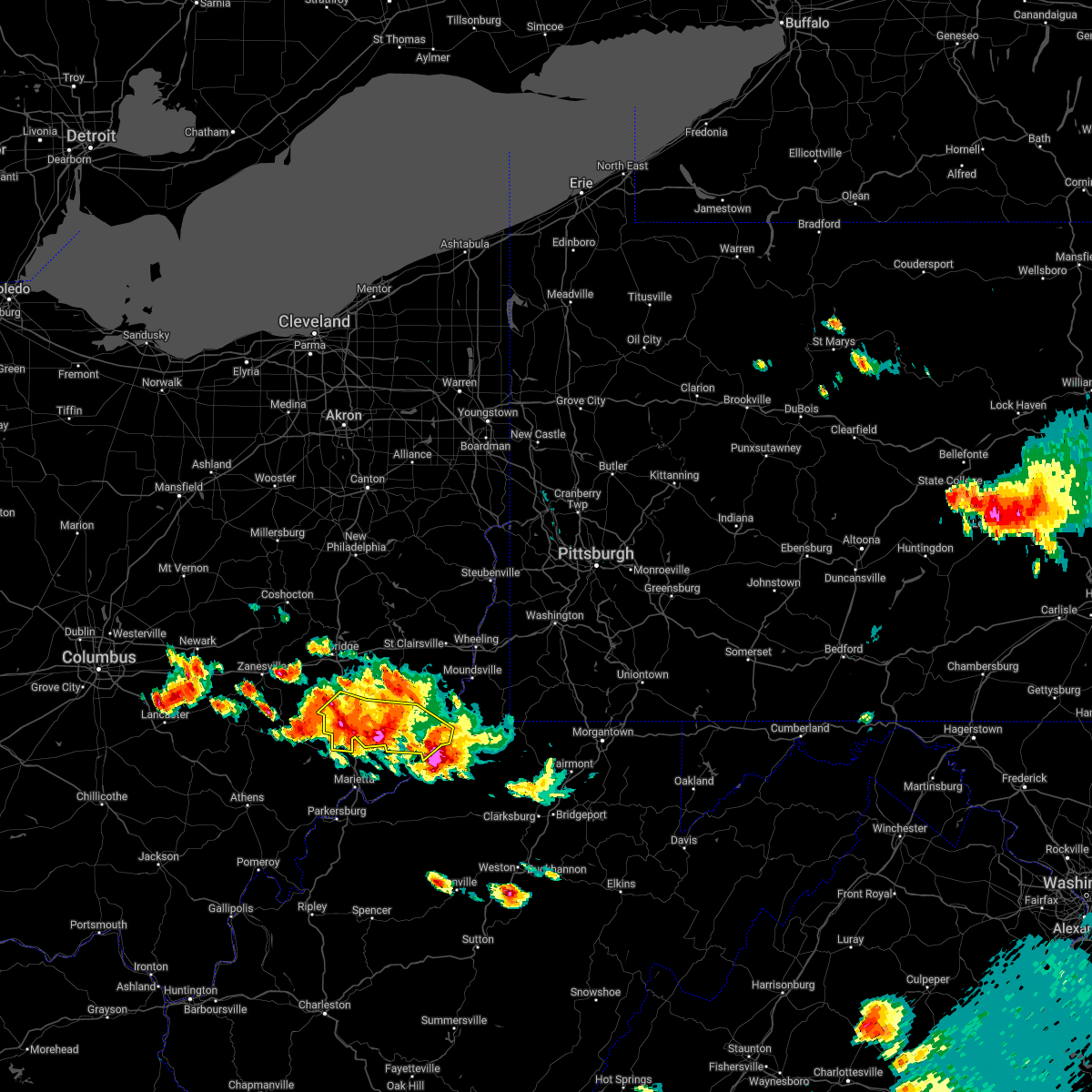
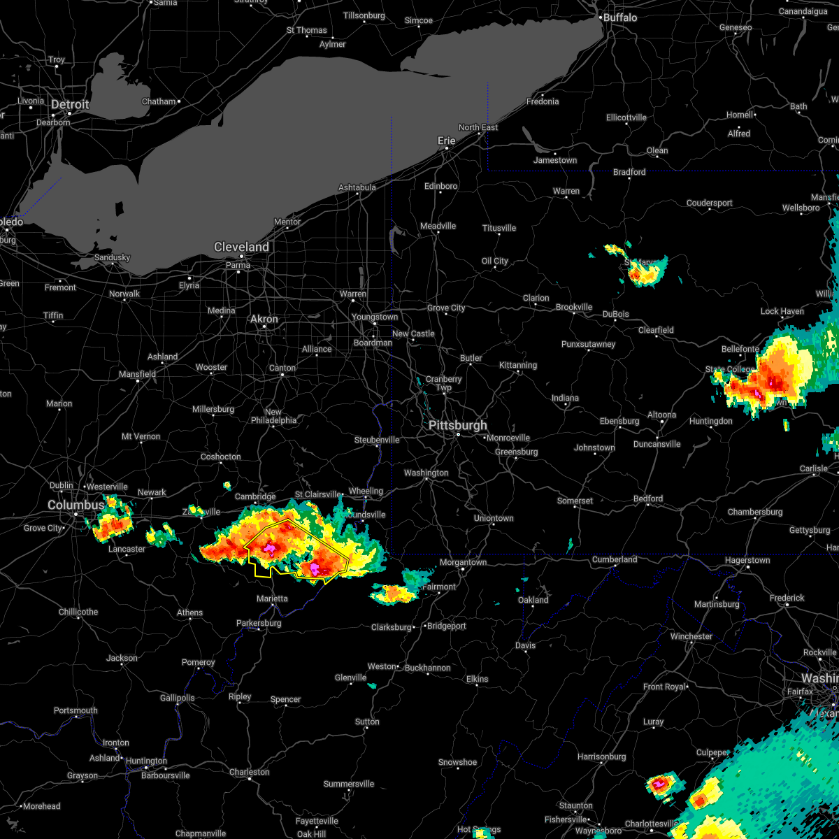
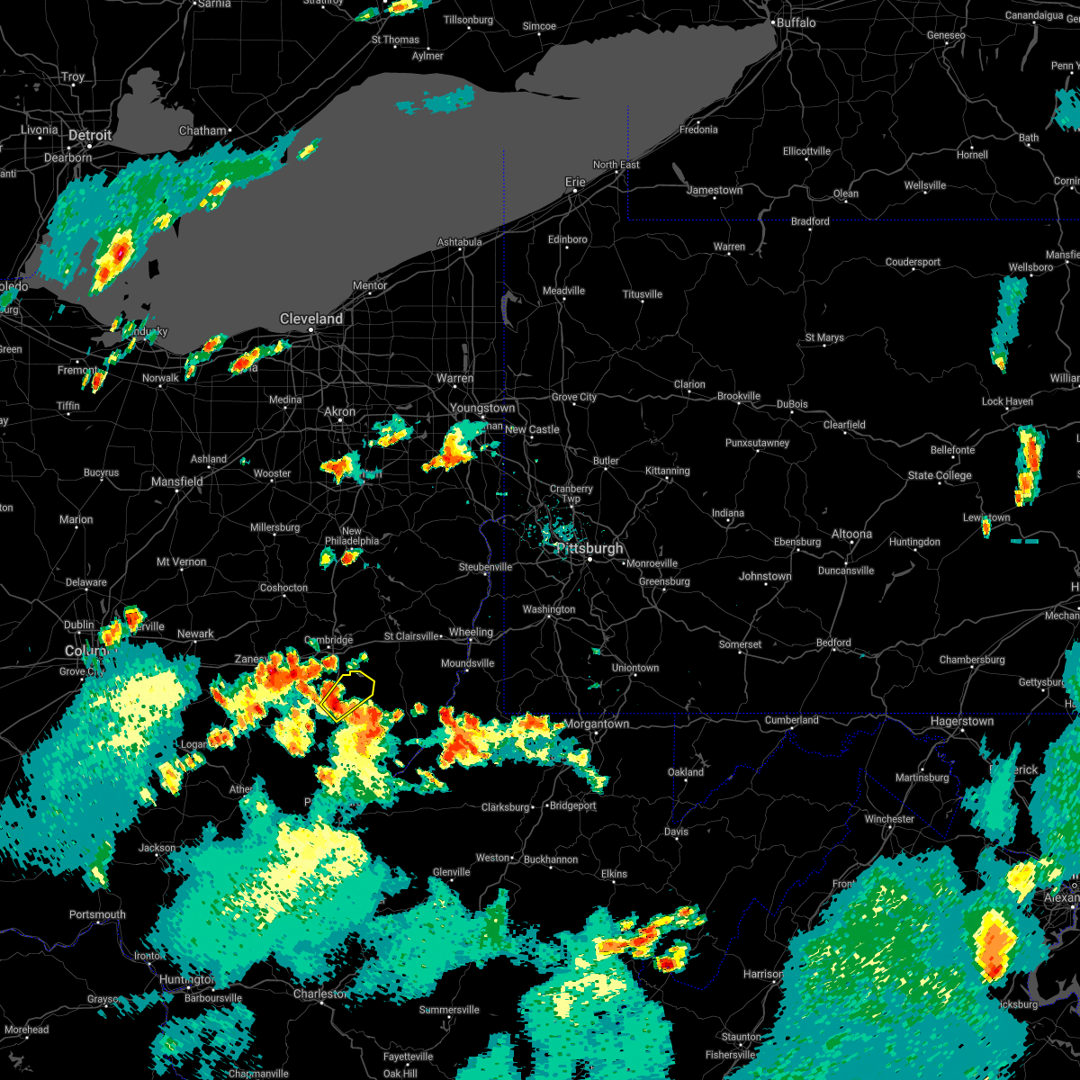
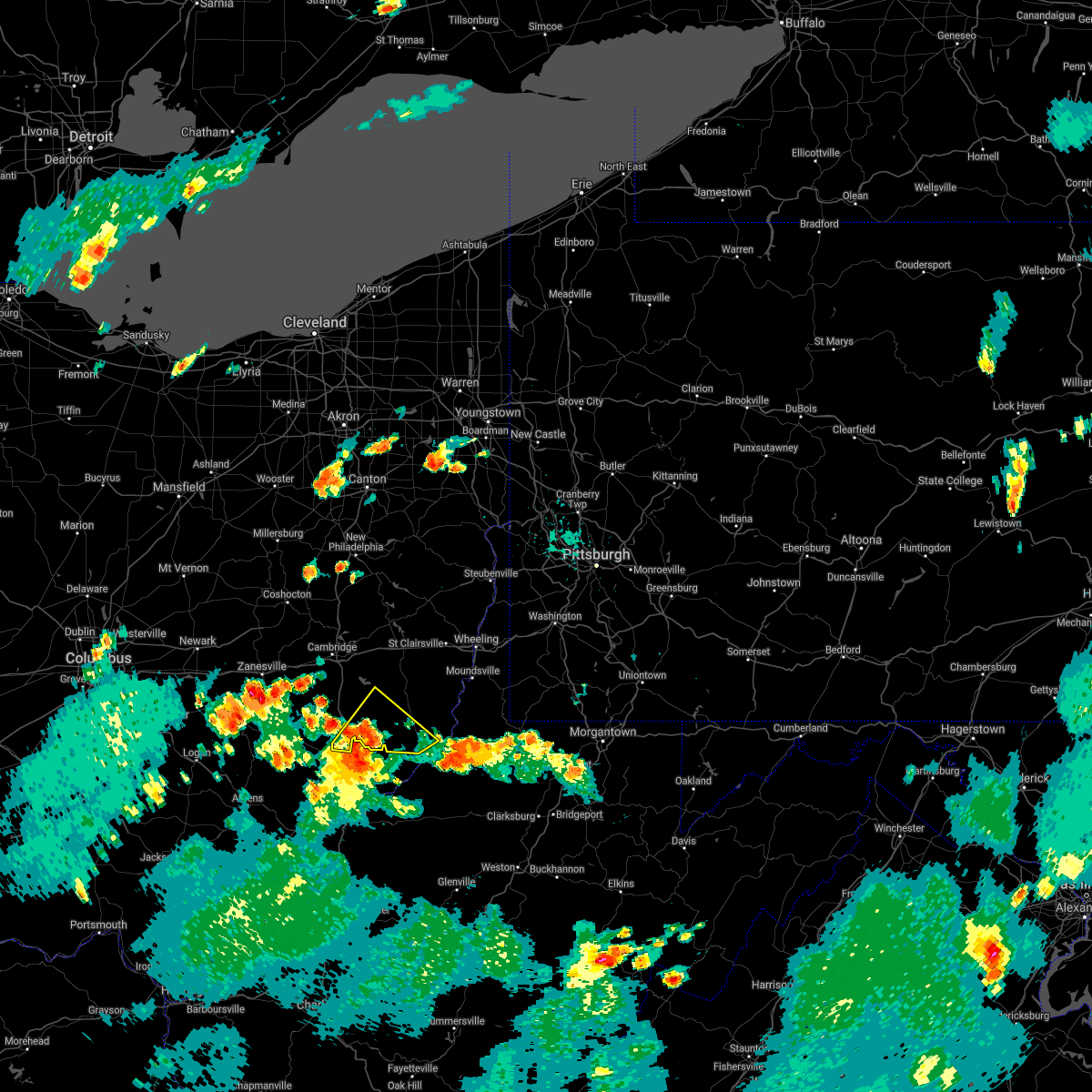
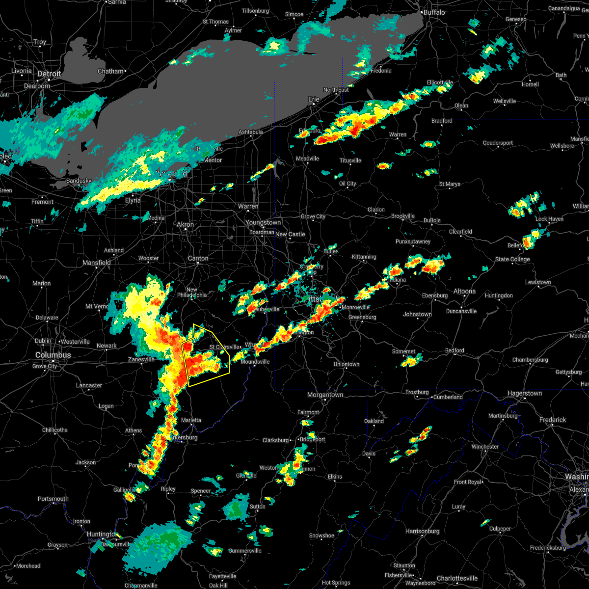
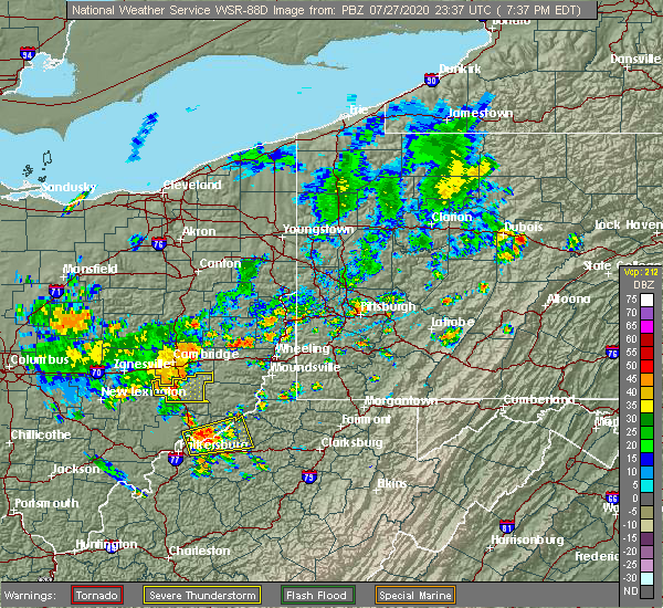
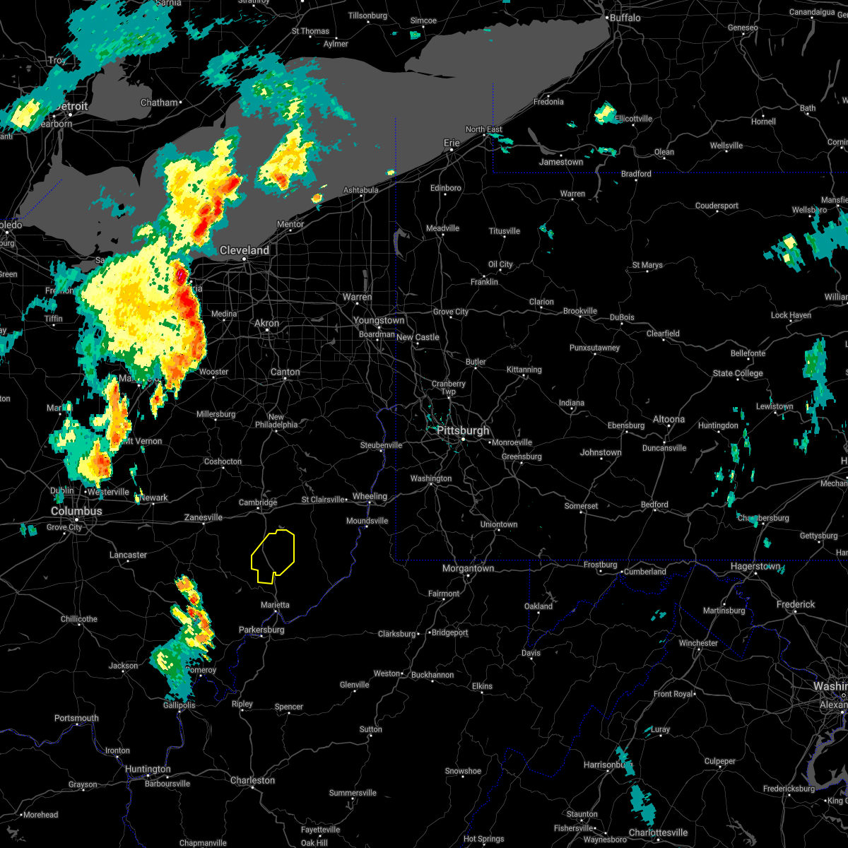
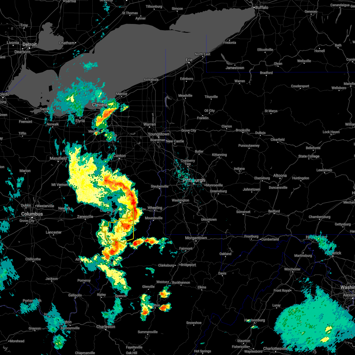
Hail Map for Summerfield, OH
The Summerfield, OH area has had 2 reports of on-the-ground hail by trained spotters, and has been under severe weather warnings 23 times during the past 12 months. Doppler radar has detected hail at or near Summerfield, OH on 26 occasions, including 2 occasions during the past year.
| Name: | Summerfield, OH |
| Where Located: | 83.7 miles WSW of Pittsburgh, PA |
| Map: | Google Map for Summerfield, OH |
| Population: | 254 |
| Housing Units: | 126 |
| More Info: | Search Google for Summerfield, OH |
0
The Top Recent Hail Date for Summerfield, OH is Thursday, March 14, 2024 (10th out of 26)

Hail and Wind Damage Spotted near Summerfield, OH
| Date / Time | Report Details |
|---|---|
| 4/17/2024 7:32 PM EDT |
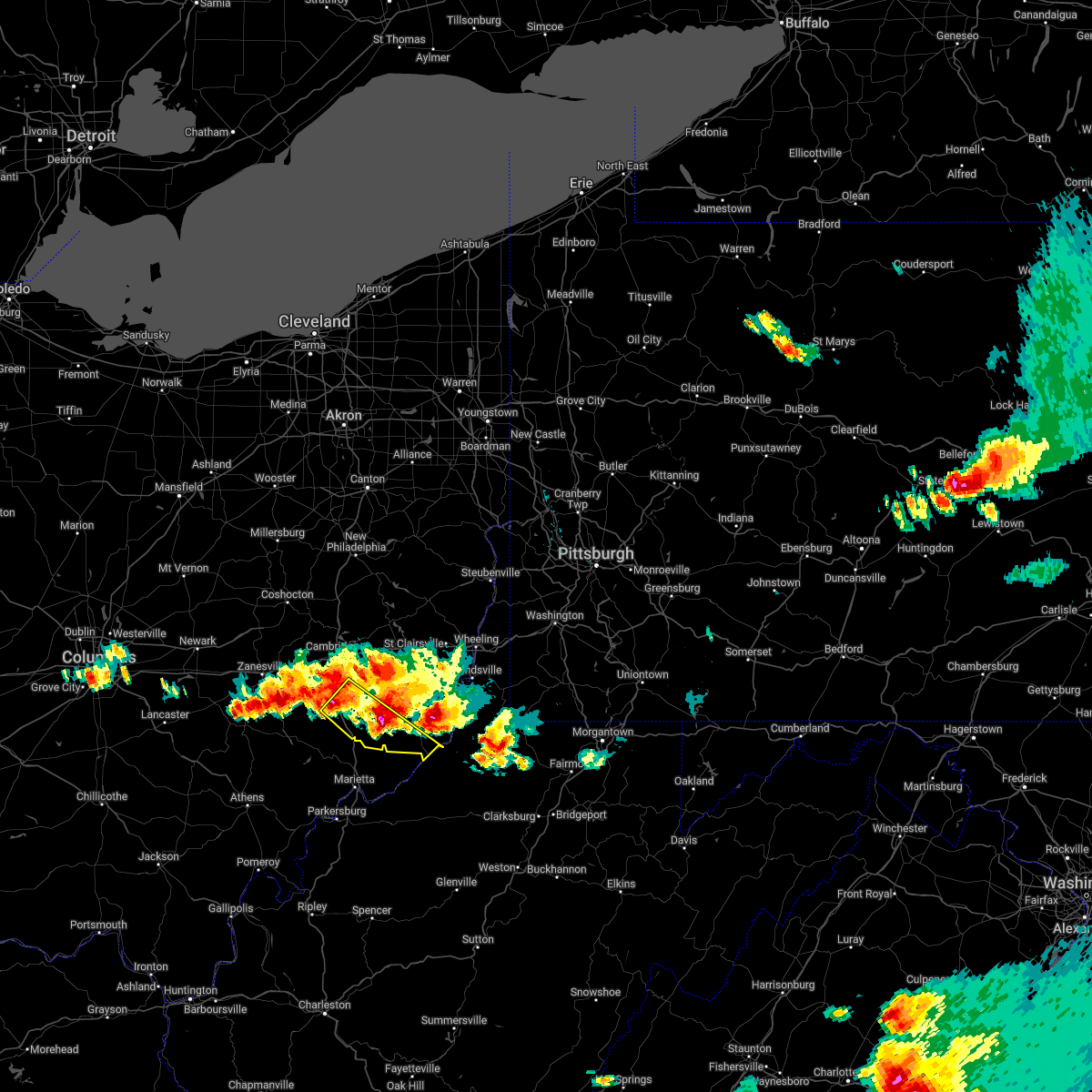
 At 731 pm edt, severe thunderstorms were located along a line extending from near st. clairsville to near caldwell, moving east at 55 mph (radar indicated). Hazards include 60 mph wind gusts. Expect damage to trees and power lines, resulting in some power outages. locations impacted include, wheeling, moundsville, martins ferry, st. Clairsville, bellaire, barnesville, bethlehem, woodsfield, triadelphia, valley grove, shadyside, mcmechen, powhatan point, glen dale, bridgeport, benwood, bethesda, brookside, belmont, and beallsville. At 731 pm edt, severe thunderstorms were located along a line extending from near st. clairsville to near caldwell, moving east at 55 mph (radar indicated). Hazards include 60 mph wind gusts. Expect damage to trees and power lines, resulting in some power outages. locations impacted include, wheeling, moundsville, martins ferry, st. Clairsville, bellaire, barnesville, bethlehem, woodsfield, triadelphia, valley grove, shadyside, mcmechen, powhatan point, glen dale, bridgeport, benwood, bethesda, brookside, belmont, and beallsville.
|
| 4/17/2024 7:20 PM EDT |
 At 719 pm edt, severe thunderstorms were located along a line extending from near barnesville to near caldwell, moving east at 55 mph (radar indicated). Hazards include 60 mph wind gusts. Expect damage to trees and power lines, resulting in some power outages. locations impacted include, wheeling, moundsville, martins ferry, st. Clairsville, bellaire, barnesville, bethlehem, woodsfield, caldwell, triadelphia, valley grove, shadyside, mcmechen, powhatan point, glen dale, bridgeport, dudley, benwood, bethesda, and brookside. At 719 pm edt, severe thunderstorms were located along a line extending from near barnesville to near caldwell, moving east at 55 mph (radar indicated). Hazards include 60 mph wind gusts. Expect damage to trees and power lines, resulting in some power outages. locations impacted include, wheeling, moundsville, martins ferry, st. Clairsville, bellaire, barnesville, bethlehem, woodsfield, caldwell, triadelphia, valley grove, shadyside, mcmechen, powhatan point, glen dale, bridgeport, dudley, benwood, bethesda, and brookside.
|
| 4/17/2024 7:20 PM EDT |
 the severe thunderstorm warning has been cancelled and is no longer in effect the severe thunderstorm warning has been cancelled and is no longer in effect
|
| 4/17/2024 7:11 PM EDT |
 At 711 pm edt, severe thunderstorms were located along a line extending from 7 miles northwest of barnesville to 9 miles northwest of mcconnelsville, moving east at 55 mph (radar indicated). Hazards include 60 mph wind gusts and penny size hail. Expect damage to trees and power lines, resulting in some power outages. locations impacted include, wheeling, cambridge, moundsville, martins ferry, st. Clairsville, bellaire, barnesville, bethlehem, woodsfield, caldwell, triadelphia, valley grove, shadyside, new concord, byesville, mcmechen, powhatan point, glen dale, bridgeport, and dudley. At 711 pm edt, severe thunderstorms were located along a line extending from 7 miles northwest of barnesville to 9 miles northwest of mcconnelsville, moving east at 55 mph (radar indicated). Hazards include 60 mph wind gusts and penny size hail. Expect damage to trees and power lines, resulting in some power outages. locations impacted include, wheeling, cambridge, moundsville, martins ferry, st. Clairsville, bellaire, barnesville, bethlehem, woodsfield, caldwell, triadelphia, valley grove, shadyside, new concord, byesville, mcmechen, powhatan point, glen dale, bridgeport, and dudley.
|
| 4/17/2024 6:55 PM EDT |
 Svrpbz the national weather service in pittsburgh has issued a * severe thunderstorm warning for, guernsey county in east central ohio, monroe county in east central ohio, southeastern muskingum county in east central ohio, belmont county in east central ohio, noble county in east central ohio, western washington county in southwestern pennsylvania, ohio county in northern west virginia, marshall county in northern west virginia, * until 800 pm edt. * at 655 pm edt, severe thunderstorms were located along a line extending from near cambridge to near perry state forest, moving east at 55 mph (radar indicated). Hazards include 60 mph wind gusts and penny size hail. expect damage to trees and power lines, resulting in some power outages Svrpbz the national weather service in pittsburgh has issued a * severe thunderstorm warning for, guernsey county in east central ohio, monroe county in east central ohio, southeastern muskingum county in east central ohio, belmont county in east central ohio, noble county in east central ohio, western washington county in southwestern pennsylvania, ohio county in northern west virginia, marshall county in northern west virginia, * until 800 pm edt. * at 655 pm edt, severe thunderstorms were located along a line extending from near cambridge to near perry state forest, moving east at 55 mph (radar indicated). Hazards include 60 mph wind gusts and penny size hail. expect damage to trees and power lines, resulting in some power outages
|
| 3/30/2024 7:30 PM EDT |
 the severe thunderstorm warning has been cancelled and is no longer in effect the severe thunderstorm warning has been cancelled and is no longer in effect
|
| 3/30/2024 7:19 PM EDT |
 At 718 pm edt, a severe thunderstorm was located 8 miles south of byesville, or 8 miles north of caldwell, moving east at 45 mph (radar indicated). Hazards include 60 mph wind gusts and quarter size hail. Minor hail damage to vehicles is possible. expect wind damage to trees and power lines, resulting in some power outages. Locations impacted include, woodsfield, pleasant city, summerfield, belle valley, lewisville, sarahsville, jerusalem, wilson, stafford, graysville, miltonsburg, seneca lake park, and wolf run state park. At 718 pm edt, a severe thunderstorm was located 8 miles south of byesville, or 8 miles north of caldwell, moving east at 45 mph (radar indicated). Hazards include 60 mph wind gusts and quarter size hail. Minor hail damage to vehicles is possible. expect wind damage to trees and power lines, resulting in some power outages. Locations impacted include, woodsfield, pleasant city, summerfield, belle valley, lewisville, sarahsville, jerusalem, wilson, stafford, graysville, miltonsburg, seneca lake park, and wolf run state park.
|
| 3/30/2024 7:19 PM EDT |
 the severe thunderstorm warning has been cancelled and is no longer in effect the severe thunderstorm warning has been cancelled and is no longer in effect
|
| 3/30/2024 7:10 PM EDT |
 At 709 pm edt, a severe thunderstorm was located near byesville, or 9 miles south of cambridge, moving east at 45 mph (radar indicated). Hazards include 60 mph wind gusts and quarter size hail. Minor hail damage to vehicles is possible. expect wind damage to trees and power lines, resulting in some power outages. Locations impacted include, woodsfield, caldwell, senecaville, pleasant city, cumberland, summerfield, belle valley, lewisville, sarahsville, jerusalem, wilson, stafford, graysville, miltonsburg, seneca lake park, and wolf run state park. At 709 pm edt, a severe thunderstorm was located near byesville, or 9 miles south of cambridge, moving east at 45 mph (radar indicated). Hazards include 60 mph wind gusts and quarter size hail. Minor hail damage to vehicles is possible. expect wind damage to trees and power lines, resulting in some power outages. Locations impacted include, woodsfield, caldwell, senecaville, pleasant city, cumberland, summerfield, belle valley, lewisville, sarahsville, jerusalem, wilson, stafford, graysville, miltonsburg, seneca lake park, and wolf run state park.
|
| 3/30/2024 6:56 PM EDT |
 Svrpbz the national weather service in pittsburgh has issued a * severe thunderstorm warning for, southwestern guernsey county in east central ohio, western monroe county in east central ohio, east central muskingum county in east central ohio, central noble county in east central ohio, * until 745 pm edt. * at 656 pm edt, a severe thunderstorm was located near new concord, or 10 miles east of zanesville, moving east at 45 mph (radar indicated). Hazards include 60 mph wind gusts and quarter size hail. Minor hail damage to vehicles is possible. Expect wind damage to trees and power lines, resulting in some power outages. Svrpbz the national weather service in pittsburgh has issued a * severe thunderstorm warning for, southwestern guernsey county in east central ohio, western monroe county in east central ohio, east central muskingum county in east central ohio, central noble county in east central ohio, * until 745 pm edt. * at 656 pm edt, a severe thunderstorm was located near new concord, or 10 miles east of zanesville, moving east at 45 mph (radar indicated). Hazards include 60 mph wind gusts and quarter size hail. Minor hail damage to vehicles is possible. Expect wind damage to trees and power lines, resulting in some power outages.
|
| 2/28/2024 7:30 AM EST |
 At 730 am est, a severe thunderstorm was located near powhatan point, or 9 miles west of moundsville, moving east at 60 mph (radar indicated). Hazards include 60 mph wind gusts and quarter size hail. Minor hail damage to vehicles is possible. expect wind damage to trees and power lines, resulting in some power outages. Locations impacted include, moundsville, new martinsville, bellaire, woodsfield, shadyside, mcmechen, powhatan point, glen dale, dudley, benwood, beallsville, clarington, summerfield, lewisville, jerusalem, wilson, cameron, alledonia, somerton, and stafford. At 730 am est, a severe thunderstorm was located near powhatan point, or 9 miles west of moundsville, moving east at 60 mph (radar indicated). Hazards include 60 mph wind gusts and quarter size hail. Minor hail damage to vehicles is possible. expect wind damage to trees and power lines, resulting in some power outages. Locations impacted include, moundsville, new martinsville, bellaire, woodsfield, shadyside, mcmechen, powhatan point, glen dale, dudley, benwood, beallsville, clarington, summerfield, lewisville, jerusalem, wilson, cameron, alledonia, somerton, and stafford.
|
| 2/28/2024 7:09 AM EST |
 Svrpbz the national weather service in pittsburgh has issued a * severe thunderstorm warning for, southeastern guernsey county in east central ohio, monroe county in east central ohio, southern belmont county in east central ohio, noble county in east central ohio, ohio county in northern west virginia, marshall county in northern west virginia, * until 800 am est. * at 709 am est, a severe thunderstorm was located 11 miles northeast of caldwell, moving east at 60 mph (radar indicated). Hazards include 60 mph wind gusts and quarter size hail. Minor hail damage to vehicles is possible. Expect wind damage to trees and power lines, resulting in some power outages. Svrpbz the national weather service in pittsburgh has issued a * severe thunderstorm warning for, southeastern guernsey county in east central ohio, monroe county in east central ohio, southern belmont county in east central ohio, noble county in east central ohio, ohio county in northern west virginia, marshall county in northern west virginia, * until 800 am est. * at 709 am est, a severe thunderstorm was located 11 miles northeast of caldwell, moving east at 60 mph (radar indicated). Hazards include 60 mph wind gusts and quarter size hail. Minor hail damage to vehicles is possible. Expect wind damage to trees and power lines, resulting in some power outages.
|
| 2/28/2024 7:06 AM EST |
 At 706 am est, a severe thunderstorm was located near caldwell, moving east at 55 mph (radar indicated). Hazards include 60 mph wind gusts and quarter size hail. Minor hail damage to vehicles is possible. expect wind damage to trees and power lines, resulting in some power outages. Locations impacted include, caldwell, dudley, quaker city, senecaville, cumberland, summerfield, belle valley, sarahsville, dexter city, salesville, batesville, seneca lake park, and wolf run state park. At 706 am est, a severe thunderstorm was located near caldwell, moving east at 55 mph (radar indicated). Hazards include 60 mph wind gusts and quarter size hail. Minor hail damage to vehicles is possible. expect wind damage to trees and power lines, resulting in some power outages. Locations impacted include, caldwell, dudley, quaker city, senecaville, cumberland, summerfield, belle valley, sarahsville, dexter city, salesville, batesville, seneca lake park, and wolf run state park.
|
| 2/28/2024 6:44 AM EST |
 Svrpbz the national weather service in pittsburgh has issued a * severe thunderstorm warning for, southern guernsey county in east central ohio, southeastern muskingum county in east central ohio, noble county in east central ohio, * until 715 am est. * at 644 am est, a severe thunderstorm was located 9 miles north of mcconnelsville, moving east at 55 mph (radar indicated). Hazards include 60 mph wind gusts and quarter size hail. Minor hail damage to vehicles is possible. Expect wind damage to trees and power lines, resulting in some power outages. Svrpbz the national weather service in pittsburgh has issued a * severe thunderstorm warning for, southern guernsey county in east central ohio, southeastern muskingum county in east central ohio, noble county in east central ohio, * until 715 am est. * at 644 am est, a severe thunderstorm was located 9 miles north of mcconnelsville, moving east at 55 mph (radar indicated). Hazards include 60 mph wind gusts and quarter size hail. Minor hail damage to vehicles is possible. Expect wind damage to trees and power lines, resulting in some power outages.
|
| 8/25/2023 3:14 AM EDT |
 At 314 am edt, severe thunderstorms were located along a line extending from near beverly to new martinsville, moving southeast at 35 mph (radar indicated). Hazards include 60 mph wind gusts and penny size hail. Expect damage to trees and power lines, resulting in some power outages. locations impacted include, new martinsville, woodsfield, caldwell, paden city, dudley, sardis, clarington, summerfield, belle valley, lewisville, dexter city, cameron, antioch, stafford, graysville, harriettsville, hannibal, rinard mills, laings, and proctor. hail threat, radar indicated max hail size, 0. 75 in wind threat, radar indicated max wind gust, 60 mph. At 314 am edt, severe thunderstorms were located along a line extending from near beverly to new martinsville, moving southeast at 35 mph (radar indicated). Hazards include 60 mph wind gusts and penny size hail. Expect damage to trees and power lines, resulting in some power outages. locations impacted include, new martinsville, woodsfield, caldwell, paden city, dudley, sardis, clarington, summerfield, belle valley, lewisville, dexter city, cameron, antioch, stafford, graysville, harriettsville, hannibal, rinard mills, laings, and proctor. hail threat, radar indicated max hail size, 0. 75 in wind threat, radar indicated max wind gust, 60 mph.
|
| 8/25/2023 3:02 AM EDT |
 At 302 am edt, severe thunderstorms were located along a line extending from 7 miles east of mcconnelsville to near new martinsville, moving southeast at 35 mph (radar indicated). Hazards include 60 mph wind gusts and penny size hail. expect damage to trees and power lines, resulting in some power outages At 302 am edt, severe thunderstorms were located along a line extending from 7 miles east of mcconnelsville to near new martinsville, moving southeast at 35 mph (radar indicated). Hazards include 60 mph wind gusts and penny size hail. expect damage to trees and power lines, resulting in some power outages
|
| 7/28/2023 2:40 PM EDT |
 At 239 pm edt, a severe thunderstorm was located near byesville, or 8 miles south of cambridge, moving east at 20 mph (radar indicated). Hazards include 60 mph wind gusts and penny size hail. expect damage to trees and power lines, resulting in some power outages At 239 pm edt, a severe thunderstorm was located near byesville, or 8 miles south of cambridge, moving east at 20 mph (radar indicated). Hazards include 60 mph wind gusts and penny size hail. expect damage to trees and power lines, resulting in some power outages
|
| 7/24/2023 11:27 PM EDT |
 The severe thunderstorm warning for southern guernsey and northern noble counties will expire at 1130 pm edt, the storm which prompted the warning has weakened below severe limits, and no longer poses an immediate threat to life or property. a special weather statement will be issued to replace the warning. therefore, the warning will be allowed to expire. gusty winds and heavy rain are still possible with this thunderstorm. The severe thunderstorm warning for southern guernsey and northern noble counties will expire at 1130 pm edt, the storm which prompted the warning has weakened below severe limits, and no longer poses an immediate threat to life or property. a special weather statement will be issued to replace the warning. therefore, the warning will be allowed to expire. gusty winds and heavy rain are still possible with this thunderstorm.
|
| 7/24/2023 11:09 PM EDT |
 At 1109 pm edt, a severe thunderstorm was located 7 miles east of byesville, or 9 miles east of cambridge, moving east at 25 mph (radar indicated). Hazards include 60 mph wind gusts and penny size hail. Expect damage to trees and power lines, resulting in some power outages. locations impacted include, byesville, senecaville, pleasant city, cumberland, lore city, old washington, summerfield, sarahsville, salesville, seneca lake park, and wolf run state park. hail threat, radar indicated max hail size, 0. 75 in wind threat, radar indicated max wind gust, 60 mph. At 1109 pm edt, a severe thunderstorm was located 7 miles east of byesville, or 9 miles east of cambridge, moving east at 25 mph (radar indicated). Hazards include 60 mph wind gusts and penny size hail. Expect damage to trees and power lines, resulting in some power outages. locations impacted include, byesville, senecaville, pleasant city, cumberland, lore city, old washington, summerfield, sarahsville, salesville, seneca lake park, and wolf run state park. hail threat, radar indicated max hail size, 0. 75 in wind threat, radar indicated max wind gust, 60 mph.
|
| 7/24/2023 10:58 PM EDT |
 At 1058 pm edt, a severe thunderstorm was located near byesville, or near cambridge, moving east at 25 mph (radar indicated). Hazards include 60 mph wind gusts and nickel size hail. Expect damage to trees and power lines, resulting in some power outages. locations impacted include, cambridge, byesville, senecaville, pleasant city, cumberland, lore city, old washington, summerfield, sarahsville, salesville, seneca lake park, and wolf run state park. hail threat, radar indicated max hail size, 0. 88 in wind threat, radar indicated max wind gust, 60 mph. At 1058 pm edt, a severe thunderstorm was located near byesville, or near cambridge, moving east at 25 mph (radar indicated). Hazards include 60 mph wind gusts and nickel size hail. Expect damage to trees and power lines, resulting in some power outages. locations impacted include, cambridge, byesville, senecaville, pleasant city, cumberland, lore city, old washington, summerfield, sarahsville, salesville, seneca lake park, and wolf run state park. hail threat, radar indicated max hail size, 0. 88 in wind threat, radar indicated max wind gust, 60 mph.
|
| 7/24/2023 10:34 PM EDT |
 At 1033 pm edt, a severe thunderstorm was located near new concord, or near cambridge, moving east at 20 mph (radar indicated). Hazards include 60 mph wind gusts. expect damage to trees and power lines, resulting in some power outages At 1033 pm edt, a severe thunderstorm was located near new concord, or near cambridge, moving east at 20 mph (radar indicated). Hazards include 60 mph wind gusts. expect damage to trees and power lines, resulting in some power outages
|
| 4/5/2023 7:10 PM EDT |
 At 709 pm edt, severe thunderstorms were located along a line extending from near cadiz to 8 miles southwest of barnesville, moving east at 45 mph (radar indicated). Hazards include 60 mph wind gusts. Expect damage to trees and power lines, resulting in some power outages. locations impacted include, wheeling, weirton, steubenville, moundsville, martins ferry, st. clairsville, bellaire, barnesville, cadiz, warwood, wellsburg, and bethlehem. hail threat, radar indicated max hail size, <. 75 in wind threat, radar indicated max wind gust, 60 mph. At 709 pm edt, severe thunderstorms were located along a line extending from near cadiz to 8 miles southwest of barnesville, moving east at 45 mph (radar indicated). Hazards include 60 mph wind gusts. Expect damage to trees and power lines, resulting in some power outages. locations impacted include, wheeling, weirton, steubenville, moundsville, martins ferry, st. clairsville, bellaire, barnesville, cadiz, warwood, wellsburg, and bethlehem. hail threat, radar indicated max hail size, <. 75 in wind threat, radar indicated max wind gust, 60 mph.
|
| 4/5/2023 6:57 PM EDT |
 At 656 pm edt, severe thunderstorms were located along a line extending from freeport to 9 miles northeast of caldwell, moving east at 45 mph (radar indicated). Hazards include 60 mph wind gusts. expect damage to trees and power lines, resulting in some power outages At 656 pm edt, severe thunderstorms were located along a line extending from freeport to 9 miles northeast of caldwell, moving east at 45 mph (radar indicated). Hazards include 60 mph wind gusts. expect damage to trees and power lines, resulting in some power outages
|
| 8/20/2022 8:54 PM EDT |
 At 854 pm edt, a severe thunderstorm was located near byesville, or near cambridge, moving east at 40 mph (radar indicated). Hazards include 60 mph wind gusts. Expect damage to trees and power lines, resulting in some power outages. locations impacted include, cambridge, barnesville, byesville, bethesda, antrim, flushing, quaker city, senecaville, pleasant city, cumberland, holloway, and lore city. hail threat, radar indicated max hail size, <. 75 in wind threat, radar indicated max wind gust, 60 mph. At 854 pm edt, a severe thunderstorm was located near byesville, or near cambridge, moving east at 40 mph (radar indicated). Hazards include 60 mph wind gusts. Expect damage to trees and power lines, resulting in some power outages. locations impacted include, cambridge, barnesville, byesville, bethesda, antrim, flushing, quaker city, senecaville, pleasant city, cumberland, holloway, and lore city. hail threat, radar indicated max hail size, <. 75 in wind threat, radar indicated max wind gust, 60 mph.
|
| 8/20/2022 8:41 PM EDT |
 At 841 pm edt, a severe thunderstorm was located near new concord, or 7 miles southwest of cambridge, moving east at 40 mph (radar indicated). Hazards include 60 mph wind gusts. expect damage to trees and power lines, resulting in some power outages At 841 pm edt, a severe thunderstorm was located near new concord, or 7 miles southwest of cambridge, moving east at 40 mph (radar indicated). Hazards include 60 mph wind gusts. expect damage to trees and power lines, resulting in some power outages
|
| 6/22/2022 6:16 PM EDT |
 At 616 pm edt, a severe thunderstorm was located over caldwell, moving southeast at 30 mph (radar indicated). Hazards include 60 mph wind gusts. Expect damage to trees and power lines, resulting in some power outages. locations impacted include, caldwell, dudley, pleasant city, summerfield, belle valley, sarahsville, dexter city, antioch, stafford, graysville, harriettsville, and wolf run state park. hail threat, radar indicated max hail size, <. 75 in wind threat, radar indicated max wind gust, 60 mph. At 616 pm edt, a severe thunderstorm was located over caldwell, moving southeast at 30 mph (radar indicated). Hazards include 60 mph wind gusts. Expect damage to trees and power lines, resulting in some power outages. locations impacted include, caldwell, dudley, pleasant city, summerfield, belle valley, sarahsville, dexter city, antioch, stafford, graysville, harriettsville, and wolf run state park. hail threat, radar indicated max hail size, <. 75 in wind threat, radar indicated max wind gust, 60 mph.
|
| 6/22/2022 6:09 PM EDT |
 At 609 pm edt, a severe thunderstorm was located near caldwell, moving southeast at 30 mph (radar indicated). Hazards include 60 mph wind gusts. expect damage to trees and power lines, resulting in some power outages At 609 pm edt, a severe thunderstorm was located near caldwell, moving southeast at 30 mph (radar indicated). Hazards include 60 mph wind gusts. expect damage to trees and power lines, resulting in some power outages
|
| 6/16/2022 8:23 PM EDT |
 The severe thunderstorm warning for monroe and noble counties will expire at 830 pm edt, the storm which prompted the warning has weakened below severe limits, and has exited the warned area. therefore, the warning will be allowed to expire. however gusty winds and heavy rain are still possible with this thunderstorm. a severe thunderstorm watch remains in effect until 900 pm edt for east central ohio. The severe thunderstorm warning for monroe and noble counties will expire at 830 pm edt, the storm which prompted the warning has weakened below severe limits, and has exited the warned area. therefore, the warning will be allowed to expire. however gusty winds and heavy rain are still possible with this thunderstorm. a severe thunderstorm watch remains in effect until 900 pm edt for east central ohio.
|
| 6/16/2022 8:02 PM EDT |
 At 802 pm edt, a severe thunderstorm was located over middlebourne, moving southeast at 35 mph (radar indicated). Hazards include 60 mph wind gusts and quarter size hail. Minor hail damage to vehicles is possible. expect wind damage to trees and power lines, resulting in some power outages. locations impacted include, new martinsville, woodsfield, caldwell, dudley, sardis, summerfield, belle valley, lewisville, sarahsville, dexter city, fly, and antioch. hail threat, radar indicated max hail size, 1. 00 in wind threat, radar indicated max wind gust, 60 mph. At 802 pm edt, a severe thunderstorm was located over middlebourne, moving southeast at 35 mph (radar indicated). Hazards include 60 mph wind gusts and quarter size hail. Minor hail damage to vehicles is possible. expect wind damage to trees and power lines, resulting in some power outages. locations impacted include, new martinsville, woodsfield, caldwell, dudley, sardis, summerfield, belle valley, lewisville, sarahsville, dexter city, fly, and antioch. hail threat, radar indicated max hail size, 1. 00 in wind threat, radar indicated max wind gust, 60 mph.
|
| 6/16/2022 7:41 PM EDT |
 At 741 pm edt, a severe thunderstorm was located near sistersville, or 11 miles south of woodsfield, moving southeast at 35 mph (radar indicated). Hazards include 70 mph wind gusts and ping pong ball size hail. People and animals outdoors will be injured. expect hail damage to roofs, siding, windows, and vehicles. trees snapped and uprooted. Power outages can be expected. At 741 pm edt, a severe thunderstorm was located near sistersville, or 11 miles south of woodsfield, moving southeast at 35 mph (radar indicated). Hazards include 70 mph wind gusts and ping pong ball size hail. People and animals outdoors will be injured. expect hail damage to roofs, siding, windows, and vehicles. trees snapped and uprooted. Power outages can be expected.
|
| 6/16/2022 7:16 PM EDT |
 At 716 pm edt, a severe thunderstorm was located 10 miles southwest of woodsfield, moving southeast at 35 mph (radar indicated). Hazards include two inch hail and 60 mph wind gusts. People and animals outdoors will be injured. expect hail damage to roofs, siding, windows, and vehicles. expect wind damage to trees and power lines, resulting in some power outages. locations impacted include, caldwell, dudley, summerfield, belle valley, lewisville, sarahsville, dexter city, fly, antioch, stafford, graysville, and harriettsville. thunderstorm damage threat, considerable hail threat, radar indicated max hail size, 2. 00 in wind threat, radar indicated max wind gust, 60 mph. At 716 pm edt, a severe thunderstorm was located 10 miles southwest of woodsfield, moving southeast at 35 mph (radar indicated). Hazards include two inch hail and 60 mph wind gusts. People and animals outdoors will be injured. expect hail damage to roofs, siding, windows, and vehicles. expect wind damage to trees and power lines, resulting in some power outages. locations impacted include, caldwell, dudley, summerfield, belle valley, lewisville, sarahsville, dexter city, fly, antioch, stafford, graysville, and harriettsville. thunderstorm damage threat, considerable hail threat, radar indicated max hail size, 2. 00 in wind threat, radar indicated max wind gust, 60 mph.
|
| 6/16/2022 7:01 PM EDT |
 At 701 pm edt, a severe thunderstorm was located 11 miles northeast of caldwell, moving southeast at 40 mph (radar indicated). Hazards include 60 mph wind gusts and half dollar size hail. Minor hail damage to vehicles is possible. expect wind damage to trees and power lines, resulting in some power outages. locations impacted include, cambridge, caldwell, new concord, byesville, pleasant city, cumberland, summerfield, belle valley, sarahsville, norwich, and wolf run state park. hail threat, radar indicated max hail size, 1. 25 in wind threat, radar indicated max wind gust, 60 mph. At 701 pm edt, a severe thunderstorm was located 11 miles northeast of caldwell, moving southeast at 40 mph (radar indicated). Hazards include 60 mph wind gusts and half dollar size hail. Minor hail damage to vehicles is possible. expect wind damage to trees and power lines, resulting in some power outages. locations impacted include, cambridge, caldwell, new concord, byesville, pleasant city, cumberland, summerfield, belle valley, sarahsville, norwich, and wolf run state park. hail threat, radar indicated max hail size, 1. 25 in wind threat, radar indicated max wind gust, 60 mph.
|
| 6/16/2022 6:53 PM EDT |
 At 653 pm edt, a severe thunderstorm was located near caldwell, moving southeast at 35 mph (radar indicated). Hazards include ping pong ball size hail and 60 mph wind gusts. People and animals outdoors will be injured. expect hail damage to roofs, siding, windows, and vehicles. Expect wind damage to trees and power lines, resulting in some power outages. At 653 pm edt, a severe thunderstorm was located near caldwell, moving southeast at 35 mph (radar indicated). Hazards include ping pong ball size hail and 60 mph wind gusts. People and animals outdoors will be injured. expect hail damage to roofs, siding, windows, and vehicles. Expect wind damage to trees and power lines, resulting in some power outages.
|
| 6/16/2022 6:33 PM EDT |
 At 632 pm edt, a severe thunderstorm was located near byesville, or near cambridge, moving southeast at 40 mph (radar indicated). Hazards include 60 mph wind gusts and quarter size hail. Minor hail damage to vehicles is possible. Expect wind damage to trees and power lines, resulting in some power outages. At 632 pm edt, a severe thunderstorm was located near byesville, or near cambridge, moving southeast at 40 mph (radar indicated). Hazards include 60 mph wind gusts and quarter size hail. Minor hail damage to vehicles is possible. Expect wind damage to trees and power lines, resulting in some power outages.
|
| 6/14/2022 4:50 AM EDT |
 At 450 am edt, severe thunderstorms were located along a line extending from 6 miles northwest of new martinsville to 7 miles northeast of marietta, moving southeast at 55 mph (radar indicated). Hazards include 60 mph wind gusts and nickel size hail. Expect damage to trees and power lines, resulting in some power outages. locations impacted include, woodsfield, caldwell, dudley, sardis, summerfield, lewisville, dexter city, fly, antioch, stafford, graysville, and harriettsville. hail threat, radar indicated max hail size, 0. 88 in wind threat, radar indicated max wind gust, 60 mph. At 450 am edt, severe thunderstorms were located along a line extending from 6 miles northwest of new martinsville to 7 miles northeast of marietta, moving southeast at 55 mph (radar indicated). Hazards include 60 mph wind gusts and nickel size hail. Expect damage to trees and power lines, resulting in some power outages. locations impacted include, woodsfield, caldwell, dudley, sardis, summerfield, lewisville, dexter city, fly, antioch, stafford, graysville, and harriettsville. hail threat, radar indicated max hail size, 0. 88 in wind threat, radar indicated max wind gust, 60 mph.
|
| 6/14/2022 4:31 AM EDT |
 At 430 am edt, severe thunderstorms were located along a line extending from 6 miles northwest of woodsfield to 7 miles northeast of beverly, moving southeast at 55 mph (radar indicated). Hazards include 60 mph wind gusts and nickel size hail. expect damage to trees and power lines, resulting in some power outages At 430 am edt, severe thunderstorms were located along a line extending from 6 miles northwest of woodsfield to 7 miles northeast of beverly, moving southeast at 55 mph (radar indicated). Hazards include 60 mph wind gusts and nickel size hail. expect damage to trees and power lines, resulting in some power outages
|
| 6/14/2022 4:06 AM EDT |
 At 406 am edt, a severe thunderstorm was located over new concord, or 10 miles west of cambridge, moving southeast at 60 mph (radar indicated). Hazards include 60 mph wind gusts and penny size hail. expect damage to trees and power lines, resulting in some power outages At 406 am edt, a severe thunderstorm was located over new concord, or 10 miles west of cambridge, moving southeast at 60 mph (radar indicated). Hazards include 60 mph wind gusts and penny size hail. expect damage to trees and power lines, resulting in some power outages
|
| 6/14/2022 12:42 AM EDT |
 At 1242 am edt, severe thunderstorms were located along a line extending from 6 miles southeast of byesville to 6 miles west of mcconnelsville, moving east at 50 mph (radar indicated). Hazards include 60 mph wind gusts and quarter size hail. Minor hail damage to vehicles is possible. Expect wind damage to trees and power lines, resulting in some power outages. At 1242 am edt, severe thunderstorms were located along a line extending from 6 miles southeast of byesville to 6 miles west of mcconnelsville, moving east at 50 mph (radar indicated). Hazards include 60 mph wind gusts and quarter size hail. Minor hail damage to vehicles is possible. Expect wind damage to trees and power lines, resulting in some power outages.
|
| 6/8/2022 8:26 PM EDT |
 At 826 pm edt, a severe thunderstorm was located 7 miles south of barnesville, moving east at 30 mph (radar indicated). Hazards include 60 mph wind gusts and quarter size hail. Minor hail damage to vehicles is possible. expect wind damage to trees and power lines, resulting in some power outages. Locations impacted include, barnesville, bethesda, quaker city, belmont, beallsville, summerfield, jerusalem, wilson, somerton, alledonia, batesville, and miltonsburg. At 826 pm edt, a severe thunderstorm was located 7 miles south of barnesville, moving east at 30 mph (radar indicated). Hazards include 60 mph wind gusts and quarter size hail. Minor hail damage to vehicles is possible. expect wind damage to trees and power lines, resulting in some power outages. Locations impacted include, barnesville, bethesda, quaker city, belmont, beallsville, summerfield, jerusalem, wilson, somerton, alledonia, batesville, and miltonsburg.
|
| 6/8/2022 8:12 PM EDT |
 At 812 pm edt, a severe thunderstorm was located 11 miles southwest of barnesville, moving east at 30 mph (radar indicated). Hazards include 60 mph wind gusts and quarter size hail. Minor hail damage to vehicles is possible. Expect wind damage to trees and power lines, resulting in some power outages. At 812 pm edt, a severe thunderstorm was located 11 miles southwest of barnesville, moving east at 30 mph (radar indicated). Hazards include 60 mph wind gusts and quarter size hail. Minor hail damage to vehicles is possible. Expect wind damage to trees and power lines, resulting in some power outages.
|
| 6/8/2022 7:51 PM EDT |
 At 751 pm edt, a severe thunderstorm was located 9 miles east of byesville, or 10 miles west of barnesville, moving east at 35 mph (radar indicated). Hazards include 60 mph wind gusts and quarter size hail. Minor hail damage to vehicles is possible. Expect wind damage to trees and power lines, resulting in some power outages. At 751 pm edt, a severe thunderstorm was located 9 miles east of byesville, or 10 miles west of barnesville, moving east at 35 mph (radar indicated). Hazards include 60 mph wind gusts and quarter size hail. Minor hail damage to vehicles is possible. Expect wind damage to trees and power lines, resulting in some power outages.
|
| 6/8/2022 7:49 PM EDT |
 At 748 pm edt, a severe thunderstorm was located over byesville, or near cambridge, moving east at 20 mph (radar indicated). Hazards include 60 mph wind gusts and quarter size hail. Minor hail damage to vehicles is possible. expect wind damage to trees and power lines, resulting in some power outages. Locations impacted include, cambridge, byesville, quaker city, senecaville, pleasant city, cumberland, lore city, old washington, summerfield, belle valley, sarahsville, and salesville. At 748 pm edt, a severe thunderstorm was located over byesville, or near cambridge, moving east at 20 mph (radar indicated). Hazards include 60 mph wind gusts and quarter size hail. Minor hail damage to vehicles is possible. expect wind damage to trees and power lines, resulting in some power outages. Locations impacted include, cambridge, byesville, quaker city, senecaville, pleasant city, cumberland, lore city, old washington, summerfield, belle valley, sarahsville, and salesville.
|
| 6/8/2022 7:34 PM EDT |
 At 733 pm edt, a severe thunderstorm was located near new concord, or 7 miles southwest of cambridge, moving east at 20 mph (radar indicated). Hazards include 60 mph wind gusts and quarter size hail. Minor hail damage to vehicles is possible. Expect wind damage to trees and power lines, resulting in some power outages. At 733 pm edt, a severe thunderstorm was located near new concord, or 7 miles southwest of cambridge, moving east at 20 mph (radar indicated). Hazards include 60 mph wind gusts and quarter size hail. Minor hail damage to vehicles is possible. Expect wind damage to trees and power lines, resulting in some power outages.
|
| 6/1/2022 8:39 PM EDT |
 At 839 pm edt, a severe thunderstorm was located 8 miles southeast of byesville, or 11 miles northeast of caldwell, moving east at 45 mph (radar indicated). Hazards include 60 mph wind gusts. Expect damage to trees and power lines, resulting in some power outages. locations impacted include, cambridge, caldwell, new concord, byesville, philo, quaker city, senecaville, pleasant city, cumberland, lore city, old washington, and summerfield. hail threat, radar indicated max hail size, <. 75 in wind threat, radar indicated max wind gust, 60 mph. At 839 pm edt, a severe thunderstorm was located 8 miles southeast of byesville, or 11 miles northeast of caldwell, moving east at 45 mph (radar indicated). Hazards include 60 mph wind gusts. Expect damage to trees and power lines, resulting in some power outages. locations impacted include, cambridge, caldwell, new concord, byesville, philo, quaker city, senecaville, pleasant city, cumberland, lore city, old washington, and summerfield. hail threat, radar indicated max hail size, <. 75 in wind threat, radar indicated max wind gust, 60 mph.
|
| 6/1/2022 8:21 PM EDT |
 At 821 pm edt, a severe thunderstorm was located near byesville, or near cambridge, moving east at 40 mph (radar indicated). Hazards include 60 mph wind gusts. expect damage to trees and power lines, resulting in some power outages At 821 pm edt, a severe thunderstorm was located near byesville, or near cambridge, moving east at 40 mph (radar indicated). Hazards include 60 mph wind gusts. expect damage to trees and power lines, resulting in some power outages
|
| 5/3/2022 6:48 PM EDT |
 At 647 pm edt, severe thunderstorms were located along a line extending from near uhrichsville to 6 miles east of caldwell, moving northeast at 55 mph (radar indicated). Hazards include 60 mph wind gusts. Expect damage to trees and power lines, resulting in some power outages. locations impacted include, wheeling, weirton, steubenville, new philadelphia, moundsville, martins ferry, uhrichsville, st. clairsville, bellaire, barnesville, wellsville, and cadiz. hail threat, radar indicated max hail size, <. 75 in wind threat, radar indicated max wind gust, 60 mph. At 647 pm edt, severe thunderstorms were located along a line extending from near uhrichsville to 6 miles east of caldwell, moving northeast at 55 mph (radar indicated). Hazards include 60 mph wind gusts. Expect damage to trees and power lines, resulting in some power outages. locations impacted include, wheeling, weirton, steubenville, new philadelphia, moundsville, martins ferry, uhrichsville, st. clairsville, bellaire, barnesville, wellsville, and cadiz. hail threat, radar indicated max hail size, <. 75 in wind threat, radar indicated max wind gust, 60 mph.
|
| 5/3/2022 6:36 PM EDT |
 At 635 pm edt, severe thunderstorms were located along a line extending from near west lafayette to near caldwell, moving northeast at 65 mph (radar indicated). Hazards include 60 mph wind gusts and quarter size hail. Minor hail damage to vehicles is possible. Expect wind damage to trees and power lines, resulting in some power outages. At 635 pm edt, severe thunderstorms were located along a line extending from near west lafayette to near caldwell, moving northeast at 65 mph (radar indicated). Hazards include 60 mph wind gusts and quarter size hail. Minor hail damage to vehicles is possible. Expect wind damage to trees and power lines, resulting in some power outages.
|
| 3/23/2022 7:42 PM EDT |
 The severe thunderstorm warning for central guernsey, northwestern monroe, southeastern muskingum, southwestern belmont and northern noble counties will expire at 745 pm edt, the storm which prompted the warning has moved out of the area. therefore, the warning will be allowed to expire. however gusty winds and heavy rain are still possible with this thunderstorm. a tornado watch remains in effect until 1000 pm edt for east central ohio. The severe thunderstorm warning for central guernsey, northwestern monroe, southeastern muskingum, southwestern belmont and northern noble counties will expire at 745 pm edt, the storm which prompted the warning has moved out of the area. therefore, the warning will be allowed to expire. however gusty winds and heavy rain are still possible with this thunderstorm. a tornado watch remains in effect until 1000 pm edt for east central ohio.
|
| 3/23/2022 7:19 PM EDT |
 At 719 pm edt, a severe thunderstorm was located near caldwell, moving northeast at 50 mph (radar indicated). Hazards include 60 mph wind gusts and penny size hail. Expect damage to trees and power lines, resulting in some power outages. locations impacted include, cambridge, barnesville, caldwell, byesville, dudley, antrim, quaker city, senecaville, pleasant city, beallsville, cumberland, and lore city. hail threat, radar indicated max hail size, 0. 75 in wind threat, radar indicated max wind gust, 60 mph. At 719 pm edt, a severe thunderstorm was located near caldwell, moving northeast at 50 mph (radar indicated). Hazards include 60 mph wind gusts and penny size hail. Expect damage to trees and power lines, resulting in some power outages. locations impacted include, cambridge, barnesville, caldwell, byesville, dudley, antrim, quaker city, senecaville, pleasant city, beallsville, cumberland, and lore city. hail threat, radar indicated max hail size, 0. 75 in wind threat, radar indicated max wind gust, 60 mph.
|
| 3/23/2022 7:09 PM EDT |
 At 709 pm edt, a severe thunderstorm was located near caldwell, moving northeast at 50 mph (radar indicated). Hazards include 60 mph wind gusts and penny size hail. expect damage to trees and power lines, resulting in some power outages At 709 pm edt, a severe thunderstorm was located near caldwell, moving northeast at 50 mph (radar indicated). Hazards include 60 mph wind gusts and penny size hail. expect damage to trees and power lines, resulting in some power outages
|
| 8/13/2021 5:29 PM EDT |
 At 529 pm edt, a severe thunderstorm was located over caldwell, moving northeast at 25 mph (radar indicated). Hazards include 60 mph wind gusts and quarter size hail. Minor hail damage to vehicles is possible. Expect wind damage to trees and power lines, resulting in some power outages. At 529 pm edt, a severe thunderstorm was located over caldwell, moving northeast at 25 mph (radar indicated). Hazards include 60 mph wind gusts and quarter size hail. Minor hail damage to vehicles is possible. Expect wind damage to trees and power lines, resulting in some power outages.
|
| 8/13/2021 5:13 PM EDT |
 At 513 pm edt, a severe thunderstorm was located 10 miles north of marietta, moving northeast at 30 mph (radar indicated). Hazards include 60 mph wind gusts and quarter size hail. Minor hail damage to vehicles is possible. Expect wind damage to trees and power lines, resulting in some power outages. At 513 pm edt, a severe thunderstorm was located 10 miles north of marietta, moving northeast at 30 mph (radar indicated). Hazards include 60 mph wind gusts and quarter size hail. Minor hail damage to vehicles is possible. Expect wind damage to trees and power lines, resulting in some power outages.
|
| 6/30/2021 1:38 PM EDT |
 The national weather service in pittsburgh has issued a * severe thunderstorm warning for. southern harrison county in east central ohio. eastern guernsey county in east central ohio. northwestern monroe county in east central ohio. Belmont county in east central ohio. The national weather service in pittsburgh has issued a * severe thunderstorm warning for. southern harrison county in east central ohio. eastern guernsey county in east central ohio. northwestern monroe county in east central ohio. Belmont county in east central ohio.
|
| 6/30/2021 1:21 PM EDT |
 At 121 pm edt, a severe thunderstorm was located 9 miles east of byesville, or 11 miles west of barnesville, moving northeast at 45 mph (radar). Hazards include wind gusts to 60 mph. expect damage to trees and power lines, resulting in some power outages At 121 pm edt, a severe thunderstorm was located 9 miles east of byesville, or 11 miles west of barnesville, moving northeast at 45 mph (radar). Hazards include wind gusts to 60 mph. expect damage to trees and power lines, resulting in some power outages
|
| 11/15/2020 1:56 PM EST |
 At 155 pm est, severe thunderstorms were located along a line extending from near minerva to 8 miles southeast of byesville, and are nearly stationary (radar). Hazards include wind gusts to 60 mph. Expect damage to trees and power lines, resulting in some power outages. locations impacted include, steubenville, salem, columbiana, st. Clairsville, bellaire, barnesville, wellsville, cadiz, carrollton, woodsfield, freeport, wintersville, this includes interstate 70 in ohio between mile markers 191 and 225. At 155 pm est, severe thunderstorms were located along a line extending from near minerva to 8 miles southeast of byesville, and are nearly stationary (radar). Hazards include wind gusts to 60 mph. Expect damage to trees and power lines, resulting in some power outages. locations impacted include, steubenville, salem, columbiana, st. Clairsville, bellaire, barnesville, wellsville, cadiz, carrollton, woodsfield, freeport, wintersville, this includes interstate 70 in ohio between mile markers 191 and 225.
|
| 11/15/2020 1:41 PM EST |
 At 140 pm est, severe thunderstorms were located along a line extending from near minerva to 8 miles southeast of byesville, moving east at 55 mph (radar). Hazards include wind gusts to 60 mph. expect damage to trees and power lines, resulting in some power outages At 140 pm est, severe thunderstorms were located along a line extending from near minerva to 8 miles southeast of byesville, moving east at 55 mph (radar). Hazards include wind gusts to 60 mph. expect damage to trees and power lines, resulting in some power outages
|
| 11/15/2020 1:23 PM EST |
 At 122 pm est, severe thunderstorms were located along a line extending from mount eaton to 9 miles southeast of south zanesville, and are nearly stationary (radar). Hazards include wind gusts to 60 mph. Expect damage to trees and power lines, resulting in some power outages. locations impacted include, new philadelphia, dover, cambridge, uhrichsville, caldwell, freeport, newcomerstown, dennison, strasburg, new concord, byesville, west lafayette, this includes the following highways, interstate 70 in ohio between mile markers 166 and 196. Interstate 77 in ohio between mile markers 18 and 95. At 122 pm est, severe thunderstorms were located along a line extending from mount eaton to 9 miles southeast of south zanesville, and are nearly stationary (radar). Hazards include wind gusts to 60 mph. Expect damage to trees and power lines, resulting in some power outages. locations impacted include, new philadelphia, dover, cambridge, uhrichsville, caldwell, freeport, newcomerstown, dennison, strasburg, new concord, byesville, west lafayette, this includes the following highways, interstate 70 in ohio between mile markers 166 and 196. Interstate 77 in ohio between mile markers 18 and 95.
|
| 11/15/2020 1:07 PM EST |
 At 107 pm est, severe thunderstorms were located along a line extending from mount eaton to 9 miles southeast of south zanesville, moving east at 45 mph (radar). Hazards include wind gusts to 70 mph. Trees snapped and uprooted. Power outages can be expected. At 107 pm est, severe thunderstorms were located along a line extending from mount eaton to 9 miles southeast of south zanesville, moving east at 45 mph (radar). Hazards include wind gusts to 70 mph. Trees snapped and uprooted. Power outages can be expected.
|
| 8/28/2020 7:18 PM EDT |
 At 716 pm edt, a severe thunderstorm capable of producing a tornado was located 10 miles west of woodsfield, moving east at 30 mph (radar indicated rotation). Hazards include tornado. Flying debris will be dangerous to those caught without shelter. mobile homes will be damaged or destroyed. damage to roofs, windows, and vehicles will occur. tree damage is likely. this dangerous storm will be near, woodsfield around 735 pm edt. Other locations impacted by this tornadic thunderstorm include miltonsburg, jerusalem, beallsville, wilson, cameron, summerfield and lewisville. At 716 pm edt, a severe thunderstorm capable of producing a tornado was located 10 miles west of woodsfield, moving east at 30 mph (radar indicated rotation). Hazards include tornado. Flying debris will be dangerous to those caught without shelter. mobile homes will be damaged or destroyed. damage to roofs, windows, and vehicles will occur. tree damage is likely. this dangerous storm will be near, woodsfield around 735 pm edt. Other locations impacted by this tornadic thunderstorm include miltonsburg, jerusalem, beallsville, wilson, cameron, summerfield and lewisville.
|
| 8/25/2020 3:57 PM EDT |
 At 356 pm edt, a severe thunderstorm was located 8 miles south of new concord, or 13 miles east of zanesville, moving southeast at 30 mph (radar). Hazards include wind gusts to 60 mph. expect damage to trees and power lines, resulting in some power outages At 356 pm edt, a severe thunderstorm was located 8 miles south of new concord, or 13 miles east of zanesville, moving southeast at 30 mph (radar). Hazards include wind gusts to 60 mph. expect damage to trees and power lines, resulting in some power outages
|
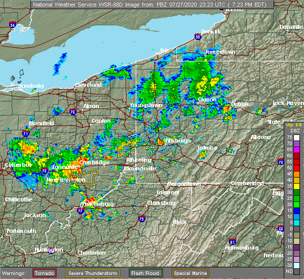
| 7/27/2020 7:39 PM EDT |
 At 738 pm edt, severe thunderstorms were located along a line extending from 8 miles south of byesville to near caldwell, moving northeast at 25 mph (radar). Hazards include wind gusts to 60 mph. Expect damage to trees and power lines, resulting in some power outages. Locations impacted include, caldwell, dudley, summerfield, belle valley, sarahsville, batesville, seneca lake park, wolf run state park, this includes interstate 77 in ohio between mile markers 23 and 36. At 738 pm edt, severe thunderstorms were located along a line extending from 8 miles south of byesville to near caldwell, moving northeast at 25 mph (radar). Hazards include wind gusts to 60 mph. Expect damage to trees and power lines, resulting in some power outages. Locations impacted include, caldwell, dudley, summerfield, belle valley, sarahsville, batesville, seneca lake park, wolf run state park, this includes interstate 77 in ohio between mile markers 23 and 36.
|
| 7/27/2020 7:28 PM EDT |
 At 727 pm edt, a severe thunderstorm was located 10 miles west of caldwell, moving east at 30 mph (radar). Hazards include wind gusts to 60 mph. expect damage to trees and power lines, resulting in some power outages At 727 pm edt, a severe thunderstorm was located 10 miles west of caldwell, moving east at 30 mph (radar). Hazards include wind gusts to 60 mph. expect damage to trees and power lines, resulting in some power outages
|
| 6/10/2020 8:51 PM EDT |
 The severe thunderstorm warning for south central harrison, central guernsey, western monroe, western belmont and noble counties will expire at 900 pm edt, the storms which prompted the warning have weakened below severe limits, and no longer pose an immediate threat to life or property. therefore, the warning will be allowed to expire. however gusty winds and heavy rain are still possible with these thunderstorms. a severe thunderstorm watch remains in effect until 100 am edt for east central ohio. The severe thunderstorm warning for south central harrison, central guernsey, western monroe, western belmont and noble counties will expire at 900 pm edt, the storms which prompted the warning have weakened below severe limits, and no longer pose an immediate threat to life or property. therefore, the warning will be allowed to expire. however gusty winds and heavy rain are still possible with these thunderstorms. a severe thunderstorm watch remains in effect until 100 am edt for east central ohio.
|
| 6/10/2020 8:27 PM EDT |
 At 827 pm edt, severe thunderstorms were located along a line extending from near byesville to near caldwell to near beverly, moving northeast at 60 mph (radar). Hazards include wind gusts to 60 mph and quarter-size hail. Minor hail damage to vehicles is possible. Expect wind damage to trees and power lines, resulting in some power outages. At 827 pm edt, severe thunderstorms were located along a line extending from near byesville to near caldwell to near beverly, moving northeast at 60 mph (radar). Hazards include wind gusts to 60 mph and quarter-size hail. Minor hail damage to vehicles is possible. Expect wind damage to trees and power lines, resulting in some power outages.
|
| 6/3/2020 3:06 PM EDT |
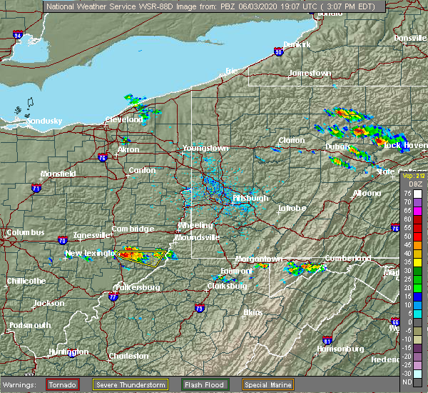 At 306 pm edt, a severe thunderstorm was located near caldwell, moving east at 30 mph (radar). Hazards include wind gusts to 60 mph and quarter-size hail. Minor hail damage to vehicles is possible. Expect wind damage to trees and power lines, resulting in some power outages. At 306 pm edt, a severe thunderstorm was located near caldwell, moving east at 30 mph (radar). Hazards include wind gusts to 60 mph and quarter-size hail. Minor hail damage to vehicles is possible. Expect wind damage to trees and power lines, resulting in some power outages.
|
| 5/14/2020 8:21 PM EDT |
 The severe thunderstorm warning for northwestern monroe and northeastern noble counties will expire at 830 pm edt, the storm which prompted the warning has moved out of the area. therefore, the warning will be allowed to expire. The severe thunderstorm warning for northwestern monroe and northeastern noble counties will expire at 830 pm edt, the storm which prompted the warning has moved out of the area. therefore, the warning will be allowed to expire.
|
| 5/14/2020 8:16 PM EDT |
 At 814 pm edt, a severe thunderstorm was located 11 miles southwest of barnesville, moving east at 40 mph (radar). Hazards include wind gusts to 60 mph and quarter-size hail. Minor hail damage to vehicles is possible. expect wind damage to trees and power lines, resulting in some power outages. Locations impacted include, summerfield, sarahsville, batesville, seneca lake park,. At 814 pm edt, a severe thunderstorm was located 11 miles southwest of barnesville, moving east at 40 mph (radar). Hazards include wind gusts to 60 mph and quarter-size hail. Minor hail damage to vehicles is possible. expect wind damage to trees and power lines, resulting in some power outages. Locations impacted include, summerfield, sarahsville, batesville, seneca lake park,.
|
| 5/14/2020 8:02 PM EDT |
 At 801 pm edt, a severe thunderstorm was located near byesville, or 9 miles north of caldwell, moving east at 45 mph (radar). Hazards include wind gusts to 60 mph and half dollar-size hail. Minor hail damage to vehicles is possible. expect wind damage to trees and power lines, resulting in some power outages. Locations impacted include, byesville, quaker city, senecaville, pleasant city, summerfield, belle valley, sarahsville, salesville, batesville, seneca lake park, wolf run state park, this includes interstate 77 in ohio between mile markers 29 and 41. At 801 pm edt, a severe thunderstorm was located near byesville, or 9 miles north of caldwell, moving east at 45 mph (radar). Hazards include wind gusts to 60 mph and half dollar-size hail. Minor hail damage to vehicles is possible. expect wind damage to trees and power lines, resulting in some power outages. Locations impacted include, byesville, quaker city, senecaville, pleasant city, summerfield, belle valley, sarahsville, salesville, batesville, seneca lake park, wolf run state park, this includes interstate 77 in ohio between mile markers 29 and 41.
|
| 5/14/2020 7:56 PM EDT |
 At 756 pm edt, a severe thunderstorm was located 8 miles southwest of byesville, or 11 miles northwest of caldwell, moving east at 45 mph (radar). Hazards include wind gusts to 60 mph and quarter-size hail. Minor hail damage to vehicles is possible. Expect wind damage to trees and power lines, resulting in some power outages. At 756 pm edt, a severe thunderstorm was located 8 miles southwest of byesville, or 11 miles northwest of caldwell, moving east at 45 mph (radar). Hazards include wind gusts to 60 mph and quarter-size hail. Minor hail damage to vehicles is possible. Expect wind damage to trees and power lines, resulting in some power outages.
|
| 8/20/2019 10:02 PM EDT |
 At 1002 pm edt, a severe thunderstorm was located 8 miles southwest of barnesville, moving northeast at 35 mph (radar). Hazards include wind gusts to 60 mph. expect damage to trees and power lines, resulting in some power outages At 1002 pm edt, a severe thunderstorm was located 8 miles southwest of barnesville, moving northeast at 35 mph (radar). Hazards include wind gusts to 60 mph. expect damage to trees and power lines, resulting in some power outages
|
| 8/8/2019 3:57 PM EDT |
 At 356 pm edt, a severe thunderstorm was located near caldwell, moving east at 45 mph. another severe storm was southeast of philo (radar). Hazards include wind gusts to 60 mph. Expect damage to trees and power lines, resulting in some power outages. locations impacted include, caldwell, new concord, dudley, senecaville, pleasant city, cumberland, summerfield, belle valley, lewisville, sarahsville, norwich, high hill, this includes the following highways, interstate 70 in ohio between mile markers 166 and 170. Interstate 77 in ohio between mile markers 21 and 40. At 356 pm edt, a severe thunderstorm was located near caldwell, moving east at 45 mph. another severe storm was southeast of philo (radar). Hazards include wind gusts to 60 mph. Expect damage to trees and power lines, resulting in some power outages. locations impacted include, caldwell, new concord, dudley, senecaville, pleasant city, cumberland, summerfield, belle valley, lewisville, sarahsville, norwich, high hill, this includes the following highways, interstate 70 in ohio between mile markers 166 and 170. Interstate 77 in ohio between mile markers 21 and 40.
|
| 8/8/2019 3:46 PM EDT |
 At 345 pm edt, a severe thunderstorm was located 8 miles south of new concord, or 13 miles southwest of cambridge, moving east at 45 mph (radar). Hazards include wind gusts to 60 mph. expect damage to trees and power lines, resulting in some power outages At 345 pm edt, a severe thunderstorm was located 8 miles south of new concord, or 13 miles southwest of cambridge, moving east at 45 mph (radar). Hazards include wind gusts to 60 mph. expect damage to trees and power lines, resulting in some power outages
|
| 7/16/2019 8:50 PM EDT |
 At 850 pm edt, a severe thunderstorm was located near caldwell, moving northeast at 35 mph (radar). Hazards include wind gusts to 60 mph. Expect damage to trees and power lines, resulting in some power outages. Locations impacted include, caldwell, dudley, summerfield, belle valley, sarahsville, dexter city, seneca lake park, wolf run state park, this includes interstate 77 in ohio between mile markers 18 and 31. At 850 pm edt, a severe thunderstorm was located near caldwell, moving northeast at 35 mph (radar). Hazards include wind gusts to 60 mph. Expect damage to trees and power lines, resulting in some power outages. Locations impacted include, caldwell, dudley, summerfield, belle valley, sarahsville, dexter city, seneca lake park, wolf run state park, this includes interstate 77 in ohio between mile markers 18 and 31.
|
| 7/16/2019 8:32 PM EDT |
 At 832 pm edt, a severe thunderstorm was located near caldwell, moving northeast at 35 mph (radar). Hazards include wind gusts to 60 mph. expect damage to trees and power lines, resulting in some power outages At 832 pm edt, a severe thunderstorm was located near caldwell, moving northeast at 35 mph (radar). Hazards include wind gusts to 60 mph. expect damage to trees and power lines, resulting in some power outages
|
| 6/24/2019 5:42 PM EDT |
 The severe thunderstorm warning for northwestern monroe, southwestern belmont and noble counties will expire at 545 pm edt, the storm that prompted the warning has moved out of the area. therefore, the warning will be allowed to expire. however gusty winds are still possible with this thunderstorm. a severe thunderstorm watch remains in effect until 1000 pm edt for east central ohio. The severe thunderstorm warning for northwestern monroe, southwestern belmont and noble counties will expire at 545 pm edt, the storm that prompted the warning has moved out of the area. therefore, the warning will be allowed to expire. however gusty winds are still possible with this thunderstorm. a severe thunderstorm watch remains in effect until 1000 pm edt for east central ohio.
|
| 6/24/2019 5:16 PM EDT |
 At 516 pm edt, a severe thunderstorm was located 7 miles east of caldwell, moving northeast at 25 mph (radar). Hazards include wind gusts to 60 mph. expect damage to trees and power lines, resulting in some power outages At 516 pm edt, a severe thunderstorm was located 7 miles east of caldwell, moving northeast at 25 mph (radar). Hazards include wind gusts to 60 mph. expect damage to trees and power lines, resulting in some power outages
|
| 5/28/2019 12:51 AM EDT |
 The severe thunderstorm warning for southeastern muskingum and noble counties will expire at 100 am edt, the storm that prompted the warning has weakened below severe limits and no longer pose an immediate threat to life and property. therefore, the warning will be allowed to expire. however small hail, gusty winds and heavy rain are still possible with this thunderstorm. a tornado watch remains in effect until 400 am edt for east central ohio. The severe thunderstorm warning for southeastern muskingum and noble counties will expire at 100 am edt, the storm that prompted the warning has weakened below severe limits and no longer pose an immediate threat to life and property. therefore, the warning will be allowed to expire. however small hail, gusty winds and heavy rain are still possible with this thunderstorm. a tornado watch remains in effect until 400 am edt for east central ohio.
|
| 5/28/2019 12:41 AM EDT |
 At 1241 am edt, a severe thunderstorm was located near caldwell, moving east at 40 mph (radar). Hazards include wind gusts to 60 mph and half dollar-size hail. Minor hail damage to vehicles is possible. expect wind damage to trees and power lines, resulting in some power outages. locations impacted include, caldwell, dudley, summerfield, belle valley, sarahsville, dexter city, ruraldale, high hill, harriettsville, seneca lake park, wolf run state park, blue rock state park, this includes interstate 77 in ohio between mile markers 18 and 36. A tornado watch remains in effect until 400 am edt for east central ohio. At 1241 am edt, a severe thunderstorm was located near caldwell, moving east at 40 mph (radar). Hazards include wind gusts to 60 mph and half dollar-size hail. Minor hail damage to vehicles is possible. expect wind damage to trees and power lines, resulting in some power outages. locations impacted include, caldwell, dudley, summerfield, belle valley, sarahsville, dexter city, ruraldale, high hill, harriettsville, seneca lake park, wolf run state park, blue rock state park, this includes interstate 77 in ohio between mile markers 18 and 36. A tornado watch remains in effect until 400 am edt for east central ohio.
|
| 5/28/2019 12:39 AM EDT |
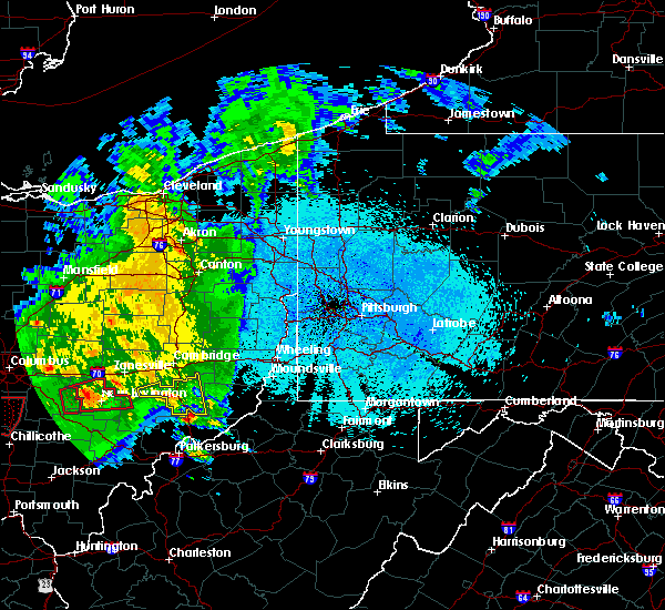 At 1238 am edt, a severe thunderstorm was located 9 miles south of caldwell, moving northeast at 45 mph (radar). Hazards include wind gusts to 60 mph and half dollar-size hail. Minor hail damage to vehicles is possible. expect wind damage to trees and power lines, resulting in some power outages. this includes interstate 77 in ohio between mile markers 18 and 36. A tornado watch remains in effect until 400 am edt for east central ohio. At 1238 am edt, a severe thunderstorm was located 9 miles south of caldwell, moving northeast at 45 mph (radar). Hazards include wind gusts to 60 mph and half dollar-size hail. Minor hail damage to vehicles is possible. expect wind damage to trees and power lines, resulting in some power outages. this includes interstate 77 in ohio between mile markers 18 and 36. A tornado watch remains in effect until 400 am edt for east central ohio.
|
| 5/28/2019 12:22 AM EDT |
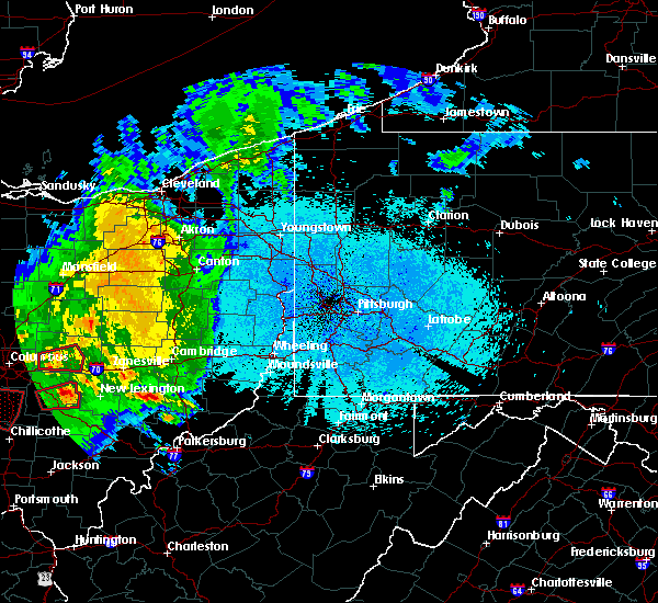 At 1222 am edt, a severe thunderstorm was located near mcconnelsville, moving east at 30 mph (radar). Hazards include wind gusts to 60 mph and quarter-size hail. Minor hail damage to vehicles is possible. Expect wind damage to trees and power lines, resulting in some power outages. At 1222 am edt, a severe thunderstorm was located near mcconnelsville, moving east at 30 mph (radar). Hazards include wind gusts to 60 mph and quarter-size hail. Minor hail damage to vehicles is possible. Expect wind damage to trees and power lines, resulting in some power outages.
|
| 5/26/2019 7:26 PM EDT |
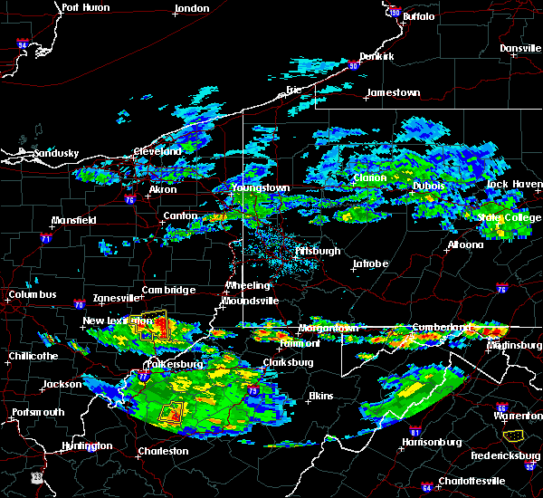 The severe thunderstorm warning for noble county will expire at 730 pm edt, the storm that prompted the warning has weakened below severe limits and no longer pose an immediate threat to life and property. therefore, the warning will be allowed to expire. however gusty winds and heavy rain are still possible with this thunderstorm. The severe thunderstorm warning for noble county will expire at 730 pm edt, the storm that prompted the warning has weakened below severe limits and no longer pose an immediate threat to life and property. therefore, the warning will be allowed to expire. however gusty winds and heavy rain are still possible with this thunderstorm.
|
| 5/26/2019 7:18 PM EDT | Power lines torn down on sulda roa in noble county OH, 3.4 miles NNE of Summerfield, OH |
| 5/26/2019 7:02 PM EDT |
 At 702 pm edt, a severe thunderstorm was located over caldwell, moving east at 25 mph (radar). Hazards include wind gusts to 60 mph and quarter-size hail. Minor hail damage to vehicles is possible. expect wind damage to trees and power lines, resulting in some power outages. Locations impacted include, caldwell, dudley, summerfield, belle valley, sarahsville, dexter city, harriettsville, wolf run state park, this includes interstate 77 in ohio between mile markers 18 and 34. At 702 pm edt, a severe thunderstorm was located over caldwell, moving east at 25 mph (radar). Hazards include wind gusts to 60 mph and quarter-size hail. Minor hail damage to vehicles is possible. expect wind damage to trees and power lines, resulting in some power outages. Locations impacted include, caldwell, dudley, summerfield, belle valley, sarahsville, dexter city, harriettsville, wolf run state park, this includes interstate 77 in ohio between mile markers 18 and 34.
|
| 5/26/2019 6:56 PM EDT |
 At 656 pm edt, a severe thunderstorm was located near caldwell, moving east at 20 mph (radar). Hazards include wind gusts to 60 mph and half dollar-size hail. Minor hail damage to vehicles is possible. Expect wind damage to trees and power lines, resulting in some power outages. At 656 pm edt, a severe thunderstorm was located near caldwell, moving east at 20 mph (radar). Hazards include wind gusts to 60 mph and half dollar-size hail. Minor hail damage to vehicles is possible. Expect wind damage to trees and power lines, resulting in some power outages.
|
| 6/20/2018 5:07 PM EDT |
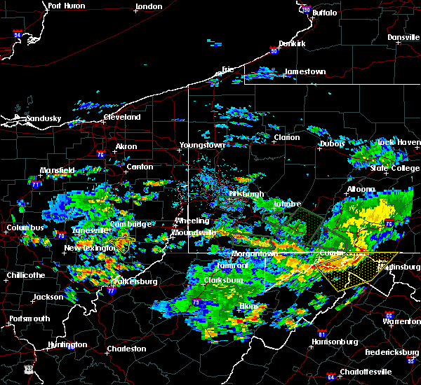 At 507 pm edt, a severe thunderstorm was located 9 miles southeast of byesville, or 9 miles northeast of caldwell, moving southeast at 20 mph (radar). Hazards include wind gusts to 60 mph. Expect damage to trees and power lines, resulting in some power outages. Locations impacted include, summerfield, sarahsville, batesville, seneca lake park, this includes interstate 77 in ohio between mile markers 33 and 36. At 507 pm edt, a severe thunderstorm was located 9 miles southeast of byesville, or 9 miles northeast of caldwell, moving southeast at 20 mph (radar). Hazards include wind gusts to 60 mph. Expect damage to trees and power lines, resulting in some power outages. Locations impacted include, summerfield, sarahsville, batesville, seneca lake park, this includes interstate 77 in ohio between mile markers 33 and 36.
|
| 6/20/2018 5:00 PM EDT |
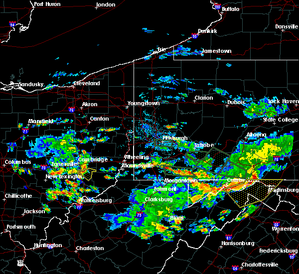 At 500 pm edt, a severe thunderstorm was located near byesville, or 9 miles north of caldwell, moving southeast at 20 mph (radar). Hazards include wind gusts to 60 mph and quarter-size hail. Minor hail damage to vehicles is possible. Expect wind damage to trees and power lines, resulting in some power outages. At 500 pm edt, a severe thunderstorm was located near byesville, or 9 miles north of caldwell, moving southeast at 20 mph (radar). Hazards include wind gusts to 60 mph and quarter-size hail. Minor hail damage to vehicles is possible. Expect wind damage to trees and power lines, resulting in some power outages.
|
| 5/14/2018 2:03 PM EDT | Quarter sized hail reported 4.1 miles NW of Summerfield, OH |
| 5/14/2018 1:45 PM EDT |
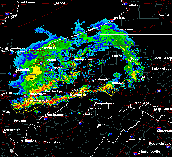 At 145 pm edt, a severe thunderstorm was located over caldwell, moving southeast at 25 mph (radar indicated). Hazards include 60 mph wind gusts and half dollar size hail. Minor hail damage to vehicles is possible. Expect wind damage to trees and power lines, resulting in some power outages. At 145 pm edt, a severe thunderstorm was located over caldwell, moving southeast at 25 mph (radar indicated). Hazards include 60 mph wind gusts and half dollar size hail. Minor hail damage to vehicles is possible. Expect wind damage to trees and power lines, resulting in some power outages.
|
| 5/13/2018 6:45 PM EDT |
 At 645 pm edt, a severe thunderstorm was located 7 miles west of woodsfield, moving east at 40 mph (radar). Hazards include ping pong ball-size hail and wind gusts to 60 mph. People and animals outdoors will be injured. expect hail damage to roofs, siding, windows, and vehicles. expect wind damage to trees and power lines, resulting in some power outages. Locations impacted include, woodsfield, summerfield, lewisville, antioch, stafford, graysville, laings,. At 645 pm edt, a severe thunderstorm was located 7 miles west of woodsfield, moving east at 40 mph (radar). Hazards include ping pong ball-size hail and wind gusts to 60 mph. People and animals outdoors will be injured. expect hail damage to roofs, siding, windows, and vehicles. expect wind damage to trees and power lines, resulting in some power outages. Locations impacted include, woodsfield, summerfield, lewisville, antioch, stafford, graysville, laings,.
|
| 5/13/2018 6:32 PM EDT |
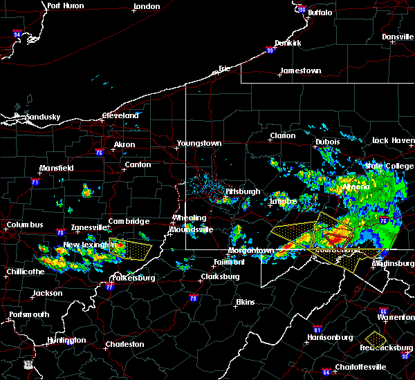 At 631 pm edt, a severe thunderstorm was located near caldwell, moving east at 40 mph (radar). Hazards include wind gusts to 60 mph and quarter-size hail. Minor hail damage to vehicles is possible. expect wind damage to trees and power lines, resulting in some power outages. Locations impacted include, woodsfield, caldwell, dudley, summerfield, belle valley, lewisville, sarahsville, dexter city, antioch, stafford, graysville, harriettsville, this includes interstate 77 in ohio between mile markers 18 and 34. At 631 pm edt, a severe thunderstorm was located near caldwell, moving east at 40 mph (radar). Hazards include wind gusts to 60 mph and quarter-size hail. Minor hail damage to vehicles is possible. expect wind damage to trees and power lines, resulting in some power outages. Locations impacted include, woodsfield, caldwell, dudley, summerfield, belle valley, lewisville, sarahsville, dexter city, antioch, stafford, graysville, harriettsville, this includes interstate 77 in ohio between mile markers 18 and 34.
|
| 5/13/2018 6:17 PM EDT |
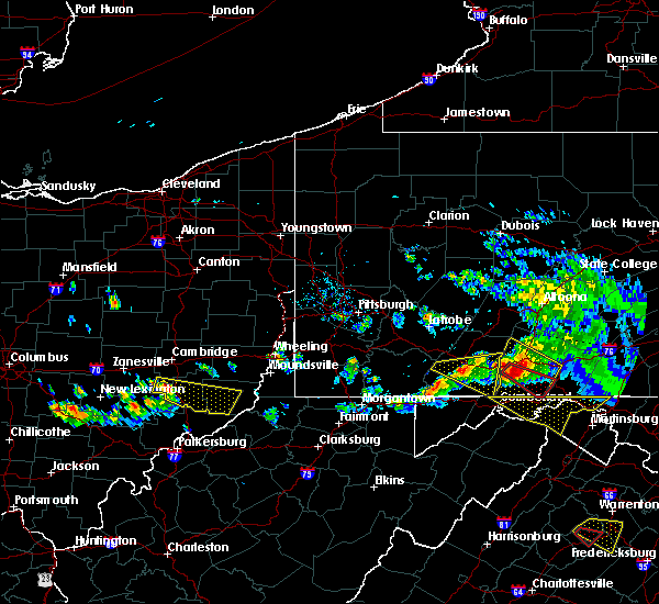 At 617 pm edt, a severe thunderstorm was located 7 miles northwest of caldwell, moving east-southeast at 40 mph (radar). Hazards include wind gusts to 60 mph and quarter-size hail. Minor hail damage to vehicles is possible. Expect wind damage to trees and power lines, resulting in some power outages. At 617 pm edt, a severe thunderstorm was located 7 miles northwest of caldwell, moving east-southeast at 40 mph (radar). Hazards include wind gusts to 60 mph and quarter-size hail. Minor hail damage to vehicles is possible. Expect wind damage to trees and power lines, resulting in some power outages.
|
| 4/3/2018 7:30 PM EDT |
 At 730 pm edt, a severe thunderstorm was located 8 miles north of woodsfield, moving east at 55 mph (radar). Hazards include 60 mph wind gusts and quarter-size hail. Minor hail damage to vehicles is possible. expect wind damage to trees and power lines, resulting in some power outages. locations impacted include, cambridge, st. clairsville, barnesville, woodsfield, caldwell, new concord, byesville, dudley, bethesda, quaker city, senecaville, belmont, this includes the following highways, interstate 70 in ohio near mile marker 166, between mile markers 168 and 173, and between mile markers 177 and 216. Interstate 77 in ohio between mile markers 23 and 45. At 730 pm edt, a severe thunderstorm was located 8 miles north of woodsfield, moving east at 55 mph (radar). Hazards include 60 mph wind gusts and quarter-size hail. Minor hail damage to vehicles is possible. expect wind damage to trees and power lines, resulting in some power outages. locations impacted include, cambridge, st. clairsville, barnesville, woodsfield, caldwell, new concord, byesville, dudley, bethesda, quaker city, senecaville, belmont, this includes the following highways, interstate 70 in ohio near mile marker 166, between mile markers 168 and 173, and between mile markers 177 and 216. Interstate 77 in ohio between mile markers 23 and 45.
|
| 4/3/2018 7:18 PM EDT |
 At 717 pm edt, a severe thunderstorm was located 9 miles northwest of woodsfield, moving east at 55 mph (radar). Hazards include 60 mph wind gusts and quarter-size hail. Minor hail damage to vehicles is possible. expect wind damage to trees and power lines, resulting in some power outages. locations impacted include, cambridge, st. clairsville, barnesville, woodsfield, caldwell, new concord, byesville, dudley, bethesda, quaker city, senecaville, belmont, this includes the following highways, interstate 70 in ohio near mile marker 166, between mile markers 168 and 173, and between mile markers 177 and 216. Interstate 77 in ohio between mile markers 23 and 45. At 717 pm edt, a severe thunderstorm was located 9 miles northwest of woodsfield, moving east at 55 mph (radar). Hazards include 60 mph wind gusts and quarter-size hail. Minor hail damage to vehicles is possible. expect wind damage to trees and power lines, resulting in some power outages. locations impacted include, cambridge, st. clairsville, barnesville, woodsfield, caldwell, new concord, byesville, dudley, bethesda, quaker city, senecaville, belmont, this includes the following highways, interstate 70 in ohio near mile marker 166, between mile markers 168 and 173, and between mile markers 177 and 216. Interstate 77 in ohio between mile markers 23 and 45.
|
| 4/3/2018 6:58 PM EDT |
 At 658 pm edt, a severe thunderstorm was located near caldwell, moving east at 55 mph (radar). Hazards include 60 mph wind gusts and quarter-size hail. Minor hail damage to vehicles is possible. Expect wind damage to trees and power lines, resulting in some power outages. At 658 pm edt, a severe thunderstorm was located near caldwell, moving east at 55 mph (radar). Hazards include 60 mph wind gusts and quarter-size hail. Minor hail damage to vehicles is possible. Expect wind damage to trees and power lines, resulting in some power outages.
|
| 11/5/2017 9:01 PM EST |
 At 900 pm est, severe thunderstorms were located along a line extending from 9 miles southeast of byesville to near caldwell to 10 miles northeast of beverly, moving east at 40 mph (radar). Hazards include 60 mph wind gusts. Expect damage to trees and power lines, resulting in some power outages. Locations impacted include, new martinsville, woodsfield, caldwell, paden city, powhatan point, sistersville, quaker city, sardis, beallsville, clarington, summerfield, belle valley, this includes interstate 77 in ohio between mile markers 25 and 30. At 900 pm est, severe thunderstorms were located along a line extending from 9 miles southeast of byesville to near caldwell to 10 miles northeast of beverly, moving east at 40 mph (radar). Hazards include 60 mph wind gusts. Expect damage to trees and power lines, resulting in some power outages. Locations impacted include, new martinsville, woodsfield, caldwell, paden city, powhatan point, sistersville, quaker city, sardis, beallsville, clarington, summerfield, belle valley, this includes interstate 77 in ohio between mile markers 25 and 30.
|
| 11/5/2017 8:30 PM EST |
 At 829 pm est, severe thunderstorms were located along a line extending from near new concord to 14 miles west of caldwell to mcconnelsville, moving east at 40 mph (radar). Hazards include 60 mph wind gusts. expect damage to trees and power lines, resulting in some power outages At 829 pm est, severe thunderstorms were located along a line extending from near new concord to 14 miles west of caldwell to mcconnelsville, moving east at 40 mph (radar). Hazards include 60 mph wind gusts. expect damage to trees and power lines, resulting in some power outages
|
| 7/10/2017 5:02 PM EDT |
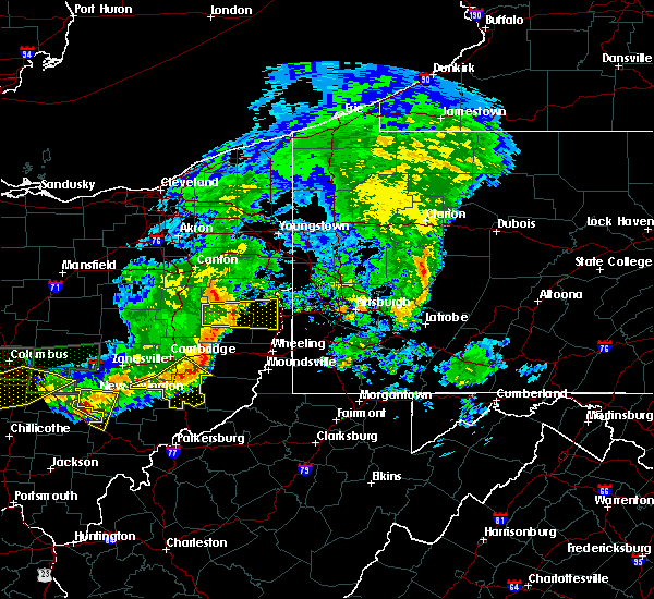 At 501 pm edt, severe thunderstorms were located along a line extending from 10 miles southwest of barnesville to caldwell to 6 miles north of mcconnelsville, moving southeast at 35 mph (radar). Hazards include 60 mph wind gusts. Expect damage to trees and power lines, resulting in some power outages. Locations impacted include, caldwell, byesville, dudley, senecaville, pleasant city, cumberland, lore city, summerfield, belle valley, sarahsville, dexter city, high hill, this includes interstate 77 in ohio between mile markers 18 and 42. At 501 pm edt, severe thunderstorms were located along a line extending from 10 miles southwest of barnesville to caldwell to 6 miles north of mcconnelsville, moving southeast at 35 mph (radar). Hazards include 60 mph wind gusts. Expect damage to trees and power lines, resulting in some power outages. Locations impacted include, caldwell, byesville, dudley, senecaville, pleasant city, cumberland, lore city, summerfield, belle valley, sarahsville, dexter city, high hill, this includes interstate 77 in ohio between mile markers 18 and 42.
|
| 7/10/2017 4:43 PM EDT |
 At 443 pm edt, severe thunderstorms were located along a line extending from near cambridge to 9 miles south of new concord to 7 miles south of south zanesville, moving southeast at 45 mph (radar). Hazards include 60 mph wind gusts. expect damage to trees and power lines, resulting in some power outages At 443 pm edt, severe thunderstorms were located along a line extending from near cambridge to 9 miles south of new concord to 7 miles south of south zanesville, moving southeast at 45 mph (radar). Hazards include 60 mph wind gusts. expect damage to trees and power lines, resulting in some power outages
|
| 7/7/2017 3:25 PM EDT |
 The severe thunderstorm warning for central guernsey, southeastern tuscarawas and northern noble counties will expire at 330 pm edt, the storms that prompted the warning have weakened below severe limits and no longer pose an immediate threat to life and property. therefore, the warning will be allowed to expire. however gusty winds and heavy rain are still possible with these thunderstorms. The severe thunderstorm warning for central guernsey, southeastern tuscarawas and northern noble counties will expire at 330 pm edt, the storms that prompted the warning have weakened below severe limits and no longer pose an immediate threat to life and property. therefore, the warning will be allowed to expire. however gusty winds and heavy rain are still possible with these thunderstorms.
|
| 7/7/2017 3:12 PM EDT |
 At 312 pm edt, severe thunderstorms were located along a line extending from 7 miles east of newcomerstown to 8 miles southeast of byesville to near caldwell, moving east at 35 mph (radar). Hazards include 60 mph wind gusts. Expect damage to trees and power lines, resulting in some power outages. locations impacted include, caldwell, gnadenhutten, antrim, tuscarawas, senecaville, pleasant city, lore city, old washington, summerfield, belle valley, sarahsville, salesville, this includes the following highways, interstate 70 in ohio between mile markers 185 and 192. Interstate 77 in ohio between mile markers 27 and 40. At 312 pm edt, severe thunderstorms were located along a line extending from 7 miles east of newcomerstown to 8 miles southeast of byesville to near caldwell, moving east at 35 mph (radar). Hazards include 60 mph wind gusts. Expect damage to trees and power lines, resulting in some power outages. locations impacted include, caldwell, gnadenhutten, antrim, tuscarawas, senecaville, pleasant city, lore city, old washington, summerfield, belle valley, sarahsville, salesville, this includes the following highways, interstate 70 in ohio between mile markers 185 and 192. Interstate 77 in ohio between mile markers 27 and 40.
|
| 7/7/2017 3:00 PM EDT |
 At 300 pm edt, severe thunderstorms were located along a line extending from near newcomerstown to near byesville to 10 miles west of caldwell, moving east at 35 mph (radar). Hazards include 60 mph wind gusts. Expect damage to trees and power lines, resulting in some power outages. locations impacted include, cambridge, caldwell, newcomerstown, byesville, gnadenhutten, antrim, tuscarawas, port washington, senecaville, pleasant city, cumberland, lore city, this includes the following highways, interstate 70 in ohio between mile markers 175 and 192. Interstate 77 in ohio between mile markers 27 and 71. At 300 pm edt, severe thunderstorms were located along a line extending from near newcomerstown to near byesville to 10 miles west of caldwell, moving east at 35 mph (radar). Hazards include 60 mph wind gusts. Expect damage to trees and power lines, resulting in some power outages. locations impacted include, cambridge, caldwell, newcomerstown, byesville, gnadenhutten, antrim, tuscarawas, port washington, senecaville, pleasant city, cumberland, lore city, this includes the following highways, interstate 70 in ohio between mile markers 175 and 192. Interstate 77 in ohio between mile markers 27 and 71.
|
| 7/7/2017 2:42 PM EDT |
 At 242 pm edt, severe thunderstorms were located along a line extending from 7 miles northeast of west lafayette to near new concord to 9 miles southeast of south zanesville, moving east at 35 mph (radar). Hazards include 60 mph wind gusts. expect damage to trees and power lines, resulting in some power outages At 242 pm edt, severe thunderstorms were located along a line extending from 7 miles northeast of west lafayette to near new concord to 9 miles southeast of south zanesville, moving east at 35 mph (radar). Hazards include 60 mph wind gusts. expect damage to trees and power lines, resulting in some power outages
|
| 5/19/2017 7:57 PM EDT |
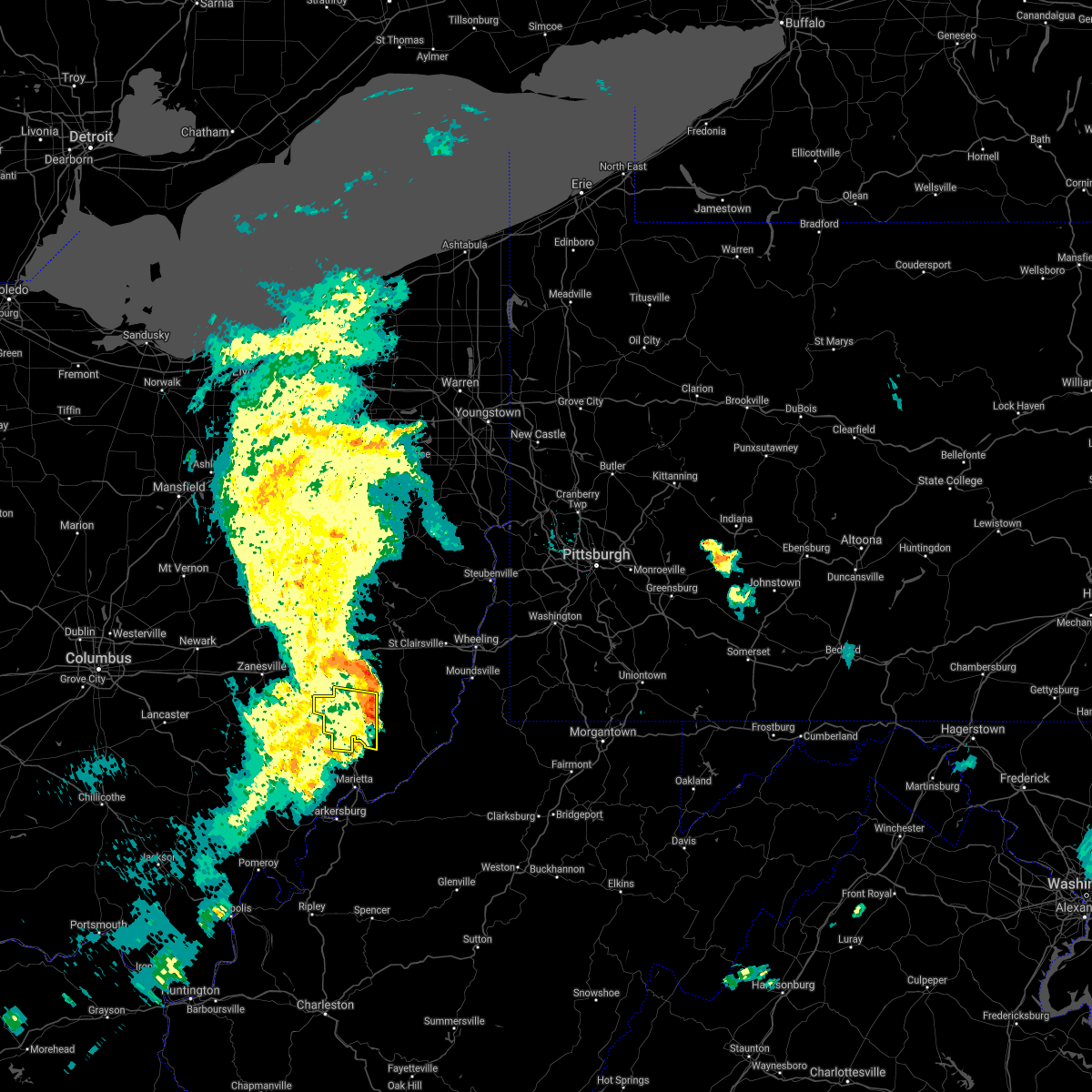 The severe thunderstorm warning for noble county will expire at 800 pm edt, the storm that prompted the warning has weakened below severe limits and has exited the warned area. therefore, the warning will be allowed to expire. a severe thunderstorm watch remains in effect until 1100 pm edt for east central ohio. The severe thunderstorm warning for noble county will expire at 800 pm edt, the storm that prompted the warning has weakened below severe limits and has exited the warned area. therefore, the warning will be allowed to expire. a severe thunderstorm watch remains in effect until 1100 pm edt for east central ohio.
|
| 5/19/2017 7:33 PM EDT |
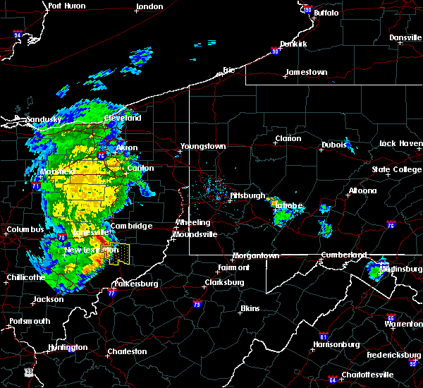 At 733 pm edt, a severe thunderstorm was located 7 miles west of caldwell, moving east at 30 mph (radar). Hazards include 60 mph wind gusts. Expect damage to trees and power lines, resulting in some power outages. Locations impacted include, caldwell, dudley, summerfield, belle valley, sarahsville, dexter city, harriettsville, wolf run state park, this includes interstate 77 in ohio between mile markers 18 and 35. At 733 pm edt, a severe thunderstorm was located 7 miles west of caldwell, moving east at 30 mph (radar). Hazards include 60 mph wind gusts. Expect damage to trees and power lines, resulting in some power outages. Locations impacted include, caldwell, dudley, summerfield, belle valley, sarahsville, dexter city, harriettsville, wolf run state park, this includes interstate 77 in ohio between mile markers 18 and 35.
|
| 5/19/2017 7:03 PM EDT |
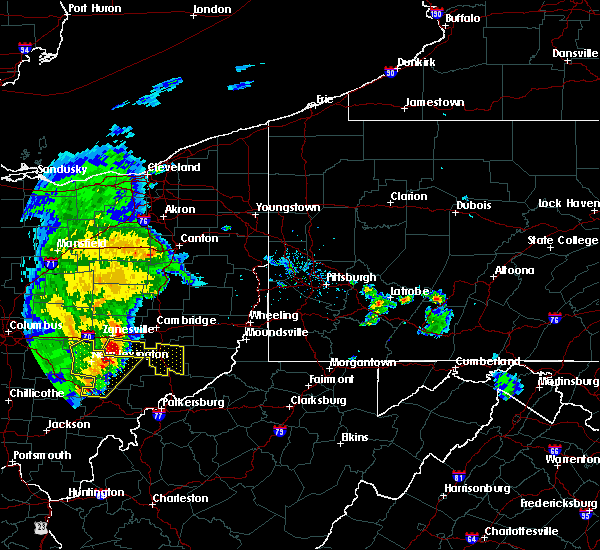 The national weather service in pittsburgh has issued a * severe thunderstorm warning for. southeastern muskingum county in east central ohio. noble county in east central ohio. until 800 pm edt. At 703 pm edt, a severe thunderstorm was located near south. The national weather service in pittsburgh has issued a * severe thunderstorm warning for. southeastern muskingum county in east central ohio. noble county in east central ohio. until 800 pm edt. At 703 pm edt, a severe thunderstorm was located near south.
|
| 5/1/2017 1:13 PM EDT |
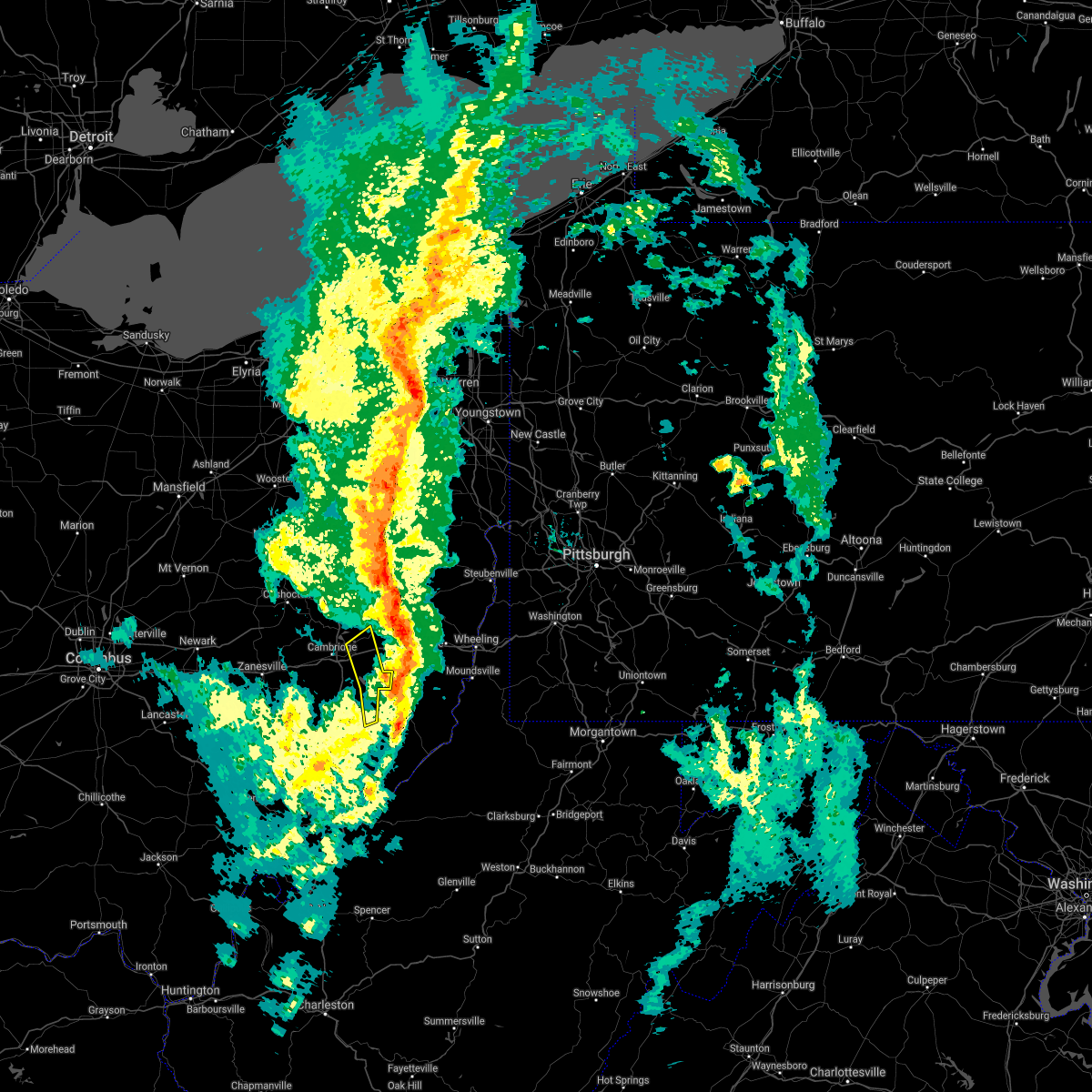 The severe thunderstorm warning for eastern guernsey. southwestern belmont and northeastern noble counties will expire at 115 pm edt. the storms that prompted the warning have moved out of the area. therefore, the warning will be allowed to expire. A tornado watch remains in effect until 700 pm edt for east central. The severe thunderstorm warning for eastern guernsey. southwestern belmont and northeastern noble counties will expire at 115 pm edt. the storms that prompted the warning have moved out of the area. therefore, the warning will be allowed to expire. A tornado watch remains in effect until 700 pm edt for east central.
|
| 5/1/2017 1:12 PM EDT |
 The severe thunderstorm warning for monroe. southwestern belmont and southeastern noble counties will expire at 115 pm edt. the storms that prompted the warning have weakened below severe limits and no longer pose an immediate threat to life and property. therefore, the warning will be allowed to expire. A tornado watch remains in effect until 700 pm edt for east central. The severe thunderstorm warning for monroe. southwestern belmont and southeastern noble counties will expire at 115 pm edt. the storms that prompted the warning have weakened below severe limits and no longer pose an immediate threat to life and property. therefore, the warning will be allowed to expire. A tornado watch remains in effect until 700 pm edt for east central.
|
| 5/1/2017 1:04 PM EDT |
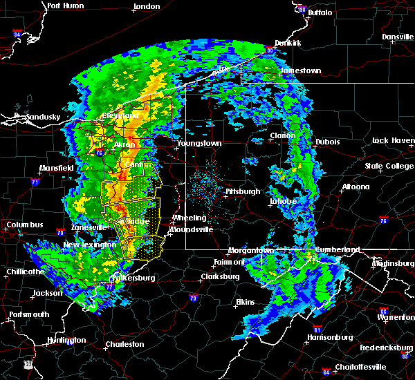 At 104 pm edt, severe thunderstorms were located along a line extending from 7 miles northwest of freeport to 9 miles southwest of barnesville, moving northeast at 60 mph (radar). Hazards include 60 mph wind gusts. Expect damage to trees and power lines, resulting in some power outages. locations impacted include, antrim, quaker city, lore city, old washington, summerfield, salesville, batesville, seneca lake park, salt fork state park, this includes interstate 70 in ohio between mile markers 185 and 193. A tornado watch remains in effect until 700 pm edt for east central ohio. At 104 pm edt, severe thunderstorms were located along a line extending from 7 miles northwest of freeport to 9 miles southwest of barnesville, moving northeast at 60 mph (radar). Hazards include 60 mph wind gusts. Expect damage to trees and power lines, resulting in some power outages. locations impacted include, antrim, quaker city, lore city, old washington, summerfield, salesville, batesville, seneca lake park, salt fork state park, this includes interstate 70 in ohio between mile markers 185 and 193. A tornado watch remains in effect until 700 pm edt for east central ohio.
|
| 5/1/2017 1:01 PM EDT |
 At 101 pm edt, severe thunderstorms were located along a line extending from 10 miles southwest of barnesville to 7 miles north of st. marys, moving northeast at 55 mph (radar). Hazards include 60 mph wind gusts. Expect damage to trees and power lines, resulting in some power outages. Locations impacted include, new martinsville, woodsfield, powhatan point, sardis, beallsville, clarington, summerfield, lewisville, jerusalem, wilson, cameron, fly, a tornado watch remains in effect until 700 pm edt for east central ohio, and northern west virginia. At 101 pm edt, severe thunderstorms were located along a line extending from 10 miles southwest of barnesville to 7 miles north of st. marys, moving northeast at 55 mph (radar). Hazards include 60 mph wind gusts. Expect damage to trees and power lines, resulting in some power outages. Locations impacted include, new martinsville, woodsfield, powhatan point, sardis, beallsville, clarington, summerfield, lewisville, jerusalem, wilson, cameron, fly, a tornado watch remains in effect until 700 pm edt for east central ohio, and northern west virginia.
|
| 5/1/2017 12:56 PM EDT |
 At 1255 pm edt, severe thunderstorms were located along a line extending from 7 miles south of west lafayette to near caldwell, moving northeast at 50 mph (radar). Hazards include 60 mph wind gusts. Expect damage to trees and power lines, resulting in some power outages. locations impacted include, cambridge, caldwell, byesville, dudley, antrim, quaker city, senecaville, pleasant city, lore city, old washington, summerfield, belle valley, this includes the following highways, interstate 70 in ohio between mile markers 178 and 193. interstate 77 in ohio between mile markers 21 and 52. A tornado watch remains in effect until 700 pm edt for east central ohio. At 1255 pm edt, severe thunderstorms were located along a line extending from 7 miles south of west lafayette to near caldwell, moving northeast at 50 mph (radar). Hazards include 60 mph wind gusts. Expect damage to trees and power lines, resulting in some power outages. locations impacted include, cambridge, caldwell, byesville, dudley, antrim, quaker city, senecaville, pleasant city, lore city, old washington, summerfield, belle valley, this includes the following highways, interstate 70 in ohio between mile markers 178 and 193. interstate 77 in ohio between mile markers 21 and 52. A tornado watch remains in effect until 700 pm edt for east central ohio.
|
| 5/1/2017 12:55 PM EDT | Numerous trees down in noble county OH, 0.3 miles SSE of Summerfield, OH |
| 5/1/2017 12:38 PM EDT |
 At 1238 pm edt, severe thunderstorms were located along a line extending from 6 miles northeast of north zanesville to near mcconnelsville, moving northeast at 50 mph (radar). Hazards include 60 mph wind gusts. Expect damage to trees and power lines, resulting in some power outages. locations impacted include, cambridge, caldwell, new concord, byesville, dudley, antrim, quaker city, senecaville, pleasant city, cumberland, lore city, old washington, this includes the following highways, interstate 70 in ohio between mile markers 161 and 193. interstate 77 in ohio between mile markers 21 and 52. A tornado watch remains in effect until 700 pm edt for east central ohio. At 1238 pm edt, severe thunderstorms were located along a line extending from 6 miles northeast of north zanesville to near mcconnelsville, moving northeast at 50 mph (radar). Hazards include 60 mph wind gusts. Expect damage to trees and power lines, resulting in some power outages. locations impacted include, cambridge, caldwell, new concord, byesville, dudley, antrim, quaker city, senecaville, pleasant city, cumberland, lore city, old washington, this includes the following highways, interstate 70 in ohio between mile markers 161 and 193. interstate 77 in ohio between mile markers 21 and 52. A tornado watch remains in effect until 700 pm edt for east central ohio.
|
| 5/1/2017 12:37 PM EDT |
 At 1236 pm edt, severe thunderstorms were located along a line extending from 8 miles southwest of caldwell to vienna, moving northeast at 55 mph (radar). Hazards include 60 mph wind gusts. expect damage to trees and power lines, resulting in some power outages At 1236 pm edt, severe thunderstorms were located along a line extending from 8 miles southwest of caldwell to vienna, moving northeast at 55 mph (radar). Hazards include 60 mph wind gusts. expect damage to trees and power lines, resulting in some power outages
|
| 5/1/2017 12:08 PM EDT |
 At 1208 pm edt, severe thunderstorms were located along a line extending from near perry state forest to near athens, moving northeast at 50 mph (radar). Hazards include 60 mph wind gusts. expect damage to trees and power lines, resulting in some power outages At 1208 pm edt, severe thunderstorms were located along a line extending from near perry state forest to near athens, moving northeast at 50 mph (radar). Hazards include 60 mph wind gusts. expect damage to trees and power lines, resulting in some power outages
|
| 3/1/2017 9:00 AM EST |
 At 859 am est, severe thunderstorms were located along a line extending from 10 miles southeast of byesville to near caldwell to near beverly, moving east at 65 mph (radar). Hazards include 60 mph wind gusts. expect damage to trees and power lines, resulting in some power outages At 859 am est, severe thunderstorms were located along a line extending from 10 miles southeast of byesville to near caldwell to near beverly, moving east at 65 mph (radar). Hazards include 60 mph wind gusts. expect damage to trees and power lines, resulting in some power outages
|
| 7/24/2016 6:03 PM EDT |
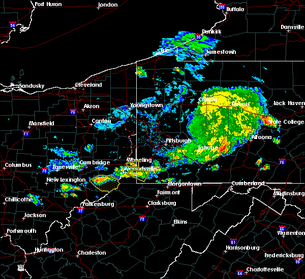 At 603 pm edt, severe thunderstorms were located along a line extending from 13 miles west of powhatan point to near woodsfield to 14 miles east of caldwell, moving southeast at 20 mph (radar indicated). Hazards include 60 mph wind gusts and quarter size hail. Hail damage to vehicles is expected. expect wind damage to trees and power lines, resulting in some power outages. locations impacted include, new martinsville, woodsfield, sardis, beallsville, clarington, summerfield, lewisville, jerusalem, wilson, cameron, fly, antioch, stafford, graysville, miltonsburg, rinard mills, hannibal and laings. Please report severe weather by calling 4 1 2, 2 6 2, 1 9 8 8, posting to the nws pittsburgh facebook page, or using twitter @nwspittsburgh. At 603 pm edt, severe thunderstorms were located along a line extending from 13 miles west of powhatan point to near woodsfield to 14 miles east of caldwell, moving southeast at 20 mph (radar indicated). Hazards include 60 mph wind gusts and quarter size hail. Hail damage to vehicles is expected. expect wind damage to trees and power lines, resulting in some power outages. locations impacted include, new martinsville, woodsfield, sardis, beallsville, clarington, summerfield, lewisville, jerusalem, wilson, cameron, fly, antioch, stafford, graysville, miltonsburg, rinard mills, hannibal and laings. Please report severe weather by calling 4 1 2, 2 6 2, 1 9 8 8, posting to the nws pittsburgh facebook page, or using twitter @nwspittsburgh.
|
| 7/24/2016 5:48 PM EDT |
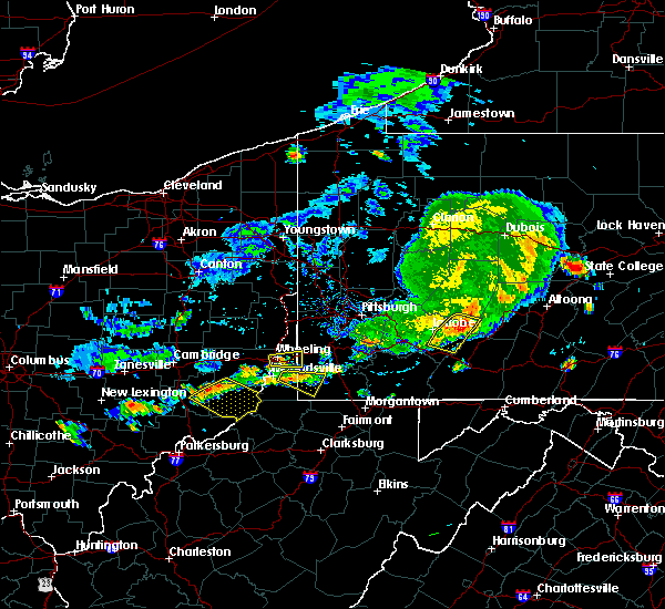 At 547 pm edt, severe thunderstorms were located along a line extending from near woodsfield to 14 miles south of barnesville to 10 miles east of caldwell, moving southeast at 20 mph (radar indicated). Hazards include 60 mph wind gusts and quarter size hail. Hail damage to vehicles is expected. Expect wind damage to trees and power lines, resulting in some power outages. At 547 pm edt, severe thunderstorms were located along a line extending from near woodsfield to 14 miles south of barnesville to 10 miles east of caldwell, moving southeast at 20 mph (radar indicated). Hazards include 60 mph wind gusts and quarter size hail. Hail damage to vehicles is expected. Expect wind damage to trees and power lines, resulting in some power outages.
|
| 5/10/2016 9:18 PM EDT | Trees down on rt 513 in noble county OH, 1.1 miles SSW of Summerfield, OH |
| 5/10/2016 4:56 PM EDT |
 At 456 pm edt, a severe thunderstorm was located 10 miles west of woodsfield, moving northeast at 20 mph (radar indicated). Hazards include 60 mph wind gusts and quarter size hail. Hail damage to vehicles is expected. expect wind damage to trees and power lines, resulting in some power outages. locations impacted include, barnesville, bethesda, quaker city, summerfield, jerusalem, wilson, somerton, batesville, miltonsburg and seneca lake park. this includes interstate 70 in ohio between mile markers 199 and 204. Please report severe weather by calling 4 1 2, 2 6 2, 1 9 8 8, posting to the nws pittsburgh facebook page, or using twitter @nwspittsburgh. At 456 pm edt, a severe thunderstorm was located 10 miles west of woodsfield, moving northeast at 20 mph (radar indicated). Hazards include 60 mph wind gusts and quarter size hail. Hail damage to vehicles is expected. expect wind damage to trees and power lines, resulting in some power outages. locations impacted include, barnesville, bethesda, quaker city, summerfield, jerusalem, wilson, somerton, batesville, miltonsburg and seneca lake park. this includes interstate 70 in ohio between mile markers 199 and 204. Please report severe weather by calling 4 1 2, 2 6 2, 1 9 8 8, posting to the nws pittsburgh facebook page, or using twitter @nwspittsburgh.
|
| 5/10/2016 4:54 PM EDT | Trees down on rt 513 in noble county OH, 1.1 miles SSW of Summerfield, OH |
| 5/10/2016 4:49 PM EDT | Quarter sized hail reported 1.8 miles ENE of Summerfield, OH, hail at least to size of quarters. large limbs were blown down onto vehicle. |
| 5/10/2016 4:49 PM EDT | Hail at least to size of quarters. large limbs were blown down onto vehicl in noble county OH, 1.8 miles ENE of Summerfield, OH |
| 5/10/2016 4:38 PM EDT |
 At 437 pm edt, a severe thunderstorm was located near caldwell, moving northeast at 25 mph (radar indicated). Hazards include 60 mph wind gusts and quarter size hail. Hail damage to vehicles is expected. Expect wind damage to trees and power lines, resulting in some power outages. At 437 pm edt, a severe thunderstorm was located near caldwell, moving northeast at 25 mph (radar indicated). Hazards include 60 mph wind gusts and quarter size hail. Hail damage to vehicles is expected. Expect wind damage to trees and power lines, resulting in some power outages.
|
| 7/14/2015 4:12 PM EDT | The severe thunderstorm warning for noble, southeastern muskingum and southern guernsey counties will expire at 415 pm edt, the severe thunderstorm which prompted the warning has weakened. therefore the warning will be allowed to expire. a severe thunderstorm watch remains in effect until 800 pm edt for east central ohio. |
| 7/14/2015 3:40 PM EDT |
 At 339 pm edt, a severe thunderstorm was located near byesville, or near cambridge, moving east at 50 mph (radar indicated). Hazards include 60 mph wind gusts and quarter size hail. Hail damage to vehicles is expected. expect wind damage to trees and some power outages. Locations impacted include, cambridge, caldwell, new concord, byesville, dudley, quaker city, senecaville, pleasant city, cumberland, lore city, old washington, summerfield, belle valley, sarahsville, salesville, dexter city, norwich, chandlersville, ruraldale and high hill. At 339 pm edt, a severe thunderstorm was located near byesville, or near cambridge, moving east at 50 mph (radar indicated). Hazards include 60 mph wind gusts and quarter size hail. Hail damage to vehicles is expected. expect wind damage to trees and some power outages. Locations impacted include, cambridge, caldwell, new concord, byesville, dudley, quaker city, senecaville, pleasant city, cumberland, lore city, old washington, summerfield, belle valley, sarahsville, salesville, dexter city, norwich, chandlersville, ruraldale and high hill.
|
| 7/14/2015 3:29 PM EDT |
 At 329 pm edt, a severe thunderstorm was located near new concord, or 11 miles east of zanesville, moving east at 50 mph (radar indicated). Hazards include 60 mph wind gusts and quarter size hail. Hail damage to vehicles is expected. Expect wind damage to trees and some power outages. At 329 pm edt, a severe thunderstorm was located near new concord, or 11 miles east of zanesville, moving east at 50 mph (radar indicated). Hazards include 60 mph wind gusts and quarter size hail. Hail damage to vehicles is expected. Expect wind damage to trees and some power outages.
|
| 4/9/2015 4:48 PM EDT | The national weather service in pittsburgh has issued a * severe thunderstorm warning for. noble county in east central ohio. western jefferson county in east central ohio. northeastern coshocton county in east central ohio. Guernsey county in east central ohio. |
| 1/1/0001 12:00 AM | Large tree down in noble county OH, 0.3 miles SSE of Summerfield, OH |
Hail Maps for Summerfield, OH


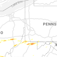


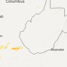


Connect with Interactive Hail Maps