

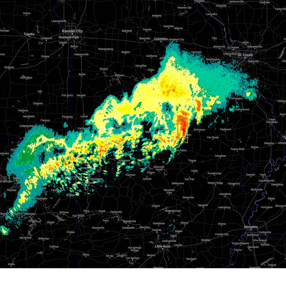
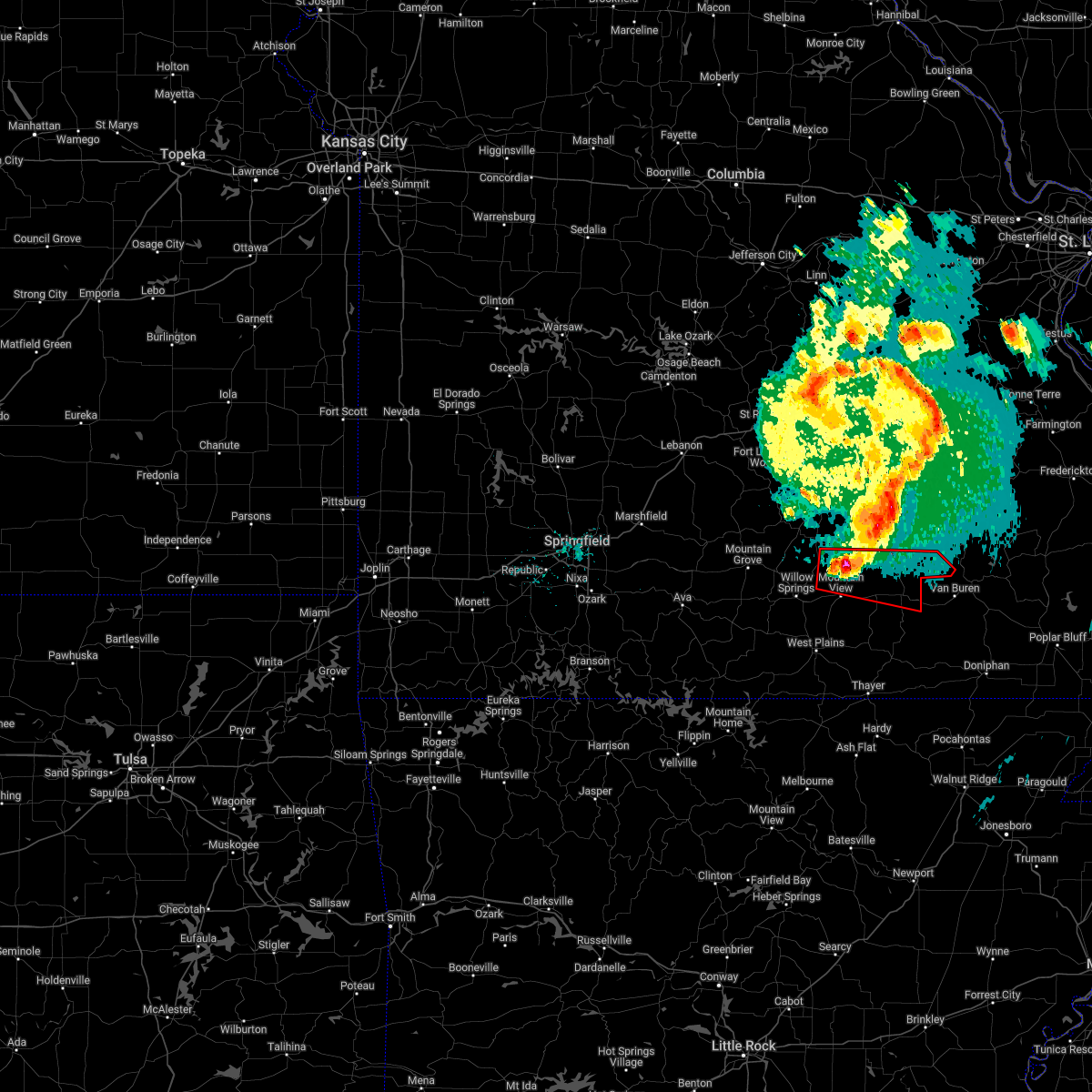
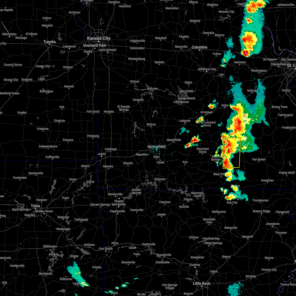
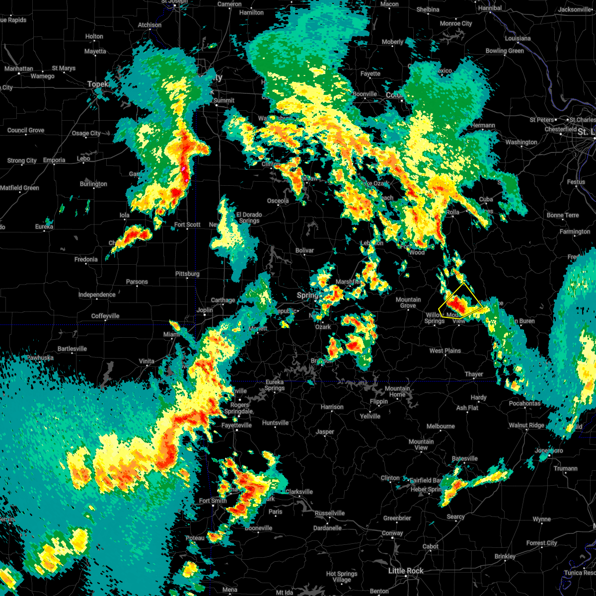
Hail Map for Summersville, MO
The Summersville, MO area has had 5 reports of on-the-ground hail by trained spotters, and has been under severe weather warnings 18 times during the past 12 months. Doppler radar has detected hail at or near Summersville, MO on 49 occasions, including 1 occasion during the past year.
| Name: | Summersville, MO |
| Where Located: | 32.4 miles SSW of Salem, MO |
| Map: | Google Map for Summersville, MO |
| Population: | 502 |
| Housing Units: | 269 |
| More Info: | Search Google for Summersville, MO |
0
The Top Recent Hail Date for Summersville, MO is Friday, July 7, 2023 (48th out of 49)

Hail and Wind Damage Spotted near Summersville, MO
| Date / Time | Report Details |
|---|---|
| 3/14/2024 5:32 PM CDT |
 the severe thunderstorm warning has been cancelled and is no longer in effect the severe thunderstorm warning has been cancelled and is no longer in effect
|
| 3/14/2024 5:32 PM CDT |
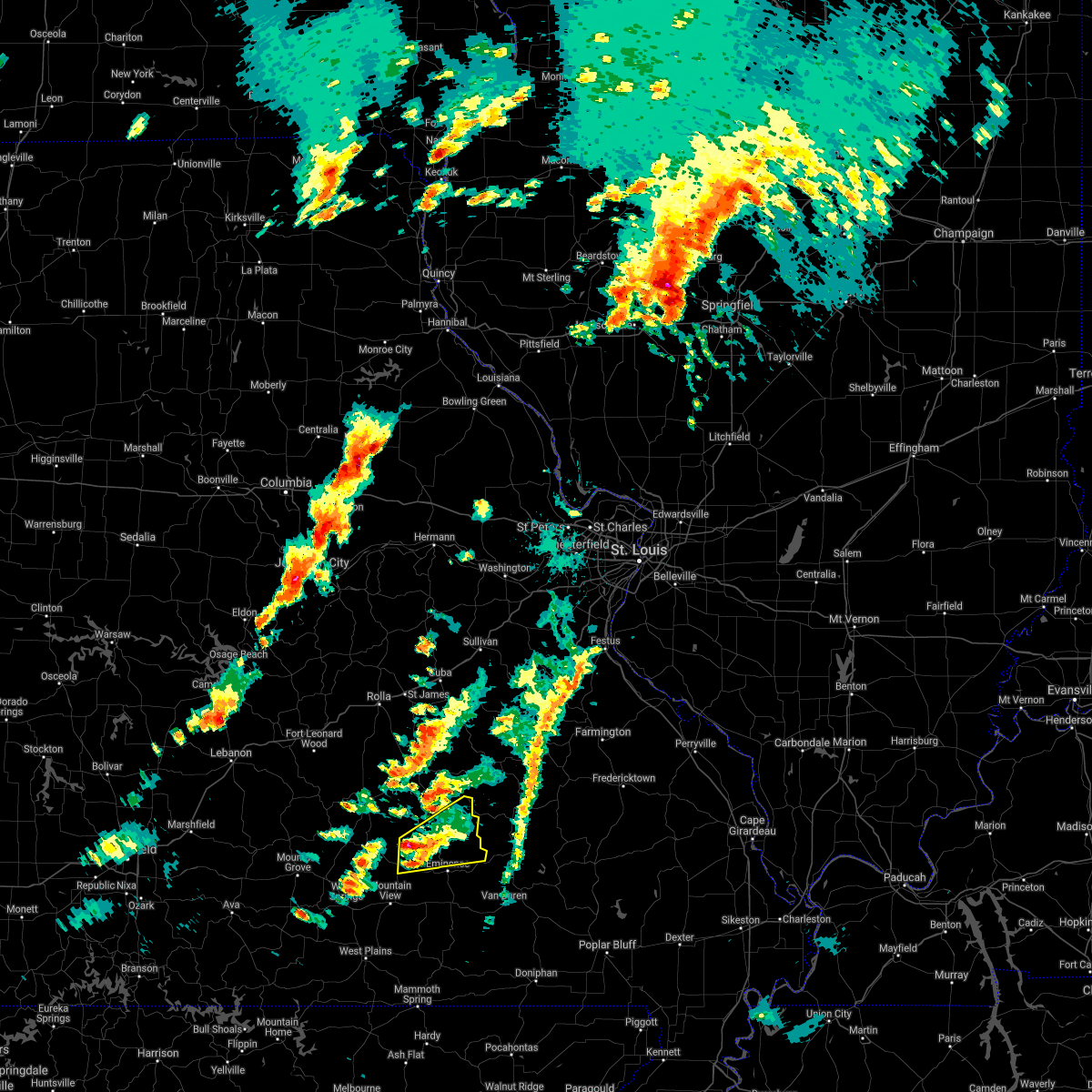
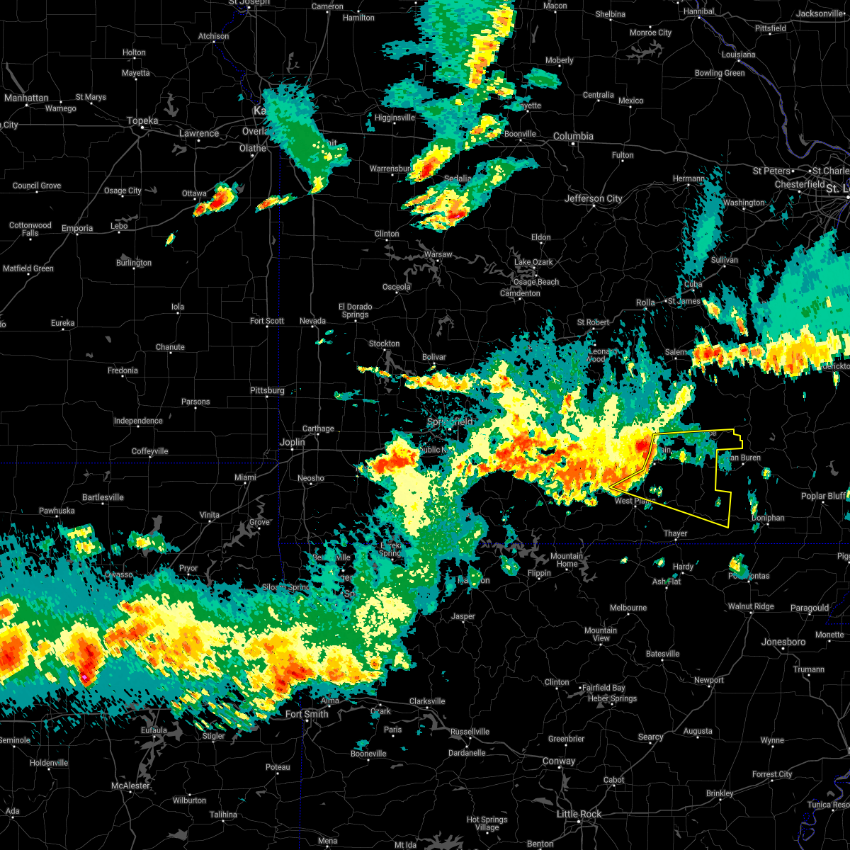
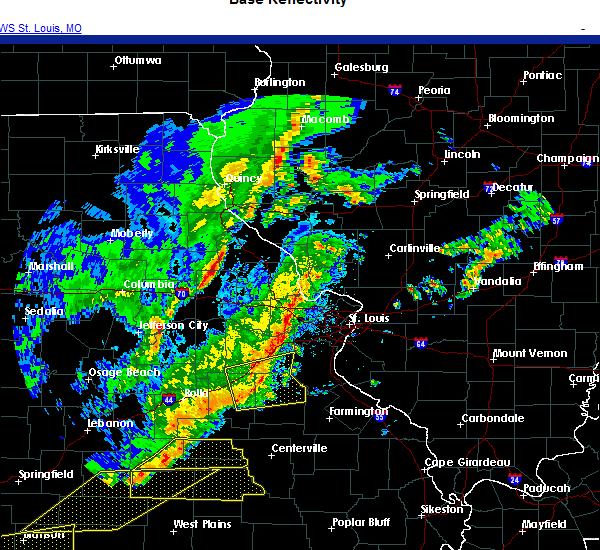
 At 530 pm cdt, severe thunderstorms were located along a line extending from 11 miles southeast of rolla to 10 miles north of eminence to birch tree, moving east at 55 mph (law enforcement. this storm has a history of producing widespread wind damage including downing trees and removing roofs). Hazards include 70 mph wind gusts and half dollar size hail. Hail damage to vehicles is expected. expect considerable tree damage. wind damage is also likely to mobile homes, roofs, and outbuildings. Locations impacted include, west plains, current river state park, ozark national scenic riverways, echo bluff state park, montauk state park, salem, licking, mountain view, willow springs, winona, birch tree, eminence, pomona, summersville, bunker, raymondville, edgar springs, montier, lenox, and montauk. At 530 pm cdt, severe thunderstorms were located along a line extending from 11 miles southeast of rolla to 10 miles north of eminence to birch tree, moving east at 55 mph (law enforcement. this storm has a history of producing widespread wind damage including downing trees and removing roofs). Hazards include 70 mph wind gusts and half dollar size hail. Hail damage to vehicles is expected. expect considerable tree damage. wind damage is also likely to mobile homes, roofs, and outbuildings. Locations impacted include, west plains, current river state park, ozark national scenic riverways, echo bluff state park, montauk state park, salem, licking, mountain view, willow springs, winona, birch tree, eminence, pomona, summersville, bunker, raymondville, edgar springs, montier, lenox, and montauk.
|
| 3/14/2024 5:29 PM CDT |
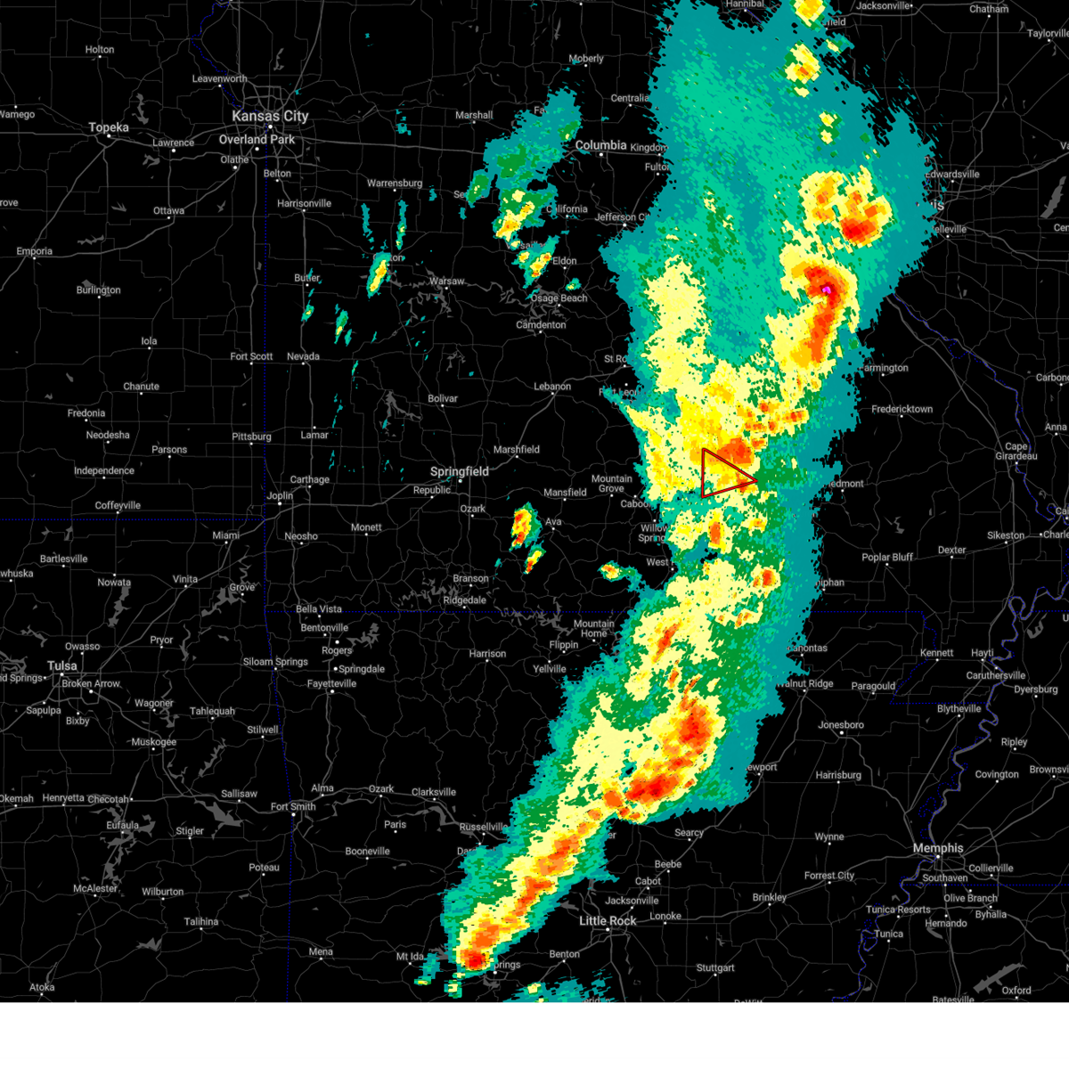
 At 528 pm cdt, severe thunderstorms were located along a line extending from 12 miles south of salem to 12 miles northeast of summersville to 7 miles southwest of eminence, moving east at 55 mph. these are destructive storms for summersville and eminence (law enforcement. this storm has a history of producing widespread wind damage including downing trees and removing roofs). Hazards include 80 mph wind gusts and half dollar size hail. Flying debris will be dangerous to those caught without shelter. mobile homes will be heavily damaged. expect considerable damage to roofs, windows, and vehicles. extensive tree damage and power outages are likely. Locations impacted include, current river state park, ozark national scenic riverways, echo bluff state park, montauk state park, eminence, summersville, bunker, raymondville, montauk, turtle, jadwin, midridge, arroll, gladden, alley spring, hartshorn, round spring, west eminence, akers, and pine crest. At 528 pm cdt, severe thunderstorms were located along a line extending from 12 miles south of salem to 12 miles northeast of summersville to 7 miles southwest of eminence, moving east at 55 mph. these are destructive storms for summersville and eminence (law enforcement. this storm has a history of producing widespread wind damage including downing trees and removing roofs). Hazards include 80 mph wind gusts and half dollar size hail. Flying debris will be dangerous to those caught without shelter. mobile homes will be heavily damaged. expect considerable damage to roofs, windows, and vehicles. extensive tree damage and power outages are likely. Locations impacted include, current river state park, ozark national scenic riverways, echo bluff state park, montauk state park, eminence, summersville, bunker, raymondville, montauk, turtle, jadwin, midridge, arroll, gladden, alley spring, hartshorn, round spring, west eminence, akers, and pine crest.
|
| 3/14/2024 5:08 PM CDT |
 Svrsgf the national weather service in springfield has issued a * severe thunderstorm warning for, shannon county in south central missouri, southern dent county in south central missouri, southeastern texas county in south central missouri, * until 545 pm cdt. * at 507 pm cdt, severe thunderstorms were located along a line extending from near raymondville to near summersville to 6 miles northwest of mountain view, moving east at 55 mph. these are destructive storms for summersville and eminence (law enforcement. this storm has a history of producing widespread wind damage including downing trees and removing roofs). Hazards include 80 mph wind gusts and half dollar size hail. Flying debris will be dangerous to those caught without shelter. mobile homes will be heavily damaged. expect considerable damage to roofs, windows, and vehicles. Extensive tree damage and power outages are likely. Svrsgf the national weather service in springfield has issued a * severe thunderstorm warning for, shannon county in south central missouri, southern dent county in south central missouri, southeastern texas county in south central missouri, * until 545 pm cdt. * at 507 pm cdt, severe thunderstorms were located along a line extending from near raymondville to near summersville to 6 miles northwest of mountain view, moving east at 55 mph. these are destructive storms for summersville and eminence (law enforcement. this storm has a history of producing widespread wind damage including downing trees and removing roofs). Hazards include 80 mph wind gusts and half dollar size hail. Flying debris will be dangerous to those caught without shelter. mobile homes will be heavily damaged. expect considerable damage to roofs, windows, and vehicles. Extensive tree damage and power outages are likely.
|
| 3/14/2024 5:02 PM CDT |
 Svrsgf the national weather service in springfield has issued a * severe thunderstorm warning for, shannon county in south central missouri, dent county in south central missouri, northern howell county in south central missouri, texas county in south central missouri, southeastern pulaski county in central missouri, southern phelps county in east central missouri, * until 600 pm cdt. * at 501 pm cdt, severe thunderstorms were located along a line extending from fort leonard wood to 10 miles south of raymondville to 8 miles south of willow springs, moving east at 55 mph (law enforcement. this storm has a history of producing widespread wind damage including downing trees and removing roofs). Hazards include 70 mph wind gusts and half dollar size hail. Hail damage to vehicles is expected. expect considerable tree damage. Wind damage is also likely to mobile homes, roofs, and outbuildings. Svrsgf the national weather service in springfield has issued a * severe thunderstorm warning for, shannon county in south central missouri, dent county in south central missouri, northern howell county in south central missouri, texas county in south central missouri, southeastern pulaski county in central missouri, southern phelps county in east central missouri, * until 600 pm cdt. * at 501 pm cdt, severe thunderstorms were located along a line extending from fort leonard wood to 10 miles south of raymondville to 8 miles south of willow springs, moving east at 55 mph (law enforcement. this storm has a history of producing widespread wind damage including downing trees and removing roofs). Hazards include 70 mph wind gusts and half dollar size hail. Hail damage to vehicles is expected. expect considerable tree damage. Wind damage is also likely to mobile homes, roofs, and outbuildings.
|
| 3/14/2024 4:47 PM CDT |
 the severe thunderstorm warning has been cancelled and is no longer in effect the severe thunderstorm warning has been cancelled and is no longer in effect
|
| 3/14/2024 4:47 PM CDT |
 At 446 pm cdt, severe thunderstorms were located along a line extending from 9 miles north of mountain grove to 11 miles west of willow springs to 17 miles west of west plains, moving east at 50 mph (law enforcement. this storm has a history of producing widespread wind damage including downing trees and removing roofs). Hazards include 70 mph wind gusts and half dollar size hail. Hail damage to vehicles is expected. expect considerable tree damage. wind damage is also likely to mobile homes, roofs, and outbuildings. Locations impacted include, west plains, bryant creek state park, mountain grove, licking, mountain view, willow springs, cabool, houston, dawson, norwood, hartville, pomona, summersville, raymondville, huggins, manes, brushyknob, success, eunice, and yukon. At 446 pm cdt, severe thunderstorms were located along a line extending from 9 miles north of mountain grove to 11 miles west of willow springs to 17 miles west of west plains, moving east at 50 mph (law enforcement. this storm has a history of producing widespread wind damage including downing trees and removing roofs). Hazards include 70 mph wind gusts and half dollar size hail. Hail damage to vehicles is expected. expect considerable tree damage. wind damage is also likely to mobile homes, roofs, and outbuildings. Locations impacted include, west plains, bryant creek state park, mountain grove, licking, mountain view, willow springs, cabool, houston, dawson, norwood, hartville, pomona, summersville, raymondville, huggins, manes, brushyknob, success, eunice, and yukon.
|
| 3/14/2024 4:38 PM CDT |
 Svrsgf the national weather service in springfield has issued a * severe thunderstorm warning for, southeastern wright county in southwestern missouri, northeastern douglas county in southwestern missouri, northern howell county in south central missouri, southern texas county in south central missouri, * until 515 pm cdt. * at 437 pm cdt, severe thunderstorms were located along a line extending from 11 miles east of hartville to near mountain grove to 10 miles southwest of cabool, moving east at 50 mph. these are destructive storms for mountain grove and cabool (law enforcement. these storms have a history of producing widespread wind damage including removing roofs and downing trees). Hazards include 80 mph wind gusts and half dollar size hail. Flying debris will be dangerous to those caught without shelter. mobile homes will be heavily damaged. expect considerable damage to roofs, windows, and vehicles. Extensive tree damage and power outages are likely. Svrsgf the national weather service in springfield has issued a * severe thunderstorm warning for, southeastern wright county in southwestern missouri, northeastern douglas county in southwestern missouri, northern howell county in south central missouri, southern texas county in south central missouri, * until 515 pm cdt. * at 437 pm cdt, severe thunderstorms were located along a line extending from 11 miles east of hartville to near mountain grove to 10 miles southwest of cabool, moving east at 50 mph. these are destructive storms for mountain grove and cabool (law enforcement. these storms have a history of producing widespread wind damage including removing roofs and downing trees). Hazards include 80 mph wind gusts and half dollar size hail. Flying debris will be dangerous to those caught without shelter. mobile homes will be heavily damaged. expect considerable damage to roofs, windows, and vehicles. Extensive tree damage and power outages are likely.
|
| 3/14/2024 4:21 PM CDT |
 Svrsgf the national weather service in springfield has issued a * severe thunderstorm warning for, southeastern webster county in southwestern missouri, wright county in southwestern missouri, douglas county in southwestern missouri, northern howell county in south central missouri, texas county in south central missouri, * until 515 pm cdt. * at 420 pm cdt, severe thunderstorms were located along a line extending from near hartville to 7 miles east of ava to 15 miles northwest of gainesville, moving east at 50 mph (law enforcement. these storms have a history of producing widespread wind damage including removing roofs and downing trees). Hazards include 70 mph wind gusts and half dollar size hail. Hail damage to vehicles is expected. expect considerable tree damage. Wind damage is also likely to mobile homes, roofs, and outbuildings. Svrsgf the national weather service in springfield has issued a * severe thunderstorm warning for, southeastern webster county in southwestern missouri, wright county in southwestern missouri, douglas county in southwestern missouri, northern howell county in south central missouri, texas county in south central missouri, * until 515 pm cdt. * at 420 pm cdt, severe thunderstorms were located along a line extending from near hartville to 7 miles east of ava to 15 miles northwest of gainesville, moving east at 50 mph (law enforcement. these storms have a history of producing widespread wind damage including removing roofs and downing trees). Hazards include 70 mph wind gusts and half dollar size hail. Hail damage to vehicles is expected. expect considerable tree damage. Wind damage is also likely to mobile homes, roofs, and outbuildings.
|
| 9/4/2023 4:31 PM CDT |
 At 430 pm cdt, severe thunderstorms were located along a line extending from near licking to 6 miles northeast of summersville, moving northeast at 35 mph (radar indicated). Hazards include 60 mph wind gusts and penny size hail. Expect damage to roofs, siding, and trees. locations impacted include, current river state park, montauk state park, ozark national scenic riverways, salem, licking, summersville, raymondville, lenox, montauk, turtle, jadwin, darien, lake spring, gladden, eunice, anutt, hartshorn, lecoma, akers and prescott. hail threat, radar indicated max hail size, 0. 75 in wind threat, radar indicated max wind gust, 60 mph. At 430 pm cdt, severe thunderstorms were located along a line extending from near licking to 6 miles northeast of summersville, moving northeast at 35 mph (radar indicated). Hazards include 60 mph wind gusts and penny size hail. Expect damage to roofs, siding, and trees. locations impacted include, current river state park, montauk state park, ozark national scenic riverways, salem, licking, summersville, raymondville, lenox, montauk, turtle, jadwin, darien, lake spring, gladden, eunice, anutt, hartshorn, lecoma, akers and prescott. hail threat, radar indicated max hail size, 0. 75 in wind threat, radar indicated max wind gust, 60 mph.
|
| 9/4/2023 4:09 PM CDT |
 At 409 pm cdt, severe thunderstorms were located along a line extending from near houston to near summersville, moving northeast at 35 mph (radar indicated). Hazards include 60 mph wind gusts and quarter size hail. Hail damage to vehicles is expected. Expect wind damage to roofs, siding, and trees. At 409 pm cdt, severe thunderstorms were located along a line extending from near houston to near summersville, moving northeast at 35 mph (radar indicated). Hazards include 60 mph wind gusts and quarter size hail. Hail damage to vehicles is expected. Expect wind damage to roofs, siding, and trees.
|
| 7/13/2023 2:56 AM CDT |
 At 256 am cdt, severe thunderstorms were located along a line extending from 7 miles west of eminence to near winona to 7 miles north of alton to 12 miles northwest of thayer, moving east at 55 mph (radar indicated). Hazards include 60 mph wind gusts. Expect damage to roofs, siding, and trees. locations impacted include, ozark national scenic riverways, winona, alton, birch tree, eminence, montier, thomasville, teresita, wilderness, couch, rover, alley spring, west eminence and greer. hail threat, radar indicated max hail size, <. 75 in wind threat, radar indicated max wind gust, 60 mph. At 256 am cdt, severe thunderstorms were located along a line extending from 7 miles west of eminence to near winona to 7 miles north of alton to 12 miles northwest of thayer, moving east at 55 mph (radar indicated). Hazards include 60 mph wind gusts. Expect damage to roofs, siding, and trees. locations impacted include, ozark national scenic riverways, winona, alton, birch tree, eminence, montier, thomasville, teresita, wilderness, couch, rover, alley spring, west eminence and greer. hail threat, radar indicated max hail size, <. 75 in wind threat, radar indicated max wind gust, 60 mph.
|
| 7/13/2023 2:35 AM CDT |
 At 234 am cdt, severe thunderstorms were located along a line extending from summersville to near mountain view to 11 miles southwest of birch tree to near west plains, moving east at 50 mph (radar indicated). Hazards include 60 mph wind gusts. expect damage to roofs, siding, and trees At 234 am cdt, severe thunderstorms were located along a line extending from summersville to near mountain view to 11 miles southwest of birch tree to near west plains, moving east at 50 mph (radar indicated). Hazards include 60 mph wind gusts. expect damage to roofs, siding, and trees
|
| 7/13/2023 2:04 AM CDT |
 At 204 am cdt, severe thunderstorms were located along a line extending from 7 miles east of cabool to near willow springs to 12 miles south of mountain grove to 12 miles east of ava, moving southeast at 40 mph (radar indicated). Hazards include 60 mph wind gusts and penny size hail. expect damage to roofs, siding, and trees At 204 am cdt, severe thunderstorms were located along a line extending from 7 miles east of cabool to near willow springs to 12 miles south of mountain grove to 12 miles east of ava, moving southeast at 40 mph (radar indicated). Hazards include 60 mph wind gusts and penny size hail. expect damage to roofs, siding, and trees
|
| 7/7/2023 11:10 PM CDT |
 The severe thunderstorm warning for west central shannon county will expire at 1115 pm cdt, the storm which prompted the warning has weakened below severe limits, and no longer poses an immediate threat to life or property. therefore, the warning will be allowed to expire. however small hail, gusty winds and heavy rain are still possible with this thunderstorm. The severe thunderstorm warning for west central shannon county will expire at 1115 pm cdt, the storm which prompted the warning has weakened below severe limits, and no longer poses an immediate threat to life or property. therefore, the warning will be allowed to expire. however small hail, gusty winds and heavy rain are still possible with this thunderstorm.
|
| 7/7/2023 10:33 PM CDT |
 At 1033 pm cdt, a severe thunderstorm was located near summersville, or 13 miles northeast of mountain view, moving south at 10 mph (radar indicated). Hazards include 60 mph wind gusts and quarter size hail. Hail damage to vehicles is expected. Expect wind damage to roofs, siding, and trees. At 1033 pm cdt, a severe thunderstorm was located near summersville, or 13 miles northeast of mountain view, moving south at 10 mph (radar indicated). Hazards include 60 mph wind gusts and quarter size hail. Hail damage to vehicles is expected. Expect wind damage to roofs, siding, and trees.
|
| 5/15/2023 7:44 PM CDT |
 At 744 pm cdt, severe thunderstorms were located along a line extending from near licking to 6 miles southeast of raymondville to 7 miles west of summersville, moving east at 35 mph (radar indicated). Hazards include 60 mph wind gusts. expect damage to roofs, siding, and trees At 744 pm cdt, severe thunderstorms were located along a line extending from near licking to 6 miles southeast of raymondville to 7 miles west of summersville, moving east at 35 mph (radar indicated). Hazards include 60 mph wind gusts. expect damage to roofs, siding, and trees
|
| 5/8/2023 9:20 PM CDT |
 At 919 pm cdt, severe thunderstorms were located along a line extending from near summersville to 10 miles northwest of mountain view to near willow springs, moving southeast at 20 mph (radar indicated). Hazards include 60 mph wind gusts and half dollar size hail. Hail damage to vehicles is expected. Expect wind damage to roofs, siding, and trees. At 919 pm cdt, severe thunderstorms were located along a line extending from near summersville to 10 miles northwest of mountain view to near willow springs, moving southeast at 20 mph (radar indicated). Hazards include 60 mph wind gusts and half dollar size hail. Hail damage to vehicles is expected. Expect wind damage to roofs, siding, and trees.
|
| 4/15/2023 6:08 PM CDT |
 The tornado warning for northwestern shannon county will expire at 615 pm cdt, the tornadic thunderstorm which prompted the warning has weakened. therefore, the warning will be allowed to expire. a severe thunderstorm watch remains in effect until 700 pm cdt for south central missouri. The tornado warning for northwestern shannon county will expire at 615 pm cdt, the tornadic thunderstorm which prompted the warning has weakened. therefore, the warning will be allowed to expire. a severe thunderstorm watch remains in effect until 700 pm cdt for south central missouri.
|
| 4/15/2023 6:01 PM CDT |
 At 601 pm cdt, a severe thunderstorm capable of producing a tornado was located 10 miles northeast of summersville, or 22 miles northeast of mountain view, moving northeast at 60 mph (radar indicated rotation). Hazards include tornado and quarter size hail. Flying debris will be dangerous to those caught without shelter. mobile homes will be damaged or destroyed. damage to roofs, windows, and vehicles will occur. tree damage is likely. Locations impacted include, ozark national scenic riverways and summersville. At 601 pm cdt, a severe thunderstorm capable of producing a tornado was located 10 miles northeast of summersville, or 22 miles northeast of mountain view, moving northeast at 60 mph (radar indicated rotation). Hazards include tornado and quarter size hail. Flying debris will be dangerous to those caught without shelter. mobile homes will be damaged or destroyed. damage to roofs, windows, and vehicles will occur. tree damage is likely. Locations impacted include, ozark national scenic riverways and summersville.
|
| 4/15/2023 5:53 PM CDT |
 At 552 pm cdt, severe thunderstorms were located along a line extending from 8 miles northeast of summersville to 6 miles southwest of birch tree to 13 miles east of west plains, moving east at 65 mph (radar indicated). Hazards include 70 mph wind gusts and quarter size hail. Hail damage to vehicles is expected. expect considerable tree damage. wind damage is also likely to mobile homes, roofs, and outbuildings. Locations impacted include, ozark national scenic riverways, mountain view, winona, birch tree, eminence, summersville, montier, teresita, arroll, eunice, alley spring, clear springs, west eminence and pine crest. At 552 pm cdt, severe thunderstorms were located along a line extending from 8 miles northeast of summersville to 6 miles southwest of birch tree to 13 miles east of west plains, moving east at 65 mph (radar indicated). Hazards include 70 mph wind gusts and quarter size hail. Hail damage to vehicles is expected. expect considerable tree damage. wind damage is also likely to mobile homes, roofs, and outbuildings. Locations impacted include, ozark national scenic riverways, mountain view, winona, birch tree, eminence, summersville, montier, teresita, arroll, eunice, alley spring, clear springs, west eminence and pine crest.
|
| 4/15/2023 5:41 PM CDT |
 At 541 pm cdt, a severe thunderstorm capable of producing a tornado was located 7 miles northwest of mountain view, moving northeast at 60 mph (radar indicated rotation). Hazards include tornado and ping pong ball size hail. Flying debris will be dangerous to those caught without shelter. mobile homes will be damaged or destroyed. damage to roofs, windows, and vehicles will occur. Tree damage is likely. At 541 pm cdt, a severe thunderstorm capable of producing a tornado was located 7 miles northwest of mountain view, moving northeast at 60 mph (radar indicated rotation). Hazards include tornado and ping pong ball size hail. Flying debris will be dangerous to those caught without shelter. mobile homes will be damaged or destroyed. damage to roofs, windows, and vehicles will occur. Tree damage is likely.
|
| 4/15/2023 5:30 PM CDT |
 At 530 pm cdt, severe thunderstorms were located along a line extending from 6 miles south of houston to 7 miles south of willow springs to 10 miles west of west plains, moving east at 65 mph (radar indicated). Hazards include 70 mph wind gusts and ping pong ball size hail. People and animals outdoors will be injured. expect hail damage to roofs, siding, windows, and vehicles. expect considerable tree damage. Wind damage is also likely to mobile homes, roofs, and outbuildings. At 530 pm cdt, severe thunderstorms were located along a line extending from 6 miles south of houston to 7 miles south of willow springs to 10 miles west of west plains, moving east at 65 mph (radar indicated). Hazards include 70 mph wind gusts and ping pong ball size hail. People and animals outdoors will be injured. expect hail damage to roofs, siding, windows, and vehicles. expect considerable tree damage. Wind damage is also likely to mobile homes, roofs, and outbuildings.
|
| 4/5/2023 9:57 AM CDT | Tree down along county road 38 in shannon county MO, 9.3 miles S of Summersville, MO |
| 4/5/2023 9:41 AM CDT |
 At 941 am cdt, a severe thunderstorm was located over bunker, or 22 miles southeast of salem, moving northeast at 75 mph (radar indicated). Hazards include 60 mph wind gusts and quarter size hail. Hail damage to vehicles is expected. expect wind damage to roofs, siding, and trees. Locations impacted include, current river state park, ozark national scenic riverways, echo bluff state park, eminence, summersville, bunker, teresita, howes mill, midridge, alley spring, boss, round spring, west eminence and akers. At 941 am cdt, a severe thunderstorm was located over bunker, or 22 miles southeast of salem, moving northeast at 75 mph (radar indicated). Hazards include 60 mph wind gusts and quarter size hail. Hail damage to vehicles is expected. expect wind damage to roofs, siding, and trees. Locations impacted include, current river state park, ozark national scenic riverways, echo bluff state park, eminence, summersville, bunker, teresita, howes mill, midridge, alley spring, boss, round spring, west eminence and akers.
|
| 4/5/2023 9:10 AM CDT |
 At 910 am cdt, a severe thunderstorm was located near mountain view, moving northeast at 75 mph (radar indicated). Hazards include 60 mph wind gusts and quarter size hail. Hail damage to vehicles is expected. Expect wind damage to roofs, siding, and trees. At 910 am cdt, a severe thunderstorm was located near mountain view, moving northeast at 75 mph (radar indicated). Hazards include 60 mph wind gusts and quarter size hail. Hail damage to vehicles is expected. Expect wind damage to roofs, siding, and trees.
|
| 4/5/2023 8:51 AM CDT | Corrects previous tstm wnd dmg report from 4 ne hartshorn. tree down along county road 38 in shannon county MO, 9.3 miles S of Summersville, MO |
| 4/5/2023 8:25 AM CDT |
 At 824 am cdt, a severe thunderstorm was located 8 miles south of houston, moving northeast at 55 mph (radar indicated). Hazards include 60 mph wind gusts and quarter size hail. Hail damage to vehicles is expected. Expect wind damage to roofs, siding, and trees. At 824 am cdt, a severe thunderstorm was located 8 miles south of houston, moving northeast at 55 mph (radar indicated). Hazards include 60 mph wind gusts and quarter size hail. Hail damage to vehicles is expected. Expect wind damage to roofs, siding, and trees.
|
| 3/24/2023 12:09 AM CDT |
 The severe thunderstorm warning for shannon county will expire at 1215 am cdt, the storms which prompted the warning have moved out of the area. therefore, the warning will be allowed to expire. however heavy rain is still possible with these thunderstorms. The severe thunderstorm warning for shannon county will expire at 1215 am cdt, the storms which prompted the warning have moved out of the area. therefore, the warning will be allowed to expire. however heavy rain is still possible with these thunderstorms.
|
| 3/23/2023 11:38 PM CDT |
 At 1137 pm cdt, severe thunderstorms were located along a line extending from 8 miles east of raymondville to near mountain view, moving east at 45 mph (radar indicated). Hazards include 60 mph wind gusts. expect damage to roofs, siding, and trees At 1137 pm cdt, severe thunderstorms were located along a line extending from 8 miles east of raymondville to near mountain view, moving east at 45 mph (radar indicated). Hazards include 60 mph wind gusts. expect damage to roofs, siding, and trees
|
| 3/23/2023 11:36 PM CDT |
 At 1135 pm cdt, severe thunderstorms were located along a line extending from near raymondville to near mountain view, moving east at 60 mph (radar indicated). Hazards include 60 mph wind gusts. Expect damage to roofs, siding, and trees. locations impacted include, mountain view, summersville, raymondville, yukon, hartshorn, clear springs, arroll, pine crest and eunice. hail threat, radar indicated max hail size, <. 75 in wind threat, radar indicated max wind gust, 60 mph. At 1135 pm cdt, severe thunderstorms were located along a line extending from near raymondville to near mountain view, moving east at 60 mph (radar indicated). Hazards include 60 mph wind gusts. Expect damage to roofs, siding, and trees. locations impacted include, mountain view, summersville, raymondville, yukon, hartshorn, clear springs, arroll, pine crest and eunice. hail threat, radar indicated max hail size, <. 75 in wind threat, radar indicated max wind gust, 60 mph.
|
| 3/23/2023 11:20 PM CDT |
 At 1118 pm cdt, severe thunderstorms were located along a line extending from 7 miles southwest of houston to near willow springs, moving east at 60 mph (radar indicated). Hazards include 60 mph wind gusts. Expect damage to roofs, siding, and trees. locations impacted include, mountain grove, mountain view, willow springs, cabool, houston, pomona, summersville, raymondville, huggins, peace valley, arroll, bucyrus, elk creek, eunice, yukon, hartshorn, clear springs, solo, pine crest and simmons. hail threat, radar indicated max hail size, <. 75 in wind threat, radar indicated max wind gust, 60 mph. At 1118 pm cdt, severe thunderstorms were located along a line extending from 7 miles southwest of houston to near willow springs, moving east at 60 mph (radar indicated). Hazards include 60 mph wind gusts. Expect damage to roofs, siding, and trees. locations impacted include, mountain grove, mountain view, willow springs, cabool, houston, pomona, summersville, raymondville, huggins, peace valley, arroll, bucyrus, elk creek, eunice, yukon, hartshorn, clear springs, solo, pine crest and simmons. hail threat, radar indicated max hail size, <. 75 in wind threat, radar indicated max wind gust, 60 mph.
|
| 3/23/2023 11:05 PM CDT |
 At 1105 pm cdt, severe thunderstorms were located along a line extending from 6 miles north of mountain grove to 14 miles southeast of norwood, moving east at 55 mph (radar indicated). Hazards include 60 mph wind gusts. expect damage to roofs, siding, and trees At 1105 pm cdt, severe thunderstorms were located along a line extending from 6 miles north of mountain grove to 14 miles southeast of norwood, moving east at 55 mph (radar indicated). Hazards include 60 mph wind gusts. expect damage to roofs, siding, and trees
|
| 3/23/2023 7:21 PM CDT |
 At 721 pm cdt, a severe thunderstorm was located near summersville, or 13 miles southeast of houston, moving east at 55 mph (radar indicated). Hazards include ping pong ball size hail. People and animals outdoors will be injured. Expect damage to roofs, siding, windows, and vehicles. At 721 pm cdt, a severe thunderstorm was located near summersville, or 13 miles southeast of houston, moving east at 55 mph (radar indicated). Hazards include ping pong ball size hail. People and animals outdoors will be injured. Expect damage to roofs, siding, windows, and vehicles.
|
| 3/23/2023 7:08 PM CDT |
 At 708 pm cdt, a severe thunderstorm was located 10 miles south of raymondville, or 11 miles southeast of houston, moving east at 55 mph.additional storms were located near ava (radar indicated). Hazards include 60 mph wind gusts and half dollar size hail. Hail damage to vehicles is expected. expect wind damage to roofs, siding, and trees. locations impacted include, mountain grove, willow springs, cabool, norwood, summersville, brushyknob, arroll, elk creek, eunice, yukon, hartshorn, vanzant, clear springs, solo, pine crest, simmons and drury. hail threat, radar indicated max hail size, 1. 25 in wind threat, radar indicated max wind gust, 60 mph. At 708 pm cdt, a severe thunderstorm was located 10 miles south of raymondville, or 11 miles southeast of houston, moving east at 55 mph.additional storms were located near ava (radar indicated). Hazards include 60 mph wind gusts and half dollar size hail. Hail damage to vehicles is expected. expect wind damage to roofs, siding, and trees. locations impacted include, mountain grove, willow springs, cabool, norwood, summersville, brushyknob, arroll, elk creek, eunice, yukon, hartshorn, vanzant, clear springs, solo, pine crest, simmons and drury. hail threat, radar indicated max hail size, 1. 25 in wind threat, radar indicated max wind gust, 60 mph.
|
| 3/23/2023 6:24 PM CDT |
 At 624 pm cdt, a severe thunderstorm was located 9 miles east of ava, moving east at 55 mph (radar indicated). Hazards include 60 mph wind gusts and half dollar size hail. Hail damage to vehicles is expected. Expect wind damage to roofs, siding, and trees. At 624 pm cdt, a severe thunderstorm was located 9 miles east of ava, moving east at 55 mph (radar indicated). Hazards include 60 mph wind gusts and half dollar size hail. Hail damage to vehicles is expected. Expect wind damage to roofs, siding, and trees.
|
| 5/19/2022 3:47 PM CDT |
 At 347 pm cdt, a severe thunderstorm capable of producing a tornado was located near summersville, or 9 miles north of mountain view, moving east at 35 mph (radar indicated rotation). Hazards include tornado and half dollar size hail. Flying debris will be dangerous to those caught without shelter. mobile homes will be damaged or destroyed. damage to roofs, windows, and vehicles will occur. Tree damage is likely. At 347 pm cdt, a severe thunderstorm capable of producing a tornado was located near summersville, or 9 miles north of mountain view, moving east at 35 mph (radar indicated rotation). Hazards include tornado and half dollar size hail. Flying debris will be dangerous to those caught without shelter. mobile homes will be damaged or destroyed. damage to roofs, windows, and vehicles will occur. Tree damage is likely.
|
| 5/19/2022 3:40 PM CDT |
 At 340 pm cdt, severe thunderstorms were located along a line extending from 10 miles west of bunker to 9 miles northeast of summersville to 7 miles northwest of mountain view, moving east at 35 mph (radar indicated). Hazards include 60 mph wind gusts and quarter size hail. Hail damage to vehicles is expected. Expect wind damage to roofs, siding, and trees. At 340 pm cdt, severe thunderstorms were located along a line extending from 10 miles west of bunker to 9 miles northeast of summersville to 7 miles northwest of mountain view, moving east at 35 mph (radar indicated). Hazards include 60 mph wind gusts and quarter size hail. Hail damage to vehicles is expected. Expect wind damage to roofs, siding, and trees.
|
| 5/19/2022 3:20 PM CDT |
 At 320 pm cdt, severe thunderstorms were located along a line extending from 12 miles south of newburg to 12 miles west of salem to near licking to near raymondville, moving east at 35 mph (radar indicated). Hazards include 60 mph wind gusts and penny size hail. Expect damage to roofs, siding, and trees. These severe thunderstorms will remain over mainly rural areas of texas and southwestern phelps counties, including the following locations, yukon, hartshorn, beulah, solo, bucyrus, simmons, elk creek, prescott and eunice. At 320 pm cdt, severe thunderstorms were located along a line extending from 12 miles south of newburg to 12 miles west of salem to near licking to near raymondville, moving east at 35 mph (radar indicated). Hazards include 60 mph wind gusts and penny size hail. Expect damage to roofs, siding, and trees. These severe thunderstorms will remain over mainly rural areas of texas and southwestern phelps counties, including the following locations, yukon, hartshorn, beulah, solo, bucyrus, simmons, elk creek, prescott and eunice.
|
| 5/19/2022 2:42 PM CDT |
 At 241 pm cdt, severe thunderstorms were located along a line extending from fort leonard wood to 16 miles west of licking to 13 miles northwest of houston to 9 miles north of mountain grove, moving east at 50 mph (radar indicated). Hazards include 60 mph wind gusts and quarter size hail. Hail damage to vehicles is expected. expect wind damage to roofs, siding, and trees. these severe storms will be near, houston and licking around 300 pm cdt. raymondville around 310 pm cdt. summersville around 320 pm cdt. other locations impacted by these severe thunderstorms include edgar springs, huggins, plato, beulah, bucyrus, hazelton, elk creek, success, eunice and yukon. This includes interstate 44 between mile markers 180 and 183. At 241 pm cdt, severe thunderstorms were located along a line extending from fort leonard wood to 16 miles west of licking to 13 miles northwest of houston to 9 miles north of mountain grove, moving east at 50 mph (radar indicated). Hazards include 60 mph wind gusts and quarter size hail. Hail damage to vehicles is expected. expect wind damage to roofs, siding, and trees. these severe storms will be near, houston and licking around 300 pm cdt. raymondville around 310 pm cdt. summersville around 320 pm cdt. other locations impacted by these severe thunderstorms include edgar springs, huggins, plato, beulah, bucyrus, hazelton, elk creek, success, eunice and yukon. This includes interstate 44 between mile markers 180 and 183.
|
| 5/19/2022 2:31 PM CDT |
 At 231 pm cdt, severe thunderstorms were located along a line extending from 14 miles southeast of lebanon to 15 miles southwest of fort leonard wood to 19 miles north of mountain grove to 7 miles northeast of hartville, moving east at 35 mph (radar indicated). Hazards include 60 mph wind gusts and quarter size hail. Hail damage to vehicles is expected. Expect wind damage to roofs, siding, and trees. At 231 pm cdt, severe thunderstorms were located along a line extending from 14 miles southeast of lebanon to 15 miles southwest of fort leonard wood to 19 miles north of mountain grove to 7 miles northeast of hartville, moving east at 35 mph (radar indicated). Hazards include 60 mph wind gusts and quarter size hail. Hail damage to vehicles is expected. Expect wind damage to roofs, siding, and trees.
|
| 5/13/2022 7:13 PM CDT |
 At 713 pm cdt, severe thunderstorms were located along a line extending from near summersville to near mountain view, moving south at 5 mph (radar indicated). Hazards include 60 mph wind gusts and quarter size hail. Hail damage to vehicles is expected. expect wind damage to roofs, siding, and trees. locations impacted include, current river state park, ozark national scenic riverways, mountain view, birch tree, summersville, montier, teresita, arroll, eunice, alley spring, hartshorn, pine crest, peace valley, hail threat, radar indicated max hail size, 1. 00 in wind threat, radar indicated max wind gust, 60 mph. At 713 pm cdt, severe thunderstorms were located along a line extending from near summersville to near mountain view, moving south at 5 mph (radar indicated). Hazards include 60 mph wind gusts and quarter size hail. Hail damage to vehicles is expected. expect wind damage to roofs, siding, and trees. locations impacted include, current river state park, ozark national scenic riverways, mountain view, birch tree, summersville, montier, teresita, arroll, eunice, alley spring, hartshorn, pine crest, peace valley, hail threat, radar indicated max hail size, 1. 00 in wind threat, radar indicated max wind gust, 60 mph.
|
| 5/13/2022 6:45 PM CDT |
 At 645 pm cdt, severe thunderstorms were located in a cluster extending from 9 miles east of raymondville to near mountain view, moving northeast at 20 mph (radar indicated). Hazards include 60 mph wind gusts and quarter size hail. Hail damage to vehicles is expected. Expect wind damage to roofs, siding, and trees. At 645 pm cdt, severe thunderstorms were located in a cluster extending from 9 miles east of raymondville to near mountain view, moving northeast at 20 mph (radar indicated). Hazards include 60 mph wind gusts and quarter size hail. Hail damage to vehicles is expected. Expect wind damage to roofs, siding, and trees.
|
| 5/2/2022 9:25 PM CDT |
 The severe thunderstorm warning for west central shannon and southeastern texas counties will expire at 930 pm cdt, the storm which prompted the warning has weakened below severe limits, and no longer poses an immediate threat to life or property. therefore, the warning will be allowed to expire. The severe thunderstorm warning for west central shannon and southeastern texas counties will expire at 930 pm cdt, the storm which prompted the warning has weakened below severe limits, and no longer poses an immediate threat to life or property. therefore, the warning will be allowed to expire.
|
| 5/2/2022 9:11 PM CDT |
 At 910 pm cdt, a severe thunderstorm was located 7 miles west of summersville, or 11 miles northwest of mountain view, moving northeast at 30 mph (radar indicated). Hazards include 60 mph wind gusts and quarter size hail. Hail damage to vehicles is expected. expect wind damage to roofs, siding, and trees. locations impacted include, ozark national scenic riverways, summersville, hartshorn, clear springs, arroll, pine crest, eunice, hail threat, radar indicated max hail size, 1. 00 in wind threat, radar indicated max wind gust, 60 mph. At 910 pm cdt, a severe thunderstorm was located 7 miles west of summersville, or 11 miles northwest of mountain view, moving northeast at 30 mph (radar indicated). Hazards include 60 mph wind gusts and quarter size hail. Hail damage to vehicles is expected. expect wind damage to roofs, siding, and trees. locations impacted include, ozark national scenic riverways, summersville, hartshorn, clear springs, arroll, pine crest, eunice, hail threat, radar indicated max hail size, 1. 00 in wind threat, radar indicated max wind gust, 60 mph.
|
| 5/2/2022 8:58 PM CDT |
 At 857 pm cdt, a severe thunderstorm was located 8 miles northeast of willow springs, moving northeast at 30 mph (radar indicated). Hazards include 60 mph wind gusts and quarter size hail. Hail damage to vehicles is expected. expect wind damage to roofs, siding, and trees. locations impacted include, ozark national scenic riverways, summersville, hartshorn, clear springs, arroll, pine crest, eunice, hail threat, radar indicated max hail size, 1. 00 in wind threat, radar indicated max wind gust, 60 mph. At 857 pm cdt, a severe thunderstorm was located 8 miles northeast of willow springs, moving northeast at 30 mph (radar indicated). Hazards include 60 mph wind gusts and quarter size hail. Hail damage to vehicles is expected. expect wind damage to roofs, siding, and trees. locations impacted include, ozark national scenic riverways, summersville, hartshorn, clear springs, arroll, pine crest, eunice, hail threat, radar indicated max hail size, 1. 00 in wind threat, radar indicated max wind gust, 60 mph.
|
| 5/2/2022 8:44 PM CDT |
 At 844 pm cdt, a severe thunderstorm was located over willow springs, moving northeast at 30 mph (radar indicated). Hazards include 60 mph wind gusts and quarter size hail. Hail damage to vehicles is expected. Expect wind damage to roofs, siding, and trees. At 844 pm cdt, a severe thunderstorm was located over willow springs, moving northeast at 30 mph (radar indicated). Hazards include 60 mph wind gusts and quarter size hail. Hail damage to vehicles is expected. Expect wind damage to roofs, siding, and trees.
|
| 4/13/2022 11:28 AM CDT |
 At 1128 am cdt, severe thunderstorms were located along a line extending from near mountain view to near ott, moving northeast at 60 mph (radar indicated). Hazards include 60 mph wind gusts. expect damage to roofs, siding, and trees At 1128 am cdt, severe thunderstorms were located along a line extending from near mountain view to near ott, moving northeast at 60 mph (radar indicated). Hazards include 60 mph wind gusts. expect damage to roofs, siding, and trees
|
| 4/13/2022 11:21 AM CDT |
 At 1121 am cdt, severe thunderstorms were located along a line extending from near willow springs to bakersfield, moving northeast at 50 mph (radar indicated). Hazards include 60 mph wind gusts. Expect damage to roofs, siding, and trees. locations impacted include, west plains, mountain view, willow springs, pomona, summersville, south fork, peace valley, arroll, pottersville, caulfield, udall, siloam springs, white church, hartshorn, clear springs, hail threat, radar indicated max hail size, <. 75 in wind threat, radar indicated max wind gust, 60 mph. At 1121 am cdt, severe thunderstorms were located along a line extending from near willow springs to bakersfield, moving northeast at 50 mph (radar indicated). Hazards include 60 mph wind gusts. Expect damage to roofs, siding, and trees. locations impacted include, west plains, mountain view, willow springs, pomona, summersville, south fork, peace valley, arroll, pottersville, caulfield, udall, siloam springs, white church, hartshorn, clear springs, hail threat, radar indicated max hail size, <. 75 in wind threat, radar indicated max wind gust, 60 mph.
|
| 4/13/2022 10:52 AM CDT |
 At 1051 am cdt, severe thunderstorms were located along a line extending from 7 miles southwest of houston to price place, moving northeast at 90 mph (radar indicated). Hazards include 60 mph wind gusts and penny size hail. Expect damage to roofs, siding, and trees. Locations impacted include, west plains, bull shoals lake, mountain view, willow springs, cabool, houston, gainesville, pomona, summersville, raymondville, theodosia, south fork, pontiac, sundown, price place, brixey, willhoit, tecumseh, pottersville, caulfield,. At 1051 am cdt, severe thunderstorms were located along a line extending from 7 miles southwest of houston to price place, moving northeast at 90 mph (radar indicated). Hazards include 60 mph wind gusts and penny size hail. Expect damage to roofs, siding, and trees. Locations impacted include, west plains, bull shoals lake, mountain view, willow springs, cabool, houston, gainesville, pomona, summersville, raymondville, theodosia, south fork, pontiac, sundown, price place, brixey, willhoit, tecumseh, pottersville, caulfield,.
|
| 4/13/2022 10:30 AM CDT |
 At 1029 am cdt, severe thunderstorms were located along a line extending from 8 miles east of ava to 6 miles north of lakeway, moving northeast at 90 mph (radar indicated). Hazards include 60 mph wind gusts and penny size hail. expect damage to roofs, siding, and trees At 1029 am cdt, severe thunderstorms were located along a line extending from 8 miles east of ava to 6 miles north of lakeway, moving northeast at 90 mph (radar indicated). Hazards include 60 mph wind gusts and penny size hail. expect damage to roofs, siding, and trees
|
| 3/30/2022 10:07 AM CDT |
 At 1005 am cdt, a severe thunderstorm was located near willow springs, moving northeast at 50 mph (radar indicated). Hazards include 60 mph wind gusts. Expect damage to roofs, siding, and trees. locations impacted include, willow springs, cabool, pomona, summersville, siloam springs, vanzant, clear springs, arroll, drury, gentryville, pine crest, hail threat, radar indicated max hail size, <. 75 in wind threat, radar indicated max wind gust, 60 mph. At 1005 am cdt, a severe thunderstorm was located near willow springs, moving northeast at 50 mph (radar indicated). Hazards include 60 mph wind gusts. Expect damage to roofs, siding, and trees. locations impacted include, willow springs, cabool, pomona, summersville, siloam springs, vanzant, clear springs, arroll, drury, gentryville, pine crest, hail threat, radar indicated max hail size, <. 75 in wind threat, radar indicated max wind gust, 60 mph.
|
| 3/30/2022 9:44 AM CDT |
 At 943 am cdt, a severe thunderstorm was located 16 miles northeast of gainesville, or 20 miles southwest of willow springs, moving northeast at 50 mph (radar indicated). Hazards include 60 mph wind gusts. expect damage to roofs, siding, and trees At 943 am cdt, a severe thunderstorm was located 16 miles northeast of gainesville, or 20 miles southwest of willow springs, moving northeast at 50 mph (radar indicated). Hazards include 60 mph wind gusts. expect damage to roofs, siding, and trees
|
| 3/6/2022 10:15 PM CST | Report of knocked down tree along highway jj just north of summersvill in texas county MO, 0.2 miles SE of Summersville, MO |
| 3/6/2022 10:11 PM CST |
 At 1010 pm cst, severe thunderstorms were located along a line extending from 9 miles northwest of mountain view to 6 miles east of willow springs to 7 miles north of west plains to near bakersfield, moving northeast at 55 mph (radar indicated). Hazards include 60 mph wind gusts. expect damage to roofs, siding, and trees At 1010 pm cst, severe thunderstorms were located along a line extending from 9 miles northwest of mountain view to 6 miles east of willow springs to 7 miles north of west plains to near bakersfield, moving northeast at 55 mph (radar indicated). Hazards include 60 mph wind gusts. expect damage to roofs, siding, and trees
|
| 3/6/2022 10:05 PM CST |
 At 1005 pm cst, severe thunderstorms were located along a line extending from 9 miles northeast of willow springs to 6 miles west of mountain view to 9 miles north of west plains to near bakersfield, moving northeast at 140 mph (radar indicated). Hazards include 60 mph wind gusts. expect damage to roofs, siding, and trees At 1005 pm cst, severe thunderstorms were located along a line extending from 9 miles northeast of willow springs to 6 miles west of mountain view to 9 miles north of west plains to near bakersfield, moving northeast at 140 mph (radar indicated). Hazards include 60 mph wind gusts. expect damage to roofs, siding, and trees
|
| 3/6/2022 9:33 PM CST |
 At 933 pm cst, severe thunderstorms were located along a line extending from 11 miles west of willow springs to 17 miles northeast of gainesville to near price place, moving east at 60 mph (radar indicated). Hazards include 60 mph wind gusts and penny size hail. expect damage to roofs, siding, and trees At 933 pm cst, severe thunderstorms were located along a line extending from 11 miles west of willow springs to 17 miles northeast of gainesville to near price place, moving east at 60 mph (radar indicated). Hazards include 60 mph wind gusts and penny size hail. expect damage to roofs, siding, and trees
|
| 10/24/2021 9:04 PM CDT |
 At 904 pm cdt, severe thunderstorms were located along a line extending from 7 miles south of raymondville to near willow springs, moving east at 35 mph (radar indicated). Hazards include 60 mph wind gusts. expect damage to roofs, siding, and trees At 904 pm cdt, severe thunderstorms were located along a line extending from 7 miles south of raymondville to near willow springs, moving east at 35 mph (radar indicated). Hazards include 60 mph wind gusts. expect damage to roofs, siding, and trees
|
| 10/24/2021 6:34 PM CDT |
 At 633 pm cdt, a severe thunderstorm was located 10 miles northeast of summersville, or 22 miles northeast of mountain view, moving northeast at 55 mph (radar indicated). Hazards include 60 mph wind gusts and half dollar size hail. Hail damage to vehicles is expected. expect wind damage to roofs, siding, and trees. locations impacted include, echo bluff state park, current river state park, ozark national scenic riverways, summersville, bunker, midridge, round spring, hail threat, radar indicated max hail size, 1. 25 in wind threat, radar indicated max wind gust, 60 mph. At 633 pm cdt, a severe thunderstorm was located 10 miles northeast of summersville, or 22 miles northeast of mountain view, moving northeast at 55 mph (radar indicated). Hazards include 60 mph wind gusts and half dollar size hail. Hail damage to vehicles is expected. expect wind damage to roofs, siding, and trees. locations impacted include, echo bluff state park, current river state park, ozark national scenic riverways, summersville, bunker, midridge, round spring, hail threat, radar indicated max hail size, 1. 25 in wind threat, radar indicated max wind gust, 60 mph.
|
| 10/24/2021 6:18 PM CDT |
 At 617 pm cdt, a severe thunderstorm was located near summersville, or 12 miles north of mountain view, moving northeast at 50 mph (radar indicated). Hazards include 60 mph wind gusts and half dollar size hail. Hail damage to vehicles is expected. Expect wind damage to roofs, siding, and trees. At 617 pm cdt, a severe thunderstorm was located near summersville, or 12 miles north of mountain view, moving northeast at 50 mph (radar indicated). Hazards include 60 mph wind gusts and half dollar size hail. Hail damage to vehicles is expected. Expect wind damage to roofs, siding, and trees.
|
| 10/2/2021 4:38 PM CDT |
 At 438 pm cdt, severe thunderstorms were located along a line extending from 11 miles west of summersville to 10 miles northwest of mountain view to 6 miles northeast of willow springs, moving northeast at 30 mph (radar indicated). Hazards include 60 mph wind gusts and penny size hail. Expect damage to roofs, siding, and trees. locations impacted include, summersville, arroll, pine crest, hartshorn, clear springs, hail threat, radar indicated max hail size, 0. 75 in wind threat, radar indicated max wind gust, 60 mph. At 438 pm cdt, severe thunderstorms were located along a line extending from 11 miles west of summersville to 10 miles northwest of mountain view to 6 miles northeast of willow springs, moving northeast at 30 mph (radar indicated). Hazards include 60 mph wind gusts and penny size hail. Expect damage to roofs, siding, and trees. locations impacted include, summersville, arroll, pine crest, hartshorn, clear springs, hail threat, radar indicated max hail size, 0. 75 in wind threat, radar indicated max wind gust, 60 mph.
|
| 10/2/2021 4:18 PM CDT |
 At 418 pm cdt, severe thunderstorms were located along a line extending from 6 miles southeast of cabool to near willow springs to 14 miles northwest of west plains, moving northeast at 35 mph (radar indicated). Hazards include 60 mph wind gusts and nickel size hail. expect damage to roofs, siding, and trees At 418 pm cdt, severe thunderstorms were located along a line extending from 6 miles southeast of cabool to near willow springs to 14 miles northwest of west plains, moving northeast at 35 mph (radar indicated). Hazards include 60 mph wind gusts and nickel size hail. expect damage to roofs, siding, and trees
|
| 7/10/2021 8:57 PM CDT |
 A severe thunderstorm warning remains in effect until 945 pm cdt for southern shannon and northern oregon counties. at 857 pm cdt, severe thunderstorms were located along a line extending from 6 miles south of summersville to near birch tree to 6 miles southeast of mountain view, moving east at 40 mph. hazard. 60 mph wind gusts. A severe thunderstorm warning remains in effect until 945 pm cdt for southern shannon and northern oregon counties. at 857 pm cdt, severe thunderstorms were located along a line extending from 6 miles south of summersville to near birch tree to 6 miles southeast of mountain view, moving east at 40 mph. hazard. 60 mph wind gusts.
|
| 7/10/2021 8:57 PM CDT |
 The severe thunderstorm warning for northeastern howell and southeastern texas counties will expire at 900 pm cdt, the storms which prompted the warning have moved out of the area. therefore, the warning will be allowed to expire. a severe thunderstorm watch remains in effect until 1100 pm cdt for south central missouri. The severe thunderstorm warning for northeastern howell and southeastern texas counties will expire at 900 pm cdt, the storms which prompted the warning have moved out of the area. therefore, the warning will be allowed to expire. a severe thunderstorm watch remains in effect until 1100 pm cdt for south central missouri.
|
| 7/10/2021 8:39 PM CDT |
 At 839 pm cdt, severe thunderstorms were located along a line extending from 6 miles west of summersville to mountain view to 8 miles south of willow springs, moving east at 40 mph (radar indicated). Hazards include 60 mph wind gusts. expect damage to roofs, siding, and trees At 839 pm cdt, severe thunderstorms were located along a line extending from 6 miles west of summersville to mountain view to 8 miles south of willow springs, moving east at 40 mph (radar indicated). Hazards include 60 mph wind gusts. expect damage to roofs, siding, and trees
|
| 7/10/2021 8:35 PM CDT |
 At 835 pm cdt, severe thunderstorms were located along a line extending from 9 miles west of summersville to 6 miles northwest of mountain view to 6 miles east of willow springs, moving east at 40 mph (radar indicated). Hazards include 60 mph wind gusts. Expect damage to roofs, siding, and trees. Locations impacted include, mountain view, willow springs, summersville, clear springs, arroll, pine crest,. At 835 pm cdt, severe thunderstorms were located along a line extending from 9 miles west of summersville to 6 miles northwest of mountain view to 6 miles east of willow springs, moving east at 40 mph (radar indicated). Hazards include 60 mph wind gusts. Expect damage to roofs, siding, and trees. Locations impacted include, mountain view, willow springs, summersville, clear springs, arroll, pine crest,.
|
| 7/10/2021 8:16 PM CDT |
 At 816 pm cdt, severe thunderstorms were located along a line extending from 7 miles southwest of houston to near cabool to 15 miles east of mountain grove to 6 miles northwest of willow springs, moving east at 35 mph (radar indicated). Hazards include 60 mph wind gusts. expect damage to roofs, siding, and trees At 816 pm cdt, severe thunderstorms were located along a line extending from 7 miles southwest of houston to near cabool to 15 miles east of mountain grove to 6 miles northwest of willow springs, moving east at 35 mph (radar indicated). Hazards include 60 mph wind gusts. expect damage to roofs, siding, and trees
|
| 7/9/2021 7:16 PM CDT |
 At 715 pm cdt, a severe thunderstorm was located near willow springs, moving northeast at 25 mph (radar indicated). Hazards include 60 mph wind gusts and quarter size hail. Hail damage to vehicles is expected. Expect wind damage to roofs, siding, and trees. At 715 pm cdt, a severe thunderstorm was located near willow springs, moving northeast at 25 mph (radar indicated). Hazards include 60 mph wind gusts and quarter size hail. Hail damage to vehicles is expected. Expect wind damage to roofs, siding, and trees.
|
| 4/9/2021 4:24 PM CDT |
 At 424 pm cdt, severe thunderstorms were located along a line extending from 8 miles east of west plains to near alton to 12 miles west of gatewood, moving north at 30 mph (radar indicated). Hazards include 60 mph wind gusts and quarter size hail. Hail damage to vehicles is expected. Expect wind damage to roofs, siding, and trees. At 424 pm cdt, severe thunderstorms were located along a line extending from 8 miles east of west plains to near alton to 12 miles west of gatewood, moving north at 30 mph (radar indicated). Hazards include 60 mph wind gusts and quarter size hail. Hail damage to vehicles is expected. Expect wind damage to roofs, siding, and trees.
|
| 11/14/2020 10:14 PM CST |
 At 1014 pm cst, severe thunderstorms were located along a line extending from 8 miles northwest of eminence to 7 miles northeast of west plains to 13 miles northeast of gainesville, moving east at 55 mph (radar indicated). Hazards include 70 mph wind gusts and quarter size hail. Hail damage to vehicles is expected. expect considerable tree damage. wind damage is also likely to mobile homes, roofs, and outbuildings. Locations impacted include, west plains, mountain view, willow springs, pomona, summersville, brandsville, montier, peace valley, teresita, arroll, pottersville, siloam springs, white church, hartshorn, sycamore, clear springs, dora, pine crest, zanoni,. At 1014 pm cst, severe thunderstorms were located along a line extending from 8 miles northwest of eminence to 7 miles northeast of west plains to 13 miles northeast of gainesville, moving east at 55 mph (radar indicated). Hazards include 70 mph wind gusts and quarter size hail. Hail damage to vehicles is expected. expect considerable tree damage. wind damage is also likely to mobile homes, roofs, and outbuildings. Locations impacted include, west plains, mountain view, willow springs, pomona, summersville, brandsville, montier, peace valley, teresita, arroll, pottersville, siloam springs, white church, hartshorn, sycamore, clear springs, dora, pine crest, zanoni,.
|
| 11/14/2020 9:58 PM CST |
 At 958 pm cst, severe thunderstorms were located along a line extending from 6 miles northwest of summersville to 12 miles northwest of west plains to 8 miles northwest of gainesville, moving east at 55 mph (radar indicated). Hazards include 60 mph wind gusts and quarter size hail. Hail damage to vehicles is expected. Expect wind damage to roofs, siding, and trees. At 958 pm cst, severe thunderstorms were located along a line extending from 6 miles northwest of summersville to 12 miles northwest of west plains to 8 miles northwest of gainesville, moving east at 55 mph (radar indicated). Hazards include 60 mph wind gusts and quarter size hail. Hail damage to vehicles is expected. Expect wind damage to roofs, siding, and trees.
|
| 11/14/2020 9:52 PM CST |
 At 951 pm cst, severe thunderstorms were located along a line extending from near summersville to 8 miles northwest of gainesville, moving east at 45 mph (radar indicated). Hazards include 70 mph wind gusts and quarter size hail. Hail damage to vehicles is expected. expect considerable tree damage. wind damage is also likely to mobile homes, roofs, and outbuildings. Locations impacted include, ava, willow springs, cabool, houston, summersville, taneyville, wasola, eunice, yukon, rome, vanzant, squires, clear springs, solo, simmons, brownbranch, elk creek, gentryville, garrison, hartshorn,. At 951 pm cst, severe thunderstorms were located along a line extending from near summersville to 8 miles northwest of gainesville, moving east at 45 mph (radar indicated). Hazards include 70 mph wind gusts and quarter size hail. Hail damage to vehicles is expected. expect considerable tree damage. wind damage is also likely to mobile homes, roofs, and outbuildings. Locations impacted include, ava, willow springs, cabool, houston, summersville, taneyville, wasola, eunice, yukon, rome, vanzant, squires, clear springs, solo, simmons, brownbranch, elk creek, gentryville, garrison, hartshorn,.
|
| 11/14/2020 9:16 PM CST |
 At 916 pm cst, severe thunderstorms were located along a line extending from near raymondville to near cabool, moving east at 55 mph (radar indicated). Hazards include 60 mph wind gusts and quarter size hail. Hail damage to vehicles is expected. expect wind damage to roofs, siding, and trees. Locations impacted include, echo bluff state park, current river state park, eminence, summersville, alley spring, midridge, round spring, west eminence, arroll, pine crest,. At 916 pm cst, severe thunderstorms were located along a line extending from near raymondville to near cabool, moving east at 55 mph (radar indicated). Hazards include 60 mph wind gusts and quarter size hail. Hail damage to vehicles is expected. expect wind damage to roofs, siding, and trees. Locations impacted include, echo bluff state park, current river state park, eminence, summersville, alley spring, midridge, round spring, west eminence, arroll, pine crest,.
|
| 11/14/2020 8:58 PM CST |
 At 858 pm cst, severe thunderstorms were located along a line extending from near houston to near mountain grove, moving east at 50 mph (radar indicated). Hazards include 60 mph wind gusts and quarter size hail. Hail damage to vehicles is expected. Expect wind damage to roofs, siding, and trees. At 858 pm cst, severe thunderstorms were located along a line extending from near houston to near mountain grove, moving east at 50 mph (radar indicated). Hazards include 60 mph wind gusts and quarter size hail. Hail damage to vehicles is expected. Expect wind damage to roofs, siding, and trees.
|
| 11/14/2020 8:58 PM CST |
 At 858 pm cst, severe thunderstorms were located along a line extending from 11 miles north of mountain grove to near taneyville, moving east at 30 mph (radar indicated). Hazards include 60 mph wind gusts and quarter size hail. Hail damage to vehicles is expected. Expect wind damage to roofs, siding, and trees. At 858 pm cst, severe thunderstorms were located along a line extending from 11 miles north of mountain grove to near taneyville, moving east at 30 mph (radar indicated). Hazards include 60 mph wind gusts and quarter size hail. Hail damage to vehicles is expected. Expect wind damage to roofs, siding, and trees.
|
| 8/29/2020 12:48 PM CDT |
 At 1247 pm cdt, severe thunderstorms were located along a line extending from 6 miles west of houston to 10 miles northeast of cabool to 6 miles south of willow springs, moving east at 40 mph (radar indicated). Hazards include 60 mph wind gusts. Expect damage to roofs, siding, and trees. Locations impacted include, mountain view, willow springs, cabool, houston, summersville, raymondville, arroll, bucyrus, elk creek, eunice, yukon, hartshorn, clear springs, solo, pine crest, simmons,. At 1247 pm cdt, severe thunderstorms were located along a line extending from 6 miles west of houston to 10 miles northeast of cabool to 6 miles south of willow springs, moving east at 40 mph (radar indicated). Hazards include 60 mph wind gusts. Expect damage to roofs, siding, and trees. Locations impacted include, mountain view, willow springs, cabool, houston, summersville, raymondville, arroll, bucyrus, elk creek, eunice, yukon, hartshorn, clear springs, solo, pine crest, simmons,.
|
| 8/29/2020 12:14 PM CDT |
 At 1213 pm cdt, severe thunderstorms were located along a line extending from 10 miles northeast of hartville to 7 miles north of norwood to near mountain grove to 7 miles west of cabool, moving east at 40 mph (radar indicated. this line of storms has a history of downing tree and tree limbs a long with power lines). Hazards include 60 mph wind gusts. expect damage to roofs, siding, and trees At 1213 pm cdt, severe thunderstorms were located along a line extending from 10 miles northeast of hartville to 7 miles north of norwood to near mountain grove to 7 miles west of cabool, moving east at 40 mph (radar indicated. this line of storms has a history of downing tree and tree limbs a long with power lines). Hazards include 60 mph wind gusts. expect damage to roofs, siding, and trees
|
| 5/14/2020 9:09 PM CDT |
 At 909 pm cdt, a severe thunderstorm was located 9 miles south of houston, moving northeast at 15 mph (radar indicated). Hazards include 60 mph wind gusts and quarter size hail. Hail damage to vehicles is expected. expect wind damage to roofs, siding, and trees. Locations impacted include, summersville, solo, yukon, hartshorn, eunice,. At 909 pm cdt, a severe thunderstorm was located 9 miles south of houston, moving northeast at 15 mph (radar indicated). Hazards include 60 mph wind gusts and quarter size hail. Hail damage to vehicles is expected. expect wind damage to roofs, siding, and trees. Locations impacted include, summersville, solo, yukon, hartshorn, eunice,.
|
| 5/14/2020 8:53 PM CDT |
 At 853 pm cdt, a severe thunderstorm was located 8 miles northeast of cabool, or 9 miles south of houston, moving northeast at 15 mph (radar indicated). Hazards include 60 mph wind gusts and quarter size hail. Hail damage to vehicles is expected. expect wind damage to roofs, siding, and trees. Locations impacted include, summersville, yukon, hartshorn, solo, simmons, elk creek, eunice,. At 853 pm cdt, a severe thunderstorm was located 8 miles northeast of cabool, or 9 miles south of houston, moving northeast at 15 mph (radar indicated). Hazards include 60 mph wind gusts and quarter size hail. Hail damage to vehicles is expected. expect wind damage to roofs, siding, and trees. Locations impacted include, summersville, yukon, hartshorn, solo, simmons, elk creek, eunice,.
|
| 5/14/2020 8:41 PM CDT |
 The national weather service in springfield has issued a * severe thunderstorm warning for. southeastern texas county in south central missouri. until 945 pm cdt. At 841 pm cdt, a severe thunderstorm was located near cabool, or 10 miles south of houston, moving northeast at 15 mph. The national weather service in springfield has issued a * severe thunderstorm warning for. southeastern texas county in south central missouri. until 945 pm cdt. At 841 pm cdt, a severe thunderstorm was located near cabool, or 10 miles south of houston, moving northeast at 15 mph.
|
| 5/4/2020 3:35 PM CDT |
 The severe thunderstorm warning for east central douglas, southwestern dent, northwestern howell and eastern texas counties will expire at 345 pm cdt, the storms which prompted the warning have moved out of the area. therefore, the warning will be allowed to expire. a severe thunderstorm watch remains in effect until 700 pm cdt for south central and southwestern missouri. The severe thunderstorm warning for east central douglas, southwestern dent, northwestern howell and eastern texas counties will expire at 345 pm cdt, the storms which prompted the warning have moved out of the area. therefore, the warning will be allowed to expire. a severe thunderstorm watch remains in effect until 700 pm cdt for south central and southwestern missouri.
|
| 5/4/2020 3:30 PM CDT |
 At 330 pm cdt, severe thunderstorms were located along a line extending from 11 miles north of eminence to 6 miles southeast of summersville to near mountain view to 6 miles southwest of willow springs, moving east at 60 mph (radar indicated). Hazards include 70 mph wind gusts and nickel size hail. Expect considerable tree damage. damage is likely to mobile homes, roofs, and outbuildings. Locations impacted include, montauk state park, ozark national scenic riverways, willow springs, summersville, raymondville, montauk, yukon, hartshorn, clear springs, arroll, pine crest, eunice,. At 330 pm cdt, severe thunderstorms were located along a line extending from 11 miles north of eminence to 6 miles southeast of summersville to near mountain view to 6 miles southwest of willow springs, moving east at 60 mph (radar indicated). Hazards include 70 mph wind gusts and nickel size hail. Expect considerable tree damage. damage is likely to mobile homes, roofs, and outbuildings. Locations impacted include, montauk state park, ozark national scenic riverways, willow springs, summersville, raymondville, montauk, yukon, hartshorn, clear springs, arroll, pine crest, eunice,.
|
| 5/4/2020 3:18 PM CDT |
 At 318 pm cdt, severe thunderstorms were located along a line extending from near salem to 6 miles north of summersville to near willow springs to 10 miles southwest of cabool, moving east at 55 mph (radar indicated). Hazards include 70 mph wind gusts and nickel size hail. Expect considerable tree damage. Damage is likely to mobile homes, roofs, and outbuildings. At 318 pm cdt, severe thunderstorms were located along a line extending from near salem to 6 miles north of summersville to near willow springs to 10 miles southwest of cabool, moving east at 55 mph (radar indicated). Hazards include 70 mph wind gusts and nickel size hail. Expect considerable tree damage. Damage is likely to mobile homes, roofs, and outbuildings.
|
| 5/4/2020 3:15 PM CDT |
 At 314 pm cdt, severe thunderstorms were located along a line extending from 10 miles east of licking to 7 miles northwest of summersville to 9 miles northeast of willow springs to 6 miles southeast of mountain grove, moving east at 55 mph (radar indicated). Hazards include 70 mph wind gusts and nickel size hail. Expect considerable tree damage. damage is likely to mobile homes, roofs, and outbuildings. Locations impacted include, montauk state park, ozark national scenic riverways, licking, willow springs, cabool, houston, summersville, raymondville, lenox, montauk, arroll, elk creek, eunice, yukon, hartshorn, vanzant, clear springs, solo, pine crest, simmons,. At 314 pm cdt, severe thunderstorms were located along a line extending from 10 miles east of licking to 7 miles northwest of summersville to 9 miles northeast of willow springs to 6 miles southeast of mountain grove, moving east at 55 mph (radar indicated). Hazards include 70 mph wind gusts and nickel size hail. Expect considerable tree damage. damage is likely to mobile homes, roofs, and outbuildings. Locations impacted include, montauk state park, ozark national scenic riverways, licking, willow springs, cabool, houston, summersville, raymondville, lenox, montauk, arroll, elk creek, eunice, yukon, hartshorn, vanzant, clear springs, solo, pine crest, simmons,.
|
| 5/4/2020 2:43 PM CDT |
 At 242 pm cdt, severe thunderstorms were located along a line extending from fort leonard wood to 18 miles northwest of houston to 6 miles northeast of hartville to 6 miles northeast of seymour, moving east at 60 mph. multiple reports of damage to trees and powerlines. these are very dangerous storms (law enforcement). Hazards include 80 mph wind gusts and half dollar size hail. Flying debris will be dangerous to those caught without shelter. mobile homes will be heavily damaged. expect considerable damage to roofs, windows, and vehicles. Extensive tree damage and power outages are likely. At 242 pm cdt, severe thunderstorms were located along a line extending from fort leonard wood to 18 miles northwest of houston to 6 miles northeast of hartville to 6 miles northeast of seymour, moving east at 60 mph. multiple reports of damage to trees and powerlines. these are very dangerous storms (law enforcement). Hazards include 80 mph wind gusts and half dollar size hail. Flying debris will be dangerous to those caught without shelter. mobile homes will be heavily damaged. expect considerable damage to roofs, windows, and vehicles. Extensive tree damage and power outages are likely.
|
| 5/4/2020 2:37 PM CDT |
 At 236 pm cdt, severe thunderstorms were located along a line extending from near summersville to near mountain view to 8 miles southeast of willow springs, moving east at 60 mph. missouri highway patrol troop g reports substantial damage to powerlines and trees. these are very dangerous storms (law enforcement). Hazards include 80 mph wind gusts and ping pong ball size hail. Flying debris will be dangerous to those caught without shelter. mobile homes will be heavily damaged. expect considerable damage to roofs, windows, and vehicles. extensive tree damage and power outages are likely. Locations impacted include, mountain view, willow springs, winona, alton, birch tree, eminence, pomona, summersville, montier, thomasville, peace valley, teresita, rover, alley spring, white church, west eminence, greer, pine crest,. At 236 pm cdt, severe thunderstorms were located along a line extending from near summersville to near mountain view to 8 miles southeast of willow springs, moving east at 60 mph. missouri highway patrol troop g reports substantial damage to powerlines and trees. these are very dangerous storms (law enforcement). Hazards include 80 mph wind gusts and ping pong ball size hail. Flying debris will be dangerous to those caught without shelter. mobile homes will be heavily damaged. expect considerable damage to roofs, windows, and vehicles. extensive tree damage and power outages are likely. Locations impacted include, mountain view, willow springs, winona, alton, birch tree, eminence, pomona, summersville, montier, thomasville, peace valley, teresita, rover, alley spring, white church, west eminence, greer, pine crest,.
|
| 5/4/2020 2:28 PM CDT |
 At 227 pm cdt, severe thunderstorms were located along a line extending from near summersville to 8 miles northwest of mountain view to near willow springs, moving east at 60 mph (radar indicated). Hazards include 70 mph wind gusts and ping pong ball size hail. People and animals outdoors will be injured. expect hail damage to roofs, siding, windows, and vehicles. expect considerable tree damage. Wind damage is also likely to mobile homes, roofs, and outbuildings. At 227 pm cdt, severe thunderstorms were located along a line extending from near summersville to 8 miles northwest of mountain view to near willow springs, moving east at 60 mph (radar indicated). Hazards include 70 mph wind gusts and ping pong ball size hail. People and animals outdoors will be injured. expect hail damage to roofs, siding, windows, and vehicles. expect considerable tree damage. Wind damage is also likely to mobile homes, roofs, and outbuildings.
|
| 5/4/2020 1:53 PM CDT |
 At 152 pm cdt, a severe thunderstorm was located 9 miles north of mountain grove, moving east at 50 mph (radar indicated). Hazards include ping pong ball size hail and 60 mph wind gusts. People and animals outdoors will be injured. expect hail damage to roofs, siding, windows, and vehicles. Expect wind damage to roofs, siding, and trees. At 152 pm cdt, a severe thunderstorm was located 9 miles north of mountain grove, moving east at 50 mph (radar indicated). Hazards include ping pong ball size hail and 60 mph wind gusts. People and animals outdoors will be injured. expect hail damage to roofs, siding, windows, and vehicles. Expect wind damage to roofs, siding, and trees.
|
| 5/3/2020 12:38 PM CDT |
 At 1154 am cdt, severe thunderstorms were located along a line extending from near raymondville to near mountain view to near west plains, moving east at 45 mph (radar indicated). Hazards include 60 mph wind gusts and quarter size hail. Hail damage to vehicles is expected. Expect wind damage to roofs, siding, and trees. At 1154 am cdt, severe thunderstorms were located along a line extending from near raymondville to near mountain view to near west plains, moving east at 45 mph (radar indicated). Hazards include 60 mph wind gusts and quarter size hail. Hail damage to vehicles is expected. Expect wind damage to roofs, siding, and trees.
|
| 5/3/2020 12:11 PM CDT |
 The severe thunderstorm warning for howell and southeastern texas counties will expire at 1215 pm cdt, the storms which prompted the warning have weakened below severe limits, and no longer pose an immediate threat to life or property. therefore, the warning will be allowed to expire. a severe thunderstorm watch remains in effect until 400 pm cdt for south central and southwestern missouri. The severe thunderstorm warning for howell and southeastern texas counties will expire at 1215 pm cdt, the storms which prompted the warning have weakened below severe limits, and no longer pose an immediate threat to life or property. therefore, the warning will be allowed to expire. a severe thunderstorm watch remains in effect until 400 pm cdt for south central and southwestern missouri.
|
| 5/3/2020 11:55 AM CDT |
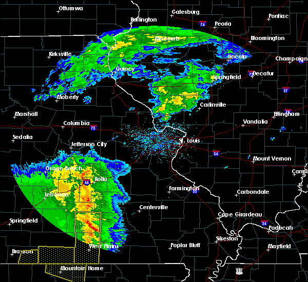 At 1154 am cdt, severe thunderstorms were located along a line extending from near raymondville to near mountain view to near west plains, moving east at 45 mph (radar indicated). Hazards include 60 mph wind gusts and quarter size hail. Hail damage to vehicles is expected. Expect wind damage to roofs, siding, and trees. At 1154 am cdt, severe thunderstorms were located along a line extending from near raymondville to near mountain view to near west plains, moving east at 45 mph (radar indicated). Hazards include 60 mph wind gusts and quarter size hail. Hail damage to vehicles is expected. Expect wind damage to roofs, siding, and trees.
|
| 5/3/2020 11:47 AM CDT |
 At 1147 am cdt, severe thunderstorms were located along a line extending from 6 miles north of houston to 8 miles northeast of willow springs to near west plains, moving east at 45 mph (radar indicated). Hazards include 60 mph wind gusts and quarter size hail. Hail damage to vehicles is expected. expect wind damage to roofs, siding, and trees. Locations impacted include, west plains, mountain view, willow springs, cabool, houston, pomona, summersville, raymondville, south fork, brandsville, lanton, pottersville, caulfield, eunice, yukon, clear springs, solo, pine crest, simmons, peace valley,. At 1147 am cdt, severe thunderstorms were located along a line extending from 6 miles north of houston to 8 miles northeast of willow springs to near west plains, moving east at 45 mph (radar indicated). Hazards include 60 mph wind gusts and quarter size hail. Hail damage to vehicles is expected. expect wind damage to roofs, siding, and trees. Locations impacted include, west plains, mountain view, willow springs, cabool, houston, pomona, summersville, raymondville, south fork, brandsville, lanton, pottersville, caulfield, eunice, yukon, clear springs, solo, pine crest, simmons, peace valley,.
|
| 5/3/2020 11:35 AM CDT |
 At 1134 am cdt, severe thunderstorms were located along a line extending from 12 miles northwest of houston to 6 miles southwest of cabool to 13 miles north of bakersfield, moving east at 45 mph (radar indicated). Hazards include 60 mph wind gusts and quarter size hail. Hail damage to vehicles is expected. Expect wind damage to roofs, siding, and trees. At 1134 am cdt, severe thunderstorms were located along a line extending from 12 miles northwest of houston to 6 miles southwest of cabool to 13 miles north of bakersfield, moving east at 45 mph (radar indicated). Hazards include 60 mph wind gusts and quarter size hail. Hail damage to vehicles is expected. Expect wind damage to roofs, siding, and trees.
|
| 4/28/2020 9:12 PM CDT |
 The severe thunderstorm warning for howell and southeastern texas counties will expire at 915 pm cdt, the storms which prompted the warning have moved out of the area. therefore, the warning will be allowed to expire. a severe thunderstorm watch remains in effect until 1100 pm cdt for south central and southwestern missouri. The severe thunderstorm warning for howell and southeastern texas counties will expire at 915 pm cdt, the storms which prompted the warning have moved out of the area. therefore, the warning will be allowed to expire. a severe thunderstorm watch remains in effect until 1100 pm cdt for south central and southwestern missouri.
|
| 4/28/2020 8:56 PM CDT |
 At 855 pm cdt, severe thunderstorms were located along a line extending from 10 miles east of cabool to 6 miles southwest of mountain view to near west plains to near ott, moving east at 55 mph (emergency management. 71 mph wind gust was measured in west plains). Hazards include 70 mph wind gusts. Expect considerable tree damage. damage is likely to mobile homes, roofs, and outbuildings. Locations impacted include, west plains, mountain view, willow springs, pomona, summersville, south fork, brandsville, peace valley, lanton, arroll, pottersville, eunice, yukon, white church, moody, hartshorn, clear springs, pine crest,. At 855 pm cdt, severe thunderstorms were located along a line extending from 10 miles east of cabool to 6 miles southwest of mountain view to near west plains to near ott, moving east at 55 mph (emergency management. 71 mph wind gust was measured in west plains). Hazards include 70 mph wind gusts. Expect considerable tree damage. damage is likely to mobile homes, roofs, and outbuildings. Locations impacted include, west plains, mountain view, willow springs, pomona, summersville, south fork, brandsville, peace valley, lanton, arroll, pottersville, eunice, yukon, white church, moody, hartshorn, clear springs, pine crest,.
|
| 4/28/2020 8:55 PM CDT |
 At 854 pm cdt, severe thunderstorms were located along a line extending from 7 miles south of houston to 6 miles west of mountain view to near west plains to near ott, moving east at 50 mph (emergency management. 71 mph wind gust was measured in west plains). Hazards include 70 mph wind gusts. Expect considerable tree damage. damage is likely to mobile homes, roofs, and outbuildings. Locations impacted include, current river state park, echo bluff state park, grand gulf state park, mountain view, thayer, winona, alton, birch tree, eminence, summersville, koshkonong, brandsville, montier, thomasville, lanton, teresita, myrtle, midridge, rover, round spring,. At 854 pm cdt, severe thunderstorms were located along a line extending from 7 miles south of houston to 6 miles west of mountain view to near west plains to near ott, moving east at 50 mph (emergency management. 71 mph wind gust was measured in west plains). Hazards include 70 mph wind gusts. Expect considerable tree damage. damage is likely to mobile homes, roofs, and outbuildings. Locations impacted include, current river state park, echo bluff state park, grand gulf state park, mountain view, thayer, winona, alton, birch tree, eminence, summersville, koshkonong, brandsville, montier, thomasville, lanton, teresita, myrtle, midridge, rover, round spring,.
|
| 4/28/2020 8:52 PM CDT |
 At 851 pm cdt, severe thunderstorms were located along a line extending from 8 miles northeast of cabool to 7 miles southeast of willow springs to near west plains to near ott, moving east at 55 mph (radar indicated. this line of storms has a history of producing 60 to 70 mph wind gust). Hazards include 70 mph wind gusts. Expect considerable tree damage. damage is likely to mobile homes, roofs, and outbuildings. Locations impacted include, west plains, mountain view, willow springs, pomona, summersville, raymondville, south fork, brandsville, peace valley, lanton, arroll, pottersville, caulfield, eunice, yukon, siloam springs, white church, moody, hartshorn, clear springs,. At 851 pm cdt, severe thunderstorms were located along a line extending from 8 miles northeast of cabool to 7 miles southeast of willow springs to near west plains to near ott, moving east at 55 mph (radar indicated. this line of storms has a history of producing 60 to 70 mph wind gust). Hazards include 70 mph wind gusts. Expect considerable tree damage. damage is likely to mobile homes, roofs, and outbuildings. Locations impacted include, west plains, mountain view, willow springs, pomona, summersville, raymondville, south fork, brandsville, peace valley, lanton, arroll, pottersville, caulfield, eunice, yukon, siloam springs, white church, moody, hartshorn, clear springs,.
|
| 4/28/2020 8:47 PM CDT |
 At 846 pm cdt, severe thunderstorms were located along a line extending from 8 miles north of cabool to near willow springs to 6 miles northwest of west plains to near bakersfield, moving east at 55 mph (radar indicated. this line of storms has a history of producing 60 to 70 mph wind gust). Hazards include 70 mph wind gusts. Expect considerable tree damage. Damage is likely to mobile homes, roofs, and outbuildings. At 846 pm cdt, severe thunderstorms were located along a line extending from 8 miles north of cabool to near willow springs to 6 miles northwest of west plains to near bakersfield, moving east at 55 mph (radar indicated. this line of storms has a history of producing 60 to 70 mph wind gust). Hazards include 70 mph wind gusts. Expect considerable tree damage. Damage is likely to mobile homes, roofs, and outbuildings.
|
| 4/28/2020 8:34 PM CDT |
 At 833 pm cdt, severe thunderstorms were located along a line extending from 12 miles northeast of hartville to 8 miles west of willow springs to 13 miles north of bakersfield to near gainesville, moving east at 55 mph (trained weather spotters). Hazards include 70 mph wind gusts. 65 mph wind gust was reported in mountain grove. Expect considerable tree damage. damage is likely to mobile homes, roofs, and outbuildings. Locations impacted include, west plains, bull shoals lake, mountain grove, licking, mountain view, willow springs, cabool, houston, gainesville, pomona, summersville, raymondville, bakersfield, theodosia, south fork, pontiac, brandsville, huggins, sundown, lanton,. At 833 pm cdt, severe thunderstorms were located along a line extending from 12 miles northeast of hartville to 8 miles west of willow springs to 13 miles north of bakersfield to near gainesville, moving east at 55 mph (trained weather spotters). Hazards include 70 mph wind gusts. 65 mph wind gust was reported in mountain grove. Expect considerable tree damage. damage is likely to mobile homes, roofs, and outbuildings. Locations impacted include, west plains, bull shoals lake, mountain grove, licking, mountain view, willow springs, cabool, houston, gainesville, pomona, summersville, raymondville, bakersfield, theodosia, south fork, pontiac, brandsville, huggins, sundown, lanton,.
|
| 4/28/2020 8:08 PM CDT |
 At 808 pm cdt, severe thunderstorms were located along a line extending from 7 miles north of hartville to near norwood to 13 miles north of gainesville to 8 miles north of price place, moving east at 50 mph (radar indicated). Hazards include 70 mph wind gusts. Expect considerable tree damage. Damage is likely to mobile homes, roofs, and outbuildings. At 808 pm cdt, severe thunderstorms were located along a line extending from 7 miles north of hartville to near norwood to 13 miles north of gainesville to 8 miles north of price place, moving east at 50 mph (radar indicated). Hazards include 70 mph wind gusts. Expect considerable tree damage. Damage is likely to mobile homes, roofs, and outbuildings.
|
| 12/28/2019 11:28 PM CST |
 The severe thunderstorm warning for northwestern shannon and southeastern dent counties will expire at 1130 pm cst, the storm which prompted the warning has weakened below severe limits, and no longer poses an immediate threat to life or property. therefore, the warning will be allowed to expire. however gusty winds of 50 to 55 mph are still possible with this thunderstorm. The severe thunderstorm warning for northwestern shannon and southeastern dent counties will expire at 1130 pm cst, the storm which prompted the warning has weakened below severe limits, and no longer poses an immediate threat to life or property. therefore, the warning will be allowed to expire. however gusty winds of 50 to 55 mph are still possible with this thunderstorm.
|
| 12/28/2019 11:16 PM CST |
 At 1116 pm cst, a severe thunderstorm was located 15 miles northeast of summersville, or 18 miles south of salem, moving northeast at 55 mph (radar indicated). Hazards include 60 mph wind gusts. Expect damage to roofs, siding, and trees. Locations impacted include, current river state park, echo bluff state park, ozark national scenic riverways, summersville, bunker, turtle, jadwin, howes mill, midridge, gladden, round spring, akers, stone hill,. At 1116 pm cst, a severe thunderstorm was located 15 miles northeast of summersville, or 18 miles south of salem, moving northeast at 55 mph (radar indicated). Hazards include 60 mph wind gusts. Expect damage to roofs, siding, and trees. Locations impacted include, current river state park, echo bluff state park, ozark national scenic riverways, summersville, bunker, turtle, jadwin, howes mill, midridge, gladden, round spring, akers, stone hill,.
|
| 12/28/2019 10:55 PM CST |
 At 1055 pm cst, a severe thunderstorm was located 8 miles south of raymondville, or 9 miles southeast of houston, moving northeast at 30 mph (radar indicated). Hazards include 60 mph wind gusts. Expect damage to roofs, siding, and trees. Locations impacted include, current river state park, echo bluff state park, ozark national scenic riverways, summersville, bunker, raymondville, turtle, jadwin, howes mill, midridge, arroll, gladden, eunice, yukon, hartshorn, clear springs, round spring, akers, stone hill,. At 1055 pm cst, a severe thunderstorm was located 8 miles south of raymondville, or 9 miles southeast of houston, moving northeast at 30 mph (radar indicated). Hazards include 60 mph wind gusts. Expect damage to roofs, siding, and trees. Locations impacted include, current river state park, echo bluff state park, ozark national scenic riverways, summersville, bunker, raymondville, turtle, jadwin, howes mill, midridge, arroll, gladden, eunice, yukon, hartshorn, clear springs, round spring, akers, stone hill,.
|
| 12/28/2019 10:48 PM CST |
 At 1047 pm cst, a severe thunderstorm was located 10 miles east of cabool, or 10 miles north of willow springs, moving northeast at 55 mph (radar indicated). Hazards include 60 mph wind gusts. expect damage to roofs, siding, and trees At 1047 pm cst, a severe thunderstorm was located 10 miles east of cabool, or 10 miles north of willow springs, moving northeast at 55 mph (radar indicated). Hazards include 60 mph wind gusts. expect damage to roofs, siding, and trees
|
| 10/21/2019 2:42 AM CDT |
 At 242 am cdt, a severe squall line capable of producing both tornadoes and extensive straight line wind damage was located 7 miles northwest of mountain view, moving east at 60 mph (radar indicated rotation). Hazards include tornado. Flying debris will be dangerous to those caught without shelter. mobile homes will be damaged or destroyed. damage to roofs, windows, and vehicles will occur. tree damage is likely. Locations impacted include, willow springs, summersville, hartshorn, clear springs, arroll, pine crest, eunice,. At 242 am cdt, a severe squall line capable of producing both tornadoes and extensive straight line wind damage was located 7 miles northwest of mountain view, moving east at 60 mph (radar indicated rotation). Hazards include tornado. Flying debris will be dangerous to those caught without shelter. mobile homes will be damaged or destroyed. damage to roofs, windows, and vehicles will occur. tree damage is likely. Locations impacted include, willow springs, summersville, hartshorn, clear springs, arroll, pine crest, eunice,.
|
| 10/21/2019 2:38 AM CDT |
 At 238 am cdt, severe thunderstorms were located along a line extending from 8 miles south of fort leonard wood to near houston to near willow springs, moving east at 55 mph (radar indicated). Hazards include 60 mph wind gusts. expect damage to roofs, siding, and trees At 238 am cdt, severe thunderstorms were located along a line extending from 8 miles south of fort leonard wood to near houston to near willow springs, moving east at 55 mph (radar indicated). Hazards include 60 mph wind gusts. expect damage to roofs, siding, and trees
|
| 10/21/2019 2:26 AM CDT |
 At 226 am cdt, severe thunderstorms capable of producing both tornadoes and extensive straight line wind damage were located 7 miles west of willow springs, moving east at 60 mph (radar indicated rotation). Hazards include tornado. Flying debris will be dangerous to those caught without shelter. mobile homes will be damaged or destroyed. damage to roofs, windows, and vehicles will occur. Tree damage is likely. At 226 am cdt, severe thunderstorms capable of producing both tornadoes and extensive straight line wind damage were located 7 miles west of willow springs, moving east at 60 mph (radar indicated rotation). Hazards include tornado. Flying debris will be dangerous to those caught without shelter. mobile homes will be damaged or destroyed. damage to roofs, windows, and vehicles will occur. Tree damage is likely.
|
| 8/27/2019 12:15 AM CDT |
 At 1215 am cdt, severe thunderstorms were located along a line extending from near mountain view to 7 miles southwest of willow springs, moving southeast at 40 mph (radar indicated). Hazards include 60 mph wind gusts. expect damage to roofs, siding, and trees At 1215 am cdt, severe thunderstorms were located along a line extending from near mountain view to 7 miles southwest of willow springs, moving southeast at 40 mph (radar indicated). Hazards include 60 mph wind gusts. expect damage to roofs, siding, and trees
|
| 8/26/2019 11:56 PM CDT |
 At 1155 pm cdt, severe thunderstorms were located along a line extending from 7 miles west of summersville to near cabool to 7 miles southeast of norwood, moving southeast at 40 mph (radar indicated). Hazards include 60 mph wind gusts. Expect damage to roofs, siding, and trees. Locations impacted include, mountain grove, mountain view, willow springs, cabool, pomona, summersville, arroll, elk creek, eunice, vanzant, clear springs, solo, pine crest, simmons, drury,. At 1155 pm cdt, severe thunderstorms were located along a line extending from 7 miles west of summersville to near cabool to 7 miles southeast of norwood, moving southeast at 40 mph (radar indicated). Hazards include 60 mph wind gusts. Expect damage to roofs, siding, and trees. Locations impacted include, mountain grove, mountain view, willow springs, cabool, pomona, summersville, arroll, elk creek, eunice, vanzant, clear springs, solo, pine crest, simmons, drury,.
|
| 8/26/2019 11:30 PM CDT |
 At 1129 pm cdt, severe thunderstorms were located along a line extending from 7 miles north of mountain grove to near norwood to near mansfield, moving southeast at 45 mph (radar indicated). Hazards include 60 mph wind gusts. expect damage to roofs, siding, and trees At 1129 pm cdt, severe thunderstorms were located along a line extending from 7 miles north of mountain grove to near norwood to near mansfield, moving southeast at 45 mph (radar indicated). Hazards include 60 mph wind gusts. expect damage to roofs, siding, and trees
|
| 6/21/2019 3:36 PM CDT |
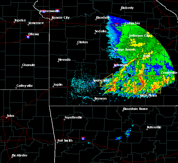 At 336 pm cdt, severe thunderstorms were located along a line extending from raymondville to near summersville to 8 miles southeast of willow springs, moving east at 35 mph (radar indicated). Hazards include 60 mph wind gusts. expect damage to roofs, siding, and trees At 336 pm cdt, severe thunderstorms were located along a line extending from raymondville to near summersville to 8 miles southeast of willow springs, moving east at 35 mph (radar indicated). Hazards include 60 mph wind gusts. expect damage to roofs, siding, and trees
|
| 6/4/2019 6:34 PM CDT |
 At 633 pm cdt, a severe thunderstorm was located over cabool, or 7 miles east of mountain grove, moving east at 40 mph (radar indicated). Hazards include 60 mph wind gusts and quarter size hail. Hail damage to vehicles is expected. Expect wind damage to roofs, siding, and trees. At 633 pm cdt, a severe thunderstorm was located over cabool, or 7 miles east of mountain grove, moving east at 40 mph (radar indicated). Hazards include 60 mph wind gusts and quarter size hail. Hail damage to vehicles is expected. Expect wind damage to roofs, siding, and trees.
|
| 6/4/2019 5:22 PM CDT |
 At 521 pm cdt, a severe thunderstorm was located near summersville, or 13 miles southeast of houston, moving northeast at 30 mph (radar indicated). Hazards include 60 mph wind gusts and quarter size hail. Hail damage to vehicles is expected. Expect wind damage to roofs, siding, and trees. At 521 pm cdt, a severe thunderstorm was located near summersville, or 13 miles southeast of houston, moving northeast at 30 mph (radar indicated). Hazards include 60 mph wind gusts and quarter size hail. Hail damage to vehicles is expected. Expect wind damage to roofs, siding, and trees.
|
| 6/4/2019 5:09 PM CDT |
 At 452 pm cdt, a severe thunderstorm was located 9 miles east of cabool, or 11 miles north of willow springs, moving northeast at 35 mph (radar indicated). Hazards include 60 mph wind gusts and quarter size hail. Hail damage to vehicles is expected. expect wind damage to roofs, siding, and trees. Locations impacted include, licking, cabool, houston, summersville, raymondville, arroll, bucyrus, elk creek, eunice, yukon, hartshorn, clear springs, solo, pine crest, simmons, prescott,. At 452 pm cdt, a severe thunderstorm was located 9 miles east of cabool, or 11 miles north of willow springs, moving northeast at 35 mph (radar indicated). Hazards include 60 mph wind gusts and quarter size hail. Hail damage to vehicles is expected. expect wind damage to roofs, siding, and trees. Locations impacted include, licking, cabool, houston, summersville, raymondville, arroll, bucyrus, elk creek, eunice, yukon, hartshorn, clear springs, solo, pine crest, simmons, prescott,.
|
| 6/4/2019 4:52 PM CDT |
 At 452 pm cdt, a severe thunderstorm was located 9 miles east of cabool, or 11 miles north of willow springs, moving northeast at 35 mph (radar indicated). Hazards include 60 mph wind gusts and quarter size hail. Hail damage to vehicles is expected. expect wind damage to roofs, siding, and trees. Locations impacted include, licking, cabool, houston, summersville, raymondville, arroll, bucyrus, elk creek, eunice, yukon, hartshorn, clear springs, solo, pine crest, simmons, prescott,. At 452 pm cdt, a severe thunderstorm was located 9 miles east of cabool, or 11 miles north of willow springs, moving northeast at 35 mph (radar indicated). Hazards include 60 mph wind gusts and quarter size hail. Hail damage to vehicles is expected. expect wind damage to roofs, siding, and trees. Locations impacted include, licking, cabool, houston, summersville, raymondville, arroll, bucyrus, elk creek, eunice, yukon, hartshorn, clear springs, solo, pine crest, simmons, prescott,.
|
| 6/4/2019 4:35 PM CDT |
 At 434 pm cdt, a severe thunderstorm was located near cabool, or 7 miles northwest of willow springs, moving northeast at 35 mph (radar indicated). Hazards include 60 mph wind gusts and quarter size hail. Hail damage to vehicles is expected. Expect wind damage to roofs, siding, and trees. At 434 pm cdt, a severe thunderstorm was located near cabool, or 7 miles northwest of willow springs, moving northeast at 35 mph (radar indicated). Hazards include 60 mph wind gusts and quarter size hail. Hail damage to vehicles is expected. Expect wind damage to roofs, siding, and trees.
|
| 5/21/2019 5:04 PM CDT |
 At 441 pm cdt, severe thunderstorms were located along a line extending from 9 miles west of salem to 11 miles south of mountain view, moving east at 40 mph (radar indicated). Hazards include 60 mph wind gusts and quarter size hail. Hail damage to vehicles is expected. Expect wind damage to roofs, siding, and trees. At 441 pm cdt, severe thunderstorms were located along a line extending from 9 miles west of salem to 11 miles south of mountain view, moving east at 40 mph (radar indicated). Hazards include 60 mph wind gusts and quarter size hail. Hail damage to vehicles is expected. Expect wind damage to roofs, siding, and trees.
|
| 5/21/2019 4:41 PM CDT |
 The national weather service in springfield has issued a * severe thunderstorm warning for. shannon county in south central missouri. dent county in south central missouri. northern oregon county in south central missouri. Until 530 pm cdt. The national weather service in springfield has issued a * severe thunderstorm warning for. shannon county in south central missouri. dent county in south central missouri. northern oregon county in south central missouri. Until 530 pm cdt.
|
| 5/21/2019 4:21 PM CDT |
 At 421 pm cdt, severe thunderstorms were located along a line extending from near licking to near sturkie, moving east at 45 mph (radar indicated). Hazards include 60 mph wind gusts and nickel size hail. Expect damage to roofs, siding, and trees. Locations impacted include, west plains, licking, mountain view, willow springs, cabool, houston, pomona, summersville, raymondville, south fork, brandsville, lanton, pottersville, success, eunice, yukon, clear springs, solo, pine crest, simmons,. At 421 pm cdt, severe thunderstorms were located along a line extending from near licking to near sturkie, moving east at 45 mph (radar indicated). Hazards include 60 mph wind gusts and nickel size hail. Expect damage to roofs, siding, and trees. Locations impacted include, west plains, licking, mountain view, willow springs, cabool, houston, pomona, summersville, raymondville, south fork, brandsville, lanton, pottersville, success, eunice, yukon, clear springs, solo, pine crest, simmons,.
|
| 5/21/2019 4:10 PM CDT |
 At 410 pm cdt, severe thunderstorms were located along a line extending from 9 miles northwest of houston to near ott, moving east at 40 mph (radar indicated). Hazards include 60 mph wind gusts and nickel size hail. expect damage to roofs, siding, and trees At 410 pm cdt, severe thunderstorms were located along a line extending from 9 miles northwest of houston to near ott, moving east at 40 mph (radar indicated). Hazards include 60 mph wind gusts and nickel size hail. expect damage to roofs, siding, and trees
|
| 5/21/2019 1:26 AM CDT |
 The severe thunderstorm warning for northwestern shannon, southeastern wright, dent and texas counties will expire at 130 am cdt, the storms which prompted the warning have weakened below severe limits, and no longer pose an immediate threat to life or property. therefore, the warning will be allowed to expire. however heavy rain is still possible with these thunderstorms. a tornado watch remains in effect until 800 am cdt for south central and southwestern missouri. a severe thunderstorm watch remains in effect until 400 am cdt for south central and east central missouri. The severe thunderstorm warning for northwestern shannon, southeastern wright, dent and texas counties will expire at 130 am cdt, the storms which prompted the warning have weakened below severe limits, and no longer pose an immediate threat to life or property. therefore, the warning will be allowed to expire. however heavy rain is still possible with these thunderstorms. a tornado watch remains in effect until 800 am cdt for south central and southwestern missouri. a severe thunderstorm watch remains in effect until 400 am cdt for south central and east central missouri.
|
| 5/21/2019 12:28 AM CDT |
 At 1228 am cdt, severe thunderstorms were located along a line extending from near st. james to 7 miles northeast of raymondville to norwood, moving east at 40 mph (radar indicated). Hazards include 60 mph wind gusts and quarter size hail. Hail damage to vehicles is expected. Expect wind damage to roofs, siding, and trees. At 1228 am cdt, severe thunderstorms were located along a line extending from near st. james to 7 miles northeast of raymondville to norwood, moving east at 40 mph (radar indicated). Hazards include 60 mph wind gusts and quarter size hail. Hail damage to vehicles is expected. Expect wind damage to roofs, siding, and trees.
|
| 5/18/2019 5:51 PM CDT |
 At 550 pm cdt, severe thunderstorms were located along a line extending from near newburg to 10 miles northeast of summersville to near thayer, moving east at 35 mph (trained weather spotters). Hazards include 60 mph wind gusts. Expect damage to roofs, siding, and trees. locations impacted include, rolla, current river state park, ozark national scenic riverways, echo bluff state park, grand gulf state park, montauk state park, salem, st. James, thayer, winona, alton, birch tree, doolittle, eminence, summersville, newburg, bunker, koshkonong, edgar springs, montier, this includes interstate 44 between mile markers 179 and 199. At 550 pm cdt, severe thunderstorms were located along a line extending from near newburg to 10 miles northeast of summersville to near thayer, moving east at 35 mph (trained weather spotters). Hazards include 60 mph wind gusts. Expect damage to roofs, siding, and trees. locations impacted include, rolla, current river state park, ozark national scenic riverways, echo bluff state park, grand gulf state park, montauk state park, salem, st. James, thayer, winona, alton, birch tree, doolittle, eminence, summersville, newburg, bunker, koshkonong, edgar springs, montier, this includes interstate 44 between mile markers 179 and 199.
|
| 5/18/2019 5:36 PM CDT |
 At 536 pm cdt, severe thunderstorms were located along a line extending from 6 miles east of st. robert to 7 miles northwest of summersville to 6 miles west of thayer, moving east at 35 mph (trained weather spotters). Hazards include 60 mph wind gusts. Expect damage to roofs, siding, and trees. locations impacted include, rolla, northeastern fort leonard wood, west plains, ozark national scenic riverways, echo bluff state park, current river state park, grand gulf state park, montauk state park, salem, st. robert, st. James, licking, mountain view, thayer, winona, alton, birch tree, doolittle, eminence, summersville, this includes interstate 44 between mile markers 161 and 169, and between mile markers 179 and 199. At 536 pm cdt, severe thunderstorms were located along a line extending from 6 miles east of st. robert to 7 miles northwest of summersville to 6 miles west of thayer, moving east at 35 mph (trained weather spotters). Hazards include 60 mph wind gusts. Expect damage to roofs, siding, and trees. locations impacted include, rolla, northeastern fort leonard wood, west plains, ozark national scenic riverways, echo bluff state park, current river state park, grand gulf state park, montauk state park, salem, st. robert, st. James, licking, mountain view, thayer, winona, alton, birch tree, doolittle, eminence, summersville, this includes interstate 44 between mile markers 161 and 169, and between mile markers 179 and 199.
|
| 5/18/2019 5:15 PM CDT |
 At 515 pm cdt, severe thunderstorms were located along a line extending from near waynesville to 7 miles south of houston to near sturkie, moving east at 35 mph (trained weather spotters). Hazards include 60 mph wind gusts. expect damage to roofs, siding, and trees At 515 pm cdt, severe thunderstorms were located along a line extending from near waynesville to 7 miles south of houston to near sturkie, moving east at 35 mph (trained weather spotters). Hazards include 60 mph wind gusts. expect damage to roofs, siding, and trees
|
| 5/7/2019 8:33 PM CDT | Nickle sized hail reported at intersection of hwy 106 and county road 106-339 east of summersville. time estimated from rada in shannon county MO, 4.3 miles W of Summersville, MO |
| 5/7/2019 8:30 PM CDT |
 At 830 pm cdt, a severe thunderstorm was located near summersville, or 13 miles northeast of mountain view, moving east at 15 mph (radar indicated). Hazards include ping pong ball size hail and 60 mph wind gusts. People and animals outdoors will be injured. expect hail damage to roofs, siding, windows, and vehicles. expect wind damage to roofs, siding, and trees. Locations impacted include, eminence, summersville, west eminence, alley spring,. At 830 pm cdt, a severe thunderstorm was located near summersville, or 13 miles northeast of mountain view, moving east at 15 mph (radar indicated). Hazards include ping pong ball size hail and 60 mph wind gusts. People and animals outdoors will be injured. expect hail damage to roofs, siding, windows, and vehicles. expect wind damage to roofs, siding, and trees. Locations impacted include, eminence, summersville, west eminence, alley spring,.
|
| 5/7/2019 8:12 PM CDT |
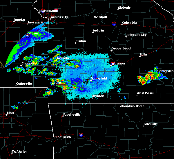 At 812 pm cdt, a severe thunderstorm was located over summersville, or 11 miles north of mountain view, moving east at 20 mph (radar indicated). Hazards include 60 mph wind gusts and quarter size hail. Hail damage to vehicles is expected. Expect wind damage to roofs, siding, and trees. At 812 pm cdt, a severe thunderstorm was located over summersville, or 11 miles north of mountain view, moving east at 20 mph (radar indicated). Hazards include 60 mph wind gusts and quarter size hail. Hail damage to vehicles is expected. Expect wind damage to roofs, siding, and trees.
|
| 3/24/2019 6:32 PM CDT |
 At 631 pm cdt, a severe thunderstorm was located near cabool, or near willow springs, moving east at 30 mph (radar indicated). Hazards include ping pong ball size hail and 60 mph wind gusts. People and animals outdoors will be injured. expect hail damage to roofs, siding, windows, and vehicles. expect wind damage to roofs, siding, and trees. Locations impacted include, summersville, arroll, pine crest, clear springs,. At 631 pm cdt, a severe thunderstorm was located near cabool, or near willow springs, moving east at 30 mph (radar indicated). Hazards include ping pong ball size hail and 60 mph wind gusts. People and animals outdoors will be injured. expect hail damage to roofs, siding, windows, and vehicles. expect wind damage to roofs, siding, and trees. Locations impacted include, summersville, arroll, pine crest, clear springs,.
|
| 3/24/2019 6:19 PM CDT |
 At 619 pm cdt, a severe thunderstorm was located over cabool, or 7 miles east of mountain grove, moving east at 30 mph (radar indicated). Hazards include ping pong ball size hail and 60 mph wind gusts. People and animals outdoors will be injured. expect hail damage to roofs, siding, windows, and vehicles. expect wind damage to roofs, siding, and trees. Locations impacted include, cabool, summersville, arroll, pine crest, clear springs,. At 619 pm cdt, a severe thunderstorm was located over cabool, or 7 miles east of mountain grove, moving east at 30 mph (radar indicated). Hazards include ping pong ball size hail and 60 mph wind gusts. People and animals outdoors will be injured. expect hail damage to roofs, siding, windows, and vehicles. expect wind damage to roofs, siding, and trees. Locations impacted include, cabool, summersville, arroll, pine crest, clear springs,.
|
| 3/24/2019 6:14 PM CDT |
 At 613 pm cdt, a severe thunderstorm was located near cabool, or near mountain grove, moving east at 30 mph (radar indicated). Hazards include quarter size hail. damage to vehicles is expected At 613 pm cdt, a severe thunderstorm was located near cabool, or near mountain grove, moving east at 30 mph (radar indicated). Hazards include quarter size hail. damage to vehicles is expected
|
| 2/7/2019 12:39 AM CST |
 At 1239 am cst, severe thunderstorms were located along a line extending from 14 miles north of hartville to near norwood, moving east at 55 mph (radar indicated). Hazards include 60 mph wind gusts and quarter size hail. Hail damage to vehicles is expected. Expect wind damage to roofs, siding, and trees. At 1239 am cst, severe thunderstorms were located along a line extending from 14 miles north of hartville to near norwood, moving east at 55 mph (radar indicated). Hazards include 60 mph wind gusts and quarter size hail. Hail damage to vehicles is expected. Expect wind damage to roofs, siding, and trees.
|
| 12/1/2018 2:22 AM CST |
 At 221 am cst, severe thunderstorms were located along a line extending from 7 miles west of licking to 6 miles south of raymondville to 10 miles south of birch tree to 6 miles south of alton, moving east at 55 mph (law enforcement. these storms have produced wind damage to trees and structures in a swath across southern missouri). Hazards include 70 mph wind gusts. Expect considerable tree damage. damage is likely to mobile homes, roofs, and outbuildings. Locations impacted include, licking, summersville, raymondville, yukon, hartshorn, hazelton, pine crest, prescott, eunice, a tornado watch remains in effect until 500 am cst for south central missouri. At 221 am cst, severe thunderstorms were located along a line extending from 7 miles west of licking to 6 miles south of raymondville to 10 miles south of birch tree to 6 miles south of alton, moving east at 55 mph (law enforcement. these storms have produced wind damage to trees and structures in a swath across southern missouri). Hazards include 70 mph wind gusts. Expect considerable tree damage. damage is likely to mobile homes, roofs, and outbuildings. Locations impacted include, licking, summersville, raymondville, yukon, hartshorn, hazelton, pine crest, prescott, eunice, a tornado watch remains in effect until 500 am cst for south central missouri.
|
| 12/1/2018 1:58 AM CST |
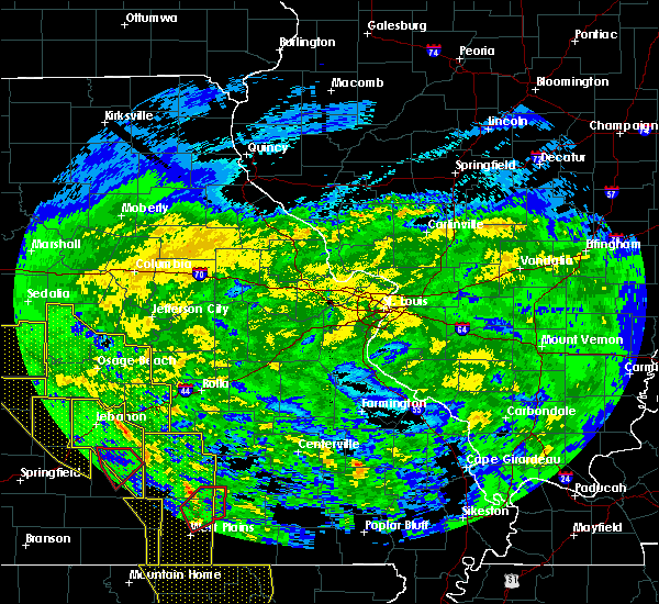 At 158 am cst, severe thunderstorms were located along a line extending from 10 miles south of houston to near mountain view to 8 miles west of mammoth spring, moving east at 60 mph (law enforcement). Hazards include 70 mph wind gusts. these storms have a long history of producing wind damage to trees and structures across southern missouri. Expect considerable tree damage. Damage is likely to mobile homes, roofs, and outbuildings. At 158 am cst, severe thunderstorms were located along a line extending from 10 miles south of houston to near mountain view to 8 miles west of mammoth spring, moving east at 60 mph (law enforcement). Hazards include 70 mph wind gusts. these storms have a long history of producing wind damage to trees and structures across southern missouri. Expect considerable tree damage. Damage is likely to mobile homes, roofs, and outbuildings.
|
| 12/1/2018 1:33 AM CST |
 At 132 am cst, severe thunderstorms were located along a line extending from near niangua to near mansfield to 15 miles northeast of gainesville to near bakersfield, moving east at 55 mph (law enforcement. these storms have a long history of producing wind damage across southern missouri). Hazards include 70 mph wind gusts. Expect considerable tree damage. Damage is likely to mobile homes, roofs, and outbuildings. At 132 am cst, severe thunderstorms were located along a line extending from near niangua to near mansfield to 15 miles northeast of gainesville to near bakersfield, moving east at 55 mph (law enforcement. these storms have a long history of producing wind damage across southern missouri). Hazards include 70 mph wind gusts. Expect considerable tree damage. Damage is likely to mobile homes, roofs, and outbuildings.
|
| 8/7/2018 1:15 PM CDT |
 At 114 pm cdt, severe thunderstorms were located along a line extending from 12 miles south of salem to near mountain view, moving east at 35 mph (radar indicated). Hazards include 60 mph wind gusts and quarter size hail. Hail damage to vehicles is expected. Expect wind damage to roofs, siding, and trees. At 114 pm cdt, severe thunderstorms were located along a line extending from 12 miles south of salem to near mountain view, moving east at 35 mph (radar indicated). Hazards include 60 mph wind gusts and quarter size hail. Hail damage to vehicles is expected. Expect wind damage to roofs, siding, and trees.
|
| 8/7/2018 12:37 PM CDT |
 At 1237 pm cdt, severe thunderstorms were located along a line extending from 7 miles northwest of houston to near cabool, moving east at 30 mph (radar indicated). Hazards include 60 mph wind gusts and quarter size hail. Hail damage to vehicles is expected. expect wind damage to roofs, siding, and trees. Locations impacted include, mountain grove, cabool, houston, summersville, raymondville, huggins, arroll, bucyrus, elk creek, eunice, yukon, hartshorn, clear springs, solo, simmons, prescott, bendavis, pine crest,. At 1237 pm cdt, severe thunderstorms were located along a line extending from 7 miles northwest of houston to near cabool, moving east at 30 mph (radar indicated). Hazards include 60 mph wind gusts and quarter size hail. Hail damage to vehicles is expected. expect wind damage to roofs, siding, and trees. Locations impacted include, mountain grove, cabool, houston, summersville, raymondville, huggins, arroll, bucyrus, elk creek, eunice, yukon, hartshorn, clear springs, solo, simmons, prescott, bendavis, pine crest,.
|
| 8/7/2018 12:22 PM CDT |
 At 1221 pm cdt, severe thunderstorms were located along a line extending from 13 miles northeast of hartville to mountain grove, moving east at 25 mph (radar indicated). Hazards include 60 mph wind gusts and quarter size hail. Hail damage to vehicles is expected. Expect wind damage to roofs, siding, and trees. At 1221 pm cdt, severe thunderstorms were located along a line extending from 13 miles northeast of hartville to mountain grove, moving east at 25 mph (radar indicated). Hazards include 60 mph wind gusts and quarter size hail. Hail damage to vehicles is expected. Expect wind damage to roofs, siding, and trees.
|
| 7/19/2018 7:31 PM CDT |
 At 730 pm cdt, severe thunderstorms were located along a line extending from near mansfield to 10 miles south of ava, moving east at 30 mph (radar indicated). Hazards include 60 mph wind gusts. expect damage to roofs, siding, and trees At 730 pm cdt, severe thunderstorms were located along a line extending from near mansfield to 10 miles south of ava, moving east at 30 mph (radar indicated). Hazards include 60 mph wind gusts. expect damage to roofs, siding, and trees
|
| 6/26/2018 6:58 PM CDT |
 At 658 pm cdt, severe thunderstorms were located along a line extending from 9 miles southeast of salem to birch tree to near bakersfield, moving east at 55 mph (radar indicated). Hazards include 60 mph wind gusts and nickel size hail. Expect damage to roofs, siding, and trees. Locations impacted include, west plains, current river state park, grand gulf state park, montauk state park, mountain view, thayer, willow springs, winona, alton, birch tree, eminence, pomona, summersville, bunker, bakersfield, south fork, koshkonong, brandsville, montier, thomasville,. At 658 pm cdt, severe thunderstorms were located along a line extending from 9 miles southeast of salem to birch tree to near bakersfield, moving east at 55 mph (radar indicated). Hazards include 60 mph wind gusts and nickel size hail. Expect damage to roofs, siding, and trees. Locations impacted include, west plains, current river state park, grand gulf state park, montauk state park, mountain view, thayer, willow springs, winona, alton, birch tree, eminence, pomona, summersville, bunker, bakersfield, south fork, koshkonong, brandsville, montier, thomasville,.
|
| 6/26/2018 6:45 PM CDT |
 At 645 pm cdt, severe thunderstorms were located along a line extending from near licking to near mountain view to 7 miles north of fawn park, moving east at 40 mph (radar indicated). Hazards include 60 mph wind gusts and nickel size hail. Expect damage to roofs, siding, and trees. Locations impacted include, west plains, norfork lake, current river state park, grand gulf state park, montauk state park, mountain view, thayer, willow springs, winona, alton, birch tree, eminence, pomona, summersville, bunker, raymondville, bakersfield, south fork, koshkonong, brandsville,. At 645 pm cdt, severe thunderstorms were located along a line extending from near licking to near mountain view to 7 miles north of fawn park, moving east at 40 mph (radar indicated). Hazards include 60 mph wind gusts and nickel size hail. Expect damage to roofs, siding, and trees. Locations impacted include, west plains, norfork lake, current river state park, grand gulf state park, montauk state park, mountain view, thayer, willow springs, winona, alton, birch tree, eminence, pomona, summersville, bunker, raymondville, bakersfield, south fork, koshkonong, brandsville,.
|
| 6/26/2018 6:29 PM CDT |
 At 629 pm cdt, severe thunderstorms were located along a line extending from 9 miles northwest of licking to near willow springs to near price place, moving east at 40 mph (radar indicated). Hazards include 60 mph wind gusts and nickel size hail. expect damage to roofs, siding, and trees At 629 pm cdt, severe thunderstorms were located along a line extending from 9 miles northwest of licking to near willow springs to near price place, moving east at 40 mph (radar indicated). Hazards include 60 mph wind gusts and nickel size hail. expect damage to roofs, siding, and trees
|
| 6/14/2018 3:21 PM CDT |
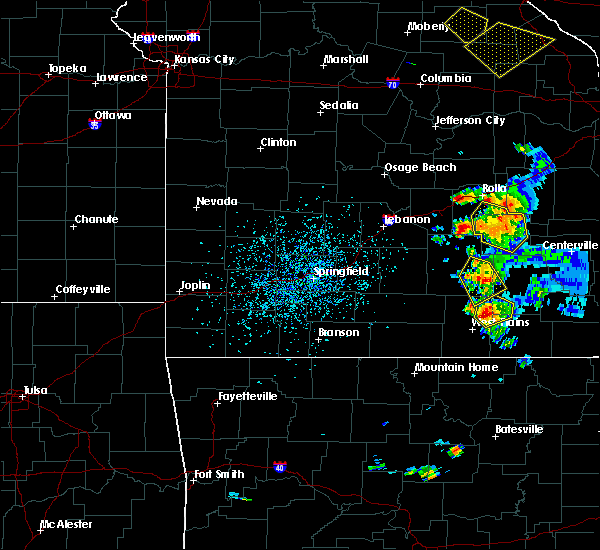 At 321 pm cdt, a severe thunderstorm was located near summersville, or 13 miles north of mountain view, moving southeast at 5 mph (radar indicated). Hazards include 60 mph wind gusts and quarter size hail. Hail damage to vehicles is expected. Expect wind damage to roofs, siding, and trees. At 321 pm cdt, a severe thunderstorm was located near summersville, or 13 miles north of mountain view, moving southeast at 5 mph (radar indicated). Hazards include 60 mph wind gusts and quarter size hail. Hail damage to vehicles is expected. Expect wind damage to roofs, siding, and trees.
|
| 6/8/2018 6:28 PM CDT |
 At 628 pm cdt, a severe thunderstorm was located 13 miles west of bunker, or 18 miles south of salem, moving northeast at 10 mph. other severe storms were located near mountain view and summersville (radar indicated). Hazards include 60 mph wind gusts and quarter size hail. Hail damage to vehicles is expected. expect wind damage to roofs, siding, and trees. Locations impacted include, current river state park, mountain view, birch tree, eminence, summersville, bunker, montier, peace valley, turtle, teresita, midridge, arroll, gladden, alley spring, white church, round spring, west eminence, akers, pine crest,. At 628 pm cdt, a severe thunderstorm was located 13 miles west of bunker, or 18 miles south of salem, moving northeast at 10 mph. other severe storms were located near mountain view and summersville (radar indicated). Hazards include 60 mph wind gusts and quarter size hail. Hail damage to vehicles is expected. expect wind damage to roofs, siding, and trees. Locations impacted include, current river state park, mountain view, birch tree, eminence, summersville, bunker, montier, peace valley, turtle, teresita, midridge, arroll, gladden, alley spring, white church, round spring, west eminence, akers, pine crest,.
|
| 6/8/2018 6:04 PM CDT |
 At 603 pm cdt, a severe thunderstorm was located 15 miles northeast of summersville, or 19 miles south of salem, moving northeast at 10 mph. other severe thunderstorms were located in northeast howell and western shannon counties. these storms will move through the warning area (radar indicated). Hazards include 60 mph wind gusts and quarter size hail. Hail damage to vehicles is expected. Expect wind damage to roofs, siding, and trees. At 603 pm cdt, a severe thunderstorm was located 15 miles northeast of summersville, or 19 miles south of salem, moving northeast at 10 mph. other severe thunderstorms were located in northeast howell and western shannon counties. these storms will move through the warning area (radar indicated). Hazards include 60 mph wind gusts and quarter size hail. Hail damage to vehicles is expected. Expect wind damage to roofs, siding, and trees.
|
| 5/19/2018 11:08 PM CDT |
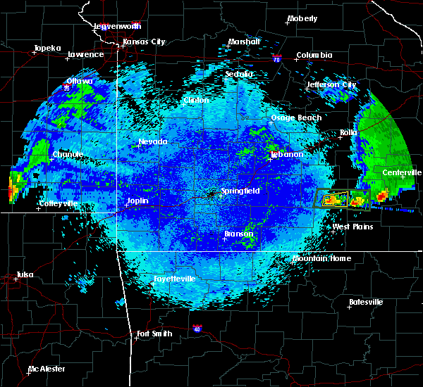 At 1107 pm cdt, a severe thunderstorm was located 11 miles northeast of willow springs, moving east northeast at 20 mph (radar indicated). Hazards include quarter size hail. Damage to vehicles is expected. Locations impacted include, summersville, arroll, clear springs, pine crest,. At 1107 pm cdt, a severe thunderstorm was located 11 miles northeast of willow springs, moving east northeast at 20 mph (radar indicated). Hazards include quarter size hail. Damage to vehicles is expected. Locations impacted include, summersville, arroll, clear springs, pine crest,.
|
| 5/19/2018 10:52 PM CDT |
 At 1051 pm cdt, a severe thunderstorm was located 7 miles east of cabool, or 8 miles north of willow springs, moving east at 20 mph (radar indicated). Hazards include 60 mph wind gusts and quarter size hail. Hail damage to vehicles is expected. Expect wind damage to roofs, siding, and trees. At 1051 pm cdt, a severe thunderstorm was located 7 miles east of cabool, or 8 miles north of willow springs, moving east at 20 mph (radar indicated). Hazards include 60 mph wind gusts and quarter size hail. Hail damage to vehicles is expected. Expect wind damage to roofs, siding, and trees.
|
| 5/19/2018 2:56 PM CDT |
 At 256 pm cdt, severe thunderstorms were located along a line extending from 14 miles northwest of eminence to 6 miles east of summersville to near mountain view, moving east at 45 mph (radar indicated). Hazards include 60 mph wind gusts and half dollar size hail. Hail damage to vehicles is expected. expect wind damage to roofs, siding, and trees. Locations impacted include, current river state park, eminence, summersville, alley spring, hartshorn, clear springs, round spring, west eminence, arroll, akers, pine crest,. At 256 pm cdt, severe thunderstorms were located along a line extending from 14 miles northwest of eminence to 6 miles east of summersville to near mountain view, moving east at 45 mph (radar indicated). Hazards include 60 mph wind gusts and half dollar size hail. Hail damage to vehicles is expected. expect wind damage to roofs, siding, and trees. Locations impacted include, current river state park, eminence, summersville, alley spring, hartshorn, clear springs, round spring, west eminence, arroll, akers, pine crest,.
|
| 5/19/2018 2:24 PM CDT |
 At 224 pm cdt, a severe thunderstorm was located near houston, moving east at 30 mph (radar indicated). Hazards include 60 mph wind gusts and half dollar size hail. Hail damage to vehicles is expected. Expect wind damage to roofs, siding, and trees. At 224 pm cdt, a severe thunderstorm was located near houston, moving east at 30 mph (radar indicated). Hazards include 60 mph wind gusts and half dollar size hail. Hail damage to vehicles is expected. Expect wind damage to roofs, siding, and trees.
|
| 5/19/2018 11:49 AM CDT |
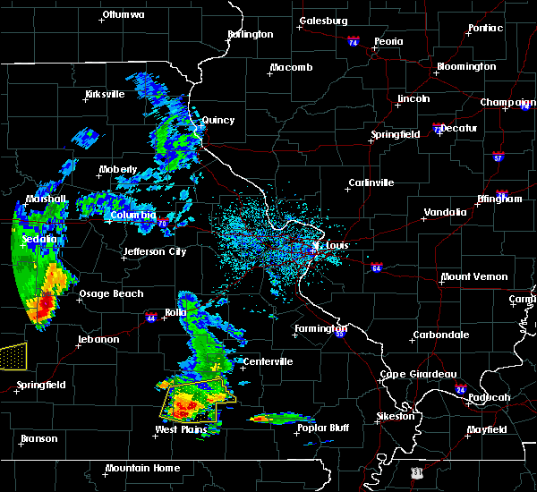 At 1148 am cdt, a severe thunderstorm was located 7 miles northwest of birch tree, or 7 miles northeast of mountain view, moving east at 25 mph (radar indicated). Hazards include 60 mph wind gusts and half dollar size hail. Hail damage to vehicles is expected. expect wind damage to roofs, siding, and trees. Locations impacted include, mountain view, winona, birch tree, eminence, summersville, montier, alley spring, teresita, round spring, west eminence, arroll, pine crest,. At 1148 am cdt, a severe thunderstorm was located 7 miles northwest of birch tree, or 7 miles northeast of mountain view, moving east at 25 mph (radar indicated). Hazards include 60 mph wind gusts and half dollar size hail. Hail damage to vehicles is expected. expect wind damage to roofs, siding, and trees. Locations impacted include, mountain view, winona, birch tree, eminence, summersville, montier, alley spring, teresita, round spring, west eminence, arroll, pine crest,.
|
| 5/19/2018 11:17 AM CDT |
 At 1117 am cdt, a severe thunderstorm was located near mountain view, moving east at 25 mph (radar indicated). Hazards include two inch hail and 60 mph wind gusts. People and animals outdoors will be injured. expect hail damage to roofs, siding, windows, and vehicles. expect wind damage to roofs, siding, and trees. Locations impacted include, mountain view, winona, birch tree, eminence, summersville, montier, teresita, arroll, alley spring, clear springs, round spring, west eminence, pine crest,. At 1117 am cdt, a severe thunderstorm was located near mountain view, moving east at 25 mph (radar indicated). Hazards include two inch hail and 60 mph wind gusts. People and animals outdoors will be injured. expect hail damage to roofs, siding, windows, and vehicles. expect wind damage to roofs, siding, and trees. Locations impacted include, mountain view, winona, birch tree, eminence, summersville, montier, teresita, arroll, alley spring, clear springs, round spring, west eminence, pine crest,.
|
| 5/19/2018 11:12 AM CDT |
 At 1111 am cdt, a severe thunderstorm was located 7 miles northwest of mountain view, moving east at 30 mph (radar indicated). Hazards include 60 mph wind gusts and half dollar size hail. Hail damage to vehicles is expected. Expect wind damage to roofs, siding, and trees. At 1111 am cdt, a severe thunderstorm was located 7 miles northwest of mountain view, moving east at 30 mph (radar indicated). Hazards include 60 mph wind gusts and half dollar size hail. Hail damage to vehicles is expected. Expect wind damage to roofs, siding, and trees.
|
| 5/3/2018 4:12 AM CDT |
 At 412 am cdt, severe thunderstorms were located along a line extending from near viburnum to near thayer, moving east at 50 mph (radar indicated). Hazards include 60 mph wind gusts and penny size hail. Expect damage to roofs, siding, and trees. Locations impacted include, current river state park, grand gulf state park, thayer, winona, alton, birch tree, eminence, summersville, bunker, koshkonong, montier, thomasville, teresita, myrtle, howes mill, midridge, rover, boss, round spring, turtle,. At 412 am cdt, severe thunderstorms were located along a line extending from near viburnum to near thayer, moving east at 50 mph (radar indicated). Hazards include 60 mph wind gusts and penny size hail. Expect damage to roofs, siding, and trees. Locations impacted include, current river state park, grand gulf state park, thayer, winona, alton, birch tree, eminence, summersville, bunker, koshkonong, montier, thomasville, teresita, myrtle, howes mill, midridge, rover, boss, round spring, turtle,.
|
| 5/3/2018 3:46 AM CDT |
 At 346 am cdt, severe thunderstorms were located along a line extending from 6 miles southwest of salem to 7 miles north of summersville to 7 miles northwest of mountain view, moving east at 50 mph (radar indicated). Hazards include 60 mph wind gusts. Expect damage to roofs, siding, and trees. Locations impacted include, licking, houston, summersville, raymondville, yukon, hartshorn, clear springs, arroll, solo, pine crest, prescott, eunice,. At 346 am cdt, severe thunderstorms were located along a line extending from 6 miles southwest of salem to 7 miles north of summersville to 7 miles northwest of mountain view, moving east at 50 mph (radar indicated). Hazards include 60 mph wind gusts. Expect damage to roofs, siding, and trees. Locations impacted include, licking, houston, summersville, raymondville, yukon, hartshorn, clear springs, arroll, solo, pine crest, prescott, eunice,.
|
| 5/3/2018 3:46 AM CDT |
 At 346 am cdt, severe thunderstorms were located along a line extending from near salem to near ott, moving east at 50 mph (radar indicated). Hazards include 60 mph wind gusts and penny size hail. expect damage to roofs, siding, and trees At 346 am cdt, severe thunderstorms were located along a line extending from near salem to near ott, moving east at 50 mph (radar indicated). Hazards include 60 mph wind gusts and penny size hail. expect damage to roofs, siding, and trees
|
| 5/3/2018 3:10 AM CDT |
 At 310 am cdt, severe thunderstorms were located along a line extending from 16 miles southwest of fort leonard wood to 13 miles northwest of cabool to near mountain grove, moving northeast at 55 mph (radar indicated). Hazards include 60 mph wind gusts. expect damage to roofs, siding, and trees At 310 am cdt, severe thunderstorms were located along a line extending from 16 miles southwest of fort leonard wood to 13 miles northwest of cabool to near mountain grove, moving northeast at 55 mph (radar indicated). Hazards include 60 mph wind gusts. expect damage to roofs, siding, and trees
|
| 4/13/2018 9:08 PM CDT |
 At 908 pm cdt, severe thunderstorms were located along a line extending from near bunker to 8 miles northeast of eminence to 6 miles southeast of summersville, moving east at 40 mph (radar indicated). Hazards include 60 mph wind gusts. Expect damage to roofs, siding, and trees. Locations impacted include, current river state park, eminence, summersville, bunker, alley spring, boss, midridge, round spring, west eminence, arroll, pine crest, a tornado watch remains in effect until 100 am cdt for south central missouri. At 908 pm cdt, severe thunderstorms were located along a line extending from near bunker to 8 miles northeast of eminence to 6 miles southeast of summersville, moving east at 40 mph (radar indicated). Hazards include 60 mph wind gusts. Expect damage to roofs, siding, and trees. Locations impacted include, current river state park, eminence, summersville, bunker, alley spring, boss, midridge, round spring, west eminence, arroll, pine crest, a tornado watch remains in effect until 100 am cdt for south central missouri.
|
| 4/13/2018 8:37 PM CDT |
 At 836 pm cdt, severe thunderstorms were located along a line extending from 11 miles south of salem to near summersville to near willow springs, moving east at 40 mph (radar indicated). Hazards include 60 mph wind gusts. expect damage to roofs, siding, and trees At 836 pm cdt, severe thunderstorms were located along a line extending from 11 miles south of salem to near summersville to near willow springs, moving east at 40 mph (radar indicated). Hazards include 60 mph wind gusts. expect damage to roofs, siding, and trees
|
| 1/22/2018 1:14 AM CST |
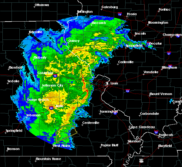 At 114 am cst, severe thunderstorms were located along a line extending from 14 miles east of raymondville to near summersville to 6 miles northeast of mountain view, moving northeast at 50 mph (radar indicated). Hazards include 60 mph wind gusts. Expect damage to roofs, siding, and trees. Locations impacted include, current river state park, eminence, summersville, alley spring, teresita, midridge, round spring, west eminence, akers,. At 114 am cst, severe thunderstorms were located along a line extending from 14 miles east of raymondville to near summersville to 6 miles northeast of mountain view, moving northeast at 50 mph (radar indicated). Hazards include 60 mph wind gusts. Expect damage to roofs, siding, and trees. Locations impacted include, current river state park, eminence, summersville, alley spring, teresita, midridge, round spring, west eminence, akers,.
|
| 1/22/2018 1:06 AM CST |
 At 106 am cst, severe thunderstorms were located along a line extending from summersville to near mountain view, moving northeast at 40 mph (radar indicated). Hazards include 60 mph wind gusts. expect damage to roofs, siding, and trees At 106 am cst, severe thunderstorms were located along a line extending from summersville to near mountain view, moving northeast at 40 mph (radar indicated). Hazards include 60 mph wind gusts. expect damage to roofs, siding, and trees
|
| 10/22/2017 3:45 AM CDT |
 At 345 am cdt, severe thunderstorms were located along a line extending from 7 miles northeast of licking to 9 miles north of summersville to near sturkie, moving east at 30 mph (radar indicated). Hazards include 60 mph wind gusts. Expect damage to roofs, siding, and trees. Locations impacted include, west plains, grand gulf state park, montauk state park, current river state park, salem, licking, mountain view, thayer, willow springs, birch tree, pomona, summersville, raymondville, south fork, koshkonong, brandsville, montier, thomasville, lenox, lanton,. At 345 am cdt, severe thunderstorms were located along a line extending from 7 miles northeast of licking to 9 miles north of summersville to near sturkie, moving east at 30 mph (radar indicated). Hazards include 60 mph wind gusts. Expect damage to roofs, siding, and trees. Locations impacted include, west plains, grand gulf state park, montauk state park, current river state park, salem, licking, mountain view, thayer, willow springs, birch tree, pomona, summersville, raymondville, south fork, koshkonong, brandsville, montier, thomasville, lenox, lanton,.
|
| 10/22/2017 3:11 AM CDT |
 At 309 am cdt, severe thunderstorms were located along a line extending from 8 miles southeast of fort leonard wood to 6 miles south of houston to near bakersfield, moving east at 30 mph (radar indicated). Hazards include 60 mph wind gusts. expect damage to roofs, siding, and trees At 309 am cdt, severe thunderstorms were located along a line extending from 8 miles southeast of fort leonard wood to 6 miles south of houston to near bakersfield, moving east at 30 mph (radar indicated). Hazards include 60 mph wind gusts. expect damage to roofs, siding, and trees
|
| 8/20/2017 12:03 PM CDT |
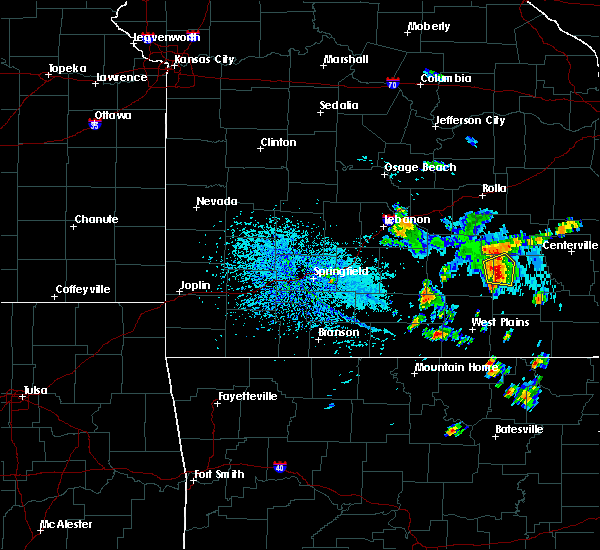 At 1202 pm cdt, a severe thunderstorm was located near summersville, or 17 miles east of houston, moving east at 20 mph (radar indicated. at noon, penny size hail was reported in hartshorn). Hazards include 60 mph wind gusts and quarter size hail. Hail damage to vehicles is expected. expect wind damage to roofs, siding, and trees. Locations impacted include, summersville, hartshorn, akers,. At 1202 pm cdt, a severe thunderstorm was located near summersville, or 17 miles east of houston, moving east at 20 mph (radar indicated. at noon, penny size hail was reported in hartshorn). Hazards include 60 mph wind gusts and quarter size hail. Hail damage to vehicles is expected. expect wind damage to roofs, siding, and trees. Locations impacted include, summersville, hartshorn, akers,.
|
| 8/20/2017 11:49 AM CDT |
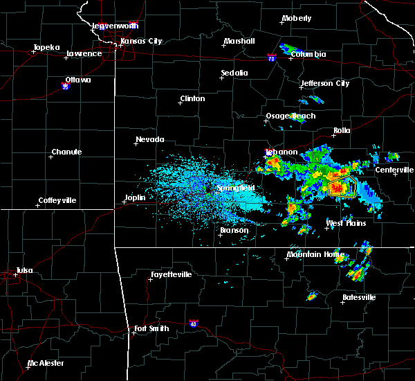 At 1149 am cdt, a severe thunderstorm was located near summersville, or 13 miles east of houston, moving east at 20 mph (radar indicated). Hazards include 60 mph wind gusts and quarter size hail. Hail damage to vehicles is expected. expect wind damage to roofs, siding, and trees. Locations impacted include, summersville, akers, hartshorn, eunice,. At 1149 am cdt, a severe thunderstorm was located near summersville, or 13 miles east of houston, moving east at 20 mph (radar indicated). Hazards include 60 mph wind gusts and quarter size hail. Hail damage to vehicles is expected. expect wind damage to roofs, siding, and trees. Locations impacted include, summersville, akers, hartshorn, eunice,.
|
| 8/20/2017 11:37 AM CDT |
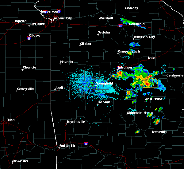 At 1137 am cdt, a severe thunderstorm was located near raymondville, or 9 miles southeast of houston, moving east at 20 mph (radar indicated). Hazards include 60 mph wind gusts and quarter size hail. Hail damage to vehicles is expected. Expect wind damage to roofs, siding, and trees. At 1137 am cdt, a severe thunderstorm was located near raymondville, or 9 miles southeast of houston, moving east at 20 mph (radar indicated). Hazards include 60 mph wind gusts and quarter size hail. Hail damage to vehicles is expected. Expect wind damage to roofs, siding, and trees.
|
| 5/27/2017 8:08 PM CDT |
 At 807 pm cdt, severe thunderstorms were located along a line extending from 10 miles west of summersville to near west plains to near gainesville, moving east at 40 mph (radar indicated). Hazards include 60 mph wind gusts and quarter size hail. Hail damage to vehicles is expected. expect wind damage to roofs, siding, and trees. Locations impacted include, west plains, bull shoals lake, norfork lake, mountain view, willow springs, gainesville, pomona, summersville, bakersfield, south fork, pontiac, sundown, brixey, willhoit, tecumseh, pottersville, caulfield, udall, hardenville, clear springs, a tornado watch remains in effect until 200 am cdt for south central and southwestern missouri. At 807 pm cdt, severe thunderstorms were located along a line extending from 10 miles west of summersville to near west plains to near gainesville, moving east at 40 mph (radar indicated). Hazards include 60 mph wind gusts and quarter size hail. Hail damage to vehicles is expected. expect wind damage to roofs, siding, and trees. Locations impacted include, west plains, bull shoals lake, norfork lake, mountain view, willow springs, gainesville, pomona, summersville, bakersfield, south fork, pontiac, sundown, brixey, willhoit, tecumseh, pottersville, caulfield, udall, hardenville, clear springs, a tornado watch remains in effect until 200 am cdt for south central and southwestern missouri.
|
| 5/27/2017 7:59 PM CDT |
 At 758 pm cdt, severe thunderstorms were located along a line extending from 12 miles southwest of bunker to near mountain view to bakersfield, moving southeast at 55 mph (radar indicated). Hazards include 60 mph wind gusts and quarter size hail. Hail damage to vehicles is expected. Expect wind damage to roofs, siding, and trees. At 758 pm cdt, severe thunderstorms were located along a line extending from 12 miles southwest of bunker to near mountain view to bakersfield, moving southeast at 55 mph (radar indicated). Hazards include 60 mph wind gusts and quarter size hail. Hail damage to vehicles is expected. Expect wind damage to roofs, siding, and trees.
|
| 5/27/2017 7:30 PM CDT |
 At 729 pm cdt, severe thunderstorms were located along a line extending from 10 miles north of cabool to 17 miles south of norwood to 14 miles east of taneyville, moving east at 30 mph (radar indicated). Hazards include 60 mph wind gusts and quarter size hail. Hail damage to vehicles is expected. Expect wind damage to roofs, siding, and trees. At 729 pm cdt, severe thunderstorms were located along a line extending from 10 miles north of cabool to 17 miles south of norwood to 14 miles east of taneyville, moving east at 30 mph (radar indicated). Hazards include 60 mph wind gusts and quarter size hail. Hail damage to vehicles is expected. Expect wind damage to roofs, siding, and trees.
|
| 5/27/2017 4:40 PM CDT |
 The severe thunderstorm warning for shannon, dent and east central texas counties will expire at 445 pm cdt, the storms which prompted the warning have moved out of the area. therefore the warning will be allowed to expire. a tornado watch remains in effect until 700 pm cdt for south central and east central missouri. remember, a severe thunderstorm warning still remains in effect for southern shannon county until 500 pm cdt. The severe thunderstorm warning for shannon, dent and east central texas counties will expire at 445 pm cdt, the storms which prompted the warning have moved out of the area. therefore the warning will be allowed to expire. a tornado watch remains in effect until 700 pm cdt for south central and east central missouri. remember, a severe thunderstorm warning still remains in effect for southern shannon county until 500 pm cdt.
|
| 5/27/2017 4:30 PM CDT |
 At 430 pm cdt, severe thunderstorms were located along a line extending from near bourbon to 6 miles north of courtois to near reynolds to 6 miles northwest of eminence, moving east at 65 mph (emergency management. widespread wind damage has been reported with these thunderstorms in the salem area). Hazards include 70 mph wind gusts and half dollar size hail. Hail damage to vehicles is expected. expect considerable tree damage. wind damage is also likely to mobile homes, roofs, and outbuildings. Locations impacted include, current river state park, salem, eminence, summersville, bunker, turtle, jadwin, howes mill, midridge, darien, gladden, bangert, alley spring, boss, hartshorn, howes, round spring, west eminence, akers, pine crest, a tornado watch remains in effect until 700 pm cdt for south central and east central missouri. At 430 pm cdt, severe thunderstorms were located along a line extending from near bourbon to 6 miles north of courtois to near reynolds to 6 miles northwest of eminence, moving east at 65 mph (emergency management. widespread wind damage has been reported with these thunderstorms in the salem area). Hazards include 70 mph wind gusts and half dollar size hail. Hail damage to vehicles is expected. expect considerable tree damage. wind damage is also likely to mobile homes, roofs, and outbuildings. Locations impacted include, current river state park, salem, eminence, summersville, bunker, turtle, jadwin, howes mill, midridge, darien, gladden, bangert, alley spring, boss, hartshorn, howes, round spring, west eminence, akers, pine crest, a tornado watch remains in effect until 700 pm cdt for south central and east central missouri.
|
| 5/27/2017 4:13 PM CDT |
 At 412 pm cdt, severe thunderstorms were located along a line extending from 9 miles south of bland to near cherryville to 7 miles west of bunker to near summersville, moving east at 65 mph (emergency management. this line of storms has a history of producing large hail and damaging wind gusts over the last several hours). Hazards include 70 mph wind gusts and half dollar size hail. Hail damage to vehicles is expected. expect considerable tree damage. wind damage is also likely to mobile homes, roofs, and outbuildings. locations impacted include, rolla, current river state park, montauk state park, salem, st. james, licking, houston, doolittle, eminence, summersville, newburg, bunker, raymondville, edgar springs, lenox, montauk, jadwin, beulah, howes mill, midridge, this includes interstate 44 between mile markers 177 and 200. A tornado watch remains in effect until 700 pm cdt for south central, central and east central missouri. At 412 pm cdt, severe thunderstorms were located along a line extending from 9 miles south of bland to near cherryville to 7 miles west of bunker to near summersville, moving east at 65 mph (emergency management. this line of storms has a history of producing large hail and damaging wind gusts over the last several hours). Hazards include 70 mph wind gusts and half dollar size hail. Hail damage to vehicles is expected. expect considerable tree damage. wind damage is also likely to mobile homes, roofs, and outbuildings. locations impacted include, rolla, current river state park, montauk state park, salem, st. james, licking, houston, doolittle, eminence, summersville, newburg, bunker, raymondville, edgar springs, lenox, montauk, jadwin, beulah, howes mill, midridge, this includes interstate 44 between mile markers 177 and 200. A tornado watch remains in effect until 700 pm cdt for south central, central and east central missouri.
|
| 5/27/2017 3:45 PM CDT |
 The national weather service in springfield has issued a * severe thunderstorm warning for. southern maries county in central missouri. shannon county in south central missouri. southeastern wright county in southwestern missouri. Dent county in south central missouri. The national weather service in springfield has issued a * severe thunderstorm warning for. southern maries county in central missouri. shannon county in south central missouri. southeastern wright county in southwestern missouri. Dent county in south central missouri.
|
| 5/19/2017 7:47 PM CDT |
 At 747 pm cdt, severe thunderstorms were located along a line extending from 11 miles west of houston to near cabool to near mountain grove, moving northeast at 25 mph (radar indicated). Hazards include 60 mph wind gusts and quarter size hail. Hail damage to vehicles is expected. Expect wind damage to roofs, siding, and trees. At 747 pm cdt, severe thunderstorms were located along a line extending from 11 miles west of houston to near cabool to near mountain grove, moving northeast at 25 mph (radar indicated). Hazards include 60 mph wind gusts and quarter size hail. Hail damage to vehicles is expected. Expect wind damage to roofs, siding, and trees.
|
| 5/19/2017 3:41 AM CDT |
 The tornado warning for shannon, southwestern dent, northeastern howell, central texas and oregon counties will expire at 345 am cdt, the storms which prompted the warning have weakened below severe limits, and no longer appear capable of producing a tornado. therefore the warning will be allowed to expire. however heavy rain is still possible with these thunderstorms. a tornado watch remains in effect until 600 am cdt for south central missouri. The tornado warning for shannon, southwestern dent, northeastern howell, central texas and oregon counties will expire at 345 am cdt, the storms which prompted the warning have weakened below severe limits, and no longer appear capable of producing a tornado. therefore the warning will be allowed to expire. however heavy rain is still possible with these thunderstorms. a tornado watch remains in effect until 600 am cdt for south central missouri.
|
| 5/19/2017 3:01 AM CDT |
 The national weather service in springfield has issued a * tornado warning for. shannon county in south central missouri. southwestern dent county in south central missouri. northeastern howell county in south central missouri. Central texas county in south central missouri. The national weather service in springfield has issued a * tornado warning for. shannon county in south central missouri. southwestern dent county in south central missouri. northeastern howell county in south central missouri. Central texas county in south central missouri.
|
| 5/11/2017 6:57 PM CDT | Trees uproote in shannon county MO, 5.5 miles WNW of Summersville, MO |
| 5/11/2017 6:44 PM CDT | Several trees down with some on homes... roof of grocery store blown of in texas county MO, 0.2 miles SE of Summersville, MO |
| 5/11/2017 6:40 PM CDT |
 At 639 pm cdt, a severe thunderstorm was located over summersville, or 13 miles north of mountain view, moving east at 45 mph (radar indicated). Hazards include 60 mph wind gusts and quarter size hail. Hail damage to vehicles is expected. Expect wind damage to roofs, siding, and trees. At 639 pm cdt, a severe thunderstorm was located over summersville, or 13 miles north of mountain view, moving east at 45 mph (radar indicated). Hazards include 60 mph wind gusts and quarter size hail. Hail damage to vehicles is expected. Expect wind damage to roofs, siding, and trees.
|
| 5/11/2017 6:29 PM CDT |
 At 629 pm cdt, a severe thunderstorm was located near raymondville, or 7 miles southeast of houston, moving east at 25 mph (radar indicated). Hazards include 60 mph wind gusts and quarter size hail. Hail damage to vehicles is expected. expect wind damage to roofs, siding, and trees. Locations impacted include, summersville, raymondville, yukon, hartshorn, eunice,. At 629 pm cdt, a severe thunderstorm was located near raymondville, or 7 miles southeast of houston, moving east at 25 mph (radar indicated). Hazards include 60 mph wind gusts and quarter size hail. Hail damage to vehicles is expected. expect wind damage to roofs, siding, and trees. Locations impacted include, summersville, raymondville, yukon, hartshorn, eunice,.
|
| 5/11/2017 6:09 PM CDT |
 At 608 pm cdt, a severe thunderstorm was located two miles southwest of houston, moving east at 20 mph (radar indicated). Hazards include 60 mph wind gusts and quarter size hail. Hail damage to vehicles is expected. Expect wind damage to roofs, siding, and trees. At 608 pm cdt, a severe thunderstorm was located two miles southwest of houston, moving east at 20 mph (radar indicated). Hazards include 60 mph wind gusts and quarter size hail. Hail damage to vehicles is expected. Expect wind damage to roofs, siding, and trees.
|
| 4/29/2017 1:22 AM CDT |
 The severe thunderstorm warning for northeastern douglas, northern howell and southern texas counties will expire at 130 am cdt, the storm which prompted the warning has weakened below severe limits, and has exited the warned area. therefore, the warning will be allowed to expire. a severe thunderstorm watch remains in effect until 500 am cdt for south central and southwestern missouri. The severe thunderstorm warning for northeastern douglas, northern howell and southern texas counties will expire at 130 am cdt, the storm which prompted the warning has weakened below severe limits, and has exited the warned area. therefore, the warning will be allowed to expire. a severe thunderstorm watch remains in effect until 500 am cdt for south central and southwestern missouri.
|
| 4/29/2017 12:46 AM CDT |
 At 1246 am cdt, a severe thunderstorm was located near cabool, or 7 miles northwest of willow springs, moving northeast at 40 mph (radar indicated). Hazards include half dollar size hail. Damage to vehicles is expected. Locations impacted include, mountain view, willow springs, cabool, summersville, raymondville, arroll, elk creek, eunice, yukon, hartshorn, clear springs, solo, pine crest, simmons,. At 1246 am cdt, a severe thunderstorm was located near cabool, or 7 miles northwest of willow springs, moving northeast at 40 mph (radar indicated). Hazards include half dollar size hail. Damage to vehicles is expected. Locations impacted include, mountain view, willow springs, cabool, summersville, raymondville, arroll, elk creek, eunice, yukon, hartshorn, clear springs, solo, pine crest, simmons,.
|
| 4/29/2017 12:23 AM CDT |
 At 1223 am cdt, a severe thunderstorm was located 11 miles south of mountain grove, moving northeast at 40 mph (radar indicated). Hazards include quarter size hail. damage to vehicles is expected At 1223 am cdt, a severe thunderstorm was located 11 miles south of mountain grove, moving northeast at 40 mph (radar indicated). Hazards include quarter size hail. damage to vehicles is expected
|
| 4/28/2017 10:56 PM CDT |
 At 1055 pm cdt, a severe thunderstorm was located over raymondville, or 7 miles east of houston, moving east at 40 mph (radar indicated). Hazards include 60 mph wind gusts and half dollar size hail. Hail damage to vehicles is expected. expect wind damage to roofs, siding, and trees. Locations impacted include, current river state park, montauk state park, salem, licking, houston, summersville, bunker, raymondville, montauk, jadwin, howes mill, midridge, gladden, eunice, yukon, boss, round spring, solo, akers, turtle,. At 1055 pm cdt, a severe thunderstorm was located over raymondville, or 7 miles east of houston, moving east at 40 mph (radar indicated). Hazards include 60 mph wind gusts and half dollar size hail. Hail damage to vehicles is expected. expect wind damage to roofs, siding, and trees. Locations impacted include, current river state park, montauk state park, salem, licking, houston, summersville, bunker, raymondville, montauk, jadwin, howes mill, midridge, gladden, eunice, yukon, boss, round spring, solo, akers, turtle,.
|
| 4/28/2017 10:43 PM CDT |
 At 1042 pm cdt, a severe thunderstorm was located over houston, moving northeast at 50 mph (radar indicated). Hazards include quarter size hail. damage to vehicles is expected At 1042 pm cdt, a severe thunderstorm was located over houston, moving northeast at 50 mph (radar indicated). Hazards include quarter size hail. damage to vehicles is expected
|
| 4/26/2017 10:13 AM CDT |
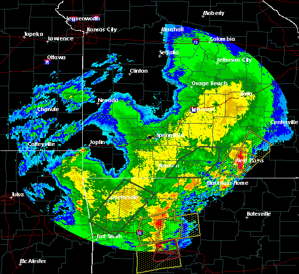 At 1012 am cdt, a severe thunderstorm was located 7 miles east of west plains, moving northeast at 40 mph (emergency management). Hazards include 60 mph wind gusts and quarter size hail. Hail damage to vehicles is expected. Expect wind damage to roofs, siding, and trees. At 1012 am cdt, a severe thunderstorm was located 7 miles east of west plains, moving northeast at 40 mph (emergency management). Hazards include 60 mph wind gusts and quarter size hail. Hail damage to vehicles is expected. Expect wind damage to roofs, siding, and trees.
|
| 4/4/2017 11:30 PM CDT | Quarter sized hail reported 0.2 miles SE of Summersville, MO |
| 4/4/2017 11:30 PM CDT |
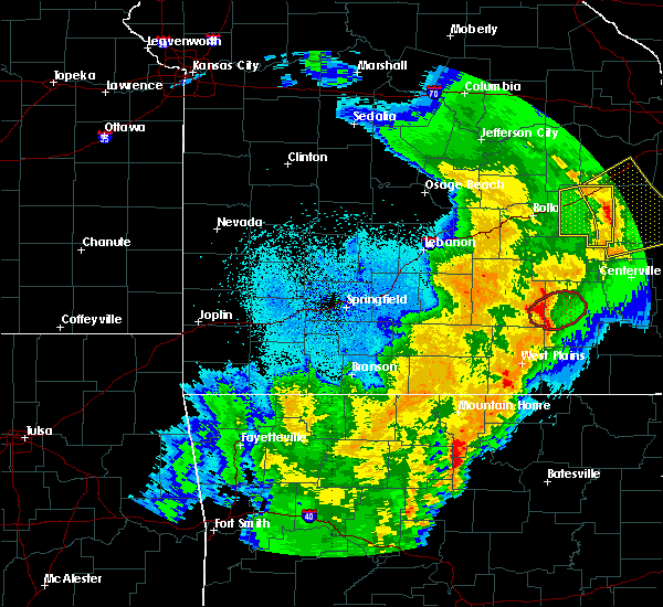 At 1129 pm cdt, a severe thunderstorm capable of producing a tornado was located near buck hollow, moving northeast at 40 mph (radar indicated rotation). Hazards include tornado. Flying debris will be dangerous to those caught without shelter. mobile homes will be damaged or destroyed. damage to roofs, windows, and vehicles will occur. tree damage is likely. Locations impacted include, current river state park, eminence, summersville, alley spring, hartshorn, round spring, west eminence, arroll, pine crest,. At 1129 pm cdt, a severe thunderstorm capable of producing a tornado was located near buck hollow, moving northeast at 40 mph (radar indicated rotation). Hazards include tornado. Flying debris will be dangerous to those caught without shelter. mobile homes will be damaged or destroyed. damage to roofs, windows, and vehicles will occur. tree damage is likely. Locations impacted include, current river state park, eminence, summersville, alley spring, hartshorn, round spring, west eminence, arroll, pine crest,.
|
| 4/4/2017 11:01 PM CDT |
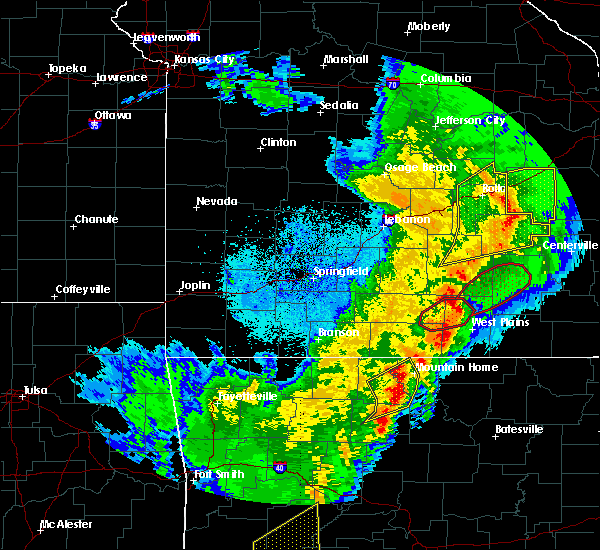 At 1101 pm cdt, a severe thunderstorm capable of producing a tornado was located near willow springs, moving northeast at 50 mph (radar indicated rotation). Hazards include tornado. Flying debris will be dangerous to those caught without shelter. mobile homes will be damaged or destroyed. damage to roofs, windows, and vehicles will occur. Tree damage is likely. At 1101 pm cdt, a severe thunderstorm capable of producing a tornado was located near willow springs, moving northeast at 50 mph (radar indicated rotation). Hazards include tornado. Flying debris will be dangerous to those caught without shelter. mobile homes will be damaged or destroyed. damage to roofs, windows, and vehicles will occur. Tree damage is likely.
|
| 3/24/2017 11:24 PM CDT |
 The severe thunderstorm warning for howell and southeastern texas counties will expire at 1130 pm cdt, the storms which prompted the warning have weakened below severe limits, and no longer pose an immediate threat to life or property. therefore, the warning will be allowed to expire. however gusty winds are still possible with these thunderstorms. The severe thunderstorm warning for howell and southeastern texas counties will expire at 1130 pm cdt, the storms which prompted the warning have weakened below severe limits, and no longer pose an immediate threat to life or property. therefore, the warning will be allowed to expire. however gusty winds are still possible with these thunderstorms.
|
| 3/24/2017 11:03 PM CDT |
 At 1103 pm cdt, severe thunderstorms were located along a line extending from cabool to 9 miles southwest of west plains, moving northeast at 30 mph (radar indicated). Hazards include 60 mph wind gusts. Expect damage to roofs, siding, and trees. Locations impacted include, west plains, mountain view, willow springs, cabool, pomona, summersville, south fork, brandsville, peace valley, arroll, eunice, yukon, white church, hartshorn, clear springs, elk creek,. At 1103 pm cdt, severe thunderstorms were located along a line extending from cabool to 9 miles southwest of west plains, moving northeast at 30 mph (radar indicated). Hazards include 60 mph wind gusts. Expect damage to roofs, siding, and trees. Locations impacted include, west plains, mountain view, willow springs, cabool, pomona, summersville, south fork, brandsville, peace valley, arroll, eunice, yukon, white church, hartshorn, clear springs, elk creek,.
|
| 3/24/2017 10:49 PM CDT |
 At 1048 pm cdt, severe thunderstorms were located along a line extending from 6 miles south of mountain grove to near ott, moving northeast at 30 mph (radar indicated). Hazards include 60 mph wind gusts. expect damage to roofs, siding, and trees At 1048 pm cdt, severe thunderstorms were located along a line extending from 6 miles south of mountain grove to near ott, moving northeast at 30 mph (radar indicated). Hazards include 60 mph wind gusts. expect damage to roofs, siding, and trees
|
| 3/21/2017 3:26 PM CDT |
 The severe thunderstorm warning for northern texas county will expire at 330 pm cdt, the storm which prompted the warning has weakened below severe limits, and no longer pose an immediate threat to life or property. therefore, the warning will be allowed to expire. to report severe weather, contact your nearest law enforcement agency. they will relay your report to the national weather service springfield. The severe thunderstorm warning for northern texas county will expire at 330 pm cdt, the storm which prompted the warning has weakened below severe limits, and no longer pose an immediate threat to life or property. therefore, the warning will be allowed to expire. to report severe weather, contact your nearest law enforcement agency. they will relay your report to the national weather service springfield.
|
| 3/21/2017 3:10 PM CDT |
 At 308 pm cdt, a severe thunderstorm was located near houston, moving east at 40 mph (public. at 230 pm quarter size hail was reported 1 mile south of success). Hazards include quarter size hail. Damage to vehicles is expected. Locations impacted include, licking, houston, summersville, raymondville, hartshorn, prescott, success,. At 308 pm cdt, a severe thunderstorm was located near houston, moving east at 40 mph (public. at 230 pm quarter size hail was reported 1 mile south of success). Hazards include quarter size hail. Damage to vehicles is expected. Locations impacted include, licking, houston, summersville, raymondville, hartshorn, prescott, success,.
|
| 3/21/2017 2:49 PM CDT |
 At 248 pm cdt, a severe thunderstorm was located 15 miles northwest of houston, moving east at 35 mph (radar indicated). Hazards include quarter size hail. Damage to vehicles is expected. Locations impacted include, licking, houston, summersville, raymondville, yukon, hartshorn, bucyrus, prescott, success, eunice,. At 248 pm cdt, a severe thunderstorm was located 15 miles northwest of houston, moving east at 35 mph (radar indicated). Hazards include quarter size hail. Damage to vehicles is expected. Locations impacted include, licking, houston, summersville, raymondville, yukon, hartshorn, bucyrus, prescott, success, eunice,.
|
| 3/21/2017 2:23 PM CDT |
 At 223 pm cdt, a severe thunderstorm was located 13 miles northwest of houston, moving east at 40 mph (radar indicated). Hazards include quarter size hail. damage to vehicles is expected At 223 pm cdt, a severe thunderstorm was located 13 miles northwest of houston, moving east at 40 mph (radar indicated). Hazards include quarter size hail. damage to vehicles is expected
|
| 3/9/2017 5:55 PM CST | Ping Pong Ball sized hail reported 0.2 miles SE of Summersville, MO, picture from social media. time was estimated. |
| 3/9/2017 5:49 PM CST |
 At 549 pm cst, a severe thunderstorm was located over summersville, or 11 miles north of mountain view, moving east at 50 mph (radar indicated). Hazards include ping pong ball size hail and 60 mph wind gusts. People and animals outdoors will be injured. expect hail damage to roofs, siding, windows, and vehicles. Expect wind damage to roofs, siding, and trees. At 549 pm cst, a severe thunderstorm was located over summersville, or 11 miles north of mountain view, moving east at 50 mph (radar indicated). Hazards include ping pong ball size hail and 60 mph wind gusts. People and animals outdoors will be injured. expect hail damage to roofs, siding, windows, and vehicles. Expect wind damage to roofs, siding, and trees.
|
| 3/9/2017 5:36 PM CST |
 At 536 pm cst, a severe thunderstorm was located 8 miles south of houston, moving east at 40 mph (radar indicated). Hazards include golf ball size hail and 60 mph wind gusts. People and animals outdoors will be injured. expect hail damage to roofs, siding, windows, and vehicles. expect wind damage to roofs, siding, and trees. Locations impacted include, houston, summersville, raymondville, yukon, hartshorn, clear springs, solo, arroll, elk creek, eunice,. At 536 pm cst, a severe thunderstorm was located 8 miles south of houston, moving east at 40 mph (radar indicated). Hazards include golf ball size hail and 60 mph wind gusts. People and animals outdoors will be injured. expect hail damage to roofs, siding, windows, and vehicles. expect wind damage to roofs, siding, and trees. Locations impacted include, houston, summersville, raymondville, yukon, hartshorn, clear springs, solo, arroll, elk creek, eunice,.
|
| 3/9/2017 5:23 PM CST |
 At 523 pm cst, a severe thunderstorm was located near cabool, or 9 miles southwest of houston, moving east at 45 mph (radar indicated). Hazards include 60 mph wind gusts and half dollar size hail. Hail damage to vehicles is expected. expect wind damage to roofs, siding, and trees. Locations impacted include, cabool, houston, summersville, raymondville, yukon, hartshorn, clear springs, solo, arroll, simmons, elk creek, eunice,. At 523 pm cst, a severe thunderstorm was located near cabool, or 9 miles southwest of houston, moving east at 45 mph (radar indicated). Hazards include 60 mph wind gusts and half dollar size hail. Hail damage to vehicles is expected. expect wind damage to roofs, siding, and trees. Locations impacted include, cabool, houston, summersville, raymondville, yukon, hartshorn, clear springs, solo, arroll, simmons, elk creek, eunice,.
|
| 3/9/2017 5:11 PM CST |
 At 511 pm cst, a severe thunderstorm was located near mountain grove, moving east at 40 mph (radar indicated). Hazards include quarter size hail. Damage to vehicles is expected. Locations impacted include, mountain grove, cabool, houston, summersville, raymondville, huggins, arroll, elk creek, eunice, yukon, hartshorn, clear springs, solo, simmons, bendavis,. At 511 pm cst, a severe thunderstorm was located near mountain grove, moving east at 40 mph (radar indicated). Hazards include quarter size hail. Damage to vehicles is expected. Locations impacted include, mountain grove, cabool, houston, summersville, raymondville, huggins, arroll, elk creek, eunice, yukon, hartshorn, clear springs, solo, simmons, bendavis,.
|
| 3/9/2017 4:59 PM CST |
 At 459 pm cst, a severe thunderstorm was located 8 miles north of norwood, or 8 miles northwest of mountain grove, moving east at 40 mph (radar indicated). Hazards include 60 mph wind gusts and half dollar size hail. Hail damage to vehicles is expected. Expect wind damage to roofs, siding, and trees. At 459 pm cst, a severe thunderstorm was located 8 miles north of norwood, or 8 miles northwest of mountain grove, moving east at 40 mph (radar indicated). Hazards include 60 mph wind gusts and half dollar size hail. Hail damage to vehicles is expected. Expect wind damage to roofs, siding, and trees.
|
| 3/9/2017 4:42 PM CST |
 At 441 pm cst, a severe thunderstorm was located near raymondville, or 10 miles northeast of houston, moving east at 55 mph (radar indicated). Hazards include quarter size hail. Damage to vehicles is expected. Locations impacted include, current river state park, montauk state park, licking, houston, eminence, bunker, raymondville, montauk, turtle, jadwin, howes mill, midridge, darien, gladden, eunice, alley spring, yukon, boss, hartshorn, round spring,. At 441 pm cst, a severe thunderstorm was located near raymondville, or 10 miles northeast of houston, moving east at 55 mph (radar indicated). Hazards include quarter size hail. Damage to vehicles is expected. Locations impacted include, current river state park, montauk state park, licking, houston, eminence, bunker, raymondville, montauk, turtle, jadwin, howes mill, midridge, darien, gladden, eunice, alley spring, yukon, boss, hartshorn, round spring,.
|
| 3/9/2017 4:21 PM CST |
 At 421 pm cst, a severe thunderstorm was located 12 miles south of fort leonard wood, moving east at 50 mph (radar indicated). Hazards include quarter size hail. damage to vehicles is expected At 421 pm cst, a severe thunderstorm was located 12 miles south of fort leonard wood, moving east at 50 mph (radar indicated). Hazards include quarter size hail. damage to vehicles is expected
|
| 3/7/2017 12:47 AM CST |
 At 1247 am cst, severe thunderstorms were located along a line extending from 8 miles southeast of salem to 10 miles southwest of west plains, moving southeast at 45 mph (radar indicated). Hazards include 60 mph wind gusts and penny size hail. Expect damage to roofs, siding, and trees. Locations impacted include, cabool, summersville, raymondville, yukon, hartshorn, clear springs, solo, arroll, pine crest, simmons, elk creek, eunice, a tornado watch remains in effect until 300 am cst for south central missouri. At 1247 am cst, severe thunderstorms were located along a line extending from 8 miles southeast of salem to 10 miles southwest of west plains, moving southeast at 45 mph (radar indicated). Hazards include 60 mph wind gusts and penny size hail. Expect damage to roofs, siding, and trees. Locations impacted include, cabool, summersville, raymondville, yukon, hartshorn, clear springs, solo, arroll, pine crest, simmons, elk creek, eunice, a tornado watch remains in effect until 300 am cst for south central missouri.
|
| 3/7/2017 12:30 AM CST |
 At 1229 am cst, severe thunderstorms were located along a line extending from 7 miles west of salem to 15 miles northeast of gainesville, moving southeast at 45 mph (radar indicated). Hazards include 60 mph wind gusts and penny size hail. Expect damage to roofs, siding, and trees. Locations impacted include, mountain grove, licking, cabool, houston, mansfield, dawson, norwood, summersville, raymondville, huggins, plato, success, eunice, yukon, roby, clear springs, solo, pine crest, simmons, arroll, a tornado watch remains in effect until 300 am cst for south central, southwestern and east central missouri. At 1229 am cst, severe thunderstorms were located along a line extending from 7 miles west of salem to 15 miles northeast of gainesville, moving southeast at 45 mph (radar indicated). Hazards include 60 mph wind gusts and penny size hail. Expect damage to roofs, siding, and trees. Locations impacted include, mountain grove, licking, cabool, houston, mansfield, dawson, norwood, summersville, raymondville, huggins, plato, success, eunice, yukon, roby, clear springs, solo, pine crest, simmons, arroll, a tornado watch remains in effect until 300 am cst for south central, southwestern and east central missouri.
|
| 3/7/2017 12:14 AM CST |
 At 1214 am cst, severe thunderstorms were located along a line extending from 12 miles north of licking to 15 miles north of gainesville, moving east at 50 mph (radar indicated). Hazards include 70 mph wind gusts and quarter size hail. Hail damage to vehicles is expected. expect considerable tree damage. wind damage is also likely to mobile homes, roofs, and outbuildings. Locations impacted include, mountain grove, licking, cabool, houston, seymour, mansfield, dawson, norwood, hartville, summersville, raymondville, huggins, plato, manes, success, eunice, yukon, roby, clear springs, solo, a tornado watch remains in effect until 300 am cst for south central, southwestern and east central missouri. At 1214 am cst, severe thunderstorms were located along a line extending from 12 miles north of licking to 15 miles north of gainesville, moving east at 50 mph (radar indicated). Hazards include 70 mph wind gusts and quarter size hail. Hail damage to vehicles is expected. expect considerable tree damage. wind damage is also likely to mobile homes, roofs, and outbuildings. Locations impacted include, mountain grove, licking, cabool, houston, seymour, mansfield, dawson, norwood, hartville, summersville, raymondville, huggins, plato, manes, success, eunice, yukon, roby, clear springs, solo, a tornado watch remains in effect until 300 am cst for south central, southwestern and east central missouri.
|
| 3/6/2017 11:58 PM CST |
 At 1158 pm cst, severe thunderstorms were located along a line extending from fort leonard wood to 7 miles west of ava, moving southeast at 45 mph (radar indicated). Hazards include 70 mph wind gusts and quarter size hail. Hail damage to vehicles is expected. expect considerable tree damage. Wind damage is also likely to mobile homes, roofs, and outbuildings. At 1158 pm cst, severe thunderstorms were located along a line extending from fort leonard wood to 7 miles west of ava, moving southeast at 45 mph (radar indicated). Hazards include 70 mph wind gusts and quarter size hail. Hail damage to vehicles is expected. expect considerable tree damage. Wind damage is also likely to mobile homes, roofs, and outbuildings.
|
| 3/1/2017 3:06 AM CST |
 The severe thunderstorm warning for northwestern shannon, douglas, southeastern wright, southern dent, northwestern howell and southern texas counties will expire at 315 am cst, the storms which prompted the warning have moved out of the area. therefore the warning will be allowed to expire. however heavy rain is still possible with these thunderstorms. a tornado watch remains in effect until 400 am cst for south central and southwestern missouri. The severe thunderstorm warning for northwestern shannon, douglas, southeastern wright, southern dent, northwestern howell and southern texas counties will expire at 315 am cst, the storms which prompted the warning have moved out of the area. therefore the warning will be allowed to expire. however heavy rain is still possible with these thunderstorms. a tornado watch remains in effect until 400 am cst for south central and southwestern missouri.
|
| 3/1/2017 2:58 AM CST | Severe thunderstorm wind gusts knocked down several power lines in summersvill in texas county MO, 0.2 miles SE of Summersville, MO |
| 3/1/2017 2:53 AM CST |
 At 253 am cst, severe thunderstorms were located along a line extending from 15 miles east of raymondville to near summersville to 6 miles southwest of willow springs, moving east at 80 mph (radar indicated). Hazards include 60 mph wind gusts and quarter size hail. Hail damage to vehicles is expected. Expect wind damage to roofs, siding, and trees. At 253 am cst, severe thunderstorms were located along a line extending from 15 miles east of raymondville to near summersville to 6 miles southwest of willow springs, moving east at 80 mph (radar indicated). Hazards include 60 mph wind gusts and quarter size hail. Hail damage to vehicles is expected. Expect wind damage to roofs, siding, and trees.
|
| 3/1/2017 2:16 AM CST |
 At 216 am cst, severe thunderstorms were located along a line extending from near licking to 6 miles north of urbanette, moving east at 80 mph (radar indicated). Hazards include 60 mph wind gusts and quarter size hail. Hail damage to vehicles is expected. expect wind damage to roofs, siding, and trees. these severe thunderstorms will remain over mainly rural areas of northwestern shannon, douglas, southeastern wright, southern dent, northwestern howell and southern texas counties, including the following locations: current river state park, montauk state park, montauk, jadwin, brushyknob, bucyrus, elk creek, eunice, gentryville and yukon. A tornado watch remains in effect until 400 am cst for south central and southwestern missouri. At 216 am cst, severe thunderstorms were located along a line extending from near licking to 6 miles north of urbanette, moving east at 80 mph (radar indicated). Hazards include 60 mph wind gusts and quarter size hail. Hail damage to vehicles is expected. expect wind damage to roofs, siding, and trees. these severe thunderstorms will remain over mainly rural areas of northwestern shannon, douglas, southeastern wright, southern dent, northwestern howell and southern texas counties, including the following locations: current river state park, montauk state park, montauk, jadwin, brushyknob, bucyrus, elk creek, eunice, gentryville and yukon. A tornado watch remains in effect until 400 am cst for south central and southwestern missouri.
|
| 2/28/2017 5:49 PM CST |
 At 549 pm cst, a severe thunderstorm was located 10 miles north of summersville, or 20 miles east of houston, moving east at 60 mph (radar indicated. this storm has a history of producing half dollar to ping pong size hail). Hazards include ping pong ball size hail and 60 mph wind gusts. People and animals outdoors will be injured. expect hail damage to roofs, siding, windows, and vehicles. expect wind damage to roofs, siding, and trees. Locations impacted include, current river state park, summersville, bunker, turtle, jadwin, howes mill, midridge, darien, gladden, boss, round spring, akers, stone hill, a tornado watch remains in effect until 900 pm cst for south central missouri. At 549 pm cst, a severe thunderstorm was located 10 miles north of summersville, or 20 miles east of houston, moving east at 60 mph (radar indicated. this storm has a history of producing half dollar to ping pong size hail). Hazards include ping pong ball size hail and 60 mph wind gusts. People and animals outdoors will be injured. expect hail damage to roofs, siding, windows, and vehicles. expect wind damage to roofs, siding, and trees. Locations impacted include, current river state park, summersville, bunker, turtle, jadwin, howes mill, midridge, darien, gladden, boss, round spring, akers, stone hill, a tornado watch remains in effect until 900 pm cst for south central missouri.
|
| 2/28/2017 5:37 PM CST |
 At 536 pm cst, severe thunderstorms were located along a line extending from near raymondville to 7 miles northwest of summersville, moving east at 65 mph (radar indicated. this storm has a history of producing half dollar to ping pong size hail). Hazards include 60 mph wind gusts and half dollar size hail. Hail damage to vehicles is expected. Expect wind damage to roofs, siding, and trees. At 536 pm cst, severe thunderstorms were located along a line extending from near raymondville to 7 miles northwest of summersville, moving east at 65 mph (radar indicated. this storm has a history of producing half dollar to ping pong size hail). Hazards include 60 mph wind gusts and half dollar size hail. Hail damage to vehicles is expected. Expect wind damage to roofs, siding, and trees.
|
| 2/28/2017 5:29 PM CST |
 At 529 pm cst, a severe thunderstorm was located near houston, moving northeast at 65 mph (trained weather spotters. half dollar to ping pong size hail have been reported with this storm). Hazards include golf ball size hail and 60 mph wind gusts. People and animals outdoors will be injured. expect hail damage to roofs, siding, windows, and vehicles. expect wind damage to roofs, siding, and trees. Locations impacted include, montauk state park, licking, houston, summersville, raymondville, montauk, bucyrus, elk creek, eunice, yukon, hartshorn, solo, simmons, prescott, a tornado watch remains in effect until 900 pm cst for south central missouri. At 529 pm cst, a severe thunderstorm was located near houston, moving northeast at 65 mph (trained weather spotters. half dollar to ping pong size hail have been reported with this storm). Hazards include golf ball size hail and 60 mph wind gusts. People and animals outdoors will be injured. expect hail damage to roofs, siding, windows, and vehicles. expect wind damage to roofs, siding, and trees. Locations impacted include, montauk state park, licking, houston, summersville, raymondville, montauk, bucyrus, elk creek, eunice, yukon, hartshorn, solo, simmons, prescott, a tornado watch remains in effect until 900 pm cst for south central missouri.
|
| 2/28/2017 5:21 PM CST |
 At 520 pm cst, a severe thunderstorm was located near cabool, or 9 miles southwest of houston, moving east at 65 mph (trained weather spotters. half dollar to ping pong size hail have been reported with this storm). Hazards include golf ball size hail and 60 mph wind gusts. People and animals outdoors will be injured. expect hail damage to roofs, siding, windows, and vehicles. expect wind damage to roofs, siding, and trees. Locations impacted include, montauk state park, licking, cabool, houston, summersville, raymondville, montauk, arroll, bucyrus, elk creek, success, eunice, yukon, hartshorn, clear springs, solo, pine crest, simmons, prescott, a tornado watch remains in effect until 900 pm cst for south central missouri. At 520 pm cst, a severe thunderstorm was located near cabool, or 9 miles southwest of houston, moving east at 65 mph (trained weather spotters. half dollar to ping pong size hail have been reported with this storm). Hazards include golf ball size hail and 60 mph wind gusts. People and animals outdoors will be injured. expect hail damage to roofs, siding, windows, and vehicles. expect wind damage to roofs, siding, and trees. Locations impacted include, montauk state park, licking, cabool, houston, summersville, raymondville, montauk, arroll, bucyrus, elk creek, success, eunice, yukon, hartshorn, clear springs, solo, pine crest, simmons, prescott, a tornado watch remains in effect until 900 pm cst for south central missouri.
|
| 2/28/2017 5:13 PM CST |
 At 512 pm cst, a severe thunderstorm was located near mountain grove, moving east at 75 mph (trained weather spotters). Hazards include ping pong ball size hail and 60 mph wind gusts. People and animals outdoors will be injured. expect hail damage to roofs, siding, windows, and vehicles. expect wind damage to roofs, siding, and trees. Locations impacted include, montauk state park, licking, cabool, houston, summersville, raymondville, huggins, montauk, arroll, bucyrus, elk creek, success, eunice, yukon, hartshorn, clear springs, solo, pine crest, simmons, prescott, a tornado watch remains in effect until 900 pm cst for south central missouri. At 512 pm cst, a severe thunderstorm was located near mountain grove, moving east at 75 mph (trained weather spotters). Hazards include ping pong ball size hail and 60 mph wind gusts. People and animals outdoors will be injured. expect hail damage to roofs, siding, windows, and vehicles. expect wind damage to roofs, siding, and trees. Locations impacted include, montauk state park, licking, cabool, houston, summersville, raymondville, huggins, montauk, arroll, bucyrus, elk creek, success, eunice, yukon, hartshorn, clear springs, solo, pine crest, simmons, prescott, a tornado watch remains in effect until 900 pm cst for south central missouri.
|
| 2/28/2017 4:58 PM CST |
 At 457 pm cst, a severe thunderstorm was located near norwood, or 8 miles northwest of mountain grove, moving east at 55 mph (radar indicated). Hazards include ping pong ball size hail and 60 mph wind gusts. People and animals outdoors will be injured. expect hail damage to roofs, siding, windows, and vehicles. Expect wind damage to roofs, siding, and trees. At 457 pm cst, a severe thunderstorm was located near norwood, or 8 miles northwest of mountain grove, moving east at 55 mph (radar indicated). Hazards include ping pong ball size hail and 60 mph wind gusts. People and animals outdoors will be injured. expect hail damage to roofs, siding, windows, and vehicles. Expect wind damage to roofs, siding, and trees.
|
| 9/15/2016 1:20 PM CDT |
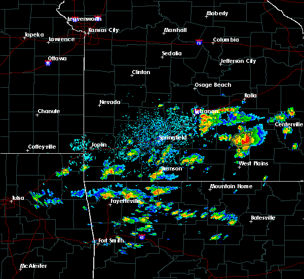 At 120 pm cdt, a severe thunderstorm was located 7 miles south of raymondville, or 10 miles southeast of houston, moving northeast at 5 mph (radar indicated). Hazards include 60 mph wind gusts and quarter size hail. Hail damage to vehicles is expected. expect wind damage to roofs, siding, and trees. Locations impacted include, summersville, hartshorn, eunice,. At 120 pm cdt, a severe thunderstorm was located 7 miles south of raymondville, or 10 miles southeast of houston, moving northeast at 5 mph (radar indicated). Hazards include 60 mph wind gusts and quarter size hail. Hail damage to vehicles is expected. expect wind damage to roofs, siding, and trees. Locations impacted include, summersville, hartshorn, eunice,.
|
| 9/15/2016 12:57 PM CDT |
 At 1256 pm cdt, a severe thunderstorm was located 9 miles south of raymondville, or 10 miles southeast of houston, moving northeast at 5 mph (radar indicated). Hazards include 60 mph wind gusts and quarter size hail. Hail damage to vehicles is expected. Expect wind damage to roofs, siding, and trees. At 1256 pm cdt, a severe thunderstorm was located 9 miles south of raymondville, or 10 miles southeast of houston, moving northeast at 5 mph (radar indicated). Hazards include 60 mph wind gusts and quarter size hail. Hail damage to vehicles is expected. Expect wind damage to roofs, siding, and trees.
|
| 9/9/2016 7:12 PM CDT |
 At 712 pm cdt, a severe thunderstorm was located near houston, moving east at 25 mph (radar indicated). Hazards include 60 mph wind gusts and nickel size hail. Expect damage to roofs. siding. And trees. At 712 pm cdt, a severe thunderstorm was located near houston, moving east at 25 mph (radar indicated). Hazards include 60 mph wind gusts and nickel size hail. Expect damage to roofs. siding. And trees.
|
| 7/8/2016 4:03 PM CDT |
 At 402 pm cdt, a severe thunderstorm was located 9 miles east of cabool, or 10 miles north of willow springs, moving east at 30 mph (radar indicated). Hazards include 60 mph wind gusts. Expect damage to roofs. siding. and trees. Locations impacted include, summersville, arroll, yukon, pine crest, solo, clear springs, elk creek, hartshorn, eunice,. At 402 pm cdt, a severe thunderstorm was located 9 miles east of cabool, or 10 miles north of willow springs, moving east at 30 mph (radar indicated). Hazards include 60 mph wind gusts. Expect damage to roofs. siding. and trees. Locations impacted include, summersville, arroll, yukon, pine crest, solo, clear springs, elk creek, hartshorn, eunice,.
|
| 7/8/2016 3:47 PM CDT |
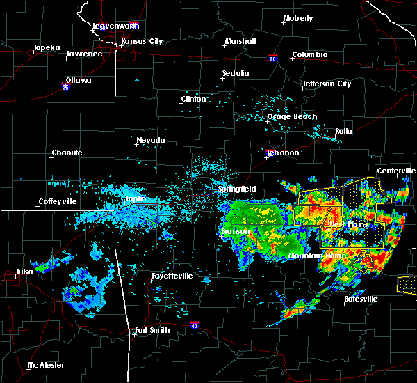 At 344 pm cdt, severe thunderstorms were located along a line extending from 6 miles northeast of cabool to near mountain view to near sturkie, moving east at 30 mph (law enforcement. estimated 60 mph winds at troop g headquarters. these storms also have a history of downing trees across portion of western taney county and portions of douglas county when the storms passed through those locations). Hazards include 60 mph wind gusts. Expect damage to roofs. siding. And trees. At 344 pm cdt, severe thunderstorms were located along a line extending from 6 miles northeast of cabool to near mountain view to near sturkie, moving east at 30 mph (law enforcement. estimated 60 mph winds at troop g headquarters. these storms also have a history of downing trees across portion of western taney county and portions of douglas county when the storms passed through those locations). Hazards include 60 mph wind gusts. Expect damage to roofs. siding. And trees.
|
| 7/8/2016 3:33 PM CDT |
 At 332 pm cdt, a severe thunderstorm was located over cabool, or 7 miles east of mountain grove, moving east at 30 mph (radar indicated). Hazards include 60 mph wind gusts. Expect damage to roofs. siding. And trees. At 332 pm cdt, a severe thunderstorm was located over cabool, or 7 miles east of mountain grove, moving east at 30 mph (radar indicated). Hazards include 60 mph wind gusts. Expect damage to roofs. siding. And trees.
|
| 7/6/2016 10:27 AM CDT | Damage to the roof of business in summersville in texas county MO, 0.2 miles SE of Summersville, MO |
| 7/6/2016 10:23 AM CDT |
 At 1023 am cdt, severe thunderstorms were located along a line extending from near licking to near summersville to 10 miles south of mountain view, moving east at 55 mph (radar indicated). Hazards include 60 mph wind gusts and penny size hail. Expect damage to roofs. siding. And trees. At 1023 am cdt, severe thunderstorms were located along a line extending from near licking to near summersville to 10 miles south of mountain view, moving east at 55 mph (radar indicated). Hazards include 60 mph wind gusts and penny size hail. Expect damage to roofs. siding. And trees.
|
| 5/11/2016 11:26 PM CDT |
 At 1126 pm cdt, a severe thunderstorm was located near summersville, or 18 miles northeast of mountain view, moving east at 20 mph (radar indicated). Hazards include quarter size hail. Damage to vehicles is expected. Locations impacted include, current river state park, summersville, hartshorn, round spring,. At 1126 pm cdt, a severe thunderstorm was located near summersville, or 18 miles northeast of mountain view, moving east at 20 mph (radar indicated). Hazards include quarter size hail. Damage to vehicles is expected. Locations impacted include, current river state park, summersville, hartshorn, round spring,.
|
| 5/11/2016 10:56 PM CDT |
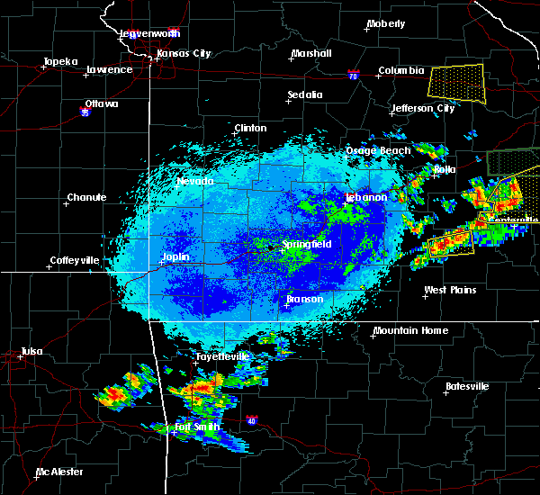 At 1056 pm cdt, a severe thunderstorm was located near summersville, or 15 miles east of houston, moving east at 25 mph (radar indicated). Hazards include quarter size hail. damage to vehicles is expected At 1056 pm cdt, a severe thunderstorm was located near summersville, or 15 miles east of houston, moving east at 25 mph (radar indicated). Hazards include quarter size hail. damage to vehicles is expected
|
| 8/10/2015 4:55 AM CDT |
 At 454 am cdt, severe thunderstorms were located along a line extending from birch tree to near willow springs to 17 miles south of cabool, moving southeast at 40 mph (radar indicated). Hazards include 60 mph wind gusts and penny size hail. Expect damage to roofs. Siding and trees. At 454 am cdt, severe thunderstorms were located along a line extending from birch tree to near willow springs to 17 miles south of cabool, moving southeast at 40 mph (radar indicated). Hazards include 60 mph wind gusts and penny size hail. Expect damage to roofs. Siding and trees.
|
| 7/26/2015 5:10 PM CDT |
 The severe thunderstorm warning for central texas county will expire at 515 pm cdt, the storm which prompted the warning has weakened below severe limits, and no longer poses an immediate threat to life or property. however, gusty winds and heavy rain are still possible with this thunderstorm. The severe thunderstorm warning for central texas county will expire at 515 pm cdt, the storm which prompted the warning has weakened below severe limits, and no longer poses an immediate threat to life or property. however, gusty winds and heavy rain are still possible with this thunderstorm.
|
| 7/26/2015 4:48 PM CDT |
 At 446 pm cdt, a severe thunderstorm was located near raymondville, and moving southeast at 10 mph (radar indicated). Hazards include 60 mph wind gusts. Expect damage to roofs. siding and trees. Locations impacted include, elk creek, eunice, hartshorn, houston, raymondville, simmons, solo, summersville and yukon. At 446 pm cdt, a severe thunderstorm was located near raymondville, and moving southeast at 10 mph (radar indicated). Hazards include 60 mph wind gusts. Expect damage to roofs. siding and trees. Locations impacted include, elk creek, eunice, hartshorn, houston, raymondville, simmons, solo, summersville and yukon.
|
| 7/26/2015 4:31 PM CDT |
 At 430 pm cdt, a severe thunderstorm was located near raymondville, and moving east at 10 mph (radar indicated). Hazards include 60 mph wind gusts and penny size hail. Expect damage to roofs. Siding and trees. At 430 pm cdt, a severe thunderstorm was located near raymondville, and moving east at 10 mph (radar indicated). Hazards include 60 mph wind gusts and penny size hail. Expect damage to roofs. Siding and trees.
|
| 7/26/2015 3:53 PM CDT |
 At 352 pm cdt, a severe thunderstorm was located near eminence, and moving southeast at 10 mph. an additional severe thunderstorm was located just east of hartshorn (radar indicated). Hazards include 60 mph wind gusts and penny size hail. Expect damage to roofs. siding and trees. locations impacted include, akers, alley spring, darien, eminence, eunice, hartshorn, houston, jadwin, montauk, raymondville, round spring, solo, summersville, west eminence and yukon. This warning also includes current river state park and montauk state park and the ozark national scenic riverways. At 352 pm cdt, a severe thunderstorm was located near eminence, and moving southeast at 10 mph. an additional severe thunderstorm was located just east of hartshorn (radar indicated). Hazards include 60 mph wind gusts and penny size hail. Expect damage to roofs. siding and trees. locations impacted include, akers, alley spring, darien, eminence, eunice, hartshorn, houston, jadwin, montauk, raymondville, round spring, solo, summersville, west eminence and yukon. This warning also includes current river state park and montauk state park and the ozark national scenic riverways.
|
| 7/26/2015 3:29 PM CDT |
 At 325 pm cdt, a severe thunderstorm was located 9 miles northwest of eminence, and moving southeast at 10 mph. additional thunderstorms were located to the west and northwest of this storm (radar indicated). Hazards include 60 mph wind gusts and quarter size hail. Hail damage to vehicles is expected. Expect wind damage to roofs, siding and trees. At 325 pm cdt, a severe thunderstorm was located 9 miles northwest of eminence, and moving southeast at 10 mph. additional thunderstorms were located to the west and northwest of this storm (radar indicated). Hazards include 60 mph wind gusts and quarter size hail. Hail damage to vehicles is expected. Expect wind damage to roofs, siding and trees.
|
| 7/14/2015 12:40 PM CDT |
 At 1238 pm cdt, severe thunderstorms were located along a line extending from 12 miles north of mountain grove to 18 miles south of norwood, and moving east at 50 mph (trained weather spotters. this cluster of thunderstorms has resulted in multiple trees down along its path. winds have been estimated to be around 60 mph). Hazards include 60 mph wind gusts and nickel size hail. Expect damage to roofs. Siding and trees. At 1238 pm cdt, severe thunderstorms were located along a line extending from 12 miles north of mountain grove to 18 miles south of norwood, and moving east at 50 mph (trained weather spotters. this cluster of thunderstorms has resulted in multiple trees down along its path. winds have been estimated to be around 60 mph). Hazards include 60 mph wind gusts and nickel size hail. Expect damage to roofs. Siding and trees.
|
| 7/9/2015 4:26 PM CDT |
 At 424 pm cdt, severe thunderstorms were located along a line extending from raymondville to 7 miles west of summersville to mountain view, and moving east at 35 mph (radar indicated). Hazards include 60 mph wind gusts. Expect damage to roofs. Siding and trees. At 424 pm cdt, severe thunderstorms were located along a line extending from raymondville to 7 miles west of summersville to mountain view, and moving east at 35 mph (radar indicated). Hazards include 60 mph wind gusts. Expect damage to roofs. Siding and trees.
|
| 5/29/2015 6:54 PM CDT | At 653 pm cdt, a severe thunderstorm was located 7 miles northwest of summersville, and moving northeast at 20 mph (radar indicated). Hazards include 60 mph wind gusts and half dollar size hail. Hail damage to vehicles is expected. Expect wind damage to roofs, siding and trees. |
| 5/24/2015 3:56 PM CDT | The severe thunderstorm warning for southeastern texas, southwestern shannon and northeastern howell counties will expire at 400 pm cdt, the storm which prompted the warning has weakened below severe limits, and no longer poses an immediate threat to life or property. however, gusty winds are still possible with this thunderstorm. a tornado watch remains in effect until 800 pm cdt sunday evening for southern missouri. |
| 5/24/2015 3:32 PM CDT | At 330 pm cdt, a severe thunderstorm was located 10 miles south of mountain view, and moving north at 45 mph (radar indicated). Hazards include 60 mph wind gusts. Expect damage to roofs. Siding and trees. |
| 5/17/2015 4:11 AM CDT | At 410 am cdt, severe thunderstorms were located along a line extending from 11 miles northwest of licking to 7 miles northeast of cabool to 18 miles southwest of willow springs, and moving east at 45 mph (radar indicated). Hazards include 60 mph wind gusts. Expect damage to roofs. siding and trees. locations impacted include, cabool, extreme southwestern fort leonard wood, houston, licking, mountain grove, mountain view, raymondville and willow springs. a severe thunderstorm watch remains in effect until 700 am cdt sunday morning for southern missouri. 75in. |
| 5/17/2015 3:35 AM CDT | At 331 am cdt, severe thunderstorms were located along a line extending from 15 miles north of hartville to 6 miles north of norwood to squires, and moving east at 45 mph (radar indicated). Hazards include 60 mph wind gusts and penny size hail. Expect damage to roofs. Siding and trees. |
| 3/25/2015 5:53 PM CST | Golf Ball sized hail reported 5.5 miles WNW of Summersville, MO |
| 3/25/2015 6:40 PM CDT | A tornado warning remains in effect for central shannon county until 700 pm cdt. at 639 pm cdt. a severe thunderstorm capable of producing a tornado was located 13 miles west of eminence. and moving east at 25 mph. hazard. tornado and golf ball size hail. source. Radar indicated rotation. |
| 3/25/2015 6:35 PM CDT | A tornado warning remains in effect for southeastern texas and central shannon counties until 700 pm cdt. at 631 pm cdt. a severe thunderstorm capable of producing a tornado was located 5 miles south of summersville. and moving east at 25 mph. hazard. Tornado and golf ball size hail. |
| 3/25/2015 5:32 PM CST | Golf Ball sized hail reported 0.2 miles SE of Summersville, MO, broke windshield |
| 3/25/2015 5:25 PM CST | Tree down in texas county MO, 4.6 miles N of Summersville, MO |
| 3/25/2015 5:25 PM CST | Tree down in texas county MO, 3.5 miles NNE of Summersville, MO |
| 3/25/2015 6:23 PM CDT | The national weather service in springfield has issued a * tornado warning for. central shannon county in south central missouri. southeastern texas county in south central missouri. until 700 pm cdt * at 622 pm cdt. A severe thunderstorm capable of producing a. |
| 3/25/2015 6:13 PM CDT | The national weather service in springfield has issued a * severe thunderstorm warning for. northeastern howell county in south central missouri. western shannon county in south central missouri. southeastern texas county in south central missouri. Until 700 pm cdt. |
| 3/25/2015 5:45 PM CDT | The national weather service in springfield has issued a * severe thunderstorm warning for. southern texas county in south central missouri. until 630 pm cdt * at 543 pm cdt. a severe thunderstorm was located near cabool. And moving northeast at 30 mph. |
| 7/20/2013 2:30 PM CDT | Tree down across highway 13 in texas county MO, 10.1 miles E of Summersville, MO |
| 6/22/2013 3:52 PM CDT | The karr kare and convenience store in summersville had customers report trees down along a highway near the community from severe thunderstorm wind gust in texas county MO, 0.2 miles SE of Summersville, MO |
| 1/29/2013 6:25 PM CST | Damage reported to barns and other out buildings. trees and powerlines also reported down. three separate locations near state highway k. 1. pin oak rd off k highway. 2 in texas county MO, 4.3 miles S of Summersville, MO |
| 8/16/2012 2:50 PM CDT | Barn blown down from thunderstorm wind in texas county MO, 0.7 miles ESE of Summersville, MO |
| 3/15/2012 6:43 PM CDT | Quarter sized hail reported 0.2 miles SE of Summersville, MO, dime to quarter size hail. |
| 1/1/0001 12:00 AM | Police dept and city hall have lost their roofs. numerous trees down in the are in shannon county MO, 0.2 miles SE of Summersville, MO |
Hail Maps for Summersville, MO


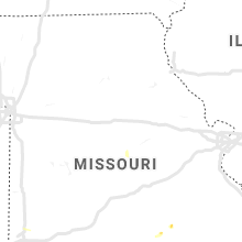


Connect with Interactive Hail Maps