

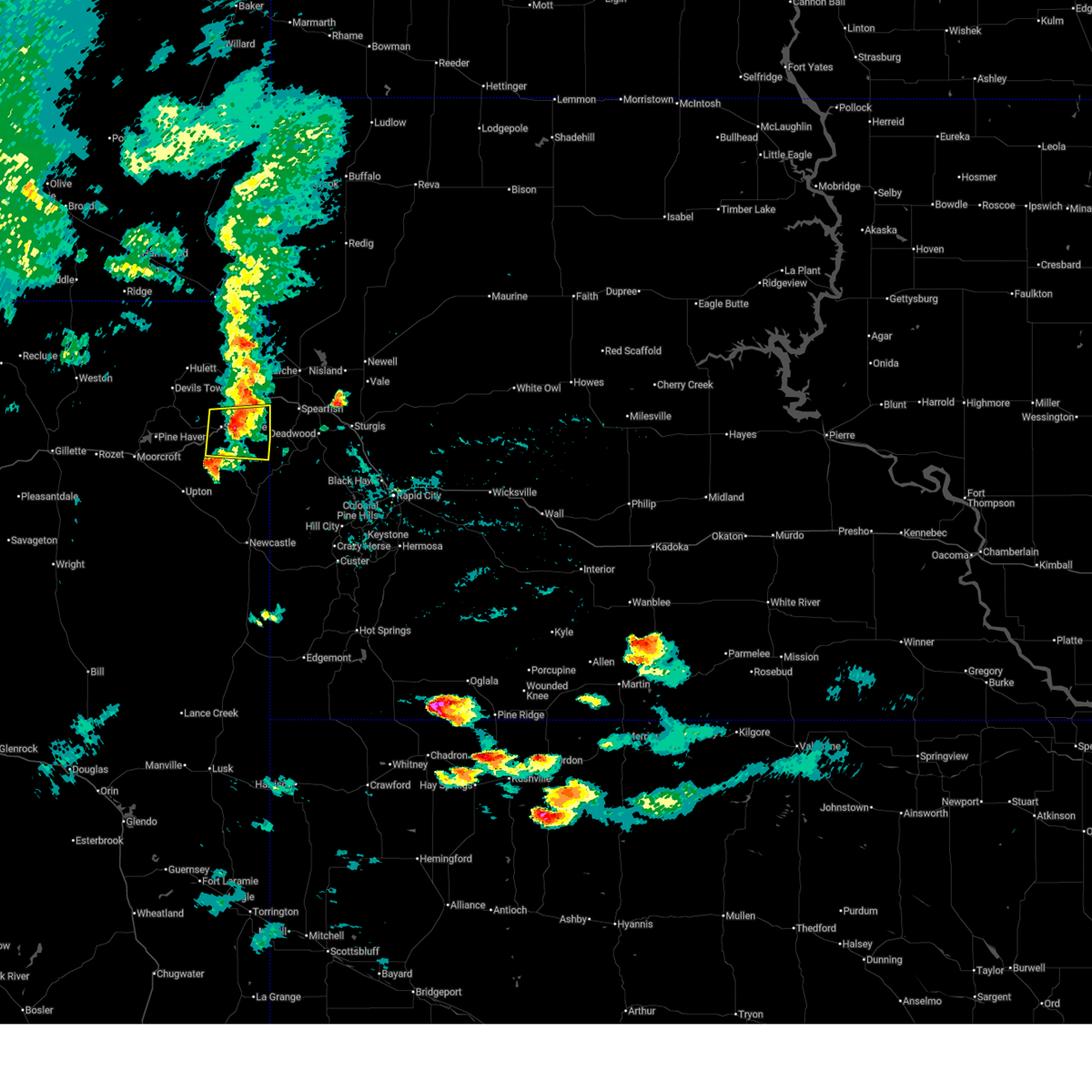
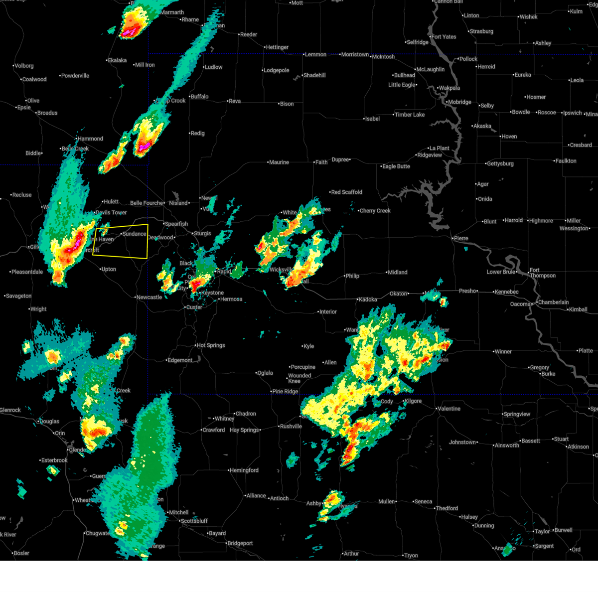
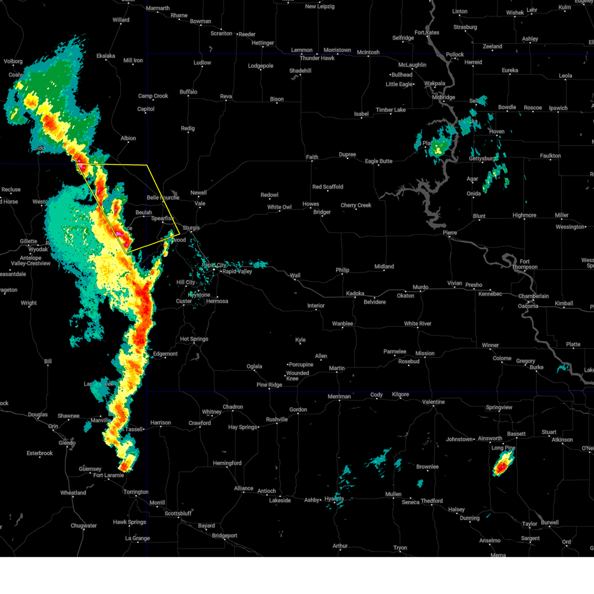
Hail Map for Sundance, WY
The Sundance, WY area has had 50 reports of on-the-ground hail by trained spotters, and has been under severe weather warnings 17 times during the past 12 months. Doppler radar has detected hail at or near Sundance, WY on 77 occasions, including 8 occasions during the past year.
| Name: | Sundance, WY |
| Where Located: | 56.9 miles E of Gillette, WY |
| Map: | Google Map for Sundance, WY |
| Population: | 1182 |
| Housing Units: | 606 |
| More Info: | Search Google for Sundance, WY |
1
The Top Recent Hail Date for Sundance, WY is Friday, July 3, 2026 (11th out of 77)
Hail and Wind Damage Spotted near Sundance, WY
| Date / Time | Report Details |
|---|---|
| 7/3/2026 3:28 PM MDT |
 At 328 pm mdt, a severe thunderstorm was located near warren peak, or near sundance, moving southeast at 20 mph (radar indicated). Hazards include 60 mph wind gusts and quarter size hail. Hail damage to vehicles is expected. expect wind damage to roofs, siding, and trees. locations impacted include, warren peak. This includes interstate 90 in wyoming between mile markers 176 and 186. At 328 pm mdt, a severe thunderstorm was located near warren peak, or near sundance, moving southeast at 20 mph (radar indicated). Hazards include 60 mph wind gusts and quarter size hail. Hail damage to vehicles is expected. expect wind damage to roofs, siding, and trees. locations impacted include, warren peak. This includes interstate 90 in wyoming between mile markers 176 and 186.
|
| 7/3/2026 3:14 PM MDT |
 At 314 pm mdt, a severe thunderstorm was located near warren peak, or 9 miles northwest of sundance, moving east at 15 mph (radar indicated). Hazards include 60 mph wind gusts and half dollar size hail. Hail damage to vehicles is expected. expect wind damage to roofs, siding, and trees. locations impacted include, warren peak and devils tower junction. This includes interstate 90 in wyoming between mile markers 176 and 186. At 314 pm mdt, a severe thunderstorm was located near warren peak, or 9 miles northwest of sundance, moving east at 15 mph (radar indicated). Hazards include 60 mph wind gusts and half dollar size hail. Hail damage to vehicles is expected. expect wind damage to roofs, siding, and trees. locations impacted include, warren peak and devils tower junction. This includes interstate 90 in wyoming between mile markers 176 and 186.
|
| 7/3/2026 2:55 PM MDT |
 Svrunr the national weather service in rapid city has issued a * severe thunderstorm warning for, south central crook county in northeastern wyoming, * until 400 pm mdt. * at 255 pm mdt, a severe thunderstorm was located over devils tower junction, or 16 miles northwest of sundance, moving southeast at 15 mph (radar indicated). Hazards include half dollar size hail. damage to vehicles is expected Svrunr the national weather service in rapid city has issued a * severe thunderstorm warning for, south central crook county in northeastern wyoming, * until 400 pm mdt. * at 255 pm mdt, a severe thunderstorm was located over devils tower junction, or 16 miles northwest of sundance, moving southeast at 15 mph (radar indicated). Hazards include half dollar size hail. damage to vehicles is expected
|
| 7/3/2026 1:41 PM MDT |
 At 141 pm mdt, a severe thunderstorm was located over sundance, moving east at 10 mph (radar indicated). Hazards include half dollar size hail. Damage to vehicles is expected. locations impacted include, sundance. This includes interstate 90 in wyoming between mile markers 183 and 192. At 141 pm mdt, a severe thunderstorm was located over sundance, moving east at 10 mph (radar indicated). Hazards include half dollar size hail. Damage to vehicles is expected. locations impacted include, sundance. This includes interstate 90 in wyoming between mile markers 183 and 192.
|
| 7/3/2026 1:40 PM MDT | Quarter sized hail reported 0.3 miles NNE of Sundance, WY |
| 7/3/2026 1:39 PM MDT |
 At 139 pm mdt, a severe thunderstorm was located over sundance, moving east at 10 mph (radar indicated). Hazards include half dollar size hail. Damage to vehicles is expected. locations impacted include, sundance. This includes interstate 90 in wyoming between mile markers 183 and 192. At 139 pm mdt, a severe thunderstorm was located over sundance, moving east at 10 mph (radar indicated). Hazards include half dollar size hail. Damage to vehicles is expected. locations impacted include, sundance. This includes interstate 90 in wyoming between mile markers 183 and 192.
|
| 7/3/2026 1:36 PM MDT | Half Dollar sized hail reported 0.3 miles NNE of Sundance, WY, mping report |
| 7/3/2026 1:35 PM MDT | Quarter sized hail reported 0.3 miles NNE of Sundance, WY |
| 7/3/2026 1:34 PM MDT |
 Svrunr the national weather service in rapid city has issued a * severe thunderstorm warning for, southeastern crook county in northeastern wyoming, * until 200 pm mdt. * at 134 pm mdt, a severe thunderstorm was located over sundance, moving east at 10 mph (radar indicated). Hazards include quarter size hail. damage to vehicles is expected Svrunr the national weather service in rapid city has issued a * severe thunderstorm warning for, southeastern crook county in northeastern wyoming, * until 200 pm mdt. * at 134 pm mdt, a severe thunderstorm was located over sundance, moving east at 10 mph (radar indicated). Hazards include quarter size hail. damage to vehicles is expected
|
| 6/4/2026 3:36 PM MDT |
 At 336 pm mdt, a severe thunderstorm was located 3 miles southeast of pine haven, or 21 miles west of sundance, moving east at 15 mph (radar indicated). Hazards include 60 mph wind gusts and half dollar size hail. Hail damage to vehicles is expected. expect wind damage to roofs, siding, and trees. locations impacted include, pine haven and keyhole reservoir. This includes interstate 90 in wyoming between mile markers 159 and 186. At 336 pm mdt, a severe thunderstorm was located 3 miles southeast of pine haven, or 21 miles west of sundance, moving east at 15 mph (radar indicated). Hazards include 60 mph wind gusts and half dollar size hail. Hail damage to vehicles is expected. expect wind damage to roofs, siding, and trees. locations impacted include, pine haven and keyhole reservoir. This includes interstate 90 in wyoming between mile markers 159 and 186.
|
| 6/4/2026 3:23 PM MDT |
 Svrunr the national weather service in rapid city has issued a * severe thunderstorm warning for, southwestern crook county in northeastern wyoming, * until 430 pm mdt. * at 323 pm mdt, a severe thunderstorm was located near pine haven, or 23 miles west of sundance, moving east at 20 mph (radar indicated). Hazards include 60 mph wind gusts and half dollar size hail. Hail damage to vehicles is expected. Expect wind damage to roofs, siding, and trees. Svrunr the national weather service in rapid city has issued a * severe thunderstorm warning for, southwestern crook county in northeastern wyoming, * until 430 pm mdt. * at 323 pm mdt, a severe thunderstorm was located near pine haven, or 23 miles west of sundance, moving east at 20 mph (radar indicated). Hazards include 60 mph wind gusts and half dollar size hail. Hail damage to vehicles is expected. Expect wind damage to roofs, siding, and trees.
|
| 6/2/2026 5:58 PM MDT |
 Svrunr the national weather service in rapid city has issued a * severe thunderstorm warning for, southeastern crook county in northeastern wyoming, * until 630 pm mdt. * at 558 pm mdt, a severe thunderstorm was located 7 miles southwest of sundance, moving north at 25 mph (radar indicated). Hazards include 60 mph wind gusts and quarter size hail. Hail damage to vehicles is expected. Expect wind damage to roofs, siding, and trees. Svrunr the national weather service in rapid city has issued a * severe thunderstorm warning for, southeastern crook county in northeastern wyoming, * until 630 pm mdt. * at 558 pm mdt, a severe thunderstorm was located 7 miles southwest of sundance, moving north at 25 mph (radar indicated). Hazards include 60 mph wind gusts and quarter size hail. Hail damage to vehicles is expected. Expect wind damage to roofs, siding, and trees.
|
| 9/15/2025 6:06 PM MDT | Svrunr the national weather service in rapid city has issued a * severe thunderstorm warning for, southwestern butte county in northwestern south dakota, western custer county in southwestern south dakota, western lawrence county in west central south dakota, southwestern pennington county in west central south dakota, northeastern weston county in northeastern wyoming, southeastern crook county in northeastern wyoming, * until 645 pm mdt. * at 605 pm mdt, severe thunderstorms were located along a line extending from 3 miles southwest of warren peak to 5 miles north of dewey, moving northeast at 40 mph (radar indicated). Hazards include 70 mph wind gusts. Expect considerable tree damage. Damage is likely to mobile homes, roofs, and outbuildings. |
| 8/13/2025 3:29 PM MDT |
 At 328 pm mdt, severe thunderstorms were located along a line extending from near cook lake to 3 miles west of moskee to 8 miles south of osage, moving east at 50 mph (radar indicated and spotter confirmed). Hazards include 60 to 70 mph wind gusts. Expect considerable tree damage. damage is likely to mobile homes, roofs, and outbuildings. locations impacted include, newcastle, sundance, osage, beulah, aladdin, moskee, buckhorn, four corners, cement ridge lookout, warren peak, inyan kara mountain, mallo camp, and cook lake. This includes interstate 90 in wyoming between mile markers 181 and 207. At 328 pm mdt, severe thunderstorms were located along a line extending from near cook lake to 3 miles west of moskee to 8 miles south of osage, moving east at 50 mph (radar indicated and spotter confirmed). Hazards include 60 to 70 mph wind gusts. Expect considerable tree damage. damage is likely to mobile homes, roofs, and outbuildings. locations impacted include, newcastle, sundance, osage, beulah, aladdin, moskee, buckhorn, four corners, cement ridge lookout, warren peak, inyan kara mountain, mallo camp, and cook lake. This includes interstate 90 in wyoming between mile markers 181 and 207.
|
| 8/13/2025 3:26 PM MDT | Storm damage reported in crook county WY, 14.5 miles NNW of Sundance, WY |
| 8/13/2025 3:24 PM MDT | Tree limbs down in tow in crook county WY, 0.7 miles ENE of Sundance, WY |
| 8/13/2025 3:13 PM MDT |
 At 313 pm mdt, severe thunderstorms were located along a line extending from 3 miles east of devils tower national monument to 9 miles southwest of sundance to 11 miles north of clareton, moving east at 45 mph (radar indicated). Hazards include 60 to 70 mph wind gusts and quarter size hail. Hail damage to vehicles is expected. expect considerable tree damage. wind damage is also likely to mobile homes, roofs, and outbuildings. locations impacted include, newcastle, sundance, upton, osage, beulah, aladdin, moskee, buckhorn, four corners, cement ridge lookout, devils tower national monument, warren peak, inyan kara mountain, mallo camp, cook lake, devils tower junction, and eastern keyhole reservoir. This includes interstate 90 in wyoming between mile markers 164 and 207. At 313 pm mdt, severe thunderstorms were located along a line extending from 3 miles east of devils tower national monument to 9 miles southwest of sundance to 11 miles north of clareton, moving east at 45 mph (radar indicated). Hazards include 60 to 70 mph wind gusts and quarter size hail. Hail damage to vehicles is expected. expect considerable tree damage. wind damage is also likely to mobile homes, roofs, and outbuildings. locations impacted include, newcastle, sundance, upton, osage, beulah, aladdin, moskee, buckhorn, four corners, cement ridge lookout, devils tower national monument, warren peak, inyan kara mountain, mallo camp, cook lake, devils tower junction, and eastern keyhole reservoir. This includes interstate 90 in wyoming between mile markers 164 and 207.
|
| 8/13/2025 2:57 PM MDT |
 Svrunr the national weather service in rapid city has issued a * severe thunderstorm warning for, northern weston county in northeastern wyoming, southern crook county in northeastern wyoming, * until 400 pm mdt. * at 256 pm mdt, severe thunderstorms were located along a line extending from near devils tower national monument to 8 miles southeast of pine haven to 15 miles southeast of coal creek mine, moving east at 50 mph (radar indicated). Hazards include 60 to 70 mph wind gusts and quarter size hail. Hail damage to vehicles is expected. expect considerable tree damage. Wind damage is also likely to mobile homes, roofs, and outbuildings. Svrunr the national weather service in rapid city has issued a * severe thunderstorm warning for, northern weston county in northeastern wyoming, southern crook county in northeastern wyoming, * until 400 pm mdt. * at 256 pm mdt, severe thunderstorms were located along a line extending from near devils tower national monument to 8 miles southeast of pine haven to 15 miles southeast of coal creek mine, moving east at 50 mph (radar indicated). Hazards include 60 to 70 mph wind gusts and quarter size hail. Hail damage to vehicles is expected. expect considerable tree damage. Wind damage is also likely to mobile homes, roofs, and outbuildings.
|
| 7/21/2025 5:40 PM MDT |
 the severe thunderstorm warning has been cancelled and is no longer in effect the severe thunderstorm warning has been cancelled and is no longer in effect
|
| 7/21/2025 5:22 PM MDT |
 At 522 pm mdt, a severe thunderstorm was located 3 miles east of sundance, moving east at 30 mph (radar indicated). Hazards include 60 mph wind gusts and quarter size hail. Hail damage to vehicles is expected. expect wind damage to roofs, siding, and trees. locations impacted include, sundance, moskee, warren peak, and cement ridge lookout. This includes interstate 90 in wyoming between mile markers 181 and 197. At 522 pm mdt, a severe thunderstorm was located 3 miles east of sundance, moving east at 30 mph (radar indicated). Hazards include 60 mph wind gusts and quarter size hail. Hail damage to vehicles is expected. expect wind damage to roofs, siding, and trees. locations impacted include, sundance, moskee, warren peak, and cement ridge lookout. This includes interstate 90 in wyoming between mile markers 181 and 197.
|
| 7/21/2025 5:08 PM MDT |
 At 508 pm mdt, a severe thunderstorm was located over sundance, moving east at 35 mph (radar indicated). Hazards include 70 mph wind gusts and quarter size hail. Hail damage to vehicles is expected. expect considerable tree damage. wind damage is also likely to mobile homes, roofs, and outbuildings. locations impacted include, sundance, moskee, warren peak, and cement ridge lookout. This includes interstate 90 in wyoming between mile markers 175 and 197. At 508 pm mdt, a severe thunderstorm was located over sundance, moving east at 35 mph (radar indicated). Hazards include 70 mph wind gusts and quarter size hail. Hail damage to vehicles is expected. expect considerable tree damage. wind damage is also likely to mobile homes, roofs, and outbuildings. locations impacted include, sundance, moskee, warren peak, and cement ridge lookout. This includes interstate 90 in wyoming between mile markers 175 and 197.
|
| 7/21/2025 4:57 PM MDT |
 Svrunr the national weather service in rapid city has issued a * severe thunderstorm warning for, southeastern crook county in northeastern wyoming, * until 600 pm mdt. * at 457 pm mdt, a severe thunderstorm was located 8 miles southwest of warren peak, or 9 miles west of sundance, moving east at 30 mph (radar indicated). Hazards include 60 mph wind gusts and quarter size hail. Hail damage to vehicles is expected. Expect wind damage to roofs, siding, and trees. Svrunr the national weather service in rapid city has issued a * severe thunderstorm warning for, southeastern crook county in northeastern wyoming, * until 600 pm mdt. * at 457 pm mdt, a severe thunderstorm was located 8 miles southwest of warren peak, or 9 miles west of sundance, moving east at 30 mph (radar indicated). Hazards include 60 mph wind gusts and quarter size hail. Hail damage to vehicles is expected. Expect wind damage to roofs, siding, and trees.
|
| 6/25/2025 5:04 PM MDT |
 Svrunr the national weather service in rapid city has issued a * severe thunderstorm warning for, southeastern crook county in northeastern wyoming, * until 600 pm mdt. * at 504 pm mdt, a severe thunderstorm was located 10 miles west of sundance, moving east at 30 mph (radar indicated). Hazards include quarter size hail. damage to vehicles is expected Svrunr the national weather service in rapid city has issued a * severe thunderstorm warning for, southeastern crook county in northeastern wyoming, * until 600 pm mdt. * at 504 pm mdt, a severe thunderstorm was located 10 miles west of sundance, moving east at 30 mph (radar indicated). Hazards include quarter size hail. damage to vehicles is expected
|
| 6/16/2025 9:52 PM MDT |
 At 952 pm mdt, a severe thunderstorm was located 5 miles north of inyan kara mountain, or 7 miles south of sundance, moving east at 35 mph (radar indicated). Hazards include 60 mph wind gusts and half dollar size hail. Hail damage to vehicles is expected. expect wind damage to roofs, siding, and trees. locations impacted include, buckhorn, moskee, cement ridge lookout, o'neil pass, southern spearfish canyon, mallo camp, iron creek lake, savoy and roughlock falls. This includes interstate 90 in wyoming between mile markers 174 and 195. At 952 pm mdt, a severe thunderstorm was located 5 miles north of inyan kara mountain, or 7 miles south of sundance, moving east at 35 mph (radar indicated). Hazards include 60 mph wind gusts and half dollar size hail. Hail damage to vehicles is expected. expect wind damage to roofs, siding, and trees. locations impacted include, buckhorn, moskee, cement ridge lookout, o'neil pass, southern spearfish canyon, mallo camp, iron creek lake, savoy and roughlock falls. This includes interstate 90 in wyoming between mile markers 174 and 195.
|
| 6/16/2025 9:38 PM MDT |
 the severe thunderstorm warning has been cancelled and is no longer in effect the severe thunderstorm warning has been cancelled and is no longer in effect
|
| 6/16/2025 9:38 PM MDT |
 At 938 pm mdt, a severe thunderstorm was located 3 miles southwest of sundance, moving east at 40 mph (radar indicated). Hazards include two inch hail and 60 mph wind gusts. People and animals outdoors will be injured. expect hail damage to roofs, siding, windows, and vehicles. expect wind damage to roofs, siding, and trees. this severe storm will be near, moskee, cement ridge lookout, and inyan kara mountain around 945 pm mdt. other locations in the path of this severe thunderstorm include spearfish canyon, roughlock falls, iron creek lake, buckhorn, savoy, o'neil pass and bridal veil falls. This includes interstate 90 in wyoming between mile markers 170 and 196. At 938 pm mdt, a severe thunderstorm was located 3 miles southwest of sundance, moving east at 40 mph (radar indicated). Hazards include two inch hail and 60 mph wind gusts. People and animals outdoors will be injured. expect hail damage to roofs, siding, windows, and vehicles. expect wind damage to roofs, siding, and trees. this severe storm will be near, moskee, cement ridge lookout, and inyan kara mountain around 945 pm mdt. other locations in the path of this severe thunderstorm include spearfish canyon, roughlock falls, iron creek lake, buckhorn, savoy, o'neil pass and bridal veil falls. This includes interstate 90 in wyoming between mile markers 170 and 196.
|
| 6/16/2025 9:25 PM MDT |
 Svrunr the national weather service in rapid city has issued a * severe thunderstorm warning for, southwestern butte county in northwestern south dakota, western lawrence county in west central south dakota, west central pennington county in west central south dakota, northeastern weston county in northeastern wyoming, southern crook county in northeastern wyoming, * until 1030 pm mdt. * at 925 pm mdt, a severe thunderstorm was located 4 miles east of devils tower junction, or 12 miles northwest of sundance, moving east at 35 mph (radar indicated). Hazards include 60 mph wind gusts and quarter size hail. Hail damage to vehicles is expected. expect wind damage to roofs, siding, and trees. this severe thunderstorm will be near, sundance, warren peak, and cook lake around 930 pm mdt. beulah, moskee, and cement ridge lookout around 950 pm mdt. iron creek lake around 955 pm mdt. savoy, roughlock falls, crow peak, and spearfish canyon around 1000 pm mdt. spearfish and bridal veil falls around 1005 pm mdt. o'neil pass around 1015 pm mdt. this includes, interstate 90 in south dakota between mile markers 1 and 14. Interstate 90 in wyoming between mile markers 170 and 207. Svrunr the national weather service in rapid city has issued a * severe thunderstorm warning for, southwestern butte county in northwestern south dakota, western lawrence county in west central south dakota, west central pennington county in west central south dakota, northeastern weston county in northeastern wyoming, southern crook county in northeastern wyoming, * until 1030 pm mdt. * at 925 pm mdt, a severe thunderstorm was located 4 miles east of devils tower junction, or 12 miles northwest of sundance, moving east at 35 mph (radar indicated). Hazards include 60 mph wind gusts and quarter size hail. Hail damage to vehicles is expected. expect wind damage to roofs, siding, and trees. this severe thunderstorm will be near, sundance, warren peak, and cook lake around 930 pm mdt. beulah, moskee, and cement ridge lookout around 950 pm mdt. iron creek lake around 955 pm mdt. savoy, roughlock falls, crow peak, and spearfish canyon around 1000 pm mdt. spearfish and bridal veil falls around 1005 pm mdt. o'neil pass around 1015 pm mdt. this includes, interstate 90 in south dakota between mile markers 1 and 14. Interstate 90 in wyoming between mile markers 170 and 207.
|
| 9/17/2024 5:42 PM MDT |
 The storms which prompted the warning have weakened below severe limits and are exiting the warned area. therefore, the warning will be allowed to expire. however, gusty winds and heavy rain are still possible with these thunderstorms. The storms which prompted the warning have weakened below severe limits and are exiting the warned area. therefore, the warning will be allowed to expire. however, gusty winds and heavy rain are still possible with these thunderstorms.
|
| 9/17/2024 5:13 PM MDT |
 At 512 pm mdt, severe thunderstorms were located along a line extending from 6 miles southwest of carlile to 7 miles southwest of sundance to 6 miles southeast of inyan kara mountain, moving north at 50 mph. trained weather spotters and automated observations recently reported wind gusts of 60 mph near osage and southwest of upton (trained weather spotters). Hazards include 60 mph wind gusts. Expect damage to roofs, siding, and trees. locations impacted include, sundance, upton, pine haven, hulett, beulah, alva, aladdin, carlile, moskee, oshoto, new haven, four corners, buckhorn, cement ridge lookout, devils tower national monument, warren peak, inyan kara mountain, bear lodge campground, mallo camp, and cook lake. This includes interstate 90 in wyoming between mile markers 155 and 207. At 512 pm mdt, severe thunderstorms were located along a line extending from 6 miles southwest of carlile to 7 miles southwest of sundance to 6 miles southeast of inyan kara mountain, moving north at 50 mph. trained weather spotters and automated observations recently reported wind gusts of 60 mph near osage and southwest of upton (trained weather spotters). Hazards include 60 mph wind gusts. Expect damage to roofs, siding, and trees. locations impacted include, sundance, upton, pine haven, hulett, beulah, alva, aladdin, carlile, moskee, oshoto, new haven, four corners, buckhorn, cement ridge lookout, devils tower national monument, warren peak, inyan kara mountain, bear lodge campground, mallo camp, and cook lake. This includes interstate 90 in wyoming between mile markers 155 and 207.
|
| 9/17/2024 4:47 PM MDT |
 Svrunr the national weather service in rapid city has issued a * severe thunderstorm warning for, northeastern weston county in northeastern wyoming, crook county in northeastern wyoming, * until 545 pm mdt. * at 447 pm mdt, severe thunderstorms were located along a line extending from 8 miles west of upton to 6 miles northwest of osage to 8 miles west of newcastle, moving north at 45 mph (radar indicated). Hazards include 60 mph wind gusts. expect damage to roofs, siding, and trees Svrunr the national weather service in rapid city has issued a * severe thunderstorm warning for, northeastern weston county in northeastern wyoming, crook county in northeastern wyoming, * until 545 pm mdt. * at 447 pm mdt, severe thunderstorms were located along a line extending from 8 miles west of upton to 6 miles northwest of osage to 8 miles west of newcastle, moving north at 45 mph (radar indicated). Hazards include 60 mph wind gusts. expect damage to roofs, siding, and trees
|
| 8/26/2024 3:00 PM MDT | Quarter sized hail reported 7.1 miles NNW of Sundance, WY |
| 8/26/2024 3:00 PM MDT | Storm damage reported in crook county WY, 7.1 miles NNW of Sundance, WY |
| 8/26/2024 3:00 PM MDT | Storm damage reported in crook county WY, 7.1 miles NNW of Sundance, WY |
| 8/26/2024 2:41 PM MDT |
 Svrunr the national weather service in rapid city has issued a * severe thunderstorm warning for, southwestern butte county in northwestern south dakota, northwestern lawrence county in west central south dakota, eastern crook county in northeastern wyoming, * until 330 pm mdt. * at 240 pm mdt, severe thunderstorms were located along a line extending from 13 miles east of lightning flat to 3 miles west of moskee, moving east at 35 mph (radar indicated). Hazards include 60 mph wind gusts and quarter size hail. Hail damage to vehicles is expected. expect wind damage to roofs, siding, and trees. severe thunderstorms will be near, beulah, alva, aladdin, moskee, bear lodge campground, cook lake, roughlock falls, cement ridge lookout, iron creek lake, and spearfish canyon around 245 pm mdt. savoy and crow peak around 250 pm mdt. spearfish and bridal veil falls around 255 pm mdt. lead, central city, and colony around 300 pm mdt. other locations in the path of these severe thunderstorms include deadwood. this includes, interstate 90 in south dakota between mile markers 1 and 19. Interstate 90 in wyoming between mile markers 184 and 207. Svrunr the national weather service in rapid city has issued a * severe thunderstorm warning for, southwestern butte county in northwestern south dakota, northwestern lawrence county in west central south dakota, eastern crook county in northeastern wyoming, * until 330 pm mdt. * at 240 pm mdt, severe thunderstorms were located along a line extending from 13 miles east of lightning flat to 3 miles west of moskee, moving east at 35 mph (radar indicated). Hazards include 60 mph wind gusts and quarter size hail. Hail damage to vehicles is expected. expect wind damage to roofs, siding, and trees. severe thunderstorms will be near, beulah, alva, aladdin, moskee, bear lodge campground, cook lake, roughlock falls, cement ridge lookout, iron creek lake, and spearfish canyon around 245 pm mdt. savoy and crow peak around 250 pm mdt. spearfish and bridal veil falls around 255 pm mdt. lead, central city, and colony around 300 pm mdt. other locations in the path of these severe thunderstorms include deadwood. this includes, interstate 90 in south dakota between mile markers 1 and 19. Interstate 90 in wyoming between mile markers 184 and 207.
|
| 8/19/2024 6:30 PM MDT | Ping Pong Ball sized hail reported 8.3 miles SSW of Sundance, WY, hail is covering the ground. |
| 7/28/2024 6:10 PM MDT | Storm damage reported in crook county WY, 14.5 miles NNW of Sundance, WY |
| 7/12/2024 6:44 PM MDT |
 At 644 pm mdt, a severe thunderstorm was located 6 miles southwest of sundance, moving east at 25 mph (radar indicated). Hazards include 60 mph wind gusts and quarter size hail. Hail damage to vehicles is expected. expect wind damage to roofs, siding, and trees. this severe storm will be near, sundance, moskee, and inyan kara mountain around 650 pm mdt. This includes interstate 90 in wyoming between mile markers 178 and 189. At 644 pm mdt, a severe thunderstorm was located 6 miles southwest of sundance, moving east at 25 mph (radar indicated). Hazards include 60 mph wind gusts and quarter size hail. Hail damage to vehicles is expected. expect wind damage to roofs, siding, and trees. this severe storm will be near, sundance, moskee, and inyan kara mountain around 650 pm mdt. This includes interstate 90 in wyoming between mile markers 178 and 189.
|
| 7/12/2024 6:30 PM MDT |
 Svrunr the national weather service in rapid city has issued a * severe thunderstorm warning for, southeastern crook county in northeastern wyoming, * until 715 pm mdt. * at 630 pm mdt, a severe thunderstorm was located 9 miles southwest of sundance, moving east at 25 mph (radar indicated). Hazards include 60 mph wind gusts and quarter size hail. Hail damage to vehicles is expected. expect wind damage to roofs, siding, and trees. this severe thunderstorm will be near, sundance and inyan kara mountain around 635 pm mdt. This includes interstate 90 in wyoming between mile markers 167 and 189. Svrunr the national weather service in rapid city has issued a * severe thunderstorm warning for, southeastern crook county in northeastern wyoming, * until 715 pm mdt. * at 630 pm mdt, a severe thunderstorm was located 9 miles southwest of sundance, moving east at 25 mph (radar indicated). Hazards include 60 mph wind gusts and quarter size hail. Hail damage to vehicles is expected. expect wind damage to roofs, siding, and trees. this severe thunderstorm will be near, sundance and inyan kara mountain around 635 pm mdt. This includes interstate 90 in wyoming between mile markers 167 and 189.
|
| 6/10/2024 2:06 PM MDT | Storm damage reported in crook county WY, 1.4 miles SW of Sundance, WY |
| 6/10/2024 2:03 PM MDT |
 Svrunr the national weather service in rapid city has issued a * severe thunderstorm warning for, southwestern butte county in northwestern south dakota, western lawrence county in west central south dakota, northeastern weston county in northeastern wyoming, southeastern crook county in northeastern wyoming, * until 315 pm mdt. * at 203 pm mdt, severe thunderstorms were located along a line extending from near aladdin to 5 miles northeast of sundance to 6 miles west of inyan kara mountain, moving southeast at 20 mph (radar indicated). Hazards include 60 mph wind gusts and half dollar size hail. Hail damage to vehicles is expected. expect wind damage to roofs, siding, and trees. severe thunderstorms will be near, spearfish, beulah, moskee, crow peak, cement ridge lookout, and inyan kara mountain around 210 pm mdt. iron creek lake and spearfish canyon around 215 pm mdt. bridal veil falls, roughlock falls, and savoy around 220 pm mdt. four corners and buckhorn around 225 pm mdt. o'neil pass around 230 pm mdt. saint onge, cheyenne crossing, and terry peak around 235 pm mdt. this includes, interstate 90 in south dakota between mile markers 1 and 20. Interstate 90 in wyoming between mile markers 184 and 207. Svrunr the national weather service in rapid city has issued a * severe thunderstorm warning for, southwestern butte county in northwestern south dakota, western lawrence county in west central south dakota, northeastern weston county in northeastern wyoming, southeastern crook county in northeastern wyoming, * until 315 pm mdt. * at 203 pm mdt, severe thunderstorms were located along a line extending from near aladdin to 5 miles northeast of sundance to 6 miles west of inyan kara mountain, moving southeast at 20 mph (radar indicated). Hazards include 60 mph wind gusts and half dollar size hail. Hail damage to vehicles is expected. expect wind damage to roofs, siding, and trees. severe thunderstorms will be near, spearfish, beulah, moskee, crow peak, cement ridge lookout, and inyan kara mountain around 210 pm mdt. iron creek lake and spearfish canyon around 215 pm mdt. bridal veil falls, roughlock falls, and savoy around 220 pm mdt. four corners and buckhorn around 225 pm mdt. o'neil pass around 230 pm mdt. saint onge, cheyenne crossing, and terry peak around 235 pm mdt. this includes, interstate 90 in south dakota between mile markers 1 and 20. Interstate 90 in wyoming between mile markers 184 and 207.
|
| 6/10/2024 1:42 PM MDT |
 At 142 pm mdt, a severe thunderstorm was located near cook lake, or 11 miles north of sundance, moving east at 25 mph (radar indicated). Hazards include 60 mph wind gusts and half dollar size hail. Hail damage to vehicles is expected. expect wind damage to roofs, siding, and trees. locations impacted include, sundance and bear lodge campground. This includes interstate 90 in wyoming between mile markers 189 and 190. At 142 pm mdt, a severe thunderstorm was located near cook lake, or 11 miles north of sundance, moving east at 25 mph (radar indicated). Hazards include 60 mph wind gusts and half dollar size hail. Hail damage to vehicles is expected. expect wind damage to roofs, siding, and trees. locations impacted include, sundance and bear lodge campground. This includes interstate 90 in wyoming between mile markers 189 and 190.
|
| 6/10/2024 1:12 PM MDT |
 Svrunr the national weather service in rapid city has issued a * severe thunderstorm warning for, central crook county in northeastern wyoming, * until 215 pm mdt. * at 112 pm mdt, a severe thunderstorm was located 3 miles east of devils tower national monument, or 19 miles northwest of sundance, moving east at 20 mph (radar indicated). Hazards include ping pong ball size hail and 60 mph wind gusts. People and animals outdoors will be injured. expect hail damage to roofs, siding, windows, and vehicles. expect wind damage to roofs, siding, and trees. this severe thunderstorm will be near, hulett, cook lake, and warren peak around 115 pm mdt. bear lodge campground around 125 pm mdt. sundance around 145 pm mdt. This includes interstate 90 in wyoming between mile markers 189 and 190. Svrunr the national weather service in rapid city has issued a * severe thunderstorm warning for, central crook county in northeastern wyoming, * until 215 pm mdt. * at 112 pm mdt, a severe thunderstorm was located 3 miles east of devils tower national monument, or 19 miles northwest of sundance, moving east at 20 mph (radar indicated). Hazards include ping pong ball size hail and 60 mph wind gusts. People and animals outdoors will be injured. expect hail damage to roofs, siding, windows, and vehicles. expect wind damage to roofs, siding, and trees. this severe thunderstorm will be near, hulett, cook lake, and warren peak around 115 pm mdt. bear lodge campground around 125 pm mdt. sundance around 145 pm mdt. This includes interstate 90 in wyoming between mile markers 189 and 190.
|
| 5/29/2024 4:35 PM MDT |
 the severe thunderstorm warning has been cancelled and is no longer in effect the severe thunderstorm warning has been cancelled and is no longer in effect
|
| 5/29/2024 4:17 PM MDT | Half Dollar sized hail reported 7.1 miles NNW of Sundance, WY |
| 5/29/2024 4:17 PM MDT | Storm damage reported in crook county WY, 7.1 miles NNW of Sundance, WY |
| 5/29/2024 4:17 PM MDT |
 Svrunr the national weather service in rapid city has issued a * severe thunderstorm warning for, northwestern lawrence county in west central south dakota, southeastern crook county in northeastern wyoming, * until 500 pm mdt. * at 417 pm mdt, a severe thunderstorm was located 5 miles east of sundance, moving northeast at 25 mph (radar indicated). Hazards include 60 mph wind gusts and quarter size hail. Hail damage to vehicles is expected. expect wind damage to roofs, siding, and trees. this severe thunderstorm will be near, beulah and cement ridge lookout around 420 pm mdt. aladdin and crow peak around 430 pm mdt. northwestern spearfish around 440 pm mdt. this includes, interstate 90 in south dakota between mile markers 1 and 11. Interstate 90 in wyoming between mile markers 180 and 207. Svrunr the national weather service in rapid city has issued a * severe thunderstorm warning for, northwestern lawrence county in west central south dakota, southeastern crook county in northeastern wyoming, * until 500 pm mdt. * at 417 pm mdt, a severe thunderstorm was located 5 miles east of sundance, moving northeast at 25 mph (radar indicated). Hazards include 60 mph wind gusts and quarter size hail. Hail damage to vehicles is expected. expect wind damage to roofs, siding, and trees. this severe thunderstorm will be near, beulah and cement ridge lookout around 420 pm mdt. aladdin and crow peak around 430 pm mdt. northwestern spearfish around 440 pm mdt. this includes, interstate 90 in south dakota between mile markers 1 and 11. Interstate 90 in wyoming between mile markers 180 and 207.
|
| 5/17/2024 10:14 PM MDT |
 the severe thunderstorm warning has been cancelled and is no longer in effect the severe thunderstorm warning has been cancelled and is no longer in effect
|
| 5/17/2024 10:03 PM MDT |
 At 1002 pm mdt, a severe thunderstorm was located 3 miles northeast of devils tower junction, or 15 miles northwest of sundance, moving east at 40 mph (radar indicated). Hazards include 60 mph wind gusts. Expect damage to roofs, siding, and trees. locations impacted include, sundance, warren peak, cook lake and aladdin. This includes interstate 90 in wyoming between mile markers 180 and 204. At 1002 pm mdt, a severe thunderstorm was located 3 miles northeast of devils tower junction, or 15 miles northwest of sundance, moving east at 40 mph (radar indicated). Hazards include 60 mph wind gusts. Expect damage to roofs, siding, and trees. locations impacted include, sundance, warren peak, cook lake and aladdin. This includes interstate 90 in wyoming between mile markers 180 and 204.
|
| 5/17/2024 9:41 PM MDT |
 Svrunr the national weather service in rapid city has issued a * severe thunderstorm warning for, central crook county in northeastern wyoming, * until 1045 pm mdt. * at 941 pm mdt, a severe thunderstorm was located near oshoto, or 28 miles northwest of sundance, moving east at 45 mph (radar indicated). Hazards include 60 mph wind gusts and nickel size hail. Expect damage to roofs, siding, and trees. this severe thunderstorm will be near, carlile, devils tower junction, and devils tower national monument around 945 pm mdt. hulett around 950 pm mdt. warren peak around 955 pm mdt. cook lake around 1000 pm mdt. sundance and bear lodge campground around 1005 pm mdt. aladdin around 1015 pm mdt. This includes interstate 90 in wyoming between mile markers 175 and 204. Svrunr the national weather service in rapid city has issued a * severe thunderstorm warning for, central crook county in northeastern wyoming, * until 1045 pm mdt. * at 941 pm mdt, a severe thunderstorm was located near oshoto, or 28 miles northwest of sundance, moving east at 45 mph (radar indicated). Hazards include 60 mph wind gusts and nickel size hail. Expect damage to roofs, siding, and trees. this severe thunderstorm will be near, carlile, devils tower junction, and devils tower national monument around 945 pm mdt. hulett around 950 pm mdt. warren peak around 955 pm mdt. cook lake around 1000 pm mdt. sundance and bear lodge campground around 1005 pm mdt. aladdin around 1015 pm mdt. This includes interstate 90 in wyoming between mile markers 175 and 204.
|
| 9/4/2023 2:00 PM MDT |
 At 200 pm mdt, a severe thunderstorm was located over warren peak, or 4 miles northwest of sundance, moving northeast at 35 mph (radar indicated). Hazards include 60 mph wind gusts and half dollar size hail. Hail damage to vehicles is expected. expect wind damage to roofs, siding, and trees. this severe thunderstorm will be near, warren peak around 205 pm mdt. other locations in the path of this severe thunderstorm include aladdin and bear lodge campground. this includes interstate 90 in wyoming between mile markers 183 and 205. hail threat, radar indicated max hail size, 1. 25 in wind threat, radar indicated max wind gust, 60 mph. At 200 pm mdt, a severe thunderstorm was located over warren peak, or 4 miles northwest of sundance, moving northeast at 35 mph (radar indicated). Hazards include 60 mph wind gusts and half dollar size hail. Hail damage to vehicles is expected. expect wind damage to roofs, siding, and trees. this severe thunderstorm will be near, warren peak around 205 pm mdt. other locations in the path of this severe thunderstorm include aladdin and bear lodge campground. this includes interstate 90 in wyoming between mile markers 183 and 205. hail threat, radar indicated max hail size, 1. 25 in wind threat, radar indicated max wind gust, 60 mph.
|
| 8/12/2023 5:35 PM MDT | Golf Ball sized hail reported 4.6 miles WNW of Sundance, WY |
| 8/12/2023 5:33 PM MDT |
 At 533 pm mdt, a severe thunderstorm was located 4 miles southeast of sundance, moving southeast at 30 mph. hail of at least quarter sized was recently reported in sundance (radar indicated). Hazards include golf ball size hail and 60 mph wind gusts. People and animals outdoors will be injured. expect hail damage to roofs, siding, windows, and vehicles. expect wind damage to roofs, siding, and trees. this severe storm will be near, moskee around 540 pm mdt. other locations in the path of this severe thunderstorm include o`neil pass and crooks tower. this includes interstate 90 in wyoming between mile markers 192 and 193. thunderstorm damage threat, considerable hail threat, observed max hail size, 1. 75 in wind threat, radar indicated max wind gust, 60 mph. At 533 pm mdt, a severe thunderstorm was located 4 miles southeast of sundance, moving southeast at 30 mph. hail of at least quarter sized was recently reported in sundance (radar indicated). Hazards include golf ball size hail and 60 mph wind gusts. People and animals outdoors will be injured. expect hail damage to roofs, siding, windows, and vehicles. expect wind damage to roofs, siding, and trees. this severe storm will be near, moskee around 540 pm mdt. other locations in the path of this severe thunderstorm include o`neil pass and crooks tower. this includes interstate 90 in wyoming between mile markers 192 and 193. thunderstorm damage threat, considerable hail threat, observed max hail size, 1. 75 in wind threat, radar indicated max wind gust, 60 mph.
|
| 8/12/2023 5:28 PM MDT | Quarter sized hail reported 0.3 miles NNE of Sundance, WY, mping report |
| 8/12/2023 5:25 PM MDT | Ping Pong Ball sized hail reported 0.3 miles NNE of Sundance, WY |
| 8/12/2023 5:20 PM MDT |
 At 520 pm mdt, a severe thunderstorm was located over sundance, moving southeast at 25 mph (radar indicated). Hazards include ping pong ball size hail and 60 mph wind gusts. People and animals outdoors will be injured. expect hail damage to roofs, siding, windows, and vehicles. expect wind damage to roofs, siding, and trees. this severe thunderstorm will be near, sundance around 525 pm mdt. other locations in the path of this severe thunderstorm include moskee and o`neil pass. this includes interstate 90 in wyoming between mile markers 181 and 196. hail threat, radar indicated max hail size, 1. 50 in wind threat, radar indicated max wind gust, 60 mph. At 520 pm mdt, a severe thunderstorm was located over sundance, moving southeast at 25 mph (radar indicated). Hazards include ping pong ball size hail and 60 mph wind gusts. People and animals outdoors will be injured. expect hail damage to roofs, siding, windows, and vehicles. expect wind damage to roofs, siding, and trees. this severe thunderstorm will be near, sundance around 525 pm mdt. other locations in the path of this severe thunderstorm include moskee and o`neil pass. this includes interstate 90 in wyoming between mile markers 181 and 196. hail threat, radar indicated max hail size, 1. 50 in wind threat, radar indicated max wind gust, 60 mph.
|
| 7/30/2023 6:20 PM MDT |
 At 620 pm mdt, a severe thunderstorm was located 10 miles southwest of warren peak, or 10 miles west of sundance, moving southeast at 40 mph (radar indicated). Hazards include tennis ball size hail and 70 mph wind gusts. People and animals outdoors will be injured. expect hail damage to roofs, siding, windows, and vehicles. expect considerable tree damage. wind damage is also likely to mobile homes, roofs, and outbuildings. this severe thunderstorm will be near, sundance around 630 pm mdt. other locations in the path of this severe thunderstorm include inyan kara mountain, moskee, buckhorn, four corners and mallo camp. this includes interstate 90 in wyoming between mile markers 166 and 189. thunderstorm damage threat, considerable hail threat, radar indicated max hail size, 2. 50 in wind threat, radar indicated max wind gust, 70 mph. At 620 pm mdt, a severe thunderstorm was located 10 miles southwest of warren peak, or 10 miles west of sundance, moving southeast at 40 mph (radar indicated). Hazards include tennis ball size hail and 70 mph wind gusts. People and animals outdoors will be injured. expect hail damage to roofs, siding, windows, and vehicles. expect considerable tree damage. wind damage is also likely to mobile homes, roofs, and outbuildings. this severe thunderstorm will be near, sundance around 630 pm mdt. other locations in the path of this severe thunderstorm include inyan kara mountain, moskee, buckhorn, four corners and mallo camp. this includes interstate 90 in wyoming between mile markers 166 and 189. thunderstorm damage threat, considerable hail threat, radar indicated max hail size, 2. 50 in wind threat, radar indicated max wind gust, 70 mph.
|
| 7/29/2023 12:14 AM MDT |
 At 1214 am mdt, a severe thunderstorm was located 5 miles southwest of warren peak, or 8 miles west of sundance, moving southeast at 35 mph (radar indicated). Hazards include 60 mph wind gusts and quarter size hail. Hail damage to vehicles is expected. expect wind damage to roofs, siding, and trees. locations impacted include, sundance, moskee, warren peak and cement ridge lookout. this includes interstate 90 in wyoming between mile markers 178 and 195. hail threat, radar indicated max hail size, 1. 00 in wind threat, radar indicated max wind gust, 60 mph. At 1214 am mdt, a severe thunderstorm was located 5 miles southwest of warren peak, or 8 miles west of sundance, moving southeast at 35 mph (radar indicated). Hazards include 60 mph wind gusts and quarter size hail. Hail damage to vehicles is expected. expect wind damage to roofs, siding, and trees. locations impacted include, sundance, moskee, warren peak and cement ridge lookout. this includes interstate 90 in wyoming between mile markers 178 and 195. hail threat, radar indicated max hail size, 1. 00 in wind threat, radar indicated max wind gust, 60 mph.
|
| 7/28/2023 11:54 PM MDT |
 At 1153 pm mdt, a severe thunderstorm was located 3 miles northeast of carlile, or 20 miles northwest of sundance, moving southeast at 35 mph (radar indicated). Hazards include golf ball size hail and 60 mph wind gusts. People and animals outdoors will be injured. expect hail damage to roofs, siding, windows, and vehicles. Expect wind damage to roofs, siding, and trees. At 1153 pm mdt, a severe thunderstorm was located 3 miles northeast of carlile, or 20 miles northwest of sundance, moving southeast at 35 mph (radar indicated). Hazards include golf ball size hail and 60 mph wind gusts. People and animals outdoors will be injured. expect hail damage to roofs, siding, windows, and vehicles. Expect wind damage to roofs, siding, and trees.
|
| 7/17/2023 7:05 PM MDT |
 At 704 pm mdt, severe thunderstorms were located along a line extending from 5 miles east of pine haven to 6 miles northwest of upton to 16 miles south of moorcroft, moving east at 40 mph (radar indicated). Hazards include ping pong ball size hail and 60 mph wind gusts. People and animals outdoors will be injured. expect hail damage to roofs, siding, windows, and vehicles. expect wind damage to roofs, siding, and trees. these severe storms will be near, upton around 710 pm mdt. other locations in the path of these severe thunderstorms include inyan kara mountain and osage. this includes interstate 90 in wyoming between mile markers 158 and 189. hail threat, radar indicated max hail size, 1. 50 in wind threat, radar indicated max wind gust, 60 mph. At 704 pm mdt, severe thunderstorms were located along a line extending from 5 miles east of pine haven to 6 miles northwest of upton to 16 miles south of moorcroft, moving east at 40 mph (radar indicated). Hazards include ping pong ball size hail and 60 mph wind gusts. People and animals outdoors will be injured. expect hail damage to roofs, siding, windows, and vehicles. expect wind damage to roofs, siding, and trees. these severe storms will be near, upton around 710 pm mdt. other locations in the path of these severe thunderstorms include inyan kara mountain and osage. this includes interstate 90 in wyoming between mile markers 158 and 189. hail threat, radar indicated max hail size, 1. 50 in wind threat, radar indicated max wind gust, 60 mph.
|
| 7/17/2023 6:55 PM MDT |
 At 654 pm mdt, severe thunderstorms were located along a line extending from 3 miles west of keyhole reservoir to 4 miles southeast of moorcroft to 18 miles west of upton, moving east at 30 mph (radar indicated). Hazards include golf ball size hail and 60 mph wind gusts. People and animals outdoors will be injured. expect hail damage to roofs, siding, windows, and vehicles. expect wind damage to roofs, siding, and trees. severe thunderstorms will be near, keyhole reservoir around 700 pm mdt. pine haven around 705 pm mdt. other locations in the path of these severe thunderstorms include upton, sundance, inyan kara mountain and osage. this includes interstate 90 in wyoming between mile markers 148 and 189. thunderstorm damage threat, considerable hail threat, radar indicated max hail size, 1. 75 in wind threat, radar indicated max wind gust, 60 mph. At 654 pm mdt, severe thunderstorms were located along a line extending from 3 miles west of keyhole reservoir to 4 miles southeast of moorcroft to 18 miles west of upton, moving east at 30 mph (radar indicated). Hazards include golf ball size hail and 60 mph wind gusts. People and animals outdoors will be injured. expect hail damage to roofs, siding, windows, and vehicles. expect wind damage to roofs, siding, and trees. severe thunderstorms will be near, keyhole reservoir around 700 pm mdt. pine haven around 705 pm mdt. other locations in the path of these severe thunderstorms include upton, sundance, inyan kara mountain and osage. this includes interstate 90 in wyoming between mile markers 148 and 189. thunderstorm damage threat, considerable hail threat, radar indicated max hail size, 1. 75 in wind threat, radar indicated max wind gust, 60 mph.
|
| 7/11/2023 8:49 PM MDT |
 At 849 pm mdt, a severe thunderstorm was located 3 miles southeast of sundance, moving east at 45 mph (radar indicated). Hazards include golf ball size hail and 60 mph wind gusts. People and animals outdoors will be injured. expect hail damage to roofs, siding, windows, and vehicles. expect wind damage to roofs, siding, and trees. locations impacted include, sundance, beulah, vore buffalo jump, aladdin, moskee, warren peak, bear lodge campground, cook lake and cement ridge lookout. this includes interstate 90 in wyoming between mile markers 176 and 206. thunderstorm damage threat, considerable hail threat, radar indicated max hail size, 1. 75 in wind threat, radar indicated max wind gust, 60 mph. At 849 pm mdt, a severe thunderstorm was located 3 miles southeast of sundance, moving east at 45 mph (radar indicated). Hazards include golf ball size hail and 60 mph wind gusts. People and animals outdoors will be injured. expect hail damage to roofs, siding, windows, and vehicles. expect wind damage to roofs, siding, and trees. locations impacted include, sundance, beulah, vore buffalo jump, aladdin, moskee, warren peak, bear lodge campground, cook lake and cement ridge lookout. this includes interstate 90 in wyoming between mile markers 176 and 206. thunderstorm damage threat, considerable hail threat, radar indicated max hail size, 1. 75 in wind threat, radar indicated max wind gust, 60 mph.
|
| 7/11/2023 8:41 PM MDT | Half Dollar sized hail reported 0.7 miles ENE of Sundance, WY |
| 7/11/2023 8:27 PM MDT | Ping Pong Ball sized hail reported 14.9 miles ESE of Sundance, WY |
| 7/11/2023 8:21 PM MDT |
 At 820 pm mdt, a severe thunderstorm was located near devils tower junction, or 16 miles northwest of sundance, moving east at 40 mph (radar indicated). Hazards include tennis ball size hail and 60 mph wind gusts. People and animals outdoors will be injured. expect hail damage to roofs, siding, windows, and vehicles. expect wind damage to roofs, siding, and trees. locations impacted include, warren peak, cook lake, sundance, vore buffalo jump and cement ridge lookout. this includes interstate 90 in wyoming between mile markers 175 and 206. thunderstorm damage threat, considerable hail threat, radar indicated max hail size, 2. 50 in wind threat, radar indicated max wind gust, 60 mph. At 820 pm mdt, a severe thunderstorm was located near devils tower junction, or 16 miles northwest of sundance, moving east at 40 mph (radar indicated). Hazards include tennis ball size hail and 60 mph wind gusts. People and animals outdoors will be injured. expect hail damage to roofs, siding, windows, and vehicles. expect wind damage to roofs, siding, and trees. locations impacted include, warren peak, cook lake, sundance, vore buffalo jump and cement ridge lookout. this includes interstate 90 in wyoming between mile markers 175 and 206. thunderstorm damage threat, considerable hail threat, radar indicated max hail size, 2. 50 in wind threat, radar indicated max wind gust, 60 mph.
|
| 7/11/2023 8:08 PM MDT |
 At 807 pm mdt, a severe thunderstorm was located 5 miles north of carlile, or 24 miles northwest of sundance, moving east at 40 mph (radar indicated). Hazards include two inch hail and 60 mph wind gusts. People and animals outdoors will be injured. expect hail damage to roofs, siding, windows, and vehicles. expect wind damage to roofs, siding, and trees. this severe thunderstorm will be near, devils tower national monument around 815 pm mdt. devils tower junction around 820 pm mdt. other locations in the path of this severe thunderstorm include warren peak, sundance, vore buffalo jump and cement ridge lookout. this includes interstate 90 in wyoming between mile markers 176 and 206. thunderstorm damage threat, considerable hail threat, radar indicated max hail size, 2. 00 in wind threat, radar indicated max wind gust, 60 mph. At 807 pm mdt, a severe thunderstorm was located 5 miles north of carlile, or 24 miles northwest of sundance, moving east at 40 mph (radar indicated). Hazards include two inch hail and 60 mph wind gusts. People and animals outdoors will be injured. expect hail damage to roofs, siding, windows, and vehicles. expect wind damage to roofs, siding, and trees. this severe thunderstorm will be near, devils tower national monument around 815 pm mdt. devils tower junction around 820 pm mdt. other locations in the path of this severe thunderstorm include warren peak, sundance, vore buffalo jump and cement ridge lookout. this includes interstate 90 in wyoming between mile markers 176 and 206. thunderstorm damage threat, considerable hail threat, radar indicated max hail size, 2. 00 in wind threat, radar indicated max wind gust, 60 mph.
|
| 7/11/2023 5:34 AM MDT |
 At 533 am mdt, a severe thunderstorm was located over warren peak, or 5 miles north of sundance, moving east at 25 mph (radar indicated). Hazards include ping pong ball size hail. People and animals outdoors will be injured. expect damage to roofs, siding, windows, and vehicles. this severe thunderstorm will remain over mainly rural areas of east central crook county, north and northeast of sundance. this includes interstate 90 in wyoming between mile markers 190 and 201. hail threat, radar indicated max hail size, 1. 50 in wind threat, radar indicated max wind gust, <50 mph. At 533 am mdt, a severe thunderstorm was located over warren peak, or 5 miles north of sundance, moving east at 25 mph (radar indicated). Hazards include ping pong ball size hail. People and animals outdoors will be injured. expect damage to roofs, siding, windows, and vehicles. this severe thunderstorm will remain over mainly rural areas of east central crook county, north and northeast of sundance. this includes interstate 90 in wyoming between mile markers 190 and 201. hail threat, radar indicated max hail size, 1. 50 in wind threat, radar indicated max wind gust, <50 mph.
|
| 7/11/2023 5:20 AM MDT |
 At 520 am mdt, a severe thunderstorm was located 4 miles west of warren peak, or 10 miles northwest of sundance, moving east at 25 mph (radar indicated). Hazards include ping pong ball size hail. People and animals outdoors will be injured. expect damage to roofs, siding, windows, and vehicles. this severe thunderstorm will be near, warren peak around 530 am mdt. sundance around 545 am mdt. this includes interstate 90 in wyoming between mile markers 184 and 201. hail threat, radar indicated max hail size, 1. 50 in wind threat, radar indicated max wind gust, <50 mph. At 520 am mdt, a severe thunderstorm was located 4 miles west of warren peak, or 10 miles northwest of sundance, moving east at 25 mph (radar indicated). Hazards include ping pong ball size hail. People and animals outdoors will be injured. expect damage to roofs, siding, windows, and vehicles. this severe thunderstorm will be near, warren peak around 530 am mdt. sundance around 545 am mdt. this includes interstate 90 in wyoming between mile markers 184 and 201. hail threat, radar indicated max hail size, 1. 50 in wind threat, radar indicated max wind gust, <50 mph.
|
| 7/3/2023 9:42 PM MDT |
 At 942 pm mdt, a severe thunderstorm was located 7 miles southwest of vore buffalo jump, or 7 miles east of sundance, moving east at 35 mph (radar indicated). Hazards include 60 mph wind gusts and quarter size hail. Hail damage to vehicles is expected. expect wind damage to roofs, siding, and trees. locations impacted include, western spearfish, sundance, beulah, vore buffalo jump, aladdin, iron creek lake, cement ridge lookout, roughlock falls, savoy, bridal veil falls, warren peak, crow peak, cook lake and spearfish canyon. this includes, interstate 90 in south dakota between mile markers 1 and 8. interstate 90 in wyoming between mile markers 185 and 207. hail threat, radar indicated max hail size, 1. 00 in wind threat, radar indicated max wind gust, 60 mph. At 942 pm mdt, a severe thunderstorm was located 7 miles southwest of vore buffalo jump, or 7 miles east of sundance, moving east at 35 mph (radar indicated). Hazards include 60 mph wind gusts and quarter size hail. Hail damage to vehicles is expected. expect wind damage to roofs, siding, and trees. locations impacted include, western spearfish, sundance, beulah, vore buffalo jump, aladdin, iron creek lake, cement ridge lookout, roughlock falls, savoy, bridal veil falls, warren peak, crow peak, cook lake and spearfish canyon. this includes, interstate 90 in south dakota between mile markers 1 and 8. interstate 90 in wyoming between mile markers 185 and 207. hail threat, radar indicated max hail size, 1. 00 in wind threat, radar indicated max wind gust, 60 mph.
|
| 7/3/2023 9:23 PM MDT |
 At 923 pm mdt, severe thunderstorms were located along a line extending from 3 miles northwest of warren peak to 3 miles northeast of sundance to 6 miles northwest of inyan kara mountain, moving east at 20 mph (radar indicated). Hazards include ping pong ball size hail and 60 mph wind gusts. People and animals outdoors will be injured. expect hail damage to roofs, siding, windows, and vehicles. Expect wind damage to roofs, siding, and trees. At 923 pm mdt, severe thunderstorms were located along a line extending from 3 miles northwest of warren peak to 3 miles northeast of sundance to 6 miles northwest of inyan kara mountain, moving east at 20 mph (radar indicated). Hazards include ping pong ball size hail and 60 mph wind gusts. People and animals outdoors will be injured. expect hail damage to roofs, siding, windows, and vehicles. Expect wind damage to roofs, siding, and trees.
|
| 7/3/2023 9:12 PM MDT |
 At 912 pm mdt, severe thunderstorms were located along a line extending from 4 miles northeast of devils tower junction to 11 miles east of pine haven, moving east at 30 mph. hail just under golf ball sized was recently observed 4 miles east-southeast of pine haven (trained weather spotters). Hazards include golf ball size hail and 60 mph wind gusts. People and animals outdoors will be injured. expect hail damage to roofs, siding, windows, and vehicles. expect wind damage to roofs, siding, and trees. locations impacted include, sundance, warren peak, inyan kara mountain, cook lake, devils tower junction and bear lodge campground. this includes interstate 90 in wyoming between mile markers 168 and 191. thunderstorm damage threat, considerable hail threat, observed max hail size, 1. 75 in wind threat, radar indicated max wind gust, 60 mph. At 912 pm mdt, severe thunderstorms were located along a line extending from 4 miles northeast of devils tower junction to 11 miles east of pine haven, moving east at 30 mph. hail just under golf ball sized was recently observed 4 miles east-southeast of pine haven (trained weather spotters). Hazards include golf ball size hail and 60 mph wind gusts. People and animals outdoors will be injured. expect hail damage to roofs, siding, windows, and vehicles. expect wind damage to roofs, siding, and trees. locations impacted include, sundance, warren peak, inyan kara mountain, cook lake, devils tower junction and bear lodge campground. this includes interstate 90 in wyoming between mile markers 168 and 191. thunderstorm damage threat, considerable hail threat, observed max hail size, 1. 75 in wind threat, radar indicated max wind gust, 60 mph.
|
| 7/3/2023 8:58 PM MDT |
 At 858 pm mdt, severe thunderstorms were located along a line extending from 2 miles northwest of devils tower junction to 2 miles southeast of pine haven, moving east at 30 mph (radar indicated). Hazards include golf ball size hail and 60 mph wind gusts. People and animals outdoors will be injured. expect hail damage to roofs, siding, windows, and vehicles. expect wind damage to roofs, siding, and trees. locations impacted include, sundance, pine haven, carlile, devils tower national monument, warren peak, inyan kara mountain, bear lodge campground, cook lake, devils tower junction and eastern keyhole reservoir. this includes interstate 90 in wyoming between mile markers 160 and 191. thunderstorm damage threat, considerable hail threat, radar indicated max hail size, 1. 75 in wind threat, radar indicated max wind gust, 60 mph. At 858 pm mdt, severe thunderstorms were located along a line extending from 2 miles northwest of devils tower junction to 2 miles southeast of pine haven, moving east at 30 mph (radar indicated). Hazards include golf ball size hail and 60 mph wind gusts. People and animals outdoors will be injured. expect hail damage to roofs, siding, windows, and vehicles. expect wind damage to roofs, siding, and trees. locations impacted include, sundance, pine haven, carlile, devils tower national monument, warren peak, inyan kara mountain, bear lodge campground, cook lake, devils tower junction and eastern keyhole reservoir. this includes interstate 90 in wyoming between mile markers 160 and 191. thunderstorm damage threat, considerable hail threat, radar indicated max hail size, 1. 75 in wind threat, radar indicated max wind gust, 60 mph.
|
| 7/3/2023 8:44 PM MDT |
 At 843 pm mdt, severe thunderstorms were located along a line extending from 3 miles north of oshoto to 3 miles north of carlile to 3 miles west of keyhole reservoir, moving east at 40 mph (radar indicated). Hazards include ping pong ball size hail and 60 mph wind gusts. People and animals outdoors will be injured. expect hail damage to roofs, siding, windows, and vehicles. expect wind damage to roofs, siding, and trees. locations impacted include, sundance, moorcroft, pine haven, hulett, alva, carlile, oshoto, devils tower national monument, warren peak, inyan kara mountain, bear lodge campground, cook lake, devils tower junction and keyhole reservoir. this includes interstate 90 in wyoming between mile markers 150 and 191. hail threat, radar indicated max hail size, 1. 50 in wind threat, radar indicated max wind gust, 60 mph. At 843 pm mdt, severe thunderstorms were located along a line extending from 3 miles north of oshoto to 3 miles north of carlile to 3 miles west of keyhole reservoir, moving east at 40 mph (radar indicated). Hazards include ping pong ball size hail and 60 mph wind gusts. People and animals outdoors will be injured. expect hail damage to roofs, siding, windows, and vehicles. expect wind damage to roofs, siding, and trees. locations impacted include, sundance, moorcroft, pine haven, hulett, alva, carlile, oshoto, devils tower national monument, warren peak, inyan kara mountain, bear lodge campground, cook lake, devils tower junction and keyhole reservoir. this includes interstate 90 in wyoming between mile markers 150 and 191. hail threat, radar indicated max hail size, 1. 50 in wind threat, radar indicated max wind gust, 60 mph.
|
| 7/3/2023 8:25 PM MDT |
 At 824 pm mdt, severe thunderstorms were located along a line extending from 11 miles south of rockypoint to 6 miles northeast of rozet, moving east at 30 mph (radar indicated). Hazards include ping pong ball size hail and 60 mph wind gusts. People and animals outdoors will be injured. expect hail damage to roofs, siding, windows, and vehicles. Expect wind damage to roofs, siding, and trees. At 824 pm mdt, severe thunderstorms were located along a line extending from 11 miles south of rockypoint to 6 miles northeast of rozet, moving east at 30 mph (radar indicated). Hazards include ping pong ball size hail and 60 mph wind gusts. People and animals outdoors will be injured. expect hail damage to roofs, siding, windows, and vehicles. Expect wind damage to roofs, siding, and trees.
|
| 6/27/2023 3:21 PM MDT |
 At 321 pm mdt, a severe thunderstorm was located near warren peak, or 8 miles northwest of sundance, moving east at 25 mph (radar indicated). Hazards include 60 mph wind gusts and quarter size hail. Hail damage to vehicles is expected. expect wind damage to roofs, siding, and trees. locations impacted include, sundance, beulah, vore buffalo jump, aladdin, warren peak and cook lake. this includes interstate 90 in wyoming between mile markers 186 and 207. hail threat, radar indicated max hail size, 1. 00 in wind threat, radar indicated max wind gust, 60 mph. At 321 pm mdt, a severe thunderstorm was located near warren peak, or 8 miles northwest of sundance, moving east at 25 mph (radar indicated). Hazards include 60 mph wind gusts and quarter size hail. Hail damage to vehicles is expected. expect wind damage to roofs, siding, and trees. locations impacted include, sundance, beulah, vore buffalo jump, aladdin, warren peak and cook lake. this includes interstate 90 in wyoming between mile markers 186 and 207. hail threat, radar indicated max hail size, 1. 00 in wind threat, radar indicated max wind gust, 60 mph.
|
| 6/27/2023 2:58 PM MDT |
 At 258 pm mdt, a severe thunderstorm was located over devils tower junction, or 15 miles northwest of sundance, moving east at 30 mph (radar indicated). Hazards include 60 mph wind gusts and quarter size hail. Hail damage to vehicles is expected. Expect wind damage to roofs, siding, and trees. At 258 pm mdt, a severe thunderstorm was located over devils tower junction, or 15 miles northwest of sundance, moving east at 30 mph (radar indicated). Hazards include 60 mph wind gusts and quarter size hail. Hail damage to vehicles is expected. Expect wind damage to roofs, siding, and trees.
|
| 6/27/2023 2:55 PM MDT | Ping Pong Ball sized hail reported 6.6 miles SE of Sundance, WY, heavy rain as well. from cr25 |
| 6/23/2023 6:44 PM MDT | Storm damage reported in crook county WY, 11.4 miles SSW of Sundance, WY |
| 6/23/2023 6:42 PM MDT |
 At 641 pm mdt, severe thunderstorms were located along a line extending from 6 miles southeast of alzada to 3 miles southwest of bear lodge campground to 7 miles southwest of sundance, moving east at 30 mph (radar indicated). Hazards include 60 mph wind gusts and penny size hail. Expect damage to roofs, siding, and trees. severe thunderstorms will be near, bear lodge campground around 645 pm mdt. colony around 655 pm mdt. vore buffalo jump and aladdin around 700 pm mdt. other locations in the path of these severe thunderstorms include beulah, moskee, cement ridge lookout, belle fourche, antelope butte, iron creek lake, roughlock falls, crow peak and savoy. this includes, interstate 90 in south dakota between mile markers 1 and 28. interstate 90 in wyoming between mile markers 170 and 207. hail threat, radar indicated max hail size, 0. 75 in wind threat, radar indicated max wind gust, 60 mph. At 641 pm mdt, severe thunderstorms were located along a line extending from 6 miles southeast of alzada to 3 miles southwest of bear lodge campground to 7 miles southwest of sundance, moving east at 30 mph (radar indicated). Hazards include 60 mph wind gusts and penny size hail. Expect damage to roofs, siding, and trees. severe thunderstorms will be near, bear lodge campground around 645 pm mdt. colony around 655 pm mdt. vore buffalo jump and aladdin around 700 pm mdt. other locations in the path of these severe thunderstorms include beulah, moskee, cement ridge lookout, belle fourche, antelope butte, iron creek lake, roughlock falls, crow peak and savoy. this includes, interstate 90 in south dakota between mile markers 1 and 28. interstate 90 in wyoming between mile markers 170 and 207. hail threat, radar indicated max hail size, 0. 75 in wind threat, radar indicated max wind gust, 60 mph.
|
| 8/26/2022 6:12 PM MDT | At 611 pm mdt, severe thunderstorms were located along a line extending from 2 miles southwest of colony to near bear lodge campground to 7 miles west of cook lake, moving southeast at 35 mph (radar indicated). Hazards include 70 mph wind gusts and quarter size hail. Hail damage to vehicles is expected. expect considerable tree damage. wind damage is also likely to mobile homes, roofs, and outbuildings. severe thunderstorms will be near, colony around 615 pm mdt. aladdin around 620 pm mdt. warren peak around 625 pm mdt. other locations in the path of these severe thunderstorms include sundance, beulah, belle fourche, crow peak, fruitdale, bridal veil falls, spearfish, saint onge, cement ridge lookout and spearfish canyon. this includes, interstate 90 in south dakota between mile markers 1 and 28. interstate 90 in wyoming between mile markers 185 and 207. thunderstorm damage threat, considerable hail threat, radar indicated max hail size, 1. 00 in wind threat, radar indicated max wind gust, 70 mph. |
| 8/26/2022 6:12 PM MDT | At 611 pm mdt, severe thunderstorms were located along a line extending from 2 miles southwest of colony to near bear lodge campground to 7 miles west of cook lake, moving southeast at 35 mph (radar indicated). Hazards include 70 mph wind gusts and quarter size hail. Hail damage to vehicles is expected. expect considerable tree damage. wind damage is also likely to mobile homes, roofs, and outbuildings. severe thunderstorms will be near, colony around 615 pm mdt. aladdin around 620 pm mdt. warren peak around 625 pm mdt. other locations in the path of these severe thunderstorms include sundance, beulah, belle fourche, crow peak, fruitdale, bridal veil falls, spearfish, saint onge, cement ridge lookout and spearfish canyon. this includes, interstate 90 in south dakota between mile markers 1 and 28. interstate 90 in wyoming between mile markers 185 and 207. thunderstorm damage threat, considerable hail threat, radar indicated max hail size, 1. 00 in wind threat, radar indicated max wind gust, 70 mph. |
| 7/10/2022 9:30 PM MDT |
 At 928 pm mdt, severe thunderstorms were located along a line extending from 3 miles northwest of aladdin to 3 miles northeast of sundance, moving east at 55 mph (radar indicated). Hazards include ping pong ball size hail and 60 mph wind gusts. People and animals outdoors will be injured. expect hail damage to roofs, siding, windows, and vehicles. expect wind damage to roofs, siding, and trees. locations impacted include, spearfish, sturgis, belle fourche, lead, sundance, deadwood, whitewood, nemo, saint onge, vale, central city, beulah, aladdin, brownsville, galena, tilford, cheyenne crossing, iron creek lake, bear butte state park and roughlock falls. this includes, interstate 90 in south dakota between mile markers 1 and 41. interstate 90 in wyoming between mile markers 188 and 207. hail threat, radar indicated max hail size, 1. 50 in wind threat, radar indicated max wind gust, 60 mph. At 928 pm mdt, severe thunderstorms were located along a line extending from 3 miles northwest of aladdin to 3 miles northeast of sundance, moving east at 55 mph (radar indicated). Hazards include ping pong ball size hail and 60 mph wind gusts. People and animals outdoors will be injured. expect hail damage to roofs, siding, windows, and vehicles. expect wind damage to roofs, siding, and trees. locations impacted include, spearfish, sturgis, belle fourche, lead, sundance, deadwood, whitewood, nemo, saint onge, vale, central city, beulah, aladdin, brownsville, galena, tilford, cheyenne crossing, iron creek lake, bear butte state park and roughlock falls. this includes, interstate 90 in south dakota between mile markers 1 and 41. interstate 90 in wyoming between mile markers 188 and 207. hail threat, radar indicated max hail size, 1. 50 in wind threat, radar indicated max wind gust, 60 mph.
|
| 7/10/2022 9:15 PM MDT |
 At 915 pm mdt, severe thunderstorms were located along a line extending from 2 miles east of alva to 4 miles northwest of warren peak, moving east-southeast at 55 mph (radar indicated). Hazards include 60 mph wind gusts and half dollar size hail. Hail damage to vehicles is expected. expect wind damage to roofs, siding, and trees. severe thunderstorms will be near, bear lodge campground around 920 pm mdt. sundance around 925 pm mdt. aladdin around 930 pm mdt. beulah around 935 pm mdt. other locations in the path of these severe thunderstorms include cement ridge lookout, belle fourche, iron creek lake, crow peak, spearfish, savoy, roughlock falls, bridal veil falls, spearfish canyon, saint onge, central city, cheyenne crossing and terry peak. this includes, interstate 90 in south dakota between mile markers 1 and 41. interstate 90 in wyoming between mile markers 188 and 207. hail threat, radar indicated max hail size, 1. 25 in wind threat, radar indicated max wind gust, 60 mph. At 915 pm mdt, severe thunderstorms were located along a line extending from 2 miles east of alva to 4 miles northwest of warren peak, moving east-southeast at 55 mph (radar indicated). Hazards include 60 mph wind gusts and half dollar size hail. Hail damage to vehicles is expected. expect wind damage to roofs, siding, and trees. severe thunderstorms will be near, bear lodge campground around 920 pm mdt. sundance around 925 pm mdt. aladdin around 930 pm mdt. beulah around 935 pm mdt. other locations in the path of these severe thunderstorms include cement ridge lookout, belle fourche, iron creek lake, crow peak, spearfish, savoy, roughlock falls, bridal veil falls, spearfish canyon, saint onge, central city, cheyenne crossing and terry peak. this includes, interstate 90 in south dakota between mile markers 1 and 41. interstate 90 in wyoming between mile markers 188 and 207. hail threat, radar indicated max hail size, 1. 25 in wind threat, radar indicated max wind gust, 60 mph.
|
| 7/4/2022 8:15 PM MDT | Quarter sized hail reported 7.9 miles WNW of Sundance, WY |
| 7/1/2022 7:18 PM MDT | 55-60 mph wind gus in crook county WY, 6.9 miles NNW of Sundance, WY |
| 6/29/2022 2:55 PM MDT | At 255 pm mdt, severe thunderstorms were located along a line extending from 4 miles west of sundance to 5 miles east of moskee to near deerfield reservoir, moving east at 45 mph (radar indicated). Hazards include 60 mph wind gusts. Expect damage to roofs, siding, and trees. locations impacted include, spearfish, sturgis, belle fourche, lead, sundance, ellsworth air force base, northern box elder, summerset, black hawk, deadwood, whitewood, newell, nemo, nisland, piedmont, saint onge, vale, central city, colony and beulah. this includes, interstate 90 in south dakota between mile markers 1 and 53. interstate 90 in wyoming between mile markers 179 and 207. hail threat, radar indicated max hail size, <. 75 in wind threat, radar indicated max wind gust, 60 mph. |
| 6/29/2022 2:55 PM MDT | At 255 pm mdt, severe thunderstorms were located along a line extending from 4 miles west of sundance to 5 miles east of moskee to near deerfield reservoir, moving east at 45 mph (radar indicated). Hazards include 60 mph wind gusts. Expect damage to roofs, siding, and trees. locations impacted include, spearfish, sturgis, belle fourche, lead, sundance, ellsworth air force base, northern box elder, summerset, black hawk, deadwood, whitewood, newell, nemo, nisland, piedmont, saint onge, vale, central city, colony and beulah. this includes, interstate 90 in south dakota between mile markers 1 and 53. interstate 90 in wyoming between mile markers 179 and 207. hail threat, radar indicated max hail size, <. 75 in wind threat, radar indicated max wind gust, 60 mph. |
| 6/29/2022 2:34 PM MDT | At 233 pm mdt, severe thunderstorms were located along a line extending from 7 miles southwest of colony to 7 miles southwest of beulah to 4 miles northwest of buckhorn, moving east at 50 mph (radar indicated). Hazards include 60 mph wind gusts. Expect damage to roofs, siding, and trees. severe thunderstorms will be near, colony and beulah around 240 pm mdt. crow peak and crooks tower around 245 pm mdt. cheyenne crossing, roughlock falls and savoy around 250 pm mdt. other locations in the path of these severe thunderstorms include spearfish, belle fourche, terry peak, lead, deadwood, saint onge, central city, brownsville, fruitdale, galena, antelope butte, apple springs, sturgis, nisland, tilford, two top butte and fort meade. this includes, interstate 90 in south dakota between mile markers 1 and 53. interstate 90 in wyoming between mile markers 175 and 207. hail threat, radar indicated max hail size, <. 75 in wind threat, radar indicated max wind gust, 60 mph. |
| 6/29/2022 2:34 PM MDT | At 233 pm mdt, severe thunderstorms were located along a line extending from 7 miles southwest of colony to 7 miles southwest of beulah to 4 miles northwest of buckhorn, moving east at 50 mph (radar indicated). Hazards include 60 mph wind gusts. Expect damage to roofs, siding, and trees. severe thunderstorms will be near, colony and beulah around 240 pm mdt. crow peak and crooks tower around 245 pm mdt. cheyenne crossing, roughlock falls and savoy around 250 pm mdt. other locations in the path of these severe thunderstorms include spearfish, belle fourche, terry peak, lead, deadwood, saint onge, central city, brownsville, fruitdale, galena, antelope butte, apple springs, sturgis, nisland, tilford, two top butte and fort meade. this includes, interstate 90 in south dakota between mile markers 1 and 53. interstate 90 in wyoming between mile markers 175 and 207. hail threat, radar indicated max hail size, <. 75 in wind threat, radar indicated max wind gust, 60 mph. |
| 6/13/2022 8:52 PM MDT | Quarter sized hail reported 6.9 miles NNW of Sundance, WY |
| 6/12/2022 5:47 PM MDT |
 At 546 pm mdt, a severe thunderstorm was located 6 miles north of moskee, or 8 miles east of sundance, moving east at 40 mph (radar indicated). Hazards include golf ball size hail and 70 mph wind gusts. People and animals outdoors will be injured. expect hail damage to roofs, siding, windows, and vehicles. expect considerable tree damage. wind damage is also likely to mobile homes, roofs, and outbuildings. this severe thunderstorm will be near, moskee around 550 pm mdt. cement ridge lookout around 555 pm mdt. roughlock falls and iron creek lake around 605 pm mdt. other locations in the path of this severe thunderstorm include savoy, o`neil pass, cheyenne crossing, terry peak, lead, deadwood, central city, brownsville, galena and roubaix lake. This includes interstate 90 in wyoming between mile markers 180 and 203. At 546 pm mdt, a severe thunderstorm was located 6 miles north of moskee, or 8 miles east of sundance, moving east at 40 mph (radar indicated). Hazards include golf ball size hail and 70 mph wind gusts. People and animals outdoors will be injured. expect hail damage to roofs, siding, windows, and vehicles. expect considerable tree damage. wind damage is also likely to mobile homes, roofs, and outbuildings. this severe thunderstorm will be near, moskee around 550 pm mdt. cement ridge lookout around 555 pm mdt. roughlock falls and iron creek lake around 605 pm mdt. other locations in the path of this severe thunderstorm include savoy, o`neil pass, cheyenne crossing, terry peak, lead, deadwood, central city, brownsville, galena and roubaix lake. This includes interstate 90 in wyoming between mile markers 180 and 203.
|
| 6/12/2022 5:26 PM MDT |
 At 525 pm mdt, a severe thunderstorm was located 3 miles southeast of warren peak, or 3 miles northwest of sundance, moving east at 45 mph. this is a destructive storm for sundance (radar indicated). Hazards include baseball size hail and 70 mph wind gusts. People and animals outdoors will be severely injured. expect shattered windows, extensive damage to roofs, siding, and vehicles. locations impacted include, sundance, beulah, carlile, moskee, warren peak, devils tower junction, cement ridge lookout and northeastern keyhole reservoir. This includes interstate 90 in wyoming between mile markers 175 and 206. At 525 pm mdt, a severe thunderstorm was located 3 miles southeast of warren peak, or 3 miles northwest of sundance, moving east at 45 mph. this is a destructive storm for sundance (radar indicated). Hazards include baseball size hail and 70 mph wind gusts. People and animals outdoors will be severely injured. expect shattered windows, extensive damage to roofs, siding, and vehicles. locations impacted include, sundance, beulah, carlile, moskee, warren peak, devils tower junction, cement ridge lookout and northeastern keyhole reservoir. This includes interstate 90 in wyoming between mile markers 175 and 206.
|
| 6/12/2022 5:15 PM MDT |
 At 514 pm mdt, a severe thunderstorm was located 5 miles west of warren peak, or 9 miles northwest of sundance, moving east at 45 mph (radar indicated). Hazards include 70 mph wind gusts and ping pong ball size hail. People and animals outdoors will be injured. expect hail damage to roofs, siding, windows, and vehicles. expect considerable tree damage. wind damage is also likely to mobile homes, roofs, and outbuildings. locations impacted include, warren peak, sundance, beulah and cement ridge lookout. This includes interstate 90 in wyoming between mile markers 175 and 206. At 514 pm mdt, a severe thunderstorm was located 5 miles west of warren peak, or 9 miles northwest of sundance, moving east at 45 mph (radar indicated). Hazards include 70 mph wind gusts and ping pong ball size hail. People and animals outdoors will be injured. expect hail damage to roofs, siding, windows, and vehicles. expect considerable tree damage. wind damage is also likely to mobile homes, roofs, and outbuildings. locations impacted include, warren peak, sundance, beulah and cement ridge lookout. This includes interstate 90 in wyoming between mile markers 175 and 206.
|
| 6/12/2022 4:58 PM MDT |
 At 458 pm mdt, a severe thunderstorm was located over carlile, or 21 miles west of sundance, moving east at 45 mph (radar indicated). Hazards include 70 mph wind gusts and quarter size hail. Hail damage to vehicles is expected. expect considerable tree damage. wind damage is also likely to mobile homes, roofs, and outbuildings. this severe thunderstorm will be near, devils tower junction around 505 pm mdt. other locations in the path of this severe thunderstorm include warren peak, sundance and cement ridge lookout. This includes interstate 90 in wyoming between mile markers 175 and 206. At 458 pm mdt, a severe thunderstorm was located over carlile, or 21 miles west of sundance, moving east at 45 mph (radar indicated). Hazards include 70 mph wind gusts and quarter size hail. Hail damage to vehicles is expected. expect considerable tree damage. wind damage is also likely to mobile homes, roofs, and outbuildings. this severe thunderstorm will be near, devils tower junction around 505 pm mdt. other locations in the path of this severe thunderstorm include warren peak, sundance and cement ridge lookout. This includes interstate 90 in wyoming between mile markers 175 and 206.
|
| 6/11/2022 9:21 PM MDT |
 At 921 pm mdt, severe thunderstorms were located along a line extending from 11 miles north of upton to 8 miles southeast of moorcroft, moving east at 50 mph (radar indicated). Hazards include golf ball size hail and 60 mph wind gusts. People and animals outdoors will be injured. expect hail damage to roofs, siding, windows, and vehicles. expect wind damage to roofs, siding, and trees. locations impacted include, upton. this includes interstate 90 in wyoming between mile markers 156 and 186. thunderstorm damage threat, considerable hail threat, radar indicated max hail size, 1. 75 in wind threat, radar indicated max wind gust, 60 mph. At 921 pm mdt, severe thunderstorms were located along a line extending from 11 miles north of upton to 8 miles southeast of moorcroft, moving east at 50 mph (radar indicated). Hazards include golf ball size hail and 60 mph wind gusts. People and animals outdoors will be injured. expect hail damage to roofs, siding, windows, and vehicles. expect wind damage to roofs, siding, and trees. locations impacted include, upton. this includes interstate 90 in wyoming between mile markers 156 and 186. thunderstorm damage threat, considerable hail threat, radar indicated max hail size, 1. 75 in wind threat, radar indicated max wind gust, 60 mph.
|
| 6/11/2022 8:54 PM MDT |
 At 853 pm mdt, a severe thunderstorm was located 5 miles west of rozet, or 9 miles east of gillette, moving east at 40 mph. another severe storm was located near moorcroft, also moving east (radar indicated). Hazards include 60 mph wind gusts and half dollar size hail. Hail damage to vehicles is expected. expect wind damage to roofs, siding, and trees. this severe thunderstorm will be near, rozet around 900 pm mdt. other locations in the path of this severe thunderstorm include moorcroft, southern keyhole reservoir, pine haven and upton. this includes interstate 90 in wyoming between mile markers 133 and 186. hail threat, radar indicated max hail size, 1. 25 in wind threat, radar indicated max wind gust, 60 mph. At 853 pm mdt, a severe thunderstorm was located 5 miles west of rozet, or 9 miles east of gillette, moving east at 40 mph. another severe storm was located near moorcroft, also moving east (radar indicated). Hazards include 60 mph wind gusts and half dollar size hail. Hail damage to vehicles is expected. expect wind damage to roofs, siding, and trees. this severe thunderstorm will be near, rozet around 900 pm mdt. other locations in the path of this severe thunderstorm include moorcroft, southern keyhole reservoir, pine haven and upton. this includes interstate 90 in wyoming between mile markers 133 and 186. hail threat, radar indicated max hail size, 1. 25 in wind threat, radar indicated max wind gust, 60 mph.
|
| 5/28/2022 4:32 PM MDT |
 At 432 pm mdt, severe thunderstorms were located along a line extending from 3 miles south of lightning flat to 11 miles northwest of alva to 4 miles northeast of aladdin, moving northeast at 40 mph (radar indicated). Hazards include 70 mph wind gusts and quarter size hail. Hail damage to vehicles is expected. expect considerable tree damage. wind damage is also likely to mobile homes, roofs, and outbuildings. these severe thunderstorms will remain over mainly rural areas of northeastern campbell and northern crook counties. this includes interstate 90 in wyoming between mile markers 190 and 201. thunderstorm damage threat, considerable hail threat, radar indicated max hail size, 1. 00 in wind threat, radar indicated max wind gust, 70 mph. At 432 pm mdt, severe thunderstorms were located along a line extending from 3 miles south of lightning flat to 11 miles northwest of alva to 4 miles northeast of aladdin, moving northeast at 40 mph (radar indicated). Hazards include 70 mph wind gusts and quarter size hail. Hail damage to vehicles is expected. expect considerable tree damage. wind damage is also likely to mobile homes, roofs, and outbuildings. these severe thunderstorms will remain over mainly rural areas of northeastern campbell and northern crook counties. this includes interstate 90 in wyoming between mile markers 190 and 201. thunderstorm damage threat, considerable hail threat, radar indicated max hail size, 1. 00 in wind threat, radar indicated max wind gust, 70 mph.
|
| 5/28/2022 4:12 PM MDT |
 At 411 pm mdt, severe thunderstorms were located along a line extending from 2 miles southwest of rockypoint to 2 miles northwest of new haven to 2 miles southwest of sundance, moving northeast at 45 mph (trained weather spotters). Hazards include 70 mph wind gusts and half dollar size hail. Hail damage to vehicles is expected. expect considerable tree damage. wind damage is also likely to mobile homes, roofs, and outbuildings. these severe storms will be near, rockypoint and new haven around 415 pm mdt. other locations in the path of these severe thunderstorms include lightning flat, cook lake, bear lodge campground, aladdin and colony. this includes interstate 90 in wyoming between mile markers 170 and 201. thunderstorm damage threat, considerable hail threat, radar indicated max hail size, 1. 25 in wind threat, observed max wind gust, 70 mph. At 411 pm mdt, severe thunderstorms were located along a line extending from 2 miles southwest of rockypoint to 2 miles northwest of new haven to 2 miles southwest of sundance, moving northeast at 45 mph (trained weather spotters). Hazards include 70 mph wind gusts and half dollar size hail. Hail damage to vehicles is expected. expect considerable tree damage. wind damage is also likely to mobile homes, roofs, and outbuildings. these severe storms will be near, rockypoint and new haven around 415 pm mdt. other locations in the path of these severe thunderstorms include lightning flat, cook lake, bear lodge campground, aladdin and colony. this includes interstate 90 in wyoming between mile markers 170 and 201. thunderstorm damage threat, considerable hail threat, radar indicated max hail size, 1. 25 in wind threat, observed max wind gust, 70 mph.
|
| 5/28/2022 4:04 PM MDT |
 At 404 pm mdt, severe thunderstorms were located along a line extending from 6 miles southwest of rockypoint to 4 miles southwest of new haven to 7 miles southwest of sundance, moving northeast at 45 mph (radar indicated). Hazards include 60 mph wind gusts and half dollar size hail. Hail damage to vehicles is expected. expect wind damage to roofs, siding, and trees. severe thunderstorms will be near, new haven around 410 pm mdt. rockypoint around 415 pm mdt. lightning flat and warren peak around 420 pm mdt. other locations in the path of these severe thunderstorms include cook lake, aladdin, bear lodge campground and colony. this includes interstate 90 in wyoming between mile markers 170 and 201. hail threat, radar indicated max hail size, 1. 25 in wind threat, radar indicated max wind gust, 60 mph. At 404 pm mdt, severe thunderstorms were located along a line extending from 6 miles southwest of rockypoint to 4 miles southwest of new haven to 7 miles southwest of sundance, moving northeast at 45 mph (radar indicated). Hazards include 60 mph wind gusts and half dollar size hail. Hail damage to vehicles is expected. expect wind damage to roofs, siding, and trees. severe thunderstorms will be near, new haven around 410 pm mdt. rockypoint around 415 pm mdt. lightning flat and warren peak around 420 pm mdt. other locations in the path of these severe thunderstorms include cook lake, aladdin, bear lodge campground and colony. this includes interstate 90 in wyoming between mile markers 170 and 201. hail threat, radar indicated max hail size, 1. 25 in wind threat, radar indicated max wind gust, 60 mph.
|
| 5/28/2022 3:51 PM MDT |
 At 351 pm mdt, severe thunderstorms were located along a line extending from 8 miles north of weston to 3 miles north of keyhole reservoir to 6 miles west of inyan kara mountain, moving northeast at 30 mph (radar indicated). Hazards include 60 mph wind gusts and quarter size hail. Hail damage to vehicles is expected. expect wind damage to roofs, siding, and trees. locations impacted include, sundance, upton, moorcroft, pine haven, carlile, moskee, oshoto, weston, rozet, gillette airport, inyan kara mountain, devils tower junction, keyhole reservoir and devils tower national monument. this includes interstate 90 in wyoming between mile markers 136 and 186. hail threat, radar indicated max hail size, 1. 00 in wind threat, radar indicated max wind gust, 60 mph. At 351 pm mdt, severe thunderstorms were located along a line extending from 8 miles north of weston to 3 miles north of keyhole reservoir to 6 miles west of inyan kara mountain, moving northeast at 30 mph (radar indicated). Hazards include 60 mph wind gusts and quarter size hail. Hail damage to vehicles is expected. expect wind damage to roofs, siding, and trees. locations impacted include, sundance, upton, moorcroft, pine haven, carlile, moskee, oshoto, weston, rozet, gillette airport, inyan kara mountain, devils tower junction, keyhole reservoir and devils tower national monument. this includes interstate 90 in wyoming between mile markers 136 and 186. hail threat, radar indicated max hail size, 1. 00 in wind threat, radar indicated max wind gust, 60 mph.
|
| 5/28/2022 3:28 PM MDT |
 At 328 pm mdt, severe thunderstorms were located along a line extending from 11 miles southwest of weston to 4 miles southwest of moorcroft to 6 miles southwest of upton, moving east at 45 mph (trained weather spotters reported 60 mph winds 6 sse of gillette, wy). Hazards include 60 mph wind gusts and quarter size hail. Hail damage to vehicles is expected. expect wind damage to roofs, siding, and trees. locations impacted include, upton, moorcroft, oshoto, carlile, inyan kara mountain, devils tower junction, devils tower national monument, moskee and sundance. this includes interstate 90 in wyoming between mile markers 115 and 186. hail threat, radar indicated max hail size, 1. 00 in wind threat, radar indicated max wind gust, 60 mph. At 328 pm mdt, severe thunderstorms were located along a line extending from 11 miles southwest of weston to 4 miles southwest of moorcroft to 6 miles southwest of upton, moving east at 45 mph (trained weather spotters reported 60 mph winds 6 sse of gillette, wy). Hazards include 60 mph wind gusts and quarter size hail. Hail damage to vehicles is expected. expect wind damage to roofs, siding, and trees. locations impacted include, upton, moorcroft, oshoto, carlile, inyan kara mountain, devils tower junction, devils tower national monument, moskee and sundance. this includes interstate 90 in wyoming between mile markers 115 and 186. hail threat, radar indicated max hail size, 1. 00 in wind threat, radar indicated max wind gust, 60 mph.
|
| 5/28/2022 3:08 PM MDT |
 At 308 pm mdt, severe thunderstorms were located along a line extending from 3 miles southwest of gillette airport to 18 miles south of rozet to 15 miles northwest of clareton, moving northeast at 45 mph (radar indicated). Hazards include 60 mph wind gusts and quarter size hail. Hail damage to vehicles is expected. expect wind damage to roofs, siding, and trees. severe thunderstorms will be near, gillette airport and camplex event facility around 315 pm mdt. other locations in the path of these severe thunderstorms include moorcroft, upton, pine haven, weston, keyhole reservoir, carlile, devils tower junction, oshoto and devils tower national monument. this includes interstate 90 in wyoming between mile markers 113 and 186. hail threat, radar indicated max hail size, 1. 00 in wind threat, radar indicated max wind gust, 60 mph. At 308 pm mdt, severe thunderstorms were located along a line extending from 3 miles southwest of gillette airport to 18 miles south of rozet to 15 miles northwest of clareton, moving northeast at 45 mph (radar indicated). Hazards include 60 mph wind gusts and quarter size hail. Hail damage to vehicles is expected. expect wind damage to roofs, siding, and trees. severe thunderstorms will be near, gillette airport and camplex event facility around 315 pm mdt. other locations in the path of these severe thunderstorms include moorcroft, upton, pine haven, weston, keyhole reservoir, carlile, devils tower junction, oshoto and devils tower national monument. this includes interstate 90 in wyoming between mile markers 113 and 186. hail threat, radar indicated max hail size, 1. 00 in wind threat, radar indicated max wind gust, 60 mph.
|
| 8/26/2021 3:42 PM MDT |
 At 341 pm mdt, severe thunderstorms were located along a line extending from 7 miles south of oshoto to 3 miles east of moorcroft to 19 miles south of rozet, moving east at 35 mph (radar indicated). Hazards include 60 mph wind gusts. Expect damage to roofs, siding, and trees. these severe storms will be near, keyhole reservoir around 345 pm mdt. other locations in the path of these severe thunderstorms include pine haven, carlile, devils tower national monument, devils tower junction, upton, sundance, cook lake and inyan kara mountain. this includes interstate 90 in wyoming between mile markers 148 and 189. hail threat, radar indicated max hail size, <. 75 in wind threat, radar indicated max wind gust, 60 mph. At 341 pm mdt, severe thunderstorms were located along a line extending from 7 miles south of oshoto to 3 miles east of moorcroft to 19 miles south of rozet, moving east at 35 mph (radar indicated). Hazards include 60 mph wind gusts. Expect damage to roofs, siding, and trees. these severe storms will be near, keyhole reservoir around 345 pm mdt. other locations in the path of these severe thunderstorms include pine haven, carlile, devils tower national monument, devils tower junction, upton, sundance, cook lake and inyan kara mountain. this includes interstate 90 in wyoming between mile markers 148 and 189. hail threat, radar indicated max hail size, <. 75 in wind threat, radar indicated max wind gust, 60 mph.
|
| 8/26/2021 3:27 PM MDT |
 At 326 pm mdt, severe thunderstorms were located along a line extending from 9 miles northeast of rozet to 7 miles south of moorcroft to 16 miles northeast of reno junction, moving east at 35 mph (radar indicated). Hazards include 60 mph wind gusts. Expect damage to roofs, siding, and trees. severe thunderstorms will be near, moorcroft around 335 pm mdt. keyhole reservoir around 340 pm mdt. other locations in the path of these severe thunderstorms include carlile, devils tower junction, devils tower national monument, upton, inyan kara mountain, sundance, warren peak and cook lake. this includes interstate 90 in wyoming between mile markers 145 and 189. hail threat, radar indicated max hail size, <. 75 in wind threat, radar indicated max wind gust, 60 mph. At 326 pm mdt, severe thunderstorms were located along a line extending from 9 miles northeast of rozet to 7 miles south of moorcroft to 16 miles northeast of reno junction, moving east at 35 mph (radar indicated). Hazards include 60 mph wind gusts. Expect damage to roofs, siding, and trees. severe thunderstorms will be near, moorcroft around 335 pm mdt. keyhole reservoir around 340 pm mdt. other locations in the path of these severe thunderstorms include carlile, devils tower junction, devils tower national monument, upton, inyan kara mountain, sundance, warren peak and cook lake. this includes interstate 90 in wyoming between mile markers 145 and 189. hail threat, radar indicated max hail size, <. 75 in wind threat, radar indicated max wind gust, 60 mph.
|
| 7/13/2021 8:13 PM MDT |
 At 812 pm mdt, a severe thunderstorm was located over bear lodge campground, or 16 miles north of sundance, moving southeast at 30 mph (public). Hazards include 60 mph wind gusts and nickel size hail. Expect damage to roofs, siding, and trees. locations impacted include, sundance, colony, alva, aladdin, warren peak, bear lodge campground and cook lake. This includes interstate 90 in wyoming between mile markers 186 and 201. At 812 pm mdt, a severe thunderstorm was located over bear lodge campground, or 16 miles north of sundance, moving southeast at 30 mph (public). Hazards include 60 mph wind gusts and nickel size hail. Expect damage to roofs, siding, and trees. locations impacted include, sundance, colony, alva, aladdin, warren peak, bear lodge campground and cook lake. This includes interstate 90 in wyoming between mile markers 186 and 201.
|
| 7/13/2021 7:53 PM MDT |
 At 752 pm mdt, a severe thunderstorm was located 3 miles southwest of alva, or 20 miles north of sundance, moving southeast at 35 mph (public. at 735 pm, a 60 mph wind gust was reported 4 miles north of new haven). Hazards include 60 mph wind gusts and nickel size hail. Expect damage to roofs, siding, and trees. locations impacted include, sundance, hulett, colony, alva, aladdin, devils tower national monument, warren peak, bear lodge campground, cook lake and devils tower junction. This includes interstate 90 in wyoming between mile markers 173 and 177, and between mile markers 181 and 201. At 752 pm mdt, a severe thunderstorm was located 3 miles southwest of alva, or 20 miles north of sundance, moving southeast at 35 mph (public. at 735 pm, a 60 mph wind gust was reported 4 miles north of new haven). Hazards include 60 mph wind gusts and nickel size hail. Expect damage to roofs, siding, and trees. locations impacted include, sundance, hulett, colony, alva, aladdin, devils tower national monument, warren peak, bear lodge campground, cook lake and devils tower junction. This includes interstate 90 in wyoming between mile markers 173 and 177, and between mile markers 181 and 201.
|
| 7/13/2021 7:25 PM MDT |
 At 724 pm mdt, a severe thunderstorm was located 3 miles northeast of new haven, or 33 miles northwest of sundance, moving southeast at 40 mph (radar indicated). Hazards include 60 mph wind gusts and nickel size hail. expect damage to roofs, siding, and trees At 724 pm mdt, a severe thunderstorm was located 3 miles northeast of new haven, or 33 miles northwest of sundance, moving southeast at 40 mph (radar indicated). Hazards include 60 mph wind gusts and nickel size hail. expect damage to roofs, siding, and trees
|
| 7/2/2021 5:12 PM MDT | Quarter sized hail reported 17.6 miles NNE of Sundance, WY |
| 8/27/2020 7:38 PM MDT |
 The severe thunderstorm warning for southeastern crook county will expire at 745 pm mdt, the storm which prompted the warning has weakened below severe limits and no longer poses an immediate threat to life or property. therefore, the warning will be allowed to expire. however, small hail and gusty winds are still possible with this thunderstorm. a severe thunderstorm watch remains in effect until 100 am mdt for northeastern wyoming. The severe thunderstorm warning for southeastern crook county will expire at 745 pm mdt, the storm which prompted the warning has weakened below severe limits and no longer poses an immediate threat to life or property. therefore, the warning will be allowed to expire. however, small hail and gusty winds are still possible with this thunderstorm. a severe thunderstorm watch remains in effect until 100 am mdt for northeastern wyoming.
|
| 8/27/2020 7:16 PM MDT |
 At 716 pm mdt, a severe thunderstorm was located 4 miles southwest of warren peak, or 5 miles west of sundance, moving east at 40 mph (radar indicated). Hazards include half dollar size hail. Damage to vehicles is expected. this severe thunderstorm will be near, warren peak around 720 pm mdt. sundance around 725 pm mdt. This includes interstate 90 in wyoming between mile markers 183 and 204. At 716 pm mdt, a severe thunderstorm was located 4 miles southwest of warren peak, or 5 miles west of sundance, moving east at 40 mph (radar indicated). Hazards include half dollar size hail. Damage to vehicles is expected. this severe thunderstorm will be near, warren peak around 720 pm mdt. sundance around 725 pm mdt. This includes interstate 90 in wyoming between mile markers 183 and 204.
|
| 7/19/2020 6:05 PM MDT | Hen Egg sized hail reported 9.2 miles NNW of Sundance, WY |
| 7/19/2020 6:00 PM MDT | Golf Ball sized hail reported 7.4 miles NNW of Sundance, WY |
| 7/19/2020 5:49 PM MDT | Ping Pong Ball sized hail reported 5.6 miles E of Sundance, WY, hail duration 10 minutes. |
| 7/19/2020 5:49 PM MDT |
 At 548 pm mdt, a severe thunderstorm was located near sundance, moving southeast at 30 mph. this is a very dangerous storm (radar indicated). Hazards include hail up to baseball size hail and 60 mph wind gusts. People and animals outdoors will be severely injured. expect shattered windows, extensive damage to roofs, siding, and vehicles. this severe storm will be near, inyan kara mountain around 610 pm mdt. moskee around 615 pm mdt. This includes interstate 90 in wyoming between mile markers 174 and 193. At 548 pm mdt, a severe thunderstorm was located near sundance, moving southeast at 30 mph. this is a very dangerous storm (radar indicated). Hazards include hail up to baseball size hail and 60 mph wind gusts. People and animals outdoors will be severely injured. expect shattered windows, extensive damage to roofs, siding, and vehicles. this severe storm will be near, inyan kara mountain around 610 pm mdt. moskee around 615 pm mdt. This includes interstate 90 in wyoming between mile markers 174 and 193.
|
| 7/19/2020 5:43 PM MDT |
 At 543 pm mdt, a severe thunderstorm was located 5 miles west of sundance, moving southeast at 30 mph (radar indicated). Hazards include golf ball size hail and 60 mph wind gusts. People and animals outdoors will be injured. expect hail damage to roofs, siding, windows, and vehicles. expect wind damage to roofs, siding, and trees. this severe thunderstorm will be near, sundance around 550 pm mdt. inyan kara mountain around 610 pm mdt. moskee around 615 pm mdt. This includes interstate 90 in wyoming between mile markers 173 and 193. At 543 pm mdt, a severe thunderstorm was located 5 miles west of sundance, moving southeast at 30 mph (radar indicated). Hazards include golf ball size hail and 60 mph wind gusts. People and animals outdoors will be injured. expect hail damage to roofs, siding, windows, and vehicles. expect wind damage to roofs, siding, and trees. this severe thunderstorm will be near, sundance around 550 pm mdt. inyan kara mountain around 610 pm mdt. moskee around 615 pm mdt. This includes interstate 90 in wyoming between mile markers 173 and 193.
|
| 7/10/2020 3:25 PM MDT | Quarter sized hail reported 8.2 miles SSW of Sundance, WY |
| 7/10/2020 3:23 PM MDT | Golf Ball sized hail reported 11.7 miles SW of Sundance, WY, hail and wind lasted 10 minutes |
| 7/10/2020 3:23 PM MDT | Hail and wind lasted 10 minutes in crook county WY, 11.7 miles SW of Sundance, WY |
| 7/10/2020 3:21 PM MDT |
 At 321 pm mdt, a severe thunderstorm was located 5 miles southwest of aladdin, or 12 miles northeast of sundance, moving southeast at 35 mph. this is a very dangerous storm (radar indicated). Hazards include baseball size hail and 70 mph wind gusts. People and animals outdoors will be severely injured. expect shattered windows, extensive damage to roofs, siding, and vehicles. this severe thunderstorm will be near, crow peak and cement ridge lookout around 350 pm mdt. bridal veil falls and iron creek lake around 355 pm mdt. spearfish, savoy, spearfish canyon and roughlock falls around 400 pm mdt. cheyenne crossing and terry peak around 405 pm mdt. lead, deadwood and central city around 410 pm mdt. brownsville and galena around 415 pm mdt. this includes, interstate 90 in south dakota between mile markers 4 and 34. Interstate 90 in wyoming between mile markers 189 and 194. At 321 pm mdt, a severe thunderstorm was located 5 miles southwest of aladdin, or 12 miles northeast of sundance, moving southeast at 35 mph. this is a very dangerous storm (radar indicated). Hazards include baseball size hail and 70 mph wind gusts. People and animals outdoors will be severely injured. expect shattered windows, extensive damage to roofs, siding, and vehicles. this severe thunderstorm will be near, crow peak and cement ridge lookout around 350 pm mdt. bridal veil falls and iron creek lake around 355 pm mdt. spearfish, savoy, spearfish canyon and roughlock falls around 400 pm mdt. cheyenne crossing and terry peak around 405 pm mdt. lead, deadwood and central city around 410 pm mdt. brownsville and galena around 415 pm mdt. this includes, interstate 90 in south dakota between mile markers 4 and 34. Interstate 90 in wyoming between mile markers 189 and 194.
|
| 7/9/2020 10:29 PM MDT |
 At 1029 pm mdt, severe thunderstorms were located along a line extending from 2 miles north of bear lodge campground to 7 miles southwest of beulah to 5 miles south of sundance, moving east at 30 mph (radar indicated). Hazards include 60 mph wind gusts and quarter size hail. Hail damage to vehicles is expected. Expect wind damage to roofs, siding, and trees. At 1029 pm mdt, severe thunderstorms were located along a line extending from 2 miles north of bear lodge campground to 7 miles southwest of beulah to 5 miles south of sundance, moving east at 30 mph (radar indicated). Hazards include 60 mph wind gusts and quarter size hail. Hail damage to vehicles is expected. Expect wind damage to roofs, siding, and trees.
|
| 7/9/2020 10:22 PM MDT |
 At 1022 pm mdt, severe thunderstorms were located along a line extending from 3 miles northeast of alva to 6 miles northeast of sundance to 8 miles northwest of inyan kara mountain, moving east at 30 mph (radar indicated). Hazards include 60 mph wind gusts and quarter size hail. Hail damage to vehicles is expected. expect wind damage to roofs, siding, and trees. these severe storms will be near, sundance around 1035 pm mdt. beulah around 1040 pm mdt. moskee around 1050 pm mdt. cement ridge lookout around 1105 pm mdt. This includes interstate 90 in wyoming between mile markers 178 and 206. At 1022 pm mdt, severe thunderstorms were located along a line extending from 3 miles northeast of alva to 6 miles northeast of sundance to 8 miles northwest of inyan kara mountain, moving east at 30 mph (radar indicated). Hazards include 60 mph wind gusts and quarter size hail. Hail damage to vehicles is expected. expect wind damage to roofs, siding, and trees. these severe storms will be near, sundance around 1035 pm mdt. beulah around 1040 pm mdt. moskee around 1050 pm mdt. cement ridge lookout around 1105 pm mdt. This includes interstate 90 in wyoming between mile markers 178 and 206.
|
| 7/9/2020 10:15 PM MDT |
 At 1015 pm mdt, severe thunderstorms were located along a line extending from 4 miles northeast of hulett to near alva to near sundance to 6 miles south of pine haven, moving northeast at 45 mph (radar indicated). Hazards include 60 mph wind gusts and quarter size hail. Hail damage to vehicles is expected. expect wind damage to roofs, siding, and trees. these severe storms will be near, alva and bear lodge campground around 1020 pm mdt. beulah and aladdin around 1035 pm mdt. colony around 1040 pm mdt. sundance and warren peak around 1045 pm mdt. This includes interstate 90 in wyoming between mile markers 161 and 206. At 1015 pm mdt, severe thunderstorms were located along a line extending from 4 miles northeast of hulett to near alva to near sundance to 6 miles south of pine haven, moving northeast at 45 mph (radar indicated). Hazards include 60 mph wind gusts and quarter size hail. Hail damage to vehicles is expected. expect wind damage to roofs, siding, and trees. these severe storms will be near, alva and bear lodge campground around 1020 pm mdt. beulah and aladdin around 1035 pm mdt. colony around 1040 pm mdt. sundance and warren peak around 1045 pm mdt. This includes interstate 90 in wyoming between mile markers 161 and 206.
|
| 7/9/2020 10:00 PM MDT |
 At 1000 pm mdt, severe thunderstorms were located along a line extending from 5 miles west of hulett to 3 miles east of devils tower national monument to 6 miles east of pine haven to 3 miles south of moorcroft, moving east at 30 mph (radar indicated). Hazards include 70 mph wind gusts and quarter size hail. Hail damage to vehicles is expected. expect considerable tree damage. wind damage is also likely to mobile homes, roofs, and outbuildings. locations impacted include, sundance, upton, moorcroft, pine haven, hulett, colony, beulah, alva, aladdin, carlile, moskee, new haven, four corners, buckhorn, cement ridge lookout, devils tower national monument, inyan kara mountain, warren peak, bear lodge campground and mallo camp. This includes interstate 90 in wyoming between mile markers 153 and 206. At 1000 pm mdt, severe thunderstorms were located along a line extending from 5 miles west of hulett to 3 miles east of devils tower national monument to 6 miles east of pine haven to 3 miles south of moorcroft, moving east at 30 mph (radar indicated). Hazards include 70 mph wind gusts and quarter size hail. Hail damage to vehicles is expected. expect considerable tree damage. wind damage is also likely to mobile homes, roofs, and outbuildings. locations impacted include, sundance, upton, moorcroft, pine haven, hulett, colony, beulah, alva, aladdin, carlile, moskee, new haven, four corners, buckhorn, cement ridge lookout, devils tower national monument, inyan kara mountain, warren peak, bear lodge campground and mallo camp. This includes interstate 90 in wyoming between mile markers 153 and 206.
|
| 7/9/2020 9:45 PM MDT |
 At 945 pm mdt, severe thunderstorms were located along a line extending from 5 miles northeast of oshoto to 2 miles southwest of devils tower national monument to 2 miles northwest of keyhole reservoir to 6 miles south of rozet, moving east at 45 mph (radar indicated). Hazards include golf ball size hail and 70 mph wind gusts. People and animals outdoors will be injured. expect hail damage to roofs, siding, windows, and vehicles. expect considerable tree damage. Wind damage is also likely to mobile homes, roofs, and outbuildings. At 945 pm mdt, severe thunderstorms were located along a line extending from 5 miles northeast of oshoto to 2 miles southwest of devils tower national monument to 2 miles northwest of keyhole reservoir to 6 miles south of rozet, moving east at 45 mph (radar indicated). Hazards include golf ball size hail and 70 mph wind gusts. People and animals outdoors will be injured. expect hail damage to roofs, siding, windows, and vehicles. expect considerable tree damage. Wind damage is also likely to mobile homes, roofs, and outbuildings.
|
| 7/6/2020 6:47 PM MDT | Golf Ball sized hail reported 11 miles NW of Sundance, WY |
| 7/6/2020 6:47 PM MDT | Multiple trees snapped in crook county WY, 11 miles NW of Sundance, WY |
| 7/6/2020 6:21 PM MDT |
 The national weather service in rapid city has issued a * severe thunderstorm warning for. southern lawrence county in west central south dakota. west central pennington county in west central south dakota. northeastern weston county in northeastern wyoming. Southeastern crook county in northeastern wyoming. The national weather service in rapid city has issued a * severe thunderstorm warning for. southern lawrence county in west central south dakota. west central pennington county in west central south dakota. northeastern weston county in northeastern wyoming. Southeastern crook county in northeastern wyoming.
|
| 7/6/2020 6:21 PM MDT |
 At 620 pm mdt, a severe thunderstorm was located 4 miles southeast of sundance, moving southeast at 35 mph (radar indicated). Hazards include ping pong ball size hail and 60 mph wind gusts. People and animals outdoors will be injured. expect hail damage to roofs, siding, windows, and vehicles. expect wind damage to roofs, siding, and trees. this severe thunderstorm will be near, moskee around 635 pm mdt. cement ridge lookout around 640 pm mdt. o`neil pass and roughlock falls around 650 pm mdt. cheyenne crossing around 655 pm mdt. black fox campground around 705 pm mdt. flag mountain around 710 pm mdt. rochford and roubaix lake around 715 pm mdt. This includes interstate 90 in wyoming between mile markers 184 and 195. At 620 pm mdt, a severe thunderstorm was located 4 miles southeast of sundance, moving southeast at 35 mph (radar indicated). Hazards include ping pong ball size hail and 60 mph wind gusts. People and animals outdoors will be injured. expect hail damage to roofs, siding, windows, and vehicles. expect wind damage to roofs, siding, and trees. this severe thunderstorm will be near, moskee around 635 pm mdt. cement ridge lookout around 640 pm mdt. o`neil pass and roughlock falls around 650 pm mdt. cheyenne crossing around 655 pm mdt. black fox campground around 705 pm mdt. flag mountain around 710 pm mdt. rochford and roubaix lake around 715 pm mdt. This includes interstate 90 in wyoming between mile markers 184 and 195.
|
| 7/6/2020 6:05 PM MDT |
 At 605 pm mdt, a severe thunderstorm was located 4 miles south of warren peak, or 5 miles west of sundance, moving east at 40 mph (radar indicated). Hazards include golf ball size hail and 60 mph wind gusts. People and animals outdoors will be injured. expect hail damage to roofs, siding, windows, and vehicles. expect wind damage to roofs, siding, and trees. this severe storm will be near, sundance around 615 pm mdt. cement ridge lookout around 640 pm mdt. This includes interstate 90 in wyoming between mile markers 183 and 199. At 605 pm mdt, a severe thunderstorm was located 4 miles south of warren peak, or 5 miles west of sundance, moving east at 40 mph (radar indicated). Hazards include golf ball size hail and 60 mph wind gusts. People and animals outdoors will be injured. expect hail damage to roofs, siding, windows, and vehicles. expect wind damage to roofs, siding, and trees. this severe storm will be near, sundance around 615 pm mdt. cement ridge lookout around 640 pm mdt. This includes interstate 90 in wyoming between mile markers 183 and 199.
|
| 7/6/2020 5:54 PM MDT |
 At 554 pm mdt, a severe thunderstorm was located 5 miles southeast of devils tower junction, or 12 miles west of sundance, moving southeast at 40 mph (radar indicated). Hazards include ping pong ball size hail and 60 mph wind gusts. People and animals outdoors will be injured. expect hail damage to roofs, siding, windows, and vehicles. expect wind damage to roofs, siding, and trees. this severe storm will be near, warren peak around 605 pm mdt. sundance around 615 pm mdt. cement ridge lookout around 635 pm mdt. This includes interstate 90 in wyoming between mile markers 183 and 206. At 554 pm mdt, a severe thunderstorm was located 5 miles southeast of devils tower junction, or 12 miles west of sundance, moving southeast at 40 mph (radar indicated). Hazards include ping pong ball size hail and 60 mph wind gusts. People and animals outdoors will be injured. expect hail damage to roofs, siding, windows, and vehicles. expect wind damage to roofs, siding, and trees. this severe storm will be near, warren peak around 605 pm mdt. sundance around 615 pm mdt. cement ridge lookout around 635 pm mdt. This includes interstate 90 in wyoming between mile markers 183 and 206.
|
| 7/6/2020 5:43 PM MDT |
 At 543 pm mdt, a severe thunderstorm was located 4 miles east of devils tower junction, or 13 miles northwest of sundance, moving east at 35 mph (radar indicated). Hazards include golf ball size hail and 60 mph wind gusts. People and animals outdoors will be injured. expect hail damage to roofs, siding, windows, and vehicles. expect wind damage to roofs, siding, and trees. this severe storm will be near, warren peak around 555 pm mdt. cook lake around 600 pm mdt. sundance around 605 pm mdt. beulah around 625 pm mdt. This includes interstate 90 in wyoming between mile markers 183 and 206. At 543 pm mdt, a severe thunderstorm was located 4 miles east of devils tower junction, or 13 miles northwest of sundance, moving east at 35 mph (radar indicated). Hazards include golf ball size hail and 60 mph wind gusts. People and animals outdoors will be injured. expect hail damage to roofs, siding, windows, and vehicles. expect wind damage to roofs, siding, and trees. this severe storm will be near, warren peak around 555 pm mdt. cook lake around 600 pm mdt. sundance around 605 pm mdt. beulah around 625 pm mdt. This includes interstate 90 in wyoming between mile markers 183 and 206.
|
| 7/6/2020 5:40 PM MDT |
 At 540 pm mdt, a severe thunderstorm capable of producing a tornado was located over carlile, or 21 miles west of sundance, moving east at 45 mph (radar indicated rotation). Hazards include tornado and golf ball size hail. Flying debris will be dangerous to those caught without shelter. mobile homes will be damaged or destroyed. damage to roofs, windows, and vehicles will occur. tree damage is likely. this dangerous storm will be near, devils tower junction around 545 pm mdt. warren peak around 605 pm mdt. sundance around 610 pm mdt. This includes interstate 90 in wyoming between mile markers 180 and 198. At 540 pm mdt, a severe thunderstorm capable of producing a tornado was located over carlile, or 21 miles west of sundance, moving east at 45 mph (radar indicated rotation). Hazards include tornado and golf ball size hail. Flying debris will be dangerous to those caught without shelter. mobile homes will be damaged or destroyed. damage to roofs, windows, and vehicles will occur. tree damage is likely. this dangerous storm will be near, devils tower junction around 545 pm mdt. warren peak around 605 pm mdt. sundance around 610 pm mdt. This includes interstate 90 in wyoming between mile markers 180 and 198.
|
| 7/6/2020 5:30 PM MDT |
 At 530 pm mdt, a confirmed tornado was located near carlile, or 21 miles west of sundance, moving east at 40 mph (weather spotters confirmed tornado). Hazards include damaging tornado and golf ball size hail. Flying debris will be dangerous to those caught without shelter. mobile homes will be damaged or destroyed. damage to roofs, windows, and vehicles will occur. tree damage is likely. the tornado will be near, devils tower junction around 540 pm mdt. warren peak around 555 pm mdt. sundance around 605 pm mdt. This includes interstate 90 in wyoming near mile marker 176, and between mile markers 178 and 200. At 530 pm mdt, a confirmed tornado was located near carlile, or 21 miles west of sundance, moving east at 40 mph (weather spotters confirmed tornado). Hazards include damaging tornado and golf ball size hail. Flying debris will be dangerous to those caught without shelter. mobile homes will be damaged or destroyed. damage to roofs, windows, and vehicles will occur. tree damage is likely. the tornado will be near, devils tower junction around 540 pm mdt. warren peak around 555 pm mdt. sundance around 605 pm mdt. This includes interstate 90 in wyoming near mile marker 176, and between mile markers 178 and 200.
|
| 7/6/2020 5:29 PM MDT |
 At 528 pm mdt, a severe thunderstorm was located 3 miles west of devils tower national monument, or 22 miles northwest of sundance, moving east at 40 mph (radar indicated). Hazards include tennis ball size hail. People and animals outdoors will be injured. expect damage to roofs, siding, windows, and vehicles. this severe thunderstorm will be near, devils tower junction around 535 pm mdt. cook lake and warren peak around 555 pm mdt. aladdin around 610 pm mdt. beulah around 620 pm mdt. This includes interstate 90 in wyoming between mile markers 183 and 206. At 528 pm mdt, a severe thunderstorm was located 3 miles west of devils tower national monument, or 22 miles northwest of sundance, moving east at 40 mph (radar indicated). Hazards include tennis ball size hail. People and animals outdoors will be injured. expect damage to roofs, siding, windows, and vehicles. this severe thunderstorm will be near, devils tower junction around 535 pm mdt. cook lake and warren peak around 555 pm mdt. aladdin around 610 pm mdt. beulah around 620 pm mdt. This includes interstate 90 in wyoming between mile markers 183 and 206.
|
| 6/28/2020 4:47 PM MDT | Storm damage reported in crook county WY, 2.9 miles W of Sundance, WY |
| 6/28/2020 4:46 PM MDT |
 At 446 pm mdt, a severe thunderstorm was located 5 miles east of sundance, moving northeast at 35 mph (radar indicated). Hazards include 60 mph wind gusts and quarter size hail. Hail damage to vehicles is expected. expect wind damage to roofs, siding, and trees. this severe thunderstorm will be near, cement ridge lookout around 500 pm mdt. crow peak around 510 pm mdt. spearfish canyon around 515 pm mdt. spearfish around 525 pm mdt. whitewood and saint onge around 535 pm mdt. this includes, interstate 90 in south dakota between mile markers 1 and 28. Interstate 90 in wyoming between mile markers 186 and 196, and near mile marker 207. At 446 pm mdt, a severe thunderstorm was located 5 miles east of sundance, moving northeast at 35 mph (radar indicated). Hazards include 60 mph wind gusts and quarter size hail. Hail damage to vehicles is expected. expect wind damage to roofs, siding, and trees. this severe thunderstorm will be near, cement ridge lookout around 500 pm mdt. crow peak around 510 pm mdt. spearfish canyon around 515 pm mdt. spearfish around 525 pm mdt. whitewood and saint onge around 535 pm mdt. this includes, interstate 90 in south dakota between mile markers 1 and 28. Interstate 90 in wyoming between mile markers 186 and 196, and near mile marker 207.
|
| 6/6/2020 6:15 PM MDT | Storm damage reported in crook county WY, 11.7 miles SW of Sundance, WY |
| 6/6/2020 6:00 PM MDT |
 At 600 pm mdt, severe thunderstorms were located along a line extending from 3 miles northwest of medicine mountain to near cement ridge lookout to 4 miles east of lightning flat, moving northeast at 65 mph (radar indicated). Hazards include 70 mph wind gusts. Expect considerable tree damage. damage is likely to mobile homes, roofs, and outbuildings. these severe storms will be near, iron creek lake, roughlock falls and savoy around 605 pm mdt. crow peak and spearfish canyon around 610 pm mdt. northwestern spearfish around 615 pm mdt. this includes, interstate 90 in south dakota between mile markers 1 and 9. Interstate 90 in wyoming between mile markers 166 and 207. At 600 pm mdt, severe thunderstorms were located along a line extending from 3 miles northwest of medicine mountain to near cement ridge lookout to 4 miles east of lightning flat, moving northeast at 65 mph (radar indicated). Hazards include 70 mph wind gusts. Expect considerable tree damage. damage is likely to mobile homes, roofs, and outbuildings. these severe storms will be near, iron creek lake, roughlock falls and savoy around 605 pm mdt. crow peak and spearfish canyon around 610 pm mdt. northwestern spearfish around 615 pm mdt. this includes, interstate 90 in south dakota between mile markers 1 and 9. Interstate 90 in wyoming between mile markers 166 and 207.
|
| 6/6/2020 5:42 PM MDT |
 At 542 pm mdt, severe thunderstorms were located along a line extending from 3 miles east of dewey to 7 miles northeast of osage to 2 miles northeast of oshoto, moving northeast at 70 mph (radar indicated). Hazards include 70 mph wind gusts. Expect considerable tree damage. damage is likely to mobile homes, roofs, and outbuildings. these severe storms will be near, oshoto around 545 pm mdt. new haven, buckhorn and four corners around 550 pm mdt. jewel cave national monument and o`neil pass around 555 pm mdt. moskee around 600 pm mdt. cement ridge lookout, iron creek lake, roughlock falls and savoy around 605 pm mdt. crow peak, bridal veil falls and spearfish canyon around 610 pm mdt. northwestern spearfish and beulah around 615 pm mdt. this includes, interstate 90 in south dakota between mile markers 1 and 9. Interstate 90 in wyoming between mile markers 149 and 207. At 542 pm mdt, severe thunderstorms were located along a line extending from 3 miles east of dewey to 7 miles northeast of osage to 2 miles northeast of oshoto, moving northeast at 70 mph (radar indicated). Hazards include 70 mph wind gusts. Expect considerable tree damage. damage is likely to mobile homes, roofs, and outbuildings. these severe storms will be near, oshoto around 545 pm mdt. new haven, buckhorn and four corners around 550 pm mdt. jewel cave national monument and o`neil pass around 555 pm mdt. moskee around 600 pm mdt. cement ridge lookout, iron creek lake, roughlock falls and savoy around 605 pm mdt. crow peak, bridal veil falls and spearfish canyon around 610 pm mdt. northwestern spearfish and beulah around 615 pm mdt. this includes, interstate 90 in south dakota between mile markers 1 and 9. Interstate 90 in wyoming between mile markers 149 and 207.
|
| 6/6/2020 5:15 PM MDT |
 At 515 pm mdt, severe thunderstorms were located along a line extending from 8 miles northeast of lusk to 5 miles southeast of clareton to 8 miles south of moorcroft, moving northeast at 55 mph (radar indicated). Hazards include 70 mph wind gusts. Expect considerable tree damage. damage is likely to mobile homes, roofs, and outbuildings. these severe storms will be near, clareton around 520 pm mdt. moorcroft around 525 pm mdt. keyhole reservoir around 530 pm mdt. pine haven around 535 pm mdt. newcastle around 540 pm mdt. devils tower junction around 545 pm mdt. provo, moon and warren peak around 555 pm mdt. edgemont, four corners, cook lake, mallo camp and redbank spring campground around 600 pm mdt. this includes, interstate 90 in south dakota between mile markers 1 and 9. Interstate 90 in wyoming between mile markers 149 and 207. At 515 pm mdt, severe thunderstorms were located along a line extending from 8 miles northeast of lusk to 5 miles southeast of clareton to 8 miles south of moorcroft, moving northeast at 55 mph (radar indicated). Hazards include 70 mph wind gusts. Expect considerable tree damage. damage is likely to mobile homes, roofs, and outbuildings. these severe storms will be near, clareton around 520 pm mdt. moorcroft around 525 pm mdt. keyhole reservoir around 530 pm mdt. pine haven around 535 pm mdt. newcastle around 540 pm mdt. devils tower junction around 545 pm mdt. provo, moon and warren peak around 555 pm mdt. edgemont, four corners, cook lake, mallo camp and redbank spring campground around 600 pm mdt. this includes, interstate 90 in south dakota between mile markers 1 and 9. Interstate 90 in wyoming between mile markers 149 and 207.
|
| 6/6/2020 5:09 PM MDT |
 At 509 pm mdt, severe thunderstorms were located along a line extending from 6 miles northeast of lusk to 12 miles south of clareton to 13 miles southwest of moorcroft, moving north at 100 mph (radar indicated). Hazards include 70 mph wind gusts. Expect considerable tree damage. damage is likely to mobile homes, roofs, and outbuildings. severe thunderstorms will be near, moorcroft and clareton around 515 pm mdt. keyhole reservoir around 520 pm mdt. carlile around 525 pm mdt. osage and oshoto around 530 pm mdt. upton and new haven around 535 pm mdt. dewey and inyan kara mountain around 540 pm mdt. sundance around 545 pm mdt. elk mountain lookout and warren peak around 550 pm mdt. this includes, interstate 90 in south dakota between mile markers 1 and 9. Interstate 90 in wyoming between mile markers 149 and 207. At 509 pm mdt, severe thunderstorms were located along a line extending from 6 miles northeast of lusk to 12 miles south of clareton to 13 miles southwest of moorcroft, moving north at 100 mph (radar indicated). Hazards include 70 mph wind gusts. Expect considerable tree damage. damage is likely to mobile homes, roofs, and outbuildings. severe thunderstorms will be near, moorcroft and clareton around 515 pm mdt. keyhole reservoir around 520 pm mdt. carlile around 525 pm mdt. osage and oshoto around 530 pm mdt. upton and new haven around 535 pm mdt. dewey and inyan kara mountain around 540 pm mdt. sundance around 545 pm mdt. elk mountain lookout and warren peak around 550 pm mdt. this includes, interstate 90 in south dakota between mile markers 1 and 9. Interstate 90 in wyoming between mile markers 149 and 207.
|
| 6/4/2020 7:15 PM MDT | Half Dollar sized hail reported 0.4 miles SSE of Sundance, WY |
| 6/4/2020 7:10 PM MDT |
 At 709 pm mdt, a severe thunderstorm was located near sundance, moving east at 50 mph (radar indicated). Hazards include tennis ball size hail and 60 mph wind gusts. People and animals outdoors will be injured. expect hail damage to roofs, siding, windows, and vehicles. expect wind damage to roofs, siding, and trees. this severe storm will be near, moskee and cement ridge lookout around 730 pm mdt. iron creek lake around 735 pm mdt. roughlock falls, savoy and o`neil pass around 740 pm mdt. This includes interstate 90 in wyoming between mile markers 179 and 201. At 709 pm mdt, a severe thunderstorm was located near sundance, moving east at 50 mph (radar indicated). Hazards include tennis ball size hail and 60 mph wind gusts. People and animals outdoors will be injured. expect hail damage to roofs, siding, windows, and vehicles. expect wind damage to roofs, siding, and trees. this severe storm will be near, moskee and cement ridge lookout around 730 pm mdt. iron creek lake around 735 pm mdt. roughlock falls, savoy and o`neil pass around 740 pm mdt. This includes interstate 90 in wyoming between mile markers 179 and 201.
|
| 6/4/2020 6:51 PM MDT |
 At 650 pm mdt, a severe thunderstorm was located 3 miles northwest of devils tower junction, or 20 miles northwest of sundance, moving east at 45 mph (radar indicated). Hazards include golf ball size hail and 60 mph wind gusts. People and animals outdoors will be injured. expect hail damage to roofs, siding, windows, and vehicles. expect wind damage to roofs, siding, and trees. this severe thunderstorm will be near, sundance around 715 pm mdt. moskee around 730 pm mdt. cement ridge lookout around 735 pm mdt. iron creek lake around 740 pm mdt. spearfish canyon around 745 pm mdt. This includes interstate 90 in wyoming between mile markers 179 and 202. At 650 pm mdt, a severe thunderstorm was located 3 miles northwest of devils tower junction, or 20 miles northwest of sundance, moving east at 45 mph (radar indicated). Hazards include golf ball size hail and 60 mph wind gusts. People and animals outdoors will be injured. expect hail damage to roofs, siding, windows, and vehicles. expect wind damage to roofs, siding, and trees. this severe thunderstorm will be near, sundance around 715 pm mdt. moskee around 730 pm mdt. cement ridge lookout around 735 pm mdt. iron creek lake around 740 pm mdt. spearfish canyon around 745 pm mdt. This includes interstate 90 in wyoming between mile markers 179 and 202.
|
| 5/23/2020 1:26 PM MDT |
 At 126 pm mdt, a severe thunderstorm was located over moskee, or 13 miles southeast of sundance, moving north at 30 mph (radar indicated). Hazards include quarter size hail. Damage to vehicles is expected. this severe storm will be near, cement ridge lookout around 140 pm mdt. beulah around 200 pm mdt. This includes interstate 90 in wyoming between mile markers 190 and 207. At 126 pm mdt, a severe thunderstorm was located over moskee, or 13 miles southeast of sundance, moving north at 30 mph (radar indicated). Hazards include quarter size hail. Damage to vehicles is expected. this severe storm will be near, cement ridge lookout around 140 pm mdt. beulah around 200 pm mdt. This includes interstate 90 in wyoming between mile markers 190 and 207.
|
| 5/23/2020 1:10 PM MDT | Quarter sized hail reported 21.3 miles NNW of Sundance, WY |
| 5/23/2020 1:04 PM MDT |
 At 103 pm mdt, a severe thunderstorm was located 6 miles south of moskee, or 16 miles southeast of sundance, moving north at 40 mph (radar indicated). Hazards include quarter size hail. Damage to vehicles is expected. this severe thunderstorm will be near, moskee around 115 pm mdt. cement ridge lookout around 120 pm mdt. beulah around 140 pm mdt. This includes interstate 90 in wyoming between mile markers 190 and 207. At 103 pm mdt, a severe thunderstorm was located 6 miles south of moskee, or 16 miles southeast of sundance, moving north at 40 mph (radar indicated). Hazards include quarter size hail. Damage to vehicles is expected. this severe thunderstorm will be near, moskee around 115 pm mdt. cement ridge lookout around 120 pm mdt. beulah around 140 pm mdt. This includes interstate 90 in wyoming between mile markers 190 and 207.
|
| 7/17/2019 6:13 PM MDT |
 At 613 pm mdt, a severe thunderstorm was located 7 miles north of upton, or 18 miles southwest of sundance, moving east at 25 mph (satellite and lightning indicated). Hazards include 60 mph wind gusts and half dollar size hail. Hail damage to vehicles is expected. expect wind damage to roofs, siding, and trees. locations impacted include, upton, moorcroft, pine haven, osage, inyan kara mountain and keyhole reservoir. This includes interstate 90 in wyoming between mile markers 155 and 185. At 613 pm mdt, a severe thunderstorm was located 7 miles north of upton, or 18 miles southwest of sundance, moving east at 25 mph (satellite and lightning indicated). Hazards include 60 mph wind gusts and half dollar size hail. Hail damage to vehicles is expected. expect wind damage to roofs, siding, and trees. locations impacted include, upton, moorcroft, pine haven, osage, inyan kara mountain and keyhole reservoir. This includes interstate 90 in wyoming between mile markers 155 and 185.
|
| 7/17/2019 6:07 PM MDT |
 At 606 pm mdt, a severe thunderstorm was located 3 miles south of crow peak, or 7 miles southwest of spearfish, moving east at 25 mph (law enforcement). Hazards include tennis ball size hail and 60 mph wind gusts. People and animals outdoors will be injured. expect hail damage to roofs, siding, windows, and vehicles. expect wind damage to roofs, siding, and trees. locations impacted include, spearfish, northwestern sturgis, lead, deadwood, whitewood, central city, beulah, brownsville, cheyenne crossing, galena, iron creek lake, apple springs, roughlock falls, cement ridge lookout, savoy, bridal veil falls, crow peak, terry peak and spearfish canyon. this includes, interstate 90 in south dakota between mile markers 1 and 29. Interstate 90 in wyoming between mile markers 190 and 207. At 606 pm mdt, a severe thunderstorm was located 3 miles south of crow peak, or 7 miles southwest of spearfish, moving east at 25 mph (law enforcement). Hazards include tennis ball size hail and 60 mph wind gusts. People and animals outdoors will be injured. expect hail damage to roofs, siding, windows, and vehicles. expect wind damage to roofs, siding, and trees. locations impacted include, spearfish, northwestern sturgis, lead, deadwood, whitewood, central city, beulah, brownsville, cheyenne crossing, galena, iron creek lake, apple springs, roughlock falls, cement ridge lookout, savoy, bridal veil falls, crow peak, terry peak and spearfish canyon. this includes, interstate 90 in south dakota between mile markers 1 and 29. Interstate 90 in wyoming between mile markers 190 and 207.
|
| 7/17/2019 5:59 PM MDT |
 At 558 pm mdt, a severe thunderstorm was located 4 miles southwest of crow peak, or 9 miles southwest of spearfish, moving east at 25 mph (radar indicated). Hazards include two inch hail and 60 mph wind gusts. People and animals outdoors will be injured. expect hail damage to roofs, siding, windows, and vehicles. Expect wind damage to roofs, siding, and trees. At 558 pm mdt, a severe thunderstorm was located 4 miles southwest of crow peak, or 9 miles southwest of spearfish, moving east at 25 mph (radar indicated). Hazards include two inch hail and 60 mph wind gusts. People and animals outdoors will be injured. expect hail damage to roofs, siding, windows, and vehicles. Expect wind damage to roofs, siding, and trees.
|
| 7/17/2019 5:59 PM MDT |
 The national weather service in rapid city has issued a * severe thunderstorm warning for. western meade county in west central south dakota. lawrence county in west central south dakota. east central crook county in northeastern wyoming. Until 700 pm mdt. The national weather service in rapid city has issued a * severe thunderstorm warning for. western meade county in west central south dakota. lawrence county in west central south dakota. east central crook county in northeastern wyoming. Until 700 pm mdt.
|
| 7/17/2019 5:50 PM MDT |
 At 550 pm mdt, a severe thunderstorm was located 5 miles east of moorcroft, or 25 miles southwest of sundance, moving east at 25 mph (satellite and lightning indicated). Hazards include golf ball size hail and 60 mph wind gusts. People and animals outdoors will be injured. expect hail damage to roofs, siding, windows, and vehicles. Expect wind damage to roofs, siding, and trees. At 550 pm mdt, a severe thunderstorm was located 5 miles east of moorcroft, or 25 miles southwest of sundance, moving east at 25 mph (satellite and lightning indicated). Hazards include golf ball size hail and 60 mph wind gusts. People and animals outdoors will be injured. expect hail damage to roofs, siding, windows, and vehicles. Expect wind damage to roofs, siding, and trees.
|
| 7/17/2019 5:17 PM MDT |
 At 517 pm mdt, a severe thunderstorm was located near cook lake, or 11 miles north of sundance, moving east at 25 mph (satellite and lightning indicated). Hazards include 60 mph wind gusts and half dollar size hail. Hail damage to vehicles is expected. Expect wind damage to roofs, siding, and trees. At 517 pm mdt, a severe thunderstorm was located near cook lake, or 11 miles north of sundance, moving east at 25 mph (satellite and lightning indicated). Hazards include 60 mph wind gusts and half dollar size hail. Hail damage to vehicles is expected. Expect wind damage to roofs, siding, and trees.
|
| 7/16/2019 8:02 PM MDT |
 At 802 pm mdt, a severe thunderstorm capable of producing a tornado was located 4 miles south of pine haven, or 23 miles west of sundance, moving east at 30 mph (radar indicated rotation). Hazards include tornado and golf ball size hail. Flying debris will be dangerous to those caught without shelter. mobile homes will be damaged or destroyed. damage to roofs, windows, and vehicles will occur. tree damage is likely. this tornadic thunderstorm will remain over mainly rural areas of southwestern crook county. This includes interstate 90 in wyoming between mile markers 159 and 187. At 802 pm mdt, a severe thunderstorm capable of producing a tornado was located 4 miles south of pine haven, or 23 miles west of sundance, moving east at 30 mph (radar indicated rotation). Hazards include tornado and golf ball size hail. Flying debris will be dangerous to those caught without shelter. mobile homes will be damaged or destroyed. damage to roofs, windows, and vehicles will occur. tree damage is likely. this tornadic thunderstorm will remain over mainly rural areas of southwestern crook county. This includes interstate 90 in wyoming between mile markers 159 and 187.
|
| 7/16/2019 7:41 PM MDT |
 At 740 pm mdt, a severe thunderstorm was located 3 miles north of moskee, or 9 miles southeast of sundance, moving northeast at 30 mph (radar indicated). Hazards include 60 mph wind gusts and quarter size hail. Hail damage to vehicles is expected. Expect wind damage to roofs, siding, and trees. At 740 pm mdt, a severe thunderstorm was located 3 miles north of moskee, or 9 miles southeast of sundance, moving northeast at 30 mph (radar indicated). Hazards include 60 mph wind gusts and quarter size hail. Hail damage to vehicles is expected. Expect wind damage to roofs, siding, and trees.
|
| 7/16/2019 7:40 PM MDT | Quarter sized hail reported 8.6 miles NNW of Sundance, WY |
| 7/16/2019 7:29 PM MDT |
 At 729 pm mdt, a severe thunderstorm was located 4 miles west of keyhole reservoir, or 27 miles east of gillette, moving east at 40 mph (radar indicated). Hazards include ping pong ball size hail and 60 mph wind gusts. People and animals outdoors will be injured. expect hail damage to roofs, siding, windows, and vehicles. Expect wind damage to roofs, siding, and trees. At 729 pm mdt, a severe thunderstorm was located 4 miles west of keyhole reservoir, or 27 miles east of gillette, moving east at 40 mph (radar indicated). Hazards include ping pong ball size hail and 60 mph wind gusts. People and animals outdoors will be injured. expect hail damage to roofs, siding, windows, and vehicles. Expect wind damage to roofs, siding, and trees.
|
| 7/5/2019 3:33 PM MDT |
 At 332 pm mdt, severe thunderstorms were located along a line extending from 5 miles northwest of belle fourche reservoir to near moskee, moving east at 35 mph (public. at 315 pm mdt half dollar sized hail was reported in aladdin). Hazards include 60 mph wind gusts and half dollar size hail. Hail damage to vehicles is expected. expect wind damage to roofs, siding, and trees. locations impacted include, spearfish, belle fourche, lead, sundance, deadwood, nisland, saint onge, central city, beulah, fruitdale, moskee, four corners, buckhorn, cheyenne crossing, iron creek lake, o`neil pass, roughlock falls, savoy, inyan kara mountain and belle fourche reservoir. this includes, interstate 90 in south dakota between mile markers 1 and 23. Interstate 90 in wyoming near mile marker 185, and between mile markers 187 and 207. At 332 pm mdt, severe thunderstorms were located along a line extending from 5 miles northwest of belle fourche reservoir to near moskee, moving east at 35 mph (public. at 315 pm mdt half dollar sized hail was reported in aladdin). Hazards include 60 mph wind gusts and half dollar size hail. Hail damage to vehicles is expected. expect wind damage to roofs, siding, and trees. locations impacted include, spearfish, belle fourche, lead, sundance, deadwood, nisland, saint onge, central city, beulah, fruitdale, moskee, four corners, buckhorn, cheyenne crossing, iron creek lake, o`neil pass, roughlock falls, savoy, inyan kara mountain and belle fourche reservoir. this includes, interstate 90 in south dakota between mile markers 1 and 23. Interstate 90 in wyoming near mile marker 185, and between mile markers 187 and 207.
|
| 7/5/2019 3:23 PM MDT | Quarter sized hail reported 1.4 miles SW of Sundance, WY |
| 7/5/2019 2:59 PM MDT |
 At 259 pm mdt, severe thunderstorms were located along a line extending from 4 miles south of colony to 10 miles northwest of inyan kara mountain, moving east at 35 mph (radar indicated). Hazards include 60 mph wind gusts and half dollar size hail. Hail damage to vehicles is expected. Expect wind damage to roofs, siding, and trees. At 259 pm mdt, severe thunderstorms were located along a line extending from 4 miles south of colony to 10 miles northwest of inyan kara mountain, moving east at 35 mph (radar indicated). Hazards include 60 mph wind gusts and half dollar size hail. Hail damage to vehicles is expected. Expect wind damage to roofs, siding, and trees.
|
| 7/5/2019 2:38 PM MDT |
 At 237 pm mdt, severe thunderstorms were located along a line extending from alzada to 7 miles southwest of warren peak, moving east at 30 mph (public. at 230 pm mdt penny sized hail was reported 9 miles north of pine haven). Hazards include 60 mph wind gusts and quarter size hail. Hail damage to vehicles is expected. expect wind damage to roofs, siding, and trees. locations impacted include, sundance, pine haven, hulett, colony, beulah, alva, aladdin, cement ridge lookout, devils tower national monument, warren peak, bear lodge campground, cook lake, devils tower junction and northeastern keyhole reservoir. This includes interstate 90 in wyoming between mile markers 180 and 206. At 237 pm mdt, severe thunderstorms were located along a line extending from alzada to 7 miles southwest of warren peak, moving east at 30 mph (public. at 230 pm mdt penny sized hail was reported 9 miles north of pine haven). Hazards include 60 mph wind gusts and quarter size hail. Hail damage to vehicles is expected. expect wind damage to roofs, siding, and trees. locations impacted include, sundance, pine haven, hulett, colony, beulah, alva, aladdin, cement ridge lookout, devils tower national monument, warren peak, bear lodge campground, cook lake, devils tower junction and northeastern keyhole reservoir. This includes interstate 90 in wyoming between mile markers 180 and 206.
|
| 7/5/2019 1:56 PM MDT |
 At 155 pm mdt, severe thunderstorms were located along a line extending from 10 miles east of lightning flat to 5 miles west of keyhole reservoir, moving east at 30 mph (radar indicated). Hazards include 60 mph wind gusts and quarter size hail. Hail damage to vehicles is expected. Expect wind damage to roofs, siding, and trees. At 155 pm mdt, severe thunderstorms were located along a line extending from 10 miles east of lightning flat to 5 miles west of keyhole reservoir, moving east at 30 mph (radar indicated). Hazards include 60 mph wind gusts and quarter size hail. Hail damage to vehicles is expected. Expect wind damage to roofs, siding, and trees.
|
| 6/26/2019 10:24 PM MDT |
 At 1024 pm mdt, severe thunderstorms were located along a line extending from 12 miles south of gustave to 8 miles north of belle fourche to 5 miles north of cement ridge lookout, moving east at 40 mph (radar indicated). Hazards include 70 mph wind gusts and quarter size hail. Hail damage to vehicles is expected. expect considerable tree damage. wind damage is also likely to mobile homes, roofs, and outbuildings. locations impacted include, spearfish, belle fourche, newell, nisland, saint onge, colony, beulah, fruitdale, aladdin, castle rock, antelope butte, arpan, newell lake, crow peak, belle fourche reservoir, two top butte and northeastern spearfish canyon. this includes, interstate 90 in south dakota between mile markers 1 and 21. Interstate 90 in wyoming between mile markers 189 and 207. At 1024 pm mdt, severe thunderstorms were located along a line extending from 12 miles south of gustave to 8 miles north of belle fourche to 5 miles north of cement ridge lookout, moving east at 40 mph (radar indicated). Hazards include 70 mph wind gusts and quarter size hail. Hail damage to vehicles is expected. expect considerable tree damage. wind damage is also likely to mobile homes, roofs, and outbuildings. locations impacted include, spearfish, belle fourche, newell, nisland, saint onge, colony, beulah, fruitdale, aladdin, castle rock, antelope butte, arpan, newell lake, crow peak, belle fourche reservoir, two top butte and northeastern spearfish canyon. this includes, interstate 90 in south dakota between mile markers 1 and 21. Interstate 90 in wyoming between mile markers 189 and 207.
|
| 6/26/2019 10:01 PM MDT |
 At 1001 pm mdt, severe thunderstorms were located along a line extending from 2 miles northeast of alzada to 5 miles north of aladdin to 3 miles south of sundance, moving east at 40 mph (radar indicated). Hazards include 70 mph wind gusts and quarter size hail. Hail damage to vehicles is expected. expect considerable tree damage. Wind damage is also likely to mobile homes, roofs, and outbuildings. At 1001 pm mdt, severe thunderstorms were located along a line extending from 2 miles northeast of alzada to 5 miles north of aladdin to 3 miles south of sundance, moving east at 40 mph (radar indicated). Hazards include 70 mph wind gusts and quarter size hail. Hail damage to vehicles is expected. expect considerable tree damage. Wind damage is also likely to mobile homes, roofs, and outbuildings.
|
| 6/26/2019 9:51 PM MDT |
 At 950 pm mdt, severe thunderstorms were located along a line extending from 2 miles west of alzada to near bear lodge campground to 9 miles west of sundance, moving east at 35 mph (radar indicated. winds over 60 mph have been reported with this storm). Hazards include 70 mph wind gusts and quarter size hail. Hail damage to vehicles is expected. expect considerable tree damage. wind damage is also likely to mobile homes, roofs, and outbuildings. locations impacted include, sundance, hulett, alva, devils tower national monument, warren peak, bear lodge campground, cook lake and devils tower junction. This includes interstate 90 in wyoming between mile markers 172 and 194. At 950 pm mdt, severe thunderstorms were located along a line extending from 2 miles west of alzada to near bear lodge campground to 9 miles west of sundance, moving east at 35 mph (radar indicated. winds over 60 mph have been reported with this storm). Hazards include 70 mph wind gusts and quarter size hail. Hail damage to vehicles is expected. expect considerable tree damage. wind damage is also likely to mobile homes, roofs, and outbuildings. locations impacted include, sundance, hulett, alva, devils tower national monument, warren peak, bear lodge campground, cook lake and devils tower junction. This includes interstate 90 in wyoming between mile markers 172 and 194.
|
| 6/26/2019 9:40 PM MDT | Storm damage reported in crook county WY, 17.3 miles ESE of Sundance, WY |
| 6/26/2019 9:33 PM MDT |
 At 933 pm mdt, severe thunderstorms were located along a line extending from 12 miles west of alzada to hulett to 5 miles southeast of pine haven, moving east at 35 mph (radar indicated). Hazards include 70 mph wind gusts and quarter size hail. Hail damage to vehicles is expected. expect considerable tree damage. wind damage is also likely to mobile homes, roofs, and outbuildings. locations impacted include, sundance, pine haven, hulett, alva, new haven, carlile, devils tower national monument, warren peak, bear lodge campground, cook lake, devils tower junction and keyhole reservoir. This includes interstate 90 in wyoming between mile markers 160 and 194. At 933 pm mdt, severe thunderstorms were located along a line extending from 12 miles west of alzada to hulett to 5 miles southeast of pine haven, moving east at 35 mph (radar indicated). Hazards include 70 mph wind gusts and quarter size hail. Hail damage to vehicles is expected. expect considerable tree damage. wind damage is also likely to mobile homes, roofs, and outbuildings. locations impacted include, sundance, pine haven, hulett, alva, new haven, carlile, devils tower national monument, warren peak, bear lodge campground, cook lake, devils tower junction and keyhole reservoir. This includes interstate 90 in wyoming between mile markers 160 and 194.
|
| 6/26/2019 9:14 PM MDT |
 At 913 pm mdt, severe thunderstorms were located along a line extending from 8 miles east of lightning flat to 6 miles south of new haven to near moorcroft, moving east at 30 mph (radar indicated). Hazards include 70 mph wind gusts and half dollar size hail. Hail damage to vehicles is expected. expect considerable tree damage. Wind damage is also likely to mobile homes, roofs, and outbuildings. At 913 pm mdt, severe thunderstorms were located along a line extending from 8 miles east of lightning flat to 6 miles south of new haven to near moorcroft, moving east at 30 mph (radar indicated). Hazards include 70 mph wind gusts and half dollar size hail. Hail damage to vehicles is expected. expect considerable tree damage. Wind damage is also likely to mobile homes, roofs, and outbuildings.
|
| 6/19/2019 8:26 PM MDT |
 At 826 pm mdt, a severe thunderstorm was located near pine haven, or 20 miles west of sundance, moving east at 35 mph (radar indicated). Hazards include 60 mph wind gusts and penny size hail. Expect damage to roofs, siding, and trees. locations impacted include, pine haven and keyhole reservoir. This includes interstate 90 in wyoming between mile markers 159 and 184. At 826 pm mdt, a severe thunderstorm was located near pine haven, or 20 miles west of sundance, moving east at 35 mph (radar indicated). Hazards include 60 mph wind gusts and penny size hail. Expect damage to roofs, siding, and trees. locations impacted include, pine haven and keyhole reservoir. This includes interstate 90 in wyoming between mile markers 159 and 184.
|
| 6/19/2019 8:12 PM MDT |
 At 811 pm mdt, a severe thunderstorm was located 5 miles north of moorcroft, or 25 miles east of gillette, moving east at 35 mph (radar indicated). Hazards include 60 mph wind gusts and quarter size hail. Hail damage to vehicles is expected. expect wind damage to roofs, siding, and trees. locations impacted include, moorcroft, pine haven, carlile and keyhole reservoir. This includes interstate 90 in wyoming between mile markers 148 and 184. At 811 pm mdt, a severe thunderstorm was located 5 miles north of moorcroft, or 25 miles east of gillette, moving east at 35 mph (radar indicated). Hazards include 60 mph wind gusts and quarter size hail. Hail damage to vehicles is expected. expect wind damage to roofs, siding, and trees. locations impacted include, moorcroft, pine haven, carlile and keyhole reservoir. This includes interstate 90 in wyoming between mile markers 148 and 184.
|
| 6/19/2019 7:59 PM MDT |
 At 759 pm mdt, a severe thunderstorm was located 5 miles northeast of rozet, or 17 miles east of gillette, moving east at 35 mph (radar indicated). Hazards include 60 mph wind gusts and half dollar size hail. Hail damage to vehicles is expected. Expect wind damage to roofs, siding, and trees. At 759 pm mdt, a severe thunderstorm was located 5 miles northeast of rozet, or 17 miles east of gillette, moving east at 35 mph (radar indicated). Hazards include 60 mph wind gusts and half dollar size hail. Hail damage to vehicles is expected. Expect wind damage to roofs, siding, and trees.
|
| 5/14/2019 4:50 PM MDT |
 At 449 pm mdt, a severe thunderstorm was located near sundance, moving southeast at 20 mph (radar indicated). Hazards include quarter size hail. Damage to vehicles is expected. locations impacted include, sundance. This includes interstate 90 in wyoming between mile markers 182 and 194. At 449 pm mdt, a severe thunderstorm was located near sundance, moving southeast at 20 mph (radar indicated). Hazards include quarter size hail. Damage to vehicles is expected. locations impacted include, sundance. This includes interstate 90 in wyoming between mile markers 182 and 194.
|
| 5/14/2019 4:25 PM MDT |
 At 425 pm mdt, a severe thunderstorm was located over warren peak, or 6 miles northwest of sundance, moving southeast at 25 mph (radar indicated). Hazards include quarter size hail. damage to vehicles is expected At 425 pm mdt, a severe thunderstorm was located over warren peak, or 6 miles northwest of sundance, moving southeast at 25 mph (radar indicated). Hazards include quarter size hail. damage to vehicles is expected
|
| 8/3/2018 8:06 PM MDT |
 At 805 pm mdt, severe thunderstorms were located along a line extending from 3 miles west of colony to 4 miles southeast of moskee to 10 miles southwest of newcastle, moving east at 45 mph (radar indicated. quarter sized hail and strong wind gusts were reported 3 miles east of hulett at 745 pm mdt). Hazards include 60 mph wind gusts and quarter size hail. Hail damage to vehicles is expected. expect wind damage to roofs, siding, and trees. locations impacted include, spearfish, belle fourche, newcastle, lead, sundance, deadwood, osage, saint onge, central city, colony, beulah, fruitdale, alva, aladdin, flag mountain, moon, moskee, four corners, buckhorn and deerfield. this includes, interstate 90 in south dakota between mile markers 1 and 23. Interstate 90 in wyoming between mile markers 179 and 207. At 805 pm mdt, severe thunderstorms were located along a line extending from 3 miles west of colony to 4 miles southeast of moskee to 10 miles southwest of newcastle, moving east at 45 mph (radar indicated. quarter sized hail and strong wind gusts were reported 3 miles east of hulett at 745 pm mdt). Hazards include 60 mph wind gusts and quarter size hail. Hail damage to vehicles is expected. expect wind damage to roofs, siding, and trees. locations impacted include, spearfish, belle fourche, newcastle, lead, sundance, deadwood, osage, saint onge, central city, colony, beulah, fruitdale, alva, aladdin, flag mountain, moon, moskee, four corners, buckhorn and deerfield. this includes, interstate 90 in south dakota between mile markers 1 and 23. Interstate 90 in wyoming between mile markers 179 and 207.
|
| 8/3/2018 7:52 PM MDT |
 At 747 pm mdt, severe thunderstorms were located along a line extending from 9 miles west of colony to 7 miles east of clareton, moving east at 45 mph (radar indicated. at 746 pm mdt, 60 mph wind gusts were reported at 10 miles southeast of devils tower). Hazards include 60 mph wind gusts and quarter size hail. Hail damage to vehicles is expected. expect wind damage to roofs, siding, and trees. locations impacted include, spearfish, belle fourche, newcastle, lead, sundance, deadwood, upton, hulett, osage, saint onge, central city, colony, beulah, fruitdale, alva, aladdin, moon, moskee, deerfield and cheyenne crossing. this includes, interstate 90 in south dakota between mile markers 1 and 23. Interstate 90 in wyoming between mile markers 163 and 207. At 747 pm mdt, severe thunderstorms were located along a line extending from 9 miles west of colony to 7 miles east of clareton, moving east at 45 mph (radar indicated. at 746 pm mdt, 60 mph wind gusts were reported at 10 miles southeast of devils tower). Hazards include 60 mph wind gusts and quarter size hail. Hail damage to vehicles is expected. expect wind damage to roofs, siding, and trees. locations impacted include, spearfish, belle fourche, newcastle, lead, sundance, deadwood, upton, hulett, osage, saint onge, central city, colony, beulah, fruitdale, alva, aladdin, moon, moskee, deerfield and cheyenne crossing. this includes, interstate 90 in south dakota between mile markers 1 and 23. Interstate 90 in wyoming between mile markers 163 and 207.
|
| 8/3/2018 7:29 PM MDT |
 At 728 pm mdt, severe thunderstorms were located along a line extending from 10 miles northwest of alva to 7 miles west of clareton, moving east at 50 mph (radar indicated). Hazards include 60 mph wind gusts and quarter size hail. Hail damage to vehicles is expected. Expect wind damage to roofs, siding, and trees. At 728 pm mdt, severe thunderstorms were located along a line extending from 10 miles northwest of alva to 7 miles west of clareton, moving east at 50 mph (radar indicated). Hazards include 60 mph wind gusts and quarter size hail. Hail damage to vehicles is expected. Expect wind damage to roofs, siding, and trees.
|
| 7/17/2018 6:29 PM MDT |
 At 629 pm mdt, a severe thunderstorm was located near beulah, or 13 miles west of spearfish, moving northeast at 20 mph (radar indicated). Hazards include 60 mph wind gusts and quarter size hail. Hail damage to vehicles is expected. Expect wind damage to roofs, siding, and trees. At 629 pm mdt, a severe thunderstorm was located near beulah, or 13 miles west of spearfish, moving northeast at 20 mph (radar indicated). Hazards include 60 mph wind gusts and quarter size hail. Hail damage to vehicles is expected. Expect wind damage to roofs, siding, and trees.
|
| 7/17/2018 5:35 PM MDT | Quarter sized hail reported 9.6 miles SW of Sundance, WY |
| 7/17/2018 4:20 PM MDT | Chain link fence blown down... patio furniture blown across deck... dog house blown across yard in crook county WY, 11.4 miles SSW of Sundance, WY |
| 7/3/2018 8:32 PM MDT |
 At 832 pm mdt, a severe thunderstorm was located over moskee, or 12 miles southeast of sundance, moving northeast at 45 mph (radar indicated). Hazards include 70 mph wind gusts. Expect considerable tree damage. Damage is likely to mobile homes, roofs, and outbuildings. At 832 pm mdt, a severe thunderstorm was located over moskee, or 12 miles southeast of sundance, moving northeast at 45 mph (radar indicated). Hazards include 70 mph wind gusts. Expect considerable tree damage. Damage is likely to mobile homes, roofs, and outbuildings.
|
| 6/29/2018 4:08 PM MDT |
 At 408 pm mdt, a severe thunderstorm was located 8 miles northeast of sundance, moving east at 55 mph (radar indicated). Hazards include two inch hail and 60 mph wind gusts. People and animals outdoors will be injured. expect hail damage to roofs, siding, windows, and vehicles. expect wind damage to roofs, siding, and trees. locations impacted include, sundance, beulah, warren peak and cement ridge lookout. This includes interstate 90 in wyoming between mile markers 184 and 206. At 408 pm mdt, a severe thunderstorm was located 8 miles northeast of sundance, moving east at 55 mph (radar indicated). Hazards include two inch hail and 60 mph wind gusts. People and animals outdoors will be injured. expect hail damage to roofs, siding, windows, and vehicles. expect wind damage to roofs, siding, and trees. locations impacted include, sundance, beulah, warren peak and cement ridge lookout. This includes interstate 90 in wyoming between mile markers 184 and 206.
|
| 6/29/2018 4:03 PM MDT | Tennis Ball sized hail reported 0.3 miles NNE of Sundance, WY, peak wind 56 mph. lots of tree branches down... some screens torn out of windows. |
| 6/29/2018 3:52 PM MDT | Quarter sized hail reported 3.6 miles NNW of Sundance, WY |
| 6/29/2018 3:50 PM MDT | Golf Ball sized hail reported 0.3 miles NNE of Sundance, WY, shattered windshield |
| 6/29/2018 3:47 PM MDT |
 At 347 pm mdt, a severe thunderstorm was located 6 miles southeast of devils tower junction, or 10 miles west of sundance, moving east at 45 mph (radar indicated). Hazards include two inch hail and 60 mph wind gusts. People and animals outdoors will be injured. expect hail damage to roofs, siding, windows, and vehicles. Expect wind damage to roofs, siding, and trees. At 347 pm mdt, a severe thunderstorm was located 6 miles southeast of devils tower junction, or 10 miles west of sundance, moving east at 45 mph (radar indicated). Hazards include two inch hail and 60 mph wind gusts. People and animals outdoors will be injured. expect hail damage to roofs, siding, windows, and vehicles. Expect wind damage to roofs, siding, and trees.
|
| 6/8/2018 8:50 PM MDT |
 At 849 pm mdt, a severe thunderstorm was located near warren peak, or near sundance, moving northeast at 30 mph (radar indicated). Hazards include quarter size hail. Damage to vehicles is expected. locations impacted include, sundance, moskee, inyan kara mountain, warren peak and cook lake. This includes interstate 90 in wyoming between mile markers 174 and 193. At 849 pm mdt, a severe thunderstorm was located near warren peak, or near sundance, moving northeast at 30 mph (radar indicated). Hazards include quarter size hail. Damage to vehicles is expected. locations impacted include, sundance, moskee, inyan kara mountain, warren peak and cook lake. This includes interstate 90 in wyoming between mile markers 174 and 193.
|
| 6/8/2018 8:30 PM MDT |
 At 829 pm mdt, a severe thunderstorm was located near devils tower junction, or 14 miles west of sundance, moving east at 20 mph (radar indicated). Hazards include quarter size hail. damage to vehicles is expected At 829 pm mdt, a severe thunderstorm was located near devils tower junction, or 14 miles west of sundance, moving east at 20 mph (radar indicated). Hazards include quarter size hail. damage to vehicles is expected
|
| 5/7/2018 7:15 PM MDT | Quarter sized hail reported 12.8 miles NNE of Sundance, WY |
| 7/27/2017 3:09 PM MDT |
 At 309 pm mdt, a severe thunderstorm was located over devils tower junction, or 15 miles northwest of sundance, moving east at 20 mph (radar indicated). Hazards include 60 mph wind gusts and quarter size hail. Hail damage to vehicles is expected. expect wind damage to roofs, siding, and trees. Locations impacted include, sundance, carlile, warren peak, cook lake and devils tower junction. At 309 pm mdt, a severe thunderstorm was located over devils tower junction, or 15 miles northwest of sundance, moving east at 20 mph (radar indicated). Hazards include 60 mph wind gusts and quarter size hail. Hail damage to vehicles is expected. expect wind damage to roofs, siding, and trees. Locations impacted include, sundance, carlile, warren peak, cook lake and devils tower junction.
|
| 7/27/2017 2:47 PM MDT |
 At 247 pm mdt, a severe thunderstorm was located near cook lake, or 15 miles northwest of sundance, moving east at 20 mph (radar indicated). Hazards include 60 mph wind gusts and quarter size hail. Hail damage to vehicles is expected. Expect wind damage to roofs, siding, and trees. At 247 pm mdt, a severe thunderstorm was located near cook lake, or 15 miles northwest of sundance, moving east at 20 mph (radar indicated). Hazards include 60 mph wind gusts and quarter size hail. Hail damage to vehicles is expected. Expect wind damage to roofs, siding, and trees.
|
| 7/11/2017 8:47 PM MDT |
 At 847 pm mdt, a severe thunderstorm was located 7 miles northwest of cement ridge lookout, or 8 miles east of sundance, moving east at 45 mph (trained weather spotters). Hazards include 60 mph wind gusts and penny size hail. Expect damage to roofs, siding, and trees. Locations impacted include, sundance, beulah, moskee, warren peak, cook lake, and cement ridge lookout. At 847 pm mdt, a severe thunderstorm was located 7 miles northwest of cement ridge lookout, or 8 miles east of sundance, moving east at 45 mph (trained weather spotters). Hazards include 60 mph wind gusts and penny size hail. Expect damage to roofs, siding, and trees. Locations impacted include, sundance, beulah, moskee, warren peak, cook lake, and cement ridge lookout.
|
| 7/11/2017 8:40 PM MDT | Storm damage reported in crook county WY, 1.4 miles WSW of Sundance, WY |
| 7/11/2017 8:33 PM MDT |
 At 832 pm mdt, a severe thunderstorm was located over warren peak, or near sundance, moving east at 45 mph (trained weather spotters). Hazards include 60 mph wind gusts and penny size hail. Expect damage to roofs, siding, and trees. Locations impacted include, sundance, hulett, beulah, aladdin, moskee, warren peak, bear lodge campground, cook lake, devils tower junction and cement ridge lookout. At 832 pm mdt, a severe thunderstorm was located over warren peak, or near sundance, moving east at 45 mph (trained weather spotters). Hazards include 60 mph wind gusts and penny size hail. Expect damage to roofs, siding, and trees. Locations impacted include, sundance, hulett, beulah, aladdin, moskee, warren peak, bear lodge campground, cook lake, devils tower junction and cement ridge lookout.
|
| 7/11/2017 8:18 PM MDT | Lots of pea size hail in crook county WY, 17.3 miles ESE of Sundance, WY |
| 7/11/2017 8:14 PM MDT |
 At 814 pm mdt, a severe thunderstorm was located over devils tower junction, or 18 miles northwest of sundance, moving east at 45 mph (radar indicated). Hazards include 60 mph wind gusts and quarter size hail. Hail damage to vehicles is expected. Expect wind damage to roofs, siding, and trees. At 814 pm mdt, a severe thunderstorm was located over devils tower junction, or 18 miles northwest of sundance, moving east at 45 mph (radar indicated). Hazards include 60 mph wind gusts and quarter size hail. Hail damage to vehicles is expected. Expect wind damage to roofs, siding, and trees.
|
| 6/27/2017 12:23 PM MDT |
 At 623 pm mdt, severe thunderstorms were located along a line extending from near devils tower national monument to near inyan kara mountain, moving east at 40 mph (radar indicated). Hazards include 60 mph wind gusts. Expect damage to roofs, siding, and trees. Locations impacted include, sundance, upton, hulett, beulah, alva, aladdin, moskee, four corners, buckhorn, cement ridge lookout, devils tower national monument, warren peak, inyan kara mountain, bear lodge campground, mallo camp, cook lake and devils tower junction. At 623 pm mdt, severe thunderstorms were located along a line extending from near devils tower national monument to near inyan kara mountain, moving east at 40 mph (radar indicated). Hazards include 60 mph wind gusts. Expect damage to roofs, siding, and trees. Locations impacted include, sundance, upton, hulett, beulah, alva, aladdin, moskee, four corners, buckhorn, cement ridge lookout, devils tower national monument, warren peak, inyan kara mountain, bear lodge campground, mallo camp, cook lake and devils tower junction.
|
| 6/27/2017 11:52 AM MDT |
 At 551 pm mdt, severe thunderstorms were located along a line extending from near oshoto to 7 miles southeast of moorcroft, moving east at 50 mph (radar indicated). Hazards include 60 mph wind gusts. expect damage to roofs, siding, and trees At 551 pm mdt, severe thunderstorms were located along a line extending from near oshoto to 7 miles southeast of moorcroft, moving east at 50 mph (radar indicated). Hazards include 60 mph wind gusts. expect damage to roofs, siding, and trees
|
| 8/2/2016 7:43 PM MDT | The severe thunderstorm warning for southeastern crook and northeastern weston counties will expire at 745 pm mdt, the storm which prompted the warning has weakened below severe limits, and no longer pose an immediate threat to life or property. therefore the warning will be allowed to expire. however small hail and gusty winds are still possible with this thunderstorm. |
| 8/2/2016 7:26 PM MDT |
 At 726 pm mdt, a severe thunderstorm was located near moskee, or 11 miles southeast of sundance, moving southeast at 20 mph (radar indicated). Hazards include 60 mph wind gusts and half dollar size hail. Hail damage to vehicles is expected. expect wind damage to roofs, siding, and trees. Locations impacted include, sundance, buckhorn, four corners, moskee, cement ridge lookout, mallo camp and inyan kara mountain. At 726 pm mdt, a severe thunderstorm was located near moskee, or 11 miles southeast of sundance, moving southeast at 20 mph (radar indicated). Hazards include 60 mph wind gusts and half dollar size hail. Hail damage to vehicles is expected. expect wind damage to roofs, siding, and trees. Locations impacted include, sundance, buckhorn, four corners, moskee, cement ridge lookout, mallo camp and inyan kara mountain.
|
| 8/2/2016 7:20 PM MDT | Ping Pong Ball sized hail reported 8.4 miles NE of Sundance, WY |
| 8/2/2016 7:10 PM MDT | Storm damage reported in crook county WY, 12.5 miles NE of Sundance, WY |
| 8/2/2016 7:01 PM MDT |
 At 701 pm mdt, a severe thunderstorm was located near sundance, moving east at 30 mph (radar indicated). Hazards include 60 mph wind gusts and quarter size hail. Hail damage to vehicles is expected. Expect wind damage to roofs, siding, and trees. At 701 pm mdt, a severe thunderstorm was located near sundance, moving east at 30 mph (radar indicated). Hazards include 60 mph wind gusts and quarter size hail. Hail damage to vehicles is expected. Expect wind damage to roofs, siding, and trees.
|
| 8/2/2016 6:55 PM MDT | Storm damage reported in crook county WY, 8.3 miles NE of Sundance, WY |
| 7/18/2016 6:08 PM MDT | Quarter sized hail reported 0.3 miles NNE of Sundance, WY, 15 minutes of heavy rain. hail ranged from pea size to quarter size. |
| 7/18/2016 6:08 PM MDT | 15 minutes of heavy rain. hail ranged from pea size to quarter siz in crook county WY, 0.3 miles NNE of Sundance, WY |
| 7/16/2016 4:56 PM MDT | The severe thunderstorm warning for southwestern butte, northwestern lawrence and southeastern crook counties will expire at 500 pm mdt, the storm which prompted the warning has weakened below severe limits, and no longer pose an immediate threat to life or property. therefore the warning will be allowed to expire. however small hail and gusty winds are still possible with this thunderstorm. a severe thunderstorm remains in effect for northeastern crook county until 530 pm mdt. a severe thunderstorm watch remains in effect until 900 pm mdt for west central and northwestern south dakota, and northeastern wyoming. |
| 7/16/2016 4:56 PM MDT | The severe thunderstorm warning for southwestern butte, northwestern lawrence and southeastern crook counties will expire at 500 pm mdt, the storm which prompted the warning has weakened below severe limits, and no longer pose an immediate threat to life or property. therefore the warning will be allowed to expire. however small hail and gusty winds are still possible with this thunderstorm. a severe thunderstorm remains in effect for northeastern crook county until 530 pm mdt. a severe thunderstorm watch remains in effect until 900 pm mdt for west central and northwestern south dakota, and northeastern wyoming. |
| 7/16/2016 4:34 PM MDT |
 At 434 pm mdt, a severe thunderstorm capable of producing a tornado was located near sundance, moving east at 40 mph (radar indicated rotation). Hazards include tornado and ping pong ball size hail. Flying debris will be dangerous to those caught without shelter. mobile homes will be damaged or destroyed. damage to roofs, windows, and vehicles will occur. tree damage is likely. this dangerous storm will be near, spearfish canyon and terry peak around 500 pm mdt. spearfish and central city around 505 pm mdt. Lead and deadwood around 510 pm mdt. At 434 pm mdt, a severe thunderstorm capable of producing a tornado was located near sundance, moving east at 40 mph (radar indicated rotation). Hazards include tornado and ping pong ball size hail. Flying debris will be dangerous to those caught without shelter. mobile homes will be damaged or destroyed. damage to roofs, windows, and vehicles will occur. tree damage is likely. this dangerous storm will be near, spearfish canyon and terry peak around 500 pm mdt. spearfish and central city around 505 pm mdt. Lead and deadwood around 510 pm mdt.
|
| 7/16/2016 4:30 PM MDT | Quarter sized hail reported 1.4 miles SW of Sundance, WY |
| 7/16/2016 4:21 PM MDT |
 At 421 pm mdt, a severe thunderstorm was located over warren peak, or near sundance, moving east at 40 mph (radar indicated). Hazards include 60 mph wind gusts and half dollar size hail. Hail damage to vehicles is expected. Expect wind damage to roofs, siding, and trees. At 421 pm mdt, a severe thunderstorm was located over warren peak, or near sundance, moving east at 40 mph (radar indicated). Hazards include 60 mph wind gusts and half dollar size hail. Hail damage to vehicles is expected. Expect wind damage to roofs, siding, and trees.
|
| 7/6/2016 2:31 PM MDT |
 At 230 pm mdt, a severe thunderstorm was located over sundance, moving east at 35 mph (radar indicated). Hazards include 60 mph wind gusts and quarter size hail. Hail damage to vehicles is expected. expect wind damage to roofs, siding, and trees. this severe thunderstorm will be near, beulah around 300 pm mdt. spearfish canyon around 310 pm mdt. spearfish around 320 pm mdt. this includes, interstate 90 in south dakota between mile markers 1 and 15. interstate 90 in wyoming between mile markers 184 and 198, and between mile markers 206 and 207. A tornado watch remains in effect until 900 pm mdt for west central south dakota, and northeastern wyoming. At 230 pm mdt, a severe thunderstorm was located over sundance, moving east at 35 mph (radar indicated). Hazards include 60 mph wind gusts and quarter size hail. Hail damage to vehicles is expected. expect wind damage to roofs, siding, and trees. this severe thunderstorm will be near, beulah around 300 pm mdt. spearfish canyon around 310 pm mdt. spearfish around 320 pm mdt. this includes, interstate 90 in south dakota between mile markers 1 and 15. interstate 90 in wyoming between mile markers 184 and 198, and between mile markers 206 and 207. A tornado watch remains in effect until 900 pm mdt for west central south dakota, and northeastern wyoming.
|
| 6/24/2016 5:18 PM MDT |
 At 518 pm mdt, severe thunderstorms were located along a line extending from near warren peak to 8 miles west of four corners, moving northeast at 40 mph (radar indicated). Hazards include 60 mph wind gusts. Expect damage to roofs. siding. and trees. Locations impacted include, spearfish, lead, sundance, central city, beulah, aladdin, moskee, buckhorn, cheyenne crossing, spearfish canyon, warren peak, terry peak, o`neil pass and inyan kara mountain. At 518 pm mdt, severe thunderstorms were located along a line extending from near warren peak to 8 miles west of four corners, moving northeast at 40 mph (radar indicated). Hazards include 60 mph wind gusts. Expect damage to roofs. siding. and trees. Locations impacted include, spearfish, lead, sundance, central city, beulah, aladdin, moskee, buckhorn, cheyenne crossing, spearfish canyon, warren peak, terry peak, o`neil pass and inyan kara mountain.
|
| 6/24/2016 5:04 PM MDT |
 At 504 pm mdt, severe thunderstorms were located along a line extending from 6 miles southwest of warren peak to osage, moving northeast at 45 mph (radar indicated). Hazards include 60 mph wind gusts. Expect damage to roofs. siding. And trees. At 504 pm mdt, severe thunderstorms were located along a line extending from 6 miles southwest of warren peak to osage, moving northeast at 45 mph (radar indicated). Hazards include 60 mph wind gusts. Expect damage to roofs. siding. And trees.
|
| 7/14/2015 10:55 PM MDT |
 The severe thunderstorm warning for southeastern crook county will expire at 1100 pm mdt, the storms which prompted the warning have weakened below severe limits, and no longer pose an immediate threat to life or property. therefore the warning will be allowed to expire. however gusty winds and heavy rain are still possible with these thunderstorms. The severe thunderstorm warning for southeastern crook county will expire at 1100 pm mdt, the storms which prompted the warning have weakened below severe limits, and no longer pose an immediate threat to life or property. therefore the warning will be allowed to expire. however gusty winds and heavy rain are still possible with these thunderstorms.
|
| 7/14/2015 10:47 PM MDT |
 At 1047 pm mdt, severe thunderstorms were located along a line extending from near aladdin to moskee, moving east at 35 mph (radar indicated). Hazards include 70 mph wind gusts and nickel size hail. Expect considerable tree damage. damage is likely to mobile homes, roofs and outbuildings. locations impacted include, sundance, beulah, moskee and inyan kara mountain. This includes interstate 90 in wyoming between mile markers 185 and 206. At 1047 pm mdt, severe thunderstorms were located along a line extending from near aladdin to moskee, moving east at 35 mph (radar indicated). Hazards include 70 mph wind gusts and nickel size hail. Expect considerable tree damage. damage is likely to mobile homes, roofs and outbuildings. locations impacted include, sundance, beulah, moskee and inyan kara mountain. This includes interstate 90 in wyoming between mile markers 185 and 206.
|
| 7/14/2015 10:38 PM MDT |
 At 1038 pm mdt, severe thunderstorms were located along a line extending from 8 miles east of warren peak to near sundance, moving east at 35 mph (radar indicated). Hazards include 70 mph wind gusts and nickel size hail. Expect considerable tree damage. damage is likely to mobile homes, roofs and outbuildings. locations impacted include, sundance, beulah, moskee, inyan kara mountain and warren peak. This includes interstate 90 in wyoming between mile markers 174 and 206. At 1038 pm mdt, severe thunderstorms were located along a line extending from 8 miles east of warren peak to near sundance, moving east at 35 mph (radar indicated). Hazards include 70 mph wind gusts and nickel size hail. Expect considerable tree damage. damage is likely to mobile homes, roofs and outbuildings. locations impacted include, sundance, beulah, moskee, inyan kara mountain and warren peak. This includes interstate 90 in wyoming between mile markers 174 and 206.
|
| 7/14/2015 10:28 PM MDT |
 At 1028 pm mdt, severe thunderstorms were located along a line extending from near warren peak to near sundance, moving east at 30 mph (radar indicated). Hazards include 70 mph wind gusts and nickel size hail. Expect considerable tree damage. damage is likely to mobile homes, roofs and outbuildings. locations impacted include, sundance, beulah, moskee, inyan kara mountain and warren peak. This includes interstate 90 in wyoming between mile markers 166 and 206. At 1028 pm mdt, severe thunderstorms were located along a line extending from near warren peak to near sundance, moving east at 30 mph (radar indicated). Hazards include 70 mph wind gusts and nickel size hail. Expect considerable tree damage. damage is likely to mobile homes, roofs and outbuildings. locations impacted include, sundance, beulah, moskee, inyan kara mountain and warren peak. This includes interstate 90 in wyoming between mile markers 166 and 206.
|
| 7/14/2015 10:06 PM MDT |
 At 1005 pm mdt, severe thunderstorms were located along a line extending from 6 miles southeast of devils tower junction to 10 miles east of pine haven, moving east at 35 mph (radar indicated). Hazards include 60 mph wind gusts and nickel size hail. Expect damage to roofs. Siding and trees. At 1005 pm mdt, severe thunderstorms were located along a line extending from 6 miles southeast of devils tower junction to 10 miles east of pine haven, moving east at 35 mph (radar indicated). Hazards include 60 mph wind gusts and nickel size hail. Expect damage to roofs. Siding and trees.
|
| 6/21/2015 11:51 PM MDT |
 The severe thunderstorm warning for southeastern crook county will expire at 1200 am mdt, the storm which prompted the warning has moved out of the area. therefore the warning will be allowed to expire. The severe thunderstorm warning for southeastern crook county will expire at 1200 am mdt, the storm which prompted the warning has moved out of the area. therefore the warning will be allowed to expire.
|
| 6/21/2015 11:29 PM MDT |
 At 1128 pm mdt, a severe thunderstorm was located over warren peak, or 7 miles northwest of sundance, moving east at 50 mph (radar indicated). Hazards include half dollar size hail. Damage to vehicles is expected. locations impacted include, sundance, beulah, aladdin, moskee, warren peak and devils tower national monument. This includes interstate 90 in wyoming between mile markers 172 and 206. At 1128 pm mdt, a severe thunderstorm was located over warren peak, or 7 miles northwest of sundance, moving east at 50 mph (radar indicated). Hazards include half dollar size hail. Damage to vehicles is expected. locations impacted include, sundance, beulah, aladdin, moskee, warren peak and devils tower national monument. This includes interstate 90 in wyoming between mile markers 172 and 206.
|
| 6/21/2015 11:02 PM MDT |
 At 1101 pm mdt, a severe thunderstorm was located 8 miles south of oshoto, or 27 miles northeast of gillette, moving east at 45 mph (radar indicated). Hazards include half dollar size hail. damage to vehicles is expected At 1101 pm mdt, a severe thunderstorm was located 8 miles south of oshoto, or 27 miles northeast of gillette, moving east at 45 mph (radar indicated). Hazards include half dollar size hail. damage to vehicles is expected
|
| 6/20/2015 10:53 PM MDT |
 At 1052 pm mdt, a severe thunderstorm was located near moorcroft, or 28 miles southwest of sundance, moving east at 35 mph (radar indicated). Hazards include 60 mph wind gusts and half dollar size hail. Hail damage to vehicles is expected. expect wind damage to roofs, siding and trees. locations impacted include, moorcroft, pine haven and keyhole reservoir. This includes interstate 90 in wyoming between mile markers 148 and 187. At 1052 pm mdt, a severe thunderstorm was located near moorcroft, or 28 miles southwest of sundance, moving east at 35 mph (radar indicated). Hazards include 60 mph wind gusts and half dollar size hail. Hail damage to vehicles is expected. expect wind damage to roofs, siding and trees. locations impacted include, moorcroft, pine haven and keyhole reservoir. This includes interstate 90 in wyoming between mile markers 148 and 187.
|
| 6/20/2015 10:40 PM MDT |
 At 1038 pm mdt, a severe thunderstorm was located near rozet, or 22 miles east of gillette, moving east at 35 mph (radar indicated). Hazards include 60 mph wind gusts and half dollar size hail. Hail damage to vehicles is expected. Expect wind damage to roofs, siding and trees. At 1038 pm mdt, a severe thunderstorm was located near rozet, or 22 miles east of gillette, moving east at 35 mph (radar indicated). Hazards include 60 mph wind gusts and half dollar size hail. Hail damage to vehicles is expected. Expect wind damage to roofs, siding and trees.
|
| 6/19/2015 9:04 PM MDT |
 At 843 pm mdt, severe thunderstorms were located along a line extending from 6 miles west of aladdin to near carlile, moving east at 55 mph (radar indicated). Hazards include golf ball size hail and 70 mph wind gusts. People and animals outdoors will be injured. expect hail damage to roofs, siding, windows and vehicles. expect considerable tree damage. Wind damage is also likely to mobile homes, roofs and outbuildings. At 843 pm mdt, severe thunderstorms were located along a line extending from 6 miles west of aladdin to near carlile, moving east at 55 mph (radar indicated). Hazards include golf ball size hail and 70 mph wind gusts. People and animals outdoors will be injured. expect hail damage to roofs, siding, windows and vehicles. expect considerable tree damage. Wind damage is also likely to mobile homes, roofs and outbuildings.
|
| 6/19/2015 8:44 PM MDT |
 At 843 pm mdt, severe thunderstorms were located along a line extending from 6 miles west of aladdin to near carlile, moving east at 55 mph (radar indicated). Hazards include golf ball size hail and 70 mph wind gusts. People and animals outdoors will be injured. expect hail damage to roofs, siding, windows and vehicles. expect considerable tree damage. Wind damage is also likely to mobile homes, roofs and outbuildings. At 843 pm mdt, severe thunderstorms were located along a line extending from 6 miles west of aladdin to near carlile, moving east at 55 mph (radar indicated). Hazards include golf ball size hail and 70 mph wind gusts. People and animals outdoors will be injured. expect hail damage to roofs, siding, windows and vehicles. expect considerable tree damage. Wind damage is also likely to mobile homes, roofs and outbuildings.
|
| 6/19/2015 6:48 PM MDT |
 At 648 pm mdt, a severe thunderstorm was located 8 miles east of pine haven, or 13 miles west of sundance, moving east at 30 mph (radar indicated). Hazards include 60 mph wind gusts and quarter size hail. Hail damage to vehicles is expected. expect wind damage to roofs, siding and trees. locations impacted include, sundance, inyan kara mountain and warren peak. this includes interstate 90 in wyoming between mile markers 171 and 194. A tornado watch remains in effect until 1000 pm mdt for northeastern wyoming. At 648 pm mdt, a severe thunderstorm was located 8 miles east of pine haven, or 13 miles west of sundance, moving east at 30 mph (radar indicated). Hazards include 60 mph wind gusts and quarter size hail. Hail damage to vehicles is expected. expect wind damage to roofs, siding and trees. locations impacted include, sundance, inyan kara mountain and warren peak. this includes interstate 90 in wyoming between mile markers 171 and 194. A tornado watch remains in effect until 1000 pm mdt for northeastern wyoming.
|
| 6/19/2015 6:26 PM MDT |
 At 625 pm mdt, a severe thunderstorm was located over keyhole reservoir, or 26 miles west of sundance, moving east at 30 mph (radar indicated). Hazards include golf ball size hail and 60 mph wind gusts. People and animals outdoors will be injured. expect hail damage to roofs, siding, windows and vehicles. Expect wind damage to roofs, siding and trees. At 625 pm mdt, a severe thunderstorm was located over keyhole reservoir, or 26 miles west of sundance, moving east at 30 mph (radar indicated). Hazards include golf ball size hail and 60 mph wind gusts. People and animals outdoors will be injured. expect hail damage to roofs, siding, windows and vehicles. Expect wind damage to roofs, siding and trees.
|
| 6/19/2015 5:29 PM MDT |
 At 528 pm mdt, a severe thunderstorm was located 11 miles north of rozet, or 19 miles northeast of gillette, moving east at 40 mph (radar indicated). Hazards include ping pong ball size hail and 60 mph wind gusts. People and animals outdoors will be injured. expect hail damage to roofs, siding, windows and vehicles. Expect wind damage to roofs, siding and trees. At 528 pm mdt, a severe thunderstorm was located 11 miles north of rozet, or 19 miles northeast of gillette, moving east at 40 mph (radar indicated). Hazards include ping pong ball size hail and 60 mph wind gusts. People and animals outdoors will be injured. expect hail damage to roofs, siding, windows and vehicles. Expect wind damage to roofs, siding and trees.
|
| 6/17/2015 8:43 PM MDT |
 At 842 pm mdt, severe thunderstorms were located along a line extending from 9 miles east of alzada to 9 miles south of pine haven, moving east at 50 mph (radar indicated). Hazards include 70 mph wind gusts and quarter size hail. Hail damage to vehicles is expected. expect considerable tree damage. Wind damage is also likely to mobile homes, roofs and outbuildings. At 842 pm mdt, severe thunderstorms were located along a line extending from 9 miles east of alzada to 9 miles south of pine haven, moving east at 50 mph (radar indicated). Hazards include 70 mph wind gusts and quarter size hail. Hail damage to vehicles is expected. expect considerable tree damage. Wind damage is also likely to mobile homes, roofs and outbuildings.
|
| 7/23/2014 12:09 AM MDT | Storm damage reported in crook county WY, 15.6 miles NW of Sundance, WY |
| 7/22/2014 6:00 PM MDT | With pea-sized hail in crook county WY, 3.6 miles NNW of Sundance, WY |
| 7/22/2014 5:05 PM MDT | Strong winds and nickel-sized hail broke a house window in crook county WY, 3.6 miles NNW of Sundance, WY |
| 7/22/2014 5:00 PM MDT | Quarter sized hail reported 0.7 miles ENE of Sundance, WY |
| 7/22/2014 4:45 PM MDT | Quarter sized hail reported 5.6 miles SE of Sundance, WY |
| 7/22/2014 4:45 PM MDT | Quarter sized hail reported 6.6 miles SE of Sundance, WY |
| 5/22/2014 5:45 PM MDT | Quarter sized hail reported 11.6 miles SSW of Sundance, WY, lasted 15 minutes |
| 9/4/2013 10:45 PM MDT | Pea hail covered the ground in crook county WY, 5.6 miles SE of Sundance, WY |
| 8/2/2013 5:59 PM MDT | Quarter sized hail reported 16.9 miles N of Sundance, WY |
| 8/2/2013 5:46 PM MDT | Quarter sized hail reported 12.7 miles NNE of Sundance, WY |
| 7/25/2013 2:10 AM MDT | Storm damage reported in crook county WY, 3.6 miles NNW of Sundance, WY |
| 7/22/2013 7:10 PM MDT | Storm damage reported in crook county WY, 0.3 miles NNE of Sundance, WY |
| 7/22/2013 7:00 PM MDT | Ping Pong Ball sized hail reported 0.3 miles NNE of Sundance, WY |
| 7/22/2013 5:33 PM MDT | Quarter sized hail reported 0.3 miles NNE of Sundance, WY |
| 7/22/2013 5:26 PM MDT | Quarter sized hail reported 17.3 miles ESE of Sundance, WY |
| 6/22/2013 4:00 PM MDT | Quarter sized hail reported 8 miles SW of Sundance, WY |
| 6/22/2013 3:44 PM MDT | Storm damage reported in crook county WY, 6.9 miles NNW of Sundance, WY |
| 5/17/2013 7:57 PM MDT | Quarter sized hail reported 9.3 miles N of Sundance, WY |
| 8/2/2012 4:48 PM MDT | Golf Ball sized hail reported 0.7 miles ENE of Sundance, WY |
| 7/21/2012 5:51 PM MDT | Quarter sized hail reported 2 miles SSW of Sundance, WY, majority hail size about 0.50 inches/wind gust estimated at 60 mph |
| 7/21/2012 5:51 PM MDT | Storm damage reported in crook county WY, 2 miles SSW of Sundance, WY |
| 7/5/2012 8:45 PM MDT | Storm damage reported in crook county WY, 0.3 miles NNE of Sundance, WY |
| 7/5/2012 8:40 PM MDT | Storm damage reported in crook county WY, 6.4 miles SE of Sundance, WY |
| 7/1/2012 5:15 PM MDT | Storm damage reported in crook county WY, 7.6 miles NNW of Sundance, WY |
| 4/6/2012 1:42 PM MDT | Quarter sized hail reported 15.2 miles ESE of Sundance, WY, nickel to quarter size hail |
| 1/1/0001 12:00 AM | Ping Pong Ball sized hail reported 10.5 miles E of Sundance, WY |
| 1/1/0001 12:00 AM | Hen Egg sized hail reported 10.8 miles SW of Sundance, WY |
| 1/1/0001 12:00 AM | Half Dollar sized hail reported 18.4 miles SE of Sundance, WY |
Hail Maps for Sundance, WY
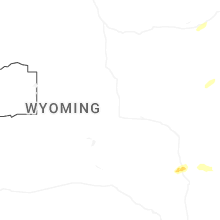
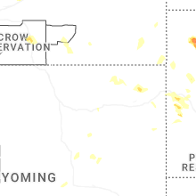
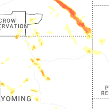
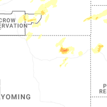
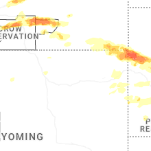
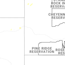
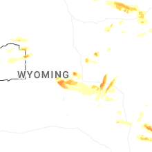


Connect with Interactive Hail Maps