

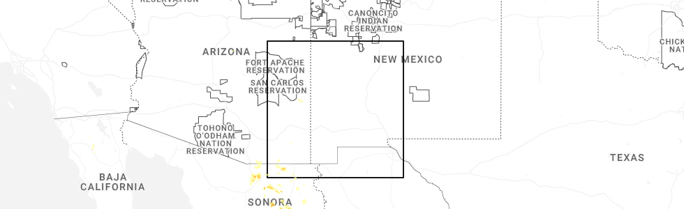
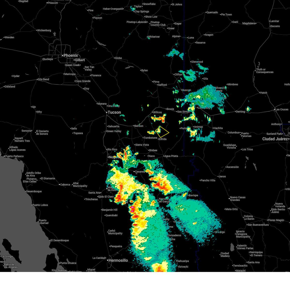
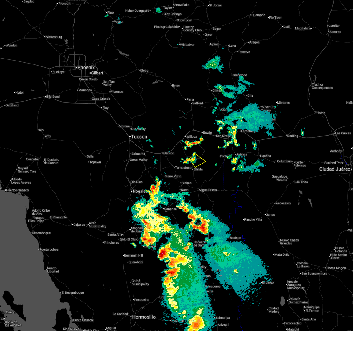
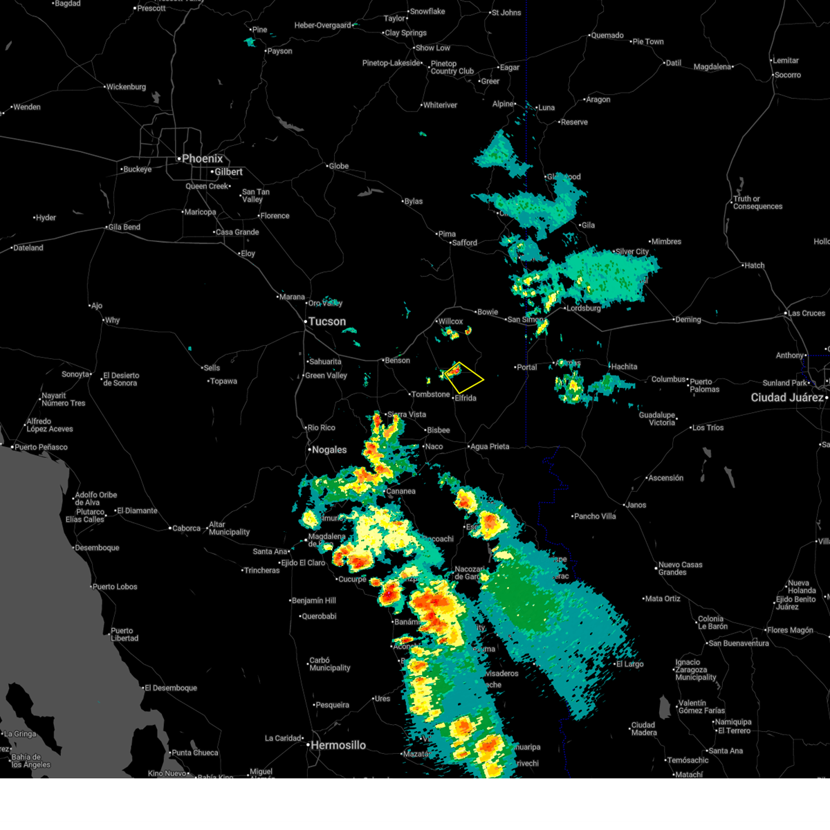
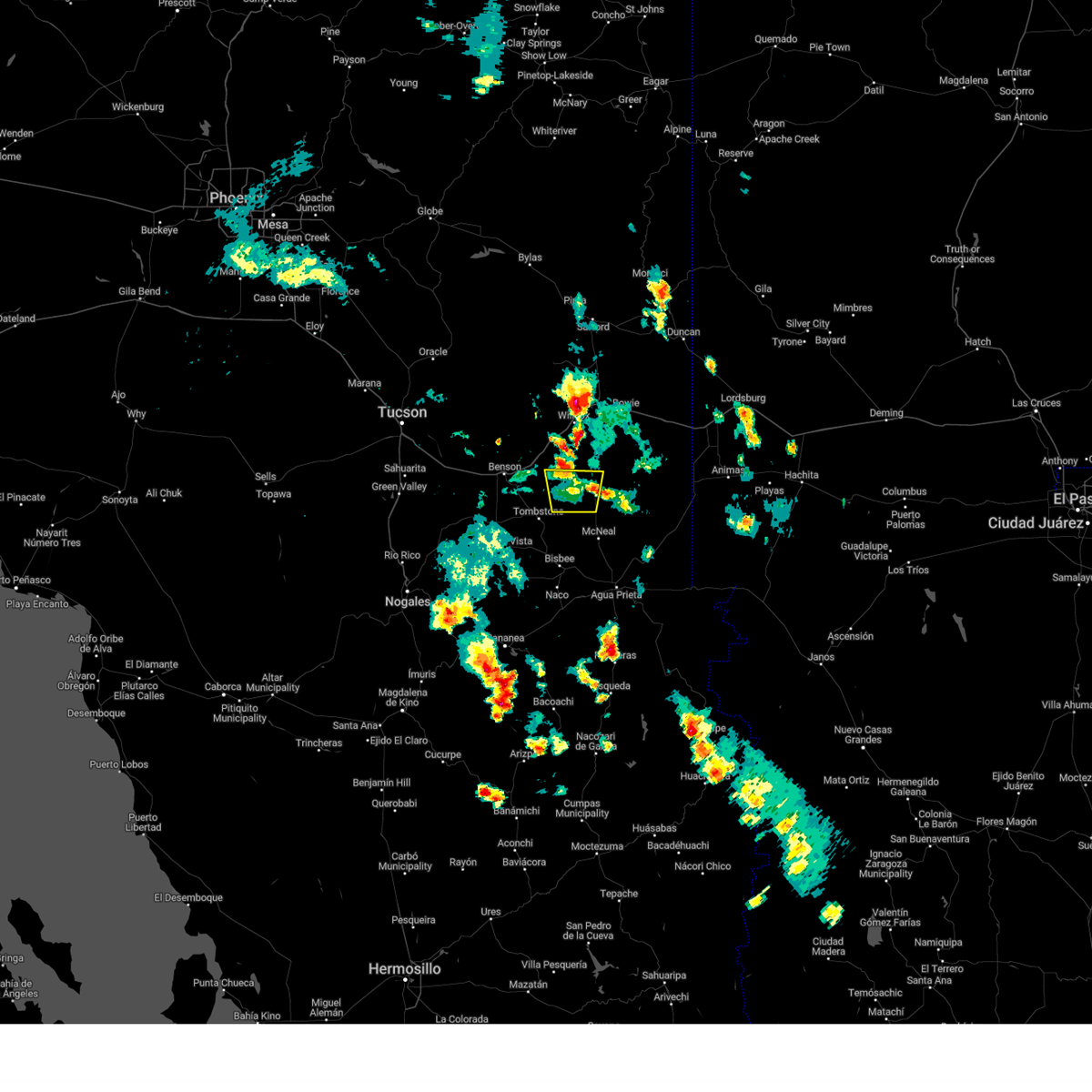
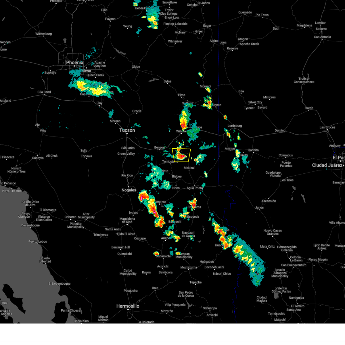
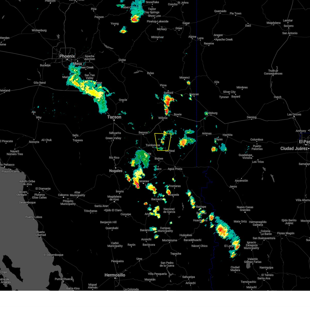
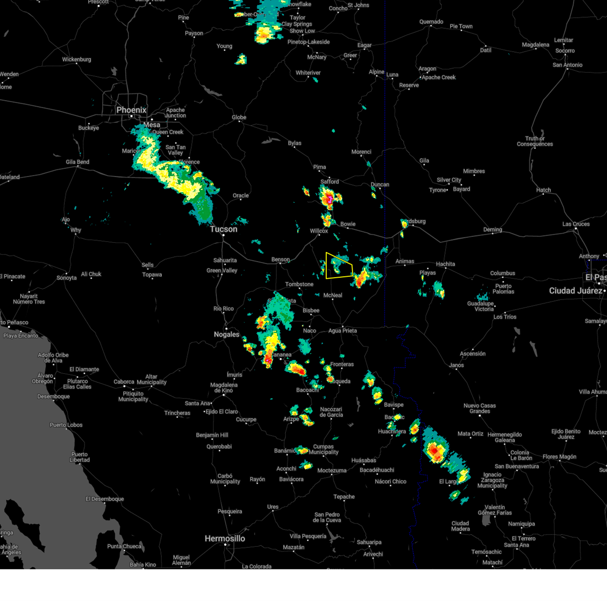
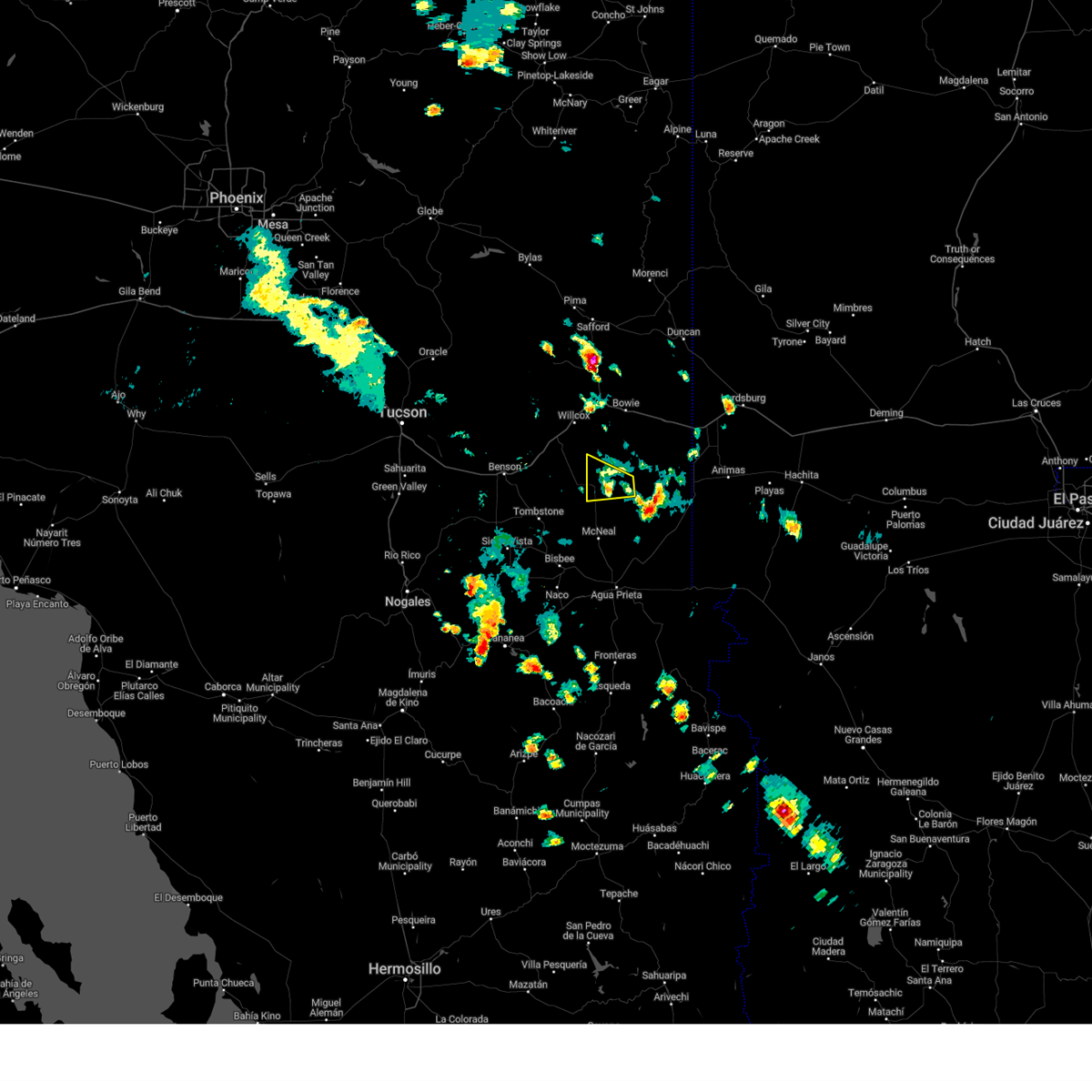
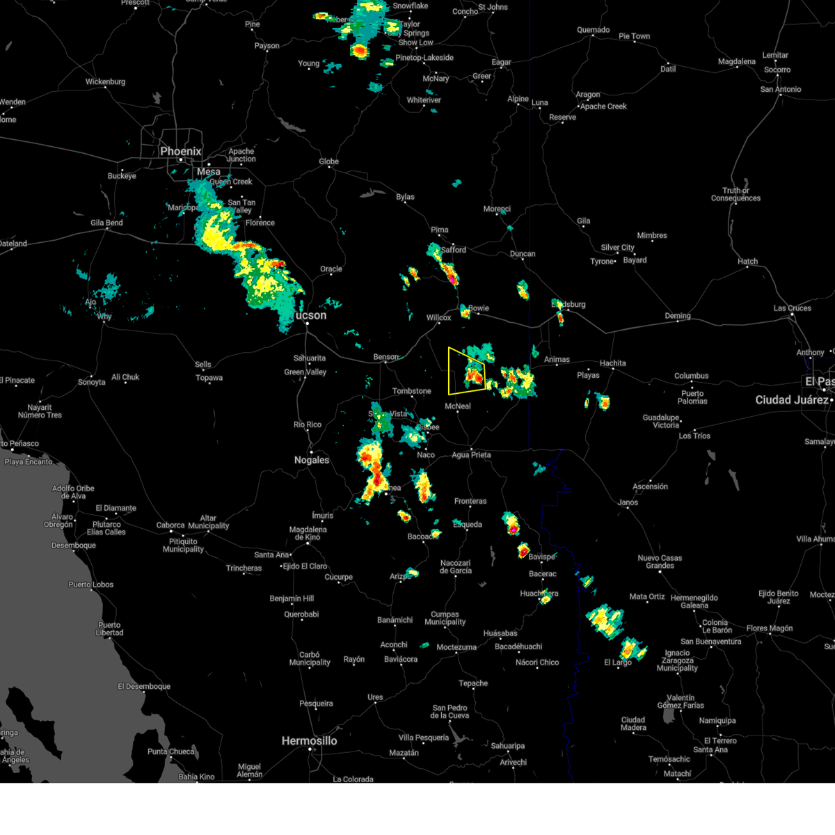
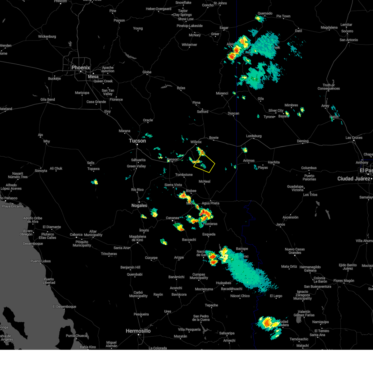
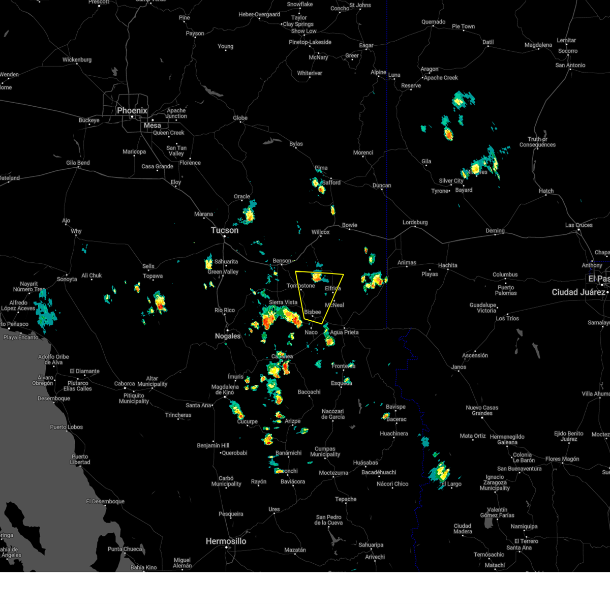
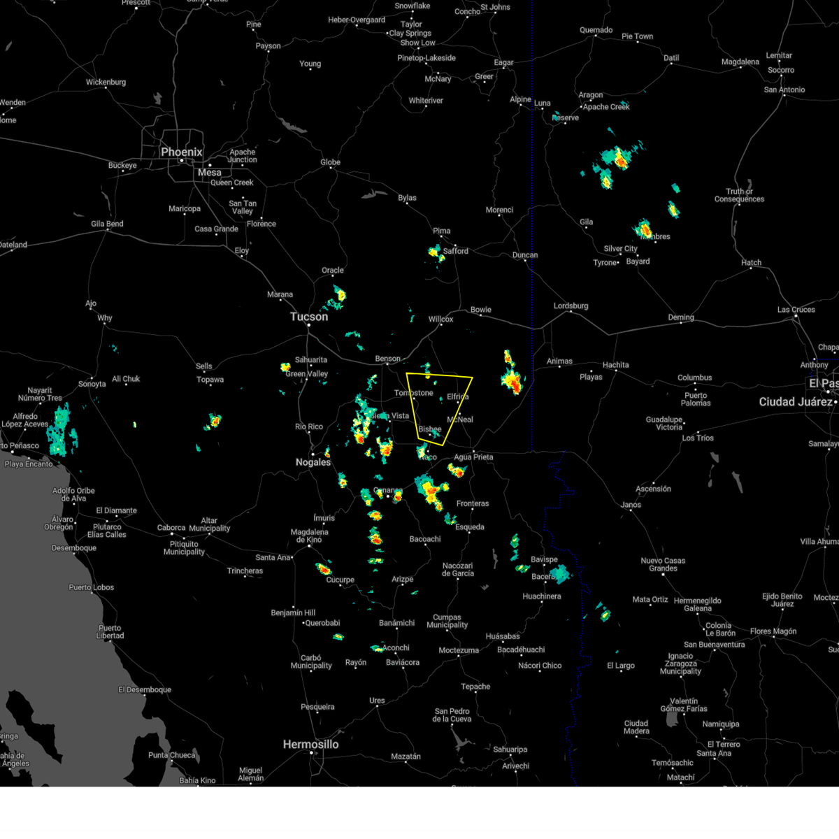
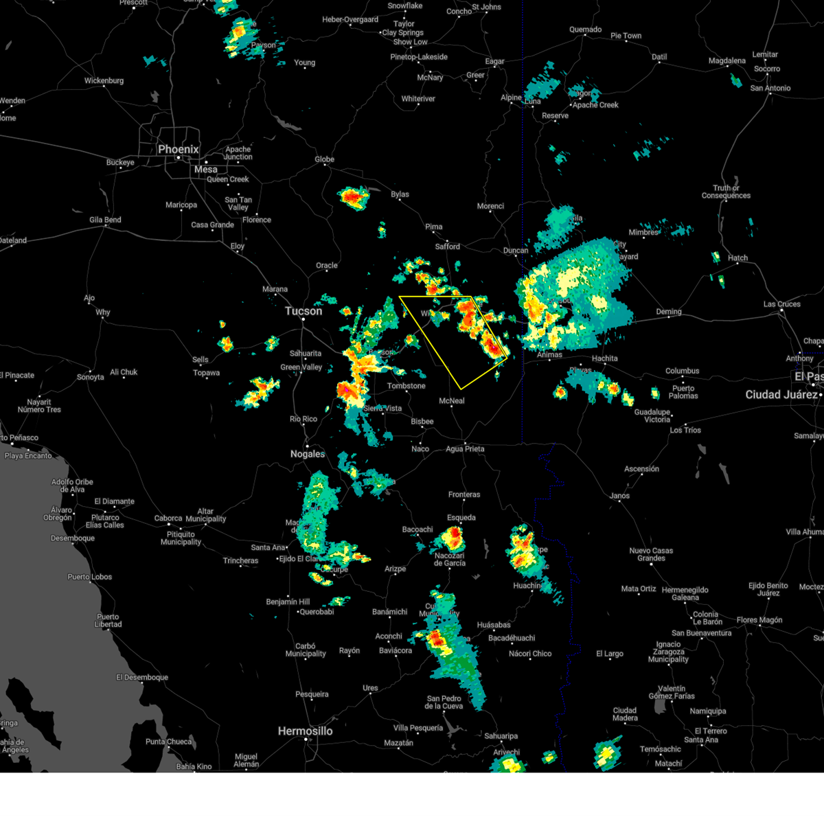
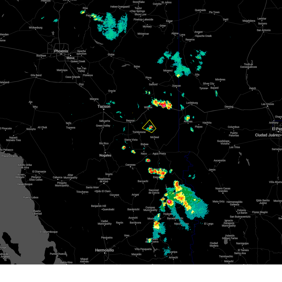
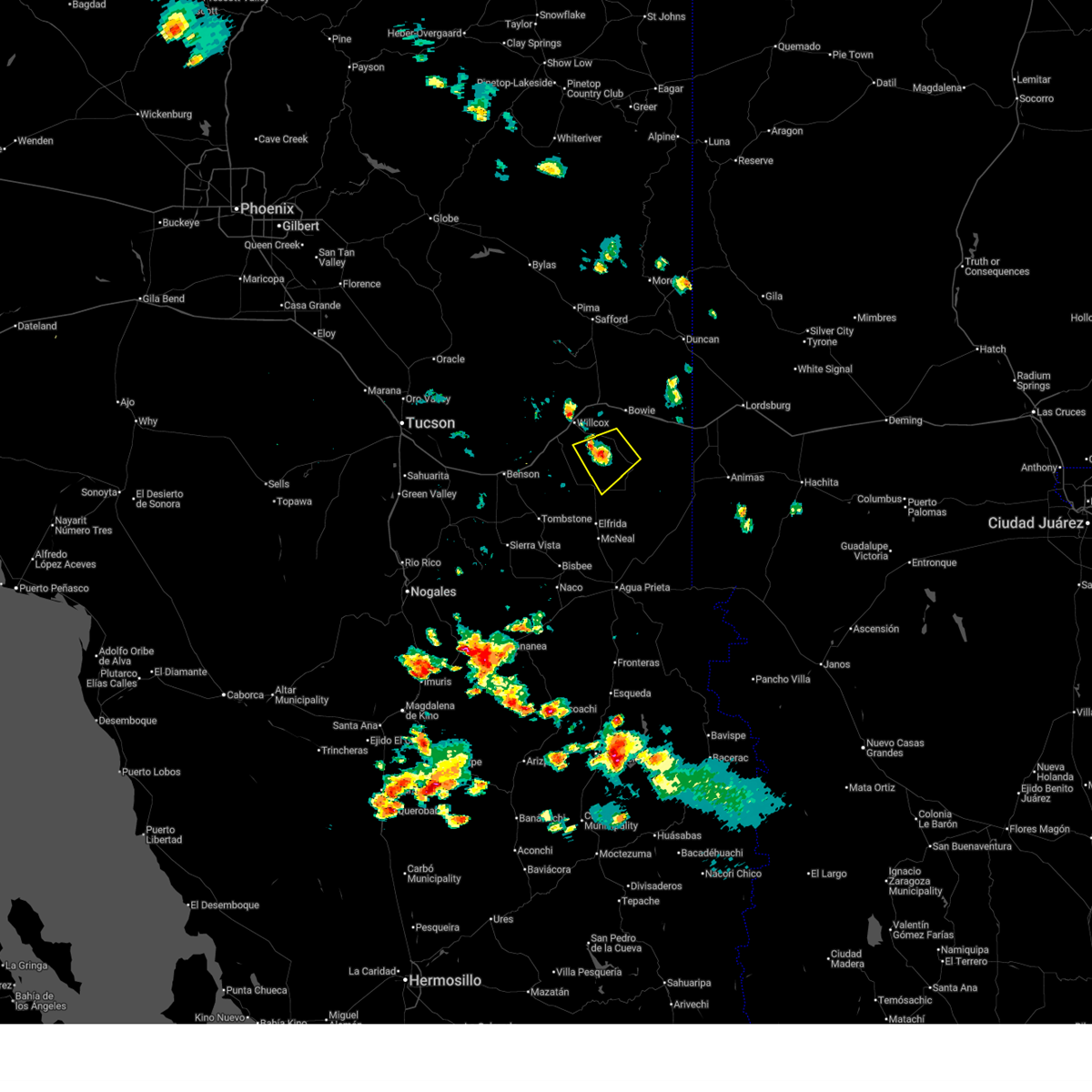
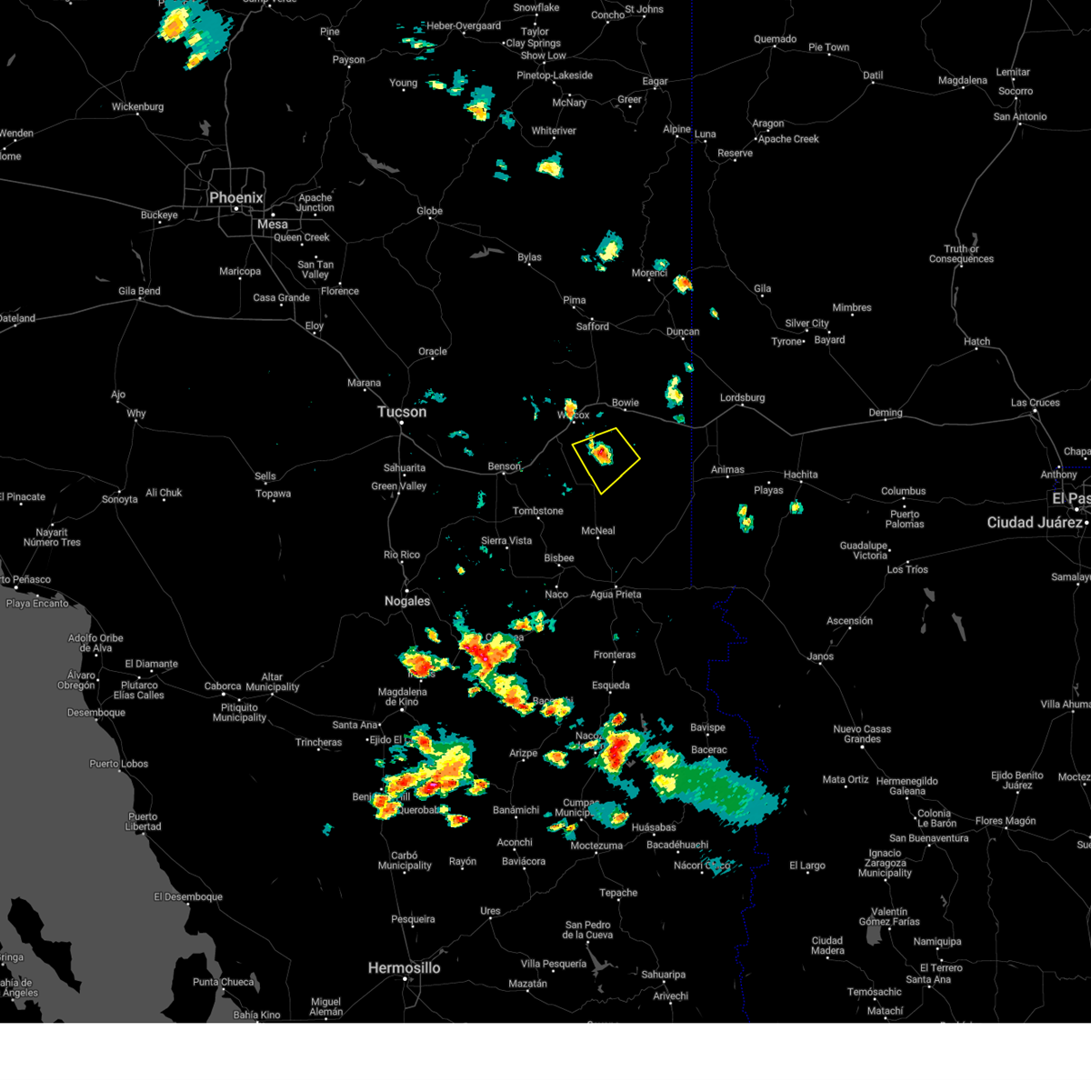
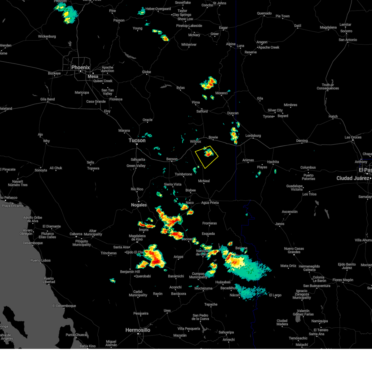
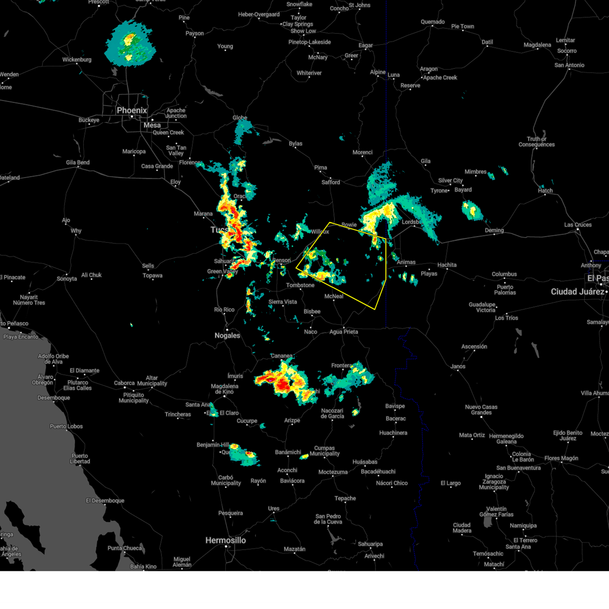
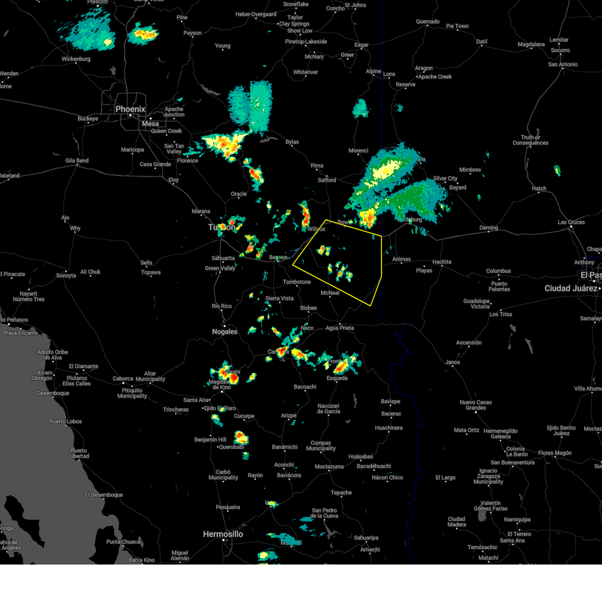
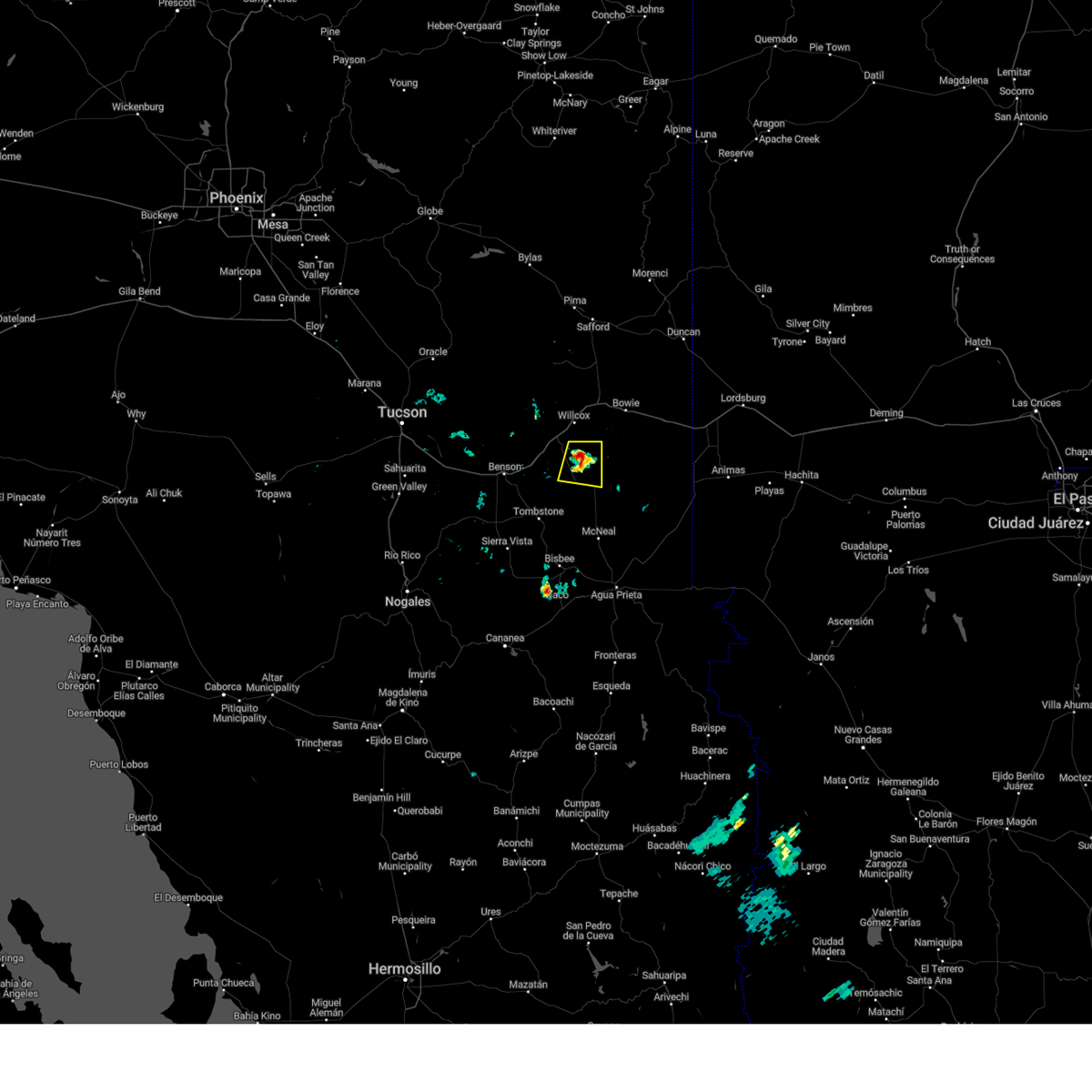
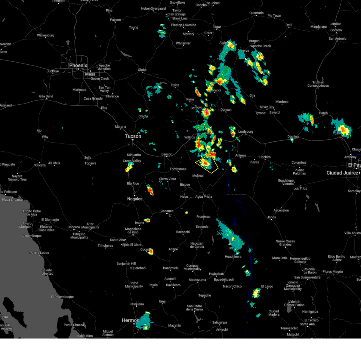
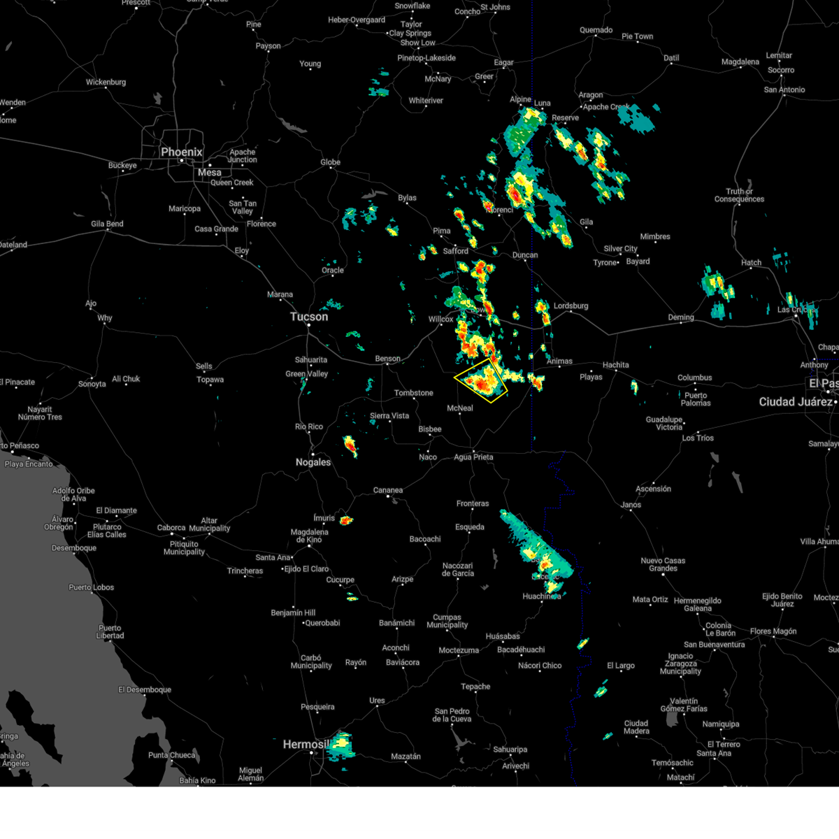
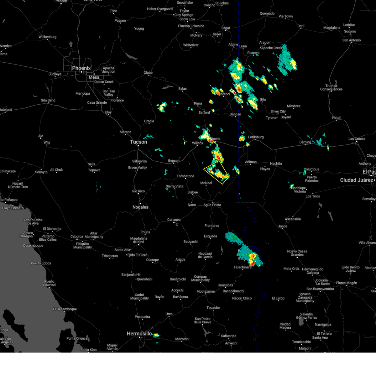
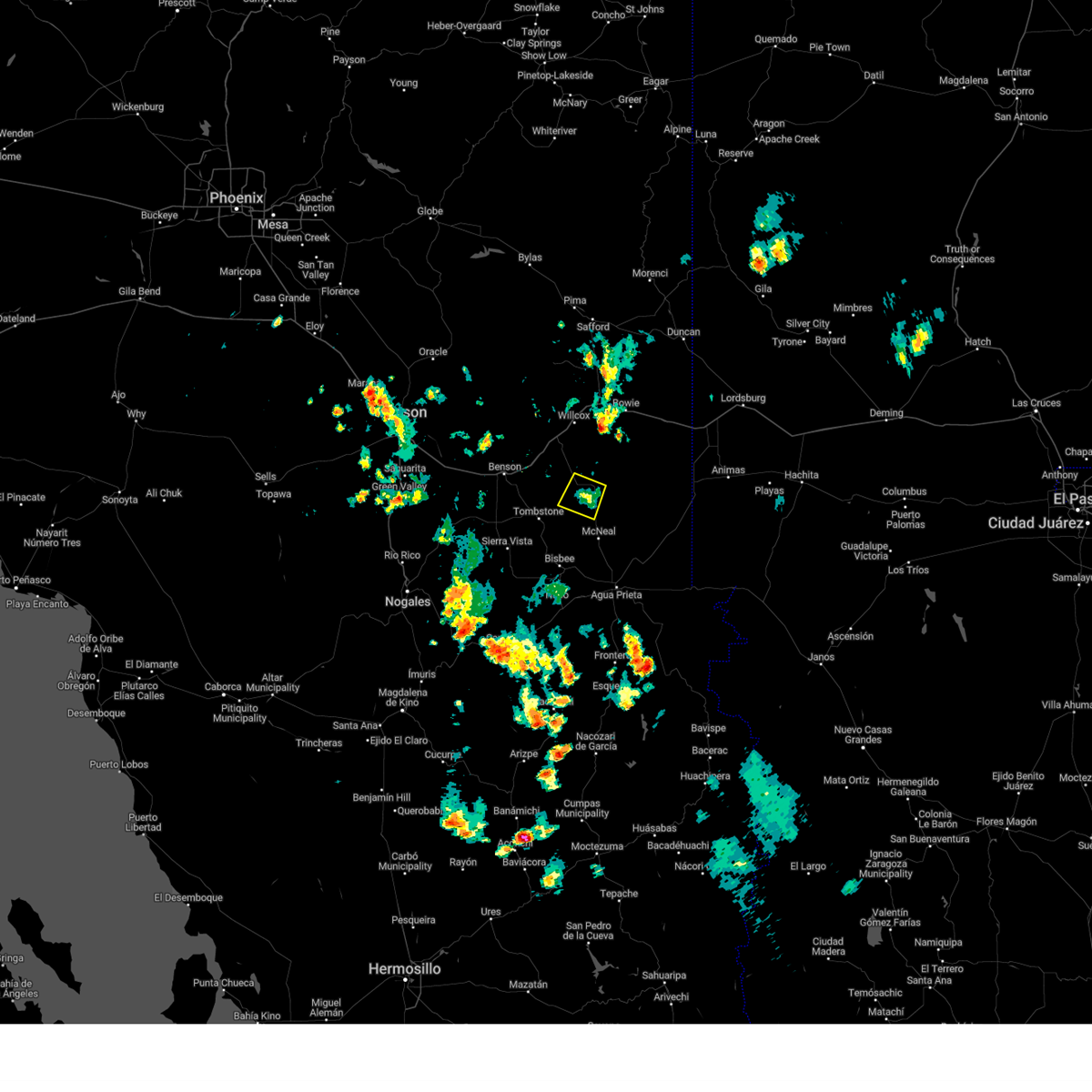
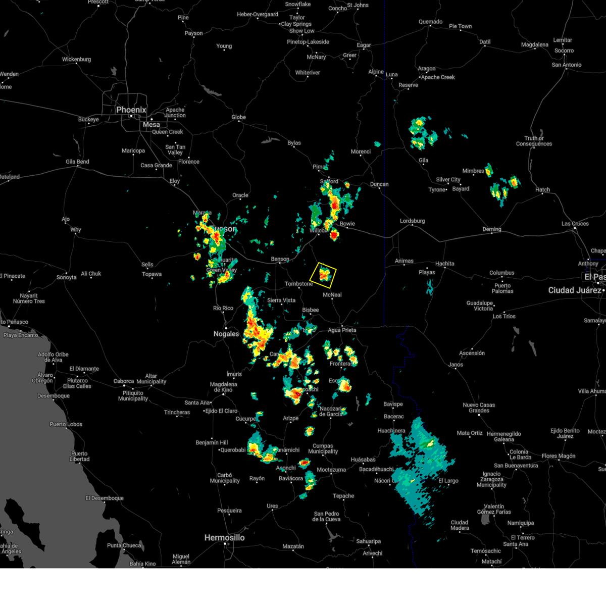
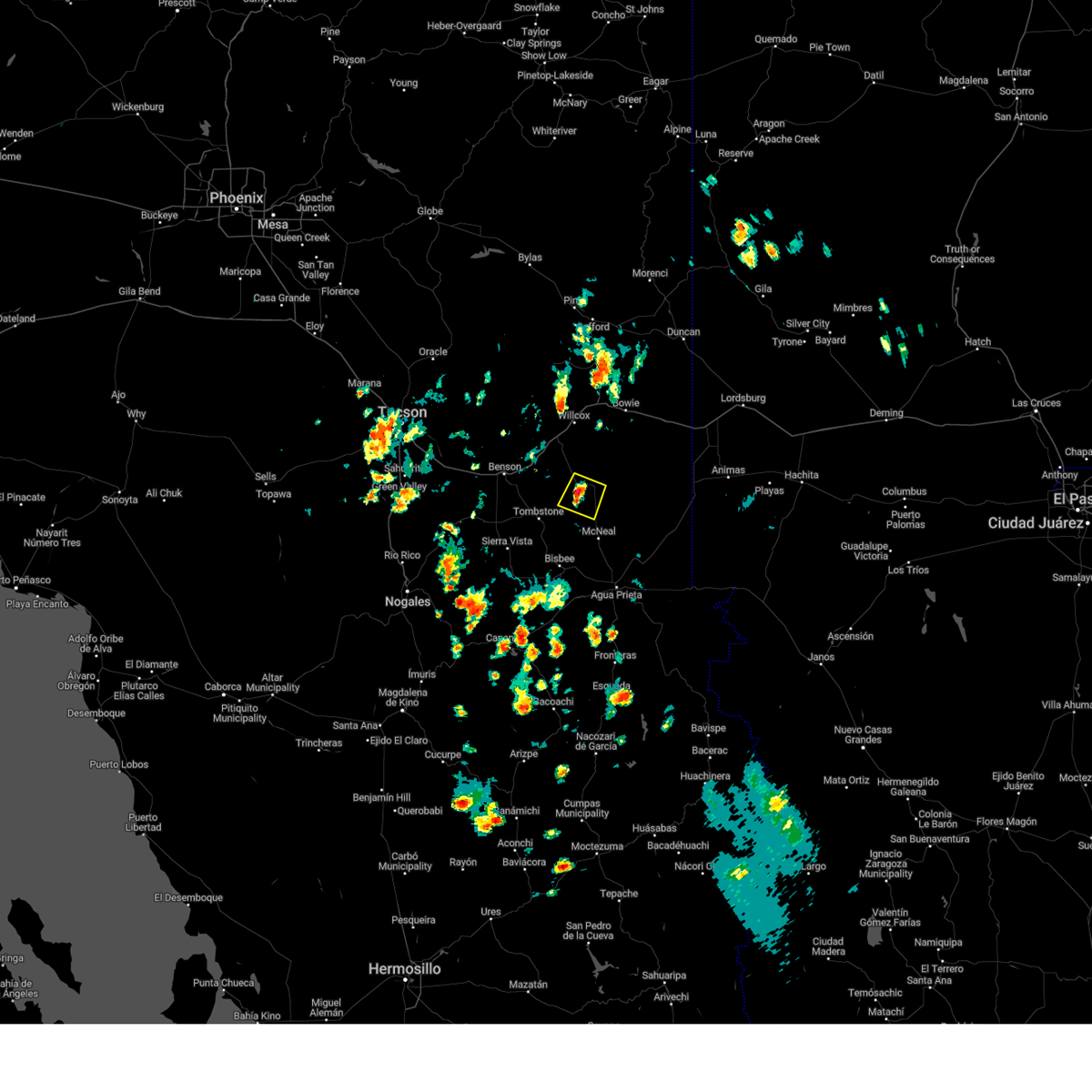
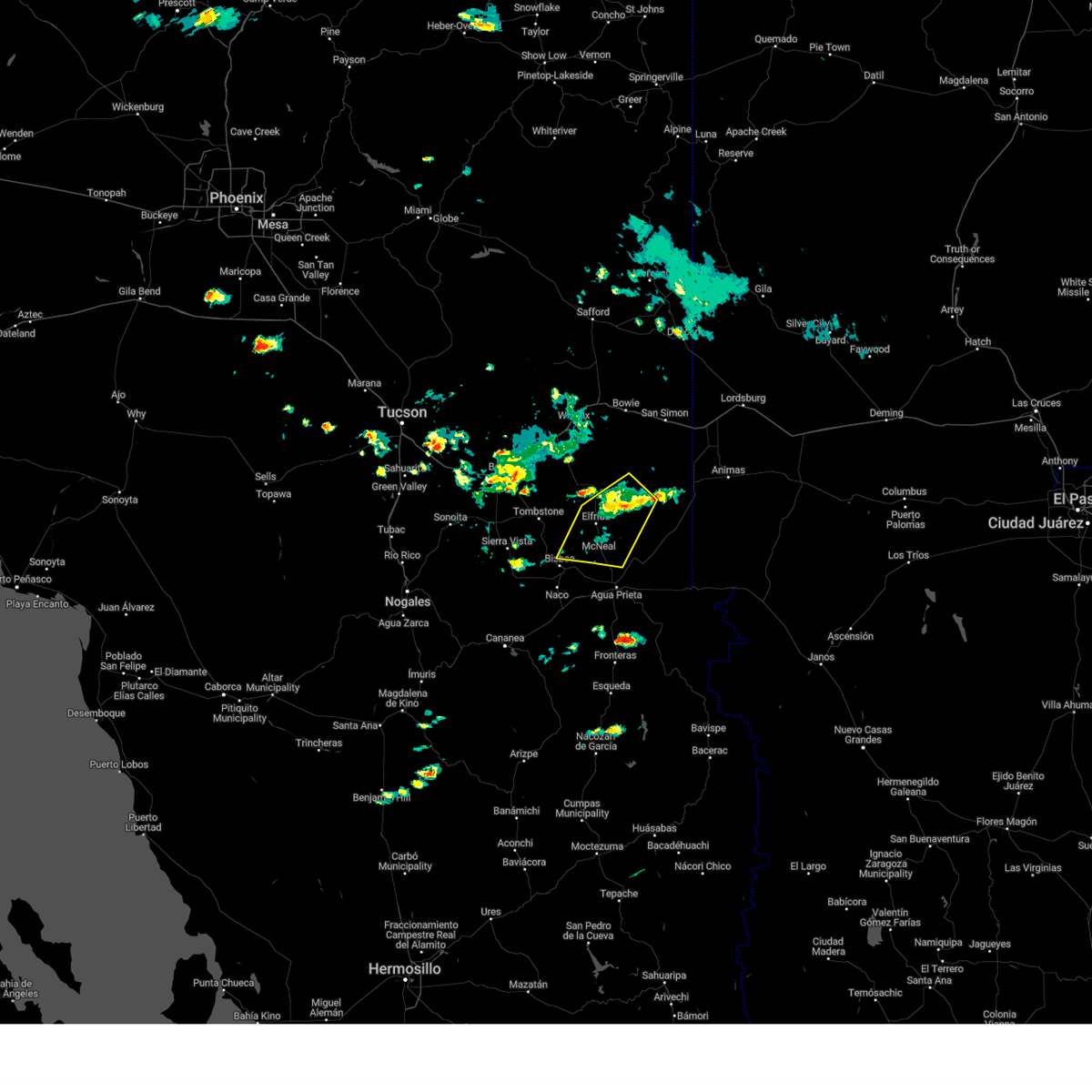
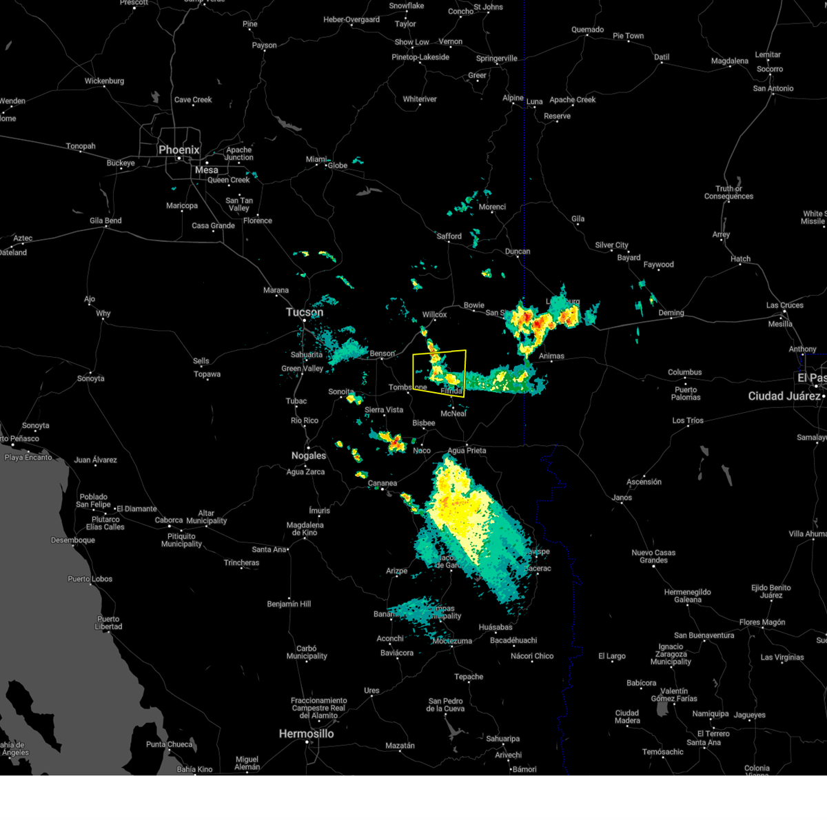
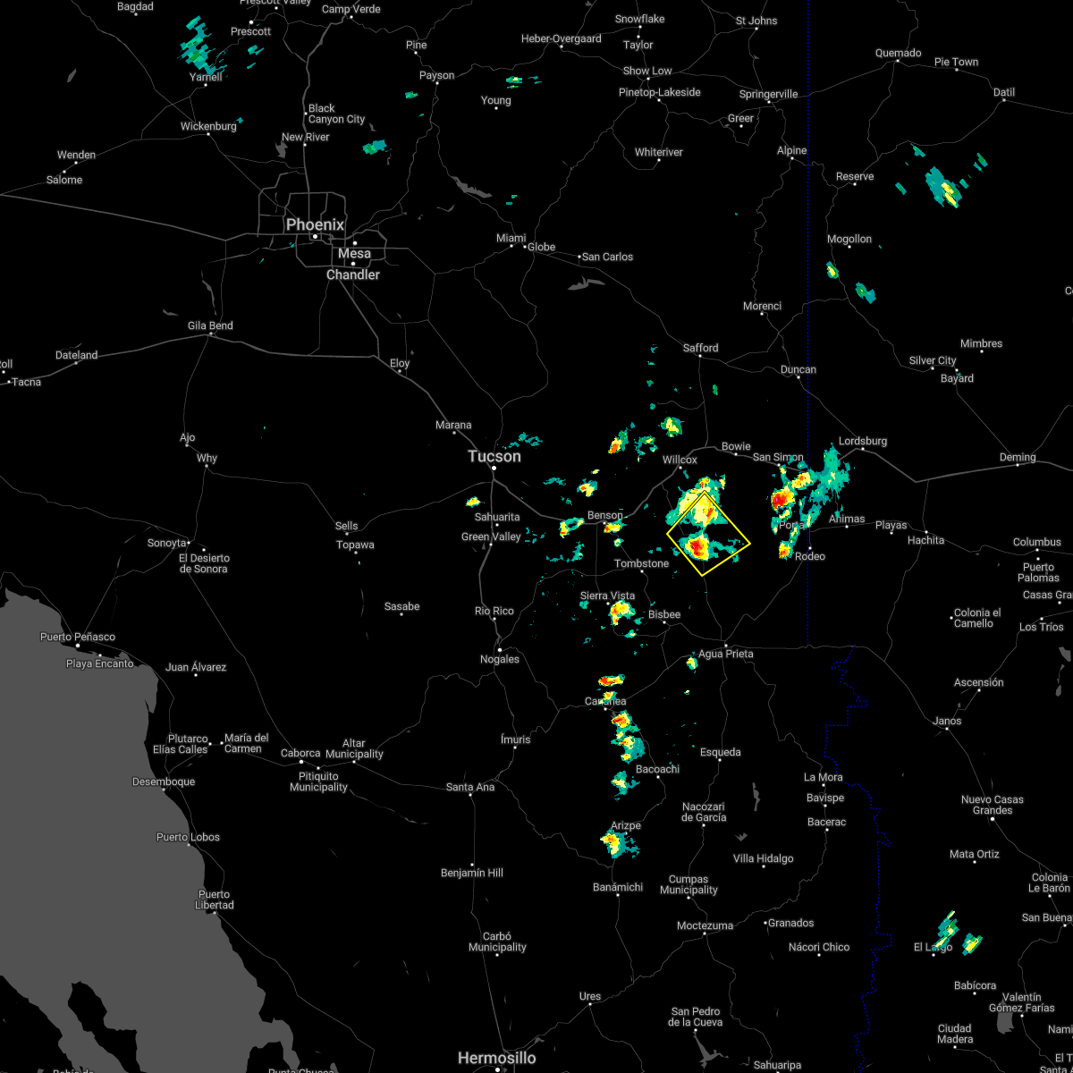
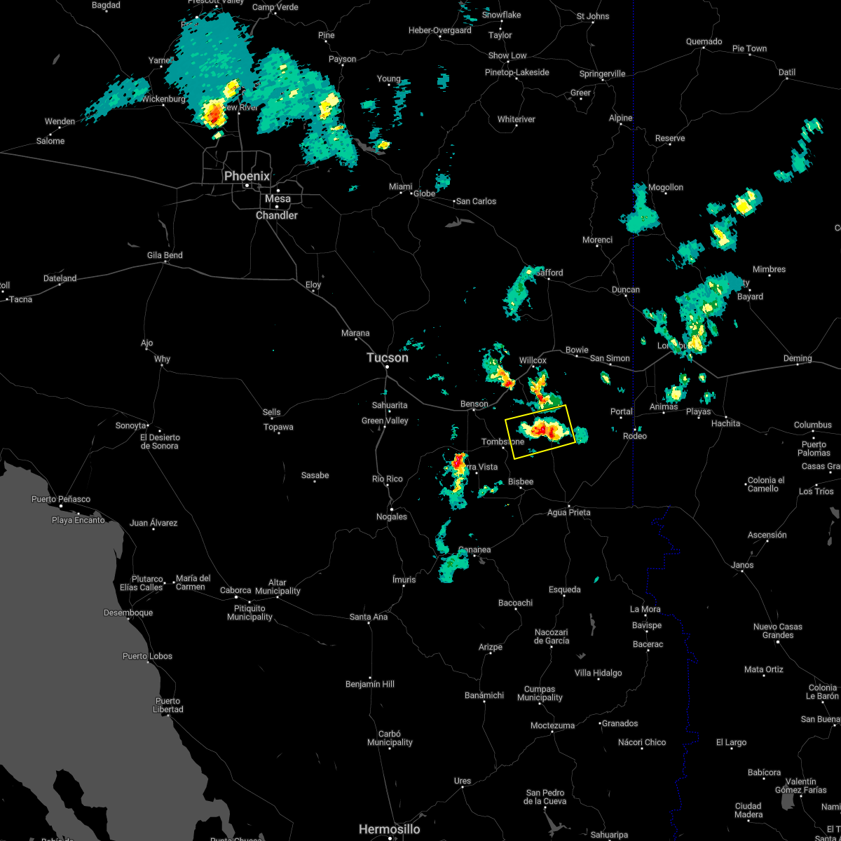
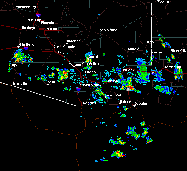
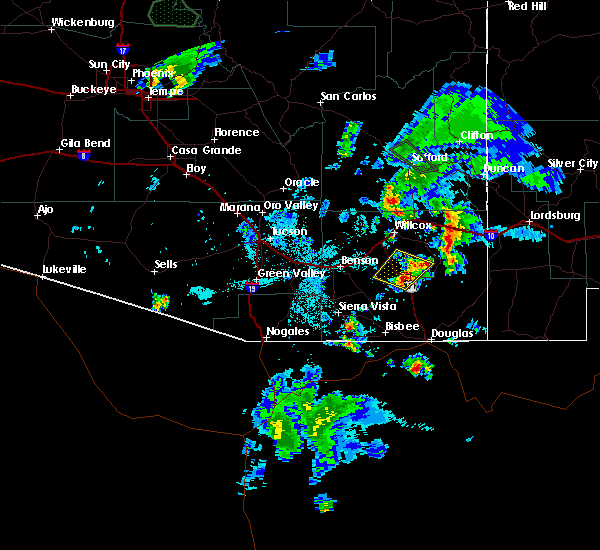
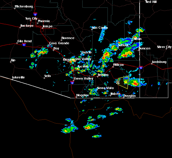
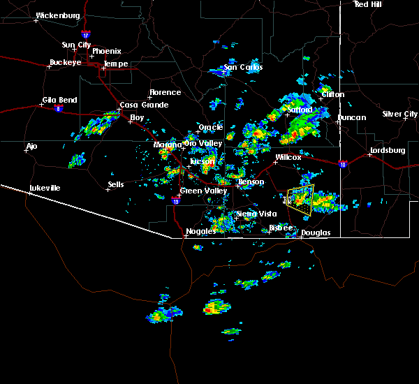
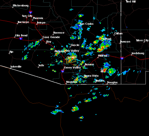
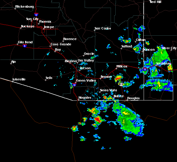
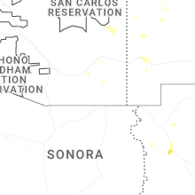
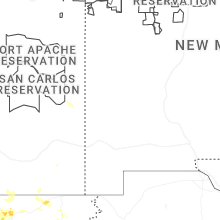
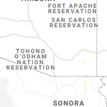
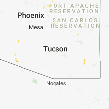
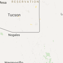
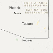
Hail Map for Sunizona, AZ
The Sunizona, AZ area has had 1 report of on-the-ground hail by trained spotters, and has been under severe weather warnings 7 times during the past 12 months. Doppler radar has detected hail at or near Sunizona, AZ on 29 occasions, including 5 occasions during the past year.
| Name: | Sunizona, AZ |
| Where Located: | 37.7 miles N of Douglas, AZ |
| Map: | Google Map for Sunizona, AZ |
| Population: | 281 |
| Housing Units: | 206 |
| More Info: | Search Google for Sunizona, AZ |
3
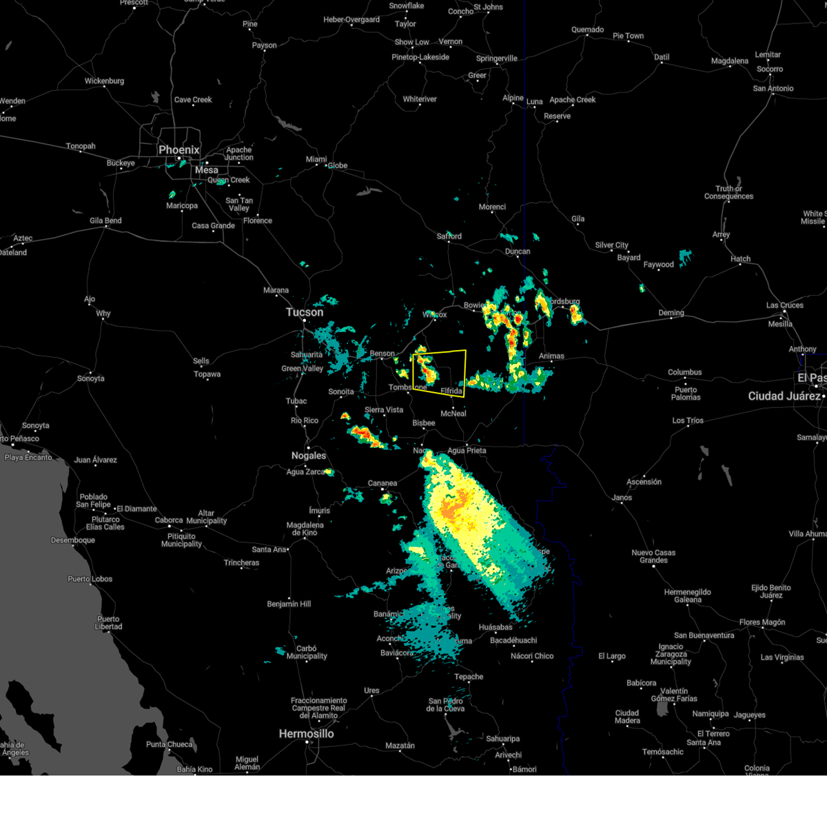
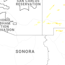
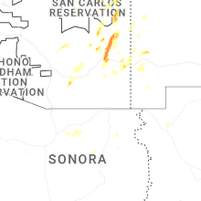
The Top Recent Hail Date for Sunizona, AZ is Saturday, August 9, 2025 (5th out of 29)
Hail and Wind Damage Spotted near Sunizona, AZ
| Date / Time | Report Details |
|---|---|
| 9/19/2025 3:15 PM MST | The storm which prompted the warning has weakened below severe limits, and no longer poses an immediate threat to life or property. therefore, the warning has been allowed to expire. however, gusty winds and brief heavy rain are still possible with this thunderstorm. |
| 9/19/2025 2:55 PM MST | At 255 pm mst, a severe thunderstorm was located 15 miles southeast of pearce-sunsites, moving east at 20 mph (radar indicated). Hazards include 60 mph wind gusts and quarter size hail. Hail damage to vehicles is expected. expect wind damage to roofs, siding, and trees. locations impacted include, sunizona. this includes the following highways, route 181 between mile markers 39 and 49. Route 191 between mile markers 26 and 43. |
| 9/19/2025 2:35 PM MST | Svrtwc the national weather service in tucson has issued a * severe thunderstorm warning for, central cochise county in southeastern arizona, * until 315 pm mst. * at 235 pm mst, a severe thunderstorm was located 12 miles southeast of pearce-sunsites, moving east at 20 mph (radar indicated). Hazards include 60 mph wind gusts and quarter size hail. Hail damage to vehicles is expected. Expect wind damage to roofs, siding, and trees. |
| 9/13/2025 12:44 PM MST | Svrtwc the national weather service in tucson has issued a * severe thunderstorm warning for, northeastern cochise county in southeastern arizona, * until 130 pm mst. * at 1244 pm mst, severe thunderstorms were located along a line from 12 miles north of chiricahua national monument to 11 miles southwest of chiricahua national monument, moving east at 25 mph (radar indicated). Hazards include 60 mph wind gusts and quarter size hail. Hail damage to vehicles is expected. Expect wind damage to roofs, siding, and trees. |
| 8/9/2025 7:10 PM MST |
 The storm which prompted the warning has weakened below severe limits, and no longer poses an immediate threat to life or property. therefore, the warning will be allowed to expire. The storm which prompted the warning has weakened below severe limits, and no longer poses an immediate threat to life or property. therefore, the warning will be allowed to expire.
|
| 8/9/2025 6:51 PM MST |
 At 651 pm mst, a severe thunderstorm was located 19 miles southwest of chiricahua national monument, moving southeast at 10 mph (radar indicated). Hazards include 60 mph wind gusts and small hail. Expect damage to roofs, siding, and trees. locations impacted include, sunizona. this includes the following highways, route 181 between mile markers 39 and 49. Route 191 between mile markers 32 and 39. At 651 pm mst, a severe thunderstorm was located 19 miles southwest of chiricahua national monument, moving southeast at 10 mph (radar indicated). Hazards include 60 mph wind gusts and small hail. Expect damage to roofs, siding, and trees. locations impacted include, sunizona. this includes the following highways, route 181 between mile markers 39 and 49. Route 191 between mile markers 32 and 39.
|
| 8/9/2025 6:29 PM MST |
 Svrtwc the national weather service in tucson has issued a * severe thunderstorm warning for, central cochise county in southeastern arizona, * until 715 pm mst. * at 629 pm mst, a severe thunderstorm was located 15 miles east of pearce-sunsites, moving southeast at 10 mph (radar indicated). Hazards include 60 mph wind gusts and small hail. expect damage to roofs, siding, and trees Svrtwc the national weather service in tucson has issued a * severe thunderstorm warning for, central cochise county in southeastern arizona, * until 715 pm mst. * at 629 pm mst, a severe thunderstorm was located 15 miles east of pearce-sunsites, moving southeast at 10 mph (radar indicated). Hazards include 60 mph wind gusts and small hail. expect damage to roofs, siding, and trees
|
| 8/21/2024 3:14 PM MST |
 The storm which prompted the warning has weakened below severe limits, and no longer poses an immediate threat to life or property. therefore, the warning will be allowed to expire. The storm which prompted the warning has weakened below severe limits, and no longer poses an immediate threat to life or property. therefore, the warning will be allowed to expire.
|
| 8/21/2024 2:57 PM MST |
 At 257 pm mst, a severe thunderstorm was located near pearce-sunsites, or 25 miles south of willcox, moving north at 15 mph (radar indicated). Hazards include 60 mph wind gusts and quarter size hail. Hail damage to vehicles is expected. expect wind damage to roofs, siding, and trees. locations impacted include, pearce-sunsites and sunizona. this includes the following highways, route 181 between mile markers 39 and 40. Route 191 between mile markers 30 and 51. At 257 pm mst, a severe thunderstorm was located near pearce-sunsites, or 25 miles south of willcox, moving north at 15 mph (radar indicated). Hazards include 60 mph wind gusts and quarter size hail. Hail damage to vehicles is expected. expect wind damage to roofs, siding, and trees. locations impacted include, pearce-sunsites and sunizona. this includes the following highways, route 181 between mile markers 39 and 40. Route 191 between mile markers 30 and 51.
|
| 8/21/2024 2:27 PM MST |
 Svrtwc the national weather service in tucson has issued a * severe thunderstorm warning for, central cochise county in southeastern arizona, * until 315 pm mst. * at 227 pm mst, a severe thunderstorm was located 13 miles east of tombstone, or 23 miles north of bisbee, moving north at 15 mph (radar indicated). Hazards include 60 mph wind gusts and quarter size hail. Hail damage to vehicles is expected. Expect wind damage to roofs, siding, and trees. Svrtwc the national weather service in tucson has issued a * severe thunderstorm warning for, central cochise county in southeastern arizona, * until 315 pm mst. * at 227 pm mst, a severe thunderstorm was located 13 miles east of tombstone, or 23 miles north of bisbee, moving north at 15 mph (radar indicated). Hazards include 60 mph wind gusts and quarter size hail. Hail damage to vehicles is expected. Expect wind damage to roofs, siding, and trees.
|
| 8/21/2024 2:16 PM MST |
 the severe thunderstorm warning has been cancelled and is no longer in effect the severe thunderstorm warning has been cancelled and is no longer in effect
|
| 8/21/2024 2:03 PM MST |
 At 203 pm mst, a severe thunderstorm was located 14 miles east of pearce-sunsites, or 28 miles southeast of willcox, moving west at 10 mph (radar indicated). Hazards include 60 mph wind gusts and quarter size hail. Hail damage to vehicles is expected. expect wind damage to roofs, siding, and trees. locations impacted include, sunizona. this includes the following highways, route 181 between mile markers 39 and 57. Route 191 between mile markers 34 and 42. At 203 pm mst, a severe thunderstorm was located 14 miles east of pearce-sunsites, or 28 miles southeast of willcox, moving west at 10 mph (radar indicated). Hazards include 60 mph wind gusts and quarter size hail. Hail damage to vehicles is expected. expect wind damage to roofs, siding, and trees. locations impacted include, sunizona. this includes the following highways, route 181 between mile markers 39 and 57. Route 191 between mile markers 34 and 42.
|
| 8/21/2024 1:45 PM MST |
 Svrtwc the national weather service in tucson has issued a * severe thunderstorm warning for, central cochise county in southeastern arizona, * until 230 pm mst. * at 145 pm mst, a severe thunderstorm was located 17 miles southwest of chiricahua national monument, or 30 miles southeast of willcox, moving west at 10 mph (radar indicated). Hazards include 60 mph wind gusts and quarter size hail. Hail damage to vehicles is expected. Expect wind damage to roofs, siding, and trees. Svrtwc the national weather service in tucson has issued a * severe thunderstorm warning for, central cochise county in southeastern arizona, * until 230 pm mst. * at 145 pm mst, a severe thunderstorm was located 17 miles southwest of chiricahua national monument, or 30 miles southeast of willcox, moving west at 10 mph (radar indicated). Hazards include 60 mph wind gusts and quarter size hail. Hail damage to vehicles is expected. Expect wind damage to roofs, siding, and trees.
|
| 8/16/2024 5:14 PM MST |
 the severe thunderstorm warning has been cancelled and is no longer in effect the severe thunderstorm warning has been cancelled and is no longer in effect
|
| 8/16/2024 4:45 PM MST |
 Svrtwc the national weather service in tucson has issued a * severe thunderstorm warning for, central cochise county in southeastern arizona, * until 530 pm mst. * at 445 pm mst, a severe thunderstorm was located 16 miles east of pearce-sunsites, or 27 miles southeast of willcox, moving northwest at 10 mph (radar indicated). Hazards include 60 mph wind gusts and quarter size hail. Hail damage to vehicles is expected. Expect wind damage to roofs, siding, and trees. Svrtwc the national weather service in tucson has issued a * severe thunderstorm warning for, central cochise county in southeastern arizona, * until 530 pm mst. * at 445 pm mst, a severe thunderstorm was located 16 miles east of pearce-sunsites, or 27 miles southeast of willcox, moving northwest at 10 mph (radar indicated). Hazards include 60 mph wind gusts and quarter size hail. Hail damage to vehicles is expected. Expect wind damage to roofs, siding, and trees.
|
| 7/28/2024 1:08 PM MST |
 The storm which prompted the warning has weakened below severe limits, and no longer poses an immediate threat to life or property. therefore, the warning will be allowed to expire. The storm which prompted the warning has weakened below severe limits, and no longer poses an immediate threat to life or property. therefore, the warning will be allowed to expire.
|
| 7/28/2024 12:27 PM MST |
 Svrtwc the national weather service in tucson has issued a * severe thunderstorm warning for, south central cochise county in southeastern arizona, * until 115 pm mst. * at 1226 pm mst, two severe thunderstorma were located near bisbee and tombstone, moving north at 5 mph (radar indicated). Hazards include 60 mph wind gusts. expect damage to roofs, siding, and trees Svrtwc the national weather service in tucson has issued a * severe thunderstorm warning for, south central cochise county in southeastern arizona, * until 115 pm mst. * at 1226 pm mst, two severe thunderstorma were located near bisbee and tombstone, moving north at 5 mph (radar indicated). Hazards include 60 mph wind gusts. expect damage to roofs, siding, and trees
|
| 7/20/2024 5:19 PM MST |
 At 519 pm mst, severe thunderstorms were located along a line extending from near willcox to chiricahua national monument, moving southwest at 15 mph (radar indicated). Hazards include 60 mph wind gusts. Expect damage to roofs, siding, and trees. locations impacted include, willcox, chiricahua national monument, sunizona, and kansas settlement. this includes the following highways, interstate 10 between mile markers 333 and 358. route 181 between mile markers 39 and 64. route 186 between mile markers 327 and 359. Route 191 between mile markers 37 and 40, and between mile markers 88 and 91. At 519 pm mst, severe thunderstorms were located along a line extending from near willcox to chiricahua national monument, moving southwest at 15 mph (radar indicated). Hazards include 60 mph wind gusts. Expect damage to roofs, siding, and trees. locations impacted include, willcox, chiricahua national monument, sunizona, and kansas settlement. this includes the following highways, interstate 10 between mile markers 333 and 358. route 181 between mile markers 39 and 64. route 186 between mile markers 327 and 359. Route 191 between mile markers 37 and 40, and between mile markers 88 and 91.
|
| 7/20/2024 4:53 PM MST |
 Svrtwc the national weather service in tucson has issued a * severe thunderstorm warning for, northeastern cochise county in southeastern arizona, * until 545 pm mst. * at 453 pm mst, severe thunderstorms were located along a line extending from 10 miles west of bowie to near chiricahua national monument, moving west and southwest at 15 mph (radar indicated). Hazards include 60 mph wind gusts. expect damage to roofs, siding, and trees Svrtwc the national weather service in tucson has issued a * severe thunderstorm warning for, northeastern cochise county in southeastern arizona, * until 545 pm mst. * at 453 pm mst, severe thunderstorms were located along a line extending from 10 miles west of bowie to near chiricahua national monument, moving west and southwest at 15 mph (radar indicated). Hazards include 60 mph wind gusts. expect damage to roofs, siding, and trees
|
| 7/16/2024 6:14 PM MST |
 Svrtwc the national weather service in tucson has issued a * severe thunderstorm warning for, central cochise county in southeastern arizona, * until 700 pm mst. * at 614 pm mst, a severe thunderstorm was located 8 miles southeast of pearce-sunsites, or 26 miles south of willcox, moving northwest at 10 mph (radar indicated). Hazards include 60 mph wind gusts and quarter size hail. Hail damage to vehicles is expected. Expect wind damage to roofs, siding, and trees. Svrtwc the national weather service in tucson has issued a * severe thunderstorm warning for, central cochise county in southeastern arizona, * until 700 pm mst. * at 614 pm mst, a severe thunderstorm was located 8 miles southeast of pearce-sunsites, or 26 miles south of willcox, moving northwest at 10 mph (radar indicated). Hazards include 60 mph wind gusts and quarter size hail. Hail damage to vehicles is expected. Expect wind damage to roofs, siding, and trees.
|
| 7/15/2024 3:12 PM MST |
 The storm which prompted the warning has moved out of the area. therefore, the warning will be allowed to expire. remember, a severe thunderstorm warning still remains in effect for cochise county until 4:00 pm mst. The storm which prompted the warning has moved out of the area. therefore, the warning will be allowed to expire. remember, a severe thunderstorm warning still remains in effect for cochise county until 4:00 pm mst.
|
| 7/15/2024 2:52 PM MST |
 At 251 pm mst, a severe thunderstorm was located 13 miles east of pearce-sunsites, or 18 miles southeast of willcox,near dos cabezas and kansas settlement, moving southwest at 15 mph (radar indicated). Hazards include 60 mph wind gusts and quarter size hail. Hail damage to vehicles is expected. expect wind damage to roofs, siding, and trees. locations impacted include, sunizona and kansas settlement. this includes the following highways, route 181 between mile markers 40 and 43. Route 186 between mile markers 340 and 359. At 251 pm mst, a severe thunderstorm was located 13 miles east of pearce-sunsites, or 18 miles southeast of willcox,near dos cabezas and kansas settlement, moving southwest at 15 mph (radar indicated). Hazards include 60 mph wind gusts and quarter size hail. Hail damage to vehicles is expected. expect wind damage to roofs, siding, and trees. locations impacted include, sunizona and kansas settlement. this includes the following highways, route 181 between mile markers 40 and 43. Route 186 between mile markers 340 and 359.
|
| 7/15/2024 2:30 PM MST |
 Svrtwc the national weather service in tucson has issued a * severe thunderstorm warning for, north central cochise county in southeastern arizona, * until 315 pm mst. * at 228 pm mst, a severe thunderstorm was located 15 miles west of chiricahua national monument, or 18 miles southeast of willcox, near dos cabezas and kansas settlement, moving southwest at 15 mph (radar indicated). Hazards include 60 mph wind gusts and quarter size hail. Hail damage to vehicles is expected. Expect wind damage to roofs, siding, and trees. Svrtwc the national weather service in tucson has issued a * severe thunderstorm warning for, north central cochise county in southeastern arizona, * until 315 pm mst. * at 228 pm mst, a severe thunderstorm was located 15 miles west of chiricahua national monument, or 18 miles southeast of willcox, near dos cabezas and kansas settlement, moving southwest at 15 mph (radar indicated). Hazards include 60 mph wind gusts and quarter size hail. Hail damage to vehicles is expected. Expect wind damage to roofs, siding, and trees.
|
| 7/11/2024 5:04 PM MST |
 the severe thunderstorm warning has been cancelled and is no longer in effect the severe thunderstorm warning has been cancelled and is no longer in effect
|
| 7/11/2024 4:12 PM MST |
 Svrtwc the national weather service in tucson has issued a * severe thunderstorm warning for, northeastern cochise county in southeastern arizona, * until 515 pm mst. * at 411 pm mst, severe thunderstorms were located along a line extending from 9 miles east of willcox to 7 miles north of portal, moving southwest at 15 mph (radar indicated). Hazards include 60 mph wind gusts and areas of blowing dust. expect damage to roofs, siding, and trees Svrtwc the national weather service in tucson has issued a * severe thunderstorm warning for, northeastern cochise county in southeastern arizona, * until 515 pm mst. * at 411 pm mst, severe thunderstorms were located along a line extending from 9 miles east of willcox to 7 miles north of portal, moving southwest at 15 mph (radar indicated). Hazards include 60 mph wind gusts and areas of blowing dust. expect damage to roofs, siding, and trees
|
| 7/4/2024 4:41 PM MST |
 The storm which prompted the warning has weakened below severe limits, and no longer poses an immediate threat to life or property. therefore, the warning will be allowed to expire. however, gusty winds and heavy rain are still possible with this thunderstorm. The storm which prompted the warning has weakened below severe limits, and no longer poses an immediate threat to life or property. therefore, the warning will be allowed to expire. however, gusty winds and heavy rain are still possible with this thunderstorm.
|
| 7/4/2024 4:28 PM MST |
 At 428 pm mst, a severe thunderstorm was located 7 miles northeast of pearce-sunsites, or 15 miles south of willcox, moving south at 5 mph (radar indicated). Hazards include 60 mph wind gusts and quarter size hail. Hail damage to vehicles is expected. expect wind damage to roofs, siding, and trees. locations impacted include, pearce-sunsites, sunizona, and kansas settlement. This includes route 191 between mile markers 40 and 42, and between mile markers 47 and 58. At 428 pm mst, a severe thunderstorm was located 7 miles northeast of pearce-sunsites, or 15 miles south of willcox, moving south at 5 mph (radar indicated). Hazards include 60 mph wind gusts and quarter size hail. Hail damage to vehicles is expected. expect wind damage to roofs, siding, and trees. locations impacted include, pearce-sunsites, sunizona, and kansas settlement. This includes route 191 between mile markers 40 and 42, and between mile markers 47 and 58.
|
| 7/4/2024 4:16 PM MST |
 Svrtwc the national weather service in tucson has issued a * severe thunderstorm warning for, central cochise county in southeastern arizona, * until 445 pm mst. * at 416 pm mst, a severe thunderstorm was located 8 miles northeast of pearce-sunsites, or 14 miles south of willcox, moving south at 5 mph (radar indicated). Hazards include 60 mph wind gusts and quarter size hail. Hail damage to vehicles is expected. Expect wind damage to roofs, siding, and trees. Svrtwc the national weather service in tucson has issued a * severe thunderstorm warning for, central cochise county in southeastern arizona, * until 445 pm mst. * at 416 pm mst, a severe thunderstorm was located 8 miles northeast of pearce-sunsites, or 14 miles south of willcox, moving south at 5 mph (radar indicated). Hazards include 60 mph wind gusts and quarter size hail. Hail damage to vehicles is expected. Expect wind damage to roofs, siding, and trees.
|
| 6/30/2024 2:39 PM MST |
 The storm which prompted the warning has weakened below severe limits, and no longer poses an immediate threat to life or property. therefore, the warning will be allowed to expire. however, gusty winds and heavy rain are still possible with this thunderstorm. The storm which prompted the warning has weakened below severe limits, and no longer poses an immediate threat to life or property. therefore, the warning will be allowed to expire. however, gusty winds and heavy rain are still possible with this thunderstorm.
|
| 6/30/2024 2:26 PM MST |
 At 226 pm mst, a severe thunderstorm was located 15 miles southwest of chiricahua national monument, or 27 miles west of rodeo, moving north at 15 mph (radar indicated). Hazards include 60 mph wind gusts and quarter size hail. Hail damage to vehicles is expected. expect wind damage to roofs, siding, and trees. locations impacted include, sunizona and rucker canyon. this includes the following highways, route 181 between mile markers 39 and 60, and near mile marker 62. Route 191 between mile markers 37 and 38. At 226 pm mst, a severe thunderstorm was located 15 miles southwest of chiricahua national monument, or 27 miles west of rodeo, moving north at 15 mph (radar indicated). Hazards include 60 mph wind gusts and quarter size hail. Hail damage to vehicles is expected. expect wind damage to roofs, siding, and trees. locations impacted include, sunizona and rucker canyon. this includes the following highways, route 181 between mile markers 39 and 60, and near mile marker 62. Route 191 between mile markers 37 and 38.
|
| 6/30/2024 1:57 PM MST |
 Svrtwc the national weather service in tucson has issued a * severe thunderstorm warning for, east central cochise county in southeastern arizona, * until 245 pm mst. * at 157 pm mst, a severe thunderstorm was located 16 miles southwest of portal, or 20 miles west of rodeo, moving northwest at 10 mph (radar indicated). Hazards include 60 mph wind gusts and quarter size hail. Hail damage to vehicles is expected. Expect wind damage to roofs, siding, and trees. Svrtwc the national weather service in tucson has issued a * severe thunderstorm warning for, east central cochise county in southeastern arizona, * until 245 pm mst. * at 157 pm mst, a severe thunderstorm was located 16 miles southwest of portal, or 20 miles west of rodeo, moving northwest at 10 mph (radar indicated). Hazards include 60 mph wind gusts and quarter size hail. Hail damage to vehicles is expected. Expect wind damage to roofs, siding, and trees.
|
| 6/28/2024 4:20 PM MST |
 The storm which prompted the warning has weakened below severe limits, and no longer poses an immediate threat to life or property. therefore, the warning will be allowed to expire. The storm which prompted the warning has weakened below severe limits, and no longer poses an immediate threat to life or property. therefore, the warning will be allowed to expire.
|
| 6/28/2024 4:05 PM MST |
 At 405 pm mst, a severe thunderstorm was located 11 miles southeast of pearce-sunsites, or 29 miles south of willcox, moving east at 15 mph (radar indicated). Hazards include 60 mph wind gusts. Expect damage to roofs, siding, and trees. locations impacted include, pearce-sunsites and sunizona. this includes the following highways, route 181 between mile markers 39 and 42. Route 191 between mile markers 28 and 49. At 405 pm mst, a severe thunderstorm was located 11 miles southeast of pearce-sunsites, or 29 miles south of willcox, moving east at 15 mph (radar indicated). Hazards include 60 mph wind gusts. Expect damage to roofs, siding, and trees. locations impacted include, pearce-sunsites and sunizona. this includes the following highways, route 181 between mile markers 39 and 42. Route 191 between mile markers 28 and 49.
|
| 6/28/2024 3:42 PM MST |
 Svrtwc the national weather service in tucson has issued a * severe thunderstorm warning for, central cochise county in southeastern arizona, * until 430 pm mst. * at 342 pm mst, a severe thunderstorm was located 7 miles southeast of pearce-sunsites, or 26 miles south of willcox, and is nearly stationary (radar indicated). Hazards include 60 mph wind gusts. expect damage to roofs, siding, and trees Svrtwc the national weather service in tucson has issued a * severe thunderstorm warning for, central cochise county in southeastern arizona, * until 430 pm mst. * at 342 pm mst, a severe thunderstorm was located 7 miles southeast of pearce-sunsites, or 26 miles south of willcox, and is nearly stationary (radar indicated). Hazards include 60 mph wind gusts. expect damage to roofs, siding, and trees
|
| 9/13/2023 2:15 PM MST |
 At 215 pm mst, a severe thunderstorm was located 10 miles southwest of pearce-sunsites, or 17 miles east of benson, moving east at 30 mph (radar indicated). Hazards include 60 mph wind gusts and penny size hail. expect damage to roofs, siding, and trees At 215 pm mst, a severe thunderstorm was located 10 miles southwest of pearce-sunsites, or 17 miles east of benson, moving east at 30 mph (radar indicated). Hazards include 60 mph wind gusts and penny size hail. expect damage to roofs, siding, and trees
|
| 9/13/2023 2:02 PM MST |
 At 202 pm mst, a severe thunderstorm was located 20 miles southeast of pearce-sunsites, or 29 miles north of douglas, moving east at 25 mph (radar indicated). Hazards include 60 mph wind gusts and penny size hail. expect damage to roofs, siding, and trees At 202 pm mst, a severe thunderstorm was located 20 miles southeast of pearce-sunsites, or 29 miles north of douglas, moving east at 25 mph (radar indicated). Hazards include 60 mph wind gusts and penny size hail. expect damage to roofs, siding, and trees
|
| 9/13/2023 1:08 PM MST |
 At 108 pm mst, a severe thunderstorm was located 7 miles northeast of tombstone, or 24 miles southeast of benson, moving east at 25 mph (radar indicated). Hazards include 60 mph wind gusts and penny size hail. expect damage to roofs, siding, and trees At 108 pm mst, a severe thunderstorm was located 7 miles northeast of tombstone, or 24 miles southeast of benson, moving east at 25 mph (radar indicated). Hazards include 60 mph wind gusts and penny size hail. expect damage to roofs, siding, and trees
|
| 8/7/2023 11:51 PM MST |
 The severe thunderstorm warning for central cochise county will expire at midnight mst, the storm which prompted the warning has weakened below severe limits, and no longer poses an immediate threat to life or property. therefore, the warning will be allowed to expire. however gusty winds are still possible with this thunderstorm. The severe thunderstorm warning for central cochise county will expire at midnight mst, the storm which prompted the warning has weakened below severe limits, and no longer poses an immediate threat to life or property. therefore, the warning will be allowed to expire. however gusty winds are still possible with this thunderstorm.
|
| 8/7/2023 11:10 PM MST |
 At 1110 pm mst, a severe thunderstorm was located near pearce-sunsites, or 24 miles south of willcox, moving east at 20 mph (radar indicated). Hazards include 60 mph wind gusts and quarter size hail. Hail damage to vehicles is expected. Expect wind damage to roofs, siding, and trees. At 1110 pm mst, a severe thunderstorm was located near pearce-sunsites, or 24 miles south of willcox, moving east at 20 mph (radar indicated). Hazards include 60 mph wind gusts and quarter size hail. Hail damage to vehicles is expected. Expect wind damage to roofs, siding, and trees.
|
| 8/7/2023 1:39 PM MST |
 The severe thunderstorm warning for central cochise county will expire at 145 pm mst, the storm which prompted the warning for pearce-sunsites area has weakened below severe limits, and no longer poses an immediate threat to life or property. therefore, the warning will be allowed to expire. however gusty winds are still possible with this thunderstorm until 2 pm. The severe thunderstorm warning for central cochise county will expire at 145 pm mst, the storm which prompted the warning for pearce-sunsites area has weakened below severe limits, and no longer poses an immediate threat to life or property. therefore, the warning will be allowed to expire. however gusty winds are still possible with this thunderstorm until 2 pm.
|
| 8/7/2023 1:01 PM MST |
 At 1257 pm mst, a severe thunderstorm was located 13 miles southeast of pearce-sunsites, or 28 miles south of willcox, moving northeast at 10 mph (radar indicated). Hazards include 60 mph wind gusts and quarter size hail. Hail damage to vehicles is expected. Expect wind damage to roofs, siding, and trees. At 1257 pm mst, a severe thunderstorm was located 13 miles southeast of pearce-sunsites, or 28 miles south of willcox, moving northeast at 10 mph (radar indicated). Hazards include 60 mph wind gusts and quarter size hail. Hail damage to vehicles is expected. Expect wind damage to roofs, siding, and trees.
|
| 9/13/2022 1:53 PM MST |
 The severe thunderstorm warning for central cochise county will expire at 200 pm mst, the storm which prompted the warning has weakened below severe limits, and no longer poses an immediate threat to life or property. therefore, the warning will be allowed to expire. The severe thunderstorm warning for central cochise county will expire at 200 pm mst, the storm which prompted the warning has weakened below severe limits, and no longer poses an immediate threat to life or property. therefore, the warning will be allowed to expire.
|
| 9/13/2022 1:33 PM MST |
 At 133 pm mst, a severe thunderstorm was located 11 miles southeast of pearce-sunsites, or 28 miles south of willcox, moving northeast at 15 mph (radar indicated). Hazards include 60 mph wind gusts and quarter size hail. Hail damage to vehicles is expected. expect wind damage to roofs, siding, and trees. locations impacted include, pearce-sunsites and sunizona. hail threat, radar indicated max hail size, 1. 00 in wind threat, radar indicated max wind gust, 60 mph. At 133 pm mst, a severe thunderstorm was located 11 miles southeast of pearce-sunsites, or 28 miles south of willcox, moving northeast at 15 mph (radar indicated). Hazards include 60 mph wind gusts and quarter size hail. Hail damage to vehicles is expected. expect wind damage to roofs, siding, and trees. locations impacted include, pearce-sunsites and sunizona. hail threat, radar indicated max hail size, 1. 00 in wind threat, radar indicated max wind gust, 60 mph.
|
| 9/13/2022 1:18 PM MST |
 At 118 pm mst, a severe thunderstorm was located 11 miles southeast of pearce-sunsites, or 28 miles north of bisbee, moving northeast at 15 mph (radar indicated). Hazards include 60 mph wind gusts and quarter size hail. Hail damage to vehicles is expected. Expect wind damage to roofs, siding, and trees. At 118 pm mst, a severe thunderstorm was located 11 miles southeast of pearce-sunsites, or 28 miles north of bisbee, moving northeast at 15 mph (radar indicated). Hazards include 60 mph wind gusts and quarter size hail. Hail damage to vehicles is expected. Expect wind damage to roofs, siding, and trees.
|
| 8/7/2022 7:08 PM MST |
 At 707 pm mst, severe thunderstorms were located along a line extending from 8 miles south of willcox to 9 miles southeast of pearce-sunsites to 12 miles north of bisbee, moving southwest at 10 mph (radar indicated). Hazards include 60 mph wind gusts and quarter size hail. Hail damage to vehicles is expected. Expect wind damage to roofs, siding, and trees. At 707 pm mst, severe thunderstorms were located along a line extending from 8 miles south of willcox to 9 miles southeast of pearce-sunsites to 12 miles north of bisbee, moving southwest at 10 mph (radar indicated). Hazards include 60 mph wind gusts and quarter size hail. Hail damage to vehicles is expected. Expect wind damage to roofs, siding, and trees.
|
| 8/7/2022 6:49 PM MST |
 At 649 pm mst, a severe thunderstorm was located 10 miles southeast of pearce-sunsites, or 28 miles north of bisbee, moving west at 20 mph (radar indicated). Hazards include 60 mph wind gusts and quarter size hail. Hail damage to vehicles is expected. expect wind damage to roofs, siding, and trees. locations impacted include, pearce-sunsites and sunizona. hail threat, radar indicated max hail size, 1. 00 in wind threat, radar indicated max wind gust, 60 mph. At 649 pm mst, a severe thunderstorm was located 10 miles southeast of pearce-sunsites, or 28 miles north of bisbee, moving west at 20 mph (radar indicated). Hazards include 60 mph wind gusts and quarter size hail. Hail damage to vehicles is expected. expect wind damage to roofs, siding, and trees. locations impacted include, pearce-sunsites and sunizona. hail threat, radar indicated max hail size, 1. 00 in wind threat, radar indicated max wind gust, 60 mph.
|
| 8/7/2022 6:24 PM MST |
 At 624 pm mst, a severe thunderstorm was located 13 miles southeast of pearce-sunsites, or 28 miles south of willcox, moving west at 20 mph (radar indicated). Hazards include 60 mph wind gusts and quarter size hail. Hail damage to vehicles is expected. Expect wind damage to roofs, siding, and trees. At 624 pm mst, a severe thunderstorm was located 13 miles southeast of pearce-sunsites, or 28 miles south of willcox, moving west at 20 mph (radar indicated). Hazards include 60 mph wind gusts and quarter size hail. Hail damage to vehicles is expected. Expect wind damage to roofs, siding, and trees.
|
| 8/6/2022 7:10 PM MST |
 At 710 pm mst, a severe thunderstorm was located 8 miles southeast of tombstone, or 14 miles north of bisbee, moving west at 25 mph (radar indicated). Hazards include 60 mph wind gusts and quarter size hail. Hail damage to vehicles is expected. expect wind damage to roofs, siding, and trees. locations impacted include, sierra vista, tombstone and charleston. hail threat, radar indicated max hail size, 1. 00 in wind threat, radar indicated max wind gust, 60 mph. At 710 pm mst, a severe thunderstorm was located 8 miles southeast of tombstone, or 14 miles north of bisbee, moving west at 25 mph (radar indicated). Hazards include 60 mph wind gusts and quarter size hail. Hail damage to vehicles is expected. expect wind damage to roofs, siding, and trees. locations impacted include, sierra vista, tombstone and charleston. hail threat, radar indicated max hail size, 1. 00 in wind threat, radar indicated max wind gust, 60 mph.
|
| 8/6/2022 6:51 PM MST |
 At 651 pm mst, a severe thunderstorm was located 13 miles southeast of tombstone, or 15 miles north of bisbee, moving west at 25 mph (radar indicated). Hazards include 60 mph wind gusts and quarter size hail. Hail damage to vehicles is expected. Expect wind damage to roofs, siding, and trees. At 651 pm mst, a severe thunderstorm was located 13 miles southeast of tombstone, or 15 miles north of bisbee, moving west at 25 mph (radar indicated). Hazards include 60 mph wind gusts and quarter size hail. Hail damage to vehicles is expected. Expect wind damage to roofs, siding, and trees.
|
| 7/20/2022 6:40 PM MST |
 The severe thunderstorm warning for central cochise county will expire at 645 pm mst, the storm which prompted the warning has weakened below severe limits, and no longer poses an immediate threat to life or property. therefore, the warning will be allowed to expire. The severe thunderstorm warning for central cochise county will expire at 645 pm mst, the storm which prompted the warning has weakened below severe limits, and no longer poses an immediate threat to life or property. therefore, the warning will be allowed to expire.
|
| 7/20/2022 6:23 PM MST |
 At 623 pm mst, a severe thunderstorm was located 15 miles east of pearce-sunsites, or 27 miles southeast of willcox, moving south at 20 mph (radar indicated). Hazards include 60 mph wind gusts and quarter size hail. Hail damage to vehicles is expected. expect wind damage to roofs, siding, and trees. locations impacted include, pearce-sunsites, sunizona and kansas settlement. hail threat, radar indicated max hail size, 1. 00 in wind threat, radar indicated max wind gust, 60 mph. At 623 pm mst, a severe thunderstorm was located 15 miles east of pearce-sunsites, or 27 miles southeast of willcox, moving south at 20 mph (radar indicated). Hazards include 60 mph wind gusts and quarter size hail. Hail damage to vehicles is expected. expect wind damage to roofs, siding, and trees. locations impacted include, pearce-sunsites, sunizona and kansas settlement. hail threat, radar indicated max hail size, 1. 00 in wind threat, radar indicated max wind gust, 60 mph.
|
| 7/20/2022 6:00 PM MST |
 At 600 pm mst, a severe thunderstorm was located 13 miles east of pearce-sunsites, or 19 miles southeast of willcox, moving south at 15 mph (radar indicated). Hazards include 60 mph wind gusts and quarter size hail. Hail damage to vehicles is expected. Expect wind damage to roofs, siding, and trees. At 600 pm mst, a severe thunderstorm was located 13 miles east of pearce-sunsites, or 19 miles southeast of willcox, moving south at 15 mph (radar indicated). Hazards include 60 mph wind gusts and quarter size hail. Hail damage to vehicles is expected. Expect wind damage to roofs, siding, and trees.
|
| 8/23/2019 5:27 PM MST |
 The severe thunderstorm warning for central cochise county will expire at 530 pm mst, the storm which prompted the warning has weakened below severe limits, and has exited the warned area. therefore, the warning will be allowed to expire. however gusty winds are still possible with this thunderstorm. The severe thunderstorm warning for central cochise county will expire at 530 pm mst, the storm which prompted the warning has weakened below severe limits, and has exited the warned area. therefore, the warning will be allowed to expire. however gusty winds are still possible with this thunderstorm.
|
| 8/23/2019 4:53 PM MST |
 At 452 pm mst, a severe thunderstorm was located 7 miles southeast of pearce-sunsites, or 28 miles south of willcox, moving southwest at 5 mph. radar and spotter reports indicate this storm is severe (radar indicated and spotter). Hazards include 60 mph wind gusts. expect damage to roofs, siding, and trees At 452 pm mst, a severe thunderstorm was located 7 miles southeast of pearce-sunsites, or 28 miles south of willcox, moving southwest at 5 mph. radar and spotter reports indicate this storm is severe (radar indicated and spotter). Hazards include 60 mph wind gusts. expect damage to roofs, siding, and trees
|
| 7/31/2019 2:02 PM MST |
 At 201 pm mst, a severe thunderstorm was located 13 miles east of pearce-sunsites moving northeast at 10 mph (radar indicated). Hazards include 60 mph wind gusts and quarter size hail. Hail damage to vehicles and small crops is expected. expect wind damage to roofs, siding, and trees. locations impacted include, sunizona. this includes the following highways, route 181 between mile markers 39 and 55. Route 191 between mile markers 34 and 41. At 201 pm mst, a severe thunderstorm was located 13 miles east of pearce-sunsites moving northeast at 10 mph (radar indicated). Hazards include 60 mph wind gusts and quarter size hail. Hail damage to vehicles and small crops is expected. expect wind damage to roofs, siding, and trees. locations impacted include, sunizona. this includes the following highways, route 181 between mile markers 39 and 55. Route 191 between mile markers 34 and 41.
|
| 7/31/2019 1:41 PM MST |
 At 141 pm mst, a severe thunderstorm was located 11 miles southeast of pearce-sunsites, or 29 miles southeast of willcox, moving northeast at 5 mph (radar indicated). Hazards include 60 mph wind gusts and quarter size hail. Hail damage to vehicles is expected. Expect wind damage to roofs, siding, and trees. At 141 pm mst, a severe thunderstorm was located 11 miles southeast of pearce-sunsites, or 29 miles southeast of willcox, moving northeast at 5 mph (radar indicated). Hazards include 60 mph wind gusts and quarter size hail. Hail damage to vehicles is expected. Expect wind damage to roofs, siding, and trees.
|
| 8/14/2018 8:27 PM MST |
 At 826 pm mst, a severe thunderstorm was located 3 miles north of pearce-sunsites or 15 miles south of willcox, moving northwest at 15 mph (radar indicated). Hazards include 60 mph wind gusts and quarter size hail. Hail damage to vehicles is expected. expect wind damage to roofs, siding, and trees. locations impacted include, sunizona, pearce-sunsites and kansas settlement. this includes the following highways, route 181 between mile markers 39 and 42. Route 191 between mile markers 34 and 55. At 826 pm mst, a severe thunderstorm was located 3 miles north of pearce-sunsites or 15 miles south of willcox, moving northwest at 15 mph (radar indicated). Hazards include 60 mph wind gusts and quarter size hail. Hail damage to vehicles is expected. expect wind damage to roofs, siding, and trees. locations impacted include, sunizona, pearce-sunsites and kansas settlement. this includes the following highways, route 181 between mile markers 39 and 42. Route 191 between mile markers 34 and 55.
|
| 8/14/2018 7:56 PM MST |
 At 755 pm mst, doppler radar indicated a severe thunderstorm capable of producing quarter size hail and damaging winds in excess of 60 mph. this storm was located near sunizona, or 24 miles south of willcox moving northwest at 15 mph. At 755 pm mst, doppler radar indicated a severe thunderstorm capable of producing quarter size hail and damaging winds in excess of 60 mph. this storm was located near sunizona, or 24 miles south of willcox moving northwest at 15 mph.
|
| 9/29/2017 5:25 PM MST |
 At 523 pm mst, a severe thunderstorm was 5 miles east- northeast of pearce-sunsites, moving east at 15 mph (radar indicated). Hazards include 60 mph wind gusts and quarter size hail. Hail damage to vehicles is expected. expect wind damage to roofs, siding, and trees. This severe thunderstorm will remain over mainly farmland areas of northeastern cochise county. At 523 pm mst, a severe thunderstorm was 5 miles east- northeast of pearce-sunsites, moving east at 15 mph (radar indicated). Hazards include 60 mph wind gusts and quarter size hail. Hail damage to vehicles is expected. expect wind damage to roofs, siding, and trees. This severe thunderstorm will remain over mainly farmland areas of northeastern cochise county.
|
| 9/12/2016 2:51 PM MST |
 The severe thunderstorm warning for central cochise county will expire at 300 pm mst, the storm which prompted the warning now east of sunizona and elfrida has weakened below severe limits and exited the warned area. therefore the warning will be allowed to expire. however heavy rain is still possible with this thunderstorm. The severe thunderstorm warning for central cochise county will expire at 300 pm mst, the storm which prompted the warning now east of sunizona and elfrida has weakened below severe limits and exited the warned area. therefore the warning will be allowed to expire. however heavy rain is still possible with this thunderstorm.
|
| 9/12/2016 2:43 PM MST |
 At 241 pm mst, doppler radar indicated a severe thunderstorm capable of producing quarter size hail and damaging winds in excess of 60 mph. this storm was pushing away from the sunizona and elfrida areas and into the western chiricahua foothills north of douglas, moving east at 15 to 20 mph. At 241 pm mst, doppler radar indicated a severe thunderstorm capable of producing quarter size hail and damaging winds in excess of 60 mph. this storm was pushing away from the sunizona and elfrida areas and into the western chiricahua foothills north of douglas, moving east at 15 to 20 mph.
|
| 9/12/2016 2:23 PM MST |
 At 222 pm mst, doppler radar indicated a severe thunderstorm capable of producing quarter size hail and damaging winds in excess of 60 mph. this storm was located near sunizona just north of elfrida, and moving east at 20 mph. At 222 pm mst, doppler radar indicated a severe thunderstorm capable of producing quarter size hail and damaging winds in excess of 60 mph. this storm was located near sunizona just north of elfrida, and moving east at 20 mph.
|
| 8/6/2016 6:41 PM MST |
 The severe thunderstorm warning for central cochise county will expire at 645 pm mst, the storm which prompted the warning has weakened below severe limits, however heavy rain continues in areas around and north of pearce-sunsites. a flash flood warning remains in effect until 8:15 pm mst. The severe thunderstorm warning for central cochise county will expire at 645 pm mst, the storm which prompted the warning has weakened below severe limits, however heavy rain continues in areas around and north of pearce-sunsites. a flash flood warning remains in effect until 8:15 pm mst.
|
| 8/6/2016 6:01 PM MST |
 At 600 pm mst, doppler radar indicated a severe thunderstorm capable of producing quarter size hail and damaging winds in excess of 60 mph. this storm was located near pearce-sunsites, or about 20 miles south of willcox, and moving north at 5 mph. At 600 pm mst, doppler radar indicated a severe thunderstorm capable of producing quarter size hail and damaging winds in excess of 60 mph. this storm was located near pearce-sunsites, or about 20 miles south of willcox, and moving north at 5 mph.
|
| 10/20/2015 10:12 AM MST | Half Dollar sized hail reported 2.4 miles ENE of Sunizona, AZ |
| 10/20/2015 10:08 AM MST |
 At 1007 am mst, doppler radar indicated a severe thunderstorm capable of producing quarter size hail and damaging winds in excess of 60 mph. this storm was located over sunizona, and moving northeast at 20 mph. At 1007 am mst, doppler radar indicated a severe thunderstorm capable of producing quarter size hail and damaging winds in excess of 60 mph. this storm was located over sunizona, and moving northeast at 20 mph.
|
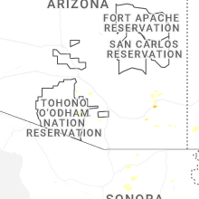
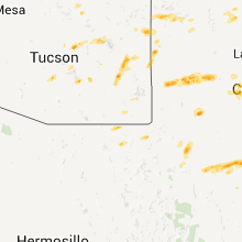
Hail Maps for Sunizona, AZ


Connect with Interactive Hail Maps