

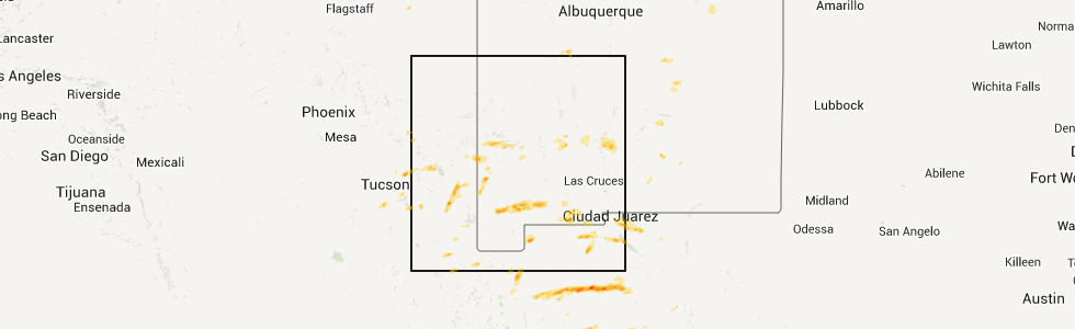
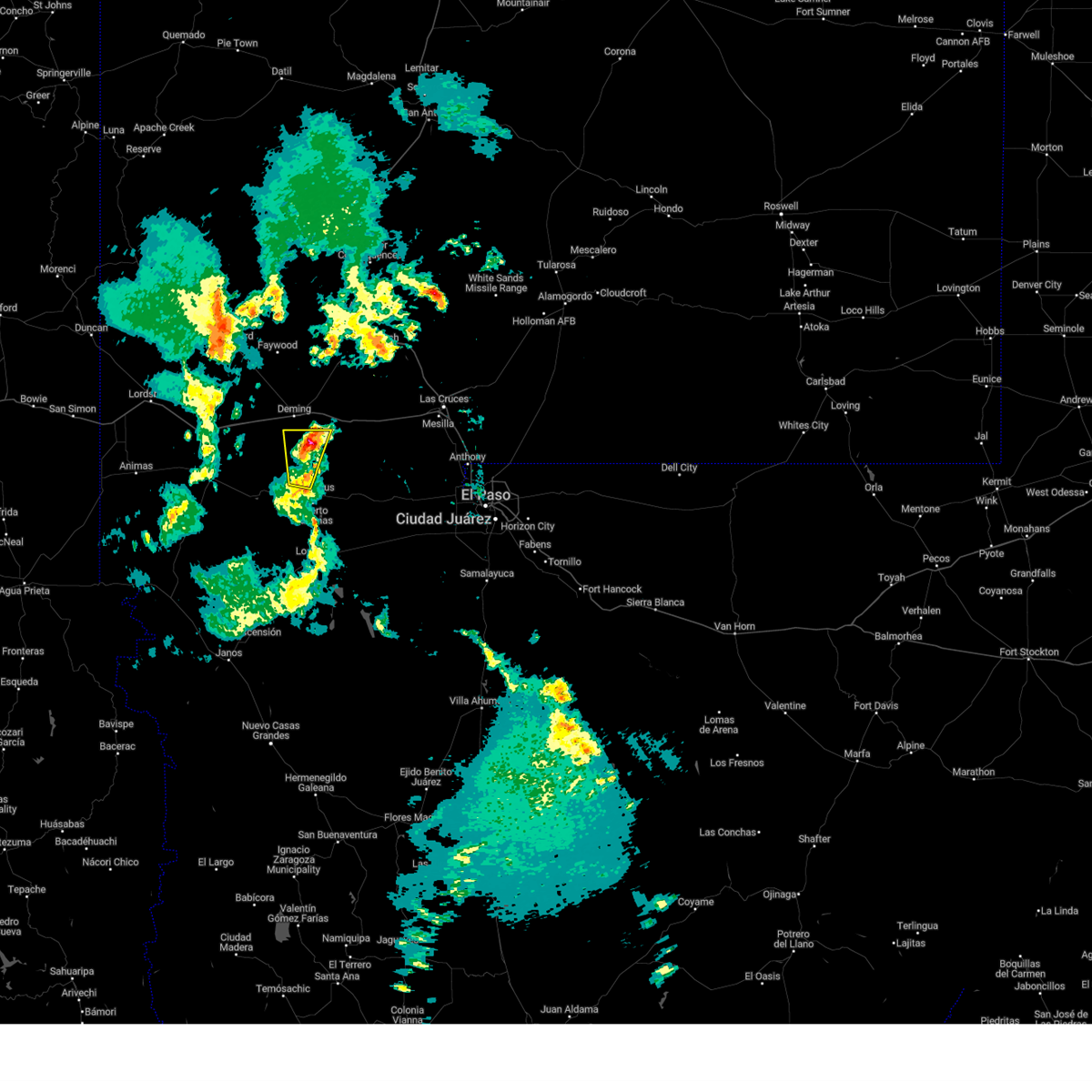
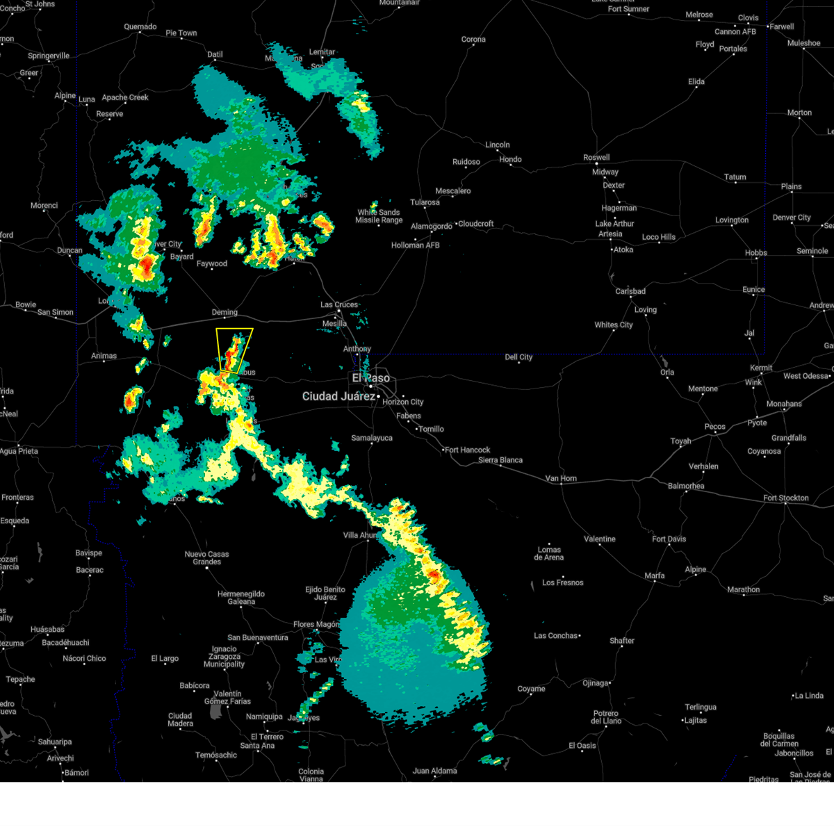
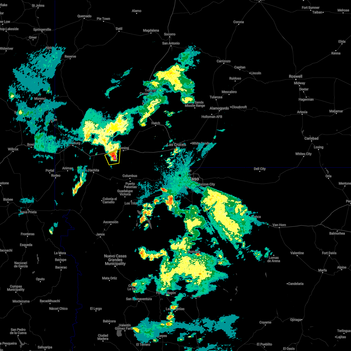
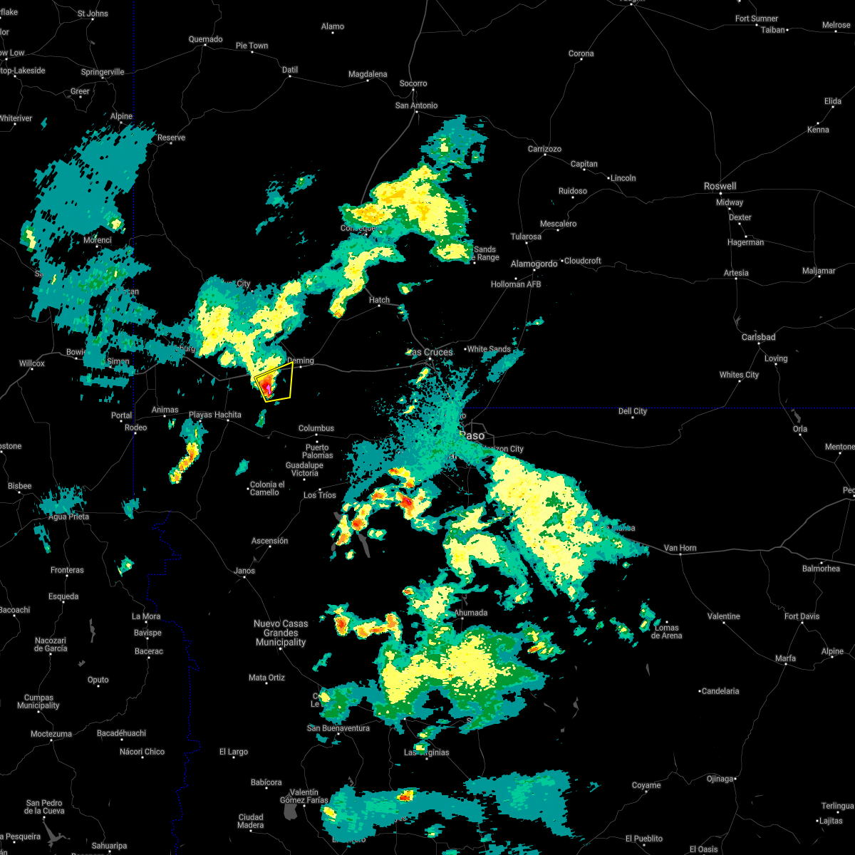
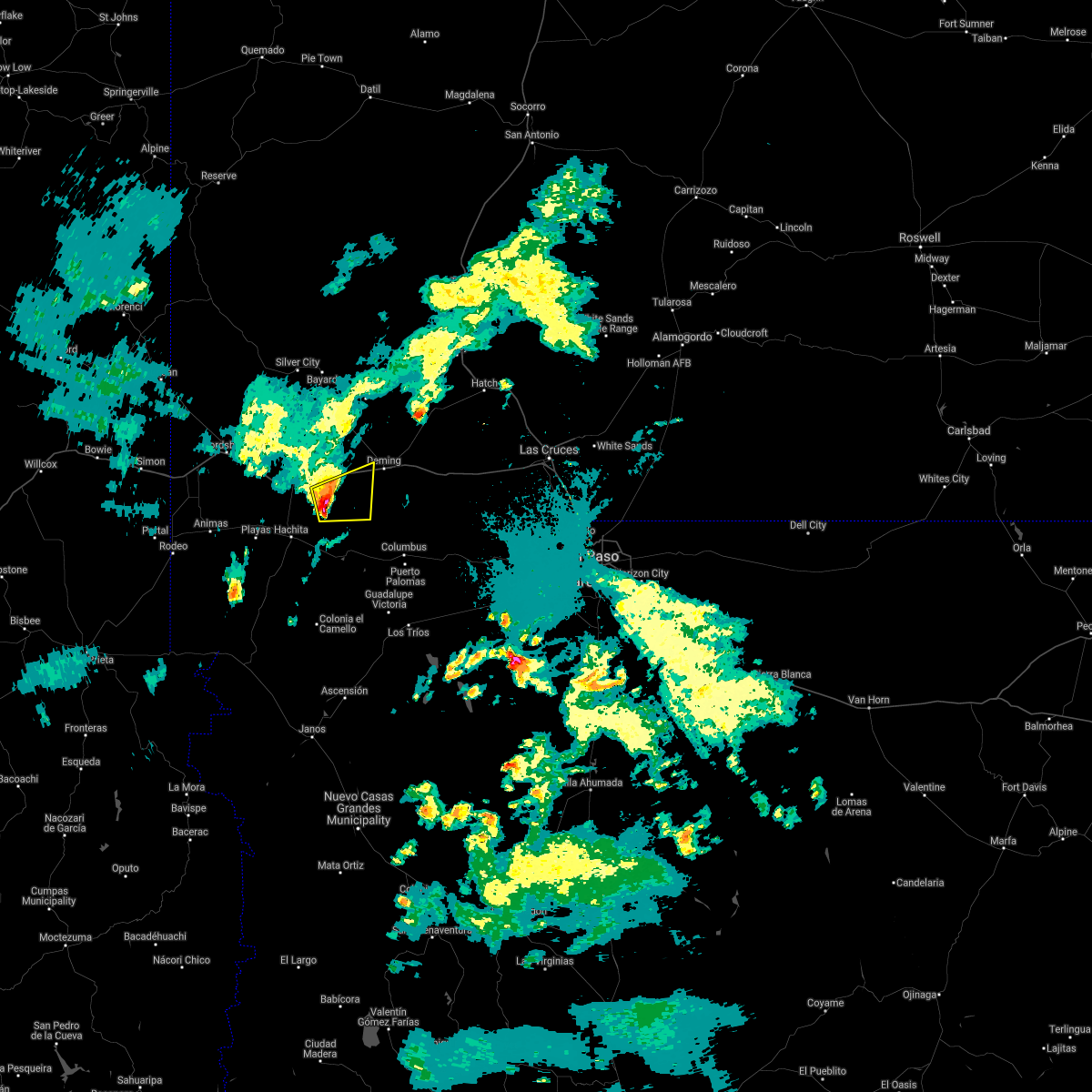
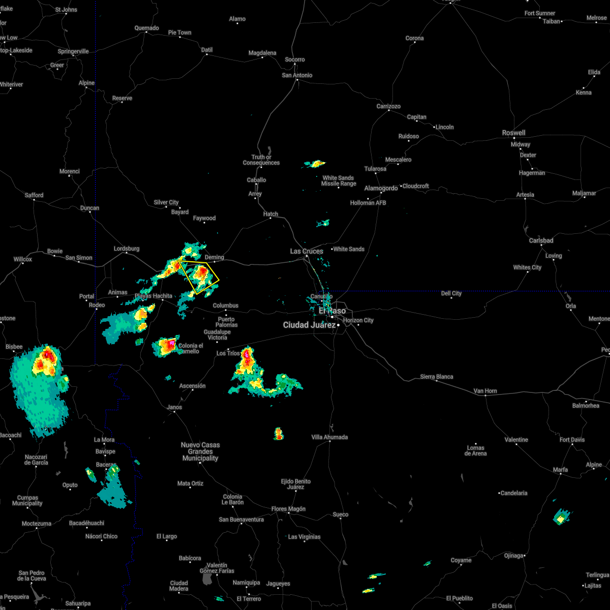
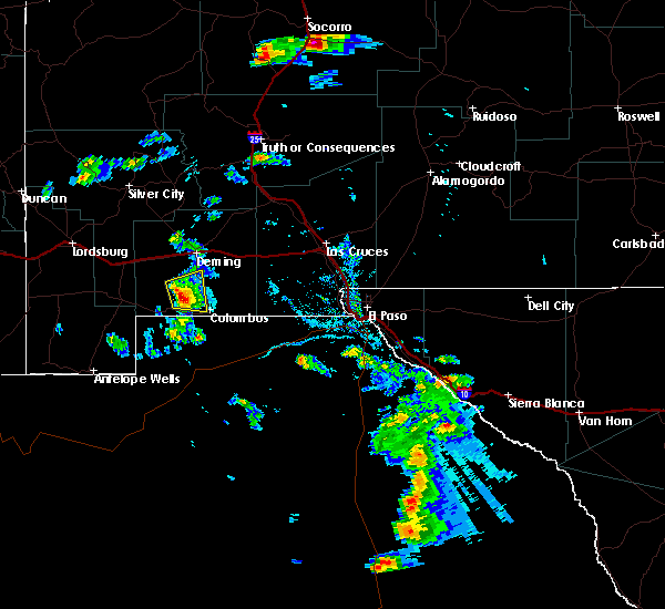
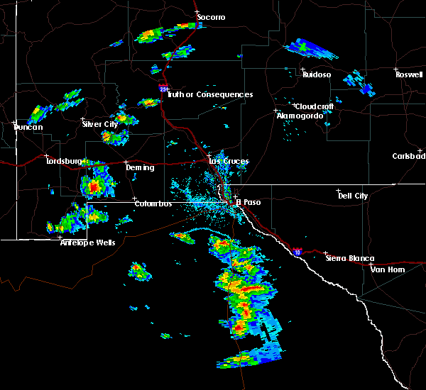
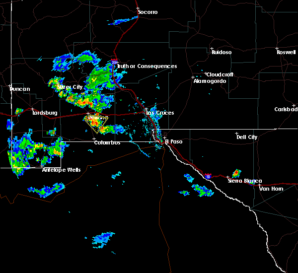
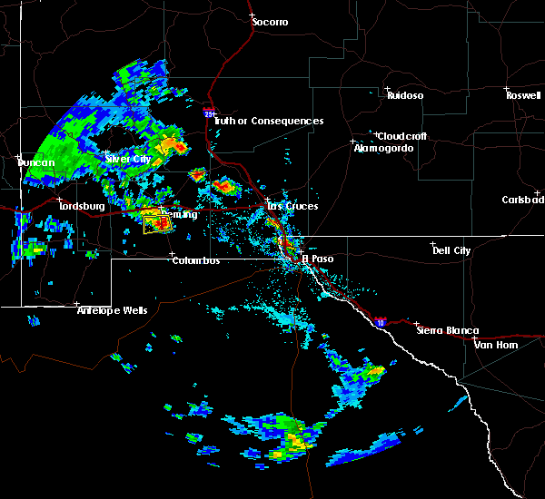
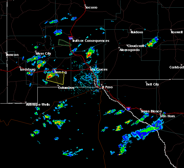
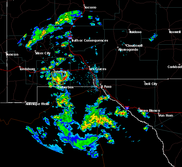
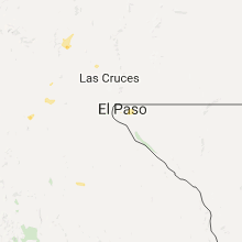
Hail Map for Sunshine, NM
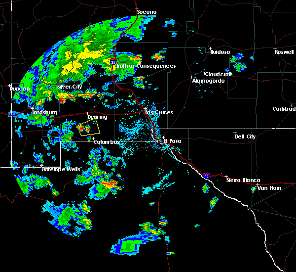
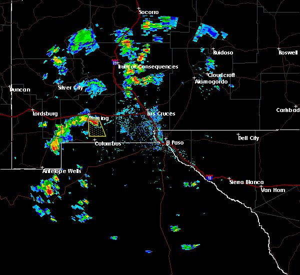
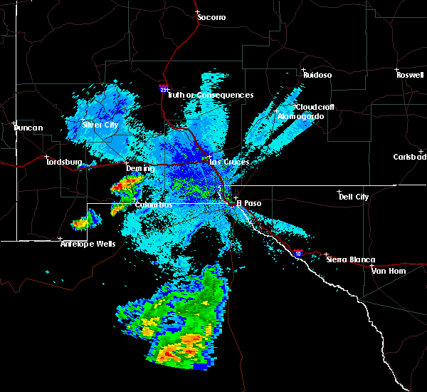
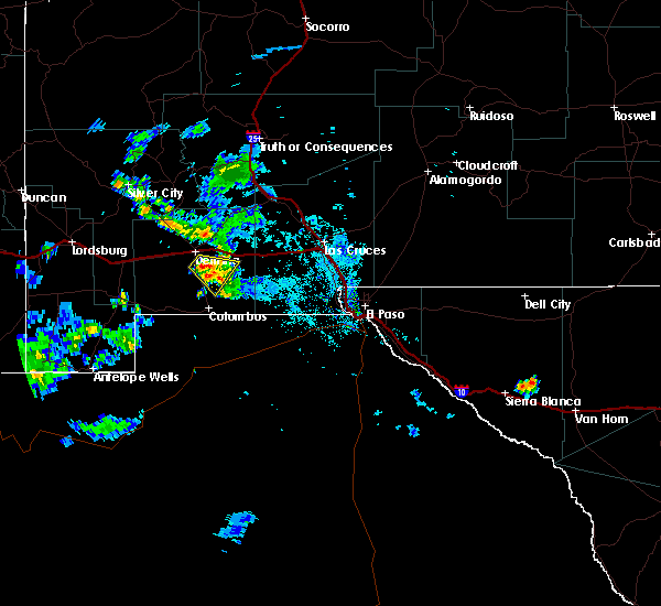
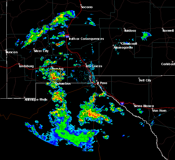
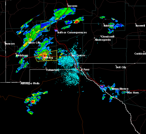
The Sunshine, NM area has had 0 reports of on-the-ground hail by trained spotters, and has been under severe weather warnings 6 times during the past 12 months. Doppler radar has detected hail at or near Sunshine, NM on 12 occasions.
| Name: | Sunshine, NM |
| Where Located: | 52.3 miles SSE of Silver City, NM |
| Map: | Google Map for Sunshine, NM |
| Population: | 420 |
| Housing Units: | 201 |
| More Info: | Search Google for Sunshine, NM |
5
The Top Recent Hail Date for Sunshine, NM is Thursday, September 15, 2011 (1st out of 12)
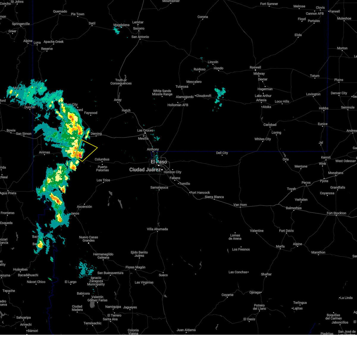
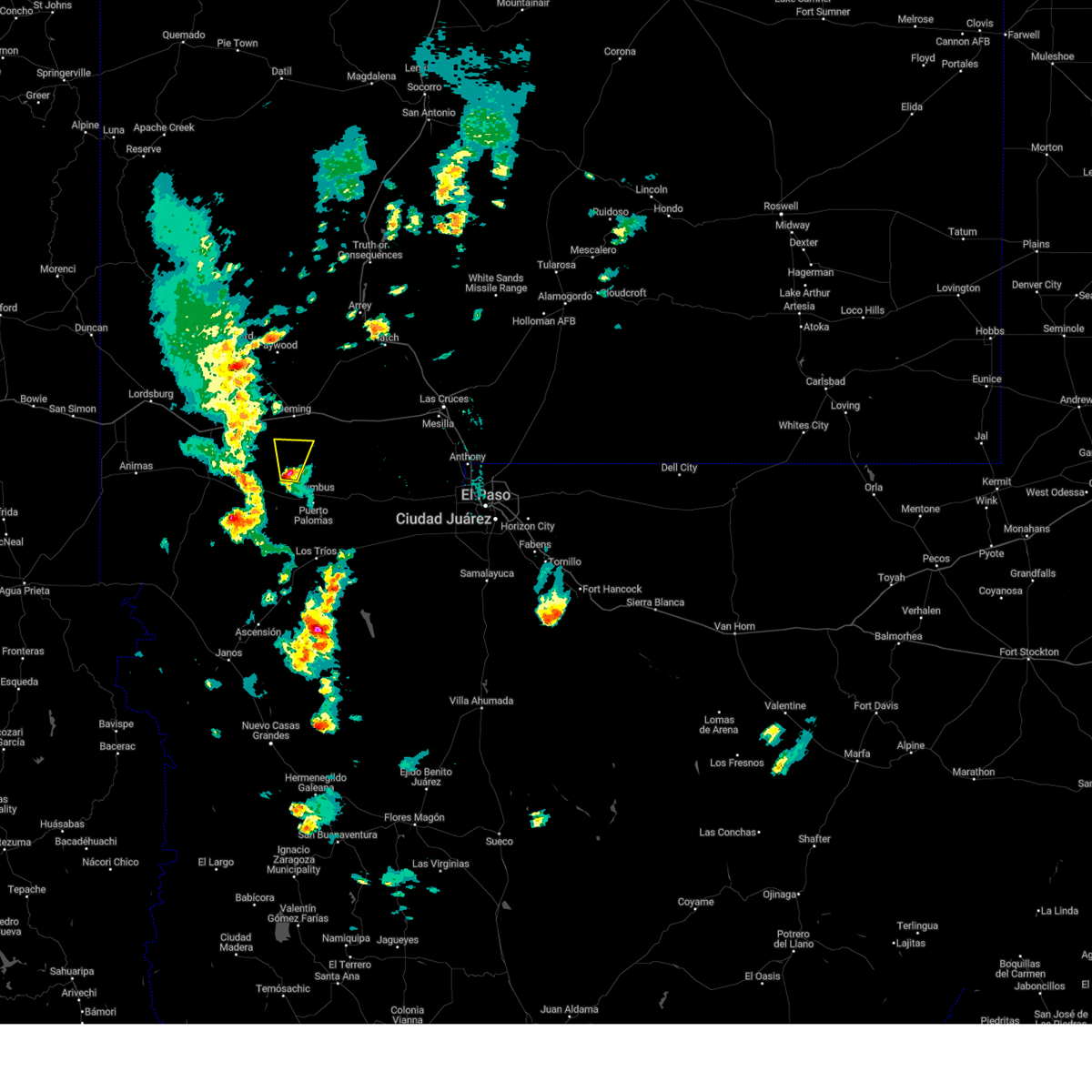
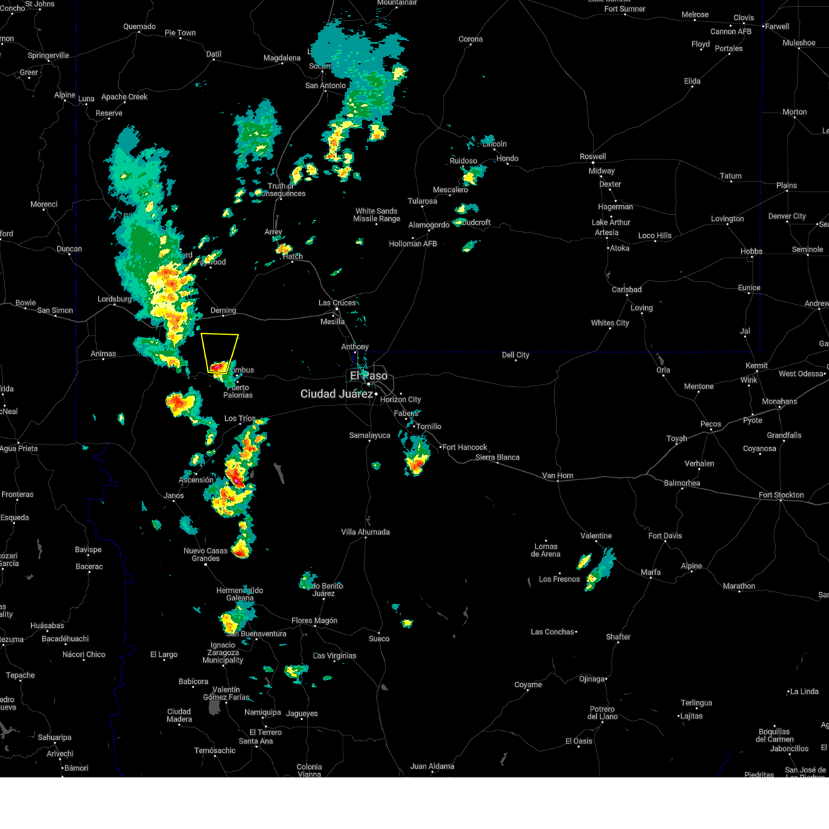
Hail and Wind Damage Spotted near Sunshine, NM
| Date / Time | Report Details |
|---|---|
| 10/24/2023 10:45 AM MDT |
 At 1045 am mdt, a severe thunderstorm was located 10 miles west of sunshine, moving northeast at 35 mph (radar indicated). Hazards include 60 mph wind gusts and penny size hail. expect damage to roofs, siding, and trees At 1045 am mdt, a severe thunderstorm was located 10 miles west of sunshine, moving northeast at 35 mph (radar indicated). Hazards include 60 mph wind gusts and penny size hail. expect damage to roofs, siding, and trees
|
| 10/24/2023 10:16 AM MDT |
 At 1016 am mdt, a severe thunderstorm was located 10 miles northwest of hermanas, moving northeast at 35 mph (radar indicated). Hazards include 60 mph wind gusts and quarter size hail. Hail damage to vehicles is expected. expect wind damage to roofs, siding, and trees. this severe thunderstorm will remain over mainly rural areas of southwestern luna county. hail threat, radar indicated max hail size, 1. 00 in wind threat, radar indicated max wind gust, 60 mph. At 1016 am mdt, a severe thunderstorm was located 10 miles northwest of hermanas, moving northeast at 35 mph (radar indicated). Hazards include 60 mph wind gusts and quarter size hail. Hail damage to vehicles is expected. expect wind damage to roofs, siding, and trees. this severe thunderstorm will remain over mainly rural areas of southwestern luna county. hail threat, radar indicated max hail size, 1. 00 in wind threat, radar indicated max wind gust, 60 mph.
|
| 5/20/2023 4:57 PM MDT |
 At 457 pm mdt, a severe thunderstorm was located 10 miles south of sunshine, moving north at 25 mph (radar indicated). Hazards include quarter size hail. Damage to vehicles is expected. locations impacted include, sunshine. hail threat, radar indicated max hail size, 1. 00 in wind threat, radar indicated max wind gust, <50 mph. At 457 pm mdt, a severe thunderstorm was located 10 miles south of sunshine, moving north at 25 mph (radar indicated). Hazards include quarter size hail. Damage to vehicles is expected. locations impacted include, sunshine. hail threat, radar indicated max hail size, 1. 00 in wind threat, radar indicated max wind gust, <50 mph.
|
| 5/20/2023 4:46 PM MDT |
 At 445 pm mdt, a severe thunderstorm was located 8 miles north of carzalia valley, moving north at 25 mph (radar indicated). Hazards include half dollar size hail. damage to vehicles is expected At 445 pm mdt, a severe thunderstorm was located 8 miles north of carzalia valley, moving north at 25 mph (radar indicated). Hazards include half dollar size hail. damage to vehicles is expected
|
| 5/13/2023 8:23 PM MDT |
 The severe thunderstorm warning for south central luna county will expire at 830 pm mdt, the storm which prompted the warning has moved out of the area. therefore, the warning will be allowed to expire. however small hail is still possible with this thunderstorm. remember, a severe thunderstorm warning still remains in effect for portions of luna county. The severe thunderstorm warning for south central luna county will expire at 830 pm mdt, the storm which prompted the warning has moved out of the area. therefore, the warning will be allowed to expire. however small hail is still possible with this thunderstorm. remember, a severe thunderstorm warning still remains in effect for portions of luna county.
|
| 5/13/2023 7:42 PM MDT |
 At 742 pm mdt, a severe thunderstorm was located 9 miles south of sunshine, moving north at 5 mph (radar indicated). Hazards include 60 mph wind gusts and half dollar size hail. Hail damage to vehicles is expected. Expect wind damage to roofs, siding, and trees. At 742 pm mdt, a severe thunderstorm was located 9 miles south of sunshine, moving north at 5 mph (radar indicated). Hazards include 60 mph wind gusts and half dollar size hail. Hail damage to vehicles is expected. Expect wind damage to roofs, siding, and trees.
|
| 9/25/2021 8:23 PM MDT |
 The severe thunderstorm warning for west central luna county will expire at 830 pm mdt, the storm which prompted the warning has weakened below severe limits, and no longer poses an immediate threat to life or property. therefore, the warning will be allowed to expire. however small hail is still possible with this thunderstorm. The severe thunderstorm warning for west central luna county will expire at 830 pm mdt, the storm which prompted the warning has weakened below severe limits, and no longer poses an immediate threat to life or property. therefore, the warning will be allowed to expire. however small hail is still possible with this thunderstorm.
|
| 9/25/2021 8:10 PM MDT |
 At 810 pm mdt, a severe thunderstorm was located 9 miles southeast of gage, moving northeast at 25 mph (radar indicated). Hazards include quarter size hail. Damage to vehicles is expected. this severe thunderstorm will remain over mainly rural areas of west central luna county. this includes interstate 10 in new mexico between mile markers 68 and 78. hail threat, radar indicated max hail size, 1. 00 in wind threat, radar indicated max wind gust, <50 mph. At 810 pm mdt, a severe thunderstorm was located 9 miles southeast of gage, moving northeast at 25 mph (radar indicated). Hazards include quarter size hail. Damage to vehicles is expected. this severe thunderstorm will remain over mainly rural areas of west central luna county. this includes interstate 10 in new mexico between mile markers 68 and 78. hail threat, radar indicated max hail size, 1. 00 in wind threat, radar indicated max wind gust, <50 mph.
|
| 9/25/2021 7:51 PM MDT |
 At 751 pm mdt, a severe thunderstorm was located 10 miles south of gage, moving northeast at 25 mph (radar indicated). Hazards include half dollar size hail. Damage to vehicles is expected. this severe thunderstorm will remain over mainly rural areas of west central luna county. this includes interstate 10 in new mexico between mile markers 68 and 78. hail threat, radar indicated max hail size, 1. 25 in wind threat, radar indicated max wind gust, <50 mph. At 751 pm mdt, a severe thunderstorm was located 10 miles south of gage, moving northeast at 25 mph (radar indicated). Hazards include half dollar size hail. Damage to vehicles is expected. this severe thunderstorm will remain over mainly rural areas of west central luna county. this includes interstate 10 in new mexico between mile markers 68 and 78. hail threat, radar indicated max hail size, 1. 25 in wind threat, radar indicated max wind gust, <50 mph.
|
| 9/7/2021 6:36 PM MDT |
 At 635 pm mdt, a severe thunderstorm was located 6 miles southwest of deming, moving west at 30 mph (radar indicated). Hazards include 60 mph wind gusts and quarter size hail. Hail damage to vehicles is expected. expect wind damage to roofs, siding, and trees. locations impacted include, gage and sunshine. this includes interstate 10 in new mexico between mile markers 62 and 75. hail threat, radar indicated max hail size, 1. 00 in wind threat, radar indicated max wind gust, 60 mph. At 635 pm mdt, a severe thunderstorm was located 6 miles southwest of deming, moving west at 30 mph (radar indicated). Hazards include 60 mph wind gusts and quarter size hail. Hail damage to vehicles is expected. expect wind damage to roofs, siding, and trees. locations impacted include, gage and sunshine. this includes interstate 10 in new mexico between mile markers 62 and 75. hail threat, radar indicated max hail size, 1. 00 in wind threat, radar indicated max wind gust, 60 mph.
|
| 9/7/2021 6:22 PM MDT |
 At 622 pm mdt, a severe thunderstorm was located near deming, moving west at 30 mph (radar indicated). Hazards include 60 mph wind gusts and quarter size hail. Hail damage to vehicles is expected. Expect wind damage to roofs, siding, and trees. At 622 pm mdt, a severe thunderstorm was located near deming, moving west at 30 mph (radar indicated). Hazards include 60 mph wind gusts and quarter size hail. Hail damage to vehicles is expected. Expect wind damage to roofs, siding, and trees.
|
| 9/7/2021 6:12 PM MDT |
 At 612 pm mdt, a severe thunderstorm was located 5 miles east of deming, moving west at 30 mph (radar indicated). Hazards include 60 mph wind gusts and quarter size hail. Hail damage to vehicles is expected. expect wind damage to roofs, siding, and trees. locations impacted include, deming, sunshine, rock hound state park and spring canyon state park. this includes interstate 10 in new mexico between mile markers 72 and 93. hail threat, radar indicated max hail size, 1. 00 in wind threat, radar indicated max wind gust, 60 mph. At 612 pm mdt, a severe thunderstorm was located 5 miles east of deming, moving west at 30 mph (radar indicated). Hazards include 60 mph wind gusts and quarter size hail. Hail damage to vehicles is expected. expect wind damage to roofs, siding, and trees. locations impacted include, deming, sunshine, rock hound state park and spring canyon state park. this includes interstate 10 in new mexico between mile markers 72 and 93. hail threat, radar indicated max hail size, 1. 00 in wind threat, radar indicated max wind gust, 60 mph.
|
| 9/7/2021 5:58 PM MDT |
 At 558 pm mdt, a severe thunderstorm was located 9 miles east of deming, moving west at 40 mph (radar indicated). Hazards include ping pong ball size hail and 60 mph wind gusts. People and animals outdoors will be injured. expect hail damage to roofs, siding, windows, and vehicles. expect wind damage to roofs, siding, and trees. locations impacted include, deming, sunshine, rock hound state park and spring canyon state park. this includes interstate 10 in new mexico between mile markers 66 and 99. hail threat, radar indicated max hail size, 1. 50 in wind threat, radar indicated max wind gust, 60 mph. At 558 pm mdt, a severe thunderstorm was located 9 miles east of deming, moving west at 40 mph (radar indicated). Hazards include ping pong ball size hail and 60 mph wind gusts. People and animals outdoors will be injured. expect hail damage to roofs, siding, windows, and vehicles. expect wind damage to roofs, siding, and trees. locations impacted include, deming, sunshine, rock hound state park and spring canyon state park. this includes interstate 10 in new mexico between mile markers 66 and 99. hail threat, radar indicated max hail size, 1. 50 in wind threat, radar indicated max wind gust, 60 mph.
|
| 9/7/2021 5:48 PM MDT |
 At 548 pm mdt, a severe thunderstorm was located 5 miles northwest of akela, moving west at 40 mph (radar indicated). Hazards include golf ball size hail and 60 mph wind gusts. People and animals outdoors will be injured. expect hail damage to roofs, siding, windows, and vehicles. Expect wind damage to roofs, siding, and trees. At 548 pm mdt, a severe thunderstorm was located 5 miles northwest of akela, moving west at 40 mph (radar indicated). Hazards include golf ball size hail and 60 mph wind gusts. People and animals outdoors will be injured. expect hail damage to roofs, siding, windows, and vehicles. Expect wind damage to roofs, siding, and trees.
|
| 10/8/2019 5:15 PM MDT |
 At 515 pm mdt, a severe thunderstorm was located 9 miles northeast of hermanas, moving east at 30 mph (radar indicated). Hazards include 60 mph wind gusts and half dollar size hail. Hail damage to vehicles is expected. expect wind damage to roofs, siding, and trees. This severe thunderstorm will remain over mainly rural areas of south central luna county. At 515 pm mdt, a severe thunderstorm was located 9 miles northeast of hermanas, moving east at 30 mph (radar indicated). Hazards include 60 mph wind gusts and half dollar size hail. Hail damage to vehicles is expected. expect wind damage to roofs, siding, and trees. This severe thunderstorm will remain over mainly rural areas of south central luna county.
|
| 10/8/2019 4:44 PM MDT |
 At 444 pm mdt, a severe thunderstorm was located 12 miles northwest of hermanas, moving east at 30 mph (radar indicated). Hazards include 60 mph wind gusts and half dollar size hail. Hail damage to vehicles is expected. Expect wind damage to roofs, siding, and trees. At 444 pm mdt, a severe thunderstorm was located 12 miles northwest of hermanas, moving east at 30 mph (radar indicated). Hazards include 60 mph wind gusts and half dollar size hail. Hail damage to vehicles is expected. Expect wind damage to roofs, siding, and trees.
|
| 9/27/2019 3:42 PM MDT |
 At 342 pm mdt, a severe thunderstorm was located 9 miles southeast of gage, moving east at 35 mph (radar indicated). Hazards include 60 mph wind gusts and quarter size hail. Hail damage to vehicles is expected. Expect wind damage to roofs, siding, and trees. At 342 pm mdt, a severe thunderstorm was located 9 miles southeast of gage, moving east at 35 mph (radar indicated). Hazards include 60 mph wind gusts and quarter size hail. Hail damage to vehicles is expected. Expect wind damage to roofs, siding, and trees.
|
| 9/15/2019 7:25 PM MDT |
 The severe thunderstorm warning for central luna county will expire at 730 pm mdt, the storm which prompted the warning has weakened below severe limits, and no longer poses an immediate threat to life or property. therefore, the warning will be allowed to expire. however small hail and heavy rain are still possible with this thunderstorm. The severe thunderstorm warning for central luna county will expire at 730 pm mdt, the storm which prompted the warning has weakened below severe limits, and no longer poses an immediate threat to life or property. therefore, the warning will be allowed to expire. however small hail and heavy rain are still possible with this thunderstorm.
|
| 9/15/2019 6:51 PM MDT |
 At 651 pm mdt, a severe thunderstorm was located 8 miles west of sunshine, moving east at 15 mph (radar indicated). Hazards include 60 mph wind gusts and quarter size hail. Hail damage to vehicles is expected. Expect wind damage to roofs, siding, and trees. At 651 pm mdt, a severe thunderstorm was located 8 miles west of sunshine, moving east at 15 mph (radar indicated). Hazards include 60 mph wind gusts and quarter size hail. Hail damage to vehicles is expected. Expect wind damage to roofs, siding, and trees.
|
| 8/23/2018 6:17 PM MDT |
 The national weather service in el paso has issued a * severe thunderstorm warning for. south central luna county in south central new mexico. until 700 pm mdt. At 616 pm mdt, a severe thunderstorm was located 10 miles south of sunshine, or 15 miles northwest of columbus, moving east at 10 mph. The national weather service in el paso has issued a * severe thunderstorm warning for. south central luna county in south central new mexico. until 700 pm mdt. At 616 pm mdt, a severe thunderstorm was located 10 miles south of sunshine, or 15 miles northwest of columbus, moving east at 10 mph.
|
| 8/17/2018 4:46 PM MDT |
 At 446 pm mdt, a severe thunderstorm was located 11 miles southeast of sunshine, or 16 miles north of columbus, moving south at 15 mph (radar indicated). Hazards include 60 mph wind gusts and quarter size hail. Hail damage to vehicles is expected. Expect wind damage to roofs, siding, and trees. At 446 pm mdt, a severe thunderstorm was located 11 miles southeast of sunshine, or 16 miles north of columbus, moving south at 15 mph (radar indicated). Hazards include 60 mph wind gusts and quarter size hail. Hail damage to vehicles is expected. Expect wind damage to roofs, siding, and trees.
|
| 9/28/2017 10:11 PM MDT |
 At 1011 pm mdt, a severe thunderstorm was located near sunshine, or 9 miles southwest of deming, moving north at 20 mph (radar indicated). Hazards include 60 mph wind gusts and quarter size hail. Hail damage to vehicles is expected. Expect wind damage to roofs, siding, and trees. At 1011 pm mdt, a severe thunderstorm was located near sunshine, or 9 miles southwest of deming, moving north at 20 mph (radar indicated). Hazards include 60 mph wind gusts and quarter size hail. Hail damage to vehicles is expected. Expect wind damage to roofs, siding, and trees.
|
| 9/28/2017 9:42 PM MDT |
 At 942 pm mdt, a severe thunderstorm was located 8 miles south of sunshine, or 16 miles northwest of columbus, moving north at 25 mph (radar indicated). Hazards include 60 mph wind gusts and quarter size hail. Hail damage to vehicles is expected. Expect wind damage to roofs, siding, and trees. At 942 pm mdt, a severe thunderstorm was located 8 miles south of sunshine, or 16 miles northwest of columbus, moving north at 25 mph (radar indicated). Hazards include 60 mph wind gusts and quarter size hail. Hail damage to vehicles is expected. Expect wind damage to roofs, siding, and trees.
|
| 8/12/2017 8:20 PM MDT |
 At 820 pm mdt, a severe thunderstorm was located 8 miles east of sunshine, or 11 miles southeast of deming, moving southeast at 20 mph (radar indicated). Hazards include 60 mph wind gusts and penny size hail. Expect damage to roofs, siding, and trees. Locations impacted include, sunshine, spring canyon state park and rock hound state park. At 820 pm mdt, a severe thunderstorm was located 8 miles east of sunshine, or 11 miles southeast of deming, moving southeast at 20 mph (radar indicated). Hazards include 60 mph wind gusts and penny size hail. Expect damage to roofs, siding, and trees. Locations impacted include, sunshine, spring canyon state park and rock hound state park.
|
| 8/12/2017 8:03 PM MDT |
 At 803 pm mdt, a severe thunderstorm was located 4 miles northeast of sunshine, or 7 miles southeast of deming, moving southeast at 15 mph (radar indicated). Hazards include 60 mph wind gusts and quarter size hail. Hail damage to vehicles is expected. Expect wind damage to roofs, siding, and trees. At 803 pm mdt, a severe thunderstorm was located 4 miles northeast of sunshine, or 7 miles southeast of deming, moving southeast at 15 mph (radar indicated). Hazards include 60 mph wind gusts and quarter size hail. Hail damage to vehicles is expected. Expect wind damage to roofs, siding, and trees.
|
| 7/19/2017 5:12 PM MDT |
 At 511 pm mdt, severe thunderstorms were moving toward the deming area at 40 mph (radar indicated). Hazards include 60 mph wind gusts and quarter size hail. Hail damage to vehicles is expected. expect wind damage to roofs, siding, and trees. Blowing dust may lower the visibility to less than a mile. At 511 pm mdt, severe thunderstorms were moving toward the deming area at 40 mph (radar indicated). Hazards include 60 mph wind gusts and quarter size hail. Hail damage to vehicles is expected. expect wind damage to roofs, siding, and trees. Blowing dust may lower the visibility to less than a mile.
|
| 6/19/2017 5:48 PM MDT |
 At 547 pm mdt, a severe thunderstorm was located near sunshine, or 11 miles south of deming, moving west at 20 mph (radar indicated). Hazards include 60 mph wind gusts and quarter size hail. Hail damage to vehicles is possible. Expect wind damage to roofs, siding, and trees. At 547 pm mdt, a severe thunderstorm was located near sunshine, or 11 miles south of deming, moving west at 20 mph (radar indicated). Hazards include 60 mph wind gusts and quarter size hail. Hail damage to vehicles is possible. Expect wind damage to roofs, siding, and trees.
|
| 8/22/2016 5:28 PM MDT |
 At 528 pm mdt, a severe thunderstorm was located 7 miles southwest of sunshine, or 14 miles southwest of deming, moving east at 30 mph (radar indicated). Hazards include quarter size hail. damage to vehicles is expected At 528 pm mdt, a severe thunderstorm was located 7 miles southwest of sunshine, or 14 miles southwest of deming, moving east at 30 mph (radar indicated). Hazards include quarter size hail. damage to vehicles is expected
|
| 4/22/2016 4:38 PM MDT |
 At 436 pm mdt, a severe thunderstorm was across highway 11 about 5 miles north of columbus (radar indicated). Hazards include 60 mph wind gusts and quarter size hail. Hail damage to vehicles is expected. expect wind damage to roofs, siding, and trees. Locations impacted include, sunshine, spring canyon state park, rock hound state park. At 436 pm mdt, a severe thunderstorm was across highway 11 about 5 miles north of columbus (radar indicated). Hazards include 60 mph wind gusts and quarter size hail. Hail damage to vehicles is expected. expect wind damage to roofs, siding, and trees. Locations impacted include, sunshine, spring canyon state park, rock hound state park.
|
| 4/22/2016 4:21 PM MDT |
 At 420 pm mdt, a severe thunderstorm was located 9 miles southeast of sunshine, or 15 miles north of columbus, moving northeast at 20 mph (radar indicated). Hazards include 60 mph wind gusts and quarter size hail. Hail damage to vehicles is expected. Expect wind damage to roofs, siding, and trees. At 420 pm mdt, a severe thunderstorm was located 9 miles southeast of sunshine, or 15 miles north of columbus, moving northeast at 20 mph (radar indicated). Hazards include 60 mph wind gusts and quarter size hail. Hail damage to vehicles is expected. Expect wind damage to roofs, siding, and trees.
|
| 10/21/2015 4:01 AM MDT |
 At 401 am mdt, a severe thunderstorm was located near sunshine, or 5 miles south of deming, moving northeast at 45 mph (radar indicated). Hazards include 60 mph wind gusts and half dollar size hail. Hail damage to vehicles is expected. Expect wind damage to roofs, siding and trees. At 401 am mdt, a severe thunderstorm was located near sunshine, or 5 miles south of deming, moving northeast at 45 mph (radar indicated). Hazards include 60 mph wind gusts and half dollar size hail. Hail damage to vehicles is expected. Expect wind damage to roofs, siding and trees.
|
| 10/20/2015 1:52 PM MDT |
 At 150 pm mdt, a severe thunderstorm was located near sunshine moving northeast at 40 mph (radar indicated). Hazards include 60 mph wind gusts and quarter size hail. Hail damage to vehicles is expected. Expect wind damage to roofs, siding and trees. At 150 pm mdt, a severe thunderstorm was located near sunshine moving northeast at 40 mph (radar indicated). Hazards include 60 mph wind gusts and quarter size hail. Hail damage to vehicles is expected. Expect wind damage to roofs, siding and trees.
|
| 10/20/2015 12:45 PM MDT |
 At 1244 pm mdt, possible severe thunderstorms were moving into the area moving northeast at 40 mph (radar indicated). Hazards include 60 mph wind gusts and quarter size hail. Hail damage to vehicles is expected. Expect wind damage to roofs, siding and trees. At 1244 pm mdt, possible severe thunderstorms were moving into the area moving northeast at 40 mph (radar indicated). Hazards include 60 mph wind gusts and quarter size hail. Hail damage to vehicles is expected. Expect wind damage to roofs, siding and trees.
|
| 8/17/2015 4:28 PM MDT |
 At 428 pm mdt, a severe thunderstorm was located 7 miles northeast of gage, or 13 miles west of deming, moving south at 15 mph (radar indicated). Hazards include 60 mph wind gusts and quarter size hail. Hail damage to vehicles is expected. expect wind damage to roofs, siding and trees. Locations impacted include, gage. At 428 pm mdt, a severe thunderstorm was located 7 miles northeast of gage, or 13 miles west of deming, moving south at 15 mph (radar indicated). Hazards include 60 mph wind gusts and quarter size hail. Hail damage to vehicles is expected. expect wind damage to roofs, siding and trees. Locations impacted include, gage.
|
| 8/17/2015 3:57 PM MDT |
 At 357 pm mdt, a severe thunderstorm was located 12 miles north of gage, or 13 miles south of city of rocks state park, moving south at 15 mph (radar indicated). Hazards include 60 mph wind gusts and quarter size hail. Hail damage to vehicles is expected. Expect wind damage to roofs, siding and trees. At 357 pm mdt, a severe thunderstorm was located 12 miles north of gage, or 13 miles south of city of rocks state park, moving south at 15 mph (radar indicated). Hazards include 60 mph wind gusts and quarter size hail. Hail damage to vehicles is expected. Expect wind damage to roofs, siding and trees.
|
| 7/10/2015 1:23 PM MDT |
 At 123 pm mdt, a severe thunderstorm was located 8 miles east of deming, moving east at 30 mph (radar indicated). Hazards include two inch hail and 60 mph wind gusts. People and animals outdoors will be injured. expect hail damage to roofs, siding, windows and vehicles. Expect wind damage to roofs, siding and trees. At 123 pm mdt, a severe thunderstorm was located 8 miles east of deming, moving east at 30 mph (radar indicated). Hazards include two inch hail and 60 mph wind gusts. People and animals outdoors will be injured. expect hail damage to roofs, siding, windows and vehicles. Expect wind damage to roofs, siding and trees.
|
| 7/10/2015 12:56 PM MDT |
 At 1255 pm mdt, a severe thunderstorm was located 6 miles northwest of sunshine, or 7 miles southwest of deming, moving east at 25 mph (radar indicated). Hazards include two inch hail and 60 mph wind gusts. People and animals outdoors will be injured. expect hail damage to roofs, siding, windows and vehicles. expect wind damage to roofs, siding and trees. Locations impacted include, deming, sunshine, spring canyon state park, and rock hound state park. At 1255 pm mdt, a severe thunderstorm was located 6 miles northwest of sunshine, or 7 miles southwest of deming, moving east at 25 mph (radar indicated). Hazards include two inch hail and 60 mph wind gusts. People and animals outdoors will be injured. expect hail damage to roofs, siding, windows and vehicles. expect wind damage to roofs, siding and trees. Locations impacted include, deming, sunshine, spring canyon state park, and rock hound state park.
|
| 7/10/2015 12:48 PM MDT |
 At 1247 pm mdt, a severe thunderstorm was located 9 miles west of sunshine, or 10 miles southwest of deming, moving east at 25 mph (radar indicated). Hazards include 60 mph wind gusts and quarter size hail. Hail damage to vehicles is expected. Expect wind damage to roofs, siding and trees. At 1247 pm mdt, a severe thunderstorm was located 9 miles west of sunshine, or 10 miles southwest of deming, moving east at 25 mph (radar indicated). Hazards include 60 mph wind gusts and quarter size hail. Hail damage to vehicles is expected. Expect wind damage to roofs, siding and trees.
|
Hail Maps for Sunshine, NM


Connect with Interactive Hail Maps