

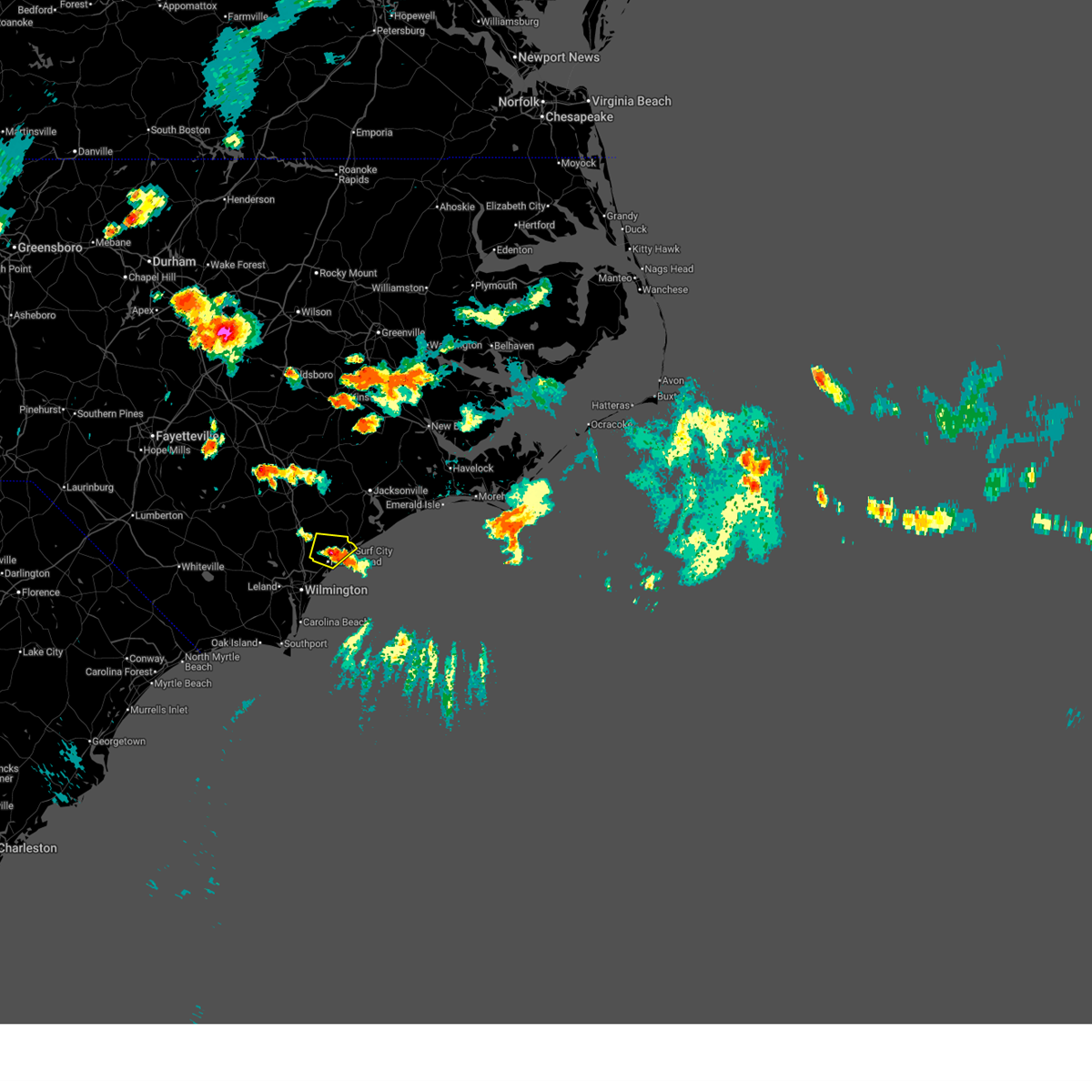
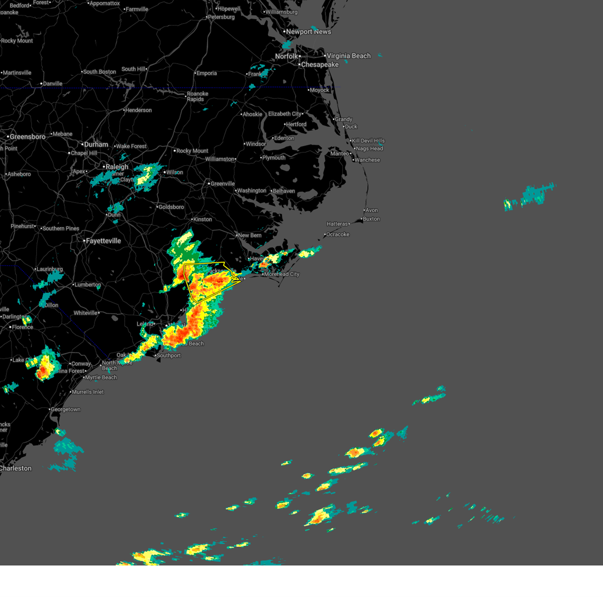
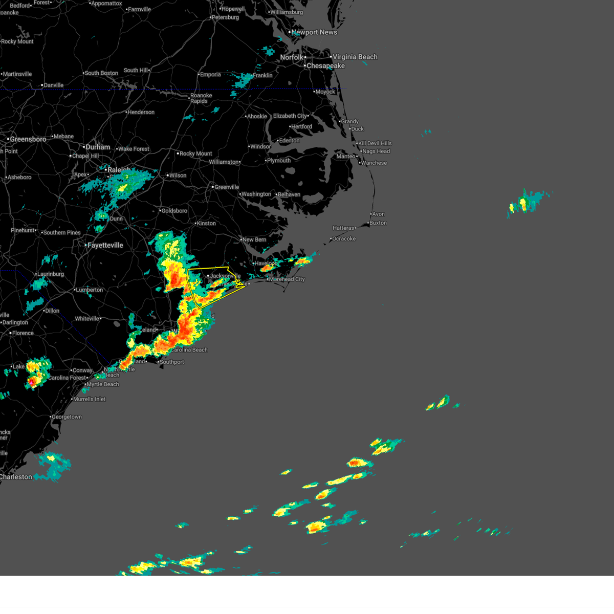
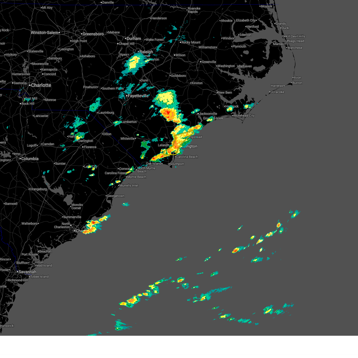
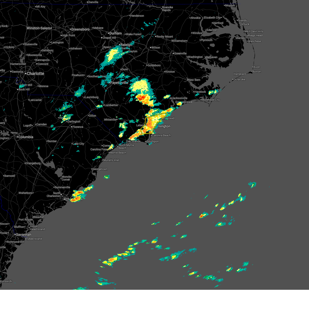
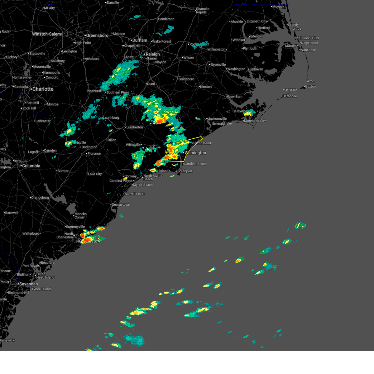
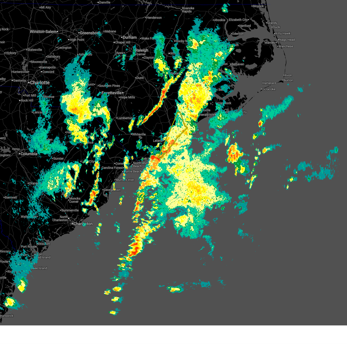
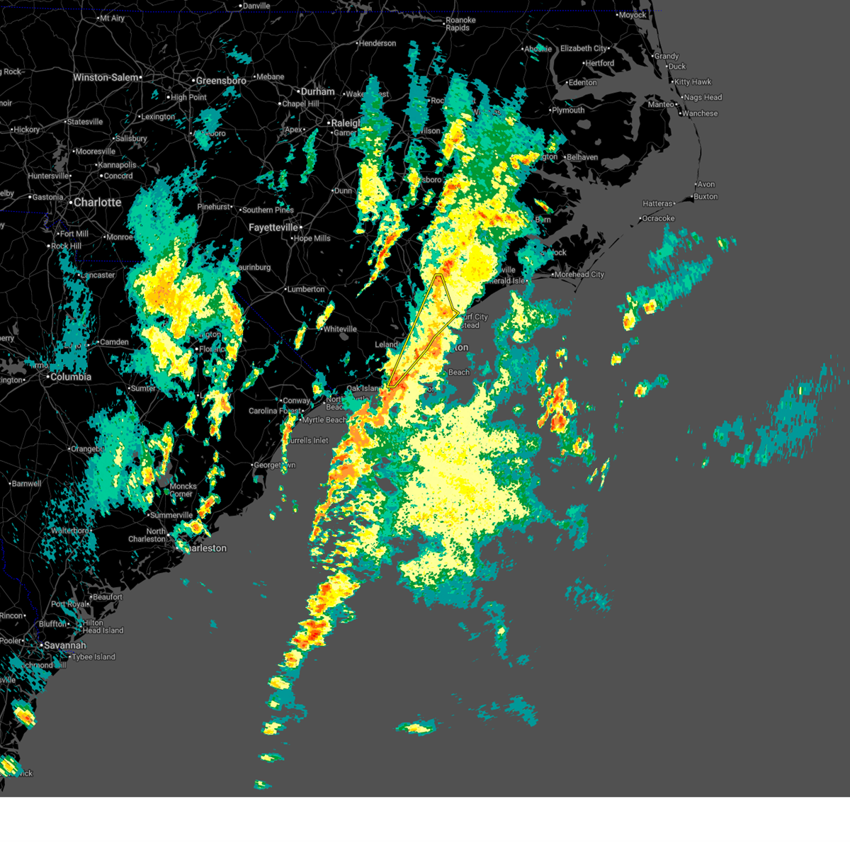
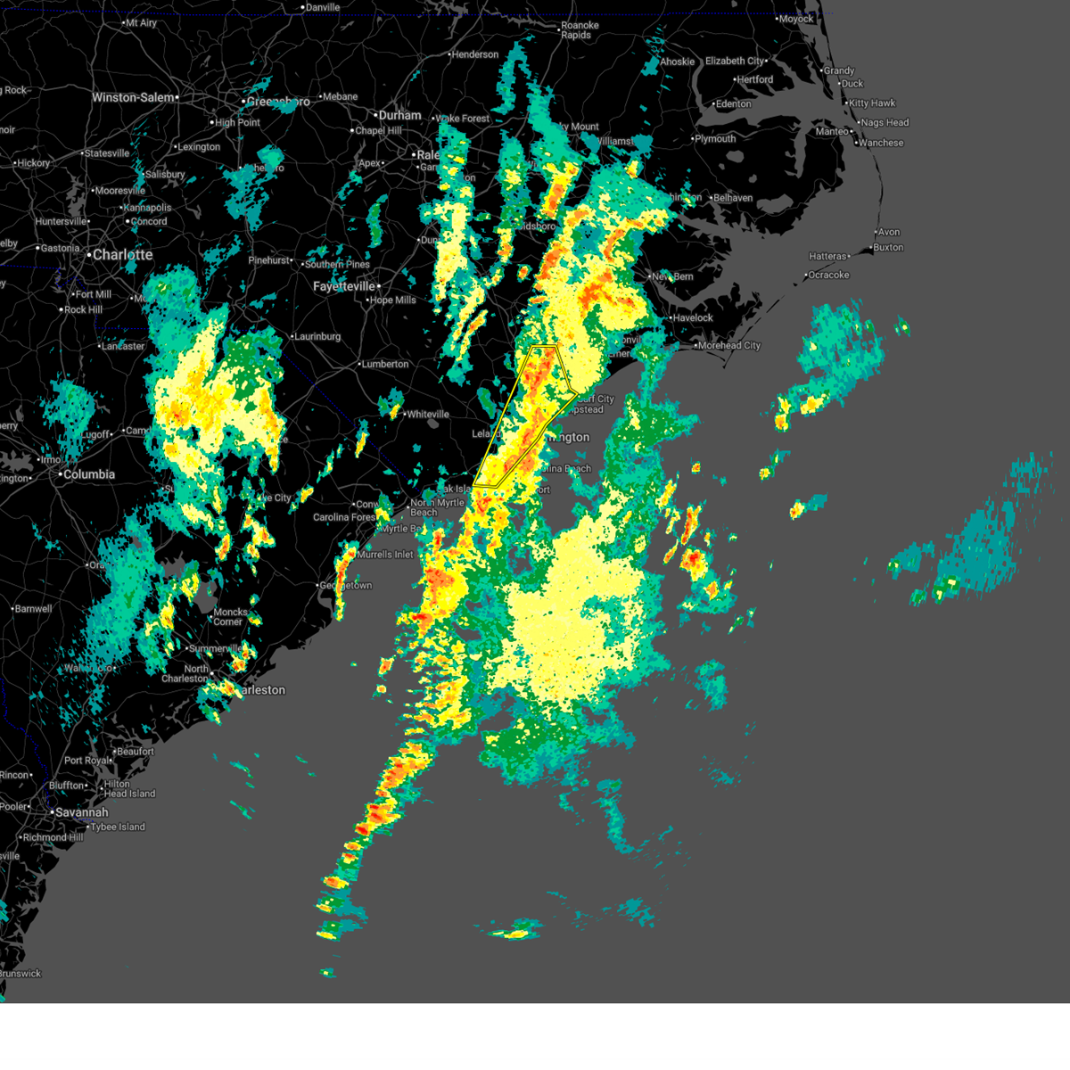
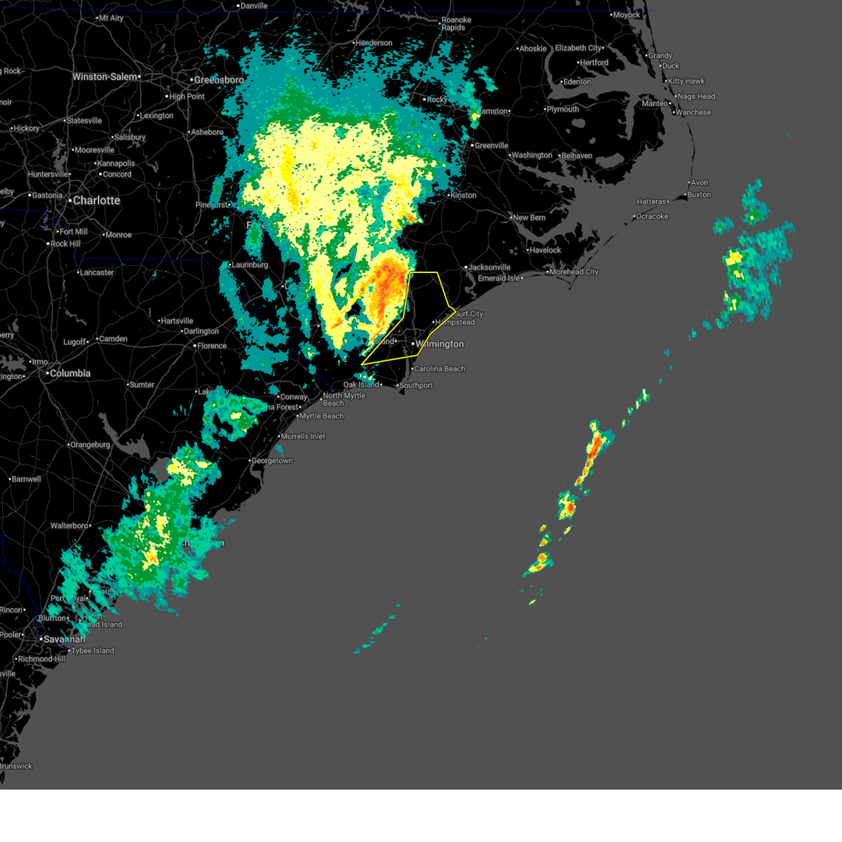
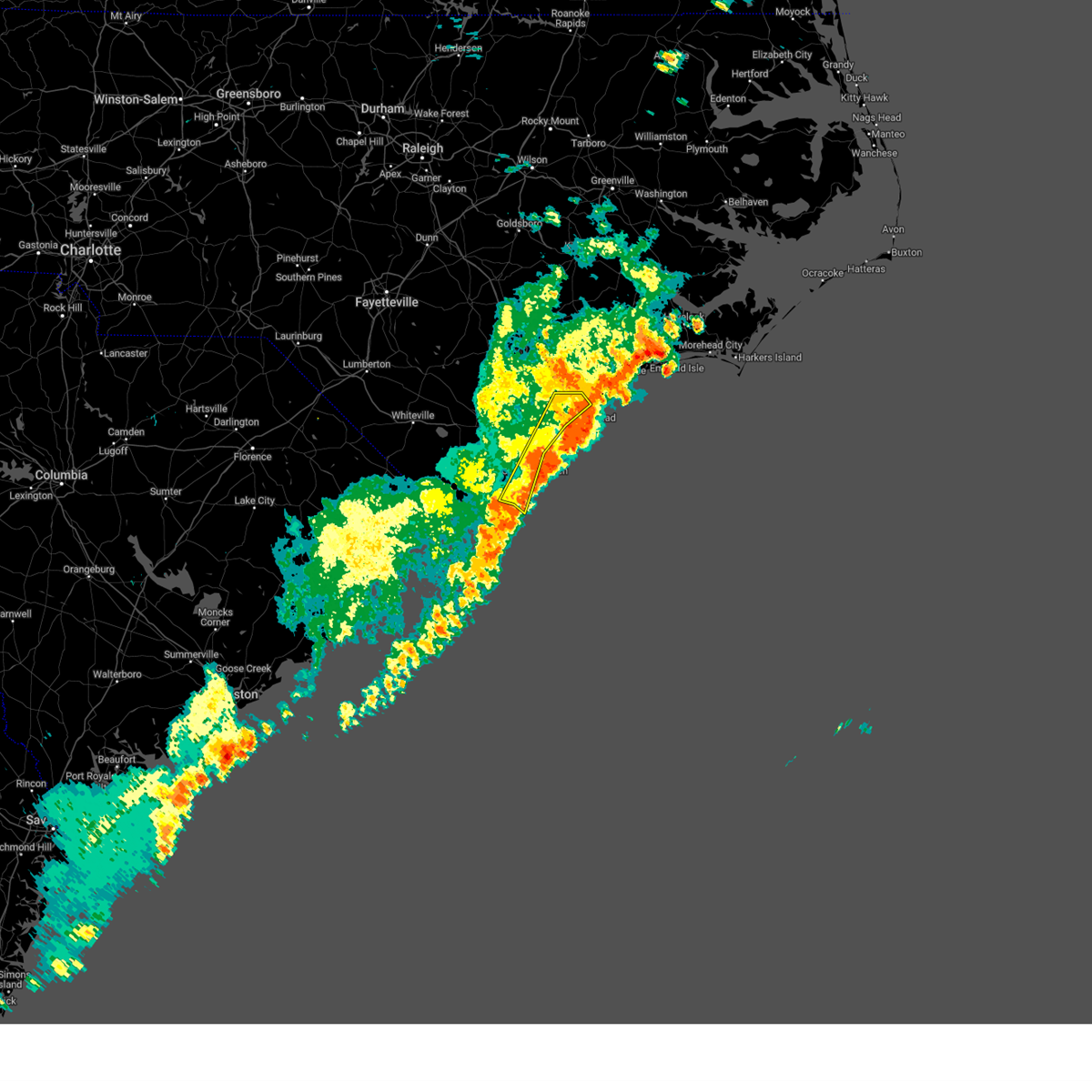
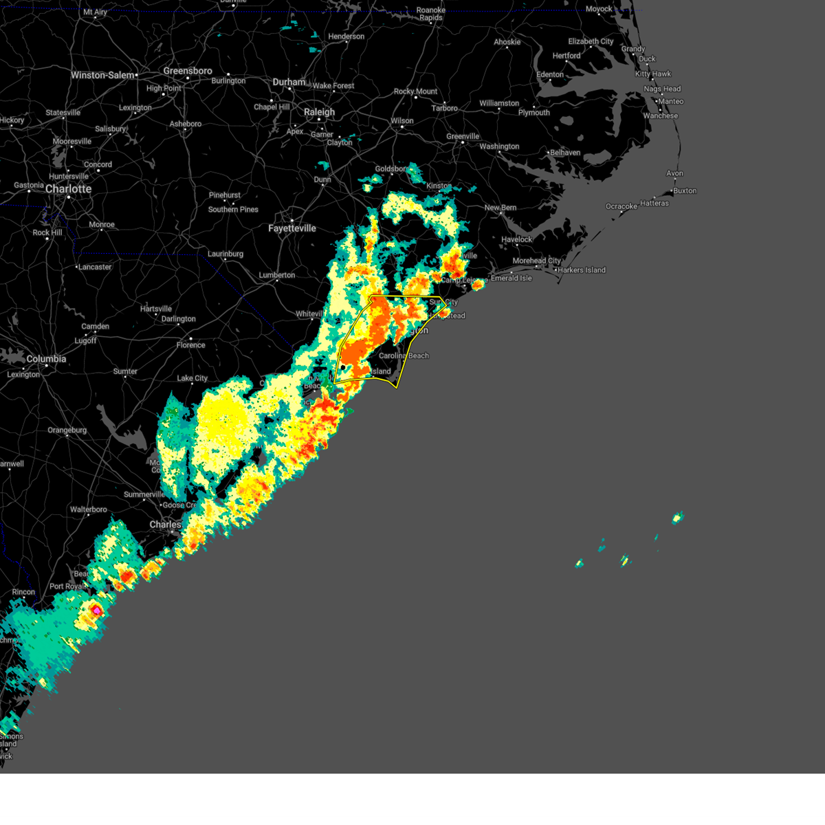
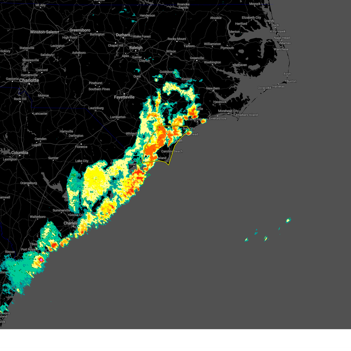
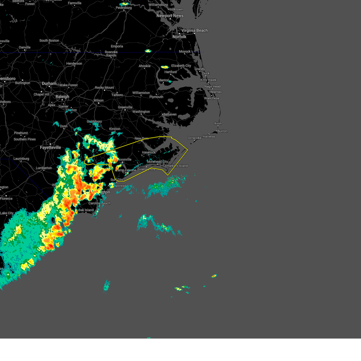
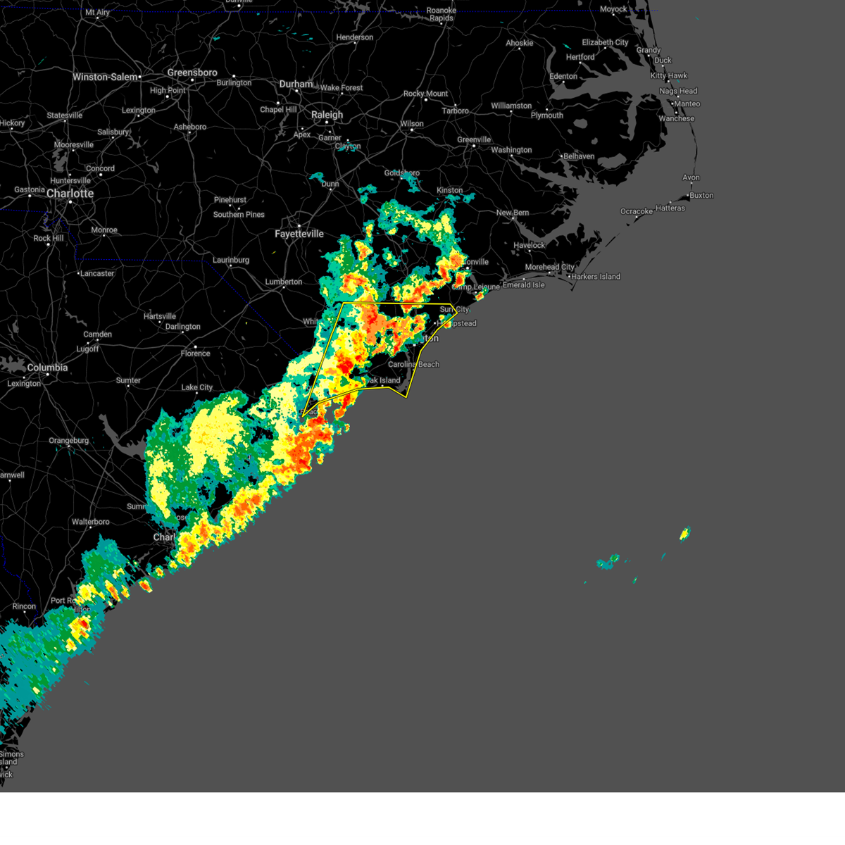
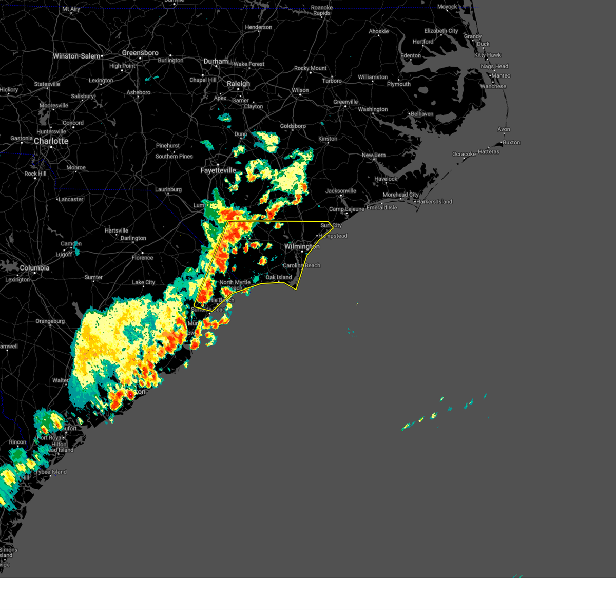
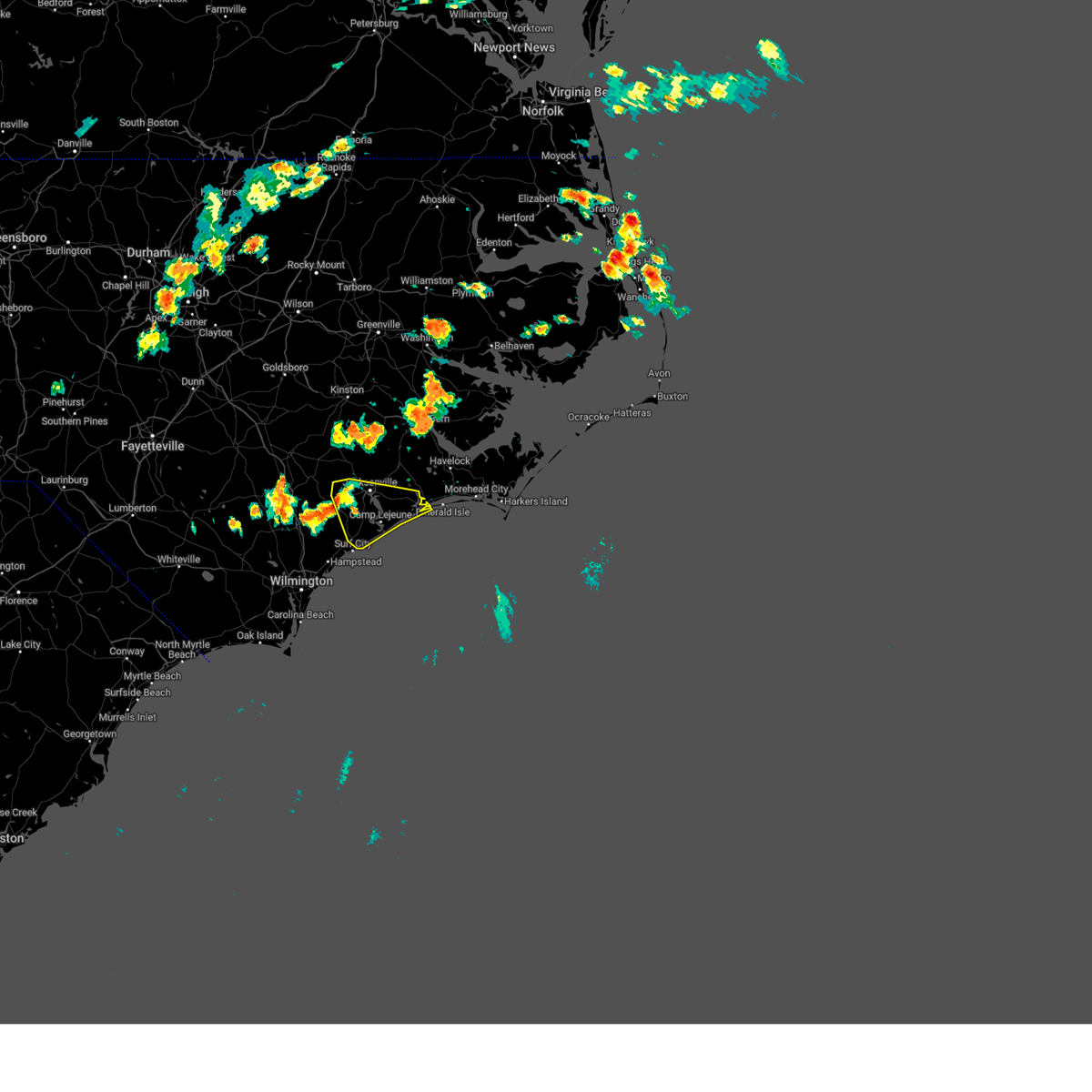
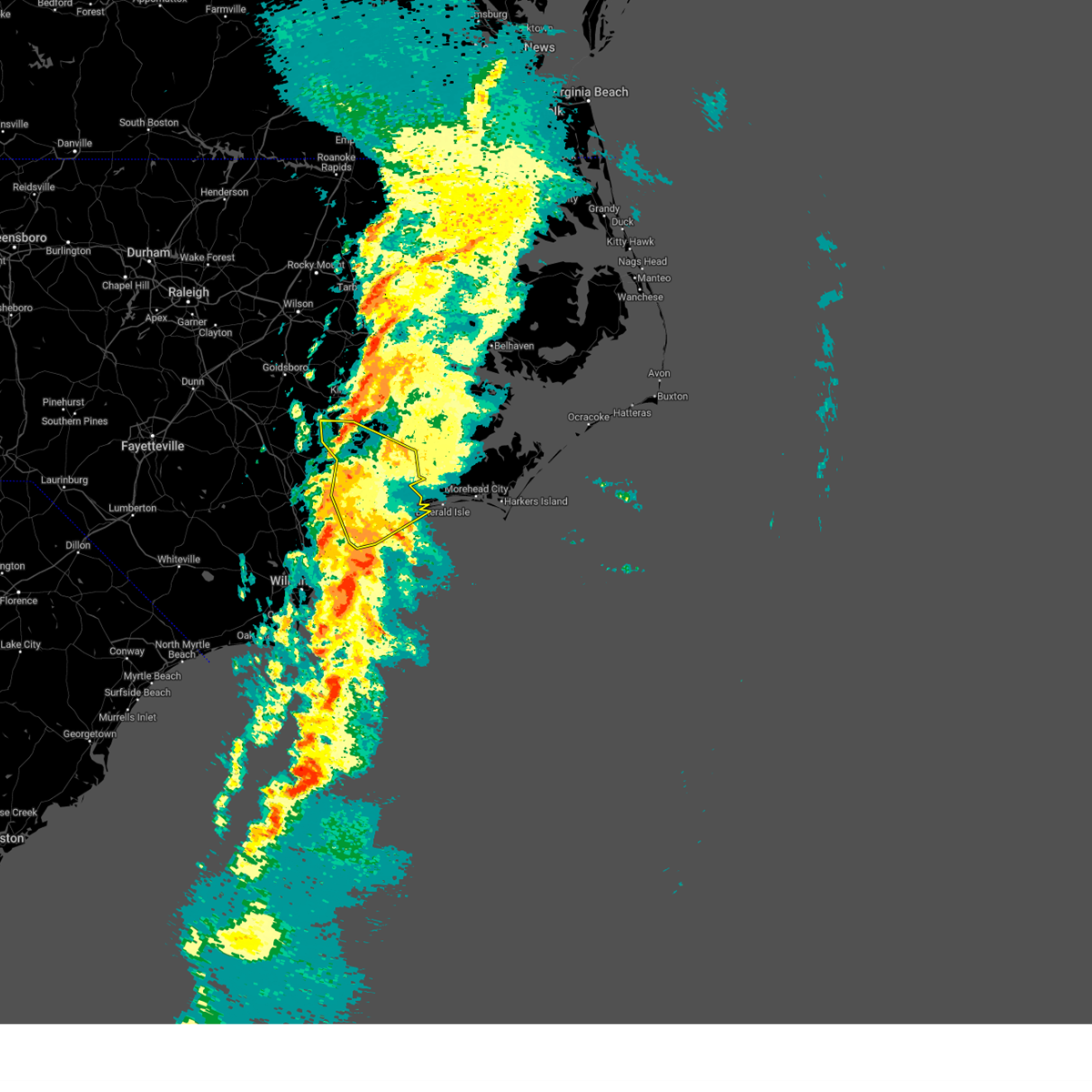
Hail Map for Surf City, NC
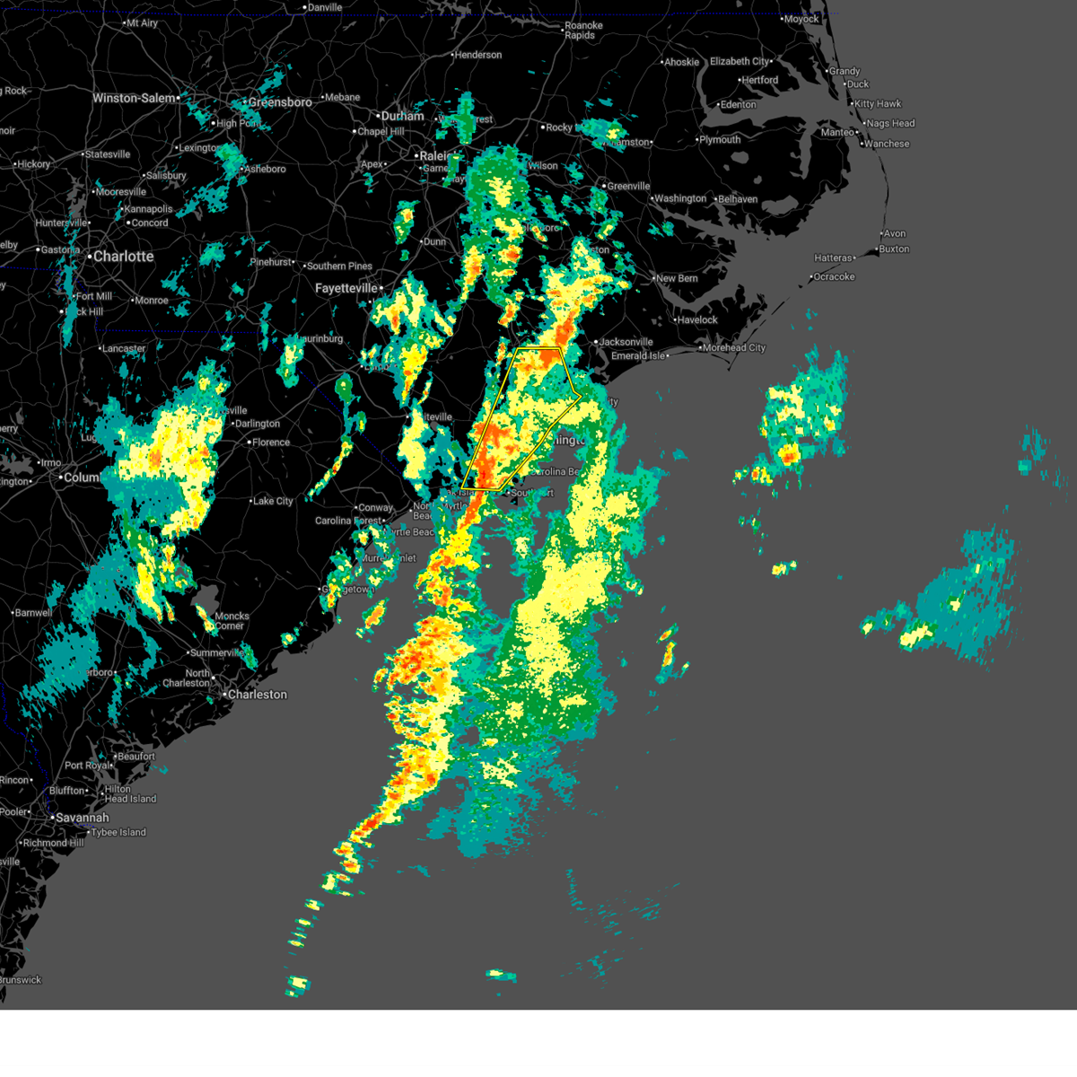
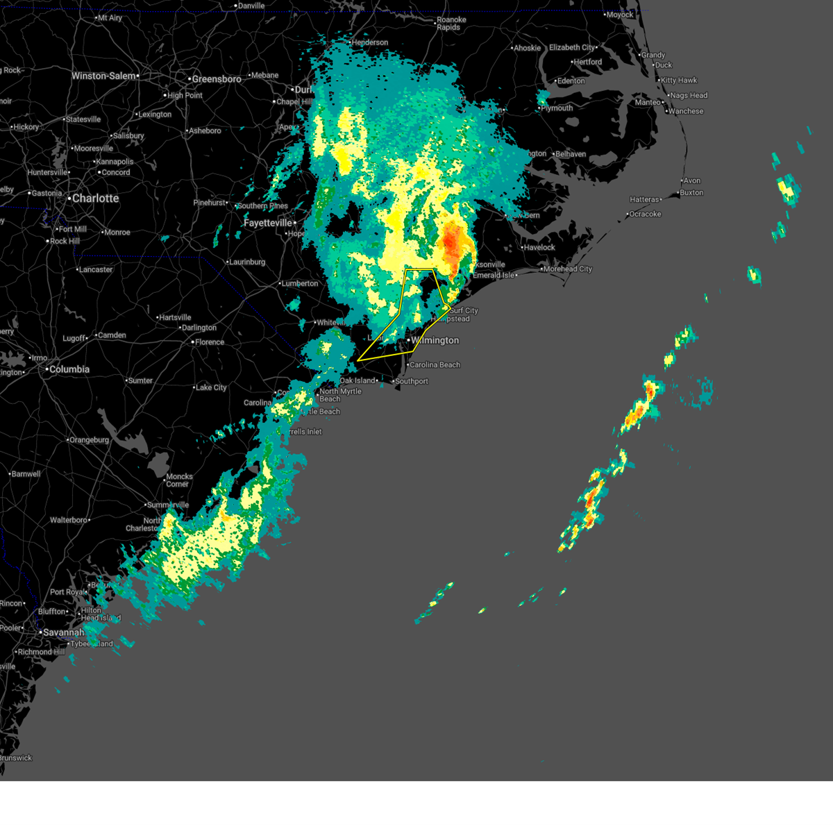
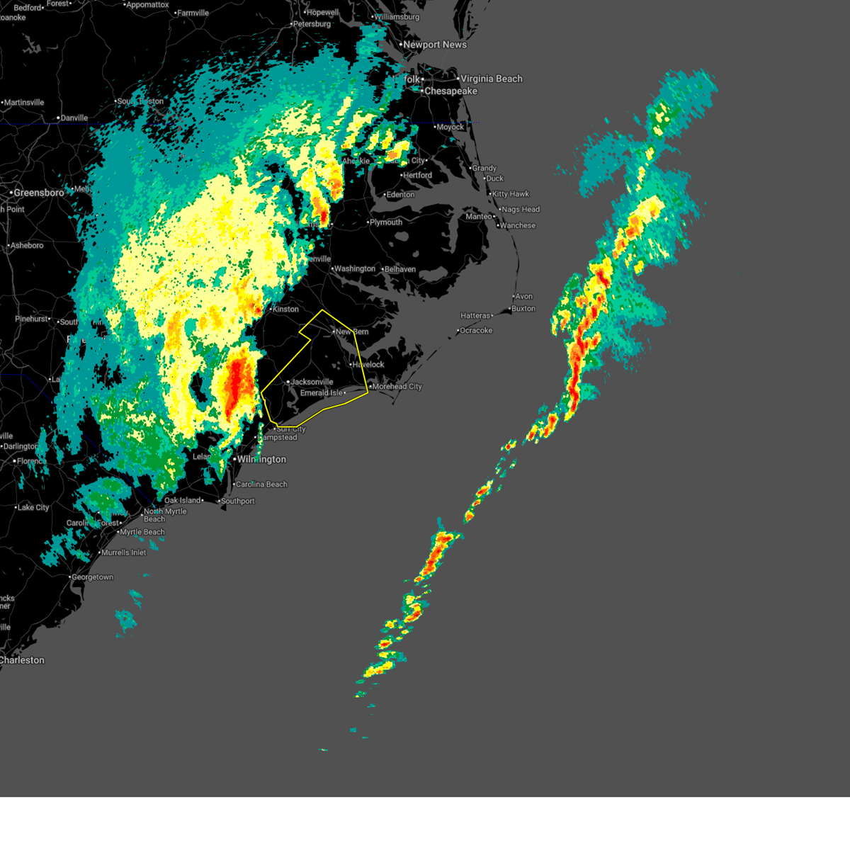
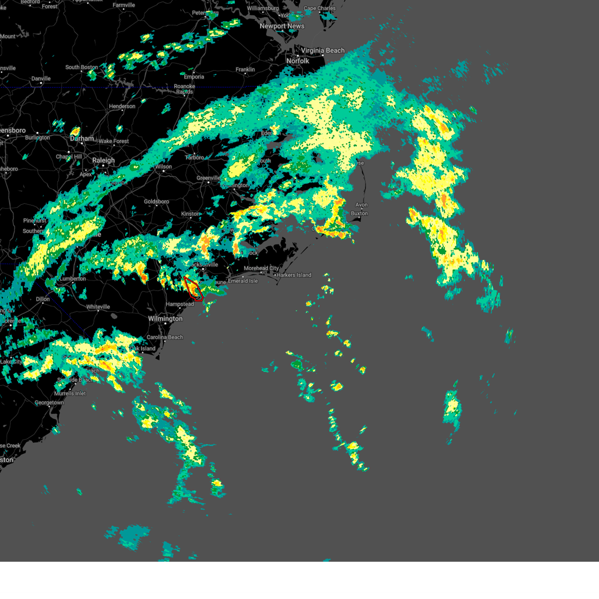
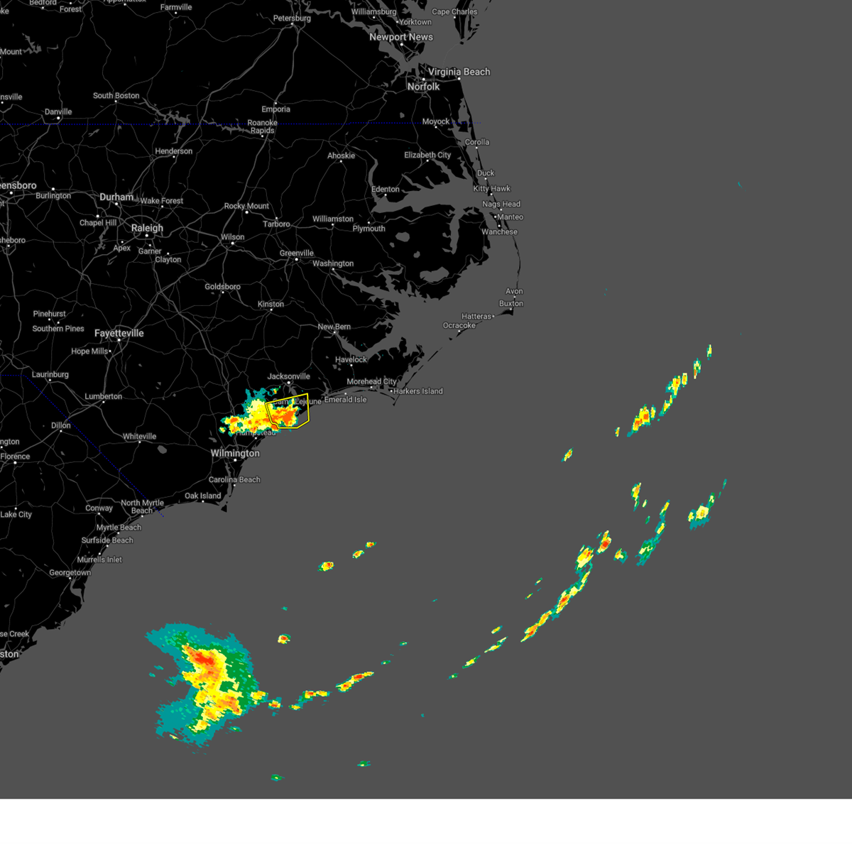
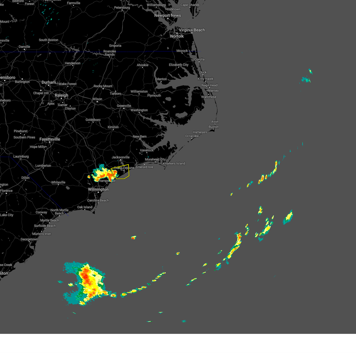
The Surf City, NC area has had 0 reports of on-the-ground hail by trained spotters, and has been under severe weather warnings 13 times during the past 12 months. Doppler radar has detected hail at or near Surf City, NC on 39 occasions, including 2 occasions during the past year.
| Name: | Surf City, NC |
| Where Located: | 25.6 miles NE of Wilmington, NC |
| Map: | Google Map for Surf City, NC |
| Population: | 1853 |
| Housing Units: | 3312 |
| More Info: | Search Google for Surf City, NC |
0
The Top Recent Hail Date for Surf City, NC is Wednesday, July 8, 2026 (37th out of 39)

Hail and Wind Damage Spotted near Surf City, NC
| Date / Time | Report Details |
|---|---|
| 7/8/2026 6:56 PM EDT |
 Svrilm the national weather service in wilmington has issued a * severe thunderstorm warning for, southeastern pender county in southeastern north carolina, * until 745 pm edt. * at 656 pm edt, a severe thunderstorm was located over topsail, or 7 miles north of rich inlet, and is nearly stationary (radar indicated). Hazards include 60 mph wind gusts and quarter size hail. Minor hail damage to vehicles is possible. Expect wind damage to trees and power lines. Svrilm the national weather service in wilmington has issued a * severe thunderstorm warning for, southeastern pender county in southeastern north carolina, * until 745 pm edt. * at 656 pm edt, a severe thunderstorm was located over topsail, or 7 miles north of rich inlet, and is nearly stationary (radar indicated). Hazards include 60 mph wind gusts and quarter size hail. Minor hail damage to vehicles is possible. Expect wind damage to trees and power lines.
|
| 5/11/2026 1:32 PM EDT |
 At 131 pm edt, a severe thunderstorm was located near verona, or near new river station, moving east at 40 mph (radar indicated). Hazards include 60 mph wind gusts and penny size hail. Expect damage to roofs, siding, and trees. Locations impacted include, jacksonville, north topsail beach, new river station, pumpkin center, piney green, half moon, camp lejeune center, stella, swansboro, hubert, catherine lake, folkstone, silverdale, kellum, midway park, verona, dixon, hammocks beach, onslow beach, and sneads ferry. At 131 pm edt, a severe thunderstorm was located near verona, or near new river station, moving east at 40 mph (radar indicated). Hazards include 60 mph wind gusts and penny size hail. Expect damage to roofs, siding, and trees. Locations impacted include, jacksonville, north topsail beach, new river station, pumpkin center, piney green, half moon, camp lejeune center, stella, swansboro, hubert, catherine lake, folkstone, silverdale, kellum, midway park, verona, dixon, hammocks beach, onslow beach, and sneads ferry.
|
| 5/11/2026 1:20 PM EDT |
 Svrmhx the national weather service in newport has issued a * severe thunderstorm warning for, onslow county in eastern north carolina, * until 200 pm edt. * at 119 pm edt, a severe thunderstorm was located over maple hill, or 13 miles west of new river station, moving east at 45 mph (radar indicated). Hazards include 60 mph wind gusts and penny size hail. expect damage to roofs, siding, and trees Svrmhx the national weather service in newport has issued a * severe thunderstorm warning for, onslow county in eastern north carolina, * until 200 pm edt. * at 119 pm edt, a severe thunderstorm was located over maple hill, or 13 miles west of new river station, moving east at 45 mph (radar indicated). Hazards include 60 mph wind gusts and penny size hail. expect damage to roofs, siding, and trees
|
| 5/11/2026 1:00 PM EDT |
 At 100 pm edt, severe thunderstorms were located along a line extending from cape fear community college north campus to near silver lake, moving east at 30 mph (radar indicated). Hazards include 60 mph wind gusts and quarter size hail. Minor hail damage to vehicles is possible. expect wind damage to trees and power lines. Locations impacted include, wilmington, wrightsville beach, surf city, south masonboro island, figure eight island, hampstead, topsail beach, cape fear community college north campus, wilmington international airport, myrtle grove, masonboro, murrayville, university of north carolina at wilmington, scotts hill, ogden, woodside, mayfaire, mill creek, silver lake, and topsail. At 100 pm edt, severe thunderstorms were located along a line extending from cape fear community college north campus to near silver lake, moving east at 30 mph (radar indicated). Hazards include 60 mph wind gusts and quarter size hail. Minor hail damage to vehicles is possible. expect wind damage to trees and power lines. Locations impacted include, wilmington, wrightsville beach, surf city, south masonboro island, figure eight island, hampstead, topsail beach, cape fear community college north campus, wilmington international airport, myrtle grove, masonboro, murrayville, university of north carolina at wilmington, scotts hill, ogden, woodside, mayfaire, mill creek, silver lake, and topsail.
|
| 5/11/2026 12:47 PM EDT |
 At 1247 pm edt, severe thunderstorms were located along a line extending from near wrightsboro to mill creek, moving east at 30 mph (radar indicated). Hazards include 60 mph wind gusts and quarter size hail. Minor hail damage to vehicles is possible. expect wind damage to trees and power lines. Locations impacted include, wilmington, leland, wrightsville beach, surf city, south masonboro island, figure eight island, hampstead, topsail beach, bishop, hightsville, cape fear community college north campus, wilmington international airport, myrtle grove, masonboro, murrayville, castle hayne, university of north carolina at wilmington, scotts hill, ogden, and winnabow. At 1247 pm edt, severe thunderstorms were located along a line extending from near wrightsboro to mill creek, moving east at 30 mph (radar indicated). Hazards include 60 mph wind gusts and quarter size hail. Minor hail damage to vehicles is possible. expect wind damage to trees and power lines. Locations impacted include, wilmington, leland, wrightsville beach, surf city, south masonboro island, figure eight island, hampstead, topsail beach, bishop, hightsville, cape fear community college north campus, wilmington international airport, myrtle grove, masonboro, murrayville, castle hayne, university of north carolina at wilmington, scotts hill, ogden, and winnabow.
|
| 5/11/2026 12:33 PM EDT |
 Svrilm the national weather service in wilmington has issued a * severe thunderstorm warning for, new hanover county in southeastern north carolina, southeastern pender county in southeastern north carolina, northeastern brunswick county in southeastern north carolina, * until 130 pm edt. * at 1233 pm edt, severe thunderstorms were located along a line extending from near northwest to near winnabow, moving east at 30 mph (radar indicated). Hazards include 60 mph wind gusts and quarter size hail. Minor hail damage to vehicles is possible. Expect wind damage to trees and power lines. Svrilm the national weather service in wilmington has issued a * severe thunderstorm warning for, new hanover county in southeastern north carolina, southeastern pender county in southeastern north carolina, northeastern brunswick county in southeastern north carolina, * until 130 pm edt. * at 1233 pm edt, severe thunderstorms were located along a line extending from near northwest to near winnabow, moving east at 30 mph (radar indicated). Hazards include 60 mph wind gusts and quarter size hail. Minor hail damage to vehicles is possible. Expect wind damage to trees and power lines.
|
| 3/16/2026 2:30 PM EDT |
 The storms which prompted the warning have weakened and the warning will be allowed to expire. however, gusty winds and heavy rain are still possible with these thunderstorms. a tornado watch remains in effect until 800 pm edt for southeastern north carolina. please send your reports of wind damage, including trees or large limbs downed, by calling the national weather service office in wilmington at 1 800 697 3901. The storms which prompted the warning have weakened and the warning will be allowed to expire. however, gusty winds and heavy rain are still possible with these thunderstorms. a tornado watch remains in effect until 800 pm edt for southeastern north carolina. please send your reports of wind damage, including trees or large limbs downed, by calling the national weather service office in wilmington at 1 800 697 3901.
|
| 3/16/2026 2:08 PM EDT |
 At 207 pm edt, severe thunderstorms were located along a line extending from maple hill to st. james, moving northeast at 70 mph (radar indicated). Hazards include 60 mph wind gusts. Expect wind damage to trees and power lines. Locations impacted include, wilmington, wrightsville beach, surf city, figure eight island, hampstead, boiling spring lakes, topsail beach, maple hill, myrtle grove, masonboro, scotts hill, and ogden. At 207 pm edt, severe thunderstorms were located along a line extending from maple hill to st. james, moving northeast at 70 mph (radar indicated). Hazards include 60 mph wind gusts. Expect wind damage to trees and power lines. Locations impacted include, wilmington, wrightsville beach, surf city, figure eight island, hampstead, boiling spring lakes, topsail beach, maple hill, myrtle grove, masonboro, scotts hill, and ogden.
|
| 3/16/2026 1:56 PM EDT |
 At 154 pm edt, strong to severe thunderstorms were from near burgaw to wilmington and oak, moving northeast at 50 mph (radar indicated). Hazards include 60 mph wind gusts. Expect some wind damage to trees and power lines. locations impacted include, wilmington, leland, burgaw, wrightsville beach, surf city, figure eight island, hampstead, boiling spring lakes, st. James, topsail beach, maple hill, hightsville, wilmington international airport, murrayville, castle hayne, ogden, and winnabow. At 154 pm edt, strong to severe thunderstorms were from near burgaw to wilmington and oak, moving northeast at 50 mph (radar indicated). Hazards include 60 mph wind gusts. Expect some wind damage to trees and power lines. locations impacted include, wilmington, leland, burgaw, wrightsville beach, surf city, figure eight island, hampstead, boiling spring lakes, st. James, topsail beach, maple hill, hightsville, wilmington international airport, murrayville, castle hayne, ogden, and winnabow.
|
| 3/16/2026 1:28 PM EDT |
 Svrilm the national weather service in wilmington has issued a * severe thunderstorm warning for, new hanover county in southeastern north carolina, pender county in southeastern north carolina, eastern brunswick county in southeastern north carolina, * until 230 pm edt. * at 127 pm edt, a severe thunderstorm was located between supply and boiling spring lakes, moving northeast at 50 mph (radar indicated). Hazards include 60 mph wind gusts. expect wind damage to trees and power lines Svrilm the national weather service in wilmington has issued a * severe thunderstorm warning for, new hanover county in southeastern north carolina, pender county in southeastern north carolina, eastern brunswick county in southeastern north carolina, * until 230 pm edt. * at 127 pm edt, a severe thunderstorm was located between supply and boiling spring lakes, moving northeast at 50 mph (radar indicated). Hazards include 60 mph wind gusts. expect wind damage to trees and power lines
|
| 3/12/2026 2:12 PM EDT |
 the severe thunderstorm warning has been cancelled and is no longer in effect the severe thunderstorm warning has been cancelled and is no longer in effect
|
| 3/12/2026 1:54 PM EDT |
 Svrmhx the national weather service in newport has issued a * severe thunderstorm warning for, southeastern jones county in eastern north carolina, southern craven county in eastern north carolina, onslow county in eastern north carolina, southwestern carteret county in eastern north carolina, southwestern pamlico county in eastern north carolina, * until 245 pm edt. * at 154 pm edt, severe thunderstorms were located along a line extending from near richlands to 6 miles east of maple hill to near topsail beach, moving northeast at 60 mph (radar indicated). Hazards include 60 mph wind gusts. expect damage to roofs, siding, and trees Svrmhx the national weather service in newport has issued a * severe thunderstorm warning for, southeastern jones county in eastern north carolina, southern craven county in eastern north carolina, onslow county in eastern north carolina, southwestern carteret county in eastern north carolina, southwestern pamlico county in eastern north carolina, * until 245 pm edt. * at 154 pm edt, severe thunderstorms were located along a line extending from near richlands to 6 miles east of maple hill to near topsail beach, moving northeast at 60 mph (radar indicated). Hazards include 60 mph wind gusts. expect damage to roofs, siding, and trees
|
| 3/12/2026 1:33 PM EDT |
 Svrilm the national weather service in wilmington has issued a * severe thunderstorm warning for, new hanover county in southeastern north carolina, eastern pender county in southeastern north carolina, northeastern brunswick county in southeastern north carolina, * until 230 pm edt. * at 133 pm edt, severe thunderstorms were located along a line extending from 7 miles east of willard to rocky point to 6 miles north of brunswick county community college main campus, moving east at 50 mph (radar indicated). Hazards include 60 mph wind gusts. expect wind damage to trees and power lines Svrilm the national weather service in wilmington has issued a * severe thunderstorm warning for, new hanover county in southeastern north carolina, eastern pender county in southeastern north carolina, northeastern brunswick county in southeastern north carolina, * until 230 pm edt. * at 133 pm edt, severe thunderstorms were located along a line extending from 7 miles east of willard to rocky point to 6 miles north of brunswick county community college main campus, moving east at 50 mph (radar indicated). Hazards include 60 mph wind gusts. expect wind damage to trees and power lines
|
| 6/10/2025 2:02 PM EDT |
 Svrmhx the national weather service in newport has issued a * severe thunderstorm warning for, jones county in eastern north carolina, southwestern craven county in eastern north carolina, onslow county in eastern north carolina, southeastern duplin county in eastern north carolina, southwestern carteret county in eastern north carolina, * until 245 pm edt. * at 201 pm edt, a severe thunderstorm was located over topsail beach, or near surf city, moving northeast at 55 mph (radar indicated). Hazards include 60 mph wind gusts. expect damage to roofs, siding, and trees Svrmhx the national weather service in newport has issued a * severe thunderstorm warning for, jones county in eastern north carolina, southwestern craven county in eastern north carolina, onslow county in eastern north carolina, southeastern duplin county in eastern north carolina, southwestern carteret county in eastern north carolina, * until 245 pm edt. * at 201 pm edt, a severe thunderstorm was located over topsail beach, or near surf city, moving northeast at 55 mph (radar indicated). Hazards include 60 mph wind gusts. expect damage to roofs, siding, and trees
|
| 6/8/2025 3:10 PM EDT |
 At 309 pm edt, severe thunderstorms were located along a line extending from havelock to near hammocks beach state park, moving east at 55 mph (radar indicated). Hazards include 70 mph wind gusts and ping pong ball size hail. People and animals outdoors will be injured. expect hail damage to roofs, siding, windows, and vehicles. expect considerable tree damage. wind damage is also likely to mobile homes, roofs, and outbuildings. Locations impacted include, jacksonville, new bern, havelock, morehead city, north topsail beach, newport, cedar island, harkers island, pumpkin center, piney green, new river station, camp lejeune center, stella, swansboro, hubert, south river, cape carteret, north river, davis, and straits. At 309 pm edt, severe thunderstorms were located along a line extending from havelock to near hammocks beach state park, moving east at 55 mph (radar indicated). Hazards include 70 mph wind gusts and ping pong ball size hail. People and animals outdoors will be injured. expect hail damage to roofs, siding, windows, and vehicles. expect considerable tree damage. wind damage is also likely to mobile homes, roofs, and outbuildings. Locations impacted include, jacksonville, new bern, havelock, morehead city, north topsail beach, newport, cedar island, harkers island, pumpkin center, piney green, new river station, camp lejeune center, stella, swansboro, hubert, south river, cape carteret, north river, davis, and straits.
|
| 6/8/2025 2:58 PM EDT |
 The storms are moving off the coast and the threat to land is diminishing. the warning will be allowed to expire. however, heavy rain is still possible with these thunderstorms. please send your reports of hail and/or wind damage, including trees or large limbs downed, by calling the national weather service office in wilmington at 1-800-697-3901. The storms are moving off the coast and the threat to land is diminishing. the warning will be allowed to expire. however, heavy rain is still possible with these thunderstorms. please send your reports of hail and/or wind damage, including trees or large limbs downed, by calling the national weather service office in wilmington at 1-800-697-3901.
|
| 6/8/2025 2:52 PM EDT |
 At 251 pm edt, severe thunderstorms were located along a line extending from near surf city to masonboro to caswell beach, moving east at 45 mph (public). Hazards include 60 mph wind gusts. Expect wind damage to trees and power lines. Locations impacted include, wilmington, oak island, carolina beach, wrightsville beach, kure beach, surf city, caswell beach, bald head island, figure eight island, rich inlet, masonboro island, hampstead, southport, topsail beach, myrtle grove, and masonboro. At 251 pm edt, severe thunderstorms were located along a line extending from near surf city to masonboro to caswell beach, moving east at 45 mph (public). Hazards include 60 mph wind gusts. Expect wind damage to trees and power lines. Locations impacted include, wilmington, oak island, carolina beach, wrightsville beach, kure beach, surf city, caswell beach, bald head island, figure eight island, rich inlet, masonboro island, hampstead, southport, topsail beach, myrtle grove, and masonboro.
|
| 6/8/2025 2:51 PM EDT |
 At 251 pm edt, severe thunderstorms were located along a line extending from near kuhns to sea view pier, moving northeast at 50 mph (radar indicated). Hazards include 70 mph wind gusts and ping pong ball size hail. People and animals outdoors will be injured. expect hail damage to roofs, siding, windows, and vehicles. expect considerable tree damage. wind damage is also likely to mobile homes, roofs, and outbuildings. Locations impacted include, jacksonville, new bern, havelock, morehead city, north topsail beach, newport, cedar island, harkers island, pumpkin center, piney green, new river station, half moon, camp lejeune center, james city, stella, swansboro, hubert, south river, cape carteret, and north river. At 251 pm edt, severe thunderstorms were located along a line extending from near kuhns to sea view pier, moving northeast at 50 mph (radar indicated). Hazards include 70 mph wind gusts and ping pong ball size hail. People and animals outdoors will be injured. expect hail damage to roofs, siding, windows, and vehicles. expect considerable tree damage. wind damage is also likely to mobile homes, roofs, and outbuildings. Locations impacted include, jacksonville, new bern, havelock, morehead city, north topsail beach, newport, cedar island, harkers island, pumpkin center, piney green, new river station, half moon, camp lejeune center, james city, stella, swansboro, hubert, south river, cape carteret, and north river.
|
| 6/8/2025 2:51 PM EDT |
 the severe thunderstorm warning has been cancelled and is no longer in effect the severe thunderstorm warning has been cancelled and is no longer in effect
|
| 6/8/2025 2:39 PM EDT |
 At 238 pm edt, severe thunderstorms were located along a line extending from near ashton to wilmington to oak island, moving east at 70 mph (radar indicated). Hazards include 60 mph wind gusts and quarter size hail. Minor hail damage to vehicles is possible. expect wind damage to trees and power lines. locations impacted include, wilmington, leland, oak island, carolina beach, wrightsville beach, kure beach, surf city, holden beach, caswell beach, bald head island, masonboro island, figure eight island, hampstead, boiling spring lakes, st. James, and southport. At 238 pm edt, severe thunderstorms were located along a line extending from near ashton to wilmington to oak island, moving east at 70 mph (radar indicated). Hazards include 60 mph wind gusts and quarter size hail. Minor hail damage to vehicles is possible. expect wind damage to trees and power lines. locations impacted include, wilmington, leland, oak island, carolina beach, wrightsville beach, kure beach, surf city, holden beach, caswell beach, bald head island, masonboro island, figure eight island, hampstead, boiling spring lakes, st. James, and southport.
|
| 6/8/2025 2:39 PM EDT |
 the severe thunderstorm warning has been cancelled and is no longer in effect the severe thunderstorm warning has been cancelled and is no longer in effect
|
| 6/8/2025 2:26 PM EDT |
 the severe thunderstorm warning has been cancelled and is no longer in effect the severe thunderstorm warning has been cancelled and is no longer in effect
|
| 6/8/2025 2:26 PM EDT |
 At 224 pm edt, severe thunderstorms were located along a line extending from currie to near riegelwood to near ocean isle beach, moving east at 35 mph (radar indicated). Hazards include 60 mph wind gusts and quarter size hail. Minor hail damage to vehicles is possible. expect wind damage to trees and power lines. Locations impacted include, wilmington, leland, oak island, carolina beach, shallotte, sunset beach, wrightsville beach, kure beach, surf city, holden beach, ocean isle beach, caswell beach, bald head island, masonboro island, figure eight island, and hampstead. At 224 pm edt, severe thunderstorms were located along a line extending from currie to near riegelwood to near ocean isle beach, moving east at 35 mph (radar indicated). Hazards include 60 mph wind gusts and quarter size hail. Minor hail damage to vehicles is possible. expect wind damage to trees and power lines. Locations impacted include, wilmington, leland, oak island, carolina beach, shallotte, sunset beach, wrightsville beach, kure beach, surf city, holden beach, ocean isle beach, caswell beach, bald head island, masonboro island, figure eight island, and hampstead.
|
| 6/8/2025 2:10 PM EDT |
 Svrmhx the national weather service in newport has issued a * severe thunderstorm warning for, southeastern jones county in eastern north carolina, southeastern craven county in eastern north carolina, onslow county in eastern north carolina, southern duplin county in eastern north carolina, carteret county in eastern north carolina, southern pamlico county in eastern north carolina, * until 330 pm edt. * at 209 pm edt, severe thunderstorms were located along a line extending from near maple hill to ogden, moving east at 55 mph (radar indicated). Hazards include 60 mph wind gusts and quarter size hail. Hail damage to vehicles is expected. Expect wind damage to roofs, siding, and trees. Svrmhx the national weather service in newport has issued a * severe thunderstorm warning for, southeastern jones county in eastern north carolina, southeastern craven county in eastern north carolina, onslow county in eastern north carolina, southern duplin county in eastern north carolina, carteret county in eastern north carolina, southern pamlico county in eastern north carolina, * until 330 pm edt. * at 209 pm edt, severe thunderstorms were located along a line extending from near maple hill to ogden, moving east at 55 mph (radar indicated). Hazards include 60 mph wind gusts and quarter size hail. Hail damage to vehicles is expected. Expect wind damage to roofs, siding, and trees.
|
| 6/8/2025 2:09 PM EDT |
 At 207 pm edt, severe thunderstorms were located along a line extending from near the borough to near honey island to near little river entrance, moving east at 50 mph (radar indicated). Hazards include 60 mph wind gusts and quarter size hail. Minor hail damage to vehicles is possible. expect wind damage to trees and power lines. Locations impacted include, wilmington, myrtle beach, north myrtle beach, leland, oak island, carolina beach, shallotte, sunset beach, wrightsville beach, kure beach, surf city, holden beach, ocean isle beach, caswell beach, bald head island, snows cut, little river entrance, south masonboro island, ocean crest pier, and figure eight island. At 207 pm edt, severe thunderstorms were located along a line extending from near the borough to near honey island to near little river entrance, moving east at 50 mph (radar indicated). Hazards include 60 mph wind gusts and quarter size hail. Minor hail damage to vehicles is possible. expect wind damage to trees and power lines. Locations impacted include, wilmington, myrtle beach, north myrtle beach, leland, oak island, carolina beach, shallotte, sunset beach, wrightsville beach, kure beach, surf city, holden beach, ocean isle beach, caswell beach, bald head island, snows cut, little river entrance, south masonboro island, ocean crest pier, and figure eight island.
|
| 6/8/2025 1:43 PM EDT |
 Svrilm the national weather service in wilmington has issued a * severe thunderstorm warning for, new hanover county in southeastern north carolina, southern pender county in southeastern north carolina, southern bladen county in southeastern north carolina, brunswick county in southeastern north carolina, columbus county in southeastern north carolina, central horry county in northeastern south carolina, * until 300 pm edt. * at 142 pm edt, severe thunderstorms were located along a line extending from near council to near williams to forestbrook, moving east at 45 mph (radar indicated). Hazards include 60 mph wind gusts and quarter size hail. Minor hail damage to vehicles is possible. Expect wind damage to trees and power lines. Svrilm the national weather service in wilmington has issued a * severe thunderstorm warning for, new hanover county in southeastern north carolina, southern pender county in southeastern north carolina, southern bladen county in southeastern north carolina, brunswick county in southeastern north carolina, columbus county in southeastern north carolina, central horry county in northeastern south carolina, * until 300 pm edt. * at 142 pm edt, severe thunderstorms were located along a line extending from near council to near williams to forestbrook, moving east at 45 mph (radar indicated). Hazards include 60 mph wind gusts and quarter size hail. Minor hail damage to vehicles is possible. Expect wind damage to trees and power lines.
|
| 6/7/2025 6:45 PM EDT |
 The storm which prompted the warning has weakened slightly, however, gusty winds are still possible with this thunderstorm. please send your reports of hail and/or wind damage, including trees or large limbs downed, by calling the national weather service office in wilmington at 1-800-697-3901. The storm which prompted the warning has weakened slightly, however, gusty winds are still possible with this thunderstorm. please send your reports of hail and/or wind damage, including trees or large limbs downed, by calling the national weather service office in wilmington at 1-800-697-3901.
|
| 6/7/2025 6:31 PM EDT |
 At 631 pm edt, severe thunderstorms were located along a line extending from near swansboro to 7 miles northwest of edgecomb, moving east at 20 mph (radar indicated). Hazards include 60 mph wind gusts and quarter size hail. Hail damage to vehicles is expected. expect wind damage to roofs, siding, and trees. Locations impacted include, jacksonville, north topsail beach, new river station, camp lejeune center, piney green, swansboro, hubert, folkstone, midway park, verona, dixon, hammocks beach, onslow beach, sneads ferry, hammocks beach state park, sea view pier, bogue inlet pier, holly ridge, and haws run. At 631 pm edt, severe thunderstorms were located along a line extending from near swansboro to 7 miles northwest of edgecomb, moving east at 20 mph (radar indicated). Hazards include 60 mph wind gusts and quarter size hail. Hail damage to vehicles is expected. expect wind damage to roofs, siding, and trees. Locations impacted include, jacksonville, north topsail beach, new river station, camp lejeune center, piney green, swansboro, hubert, folkstone, midway park, verona, dixon, hammocks beach, onslow beach, sneads ferry, hammocks beach state park, sea view pier, bogue inlet pier, holly ridge, and haws run.
|
| 6/7/2025 6:13 PM EDT |
 Svrilm the national weather service in wilmington has issued a * severe thunderstorm warning for, northeastern pender county in southeastern north carolina, * until 645 pm edt. * at 613 pm edt, a severe thunderstorm was located over white stocking, or 7 miles northeast of burgaw, moving east at 35 mph (radar indicated). Hazards include 60 mph wind gusts and penny size hail. expect wind damage to trees and power lines Svrilm the national weather service in wilmington has issued a * severe thunderstorm warning for, northeastern pender county in southeastern north carolina, * until 645 pm edt. * at 613 pm edt, a severe thunderstorm was located over white stocking, or 7 miles northeast of burgaw, moving east at 35 mph (radar indicated). Hazards include 60 mph wind gusts and penny size hail. expect wind damage to trees and power lines
|
| 6/7/2025 5:47 PM EDT |
 Svrmhx the national weather service in newport has issued a * severe thunderstorm warning for, onslow county in eastern north carolina, * until 645 pm edt. * at 547 pm edt, severe thunderstorms were located along a line extending from 6 miles south of catherine lake to near white stocking, moving east at 35 mph (radar indicated). Hazards include 60 mph wind gusts and quarter size hail. Hail damage to vehicles is expected. Expect wind damage to roofs, siding, and trees. Svrmhx the national weather service in newport has issued a * severe thunderstorm warning for, onslow county in eastern north carolina, * until 645 pm edt. * at 547 pm edt, severe thunderstorms were located along a line extending from 6 miles south of catherine lake to near white stocking, moving east at 35 mph (radar indicated). Hazards include 60 mph wind gusts and quarter size hail. Hail damage to vehicles is expected. Expect wind damage to roofs, siding, and trees.
|
| 5/4/2025 6:49 AM EDT |
 Svrmhx the national weather service in newport has issued a * severe thunderstorm warning for, southeastern onslow county in eastern north carolina, western carteret county in eastern north carolina, * until 715 am edt. * at 649 am edt, a severe thunderstorm was located over north topsail beach, moving northeast at 50 mph (radar indicated). Hazards include 60 mph wind gusts. expect damage to roofs, siding, and trees Svrmhx the national weather service in newport has issued a * severe thunderstorm warning for, southeastern onslow county in eastern north carolina, western carteret county in eastern north carolina, * until 715 am edt. * at 649 am edt, a severe thunderstorm was located over north topsail beach, moving northeast at 50 mph (radar indicated). Hazards include 60 mph wind gusts. expect damage to roofs, siding, and trees
|
| 4/11/2025 8:08 PM EDT |
 Svrmhx the national weather service in newport has issued a * severe thunderstorm warning for, southern onslow county in eastern north carolina, * until 845 pm edt. * at 808 pm edt, a severe thunderstorm was located over folkstone, or 7 miles northwest of north topsail beach, moving east at 40 mph (radar indicated). Hazards include 60 mph wind gusts and quarter size hail. Hail damage to vehicles is expected. Expect wind damage to roofs, siding, and trees. Svrmhx the national weather service in newport has issued a * severe thunderstorm warning for, southern onslow county in eastern north carolina, * until 845 pm edt. * at 808 pm edt, a severe thunderstorm was located over folkstone, or 7 miles northwest of north topsail beach, moving east at 40 mph (radar indicated). Hazards include 60 mph wind gusts and quarter size hail. Hail damage to vehicles is expected. Expect wind damage to roofs, siding, and trees.
|
| 3/5/2025 3:45 PM EST |
 Svrmhx the national weather service in newport has issued a * severe thunderstorm warning for, eastern jones county in eastern north carolina, craven county in eastern north carolina, onslow county in eastern north carolina, southern beaufort county in eastern north carolina, carteret county in eastern north carolina, pamlico county in eastern north carolina, * until 500 pm est. * at 345 pm est, severe thunderstorms were located along a line extending from near belgrade to 14 miles southeast of topsail beach, moving northeast at 60 mph (radar indicated). Hazards include 70 mph wind gusts. Expect considerable tree damage. Damage is likely to mobile homes, roofs, and outbuildings. Svrmhx the national weather service in newport has issued a * severe thunderstorm warning for, eastern jones county in eastern north carolina, craven county in eastern north carolina, onslow county in eastern north carolina, southern beaufort county in eastern north carolina, carteret county in eastern north carolina, pamlico county in eastern north carolina, * until 500 pm est. * at 345 pm est, severe thunderstorms were located along a line extending from near belgrade to 14 miles southeast of topsail beach, moving northeast at 60 mph (radar indicated). Hazards include 70 mph wind gusts. Expect considerable tree damage. Damage is likely to mobile homes, roofs, and outbuildings.
|
| 3/5/2025 3:32 PM EST |
 the severe thunderstorm warning has been cancelled and is no longer in effect the severe thunderstorm warning has been cancelled and is no longer in effect
|
| 3/5/2025 3:32 PM EST |
 At 332 pm est, severe thunderstorms were located along a line extending from near old ford to near hubert, moving northeast at 80 mph (radar indicated). Hazards include 70 mph wind gusts. Expect considerable tree damage. damage is likely to mobile homes, roofs, and outbuildings. Locations impacted include, belgrade, new river station, albert j ellis airport, hargetts crossroads, haws run, hubert, deppe, pumpkin center, richlands, loco vfd, piney green, pink hill, sneads ferry, petersburg, hammocks beach, phillips crossroads, hammocks beach state park, catherine lake, jacksonville, and sea view pier. At 332 pm est, severe thunderstorms were located along a line extending from near old ford to near hubert, moving northeast at 80 mph (radar indicated). Hazards include 70 mph wind gusts. Expect considerable tree damage. damage is likely to mobile homes, roofs, and outbuildings. Locations impacted include, belgrade, new river station, albert j ellis airport, hargetts crossroads, haws run, hubert, deppe, pumpkin center, richlands, loco vfd, piney green, pink hill, sneads ferry, petersburg, hammocks beach, phillips crossroads, hammocks beach state park, catherine lake, jacksonville, and sea view pier.
|
| 3/5/2025 3:04 PM EST |
 At 304 pm est, severe thunderstorms were located along a line extending from near wyse fork to topsail, moving northeast at 80 mph (radar indicated). Hazards include 70 mph wind gusts. Expect considerable tree damage. damage is likely to mobile homes, roofs, and outbuildings. Locations impacted include, belgrade, new river station, albert j ellis airport, hargetts crossroads, haws run, hubert, deppe, pumpkin center, richlands, loco vfd, kornegay, piney green, pink hill, sneads ferry, potters hill, petersburg, hammocks beach, phillips crossroads, albertson, and hammocks beach state park. At 304 pm est, severe thunderstorms were located along a line extending from near wyse fork to topsail, moving northeast at 80 mph (radar indicated). Hazards include 70 mph wind gusts. Expect considerable tree damage. damage is likely to mobile homes, roofs, and outbuildings. Locations impacted include, belgrade, new river station, albert j ellis airport, hargetts crossroads, haws run, hubert, deppe, pumpkin center, richlands, loco vfd, kornegay, piney green, pink hill, sneads ferry, potters hill, petersburg, hammocks beach, phillips crossroads, albertson, and hammocks beach state park.
|
| 3/5/2025 2:42 PM EST |
 Svrmhx the national weather service in newport has issued a * severe thunderstorm warning for, jones county in eastern north carolina, southwestern lenoir county in eastern north carolina, onslow county in eastern north carolina, duplin county in eastern north carolina, * until 345 pm est. * at 242 pm est, severe thunderstorms were located along a line extending from near kenansville to near mill creek, moving northeast at 80 mph (radar indicated). Hazards include 70 mph wind gusts. Expect considerable tree damage. Damage is likely to mobile homes, roofs, and outbuildings. Svrmhx the national weather service in newport has issued a * severe thunderstorm warning for, jones county in eastern north carolina, southwestern lenoir county in eastern north carolina, onslow county in eastern north carolina, duplin county in eastern north carolina, * until 345 pm est. * at 242 pm est, severe thunderstorms were located along a line extending from near kenansville to near mill creek, moving northeast at 80 mph (radar indicated). Hazards include 70 mph wind gusts. Expect considerable tree damage. Damage is likely to mobile homes, roofs, and outbuildings.
|
| 8/7/2024 2:02 PM EDT |
 Tormhx the national weather service in newport has issued a * tornado warning for, southwestern onslow county in eastern north carolina, * until 230 pm edt. * at 202 pm edt, a severe thunderstorm capable of producing a tornado was located over north topsail beach, moving northwest at 25 mph (radar indicated rotation). Hazards include tornado. Flying debris will be dangerous to those caught without shelter. mobile homes will be damaged or destroyed. damage to roofs, windows, and vehicles will occur. tree damage is likely. this dangerous storm will be near, folkstone around 205 pm edt. Other locations impacted by this tornadic thunderstorm include holly ridge. Tormhx the national weather service in newport has issued a * tornado warning for, southwestern onslow county in eastern north carolina, * until 230 pm edt. * at 202 pm edt, a severe thunderstorm capable of producing a tornado was located over north topsail beach, moving northwest at 25 mph (radar indicated rotation). Hazards include tornado. Flying debris will be dangerous to those caught without shelter. mobile homes will be damaged or destroyed. damage to roofs, windows, and vehicles will occur. tree damage is likely. this dangerous storm will be near, folkstone around 205 pm edt. Other locations impacted by this tornadic thunderstorm include holly ridge.
|
| 8/2/2024 9:20 AM EDT |
 At 919 am edt, a severe thunderstorm was located over sea view pier, or near north topsail beach, moving east at 20 mph (mesonet observation. at 915 am, a 58 mph wind gust was measured in holly ridge). Hazards include 60 mph wind gusts. Expect damage to roofs, siding, and trees. Locations impacted include, jacksonville, north topsail beach, folkstone, dixon, onslow beach, sneads ferry, sea view pier, and holly ridge. At 919 am edt, a severe thunderstorm was located over sea view pier, or near north topsail beach, moving east at 20 mph (mesonet observation. at 915 am, a 58 mph wind gust was measured in holly ridge). Hazards include 60 mph wind gusts. Expect damage to roofs, siding, and trees. Locations impacted include, jacksonville, north topsail beach, folkstone, dixon, onslow beach, sneads ferry, sea view pier, and holly ridge.
|
| 8/2/2024 8:57 AM EDT |
 Svrmhx the national weather service in newport has issued a * severe thunderstorm warning for, southwestern onslow county in eastern north carolina, * until 945 am edt. * at 857 am edt, a severe thunderstorm was located near folkstone, or near surf city, moving east at 20 mph (radar indicated). Hazards include 60 mph wind gusts. expect damage to roofs, siding, and trees Svrmhx the national weather service in newport has issued a * severe thunderstorm warning for, southwestern onslow county in eastern north carolina, * until 945 am edt. * at 857 am edt, a severe thunderstorm was located near folkstone, or near surf city, moving east at 20 mph (radar indicated). Hazards include 60 mph wind gusts. expect damage to roofs, siding, and trees
|
| 6/24/2024 4:37 PM EDT |
 The storm which prompted the warning has moved out of the area. therefore, the warning will be allowed to expire. a severe thunderstorm watch remains in effect until 800 pm edt for southeastern north carolina. please send your reports of hail and/or wind damage, including trees or large limbs downed, by calling the national weather service office in wilmington at 1-800-697-3901. The storm which prompted the warning has moved out of the area. therefore, the warning will be allowed to expire. a severe thunderstorm watch remains in effect until 800 pm edt for southeastern north carolina. please send your reports of hail and/or wind damage, including trees or large limbs downed, by calling the national weather service office in wilmington at 1-800-697-3901.
|
| 6/24/2024 4:29 PM EDT |
 At 428 pm edt, a severe thunderstorm was located over topsail beach, or near surf city, moving northeast at 35 mph (radar indicated). Hazards include 60 mph wind gusts and quarter size hail. Minor hail damage to vehicles is possible. expect wind damage to trees and power lines. Locations impacted include, figure eight island, hampstead, topsail beach, topsail, scotts hill, porters neck, woodside, bayshore, and ogden. At 428 pm edt, a severe thunderstorm was located over topsail beach, or near surf city, moving northeast at 35 mph (radar indicated). Hazards include 60 mph wind gusts and quarter size hail. Minor hail damage to vehicles is possible. expect wind damage to trees and power lines. Locations impacted include, figure eight island, hampstead, topsail beach, topsail, scotts hill, porters neck, woodside, bayshore, and ogden.
|
| 6/24/2024 4:17 PM EDT |
 Svrilm the national weather service in wilmington has issued a * severe thunderstorm warning for, northeastern new hanover county in southeastern north carolina, southeastern pender county in southeastern north carolina, * until 445 pm edt. * at 417 pm edt, a severe thunderstorm was located over rich inlet, moving northeast at 45 mph (radar indicated). Hazards include quarter size hail. minor damage to vehicles is possible Svrilm the national weather service in wilmington has issued a * severe thunderstorm warning for, northeastern new hanover county in southeastern north carolina, southeastern pender county in southeastern north carolina, * until 445 pm edt. * at 417 pm edt, a severe thunderstorm was located over rich inlet, moving northeast at 45 mph (radar indicated). Hazards include quarter size hail. minor damage to vehicles is possible
|
| 6/6/2024 6:50 PM EDT |
 the severe thunderstorm warning has been cancelled and is no longer in effect the severe thunderstorm warning has been cancelled and is no longer in effect
|
| 6/6/2024 6:34 PM EDT |
 At 634 pm edt, a severe thunderstorm was located over folkstone, or near north topsail beach, moving northeast at 40 mph (radar indicated). Hazards include 60 mph wind gusts. Expect damage to roofs, siding, and trees. Locations impacted include, jacksonville, north topsail beach, swansboro, hubert, folkstone, silverdale, dixon, hammocks beach, onslow beach, sneads ferry, hammocks beach state park, sea view pier, and holly ridge. At 634 pm edt, a severe thunderstorm was located over folkstone, or near north topsail beach, moving northeast at 40 mph (radar indicated). Hazards include 60 mph wind gusts. Expect damage to roofs, siding, and trees. Locations impacted include, jacksonville, north topsail beach, swansboro, hubert, folkstone, silverdale, dixon, hammocks beach, onslow beach, sneads ferry, hammocks beach state park, sea view pier, and holly ridge.
|
| 6/6/2024 6:21 PM EDT |
 Svrmhx the national weather service in newport has issued a * severe thunderstorm warning for, onslow county in eastern north carolina, * until 700 pm edt. * at 619 pm edt, a severe thunderstorm was located near edgecomb, or 8 miles northwest of surf city, moving northeast at 40 mph (radar indicated). Hazards include 60 mph wind gusts and penny size hail. expect damage to roofs, siding, and trees Svrmhx the national weather service in newport has issued a * severe thunderstorm warning for, onslow county in eastern north carolina, * until 700 pm edt. * at 619 pm edt, a severe thunderstorm was located near edgecomb, or 8 miles northwest of surf city, moving northeast at 40 mph (radar indicated). Hazards include 60 mph wind gusts and penny size hail. expect damage to roofs, siding, and trees
|
| 5/24/2024 5:21 PM EDT |
 Svrmhx the national weather service in newport has issued a * severe thunderstorm warning for, southern onslow county in eastern north carolina, * until 600 pm edt. * at 520 pm edt, severe thunderstorms were located along a line extending from near silverdale to 7 miles north of edgecomb, moving east at 20 mph (radar indicated). Hazards include 60 mph wind gusts and quarter size hail. Hail damage to vehicles is expected. Expect wind damage to roofs, siding, and trees. Svrmhx the national weather service in newport has issued a * severe thunderstorm warning for, southern onslow county in eastern north carolina, * until 600 pm edt. * at 520 pm edt, severe thunderstorms were located along a line extending from near silverdale to 7 miles north of edgecomb, moving east at 20 mph (radar indicated). Hazards include 60 mph wind gusts and quarter size hail. Hail damage to vehicles is expected. Expect wind damage to roofs, siding, and trees.
|
| 5/15/2024 9:25 PM EDT |
 The storms which prompted the warning are weakening below severe limits and will soon pose no significant threat to life or property. therefore, the warning will be allowed to expire. however, gusty winds and heavy rain will remain possible with these thunderstorms after the warning expires. please send your reports of hail and/or wind damage, including trees or large limbs downed, by calling the national weather service office in wilmington at 1-800-697-3901. The storms which prompted the warning are weakening below severe limits and will soon pose no significant threat to life or property. therefore, the warning will be allowed to expire. however, gusty winds and heavy rain will remain possible with these thunderstorms after the warning expires. please send your reports of hail and/or wind damage, including trees or large limbs downed, by calling the national weather service office in wilmington at 1-800-697-3901.
|
| 5/15/2024 9:12 PM EDT |
 Svrmhx the national weather service in newport has issued a * severe thunderstorm warning for, south central onslow county in eastern north carolina, * until 930 pm edt. * at 912 pm edt, a severe thunderstorm was located over surf city, moving east at 35 mph (radar indicated). Hazards include 70 mph wind gusts. Expect considerable tree damage. Damage is likely to mobile homes, roofs, and outbuildings. Svrmhx the national weather service in newport has issued a * severe thunderstorm warning for, south central onslow county in eastern north carolina, * until 930 pm edt. * at 912 pm edt, a severe thunderstorm was located over surf city, moving east at 35 mph (radar indicated). Hazards include 70 mph wind gusts. Expect considerable tree damage. Damage is likely to mobile homes, roofs, and outbuildings.
|
| 5/15/2024 9:10 PM EDT |
 At 909 pm edt, severe thunderstorms were located along a line extending from edgecomb to sea breeze, moving east at 40 mph (radar indicated. at 0850 pm 58 mph winds were reported at wilmington airport). Hazards include 60 mph wind gusts and quarter size hail. Minor hail damage to vehicles is possible. expect wind damage to trees and power lines. Locations impacted include, wilmington, leland, carolina beach, wrightsville beach, kure beach, surf city, snows cut, south masonboro island, figure eight island, rich inlet, north masonboro island, hampstead, boiling spring lakes, topsail beach, maple hill, hightsville, cape fear community college north campus, wilmington international airport, murrayville, and castle hayne. At 909 pm edt, severe thunderstorms were located along a line extending from edgecomb to sea breeze, moving east at 40 mph (radar indicated. at 0850 pm 58 mph winds were reported at wilmington airport). Hazards include 60 mph wind gusts and quarter size hail. Minor hail damage to vehicles is possible. expect wind damage to trees and power lines. Locations impacted include, wilmington, leland, carolina beach, wrightsville beach, kure beach, surf city, snows cut, south masonboro island, figure eight island, rich inlet, north masonboro island, hampstead, boiling spring lakes, topsail beach, maple hill, hightsville, cape fear community college north campus, wilmington international airport, murrayville, and castle hayne.
|
| 5/15/2024 8:49 PM EDT |
 Svrilm the national weather service in wilmington has issued a * severe thunderstorm warning for, new hanover county in southeastern north carolina, pender county in southeastern north carolina, northeastern brunswick county in southeastern north carolina, * until 930 pm edt. * at 849 pm edt, severe thunderstorms were located along a line extending from near maple hill to near leland, moving east at 50 mph (radar indicated). Hazards include 60 mph wind gusts and quarter size hail. Minor hail damage to vehicles is possible. Expect wind damage to trees and power lines. Svrilm the national weather service in wilmington has issued a * severe thunderstorm warning for, new hanover county in southeastern north carolina, pender county in southeastern north carolina, northeastern brunswick county in southeastern north carolina, * until 930 pm edt. * at 849 pm edt, severe thunderstorms were located along a line extending from near maple hill to near leland, moving east at 50 mph (radar indicated). Hazards include 60 mph wind gusts and quarter size hail. Minor hail damage to vehicles is possible. Expect wind damage to trees and power lines.
|
| 5/15/2024 5:36 PM EDT |
 At 536 pm edt, a severe thunderstorm was located near cypress creek, or 11 miles west of new river station, moving northeast at 30 mph (radar indicated). Hazards include golf ball size hail and 60 mph wind gusts. People and animals outdoors will be injured. expect hail damage to roofs, siding, windows, and vehicles. expect wind damage to roofs, siding, and trees. Locations impacted include, jacksonville, north topsail beach, new river station, pumpkin center, piney green, half moon, camp lejeune center, swansboro, hubert, richlands, catherine lake, folkstone, silverdale, kellum, cypress creek, midway park, verona, dixon, belgrade, and petersburg. At 536 pm edt, a severe thunderstorm was located near cypress creek, or 11 miles west of new river station, moving northeast at 30 mph (radar indicated). Hazards include golf ball size hail and 60 mph wind gusts. People and animals outdoors will be injured. expect hail damage to roofs, siding, windows, and vehicles. expect wind damage to roofs, siding, and trees. Locations impacted include, jacksonville, north topsail beach, new river station, pumpkin center, piney green, half moon, camp lejeune center, swansboro, hubert, richlands, catherine lake, folkstone, silverdale, kellum, cypress creek, midway park, verona, dixon, belgrade, and petersburg.
|
| 5/15/2024 5:06 PM EDT |
 Svrmhx the national weather service in newport has issued a * severe thunderstorm warning for, onslow county in eastern north carolina, southeastern duplin county in eastern north carolina, * until 600 pm edt. * at 506 pm edt, a severe thunderstorm was located near white stocking, or 8 miles east of burgaw, moving northeast at 35 mph (radar indicated). Hazards include 60 mph wind gusts and quarter size hail. Hail damage to vehicles is expected. Expect wind damage to roofs, siding, and trees. Svrmhx the national weather service in newport has issued a * severe thunderstorm warning for, onslow county in eastern north carolina, southeastern duplin county in eastern north carolina, * until 600 pm edt. * at 506 pm edt, a severe thunderstorm was located near white stocking, or 8 miles east of burgaw, moving northeast at 35 mph (radar indicated). Hazards include 60 mph wind gusts and quarter size hail. Hail damage to vehicles is expected. Expect wind damage to roofs, siding, and trees.
|
| 5/10/2024 5:05 PM EDT |
 Svrmhx the national weather service in newport has issued a * severe thunderstorm warning for, southeastern jones county in eastern north carolina, south central craven county in eastern north carolina, onslow county in eastern north carolina, southeastern duplin county in eastern north carolina, southwestern carteret county in eastern north carolina, * until 615 pm edt. * at 504 pm edt, a severe thunderstorm was located near chinquapin, or 9 miles east of wallace, moving east at 40 mph (radar indicated. at 4:20 pm, 1.75in hail was reported in garland, sampson county). Hazards include 60 mph wind gusts and quarter size hail. Hail damage to vehicles is expected. Expect wind damage to roofs, siding, and trees. Svrmhx the national weather service in newport has issued a * severe thunderstorm warning for, southeastern jones county in eastern north carolina, south central craven county in eastern north carolina, onslow county in eastern north carolina, southeastern duplin county in eastern north carolina, southwestern carteret county in eastern north carolina, * until 615 pm edt. * at 504 pm edt, a severe thunderstorm was located near chinquapin, or 9 miles east of wallace, moving east at 40 mph (radar indicated. at 4:20 pm, 1.75in hail was reported in garland, sampson county). Hazards include 60 mph wind gusts and quarter size hail. Hail damage to vehicles is expected. Expect wind damage to roofs, siding, and trees.
|
| 4/12/2024 7:44 PM EDT |
 Svrmhx the national weather service in newport has issued a * severe thunderstorm warning for, jones county in eastern north carolina, central craven county in eastern north carolina, onslow county in eastern north carolina, * until 900 pm edt. * at 743 pm edt, severe thunderstorms were located along a line extending from near albertson to 6 miles southeast of kenansville to near burgaw, moving east at 45 mph (law enforcement. these thunderstorms have a history of producing tree damage and wind gusts to 60 mph). Hazards include 60 mph wind gusts. expect damage to roofs, siding, and trees Svrmhx the national weather service in newport has issued a * severe thunderstorm warning for, jones county in eastern north carolina, central craven county in eastern north carolina, onslow county in eastern north carolina, * until 900 pm edt. * at 743 pm edt, severe thunderstorms were located along a line extending from near albertson to 6 miles southeast of kenansville to near burgaw, moving east at 45 mph (law enforcement. these thunderstorms have a history of producing tree damage and wind gusts to 60 mph). Hazards include 60 mph wind gusts. expect damage to roofs, siding, and trees
|
| 1/9/2024 7:30 PM EST |
 At 728 pm est, severe thunderstorms were located along a line extending from near bowdens to 12 miles south of holden beach, moving east at 45 mph. the wilmington international airport recently observed a gust to 73 miles per hour. these are destructive storms for new hanover and pender counties (radar confirmed by automated surface observing station). Hazards include 80 mph wind gusts. Flying debris will be dangerous to those caught without shelter. mobile homes will be heavily damaged. expect considerable damage to roofs, windows, and vehicles. extensive tree damage and power outages are likely. Locations impacted include, wilmington, leland, oak island, carolina beach, burgaw, shallotte, sunset beach, wrightsville beach, kure beach, surf city, holden beach, ocean isle beach, caswell beach, bald head island, snows cut, south masonboro island, ocean crest pier, figure eight island, yaupon beach, and rich inlet. At 728 pm est, severe thunderstorms were located along a line extending from near bowdens to 12 miles south of holden beach, moving east at 45 mph. the wilmington international airport recently observed a gust to 73 miles per hour. these are destructive storms for new hanover and pender counties (radar confirmed by automated surface observing station). Hazards include 80 mph wind gusts. Flying debris will be dangerous to those caught without shelter. mobile homes will be heavily damaged. expect considerable damage to roofs, windows, and vehicles. extensive tree damage and power outages are likely. Locations impacted include, wilmington, leland, oak island, carolina beach, burgaw, shallotte, sunset beach, wrightsville beach, kure beach, surf city, holden beach, ocean isle beach, caswell beach, bald head island, snows cut, south masonboro island, ocean crest pier, figure eight island, yaupon beach, and rich inlet.
|
| 1/9/2024 7:18 PM EST |
 At 718 pm est, severe thunderstorms were located along a line extending from near bowdens to 13 miles south of ocean isle beach, moving east at 40 mph (radar indicated). Hazards include 70 mph wind gusts. Expect considerable tree damage. damage is likely to mobile homes, roofs, and outbuildings. Locations impacted include, wilmington, leland, oak island, carolina beach, burgaw, shallotte, sunset beach, wrightsville beach, kure beach, surf city, holden beach, ocean isle beach, caswell beach, bald head island, snows cut, south masonboro island, ocean crest pier, figure eight island, yaupon beach, and rich inlet. At 718 pm est, severe thunderstorms were located along a line extending from near bowdens to 13 miles south of ocean isle beach, moving east at 40 mph (radar indicated). Hazards include 70 mph wind gusts. Expect considerable tree damage. damage is likely to mobile homes, roofs, and outbuildings. Locations impacted include, wilmington, leland, oak island, carolina beach, burgaw, shallotte, sunset beach, wrightsville beach, kure beach, surf city, holden beach, ocean isle beach, caswell beach, bald head island, snows cut, south masonboro island, ocean crest pier, figure eight island, yaupon beach, and rich inlet.
|
| 1/9/2024 7:01 PM EST |
 At 701 pm est, severe thunderstorms were located along a line extending from 7 miles southwest of warsaw to 9 miles south of cherry grove beach, moving east at 45 mph (radar indicated). Hazards include 70 mph wind gusts. Expect considerable tree damage. damage is likely to mobile homes, roofs, and outbuildings. Locations impacted include, wilmington, north myrtle beach, leland, oak island, carolina beach, burgaw, shallotte, sunset beach, wrightsville beach, kure beach, surf city, holden beach, ocean isle beach, caswell beach, bald head island, snows cut, little river entrance, south masonboro island, ocean crest pier, and figure eight island. At 701 pm est, severe thunderstorms were located along a line extending from 7 miles southwest of warsaw to 9 miles south of cherry grove beach, moving east at 45 mph (radar indicated). Hazards include 70 mph wind gusts. Expect considerable tree damage. damage is likely to mobile homes, roofs, and outbuildings. Locations impacted include, wilmington, north myrtle beach, leland, oak island, carolina beach, burgaw, shallotte, sunset beach, wrightsville beach, kure beach, surf city, holden beach, ocean isle beach, caswell beach, bald head island, snows cut, little river entrance, south masonboro island, ocean crest pier, and figure eight island.
|
| 1/9/2024 6:53 PM EST |
 At 653 pm est, a severe thunderstorm was located over north topsail beach, moving north at 70 mph (radar indicated). Hazards include 70 mph wind gusts. Expect considerable tree damage. Damage is likely to mobile homes, roofs, and outbuildings. At 653 pm est, a severe thunderstorm was located over north topsail beach, moving north at 70 mph (radar indicated). Hazards include 70 mph wind gusts. Expect considerable tree damage. Damage is likely to mobile homes, roofs, and outbuildings.
|
| 1/9/2024 6:26 PM EST |
 The severe thunderstorm warning for southeastern pender county will expire at 630 pm est, the storm which prompted the warning has moved out of the area. therefore, the warning will be allowed to expire. a tornado watch remains in effect until 900 pm est for southeastern north carolina. The severe thunderstorm warning for southeastern pender county will expire at 630 pm est, the storm which prompted the warning has moved out of the area. therefore, the warning will be allowed to expire. a tornado watch remains in effect until 900 pm est for southeastern north carolina.
|
| 1/9/2024 6:25 PM EST |
 The tornado warning for southeastern pender county will expire at 630 pm est, the storm which prompted the warning has moved out of the area. therefore, the warning will be allowed to expire. a tornado watch remains in effect until 900 pm est for southeastern north carolina. The tornado warning for southeastern pender county will expire at 630 pm est, the storm which prompted the warning has moved out of the area. therefore, the warning will be allowed to expire. a tornado watch remains in effect until 900 pm est for southeastern north carolina.
|
| 1/9/2024 6:17 PM EST |
 At 616 pm est, a severe thunderstorm was located over woodside, or near surf city, moving northeast at 65 mph. a tornado warning is in effect for eastern pender county (radar indicated). Hazards include 60 mph wind gusts. Expect wind damage to trees and power lines. Locations impacted include, surf city, hampstead, topsail beach, topsail, scotts hill, woodside, and edgecomb. At 616 pm est, a severe thunderstorm was located over woodside, or near surf city, moving northeast at 65 mph. a tornado warning is in effect for eastern pender county (radar indicated). Hazards include 60 mph wind gusts. Expect wind damage to trees and power lines. Locations impacted include, surf city, hampstead, topsail beach, topsail, scotts hill, woodside, and edgecomb.
|
| 1/9/2024 6:12 PM EST |
 At 612 pm est, a severe thunderstorm capable of producing a tornado was located over woodside, or near surf city, moving north at 75 mph (radar indicated rotation). Hazards include tornado. Flying debris will be dangerous to those caught without shelter. mobile homes will be damaged or destroyed. damage to roofs, windows, and vehicles will occur. tree damage is likely. This dangerous storm will be near, surf city, topsail beach, edgecomb, and woodside around 615 pm est. At 612 pm est, a severe thunderstorm capable of producing a tornado was located over woodside, or near surf city, moving north at 75 mph (radar indicated rotation). Hazards include tornado. Flying debris will be dangerous to those caught without shelter. mobile homes will be damaged or destroyed. damage to roofs, windows, and vehicles will occur. tree damage is likely. This dangerous storm will be near, surf city, topsail beach, edgecomb, and woodside around 615 pm est.
|
| 1/9/2024 5:59 PM EST |
 At 559 pm est, a severe thunderstorm was located over johnny mercer pier, moving northeast at 65 mph (radar indicated). Hazards include 60 mph wind gusts. expect wind damage to trees and power lines At 559 pm est, a severe thunderstorm was located over johnny mercer pier, moving northeast at 65 mph (radar indicated). Hazards include 60 mph wind gusts. expect wind damage to trees and power lines
|
| 1/9/2024 5:09 PM EST |
 At 509 pm est, a severe thunderstorm capable of producing a tornado was located over surf city, moving north at 75 mph (radar indicated rotation). Hazards include tornado. Flying debris will be dangerous to those caught without shelter. mobile homes will be damaged or destroyed. damage to roofs, windows, and vehicles will occur. tree damage is likely. this dangerous storm will be near, north topsail beach and folkstone around 515 pm est. jacksonville, dixon, and verona around 520 pm est. camp lejeune center and new river station around 525 pm est. pumpkin center and kellum around 530 pm est. Other locations impacted by this tornadic thunderstorm include holly ridge and haws run. At 509 pm est, a severe thunderstorm capable of producing a tornado was located over surf city, moving north at 75 mph (radar indicated rotation). Hazards include tornado. Flying debris will be dangerous to those caught without shelter. mobile homes will be damaged or destroyed. damage to roofs, windows, and vehicles will occur. tree damage is likely. this dangerous storm will be near, north topsail beach and folkstone around 515 pm est. jacksonville, dixon, and verona around 520 pm est. camp lejeune center and new river station around 525 pm est. pumpkin center and kellum around 530 pm est. Other locations impacted by this tornadic thunderstorm include holly ridge and haws run.
|
| 1/9/2024 5:06 PM EST |
 At 506 pm est, a severe thunderstorm capable of producing a tornado was located near topsail beach, or near rich inlet, moving northeast at 65 mph (radar indicated rotation). Hazards include tornado and quarter size hail. Flying debris will be dangerous to those caught without shelter. mobile homes will be damaged or destroyed. damage to roofs, windows, and vehicles will occur. tree damage is likely. This dangerous storm will be near, surf city, topsail beach, and edgecomb around 510 pm est. At 506 pm est, a severe thunderstorm capable of producing a tornado was located near topsail beach, or near rich inlet, moving northeast at 65 mph (radar indicated rotation). Hazards include tornado and quarter size hail. Flying debris will be dangerous to those caught without shelter. mobile homes will be damaged or destroyed. damage to roofs, windows, and vehicles will occur. tree damage is likely. This dangerous storm will be near, surf city, topsail beach, and edgecomb around 510 pm est.
|
| 1/9/2024 5:01 PM EST |
 At 501 pm est, a severe thunderstorm was located near rich inlet, moving north at 60 mph (radar indicated). Hazards include 70 mph wind gusts. Expect considerable tree damage. Damage is likely to mobile homes, roofs, and outbuildings. At 501 pm est, a severe thunderstorm was located near rich inlet, moving north at 60 mph (radar indicated). Hazards include 70 mph wind gusts. Expect considerable tree damage. Damage is likely to mobile homes, roofs, and outbuildings.
|
| 1/9/2024 5:00 PM EST |
 At 500 pm est, a severe thunderstorm was located near rich inlet, moving northeast at 60 mph (radar indicated). Hazards include 60 mph wind gusts and quarter size hail. Minor hail damage to vehicles is possible. expect wind damage to trees and power lines. locations impacted include, surf city, hampstead, topsail beach, topsail, woodside, and edgecomb. hail threat, radar indicated max hail size, 1. 00 in wind threat, radar indicated max wind gust, 60 mph. At 500 pm est, a severe thunderstorm was located near rich inlet, moving northeast at 60 mph (radar indicated). Hazards include 60 mph wind gusts and quarter size hail. Minor hail damage to vehicles is possible. expect wind damage to trees and power lines. locations impacted include, surf city, hampstead, topsail beach, topsail, woodside, and edgecomb. hail threat, radar indicated max hail size, 1. 00 in wind threat, radar indicated max wind gust, 60 mph.
|
| 1/9/2024 4:39 PM EST |
 At 438 pm est, a severe thunderstorm was located over kure beach, moving northeast at 60 mph (radar indicated). Hazards include 60 mph wind gusts and quarter size hail. Minor hail damage to vehicles is possible. Expect wind damage to trees and power lines. At 438 pm est, a severe thunderstorm was located over kure beach, moving northeast at 60 mph (radar indicated). Hazards include 60 mph wind gusts and quarter size hail. Minor hail damage to vehicles is possible. Expect wind damage to trees and power lines.
|
| 12/17/2023 8:27 PM EST |
 At 826 pm est, severe thunderstorms were located along a line extending from near cypress creek to near dixon to near sea view pier, moving north at 60 mph (radar indicated). Hazards include 60 mph wind gusts. expect damage to roofs, siding, and trees At 826 pm est, severe thunderstorms were located along a line extending from near cypress creek to near dixon to near sea view pier, moving north at 60 mph (radar indicated). Hazards include 60 mph wind gusts. expect damage to roofs, siding, and trees
|
| 12/17/2023 7:46 PM EST |
 At 746 pm est, severe thunderstorms were located along a line extending from woodside to 27 miles east of kure beach, moving north at 45 mph (radar indicated). Hazards include 60 mph wind gusts. expect damage to roofs, siding, and trees At 746 pm est, severe thunderstorms were located along a line extending from woodside to 27 miles east of kure beach, moving north at 45 mph (radar indicated). Hazards include 60 mph wind gusts. expect damage to roofs, siding, and trees
|
| 8/10/2023 6:35 PM EDT |
 At 634 pm edt, a severe thunderstorm was located over midway park, or over piney green, moving east at 35 mph (radar indicated). Hazards include 60 mph wind gusts. Expect damage to roofs, siding, and trees. locations impacted include, jacksonville, havelock, morehead city, north topsail beach, newport, piney green, camp lejeune center, stella, swansboro, hubert, cape carteret, pine knoll shores, silverdale, midway park, broad creek, wildwood, kuhns, peletier, bogue and hammocks beach. hail threat, radar indicated max hail size, <. 75 in wind threat, radar indicated max wind gust, 60 mph. At 634 pm edt, a severe thunderstorm was located over midway park, or over piney green, moving east at 35 mph (radar indicated). Hazards include 60 mph wind gusts. Expect damage to roofs, siding, and trees. locations impacted include, jacksonville, havelock, morehead city, north topsail beach, newport, piney green, camp lejeune center, stella, swansboro, hubert, cape carteret, pine knoll shores, silverdale, midway park, broad creek, wildwood, kuhns, peletier, bogue and hammocks beach. hail threat, radar indicated max hail size, <. 75 in wind threat, radar indicated max wind gust, 60 mph.
|
| 8/10/2023 6:17 PM EDT |
 At 617 pm edt, a severe thunderstorm was located over verona, or near new river station, moving east at 35 mph (radar indicated). Hazards include 60 mph wind gusts. expect damage to roofs, siding, and trees At 617 pm edt, a severe thunderstorm was located over verona, or near new river station, moving east at 35 mph (radar indicated). Hazards include 60 mph wind gusts. expect damage to roofs, siding, and trees
|
| 8/10/2023 1:50 PM EDT |
 The severe thunderstorm warning for new hanover, southeastern pender and southeastern brunswick counties will expire at 200 pm edt, the storms which prompted the warning have weakened below severe limits, and have exited the warned area. therefore, the warning will be allowed to expire. The severe thunderstorm warning for new hanover, southeastern pender and southeastern brunswick counties will expire at 200 pm edt, the storms which prompted the warning have weakened below severe limits, and have exited the warned area. therefore, the warning will be allowed to expire.
|
| 8/10/2023 1:41 PM EDT |
 At 141 pm edt, a severe thunderstorm was located over edgecomb, or over surf city, moving east at 50 mph (radar indicated). Hazards include 60 mph wind gusts. expect damage to roofs, siding, and trees At 141 pm edt, a severe thunderstorm was located over edgecomb, or over surf city, moving east at 50 mph (radar indicated). Hazards include 60 mph wind gusts. expect damage to roofs, siding, and trees
|
| 8/10/2023 1:38 PM EDT |
 At 138 pm edt, severe thunderstorms were located along a line extending from near maple hill to near sea breeze, moving northeast at 45 mph (radar indicated). Hazards include 60 mph wind gusts and penny size hail. Expect wind damage to trees and power lines. locations impacted include, wilmington, oak island, carolina beach, wrightsville beach, kure beach, surf city, caswell beach, bald head island, south masonboro island, snows cut, yaupon beach, figure eight island, north masonboro island, hampstead, boiling spring lakes, southport, topsail beach, hightsville, cape fear community college north campus, and wilmington international airport. hail threat, radar indicated max hail size, 0. 75 in wind threat, radar indicated max wind gust, 60 mph. At 138 pm edt, severe thunderstorms were located along a line extending from near maple hill to near sea breeze, moving northeast at 45 mph (radar indicated). Hazards include 60 mph wind gusts and penny size hail. Expect wind damage to trees and power lines. locations impacted include, wilmington, oak island, carolina beach, wrightsville beach, kure beach, surf city, caswell beach, bald head island, south masonboro island, snows cut, yaupon beach, figure eight island, north masonboro island, hampstead, boiling spring lakes, southport, topsail beach, hightsville, cape fear community college north campus, and wilmington international airport. hail threat, radar indicated max hail size, 0. 75 in wind threat, radar indicated max wind gust, 60 mph.
|
| 8/10/2023 1:17 PM EDT |
 At 117 pm edt, severe thunderstorms were located along a line extending from burgaw to near st. james, moving northeast at 45 mph (radar indicated). Hazards include 60 mph wind gusts and penny size hail. expect wind damage to trees and power lines At 117 pm edt, severe thunderstorms were located along a line extending from burgaw to near st. james, moving northeast at 45 mph (radar indicated). Hazards include 60 mph wind gusts and penny size hail. expect wind damage to trees and power lines
|
| 8/7/2023 9:50 PM EDT |
 The severe thunderstorm warning for new hanover, eastern pender and southeastern brunswick counties will expire at 1000 pm edt, the storm which prompted the warning has weakened below severe limits, and has exited the warned area. therefore, the warning will be allowed to expire. a severe thunderstorm watch remains in effect until midnight edt for southeastern north carolina. The severe thunderstorm warning for new hanover, eastern pender and southeastern brunswick counties will expire at 1000 pm edt, the storm which prompted the warning has weakened below severe limits, and has exited the warned area. therefore, the warning will be allowed to expire. a severe thunderstorm watch remains in effect until midnight edt for southeastern north carolina.
|
| 8/7/2023 9:49 PM EDT |
 At 949 pm edt, severe thunderstorms were located along a line extending from near edward to hubert to sneads ferry, moving east at 45 mph (radar indicated). Hazards include 60 mph wind gusts. Expect damage to roofs, siding, and trees. locations impacted include, jacksonville, new bern, havelock, morehead city, north topsail beach, newport, pumpkin center, new river station, half moon, camp lejeune center, piney green, james city, trent woods, river bend, stella, swansboro, hubert, south river, cape carteret and merrimon. hail threat, radar indicated max hail size, <. 75 in wind threat, radar indicated max wind gust, 60 mph. At 949 pm edt, severe thunderstorms were located along a line extending from near edward to hubert to sneads ferry, moving east at 45 mph (radar indicated). Hazards include 60 mph wind gusts. Expect damage to roofs, siding, and trees. locations impacted include, jacksonville, new bern, havelock, morehead city, north topsail beach, newport, pumpkin center, new river station, half moon, camp lejeune center, piney green, james city, trent woods, river bend, stella, swansboro, hubert, south river, cape carteret and merrimon. hail threat, radar indicated max hail size, <. 75 in wind threat, radar indicated max wind gust, 60 mph.
|
| 8/7/2023 9:39 PM EDT |
 At 939 pm edt, a severe thunderstorm was located over bald head island, moving east at 55 mph (radar indicated). Hazards include 60 mph wind gusts. Expect wind damage to trees and power lines. locations impacted include, wilmington, leland, oak island, carolina beach, wrightsville beach, kure beach, surf city, caswell beach, bald head island, snows cut, rich inlet, south masonboro island, ocean crest pier, figure eight island, yaupon beach, north masonboro island, hampstead, boiling spring lakes, st. james, and southport. hail threat, radar indicated max hail size, <. 75 in wind threat, radar indicated max wind gust, 60 mph. At 939 pm edt, a severe thunderstorm was located over bald head island, moving east at 55 mph (radar indicated). Hazards include 60 mph wind gusts. Expect wind damage to trees and power lines. locations impacted include, wilmington, leland, oak island, carolina beach, wrightsville beach, kure beach, surf city, caswell beach, bald head island, snows cut, rich inlet, south masonboro island, ocean crest pier, figure eight island, yaupon beach, north masonboro island, hampstead, boiling spring lakes, st. james, and southport. hail threat, radar indicated max hail size, <. 75 in wind threat, radar indicated max wind gust, 60 mph.
|
| 8/7/2023 9:35 PM EDT |
 At 934 pm edt, severe thunderstorms were located along a line extending from near wilmar to jacksonville to near folkstone, moving east at 35 mph (radar indicated). Hazards include 60 mph wind gusts. expect damage to roofs, siding, and trees At 934 pm edt, severe thunderstorms were located along a line extending from near wilmar to jacksonville to near folkstone, moving east at 35 mph (radar indicated). Hazards include 60 mph wind gusts. expect damage to roofs, siding, and trees
|
| 8/7/2023 9:32 PM EDT |
 At 932 pm edt, a severe thunderstorm was located over caswell beach, moving east at 55 mph (radar indicated). Hazards include 60 mph wind gusts and penny size hail. Expect wind damage to trees and power lines. Locations impacted include, wilmington, leland, oak island, carolina beach, burgaw, wrightsville beach, kure beach, surf city, holden beach, caswell beach, bald head island, snows cut, rich inlet, south masonboro island, ocean crest pier, figure eight island, yaupon beach, north masonboro island, hampstead, and boiling spring lakes. At 932 pm edt, a severe thunderstorm was located over caswell beach, moving east at 55 mph (radar indicated). Hazards include 60 mph wind gusts and penny size hail. Expect wind damage to trees and power lines. Locations impacted include, wilmington, leland, oak island, carolina beach, burgaw, wrightsville beach, kure beach, surf city, holden beach, caswell beach, bald head island, snows cut, rich inlet, south masonboro island, ocean crest pier, figure eight island, yaupon beach, north masonboro island, hampstead, and boiling spring lakes.
|
| 8/7/2023 9:19 PM EDT |
 At 919 pm edt, a severe thunderstorm was located over holden beach, moving east at 55 mph (radar indicated). Hazards include 60 mph wind gusts and penny size hail. Expect wind damage to trees and power lines. Locations impacted include, wilmington, leland, oak island, carolina beach, burgaw, shallotte, sunset beach, wrightsville beach, kure beach, surf city, holden beach, ocean isle beach, caswell beach, bald head island, snows cut, rich inlet, south masonboro island, ocean crest pier, figure eight island, and yaupon beach. At 919 pm edt, a severe thunderstorm was located over holden beach, moving east at 55 mph (radar indicated). Hazards include 60 mph wind gusts and penny size hail. Expect wind damage to trees and power lines. Locations impacted include, wilmington, leland, oak island, carolina beach, burgaw, shallotte, sunset beach, wrightsville beach, kure beach, surf city, holden beach, ocean isle beach, caswell beach, bald head island, snows cut, rich inlet, south masonboro island, ocean crest pier, figure eight island, and yaupon beach.
|
| 8/7/2023 9:03 PM EDT |
 At 903 pm edt, a severe thunderstorm was located over longwood, or 10 miles north of sunset beach, moving east at 55 mph (radar indicated). Hazards include 60 mph wind gusts and penny size hail. expect wind damage to trees and power lines At 903 pm edt, a severe thunderstorm was located over longwood, or 10 miles north of sunset beach, moving east at 55 mph (radar indicated). Hazards include 60 mph wind gusts and penny size hail. expect wind damage to trees and power lines
|
| 8/7/2023 8:50 PM EDT |
 At 849 pm edt, severe thunderstorms were located along a line extending from near lizzie to 6 miles northwest of deep run to willard, moving east at 55 mph (radar indicated). Hazards include 60 mph wind gusts. expect damage to roofs, siding, and trees At 849 pm edt, severe thunderstorms were located along a line extending from near lizzie to 6 miles northwest of deep run to willard, moving east at 55 mph (radar indicated). Hazards include 60 mph wind gusts. expect damage to roofs, siding, and trees
|
| 7/19/2023 9:35 PM EDT | Surf city weatherflow site reported a gust of 60 mp in pender county NC, 2.4 miles NW of Surf City, NC |
| 7/9/2023 4:47 PM EDT |
 At 445 pm edt, a severe thunderstorm was located over jacksonville, moving east at 40 mph (public. at 445 pm, shingles were reported blown off a roof, with multiple trees snapped in jacksonville). Hazards include 60 mph wind gusts. Expect damage to roofs, siding, and trees. locations impacted include, jacksonville, north topsail beach, new river station, pumpkin center, piney green, half moon, camp lejeune center, swansboro, hubert, maysville, folkstone, silverdale, kellum, midway park, verona, dixon, belgrade, hammocks beach, onslow beach and sneads ferry. hail threat, radar indicated max hail size, <. 75 in wind threat, observed max wind gust, 60 mph. At 445 pm edt, a severe thunderstorm was located over jacksonville, moving east at 40 mph (public. at 445 pm, shingles were reported blown off a roof, with multiple trees snapped in jacksonville). Hazards include 60 mph wind gusts. Expect damage to roofs, siding, and trees. locations impacted include, jacksonville, north topsail beach, new river station, pumpkin center, piney green, half moon, camp lejeune center, swansboro, hubert, maysville, folkstone, silverdale, kellum, midway park, verona, dixon, belgrade, hammocks beach, onslow beach and sneads ferry. hail threat, radar indicated max hail size, <. 75 in wind threat, observed max wind gust, 60 mph.
|
| 7/9/2023 4:33 PM EDT |
 At 431 pm edt, trained weather spotters reported a rotating wall cloud over sea view pier, or near north topsail beach, moving northeast at 15 mph (weather spotters confirmed wall cloud). Hazards include tornado. Flying debris will be dangerous to those caught without shelter. mobile homes will be damaged or destroyed. damage to roofs, windows, and vehicles will occur. tree damage is likely. Locations impacted include, jacksonville, north topsail beach, folkstone, onslow beach, sneads ferry, sea view pier and holly ridge. At 431 pm edt, trained weather spotters reported a rotating wall cloud over sea view pier, or near north topsail beach, moving northeast at 15 mph (weather spotters confirmed wall cloud). Hazards include tornado. Flying debris will be dangerous to those caught without shelter. mobile homes will be damaged or destroyed. damage to roofs, windows, and vehicles will occur. tree damage is likely. Locations impacted include, jacksonville, north topsail beach, folkstone, onslow beach, sneads ferry, sea view pier and holly ridge.
|
| 7/9/2023 4:30 PM EDT |
 At 429 pm edt, a severe thunderstorm was located over catherine lake, or near half moon, moving east at 30 mph (radar indicated). Hazards include 60 mph wind gusts and penny size hail. expect damage to roofs, siding, and trees At 429 pm edt, a severe thunderstorm was located over catherine lake, or near half moon, moving east at 30 mph (radar indicated). Hazards include 60 mph wind gusts and penny size hail. expect damage to roofs, siding, and trees
|
| 7/9/2023 4:18 PM EDT |
 At 418 pm edt, a severe thunderstorm capable of producing a tornado was located over north topsail beach, moving northeast at 10 mph (radar indicated rotation). Hazards include tornado. Flying debris will be dangerous to those caught without shelter. mobile homes will be damaged or destroyed. damage to roofs, windows, and vehicles will occur. tree damage is likely. this dangerous storm will be near, sea view pier around 435 pm edt. onslow beach and sneads ferry around 445 pm edt. Other locations impacted by this tornadic thunderstorm include holly ridge. At 418 pm edt, a severe thunderstorm capable of producing a tornado was located over north topsail beach, moving northeast at 10 mph (radar indicated rotation). Hazards include tornado. Flying debris will be dangerous to those caught without shelter. mobile homes will be damaged or destroyed. damage to roofs, windows, and vehicles will occur. tree damage is likely. this dangerous storm will be near, sea view pier around 435 pm edt. onslow beach and sneads ferry around 445 pm edt. Other locations impacted by this tornadic thunderstorm include holly ridge.
|
| 7/9/2023 4:08 PM EDT |
 At 408 pm edt, severe thunderstorms were located along a line extending from near wyse fork to near chinquapin to near burgaw, moving east at 40 mph (radar indicated). Hazards include 60 mph wind gusts and nickel size hail. Expect damage to roofs, siding, and trees. Locations impacted include, jacksonville, kinston, north topsail beach, wallace, new river station, pumpkin center, piney green, half moon, camp lejeune center, swansboro, phillips crossroads, hubert, kornegay, richlands, beulaville, deep run, maysville, catherine lake, folkstone and silverdale. At 408 pm edt, severe thunderstorms were located along a line extending from near wyse fork to near chinquapin to near burgaw, moving east at 40 mph (radar indicated). Hazards include 60 mph wind gusts and nickel size hail. Expect damage to roofs, siding, and trees. Locations impacted include, jacksonville, kinston, north topsail beach, wallace, new river station, pumpkin center, piney green, half moon, camp lejeune center, swansboro, phillips crossroads, hubert, kornegay, richlands, beulaville, deep run, maysville, catherine lake, folkstone and silverdale.
|
| 7/9/2023 3:47 PM EDT |
 At 347 pm edt, severe thunderstorms were located along a line extending from near la grange to near rose hill to near rowan, moving east at 45 mph (radar indicated). Hazards include 60 mph wind gusts and nickel size hail. expect damage to roofs, siding, and trees At 347 pm edt, severe thunderstorms were located along a line extending from near la grange to near rose hill to near rowan, moving east at 45 mph (radar indicated). Hazards include 60 mph wind gusts and nickel size hail. expect damage to roofs, siding, and trees
|
| 7/7/2023 9:09 PM EDT |
 At 909 pm edt, a severe thunderstorm was located over cypress creek, or 14 miles west of new river station, moving southeast at 30 mph (radar indicated). Hazards include 60 mph wind gusts. expect damage to roofs, siding, and trees At 909 pm edt, a severe thunderstorm was located over cypress creek, or 14 miles west of new river station, moving southeast at 30 mph (radar indicated). Hazards include 60 mph wind gusts. expect damage to roofs, siding, and trees
|
| 6/27/2023 1:52 AM EDT |
 At 151 am edt, severe thunderstorms were located along a line extending from new river station to near winnabow, moving east at 35 mph (radar indicated). Hazards include 60 mph wind gusts and penny size hail. Expect wind damage to trees and power lines. locations impacted include, wilmington, leland, burgaw, wrightsville beach, surf city, masonboro island, figure eight island, hampstead, northwest, topsail beach, makatoka, and maple hill. hail threat, radar indicated max hail size, 0. 75 in wind threat, radar indicated max wind gust, 60 mph. At 151 am edt, severe thunderstorms were located along a line extending from new river station to near winnabow, moving east at 35 mph (radar indicated). Hazards include 60 mph wind gusts and penny size hail. Expect wind damage to trees and power lines. locations impacted include, wilmington, leland, burgaw, wrightsville beach, surf city, masonboro island, figure eight island, hampstead, northwest, topsail beach, makatoka, and maple hill. hail threat, radar indicated max hail size, 0. 75 in wind threat, radar indicated max wind gust, 60 mph.
|
| 6/27/2023 1:35 AM EDT |
 At 134 am edt, severe thunderstorms were located along a line extending from near maple hill to makatoka, moving east at 25 mph (radar indicated). Hazards include 60 mph wind gusts and penny size hail. expect wind damage to trees and power lines At 134 am edt, severe thunderstorms were located along a line extending from near maple hill to makatoka, moving east at 25 mph (radar indicated). Hazards include 60 mph wind gusts and penny size hail. expect wind damage to trees and power lines
|
| 6/22/2023 12:20 PM EDT |
 At 1220 pm edt, severe thunderstorms were located along a line extending from near kenansville to cypress creek to topsail beach, moving northeast at 45 mph (radar indicated). Hazards include 60 mph wind gusts. expect damage to roofs, siding, and trees At 1220 pm edt, severe thunderstorms were located along a line extending from near kenansville to cypress creek to topsail beach, moving northeast at 45 mph (radar indicated). Hazards include 60 mph wind gusts. expect damage to roofs, siding, and trees
|
| 4/30/2023 4:20 PM EDT |
 The severe thunderstorm warning for eastern jones and onslow counties will expire at 430 pm edt, the storms which prompted the warning have moved out of the area. therefore, the warning will be allowed to expire. The severe thunderstorm warning for eastern jones and onslow counties will expire at 430 pm edt, the storms which prompted the warning have moved out of the area. therefore, the warning will be allowed to expire.
|
| 4/30/2023 4:06 PM EDT |
 At 405 pm edt, severe thunderstorms were located along a line extending from near catherine lake to 6 miles southeast of fort fisher, moving east at 30 mph (radar indicated). Hazards include 60 mph wind gusts and quarter size hail. Minor hail damage to vehicles is possible. expect wind damage to trees and power lines. locations impacted include, surf city, hampstead, topsail beach, topsail, woodside, edgecomb and scotts hill. hail threat, radar indicated max hail size, 1. 00 in wind threat, radar indicated max wind gust, 60 mph. At 405 pm edt, severe thunderstorms were located along a line extending from near catherine lake to 6 miles southeast of fort fisher, moving east at 30 mph (radar indicated). Hazards include 60 mph wind gusts and quarter size hail. Minor hail damage to vehicles is possible. expect wind damage to trees and power lines. locations impacted include, surf city, hampstead, topsail beach, topsail, woodside, edgecomb and scotts hill. hail threat, radar indicated max hail size, 1. 00 in wind threat, radar indicated max wind gust, 60 mph.
|
| 4/30/2023 4:00 PM EDT |
 At 400 pm edt, severe thunderstorms were located along a line extending from 6 miles north of maysville to rich inlet, moving east at 50 mph (radar indicated). Hazards include 60 mph wind gusts and quarter size hail. Hail damage to vehicles is expected. expect wind damage to roofs, siding, and trees. locations impacted include, jacksonville, north topsail beach, new river station, half moon, pumpkin center, piney green, camp lejeune center, maysville, folkstone, kellum, midway park, verona, catherine lake, dixon, belgrade, sneads ferry, richlands south, deppe, holly ridge and haws run. hail threat, radar indicated max hail size, 1. 00 in wind threat, radar indicated max wind gust, 60 mph. At 400 pm edt, severe thunderstorms were located along a line extending from 6 miles north of maysville to rich inlet, moving east at 50 mph (radar indicated). Hazards include 60 mph wind gusts and quarter size hail. Hail damage to vehicles is expected. expect wind damage to roofs, siding, and trees. locations impacted include, jacksonville, north topsail beach, new river station, half moon, pumpkin center, piney green, camp lejeune center, maysville, folkstone, kellum, midway park, verona, catherine lake, dixon, belgrade, sneads ferry, richlands south, deppe, holly ridge and haws run. hail threat, radar indicated max hail size, 1. 00 in wind threat, radar indicated max wind gust, 60 mph.
|
| 4/30/2023 3:54 PM EDT |
 At 353 pm edt, severe thunderstorms were located along a line extending from near cypress creek to near bald head island, moving east at 40 mph (radar indicated). Hazards include 60 mph wind gusts and quarter size hail. Minor hail damage to vehicles is possible. expect wind damage to trees and power lines. locations impacted include, wilmington, carolina beach, wrightsville beach, kure beach, surf city, south masonboro island, snows cut, rich inlet, figure eight island, north masonboro island, hampstead, topsail beach, maple hill, myrtle grove, murrayville, masonboro, university of north carolina at wilmington, scotts hill, ogden and woodside. hail threat, radar indicated max hail size, 1. 00 in wind threat, radar indicated max wind gust, 60 mph. At 353 pm edt, severe thunderstorms were located along a line extending from near cypress creek to near bald head island, moving east at 40 mph (radar indicated). Hazards include 60 mph wind gusts and quarter size hail. Minor hail damage to vehicles is possible. expect wind damage to trees and power lines. locations impacted include, wilmington, carolina beach, wrightsville beach, kure beach, surf city, south masonboro island, snows cut, rich inlet, figure eight island, north masonboro island, hampstead, topsail beach, maple hill, myrtle grove, murrayville, masonboro, university of north carolina at wilmington, scotts hill, ogden and woodside. hail threat, radar indicated max hail size, 1. 00 in wind threat, radar indicated max wind gust, 60 mph.
|
| 4/30/2023 3:45 PM EDT |
 At 344 pm edt, severe thunderstorms were located along a line extending from near askins to north topsail beach, moving northeast at 35 mph (radar indicated). Hazards include 60 mph wind gusts and quarter size hail. Hail damage to vehicles is expected. expect wind damage to roofs, siding, and trees. locations impacted include, jacksonville, north topsail beach, new river station, pumpkin center, piney green, half moon, camp lejeune center, phillips crossroads, richlands, maysville, catherine lake, folkstone, kellum, midway park, verona, dixon, comfort, belgrade, petersburg and pleasant hill. hail threat, radar indicated max hail size, 1. 00 in wind threat, radar indicated max wind gust, 60 mph. At 344 pm edt, severe thunderstorms were located along a line extending from near askins to north topsail beach, moving northeast at 35 mph (radar indicated). Hazards include 60 mph wind gusts and quarter size hail. Hail damage to vehicles is expected. expect wind damage to roofs, siding, and trees. locations impacted include, jacksonville, north topsail beach, new river station, pumpkin center, piney green, half moon, camp lejeune center, phillips crossroads, richlands, maysville, catherine lake, folkstone, kellum, midway park, verona, dixon, comfort, belgrade, petersburg and pleasant hill. hail threat, radar indicated max hail size, 1. 00 in wind threat, radar indicated max wind gust, 60 mph.
|
| 4/30/2023 3:36 PM EDT |
 At 335 pm edt, severe thunderstorms were located along a line extending from near cypress creek to near holden beach, moving east at 30 mph (radar indicated). Hazards include 60 mph wind gusts and quarter size hail. Minor hail damage to vehicles is possible. Expect wind damage to trees and power lines. At 335 pm edt, severe thunderstorms were located along a line extending from near cypress creek to near holden beach, moving east at 30 mph (radar indicated). Hazards include 60 mph wind gusts and quarter size hail. Minor hail damage to vehicles is possible. Expect wind damage to trees and power lines.
|
| 4/30/2023 3:23 PM EDT |
 At 323 pm edt, severe thunderstorms were located along a line extending from potters hill to batarora, moving northeast at 35 mph (radar indicated). Hazards include 60 mph wind gusts and quarter size hail. Hail damage to vehicles is expected. Expect wind damage to roofs, siding, and trees. At 323 pm edt, severe thunderstorms were located along a line extending from potters hill to batarora, moving northeast at 35 mph (radar indicated). Hazards include 60 mph wind gusts and quarter size hail. Hail damage to vehicles is expected. Expect wind damage to roofs, siding, and trees.
|
| 7/31/2022 5:21 PM EDT |
 At 521 pm edt, severe thunderstorms were located along a line extending from near maysville to peletier, moving northeast at 25 mph (radar indicated). Hazards include 60 mph wind gusts and quarter size hail. Hail damage to vehicles is expected. expect wind damage to roofs, siding, and trees. locations impacted include, jacksonville, morehead city, north topsail beach, new river station, pumpkin center, piney green, half moon, camp lejeune center, swansboro, hubert, richlands, catherine lake, folkstone, silverdale, kellum, midway park, verona, dixon, comfort and belgrade. hail threat, radar indicated max hail size, 1. 00 in wind threat, radar indicated max wind gust, 60 mph. At 521 pm edt, severe thunderstorms were located along a line extending from near maysville to peletier, moving northeast at 25 mph (radar indicated). Hazards include 60 mph wind gusts and quarter size hail. Hail damage to vehicles is expected. expect wind damage to roofs, siding, and trees. locations impacted include, jacksonville, morehead city, north topsail beach, new river station, pumpkin center, piney green, half moon, camp lejeune center, swansboro, hubert, richlands, catherine lake, folkstone, silverdale, kellum, midway park, verona, dixon, comfort and belgrade. hail threat, radar indicated max hail size, 1. 00 in wind threat, radar indicated max wind gust, 60 mph.
|
| 7/31/2022 4:59 PM EDT |
 At 459 pm edt, severe thunderstorms were located along a line extending from 6 miles northeast of murray town to edgecomb, moving northeast at 25 mph (radar indicated). Hazards include 60 mph wind gusts and quarter size hail. Hail damage to vehicles is expected. Expect wind damage to roofs, siding, and trees. At 459 pm edt, severe thunderstorms were located along a line extending from 6 miles northeast of murray town to edgecomb, moving northeast at 25 mph (radar indicated). Hazards include 60 mph wind gusts and quarter size hail. Hail damage to vehicles is expected. Expect wind damage to roofs, siding, and trees.
|
| 6/17/2022 9:42 PM EDT |
 At 941 pm edt, severe thunderstorms were located along a line extending from near whortonsville to near bogue to near edgecomb, moving southeast at 25 mph (radar indicated). Hazards include 60 mph wind gusts and quarter size hail. Hail damage to vehicles is expected. Expect wind damage to roofs, siding, and trees. At 941 pm edt, severe thunderstorms were located along a line extending from near whortonsville to near bogue to near edgecomb, moving southeast at 25 mph (radar indicated). Hazards include 60 mph wind gusts and quarter size hail. Hail damage to vehicles is expected. Expect wind damage to roofs, siding, and trees.
|
| 6/17/2022 9:24 PM EDT |
 At 923 pm edt, severe thunderstorms were located along a line extending from near lowland to near minnesott beach ferry to near silverdale to near maple hill, moving southeast at 35 mph (radar indicated). Hazards include 60 mph wind gusts and quarter size hail. Hail damage to vehicles is expected. expect wind damage to roofs, siding, and trees. locations impacted include, jacksonville, new bern, havelock, morehead city, north topsail beach, newport, cedar island, harkers island, pumpkin center, new river station, half moon, camp lejeune center, piney green, james city, stella, swansboro, hubert, south river, cape carteret and north river. hail threat, radar indicated max hail size, 1. 00 in wind threat, radar indicated max wind gust, 60 mph. At 923 pm edt, severe thunderstorms were located along a line extending from near lowland to near minnesott beach ferry to near silverdale to near maple hill, moving southeast at 35 mph (radar indicated). Hazards include 60 mph wind gusts and quarter size hail. Hail damage to vehicles is expected. expect wind damage to roofs, siding, and trees. locations impacted include, jacksonville, new bern, havelock, morehead city, north topsail beach, newport, cedar island, harkers island, pumpkin center, new river station, half moon, camp lejeune center, piney green, james city, stella, swansboro, hubert, south river, cape carteret and north river. hail threat, radar indicated max hail size, 1. 00 in wind threat, radar indicated max wind gust, 60 mph.
|
| 6/17/2022 8:52 PM EDT |
 At 851 pm edt, severe thunderstorms were located along a line extending from near goose creek state park to near askins to near petersburg to near penderlea, moving southeast at 40 mph (radar indicated). Hazards include 60 mph wind gusts and quarter size hail. Hail damage to vehicles is expected. Expect wind damage to roofs, siding, and trees. At 851 pm edt, severe thunderstorms were located along a line extending from near goose creek state park to near askins to near petersburg to near penderlea, moving southeast at 40 mph (radar indicated). Hazards include 60 mph wind gusts and quarter size hail. Hail damage to vehicles is expected. Expect wind damage to roofs, siding, and trees.
|
| 4/26/2022 7:01 PM EDT |
 At 700 pm edt, severe thunderstorms were located along a line extending from near half moon to near white stocking, moving southeast at 35 mph (radar indicated). Hazards include 60 mph wind gusts. expect damage to roofs, siding, and trees At 700 pm edt, severe thunderstorms were located along a line extending from near half moon to near white stocking, moving southeast at 35 mph (radar indicated). Hazards include 60 mph wind gusts. expect damage to roofs, siding, and trees
|
| 3/12/2022 10:24 AM EST |
 At 1023 am est, severe thunderstorms were located along a line extending from near sladesville to near fairfield harbour to near verona, moving east at 20 mph (radar indicated). Hazards include 70 mph wind gusts. Expect considerable tree damage. damage is likely to mobile homes, roofs, and outbuildings. locations impacted include, jacksonville, new bern, havelock, morehead city, north topsail beach, newport, kill devil hills, stumpy point, cedar island, frisco, harkers island, camp lejeune center, piney green, stella, southern shores, swansboro, hubert, south river, cape carteret and north river. thunderstorm damage threat, considerable hail threat, radar indicated max hail size, <. 75 in wind threat, radar indicated max wind gust, 70 mph. At 1023 am est, severe thunderstorms were located along a line extending from near sladesville to near fairfield harbour to near verona, moving east at 20 mph (radar indicated). Hazards include 70 mph wind gusts. Expect considerable tree damage. damage is likely to mobile homes, roofs, and outbuildings. locations impacted include, jacksonville, new bern, havelock, morehead city, north topsail beach, newport, kill devil hills, stumpy point, cedar island, frisco, harkers island, camp lejeune center, piney green, stella, southern shores, swansboro, hubert, south river, cape carteret and north river. thunderstorm damage threat, considerable hail threat, radar indicated max hail size, <. 75 in wind threat, radar indicated max wind gust, 70 mph.
|
| 3/12/2022 10:00 AM EST |
 At 956 am est, severe thunderstorms were located along a line extending from mooretown to holden beach, moving east at 50 mph (radar indicated). Hazards include 70 mph wind gusts. Expect considerable tree damage. damage is likely to mobile homes, roofs, and outbuildings. these severe storms will be near, st. james around 1005 am est. boiling spring lakes, winnabow and town creek around 1010 am est. carolina beach, kure beach, snows cut, sea breeze, silver lake and fort fisher around 1020 am est. south masonboro island, north masonboro island, myrtle grove and masonboro around 1025 am est. other locations impacted by these severe thunderstorms include belville, navassa, bolivia, varnamtown, dosher memorial hospital, new hanover regional medical center, cape fear hospital and brunswick novant medical center. thunderstorm damage threat, considerable hail threat, radar indicated max hail size, <. 75 in wind threat, radar indicated max wind gust, 70 mph. At 956 am est, severe thunderstorms were located along a line extending from mooretown to holden beach, moving east at 50 mph (radar indicated). Hazards include 70 mph wind gusts. Expect considerable tree damage. damage is likely to mobile homes, roofs, and outbuildings. these severe storms will be near, st. james around 1005 am est. boiling spring lakes, winnabow and town creek around 1010 am est. carolina beach, kure beach, snows cut, sea breeze, silver lake and fort fisher around 1020 am est. south masonboro island, north masonboro island, myrtle grove and masonboro around 1025 am est. other locations impacted by these severe thunderstorms include belville, navassa, bolivia, varnamtown, dosher memorial hospital, new hanover regional medical center, cape fear hospital and brunswick novant medical center. thunderstorm damage threat, considerable hail threat, radar indicated max hail size, <. 75 in wind threat, radar indicated max wind gust, 70 mph.
|
| 3/12/2022 9:40 AM EST |
 At 939 am est, severe thunderstorms were located along a line extending from sidney crossroads to near rhems to near cypress creek, moving east at 20 mph (radar indicated). Hazards include 70 mph wind gusts. Expect considerable tree damage. Damage is likely to mobile homes, roofs, and outbuildings. At 939 am est, severe thunderstorms were located along a line extending from sidney crossroads to near rhems to near cypress creek, moving east at 20 mph (radar indicated). Hazards include 70 mph wind gusts. Expect considerable tree damage. Damage is likely to mobile homes, roofs, and outbuildings.
|
| 3/12/2022 9:36 AM EST |
 At 935 am est, severe thunderstorms were located along a line extending from near cypress creek to longwood, moving east at 60 mph (radar indicated). Hazards include 70 mph wind gusts. Expect considerable tree damage. Damage is likely to mobile homes, roofs, and outbuildings. At 935 am est, severe thunderstorms were located along a line extending from near cypress creek to longwood, moving east at 60 mph (radar indicated). Hazards include 70 mph wind gusts. Expect considerable tree damage. Damage is likely to mobile homes, roofs, and outbuildings.
|
| 1/3/2022 7:45 AM EST |
 At 744 am est, severe thunderstorms were located along a line extending from near maple hill to 11 miles southeast of johnny mercer pier, moving north at 50 mph (radar indicated). Hazards include 60 mph wind gusts. Expect wind damage to trees and power lines. locations impacted include, surf city, topsail beach, woodside and edgecomb. time, mot, loc 1244z 198deg 115kt 3466 7760 3409 7764 hail threat, radar indicated max hail size, <. 75 in wind threat, radar indicated max wind gust, 60 mph. At 744 am est, severe thunderstorms were located along a line extending from near maple hill to 11 miles southeast of johnny mercer pier, moving north at 50 mph (radar indicated). Hazards include 60 mph wind gusts. Expect wind damage to trees and power lines. locations impacted include, surf city, topsail beach, woodside and edgecomb. time, mot, loc 1244z 198deg 115kt 3466 7760 3409 7764 hail threat, radar indicated max hail size, <. 75 in wind threat, radar indicated max wind gust, 60 mph.
|
| 1/3/2022 6:50 AM EST |
 At 649 am est, severe thunderstorms were located along a line extending from rex to nixonville, moving east at 50 mph (radar indicated). Hazards include 60 mph wind gusts. expect wind damage to trees and power lines At 649 am est, severe thunderstorms were located along a line extending from rex to nixonville, moving east at 50 mph (radar indicated). Hazards include 60 mph wind gusts. expect wind damage to trees and power lines
|
| 5/7/2021 10:56 AM EDT |
 The severe thunderstorm warning for new hanover, eastern pender and east central brunswick counties will expire at 1100 am edt, the storms which prompted the warning have moved out of the area. therefore, the warning will be allowed to expire. The severe thunderstorm warning for new hanover, eastern pender and east central brunswick counties will expire at 1100 am edt, the storms which prompted the warning have moved out of the area. therefore, the warning will be allowed to expire.
|
| 5/7/2021 10:51 AM EDT |
 At 1027 am edt, severe thunderstorms were located along a line extending from near white stocking to near mill creek, moving east at 25 mph (radar indicated). Hazards include 60 mph wind gusts and quarter size hail. Minor hail damage to vehicles is possible. Expect wind damage to trees and power lines. At 1027 am edt, severe thunderstorms were located along a line extending from near white stocking to near mill creek, moving east at 25 mph (radar indicated). Hazards include 60 mph wind gusts and quarter size hail. Minor hail damage to vehicles is possible. Expect wind damage to trees and power lines.
|
| 5/7/2021 10:27 AM EDT |
 At 1027 am edt, severe thunderstorms were located along a line extending from near white stocking to near mill creek, moving east at 25 mph (radar indicated). Hazards include 60 mph wind gusts and quarter size hail. Minor hail damage to vehicles is possible. Expect wind damage to trees and power lines. At 1027 am edt, severe thunderstorms were located along a line extending from near white stocking to near mill creek, moving east at 25 mph (radar indicated). Hazards include 60 mph wind gusts and quarter size hail. Minor hail damage to vehicles is possible. Expect wind damage to trees and power lines.
|
| 12/24/2020 10:39 PM EST |
 At 1038 pm est, severe thunderstorms were located along a line extending from near cypress creek to 7 miles southeast of johnny mercer pier, moving northeast at 65 mph (radar indicated). Hazards include 60 mph wind gusts. expect damage to roofs, siding, and trees At 1038 pm est, severe thunderstorms were located along a line extending from near cypress creek to 7 miles southeast of johnny mercer pier, moving northeast at 65 mph (radar indicated). Hazards include 60 mph wind gusts. expect damage to roofs, siding, and trees
|
| 12/24/2020 10:28 PM EST |
 At 1028 pm est, severe thunderstorms were located along a line extending from white stocking to johnny mercer pier, moving northeast at 70 mph (trained weather spotters). Hazards include 60 mph wind gusts. expect wind damage to trees and power lines At 1028 pm est, severe thunderstorms were located along a line extending from white stocking to johnny mercer pier, moving northeast at 70 mph (trained weather spotters). Hazards include 60 mph wind gusts. expect wind damage to trees and power lines
|
| 6/30/2020 3:35 PM EDT |
 The severe thunderstorm warning for southeastern pender county will expire at 345 pm edt, the storm which prompted the warning has weakened below severe limits, and has exited the warned area. therefore, the warning will be allowed to expire. however gusty winds and heavy rain are still possible with this thunderstorm. The severe thunderstorm warning for southeastern pender county will expire at 345 pm edt, the storm which prompted the warning has weakened below severe limits, and has exited the warned area. therefore, the warning will be allowed to expire. however gusty winds and heavy rain are still possible with this thunderstorm.
|
| 6/30/2020 3:19 PM EDT |
 At 318 pm edt, a severe thunderstorm was located near edgecomb, or near surf city, moving southeast at 10 mph (radar indicated). Hazards include 60 mph wind gusts and quarter size hail. Minor hail damage to vehicles is possible. expect wind damage to trees and power lines. Locations impacted include, surf city, hampstead, topsail beach, topsail, woodside and edgecomb. At 318 pm edt, a severe thunderstorm was located near edgecomb, or near surf city, moving southeast at 10 mph (radar indicated). Hazards include 60 mph wind gusts and quarter size hail. Minor hail damage to vehicles is possible. expect wind damage to trees and power lines. Locations impacted include, surf city, hampstead, topsail beach, topsail, woodside and edgecomb.
|
| 6/30/2020 3:06 PM EDT |
 At 306 pm edt, a severe thunderstorm was located 7 miles northwest of edgecomb, or 9 miles northwest of surf city, moving southeast at 10 mph (radar indicated). Hazards include 60 mph wind gusts and half dollar size hail. Minor hail damage to vehicles is possible. expect wind damage to trees and power lines. Locations impacted include, surf city, hampstead, topsail beach, white stocking, topsail, woodside, edgecomb and maple hill. At 306 pm edt, a severe thunderstorm was located 7 miles northwest of edgecomb, or 9 miles northwest of surf city, moving southeast at 10 mph (radar indicated). Hazards include 60 mph wind gusts and half dollar size hail. Minor hail damage to vehicles is possible. expect wind damage to trees and power lines. Locations impacted include, surf city, hampstead, topsail beach, white stocking, topsail, woodside, edgecomb and maple hill.
|
| 6/30/2020 2:54 PM EDT |
 At 254 pm edt, a severe thunderstorm was located near maple hill, or 12 miles northwest of surf city, moving southeast at 10 mph (radar indicated). Hazards include 60 mph wind gusts and penny size hail. expect wind damage to trees and power lines At 254 pm edt, a severe thunderstorm was located near maple hill, or 12 miles northwest of surf city, moving southeast at 10 mph (radar indicated). Hazards include 60 mph wind gusts and penny size hail. expect wind damage to trees and power lines
|
| 4/13/2020 10:12 AM EDT |
 At 1012 am edt, severe thunderstorms were located along a line extending from near royal to near broad creek to 7 miles south of north topsail beach, moving east at 60 mph (radar indicated). Hazards include 60 mph wind gusts. expect damage to roofs, siding, and trees At 1012 am edt, severe thunderstorms were located along a line extending from near royal to near broad creek to 7 miles south of north topsail beach, moving east at 60 mph (radar indicated). Hazards include 60 mph wind gusts. expect damage to roofs, siding, and trees
|
| 4/13/2020 10:09 AM EDT |
 The severe thunderstorm warning for eastern pender county will expire at 1015 am edt, the storm which prompted the warning has moved out of the area. therefore, the warning will be allowed to expire. however heavy rain is still possible with this thunderstorm. a tornado watch remains in effect until noon edt for southeastern north carolina. The severe thunderstorm warning for eastern pender county will expire at 1015 am edt, the storm which prompted the warning has moved out of the area. therefore, the warning will be allowed to expire. however heavy rain is still possible with this thunderstorm. a tornado watch remains in effect until noon edt for southeastern north carolina.
|
| 4/13/2020 9:59 AM EDT |
 At 959 am edt, a severe thunderstorm was located over topsail, or near rich inlet, moving northeast at 60 mph (radar indicated). Hazards include 60 mph wind gusts. Expect wind damage to trees and power lines. Locations impacted include, surf city, hampstead, topsail beach, topsail, scotts hill, woodside and edgecomb. At 959 am edt, a severe thunderstorm was located over topsail, or near rich inlet, moving northeast at 60 mph (radar indicated). Hazards include 60 mph wind gusts. Expect wind damage to trees and power lines. Locations impacted include, surf city, hampstead, topsail beach, topsail, scotts hill, woodside and edgecomb.
|
| 4/13/2020 9:46 AM EDT |
 At 946 am edt, severe thunderstorms were located along a line extending from near hinson to near tuscarora to edgecomb, moving east at 35 mph (law enforcement). Hazards include 60 mph wind gusts. Expect damage to roofs, siding, and trees. locations impacted include, jacksonville, new bern, havelock, washington, plymouth, pumpkin center, piney green, new river station, river road, half moon, camp lejeune center, trent woods, river bend, stella, swansboro, hubert, cape carteret, pinetown, blounts creek and maysville. A tornado watch remains in effect until noon edt for eastern north carolina. At 946 am edt, severe thunderstorms were located along a line extending from near hinson to near tuscarora to edgecomb, moving east at 35 mph (law enforcement). Hazards include 60 mph wind gusts. Expect damage to roofs, siding, and trees. locations impacted include, jacksonville, new bern, havelock, washington, plymouth, pumpkin center, piney green, new river station, river road, half moon, camp lejeune center, trent woods, river bend, stella, swansboro, hubert, cape carteret, pinetown, blounts creek and maysville. A tornado watch remains in effect until noon edt for eastern north carolina.
|
| 4/13/2020 9:45 AM EDT |
 At 944 am edt, a severe thunderstorm was located over wilmington international airport, or near wilmington, moving northeast at 60 mph (radar indicated). Hazards include 60 mph wind gusts. expect wind damage to trees and power lines At 944 am edt, a severe thunderstorm was located over wilmington international airport, or near wilmington, moving northeast at 60 mph (radar indicated). Hazards include 60 mph wind gusts. expect wind damage to trees and power lines
|
| 4/13/2020 9:30 AM EDT |
 At 930 am edt, a severe thunderstorm capable of producing a tornado was located near maple hill, or 11 miles east of burgaw, moving northeast at 65 mph (radar indicated rotation). Hazards include tornado and quarter size hail. Flying debris will be dangerous to those caught without shelter. mobile homes will be damaged or destroyed. damage to roofs, windows, and vehicles will occur. Tree damage is likely. At 930 am edt, a severe thunderstorm capable of producing a tornado was located near maple hill, or 11 miles east of burgaw, moving northeast at 65 mph (radar indicated rotation). Hazards include tornado and quarter size hail. Flying debris will be dangerous to those caught without shelter. mobile homes will be damaged or destroyed. damage to roofs, windows, and vehicles will occur. Tree damage is likely.
|
| 4/13/2020 9:28 AM EDT |
 At 927 am edt, severe thunderstorms were located along a line extending from near old ford to near phillips crossroads to near rocky point, moving east at 30 mph (radar indicated). Hazards include 60 mph wind gusts. expect damage to roofs, siding, and trees At 927 am edt, severe thunderstorms were located along a line extending from near old ford to near phillips crossroads to near rocky point, moving east at 30 mph (radar indicated). Hazards include 60 mph wind gusts. expect damage to roofs, siding, and trees
|
| 4/13/2020 9:17 AM EDT |
 At 917 am edt, a severe thunderstorm was located over castle hayne, or 11 miles south of burgaw, moving east at 70 mph (radar indicated). Hazards include 60 mph wind gusts. expect wind damage to trees and power lines At 917 am edt, a severe thunderstorm was located over castle hayne, or 11 miles south of burgaw, moving east at 70 mph (radar indicated). Hazards include 60 mph wind gusts. expect wind damage to trees and power lines
|
| 9/9/2019 5:34 PM EDT |
 At 533 pm edt, a severe thunderstorm was located over rocky point, or 9 miles south of burgaw, moving southeast at 20 mph (radar indicated). Hazards include 60 mph wind gusts and penny size hail. expect wind damage to trees and power lines At 533 pm edt, a severe thunderstorm was located over rocky point, or 9 miles south of burgaw, moving southeast at 20 mph (radar indicated). Hazards include 60 mph wind gusts and penny size hail. expect wind damage to trees and power lines
|
| 9/9/2019 5:18 PM EDT |
 The national weather service in newport has issued a * severe thunderstorm warning for. southern onslow county in eastern north carolina. until 545 pm edt. At 517 pm edt, a severe thunderstorm was located over verona, or over new river station, moving southeast at 10 mph. The national weather service in newport has issued a * severe thunderstorm warning for. southern onslow county in eastern north carolina. until 545 pm edt. At 517 pm edt, a severe thunderstorm was located over verona, or over new river station, moving southeast at 10 mph.
|
| 9/5/2019 7:13 AM EDT |
 At 713 am edt, a severe thunderstorm capable of producing a tornado was located over topsail, or near rich inlet, moving northwest at 25 mph (radar indicated rotation). Hazards include tornado. Flying debris will be dangerous to those caught without shelter. mobile homes will be damaged or destroyed. damage to roofs, windows, and vehicles will occur. tree damage is likely. this dangerous storm will be near, rocky point around 740 am edt. ashton around 745 am edt. white stocking around 755 am edt. burgaw around 800 am edt. other locations impacted by this tornadic thunderstorm include st. helena and pender memorial hospital. This includes interstate 40 between mile markers 399 and 412. At 713 am edt, a severe thunderstorm capable of producing a tornado was located over topsail, or near rich inlet, moving northwest at 25 mph (radar indicated rotation). Hazards include tornado. Flying debris will be dangerous to those caught without shelter. mobile homes will be damaged or destroyed. damage to roofs, windows, and vehicles will occur. tree damage is likely. this dangerous storm will be near, rocky point around 740 am edt. ashton around 745 am edt. white stocking around 755 am edt. burgaw around 800 am edt. other locations impacted by this tornadic thunderstorm include st. helena and pender memorial hospital. This includes interstate 40 between mile markers 399 and 412.
|
| 9/5/2019 7:13 AM EDT |
 At 713 am edt, a severe thunderstorm capable of producing a tornado was located 10 miles southeast of north topsail beach, moving northwest at 40 mph (radar indicated rotation). Hazards include tornado. Flying debris will be dangerous to those caught without shelter. mobile homes will be damaged or destroyed. damage to roofs, windows, and vehicles will occur. Tree damage is likely. At 713 am edt, a severe thunderstorm capable of producing a tornado was located 10 miles southeast of north topsail beach, moving northwest at 40 mph (radar indicated rotation). Hazards include tornado. Flying debris will be dangerous to those caught without shelter. mobile homes will be damaged or destroyed. damage to roofs, windows, and vehicles will occur. Tree damage is likely.
|
| 8/10/2019 3:58 PM EDT |
 At 357 pm edt, severe thunderstorms were located along a line extending from hubert to near maple hill, moving southeast at 15 mph (radar indicated). Hazards include 60 mph wind gusts and quarter size hail. Hail damage to vehicles is expected. expect wind damage to roofs, siding, and trees. Locations impacted include, jacksonville, north topsail beach, new river station, pumpkin center, piney green, camp lejeune center, swansboro, hubert, folkstone, midway park, verona, dixon, kellum, hammocks beach, onslow beach, sneads ferry, hammocks beach state park, sea view pier, holly ridge and haws run. At 357 pm edt, severe thunderstorms were located along a line extending from hubert to near maple hill, moving southeast at 15 mph (radar indicated). Hazards include 60 mph wind gusts and quarter size hail. Hail damage to vehicles is expected. expect wind damage to roofs, siding, and trees. Locations impacted include, jacksonville, north topsail beach, new river station, pumpkin center, piney green, camp lejeune center, swansboro, hubert, folkstone, midway park, verona, dixon, kellum, hammocks beach, onslow beach, sneads ferry, hammocks beach state park, sea view pier, holly ridge and haws run.
|
| 8/10/2019 3:39 PM EDT |
 At 337 pm edt, severe thunderstorms were located along a line extending from hubert to 6 miles northwest of topsail, moving east at 25 mph (radar indicated). Hazards include 60 mph wind gusts and quarter size hail. Hail damage to vehicles is expected. Expect wind damage to roofs, siding, and trees. At 337 pm edt, severe thunderstorms were located along a line extending from hubert to 6 miles northwest of topsail, moving east at 25 mph (radar indicated). Hazards include 60 mph wind gusts and quarter size hail. Hail damage to vehicles is expected. Expect wind damage to roofs, siding, and trees.
|
| 8/7/2019 3:54 PM EDT |
 At 354 pm edt, a severe thunderstorm capable of producing a tornado was located near topsail beach, moving east at 15 mph. spotters continue to report a funnel cloud in the area (radar indicated rotation). Hazards include tornado. Expect damage to mobile homes, roofs, and vehicles. This tornadic thunderstorm will remain over coastal areas of southeastern pender county. At 354 pm edt, a severe thunderstorm capable of producing a tornado was located near topsail beach, moving east at 15 mph. spotters continue to report a funnel cloud in the area (radar indicated rotation). Hazards include tornado. Expect damage to mobile homes, roofs, and vehicles. This tornadic thunderstorm will remain over coastal areas of southeastern pender county.
|
| 8/7/2019 3:37 PM EDT |
 At 337 pm edt, a severe thunderstorm capable of producing a tornado was located over figure eight island, or near rich inlet, moving east at 15 mph (radar indicated rotation). Hazards include tornado. Expect damage to mobile homes, roofs, and vehicles. This dangerous storm will be near, surf city around 355 pm edt. At 337 pm edt, a severe thunderstorm capable of producing a tornado was located over figure eight island, or near rich inlet, moving east at 15 mph (radar indicated rotation). Hazards include tornado. Expect damage to mobile homes, roofs, and vehicles. This dangerous storm will be near, surf city around 355 pm edt.
|
| 7/3/2019 2:43 PM EDT |
 The severe thunderstorm warning for southeastern jones, south central craven, central onslow and southwestern carteret counties will expire at 245 pm edt, the storms which prompted the warning have weakened below severe limits, and no longer pose an immediate threat to life or property. therefore, the warning will be allowed to expire. however gusty winds are still possible with these thunderstorms. The severe thunderstorm warning for southeastern jones, south central craven, central onslow and southwestern carteret counties will expire at 245 pm edt, the storms which prompted the warning have weakened below severe limits, and no longer pose an immediate threat to life or property. therefore, the warning will be allowed to expire. however gusty winds are still possible with these thunderstorms.
|
| 7/3/2019 2:25 PM EDT |
 At 224 pm edt, severe thunderstorms were located along a line extending from peletier to near dixon, moving southeast at 15 mph (radar indicated). Hazards include 60 mph wind gusts and penny size hail. Expect damage to roofs, siding, and trees. Locations impacted include, jacksonville, morehead city, north topsail beach, new river station, piney green, camp lejeune center, pumpkin center, stella, swansboro, hubert, cape carteret, folkstone, silverdale, midway park, verona, dixon, broad creek, peletier, kuhns and bogue. At 224 pm edt, severe thunderstorms were located along a line extending from peletier to near dixon, moving southeast at 15 mph (radar indicated). Hazards include 60 mph wind gusts and penny size hail. Expect damage to roofs, siding, and trees. Locations impacted include, jacksonville, morehead city, north topsail beach, new river station, piney green, camp lejeune center, pumpkin center, stella, swansboro, hubert, cape carteret, folkstone, silverdale, midway park, verona, dixon, broad creek, peletier, kuhns and bogue.
|
| 7/3/2019 2:11 PM EDT |
 The severe thunderstorm warning for southeastern pender county will expire at 215 pm edt, the storm which prompted the warning has weakened below severe limits, and no longer poses an immediate threat to life or property. therefore, the warning will be allowed to expire. however heavy rain is still possible with this thunderstorm. The severe thunderstorm warning for southeastern pender county will expire at 215 pm edt, the storm which prompted the warning has weakened below severe limits, and no longer poses an immediate threat to life or property. therefore, the warning will be allowed to expire. however heavy rain is still possible with this thunderstorm.
|
| 7/3/2019 2:02 PM EDT |
 At 201 pm edt, severe thunderstorms were located along a line extending from kuhns to 6 miles west of verona, moving southeast at 10 mph (radar indicated). Hazards include 60 mph wind gusts and penny size hail. expect damage to roofs, siding, and trees At 201 pm edt, severe thunderstorms were located along a line extending from kuhns to 6 miles west of verona, moving southeast at 10 mph (radar indicated). Hazards include 60 mph wind gusts and penny size hail. expect damage to roofs, siding, and trees
|
| 7/3/2019 1:33 PM EDT |
 The national weather service in wilmington has issued a * severe thunderstorm warning for. southeastern pender county in southeastern north carolina. until 215 pm edt. At 133 pm edt, a severe thunderstorm was located over hampstead, or near rich inlet, moving southeast at 10 mph. The national weather service in wilmington has issued a * severe thunderstorm warning for. southeastern pender county in southeastern north carolina. until 215 pm edt. At 133 pm edt, a severe thunderstorm was located over hampstead, or near rich inlet, moving southeast at 10 mph.
|
| 5/31/2019 5:32 PM EDT |
 At 532 pm edt, severe thunderstorms were located along a line extending from near surf city to 10 miles south of burgaw, moving east at 15 mph (radar indicated). Hazards include 60 mph wind gusts and penny size hail. Expect damage to trees and powerlines. Locations impacted include, surf city, hampstead, topsail beach, topsail, castle hayne, woodside, edgecomb and scotts hill. At 532 pm edt, severe thunderstorms were located along a line extending from near surf city to 10 miles south of burgaw, moving east at 15 mph (radar indicated). Hazards include 60 mph wind gusts and penny size hail. Expect damage to trees and powerlines. Locations impacted include, surf city, hampstead, topsail beach, topsail, castle hayne, woodside, edgecomb and scotts hill.
|
| 5/31/2019 5:02 PM EDT |
 At 501 pm edt, severe thunderstorms were located along a line extending from 11 miles east of burgaw to 10 miles north of leland, moving east at 20 mph (radar indicated). Hazards include 60 mph wind gusts and half dollar size hail. Minor hail damage to vehicles is possible. Expect wind damage to trees and powerlines. At 501 pm edt, severe thunderstorms were located along a line extending from 11 miles east of burgaw to 10 miles north of leland, moving east at 20 mph (radar indicated). Hazards include 60 mph wind gusts and half dollar size hail. Minor hail damage to vehicles is possible. Expect wind damage to trees and powerlines.
|
| 5/31/2019 2:41 PM EDT |
 At 241 pm edt, severe thunderstorms were located along a line extending from 11 miles northwest of surf city to near figure eight island, moving east at 30 mph (radar indicated). Hazards include 60 mph wind gusts and quarter size hail. Minor hail damage to vehicles is possible. Expect wind damage to trees and powerlines. At 241 pm edt, severe thunderstorms were located along a line extending from 11 miles northwest of surf city to near figure eight island, moving east at 30 mph (radar indicated). Hazards include 60 mph wind gusts and quarter size hail. Minor hail damage to vehicles is possible. Expect wind damage to trees and powerlines.
|
| 5/31/2019 2:33 PM EDT |
 At 231 pm edt, a severe thunderstorm was located over hampstead and topsail, moving northeast at 30 mph. pea size hail has been reported with this storm (radar indicated). Hazards include 60 mph wind gusts and up to quarter size hail. Minor hail damage to vehicles is possible. Expect wind damage to trees and power lines. At 231 pm edt, a severe thunderstorm was located over hampstead and topsail, moving northeast at 30 mph. pea size hail has been reported with this storm (radar indicated). Hazards include 60 mph wind gusts and up to quarter size hail. Minor hail damage to vehicles is possible. Expect wind damage to trees and power lines.
|
| 5/12/2019 3:30 PM EDT |
 At 330 pm edt, a severe thunderstorm was located over white stocking, or 7 miles northeast of burgaw, moving northeast at 30 mph (radar indicated). Hazards include 60 mph wind gusts and quarter size hail. Minor hail damage to vehicles is possible. expect wind damage to trees and power lines. Locations impacted include, burgaw, surf city, hampstead, topsail beach, white stocking, topsail, maple hill, murray town, woodside, edgecomb and scotts hill. At 330 pm edt, a severe thunderstorm was located over white stocking, or 7 miles northeast of burgaw, moving northeast at 30 mph (radar indicated). Hazards include 60 mph wind gusts and quarter size hail. Minor hail damage to vehicles is possible. expect wind damage to trees and power lines. Locations impacted include, burgaw, surf city, hampstead, topsail beach, white stocking, topsail, maple hill, murray town, woodside, edgecomb and scotts hill.
|
| 5/12/2019 3:28 PM EDT |
 At 328 pm edt, severe thunderstorms were located along a line extending from near verona to woodside, moving northeast at 55 mph (radar indicated). Hazards include 60 mph wind gusts and quarter size hail. Hail damage to vehicles is expected. Expect wind damage to roofs, siding, and trees. At 328 pm edt, severe thunderstorms were located along a line extending from near verona to woodside, moving northeast at 55 mph (radar indicated). Hazards include 60 mph wind gusts and quarter size hail. Hail damage to vehicles is expected. Expect wind damage to roofs, siding, and trees.
|
| 5/12/2019 3:18 PM EDT |
 At 317 pm edt, a severe thunderstorm was located over burgaw, moving northeast at 30 mph (radar indicated). Hazards include 60 mph wind gusts and quarter size hail. Minor hail damage to vehicles is possible. Expect wind damage to trees and power lines. At 317 pm edt, a severe thunderstorm was located over burgaw, moving northeast at 30 mph (radar indicated). Hazards include 60 mph wind gusts and quarter size hail. Minor hail damage to vehicles is possible. Expect wind damage to trees and power lines.
|
| 4/19/2019 6:08 PM EDT |
 At 608 pm edt, severe thunderstorms were located along a line extending from near kenansville to 16 miles southeast of topsail beach, moving northeast at 55 mph (radar indicated). Hazards include 60 mph wind gusts. Expect wind damage to trees and power lines. Locations impacted include, wilmington, leland, oak island, carolina beach, burgaw, wrightsville beach, kure beach, surf city, caswell beach, bald head island, snows cut, rich inlet, south masonboro island, figure eight island, yaupon beach, north masonboro island, hampstead, boiling spring lakes, southport and topsail beach. At 608 pm edt, severe thunderstorms were located along a line extending from near kenansville to 16 miles southeast of topsail beach, moving northeast at 55 mph (radar indicated). Hazards include 60 mph wind gusts. Expect wind damage to trees and power lines. Locations impacted include, wilmington, leland, oak island, carolina beach, burgaw, wrightsville beach, kure beach, surf city, caswell beach, bald head island, snows cut, rich inlet, south masonboro island, figure eight island, yaupon beach, north masonboro island, hampstead, boiling spring lakes, southport and topsail beach.
|
| 4/19/2019 5:49 PM EDT |
 At 549 pm edt, severe thunderstorms were located along a line extending from near rose hill to 10 miles southeast of north masonboro island, moving northeast at 55 mph (radar indicated). Hazards include 60 mph wind gusts. Expect wind damage to trees and power lines. Locations impacted include, wilmington, leland, oak island, carolina beach, burgaw, wrightsville beach, kure beach, surf city, caswell beach, bald head island, snows cut, rich inlet, south masonboro island, figure eight island, yaupon beach, north masonboro island, hampstead, boiling spring lakes, southport and topsail beach. At 549 pm edt, severe thunderstorms were located along a line extending from near rose hill to 10 miles southeast of north masonboro island, moving northeast at 55 mph (radar indicated). Hazards include 60 mph wind gusts. Expect wind damage to trees and power lines. Locations impacted include, wilmington, leland, oak island, carolina beach, burgaw, wrightsville beach, kure beach, surf city, caswell beach, bald head island, snows cut, rich inlet, south masonboro island, figure eight island, yaupon beach, north masonboro island, hampstead, boiling spring lakes, southport and topsail beach.
|
| 4/19/2019 5:25 PM EDT |
 At 524 pm edt, severe thunderstorms were located along a line extending from 9 miles north of lagoon to southport, moving northeast at 55 mph (radar indicated). Hazards include 60 mph wind gusts. expect wind damage to trees and power lines At 524 pm edt, severe thunderstorms were located along a line extending from 9 miles north of lagoon to southport, moving northeast at 55 mph (radar indicated). Hazards include 60 mph wind gusts. expect wind damage to trees and power lines
|
| 4/15/2019 3:26 AM EDT |
 At 325 am edt, severe thunderstorms were located along a line extending from jasper to topsail beach, moving northeast at 30 mph (radar indicated). Hazards include 60 mph wind gusts. expect damage to roofs, siding, and trees At 325 am edt, severe thunderstorms were located along a line extending from jasper to topsail beach, moving northeast at 30 mph (radar indicated). Hazards include 60 mph wind gusts. expect damage to roofs, siding, and trees
|
| 6/24/2018 11:03 PM EDT |
 At 1103 pm edt, a severe thunderstorm was located over white stocking, or near burgaw, moving southeast at 25 mph (radar indicated). Hazards include 60 mph wind gusts and penny size hail. Expect damage trees and power lines. locations impacted include, burgaw, surf city, hampstead, topsail beach, white stocking, maple hill, murray town, ashton, topsail, woodside, edgecomb, rocky point, st. helena and pender memorial hospital. This includes interstate 40 between mile markers 392 and 408. At 1103 pm edt, a severe thunderstorm was located over white stocking, or near burgaw, moving southeast at 25 mph (radar indicated). Hazards include 60 mph wind gusts and penny size hail. Expect damage trees and power lines. locations impacted include, burgaw, surf city, hampstead, topsail beach, white stocking, maple hill, murray town, ashton, topsail, woodside, edgecomb, rocky point, st. helena and pender memorial hospital. This includes interstate 40 between mile markers 392 and 408.
|
| 6/24/2018 10:50 PM EDT |
 At 1050 pm edt, a severe thunderstorm was located over murray town, or near burgaw, moving southeast at 30 mph (radar indicated). Hazards include 60 mph wind gusts. expect damage to trees and power lines At 1050 pm edt, a severe thunderstorm was located over murray town, or near burgaw, moving southeast at 30 mph (radar indicated). Hazards include 60 mph wind gusts. expect damage to trees and power lines
|
| 6/24/2018 7:02 PM EDT |
 At 701 pm edt, a severe thunderstorm was located near maple hill, or 10 miles northeast of burgaw, moving southeast at 20 mph (radar indicated). Hazards include 60 mph wind gusts and quarter size hail. Minor hail damage to vehicles is possible. Expect wind damage to trees and power lines. At 701 pm edt, a severe thunderstorm was located near maple hill, or 10 miles northeast of burgaw, moving southeast at 20 mph (radar indicated). Hazards include 60 mph wind gusts and quarter size hail. Minor hail damage to vehicles is possible. Expect wind damage to trees and power lines.
|
| 6/14/2018 2:55 PM EDT |
 At 253 pm edt, a line of severe thunderstorms was located along a line extending from topsail to near honey island to allsbrook, moving southeast at 15 mph. the strongest storms were near leland and east of castle hayne (radar indicated). Hazards include 60 mph wind gusts and quarter size hail. Minor hail damage to vehicles is possible. Expect wind damage to trees and power lines. At 253 pm edt, a line of severe thunderstorms was located along a line extending from topsail to near honey island to allsbrook, moving southeast at 15 mph. the strongest storms were near leland and east of castle hayne (radar indicated). Hazards include 60 mph wind gusts and quarter size hail. Minor hail damage to vehicles is possible. Expect wind damage to trees and power lines.
|
| 6/14/2018 2:46 PM EDT |
 At 245 pm edt, a severe thunderstorm was located over sea view pier, or near north topsail beach, moving southeast at 20 mph (radar indicated). Hazards include 60 mph wind gusts and quarter size hail. Hail damage to vehicles is expected. expect wind damage to roofs, siding, and trees. Locations impacted include, north topsail beach, swansboro, folkstone, onslow beach, sneads ferry, sea view pier and holly ridge. At 245 pm edt, a severe thunderstorm was located over sea view pier, or near north topsail beach, moving southeast at 20 mph (radar indicated). Hazards include 60 mph wind gusts and quarter size hail. Hail damage to vehicles is expected. expect wind damage to roofs, siding, and trees. Locations impacted include, north topsail beach, swansboro, folkstone, onslow beach, sneads ferry, sea view pier and holly ridge.
|
| 6/14/2018 2:26 PM EDT |
 At 226 pm edt, a severe thunderstorm was located over sneads ferry, or 8 miles south of camp lejeune center, moving southeast at 20 mph (radar indicated). Hazards include 60 mph wind gusts and quarter size hail. Hail damage to vehicles is expected. Expect wind damage to roofs, siding, and trees. At 226 pm edt, a severe thunderstorm was located over sneads ferry, or 8 miles south of camp lejeune center, moving southeast at 20 mph (radar indicated). Hazards include 60 mph wind gusts and quarter size hail. Hail damage to vehicles is expected. Expect wind damage to roofs, siding, and trees.
|
| 9/21/2017 4:12 PM EDT |
 At 411 pm edt, severe thunderstorms were located along a line extending from near maple hill to near verona to dixon, moving west at 10 mph (radar indicated). Hazards include quarter size hail. Damage to vehicles is expected. Locations impacted include, north topsail beach, verona, dixon, folkstone, sneads ferry and holly ridge. At 411 pm edt, severe thunderstorms were located along a line extending from near maple hill to near verona to dixon, moving west at 10 mph (radar indicated). Hazards include quarter size hail. Damage to vehicles is expected. Locations impacted include, north topsail beach, verona, dixon, folkstone, sneads ferry and holly ridge.
|
| 9/21/2017 3:47 PM EDT |
 At 347 pm edt, severe thunderstorms were located along a line extending from 6 miles east of maple hill to near verona to near dixon, moving southwest at 5 mph (radar indicated). Hazards include quarter size hail. damage to vehicles is expected At 347 pm edt, severe thunderstorms were located along a line extending from 6 miles east of maple hill to near verona to near dixon, moving southwest at 5 mph (radar indicated). Hazards include quarter size hail. damage to vehicles is expected
|
| 5/30/2017 1:32 AM EDT |
 At 131 am edt, a severe thunderstorm was located near sneads ferry, or near camp lejeune center, moving east at 40 mph (radar indicated). Hazards include 60 mph wind gusts and quarter size hail. Hail damage to vehicles is expected. expect wind damage to roofs, siding, and trees. Locations impacted include, jacksonville, morehead city, newport, piney green, camp lejeune center, swansboro, cape carteret, sneads ferry, bogue inlet pier, hammocks beach state park, sea view pier, cedar point and holly ridge. At 131 am edt, a severe thunderstorm was located near sneads ferry, or near camp lejeune center, moving east at 40 mph (radar indicated). Hazards include 60 mph wind gusts and quarter size hail. Hail damage to vehicles is expected. expect wind damage to roofs, siding, and trees. Locations impacted include, jacksonville, morehead city, newport, piney green, camp lejeune center, swansboro, cape carteret, sneads ferry, bogue inlet pier, hammocks beach state park, sea view pier, cedar point and holly ridge.
|
| 5/30/2017 1:13 AM EDT |
 At 113 am edt, a severe thunderstorm was located near edgecomb, or 7 miles north of surf city, moving northeast at 55 mph (radar indicated). Hazards include 60 mph wind gusts and quarter size hail. Hail damage to vehicles is expected. Expect wind damage to roofs, siding, and trees. At 113 am edt, a severe thunderstorm was located near edgecomb, or 7 miles north of surf city, moving northeast at 55 mph (radar indicated). Hazards include 60 mph wind gusts and quarter size hail. Hail damage to vehicles is expected. Expect wind damage to roofs, siding, and trees.
|
| 3/18/2017 8:15 PM EDT |
 At 815 pm edt, a severe thunderstorm was located near malpass corner, or near burgaw, moving east at 40 mph (radar indicated). Hazards include 60 mph wind gusts and quarter size hail. Hail damage to vehicles is expected. expect wind damage to roofs, siding, and trees. locations impacted include, burgaw, hampstead, topsail beach, white stocking, penderlea, maple hill, long creek, murray town, malpass corner, ashton, willard, rocky point, topsail, wards corner, scotts hill, woodside, edgecomb, castle hayne, st. Helena and watha. At 815 pm edt, a severe thunderstorm was located near malpass corner, or near burgaw, moving east at 40 mph (radar indicated). Hazards include 60 mph wind gusts and quarter size hail. Hail damage to vehicles is expected. expect wind damage to roofs, siding, and trees. locations impacted include, burgaw, hampstead, topsail beach, white stocking, penderlea, maple hill, long creek, murray town, malpass corner, ashton, willard, rocky point, topsail, wards corner, scotts hill, woodside, edgecomb, castle hayne, st. Helena and watha.
|
| 3/18/2017 7:45 PM EDT |
 At 745 pm edt, a severe thunderstorm was located near lagoon, or 15 miles east of elizabethtown, moving east at 40 mph (law enforcement). Hazards include 60 mph wind gusts and quarter size hail. Hail damage to vehicles is expected. Expect wind damage to roofs, siding, and trees. At 745 pm edt, a severe thunderstorm was located near lagoon, or 15 miles east of elizabethtown, moving east at 40 mph (law enforcement). Hazards include 60 mph wind gusts and quarter size hail. Hail damage to vehicles is expected. Expect wind damage to roofs, siding, and trees.
|
| 10/8/2016 11:28 AM EDT |
 At 1127 am edt, a severe thunderstorm capable of producing a tornado was located near new river station, moving northwest at 65 mph (radar indicated rotation). Hazards include tornado. Flying debris will be dangerous to those caught without shelter. mobile homes will be damaged or destroyed. damage to roofs, windows, and vehicles will occur. tree damage is likely. this dangerous storm will be near, albert j ellis airport around 1140 am edt. Other locations impacted by this tornadic thunderstorm include holly ridge. At 1127 am edt, a severe thunderstorm capable of producing a tornado was located near new river station, moving northwest at 65 mph (radar indicated rotation). Hazards include tornado. Flying debris will be dangerous to those caught without shelter. mobile homes will be damaged or destroyed. damage to roofs, windows, and vehicles will occur. tree damage is likely. this dangerous storm will be near, albert j ellis airport around 1140 am edt. Other locations impacted by this tornadic thunderstorm include holly ridge.
|
| 10/8/2016 11:17 AM EDT |
 At 1117 am edt, a severe thunderstorm capable of producing a tornado was located over sneads ferry, or 11 miles south of camp lejeune center, moving northwest at 70 mph (radar indicated rotation). Hazards include tornado. Flying debris will be dangerous to those caught without shelter. mobile homes will be damaged or destroyed. damage to roofs, windows, and vehicles will occur. tree damage is likely. this dangerous storm will be near, new river station around 1125 am edt. albert j ellis airport around 1135 am edt. Other locations impacted by this tornadic thunderstorm include holly ridge. At 1117 am edt, a severe thunderstorm capable of producing a tornado was located over sneads ferry, or 11 miles south of camp lejeune center, moving northwest at 70 mph (radar indicated rotation). Hazards include tornado. Flying debris will be dangerous to those caught without shelter. mobile homes will be damaged or destroyed. damage to roofs, windows, and vehicles will occur. tree damage is likely. this dangerous storm will be near, new river station around 1125 am edt. albert j ellis airport around 1135 am edt. Other locations impacted by this tornadic thunderstorm include holly ridge.
|
| 7/31/2016 3:19 PM EDT |
 At 319 pm edt, a severe thunderstorm was located over edgecomb, or near surf city, moving east at 15 mph (radar indicated). Hazards include 60 mph wind gusts and quarter size hail. Hail damage to vehicles is expected. expect wind damage to roofs, siding, and trees. Locations impacted include, surf city, hampstead, topsail beach, woodside, topsail and edgecomb. At 319 pm edt, a severe thunderstorm was located over edgecomb, or near surf city, moving east at 15 mph (radar indicated). Hazards include 60 mph wind gusts and quarter size hail. Hail damage to vehicles is expected. expect wind damage to roofs, siding, and trees. Locations impacted include, surf city, hampstead, topsail beach, woodside, topsail and edgecomb.
|
| 7/31/2016 3:05 PM EDT |
 At 305 pm edt, a severe thunderstorm was located over woodside, or near surf city, moving east at 20 mph (radar indicated). Hazards include 60 mph wind gusts and quarter size hail. Hail damage to vehicles is expected. Expect wind damage to roofs, siding, and trees. At 305 pm edt, a severe thunderstorm was located over woodside, or near surf city, moving east at 20 mph (radar indicated). Hazards include 60 mph wind gusts and quarter size hail. Hail damage to vehicles is expected. Expect wind damage to roofs, siding, and trees.
|
| 7/14/2016 4:18 PM EDT |
 At 418 pm edt, a severe thunderstorm was located near rich inlet, moving east at 10 mph (radar indicated). Hazards include 60 mph wind gusts and quarter size hail. Hail damage to vehicles is expected. expect wind damage to roofs, siding, and trees. Locations impacted include, surf city, rich inlet, hampstead, topsail beach, woodside, topsail, edgecomb and scotts hill. At 418 pm edt, a severe thunderstorm was located near rich inlet, moving east at 10 mph (radar indicated). Hazards include 60 mph wind gusts and quarter size hail. Hail damage to vehicles is expected. expect wind damage to roofs, siding, and trees. Locations impacted include, surf city, rich inlet, hampstead, topsail beach, woodside, topsail, edgecomb and scotts hill.
|
| 7/14/2016 4:01 PM EDT |
 At 400 pm edt, a severe thunderstorm was located near bayshore, moving east at 10 mph (radar indicated). Hazards include ping pong ball size hail and 60 mph wind gusts. People and animals outdoors will be injured. expect hail damage to roofs, siding, windows, and vehicles. expect wind damage to roofs, siding, and trees. Locations impacted include, surf city, figure eight island, rich inlet, hampstead, topsail beach, porters neck, topsail, bayshore, ogden, scotts hill, woodside, edgecomb and murrayville. At 400 pm edt, a severe thunderstorm was located near bayshore, moving east at 10 mph (radar indicated). Hazards include ping pong ball size hail and 60 mph wind gusts. People and animals outdoors will be injured. expect hail damage to roofs, siding, windows, and vehicles. expect wind damage to roofs, siding, and trees. Locations impacted include, surf city, figure eight island, rich inlet, hampstead, topsail beach, porters neck, topsail, bayshore, ogden, scotts hill, woodside, edgecomb and murrayville.
|
| 7/14/2016 3:49 PM EDT |
 At 349 pm edt, a severe thunderstorm was located over scotts hill, or near rich inlet, moving east at 10 mph (radar indicated). Hazards include 60 mph wind gusts and quarter size hail. Hail damage to vehicles is expected. Expect wind damage to roofs, siding, and trees. At 349 pm edt, a severe thunderstorm was located over scotts hill, or near rich inlet, moving east at 10 mph (radar indicated). Hazards include 60 mph wind gusts and quarter size hail. Hail damage to vehicles is expected. Expect wind damage to roofs, siding, and trees.
|
| 7/9/2016 12:26 AM EDT | The severe thunderstorm warning for pender county will expire at 1230 am edt, the severe thunderstorm which prompted the warning has weakened, therefore the warning will be allowed to expire. a severe thunderstorm watch remains in effect until 200 am edt for southeastern north carolina. |
| 7/9/2016 12:11 AM EDT |
 At 1210 am edt, a severe thunderstorm was located near white stocking, or 10 miles east of burgaw, moving east at 35 mph (radar indicated). Hazards include 60 mph wind gusts and penny size hail. Expect damage to roofs. siding. and trees. locations impacted include, burgaw, surf city, hampstead, topsail beach, topsail, murray town, white stocking, rocky point, woodside, edgecomb, maple hill, ashton, st. Helena and pender memorial hospital. At 1210 am edt, a severe thunderstorm was located near white stocking, or 10 miles east of burgaw, moving east at 35 mph (radar indicated). Hazards include 60 mph wind gusts and penny size hail. Expect damage to roofs. siding. and trees. locations impacted include, burgaw, surf city, hampstead, topsail beach, topsail, murray town, white stocking, rocky point, woodside, edgecomb, maple hill, ashton, st. Helena and pender memorial hospital.
|
| 7/8/2016 11:30 PM EDT |
 At 1130 pm edt, a severe thunderstorm was located near penderlea, or 11 miles southwest of wallace, moving east at 35 mph (radar indicated). Hazards include 60 mph wind gusts and penny size hail. Expect damage to roofs. siding. And trees. At 1130 pm edt, a severe thunderstorm was located near penderlea, or 11 miles southwest of wallace, moving east at 35 mph (radar indicated). Hazards include 60 mph wind gusts and penny size hail. Expect damage to roofs. siding. And trees.
|
| 7/23/2015 3:10 PM EDT |
 The severe thunderstorm warning for pender county will expire at 315 pm edt, the storm which prompted the warning has weakened below severe limits, and no longer poses an immediate threat to life or property. therefore the warning will be allowed to expire. however heavy rain is still possible with this thunderstorm. The severe thunderstorm warning for pender county will expire at 315 pm edt, the storm which prompted the warning has weakened below severe limits, and no longer poses an immediate threat to life or property. therefore the warning will be allowed to expire. however heavy rain is still possible with this thunderstorm.
|
| 7/23/2015 2:43 PM EDT |
 At 240 pm edt, doppler radar indicated a severe thunderstorm cluster capable of producing quarter size hail and damaging winds in excess of 60 mph. this storm covered much of pender county mainly south of a maple hill to watha line. the storm was moving to the east at 20 mph. locations impacted include, burgaw, surf city, rich inlet, hampstead, topsail beach, topsail, montague, currie, the borough, malpass corner, murray town, white stocking, scotts hill, rocky point, maple hill, ashton, point caswell, wards corner, woodside and rooks. this includes interstate 40 between mile markers 393 and 412. At 240 pm edt, doppler radar indicated a severe thunderstorm cluster capable of producing quarter size hail and damaging winds in excess of 60 mph. this storm covered much of pender county mainly south of a maple hill to watha line. the storm was moving to the east at 20 mph. locations impacted include, burgaw, surf city, rich inlet, hampstead, topsail beach, topsail, montague, currie, the borough, malpass corner, murray town, white stocking, scotts hill, rocky point, maple hill, ashton, point caswell, wards corner, woodside and rooks. this includes interstate 40 between mile markers 393 and 412.
|
| 7/23/2015 2:17 PM EDT |
 At 216 pm edt, doppler radar indicated a severe thunderstorm capable of producing quarter size hail and damaging winds in excess of 60 mph. this storm was located over rooks, or 12 miles west of burgaw, and moving east at 25 mph. At 216 pm edt, doppler radar indicated a severe thunderstorm capable of producing quarter size hail and damaging winds in excess of 60 mph. this storm was located over rooks, or 12 miles west of burgaw, and moving east at 25 mph.
|
| 7/21/2015 11:22 PM EDT |
 The severe thunderstorm warning for southern onslow county will expire at 1130 pm edt, the storm which prompted the warning has weakened below severe limits and exited the warned area. therefore the warning will be allowed to expire. however gusty winds are still possible with this thunderstorm. The severe thunderstorm warning for southern onslow county will expire at 1130 pm edt, the storm which prompted the warning has weakened below severe limits and exited the warned area. therefore the warning will be allowed to expire. however gusty winds are still possible with this thunderstorm.
|
| 7/21/2015 10:43 PM EDT |
 At 1043 pm edt, doppler radar indicated a severe thunderstorm capable of producing damaging winds in excess of 60 mph. this storm was located near maple hill, or 10 miles southwest of new river station, and moving east at 35 mph. At 1043 pm edt, doppler radar indicated a severe thunderstorm capable of producing damaging winds in excess of 60 mph. this storm was located near maple hill, or 10 miles southwest of new river station, and moving east at 35 mph.
|
| 7/13/2015 1:52 PM EDT |
 The severe thunderstorm warning for southeastern pender and northeastern new hanover counties will expire at 200 pm edt, the storm which prompted the warning has moved out of the area. therefore the warning will be allowed to expire. however heavy rain is still possible with this thunderstorm. The severe thunderstorm warning for southeastern pender and northeastern new hanover counties will expire at 200 pm edt, the storm which prompted the warning has moved out of the area. therefore the warning will be allowed to expire. however heavy rain is still possible with this thunderstorm.
|
| 7/13/2015 1:33 PM EDT |
 At 133 pm edt, doppler radar indicated a severe thunderstorm capable of producing quarter size hail and damaging winds in excess of 60 mph. this storm was located near woodside, or 7 miles west of surf city. this storm was nearly stationary. locations impacted include, wrightsville beach, surf city, figure eight island, rich inlet, hampstead, topsail beach, porters neck, topsail, castle hayne, bayshore, ogden, scotts hill, woodside, cape fear community college north campus, murrayville and edgecomb. this includes the following highways, interstate 40 between mile markers 411 and 416. interstate 140. At 133 pm edt, doppler radar indicated a severe thunderstorm capable of producing quarter size hail and damaging winds in excess of 60 mph. this storm was located near woodside, or 7 miles west of surf city. this storm was nearly stationary. locations impacted include, wrightsville beach, surf city, figure eight island, rich inlet, hampstead, topsail beach, porters neck, topsail, castle hayne, bayshore, ogden, scotts hill, woodside, cape fear community college north campus, murrayville and edgecomb. this includes the following highways, interstate 40 between mile markers 411 and 416. interstate 140.
|
| 7/13/2015 1:17 PM EDT |
 At 117 pm edt, doppler radar indicated a severe thunderstorm capable of producing quarter size hail and damaging winds in excess of 60 mph. this storm was located 7 miles southeast of white stocking, or 10 miles east of burgaw. this storm was nearly stationary. locations impacted include, wrightsville beach, surf city, figure eight island, rich inlet, hampstead, topsail beach, porters neck, topsail, castle hayne, bayshore, ogden, scotts hill, rocky point, woodside, cape fear community college north campus, murrayville, edgecomb and ashton. this includes the following highways, interstate 40 between mile markers 405 and 416. interstate 140. At 117 pm edt, doppler radar indicated a severe thunderstorm capable of producing quarter size hail and damaging winds in excess of 60 mph. this storm was located 7 miles southeast of white stocking, or 10 miles east of burgaw. this storm was nearly stationary. locations impacted include, wrightsville beach, surf city, figure eight island, rich inlet, hampstead, topsail beach, porters neck, topsail, castle hayne, bayshore, ogden, scotts hill, rocky point, woodside, cape fear community college north campus, murrayville, edgecomb and ashton. this includes the following highways, interstate 40 between mile markers 405 and 416. interstate 140.
|
| 7/13/2015 1:05 PM EDT |
 At 104 pm edt, doppler radar indicated a severe thunderstorm capable of producing quarter size hail and damaging winds in excess of 60 mph. this storm was located near ashton, or near burgaw, and moving east at 20 mph. At 104 pm edt, doppler radar indicated a severe thunderstorm capable of producing quarter size hail and damaging winds in excess of 60 mph. this storm was located near ashton, or near burgaw, and moving east at 20 mph.
|
| 6/18/2015 4:56 PM EDT | The severe thunderstorm warning for southeastern pender and northern new hanover counties will expire at 500 pm edt, the storm which prompted the warning has weakened below severe limits, and no longer poses an immediate threat to life or property. therefore the warning will be allowed to expire. however small hail and gusty winds are still possible with this thunderstorm. |
| 6/18/2015 4:49 PM EDT | At 449 pm edt, doppler radar indicated a severe thunderstorm capable of producing quarter size hail and damaging winds in excess of 60 mph. this storm was located over rich inlet, moving southeast at 10 mph. locations impacted include, surf city, figure eight island, rich inlet, hampstead, topsail beach, porters neck, topsail, wrightsboro, bayshore, ogden, scotts hill, woodside, cape fear community college north campus, murrayville, edgecomb, castle hayne, wilmington international airport and kings grant. this includes the following highways, interstate 40 between mile markers 414 and 416. interstate 140. |
| 6/18/2015 4:24 PM EDT | At 424 pm edt, doppler radar indicated a severe thunderstorm capable of producing quarter size hail and damaging winds in excess of 60 mph. this storm was located over hampstead, or near rich inlet, and moving southeast at 10 mph. |
| 5/21/2015 4:53 PM EDT | At 452 pm edt, doppler radar indicated a line of severe thunderstorms capable of producing quarter size hail and damaging winds in excess of 60 mph. these storms were located along a line extending from 13 miles south of kinston to near richlands to white stocking, moving east at 30 mph. locations impacted include, jacksonville, new bern, piney green, half moon, pumpkin center, camp lejeune center, new river station, trent woods, river bend, richlands, maysville, albert j ellis airport, richlands south, sneads ferry, holly ridge, pollocksville and trenton. |
| 5/21/2015 4:27 PM EDT | At 426 pm edt, doppler radar indicated a line of severe thunderstorms capable of producing quarter size hail and damaging winds in excess of 60 mph. these storms were located along a line extending from 14 miles southwest of kinston to beulaville to near wards corner, and moving east at 25 mph. |
| 3/25/2012 1:46 AM EDT | Shingles blown off cafe roof and 150 ft of canopy was ripped from high wind in pender county NC, 2.5 miles WNW of Surf City, NC |
| 1/1/0001 12:00 AM | Observed by wx station located at 102 n. shore drive at surf city tourism and info cente in pender county NC, 2.1 miles NNW of Surf City, NC |
Hail Maps for Surf City, NC
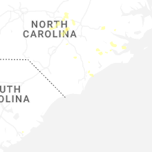
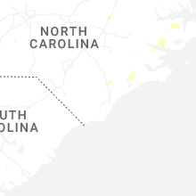

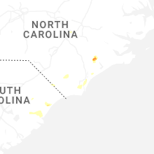


Connect with Interactive Hail Maps