

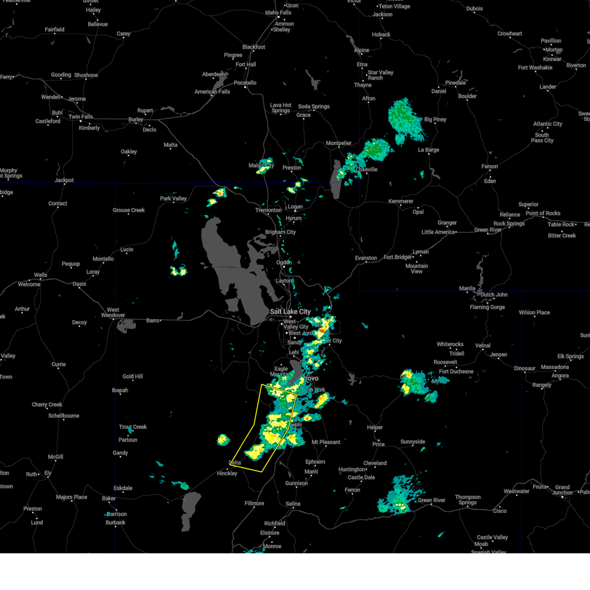
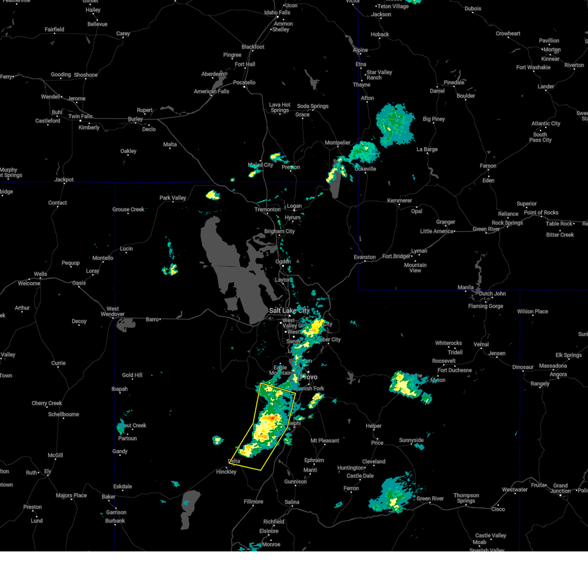
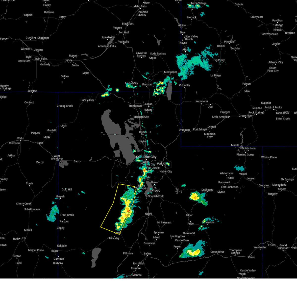
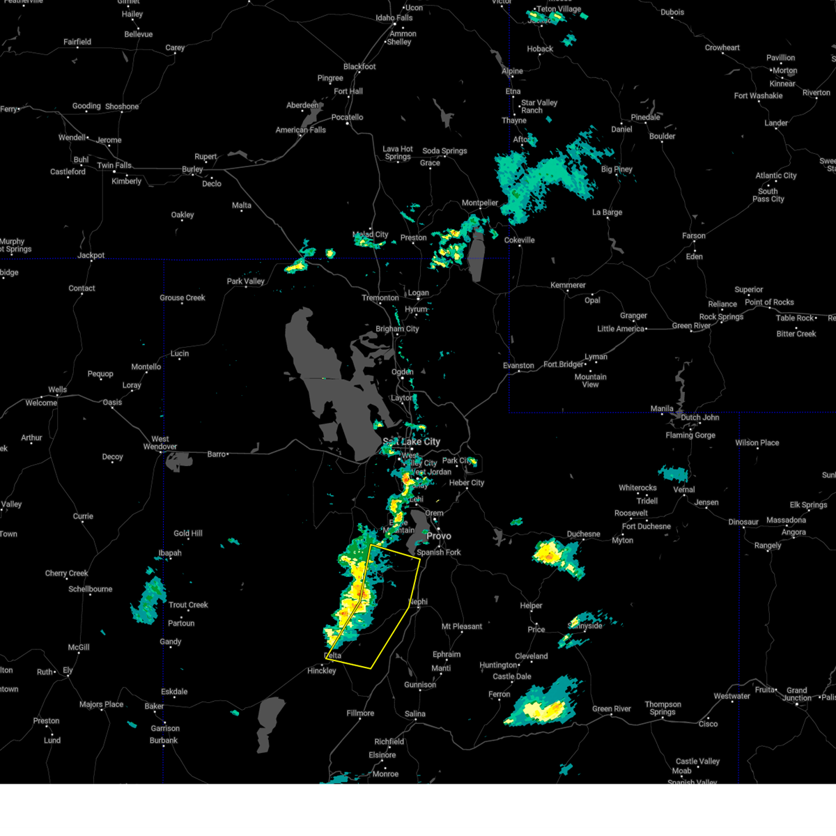
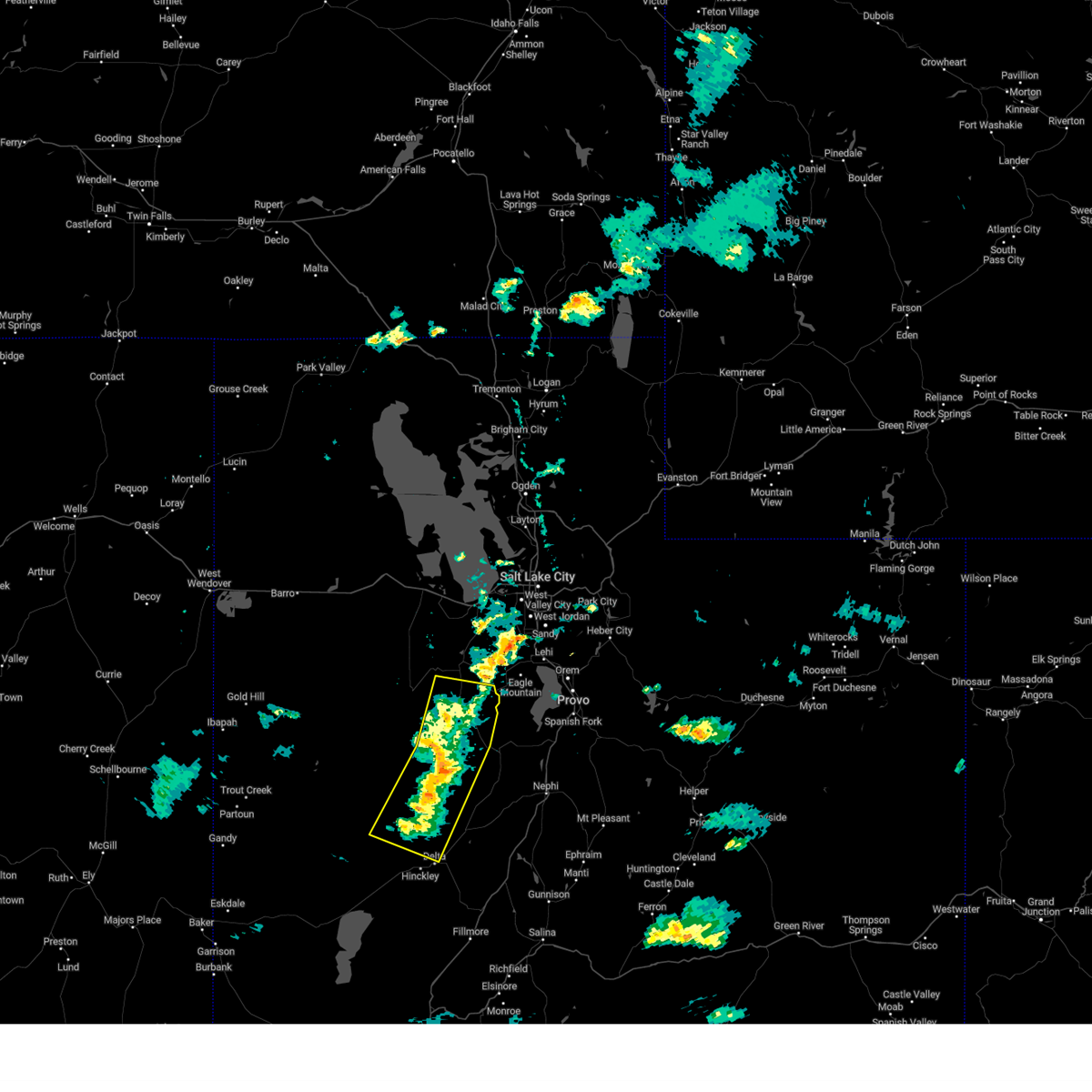
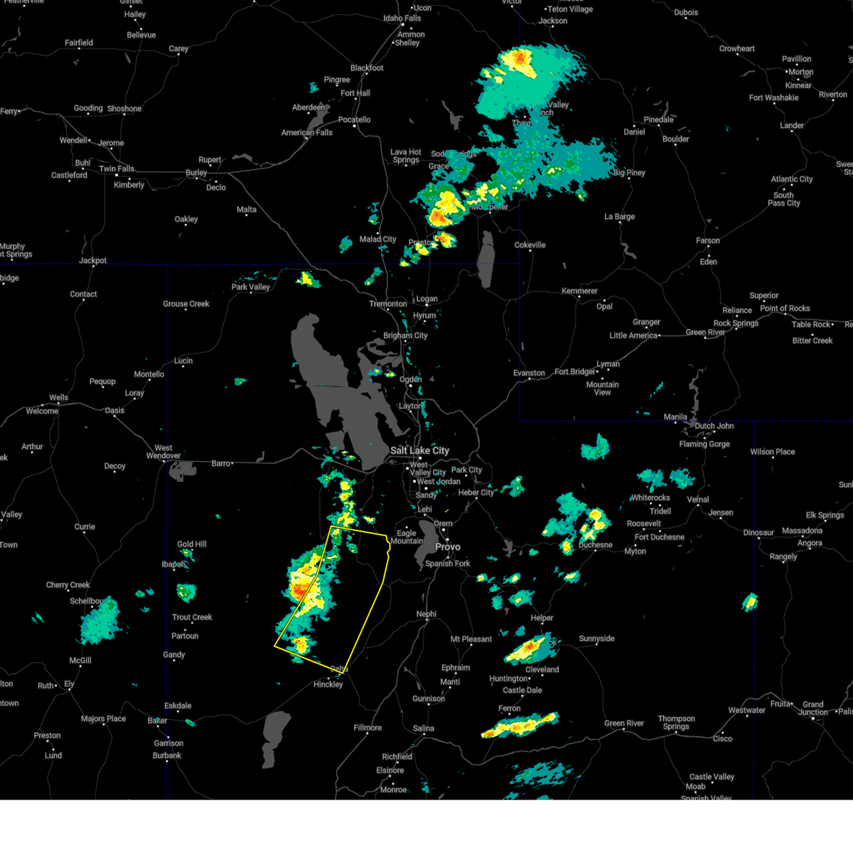
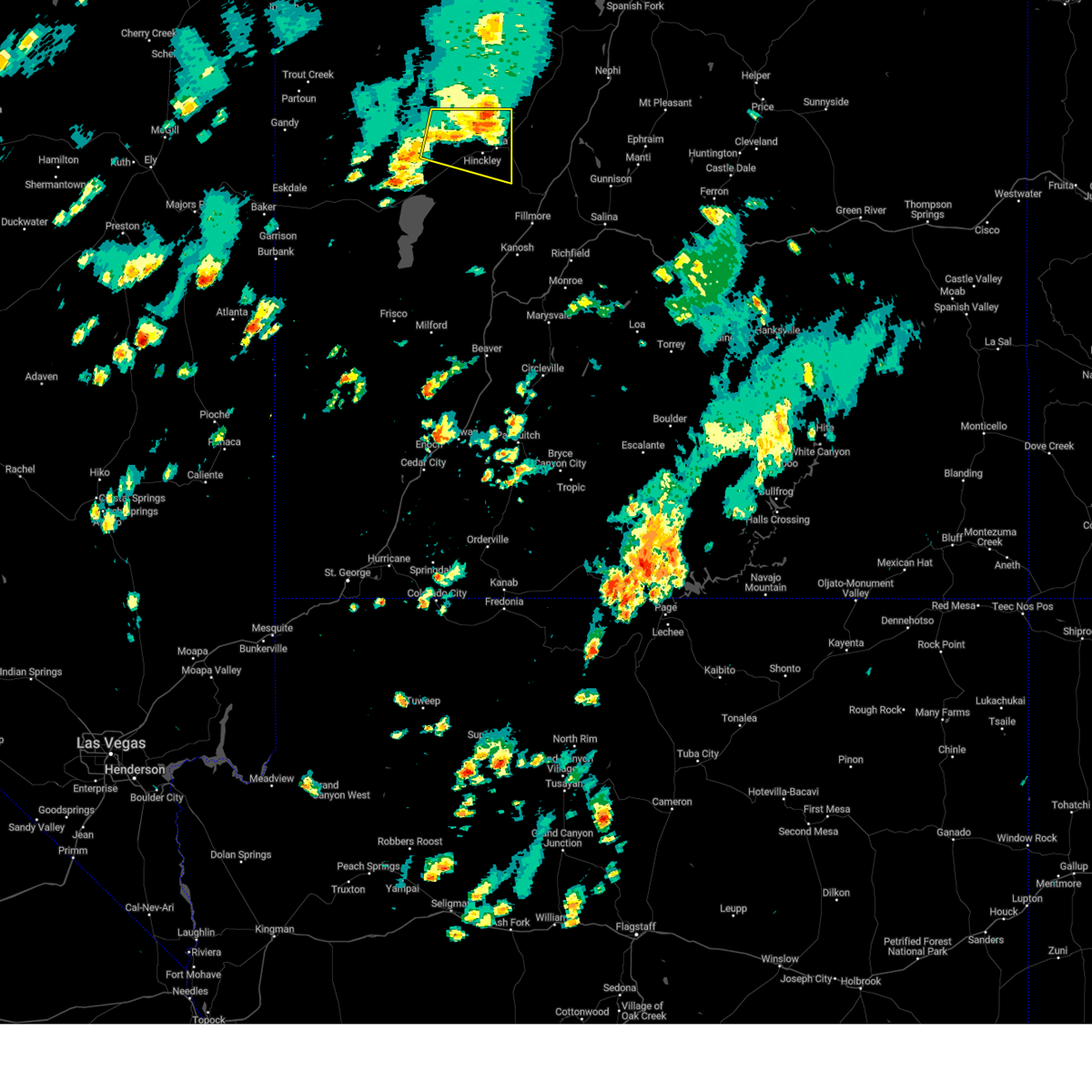
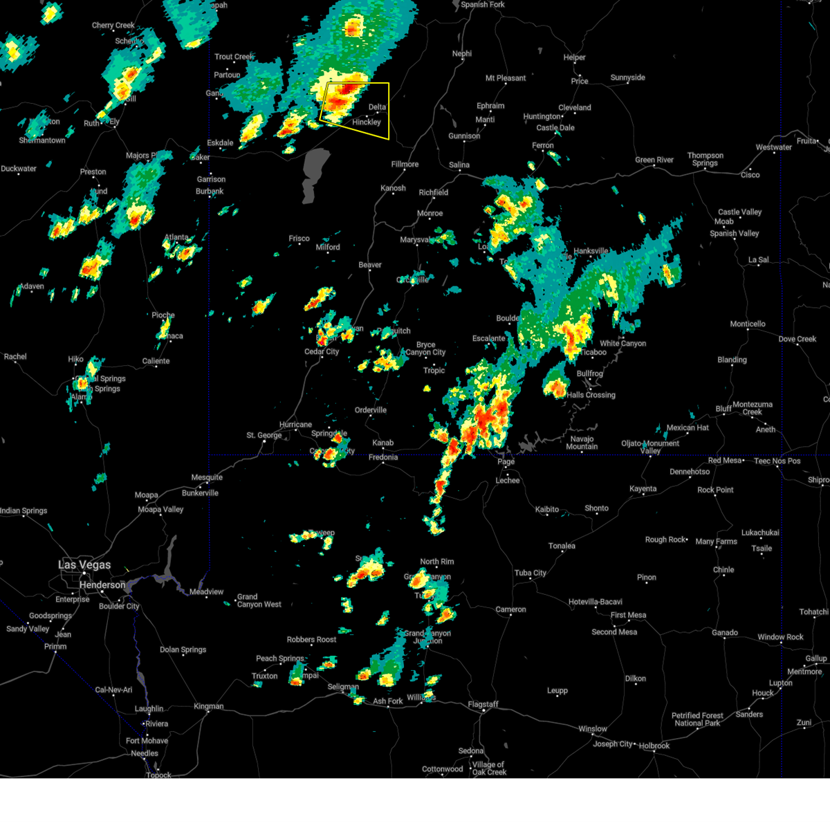
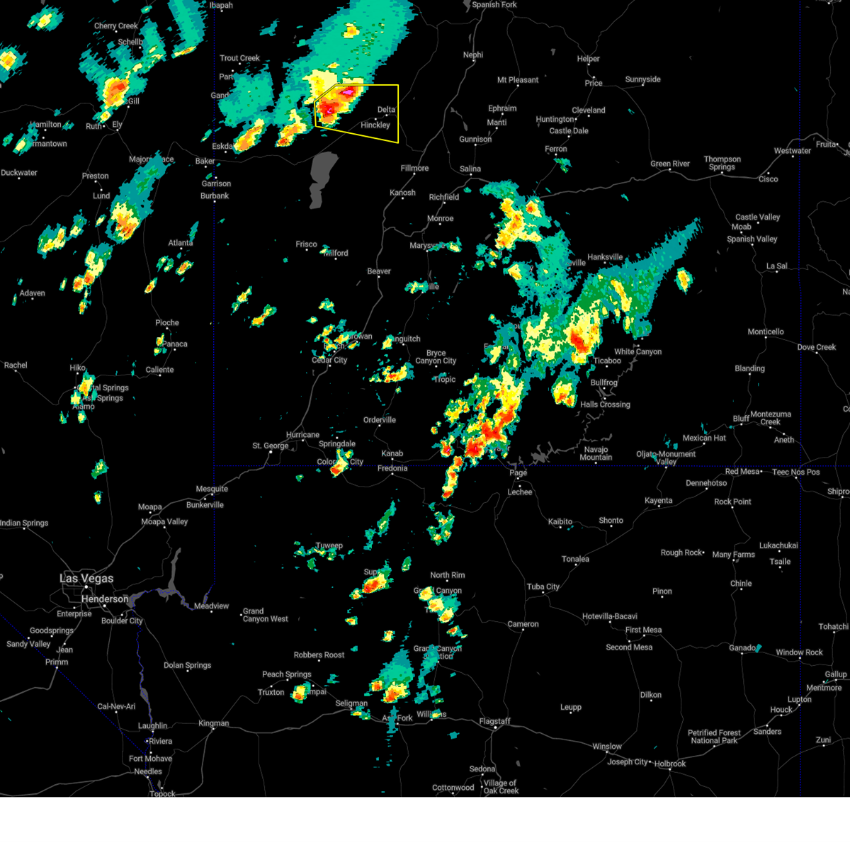
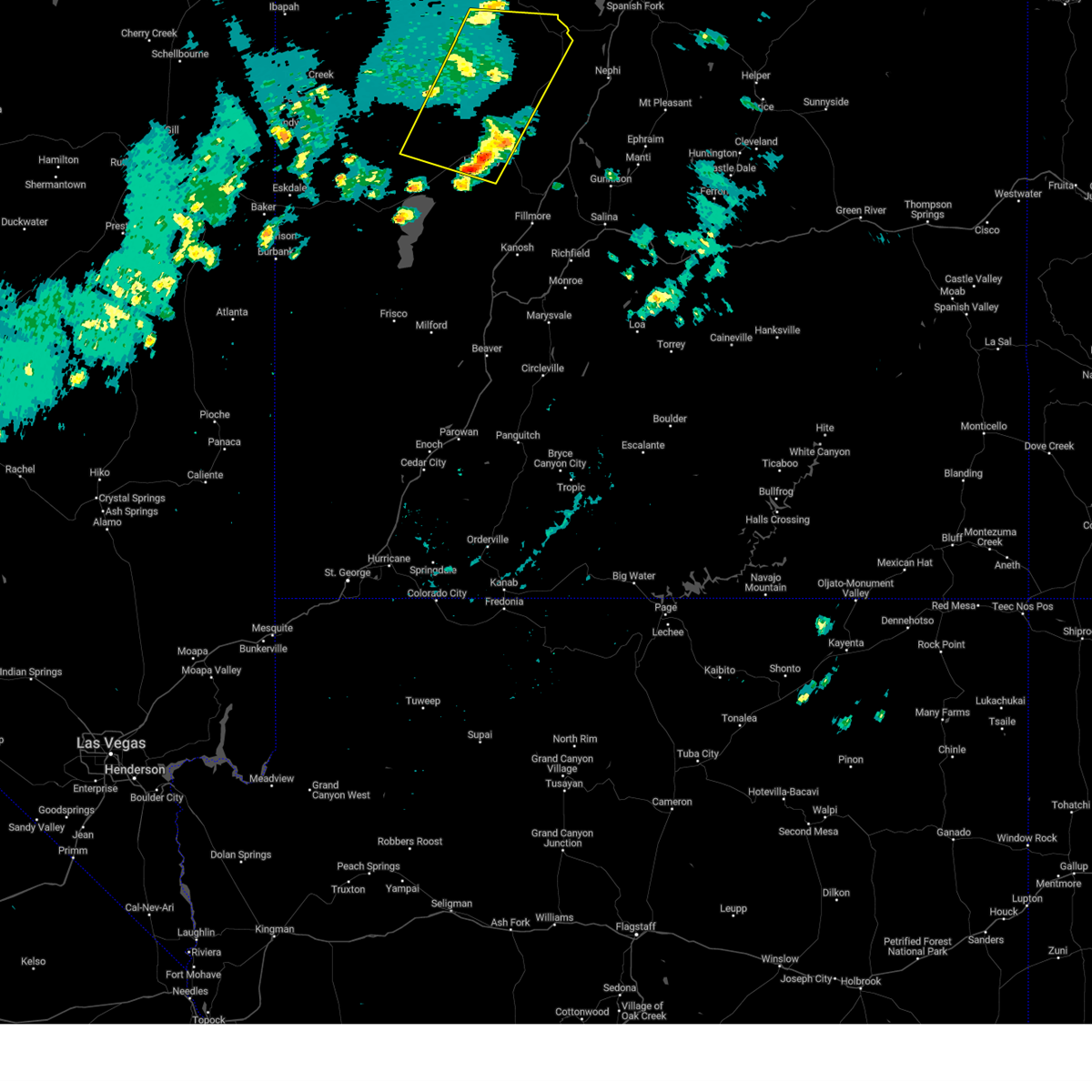
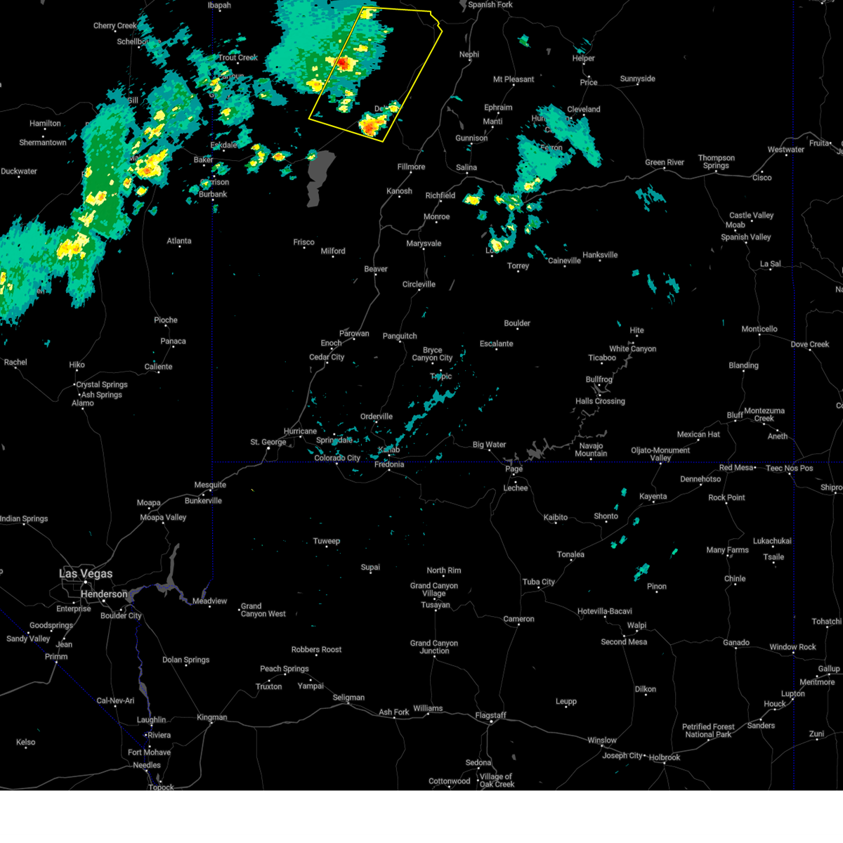
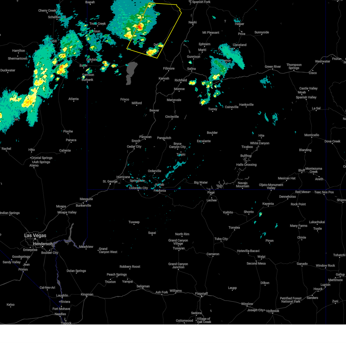
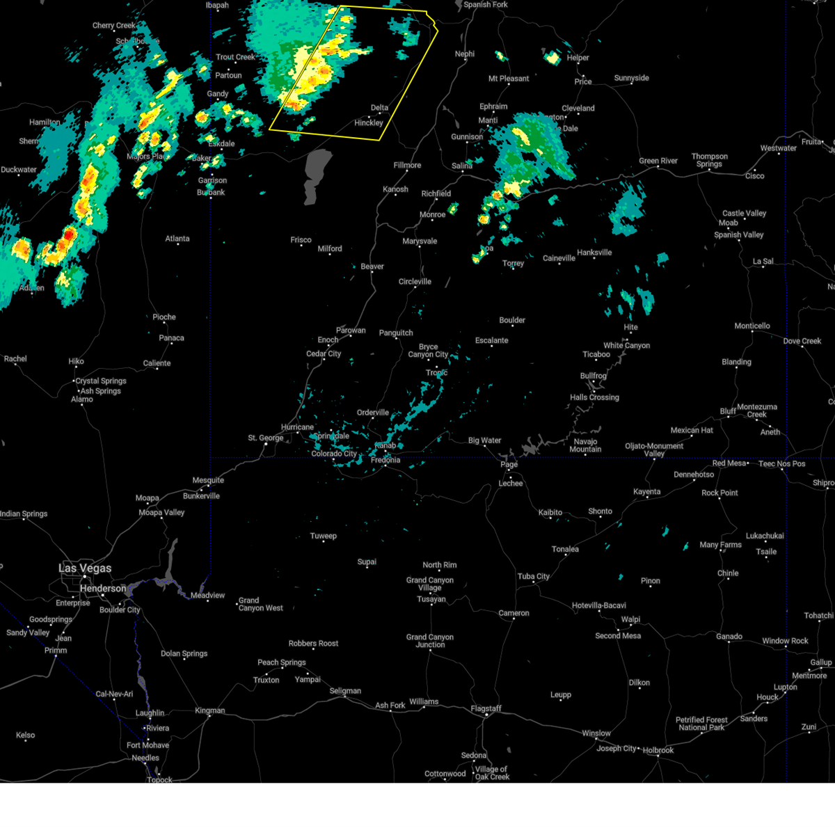
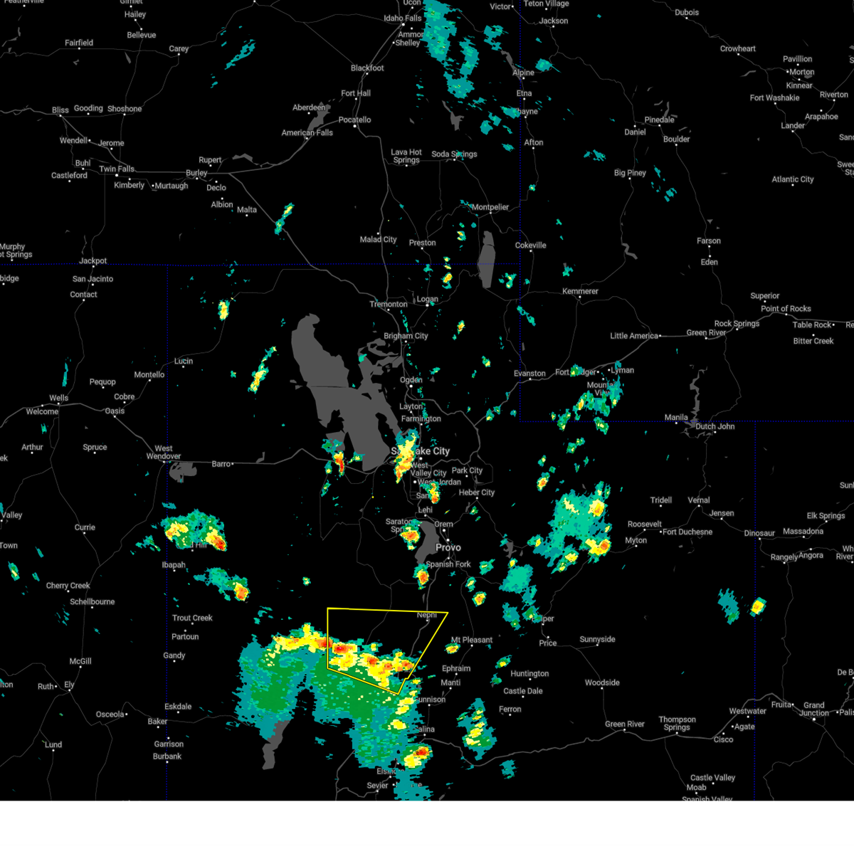
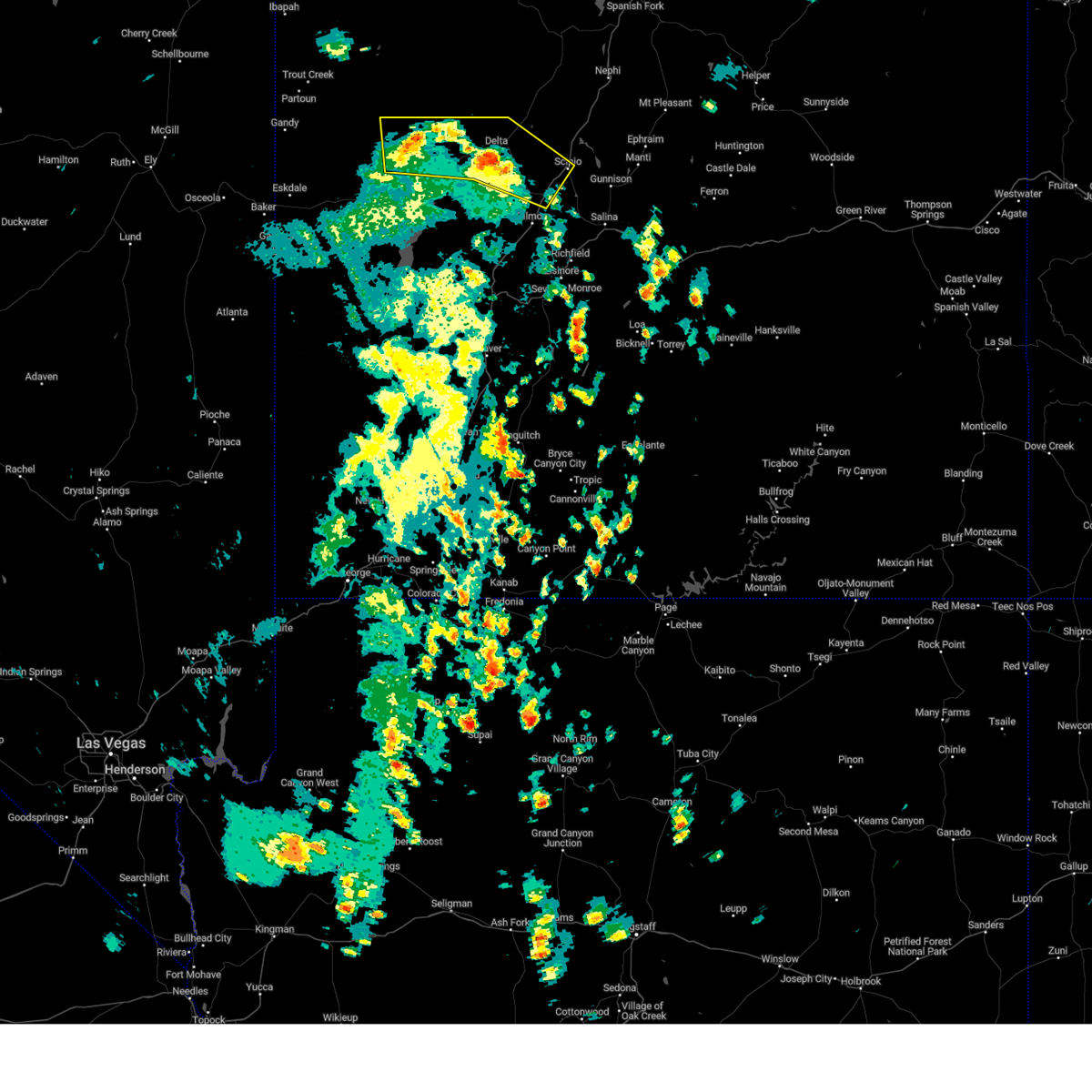
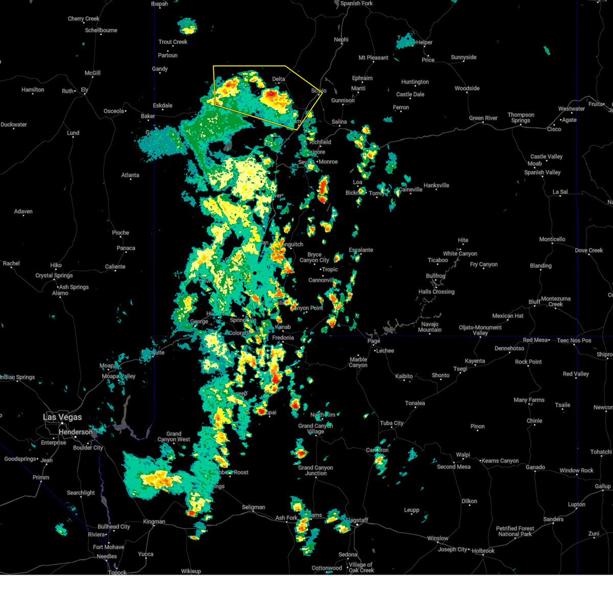
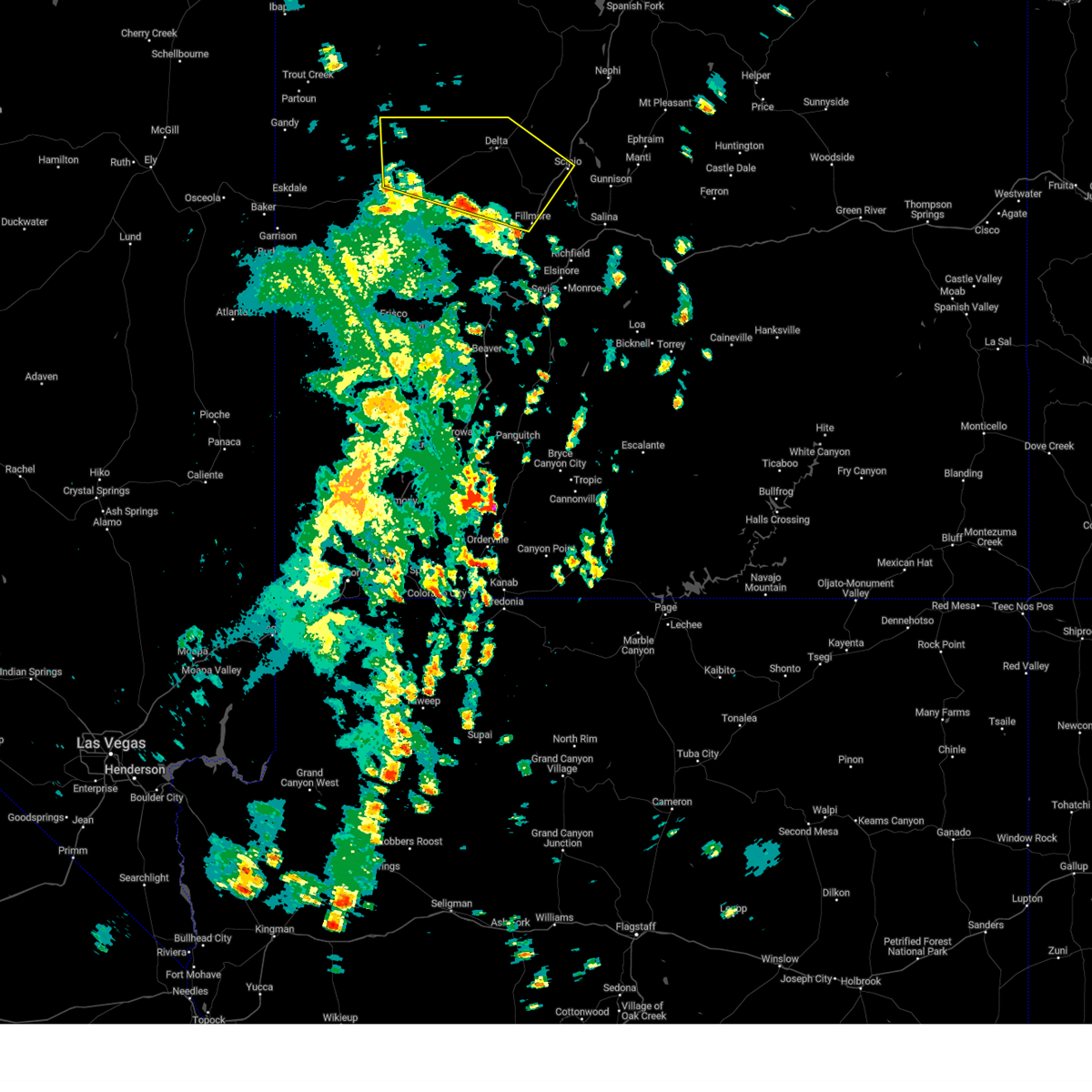
Hail Map for Sutherland, UT
The Sutherland, UT area has had 0 reports of on-the-ground hail by trained spotters, and has been under severe weather warnings 0 times during the past 12 months. Doppler radar has detected hail at or near Sutherland, UT on 5 occasions.
| Name: | Sutherland, UT |
| Where Located: | 59.2 miles NNW of Monroe, UT |
| Map: | Google Map for Sutherland, UT |
| Population: | 165 |
| Housing Units: | 53 |
| More Info: | Search Google for Sutherland, UT |
0
The Top Recent Hail Date for Sutherland, UT is Sunday, August 18, 2024 (4th out of 5)

Hail and Wind Damage Spotted near Sutherland, UT
| Date / Time | Report Details |
|---|---|
| 8/10/2024 5:45 PM MDT |
 The storms which prompted the warning have weakened below severe limits, and have exited the warned area. therefore, the warning has been allowed to expire. however gusty winds up to 50 mph are still possible with these thunderstorms. The storms which prompted the warning have weakened below severe limits, and have exited the warned area. therefore, the warning has been allowed to expire. however gusty winds up to 50 mph are still possible with these thunderstorms.
|
| 8/10/2024 5:36 PM MDT |
 At 535 pm mdt, severe thunderstorms were located along a line extending from near utah lake to 6 miles west of nephi to 14 miles east of delta, moving east at 40 mph (radar indicated). Hazards include 60 mph wind gusts. Expect damage to roofs, siding, and trees. locations impacted include, delta, elberta, genola, goshen, eureka, oak city, leamington, lynndyl, little sahara state park, jericho, sutherland, and tintic junction. this includes the following highways, us route 6 between mile markers 90 and 156. Us route 50 between mile markers 91 and 93. At 535 pm mdt, severe thunderstorms were located along a line extending from near utah lake to 6 miles west of nephi to 14 miles east of delta, moving east at 40 mph (radar indicated). Hazards include 60 mph wind gusts. Expect damage to roofs, siding, and trees. locations impacted include, delta, elberta, genola, goshen, eureka, oak city, leamington, lynndyl, little sahara state park, jericho, sutherland, and tintic junction. this includes the following highways, us route 6 between mile markers 90 and 156. Us route 50 between mile markers 91 and 93.
|
| 8/10/2024 5:16 PM MDT |
 The storms which prompted the warning have moved out of the area. therefore, the warning has been allowed to expire. however gusty winds up to 45 mph are still possible with these thunderstorms. The storms which prompted the warning have moved out of the area. therefore, the warning has been allowed to expire. however gusty winds up to 45 mph are still possible with these thunderstorms.
|
| 8/10/2024 5:14 PM MDT |
 Svrslc the national weather service in salt lake city has issued a * severe thunderstorm warning for, northeastern millard county in central utah, eastern juab county in central utah, southwestern utah county in northern utah, southeastern tooele county in northern utah, * until 545 pm mdt. * at 514 pm mdt, severe thunderstorms were located along a line extending from 9 miles southwest of eagle mountain to 18 miles west of nephi to near delta, moving east at 30 mph. gusts in excess of 60 mph have been reported with this line of storms (radar indicated). Hazards include 60 mph wind gusts. expect damage to roofs, siding, and trees Svrslc the national weather service in salt lake city has issued a * severe thunderstorm warning for, northeastern millard county in central utah, eastern juab county in central utah, southwestern utah county in northern utah, southeastern tooele county in northern utah, * until 545 pm mdt. * at 514 pm mdt, severe thunderstorms were located along a line extending from 9 miles southwest of eagle mountain to 18 miles west of nephi to near delta, moving east at 30 mph. gusts in excess of 60 mph have been reported with this line of storms (radar indicated). Hazards include 60 mph wind gusts. expect damage to roofs, siding, and trees
|
| 8/10/2024 4:55 PM MDT |
 At 454 pm mdt, severe thunderstorms were located along a line extending from 6 miles east of tooele army depot south to 11 miles southeast of vernon to 7 miles west of delta, moving east at 35 mph (radar indicated. at 445pm, a 64 mph wind gust was reported at vernon hill). Hazards include 60 mph wind gusts. Expect damage to roofs, siding, and trees. Locations impacted include, delta, vernon, tooele army depot south, faust, little sahara state park, sugarville, and lofgreen. At 454 pm mdt, severe thunderstorms were located along a line extending from 6 miles east of tooele army depot south to 11 miles southeast of vernon to 7 miles west of delta, moving east at 35 mph (radar indicated. at 445pm, a 64 mph wind gust was reported at vernon hill). Hazards include 60 mph wind gusts. Expect damage to roofs, siding, and trees. Locations impacted include, delta, vernon, tooele army depot south, faust, little sahara state park, sugarville, and lofgreen.
|
| 8/10/2024 4:30 PM MDT |
 Svrslc the national weather service in salt lake city has issued a * severe thunderstorm warning for, north central millard county in central utah, central juab county in central utah, southeastern tooele county in northern utah, * until 515 pm mdt. * at 429 pm mdt, severe thunderstorms were located along a line extending from near tooele army depot south to 8 miles southwest of vernon to 17 miles west of delta, moving east at 30 mph. gusts in excess of 60 mph have been reported with this line of storms (radar indicated). Hazards include 60 mph wind gusts. expect damage to roofs, siding, and trees Svrslc the national weather service in salt lake city has issued a * severe thunderstorm warning for, north central millard county in central utah, central juab county in central utah, southeastern tooele county in northern utah, * until 515 pm mdt. * at 429 pm mdt, severe thunderstorms were located along a line extending from near tooele army depot south to 8 miles southwest of vernon to 17 miles west of delta, moving east at 30 mph. gusts in excess of 60 mph have been reported with this line of storms (radar indicated). Hazards include 60 mph wind gusts. expect damage to roofs, siding, and trees
|
| 6/26/2024 4:58 PM MDT |
 The storm which prompted the warning has weakened below severe limits, and no longer poses an immediate threat to life or property. therefore, the warning will be allowed to expire. however gusty winds are still possible with this thunderstorm. The storm which prompted the warning has weakened below severe limits, and no longer poses an immediate threat to life or property. therefore, the warning will be allowed to expire. however gusty winds are still possible with this thunderstorm.
|
| 6/26/2024 4:28 PM MDT |
 At 428 pm mdt, a severe thunderstorm was located 18 miles west of delta, moving east at 30 mph (radar indicated). Hazards include 60 mph wind gusts and quarter size hail. Hail damage to vehicles is expected. expect wind damage to roofs, siding, and trees. locations impacted include, delta, hinckley, abraham, sugarville, and sutherland. this includes the following highways, us route 6 between mile markers 70 and 95. Us route 50 between mile markers 90 and 95. At 428 pm mdt, a severe thunderstorm was located 18 miles west of delta, moving east at 30 mph (radar indicated). Hazards include 60 mph wind gusts and quarter size hail. Hail damage to vehicles is expected. expect wind damage to roofs, siding, and trees. locations impacted include, delta, hinckley, abraham, sugarville, and sutherland. this includes the following highways, us route 6 between mile markers 70 and 95. Us route 50 between mile markers 90 and 95.
|
| 6/26/2024 4:14 PM MDT |
 Svrslc the national weather service in salt lake city has issued a * severe thunderstorm warning for, northeastern millard county in central utah, * until 500 pm mdt. * at 414 pm mdt, a severe thunderstorm was located 27 miles west of delta, moving east at 30 mph (radar indicated). Hazards include 60 mph wind gusts and half dollar size hail. Hail damage to vehicles is expected. Expect wind damage to roofs, siding, and trees. Svrslc the national weather service in salt lake city has issued a * severe thunderstorm warning for, northeastern millard county in central utah, * until 500 pm mdt. * at 414 pm mdt, a severe thunderstorm was located 27 miles west of delta, moving east at 30 mph (radar indicated). Hazards include 60 mph wind gusts and half dollar size hail. Hail damage to vehicles is expected. Expect wind damage to roofs, siding, and trees.
|
| 6/7/2024 6:01 PM MDT |
 The storms which prompted the warning have weakened. therefore, the warning has been allowed to expire. however gusty winds up to 55 mph are still possible with these thunderstorms. The storms which prompted the warning have weakened. therefore, the warning has been allowed to expire. however gusty winds up to 55 mph are still possible with these thunderstorms.
|
| 6/7/2024 5:39 PM MDT |
 At 538 pm mdt, severe thunderstorms were located along a line extending from 6 miles south of vernon to 18 miles west of delta, moving east at 30 mph. an additional strong thunderstorm is developing near hinckley (mesonet observation). Hazards include 60 mph wind gusts. Expect damage to roofs, siding, and trees. locations impacted include, delta, hinckley, eureka, lynndyl, abraham, little sahara state park, sutherland, sugarville, lofgreen, and tintic junction. this includes the following highways, us route 6 between mile markers 69 and 126, and between mile markers 128 and 140. Us route 50 between mile markers 90 and 95. At 538 pm mdt, severe thunderstorms were located along a line extending from 6 miles south of vernon to 18 miles west of delta, moving east at 30 mph. an additional strong thunderstorm is developing near hinckley (mesonet observation). Hazards include 60 mph wind gusts. Expect damage to roofs, siding, and trees. locations impacted include, delta, hinckley, eureka, lynndyl, abraham, little sahara state park, sutherland, sugarville, lofgreen, and tintic junction. this includes the following highways, us route 6 between mile markers 69 and 126, and between mile markers 128 and 140. Us route 50 between mile markers 90 and 95.
|
| 6/7/2024 5:35 PM MDT |
 At 534 pm mdt, severe thunderstorms were located along a line extending from 7 miles south of vernon to 20 miles west of delta, moving east at 30 mph (mesonet observation). Hazards include 60 mph wind gusts. Expect damage to roofs, siding, and trees. locations impacted include, delta, hinckley, eureka, lynndyl, abraham, little sahara state park, sutherland, sugarville, lofgreen, and tintic junction. this includes the following highways, us route 6 between mile markers 69 and 126, and between mile markers 128 and 140. Us route 50 between mile markers 90 and 95. At 534 pm mdt, severe thunderstorms were located along a line extending from 7 miles south of vernon to 20 miles west of delta, moving east at 30 mph (mesonet observation). Hazards include 60 mph wind gusts. Expect damage to roofs, siding, and trees. locations impacted include, delta, hinckley, eureka, lynndyl, abraham, little sahara state park, sutherland, sugarville, lofgreen, and tintic junction. this includes the following highways, us route 6 between mile markers 69 and 126, and between mile markers 128 and 140. Us route 50 between mile markers 90 and 95.
|
| 6/7/2024 5:12 PM MDT |
 Svrslc the national weather service in salt lake city has issued a * severe thunderstorm warning for, northeastern millard county in central utah, central juab county in central utah, southeastern tooele county in northern utah, * until 600 pm mdt. * at 511 pm mdt, severe thunderstorms were located along a line extending from 18 miles south of dugway english village to 38 miles southeast of partoun, moving east at 40 mph. these storms have a history of wind gusts to 60 mph near fish springs (mesonet observations). Hazards include 60 mph wind gusts. expect damage to roofs, siding, and trees Svrslc the national weather service in salt lake city has issued a * severe thunderstorm warning for, northeastern millard county in central utah, central juab county in central utah, southeastern tooele county in northern utah, * until 600 pm mdt. * at 511 pm mdt, severe thunderstorms were located along a line extending from 18 miles south of dugway english village to 38 miles southeast of partoun, moving east at 40 mph. these storms have a history of wind gusts to 60 mph near fish springs (mesonet observations). Hazards include 60 mph wind gusts. expect damage to roofs, siding, and trees
|
| 8/2/2023 1:30 PM MDT |
 At 128 pm mdt, severe thunderstorms were located along a line extending from 12 miles north of delta to 11 miles northeast of scipio, moving northeast at 35 mph (radar indicated. at 110 pm a wind gust to 54 mph was reported at the delta airport). Hazards include 60 mph wind gusts and quarter size hail. Hail damage to vehicles is expected. expect wind damage to roofs, siding, and trees. locations impacted include, nephi, delta, scipio, levan, oak city, leamington, lynndyl, little sahara state park, jericho, sugarville, mills and yuba lake state park. this includes the following highways, interstate 15 between mile markers 188 and 229. us route 6 between mile markers 91 and 126. us route 50 near mile marker 93, and between mile markers 130 and 131. hail threat, radar indicated max hail size, 1. 00 in wind threat, radar indicated max wind gust, 60 mph. At 128 pm mdt, severe thunderstorms were located along a line extending from 12 miles north of delta to 11 miles northeast of scipio, moving northeast at 35 mph (radar indicated. at 110 pm a wind gust to 54 mph was reported at the delta airport). Hazards include 60 mph wind gusts and quarter size hail. Hail damage to vehicles is expected. expect wind damage to roofs, siding, and trees. locations impacted include, nephi, delta, scipio, levan, oak city, leamington, lynndyl, little sahara state park, jericho, sugarville, mills and yuba lake state park. this includes the following highways, interstate 15 between mile markers 188 and 229. us route 6 between mile markers 91 and 126. us route 50 near mile marker 93, and between mile markers 130 and 131. hail threat, radar indicated max hail size, 1. 00 in wind threat, radar indicated max wind gust, 60 mph.
|
| 8/2/2023 1:10 PM MDT |
 At 109 pm mdt, severe thunderstorms were located along a line extending from 7 miles north of delta to near scipio, moving northeast at 40 mph (radar indicated. at 1252 pm a wind gust to 61 mph was reported near delta). Hazards include 60 mph wind gusts and quarter size hail. Hail damage to vehicles is expected. Expect wind damage to roofs, siding, and trees. At 109 pm mdt, severe thunderstorms were located along a line extending from 7 miles north of delta to near scipio, moving northeast at 40 mph (radar indicated. at 1252 pm a wind gust to 61 mph was reported near delta). Hazards include 60 mph wind gusts and quarter size hail. Hail damage to vehicles is expected. Expect wind damage to roofs, siding, and trees.
|
| 8/2/2023 1:02 PM MDT |
 At 102 pm mdt, severe thunderstorms were located along a line extending from 22 miles northwest of delta to near scipio, moving northeast at 40 mph (radar indicated). Hazards include 60 mph wind gusts and quarter size hail. Hail damage to vehicles is expected. expect wind damage to roofs, siding, and trees. locations impacted include, delta, scipio, hinckley, oak city, holden, abraham, greenwood, mc cornick, sutherland and sugarville. this includes the following highways, interstate 15 between mile markers 172 and 190. us route 6 between mile markers 65 and 100. us route 50 between mile markers 90 and 132. hail threat, radar indicated max hail size, 1. 00 in wind threat, radar indicated max wind gust, 60 mph. At 102 pm mdt, severe thunderstorms were located along a line extending from 22 miles northwest of delta to near scipio, moving northeast at 40 mph (radar indicated). Hazards include 60 mph wind gusts and quarter size hail. Hail damage to vehicles is expected. expect wind damage to roofs, siding, and trees. locations impacted include, delta, scipio, hinckley, oak city, holden, abraham, greenwood, mc cornick, sutherland and sugarville. this includes the following highways, interstate 15 between mile markers 172 and 190. us route 6 between mile markers 65 and 100. us route 50 between mile markers 90 and 132. hail threat, radar indicated max hail size, 1. 00 in wind threat, radar indicated max wind gust, 60 mph.
|
| 8/2/2023 12:52 PM MDT |
 At 1252 pm mdt, severe thunderstorms were located along a line extending from 24 miles west of delta to 11 miles southwest of scipio, moving northeast at 40 mph (radar indicated). Hazards include 60 mph wind gusts and quarter size hail. Hail damage to vehicles is expected. expect wind damage to roofs, siding, and trees. locations impacted include, delta, fillmore, scipio, hinckley, oak city, holden, abraham, flowell, greenwood, mc cornick, sutherland and sugarville. this includes the following highways, interstate 15 between mile markers 162 and 190. us route 6 between mile markers 53 and 100. us route 50 between mile markers 90 and 132. hail threat, radar indicated max hail size, 1. 00 in wind threat, radar indicated max wind gust, 60 mph. At 1252 pm mdt, severe thunderstorms were located along a line extending from 24 miles west of delta to 11 miles southwest of scipio, moving northeast at 40 mph (radar indicated). Hazards include 60 mph wind gusts and quarter size hail. Hail damage to vehicles is expected. expect wind damage to roofs, siding, and trees. locations impacted include, delta, fillmore, scipio, hinckley, oak city, holden, abraham, flowell, greenwood, mc cornick, sutherland and sugarville. this includes the following highways, interstate 15 between mile markers 162 and 190. us route 6 between mile markers 53 and 100. us route 50 between mile markers 90 and 132. hail threat, radar indicated max hail size, 1. 00 in wind threat, radar indicated max wind gust, 60 mph.
|
| 8/2/2023 12:30 PM MDT |
 At 1229 pm mdt, severe thunderstorms were located along a line extending from 30 miles west of delta to near fillmore, moving north at 30 mph (radar indicated). Hazards include 60 mph wind gusts and quarter size hail. Hail damage to vehicles is expected. Expect wind damage to roofs, siding, and trees. At 1229 pm mdt, severe thunderstorms were located along a line extending from 30 miles west of delta to near fillmore, moving north at 30 mph (radar indicated). Hazards include 60 mph wind gusts and quarter size hail. Hail damage to vehicles is expected. Expect wind damage to roofs, siding, and trees.
|
| 7/16/2021 5:53 PM MDT |
 The severe thunderstorm warning for northeastern millard county will expire at 600 pm mdt, the storm which prompted the warning has weakened below severe limits, and no longer poses an immediate threat to life or property. therefore, the warning will be allowed to expire. however gusty winds are still possible. The severe thunderstorm warning for northeastern millard county will expire at 600 pm mdt, the storm which prompted the warning has weakened below severe limits, and no longer poses an immediate threat to life or property. therefore, the warning will be allowed to expire. however gusty winds are still possible.
|
| 7/16/2021 5:30 PM MDT |
 At 529 pm mdt, a severe thunderstorm was located near delta, moving northeast at 10 mph (radar indicated). Hazards include 60 mph wind gusts. Expect damage to roofs, siding, and trees. locations impacted include, delta, hinckley, oak city, abraham, greenwood, mc cornick, sutherland and sugarville. this includes the following highways, us route 6 between mile markers 76 and 99. Us route 50 between mile markers 90 and 114. At 529 pm mdt, a severe thunderstorm was located near delta, moving northeast at 10 mph (radar indicated). Hazards include 60 mph wind gusts. Expect damage to roofs, siding, and trees. locations impacted include, delta, hinckley, oak city, abraham, greenwood, mc cornick, sutherland and sugarville. this includes the following highways, us route 6 between mile markers 76 and 99. Us route 50 between mile markers 90 and 114.
|
| 7/16/2021 5:04 PM MDT |
 At 504 pm mdt, a severe thunderstorm was located 9 miles southwest of delta, moving northeast at 10 mph (radar indicated). Hazards include 70 mph wind gusts. Expect considerable tree damage. Damage is likely to mobile homes, roofs, and outbuildings. At 504 pm mdt, a severe thunderstorm was located 9 miles southwest of delta, moving northeast at 10 mph (radar indicated). Hazards include 70 mph wind gusts. Expect considerable tree damage. Damage is likely to mobile homes, roofs, and outbuildings.
|
| 5/27/2015 3:15 PM MDT | At 315 pm mdt, doppler radar indicated a severe thunderstorm capable of producing damaging winds in excess of 60 mph. this storm was located 14 miles southwest of delta, moving east at 30 mph. penny size hail may also accompany the damaging winds. locations impacted include, delta, hinckley, abraham and sutherland. |
| 5/27/2015 3:02 PM MDT | At 302 pm mdt, doppler radar indicated a severe thunderstorm capable of producing damaging winds in excess of 60 mph. this storm was located 20 miles west of delta, and moving east at 30 mph. penny size hail may also accompany the damaging winds. |
Hail Maps for Sutherland, UT


Connect with Interactive Hail Maps