

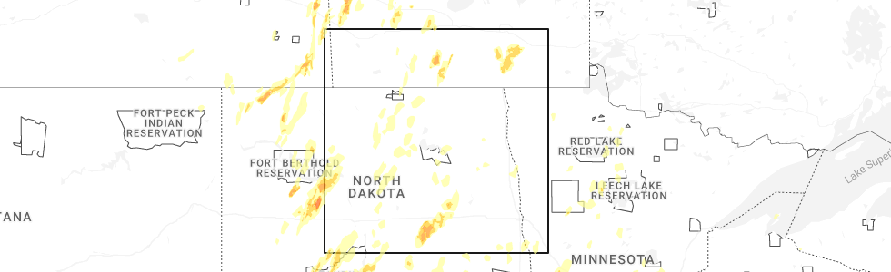
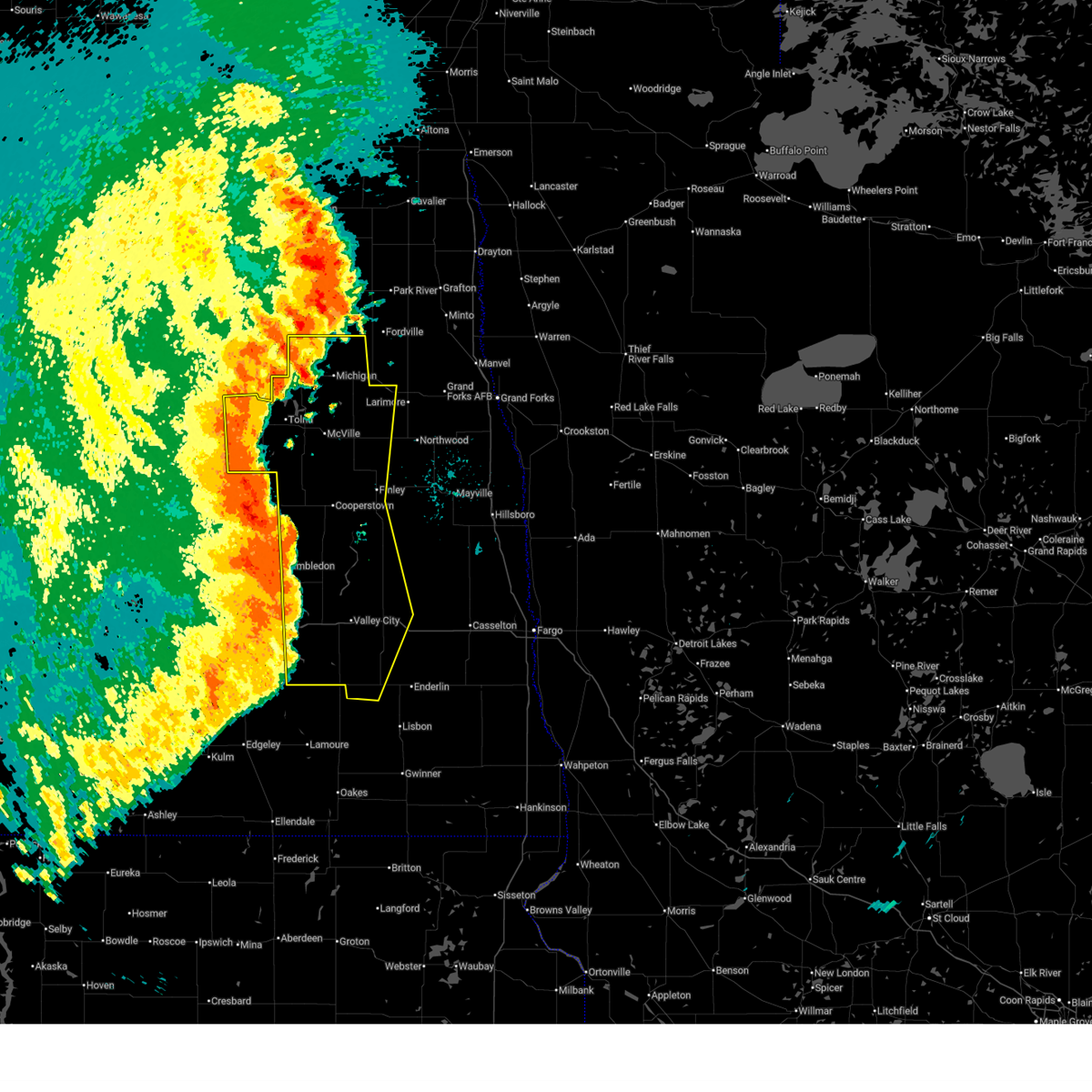
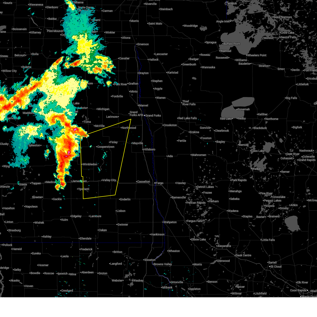
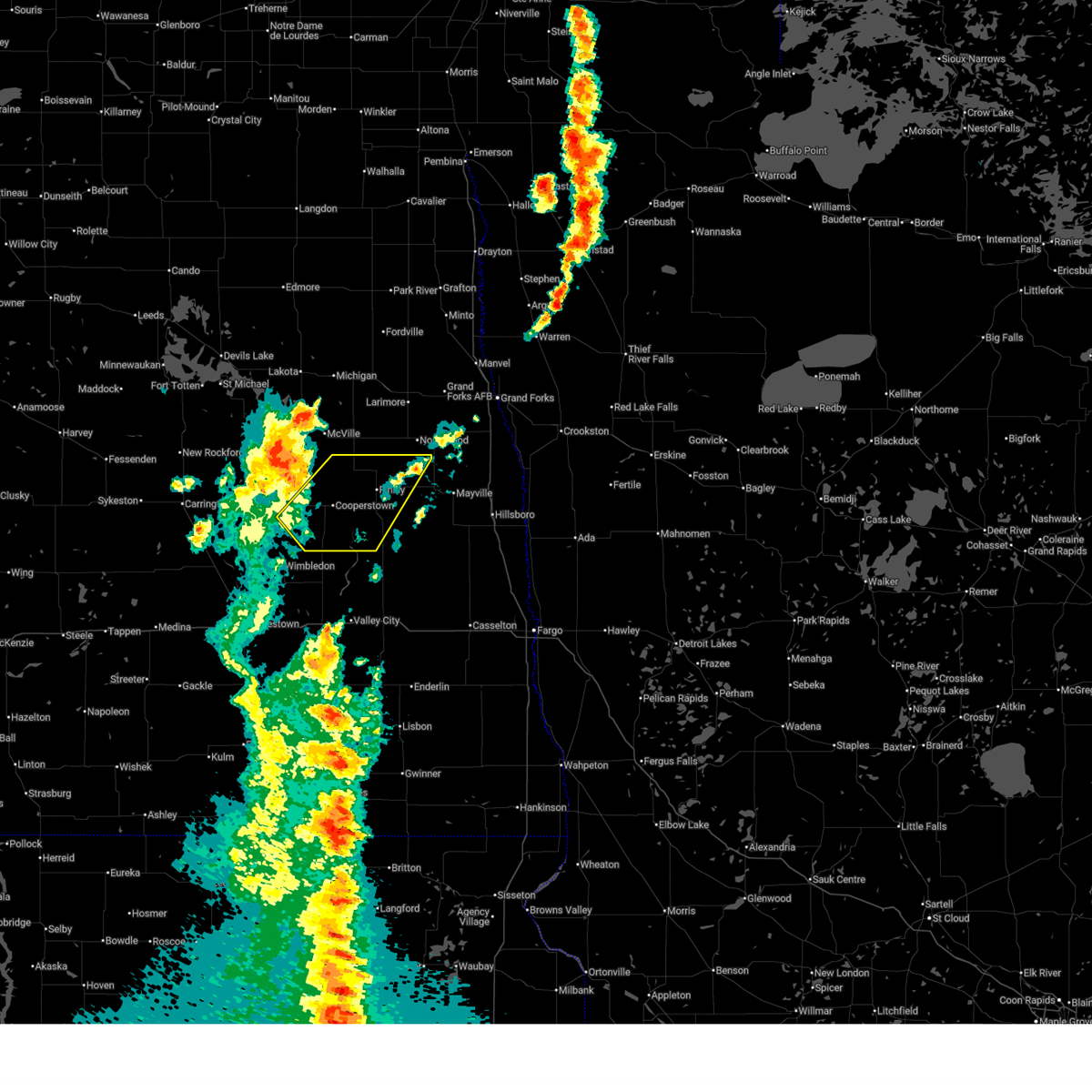
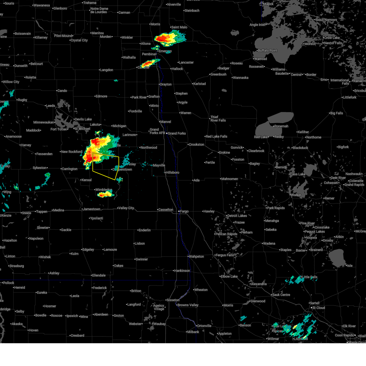
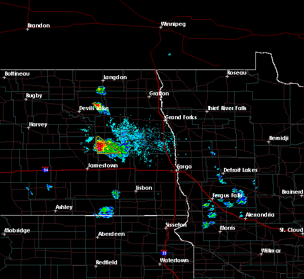
Hail Map for Sutton, ND
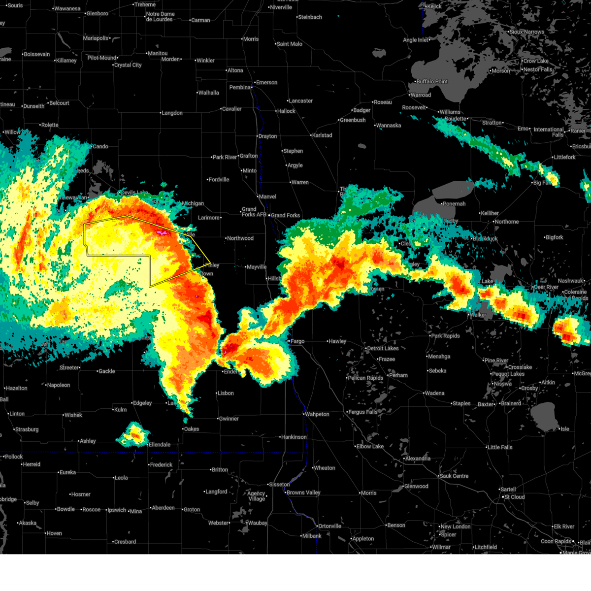
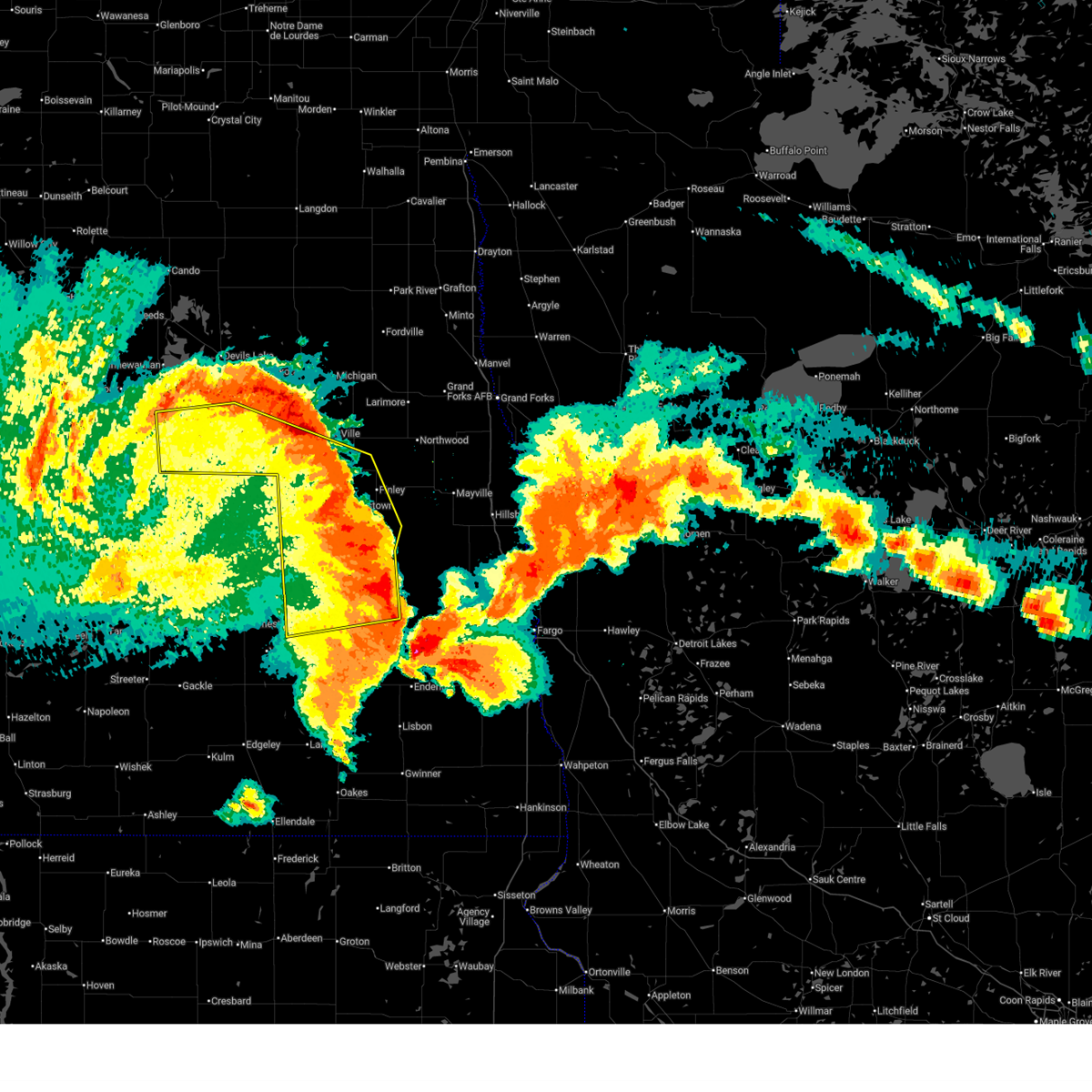
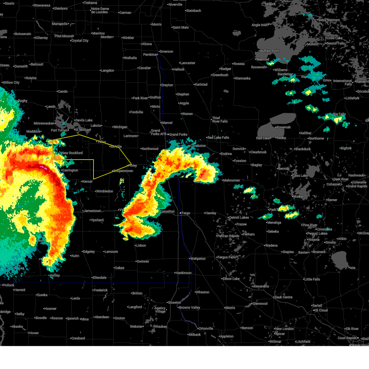
The Sutton, ND area has had 0 reports of on-the-ground hail by trained spotters, and has been under severe weather warnings 25 times during the past 12 months. Doppler radar has detected hail at or near Sutton, ND on 36 occasions, including 1 occasion during the past year.
| Name: | Sutton, ND |
| Where Located: | 52.8 miles SSE of Devils Lake, ND |
| Map: | Google Map for Sutton, ND |
| Population: | 17 |
| Housing Units: | 23 |
| More Info: | Search Google for Sutton, ND |
0
The Top Recent Hail Date for Sutton, ND is Tuesday, June 9, 2026 (29th out of 36)
Hail and Wind Damage Spotted near Sutton, ND
| Date / Time | Report Details |
|---|---|
| 6/2/2026 9:43 PM CDT |
 The storm which prompted the warning has moved out of the area. therefore, the warning will be allowed to expire. a severe thunderstorm watch remains in effect until 1000 pm cdt for southeastern and northeastern north dakota. The storm which prompted the warning has moved out of the area. therefore, the warning will be allowed to expire. a severe thunderstorm watch remains in effect until 1000 pm cdt for southeastern and northeastern north dakota.
|
| 6/2/2026 8:46 PM CDT |
 Svrfgf the national weather service in grand forks has issued a * severe thunderstorm warning for, griggs county in southeastern north dakota, * until 945 pm cdt. * at 845 pm cdt, a severe thunderstorm was located 7 miles east of kensal, or 26 miles east of carrington, moving northeast at 35 mph (radar indicated). Hazards include 60 mph wind gusts and penny size hail. expect damage to roofs, siding, and trees Svrfgf the national weather service in grand forks has issued a * severe thunderstorm warning for, griggs county in southeastern north dakota, * until 945 pm cdt. * at 845 pm cdt, a severe thunderstorm was located 7 miles east of kensal, or 26 miles east of carrington, moving northeast at 35 mph (radar indicated). Hazards include 60 mph wind gusts and penny size hail. expect damage to roofs, siding, and trees
|
| 8/8/2025 3:11 AM CDT |
 The tornado threat has diminished and the tornado warning has been cancelled. however, large hail and damaging winds remain likely and a severe thunderstorm warning remains in effect for the area. a severe thunderstorm watch remains in effect until 700 am cdt for southeastern and northeastern north dakota. The tornado threat has diminished and the tornado warning has been cancelled. however, large hail and damaging winds remain likely and a severe thunderstorm warning remains in effect for the area. a severe thunderstorm watch remains in effect until 700 am cdt for southeastern and northeastern north dakota.
|
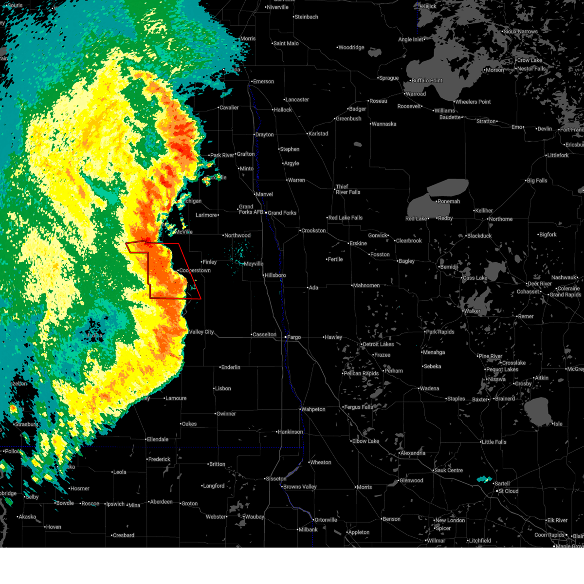
| 8/8/2025 3:03 AM CDT |
 At 303 am cdt, severe thunderstorms were located along a line extending from near hamar to near glenfield to near urbana to near montpelier, moving east at 55 mph (radar indicated). Hazards include 70 mph wind gusts and quarter size hail. Hail damage to vehicles is expected. expect considerable tree damage. wind damage is also likely to mobile homes, roofs, and outbuildings. Locations impacted include, valley city, cooperstown, lakota, finley, mcville, michigan, and tower city. At 303 am cdt, severe thunderstorms were located along a line extending from near hamar to near glenfield to near urbana to near montpelier, moving east at 55 mph (radar indicated). Hazards include 70 mph wind gusts and quarter size hail. Hail damage to vehicles is expected. expect considerable tree damage. wind damage is also likely to mobile homes, roofs, and outbuildings. Locations impacted include, valley city, cooperstown, lakota, finley, mcville, michigan, and tower city.
|
| 8/8/2025 2:52 AM CDT |
 Torfgf the national weather service in grand forks has issued a * tornado warning for, griggs county in southeastern north dakota, northwestern barnes county in southeastern north dakota, southeastern eddy county in northeastern north dakota, southwestern steele county in southeastern north dakota, * until 315 am cdt. * at 252 am cdt, severe thunderstorms capable of producing a tornado were located along a line extending from near mchenry to near revere, moving east at 65 mph (radar indicated rotation). Hazards include tornado and quarter size hail. Flying debris will be dangerous to those caught without shelter. mobile homes will be damaged or destroyed. damage to roofs, windows, and vehicles will occur. Tree damage is likely. Torfgf the national weather service in grand forks has issued a * tornado warning for, griggs county in southeastern north dakota, northwestern barnes county in southeastern north dakota, southeastern eddy county in northeastern north dakota, southwestern steele county in southeastern north dakota, * until 315 am cdt. * at 252 am cdt, severe thunderstorms capable of producing a tornado were located along a line extending from near mchenry to near revere, moving east at 65 mph (radar indicated rotation). Hazards include tornado and quarter size hail. Flying debris will be dangerous to those caught without shelter. mobile homes will be damaged or destroyed. damage to roofs, windows, and vehicles will occur. Tree damage is likely.
|
| 8/8/2025 2:41 AM CDT |
 Svrfgf the national weather service in grand forks has issued a * severe thunderstorm warning for, southeastern benson county in northeastern north dakota, northwestern ransom county in southeastern north dakota, southwestern grand forks county in northeastern north dakota, nelson county in northeastern north dakota, northwestern cass county in southeastern north dakota, griggs county in southeastern north dakota, barnes county in southeastern north dakota, eddy county in northeastern north dakota, western steele county in southeastern north dakota, * until 345 am cdt. * at 241 am cdt, severe thunderstorms were located along a line extending from spirit lake nation to near brantford to near buchanan to near alfred, moving east at 55 mph (radar indicated). Hazards include 70 mph wind gusts and quarter size hail. Hail damage to vehicles is expected. expect considerable tree damage. Wind damage is also likely to mobile homes, roofs, and outbuildings. Svrfgf the national weather service in grand forks has issued a * severe thunderstorm warning for, southeastern benson county in northeastern north dakota, northwestern ransom county in southeastern north dakota, southwestern grand forks county in northeastern north dakota, nelson county in northeastern north dakota, northwestern cass county in southeastern north dakota, griggs county in southeastern north dakota, barnes county in southeastern north dakota, eddy county in northeastern north dakota, western steele county in southeastern north dakota, * until 345 am cdt. * at 241 am cdt, severe thunderstorms were located along a line extending from spirit lake nation to near brantford to near buchanan to near alfred, moving east at 55 mph (radar indicated). Hazards include 70 mph wind gusts and quarter size hail. Hail damage to vehicles is expected. expect considerable tree damage. Wind damage is also likely to mobile homes, roofs, and outbuildings.
|
| 7/27/2025 1:16 AM CDT |
 Svrfgf the national weather service in grand forks has issued a * severe thunderstorm warning for, southeastern benson county in northeastern north dakota, western grand forks county in northeastern north dakota, nelson county in northeastern north dakota, griggs county in southeastern north dakota, ramsey county in northeastern north dakota, southwestern walsh county in northeastern north dakota, eddy county in northeastern north dakota, northwestern steele county in southeastern north dakota, * until 215 am cdt. * at 116 am cdt, severe thunderstorms were located along a line extending from spirit lake nation to near mcville to near cooperstown, moving northeast at 50 mph (radar indicated). Hazards include 70 mph wind gusts and quarter size hail. Hail damage to vehicles is expected. expect considerable tree damage. Wind damage is also likely to mobile homes, roofs, and outbuildings. Svrfgf the national weather service in grand forks has issued a * severe thunderstorm warning for, southeastern benson county in northeastern north dakota, western grand forks county in northeastern north dakota, nelson county in northeastern north dakota, griggs county in southeastern north dakota, ramsey county in northeastern north dakota, southwestern walsh county in northeastern north dakota, eddy county in northeastern north dakota, northwestern steele county in southeastern north dakota, * until 215 am cdt. * at 116 am cdt, severe thunderstorms were located along a line extending from spirit lake nation to near mcville to near cooperstown, moving northeast at 50 mph (radar indicated). Hazards include 70 mph wind gusts and quarter size hail. Hail damage to vehicles is expected. expect considerable tree damage. Wind damage is also likely to mobile homes, roofs, and outbuildings.
|
| 7/27/2025 12:59 AM CDT |
 At 1259 am cdt, severe thunderstorms were located along a line extending from 6 miles northwest of new rockford to 9 miles north of grace city to revere, moving northeast at 60 mph (radar indicated). Hazards include 70 mph wind gusts and quarter size hail. Hail damage to vehicles is expected. expect considerable tree damage. wind damage is also likely to mobile homes, roofs, and outbuildings. Locations impacted include, new rockford, cooperstown, mcville, fort totten, aneta, sheyenne, and binford. At 1259 am cdt, severe thunderstorms were located along a line extending from 6 miles northwest of new rockford to 9 miles north of grace city to revere, moving northeast at 60 mph (radar indicated). Hazards include 70 mph wind gusts and quarter size hail. Hail damage to vehicles is expected. expect considerable tree damage. wind damage is also likely to mobile homes, roofs, and outbuildings. Locations impacted include, new rockford, cooperstown, mcville, fort totten, aneta, sheyenne, and binford.
|
| 7/27/2025 12:25 AM CDT |
 Svrfgf the national weather service in grand forks has issued a * severe thunderstorm warning for, southern benson county in northeastern north dakota, southern nelson county in northeastern north dakota, griggs county in southeastern north dakota, southwestern ramsey county in northeastern north dakota, eddy county in northeastern north dakota, * until 130 am cdt. * at 1224 am cdt, severe thunderstorms were located along a line extending from 6 miles southeast of bowdon to 6 miles southwest of carrington to near courtenay, moving northeast at 55 mph (radar indicated). Hazards include 70 mph wind gusts and quarter size hail. Hail damage to vehicles is expected. expect considerable tree damage. Wind damage is also likely to mobile homes, roofs, and outbuildings. Svrfgf the national weather service in grand forks has issued a * severe thunderstorm warning for, southern benson county in northeastern north dakota, southern nelson county in northeastern north dakota, griggs county in southeastern north dakota, southwestern ramsey county in northeastern north dakota, eddy county in northeastern north dakota, * until 130 am cdt. * at 1224 am cdt, severe thunderstorms were located along a line extending from 6 miles southeast of bowdon to 6 miles southwest of carrington to near courtenay, moving northeast at 55 mph (radar indicated). Hazards include 70 mph wind gusts and quarter size hail. Hail damage to vehicles is expected. expect considerable tree damage. Wind damage is also likely to mobile homes, roofs, and outbuildings.
|
| 7/26/2025 2:58 AM CDT |
 the severe thunderstorm warning has been cancelled and is no longer in effect the severe thunderstorm warning has been cancelled and is no longer in effect
|
| 7/26/2025 2:56 AM CDT |
 Svrfgf the national weather service in grand forks has issued a * severe thunderstorm warning for, northwestern norman county in northwestern minnesota, western polk county in northwestern minnesota, grand forks county in northeastern north dakota, nelson county in northeastern north dakota, northwestern cass county in southeastern north dakota, traill county in southeastern north dakota, griggs county in southeastern north dakota, barnes county in southeastern north dakota, steele county in southeastern north dakota, * until 400 am cdt. * at 255 am cdt, severe thunderstorms were located along a line extending from near petersburg to near logan center to near golden lake to near luverne to montpelier, moving east at 50 mph (nddot rwis mesonet. severe gusts will preceed the rain by 10-15 minutes along the gust front for many areas). Hazards include 60 mph wind gusts. expect damage to roofs, siding, and trees Svrfgf the national weather service in grand forks has issued a * severe thunderstorm warning for, northwestern norman county in northwestern minnesota, western polk county in northwestern minnesota, grand forks county in northeastern north dakota, nelson county in northeastern north dakota, northwestern cass county in southeastern north dakota, traill county in southeastern north dakota, griggs county in southeastern north dakota, barnes county in southeastern north dakota, steele county in southeastern north dakota, * until 400 am cdt. * at 255 am cdt, severe thunderstorms were located along a line extending from near petersburg to near logan center to near golden lake to near luverne to montpelier, moving east at 50 mph (nddot rwis mesonet. severe gusts will preceed the rain by 10-15 minutes along the gust front for many areas). Hazards include 60 mph wind gusts. expect damage to roofs, siding, and trees
|
| 7/26/2025 2:49 AM CDT |
 At 248 am cdt, severe thunderstorms were located along a line extending from 6 miles northeast of jessie to 6 miles southeast of ypsilanti, moving east at 50 mph (public. at 2:30 am the glenfield nddot station gusted to 62mph in far eastern foster co). Hazards include 60 mph wind gusts and quarter size hail. Hail damage to vehicles is expected. expect wind damage to roofs, siding, and trees. Locations impacted include, valley city, cooperstown, northwood, hatton, golden lake, finley, and hope. At 248 am cdt, severe thunderstorms were located along a line extending from 6 miles northeast of jessie to 6 miles southeast of ypsilanti, moving east at 50 mph (public. at 2:30 am the glenfield nddot station gusted to 62mph in far eastern foster co). Hazards include 60 mph wind gusts and quarter size hail. Hail damage to vehicles is expected. expect wind damage to roofs, siding, and trees. Locations impacted include, valley city, cooperstown, northwood, hatton, golden lake, finley, and hope.
|
| 7/26/2025 2:17 AM CDT |
 Svrfgf the national weather service in grand forks has issued a * severe thunderstorm warning for, southwestern grand forks county in northeastern north dakota, southeastern nelson county in northeastern north dakota, northwestern cass county in southeastern north dakota, northwestern traill county in southeastern north dakota, griggs county in southeastern north dakota, barnes county in southeastern north dakota, steele county in southeastern north dakota, * until 315 am cdt. * at 217 am cdt, severe thunderstorms were located along a line extending from near juanita to near alfred, moving east at 50 mph (radar indicated). Hazards include 60 mph wind gusts and quarter size hail. Hail damage to vehicles is expected. Expect wind damage to roofs, siding, and trees. Svrfgf the national weather service in grand forks has issued a * severe thunderstorm warning for, southwestern grand forks county in northeastern north dakota, southeastern nelson county in northeastern north dakota, northwestern cass county in southeastern north dakota, northwestern traill county in southeastern north dakota, griggs county in southeastern north dakota, barnes county in southeastern north dakota, steele county in southeastern north dakota, * until 315 am cdt. * at 217 am cdt, severe thunderstorms were located along a line extending from near juanita to near alfred, moving east at 50 mph (radar indicated). Hazards include 60 mph wind gusts and quarter size hail. Hail damage to vehicles is expected. Expect wind damage to roofs, siding, and trees.
|
| 7/9/2025 11:26 PM CDT |
 The storm which prompted the warning has weakened below severe limits, and no longer poses an immediate threat to life or property. therefore, the warning will be allowed to expire. however, gusty winds are still possible with this thunderstorm. a severe thunderstorm watch remains in effect until 100 am cdt for southeastern north dakota. The storm which prompted the warning has weakened below severe limits, and no longer poses an immediate threat to life or property. therefore, the warning will be allowed to expire. however, gusty winds are still possible with this thunderstorm. a severe thunderstorm watch remains in effect until 100 am cdt for southeastern north dakota.
|
| 7/9/2025 11:26 PM CDT |
 The storms which prompted the warning have weakened below severe limits, and no longer pose an immediate threat to life or property. therefore, the warning will be allowed to expire. however, gusty winds are still possible with these thunderstorms. a severe thunderstorm watch remains in effect until 100 am cdt for southeastern north dakota. The storms which prompted the warning have weakened below severe limits, and no longer pose an immediate threat to life or property. therefore, the warning will be allowed to expire. however, gusty winds are still possible with these thunderstorms. a severe thunderstorm watch remains in effect until 100 am cdt for southeastern north dakota.
|
| 7/9/2025 11:17 PM CDT |
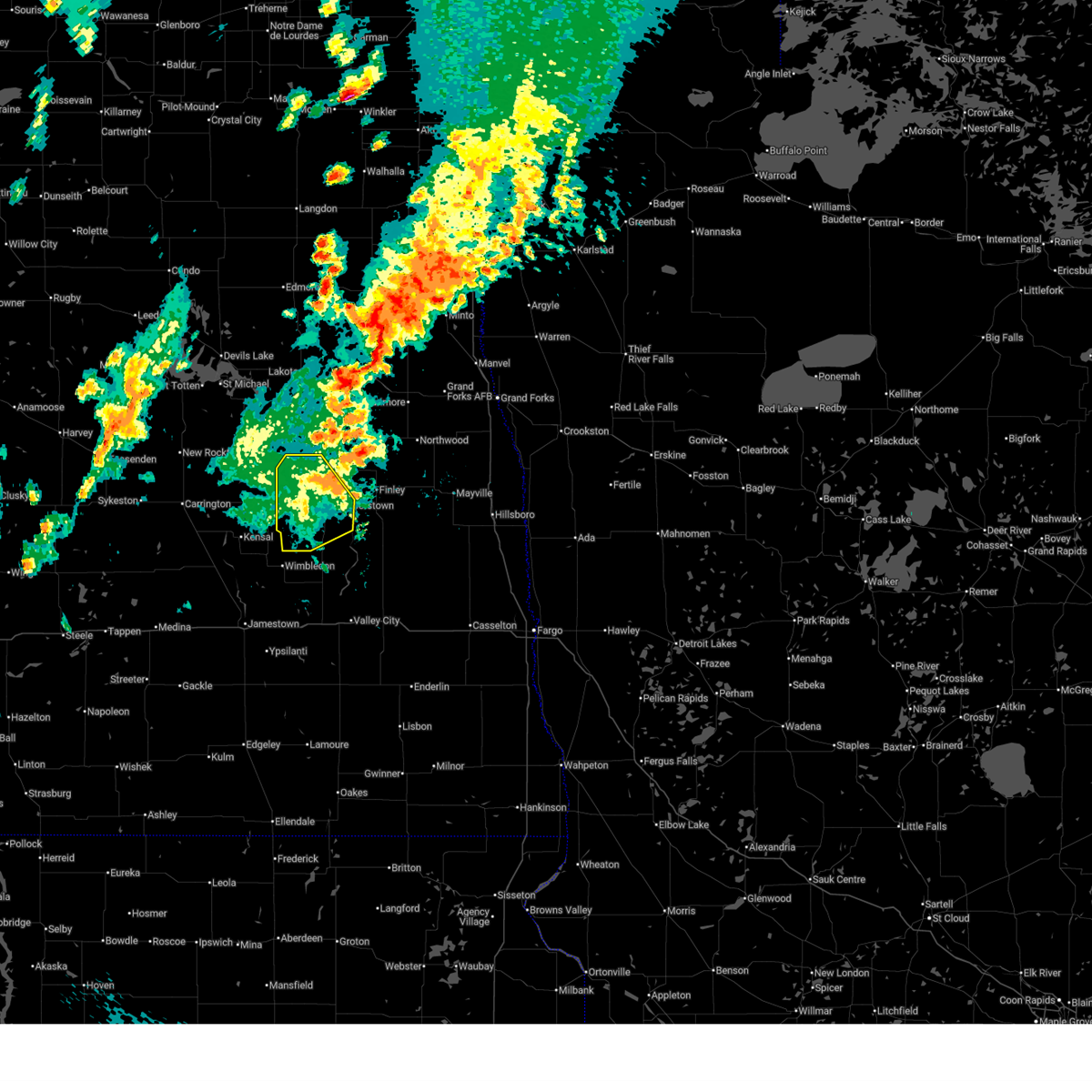
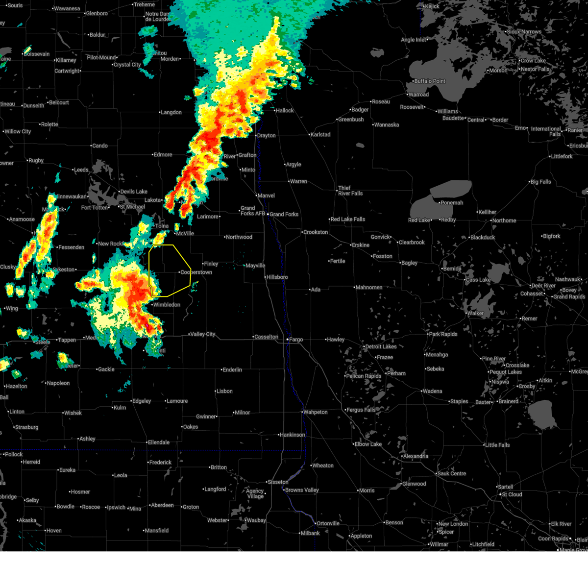
 At 1116 pm cdt, severe thunderstorms were located along a line extending from 8 miles east of jessie to near cooperstown, moving east at 30 mph (radar indicated). Hazards include 60 mph wind gusts and nickel size hail. Expect damage to roofs, siding, and trees. Locations impacted include, cooperstown, golden lake, finley, hannaford, sharon, sutton, and jessie. At 1116 pm cdt, severe thunderstorms were located along a line extending from 8 miles east of jessie to near cooperstown, moving east at 30 mph (radar indicated). Hazards include 60 mph wind gusts and nickel size hail. Expect damage to roofs, siding, and trees. Locations impacted include, cooperstown, golden lake, finley, hannaford, sharon, sutton, and jessie.
|
| 7/9/2025 11:15 PM CDT |
 At 1115 pm cdt, a severe thunderstorm was located over binford, or 36 miles east of carrington, moving east at 25 mph (radar indicated). Hazards include 60 mph wind gusts and nickel size hail. Expect damage to roofs, siding, and trees. Locations impacted include, binford, red willow lake, sutton, jessie, and mose. At 1115 pm cdt, a severe thunderstorm was located over binford, or 36 miles east of carrington, moving east at 25 mph (radar indicated). Hazards include 60 mph wind gusts and nickel size hail. Expect damage to roofs, siding, and trees. Locations impacted include, binford, red willow lake, sutton, jessie, and mose.
|
| 7/9/2025 11:15 PM CDT |
 the severe thunderstorm warning has been cancelled and is no longer in effect the severe thunderstorm warning has been cancelled and is no longer in effect
|
| 7/9/2025 10:54 PM CDT |
 At 1054 pm cdt, a severe thunderstorm was located over red willow lake, or 34 miles east of carrington, moving east at 25 mph (radar indicated). Hazards include 70 mph wind gusts and nickel size hail. Expect considerable tree damage. damage is likely to mobile homes, roofs, and outbuildings. Locations impacted include, binford, red willow lake, sutton, jessie, and mose. At 1054 pm cdt, a severe thunderstorm was located over red willow lake, or 34 miles east of carrington, moving east at 25 mph (radar indicated). Hazards include 70 mph wind gusts and nickel size hail. Expect considerable tree damage. damage is likely to mobile homes, roofs, and outbuildings. Locations impacted include, binford, red willow lake, sutton, jessie, and mose.
|
| 7/9/2025 10:54 PM CDT |
 the severe thunderstorm warning has been cancelled and is no longer in effect the severe thunderstorm warning has been cancelled and is no longer in effect
|
| 7/9/2025 10:53 PM CDT |
 Svrfgf the national weather service in grand forks has issued a * severe thunderstorm warning for, griggs county in southeastern north dakota, steele county in southeastern north dakota, * until 1130 pm cdt. * at 1053 pm cdt, severe thunderstorms were located along a line extending from jessie to near revere, moving east at 40 mph (radar indicated). Hazards include 70 mph wind gusts and nickel size hail. Expect considerable tree damage. Damage is likely to mobile homes, roofs, and outbuildings. Svrfgf the national weather service in grand forks has issued a * severe thunderstorm warning for, griggs county in southeastern north dakota, steele county in southeastern north dakota, * until 1130 pm cdt. * at 1053 pm cdt, severe thunderstorms were located along a line extending from jessie to near revere, moving east at 40 mph (radar indicated). Hazards include 70 mph wind gusts and nickel size hail. Expect considerable tree damage. Damage is likely to mobile homes, roofs, and outbuildings.
|
| 7/9/2025 10:33 PM CDT |
 Svrfgf the national weather service in grand forks has issued a * severe thunderstorm warning for, southwestern nelson county in northeastern north dakota, northwestern griggs county in southeastern north dakota, southeastern eddy county in northeastern north dakota, * until 1130 pm cdt. * at 1033 pm cdt, a severe thunderstorm was located 7 miles southwest of tolna, or 31 miles southeast of devils lake, moving southeast at 25 mph (radar indicated). Hazards include 60 mph wind gusts and half dollar size hail. Hail damage to vehicles is expected. Expect wind damage to roofs, siding, and trees. Svrfgf the national weather service in grand forks has issued a * severe thunderstorm warning for, southwestern nelson county in northeastern north dakota, northwestern griggs county in southeastern north dakota, southeastern eddy county in northeastern north dakota, * until 1130 pm cdt. * at 1033 pm cdt, a severe thunderstorm was located 7 miles southwest of tolna, or 31 miles southeast of devils lake, moving southeast at 25 mph (radar indicated). Hazards include 60 mph wind gusts and half dollar size hail. Hail damage to vehicles is expected. Expect wind damage to roofs, siding, and trees.
|
| 6/28/2025 4:26 PM CDT |
 The storm which prompted the warning has weakened below severe limits, and no longer poses an immediate threat to life or property. therefore, the warning will be allowed to expire. The storm which prompted the warning has weakened below severe limits, and no longer poses an immediate threat to life or property. therefore, the warning will be allowed to expire.
|
| 6/28/2025 4:14 PM CDT |
 At 414 pm cdt, a severe thunderstorm was located over jessie, or 41 miles north of valley city, moving east at 25 mph (radar indicated). Hazards include 60 mph wind gusts and quarter size hail. Hail damage to vehicles is expected. expect wind damage to roofs, siding, and trees. Locations impacted include, cooperstown, binford, red willow lake, sutton, jessie, and mose. At 414 pm cdt, a severe thunderstorm was located over jessie, or 41 miles north of valley city, moving east at 25 mph (radar indicated). Hazards include 60 mph wind gusts and quarter size hail. Hail damage to vehicles is expected. expect wind damage to roofs, siding, and trees. Locations impacted include, cooperstown, binford, red willow lake, sutton, jessie, and mose.
|
| 6/28/2025 3:34 PM CDT |
 Svrfgf the national weather service in grand forks has issued a * severe thunderstorm warning for, griggs county in southeastern north dakota, * until 430 pm cdt. * at 334 pm cdt, a severe thunderstorm was located over mchenry, or 28 miles east of carrington, moving east at 25 mph (radar indicated). Hazards include ping pong ball size hail and 60 mph wind gusts. People and animals outdoors will be injured. expect hail damage to roofs, siding, windows, and vehicles. Expect wind damage to roofs, siding, and trees. Svrfgf the national weather service in grand forks has issued a * severe thunderstorm warning for, griggs county in southeastern north dakota, * until 430 pm cdt. * at 334 pm cdt, a severe thunderstorm was located over mchenry, or 28 miles east of carrington, moving east at 25 mph (radar indicated). Hazards include ping pong ball size hail and 60 mph wind gusts. People and animals outdoors will be injured. expect hail damage to roofs, siding, windows, and vehicles. Expect wind damage to roofs, siding, and trees.
|
| 6/21/2025 1:12 AM CDT |
 Svrfgf the national weather service in grand forks has issued a * severe thunderstorm warning for, southwestern grand forks county in northeastern north dakota, northwestern cass county in southeastern north dakota, western traill county in southeastern north dakota, griggs county in southeastern north dakota, northern barnes county in southeastern north dakota, steele county in southeastern north dakota, * until 200 am cdt. * at 110 am cdt, a severe thunderstorm was located over galesburg, or 37 miles northeast of valley city, moving east at 15 mph. this is a destructive storm (emergency management. 111 mph wind gusts have been reported with this storm near luverne). Hazards include 100 mph wind gusts. You are in a life-threatening situation. flying debris may be deadly to those caught without shelter. mobile homes will be destroyed. expect considerable damage to homes and businesses. Expect extensive tree damage and power outages. Svrfgf the national weather service in grand forks has issued a * severe thunderstorm warning for, southwestern grand forks county in northeastern north dakota, northwestern cass county in southeastern north dakota, western traill county in southeastern north dakota, griggs county in southeastern north dakota, northern barnes county in southeastern north dakota, steele county in southeastern north dakota, * until 200 am cdt. * at 110 am cdt, a severe thunderstorm was located over galesburg, or 37 miles northeast of valley city, moving east at 15 mph. this is a destructive storm (emergency management. 111 mph wind gusts have been reported with this storm near luverne). Hazards include 100 mph wind gusts. You are in a life-threatening situation. flying debris may be deadly to those caught without shelter. mobile homes will be destroyed. expect considerable damage to homes and businesses. Expect extensive tree damage and power outages.
|
| 6/21/2025 12:28 AM CDT |
 The storms which prompted the warning have moved out of the area. therefore, the warning will be allowed to expire. however, gusty winds are still possible with these thunderstorms. a tornado watch remains in effect until 300 am cdt for southeastern and northeastern north dakota. remember, a severe thunderstorm warning still remains in effect for east central north dakota. widespread observed and long duration wind speeds have been greater than 75 mph within this area of storms. The storms which prompted the warning have moved out of the area. therefore, the warning will be allowed to expire. however, gusty winds are still possible with these thunderstorms. a tornado watch remains in effect until 300 am cdt for southeastern and northeastern north dakota. remember, a severe thunderstorm warning still remains in effect for east central north dakota. widespread observed and long duration wind speeds have been greater than 75 mph within this area of storms.
|
| 6/21/2025 12:16 AM CDT |
 Svrfgf the national weather service in grand forks has issued a * severe thunderstorm warning for, northwestern cass county in southeastern north dakota, griggs county in southeastern north dakota, barnes county in southeastern north dakota, steele county in southeastern north dakota, * until 115 am cdt. * at 1212 am cdt, severe thunderstorms were located along a line extending from 6 miles northeast of cooperstown to near sibley, moving east at 25 mph. widespread observed and long duration wind speeds have been greater than 75 mph within this area of storms. these are destructive winds (public). Hazards include 80 mph wind gusts. Flying debris will be dangerous to those caught without shelter. mobile homes will be heavily damaged. expect considerable damage to roofs, windows, and vehicles. Extensive tree damage and power outages are likely. Svrfgf the national weather service in grand forks has issued a * severe thunderstorm warning for, northwestern cass county in southeastern north dakota, griggs county in southeastern north dakota, barnes county in southeastern north dakota, steele county in southeastern north dakota, * until 115 am cdt. * at 1212 am cdt, severe thunderstorms were located along a line extending from 6 miles northeast of cooperstown to near sibley, moving east at 25 mph. widespread observed and long duration wind speeds have been greater than 75 mph within this area of storms. these are destructive winds (public). Hazards include 80 mph wind gusts. Flying debris will be dangerous to those caught without shelter. mobile homes will be heavily damaged. expect considerable damage to roofs, windows, and vehicles. Extensive tree damage and power outages are likely.
|
| 6/20/2025 11:30 PM CDT |
 The storms which prompted the warning have moved out of the area. therefore, the warning will be allowed to expire. a tornado watch remains in effect until 300 am cdt for southeastern and northeastern north dakota. remember, a severe thunderstorm warning still remains in effect for all areas previously warned!. The storms which prompted the warning have moved out of the area. therefore, the warning will be allowed to expire. a tornado watch remains in effect until 300 am cdt for southeastern and northeastern north dakota. remember, a severe thunderstorm warning still remains in effect for all areas previously warned!.
|
| 6/20/2025 11:29 PM CDT |
 Svrfgf the national weather service in grand forks has issued a * severe thunderstorm warning for, south central benson county in northeastern north dakota, southwestern nelson county in northeastern north dakota, griggs county in southeastern north dakota, northern barnes county in southeastern north dakota, eddy county in northeastern north dakota, western steele county in southeastern north dakota, * until 1230 am cdt. * at 1128 pm cdt, severe thunderstorms were located along a line extending from 6 miles east of bremen to near eldridge, moving east at 50 mph (public). Hazards include 70 mph wind gusts. Expect considerable tree damage. damage is likely to mobile homes, roofs, and outbuildings. severe thunderstorms will be near, new rockford around 1130 pm cdt. sheyenne, brantford, and southern spirit lake nation around 1135 pm cdt. wimbledon around 1150 pm cdt. sutton, warwick, and leal around 1155 pm cdt. rogers, hamar, and revere around 1200 am cdt. this includes the following highways, interstate 94 in north dakota between mile markers 272 and 303. Interstate 94 in minnesota between mile markers 272 and 303. Svrfgf the national weather service in grand forks has issued a * severe thunderstorm warning for, south central benson county in northeastern north dakota, southwestern nelson county in northeastern north dakota, griggs county in southeastern north dakota, northern barnes county in southeastern north dakota, eddy county in northeastern north dakota, western steele county in southeastern north dakota, * until 1230 am cdt. * at 1128 pm cdt, severe thunderstorms were located along a line extending from 6 miles east of bremen to near eldridge, moving east at 50 mph (public). Hazards include 70 mph wind gusts. Expect considerable tree damage. damage is likely to mobile homes, roofs, and outbuildings. severe thunderstorms will be near, new rockford around 1130 pm cdt. sheyenne, brantford, and southern spirit lake nation around 1135 pm cdt. wimbledon around 1150 pm cdt. sutton, warwick, and leal around 1155 pm cdt. rogers, hamar, and revere around 1200 am cdt. this includes the following highways, interstate 94 in north dakota between mile markers 272 and 303. Interstate 94 in minnesota between mile markers 272 and 303.
|
| 6/20/2025 10:33 PM CDT |
 Svrfgf the national weather service in grand forks has issued a * severe thunderstorm warning for, southeastern benson county in northeastern north dakota, southwestern nelson county in northeastern north dakota, griggs county in southeastern north dakota, eddy county in northeastern north dakota, northwestern steele county in southeastern north dakota, * until 1130 pm cdt. * at 1032 pm cdt, severe thunderstorms were located along a line extending from 9 miles north of hurdsfield to sykeston to 8 miles west of edmunds, moving east at 65 mph. these are destructive storms for eddy, benson, nelson, griggs and steele counties (public). Hazards include 80 mph wind gusts and quarter size hail. Flying debris will be dangerous to those caught without shelter. mobile homes will be heavily damaged. expect considerable damage to roofs, windows, and vehicles. Extensive tree damage and power outages are likely. Svrfgf the national weather service in grand forks has issued a * severe thunderstorm warning for, southeastern benson county in northeastern north dakota, southwestern nelson county in northeastern north dakota, griggs county in southeastern north dakota, eddy county in northeastern north dakota, northwestern steele county in southeastern north dakota, * until 1130 pm cdt. * at 1032 pm cdt, severe thunderstorms were located along a line extending from 9 miles north of hurdsfield to sykeston to 8 miles west of edmunds, moving east at 65 mph. these are destructive storms for eddy, benson, nelson, griggs and steele counties (public). Hazards include 80 mph wind gusts and quarter size hail. Flying debris will be dangerous to those caught without shelter. mobile homes will be heavily damaged. expect considerable damage to roofs, windows, and vehicles. Extensive tree damage and power outages are likely.
|
| 9/4/2023 11:39 PM CDT |
 At 1139 pm cdt, severe thunderstorms were located along a line extending from near derrick to near whitman to near finley, moving northeast at 45 mph (radar indicated). Hazards include 60 mph wind gusts. expect damage to roofs, siding, and trees At 1139 pm cdt, severe thunderstorms were located along a line extending from near derrick to near whitman to near finley, moving northeast at 45 mph (radar indicated). Hazards include 60 mph wind gusts. expect damage to roofs, siding, and trees
|
| 9/4/2023 11:27 PM CDT |
 At 1126 pm cdt, severe thunderstorms were located along a line extending from near brinsmade to lawton to 7 miles northwest of luverne, moving northeast at 20 mph (radar indicated). Hazards include 60 mph wind gusts and penny size hail. Expect damage to roofs, siding, and trees. Locations impacted include, devils lake, new rockford, cando, cooperstown, camp grafton, lakota and lakewood park. At 1126 pm cdt, severe thunderstorms were located along a line extending from near brinsmade to lawton to 7 miles northwest of luverne, moving northeast at 20 mph (radar indicated). Hazards include 60 mph wind gusts and penny size hail. Expect damage to roofs, siding, and trees. Locations impacted include, devils lake, new rockford, cando, cooperstown, camp grafton, lakota and lakewood park.
|
| 9/4/2023 10:58 PM CDT |
 At 1058 pm cdt, severe thunderstorms were located along a line extending from esmond to 7 miles northeast of devils lake to near wimbledon, moving northeast at 55 mph (radar indicated). Hazards include 60 mph wind gusts and penny size hail. expect damage to roofs, siding, and trees At 1058 pm cdt, severe thunderstorms were located along a line extending from esmond to 7 miles northeast of devils lake to near wimbledon, moving northeast at 55 mph (radar indicated). Hazards include 60 mph wind gusts and penny size hail. expect damage to roofs, siding, and trees
|
| 9/4/2023 10:34 PM CDT |
 At 1034 pm cdt, severe thunderstorms were located along a line extending from near flora to 7 miles northwest of mchenry to near adrian, moving east at 45 mph (radar indicated). Hazards include 60 mph wind gusts and penny size hail. expect damage to roofs, siding, and trees At 1034 pm cdt, severe thunderstorms were located along a line extending from near flora to 7 miles northwest of mchenry to near adrian, moving east at 45 mph (radar indicated). Hazards include 60 mph wind gusts and penny size hail. expect damage to roofs, siding, and trees
|
| 7/31/2022 1:04 AM CDT |
 At 104 am cdt, severe thunderstorms were located along a line extending from 7 miles northeast of warwick to 7 miles northeast of bordulac, moving east at 45 mph (radar indicated). Hazards include 60 mph wind gusts and penny size hail. expect damage to roofs, siding, and trees At 104 am cdt, severe thunderstorms were located along a line extending from 7 miles northeast of warwick to 7 miles northeast of bordulac, moving east at 45 mph (radar indicated). Hazards include 60 mph wind gusts and penny size hail. expect damage to roofs, siding, and trees
|
| 7/23/2022 12:00 AM CDT |
 At 1156 pm cdt, severe thunderstorms were located along a line extending from near mcville to near red willow lake to near glenfield, moving southeast at 60 mph. these are destructive storms (radar indicated). Hazards include 80 mph wind gusts and quarter size hail. Flying debris will be dangerous to those caught without shelter. mobile homes will be heavily damaged. expect considerable damage to roofs, windows, and vehicles. extensive tree damage and power outages are likely. severe thunderstorms will be near, sutton around 1200 am cdt. kloten, jessie and revere around 1205 am cdt. aneta around 1210 am cdt. sharon, cooperstown and wimbledon around 1215 am cdt. other locations in the path of these severe thunderstorms include leal and dazey. this includes interstate 94 in north dakota between mile markers 286 and 291. thunderstorm damage threat, destructive hail threat, radar indicated max hail size, 1. 00 in wind threat, radar indicated max wind gust, 80 mph. At 1156 pm cdt, severe thunderstorms were located along a line extending from near mcville to near red willow lake to near glenfield, moving southeast at 60 mph. these are destructive storms (radar indicated). Hazards include 80 mph wind gusts and quarter size hail. Flying debris will be dangerous to those caught without shelter. mobile homes will be heavily damaged. expect considerable damage to roofs, windows, and vehicles. extensive tree damage and power outages are likely. severe thunderstorms will be near, sutton around 1200 am cdt. kloten, jessie and revere around 1205 am cdt. aneta around 1210 am cdt. sharon, cooperstown and wimbledon around 1215 am cdt. other locations in the path of these severe thunderstorms include leal and dazey. this includes interstate 94 in north dakota between mile markers 286 and 291. thunderstorm damage threat, destructive hail threat, radar indicated max hail size, 1. 00 in wind threat, radar indicated max wind gust, 80 mph.
|
| 7/10/2022 6:55 AM CDT |
 At 655 am cdt, severe thunderstorms were located along a line extending from edmore to 6 miles north of pekin to revere, moving east at 45 mph (radar indicated). Hazards include 60 mph wind gusts and nickel size hail. Expect damage to roofs, siding, and trees. severe thunderstorms will be near, mcville around 700 am cdt. hannaford and walum around 705 am cdt. other locations in the path of these severe thunderstorms include adams, luverne, sibley, logan center, blabon, lankin and pillsbury. hail threat, radar indicated max hail size, 0. 88 in wind threat, radar indicated max wind gust, 60 mph. At 655 am cdt, severe thunderstorms were located along a line extending from edmore to 6 miles north of pekin to revere, moving east at 45 mph (radar indicated). Hazards include 60 mph wind gusts and nickel size hail. Expect damage to roofs, siding, and trees. severe thunderstorms will be near, mcville around 700 am cdt. hannaford and walum around 705 am cdt. other locations in the path of these severe thunderstorms include adams, luverne, sibley, logan center, blabon, lankin and pillsbury. hail threat, radar indicated max hail size, 0. 88 in wind threat, radar indicated max wind gust, 60 mph.
|
| 6/24/2022 7:35 PM CDT |
 At 735 pm cdt, a severe thunderstorm was located near cooperstown, or 37 miles north of valley city, moving northeast at 40 mph (radar indicated). Hazards include quarter size hail. Damage to vehicles is expected. locations impacted include, cooperstown. hail threat, radar indicated max hail size, 1. 00 in wind threat, radar indicated max wind gust, <50 mph. At 735 pm cdt, a severe thunderstorm was located near cooperstown, or 37 miles north of valley city, moving northeast at 40 mph (radar indicated). Hazards include quarter size hail. Damage to vehicles is expected. locations impacted include, cooperstown. hail threat, radar indicated max hail size, 1. 00 in wind threat, radar indicated max wind gust, <50 mph.
|
| 6/24/2022 7:08 PM CDT |
 At 708 pm cdt, a severe thunderstorm was located near kensal, or 38 miles northwest of valley city, moving northeast at 35 mph (radar indicated). Hazards include quarter size hail. Damage to vehicles is expected. this severe thunderstorm will be near, sutton around 725 pm cdt. other locations in the path of this severe thunderstorm include revere, jessie and cooperstown. hail threat, radar indicated max hail size, 1. 00 in wind threat, radar indicated max wind gust, <50 mph. At 708 pm cdt, a severe thunderstorm was located near kensal, or 38 miles northwest of valley city, moving northeast at 35 mph (radar indicated). Hazards include quarter size hail. Damage to vehicles is expected. this severe thunderstorm will be near, sutton around 725 pm cdt. other locations in the path of this severe thunderstorm include revere, jessie and cooperstown. hail threat, radar indicated max hail size, 1. 00 in wind threat, radar indicated max wind gust, <50 mph.
|
| 6/20/2022 12:32 AM CDT |
 At 1232 am cdt, severe thunderstorms were located along a line extending from near courtenay to near bald hill dam, moving northeast at 50 mph (radar indicated). Hazards include 60 mph wind gusts and nickel size hail. Expect damage to roofs, siding, and trees. locations impacted include, rogers, sibley, pillsbury, sutton, luverne, revere, cooperstown and jessie. hail threat, radar indicated max hail size, 0. 88 in wind threat, radar indicated max wind gust, 60 mph. At 1232 am cdt, severe thunderstorms were located along a line extending from near courtenay to near bald hill dam, moving northeast at 50 mph (radar indicated). Hazards include 60 mph wind gusts and nickel size hail. Expect damage to roofs, siding, and trees. locations impacted include, rogers, sibley, pillsbury, sutton, luverne, revere, cooperstown and jessie. hail threat, radar indicated max hail size, 0. 88 in wind threat, radar indicated max wind gust, 60 mph.
|
| 6/20/2022 12:11 AM CDT |
 At 1210 am cdt, severe thunderstorms were located along a line extending from near buchanan to near eckelson, moving northeast at 50 mph (radar indicated). Hazards include 60 mph wind gusts and nickel size hail. Expect damage to roofs, siding, and trees. severe thunderstorms will be near, eckelson and urbana around 1215 am cdt. sanborn around 1220 am cdt. rogers around 1225 am cdt. bald hill dam around 1230 am cdt. other locations in the path of these severe thunderstorms include wimbledon. this includes interstate 94 in north dakota between mile markers 272 and 287. hail threat, radar indicated max hail size, 0. 88 in wind threat, radar indicated max wind gust, 60 mph. At 1210 am cdt, severe thunderstorms were located along a line extending from near buchanan to near eckelson, moving northeast at 50 mph (radar indicated). Hazards include 60 mph wind gusts and nickel size hail. Expect damage to roofs, siding, and trees. severe thunderstorms will be near, eckelson and urbana around 1215 am cdt. sanborn around 1220 am cdt. rogers around 1225 am cdt. bald hill dam around 1230 am cdt. other locations in the path of these severe thunderstorms include wimbledon. this includes interstate 94 in north dakota between mile markers 272 and 287. hail threat, radar indicated max hail size, 0. 88 in wind threat, radar indicated max wind gust, 60 mph.
|
| 6/19/2022 11:05 PM CDT |
 At 1104 pm cdt, severe thunderstorms were located along a line extending from pekin to near sharon, moving northeast at 60 mph. at 1100 pm cdt, a 68 mph wind gust was reported near cooperstown (radar indicated). Hazards include 70 mph wind gusts and quarter size hail. Hail damage to vehicles is expected. expect considerable tree damage. wind damage is also likely to mobile homes, roofs, and outbuildings. severe thunderstorms will be near, mapes and logan center around 1120 pm cdt. other locations in the path of these severe thunderstorms include michigan, kempton, petersburg, larimore, whitman, dahlen, arvilla, emerado, honeyford, mekinock and grand forks afb. this includes interstate 29 between mile markers 153 and 158. thunderstorm damage threat, considerable hail threat, radar indicated max hail size, 1. 00 in wind threat, observed max wind gust, 70 mph. At 1104 pm cdt, severe thunderstorms were located along a line extending from pekin to near sharon, moving northeast at 60 mph. at 1100 pm cdt, a 68 mph wind gust was reported near cooperstown (radar indicated). Hazards include 70 mph wind gusts and quarter size hail. Hail damage to vehicles is expected. expect considerable tree damage. wind damage is also likely to mobile homes, roofs, and outbuildings. severe thunderstorms will be near, mapes and logan center around 1120 pm cdt. other locations in the path of these severe thunderstorms include michigan, kempton, petersburg, larimore, whitman, dahlen, arvilla, emerado, honeyford, mekinock and grand forks afb. this includes interstate 29 between mile markers 153 and 158. thunderstorm damage threat, considerable hail threat, radar indicated max hail size, 1. 00 in wind threat, observed max wind gust, 70 mph.
|
| 6/19/2022 10:50 PM CDT |
 At 1049 pm cdt, a severe thunderstorm was located near jessie, or 40 miles north of valley city, moving northeast at 45 mph. at 1041 pm cdt, a personal weather station 1 mile north-northeast of sutton reported a 59 mph wind gust (radar indicated). Hazards include 60 mph wind gusts and quarter size hail. Hail damage to vehicles is expected. expect wind damage to roofs, siding, and trees. locations impacted include, cooperstown and jessie. hail threat, radar indicated max hail size, 1. 00 in wind threat, observed max wind gust, 60 mph. At 1049 pm cdt, a severe thunderstorm was located near jessie, or 40 miles north of valley city, moving northeast at 45 mph. at 1041 pm cdt, a personal weather station 1 mile north-northeast of sutton reported a 59 mph wind gust (radar indicated). Hazards include 60 mph wind gusts and quarter size hail. Hail damage to vehicles is expected. expect wind damage to roofs, siding, and trees. locations impacted include, cooperstown and jessie. hail threat, radar indicated max hail size, 1. 00 in wind threat, observed max wind gust, 60 mph.
|
| 6/19/2022 10:33 PM CDT |
 At 1033 pm cdt, a severe thunderstorm was located near sutton, or 35 miles northwest of valley city, moving northeast at 45 mph (radar indicated). Hazards include 60 mph wind gusts and quarter size hail. Hail damage to vehicles is expected. expect wind damage to roofs, siding, and trees. this severe thunderstorm will be near, sutton and revere around 1040 pm cdt. other locations in the path of this severe thunderstorm include binford, cooperstown and jessie. hail threat, radar indicated max hail size, 1. 00 in wind threat, radar indicated max wind gust, 60 mph. At 1033 pm cdt, a severe thunderstorm was located near sutton, or 35 miles northwest of valley city, moving northeast at 45 mph (radar indicated). Hazards include 60 mph wind gusts and quarter size hail. Hail damage to vehicles is expected. expect wind damage to roofs, siding, and trees. this severe thunderstorm will be near, sutton and revere around 1040 pm cdt. other locations in the path of this severe thunderstorm include binford, cooperstown and jessie. hail threat, radar indicated max hail size, 1. 00 in wind threat, radar indicated max wind gust, 60 mph.
|
| 6/14/2022 6:32 AM CDT |
 At 631 am cdt, severe thunderstorms were located along a line extending from revere to 7 miles southeast of cooperstown to near colgate, moving north at 65 mph (radar indicated). Hazards include 70 mph wind gusts and nickel size hail. Expect considerable tree damage. damage is likely to mobile homes, roofs, and outbuildings. severe thunderstorms will be near, cooperstown around 635 am cdt. sherbrooke and finley around 640 am cdt. binford, sharon and golden lake around 645 am cdt. aneta, red willow lake and hatton around 650 am cdt. other locations in the path of these severe thunderstorms include pekin, logan center and mcville. thunderstorm damage threat, considerable hail threat, radar indicated max hail size, 0. 88 in wind threat, radar indicated max wind gust, 70 mph. At 631 am cdt, severe thunderstorms were located along a line extending from revere to 7 miles southeast of cooperstown to near colgate, moving north at 65 mph (radar indicated). Hazards include 70 mph wind gusts and nickel size hail. Expect considerable tree damage. damage is likely to mobile homes, roofs, and outbuildings. severe thunderstorms will be near, cooperstown around 635 am cdt. sherbrooke and finley around 640 am cdt. binford, sharon and golden lake around 645 am cdt. aneta, red willow lake and hatton around 650 am cdt. other locations in the path of these severe thunderstorms include pekin, logan center and mcville. thunderstorm damage threat, considerable hail threat, radar indicated max hail size, 0. 88 in wind threat, radar indicated max wind gust, 70 mph.
|
| 8/22/2021 7:00 PM CDT |
 At 700 pm cdt, a severe thunderstorm was located over revere, or 35 miles northwest of valley city, moving northeast at 25 mph (radar indicated). Hazards include ping pong ball size hail and 60 mph wind gusts. People and animals outdoors will be injured. expect hail damage to roofs, siding, windows, and vehicles. expect wind damage to roofs, siding, and trees. this severe storm will be near, revere around 705 pm cdt. other locations in the path of this severe thunderstorm include hannaford and cooperstown. hail threat, radar indicated max hail size, 1. 50 in wind threat, radar indicated max wind gust, 60 mph. At 700 pm cdt, a severe thunderstorm was located over revere, or 35 miles northwest of valley city, moving northeast at 25 mph (radar indicated). Hazards include ping pong ball size hail and 60 mph wind gusts. People and animals outdoors will be injured. expect hail damage to roofs, siding, windows, and vehicles. expect wind damage to roofs, siding, and trees. this severe storm will be near, revere around 705 pm cdt. other locations in the path of this severe thunderstorm include hannaford and cooperstown. hail threat, radar indicated max hail size, 1. 50 in wind threat, radar indicated max wind gust, 60 mph.
|
| 8/22/2021 6:48 PM CDT |
 At 648 pm cdt, a severe thunderstorm was located near sutton, or 36 miles northwest of valley city, moving northeast at 30 mph (radar indicated). Hazards include 60 mph wind gusts and quarter size hail. Hail damage to vehicles is expected. expect wind damage to roofs, siding, and trees. this severe thunderstorm will be near, sutton around 655 pm cdt. revere around 700 pm cdt. other locations in the path of this severe thunderstorm include hannaford and cooperstown. hail threat, radar indicated max hail size, 1. 00 in wind threat, radar indicated max wind gust, 60 mph. At 648 pm cdt, a severe thunderstorm was located near sutton, or 36 miles northwest of valley city, moving northeast at 30 mph (radar indicated). Hazards include 60 mph wind gusts and quarter size hail. Hail damage to vehicles is expected. expect wind damage to roofs, siding, and trees. this severe thunderstorm will be near, sutton around 655 pm cdt. revere around 700 pm cdt. other locations in the path of this severe thunderstorm include hannaford and cooperstown. hail threat, radar indicated max hail size, 1. 00 in wind threat, radar indicated max wind gust, 60 mph.
|
| 7/3/2021 8:24 PM CDT |
 The severe thunderstorm warning for southwestern grand forks, southern nelson, griggs, southeastern eddy and northwestern steele counties will expire at 830 pm cdt, the storms which prompted the warning have weakened below severe limits, and no longer pose an immediate threat to life or property. therefore, the warning will be allowed to expire. however gusty winds are still possible with these thunderstorms. The severe thunderstorm warning for southwestern grand forks, southern nelson, griggs, southeastern eddy and northwestern steele counties will expire at 830 pm cdt, the storms which prompted the warning have weakened below severe limits, and no longer pose an immediate threat to life or property. therefore, the warning will be allowed to expire. however gusty winds are still possible with these thunderstorms.
|
| 7/3/2021 7:59 PM CDT |
 At 759 pm cdt, severe thunderstorms were located along a line extending from 8 miles northwest of logan center to near jessie to grace city, moving east at 35 mph (radar indicated). Hazards include 60 mph wind gusts and quarter size hail. Hail damage to vehicles is expected. expect wind damage to roofs, siding, and trees. Locations impacted include, jessie, kloten, logan center, aneta, sharon and mose. At 759 pm cdt, severe thunderstorms were located along a line extending from 8 miles northwest of logan center to near jessie to grace city, moving east at 35 mph (radar indicated). Hazards include 60 mph wind gusts and quarter size hail. Hail damage to vehicles is expected. expect wind damage to roofs, siding, and trees. Locations impacted include, jessie, kloten, logan center, aneta, sharon and mose.
|
| 7/3/2021 7:31 PM CDT |
 At 731 pm cdt, severe thunderstorms were located along a line extending from near michigan to 8 miles northwest of red willow lake to near barlow, moving southeast at 20 mph (radar indicated). Hazards include 60 mph wind gusts and quarter size hail. Hail damage to vehicles is expected. expect wind damage to roofs, siding, and trees. severe thunderstorms will be near, michigan and petersburg around 735 pm cdt. Other locations in the path of these severe thunderstorms include red willow lake, mose, binford, jessie and logan center. At 731 pm cdt, severe thunderstorms were located along a line extending from near michigan to 8 miles northwest of red willow lake to near barlow, moving southeast at 20 mph (radar indicated). Hazards include 60 mph wind gusts and quarter size hail. Hail damage to vehicles is expected. expect wind damage to roofs, siding, and trees. severe thunderstorms will be near, michigan and petersburg around 735 pm cdt. Other locations in the path of these severe thunderstorms include red willow lake, mose, binford, jessie and logan center.
|
| 6/11/2021 3:48 AM CDT |
 At 347 am cdt, severe thunderstorms were located along a line extending from near sutton to near wimbledon to near urbana, moving east at 50 mph (radar indicated). Hazards include 70 mph wind gusts. Expect considerable tree damage. Damage is likely to mobile homes, roofs, and outbuildings. At 347 am cdt, severe thunderstorms were located along a line extending from near sutton to near wimbledon to near urbana, moving east at 50 mph (radar indicated). Hazards include 70 mph wind gusts. Expect considerable tree damage. Damage is likely to mobile homes, roofs, and outbuildings.
|
| 6/7/2021 8:02 PM CDT |
 At 801 pm cdt, a severe thunderstorm was located near courtenay, or 33 miles northwest of valley city, moving northeast at 40 mph (radar indicated). Hazards include 60 mph wind gusts and quarter size hail. Hail damage to vehicles is expected. expect wind damage to roofs, siding, and trees. this severe thunderstorm will be near, sutton around 810 pm cdt. revere around 815 pm cdt. walum around 820 pm cdt. Other locations in the path of this severe thunderstorm include hannaford and cooperstown. At 801 pm cdt, a severe thunderstorm was located near courtenay, or 33 miles northwest of valley city, moving northeast at 40 mph (radar indicated). Hazards include 60 mph wind gusts and quarter size hail. Hail damage to vehicles is expected. expect wind damage to roofs, siding, and trees. this severe thunderstorm will be near, sutton around 810 pm cdt. revere around 815 pm cdt. walum around 820 pm cdt. Other locations in the path of this severe thunderstorm include hannaford and cooperstown.
|
| 9/2/2020 8:28 PM CDT |
 At 825 pm cdt, severe thunderstorms were located along a line extending from ardoch to near cooperstown, moving east at 60 mph (radar indicated). Hazards include 60 mph wind gusts. Expect damage to roofs, siding, and trees. locations impacted include, grand forks afb, larimore, cooperstown, northwood, golden lake, finley and emerado. This includes interstate 29 between mile markers 155 and 160. At 825 pm cdt, severe thunderstorms were located along a line extending from ardoch to near cooperstown, moving east at 60 mph (radar indicated). Hazards include 60 mph wind gusts. Expect damage to roofs, siding, and trees. locations impacted include, grand forks afb, larimore, cooperstown, northwood, golden lake, finley and emerado. This includes interstate 29 between mile markers 155 and 160.
|
| 9/2/2020 7:54 PM CDT |
 At 754 pm cdt, severe thunderstorms were located along a line extending from near dahlen to near bordulac, moving east at 60 mph (radar indicated). Hazards include 60 mph wind gusts. expect damage to roofs, siding, and trees At 754 pm cdt, severe thunderstorms were located along a line extending from near dahlen to near bordulac, moving east at 60 mph (radar indicated). Hazards include 60 mph wind gusts. expect damage to roofs, siding, and trees
|
| 7/17/2020 8:43 PM CDT |
 At 843 pm cdt, severe thunderstorms were located along a line extending from near hannaford to near spiritwood to near streeter, moving southeast at 30 mph (radar indicated). Hazards include 60 mph wind gusts and quarter size hail. Hail damage to vehicles is expected. expect wind damage to roofs, siding, and trees. severe thunderstorms will be near, hannaford and walum around 845 pm cdt. urbana around 900 pm cdt. luverne, sibley and eckelson around 905 pm cdt. sanborn around 910 pm cdt. pillsbury around 920 pm cdt. This includes interstate 94 in north dakota between mile markers 272 and 312. At 843 pm cdt, severe thunderstorms were located along a line extending from near hannaford to near spiritwood to near streeter, moving southeast at 30 mph (radar indicated). Hazards include 60 mph wind gusts and quarter size hail. Hail damage to vehicles is expected. expect wind damage to roofs, siding, and trees. severe thunderstorms will be near, hannaford and walum around 845 pm cdt. urbana around 900 pm cdt. luverne, sibley and eckelson around 905 pm cdt. sanborn around 910 pm cdt. pillsbury around 920 pm cdt. This includes interstate 94 in north dakota between mile markers 272 and 312.
|
| 7/17/2020 7:11 PM CDT |
 At 711 pm cdt, a severe thunderstorm was located near revere, or 35 miles north of valley city, moving east at 25 mph (radar indicated). Hazards include 60 mph wind gusts and quarter size hail. Hail damage to vehicles is expected. expect wind damage to roofs, siding, and trees. This severe storm will be near, hannaford and cooperstown around 725 pm cdt. At 711 pm cdt, a severe thunderstorm was located near revere, or 35 miles north of valley city, moving east at 25 mph (radar indicated). Hazards include 60 mph wind gusts and quarter size hail. Hail damage to vehicles is expected. expect wind damage to roofs, siding, and trees. This severe storm will be near, hannaford and cooperstown around 725 pm cdt.
|
| 7/17/2020 7:01 PM CDT |
 At 659 pm cdt, a severe thunderstorm was located near sutton, or 39 miles northwest of valley city, moving east at 20 mph (radar indicated). Hazards include 60 mph wind gusts and quarter size hail. Hail damage to vehicles is expected. expect wind damage to roofs, siding, and trees. this severe storm will be near, revere around 705 pm cdt. jessie around 710 pm cdt. hannaford around 725 pm cdt. Cooperstown around 730 pm cdt. At 659 pm cdt, a severe thunderstorm was located near sutton, or 39 miles northwest of valley city, moving east at 20 mph (radar indicated). Hazards include 60 mph wind gusts and quarter size hail. Hail damage to vehicles is expected. expect wind damage to roofs, siding, and trees. this severe storm will be near, revere around 705 pm cdt. jessie around 710 pm cdt. hannaford around 725 pm cdt. Cooperstown around 730 pm cdt.
|
| 7/17/2020 6:50 PM CDT |
 At 650 pm cdt, a severe thunderstorm was located near sutton, or 43 miles northwest of valley city, moving east at 20 mph (radar indicated). Hazards include golf ball size hail and 60 mph wind gusts. People and animals outdoors will be injured. expect hail damage to roofs, siding, windows, and vehicles. expect wind damage to roofs, siding, and trees. this severe storm will be near, binford around 700 pm cdt. jessie around 715 pm cdt. Cooperstown around 730 pm cdt. At 650 pm cdt, a severe thunderstorm was located near sutton, or 43 miles northwest of valley city, moving east at 20 mph (radar indicated). Hazards include golf ball size hail and 60 mph wind gusts. People and animals outdoors will be injured. expect hail damage to roofs, siding, windows, and vehicles. expect wind damage to roofs, siding, and trees. this severe storm will be near, binford around 700 pm cdt. jessie around 715 pm cdt. Cooperstown around 730 pm cdt.
|
| 7/17/2020 6:35 PM CDT |
 At 634 pm cdt, a severe thunderstorm was located over glenfield, or 45 miles south of devils lake, moving east at 20 mph (radar indicated). Hazards include golf ball size hail and 60 mph wind gusts. People and animals outdoors will be injured. expect hail damage to roofs, siding, windows, and vehicles. expect wind damage to roofs, siding, and trees. this severe thunderstorm will be near, sutton and mose around 650 pm cdt. binford around 700 pm cdt. jessie around 715 pm cdt. Cooperstown around 730 pm cdt. At 634 pm cdt, a severe thunderstorm was located over glenfield, or 45 miles south of devils lake, moving east at 20 mph (radar indicated). Hazards include golf ball size hail and 60 mph wind gusts. People and animals outdoors will be injured. expect hail damage to roofs, siding, windows, and vehicles. expect wind damage to roofs, siding, and trees. this severe thunderstorm will be near, sutton and mose around 650 pm cdt. binford around 700 pm cdt. jessie around 715 pm cdt. Cooperstown around 730 pm cdt.
|
| 7/8/2020 1:32 AM CDT |
 At 131 am cdt, severe thunderstorms were located along a line extending from near sutton to near wimbledon to near eldridge, moving east at 70 mph. these are very dangerous storms (radar indicated). Hazards include 80 mph wind gusts and quarter size hail. Flying debris will be dangerous to those caught without shelter. mobile homes will be heavily damaged. expect considerable damage to roofs, windows, and vehicles. extensive tree damage and power outages are likely. severe thunderstorms will be near, sutton and wimbledon around 135 am cdt. revere and dazey around 140 am cdt. walum and hannaford around 145 am cdt. urbana, cooperstown and sibley around 150 am cdt. Luverne, sanborn and eckelson around 155 am cdt. At 131 am cdt, severe thunderstorms were located along a line extending from near sutton to near wimbledon to near eldridge, moving east at 70 mph. these are very dangerous storms (radar indicated). Hazards include 80 mph wind gusts and quarter size hail. Flying debris will be dangerous to those caught without shelter. mobile homes will be heavily damaged. expect considerable damage to roofs, windows, and vehicles. extensive tree damage and power outages are likely. severe thunderstorms will be near, sutton and wimbledon around 135 am cdt. revere and dazey around 140 am cdt. walum and hannaford around 145 am cdt. urbana, cooperstown and sibley around 150 am cdt. Luverne, sanborn and eckelson around 155 am cdt.
|
| 7/8/2020 1:29 AM CDT |
 At 128 am cdt, severe thunderstorms were located along a line extending from near sheyenne to near kensal, moving east at 65 mph (radar indicated). Hazards include 70 mph wind gusts and quarter size hail. Hail damage to vehicles is expected. expect considerable tree damage. wind damage is also likely to mobile homes, roofs, and outbuildings. severe thunderstorms will be near, sutton around 140 am cdt. warwick around 150 am cdt. hamar around 155 am cdt. tolna around 205 am cdt. Pekin around 210 am cdt. At 128 am cdt, severe thunderstorms were located along a line extending from near sheyenne to near kensal, moving east at 65 mph (radar indicated). Hazards include 70 mph wind gusts and quarter size hail. Hail damage to vehicles is expected. expect considerable tree damage. wind damage is also likely to mobile homes, roofs, and outbuildings. severe thunderstorms will be near, sutton around 140 am cdt. warwick around 150 am cdt. hamar around 155 am cdt. tolna around 205 am cdt. Pekin around 210 am cdt.
|
| 6/30/2020 9:40 PM CDT |
 At 940 pm cdt, a severe thunderstorm was located near sutton, or 38 miles northwest of valley city, moving northeast at 50 mph (radar indicated). Hazards include 60 mph wind gusts and penny size hail. expect damage to roofs, siding, and trees At 940 pm cdt, a severe thunderstorm was located near sutton, or 38 miles northwest of valley city, moving northeast at 50 mph (radar indicated). Hazards include 60 mph wind gusts and penny size hail. expect damage to roofs, siding, and trees
|
| 6/30/2020 8:23 PM CDT |
 At 823 pm cdt, a severe thunderstorm was located near binford, or 43 miles north of valley city, moving northeast at 35 mph (radar indicated). Hazards include 60 mph wind gusts and penny size hail. expect damage to roofs, siding, and trees At 823 pm cdt, a severe thunderstorm was located near binford, or 43 miles north of valley city, moving northeast at 35 mph (radar indicated). Hazards include 60 mph wind gusts and penny size hail. expect damage to roofs, siding, and trees
|
| 6/20/2020 1:40 PM CDT |
 At 139 pm cdt, a severe thunderstorm was located near sutton, or 42 miles northwest of valley city, moving northeast at 20 mph (radar indicated). Hazards include half dollar size hail. Damage to vehicles is expected. this severe thunderstorm will be near, binford around 155 pm cdt. jessie around 205 pm cdt. Cooperstown around 210 pm cdt. At 139 pm cdt, a severe thunderstorm was located near sutton, or 42 miles northwest of valley city, moving northeast at 20 mph (radar indicated). Hazards include half dollar size hail. Damage to vehicles is expected. this severe thunderstorm will be near, binford around 155 pm cdt. jessie around 205 pm cdt. Cooperstown around 210 pm cdt.
|
| 6/7/2020 8:24 PM CDT |
 At 823 pm cdt, severe thunderstorms were located along a line extending from revere to near hannaford to near pillsbury, moving north at 45 mph (public). Hazards include 70 mph wind gusts and quarter size hail. Hail damage to vehicles is expected. expect considerable tree damage. wind damage is also likely to mobile homes, roofs, and outbuildings. these severe storms will be near, hope around 830 pm cdt. blabon and cooperstown around 835 pm cdt. Sherbrooke around 840 pm cdt. At 823 pm cdt, severe thunderstorms were located along a line extending from revere to near hannaford to near pillsbury, moving north at 45 mph (public). Hazards include 70 mph wind gusts and quarter size hail. Hail damage to vehicles is expected. expect considerable tree damage. wind damage is also likely to mobile homes, roofs, and outbuildings. these severe storms will be near, hope around 830 pm cdt. blabon and cooperstown around 835 pm cdt. Sherbrooke around 840 pm cdt.
|
| 6/7/2020 8:02 PM CDT |
 At 802 pm cdt, a severe thunderstorm was located near rogers, or 13 miles northwest of valley city, moving north at 40 mph (radar indicated). Hazards include 60 mph wind gusts and quarter size hail. Hail damage to vehicles is expected. expect wind damage to roofs, siding, and trees. this severe storm will be near, dazey around 810 pm cdt. sibley, walum and luverne around 820 pm cdt. hannaford around 825 pm cdt. Cooperstown around 835 pm cdt. At 802 pm cdt, a severe thunderstorm was located near rogers, or 13 miles northwest of valley city, moving north at 40 mph (radar indicated). Hazards include 60 mph wind gusts and quarter size hail. Hail damage to vehicles is expected. expect wind damage to roofs, siding, and trees. this severe storm will be near, dazey around 810 pm cdt. sibley, walum and luverne around 820 pm cdt. hannaford around 825 pm cdt. Cooperstown around 835 pm cdt.
|
| 6/7/2020 7:41 PM CDT |
 At 741 pm cdt, a severe thunderstorm was located over sanborn, or 10 miles west of valley city, moving north at 40 mph (radar indicated). Hazards include 60 mph wind gusts and quarter size hail. Hail damage to vehicles is expected. expect wind damage to roofs, siding, and trees. this severe thunderstorm will be near, sanborn around 745 pm cdt. rogers, bald hill dam and leal around 800 pm cdt. dazey around 810 pm cdt. sibley, walum and luverne around 820 pm cdt. hannaford around 825 pm cdt. This includes interstate 94 in north dakota between mile markers 272 and 296. At 741 pm cdt, a severe thunderstorm was located over sanborn, or 10 miles west of valley city, moving north at 40 mph (radar indicated). Hazards include 60 mph wind gusts and quarter size hail. Hail damage to vehicles is expected. expect wind damage to roofs, siding, and trees. this severe thunderstorm will be near, sanborn around 745 pm cdt. rogers, bald hill dam and leal around 800 pm cdt. dazey around 810 pm cdt. sibley, walum and luverne around 820 pm cdt. hannaford around 825 pm cdt. This includes interstate 94 in north dakota between mile markers 272 and 296.
|
| 9/2/2019 4:59 PM CDT |
 At 458 pm cdt, severe thunderstorms were located along a line extending from near pekin to jessie to near ypsilanti, moving east at 45 mph. there have been multiple reports of 70 to 80 mph winds in stustman county. these are very dangerous storms (trained weather spotters). Hazards include 80 mph wind gusts and quarter size hail. Flying debris will be dangerous to those caught without shelter. mobile homes will be heavily damaged. expect considerable damage to roofs, windows, and vehicles. extensive tree damage and power outages are likely. locations impacted include, valley city, mayville, cooperstown, northwood, hatton, portland and golden lake. This includes interstate 94 in north dakota between mile markers 271 and 317. At 458 pm cdt, severe thunderstorms were located along a line extending from near pekin to jessie to near ypsilanti, moving east at 45 mph. there have been multiple reports of 70 to 80 mph winds in stustman county. these are very dangerous storms (trained weather spotters). Hazards include 80 mph wind gusts and quarter size hail. Flying debris will be dangerous to those caught without shelter. mobile homes will be heavily damaged. expect considerable damage to roofs, windows, and vehicles. extensive tree damage and power outages are likely. locations impacted include, valley city, mayville, cooperstown, northwood, hatton, portland and golden lake. This includes interstate 94 in north dakota between mile markers 271 and 317.
|
| 9/2/2019 4:43 PM CDT |
 At 442 pm cdt, severe thunderstorms were located along a line extending from near hamar to near mose to near jamestown, moving east at 45 mph. a 81 mph gust was reported a jamestown, this is a very dangerous line of storms! these are very dangerous storms (radar indicated). Hazards include 80 mph wind gusts and quarter size hail. Flying debris will be dangerous to those caught without shelter. mobile homes will be heavily damaged. expect considerable damage to roofs, windows, and vehicles. Extensive tree damage and power outages are likely. At 442 pm cdt, severe thunderstorms were located along a line extending from near hamar to near mose to near jamestown, moving east at 45 mph. a 81 mph gust was reported a jamestown, this is a very dangerous line of storms! these are very dangerous storms (radar indicated). Hazards include 80 mph wind gusts and quarter size hail. Flying debris will be dangerous to those caught without shelter. mobile homes will be heavily damaged. expect considerable damage to roofs, windows, and vehicles. Extensive tree damage and power outages are likely.
|
| 7/8/2019 6:29 PM CDT |
 The national weather service in grand forks has issued a * severe thunderstorm warning for. western grand forks county in northeastern north dakota. nelson county in northeastern north dakota. northern griggs county in southeastern north dakota. Northern steele county in southeastern north dakota. The national weather service in grand forks has issued a * severe thunderstorm warning for. western grand forks county in northeastern north dakota. nelson county in northeastern north dakota. northern griggs county in southeastern north dakota. Northern steele county in southeastern north dakota.
|
| 6/29/2019 9:47 AM CDT |
 At 946 am cdt, severe thunderstorms were located along a line extending from near mapes to near red willow lake to near bordulac, moving southeast at 35 mph (radar indicated). Hazards include 60 mph wind gusts and quarter size hail. Hail damage to vehicles is expected. expect wind damage to roofs, siding, and trees. these severe storms will be near, red willow lake and mose around 950 am cdt. Jessie and binford around 1000 am cdt. At 946 am cdt, severe thunderstorms were located along a line extending from near mapes to near red willow lake to near bordulac, moving southeast at 35 mph (radar indicated). Hazards include 60 mph wind gusts and quarter size hail. Hail damage to vehicles is expected. expect wind damage to roofs, siding, and trees. these severe storms will be near, red willow lake and mose around 950 am cdt. Jessie and binford around 1000 am cdt.
|
| 6/29/2019 9:31 AM CDT |
 At 931 am cdt, severe thunderstorms were located along a line extending from near brocket to 6 miles southwest of tolna to near bordulac, moving southeast at 35 mph (radar indicated). Hazards include 60 mph wind gusts and quarter size hail. Hail damage to vehicles is expected. expect wind damage to roofs, siding, and trees. these severe storms will be near, tolna around 935 am cdt. pekin around 940 am cdt. red willow lake and mose around 950 am cdt. binford around 955 am cdt. Jessie around 1000 am cdt. At 931 am cdt, severe thunderstorms were located along a line extending from near brocket to 6 miles southwest of tolna to near bordulac, moving southeast at 35 mph (radar indicated). Hazards include 60 mph wind gusts and quarter size hail. Hail damage to vehicles is expected. expect wind damage to roofs, siding, and trees. these severe storms will be near, tolna around 935 am cdt. pekin around 940 am cdt. red willow lake and mose around 950 am cdt. binford around 955 am cdt. Jessie around 1000 am cdt.
|
| 6/29/2019 9:13 AM CDT |
 At 913 am cdt, severe thunderstorms were located along a line extending from near lawton to warwick to near carrington, moving southeast at 35 mph (radar indicated). Hazards include 60 mph wind gusts and quarter size hail. Hail damage to vehicles is expected. expect wind damage to roofs, siding, and trees. severe thunderstorms will be near, warwick around 915 am cdt. hamar around 920 am cdt. tolna around 925 am cdt. brocket around 930 am cdt. Red willow lake, whitman and mose around 945 am cdt. At 913 am cdt, severe thunderstorms were located along a line extending from near lawton to warwick to near carrington, moving southeast at 35 mph (radar indicated). Hazards include 60 mph wind gusts and quarter size hail. Hail damage to vehicles is expected. expect wind damage to roofs, siding, and trees. severe thunderstorms will be near, warwick around 915 am cdt. hamar around 920 am cdt. tolna around 925 am cdt. brocket around 930 am cdt. Red willow lake, whitman and mose around 945 am cdt.
|
| 6/13/2019 7:17 PM CDT |
 At 716 pm cdt, a severe thunderstorm was located near sutton, or 35 miles northwest of valley city, moving southeast at 25 mph (radar indicated). Hazards include ping pong ball size hail and 60 mph wind gusts. People and animals outdoors will be injured. expect hail damage to roofs, siding, windows, and vehicles. expect wind damage to roofs, siding, and trees. this severe storm will be near, revere around 720 pm cdt. hannaford around 735 pm cdt. Walum around 740 pm cdt. At 716 pm cdt, a severe thunderstorm was located near sutton, or 35 miles northwest of valley city, moving southeast at 25 mph (radar indicated). Hazards include ping pong ball size hail and 60 mph wind gusts. People and animals outdoors will be injured. expect hail damage to roofs, siding, windows, and vehicles. expect wind damage to roofs, siding, and trees. this severe storm will be near, revere around 720 pm cdt. hannaford around 735 pm cdt. Walum around 740 pm cdt.
|
| 6/13/2019 6:59 PM CDT |
 At 659 pm cdt, a severe thunderstorm was located over glenfield, or 43 miles northwest of valley city, moving southeast at 20 mph (radar indicated). Hazards include ping pong ball size hail and 60 mph wind gusts. People and animals outdoors will be injured. expect hail damage to roofs, siding, windows, and vehicles. expect wind damage to roofs, siding, and trees. this severe thunderstorm will be near, sutton around 715 pm cdt. revere around 730 pm cdt. Hannaford and walum around 745 pm cdt. At 659 pm cdt, a severe thunderstorm was located over glenfield, or 43 miles northwest of valley city, moving southeast at 20 mph (radar indicated). Hazards include ping pong ball size hail and 60 mph wind gusts. People and animals outdoors will be injured. expect hail damage to roofs, siding, windows, and vehicles. expect wind damage to roofs, siding, and trees. this severe thunderstorm will be near, sutton around 715 pm cdt. revere around 730 pm cdt. Hannaford and walum around 745 pm cdt.
|
| 7/4/2018 2:33 AM CDT |
 At 232 am cdt, severe thunderstorms were located along a line extending from near hamar to near marion, moving east at 60 mph (radar indicated). Hazards include 70 mph wind gusts and quarter size hail. Hail damage to vehicles is expected. expect considerable tree damage. wind damage is also likely to mobile homes, roofs, and outbuildings. severe thunderstorms will be near, tolna around 235 am cdt. litchville around 240 am cdt. hastings around 245 am cdt. kathryn around 250 am cdt. nome around 255 am cdt. This includes interstate 94 in north dakota between mile markers 272 and 327. At 232 am cdt, severe thunderstorms were located along a line extending from near hamar to near marion, moving east at 60 mph (radar indicated). Hazards include 70 mph wind gusts and quarter size hail. Hail damage to vehicles is expected. expect considerable tree damage. wind damage is also likely to mobile homes, roofs, and outbuildings. severe thunderstorms will be near, tolna around 235 am cdt. litchville around 240 am cdt. hastings around 245 am cdt. kathryn around 250 am cdt. nome around 255 am cdt. This includes interstate 94 in north dakota between mile markers 272 and 327.
|
| 6/29/2018 2:59 AM CDT |
 The national weather service in grand forks has issued a * severe thunderstorm warning for. southwestern grand forks county in northeastern north dakota. northwestern cass county in southeastern north dakota. western traill county in southeastern north dakota. Griggs county in southeastern north dakota. The national weather service in grand forks has issued a * severe thunderstorm warning for. southwestern grand forks county in northeastern north dakota. northwestern cass county in southeastern north dakota. western traill county in southeastern north dakota. Griggs county in southeastern north dakota.
|
| 7/21/2017 4:26 PM CDT |
 The severe thunderstorm warning for griggs, northwestern barnes and western steele counties will expire at 430 pm cdt, the storm which prompted the warning has moved out of the area. therefore the warning will be allowed to expire. however gusty winds are still possible with this thunderstorm. a severe thunderstorm watch remains in effect until 1100 pm cdt for southeastern north dakota. The severe thunderstorm warning for griggs, northwestern barnes and western steele counties will expire at 430 pm cdt, the storm which prompted the warning has moved out of the area. therefore the warning will be allowed to expire. however gusty winds are still possible with this thunderstorm. a severe thunderstorm watch remains in effect until 1100 pm cdt for southeastern north dakota.
|
| 7/21/2017 3:48 PM CDT |
 A severe thunderstorm warning remains in effect until 430 pm cdt for griggs. northwestern barnes and western steele counties. at 348 pm cdt, a severe thunderstorm was located over cooperstown, or 35 miles north of valley city, moving east at 45 mph. hazard. 60 mph wind gusts and half dollar size hail. source. Radar indicated. A severe thunderstorm warning remains in effect until 430 pm cdt for griggs. northwestern barnes and western steele counties. at 348 pm cdt, a severe thunderstorm was located over cooperstown, or 35 miles north of valley city, moving east at 45 mph. hazard. 60 mph wind gusts and half dollar size hail. source. Radar indicated.
|
| 7/21/2017 3:24 PM CDT |
 At 323 pm cdt, a severe thunderstorm was located near glenfield, or 40 miles north of jamestown, moving east at 40 mph (radar indicated). Hazards include 60 mph wind gusts and half dollar size hail. Hail damage to vehicles is expected. expect wind damage to roofs, siding, and trees. this severe thunderstorm will be near, sutton and mose around 335 pm cdt. binford around 340 pm cdt. revere around 345 pm cdt. jessie around 350 pm cdt. Cooperstown around 400 pm cdt. At 323 pm cdt, a severe thunderstorm was located near glenfield, or 40 miles north of jamestown, moving east at 40 mph (radar indicated). Hazards include 60 mph wind gusts and half dollar size hail. Hail damage to vehicles is expected. expect wind damage to roofs, siding, and trees. this severe thunderstorm will be near, sutton and mose around 335 pm cdt. binford around 340 pm cdt. revere around 345 pm cdt. jessie around 350 pm cdt. Cooperstown around 400 pm cdt.
|
| 7/5/2017 11:39 PM CDT |
 At 1139 pm cdt, a severe thunderstorm was located near hannaford, or 33 miles north of valley city, moving east at 35 mph (radar indicated). Hazards include ping pong ball size hail and 60 mph wind gusts. People and animals outdoors will be injured. expect hail damage to roofs, siding, windows, and vehicles. expect wind damage to roofs, siding, and trees. This severe storm will be near, cooperstown around 1145 pm cdt. At 1139 pm cdt, a severe thunderstorm was located near hannaford, or 33 miles north of valley city, moving east at 35 mph (radar indicated). Hazards include ping pong ball size hail and 60 mph wind gusts. People and animals outdoors will be injured. expect hail damage to roofs, siding, windows, and vehicles. expect wind damage to roofs, siding, and trees. This severe storm will be near, cooperstown around 1145 pm cdt.
|
| 7/5/2017 11:13 PM CDT |
 At 1113 pm cdt, a severe thunderstorm was located near sutton, or 33 miles north of jamestown, moving east at 30 mph (radar indicated). Hazards include ping pong ball size hail and 60 mph wind gusts. People and animals outdoors will be injured. expect hail damage to roofs, siding, windows, and vehicles. expect wind damage to roofs, siding, and trees. this severe thunderstorm will be near, sutton around 1120 pm cdt. revere around 1130 pm cdt. hannaford and walum around 1145 pm cdt. Cooperstown around 1150 pm cdt. At 1113 pm cdt, a severe thunderstorm was located near sutton, or 33 miles north of jamestown, moving east at 30 mph (radar indicated). Hazards include ping pong ball size hail and 60 mph wind gusts. People and animals outdoors will be injured. expect hail damage to roofs, siding, windows, and vehicles. expect wind damage to roofs, siding, and trees. this severe thunderstorm will be near, sutton around 1120 pm cdt. revere around 1130 pm cdt. hannaford and walum around 1145 pm cdt. Cooperstown around 1150 pm cdt.
|
| 6/9/2017 9:00 PM CDT |
 At 900 pm cdt, severe thunderstorms were located along a line extending from near binford to near spiritwood, moving east at 55 mph (radar indicated). Hazards include quarter size hail. Damage to vehicles is expected. severe thunderstorms will be near, binford around 905 pm cdt. sanborn and jessie around 910 pm cdt. cooperstown and rogers around 915 pm cdt. valley city and bald hill dam around 920 pm cdt. finley around 930 pm cdt. This includes interstate 94 in north dakota between mile markers 272 and 307. At 900 pm cdt, severe thunderstorms were located along a line extending from near binford to near spiritwood, moving east at 55 mph (radar indicated). Hazards include quarter size hail. Damage to vehicles is expected. severe thunderstorms will be near, binford around 905 pm cdt. sanborn and jessie around 910 pm cdt. cooperstown and rogers around 915 pm cdt. valley city and bald hill dam around 920 pm cdt. finley around 930 pm cdt. This includes interstate 94 in north dakota between mile markers 272 and 307.
|
| 8/18/2016 7:06 AM CDT |
 At 705 am cdt, severe thunderstorms were located along a line extending from near revere to near millarton, moving east at 45 mph (observation. at 656 am...a wind gust of 71 mph was reported at the jamestown airport). Hazards include 70 mph wind gusts and quarter size hail. Hail damage to vehicles is expected. expect considerable tree damage. wind damage is also likely to mobile homes, roofs, and outbuildings. these severe storms will be near, hannaford, cooperstown and walum around 710 am cdt. luverne around 725 am cdt. litchville, blabon and sherbrooke around 735 am cdt. hope, hastings and colgate around 740 am cdt. little yellowstone, kathryn and fort ransom around 750 am cdt. also includes the following highways, interstate 29 between mile markers 113 and 122. Interstate 94 in north dakota between mile markers 271 and 317. At 705 am cdt, severe thunderstorms were located along a line extending from near revere to near millarton, moving east at 45 mph (observation. at 656 am...a wind gust of 71 mph was reported at the jamestown airport). Hazards include 70 mph wind gusts and quarter size hail. Hail damage to vehicles is expected. expect considerable tree damage. wind damage is also likely to mobile homes, roofs, and outbuildings. these severe storms will be near, hannaford, cooperstown and walum around 710 am cdt. luverne around 725 am cdt. litchville, blabon and sherbrooke around 735 am cdt. hope, hastings and colgate around 740 am cdt. little yellowstone, kathryn and fort ransom around 750 am cdt. also includes the following highways, interstate 29 between mile markers 113 and 122. Interstate 94 in north dakota between mile markers 271 and 317.
|
| 7/20/2016 11:07 PM CDT |
 At 1106 pm cdt, a severe thunderstorm was located near sutton, or 33 miles north of jamestown, moving east at 60 mph (radar indicated). Hazards include 70 mph wind gusts and quarter size hail. Hail damage to vehicles is expected. expect considerable tree damage. wind damage is also likely to mobile homes, roofs, and outbuildings. this severe thunderstorm will be near, sutton around 1110 pm cdt. revere around 1115 pm cdt. hannaford and walum around 1120 pm cdt. cooperstown around 1125 pm cdt. Luverne and sibley around 1135 pm cdt. At 1106 pm cdt, a severe thunderstorm was located near sutton, or 33 miles north of jamestown, moving east at 60 mph (radar indicated). Hazards include 70 mph wind gusts and quarter size hail. Hail damage to vehicles is expected. expect considerable tree damage. wind damage is also likely to mobile homes, roofs, and outbuildings. this severe thunderstorm will be near, sutton around 1110 pm cdt. revere around 1115 pm cdt. hannaford and walum around 1120 pm cdt. cooperstown around 1125 pm cdt. Luverne and sibley around 1135 pm cdt.
|
| 7/11/2016 12:00 AM CDT |
 At 1200 am cdt, severe thunderstorms were located along a line extending from mcville to near oriska to near fort ransom, moving east at 60 mph (radar indicated). Hazards include 70 mph wind gusts. Expect considerable tree damage. damage is likely to mobile homes, roofs, and outbuildings. these severe storms will be near, oriska, fort ransom and englevale around 1205 am cdt. elliott around 1210 am cdt. lisbon around 1215 am cdt. Also includes interstate 94 in north dakota between mile markers 271 and 306. At 1200 am cdt, severe thunderstorms were located along a line extending from mcville to near oriska to near fort ransom, moving east at 60 mph (radar indicated). Hazards include 70 mph wind gusts. Expect considerable tree damage. damage is likely to mobile homes, roofs, and outbuildings. these severe storms will be near, oriska, fort ransom and englevale around 1205 am cdt. elliott around 1210 am cdt. lisbon around 1215 am cdt. Also includes interstate 94 in north dakota between mile markers 271 and 306.
|
| 7/10/2016 11:34 PM CDT |
 At 1133 pm cdt, severe thunderstorms were located along a line extending from near hamar to near adrian, moving east at 45 mph (radar indicated). Hazards include 70 mph wind gusts. Expect considerable tree damage. damage is likely to mobile homes, roofs, and outbuildings. severe thunderstorms will be near, tolna around 1145 pm cdt. litchville and pekin around 1150 pm cdt. mcville and hastings around 1155 pm cdt. kathryn around 1200 am cdt. little yellowstone and kloten around 1205 am cdt. Also includes interstate 94 in north dakota between mile markers 271 and 306. At 1133 pm cdt, severe thunderstorms were located along a line extending from near hamar to near adrian, moving east at 45 mph (radar indicated). Hazards include 70 mph wind gusts. Expect considerable tree damage. damage is likely to mobile homes, roofs, and outbuildings. severe thunderstorms will be near, tolna around 1145 pm cdt. litchville and pekin around 1150 pm cdt. mcville and hastings around 1155 pm cdt. kathryn around 1200 am cdt. little yellowstone and kloten around 1205 am cdt. Also includes interstate 94 in north dakota between mile markers 271 and 306.
|
| 7/4/2016 6:38 PM CDT |
 At 638 pm cdt, a severe thunderstorm was located near pillsbury, or 20 miles north of valley city, moving southeast at 50 mph. this is a very dangerous storm (radar indicated). Hazards include 80 mph wind gusts and quarter size hail. Flying debris will be dangerous to those caught without shelter. mobile homes will be heavily damaged. expect considerable damage to roofs, windows, and vehicles. extensive tree damage and power outages are likely. this severe thunderstorm will be near, pillsbury around 640 pm cdt. page around 655 pm cdt. buffalo and ayr around 705 pm cdt. absaraka around 710 pm cdt. wheatland around 715 pm cdt. Also includes interstate 94 in north dakota between mile markers 289 and 324. At 638 pm cdt, a severe thunderstorm was located near pillsbury, or 20 miles north of valley city, moving southeast at 50 mph. this is a very dangerous storm (radar indicated). Hazards include 80 mph wind gusts and quarter size hail. Flying debris will be dangerous to those caught without shelter. mobile homes will be heavily damaged. expect considerable damage to roofs, windows, and vehicles. extensive tree damage and power outages are likely. this severe thunderstorm will be near, pillsbury around 640 pm cdt. page around 655 pm cdt. buffalo and ayr around 705 pm cdt. absaraka around 710 pm cdt. wheatland around 715 pm cdt. Also includes interstate 94 in north dakota between mile markers 289 and 324.
|
| 7/4/2016 6:33 PM CDT |
 At 631 pm cdt, a severe thunderstorm was located near cooperstown, or 33 miles north of valley city, moving southeast at 45 mph. this is a very dangerous storm (radar indicated. at 629 pm cdt, 62 mph wind was reported 3 miles west of cooperstown). Hazards include 80 mph wind gusts and quarter size hail. Flying debris will be dangerous to those caught without shelter. mobile homes will be heavily damaged. expect considerable damage to roofs, windows, and vehicles. extensive tree damage and power outages are likely. this severe storm will be near, blabon around 640 pm cdt. Luverne around 645 pm cdt. At 631 pm cdt, a severe thunderstorm was located near cooperstown, or 33 miles north of valley city, moving southeast at 45 mph. this is a very dangerous storm (radar indicated. at 629 pm cdt, 62 mph wind was reported 3 miles west of cooperstown). Hazards include 80 mph wind gusts and quarter size hail. Flying debris will be dangerous to those caught without shelter. mobile homes will be heavily damaged. expect considerable damage to roofs, windows, and vehicles. extensive tree damage and power outages are likely. this severe storm will be near, blabon around 640 pm cdt. Luverne around 645 pm cdt.
|
| 7/4/2016 6:09 PM CDT |
 At 607 pm cdt, a severe thunderstorm was located over binford, or 44 miles north of valley city, moving southeast at 50 mph. this is a very dangerous storm (radar indicated). Hazards include 80 mph wind gusts and half dollar size hail. Flying debris will be dangerous to those caught without shelter. mobile homes will be heavily damaged. expect considerable damage to roofs, windows, and vehicles. extensive tree damage and power outages are likely. this severe storm will be near, jessie around 610 pm cdt. cooperstown around 620 pm cdt. Blabon and luverne around 640 pm cdt. At 607 pm cdt, a severe thunderstorm was located over binford, or 44 miles north of valley city, moving southeast at 50 mph. this is a very dangerous storm (radar indicated). Hazards include 80 mph wind gusts and half dollar size hail. Flying debris will be dangerous to those caught without shelter. mobile homes will be heavily damaged. expect considerable damage to roofs, windows, and vehicles. extensive tree damage and power outages are likely. this severe storm will be near, jessie around 610 pm cdt. cooperstown around 620 pm cdt. Blabon and luverne around 640 pm cdt.
|
| 7/4/2016 5:51 PM CDT |
 At 551 pm cdt, a severe thunderstorm was located near pekin, or 34 miles southeast of devils lake, moving southeast at 50 mph (radar indicated). Hazards include 70 mph wind gusts and quarter size hail. Hail damage to vehicles is expected. expect considerable tree damage. wind damage is also likely to mobile homes, roofs, and outbuildings. this severe thunderstorm will be near, mcville around 600 pm cdt. kloten around 605 pm cdt. aneta around 610 pm cdt. sharon around 620 pm cdt. Finley around 625 pm cdt. At 551 pm cdt, a severe thunderstorm was located near pekin, or 34 miles southeast of devils lake, moving southeast at 50 mph (radar indicated). Hazards include 70 mph wind gusts and quarter size hail. Hail damage to vehicles is expected. expect considerable tree damage. wind damage is also likely to mobile homes, roofs, and outbuildings. this severe thunderstorm will be near, mcville around 600 pm cdt. kloten around 605 pm cdt. aneta around 610 pm cdt. sharon around 620 pm cdt. Finley around 625 pm cdt.
|
| 6/17/2016 6:58 AM CDT | At 657 am cdt, severe thunderstorms were located along a line extending from hamar to near mose, moving northeast at 60 mph. these are very dangerous storms (radar indicated). Hazards include 80 mph wind gusts and quarter size hail. Flying debris will be dangerous to those caught without shelter. mobile homes will be heavily damaged. expect considerable damage to roofs, windows, and vehicles. extensive tree damage and power outages are likely. these severe storms will be near, tolna around 700 am cdt. Pekin around 710 am cdt. |
| 6/17/2016 6:32 AM CDT | At 631 am cdt, severe thunderstorms were located along a line extending from near brantford to 6 miles east of pingree, moving east at 50 mph (radar indicated). Hazards include 70 mph wind gusts and quarter size hail. Hail damage to vehicles is expected. expect considerable tree damage. wind damage is also likely to mobile homes, roofs, and outbuildings. severe thunderstorms will be near, wimbledon around 650 am cdt. leal around 655 am cdt. red willow lake around 700 am cdt. Dazey, hannaford and walum around 705 am cdt. |
| 6/10/2016 2:50 AM CDT |
 At 249 am cdt, severe thunderstorms were located along a line extending from near mcville to near cooperstown to near rogers, moving east at 45 mph (radar indicated). Hazards include 60 mph wind gusts. Expect damage to roofs. siding. and trees. These severe storms will be near, bald hill dam and sharon around 300 am cdt. At 249 am cdt, severe thunderstorms were located along a line extending from near mcville to near cooperstown to near rogers, moving east at 45 mph (radar indicated). Hazards include 60 mph wind gusts. Expect damage to roofs. siding. and trees. These severe storms will be near, bald hill dam and sharon around 300 am cdt.
|
| 6/10/2016 2:33 AM CDT |
 At 231 am cdt, severe thunderstorms were located along a line extending from near hamar to near binford to near spiritwood lake, moving east at 45 mph (radar indicated). Hazards include 60 mph wind gusts. Expect damage to roofs. siding. and trees. these severe storms will be near, binford and red willow lake around 235 am cdt. jessie, leal and pekin around 240 am cdt. mcville, cooperstown and rogers around 245 am cdt. bald hill dam around 250 am cdt. Sharon around 255 am cdt. At 231 am cdt, severe thunderstorms were located along a line extending from near hamar to near binford to near spiritwood lake, moving east at 45 mph (radar indicated). Hazards include 60 mph wind gusts. Expect damage to roofs. siding. and trees. these severe storms will be near, binford and red willow lake around 235 am cdt. jessie, leal and pekin around 240 am cdt. mcville, cooperstown and rogers around 245 am cdt. bald hill dam around 250 am cdt. Sharon around 255 am cdt.
|
| 6/10/2016 2:11 AM CDT |
 At 210 am cdt, severe thunderstorms were located along a line extending from near st michael to near buchanan, moving east at 55 mph (radar indicated). Hazards include 60 mph wind gusts. Expect damage to roofs. siding. and trees. severe thunderstorms will be near, crary around 225 am cdt. doyon around 230 am cdt. bartlett around 235 am cdt. lakota and leal around 240 am cdt. Mapes around 245 am cdt. At 210 am cdt, severe thunderstorms were located along a line extending from near st michael to near buchanan, moving east at 55 mph (radar indicated). Hazards include 60 mph wind gusts. Expect damage to roofs. siding. and trees. severe thunderstorms will be near, crary around 225 am cdt. doyon around 230 am cdt. bartlett around 235 am cdt. lakota and leal around 240 am cdt. Mapes around 245 am cdt.
|
| 7/23/2015 10:22 PM CDT |
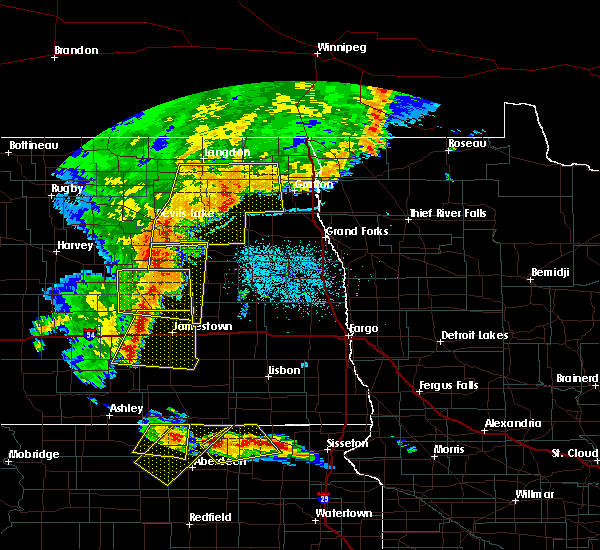 At 1022 pm cdt, severe thunderstorms were located along a line extending from near hamar to 7 miles northwest of spiritwood lake, moving east at 50 mph (radar indicated). Hazards include 70 mph wind gusts and quarter size hail. Hail damage to vehicles is expected. expect considerable tree damage. wind damage is also likely to mobile homes, roofs and outbuildings. these severe storms will be near, hamar around 1025 pm cdt. wimbledon and tolna around 1035 pm cdt. Pekin around 1040 pm cdt. At 1022 pm cdt, severe thunderstorms were located along a line extending from near hamar to 7 miles northwest of spiritwood lake, moving east at 50 mph (radar indicated). Hazards include 70 mph wind gusts and quarter size hail. Hail damage to vehicles is expected. expect considerable tree damage. wind damage is also likely to mobile homes, roofs and outbuildings. these severe storms will be near, hamar around 1025 pm cdt. wimbledon and tolna around 1035 pm cdt. Pekin around 1040 pm cdt.
|
| 7/23/2015 9:54 PM CDT |
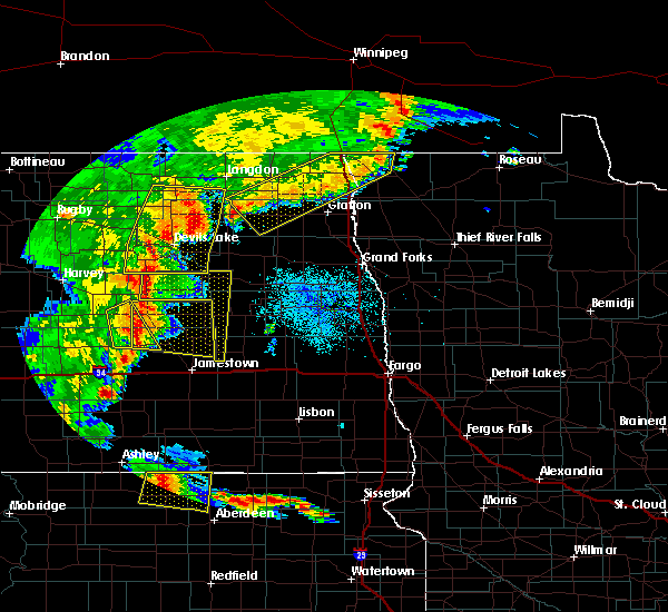 At 953 pm cdt, severe thunderstorms were located along a line extending from sheyenne to 6 miles east of woodworth, moving east at 25 mph (radar indicated). Hazards include 60 mph wind gusts and quarter size hail. Hail damage to vehicles is expected. expect wind damage to roofs, siding and trees. severe thunderstorms will be near, sheyenne around 955 pm cdt. warwick around 1035 pm cdt. hamar around 1045 pm cdt. Tolna and wimbledon around 1100 pm cdt. At 953 pm cdt, severe thunderstorms were located along a line extending from sheyenne to 6 miles east of woodworth, moving east at 25 mph (radar indicated). Hazards include 60 mph wind gusts and quarter size hail. Hail damage to vehicles is expected. expect wind damage to roofs, siding and trees. severe thunderstorms will be near, sheyenne around 955 pm cdt. warwick around 1035 pm cdt. hamar around 1045 pm cdt. Tolna and wimbledon around 1100 pm cdt.
|
| 6/21/2015 10:29 PM CDT |
 At 1028 pm cdt, a severe thunderstorm was located 7 miles east of kensal, or 26 miles east of carrington, moving east at 50 mph (radar indicated). Hazards include 70 mph wind gusts and quarter size hail. Hail damage to vehicles is expected. expect considerable tree damage. wind damage is also likely to mobile homes, roofs and outbuildings. this severe thunderstorm will be near, sutton around 1035 pm cdt. revere around 1045 pm cdt. hannaford and walum around 1050 pm cdt. cooperstown around 1055 pm cdt. Luverne and sibley around 1105 pm cdt. At 1028 pm cdt, a severe thunderstorm was located 7 miles east of kensal, or 26 miles east of carrington, moving east at 50 mph (radar indicated). Hazards include 70 mph wind gusts and quarter size hail. Hail damage to vehicles is expected. expect considerable tree damage. wind damage is also likely to mobile homes, roofs and outbuildings. this severe thunderstorm will be near, sutton around 1035 pm cdt. revere around 1045 pm cdt. hannaford and walum around 1050 pm cdt. cooperstown around 1055 pm cdt. Luverne and sibley around 1105 pm cdt.
|
| 6/20/2015 6:58 PM CDT |
 At 658 pm cdt, a severe thunderstorm capable of producing a tornado was located near sutton, or 32 miles east of carrington, moving south at 50 mph (radar indicated rotation). Hazards include tornado and half dollar size hail. Expect damage to mobile homes. roofs and vehicles. this dangerous storm will be near, sutton around 705 pm cdt. revere around 710 pm cdt. hannaford around 715 pm cdt. walum around 720 pm cdt. Dazey around 725 pm cdt. At 658 pm cdt, a severe thunderstorm capable of producing a tornado was located near sutton, or 32 miles east of carrington, moving south at 50 mph (radar indicated rotation). Hazards include tornado and half dollar size hail. Expect damage to mobile homes. roofs and vehicles. this dangerous storm will be near, sutton around 705 pm cdt. revere around 710 pm cdt. hannaford around 715 pm cdt. walum around 720 pm cdt. Dazey around 725 pm cdt.
|
| 6/20/2015 6:33 PM CDT |
 At 632 pm cdt, a severe thunderstorm was located near red willow lake, or 33 miles northeast of carrington, moving southeast at 35 mph (radar indicated). Hazards include quarter size hail. Damage to vehicles is expected. this severe thunderstorm will be near, red willow lake and mose around 645 pm cdt. binford around 655 pm cdt. jessie around 700 pm cdt. Cooperstown around 715 pm cdt. At 632 pm cdt, a severe thunderstorm was located near red willow lake, or 33 miles northeast of carrington, moving southeast at 35 mph (radar indicated). Hazards include quarter size hail. Damage to vehicles is expected. this severe thunderstorm will be near, red willow lake and mose around 645 pm cdt. binford around 655 pm cdt. jessie around 700 pm cdt. Cooperstown around 715 pm cdt.
|
| 6/20/2015 5:36 PM CDT |
 At 535 pm cdt, a severe thunderstorm capable of producing a tornado was located over sutton, or 31 miles east of carrington, moving southeast at 30 mph (radar indicated rotation). Hazards include tornado and quarter size hail. Expect damage to mobile homes. roofs and vehicles. this dangerous storm will be near, revere around 545 pm cdt. hannaford and walum around 555 pm cdt. Dazey around 600 pm cdt. At 535 pm cdt, a severe thunderstorm capable of producing a tornado was located over sutton, or 31 miles east of carrington, moving southeast at 30 mph (radar indicated rotation). Hazards include tornado and quarter size hail. Expect damage to mobile homes. roofs and vehicles. this dangerous storm will be near, revere around 545 pm cdt. hannaford and walum around 555 pm cdt. Dazey around 600 pm cdt.
|
Hail Maps for Sutton, ND
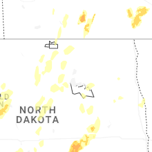

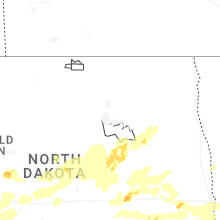


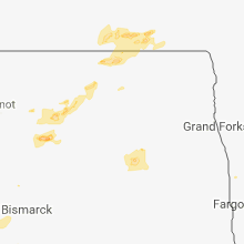


Connect with Interactive Hail Maps