

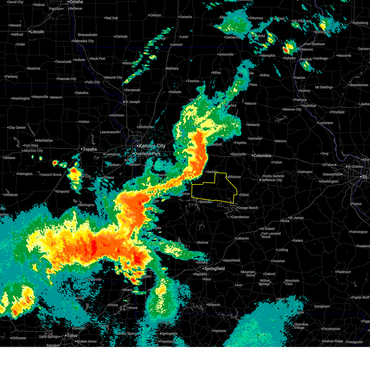
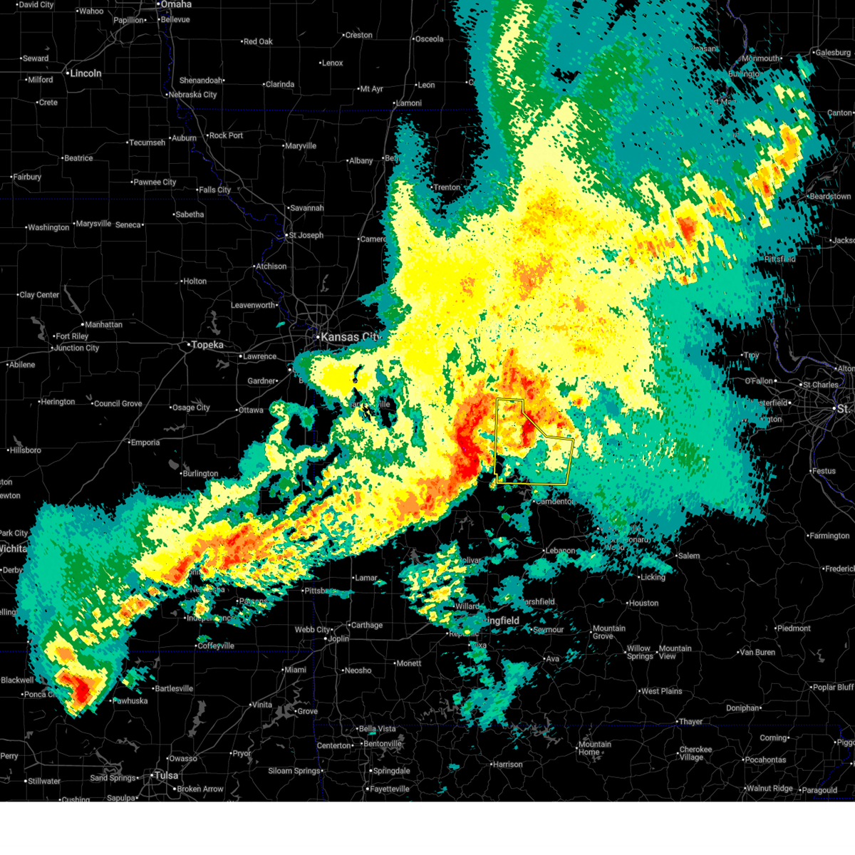
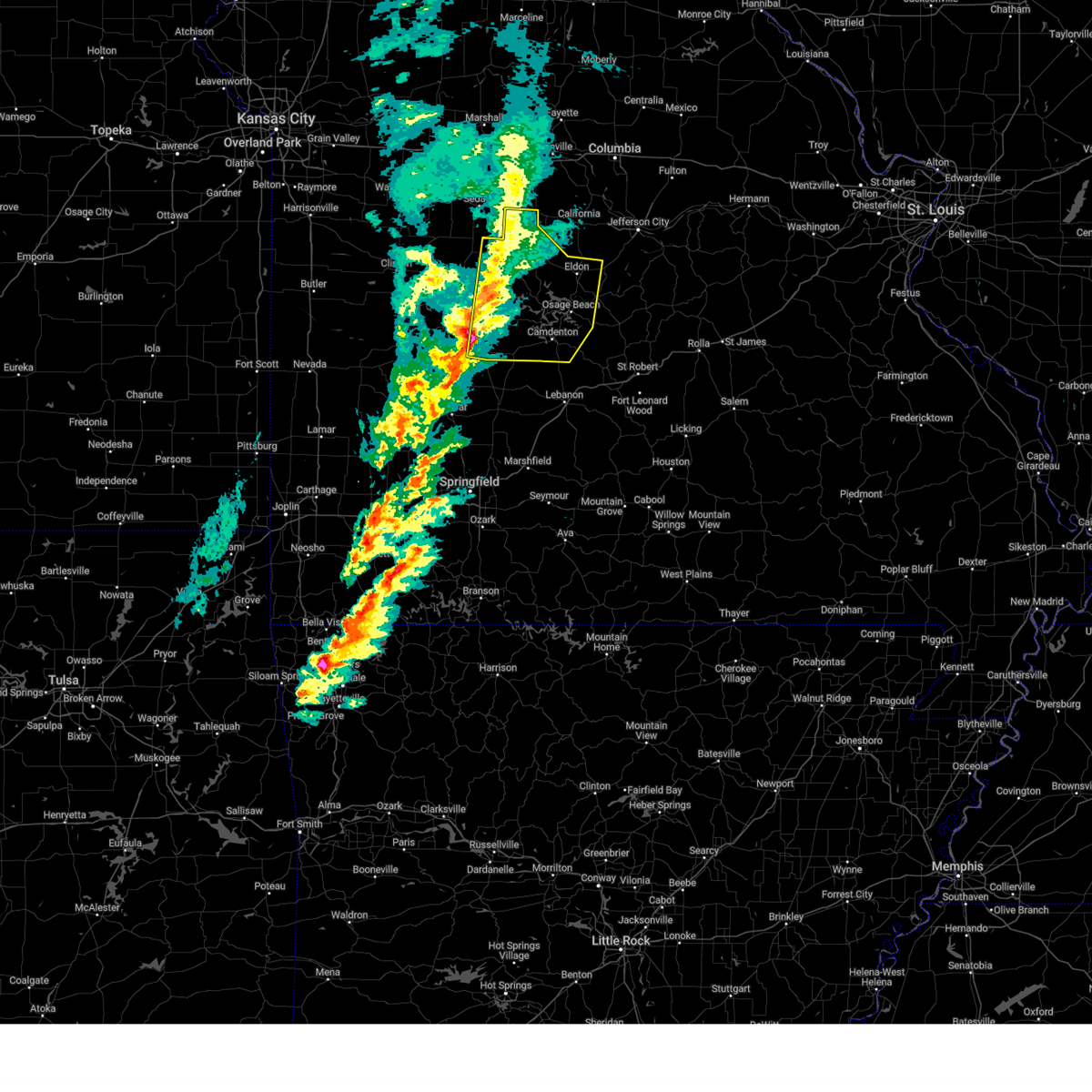
Hail Map for Syracuse, MO
The Syracuse, MO area has had 2 reports of on-the-ground hail by trained spotters, and has been under severe weather warnings 20 times during the past 12 months. Doppler radar has detected hail at or near Syracuse, MO on 54 occasions, including 1 occasion during the past year.
| Name: | Syracuse, MO |
| Where Located: | 35.2 miles SW of Columbia, MO |
| Map: | Google Map for Syracuse, MO |
| Population: | 172 |
| Housing Units: | 79 |
| More Info: | Search Google for Syracuse, MO |
0
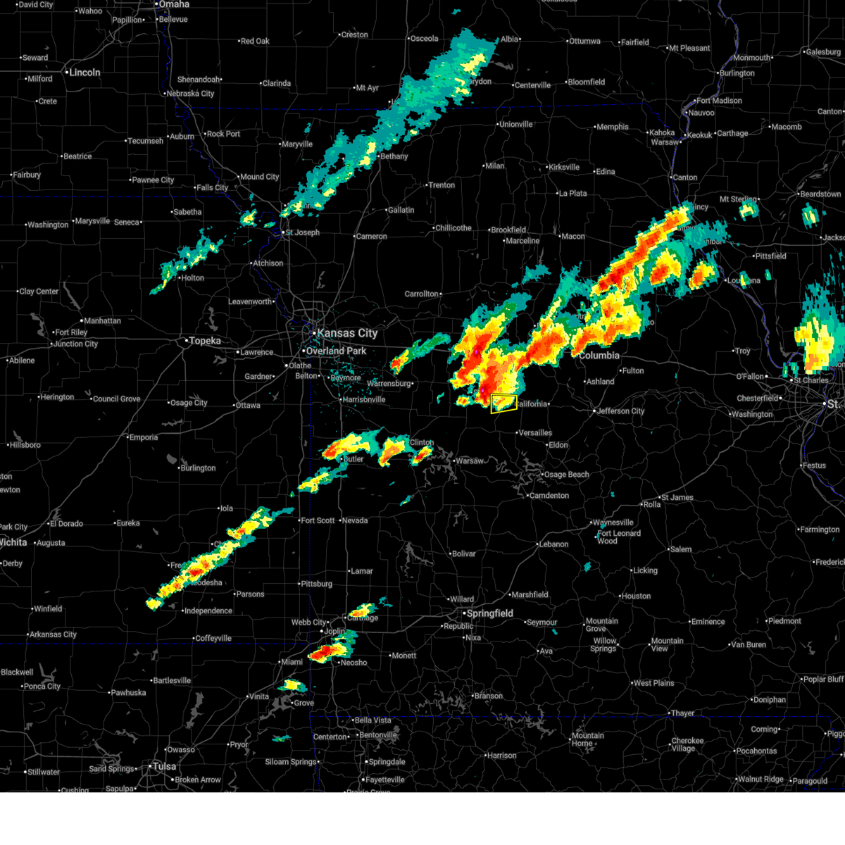
The Top Recent Hail Date for Syracuse, MO is Monday, April 27, 2026 (23rd out of 54)

Hail and Wind Damage Spotted near Syracuse, MO
| Date / Time | Report Details |
|---|---|
| 6/21/2026 8:10 AM CDT |
 At 810 am cdt, severe thunderstorms were located along a line extending from 6 miles south of tipton to 6 miles west of high point to 7 miles southeast of versailles, moving northeast at 50 mph (radar indicated). Hazards include 60 mph wind gusts. Expect damage to roofs, siding, and trees. Locations impacted include, barnett and syracuse. At 810 am cdt, severe thunderstorms were located along a line extending from 6 miles south of tipton to 6 miles west of high point to 7 miles southeast of versailles, moving northeast at 50 mph (radar indicated). Hazards include 60 mph wind gusts. Expect damage to roofs, siding, and trees. Locations impacted include, barnett and syracuse.
|
| 6/21/2026 7:51 AM CDT |
 Svrsgf the national weather service in springfield has issued a * severe thunderstorm warning for, morgan county in central missouri, * until 830 am cdt. * at 750 am cdt, severe thunderstorms were located along a line extending from near stover to near versailles to 8 miles northwest of laurie, moving northeast at 50 mph (radar indicated). Hazards include 60 mph wind gusts. expect damage to roofs, siding, and trees Svrsgf the national weather service in springfield has issued a * severe thunderstorm warning for, morgan county in central missouri, * until 830 am cdt. * at 750 am cdt, severe thunderstorms were located along a line extending from near stover to near versailles to 8 miles northwest of laurie, moving northeast at 50 mph (radar indicated). Hazards include 60 mph wind gusts. expect damage to roofs, siding, and trees
|
| 6/13/2026 10:25 PM CDT |
 Svrsgf the national weather service in springfield has issued a * severe thunderstorm warning for, northern benton county in central missouri, morgan county in central missouri, * until 1130 pm cdt. * at 1025 pm cdt, severe thunderstorms were located along a line extending from 8 miles northeast of malta bend to 7 miles north of sedalia to near windsor, moving east at 40 mph (radar indicated). Hazards include 60 mph wind gusts. expect damage to roofs, siding, and trees Svrsgf the national weather service in springfield has issued a * severe thunderstorm warning for, northern benton county in central missouri, morgan county in central missouri, * until 1130 pm cdt. * at 1025 pm cdt, severe thunderstorms were located along a line extending from 8 miles northeast of malta bend to 7 miles north of sedalia to near windsor, moving east at 40 mph (radar indicated). Hazards include 60 mph wind gusts. expect damage to roofs, siding, and trees
|
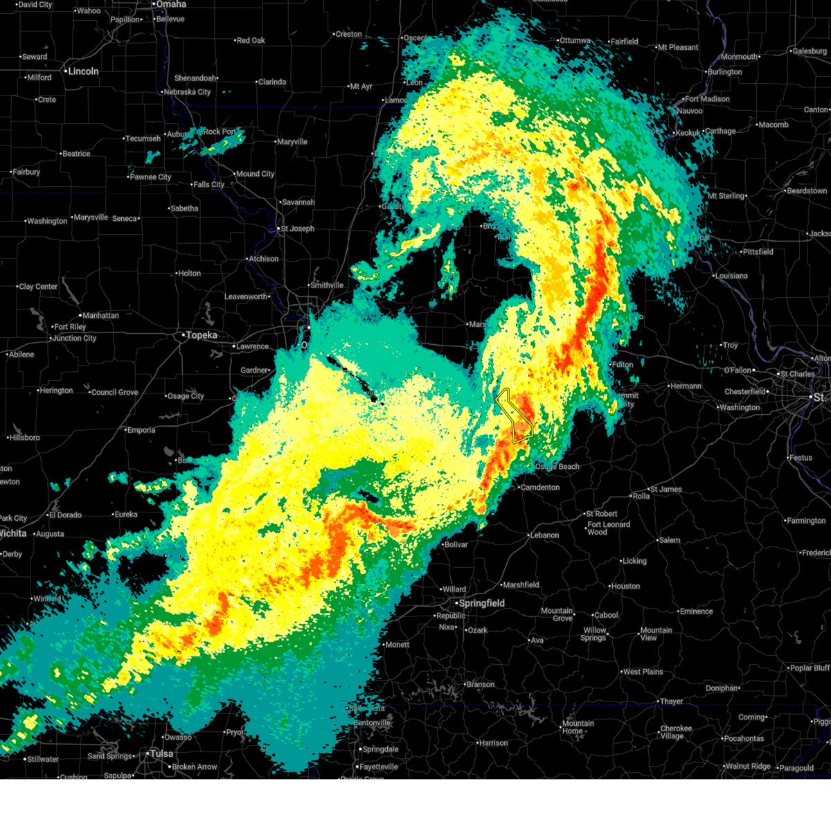
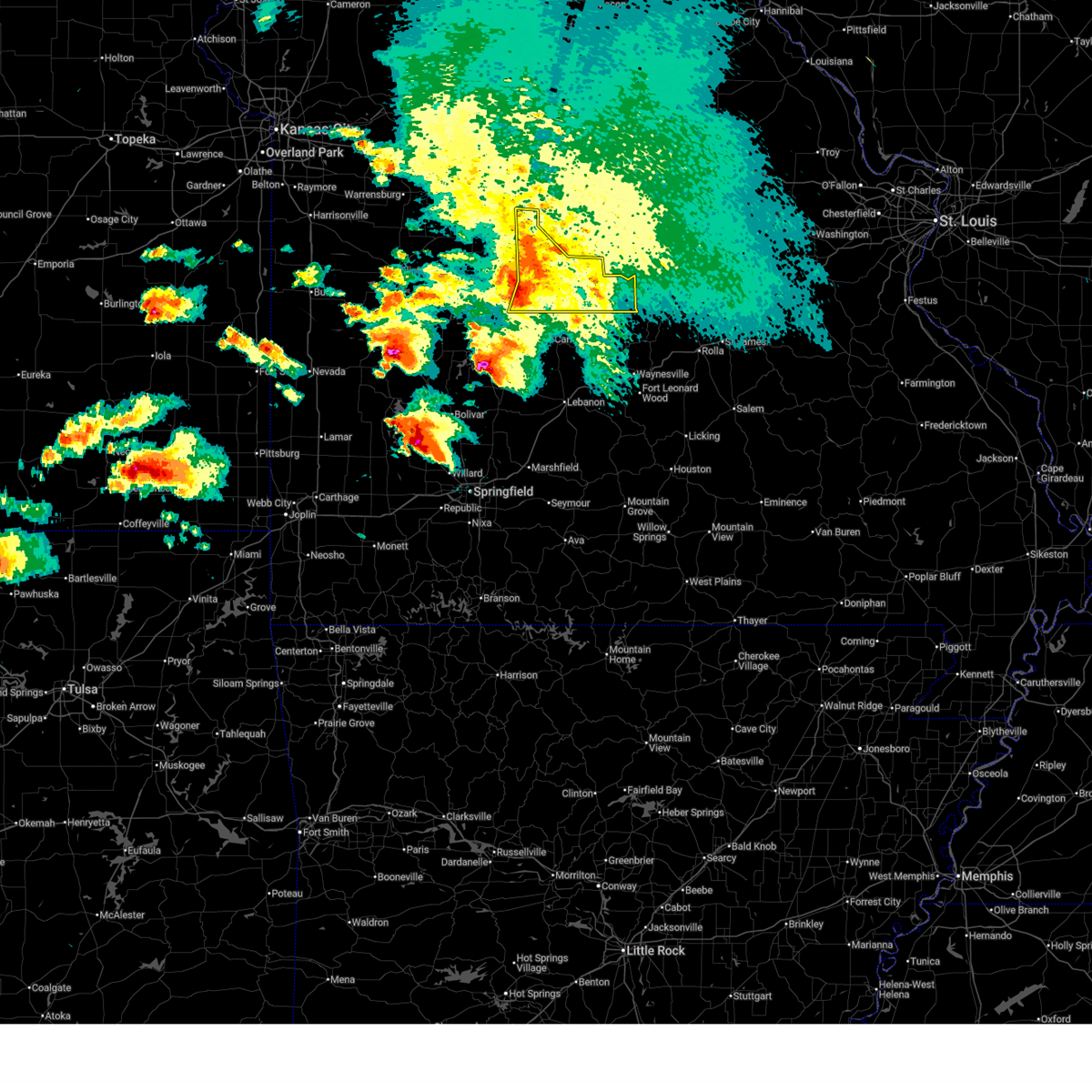
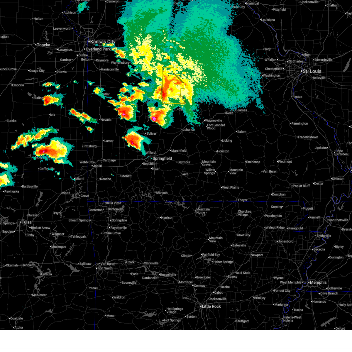
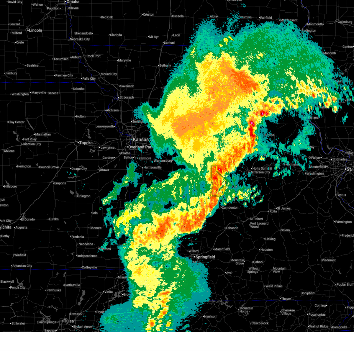
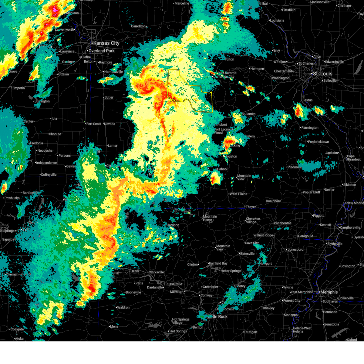
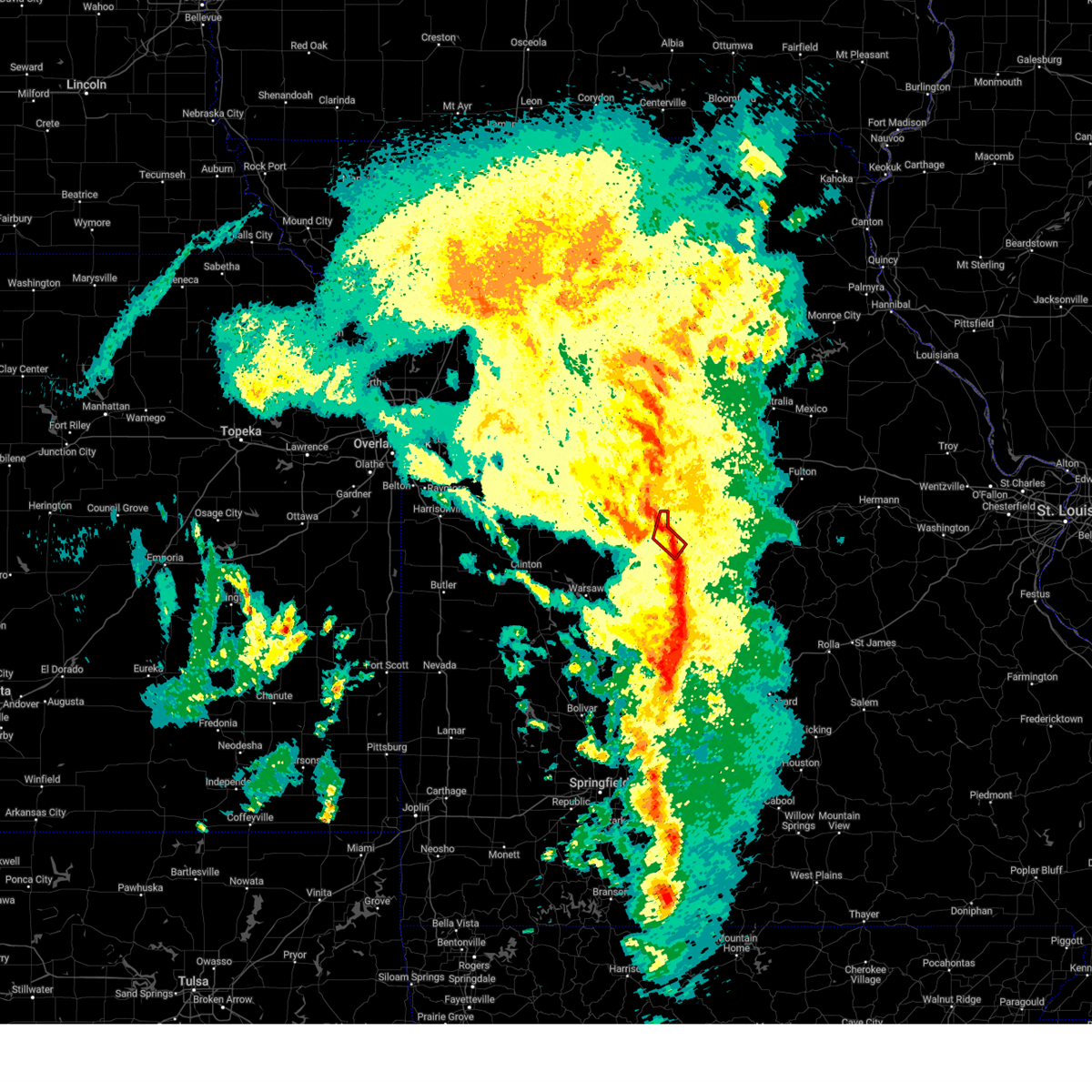
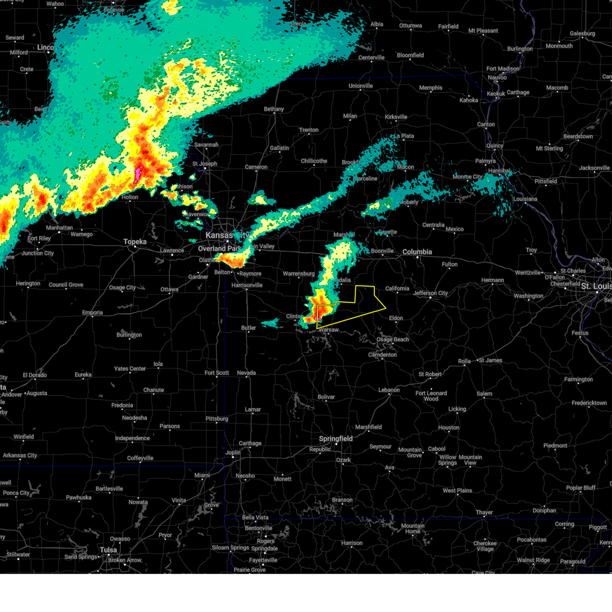
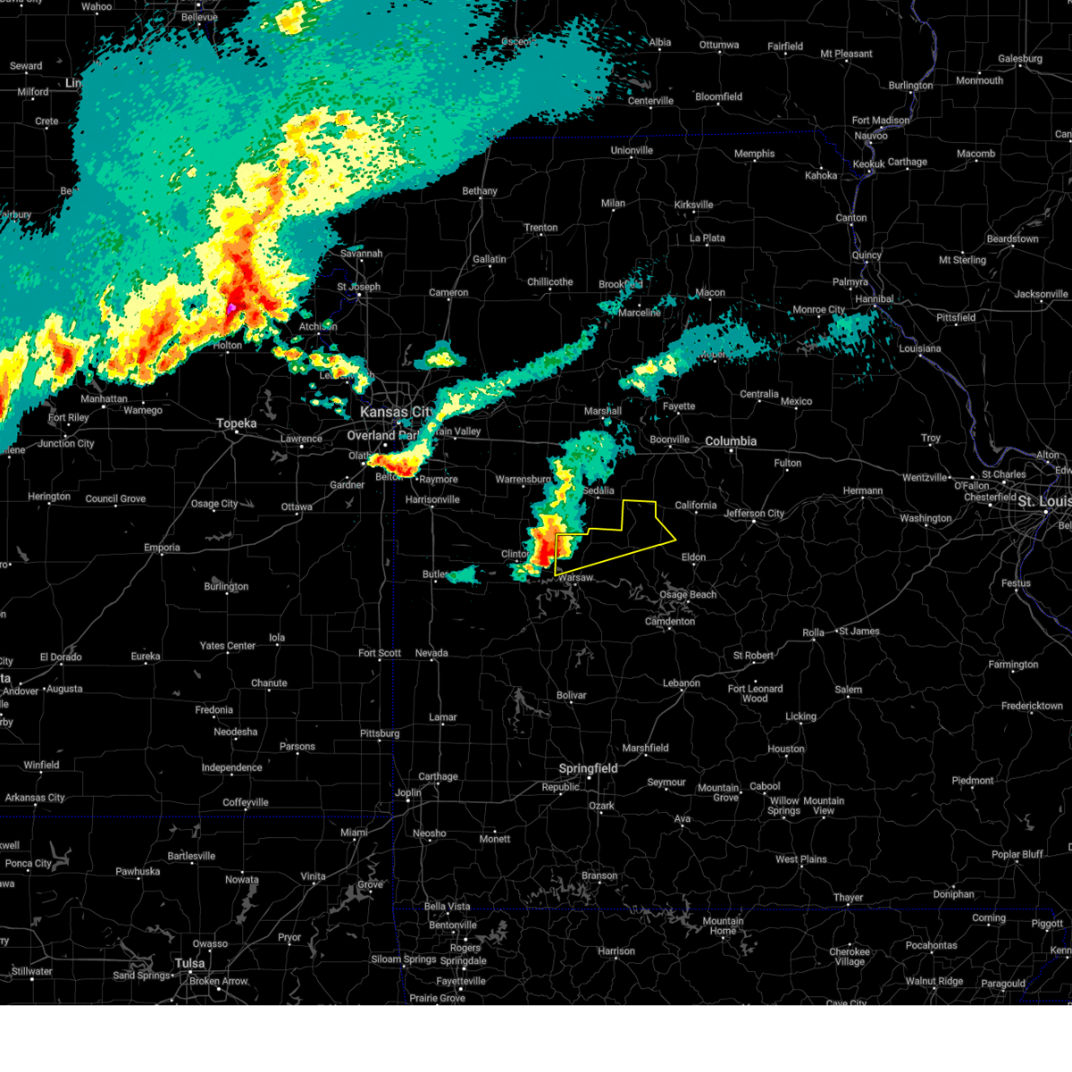
| 4/27/2026 3:54 PM CDT | Quarter sized hail reported 0.4 miles W of Syracuse, MO |
| 4/27/2026 3:38 PM CDT |
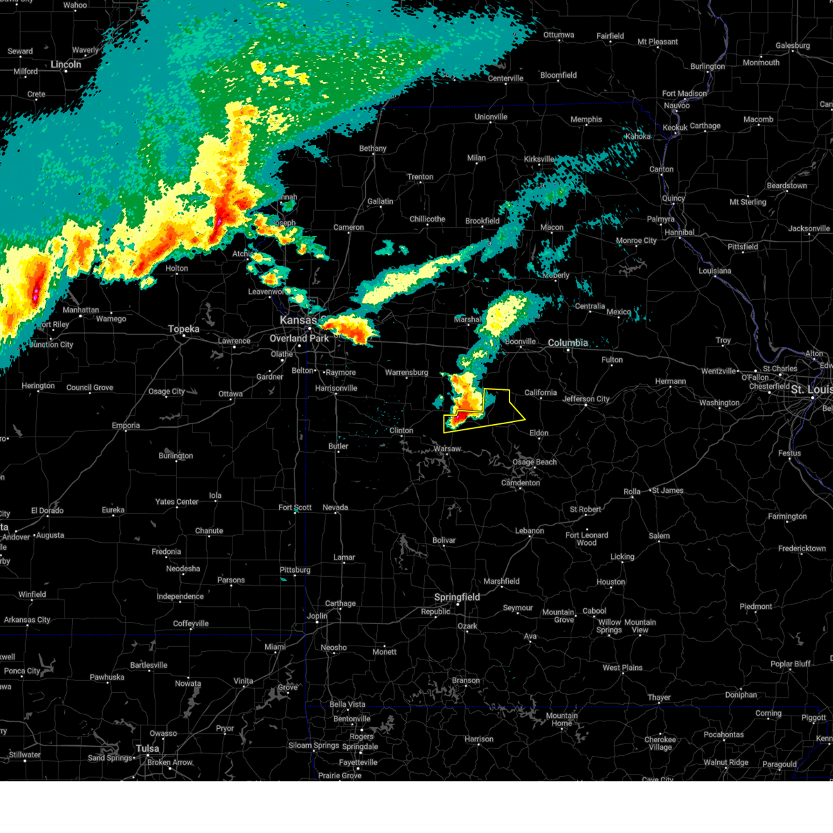
 Svrsgf the national weather service in springfield has issued a * severe thunderstorm warning for, northwestern morgan county in central missouri, * until 400 pm cdt. * at 337 pm cdt, a severe thunderstorm was located near smithton, or near sedalia, moving east at 70 mph (radar indicated). Hazards include tennis ball size hail and 60 mph wind gusts. People and animals outdoors will be injured. expect hail damage to roofs, siding, windows, and vehicles. Expect wind damage to roofs, siding, and trees. Svrsgf the national weather service in springfield has issued a * severe thunderstorm warning for, northwestern morgan county in central missouri, * until 400 pm cdt. * at 337 pm cdt, a severe thunderstorm was located near smithton, or near sedalia, moving east at 70 mph (radar indicated). Hazards include tennis ball size hail and 60 mph wind gusts. People and animals outdoors will be injured. expect hail damage to roofs, siding, windows, and vehicles. Expect wind damage to roofs, siding, and trees.
|
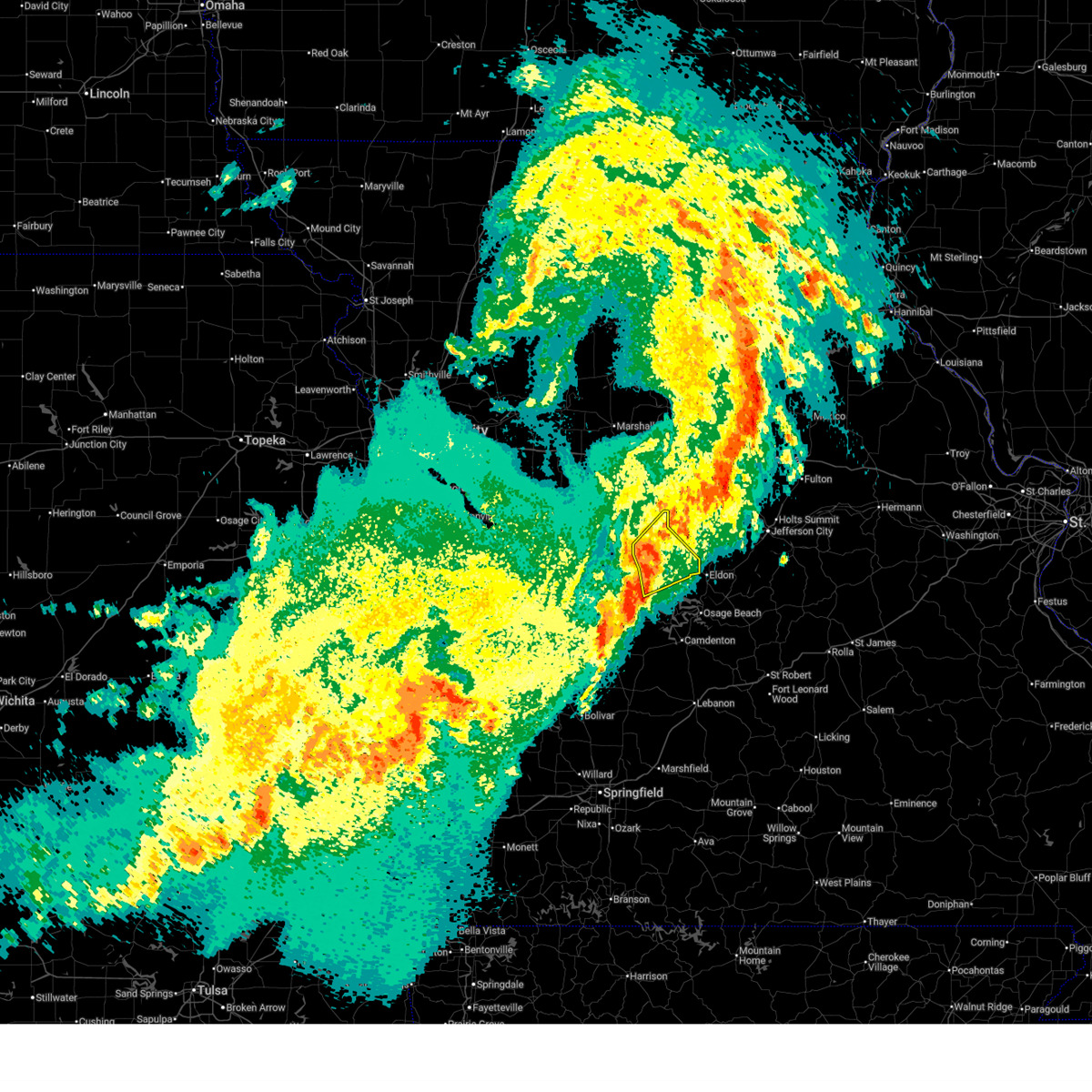
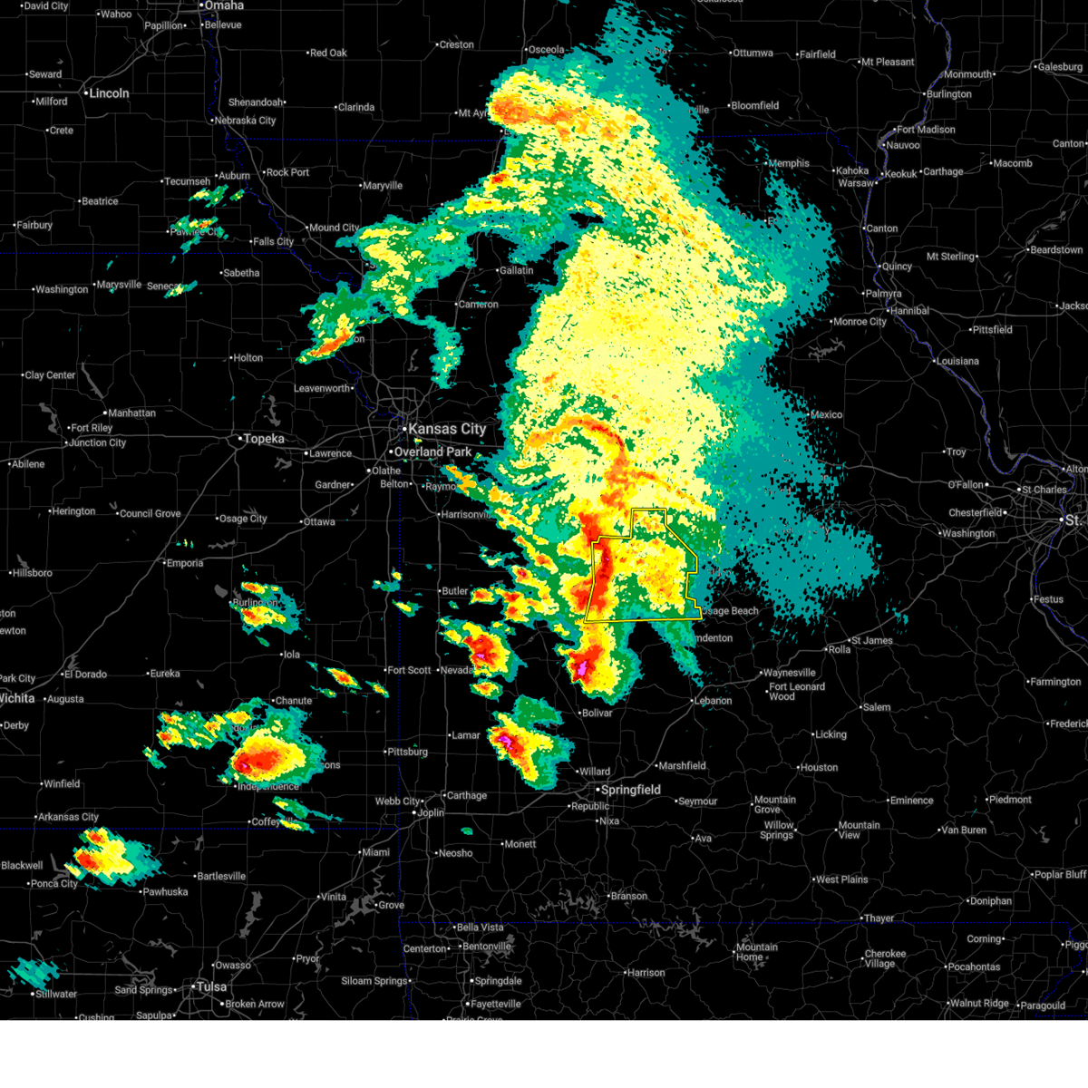
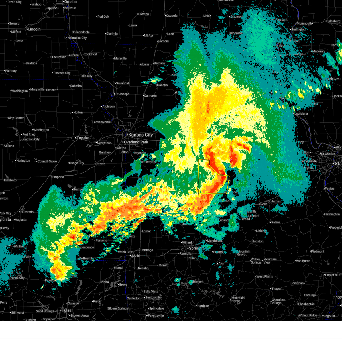
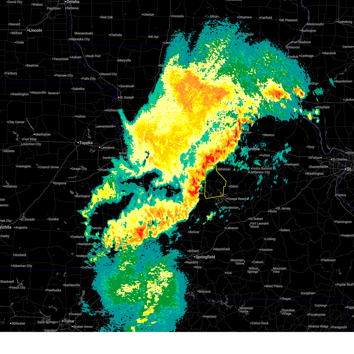
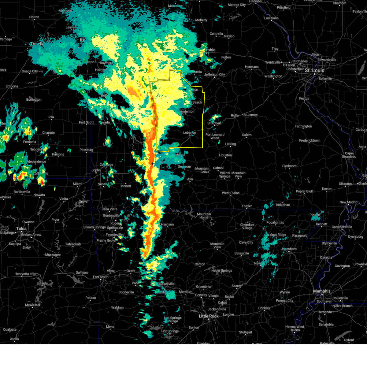
| 4/26/2026 7:55 PM CDT |
 Svrsgf the national weather service in springfield has issued a * severe thunderstorm warning for, miller county in central missouri, northwestern camden county in central missouri, morgan county in central missouri, * until 845 pm cdt. * at 755 pm cdt, severe thunderstorms were located along a line extending from near otterville to 8 miles north of village of four seasons to near laurie, moving east at 45 mph (radar indicated). Hazards include 60 mph wind gusts and quarter size hail. Hail damage to vehicles is expected. Expect wind damage to roofs, siding, and trees. Svrsgf the national weather service in springfield has issued a * severe thunderstorm warning for, miller county in central missouri, northwestern camden county in central missouri, morgan county in central missouri, * until 845 pm cdt. * at 755 pm cdt, severe thunderstorms were located along a line extending from near otterville to 8 miles north of village of four seasons to near laurie, moving east at 45 mph (radar indicated). Hazards include 60 mph wind gusts and quarter size hail. Hail damage to vehicles is expected. Expect wind damage to roofs, siding, and trees.
|
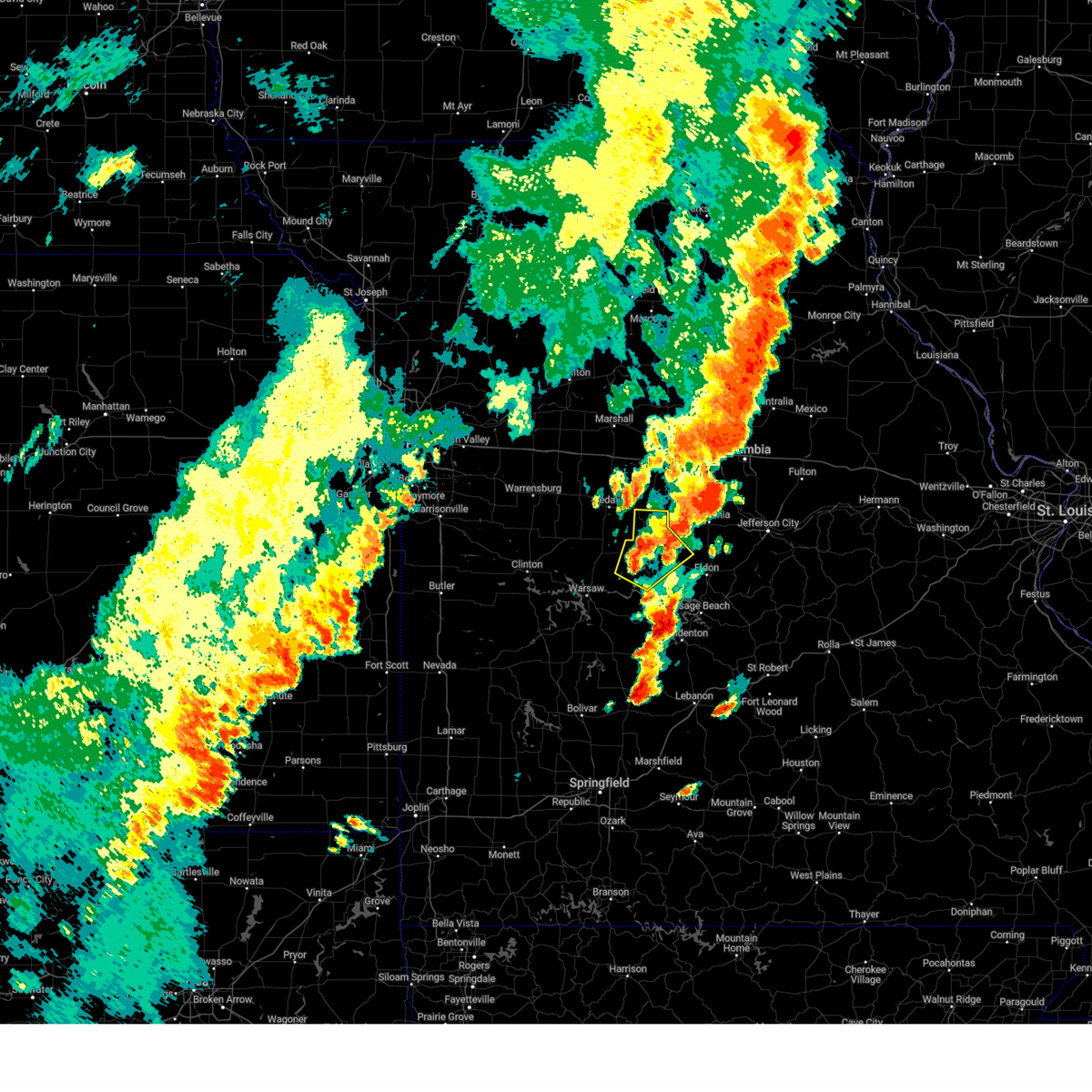
| 4/26/2026 7:47 PM CDT |
 At 747 pm cdt, severe thunderstorms were located along a line extending from near otterville to near stover to 9 miles northwest of laurie, moving northeast at 50 mph (radar indicated). Hazards include 70 mph wind gusts and quarter size hail. Hail damage to vehicles is expected. expect considerable tree damage. wind damage is also likely to mobile homes, roofs, and outbuildings. Locations impacted include, lake of the ozarks, lake of the ozarks state park, osage beach, versailles, village of four seasons, lake ozark, stover, laurie, sunrise beach, barnett, syracuse, gravois mills, climax springs, rocky mount, florence, hurricane deck, barnumton, and purvis. At 747 pm cdt, severe thunderstorms were located along a line extending from near otterville to near stover to 9 miles northwest of laurie, moving northeast at 50 mph (radar indicated). Hazards include 70 mph wind gusts and quarter size hail. Hail damage to vehicles is expected. expect considerable tree damage. wind damage is also likely to mobile homes, roofs, and outbuildings. Locations impacted include, lake of the ozarks, lake of the ozarks state park, osage beach, versailles, village of four seasons, lake ozark, stover, laurie, sunrise beach, barnett, syracuse, gravois mills, climax springs, rocky mount, florence, hurricane deck, barnumton, and purvis.
|
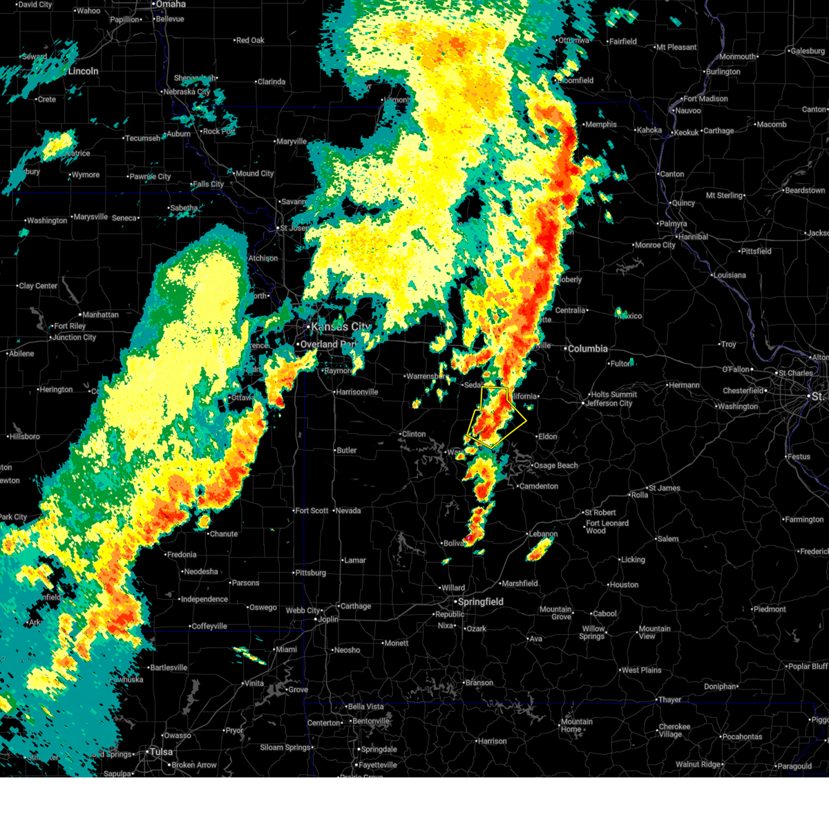
| 4/26/2026 7:22 PM CDT |
 Svrsgf the national weather service in springfield has issued a * severe thunderstorm warning for, eastern benton county in central missouri, northwestern camden county in central missouri, morgan county in central missouri, * until 800 pm cdt. * at 722 pm cdt, severe thunderstorms were located along a line extending from near cole camp to 9 miles southeast of lincoln to 10 miles southeast of warsaw, moving northeast at 50 mph (radar indicated). Hazards include 70 mph wind gusts and quarter size hail. Hail damage to vehicles is expected. expect considerable tree damage. Wind damage is also likely to mobile homes, roofs, and outbuildings. Svrsgf the national weather service in springfield has issued a * severe thunderstorm warning for, eastern benton county in central missouri, northwestern camden county in central missouri, morgan county in central missouri, * until 800 pm cdt. * at 722 pm cdt, severe thunderstorms were located along a line extending from near cole camp to 9 miles southeast of lincoln to 10 miles southeast of warsaw, moving northeast at 50 mph (radar indicated). Hazards include 70 mph wind gusts and quarter size hail. Hail damage to vehicles is expected. expect considerable tree damage. Wind damage is also likely to mobile homes, roofs, and outbuildings.
|
| 4/17/2026 8:12 PM CDT |
 The storm which prompted the warning has moved out of the area. therefore, the warning will be allowed to expire. however, gusty winds are still possible with this thunderstorm. a tornado watch remains in effect until 900 pm cdt for central missouri. remember, a severe thunderstorm warning still remains in effect for miller and maries county. The storm which prompted the warning has moved out of the area. therefore, the warning will be allowed to expire. however, gusty winds are still possible with this thunderstorm. a tornado watch remains in effect until 900 pm cdt for central missouri. remember, a severe thunderstorm warning still remains in effect for miller and maries county.
|
| 4/17/2026 7:30 PM CDT |
 Svrsgf the national weather service in springfield has issued a * severe thunderstorm warning for, northwestern miller county in central missouri, northwestern camden county in central missouri, morgan county in central missouri, * until 815 pm cdt. * at 730 pm cdt, a severe thunderstorm was located near warsaw, moving east at 55 mph (radar indicated). Hazards include 60 mph wind gusts and quarter size hail. Hail damage to vehicles is expected. Expect wind damage to roofs, siding, and trees. Svrsgf the national weather service in springfield has issued a * severe thunderstorm warning for, northwestern miller county in central missouri, northwestern camden county in central missouri, morgan county in central missouri, * until 815 pm cdt. * at 730 pm cdt, a severe thunderstorm was located near warsaw, moving east at 55 mph (radar indicated). Hazards include 60 mph wind gusts and quarter size hail. Hail damage to vehicles is expected. Expect wind damage to roofs, siding, and trees.
|
| 4/13/2026 11:43 PM CDT |
 The storm which prompted the warning has weakened below severe limits, and no longer poses an immediate threat to life or property. therefore, the warning will be allowed to expire. The storm which prompted the warning has weakened below severe limits, and no longer poses an immediate threat to life or property. therefore, the warning will be allowed to expire.
|
| 4/13/2026 11:30 PM CDT |
 At 1129 pm cdt, a severe thunderstorm was located over versailles, moving east at 45 mph (radar indicated). Hazards include 60 mph wind gusts and nickel size hail. Expect damage to roofs, siding, and trees. Locations impacted include, versailles, barnett, and syracuse. At 1129 pm cdt, a severe thunderstorm was located over versailles, moving east at 45 mph (radar indicated). Hazards include 60 mph wind gusts and nickel size hail. Expect damage to roofs, siding, and trees. Locations impacted include, versailles, barnett, and syracuse.
|
| 4/13/2026 10:57 PM CDT |
 Svrsgf the national weather service in springfield has issued a * severe thunderstorm warning for, northeastern benton county in central missouri, morgan county in central missouri, * until 1145 pm cdt. * at 1057 pm cdt, a severe thunderstorm was located near cole camp, or 14 miles west of versailles, moving east at 40 mph (radar indicated). Hazards include 60 mph wind gusts and nickel size hail. expect damage to roofs, siding, and trees Svrsgf the national weather service in springfield has issued a * severe thunderstorm warning for, northeastern benton county in central missouri, morgan county in central missouri, * until 1145 pm cdt. * at 1057 pm cdt, a severe thunderstorm was located near cole camp, or 14 miles west of versailles, moving east at 40 mph (radar indicated). Hazards include 60 mph wind gusts and nickel size hail. expect damage to roofs, siding, and trees
|
| 3/11/2026 1:35 AM CDT |
 The storms which prompted the warning have moved out of the area. therefore, the warning will be allowed to expire. however, gusty winds are still possible with these thunderstorms. a tornado watch remains in effect until 400 am cdt for central missouri. The storms which prompted the warning have moved out of the area. therefore, the warning will be allowed to expire. however, gusty winds are still possible with these thunderstorms. a tornado watch remains in effect until 400 am cdt for central missouri.
|
| 3/11/2026 1:23 AM CDT |
 At 123 am cdt, severe thunderstorms were located along a line extending from 7 miles south of tipton to near versailles to laurie to 7 miles north of macks creek, moving east at 50 mph (radar indicated). Hazards include 60 mph wind gusts and nickel size hail. Expect damage to roofs, siding, and trees. Locations impacted include, lake of the ozarks, versailles, laurie, sunrise beach, barnett, syracuse, gravois mills, and rocky mount. At 123 am cdt, severe thunderstorms were located along a line extending from 7 miles south of tipton to near versailles to laurie to 7 miles north of macks creek, moving east at 50 mph (radar indicated). Hazards include 60 mph wind gusts and nickel size hail. Expect damage to roofs, siding, and trees. Locations impacted include, lake of the ozarks, versailles, laurie, sunrise beach, barnett, syracuse, gravois mills, and rocky mount.
|
| 3/11/2026 1:23 AM CDT |
 the severe thunderstorm warning has been cancelled and is no longer in effect the severe thunderstorm warning has been cancelled and is no longer in effect
|
| 3/11/2026 1:00 AM CDT |
 Svrsgf the national weather service in springfield has issued a * severe thunderstorm warning for, northwestern camden county in central missouri, morgan county in central missouri, * until 145 am cdt. * at 100 am cdt, severe thunderstorms were located along a line extending from near cole camp to 8 miles southeast of lincoln to 12 miles east of warsaw to 7 miles north of hermitage, moving east at 50 mph (radar indicated). Hazards include 60 mph wind gusts and nickel size hail. expect damage to roofs, siding, and trees Svrsgf the national weather service in springfield has issued a * severe thunderstorm warning for, northwestern camden county in central missouri, morgan county in central missouri, * until 145 am cdt. * at 100 am cdt, severe thunderstorms were located along a line extending from near cole camp to 8 miles southeast of lincoln to 12 miles east of warsaw to 7 miles north of hermitage, moving east at 50 mph (radar indicated). Hazards include 60 mph wind gusts and nickel size hail. expect damage to roofs, siding, and trees
|
| 9/18/2025 6:24 PM CDT | the severe thunderstorm warning has been cancelled and is no longer in effect |
| 9/18/2025 6:15 PM CDT | At 615 pm cdt, severe thunderstorms were located along a line extending from near smithton to near versailles to near laurie, moving east at 30 mph (radar indicated). Hazards include 60 mph wind gusts and quarter size hail. Hail damage to vehicles is expected. expect wind damage to roofs, siding, and trees. Locations impacted include, lake of the ozarks, lake of the ozarks state park, eldon, osage beach, versailles, village of four seasons, lake ozark, cole camp, stover, laurie, sunrise beach, tuscumbia, barnett, syracuse, gravois mills, olean, climax springs, bagnell, lakeside, and etterville. |
| 9/18/2025 6:15 PM CDT | the severe thunderstorm warning has been cancelled and is no longer in effect |
| 9/18/2025 5:59 PM CDT | Svrsgf the national weather service in springfield has issued a * severe thunderstorm warning for, northeastern hickory county in central missouri, eastern benton county in central missouri, western miller county in central missouri, camden county in central missouri, morgan county in central missouri, * until 645 pm cdt. * at 558 pm cdt, severe thunderstorms were located along a line extending from 7 miles north of cole camp to near laurie to near macks creek, moving northeast at 30 mph (radar indicated). Hazards include 60 mph wind gusts and quarter size hail. Hail damage to vehicles is expected. Expect wind damage to roofs, siding, and trees. |
| 6/3/2025 5:22 PM CDT |
 The storm which prompted the warning has weakened below severe limits, and no longer poses an immediate threat to life or property. therefore, the warning will be allowed to expire. The storm which prompted the warning has weakened below severe limits, and no longer poses an immediate threat to life or property. therefore, the warning will be allowed to expire.
|
| 6/3/2025 4:51 PM CDT |
 Svrsgf the national weather service in springfield has issued a * severe thunderstorm warning for, northeastern benton county in central missouri, morgan county in central missouri, * until 530 pm cdt. * at 451 pm cdt, a severe thunderstorm was located near stover, or 10 miles southwest of versailles, moving northeast at 35 mph (radar indicated). Hazards include 60 mph wind gusts and quarter size hail. Hail damage to vehicles is expected. Expect wind damage to roofs, siding, and trees. Svrsgf the national weather service in springfield has issued a * severe thunderstorm warning for, northeastern benton county in central missouri, morgan county in central missouri, * until 530 pm cdt. * at 451 pm cdt, a severe thunderstorm was located near stover, or 10 miles southwest of versailles, moving northeast at 35 mph (radar indicated). Hazards include 60 mph wind gusts and quarter size hail. Hail damage to vehicles is expected. Expect wind damage to roofs, siding, and trees.
|
| 5/19/2025 7:42 PM CDT |
 Svrsgf the national weather service in springfield has issued a * severe thunderstorm warning for, miller county in central missouri, morgan county in central missouri, * until 830 pm cdt. * at 741 pm cdt, severe thunderstorms were located along a line extending from near otterville to near urbana, moving northeast at 50 mph (radar indicated). Hazards include 60 mph wind gusts. expect damage to roofs, siding, and trees Svrsgf the national weather service in springfield has issued a * severe thunderstorm warning for, miller county in central missouri, morgan county in central missouri, * until 830 pm cdt. * at 741 pm cdt, severe thunderstorms were located along a line extending from near otterville to near urbana, moving northeast at 50 mph (radar indicated). Hazards include 60 mph wind gusts. expect damage to roofs, siding, and trees
|
| 4/20/2025 4:48 PM CDT |
 the tornado warning has been cancelled and is no longer in effect the tornado warning has been cancelled and is no longer in effect
|
| 4/20/2025 4:41 PM CDT |
 the severe thunderstorm warning has been cancelled and is no longer in effect the severe thunderstorm warning has been cancelled and is no longer in effect
|
| 4/20/2025 4:41 PM CDT |
 At 440 pm cdt, severe thunderstorms were located along a line extending from near bunceton to near village of four seasons to 10 miles west of ava, moving northeast at 55 mph (radar indicated). Hazards include 70 mph wind gusts and quarter size hail. Hail damage to vehicles is expected. expect considerable tree damage. wind damage is also likely to mobile homes, roofs, and outbuildings. locations impacted include, competition, osage beach, florence, tunas, pumpkin center, sleeper, freedom, tuscumbia, old linn creek, barnumton, linn creek, syracuse, decaturville, lake of the ozarks state park, plad, long lane, brumley, lake of the ozarks, bagnell, and eldridge. This includes interstate 44 between mile markers 110 and 144. At 440 pm cdt, severe thunderstorms were located along a line extending from near bunceton to near village of four seasons to 10 miles west of ava, moving northeast at 55 mph (radar indicated). Hazards include 70 mph wind gusts and quarter size hail. Hail damage to vehicles is expected. expect considerable tree damage. wind damage is also likely to mobile homes, roofs, and outbuildings. locations impacted include, competition, osage beach, florence, tunas, pumpkin center, sleeper, freedom, tuscumbia, old linn creek, barnumton, linn creek, syracuse, decaturville, lake of the ozarks state park, plad, long lane, brumley, lake of the ozarks, bagnell, and eldridge. This includes interstate 44 between mile markers 110 and 144.
|
| 4/20/2025 4:37 PM CDT |
 Torsgf the national weather service in springfield has issued a * tornado warning for, northeastern morgan county in central missouri, * until 500 pm cdt. * at 437 pm cdt, a severe thunderstorm capable of producing a tornado was located 7 miles northeast of versailles, moving northeast at 50 mph (radar indicated rotation). Hazards include tornado. Flying debris will be dangerous to those caught without shelter. mobile homes will be damaged or destroyed. damage to roofs, windows, and vehicles will occur. Tree damage is likely. Torsgf the national weather service in springfield has issued a * tornado warning for, northeastern morgan county in central missouri, * until 500 pm cdt. * at 437 pm cdt, a severe thunderstorm capable of producing a tornado was located 7 miles northeast of versailles, moving northeast at 50 mph (radar indicated rotation). Hazards include tornado. Flying debris will be dangerous to those caught without shelter. mobile homes will be damaged or destroyed. damage to roofs, windows, and vehicles will occur. Tree damage is likely.
|
| 4/20/2025 3:58 PM CDT |
 Svrsgf the national weather service in springfield has issued a * severe thunderstorm warning for, eastern hickory county in central missouri, dallas county in southwestern missouri, benton county in central missouri, miller county in central missouri, eastern polk county in southwestern missouri, laclede county in southwestern missouri, camden county in central missouri, morgan county in central missouri, * until 500 pm cdt. * at 354 pm cdt, severe thunderstorms were located along a line extending from near lincoln to 10 miles northwest of buffalo to 6 miles northwest of roberson hollow, moving northeast at 55 mph (radar indicated). Hazards include 70 mph wind gusts and quarter size hail. Hail damage to vehicles is expected. expect considerable tree damage. Wind damage is also likely to mobile homes, roofs, and outbuildings. Svrsgf the national weather service in springfield has issued a * severe thunderstorm warning for, eastern hickory county in central missouri, dallas county in southwestern missouri, benton county in central missouri, miller county in central missouri, eastern polk county in southwestern missouri, laclede county in southwestern missouri, camden county in central missouri, morgan county in central missouri, * until 500 pm cdt. * at 354 pm cdt, severe thunderstorms were located along a line extending from near lincoln to 10 miles northwest of buffalo to 6 miles northwest of roberson hollow, moving northeast at 55 mph (radar indicated). Hazards include 70 mph wind gusts and quarter size hail. Hail damage to vehicles is expected. expect considerable tree damage. Wind damage is also likely to mobile homes, roofs, and outbuildings.
|
| 4/2/2025 12:25 AM CDT |
 The storm which prompted the warning has weakened below severe limits, and no longer poses an immediate threat to life or property. therefore, the warning will be allowed to expire. The storm which prompted the warning has weakened below severe limits, and no longer poses an immediate threat to life or property. therefore, the warning will be allowed to expire.
|
| 4/2/2025 12:19 AM CDT |
 At 1218 am cdt, a severe thunderstorm was located 8 miles north of stover, or 10 miles northwest of versailles, moving east at 50 mph (radar indicated). Hazards include 60 mph wind gusts and quarter size hail. Hail damage to vehicles is expected. expect wind damage to roofs, siding, and trees. Locations impacted include, syracuse and florence. At 1218 am cdt, a severe thunderstorm was located 8 miles north of stover, or 10 miles northwest of versailles, moving east at 50 mph (radar indicated). Hazards include 60 mph wind gusts and quarter size hail. Hail damage to vehicles is expected. expect wind damage to roofs, siding, and trees. Locations impacted include, syracuse and florence.
|
| 4/2/2025 12:19 AM CDT |
 the severe thunderstorm warning has been cancelled and is no longer in effect the severe thunderstorm warning has been cancelled and is no longer in effect
|
| 4/2/2025 12:05 AM CDT |
 At 1205 am cdt, a severe thunderstorm was located near cole camp, or 14 miles south of sedalia, moving east at 50 mph (radar indicated). Hazards include 60 mph wind gusts and quarter size hail. Hail damage to vehicles is expected. expect wind damage to roofs, siding, and trees. Locations impacted include, cole camp, mora, florence, ionia, syracuse, crockerville, stover, and lincoln. At 1205 am cdt, a severe thunderstorm was located near cole camp, or 14 miles south of sedalia, moving east at 50 mph (radar indicated). Hazards include 60 mph wind gusts and quarter size hail. Hail damage to vehicles is expected. expect wind damage to roofs, siding, and trees. Locations impacted include, cole camp, mora, florence, ionia, syracuse, crockerville, stover, and lincoln.
|
| 4/1/2025 11:48 PM CDT |
 At 1148 pm cdt, a severe thunderstorm was located near lincoln, or 9 miles southeast of windsor, moving east at 50 mph (radar indicated). Hazards include 60 mph wind gusts and half dollar size hail. Hail damage to vehicles is expected. expect wind damage to roofs, siding, and trees. Locations impacted include, palo pinto, cole camp, mora, florence, ionia, syracuse, brandon, lincoln, stover, crockerville, and truman lake. At 1148 pm cdt, a severe thunderstorm was located near lincoln, or 9 miles southeast of windsor, moving east at 50 mph (radar indicated). Hazards include 60 mph wind gusts and half dollar size hail. Hail damage to vehicles is expected. expect wind damage to roofs, siding, and trees. Locations impacted include, palo pinto, cole camp, mora, florence, ionia, syracuse, brandon, lincoln, stover, crockerville, and truman lake.
|
| 4/1/2025 11:41 PM CDT |
 Svrsgf the national weather service in springfield has issued a * severe thunderstorm warning for, northern benton county in central missouri, northern morgan county in central missouri, * until 1230 am cdt. * at 1141 pm cdt, a severe thunderstorm was located 7 miles southeast of calhoun, or 9 miles south of windsor, moving east at 50 mph (radar indicated). Hazards include 60 mph wind gusts and quarter size hail. Hail damage to vehicles is expected. Expect wind damage to roofs, siding, and trees. Svrsgf the national weather service in springfield has issued a * severe thunderstorm warning for, northern benton county in central missouri, northern morgan county in central missouri, * until 1230 am cdt. * at 1141 pm cdt, a severe thunderstorm was located 7 miles southeast of calhoun, or 9 miles south of windsor, moving east at 50 mph (radar indicated). Hazards include 60 mph wind gusts and quarter size hail. Hail damage to vehicles is expected. Expect wind damage to roofs, siding, and trees.
|
| 3/14/2025 6:11 PM CDT |
 Svrsgf the national weather service in springfield has issued a * severe thunderstorm warning for, miller county in central missouri, northwestern pulaski county in central missouri, camden county in central missouri, morgan county in central missouri, * until 715 pm cdt. * at 610 pm cdt, a severe thunderstorm was located near camdenton, moving northeast at 65 mph (radar indicated). Hazards include 70 mph wind gusts and quarter size hail. Hail damage to vehicles is expected. expect considerable tree damage. Wind damage is also likely to mobile homes, roofs, and outbuildings. Svrsgf the national weather service in springfield has issued a * severe thunderstorm warning for, miller county in central missouri, northwestern pulaski county in central missouri, camden county in central missouri, morgan county in central missouri, * until 715 pm cdt. * at 610 pm cdt, a severe thunderstorm was located near camdenton, moving northeast at 65 mph (radar indicated). Hazards include 70 mph wind gusts and quarter size hail. Hail damage to vehicles is expected. expect considerable tree damage. Wind damage is also likely to mobile homes, roofs, and outbuildings.
|
| 3/14/2025 5:18 PM CDT |
 Svrsgf the national weather service in springfield has issued a * severe thunderstorm warning for, northeastern hickory county in central missouri, eastern benton county in central missouri, western miller county in central missouri, camden county in central missouri, morgan county in central missouri, * until 615 pm cdt. * at 518 pm cdt, a severe thunderstorm was located 13 miles southeast of warsaw, moving northeast at 65 mph (radar indicated). Hazards include 70 mph wind gusts and quarter size hail. Hail damage to vehicles is expected. expect considerable tree damage. Wind damage is also likely to mobile homes, roofs, and outbuildings. Svrsgf the national weather service in springfield has issued a * severe thunderstorm warning for, northeastern hickory county in central missouri, eastern benton county in central missouri, western miller county in central missouri, camden county in central missouri, morgan county in central missouri, * until 615 pm cdt. * at 518 pm cdt, a severe thunderstorm was located 13 miles southeast of warsaw, moving northeast at 65 mph (radar indicated). Hazards include 70 mph wind gusts and quarter size hail. Hail damage to vehicles is expected. expect considerable tree damage. Wind damage is also likely to mobile homes, roofs, and outbuildings.
|
| 5/26/2024 12:51 AM CDT |
 The storm which prompted the warning has weakened below severe limits, and has exited the warned area. therefore, the warning will be allowed to expire. a tornado watch remains in effect until 500 am cdt for central missouri. The storm which prompted the warning has weakened below severe limits, and has exited the warned area. therefore, the warning will be allowed to expire. a tornado watch remains in effect until 500 am cdt for central missouri.
|
| 5/26/2024 12:39 AM CDT |
 the severe thunderstorm warning has been cancelled and is no longer in effect the severe thunderstorm warning has been cancelled and is no longer in effect
|
| 5/26/2024 12:39 AM CDT |
 At 1239 am cdt, a severe thunderstorm was located 8 miles southwest of tipton, moving east at 30 mph (radar indicated). Hazards include 60 mph wind gusts and quarter size hail. Hail damage to vehicles is expected. expect wind damage to roofs, siding, and trees. Locations impacted include, stover, syracuse, and florence. At 1239 am cdt, a severe thunderstorm was located 8 miles southwest of tipton, moving east at 30 mph (radar indicated). Hazards include 60 mph wind gusts and quarter size hail. Hail damage to vehicles is expected. expect wind damage to roofs, siding, and trees. Locations impacted include, stover, syracuse, and florence.
|
| 5/26/2024 12:15 AM CDT |
 Svrsgf the national weather service in springfield has issued a * severe thunderstorm warning for, northeastern benton county in central missouri, northern morgan county in central missouri, * until 100 am cdt. * at 1215 am cdt, a severe thunderstorm was located 7 miles northeast of cole camp, or 12 miles southeast of sedalia, moving east at 55 mph (radar indicated). Hazards include 60 mph wind gusts and quarter size hail. Hail damage to vehicles is expected. Expect wind damage to roofs, siding, and trees. Svrsgf the national weather service in springfield has issued a * severe thunderstorm warning for, northeastern benton county in central missouri, northern morgan county in central missouri, * until 100 am cdt. * at 1215 am cdt, a severe thunderstorm was located 7 miles northeast of cole camp, or 12 miles southeast of sedalia, moving east at 55 mph (radar indicated). Hazards include 60 mph wind gusts and quarter size hail. Hail damage to vehicles is expected. Expect wind damage to roofs, siding, and trees.
|
| 5/7/2024 1:24 AM CDT |
 Svrsgf the national weather service in springfield has issued a * severe thunderstorm warning for, northeastern webster county in southwestern missouri, northwestern wright county in southwestern missouri, miller county in central missouri, laclede county in southwestern missouri, western pulaski county in central missouri, camden county in central missouri, morgan county in central missouri, * until 230 am cdt. * at 123 am cdt, severe thunderstorms were located along a line extending from 6 miles west of tipton to 7 miles north of conway to near fordland, moving northeast at 50 mph (radar indicated). Hazards include 60 mph wind gusts. expect damage to roofs, siding, and trees Svrsgf the national weather service in springfield has issued a * severe thunderstorm warning for, northeastern webster county in southwestern missouri, northwestern wright county in southwestern missouri, miller county in central missouri, laclede county in southwestern missouri, western pulaski county in central missouri, camden county in central missouri, morgan county in central missouri, * until 230 am cdt. * at 123 am cdt, severe thunderstorms were located along a line extending from 6 miles west of tipton to 7 miles north of conway to near fordland, moving northeast at 50 mph (radar indicated). Hazards include 60 mph wind gusts. expect damage to roofs, siding, and trees
|
| 5/7/2024 1:17 AM CDT |
 the severe thunderstorm warning has been cancelled and is no longer in effect the severe thunderstorm warning has been cancelled and is no longer in effect
|
| 5/7/2024 1:17 AM CDT |
 At 116 am cdt, severe thunderstorms were located along a line extending from near otterville to 7 miles northwest of conway to near rogersville, moving northeast at 55 mph (radar indicated). Hazards include 60 mph wind gusts. Expect damage to roofs, siding, and trees. locations impacted include, lebanon, lake of the ozarks, lake of the ozarks state park, ha ha tonka state park, bennett spring state park, marshfield, mountain grove, eldon, osage beach, camdenton, buffalo, rogersville, versailles, village of four seasons, seymour, richland, lake ozark, morgan, mansfield, and stover. This includes interstate 44 between mile markers 91 and 148. At 116 am cdt, severe thunderstorms were located along a line extending from near otterville to 7 miles northwest of conway to near rogersville, moving northeast at 55 mph (radar indicated). Hazards include 60 mph wind gusts. Expect damage to roofs, siding, and trees. locations impacted include, lebanon, lake of the ozarks, lake of the ozarks state park, ha ha tonka state park, bennett spring state park, marshfield, mountain grove, eldon, osage beach, camdenton, buffalo, rogersville, versailles, village of four seasons, seymour, richland, lake ozark, morgan, mansfield, and stover. This includes interstate 44 between mile markers 91 and 148.
|
| 5/7/2024 12:40 AM CDT |
 Svrsgf the national weather service in springfield has issued a * severe thunderstorm warning for, hickory county in central missouri, webster county in southwestern missouri, dallas county in southwestern missouri, wright county in southwestern missouri, benton county in central missouri, western miller county in central missouri, laclede county in southwestern missouri, northwestern pulaski county in central missouri, camden county in central missouri, morgan county in central missouri, * until 130 am cdt. * at 1240 am cdt, severe thunderstorms were located along a line extending from 8 miles northwest of warsaw to near bolivar to 8 miles southwest of crane, moving northeast at 60 mph (radar indicated). Hazards include 60 mph wind gusts. expect damage to roofs, siding, and trees Svrsgf the national weather service in springfield has issued a * severe thunderstorm warning for, hickory county in central missouri, webster county in southwestern missouri, dallas county in southwestern missouri, wright county in southwestern missouri, benton county in central missouri, western miller county in central missouri, laclede county in southwestern missouri, northwestern pulaski county in central missouri, camden county in central missouri, morgan county in central missouri, * until 130 am cdt. * at 1240 am cdt, severe thunderstorms were located along a line extending from 8 miles northwest of warsaw to near bolivar to 8 miles southwest of crane, moving northeast at 60 mph (radar indicated). Hazards include 60 mph wind gusts. expect damage to roofs, siding, and trees
|
| 4/27/2024 10:57 PM CDT |
 The storm which prompted the warning has moved out of the area. therefore, the warning will be allowed to expire. a tornado watch remains in effect until midnight cdt for central missouri. a tornado watch also remains in effect until 400 am cdt for central missouri. to report severe weather, contact your nearest law enforcement agency. they will relay your report to the national weather service springfield. The storm which prompted the warning has moved out of the area. therefore, the warning will be allowed to expire. a tornado watch remains in effect until midnight cdt for central missouri. a tornado watch also remains in effect until 400 am cdt for central missouri. to report severe weather, contact your nearest law enforcement agency. they will relay your report to the national weather service springfield.
|
| 4/27/2024 10:48 PM CDT |
 At 1048 pm cdt, a severe thunderstorm capable of producing a tornado was located near tipton, moving northeast at 45 mph (radar indicated rotation). Hazards include tornado and quarter size hail. Flying debris will be dangerous to those caught without shelter. mobile homes will be damaged or destroyed. damage to roofs, windows, and vehicles will occur. tree damage is likely. Locations impacted include, syracuse and florence. At 1048 pm cdt, a severe thunderstorm capable of producing a tornado was located near tipton, moving northeast at 45 mph (radar indicated rotation). Hazards include tornado and quarter size hail. Flying debris will be dangerous to those caught without shelter. mobile homes will be damaged or destroyed. damage to roofs, windows, and vehicles will occur. tree damage is likely. Locations impacted include, syracuse and florence.
|
| 4/27/2024 10:40 PM CDT |
 At 1040 pm cdt, a severe thunderstorm capable of producing a tornado was located 7 miles south of otterville, or 10 miles west of tipton, moving northeast at 50 mph (radar indicated rotation). Hazards include tornado and quarter size hail. Flying debris will be dangerous to those caught without shelter. mobile homes will be damaged or destroyed. damage to roofs, windows, and vehicles will occur. tree damage is likely. Locations impacted include, versailles, stover, syracuse, and florence. At 1040 pm cdt, a severe thunderstorm capable of producing a tornado was located 7 miles south of otterville, or 10 miles west of tipton, moving northeast at 50 mph (radar indicated rotation). Hazards include tornado and quarter size hail. Flying debris will be dangerous to those caught without shelter. mobile homes will be damaged or destroyed. damage to roofs, windows, and vehicles will occur. tree damage is likely. Locations impacted include, versailles, stover, syracuse, and florence.
|
| 4/27/2024 10:23 PM CDT |
 Torsgf the national weather service in springfield has issued a * tornado warning for, central morgan county in central missouri, * until 1100 pm cdt. * at 1023 pm cdt, severe thunderstorms capable of producing a tornado were located along a line extending from 10 miles southwest of smithton to near cole camp, moving northeast at 45 mph (radar indicated rotation). Hazards include tornado and quarter size hail. Flying debris will be dangerous to those caught without shelter. mobile homes will be damaged or destroyed. damage to roofs, windows, and vehicles will occur. Tree damage is likely. Torsgf the national weather service in springfield has issued a * tornado warning for, central morgan county in central missouri, * until 1100 pm cdt. * at 1023 pm cdt, severe thunderstorms capable of producing a tornado were located along a line extending from 10 miles southwest of smithton to near cole camp, moving northeast at 45 mph (radar indicated rotation). Hazards include tornado and quarter size hail. Flying debris will be dangerous to those caught without shelter. mobile homes will be damaged or destroyed. damage to roofs, windows, and vehicles will occur. Tree damage is likely.
|
| 3/14/2024 7:51 AM CDT |
 The storm which prompted the warning has moved out of the area. therefore, the warning will be allowed to expire. a severe thunderstorm watch remains in effect until noon cdt for central missouri. The storm which prompted the warning has moved out of the area. therefore, the warning will be allowed to expire. a severe thunderstorm watch remains in effect until noon cdt for central missouri.
|
| 3/14/2024 7:43 AM CDT |
 At 743 am cdt, a severe thunderstorm was located near tipton, moving east at 55 mph (radar indicated). Hazards include 60 mph wind gusts and quarter size hail. Hail damage to vehicles is expected. expect wind damage to roofs, siding, and trees. Locations impacted include, syracuse. At 743 am cdt, a severe thunderstorm was located near tipton, moving east at 55 mph (radar indicated). Hazards include 60 mph wind gusts and quarter size hail. Hail damage to vehicles is expected. expect wind damage to roofs, siding, and trees. Locations impacted include, syracuse.
|
| 3/14/2024 7:25 AM CDT |
 Svrsgf the national weather service in springfield has issued a * severe thunderstorm warning for, northwestern morgan county in central missouri, * until 800 am cdt. * at 725 am cdt, a severe thunderstorm was located 7 miles south of smithton, or 10 miles southeast of sedalia, moving east at 60 mph (radar indicated). Hazards include 60 mph wind gusts and quarter size hail. Hail damage to vehicles is expected. Expect wind damage to roofs, siding, and trees. Svrsgf the national weather service in springfield has issued a * severe thunderstorm warning for, northwestern morgan county in central missouri, * until 800 am cdt. * at 725 am cdt, a severe thunderstorm was located 7 miles south of smithton, or 10 miles southeast of sedalia, moving east at 60 mph (radar indicated). Hazards include 60 mph wind gusts and quarter size hail. Hail damage to vehicles is expected. Expect wind damage to roofs, siding, and trees.
|
| 8/4/2023 8:50 PM CDT |
 The severe thunderstorm warning for north central morgan county will expire at 900 pm cdt, the storm which prompted the warning has moved out of the area. therefore, the warning will be allowed to expire. a severe thunderstorm watch remains in effect until 1100 pm cdt for central missouri. The severe thunderstorm warning for north central morgan county will expire at 900 pm cdt, the storm which prompted the warning has moved out of the area. therefore, the warning will be allowed to expire. a severe thunderstorm watch remains in effect until 1100 pm cdt for central missouri.
|
| 8/4/2023 8:24 PM CDT |
 At 824 pm cdt, a severe thunderstorm was located near clarksburg, or near tipton, moving east at 35 mph (radar indicated). Hazards include 60 mph wind gusts. expect damage to roofs, siding, and trees At 824 pm cdt, a severe thunderstorm was located near clarksburg, or near tipton, moving east at 35 mph (radar indicated). Hazards include 60 mph wind gusts. expect damage to roofs, siding, and trees
|
| 8/2/2023 8:18 PM CDT |
 At 817 pm cdt, a severe thunderstorm was located over cole camp, or 14 miles south of sedalia, moving east at 35 mph (radar indicated). Hazards include 60 mph wind gusts and quarter size hail. Hail damage to vehicles is expected. Expect wind damage to roofs, siding, and trees. At 817 pm cdt, a severe thunderstorm was located over cole camp, or 14 miles south of sedalia, moving east at 35 mph (radar indicated). Hazards include 60 mph wind gusts and quarter size hail. Hail damage to vehicles is expected. Expect wind damage to roofs, siding, and trees.
|
| 7/14/2023 5:38 PM CDT |
 At 534 pm cdt, severe thunderstorms were located along a line extending from blackburn to 6 miles southwest of warsaw, moving east at 50 mph (radar indicated). Hazards include 60 mph wind gusts and quarter size hail. Hail damage to vehicles is expected. Expect wind damage to roofs, siding, and trees. At 534 pm cdt, severe thunderstorms were located along a line extending from blackburn to 6 miles southwest of warsaw, moving east at 50 mph (radar indicated). Hazards include 60 mph wind gusts and quarter size hail. Hail damage to vehicles is expected. Expect wind damage to roofs, siding, and trees.
|
| 7/12/2023 10:15 PM CDT | At 1015 pm cdt, a severe thunderstorm was located near versailles, moving southeast at 40 mph (radar indicated). Hazards include 60 mph wind gusts and quarter size hail. Hail damage to vehicles is expected. Expect wind damage to roofs, siding, and trees. |
| 6/8/2022 3:21 AM CDT |
 At 321 am cdt, severe thunderstorms were located along a line extending from near tipton to near stover to 8 miles north of hermitage, moving east at 55 mph (radar indicated). Hazards include 60 mph wind gusts. Expect damage to roofs, siding, and trees. locations impacted include, truman lake, warsaw, stover, syracuse, edmonson, lakeview heights, florence, crockerville, zora, whitakerville, hail threat, radar indicated max hail size, <. 75 in wind threat, radar indicated max wind gust, 60 mph. At 321 am cdt, severe thunderstorms were located along a line extending from near tipton to near stover to 8 miles north of hermitage, moving east at 55 mph (radar indicated). Hazards include 60 mph wind gusts. Expect damage to roofs, siding, and trees. locations impacted include, truman lake, warsaw, stover, syracuse, edmonson, lakeview heights, florence, crockerville, zora, whitakerville, hail threat, radar indicated max hail size, <. 75 in wind threat, radar indicated max wind gust, 60 mph.
|
| 6/8/2022 3:07 AM CDT |
 At 307 am cdt, severe thunderstorms were located along a line extending from near otterville to near cole camp to 10 miles southwest of warsaw, moving southeast at 45 mph (radar indicated). Hazards include 60 mph wind gusts. Expect damage to roofs, siding, and trees. locations impacted include, truman lake, truman state park, warsaw, lincoln, cole camp, stover, syracuse, ionia, palo pinto, lakeview heights, florence, brandon, crockerville, zora, iconium, racket, edmonson, mora, whitakerville, hail threat, radar indicated max hail size, <. 75 in wind threat, radar indicated max wind gust, 60 mph. At 307 am cdt, severe thunderstorms were located along a line extending from near otterville to near cole camp to 10 miles southwest of warsaw, moving southeast at 45 mph (radar indicated). Hazards include 60 mph wind gusts. Expect damage to roofs, siding, and trees. locations impacted include, truman lake, truman state park, warsaw, lincoln, cole camp, stover, syracuse, ionia, palo pinto, lakeview heights, florence, brandon, crockerville, zora, iconium, racket, edmonson, mora, whitakerville, hail threat, radar indicated max hail size, <. 75 in wind threat, radar indicated max wind gust, 60 mph.
|
| 6/8/2022 2:43 AM CDT |
 At 243 am cdt, severe thunderstorms were located along a line extending from near la monte to near windsor to near deepwater, moving southeast at 55 mph (radar indicated). Hazards include 60 mph wind gusts. expect damage to roofs, siding, and trees At 243 am cdt, severe thunderstorms were located along a line extending from near la monte to near windsor to near deepwater, moving southeast at 55 mph (radar indicated). Hazards include 60 mph wind gusts. expect damage to roofs, siding, and trees
|
| 3/5/2022 8:06 PM CST |
 At 806 pm cst, severe thunderstorms were located along a line extending from near otterville to near stover, moving east at 25 mph (radar indicated). Hazards include 60 mph wind gusts and quarter size hail. Hail damage to vehicles is expected. Expect wind damage to roofs, siding, and trees. At 806 pm cst, severe thunderstorms were located along a line extending from near otterville to near stover, moving east at 25 mph (radar indicated). Hazards include 60 mph wind gusts and quarter size hail. Hail damage to vehicles is expected. Expect wind damage to roofs, siding, and trees.
|
| 10/24/2021 5:01 PM CDT |
 At 501 pm cdt, a severe thunderstorm capable of producing a tornado was located over smithton, or near sedalia, moving northeast at 50 mph (radar indicated rotation). Hazards include tornado. Flying debris will be dangerous to those caught without shelter. mobile homes will be damaged or destroyed. damage to roofs, windows, and vehicles will occur. Tree damage is likely. At 501 pm cdt, a severe thunderstorm capable of producing a tornado was located over smithton, or near sedalia, moving northeast at 50 mph (radar indicated rotation). Hazards include tornado. Flying debris will be dangerous to those caught without shelter. mobile homes will be damaged or destroyed. damage to roofs, windows, and vehicles will occur. Tree damage is likely.
|
| 6/24/2021 10:57 AM CDT |
 The severe thunderstorm warning for east central benton and morgan counties will expire at 1100 am cdt, the storms which prompted the warning have weakened below severe limits, and no longer pose an immediate threat to life or property. therefore, the warning will be allowed to expire. however brief heavy rain and frequent lightning is still possible with these thunderstorms. The severe thunderstorm warning for east central benton and morgan counties will expire at 1100 am cdt, the storms which prompted the warning have weakened below severe limits, and no longer pose an immediate threat to life or property. therefore, the warning will be allowed to expire. however brief heavy rain and frequent lightning is still possible with these thunderstorms.
|
| 6/24/2021 10:40 AM CDT |
 At 1040 am cdt, severe thunderstorms were located along a line extending from 7 miles southwest of tipton to stover to 8 miles southeast of cole camp, moving east at 30 mph (radar indicated). Hazards include 60 mph wind gusts and nickel size hail. Expect damage to roofs, siding, and trees. Locations impacted include, versailles, stover, barnett, syracuse, crockerville, florence,. At 1040 am cdt, severe thunderstorms were located along a line extending from 7 miles southwest of tipton to stover to 8 miles southeast of cole camp, moving east at 30 mph (radar indicated). Hazards include 60 mph wind gusts and nickel size hail. Expect damage to roofs, siding, and trees. Locations impacted include, versailles, stover, barnett, syracuse, crockerville, florence,.
|
| 6/24/2021 10:18 AM CDT |
 At 1018 am cdt, severe thunderstorms were located along a line extending from near bunceton to lincoln, moving east at 20 mph (radar indicated). Hazards include 60 mph wind gusts and nickel size hail. expect damage to roofs, siding, and trees At 1018 am cdt, severe thunderstorms were located along a line extending from near bunceton to lincoln, moving east at 20 mph (radar indicated). Hazards include 60 mph wind gusts and nickel size hail. expect damage to roofs, siding, and trees
|
| 5/16/2021 3:41 PM CDT |
 At 341 pm cdt, a severe thunderstorm was located over otterville, or 11 miles west of tipton, moving northeast at 35 mph (radar indicated). Hazards include ping pong ball size hail and 60 mph wind gusts. People and animals outdoors will be injured. expect hail damage to roofs, siding, windows, and vehicles. expect wind damage to roofs, siding, and trees. Locations impacted include, syracuse, florence,. At 341 pm cdt, a severe thunderstorm was located over otterville, or 11 miles west of tipton, moving northeast at 35 mph (radar indicated). Hazards include ping pong ball size hail and 60 mph wind gusts. People and animals outdoors will be injured. expect hail damage to roofs, siding, windows, and vehicles. expect wind damage to roofs, siding, and trees. Locations impacted include, syracuse, florence,.
|
| 5/16/2021 3:31 PM CDT |
 At 331 pm cdt, a severe thunderstorm was located near smithton, or 11 miles east of sedalia, moving northeast at 25 mph (radar indicated). Hazards include 60 mph wind gusts and quarter size hail. Hail damage to vehicles is expected. Expect wind damage to roofs, siding, and trees. At 331 pm cdt, a severe thunderstorm was located near smithton, or 11 miles east of sedalia, moving northeast at 25 mph (radar indicated). Hazards include 60 mph wind gusts and quarter size hail. Hail damage to vehicles is expected. Expect wind damage to roofs, siding, and trees.
|
| 4/7/2021 3:24 PM CDT |
 At 324 pm cdt, severe thunderstorms were located along a line extending from near otterville to near tipton to 6 miles west of eldon, moving northeast at 30 mph (radar indicated). Hazards include 60 mph wind gusts and penny size hail. Expect damage to roofs, siding, and trees. Locations impacted include, lake of the ozarks, versailles, laurie, sunrise beach, barnett, syracuse, gravois mills, rocky mount, florence,. At 324 pm cdt, severe thunderstorms were located along a line extending from near otterville to near tipton to 6 miles west of eldon, moving northeast at 30 mph (radar indicated). Hazards include 60 mph wind gusts and penny size hail. Expect damage to roofs, siding, and trees. Locations impacted include, lake of the ozarks, versailles, laurie, sunrise beach, barnett, syracuse, gravois mills, rocky mount, florence,.
|
| 4/7/2021 3:09 PM CDT |
 At 308 pm cdt, severe thunderstorms were located along a line extending from near otterville to 8 miles north of versailles to near village of four seasons, moving northeast at 45 mph (radar indicated). Hazards include 60 mph wind gusts and penny size hail. Expect damage to roofs, siding, and trees. Locations impacted include, lake of the ozarks, versailles, village of four seasons, lake ozark, stover, laurie, sunrise beach, barnett, syracuse, gravois mills, rocky mount, florence, barnumton, purvis,. At 308 pm cdt, severe thunderstorms were located along a line extending from near otterville to 8 miles north of versailles to near village of four seasons, moving northeast at 45 mph (radar indicated). Hazards include 60 mph wind gusts and penny size hail. Expect damage to roofs, siding, and trees. Locations impacted include, lake of the ozarks, versailles, village of four seasons, lake ozark, stover, laurie, sunrise beach, barnett, syracuse, gravois mills, rocky mount, florence, barnumton, purvis,.
|
| 4/7/2021 3:06 PM CDT |
 At 306 pm cdt, severe thunderstorms capable of producing tornadoes were located along a line extending from near smithton to 8 miles southwest of tipton to near versailles, moving northeast at 50 mph (radar indicated rotation). Hazards include tornado. Flying debris will be dangerous to those caught without shelter. mobile homes will be damaged or destroyed. damage to roofs, windows, and vehicles will occur. tree damage is likely. These tornadic storms will remain over mainly rural areas of northwestern morgan county, including the following locations, syracuse and florence. At 306 pm cdt, severe thunderstorms capable of producing tornadoes were located along a line extending from near smithton to 8 miles southwest of tipton to near versailles, moving northeast at 50 mph (radar indicated rotation). Hazards include tornado. Flying debris will be dangerous to those caught without shelter. mobile homes will be damaged or destroyed. damage to roofs, windows, and vehicles will occur. tree damage is likely. These tornadic storms will remain over mainly rural areas of northwestern morgan county, including the following locations, syracuse and florence.
|
| 4/7/2021 2:55 PM CDT |
 At 255 pm cdt, severe thunderstorms were located along a line extending from 7 miles northeast of cole camp to stover to 7 miles southwest of laurie, moving northeast at 50 mph (radar indicated). Hazards include 60 mph wind gusts and penny size hail. Expect damage to roofs, siding, and trees. Locations impacted include, lake of the ozarks, versailles, village of four seasons, lake ozark, cole camp, stover, laurie, sunrise beach, barnett, syracuse, gravois mills, rocky mount, florence, crockerville, zora, mora, barnumton, purvis,. At 255 pm cdt, severe thunderstorms were located along a line extending from 7 miles northeast of cole camp to stover to 7 miles southwest of laurie, moving northeast at 50 mph (radar indicated). Hazards include 60 mph wind gusts and penny size hail. Expect damage to roofs, siding, and trees. Locations impacted include, lake of the ozarks, versailles, village of four seasons, lake ozark, cole camp, stover, laurie, sunrise beach, barnett, syracuse, gravois mills, rocky mount, florence, crockerville, zora, mora, barnumton, purvis,.
|
| 4/7/2021 2:54 PM CDT |
 At 253 pm cdt, a severe thunderstorm capable of producing a tornado was located near cole camp, or 15 miles west of versailles, moving northeast at 45 mph. a second circulation is located 3 miles northwest of stover (radar indicated rotation). Hazards include tornado. Flying debris will be dangerous to those caught without shelter. mobile homes will be damaged or destroyed. damage to roofs, windows, and vehicles will occur. tree damage is likely. This tornadic thunderstorm will remain over mainly rural areas of northeastern benton and northwestern morgan counties, including the following locations, syracuse, crockerville and florence. At 253 pm cdt, a severe thunderstorm capable of producing a tornado was located near cole camp, or 15 miles west of versailles, moving northeast at 45 mph. a second circulation is located 3 miles northwest of stover (radar indicated rotation). Hazards include tornado. Flying debris will be dangerous to those caught without shelter. mobile homes will be damaged or destroyed. damage to roofs, windows, and vehicles will occur. tree damage is likely. This tornadic thunderstorm will remain over mainly rural areas of northeastern benton and northwestern morgan counties, including the following locations, syracuse, crockerville and florence.
|
| 4/7/2021 2:46 PM CDT |
 At 246 pm cdt, a severe thunderstorm capable of producing a tornado was located near cole camp, or 16 miles northeast of warsaw, moving northeast at 45 mph (radar indicated rotation). Hazards include tornado. Flying debris will be dangerous to those caught without shelter. mobile homes will be damaged or destroyed. damage to roofs, windows, and vehicles will occur. tree damage is likely. this dangerous storm will be near, stover around 255 pm cdt. Other locations impacted by this tornadic thunderstorm include syracuse, crockerville and florence. At 246 pm cdt, a severe thunderstorm capable of producing a tornado was located near cole camp, or 16 miles northeast of warsaw, moving northeast at 45 mph (radar indicated rotation). Hazards include tornado. Flying debris will be dangerous to those caught without shelter. mobile homes will be damaged or destroyed. damage to roofs, windows, and vehicles will occur. tree damage is likely. this dangerous storm will be near, stover around 255 pm cdt. Other locations impacted by this tornadic thunderstorm include syracuse, crockerville and florence.
|
| 4/7/2021 2:38 PM CDT |
 At 238 pm cdt, severe thunderstorms were located along a line extending from near cole camp to 12 miles west of laurie, moving northeast at 45 mph (radar indicated). Hazards include 60 mph wind gusts. expect damage to roofs, siding, and trees At 238 pm cdt, severe thunderstorms were located along a line extending from near cole camp to 12 miles west of laurie, moving northeast at 45 mph (radar indicated). Hazards include 60 mph wind gusts. expect damage to roofs, siding, and trees
|
| 11/10/2020 11:58 AM CST |
 At 1157 am cst, severe thunderstorms were located along a line extending from 7 miles north of versailles to 6 miles west of laurie, moving northeast at 55 mph (radar indicated). Hazards include 60 mph wind gusts. Expect damage to roofs, siding, and trees. Locations impacted include, lake of the ozarks, versailles, village of four seasons, stover, laurie, sunrise beach, barnett, syracuse, gravois mills, climax springs, rocky mount, florence,. At 1157 am cst, severe thunderstorms were located along a line extending from 7 miles north of versailles to 6 miles west of laurie, moving northeast at 55 mph (radar indicated). Hazards include 60 mph wind gusts. Expect damage to roofs, siding, and trees. Locations impacted include, lake of the ozarks, versailles, village of four seasons, stover, laurie, sunrise beach, barnett, syracuse, gravois mills, climax springs, rocky mount, florence,.
|
| 11/10/2020 11:41 AM CST |
 At 1141 am cst, severe thunderstorms were located along a line extending from near stover to 13 miles northeast of hermitage, moving northeast at 55 mph (radar indicated). Hazards include 60 mph wind gusts. expect damage to roofs, siding, and trees At 1141 am cst, severe thunderstorms were located along a line extending from near stover to 13 miles northeast of hermitage, moving northeast at 55 mph (radar indicated). Hazards include 60 mph wind gusts. expect damage to roofs, siding, and trees
|
| 9/27/2020 2:21 PM CDT |
 At 221 pm cdt, severe thunderstorms were located along a line extending from near otterville to 8 miles south of smithton, moving east at 35 mph (radar indicated). Hazards include 60 mph wind gusts. Expect damage to roofs, siding, and trees. Locations impacted include, syracuse, florence,. At 221 pm cdt, severe thunderstorms were located along a line extending from near otterville to 8 miles south of smithton, moving east at 35 mph (radar indicated). Hazards include 60 mph wind gusts. Expect damage to roofs, siding, and trees. Locations impacted include, syracuse, florence,.
|
| 9/27/2020 2:03 PM CDT |
 At 201 pm cdt, severe thunderstorms were located along a line extending from 7 miles northwest of smithton to near sedalia, moving east at 35 mph (radar indicated. at 150 pm, 61 mph winds were reported west of sedalia). Hazards include 60 mph wind gusts and penny size hail. expect damage to roofs, siding, and trees At 201 pm cdt, severe thunderstorms were located along a line extending from 7 miles northwest of smithton to near sedalia, moving east at 35 mph (radar indicated. at 150 pm, 61 mph winds were reported west of sedalia). Hazards include 60 mph wind gusts and penny size hail. expect damage to roofs, siding, and trees
|
| 8/31/2020 10:09 AM CDT |
 At 1009 am cdt, severe thunderstorms were located along a line extending from near green ridge to near calhoun to 8 miles east of clinton to near deepwater, moving east at 40 mph (radar indicated). Hazards include 60 mph wind gusts. expect damage to roofs, siding, and trees At 1009 am cdt, severe thunderstorms were located along a line extending from near green ridge to near calhoun to 8 miles east of clinton to near deepwater, moving east at 40 mph (radar indicated). Hazards include 60 mph wind gusts. expect damage to roofs, siding, and trees
|
| 8/10/2020 4:12 PM CDT |
 The severe thunderstorm warning for northeastern benton and northern morgan counties will expire at 415 pm cdt, the storms which prompted the warning have weakened. therefore, the warning will be allowed to expire. however gusty winds are still possible with these thunderstorms. The severe thunderstorm warning for northeastern benton and northern morgan counties will expire at 415 pm cdt, the storms which prompted the warning have weakened. therefore, the warning will be allowed to expire. however gusty winds are still possible with these thunderstorms.
|
| 8/10/2020 4:04 PM CDT |
 At 404 pm cdt, severe thunderstorms were located along a line extending from near bunceton to near clarksburg to 7 miles south of tipton, moving east at 45 mph (radar indicated). Hazards include 60 mph wind gusts and quarter size hail. Hail damage to vehicles is expected. expect wind damage to roofs, siding, and trees. Locations impacted include, versailles, stover, syracuse, crockerville, florence,. At 404 pm cdt, severe thunderstorms were located along a line extending from near bunceton to near clarksburg to 7 miles south of tipton, moving east at 45 mph (radar indicated). Hazards include 60 mph wind gusts and quarter size hail. Hail damage to vehicles is expected. expect wind damage to roofs, siding, and trees. Locations impacted include, versailles, stover, syracuse, crockerville, florence,.
|
| 8/10/2020 3:26 PM CDT |
 At 326 pm cdt, severe thunderstorms were located along a line extending from sedalia to 7 miles north of cole camp to near lincoln, moving east at 45 mph (radar indicated). Hazards include 60 mph wind gusts and quarter size hail. Hail damage to vehicles is expected. Expect wind damage to roofs, siding, and trees. At 326 pm cdt, severe thunderstorms were located along a line extending from sedalia to 7 miles north of cole camp to near lincoln, moving east at 45 mph (radar indicated). Hazards include 60 mph wind gusts and quarter size hail. Hail damage to vehicles is expected. Expect wind damage to roofs, siding, and trees.
|
| 6/5/2020 5:39 AM CDT |
 At 539 am cdt, severe thunderstorms were located along a line extending from 8 miles north of stover to 12 miles east of warsaw to 8 miles south of hermitage, moving southeast at 50 mph (radar indicated). Hazards include 60 mph wind gusts and penny size hail. Expect damage to roofs, siding, and trees. Locations impacted include, truman lake, lake of the ozarks, truman state park, versailles, warsaw, lincoln, cole camp, stover, hermitage, wheatland, preston, cross timbers, syracuse, gravois mills, climax springs, ionia, palo pinto, quincy, lakeview heights, florence,. At 539 am cdt, severe thunderstorms were located along a line extending from 8 miles north of stover to 12 miles east of warsaw to 8 miles south of hermitage, moving southeast at 50 mph (radar indicated). Hazards include 60 mph wind gusts and penny size hail. Expect damage to roofs, siding, and trees. Locations impacted include, truman lake, lake of the ozarks, truman state park, versailles, warsaw, lincoln, cole camp, stover, hermitage, wheatland, preston, cross timbers, syracuse, gravois mills, climax springs, ionia, palo pinto, quincy, lakeview heights, florence,.
|
| 6/5/2020 5:31 AM CDT |
 At 531 am cdt, severe thunderstorms were located along a line extending from near smithton to 7 miles east of warsaw to near weaubleau, moving east at 50 mph (radar indicated). Hazards include 60 mph wind gusts and penny size hail. Expect damage to roofs, siding, and trees. Locations impacted include, pomme de terre lake, truman lake, lake of the ozarks, truman state park, pomme de terre state park, versailles, warsaw, pittsburg, lincoln, cole camp, stover, hermitage, weaubleau, wheatland, preston, cross timbers, syracuse, collins, flemington, gravois mills,. At 531 am cdt, severe thunderstorms were located along a line extending from near smithton to 7 miles east of warsaw to near weaubleau, moving east at 50 mph (radar indicated). Hazards include 60 mph wind gusts and penny size hail. Expect damage to roofs, siding, and trees. Locations impacted include, pomme de terre lake, truman lake, lake of the ozarks, truman state park, pomme de terre state park, versailles, warsaw, pittsburg, lincoln, cole camp, stover, hermitage, weaubleau, wheatland, preston, cross timbers, syracuse, collins, flemington, gravois mills,.
|
| 6/5/2020 4:41 AM CDT |
 At 440 am cdt, severe thunderstorms were located along a line extending from 10 miles north of warrensburg to near chilhowee to 6 miles west of appleton city, moving southeast at 50 mph (radar indicated). Hazards include 60 mph wind gusts and penny size hail. expect damage to roofs, siding, and trees At 440 am cdt, severe thunderstorms were located along a line extending from 10 miles north of warrensburg to near chilhowee to 6 miles west of appleton city, moving southeast at 50 mph (radar indicated). Hazards include 60 mph wind gusts and penny size hail. expect damage to roofs, siding, and trees
|
| 5/15/2020 1:29 AM CDT |
 At 128 am cdt, severe thunderstorms were located along a line extending from near smithton to near lincoln to near warsaw to near lowry city, moving east at 40 mph (radar indicated). Hazards include 60 mph wind gusts and nickel size hail. Expect damage to roofs, siding, and trees. Locations impacted include, truman lake, lake of the ozarks, truman state park, versailles, village of four seasons, warsaw, lincoln, cole camp, stover, laurie, sunrise beach, cross timbers, barnett, syracuse, gravois mills, climax springs, ionia, palo pinto, quincy, lakeview heights,. At 128 am cdt, severe thunderstorms were located along a line extending from near smithton to near lincoln to near warsaw to near lowry city, moving east at 40 mph (radar indicated). Hazards include 60 mph wind gusts and nickel size hail. Expect damage to roofs, siding, and trees. Locations impacted include, truman lake, lake of the ozarks, truman state park, versailles, village of four seasons, warsaw, lincoln, cole camp, stover, laurie, sunrise beach, cross timbers, barnett, syracuse, gravois mills, climax springs, ionia, palo pinto, quincy, lakeview heights,.
|
| 5/15/2020 1:09 AM CDT |
 At 109 am cdt, severe thunderstorms were located along a line extending from near la monte to near windsor to 7 miles east of deepwater to near lowry city, moving east at 45 mph (radar indicated). Hazards include 60 mph wind gusts and nickel size hail. expect damage to roofs, siding, and trees At 109 am cdt, severe thunderstorms were located along a line extending from near la monte to near windsor to 7 miles east of deepwater to near lowry city, moving east at 45 mph (radar indicated). Hazards include 60 mph wind gusts and nickel size hail. expect damage to roofs, siding, and trees
|
| 5/4/2020 1:20 PM CDT |
 At 120 pm cdt, severe thunderstorms were located along a line extending from near otterville to near stover to near hermitage, moving east at 45 mph (radar indicated). Hazards include 60 mph wind gusts and quarter size hail. Hail damage to vehicles is expected. Expect wind damage to roofs, siding, and trees. At 120 pm cdt, severe thunderstorms were located along a line extending from near otterville to near stover to near hermitage, moving east at 45 mph (radar indicated). Hazards include 60 mph wind gusts and quarter size hail. Hail damage to vehicles is expected. Expect wind damage to roofs, siding, and trees.
|
| 8/26/2019 1:41 PM CDT |
 The severe thunderstorm warning for benton, western miller, northwestern camden and morgan counties will expire at 145 pm cdt, the storms which prompted the warning have weakened below severe limits, and no longer pose an immediate threat to life or property. therefore, the warning will be allowed to expire. a severe thunderstorm watch remains in effect until 500 pm cdt for central and west central missouri. The severe thunderstorm warning for benton, western miller, northwestern camden and morgan counties will expire at 145 pm cdt, the storms which prompted the warning have weakened below severe limits, and no longer pose an immediate threat to life or property. therefore, the warning will be allowed to expire. a severe thunderstorm watch remains in effect until 500 pm cdt for central and west central missouri.
|
| 8/26/2019 12:59 PM CDT |
 The national weather service in springfield has issued a * severe thunderstorm warning for. benton county in central missouri. western miller county in central missouri. northwestern camden county in central missouri. Morgan county in central missouri. The national weather service in springfield has issued a * severe thunderstorm warning for. benton county in central missouri. western miller county in central missouri. northwestern camden county in central missouri. Morgan county in central missouri.
|
| 8/26/2019 12:22 PM CDT |
 At 1222 pm cdt, severe thunderstorms were located along a line extending from near sedalia to near windsor to near clinton, moving east at 70 mph (radar indicated). Hazards include 60 mph wind gusts. expect damage to roofs, siding, and trees At 1222 pm cdt, severe thunderstorms were located along a line extending from near sedalia to near windsor to near clinton, moving east at 70 mph (radar indicated). Hazards include 60 mph wind gusts. expect damage to roofs, siding, and trees
|
| 8/17/2019 5:32 AM CDT |
 At 532 am cdt, a severe thunderstorm was located over sedalia, moving east at 40 mph (radar indicated). Hazards include 70 mph wind gusts. Expect considerable tree damage. Damage is likely to mobile homes, roofs, and outbuildings. At 532 am cdt, a severe thunderstorm was located over sedalia, moving east at 40 mph (radar indicated). Hazards include 70 mph wind gusts. Expect considerable tree damage. Damage is likely to mobile homes, roofs, and outbuildings.
|
| 6/22/2019 11:31 PM CDT |
 At 1131 pm cdt, severe thunderstorms were located along a line extending from near sedalia to 7 miles east of green ridge to near warsaw to near lowry city, moving east at 55 mph (radar indicated). Hazards include 70 mph wind gusts and penny size hail. Expect considerable tree damage. damage is likely to mobile homes, roofs, and outbuildings. Locations impacted include, truman lake, lake of the ozarks, truman state park, versailles, warsaw, lincoln, appleton city, cole camp, stover, lowry city, syracuse, climax springs, ionia, palo pinto, lakeview heights, florence, crockerville, fristoe, knobby, racket,. At 1131 pm cdt, severe thunderstorms were located along a line extending from near sedalia to 7 miles east of green ridge to near warsaw to near lowry city, moving east at 55 mph (radar indicated). Hazards include 70 mph wind gusts and penny size hail. Expect considerable tree damage. damage is likely to mobile homes, roofs, and outbuildings. Locations impacted include, truman lake, lake of the ozarks, truman state park, versailles, warsaw, lincoln, appleton city, cole camp, stover, lowry city, syracuse, climax springs, ionia, palo pinto, lakeview heights, florence, crockerville, fristoe, knobby, racket,.
|
| 6/22/2019 11:07 PM CDT |
 At 1106 pm cdt, severe thunderstorms were located along a line extending from near warrensburg to leeton to near clinton to appleton city, moving east at 45 mph (radar indicated). Hazards include 70 mph wind gusts and penny size hail. Expect considerable tree damage. Damage is likely to mobile homes, roofs, and outbuildings. At 1106 pm cdt, severe thunderstorms were located along a line extending from near warrensburg to leeton to near clinton to appleton city, moving east at 45 mph (radar indicated). Hazards include 70 mph wind gusts and penny size hail. Expect considerable tree damage. Damage is likely to mobile homes, roofs, and outbuildings.
|
| 6/21/2019 12:17 PM CDT |
 At 1217 pm cdt, severe thunderstorms were located along a line extending from 7 miles northeast of versailles to 10 miles southwest of stover to 8 miles southeast of warsaw, moving southeast at 35 mph (radar indicated). Hazards include 60 mph wind gusts and penny size hail. Expect damage to roofs, siding, and trees. Locations impacted include, lake of the ozarks, truman lake, truman state park, versailles, village of four seasons, warsaw, lincoln, cole camp, stover, laurie, sunrise beach, barnett, syracuse, gravois mills, climax springs, ionia, palo pinto, lakeview heights, florence, crockerville,. At 1217 pm cdt, severe thunderstorms were located along a line extending from 7 miles northeast of versailles to 10 miles southwest of stover to 8 miles southeast of warsaw, moving southeast at 35 mph (radar indicated). Hazards include 60 mph wind gusts and penny size hail. Expect damage to roofs, siding, and trees. Locations impacted include, lake of the ozarks, truman lake, truman state park, versailles, village of four seasons, warsaw, lincoln, cole camp, stover, laurie, sunrise beach, barnett, syracuse, gravois mills, climax springs, ionia, palo pinto, lakeview heights, florence, crockerville,.
|
| 6/21/2019 11:59 AM CDT |
 At 1122 am cdt, severe thunderstorms were located along a line extending from 9 miles south of marshall to near la monte to 6 miles north of clinton, moving east at 50 mph (radar indicated). Hazards include 60 mph wind gusts. expect damage to roofs, siding, and trees At 1122 am cdt, severe thunderstorms were located along a line extending from 9 miles south of marshall to near la monte to 6 miles north of clinton, moving east at 50 mph (radar indicated). Hazards include 60 mph wind gusts. expect damage to roofs, siding, and trees
|
| 6/21/2019 11:23 AM CDT |
 At 1122 am cdt, severe thunderstorms were located along a line extending from 9 miles south of marshall to near la monte to 6 miles north of clinton, moving east at 50 mph (radar indicated). Hazards include 60 mph wind gusts. expect damage to roofs, siding, and trees At 1122 am cdt, severe thunderstorms were located along a line extending from 9 miles south of marshall to near la monte to 6 miles north of clinton, moving east at 50 mph (radar indicated). Hazards include 60 mph wind gusts. expect damage to roofs, siding, and trees
|
| 6/1/2019 8:15 PM CDT |
 At 815 pm cdt, a severe thunderstorm was located 7 miles north of stover, or 11 miles northwest of versailles, moving east at 35 mph (radar indicated). Hazards include ping pong ball size hail and 60 mph wind gusts. People and animals outdoors will be injured. expect hail damage to roofs, siding, windows, and vehicles. expect wind damage to roofs, siding, and trees. Locations impacted include, versailles, stover, syracuse, florence,. At 815 pm cdt, a severe thunderstorm was located 7 miles north of stover, or 11 miles northwest of versailles, moving east at 35 mph (radar indicated). Hazards include ping pong ball size hail and 60 mph wind gusts. People and animals outdoors will be injured. expect hail damage to roofs, siding, windows, and vehicles. expect wind damage to roofs, siding, and trees. Locations impacted include, versailles, stover, syracuse, florence,.
|
| 6/1/2019 8:08 PM CDT |
 At 807 pm cdt, a severe thunderstorm was located 8 miles south of smithton, or 12 miles southeast of sedalia, moving east at 35 mph (radar indicated). Hazards include 60 mph wind gusts and quarter size hail. Hail damage to vehicles is expected. Expect wind damage to roofs, siding, and trees. At 807 pm cdt, a severe thunderstorm was located 8 miles south of smithton, or 12 miles southeast of sedalia, moving east at 35 mph (radar indicated). Hazards include 60 mph wind gusts and quarter size hail. Hail damage to vehicles is expected. Expect wind damage to roofs, siding, and trees.
|
| 5/22/2019 9:54 PM CDT |
 The tornado warning for north central morgan county will expire at 1000 pm cdt, the storm which prompted the warning has weakened below severe limits, and no longer appears capable of producing a tornado. therefore, the warning will be allowed to expire. a tornado watch remains in effect until 400 am cdt for central missouri. The tornado warning for north central morgan county will expire at 1000 pm cdt, the storm which prompted the warning has weakened below severe limits, and no longer appears capable of producing a tornado. therefore, the warning will be allowed to expire. a tornado watch remains in effect until 400 am cdt for central missouri.
|
| 5/22/2019 9:44 PM CDT |
 At 944 pm cdt, a severe thunderstorm capable of producing a tornado was located near tipton, moving northeast at 35 mph (radar indicated rotation). Hazards include tornado and half dollar size hail. Flying debris will be dangerous to those caught without shelter. mobile homes will be damaged or destroyed. damage to roofs, windows, and vehicles will occur. tree damage is likely. Locations impacted include, syracuse,. At 944 pm cdt, a severe thunderstorm capable of producing a tornado was located near tipton, moving northeast at 35 mph (radar indicated rotation). Hazards include tornado and half dollar size hail. Flying debris will be dangerous to those caught without shelter. mobile homes will be damaged or destroyed. damage to roofs, windows, and vehicles will occur. tree damage is likely. Locations impacted include, syracuse,.
|
| 5/22/2019 9:35 PM CDT |
 At 935 pm cdt, a severe thunderstorm capable of producing a tornado was located 8 miles northeast of stover, or 9 miles northwest of versailles, moving northeast at 35 mph (radar indicated rotation). Hazards include tornado and half dollar size hail. Flying debris will be dangerous to those caught without shelter. mobile homes will be damaged or destroyed. damage to roofs, windows, and vehicles will occur. tree damage is likely. Locations impacted include, syracuse, florence,. At 935 pm cdt, a severe thunderstorm capable of producing a tornado was located 8 miles northeast of stover, or 9 miles northwest of versailles, moving northeast at 35 mph (radar indicated rotation). Hazards include tornado and half dollar size hail. Flying debris will be dangerous to those caught without shelter. mobile homes will be damaged or destroyed. damage to roofs, windows, and vehicles will occur. tree damage is likely. Locations impacted include, syracuse, florence,.
|
| 5/22/2019 9:24 PM CDT |
 At 923 pm cdt, a severe thunderstorm capable of producing a tornado was located near stover, or 12 miles west of versailles, moving northeast at 35 mph (radar indicated rotation). Hazards include tornado and half dollar size hail. Flying debris will be dangerous to those caught without shelter. mobile homes will be damaged or destroyed. damage to roofs, windows, and vehicles will occur. Tree damage is likely. At 923 pm cdt, a severe thunderstorm capable of producing a tornado was located near stover, or 12 miles west of versailles, moving northeast at 35 mph (radar indicated rotation). Hazards include tornado and half dollar size hail. Flying debris will be dangerous to those caught without shelter. mobile homes will be damaged or destroyed. damage to roofs, windows, and vehicles will occur. Tree damage is likely.
|
| 5/22/2019 9:18 PM CDT |
 At 918 pm cdt, a severe thunderstorm was located near stover, or 10 miles west of versailles, moving east at 60 mph (radar indicated). Hazards include 60 mph wind gusts and half dollar size hail. Hail damage to vehicles is expected. expect wind damage to roofs, siding, and trees. Locations impacted include, truman lake, versailles, lincoln, cole camp, stover, syracuse, ionia, palo pinto, mora, florence, crockerville,. At 918 pm cdt, a severe thunderstorm was located near stover, or 10 miles west of versailles, moving east at 60 mph (radar indicated). Hazards include 60 mph wind gusts and half dollar size hail. Hail damage to vehicles is expected. expect wind damage to roofs, siding, and trees. Locations impacted include, truman lake, versailles, lincoln, cole camp, stover, syracuse, ionia, palo pinto, mora, florence, crockerville,.
|
| 5/22/2019 8:46 PM CDT |
 At 845 pm cdt, a severe thunderstorm was located 8 miles northwest of warsaw, moving east at 45 mph (radar indicated). Hazards include 70 mph wind gusts and ping pong ball size hail. People and animals outdoors will be injured. expect hail damage to roofs, siding, windows, and vehicles. expect considerable tree damage. Wind damage is also likely to mobile homes, roofs, and outbuildings. At 845 pm cdt, a severe thunderstorm was located 8 miles northwest of warsaw, moving east at 45 mph (radar indicated). Hazards include 70 mph wind gusts and ping pong ball size hail. People and animals outdoors will be injured. expect hail damage to roofs, siding, windows, and vehicles. expect considerable tree damage. Wind damage is also likely to mobile homes, roofs, and outbuildings.
|
| 12/1/2018 2:38 AM CST |
 The severe thunderstorm warning for miller, pulaski, eastern camden and morgan counties will expire at 245 am cst, the storms which prompted the warning have weakened below severe limits, and no longer pose an immediate threat to life or property. therefore, the warning will be allowed to expire. however heavy rain is still possible with these thunderstorms. a tornado watch remains in effect until 500 am cst for south central and southwestern missouri. to report severe weather, contact your nearest law enforcement agency. they will relay your report to the national weather service springfield. The severe thunderstorm warning for miller, pulaski, eastern camden and morgan counties will expire at 245 am cst, the storms which prompted the warning have weakened below severe limits, and no longer pose an immediate threat to life or property. therefore, the warning will be allowed to expire. however heavy rain is still possible with these thunderstorms. a tornado watch remains in effect until 500 am cst for south central and southwestern missouri. to report severe weather, contact your nearest law enforcement agency. they will relay your report to the national weather service springfield.
|
| 12/1/2018 2:19 AM CST |
 At 219 am cst, severe thunderstorms were located along a line extending from 7 miles south of stover to near osage beach to 14 miles southwest of fort leonard wood, moving northeast at 60 mph (radar indicated). Hazards include 60 mph wind gusts. Expect damage to roofs, siding, and trees. locations impacted include, fort leonard wood, lake of the ozarks, lake of the ozarks state park, waynesville, eldon, osage beach, st. robert, camdenton, versailles, village of four seasons, richland, lake ozark, dixon, crocker, stover, laurie, iberia, sunrise beach, st. elizabeth, saint elizabeth, this includes interstate 44 between mile markers 145 and 168. A tornado watch remains in effect until 500 am cst for south central and southwestern missouri. At 219 am cst, severe thunderstorms were located along a line extending from 7 miles south of stover to near osage beach to 14 miles southwest of fort leonard wood, moving northeast at 60 mph (radar indicated). Hazards include 60 mph wind gusts. Expect damage to roofs, siding, and trees. locations impacted include, fort leonard wood, lake of the ozarks, lake of the ozarks state park, waynesville, eldon, osage beach, st. robert, camdenton, versailles, village of four seasons, richland, lake ozark, dixon, crocker, stover, laurie, iberia, sunrise beach, st. elizabeth, saint elizabeth, this includes interstate 44 between mile markers 145 and 168. A tornado watch remains in effect until 500 am cst for south central and southwestern missouri.
|
| 12/1/2018 1:45 AM CST |
 At 145 am cst, severe thunderstorms were located along a line extending from 8 miles northwest of warsaw to near conway, moving east at 55 mph (radar indicated). Hazards include 60 mph wind gusts. expect damage to roofs, siding, and trees At 145 am cst, severe thunderstorms were located along a line extending from 8 miles northwest of warsaw to near conway, moving east at 55 mph (radar indicated). Hazards include 60 mph wind gusts. expect damage to roofs, siding, and trees
|
| 6/26/2018 2:19 PM CDT |
 At 219 pm cdt, severe thunderstorms were located along a line extending from 8 miles south of marshall to 7 miles west of pilot grove to near smithton to near green ridge, moving east at 65 mph (radar indicated). Hazards include 60 mph wind gusts and quarter size hail. Hail damage to vehicles is expected. Expect wind damage to roofs, siding, and trees. At 219 pm cdt, severe thunderstorms were located along a line extending from 8 miles south of marshall to 7 miles west of pilot grove to near smithton to near green ridge, moving east at 65 mph (radar indicated). Hazards include 60 mph wind gusts and quarter size hail. Hail damage to vehicles is expected. Expect wind damage to roofs, siding, and trees.
|
| 5/14/2018 6:39 PM CDT |
 At 639 pm cdt, severe thunderstorms were located along a line extending from smithton to 9 miles southwest of otterville to near lincoln, moving east at 35 mph (radar indicated). Hazards include 60 mph wind gusts and quarter size hail. Hail damage to vehicles is expected. Expect wind damage to roofs, siding, and trees. At 639 pm cdt, severe thunderstorms were located along a line extending from smithton to 9 miles southwest of otterville to near lincoln, moving east at 35 mph (radar indicated). Hazards include 60 mph wind gusts and quarter size hail. Hail damage to vehicles is expected. Expect wind damage to roofs, siding, and trees.
|
| 5/14/2018 3:51 PM CDT |
 At 350 pm cdt, a severe thunderstorm was located near otterville, or 7 miles west of tipton, moving northeast at 25 mph (radar indicated). Hazards include 60 mph wind gusts and quarter size hail. Hail damage to vehicles is expected. expect wind damage to roofs, siding, and trees. Locations impacted include, syracuse, florence,. At 350 pm cdt, a severe thunderstorm was located near otterville, or 7 miles west of tipton, moving northeast at 25 mph (radar indicated). Hazards include 60 mph wind gusts and quarter size hail. Hail damage to vehicles is expected. expect wind damage to roofs, siding, and trees. Locations impacted include, syracuse, florence,.
|
| 5/14/2018 3:39 PM CDT |
 At 339 pm cdt, severe thunderstorms were located along a line extending from near otterville to near stover, moving east at 20 mph (radar indicated). Hazards include 60 mph wind gusts and quarter size hail. Hail damage to vehicles is expected. Expect wind damage to roofs, siding, and trees. At 339 pm cdt, severe thunderstorms were located along a line extending from near otterville to near stover, moving east at 20 mph (radar indicated). Hazards include 60 mph wind gusts and quarter size hail. Hail damage to vehicles is expected. Expect wind damage to roofs, siding, and trees.
|
| 10/14/2017 9:35 PM CDT |
 The severe thunderstorm warning for northeastern morgan county will expire at 945 pm cdt, the storm which prompted the warning has weakened below severe limits, and no longer poses an immediate threat to life or property. therefore the warning will be allowed to expire. however gusty winds are still possible with this thunderstorm. The severe thunderstorm warning for northeastern morgan county will expire at 945 pm cdt, the storm which prompted the warning has weakened below severe limits, and no longer poses an immediate threat to life or property. therefore the warning will be allowed to expire. however gusty winds are still possible with this thunderstorm.
|
| 10/14/2017 9:32 PM CDT |
 The severe thunderstorm warning for northeastern morgan county will expire at 945 pm cdt, the storm which prompted the warning has weakened below severe limits, and no longer poses an immediate threat to life or property. therefore the warning will be allowed to expire. however gusty winds are still possible with this thunderstorm. The severe thunderstorm warning for northeastern morgan county will expire at 945 pm cdt, the storm which prompted the warning has weakened below severe limits, and no longer poses an immediate threat to life or property. therefore the warning will be allowed to expire. however gusty winds are still possible with this thunderstorm.
|
| 10/14/2017 9:23 PM CDT |
 At 923 pm cdt, a severe thunderstorm was located 7 miles south of otterville, or 10 miles west of tipton, moving east at 45 mph (radar indicated). Hazards include 60 mph wind gusts and penny size hail. Expect damage to roofs, siding, and trees. Locations impacted include, syracuse, florence,. At 923 pm cdt, a severe thunderstorm was located 7 miles south of otterville, or 10 miles west of tipton, moving east at 45 mph (radar indicated). Hazards include 60 mph wind gusts and penny size hail. Expect damage to roofs, siding, and trees. Locations impacted include, syracuse, florence,.
|
| 10/14/2017 9:12 PM CDT |
 At 912 pm cdt, a severe thunderstorm was located near smithton, or 9 miles southeast of sedalia, moving east at 45 mph (radar indicated). Hazards include 60 mph wind gusts and penny size hail. Expect damage to roofs, siding, and trees. Locations impacted include, syracuse, mora, florence,. At 912 pm cdt, a severe thunderstorm was located near smithton, or 9 miles southeast of sedalia, moving east at 45 mph (radar indicated). Hazards include 60 mph wind gusts and penny size hail. Expect damage to roofs, siding, and trees. Locations impacted include, syracuse, mora, florence,.
|
| 10/14/2017 9:01 PM CDT |
 At 901 pm cdt, a severe thunderstorm was located 8 miles east of green ridge, or 8 miles south of sedalia, moving east at 50 mph (radar indicated). Hazards include 60 mph wind gusts and penny size hail. expect damage to roofs, siding, and trees At 901 pm cdt, a severe thunderstorm was located 8 miles east of green ridge, or 8 miles south of sedalia, moving east at 50 mph (radar indicated). Hazards include 60 mph wind gusts and penny size hail. expect damage to roofs, siding, and trees
|
| 6/17/2017 3:02 AM CDT |
 At 302 am cdt, severe thunderstorms were located along a line extending from near laurie to near macks creek to near urbana to near fair play to 8 miles west of stockton to walker, moving southeast at 55 mph (radar indicated). Hazards include 60 mph wind gusts. Expect damage to roofs, siding, and trees. Locations impacted include, bolivar, lake of the ozarks, pomme de terre lake, stockton lake, truman lake, pomme de terre state park, stockton state park, ha ha tonka state park, bennett spring state park, osage beach, camdenton, el dorado springs, buffalo, versailles, village of four seasons, stockton, pittsburg, cole camp, stover, humansville,. At 302 am cdt, severe thunderstorms were located along a line extending from near laurie to near macks creek to near urbana to near fair play to 8 miles west of stockton to walker, moving southeast at 55 mph (radar indicated). Hazards include 60 mph wind gusts. Expect damage to roofs, siding, and trees. Locations impacted include, bolivar, lake of the ozarks, pomme de terre lake, stockton lake, truman lake, pomme de terre state park, stockton state park, ha ha tonka state park, bennett spring state park, osage beach, camdenton, el dorado springs, buffalo, versailles, village of four seasons, stockton, pittsburg, cole camp, stover, humansville,.
|
| 6/17/2017 2:35 AM CDT |
 At 235 am cdt, severe thunderstorms were located along a line extending from near cole camp to 11 miles east of warsaw to 6 miles northwest of wheatland to 9 miles east of el dorado springs to 6 miles north of walker to near hume, moving southeast at 55 mph (radar indicated). Hazards include 60 mph wind gusts. expect damage to roofs, siding, and trees At 235 am cdt, severe thunderstorms were located along a line extending from near cole camp to 11 miles east of warsaw to 6 miles northwest of wheatland to 9 miles east of el dorado springs to 6 miles north of walker to near hume, moving southeast at 55 mph (radar indicated). Hazards include 60 mph wind gusts. expect damage to roofs, siding, and trees
|
| 5/27/2017 2:04 PM CDT |
 At 203 pm cdt, severe thunderstorms were located along a line extending from near otterville to 7 miles south of warsaw, moving east at 65 mph (trained weather spotters. golf ball size hail and wind damage to powerlines has occurred with these storms). Hazards include two inch hail and 70 mph wind gusts. People and animals outdoors will be injured. expect hail damage to roofs, siding, windows, and vehicles. expect considerable tree damage. Wind damage is also likely to mobile homes, roofs, and outbuildings. At 203 pm cdt, severe thunderstorms were located along a line extending from near otterville to 7 miles south of warsaw, moving east at 65 mph (trained weather spotters. golf ball size hail and wind damage to powerlines has occurred with these storms). Hazards include two inch hail and 70 mph wind gusts. People and animals outdoors will be injured. expect hail damage to roofs, siding, windows, and vehicles. expect considerable tree damage. Wind damage is also likely to mobile homes, roofs, and outbuildings.
|
| 5/19/2017 6:06 PM CDT |
 At 605 pm cdt, severe thunderstorms were located along a line extending from near stover to near eldon to near iberia, moving northeast at 45 mph (emergency management. these storms have downed trees in portions of morgan county). Hazards include 60 mph wind gusts and penny size hail. Expect damage to roofs, siding, and trees. locations impacted include, lake of the ozarks state park, eldon, osage beach, versailles, lake ozark, stover, iberia, saint elizabeth, st. Elizabeth, tuscumbia, barnett, syracuse, eugene, olean, bagnell, brumley, ulman, etterville, lakeview, florence, a tornado watch remains in effect until 1000 pm cdt for central missouri. At 605 pm cdt, severe thunderstorms were located along a line extending from near stover to near eldon to near iberia, moving northeast at 45 mph (emergency management. these storms have downed trees in portions of morgan county). Hazards include 60 mph wind gusts and penny size hail. Expect damage to roofs, siding, and trees. locations impacted include, lake of the ozarks state park, eldon, osage beach, versailles, lake ozark, stover, iberia, saint elizabeth, st. Elizabeth, tuscumbia, barnett, syracuse, eugene, olean, bagnell, brumley, ulman, etterville, lakeview, florence, a tornado watch remains in effect until 1000 pm cdt for central missouri.
|
| 5/19/2017 5:50 PM CDT |
 At 549 pm cdt, severe thunderstorms were located along a line extending from 7 miles southwest of stover to 7 miles north of village of four seasons to 7 miles southeast of osage beach, moving northeast at 55 mph (radar indicated). Hazards include 60 mph wind gusts. expect damage to roofs, siding, and trees At 549 pm cdt, severe thunderstorms were located along a line extending from 7 miles southwest of stover to 7 miles north of village of four seasons to 7 miles southeast of osage beach, moving northeast at 55 mph (radar indicated). Hazards include 60 mph wind gusts. expect damage to roofs, siding, and trees
|
| 3/6/2017 9:43 PM CST |
 At 942 pm cst, severe thunderstorms were located along a line extending from 8 miles west of pilot grove to 6 miles northwest of stover, moving northeast at 45 mph (radar indicated). Hazards include 60 mph wind gusts and quarter size hail. Hail damage to vehicles is expected. Expect wind damage to roofs, siding, and trees. At 942 pm cst, severe thunderstorms were located along a line extending from 8 miles west of pilot grove to 6 miles northwest of stover, moving northeast at 45 mph (radar indicated). Hazards include 60 mph wind gusts and quarter size hail. Hail damage to vehicles is expected. Expect wind damage to roofs, siding, and trees.
|
| 7/13/2016 12:18 PM CDT |
 At 1218 pm cdt, severe thunderstorms were located along a line extending from near cole camp to warsaw, moving east at 50 mph (radar indicated). Hazards include 60 mph wind gusts and quarter size hail. Hail damage to vehicles is expected. Expect wind damage to roofs, siding, and trees. At 1218 pm cdt, severe thunderstorms were located along a line extending from near cole camp to warsaw, moving east at 50 mph (radar indicated). Hazards include 60 mph wind gusts and quarter size hail. Hail damage to vehicles is expected. Expect wind damage to roofs, siding, and trees.
|
| 7/7/2016 6:44 AM CDT |
 At 644 am cdt, severe thunderstorms were located along a line extending from 7 miles north of versailles to 12 miles east of warsaw to near lowry city, moving southeast at 55 mph (radar indicated). Hazards include 60 mph wind gusts. Expect damage to roofs. siding. and trees. Locations impacted include, truman lake, lake of the ozarks, truman state park, versailles, village of four seasons, warsaw, lincoln, appleton city, cole camp, stover, osceola, laurie, lowry city, sunrise beach, barnett, syracuse, collins, gravois mills, roscoe, ionia,. At 644 am cdt, severe thunderstorms were located along a line extending from 7 miles north of versailles to 12 miles east of warsaw to near lowry city, moving southeast at 55 mph (radar indicated). Hazards include 60 mph wind gusts. Expect damage to roofs. siding. and trees. Locations impacted include, truman lake, lake of the ozarks, truman state park, versailles, village of four seasons, warsaw, lincoln, appleton city, cole camp, stover, osceola, laurie, lowry city, sunrise beach, barnett, syracuse, collins, gravois mills, roscoe, ionia,.
|
| 7/7/2016 6:06 AM CDT |
 At 605 am cdt, severe thunderstorms were located along a line extending from near marshall to 6 miles north of windsor to 7 miles northeast of butler, moving southeast at 50 mph (radar indicated). Hazards include 60 mph wind gusts. Expect damage to roofs. siding. And trees. At 605 am cdt, severe thunderstorms were located along a line extending from near marshall to 6 miles north of windsor to 7 miles northeast of butler, moving southeast at 50 mph (radar indicated). Hazards include 60 mph wind gusts. Expect damage to roofs. siding. And trees.
|
| 5/26/2016 6:40 PM CDT |
 At 639 pm cdt, a severe thunderstorm was located 9 miles southwest of tipton, moving northeast at 30 mph (radar indicated). Hazards include 60 mph wind gusts and quarter size hail. Hail damage to vehicles is expected. expect wind damage to roofs, siding, and trees. Locations impacted include, syracuse, florence,. At 639 pm cdt, a severe thunderstorm was located 9 miles southwest of tipton, moving northeast at 30 mph (radar indicated). Hazards include 60 mph wind gusts and quarter size hail. Hail damage to vehicles is expected. expect wind damage to roofs, siding, and trees. Locations impacted include, syracuse, florence,.
|
| 5/26/2016 6:28 PM CDT |
 At 628 pm cdt, a severe thunderstorm was located near stover, or 11 miles northwest of versailles, moving northeast at 20 mph (radar indicated). Hazards include 60 mph wind gusts and half dollar size hail. Hail damage to vehicles is expected. Expect wind damage to roofs, siding, and trees. At 628 pm cdt, a severe thunderstorm was located near stover, or 11 miles northwest of versailles, moving northeast at 20 mph (radar indicated). Hazards include 60 mph wind gusts and half dollar size hail. Hail damage to vehicles is expected. Expect wind damage to roofs, siding, and trees.
|
| 5/26/2016 5:30 PM CDT |
 At 528 pm cdt, a severe thunderstorm was located over versailles, moving north at 20 mph. emergency management reported trees down in versailles (radar indicated). Hazards include 60 mph wind gusts and half dollar size hail. Hail damage to vehicles is expected. expect wind damage to roofs, siding, and trees. Locations impacted include, versailles, syracuse,. At 528 pm cdt, a severe thunderstorm was located over versailles, moving north at 20 mph. emergency management reported trees down in versailles (radar indicated). Hazards include 60 mph wind gusts and half dollar size hail. Hail damage to vehicles is expected. expect wind damage to roofs, siding, and trees. Locations impacted include, versailles, syracuse,.
|
| 5/26/2016 5:16 PM CDT |
 At 515 pm cdt, a severe thunderstorm was located near versailles, moving north at 20 mph (radar indicated). Hazards include 60 mph wind gusts and quarter size hail. Hail damage to vehicles is expected. Expect wind damage to roofs, siding, and trees. At 515 pm cdt, a severe thunderstorm was located near versailles, moving north at 20 mph (radar indicated). Hazards include 60 mph wind gusts and quarter size hail. Hail damage to vehicles is expected. Expect wind damage to roofs, siding, and trees.
|
| 4/26/2016 11:12 AM CDT | Powerlines down along highway 5 in morgan county MO, 0.4 miles W of Syracuse, MO |
| 4/26/2016 10:57 AM CDT |
 At 1055 am cdt, severe thunderstorms were located along a line extending from 6 miles southeast of otterville to near lincoln, moving east at 25 mph (law enforcement. 60 mph winds and quarter size hail have been reported in several locations along highway 50 between smithton and syracuse in northern morgan county). Hazards include 60 mph wind gusts and quarter size hail. Hail damage to vehicles is expected. expect wind damage to roofs, siding, and trees. Locations impacted include, versailles, warsaw, lincoln, cole camp, stover, syracuse, ionia, edmonson, mora, lakeview heights, florence, crockerville, zora,. At 1055 am cdt, severe thunderstorms were located along a line extending from 6 miles southeast of otterville to near lincoln, moving east at 25 mph (law enforcement. 60 mph winds and quarter size hail have been reported in several locations along highway 50 between smithton and syracuse in northern morgan county). Hazards include 60 mph wind gusts and quarter size hail. Hail damage to vehicles is expected. expect wind damage to roofs, siding, and trees. Locations impacted include, versailles, warsaw, lincoln, cole camp, stover, syracuse, ionia, edmonson, mora, lakeview heights, florence, crockerville, zora,.
|
| 4/26/2016 10:47 AM CDT |
 At 1047 am cdt, severe thunderstorms were located along a line extending from near otterville to lincoln, moving east at 30 mph (radar indicated). Hazards include 60 mph wind gusts and quarter size hail. Hail damage to vehicles is expected. Expect wind damage to roofs, siding, and trees. At 1047 am cdt, severe thunderstorms were located along a line extending from near otterville to lincoln, moving east at 30 mph (radar indicated). Hazards include 60 mph wind gusts and quarter size hail. Hail damage to vehicles is expected. Expect wind damage to roofs, siding, and trees.
|
| 4/10/2016 7:35 PM CDT |
 At 735 pm cdt, a severe thunderstorm was located near stover, or 13 miles northwest of versailles, moving east at 45 mph (radar indicated). Hazards include 60 mph wind gusts and half dollar size hail. Hail damage to vehicles is expected. Expect wind damage to roofs, siding, and trees. At 735 pm cdt, a severe thunderstorm was located near stover, or 13 miles northwest of versailles, moving east at 45 mph (radar indicated). Hazards include 60 mph wind gusts and half dollar size hail. Hail damage to vehicles is expected. Expect wind damage to roofs, siding, and trees.
|
| 4/10/2016 6:25 PM CDT |
 At 625 pm cdt, a severe thunderstorm was located 9 miles north of stover, or 11 miles southwest of tipton, moving east at 50 mph (radar indicated). Hazards include 60 mph wind gusts and quarter size hail. Hail damage to vehicles is expected. expect wind damage to roofs, siding, and trees. Locations impacted include, syracuse, florence,. At 625 pm cdt, a severe thunderstorm was located 9 miles north of stover, or 11 miles southwest of tipton, moving east at 50 mph (radar indicated). Hazards include 60 mph wind gusts and quarter size hail. Hail damage to vehicles is expected. expect wind damage to roofs, siding, and trees. Locations impacted include, syracuse, florence,.
|
| 4/10/2016 6:09 PM CDT |
 At 608 pm cdt, a severe thunderstorm was located near cole camp, or 13 miles south of sedalia, moving east at 45 mph (public. a co-op observer three miles northwest of cole camp reported golf ball size hail). Hazards include golf ball size hail and 60 mph wind gusts. People and animals outdoors will be injured. expect hail damage to roofs, siding, windows, and vehicles. Expect wind damage to roofs, siding, and trees. At 608 pm cdt, a severe thunderstorm was located near cole camp, or 13 miles south of sedalia, moving east at 45 mph (public. a co-op observer three miles northwest of cole camp reported golf ball size hail). Hazards include golf ball size hail and 60 mph wind gusts. People and animals outdoors will be injured. expect hail damage to roofs, siding, windows, and vehicles. Expect wind damage to roofs, siding, and trees.
|
| 7/1/2015 9:19 PM CDT |
 At 919 pm cdt, severe thunderstorms were located along a line extending from 13 miles north of stover to 9 miles west of stover, and moving southeast at 25 mph (radar indicated). Hazards include 60 mph wind gusts and quarter size hail. Hail damage to vehicles is expected. expect wind damage to roofs, siding and trees. locations impacted include, stover and versailles. this warning also includes lake of the ozarks. A tornado watch remains in effect until midnight cdt thursday morning for southeast kansas and southern missouri. At 919 pm cdt, severe thunderstorms were located along a line extending from 13 miles north of stover to 9 miles west of stover, and moving southeast at 25 mph (radar indicated). Hazards include 60 mph wind gusts and quarter size hail. Hail damage to vehicles is expected. expect wind damage to roofs, siding and trees. locations impacted include, stover and versailles. this warning also includes lake of the ozarks. A tornado watch remains in effect until midnight cdt thursday morning for southeast kansas and southern missouri.
|
| 7/1/2015 8:40 PM CDT |
 At 838 pm cdt, a severe thunderstorm was located 16 miles northwest of stover, and moving southeast at 25 mph (radar indicated). Hazards include 60 mph wind gusts and quarter size hail. Hail damage to vehicles is expected. Expect wind damage to roofs, siding and trees. At 838 pm cdt, a severe thunderstorm was located 16 miles northwest of stover, and moving southeast at 25 mph (radar indicated). Hazards include 60 mph wind gusts and quarter size hail. Hail damage to vehicles is expected. Expect wind damage to roofs, siding and trees.
|
| 6/26/2015 4:03 AM CDT |
 At 400 am cdt, severe thunderstorms were located along a line extending from laurie to 6 miles southwest of macks creek to 8 miles northeast of fair play to 9 miles west of stockton, and moving southeast at 40 mph (radar indicated). Hazards include 60 mph wind gusts and penny size hail. Expect damage to roofs. siding and trees. locations impacted include, el dorado springs, fair play, hermitage, humansville, laurie, macks creek, stockton, stover, urbana, versailles, village of four seasons, weaubleau and wheatland. This warning also includes ha ha tonka state park, lake of the ozarks, pomme de terre lake, pomme de terre state park, stockton lake, stockton state park and truman lake. At 400 am cdt, severe thunderstorms were located along a line extending from laurie to 6 miles southwest of macks creek to 8 miles northeast of fair play to 9 miles west of stockton, and moving southeast at 40 mph (radar indicated). Hazards include 60 mph wind gusts and penny size hail. Expect damage to roofs. siding and trees. locations impacted include, el dorado springs, fair play, hermitage, humansville, laurie, macks creek, stockton, stover, urbana, versailles, village of four seasons, weaubleau and wheatland. This warning also includes ha ha tonka state park, lake of the ozarks, pomme de terre lake, pomme de terre state park, stockton lake, stockton state park and truman lake.
|
| 6/26/2015 3:42 AM CDT |
 At 339 am cdt, severe thunderstorms were located along a line extending from 5 miles southwest of stover to 8 miles northeast of hermitage to 6 miles northwest of humansville to 9 miles southwest of el dorado springs, and moving southeast at 40 mph (trained weather spotters). Hazards include 70 mph wind gusts and penny size hail. these storms have a history of producing wind damage across central missouri. Expect considerable tree damage. damage is likely to mobile homes, roofs and outbuildings. locations impacted include, el dorado springs, fair play, hermitage, humansville, laurie, macks creek, sheldon, stockton, stover, urbana, versailles, village of four seasons, weaubleau and wheatland. This warning also includes ha ha tonka state park, lake of the ozarks, pomme de terre lake, pomme de terre state park, stockton lake, stockton state park and truman lake. At 339 am cdt, severe thunderstorms were located along a line extending from 5 miles southwest of stover to 8 miles northeast of hermitage to 6 miles northwest of humansville to 9 miles southwest of el dorado springs, and moving southeast at 40 mph (trained weather spotters). Hazards include 70 mph wind gusts and penny size hail. these storms have a history of producing wind damage across central missouri. Expect considerable tree damage. damage is likely to mobile homes, roofs and outbuildings. locations impacted include, el dorado springs, fair play, hermitage, humansville, laurie, macks creek, sheldon, stockton, stover, urbana, versailles, village of four seasons, weaubleau and wheatland. This warning also includes ha ha tonka state park, lake of the ozarks, pomme de terre lake, pomme de terre state park, stockton lake, stockton state park and truman lake.
|
| 6/26/2015 3:26 AM CDT |
 At 323 am cdt, severe thunderstorms were located along a line extending from 11 miles west of stover to 13 miles north of wheatland to 13 miles northeast of el dorado springs to 17 miles west of el dorado springs, and moving southeast at 40 mph (law enforcement). Hazards include 70 mph wind gusts and penny size hail. these storms have a history of producing wind damage across central missouri. Expect considerable tree damage. Damage is likely to mobile homes, roofs and outbuildings. At 323 am cdt, severe thunderstorms were located along a line extending from 11 miles west of stover to 13 miles north of wheatland to 13 miles northeast of el dorado springs to 17 miles west of el dorado springs, and moving southeast at 40 mph (law enforcement). Hazards include 70 mph wind gusts and penny size hail. these storms have a history of producing wind damage across central missouri. Expect considerable tree damage. Damage is likely to mobile homes, roofs and outbuildings.
|
| 3/27/2014 4:43 PM CDT | Quarter sized hail reported 1.8 miles E of Syracuse, MO, quarter sized hial reported just west of syracuse. |
Hail Maps for Syracuse, MO


Connect with Interactive Hail Maps