

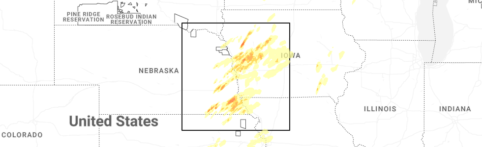
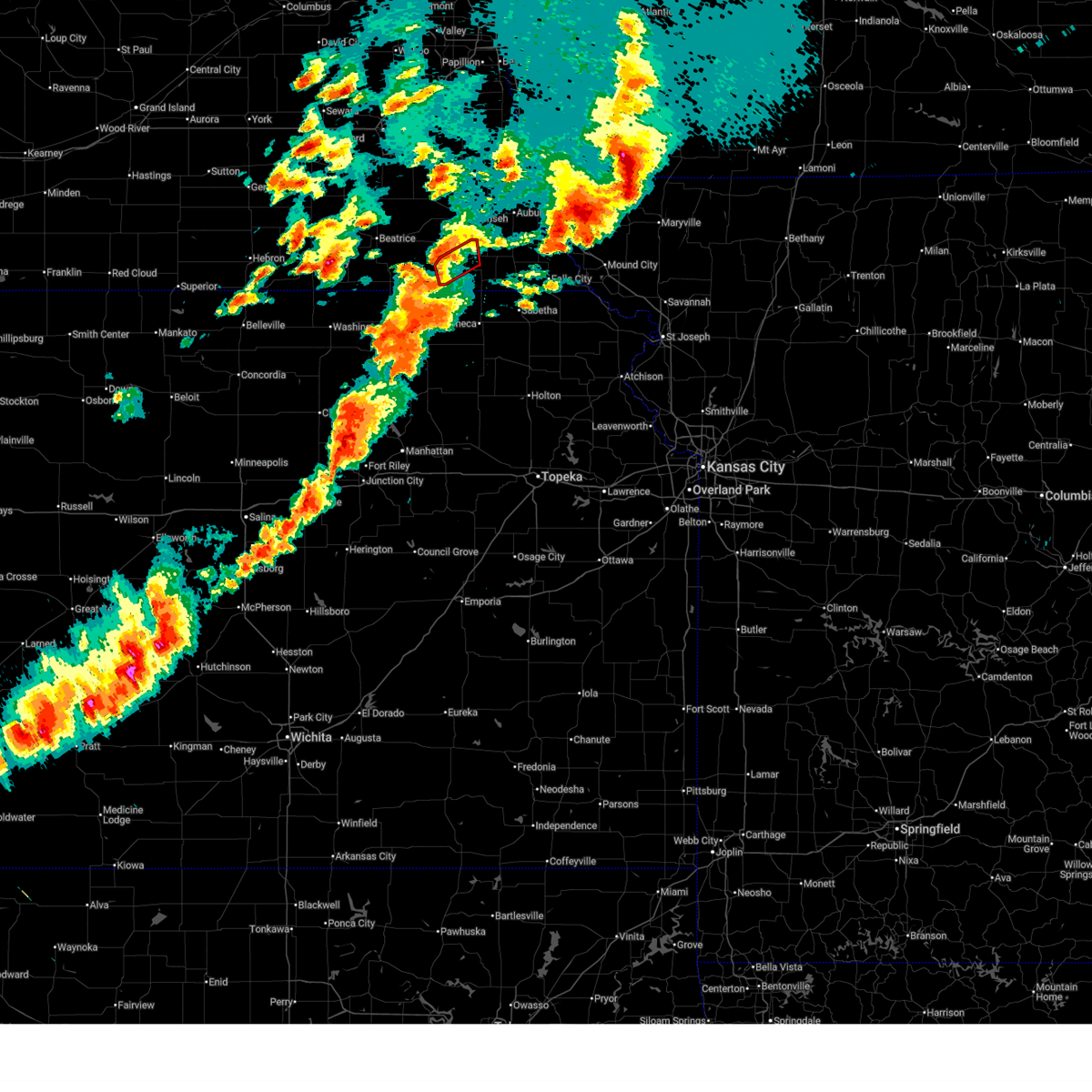
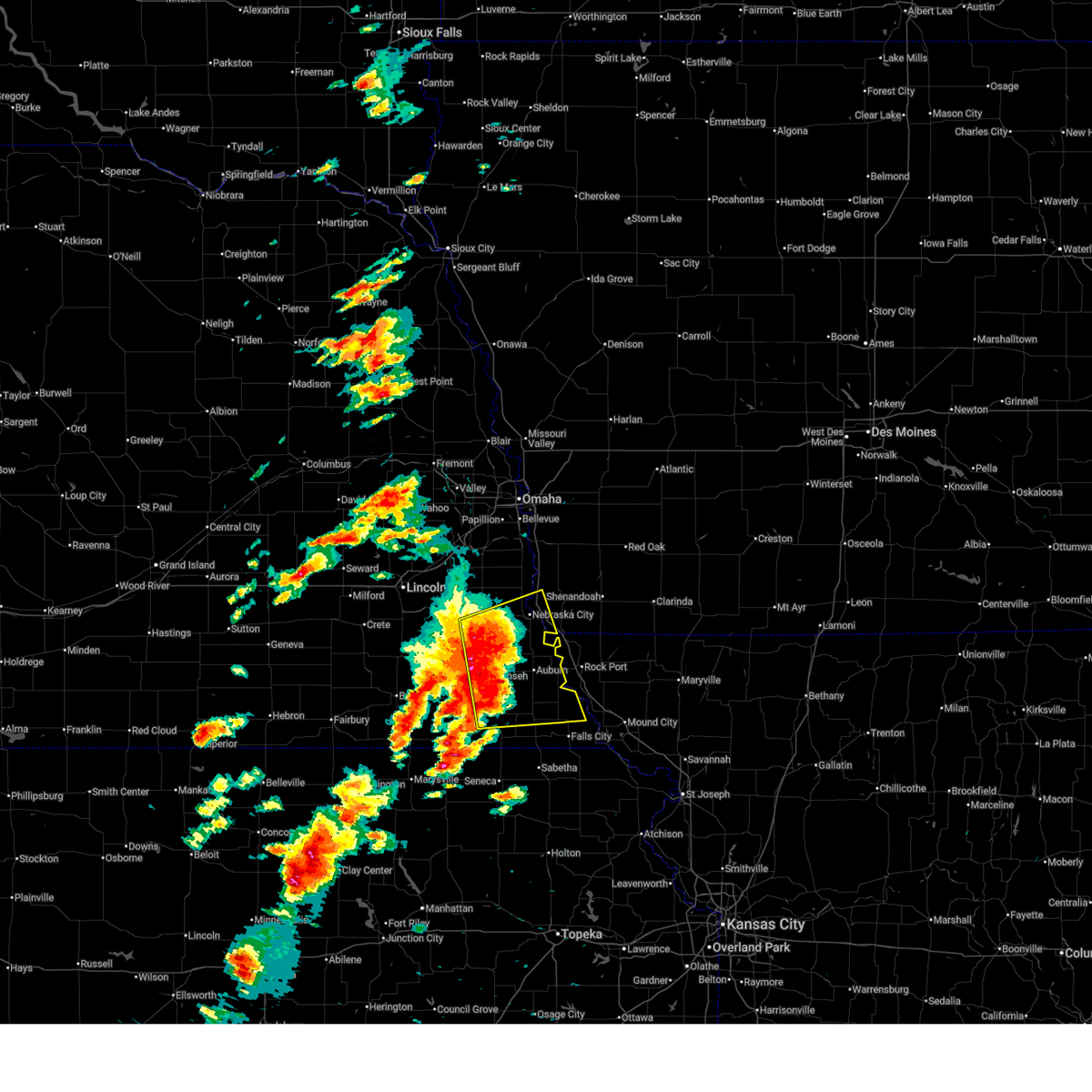
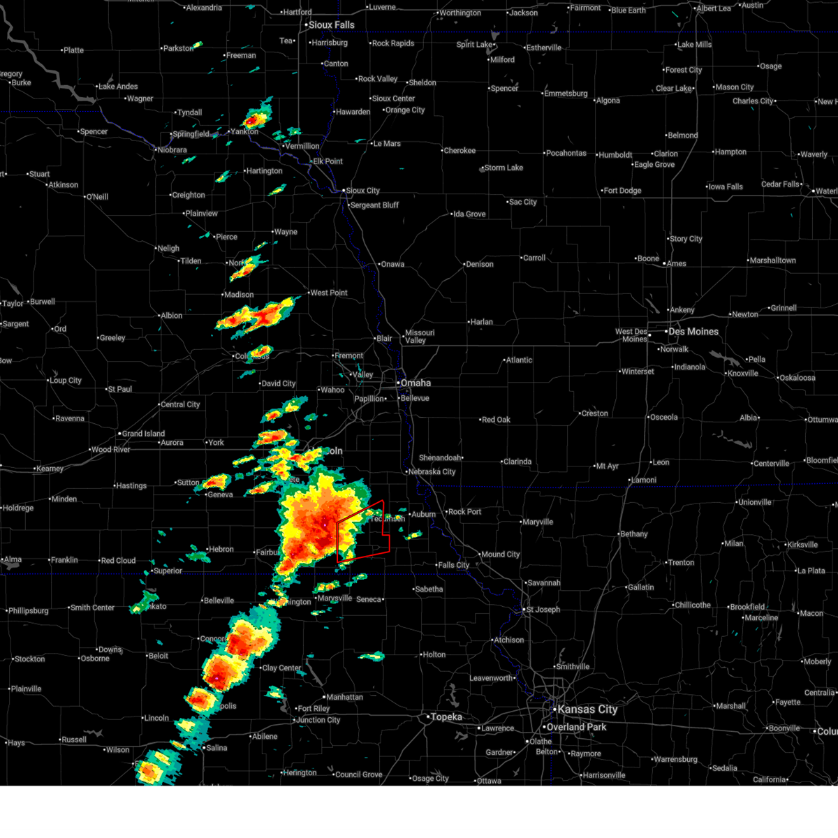
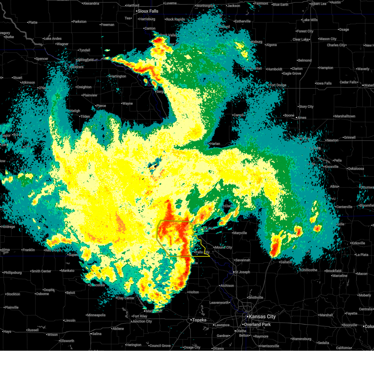
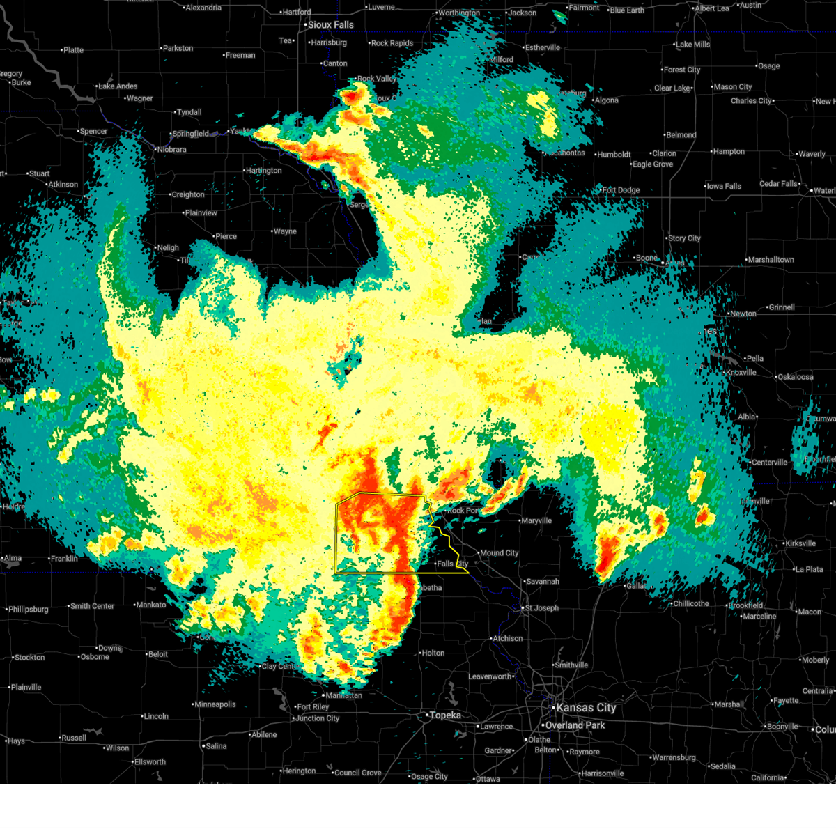
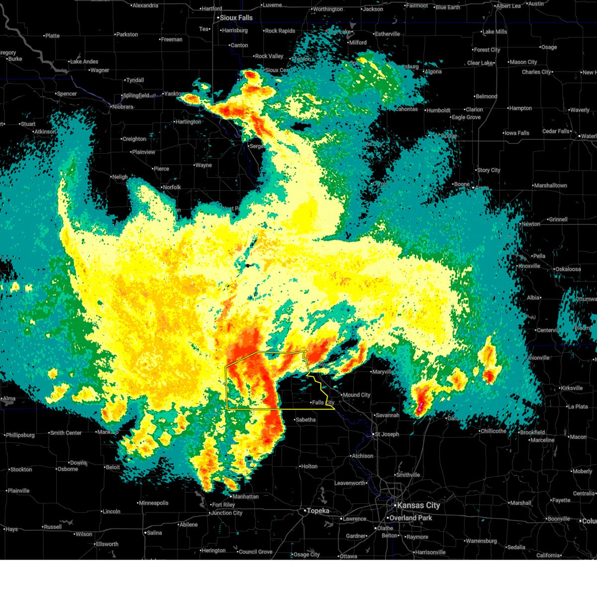
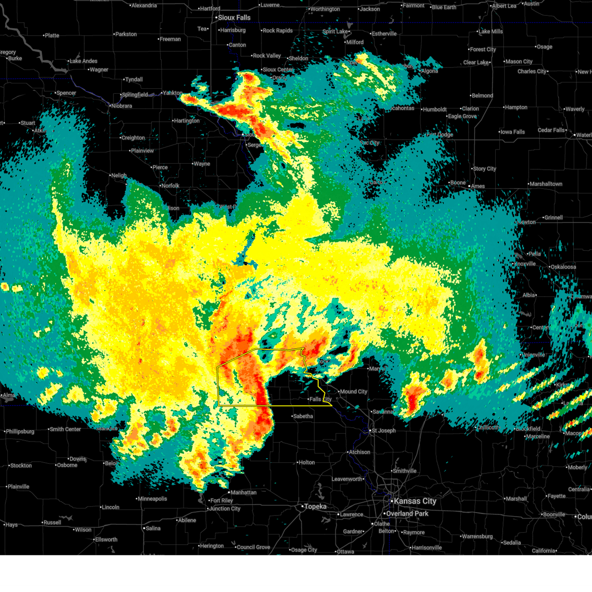
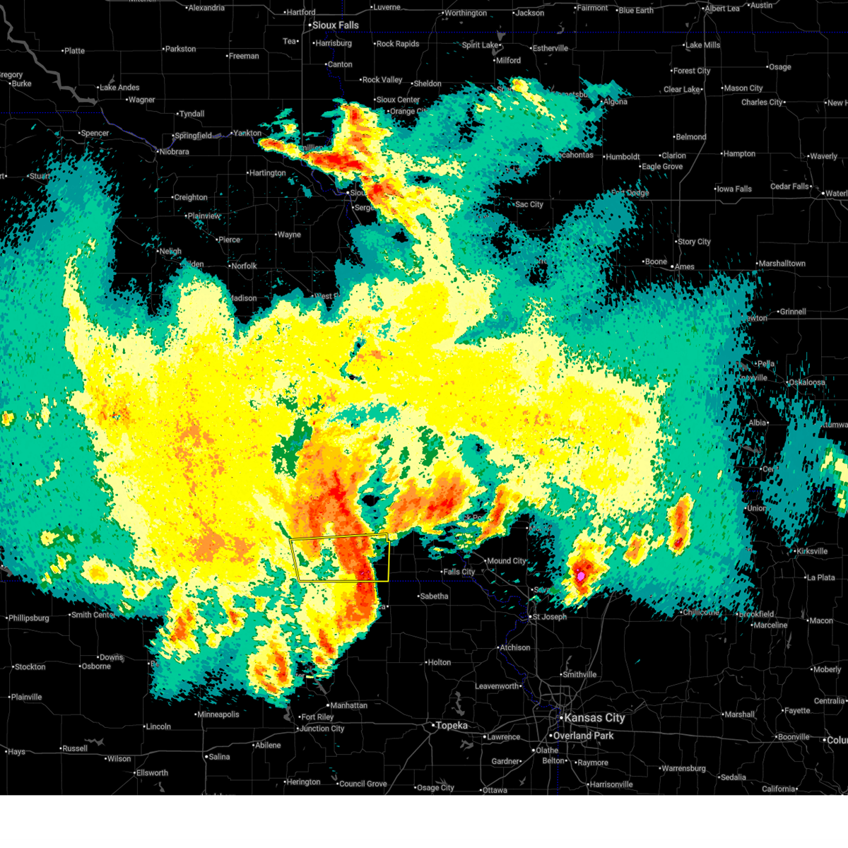
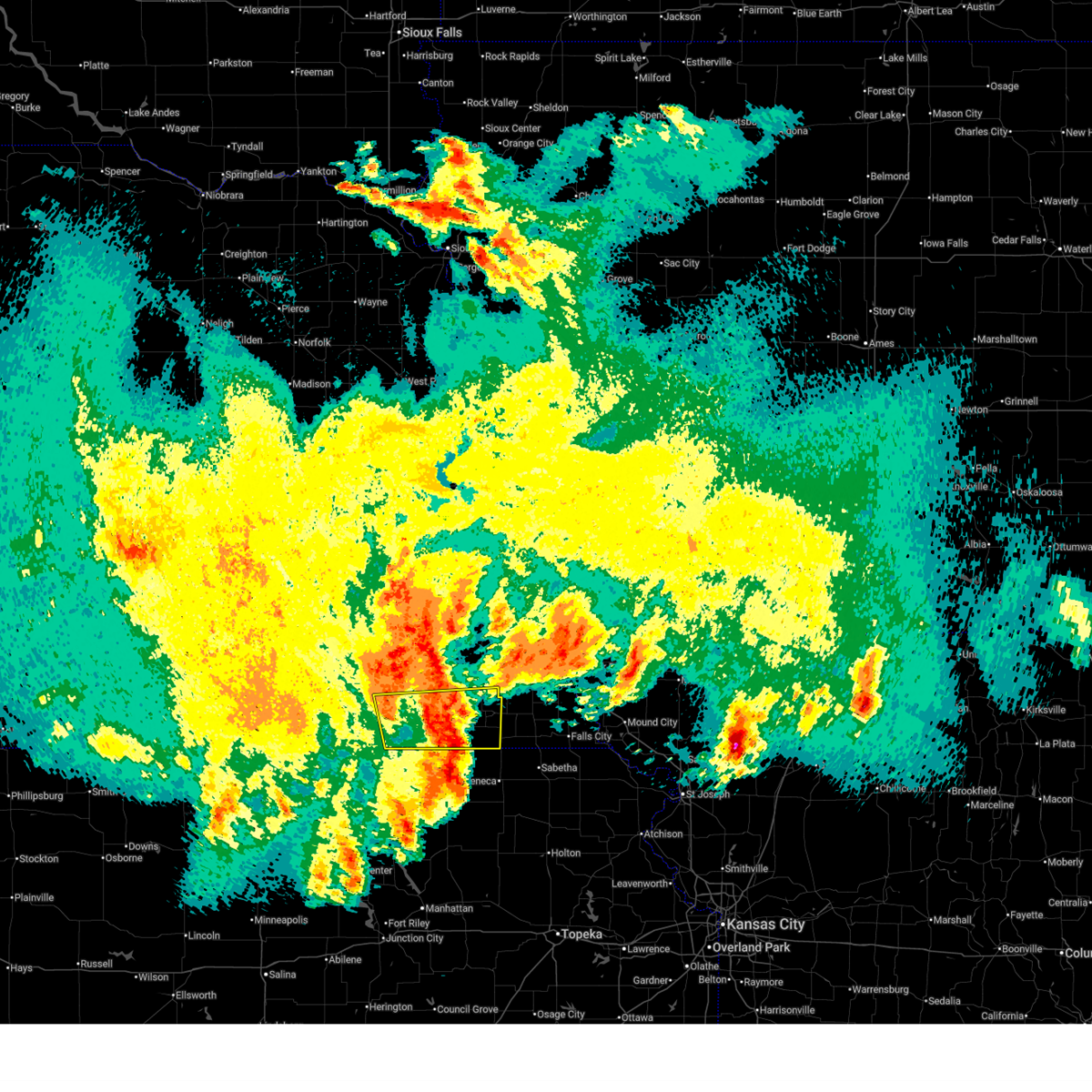
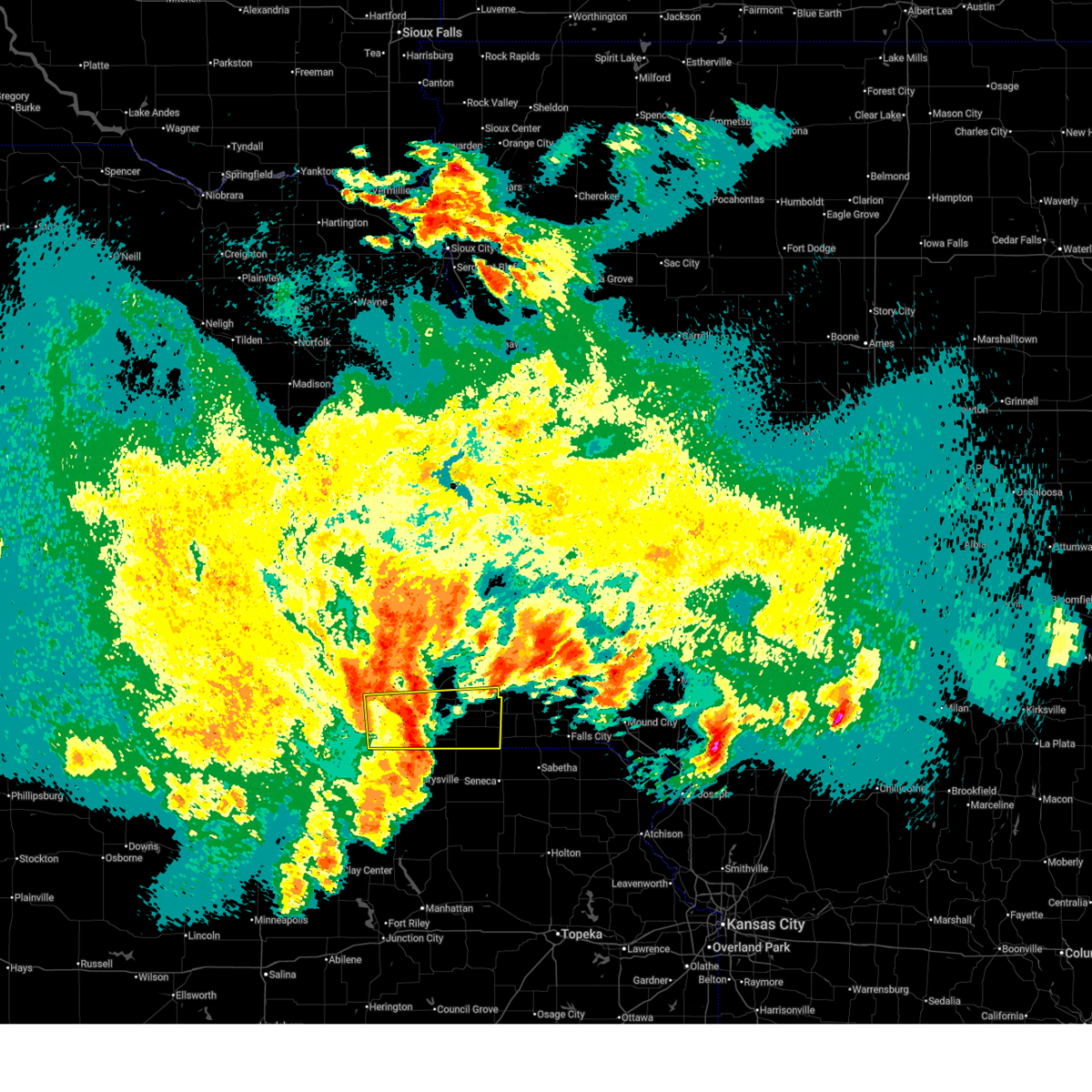
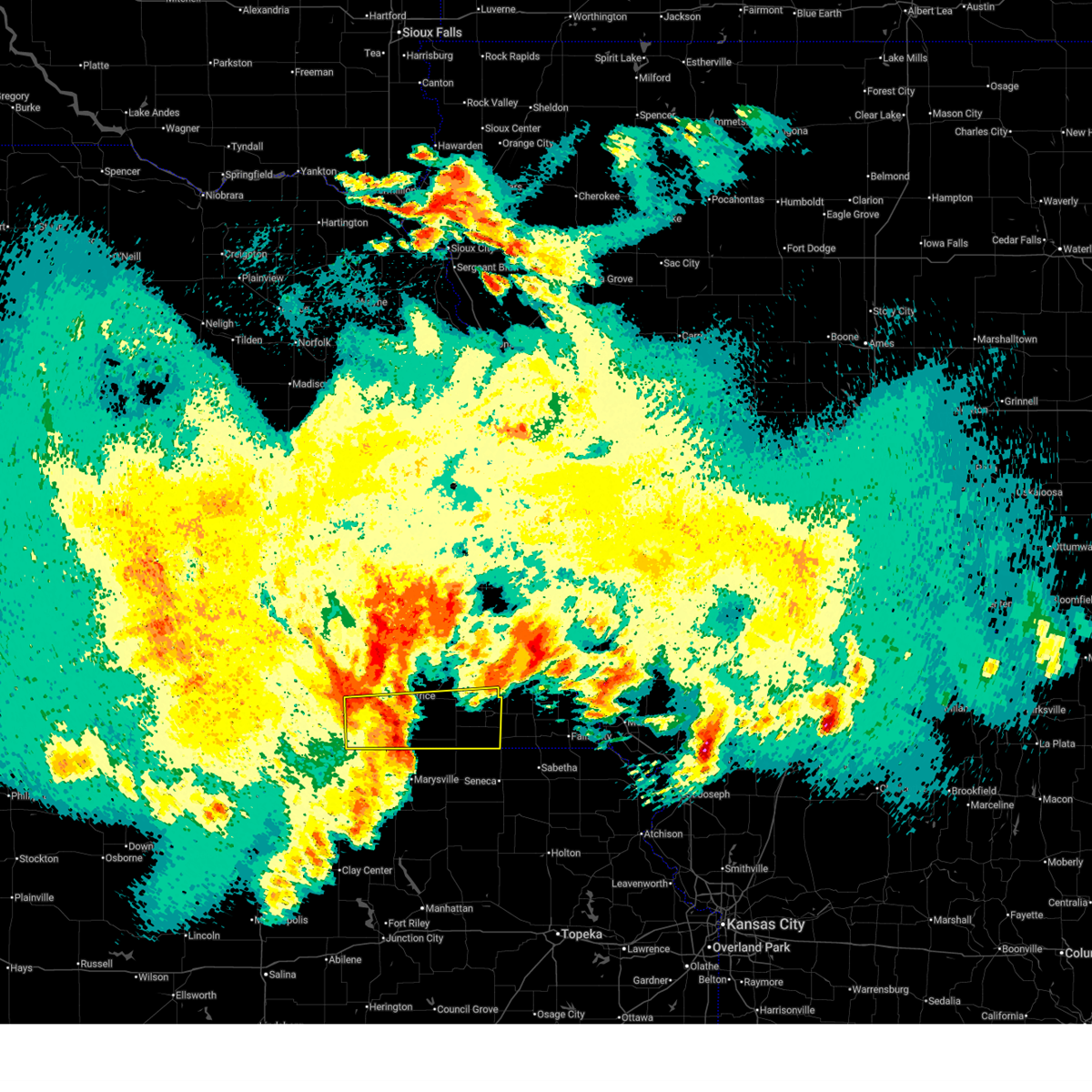
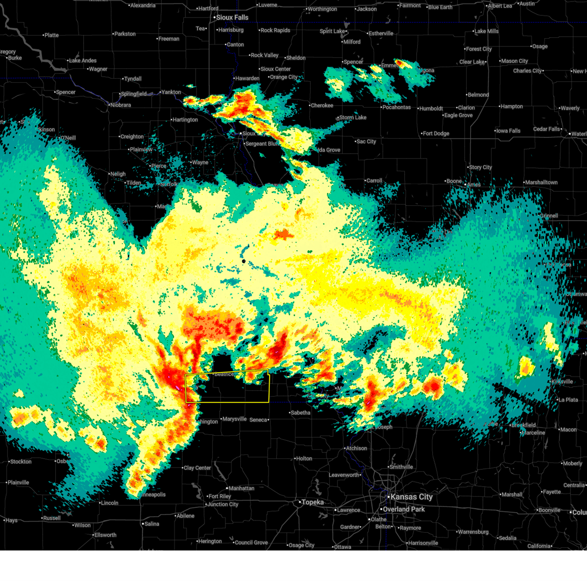
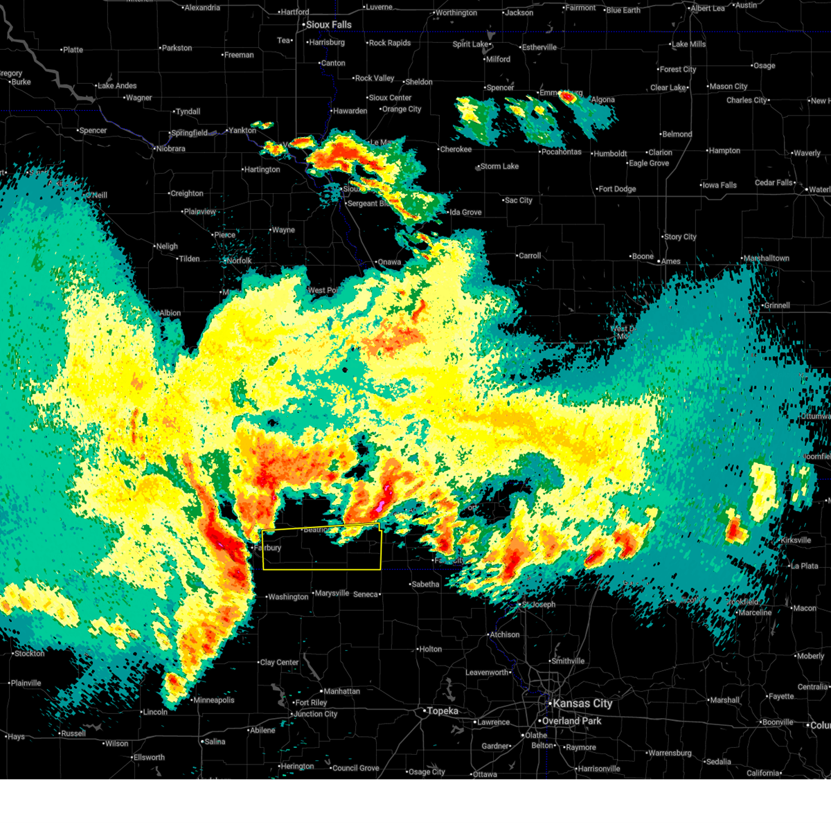
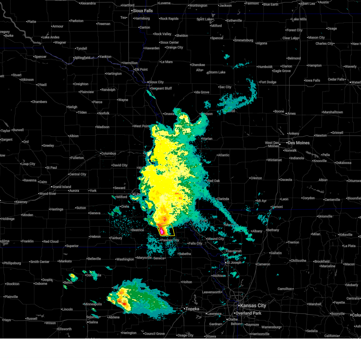
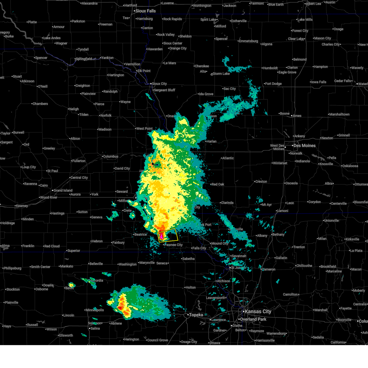
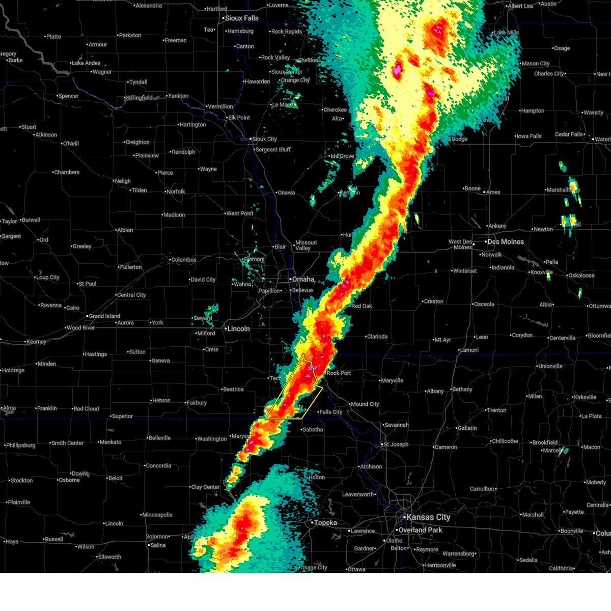
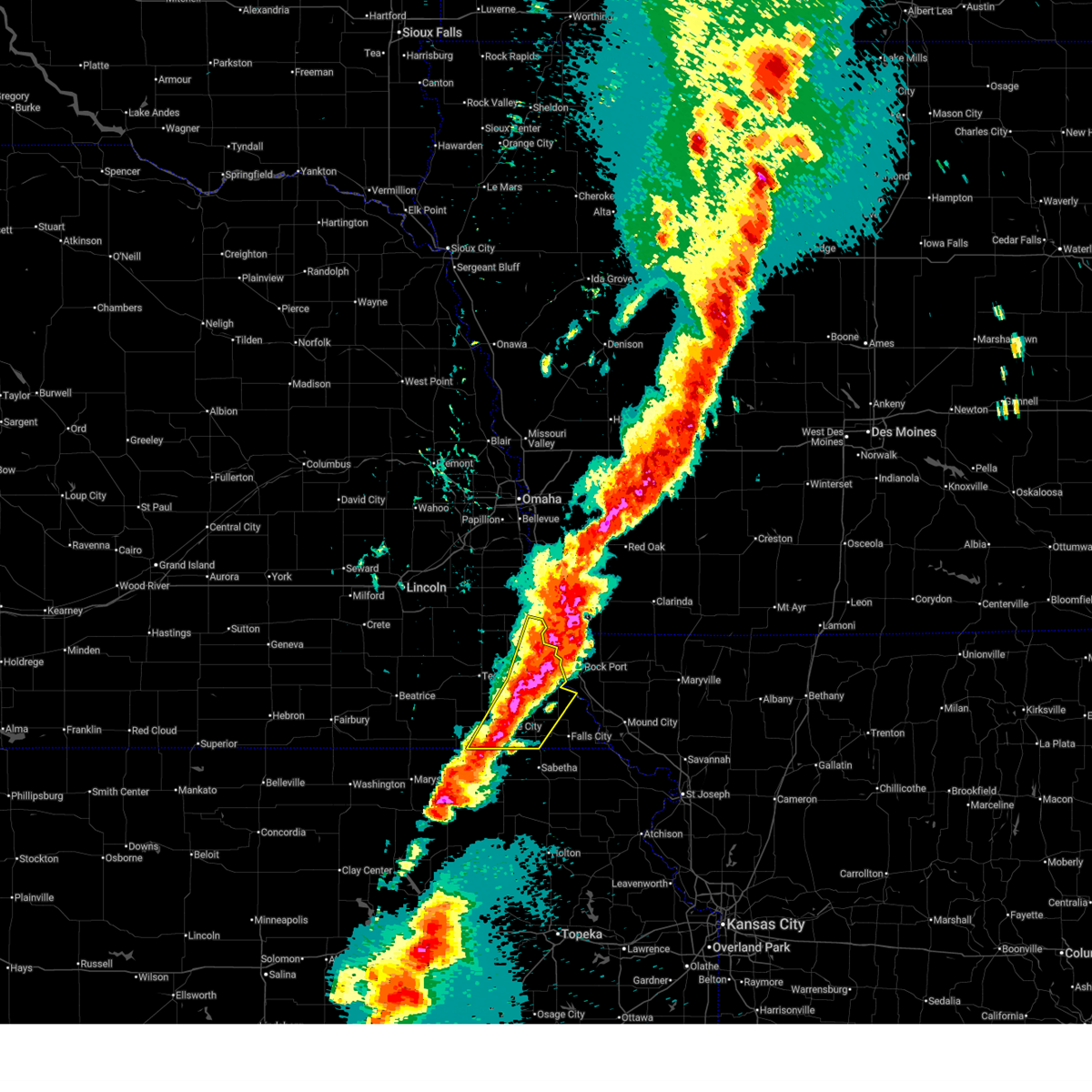
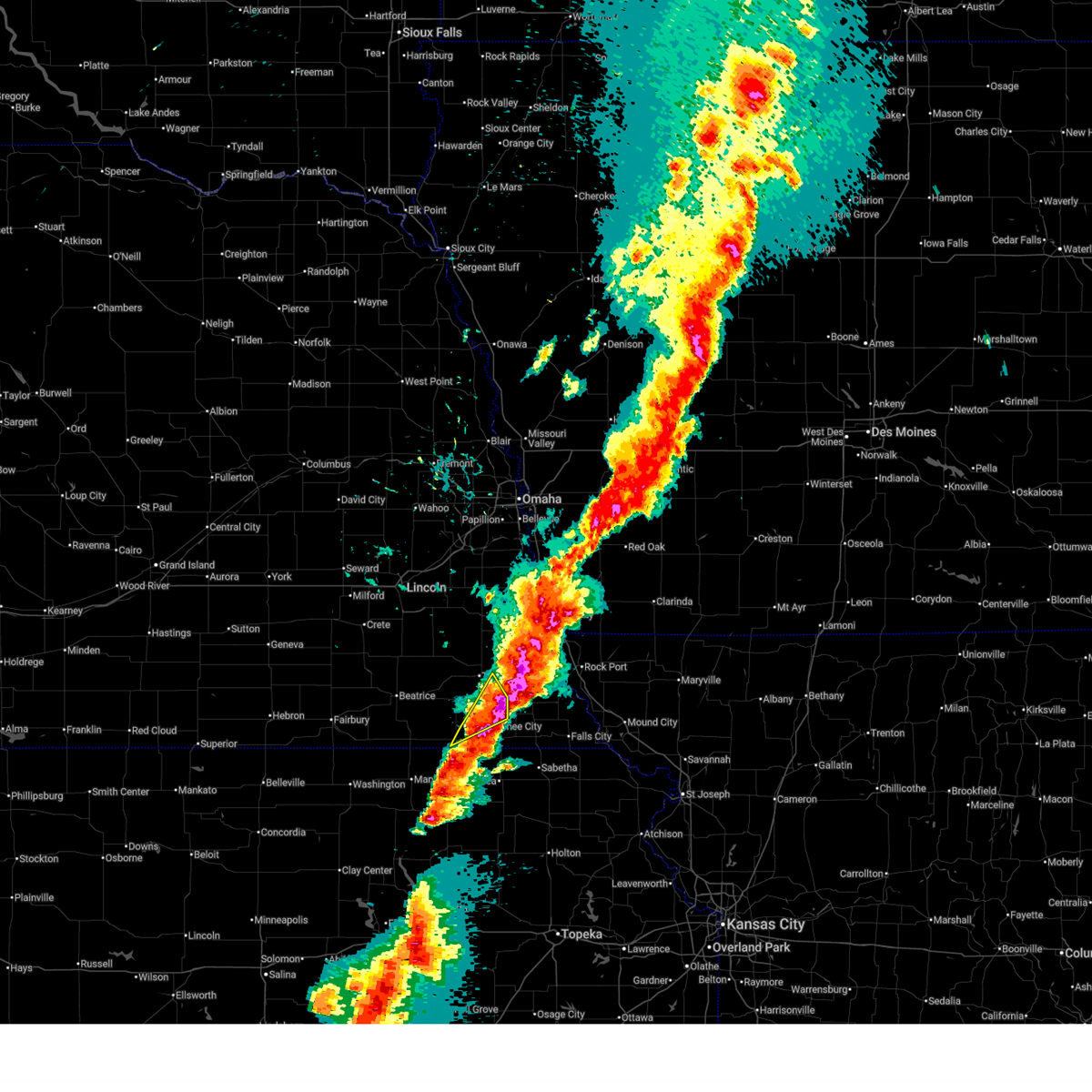
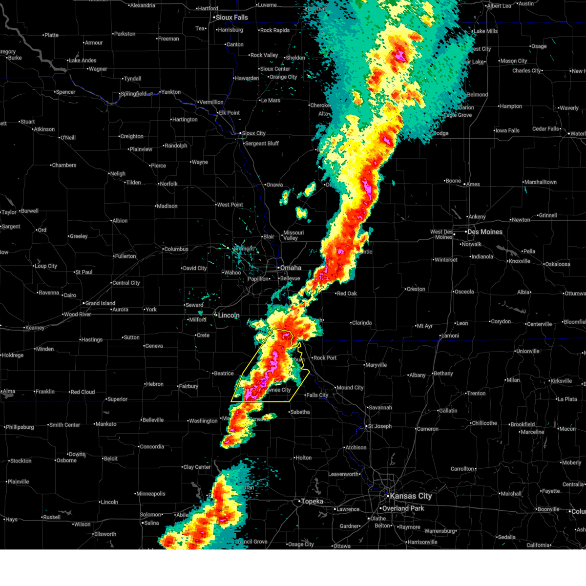
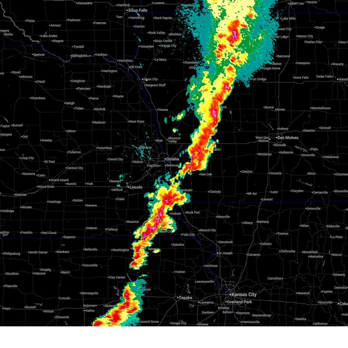
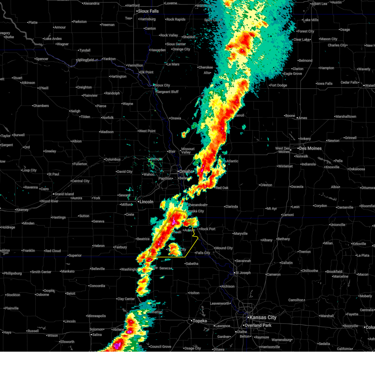
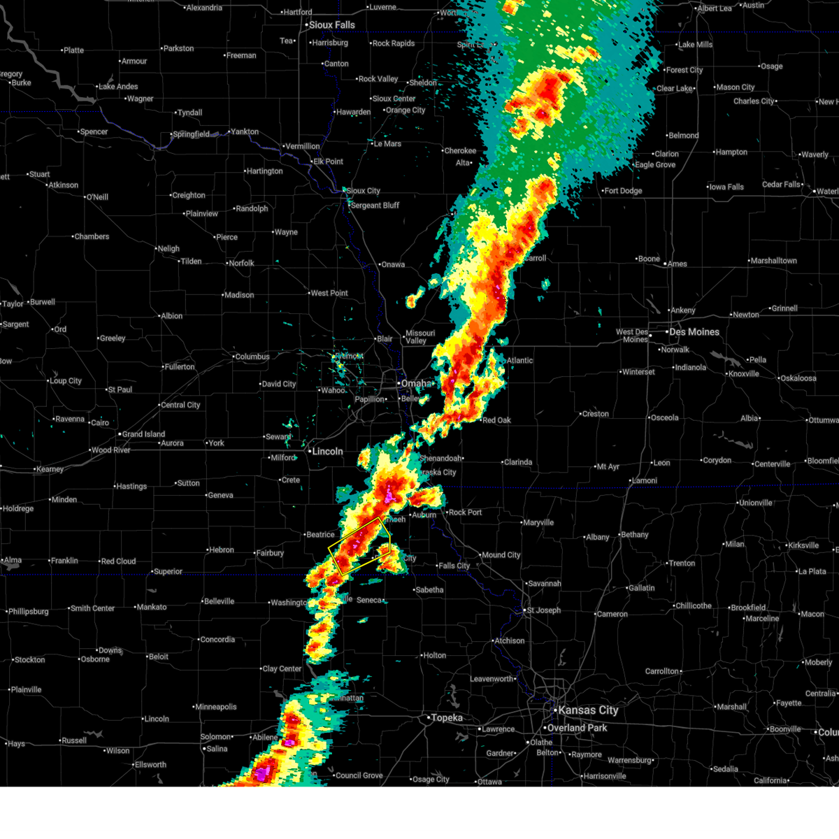
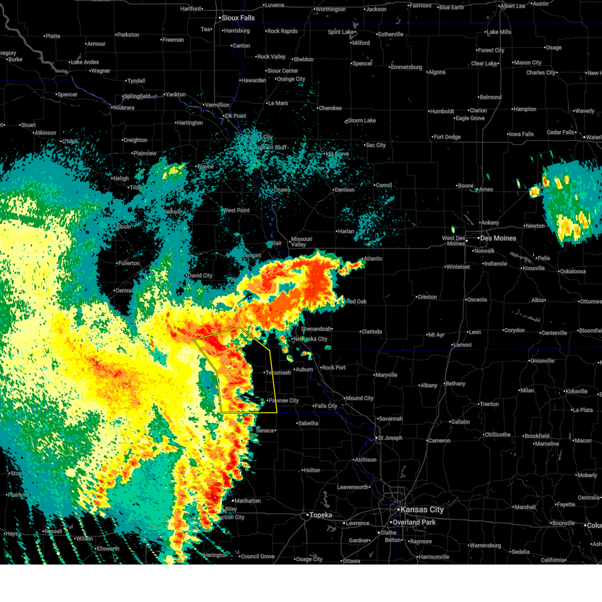
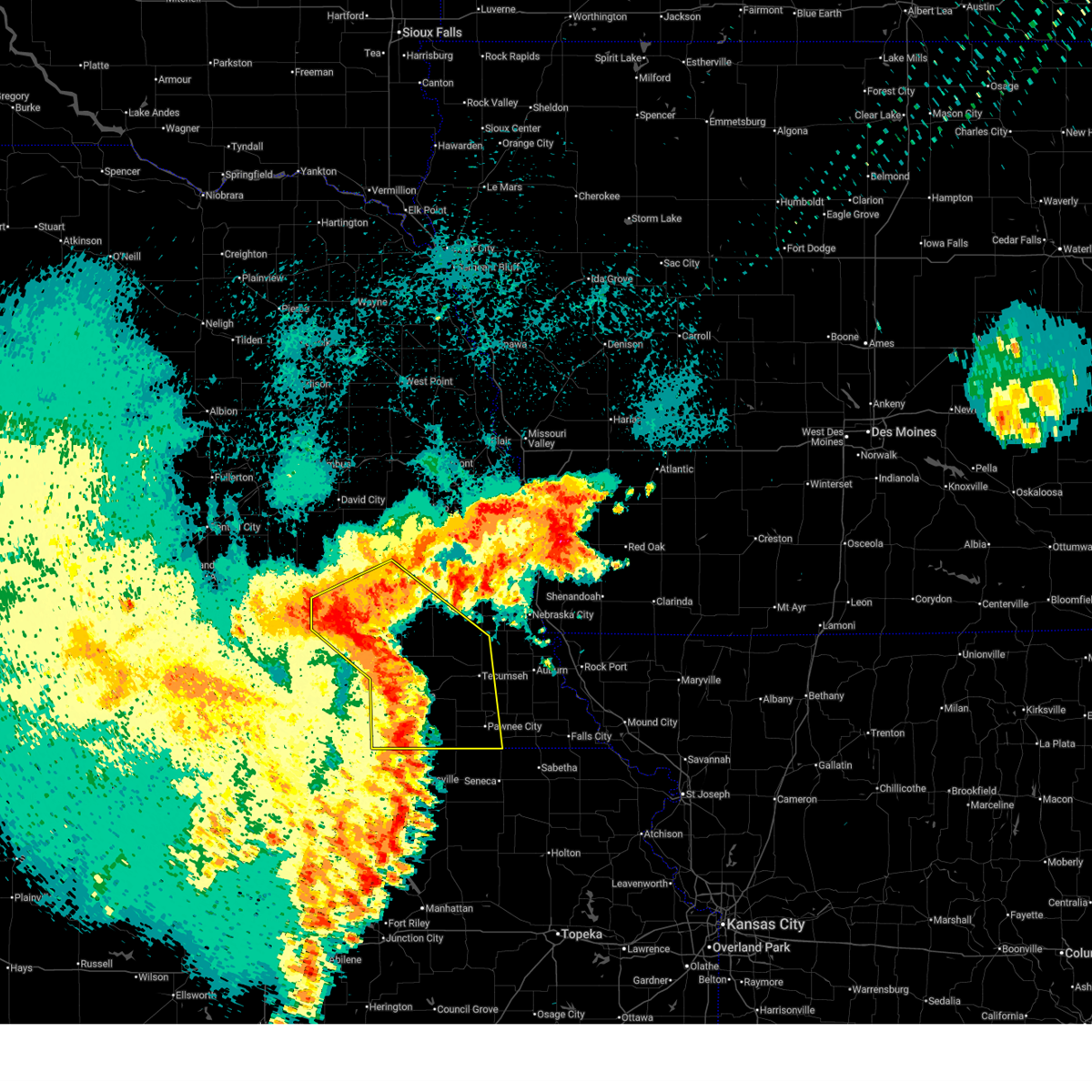
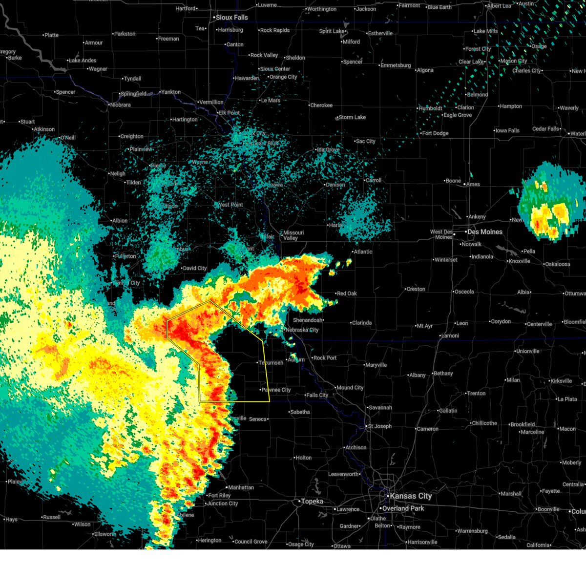
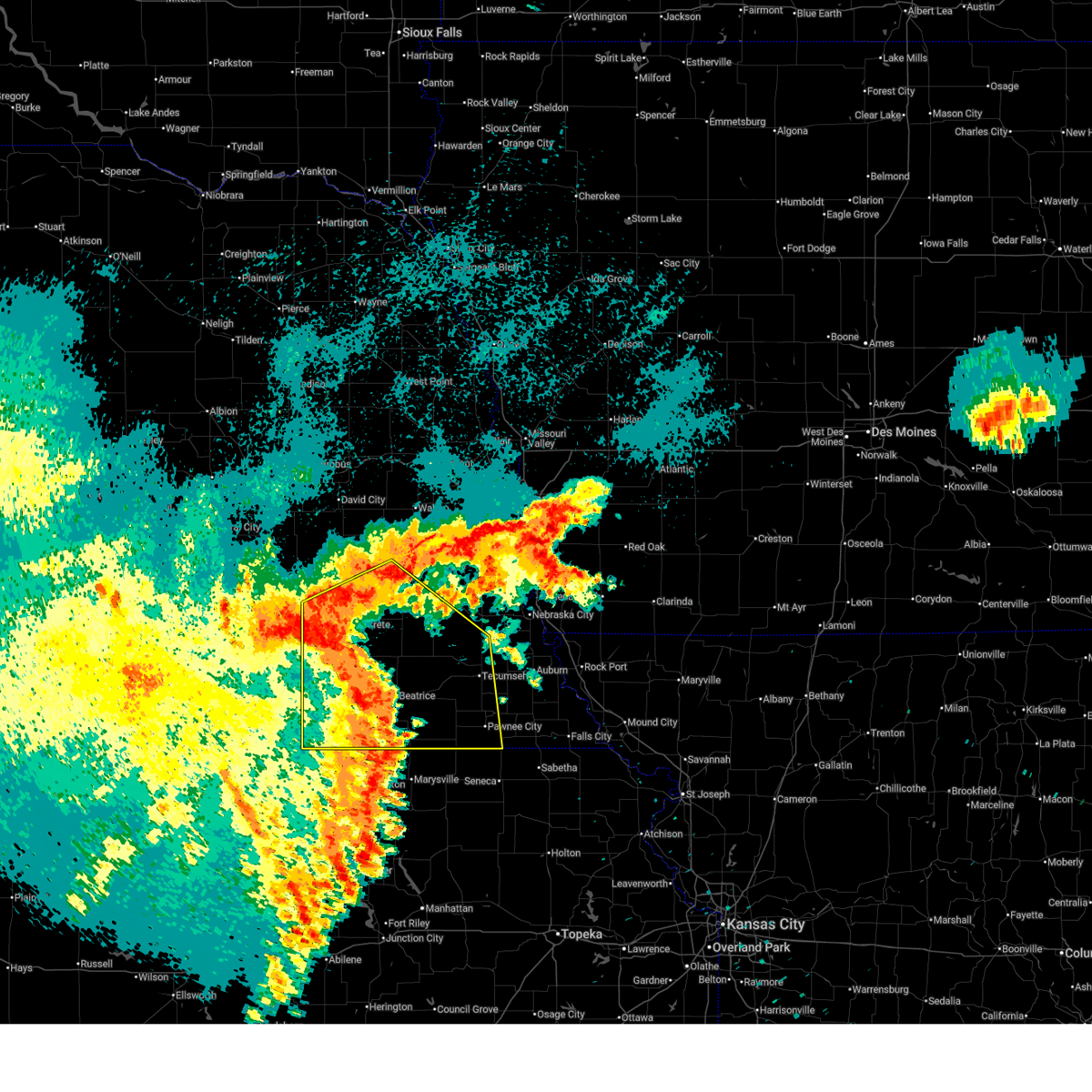
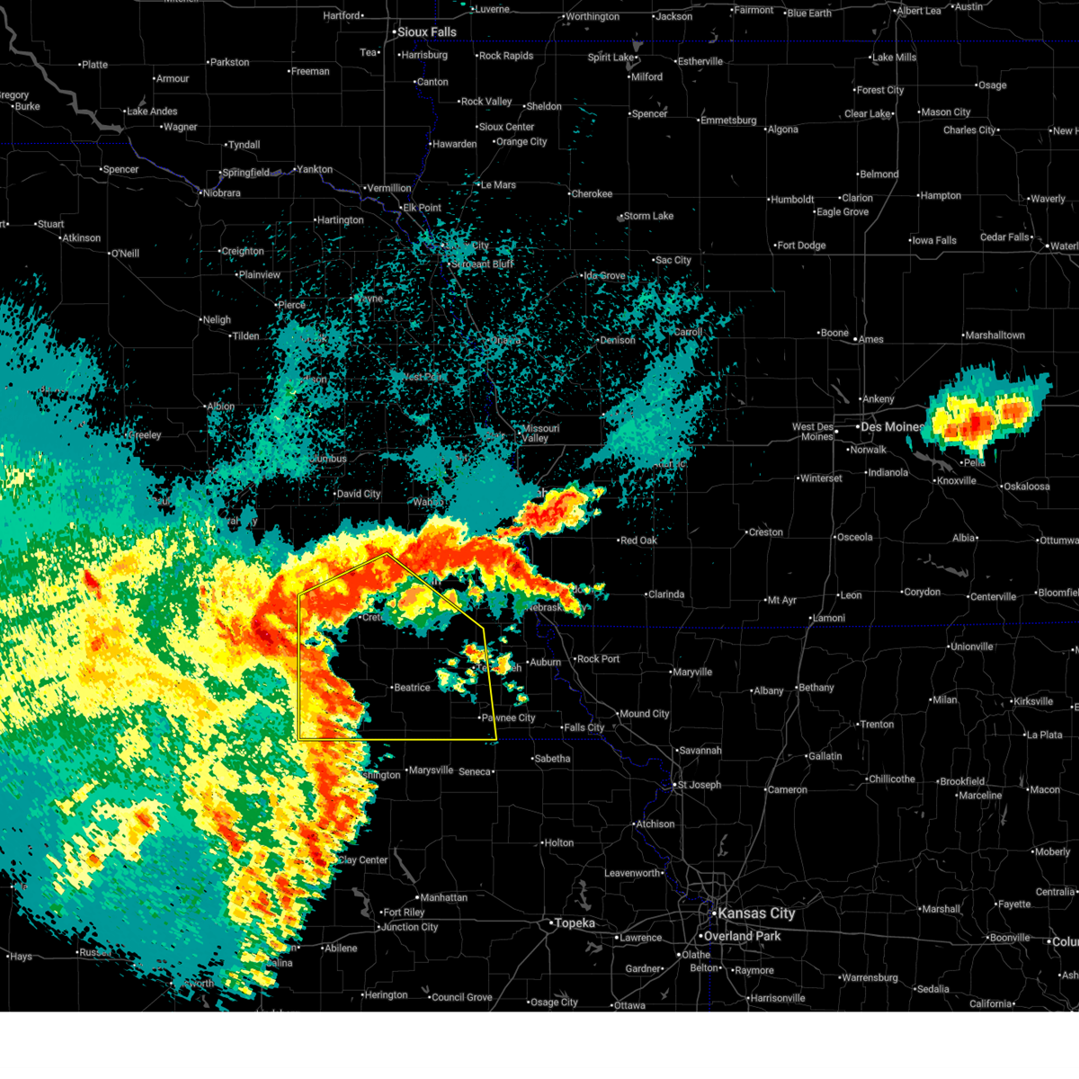
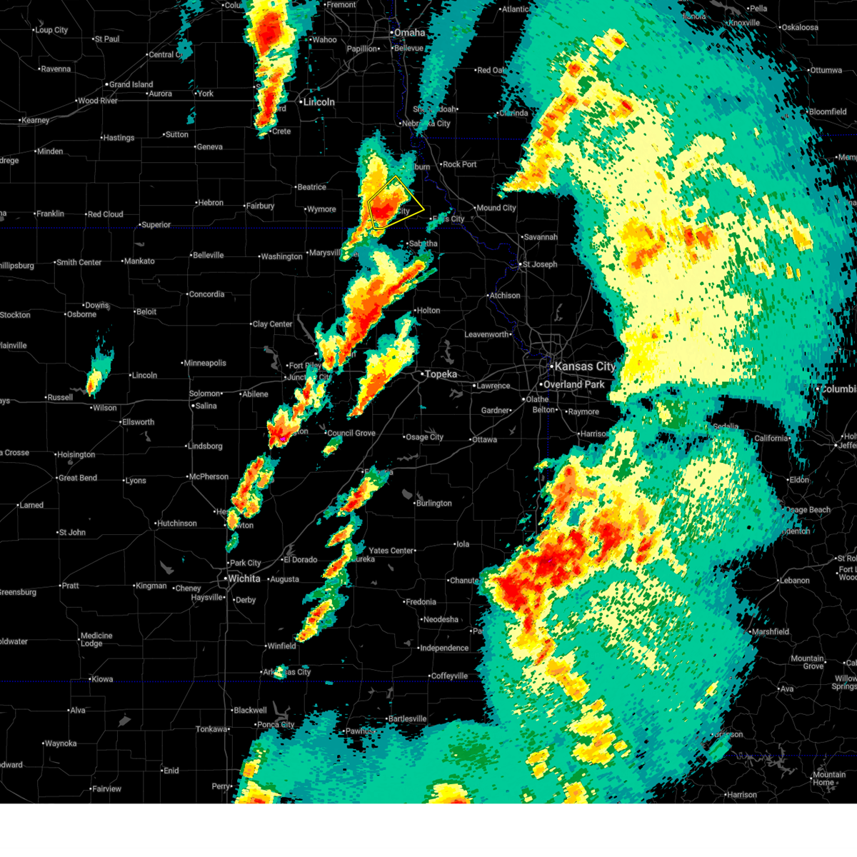
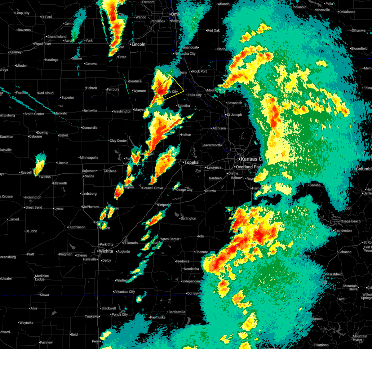
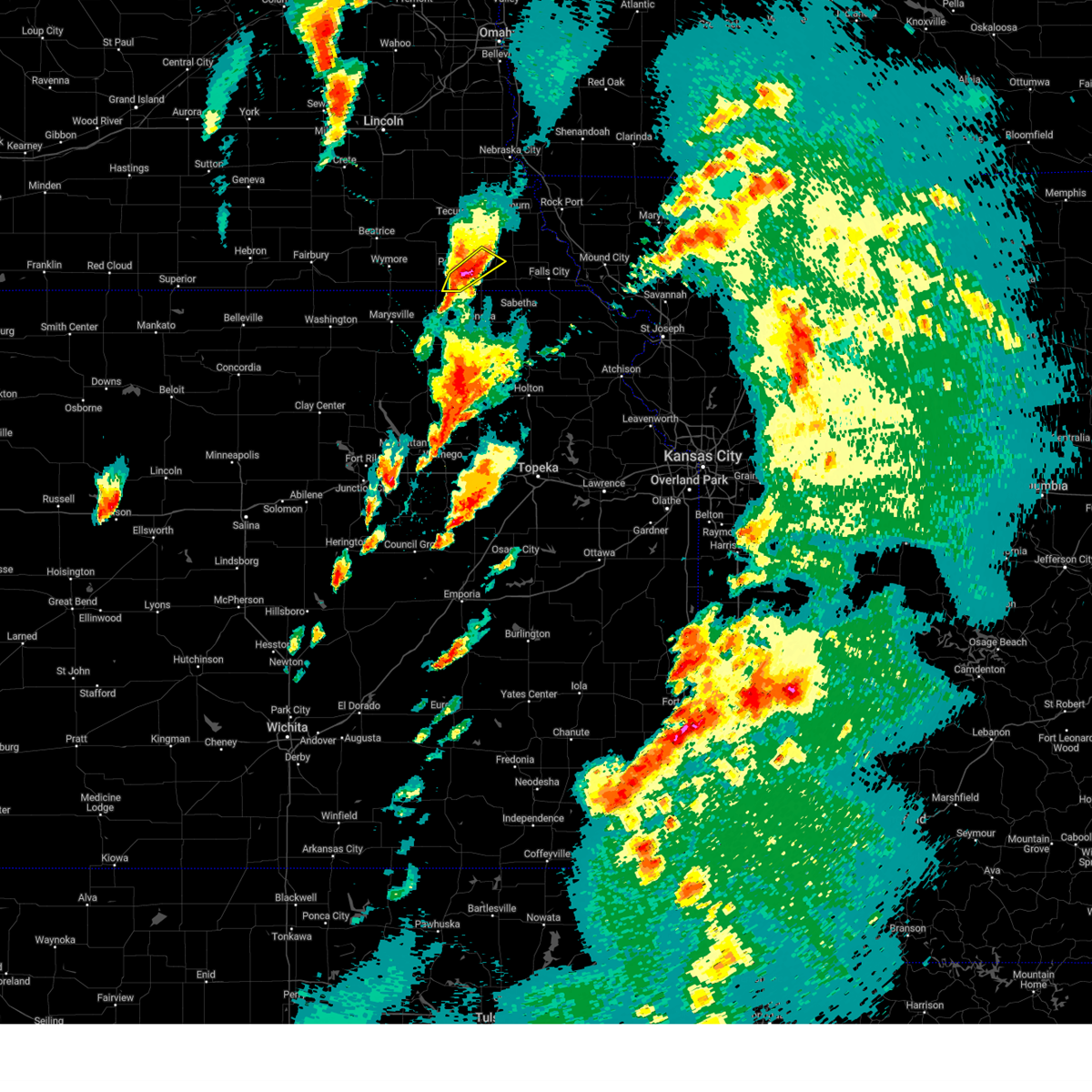
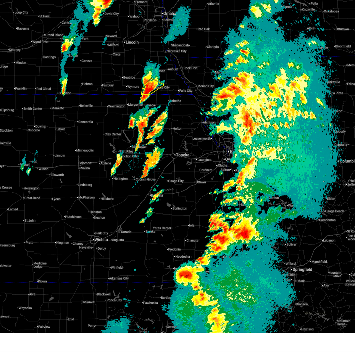
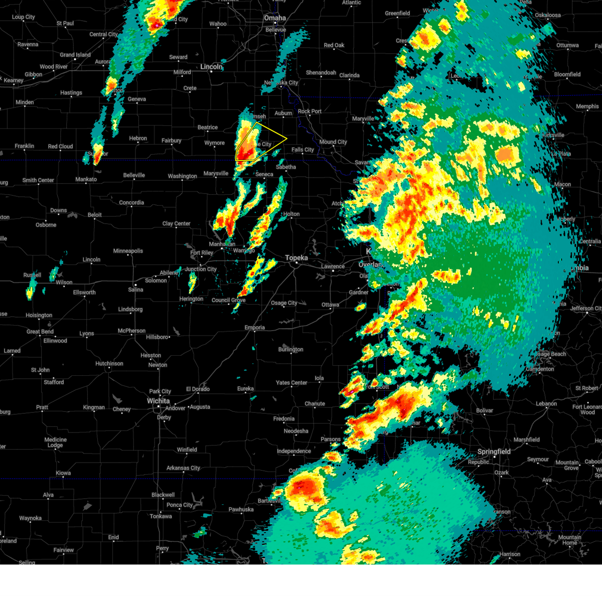
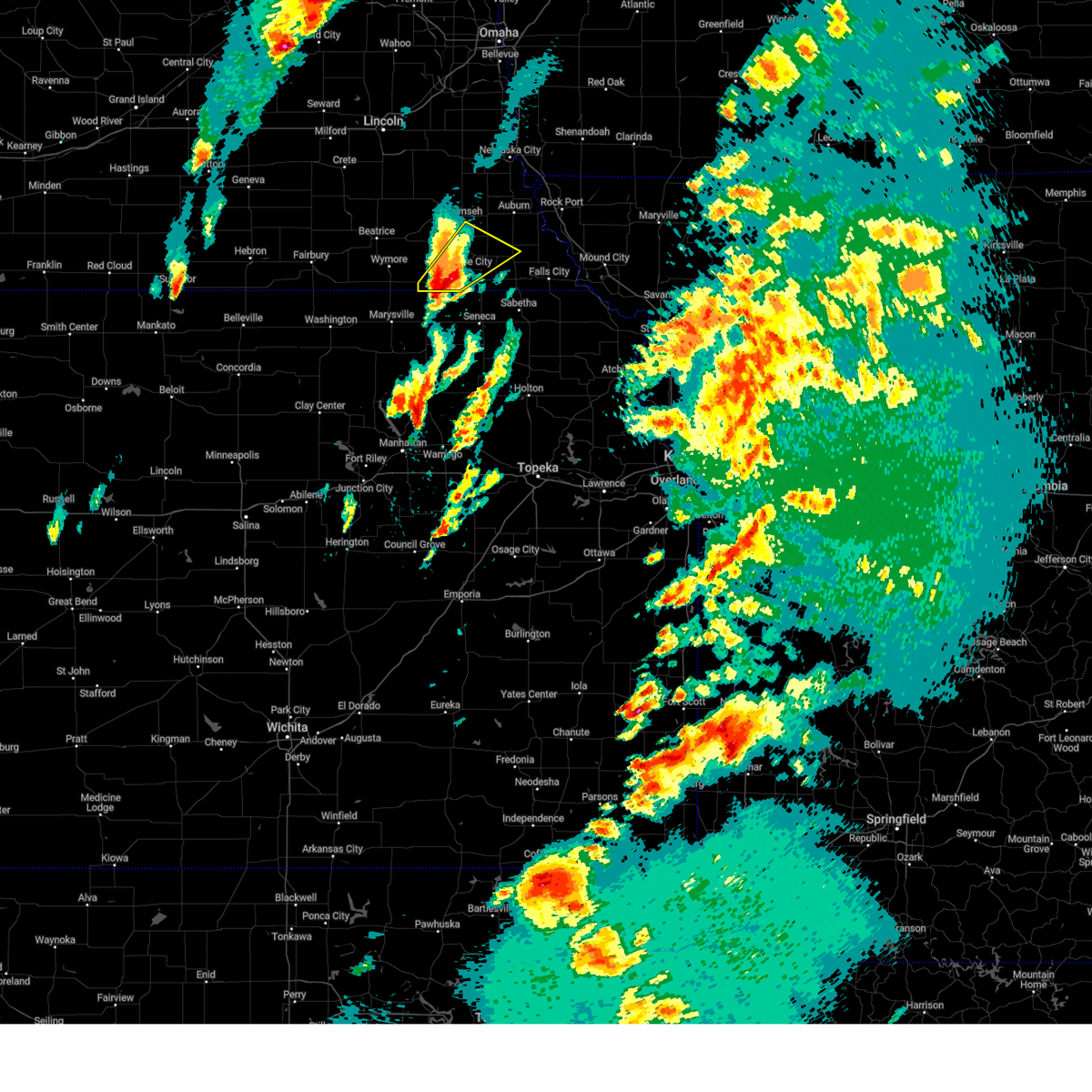
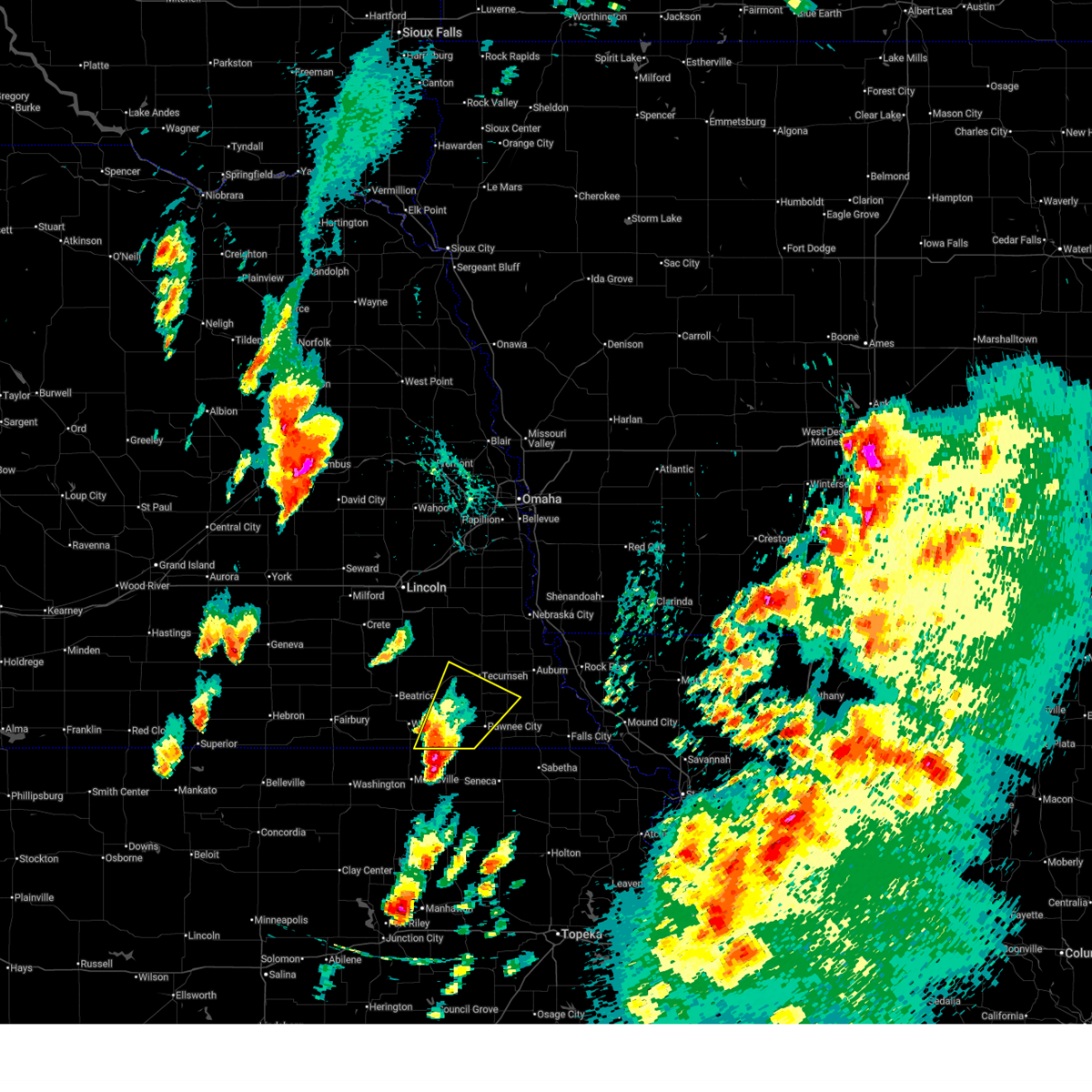
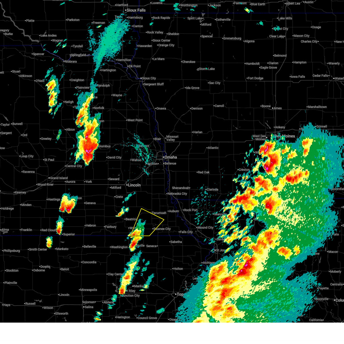
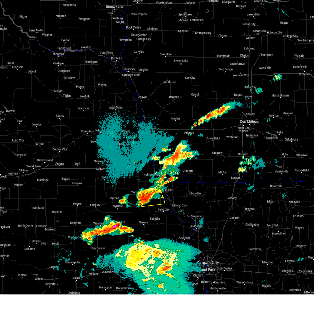
Hail Map for Table Rock, NE
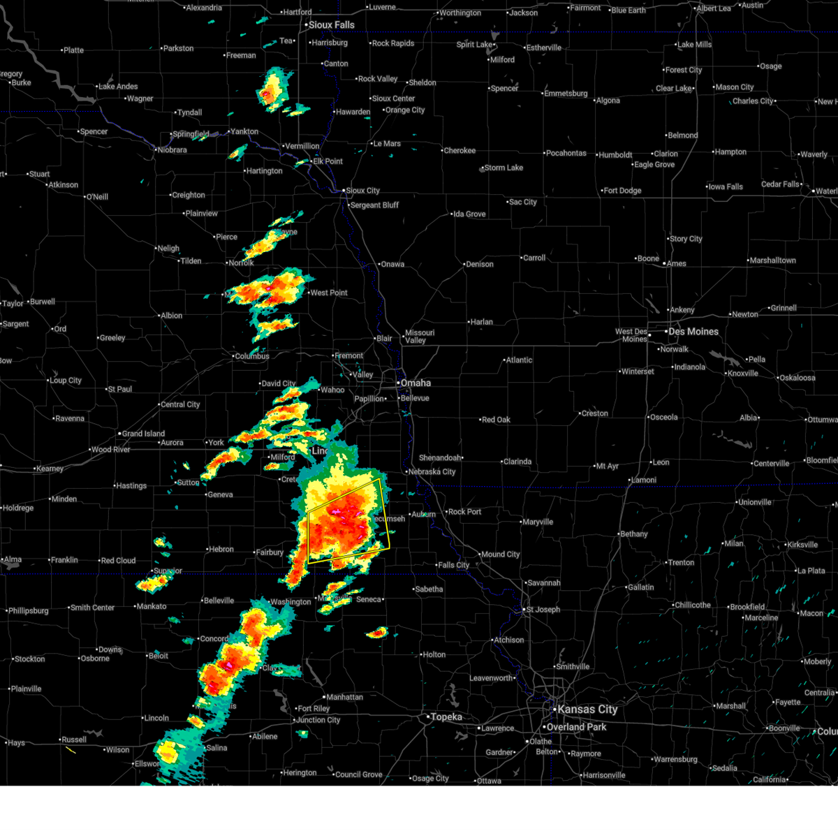
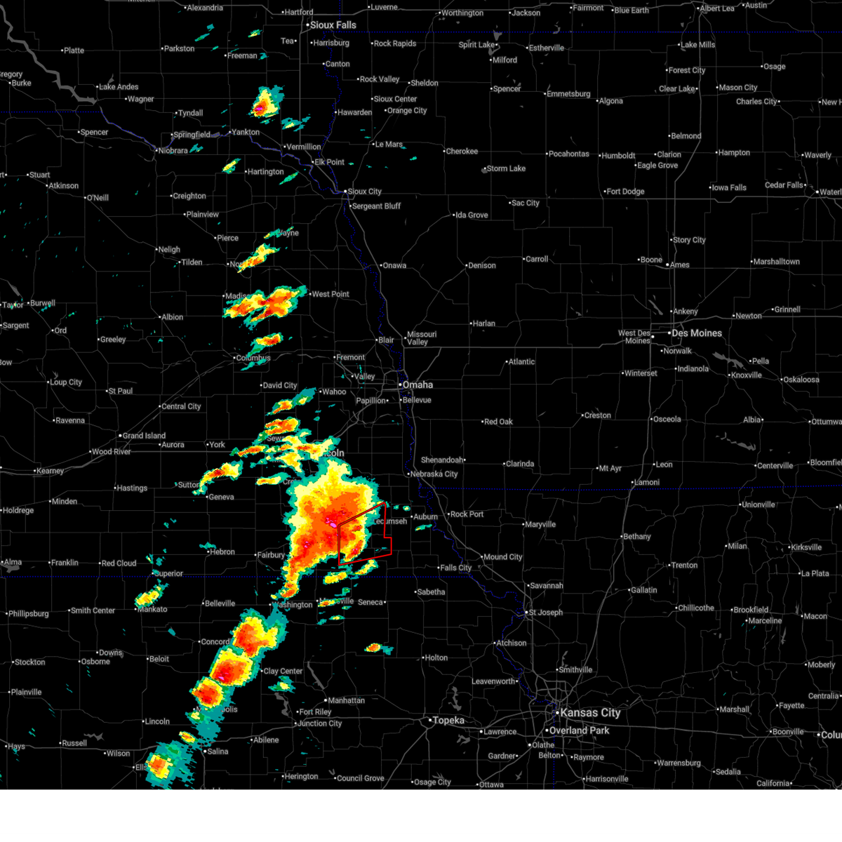
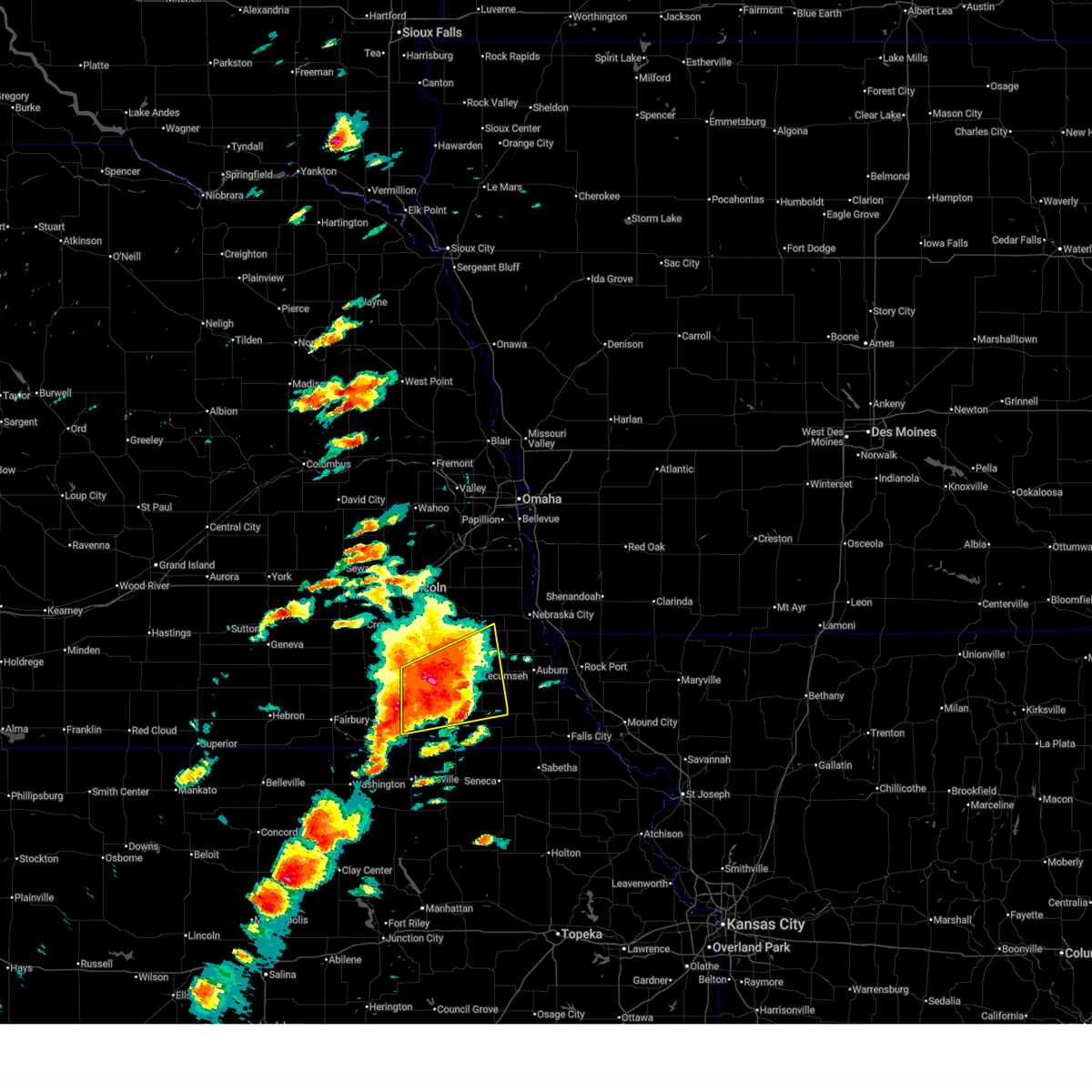
The Table Rock, NE area has had 6 reports of on-the-ground hail by trained spotters, and has been under severe weather warnings 46 times during the past 12 months. Doppler radar has detected hail at or near Table Rock, NE on 95 occasions, including 8 occasions during the past year.
| Name: | Table Rock, NE |
| Where Located: | 73.4 miles NNE of Manhattan, KS |
| Map: | Google Map for Table Rock, NE |
| Population: | 269 |
| Housing Units: | 167 |
| More Info: | Search Google for Table Rock, NE |
3
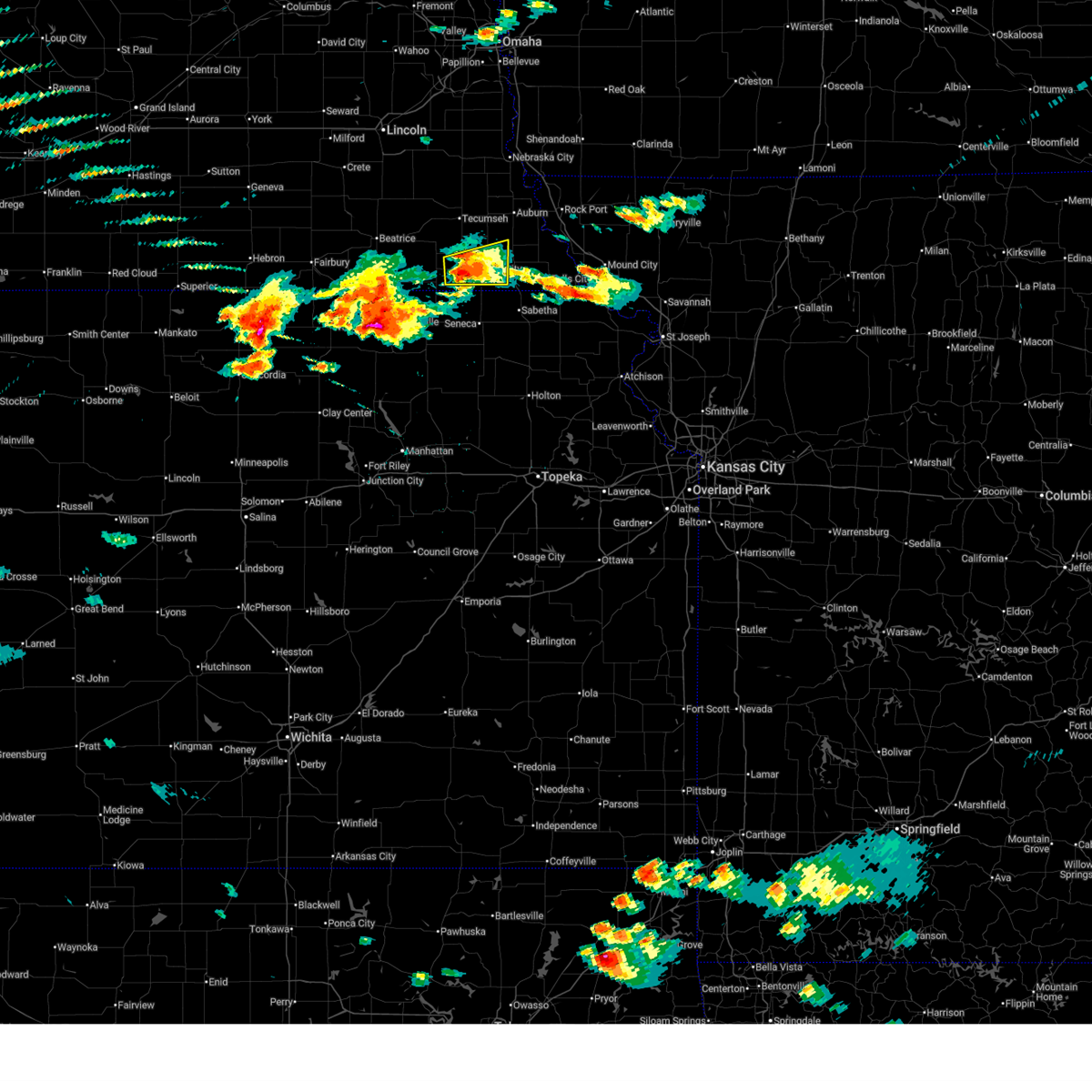
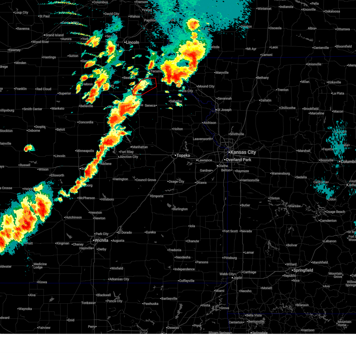
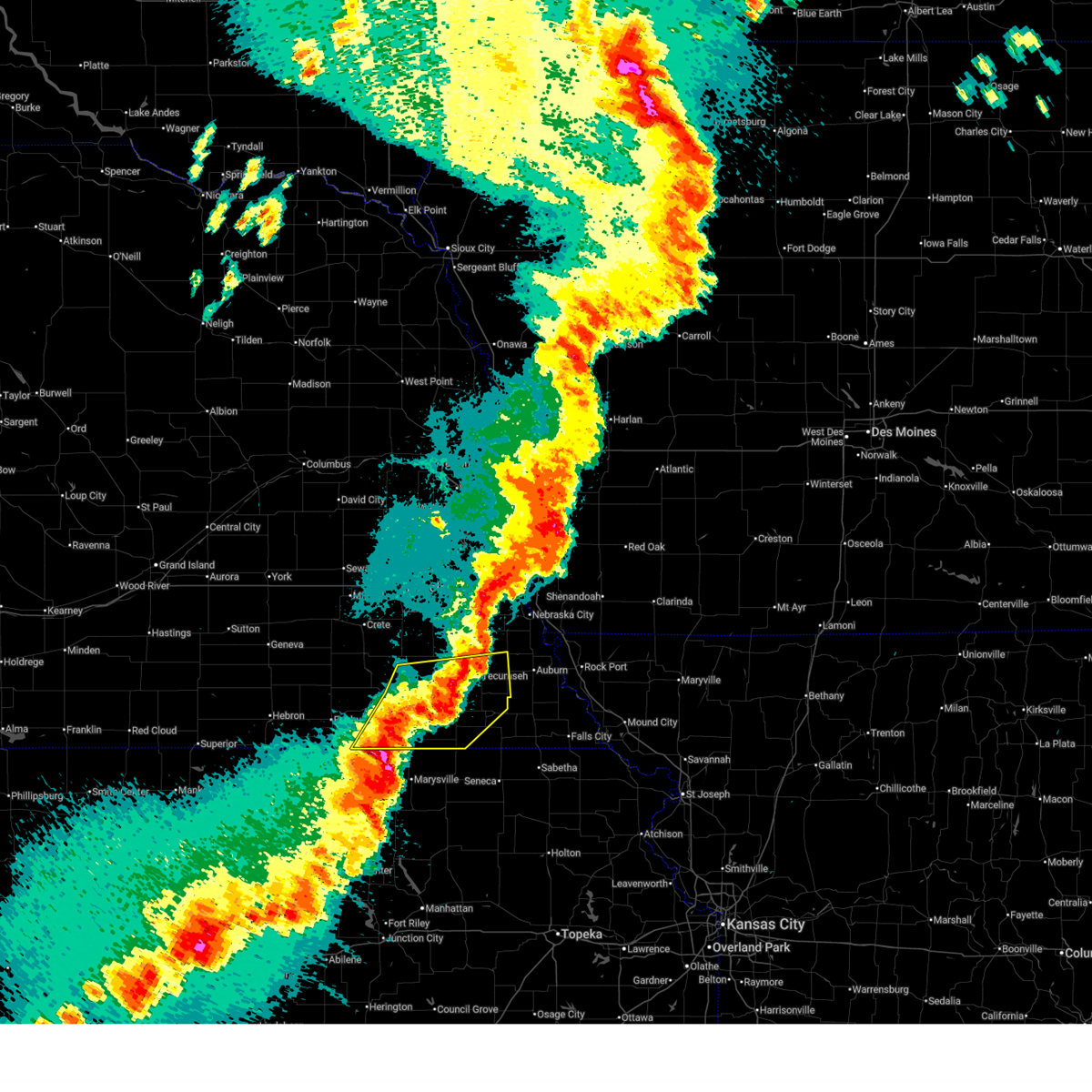
The Top Recent Hail Date for Table Rock, NE is Thursday, April 23, 2026 (4th out of 95)
Hail and Wind Damage Spotted near Table Rock, NE
| Date / Time | Report Details |
|---|---|
| 6/13/2026 5:12 PM CDT |
 At 512 pm cdt, a severe thunderstorm was located 5 miles north of du bois, or 5 miles east of pawnee city, moving east at 25 mph (radar indicated). Hazards include 60 mph wind gusts and quarter size hail. Hail damage to vehicles is expected. expect wind damage to roofs, siding, and trees. Locations impacted include, humboldt. At 512 pm cdt, a severe thunderstorm was located 5 miles north of du bois, or 5 miles east of pawnee city, moving east at 25 mph (radar indicated). Hazards include 60 mph wind gusts and quarter size hail. Hail damage to vehicles is expected. expect wind damage to roofs, siding, and trees. Locations impacted include, humboldt.
|
| 6/13/2026 4:54 PM CDT |
 Svroax the national weather service in omaha has issued a * severe thunderstorm warning for, western richardson county in southeastern nebraska, eastern pawnee county in southeastern nebraska, * until 545 pm cdt. * at 453 pm cdt, a severe thunderstorm was located near pawnee city, moving east at 25 mph (radar indicated). Hazards include 60 mph wind gusts and quarter size hail. Hail damage to vehicles is expected. expect wind damage to roofs, siding, and trees. this severe thunderstorm will be near, pawnee city and table rock around 500 pm cdt. Other locations in the path of this severe thunderstorm include humboldt. Svroax the national weather service in omaha has issued a * severe thunderstorm warning for, western richardson county in southeastern nebraska, eastern pawnee county in southeastern nebraska, * until 545 pm cdt. * at 453 pm cdt, a severe thunderstorm was located near pawnee city, moving east at 25 mph (radar indicated). Hazards include 60 mph wind gusts and quarter size hail. Hail damage to vehicles is expected. expect wind damage to roofs, siding, and trees. this severe thunderstorm will be near, pawnee city and table rock around 500 pm cdt. Other locations in the path of this severe thunderstorm include humboldt.
|
| 5/18/2026 6:06 PM CDT |
 At 606 pm cdt, a severe thunderstorm capable of producing a tornado was located 4 miles northeast of table rock, or 10 miles northeast of pawnee city, moving northeast at 45 mph (radar indicated rotation). Hazards include tornado and quarter size hail. Flying debris will be dangerous to those caught without shelter. mobile homes will be damaged or destroyed. damage to roofs, windows, and vehicles will occur. tree damage is likely. Locations impacted include, nemaha and humboldt. At 606 pm cdt, a severe thunderstorm capable of producing a tornado was located 4 miles northeast of table rock, or 10 miles northeast of pawnee city, moving northeast at 45 mph (radar indicated rotation). Hazards include tornado and quarter size hail. Flying debris will be dangerous to those caught without shelter. mobile homes will be damaged or destroyed. damage to roofs, windows, and vehicles will occur. tree damage is likely. Locations impacted include, nemaha and humboldt.
|
| 5/18/2026 5:44 PM CDT |
 At 544 pm cdt, a severe thunderstorm capable of producing a tornado was located 4 miles west of pawnee city, moving northeast at 45 mph (weather spotters reported a funnel cloud). Hazards include tornado and quarter size hail. Flying debris will be dangerous to those caught without shelter. mobile homes will be damaged or destroyed. damage to roofs, windows, and vehicles will occur. tree damage is likely. Locations impacted include, pawnee city, table rock, and steinauer. At 544 pm cdt, a severe thunderstorm capable of producing a tornado was located 4 miles west of pawnee city, moving northeast at 45 mph (weather spotters reported a funnel cloud). Hazards include tornado and quarter size hail. Flying debris will be dangerous to those caught without shelter. mobile homes will be damaged or destroyed. damage to roofs, windows, and vehicles will occur. tree damage is likely. Locations impacted include, pawnee city, table rock, and steinauer.
|
| 5/18/2026 5:21 PM CDT |
 Toroax the national weather service in omaha has issued a * tornado warning for, pawnee county in southeastern nebraska, southeastern gage county in southeastern nebraska, * until 600 pm cdt. * at 521 pm cdt, a severe thunderstorm capable of producing a tornado was located near liberty, or 16 miles west of pawnee city, moving northeast at 40 mph (radar indicated rotation). Hazards include tornado and quarter size hail. Flying debris will be dangerous to those caught without shelter. mobile homes will be damaged or destroyed. damage to roofs, windows, and vehicles will occur. tree damage is likely. this dangerous storm will be near, liberty around 525 pm cdt. Burchard around 530 pm cdt. Toroax the national weather service in omaha has issued a * tornado warning for, pawnee county in southeastern nebraska, southeastern gage county in southeastern nebraska, * until 600 pm cdt. * at 521 pm cdt, a severe thunderstorm capable of producing a tornado was located near liberty, or 16 miles west of pawnee city, moving northeast at 40 mph (radar indicated rotation). Hazards include tornado and quarter size hail. Flying debris will be dangerous to those caught without shelter. mobile homes will be damaged or destroyed. damage to roofs, windows, and vehicles will occur. tree damage is likely. this dangerous storm will be near, liberty around 525 pm cdt. Burchard around 530 pm cdt.
|
| 5/18/2026 4:41 PM CDT |
 Svroax the national weather service in omaha has issued a * severe thunderstorm warning for, richardson county in southeastern nebraska, eastern pawnee county in southeastern nebraska, * until 545 pm cdt. * at 441 pm cdt, a severe thunderstorm was located 3 miles northwest of pawnee city, moving east at 25 mph (radar indicated). Hazards include 60 mph wind gusts and half dollar size hail. Hail damage to vehicles is expected. expect wind damage to roofs, siding, and trees. this severe thunderstorm will be near, pawnee city and table rock around 445 pm cdt. Other locations in the path of this severe thunderstorm include humboldt and stella. Svroax the national weather service in omaha has issued a * severe thunderstorm warning for, richardson county in southeastern nebraska, eastern pawnee county in southeastern nebraska, * until 545 pm cdt. * at 441 pm cdt, a severe thunderstorm was located 3 miles northwest of pawnee city, moving east at 25 mph (radar indicated). Hazards include 60 mph wind gusts and half dollar size hail. Hail damage to vehicles is expected. expect wind damage to roofs, siding, and trees. this severe thunderstorm will be near, pawnee city and table rock around 445 pm cdt. Other locations in the path of this severe thunderstorm include humboldt and stella.
|
| 5/18/2026 4:23 PM CDT |
 At 423 pm cdt, severe thunderstorms were located along a line extending from dunbar to 4 miles north of humboldt, moving east at 25 mph (radar indicated). Hazards include 70 mph wind gusts and half dollar size hail. Hail damage to vehicles is expected. expect considerable tree damage. wind damage is also likely to mobile homes, roofs, and outbuildings. locations impacted include, nebraska city, auburn, brock, julian, stella and peru. This includes interstate 29 between mile markers 4 and 17. At 423 pm cdt, severe thunderstorms were located along a line extending from dunbar to 4 miles north of humboldt, moving east at 25 mph (radar indicated). Hazards include 70 mph wind gusts and half dollar size hail. Hail damage to vehicles is expected. expect considerable tree damage. wind damage is also likely to mobile homes, roofs, and outbuildings. locations impacted include, nebraska city, auburn, brock, julian, stella and peru. This includes interstate 29 between mile markers 4 and 17.
|
| 5/18/2026 4:05 PM CDT |
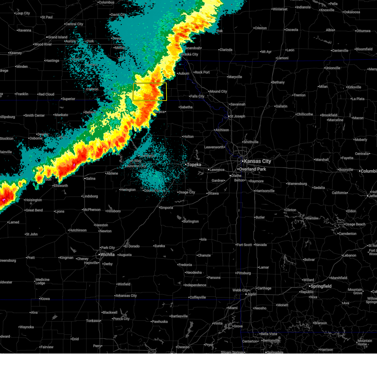
 At 405 pm cdt, a severe thunderstorm capable of producing a tornado was located near elk creek, or 5 miles southeast of tecumseh, moving northeast at 40 mph. another area of rotation capable of producing a tornado was located 3 miles northwest of pawnee city, also moving northeast at 40 mph (radar indicated rotation. trained spotters reported strong rotation with this storm 5 miles south of tecumseh. in addition to any tornado potential, this storm is producing widespread winds of 60 to 80 mph). Hazards include tornado and half dollar size hail. Flying debris will be dangerous to those caught without shelter. mobile homes will be damaged or destroyed. damage to roofs, windows, and vehicles will occur. tree damage is likely. Locations impacted include, tecumseh, table rock, elk creek, and steinauer. At 405 pm cdt, a severe thunderstorm capable of producing a tornado was located near elk creek, or 5 miles southeast of tecumseh, moving northeast at 40 mph. another area of rotation capable of producing a tornado was located 3 miles northwest of pawnee city, also moving northeast at 40 mph (radar indicated rotation. trained spotters reported strong rotation with this storm 5 miles south of tecumseh. in addition to any tornado potential, this storm is producing widespread winds of 60 to 80 mph). Hazards include tornado and half dollar size hail. Flying debris will be dangerous to those caught without shelter. mobile homes will be damaged or destroyed. damage to roofs, windows, and vehicles will occur. tree damage is likely. Locations impacted include, tecumseh, table rock, elk creek, and steinauer.
|
| 5/18/2026 4:02 PM CDT |
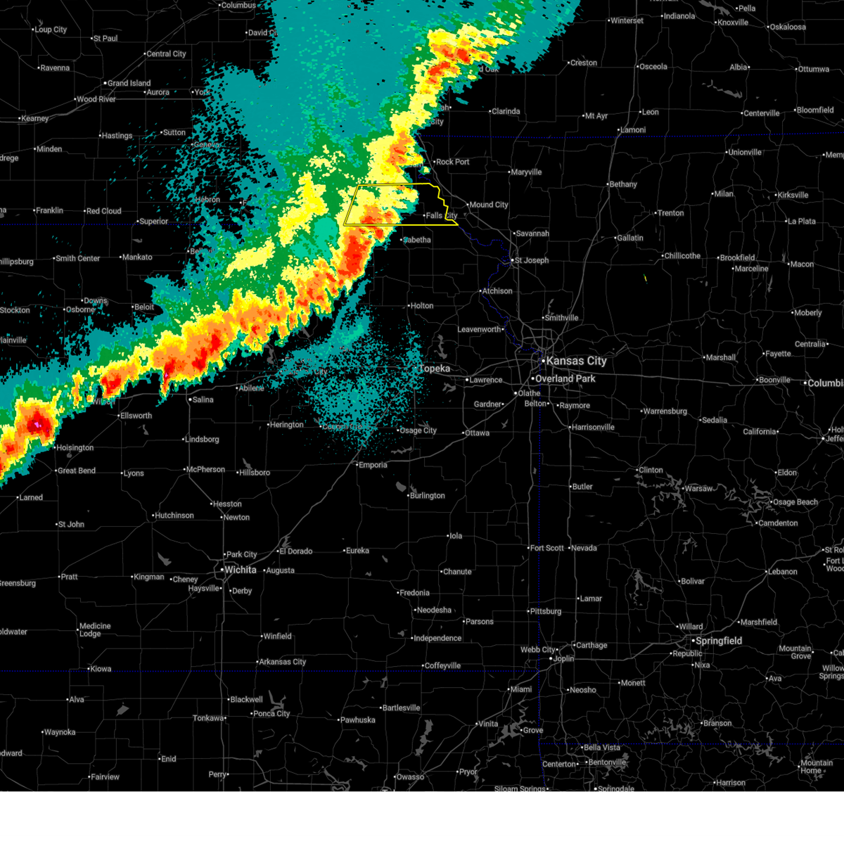
 Svroax the national weather service in omaha has issued a * severe thunderstorm warning for, southwestern fremont county in southwestern iowa, eastern johnson county in southeastern nebraska, nemaha county in southeastern nebraska, otoe county in southeastern nebraska, northwestern richardson county in southeastern nebraska, northeastern pawnee county in southeastern nebraska, * until 445 pm cdt. * at 401 pm cdt, severe thunderstorms were located along a line extending from near syracuse to 3 miles north of table rock, moving east at 35 mph (radar indicated). Hazards include 70 mph wind gusts and half dollar size hail. Hail damage to vehicles is expected. expect considerable tree damage. wind damage is also likely to mobile homes, roofs, and outbuildings. severe thunderstorms will be near, johnson, talmage, dunbar, and lorton around 405 pm cdt. brock around 410 pm cdt. nebraska city, auburn, and julian around 420 pm cdt. other locations in the path of these severe thunderstorms include peru, nemaha and brownville. This includes interstate 29 between mile markers 4 and 17. Svroax the national weather service in omaha has issued a * severe thunderstorm warning for, southwestern fremont county in southwestern iowa, eastern johnson county in southeastern nebraska, nemaha county in southeastern nebraska, otoe county in southeastern nebraska, northwestern richardson county in southeastern nebraska, northeastern pawnee county in southeastern nebraska, * until 445 pm cdt. * at 401 pm cdt, severe thunderstorms were located along a line extending from near syracuse to 3 miles north of table rock, moving east at 35 mph (radar indicated). Hazards include 70 mph wind gusts and half dollar size hail. Hail damage to vehicles is expected. expect considerable tree damage. wind damage is also likely to mobile homes, roofs, and outbuildings. severe thunderstorms will be near, johnson, talmage, dunbar, and lorton around 405 pm cdt. brock around 410 pm cdt. nebraska city, auburn, and julian around 420 pm cdt. other locations in the path of these severe thunderstorms include peru, nemaha and brownville. This includes interstate 29 between mile markers 4 and 17.
|
| 5/18/2026 3:57 PM CDT |
 At 356 pm cdt, a severe thunderstorm was located 3 miles south of sterling, or 9 miles west of tecumseh, moving northeast at 30 mph (public. at 347 pm cdt, an 81 mph wind gust was reported 5 miles north of burchard). Hazards include golf ball size hail and 70 mph wind gusts. People and animals outdoors will be injured. expect hail damage to roofs, siding, windows, and vehicles. expect considerable tree damage. wind damage is also likely to mobile homes, roofs, and outbuildings. this severe storm will be near, sterling around 400 pm cdt. Other locations in the path of this severe thunderstorm include cook. At 356 pm cdt, a severe thunderstorm was located 3 miles south of sterling, or 9 miles west of tecumseh, moving northeast at 30 mph (public. at 347 pm cdt, an 81 mph wind gust was reported 5 miles north of burchard). Hazards include golf ball size hail and 70 mph wind gusts. People and animals outdoors will be injured. expect hail damage to roofs, siding, windows, and vehicles. expect considerable tree damage. wind damage is also likely to mobile homes, roofs, and outbuildings. this severe storm will be near, sterling around 400 pm cdt. Other locations in the path of this severe thunderstorm include cook.
|
| 5/18/2026 3:49 PM CDT |
 At 347 pm cdt, a severe thunderstorm capable of producing a tornado was located 4 miles east of lewiston, or 11 miles southwest of tecumseh, moving east at 50 mph. a second area of rotation capable of producing a tornado, with a spotter reported funnel cloud, was located 5 miles west of burchard, also moving toward the east (radar indicated rotation). Hazards include tornado and golf ball size hail. Flying debris will be dangerous to those caught without shelter. mobile homes will be damaged or destroyed. damage to roofs, windows, and vehicles will occur. tree damage is likely. Locations impacted include, tecumseh, table rock, elk creek, burchard, lewiston, crab orchard, steinauer, and vesta. At 347 pm cdt, a severe thunderstorm capable of producing a tornado was located 4 miles east of lewiston, or 11 miles southwest of tecumseh, moving east at 50 mph. a second area of rotation capable of producing a tornado, with a spotter reported funnel cloud, was located 5 miles west of burchard, also moving toward the east (radar indicated rotation). Hazards include tornado and golf ball size hail. Flying debris will be dangerous to those caught without shelter. mobile homes will be damaged or destroyed. damage to roofs, windows, and vehicles will occur. tree damage is likely. Locations impacted include, tecumseh, table rock, elk creek, burchard, lewiston, crab orchard, steinauer, and vesta.
|
| 5/18/2026 3:43 PM CDT |
 Svroax the national weather service in omaha has issued a * severe thunderstorm warning for, johnson county in southeastern nebraska, southwestern nemaha county in southeastern nebraska, south central otoe county in southeastern nebraska, northern pawnee county in southeastern nebraska, eastern gage county in southeastern nebraska, * until 445 pm cdt. * at 342 pm cdt, a severe thunderstorm was located 3 miles north of filley, or 12 miles northeast of beatrice, moving northeast at 25 mph (radar indicated). Hazards include golf ball size hail and 60 mph wind gusts. People and animals outdoors will be injured. expect hail damage to roofs, siding, windows, and vehicles. expect wind damage to roofs, siding, and trees. this severe thunderstorm will be near, crab orchard around 350 pm cdt. sterling around 400 pm cdt. Other locations in the path of this severe thunderstorm include cook. Svroax the national weather service in omaha has issued a * severe thunderstorm warning for, johnson county in southeastern nebraska, southwestern nemaha county in southeastern nebraska, south central otoe county in southeastern nebraska, northern pawnee county in southeastern nebraska, eastern gage county in southeastern nebraska, * until 445 pm cdt. * at 342 pm cdt, a severe thunderstorm was located 3 miles north of filley, or 12 miles northeast of beatrice, moving northeast at 25 mph (radar indicated). Hazards include golf ball size hail and 60 mph wind gusts. People and animals outdoors will be injured. expect hail damage to roofs, siding, windows, and vehicles. expect wind damage to roofs, siding, and trees. this severe thunderstorm will be near, crab orchard around 350 pm cdt. sterling around 400 pm cdt. Other locations in the path of this severe thunderstorm include cook.
|
| 5/18/2026 3:38 PM CDT |
 Toroax the national weather service in omaha has issued a * tornado warning for, southern johnson county in southeastern nebraska, northern pawnee county in southeastern nebraska, * until 445 pm cdt. * at 337 pm cdt, a severe thunderstorm capable of producing a tornado was located near virginia, or 13 miles east of beatrice, moving northeast at 35 mph. a second area of rotation capable of producing a tornado was located 5 miles east of wymore, also moving northeast at 35 mph (radar indicated rotation. this storm has a history of producing tornadoes). Hazards include tornado and golf ball size hail. Flying debris will be dangerous to those caught without shelter. mobile homes will be damaged or destroyed. damage to roofs, windows, and vehicles will occur. tree damage is likely. this dangerous storm will be near, lewiston around 345 pm cdt. Other locations in the path of this tornadic thunderstorm include tecumseh, steinauer, and burchard. Toroax the national weather service in omaha has issued a * tornado warning for, southern johnson county in southeastern nebraska, northern pawnee county in southeastern nebraska, * until 445 pm cdt. * at 337 pm cdt, a severe thunderstorm capable of producing a tornado was located near virginia, or 13 miles east of beatrice, moving northeast at 35 mph. a second area of rotation capable of producing a tornado was located 5 miles east of wymore, also moving northeast at 35 mph (radar indicated rotation. this storm has a history of producing tornadoes). Hazards include tornado and golf ball size hail. Flying debris will be dangerous to those caught without shelter. mobile homes will be damaged or destroyed. damage to roofs, windows, and vehicles will occur. tree damage is likely. this dangerous storm will be near, lewiston around 345 pm cdt. Other locations in the path of this tornadic thunderstorm include tecumseh, steinauer, and burchard.
|
| 5/17/2026 10:10 PM CDT |
 At 1009 pm cdt, severe thunderstorms were located along a line extending from 6 miles northwest of stella to 4 miles west of sabetha, moving east at 45 mph (radar indicated). Hazards include 60 mph wind gusts. Expect damage to roofs, siding, and trees. Locations impacted include, falls city, pawnee city, humboldt, table rock, rulo, verdon, stella, shubert, du bois, dawson, salem, preston, barada, sac and fox nation reservation, indian cave state park, the highway 75 and 8 junction, kirkmans cove recreation area, camp cornhusker, and iowa reservation of kansas and nebraska. At 1009 pm cdt, severe thunderstorms were located along a line extending from 6 miles northwest of stella to 4 miles west of sabetha, moving east at 45 mph (radar indicated). Hazards include 60 mph wind gusts. Expect damage to roofs, siding, and trees. Locations impacted include, falls city, pawnee city, humboldt, table rock, rulo, verdon, stella, shubert, du bois, dawson, salem, preston, barada, sac and fox nation reservation, indian cave state park, the highway 75 and 8 junction, kirkmans cove recreation area, camp cornhusker, and iowa reservation of kansas and nebraska.
|
| 5/17/2026 9:44 PM CDT |
 Svroax the national weather service in omaha has issued a * severe thunderstorm warning for, southeastern nemaha county in southeastern nebraska, richardson county in southeastern nebraska, pawnee county in southeastern nebraska, * until 1045 pm cdt. * at 942 pm cdt, severe thunderstorms were located along a line extending from 7 miles west of elk creek to 2 miles north of axtell, moving east at 45 mph (at 940 pm, a public mesonet station 4 miles north of burchard reported 71 mph winds). Hazards include 70 mph wind gusts and quarter size hail. Hail damage to vehicles is expected. expect considerable tree damage. wind damage is also likely to mobile homes, roofs, and outbuildings. severe thunderstorms will be near, pawnee city and table rock around 945 pm cdt. du bois around 950 pm cdt. humboldt around 955 pm cdt. Other locations in the path of these severe thunderstorms include dawson, stella, salem, verdon, shubert, falls city and rulo. Svroax the national weather service in omaha has issued a * severe thunderstorm warning for, southeastern nemaha county in southeastern nebraska, richardson county in southeastern nebraska, pawnee county in southeastern nebraska, * until 1045 pm cdt. * at 942 pm cdt, severe thunderstorms were located along a line extending from 7 miles west of elk creek to 2 miles north of axtell, moving east at 45 mph (at 940 pm, a public mesonet station 4 miles north of burchard reported 71 mph winds). Hazards include 70 mph wind gusts and quarter size hail. Hail damage to vehicles is expected. expect considerable tree damage. wind damage is also likely to mobile homes, roofs, and outbuildings. severe thunderstorms will be near, pawnee city and table rock around 945 pm cdt. du bois around 950 pm cdt. humboldt around 955 pm cdt. Other locations in the path of these severe thunderstorms include dawson, stella, salem, verdon, shubert, falls city and rulo.
|
| 5/17/2026 9:39 PM CDT |
 At 937 pm cdt, severe thunderstorms were located along a line extending from lewiston to near beattie, moving east at 45 mph (at 930 pm, a public mesonet station reported a 63 mph wind gust in barneston). Hazards include 70 mph wind gusts and quarter size hail. Hail damage to vehicles is expected. expect considerable tree damage. wind damage is also likely to mobile homes, roofs, and outbuildings. these severe storms will be near, summerfield and burchard around 940 pm cdt. Other locations in the path of these severe thunderstorms include pawnee city, table rock and du bois. At 937 pm cdt, severe thunderstorms were located along a line extending from lewiston to near beattie, moving east at 45 mph (at 930 pm, a public mesonet station reported a 63 mph wind gust in barneston). Hazards include 70 mph wind gusts and quarter size hail. Hail damage to vehicles is expected. expect considerable tree damage. wind damage is also likely to mobile homes, roofs, and outbuildings. these severe storms will be near, summerfield and burchard around 940 pm cdt. Other locations in the path of these severe thunderstorms include pawnee city, table rock and du bois.
|
| 5/17/2026 9:21 PM CDT |
 Svroax the national weather service in omaha has issued a * severe thunderstorm warning for, pawnee county in southeastern nebraska, southeastern gage county in southeastern nebraska, * until 1000 pm cdt. * at 920 pm cdt, severe thunderstorms were located along a line extending from 3 miles east of holmesville to 2 miles east of marysville, moving east at 45 mph (radar indicated). Hazards include 70 mph wind gusts and quarter size hail. Hail damage to vehicles is expected. expect considerable tree damage. wind damage is also likely to mobile homes, roofs, and outbuildings. severe thunderstorms will be near, barneston, liberty, and virginia around 925 pm cdt. lewiston around 930 pm cdt. summerfield and burchard around 935 pm cdt. Other locations in the path of these severe thunderstorms include pawnee city and table rock. Svroax the national weather service in omaha has issued a * severe thunderstorm warning for, pawnee county in southeastern nebraska, southeastern gage county in southeastern nebraska, * until 1000 pm cdt. * at 920 pm cdt, severe thunderstorms were located along a line extending from 3 miles east of holmesville to 2 miles east of marysville, moving east at 45 mph (radar indicated). Hazards include 70 mph wind gusts and quarter size hail. Hail damage to vehicles is expected. expect considerable tree damage. wind damage is also likely to mobile homes, roofs, and outbuildings. severe thunderstorms will be near, barneston, liberty, and virginia around 925 pm cdt. lewiston around 930 pm cdt. summerfield and burchard around 935 pm cdt. Other locations in the path of these severe thunderstorms include pawnee city and table rock.
|
| 5/17/2026 9:10 PM CDT |
 At 909 pm cdt, severe thunderstorms were located along a line extending from 4 miles southeast of cook to 3 miles northeast of burchard to 3 miles southeast of odell, moving east at 25 mph (radar indicated). Hazards include 60 mph wind gusts and quarter size hail. Hail damage to vehicles is expected. expect wind damage to roofs, siding, and trees. Locations impacted include, barneston, elk creek, burchard, liberty, pawnee city, table rock and summerfield. At 909 pm cdt, severe thunderstorms were located along a line extending from 4 miles southeast of cook to 3 miles northeast of burchard to 3 miles southeast of odell, moving east at 25 mph (radar indicated). Hazards include 60 mph wind gusts and quarter size hail. Hail damage to vehicles is expected. expect wind damage to roofs, siding, and trees. Locations impacted include, barneston, elk creek, burchard, liberty, pawnee city, table rock and summerfield.
|
| 5/17/2026 8:43 PM CDT |
 Svroax the national weather service in omaha has issued a * severe thunderstorm warning for, johnson county in southeastern nebraska, southwestern nemaha county in southeastern nebraska, southeastern jefferson county in southeastern nebraska, pawnee county in southeastern nebraska, gage county in southeastern nebraska, * until 930 pm cdt. * at 842 pm cdt, severe thunderstorms were located along a line extending from 2 miles southeast of adams to 4 miles southwest of virginia to 4 miles south of odell, moving east at 20 mph (radar indicated). Hazards include 60 mph wind gusts and quarter size hail. Hail damage to vehicles is expected. expect wind damage to roofs, siding, and trees. severe thunderstorms will be near, barneston, lewiston, virginia, and crab orchard around 850 pm cdt. liberty around 855 pm cdt. Other locations in the path of these severe thunderstorms include burchard. Svroax the national weather service in omaha has issued a * severe thunderstorm warning for, johnson county in southeastern nebraska, southwestern nemaha county in southeastern nebraska, southeastern jefferson county in southeastern nebraska, pawnee county in southeastern nebraska, gage county in southeastern nebraska, * until 930 pm cdt. * at 842 pm cdt, severe thunderstorms were located along a line extending from 2 miles southeast of adams to 4 miles southwest of virginia to 4 miles south of odell, moving east at 20 mph (radar indicated). Hazards include 60 mph wind gusts and quarter size hail. Hail damage to vehicles is expected. expect wind damage to roofs, siding, and trees. severe thunderstorms will be near, barneston, lewiston, virginia, and crab orchard around 850 pm cdt. liberty around 855 pm cdt. Other locations in the path of these severe thunderstorms include burchard.
|
| 5/17/2026 1:15 AM CDT |
 At 115 am cdt, severe thunderstorms were located along a line extending from near auburn to 2 miles northwest of stella to 2 miles southwest of salem, moving east at 50 mph (radar indicated). Hazards include 60 mph wind gusts. Expect damage to roofs, siding, and trees. these severe storms will be near, falls city, verdon, shubert, nemaha, brownville, and salem around 120 am cdt. Other locations in the path of these severe thunderstorms include rulo. At 115 am cdt, severe thunderstorms were located along a line extending from near auburn to 2 miles northwest of stella to 2 miles southwest of salem, moving east at 50 mph (radar indicated). Hazards include 60 mph wind gusts. Expect damage to roofs, siding, and trees. these severe storms will be near, falls city, verdon, shubert, nemaha, brownville, and salem around 120 am cdt. Other locations in the path of these severe thunderstorms include rulo.
|
| 5/17/2026 1:05 AM CDT |
 At 105 am cdt, severe thunderstorms were located along a line extending from 2 miles southwest of johnson to 6 miles north of humboldt to 5 miles northeast of bern, moving east at 35 mph (radar indicated). Hazards include 60 mph wind gusts. Expect damage to roofs, siding, and trees. these severe storms will be near, johnson and dawson around 110 am cdt. Other locations in the path of these severe thunderstorms include auburn, stella, salem, verdon, shubert, falls city, nemaha, brownville and rulo. At 105 am cdt, severe thunderstorms were located along a line extending from 2 miles southwest of johnson to 6 miles north of humboldt to 5 miles northeast of bern, moving east at 35 mph (radar indicated). Hazards include 60 mph wind gusts. Expect damage to roofs, siding, and trees. these severe storms will be near, johnson and dawson around 110 am cdt. Other locations in the path of these severe thunderstorms include auburn, stella, salem, verdon, shubert, falls city, nemaha, brownville and rulo.
|
| 5/17/2026 12:53 AM CDT |
 At 1253 am cdt, severe thunderstorms were located along a line extending from 2 miles northeast of tecumseh to 4 miles southeast of elk creek to du bois, moving east at 35 mph (weather instrument measurement). Hazards include 60 mph wind gusts and penny size hail. Expect damage to roofs, siding, and trees. these severe storms will be near, humboldt and johnson around 100 am cdt. Other locations in the path of these severe thunderstorms include dawson, auburn, stella, verdon, salem, shubert, falls city, nemaha, brownville and rulo. At 1253 am cdt, severe thunderstorms were located along a line extending from 2 miles northeast of tecumseh to 4 miles southeast of elk creek to du bois, moving east at 35 mph (weather instrument measurement). Hazards include 60 mph wind gusts and penny size hail. Expect damage to roofs, siding, and trees. these severe storms will be near, humboldt and johnson around 100 am cdt. Other locations in the path of these severe thunderstorms include dawson, auburn, stella, verdon, salem, shubert, falls city, nemaha, brownville and rulo.
|
| 5/17/2026 12:41 AM CDT |
 Svroax the national weather service in omaha has issued a * severe thunderstorm warning for, johnson county in southeastern nebraska, nemaha county in southeastern nebraska, richardson county in southeastern nebraska, pawnee county in southeastern nebraska, eastern gage county in southeastern nebraska, * until 200 am cdt. * at 1241 am cdt, severe thunderstorms were located along a line extending from 3 miles west of tecumseh to 4 miles southwest of elk creek to 6 miles south of pawnee city, moving east at 35 mph (radar indicated). Hazards include 60 mph wind gusts and penny size hail. Expect damage to roofs, siding, and trees. severe thunderstorms will be near, tecumseh, pawnee city, table rock, du bois, and elk creek around 1245 am cdt. humboldt around 1255 am cdt. johnson around 100 am cdt. Other locations in the path of these severe thunderstorms include dawson, auburn, stella, verdon, salem, shubert, falls city, nemaha and brownville. Svroax the national weather service in omaha has issued a * severe thunderstorm warning for, johnson county in southeastern nebraska, nemaha county in southeastern nebraska, richardson county in southeastern nebraska, pawnee county in southeastern nebraska, eastern gage county in southeastern nebraska, * until 200 am cdt. * at 1241 am cdt, severe thunderstorms were located along a line extending from 3 miles west of tecumseh to 4 miles southwest of elk creek to 6 miles south of pawnee city, moving east at 35 mph (radar indicated). Hazards include 60 mph wind gusts and penny size hail. Expect damage to roofs, siding, and trees. severe thunderstorms will be near, tecumseh, pawnee city, table rock, du bois, and elk creek around 1245 am cdt. humboldt around 1255 am cdt. johnson around 100 am cdt. Other locations in the path of these severe thunderstorms include dawson, auburn, stella, verdon, salem, shubert, falls city, nemaha and brownville.
|
| 5/17/2026 12:33 AM CDT |
 At 1233 am cdt, severe thunderstorms were located along a line extending from 5 miles northeast of lewiston to 2 miles east of burchard to 2 miles east of summerfield, moving east at 55 mph (radar indicated). Hazards include 70 mph wind gusts and penny size hail. Expect considerable tree damage. damage is likely to mobile homes, roofs, and outbuildings. These severe storms will be near, pawnee city, table rock, and elk creek around 1240 am cdt. At 1233 am cdt, severe thunderstorms were located along a line extending from 5 miles northeast of lewiston to 2 miles east of burchard to 2 miles east of summerfield, moving east at 55 mph (radar indicated). Hazards include 70 mph wind gusts and penny size hail. Expect considerable tree damage. damage is likely to mobile homes, roofs, and outbuildings. These severe storms will be near, pawnee city, table rock, and elk creek around 1240 am cdt.
|
| 5/17/2026 12:32 AM CDT |
 At 1232 am cdt, severe thunderstorms were located along a line extending from 5 miles east of crab orchard to 2 miles east of summerfield, moving east at 50 mph (radar indicated). Hazards include 70 mph wind gusts and penny size hail. Expect considerable tree damage. damage is likely to mobile homes, roofs, and outbuildings. Locations impacted include, pawnee city, table rock and elk creek. At 1232 am cdt, severe thunderstorms were located along a line extending from 5 miles east of crab orchard to 2 miles east of summerfield, moving east at 50 mph (radar indicated). Hazards include 70 mph wind gusts and penny size hail. Expect considerable tree damage. damage is likely to mobile homes, roofs, and outbuildings. Locations impacted include, pawnee city, table rock and elk creek.
|
| 5/17/2026 12:24 AM CDT |
 At 1224 am cdt, severe thunderstorms were located along a line extending from 3 miles southwest of crab orchard to 3 miles north of liberty to 6 miles southeast of barneston, moving east at 50 mph (radar indicated). Hazards include 70 mph wind gusts and penny size hail. Expect considerable tree damage. damage is likely to mobile homes, roofs, and outbuildings. these severe storms will be near, summerfield, burchard, and lewiston around 1230 am cdt. Other locations in the path of these severe thunderstorms include pawnee city, table rock and elk creek. At 1224 am cdt, severe thunderstorms were located along a line extending from 3 miles southwest of crab orchard to 3 miles north of liberty to 6 miles southeast of barneston, moving east at 50 mph (radar indicated). Hazards include 70 mph wind gusts and penny size hail. Expect considerable tree damage. damage is likely to mobile homes, roofs, and outbuildings. these severe storms will be near, summerfield, burchard, and lewiston around 1230 am cdt. Other locations in the path of these severe thunderstorms include pawnee city, table rock and elk creek.
|
| 5/17/2026 12:10 AM CDT |
 At 1209 am cdt, severe thunderstorms were located along a line extending from 4 miles southwest of beatrice to 2 miles west of wymore to 6 miles northwest of oketo, moving east at 55 mph. these are destructive storms (radar indicated). Hazards include 80 mph wind gusts and penny size hail. Flying debris will be dangerous to those caught without shelter. mobile homes will be heavily damaged. expect considerable damage to roofs, windows, and vehicles. extensive tree damage and power outages are likely. these severe storms will be near, beatrice, wymore, blue springs, barneston, and holmesville around 1215 am cdt. Other locations in the path of these severe thunderstorms include filley, liberty, virginia, burchard, lewiston, pawnee city, table rock and elk creek. At 1209 am cdt, severe thunderstorms were located along a line extending from 4 miles southwest of beatrice to 2 miles west of wymore to 6 miles northwest of oketo, moving east at 55 mph. these are destructive storms (radar indicated). Hazards include 80 mph wind gusts and penny size hail. Flying debris will be dangerous to those caught without shelter. mobile homes will be heavily damaged. expect considerable damage to roofs, windows, and vehicles. extensive tree damage and power outages are likely. these severe storms will be near, beatrice, wymore, blue springs, barneston, and holmesville around 1215 am cdt. Other locations in the path of these severe thunderstorms include filley, liberty, virginia, burchard, lewiston, pawnee city, table rock and elk creek.
|
| 5/16/2026 11:59 PM CDT |
 Svroax the national weather service in omaha has issued a * severe thunderstorm warning for, southern johnson county in southeastern nebraska, southeastern jefferson county in southeastern nebraska, pawnee county in southeastern nebraska, southern gage county in southeastern nebraska, * until 1245 am cdt. * at 1158 pm cdt, a severe thunderstorm was located 4 miles east of steele city, or 14 miles southeast of fairbury, moving east at 50 mph. this is a destructive storm for the warned area (weather instrument measurement). Hazards include 80 mph wind gusts and quarter size hail. Flying debris will be dangerous to those caught without shelter. mobile homes will be heavily damaged. expect considerable damage to roofs, windows, and vehicles. extensive tree damage and power outages are likely. this severe thunderstorm will be near, odell around 1205 am cdt. Other locations in the path of this severe thunderstorm include barneston, liberty and summerfield. Svroax the national weather service in omaha has issued a * severe thunderstorm warning for, southern johnson county in southeastern nebraska, southeastern jefferson county in southeastern nebraska, pawnee county in southeastern nebraska, southern gage county in southeastern nebraska, * until 1245 am cdt. * at 1158 pm cdt, a severe thunderstorm was located 4 miles east of steele city, or 14 miles southeast of fairbury, moving east at 50 mph. this is a destructive storm for the warned area (weather instrument measurement). Hazards include 80 mph wind gusts and quarter size hail. Flying debris will be dangerous to those caught without shelter. mobile homes will be heavily damaged. expect considerable damage to roofs, windows, and vehicles. extensive tree damage and power outages are likely. this severe thunderstorm will be near, odell around 1205 am cdt. Other locations in the path of this severe thunderstorm include barneston, liberty and summerfield.
|
| 5/16/2026 11:46 PM CDT |
 Svroax the national weather service in omaha has issued a * severe thunderstorm warning for, southern johnson county in southeastern nebraska, southeastern jefferson county in southeastern nebraska, pawnee county in southeastern nebraska, southern gage county in southeastern nebraska, * until 1245 am cdt. * at 1146 pm cdt, a severe thunderstorm was located 3 miles southwest of steele city, or 10 miles southeast of fairbury, moving east at 60 mph (radar indicated). Hazards include 70 mph wind gusts and quarter size hail. Hail damage to vehicles is expected. expect considerable tree damage. wind damage is also likely to mobile homes, roofs, and outbuildings. this severe thunderstorm will be near, steele city around 1150 pm cdt. odell around 1200 am cdt. Other locations in the path of this severe thunderstorm include barneston, liberty, summerfield and pawnee city. Svroax the national weather service in omaha has issued a * severe thunderstorm warning for, southern johnson county in southeastern nebraska, southeastern jefferson county in southeastern nebraska, pawnee county in southeastern nebraska, southern gage county in southeastern nebraska, * until 1245 am cdt. * at 1146 pm cdt, a severe thunderstorm was located 3 miles southwest of steele city, or 10 miles southeast of fairbury, moving east at 60 mph (radar indicated). Hazards include 70 mph wind gusts and quarter size hail. Hail damage to vehicles is expected. expect considerable tree damage. wind damage is also likely to mobile homes, roofs, and outbuildings. this severe thunderstorm will be near, steele city around 1150 pm cdt. odell around 1200 am cdt. Other locations in the path of this severe thunderstorm include barneston, liberty, summerfield and pawnee city.
|
| 4/25/2026 9:57 PM CDT |
 At 956 pm cdt, a severe thunderstorm was located 6 miles northwest of humboldt, or 11 miles northeast of pawnee city, moving east at 25 mph (trained weather spotters. at 955pm, golf ball sized hail was reported 4 miles south of elk creek). Hazards include golf ball size hail. People and animals outdoors will be injured. expect damage to roofs, siding, windows, and vehicles. This severe thunderstorm will remain over mainly rural areas of southeastern johnson, southwestern nemaha, northwestern richardson and northeastern pawnee counties, including the following locations, the highway 62 and 105 junction and kirkmans cove recreation area. At 956 pm cdt, a severe thunderstorm was located 6 miles northwest of humboldt, or 11 miles northeast of pawnee city, moving east at 25 mph (trained weather spotters. at 955pm, golf ball sized hail was reported 4 miles south of elk creek). Hazards include golf ball size hail. People and animals outdoors will be injured. expect damage to roofs, siding, windows, and vehicles. This severe thunderstorm will remain over mainly rural areas of southeastern johnson, southwestern nemaha, northwestern richardson and northeastern pawnee counties, including the following locations, the highway 62 and 105 junction and kirkmans cove recreation area.
|
| 4/25/2026 9:41 PM CDT |
 Svroax the national weather service in omaha has issued a * severe thunderstorm warning for, southeastern johnson county in southeastern nebraska, southwestern nemaha county in southeastern nebraska, northwestern richardson county in southeastern nebraska, northeastern pawnee county in southeastern nebraska, * until 1030 pm cdt. * at 940 pm cdt, a severe thunderstorm was located 4 miles northwest of table rock, or 7 miles north of pawnee city, moving east at 25 mph (radar indicated). Hazards include quarter size hail. Damage to vehicles is expected. This severe thunderstorm will be near, table rock around 945 pm cdt. Svroax the national weather service in omaha has issued a * severe thunderstorm warning for, southeastern johnson county in southeastern nebraska, southwestern nemaha county in southeastern nebraska, northwestern richardson county in southeastern nebraska, northeastern pawnee county in southeastern nebraska, * until 1030 pm cdt. * at 940 pm cdt, a severe thunderstorm was located 4 miles northwest of table rock, or 7 miles north of pawnee city, moving east at 25 mph (radar indicated). Hazards include quarter size hail. Damage to vehicles is expected. This severe thunderstorm will be near, table rock around 945 pm cdt.
|
| 4/23/2026 5:51 PM CDT |
 Svroax the national weather service in omaha has issued a * severe thunderstorm warning for, nemaha county in southeastern nebraska, richardson county in southeastern nebraska, eastern pawnee county in southeastern nebraska, * until 700 pm cdt. * at 551 pm cdt, severe thunderstorms were located along a line extending from near rock port to 3 miles north of verdon to 4 miles east of du bois, moving east at 25 mph (radar indicated). Hazards include 60 mph wind gusts and quarter size hail. Hail damage to vehicles is expected. expect wind damage to roofs, siding, and trees. severe thunderstorms will be near, verdon, shubert, dawson, and salem around 555 pm cdt. Other locations in the path of these severe thunderstorms include falls city and rulo. Svroax the national weather service in omaha has issued a * severe thunderstorm warning for, nemaha county in southeastern nebraska, richardson county in southeastern nebraska, eastern pawnee county in southeastern nebraska, * until 700 pm cdt. * at 551 pm cdt, severe thunderstorms were located along a line extending from near rock port to 3 miles north of verdon to 4 miles east of du bois, moving east at 25 mph (radar indicated). Hazards include 60 mph wind gusts and quarter size hail. Hail damage to vehicles is expected. expect wind damage to roofs, siding, and trees. severe thunderstorms will be near, verdon, shubert, dawson, and salem around 555 pm cdt. Other locations in the path of these severe thunderstorms include falls city and rulo.
|
| 4/23/2026 5:48 PM CDT |
 At 548 pm cdt, severe thunderstorms were located along a line extending from 6 miles southeast of riverton to near brownville to 5 miles northeast of du bois, moving east at 30 mph (radar indicated). Hazards include 60 mph wind gusts and quarter size hail. Hail damage to vehicles is expected. expect wind damage to roofs, siding, and trees. Locations impacted include, auburn, pawnee city, humboldt, peru, table rock, verdon, stella, shubert, nemaha, du bois, dawson, brownville, salem, duck creek recreation area, brownville state recreation area, howe, the highway 75 and 8 junction, kirkmans cove recreation area, camp cornhusker, and the highway 62 and 105 junction. At 548 pm cdt, severe thunderstorms were located along a line extending from 6 miles southeast of riverton to near brownville to 5 miles northeast of du bois, moving east at 30 mph (radar indicated). Hazards include 60 mph wind gusts and quarter size hail. Hail damage to vehicles is expected. expect wind damage to roofs, siding, and trees. Locations impacted include, auburn, pawnee city, humboldt, peru, table rock, verdon, stella, shubert, nemaha, du bois, dawson, brownville, salem, duck creek recreation area, brownville state recreation area, howe, the highway 75 and 8 junction, kirkmans cove recreation area, camp cornhusker, and the highway 62 and 105 junction.
|
| 4/23/2026 5:38 PM CDT |
 At 537 pm cdt, severe thunderstorms were located along a line extending from 4 miles east of hamburg to 4 miles west of nemaha to near du bois, moving east at 30 mph (public report of quarter sized hail in humboldt at 5:35 pm). Hazards include 60 mph wind gusts and quarter size hail. Hail damage to vehicles is expected. expect wind damage to roofs, siding, and trees. Locations impacted include, humboldt, stella, nemaha, dawson, brownville, shubert, verdon and salem. At 537 pm cdt, severe thunderstorms were located along a line extending from 4 miles east of hamburg to 4 miles west of nemaha to near du bois, moving east at 30 mph (public report of quarter sized hail in humboldt at 5:35 pm). Hazards include 60 mph wind gusts and quarter size hail. Hail damage to vehicles is expected. expect wind damage to roofs, siding, and trees. Locations impacted include, humboldt, stella, nemaha, dawson, brownville, shubert, verdon and salem.
|
| 4/23/2026 5:25 PM CDT |
 At 525 pm cdt, a severe thunderstorm was located 4 miles southeast of elk creek, or 10 miles northeast of pawnee city, moving east at 30 mph (trained weather spotter report of quarter sized hail near elk creek at 5:14 pm). Hazards include 60 mph wind gusts and quarter size hail. Hail damage to vehicles is expected. expect wind damage to roofs, siding, and trees. Locations impacted include, pawnee city, table rock, elk creek, and steinauer. At 525 pm cdt, a severe thunderstorm was located 4 miles southeast of elk creek, or 10 miles northeast of pawnee city, moving east at 30 mph (trained weather spotter report of quarter sized hail near elk creek at 5:14 pm). Hazards include 60 mph wind gusts and quarter size hail. Hail damage to vehicles is expected. expect wind damage to roofs, siding, and trees. Locations impacted include, pawnee city, table rock, elk creek, and steinauer.
|
| 4/23/2026 5:24 PM CDT |
 At 523 pm cdt, severe thunderstorms were located along a line extending from 3 miles southwest of hamburg to 4 miles southwest of auburn to 5 miles south of pawnee city, moving east at 30 mph (trained weather spotter report of quarter sized hail near elk creek at 5:14 pm). Hazards include 60 mph wind gusts and quarter size hail. Hail damage to vehicles is expected. expect wind damage to roofs, siding, and trees. these severe storms will be near, humboldt, peru, du bois, and brownville around 530 pm cdt. stella and nemaha around 535 pm cdt. Other locations in the path of these severe thunderstorms include dawson, shubert, verdon and salem. At 523 pm cdt, severe thunderstorms were located along a line extending from 3 miles southwest of hamburg to 4 miles southwest of auburn to 5 miles south of pawnee city, moving east at 30 mph (trained weather spotter report of quarter sized hail near elk creek at 5:14 pm). Hazards include 60 mph wind gusts and quarter size hail. Hail damage to vehicles is expected. expect wind damage to roofs, siding, and trees. these severe storms will be near, humboldt, peru, du bois, and brownville around 530 pm cdt. stella and nemaha around 535 pm cdt. Other locations in the path of these severe thunderstorms include dawson, shubert, verdon and salem.
|
| 4/23/2026 5:17 PM CDT |
 At 516 pm cdt, severe thunderstorms were located along a line extending from 6 miles west of hamburg to 6 miles southwest of auburn to 6 miles southwest of pawnee city, moving east at 30 mph (trained weather spotter report of quarter sized hail near elk creek at 5:14 pm). Hazards include 60 mph wind gusts and quarter size hail. Hail damage to vehicles is expected. expect wind damage to roofs, siding, and trees. these severe storms will be near, auburn, pawnee city, humboldt, peru, and table rock around 520 pm cdt. du bois around 525 pm cdt. brownville around 530 pm cdt. Other locations in the path of these severe thunderstorms include stella, nemaha, dawson and shubert. At 516 pm cdt, severe thunderstorms were located along a line extending from 6 miles west of hamburg to 6 miles southwest of auburn to 6 miles southwest of pawnee city, moving east at 30 mph (trained weather spotter report of quarter sized hail near elk creek at 5:14 pm). Hazards include 60 mph wind gusts and quarter size hail. Hail damage to vehicles is expected. expect wind damage to roofs, siding, and trees. these severe storms will be near, auburn, pawnee city, humboldt, peru, and table rock around 520 pm cdt. du bois around 525 pm cdt. brownville around 530 pm cdt. Other locations in the path of these severe thunderstorms include stella, nemaha, dawson and shubert.
|
| 4/23/2026 5:13 PM CDT |
 At 513 pm cdt, a severe thunderstorm was located 4 miles west of table rock, or 6 miles north of pawnee city, moving east at 30 mph (radar indicated). Hazards include 60 mph wind gusts and quarter size hail. Hail damage to vehicles is expected. expect wind damage to roofs, siding, and trees. Locations impacted include, pawnee city, table rock, elk creek, burchard, and steinauer. At 513 pm cdt, a severe thunderstorm was located 4 miles west of table rock, or 6 miles north of pawnee city, moving east at 30 mph (radar indicated). Hazards include 60 mph wind gusts and quarter size hail. Hail damage to vehicles is expected. expect wind damage to roofs, siding, and trees. Locations impacted include, pawnee city, table rock, elk creek, burchard, and steinauer.
|
| 4/23/2026 5:12 PM CDT |
 Svroax the national weather service in omaha has issued a * severe thunderstorm warning for, eastern johnson county in southeastern nebraska, nemaha county in southeastern nebraska, southeastern otoe county in southeastern nebraska, western richardson county in southeastern nebraska, pawnee county in southeastern nebraska, southeastern gage county in southeastern nebraska, * until 600 pm cdt. * at 512 pm cdt, severe thunderstorms were located along a line extending from 5 miles northeast of julian to 6 miles southeast of johnson to 6 miles northeast of summerfield, moving east at 30 mph (radar indicated). Hazards include 60 mph wind gusts and quarter size hail. Hail damage to vehicles is expected. expect wind damage to roofs, siding, and trees. severe thunderstorms will be near, auburn, pawnee city, peru, and table rock around 515 pm cdt. humboldt around 520 pm cdt. du bois around 525 pm cdt. brownville around 530 pm cdt. Other locations in the path of these severe thunderstorms include stella, nemaha, dawson and shubert. Svroax the national weather service in omaha has issued a * severe thunderstorm warning for, eastern johnson county in southeastern nebraska, nemaha county in southeastern nebraska, southeastern otoe county in southeastern nebraska, western richardson county in southeastern nebraska, pawnee county in southeastern nebraska, southeastern gage county in southeastern nebraska, * until 600 pm cdt. * at 512 pm cdt, severe thunderstorms were located along a line extending from 5 miles northeast of julian to 6 miles southeast of johnson to 6 miles northeast of summerfield, moving east at 30 mph (radar indicated). Hazards include 60 mph wind gusts and quarter size hail. Hail damage to vehicles is expected. expect wind damage to roofs, siding, and trees. severe thunderstorms will be near, auburn, pawnee city, peru, and table rock around 515 pm cdt. humboldt around 520 pm cdt. du bois around 525 pm cdt. brownville around 530 pm cdt. Other locations in the path of these severe thunderstorms include stella, nemaha, dawson and shubert.
|
| 4/23/2026 4:58 PM CDT |
 At 457 pm cdt, a severe thunderstorm was located near burchard, or 8 miles west of pawnee city, moving northeast at 30 mph (public report of quarter sized hail in burchard at 4:57 pm). Hazards include 60 mph wind gusts and quarter size hail. Hail damage to vehicles is expected. expect wind damage to roofs, siding, and trees. Locations impacted include, pawnee city, table rock, elk creek, burchard, liberty, lewiston, and steinauer. At 457 pm cdt, a severe thunderstorm was located near burchard, or 8 miles west of pawnee city, moving northeast at 30 mph (public report of quarter sized hail in burchard at 4:57 pm). Hazards include 60 mph wind gusts and quarter size hail. Hail damage to vehicles is expected. expect wind damage to roofs, siding, and trees. Locations impacted include, pawnee city, table rock, elk creek, burchard, liberty, lewiston, and steinauer.
|
| 8/10/2025 2:28 AM CDT |
 the severe thunderstorm warning has been cancelled and is no longer in effect the severe thunderstorm warning has been cancelled and is no longer in effect
|
| 8/10/2025 2:28 AM CDT |
 At 228 am cdt, severe thunderstorms were located along a line extending from 2 miles northwest of sprague to 2 miles east of adams to 3 miles southwest of summerfield, moving east at 50 mph (radar indicated). Hazards include 60 mph wind gusts. Expect damage to roofs, siding, and trees. Locations impacted include, southeastern lincoln, beatrice, tecumseh, pawnee city, crete, hickman, wymore, bennet, firth, adams, palmyra, cortland, sterling, blue springs, cook, table rock, panama, clatonia, roca, and hallam. At 228 am cdt, severe thunderstorms were located along a line extending from 2 miles northwest of sprague to 2 miles east of adams to 3 miles southwest of summerfield, moving east at 50 mph (radar indicated). Hazards include 60 mph wind gusts. Expect damage to roofs, siding, and trees. Locations impacted include, southeastern lincoln, beatrice, tecumseh, pawnee city, crete, hickman, wymore, bennet, firth, adams, palmyra, cortland, sterling, blue springs, cook, table rock, panama, clatonia, roca, and hallam.
|
| 8/10/2025 2:16 AM CDT |
 At 216 am cdt, severe thunderstorms were located along a line extending from 2 miles southeast of crete to 4 miles southwest of adams to 4 miles southeast of oketo, moving east at 50 mph (radar indicated). Hazards include 70 mph wind gusts. Expect considerable tree damage. damage is likely to mobile homes, roofs, and outbuildings. Locations impacted include, lincoln, beatrice, tecumseh, pawnee city, crete, milford, wilber, hickman, wymore, friend, bennet, firth, dorchester, adams, palmyra, de witt, cortland, sterling, beaver crossing, and malcolm. At 216 am cdt, severe thunderstorms were located along a line extending from 2 miles southeast of crete to 4 miles southwest of adams to 4 miles southeast of oketo, moving east at 50 mph (radar indicated). Hazards include 70 mph wind gusts. Expect considerable tree damage. damage is likely to mobile homes, roofs, and outbuildings. Locations impacted include, lincoln, beatrice, tecumseh, pawnee city, crete, milford, wilber, hickman, wymore, friend, bennet, firth, dorchester, adams, palmyra, de witt, cortland, sterling, beaver crossing, and malcolm.
|
| 8/10/2025 2:16 AM CDT |
 the severe thunderstorm warning has been cancelled and is no longer in effect the severe thunderstorm warning has been cancelled and is no longer in effect
|
| 8/10/2025 2:05 AM CDT |
 At 205 am cdt, severe thunderstorms were located along a line extending from 3 miles southwest of crete to 2 miles northeast of pickrell to 3 miles southwest of oketo, moving east at 50 mph (radar indicated). Hazards include 60 mph wind gusts. Expect damage to roofs, siding, and trees. Locations impacted include, crete, adams, cortland, hallam, filley, barneston, liberty, virginia, firth, sprague, lewiston, crab orchard, hickman, sterling, panama, roca, summerfield, burchard, southeastern lincoln, tecumseh, pawnee city, bennet, douglas, palmyra, cook, table rock, elk creek and du bois. At 205 am cdt, severe thunderstorms were located along a line extending from 3 miles southwest of crete to 2 miles northeast of pickrell to 3 miles southwest of oketo, moving east at 50 mph (radar indicated). Hazards include 60 mph wind gusts. Expect damage to roofs, siding, and trees. Locations impacted include, crete, adams, cortland, hallam, filley, barneston, liberty, virginia, firth, sprague, lewiston, crab orchard, hickman, sterling, panama, roca, summerfield, burchard, southeastern lincoln, tecumseh, pawnee city, bennet, douglas, palmyra, cook, table rock, elk creek and du bois.
|
| 8/10/2025 1:43 AM CDT |
 Svroax the national weather service in omaha has issued a * severe thunderstorm warning for, lancaster county in southeastern nebraska, johnson county in southeastern nebraska, southern seward county in southeastern nebraska, jefferson county in southeastern nebraska, southwestern otoe county in southeastern nebraska, saline county in southeastern nebraska, pawnee county in southeastern nebraska, gage county in southeastern nebraska, * until 245 am cdt. * at 142 am cdt, severe thunderstorms were located along a line extending from 3 miles east of milligan to near plymouth to 5 miles southwest of hanover, moving east at 50 mph (radar indicated. this storm has a history of damaging wind gusts of 70 mph or more). Hazards include 70 mph wind gusts. Expect considerable tree damage. damage is likely to mobile homes, roofs, and outbuildings. severe thunderstorms will be near, de witt, plymouth, odell, diller, swanton, and harbine around 145 am cdt. beatrice and wilber around 150 am cdt. wymore, blue springs, clatonia, and pickrell around 155 am cdt. crete, barneston, and holmesville around 200 am cdt. other locations in the path of these severe thunderstorms include cortland, hallam, filley, firth, adams, sprague, liberty, virginia, hickman, summerfield, burchard, lewiston, crab orchard, southeastern lincoln, sterling, panama and roca. This includes interstate 80 in nebraska between mile markers 379 and 403. Svroax the national weather service in omaha has issued a * severe thunderstorm warning for, lancaster county in southeastern nebraska, johnson county in southeastern nebraska, southern seward county in southeastern nebraska, jefferson county in southeastern nebraska, southwestern otoe county in southeastern nebraska, saline county in southeastern nebraska, pawnee county in southeastern nebraska, gage county in southeastern nebraska, * until 245 am cdt. * at 142 am cdt, severe thunderstorms were located along a line extending from 3 miles east of milligan to near plymouth to 5 miles southwest of hanover, moving east at 50 mph (radar indicated. this storm has a history of damaging wind gusts of 70 mph or more). Hazards include 70 mph wind gusts. Expect considerable tree damage. damage is likely to mobile homes, roofs, and outbuildings. severe thunderstorms will be near, de witt, plymouth, odell, diller, swanton, and harbine around 145 am cdt. beatrice and wilber around 150 am cdt. wymore, blue springs, clatonia, and pickrell around 155 am cdt. crete, barneston, and holmesville around 200 am cdt. other locations in the path of these severe thunderstorms include cortland, hallam, filley, firth, adams, sprague, liberty, virginia, hickman, summerfield, burchard, lewiston, crab orchard, southeastern lincoln, sterling, panama and roca. This includes interstate 80 in nebraska between mile markers 379 and 403.
|
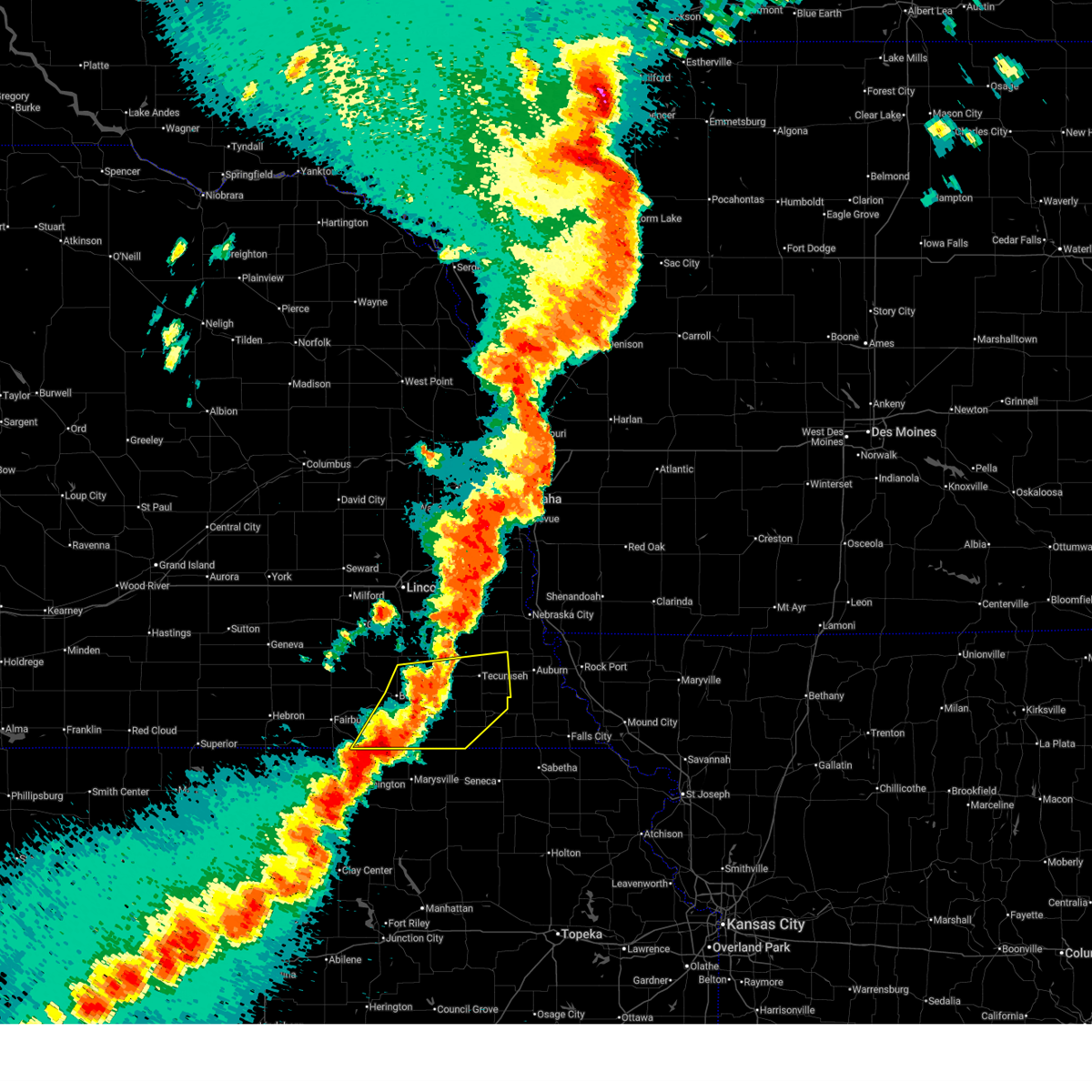
| 5/19/2025 6:03 PM CDT |
 At 603 pm cdt, a severe thunderstorm was located near humboldt, or 9 miles northeast of pawnee city, moving northeast at 20 mph (radar indicated). Hazards include ping pong ball size hail and 60 mph wind gusts. People and animals outdoors will be injured. expect hail damage to roofs, siding, windows, and vehicles. expect wind damage to roofs, siding, and trees. Locations impacted include, humboldt. At 603 pm cdt, a severe thunderstorm was located near humboldt, or 9 miles northeast of pawnee city, moving northeast at 20 mph (radar indicated). Hazards include ping pong ball size hail and 60 mph wind gusts. People and animals outdoors will be injured. expect hail damage to roofs, siding, windows, and vehicles. expect wind damage to roofs, siding, and trees. Locations impacted include, humboldt.
|
| 5/19/2025 5:46 PM CDT |
 Svroax the national weather service in omaha has issued a * severe thunderstorm warning for, south central nemaha county in southeastern nebraska, western richardson county in southeastern nebraska, eastern pawnee county in southeastern nebraska, * until 630 pm cdt. * at 546 pm cdt, a severe thunderstorm was located 3 miles southeast of table rock, or 5 miles east of pawnee city, moving northeast at 20 mph (radar indicated). Hazards include ping pong ball size hail and 60 mph wind gusts. People and animals outdoors will be injured. expect hail damage to roofs, siding, windows, and vehicles. expect wind damage to roofs, siding, and trees. this severe thunderstorm will be near, table rock around 550 pm cdt. Humboldt around 555 pm cdt. Svroax the national weather service in omaha has issued a * severe thunderstorm warning for, south central nemaha county in southeastern nebraska, western richardson county in southeastern nebraska, eastern pawnee county in southeastern nebraska, * until 630 pm cdt. * at 546 pm cdt, a severe thunderstorm was located 3 miles southeast of table rock, or 5 miles east of pawnee city, moving northeast at 20 mph (radar indicated). Hazards include ping pong ball size hail and 60 mph wind gusts. People and animals outdoors will be injured. expect hail damage to roofs, siding, windows, and vehicles. expect wind damage to roofs, siding, and trees. this severe thunderstorm will be near, table rock around 550 pm cdt. Humboldt around 555 pm cdt.
|
| 5/19/2025 5:33 PM CDT |
 At 533 pm cdt, a severe thunderstorm was located 5 miles northeast of table rock, or 11 miles northeast of pawnee city, moving northeast at 30 mph (public). Hazards include ping pong ball size hail and 60 mph wind gusts. People and animals outdoors will be injured. expect hail damage to roofs, siding, windows, and vehicles. expect wind damage to roofs, siding, and trees. Locations impacted include, pawnee city, humboldt, table rock, and kirkmans cove recreation area. At 533 pm cdt, a severe thunderstorm was located 5 miles northeast of table rock, or 11 miles northeast of pawnee city, moving northeast at 30 mph (public). Hazards include ping pong ball size hail and 60 mph wind gusts. People and animals outdoors will be injured. expect hail damage to roofs, siding, windows, and vehicles. expect wind damage to roofs, siding, and trees. Locations impacted include, pawnee city, humboldt, table rock, and kirkmans cove recreation area.
|
| 5/19/2025 5:19 PM CDT |
 At 518 pm cdt, a severe thunderstorm was located near table rock, or 3 miles north of pawnee city, moving northeast at 30 mph (public reported hail up to ping pong ball sized near summerfield). Hazards include ping pong ball size hail and 60 mph wind gusts. People and animals outdoors will be injured. expect hail damage to roofs, siding, windows, and vehicles. expect wind damage to roofs, siding, and trees. Locations impacted include, table rock. At 518 pm cdt, a severe thunderstorm was located near table rock, or 3 miles north of pawnee city, moving northeast at 30 mph (public reported hail up to ping pong ball sized near summerfield). Hazards include ping pong ball size hail and 60 mph wind gusts. People and animals outdoors will be injured. expect hail damage to roofs, siding, windows, and vehicles. expect wind damage to roofs, siding, and trees. Locations impacted include, table rock.
|
| 5/19/2025 5:19 PM CDT |
 the severe thunderstorm warning has been cancelled and is no longer in effect the severe thunderstorm warning has been cancelled and is no longer in effect
|
| 5/19/2025 5:04 PM CDT |
 At 503 pm cdt, a severe thunderstorm was located 5 miles southwest of pawnee city, moving northeast at 30 mph (public reported hail up to ping pong ball sized near summerfield). Hazards include ping pong ball size hail and 60 mph wind gusts. People and animals outdoors will be injured. expect hail damage to roofs, siding, windows, and vehicles. expect wind damage to roofs, siding, and trees. this severe storm will be near, pawnee city around 510 pm cdt. Table rock around 515 pm cdt. At 503 pm cdt, a severe thunderstorm was located 5 miles southwest of pawnee city, moving northeast at 30 mph (public reported hail up to ping pong ball sized near summerfield). Hazards include ping pong ball size hail and 60 mph wind gusts. People and animals outdoors will be injured. expect hail damage to roofs, siding, windows, and vehicles. expect wind damage to roofs, siding, and trees. this severe storm will be near, pawnee city around 510 pm cdt. Table rock around 515 pm cdt.
|
| 5/19/2025 4:56 PM CDT |
 Svroax the national weather service in omaha has issued a * severe thunderstorm warning for, southeastern johnson county in southeastern nebraska, southwestern nemaha county in southeastern nebraska, northwestern richardson county in southeastern nebraska, pawnee county in southeastern nebraska, * until 545 pm cdt. * at 456 pm cdt, a severe thunderstorm was located 3 miles northeast of summerfield, or 9 miles southwest of pawnee city, moving northeast at 30 mph (public reported hail up to ping pong ball sized near summerfield). Hazards include golf ball size hail and 60 mph wind gusts. People and animals outdoors will be injured. expect hail damage to roofs, siding, windows, and vehicles. expect wind damage to roofs, siding, and trees. this severe thunderstorm will be near, pawnee city around 505 pm cdt. Table rock around 515 pm cdt. Svroax the national weather service in omaha has issued a * severe thunderstorm warning for, southeastern johnson county in southeastern nebraska, southwestern nemaha county in southeastern nebraska, northwestern richardson county in southeastern nebraska, pawnee county in southeastern nebraska, * until 545 pm cdt. * at 456 pm cdt, a severe thunderstorm was located 3 miles northeast of summerfield, or 9 miles southwest of pawnee city, moving northeast at 30 mph (public reported hail up to ping pong ball sized near summerfield). Hazards include golf ball size hail and 60 mph wind gusts. People and animals outdoors will be injured. expect hail damage to roofs, siding, windows, and vehicles. expect wind damage to roofs, siding, and trees. this severe thunderstorm will be near, pawnee city around 505 pm cdt. Table rock around 515 pm cdt.
|
| 5/19/2025 4:43 PM CDT |
 At 443 pm cdt, a severe thunderstorm was located over burchard, or 9 miles west of pawnee city, moving northeast at 35 mph (radar indicated). Hazards include golf ball size hail and 60 mph wind gusts. People and animals outdoors will be injured. expect hail damage to roofs, siding, windows, and vehicles. expect wind damage to roofs, siding, and trees. Locations impacted include, elk creek. At 443 pm cdt, a severe thunderstorm was located over burchard, or 9 miles west of pawnee city, moving northeast at 35 mph (radar indicated). Hazards include golf ball size hail and 60 mph wind gusts. People and animals outdoors will be injured. expect hail damage to roofs, siding, windows, and vehicles. expect wind damage to roofs, siding, and trees. Locations impacted include, elk creek.
|
| 5/19/2025 4:31 PM CDT |
 At 431 pm cdt, a severe thunderstorm was located 4 miles east of liberty, or 13 miles west of pawnee city, moving northeast at 35 mph (radar indicated). Hazards include ping pong ball size hail and 60 mph wind gusts. People and animals outdoors will be injured. expect hail damage to roofs, siding, windows, and vehicles. expect wind damage to roofs, siding, and trees. this severe storm will be near, burchard around 435 pm cdt. Other locations in the path of this severe thunderstorm include elk creek. At 431 pm cdt, a severe thunderstorm was located 4 miles east of liberty, or 13 miles west of pawnee city, moving northeast at 35 mph (radar indicated). Hazards include ping pong ball size hail and 60 mph wind gusts. People and animals outdoors will be injured. expect hail damage to roofs, siding, windows, and vehicles. expect wind damage to roofs, siding, and trees. this severe storm will be near, burchard around 435 pm cdt. Other locations in the path of this severe thunderstorm include elk creek.
|
| 5/19/2025 4:22 PM CDT |
 Svroax the national weather service in omaha has issued a * severe thunderstorm warning for, southern johnson county in southeastern nebraska, southwestern nemaha county in southeastern nebraska, northwestern richardson county in southeastern nebraska, pawnee county in southeastern nebraska, southeastern gage county in southeastern nebraska, * until 500 pm cdt. * at 422 pm cdt, a severe thunderstorm was located 5 miles west of summerfield, or 13 miles northeast of marysville, moving northeast at 35 mph (radar indicated). Hazards include 60 mph wind gusts and half dollar size hail. Hail damage to vehicles is expected. expect wind damage to roofs, siding, and trees. This severe thunderstorm will be near, burchard around 435 pm cdt. Svroax the national weather service in omaha has issued a * severe thunderstorm warning for, southern johnson county in southeastern nebraska, southwestern nemaha county in southeastern nebraska, northwestern richardson county in southeastern nebraska, pawnee county in southeastern nebraska, southeastern gage county in southeastern nebraska, * until 500 pm cdt. * at 422 pm cdt, a severe thunderstorm was located 5 miles west of summerfield, or 13 miles northeast of marysville, moving northeast at 35 mph (radar indicated). Hazards include 60 mph wind gusts and half dollar size hail. Hail damage to vehicles is expected. expect wind damage to roofs, siding, and trees. This severe thunderstorm will be near, burchard around 435 pm cdt.
|
| 9/21/2024 7:27 PM CDT |
 Svroax the national weather service in omaha has issued a * severe thunderstorm warning for, southeastern johnson county in southeastern nebraska, nemaha county in southeastern nebraska, northwestern richardson county in southeastern nebraska, northeastern pawnee county in southeastern nebraska, * until 815 pm cdt. * at 727 pm cdt, a severe thunderstorm was located 6 miles northeast of table rock, or 12 miles northeast of pawnee city, moving east at 25 mph (radar indicated). Hazards include 60 mph wind gusts and quarter size hail. Hail damage to vehicles is expected. Expect wind damage to roofs, siding, and trees. Svroax the national weather service in omaha has issued a * severe thunderstorm warning for, southeastern johnson county in southeastern nebraska, nemaha county in southeastern nebraska, northwestern richardson county in southeastern nebraska, northeastern pawnee county in southeastern nebraska, * until 815 pm cdt. * at 727 pm cdt, a severe thunderstorm was located 6 miles northeast of table rock, or 12 miles northeast of pawnee city, moving east at 25 mph (radar indicated). Hazards include 60 mph wind gusts and quarter size hail. Hail damage to vehicles is expected. Expect wind damage to roofs, siding, and trees.
|
| 6/26/2024 2:17 AM CDT |
 the severe thunderstorm warning has been cancelled and is no longer in effect the severe thunderstorm warning has been cancelled and is no longer in effect
|
| 6/26/2024 2:17 AM CDT |
 At 216 am cdt, severe thunderstorms were located along a line extending from 3 miles northeast of dawson to 3 miles south of burchard, moving south at 40 mph (radar indicated). Hazards include 60 mph wind gusts. Expect damage to roofs, siding, and trees. Locations impacted include, falls city, pawnee city, humboldt, table rock, rulo, verdon, summerfield, stella, shubert, du bois, dawson, salem, burchard, steinauer, preston, barada, sac and fox nation reservation, indian cave state park, the highway 75 and 8 junction, and kirkmans cove recreation area. At 216 am cdt, severe thunderstorms were located along a line extending from 3 miles northeast of dawson to 3 miles south of burchard, moving south at 40 mph (radar indicated). Hazards include 60 mph wind gusts. Expect damage to roofs, siding, and trees. Locations impacted include, falls city, pawnee city, humboldt, table rock, rulo, verdon, summerfield, stella, shubert, du bois, dawson, salem, burchard, steinauer, preston, barada, sac and fox nation reservation, indian cave state park, the highway 75 and 8 junction, and kirkmans cove recreation area.
|
| 6/26/2024 2:07 AM CDT |
 At 207 am cdt, severe thunderstorms were located along a line extending from 3 miles northwest of stella to 2 miles north of burchard, moving south at 40 mph (radar indicated). Hazards include 70 mph wind gusts. Expect considerable tree damage. damage is likely to mobile homes, roofs, and outbuildings. Locations impacted include, falls city, auburn, tecumseh, pawnee city, humboldt, peru, johnson, table rock, rulo, verdon, summerfield, stella, shubert, nemaha, du bois, dawson, brownville, salem, elk creek, and burchard. At 207 am cdt, severe thunderstorms were located along a line extending from 3 miles northwest of stella to 2 miles north of burchard, moving south at 40 mph (radar indicated). Hazards include 70 mph wind gusts. Expect considerable tree damage. damage is likely to mobile homes, roofs, and outbuildings. Locations impacted include, falls city, auburn, tecumseh, pawnee city, humboldt, peru, johnson, table rock, rulo, verdon, summerfield, stella, shubert, nemaha, du bois, dawson, brownville, salem, elk creek, and burchard.
|
| 6/26/2024 1:58 AM CDT |
 the severe thunderstorm warning has been cancelled and is no longer in effect the severe thunderstorm warning has been cancelled and is no longer in effect
|
| 6/26/2024 1:58 AM CDT |
 At 158 am cdt, severe thunderstorms were located along a line extending from 4 miles south of auburn to near lewiston, moving south at 40 mph (radar indicated). Hazards include 70 mph wind gusts. Expect considerable tree damage. damage is likely to mobile homes, roofs, and outbuildings. Locations impacted include, falls city, auburn, tecumseh, pawnee city, humboldt, peru, sterling, johnson, cook, table rock, rulo, verdon, summerfield, stella, shubert, nemaha, du bois, dawson, brownville, and salem. At 158 am cdt, severe thunderstorms were located along a line extending from 4 miles south of auburn to near lewiston, moving south at 40 mph (radar indicated). Hazards include 70 mph wind gusts. Expect considerable tree damage. damage is likely to mobile homes, roofs, and outbuildings. Locations impacted include, falls city, auburn, tecumseh, pawnee city, humboldt, peru, sterling, johnson, cook, table rock, rulo, verdon, summerfield, stella, shubert, nemaha, du bois, dawson, brownville, and salem.
|
| 6/26/2024 1:31 AM CDT |
 Svroax the national weather service in omaha has issued a * severe thunderstorm warning for, johnson county in southeastern nebraska, nemaha county in southeastern nebraska, southern otoe county in southeastern nebraska, richardson county in southeastern nebraska, pawnee county in southeastern nebraska, * until 230 am cdt. * at 131 am cdt, severe thunderstorms were located along a line extending from 3 miles northeast of talmage to near adams, moving south at 40 mph (radar indicated). Hazards include 60 mph wind gusts. expect damage to roofs, siding, and trees Svroax the national weather service in omaha has issued a * severe thunderstorm warning for, johnson county in southeastern nebraska, nemaha county in southeastern nebraska, southern otoe county in southeastern nebraska, richardson county in southeastern nebraska, pawnee county in southeastern nebraska, * until 230 am cdt. * at 131 am cdt, severe thunderstorms were located along a line extending from 3 miles northeast of talmage to near adams, moving south at 40 mph (radar indicated). Hazards include 60 mph wind gusts. expect damage to roofs, siding, and trees
|
| 6/15/2024 7:36 PM CDT |
 At 735 pm cdt, severe thunderstorms were located along a line extending from 3 miles southeast of nebraska city to 4 miles east of verdon, moving east at 45 mph (radar indicated). Hazards include 60 mph wind gusts. Expect damage to roofs, siding, and trees. locations impacted include, falls city, auburn, humboldt, peru, johnson, table rock, talmage, verdon, stella, shubert, nemaha, du bois, dawson, brownville, salem, brock, julian, preston, barada, and sac and fox nation reservation. People attending village of johnson should seek safe shelter immediately!. At 735 pm cdt, severe thunderstorms were located along a line extending from 3 miles southeast of nebraska city to 4 miles east of verdon, moving east at 45 mph (radar indicated). Hazards include 60 mph wind gusts. Expect damage to roofs, siding, and trees. locations impacted include, falls city, auburn, humboldt, peru, johnson, table rock, talmage, verdon, stella, shubert, nemaha, du bois, dawson, brownville, salem, brock, julian, preston, barada, and sac and fox nation reservation. People attending village of johnson should seek safe shelter immediately!.
|
| 6/15/2024 7:04 PM CDT |
 Svroax the national weather service in omaha has issued a * severe thunderstorm warning for, eastern johnson county in southeastern nebraska, nemaha county in southeastern nebraska, southeastern otoe county in southeastern nebraska, richardson county in southeastern nebraska, eastern pawnee county in southeastern nebraska, * until 745 pm cdt. * at 704 pm cdt, severe thunderstorms were located along a line extending from 2 miles west of cook to 2 miles northeast of du bois, moving east at 45 mph (radar indicated). Hazards include 60 mph wind gusts. expect damage to roofs, siding, and trees Svroax the national weather service in omaha has issued a * severe thunderstorm warning for, eastern johnson county in southeastern nebraska, nemaha county in southeastern nebraska, southeastern otoe county in southeastern nebraska, richardson county in southeastern nebraska, eastern pawnee county in southeastern nebraska, * until 745 pm cdt. * at 704 pm cdt, severe thunderstorms were located along a line extending from 2 miles west of cook to 2 miles northeast of du bois, moving east at 45 mph (radar indicated). Hazards include 60 mph wind gusts. expect damage to roofs, siding, and trees
|
| 5/24/2024 2:58 AM CDT |
 At 258 am cdt, severe thunderstorms were located along a line extending from 4 miles northeast of dunbar to near johnson to 4 miles east of summerfield, moving east at 60 mph (radar indicated). Hazards include 70 mph wind gusts and quarter size hail. Hail damage to vehicles is expected. expect considerable tree damage. wind damage is also likely to mobile homes, roofs, and outbuildings. Locations impacted include, nebraska city, auburn, tecumseh, pawnee city, syracuse, hamburg, humboldt, peru, farragut, johnson, cook, unadilla, riverton, table rock, talmage, dunbar, verdon, summerfield, stella, and shubert. At 258 am cdt, severe thunderstorms were located along a line extending from 4 miles northeast of dunbar to near johnson to 4 miles east of summerfield, moving east at 60 mph (radar indicated). Hazards include 70 mph wind gusts and quarter size hail. Hail damage to vehicles is expected. expect considerable tree damage. wind damage is also likely to mobile homes, roofs, and outbuildings. Locations impacted include, nebraska city, auburn, tecumseh, pawnee city, syracuse, hamburg, humboldt, peru, farragut, johnson, cook, unadilla, riverton, table rock, talmage, dunbar, verdon, summerfield, stella, and shubert.
|
| 5/24/2024 2:58 AM CDT |
 the severe thunderstorm warning has been cancelled and is no longer in effect the severe thunderstorm warning has been cancelled and is no longer in effect
|
| 5/24/2024 2:49 AM CDT |
 At 249 am cdt, severe thunderstorms were located along a line extending from 4 miles northeast of syracuse to near tecumseh to 3 miles west of summerfield, moving east at 60 mph (radar indicated). Hazards include 70 mph wind gusts and quarter size hail. Hail damage to vehicles is expected. expect considerable tree damage. wind damage is also likely to mobile homes, roofs, and outbuildings. Locations impacted include, nebraska city, auburn, tecumseh, pawnee city, syracuse, wymore, hamburg, humboldt, peru, bennet, adams, palmyra, farragut, sterling, blue springs, johnson, cook, unadilla, riverton, and table rock. At 249 am cdt, severe thunderstorms were located along a line extending from 4 miles northeast of syracuse to near tecumseh to 3 miles west of summerfield, moving east at 60 mph (radar indicated). Hazards include 70 mph wind gusts and quarter size hail. Hail damage to vehicles is expected. expect considerable tree damage. wind damage is also likely to mobile homes, roofs, and outbuildings. Locations impacted include, nebraska city, auburn, tecumseh, pawnee city, syracuse, wymore, hamburg, humboldt, peru, bennet, adams, palmyra, farragut, sterling, blue springs, johnson, cook, unadilla, riverton, and table rock.
|
| 5/24/2024 2:32 AM CDT |
 Svroax the national weather service in omaha has issued a * severe thunderstorm warning for, southern fremont county in southwestern iowa, southwestern page county in southwestern iowa, southeastern lancaster county in southeastern nebraska, johnson county in southeastern nebraska, nemaha county in southeastern nebraska, otoe county in southeastern nebraska, richardson county in southeastern nebraska, pawnee county in southeastern nebraska, gage county in southeastern nebraska, * until 315 am cdt. * at 231 am cdt, severe thunderstorms were located along a line extending from near palmyra to 4 miles south of adams to 5 miles southeast of odell, moving east at 60 mph (radar indicated). Hazards include 70 mph wind gusts and quarter size hail. Hail damage to vehicles is expected. expect considerable tree damage. Wind damage is also likely to mobile homes, roofs, and outbuildings. Svroax the national weather service in omaha has issued a * severe thunderstorm warning for, southern fremont county in southwestern iowa, southwestern page county in southwestern iowa, southeastern lancaster county in southeastern nebraska, johnson county in southeastern nebraska, nemaha county in southeastern nebraska, otoe county in southeastern nebraska, richardson county in southeastern nebraska, pawnee county in southeastern nebraska, gage county in southeastern nebraska, * until 315 am cdt. * at 231 am cdt, severe thunderstorms were located along a line extending from near palmyra to 4 miles south of adams to 5 miles southeast of odell, moving east at 60 mph (radar indicated). Hazards include 70 mph wind gusts and quarter size hail. Hail damage to vehicles is expected. expect considerable tree damage. Wind damage is also likely to mobile homes, roofs, and outbuildings.
|
| 5/6/2024 8:28 PM CDT |
 At 828 pm cdt, severe thunderstorms were located along a line extending from 2 miles west of nebraska city to 2 miles southeast of du bois, moving northeast at 50 mph (radar indicated). Hazards include 60 mph wind gusts and quarter size hail. Hail damage to vehicles is expected. expect wind damage to roofs, siding, and trees. Locations impacted include, nebraska city, auburn, tecumseh, pawnee city, humboldt, johnson, cook, table rock, talmage, du bois, dawson, brock, elk creek, julian, lorton, the highway 62 and 105 junction, howe, the highway 75 and 8 junction, kirkmans cove recreation area, and camp cornhusker. At 828 pm cdt, severe thunderstorms were located along a line extending from 2 miles west of nebraska city to 2 miles southeast of du bois, moving northeast at 50 mph (radar indicated). Hazards include 60 mph wind gusts and quarter size hail. Hail damage to vehicles is expected. expect wind damage to roofs, siding, and trees. Locations impacted include, nebraska city, auburn, tecumseh, pawnee city, humboldt, johnson, cook, table rock, talmage, du bois, dawson, brock, elk creek, julian, lorton, the highway 62 and 105 junction, howe, the highway 75 and 8 junction, kirkmans cove recreation area, and camp cornhusker.
|
| 5/6/2024 8:16 PM CDT |
 Svroax the national weather service in omaha has issued a * severe thunderstorm warning for, eastern johnson county in southeastern nebraska, western nemaha county in southeastern nebraska, southeastern otoe county in southeastern nebraska, western richardson county in southeastern nebraska, eastern pawnee county in southeastern nebraska, * until 900 pm cdt. * at 816 pm cdt, severe thunderstorms were located along a line extending from 3 miles east of cook to 6 miles west of du bois, moving northeast at 50 mph (radar indicated). Hazards include 60 mph wind gusts and quarter size hail. Hail damage to vehicles is expected. Expect wind damage to roofs, siding, and trees. Svroax the national weather service in omaha has issued a * severe thunderstorm warning for, eastern johnson county in southeastern nebraska, western nemaha county in southeastern nebraska, southeastern otoe county in southeastern nebraska, western richardson county in southeastern nebraska, eastern pawnee county in southeastern nebraska, * until 900 pm cdt. * at 816 pm cdt, severe thunderstorms were located along a line extending from 3 miles east of cook to 6 miles west of du bois, moving northeast at 50 mph (radar indicated). Hazards include 60 mph wind gusts and quarter size hail. Hail damage to vehicles is expected. Expect wind damage to roofs, siding, and trees.
|
| 4/30/2024 4:33 PM CDT |
 Svroax the national weather service in omaha has issued a * severe thunderstorm warning for, southeastern johnson county in southeastern nebraska, southern nemaha county in southeastern nebraska, northern richardson county in southeastern nebraska, northeastern pawnee county in southeastern nebraska, * until 530 pm cdt. * at 433 pm cdt, a severe thunderstorm was located near table rock, or 7 miles northeast of pawnee city, moving east at 35 mph (radar indicated). Hazards include 60 mph wind gusts and half dollar size hail. Hail damage to vehicles is expected. expect wind damage to roofs, siding, and trees. this severe thunderstorm will be near, humboldt around 440 pm cdt. stella around 455 pm cdt. shubert around 500 pm cdt. Other locations impacted by this severe thunderstorm include kirkmans cove recreation area, indian cave state park, the highway 62 and 105 junction, barada, and howe. Svroax the national weather service in omaha has issued a * severe thunderstorm warning for, southeastern johnson county in southeastern nebraska, southern nemaha county in southeastern nebraska, northern richardson county in southeastern nebraska, northeastern pawnee county in southeastern nebraska, * until 530 pm cdt. * at 433 pm cdt, a severe thunderstorm was located near table rock, or 7 miles northeast of pawnee city, moving east at 35 mph (radar indicated). Hazards include 60 mph wind gusts and half dollar size hail. Hail damage to vehicles is expected. expect wind damage to roofs, siding, and trees. this severe thunderstorm will be near, humboldt around 440 pm cdt. stella around 455 pm cdt. shubert around 500 pm cdt. Other locations impacted by this severe thunderstorm include kirkmans cove recreation area, indian cave state park, the highway 62 and 105 junction, barada, and howe.
|
| 4/26/2024 4:08 PM CDT |
 Toroax the national weather service in omaha has issued a * tornado warning for, eastern johnson county in southeastern nebraska, western nemaha county in southeastern nebraska, southeastern otoe county in southeastern nebraska, northeastern pawnee county in southeastern nebraska, * until 500 pm cdt. * at 408 pm cdt, a severe thunderstorm capable of producing a tornado was located 4 miles northwest of table rock, or 7 miles north of pawnee city, moving north at 35 mph (radar indicated rotation). Hazards include tornado and golf ball size hail. Flying debris will be dangerous to those caught without shelter. mobile homes will be damaged or destroyed. damage to roofs, windows, and vehicles will occur. tree damage is likely. this dangerous storm will be near, elk creek around 415 pm cdt. Other locations in the path of this tornadic thunderstorm include johnson, talmage and lorton. Toroax the national weather service in omaha has issued a * tornado warning for, eastern johnson county in southeastern nebraska, western nemaha county in southeastern nebraska, southeastern otoe county in southeastern nebraska, northeastern pawnee county in southeastern nebraska, * until 500 pm cdt. * at 408 pm cdt, a severe thunderstorm capable of producing a tornado was located 4 miles northwest of table rock, or 7 miles north of pawnee city, moving north at 35 mph (radar indicated rotation). Hazards include tornado and golf ball size hail. Flying debris will be dangerous to those caught without shelter. mobile homes will be damaged or destroyed. damage to roofs, windows, and vehicles will occur. tree damage is likely. this dangerous storm will be near, elk creek around 415 pm cdt. Other locations in the path of this tornadic thunderstorm include johnson, talmage and lorton.
|
| 4/26/2024 3:54 PM CDT |
 Svroax the national weather service in omaha has issued a * severe thunderstorm warning for, southwestern fremont county in southwestern iowa, eastern johnson county in southeastern nebraska, nemaha county in southeastern nebraska, southeastern otoe county in southeastern nebraska, western richardson county in southeastern nebraska, eastern pawnee county in southeastern nebraska, * until 445 pm cdt. * at 354 pm cdt, severe thunderstorms were located along a line extending from 2 miles northeast of talmage to du bois, moving northeast at 20 mph (radar indicated). Hazards include 60 mph wind gusts and quarter size hail. Hail damage to vehicles is expected. Expect wind damage to roofs, siding, and trees. Svroax the national weather service in omaha has issued a * severe thunderstorm warning for, southwestern fremont county in southwestern iowa, eastern johnson county in southeastern nebraska, nemaha county in southeastern nebraska, southeastern otoe county in southeastern nebraska, western richardson county in southeastern nebraska, eastern pawnee county in southeastern nebraska, * until 445 pm cdt. * at 354 pm cdt, severe thunderstorms were located along a line extending from 2 miles northeast of talmage to du bois, moving northeast at 20 mph (radar indicated). Hazards include 60 mph wind gusts and quarter size hail. Hail damage to vehicles is expected. Expect wind damage to roofs, siding, and trees.
|
| 4/16/2024 6:19 AM CDT |
 the severe thunderstorm warning has been cancelled and is no longer in effect the severe thunderstorm warning has been cancelled and is no longer in effect
|
| 4/16/2024 6:04 AM CDT |
 Svroax the national weather service in omaha has issued a * severe thunderstorm warning for, eastern johnson county in southeastern nebraska, western nemaha county in southeastern nebraska, western richardson county in southeastern nebraska, eastern pawnee county in southeastern nebraska, * until 645 am cdt. * at 603 am cdt, a severe thunderstorm was located 3 miles north of du bois, or 5 miles east of pawnee city, moving north at 65 mph (radar indicated). Hazards include 60 mph wind gusts and quarter size hail. Hail damage to vehicles is expected. expect wind damage to roofs, siding, and trees. this severe thunderstorm will be near, table rock around 610 am cdt. johnson around 620 am cdt. Other locations in the path of this severe thunderstorm include brock. Svroax the national weather service in omaha has issued a * severe thunderstorm warning for, eastern johnson county in southeastern nebraska, western nemaha county in southeastern nebraska, western richardson county in southeastern nebraska, eastern pawnee county in southeastern nebraska, * until 645 am cdt. * at 603 am cdt, a severe thunderstorm was located 3 miles north of du bois, or 5 miles east of pawnee city, moving north at 65 mph (radar indicated). Hazards include 60 mph wind gusts and quarter size hail. Hail damage to vehicles is expected. expect wind damage to roofs, siding, and trees. this severe thunderstorm will be near, table rock around 610 am cdt. johnson around 620 am cdt. Other locations in the path of this severe thunderstorm include brock.
|
| 9/16/2023 2:45 PM CDT |
 At 244 pm cdt, a severe thunderstorm was located 3 miles northwest of table rock, or 7 miles north of pawnee city, moving southeast at 20 mph (radar indicated). Hazards include 60 mph wind gusts and quarter size hail. Hail damage to vehicles is expected. expect wind damage to roofs, siding, and trees. locations impacted include, table rock and steinauer. hail threat, radar indicated max hail size, 1. 00 in wind threat, radar indicated max wind gust, 60 mph. At 244 pm cdt, a severe thunderstorm was located 3 miles northwest of table rock, or 7 miles north of pawnee city, moving southeast at 20 mph (radar indicated). Hazards include 60 mph wind gusts and quarter size hail. Hail damage to vehicles is expected. expect wind damage to roofs, siding, and trees. locations impacted include, table rock and steinauer. hail threat, radar indicated max hail size, 1. 00 in wind threat, radar indicated max wind gust, 60 mph.
|
| 9/16/2023 2:35 PM CDT |
 At 235 pm cdt, a severe thunderstorm was located 4 miles southwest of elk creek, or 8 miles south of tecumseh, moving southeast at 20 mph (radar indicated). Hazards include 60 mph wind gusts and quarter size hail. Hail damage to vehicles is expected. expect wind damage to roofs, siding, and trees. locations impacted include, table rock, elk creek, steinauer, and the highway 62 and 105 junction. hail threat, radar indicated max hail size, 1. 00 in wind threat, radar indicated max wind gust, 60 mph. At 235 pm cdt, a severe thunderstorm was located 4 miles southwest of elk creek, or 8 miles south of tecumseh, moving southeast at 20 mph (radar indicated). Hazards include 60 mph wind gusts and quarter size hail. Hail damage to vehicles is expected. expect wind damage to roofs, siding, and trees. locations impacted include, table rock, elk creek, steinauer, and the highway 62 and 105 junction. hail threat, radar indicated max hail size, 1. 00 in wind threat, radar indicated max wind gust, 60 mph.
|
| 9/16/2023 2:26 PM CDT |
 At 226 pm cdt, a severe thunderstorm was located 5 miles west of elk creek, or 7 miles south of tecumseh, moving southeast at 15 mph (radar indicated). Hazards include 60 mph wind gusts and quarter size hail. Hail damage to vehicles is expected. expect wind damage to roofs, siding, and trees. locations impacted include, table rock, elk creek, steinauer, and the highway 62 and 105 junction. hail threat, radar indicated max hail size, 1. 00 in wind threat, radar indicated max wind gust, 60 mph. At 226 pm cdt, a severe thunderstorm was located 5 miles west of elk creek, or 7 miles south of tecumseh, moving southeast at 15 mph (radar indicated). Hazards include 60 mph wind gusts and quarter size hail. Hail damage to vehicles is expected. expect wind damage to roofs, siding, and trees. locations impacted include, table rock, elk creek, steinauer, and the highway 62 and 105 junction. hail threat, radar indicated max hail size, 1. 00 in wind threat, radar indicated max wind gust, 60 mph.
|
| 9/16/2023 2:10 PM CDT |
 At 209 pm cdt, a severe thunderstorm was located 4 miles southwest of tecumseh, moving southeast at 20 mph (radar indicated). Hazards include 60 mph wind gusts and quarter size hail. Hail damage to vehicles is expected. Expect wind damage to roofs, siding, and trees. At 209 pm cdt, a severe thunderstorm was located 4 miles southwest of tecumseh, moving southeast at 20 mph (radar indicated). Hazards include 60 mph wind gusts and quarter size hail. Hail damage to vehicles is expected. Expect wind damage to roofs, siding, and trees.
|
| 8/11/2023 2:00 PM CDT |
 At 200 pm cdt, a severe thunderstorm was located 5 miles southwest of pawnee city, moving east at 35 mph (radar indicated). Hazards include golf ball size hail and 60 mph wind gusts. People and animals outdoors will be injured. expect hail damage to roofs, siding, windows, and vehicles. expect wind damage to roofs, siding, and trees. locations impacted include, pawnee city, humboldt, table rock, summerfield, du bois, burchard, steinauer, and kirkmans cove recreation area. thunderstorm damage threat, considerable hail threat, observed max hail size, 1. 75 in wind threat, radar indicated max wind gust, 60 mph. At 200 pm cdt, a severe thunderstorm was located 5 miles southwest of pawnee city, moving east at 35 mph (radar indicated). Hazards include golf ball size hail and 60 mph wind gusts. People and animals outdoors will be injured. expect hail damage to roofs, siding, windows, and vehicles. expect wind damage to roofs, siding, and trees. locations impacted include, pawnee city, humboldt, table rock, summerfield, du bois, burchard, steinauer, and kirkmans cove recreation area. thunderstorm damage threat, considerable hail threat, observed max hail size, 1. 75 in wind threat, radar indicated max wind gust, 60 mph.
|
| 8/11/2023 1:47 PM CDT |
 At 147 pm cdt, a severe thunderstorm was located over burchard, or 11 miles west of pawnee city, moving east at 35 mph (radar indicated). Hazards include golf ball size hail and 60 mph wind gusts. People and animals outdoors will be injured. expect hail damage to roofs, siding, windows, and vehicles. Expect wind damage to roofs, siding, and trees. At 147 pm cdt, a severe thunderstorm was located over burchard, or 11 miles west of pawnee city, moving east at 35 mph (radar indicated). Hazards include golf ball size hail and 60 mph wind gusts. People and animals outdoors will be injured. expect hail damage to roofs, siding, windows, and vehicles. Expect wind damage to roofs, siding, and trees.
|
| 8/5/2023 11:38 PM CDT |
 The severe thunderstorm warning for southwestern nemaha, northwestern richardson and eastern pawnee counties will expire at 1145 pm cdt, the storms which prompted the warning have weakened below severe limits, and have exited the warned area. therefore, the warning will be allowed to expire. however, gusty winds are still possible with these thunderstorms. The severe thunderstorm warning for southwestern nemaha, northwestern richardson and eastern pawnee counties will expire at 1145 pm cdt, the storms which prompted the warning have weakened below severe limits, and have exited the warned area. therefore, the warning will be allowed to expire. however, gusty winds are still possible with these thunderstorms.
|
| 8/5/2023 11:29 PM CDT |
 At 1129 pm cdt, severe thunderstorms were located along a line extending from 6 miles northwest of stella to humboldt to 3 miles east of pawnee city, moving east at 30 mph (radar indicated). Hazards include 60 mph wind gusts and penny size hail. Expect damage to roofs, siding, and trees. locations impacted include, pawnee city, humboldt, table rock, stella, du bois, dawson, the highway 62 and 105 junction, howe, and kirkmans cove recreation area. hail threat, radar indicated max hail size, 0. 75 in wind threat, radar indicated max wind gust, 60 mph. At 1129 pm cdt, severe thunderstorms were located along a line extending from 6 miles northwest of stella to humboldt to 3 miles east of pawnee city, moving east at 30 mph (radar indicated). Hazards include 60 mph wind gusts and penny size hail. Expect damage to roofs, siding, and trees. locations impacted include, pawnee city, humboldt, table rock, stella, du bois, dawson, the highway 62 and 105 junction, howe, and kirkmans cove recreation area. hail threat, radar indicated max hail size, 0. 75 in wind threat, radar indicated max wind gust, 60 mph.
|
| 8/5/2023 11:03 PM CDT |
 At 1102 pm cdt, severe thunderstorms were located along a line extending from 3 miles east of tecumseh to 4 miles southwest of elk creek to near burchard, moving east at 30 mph (radar indicated). Hazards include 60 mph wind gusts and penny size hail. expect damage to roofs, siding, and trees At 1102 pm cdt, severe thunderstorms were located along a line extending from 3 miles east of tecumseh to 4 miles southwest of elk creek to near burchard, moving east at 30 mph (radar indicated). Hazards include 60 mph wind gusts and penny size hail. expect damage to roofs, siding, and trees
|
| 7/29/2023 9:12 AM CDT |
 At 912 am cdt, severe thunderstorms were located along a line extending from 4 miles west of stella to 4 miles north of bern, moving east at 55 mph (radar indicated). Hazards include 60 mph wind gusts and penny size hail. Expect damage to roofs, siding, and trees. severe thunderstorms will be near, dawson around 915 am cdt. verdon and salem around 920 am cdt. falls city around 925 am cdt. other locations in the path of these severe thunderstorms include rulo. hail threat, radar indicated max hail size, 0. 75 in wind threat, radar indicated max wind gust, 60 mph. At 912 am cdt, severe thunderstorms were located along a line extending from 4 miles west of stella to 4 miles north of bern, moving east at 55 mph (radar indicated). Hazards include 60 mph wind gusts and penny size hail. Expect damage to roofs, siding, and trees. severe thunderstorms will be near, dawson around 915 am cdt. verdon and salem around 920 am cdt. falls city around 925 am cdt. other locations in the path of these severe thunderstorms include rulo. hail threat, radar indicated max hail size, 0. 75 in wind threat, radar indicated max wind gust, 60 mph.
|
| 7/29/2023 8:36 AM CDT |
 At 835 am cdt, severe thunderstorms with a history of strong wind gusts were located along a line extending from 3 miles northwest of douglas to 4 miles south of sterling to 2 miles east of liberty, moving east at 55 mph (radar indicated). Hazards include 70 mph wind gusts and penny size hail. Expect considerable tree damage. damage is likely to mobile homes, roofs, and outbuildings. severe thunderstorms will be near, sterling, douglas, and burchard around 840 am cdt. tecumseh, pawnee city, syracuse, cook, and elk creek around 845 am cdt. table rock around 850 am cdt. johnson, talmage, du bois, and lorton around 855 am cdt. other locations in the path of these severe thunderstorms include humboldt, brock, auburn, dawson and julian. people attending otoe county fair should seek safe shelter immediately! this includes interstate 29 between mile markers 1 and 20. thunderstorm damage threat, considerable hail threat, radar indicated max hail size, 0. 75 in wind threat, observed max wind gust, 70 mph. At 835 am cdt, severe thunderstorms with a history of strong wind gusts were located along a line extending from 3 miles northwest of douglas to 4 miles south of sterling to 2 miles east of liberty, moving east at 55 mph (radar indicated). Hazards include 70 mph wind gusts and penny size hail. Expect considerable tree damage. damage is likely to mobile homes, roofs, and outbuildings. severe thunderstorms will be near, sterling, douglas, and burchard around 840 am cdt. tecumseh, pawnee city, syracuse, cook, and elk creek around 845 am cdt. table rock around 850 am cdt. johnson, talmage, du bois, and lorton around 855 am cdt. other locations in the path of these severe thunderstorms include humboldt, brock, auburn, dawson and julian. people attending otoe county fair should seek safe shelter immediately! this includes interstate 29 between mile markers 1 and 20. thunderstorm damage threat, considerable hail threat, radar indicated max hail size, 0. 75 in wind threat, observed max wind gust, 70 mph.
|
| 7/4/2023 8:48 PM CDT |
 At 848 pm cdt, severe thunderstorms were located along a line extending from 4 miles west of hamburg to 4 miles west of stella to 3 miles east of pawnee city to 2 miles northeast of barneston, moving southeast at 35 mph (radar indicated). Hazards include 60 mph wind gusts and penny size hail. Expect damage to roofs, siding, and trees. these severe storms will be near, humboldt, peru and stella around 855 pm cdt. other locations in the path of these severe thunderstorms include shubert, du bois, dawson and verdon. hail threat, radar indicated max hail size, 0. 75 in wind threat, radar indicated max wind gust, 60 mph. At 848 pm cdt, severe thunderstorms were located along a line extending from 4 miles west of hamburg to 4 miles west of stella to 3 miles east of pawnee city to 2 miles northeast of barneston, moving southeast at 35 mph (radar indicated). Hazards include 60 mph wind gusts and penny size hail. Expect damage to roofs, siding, and trees. these severe storms will be near, humboldt, peru and stella around 855 pm cdt. other locations in the path of these severe thunderstorms include shubert, du bois, dawson and verdon. hail threat, radar indicated max hail size, 0. 75 in wind threat, radar indicated max wind gust, 60 mph.
|
| 7/4/2023 8:37 PM CDT |
 At 837 pm cdt, severe thunderstorms were located along a line extending from 2 miles southeast of nebraska city to 7 miles north of humboldt to 4 miles northwest of pawnee city to 2 miles east of wymore, moving southeast at 35 mph (radar indicated). Hazards include 60 mph wind gusts and penny size hail. Expect damage to roofs, siding, and trees. these severe storms will be near, pawnee city, humboldt and table rock around 845 pm cdt. other locations in the path of these severe thunderstorms include peru, stella, dawson, shubert, du bois, verdon and summerfield. hail threat, radar indicated max hail size, 0. 75 in wind threat, radar indicated max wind gust, 60 mph. At 837 pm cdt, severe thunderstorms were located along a line extending from 2 miles southeast of nebraska city to 7 miles north of humboldt to 4 miles northwest of pawnee city to 2 miles east of wymore, moving southeast at 35 mph (radar indicated). Hazards include 60 mph wind gusts and penny size hail. Expect damage to roofs, siding, and trees. these severe storms will be near, pawnee city, humboldt and table rock around 845 pm cdt. other locations in the path of these severe thunderstorms include peru, stella, dawson, shubert, du bois, verdon and summerfield. hail threat, radar indicated max hail size, 0. 75 in wind threat, radar indicated max wind gust, 60 mph.
|
| 7/4/2023 8:27 PM CDT |
 At 826 pm cdt, severe thunderstorms were located along a line extending from 3 miles northwest of nebraska city to 4 miles northeast of elk creek to 5 miles northeast of burchard to 2 miles northwest of blue springs, moving southeast at 35 mph (radar indicated). Hazards include 60 mph wind gusts and penny size hail. Expect damage to roofs, siding, and trees. severe thunderstorms will be near, johnson and elk creek around 830 pm cdt. table rock around 840 pm cdt. pawnee city, humboldt and barneston around 845 pm cdt. other locations in the path of these severe thunderstorms include liberty, peru, stella, du bois, dawson, shubert, verdon and summerfield. hail threat, radar indicated max hail size, 0. 75 in wind threat, radar indicated max wind gust, 60 mph. At 826 pm cdt, severe thunderstorms were located along a line extending from 3 miles northwest of nebraska city to 4 miles northeast of elk creek to 5 miles northeast of burchard to 2 miles northwest of blue springs, moving southeast at 35 mph (radar indicated). Hazards include 60 mph wind gusts and penny size hail. Expect damage to roofs, siding, and trees. severe thunderstorms will be near, johnson and elk creek around 830 pm cdt. table rock around 840 pm cdt. pawnee city, humboldt and barneston around 845 pm cdt. other locations in the path of these severe thunderstorms include liberty, peru, stella, du bois, dawson, shubert, verdon and summerfield. hail threat, radar indicated max hail size, 0. 75 in wind threat, radar indicated max wind gust, 60 mph.
|
| 6/29/2023 6:40 AM CDT |
 At 640 am cdt, a severe thunderstorm was located near nemaha, or 8 miles southeast of auburn, moving east at 30 mph (radar indicated). Hazards include 60 mph wind gusts and half dollar size hail. Hail damage to vehicles is expected. expect wind damage to roofs, siding, and trees. locations impacted include, humboldt, table rock, verdon, stella, shubert, nemaha, dawson, brownville, barada, brownville state recreation area, indian cave state park, howe and kirkmans cove recreation area. hail threat, radar indicated max hail size, 1. 25 in wind threat, radar indicated max wind gust, 60 mph. At 640 am cdt, a severe thunderstorm was located near nemaha, or 8 miles southeast of auburn, moving east at 30 mph (radar indicated). Hazards include 60 mph wind gusts and half dollar size hail. Hail damage to vehicles is expected. expect wind damage to roofs, siding, and trees. locations impacted include, humboldt, table rock, verdon, stella, shubert, nemaha, dawson, brownville, barada, brownville state recreation area, indian cave state park, howe and kirkmans cove recreation area. hail threat, radar indicated max hail size, 1. 25 in wind threat, radar indicated max wind gust, 60 mph.
|
| 6/29/2023 6:29 AM CDT |
 At 629 am cdt, a severe thunderstorm was located 5 miles northwest of stella, or 6 miles south of auburn, moving east at 30 mph (radar indicated). Hazards include two inch hail and 60 mph wind gusts. People and animals outdoors will be injured. expect hail damage to roofs, siding, windows, and vehicles. expect wind damage to roofs, siding, and trees. locations impacted include, falls city, auburn, pawnee city, humboldt, table rock, verdon, stella, shubert, nemaha, dawson, brownville, salem, elk creek, steinauer, barada, brownville state recreation area, indian cave state park, the highway 62 and 105 junction, howe and kirkmans cove recreation area. thunderstorm damage threat, considerable hail threat, radar indicated max hail size, 2. 00 in wind threat, radar indicated max wind gust, 60 mph. At 629 am cdt, a severe thunderstorm was located 5 miles northwest of stella, or 6 miles south of auburn, moving east at 30 mph (radar indicated). Hazards include two inch hail and 60 mph wind gusts. People and animals outdoors will be injured. expect hail damage to roofs, siding, windows, and vehicles. expect wind damage to roofs, siding, and trees. locations impacted include, falls city, auburn, pawnee city, humboldt, table rock, verdon, stella, shubert, nemaha, dawson, brownville, salem, elk creek, steinauer, barada, brownville state recreation area, indian cave state park, the highway 62 and 105 junction, howe and kirkmans cove recreation area. thunderstorm damage threat, considerable hail threat, radar indicated max hail size, 2. 00 in wind threat, radar indicated max wind gust, 60 mph.
|
| 6/29/2023 6:10 AM CDT |
 At 609 am cdt, a severe thunderstorm was located 6 miles east of elk creek, or 12 miles southeast of tecumseh, moving east at 30 mph (radar indicated). Hazards include two inch hail and 60 mph wind gusts. People and animals outdoors will be injured. expect hail damage to roofs, siding, windows, and vehicles. Expect wind damage to roofs, siding, and trees. At 609 am cdt, a severe thunderstorm was located 6 miles east of elk creek, or 12 miles southeast of tecumseh, moving east at 30 mph (radar indicated). Hazards include two inch hail and 60 mph wind gusts. People and animals outdoors will be injured. expect hail damage to roofs, siding, windows, and vehicles. Expect wind damage to roofs, siding, and trees.
|
| 6/29/2023 6:04 AM CDT |
 At 604 am cdt, a severe thunderstorm was located 4 miles east of tecumseh, moving east at 30 mph (radar indicated). Hazards include ping pong ball size hail and 60 mph wind gusts. People and animals outdoors will be injured. expect hail damage to roofs, siding, windows, and vehicles. expect wind damage to roofs, siding, and trees. locations impacted include, tecumseh, humboldt, johnson, table rock, elk creek, burchard, lewiston, virginia, steinauer, the highway 62 and 105 junction, vesta and kirkmans cove recreation area. hail threat, radar indicated max hail size, 1. 50 in wind threat, radar indicated max wind gust, 60 mph. At 604 am cdt, a severe thunderstorm was located 4 miles east of tecumseh, moving east at 30 mph (radar indicated). Hazards include ping pong ball size hail and 60 mph wind gusts. People and animals outdoors will be injured. expect hail damage to roofs, siding, windows, and vehicles. expect wind damage to roofs, siding, and trees. locations impacted include, tecumseh, humboldt, johnson, table rock, elk creek, burchard, lewiston, virginia, steinauer, the highway 62 and 105 junction, vesta and kirkmans cove recreation area. hail threat, radar indicated max hail size, 1. 50 in wind threat, radar indicated max wind gust, 60 mph.
|
| 6/29/2023 5:54 AM CDT |
 At 553 am cdt, a severe thunderstorm was located over tecumseh, moving east at 30 mph (radar indicated). Hazards include 60 mph wind gusts and half dollar size hail. Hail damage to vehicles is expected. expect wind damage to roofs, siding, and trees. locations impacted include, johnson. hail threat, radar indicated max hail size, 1. 25 in wind threat, radar indicated max wind gust, 60 mph. At 553 am cdt, a severe thunderstorm was located over tecumseh, moving east at 30 mph (radar indicated). Hazards include 60 mph wind gusts and half dollar size hail. Hail damage to vehicles is expected. expect wind damage to roofs, siding, and trees. locations impacted include, johnson. hail threat, radar indicated max hail size, 1. 25 in wind threat, radar indicated max wind gust, 60 mph.
|
| 6/29/2023 5:42 AM CDT |
 At 542 am cdt, a severe thunderstorm was located 6 miles east of crab orchard, or 6 miles west of tecumseh, moving east at 30 mph (radar indicated). Hazards include 60 mph wind gusts and half dollar size hail. Hail damage to vehicles is expected. expect wind damage to roofs, siding, and trees. this severe thunderstorm will be near, tecumseh around 555 am cdt. elk creek around 600 am cdt. other locations in the path of this severe thunderstorm include johnson. hail threat, radar indicated max hail size, 1. 25 in wind threat, radar indicated max wind gust, 60 mph. At 542 am cdt, a severe thunderstorm was located 6 miles east of crab orchard, or 6 miles west of tecumseh, moving east at 30 mph (radar indicated). Hazards include 60 mph wind gusts and half dollar size hail. Hail damage to vehicles is expected. expect wind damage to roofs, siding, and trees. this severe thunderstorm will be near, tecumseh around 555 am cdt. elk creek around 600 am cdt. other locations in the path of this severe thunderstorm include johnson. hail threat, radar indicated max hail size, 1. 25 in wind threat, radar indicated max wind gust, 60 mph.
|
| 6/5/2023 2:25 PM CDT |
 At 224 pm cdt, a severe thunderstorm was located over humboldt, or 10 miles east of pawnee city, moving west at 20 mph (radar indicated). Hazards include quarter size hail. damage to vehicles is expected At 224 pm cdt, a severe thunderstorm was located over humboldt, or 10 miles east of pawnee city, moving west at 20 mph (radar indicated). Hazards include quarter size hail. damage to vehicles is expected
|
| 5/12/2023 5:09 PM CDT | Baseball sized hail reported 2.8 miles W of Table Rock, NE |
| 5/12/2023 5:01 PM CDT |
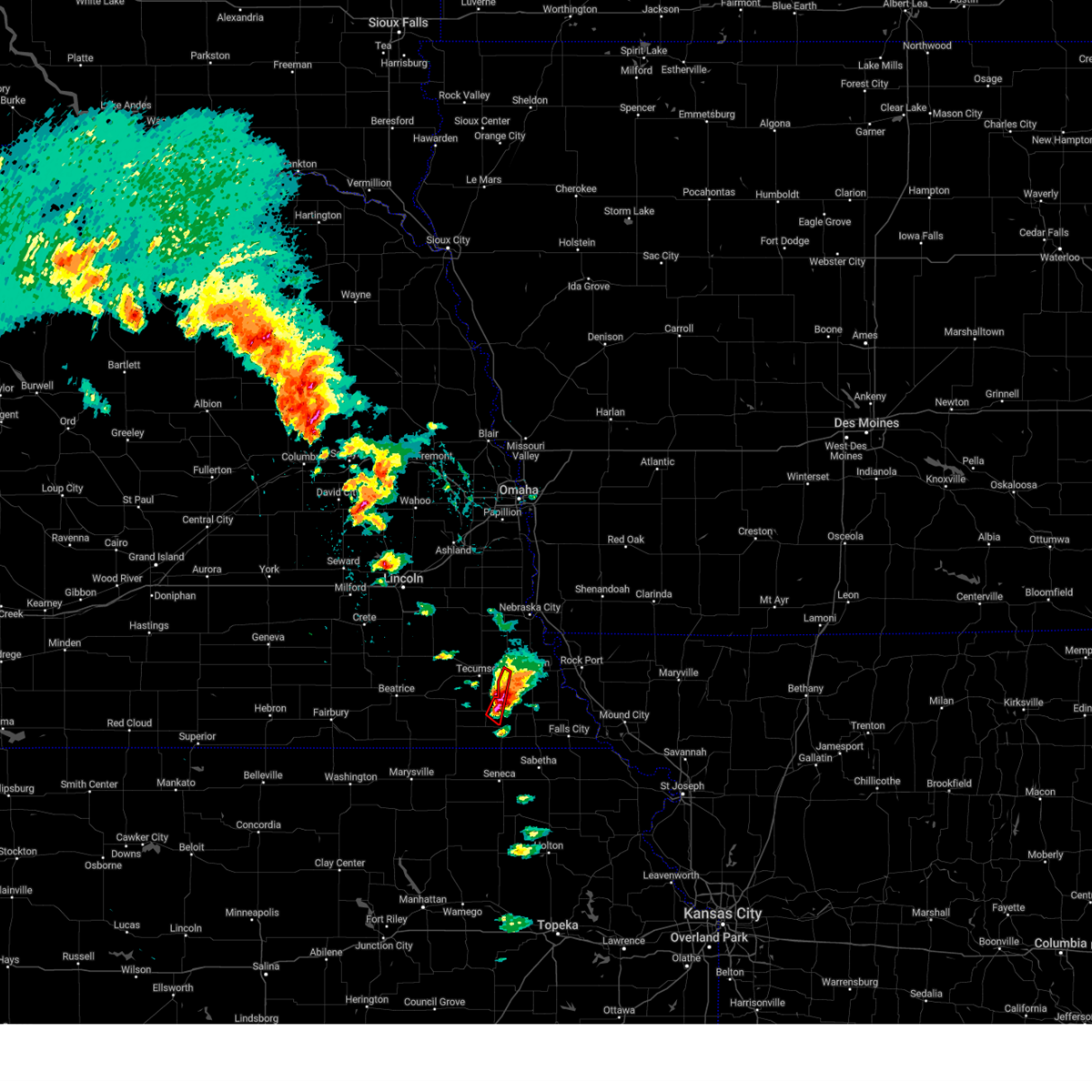 At 501 pm cdt, a confirmed tornado was located 4 miles northeast of table rock, or 10 miles northeast of pawnee city, moving northeast at 30 mph (weather spotters confirmed tornado). Hazards include damaging tornado and baseball size hail. Flying debris will be dangerous to those caught without shelter. mobile homes will be damaged or destroyed. damage to roofs, windows, and vehicles will occur. tree damage is likely. This tornadic thunderstorm will remain over mainly rural areas of southwestern nemaha and northeastern pawnee counties. At 501 pm cdt, a confirmed tornado was located 4 miles northeast of table rock, or 10 miles northeast of pawnee city, moving northeast at 30 mph (weather spotters confirmed tornado). Hazards include damaging tornado and baseball size hail. Flying debris will be dangerous to those caught without shelter. mobile homes will be damaged or destroyed. damage to roofs, windows, and vehicles will occur. tree damage is likely. This tornadic thunderstorm will remain over mainly rural areas of southwestern nemaha and northeastern pawnee counties.
|
| 5/12/2023 5:00 PM CDT |
 At 459 pm cdt, a confirmed tornado was located 3 miles northeast of table rock, or 9 miles northeast of pawnee city, moving northeast at 20 mph (weather spotters confirmed tornado). Hazards include damaging tornado and baseball size hail. Flying debris will be dangerous to those caught without shelter. mobile homes will be damaged or destroyed. damage to roofs, windows, and vehicles will occur. tree damage is likely. This tornadic thunderstorm will remain over mainly rural areas of southwestern nemaha, northwestern richardson and northeastern pawnee counties, including the following locations, the highway 62 and 105 junction and kirkmans cove recreation area. At 459 pm cdt, a confirmed tornado was located 3 miles northeast of table rock, or 9 miles northeast of pawnee city, moving northeast at 20 mph (weather spotters confirmed tornado). Hazards include damaging tornado and baseball size hail. Flying debris will be dangerous to those caught without shelter. mobile homes will be damaged or destroyed. damage to roofs, windows, and vehicles will occur. tree damage is likely. This tornadic thunderstorm will remain over mainly rural areas of southwestern nemaha, northwestern richardson and northeastern pawnee counties, including the following locations, the highway 62 and 105 junction and kirkmans cove recreation area.
|
| 5/12/2023 4:55 PM CDT | Baseball sized hail reported 0.7 miles W of Table Rock, NE |
| 5/12/2023 4:54 PM CDT | Half Dollar sized hail reported 1.1 miles ENE of Table Rock, NE, report from mping: half dollar (1.25 in.). |
| 5/12/2023 4:53 PM CDT | Softball sized hail reported 0.2 miles SW of Table Rock, NE, multiple photos on social media. |
| 5/12/2023 4:52 PM CDT |
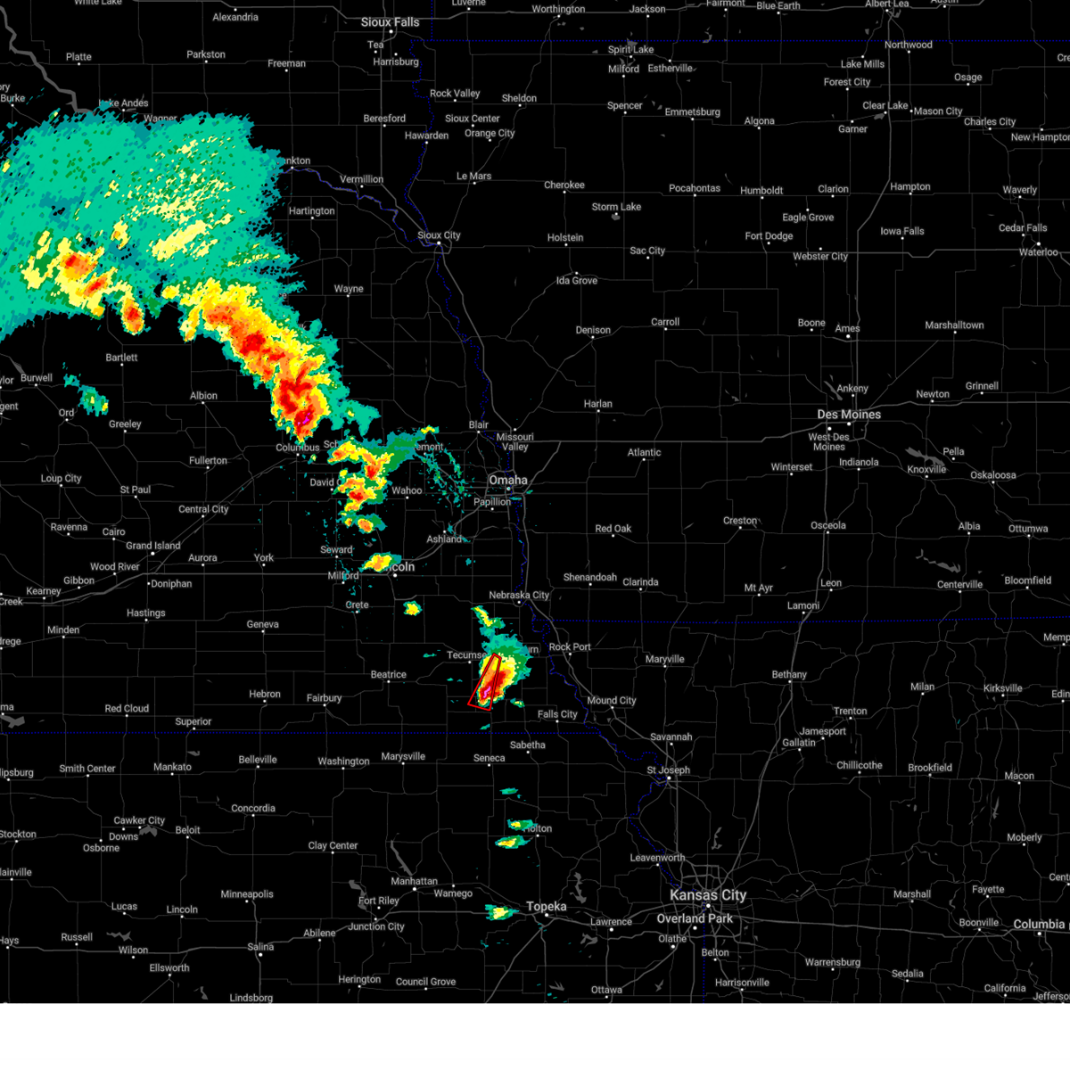 At 452 pm cdt, a confirmed tornado was located over table rock, or 5 miles northeast of pawnee city, moving northeast at 20 mph (weather spotters confirmed tornado). Hazards include damaging tornado and ping pong ball size hail. Flying debris will be dangerous to those caught without shelter. mobile homes will be damaged or destroyed. damage to roofs, windows, and vehicles will occur. tree damage is likely. This tornadic thunderstorm will remain over mainly rural areas of southeastern johnson, southwestern nemaha and northeastern pawnee counties. At 452 pm cdt, a confirmed tornado was located over table rock, or 5 miles northeast of pawnee city, moving northeast at 20 mph (weather spotters confirmed tornado). Hazards include damaging tornado and ping pong ball size hail. Flying debris will be dangerous to those caught without shelter. mobile homes will be damaged or destroyed. damage to roofs, windows, and vehicles will occur. tree damage is likely. This tornadic thunderstorm will remain over mainly rural areas of southeastern johnson, southwestern nemaha and northeastern pawnee counties.
|
| 5/12/2023 4:50 PM CDT |
 At 449 pm cdt, a confirmed tornado was located over table rock, or 5 miles northeast of pawnee city, moving northeast at 20 mph (weather spotters confirmed tornado). Hazards include damaging tornado and ping pong ball size hail. Flying debris will be dangerous to those caught without shelter. mobile homes will be damaged or destroyed. damage to roofs, windows, and vehicles will occur. tree damage is likely. This tornadic thunderstorm will remain over mainly rural areas of southeastern johnson, southwestern nemaha, northwestern richardson and northeastern pawnee counties, including the following locations, the highway 62 and 105 junction and kirkmans cove recreation area. At 449 pm cdt, a confirmed tornado was located over table rock, or 5 miles northeast of pawnee city, moving northeast at 20 mph (weather spotters confirmed tornado). Hazards include damaging tornado and ping pong ball size hail. Flying debris will be dangerous to those caught without shelter. mobile homes will be damaged or destroyed. damage to roofs, windows, and vehicles will occur. tree damage is likely. This tornadic thunderstorm will remain over mainly rural areas of southeastern johnson, southwestern nemaha, northwestern richardson and northeastern pawnee counties, including the following locations, the highway 62 and 105 junction and kirkmans cove recreation area.
|
| 5/12/2023 4:26 PM CDT |
 At 426 pm cdt, a severe thunderstorm capable of producing a tornado was located near pawnee city, moving north at 30 mph (radar indicated rotation). Hazards include tornado and ping pong ball size hail. Flying debris will be dangerous to those caught without shelter. mobile homes will be damaged or destroyed. damage to roofs, windows, and vehicles will occur. tree damage is likely. this dangerous storm will be near, table rock around 430 pm cdt. elk creek around 445 pm cdt. Other locations in the path of this tornadic thunderstorm include tecumseh, johnson and cook. At 426 pm cdt, a severe thunderstorm capable of producing a tornado was located near pawnee city, moving north at 30 mph (radar indicated rotation). Hazards include tornado and ping pong ball size hail. Flying debris will be dangerous to those caught without shelter. mobile homes will be damaged or destroyed. damage to roofs, windows, and vehicles will occur. tree damage is likely. this dangerous storm will be near, table rock around 430 pm cdt. elk creek around 445 pm cdt. Other locations in the path of this tornadic thunderstorm include tecumseh, johnson and cook.
|
| 5/12/2023 4:19 PM CDT |
 At 418 pm cdt, a severe thunderstorm was located 3 miles north of pawnee city, moving north at 30 mph (radar indicated). Hazards include 60 mph wind gusts and quarter size hail. Hail damage to vehicles is expected. expect wind damage to roofs, siding, and trees. locations impacted include, tecumseh, pawnee city, sterling, johnson, table rock, elk creek, steinauer, st mary, the highway 62 and 105 junction and vesta. hail threat, radar indicated max hail size, 1. 00 in wind threat, radar indicated max wind gust, 60 mph. At 418 pm cdt, a severe thunderstorm was located 3 miles north of pawnee city, moving north at 30 mph (radar indicated). Hazards include 60 mph wind gusts and quarter size hail. Hail damage to vehicles is expected. expect wind damage to roofs, siding, and trees. locations impacted include, tecumseh, pawnee city, sterling, johnson, table rock, elk creek, steinauer, st mary, the highway 62 and 105 junction and vesta. hail threat, radar indicated max hail size, 1. 00 in wind threat, radar indicated max wind gust, 60 mph.
|
| 5/12/2023 4:03 PM CDT |
 At 403 pm cdt, a severe thunderstorm was located 4 miles south of pawnee city, moving north at 30 mph (radar indicated). Hazards include 60 mph wind gusts and quarter size hail. Hail damage to vehicles is expected. Expect wind damage to roofs, siding, and trees. At 403 pm cdt, a severe thunderstorm was located 4 miles south of pawnee city, moving north at 30 mph (radar indicated). Hazards include 60 mph wind gusts and quarter size hail. Hail damage to vehicles is expected. Expect wind damage to roofs, siding, and trees.
|
| 5/7/2023 11:38 PM CDT |
 The severe thunderstorm warning for southern lancaster, johnson, northeastern jefferson, southwestern otoe, southeastern saline, pawnee and gage counties will expire at 1145 pm cdt, the storms which prompted the warning have moved out of the area. therefore, the warning will be allowed to expire. a severe thunderstorm watch remains in effect until 100 am cdt for southeastern nebraska. The severe thunderstorm warning for southern lancaster, johnson, northeastern jefferson, southwestern otoe, southeastern saline, pawnee and gage counties will expire at 1145 pm cdt, the storms which prompted the warning have moved out of the area. therefore, the warning will be allowed to expire. a severe thunderstorm watch remains in effect until 100 am cdt for southeastern nebraska.
|
| 5/7/2023 11:28 PM CDT |
 At 1127 pm cdt, severe thunderstorms were located along a line extending from 2 miles south of panama to 3 miles west of tecumseh to 3 miles west of table rock, moving east at 40 mph (emergency management). Hazards include 70 mph wind gusts and quarter size hail. Hail damage to vehicles is expected. expect considerable tree damage. wind damage is also likely to mobile homes, roofs, and outbuildings. locations impacted include, beatrice, tecumseh, pawnee city, wilber, firth, adams, de witt, cortland, sterling, plymouth, table rock, clatonia, hallam, pickrell, filley, elk creek, burchard, liberty, lewiston and virginia. thunderstorm damage threat, considerable hail threat, radar indicated max hail size, 1. 00 in wind threat, observed max wind gust, 70 mph. At 1127 pm cdt, severe thunderstorms were located along a line extending from 2 miles south of panama to 3 miles west of tecumseh to 3 miles west of table rock, moving east at 40 mph (emergency management). Hazards include 70 mph wind gusts and quarter size hail. Hail damage to vehicles is expected. expect considerable tree damage. wind damage is also likely to mobile homes, roofs, and outbuildings. locations impacted include, beatrice, tecumseh, pawnee city, wilber, firth, adams, de witt, cortland, sterling, plymouth, table rock, clatonia, hallam, pickrell, filley, elk creek, burchard, liberty, lewiston and virginia. thunderstorm damage threat, considerable hail threat, radar indicated max hail size, 1. 00 in wind threat, observed max wind gust, 70 mph.
|
| 5/7/2023 11:21 PM CDT |
 At 1120 pm cdt, severe thunderstorms were located along a line extending from near firth to 5 miles east of crab orchard to 4 miles northwest of pawnee city, moving east at 40 mph (emergency management). Hazards include 70 mph wind gusts and quarter size hail. Hail damage to vehicles is expected. expect considerable tree damage. wind damage is also likely to mobile homes, roofs, and outbuildings. locations impacted include, pawnee city, tecumseh, table rock, du bois, elk creek and sterling. thunderstorm damage threat, considerable hail threat, radar indicated max hail size, 1. 00 in wind threat, observed max wind gust, 70 mph. At 1120 pm cdt, severe thunderstorms were located along a line extending from near firth to 5 miles east of crab orchard to 4 miles northwest of pawnee city, moving east at 40 mph (emergency management). Hazards include 70 mph wind gusts and quarter size hail. Hail damage to vehicles is expected. expect considerable tree damage. wind damage is also likely to mobile homes, roofs, and outbuildings. locations impacted include, pawnee city, tecumseh, table rock, du bois, elk creek and sterling. thunderstorm damage threat, considerable hail threat, radar indicated max hail size, 1. 00 in wind threat, observed max wind gust, 70 mph.
|
| 5/7/2023 11:10 PM CDT |
 At 1109 pm cdt, severe thunderstorms were located along a line extending from 5 miles east of crete to 6 miles southwest of adams to 3 miles west of burchard, moving northeast at 35 mph (emergency management. there have been several reports of wind gusts to 70 mph with this line of storms). Hazards include 70 mph wind gusts and nickel size hail. Expect considerable tree damage. damage is likely to mobile homes, roofs, and outbuildings. severe thunderstorms will be near, burchard and lewiston around 1115 pm cdt. adams and crab orchard around 1120 pm cdt. other locations in the path of these severe thunderstorms include pawnee city, hickman, firth, sterling, roca, table rock, elk creek, tecumseh, bennet, panama, humboldt, palmyra, cook, douglas, johnson, unadilla, talmage, lorton, stella and brock. thunderstorm damage threat, considerable hail threat, radar indicated max hail size, 0. 88 in wind threat, observed max wind gust, 70 mph. At 1109 pm cdt, severe thunderstorms were located along a line extending from 5 miles east of crete to 6 miles southwest of adams to 3 miles west of burchard, moving northeast at 35 mph (emergency management. there have been several reports of wind gusts to 70 mph with this line of storms). Hazards include 70 mph wind gusts and nickel size hail. Expect considerable tree damage. damage is likely to mobile homes, roofs, and outbuildings. severe thunderstorms will be near, burchard and lewiston around 1115 pm cdt. adams and crab orchard around 1120 pm cdt. other locations in the path of these severe thunderstorms include pawnee city, hickman, firth, sterling, roca, table rock, elk creek, tecumseh, bennet, panama, humboldt, palmyra, cook, douglas, johnson, unadilla, talmage, lorton, stella and brock. thunderstorm damage threat, considerable hail threat, radar indicated max hail size, 0. 88 in wind threat, observed max wind gust, 70 mph.
|
| 5/7/2023 10:54 PM CDT |
 At 1053 pm cdt, severe thunderstorms were located along a line extending from 2 miles west of clatonia to 4 miles north of holmesville to 2 miles southwest of liberty, moving east at 40 mph (radar indicated). Hazards include 70 mph wind gusts and quarter size hail. Hail damage to vehicles is expected. expect considerable tree damage. wind damage is also likely to mobile homes, roofs, and outbuildings. severe thunderstorms will be near, liberty around 1100 pm cdt. summerfield, filley and virginia around 1105 pm cdt. burchard and lewiston around 1110 pm cdt. other locations in the path of these severe thunderstorms include crab orchard, firth, pawnee city, adams, tecumseh, table rock and elk creek. thunderstorm damage threat, considerable hail threat, radar indicated max hail size, 1. 00 in wind threat, observed max wind gust, 70 mph. At 1053 pm cdt, severe thunderstorms were located along a line extending from 2 miles west of clatonia to 4 miles north of holmesville to 2 miles southwest of liberty, moving east at 40 mph (radar indicated). Hazards include 70 mph wind gusts and quarter size hail. Hail damage to vehicles is expected. expect considerable tree damage. wind damage is also likely to mobile homes, roofs, and outbuildings. severe thunderstorms will be near, liberty around 1100 pm cdt. summerfield, filley and virginia around 1105 pm cdt. burchard and lewiston around 1110 pm cdt. other locations in the path of these severe thunderstorms include crab orchard, firth, pawnee city, adams, tecumseh, table rock and elk creek. thunderstorm damage threat, considerable hail threat, radar indicated max hail size, 1. 00 in wind threat, observed max wind gust, 70 mph.
|
| 5/7/2023 10:05 PM CDT |
 At 1005 pm cdt, a severe thunderstorm was located 3 miles south of humboldt, or 9 miles east of pawnee city, moving east at 45 mph (radar indicated). Hazards include 70 mph wind gusts and quarter size hail. Hail damage to vehicles is expected. expect considerable tree damage. wind damage is also likely to mobile homes, roofs, and outbuildings. locations impacted include, dawson, stella, salem, verdon, falls city and shubert. thunderstorm damage threat, considerable hail threat, radar indicated max hail size, 1. 00 in wind threat, observed max wind gust, 70 mph. At 1005 pm cdt, a severe thunderstorm was located 3 miles south of humboldt, or 9 miles east of pawnee city, moving east at 45 mph (radar indicated). Hazards include 70 mph wind gusts and quarter size hail. Hail damage to vehicles is expected. expect considerable tree damage. wind damage is also likely to mobile homes, roofs, and outbuildings. locations impacted include, dawson, stella, salem, verdon, falls city and shubert. thunderstorm damage threat, considerable hail threat, radar indicated max hail size, 1. 00 in wind threat, observed max wind gust, 70 mph.
|
| 5/7/2023 9:44 PM CDT |
 At 943 pm cdt, a severe thunderstorm was located 6 miles northeast of summerfield, or 7 miles southwest of pawnee city, moving east at 45 mph (radar indicated). Hazards include 60 mph wind gusts and quarter size hail. Hail damage to vehicles is expected. expect wind damage to roofs, siding, and trees. this severe thunderstorm will be near, pawnee city around 955 pm cdt. table rock and du bois around 1000 pm cdt. other locations in the path of this severe thunderstorm include humboldt, dawson, stella, verdon, salem, falls city and shubert. hail threat, radar indicated max hail size, 1. 00 in wind threat, radar indicated max wind gust, 60 mph. At 943 pm cdt, a severe thunderstorm was located 6 miles northeast of summerfield, or 7 miles southwest of pawnee city, moving east at 45 mph (radar indicated). Hazards include 60 mph wind gusts and quarter size hail. Hail damage to vehicles is expected. expect wind damage to roofs, siding, and trees. this severe thunderstorm will be near, pawnee city around 955 pm cdt. table rock and du bois around 1000 pm cdt. other locations in the path of this severe thunderstorm include humboldt, dawson, stella, verdon, salem, falls city and shubert. hail threat, radar indicated max hail size, 1. 00 in wind threat, radar indicated max wind gust, 60 mph.
|
| 5/7/2023 9:30 PM CDT |
 At 930 pm cdt, a severe thunderstorm was located 3 miles southeast of pawnee city, moving east at 30 mph (radar indicated). Hazards include 60 mph wind gusts and quarter size hail. Hail damage to vehicles is expected. expect wind damage to roofs, siding, and trees. locations impacted include, pawnee city, wymore, table rock, summerfield, du bois, barneston, burchard and liberty. hail threat, radar indicated max hail size, 1. 00 in wind threat, radar indicated max wind gust, 60 mph. At 930 pm cdt, a severe thunderstorm was located 3 miles southeast of pawnee city, moving east at 30 mph (radar indicated). Hazards include 60 mph wind gusts and quarter size hail. Hail damage to vehicles is expected. expect wind damage to roofs, siding, and trees. locations impacted include, pawnee city, wymore, table rock, summerfield, du bois, barneston, burchard and liberty. hail threat, radar indicated max hail size, 1. 00 in wind threat, radar indicated max wind gust, 60 mph.
|
| 5/7/2023 9:15 PM CDT |
 At 915 pm cdt, a severe thunderstorm was located 6 miles northeast of summerfield, or 7 miles west of pawnee city, moving east at 40 mph (radar indicated). Hazards include 60 mph wind gusts and quarter size hail. Hail damage to vehicles is expected. expect wind damage to roofs, siding, and trees. locations impacted include, pawnee city, table rock and du bois. hail threat, radar indicated max hail size, 1. 00 in wind threat, radar indicated max wind gust, 60 mph. At 915 pm cdt, a severe thunderstorm was located 6 miles northeast of summerfield, or 7 miles west of pawnee city, moving east at 40 mph (radar indicated). Hazards include 60 mph wind gusts and quarter size hail. Hail damage to vehicles is expected. expect wind damage to roofs, siding, and trees. locations impacted include, pawnee city, table rock and du bois. hail threat, radar indicated max hail size, 1. 00 in wind threat, radar indicated max wind gust, 60 mph.
|
| 5/7/2023 8:58 PM CDT |
 At 858 pm cdt, a severe thunderstorm was located near liberty, or 16 miles northeast of marysville, moving east at 35 mph (radar indicated). Hazards include 60 mph wind gusts and quarter size hail. Hail damage to vehicles is expected. expect wind damage to roofs, siding, and trees. this severe thunderstorm will be near, summerfield and burchard around 910 pm cdt. other locations in the path of this severe thunderstorm include pawnee city, table rock and du bois. hail threat, radar indicated max hail size, 1. 00 in wind threat, radar indicated max wind gust, 60 mph. At 858 pm cdt, a severe thunderstorm was located near liberty, or 16 miles northeast of marysville, moving east at 35 mph (radar indicated). Hazards include 60 mph wind gusts and quarter size hail. Hail damage to vehicles is expected. expect wind damage to roofs, siding, and trees. this severe thunderstorm will be near, summerfield and burchard around 910 pm cdt. other locations in the path of this severe thunderstorm include pawnee city, table rock and du bois. hail threat, radar indicated max hail size, 1. 00 in wind threat, radar indicated max wind gust, 60 mph.
|
| 4/20/2023 3:45 AM CDT |
 At 344 am cdt, a severe thunderstorm was located near dawson, or 14 miles north of sabetha, moving east at 50 mph (radar indicated). Hazards include 60 mph wind gusts and penny size hail. Expect damage to roofs, siding, and trees. locations impacted include, verdon, stella, salem, falls city and shubert. hail threat, radar indicated max hail size, 0. 75 in wind threat, radar indicated max wind gust, 60 mph. At 344 am cdt, a severe thunderstorm was located near dawson, or 14 miles north of sabetha, moving east at 50 mph (radar indicated). Hazards include 60 mph wind gusts and penny size hail. Expect damage to roofs, siding, and trees. locations impacted include, verdon, stella, salem, falls city and shubert. hail threat, radar indicated max hail size, 0. 75 in wind threat, radar indicated max wind gust, 60 mph.
|
| 4/20/2023 3:25 AM CDT |
 At 325 am cdt, a severe thunderstorm was located 4 miles south of pawnee city, moving east at 45 mph (radar indicated). Hazards include 60 mph wind gusts and penny size hail. Expect damage to roofs, siding, and trees. this severe thunderstorm will be near, du bois around 330 am cdt. humboldt around 340 am cdt. other locations in the path of this severe thunderstorm include dawson, verdon, stella, salem, falls city and shubert. hail threat, radar indicated max hail size, 0. 75 in wind threat, radar indicated max wind gust, 60 mph. At 325 am cdt, a severe thunderstorm was located 4 miles south of pawnee city, moving east at 45 mph (radar indicated). Hazards include 60 mph wind gusts and penny size hail. Expect damage to roofs, siding, and trees. this severe thunderstorm will be near, du bois around 330 am cdt. humboldt around 340 am cdt. other locations in the path of this severe thunderstorm include dawson, verdon, stella, salem, falls city and shubert. hail threat, radar indicated max hail size, 0. 75 in wind threat, radar indicated max wind gust, 60 mph.
|
| 4/20/2023 1:02 AM CDT |
 At 102 am cdt, a severe thunderstorm was located near burchard, or 13 miles west of pawnee city, moving northeast at 35 mph (radar indicated). Hazards include ping pong ball size hail. People and animals outdoors will be injured. expect damage to roofs, siding, windows, and vehicles. this severe storm will be near, burchard around 105 am cdt. other locations in the path of this severe thunderstorm include table rock, tecumseh and elk creek. hail threat, radar indicated max hail size, 1. 50 in wind threat, radar indicated max wind gust, <50 mph. At 102 am cdt, a severe thunderstorm was located near burchard, or 13 miles west of pawnee city, moving northeast at 35 mph (radar indicated). Hazards include ping pong ball size hail. People and animals outdoors will be injured. expect damage to roofs, siding, windows, and vehicles. this severe storm will be near, burchard around 105 am cdt. other locations in the path of this severe thunderstorm include table rock, tecumseh and elk creek. hail threat, radar indicated max hail size, 1. 50 in wind threat, radar indicated max wind gust, <50 mph.
|
| 4/20/2023 12:52 AM CDT |
 At 1251 am cdt, a severe thunderstorm was located near liberty, or 16 miles southeast of beatrice, moving northeast at 35 mph (radar indicated). Hazards include quarter size hail. Damage to vehicles is expected. this severe thunderstorm will be near, burchard and lewiston around 105 am cdt. other locations in the path of this severe thunderstorm include tecumseh, table rock and elk creek. hail threat, radar indicated max hail size, 1. 00 in wind threat, radar indicated max wind gust, <50 mph. At 1251 am cdt, a severe thunderstorm was located near liberty, or 16 miles southeast of beatrice, moving northeast at 35 mph (radar indicated). Hazards include quarter size hail. Damage to vehicles is expected. this severe thunderstorm will be near, burchard and lewiston around 105 am cdt. other locations in the path of this severe thunderstorm include tecumseh, table rock and elk creek. hail threat, radar indicated max hail size, 1. 00 in wind threat, radar indicated max wind gust, <50 mph.
|
| 4/19/2023 7:56 PM CDT |
 At 755 pm cdt, a severe thunderstorm was located 3 miles southwest of humboldt, or 9 miles east of pawnee city, moving northeast at 30 mph (trained weather spotters reported ping pong size hail 3 miles north of du bois at 755 pm ct). Hazards include ping pong ball size hail and 60 mph wind gusts. People and animals outdoors will be injured. expect hail damage to roofs, siding, windows, and vehicles. expect wind damage to roofs, siding, and trees. this severe storm will be near, humboldt around 805 pm cdt. other locations in the path of this severe thunderstorm include dawson, stella, shubert, auburn and nemaha. hail threat, observed max hail size, 1. 50 in wind threat, radar indicated max wind gust, 60 mph. At 755 pm cdt, a severe thunderstorm was located 3 miles southwest of humboldt, or 9 miles east of pawnee city, moving northeast at 30 mph (trained weather spotters reported ping pong size hail 3 miles north of du bois at 755 pm ct). Hazards include ping pong ball size hail and 60 mph wind gusts. People and animals outdoors will be injured. expect hail damage to roofs, siding, windows, and vehicles. expect wind damage to roofs, siding, and trees. this severe storm will be near, humboldt around 805 pm cdt. other locations in the path of this severe thunderstorm include dawson, stella, shubert, auburn and nemaha. hail threat, observed max hail size, 1. 50 in wind threat, radar indicated max wind gust, 60 mph.
|
| 4/19/2023 7:46 PM CDT |
 At 746 pm cdt, a severe thunderstorm was located 3 miles north of du bois, or 6 miles east of pawnee city, moving northeast at 30 mph (radar indicated). Hazards include 60 mph wind gusts and half dollar size hail. Hail damage to vehicles is expected. expect wind damage to roofs, siding, and trees. this severe thunderstorm will be near, table rock around 750 pm cdt. humboldt around 805 pm cdt. other locations in the path of this severe thunderstorm include dawson, stella, shubert, auburn and nemaha. hail threat, radar indicated max hail size, 1. 25 in wind threat, radar indicated max wind gust, 60 mph. At 746 pm cdt, a severe thunderstorm was located 3 miles north of du bois, or 6 miles east of pawnee city, moving northeast at 30 mph (radar indicated). Hazards include 60 mph wind gusts and half dollar size hail. Hail damage to vehicles is expected. expect wind damage to roofs, siding, and trees. this severe thunderstorm will be near, table rock around 750 pm cdt. humboldt around 805 pm cdt. other locations in the path of this severe thunderstorm include dawson, stella, shubert, auburn and nemaha. hail threat, radar indicated max hail size, 1. 25 in wind threat, radar indicated max wind gust, 60 mph.
|
| 4/19/2023 6:57 PM CDT |
 At 657 pm cdt, severe thunderstorms were located along a line extending from 4 miles west of pawnee city to near table rock to 4 miles northeast of humboldt, moving northeast at 50 mph (radar indicated). Hazards include ping pong ball size hail and 60 mph wind gusts. People and animals outdoors will be injured. expect hail damage to roofs, siding, windows, and vehicles. expect wind damage to roofs, siding, and trees. severe thunderstorms will be near, stella around 705 pm cdt. nemaha and elk creek around 715 pm cdt. hail threat, radar indicated max hail size, 1. 50 in wind threat, radar indicated max wind gust, 60 mph. At 657 pm cdt, severe thunderstorms were located along a line extending from 4 miles west of pawnee city to near table rock to 4 miles northeast of humboldt, moving northeast at 50 mph (radar indicated). Hazards include ping pong ball size hail and 60 mph wind gusts. People and animals outdoors will be injured. expect hail damage to roofs, siding, windows, and vehicles. expect wind damage to roofs, siding, and trees. severe thunderstorms will be near, stella around 705 pm cdt. nemaha and elk creek around 715 pm cdt. hail threat, radar indicated max hail size, 1. 50 in wind threat, radar indicated max wind gust, 60 mph.
|
| 4/19/2023 6:29 PM CDT |
 At 629 pm cdt, a severe thunderstorm was located 4 miles west of pawnee city, moving northeast at 35 mph (trained weather spotters. these storms have a history of producing ping pong ball sized hail in summerfield). Hazards include golf ball size hail and 60 mph wind gusts. People and animals outdoors will be injured. expect hail damage to roofs, siding, windows, and vehicles. expect wind damage to roofs, siding, and trees. this severe thunderstorm will be near, pawnee city around 635 pm cdt. table rock around 645 pm cdt. thunderstorm damage threat, considerable hail threat, observed max hail size, 1. 75 in wind threat, radar indicated max wind gust, 60 mph. At 629 pm cdt, a severe thunderstorm was located 4 miles west of pawnee city, moving northeast at 35 mph (trained weather spotters. these storms have a history of producing ping pong ball sized hail in summerfield). Hazards include golf ball size hail and 60 mph wind gusts. People and animals outdoors will be injured. expect hail damage to roofs, siding, windows, and vehicles. expect wind damage to roofs, siding, and trees. this severe thunderstorm will be near, pawnee city around 635 pm cdt. table rock around 645 pm cdt. thunderstorm damage threat, considerable hail threat, observed max hail size, 1. 75 in wind threat, radar indicated max wind gust, 60 mph.
|
| 4/19/2023 6:20 PM CDT |
 At 619 pm cdt, a severe thunderstorm was located near peru, or 10 miles northeast of auburn, moving northeast at 40 mph. an additional severe storm was approaching du bois in pawnee county (trained weather spotters. at 616 pm, half dollar sized hail was reported in auburn). Hazards include golf ball size hail and 60 mph wind gusts. People and animals outdoors will be injured. expect hail damage to roofs, siding, windows, and vehicles. expect wind damage to roofs, siding, and trees. this severe thunderstorm will remain over mainly rural areas of nemaha, western richardson and eastern pawnee counties, including the following locations, kirkmans cove recreation area, brownville state recreation area, camp cornhusker, duck creek recreation area, the highway 62 and 105 junction and howe. thunderstorm damage threat, considerable hail threat, observed max hail size, 1. 75 in wind threat, radar indicated max wind gust, 60 mph. At 619 pm cdt, a severe thunderstorm was located near peru, or 10 miles northeast of auburn, moving northeast at 40 mph. an additional severe storm was approaching du bois in pawnee county (trained weather spotters. at 616 pm, half dollar sized hail was reported in auburn). Hazards include golf ball size hail and 60 mph wind gusts. People and animals outdoors will be injured. expect hail damage to roofs, siding, windows, and vehicles. expect wind damage to roofs, siding, and trees. this severe thunderstorm will remain over mainly rural areas of nemaha, western richardson and eastern pawnee counties, including the following locations, kirkmans cove recreation area, brownville state recreation area, camp cornhusker, duck creek recreation area, the highway 62 and 105 junction and howe. thunderstorm damage threat, considerable hail threat, observed max hail size, 1. 75 in wind threat, radar indicated max wind gust, 60 mph.
|
| 4/19/2023 6:11 PM CDT |
 At 610 pm cdt, a severe thunderstorm was located 3 miles southwest of peru, or 4 miles northeast of auburn, moving northeast at 40 mph. additional severe storms were moving into richardson and pawnee counties out of kansas (trained weather spotters. some of these storms have had a history of producing golf ball sized hail, including near baileyville, ks). Hazards include golf ball size hail and 60 mph wind gusts. People and animals outdoors will be injured. expect hail damage to roofs, siding, windows, and vehicles. expect wind damage to roofs, siding, and trees. this severe thunderstorm will be near, peru around 615 pm cdt. thunderstorm damage threat, considerable hail threat, observed max hail size, 1. 75 in wind threat, radar indicated max wind gust, 60 mph. At 610 pm cdt, a severe thunderstorm was located 3 miles southwest of peru, or 4 miles northeast of auburn, moving northeast at 40 mph. additional severe storms were moving into richardson and pawnee counties out of kansas (trained weather spotters. some of these storms have had a history of producing golf ball sized hail, including near baileyville, ks). Hazards include golf ball size hail and 60 mph wind gusts. People and animals outdoors will be injured. expect hail damage to roofs, siding, windows, and vehicles. expect wind damage to roofs, siding, and trees. this severe thunderstorm will be near, peru around 615 pm cdt. thunderstorm damage threat, considerable hail threat, observed max hail size, 1. 75 in wind threat, radar indicated max wind gust, 60 mph.
|
| 4/19/2023 5:12 PM CDT |
 At 512 pm cdt, a severe thunderstorm was located near humboldt, or 10 miles east of pawnee city, moving northeast at 55 mph (radar indicated). Hazards include 60 mph wind gusts and half dollar size hail. Hail damage to vehicles is expected. expect wind damage to roofs, siding, and trees. this severe thunderstorm will be near, dawson around 515 pm cdt. stella around 525 pm cdt. other locations in the path of this severe thunderstorm include auburn, nemaha, brownville and peru. hail threat, radar indicated max hail size, 1. 25 in wind threat, radar indicated max wind gust, 60 mph. At 512 pm cdt, a severe thunderstorm was located near humboldt, or 10 miles east of pawnee city, moving northeast at 55 mph (radar indicated). Hazards include 60 mph wind gusts and half dollar size hail. Hail damage to vehicles is expected. expect wind damage to roofs, siding, and trees. this severe thunderstorm will be near, dawson around 515 pm cdt. stella around 525 pm cdt. other locations in the path of this severe thunderstorm include auburn, nemaha, brownville and peru. hail threat, radar indicated max hail size, 1. 25 in wind threat, radar indicated max wind gust, 60 mph.
|
| 4/14/2023 7:31 PM CDT |
 At 731 pm cdt, severe thunderstorms were located along a line extending from 4 miles north of syracuse to 4 miles west of johnson to 6 miles east of summerfield, moving northeast at 25 mph (public. at 723 pm, half dollar sized hail was reported 6 miles south of burchard). Hazards include 60 mph wind gusts and half dollar size hail. Hail damage to vehicles is expected. expect wind damage to roofs, siding, and trees. locations impacted include, syracuse, johnson, cook, unadilla, dunbar, talmage, brock, lorton, table rock and elk creek. hail threat, observed max hail size, 1. 25 in wind threat, radar indicated max wind gust, 60 mph. At 731 pm cdt, severe thunderstorms were located along a line extending from 4 miles north of syracuse to 4 miles west of johnson to 6 miles east of summerfield, moving northeast at 25 mph (public. at 723 pm, half dollar sized hail was reported 6 miles south of burchard). Hazards include 60 mph wind gusts and half dollar size hail. Hail damage to vehicles is expected. expect wind damage to roofs, siding, and trees. locations impacted include, syracuse, johnson, cook, unadilla, dunbar, talmage, brock, lorton, table rock and elk creek. hail threat, observed max hail size, 1. 25 in wind threat, radar indicated max wind gust, 60 mph.
|
| 4/14/2023 7:10 PM CDT |
 At 709 pm cdt, severe thunderstorms were located along a line extending from 5 miles northwest of cook to 2 miles north of tecumseh to 5 miles west of pawnee city, moving north at 40 mph (public. at 707 pm, quarter sized hail was reported 6 miles south of burchard). Hazards include 60 mph wind gusts and quarter size hail. Hail damage to vehicles is expected. expect wind damage to roofs, siding, and trees. these severe storms will be near, cook around 720 pm cdt. syracuse, unadilla and table rock around 725 pm cdt. other locations in the path of these severe thunderstorms include elk creek, lorton, tecumseh, dunbar, johnson, talmage and brock. hail threat, observed max hail size, 1. 00 in wind threat, radar indicated max wind gust, 60 mph. At 709 pm cdt, severe thunderstorms were located along a line extending from 5 miles northwest of cook to 2 miles north of tecumseh to 5 miles west of pawnee city, moving north at 40 mph (public. at 707 pm, quarter sized hail was reported 6 miles south of burchard). Hazards include 60 mph wind gusts and quarter size hail. Hail damage to vehicles is expected. expect wind damage to roofs, siding, and trees. these severe storms will be near, cook around 720 pm cdt. syracuse, unadilla and table rock around 725 pm cdt. other locations in the path of these severe thunderstorms include elk creek, lorton, tecumseh, dunbar, johnson, talmage and brock. hail threat, observed max hail size, 1. 00 in wind threat, radar indicated max wind gust, 60 mph.
|
| 4/14/2023 7:05 PM CDT |
 At 704 pm cdt, severe thunderstorms were located along a line extending from 5 miles west of cook to near tecumseh to 5 miles northeast of summerfield, moving northeast at 40 mph (radar indicated). Hazards include 60 mph wind gusts and quarter size hail. Hail damage to vehicles is expected. expect wind damage to roofs, siding, and trees. severe thunderstorms will be near, tecumseh around 710 pm cdt. cook and unadilla around 720 pm cdt. other locations in the path of these severe thunderstorms include syracuse, table rock, elk creek, lorton, dunbar, johnson, brock and talmage. hail threat, radar indicated max hail size, 1. 00 in wind threat, radar indicated max wind gust, 60 mph. At 704 pm cdt, severe thunderstorms were located along a line extending from 5 miles west of cook to near tecumseh to 5 miles northeast of summerfield, moving northeast at 40 mph (radar indicated). Hazards include 60 mph wind gusts and quarter size hail. Hail damage to vehicles is expected. expect wind damage to roofs, siding, and trees. severe thunderstorms will be near, tecumseh around 710 pm cdt. cook and unadilla around 720 pm cdt. other locations in the path of these severe thunderstorms include syracuse, table rock, elk creek, lorton, dunbar, johnson, brock and talmage. hail threat, radar indicated max hail size, 1. 00 in wind threat, radar indicated max wind gust, 60 mph.
|
| 10/12/2022 12:09 AM CDT |
 The severe thunderstorm warning for johnson, western nemaha, south central otoe and pawnee counties will expire at 1215 am cdt, the storms which prompted the warning have weakened below severe limits, and no longer pose an immediate threat to life or property. therefore, the warning will be allowed to expire. however gusty winds up to 55 mph and heavy rain are still possible with these thunderstorms. The severe thunderstorm warning for johnson, western nemaha, south central otoe and pawnee counties will expire at 1215 am cdt, the storms which prompted the warning have weakened below severe limits, and no longer pose an immediate threat to life or property. therefore, the warning will be allowed to expire. however gusty winds up to 55 mph and heavy rain are still possible with these thunderstorms.
|
| 10/12/2022 12:03 AM CDT |
 At 1203 am cdt, severe thunderstorms were located along a line extending from near nebraska city to 4 miles south of burchard, moving east at 35 mph (trained weather spotters). Hazards include 60 mph wind gusts. Expect damage to roofs, siding, and trees. locations impacted include, tecumseh, pawnee city, sterling, johnson, cook, table rock, talmage, summerfield, du bois, elk creek, burchard, lewiston, lorton, crab orchard, steinauer, st mary, the highway 62 and 105 junction and vesta. hail threat, radar indicated max hail size, <. 75 in wind threat, radar indicated max wind gust, 60 mph. At 1203 am cdt, severe thunderstorms were located along a line extending from near nebraska city to 4 miles south of burchard, moving east at 35 mph (trained weather spotters). Hazards include 60 mph wind gusts. Expect damage to roofs, siding, and trees. locations impacted include, tecumseh, pawnee city, sterling, johnson, cook, table rock, talmage, summerfield, du bois, elk creek, burchard, lewiston, lorton, crab orchard, steinauer, st mary, the highway 62 and 105 junction and vesta. hail threat, radar indicated max hail size, <. 75 in wind threat, radar indicated max wind gust, 60 mph.
|
| 10/11/2022 11:50 PM CDT |
 At 1150 pm cdt, severe thunderstorms were located along a line extending from 4 miles northeast of dunbar to near liberty, moving east at 35 mph (trained weather spotters). Hazards include 70 mph wind gusts. Expect considerable tree damage. damage is likely to mobile homes, roofs, and outbuildings. locations impacted include, tecumseh, pawnee city, syracuse, sterling, johnson, cook, unadilla, table rock, talmage, dunbar, douglas, summerfield, du bois, elk creek, burchard, lewiston, lorton, crab orchard, otoe and steinauer. thunderstorm damage threat, considerable hail threat, radar indicated max hail size, <. 75 in wind threat, radar indicated max wind gust, 70 mph. At 1150 pm cdt, severe thunderstorms were located along a line extending from 4 miles northeast of dunbar to near liberty, moving east at 35 mph (trained weather spotters). Hazards include 70 mph wind gusts. Expect considerable tree damage. damage is likely to mobile homes, roofs, and outbuildings. locations impacted include, tecumseh, pawnee city, syracuse, sterling, johnson, cook, unadilla, table rock, talmage, dunbar, douglas, summerfield, du bois, elk creek, burchard, lewiston, lorton, crab orchard, otoe and steinauer. thunderstorm damage threat, considerable hail threat, radar indicated max hail size, <. 75 in wind threat, radar indicated max wind gust, 70 mph.
|
| 10/11/2022 11:39 PM CDT |
 At 1138 pm cdt, severe thunderstorms were located along a line extending from 4 miles northwest of dunbar to 4 miles east of wymore, moving east at 35 mph (trained weather spotters). Hazards include 70 mph wind gusts and penny size hail. Expect considerable tree damage. damage is likely to mobile homes, roofs, and outbuildings. locations impacted include, dunbar, burchard, summerfield, pawnee city and du bois. thunderstorm damage threat, considerable hail threat, radar indicated max hail size, 0. 75 in wind threat, radar indicated max wind gust, 70 mph. At 1138 pm cdt, severe thunderstorms were located along a line extending from 4 miles northwest of dunbar to 4 miles east of wymore, moving east at 35 mph (trained weather spotters). Hazards include 70 mph wind gusts and penny size hail. Expect considerable tree damage. damage is likely to mobile homes, roofs, and outbuildings. locations impacted include, dunbar, burchard, summerfield, pawnee city and du bois. thunderstorm damage threat, considerable hail threat, radar indicated max hail size, 0. 75 in wind threat, radar indicated max wind gust, 70 mph.
|
| 10/11/2022 11:09 PM CDT |
 At 1109 pm cdt, severe thunderstorms were located along a line extending from 2 miles northwest of palmyra to 3 miles northwest of beatrice, moving east at 35 mph (radar indicated). Hazards include 70 mph wind gusts and penny size hail. Expect considerable tree damage. damage is likely to mobile homes, roofs, and outbuildings. severe thunderstorms will be near, palmyra around 1115 pm cdt. unadilla around 1125 pm cdt. other locations in the path of these severe thunderstorms include syracuse, crab orchard, dunbar, lewiston, lorton, burchard, pawnee city, table rock and elk creek. thunderstorm damage threat, considerable hail threat, radar indicated max hail size, 0. 75 in wind threat, radar indicated max wind gust, 70 mph. At 1109 pm cdt, severe thunderstorms were located along a line extending from 2 miles northwest of palmyra to 3 miles northwest of beatrice, moving east at 35 mph (radar indicated). Hazards include 70 mph wind gusts and penny size hail. Expect considerable tree damage. damage is likely to mobile homes, roofs, and outbuildings. severe thunderstorms will be near, palmyra around 1115 pm cdt. unadilla around 1125 pm cdt. other locations in the path of these severe thunderstorms include syracuse, crab orchard, dunbar, lewiston, lorton, burchard, pawnee city, table rock and elk creek. thunderstorm damage threat, considerable hail threat, radar indicated max hail size, 0. 75 in wind threat, radar indicated max wind gust, 70 mph.
|
| 6/12/2022 8:14 AM CDT |
 At 814 am cdt, a severe thunderstorm was located 3 miles northwest of barneston, or 14 miles southeast of beatrice, moving east at 50 mph (radar indicated). Hazards include 60 mph wind gusts and penny size hail. Expect damage to roofs, siding, and trees. locations impacted include, beatrice, pawnee city, wymore, blue springs, odell, table rock, summerfield, du bois, barneston, burchard, liberty, holmesville, steinauer and rockford state recreation area. hail threat, radar indicated max hail size, 0. 75 in wind threat, radar indicated max wind gust, 60 mph. At 814 am cdt, a severe thunderstorm was located 3 miles northwest of barneston, or 14 miles southeast of beatrice, moving east at 50 mph (radar indicated). Hazards include 60 mph wind gusts and penny size hail. Expect damage to roofs, siding, and trees. locations impacted include, beatrice, pawnee city, wymore, blue springs, odell, table rock, summerfield, du bois, barneston, burchard, liberty, holmesville, steinauer and rockford state recreation area. hail threat, radar indicated max hail size, 0. 75 in wind threat, radar indicated max wind gust, 60 mph.
|
| 6/12/2022 7:55 AM CDT |
 At 755 am cdt, a severe thunderstorm was located 3 miles east of diller, or 13 miles southwest of beatrice, moving east at 40 mph (emergency management). Hazards include 60 mph wind gusts and nickel size hail. expect damage to roofs, siding, and trees At 755 am cdt, a severe thunderstorm was located 3 miles east of diller, or 13 miles southwest of beatrice, moving east at 40 mph (emergency management). Hazards include 60 mph wind gusts and nickel size hail. expect damage to roofs, siding, and trees
|
| 6/11/2022 7:11 PM CDT |
 At 711 pm cdt, a severe thunderstorm was located 6 miles east of elk creek, or 12 miles southeast of tecumseh, moving southeast at 40 mph (radar indicated). Hazards include ping pong ball size hail and 60 mph wind gusts. People and animals outdoors will be injured. expect hail damage to roofs, siding, windows, and vehicles. expect wind damage to roofs, siding, and trees. this severe storm will be near, table rock around 715 pm cdt. Other locations in the path of this severe thunderstorm include humboldt and elk creek. At 711 pm cdt, a severe thunderstorm was located 6 miles east of elk creek, or 12 miles southeast of tecumseh, moving southeast at 40 mph (radar indicated). Hazards include ping pong ball size hail and 60 mph wind gusts. People and animals outdoors will be injured. expect hail damage to roofs, siding, windows, and vehicles. expect wind damage to roofs, siding, and trees. this severe storm will be near, table rock around 715 pm cdt. Other locations in the path of this severe thunderstorm include humboldt and elk creek.
|
| 6/11/2022 6:58 PM CDT |
 At 657 pm cdt, a severe thunderstorm was located 5 miles southwest of johnson, or 5 miles east of tecumseh, moving south at 40 mph (radar indicated). Hazards include ping pong ball size hail and 60 mph wind gusts. People and animals outdoors will be injured. expect hail damage to roofs, siding, windows, and vehicles. expect wind damage to roofs, siding, and trees. this severe thunderstorm will be near, table rock around 715 pm cdt. Other locations in the path of this severe thunderstorm include humboldt. At 657 pm cdt, a severe thunderstorm was located 5 miles southwest of johnson, or 5 miles east of tecumseh, moving south at 40 mph (radar indicated). Hazards include ping pong ball size hail and 60 mph wind gusts. People and animals outdoors will be injured. expect hail damage to roofs, siding, windows, and vehicles. expect wind damage to roofs, siding, and trees. this severe thunderstorm will be near, table rock around 715 pm cdt. Other locations in the path of this severe thunderstorm include humboldt.
|
| 6/11/2022 4:38 PM CDT |
 At 437 pm cdt, a severe thunderstorm was located over crab orchard, or 11 miles west of tecumseh, moving east at 45 mph (radar indicated). Hazards include two inch hail and 60 mph wind gusts. People and animals outdoors will be injured. expect hail damage to roofs, siding, windows, and vehicles. expect wind damage to roofs, siding, and trees. this severe thunderstorm will be near, tecumseh around 455 pm cdt. other locations in the path of this severe thunderstorm include elk creek and johnson. thunderstorm damage threat, considerable hail threat, radar indicated max hail size, 2. 00 in wind threat, radar indicated max wind gust, 60 mph. At 437 pm cdt, a severe thunderstorm was located over crab orchard, or 11 miles west of tecumseh, moving east at 45 mph (radar indicated). Hazards include two inch hail and 60 mph wind gusts. People and animals outdoors will be injured. expect hail damage to roofs, siding, windows, and vehicles. expect wind damage to roofs, siding, and trees. this severe thunderstorm will be near, tecumseh around 455 pm cdt. other locations in the path of this severe thunderstorm include elk creek and johnson. thunderstorm damage threat, considerable hail threat, radar indicated max hail size, 2. 00 in wind threat, radar indicated max wind gust, 60 mph.
|
| 4/29/2022 8:19 PM CDT |
 At 818 pm cdt, a severe thunderstorm was located near johnson, or 29 miles northwest of falls city, moving northeast at 45 mph. this is a destructive storm for tecumseh and elk creek (trained weather spotters. this storm has a history of producing 80 mph wind gusts). Hazards include 80 mph wind gusts and half dollar size hail. Flying debris will be dangerous to those caught without shelter. mobile homes will be heavily damaged. expect considerable damage to roofs, windows, and vehicles. extensive tree damage and power outages are likely. this severe thunderstorm will remain over mainly rural areas of eastern johnson, southwestern nemaha, northwestern richardson and northeastern pawnee counties, including the following locations, 8 miles south of johnson, elk creek and 7 miles south of auburn. thunderstorm damage threat, destructive hail threat, observed max hail size, 1. 25 in wind threat, observed max wind gust, 80 mph. At 818 pm cdt, a severe thunderstorm was located near johnson, or 29 miles northwest of falls city, moving northeast at 45 mph. this is a destructive storm for tecumseh and elk creek (trained weather spotters. this storm has a history of producing 80 mph wind gusts). Hazards include 80 mph wind gusts and half dollar size hail. Flying debris will be dangerous to those caught without shelter. mobile homes will be heavily damaged. expect considerable damage to roofs, windows, and vehicles. extensive tree damage and power outages are likely. this severe thunderstorm will remain over mainly rural areas of eastern johnson, southwestern nemaha, northwestern richardson and northeastern pawnee counties, including the following locations, 8 miles south of johnson, elk creek and 7 miles south of auburn. thunderstorm damage threat, destructive hail threat, observed max hail size, 1. 25 in wind threat, observed max wind gust, 80 mph.
|
| 4/29/2022 7:58 PM CDT |
 At 756 pm cdt, a severe thunderstorm was located 10 miles northwest of pawnee city, or 25 miles east of beatrice, moving northeast at 45 mph. this is a destructive storm for tecumseh, elk creek, and steinauer (trained weather spotters. at 755 pm an 81 mph wind gust was measured in lewiston). Hazards include 80 mph wind gusts and half dollar size hail. Flying debris will be dangerous to those caught without shelter. mobile homes will be heavily damaged. expect considerable damage to roofs, windows, and vehicles. extensive tree damage and power outages are likely. this severe thunderstorm will be near, table rock around 805 pm cdt. tecumseh around 810 pm cdt. other locations in the path of this severe thunderstorm include johnson. thunderstorm damage threat, destructive hail threat, observed max hail size, 1. 25 in wind threat, observed max wind gust, 80 mph. At 756 pm cdt, a severe thunderstorm was located 10 miles northwest of pawnee city, or 25 miles east of beatrice, moving northeast at 45 mph. this is a destructive storm for tecumseh, elk creek, and steinauer (trained weather spotters. at 755 pm an 81 mph wind gust was measured in lewiston). Hazards include 80 mph wind gusts and half dollar size hail. Flying debris will be dangerous to those caught without shelter. mobile homes will be heavily damaged. expect considerable damage to roofs, windows, and vehicles. extensive tree damage and power outages are likely. this severe thunderstorm will be near, table rock around 805 pm cdt. tecumseh around 810 pm cdt. other locations in the path of this severe thunderstorm include johnson. thunderstorm damage threat, destructive hail threat, observed max hail size, 1. 25 in wind threat, observed max wind gust, 80 mph.
|
| 4/12/2022 10:37 PM CDT |
 The severe thunderstorm warning for nemaha, southeastern otoe, western richardson and eastern pawnee counties will expire at 1045 pm cdt, the storms which prompted the warning have moved out of the area. therefore, the warning will be allowed to expire. a severe thunderstorm watch remains in effect until 100 am cdt for southeastern nebraska. to report severe weather, contact your nearest law enforcement agency. they will relay your report to the national weather service omaha. The severe thunderstorm warning for nemaha, southeastern otoe, western richardson and eastern pawnee counties will expire at 1045 pm cdt, the storms which prompted the warning have moved out of the area. therefore, the warning will be allowed to expire. a severe thunderstorm watch remains in effect until 100 am cdt for southeastern nebraska. to report severe weather, contact your nearest law enforcement agency. they will relay your report to the national weather service omaha.
|
| 4/12/2022 10:17 PM CDT |
 At 1016 pm cdt, severe thunderstorms were located along a line extending from 7 miles north of tarkio to 6 miles northeast of bern, moving east at 40 mph (radar indicated). Hazards include 70 mph wind gusts and quarter size hail. Hail damage to vehicles is expected. expect considerable tree damage. wind damage is also likely to mobile homes, roofs, and outbuildings. locations impacted include, auburn, pawnee city, humboldt, peru, table rock, verdon, stella, shubert, nemaha, du bois, dawson, brownville, julian, 7 miles south of auburn, brownville state recreation area, the highway 75 and 8 junction, 8 miles south of johnson and camp cornhusker. thunderstorm damage threat, considerable hail threat, radar indicated max hail size, 1. 00 in wind threat, radar indicated max wind gust, 70 mph. At 1016 pm cdt, severe thunderstorms were located along a line extending from 7 miles north of tarkio to 6 miles northeast of bern, moving east at 40 mph (radar indicated). Hazards include 70 mph wind gusts and quarter size hail. Hail damage to vehicles is expected. expect considerable tree damage. wind damage is also likely to mobile homes, roofs, and outbuildings. locations impacted include, auburn, pawnee city, humboldt, peru, table rock, verdon, stella, shubert, nemaha, du bois, dawson, brownville, julian, 7 miles south of auburn, brownville state recreation area, the highway 75 and 8 junction, 8 miles south of johnson and camp cornhusker. thunderstorm damage threat, considerable hail threat, radar indicated max hail size, 1. 00 in wind threat, radar indicated max wind gust, 70 mph.
|
| 4/12/2022 9:56 PM CDT |
 At 955 pm cdt, severe thunderstorms were located along a line extending from 4 miles southeast of hamburg to 7 miles northwest of bern, moving east at 40 mph (radar indicated). Hazards include 70 mph wind gusts and penny size hail. Expect considerable tree damage. damage is likely to mobile homes, roofs, and outbuildings. these severe thunderstorms will remain over mainly rural areas of southeastern johnson, nemaha, southeastern otoe, western richardson and pawnee counties, including the following locations, dawson, brownville state recreation area, du bois, 7 miles south of auburn, nemaha, brownville, the highway 75 and 8 junction, 8 miles south of johnson, elk creek and camp cornhusker. thunderstorm damage threat, considerable hail threat, radar indicated max hail size, 0. 75 in wind threat, radar indicated max wind gust, 70 mph. At 955 pm cdt, severe thunderstorms were located along a line extending from 4 miles southeast of hamburg to 7 miles northwest of bern, moving east at 40 mph (radar indicated). Hazards include 70 mph wind gusts and penny size hail. Expect considerable tree damage. damage is likely to mobile homes, roofs, and outbuildings. these severe thunderstorms will remain over mainly rural areas of southeastern johnson, nemaha, southeastern otoe, western richardson and pawnee counties, including the following locations, dawson, brownville state recreation area, du bois, 7 miles south of auburn, nemaha, brownville, the highway 75 and 8 junction, 8 miles south of johnson, elk creek and camp cornhusker. thunderstorm damage threat, considerable hail threat, radar indicated max hail size, 0. 75 in wind threat, radar indicated max wind gust, 70 mph.
|
| 4/12/2022 9:28 PM CDT |
 At 928 pm cdt, severe thunderstorms were located along a line extending from 5 miles northwest of peru to near summerfield, moving east at 40 mph (radar indicated). Hazards include 60 mph wind gusts. Expect damage to roofs, siding, and trees. severe thunderstorms will be near, peru around 935 pm cdt. hail threat, radar indicated max hail size, <. 75 in wind threat, radar indicated max wind gust, 60 mph. At 928 pm cdt, severe thunderstorms were located along a line extending from 5 miles northwest of peru to near summerfield, moving east at 40 mph (radar indicated). Hazards include 60 mph wind gusts. Expect damage to roofs, siding, and trees. severe thunderstorms will be near, peru around 935 pm cdt. hail threat, radar indicated max hail size, <. 75 in wind threat, radar indicated max wind gust, 60 mph.
|
| 4/12/2022 9:09 PM CDT |
 At 909 pm cdt, severe thunderstorms were located along a line extending from 4 miles west of sidney to near johnson to 5 miles west of summerfield, moving east at 35 mph (radar indicated). Hazards include 60 mph wind gusts and penny size hail. Expect damage to roofs, siding, and trees. locations impacted include, johnson, auburn, riverton and peru. hail threat, radar indicated max hail size, 0. 75 in wind threat, radar indicated max wind gust, 60 mph. At 909 pm cdt, severe thunderstorms were located along a line extending from 4 miles west of sidney to near johnson to 5 miles west of summerfield, moving east at 35 mph (radar indicated). Hazards include 60 mph wind gusts and penny size hail. Expect damage to roofs, siding, and trees. locations impacted include, johnson, auburn, riverton and peru. hail threat, radar indicated max hail size, 0. 75 in wind threat, radar indicated max wind gust, 60 mph.
|
| 4/12/2022 8:43 PM CDT |
 At 842 pm cdt, severe thunderstorms were located along a line extending from 5 miles south of avoca to near tecumseh to 4 miles northwest of oketo, moving east at 40 mph (radar indicated). Hazards include 60 mph wind gusts and quarter size hail. Hail damage to vehicles is expected. expect wind damage to roofs, siding, and trees. severe thunderstorms will be near, tecumseh around 845 pm cdt. cook around 850 pm cdt. nebraska city around 855 pm cdt. johnson around 900 pm cdt. other locations in the path of these severe thunderstorms include summerfield, auburn, hamburg, pawnee city, peru and riverton. this includes interstate 29 between mile markers 1 and 10. hail threat, radar indicated max hail size, 1. 00 in wind threat, radar indicated max wind gust, 60 mph. At 842 pm cdt, severe thunderstorms were located along a line extending from 5 miles south of avoca to near tecumseh to 4 miles northwest of oketo, moving east at 40 mph (radar indicated). Hazards include 60 mph wind gusts and quarter size hail. Hail damage to vehicles is expected. expect wind damage to roofs, siding, and trees. severe thunderstorms will be near, tecumseh around 845 pm cdt. cook around 850 pm cdt. nebraska city around 855 pm cdt. johnson around 900 pm cdt. other locations in the path of these severe thunderstorms include summerfield, auburn, hamburg, pawnee city, peru and riverton. this includes interstate 29 between mile markers 1 and 10. hail threat, radar indicated max hail size, 1. 00 in wind threat, radar indicated max wind gust, 60 mph.
|
| 12/15/2021 4:12 PM CST |
 At 412 pm cst, severe thunderstorms were located along a line extending from 4 miles south of modale to near murray to near westmoreland, moving northeast at 80 mph. these are very destructive storms (trained weather spotters). Hazards include 90 mph wind gusts and penny size hail. You are in a life-threatening situation. flying debris may be deadly to those caught without shelter. mobile homes will be heavily damaged or destroyed. homes and businesses will have substantial roof and window damage. expect extensive tree damage and power outages. Locations impacted include, omaha, falls city, council bluffs, bellevue, papillion, la vista, blair, nebraska city, plattsmouth, ralston, glenwood, auburn, missouri valley, logan, hamburg, malvern, sidney, treynor, underwood and fort calhoun. At 412 pm cst, severe thunderstorms were located along a line extending from 4 miles south of modale to near murray to near westmoreland, moving northeast at 80 mph. these are very destructive storms (trained weather spotters). Hazards include 90 mph wind gusts and penny size hail. You are in a life-threatening situation. flying debris may be deadly to those caught without shelter. mobile homes will be heavily damaged or destroyed. homes and businesses will have substantial roof and window damage. expect extensive tree damage and power outages. Locations impacted include, omaha, falls city, council bluffs, bellevue, papillion, la vista, blair, nebraska city, plattsmouth, ralston, glenwood, auburn, missouri valley, logan, hamburg, malvern, sidney, treynor, underwood and fort calhoun.
|
| 12/15/2021 3:46 PM CST |
 At 345 pm cst, severe thunderstorms were located along a line extending from inglewood to 7 miles north of summerfield, moving east at 65 mph. these are very destructive storms (trained weather spotters). Hazards include 90 mph wind gusts and penny size hail. You are in a life-threatening situation. flying debris may be deadly to those caught without shelter. mobile homes will be heavily damaged or destroyed. homes and businesses will have substantial roof and window damage. expect extensive tree damage and power outages. Locations impacted include, omaha, falls city, council bluffs, bellevue, papillion, la vista, blair, nebraska city, plattsmouth, ralston, glenwood, gretna, auburn, missouri valley, syracuse, tecumseh, logan, springfield, hamburg and malvern. At 345 pm cst, severe thunderstorms were located along a line extending from inglewood to 7 miles north of summerfield, moving east at 65 mph. these are very destructive storms (trained weather spotters). Hazards include 90 mph wind gusts and penny size hail. You are in a life-threatening situation. flying debris may be deadly to those caught without shelter. mobile homes will be heavily damaged or destroyed. homes and businesses will have substantial roof and window damage. expect extensive tree damage and power outages. Locations impacted include, omaha, falls city, council bluffs, bellevue, papillion, la vista, blair, nebraska city, plattsmouth, ralston, glenwood, gretna, auburn, missouri valley, syracuse, tecumseh, logan, springfield, hamburg and malvern.
|
| 12/15/2021 3:35 PM CST |
 At 333 pm cst, severe thunderstorms were located along a line extending from 5 miles northeast of prague to 5 miles north of oketo, moving east at 65 mph. these are destructive storms (radar indicated). Hazards include 80 mph wind gusts and penny size hail. Flying debris will be dangerous to those caught without shelter. mobile homes will be heavily damaged. expect considerable damage to roofs, windows, and vehicles. Extensive tree damage and power outages are likely. At 333 pm cst, severe thunderstorms were located along a line extending from 5 miles northeast of prague to 5 miles north of oketo, moving east at 65 mph. these are destructive storms (radar indicated). Hazards include 80 mph wind gusts and penny size hail. Flying debris will be dangerous to those caught without shelter. mobile homes will be heavily damaged. expect considerable damage to roofs, windows, and vehicles. Extensive tree damage and power outages are likely.
|
| 8/31/2021 7:58 AM CDT |
 At 758 am cdt, severe thunderstorms were located along a line extending from near skidmore to 6 miles northeast of baileyville, moving southeast at 40 mph (radar indicated). Hazards include 60 mph wind gusts. Expect damage to roofs, siding, and trees. these severe thunderstorms will remain over mainly rural areas of southern johnson, southeastern nemaha, southeastern jefferson, richardson, pawnee and southern gage counties, including the following locations, dawson, crab orchard, rulo, preston, brownville, liberty, lewiston, du bois, salem and the highway 75 and 8 junction. hail threat, radar indicated max hail size, <. 75 in wind threat, radar indicated max wind gust, 60 mph. At 758 am cdt, severe thunderstorms were located along a line extending from near skidmore to 6 miles northeast of baileyville, moving southeast at 40 mph (radar indicated). Hazards include 60 mph wind gusts. Expect damage to roofs, siding, and trees. these severe thunderstorms will remain over mainly rural areas of southern johnson, southeastern nemaha, southeastern jefferson, richardson, pawnee and southern gage counties, including the following locations, dawson, crab orchard, rulo, preston, brownville, liberty, lewiston, du bois, salem and the highway 75 and 8 junction. hail threat, radar indicated max hail size, <. 75 in wind threat, radar indicated max wind gust, 60 mph.
|
| 8/31/2021 7:47 AM CDT |
 At 747 am cdt, severe thunderstorms were located along a line extending from 8 miles southeast of tarkio to summerfield, moving southeast at 40 mph (radar indicated). Hazards include 60 mph wind gusts. Expect damage to roofs, siding, and trees. locations impacted include, beatrice, falls city, auburn, tecumseh, wymore, pawnee city, humboldt, peru, sterling, blue springs, johnson, cook, odell, table rock, diller, talmage, verdon, stella, shubert and lorton. hail threat, radar indicated max hail size, <. 75 in wind threat, radar indicated max wind gust, 60 mph. At 747 am cdt, severe thunderstorms were located along a line extending from 8 miles southeast of tarkio to summerfield, moving southeast at 40 mph (radar indicated). Hazards include 60 mph wind gusts. Expect damage to roofs, siding, and trees. locations impacted include, beatrice, falls city, auburn, tecumseh, wymore, pawnee city, humboldt, peru, sterling, blue springs, johnson, cook, odell, table rock, diller, talmage, verdon, stella, shubert and lorton. hail threat, radar indicated max hail size, <. 75 in wind threat, radar indicated max wind gust, 60 mph.
|
| 8/31/2021 7:36 AM CDT |
 At 735 am cdt, severe thunderstorms were located along a line extending from near rockport to 6 miles southeast of wymore, moving southeast at 40 mph (radar indicated). Hazards include 60 mph wind gusts. Expect damage to roofs, siding, and trees. locations impacted include, pawnee city, table rock, humboldt, verdon and falls city. hail threat, radar indicated max hail size, <. 75 in wind threat, radar indicated max wind gust, 60 mph. At 735 am cdt, severe thunderstorms were located along a line extending from near rockport to 6 miles southeast of wymore, moving southeast at 40 mph (radar indicated). Hazards include 60 mph wind gusts. Expect damage to roofs, siding, and trees. locations impacted include, pawnee city, table rock, humboldt, verdon and falls city. hail threat, radar indicated max hail size, <. 75 in wind threat, radar indicated max wind gust, 60 mph.
|
| 8/31/2021 7:25 AM CDT |
 At 724 am cdt, severe thunderstorms were located along a line extending from peru to odell, moving southeast at 40 mph (radar indicated). Hazards include 60 mph wind gusts. Expect damage to roofs, siding, and trees. these severe storms will be near, peru around 730 am cdt. other locations in the path of these severe thunderstorms include pawnee city, table rock, humboldt, verdon and falls city. hail threat, radar indicated max hail size, <. 75 in wind threat, radar indicated max wind gust, 60 mph. At 724 am cdt, severe thunderstorms were located along a line extending from peru to odell, moving southeast at 40 mph (radar indicated). Hazards include 60 mph wind gusts. Expect damage to roofs, siding, and trees. these severe storms will be near, peru around 730 am cdt. other locations in the path of these severe thunderstorms include pawnee city, table rock, humboldt, verdon and falls city. hail threat, radar indicated max hail size, <. 75 in wind threat, radar indicated max wind gust, 60 mph.
|
| 8/31/2021 7:12 AM CDT |
 At 712 am cdt, severe thunderstorms were located along a line extending from talmage to 5 miles east of fairbury, moving southeast at 75 mph (radar indicated). Hazards include 65 mph wind gusts. Expect damage to roofs, siding, and trees. severe thunderstorms will be near, johnson, talmage and lorton around 715 am cdt. auburn around 720 am cdt. peru and odell around 725 am cdt. hail threat, radar indicated max hail size, <. 75 in wind threat, radar indicated max wind gust, 60 mph. At 712 am cdt, severe thunderstorms were located along a line extending from talmage to 5 miles east of fairbury, moving southeast at 75 mph (radar indicated). Hazards include 65 mph wind gusts. Expect damage to roofs, siding, and trees. severe thunderstorms will be near, johnson, talmage and lorton around 715 am cdt. auburn around 720 am cdt. peru and odell around 725 am cdt. hail threat, radar indicated max hail size, <. 75 in wind threat, radar indicated max wind gust, 60 mph.
|
| 8/20/2021 7:41 PM CDT |
 The severe thunderstorm warning for johnson, nemaha, western richardson, pawnee and southeastern gage counties will expire at 745 pm cdt, the storms which prompted the warning have moved out of the area. therefore, the warning will be allowed to expire. a severe thunderstorm watch remains in effect until 1100 pm cdt for southeastern nebraska. remember, a severe thunderstorm warning still remains in effect for portions of nemaha, pawnee, and richardson counties until 8:30 pm cdt. The severe thunderstorm warning for johnson, nemaha, western richardson, pawnee and southeastern gage counties will expire at 745 pm cdt, the storms which prompted the warning have moved out of the area. therefore, the warning will be allowed to expire. a severe thunderstorm watch remains in effect until 1100 pm cdt for southeastern nebraska. remember, a severe thunderstorm warning still remains in effect for portions of nemaha, pawnee, and richardson counties until 8:30 pm cdt.
|
| 8/20/2021 7:13 PM CDT |
 At 713 pm cdt, severe thunderstorms were located along a line extending from 4 miles west of cook to 5 miles north of table rock to near summerfield, moving east at 45 mph (trained weather spotters. at 705 pm, weather spotters reported trees down 3 miles southeast of sterling). Hazards include 70 mph wind gusts. Expect considerable tree damage. damage is likely to mobile homes, roofs, and outbuildings. severe thunderstorms will be near, table rock around 720 pm cdt. humboldt around 725 pm cdt. johnson around 730 pm cdt. other locations in the path of these severe thunderstorms include auburn and stella. people attending johnson county fairgrounds should seek safe shelter immediately! thunderstorm damage threat, considerable hail threat, radar indicated max hail size, <. 75 in wind threat, observed max wind gust, 70 mph. At 713 pm cdt, severe thunderstorms were located along a line extending from 4 miles west of cook to 5 miles north of table rock to near summerfield, moving east at 45 mph (trained weather spotters. at 705 pm, weather spotters reported trees down 3 miles southeast of sterling). Hazards include 70 mph wind gusts. Expect considerable tree damage. damage is likely to mobile homes, roofs, and outbuildings. severe thunderstorms will be near, table rock around 720 pm cdt. humboldt around 725 pm cdt. johnson around 730 pm cdt. other locations in the path of these severe thunderstorms include auburn and stella. people attending johnson county fairgrounds should seek safe shelter immediately! thunderstorm damage threat, considerable hail threat, radar indicated max hail size, <. 75 in wind threat, observed max wind gust, 70 mph.
|
| 7/10/2021 1:10 AM CDT |
 At 110 am cdt, severe thunderstorms were located along a line extending from 7 miles south of nebraska city to 4 miles northwest of johnson, moving southeast at 55 mph (emergency management). Hazards include 75 mph wind gusts. Expect considerable tree damage. damage is likely to mobile homes, roofs, and outbuildings. Locations impacted include, falls city, nebraska city, auburn, syracuse, weeping water, pawnee city, humboldt, peru, elmwood, murray, johnson, cook, table rock, avoca, talmage, union, nehawka, verdon, stella and shubert. At 110 am cdt, severe thunderstorms were located along a line extending from 7 miles south of nebraska city to 4 miles northwest of johnson, moving southeast at 55 mph (emergency management). Hazards include 75 mph wind gusts. Expect considerable tree damage. damage is likely to mobile homes, roofs, and outbuildings. Locations impacted include, falls city, nebraska city, auburn, syracuse, weeping water, pawnee city, humboldt, peru, elmwood, murray, johnson, cook, table rock, avoca, talmage, union, nehawka, verdon, stella and shubert.
|
| 7/10/2021 1:03 AM CDT |
 At 102 am cdt, severe thunderstorms were located along a line extending from nebraska city to 6 miles east of sterling, moving south at 55 mph (public). Hazards include 75 mph wind gusts. Expect considerable tree damage. damage is likely to mobile homes, roofs, and outbuildings. Locations impacted include, falls city, nebraska city, plattsmouth, auburn, syracuse, tecumseh, weeping water, pawnee city, humboldt, peru, elmwood, palmyra, sterling, murray, johnson, cook, unadilla, table rock, avoca and talmage. At 102 am cdt, severe thunderstorms were located along a line extending from nebraska city to 6 miles east of sterling, moving south at 55 mph (public). Hazards include 75 mph wind gusts. Expect considerable tree damage. damage is likely to mobile homes, roofs, and outbuildings. Locations impacted include, falls city, nebraska city, plattsmouth, auburn, syracuse, tecumseh, weeping water, pawnee city, humboldt, peru, elmwood, palmyra, sterling, murray, johnson, cook, unadilla, table rock, avoca and talmage.
|
| 7/10/2021 12:44 AM CDT |
 At 1243 am cdt, severe thunderstorms were located along a line extending from near nehawka to near palmyra, moving south at 55 mph (radar indicated). Hazards include 75 mph wind gusts and penny size hail. Expect considerable tree damage. Damage is likely to mobile homes, roofs, and outbuildings. At 1243 am cdt, severe thunderstorms were located along a line extending from near nehawka to near palmyra, moving south at 55 mph (radar indicated). Hazards include 75 mph wind gusts and penny size hail. Expect considerable tree damage. Damage is likely to mobile homes, roofs, and outbuildings.
|
| 7/10/2021 12:35 AM CDT |
 At 1235 am cdt, severe thunderstorms were located along a line extending from 11 miles east of pickrell to oketo, moving east at 60 mph (radar indicated). Hazards include 70 mph wind gusts and penny size hail. Expect considerable tree damage. damage is likely to mobile homes, roofs, and outbuildings. Locations impacted include, beatrice, wymore, pawnee city, blue springs, odell, table rock, summerfield, filley, barneston, elk creek, burchard, liberty, steinauer, lewiston, virginia, crab orchard and rockford state recreation area. At 1235 am cdt, severe thunderstorms were located along a line extending from 11 miles east of pickrell to oketo, moving east at 60 mph (radar indicated). Hazards include 70 mph wind gusts and penny size hail. Expect considerable tree damage. damage is likely to mobile homes, roofs, and outbuildings. Locations impacted include, beatrice, wymore, pawnee city, blue springs, odell, table rock, summerfield, filley, barneston, elk creek, burchard, liberty, steinauer, lewiston, virginia, crab orchard and rockford state recreation area.
|
| 7/10/2021 12:11 AM CDT |
 At 1210 am cdt, severe thunderstorms were located along a line extending from 5 miles northwest of beatrice to 4 miles east of hollenberg, moving east at 75 mph (radar indicated). Hazards include 70 mph wind gusts and penny size hail. Expect considerable tree damage. Damage is likely to mobile homes, roofs, and outbuildings. At 1210 am cdt, severe thunderstorms were located along a line extending from 5 miles northwest of beatrice to 4 miles east of hollenberg, moving east at 75 mph (radar indicated). Hazards include 70 mph wind gusts and penny size hail. Expect considerable tree damage. Damage is likely to mobile homes, roofs, and outbuildings.
|
| 6/24/2021 3:41 AM CDT |
 At 340 am cdt, severe thunderstorms were located along a line extending from near essex to table rock, moving southeast at 60 mph (radar indicated). Hazards include 60 mph wind gusts. Expect damage to roofs, siding, and trees. these severe storms will be near, shenandoah and essex around 345 am cdt. coin around 355 am cdt. clarinda around 400 am cdt. braddyville around 405 am cdt. Other locations impacted by these severe thunderstorms include dawson, rulo, preston, camp catron, college springs, brownville, coburg, braddyville, shambaugh and tabor. At 340 am cdt, severe thunderstorms were located along a line extending from near essex to table rock, moving southeast at 60 mph (radar indicated). Hazards include 60 mph wind gusts. Expect damage to roofs, siding, and trees. these severe storms will be near, shenandoah and essex around 345 am cdt. coin around 355 am cdt. clarinda around 400 am cdt. braddyville around 405 am cdt. Other locations impacted by these severe thunderstorms include dawson, rulo, preston, camp catron, college springs, brownville, coburg, braddyville, shambaugh and tabor.
|
| 6/24/2021 3:17 AM CDT |
 At 316 am cdt, severe thunderstorms were located along a line extending from 4 miles southeast of glenwood to 8 miles southwest of sterling, moving southeast at 55 mph (radar indicated). Hazards include 60 mph wind gusts. Expect damage to roofs, siding, and trees. severe thunderstorms will be near, malvern around 320 am cdt. other locations in the path of these severe thunderstorms include shenandoah, pawnee city, essex, table rock, humboldt, coin, clarinda and braddyville. This includes interstate 29 between mile markers 1 and 17. At 316 am cdt, severe thunderstorms were located along a line extending from 4 miles southeast of glenwood to 8 miles southwest of sterling, moving southeast at 55 mph (radar indicated). Hazards include 60 mph wind gusts. Expect damage to roofs, siding, and trees. severe thunderstorms will be near, malvern around 320 am cdt. other locations in the path of these severe thunderstorms include shenandoah, pawnee city, essex, table rock, humboldt, coin, clarinda and braddyville. This includes interstate 29 between mile markers 1 and 17.
|
| 6/11/2021 12:22 PM CDT |
 The severe thunderstorm warning for western richardson and pawnee counties will expire at 1230 pm cdt, the storm which prompted the warning has moved out of the area. therefore, the warning will be allowed to expire. a severe thunderstorm watch remains in effect until 300 pm cdt for southeastern nebraska. remember, a severe thunderstorm warning still remains in effect for portions of eastern pawnee county until 1 pm. The severe thunderstorm warning for western richardson and pawnee counties will expire at 1230 pm cdt, the storm which prompted the warning has moved out of the area. therefore, the warning will be allowed to expire. a severe thunderstorm watch remains in effect until 300 pm cdt for southeastern nebraska. remember, a severe thunderstorm warning still remains in effect for portions of eastern pawnee county until 1 pm.
|
| 6/11/2021 12:19 PM CDT |
 At 1219 pm cdt, a severe thunderstorm was located near humboldt, or 19 miles northwest of sabetha, moving east at 25 mph (radar indicated). Hazards include golf ball size hail and 60 mph wind gusts. People and animals outdoors will be injured. expect hail damage to roofs, siding, windows, and vehicles. expect wind damage to roofs, siding, and trees. this severe thunderstorm will be near, humboldt around 1230 pm cdt. Other locations in the path of this severe thunderstorm include verdon and falls city. At 1219 pm cdt, a severe thunderstorm was located near humboldt, or 19 miles northwest of sabetha, moving east at 25 mph (radar indicated). Hazards include golf ball size hail and 60 mph wind gusts. People and animals outdoors will be injured. expect hail damage to roofs, siding, windows, and vehicles. expect wind damage to roofs, siding, and trees. this severe thunderstorm will be near, humboldt around 1230 pm cdt. Other locations in the path of this severe thunderstorm include verdon and falls city.
|
| 6/11/2021 11:55 AM CDT |
 At 1155 am cdt, a severe thunderstorm was located over pawnee city, or 20 miles north of seneca, moving east at 25 mph (radar indicated). Hazards include 60 mph wind gusts and quarter size hail. Hail damage to vehicles is expected. expect wind damage to roofs, siding, and trees. this severe storm will be near, table rock around 1205 pm cdt. Other locations in the path of this severe thunderstorm include humboldt. At 1155 am cdt, a severe thunderstorm was located over pawnee city, or 20 miles north of seneca, moving east at 25 mph (radar indicated). Hazards include 60 mph wind gusts and quarter size hail. Hail damage to vehicles is expected. expect wind damage to roofs, siding, and trees. this severe storm will be near, table rock around 1205 pm cdt. Other locations in the path of this severe thunderstorm include humboldt.
|
| 6/11/2021 11:45 AM CDT |
 At 1145 am cdt, a severe thunderstorm was located near pawnee city, or 22 miles north of seneca, moving east at 30 mph (radar indicated). Hazards include 60 mph wind gusts and quarter size hail. Hail damage to vehicles is expected. expect wind damage to roofs, siding, and trees. this severe thunderstorm will be near, pawnee city around 1155 am cdt. table rock around 1200 pm cdt. Other locations in the path of this severe thunderstorm include humboldt. At 1145 am cdt, a severe thunderstorm was located near pawnee city, or 22 miles north of seneca, moving east at 30 mph (radar indicated). Hazards include 60 mph wind gusts and quarter size hail. Hail damage to vehicles is expected. expect wind damage to roofs, siding, and trees. this severe thunderstorm will be near, pawnee city around 1155 am cdt. table rock around 1200 pm cdt. Other locations in the path of this severe thunderstorm include humboldt.
|
| 10/11/2020 11:16 PM CDT |
 At 1115 pm cdt, severe thunderstorms were located along a line extending from near hamburg to 4 miles north of bern, moving east at 45 mph (radar indicated). Hazards include 60 mph wind gusts. Expect damage to roofs, siding, and trees. Locations impacted include, falls city, auburn, humboldt, peru, johnson, table rock, talmage, verdon, stella, shubert, rulo, nemaha, du bois, dawson, brownville, salem, brock, julian, preston and barada. At 1115 pm cdt, severe thunderstorms were located along a line extending from near hamburg to 4 miles north of bern, moving east at 45 mph (radar indicated). Hazards include 60 mph wind gusts. Expect damage to roofs, siding, and trees. Locations impacted include, falls city, auburn, humboldt, peru, johnson, table rock, talmage, verdon, stella, shubert, rulo, nemaha, du bois, dawson, brownville, salem, brock, julian, preston and barada.
|
| 10/11/2020 11:06 PM CDT |
 At 1106 pm cdt, severe thunderstorms were located along a line extending from 4 miles northeast of peru to near bern, moving east at 50 mph (radar indicated). Hazards include 60 mph wind gusts. Expect damage to roofs, siding, and trees. Locations impacted include, falls city, auburn, tecumseh, pawnee city, humboldt, peru, johnson, cook, table rock, talmage, verdon, summerfield, stella, shubert, rulo, nemaha, du bois, dawson, brownville and salem. At 1106 pm cdt, severe thunderstorms were located along a line extending from 4 miles northeast of peru to near bern, moving east at 50 mph (radar indicated). Hazards include 60 mph wind gusts. Expect damage to roofs, siding, and trees. Locations impacted include, falls city, auburn, tecumseh, pawnee city, humboldt, peru, johnson, cook, table rock, talmage, verdon, summerfield, stella, shubert, rulo, nemaha, du bois, dawson, brownville and salem.
|
| 10/11/2020 10:45 PM CDT |
 At 1045 pm cdt, severe thunderstorms were located along a line extending from near talmage to near summerfield, moving east at 50 mph (radar indicated). Hazards include 60 mph wind gusts. expect damage to roofs, siding, and trees At 1045 pm cdt, severe thunderstorms were located along a line extending from near talmage to near summerfield, moving east at 50 mph (radar indicated). Hazards include 60 mph wind gusts. expect damage to roofs, siding, and trees
|
| 10/11/2020 10:15 PM CDT |
 At 1015 pm cdt, severe thunderstorms were located along a line extending from near springfield to 4 miles north of sterling to near oketo, moving east at 50 mph (radar indicated). Hazards include 65 mph wind gusts. expect damage to roofs, siding, and trees At 1015 pm cdt, severe thunderstorms were located along a line extending from near springfield to 4 miles north of sterling to near oketo, moving east at 50 mph (radar indicated). Hazards include 65 mph wind gusts. expect damage to roofs, siding, and trees
|
| 7/9/2020 2:23 AM CDT |
 At 222 am cdt, severe thunderstorms were located along a line extending from near peru to 5 miles northeast of bern, moving east at 30 mph (radar indicated). Hazards include 60 mph wind gusts. Expect damage to roofs, siding, and trees. Locations impacted include, falls city, auburn, pawnee city, humboldt, peru, johnson, table rock, verdon, stella, shubert, rulo, nemaha, du bois, dawson, brownville, salem, brock, julian, preston and barada. At 222 am cdt, severe thunderstorms were located along a line extending from near peru to 5 miles northeast of bern, moving east at 30 mph (radar indicated). Hazards include 60 mph wind gusts. Expect damage to roofs, siding, and trees. Locations impacted include, falls city, auburn, pawnee city, humboldt, peru, johnson, table rock, verdon, stella, shubert, rulo, nemaha, du bois, dawson, brownville, salem, brock, julian, preston and barada.
|
| 7/9/2020 2:12 AM CDT |
 The severe thunderstorm warning for johnson, nemaha, richardson and pawnee counties will expire at 215 am cdt, the storms which prompted the warning continue to move east and a new warning has been issued. a severe thunderstorm watch remains in effect until 500 am cdt for southeastern nebraska. The severe thunderstorm warning for johnson, nemaha, richardson and pawnee counties will expire at 215 am cdt, the storms which prompted the warning continue to move east and a new warning has been issued. a severe thunderstorm watch remains in effect until 500 am cdt for southeastern nebraska.
|
| 7/9/2020 2:12 AM CDT |
 At 211 am cdt, severe thunderstorms were located along a line extending from 4 miles west of peru to near bern, moving east at 25 mph (radar indicated). Hazards include 60 mph wind gusts. expect damage to roofs, siding, and trees At 211 am cdt, severe thunderstorms were located along a line extending from 4 miles west of peru to near bern, moving east at 25 mph (radar indicated). Hazards include 60 mph wind gusts. expect damage to roofs, siding, and trees
|
| 7/9/2020 1:54 AM CDT |
 At 153 am cdt, the leading edge of a line of severe thunderstorms was located from 6 miles east of talmage to 7 miles south of pawnee city, moving east at 50 mph. storms also extended back to the west with areas of heavy rain (radar indicated). Hazards include 60 mph wind gusts. Expect damage to roofs, siding, and trees. Locations impacted include, falls city, auburn, tecumseh, pawnee city, humboldt, peru, johnson, cook, table rock, verdon, summerfield, stella, shubert, rulo, nemaha, du bois, dawson, brownville, salem and brock. At 153 am cdt, the leading edge of a line of severe thunderstorms was located from 6 miles east of talmage to 7 miles south of pawnee city, moving east at 50 mph. storms also extended back to the west with areas of heavy rain (radar indicated). Hazards include 60 mph wind gusts. Expect damage to roofs, siding, and trees. Locations impacted include, falls city, auburn, tecumseh, pawnee city, humboldt, peru, johnson, cook, table rock, verdon, summerfield, stella, shubert, rulo, nemaha, du bois, dawson, brownville, salem and brock.
|
| 7/9/2020 1:43 AM CDT |
 At 143 am cdt, severe thunderstorms were located along a line extending from talmage to summerfield, moving east at 45 mph (radar indicated). Hazards include 65 mph wind gusts. Expect damage to roofs, siding, and trees. Locations impacted include, falls city, auburn, tecumseh, pawnee city, humboldt, peru, sterling, johnson, cook, table rock, verdon, summerfield, stella, shubert, rulo, nemaha, du bois, dawson, brownville and salem. At 143 am cdt, severe thunderstorms were located along a line extending from talmage to summerfield, moving east at 45 mph (radar indicated). Hazards include 65 mph wind gusts. Expect damage to roofs, siding, and trees. Locations impacted include, falls city, auburn, tecumseh, pawnee city, humboldt, peru, sterling, johnson, cook, table rock, verdon, summerfield, stella, shubert, rulo, nemaha, du bois, dawson, brownville and salem.
|
| 7/9/2020 1:35 AM CDT |
 At 117 am cdt, severe thunderstorms were located along a line extending from near sterling to near oketo, moving east at 50 mph (radar indicated). Hazards include 75 mph wind gusts. Expect considerable tree damage. Damage is likely to mobile homes, roofs, and outbuildings. At 117 am cdt, severe thunderstorms were located along a line extending from near sterling to near oketo, moving east at 50 mph (radar indicated). Hazards include 75 mph wind gusts. Expect considerable tree damage. Damage is likely to mobile homes, roofs, and outbuildings.
|
| 7/9/2020 1:18 AM CDT |
 At 117 am cdt, severe thunderstorms were located along a line extending from near sterling to near oketo, moving east at 50 mph (radar indicated). Hazards include 75 mph wind gusts. Expect considerable tree damage. Damage is likely to mobile homes, roofs, and outbuildings. At 117 am cdt, severe thunderstorms were located along a line extending from near sterling to near oketo, moving east at 50 mph (radar indicated). Hazards include 75 mph wind gusts. Expect considerable tree damage. Damage is likely to mobile homes, roofs, and outbuildings.
|
| 6/28/2020 4:07 AM CDT |
 The severe thunderstorm warning for southeastern lancaster, johnson, southwestern nemaha, southwestern otoe, pawnee and eastern gage counties will expire at 415 am cdt, the storms which prompted the warning have moved out of the area. therefore, the warning will be allowed to expire. however gusty winds are still possible with these thunderstorms. The severe thunderstorm warning for southeastern lancaster, johnson, southwestern nemaha, southwestern otoe, pawnee and eastern gage counties will expire at 415 am cdt, the storms which prompted the warning have moved out of the area. therefore, the warning will be allowed to expire. however gusty winds are still possible with these thunderstorms.
|
| 6/28/2020 3:39 AM CDT |
 At 338 am cdt, severe thunderstorms were located along a line extending from syracuse to 4 miles northwest of johnson to 6 miles northeast of summerfield, moving east at 50 mph (radar indicated). Hazards include 60 mph wind gusts and nickel size hail. Expect damage to roofs, siding, and trees. Locations impacted include, tecumseh, pawnee city, sterling, cook, table rock, panama, douglas, summerfield, adams, du bois, filley, barneston, elk creek, burchard, liberty, steinauer, lewiston, virginia, burr and crab orchard. At 338 am cdt, severe thunderstorms were located along a line extending from syracuse to 4 miles northwest of johnson to 6 miles northeast of summerfield, moving east at 50 mph (radar indicated). Hazards include 60 mph wind gusts and nickel size hail. Expect damage to roofs, siding, and trees. Locations impacted include, tecumseh, pawnee city, sterling, cook, table rock, panama, douglas, summerfield, adams, du bois, filley, barneston, elk creek, burchard, liberty, steinauer, lewiston, virginia, burr and crab orchard.
|
| 6/28/2020 3:27 AM CDT |
 At 326 am cdt, severe thunderstorms were located along a line extending from near douglas to 5 miles west of tecumseh to 5 miles west of summerfield, moving east at 50 mph. the main area that could see hail is around filley. strong winds are expected in much of the warned area (radar indicated). Hazards include 60 mph wind gusts and quarter size hail. Hail damage to vehicles is expected. expect wind damage to roofs, siding, and trees. Locations impacted include, tecumseh, pawnee city, sterling, cook, table rock, panama, talmage, douglas, summerfield, adams, du bois, filley, barneston, elk creek, burchard, liberty, steinauer, lewiston, virginia and burr. At 326 am cdt, severe thunderstorms were located along a line extending from near douglas to 5 miles west of tecumseh to 5 miles west of summerfield, moving east at 50 mph. the main area that could see hail is around filley. strong winds are expected in much of the warned area (radar indicated). Hazards include 60 mph wind gusts and quarter size hail. Hail damage to vehicles is expected. expect wind damage to roofs, siding, and trees. Locations impacted include, tecumseh, pawnee city, sterling, cook, table rock, panama, talmage, douglas, summerfield, adams, du bois, filley, barneston, elk creek, burchard, liberty, steinauer, lewiston, virginia and burr.
|
| 6/28/2020 3:18 AM CDT |
 At 318 am cdt, severe thunderstorms were located along a line extending from near hickman to 8 miles southwest of sterling to near oketo, moving east at 35 mph (radar indicated). Hazards include 60 mph wind gusts and quarter size hail. Hail damage to vehicles is expected. Expect wind damage to roofs, siding, and trees. At 318 am cdt, severe thunderstorms were located along a line extending from near hickman to 8 miles southwest of sterling to near oketo, moving east at 35 mph (radar indicated). Hazards include 60 mph wind gusts and quarter size hail. Hail damage to vehicles is expected. Expect wind damage to roofs, siding, and trees.
|
| 6/26/2020 11:55 PM CDT |
 At 1155 pm cdt, severe thunderstorms were located along a line extending from verdon to 11 miles north of summerfield, moving southeast at 30 mph (radar indicated). Hazards include 65 mph wind gusts and quarter size hail. Hail damage to vehicles is expected. expect wind damage to roofs, siding, and trees. Locations impacted include, falls city, auburn, tecumseh, humboldt, table rock, verdon, stella, shubert, nemaha, dawson, brownville, salem, elk creek, barada, 7 miles south of auburn, brownville state recreation area, indian cave state park and 8 miles south of johnson. At 1155 pm cdt, severe thunderstorms were located along a line extending from verdon to 11 miles north of summerfield, moving southeast at 30 mph (radar indicated). Hazards include 65 mph wind gusts and quarter size hail. Hail damage to vehicles is expected. expect wind damage to roofs, siding, and trees. Locations impacted include, falls city, auburn, tecumseh, humboldt, table rock, verdon, stella, shubert, nemaha, dawson, brownville, salem, elk creek, barada, 7 miles south of auburn, brownville state recreation area, indian cave state park and 8 miles south of johnson.
|
| 6/26/2020 11:43 PM CDT |
 At 1143 pm cdt, severe thunderstorms were located along a line extending from 5 miles northwest of rock port to near sterling, moving southeast at 10 mph (radar indicated). Hazards include 65 mph wind gusts and quarter size hail. Hail damage to vehicles is expected. Expect wind damage to roofs, siding, and trees. At 1143 pm cdt, severe thunderstorms were located along a line extending from 5 miles northwest of rock port to near sterling, moving southeast at 10 mph (radar indicated). Hazards include 65 mph wind gusts and quarter size hail. Hail damage to vehicles is expected. Expect wind damage to roofs, siding, and trees.
|
| 6/22/2020 6:35 PM CDT |
 The severe thunderstorm warning for southern johnson, northwestern richardson, pawnee and northeastern gage counties will expire at 645 pm cdt, the storm which prompted the warning has weakened below severe limits, and no longer poses an immediate threat to life or property. therefore, the warning will be allowed to expire. however gusty winds are still possible with this thunderstorm. The severe thunderstorm warning for southern johnson, northwestern richardson, pawnee and northeastern gage counties will expire at 645 pm cdt, the storm which prompted the warning has weakened below severe limits, and no longer poses an immediate threat to life or property. therefore, the warning will be allowed to expire. however gusty winds are still possible with this thunderstorm.
|
| 6/22/2020 6:15 PM CDT |
 At 615 pm cdt, a severe thunderstorm was located 8 miles south of sterling, or 17 miles east of beatrice, moving southeast at 50 mph (radar indicated). Hazards include 60 mph wind gusts and penny size hail. expect damage to roofs, siding, and trees At 615 pm cdt, a severe thunderstorm was located 8 miles south of sterling, or 17 miles east of beatrice, moving southeast at 50 mph (radar indicated). Hazards include 60 mph wind gusts and penny size hail. expect damage to roofs, siding, and trees
|
| 6/9/2020 7:27 PM CDT | Golf Ball sized hail reported 0.2 miles SW of Table Rock, NE, report from mping: golf ball (1.75 in.). |
| 6/9/2020 7:25 PM CDT | 6 power poles snapped off all leaning from west to eas in pawnee county NE, 1.3 miles NNE of Table Rock, NE |
| 6/9/2020 7:23 PM CDT |
 At 722 pm cdt, a severe thunderstorm capable of producing a tornado was located over table rock, or 21 miles north of seneca, moving north at 30 mph. low level cloud rotation was reported with this storm, along with half-dollar size hail, in pawnee city (radar indicated rotation). Hazards include tornado and golf ball size hail. Flying debris will be dangerous to those caught without shelter. mobile homes will be damaged or destroyed. damage to roofs, windows, and vehicles will occur. tree damage is likely. This tornadic thunderstorm will remain over mainly rural areas of northeastern pawnee county, including the following locations, steinauer. At 722 pm cdt, a severe thunderstorm capable of producing a tornado was located over table rock, or 21 miles north of seneca, moving north at 30 mph. low level cloud rotation was reported with this storm, along with half-dollar size hail, in pawnee city (radar indicated rotation). Hazards include tornado and golf ball size hail. Flying debris will be dangerous to those caught without shelter. mobile homes will be damaged or destroyed. damage to roofs, windows, and vehicles will occur. tree damage is likely. This tornadic thunderstorm will remain over mainly rural areas of northeastern pawnee county, including the following locations, steinauer.
|
| 6/9/2020 7:20 PM CDT |
 At 720 pm cdt, a severe thunderstorm capable of producing a tornado was located over pawnee city, or 20 miles north of seneca, moving north at 35 mph (radar indicated rotation). Hazards include tornado and golf ball size hail. Flying debris will be dangerous to those caught without shelter. mobile homes will be damaged or destroyed. damage to roofs, windows, and vehicles will occur. tree damage is likely. this dangerous storm will be near, table rock around 725 pm cdt. Other locations impacted by this tornadic thunderstorm include steinauer. At 720 pm cdt, a severe thunderstorm capable of producing a tornado was located over pawnee city, or 20 miles north of seneca, moving north at 35 mph (radar indicated rotation). Hazards include tornado and golf ball size hail. Flying debris will be dangerous to those caught without shelter. mobile homes will be damaged or destroyed. damage to roofs, windows, and vehicles will occur. tree damage is likely. this dangerous storm will be near, table rock around 725 pm cdt. Other locations impacted by this tornadic thunderstorm include steinauer.
|
| 6/9/2020 7:10 PM CDT |
 At 709 pm cdt, a severe thunderstorm capable of producing a tornado was located near pawnee city, or 15 miles north of seneca, moving north at 30 mph (radar indicated rotation). Hazards include tornado and golf ball size hail. Flying debris will be dangerous to those caught without shelter. mobile homes will be damaged or destroyed. damage to roofs, windows, and vehicles will occur. tree damage is likely. this dangerous storm will be near, pawnee city around 720 pm cdt. table rock around 730 pm cdt. Other locations impacted by this tornadic thunderstorm include steinauer. At 709 pm cdt, a severe thunderstorm capable of producing a tornado was located near pawnee city, or 15 miles north of seneca, moving north at 30 mph (radar indicated rotation). Hazards include tornado and golf ball size hail. Flying debris will be dangerous to those caught without shelter. mobile homes will be damaged or destroyed. damage to roofs, windows, and vehicles will occur. tree damage is likely. this dangerous storm will be near, pawnee city around 720 pm cdt. table rock around 730 pm cdt. Other locations impacted by this tornadic thunderstorm include steinauer.
|
| 6/9/2020 6:42 PM CDT |
 At 642 pm cdt, a severe thunderstorm was located 6 miles east of summerfield, or 13 miles northwest of seneca, moving north at 35 mph (radar indicated). Hazards include ping pong ball size hail and 60 mph wind gusts. People and animals outdoors will be injured. expect hail damage to roofs, siding, windows, and vehicles. Expect wind damage to roofs, siding, and trees. At 642 pm cdt, a severe thunderstorm was located 6 miles east of summerfield, or 13 miles northwest of seneca, moving north at 35 mph (radar indicated). Hazards include ping pong ball size hail and 60 mph wind gusts. People and animals outdoors will be injured. expect hail damage to roofs, siding, windows, and vehicles. Expect wind damage to roofs, siding, and trees.
|
| 6/3/2020 11:11 PM CDT |
 At 1111 pm cdt, severe thunderstorms were located along a line extending from 4 miles northwest of murdock to 9 miles southwest of sterling to 4 miles north of hollenberg, moving southeast at 40 mph (radar indicated). Hazards include 65 mph wind gusts. expect damage to roofs, siding, and trees At 1111 pm cdt, severe thunderstorms were located along a line extending from 4 miles northwest of murdock to 9 miles southwest of sterling to 4 miles north of hollenberg, moving southeast at 40 mph (radar indicated). Hazards include 65 mph wind gusts. expect damage to roofs, siding, and trees
|
| 5/24/2020 2:55 PM CDT |
 The severe thunderstorm warning for southwestern richardson and pawnee counties will expire at 300 pm cdt, the storm which prompted the warning has weakened below severe limits, and no longer poses an immediate threat to life or property. therefore, the warning will be allowed to expire. a severe thunderstorm watch remains in effect until 800 pm cdt for southeastern nebraska. The severe thunderstorm warning for southwestern richardson and pawnee counties will expire at 300 pm cdt, the storm which prompted the warning has weakened below severe limits, and no longer poses an immediate threat to life or property. therefore, the warning will be allowed to expire. a severe thunderstorm watch remains in effect until 800 pm cdt for southeastern nebraska.
|
| 5/24/2020 2:25 PM CDT |
 At 224 pm cdt, a severe thunderstorm was located over bern, or 10 miles northwest of sabetha, moving northwest at 45 mph (radar indicated). Hazards include 60 mph wind gusts and quarter size hail. Hail damage to vehicles is expected. Expect wind damage to roofs, siding, and trees. At 224 pm cdt, a severe thunderstorm was located over bern, or 10 miles northwest of sabetha, moving northwest at 45 mph (radar indicated). Hazards include 60 mph wind gusts and quarter size hail. Hail damage to vehicles is expected. Expect wind damage to roofs, siding, and trees.
|
| 10/1/2019 5:06 PM CDT |
 At 505 pm cdt, a severe thunderstorm capable of producing a tornado was located 3 miles south of pawnee city, or 17 miles north of seneca, moving northeast at 50 mph (radar indicated rotation). Hazards include tornado. Flying debris will be dangerous to those caught without shelter. mobile homes will be damaged or destroyed. damage to roofs, windows, and vehicles will occur. tree damage is likely. this dangerous storm will be near, table rock around 515 pm cdt. Other locations impacted by this tornadic thunderstorm include du bois. At 505 pm cdt, a severe thunderstorm capable of producing a tornado was located 3 miles south of pawnee city, or 17 miles north of seneca, moving northeast at 50 mph (radar indicated rotation). Hazards include tornado. Flying debris will be dangerous to those caught without shelter. mobile homes will be damaged or destroyed. damage to roofs, windows, and vehicles will occur. tree damage is likely. this dangerous storm will be near, table rock around 515 pm cdt. Other locations impacted by this tornadic thunderstorm include du bois.
|
| 10/1/2019 4:54 PM CDT |
 At 453 pm cdt, a severe thunderstorm capable of producing a tornado was located near summerfield, or 16 miles northwest of seneca, moving northeast at 50 mph (radar indicated rotation). Hazards include tornado and quarter size hail. Flying debris will be dangerous to those caught without shelter. mobile homes will be damaged or destroyed. damage to roofs, windows, and vehicles will occur. tree damage is likely. this dangerous storm will be near, pawnee city around 505 pm cdt. table rock around 510 pm cdt. Other locations impacted by this tornadic thunderstorm include du bois. At 453 pm cdt, a severe thunderstorm capable of producing a tornado was located near summerfield, or 16 miles northwest of seneca, moving northeast at 50 mph (radar indicated rotation). Hazards include tornado and quarter size hail. Flying debris will be dangerous to those caught without shelter. mobile homes will be damaged or destroyed. damage to roofs, windows, and vehicles will occur. tree damage is likely. this dangerous storm will be near, pawnee city around 505 pm cdt. table rock around 510 pm cdt. Other locations impacted by this tornadic thunderstorm include du bois.
|
| 8/21/2019 2:37 AM CDT |
 At 237 am cdt, severe thunderstorms were located along a line extending from near pawnee city to 6 miles northwest of summerfield to 4 miles west of wymore, moving south at 25 mph (radar indicated). Hazards include 60 mph wind gusts. Expect damage to roofs, siding, and trees. Locations impacted include, beatrice, wymore, pawnee city, blue springs, odell, table rock, summerfield, du bois, barneston, elk creek, burchard, liberty, steinauer, lewiston, virginia, rockford state recreation area and camp cornhusker. At 237 am cdt, severe thunderstorms were located along a line extending from near pawnee city to 6 miles northwest of summerfield to 4 miles west of wymore, moving south at 25 mph (radar indicated). Hazards include 60 mph wind gusts. Expect damage to roofs, siding, and trees. Locations impacted include, beatrice, wymore, pawnee city, blue springs, odell, table rock, summerfield, du bois, barneston, elk creek, burchard, liberty, steinauer, lewiston, virginia, rockford state recreation area and camp cornhusker.
|
| 8/21/2019 2:25 AM CDT |
 The national weather service in omaha has issued a * severe thunderstorm warning for. southeastern johnson county in southeastern nebraska. southwestern richardson county in southeastern nebraska. pawnee county in southeastern nebraska. Southern gage county in southeastern nebraska. The national weather service in omaha has issued a * severe thunderstorm warning for. southeastern johnson county in southeastern nebraska. southwestern richardson county in southeastern nebraska. pawnee county in southeastern nebraska. Southern gage county in southeastern nebraska.
|
| 8/17/2019 1:26 AM CDT |
 At 125 am cdt, a severe thunderstorm was located 5 miles west of pawnee city, or 22 miles northwest of seneca, moving east at 20 mph (radar indicated). Hazards include 60 mph wind gusts and quarter size hail. Hail damage to vehicles is expected. Expect wind damage to roofs, siding, and trees. At 125 am cdt, a severe thunderstorm was located 5 miles west of pawnee city, or 22 miles northwest of seneca, moving east at 20 mph (radar indicated). Hazards include 60 mph wind gusts and quarter size hail. Hail damage to vehicles is expected. Expect wind damage to roofs, siding, and trees.
|
| 8/15/2019 2:57 PM CDT |
 At 257 pm cdt, a severe thunderstorm was located over pawnee city, or 22 miles north of seneca, moving east at 30 mph (radar indicated). Hazards include quarter size hail. damage to vehicles is expected At 257 pm cdt, a severe thunderstorm was located over pawnee city, or 22 miles north of seneca, moving east at 30 mph (radar indicated). Hazards include quarter size hail. damage to vehicles is expected
|
| 6/21/2019 7:41 AM CDT |
 At 740 am cdt, a severe thunderstorm was located 6 miles northwest of auburn, or 27 miles west of tarkio, moving east at 70 mph (radar indicated). Hazards include 60 mph wind gusts. expect damage to roofs, siding, and trees At 740 am cdt, a severe thunderstorm was located 6 miles northwest of auburn, or 27 miles west of tarkio, moving east at 70 mph (radar indicated). Hazards include 60 mph wind gusts. expect damage to roofs, siding, and trees
|
| 6/21/2019 7:26 AM CDT |
 At 725 am cdt, a severe thunderstorm was located 5 miles southwest of cook, or 29 miles northeast of beatrice, moving east at 50 mph (trained weather spotter reported limbs and a large tree down across the road in sterling, nebraska at 720 am). Hazards include 60 mph wind gusts. Expect damage to roofs, siding, and trees. Locations impacted include, auburn, tecumseh, pawnee city, humboldt, sterling, johnson, cook, table rock, talmage, douglas, summerfield, lorton, du bois, barneston, brock, elk creek, burchard, liberty, steinauer and lewiston. At 725 am cdt, a severe thunderstorm was located 5 miles southwest of cook, or 29 miles northeast of beatrice, moving east at 50 mph (trained weather spotter reported limbs and a large tree down across the road in sterling, nebraska at 720 am). Hazards include 60 mph wind gusts. Expect damage to roofs, siding, and trees. Locations impacted include, auburn, tecumseh, pawnee city, humboldt, sterling, johnson, cook, table rock, talmage, douglas, summerfield, lorton, du bois, barneston, brock, elk creek, burchard, liberty, steinauer and lewiston.
|
| 6/21/2019 7:20 AM CDT |
 At 720 am cdt, a severe thunderstorm was located near sterling, or 25 miles northeast of beatrice, moving east at 50 mph (radar indicated). Hazards include 60 mph wind gusts. expect damage to roofs, siding, and trees At 720 am cdt, a severe thunderstorm was located near sterling, or 25 miles northeast of beatrice, moving east at 50 mph (radar indicated). Hazards include 60 mph wind gusts. expect damage to roofs, siding, and trees
|
| 6/15/2019 3:33 PM CDT |
 At 333 pm cdt, a severe thunderstorm was located 6 miles southwest of humboldt, or 15 miles northwest of sabetha, moving east at 20 mph (radar indicated). Hazards include 60 mph wind gusts and quarter size hail. Hail damage to vehicles is expected. Expect wind damage to roofs, siding, and trees. At 333 pm cdt, a severe thunderstorm was located 6 miles southwest of humboldt, or 15 miles northwest of sabetha, moving east at 20 mph (radar indicated). Hazards include 60 mph wind gusts and quarter size hail. Hail damage to vehicles is expected. Expect wind damage to roofs, siding, and trees.
|
| 5/28/2019 9:11 PM CDT |
 At 910 pm cdt, a severe thunderstorm was located over pawnee city, or 20 miles north of seneca, moving east at 40 mph (radar indicated). Hazards include 60 mph wind gusts and nickel size hail. expect damage to roofs, siding, and trees At 910 pm cdt, a severe thunderstorm was located over pawnee city, or 20 miles north of seneca, moving east at 40 mph (radar indicated). Hazards include 60 mph wind gusts and nickel size hail. expect damage to roofs, siding, and trees
|
| 5/28/2019 7:57 PM CDT |
 At 757 pm cdt, a severe thunderstorm was located 8 miles south of pawnee city, or 12 miles northwest of seneca, moving north at 40 mph (radar indicated). Hazards include ping pong ball size hail. People and animals outdoors will be injured. Expect damage to roofs, siding, windows, and vehicles. At 757 pm cdt, a severe thunderstorm was located 8 miles south of pawnee city, or 12 miles northwest of seneca, moving north at 40 mph (radar indicated). Hazards include ping pong ball size hail. People and animals outdoors will be injured. Expect damage to roofs, siding, windows, and vehicles.
|
| 5/27/2019 11:57 PM CDT |
 At 1132 pm cdt, a severe thunderstorm was located over humboldt, or 19 miles northwest of sabetha, moving northeast at 35 mph (radar indicated). Hazards include 60 mph wind gusts and quarter size hail. Hail damage to vehicles is expected. expect wind damage to roofs, siding, and trees. Locations impacted include, auburn, pawnee city, humboldt, peru, johnson, table rock, stella, du bois, dawson, brownville, brock, 7 miles south of auburn, the highway 75 and 8 junction, 8 miles south of johnson and camp cornhusker. At 1132 pm cdt, a severe thunderstorm was located over humboldt, or 19 miles northwest of sabetha, moving northeast at 35 mph (radar indicated). Hazards include 60 mph wind gusts and quarter size hail. Hail damage to vehicles is expected. expect wind damage to roofs, siding, and trees. Locations impacted include, auburn, pawnee city, humboldt, peru, johnson, table rock, stella, du bois, dawson, brownville, brock, 7 miles south of auburn, the highway 75 and 8 junction, 8 miles south of johnson and camp cornhusker.
|
| 5/27/2019 11:32 PM CDT |
 At 1132 pm cdt, a severe thunderstorm was located over humboldt, or 19 miles northwest of sabetha, moving northeast at 35 mph (radar indicated). Hazards include 60 mph wind gusts and quarter size hail. Hail damage to vehicles is expected. expect wind damage to roofs, siding, and trees. Locations impacted include, auburn, pawnee city, humboldt, peru, johnson, table rock, stella, du bois, dawson, brownville, brock, 7 miles south of auburn, the highway 75 and 8 junction, 8 miles south of johnson and camp cornhusker. At 1132 pm cdt, a severe thunderstorm was located over humboldt, or 19 miles northwest of sabetha, moving northeast at 35 mph (radar indicated). Hazards include 60 mph wind gusts and quarter size hail. Hail damage to vehicles is expected. expect wind damage to roofs, siding, and trees. Locations impacted include, auburn, pawnee city, humboldt, peru, johnson, table rock, stella, du bois, dawson, brownville, brock, 7 miles south of auburn, the highway 75 and 8 junction, 8 miles south of johnson and camp cornhusker.
|
| 5/27/2019 11:18 PM CDT |
 At 1117 pm cdt, a severe thunderstorm was located 7 miles southwest of humboldt, or 16 miles northwest of sabetha, moving northeast at 40 mph (radar indicated). Hazards include 60 mph wind gusts and quarter size hail. Hail damage to vehicles is expected. Expect wind damage to roofs, siding, and trees. At 1117 pm cdt, a severe thunderstorm was located 7 miles southwest of humboldt, or 16 miles northwest of sabetha, moving northeast at 40 mph (radar indicated). Hazards include 60 mph wind gusts and quarter size hail. Hail damage to vehicles is expected. Expect wind damage to roofs, siding, and trees.
|
| 5/24/2019 4:24 AM CDT |
 At 424 am cdt, a severe thunderstorm capable of producing a tornado was located 7 miles north of table rock, or 28 miles northwest of falls city, moving east at 60 mph (radar indicated rotation). Hazards include tornado. Flying debris will be dangerous to those caught without shelter. mobile homes will be damaged or destroyed. damage to roofs, windows, and vehicles will occur. tree damage is likely. This tornadic thunderstorm will remain over mainly rural areas of eastern johnson, southwestern nemaha, northwestern richardson and northeastern pawnee counties, including the following locations, 8 miles south of johnson and elk creek. At 424 am cdt, a severe thunderstorm capable of producing a tornado was located 7 miles north of table rock, or 28 miles northwest of falls city, moving east at 60 mph (radar indicated rotation). Hazards include tornado. Flying debris will be dangerous to those caught without shelter. mobile homes will be damaged or destroyed. damage to roofs, windows, and vehicles will occur. tree damage is likely. This tornadic thunderstorm will remain over mainly rural areas of eastern johnson, southwestern nemaha, northwestern richardson and northeastern pawnee counties, including the following locations, 8 miles south of johnson and elk creek.
|
| 5/24/2019 4:21 AM CDT |
 At 421 am cdt, a severe thunderstorm was located over humboldt, or 19 miles northwest of sabetha, moving northeast at 60 mph (radar indicated). Hazards include 70 mph wind gusts and penny size hail. Expect considerable tree damage. Damage is likely to mobile homes, roofs, and outbuildings. At 421 am cdt, a severe thunderstorm was located over humboldt, or 19 miles northwest of sabetha, moving northeast at 60 mph (radar indicated). Hazards include 70 mph wind gusts and penny size hail. Expect considerable tree damage. Damage is likely to mobile homes, roofs, and outbuildings.
|
| 5/24/2019 4:11 AM CDT |
 At 411 am cdt, a severe thunderstorm capable of producing a tornado was located 7 miles northwest of pawnee city, or 26 miles east of beatrice, moving northeast at 50 mph (radar indicated rotation). Hazards include tornado. Flying debris will be dangerous to those caught without shelter. mobile homes will be damaged or destroyed. damage to roofs, windows, and vehicles will occur. tree damage is likely. this dangerous storm will be near, table rock around 420 am cdt. johnson around 435 am cdt. Other locations impacted by this tornadic thunderstorm include 8 miles south of johnson, elk creek and steinauer. At 411 am cdt, a severe thunderstorm capable of producing a tornado was located 7 miles northwest of pawnee city, or 26 miles east of beatrice, moving northeast at 50 mph (radar indicated rotation). Hazards include tornado. Flying debris will be dangerous to those caught without shelter. mobile homes will be damaged or destroyed. damage to roofs, windows, and vehicles will occur. tree damage is likely. this dangerous storm will be near, table rock around 420 am cdt. johnson around 435 am cdt. Other locations impacted by this tornadic thunderstorm include 8 miles south of johnson, elk creek and steinauer.
|
| 5/23/2019 9:22 PM CDT |
 At 921 pm cdt, a severe thunderstorm was located 8 miles north of summerfield, or 23 miles southeast of beatrice, moving northeast at 40 mph. another severe thunderstorm was located near liberty, also moving northeast at 40 mph (radar indicated). Hazards include quarter size hail. Damage to vehicles is expected. Locations impacted include, pawnee city, table rock, summerfield, barneston, burchard, liberty, steinauer, lewiston and virginia. At 921 pm cdt, a severe thunderstorm was located 8 miles north of summerfield, or 23 miles southeast of beatrice, moving northeast at 40 mph. another severe thunderstorm was located near liberty, also moving northeast at 40 mph (radar indicated). Hazards include quarter size hail. Damage to vehicles is expected. Locations impacted include, pawnee city, table rock, summerfield, barneston, burchard, liberty, steinauer, lewiston and virginia.
|
| 5/23/2019 9:11 PM CDT |
 At 910 pm cdt, a severe thunderstorm was located near summerfield, or 17 miles northeast of marysville, moving northeast at 45 mph (radar indicated). Hazards include quarter size hail. damage to vehicles is expected At 910 pm cdt, a severe thunderstorm was located near summerfield, or 17 miles northeast of marysville, moving northeast at 45 mph (radar indicated). Hazards include quarter size hail. damage to vehicles is expected
|
| 5/21/2019 2:20 PM CDT |
 At 718 pm cdt, a confirmed tornado was located over bern, or 7 miles west of sabetha, moving northeast at 45 mph. a second severe thunderstorm capable of producing a tornado was located 6 miles southwest of du bois, also moving northeast at 45 mph (weather spotters confirmed tornado crossing us highway 36 approximately 5 miles northeast of seneca kansas). Hazards include damaging tornado and quarter size hail. Flying debris will be dangerous to those caught without shelter. mobile homes will be damaged or destroyed. damage to roofs, windows, and vehicles will occur. tree damage is likely. this tornado will be near, humboldt and dawson around 735 pm cdt. Other locations impacted by this tornadic thunderstorm include dawson, the highway 75 and 8 junction, camp cornhusker and du bois. At 718 pm cdt, a confirmed tornado was located over bern, or 7 miles west of sabetha, moving northeast at 45 mph. a second severe thunderstorm capable of producing a tornado was located 6 miles southwest of du bois, also moving northeast at 45 mph (weather spotters confirmed tornado crossing us highway 36 approximately 5 miles northeast of seneca kansas). Hazards include damaging tornado and quarter size hail. Flying debris will be dangerous to those caught without shelter. mobile homes will be damaged or destroyed. damage to roofs, windows, and vehicles will occur. tree damage is likely. this tornado will be near, humboldt and dawson around 735 pm cdt. Other locations impacted by this tornadic thunderstorm include dawson, the highway 75 and 8 junction, camp cornhusker and du bois.
|
| 5/21/2019 2:16 PM CDT |
 At 715 pm cdt, a severe thunderstorm capable of producing a tornado was located near oneida, or 7 miles northeast of seneca, moving northeast at 45 mph. a second severe thunderstorm capable of producing a tornado was located 10 miles southwest of du bois, also moving northeast at 45 mph (weather spotters reported a funnel cloud near oneida kansas). Hazards include tornado and quarter size hail. Flying debris will be dangerous to those caught without shelter. mobile homes will be damaged or destroyed. damage to roofs, windows, and vehicles will occur. tree damage is likely. this dangerous storm will be near, humboldt around 735 pm cdt. Other locations impacted by this tornadic thunderstorm include dawson, the highway 75 and 8 junction, camp cornhusker and du bois. At 715 pm cdt, a severe thunderstorm capable of producing a tornado was located near oneida, or 7 miles northeast of seneca, moving northeast at 45 mph. a second severe thunderstorm capable of producing a tornado was located 10 miles southwest of du bois, also moving northeast at 45 mph (weather spotters reported a funnel cloud near oneida kansas). Hazards include tornado and quarter size hail. Flying debris will be dangerous to those caught without shelter. mobile homes will be damaged or destroyed. damage to roofs, windows, and vehicles will occur. tree damage is likely. this dangerous storm will be near, humboldt around 735 pm cdt. Other locations impacted by this tornadic thunderstorm include dawson, the highway 75 and 8 junction, camp cornhusker and du bois.
|
| 5/21/2019 2:10 PM CDT |
 At 707 pm cdt, a severe thunderstorm capable of producing a tornado was located over axtell, or 9 miles northwest of seneca, moving northeast at 45 mph. a second severe thunderstorm capable of producing a tornado was located 2 miles east of seneca, also moving northeast at 45 mph (radar indicated rotation). Hazards include tornado and quarter size hail. Flying debris will be dangerous to those caught without shelter. mobile homes will be damaged or destroyed. damage to roofs, windows, and vehicles will occur. tree damage is likely. this dangerous storm will be near, pawnee city around 730 pm cdt. table rock around 735 pm cdt. humboldt around 740 pm cdt. Other locations impacted by this tornadic thunderstorm include dawson, the highway 75 and 8 junction, camp cornhusker and du bois. At 707 pm cdt, a severe thunderstorm capable of producing a tornado was located over axtell, or 9 miles northwest of seneca, moving northeast at 45 mph. a second severe thunderstorm capable of producing a tornado was located 2 miles east of seneca, also moving northeast at 45 mph (radar indicated rotation). Hazards include tornado and quarter size hail. Flying debris will be dangerous to those caught without shelter. mobile homes will be damaged or destroyed. damage to roofs, windows, and vehicles will occur. tree damage is likely. this dangerous storm will be near, pawnee city around 730 pm cdt. table rock around 735 pm cdt. humboldt around 740 pm cdt. Other locations impacted by this tornadic thunderstorm include dawson, the highway 75 and 8 junction, camp cornhusker and du bois.
|
| 9/20/2018 8:52 PM CDT |
 The severe thunderstorm warning for western fremont, western mills, sarpy, eastern johnson, nemaha, eastern otoe, western richardson, eastern pawnee and eastern cass counties will expire at 900 pm cdt, the storms which prompted the warning have moved out of the area. therefore, the warning will be allowed to expire. a severe thunderstorm watch remains in effect until 1100 pm cdt for southwestern iowa, and southeastern and east central nebraska. The severe thunderstorm warning for western fremont, western mills, sarpy, eastern johnson, nemaha, eastern otoe, western richardson, eastern pawnee and eastern cass counties will expire at 900 pm cdt, the storms which prompted the warning have moved out of the area. therefore, the warning will be allowed to expire. a severe thunderstorm watch remains in effect until 1100 pm cdt for southwestern iowa, and southeastern and east central nebraska.
|
| 9/20/2018 8:42 PM CDT |
 At 824 pm cdt, severe thunderstorms were located along a line extending from near greenwood to 4 miles west of lorton to 3 miles east of summerfield, moving east at 50 mph (radar indicated). Hazards include 60 mph wind gusts. expect damage to roofs, siding, and trees At 824 pm cdt, severe thunderstorms were located along a line extending from near greenwood to 4 miles west of lorton to 3 miles east of summerfield, moving east at 50 mph (radar indicated). Hazards include 60 mph wind gusts. expect damage to roofs, siding, and trees
|
| 9/20/2018 8:42 PM CDT |
 A severe thunderstorm warning remains in effect until 900 pm cdt for western fremont. western mills. sarpy. eastern johnson. nemaha. eastern otoe. western richardson. eastern pawnee and eastern cass counties. At 841 pm cdt, severe thunderstorms were located along a line extending from 3 miles north of springfield to 5 miles west of sidney. A severe thunderstorm warning remains in effect until 900 pm cdt for western fremont. western mills. sarpy. eastern johnson. nemaha. eastern otoe. western richardson. eastern pawnee and eastern cass counties. At 841 pm cdt, severe thunderstorms were located along a line extending from 3 miles north of springfield to 5 miles west of sidney.
|
| 9/20/2018 8:24 PM CDT |
 The national weather service in omaha has issued a * severe thunderstorm warning for. western fremont county in southwestern iowa. western mills county in southwestern iowa. sarpy county in east central nebraska. Eastern johnson county in southeastern nebraska. The national weather service in omaha has issued a * severe thunderstorm warning for. western fremont county in southwestern iowa. western mills county in southwestern iowa. sarpy county in east central nebraska. Eastern johnson county in southeastern nebraska.
|
| 7/13/2018 5:23 PM CDT |
 The severe thunderstorm warning for west central richardson, pawnee and southeastern gage counties will expire at 530 pm cdt, the storm which prompted the warning has weakened below severe limits, and no longer poses an immediate threat to life or property. therefore, the warning will be allowed to expire. however gusty winds and heavy rain are still possible with this thunderstorm. The severe thunderstorm warning for west central richardson, pawnee and southeastern gage counties will expire at 530 pm cdt, the storm which prompted the warning has weakened below severe limits, and no longer poses an immediate threat to life or property. therefore, the warning will be allowed to expire. however gusty winds and heavy rain are still possible with this thunderstorm.
|
| 7/13/2018 5:04 PM CDT |
 At 504 pm cdt, a line of severe thunderstorm was located 6 miles southeast of auburn, or 19 miles west of tarkio, moving east at 20 mph (radar indicated). Hazards include 60 mph wind gusts and quarter size hail. Hail damage to vehicles is expected. expect wind damage to roofs, siding, and trees. Locations impacted include, humboldt, table rock, stella, shubert, nemaha, brownville, brownville state recreation area, indian cave state park, 7 miles south of auburn and 8 miles south of johnson. At 504 pm cdt, a line of severe thunderstorm was located 6 miles southeast of auburn, or 19 miles west of tarkio, moving east at 20 mph (radar indicated). Hazards include 60 mph wind gusts and quarter size hail. Hail damage to vehicles is expected. expect wind damage to roofs, siding, and trees. Locations impacted include, humboldt, table rock, stella, shubert, nemaha, brownville, brownville state recreation area, indian cave state park, 7 miles south of auburn and 8 miles south of johnson.
|
| 7/13/2018 4:52 PM CDT |
 At 452 pm cdt, a severe thunderstorm was located 8 miles north of summerfield, or 22 miles southeast of beatrice, moving northeast at 25 mph (radar indicated). Hazards include 60 mph wind gusts and quarter size hail. Hail damage to vehicles is expected. Expect wind damage to roofs, siding, and trees. At 452 pm cdt, a severe thunderstorm was located 8 miles north of summerfield, or 22 miles southeast of beatrice, moving northeast at 25 mph (radar indicated). Hazards include 60 mph wind gusts and quarter size hail. Hail damage to vehicles is expected. Expect wind damage to roofs, siding, and trees.
|
| 7/13/2018 4:46 PM CDT |
 At 445 pm cdt, a severe thunderstorm was located 5 miles south of auburn, or 21 miles northwest of falls city, moving east at 20 mph (radar indicated). Hazards include 60 mph wind gusts and quarter size hail. Hail damage to vehicles is expected. Expect wind damage to roofs, siding, and trees. At 445 pm cdt, a severe thunderstorm was located 5 miles south of auburn, or 21 miles northwest of falls city, moving east at 20 mph (radar indicated). Hazards include 60 mph wind gusts and quarter size hail. Hail damage to vehicles is expected. Expect wind damage to roofs, siding, and trees.
|
| 6/30/2018 5:53 PM CDT |
 The severe thunderstorm warning for pawnee county will expire at 600 pm cdt, the storm which prompted the warning has weakened below severe limits, and no longer poses an immediate threat to life or property. therefore, the warning will be allowed to expire. however gusty winds and heavy rain are still possible with this thunderstorm. a severe thunderstorm watch remains in effect until 900 pm cdt for southeastern nebraska. The severe thunderstorm warning for pawnee county will expire at 600 pm cdt, the storm which prompted the warning has weakened below severe limits, and no longer poses an immediate threat to life or property. therefore, the warning will be allowed to expire. however gusty winds and heavy rain are still possible with this thunderstorm. a severe thunderstorm watch remains in effect until 900 pm cdt for southeastern nebraska.
|
| 6/30/2018 5:21 PM CDT |
 At 521 pm cdt, a severe thunderstorm was located 4 miles northwest of axtell, or 15 miles west of seneca, moving northeast at 25 mph (radar indicated). Hazards include 60 mph wind gusts and quarter size hail. Hail damage to vehicles is expected. Expect wind damage to roofs, siding, and trees. At 521 pm cdt, a severe thunderstorm was located 4 miles northwest of axtell, or 15 miles west of seneca, moving northeast at 25 mph (radar indicated). Hazards include 60 mph wind gusts and quarter size hail. Hail damage to vehicles is expected. Expect wind damage to roofs, siding, and trees.
|
| 6/18/2018 5:26 PM CDT |
 At 525 pm cdt, a severe thunderstorm was located 4 miles northeast of summerfield, or 19 miles northwest of seneca, moving east at 15 mph (radar indicated). Hazards include 60 mph wind gusts and penny size hail. Expect damage to roofs, siding, and trees. Locations impacted include, pawnee city, table rock, summerfield, du bois, burchard, liberty and steinauer. At 525 pm cdt, a severe thunderstorm was located 4 miles northeast of summerfield, or 19 miles northwest of seneca, moving east at 15 mph (radar indicated). Hazards include 60 mph wind gusts and penny size hail. Expect damage to roofs, siding, and trees. Locations impacted include, pawnee city, table rock, summerfield, du bois, burchard, liberty and steinauer.
|
| 6/18/2018 5:13 PM CDT |
 At 513 pm cdt, a severe thunderstorm was located near summerfield, or 20 miles northwest of seneca, moving east at 25 mph. the storm has temporarily weakened, but could strengthen again (radar indicated). Hazards include 60 mph wind gusts and nickel size hail. Expect damage to roofs, siding, and trees. Locations impacted include, pawnee city, table rock, summerfield, du bois, burchard, liberty and steinauer. At 513 pm cdt, a severe thunderstorm was located near summerfield, or 20 miles northwest of seneca, moving east at 25 mph. the storm has temporarily weakened, but could strengthen again (radar indicated). Hazards include 60 mph wind gusts and nickel size hail. Expect damage to roofs, siding, and trees. Locations impacted include, pawnee city, table rock, summerfield, du bois, burchard, liberty and steinauer.
|
| 6/18/2018 5:00 PM CDT |
 At 453 pm cdt, a severe thunderstorm was located 6 miles west of summerfield, or 13 miles northeast of marysville, moving east at 20 mph (radar indicated). Hazards include 60 mph wind gusts and nickel size hail. expect damage to roofs, siding, and trees At 453 pm cdt, a severe thunderstorm was located 6 miles west of summerfield, or 13 miles northeast of marysville, moving east at 20 mph (radar indicated). Hazards include 60 mph wind gusts and nickel size hail. expect damage to roofs, siding, and trees
|
| 6/18/2018 4:54 PM CDT |
 At 453 pm cdt, a severe thunderstorm was located 6 miles west of summerfield, or 13 miles northeast of marysville, moving east at 20 mph (radar indicated). Hazards include 60 mph wind gusts and nickel size hail. expect damage to roofs, siding, and trees At 453 pm cdt, a severe thunderstorm was located 6 miles west of summerfield, or 13 miles northeast of marysville, moving east at 20 mph (radar indicated). Hazards include 60 mph wind gusts and nickel size hail. expect damage to roofs, siding, and trees
|
| 6/11/2018 9:27 PM CDT |
 The severe thunderstorm warning for southeastern nemaha, richardson and eastern pawnee counties will expire at 930 pm cdt, the storms which prompted the warning have moved out of the area. therefore, the warning will be allowed to expire. however gusty winds and heavy rain are still possible with these thunderstorms. a tornado watch remains in effect until 1100 pm cdt for southeastern nebraska. The severe thunderstorm warning for southeastern nemaha, richardson and eastern pawnee counties will expire at 930 pm cdt, the storms which prompted the warning have moved out of the area. therefore, the warning will be allowed to expire. however gusty winds and heavy rain are still possible with these thunderstorms. a tornado watch remains in effect until 1100 pm cdt for southeastern nebraska.
|
| 6/11/2018 9:09 PM CDT |
 At 908 pm cdt, severe thunderstorms were located along a line extending from 6 miles southwest of craig to near bern, moving southeast at 25 mph (public reported quarter sized hail near humboldt at 840pm). Hazards include 60 mph wind gusts and half dollar size hail. Hail damage to vehicles is expected. expect wind damage to roofs, siding, and trees. locations impacted include, falls city, pawnee city, humboldt, table rock, verdon, stella, shubert, rulo, du bois, dawson, salem, preston, barada, 7 miles south of auburn, indian cave state park, the highway 75 and 8 junction and camp cornhusker. A tornado watch remains in effect until 1100 pm cdt for southeastern nebraska. At 908 pm cdt, severe thunderstorms were located along a line extending from 6 miles southwest of craig to near bern, moving southeast at 25 mph (public reported quarter sized hail near humboldt at 840pm). Hazards include 60 mph wind gusts and half dollar size hail. Hail damage to vehicles is expected. expect wind damage to roofs, siding, and trees. locations impacted include, falls city, pawnee city, humboldt, table rock, verdon, stella, shubert, rulo, du bois, dawson, salem, preston, barada, 7 miles south of auburn, indian cave state park, the highway 75 and 8 junction and camp cornhusker. A tornado watch remains in effect until 1100 pm cdt for southeastern nebraska.
|
| 6/11/2018 8:41 PM CDT |
 At 841 pm cdt, severe thunderstorms were located along a line extending from 8 miles northeast of craig to 4 miles east of beattie, moving south at 35 mph (radar indicated). Hazards include 60 mph wind gusts and half dollar size hail. Hail damage to vehicles is expected. Expect wind damage to roofs, siding, and trees. At 841 pm cdt, severe thunderstorms were located along a line extending from 8 miles northeast of craig to 4 miles east of beattie, moving south at 35 mph (radar indicated). Hazards include 60 mph wind gusts and half dollar size hail. Hail damage to vehicles is expected. Expect wind damage to roofs, siding, and trees.
|
| 6/11/2018 8:33 PM CDT |
 At 832 pm cdt, severe thunderstorms were located along a line extending from 7 miles east of shubert to 7 miles northeast of axtell, moving southeast at 35 mph. rotation continues west of du bois in pawnee county (radar indicated). Hazards include two inch hail and 60 mph wind gusts. People and animals outdoors will be injured. expect hail damage to roofs, siding, windows, and vehicles. expect wind damage to roofs, siding, and trees. locations impacted include, falls city, auburn, pawnee city, humboldt, table rock, verdon, stella, shubert, rulo, nemaha, du bois, dawson, brownville, salem, preston, barada, 7 miles south of auburn, brownville state recreation area, indian cave state park and the highway 75 and 8 junction. A tornado watch remains in effect until 1100 pm cdt for southeastern nebraska. At 832 pm cdt, severe thunderstorms were located along a line extending from 7 miles east of shubert to 7 miles northeast of axtell, moving southeast at 35 mph. rotation continues west of du bois in pawnee county (radar indicated). Hazards include two inch hail and 60 mph wind gusts. People and animals outdoors will be injured. expect hail damage to roofs, siding, windows, and vehicles. expect wind damage to roofs, siding, and trees. locations impacted include, falls city, auburn, pawnee city, humboldt, table rock, verdon, stella, shubert, rulo, nemaha, du bois, dawson, brownville, salem, preston, barada, 7 miles south of auburn, brownville state recreation area, indian cave state park and the highway 75 and 8 junction. A tornado watch remains in effect until 1100 pm cdt for southeastern nebraska.
|
| 6/11/2018 8:22 PM CDT |
 At 820 pm cdt, severe thunderstorms were located along a line extending from near skidmore to near reserve, moving southeast at 50 mph. a tornado may try to form within the line across parts of pawnee county near pawnee city (storm spotters reported tennis ball sized near steinaur 813pm). Hazards include tennis ball size hail and 70 mph wind gusts. People and animals outdoors will be injured. expect hail damage to roofs, siding, windows, and vehicles. expect considerable tree damage. wind damage is also likely to mobile homes, roofs, and outbuildings. locations impacted include, falls city, nebraska city, shenandoah, auburn, tecumseh, hamburg, sidney, pawnee city, humboldt, peru, farragut, johnson, riverton, table rock, talmage, coin, verdon, braddyville, stella and shubert. this includes interstate 29 between mile markers 1 and 10. A tornado watch remains in effect until 1100 pm cdt for southwestern iowa, and southeastern nebraska. At 820 pm cdt, severe thunderstorms were located along a line extending from near skidmore to near reserve, moving southeast at 50 mph. a tornado may try to form within the line across parts of pawnee county near pawnee city (storm spotters reported tennis ball sized near steinaur 813pm). Hazards include tennis ball size hail and 70 mph wind gusts. People and animals outdoors will be injured. expect hail damage to roofs, siding, windows, and vehicles. expect considerable tree damage. wind damage is also likely to mobile homes, roofs, and outbuildings. locations impacted include, falls city, nebraska city, shenandoah, auburn, tecumseh, hamburg, sidney, pawnee city, humboldt, peru, farragut, johnson, riverton, table rock, talmage, coin, verdon, braddyville, stella and shubert. this includes interstate 29 between mile markers 1 and 10. A tornado watch remains in effect until 1100 pm cdt for southwestern iowa, and southeastern nebraska.
|
| 6/11/2018 8:22 PM CDT |
 At 752 pm cdt, severe thunderstorms were located along a line extending from 3 miles north of rockport to 4 miles southwest of humboldt, moving southeast at 50 mph (radar indicated). Hazards include two inch hail and 70 mph wind gusts. People and animals outdoors will be injured. expect hail damage to roofs, siding, windows, and vehicles. expect considerable tree damage. Wind damage is also likely to mobile homes, roofs, and outbuildings. At 752 pm cdt, severe thunderstorms were located along a line extending from 3 miles north of rockport to 4 miles southwest of humboldt, moving southeast at 50 mph (radar indicated). Hazards include two inch hail and 70 mph wind gusts. People and animals outdoors will be injured. expect hail damage to roofs, siding, windows, and vehicles. expect considerable tree damage. Wind damage is also likely to mobile homes, roofs, and outbuildings.
|
| 6/11/2018 8:19 PM CDT | Quarter sized hail reported 1.7 miles W of Table Rock, NE |
| 6/11/2018 7:55 PM CDT |
 At 737 pm cdt, severe thunderstorms were located along a line extending from 4 miles northwest of table rock to 4 miles northeast of peru, moving east at 85 mph (trained weather spotters reported golfball sized hail 5mil west of tecumseh at 732 pm). Hazards include golf ball size hail and 70 mph wind gusts. People and animals outdoors will be injured. expect hail damage to roofs, siding, windows, and vehicles. expect considerable tree damage. wind damage is also likely to mobile homes, roofs, and outbuildings. locations impacted include, falls city, nebraska city, auburn, tecumseh, hamburg, pawnee city, humboldt, peru, blue springs, johnson, cook, table rock, talmage, verdon, stella, shubert, lorton, rulo, nemaha and du bois. this includes interstate 29 between mile markers 1 and 7. A tornado watch remains in effect until 1100 pm cdt for southwestern iowa, and southeastern nebraska. At 737 pm cdt, severe thunderstorms were located along a line extending from 4 miles northwest of table rock to 4 miles northeast of peru, moving east at 85 mph (trained weather spotters reported golfball sized hail 5mil west of tecumseh at 732 pm). Hazards include golf ball size hail and 70 mph wind gusts. People and animals outdoors will be injured. expect hail damage to roofs, siding, windows, and vehicles. expect considerable tree damage. wind damage is also likely to mobile homes, roofs, and outbuildings. locations impacted include, falls city, nebraska city, auburn, tecumseh, hamburg, pawnee city, humboldt, peru, blue springs, johnson, cook, table rock, talmage, verdon, stella, shubert, lorton, rulo, nemaha and du bois. this includes interstate 29 between mile markers 1 and 7. A tornado watch remains in effect until 1100 pm cdt for southwestern iowa, and southeastern nebraska.
|
| 6/11/2018 7:55 PM CDT |
 The severe thunderstorm warning for southern fremont, southern page, johnson, nemaha, southeastern otoe, richardson, pawnee and southeastern gage counties will expire at 800 pm cdt, the storms which prompted the warning continues and a new warning has been issued. a tornado watch remains in effect until 1100 pm cdt for southwestern iowa, and southeastern nebraska. time, mot, loc 0054z 276deg 126kt 4016 9541 4046 9493. The severe thunderstorm warning for southern fremont, southern page, johnson, nemaha, southeastern otoe, richardson, pawnee and southeastern gage counties will expire at 800 pm cdt, the storms which prompted the warning continues and a new warning has been issued. a tornado watch remains in effect until 1100 pm cdt for southwestern iowa, and southeastern nebraska. time, mot, loc 0054z 276deg 126kt 4016 9541 4046 9493.
|
| 6/11/2018 7:53 PM CDT |
 At 752 pm cdt, severe thunderstorms were located along a line extending from 3 miles north of rockport to 4 miles southwest of humboldt, moving southeast at 50 mph (radar indicated). Hazards include two inch hail and 70 mph wind gusts. People and animals outdoors will be injured. expect hail damage to roofs, siding, windows, and vehicles. expect considerable tree damage. Wind damage is also likely to mobile homes, roofs, and outbuildings. At 752 pm cdt, severe thunderstorms were located along a line extending from 3 miles north of rockport to 4 miles southwest of humboldt, moving southeast at 50 mph (radar indicated). Hazards include two inch hail and 70 mph wind gusts. People and animals outdoors will be injured. expect hail damage to roofs, siding, windows, and vehicles. expect considerable tree damage. Wind damage is also likely to mobile homes, roofs, and outbuildings.
|
| 6/11/2018 7:38 PM CDT |
 At 737 pm cdt, severe thunderstorms were located along a line extending from 4 miles northwest of table rock to 4 miles northeast of peru, moving east at 85 mph (trained weather spotters reported golfball sized hail 5mil west of tecumseh at 732 pm). Hazards include golf ball size hail and 70 mph wind gusts. People and animals outdoors will be injured. expect hail damage to roofs, siding, windows, and vehicles. expect considerable tree damage. wind damage is also likely to mobile homes, roofs, and outbuildings. locations impacted include, falls city, nebraska city, auburn, tecumseh, hamburg, pawnee city, humboldt, peru, blue springs, johnson, cook, table rock, talmage, verdon, stella, shubert, lorton, rulo, nemaha and du bois. this includes interstate 29 between mile markers 1 and 7. A tornado watch remains in effect until 1100 pm cdt for southwestern iowa, and southeastern nebraska. At 737 pm cdt, severe thunderstorms were located along a line extending from 4 miles northwest of table rock to 4 miles northeast of peru, moving east at 85 mph (trained weather spotters reported golfball sized hail 5mil west of tecumseh at 732 pm). Hazards include golf ball size hail and 70 mph wind gusts. People and animals outdoors will be injured. expect hail damage to roofs, siding, windows, and vehicles. expect considerable tree damage. wind damage is also likely to mobile homes, roofs, and outbuildings. locations impacted include, falls city, nebraska city, auburn, tecumseh, hamburg, pawnee city, humboldt, peru, blue springs, johnson, cook, table rock, talmage, verdon, stella, shubert, lorton, rulo, nemaha and du bois. this includes interstate 29 between mile markers 1 and 7. A tornado watch remains in effect until 1100 pm cdt for southwestern iowa, and southeastern nebraska.
|
| 6/11/2018 7:27 PM CDT |
 At 726 pm cdt, severe thunderstorms were located along a line extending from 3 miles north of table rock to 4 miles southeast of hamburg, moving east at 45 mph (radar indicated). Hazards include two inch hail and 60 mph wind gusts. People and animals outdoors will be injured. expect hail damage to roofs, siding, windows, and vehicles. Expect wind damage to roofs, siding, and trees. At 726 pm cdt, severe thunderstorms were located along a line extending from 3 miles north of table rock to 4 miles southeast of hamburg, moving east at 45 mph (radar indicated). Hazards include two inch hail and 60 mph wind gusts. People and animals outdoors will be injured. expect hail damage to roofs, siding, windows, and vehicles. Expect wind damage to roofs, siding, and trees.
|
| 6/7/2018 12:25 AM CDT |
 The severe thunderstorm warning for southeastern johnson, southern nemaha, northern richardson and northeastern pawnee counties will expire at 1230 am cdt, the storms which prompted the warning have weakened below severe limits, and no longer pose an immediate threat to life or property. therefore, the warning will be allowed to expire. however gusty winds and heavy rain are still possible with these thunderstorms. The severe thunderstorm warning for southeastern johnson, southern nemaha, northern richardson and northeastern pawnee counties will expire at 1230 am cdt, the storms which prompted the warning have weakened below severe limits, and no longer pose an immediate threat to life or property. therefore, the warning will be allowed to expire. however gusty winds and heavy rain are still possible with these thunderstorms.
|
| 6/7/2018 12:11 AM CDT |
 At 1157 pm cdt, severe thunderstorms were located along a line extending from near rock port to 5 miles north of stella to 3 miles east of tecumseh, moving southeast at 25 mph (radar indicated). Hazards include 60 mph wind gusts. expect damage to roofs, siding, and trees At 1157 pm cdt, severe thunderstorms were located along a line extending from near rock port to 5 miles north of stella to 3 miles east of tecumseh, moving southeast at 25 mph (radar indicated). Hazards include 60 mph wind gusts. expect damage to roofs, siding, and trees
|
| 6/6/2018 11:57 PM CDT |
 At 1157 pm cdt, severe thunderstorms were located along a line extending from near rock port to 5 miles north of stella to 3 miles east of tecumseh, moving southeast at 25 mph (radar indicated). Hazards include 60 mph wind gusts. expect damage to roofs, siding, and trees At 1157 pm cdt, severe thunderstorms were located along a line extending from near rock port to 5 miles north of stella to 3 miles east of tecumseh, moving southeast at 25 mph (radar indicated). Hazards include 60 mph wind gusts. expect damage to roofs, siding, and trees
|
| 5/29/2018 2:55 AM CDT |
 At 255 am cdt, a severe thunderstorm was located 5 miles northwest of morrill, or 7 miles northeast of sabetha, moving north at 30 mph (radar indicated). Hazards include 60 mph wind gusts and half dollar size hail. Hail damage to vehicles is expected. Expect wind damage to roofs, siding, and trees. At 255 am cdt, a severe thunderstorm was located 5 miles northwest of morrill, or 7 miles northeast of sabetha, moving north at 30 mph (radar indicated). Hazards include 60 mph wind gusts and half dollar size hail. Hail damage to vehicles is expected. Expect wind damage to roofs, siding, and trees.
|
| 5/2/2018 6:26 PM CDT |
 At 626 pm cdt, a severe thunderstorm was located near pawnee city, or 19 miles north of seneca, moving northeast at 35 mph (radar indicated). Hazards include 70 mph wind gusts. Expect considerable tree damage. damage is likely to mobile homes, roofs, and outbuildings. locations impacted include, pawnee city, humboldt, table rock, du bois, dawson, burchard, steinauer, 7 miles south of auburn, the highway 75 and 8 junction and camp cornhusker. this includes highway 75 in nebraska between mile markers 1 and 20. A tornado watch remains in effect until 100 am cdt for southeastern nebraska. At 626 pm cdt, a severe thunderstorm was located near pawnee city, or 19 miles north of seneca, moving northeast at 35 mph (radar indicated). Hazards include 70 mph wind gusts. Expect considerable tree damage. damage is likely to mobile homes, roofs, and outbuildings. locations impacted include, pawnee city, humboldt, table rock, du bois, dawson, burchard, steinauer, 7 miles south of auburn, the highway 75 and 8 junction and camp cornhusker. this includes highway 75 in nebraska between mile markers 1 and 20. A tornado watch remains in effect until 100 am cdt for southeastern nebraska.
|
| 5/2/2018 6:11 PM CDT |
 At 611 pm cdt, a severe thunderstorm was located over summerfield, or 18 miles northeast of marysville, moving northeast at 40 mph (radar indicated). Hazards include 70 mph wind gusts. Expect considerable tree damage. Damage is likely to mobile homes, roofs, and outbuildings. At 611 pm cdt, a severe thunderstorm was located over summerfield, or 18 miles northeast of marysville, moving northeast at 40 mph (radar indicated). Hazards include 70 mph wind gusts. Expect considerable tree damage. Damage is likely to mobile homes, roofs, and outbuildings.
|
| 10/14/2017 7:46 AM CDT |
 At 746 am cdt, a severe thunderstorm was located near pawnee city, or 16 miles north of seneca, moving northeast at 55 mph (radar indicated). Hazards include quarter size hail. damage to vehicles is expected At 746 am cdt, a severe thunderstorm was located near pawnee city, or 16 miles north of seneca, moving northeast at 55 mph (radar indicated). Hazards include quarter size hail. damage to vehicles is expected
|
| 10/6/2017 5:46 PM CDT |
 At 546 pm cdt, a severe thunderstorm was located 5 miles southwest of pawnee city, or 18 miles northwest of seneca, moving northeast at 45 mph (radar indicated). Hazards include 60 mph wind gusts and quarter size hail. Hail damage to vehicles is expected. expect wind damage to roofs, siding, and trees. locations impacted include, pawnee city, humboldt, table rock, summerfield, du bois, dawson and 8 miles south of johnson. This includes highway 75 in nebraska near mile marker 10. At 546 pm cdt, a severe thunderstorm was located 5 miles southwest of pawnee city, or 18 miles northwest of seneca, moving northeast at 45 mph (radar indicated). Hazards include 60 mph wind gusts and quarter size hail. Hail damage to vehicles is expected. expect wind damage to roofs, siding, and trees. locations impacted include, pawnee city, humboldt, table rock, summerfield, du bois, dawson and 8 miles south of johnson. This includes highway 75 in nebraska near mile marker 10.
|
| 10/6/2017 5:37 PM CDT |
 At 537 pm cdt, a severe thunderstorm was located over summerfield, or 19 miles northwest of seneca, moving northeast at 40 mph (radar indicated). Hazards include quarter size hail. damage to vehicles is expected At 537 pm cdt, a severe thunderstorm was located over summerfield, or 19 miles northwest of seneca, moving northeast at 40 mph (radar indicated). Hazards include quarter size hail. damage to vehicles is expected
|
| 6/16/2017 10:44 PM CDT |
 At 1044 pm cdt, severe thunderstorms were located along a line extending from 7 miles east of falls city to 4 miles northeast of mahaska, moving south at 25 mph (radar indicated). Hazards include 60 mph wind gusts and half dollar size hail. Hail damage to vehicles is expected. expect wind damage to roofs, siding, and trees. locations impacted include, beatrice, falls city, fairbury, wymore, pawnee city, humboldt, plymouth, blue springs, odell, table rock, diller, verdon, stella, shubert, rulo, nemaha, du bois, dawson, endicott and filley. this includes the following highways, highway 136 in nebraska between mile markers 141 and 195. highway 75 in nebraska between mile markers 1 and 23. Highway 77 in nebraska between mile markers 1 and 26. At 1044 pm cdt, severe thunderstorms were located along a line extending from 7 miles east of falls city to 4 miles northeast of mahaska, moving south at 25 mph (radar indicated). Hazards include 60 mph wind gusts and half dollar size hail. Hail damage to vehicles is expected. expect wind damage to roofs, siding, and trees. locations impacted include, beatrice, falls city, fairbury, wymore, pawnee city, humboldt, plymouth, blue springs, odell, table rock, diller, verdon, stella, shubert, rulo, nemaha, du bois, dawson, endicott and filley. this includes the following highways, highway 136 in nebraska between mile markers 141 and 195. highway 75 in nebraska between mile markers 1 and 23. Highway 77 in nebraska between mile markers 1 and 26.
|
| 6/16/2017 10:14 PM CDT |
 At 1013 pm cdt, severe thunderstorms were located along a line extending from 6 miles southwest of rock port to near alexandria, moving southeast at 40 mph. these are very dangerous storms (radar indicated). Hazards include 80 mph wind gusts and quarter size hail. Flying debris will be dangerous to those caught without shelter. mobile homes will be heavily damaged. expect considerable damage to roofs, windows, and vehicles. Extensive tree damage and power outages are likely. At 1013 pm cdt, severe thunderstorms were located along a line extending from 6 miles southwest of rock port to near alexandria, moving southeast at 40 mph. these are very dangerous storms (radar indicated). Hazards include 80 mph wind gusts and quarter size hail. Flying debris will be dangerous to those caught without shelter. mobile homes will be heavily damaged. expect considerable damage to roofs, windows, and vehicles. Extensive tree damage and power outages are likely.
|
| 6/16/2017 10:02 PM CDT |
 At 1001 pm cdt, severe thunderstorms were located along a line extending from 6 miles northeast of shubert to 6 miles southeast of alexandria, moving south at 40 mph. these are very dangerous storms (radar indicated). Hazards include 80 mph wind gusts and quarter size hail. Flying debris will be dangerous to those caught without shelter. mobile homes will be heavily damaged. expect considerable damage to roofs, windows, and vehicles. extensive tree damage and power outages are likely. locations impacted include, beatrice, falls city, fairbury, auburn, tecumseh, wymore, pawnee city, humboldt, peru, de witt, sterling, plymouth, blue springs, johnson, odell, table rock, diller, western, pickrell and verdon. this includes the following highways, highway 136 in nebraska between mile markers 141 and 238. highway 75 in nebraska between mile markers 1 and 33. Highway 77 in nebraska between mile markers 1 and 32. At 1001 pm cdt, severe thunderstorms were located along a line extending from 6 miles northeast of shubert to 6 miles southeast of alexandria, moving south at 40 mph. these are very dangerous storms (radar indicated). Hazards include 80 mph wind gusts and quarter size hail. Flying debris will be dangerous to those caught without shelter. mobile homes will be heavily damaged. expect considerable damage to roofs, windows, and vehicles. extensive tree damage and power outages are likely. locations impacted include, beatrice, falls city, fairbury, auburn, tecumseh, wymore, pawnee city, humboldt, peru, de witt, sterling, plymouth, blue springs, johnson, odell, table rock, diller, western, pickrell and verdon. this includes the following highways, highway 136 in nebraska between mile markers 141 and 238. highway 75 in nebraska between mile markers 1 and 33. Highway 77 in nebraska between mile markers 1 and 32.
|
| 6/16/2017 9:42 PM CDT |
 At 940 pm cdt, severe thunderstorms were located along a line extending from 6 miles north of auburn to 6 miles southeast of western, moving southeast at 35 mph. these are very dangerous storms (trained weather spotters). Hazards include winds were estimated at near 100 mph 6 miles northwest of beatrice at 937 pm cdt. Flying debris will be dangerous to those caught without shelter. mobile homes will be heavily damaged. expect considerable damage to roofs, windows, and vehicles. extensive tree damage and power outages are likely. locations impacted include, beatrice, falls city, nebraska city, fairbury, auburn, syracuse, wilber, tecumseh, hickman, wymore, pawnee city, humboldt, peru, firth, de witt, cortland, sterling, plymouth, blue springs and johnson. this includes the following highways, highway 136 in nebraska between mile markers 141 and 238. highway 2 in nebraska between mile markers 484 and 508. highway 75 in nebraska between mile markers 1 and 51. Highway 77 in nebraska between mile markers 1 and 48. At 940 pm cdt, severe thunderstorms were located along a line extending from 6 miles north of auburn to 6 miles southeast of western, moving southeast at 35 mph. these are very dangerous storms (trained weather spotters). Hazards include winds were estimated at near 100 mph 6 miles northwest of beatrice at 937 pm cdt. Flying debris will be dangerous to those caught without shelter. mobile homes will be heavily damaged. expect considerable damage to roofs, windows, and vehicles. extensive tree damage and power outages are likely. locations impacted include, beatrice, falls city, nebraska city, fairbury, auburn, syracuse, wilber, tecumseh, hickman, wymore, pawnee city, humboldt, peru, firth, de witt, cortland, sterling, plymouth, blue springs and johnson. this includes the following highways, highway 136 in nebraska between mile markers 141 and 238. highway 2 in nebraska between mile markers 484 and 508. highway 75 in nebraska between mile markers 1 and 51. Highway 77 in nebraska between mile markers 1 and 48.
|
| 6/16/2017 9:27 PM CDT |
 At 927 pm cdt, severe thunderstorms were located along a line extending from 4 miles northwest of lorton to 3 miles east of milligan, moving southeast at 40 mph (radar indicated). Hazards include 70 mph wind gusts and quarter size hail. Hail damage to vehicles is expected. expect considerable tree damage. Wind damage is also likely to mobile homes, roofs, and outbuildings. At 927 pm cdt, severe thunderstorms were located along a line extending from 4 miles northwest of lorton to 3 miles east of milligan, moving southeast at 40 mph (radar indicated). Hazards include 70 mph wind gusts and quarter size hail. Hail damage to vehicles is expected. expect considerable tree damage. Wind damage is also likely to mobile homes, roofs, and outbuildings.
|
| 4/9/2017 11:09 PM CDT |
 The severe thunderstorm warning for southeastern johnson, southwestern nemaha, northwestern richardson and eastern pawnee counties will expire at 1115 pm cdt, the storm which prompted the warning has weakened below severe limits, and no longer poses an immediate threat to life or property. therefore, the warning will be allowed to expire. however small hail is still possible with this thunderstorm. The severe thunderstorm warning for southeastern johnson, southwestern nemaha, northwestern richardson and eastern pawnee counties will expire at 1115 pm cdt, the storm which prompted the warning has weakened below severe limits, and no longer poses an immediate threat to life or property. therefore, the warning will be allowed to expire. however small hail is still possible with this thunderstorm.
|
| 4/9/2017 11:03 PM CDT |
 At 1103 pm cdt, a severe thunderstorm was located over pawnee city, or 18 miles north of seneca, moving northeast at 30 mph (radar indicated). Hazards include quarter size hail. Damage to vehicles is expected. locations impacted include, pawnee city, humboldt, table rock and 8 miles south of johnson. This includes highway 75 in nebraska near mile marker 17. At 1103 pm cdt, a severe thunderstorm was located over pawnee city, or 18 miles north of seneca, moving northeast at 30 mph (radar indicated). Hazards include quarter size hail. Damage to vehicles is expected. locations impacted include, pawnee city, humboldt, table rock and 8 miles south of johnson. This includes highway 75 in nebraska near mile marker 17.
|
| 4/9/2017 10:30 PM CDT |
 At 1030 pm cdt, a severe thunderstorm was located near summerfield, or 15 miles northeast of marysville, moving northeast at 35 mph (radar indicated). Hazards include quarter size hail. damage to vehicles is expected At 1030 pm cdt, a severe thunderstorm was located near summerfield, or 15 miles northeast of marysville, moving northeast at 35 mph (radar indicated). Hazards include quarter size hail. damage to vehicles is expected
|
| 4/9/2017 10:18 PM CDT |
 At 1018 pm cdt, a severe thunderstorm was located 8 miles west of table rock, or 26 miles east of beatrice, moving northeast at 40 mph (radar indicated). Hazards include quarter size hail. damage to vehicles is expected At 1018 pm cdt, a severe thunderstorm was located 8 miles west of table rock, or 26 miles east of beatrice, moving northeast at 40 mph (radar indicated). Hazards include quarter size hail. damage to vehicles is expected
|
| 7/7/2016 2:52 AM CDT |
 At 252 am cdt, a severe thunderstorm was located near table rock, or 23 miles northwest of sabetha, moving east at 45 mph (radar indicated). Hazards include 60 mph wind gusts and quarter size hail. Hail damage to vehicles is expected. Expect wind damage to roofs, siding and trees. At 252 am cdt, a severe thunderstorm was located near table rock, or 23 miles northwest of sabetha, moving east at 45 mph (radar indicated). Hazards include 60 mph wind gusts and quarter size hail. Hail damage to vehicles is expected. Expect wind damage to roofs, siding and trees.
|
| 9/7/2015 10:03 PM CDT |
 At 1001 pm cdt, a severe thunderstorm was located near tecumseh, or 33 miles east of beatrice, moving east at 30 mph. another storm was northeast of humboldt, but had weakened slightly (radar indicated). Hazards include 60 mph wind gusts and nickel size hail. Expect damage to roofs. siding and trees. locations impacted include, auburn, humboldt, johnson, table rock, verdon, stella, elk creek, 7 miles south of auburn and 8 miles south of johnson. this includes the following highways, highway 136 in nebraska between mile markers 217 and 238. Highway 75 in nebraska between mile markers 14 and 29. At 1001 pm cdt, a severe thunderstorm was located near tecumseh, or 33 miles east of beatrice, moving east at 30 mph. another storm was northeast of humboldt, but had weakened slightly (radar indicated). Hazards include 60 mph wind gusts and nickel size hail. Expect damage to roofs. siding and trees. locations impacted include, auburn, humboldt, johnson, table rock, verdon, stella, elk creek, 7 miles south of auburn and 8 miles south of johnson. this includes the following highways, highway 136 in nebraska between mile markers 217 and 238. Highway 75 in nebraska between mile markers 14 and 29.
|
| 9/7/2015 9:55 PM CDT |
 At 955 pm cdt, a severe thunderstorm was located about 5 miles northeast of humboldt, or 19 miles northwest of falls city, moving east at 35 mph (radar indicated). Hazards include 60 mph wind gusts and nickel size hail. Expect damage to roofs. siding and trees. locations impacted include, auburn, humboldt, johnson, table rock, verdon, stella, elk creek, 7 miles south of auburn and 8 miles south of johnson. this includes the following highways, highway 136 in nebraska between mile markers 217 and 238. Highway 75 in nebraska between mile markers 14 and 29. At 955 pm cdt, a severe thunderstorm was located about 5 miles northeast of humboldt, or 19 miles northwest of falls city, moving east at 35 mph (radar indicated). Hazards include 60 mph wind gusts and nickel size hail. Expect damage to roofs. siding and trees. locations impacted include, auburn, humboldt, johnson, table rock, verdon, stella, elk creek, 7 miles south of auburn and 8 miles south of johnson. this includes the following highways, highway 136 in nebraska between mile markers 217 and 238. Highway 75 in nebraska between mile markers 14 and 29.
|
| 9/7/2015 9:47 PM CDT |
 At 946 pm cdt, a severe thunderstorm was located about 5 miles north of humboldt, or 24 miles northwest of falls city, moving east at 35 mph (radar indicated). Hazards include 60 mph wind gusts and nickel size hail. Expect damage to roofs. siding and trees. locations impacted include, auburn, humboldt, johnson, table rock, verdon, stella, elk creek, 7 miles south of auburn and 8 miles south of johnson. this includes the following highways, highway 136 in nebraska between mile markers 217 and 238. Highway 75 in nebraska between mile markers 14 and 29. At 946 pm cdt, a severe thunderstorm was located about 5 miles north of humboldt, or 24 miles northwest of falls city, moving east at 35 mph (radar indicated). Hazards include 60 mph wind gusts and nickel size hail. Expect damage to roofs. siding and trees. locations impacted include, auburn, humboldt, johnson, table rock, verdon, stella, elk creek, 7 miles south of auburn and 8 miles south of johnson. this includes the following highways, highway 136 in nebraska between mile markers 217 and 238. Highway 75 in nebraska between mile markers 14 and 29.
|
| 9/7/2015 9:37 PM CDT |
 The severe thunderstorm warning for johnson, east central gage and northern pawnee counties will expire at 945 pm cdt, the storm which prompted this warning will be moving out of the area. therefore the warning will be allowed to expire. however gusty winds are still possible with this storm. a severe thunderstorm watch remains in effect until 1000 pm cdt for southeastern nebraska. a new severe thunderstorm warning has been issued for this storm for areas farther east. The severe thunderstorm warning for johnson, east central gage and northern pawnee counties will expire at 945 pm cdt, the storm which prompted this warning will be moving out of the area. therefore the warning will be allowed to expire. however gusty winds are still possible with this storm. a severe thunderstorm watch remains in effect until 1000 pm cdt for southeastern nebraska. a new severe thunderstorm warning has been issued for this storm for areas farther east.
|
| 9/7/2015 9:34 PM CDT |
 At 934 pm cdt, a severe thunderstorm was located near tecumseh, or 32 miles north of seneca, moving east at 35 mph (radar indicated). Hazards include 60 mph wind gusts and nickel size hail. Expect damage to roofs. Siding and trees. At 934 pm cdt, a severe thunderstorm was located near tecumseh, or 32 miles north of seneca, moving east at 35 mph (radar indicated). Hazards include 60 mph wind gusts and nickel size hail. Expect damage to roofs. Siding and trees.
|
| 9/7/2015 9:28 PM CDT |
 At 927 pm cdt, a severe thunderstorm was located near tecumseh, or 27 miles east of beatrice, moving east at 30 mph (radar indicated). Hazards include 60 mph wind gusts and penny size hail. Expect damage to roofs. siding and trees. locations impacted include, tecumseh, table rock, filley, elk creek, steinauer, lewiston, virginia and crab orchard. This includes highway 136 in nebraska between mile markers 188 and 211. At 927 pm cdt, a severe thunderstorm was located near tecumseh, or 27 miles east of beatrice, moving east at 30 mph (radar indicated). Hazards include 60 mph wind gusts and penny size hail. Expect damage to roofs. siding and trees. locations impacted include, tecumseh, table rock, filley, elk creek, steinauer, lewiston, virginia and crab orchard. This includes highway 136 in nebraska between mile markers 188 and 211.
|
| 9/7/2015 9:21 PM CDT |
 At 920 pm cdt, a severe thunderstorm was located 8 miles southwest of tecumseh, or 23 miles east of beatrice, moving east southeast at 30 mph (radar indicated). Hazards include 60 mph wind gusts and nickel size hail. Expect damage to roofs. siding and trees. locations impacted include, tecumseh, table rock, filley, elk creek, steinauer, lewiston, virginia and crab orchard. This includes highway 136 in nebraska between mile markers 188 and 211. At 920 pm cdt, a severe thunderstorm was located 8 miles southwest of tecumseh, or 23 miles east of beatrice, moving east southeast at 30 mph (radar indicated). Hazards include 60 mph wind gusts and nickel size hail. Expect damage to roofs. siding and trees. locations impacted include, tecumseh, table rock, filley, elk creek, steinauer, lewiston, virginia and crab orchard. This includes highway 136 in nebraska between mile markers 188 and 211.
|
| 9/7/2015 9:15 PM CDT |
 At 915 pm cdt, a severe thunderstorm was located 9 miles southwest of tecumseh, or 21 miles east of beatrice, moving east at 30 mph (radar indicated). Hazards include 60 mph wind gusts and nickel size hail. Expect damage to roofs. siding and trees. locations impacted include, tecumseh, sterling, cook, table rock, filley, elk creek, steinauer, lewiston, virginia, crab orchard and rockford state recreation area. This includes highway 136 in nebraska between mile markers 188 and 217. At 915 pm cdt, a severe thunderstorm was located 9 miles southwest of tecumseh, or 21 miles east of beatrice, moving east at 30 mph (radar indicated). Hazards include 60 mph wind gusts and nickel size hail. Expect damage to roofs. siding and trees. locations impacted include, tecumseh, sterling, cook, table rock, filley, elk creek, steinauer, lewiston, virginia, crab orchard and rockford state recreation area. This includes highway 136 in nebraska between mile markers 188 and 217.
|
| 9/7/2015 9:07 PM CDT |
 At 906 pm cdt, a severe thunderstorm was located near crab orchard, or 17 miles east of beatrice, moving east at 30 mph (radar indicated). Hazards include 60 mph wind gusts and quarter size hail. Hail damage to vehicles is expected. expect wind damage to roofs, siding and trees. locations impacted include, tecumseh, sterling, cook, table rock, filley, elk creek, steinauer, lewiston, virginia, crab orchard and rockford state recreation area. This includes highway 136 in nebraska between mile markers 188 and 217. At 906 pm cdt, a severe thunderstorm was located near crab orchard, or 17 miles east of beatrice, moving east at 30 mph (radar indicated). Hazards include 60 mph wind gusts and quarter size hail. Hail damage to vehicles is expected. expect wind damage to roofs, siding and trees. locations impacted include, tecumseh, sterling, cook, table rock, filley, elk creek, steinauer, lewiston, virginia, crab orchard and rockford state recreation area. This includes highway 136 in nebraska between mile markers 188 and 217.
|
| 9/7/2015 9:00 PM CDT |
 At 859 pm cdt, a severe thunderstorm was located 10 miles southwest of sterling, or 14 miles east of beatrice, moving east at 30 mph (radar indicated). Hazards include 60 mph wind gusts and quarter size hail. Hail damage to vehicles is expected. Expect wind damage to roofs, siding and trees. At 859 pm cdt, a severe thunderstorm was located 10 miles southwest of sterling, or 14 miles east of beatrice, moving east at 30 mph (radar indicated). Hazards include 60 mph wind gusts and quarter size hail. Hail damage to vehicles is expected. Expect wind damage to roofs, siding and trees.
|
| 9/7/2015 5:13 PM CDT |
 At 512 pm cdt, a severe thunderstorm was located near summerfield, or 19 miles northwest of seneca, moving east at 30 mph (trained weather spotters). Hazards include 60 mph wind gusts. Expect damage to roofs. siding and trees. the storm has shown a weakening trend over the last several minutes. Locations impacted include, pawnee city, table rock, summerfield, du bois, burchard, steinauer and lewiston. At 512 pm cdt, a severe thunderstorm was located near summerfield, or 19 miles northwest of seneca, moving east at 30 mph (trained weather spotters). Hazards include 60 mph wind gusts. Expect damage to roofs. siding and trees. the storm has shown a weakening trend over the last several minutes. Locations impacted include, pawnee city, table rock, summerfield, du bois, burchard, steinauer and lewiston.
|
| 9/7/2015 5:03 PM CDT |
 At 503 pm cdt, a severe thunderstorm was located near summerfield, or 21 miles northeast of marysville, moving east at 30 mph (trained weather spotters). Hazards include 60 mph wind gusts and quarter size hail. Hail damage to vehicles is expected. expect wind damage to roofs, siding and trees. Locations impacted include, pawnee city, table rock, summerfield, du bois, barneston, burchard, liberty, steinauer, lewiston and virginia. At 503 pm cdt, a severe thunderstorm was located near summerfield, or 21 miles northeast of marysville, moving east at 30 mph (trained weather spotters). Hazards include 60 mph wind gusts and quarter size hail. Hail damage to vehicles is expected. expect wind damage to roofs, siding and trees. Locations impacted include, pawnee city, table rock, summerfield, du bois, barneston, burchard, liberty, steinauer, lewiston and virginia.
|
| 9/7/2015 4:45 PM CDT |
 At 444 pm cdt, a severe thunderstorm was located near wymore, or 15 miles southeast of beatrice, moving east at 30 mph (trained weather spotters). Hazards include two inch hail and 70 mph wind gusts. People and animals outdoors will be injured. expect hail damage to roofs, siding, windows and vehicles. expect considerable tree damage. Wind damage is also likely to mobile homes, roofs and outbuildings. At 444 pm cdt, a severe thunderstorm was located near wymore, or 15 miles southeast of beatrice, moving east at 30 mph (trained weather spotters). Hazards include two inch hail and 70 mph wind gusts. People and animals outdoors will be injured. expect hail damage to roofs, siding, windows and vehicles. expect considerable tree damage. Wind damage is also likely to mobile homes, roofs and outbuildings.
|
| 7/6/2015 1:56 PM CDT |
 The severe thunderstorm warning for western richardson and pawnee counties will expire at 200 pm cdt, the storm which prompted the warning has weakened below severe limits, and no longer poses an immediate threat to life or property. therefore the warning will be allowed to expire. however gusty winds to 50 mph and heavy rain are still possible with this thunderstorm. The severe thunderstorm warning for western richardson and pawnee counties will expire at 200 pm cdt, the storm which prompted the warning has weakened below severe limits, and no longer poses an immediate threat to life or property. therefore the warning will be allowed to expire. however gusty winds to 50 mph and heavy rain are still possible with this thunderstorm.
|
| 7/6/2015 1:52 PM CDT |
 At 151 pm cdt, a severe thunderstorm was centered about 5 miles east of pawnee city, or 18 miles north of seneca, moving east at 25 mph. this storm is also producing very heavy rain (radar indicated). Hazards include 60 mph wind gusts. Expect damage to roofs. siding and trees. Locations impacted include, pawnee city, humboldt, table rock, du bois, steinauer and camp cornhusker. At 151 pm cdt, a severe thunderstorm was centered about 5 miles east of pawnee city, or 18 miles north of seneca, moving east at 25 mph. this storm is also producing very heavy rain (radar indicated). Hazards include 60 mph wind gusts. Expect damage to roofs. siding and trees. Locations impacted include, pawnee city, humboldt, table rock, du bois, steinauer and camp cornhusker.
|
| 7/6/2015 1:45 PM CDT |
 At 144 pm cdt, a severe thunderstorm was located near pawnee city, or 18 miles north of seneca, moving east at 35 mph (radar indicated). Hazards include 60 mph wind gusts. Expect damage to roofs. siding and trees. Locations impacted include, pawnee city, humboldt, table rock, du bois, steinauer and camp cornhusker. At 144 pm cdt, a severe thunderstorm was located near pawnee city, or 18 miles north of seneca, moving east at 35 mph (radar indicated). Hazards include 60 mph wind gusts. Expect damage to roofs. siding and trees. Locations impacted include, pawnee city, humboldt, table rock, du bois, steinauer and camp cornhusker.
|
| 7/6/2015 1:36 PM CDT |
 At 135 pm cdt, a severe thunderstorm was located over pawnee city, or 18 miles north of seneca, moving east at 40 mph (radar indicated). Hazards include 60 mph wind gusts. Expect damage to roofs. siding and trees. Locations impacted include, pawnee city, humboldt, table rock, summerfield, du bois, burchard, steinauer and camp cornhusker. At 135 pm cdt, a severe thunderstorm was located over pawnee city, or 18 miles north of seneca, moving east at 40 mph (radar indicated). Hazards include 60 mph wind gusts. Expect damage to roofs. siding and trees. Locations impacted include, pawnee city, humboldt, table rock, summerfield, du bois, burchard, steinauer and camp cornhusker.
|
| 7/6/2015 1:28 PM CDT |
 At 127 pm cdt, a severe thunderstorm was located near pawnee city, or 18 miles northwest of seneca, moving east at 40 mph (radar indicated). Hazards include 60 mph wind gusts. Expect damage to roofs. siding and trees. Locations impacted include, pawnee city, humboldt, table rock, summerfield, du bois, burchard, steinauer and camp cornhusker. At 127 pm cdt, a severe thunderstorm was located near pawnee city, or 18 miles northwest of seneca, moving east at 40 mph (radar indicated). Hazards include 60 mph wind gusts. Expect damage to roofs. siding and trees. Locations impacted include, pawnee city, humboldt, table rock, summerfield, du bois, burchard, steinauer and camp cornhusker.
|
| 7/6/2015 1:21 PM CDT |
 At 121 pm cdt, a severe thunderstorm was located near summerfield, or 21 miles northwest of seneca, moving east at 40 mph (radar indicated). Hazards include 60 mph wind gusts. Expect damage to roofs. Siding and trees. At 121 pm cdt, a severe thunderstorm was located near summerfield, or 21 miles northwest of seneca, moving east at 40 mph (radar indicated). Hazards include 60 mph wind gusts. Expect damage to roofs. Siding and trees.
|
| 6/4/2015 12:53 AM CDT | At 1253 am cdt, a severe thunderstorm was located 4 miles northwest of pawnee city, or 21 miles north of seneca, moving east at 15 mph (radar indicated). Hazards include half dollar size hail. Damage to vehicles is expected. locations impacted include, pawnee city and table rock. A tornado watch remains in effect until 200 am cdt for southeastern nebraska. |
| 6/4/2015 12:41 AM CDT | At 1241 am cdt, a severe thunderstorm was located near pawnee city, or 22 miles northwest of seneca, moving east at 15 mph (radar indicated). Hazards include half dollar size hail. damage to vehicles is expected |
| 5/25/2015 6:53 PM CDT | The severe thunderstorm warning for western richardson, southwestern nemaha and northeastern pawnee counties will expire at 700 pm cdt, the storm which prompted the warning has weakened below severe limits, and no longer poses an immediate threat to life or property. therefore the warning will be allowed to expire. however gusty winds are still possible with this thunderstorm. a severe thunderstorm watch remains in effect until 100 am cdt for southeastern nebraska. |
| 5/25/2015 6:50 PM CDT | At 650 pm cdt, a severe thunderstorm was located over humboldt, or 18 miles northwest of falls city, moving northeast at 25 mph (radar indicated). Hazards include 60 mph wind gusts and quarter size hail. Hail damage to vehicles is expected. expect wind damage to roofs, siding and trees. locations impacted include, humboldt, table rock, verdon, stella, shubert, dawson, the highway 75 and 8 junction and 8 miles south of johnson. This includes highway 75 in nebraska between mile markers 4 and 20. |
| 5/25/2015 6:36 PM CDT | At 635 pm cdt, a severe thunderstorm was located near bern, or 10 miles northwest of sabetha, moving northeast at 30 mph. other storms continue to occur in the warned area in parts of pawnee county (radar indicated). Hazards include 60 mph wind gusts and quarter size hail. Hail damage to vehicles is expected. expect wind damage to roofs, siding and trees. locations impacted include, humboldt, table rock, verdon, stella, shubert, du bois, dawson, the highway 75 and 8 junction, 8 miles south of johnson and camp cornhusker. This includes highway 75 in nebraska between mile markers 4 and 20. |
| 5/25/2015 6:31 PM CDT | At 630 pm cdt, a severe thunderstorm was located near humboldt, or 17 miles northwest of sabetha, moving northeast at 30 mph. other storms will move north into the warned area from kansas through around 700 pm cdt (radar indicated). Hazards include 60 mph wind gusts and quarter size hail. Hail damage to vehicles is expected. expect wind damage to roofs, siding and trees. locations impacted include, humboldt, table rock, verdon, stella, shubert, du bois, dawson, the highway 75 and 8 junction, 8 miles south of johnson and camp cornhusker. This includes highway 75 in nebraska between mile markers 4 and 20. |
| 5/25/2015 6:23 PM CDT | At 623 pm cdt, a severe thunderstorm was located near humboldt, or 15 miles northwest of sabetha, moving north at 25 mph (radar indicated). Hazards include 60 mph wind gusts and quarter size hail. Hail damage to vehicles is expected. expect wind damage to roofs, siding and trees. locations impacted include, humboldt, table rock, verdon, stella, shubert, du bois, dawson, the highway 75 and 8 junction, 8 miles south of johnson and camp cornhusker. This includes highway 75 in nebraska between mile markers 4 and 20. |
| 5/25/2015 6:16 PM CDT | At 615 pm cdt, a severe thunderstorm was located near bern, or 13 miles northwest of sabetha, moving northeast at 25 mph (radar indicated). Hazards include 60 mph wind gusts and quarter size hail. Hail damage to vehicles is expected. expect wind damage to roofs, siding and trees. locations impacted include, humboldt, table rock, verdon, stella, shubert, du bois, dawson, the highway 75 and 8 junction, 8 miles south of johnson and camp cornhusker. This includes highway 75 in nebraska between mile markers 4 and 20. |
| 5/25/2015 6:07 PM CDT | At 607 pm cdt, a severe thunderstorm was located near bern, or 12 miles north of seneca, moving northeast at 30 mph (radar indicated). Hazards include 60 mph wind gusts and quarter size hail. Hail damage to vehicles is expected. Expect wind damage to roofs, siding and trees. |
| 5/25/2015 5:26 PM CDT | The severe thunderstorm warning for northwestern richardson, southwestern nemaha and northeastern pawnee counties will expire at 530 pm cdt, the storm which prompted the warning has weakened below severe limits, and no longer poses an immediate threat to life or property. therefore the warning will be allowed to expire. however small hail and gusty winds are still possible with this thunderstorm. to report severe weather, contact your nearest law enforcement agency. they will relay your report to the national weather service omaha. |
| 5/25/2015 5:22 PM CDT | At 522 pm cdt, a severe thunderstorm was located 7 miles south of johnson, or 25 miles northwest of falls city, moving northeast at 30 mph. this was part of a cluster of storms that extended from around table rock toward auburn (radar indicated). Hazards include 60 mph wind gusts and quarter size hail. Hail damage to vehicles is expected. expect wind damage to roofs, siding and trees. locations impacted include, humboldt, table rock, 8 miles south of johnson and 7 miles south of auburn. this includes the following highways, highway 136 in nebraska near mile marker 226. Highway 75 in nebraska between mile markers 17 and 23. |
| 5/25/2015 5:14 PM CDT | At 513 pm cdt, a severe thunderstorm was located about 5 miles north of table rock, or 25 miles northwest of falls city, moving north at 10 mph (radar indicated). Hazards include 60 mph wind gusts and quarter size hail. Hail damage to vehicles is expected. expect wind damage to roofs, siding and trees. locations impacted include, humboldt, table rock, 8 miles south of johnson and 7 miles south of auburn. this includes the following highways, highway 136 in nebraska near mile marker 226. Highway 75 in nebraska between mile markers 17 and 23. |
| 5/25/2015 5:06 PM CDT | At 505 pm cdt, a severe thunderstorm was located near humboldt, or 24 miles northwest of falls city, moving northeast at 20 mph. a second storm capable of producing hail was located just south of table rock and moving northeast (radar indicated). Hazards include 60 mph wind gusts and half dollar size hail. Hail damage to vehicles is expected. expect wind damage to roofs, siding and trees. locations impacted include, auburn, pawnee city, humboldt, table rock, stella, 7 miles south of auburn and 8 miles south of johnson. this includes the following highways, highway 136 in nebraska near mile marker 226. Highway 75 in nebraska between mile markers 14 and 26. |
| 5/25/2015 4:57 PM CDT | At 456 pm cdt, a severe thunderstorm was located near table rock, or 23 miles northwest of sabetha, moving northeast at 25 mph. another storm was located near pawnee city, also moving northeast at 25 mph (radar indicated). Hazards include 60 mph wind gusts and half dollar size hail. Hail damage to vehicles is expected. Expect wind damage to roofs, siding and trees. |
| 5/7/2015 5:22 PM CDT | At 522 pm cdt, a severe thunderstorm was located near humboldt, or 23 miles northwest of falls city, moving northeast at 30 mph (radar indicated). Hazards include 60 mph wind gusts and quarter size hail. Hail damage to vehicles is expected. expect wind damage to roofs, siding and trees. locations impacted include, auburn, table rock, stella, nemaha and 7 miles south of auburn. this includes the following highways, highway 136 in nebraska between mile markers 230 and 235. highway 75 in nebraska between mile markers 17 and 26. 1. 00in. |
| 5/7/2015 5:14 PM CDT | At 514 pm cdt, a severe thunderstorm was located over table rock, or 23 miles northwest of sabetha, moving northeast at 35 mph (radar indicated). Hazards include 60 mph wind gusts and quarter size hail. Hail damage to vehicles is expected. Expect wind damage to roofs, siding and trees. |
| 4/24/2015 11:11 PM CDT | The severe thunderstorm warning for northwestern richardson, southwestern nemaha and northeastern pawnee counties will expire at 1115 pm cdt, the storm which prompted the warning has weakened below severe limits, and no longer poses an immediate threat to life or property. therefore the warning will be allowed to expire. |
| 4/24/2015 11:07 PM CDT | At 1107 pm cdt, a severe thunderstorm was located near humboldt, or 23 miles northwest of falls city, moving northeast at 25 mph (radar indicated). Hazards include quarter size hail. Damage to vehicles is expected. locations impacted include, pawnee city, humboldt, table rock, 8 miles south of johnson and 7 miles south of auburn. this includes highway 75 in nebraska between mile markers 17 and 20. 1. 00in. |
| 4/24/2015 10:51 PM CDT | At 1050 pm cdt, a severe thunderstorm was located near table rock, or 20 miles north of seneca, moving northeast at 30 mph (radar indicated). Hazards include quarter size hail. damage to vehicles is expected |
Hail Maps for Table Rock, NE
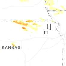

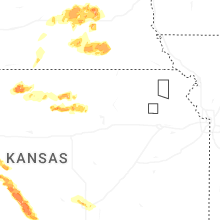

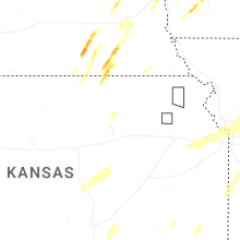
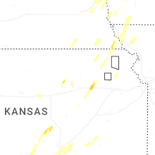
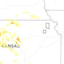
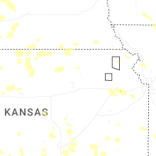
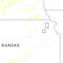


Connect with Interactive Hail Maps