

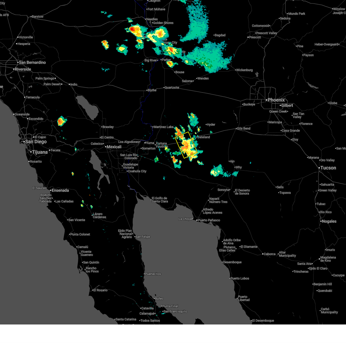
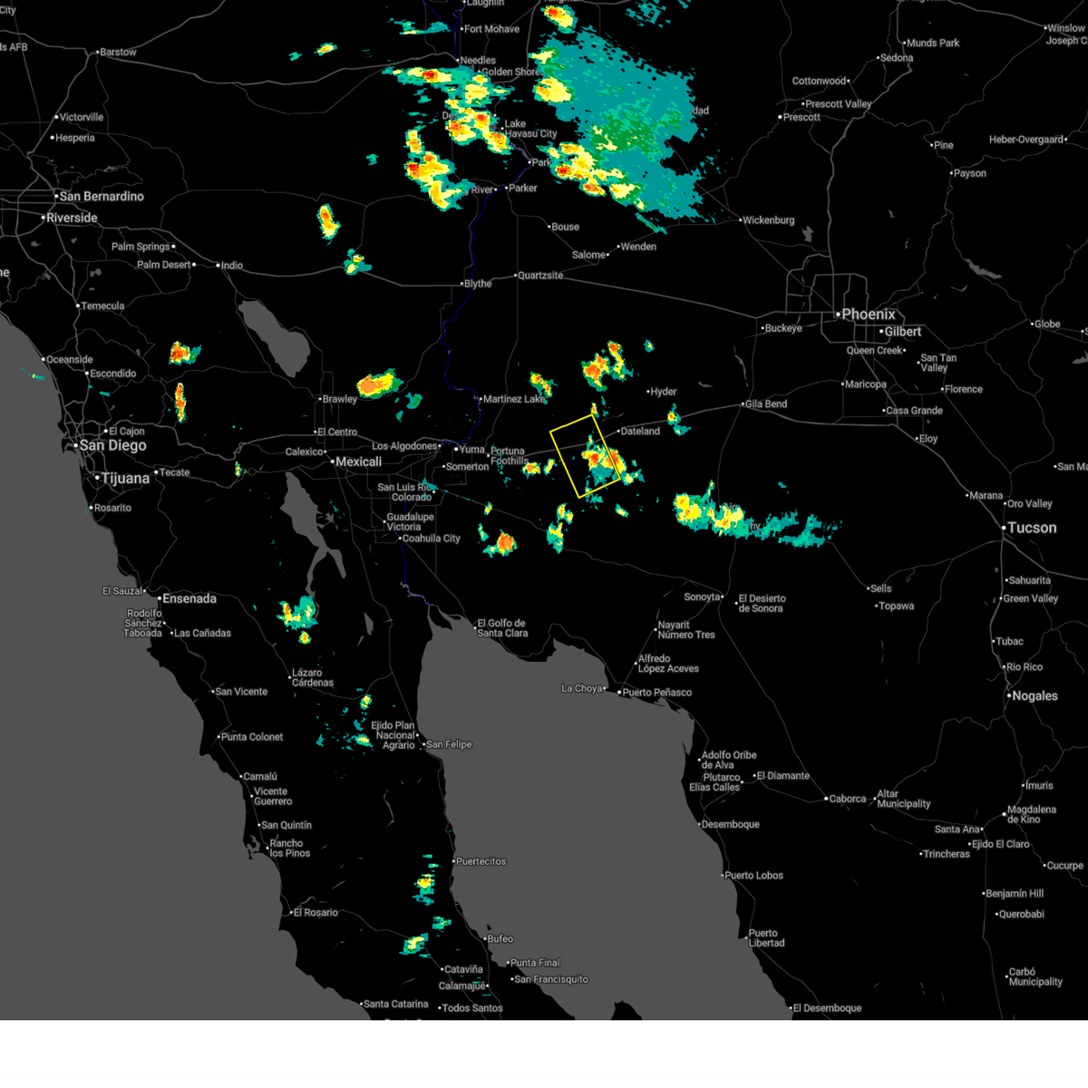
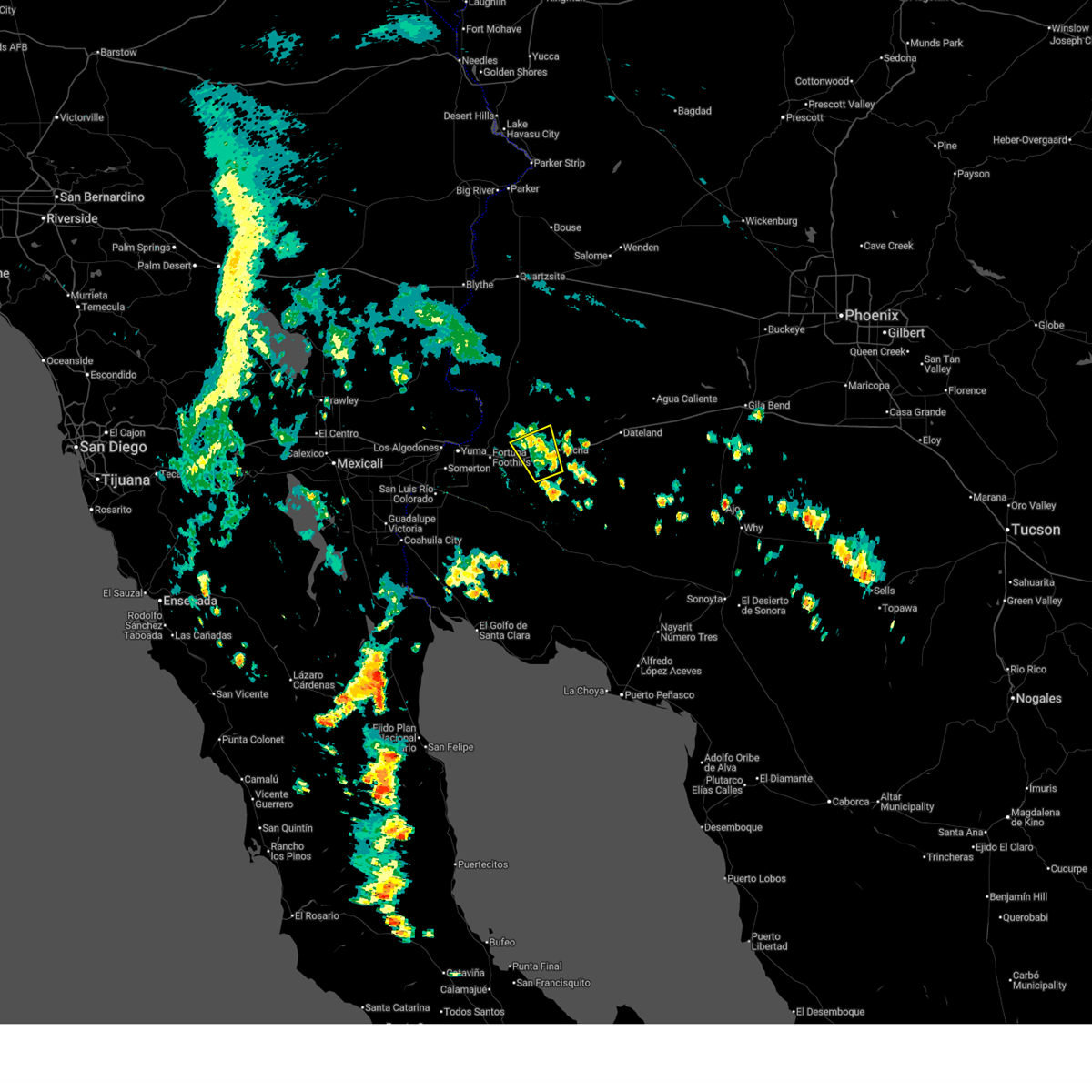
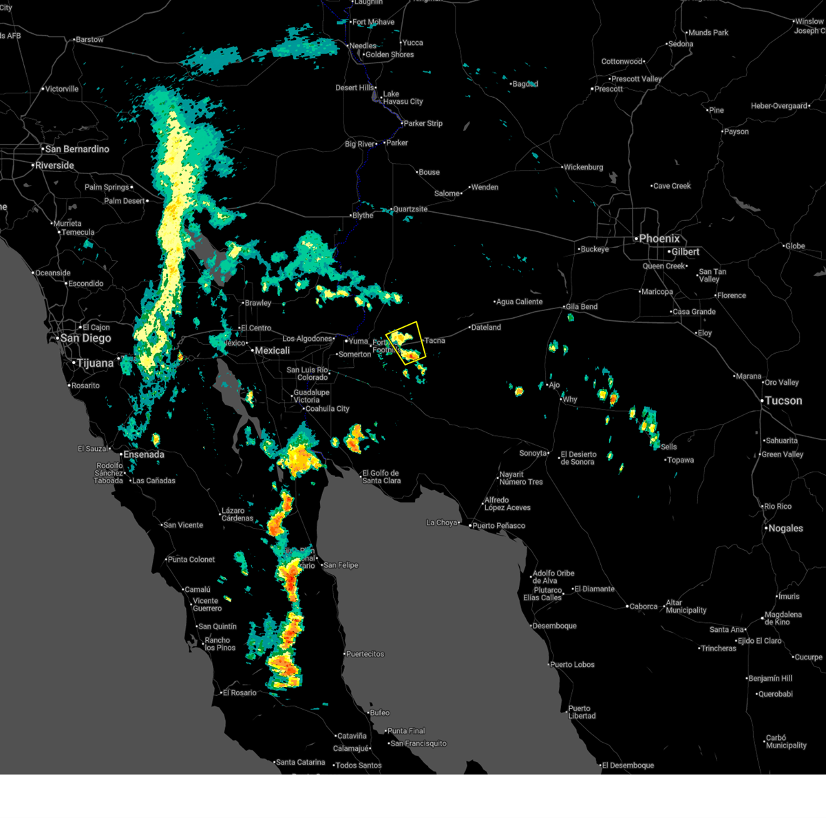
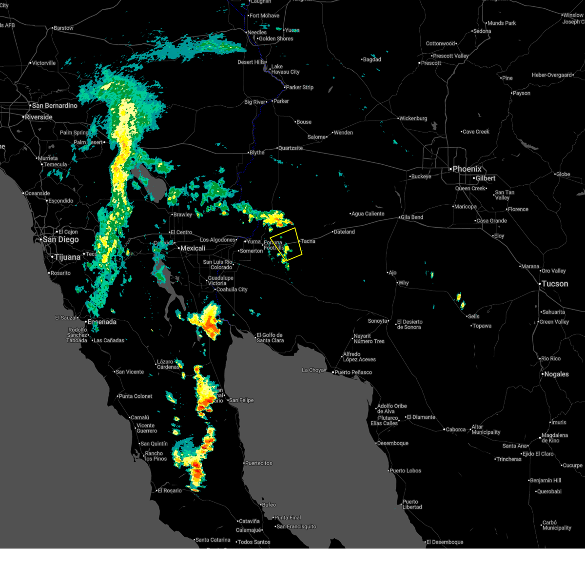
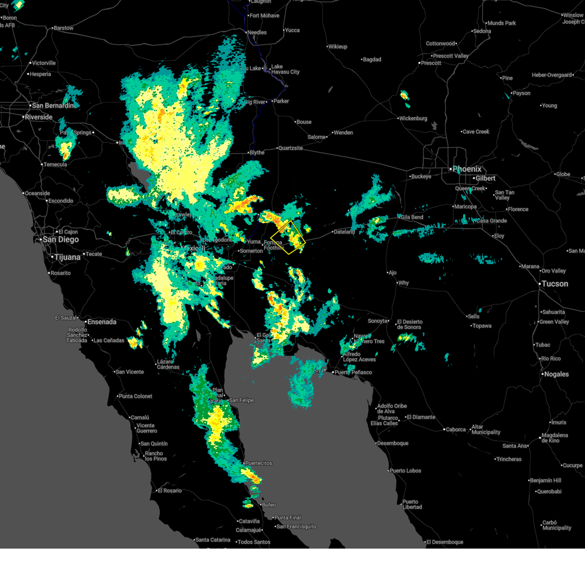
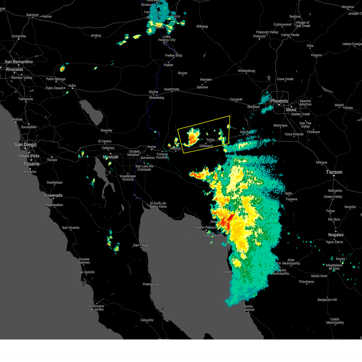
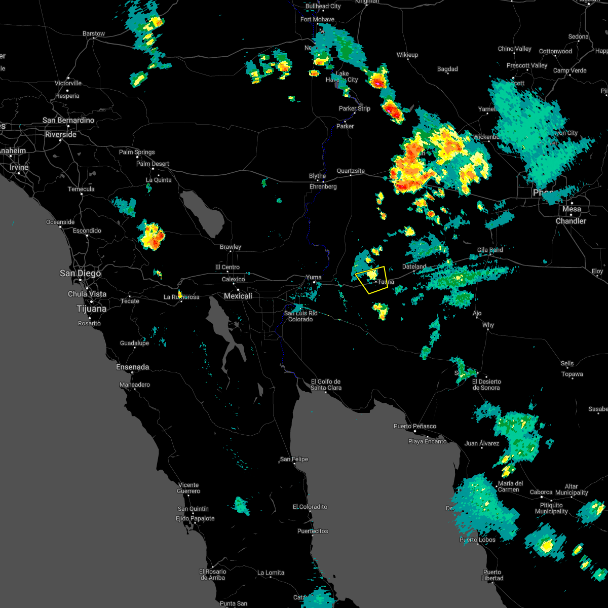
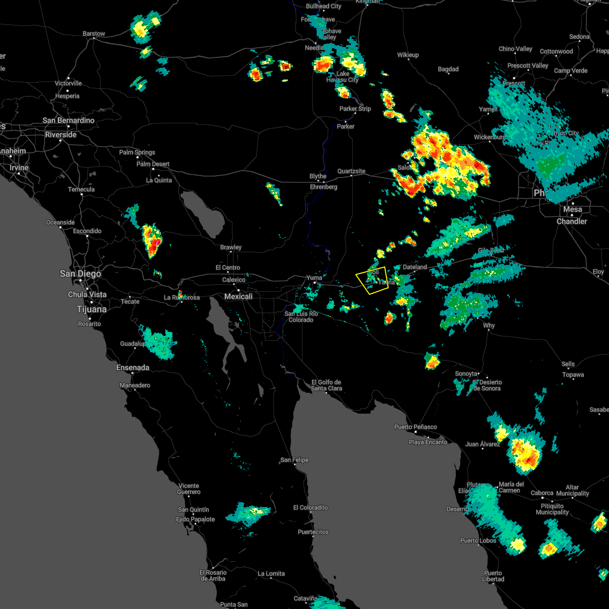
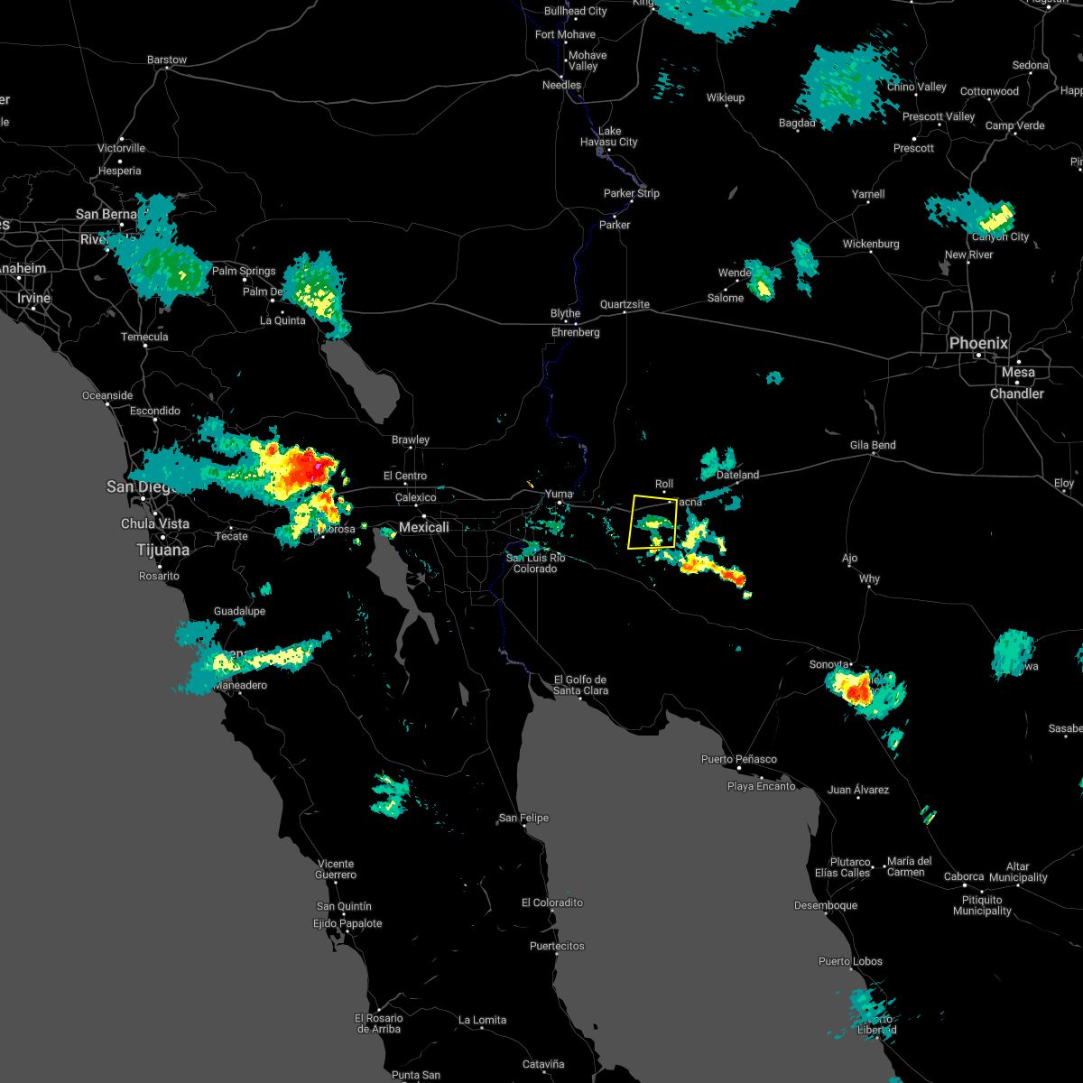
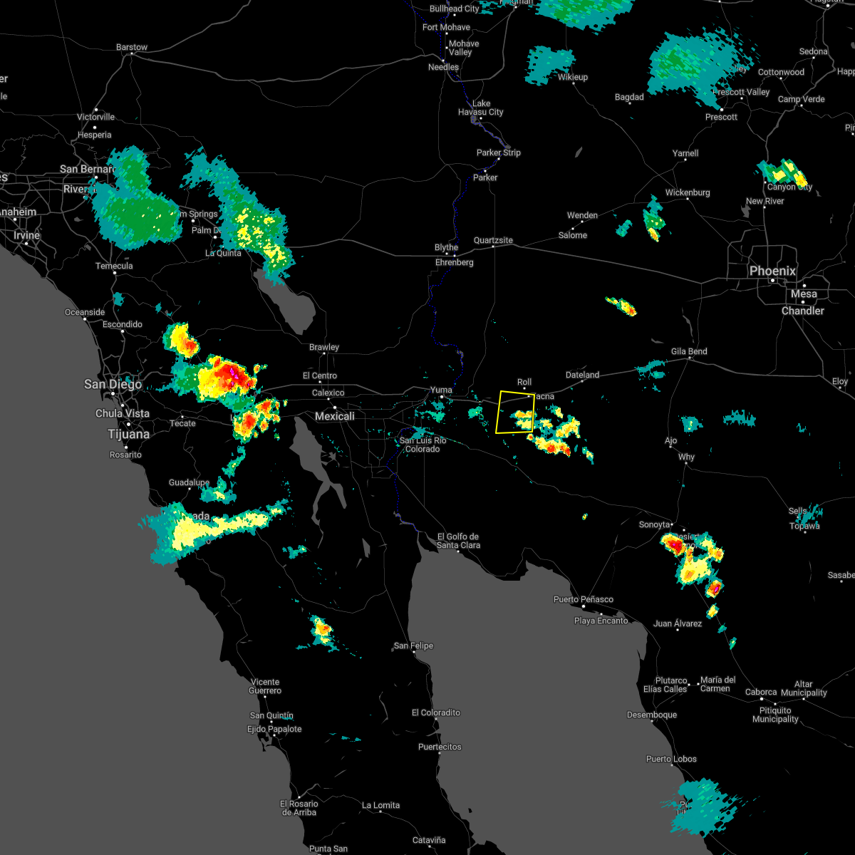
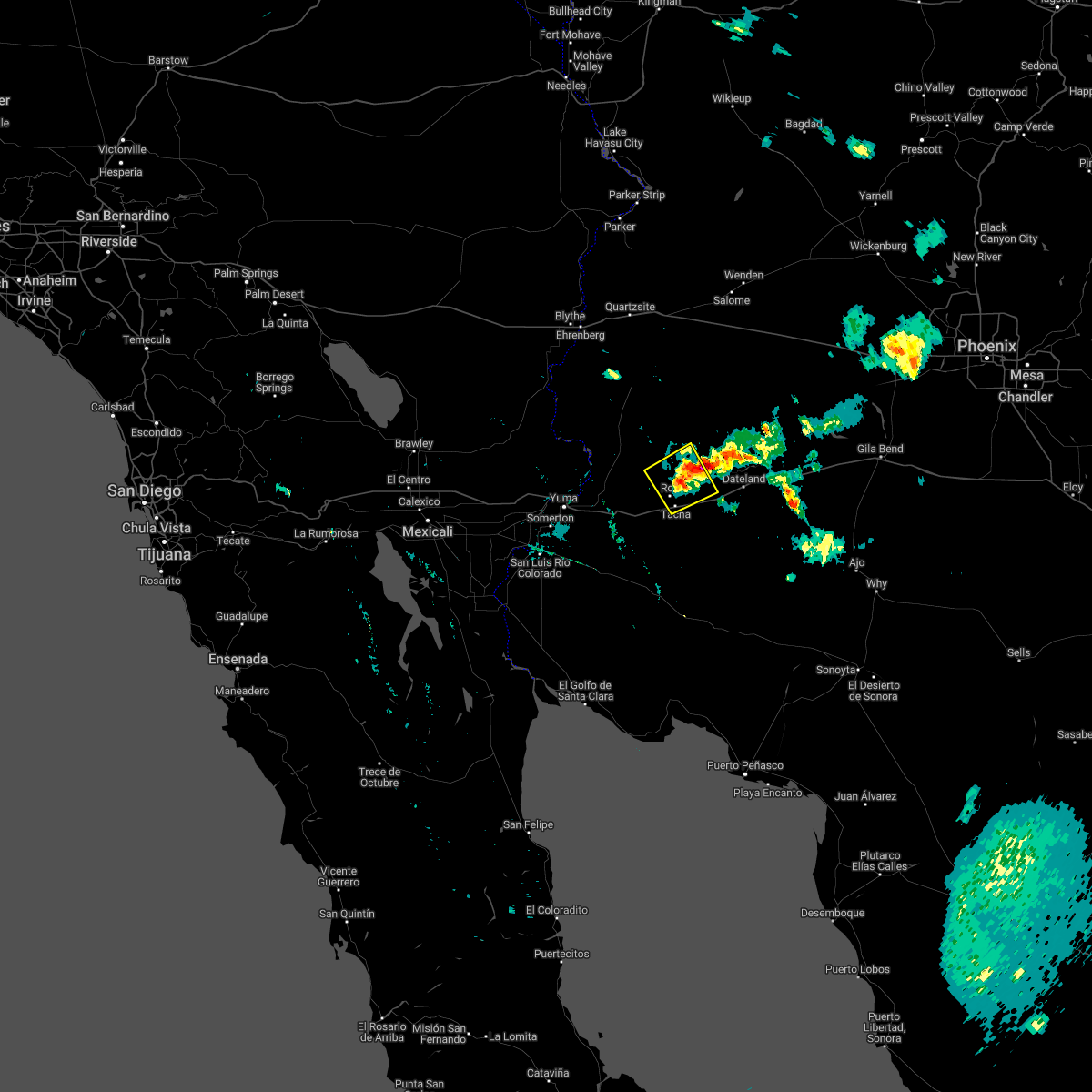
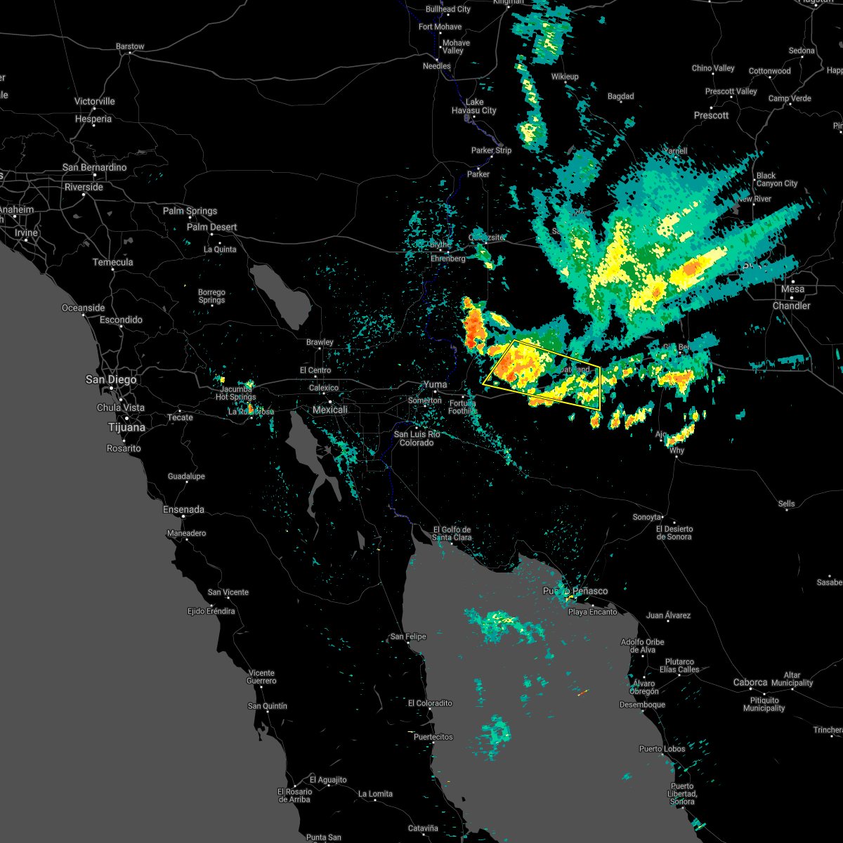
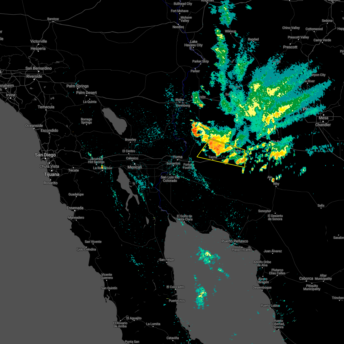
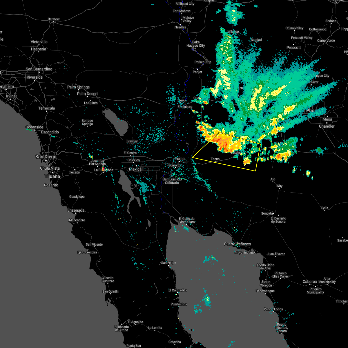
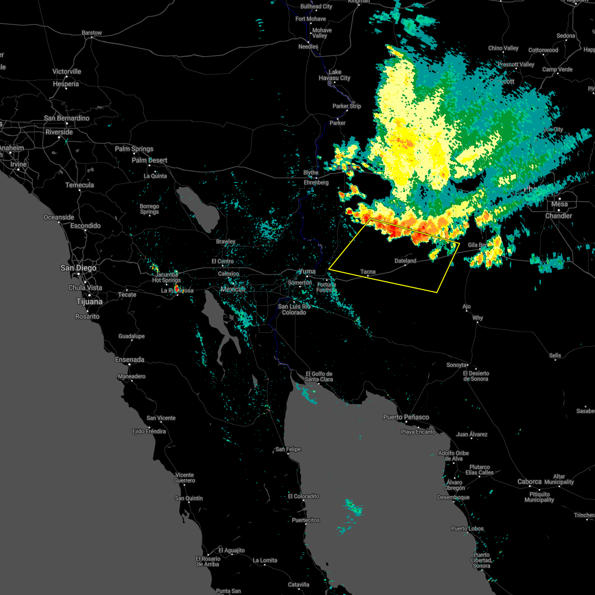
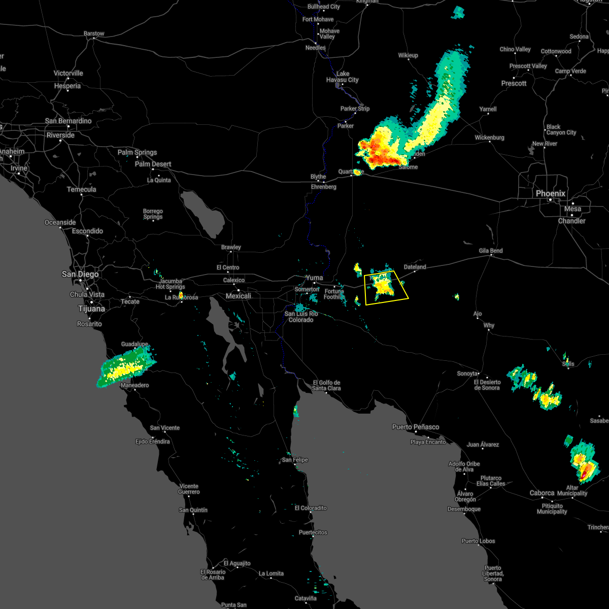
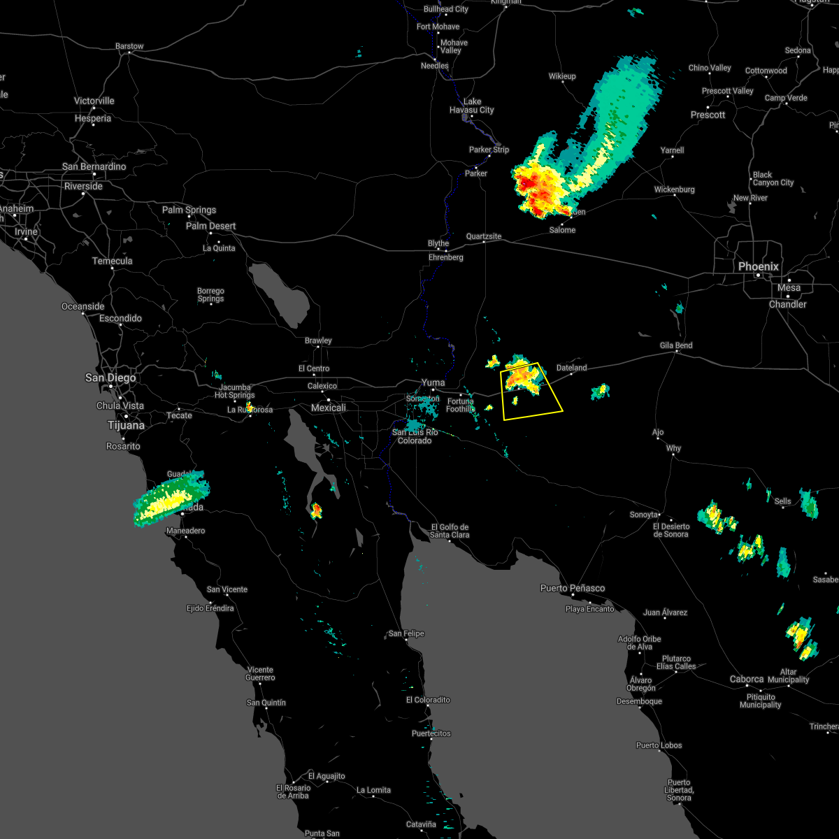
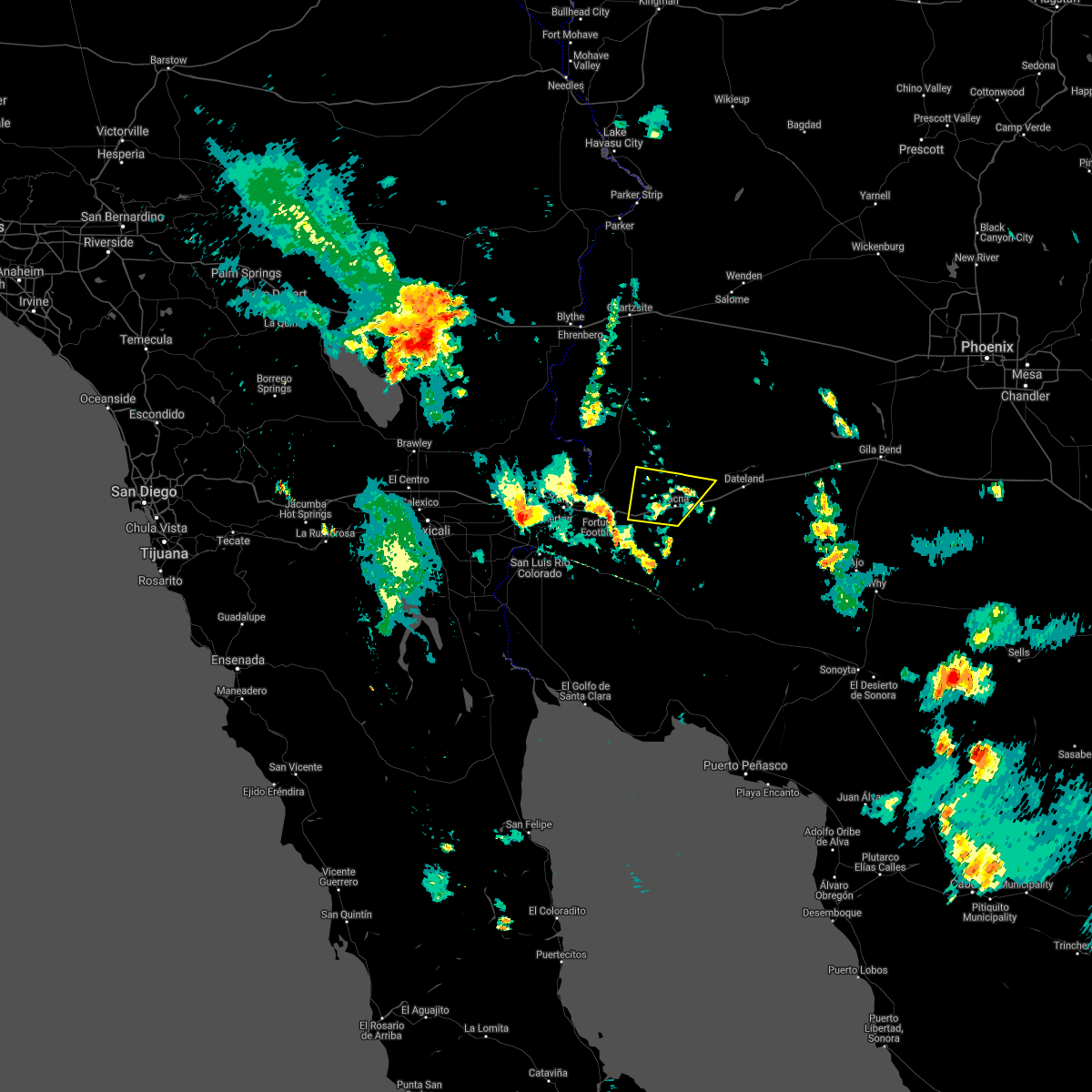
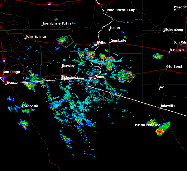
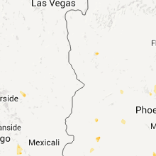
Hail Map for Tacna, AZ
The Tacna, AZ area has had 0 reports of on-the-ground hail by trained spotters, and has been under severe weather warnings 6 times during the past 12 months. Doppler radar has detected hail at or near Tacna, AZ on 4 occasions.
| Name: | Tacna, AZ |
| Where Located: | 38.3 miles E of Yuma, AZ |
| Map: | Google Map for Tacna, AZ |
| Population: | 602 |
| Housing Units: | 291 |
| More Info: | Search Google for Tacna, AZ |
0
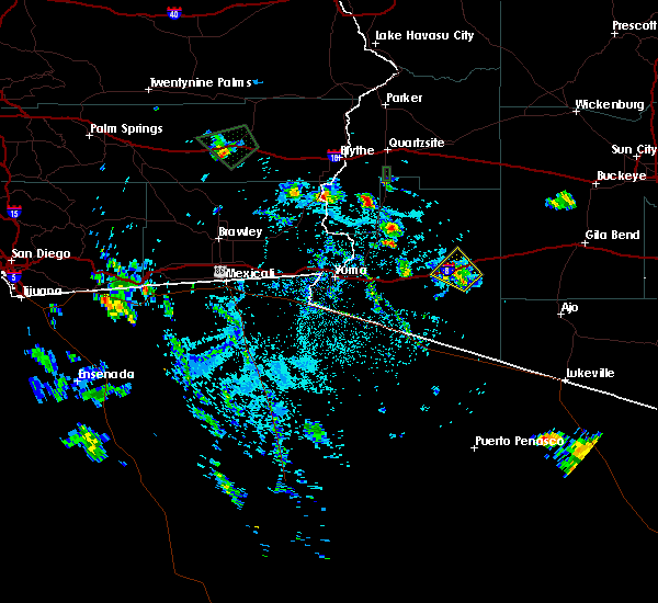
The Top Recent Hail Date for Tacna, AZ is Monday, September 23, 2019 (1st out of 4)

Hail and Wind Damage Spotted near Tacna, AZ
| Date / Time | Report Details |
|---|---|
| 9/18/2025 5:23 PM MST | Raws station tt823 mohawk dune in yuma county AZ, 12.7 miles W of Tacna, AZ |
| 9/4/2025 6:30 PM MST | Bakers tank raws measured a 58 mph gust. timing adjusted based on rada in yuma county AZ, 5.9 miles NNE of Tacna, AZ |
| 9/4/2025 6:17 PM MST |
 At 617 pm mst, a severe thunderstorm was located 8 miles southwest of mohawk, or 35 miles east of fortuna foothills, moving southwest at 10 mph (radar indicated). Hazards include 60 mph wind gusts and nickel size hail. Expect damage to roofs, siding, and trees. locations impacted include, tyson, mohawk, and tacna. This includes az interstate 8 between mile markers 43 and 60. At 617 pm mst, a severe thunderstorm was located 8 miles southwest of mohawk, or 35 miles east of fortuna foothills, moving southwest at 10 mph (radar indicated). Hazards include 60 mph wind gusts and nickel size hail. Expect damage to roofs, siding, and trees. locations impacted include, tyson, mohawk, and tacna. This includes az interstate 8 between mile markers 43 and 60.
|
| 9/4/2025 5:59 PM MST |
 Svrpsr the national weather service in phoenix has issued a * severe thunderstorm warning for, east central yuma county in southwestern arizona, * until 630 pm mst. * at 559 pm mst, a severe thunderstorm was located near mohawk, or 35 miles east of fortuna foothills, and is nearly stationary (radar indicated). Hazards include 60 mph wind gusts and nickel size hail. expect damage to roofs, siding, and trees Svrpsr the national weather service in phoenix has issued a * severe thunderstorm warning for, east central yuma county in southwestern arizona, * until 630 pm mst. * at 559 pm mst, a severe thunderstorm was located near mohawk, or 35 miles east of fortuna foothills, and is nearly stationary (radar indicated). Hazards include 60 mph wind gusts and nickel size hail. expect damage to roofs, siding, and trees
|
| 9/2/2025 1:06 PM MST |
 The storm which prompted the warning has weakened below severe limits, and has exited the warned area. therefore, the warning will be allowed to expire. however, gusty winds are still possible with this thunderstorm. The storm which prompted the warning has weakened below severe limits, and has exited the warned area. therefore, the warning will be allowed to expire. however, gusty winds are still possible with this thunderstorm.
|
| 9/2/2025 12:48 PM MST |
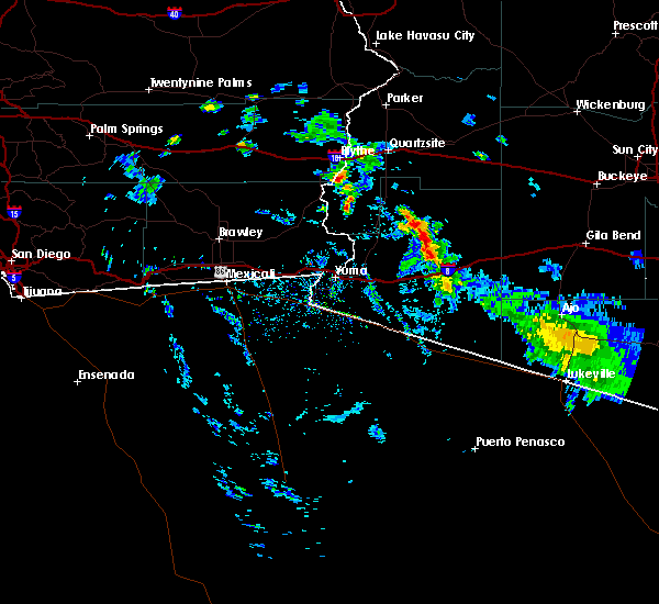
 At 1248 pm mst, a severe thunderstorm was located near wellton, or 15 miles east of fortuna foothills, moving northwest at 20 mph (radar indicated). Hazards include 60 mph wind gusts. Expect damage to roofs, siding, and trees. locations impacted include, wellton, tacna, and roll. This includes az interstate 8 between mile markers 27 and 41. At 1248 pm mst, a severe thunderstorm was located near wellton, or 15 miles east of fortuna foothills, moving northwest at 20 mph (radar indicated). Hazards include 60 mph wind gusts. Expect damage to roofs, siding, and trees. locations impacted include, wellton, tacna, and roll. This includes az interstate 8 between mile markers 27 and 41.
|
| 9/2/2025 12:23 PM MST |
 Svrpsr the national weather service in phoenix has issued a * severe thunderstorm warning for, central yuma county in southwestern arizona, * until 115 pm mst. * at 1222 pm mst, a severe thunderstorm was located 7 miles southeast of wellton, or 20 miles east of fortuna foothills, moving northwest at 20 mph (radar indicated). Hazards include 60 mph wind gusts. expect damage to roofs, siding, and trees Svrpsr the national weather service in phoenix has issued a * severe thunderstorm warning for, central yuma county in southwestern arizona, * until 115 pm mst. * at 1222 pm mst, a severe thunderstorm was located 7 miles southeast of wellton, or 20 miles east of fortuna foothills, moving northwest at 20 mph (radar indicated). Hazards include 60 mph wind gusts. expect damage to roofs, siding, and trees
|
| 8/25/2025 5:41 PM MST |
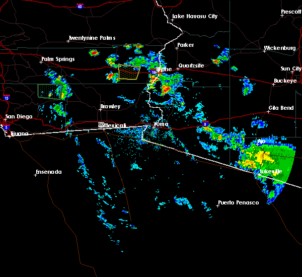
 Svrpsr the national weather service in phoenix has issued a * severe thunderstorm warning for, central yuma county in southwestern arizona, * until 630 pm mst. * at 540 pm mst, a severe thunderstorm was located near tacna, or 19 miles east of fortuna foothills, moving northwest at 10 mph (radar indicated). Hazards include 60 mph wind gusts. expect damage to roofs, siding, and trees Svrpsr the national weather service in phoenix has issued a * severe thunderstorm warning for, central yuma county in southwestern arizona, * until 630 pm mst. * at 540 pm mst, a severe thunderstorm was located near tacna, or 19 miles east of fortuna foothills, moving northwest at 10 mph (radar indicated). Hazards include 60 mph wind gusts. expect damage to roofs, siding, and trees
|
| 9/1/2023 11:49 AM MST | Yuma proving ground station 4 measured a 62 mph wind gus in yuma county AZ, 12.4 miles SSE of Tacna, AZ |
| 9/1/2023 11:33 AM MST |
 At 1133 am mst, severe thunderstorms were located from sentinel to tacna, moving north at 20 mph (radar indicated). Hazards include 60 mph wind gusts and penny size hail. expect damage to roofs, siding, and trees At 1133 am mst, severe thunderstorms were located from sentinel to tacna, moving north at 20 mph (radar indicated). Hazards include 60 mph wind gusts and penny size hail. expect damage to roofs, siding, and trees
|
| 8/12/2022 6:06 PM MST |
 The severe thunderstorm warning for central yuma county will expire at 615 pm mst, the storm which prompted the warning has weakened below severe limits, and no longer poses an immediate threat to life or property. therefore, the warning will be allowed to expire. however gusty winds are still possible with this thunderstorm. The severe thunderstorm warning for central yuma county will expire at 615 pm mst, the storm which prompted the warning has weakened below severe limits, and no longer poses an immediate threat to life or property. therefore, the warning will be allowed to expire. however gusty winds are still possible with this thunderstorm.
|
| 8/12/2022 5:30 PM MST |
 At 530 pm mst, a severe thunderstorm was located over tacna, or 26 miles east of fortuna foothills, moving north at 5 mph (radar indicated). Hazards include 60 mph wind gusts and penny size hail. expect damage to roofs, siding, and trees At 530 pm mst, a severe thunderstorm was located over tacna, or 26 miles east of fortuna foothills, moving north at 5 mph (radar indicated). Hazards include 60 mph wind gusts and penny size hail. expect damage to roofs, siding, and trees
|
| 8/8/2022 6:10 PM MST |
 The severe thunderstorm warning for central yuma county will expire at 615 pm mst, the storm which prompted the warning has weakened below severe limits, and no longer poses an immediate threat to life or property. therefore, the warning will be allowed to expire. however heavy rain is still possible with this thunderstorm. The severe thunderstorm warning for central yuma county will expire at 615 pm mst, the storm which prompted the warning has weakened below severe limits, and no longer poses an immediate threat to life or property. therefore, the warning will be allowed to expire. however heavy rain is still possible with this thunderstorm.
|
| 8/8/2022 5:36 PM MST |
 At 534 pm mst, a severe thunderstorm was located 9 miles south of tacna, or 24 miles east of fortuna foothills, moving west at 5 mph (radar indicated). Hazards include 60 mph wind gusts. Expect damage to roofs, siding, and trees. Motorists will encounter very hazardous driving conditions. At 534 pm mst, a severe thunderstorm was located 9 miles south of tacna, or 24 miles east of fortuna foothills, moving west at 5 mph (radar indicated). Hazards include 60 mph wind gusts. Expect damage to roofs, siding, and trees. Motorists will encounter very hazardous driving conditions.
|
| 6/25/2022 6:51 PM MST |
 At 651 pm mst, a severe thunderstorm was located over tyson, or 31 miles east of fortuna foothills, and is nearly stationary (radar indicated). Hazards include 60 mph wind gusts and penny size hail. expect damage to roofs, siding, and trees At 651 pm mst, a severe thunderstorm was located over tyson, or 31 miles east of fortuna foothills, and is nearly stationary (radar indicated). Hazards include 60 mph wind gusts and penny size hail. expect damage to roofs, siding, and trees
|
| 8/14/2021 1:58 AM MST |
 The severe thunderstorm warning for east central yuma county will expire at 200 am mst, the storms which prompted the warning have weakened below severe limits, and no longer pose an immediate threat to life or property. therefore, the warning will be allowed to expire. however gusty winds, dense blowing dust, and heavy rain are still possible with these thunderstorms. a severe thunderstorm watch remains in effect until 300 am mst for southwestern arizona. The severe thunderstorm warning for east central yuma county will expire at 200 am mst, the storms which prompted the warning have weakened below severe limits, and no longer pose an immediate threat to life or property. therefore, the warning will be allowed to expire. however gusty winds, dense blowing dust, and heavy rain are still possible with these thunderstorms. a severe thunderstorm watch remains in effect until 300 am mst for southwestern arizona.
|
| 8/14/2021 1:40 AM MST |
 At 140 am mst, severe thunderstorms were located along a line extending from 17 miles south of dateland to 7 miles northwest of tyson, moving southwest at 40 mph (radar indicated). Hazards include 60 mph wind gusts. Expect damage to roofs, siding, and trees. locations impacted include, dateland, tacna, tyson, mohawk and roll. this includes az interstate 8 between mile markers 41 and 79. hail threat, radar indicated max hail size, <. 75 in wind threat, radar indicated max wind gust, 60 mph. At 140 am mst, severe thunderstorms were located along a line extending from 17 miles south of dateland to 7 miles northwest of tyson, moving southwest at 40 mph (radar indicated). Hazards include 60 mph wind gusts. Expect damage to roofs, siding, and trees. locations impacted include, dateland, tacna, tyson, mohawk and roll. this includes az interstate 8 between mile markers 41 and 79. hail threat, radar indicated max hail size, <. 75 in wind threat, radar indicated max wind gust, 60 mph.
|
| 8/14/2021 1:27 AM MST |
 At 127 am mst, severe thunderstorms were located along a line extending from 15 miles southeast of dateland to 10 miles north of tyson, moving southwest at 30 mph (radar indicated). Hazards include 60 mph wind gusts. Expect damage to roofs, siding, and trees. locations impacted include, tacna, sentinel, paloma, tyson, dateland, mohawk, roll and hyder. this includes az interstate 8 between mile markers 40 and 92. hail threat, radar indicated max hail size, <. 75 in wind threat, radar indicated max wind gust, 60 mph. At 127 am mst, severe thunderstorms were located along a line extending from 15 miles southeast of dateland to 10 miles north of tyson, moving southwest at 30 mph (radar indicated). Hazards include 60 mph wind gusts. Expect damage to roofs, siding, and trees. locations impacted include, tacna, sentinel, paloma, tyson, dateland, mohawk, roll and hyder. this includes az interstate 8 between mile markers 40 and 92. hail threat, radar indicated max hail size, <. 75 in wind threat, radar indicated max wind gust, 60 mph.
|
| 8/14/2021 1:03 AM MST |
 At 103 am mst, severe thunderstorms were located along a line extending from sentinel to 21 miles north of tyson, moving southwest at 40 mph (radar indicated). Hazards include 60 mph wind gusts. expect damage to roofs, siding, and trees At 103 am mst, severe thunderstorms were located along a line extending from sentinel to 21 miles north of tyson, moving southwest at 40 mph (radar indicated). Hazards include 60 mph wind gusts. expect damage to roofs, siding, and trees
|
| 8/12/2021 7:12 PM MST |
 At 712 pm mst, a severe thunderstorm was located 10 miles south of mohawk, or 36 miles east of fortuna foothills, moving southeast at 20 mph (radar indicated). Hazards include 60 mph wind gusts and quarter size hail. Hail damage to vehicles is expected. expect wind damage to roofs, siding, and trees. locations impacted include, tacna, mohawk and roll. This includes az interstate 8 between mile markers 35 and 55. At 712 pm mst, a severe thunderstorm was located 10 miles south of mohawk, or 36 miles east of fortuna foothills, moving southeast at 20 mph (radar indicated). Hazards include 60 mph wind gusts and quarter size hail. Hail damage to vehicles is expected. expect wind damage to roofs, siding, and trees. locations impacted include, tacna, mohawk and roll. This includes az interstate 8 between mile markers 35 and 55.
|
| 8/12/2021 7:00 PM MST | Numerous power poles blown down along avenue 40 e between e county 6th st and 8th st. time estimated from spotter between 700 and 745 p in yuma county AZ, 1.8 miles SSW of Tacna, AZ |
| 8/12/2021 6:50 PM MST |
 At 650 pm mst, a severe thunderstorm was located near tacna, or 32 miles east of fortuna foothills, moving southeast at 20 mph (radar indicated). Hazards include 60 mph wind gusts and penny size hail. expect damage to roofs, siding, and trees At 650 pm mst, a severe thunderstorm was located near tacna, or 32 miles east of fortuna foothills, moving southeast at 20 mph (radar indicated). Hazards include 60 mph wind gusts and penny size hail. expect damage to roofs, siding, and trees
|
| 7/30/2021 6:51 PM MST |
 At 651 pm mst, a severe thunderstorm was located near tacna, or 22 miles east of fortuna foothills, moving northeast at 5 mph (radar indicated). Hazards include 60 mph wind gusts and penny size hail. expect damage to roofs, siding, and trees At 651 pm mst, a severe thunderstorm was located near tacna, or 22 miles east of fortuna foothills, moving northeast at 5 mph (radar indicated). Hazards include 60 mph wind gusts and penny size hail. expect damage to roofs, siding, and trees
|
| 9/4/2019 6:34 PM MST |
 At 633 pm mst, a severe thunderstorm was located near mohawk, or 37 miles east of fortuna foothills, moving northwest at 10 mph (trained weather spotters). Hazards include 60 mph wind gusts and penny size hail. Expect damage to roofs, siding, and trees. locations impacted include, tacna, tyson and mohawk. This includes az interstate 8 between mile markers 43 and 61. At 633 pm mst, a severe thunderstorm was located near mohawk, or 37 miles east of fortuna foothills, moving northwest at 10 mph (trained weather spotters). Hazards include 60 mph wind gusts and penny size hail. Expect damage to roofs, siding, and trees. locations impacted include, tacna, tyson and mohawk. This includes az interstate 8 between mile markers 43 and 61.
|
| 9/4/2019 6:20 PM MST | ***delayed report...power lines down on s avenue 40 e between e county 5th and 6th street north of tacna. time estimated by yuma county sheriff dispatch and rada in yuma county AZ, 3.7 miles SSW of Tacna, AZ |
| 9/4/2019 6:14 PM MST |
 At 614 pm mst, a severe thunderstorm was located over mohawk, or 39 miles east of fortuna foothills, moving northwest at 10 mph (radar indicated). Hazards include 60 mph wind gusts and nickel size hail. expect damage to roofs, siding, and trees At 614 pm mst, a severe thunderstorm was located over mohawk, or 39 miles east of fortuna foothills, moving northwest at 10 mph (radar indicated). Hazards include 60 mph wind gusts and nickel size hail. expect damage to roofs, siding, and trees
|
| 7/9/2018 7:52 PM MST | Storm damage reported in yuma county AZ, 11.8 miles SSE of Tacna, AZ |
| 9/7/2017 7:07 PM MST |
 At 706 pm mst, a severe thunderstorm was located 10 miles northeast of tyson, or 38 miles east of martinez lake, moving north at 20 mph. the storm had weakened over the past 15 minutes but the warning will be allowed to continue (radar indicated). Hazards include 60 mph wind gusts and penny size hail. Expect damage to roofs, siding, and trees. Locations impacted include, tacna, tyson and mohawk. At 706 pm mst, a severe thunderstorm was located 10 miles northeast of tyson, or 38 miles east of martinez lake, moving north at 20 mph. the storm had weakened over the past 15 minutes but the warning will be allowed to continue (radar indicated). Hazards include 60 mph wind gusts and penny size hail. Expect damage to roofs, siding, and trees. Locations impacted include, tacna, tyson and mohawk.
|
| 9/7/2017 6:27 PM MST |
 At 626 pm mst, a severe thunderstorm was located over mohawk, or 38 miles east of fortuna foothills, moving north at 20 mph (radar indicated). Hazards include 60 mph wind gusts and penny size hail. dense blowing dust is likely as well. expect damage to roofs, siding, and trees At 626 pm mst, a severe thunderstorm was located over mohawk, or 38 miles east of fortuna foothills, moving north at 20 mph (radar indicated). Hazards include 60 mph wind gusts and penny size hail. dense blowing dust is likely as well. expect damage to roofs, siding, and trees
|
| 8/3/2017 4:08 PM MST | Several power poles reported down near tacn in yuma county AZ, 1.3 miles SW of Tacna, AZ |
| 7/5/2014 4:53 PM MST | Power pole blown dow in yuma county AZ, 1 miles W of Tacna, AZ |
Hail Maps for Tacna, AZ


Connect with Interactive Hail Maps