

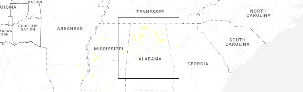
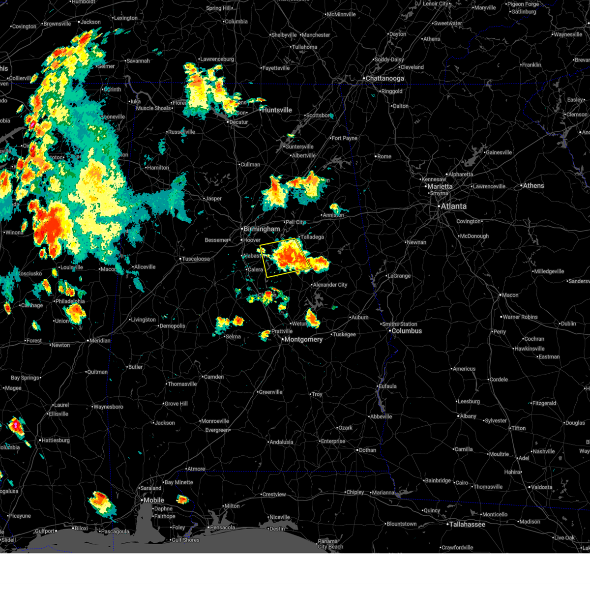
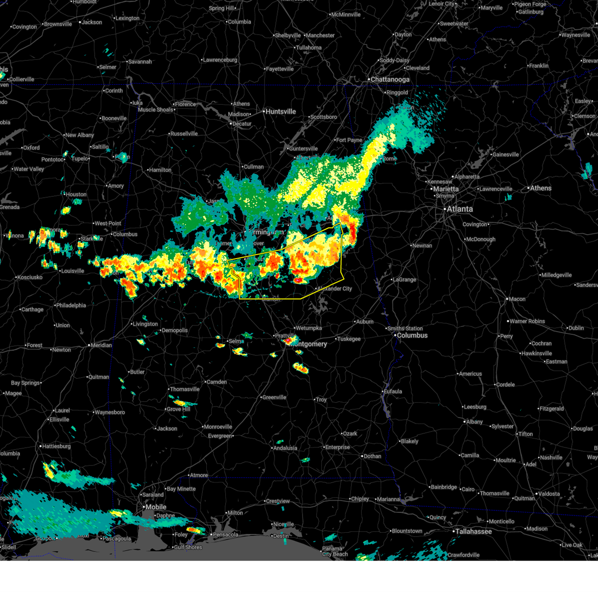
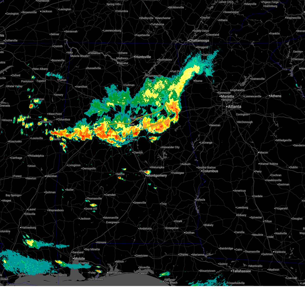
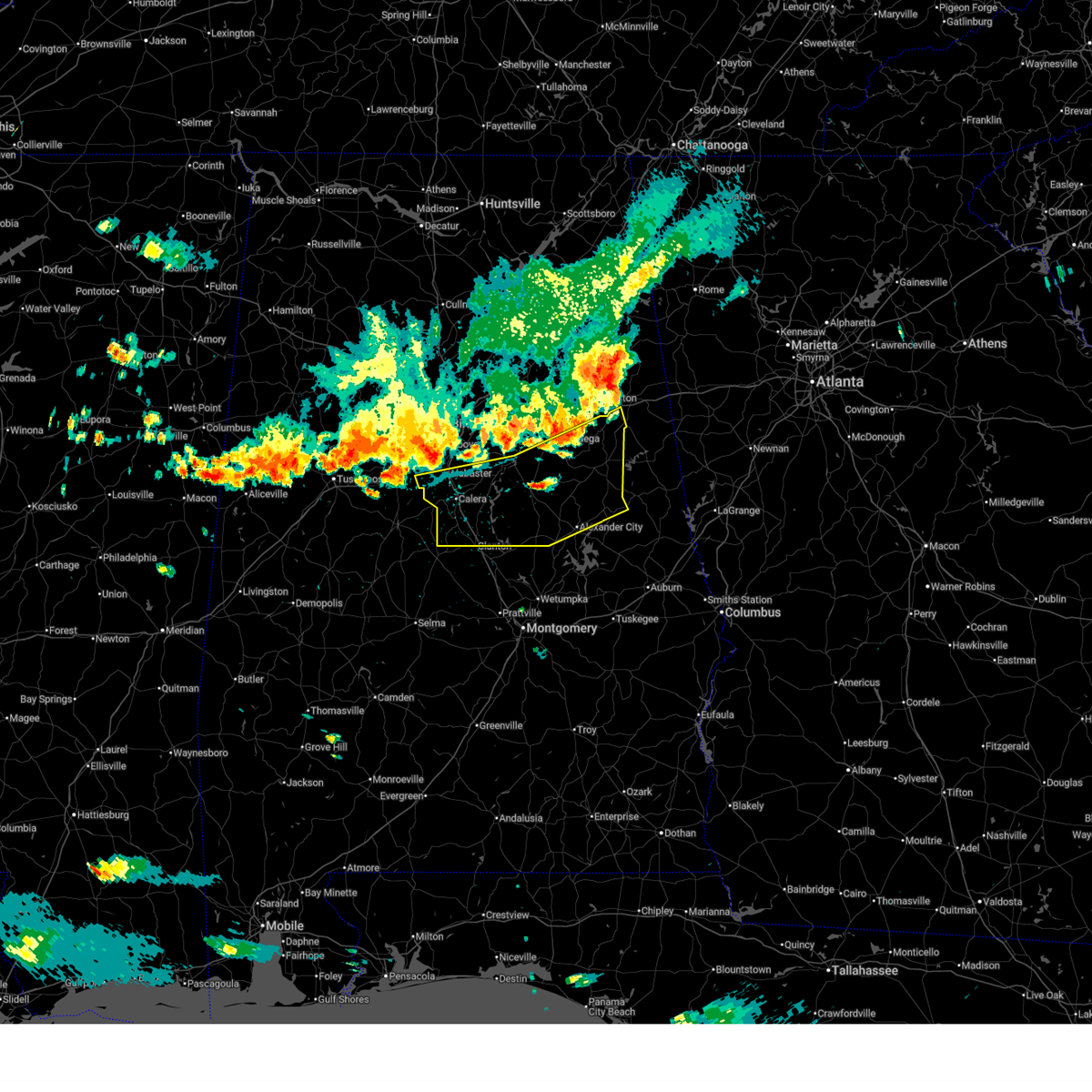
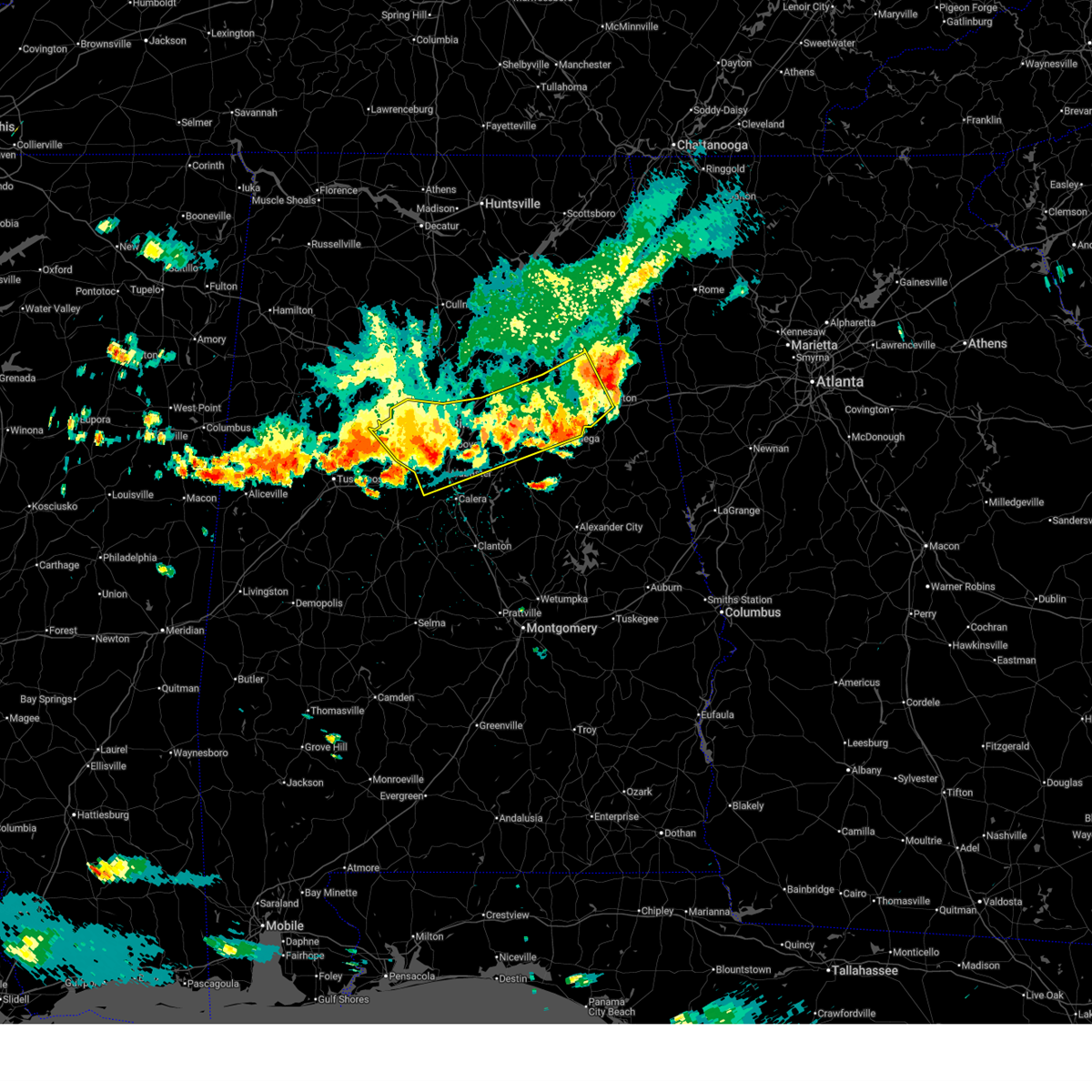
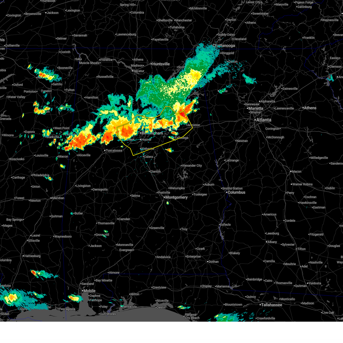
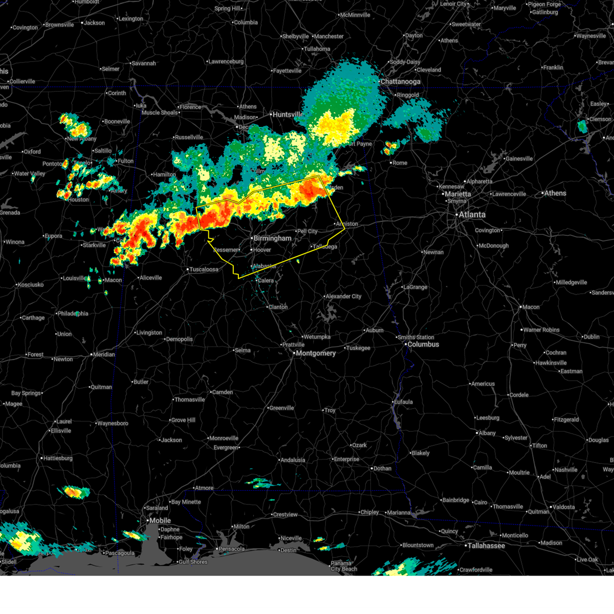
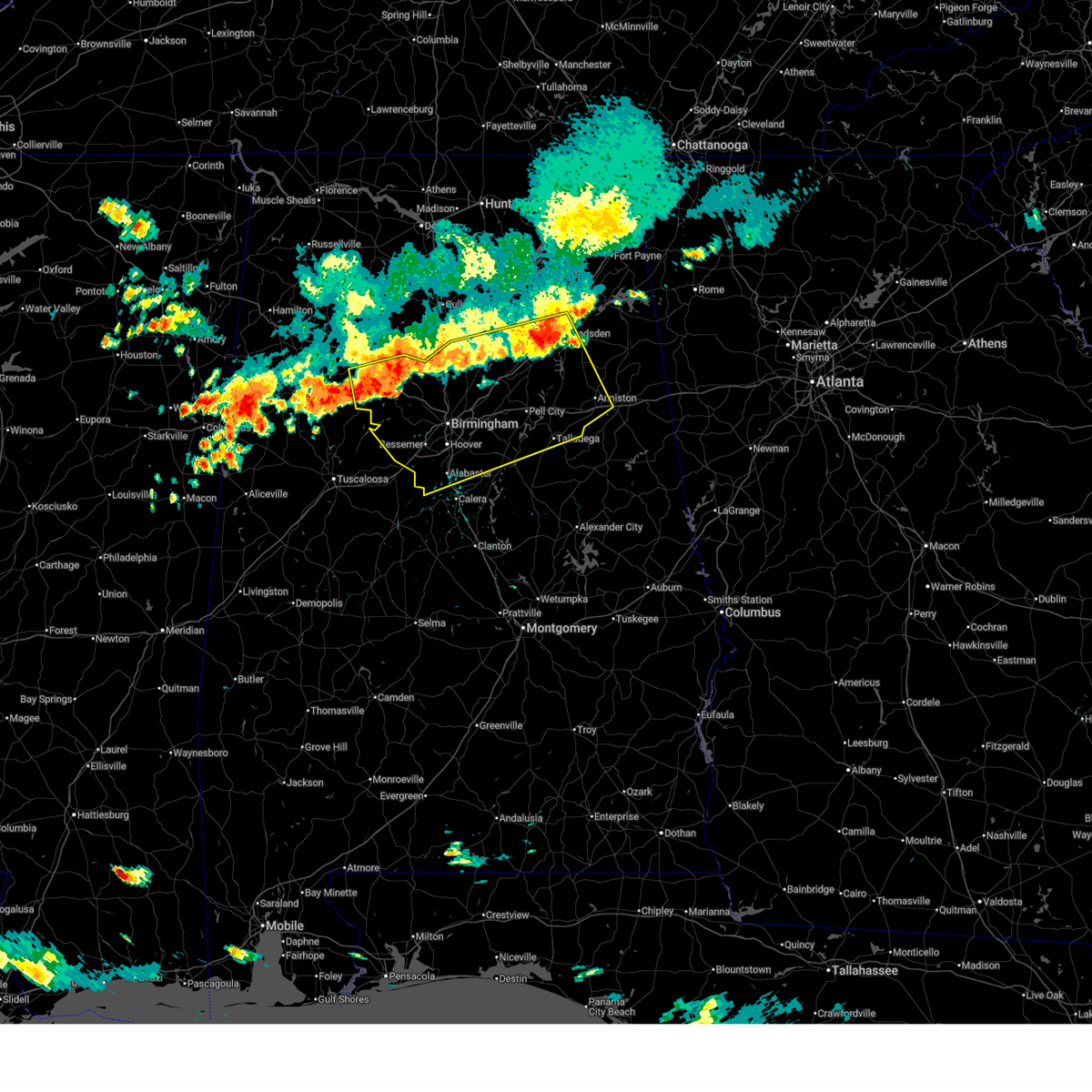
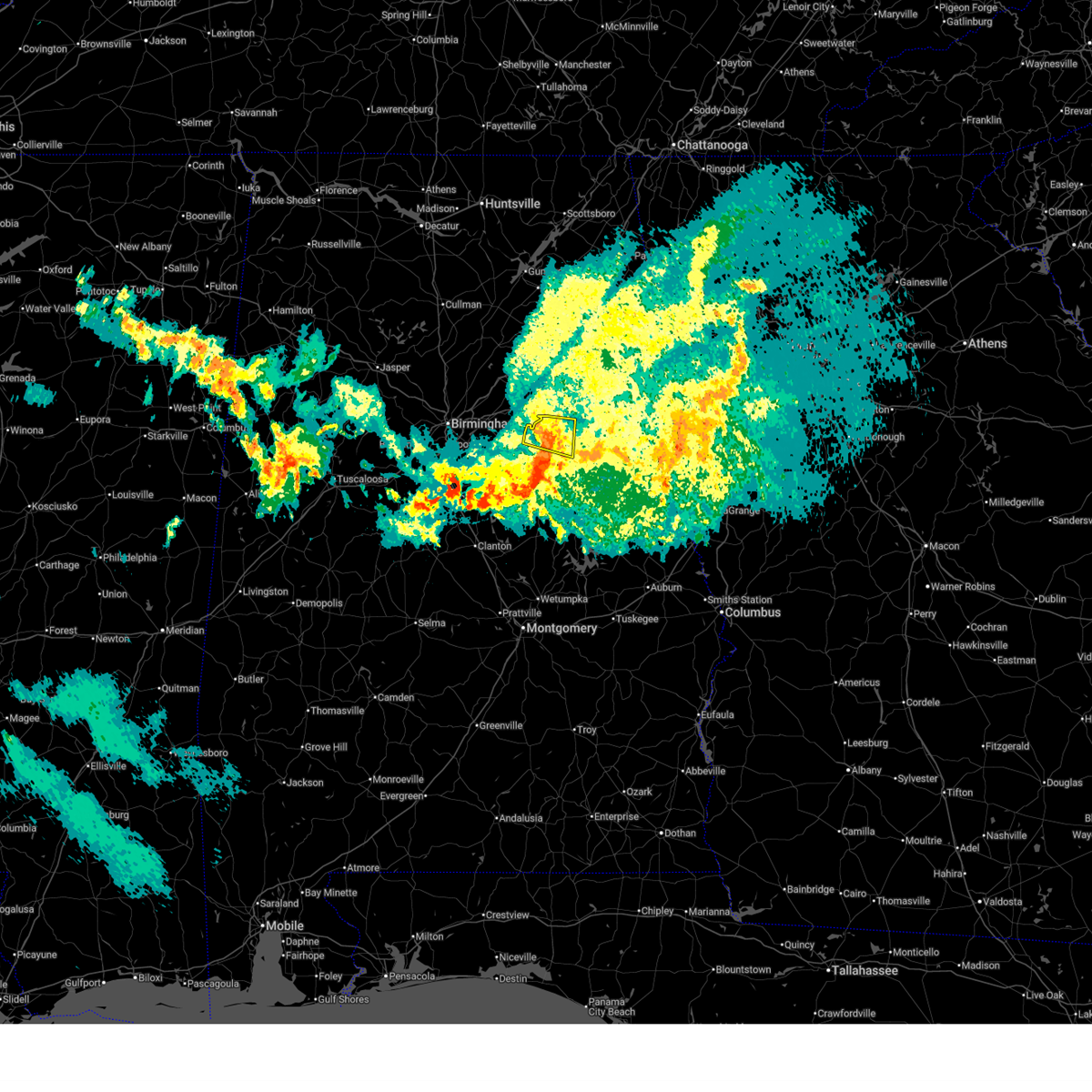
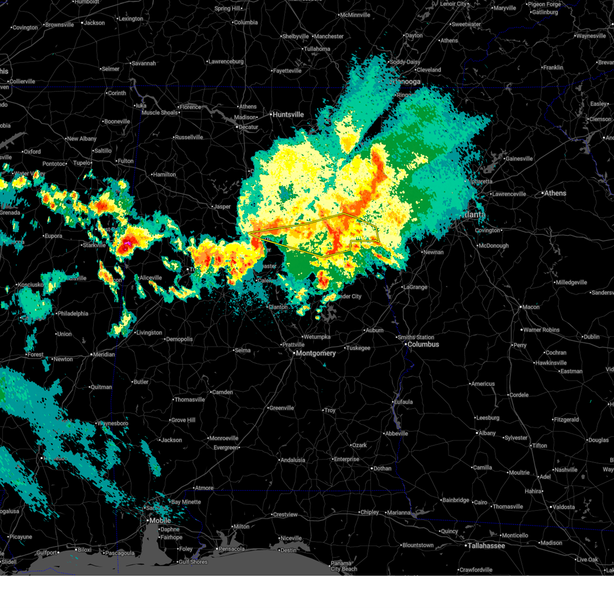
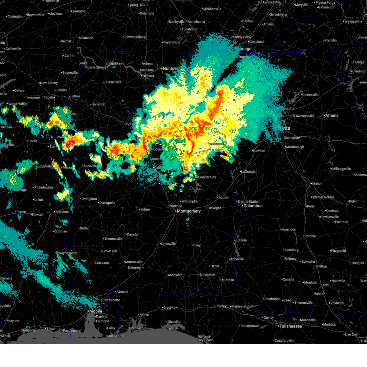
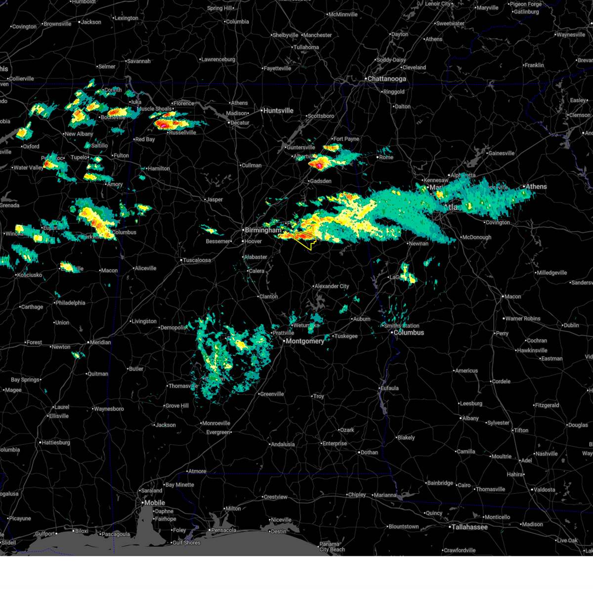
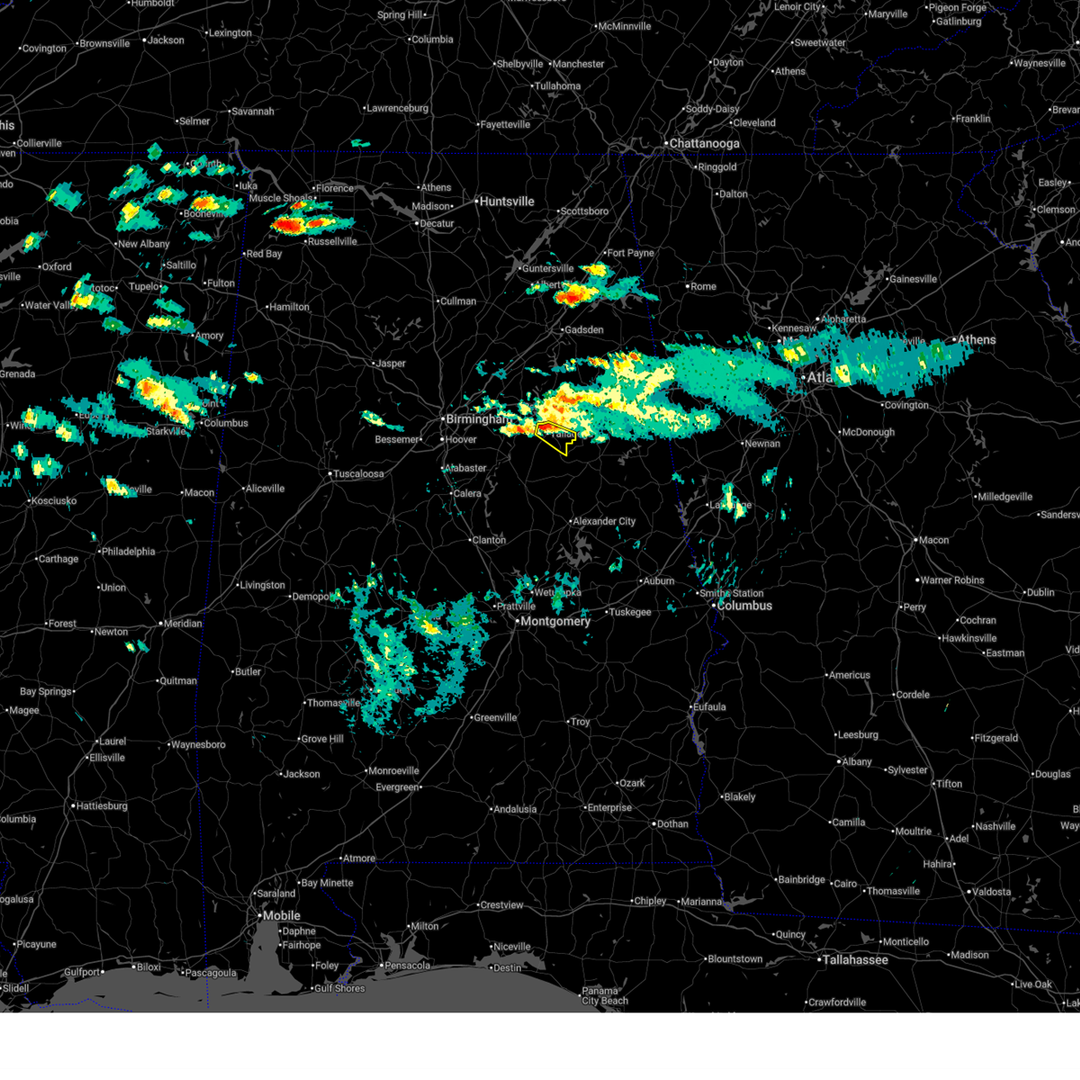
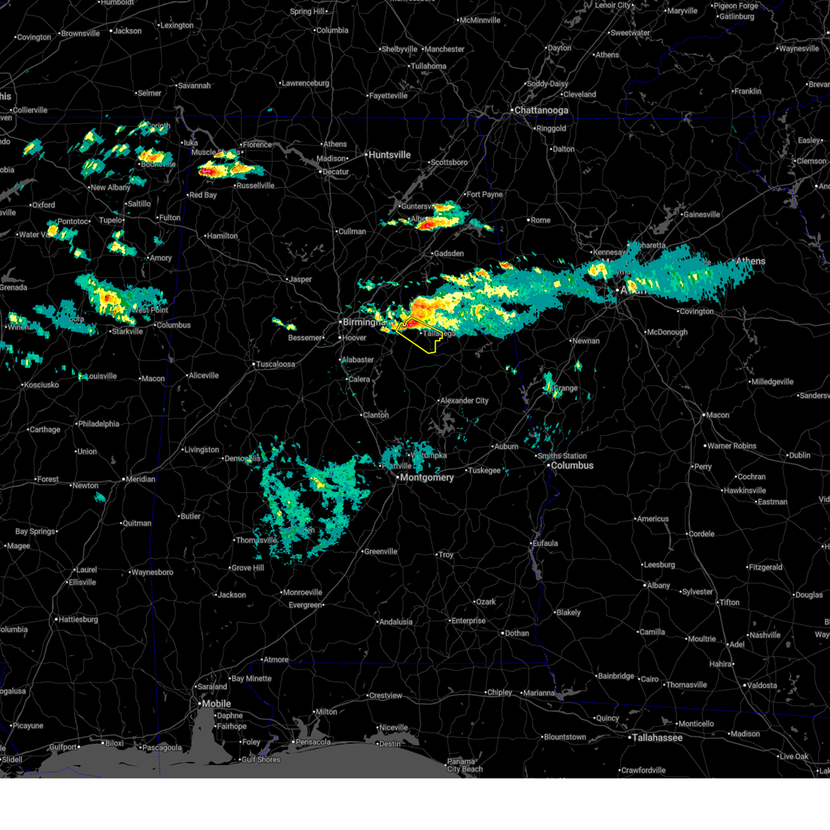
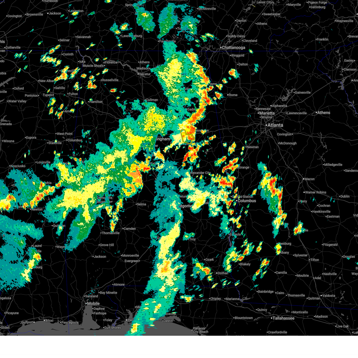
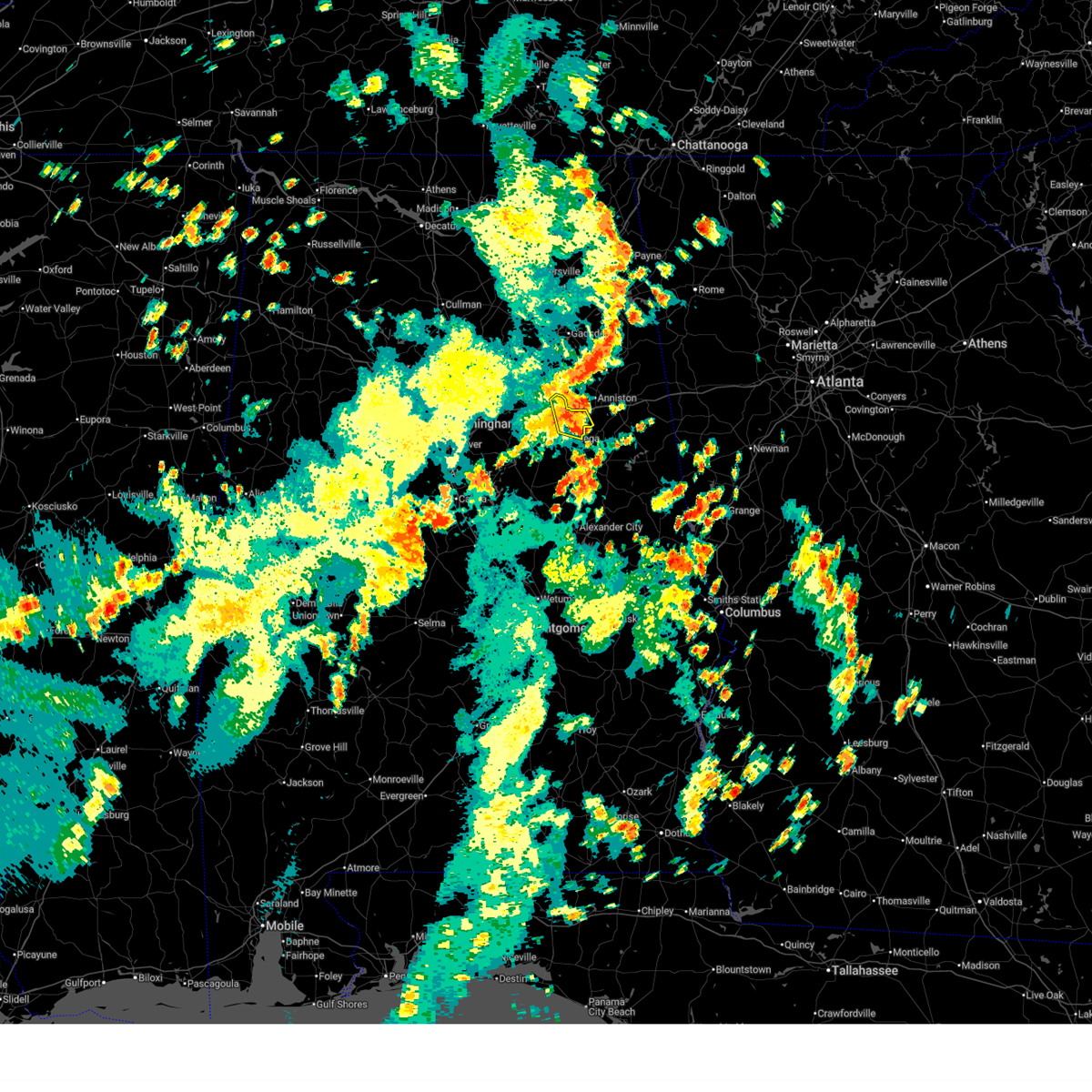
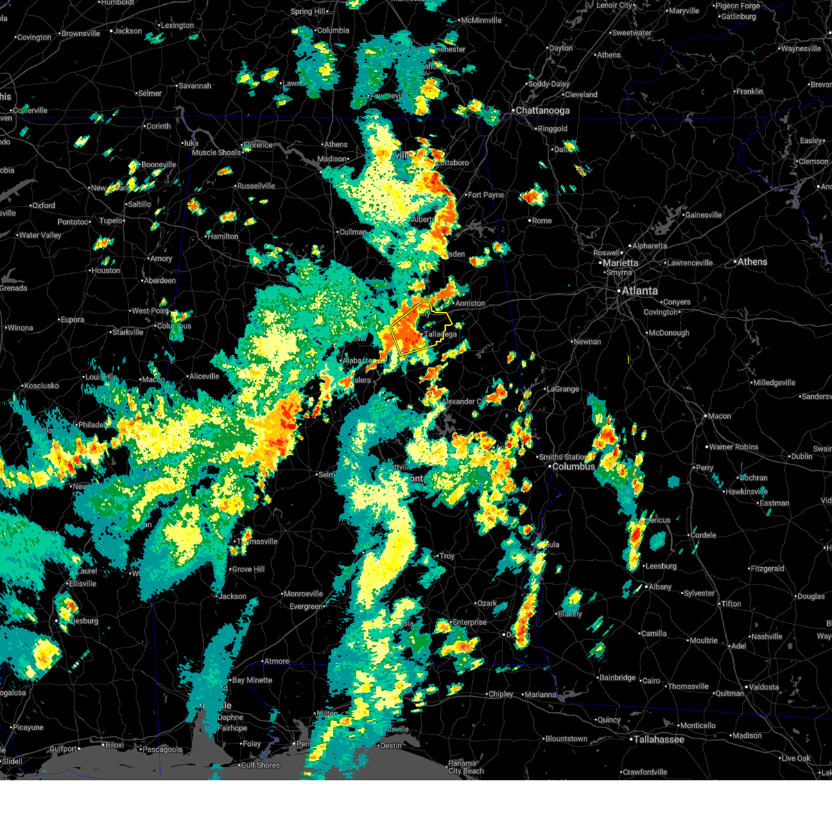
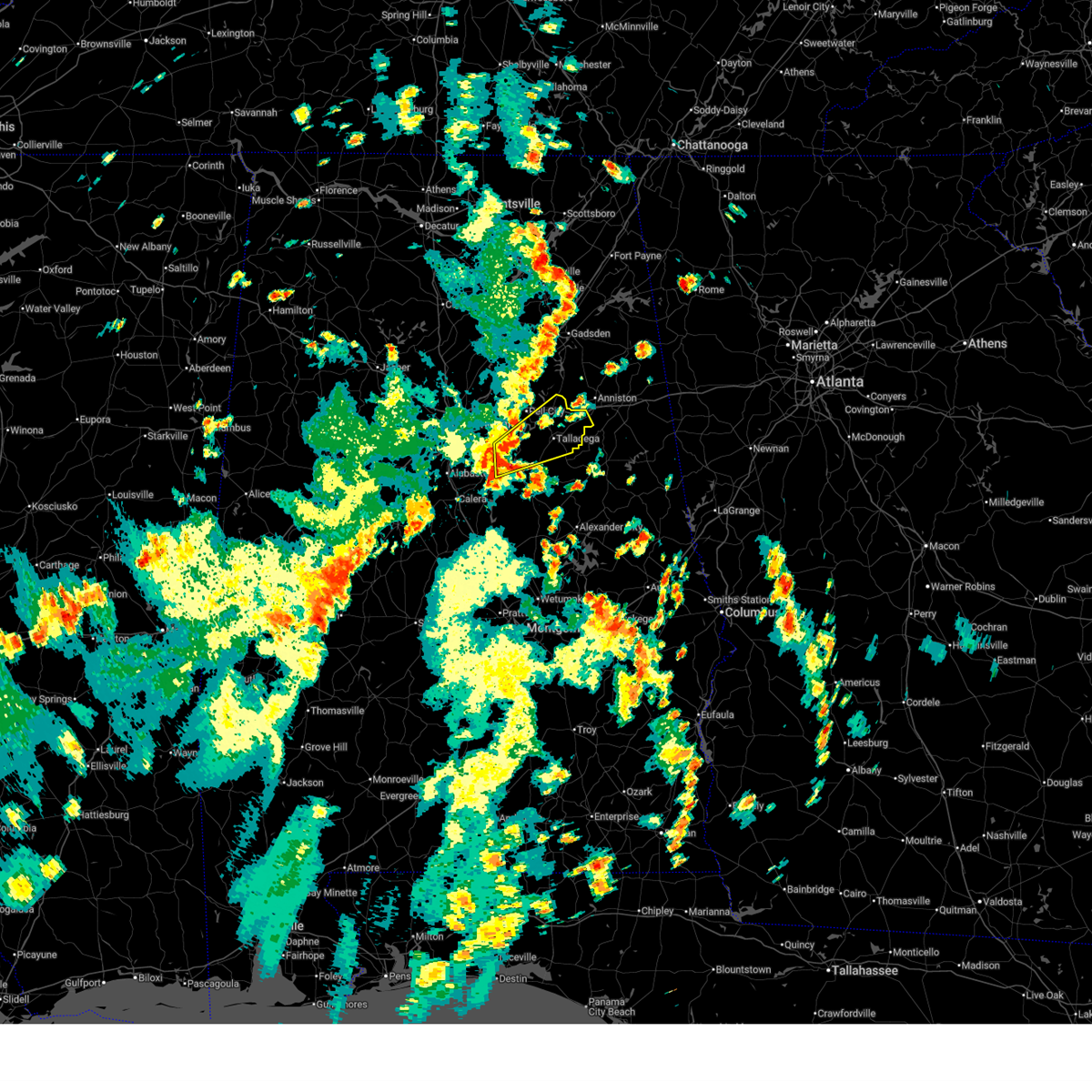
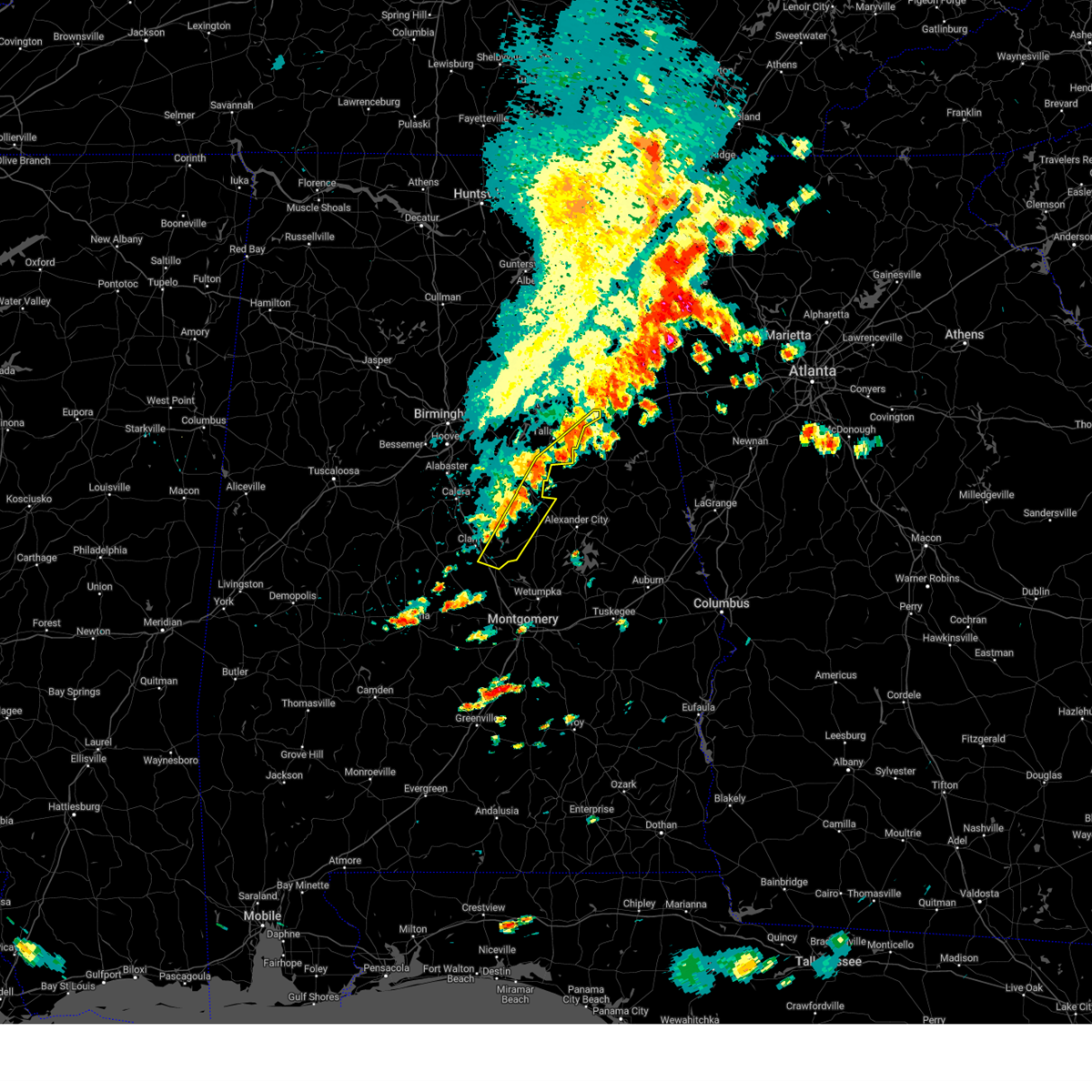
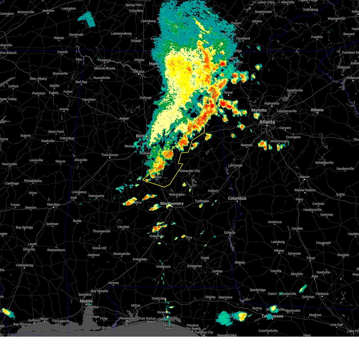
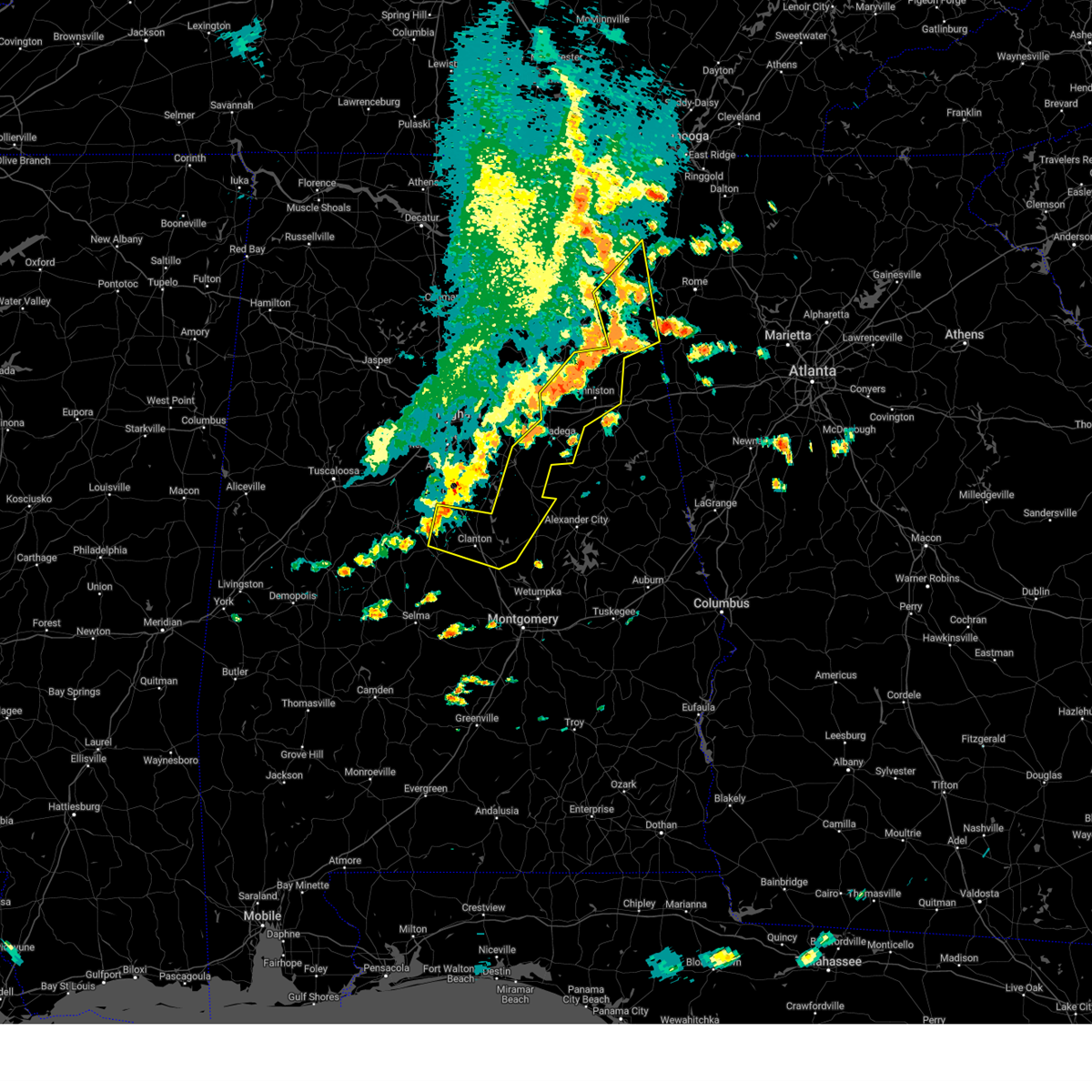
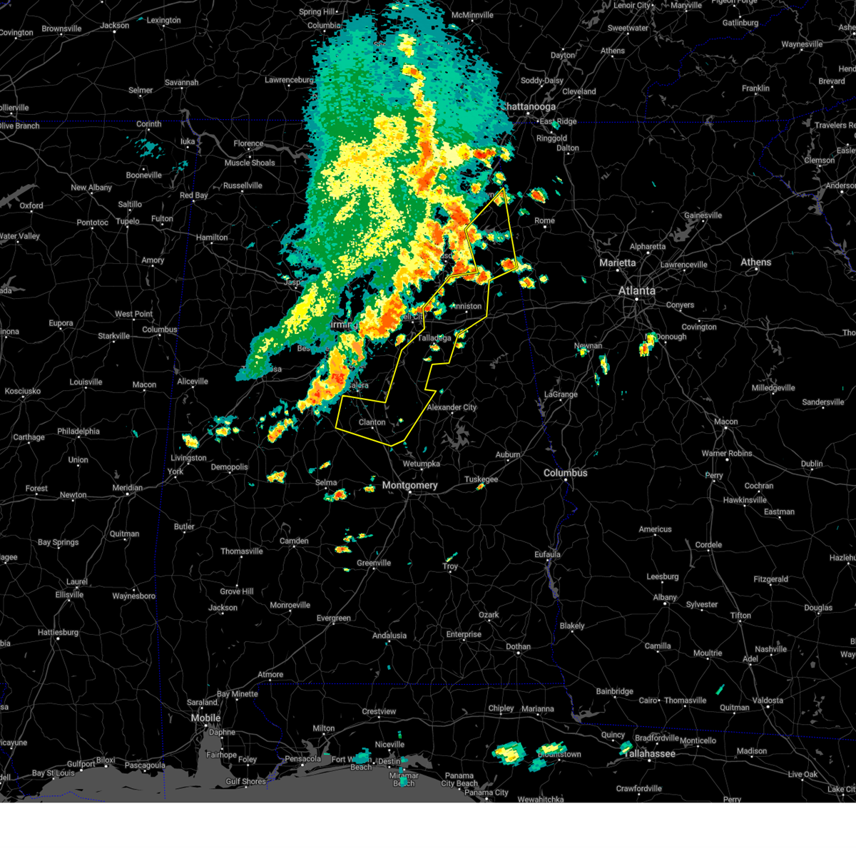
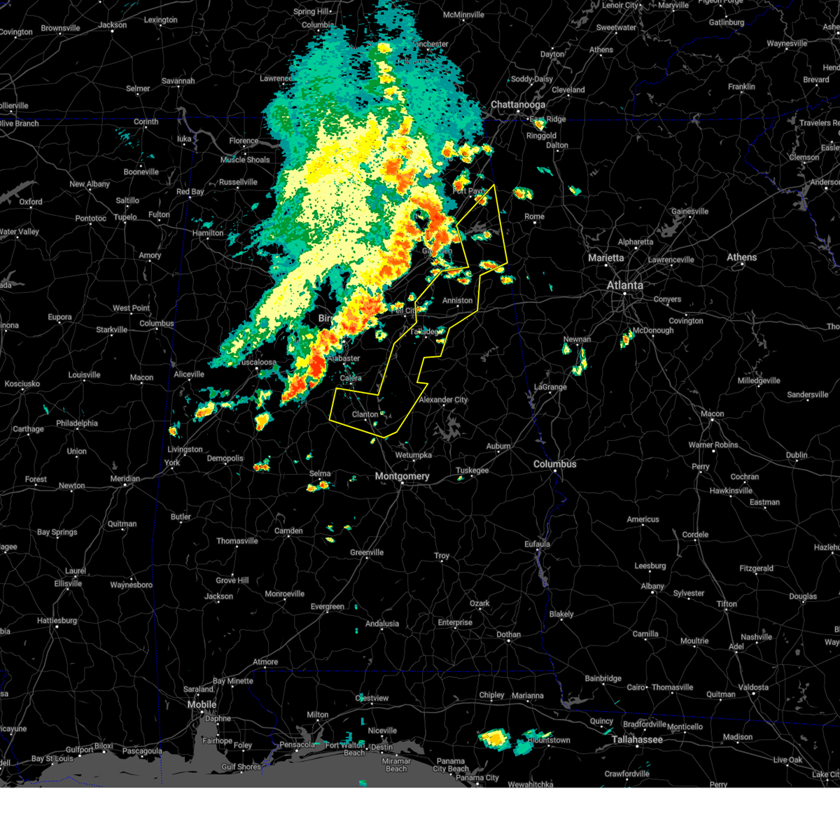
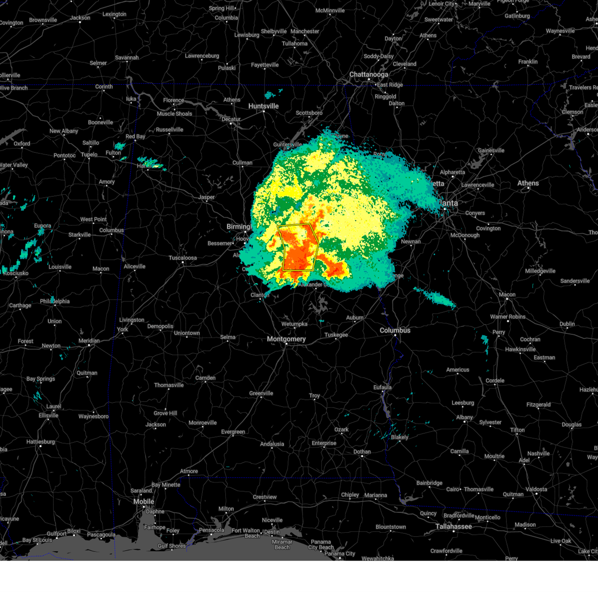
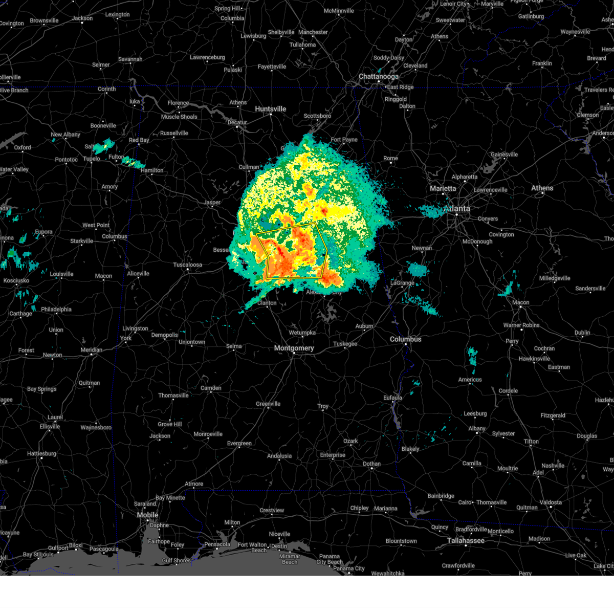
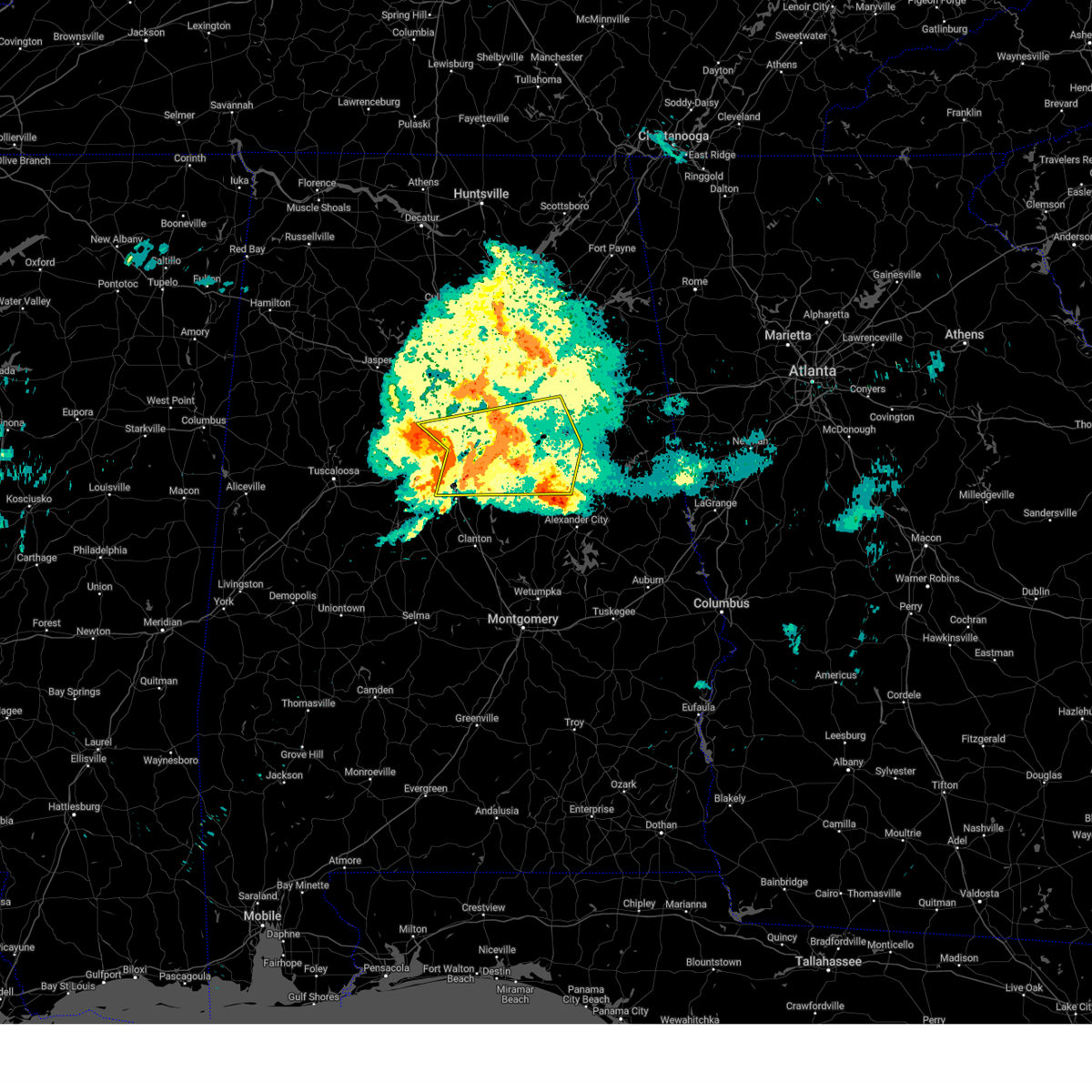
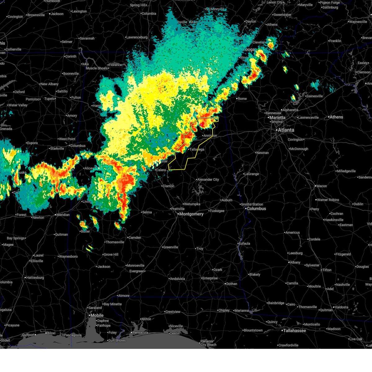
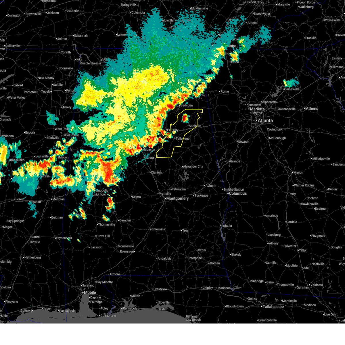
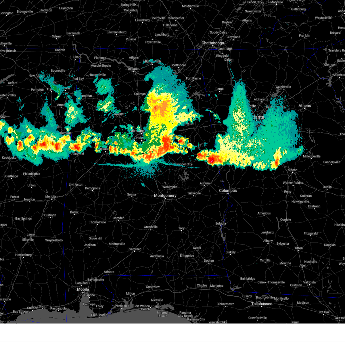
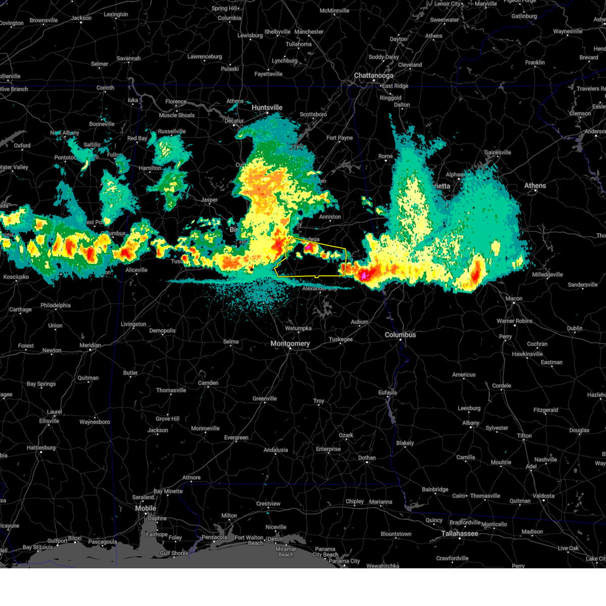
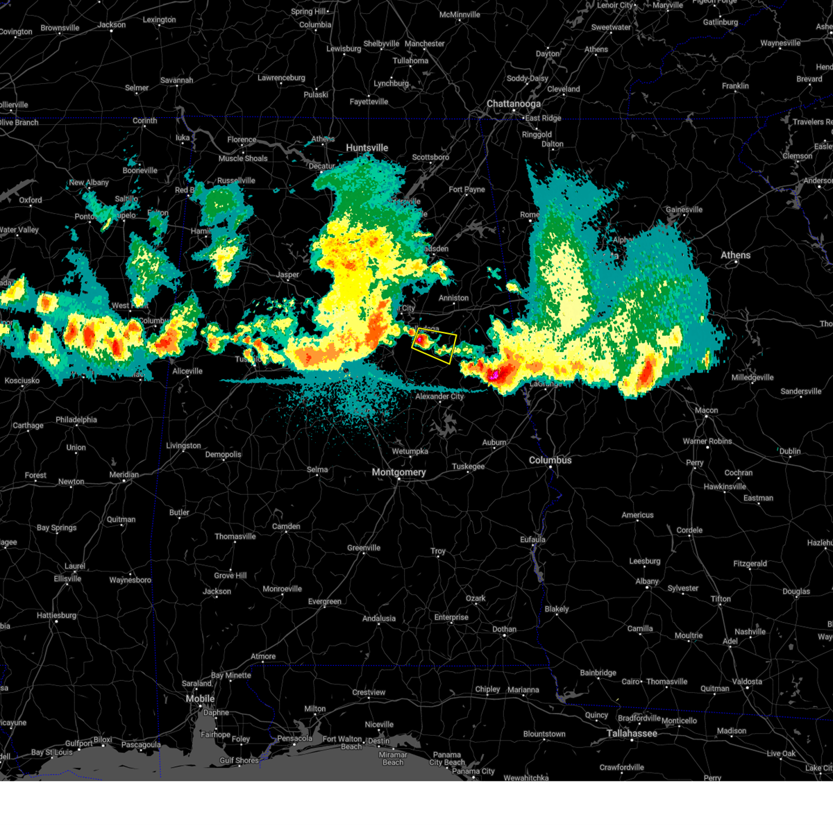
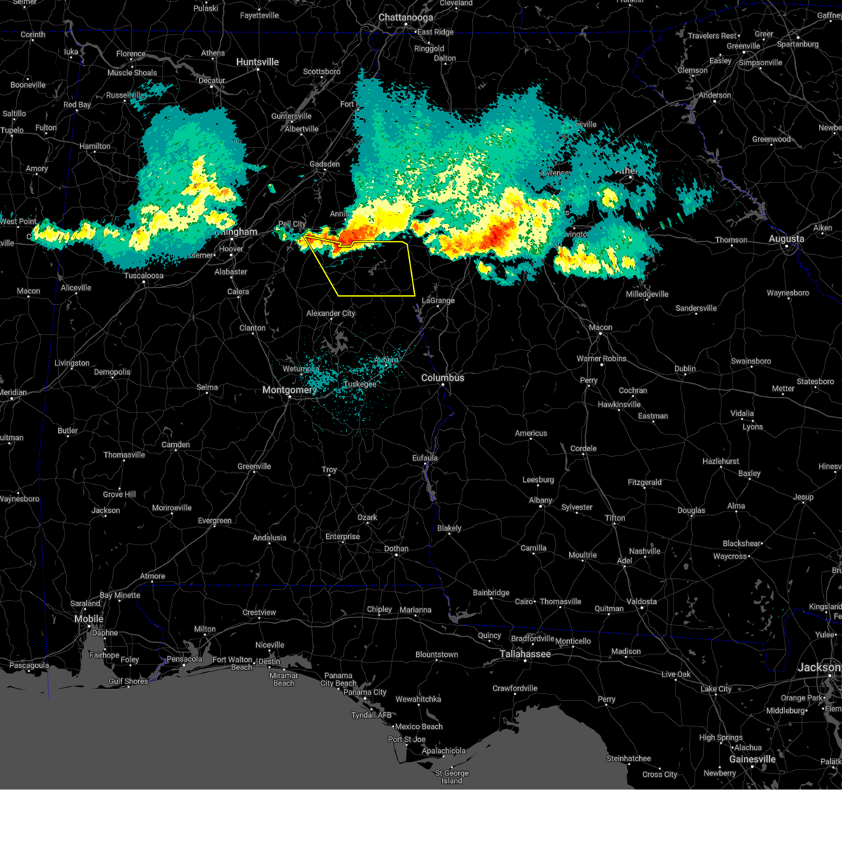
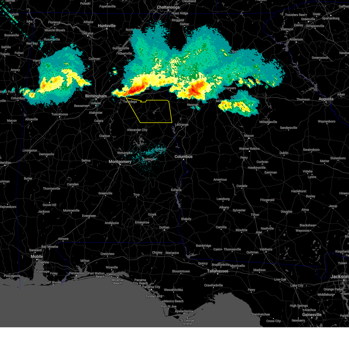
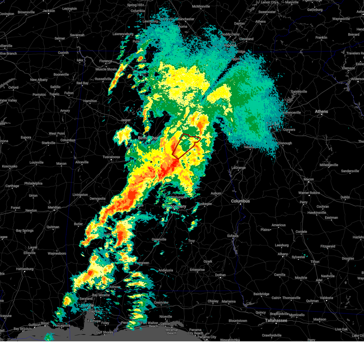
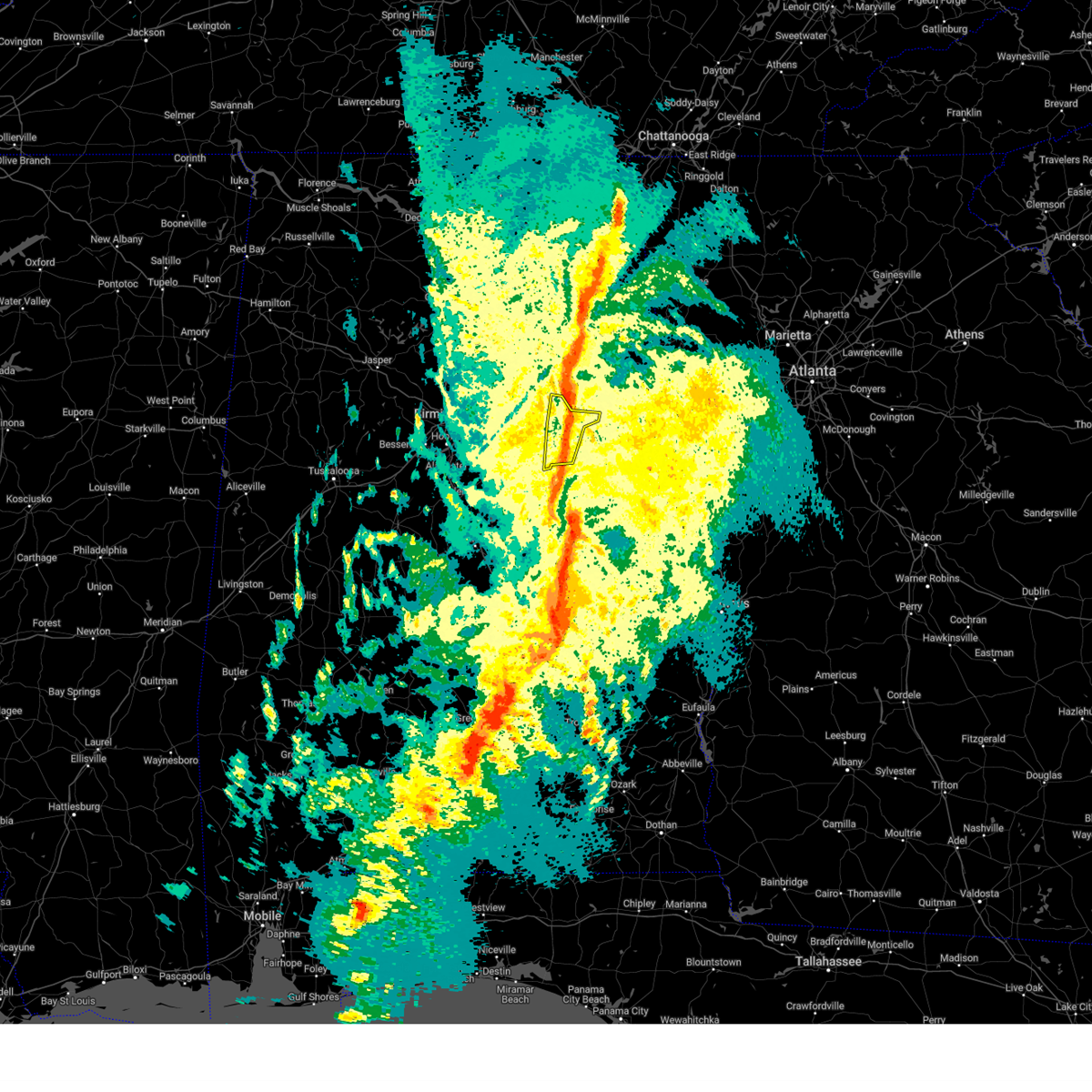
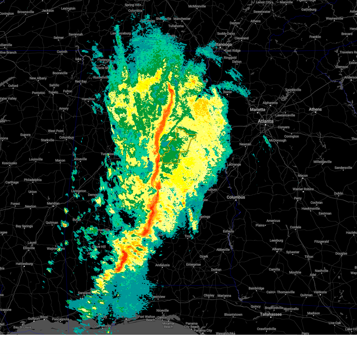
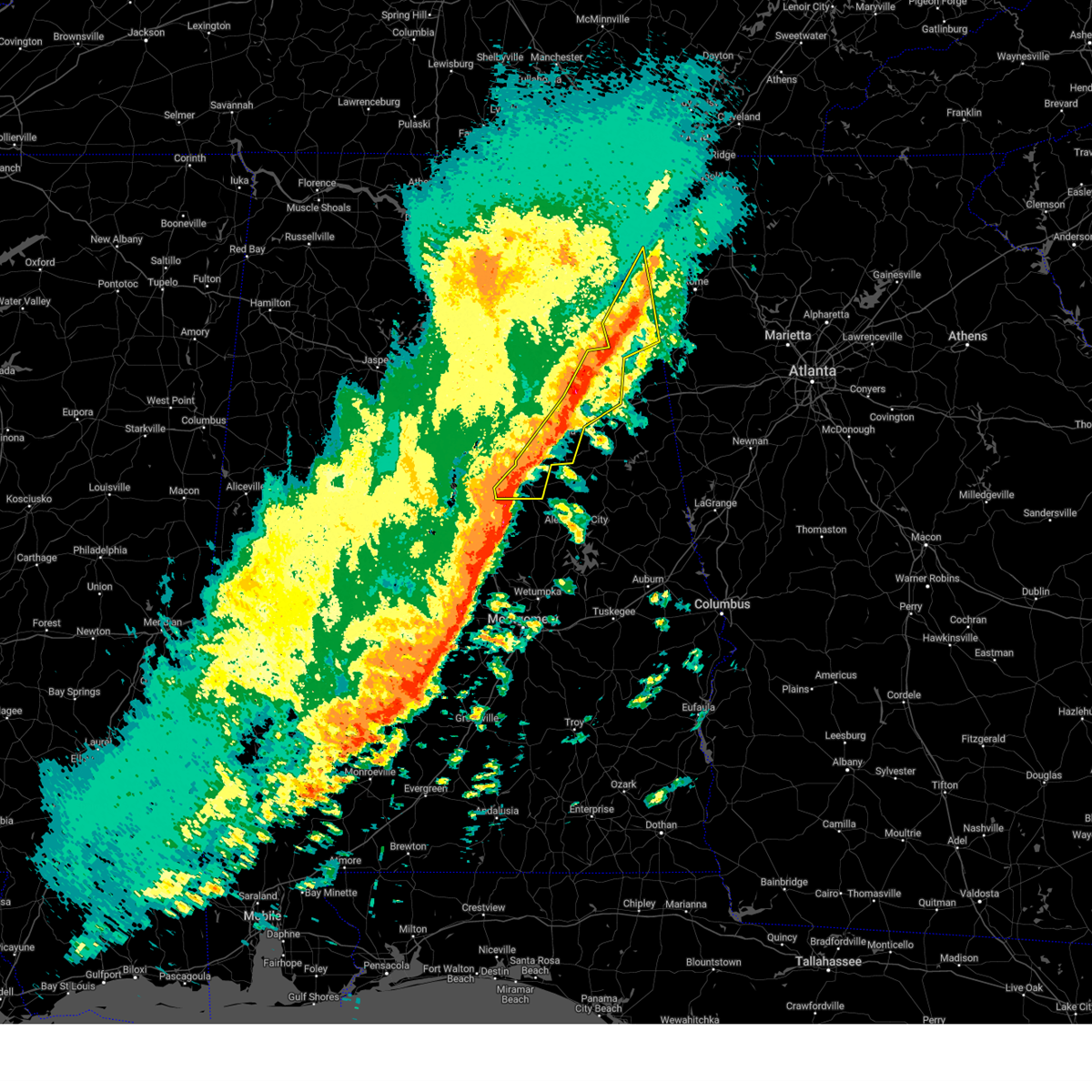
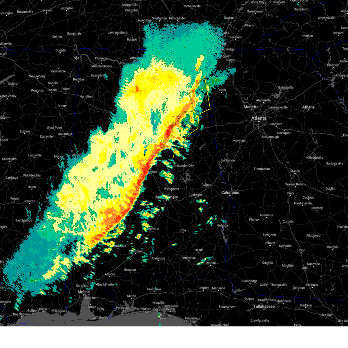
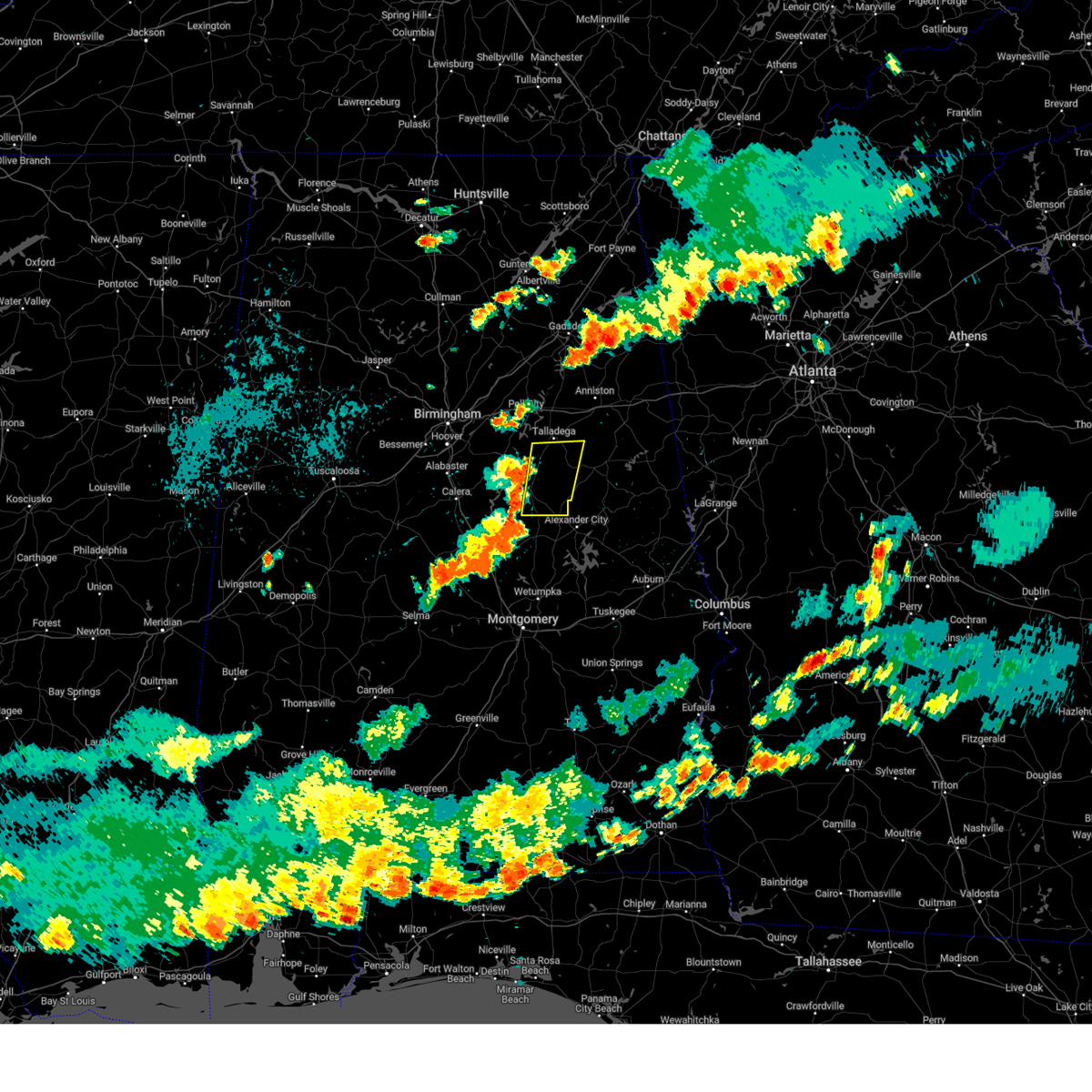
Hail Map for Talladega, AL
The Talladega, AL area has had 10 reports of on-the-ground hail by trained spotters, and has been under severe weather warnings 23 times during the past 12 months. Doppler radar has detected hail at or near Talladega, AL on 91 occasions, including 2 occasions during the past year.
| Name: | Talladega, AL |
| Where Located: | 41 miles E of Birmingham, AL |
| Map: | Google Map for Talladega, AL |
| Population: | 15676 |
| Housing Units: | 6611 |
| More Info: | Search Google for Talladega, AL |
0
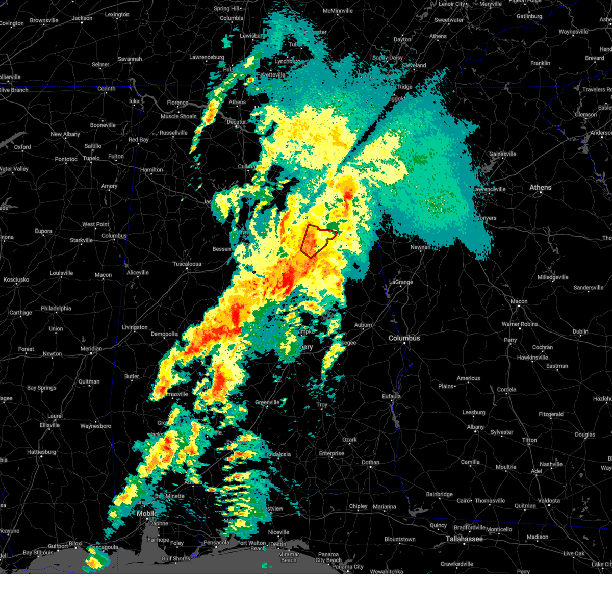
The Top Recent Hail Date for Talladega, AL is Wednesday, July 1, 2026 (91st out of 91)
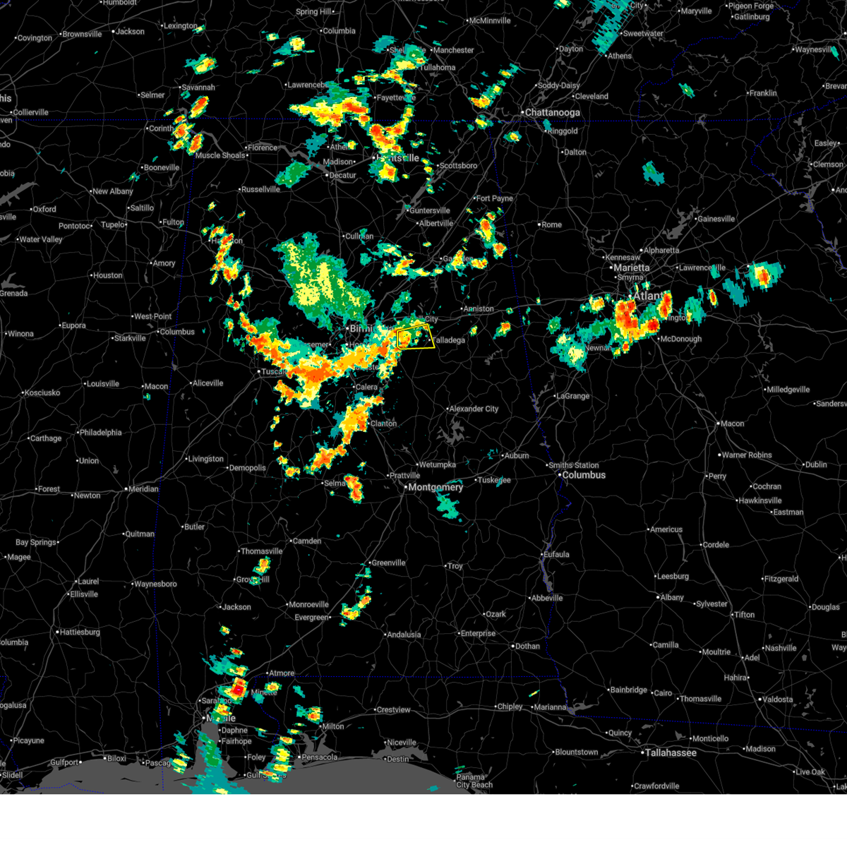
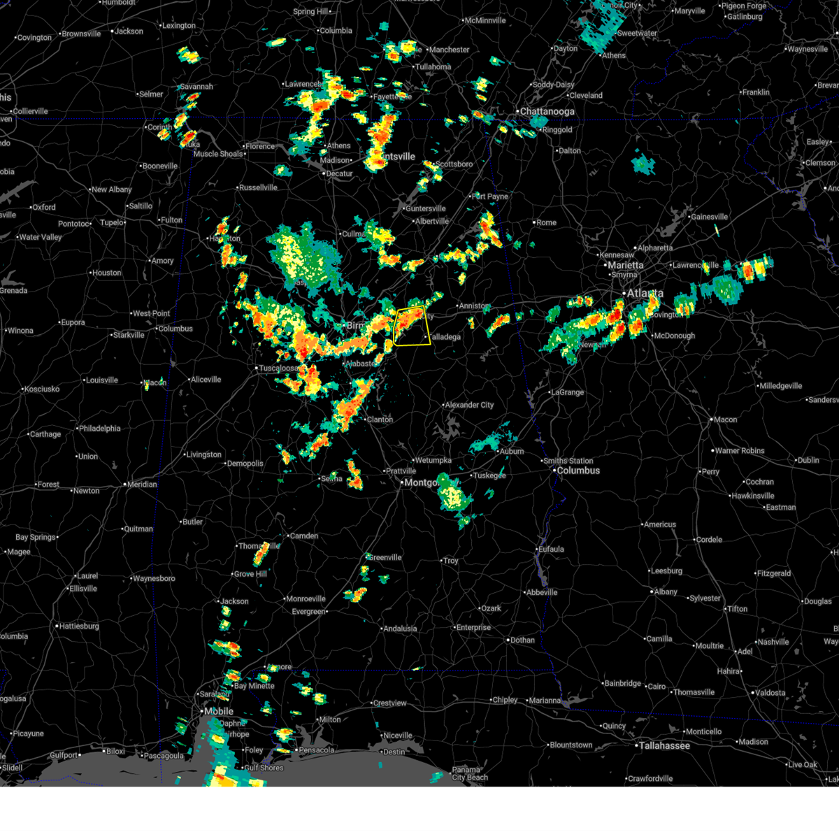
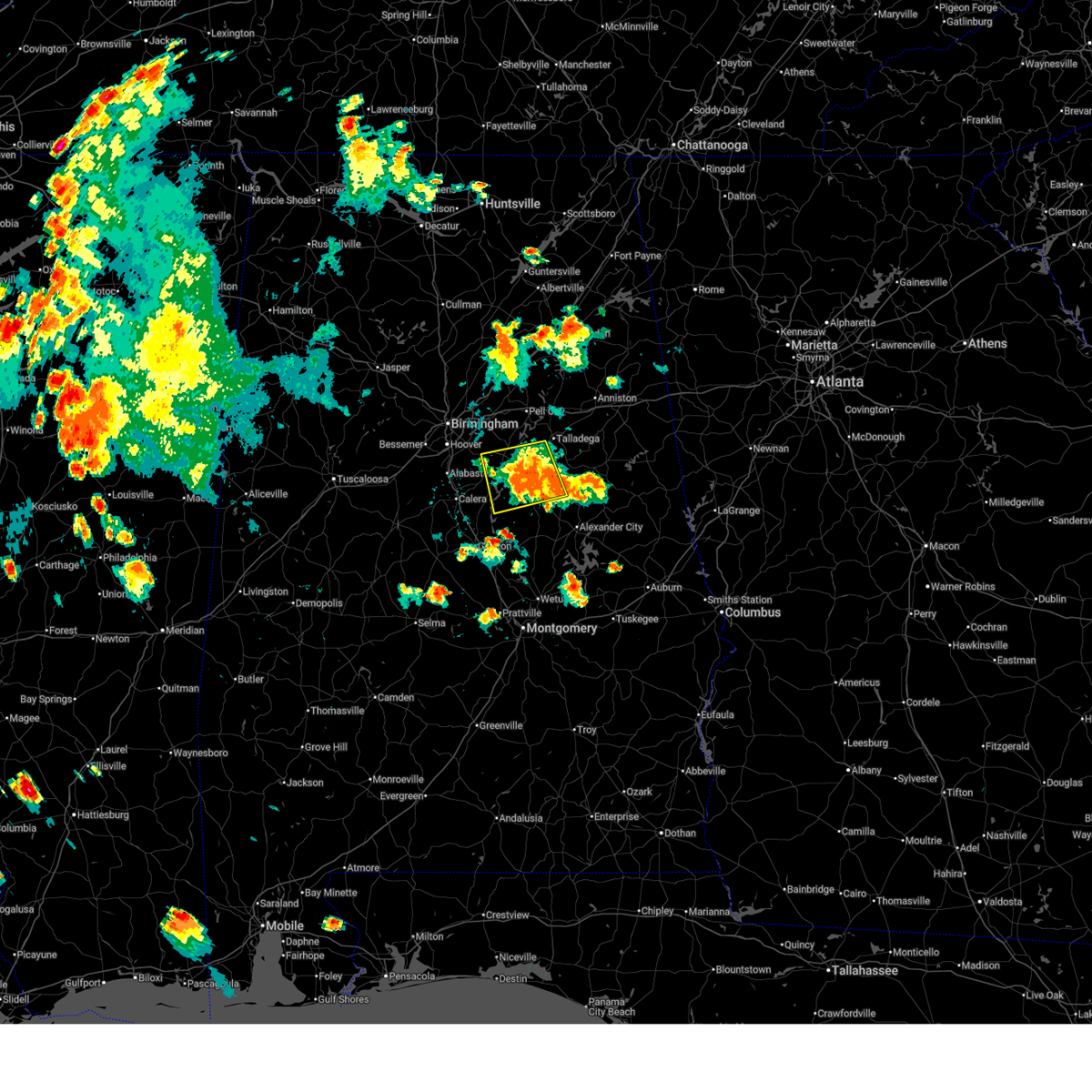
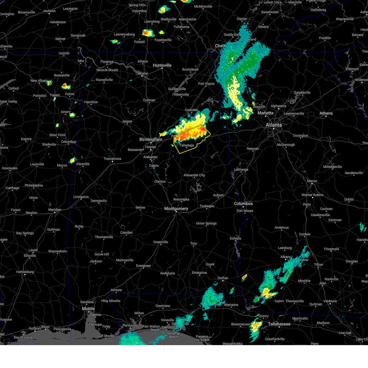
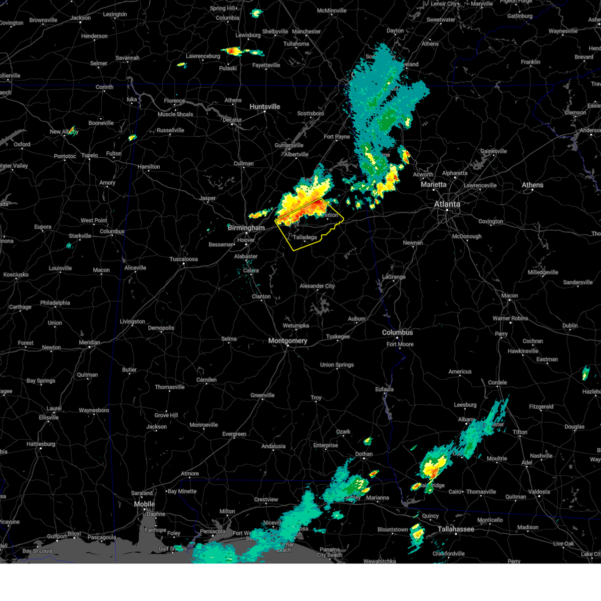
Hail and Wind Damage Spotted near Talladega, AL
| Date / Time | Report Details |
|---|---|
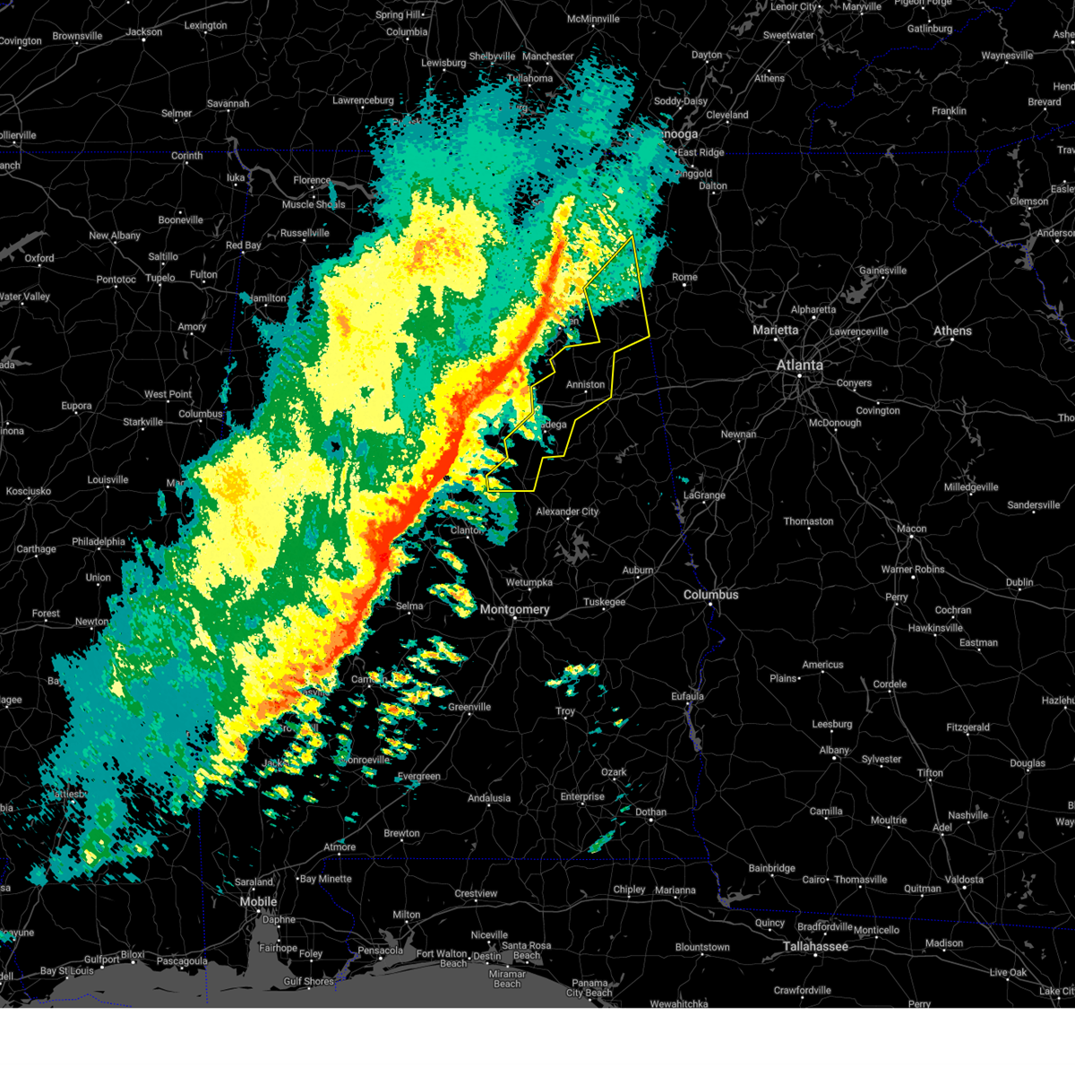
| 7/19/2026 1:21 PM CDT |
 At 121 pm cdt, a severe thunderstorm was located over alpine bay resort, or 9 miles south of pell city, moving south at 15 mph (radar indicated). Hazards include 60 mph wind gusts. Expect damage to roofs, siding, and trees. Locations impacted include, talladega, pell city, vincent, alpine bay resort, coosa island, logan martin dam, logan martin lake, country club estates, and howells cove. At 121 pm cdt, a severe thunderstorm was located over alpine bay resort, or 9 miles south of pell city, moving south at 15 mph (radar indicated). Hazards include 60 mph wind gusts. Expect damage to roofs, siding, and trees. Locations impacted include, talladega, pell city, vincent, alpine bay resort, coosa island, logan martin dam, logan martin lake, country club estates, and howells cove.
|
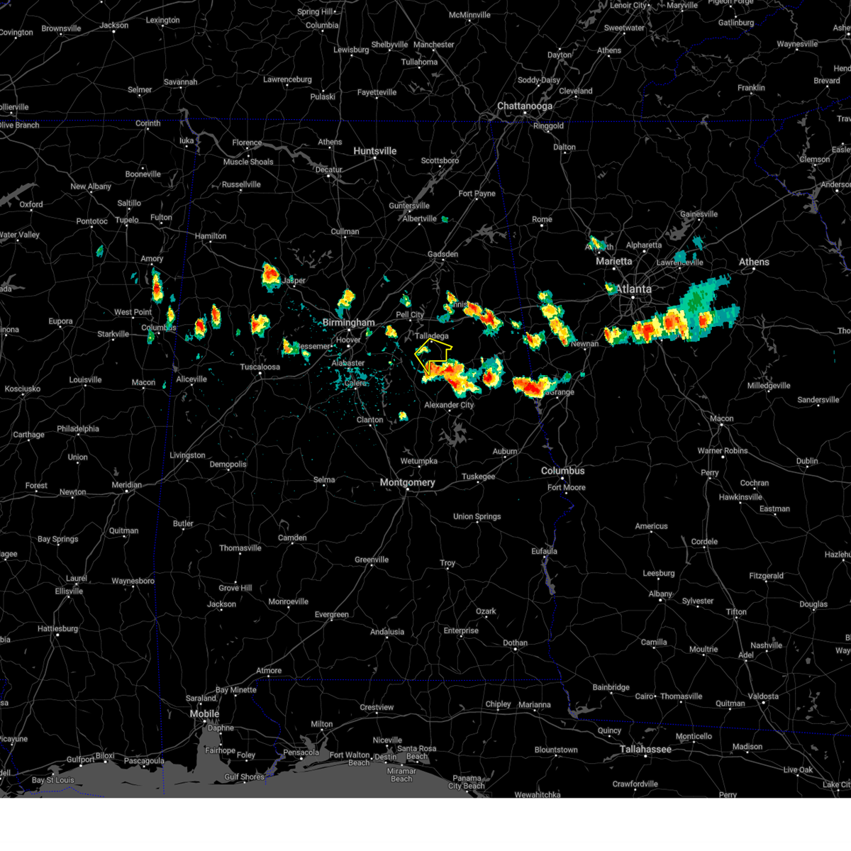
| 7/19/2026 12:54 PM CDT |
 Svrbmx the national weather service in birmingham has issued a * severe thunderstorm warning for, central talladega county in east central alabama, south central st. clair county in central alabama, * until 130 pm cdt. * at 1254 pm cdt, a severe thunderstorm was located over pell city, moving south at 10 mph (radar indicated). Hazards include 60 mph wind gusts and quarter size hail. Hail damage to vehicles is expected. Expect wind damage to roofs, siding, and trees. Svrbmx the national weather service in birmingham has issued a * severe thunderstorm warning for, central talladega county in east central alabama, south central st. clair county in central alabama, * until 130 pm cdt. * at 1254 pm cdt, a severe thunderstorm was located over pell city, moving south at 10 mph (radar indicated). Hazards include 60 mph wind gusts and quarter size hail. Hail damage to vehicles is expected. Expect wind damage to roofs, siding, and trees.
|
| 7/1/2026 6:17 PM CDT |
 At 616 pm cdt, a severe thunderstorm was located over bon air, or near childersburg, moving southwest at 20 mph (radar indicated). Hazards include 70 mph wind gusts and quarter size hail. Hail damage to vehicles is expected. expect considerable tree damage. wind damage is also likely to mobile homes, roofs, and outbuildings. Locations impacted include, sylacauga, childersburg, wilsonville, talladega springs, stewartville, vincent, harpersville, westover, oak grove, bon air, winterboro, strickland crossroads, marble valley, fayetteville, alpine, sycamore, lay lake, alabama 4h center, shelby shores, and gantts quarry. At 616 pm cdt, a severe thunderstorm was located over bon air, or near childersburg, moving southwest at 20 mph (radar indicated). Hazards include 70 mph wind gusts and quarter size hail. Hail damage to vehicles is expected. expect considerable tree damage. wind damage is also likely to mobile homes, roofs, and outbuildings. Locations impacted include, sylacauga, childersburg, wilsonville, talladega springs, stewartville, vincent, harpersville, westover, oak grove, bon air, winterboro, strickland crossroads, marble valley, fayetteville, alpine, sycamore, lay lake, alabama 4h center, shelby shores, and gantts quarry.
|
| 7/1/2026 6:08 PM CDT |
 Svrbmx the national weather service in birmingham has issued a * severe thunderstorm warning for, southwestern talladega county in east central alabama, southeastern shelby county in central alabama, northwestern coosa county in east central alabama, southwestern clay county in east central alabama, * until 700 pm cdt. * at 608 pm cdt, a severe thunderstorm was located near bon air, or near childersburg, moving southwest at 20 mph (radar indicated). Hazards include 60 mph wind gusts and quarter size hail. Hail damage to vehicles is expected. Expect wind damage to roofs, siding, and trees. Svrbmx the national weather service in birmingham has issued a * severe thunderstorm warning for, southwestern talladega county in east central alabama, southeastern shelby county in central alabama, northwestern coosa county in east central alabama, southwestern clay county in east central alabama, * until 700 pm cdt. * at 608 pm cdt, a severe thunderstorm was located near bon air, or near childersburg, moving southwest at 20 mph (radar indicated). Hazards include 60 mph wind gusts and quarter size hail. Hail damage to vehicles is expected. Expect wind damage to roofs, siding, and trees.
|
| 6/1/2026 3:41 PM CDT |
 At 341 pm cdt, severe thunderstorms were located along a line extending from barfield to stewartville to near ashby, moving south at 45 mph (radar indicated). Hazards include 70 mph wind gusts and ping pong ball size hail. People and animals outdoors will be injured. expect hail damage to roofs, siding, windows, and vehicles. expect considerable tree damage. wind damage is also likely to mobile homes, roofs, and outbuildings. Locations impacted include, alabaster, pelham, helena, talladega, alexander city, sylacauga, calera, clanton, montevallo, childersburg, columbiana, jemison, lineville, ashland, wilsonville, goodwater, rockford, kellyton, talladega springs, and weogufka. At 341 pm cdt, severe thunderstorms were located along a line extending from barfield to stewartville to near ashby, moving south at 45 mph (radar indicated). Hazards include 70 mph wind gusts and ping pong ball size hail. People and animals outdoors will be injured. expect hail damage to roofs, siding, windows, and vehicles. expect considerable tree damage. wind damage is also likely to mobile homes, roofs, and outbuildings. Locations impacted include, alabaster, pelham, helena, talladega, alexander city, sylacauga, calera, clanton, montevallo, childersburg, columbiana, jemison, lineville, ashland, wilsonville, goodwater, rockford, kellyton, talladega springs, and weogufka.
|
| 6/1/2026 3:33 PM CDT |
 At 333 pm cdt, severe thunderstorms were located along a line extending from 7 miles southwest of heflin to helena, moving southeast at 40 mph (radar indicated). Hazards include 60 mph wind gusts and half dollar size hail. Hail damage to vehicles is expected. expect wind damage to roofs, siding, and trees. Locations impacted include, southwestern birmingham, hoover, vestavia hills, alabaster, bessemer, anniston, pelham, oxford, helena, talladega, pell city, chelsea, wilsonville, west end-cobb town, cobb town, fort mcclellan, saks, lincoln, weaver, and indian springs village. At 333 pm cdt, severe thunderstorms were located along a line extending from 7 miles southwest of heflin to helena, moving southeast at 40 mph (radar indicated). Hazards include 60 mph wind gusts and half dollar size hail. Hail damage to vehicles is expected. expect wind damage to roofs, siding, and trees. Locations impacted include, southwestern birmingham, hoover, vestavia hills, alabaster, bessemer, anniston, pelham, oxford, helena, talladega, pell city, chelsea, wilsonville, west end-cobb town, cobb town, fort mcclellan, saks, lincoln, weaver, and indian springs village.
|
| 6/1/2026 3:12 PM CDT |
 At 311 pm cdt, severe thunderstorms were located along a line extending from oxford lake to near logan martin dam to tannehill ironworks state park, moving south at 45 mph (radar indicated). Hazards include 70 mph wind gusts and quarter size hail. Hail damage to vehicles is expected. expect considerable tree damage. wind damage is also likely to mobile homes, roofs, and outbuildings. Locations impacted include, alabaster, pelham, helena, talladega, alexander city, sylacauga, calera, clanton, montevallo, childersburg, columbiana, jemison, lineville, ashland, wilsonville, goodwater, rockford, kellyton, talladega springs, and weogufka. At 311 pm cdt, severe thunderstorms were located along a line extending from oxford lake to near logan martin dam to tannehill ironworks state park, moving south at 45 mph (radar indicated). Hazards include 70 mph wind gusts and quarter size hail. Hail damage to vehicles is expected. expect considerable tree damage. wind damage is also likely to mobile homes, roofs, and outbuildings. Locations impacted include, alabaster, pelham, helena, talladega, alexander city, sylacauga, calera, clanton, montevallo, childersburg, columbiana, jemison, lineville, ashland, wilsonville, goodwater, rockford, kellyton, talladega springs, and weogufka.
|
| 6/1/2026 3:10 PM CDT |
 At 310 pm cdt, severe thunderstorms were located along a line extending from anniston to splash adventure, moving southeast at 40 mph (radar indicated). Hazards include 60 mph wind gusts and half dollar size hail. Hail damage to vehicles is expected. expect wind damage to roofs, siding, and trees. Locations impacted include, birmingham, hoover, vestavia hills, alabaster, bessemer, homewood, anniston, pelham, oxford, mountain brook, trussville, helena, hueytown, talladega, gardendale, pell city, irondale, leeds, moody, and fairfield. At 310 pm cdt, severe thunderstorms were located along a line extending from anniston to splash adventure, moving southeast at 40 mph (radar indicated). Hazards include 60 mph wind gusts and half dollar size hail. Hail damage to vehicles is expected. expect wind damage to roofs, siding, and trees. Locations impacted include, birmingham, hoover, vestavia hills, alabaster, bessemer, homewood, anniston, pelham, oxford, mountain brook, trussville, helena, hueytown, talladega, gardendale, pell city, irondale, leeds, moody, and fairfield.
|
| 6/1/2026 3:06 PM CDT |
 Svrbmx the national weather service in birmingham has issued a * severe thunderstorm warning for, northern chilton county in central alabama, talladega county in east central alabama, southern shelby county in central alabama, northern tallapoosa county in east central alabama, southwestern cleburne county in east central alabama, coosa county in east central alabama, clay county in east central alabama, * until 400 pm cdt. * at 305 pm cdt, severe thunderstorms were located along a line extending from blue mountain to logan martin dam to near lake view, moving south at 45 mph (radar indicated). Hazards include 60 mph wind gusts and quarter size hail. Hail damage to vehicles is expected. Expect wind damage to roofs, siding, and trees. Svrbmx the national weather service in birmingham has issued a * severe thunderstorm warning for, northern chilton county in central alabama, talladega county in east central alabama, southern shelby county in central alabama, northern tallapoosa county in east central alabama, southwestern cleburne county in east central alabama, coosa county in east central alabama, clay county in east central alabama, * until 400 pm cdt. * at 305 pm cdt, severe thunderstorms were located along a line extending from blue mountain to logan martin dam to near lake view, moving south at 45 mph (radar indicated). Hazards include 60 mph wind gusts and quarter size hail. Hail damage to vehicles is expected. Expect wind damage to roofs, siding, and trees.
|
| 6/1/2026 3:00 PM CDT | Multiple trees down around talladega and lincol in talladega county AL, 8.4 miles S of Talladega, AL |
| 6/1/2026 3:00 PM CDT | Tree on a house howard stree in talladega county AL, 1.5 miles SSE of Talladega, AL |
| 6/1/2026 2:58 PM CDT |
 At 258 pm cdt, severe thunderstorms were located along a line extending from near alexandria to near concord, moving southeast at 40 mph (radar indicated). Hazards include 60 mph wind gusts and half dollar size hail. Hail damage to vehicles is expected. expect wind damage to roofs, siding, and trees. Locations impacted include, birmingham, hoover, vestavia hills, alabaster, bessemer, homewood, anniston, pelham, oxford, mountain brook, trussville, helena, hueytown, talladega, gardendale, pell city, irondale, leeds, moody, and fairfield. At 258 pm cdt, severe thunderstorms were located along a line extending from near alexandria to near concord, moving southeast at 40 mph (radar indicated). Hazards include 60 mph wind gusts and half dollar size hail. Hail damage to vehicles is expected. expect wind damage to roofs, siding, and trees. Locations impacted include, birmingham, hoover, vestavia hills, alabaster, bessemer, homewood, anniston, pelham, oxford, mountain brook, trussville, helena, hueytown, talladega, gardendale, pell city, irondale, leeds, moody, and fairfield.
|
| 6/1/2026 2:35 PM CDT |
 At 234 pm cdt, severe thunderstorms were located along a line extending from near neely henry lake to 6 miles southwest of gorgas, moving southeast at 40 mph (radar indicated). Hazards include 60 mph wind gusts and half dollar size hail. Hail damage to vehicles is expected. expect wind damage to roofs, siding, and trees. Locations impacted include, birmingham, hoover, gadsden, vestavia hills, alabaster, bessemer, homewood, anniston, pelham, oxford, mountain brook, trussville, helena, hueytown, talladega, jasper, gardendale, pell city, irondale, and leeds. At 234 pm cdt, severe thunderstorms were located along a line extending from near neely henry lake to 6 miles southwest of gorgas, moving southeast at 40 mph (radar indicated). Hazards include 60 mph wind gusts and half dollar size hail. Hail damage to vehicles is expected. expect wind damage to roofs, siding, and trees. Locations impacted include, birmingham, hoover, gadsden, vestavia hills, alabaster, bessemer, homewood, anniston, pelham, oxford, mountain brook, trussville, helena, hueytown, talladega, jasper, gardendale, pell city, irondale, and leeds.
|
| 6/1/2026 2:27 PM CDT |
 Svrbmx the national weather service in birmingham has issued a * severe thunderstorm warning for, central walker county in central alabama, northern talladega county in east central alabama, blount county in central alabama, western calhoun county in east central alabama, shelby county in central alabama, central etowah county in northeastern alabama, jefferson county in central alabama, st. clair county in central alabama, * until 345 pm cdt. * at 226 pm cdt, severe thunderstorms were located along a line extending from near steele to 6 miles southeast of oakman, moving southeast at 40 mph (radar indicated). Hazards include 60 mph wind gusts and quarter size hail. Hail damage to vehicles is expected. Expect wind damage to roofs, siding, and trees. Svrbmx the national weather service in birmingham has issued a * severe thunderstorm warning for, central walker county in central alabama, northern talladega county in east central alabama, blount county in central alabama, western calhoun county in east central alabama, shelby county in central alabama, central etowah county in northeastern alabama, jefferson county in central alabama, st. clair county in central alabama, * until 345 pm cdt. * at 226 pm cdt, severe thunderstorms were located along a line extending from near steele to 6 miles southeast of oakman, moving southeast at 40 mph (radar indicated). Hazards include 60 mph wind gusts and quarter size hail. Hail damage to vehicles is expected. Expect wind damage to roofs, siding, and trees.
|
| 3/16/2026 3:00 AM CDT | Tree down on hous in talladega county AL, 1.3 miles W of Talladega, AL |
| 3/16/2026 3:00 AM CDT | Trees and power lines down along renfroe roa in talladega county AL, 4 miles E of Talladega, AL |
| 3/16/2026 2:52 AM CDT | Tree down blocking road on plant rd in alpin in talladega county AL, 5.2 miles ENE of Talladega, AL |
| 3/9/2026 9:07 PM CDT |
 At 907 pm cdt, severe thunderstorms were located along a line extending from near talladega to near sycamore, moving southeast at 45 mph (radar indicated). Hazards include 60 mph wind gusts. Expect damage to roofs, siding, and trees. Locations impacted include, talladega, lincoln, munford, waldo, alpine bay resort, logan martin lake, country club estates, jackson shoals, ironaton, and howells cove. At 907 pm cdt, severe thunderstorms were located along a line extending from near talladega to near sycamore, moving southeast at 45 mph (radar indicated). Hazards include 60 mph wind gusts. Expect damage to roofs, siding, and trees. Locations impacted include, talladega, lincoln, munford, waldo, alpine bay resort, logan martin lake, country club estates, jackson shoals, ironaton, and howells cove.
|
| 3/9/2026 9:07 PM CDT |
 the severe thunderstorm warning has been cancelled and is no longer in effect the severe thunderstorm warning has been cancelled and is no longer in effect
|
| 3/9/2026 8:51 PM CDT |
 the severe thunderstorm warning has been cancelled and is no longer in effect the severe thunderstorm warning has been cancelled and is no longer in effect
|
| 3/9/2026 8:51 PM CDT |
 At 851 pm cdt, severe thunderstorms were located along a line extending from near pell city to near logan martin dam, moving east at 40 mph (radar indicated). Hazards include 60 mph wind gusts. Expect damage to roofs, siding, and trees. locations impacted include, talladega, pell city, lincoln, munford, waldo, alpine bay resort, logan martin lake, talladega superspeedway, honda manufacturing of alabama, coosa island, harrisburg, talladega municipal airport, country club estates, st. Clair county airport, chula vista, jackson shoals, cropwell, howells cove, and eastaboga. At 851 pm cdt, severe thunderstorms were located along a line extending from near pell city to near logan martin dam, moving east at 40 mph (radar indicated). Hazards include 60 mph wind gusts. Expect damage to roofs, siding, and trees. locations impacted include, talladega, pell city, lincoln, munford, waldo, alpine bay resort, logan martin lake, talladega superspeedway, honda manufacturing of alabama, coosa island, harrisburg, talladega municipal airport, country club estates, st. Clair county airport, chula vista, jackson shoals, cropwell, howells cove, and eastaboga.
|
| 3/9/2026 8:43 PM CDT |
 At 843 pm cdt, severe thunderstorms were located along a line extending from abernathy to near mount cheaha to near vandiver, moving southeast at 45 mph (radar indicated). Hazards include 60 mph wind gusts. Expect damage to roofs, siding, and trees. Locations impacted include, oxford, talladega, pell city, leeds, moody, heflin, lincoln, munford, ranburne, waldo, alpine bay resort, bald rock, talladega superspeedway, anniston regional airport, vandiver, harrisburg, talladega municipal airport, grant town, abernathy, and logan martin lake. At 843 pm cdt, severe thunderstorms were located along a line extending from abernathy to near mount cheaha to near vandiver, moving southeast at 45 mph (radar indicated). Hazards include 60 mph wind gusts. Expect damage to roofs, siding, and trees. Locations impacted include, oxford, talladega, pell city, leeds, moody, heflin, lincoln, munford, ranburne, waldo, alpine bay resort, bald rock, talladega superspeedway, anniston regional airport, vandiver, harrisburg, talladega municipal airport, grant town, abernathy, and logan martin lake.
|
| 3/9/2026 8:43 PM CDT |
 the severe thunderstorm warning has been cancelled and is no longer in effect the severe thunderstorm warning has been cancelled and is no longer in effect
|
| 3/9/2026 8:24 PM CDT |
 At 824 pm cdt, severe thunderstorms were located along a line extending from heflin to talladega superspeedway to irondale, moving southeast at 45 mph (radar indicated). Hazards include 60 mph wind gusts. Expect damage to roofs, siding, and trees. Locations impacted include, northern birmingham, anniston, oxford, trussville, talladega, pell city, irondale, leeds, moody, heflin, west end-cobb town, cobb town, fort mcclellan, saks, tarrant, lincoln, riverside, munford, hobson city, and ranburne. At 824 pm cdt, severe thunderstorms were located along a line extending from heflin to talladega superspeedway to irondale, moving southeast at 45 mph (radar indicated). Hazards include 60 mph wind gusts. Expect damage to roofs, siding, and trees. Locations impacted include, northern birmingham, anniston, oxford, trussville, talladega, pell city, irondale, leeds, moody, heflin, west end-cobb town, cobb town, fort mcclellan, saks, tarrant, lincoln, riverside, munford, hobson city, and ranburne.
|
| 3/9/2026 8:10 PM CDT |
 Svrbmx the national weather service in birmingham has issued a * severe thunderstorm warning for, northeastern talladega county in east central alabama, southern calhoun county in east central alabama, northeastern shelby county in central alabama, east central jefferson county in central alabama, southern st. clair county in central alabama, southern cleburne county in east central alabama, northeastern clay county in east central alabama, * until 915 pm cdt. * at 810 pm cdt, severe thunderstorms were located along a line extending from near fort mcclellan to near riverside to birmingham, moving southeast at 45 mph (radar indicated). Hazards include 60 mph wind gusts. expect damage to roofs, siding, and trees Svrbmx the national weather service in birmingham has issued a * severe thunderstorm warning for, northeastern talladega county in east central alabama, southern calhoun county in east central alabama, northeastern shelby county in central alabama, east central jefferson county in central alabama, southern st. clair county in central alabama, southern cleburne county in east central alabama, northeastern clay county in east central alabama, * until 915 pm cdt. * at 810 pm cdt, severe thunderstorms were located along a line extending from near fort mcclellan to near riverside to birmingham, moving southeast at 45 mph (radar indicated). Hazards include 60 mph wind gusts. expect damage to roofs, siding, and trees
|
| 2/26/2026 4:54 PM CST |
 the severe thunderstorm warning has been cancelled and is no longer in effect the severe thunderstorm warning has been cancelled and is no longer in effect
|
| 2/26/2026 4:48 PM CST |
 At 448 pm cst, a severe thunderstorm was located over talladega, moving southeast at 30 mph (radar indicated). Hazards include 60 mph wind gusts. Expect damage to roofs, siding, and trees. Locations impacted include, talladega, waldo, ironaton, and chandler springs. At 448 pm cst, a severe thunderstorm was located over talladega, moving southeast at 30 mph (radar indicated). Hazards include 60 mph wind gusts. Expect damage to roofs, siding, and trees. Locations impacted include, talladega, waldo, ironaton, and chandler springs.
|
| 2/26/2026 4:35 PM CST |
 Svrbmx the national weather service in birmingham has issued a * severe thunderstorm warning for, central talladega county in east central alabama, * until 515 pm cst. * at 435 pm cst, a severe thunderstorm was located near logan martin lake, or near talladega, moving southeast at 30 mph (radar indicated). Hazards include 60 mph wind gusts and quarter size hail. Hail damage to vehicles is expected. Expect wind damage to roofs, siding, and trees. Svrbmx the national weather service in birmingham has issued a * severe thunderstorm warning for, central talladega county in east central alabama, * until 515 pm cst. * at 435 pm cst, a severe thunderstorm was located near logan martin lake, or near talladega, moving southeast at 30 mph (radar indicated). Hazards include 60 mph wind gusts and quarter size hail. Hail damage to vehicles is expected. Expect wind damage to roofs, siding, and trees.
|
| 1/10/2026 8:12 AM CST | Trees were downed around talladega... alpine... and munford... including cheaha rd... alipine winterboro rd... renfroe rd... and grizzle l in talladega county AL, 1 miles SW of Talladega, AL |
| 6/17/2025 3:26 PM CDT |
 The storm which prompted the warning has moved out of the area. therefore, the warning will be allowed to expire. The storm which prompted the warning has moved out of the area. therefore, the warning will be allowed to expire.
|
| 6/17/2025 3:18 PM CDT |
 At 318 pm cdt, a severe thunderstorm was located over bynum, or 7 miles southwest of cobb town, moving northeast at 40 mph (radar indicated). Hazards include 60 mph wind gusts. Expect damage to roofs, siding, and trees. Locations impacted include, oxford, lincoln, munford, talladega superspeedway, grant town, talladega municipal airport, camp mac, jenifer, eastaboga, and jackson shoals. At 318 pm cdt, a severe thunderstorm was located over bynum, or 7 miles southwest of cobb town, moving northeast at 40 mph (radar indicated). Hazards include 60 mph wind gusts. Expect damage to roofs, siding, and trees. Locations impacted include, oxford, lincoln, munford, talladega superspeedway, grant town, talladega municipal airport, camp mac, jenifer, eastaboga, and jackson shoals.
|
| 6/17/2025 3:18 PM CDT |
 the severe thunderstorm warning has been cancelled and is no longer in effect the severe thunderstorm warning has been cancelled and is no longer in effect
|
| 6/17/2025 2:58 PM CDT |
 the severe thunderstorm warning has been cancelled and is no longer in effect the severe thunderstorm warning has been cancelled and is no longer in effect
|
| 6/17/2025 2:58 PM CDT |
 At 257 pm cdt, a severe thunderstorm was located near alpine, or near talladega, moving northeast at 35 mph (radar indicated). Hazards include 60 mph wind gusts. Expect damage to roofs, siding, and trees. Locations impacted include, oxford, talladega, pell city, lincoln, munford, waldo, alpine bay resort, winterboro, talladega superspeedway, talladega municipal airport, grant town, alpine, logan martin lake, honda manufacturing of alabama, coosa island, logan martin dam, country club estates, camp mac, jackson shoals, and ironaton. At 257 pm cdt, a severe thunderstorm was located near alpine, or near talladega, moving northeast at 35 mph (radar indicated). Hazards include 60 mph wind gusts. Expect damage to roofs, siding, and trees. Locations impacted include, oxford, talladega, pell city, lincoln, munford, waldo, alpine bay resort, winterboro, talladega superspeedway, talladega municipal airport, grant town, alpine, logan martin lake, honda manufacturing of alabama, coosa island, logan martin dam, country club estates, camp mac, jackson shoals, and ironaton.
|
| 6/17/2025 2:55 PM CDT | Several trees down around talladega county... mainly in and around the city of talladeg in talladega county AL, 1 miles SW of Talladega, AL |
| 6/17/2025 2:40 PM CDT |
 Svrbmx the national weather service in birmingham has issued a * severe thunderstorm warning for, talladega county in east central alabama, east central shelby county in central alabama, south central st. clair county in central alabama, * until 330 pm cdt. * at 240 pm cdt, a severe thunderstorm was located near harpersville, or near childersburg, moving northeast at 35 mph (radar indicated). Hazards include 60 mph wind gusts. expect damage to roofs, siding, and trees Svrbmx the national weather service in birmingham has issued a * severe thunderstorm warning for, talladega county in east central alabama, east central shelby county in central alabama, south central st. clair county in central alabama, * until 330 pm cdt. * at 240 pm cdt, a severe thunderstorm was located near harpersville, or near childersburg, moving northeast at 35 mph (radar indicated). Hazards include 60 mph wind gusts. expect damage to roofs, siding, and trees
|
| 6/7/2025 3:45 PM CDT |
 At 344 pm cdt, severe thunderstorms were located along a line extending from rome to near edwardsville to near winterboro to near verbena, moving east at 45 mph (radar indicated). Hazards include 60 mph wind gusts and penny size hail. Expect damage to roofs, siding, and trees. Locations impacted include, oxford, talladega, sylacauga, clanton, weogufka, stewartville, munford, oak grove, waldo, hanover, lyle, dollar, winterboro, strickland crossroads, bentleyville, moriah, verbena, mitchell lake, unity, and sycamore. At 344 pm cdt, severe thunderstorms were located along a line extending from rome to near edwardsville to near winterboro to near verbena, moving east at 45 mph (radar indicated). Hazards include 60 mph wind gusts and penny size hail. Expect damage to roofs, siding, and trees. Locations impacted include, oxford, talladega, sylacauga, clanton, weogufka, stewartville, munford, oak grove, waldo, hanover, lyle, dollar, winterboro, strickland crossroads, bentleyville, moriah, verbena, mitchell lake, unity, and sycamore.
|
| 6/7/2025 3:45 PM CDT |
 the severe thunderstorm warning has been cancelled and is no longer in effect the severe thunderstorm warning has been cancelled and is no longer in effect
|
| 6/7/2025 3:30 PM CDT |
 At 330 pm cdt, severe thunderstorms were located along a line extending from 9 miles south of summerville to near jacksonville to near logan martin dam to near pooles crossroads, moving east at 40 mph (radar indicated). Hazards include 60 mph wind gusts and penny size hail. Expect damage to roofs, siding, and trees. Locations impacted include, anniston, oxford, talladega, sylacauga, jacksonville, clanton, childersburg, piedmont, jemison, cedar bluff, talladega springs, forney, west end-cobb town, stewartville, weogufka, cobb town, fort mcclellan, saks, weaver, and thorsby. At 330 pm cdt, severe thunderstorms were located along a line extending from 9 miles south of summerville to near jacksonville to near logan martin dam to near pooles crossroads, moving east at 40 mph (radar indicated). Hazards include 60 mph wind gusts and penny size hail. Expect damage to roofs, siding, and trees. Locations impacted include, anniston, oxford, talladega, sylacauga, jacksonville, clanton, childersburg, piedmont, jemison, cedar bluff, talladega springs, forney, west end-cobb town, stewartville, weogufka, cobb town, fort mcclellan, saks, weaver, and thorsby.
|
| 6/7/2025 3:21 PM CDT | Trees down in the talladega are in talladega county AL, 1 miles SW of Talladega, AL |
| 6/7/2025 3:15 PM CDT |
 At 315 pm cdt, severe thunderstorms were located along a line extending from near blanche to near alexandria to bon air to near lawley, moving east at 45 mph (radar indicated). Hazards include 60 mph wind gusts and penny size hail. Expect damage to roofs, siding, and trees. Locations impacted include, anniston, oxford, talladega, sylacauga, jacksonville, clanton, childersburg, piedmont, centre, jemison, cedar bluff, talladega springs, weogufka, cobb town, fort mcclellan, saks, little river canyon national preserve, forney, west end-cobb town, and centre municipal airport. At 315 pm cdt, severe thunderstorms were located along a line extending from near blanche to near alexandria to bon air to near lawley, moving east at 45 mph (radar indicated). Hazards include 60 mph wind gusts and penny size hail. Expect damage to roofs, siding, and trees. Locations impacted include, anniston, oxford, talladega, sylacauga, jacksonville, clanton, childersburg, piedmont, centre, jemison, cedar bluff, talladega springs, weogufka, cobb town, fort mcclellan, saks, little river canyon national preserve, forney, west end-cobb town, and centre municipal airport.
|
| 6/7/2025 3:03 PM CDT |
 At 303 pm cdt, severe thunderstorms were located along a line extending from near fort payne to near ohatchee to near harpersville to talladega national forest, moving east at 45 mph (radar indicated). Hazards include 60 mph wind gusts and penny size hail. Expect damage to roofs, siding, and trees. Locations impacted include, anniston, oxford, talladega, sylacauga, jacksonville, clanton, childersburg, piedmont, centre, jemison, cedar bluff, talladega springs, weogufka, cobb town, fort mcclellan, saks, little river canyon national preserve, forney, west end-cobb town, and centre municipal airport. At 303 pm cdt, severe thunderstorms were located along a line extending from near fort payne to near ohatchee to near harpersville to talladega national forest, moving east at 45 mph (radar indicated). Hazards include 60 mph wind gusts and penny size hail. Expect damage to roofs, siding, and trees. Locations impacted include, anniston, oxford, talladega, sylacauga, jacksonville, clanton, childersburg, piedmont, centre, jemison, cedar bluff, talladega springs, weogufka, cobb town, fort mcclellan, saks, little river canyon national preserve, forney, west end-cobb town, and centre municipal airport.
|
| 6/7/2025 2:46 PM CDT |
 Svrbmx the national weather service in birmingham has issued a * severe thunderstorm warning for, chilton county in central alabama, talladega county in east central alabama, calhoun county in east central alabama, western coosa county in east central alabama, cherokee county in northeastern alabama, * until 400 pm cdt. * at 245 pm cdt, severe thunderstorms were located along a line extending from 6 miles south of section to near ashville to brook highland to near brent, moving east at 45 mph (radar indicated). Hazards include 60 mph wind gusts and penny size hail. expect damage to roofs, siding, and trees Svrbmx the national weather service in birmingham has issued a * severe thunderstorm warning for, chilton county in central alabama, talladega county in east central alabama, calhoun county in east central alabama, western coosa county in east central alabama, cherokee county in northeastern alabama, * until 400 pm cdt. * at 245 pm cdt, severe thunderstorms were located along a line extending from 6 miles south of section to near ashville to brook highland to near brent, moving east at 45 mph (radar indicated). Hazards include 60 mph wind gusts and penny size hail. expect damage to roofs, siding, and trees
|
| 5/27/2025 12:08 PM CDT | Several trees were downed across talladega county... including around talladega and sylacaug in talladega county AL, 1.6 miles SSW of Talladega, AL |
| 5/18/2025 7:19 AM CDT |
 At 718 am cdt, severe thunderstorms were located along a line extending from near talladega to near waldo to 6 miles north of parkdale, moving east at 70 mph (radar indicated). Hazards include 70 mph wind gusts and quarter size hail. Hail damage to vehicles is expected. expect considerable tree damage. wind damage is also likely to mobile homes, roofs, and outbuildings. locations impacted include, country club estates, alpine bay resort, winterboro, gantts quarry, bon air, talladega superspeedway, jackson shoals, ironaton, lincoln, talladega municipal airport, mignon, gunthertown, st. Clair county airport, sylacauga municipal airport, oak grove, alpine, logan martin lake, sylacauga, sycamore, and coosa island. At 718 am cdt, severe thunderstorms were located along a line extending from near talladega to near waldo to 6 miles north of parkdale, moving east at 70 mph (radar indicated). Hazards include 70 mph wind gusts and quarter size hail. Hail damage to vehicles is expected. expect considerable tree damage. wind damage is also likely to mobile homes, roofs, and outbuildings. locations impacted include, country club estates, alpine bay resort, winterboro, gantts quarry, bon air, talladega superspeedway, jackson shoals, ironaton, lincoln, talladega municipal airport, mignon, gunthertown, st. Clair county airport, sylacauga municipal airport, oak grove, alpine, logan martin lake, sylacauga, sycamore, and coosa island.
|
| 5/18/2025 7:19 AM CDT |
 the severe thunderstorm warning has been cancelled and is no longer in effect the severe thunderstorm warning has been cancelled and is no longer in effect
|
| 5/18/2025 7:14 AM CDT |
 Svrbmx the national weather service in birmingham has issued a * severe thunderstorm warning for, central talladega county in east central alabama, randolph county in east central alabama, southeastern st. clair county in central alabama, northern tallapoosa county in east central alabama, northern chambers county in east central alabama, southern cleburne county in east central alabama, northeastern coosa county in east central alabama, clay county in east central alabama, * until 815 am cdt. * at 714 am cdt, severe thunderstorms were located along a line extending from near logan martin lake to near winterboro to near stewartville, moving east at 70 mph (radar indicated). Hazards include 70 mph wind gusts and quarter size hail. Hail damage to vehicles is expected. expect considerable tree damage. Wind damage is also likely to mobile homes, roofs, and outbuildings. Svrbmx the national weather service in birmingham has issued a * severe thunderstorm warning for, central talladega county in east central alabama, randolph county in east central alabama, southeastern st. clair county in central alabama, northern tallapoosa county in east central alabama, northern chambers county in east central alabama, southern cleburne county in east central alabama, northeastern coosa county in east central alabama, clay county in east central alabama, * until 815 am cdt. * at 714 am cdt, severe thunderstorms were located along a line extending from near logan martin lake to near winterboro to near stewartville, moving east at 70 mph (radar indicated). Hazards include 70 mph wind gusts and quarter size hail. Hail damage to vehicles is expected. expect considerable tree damage. Wind damage is also likely to mobile homes, roofs, and outbuildings.
|
| 5/18/2025 7:03 AM CDT |
 At 703 am cdt, severe thunderstorms were located along a line extending from near vandiver to near vincent to near wilsonville, moving east at 60 mph (radar indicated). Hazards include 70 mph wind gusts and quarter size hail. Hail damage to vehicles is expected. expect considerable tree damage. wind damage is also likely to mobile homes, roofs, and outbuildings. locations impacted include, country club estates, alpine bay resort, columbiana, shelby shores, gantts quarry, shops of grand river, childersburg, westover, liberty park, talladega superspeedway, vandiver, varnons, camp winnataska, jackson shoals, lincoln, talladega municipal airport, mignon, gunthertown, st. Clair county airport, and grants mill road bridge. At 703 am cdt, severe thunderstorms were located along a line extending from near vandiver to near vincent to near wilsonville, moving east at 60 mph (radar indicated). Hazards include 70 mph wind gusts and quarter size hail. Hail damage to vehicles is expected. expect considerable tree damage. wind damage is also likely to mobile homes, roofs, and outbuildings. locations impacted include, country club estates, alpine bay resort, columbiana, shelby shores, gantts quarry, shops of grand river, childersburg, westover, liberty park, talladega superspeedway, vandiver, varnons, camp winnataska, jackson shoals, lincoln, talladega municipal airport, mignon, gunthertown, st. Clair county airport, and grants mill road bridge.
|
| 5/18/2025 7:02 AM CDT | Trees down blocking a portion of oldfield road in sylacaug in talladega county AL, 14.4 miles NNE of Talladega, AL |
| 5/18/2025 6:44 AM CDT |
 Svrbmx the national weather service in birmingham has issued a * severe thunderstorm warning for, talladega county in east central alabama, shelby county in central alabama, southeastern jefferson county in central alabama, southwestern st. clair county in central alabama, southwestern clay county in east central alabama, * until 730 am cdt. * at 644 am cdt, severe thunderstorms were located along a line extending from near homewood to indian springs village to shelby county airport, moving east at 60 mph (radar indicated). Hazards include 70 mph wind gusts and quarter size hail. Hail damage to vehicles is expected. expect considerable tree damage. Wind damage is also likely to mobile homes, roofs, and outbuildings. Svrbmx the national weather service in birmingham has issued a * severe thunderstorm warning for, talladega county in east central alabama, shelby county in central alabama, southeastern jefferson county in central alabama, southwestern st. clair county in central alabama, southwestern clay county in east central alabama, * until 730 am cdt. * at 644 am cdt, severe thunderstorms were located along a line extending from near homewood to indian springs village to shelby county airport, moving east at 60 mph (radar indicated). Hazards include 70 mph wind gusts and quarter size hail. Hail damage to vehicles is expected. expect considerable tree damage. Wind damage is also likely to mobile homes, roofs, and outbuildings.
|
| 5/17/2025 5:46 AM CDT | Tree down blocking chadtain roa in talladega county AL, 8.2 miles NNE of Talladega, AL |
| 5/17/2025 5:35 AM CDT | Tree down blocking a portion of willingham roa in talladega county AL, 10.6 miles ESE of Talladega, AL |
| 5/2/2025 7:16 PM CDT |
 At 716 pm cdt, severe thunderstorms were located along a line extending from mars hills to near mount cheaha to talladega springs, moving east at 35 mph (radar indicated). Hazards include 60 mph wind gusts and quarter size hail. Hail damage to vehicles is expected. expect wind damage to roofs, siding, and trees. Locations impacted include, graham, cleveland crossroads, dickert, anniston, gantts quarry, coleman lake and campground, choccolocco, tennant, trickem, lake cleburne, heflin, varnons, liberty hill, oak level, hobson city, roanoke municipal airport, corinth, lineville, mellow valley, and mignon. At 716 pm cdt, severe thunderstorms were located along a line extending from mars hills to near mount cheaha to talladega springs, moving east at 35 mph (radar indicated). Hazards include 60 mph wind gusts and quarter size hail. Hail damage to vehicles is expected. expect wind damage to roofs, siding, and trees. Locations impacted include, graham, cleveland crossroads, dickert, anniston, gantts quarry, coleman lake and campground, choccolocco, tennant, trickem, lake cleburne, heflin, varnons, liberty hill, oak level, hobson city, roanoke municipal airport, corinth, lineville, mellow valley, and mignon.
|
| 5/2/2025 6:48 PM CDT |
 Svrbmx the national weather service in birmingham has issued a * severe thunderstorm warning for, talladega county in east central alabama, randolph county in east central alabama, calhoun county in east central alabama, cleburne county in east central alabama, clay county in east central alabama, * until 815 pm cdt. * at 647 pm cdt, severe thunderstorms were located along a line extending from near mars hills to near mount cheaha to near winterboro to bon air to near wilsonville, moving east at 45 mph (radar indicated). Hazards include 60 mph wind gusts and quarter size hail. Hail damage to vehicles is expected. Expect wind damage to roofs, siding, and trees. Svrbmx the national weather service in birmingham has issued a * severe thunderstorm warning for, talladega county in east central alabama, randolph county in east central alabama, calhoun county in east central alabama, cleburne county in east central alabama, clay county in east central alabama, * until 815 pm cdt. * at 647 pm cdt, severe thunderstorms were located along a line extending from near mars hills to near mount cheaha to near winterboro to bon air to near wilsonville, moving east at 45 mph (radar indicated). Hazards include 60 mph wind gusts and quarter size hail. Hail damage to vehicles is expected. Expect wind damage to roofs, siding, and trees.
|
| 5/2/2025 6:33 PM CDT |
 At 632 pm cdt, severe thunderstorms were located along a line extending from near ball flat to near columbiana, moving east at 45 mph (radar indicated). Hazards include 60 mph wind gusts and quarter size hail. Hail damage to vehicles is expected. expect wind damage to roofs, siding, and trees. Locations impacted include, alpine bay resort, anniston, shelby shores, gantts quarry, childersburg, choccolocco, talladega superspeedway, cobb city, varnons, jackson shoals, hobson city, alexandria, lincoln, talladega municipal airport, jacksonville, west end-cobb town, mignon, wellington, gunthertown, and anniston army depot. At 632 pm cdt, severe thunderstorms were located along a line extending from near ball flat to near columbiana, moving east at 45 mph (radar indicated). Hazards include 60 mph wind gusts and quarter size hail. Hail damage to vehicles is expected. expect wind damage to roofs, siding, and trees. Locations impacted include, alpine bay resort, anniston, shelby shores, gantts quarry, childersburg, choccolocco, talladega superspeedway, cobb city, varnons, jackson shoals, hobson city, alexandria, lincoln, talladega municipal airport, jacksonville, west end-cobb town, mignon, wellington, gunthertown, and anniston army depot.
|
| 5/2/2025 6:06 PM CDT |
 Svrbmx the national weather service in birmingham has issued a * severe thunderstorm warning for, talladega county in east central alabama, calhoun county in east central alabama, * until 700 pm cdt. * at 606 pm cdt, severe thunderstorms were located along a line extending from gadsden to near columbiana, moving east at 45 mph (radar indicated). Hazards include 60 mph wind gusts and quarter size hail. Hail damage to vehicles is expected. Expect wind damage to roofs, siding, and trees. Svrbmx the national weather service in birmingham has issued a * severe thunderstorm warning for, talladega county in east central alabama, calhoun county in east central alabama, * until 700 pm cdt. * at 606 pm cdt, severe thunderstorms were located along a line extending from gadsden to near columbiana, moving east at 45 mph (radar indicated). Hazards include 60 mph wind gusts and quarter size hail. Hail damage to vehicles is expected. Expect wind damage to roofs, siding, and trees.
|
| 4/10/2025 9:30 PM CDT |
 the severe thunderstorm warning has been cancelled and is no longer in effect the severe thunderstorm warning has been cancelled and is no longer in effect
|
| 4/10/2025 9:17 PM CDT |
 Svrbmx the national weather service in birmingham has issued a * severe thunderstorm warning for, talladega county in east central alabama, clay county in east central alabama, * until 1015 pm cdt. * at 917 pm cdt, severe thunderstorms were located along a line extending from near coosa island to near childersburg to near columbiana, moving southeast at 55 mph (radar indicated). Hazards include 60 mph wind gusts. expect damage to roofs, siding, and trees Svrbmx the national weather service in birmingham has issued a * severe thunderstorm warning for, talladega county in east central alabama, clay county in east central alabama, * until 1015 pm cdt. * at 917 pm cdt, severe thunderstorms were located along a line extending from near coosa island to near childersburg to near columbiana, moving southeast at 55 mph (radar indicated). Hazards include 60 mph wind gusts. expect damage to roofs, siding, and trees
|
| 4/10/2025 9:14 PM CDT |
 Svrbmx the national weather service in birmingham has issued a * severe thunderstorm warning for, central talladega county in east central alabama, central clay county in east central alabama, * until 1000 pm cdt. * at 914 pm cdt, a severe thunderstorm was located near talladega, moving east at 10 mph (radar indicated). Hazards include 60 mph wind gusts and quarter size hail. Hail damage to vehicles is expected. Expect wind damage to roofs, siding, and trees. Svrbmx the national weather service in birmingham has issued a * severe thunderstorm warning for, central talladega county in east central alabama, central clay county in east central alabama, * until 1000 pm cdt. * at 914 pm cdt, a severe thunderstorm was located near talladega, moving east at 10 mph (radar indicated). Hazards include 60 mph wind gusts and quarter size hail. Hail damage to vehicles is expected. Expect wind damage to roofs, siding, and trees.
|
| 4/10/2025 8:29 PM CDT |
 At 829 pm cdt, a severe thunderstorm was located over delta, or 11 miles southeast of oxford, moving southeast at 45 mph (radar indicated). Hazards include 60 mph wind gusts and nickel size hail. Expect damage to roofs, siding, and trees. locations impacted include, malone, graham, dickert, lake wedowee, morrison cross roads, newell, barfield, r. l. Harris dam, roanoke, woodland, tennant, camp mac, rock mills, micaville, ironaton, big springs, motley, roanoke municipal airport, corinth, and lineville. At 829 pm cdt, a severe thunderstorm was located over delta, or 11 miles southeast of oxford, moving southeast at 45 mph (radar indicated). Hazards include 60 mph wind gusts and nickel size hail. Expect damage to roofs, siding, and trees. locations impacted include, malone, graham, dickert, lake wedowee, morrison cross roads, newell, barfield, r. l. Harris dam, roanoke, woodland, tennant, camp mac, rock mills, micaville, ironaton, big springs, motley, roanoke municipal airport, corinth, and lineville.
|
| 4/10/2025 8:20 PM CDT | Numerous trees down across talladeg in talladega county AL, 1 miles SW of Talladega, AL |
| 4/10/2025 8:08 PM CDT |
 Svrbmx the national weather service in birmingham has issued a * severe thunderstorm warning for, east central talladega county in east central alabama, randolph county in east central alabama, clay county in east central alabama, * until 945 pm cdt. * at 807 pm cdt, a severe thunderstorm was located over bynum, or near cobb town, moving southeast at 45 mph (radar indicated). Hazards include 60 mph wind gusts and quarter size hail. Hail damage to vehicles is expected. Expect wind damage to roofs, siding, and trees. Svrbmx the national weather service in birmingham has issued a * severe thunderstorm warning for, east central talladega county in east central alabama, randolph county in east central alabama, clay county in east central alabama, * until 945 pm cdt. * at 807 pm cdt, a severe thunderstorm was located over bynum, or near cobb town, moving southeast at 45 mph (radar indicated). Hazards include 60 mph wind gusts and quarter size hail. Hail damage to vehicles is expected. Expect wind damage to roofs, siding, and trees.
|
| 3/15/2025 8:57 PM CDT |
 At 856 pm cdt, a severe thunderstorm capable of producing a tornado was located over talladega, moving northeast at 55 mph (radar indicated rotation). Hazards include tornado. Flying debris will be dangerous to those caught without shelter. mobile homes will be damaged or destroyed. damage to roofs, windows, and vehicles will occur. tree damage is likely. Locations impacted include, grant town, munford, eastaboga, talladega superspeedway, camp mac, jackson shoals, talladega, ironaton, jenifer, waldo, lincoln, talladega municipal airport, howells cove, and oxford. At 856 pm cdt, a severe thunderstorm capable of producing a tornado was located over talladega, moving northeast at 55 mph (radar indicated rotation). Hazards include tornado. Flying debris will be dangerous to those caught without shelter. mobile homes will be damaged or destroyed. damage to roofs, windows, and vehicles will occur. tree damage is likely. Locations impacted include, grant town, munford, eastaboga, talladega superspeedway, camp mac, jackson shoals, talladega, ironaton, jenifer, waldo, lincoln, talladega municipal airport, howells cove, and oxford.
|
| 3/15/2025 8:47 PM CDT |
 At 847 pm cdt, severe thunderstorms were located along a line extending from near logan martin dam to sycamore to near stewartville, moving northeast at 50 mph (radar indicated). Hazards include 70 mph wind gusts. Expect considerable tree damage. damage is likely to mobile homes, roofs, and outbuildings. Locations impacted include, country club estates, alpine bay resort, munford, winterboro, gantts quarry, bon air, weogufka, strickland crossroads, talladega superspeedway, camp mac, jackson shoals, ironaton, jenifer, talladega municipal airport, ashland, mignon, gunthertown, grant town, sylacauga municipal airport, and overbrook. At 847 pm cdt, severe thunderstorms were located along a line extending from near logan martin dam to sycamore to near stewartville, moving northeast at 50 mph (radar indicated). Hazards include 70 mph wind gusts. Expect considerable tree damage. damage is likely to mobile homes, roofs, and outbuildings. Locations impacted include, country club estates, alpine bay resort, munford, winterboro, gantts quarry, bon air, weogufka, strickland crossroads, talladega superspeedway, camp mac, jackson shoals, ironaton, jenifer, talladega municipal airport, ashland, mignon, gunthertown, grant town, sylacauga municipal airport, and overbrook.
|
| 3/15/2025 8:47 PM CDT |
 the severe thunderstorm warning has been cancelled and is no longer in effect the severe thunderstorm warning has been cancelled and is no longer in effect
|
| 3/15/2025 8:46 PM CDT |
 At 845 pm cdt, a confirmed tornado was located over winterboro, or 7 miles southwest of talladega, moving northeast at 55 mph (radar confirmed tornado). Hazards include damaging tornado. Flying debris will be dangerous to those caught without shelter. mobile homes will be damaged or destroyed. damage to roofs, windows, and vehicles will occur. tree damage is likely. Locations impacted include, grant town, munford, winterboro, alpine, eastaboga, talladega superspeedway, honda manufacturing of alabama, camp mac, jackson shoals, talladega, ironaton, jenifer, waldo, lincoln, talladega municipal airport, howells cove, oxford, and logan martin lake. At 845 pm cdt, a confirmed tornado was located over winterboro, or 7 miles southwest of talladega, moving northeast at 55 mph (radar confirmed tornado). Hazards include damaging tornado. Flying debris will be dangerous to those caught without shelter. mobile homes will be damaged or destroyed. damage to roofs, windows, and vehicles will occur. tree damage is likely. Locations impacted include, grant town, munford, winterboro, alpine, eastaboga, talladega superspeedway, honda manufacturing of alabama, camp mac, jackson shoals, talladega, ironaton, jenifer, waldo, lincoln, talladega municipal airport, howells cove, oxford, and logan martin lake.
|
| 3/15/2025 8:42 PM CDT |
 Torbmx the national weather service in birmingham has issued a * tornado warning for, central talladega county in east central alabama, * until 915 pm cdt. * at 841 pm cdt, a severe thunderstorm capable of producing a tornado was located over winterboro, or 7 miles east of childersburg, moving northeast at 60 mph (radar indicated rotation). Hazards include tornado. Flying debris will be dangerous to those caught without shelter. mobile homes will be damaged or destroyed. damage to roofs, windows, and vehicles will occur. Tree damage is likely. Torbmx the national weather service in birmingham has issued a * tornado warning for, central talladega county in east central alabama, * until 915 pm cdt. * at 841 pm cdt, a severe thunderstorm capable of producing a tornado was located over winterboro, or 7 miles east of childersburg, moving northeast at 60 mph (radar indicated rotation). Hazards include tornado. Flying debris will be dangerous to those caught without shelter. mobile homes will be damaged or destroyed. damage to roofs, windows, and vehicles will occur. Tree damage is likely.
|
| 3/15/2025 8:26 PM CDT |
 Svrbmx the national weather service in birmingham has issued a * severe thunderstorm warning for, talladega county in east central alabama, south central st. clair county in central alabama, northwestern coosa county in east central alabama, central clay county in east central alabama, * until 930 pm cdt. * at 826 pm cdt, severe thunderstorms were located along a line extending from near columbiana to near talladega springs to near lay lake dam, moving northeast at 60 mph (radar indicated). Hazards include 70 mph wind gusts. Expect considerable tree damage. Damage is likely to mobile homes, roofs, and outbuildings. Svrbmx the national weather service in birmingham has issued a * severe thunderstorm warning for, talladega county in east central alabama, south central st. clair county in central alabama, northwestern coosa county in east central alabama, central clay county in east central alabama, * until 930 pm cdt. * at 826 pm cdt, severe thunderstorms were located along a line extending from near columbiana to near talladega springs to near lay lake dam, moving northeast at 60 mph (radar indicated). Hazards include 70 mph wind gusts. Expect considerable tree damage. Damage is likely to mobile homes, roofs, and outbuildings.
|
| 3/15/2025 8:01 PM CDT |
 At 800 pm cdt, a severe thunderstorm capable of producing a tornado was located over waldo, or 7 miles southeast of talladega, moving northeast at 45 mph (radar indicated rotation). Hazards include tornado. Flying debris will be dangerous to those caught without shelter. mobile homes will be damaged or destroyed. damage to roofs, windows, and vehicles will occur. tree damage is likely. Locations impacted include, anniston army depot, grant town, munford, eastaboga, anniston regional airport, camp mac, bynum, talladega, chandler springs, ironaton, jenifer, waldo, hobson city, lake chinnabee, oxford, gunthertown, west end-cobb town, and anniston. At 800 pm cdt, a severe thunderstorm capable of producing a tornado was located over waldo, or 7 miles southeast of talladega, moving northeast at 45 mph (radar indicated rotation). Hazards include tornado. Flying debris will be dangerous to those caught without shelter. mobile homes will be damaged or destroyed. damage to roofs, windows, and vehicles will occur. tree damage is likely. Locations impacted include, anniston army depot, grant town, munford, eastaboga, anniston regional airport, camp mac, bynum, talladega, chandler springs, ironaton, jenifer, waldo, hobson city, lake chinnabee, oxford, gunthertown, west end-cobb town, and anniston.
|
| 3/15/2025 8:01 PM CDT |
 the tornado warning has been cancelled and is no longer in effect the tornado warning has been cancelled and is no longer in effect
|
| 3/15/2025 7:50 PM CDT |
 Torbmx the national weather service in birmingham has issued a * tornado warning for, eastern talladega county in east central alabama, south central calhoun county in east central alabama, southwestern cleburne county in east central alabama, central clay county in east central alabama, * until 830 pm cdt. * at 750 pm cdt, a severe thunderstorm capable of producing a tornado was located near sycamore, or 11 miles northeast of sylacauga, moving northeast at 45 mph (radar indicated rotation). Hazards include tornado. Flying debris will be dangerous to those caught without shelter. mobile homes will be damaged or destroyed. damage to roofs, windows, and vehicles will occur. Tree damage is likely. Torbmx the national weather service in birmingham has issued a * tornado warning for, eastern talladega county in east central alabama, south central calhoun county in east central alabama, southwestern cleburne county in east central alabama, central clay county in east central alabama, * until 830 pm cdt. * at 750 pm cdt, a severe thunderstorm capable of producing a tornado was located near sycamore, or 11 miles northeast of sylacauga, moving northeast at 45 mph (radar indicated rotation). Hazards include tornado. Flying debris will be dangerous to those caught without shelter. mobile homes will be damaged or destroyed. damage to roofs, windows, and vehicles will occur. Tree damage is likely.
|
| 3/4/2025 10:30 PM CST |
 At 1030 pm cst, severe thunderstorms were located along a line extending from near mount cheaha to near goldville, moving east at 45 mph (radar indicated). Hazards include 60 mph wind gusts. Expect damage to roofs, siding, and trees. Locations impacted include, grant town, munford, eastaboga, talladega superspeedway, camp mac, jackson shoals, talladega, chandler springs, ironaton, jenifer, waldo, talladega municipal airport, gunthertown, lincoln, and oxford. At 1030 pm cst, severe thunderstorms were located along a line extending from near mount cheaha to near goldville, moving east at 45 mph (radar indicated). Hazards include 60 mph wind gusts. Expect damage to roofs, siding, and trees. Locations impacted include, grant town, munford, eastaboga, talladega superspeedway, camp mac, jackson shoals, talladega, chandler springs, ironaton, jenifer, waldo, talladega municipal airport, gunthertown, lincoln, and oxford.
|
| 3/4/2025 9:34 PM CST |
 Svrbmx the national weather service in birmingham has issued a * severe thunderstorm warning for, talladega county in east central alabama, * until 1045 pm cst. * at 933 pm cst, severe thunderstorms were located along a line extending from near leeds to near lay lake, moving east at 45 mph (radar indicated). Hazards include 60 mph wind gusts. expect damage to roofs, siding, and trees Svrbmx the national weather service in birmingham has issued a * severe thunderstorm warning for, talladega county in east central alabama, * until 1045 pm cst. * at 933 pm cst, severe thunderstorms were located along a line extending from near leeds to near lay lake, moving east at 45 mph (radar indicated). Hazards include 60 mph wind gusts. expect damage to roofs, siding, and trees
|
| 2/16/2025 2:01 AM CST |
 At 201 am cst, severe thunderstorms were located along a line extending from near summerville to blue mountain to near fayetteville, moving east at 60 mph (radar indicated). Hazards include 70 mph wind gusts. Expect considerable tree damage. damage is likely to mobile homes, roofs, and outbuildings. Locations impacted include, anniston, oxford, talladega, sylacauga, jacksonville, childersburg, piedmont, centre, cedar bluff, talladega springs, forney, west end-cobb town, centre municipal airport, cobb town, fort mcclellan, saks, lincoln, weaver, munford, and hobson city. At 201 am cst, severe thunderstorms were located along a line extending from near summerville to blue mountain to near fayetteville, moving east at 60 mph (radar indicated). Hazards include 70 mph wind gusts. Expect considerable tree damage. damage is likely to mobile homes, roofs, and outbuildings. Locations impacted include, anniston, oxford, talladega, sylacauga, jacksonville, childersburg, piedmont, centre, cedar bluff, talladega springs, forney, west end-cobb town, centre municipal airport, cobb town, fort mcclellan, saks, lincoln, weaver, munford, and hobson city.
|
| 2/16/2025 1:44 AM CST |
 At 144 am cst, severe thunderstorms were located along a line extending from near little river falls to near honda manufacturing of alabama to near lay lake, moving east at 45 mph (radar indicated). Hazards include 70 mph wind gusts. Expect considerable tree damage. damage is likely to mobile homes, roofs, and outbuildings. Locations impacted include, anniston, oxford, talladega, sylacauga, jacksonville, childersburg, piedmont, centre, wilsonville, cedar bluff, talladega springs, cobb town, fort mcclellan, saks, little river canyon national preserve, forney, west end-cobb town, centre municipal airport, lincoln, and glencoe. At 144 am cst, severe thunderstorms were located along a line extending from near little river falls to near honda manufacturing of alabama to near lay lake, moving east at 45 mph (radar indicated). Hazards include 70 mph wind gusts. Expect considerable tree damage. damage is likely to mobile homes, roofs, and outbuildings. Locations impacted include, anniston, oxford, talladega, sylacauga, jacksonville, childersburg, piedmont, centre, wilsonville, cedar bluff, talladega springs, cobb town, fort mcclellan, saks, little river canyon national preserve, forney, west end-cobb town, centre municipal airport, lincoln, and glencoe.
|
| 2/16/2025 1:23 AM CST |
 Svrbmx the national weather service in birmingham has issued a * severe thunderstorm warning for, talladega county in east central alabama, calhoun county in east central alabama, cherokee county in northeastern alabama, * until 230 am cst. * at 123 am cst, severe thunderstorms were located along a line extending from fyffe to near odenville to wilton, moving east at 65 mph (radar indicated). Hazards include 70 mph wind gusts. Expect considerable tree damage. Damage is likely to mobile homes, roofs, and outbuildings. Svrbmx the national weather service in birmingham has issued a * severe thunderstorm warning for, talladega county in east central alabama, calhoun county in east central alabama, cherokee county in northeastern alabama, * until 230 am cst. * at 123 am cst, severe thunderstorms were located along a line extending from fyffe to near odenville to wilton, moving east at 65 mph (radar indicated). Hazards include 70 mph wind gusts. Expect considerable tree damage. Damage is likely to mobile homes, roofs, and outbuildings.
|
| 8/18/2024 3:37 PM CDT |
 The storm which prompted the warning has moved out of the area. therefore, the warning will be allowed to expire. a severe thunderstorm watch remains in effect until 1000 pm cdt for east central alabama. to report severe weather, contact your nearest law enforcement agency. they will relay your report to the national weather service birmingham. The storm which prompted the warning has moved out of the area. therefore, the warning will be allowed to expire. a severe thunderstorm watch remains in effect until 1000 pm cdt for east central alabama. to report severe weather, contact your nearest law enforcement agency. they will relay your report to the national weather service birmingham.
|
| 8/18/2024 3:15 PM CDT |
 At 315 pm cdt, a severe thunderstorm was located near winterboro, or near talladega, moving southeast at 30 mph (radar indicated). Hazards include 60 mph wind gusts and quarter size hail. Hail damage to vehicles is expected. expect wind damage to roofs, siding, and trees. Locations impacted include, talladega, waldo, alpine, winterboro, and chandler springs. At 315 pm cdt, a severe thunderstorm was located near winterboro, or near talladega, moving southeast at 30 mph (radar indicated). Hazards include 60 mph wind gusts and quarter size hail. Hail damage to vehicles is expected. expect wind damage to roofs, siding, and trees. Locations impacted include, talladega, waldo, alpine, winterboro, and chandler springs.
|
| 8/18/2024 2:59 PM CDT |
 Svrbmx the national weather service in birmingham has issued a * severe thunderstorm warning for, central talladega county in east central alabama, * until 345 pm cdt. * at 259 pm cdt, a severe thunderstorm was located near alpine bay resort, or 7 miles west of talladega, moving southeast at 30 mph (radar indicated). Hazards include 60 mph wind gusts and quarter size hail. Hail damage to vehicles is expected. Expect wind damage to roofs, siding, and trees. Svrbmx the national weather service in birmingham has issued a * severe thunderstorm warning for, central talladega county in east central alabama, * until 345 pm cdt. * at 259 pm cdt, a severe thunderstorm was located near alpine bay resort, or 7 miles west of talladega, moving southeast at 30 mph (radar indicated). Hazards include 60 mph wind gusts and quarter size hail. Hail damage to vehicles is expected. Expect wind damage to roofs, siding, and trees.
|
| 8/17/2024 5:30 PM CDT | Multiple trees were blown down along sr 14 in clay county AL, 16.3 miles NNW of Talladega, AL |
| 8/17/2024 5:00 PM CDT |
 Svrbmx the national weather service in birmingham has issued a * severe thunderstorm warning for, southeastern talladega county in east central alabama, northeastern coosa county in east central alabama, western clay county in east central alabama, * until 545 pm cdt. * at 500 pm cdt, severe thunderstorms were located along a line extending from near winterboro to near weogufka, moving east at 25 mph (radar indicated). Hazards include 60 mph wind gusts and penny size hail. expect damage to roofs, siding, and trees Svrbmx the national weather service in birmingham has issued a * severe thunderstorm warning for, southeastern talladega county in east central alabama, northeastern coosa county in east central alabama, western clay county in east central alabama, * until 545 pm cdt. * at 500 pm cdt, severe thunderstorms were located along a line extending from near winterboro to near weogufka, moving east at 25 mph (radar indicated). Hazards include 60 mph wind gusts and penny size hail. expect damage to roofs, siding, and trees
|
| 8/2/2024 3:06 PM CDT | Trees down... some involving blocked roadways... in the talladega area. one residence with a tree on it on christian stree in talladega county AL, 1.6 miles SSW of Talladega, AL |
| 8/2/2024 2:37 PM CDT |
 At 237 pm cdt, severe thunderstorms were located along a line extending from fort mcclellan to talladega municipal airport to near pell city, moving southeast at 30 mph (emergency management). Hazards include 60 mph wind gusts. Expect damage to roofs, siding, and trees. Locations impacted include, anniston, oxford, talladega, pell city, cobb town, west end-cobb town, fort mcclellan, saks, lincoln, weaver, riverside, munford, hobson city, waldo, alpine bay resort, talladega superspeedway, anniston regional airport, blue mountain, harrisburg, and alexandria. At 237 pm cdt, severe thunderstorms were located along a line extending from fort mcclellan to talladega municipal airport to near pell city, moving southeast at 30 mph (emergency management). Hazards include 60 mph wind gusts. Expect damage to roofs, siding, and trees. Locations impacted include, anniston, oxford, talladega, pell city, cobb town, west end-cobb town, fort mcclellan, saks, lincoln, weaver, riverside, munford, hobson city, waldo, alpine bay resort, talladega superspeedway, anniston regional airport, blue mountain, harrisburg, and alexandria.
|
| 8/2/2024 2:21 PM CDT |
 Svrbmx the national weather service in birmingham has issued a * severe thunderstorm warning for, northeastern talladega county in east central alabama, southern calhoun county in east central alabama, central st. clair county in central alabama, * until 300 pm cdt. * at 221 pm cdt, severe thunderstorms were located along a line extending from alexandria to riverside to near bald rock, moving southeast at 30 mph (radar indicated). Hazards include 60 mph wind gusts. expect damage to roofs, siding, and trees Svrbmx the national weather service in birmingham has issued a * severe thunderstorm warning for, northeastern talladega county in east central alabama, southern calhoun county in east central alabama, central st. clair county in central alabama, * until 300 pm cdt. * at 221 pm cdt, severe thunderstorms were located along a line extending from alexandria to riverside to near bald rock, moving southeast at 30 mph (radar indicated). Hazards include 60 mph wind gusts. expect damage to roofs, siding, and trees
|
| 5/27/2024 6:26 AM CDT |
 Svrbmx the national weather service in birmingham has issued a * severe thunderstorm warning for, northeastern talladega county in east central alabama, calhoun county in east central alabama, cleburne county in east central alabama, * until 715 am cdt. * at 626 am cdt, a severe thunderstorm was located over grant town, or 7 miles southwest of oxford, moving east at 60 mph (radar indicated). Hazards include 60 mph wind gusts. expect damage to roofs, siding, and trees Svrbmx the national weather service in birmingham has issued a * severe thunderstorm warning for, northeastern talladega county in east central alabama, calhoun county in east central alabama, cleburne county in east central alabama, * until 715 am cdt. * at 626 am cdt, a severe thunderstorm was located over grant town, or 7 miles southwest of oxford, moving east at 60 mph (radar indicated). Hazards include 60 mph wind gusts. expect damage to roofs, siding, and trees
|
| 5/27/2024 6:14 AM CDT |
 the severe thunderstorm warning has been cancelled and is no longer in effect the severe thunderstorm warning has been cancelled and is no longer in effect
|
| 5/27/2024 6:14 AM CDT |
 At 613 am cdt, a severe thunderstorm was located near logan martin dam, or near childersburg, moving east at 50 mph (radar indicated). Hazards include 70 mph wind gusts. Expect considerable tree damage. damage is likely to mobile homes, roofs, and outbuildings. Locations impacted include, talladega, sylacauga, pell city, chelsea, childersburg, wilsonville, lincoln, vincent, harpersville, westover, oak grove, bon air, alpine bay resort, winterboro, vandiver, greystone, fayetteville, alpine, logan martin lake, and fowler lake. At 613 am cdt, a severe thunderstorm was located near logan martin dam, or near childersburg, moving east at 50 mph (radar indicated). Hazards include 70 mph wind gusts. Expect considerable tree damage. damage is likely to mobile homes, roofs, and outbuildings. Locations impacted include, talladega, sylacauga, pell city, chelsea, childersburg, wilsonville, lincoln, vincent, harpersville, westover, oak grove, bon air, alpine bay resort, winterboro, vandiver, greystone, fayetteville, alpine, logan martin lake, and fowler lake.
|
| 5/27/2024 5:49 AM CDT |
 Svrbmx the national weather service in birmingham has issued a * severe thunderstorm warning for, northeastern talladega county in east central alabama, calhoun county in east central alabama, cleburne county in east central alabama, * until 630 am cdt. * at 549 am cdt, severe thunderstorms were located along a line extending from pleasant gap to near riverside, moving southeast at 35 mph (radar indicated). Hazards include 60 mph wind gusts. expect damage to roofs, siding, and trees Svrbmx the national weather service in birmingham has issued a * severe thunderstorm warning for, northeastern talladega county in east central alabama, calhoun county in east central alabama, cleburne county in east central alabama, * until 630 am cdt. * at 549 am cdt, severe thunderstorms were located along a line extending from pleasant gap to near riverside, moving southeast at 35 mph (radar indicated). Hazards include 60 mph wind gusts. expect damage to roofs, siding, and trees
|
| 5/27/2024 5:39 AM CDT |
 Svrbmx the national weather service in birmingham has issued a * severe thunderstorm warning for, western talladega county in east central alabama, shelby county in central alabama, southeastern jefferson county in central alabama, southwestern st. clair county in central alabama, * until 630 am cdt. * at 539 am cdt, a severe thunderstorm was located over alabaster, moving east at 50 mph (radar indicated). Hazards include 70 mph wind gusts. Expect considerable tree damage. Damage is likely to mobile homes, roofs, and outbuildings. Svrbmx the national weather service in birmingham has issued a * severe thunderstorm warning for, western talladega county in east central alabama, shelby county in central alabama, southeastern jefferson county in central alabama, southwestern st. clair county in central alabama, * until 630 am cdt. * at 539 am cdt, a severe thunderstorm was located over alabaster, moving east at 50 mph (radar indicated). Hazards include 70 mph wind gusts. Expect considerable tree damage. Damage is likely to mobile homes, roofs, and outbuildings.
|
| 5/9/2024 9:34 AM CDT |
 At 934 am cdt, severe thunderstorms were located along a line extending from near anniston to talladega to near vandiver, moving south at 35 mph (radar indicated). Hazards include 60 mph wind gusts and quarter size hail. Hail damage to vehicles is expected. expect wind damage to roofs, siding, and trees. Locations impacted include, hoover, anniston, oxford, talladega, sylacauga, pell city, leeds, chelsea, childersburg, wilsonville, west end-cobb town, cobb town, fort mcclellan, saks, lincoln, weaver, indian springs village, vincent, harpersville, and munford. At 934 am cdt, severe thunderstorms were located along a line extending from near anniston to talladega to near vandiver, moving south at 35 mph (radar indicated). Hazards include 60 mph wind gusts and quarter size hail. Hail damage to vehicles is expected. expect wind damage to roofs, siding, and trees. Locations impacted include, hoover, anniston, oxford, talladega, sylacauga, pell city, leeds, chelsea, childersburg, wilsonville, west end-cobb town, cobb town, fort mcclellan, saks, lincoln, weaver, indian springs village, vincent, harpersville, and munford.
|
| 5/9/2024 9:28 AM CDT | Several trees and a couple power lines down in the lincoln... munford... and talladega area in talladega county AL, 7.5 miles SSW of Talladega, AL |
| 5/9/2024 8:57 AM CDT |
 Svrbmx the national weather service in birmingham has issued a * severe thunderstorm warning for, talladega county in east central alabama, calhoun county in east central alabama, northeastern shelby county in central alabama, central st. clair county in central alabama, * until 1000 am cdt. * at 856 am cdt, severe thunderstorms were located along a line extending from near ballplay to near neely henry lake to branchville, moving southeast at 50 mph (radar indicated). Hazards include 60 mph wind gusts and quarter size hail. Hail damage to vehicles is expected. Expect wind damage to roofs, siding, and trees. Svrbmx the national weather service in birmingham has issued a * severe thunderstorm warning for, talladega county in east central alabama, calhoun county in east central alabama, northeastern shelby county in central alabama, central st. clair county in central alabama, * until 1000 am cdt. * at 856 am cdt, severe thunderstorms were located along a line extending from near ballplay to near neely henry lake to branchville, moving southeast at 50 mph (radar indicated). Hazards include 60 mph wind gusts and quarter size hail. Hail damage to vehicles is expected. Expect wind damage to roofs, siding, and trees.
|
| 12/10/2023 1:36 AM CST |
 At 136 am cst, severe thunderstorms were located along a line extending from near talladega superspeedway to near waldo to 10 miles west of ashland, moving northeast at 45 mph (radar indicated). Hazards include 60 mph wind gusts and penny size hail. Expect damage to roofs, siding, and trees. locations impacted include, oxford, talladega, pell city, lincoln, munford, waldo, grant town, talladega superspeedway, talladega municipal airport, logan martin lake, eastaboga, camp mac, jackson shoals, chandler springs, ironaton, jenifer, and howells cove. hail threat, radar indicated max hail size, 0. 75 in wind threat, radar indicated max wind gust, 60 mph. At 136 am cst, severe thunderstorms were located along a line extending from near talladega superspeedway to near waldo to 10 miles west of ashland, moving northeast at 45 mph (radar indicated). Hazards include 60 mph wind gusts and penny size hail. Expect damage to roofs, siding, and trees. locations impacted include, oxford, talladega, pell city, lincoln, munford, waldo, grant town, talladega superspeedway, talladega municipal airport, logan martin lake, eastaboga, camp mac, jackson shoals, chandler springs, ironaton, jenifer, and howells cove. hail threat, radar indicated max hail size, 0. 75 in wind threat, radar indicated max wind gust, 60 mph.
|
| 12/10/2023 1:20 AM CST |
 At 120 am cst, severe thunderstorms were located along a line extending from near logan martin lake to alpine to near oak grove, moving northeast at 55 mph (radar indicated). Hazards include 60 mph wind gusts and penny size hail. Expect damage to roofs, siding, and trees. locations impacted include, oxford, talladega, sylacauga, pell city, childersburg, talladega springs, lincoln, vincent, harpersville, munford, oak grove, waldo, bon air, alpine bay resort, winterboro, talladega superspeedway, talladega municipal airport, fayetteville, grant town, and alpine. hail threat, radar indicated max hail size, 0. 75 in wind threat, radar indicated max wind gust, 60 mph. At 120 am cst, severe thunderstorms were located along a line extending from near logan martin lake to alpine to near oak grove, moving northeast at 55 mph (radar indicated). Hazards include 60 mph wind gusts and penny size hail. Expect damage to roofs, siding, and trees. locations impacted include, oxford, talladega, sylacauga, pell city, childersburg, talladega springs, lincoln, vincent, harpersville, munford, oak grove, waldo, bon air, alpine bay resort, winterboro, talladega superspeedway, talladega municipal airport, fayetteville, grant town, and alpine. hail threat, radar indicated max hail size, 0. 75 in wind threat, radar indicated max wind gust, 60 mph.
|
| 12/10/2023 1:17 AM CST |
 A severe thunderstorm warning remains in effect until 145 am cst for talladega and northwestern coosa counties. at 116 am cst, severe thunderstorms were located along a line extending from logan martin dam to near bon air to strickland crossroads, moving northeast at 65 mph. hazard. 60 mph wind gusts and penny size hail. A severe thunderstorm warning remains in effect until 145 am cst for talladega and northwestern coosa counties. at 116 am cst, severe thunderstorms were located along a line extending from logan martin dam to near bon air to strickland crossroads, moving northeast at 65 mph. hazard. 60 mph wind gusts and penny size hail.
|
| 12/10/2023 1:03 AM CST |
 At 102 am cst, severe thunderstorms were located along a line extending from near westover to near talladega springs to near gap of the mountain, moving northeast at 65 mph (radar indicated). Hazards include 60 mph wind gusts and penny size hail. expect damage to roofs, siding, and trees At 102 am cst, severe thunderstorms were located along a line extending from near westover to near talladega springs to near gap of the mountain, moving northeast at 65 mph (radar indicated). Hazards include 60 mph wind gusts and penny size hail. expect damage to roofs, siding, and trees
|
| 8/9/2023 8:57 PM CDT |
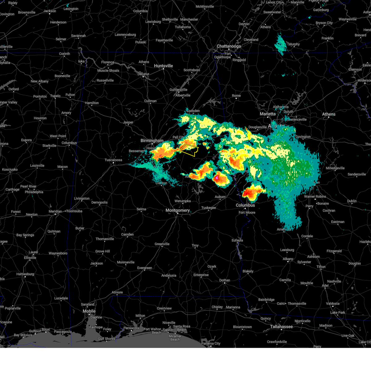 At 857 pm cdt, a severe thunderstorm was located near talladega, moving east at 30 mph (radar indicated). Hazards include 60 mph wind gusts and quarter size hail. Hail damage to vehicles is expected. expect wind damage to roofs, siding, and trees. locations impacted include, talladega, waldo, ironaton, howells cove and chandler springs. hail threat, radar indicated max hail size, 1. 00 in wind threat, radar indicated max wind gust, 60 mph. At 857 pm cdt, a severe thunderstorm was located near talladega, moving east at 30 mph (radar indicated). Hazards include 60 mph wind gusts and quarter size hail. Hail damage to vehicles is expected. expect wind damage to roofs, siding, and trees. locations impacted include, talladega, waldo, ironaton, howells cove and chandler springs. hail threat, radar indicated max hail size, 1. 00 in wind threat, radar indicated max wind gust, 60 mph.
|
| 8/9/2023 8:46 PM CDT |
 At 846 pm cdt, a severe thunderstorm was located over logan martin lake, or near pell city, moving east at 30 mph (radar indicated). Hazards include 60 mph wind gusts and quarter size hail. Hail damage to vehicles is expected. Expect wind damage to roofs, siding, and trees. At 846 pm cdt, a severe thunderstorm was located over logan martin lake, or near pell city, moving east at 30 mph (radar indicated). Hazards include 60 mph wind gusts and quarter size hail. Hail damage to vehicles is expected. Expect wind damage to roofs, siding, and trees.
|
| 8/9/2023 7:39 PM CDT |
 At 739 pm cdt, a severe thunderstorm was located near lineville, moving southeast at 30 mph (radar indicated). Hazards include ping pong ball size hail and 60 mph wind gusts. People and animals outdoors will be injured. expect hail damage to roofs, siding, windows, and vehicles. expect wind damage to roofs, siding, and trees. locations impacted include, talladega, lineville, ashland, munford, waldo, barfield, camp mac, cragford, ironaton, lake chinnabee, gunthertown and chandler springs. hail threat, radar indicated max hail size, 1. 50 in wind threat, radar indicated max wind gust, 60 mph. At 739 pm cdt, a severe thunderstorm was located near lineville, moving southeast at 30 mph (radar indicated). Hazards include ping pong ball size hail and 60 mph wind gusts. People and animals outdoors will be injured. expect hail damage to roofs, siding, windows, and vehicles. expect wind damage to roofs, siding, and trees. locations impacted include, talladega, lineville, ashland, munford, waldo, barfield, camp mac, cragford, ironaton, lake chinnabee, gunthertown and chandler springs. hail threat, radar indicated max hail size, 1. 50 in wind threat, radar indicated max wind gust, 60 mph.
|
| 8/9/2023 7:30 PM CDT |
 At 729 pm cdt, a severe thunderstorm was located near talladega, moving east at 35 mph (radar indicated). Hazards include golf ball size hail and 60 mph wind gusts. People and animals outdoors will be injured. expect hail damage to roofs, siding, windows, and vehicles. expect wind damage to roofs, siding, and trees. locations impacted include, talladega, munford, grant town, jenifer and camp mac. thunderstorm damage threat, considerable hail threat, radar indicated max hail size, 1. 75 in wind threat, radar indicated max wind gust, 60 mph. At 729 pm cdt, a severe thunderstorm was located near talladega, moving east at 35 mph (radar indicated). Hazards include golf ball size hail and 60 mph wind gusts. People and animals outdoors will be injured. expect hail damage to roofs, siding, windows, and vehicles. expect wind damage to roofs, siding, and trees. locations impacted include, talladega, munford, grant town, jenifer and camp mac. thunderstorm damage threat, considerable hail threat, radar indicated max hail size, 1. 75 in wind threat, radar indicated max wind gust, 60 mph.
|
| 8/9/2023 7:15 PM CDT |
 At 715 pm cdt, a severe thunderstorm was located over lincoln, or near pell city, moving east at 25 mph (radar indicated). Hazards include golf ball size hail and 60 mph wind gusts. People and animals outdoors will be injured. expect hail damage to roofs, siding, windows, and vehicles. expect wind damage to roofs, siding, and trees. locations impacted include, oxford, talladega, lincoln, munford, grant town, talladega superspeedway, honda manufacturing of alabama, talladega municipal airport, logan martin lake, eastaboga, camp mac, jackson shoals, jenifer and howells cove. thunderstorm damage threat, considerable hail threat, radar indicated max hail size, 1. 75 in wind threat, radar indicated max wind gust, 60 mph. At 715 pm cdt, a severe thunderstorm was located over lincoln, or near pell city, moving east at 25 mph (radar indicated). Hazards include golf ball size hail and 60 mph wind gusts. People and animals outdoors will be injured. expect hail damage to roofs, siding, windows, and vehicles. expect wind damage to roofs, siding, and trees. locations impacted include, oxford, talladega, lincoln, munford, grant town, talladega superspeedway, honda manufacturing of alabama, talladega municipal airport, logan martin lake, eastaboga, camp mac, jackson shoals, jenifer and howells cove. thunderstorm damage threat, considerable hail threat, radar indicated max hail size, 1. 75 in wind threat, radar indicated max wind gust, 60 mph.
|
| 8/9/2023 7:07 PM CDT |
 At 707 pm cdt, a severe thunderstorm was located over talladega, moving southeast at 25 mph (radar indicated). Hazards include golf ball size hail and 60 mph wind gusts. People and animals outdoors will be injured. expect hail damage to roofs, siding, windows, and vehicles. Expect wind damage to roofs, siding, and trees. At 707 pm cdt, a severe thunderstorm was located over talladega, moving southeast at 25 mph (radar indicated). Hazards include golf ball size hail and 60 mph wind gusts. People and animals outdoors will be injured. expect hail damage to roofs, siding, windows, and vehicles. Expect wind damage to roofs, siding, and trees.
|
| 8/9/2023 7:02 PM CDT |
 At 702 pm cdt, a severe thunderstorm was located over pell city, moving east at 30 mph (radar indicated). Hazards include golf ball size hail and 60 mph wind gusts. People and animals outdoors will be injured. expect hail damage to roofs, siding, windows, and vehicles. expect wind damage to roofs, siding, and trees. locations impacted include, oxford, talladega, pell city, lincoln, munford, grant town, logan martin lake, talladega superspeedway, honda manufacturing of alabama, harrisburg, talladega municipal airport, st. clair county airport, camp mac, jackson shoals, jenifer, cropwell and howells cove. thunderstorm damage threat, considerable hail threat, radar indicated max hail size, 1. 75 in wind threat, radar indicated max wind gust, 60 mph. At 702 pm cdt, a severe thunderstorm was located over pell city, moving east at 30 mph (radar indicated). Hazards include golf ball size hail and 60 mph wind gusts. People and animals outdoors will be injured. expect hail damage to roofs, siding, windows, and vehicles. expect wind damage to roofs, siding, and trees. locations impacted include, oxford, talladega, pell city, lincoln, munford, grant town, logan martin lake, talladega superspeedway, honda manufacturing of alabama, harrisburg, talladega municipal airport, st. clair county airport, camp mac, jackson shoals, jenifer, cropwell and howells cove. thunderstorm damage threat, considerable hail threat, radar indicated max hail size, 1. 75 in wind threat, radar indicated max wind gust, 60 mph.
|
| 8/9/2023 6:33 PM CDT |
 At 633 pm cdt, a severe thunderstorm was located over harrisburg, or over pell city, moving east at 25 mph (radar indicated). Hazards include golf ball size hail and 60 mph wind gusts. People and animals outdoors will be injured. expect hail damage to roofs, siding, windows, and vehicles. Expect wind damage to roofs, siding, and trees. At 633 pm cdt, a severe thunderstorm was located over harrisburg, or over pell city, moving east at 25 mph (radar indicated). Hazards include golf ball size hail and 60 mph wind gusts. People and animals outdoors will be injured. expect hail damage to roofs, siding, windows, and vehicles. Expect wind damage to roofs, siding, and trees.
|
| 8/7/2023 4:07 PM CDT |
 The severe thunderstorm warning for talladega, southwestern calhoun, shelby, jefferson and st. clair counties will expire at 415 pm cdt, the storms which prompted the warning have weakened below severe limits, and have exited the warned area. therefore, the warning will be allowed to expire. however gusty winds are still possible with these thunderstorms. a severe thunderstorm watch remains in effect until 700 pm cdt for central, northeastern, west central and east central alabama. The severe thunderstorm warning for talladega, southwestern calhoun, shelby, jefferson and st. clair counties will expire at 415 pm cdt, the storms which prompted the warning have weakened below severe limits, and have exited the warned area. therefore, the warning will be allowed to expire. however gusty winds are still possible with these thunderstorms. a severe thunderstorm watch remains in effect until 700 pm cdt for central, northeastern, west central and east central alabama.
|
| 8/7/2023 3:41 PM CDT |
 At 341 pm cdt, severe thunderstorms were located along a line extending from hobson city to logan martin dam to hoover metropolitan stadium, moving southeast at 40 mph (radar indicated). Hazards include 60 mph wind gusts. Expect damage to roofs, siding, and trees. locations impacted include, birmingham, hoover, vestavia hills, alabaster, bessemer, homewood, anniston, pelham, oxford, mountain brook, trussville, helena, hueytown, talladega, pell city, irondale, leeds, moody, fairfield and chelsea. hail threat, radar indicated max hail size, <. 75 in wind threat, radar indicated max wind gust, 60 mph. At 341 pm cdt, severe thunderstorms were located along a line extending from hobson city to logan martin dam to hoover metropolitan stadium, moving southeast at 40 mph (radar indicated). Hazards include 60 mph wind gusts. Expect damage to roofs, siding, and trees. locations impacted include, birmingham, hoover, vestavia hills, alabaster, bessemer, homewood, anniston, pelham, oxford, mountain brook, trussville, helena, hueytown, talladega, pell city, irondale, leeds, moody, fairfield and chelsea. hail threat, radar indicated max hail size, <. 75 in wind threat, radar indicated max wind gust, 60 mph.
|
| 8/7/2023 3:06 PM CDT |
 At 305 pm cdt, severe thunderstorms were located along a line extending from near ragland to trussville to 6 miles west of sylvan springs, moving southeast at 40 mph (radar indicated). Hazards include 60 mph wind gusts. expect damage to roofs, siding, and trees At 305 pm cdt, severe thunderstorms were located along a line extending from near ragland to trussville to 6 miles west of sylvan springs, moving southeast at 40 mph (radar indicated). Hazards include 60 mph wind gusts. expect damage to roofs, siding, and trees
|
| 8/6/2023 3:43 PM CDT |
 At 342 pm cdt, severe thunderstorms were located along a line extending from near ragland to near munford to near stewartville, moving east at 30 mph (radar indicated). Hazards include 60 mph wind gusts. Expect damage to roofs, siding, and trees. locations impacted include, talladega, sylacauga, goodwater, weogufka, stewartville, lincoln, riverside, ragland, munford, ohatchee, oak grove, waldo, hanover, bradford, winterboro, talladega superspeedway, hatchet, talladega municipal airport, grant town and alpine. hail threat, radar indicated max hail size, <. 75 in wind threat, radar indicated max wind gust, 60 mph. At 342 pm cdt, severe thunderstorms were located along a line extending from near ragland to near munford to near stewartville, moving east at 30 mph (radar indicated). Hazards include 60 mph wind gusts. Expect damage to roofs, siding, and trees. locations impacted include, talladega, sylacauga, goodwater, weogufka, stewartville, lincoln, riverside, ragland, munford, ohatchee, oak grove, waldo, hanover, bradford, winterboro, talladega superspeedway, hatchet, talladega municipal airport, grant town and alpine. hail threat, radar indicated max hail size, <. 75 in wind threat, radar indicated max wind gust, 60 mph.
|
| 8/6/2023 3:35 PM CDT | Tree down on spring hill rd in lincol in talladega county AL, 9.2 miles S of Talladega, AL |
| 8/6/2023 3:24 PM CDT |
 At 324 pm cdt, severe thunderstorms were located along a line extending from near springville to near pell city to lay lake, moving east at 40 mph (radar indicated). Hazards include 60 mph wind gusts. Expect damage to roofs, siding, and trees. locations impacted include, talladega, sylacauga, pell city, childersburg, columbiana, springville, odenville, wilsonville, goodwater, talladega springs, stewartville, weogufka, lincoln, margaret, ashville, riverside, vincent, ragland, harpersville and munford. hail threat, radar indicated max hail size, <. 75 in wind threat, radar indicated max wind gust, 60 mph. At 324 pm cdt, severe thunderstorms were located along a line extending from near springville to near pell city to lay lake, moving east at 40 mph (radar indicated). Hazards include 60 mph wind gusts. Expect damage to roofs, siding, and trees. locations impacted include, talladega, sylacauga, pell city, childersburg, columbiana, springville, odenville, wilsonville, goodwater, talladega springs, stewartville, weogufka, lincoln, margaret, ashville, riverside, vincent, ragland, harpersville and munford. hail threat, radar indicated max hail size, <. 75 in wind threat, radar indicated max wind gust, 60 mph.
|
| 8/6/2023 3:05 PM CDT |
 At 305 pm cdt, severe thunderstorms were located along a line extending from inland lake to near columbiana, moving east at 25 mph (radar indicated). Hazards include 60 mph wind gusts. expect damage to roofs, siding, and trees At 305 pm cdt, severe thunderstorms were located along a line extending from inland lake to near columbiana, moving east at 25 mph (radar indicated). Hazards include 60 mph wind gusts. expect damage to roofs, siding, and trees
|
| 8/3/2023 3:54 PM CDT |
 At 353 pm cdt, severe thunderstorms were located along a line extending from 8 miles northeast of gordo to woodstock to near wilsonville to near waldo, moving south at 25 mph (radar indicated). Hazards include 60 mph wind gusts. Expect damage to roofs, siding, and trees. locations impacted include, tuscaloosa, alabaster, northport, pelham, helena, sylacauga, calera, chelsea, montevallo, childersburg, columbiana, wilsonville, holt, lake view, brookwood, coaling, harpersville, vance, woodstock and west blocton. hail threat, radar indicated max hail size, <. 75 in wind threat, radar indicated max wind gust, 60 mph. At 353 pm cdt, severe thunderstorms were located along a line extending from 8 miles northeast of gordo to woodstock to near wilsonville to near waldo, moving south at 25 mph (radar indicated). Hazards include 60 mph wind gusts. Expect damage to roofs, siding, and trees. locations impacted include, tuscaloosa, alabaster, northport, pelham, helena, sylacauga, calera, chelsea, montevallo, childersburg, columbiana, wilsonville, holt, lake view, brookwood, coaling, harpersville, vance, woodstock and west blocton. hail threat, radar indicated max hail size, <. 75 in wind threat, radar indicated max wind gust, 60 mph.
|
| 8/3/2023 3:40 PM CDT |
 At 340 pm cdt, severe thunderstorms were located along a line extending from 7 miles southeast of ashcraft corner to near woodstock to near wilsonville to near waldo, moving south at 35 mph (radar indicated). Hazards include 60 mph wind gusts. Expect damage to roofs, siding, and trees. locations impacted include, tuscaloosa, hoover, alabaster, bessemer, northport, pelham, helena, talladega, sylacauga, calera, chelsea, montevallo, childersburg, columbiana, wilsonville, holt, indian springs village, vincent, lake view and brookwood. hail threat, radar indicated max hail size, <. 75 in wind threat, radar indicated max wind gust, 60 mph. At 340 pm cdt, severe thunderstorms were located along a line extending from 7 miles southeast of ashcraft corner to near woodstock to near wilsonville to near waldo, moving south at 35 mph (radar indicated). Hazards include 60 mph wind gusts. Expect damage to roofs, siding, and trees. locations impacted include, tuscaloosa, hoover, alabaster, bessemer, northport, pelham, helena, talladega, sylacauga, calera, chelsea, montevallo, childersburg, columbiana, wilsonville, holt, indian springs village, vincent, lake view and brookwood. hail threat, radar indicated max hail size, <. 75 in wind threat, radar indicated max wind gust, 60 mph.
|
| 8/3/2023 3:26 PM CDT |
 At 325 pm cdt, severe thunderstorms were located along a line extending from near ashcraft corner to near bull city to near mount laurel to talladega municipal airport, moving south at 25 mph (radar indicated). Hazards include 60 mph wind gusts. Expect damage to roofs, siding, and trees. locations impacted include, birmingham, tuscaloosa, hoover, vestavia hills, alabaster, bessemer, homewood, northport, pelham, oxford, mountain brook, helena, hueytown, talladega, sylacauga, pell city, irondale, leeds, calera and fairfield. hail threat, radar indicated max hail size, <. 75 in wind threat, radar indicated max wind gust, 60 mph. At 325 pm cdt, severe thunderstorms were located along a line extending from near ashcraft corner to near bull city to near mount laurel to talladega municipal airport, moving south at 25 mph (radar indicated). Hazards include 60 mph wind gusts. Expect damage to roofs, siding, and trees. locations impacted include, birmingham, tuscaloosa, hoover, vestavia hills, alabaster, bessemer, homewood, northport, pelham, oxford, mountain brook, helena, hueytown, talladega, sylacauga, pell city, irondale, leeds, calera and fairfield. hail threat, radar indicated max hail size, <. 75 in wind threat, radar indicated max wind gust, 60 mph.
|
| 8/3/2023 3:13 PM CDT |
 At 313 pm cdt, severe thunderstorms were located along a line extending from belk to near bull city to near lake purdy to near talladega municipal airport, moving southeast at 35 mph (radar indicated). Hazards include 60 mph wind gusts. Expect damage to roofs, siding, and trees. locations impacted include, birmingham, tuscaloosa, hoover, vestavia hills, alabaster, bessemer, homewood, northport, pelham, oxford, mountain brook, trussville, helena, hueytown, talladega, sylacauga, irondale, leeds, moody and calera. hail threat, radar indicated max hail size, <. 75 in wind threat, radar indicated max wind gust, 60 mph. At 313 pm cdt, severe thunderstorms were located along a line extending from belk to near bull city to near lake purdy to near talladega municipal airport, moving southeast at 35 mph (radar indicated). Hazards include 60 mph wind gusts. Expect damage to roofs, siding, and trees. locations impacted include, birmingham, tuscaloosa, hoover, vestavia hills, alabaster, bessemer, homewood, northport, pelham, oxford, mountain brook, trussville, helena, hueytown, talladega, sylacauga, irondale, leeds, moody and calera. hail threat, radar indicated max hail size, <. 75 in wind threat, radar indicated max wind gust, 60 mph.
|
| 8/3/2023 3:01 PM CDT |
 At 301 pm cdt, severe thunderstorms were located along a line extending from blooming grove to near brookside to ragland, moving south at 25 mph (radar indicated). Hazards include 60 mph wind gusts. expect damage to roofs, siding, and trees At 301 pm cdt, severe thunderstorms were located along a line extending from blooming grove to near brookside to ragland, moving south at 25 mph (radar indicated). Hazards include 60 mph wind gusts. expect damage to roofs, siding, and trees
|
| 7/21/2023 5:21 PM CDT |
 At 521 pm cdt, severe thunderstorms were located along a line extending from ballplay to near ragland to leeds, moving southeast at 35 mph (radar indicated). Hazards include 60 mph wind gusts and penny size hail. expect damage to roofs, siding, and trees At 521 pm cdt, severe thunderstorms were located along a line extending from ballplay to near ragland to leeds, moving southeast at 35 mph (radar indicated). Hazards include 60 mph wind gusts and penny size hail. expect damage to roofs, siding, and trees
|
| 7/2/2023 3:56 PM CDT |
 At 356 pm cdt, a severe thunderstorm was located near bon air, or near childersburg, moving northeast at 15 mph (radar indicated). Hazards include 60 mph wind gusts and quarter size hail. Hail damage to vehicles is expected. Expect wind damage to roofs, siding, and trees. At 356 pm cdt, a severe thunderstorm was located near bon air, or near childersburg, moving northeast at 15 mph (radar indicated). Hazards include 60 mph wind gusts and quarter size hail. Hail damage to vehicles is expected. Expect wind damage to roofs, siding, and trees.
|
| 7/1/2023 5:08 PM CDT |
 At 508 pm cdt, a severe thunderstorm was located over munford, or 9 miles northeast of talladega, moving east at 20 mph (radar indicated). Hazards include 60 mph wind gusts. Expect damage to roofs, siding, and trees. locations impacted include, talladega, lincoln, munford, talladega superspeedway, honda manufacturing of alabama, talladega municipal airport, jackson shoals, eastaboga and howells cove. hail threat, radar indicated max hail size, <. 75 in wind threat, radar indicated max wind gust, 60 mph. At 508 pm cdt, a severe thunderstorm was located over munford, or 9 miles northeast of talladega, moving east at 20 mph (radar indicated). Hazards include 60 mph wind gusts. Expect damage to roofs, siding, and trees. locations impacted include, talladega, lincoln, munford, talladega superspeedway, honda manufacturing of alabama, talladega municipal airport, jackson shoals, eastaboga and howells cove. hail threat, radar indicated max hail size, <. 75 in wind threat, radar indicated max wind gust, 60 mph.
|
| 7/1/2023 4:39 PM CDT |
 At 438 pm cdt, severe thunderstorms were located along a line extending from near clay to near lincoln, moving east at 10 mph (radar indicated). Hazards include 60 mph wind gusts and penny size hail. Expect damage to roofs, siding, and trees. locations impacted include, talladega, pell city, leeds, moody, springville, odenville, lincoln, margaret, argo, riverside, munford, bald rock, talladega superspeedway, harrisburg, branchville, talladega municipal airport, logan martin lake, honda manufacturing of alabama, country club estates and wattsville. hail threat, radar indicated max hail size, 0. 75 in wind threat, radar indicated max wind gust, 60 mph. At 438 pm cdt, severe thunderstorms were located along a line extending from near clay to near lincoln, moving east at 10 mph (radar indicated). Hazards include 60 mph wind gusts and penny size hail. Expect damage to roofs, siding, and trees. locations impacted include, talladega, pell city, leeds, moody, springville, odenville, lincoln, margaret, argo, riverside, munford, bald rock, talladega superspeedway, harrisburg, branchville, talladega municipal airport, logan martin lake, honda manufacturing of alabama, country club estates and wattsville. hail threat, radar indicated max hail size, 0. 75 in wind threat, radar indicated max wind gust, 60 mph.
|
| 7/1/2023 4:21 PM CDT |
 At 420 pm cdt, severe thunderstorms were located along a line extending from chalkville to logan martin lake, moving east at 15 mph (radar indicated). Hazards include 60 mph wind gusts and quarter size hail. Hail damage to vehicles is expected. Expect wind damage to roofs, siding, and trees. At 420 pm cdt, severe thunderstorms were located along a line extending from chalkville to logan martin lake, moving east at 15 mph (radar indicated). Hazards include 60 mph wind gusts and quarter size hail. Hail damage to vehicles is expected. Expect wind damage to roofs, siding, and trees.
|
| 6/25/2023 6:35 PM CDT |
 At 635 pm cdt, a severe thunderstorm was located over vincent, or near childersburg, moving southeast at 15 mph (radar indicated). Hazards include 60 mph wind gusts and quarter size hail. Hail damage to vehicles is expected. Expect wind damage to roofs, siding, and trees. At 635 pm cdt, a severe thunderstorm was located over vincent, or near childersburg, moving southeast at 15 mph (radar indicated). Hazards include 60 mph wind gusts and quarter size hail. Hail damage to vehicles is expected. Expect wind damage to roofs, siding, and trees.
|
| 6/25/2023 6:06 PM CDT |
 The severe thunderstorm warning for northeastern talladega, southwestern calhoun and southwestern cleburne counties will expire at 615 pm cdt, the storms which prompted the warning have moved out of the area. therefore, the warning will be allowed to expire. a severe thunderstorm watch remains in effect until 700 pm cdt for central and east central alabama. The severe thunderstorm warning for northeastern talladega, southwestern calhoun and southwestern cleburne counties will expire at 615 pm cdt, the storms which prompted the warning have moved out of the area. therefore, the warning will be allowed to expire. a severe thunderstorm watch remains in effect until 700 pm cdt for central and east central alabama.
|
| 6/25/2023 5:54 PM CDT | Trees were blown down near wald in talladega county AL, 7.7 miles W of Talladega, AL |
| 6/25/2023 5:54 PM CDT |
 At 554 pm cdt, severe thunderstorms were located along a line extending from near ephesus to near alpine bay resort, moving south at 30 mph (radar indicated). Hazards include 60 mph wind gusts and quarter size hail. Hail damage to vehicles is expected. expect wind damage to roofs, siding, and trees. locations impacted include, talladega, roanoke, lineville, ashland, wedowee, lake wedowee, wadley, waldo, woodland, malone, morrison cross roads, barfield, corinth, fosters cross roads, delta, crystal lake, graham, cleveland crossroads, dickert and newell. hail threat, radar indicated max hail size, 1. 00 in wind threat, radar indicated max wind gust, 60 mph. At 554 pm cdt, severe thunderstorms were located along a line extending from near ephesus to near alpine bay resort, moving south at 30 mph (radar indicated). Hazards include 60 mph wind gusts and quarter size hail. Hail damage to vehicles is expected. expect wind damage to roofs, siding, and trees. locations impacted include, talladega, roanoke, lineville, ashland, wedowee, lake wedowee, wadley, waldo, woodland, malone, morrison cross roads, barfield, corinth, fosters cross roads, delta, crystal lake, graham, cleveland crossroads, dickert and newell. hail threat, radar indicated max hail size, 1. 00 in wind threat, radar indicated max wind gust, 60 mph.
|
| 6/25/2023 5:53 PM CDT |
 At 553 pm cdt, severe thunderstorms were located along a line extending from near oxford lake to near logan martin lake, moving southeast at 20 mph (radar indicated). Hazards include 60 mph wind gusts and quarter size hail. Hail damage to vehicles is expected. expect wind damage to roofs, siding, and trees. locations impacted include, anniston, oxford, talladega, cobb town, west end-cobb town, lincoln, riverside, munford, hobson city, grant town, talladega superspeedway, honda manufacturing of alabama, anniston regional airport, oxford lake, bynum, talladega municipal airport, mount cheaha, logan martin lake, anniston army depot and eastaboga. hail threat, radar indicated max hail size, 1. 00 in wind threat, radar indicated max wind gust, 60 mph. At 553 pm cdt, severe thunderstorms were located along a line extending from near oxford lake to near logan martin lake, moving southeast at 20 mph (radar indicated). Hazards include 60 mph wind gusts and quarter size hail. Hail damage to vehicles is expected. expect wind damage to roofs, siding, and trees. locations impacted include, anniston, oxford, talladega, cobb town, west end-cobb town, lincoln, riverside, munford, hobson city, grant town, talladega superspeedway, honda manufacturing of alabama, anniston regional airport, oxford lake, bynum, talladega municipal airport, mount cheaha, logan martin lake, anniston army depot and eastaboga. hail threat, radar indicated max hail size, 1. 00 in wind threat, radar indicated max wind gust, 60 mph.
|
| 6/25/2023 5:40 PM CDT |
 At 539 pm cdt, severe thunderstorms were located along a line extending from hobson city to honda manufacturing of alabama, moving southeast at 35 mph (radar indicated). Hazards include 60 mph wind gusts and quarter size hail. Hail damage to vehicles is expected. expect wind damage to roofs, siding, and trees. locations impacted include, anniston, oxford, talladega, cobb town, west end-cobb town, lincoln, riverside, munford, hobson city, grant town, talladega superspeedway, honda manufacturing of alabama, anniston regional airport, oxford lake, bynum, talladega municipal airport, mount cheaha, logan martin lake, anniston army depot and eastaboga. hail threat, radar indicated max hail size, 1. 00 in wind threat, radar indicated max wind gust, 60 mph. At 539 pm cdt, severe thunderstorms were located along a line extending from hobson city to honda manufacturing of alabama, moving southeast at 35 mph (radar indicated). Hazards include 60 mph wind gusts and quarter size hail. Hail damage to vehicles is expected. expect wind damage to roofs, siding, and trees. locations impacted include, anniston, oxford, talladega, cobb town, west end-cobb town, lincoln, riverside, munford, hobson city, grant town, talladega superspeedway, honda manufacturing of alabama, anniston regional airport, oxford lake, bynum, talladega municipal airport, mount cheaha, logan martin lake, anniston army depot and eastaboga. hail threat, radar indicated max hail size, 1. 00 in wind threat, radar indicated max wind gust, 60 mph.
|
| 6/25/2023 5:37 PM CDT |
 At 537 pm cdt, severe thunderstorms were located along a line extending from near ranburne to near lincoln, moving south at 35 mph (radar indicated). Hazards include 60 mph wind gusts and quarter size hail. Hail damage to vehicles is expected. Expect wind damage to roofs, siding, and trees. At 537 pm cdt, severe thunderstorms were located along a line extending from near ranburne to near lincoln, moving south at 35 mph (radar indicated). Hazards include 60 mph wind gusts and quarter size hail. Hail damage to vehicles is expected. Expect wind damage to roofs, siding, and trees.
|
| 6/25/2023 5:24 PM CDT |
 At 524 pm cdt, severe thunderstorms were located along a line extending from near ragland to near talladega, moving southeast at 25 mph (radar indicated). Hazards include 60 mph wind gusts and quarter size hail. Hail damage to vehicles is expected. expect wind damage to roofs, siding, and trees. locations impacted include, anniston, oxford, talladega, pell city, cobb town, west end-cobb town, saks, lincoln, riverside, ragland, munford, ohatchee, hobson city, talladega superspeedway, anniston regional airport, talladega municipal airport, grant town, honda manufacturing of alabama, oxford lake and bynum. hail threat, radar indicated max hail size, 1. 00 in wind threat, radar indicated max wind gust, 60 mph. At 524 pm cdt, severe thunderstorms were located along a line extending from near ragland to near talladega, moving southeast at 25 mph (radar indicated). Hazards include 60 mph wind gusts and quarter size hail. Hail damage to vehicles is expected. expect wind damage to roofs, siding, and trees. locations impacted include, anniston, oxford, talladega, pell city, cobb town, west end-cobb town, saks, lincoln, riverside, ragland, munford, ohatchee, hobson city, talladega superspeedway, anniston regional airport, talladega municipal airport, grant town, honda manufacturing of alabama, oxford lake and bynum. hail threat, radar indicated max hail size, 1. 00 in wind threat, radar indicated max wind gust, 60 mph.
|
| 6/25/2023 5:11 PM CDT |
 At 510 pm cdt, severe thunderstorms were located along a line extending from near ragland to near logan martin lake, moving southeast at 30 mph (radar indicated). Hazards include 60 mph wind gusts and quarter size hail. Hail damage to vehicles is expected. Expect wind damage to roofs, siding, and trees. At 510 pm cdt, severe thunderstorms were located along a line extending from near ragland to near logan martin lake, moving southeast at 30 mph (radar indicated). Hazards include 60 mph wind gusts and quarter size hail. Hail damage to vehicles is expected. Expect wind damage to roofs, siding, and trees.
|
| 6/16/2023 6:38 PM CDT |
 At 638 pm cdt, a severe thunderstorm was located near waldo, or near talladega, moving east at 20 mph (radar indicated). Hazards include 60 mph wind gusts and quarter size hail. Hail damage to vehicles is expected. expect wind damage to roofs, siding, and trees. locations impacted include, talladega, sylacauga, childersburg, vincent, waldo, alpine bay resort, sycamore, winterboro, alpine, logan martin dam, logan martin lake and chandler springs. hail threat, radar indicated max hail size, 1. 00 in wind threat, radar indicated max wind gust, 60 mph. At 638 pm cdt, a severe thunderstorm was located near waldo, or near talladega, moving east at 20 mph (radar indicated). Hazards include 60 mph wind gusts and quarter size hail. Hail damage to vehicles is expected. expect wind damage to roofs, siding, and trees. locations impacted include, talladega, sylacauga, childersburg, vincent, waldo, alpine bay resort, sycamore, winterboro, alpine, logan martin dam, logan martin lake and chandler springs. hail threat, radar indicated max hail size, 1. 00 in wind threat, radar indicated max wind gust, 60 mph.
|
| 6/16/2023 6:21 PM CDT |
 At 621 pm cdt, a severe thunderstorm was located near alpine, or near talladega, moving east at 25 mph (radar indicated). Hazards include tennis ball size hail and 60 mph wind gusts. People and animals outdoors will be injured. expect hail damage to roofs, siding, windows, and vehicles. expect wind damage to roofs, siding, and trees. locations impacted include, talladega, sylacauga, childersburg, vincent, waldo, alpine bay resort, winterboro, alpine, sycamore, logan martin dam, logan martin lake, country club estates, chandler springs and ironaton. thunderstorm damage threat, considerable hail threat, radar indicated max hail size, 2. 50 in wind threat, radar indicated max wind gust, 60 mph. At 621 pm cdt, a severe thunderstorm was located near alpine, or near talladega, moving east at 25 mph (radar indicated). Hazards include tennis ball size hail and 60 mph wind gusts. People and animals outdoors will be injured. expect hail damage to roofs, siding, windows, and vehicles. expect wind damage to roofs, siding, and trees. locations impacted include, talladega, sylacauga, childersburg, vincent, waldo, alpine bay resort, winterboro, alpine, sycamore, logan martin dam, logan martin lake, country club estates, chandler springs and ironaton. thunderstorm damage threat, considerable hail threat, radar indicated max hail size, 2. 50 in wind threat, radar indicated max wind gust, 60 mph.
|
| 6/16/2023 6:20 PM CDT | Quarter sized hail reported 3 miles NE of Talladega, AL, social media photos and videos of dime to quarter size hail southwest of talladega. |
| 6/16/2023 6:17 PM CDT |
 At 617 pm cdt, a severe thunderstorm was located near alpine, or near talladega, moving east at 15 mph (radar indicated). Hazards include golf ball size hail and 60 mph wind gusts. People and animals outdoors will be injured. expect hail damage to roofs, siding, windows, and vehicles. expect wind damage to roofs, siding, and trees. locations impacted include, talladega, sylacauga, childersburg, vincent, harpersville, waldo, alpine bay resort, winterboro, alpine, sycamore, coosa island, logan martin dam, logan martin lake, country club estates, chandler springs and ironaton. thunderstorm damage threat, considerable hail threat, radar indicated max hail size, 1. 75 in wind threat, radar indicated max wind gust, 60 mph. At 617 pm cdt, a severe thunderstorm was located near alpine, or near talladega, moving east at 15 mph (radar indicated). Hazards include golf ball size hail and 60 mph wind gusts. People and animals outdoors will be injured. expect hail damage to roofs, siding, windows, and vehicles. expect wind damage to roofs, siding, and trees. locations impacted include, talladega, sylacauga, childersburg, vincent, harpersville, waldo, alpine bay resort, winterboro, alpine, sycamore, coosa island, logan martin dam, logan martin lake, country club estates, chandler springs and ironaton. thunderstorm damage threat, considerable hail threat, radar indicated max hail size, 1. 75 in wind threat, radar indicated max wind gust, 60 mph.
|
| 6/16/2023 6:05 PM CDT |
 At 605 pm cdt, a severe thunderstorm was located over alpine, or 8 miles west of talladega, moving east at 25 mph (radar indicated). Hazards include golf ball size hail and 60 mph wind gusts. People and animals outdoors will be injured. expect hail damage to roofs, siding, windows, and vehicles. Expect wind damage to roofs, siding, and trees. At 605 pm cdt, a severe thunderstorm was located over alpine, or 8 miles west of talladega, moving east at 25 mph (radar indicated). Hazards include golf ball size hail and 60 mph wind gusts. People and animals outdoors will be injured. expect hail damage to roofs, siding, windows, and vehicles. Expect wind damage to roofs, siding, and trees.
|
| 6/14/2023 2:21 PM CDT | Tree down on power lines and roadway on joe gamble r in talladega county AL, 9 miles ESE of Talladega, AL |
| 6/14/2023 2:10 PM CDT |
 At 210 pm cdt, severe thunderstorms were located along a line extending from near rainbow city to near harrisburg to near moody, moving east at 70 mph (radar indicated). Hazards include 70 mph wind gusts and quarter size hail. Hail damage to vehicles is expected. expect considerable tree damage. Wind damage is also likely to mobile homes, roofs, and outbuildings. At 210 pm cdt, severe thunderstorms were located along a line extending from near rainbow city to near harrisburg to near moody, moving east at 70 mph (radar indicated). Hazards include 70 mph wind gusts and quarter size hail. Hail damage to vehicles is expected. expect considerable tree damage. Wind damage is also likely to mobile homes, roofs, and outbuildings.
|
| 5/18/2023 5:24 PM CDT |
 At 524 pm cdt, a severe thunderstorm was located over talladega municipal airport, or 9 miles northeast of talladega, moving southeast at 10 mph (radar indicated). Hazards include ping pong ball size hail and 60 mph wind gusts. People and animals outdoors will be injured. expect hail damage to roofs, siding, windows, and vehicles. Expect wind damage to roofs, siding, and trees. At 524 pm cdt, a severe thunderstorm was located over talladega municipal airport, or 9 miles northeast of talladega, moving southeast at 10 mph (radar indicated). Hazards include ping pong ball size hail and 60 mph wind gusts. People and animals outdoors will be injured. expect hail damage to roofs, siding, windows, and vehicles. Expect wind damage to roofs, siding, and trees.
|
| 5/16/2023 2:42 PM CDT | Trees down in numerous locations throughout talladega county. roadways blocked in several location in talladega county AL, 1.6 miles SSW of Talladega, AL |
| 5/9/2023 12:57 PM CDT |
 At 1257 pm cdt, a severe thunderstorm was located near talladega, moving south at 15 mph (radar indicated). Hazards include 60 mph wind gusts and quarter size hail. Hail damage to vehicles is expected. Expect wind damage to roofs, siding, and trees. At 1257 pm cdt, a severe thunderstorm was located near talladega, moving south at 15 mph (radar indicated). Hazards include 60 mph wind gusts and quarter size hail. Hail damage to vehicles is expected. Expect wind damage to roofs, siding, and trees.
|
| 5/9/2023 12:53 PM CDT | Trees down renfroe rd/dial rd. one tree on ca in talladega county AL, 5.8 miles ESE of Talladega, AL |
| 5/9/2023 12:47 PM CDT |
 At 1247 pm cdt, a severe thunderstorm was located near talladega, moving south at 15 mph (radar indicated). Hazards include 60 mph wind gusts and quarter size hail. Hail damage to vehicles is expected. expect wind damage to roofs, siding, and trees. locations impacted include, talladega, lincoln, logan martin lake, howells cove and jackson shoals. hail threat, radar indicated max hail size, 1. 00 in wind threat, radar indicated max wind gust, 60 mph. At 1247 pm cdt, a severe thunderstorm was located near talladega, moving south at 15 mph (radar indicated). Hazards include 60 mph wind gusts and quarter size hail. Hail damage to vehicles is expected. expect wind damage to roofs, siding, and trees. locations impacted include, talladega, lincoln, logan martin lake, howells cove and jackson shoals. hail threat, radar indicated max hail size, 1. 00 in wind threat, radar indicated max wind gust, 60 mph.
|
| 5/9/2023 12:40 PM CDT |
 At 1240 pm cdt, a severe thunderstorm was located near talladega superspeedway, or near talladega, moving southeast at 15 mph (radar indicated). Hazards include 60 mph wind gusts and quarter size hail. Hail damage to vehicles is expected. expect wind damage to roofs, siding, and trees. locations impacted include, talladega, lincoln, munford, talladega superspeedway, honda manufacturing of alabama, talladega municipal airport, logan martin lake, jackson shoals and howells cove. hail threat, radar indicated max hail size, 1. 00 in wind threat, radar indicated max wind gust, 60 mph. At 1240 pm cdt, a severe thunderstorm was located near talladega superspeedway, or near talladega, moving southeast at 15 mph (radar indicated). Hazards include 60 mph wind gusts and quarter size hail. Hail damage to vehicles is expected. expect wind damage to roofs, siding, and trees. locations impacted include, talladega, lincoln, munford, talladega superspeedway, honda manufacturing of alabama, talladega municipal airport, logan martin lake, jackson shoals and howells cove. hail threat, radar indicated max hail size, 1. 00 in wind threat, radar indicated max wind gust, 60 mph.
|
| 5/9/2023 12:38 PM CDT | Trees down along joe lee r in talladega county AL, 7.2 miles SE of Talladega, AL |
| 5/9/2023 12:17 PM CDT |
 At 1217 pm cdt, a severe thunderstorm was located over lincoln, or 7 miles east of pell city, moving southeast at 15 mph (radar indicated). Hazards include 60 mph wind gusts and quarter size hail. Hail damage to vehicles is expected. Expect wind damage to roofs, siding, and trees. At 1217 pm cdt, a severe thunderstorm was located over lincoln, or 7 miles east of pell city, moving southeast at 15 mph (radar indicated). Hazards include 60 mph wind gusts and quarter size hail. Hail damage to vehicles is expected. Expect wind damage to roofs, siding, and trees.
|
| 1/12/2023 12:16 PM CST |
 At 1216 pm cst, a severe thunderstorm was located over bynum, or near cobb town, moving northeast at 55 mph (radar indicated). Hazards include 70 mph wind gusts and quarter size hail. Hail damage to vehicles is expected. expect considerable tree damage. wind damage is also likely to mobile homes, roofs, and outbuildings. locations impacted include, oxford, lincoln, munford, grant town, talladega municipal airport, jenifer and eastaboga. thunderstorm damage threat, considerable hail threat, radar indicated max hail size, 1. 00 in wind threat, radar indicated max wind gust, 70 mph. At 1216 pm cst, a severe thunderstorm was located over bynum, or near cobb town, moving northeast at 55 mph (radar indicated). Hazards include 70 mph wind gusts and quarter size hail. Hail damage to vehicles is expected. expect considerable tree damage. wind damage is also likely to mobile homes, roofs, and outbuildings. locations impacted include, oxford, lincoln, munford, grant town, talladega municipal airport, jenifer and eastaboga. thunderstorm damage threat, considerable hail threat, radar indicated max hail size, 1. 00 in wind threat, radar indicated max wind gust, 70 mph.
|
| 1/12/2023 12:01 PM CST | Trees down along howell cove road at glade road and along stemley bridge roa in talladega county AL, 6.2 miles SSE of Talladega, AL |
| 1/12/2023 11:58 AM CST |
 At 1158 am cst, a severe thunderstorm was located near logan martin lake, or near pell city, moving northeast at 55 mph (radar indicated). Hazards include golf ball size hail and 70 mph wind gusts. People and animals outdoors will be injured. expect hail damage to roofs, siding, windows, and vehicles. expect considerable tree damage. wind damage is also likely to mobile homes, roofs, and outbuildings. locations impacted include, oxford, talladega, pell city, lincoln, munford, grant town, alpine bay resort, alpine, logan martin lake, talladega superspeedway, honda manufacturing of alabama, talladega municipal airport, country club estates, st. clair county airport, eastaboga, camp mac, jackson shoals, jenifer, cropwell and howells cove. thunderstorm damage threat, considerable hail threat, radar indicated max hail size, 1. 75 in wind threat, radar indicated max wind gust, 70 mph. At 1158 am cst, a severe thunderstorm was located near logan martin lake, or near pell city, moving northeast at 55 mph (radar indicated). Hazards include golf ball size hail and 70 mph wind gusts. People and animals outdoors will be injured. expect hail damage to roofs, siding, windows, and vehicles. expect considerable tree damage. wind damage is also likely to mobile homes, roofs, and outbuildings. locations impacted include, oxford, talladega, pell city, lincoln, munford, grant town, alpine bay resort, alpine, logan martin lake, talladega superspeedway, honda manufacturing of alabama, talladega municipal airport, country club estates, st. clair county airport, eastaboga, camp mac, jackson shoals, jenifer, cropwell and howells cove. thunderstorm damage threat, considerable hail threat, radar indicated max hail size, 1. 75 in wind threat, radar indicated max wind gust, 70 mph.
|
| 1/12/2023 11:50 AM CST |
 At 1150 am cst, a severe thunderstorm was located over alpine bay resort, or 9 miles south of pell city, moving northeast at 55 mph (radar indicated). Hazards include golf ball size hail and 70 mph wind gusts. People and animals outdoors will be injured. expect hail damage to roofs, siding, windows, and vehicles. expect considerable tree damage. wind damage is also likely to mobile homes, roofs, and outbuildings. locations impacted include, oxford, talladega, pell city, lincoln, vincent, munford, grant town, alpine bay resort, alpine, logan martin lake, talladega superspeedway, honda manufacturing of alabama, coosa island, logan martin dam, talladega municipal airport, country club estates, st. clair county airport, eastaboga, camp mac and jackson shoals. thunderstorm damage threat, considerable hail threat, radar indicated max hail size, 1. 75 in wind threat, radar indicated max wind gust, 70 mph. At 1150 am cst, a severe thunderstorm was located over alpine bay resort, or 9 miles south of pell city, moving northeast at 55 mph (radar indicated). Hazards include golf ball size hail and 70 mph wind gusts. People and animals outdoors will be injured. expect hail damage to roofs, siding, windows, and vehicles. expect considerable tree damage. wind damage is also likely to mobile homes, roofs, and outbuildings. locations impacted include, oxford, talladega, pell city, lincoln, vincent, munford, grant town, alpine bay resort, alpine, logan martin lake, talladega superspeedway, honda manufacturing of alabama, coosa island, logan martin dam, talladega municipal airport, country club estates, st. clair county airport, eastaboga, camp mac and jackson shoals. thunderstorm damage threat, considerable hail threat, radar indicated max hail size, 1. 75 in wind threat, radar indicated max wind gust, 70 mph.
|
| 1/12/2023 11:38 AM CST |
 At 1138 am cst, a severe thunderstorm was located over westover, or 7 miles east of chelsea, moving northeast at 55 mph (radar indicated). Hazards include golf ball size hail and 60 mph wind gusts. People and animals outdoors will be injured. expect hail damage to roofs, siding, windows, and vehicles. Expect wind damage to roofs, siding, and trees. At 1138 am cst, a severe thunderstorm was located over westover, or 7 miles east of chelsea, moving northeast at 55 mph (radar indicated). Hazards include golf ball size hail and 60 mph wind gusts. People and animals outdoors will be injured. expect hail damage to roofs, siding, windows, and vehicles. Expect wind damage to roofs, siding, and trees.
|
| 1/3/2023 2:35 PM CST | Trees down in the 3400 block of clay county road 7. possible tornad in clay county AL, 12 miles NNW of Talladega, AL |
| 11/30/2022 1:50 AM CST |
 At 150 am cst, severe thunderstorms were located along a line extending from near jacksonville state university to near grant town to near talladega, moving east at 45 mph (radar indicated). Hazards include 60 mph wind gusts. Expect damage to roofs, siding, and trees. locations impacted include, anniston, oxford, talladega, jacksonville, cobb town, west end-cobb town, fort mcclellan, saks, weaver, munford, hobson city, waldo, anniston regional airport, blue mountain, alexandria, jacksonville state university, grant town, oxford lake, bynum and choccolocco. hail threat, radar indicated max hail size, <. 75 in wind threat, radar indicated max wind gust, 60 mph. At 150 am cst, severe thunderstorms were located along a line extending from near jacksonville state university to near grant town to near talladega, moving east at 45 mph (radar indicated). Hazards include 60 mph wind gusts. Expect damage to roofs, siding, and trees. locations impacted include, anniston, oxford, talladega, jacksonville, cobb town, west end-cobb town, fort mcclellan, saks, weaver, munford, hobson city, waldo, anniston regional airport, blue mountain, alexandria, jacksonville state university, grant town, oxford lake, bynum and choccolocco. hail threat, radar indicated max hail size, <. 75 in wind threat, radar indicated max wind gust, 60 mph.
|
| 11/30/2022 1:35 AM CST |
 At 135 am cst, severe thunderstorms were located along a line extending from ohatchee to lincoln to near logan martin dam, moving east at 60 mph (radar indicated). Hazards include 60 mph wind gusts. Expect damage to roofs, siding, and trees. locations impacted include, anniston, oxford, talladega, jacksonville, cobb town, west end-cobb town, fort mcclellan, saks, lincoln, weaver, riverside, munford, ohatchee, hobson city, waldo, alpine bay resort, talladega superspeedway, anniston regional airport, blue mountain and alexandria. hail threat, radar indicated max hail size, <. 75 in wind threat, radar indicated max wind gust, 60 mph. At 135 am cst, severe thunderstorms were located along a line extending from ohatchee to lincoln to near logan martin dam, moving east at 60 mph (radar indicated). Hazards include 60 mph wind gusts. Expect damage to roofs, siding, and trees. locations impacted include, anniston, oxford, talladega, jacksonville, cobb town, west end-cobb town, fort mcclellan, saks, lincoln, weaver, riverside, munford, ohatchee, hobson city, waldo, alpine bay resort, talladega superspeedway, anniston regional airport, blue mountain and alexandria. hail threat, radar indicated max hail size, <. 75 in wind threat, radar indicated max wind gust, 60 mph.
|
| 11/30/2022 1:34 AM CST |
 At 135 am cst, severe thunderstorms were located along a line extending from ohatchee to lincoln to near logan martin dam, moving east at 60 mph (radar indicated). Hazards include 60 mph wind gusts. Expect damage to roofs, siding, and trees. locations impacted include, anniston, oxford, talladega, jacksonville, cobb town, west end-cobb town, fort mcclellan, saks, lincoln, weaver, riverside, munford, ohatchee, hobson city, waldo, alpine bay resort, talladega superspeedway, anniston regional airport, blue mountain and alexandria. hail threat, radar indicated max hail size, <. 75 in wind threat, radar indicated max wind gust, 60 mph. At 135 am cst, severe thunderstorms were located along a line extending from ohatchee to lincoln to near logan martin dam, moving east at 60 mph (radar indicated). Hazards include 60 mph wind gusts. Expect damage to roofs, siding, and trees. locations impacted include, anniston, oxford, talladega, jacksonville, cobb town, west end-cobb town, fort mcclellan, saks, lincoln, weaver, riverside, munford, ohatchee, hobson city, waldo, alpine bay resort, talladega superspeedway, anniston regional airport, blue mountain and alexandria. hail threat, radar indicated max hail size, <. 75 in wind threat, radar indicated max wind gust, 60 mph.
|
| 8/7/2022 5:48 PM CDT |
 At 548 pm cdt, severe thunderstorms were located along a line extending from near talladega superspeedway to near talladega, moving north at 15 mph (radar indicated). Hazards include 60 mph wind gusts. Expect damage to roofs, siding, and trees. locations impacted include, talladega and jackson shoals. hail threat, radar indicated max hail size, <. 75 in wind threat, radar indicated max wind gust, 60 mph. At 548 pm cdt, severe thunderstorms were located along a line extending from near talladega superspeedway to near talladega, moving north at 15 mph (radar indicated). Hazards include 60 mph wind gusts. Expect damage to roofs, siding, and trees. locations impacted include, talladega and jackson shoals. hail threat, radar indicated max hail size, <. 75 in wind threat, radar indicated max wind gust, 60 mph.
|
| 8/7/2022 5:34 PM CDT |
 At 533 pm cdt, severe thunderstorms were located along a line extending from near talladega to near winterboro, moving north at 15 mph (radar indicated). Hazards include 60 mph wind gusts. expect damage to roofs, siding, and trees At 533 pm cdt, severe thunderstorms were located along a line extending from near talladega to near winterboro, moving north at 15 mph (radar indicated). Hazards include 60 mph wind gusts. expect damage to roofs, siding, and trees
|
| 7/21/2022 6:24 PM CDT |
 At 624 pm cdt, severe thunderstorms were located along a line extending from 6 miles south of waldo to near talladega springs to 6 miles southeast of west blocton, moving south at 35 mph (radar indicated). Hazards include 60 mph wind gusts and quarter size hail. Hail damage to vehicles is expected. Expect wind damage to roofs, siding, and trees. At 624 pm cdt, severe thunderstorms were located along a line extending from 6 miles south of waldo to near talladega springs to 6 miles southeast of west blocton, moving south at 35 mph (radar indicated). Hazards include 60 mph wind gusts and quarter size hail. Hail damage to vehicles is expected. Expect wind damage to roofs, siding, and trees.
|
| 7/21/2022 6:16 PM CDT |
 At 616 pm cdt, severe thunderstorms were located along a line extending from near munford to near alpine to calera to woodstock, moving south at 30 mph (radar indicated). Hazards include 60 mph wind gusts. Expect damage to roofs, siding, and trees. locations impacted include, alabaster, talladega, sylacauga, calera, montevallo, childersburg, columbiana, wilsonville, talladega springs, vincent, harpersville, munford, west blocton, wilton, oak grove, waldo, bon air, american village, maylene and brierfield ironworks park. hail threat, radar indicated max hail size, <. 75 in wind threat, radar indicated max wind gust, 60 mph. At 616 pm cdt, severe thunderstorms were located along a line extending from near munford to near alpine to calera to woodstock, moving south at 30 mph (radar indicated). Hazards include 60 mph wind gusts. Expect damage to roofs, siding, and trees. locations impacted include, alabaster, talladega, sylacauga, calera, montevallo, childersburg, columbiana, wilsonville, talladega springs, vincent, harpersville, munford, west blocton, wilton, oak grove, waldo, bon air, american village, maylene and brierfield ironworks park. hail threat, radar indicated max hail size, <. 75 in wind threat, radar indicated max wind gust, 60 mph.
|
| 7/21/2022 6:15 PM CDT | Trees uprooted and on a house on wilson street in the city of talladeg in talladega county AL, 1.3 miles W of Talladega, AL |
| 7/21/2022 6:04 PM CDT |
 At 604 pm cdt, severe thunderstorms were located along a line extending from near munford to near logan martin dam to shelby county airport to lake view, moving south at 30 mph (radar indicated). Hazards include 60 mph wind gusts. Expect damage to roofs, siding, and trees. locations impacted include, hoover, alabaster, bessemer, pelham, helena, hueytown, talladega, sylacauga, pell city, calera, chelsea, montevallo, childersburg, columbiana, centreville, wilsonville, talladega springs, lincoln, indian springs village and riverside. hail threat, radar indicated max hail size, <. 75 in wind threat, radar indicated max wind gust, 60 mph. At 604 pm cdt, severe thunderstorms were located along a line extending from near munford to near logan martin dam to shelby county airport to lake view, moving south at 30 mph (radar indicated). Hazards include 60 mph wind gusts. Expect damage to roofs, siding, and trees. locations impacted include, hoover, alabaster, bessemer, pelham, helena, hueytown, talladega, sylacauga, pell city, calera, chelsea, montevallo, childersburg, columbiana, centreville, wilsonville, talladega springs, lincoln, indian springs village and riverside. hail threat, radar indicated max hail size, <. 75 in wind threat, radar indicated max wind gust, 60 mph.
|
| 7/21/2022 5:49 PM CDT |
 At 549 pm cdt, severe thunderstorms were located along a line extending from near anniston regional airport to near coosa island to near alabaster to near north johns, moving southeast at 30 mph (radar indicated). Hazards include 60 mph wind gusts. Expect damage to roofs, siding, and trees. locations impacted include, birmingham, hoover, vestavia hills, alabaster, bessemer, homewood, anniston, pelham, oxford, mountain brook, helena, hueytown, talladega, sylacauga, pell city, irondale, leeds, moody, calera and fairfield. hail threat, radar indicated max hail size, <. 75 in wind threat, radar indicated max wind gust, 60 mph. At 549 pm cdt, severe thunderstorms were located along a line extending from near anniston regional airport to near coosa island to near alabaster to near north johns, moving southeast at 30 mph (radar indicated). Hazards include 60 mph wind gusts. Expect damage to roofs, siding, and trees. locations impacted include, birmingham, hoover, vestavia hills, alabaster, bessemer, homewood, anniston, pelham, oxford, mountain brook, helena, hueytown, talladega, sylacauga, pell city, irondale, leeds, moody, calera and fairfield. hail threat, radar indicated max hail size, <. 75 in wind threat, radar indicated max wind gust, 60 mph.
|
| 7/21/2022 5:35 PM CDT |
 At 534 pm cdt, severe thunderstorms were located along a line extending from anniston regional airport to near bald rock to near bessemer to near bankhead lock and dam, moving southeast at 45 mph (radar indicated). Hazards include 70 mph wind gusts. Expect considerable tree damage. damage is likely to mobile homes, roofs, and outbuildings. locations impacted include, birmingham, hoover, vestavia hills, alabaster, bessemer, homewood, anniston, pelham, oxford, mountain brook, trussville, helena, hueytown, talladega, sylacauga, pell city, irondale, leeds, moody and calera. thunderstorm damage threat, considerable hail threat, radar indicated max hail size, <. 75 in wind threat, radar indicated max wind gust, 70 mph. At 534 pm cdt, severe thunderstorms were located along a line extending from anniston regional airport to near bald rock to near bessemer to near bankhead lock and dam, moving southeast at 45 mph (radar indicated). Hazards include 70 mph wind gusts. Expect considerable tree damage. damage is likely to mobile homes, roofs, and outbuildings. locations impacted include, birmingham, hoover, vestavia hills, alabaster, bessemer, homewood, anniston, pelham, oxford, mountain brook, trussville, helena, hueytown, talladega, sylacauga, pell city, irondale, leeds, moody and calera. thunderstorm damage threat, considerable hail threat, radar indicated max hail size, <. 75 in wind threat, radar indicated max wind gust, 70 mph.
|
| 7/21/2022 5:23 PM CDT |
 At 523 pm cdt, severe thunderstorms were located along a line extending from west end-cobb town to 6 miles southwest of bankhead lock and dam, moving south at 30 mph (radar indicated). Hazards include 70 mph wind gusts. Expect considerable tree damage. damage is likely to mobile homes, roofs, and outbuildings. locations impacted include, birmingham, hoover, vestavia hills, alabaster, bessemer, homewood, anniston, pelham, oxford, mountain brook, trussville, helena, hueytown, talladega, gardendale, sylacauga, pell city, irondale, leeds and moody. thunderstorm damage threat, considerable hail threat, radar indicated max hail size, <. 75 in wind threat, radar indicated max wind gust, 70 mph. At 523 pm cdt, severe thunderstorms were located along a line extending from west end-cobb town to 6 miles southwest of bankhead lock and dam, moving south at 30 mph (radar indicated). Hazards include 70 mph wind gusts. Expect considerable tree damage. damage is likely to mobile homes, roofs, and outbuildings. locations impacted include, birmingham, hoover, vestavia hills, alabaster, bessemer, homewood, anniston, pelham, oxford, mountain brook, trussville, helena, hueytown, talladega, gardendale, sylacauga, pell city, irondale, leeds and moody. thunderstorm damage threat, considerable hail threat, radar indicated max hail size, <. 75 in wind threat, radar indicated max wind gust, 70 mph.
|
| 7/21/2022 5:20 PM CDT |
 At 519 pm cdt, severe thunderstorms were located along a line extending from near west end-cobb town to near bankhead lock and dam, moving south at 30 mph (radar indicated). Hazards include 60 mph wind gusts. expect damage to roofs, siding, and trees At 519 pm cdt, severe thunderstorms were located along a line extending from near west end-cobb town to near bankhead lock and dam, moving south at 30 mph (radar indicated). Hazards include 60 mph wind gusts. expect damage to roofs, siding, and trees
|
| 7/21/2022 3:59 PM CDT |
 At 358 pm cdt, severe thunderstorms were located along a line extending from anniston regional airport to near talladega, moving southeast at 20 mph (radar indicated). Hazards include 60 mph wind gusts and quarter size hail. Hail damage to vehicles is expected. Expect wind damage to roofs, siding, and trees. At 358 pm cdt, severe thunderstorms were located along a line extending from anniston regional airport to near talladega, moving southeast at 20 mph (radar indicated). Hazards include 60 mph wind gusts and quarter size hail. Hail damage to vehicles is expected. Expect wind damage to roofs, siding, and trees.
|
| 6/17/2022 1:46 AM CDT |
 At 146 am cdt, a severe thunderstorm was located near honda manufacturing of alabama, or 11 miles west of west end-cobb town, moving northwest at 15 mph (radar indicated). Hazards include 60 mph wind gusts and half dollar size hail. Hail damage to vehicles is expected. Expect wind damage to roofs, siding, and trees. At 146 am cdt, a severe thunderstorm was located near honda manufacturing of alabama, or 11 miles west of west end-cobb town, moving northwest at 15 mph (radar indicated). Hazards include 60 mph wind gusts and half dollar size hail. Hail damage to vehicles is expected. Expect wind damage to roofs, siding, and trees.
|
| 5/4/2022 4:06 PM CDT |
 At 405 pm cdt, a severe thunderstorm was located over alpine, or 8 miles northeast of childersburg, moving east at 25 mph (radar indicated). Hazards include quarter size hail. damage to vehicles is expected At 405 pm cdt, a severe thunderstorm was located over alpine, or 8 miles northeast of childersburg, moving east at 25 mph (radar indicated). Hazards include quarter size hail. damage to vehicles is expected
|
| 5/3/2022 9:48 PM CDT | Quarter sized hail reported 9.4 miles NW of Talladega, AL |
| 5/3/2022 9:42 PM CDT |
 At 942 pm cdt, a severe thunderstorm was located near waldo, or near talladega, moving east at 25 mph (radar indicated). Hazards include 60 mph wind gusts and half dollar size hail. Hail damage to vehicles is expected. expect wind damage to roofs, siding, and trees. locations impacted include, lineville, ashland, waldo, barfield, chandler springs and gunthertown. hail threat, radar indicated max hail size, 1. 25 in wind threat, radar indicated max wind gust, 60 mph. At 942 pm cdt, a severe thunderstorm was located near waldo, or near talladega, moving east at 25 mph (radar indicated). Hazards include 60 mph wind gusts and half dollar size hail. Hail damage to vehicles is expected. expect wind damage to roofs, siding, and trees. locations impacted include, lineville, ashland, waldo, barfield, chandler springs and gunthertown. hail threat, radar indicated max hail size, 1. 25 in wind threat, radar indicated max wind gust, 60 mph.
|
| 5/3/2022 9:40 PM CDT | Quarter sized hail reported 7.1 miles NNW of Talladega, AL |
| 3/22/2022 10:39 PM CDT |
 At 1039 pm cdt, a severe thunderstorm was located near strickland crossroads, or near stewartville, moving northeast at 55 mph (radar indicated). Hazards include 60 mph wind gusts and half dollar size hail. Hail damage to vehicles is expected. expect wind damage to roofs, siding, and trees. locations impacted include, talladega, sylacauga, childersburg, talladega springs, weogufka, stewartville, fayetteville, winterboro, alpine, strickland crossroads, unity, sycamore, parkdale, sylacauga municipal airport, overbrook, gantts quarry, hollins, varnons, roselle and millerville. hail threat, radar indicated max hail size, 1. 25 in wind threat, radar indicated max wind gust, 60 mph. At 1039 pm cdt, a severe thunderstorm was located near strickland crossroads, or near stewartville, moving northeast at 55 mph (radar indicated). Hazards include 60 mph wind gusts and half dollar size hail. Hail damage to vehicles is expected. expect wind damage to roofs, siding, and trees. locations impacted include, talladega, sylacauga, childersburg, talladega springs, weogufka, stewartville, fayetteville, winterboro, alpine, strickland crossroads, unity, sycamore, parkdale, sylacauga municipal airport, overbrook, gantts quarry, hollins, varnons, roselle and millerville. hail threat, radar indicated max hail size, 1. 25 in wind threat, radar indicated max wind gust, 60 mph.
|
| 3/22/2022 10:29 PM CDT |
 At 1029 pm cdt, a severe thunderstorm was located near marble valley, or 8 miles west of weogufka, moving northeast at 55 mph (radar indicated). Hazards include 60 mph wind gusts and quarter size hail. Hail damage to vehicles is expected. Expect wind damage to roofs, siding, and trees. At 1029 pm cdt, a severe thunderstorm was located near marble valley, or 8 miles west of weogufka, moving northeast at 55 mph (radar indicated). Hazards include 60 mph wind gusts and quarter size hail. Hail damage to vehicles is expected. Expect wind damage to roofs, siding, and trees.
|
| 3/18/2022 8:28 AM CDT |
 At 828 am cdt, severe thunderstorms were located along a line extending from near waldo to goodwater, moving east at 40 mph (radar indicated). Hazards include 60 mph wind gusts and penny size hail. Expect damage to roofs, siding, and trees. locations impacted include, talladega, ashland, waldo, cleveland crossroads, camp mac, chandler springs, hollins, ironaton, roselle, lake chinnabee, millerville and gunthertown. hail threat, radar indicated max hail size, 0. 75 in wind threat, radar indicated max wind gust, 60 mph. At 828 am cdt, severe thunderstorms were located along a line extending from near waldo to goodwater, moving east at 40 mph (radar indicated). Hazards include 60 mph wind gusts and penny size hail. Expect damage to roofs, siding, and trees. locations impacted include, talladega, ashland, waldo, cleveland crossroads, camp mac, chandler springs, hollins, ironaton, roselle, lake chinnabee, millerville and gunthertown. hail threat, radar indicated max hail size, 0. 75 in wind threat, radar indicated max wind gust, 60 mph.
|
| 3/18/2022 7:59 AM CDT |
 At 759 am cdt, severe thunderstorms were located along a line extending from coosa island to fayetteville, moving northeast at 45 mph (radar indicated). Hazards include 60 mph wind gusts and penny size hail. expect damage to roofs, siding, and trees At 759 am cdt, severe thunderstorms were located along a line extending from coosa island to fayetteville, moving northeast at 45 mph (radar indicated). Hazards include 60 mph wind gusts and penny size hail. expect damage to roofs, siding, and trees
|
| 12/6/2021 10:42 AM CST |
 At 1042 am cst, severe thunderstorms were located along a line extending from talladega to talladega springs, moving east at 45 mph (radar indicated). Hazards include 60 mph wind gusts. expect damage to roofs, siding, and trees At 1042 am cst, severe thunderstorms were located along a line extending from talladega to talladega springs, moving east at 45 mph (radar indicated). Hazards include 60 mph wind gusts. expect damage to roofs, siding, and trees
|
| 8/9/2021 5:05 PM CDT |
 The severe thunderstorm warning for central talladega county will expire at 515 pm cdt, the storm which prompted the warning has weakened below severe limits, and no longer poses an immediate threat to life or property. therefore, the warning will be allowed to expire. The severe thunderstorm warning for central talladega county will expire at 515 pm cdt, the storm which prompted the warning has weakened below severe limits, and no longer poses an immediate threat to life or property. therefore, the warning will be allowed to expire.
|
| 8/9/2021 4:44 PM CDT |
 At 443 pm cdt, a severe thunderstorm was located over talladega, moving northeast at 15 mph (radar indicated). Hazards include 60 mph wind gusts. expect damage to roofs, siding, and trees At 443 pm cdt, a severe thunderstorm was located over talladega, moving northeast at 15 mph (radar indicated). Hazards include 60 mph wind gusts. expect damage to roofs, siding, and trees
|
| 4/24/2021 6:32 PM CDT |
 At 632 pm cdt, severe thunderstorms were located along a line extending from 6 miles west of mars hills to near sycamore, moving east at 50 mph (radar indicated). Hazards include 60 mph wind gusts and quarter size hail. Hail damage to vehicles is expected. expect wind damage to roofs, siding, and trees. Locations impacted include, anniston, oxford, talladega, sylacauga, heflin, munford, fruithurst, waldo, edwardsville, muscadine, abernathy, sycamore, delta, mars hills, mount cheaha, coleman lake and campground, choccolocco, lake cleburne, camp mac and ironaton. At 632 pm cdt, severe thunderstorms were located along a line extending from 6 miles west of mars hills to near sycamore, moving east at 50 mph (radar indicated). Hazards include 60 mph wind gusts and quarter size hail. Hail damage to vehicles is expected. expect wind damage to roofs, siding, and trees. Locations impacted include, anniston, oxford, talladega, sylacauga, heflin, munford, fruithurst, waldo, edwardsville, muscadine, abernathy, sycamore, delta, mars hills, mount cheaha, coleman lake and campground, choccolocco, lake cleburne, camp mac and ironaton.
|
| 4/24/2021 6:09 PM CDT |
 At 609 pm cdt, severe thunderstorms were located along a line extending from near weaver to near wilsonville, moving east at 50 mph (radar indicated). Hazards include 60 mph wind gusts and half dollar size hail. Hail damage to vehicles is expected. Expect wind damage to roofs, siding, and trees. At 609 pm cdt, severe thunderstorms were located along a line extending from near weaver to near wilsonville, moving east at 50 mph (radar indicated). Hazards include 60 mph wind gusts and half dollar size hail. Hail damage to vehicles is expected. Expect wind damage to roofs, siding, and trees.
|
| 4/24/2021 5:55 PM CDT |
 At 554 pm cdt, severe thunderstorms were located along a line extending from near ohatchee to near vincent, moving east at 45 mph (radar indicated). Hazards include 60 mph wind gusts and quarter size hail. Hail damage to vehicles is expected. expect wind damage to roofs, siding, and trees. Locations impacted include, anniston, talladega, pell city, saks, west end-cobb town, lincoln, weaver, riverside, vincent, ragland, harpersville, munford, westover, ohatchee, alpine bay resort, talladega superspeedway, talladega municipal airport, alpine, logan martin lake and honda manufacturing of alabama. At 554 pm cdt, severe thunderstorms were located along a line extending from near ohatchee to near vincent, moving east at 45 mph (radar indicated). Hazards include 60 mph wind gusts and quarter size hail. Hail damage to vehicles is expected. expect wind damage to roofs, siding, and trees. Locations impacted include, anniston, talladega, pell city, saks, west end-cobb town, lincoln, weaver, riverside, vincent, ragland, harpersville, munford, westover, ohatchee, alpine bay resort, talladega superspeedway, talladega municipal airport, alpine, logan martin lake and honda manufacturing of alabama.
|
| 4/24/2021 5:40 PM CDT |
 At 540 pm cdt, severe thunderstorms were located along a line extending from near ragland to meadowbrook, moving east at 70 mph (radar indicated). Hazards include 60 mph wind gusts and quarter size hail. Hail damage to vehicles is expected. Expect wind damage to roofs, siding, and trees. At 540 pm cdt, severe thunderstorms were located along a line extending from near ragland to meadowbrook, moving east at 70 mph (radar indicated). Hazards include 60 mph wind gusts and quarter size hail. Hail damage to vehicles is expected. Expect wind damage to roofs, siding, and trees.
|
| 3/28/2021 8:01 AM CDT |
 At 800 am cdt, severe thunderstorms were located along a line extending from near cobb town to near munford, moving east at 35 mph (radar indicated). Hazards include 60 mph wind gusts. Expect damage to roofs, siding, and trees. Locations impacted include, anniston, oxford, talladega, cobb town, west end-cobb town, saks, munford, hobson city, grant town, anniston regional airport, oxford lake, blue mountain, bynum, choccolocco, dearmanville, camp mac and jenifer. At 800 am cdt, severe thunderstorms were located along a line extending from near cobb town to near munford, moving east at 35 mph (radar indicated). Hazards include 60 mph wind gusts. Expect damage to roofs, siding, and trees. Locations impacted include, anniston, oxford, talladega, cobb town, west end-cobb town, saks, munford, hobson city, grant town, anniston regional airport, oxford lake, blue mountain, bynum, choccolocco, dearmanville, camp mac and jenifer.
|
| 3/28/2021 7:51 AM CDT |
 At 751 am cdt, severe thunderstorms were located along a line extending from near ohatchee to near talladega, moving east at 55 mph (radar indicated). Hazards include 60 mph wind gusts. Expect damage to roofs, siding, and trees. Locations impacted include, anniston, oxford, talladega, cobb town, west end-cobb town, fort mcclellan, saks, lincoln, weaver, munford, hobson city, talladega superspeedway, anniston regional airport, blue mountain, talladega municipal airport, grant town, honda manufacturing of alabama, oxford lake, bynum and alexandria. At 751 am cdt, severe thunderstorms were located along a line extending from near ohatchee to near talladega, moving east at 55 mph (radar indicated). Hazards include 60 mph wind gusts. Expect damage to roofs, siding, and trees. Locations impacted include, anniston, oxford, talladega, cobb town, west end-cobb town, fort mcclellan, saks, lincoln, weaver, munford, hobson city, talladega superspeedway, anniston regional airport, blue mountain, talladega municipal airport, grant town, honda manufacturing of alabama, oxford lake, bynum and alexandria.
|
| 3/28/2021 7:46 AM CDT |
 At 746 am cdt, severe thunderstorms were located along a line extending from near ragland to near logan martin lake, moving east at 55 mph (radar indicated). Hazards include 60 mph wind gusts. Expect damage to roofs, siding, and trees. Locations impacted include, anniston, oxford, talladega, cobb town, west end-cobb town, fort mcclellan, saks, lincoln, weaver, munford, hobson city, alpine bay resort, talladega superspeedway, anniston regional airport, blue mountain, talladega municipal airport, grant town, honda manufacturing of alabama, oxford lake and bynum. At 746 am cdt, severe thunderstorms were located along a line extending from near ragland to near logan martin lake, moving east at 55 mph (radar indicated). Hazards include 60 mph wind gusts. Expect damage to roofs, siding, and trees. Locations impacted include, anniston, oxford, talladega, cobb town, west end-cobb town, fort mcclellan, saks, lincoln, weaver, munford, hobson city, alpine bay resort, talladega superspeedway, anniston regional airport, blue mountain, talladega municipal airport, grant town, honda manufacturing of alabama, oxford lake and bynum.
|
| 3/28/2021 7:37 AM CDT |
 At 737 am cdt, severe thunderstorms were located along a line extending from near ragland to coosa island, moving east at 55 mph (radar indicated). Hazards include 60 mph wind gusts. expect damage to roofs, siding, and trees At 737 am cdt, severe thunderstorms were located along a line extending from near ragland to coosa island, moving east at 55 mph (radar indicated). Hazards include 60 mph wind gusts. expect damage to roofs, siding, and trees
|
| 3/17/2021 10:41 PM CDT |
 At 1041 pm cdt, severe thunderstorms were located along a line extending from near ragland to near talladega superspeedway to near winterboro, moving northeast at 45 mph (radar indicated). Hazards include 60 mph wind gusts. Expect damage to roofs, siding, and trees. Locations impacted include, oxford, talladega, lincoln, munford, waldo, grant town, alpine, talladega superspeedway, honda manufacturing of alabama, talladega municipal airport, logan martin lake, camp mac, jackson shoals, ironaton, jenifer, howells cove and eastaboga. At 1041 pm cdt, severe thunderstorms were located along a line extending from near ragland to near talladega superspeedway to near winterboro, moving northeast at 45 mph (radar indicated). Hazards include 60 mph wind gusts. Expect damage to roofs, siding, and trees. Locations impacted include, oxford, talladega, lincoln, munford, waldo, grant town, alpine, talladega superspeedway, honda manufacturing of alabama, talladega municipal airport, logan martin lake, camp mac, jackson shoals, ironaton, jenifer, howells cove and eastaboga.
|
| 3/17/2021 10:31 PM CDT |
 At 1031 pm cdt, severe thunderstorms were located along a line extending from near riverside to near logan martin lake to fayetteville, moving northeast at 45 mph (radar indicated). Hazards include 60 mph wind gusts. Expect damage to roofs, siding, and trees. Locations impacted include, oxford, talladega, sylacauga, pell city, childersburg, talladega springs, lincoln, riverside, munford, waldo, alpine bay resort, winterboro, talladega superspeedway, talladega municipal airport, fayetteville, grant town, alpine, logan martin lake, honda manufacturing of alabama and sycamore. At 1031 pm cdt, severe thunderstorms were located along a line extending from near riverside to near logan martin lake to fayetteville, moving northeast at 45 mph (radar indicated). Hazards include 60 mph wind gusts. Expect damage to roofs, siding, and trees. Locations impacted include, oxford, talladega, sylacauga, pell city, childersburg, talladega springs, lincoln, riverside, munford, waldo, alpine bay resort, winterboro, talladega superspeedway, talladega municipal airport, fayetteville, grant town, alpine, logan martin lake, honda manufacturing of alabama and sycamore.
|
| 3/17/2021 10:23 PM CDT |
 At 1023 pm cdt, severe thunderstorms were located along a line extending from near odenville to alpine bay resort to near talladega springs, moving northeast at 55 mph (radar indicated). Hazards include 60 mph wind gusts. Expect damage to roofs, siding, and trees. Locations impacted include, oxford, talladega, sylacauga, pell city, childersburg, wilsonville, talladega springs, lincoln, riverside, vincent, harpersville, munford, waldo, alpine bay resort, talladega superspeedway, talladega municipal airport, grant town, alpine, coosa island and logan martin dam. At 1023 pm cdt, severe thunderstorms were located along a line extending from near odenville to alpine bay resort to near talladega springs, moving northeast at 55 mph (radar indicated). Hazards include 60 mph wind gusts. Expect damage to roofs, siding, and trees. Locations impacted include, oxford, talladega, sylacauga, pell city, childersburg, wilsonville, talladega springs, lincoln, riverside, vincent, harpersville, munford, waldo, alpine bay resort, talladega superspeedway, talladega municipal airport, grant town, alpine, coosa island and logan martin dam.
|
| 3/17/2021 10:11 PM CDT |
 At 1011 pm cdt, severe thunderstorms were located along a line extending from moody to near columbiana, moving northeast at 45 mph (radar indicated). Hazards include 60 mph wind gusts. Expect damage to roofs, siding, and trees. Locations impacted include, oxford, talladega, sylacauga, pell city, leeds, moody, calera, childersburg, columbiana, wilsonville, talladega springs, lincoln, riverside, vincent, harpersville, munford, westover, waldo, alpine bay resort and talladega superspeedway. At 1011 pm cdt, severe thunderstorms were located along a line extending from moody to near columbiana, moving northeast at 45 mph (radar indicated). Hazards include 60 mph wind gusts. Expect damage to roofs, siding, and trees. Locations impacted include, oxford, talladega, sylacauga, pell city, leeds, moody, calera, childersburg, columbiana, wilsonville, talladega springs, lincoln, riverside, vincent, harpersville, munford, westover, waldo, alpine bay resort and talladega superspeedway.
|
| 3/17/2021 10:06 PM CDT |
 At 1006 pm cdt, severe thunderstorms were located along a line extending from near leeds to near columbiana, moving east at 50 mph (radar indicated). Hazards include 60 mph wind gusts. expect damage to roofs, siding, and trees At 1006 pm cdt, severe thunderstorms were located along a line extending from near leeds to near columbiana, moving east at 50 mph (radar indicated). Hazards include 60 mph wind gusts. expect damage to roofs, siding, and trees
|
| 8/10/2020 5:43 PM CDT | Trees and power lines down along spring hill roa in talladega county AL, 9.3 miles SSE of Talladega, AL |
| 8/10/2020 4:48 PM CDT |
 At 448 pm cdt, a severe thunderstorm was located over waldo, or near talladega, and is nearly stationary (radar indicated). Hazards include 60 mph wind gusts and quarter size hail. Hail damage to vehicles is expected. Expect wind damage to roofs, siding, and trees. At 448 pm cdt, a severe thunderstorm was located over waldo, or near talladega, and is nearly stationary (radar indicated). Hazards include 60 mph wind gusts and quarter size hail. Hail damage to vehicles is expected. Expect wind damage to roofs, siding, and trees.
|
| 8/10/2020 4:42 PM CDT | Trees down on howells cove roa in talladega county AL, 4.8 miles SE of Talladega, AL |
| 8/10/2020 4:40 PM CDT | Trees down on beck lan in talladega county AL, 7.8 miles SSE of Talladega, AL |
| 8/10/2020 4:39 PM CDT | Trees down near glade roa in talladega county AL, 8.3 miles SSE of Talladega, AL |
| 8/10/2020 4:36 PM CDT | Trees blown down along stemley roa in talladega county AL, 10.3 miles SSE of Talladega, AL |
| 7/12/2020 2:38 PM CDT |
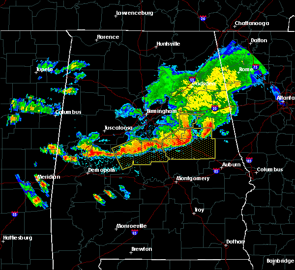 At 238 pm cdt, severe thunderstorms were located along a line extending from talladega to 6 miles south of waldo, moving east at 30 mph (radar indicated). Hazards include 60 mph wind gusts. Expect damage to roofs, siding, and trees. Locations impacted include, talladega, waldo, ironaton and chandler springs. At 238 pm cdt, severe thunderstorms were located along a line extending from talladega to 6 miles south of waldo, moving east at 30 mph (radar indicated). Hazards include 60 mph wind gusts. Expect damage to roofs, siding, and trees. Locations impacted include, talladega, waldo, ironaton and chandler springs.
|
| 7/12/2020 2:30 PM CDT |
 At 229 pm cdt, severe thunderstorms were located along a line extending from near talladega superspeedway to near sycamore, moving east at 30 mph (radar indicated). Hazards include 60 mph wind gusts. Expect damage to roofs, siding, and trees. Locations impacted include, talladega, lincoln, munford, waldo, grant town, winterboro, logan martin lake, camp mac, chandler springs, ironaton and howells cove. At 229 pm cdt, severe thunderstorms were located along a line extending from near talladega superspeedway to near sycamore, moving east at 30 mph (radar indicated). Hazards include 60 mph wind gusts. Expect damage to roofs, siding, and trees. Locations impacted include, talladega, lincoln, munford, waldo, grant town, winterboro, logan martin lake, camp mac, chandler springs, ironaton and howells cove.
|
| 7/12/2020 2:16 PM CDT |
 At 216 pm cdt, severe thunderstorms were located along a line extending from logan martin lake to sycamore, moving east at 35 mph (radar indicated). Hazards include 60 mph wind gusts. Expect damage to roofs, siding, and trees. Locations impacted include, talladega, pell city, childersburg, munford, waldo, grant town, alpine bay resort, winterboro, alpine, logan martin lake, coosa island, logan martin dam, country club estates, camp mac, chandler springs, ironaton and howells cove. At 216 pm cdt, severe thunderstorms were located along a line extending from logan martin lake to sycamore, moving east at 35 mph (radar indicated). Hazards include 60 mph wind gusts. Expect damage to roofs, siding, and trees. Locations impacted include, talladega, pell city, childersburg, munford, waldo, grant town, alpine bay resort, winterboro, alpine, logan martin lake, coosa island, logan martin dam, country club estates, camp mac, chandler springs, ironaton and howells cove.
|
| 7/12/2020 2:00 PM CDT |
 At 200 pm cdt, a severe thunderstorm was located near vincent, or 11 miles north of childersburg, moving east at 30 mph (radar indicated). Hazards include 60 mph wind gusts. expect damage to roofs, siding, and trees At 200 pm cdt, a severe thunderstorm was located near vincent, or 11 miles north of childersburg, moving east at 30 mph (radar indicated). Hazards include 60 mph wind gusts. expect damage to roofs, siding, and trees
|
| 7/12/2020 1:57 PM CDT |
 The severe thunderstorm warning for central talladega county will expire at 200 pm cdt, the storms which prompted the warning have weakened below severe limits, and no longer pose an immediate threat to life or property. therefore, the warning will be allowed to expire. a severe thunderstorm watch remains in effect until 700 pm cdt for central and east central alabama. to report severe weather, contact your nearest law enforcement agency. they will relay your report to the national weather service birmingham. The severe thunderstorm warning for central talladega county will expire at 200 pm cdt, the storms which prompted the warning have weakened below severe limits, and no longer pose an immediate threat to life or property. therefore, the warning will be allowed to expire. a severe thunderstorm watch remains in effect until 700 pm cdt for central and east central alabama. to report severe weather, contact your nearest law enforcement agency. they will relay your report to the national weather service birmingham.
|
| 7/12/2020 1:43 PM CDT |
 At 143 pm cdt, severe thunderstorms were located along a line extending from near bynum to winterboro, moving southeast at 40 mph (radar indicated). Hazards include 60 mph wind gusts. Expect damage to roofs, siding, and trees. Locations impacted include, oxford, talladega, lincoln, munford, waldo, grant town, alpine bay resort, winterboro, alpine, talladega superspeedway, talladega municipal airport, logan martin lake, eastaboga, camp mac, jackson shoals, ironaton, jenifer and howells cove. At 143 pm cdt, severe thunderstorms were located along a line extending from near bynum to winterboro, moving southeast at 40 mph (radar indicated). Hazards include 60 mph wind gusts. Expect damage to roofs, siding, and trees. Locations impacted include, oxford, talladega, lincoln, munford, waldo, grant town, alpine bay resort, winterboro, alpine, talladega superspeedway, talladega municipal airport, logan martin lake, eastaboga, camp mac, jackson shoals, ironaton, jenifer and howells cove.
|
| 7/12/2020 1:25 PM CDT | Numerous trees down in northern talladega county near lincoln and talladega. time estimated by rada in talladega county AL, 7.7 miles S of Talladega, AL |
| 7/12/2020 1:23 PM CDT | Roof damaged from wind along lake logan martin on steamley rd. time estimated by rada in talladega county AL, 9.2 miles SSE of Talladega, AL |
| 7/12/2020 1:06 PM CDT |
 At 105 pm cdt, severe thunderstorms were located along a line extending from attalla to moody, moving southeast at 35 mph (radar indicated). Hazards include 60 mph wind gusts. expect damage to roofs, siding, and trees At 105 pm cdt, severe thunderstorms were located along a line extending from attalla to moody, moving southeast at 35 mph (radar indicated). Hazards include 60 mph wind gusts. expect damage to roofs, siding, and trees
|
| 5/22/2020 5:08 PM CDT |
 At 507 pm cdt, a severe thunderstorm was located over waldo, or near talladega, moving east at 20 mph (radar indicated). Hazards include half dollar size hail. Damage to vehicles is expected. Locations impacted include, talladega, waldo, ironaton and chandler springs. At 507 pm cdt, a severe thunderstorm was located over waldo, or near talladega, moving east at 20 mph (radar indicated). Hazards include half dollar size hail. Damage to vehicles is expected. Locations impacted include, talladega, waldo, ironaton and chandler springs.
|
| 5/22/2020 5:05 PM CDT | Half Dollar sized hail reported 4.6 miles WNW of Talladega, AL, reported along hwy 77 at the waldo quick stop. |
| 5/22/2020 5:02 PM CDT |
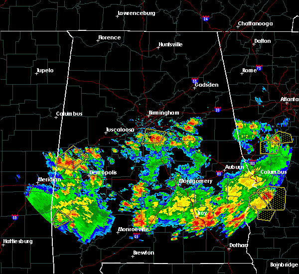 At 502 pm cdt, a severe thunderstorm was located over waldo, or over talladega, moving east at 20 mph (radar indicated). Hazards include quarter size hail. damage to vehicles is expected At 502 pm cdt, a severe thunderstorm was located over waldo, or over talladega, moving east at 20 mph (radar indicated). Hazards include quarter size hail. damage to vehicles is expected
|
| 5/22/2020 4:55 PM CDT | Quarter sized hail reported 2.1 miles NE of Talladega, AL, reported along hwy 21 near old talladega hwy. |
| 3/31/2020 8:54 AM CDT |
 At 854 am cdt, severe thunderstorms were located along a line extending from near talladega to 7 miles northeast of parkdale to hanover, moving east at 60 mph (radar indicated). Hazards include 60 mph wind gusts. Expect damage to roofs, siding, and trees. Locations impacted include, talladega, alexander city, sylacauga, childersburg, lineville, ashland, goodwater, kellyton, talladega springs, stewartville, weogufka, harpersville, new site, waldo, goldville, alpine bay resort, bradford, strickland crossroads, hatchet and hillabee creek. At 854 am cdt, severe thunderstorms were located along a line extending from near talladega to 7 miles northeast of parkdale to hanover, moving east at 60 mph (radar indicated). Hazards include 60 mph wind gusts. Expect damage to roofs, siding, and trees. Locations impacted include, talladega, alexander city, sylacauga, childersburg, lineville, ashland, goodwater, kellyton, talladega springs, stewartville, weogufka, harpersville, new site, waldo, goldville, alpine bay resort, bradford, strickland crossroads, hatchet and hillabee creek.
|
| 3/31/2020 8:51 AM CDT |
 At 851 am cdt, severe thunderstorms were located along a line extending from near talladega to near sycamore to near unity, moving east at 70 mph (radar indicated). Hazards include 60 mph wind gusts. Expect damage to roofs, siding, and trees. Locations impacted include, talladega, sylacauga, childersburg, wilsonville, talladega springs, weogufka, stewartville, vincent, harpersville, hanover, alpine bay resort, winterboro, strickland crossroads, marble valley, fayetteville, alpine, unity, sycamore, logan martin dam and bentleyville. At 851 am cdt, severe thunderstorms were located along a line extending from near talladega to near sycamore to near unity, moving east at 70 mph (radar indicated). Hazards include 60 mph wind gusts. Expect damage to roofs, siding, and trees. Locations impacted include, talladega, sylacauga, childersburg, wilsonville, talladega springs, weogufka, stewartville, vincent, harpersville, hanover, alpine bay resort, winterboro, strickland crossroads, marble valley, fayetteville, alpine, unity, sycamore, logan martin dam and bentleyville.
|
| 3/31/2020 8:38 AM CDT |
 At 837 am cdt, severe thunderstorms were located along a line extending from coosa island to near sylacauga to near lay lake dam, moving east at 60 mph (radar indicated). Hazards include 60 mph wind gusts. expect damage to roofs, siding, and trees At 837 am cdt, severe thunderstorms were located along a line extending from coosa island to near sylacauga to near lay lake dam, moving east at 60 mph (radar indicated). Hazards include 60 mph wind gusts. expect damage to roofs, siding, and trees
|
| 3/31/2020 8:18 AM CDT |
 At 817 am cdt, severe thunderstorms were located along a line extending from vestavia hills to shelby county airport to near ashby, moving east at 70 mph (radar indicated). Hazards include 60 mph wind gusts. expect damage to roofs, siding, and trees At 817 am cdt, severe thunderstorms were located along a line extending from vestavia hills to shelby county airport to near ashby, moving east at 70 mph (radar indicated). Hazards include 60 mph wind gusts. expect damage to roofs, siding, and trees
|
| 1/11/2020 2:29 PM CST |
 At 229 pm cst, severe thunderstorms were located along a line extending from 6 miles southwest of ball flat to waldo to near jordan lake, moving east at 40 mph (radar indicated). Hazards include 70 mph wind gusts. Expect considerable tree damage. damage is likely to mobile homes, roofs, and outbuildings. Locations impacted include, anniston, oxford, talladega, jacksonville, piedmont, goodwater, rockford, kellyton, equality, west end-cobb town, cobb town, fort mcclellan, saks, glencoe, weaver, munford, hobson city, waldo, bradford and bentleyville. At 229 pm cst, severe thunderstorms were located along a line extending from 6 miles southwest of ball flat to waldo to near jordan lake, moving east at 40 mph (radar indicated). Hazards include 70 mph wind gusts. Expect considerable tree damage. damage is likely to mobile homes, roofs, and outbuildings. Locations impacted include, anniston, oxford, talladega, jacksonville, piedmont, goodwater, rockford, kellyton, equality, west end-cobb town, cobb town, fort mcclellan, saks, glencoe, weaver, munford, hobson city, waldo, bradford and bentleyville.
|
| 1/11/2020 2:17 PM CST |
 At 217 pm cst, severe thunderstorms were located along a line extending from near jacksonville state university to near talladega to near deatsville, moving east at 40 mph (radar indicated). Hazards include 70 mph wind gusts. Expect considerable tree damage. damage is likely to mobile homes, roofs, and outbuildings. Locations impacted include, anniston, oxford, talladega, sylacauga, jacksonville, piedmont, goodwater, rockford, kellyton, equality, west end-cobb town, stewartville, weogufka, cobb town, fort mcclellan, saks, lincoln, glencoe, weaver and riverside. At 217 pm cst, severe thunderstorms were located along a line extending from near jacksonville state university to near talladega to near deatsville, moving east at 40 mph (radar indicated). Hazards include 70 mph wind gusts. Expect considerable tree damage. damage is likely to mobile homes, roofs, and outbuildings. Locations impacted include, anniston, oxford, talladega, sylacauga, jacksonville, piedmont, goodwater, rockford, kellyton, equality, west end-cobb town, stewartville, weogufka, cobb town, fort mcclellan, saks, lincoln, glencoe, weaver and riverside.
|
| 1/11/2020 2:04 PM CST |
 At 204 pm cst, severe thunderstorms were located along a line extending from 6 miles south of glencoe to near alpine to near booth, moving east at 40 mph (radar indicated). Hazards include 70 mph wind gusts. Expect considerable tree damage. damage is likely to mobile homes, roofs, and outbuildings. Locations impacted include, anniston, oxford, talladega, sylacauga, jacksonville, childersburg, piedmont, wilsonville, goodwater, rockford, kellyton, talladega springs, equality, west end-cobb town, stewartville, weogufka, cobb town, fort mcclellan, saks and lincoln. At 204 pm cst, severe thunderstorms were located along a line extending from 6 miles south of glencoe to near alpine to near booth, moving east at 40 mph (radar indicated). Hazards include 70 mph wind gusts. Expect considerable tree damage. damage is likely to mobile homes, roofs, and outbuildings. Locations impacted include, anniston, oxford, talladega, sylacauga, jacksonville, childersburg, piedmont, wilsonville, goodwater, rockford, kellyton, talladega springs, equality, west end-cobb town, stewartville, weogufka, cobb town, fort mcclellan, saks and lincoln.
|
| 1/11/2020 1:54 PM CST |
 At 154 pm cst, severe thunderstorms were located along a line extending from near neely henry lake to near childersburg to near vida junction, moving east at 40 mph (radar indicated). Hazards include 60 mph wind gusts. Expect damage to roofs, siding, and trees. Locations impacted include, anniston, oxford, talladega, sylacauga, jacksonville, childersburg, piedmont, wilsonville, goodwater, rockford, kellyton, talladega springs, equality, west end-cobb town, stewartville, weogufka, cobb town, fort mcclellan, saks and lincoln. At 154 pm cst, severe thunderstorms were located along a line extending from near neely henry lake to near childersburg to near vida junction, moving east at 40 mph (radar indicated). Hazards include 60 mph wind gusts. Expect damage to roofs, siding, and trees. Locations impacted include, anniston, oxford, talladega, sylacauga, jacksonville, childersburg, piedmont, wilsonville, goodwater, rockford, kellyton, talladega springs, equality, west end-cobb town, stewartville, weogufka, cobb town, fort mcclellan, saks and lincoln.
|
| 1/11/2020 1:40 PM CST |
 At 140 pm cst, severe thunderstorms were located along a line extending from near ashville to near westover to near mulberry, moving east at 40 mph (radar indicated). Hazards include 60 mph wind gusts. expect damage to roofs, siding, and trees At 140 pm cst, severe thunderstorms were located along a line extending from near ashville to near westover to near mulberry, moving east at 40 mph (radar indicated). Hazards include 60 mph wind gusts. expect damage to roofs, siding, and trees
|
| 8/1/2019 1:36 PM CDT |
 At 135 pm cdt, a severe thunderstorm was located near waldo, or near talladega, and is nearly stationary (radar indicated). Hazards include 60 mph wind gusts and quarter size hail. Hail damage to vehicles is expected. Expect wind damage to roofs, siding, and trees. At 135 pm cdt, a severe thunderstorm was located near waldo, or near talladega, and is nearly stationary (radar indicated). Hazards include 60 mph wind gusts and quarter size hail. Hail damage to vehicles is expected. Expect wind damage to roofs, siding, and trees.
|
| 6/22/2019 4:10 PM CDT |
 At 410 pm cdt, severe thunderstorms were located along a line extending from logan martin dam to near winterboro to near stewartville, moving east at 40 mph (radar indicated). Hazards include 60 mph wind gusts and quarter size hail. Hail damage to vehicles is expected. Expect wind damage to roofs, siding, and trees. At 410 pm cdt, severe thunderstorms were located along a line extending from logan martin dam to near winterboro to near stewartville, moving east at 40 mph (radar indicated). Hazards include 60 mph wind gusts and quarter size hail. Hail damage to vehicles is expected. Expect wind damage to roofs, siding, and trees.
|
| 6/16/2019 4:45 PM CDT | A few trees were blown down. one landed on a vehicle. winds were estimated around 50 mp in talladega county AL, 2.5 miles W of Talladega, AL |
| 6/16/2019 4:30 PM CDT | Trees were blown down around talladega. winds estimated around 50 mp in talladega county AL, 1.6 miles SSW of Talladega, AL |
| 6/28/2018 2:49 PM CDT | Trees down in several locations in the northern half of talladega count in talladega county AL, 1 miles SW of Talladega, AL |
| 6/28/2018 2:44 PM CDT |
 At 244 pm cdt, severe thunderstorms were located along a line extending from near argo to near grant town, moving southwest at 20 mph (radar indicated). Hazards include 60 mph wind gusts and quarter size hail. Hail damage to vehicles is expected. Expect wind damage to roofs, siding, and trees. At 244 pm cdt, severe thunderstorms were located along a line extending from near argo to near grant town, moving southwest at 20 mph (radar indicated). Hazards include 60 mph wind gusts and quarter size hail. Hail damage to vehicles is expected. Expect wind damage to roofs, siding, and trees.
|
| 6/28/2018 2:29 PM CDT |
 At 229 pm cdt, severe thunderstorms were located along a line extending from near trussville to near coosa island to delta, moving south at 50 mph (radar indicated). Hazards include 60 to 70 mph wind gusts. Expect considerable tree damage. Damage is likely to mobile homes, roofs, and outbuildings. At 229 pm cdt, severe thunderstorms were located along a line extending from near trussville to near coosa island to delta, moving south at 50 mph (radar indicated). Hazards include 60 to 70 mph wind gusts. Expect considerable tree damage. Damage is likely to mobile homes, roofs, and outbuildings.
|
| 6/28/2018 2:06 PM CDT |
 At 205 pm cdt, severe thunderstorms were located along a line extending from 6 miles northeast of springville to ohatchee to near fort mcclellan, moving south at 40 mph (emergency management). Hazards include 70 mph wind gusts. Expect considerable tree damage. Damage is likely to mobile homes, roofs, and outbuildings. At 205 pm cdt, severe thunderstorms were located along a line extending from 6 miles northeast of springville to ohatchee to near fort mcclellan, moving south at 40 mph (emergency management). Hazards include 70 mph wind gusts. Expect considerable tree damage. Damage is likely to mobile homes, roofs, and outbuildings.
|
| 4/4/2018 12:38 AM CDT |
 At 1238 am cdt, severe thunderstorms were located along a line extending from 6 miles north of mars hills to 8 miles northwest of fruithurst to near mount cheaha to near winterboro, moving east at 45 mph (radar indicated). Hazards include 60 mph wind gusts. Expect damage to roofs, siding, and trees. Locations impacted include, anniston, oxford, talladega, jacksonville, piedmont, heflin, lineville, west end-cobb town, cobb town, fort mcclellan, saks, lincoln, weaver, munford, hobson city, ranburne, fruithurst, waldo, edwardsville and woodland. At 1238 am cdt, severe thunderstorms were located along a line extending from 6 miles north of mars hills to 8 miles northwest of fruithurst to near mount cheaha to near winterboro, moving east at 45 mph (radar indicated). Hazards include 60 mph wind gusts. Expect damage to roofs, siding, and trees. Locations impacted include, anniston, oxford, talladega, jacksonville, piedmont, heflin, lineville, west end-cobb town, cobb town, fort mcclellan, saks, lincoln, weaver, munford, hobson city, ranburne, fruithurst, waldo, edwardsville and woodland.
|
| 4/4/2018 12:21 AM CDT |
 At 1221 am cdt, severe thunderstorms were located along a line extending from near pleasant gap to near jacksonville state university to near talladega superspeedway to near logan martin dam, moving east at 40 mph (radar indicated). Hazards include 60 mph wind gusts. expect damage to roofs, siding, and trees At 1221 am cdt, severe thunderstorms were located along a line extending from near pleasant gap to near jacksonville state university to near talladega superspeedway to near logan martin dam, moving east at 40 mph (radar indicated). Hazards include 60 mph wind gusts. expect damage to roofs, siding, and trees
|
| 3/19/2018 2:54 PM CDT |
 At 253 pm cdt, a severe thunderstorm was located over munford, or 9 miles northeast of talladega, moving east at 35 mph (radar indicated). Hazards include quarter size hail. damage to vehicles is expected At 253 pm cdt, a severe thunderstorm was located over munford, or 9 miles northeast of talladega, moving east at 35 mph (radar indicated). Hazards include quarter size hail. damage to vehicles is expected
|
| 7/6/2017 5:13 PM CDT |
 At 513 pm cdt, severe thunderstorms were located along a line extending from bynum to near munford to winterboro, moving east at 30 mph (radar indicated). Hazards include 60 mph wind gusts and penny size hail. Expect damage to roofs, siding, and trees. Locations impacted include, oxford, talladega, munford, waldo, grant town, alpine, talladega municipal airport, camp mac, ironaton, jenifer and eastaboga. At 513 pm cdt, severe thunderstorms were located along a line extending from bynum to near munford to winterboro, moving east at 30 mph (radar indicated). Hazards include 60 mph wind gusts and penny size hail. Expect damage to roofs, siding, and trees. Locations impacted include, oxford, talladega, munford, waldo, grant town, alpine, talladega municipal airport, camp mac, ironaton, jenifer and eastaboga.
|
| 7/6/2017 5:02 PM CDT |
 At 502 pm cdt, severe thunderstorms were located along a line extending from near talladega municipal airport to near talladega superspeedway to near alpine, moving east at 30 mph (radar indicated). Hazards include 60 mph wind gusts and penny size hail. Expect damage to roofs, siding, and trees. Locations impacted include, oxford, talladega, lincoln, munford, waldo, grant town, alpine, talladega superspeedway, honda manufacturing of alabama, talladega municipal airport, eastaboga, camp mac, jackson shoals, ironaton, jenifer and howells cove. At 502 pm cdt, severe thunderstorms were located along a line extending from near talladega municipal airport to near talladega superspeedway to near alpine, moving east at 30 mph (radar indicated). Hazards include 60 mph wind gusts and penny size hail. Expect damage to roofs, siding, and trees. Locations impacted include, oxford, talladega, lincoln, munford, waldo, grant town, alpine, talladega superspeedway, honda manufacturing of alabama, talladega municipal airport, eastaboga, camp mac, jackson shoals, ironaton, jenifer and howells cove.
|
| 7/6/2017 4:55 PM CDT |
 At 455 pm cdt, severe thunderstorms were located along a line extending from near honda manufacturing of alabama to near talladega to near logan martin dam, moving east at 35 mph (radar indicated). Hazards include 60 mph wind gusts and penny size hail. Expect damage to roofs, siding, and trees. Locations impacted include, oxford, talladega, pell city, lincoln, riverside, vincent, munford, waldo, alpine bay resort, talladega superspeedway, talladega municipal airport, grant town, alpine, honda manufacturing of alabama, coosa island, logan martin dam, country club estates, camp mac, jackson shoals and ironaton. At 455 pm cdt, severe thunderstorms were located along a line extending from near honda manufacturing of alabama to near talladega to near logan martin dam, moving east at 35 mph (radar indicated). Hazards include 60 mph wind gusts and penny size hail. Expect damage to roofs, siding, and trees. Locations impacted include, oxford, talladega, pell city, lincoln, riverside, vincent, munford, waldo, alpine bay resort, talladega superspeedway, talladega municipal airport, grant town, alpine, honda manufacturing of alabama, coosa island, logan martin dam, country club estates, camp mac, jackson shoals and ironaton.
|
| 7/6/2017 4:47 PM CDT |
 At 447 pm cdt, severe thunderstorms were located along a line extending from honda manufacturing of alabama to near logan martin dam, moving east at 30 mph (radar indicated). Hazards include 60 mph wind gusts and penny size hail. expect damage to roofs, siding, and trees At 447 pm cdt, severe thunderstorms were located along a line extending from honda manufacturing of alabama to near logan martin dam, moving east at 30 mph (radar indicated). Hazards include 60 mph wind gusts and penny size hail. expect damage to roofs, siding, and trees
|
| 6/15/2017 3:56 PM CDT |
 At 355 pm cdt, severe thunderstorms were located along a line extending from near pleasant gap to near columbiana to lawley, moving southeast at 40 mph (radar indicated). Hazards include 60 mph wind gusts and penny size hail. Expect damage to roofs, siding, and trees. Locations impacted include, alabaster, anniston, pelham, oxford, talladega, sylacauga, pell city, jacksonville, calera, chelsea, clanton, montevallo, childersburg, piedmont, columbiana, jemison, wilsonville, talladega springs, cobb town and fort mcclellan. At 355 pm cdt, severe thunderstorms were located along a line extending from near pleasant gap to near columbiana to lawley, moving southeast at 40 mph (radar indicated). Hazards include 60 mph wind gusts and penny size hail. Expect damage to roofs, siding, and trees. Locations impacted include, alabaster, anniston, pelham, oxford, talladega, sylacauga, pell city, jacksonville, calera, chelsea, clanton, montevallo, childersburg, piedmont, columbiana, jemison, wilsonville, talladega springs, cobb town and fort mcclellan.
|
| 6/15/2017 3:32 PM CDT |
 At 332 pm cdt, severe thunderstorms were located along a line extending from near alexandria to near maylene to near talladega national forest, moving south at 50 mph (radar indicated). Hazards include 60 mph wind gusts and quarter size hail. Hail damage to vehicles is expected. expect wind damage to roofs, siding, and trees. Locations impacted include, birmingham, hoover, gadsden, vestavia hills, alabaster, bessemer, homewood, anniston, pelham, oxford, mountain brook, trussville, helena, hueytown, talladega, gardendale, sylacauga, pell city, jacksonville and irondale. At 332 pm cdt, severe thunderstorms were located along a line extending from near alexandria to near maylene to near talladega national forest, moving south at 50 mph (radar indicated). Hazards include 60 mph wind gusts and quarter size hail. Hail damage to vehicles is expected. expect wind damage to roofs, siding, and trees. Locations impacted include, birmingham, hoover, gadsden, vestavia hills, alabaster, bessemer, homewood, anniston, pelham, oxford, mountain brook, trussville, helena, hueytown, talladega, gardendale, sylacauga, pell city, jacksonville and irondale.
|
| 6/15/2017 3:23 PM CDT |
 At 323 pm cdt, severe thunderstorms were located along a line extending from glencoe to near bessemer to near centreville, moving south at 50 mph (radar indicated). Hazards include 60 mph wind gusts. there have been several reports of trees downed by these storms. Expect damage to roofs, siding, and trees. Locations impacted include, birmingham, hoover, gadsden, vestavia hills, alabaster, bessemer, homewood, anniston, pelham, oxford, mountain brook, trussville, helena, hueytown, talladega, gardendale, sylacauga, pell city, jacksonville and irondale. At 323 pm cdt, severe thunderstorms were located along a line extending from glencoe to near bessemer to near centreville, moving south at 50 mph (radar indicated). Hazards include 60 mph wind gusts. there have been several reports of trees downed by these storms. Expect damage to roofs, siding, and trees. Locations impacted include, birmingham, hoover, gadsden, vestavia hills, alabaster, bessemer, homewood, anniston, pelham, oxford, mountain brook, trussville, helena, hueytown, talladega, gardendale, sylacauga, pell city, jacksonville and irondale.
|
| 6/15/2017 3:15 PM CDT |
 At 315 pm cdt, severe thunderstorms were located along a line extending from near reece city to hueytown to near west blocton, moving south at 50 mph (radar indicated). Hazards include 60 mph wind gusts. expect damage to roofs, siding, and trees At 315 pm cdt, severe thunderstorms were located along a line extending from near reece city to hueytown to near west blocton, moving south at 50 mph (radar indicated). Hazards include 60 mph wind gusts. expect damage to roofs, siding, and trees
|
| 4/5/2017 4:12 PM CDT | Trees down across the road at stemley road and renfroe roa in talladega county AL, 7.7 miles ESE of Talladega, AL |
| 4/5/2017 3:48 PM CDT |
 At 348 pm cdt, a severe thunderstorm was located over talladega municipal airport, or 8 miles northeast of talladega, moving east at 35 mph (radar indicated). Hazards include two inch hail and 60 mph wind gusts. People and animals outdoors will be injured. expect hail damage to roofs, siding, windows, and vehicles. Expect wind damage to roofs, siding, and trees. At 348 pm cdt, a severe thunderstorm was located over talladega municipal airport, or 8 miles northeast of talladega, moving east at 35 mph (radar indicated). Hazards include two inch hail and 60 mph wind gusts. People and animals outdoors will be injured. expect hail damage to roofs, siding, windows, and vehicles. Expect wind damage to roofs, siding, and trees.
|
| 4/5/2017 3:45 PM CDT |
 At 344 pm cdt, a severe thunderstorm was located over talladega superspeedway, or 10 miles north of talladega, moving northeast at 35 mph (radar indicated). Hazards include 60 mph wind gusts and quarter size hail. Hail damage to vehicles is expected. expect wind damage to roofs, siding, and trees. locations impacted include, oxford, lincoln, munford, talladega superspeedway, grant town, talladega municipal airport, jackson shoals, jenifer and eastaboga. A tornado watch remains in effect until 900 pm cdt for east central alabama. At 344 pm cdt, a severe thunderstorm was located over talladega superspeedway, or 10 miles north of talladega, moving northeast at 35 mph (radar indicated). Hazards include 60 mph wind gusts and quarter size hail. Hail damage to vehicles is expected. expect wind damage to roofs, siding, and trees. locations impacted include, oxford, lincoln, munford, talladega superspeedway, grant town, talladega municipal airport, jackson shoals, jenifer and eastaboga. A tornado watch remains in effect until 900 pm cdt for east central alabama.
|
| 4/5/2017 3:42 PM CDT | Golf Ball sized hail reported 4.2 miles S of Talladega, AL |
| 4/5/2017 3:36 PM CDT | Hen Egg sized hail reported 5 miles SSE of Talladega, AL, hail ranging from quarter to hen egg (1" - 2"). |
| 4/5/2017 3:36 PM CDT | Golf Ball sized hail reported 5.7 miles S of Talladega, AL |
| 3/10/2017 3:20 AM CST | Emergency manager reports tree down across hwy 148 between mile markers 5 and 10. vehicle wrecked into downed tree. time estimated by rada in clay county AL, 16.7 miles NNW of Talladega, AL |
| 7/12/2016 3:00 PM CDT | Tree down on top of house on 269 idaho road in talladega county AL, 4.3 miles NNW of Talladega, AL |
| 6/17/2016 4:05 PM CDT |
 At 405 pm cdt, severe thunderstorms were located along a line extending from near childersburg to near ashland to standing rock, moving south at 25 mph (radar indicated). Hazards include 60 mph wind gusts. Expect damage to roofs. siding. and trees. Locations impacted include, talladega, sylacauga, roanoke, childersburg, lineville, ashland, wedowee, talladega springs, lake wedowee, harpersville, wadley, waldo, woodland, sycamore, alpine, winterboro, fayetteville, delta, crystal lake and fosters cross roads. At 405 pm cdt, severe thunderstorms were located along a line extending from near childersburg to near ashland to standing rock, moving south at 25 mph (radar indicated). Hazards include 60 mph wind gusts. Expect damage to roofs. siding. and trees. Locations impacted include, talladega, sylacauga, roanoke, childersburg, lineville, ashland, wedowee, talladega springs, lake wedowee, harpersville, wadley, waldo, woodland, sycamore, alpine, winterboro, fayetteville, delta, crystal lake and fosters cross roads.
|
| 6/17/2016 3:53 PM CDT |
 At 352 pm cdt, severe thunderstorms were located along a line extending from childersburg to near ashland to near roanoke, moving south at 40 mph (radar indicated). Hazards include 60 mph wind gusts. Expect damage to roofs. siding. and trees. Locations impacted include, talladega, sylacauga, roanoke, childersburg, lineville, ashland, wedowee, talladega springs, lake wedowee, harpersville, wadley, waldo, woodland, sycamore, alpine, winterboro, fayetteville, delta, crystal lake and fosters cross roads. At 352 pm cdt, severe thunderstorms were located along a line extending from childersburg to near ashland to near roanoke, moving south at 40 mph (radar indicated). Hazards include 60 mph wind gusts. Expect damage to roofs. siding. and trees. Locations impacted include, talladega, sylacauga, roanoke, childersburg, lineville, ashland, wedowee, talladega springs, lake wedowee, harpersville, wadley, waldo, woodland, sycamore, alpine, winterboro, fayetteville, delta, crystal lake and fosters cross roads.
|
| 6/17/2016 3:46 PM CDT |
 At 346 pm cdt, severe thunderstorms were located along a line extending from near westover to near grant town to near ephesus, moving southeast at 25 mph (radar indicated). Hazards include 60 mph wind gusts. Expect damage to roofs. siding. and trees. Locations impacted include, oxford, talladega, sylacauga, roanoke, childersburg, lineville, ashland, wedowee, talladega springs, lake wedowee, vincent, harpersville, munford, wadley, waldo, woodland, morrison cross roads, sycamore, alpine bay resort and alpine. At 346 pm cdt, severe thunderstorms were located along a line extending from near westover to near grant town to near ephesus, moving southeast at 25 mph (radar indicated). Hazards include 60 mph wind gusts. Expect damage to roofs. siding. and trees. Locations impacted include, oxford, talladega, sylacauga, roanoke, childersburg, lineville, ashland, wedowee, talladega springs, lake wedowee, vincent, harpersville, munford, wadley, waldo, woodland, morrison cross roads, sycamore, alpine bay resort and alpine.
|
| 6/17/2016 3:37 PM CDT |
 At 337 pm cdt, severe thunderstorms were located along a line extending from logan martin dam to near grant town to near ephesus, moving southeast at 30 mph (radar indicated). Hazards include 60 mph wind gusts. Expect damage to roofs. siding. and trees. Locations impacted include, oxford, talladega, sylacauga, pell city, roanoke, childersburg, lineville, ashland, wedowee, talladega springs, lake wedowee, lincoln, vincent, harpersville, munford, wadley, waldo, woodland, morrison cross roads and talladega superspeedway. At 337 pm cdt, severe thunderstorms were located along a line extending from logan martin dam to near grant town to near ephesus, moving southeast at 30 mph (radar indicated). Hazards include 60 mph wind gusts. Expect damage to roofs. siding. and trees. Locations impacted include, oxford, talladega, sylacauga, pell city, roanoke, childersburg, lineville, ashland, wedowee, talladega springs, lake wedowee, lincoln, vincent, harpersville, munford, wadley, waldo, woodland, morrison cross roads and talladega superspeedway.
|
| 6/17/2016 3:25 PM CDT |
 At 325 pm cdt, severe thunderstorms were located along a line extending from near moody to grant town to ephesus, moving south at 30 mph (radar indicated). Hazards include 60 mph wind gusts. Expect damage to roofs. siding. and trees. Locations impacted include, anniston, oxford, talladega, sylacauga, pell city, leeds, moody, roanoke, childersburg, odenville, lineville, ashland, wedowee, talladega springs, west end-cobb town, cobb town, lake wedowee, lincoln, margaret and argo. At 325 pm cdt, severe thunderstorms were located along a line extending from near moody to grant town to ephesus, moving south at 30 mph (radar indicated). Hazards include 60 mph wind gusts. Expect damage to roofs. siding. and trees. Locations impacted include, anniston, oxford, talladega, sylacauga, pell city, leeds, moody, roanoke, childersburg, odenville, lineville, ashland, wedowee, talladega springs, west end-cobb town, cobb town, lake wedowee, lincoln, margaret and argo.
|
| 6/17/2016 2:59 PM CDT |
 At 259 pm cdt, severe thunderstorms were located along a line extending from near dallas to near bowdon, moving south at 35 mph (radar indicated). Hazards include 70 mph wind gusts and quarter size hail. Hail damage to vehicles is expected. expect considerable tree damage. Wind damage is also likely to mobile homes, roofs, and outbuildings. At 259 pm cdt, severe thunderstorms were located along a line extending from near dallas to near bowdon, moving south at 35 mph (radar indicated). Hazards include 70 mph wind gusts and quarter size hail. Hail damage to vehicles is expected. expect considerable tree damage. Wind damage is also likely to mobile homes, roofs, and outbuildings.
|
| 8/6/2015 5:58 PM CDT |
 At 558 pm cdt, severe thunderstorms were located along a line extending from near munford to near waldo to near parkdale, moving east at 45 mph (radar indicated). Hazards include 60 mph wind gusts. Expect damage to roofs. siding and trees. Locations impacted include, talladega, sylacauga, lineville, ashland, waldo, barfield, delta, overbrook, cleveland crossroads, chandler springs, roselle, ironaton, gunthertown, cragford, mellow valley, lake chinnabee, millerville, hollins and motley. At 558 pm cdt, severe thunderstorms were located along a line extending from near munford to near waldo to near parkdale, moving east at 45 mph (radar indicated). Hazards include 60 mph wind gusts. Expect damage to roofs. siding and trees. Locations impacted include, talladega, sylacauga, lineville, ashland, waldo, barfield, delta, overbrook, cleveland crossroads, chandler springs, roselle, ironaton, gunthertown, cragford, mellow valley, lake chinnabee, millerville, hollins and motley.
|
| 8/6/2015 5:46 PM CDT | Tree down on plant rd in talladega county AL, 6.3 miles ENE of Talladega, AL |
| 8/6/2015 5:45 PM CDT |
 At 545 pm cdt, severe thunderstorms were located along a line extending from near talladega to winterboro to sylacauga, moving east at 45 mph (radar indicated). Hazards include 60 mph wind gusts. Expect damage to roofs. Siding and trees. At 545 pm cdt, severe thunderstorms were located along a line extending from near talladega to winterboro to sylacauga, moving east at 45 mph (radar indicated). Hazards include 60 mph wind gusts. Expect damage to roofs. Siding and trees.
|
| 7/14/2015 8:39 PM CDT |
 At 838 pm cdt, severe thunderstorms were located along a line extending from near lake wildwood to west blocton to 7 miles northwest of wilton to near calera to near wilsonville to logan martin dam, moving southeast at 65 mph (radar indicated). Hazards include 60 mph wind gusts. Expect damage to roofs. Siding and trees. At 838 pm cdt, severe thunderstorms were located along a line extending from near lake wildwood to west blocton to 7 miles northwest of wilton to near calera to near wilsonville to logan martin dam, moving southeast at 65 mph (radar indicated). Hazards include 60 mph wind gusts. Expect damage to roofs. Siding and trees.
|
| 6/30/2015 8:06 AM CDT |
 At 806 am cdt, severe thunderstorms were located along a line extending from near bald rock to near vincent to near westover, moving east at 35 mph (radar indicated). Hazards include 60 mph wind gusts and quarter size hail. Hail damage to vehicles is expected. expect wind damage to roofs, siding and trees. Locations impacted include, talladega, pell city, leeds, moody, childersburg, odenville, wilsonville, lincoln, argo, riverside, vincent, ragland, harpersville, westover, talladega superspeedway, branchville, logan martin lake, alpine bay resort, logan martin dam and bald rock. At 806 am cdt, severe thunderstorms were located along a line extending from near bald rock to near vincent to near westover, moving east at 35 mph (radar indicated). Hazards include 60 mph wind gusts and quarter size hail. Hail damage to vehicles is expected. expect wind damage to roofs, siding and trees. Locations impacted include, talladega, pell city, leeds, moody, childersburg, odenville, wilsonville, lincoln, argo, riverside, vincent, ragland, harpersville, westover, talladega superspeedway, branchville, logan martin lake, alpine bay resort, logan martin dam and bald rock.
|
| 6/30/2015 7:47 AM CDT |
 At 747 am cdt, severe thunderstorms were located along a line extending from shops of grand river to near vandiver to chelsea, moving east at 35 mph (radar indicated). Hazards include 60 mph wind gusts and quarter size hail. Hail damage to vehicles is expected. Expect wind damage to roofs, siding and trees. At 747 am cdt, severe thunderstorms were located along a line extending from shops of grand river to near vandiver to chelsea, moving east at 35 mph (radar indicated). Hazards include 60 mph wind gusts and quarter size hail. Hail damage to vehicles is expected. Expect wind damage to roofs, siding and trees.
|
| 3/31/2015 4:25 PM CDT | The national weather service in birmingham has issued a * severe thunderstorm warning for. central talladega county in east central alabama. northern clay county in east central alabama. until 515 pm cdt * at 425 pm cdt. a severe thunderstorm was located near waldo. Or. |
| 1/11/2014 5:40 AM CST | Quarter sized hail reported 4.1 miles SSE of Talladega, AL, near stemley |
| 4/11/2013 3:59 PM CDT | Power lines were blown down on peters road off highway 7 in talladega county AL, 3.5 miles S of Talladega, AL |
| 4/11/2013 3:59 PM CDT | Power lines down on peters road off hwy 7 in talladega county AL, 3.5 miles S of Talladega, AL |
| 3/18/2013 4:03 PM CDT | Three of four trees were down on houses and several roads blocked. cherry street...taylors mill road... mountain view road...and east street south were are blocked or p in talladega county AL, 1 miles SW of Talladega, AL |
| 3/18/2013 4:00 PM CDT | Three of four trees were sown on houses and several roads blocked. cherry street...taylors mill road... mountain view road...and east street south were are blocked or p in talladega county AL, 1 miles SW of Talladega, AL |
| 3/18/2013 3:56 PM CDT | Tree on house on silverwood drive with entrapment in talladega county AL, 1 miles SW of Talladega, AL |
| 7/10/2012 5:55 PM CDT | A tree was blown down on renfroe road and plant roa in talladega county AL, 1 miles SW of Talladega, AL |
| 7/9/2012 8:24 PM CDT | Tree downed as well as a live power line on martin luther king drive in talladega. estimated 40mph gus in talladega county AL, 1 miles SW of Talladega, AL |
| 5/6/2012 7:00 AM CDT | One tree down in a driveway. approximately 8-12 inches in dia in talladega county AL, 0.7 miles W of Talladega, AL |
| 4/17/2012 4:00 PM CDT | Quarter sized hail reported 7.7 miles W of Talladega, AL, quarter size hail reported covering the ground on woolfolk rd near ironaton. |
| 4/5/2012 7:39 PM CDT | A few trees were blown down near talladeg in talladega county AL, 1 miles SW of Talladega, AL |
| 3/31/2012 7:14 PM CDT | A few trees and power lines dow in talladega county AL, 1.4 miles WNW of Talladega, AL |
| 1/1/0001 12:00 AM | Storm damage reported in talladega county AL, 1 miles SW of Talladega, AL |
| 1/1/0001 12:00 AM | Power lines down in the city of talladeg in talladega county AL, 1 miles SW of Talladega, AL |
| 1/1/0001 12:00 AM | Tree down on powerline near socco springs. time estimated from rada in talladega county AL, 2.7 miles SE of Talladega, AL |
| 1/1/0001 12:00 AM | Tree down across roadway on mountain view road off of highway 7 in talladega county AL, 2.5 miles W of Talladega, AL |
| 1/1/0001 12:00 AM | Trees and powerlines down on lancaster av in talladega county AL, 1.3 miles W of Talladega, AL |
| 1/1/0001 12:00 AM | Trees down blocking the roadway on jackson trace near broadwa in talladega county AL, 1 miles SW of Talladega, AL |
| 1/1/0001 12:00 AM | Numerous trees down across cit in talladega county AL, 1 miles SW of Talladega, AL |
| 1/1/0001 12:00 AM | Tree down on the administration building at the city court apt on broadway roa in talladega county AL, 1 miles SW of Talladega, AL |
| 1/1/0001 12:00 AM | Large tree down across grist mill road near the grist mil in talladega county AL, 6.5 miles NE of Talladega, AL |
Hail Maps for Talladega, AL

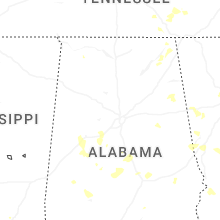
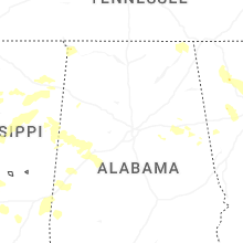


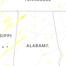


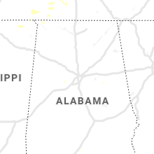


Connect with Interactive Hail Maps