

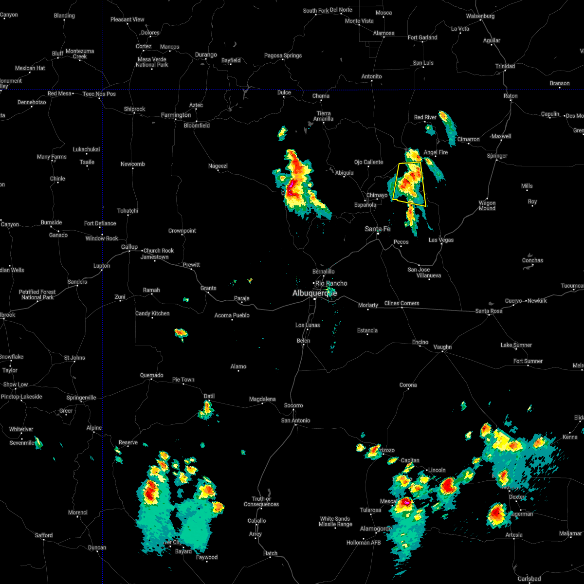
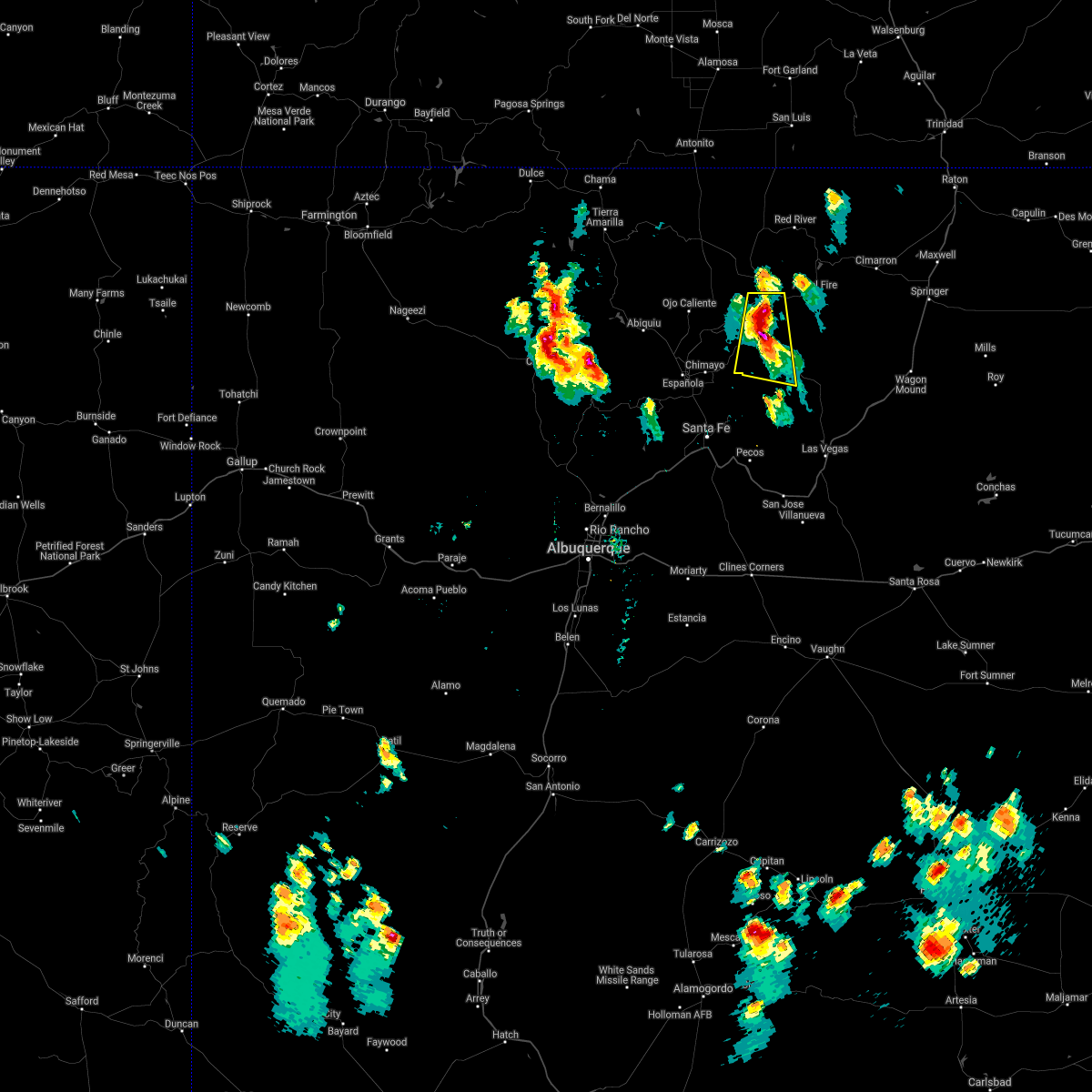
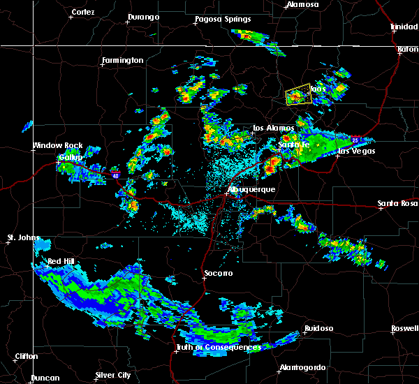
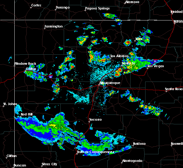
Hail Map for Talpa, NM
The Talpa, NM area has had 0 reports of on-the-ground hail by trained spotters, and has been under severe weather warnings 0 times during the past 12 months. Doppler radar has detected hail at or near Talpa, NM on 5 occasions, including 1 occasion during the past year.
| Name: | Talpa, NM |
| Where Located: | 5 miles SSW of Taos, NM |
| Map: | Google Map for Talpa, NM |
| Population: | 778 |
| Housing Units: | 450 |
| More Info: | Search Google for Talpa, NM |
0
The Top Recent Hail Date for Talpa, NM is Friday, July 21, 2023 (2nd out of 5)

Hail and Wind Damage Spotted near Talpa, NM
| Date / Time | Report Details |
|---|---|
| 7/11/2021 3:22 PM MDT |
 At 322 pm mdt, a severe thunderstorm was located near penasco, or 16 miles south of taos, moving south at 20 mph (radar indicated). Hazards include 60 mph wind gusts and quarter size hail. Hail damage to vehicles is expected. expect wind damage to roofs, siding, and trees. Locations impacted include, penasco, tres ritos, rio lucio, llano, picuris pueblo, llano largo, vadito, rodarte and chamisal. At 322 pm mdt, a severe thunderstorm was located near penasco, or 16 miles south of taos, moving south at 20 mph (radar indicated). Hazards include 60 mph wind gusts and quarter size hail. Hail damage to vehicles is expected. expect wind damage to roofs, siding, and trees. Locations impacted include, penasco, tres ritos, rio lucio, llano, picuris pueblo, llano largo, vadito, rodarte and chamisal.
|
| 7/11/2021 3:05 PM MDT |
 At 304 pm mdt, a severe thunderstorm was located near tres ritos, or 14 miles south of taos, moving south at 15 mph (radar indicated). Hazards include 60 mph wind gusts and quarter size hail. Hail damage to vehicles is expected. Expect wind damage to roofs, siding, and trees. At 304 pm mdt, a severe thunderstorm was located near tres ritos, or 14 miles south of taos, moving south at 15 mph (radar indicated). Hazards include 60 mph wind gusts and quarter size hail. Hail damage to vehicles is expected. Expect wind damage to roofs, siding, and trees.
|
| 5/22/2021 4:23 PM MDT |
 At 423 pm mdt, a severe thunderstorm was located over southern santa fe, moving north at 55 mph (radar indicated). Hazards include 60 mph wind gusts and quarter size hail. Hail damage to vehicles is expected. Expect wind damage to roofs, siding, and trees. At 423 pm mdt, a severe thunderstorm was located over southern santa fe, moving north at 55 mph (radar indicated). Hazards include 60 mph wind gusts and quarter size hail. Hail damage to vehicles is expected. Expect wind damage to roofs, siding, and trees.
|
| 8/6/2019 2:08 PM MDT |
 At 207 pm mdt, a severe thunderstorm was located near ranchos de taos, or 8 miles west of taos, moving east at 15 mph (radar indicated). Hazards include 60 mph wind gusts and nickel size hail. Expect damage to roofs, siding, and trees. Locations impacted include, taos, ranchos de taos, talpa, los cordovas and taos pueblo. At 207 pm mdt, a severe thunderstorm was located near ranchos de taos, or 8 miles west of taos, moving east at 15 mph (radar indicated). Hazards include 60 mph wind gusts and nickel size hail. Expect damage to roofs, siding, and trees. Locations impacted include, taos, ranchos de taos, talpa, los cordovas and taos pueblo.
|
| 8/6/2019 1:55 PM MDT |
 At 155 pm mdt, a severe thunderstorm was located near pilar, or 11 miles west of taos, moving east at 10 mph (radar indicated). Hazards include 60 mph wind gusts and half dollar size hail. Hail damage to vehicles is expected. Expect wind damage to roofs, siding, and trees. At 155 pm mdt, a severe thunderstorm was located near pilar, or 11 miles west of taos, moving east at 10 mph (radar indicated). Hazards include 60 mph wind gusts and half dollar size hail. Hail damage to vehicles is expected. Expect wind damage to roofs, siding, and trees.
|
| 6/16/2015 4:05 PM MDT |
 At 404 pm mdt, a line of severe thunderstorms was stretching from 10 miles west of arroyo seco to 8 miles east of arroyo seco. this line was moving southeast at 15 mph (radar indicated). Hazards include quarter size hail and 60 mph wind gusts. Hail damage to vehicles is expected. Expect wind damage to roofs, siding and trees. At 404 pm mdt, a line of severe thunderstorms was stretching from 10 miles west of arroyo seco to 8 miles east of arroyo seco. this line was moving southeast at 15 mph (radar indicated). Hazards include quarter size hail and 60 mph wind gusts. Hail damage to vehicles is expected. Expect wind damage to roofs, siding and trees.
|
Hail Maps for Talpa, NM


Connect with Interactive Hail Maps