

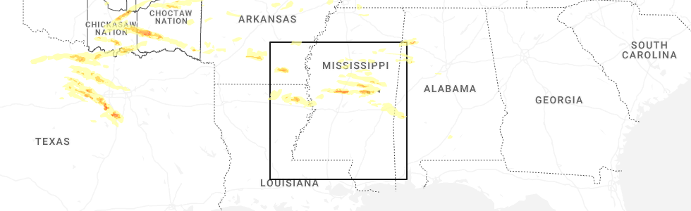
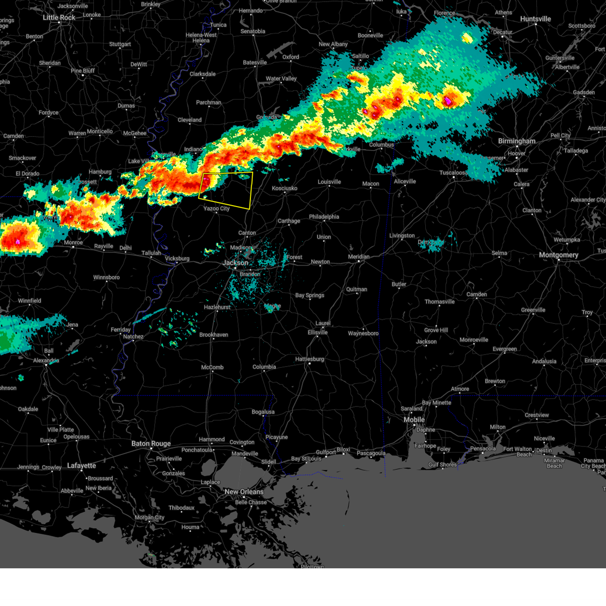
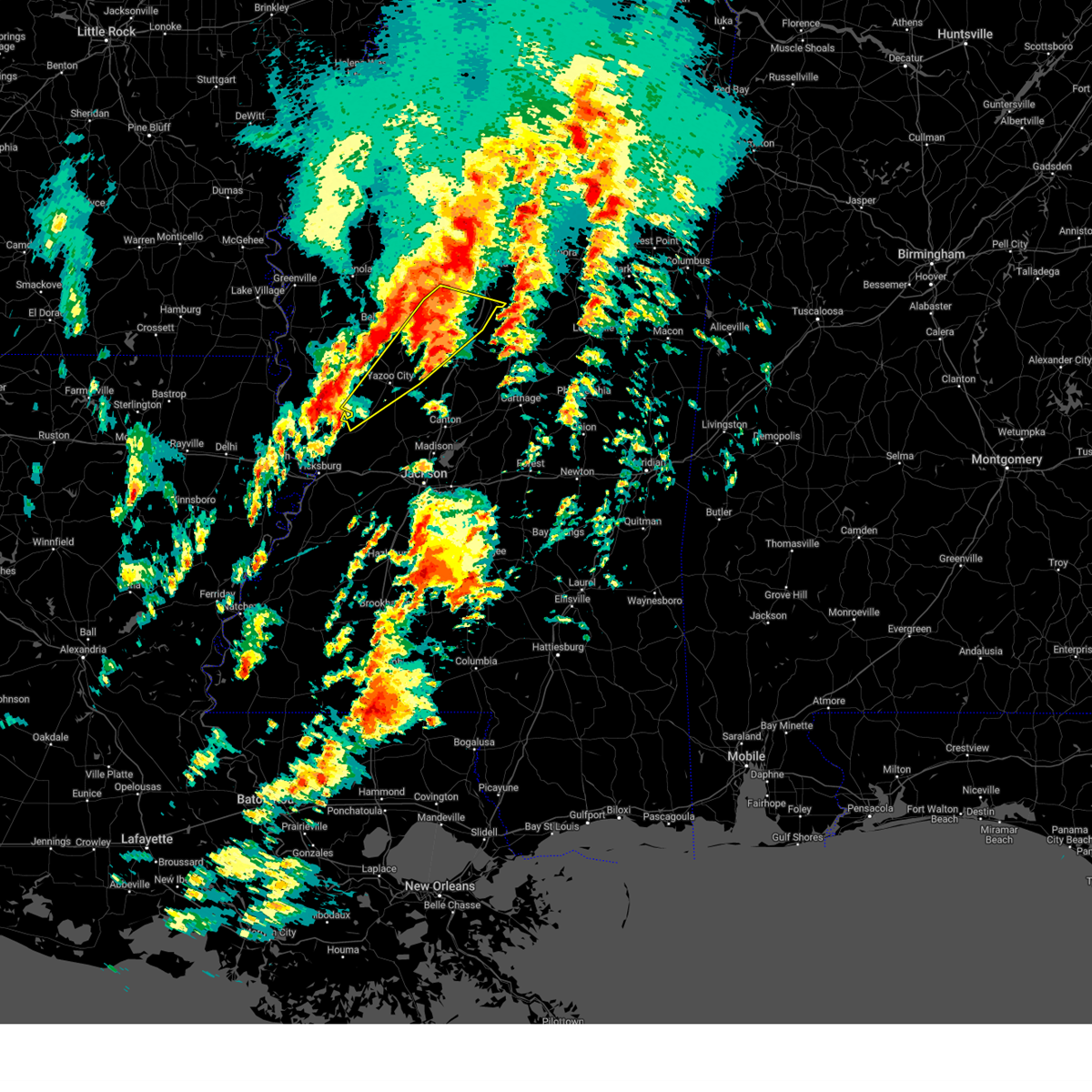
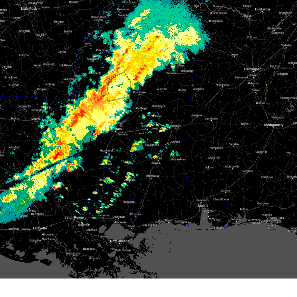
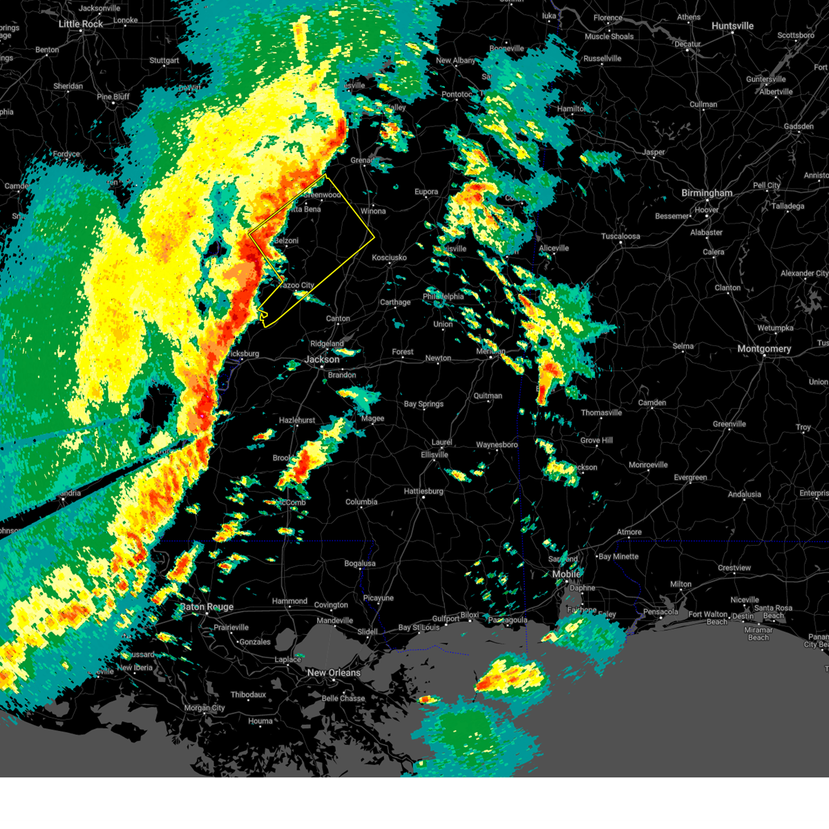
Hail Map for Tchula, MS
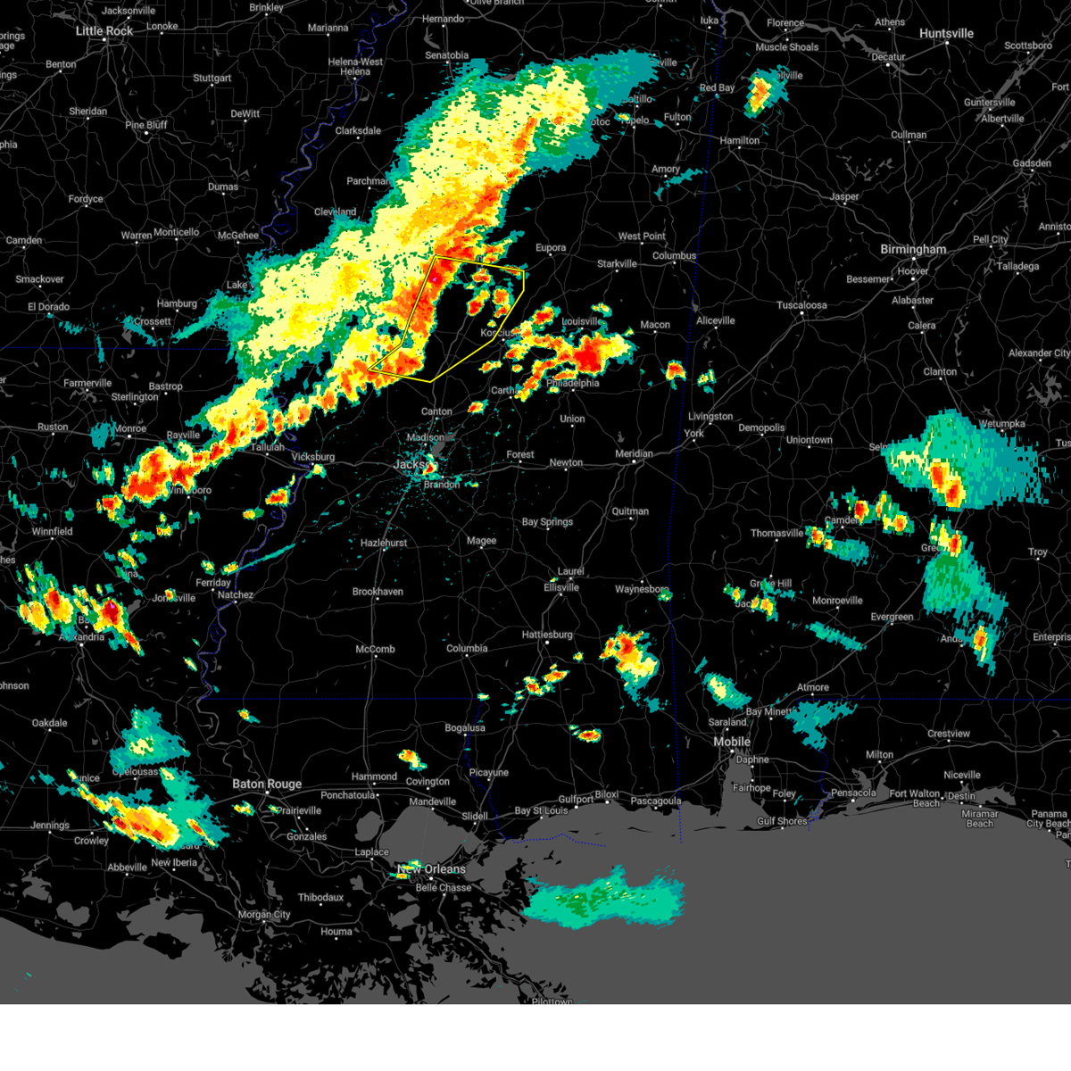
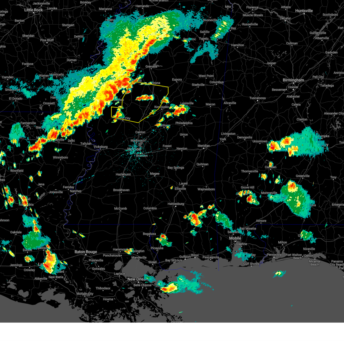
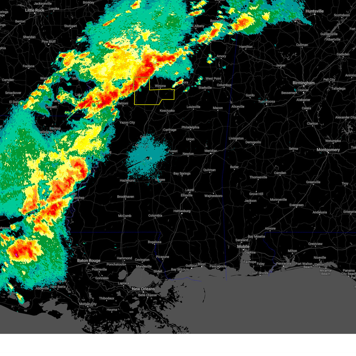
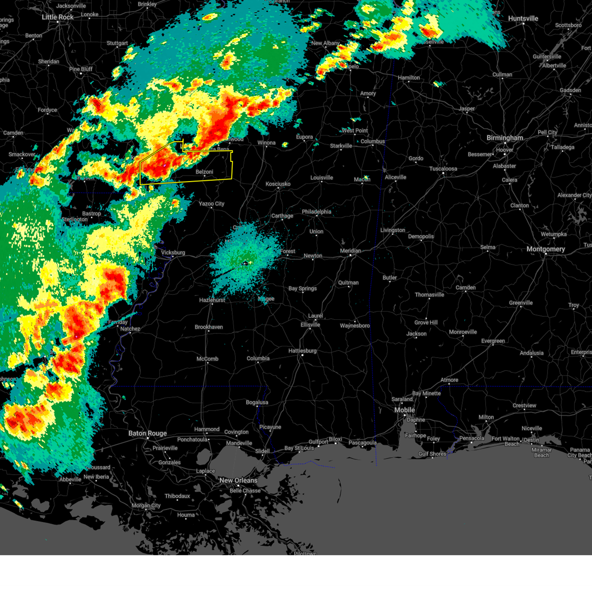
The Tchula, MS area has had 5 reports of on-the-ground hail by trained spotters, and has been under severe weather warnings 8 times during the past 12 months. Doppler radar has detected hail at or near Tchula, MS on 73 occasions, including 2 occasions during the past year.
| Name: | Tchula, MS |
| Where Located: | 61 miles N of Jackson, MS |
| Map: | Google Map for Tchula, MS |
| Population: | 2096 |
| Housing Units: | 773 |
| More Info: | Search Google for Tchula, MS |
0
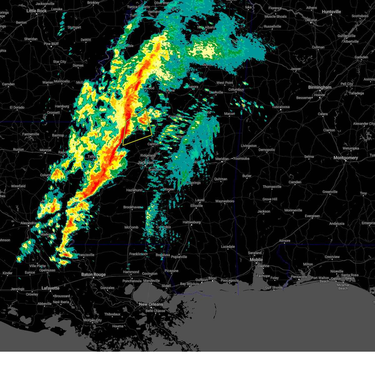
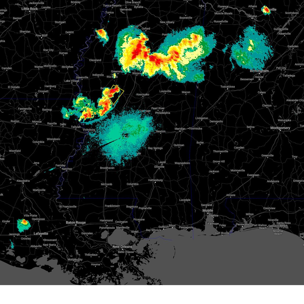
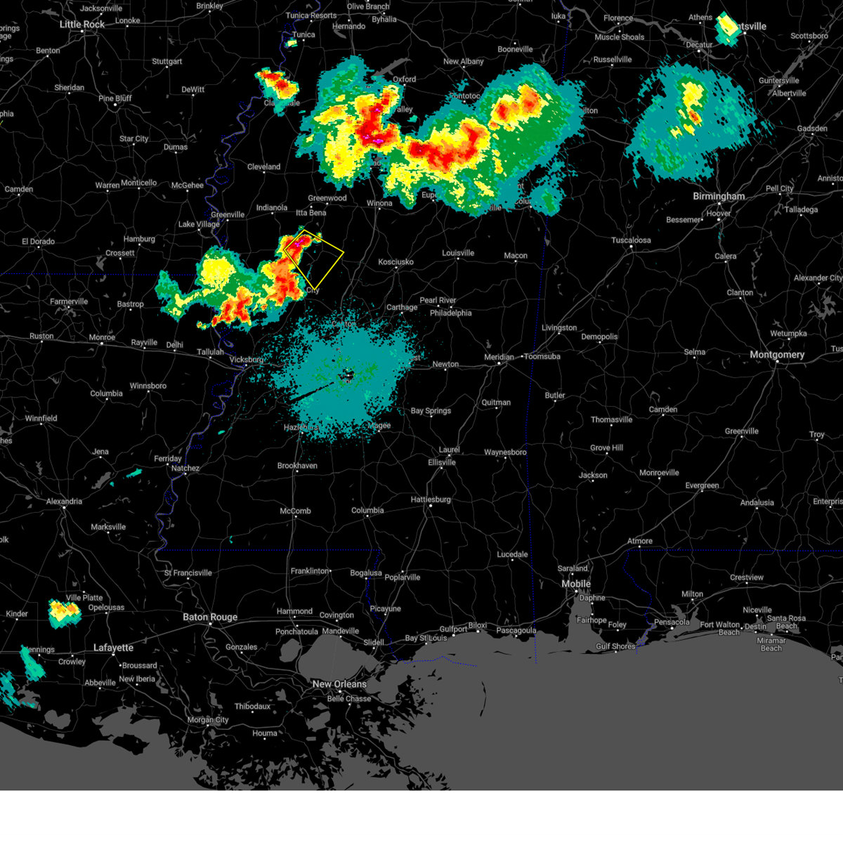
The Top Recent Hail Date for Tchula, MS is Tuesday, April 28, 2026 (49th out of 73)
Hail and Wind Damage Spotted near Tchula, MS
| Date / Time | Report Details |
|---|---|
| 4/28/2026 10:57 PM CDT |
 Svrjan the national weather service in jackson has issued a * severe thunderstorm warning for, holmes county in central mississippi, attala county in central mississippi, southeastern humphreys county in central mississippi, * until 1145 pm cdt. * at 1057 pm cdt, a severe thunderstorm was located near lexington, moving east at 75 mph (radar indicated). Hazards include 70 mph wind gusts. Expect considerable tree damage. damage is likely to mobile homes, roofs, and outbuildings. this severe thunderstorm will be near, durant, west, emory, and bowling green around 1105 pm cdt. hesterville and possumneck around 1110 pm cdt. kosciusko around 1115 pm cdt. ethel around 1120 pm cdt. Mccool around 1130 pm cdt. Svrjan the national weather service in jackson has issued a * severe thunderstorm warning for, holmes county in central mississippi, attala county in central mississippi, southeastern humphreys county in central mississippi, * until 1145 pm cdt. * at 1057 pm cdt, a severe thunderstorm was located near lexington, moving east at 75 mph (radar indicated). Hazards include 70 mph wind gusts. Expect considerable tree damage. damage is likely to mobile homes, roofs, and outbuildings. this severe thunderstorm will be near, durant, west, emory, and bowling green around 1105 pm cdt. hesterville and possumneck around 1110 pm cdt. kosciusko around 1115 pm cdt. ethel around 1120 pm cdt. Mccool around 1130 pm cdt.
|
| 4/28/2026 10:45 PM CDT |
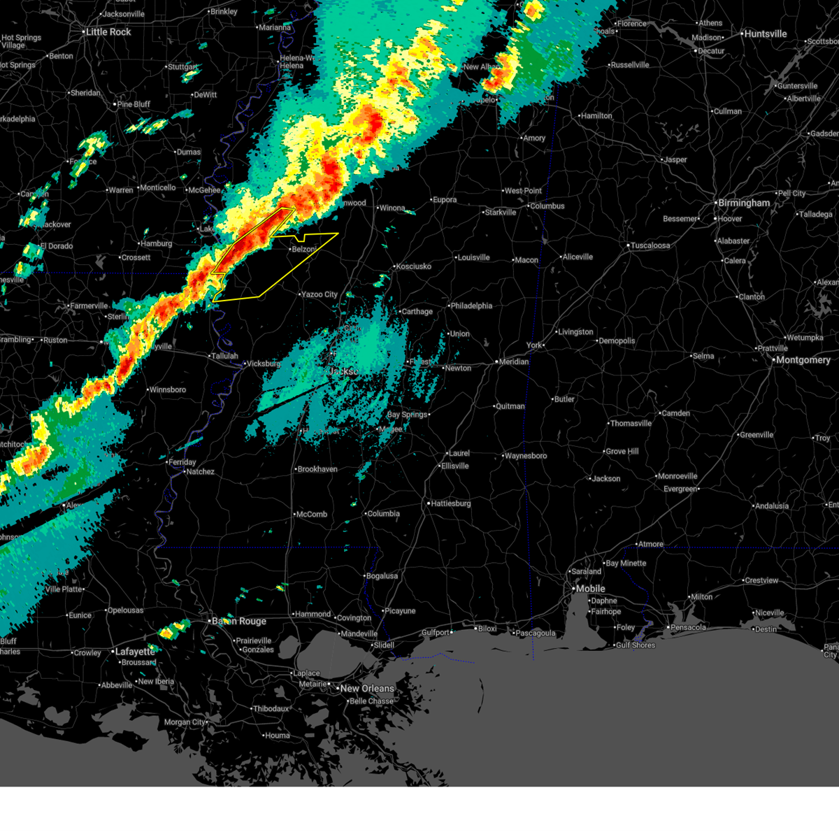
 At 1044 pm cdt, a severe thunderstorm was located over isola, or near belzoni, moving east at 65 mph. this is a destructive storm for belzoni and tchula (radar indicated). Hazards include 80 mph wind gusts and nickel size hail. Flying debris will be dangerous to those caught without shelter. mobile homes will be heavily damaged. expect considerable damage to roofs, windows, and vehicles. extensive tree damage and power outages are likely. this severe storm will be near, belzoni and swiftown around 1050 pm cdt. tchula around 1055 pm cdt. Thornton and howard around 1100 pm cdt. At 1044 pm cdt, a severe thunderstorm was located over isola, or near belzoni, moving east at 65 mph. this is a destructive storm for belzoni and tchula (radar indicated). Hazards include 80 mph wind gusts and nickel size hail. Flying debris will be dangerous to those caught without shelter. mobile homes will be heavily damaged. expect considerable damage to roofs, windows, and vehicles. extensive tree damage and power outages are likely. this severe storm will be near, belzoni and swiftown around 1050 pm cdt. tchula around 1055 pm cdt. Thornton and howard around 1100 pm cdt.
|
| 4/28/2026 10:36 PM CDT |
 At 1034 pm cdt, a severe thunderstorm was located near isola, or near belzoni, moving east at 75 mph. this is a destructive storm for isola, belzoni and tchula (radar indicated). Hazards include 80 mph wind gusts and nickel size hail. Flying debris will be dangerous to those caught without shelter. mobile homes will be heavily damaged. expect considerable damage to roofs, windows, and vehicles. extensive tree damage and power outages are likely. this severe storm will be near, belzoni and swiftown around 1040 pm cdt. tchula, thornton, and howard around 1045 pm cdt. Tolarville around 1050 pm cdt. At 1034 pm cdt, a severe thunderstorm was located near isola, or near belzoni, moving east at 75 mph. this is a destructive storm for isola, belzoni and tchula (radar indicated). Hazards include 80 mph wind gusts and nickel size hail. Flying debris will be dangerous to those caught without shelter. mobile homes will be heavily damaged. expect considerable damage to roofs, windows, and vehicles. extensive tree damage and power outages are likely. this severe storm will be near, belzoni and swiftown around 1040 pm cdt. tchula, thornton, and howard around 1045 pm cdt. Tolarville around 1050 pm cdt.
|
| 4/28/2026 10:15 PM CDT |
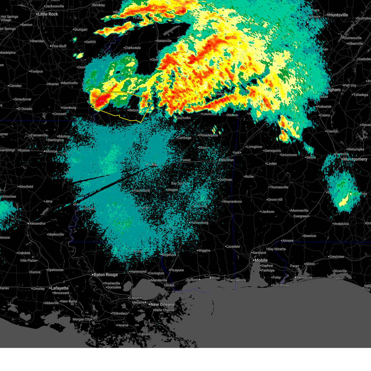 Svrjan the national weather service in jackson has issued a * severe thunderstorm warning for, east central chicot county in southeastern arkansas, southern sunflower county in northwestern mississippi, western holmes county in central mississippi, southern leflore county in north central mississippi, washington county in northwestern mississippi, humphreys county in central mississippi, * until 1100 pm cdt. * at 1014 pm cdt, a severe thunderstorm was located near arcola, or near leland, moving east at 70 mph. this is a destructive storm for arcola, isola, hollandale and belzoni (radar indicated). Hazards include 80 mph wind gusts and quarter size hail. Flying debris will be dangerous to those caught without shelter. mobile homes will be heavily damaged. expect considerable damage to roofs, windows, and vehicles. extensive tree damage and power outages are likely. this severe thunderstorm will be near, hollandale, darlove, estill, and tribbett around 1020 pm cdt. inverness and isola around 1025 pm cdt. belzoni around 1030 pm cdt. swiftown around 1035 pm cdt. tchula and cruger around 1045 pm cdt. Howard around 1050 pm cdt. Svrjan the national weather service in jackson has issued a * severe thunderstorm warning for, east central chicot county in southeastern arkansas, southern sunflower county in northwestern mississippi, western holmes county in central mississippi, southern leflore county in north central mississippi, washington county in northwestern mississippi, humphreys county in central mississippi, * until 1100 pm cdt. * at 1014 pm cdt, a severe thunderstorm was located near arcola, or near leland, moving east at 70 mph. this is a destructive storm for arcola, isola, hollandale and belzoni (radar indicated). Hazards include 80 mph wind gusts and quarter size hail. Flying debris will be dangerous to those caught without shelter. mobile homes will be heavily damaged. expect considerable damage to roofs, windows, and vehicles. extensive tree damage and power outages are likely. this severe thunderstorm will be near, hollandale, darlove, estill, and tribbett around 1020 pm cdt. inverness and isola around 1025 pm cdt. belzoni around 1030 pm cdt. swiftown around 1035 pm cdt. tchula and cruger around 1045 pm cdt. Howard around 1050 pm cdt.
|
| 3/15/2026 9:39 PM CDT |
 the severe thunderstorm warning has been cancelled and is no longer in effect the severe thunderstorm warning has been cancelled and is no longer in effect
|
| 3/15/2026 9:16 PM CDT |
 the severe thunderstorm warning has been cancelled and is no longer in effect the severe thunderstorm warning has been cancelled and is no longer in effect
|
| 3/15/2026 9:16 PM CDT |
 At 916 pm cdt, severe thunderstorms were located along a line extending from near cruger to near rolling fork, moving east at 45 mph (radar indicated). Hazards include 60 mph wind gusts and penny size hail. Expect damage to roofs, siding, and trees. These severe storms will be near, silver city, louise, and midnight around 920 pm cdt. At 916 pm cdt, severe thunderstorms were located along a line extending from near cruger to near rolling fork, moving east at 45 mph (radar indicated). Hazards include 60 mph wind gusts and penny size hail. Expect damage to roofs, siding, and trees. These severe storms will be near, silver city, louise, and midnight around 920 pm cdt.
|
| 3/15/2026 8:53 PM CDT |
 Svrjan the national weather service in jackson has issued a * severe thunderstorm warning for, southern sunflower county in northwestern mississippi, northwestern holmes county in central mississippi, southeastern washington county in northwestern mississippi, northwestern issaquena county in west central mississippi, humphreys county in central mississippi, sharkey county in west central mississippi, * until 1000 pm cdt. * at 853 pm cdt, severe thunderstorms were located along a line extending from near inverness to near glen allan, moving east at 35 mph (radar indicated). Hazards include 60 mph wind gusts and nickel size hail. expect damage to roofs, siding, and trees Svrjan the national weather service in jackson has issued a * severe thunderstorm warning for, southern sunflower county in northwestern mississippi, northwestern holmes county in central mississippi, southeastern washington county in northwestern mississippi, northwestern issaquena county in west central mississippi, humphreys county in central mississippi, sharkey county in west central mississippi, * until 1000 pm cdt. * at 853 pm cdt, severe thunderstorms were located along a line extending from near inverness to near glen allan, moving east at 35 mph (radar indicated). Hazards include 60 mph wind gusts and nickel size hail. expect damage to roofs, siding, and trees
|
| 5/25/2025 8:12 PM CDT |
 At 811 pm cdt, severe thunderstorms were located along a line extending from near chester to near ethel to brozville, moving southeast at 50 mph (radar indicated). Hazards include 60 mph wind gusts and penny size hail. Expect damage to roofs, siding, and trees. Locations impacted include, durant, belzoni, eupora, lexington, vaiden, tchula, kilmichael, mathiston, weir, silver city, mantee, west, french camp, walthall, tolarville, poplar creek, clarkson, emory, thornton, and howard. At 811 pm cdt, severe thunderstorms were located along a line extending from near chester to near ethel to brozville, moving southeast at 50 mph (radar indicated). Hazards include 60 mph wind gusts and penny size hail. Expect damage to roofs, siding, and trees. Locations impacted include, durant, belzoni, eupora, lexington, vaiden, tchula, kilmichael, mathiston, weir, silver city, mantee, west, french camp, walthall, tolarville, poplar creek, clarkson, emory, thornton, and howard.
|
| 5/25/2025 8:12 PM CDT |
 the severe thunderstorm warning has been cancelled and is no longer in effect the severe thunderstorm warning has been cancelled and is no longer in effect
|
| 5/25/2025 7:11 PM CDT |
 Svrjan the national weather service in jackson has issued a * severe thunderstorm warning for, southern sunflower county in northwestern mississippi, choctaw county in central mississippi, holmes county in central mississippi, carroll county in north central mississippi, southeastern grenada county in north central mississippi, southern leflore county in north central mississippi, northern attala county in central mississippi, webster county in north central mississippi, montgomery county in north central mississippi, eastern humphreys county in central mississippi, * until 830 pm cdt. * at 711 pm cdt, severe thunderstorms were located along a line extending from 6 miles north of grenada to near avalon to near shaw, moving southeast at 50 mph (radar indicated). Hazards include 60 mph wind gusts and quarter size hail. Hail damage to vehicles is expected. Expect wind damage to roofs, siding, and trees. Svrjan the national weather service in jackson has issued a * severe thunderstorm warning for, southern sunflower county in northwestern mississippi, choctaw county in central mississippi, holmes county in central mississippi, carroll county in north central mississippi, southeastern grenada county in north central mississippi, southern leflore county in north central mississippi, northern attala county in central mississippi, webster county in north central mississippi, montgomery county in north central mississippi, eastern humphreys county in central mississippi, * until 830 pm cdt. * at 711 pm cdt, severe thunderstorms were located along a line extending from 6 miles north of grenada to near avalon to near shaw, moving southeast at 50 mph (radar indicated). Hazards include 60 mph wind gusts and quarter size hail. Hail damage to vehicles is expected. Expect wind damage to roofs, siding, and trees.
|
| 5/24/2025 3:47 PM CDT |
 the severe thunderstorm warning has been cancelled and is no longer in effect the severe thunderstorm warning has been cancelled and is no longer in effect
|
| 5/24/2025 3:39 PM CDT |
 At 339 pm cdt, severe thunderstorms were located along a line extending from near carrollton to lexington to 6 miles southwest of ebenezer, moving east at 50 mph (radar indicated). Hazards include 60 mph wind gusts and quarter size hail. Hail damage to vehicles is expected. expect wind damage to roofs, siding, and trees. Locations impacted include, yazoo city, winona, durant, lexington, vaiden, carrollton, goodman, pickens, kilmichael, west, sallis, eden, coxburg, franklin, malmaison, tolarville, brozville, poplar creek, emory, and seven pines. At 339 pm cdt, severe thunderstorms were located along a line extending from near carrollton to lexington to 6 miles southwest of ebenezer, moving east at 50 mph (radar indicated). Hazards include 60 mph wind gusts and quarter size hail. Hail damage to vehicles is expected. expect wind damage to roofs, siding, and trees. Locations impacted include, yazoo city, winona, durant, lexington, vaiden, carrollton, goodman, pickens, kilmichael, west, sallis, eden, coxburg, franklin, malmaison, tolarville, brozville, poplar creek, emory, and seven pines.
|
| 5/24/2025 3:39 PM CDT |
 the severe thunderstorm warning has been cancelled and is no longer in effect the severe thunderstorm warning has been cancelled and is no longer in effect
|
| 5/24/2025 3:28 PM CDT | Few trees downed in tchul in holmes county MS, 0.5 miles SSW of Tchula, MS |
| 5/24/2025 3:08 PM CDT |
 Svrjan the national weather service in jackson has issued a * severe thunderstorm warning for, holmes county in central mississippi, carroll county in north central mississippi, southeastern leflore county in north central mississippi, central attala county in central mississippi, southern montgomery county in north central mississippi, northern yazoo county in central mississippi, southern humphreys county in central mississippi, * until 415 pm cdt. * at 308 pm cdt, severe thunderstorms were located along a line extending from near sidon to near belzoni to near midnight, moving east at 50 mph (radar indicated). Hazards include 60 mph wind gusts and quarter size hail. Hail damage to vehicles is expected. Expect wind damage to roofs, siding, and trees. Svrjan the national weather service in jackson has issued a * severe thunderstorm warning for, holmes county in central mississippi, carroll county in north central mississippi, southeastern leflore county in north central mississippi, central attala county in central mississippi, southern montgomery county in north central mississippi, northern yazoo county in central mississippi, southern humphreys county in central mississippi, * until 415 pm cdt. * at 308 pm cdt, severe thunderstorms were located along a line extending from near sidon to near belzoni to near midnight, moving east at 50 mph (radar indicated). Hazards include 60 mph wind gusts and quarter size hail. Hail damage to vehicles is expected. Expect wind damage to roofs, siding, and trees.
|
| 3/31/2025 3:58 AM CDT |
 Svrjan the national weather service in jackson has issued a * severe thunderstorm warning for, northeastern holmes county in central mississippi, carroll county in north central mississippi, southeastern leflore county in north central mississippi, southern montgomery county in north central mississippi, * until 500 am cdt. * at 358 am cdt, a severe thunderstorm was located over greenwood, moving east at 45 mph (radar indicated). Hazards include 60 mph wind gusts and quarter size hail. Hail damage to vehicles is expected. expect wind damage to roofs, siding, and trees. this severe thunderstorm will be near, malmaison and teoc around 405 am cdt. coila around 410 am cdt. Kilmichael around 435 am cdt. Svrjan the national weather service in jackson has issued a * severe thunderstorm warning for, northeastern holmes county in central mississippi, carroll county in north central mississippi, southeastern leflore county in north central mississippi, southern montgomery county in north central mississippi, * until 500 am cdt. * at 358 am cdt, a severe thunderstorm was located over greenwood, moving east at 45 mph (radar indicated). Hazards include 60 mph wind gusts and quarter size hail. Hail damage to vehicles is expected. expect wind damage to roofs, siding, and trees. this severe thunderstorm will be near, malmaison and teoc around 405 am cdt. coila around 410 am cdt. Kilmichael around 435 am cdt.
|
| 3/31/2025 3:34 AM CDT |
 Svrjan the national weather service in jackson has issued a * severe thunderstorm warning for, southeastern chicot county in southeastern arkansas, southern sunflower county in northwestern mississippi, northwestern holmes county in central mississippi, southern leflore county in north central mississippi, washington county in northwestern mississippi, northern humphreys county in central mississippi, * until 430 am cdt. * at 334 am cdt, a severe thunderstorm was located over avon, or 10 miles south of greenville, moving east at 40 mph (radar indicated). Hazards include 60 mph wind gusts and quarter size hail. Hail damage to vehicles is expected. expect wind damage to roofs, siding, and trees. this severe thunderstorm will be near, arcola, estill, hollandale, and greenville around 340 am cdt. darlove, tribbett, and leland around 345 am cdt. inverness and indianola around 400 am cdt. isola around 405 am cdt. Swiftown around 415 am cdt. Svrjan the national weather service in jackson has issued a * severe thunderstorm warning for, southeastern chicot county in southeastern arkansas, southern sunflower county in northwestern mississippi, northwestern holmes county in central mississippi, southern leflore county in north central mississippi, washington county in northwestern mississippi, northern humphreys county in central mississippi, * until 430 am cdt. * at 334 am cdt, a severe thunderstorm was located over avon, or 10 miles south of greenville, moving east at 40 mph (radar indicated). Hazards include 60 mph wind gusts and quarter size hail. Hail damage to vehicles is expected. expect wind damage to roofs, siding, and trees. this severe thunderstorm will be near, arcola, estill, hollandale, and greenville around 340 am cdt. darlove, tribbett, and leland around 345 am cdt. inverness and indianola around 400 am cdt. isola around 405 am cdt. Swiftown around 415 am cdt.
|
| 3/23/2025 9:21 PM CDT |
 At 921 pm cdt, a severe thunderstorm was located near silver city, or near belzoni, moving east at 40 mph (radar indicated). Hazards include 60 mph wind gusts and quarter size hail. Hail damage to vehicles is expected. expect wind damage to roofs, siding, and trees. this severe storm will be near, thornton around 925 pm cdt. tchula, tolarville, and howard around 930 pm cdt. coxburg and brozville around 940 pm cdt. lexington around 945 pm cdt. Franklin around 950 pm cdt. At 921 pm cdt, a severe thunderstorm was located near silver city, or near belzoni, moving east at 40 mph (radar indicated). Hazards include 60 mph wind gusts and quarter size hail. Hail damage to vehicles is expected. expect wind damage to roofs, siding, and trees. this severe storm will be near, thornton around 925 pm cdt. tchula, tolarville, and howard around 930 pm cdt. coxburg and brozville around 940 pm cdt. lexington around 945 pm cdt. Franklin around 950 pm cdt.
|
| 3/23/2025 9:10 PM CDT |
 Svrjan the national weather service in jackson has issued a * severe thunderstorm warning for, central holmes county in central mississippi, northeastern yazoo county in central mississippi, central humphreys county in central mississippi, * until 1015 pm cdt. * at 910 pm cdt, a severe thunderstorm was located near silver city, or near belzoni, moving east at 40 mph (radar indicated). Hazards include 70 mph wind gusts and half dollar size hail. Hail damage to vehicles is expected. expect considerable tree damage. wind damage is also likely to mobile homes, roofs, and outbuildings. this severe thunderstorm will be near, belzoni and silver city around 915 pm cdt. thornton around 920 pm cdt. tchula, tolarville, and howard around 930 pm cdt. coxburg and brozville around 940 pm cdt. lexington around 945 pm cdt. Franklin around 950 pm cdt. Svrjan the national weather service in jackson has issued a * severe thunderstorm warning for, central holmes county in central mississippi, northeastern yazoo county in central mississippi, central humphreys county in central mississippi, * until 1015 pm cdt. * at 910 pm cdt, a severe thunderstorm was located near silver city, or near belzoni, moving east at 40 mph (radar indicated). Hazards include 70 mph wind gusts and half dollar size hail. Hail damage to vehicles is expected. expect considerable tree damage. wind damage is also likely to mobile homes, roofs, and outbuildings. this severe thunderstorm will be near, belzoni and silver city around 915 pm cdt. thornton around 920 pm cdt. tchula, tolarville, and howard around 930 pm cdt. coxburg and brozville around 940 pm cdt. lexington around 945 pm cdt. Franklin around 950 pm cdt.
|
| 3/15/2025 12:59 PM CDT |
 Svrjan the national weather service in jackson has issued a * severe thunderstorm warning for, central holmes county in central mississippi, carroll county in north central mississippi, southeastern leflore county in north central mississippi, * until 145 pm cdt. * at 1259 pm cdt, severe thunderstorms were located along a line extending from near teoc to near tchula to tolarville, moving northeast at 45 mph (radar indicated). Hazards include 60 mph wind gusts. Expect damage to roofs, siding, and trees. severe thunderstorms will be near, malmaison, black hawk, coila, north carrollton, seven pines, carrollton, howard, and jefferson around 105 pm cdt. lexington around 110 pm cdt. emory around 115 pm cdt. bowling green around 120 pm cdt. Vaiden around 130 pm cdt. Svrjan the national weather service in jackson has issued a * severe thunderstorm warning for, central holmes county in central mississippi, carroll county in north central mississippi, southeastern leflore county in north central mississippi, * until 145 pm cdt. * at 1259 pm cdt, severe thunderstorms were located along a line extending from near teoc to near tchula to tolarville, moving northeast at 45 mph (radar indicated). Hazards include 60 mph wind gusts. Expect damage to roofs, siding, and trees. severe thunderstorms will be near, malmaison, black hawk, coila, north carrollton, seven pines, carrollton, howard, and jefferson around 105 pm cdt. lexington around 110 pm cdt. emory around 115 pm cdt. bowling green around 120 pm cdt. Vaiden around 130 pm cdt.
|
| 3/15/2025 12:18 PM CDT |
 the tornado warning has been cancelled and is no longer in effect the tornado warning has been cancelled and is no longer in effect
|
| 3/15/2025 12:18 PM CDT |
 At 1218 pm cdt, a severe thunderstorm capable of producing a tornado was located near seven pines, or 12 miles north of lexington, moving northeast at 55 mph (radar indicated rotation). Hazards include tornado and quarter size hail. Flying debris will be dangerous to those caught without shelter. mobile homes will be damaged or destroyed. damage to roofs, windows, and vehicles will occur. tree damage is likely. This dangerous storm will be near, black hawk, coila, and seven pines around 1225 pm cdt. At 1218 pm cdt, a severe thunderstorm capable of producing a tornado was located near seven pines, or 12 miles north of lexington, moving northeast at 55 mph (radar indicated rotation). Hazards include tornado and quarter size hail. Flying debris will be dangerous to those caught without shelter. mobile homes will be damaged or destroyed. damage to roofs, windows, and vehicles will occur. tree damage is likely. This dangerous storm will be near, black hawk, coila, and seven pines around 1225 pm cdt.
|
| 3/15/2025 12:14 PM CDT |
 At 1214 pm cdt, a severe thunderstorm was located over tchula, or 9 miles west of lexington, moving northeast at 50 mph (radar indicated). Hazards include 60 mph wind gusts and quarter size hail. Hail damage to vehicles is expected. expect wind damage to roofs, siding, and trees. this severe storm will be near, black hawk and seven pines around 1225 pm cdt. Emory around 1230 pm cdt. At 1214 pm cdt, a severe thunderstorm was located over tchula, or 9 miles west of lexington, moving northeast at 50 mph (radar indicated). Hazards include 60 mph wind gusts and quarter size hail. Hail damage to vehicles is expected. expect wind damage to roofs, siding, and trees. this severe storm will be near, black hawk and seven pines around 1225 pm cdt. Emory around 1230 pm cdt.
|
| 3/15/2025 11:50 AM CDT |
 Torjan the national weather service in jackson has issued a * tornado warning for, northwestern holmes county in central mississippi, southern carroll county in north central mississippi, north central yazoo county in central mississippi, southeastern humphreys county in central mississippi, * until 1245 pm cdt. * at 1150 am cdt, a severe thunderstorm capable of producing a tornado was located near eden, or 10 miles north of yazoo city, moving northeast at 55 mph (radar indicated rotation). Hazards include tornado and quarter size hail. Flying debris will be dangerous to those caught without shelter. mobile homes will be damaged or destroyed. damage to roofs, windows, and vehicles will occur. tree damage is likely. this dangerous storm will be near, thornton, tolarville, and howard around 1155 am cdt. tchula around 1200 pm cdt. cruger around 1210 pm cdt. black hawk and seven pines around 1215 pm cdt. Coila around 1220 pm cdt. Torjan the national weather service in jackson has issued a * tornado warning for, northwestern holmes county in central mississippi, southern carroll county in north central mississippi, north central yazoo county in central mississippi, southeastern humphreys county in central mississippi, * until 1245 pm cdt. * at 1150 am cdt, a severe thunderstorm capable of producing a tornado was located near eden, or 10 miles north of yazoo city, moving northeast at 55 mph (radar indicated rotation). Hazards include tornado and quarter size hail. Flying debris will be dangerous to those caught without shelter. mobile homes will be damaged or destroyed. damage to roofs, windows, and vehicles will occur. tree damage is likely. this dangerous storm will be near, thornton, tolarville, and howard around 1155 am cdt. tchula around 1200 pm cdt. cruger around 1210 pm cdt. black hawk and seven pines around 1215 pm cdt. Coila around 1220 pm cdt.
|
| 3/15/2025 11:38 AM CDT |
 Svrjan the national weather service in jackson has issued a * severe thunderstorm warning for, holmes county in central mississippi, southern carroll county in north central mississippi, yazoo county in central mississippi, southeastern humphreys county in central mississippi, * until 1245 pm cdt. * at 1138 am cdt, a severe thunderstorm was located 8 miles west of yazoo city, moving northeast at 55 mph (radar indicated). Hazards include 60 mph wind gusts and quarter size hail. Hail damage to vehicles is expected. expect wind damage to roofs, siding, and trees. this severe thunderstorm will be near, yazoo city around 1145 am cdt. eden and thornton around 1150 am cdt. tolarville around 1155 am cdt. tchula and howard around 1200 pm cdt. Black hawk and seven pines around 1220 pm cdt. Svrjan the national weather service in jackson has issued a * severe thunderstorm warning for, holmes county in central mississippi, southern carroll county in north central mississippi, yazoo county in central mississippi, southeastern humphreys county in central mississippi, * until 1245 pm cdt. * at 1138 am cdt, a severe thunderstorm was located 8 miles west of yazoo city, moving northeast at 55 mph (radar indicated). Hazards include 60 mph wind gusts and quarter size hail. Hail damage to vehicles is expected. expect wind damage to roofs, siding, and trees. this severe thunderstorm will be near, yazoo city around 1145 am cdt. eden and thornton around 1150 am cdt. tolarville around 1155 am cdt. tchula and howard around 1200 pm cdt. Black hawk and seven pines around 1220 pm cdt.
|
| 2/15/2025 9:41 PM CST |
 At 941 pm cst, severe thunderstorms were located along a line extending from near cruger to near phoenix, moving northeast at 65 mph (radar indicated). Hazards include 60 mph wind gusts. Expect damage to roofs, siding, and trees. these severe storms will be near, tchula, coxburg, eden, thornton, cruger, seven pines, yazoo city, bentonia, little yazoo, and tolarville around 945 pm cst. black hawk, myrleville, and benton around 950 pm cst. lexington, coila, brozville, and ebenezer around 955 pm cst. north carrollton, franklin, carrollton, and emory around 1000 pm cst. Pickens, vaughan, and bowling green around 1005 pm cst. At 941 pm cst, severe thunderstorms were located along a line extending from near cruger to near phoenix, moving northeast at 65 mph (radar indicated). Hazards include 60 mph wind gusts. Expect damage to roofs, siding, and trees. these severe storms will be near, tchula, coxburg, eden, thornton, cruger, seven pines, yazoo city, bentonia, little yazoo, and tolarville around 945 pm cst. black hawk, myrleville, and benton around 950 pm cst. lexington, coila, brozville, and ebenezer around 955 pm cst. north carrollton, franklin, carrollton, and emory around 1000 pm cst. Pickens, vaughan, and bowling green around 1005 pm cst.
|
| 2/15/2025 9:26 PM CST |
 Svrjan the national weather service in jackson has issued a * severe thunderstorm warning for, holmes county in central mississippi, western carroll county in north central mississippi, southern leflore county in north central mississippi, yazoo county in central mississippi, humphreys county in central mississippi, * until 1015 pm cst. * at 925 pm cst, severe thunderstorms were located along a line extending from near murphy to 6 miles west of phoenix, moving northeast at 65 mph (radar indicated). Hazards include 60 mph wind gusts. Expect damage to roofs, siding, and trees. severe thunderstorms will be near, phoenix, belzoni, satartia, midnight, louise, yazoo city, silver city, and tinsley around 930 pm cst. swiftown and little yazoo around 935 pm cst. eden, thornton, cruger, and benton around 940 pm cst. tchula, coxburg, tolarville, sidon, and howard around 945 pm cst. greenwood, lexington, brozville, seven pines, and ebenezer around 950 pm cst. malmaison, black hawk, coila, franklin, and carrollton around 955 pm cst. Pickens, north carrollton, emory, and bowling green around 1000 pm cst. Svrjan the national weather service in jackson has issued a * severe thunderstorm warning for, holmes county in central mississippi, western carroll county in north central mississippi, southern leflore county in north central mississippi, yazoo county in central mississippi, humphreys county in central mississippi, * until 1015 pm cst. * at 925 pm cst, severe thunderstorms were located along a line extending from near murphy to 6 miles west of phoenix, moving northeast at 65 mph (radar indicated). Hazards include 60 mph wind gusts. Expect damage to roofs, siding, and trees. severe thunderstorms will be near, phoenix, belzoni, satartia, midnight, louise, yazoo city, silver city, and tinsley around 930 pm cst. swiftown and little yazoo around 935 pm cst. eden, thornton, cruger, and benton around 940 pm cst. tchula, coxburg, tolarville, sidon, and howard around 945 pm cst. greenwood, lexington, brozville, seven pines, and ebenezer around 950 pm cst. malmaison, black hawk, coila, franklin, and carrollton around 955 pm cst. Pickens, north carrollton, emory, and bowling green around 1000 pm cst.
|
| 2/15/2025 8:40 PM CST |
 the tornado warning has been cancelled and is no longer in effect the tornado warning has been cancelled and is no longer in effect
|
| 2/15/2025 8:40 PM CST |
 At 839 pm cst, a severe thunderstorm capable of producing a tornado was located near tchula, or 10 miles northwest of lexington, moving northeast at 60 mph (radar indicated rotation). Hazards include tornado. Flying debris will be dangerous to those caught without shelter. mobile homes will be damaged or destroyed. damage to roofs, windows, and vehicles will occur. tree damage is likely. this dangerous storm will be near, black hawk, coila, and seven pines around 845 pm cst. Carrollton around 855 pm cst. At 839 pm cst, a severe thunderstorm capable of producing a tornado was located near tchula, or 10 miles northwest of lexington, moving northeast at 60 mph (radar indicated rotation). Hazards include tornado. Flying debris will be dangerous to those caught without shelter. mobile homes will be damaged or destroyed. damage to roofs, windows, and vehicles will occur. tree damage is likely. this dangerous storm will be near, black hawk, coila, and seven pines around 845 pm cst. Carrollton around 855 pm cst.
|
| 2/15/2025 8:32 PM CST |
 Torjan the national weather service in jackson has issued a * tornado warning for, northwestern holmes county in central mississippi, central carroll county in north central mississippi, east central humphreys county in central mississippi, * until 915 pm cst. * at 829 pm cst, a severe thunderstorm capable of producing a tornado was located near tchula, or 11 miles east of belzoni, moving northeast at 65 mph (radar indicated rotation). Hazards include tornado. Flying debris will be dangerous to those caught without shelter. mobile homes will be damaged or destroyed. damage to roofs, windows, and vehicles will occur. tree damage is likely. this dangerous storm will be near, tchula and cruger around 835 pm cst. black hawk and seven pines around 840 pm cst. coila around 845 pm cst. carrollton around 850 pm cst. Malmaison and north carrollton around 855 pm cst. Torjan the national weather service in jackson has issued a * tornado warning for, northwestern holmes county in central mississippi, central carroll county in north central mississippi, east central humphreys county in central mississippi, * until 915 pm cst. * at 829 pm cst, a severe thunderstorm capable of producing a tornado was located near tchula, or 11 miles east of belzoni, moving northeast at 65 mph (radar indicated rotation). Hazards include tornado. Flying debris will be dangerous to those caught without shelter. mobile homes will be damaged or destroyed. damage to roofs, windows, and vehicles will occur. tree damage is likely. this dangerous storm will be near, tchula and cruger around 835 pm cst. black hawk and seven pines around 840 pm cst. coila around 845 pm cst. carrollton around 850 pm cst. Malmaison and north carrollton around 855 pm cst.
|
| 1/5/2025 5:51 PM CST |
 The storm which prompted the warning has moved out of the area. therefore, the warning will be allowed to expire. a tornado watch remains in effect until 900 pm cst for central and north central mississippi. The storm which prompted the warning has moved out of the area. therefore, the warning will be allowed to expire. a tornado watch remains in effect until 900 pm cst for central and north central mississippi.
|
| 1/5/2025 4:56 PM CST |
 Svrjan the national weather service in jackson has issued a * severe thunderstorm warning for, holmes county in central mississippi, southwestern carroll county in north central mississippi, southeastern leflore county in north central mississippi, north central yazoo county in central mississippi, east central humphreys county in central mississippi, * until 600 pm cst. * at 456 pm cst, a severe thunderstorm was located over silver city, and near belzoni, moving northeast at 55 mph (radar indicated). Hazards include 60 mph wind gusts. Expect damage to roofs, siding, and trees. this severe thunderstorm will be near, thornton around 500 pm cst. tchula around 505 pm cst. howard around 510 pm cst. cruger around 515 pm cst. black hawk, seven pines, and emory around 525 pm cst. Coila around 530 pm cst. Svrjan the national weather service in jackson has issued a * severe thunderstorm warning for, holmes county in central mississippi, southwestern carroll county in north central mississippi, southeastern leflore county in north central mississippi, north central yazoo county in central mississippi, east central humphreys county in central mississippi, * until 600 pm cst. * at 456 pm cst, a severe thunderstorm was located over silver city, and near belzoni, moving northeast at 55 mph (radar indicated). Hazards include 60 mph wind gusts. Expect damage to roofs, siding, and trees. this severe thunderstorm will be near, thornton around 500 pm cst. tchula around 505 pm cst. howard around 510 pm cst. cruger around 515 pm cst. black hawk, seven pines, and emory around 525 pm cst. Coila around 530 pm cst.
|
| 12/28/2024 7:00 PM CST |
 Torjan the national weather service in jackson has issued a * tornado warning for, holmes county in central mississippi, south central carroll county in north central mississippi, western attala county in central mississippi, northeastern yazoo county in central mississippi, * until 800 pm cst. * at 659 pm cst, a severe thunderstorm capable of producing a tornado was located over coxburg, or 11 miles southwest of lexington, moving east at 45 mph (radar indicated rotation). Hazards include tornado. Flying debris will be dangerous to those caught without shelter. mobile homes will be damaged or destroyed. damage to roofs, windows, and vehicles will occur. tree damage is likely. this dangerous storm will be near, lexington, brozville, franklin, and ebenezer around 705 pm cst. goodman around 710 pm cst. durant around 715 pm cst. bowling green around 720 pm cst. sallis and possumneck around 725 pm cst. West around 730 pm cst. Torjan the national weather service in jackson has issued a * tornado warning for, holmes county in central mississippi, south central carroll county in north central mississippi, western attala county in central mississippi, northeastern yazoo county in central mississippi, * until 800 pm cst. * at 659 pm cst, a severe thunderstorm capable of producing a tornado was located over coxburg, or 11 miles southwest of lexington, moving east at 45 mph (radar indicated rotation). Hazards include tornado. Flying debris will be dangerous to those caught without shelter. mobile homes will be damaged or destroyed. damage to roofs, windows, and vehicles will occur. tree damage is likely. this dangerous storm will be near, lexington, brozville, franklin, and ebenezer around 705 pm cst. goodman around 710 pm cst. durant around 715 pm cst. bowling green around 720 pm cst. sallis and possumneck around 725 pm cst. West around 730 pm cst.
|
| 12/28/2024 6:49 PM CST |
 Svrjan the national weather service in jackson has issued a * severe thunderstorm warning for, holmes county in central mississippi, carroll county in north central mississippi, north central yazoo county in central mississippi, east central humphreys county in central mississippi, * until 745 pm cst. * at 649 pm cst, a severe thunderstorm was located near thornton, or 12 miles west of lexington, moving northeast at 50 mph (radar indicated). Hazards include 60 mph wind gusts and nickel size hail. Expect damage to roofs, siding, and trees. this severe thunderstorm will be near, tchula, lexington, and howard around 655 pm cst. black hawk and emory around 710 pm cst. coila and bowling green around 715 pm cst. Vaiden around 725 pm cst. Svrjan the national weather service in jackson has issued a * severe thunderstorm warning for, holmes county in central mississippi, carroll county in north central mississippi, north central yazoo county in central mississippi, east central humphreys county in central mississippi, * until 745 pm cst. * at 649 pm cst, a severe thunderstorm was located near thornton, or 12 miles west of lexington, moving northeast at 50 mph (radar indicated). Hazards include 60 mph wind gusts and nickel size hail. Expect damage to roofs, siding, and trees. this severe thunderstorm will be near, tchula, lexington, and howard around 655 pm cst. black hawk and emory around 710 pm cst. coila and bowling green around 715 pm cst. Vaiden around 725 pm cst.
|
| 12/28/2024 6:19 PM CST |
 the severe thunderstorm warning has been cancelled and is no longer in effect the severe thunderstorm warning has been cancelled and is no longer in effect
|
| 12/28/2024 6:19 PM CST |
 At 619 pm cst, a severe thunderstorm was located near sidon, or near greenwood, moving northeast at 60 mph (radar indicated). Hazards include 60 mph wind gusts and nickel size hail. Expect damage to roofs, siding, and trees. This severe storm will be near, malmaison, greenwood, and teoc around 625 pm cst. At 619 pm cst, a severe thunderstorm was located near sidon, or near greenwood, moving northeast at 60 mph (radar indicated). Hazards include 60 mph wind gusts and nickel size hail. Expect damage to roofs, siding, and trees. This severe storm will be near, malmaison, greenwood, and teoc around 625 pm cst.
|
| 12/28/2024 5:44 PM CST |
 Svrjan the national weather service in jackson has issued a * severe thunderstorm warning for, southern sunflower county in northwestern mississippi, holmes county in central mississippi, western carroll county in north central mississippi, leflore county in north central mississippi, east central washington county in northwestern mississippi, northwestern yazoo county in central mississippi, humphreys county in central mississippi, * until 645 pm cst. * at 543 pm cst, a severe thunderstorm was located near midnight, or 11 miles southwest of belzoni, moving northeast at 60 mph (radar indicated). Hazards include 60 mph wind gusts and quarter size hail. Hail damage to vehicles is expected. expect wind damage to roofs, siding, and trees. this severe thunderstorm will be near, belzoni and silver city around 550 pm cst. swiftown around 555 pm cst. morgan city and cruger around 605 pm cst. quito and sidon around 610 pm cst. greenwood and seven pines around 615 pm cst. Malmaison and teoc around 625 pm cst. Svrjan the national weather service in jackson has issued a * severe thunderstorm warning for, southern sunflower county in northwestern mississippi, holmes county in central mississippi, western carroll county in north central mississippi, leflore county in north central mississippi, east central washington county in northwestern mississippi, northwestern yazoo county in central mississippi, humphreys county in central mississippi, * until 645 pm cst. * at 543 pm cst, a severe thunderstorm was located near midnight, or 11 miles southwest of belzoni, moving northeast at 60 mph (radar indicated). Hazards include 60 mph wind gusts and quarter size hail. Hail damage to vehicles is expected. expect wind damage to roofs, siding, and trees. this severe thunderstorm will be near, belzoni and silver city around 550 pm cst. swiftown around 555 pm cst. morgan city and cruger around 605 pm cst. quito and sidon around 610 pm cst. greenwood and seven pines around 615 pm cst. Malmaison and teoc around 625 pm cst.
|
| 8/18/2024 8:17 PM CDT |
 At 817 pm cdt, severe thunderstorms were located along a line extending from near tchula to anguilla, moving south at 50 mph (law enforcement. several trees and powerlines were downed across sunflower county). Hazards include 60 mph wind gusts. Expect damage to roofs, siding, and trees. Locations impacted include, yazoo city, belzoni, rolling fork, lexington, tchula, anguilla, cruger, silver city, cary, louise, panther burn, eden, delta city, nitta yuma, coxburg, tolarville, brozville, onward, thornton, and howard. At 817 pm cdt, severe thunderstorms were located along a line extending from near tchula to anguilla, moving south at 50 mph (law enforcement. several trees and powerlines were downed across sunflower county). Hazards include 60 mph wind gusts. Expect damage to roofs, siding, and trees. Locations impacted include, yazoo city, belzoni, rolling fork, lexington, tchula, anguilla, cruger, silver city, cary, louise, panther burn, eden, delta city, nitta yuma, coxburg, tolarville, brozville, onward, thornton, and howard.
|
| 8/18/2024 8:05 PM CDT |
 Svrjan the national weather service in jackson has issued a * severe thunderstorm warning for, northwestern holmes county in central mississippi, southwestern leflore county in north central mississippi, southeastern washington county in northwestern mississippi, northwestern yazoo county in central mississippi, humphreys county in central mississippi, sharkey county in west central mississippi, * until 845 pm cdt. * at 805 pm cdt, severe thunderstorms were located along a line extending from near cruger to near panther burn, moving south at 50 mph (radar indicated). Hazards include 60 mph wind gusts. expect damage to roofs, siding, and trees Svrjan the national weather service in jackson has issued a * severe thunderstorm warning for, northwestern holmes county in central mississippi, southwestern leflore county in north central mississippi, southeastern washington county in northwestern mississippi, northwestern yazoo county in central mississippi, humphreys county in central mississippi, sharkey county in west central mississippi, * until 845 pm cdt. * at 805 pm cdt, severe thunderstorms were located along a line extending from near cruger to near panther burn, moving south at 50 mph (radar indicated). Hazards include 60 mph wind gusts. expect damage to roofs, siding, and trees
|
| 6/3/2024 10:12 PM CDT |
 the severe thunderstorm warning has been cancelled and is no longer in effect the severe thunderstorm warning has been cancelled and is no longer in effect
|
| 6/3/2024 10:12 PM CDT |
 At 1011 pm cdt, severe thunderstorms were located along a line extending from 7 miles south of seven pines to near lexington to bentonia, moving east at 45 mph (radar indicated). Hazards include 60 mph wind gusts and penny size hail. Expect damage to roofs, siding, and trees. these severe storms will be near, lexington, bentonia, benton, myrleville, franklin, and ebenezer around 1015 pm cdt. durant, goodman, pickens, vaughan, bowling green, and emory around 1020 pm cdt. West around 1030 pm cdt. At 1011 pm cdt, severe thunderstorms were located along a line extending from 7 miles south of seven pines to near lexington to bentonia, moving east at 45 mph (radar indicated). Hazards include 60 mph wind gusts and penny size hail. Expect damage to roofs, siding, and trees. these severe storms will be near, lexington, bentonia, benton, myrleville, franklin, and ebenezer around 1015 pm cdt. durant, goodman, pickens, vaughan, bowling green, and emory around 1020 pm cdt. West around 1030 pm cdt.
|
| 6/3/2024 9:29 PM CDT |
 Svrjan the national weather service in jackson has issued a * severe thunderstorm warning for, holmes county in central mississippi, yazoo county in central mississippi, eastern humphreys county in central mississippi, * until 1045 pm cdt. * at 928 pm cdt, severe thunderstorms were located along a line extending from near isola to near silver city to near valley park, moving east at 55 mph (radar indicated). Hazards include 60 mph wind gusts and penny size hail. Expect damage to roofs, siding, and trees. severe thunderstorms will be near, yazoo city, eden, and thornton around 935 pm cdt. tchula, coxburg, tolarville, and howard around 940 pm cdt. benton, brozville, and little yazoo around 945 pm cdt. lexington, bentonia, myrleville, and ebenezer around 950 pm cdt. franklin around 955 pm cdt. durant, goodman, pickens, vaughan, bowling green, and emory around 1000 pm cdt. West around 1010 pm cdt. Svrjan the national weather service in jackson has issued a * severe thunderstorm warning for, holmes county in central mississippi, yazoo county in central mississippi, eastern humphreys county in central mississippi, * until 1045 pm cdt. * at 928 pm cdt, severe thunderstorms were located along a line extending from near isola to near silver city to near valley park, moving east at 55 mph (radar indicated). Hazards include 60 mph wind gusts and penny size hail. Expect damage to roofs, siding, and trees. severe thunderstorms will be near, yazoo city, eden, and thornton around 935 pm cdt. tchula, coxburg, tolarville, and howard around 940 pm cdt. benton, brozville, and little yazoo around 945 pm cdt. lexington, bentonia, myrleville, and ebenezer around 950 pm cdt. franklin around 955 pm cdt. durant, goodman, pickens, vaughan, bowling green, and emory around 1000 pm cdt. West around 1010 pm cdt.
|
| 4/18/2024 3:03 PM CDT |
 Svrjan the national weather service in jackson has issued a * severe thunderstorm warning for, holmes county in central mississippi, north central yazoo county in central mississippi, * until 345 pm cdt. * at 303 pm cdt, a severe thunderstorm was located near thornton, or 11 miles east of belzoni, moving east at 40 mph (radar indicated). Hazards include 60 mph wind gusts and quarter size hail. Hail damage to vehicles is expected. expect wind damage to roofs, siding, and trees. this severe thunderstorm will be near, tchula, tolarville, and howard around 310 pm cdt. lexington around 315 pm cdt. bowling green around 325 pm cdt. Emory around 330 pm cdt. Svrjan the national weather service in jackson has issued a * severe thunderstorm warning for, holmes county in central mississippi, north central yazoo county in central mississippi, * until 345 pm cdt. * at 303 pm cdt, a severe thunderstorm was located near thornton, or 11 miles east of belzoni, moving east at 40 mph (radar indicated). Hazards include 60 mph wind gusts and quarter size hail. Hail damage to vehicles is expected. expect wind damage to roofs, siding, and trees. this severe thunderstorm will be near, tchula, tolarville, and howard around 310 pm cdt. lexington around 315 pm cdt. bowling green around 325 pm cdt. Emory around 330 pm cdt.
|
| 3/25/2024 8:32 PM CDT |
 the severe thunderstorm warning has been cancelled and is no longer in effect the severe thunderstorm warning has been cancelled and is no longer in effect
|
| 3/25/2024 8:32 PM CDT |
 At 832 pm cdt, a severe thunderstorm was located near little yazoo, or near yazoo city, moving northeast at 45 mph (radar indicated). Hazards include 60 mph wind gusts and quarter size hail. Hail damage to vehicles is expected. expect wind damage to roofs, siding, and trees. This severe storm will be near, benton around 840 pm cdt. At 832 pm cdt, a severe thunderstorm was located near little yazoo, or near yazoo city, moving northeast at 45 mph (radar indicated). Hazards include 60 mph wind gusts and quarter size hail. Hail damage to vehicles is expected. expect wind damage to roofs, siding, and trees. This severe storm will be near, benton around 840 pm cdt.
|
| 3/25/2024 8:16 PM CDT |
 Svrjan the national weather service in jackson has issued a * severe thunderstorm warning for, southwestern holmes county in central mississippi, central yazoo county in central mississippi, southeastern humphreys county in central mississippi, * until 900 pm cdt. * at 816 pm cdt, a severe thunderstorm was located near satartia, or 13 miles southwest of yazoo city, moving northeast at 45 mph (radar indicated). Hazards include 60 mph wind gusts and quarter size hail. Hail damage to vehicles is expected. expect wind damage to roofs, siding, and trees. this severe thunderstorm will be near, yazoo city, little yazoo, and tinsley around 820 pm cdt. Benton around 835 pm cdt. Svrjan the national weather service in jackson has issued a * severe thunderstorm warning for, southwestern holmes county in central mississippi, central yazoo county in central mississippi, southeastern humphreys county in central mississippi, * until 900 pm cdt. * at 816 pm cdt, a severe thunderstorm was located near satartia, or 13 miles southwest of yazoo city, moving northeast at 45 mph (radar indicated). Hazards include 60 mph wind gusts and quarter size hail. Hail damage to vehicles is expected. expect wind damage to roofs, siding, and trees. this severe thunderstorm will be near, yazoo city, little yazoo, and tinsley around 820 pm cdt. Benton around 835 pm cdt.
|
| 1/12/2024 7:57 AM CST | Trees down around tchul in holmes county MS, 0.4 miles NW of Tchula, MS |
| 1/12/2024 7:41 AM CST |
 At 741 am cst, severe thunderstorms were located along a line extending from near morgan city to midnight to near onward, moving east at 60 mph (radar indicated). Hazards include 60 mph wind gusts. Expect damage to roofs, siding, and trees. these severe storms will be near, belzoni, silver city, morgan city, louise, midnight, swiftown, and holly bluff around 745 am cst. cruger and thornton around 750 am cst. yazoo city, tchula, and eden around 755 am cst. tolarville and howard around 800 am cst. hail threat, radar indicated max hail size, <. 75 in wind threat, radar indicated max wind gust, 60 mph. At 741 am cst, severe thunderstorms were located along a line extending from near morgan city to midnight to near onward, moving east at 60 mph (radar indicated). Hazards include 60 mph wind gusts. Expect damage to roofs, siding, and trees. these severe storms will be near, belzoni, silver city, morgan city, louise, midnight, swiftown, and holly bluff around 745 am cst. cruger and thornton around 750 am cst. yazoo city, tchula, and eden around 755 am cst. tolarville and howard around 800 am cst. hail threat, radar indicated max hail size, <. 75 in wind threat, radar indicated max wind gust, 60 mph.
|
| 1/12/2024 7:32 AM CST |
 At 732 am cst, severe thunderstorms were located along a line extending from near murphy to near alsatia, moving northeast at 90 mph (radar indicated). Hazards include 60 mph wind gusts. Expect damage to roofs, siding, and trees. these severe storms will be near, belzoni, rolling fork, anguilla, isola, cary, onward, midnight, and fitler around 735 am cst. silver city, louise, and swiftown around 740 am cst. cruger and holly bluff around 745 am cst. tchula and thornton around 750 am cst. yazoo city and howard around 755 am cst. eden and tolarville around 800 am cst. hail threat, radar indicated max hail size, <. 75 in wind threat, radar indicated max wind gust, 60 mph. At 732 am cst, severe thunderstorms were located along a line extending from near murphy to near alsatia, moving northeast at 90 mph (radar indicated). Hazards include 60 mph wind gusts. Expect damage to roofs, siding, and trees. these severe storms will be near, belzoni, rolling fork, anguilla, isola, cary, onward, midnight, and fitler around 735 am cst. silver city, louise, and swiftown around 740 am cst. cruger and holly bluff around 745 am cst. tchula and thornton around 750 am cst. yazoo city and howard around 755 am cst. eden and tolarville around 800 am cst. hail threat, radar indicated max hail size, <. 75 in wind threat, radar indicated max wind gust, 60 mph.
|
| 1/12/2024 7:16 AM CST |
 At 716 am cst, severe thunderstorms were located along a line extending from near mayersville to near delhi, moving east at 80 mph (radar indicated). Hazards include 60 mph wind gusts. Expect damage to roofs, siding, and trees. severe thunderstorms will be near, lake providence, delhi, mayersville, monticello, warden, waverly, and transylvania around 720 am cst. rolling fork, anguilla, cary, grace, fitler, alsatia, and sondheimer around 725 am cst. nitta yuma, onward, and omega around 730 am cst. louise around 735 am cst. valley park, midnight, and holly bluff around 740 am cst. silver city around 745 am cst. yazoo city and thornton around 750 am cst. tchula, eden, tolarville, and howard around 755 am cst. hail threat, radar indicated max hail size, <. 75 in wind threat, radar indicated max wind gust, 60 mph. At 716 am cst, severe thunderstorms were located along a line extending from near mayersville to near delhi, moving east at 80 mph (radar indicated). Hazards include 60 mph wind gusts. Expect damage to roofs, siding, and trees. severe thunderstorms will be near, lake providence, delhi, mayersville, monticello, warden, waverly, and transylvania around 720 am cst. rolling fork, anguilla, cary, grace, fitler, alsatia, and sondheimer around 725 am cst. nitta yuma, onward, and omega around 730 am cst. louise around 735 am cst. valley park, midnight, and holly bluff around 740 am cst. silver city around 745 am cst. yazoo city and thornton around 750 am cst. tchula, eden, tolarville, and howard around 755 am cst. hail threat, radar indicated max hail size, <. 75 in wind threat, radar indicated max wind gust, 60 mph.
|
| 9/6/2023 8:31 PM CDT |
 At 831 pm cdt, a severe thunderstorm was located over thornton, or 10 miles southeast of belzoni, moving southeast at 30 mph (radar indicated). Hazards include 60 mph wind gusts and quarter size hail. Hail damage to vehicles is expected. expect wind damage to roofs, siding, and trees. this severe storm will be near, tchula, eden, coxburg, thornton, tolarville, and howard around 835 pm cdt. hail threat, radar indicated max hail size, 1. 00 in wind threat, radar indicated max wind gust, 60 mph. At 831 pm cdt, a severe thunderstorm was located over thornton, or 10 miles southeast of belzoni, moving southeast at 30 mph (radar indicated). Hazards include 60 mph wind gusts and quarter size hail. Hail damage to vehicles is expected. expect wind damage to roofs, siding, and trees. this severe storm will be near, tchula, eden, coxburg, thornton, tolarville, and howard around 835 pm cdt. hail threat, radar indicated max hail size, 1. 00 in wind threat, radar indicated max wind gust, 60 mph.
|
| 9/6/2023 8:17 PM CDT |
 At 817 pm cdt, a severe thunderstorm was located near belzoni, moving southeast at 30 mph (radar indicated). Hazards include ping pong ball size hail and 60 mph wind gusts. People and animals outdoors will be injured. expect hail damage to roofs, siding, windows, and vehicles. expect wind damage to roofs, siding, and trees. this severe thunderstorm will be near, thornton around 820 pm cdt. tchula around 825 pm cdt. tolarville and howard around 830 pm cdt. eden and coxburg around 835 pm cdt. hail threat, radar indicated max hail size, 1. 50 in wind threat, radar indicated max wind gust, 60 mph. At 817 pm cdt, a severe thunderstorm was located near belzoni, moving southeast at 30 mph (radar indicated). Hazards include ping pong ball size hail and 60 mph wind gusts. People and animals outdoors will be injured. expect hail damage to roofs, siding, windows, and vehicles. expect wind damage to roofs, siding, and trees. this severe thunderstorm will be near, thornton around 820 pm cdt. tchula around 825 pm cdt. tolarville and howard around 830 pm cdt. eden and coxburg around 835 pm cdt. hail threat, radar indicated max hail size, 1. 50 in wind threat, radar indicated max wind gust, 60 mph.
|
| 9/6/2023 8:15 PM CDT | Corrects previous tstm wnd dmg report from 1 s tchula. reports and photos show a mobile home with major roof damage on sycamore street in the tchula are in holmes county MS, 1 miles NNW of Tchula, MS |
| 9/6/2023 7:15 PM CDT | Reports and photos show a mobile home with major roof damage on sycamore street in the tchula are in holmes county MS, 1 miles NNW of Tchula, MS |
| 6/25/2023 11:11 PM CDT |
 At 1109 pm cdt, severe thunderstorms were located along a line extending from near farmhaven to near brandon to near dry grove, moving southeast at 40 mph (observed. a wind gust of 76 mph was observed reported at the jackson medgar evers wiley international airport). Hazards include 80 mph wind gusts and quarter size hail. Flying debris will be dangerous to those caught without shelter. mobile homes will be heavily damaged. expect considerable damage to roofs, windows, and vehicles. extensive tree damage and power outages are likely. these severe storms will be near, johns around 1125 pm cdt. leesburg and cato around 1130 pm cdt. puckett around 1135 pm cdt. thunderstorm damage threat, destructive hail threat, radar indicated max hail size, 1. 00 in wind threat, observed max wind gust, 80 mph. At 1109 pm cdt, severe thunderstorms were located along a line extending from near farmhaven to near brandon to near dry grove, moving southeast at 40 mph (observed. a wind gust of 76 mph was observed reported at the jackson medgar evers wiley international airport). Hazards include 80 mph wind gusts and quarter size hail. Flying debris will be dangerous to those caught without shelter. mobile homes will be heavily damaged. expect considerable damage to roofs, windows, and vehicles. extensive tree damage and power outages are likely. these severe storms will be near, johns around 1125 pm cdt. leesburg and cato around 1130 pm cdt. puckett around 1135 pm cdt. thunderstorm damage threat, destructive hail threat, radar indicated max hail size, 1. 00 in wind threat, observed max wind gust, 80 mph.
|
| 6/25/2023 11:06 PM CDT |
 At 1106 pm cdt, severe thunderstorms were located along a line extending from near sharon to near brandon to near dry grove, moving southeast at 40 mph (radar indicated). Hazards include 80 mph wind gusts and quarter size hail. Flying debris will be dangerous to those caught without shelter. mobile homes will be heavily damaged. expect considerable damage to roofs, windows, and vehicles. extensive tree damage and power outages are likely. these severe storms will be near, brandon around 1110 pm cdt. johns, leesburg and cato around 1130 pm cdt. puckett around 1135 pm cdt. thunderstorm damage threat, destructive hail threat, radar indicated max hail size, 1. 00 in wind threat, observed max wind gust, 80 mph. At 1106 pm cdt, severe thunderstorms were located along a line extending from near sharon to near brandon to near dry grove, moving southeast at 40 mph (radar indicated). Hazards include 80 mph wind gusts and quarter size hail. Flying debris will be dangerous to those caught without shelter. mobile homes will be heavily damaged. expect considerable damage to roofs, windows, and vehicles. extensive tree damage and power outages are likely. these severe storms will be near, brandon around 1110 pm cdt. johns, leesburg and cato around 1130 pm cdt. puckett around 1135 pm cdt. thunderstorm damage threat, destructive hail threat, radar indicated max hail size, 1. 00 in wind threat, observed max wind gust, 80 mph.
|
| 6/25/2023 10:57 PM CDT |
 At 1057 pm cdt, severe thunderstorms were located along a line extending from cameron to near goshen springs to near raymond, moving southeast at 40 mph (radar indicated). Hazards include 80 mph wind gusts and quarter size hail. Flying debris will be dangerous to those caught without shelter. mobile homes will be heavily damaged. expect considerable damage to roofs, windows, and vehicles. extensive tree damage and power outages are likely. these severe storms will be near, fannin and goshen springs around 1100 pm cdt. pisgah around 1105 pm cdt. jackson, dry grove and leesburg around 1110 pm cdt. byram and farmhaven around 1115 pm cdt. pelahatchie and terry around 1120 pm cdt. whites around 1125 pm cdt. thunderstorm damage threat, destructive hail threat, radar indicated max hail size, 1. 00 in wind threat, radar indicated max wind gust, 80 mph. At 1057 pm cdt, severe thunderstorms were located along a line extending from cameron to near goshen springs to near raymond, moving southeast at 40 mph (radar indicated). Hazards include 80 mph wind gusts and quarter size hail. Flying debris will be dangerous to those caught without shelter. mobile homes will be heavily damaged. expect considerable damage to roofs, windows, and vehicles. extensive tree damage and power outages are likely. these severe storms will be near, fannin and goshen springs around 1100 pm cdt. pisgah around 1105 pm cdt. jackson, dry grove and leesburg around 1110 pm cdt. byram and farmhaven around 1115 pm cdt. pelahatchie and terry around 1120 pm cdt. whites around 1125 pm cdt. thunderstorm damage threat, destructive hail threat, radar indicated max hail size, 1. 00 in wind threat, radar indicated max wind gust, 80 mph.
|
| 6/25/2023 10:45 PM CDT |
 At 1044 pm cdt, severe thunderstorms were located along a line extending from near pickens to gluckstadt to edwards, moving southeast at 40 mph (radar indicated). Hazards include 80 mph wind gusts. Flying debris will be dangerous to those caught without shelter. mobile homes will be heavily damaged. expect considerable damage to roofs, windows, and vehicles. extensive tree damage and power outages are likely. these severe storms will be near, madison, canton, gluckstadt and annandale around 1050 pm cdt. ridgeland, bolton and way around 1055 pm cdt. learned and goshen springs around 1100 pm cdt. raymond, fannin, camden and pisgah around 1105 pm cdt. brandon, dry grove and sharon around 1110 pm cdt. farmhaven around 1115 pm cdt. pelahatchie and terry around 1120 pm cdt. whites around 1130 pm cdt. thunderstorm damage threat, destructive hail threat, radar indicated max hail size, <. 75 in wind threat, radar indicated max wind gust, 80 mph. At 1044 pm cdt, severe thunderstorms were located along a line extending from near pickens to gluckstadt to edwards, moving southeast at 40 mph (radar indicated). Hazards include 80 mph wind gusts. Flying debris will be dangerous to those caught without shelter. mobile homes will be heavily damaged. expect considerable damage to roofs, windows, and vehicles. extensive tree damage and power outages are likely. these severe storms will be near, madison, canton, gluckstadt and annandale around 1050 pm cdt. ridgeland, bolton and way around 1055 pm cdt. learned and goshen springs around 1100 pm cdt. raymond, fannin, camden and pisgah around 1105 pm cdt. brandon, dry grove and sharon around 1110 pm cdt. farmhaven around 1115 pm cdt. pelahatchie and terry around 1120 pm cdt. whites around 1130 pm cdt. thunderstorm damage threat, destructive hail threat, radar indicated max hail size, <. 75 in wind threat, radar indicated max wind gust, 80 mph.
|
| 6/25/2023 10:41 PM CDT |
 At 1041 pm cdt, severe thunderstorms were located along a line extending from near emory to near ebenezer, moving east at 40 mph (radar indicated). Hazards include 60 mph wind gusts. Expect damage to roofs, siding, and trees. these severe storms will be near, goodman, pickens, emory and bowling green around 1050 pm cdt. west around 1100 pm cdt. possumneck and newport around 1105 pm cdt. hesterville around 1115 pm cdt. kosciusko around 1125 pm cdt. ethel around 1130 pm cdt. zama around 1145 pm cdt. hail threat, radar indicated max hail size, <. 75 in wind threat, radar indicated max wind gust, 60 mph. At 1041 pm cdt, severe thunderstorms were located along a line extending from near emory to near ebenezer, moving east at 40 mph (radar indicated). Hazards include 60 mph wind gusts. Expect damage to roofs, siding, and trees. these severe storms will be near, goodman, pickens, emory and bowling green around 1050 pm cdt. west around 1100 pm cdt. possumneck and newport around 1105 pm cdt. hesterville around 1115 pm cdt. kosciusko around 1125 pm cdt. ethel around 1130 pm cdt. zama around 1145 pm cdt. hail threat, radar indicated max hail size, <. 75 in wind threat, radar indicated max wind gust, 60 mph.
|
| 6/25/2023 10:34 PM CDT |
 At 1034 pm cdt, severe thunderstorms were located along a line extending from near howard to near annandale to near redwood, moving southeast at 40 mph (radar indicated). Hazards include 80 mph wind gusts. Flying debris will be dangerous to those caught without shelter. mobile homes will be heavily damaged. expect considerable damage to roofs, windows, and vehicles. extensive tree damage and power outages are likely. severe thunderstorms will be near, annandale around 1040 pm cdt. canton and gluckstadt around 1045 pm cdt. madison and ridgeland around 1050 pm cdt. goodman around 1055 pm cdt. pickens, edwards, fannin, newman and goshen springs around 1100 pm cdt. vaughan around 1105 pm cdt. brandon, learned and cameron around 1110 pm cdt. utica and camden around 1115 pm cdt. thunderstorm damage threat, destructive hail threat, radar indicated max hail size, <. 75 in wind threat, radar indicated max wind gust, 80 mph. At 1034 pm cdt, severe thunderstorms were located along a line extending from near howard to near annandale to near redwood, moving southeast at 40 mph (radar indicated). Hazards include 80 mph wind gusts. Flying debris will be dangerous to those caught without shelter. mobile homes will be heavily damaged. expect considerable damage to roofs, windows, and vehicles. extensive tree damage and power outages are likely. severe thunderstorms will be near, annandale around 1040 pm cdt. canton and gluckstadt around 1045 pm cdt. madison and ridgeland around 1050 pm cdt. goodman around 1055 pm cdt. pickens, edwards, fannin, newman and goshen springs around 1100 pm cdt. vaughan around 1105 pm cdt. brandon, learned and cameron around 1110 pm cdt. utica and camden around 1115 pm cdt. thunderstorm damage threat, destructive hail threat, radar indicated max hail size, <. 75 in wind threat, radar indicated max wind gust, 80 mph.
|
| 6/25/2023 10:16 PM CDT |
 At 1015 pm cdt, severe thunderstorms were located along a line extending from cruger to near eden, moving east at 40 mph (radar indicated). Hazards include 70 mph wind gusts. Expect considerable tree damage. damage is likely to mobile homes, roofs, and outbuildings. severe thunderstorms will be near, tolarville around 1020 pm cdt. coxburg and seven pines around 1025 pm cdt. brozville around 1030 pm cdt. ebenezer and black hawk around 1035 pm cdt. franklin around 1040 pm cdt. pickens and emory around 1045 pm cdt. goodman and bowling green around 1050 pm cdt. west around 1100 pm cdt. thunderstorm damage threat, considerable hail threat, radar indicated max hail size, <. 75 in wind threat, radar indicated max wind gust, 70 mph. At 1015 pm cdt, severe thunderstorms were located along a line extending from cruger to near eden, moving east at 40 mph (radar indicated). Hazards include 70 mph wind gusts. Expect considerable tree damage. damage is likely to mobile homes, roofs, and outbuildings. severe thunderstorms will be near, tolarville around 1020 pm cdt. coxburg and seven pines around 1025 pm cdt. brozville around 1030 pm cdt. ebenezer and black hawk around 1035 pm cdt. franklin around 1040 pm cdt. pickens and emory around 1045 pm cdt. goodman and bowling green around 1050 pm cdt. west around 1100 pm cdt. thunderstorm damage threat, considerable hail threat, radar indicated max hail size, <. 75 in wind threat, radar indicated max wind gust, 70 mph.
|
| 6/25/2023 9:48 PM CDT |
 At 948 pm cdt, severe thunderstorms were located along a line extending from 8 miles west of noxapater to carthage to near way, moving southeast at 55 mph (radar indicated). Hazards include 60 mph wind gusts and penny size hail. Expect damage to roofs, siding, and trees. these severe thunderstorms will remain over mainly rural areas of southeastern sunflower, west central choctaw, holmes, southern leflore, attala and humphreys counties. hail threat, radar indicated max hail size, 0. 75 in wind threat, radar indicated max wind gust, 60 mph. At 948 pm cdt, severe thunderstorms were located along a line extending from 8 miles west of noxapater to carthage to near way, moving southeast at 55 mph (radar indicated). Hazards include 60 mph wind gusts and penny size hail. Expect damage to roofs, siding, and trees. these severe thunderstorms will remain over mainly rural areas of southeastern sunflower, west central choctaw, holmes, southern leflore, attala and humphreys counties. hail threat, radar indicated max hail size, 0. 75 in wind threat, radar indicated max wind gust, 60 mph.
|
| 6/25/2023 8:56 PM CDT |
 At 856 pm cdt, severe thunderstorms were located along a line extending from 6 miles southwest of sweatman to near emory to near belzoni, moving southeast at 60 mph (radar indicated). Hazards include 70 mph wind gusts and penny size hail. Expect considerable tree damage. damage is likely to mobile homes, roofs, and outbuildings. these severe storms will be near, emory around 900 pm cdt. silver city, west and bowling green around 905 pm cdt. durant, thornton and possumneck around 910 pm cdt. sallis and tolarville around 915 pm cdt. kosciusko, french camp, and newport around 920 pm cdt. mccool around 925 pm cdt. thunderstorm damage threat, considerable hail threat, radar indicated max hail size, 0. 75 in wind threat, radar indicated max wind gust, 70 mph. At 856 pm cdt, severe thunderstorms were located along a line extending from 6 miles southwest of sweatman to near emory to near belzoni, moving southeast at 60 mph (radar indicated). Hazards include 70 mph wind gusts and penny size hail. Expect considerable tree damage. damage is likely to mobile homes, roofs, and outbuildings. these severe storms will be near, emory around 900 pm cdt. silver city, west and bowling green around 905 pm cdt. durant, thornton and possumneck around 910 pm cdt. sallis and tolarville around 915 pm cdt. kosciusko, french camp, and newport around 920 pm cdt. mccool around 925 pm cdt. thunderstorm damage threat, considerable hail threat, radar indicated max hail size, 0. 75 in wind threat, radar indicated max wind gust, 70 mph.
|
| 6/25/2023 8:47 PM CDT |
 At 846 pm cdt, severe thunderstorms were located along a line extending from near elliott to near seven pines to near inverness, moving southeast at 55 mph (radar indicated). Hazards include 60 mph wind gusts and penny size hail. Expect damage to roofs, siding, and trees. severe thunderstorms will be near, swiftown around 900 pm cdt. belzoni and emory around 905 pm cdt. silver city, west and bowling green around 910 pm cdt. durant, thornton and possumneck around 915 pm cdt. french camp, sallis, mcadams, coxburg and tolarville around 925 pm cdt. kosciusko and newport around 930 pm cdt. mccool around 935 pm cdt. hail threat, radar indicated max hail size, 0. 75 in wind threat, radar indicated max wind gust, 60 mph. At 846 pm cdt, severe thunderstorms were located along a line extending from near elliott to near seven pines to near inverness, moving southeast at 55 mph (radar indicated). Hazards include 60 mph wind gusts and penny size hail. Expect damage to roofs, siding, and trees. severe thunderstorms will be near, swiftown around 900 pm cdt. belzoni and emory around 905 pm cdt. silver city, west and bowling green around 910 pm cdt. durant, thornton and possumneck around 915 pm cdt. french camp, sallis, mcadams, coxburg and tolarville around 925 pm cdt. kosciusko and newport around 930 pm cdt. mccool around 935 pm cdt. hail threat, radar indicated max hail size, 0. 75 in wind threat, radar indicated max wind gust, 60 mph.
|
| 6/16/2023 9:29 PM CDT |
 At 928 pm cdt, a severe thunderstorm was located over tolarville, or 11 miles southwest of lexington, moving southeast at 45 mph. this is a destructive storm for tollarville and howard (radar indicated). Hazards include three inch hail and 60 mph wind gusts. People and animals outdoors will be severely injured. expect shattered windows, extensive damage to roofs, siding, and vehicles. this severe thunderstorm will remain over mainly rural areas of western holmes county. thunderstorm damage threat, destructive hail threat, radar indicated max hail size, 3. 00 in wind threat, radar indicated max wind gust, 60 mph. At 928 pm cdt, a severe thunderstorm was located over tolarville, or 11 miles southwest of lexington, moving southeast at 45 mph. this is a destructive storm for tollarville and howard (radar indicated). Hazards include three inch hail and 60 mph wind gusts. People and animals outdoors will be severely injured. expect shattered windows, extensive damage to roofs, siding, and vehicles. this severe thunderstorm will remain over mainly rural areas of western holmes county. thunderstorm damage threat, destructive hail threat, radar indicated max hail size, 3. 00 in wind threat, radar indicated max wind gust, 60 mph.
|
| 6/16/2023 9:12 PM CDT |
 At 911 pm cdt, a severe thunderstorm was located near belzoni, moving southeast at 45 mph. this is a destructive storm for areas near belzoni and tchula (radar indicated). Hazards include 80 mph wind gusts and tennis ball size hail. Flying debris will be dangerous to those caught without shelter. mobile homes will be heavily damaged. expect considerable damage to roofs, windows, and vehicles. extensive tree damage and power outages are likely. this severe storm will be near, tchula around 915 pm cdt. thornton around 920 pm cdt. howard around 925 pm cdt. tolarville around 930 pm cdt. thunderstorm damage threat, destructive hail threat, radar indicated max hail size, 2. 50 in wind threat, radar indicated max wind gust, 80 mph. At 911 pm cdt, a severe thunderstorm was located near belzoni, moving southeast at 45 mph. this is a destructive storm for areas near belzoni and tchula (radar indicated). Hazards include 80 mph wind gusts and tennis ball size hail. Flying debris will be dangerous to those caught without shelter. mobile homes will be heavily damaged. expect considerable damage to roofs, windows, and vehicles. extensive tree damage and power outages are likely. this severe storm will be near, tchula around 915 pm cdt. thornton around 920 pm cdt. howard around 925 pm cdt. tolarville around 930 pm cdt. thunderstorm damage threat, destructive hail threat, radar indicated max hail size, 2. 50 in wind threat, radar indicated max wind gust, 80 mph.
|
| 6/16/2023 8:56 PM CDT |
 At 855 pm cdt, a severe thunderstorm was located over swiftown, or 11 miles north of belzoni, moving southeast at 40 mph (radar indicated). Hazards include tennis ball size hail and 60 mph wind gusts. People and animals outdoors will be injured. expect hail damage to roofs, siding, windows, and vehicles. expect wind damage to roofs, siding, and trees. this severe thunderstorm will be near, tchula around 920 pm cdt. howard and thornton around 925 pm cdt. tolarville around 930 pm cdt. thunderstorm damage threat, considerable hail threat, radar indicated max hail size, 2. 50 in wind threat, radar indicated max wind gust, 60 mph. At 855 pm cdt, a severe thunderstorm was located over swiftown, or 11 miles north of belzoni, moving southeast at 40 mph (radar indicated). Hazards include tennis ball size hail and 60 mph wind gusts. People and animals outdoors will be injured. expect hail damage to roofs, siding, windows, and vehicles. expect wind damage to roofs, siding, and trees. this severe thunderstorm will be near, tchula around 920 pm cdt. howard and thornton around 925 pm cdt. tolarville around 930 pm cdt. thunderstorm damage threat, considerable hail threat, radar indicated max hail size, 2. 50 in wind threat, radar indicated max wind gust, 60 mph.
|
| 6/16/2023 8:25 PM CDT |
 At 824 pm cdt, a severe thunderstorm was located over eden, or 8 miles northeast of yazoo city, moving southeast at 35 mph. this is a destructive storm for eden, midway and benton areas (radar indicated). Hazards include three inch hail and 60 mph wind gusts. People and animals outdoors will be severely injured. expect shattered windows, extensive damage to roofs, siding, and vehicles. this severe storm will be near, coxburg around 830 pm cdt. benton around 835 pm cdt. ebenezer around 840 pm cdt. pickens and vaughan around 855 pm cdt. thunderstorm damage threat, destructive hail threat, radar indicated max hail size, 3. 00 in wind threat, radar indicated max wind gust, 60 mph. At 824 pm cdt, a severe thunderstorm was located over eden, or 8 miles northeast of yazoo city, moving southeast at 35 mph. this is a destructive storm for eden, midway and benton areas (radar indicated). Hazards include three inch hail and 60 mph wind gusts. People and animals outdoors will be severely injured. expect shattered windows, extensive damage to roofs, siding, and vehicles. this severe storm will be near, coxburg around 830 pm cdt. benton around 835 pm cdt. ebenezer around 840 pm cdt. pickens and vaughan around 855 pm cdt. thunderstorm damage threat, destructive hail threat, radar indicated max hail size, 3. 00 in wind threat, radar indicated max wind gust, 60 mph.
|
| 6/16/2023 8:05 PM CDT |
 At 805 pm cdt, severe thunderstorms were located along a line extending from 6 miles east of belzoni to near silver city to near midnight, moving east at 40 mph (radar indicated). Hazards include 60 mph wind gusts and half dollar size hail. Hail damage to vehicles is expected. expect wind damage to roofs, siding, and trees. severe thunderstorms will be near, thornton around 815 pm cdt. tchula around 820 pm cdt. eden, tolarville and howard around 825 pm cdt. lexington, brozville and coxburg around 835 pm cdt. franklin and ebenezer around 845 pm cdt. bowling green around 850 pm cdt. durant and goodman around 855 pm cdt. pickens around 900 pm cdt. hail threat, radar indicated max hail size, 1. 25 in wind threat, radar indicated max wind gust, 60 mph. At 805 pm cdt, severe thunderstorms were located along a line extending from 6 miles east of belzoni to near silver city to near midnight, moving east at 40 mph (radar indicated). Hazards include 60 mph wind gusts and half dollar size hail. Hail damage to vehicles is expected. expect wind damage to roofs, siding, and trees. severe thunderstorms will be near, thornton around 815 pm cdt. tchula around 820 pm cdt. eden, tolarville and howard around 825 pm cdt. lexington, brozville and coxburg around 835 pm cdt. franklin and ebenezer around 845 pm cdt. bowling green around 850 pm cdt. durant and goodman around 855 pm cdt. pickens around 900 pm cdt. hail threat, radar indicated max hail size, 1. 25 in wind threat, radar indicated max wind gust, 60 mph.
|
| 6/15/2023 3:37 AM CDT |
 The severe thunderstorm warning for southwestern holmes and central humphreys counties will expire at 345 am cdt, the storm which prompted the warning has moved out of the area. therefore, the warning will be allowed to expire. however small hail and gusty winds are still possible with this thunderstorm. a severe thunderstorm watch remains in effect until 400 am cdt for central, north central and west central mississippi. The severe thunderstorm warning for southwestern holmes and central humphreys counties will expire at 345 am cdt, the storm which prompted the warning has moved out of the area. therefore, the warning will be allowed to expire. however small hail and gusty winds are still possible with this thunderstorm. a severe thunderstorm watch remains in effect until 400 am cdt for central, north central and west central mississippi.
|
| 6/15/2023 3:16 AM CDT |
 At 316 am cdt, a severe thunderstorm was located over tolarville, or 8 miles southwest of lexington, moving east at 40 mph (radar indicated). Hazards include 60 mph wind gusts and quarter size hail. Hail damage to vehicles is expected. expect wind damage to roofs, siding, and trees. locations impacted include, belzoni, lexington, tchula, silver city, coxburg, thornton, ebenezer, howard, tolarville and brozville. hail threat, radar indicated max hail size, 1. 00 in wind threat, radar indicated max wind gust, 60 mph. At 316 am cdt, a severe thunderstorm was located over tolarville, or 8 miles southwest of lexington, moving east at 40 mph (radar indicated). Hazards include 60 mph wind gusts and quarter size hail. Hail damage to vehicles is expected. expect wind damage to roofs, siding, and trees. locations impacted include, belzoni, lexington, tchula, silver city, coxburg, thornton, ebenezer, howard, tolarville and brozville. hail threat, radar indicated max hail size, 1. 00 in wind threat, radar indicated max wind gust, 60 mph.
|
| 6/15/2023 3:04 AM CDT |
 At 304 am cdt, a severe thunderstorm was located over thornton, or 13 miles west of lexington, moving east at 40 mph (radar indicated). Hazards include golf ball size hail and 60 mph wind gusts. People and animals outdoors will be injured. expect hail damage to roofs, siding, windows, and vehicles. expect wind damage to roofs, siding, and trees. locations impacted include, belzoni, lexington, tchula, silver city, coxburg, thornton, ebenezer, howard, tolarville and brozville. thunderstorm damage threat, considerable hail threat, radar indicated max hail size, 1. 75 in wind threat, radar indicated max wind gust, 60 mph. At 304 am cdt, a severe thunderstorm was located over thornton, or 13 miles west of lexington, moving east at 40 mph (radar indicated). Hazards include golf ball size hail and 60 mph wind gusts. People and animals outdoors will be injured. expect hail damage to roofs, siding, windows, and vehicles. expect wind damage to roofs, siding, and trees. locations impacted include, belzoni, lexington, tchula, silver city, coxburg, thornton, ebenezer, howard, tolarville and brozville. thunderstorm damage threat, considerable hail threat, radar indicated max hail size, 1. 75 in wind threat, radar indicated max wind gust, 60 mph.
|
| 6/15/2023 2:42 AM CDT |
 At 241 am cdt, a severe thunderstorm was located near silver city, or near belzoni, moving east at 40 mph (radar indicated). Hazards include golf ball size hail and 60 mph wind gusts. People and animals outdoors will be injured. expect hail damage to roofs, siding, windows, and vehicles. Expect wind damage to roofs, siding, and trees. At 241 am cdt, a severe thunderstorm was located near silver city, or near belzoni, moving east at 40 mph (radar indicated). Hazards include golf ball size hail and 60 mph wind gusts. People and animals outdoors will be injured. expect hail damage to roofs, siding, windows, and vehicles. Expect wind damage to roofs, siding, and trees.
|
| 6/14/2023 10:26 PM CDT |
 The severe thunderstorm warning for northern holmes and southern carroll counties will expire at 1030 pm cdt, the storms which prompted the warning have moved out of the area. therefore, the warning will be allowed to expire. a severe thunderstorm watch remains in effect until 200 am cdt for central and north central mississippi. to report severe weather, contact your nearest law enforcement agency. they will relay your report to the national weather service jackson. The severe thunderstorm warning for northern holmes and southern carroll counties will expire at 1030 pm cdt, the storms which prompted the warning have moved out of the area. therefore, the warning will be allowed to expire. a severe thunderstorm watch remains in effect until 200 am cdt for central and north central mississippi. to report severe weather, contact your nearest law enforcement agency. they will relay your report to the national weather service jackson.
|
| 6/14/2023 10:12 PM CDT |
 At 1012 pm cdt, severe thunderstorms were located along a line extending from black hawk to near lexington to near silver city, moving east at 55 mph (radar indicated). Hazards include golf ball size hail and 60 mph wind gusts. People and animals outdoors will be injured. expect hail damage to roofs, siding, windows, and vehicles. expect wind damage to roofs, siding, and trees. these severe storms will be near, emory, black hawk and coila around 1015 pm cdt. vaiden, tchula and bowling green around 1025 pm cdt. west and howard around 1030 pm cdt. thunderstorm damage threat, considerable hail threat, radar indicated max hail size, 1. 75 in wind threat, observed max wind gust, 60 mph. At 1012 pm cdt, severe thunderstorms were located along a line extending from black hawk to near lexington to near silver city, moving east at 55 mph (radar indicated). Hazards include golf ball size hail and 60 mph wind gusts. People and animals outdoors will be injured. expect hail damage to roofs, siding, windows, and vehicles. expect wind damage to roofs, siding, and trees. these severe storms will be near, emory, black hawk and coila around 1015 pm cdt. vaiden, tchula and bowling green around 1025 pm cdt. west and howard around 1030 pm cdt. thunderstorm damage threat, considerable hail threat, radar indicated max hail size, 1. 75 in wind threat, observed max wind gust, 60 mph.
|
| 6/14/2023 10:05 PM CDT |
 At 1005 pm cdt, severe thunderstorms were located along a line extending from near black hawk to near howard to near silver city, moving southeast at 45 mph (radar indicated). Hazards include golf ball size hail and 60 mph wind gusts. People and animals outdoors will be injured. expect hail damage to roofs, siding, windows, and vehicles. expect wind damage to roofs, siding, and trees. these severe storms will be near, black hawk, howard, seven pines and coila around 1010 pm cdt. emory around 1020 pm cdt. bowling green around 1025 pm cdt. west around 1030 pm cdt. thunderstorm damage threat, considerable hail threat, radar indicated max hail size, 1. 75 in wind threat, observed max wind gust, 60 mph. At 1005 pm cdt, severe thunderstorms were located along a line extending from near black hawk to near howard to near silver city, moving southeast at 45 mph (radar indicated). Hazards include golf ball size hail and 60 mph wind gusts. People and animals outdoors will be injured. expect hail damage to roofs, siding, windows, and vehicles. expect wind damage to roofs, siding, and trees. these severe storms will be near, black hawk, howard, seven pines and coila around 1010 pm cdt. emory around 1020 pm cdt. bowling green around 1025 pm cdt. west around 1030 pm cdt. thunderstorm damage threat, considerable hail threat, radar indicated max hail size, 1. 75 in wind threat, observed max wind gust, 60 mph.
|
| 6/14/2023 9:33 PM CDT |
 At 933 pm cdt, severe thunderstorms were located along a line extending from near moorhead to near isola to arcola, moving east at 55 mph (radar indicated). Hazards include two inch hail and 60 mph wind gusts. People and animals outdoors will be injured. expect hail damage to roofs, siding, windows, and vehicles. expect wind damage to roofs, siding, and trees. severe thunderstorms will be near, itta bena, morgan city and swiftown around 940 pm cdt. quito around 945 pm cdt. greenwood and sidon around 950 pm cdt. cruger and seven pines around 955 pm cdt. belzoni around 1000 pm cdt. coila and black hawk around 1005 pm cdt. tchula, emory and bowling green around 1015 pm cdt. vaiden and howard around 1020 pm cdt. thunderstorm damage threat, considerable hail threat, radar indicated max hail size, 2. 00 in wind threat, observed max wind gust, 60 mph. At 933 pm cdt, severe thunderstorms were located along a line extending from near moorhead to near isola to arcola, moving east at 55 mph (radar indicated). Hazards include two inch hail and 60 mph wind gusts. People and animals outdoors will be injured. expect hail damage to roofs, siding, windows, and vehicles. expect wind damage to roofs, siding, and trees. severe thunderstorms will be near, itta bena, morgan city and swiftown around 940 pm cdt. quito around 945 pm cdt. greenwood and sidon around 950 pm cdt. cruger and seven pines around 955 pm cdt. belzoni around 1000 pm cdt. coila and black hawk around 1005 pm cdt. tchula, emory and bowling green around 1015 pm cdt. vaiden and howard around 1020 pm cdt. thunderstorm damage threat, considerable hail threat, radar indicated max hail size, 2. 00 in wind threat, observed max wind gust, 60 mph.
|
| 6/14/2023 9:02 PM CDT |
 At 902 pm cdt, a severe thunderstorm was located over tchula, or 12 miles west of lexington, moving east at 60 mph (radar indicated). Hazards include ping pong ball size hail and 60 mph wind gusts. People and animals outdoors will be injured. expect hail damage to roofs, siding, windows, and vehicles. expect wind damage to roofs, siding, and trees. this severe storm will be near, howard around 905 pm cdt. lexington around 915 pm cdt. franklin around 920 pm cdt. hail threat, radar indicated max hail size, 1. 50 in wind threat, radar indicated max wind gust, 60 mph. At 902 pm cdt, a severe thunderstorm was located over tchula, or 12 miles west of lexington, moving east at 60 mph (radar indicated). Hazards include ping pong ball size hail and 60 mph wind gusts. People and animals outdoors will be injured. expect hail damage to roofs, siding, windows, and vehicles. expect wind damage to roofs, siding, and trees. this severe storm will be near, howard around 905 pm cdt. lexington around 915 pm cdt. franklin around 920 pm cdt. hail threat, radar indicated max hail size, 1. 50 in wind threat, radar indicated max wind gust, 60 mph.
|
| 6/14/2023 8:49 PM CDT |
 At 848 pm cdt, a severe thunderstorm was located over belzoni, moving east at 60 mph (radar indicated). Hazards include golf ball size hail and 60 mph wind gusts. People and animals outdoors will be injured. expect hail damage to roofs, siding, windows, and vehicles. expect wind damage to roofs, siding, and trees. this severe storm will be near, thornton around 900 pm cdt. tchula and howard around 905 pm cdt. lexington around 915 pm cdt. franklin around 920 pm cdt. thunderstorm damage threat, considerable hail threat, radar indicated max hail size, 1. 75 in wind threat, radar indicated max wind gust, 60 mph. At 848 pm cdt, a severe thunderstorm was located over belzoni, moving east at 60 mph (radar indicated). Hazards include golf ball size hail and 60 mph wind gusts. People and animals outdoors will be injured. expect hail damage to roofs, siding, windows, and vehicles. expect wind damage to roofs, siding, and trees. this severe storm will be near, thornton around 900 pm cdt. tchula and howard around 905 pm cdt. lexington around 915 pm cdt. franklin around 920 pm cdt. thunderstorm damage threat, considerable hail threat, radar indicated max hail size, 1. 75 in wind threat, radar indicated max wind gust, 60 mph.
|
| 6/14/2023 8:37 PM CDT |
 At 837 pm cdt, a severe thunderstorm was located near isola, or 10 miles east of hollandale, moving east at 50 mph (radar indicated). Hazards include tennis ball size hail and 60 mph wind gusts. People and animals outdoors will be injured. expect hail damage to roofs, siding, windows, and vehicles. expect wind damage to roofs, siding, and trees. this severe thunderstorm will be near, isola around 845 pm cdt. belzoni around 850 pm cdt. silver city around 855 pm cdt. thornton around 905 pm cdt. tchula, howard and tolarville around 910 pm cdt. lexington and brozville around 920 pm cdt. franklin around 925 pm cdt. thunderstorm damage threat, considerable hail threat, radar indicated max hail size, 2. 50 in wind threat, radar indicated max wind gust, 60 mph. At 837 pm cdt, a severe thunderstorm was located near isola, or 10 miles east of hollandale, moving east at 50 mph (radar indicated). Hazards include tennis ball size hail and 60 mph wind gusts. People and animals outdoors will be injured. expect hail damage to roofs, siding, windows, and vehicles. expect wind damage to roofs, siding, and trees. this severe thunderstorm will be near, isola around 845 pm cdt. belzoni around 850 pm cdt. silver city around 855 pm cdt. thornton around 905 pm cdt. tchula, howard and tolarville around 910 pm cdt. lexington and brozville around 920 pm cdt. franklin around 925 pm cdt. thunderstorm damage threat, considerable hail threat, radar indicated max hail size, 2. 50 in wind threat, radar indicated max wind gust, 60 mph.
|
| 6/14/2023 2:59 PM CDT |
 At 258 pm cdt, a severe thunderstorm was located near black hawk, or 9 miles north of lexington, moving east at 60 mph. this is a destructive storm for lexington, ebenezer, goodman, durant, and areas in the vicinity (radar indicated). Hazards include 80 mph wind gusts and ping pong ball size hail. Flying debris will be dangerous to those caught without shelter. mobile homes will be heavily damaged. expect considerable damage to roofs, windows, and vehicles. extensive tree damage and power outages are likely. This severe thunderstorm will remain over mainly rural areas of central holmes, southwestern carroll and northeastern yazoo counties. At 258 pm cdt, a severe thunderstorm was located near black hawk, or 9 miles north of lexington, moving east at 60 mph. this is a destructive storm for lexington, ebenezer, goodman, durant, and areas in the vicinity (radar indicated). Hazards include 80 mph wind gusts and ping pong ball size hail. Flying debris will be dangerous to those caught without shelter. mobile homes will be heavily damaged. expect considerable damage to roofs, windows, and vehicles. extensive tree damage and power outages are likely. This severe thunderstorm will remain over mainly rural areas of central holmes, southwestern carroll and northeastern yazoo counties.
|
| 6/14/2023 2:41 PM CDT |
 At 240 pm cdt, a severe thunderstorm was located near swiftown, or 10 miles northeast of belzoni, moving east at 60 mph. this is a destructive storm for tchula, silver city, and surrounding areas (radar indicated). Hazards include 80 mph wind gusts and ping pong ball size hail. Flying debris will be dangerous to those caught without shelter. mobile homes will be heavily damaged. expect considerable damage to roofs, windows, and vehicles. extensive tree damage and power outages are likely. this severe storm will be near, tchula and cruger around 245 pm cdt. Black hawk around 300 pm cdt. At 240 pm cdt, a severe thunderstorm was located near swiftown, or 10 miles northeast of belzoni, moving east at 60 mph. this is a destructive storm for tchula, silver city, and surrounding areas (radar indicated). Hazards include 80 mph wind gusts and ping pong ball size hail. Flying debris will be dangerous to those caught without shelter. mobile homes will be heavily damaged. expect considerable damage to roofs, windows, and vehicles. extensive tree damage and power outages are likely. this severe storm will be near, tchula and cruger around 245 pm cdt. Black hawk around 300 pm cdt.
|
| 6/14/2023 2:38 PM CDT |
 At 237 pm cdt, a severe thunderstorm was located near swiftown, or near belzoni, moving east at 60 mph. this is a destructive storm for belzoni, silver city, and areas in the vicinty (radar indicated). Hazards include 80 mph wind gusts and ping pong ball size hail. Flying debris will be dangerous to those caught without shelter. mobile homes will be heavily damaged. expect considerable damage to roofs, windows, and vehicles. extensive tree damage and power outages are likely. this severe storm will be near, cruger around 245 pm cdt. tchula around 250 pm cdt. black hawk around 300 pm cdt. thunderstorm damage threat, destructive hail threat, radar indicated max hail size, 1. 50 in wind threat, radar indicated max wind gust, 80 mph. At 237 pm cdt, a severe thunderstorm was located near swiftown, or near belzoni, moving east at 60 mph. this is a destructive storm for belzoni, silver city, and areas in the vicinty (radar indicated). Hazards include 80 mph wind gusts and ping pong ball size hail. Flying debris will be dangerous to those caught without shelter. mobile homes will be heavily damaged. expect considerable damage to roofs, windows, and vehicles. extensive tree damage and power outages are likely. this severe storm will be near, cruger around 245 pm cdt. tchula around 250 pm cdt. black hawk around 300 pm cdt. thunderstorm damage threat, destructive hail threat, radar indicated max hail size, 1. 50 in wind threat, radar indicated max wind gust, 80 mph.
|
| 6/14/2023 2:23 PM CDT |
 At 223 pm cdt, a severe thunderstorm was located near isola, or 10 miles northwest of belzoni, moving east at 60 mph (radar indicated). Hazards include 70 mph wind gusts and ping pong ball size hail. People and animals outdoors will be injured. expect hail damage to roofs, siding, windows, and vehicles. expect considerable tree damage. wind damage is also likely to mobile homes, roofs, and outbuildings. this severe thunderstorm will be near, belzoni and swiftown around 235 pm cdt. cruger around 245 pm cdt. tchula around 250 pm cdt. black hawk around 300 pm cdt. thunderstorm damage threat, considerable hail threat, radar indicated max hail size, 1. 50 in wind threat, radar indicated max wind gust, 70 mph. At 223 pm cdt, a severe thunderstorm was located near isola, or 10 miles northwest of belzoni, moving east at 60 mph (radar indicated). Hazards include 70 mph wind gusts and ping pong ball size hail. People and animals outdoors will be injured. expect hail damage to roofs, siding, windows, and vehicles. expect considerable tree damage. wind damage is also likely to mobile homes, roofs, and outbuildings. this severe thunderstorm will be near, belzoni and swiftown around 235 pm cdt. cruger around 245 pm cdt. tchula around 250 pm cdt. black hawk around 300 pm cdt. thunderstorm damage threat, considerable hail threat, radar indicated max hail size, 1. 50 in wind threat, radar indicated max wind gust, 70 mph.
|
| 6/14/2023 2:02 PM CDT |
 At 202 pm cdt, a severe thunderstorm was located near silver city, or 8 miles southeast of belzoni, moving east at 30 mph (radar indicated). Hazards include 60 mph wind gusts and half dollar size hail. Hail damage to vehicles is expected. expect wind damage to roofs, siding, and trees. this severe thunderstorm will be near, thornton around 215 pm cdt. tchula and tolarville around 225 pm cdt. howard around 230 pm cdt. brozville around 240 pm cdt. hail threat, radar indicated max hail size, 1. 25 in wind threat, radar indicated max wind gust, 60 mph. At 202 pm cdt, a severe thunderstorm was located near silver city, or 8 miles southeast of belzoni, moving east at 30 mph (radar indicated). Hazards include 60 mph wind gusts and half dollar size hail. Hail damage to vehicles is expected. expect wind damage to roofs, siding, and trees. this severe thunderstorm will be near, thornton around 215 pm cdt. tchula and tolarville around 225 pm cdt. howard around 230 pm cdt. brozville around 240 pm cdt. hail threat, radar indicated max hail size, 1. 25 in wind threat, radar indicated max wind gust, 60 mph.
|
| 6/11/2023 10:07 PM CDT |
 At 1007 pm cdt, a severe thunderstorm was located over indianola, moving southeast at 50 mph (radar indicated). Hazards include 60 mph wind gusts and quarter size hail. Hail damage to vehicles is expected. expect wind damage to roofs, siding, and trees. this severe thunderstorm will be near, moorhead and inverness around 1015 pm cdt. morgan city around 1025 pm cdt. swiftown around 1030 pm cdt. belzoni around 1035 pm cdt. tchula around 1045 pm cdt. hail threat, radar indicated max hail size, 1. 00 in wind threat, radar indicated max wind gust, 60 mph. At 1007 pm cdt, a severe thunderstorm was located over indianola, moving southeast at 50 mph (radar indicated). Hazards include 60 mph wind gusts and quarter size hail. Hail damage to vehicles is expected. expect wind damage to roofs, siding, and trees. this severe thunderstorm will be near, moorhead and inverness around 1015 pm cdt. morgan city around 1025 pm cdt. swiftown around 1030 pm cdt. belzoni around 1035 pm cdt. tchula around 1045 pm cdt. hail threat, radar indicated max hail size, 1. 00 in wind threat, radar indicated max wind gust, 60 mph.
|
| 5/11/2023 2:36 PM CDT |
 At 236 pm cdt, severe thunderstorms were located along a line extending from near morgan city to near lexington to near sharon, moving northeast at 45 mph (radar indicated). Hazards include 60 mph wind gusts. Expect damage to roofs, siding, and trees. severe thunderstorms will be near, lexington around 240 pm cdt. durant, itta bena, bowling green and quito around 245 pm cdt. sidon and emory around 250 pm cdt. west and possumneck around 255 pm cdt. greenwood, thomastown and newport around 300 pm cdt. vaiden around 305 pm cdt. avalon, teoc, singleton and mcadams around 310 pm cdt. kosciusko around 315 pm cdt. hail threat, radar indicated max hail size, <. 75 in wind threat, radar indicated max wind gust, 60 mph. At 236 pm cdt, severe thunderstorms were located along a line extending from near morgan city to near lexington to near sharon, moving northeast at 45 mph (radar indicated). Hazards include 60 mph wind gusts. Expect damage to roofs, siding, and trees. severe thunderstorms will be near, lexington around 240 pm cdt. durant, itta bena, bowling green and quito around 245 pm cdt. sidon and emory around 250 pm cdt. west and possumneck around 255 pm cdt. greenwood, thomastown and newport around 300 pm cdt. vaiden around 305 pm cdt. avalon, teoc, singleton and mcadams around 310 pm cdt. kosciusko around 315 pm cdt. hail threat, radar indicated max hail size, <. 75 in wind threat, radar indicated max wind gust, 60 mph.
|
| 4/5/2023 3:26 PM CDT |
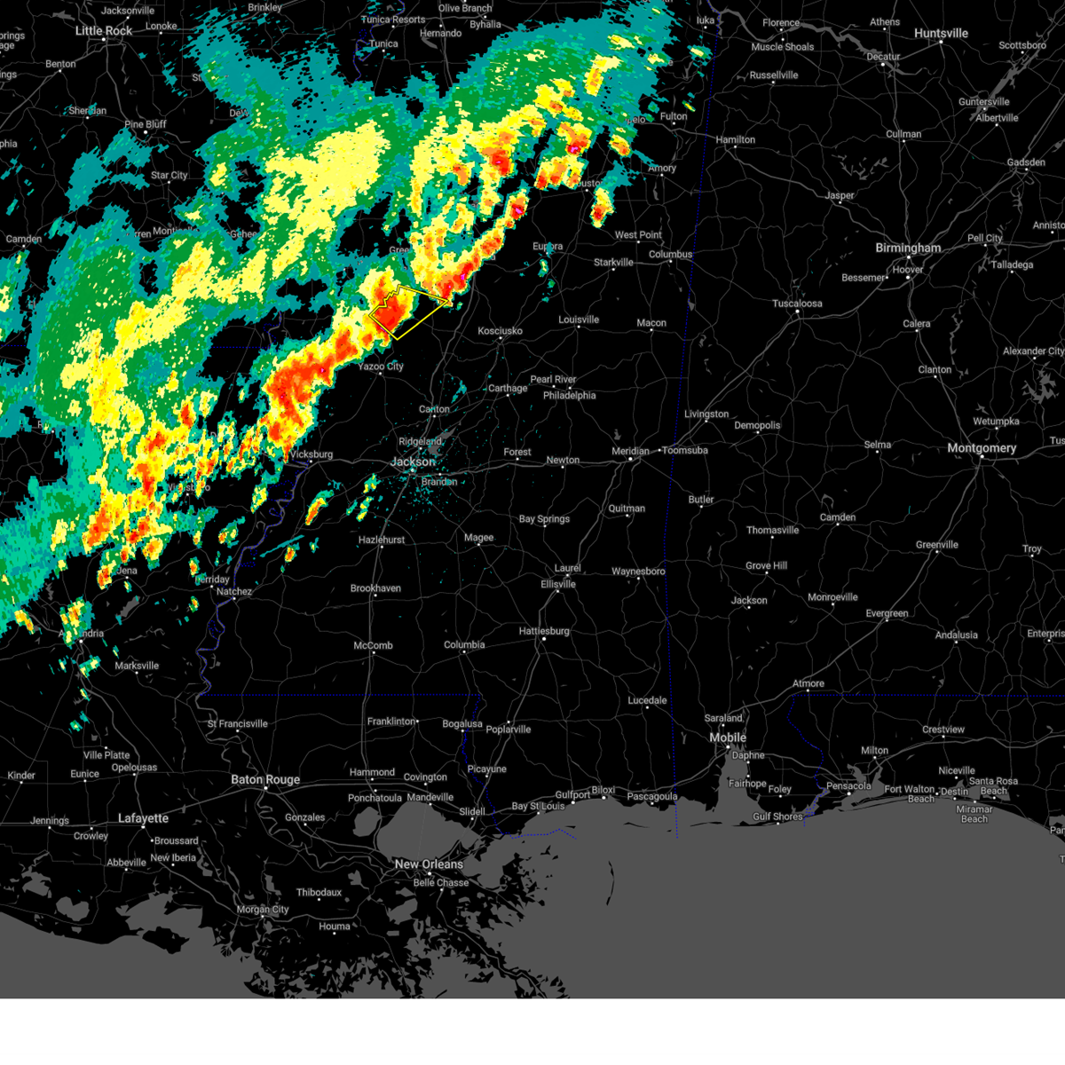 At 326 pm cdt, a severe thunderstorm was located near tchula, or near thornton, moving northeast at 40 mph (radar indicated). Hazards include 60 mph wind gusts and quarter size hail. Hail damage to vehicles is expected. expect wind damage to roofs, siding, and trees. this severe storm will be near, howard around 330 pm cdt. tchula around 335 pm cdt. other locations impacted by this severe thunderstorm include cruger. hail threat, radar indicated max hail size, 1. 00 in wind threat, radar indicated max wind gust, 60 mph. At 326 pm cdt, a severe thunderstorm was located near tchula, or near thornton, moving northeast at 40 mph (radar indicated). Hazards include 60 mph wind gusts and quarter size hail. Hail damage to vehicles is expected. expect wind damage to roofs, siding, and trees. this severe storm will be near, howard around 330 pm cdt. tchula around 335 pm cdt. other locations impacted by this severe thunderstorm include cruger. hail threat, radar indicated max hail size, 1. 00 in wind threat, radar indicated max wind gust, 60 mph.
|
| 4/5/2023 3:07 PM CDT |
 At 307 pm cdt, a severe thunderstorm was located near midnight, or 8 miles west of thornton, moving northeast at 40 mph (radar indicated). Hazards include 60 mph wind gusts and quarter size hail. Hail damage to vehicles is expected. expect wind damage to roofs, siding, and trees. this severe thunderstorm will be near, thornton around 320 pm cdt. howard around 330 pm cdt. tchula around 335 pm cdt. other locations impacted by this severe thunderstorm include silver city and cruger. hail threat, radar indicated max hail size, 1. 00 in wind threat, radar indicated max wind gust, 60 mph. At 307 pm cdt, a severe thunderstorm was located near midnight, or 8 miles west of thornton, moving northeast at 40 mph (radar indicated). Hazards include 60 mph wind gusts and quarter size hail. Hail damage to vehicles is expected. expect wind damage to roofs, siding, and trees. this severe thunderstorm will be near, thornton around 320 pm cdt. howard around 330 pm cdt. tchula around 335 pm cdt. other locations impacted by this severe thunderstorm include silver city and cruger. hail threat, radar indicated max hail size, 1. 00 in wind threat, radar indicated max wind gust, 60 mph.
|
| 3/24/2023 9:20 PM CDT |
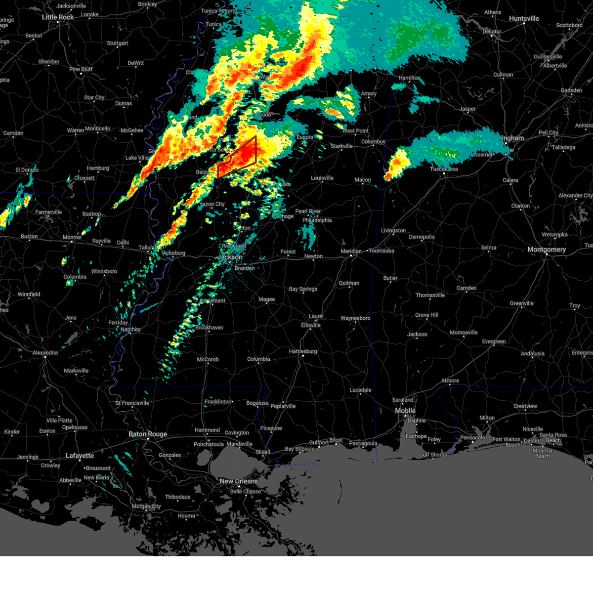 At 920 pm cdt, a confirmed large and extremely dangerous tornado was located over coila, or near black hawk, moving northeast at 60 mph. this is a particularly dangerous situation. take cover now! (radar confirmed tornado). Hazards include damaging tornado. You are in a life-threatening situation. flying debris may be deadly to those caught without shelter. mobile homes will be destroyed. considerable damage to homes, businesses, and vehicles is likely and complete destruction is possible. This tornadic thunderstorm will remain over mainly rural areas of northwestern holmes and western carroll counties, including the following locations, carrollton. At 920 pm cdt, a confirmed large and extremely dangerous tornado was located over coila, or near black hawk, moving northeast at 60 mph. this is a particularly dangerous situation. take cover now! (radar confirmed tornado). Hazards include damaging tornado. You are in a life-threatening situation. flying debris may be deadly to those caught without shelter. mobile homes will be destroyed. considerable damage to homes, businesses, and vehicles is likely and complete destruction is possible. This tornadic thunderstorm will remain over mainly rural areas of northwestern holmes and western carroll counties, including the following locations, carrollton.
|
| 3/24/2023 9:10 PM CDT |
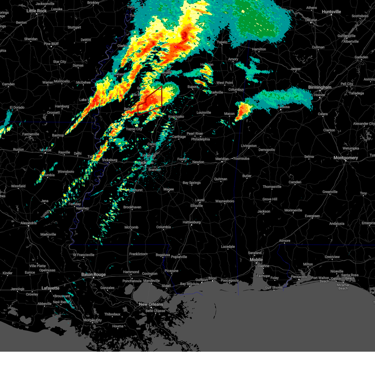 At 910 pm cdt, a confirmed large and extremely dangerous tornado was located near black hawk, moving northeast at 55 mph. this is a particularly dangerous situation. take cover now! (radar confirmed tornado). Hazards include damaging tornado. You are in a life-threatening situation. flying debris may be deadly to those caught without shelter. mobile homes will be destroyed. considerable damage to homes, businesses, and vehicles is likely and complete destruction is possible. the tornado will be near, emory around 915 pm cdt. coila around 920 pm cdt. Other locations impacted by this tornadic thunderstorm include carrollton. At 910 pm cdt, a confirmed large and extremely dangerous tornado was located near black hawk, moving northeast at 55 mph. this is a particularly dangerous situation. take cover now! (radar confirmed tornado). Hazards include damaging tornado. You are in a life-threatening situation. flying debris may be deadly to those caught without shelter. mobile homes will be destroyed. considerable damage to homes, businesses, and vehicles is likely and complete destruction is possible. the tornado will be near, emory around 915 pm cdt. coila around 920 pm cdt. Other locations impacted by this tornadic thunderstorm include carrollton.
|
| 3/24/2023 9:01 PM CDT |
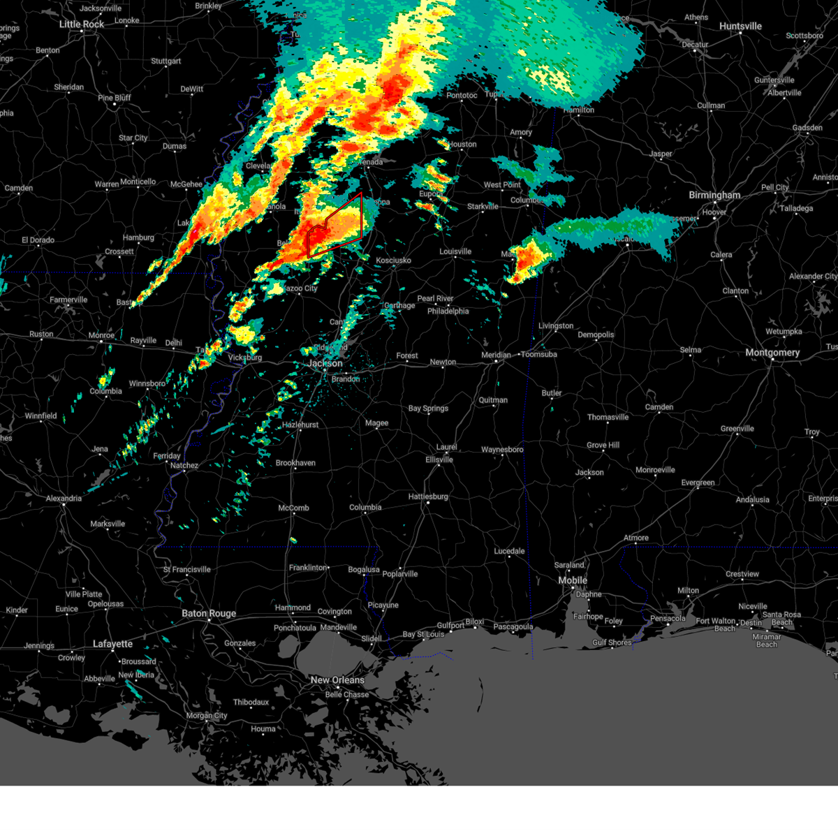 At 901 pm cdt, a confirmed large and extremely dangerous tornado was located near tchula, or 12 miles southwest of black hawk, moving northeast at 50 mph. this is a particularly dangerous situation. take cover now! (radar confirmed tornado). Hazards include damaging tornado. You are in a life-threatening situation. flying debris may be deadly to those caught without shelter. mobile homes will be destroyed. considerable damage to homes, businesses, and vehicles is likely and complete destruction is possible. the tornado will be near, black hawk and seven pines around 915 pm cdt. coila around 920 pm cdt. north carrollton around 930 pm cdt. Other locations impacted by this tornadic thunderstorm include cruger and carrollton. At 901 pm cdt, a confirmed large and extremely dangerous tornado was located near tchula, or 12 miles southwest of black hawk, moving northeast at 50 mph. this is a particularly dangerous situation. take cover now! (radar confirmed tornado). Hazards include damaging tornado. You are in a life-threatening situation. flying debris may be deadly to those caught without shelter. mobile homes will be destroyed. considerable damage to homes, businesses, and vehicles is likely and complete destruction is possible. the tornado will be near, black hawk and seven pines around 915 pm cdt. coila around 920 pm cdt. north carrollton around 930 pm cdt. Other locations impacted by this tornadic thunderstorm include cruger and carrollton.
|
| 3/24/2023 8:53 PM CDT |
 At 853 pm cdt, a confirmed large and destructive tornado was located near tchula, or 8 miles north of thornton, moving northeast at 45 mph. tornado emergency for tchula! this is a particularly dangerous situation. take cover now! (radar confirmed tornado). Hazards include deadly tornado. You are in a life-threatening situation. flying debris may be deadly to those caught without shelter. mobile homes will be destroyed. considerable damage to homes, businesses, and vehicles is likely and complete destruction is possible. the tornado will be near, seven pines around 915 pm cdt. black hawk around 920 pm cdt. coila around 925 pm cdt. north carrollton around 935 pm cdt. Other locations impacted by this tornadic thunderstorm include cruger and carrollton. At 853 pm cdt, a confirmed large and destructive tornado was located near tchula, or 8 miles north of thornton, moving northeast at 45 mph. tornado emergency for tchula! this is a particularly dangerous situation. take cover now! (radar confirmed tornado). Hazards include deadly tornado. You are in a life-threatening situation. flying debris may be deadly to those caught without shelter. mobile homes will be destroyed. considerable damage to homes, businesses, and vehicles is likely and complete destruction is possible. the tornado will be near, seven pines around 915 pm cdt. black hawk around 920 pm cdt. coila around 925 pm cdt. north carrollton around 935 pm cdt. Other locations impacted by this tornadic thunderstorm include cruger and carrollton.
|
| 3/24/2023 8:42 PM CDT |
 At 841 pm cdt, a confirmed large and destructive tornado was located near belzoni, moving northeast at 45 mph. tornado emergency for tchula! this is a particularly dangerous situation. take cover now! (radar confirmed tornado). Hazards include deadly tornado. You are in a life-threatening situation. flying debris may be deadly to those caught without shelter. mobile homes will be destroyed. considerable damage to homes, businesses, and vehicles is likely and complete destruction is possible. the tornado will be near, thornton around 850 pm cdt. tchula and howard around 900 pm cdt. seven pines around 915 pm cdt. black hawk around 920 pm cdt. coila and emory around 925 pm cdt. Other locations impacted by this tornadic thunderstorm include cruger and carrollton. At 841 pm cdt, a confirmed large and destructive tornado was located near belzoni, moving northeast at 45 mph. tornado emergency for tchula! this is a particularly dangerous situation. take cover now! (radar confirmed tornado). Hazards include deadly tornado. You are in a life-threatening situation. flying debris may be deadly to those caught without shelter. mobile homes will be destroyed. considerable damage to homes, businesses, and vehicles is likely and complete destruction is possible. the tornado will be near, thornton around 850 pm cdt. tchula and howard around 900 pm cdt. seven pines around 915 pm cdt. black hawk around 920 pm cdt. coila and emory around 925 pm cdt. Other locations impacted by this tornadic thunderstorm include cruger and carrollton.
|
| 3/24/2023 8:32 PM CDT |
 At 832 pm cdt, a tornado was reported over midnight, or 8 miles southwest of belzoni, moving northeast at 50 mph (radar confirmed tornado). Hazards include damaging tornado and quarter size hail. Flying debris will be dangerous to those caught without shelter. mobile homes will be damaged or destroyed. damage to roofs, windows, and vehicles will occur. tree damage is likely. this tornadic storm will be near, tchula around 855 pm cdt. sidon around 910 pm cdt. black hawk and seven pines around 915 pm cdt. coila around 920 pm cdt. malmaison around 925 pm cdt. north carrollton around 930 pm cdt. Other locations impacted by this tornadic thunderstorm include cruger and carrollton. At 832 pm cdt, a tornado was reported over midnight, or 8 miles southwest of belzoni, moving northeast at 50 mph (radar confirmed tornado). Hazards include damaging tornado and quarter size hail. Flying debris will be dangerous to those caught without shelter. mobile homes will be damaged or destroyed. damage to roofs, windows, and vehicles will occur. tree damage is likely. this tornadic storm will be near, tchula around 855 pm cdt. sidon around 910 pm cdt. black hawk and seven pines around 915 pm cdt. coila around 920 pm cdt. malmaison around 925 pm cdt. north carrollton around 930 pm cdt. Other locations impacted by this tornadic thunderstorm include cruger and carrollton.
|
| 3/12/2023 2:37 AM CDT |
 At 137 am cst, severe thunderstorms were located along a line extending from near swiftown to near midnight to near shelburn, moving east at 40 mph (radar indicated). Hazards include 60 mph wind gusts and half dollar size hail. Hail damage to vehicles is expected. expect wind damage to roofs, siding, and trees. these severe storms will be near, midnight and swiftown around 145 am cst. tchula around 150 am cst. thornton around 300 am cdt. rolling fork, coxburg, tolarville and howard around 310 am cdt. brozville and ebenezer around 320 am cdt. lexington around 325 am cdt. franklin, goodman and holly bluff around 330 am cdt. other locations impacted by these severe thunderstorms include eden, mayersville, silver city, cary, louise and west. hail threat, radar indicated max hail size, 1. 25 in wind threat, radar indicated max wind gust, 60 mph. At 137 am cst, severe thunderstorms were located along a line extending from near swiftown to near midnight to near shelburn, moving east at 40 mph (radar indicated). Hazards include 60 mph wind gusts and half dollar size hail. Hail damage to vehicles is expected. expect wind damage to roofs, siding, and trees. these severe storms will be near, midnight and swiftown around 145 am cst. tchula around 150 am cst. thornton around 300 am cdt. rolling fork, coxburg, tolarville and howard around 310 am cdt. brozville and ebenezer around 320 am cdt. lexington around 325 am cdt. franklin, goodman and holly bluff around 330 am cdt. other locations impacted by these severe thunderstorms include eden, mayersville, silver city, cary, louise and west. hail threat, radar indicated max hail size, 1. 25 in wind threat, radar indicated max wind gust, 60 mph.
|
| 3/12/2023 2:04 AM CDT |
 At 104 am cst, severe thunderstorms were located along a line extending from indianola to near hollandale to 6 miles east of jones, moving southeast at 40 mph (radar indicated). Hazards include 60 mph wind gusts and quarter size hail. Hail damage to vehicles is expected. expect wind damage to roofs, siding, and trees. severe thunderstorms will be near, hollandale, delta city, panther burn and nitta yuma around 110 am cst. murphy around 115 am cst. swiftown and midnight around 130 am cst. shelburn around 135 am cst. lake providence around 140 am cst. tchula around 150 am cst. yazoo city around 155 am cst. benton, lexington, fitler, onward and howard around 300 am cdt. other locations impacted by these severe thunderstorms include mayersville, silver city, west, eden, kilbourne, cary, louise and cruger. hail threat, radar indicated max hail size, 1. 00 in wind threat, radar indicated max wind gust, 60 mph. At 104 am cst, severe thunderstorms were located along a line extending from indianola to near hollandale to 6 miles east of jones, moving southeast at 40 mph (radar indicated). Hazards include 60 mph wind gusts and quarter size hail. Hail damage to vehicles is expected. expect wind damage to roofs, siding, and trees. severe thunderstorms will be near, hollandale, delta city, panther burn and nitta yuma around 110 am cst. murphy around 115 am cst. swiftown and midnight around 130 am cst. shelburn around 135 am cst. lake providence around 140 am cst. tchula around 150 am cst. yazoo city around 155 am cst. benton, lexington, fitler, onward and howard around 300 am cdt. other locations impacted by these severe thunderstorms include mayersville, silver city, west, eden, kilbourne, cary, louise and cruger. hail threat, radar indicated max hail size, 1. 00 in wind threat, radar indicated max wind gust, 60 mph.
|
| 1/3/2023 9:17 AM CST |
 At 917 am cst, a severe thunderstorm was located over black hawk, moving northeast at 45 mph (radar indicated). Hazards include 60 mph wind gusts and quarter size hail. Hail damage to vehicles is expected. expect wind damage to roofs, siding, and trees. this severe thunderstorm will be near, coila around 925 am cst. north carrollton around 935 am cst. winona around 945 am cst. duck hill around 955 am cst. other locations impacted by this severe thunderstorm include carrollton. hail threat, radar indicated max hail size, 1. 00 in wind threat, radar indicated max wind gust, 60 mph. At 917 am cst, a severe thunderstorm was located over black hawk, moving northeast at 45 mph (radar indicated). Hazards include 60 mph wind gusts and quarter size hail. Hail damage to vehicles is expected. expect wind damage to roofs, siding, and trees. this severe thunderstorm will be near, coila around 925 am cst. north carrollton around 935 am cst. winona around 945 am cst. duck hill around 955 am cst. other locations impacted by this severe thunderstorm include carrollton. hail threat, radar indicated max hail size, 1. 00 in wind threat, radar indicated max wind gust, 60 mph.
|
| 12/14/2022 1:03 AM CST |
 At 103 am cst, a severe thunderstorm capable of producing a tornado was located over howard, or 8 miles northeast of thornton, moving northeast at 40 mph (radar indicated rotation). Hazards include tornado and quarter size hail. Flying debris will be dangerous to those caught without shelter. mobile homes will be damaged or destroyed. damage to roofs, windows, and vehicles will occur. tree damage is likely. this dangerous storm will be near, lexington around 110 am cst. black hawk and bowling green around 125 am cst. emory around 130 am cst. vaiden around 145 am cst. winona around 155 am cst. Other locations impacted by this tornadic thunderstorm include west. At 103 am cst, a severe thunderstorm capable of producing a tornado was located over howard, or 8 miles northeast of thornton, moving northeast at 40 mph (radar indicated rotation). Hazards include tornado and quarter size hail. Flying debris will be dangerous to those caught without shelter. mobile homes will be damaged or destroyed. damage to roofs, windows, and vehicles will occur. tree damage is likely. this dangerous storm will be near, lexington around 110 am cst. black hawk and bowling green around 125 am cst. emory around 130 am cst. vaiden around 145 am cst. winona around 155 am cst. Other locations impacted by this tornadic thunderstorm include west.
|
| 12/14/2022 12:48 AM CST |
 At 1247 am cst, a severe thunderstorm was located near tolarville, or near thornton, moving east at 35 mph (radar indicated). Hazards include 60 mph wind gusts and quarter size hail. Hail damage to vehicles is expected. expect wind damage to roofs, siding, and trees. this severe thunderstorm will be near, brozville, howard and ebenezer around 100 am cst. lexington around 110 am cst. franklin around 115 am cst. bowling green around 125 am cst. durant around 130 am cst. possumneck around 140 am cst. Other locations impacted by this severe thunderstorm include eden, west and sallis. At 1247 am cst, a severe thunderstorm was located near tolarville, or near thornton, moving east at 35 mph (radar indicated). Hazards include 60 mph wind gusts and quarter size hail. Hail damage to vehicles is expected. expect wind damage to roofs, siding, and trees. this severe thunderstorm will be near, brozville, howard and ebenezer around 100 am cst. lexington around 110 am cst. franklin around 115 am cst. bowling green around 125 am cst. durant around 130 am cst. possumneck around 140 am cst. Other locations impacted by this severe thunderstorm include eden, west and sallis.
|
| 11/29/2022 4:34 PM CST |
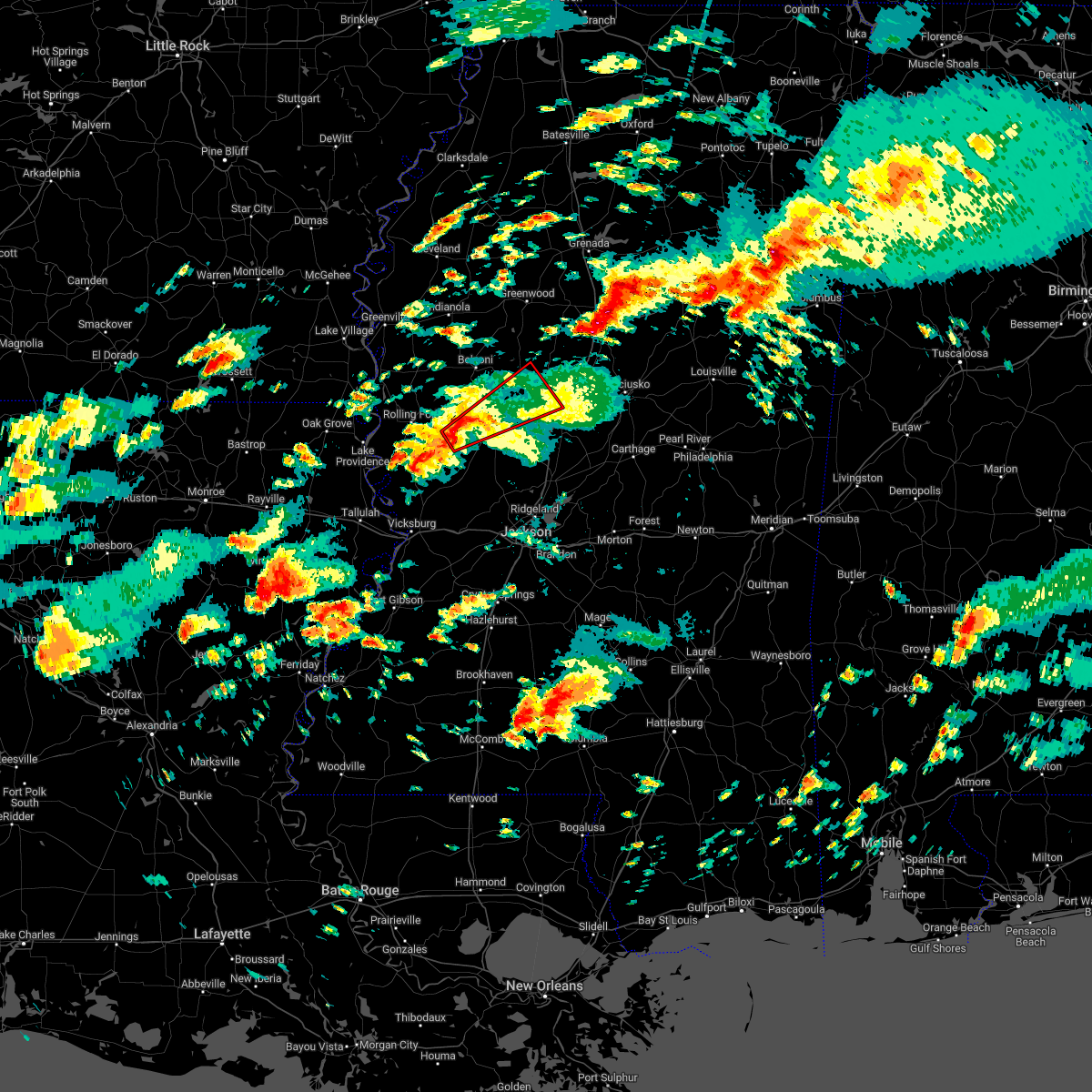 At 434 pm cst, a severe thunderstorm capable of producing a tornado was located 7 miles east of holly bluff, or 10 miles west of yazoo city, moving northeast at 45 mph (radar indicated rotation). Hazards include tornado. Flying debris will be dangerous to those caught without shelter. mobile homes will be damaged or destroyed. damage to roofs, windows, and vehicles will occur. tree damage is likely. this dangerous storm will be near, yazoo city around 450 pm cst. thornton around 500 pm cst. tolarville and coxburg around 505 pm cst. howard and brozville around 515 pm cst. Other locations impacted by this tornadic thunderstorm include eden. At 434 pm cst, a severe thunderstorm capable of producing a tornado was located 7 miles east of holly bluff, or 10 miles west of yazoo city, moving northeast at 45 mph (radar indicated rotation). Hazards include tornado. Flying debris will be dangerous to those caught without shelter. mobile homes will be damaged or destroyed. damage to roofs, windows, and vehicles will occur. tree damage is likely. this dangerous storm will be near, yazoo city around 450 pm cst. thornton around 500 pm cst. tolarville and coxburg around 505 pm cst. howard and brozville around 515 pm cst. Other locations impacted by this tornadic thunderstorm include eden.
|
| 11/29/2022 3:33 PM CST |
 At 332 pm cst, a severe thunderstorm was located near swiftown, or 7 miles southeast of moorhead, moving northeast at 60 mph (radar indicated). Hazards include 60 mph wind gusts and quarter size hail. Hail damage to vehicles is expected. expect wind damage to roofs, siding, and trees. this severe thunderstorm will remain over mainly rural areas of southeastern sunflower, northwestern holmes, southwestern leflore and humphreys counties, including the following locations, morgan city. hail threat, radar indicated max hail size, 1. 00 in wind threat, radar indicated max wind gust, 60 mph. At 332 pm cst, a severe thunderstorm was located near swiftown, or 7 miles southeast of moorhead, moving northeast at 60 mph (radar indicated). Hazards include 60 mph wind gusts and quarter size hail. Hail damage to vehicles is expected. expect wind damage to roofs, siding, and trees. this severe thunderstorm will remain over mainly rural areas of southeastern sunflower, northwestern holmes, southwestern leflore and humphreys counties, including the following locations, morgan city. hail threat, radar indicated max hail size, 1. 00 in wind threat, radar indicated max wind gust, 60 mph.
|
| 11/29/2022 3:02 PM CST |
 At 302 pm cst, a severe thunderstorm was located over panther burn, or near hollandale, moving northeast at 60 mph (radar indicated). Hazards include 60 mph wind gusts and half dollar size hail. Hail damage to vehicles is expected. expect wind damage to roofs, siding, and trees. this severe thunderstorm will be near, hollandale and delta city around 305 pm cst. murphy and darlove around 310 pm cst. isola around 320 pm cst. belzoni and inverness around 325 pm cst. swiftown around 330 pm cst. other locations impacted by this severe thunderstorm include silver city and morgan city. hail threat, radar indicated max hail size, 1. 25 in wind threat, radar indicated max wind gust, 60 mph. At 302 pm cst, a severe thunderstorm was located over panther burn, or near hollandale, moving northeast at 60 mph (radar indicated). Hazards include 60 mph wind gusts and half dollar size hail. Hail damage to vehicles is expected. expect wind damage to roofs, siding, and trees. this severe thunderstorm will be near, hollandale and delta city around 305 pm cst. murphy and darlove around 310 pm cst. isola around 320 pm cst. belzoni and inverness around 325 pm cst. swiftown around 330 pm cst. other locations impacted by this severe thunderstorm include silver city and morgan city. hail threat, radar indicated max hail size, 1. 25 in wind threat, radar indicated max wind gust, 60 mph.
|
| 11/29/2022 2:45 PM CST | Half Dollar sized hail reported 0.4 miles NW of Tchula, MS, 1.25 hail reported in tchula ms. |
| 11/29/2022 2:40 PM CST |
 At 240 pm cst, a severe thunderstorm capable of producing a tornado was located near tchula, or 9 miles southwest of black hawk, moving northeast at 50 mph (radar indicated rotation). Hazards include tornado and tennis ball size hail. Flying debris will be dangerous to those caught without shelter. mobile homes will be damaged or destroyed. damage to roofs, windows, and vehicles will occur. tree damage is likely. this dangerous storm will be near, black hawk and seven pines around 250 pm cst. coila around 255 pm cst. Other locations impacted by this tornadic thunderstorm include cruger. At 240 pm cst, a severe thunderstorm capable of producing a tornado was located near tchula, or 9 miles southwest of black hawk, moving northeast at 50 mph (radar indicated rotation). Hazards include tornado and tennis ball size hail. Flying debris will be dangerous to those caught without shelter. mobile homes will be damaged or destroyed. damage to roofs, windows, and vehicles will occur. tree damage is likely. this dangerous storm will be near, black hawk and seven pines around 250 pm cst. coila around 255 pm cst. Other locations impacted by this tornadic thunderstorm include cruger.
|
| 11/29/2022 2:33 PM CST |
 At 232 pm cst, a severe thunderstorm capable of producing a tornado was located near sidon, or 11 miles south of itta bena, moving northeast at 55 mph (radar indicated rotation). Hazards include tornado and golf ball size hail. Flying debris will be dangerous to those caught without shelter. mobile homes will be damaged or destroyed. damage to roofs, windows, and vehicles will occur. tree damage is likely. this dangerous storm will be near, seven pines around 240 pm cst. greenwood around 245 pm cst. Other locations impacted by this tornadic thunderstorm include cruger. At 232 pm cst, a severe thunderstorm capable of producing a tornado was located near sidon, or 11 miles south of itta bena, moving northeast at 55 mph (radar indicated rotation). Hazards include tornado and golf ball size hail. Flying debris will be dangerous to those caught without shelter. mobile homes will be damaged or destroyed. damage to roofs, windows, and vehicles will occur. tree damage is likely. this dangerous storm will be near, seven pines around 240 pm cst. greenwood around 245 pm cst. Other locations impacted by this tornadic thunderstorm include cruger.
|
| 11/29/2022 2:32 PM CST | Half Dollar sized hail reported 0.4 miles NW of Tchula, MS, corrects previous hail report from tchula. 1.25 hail reported in tchula ms. |
| 11/29/2022 2:08 PM CST |
 At 207 pm cst, a severe thunderstorm capable of producing a tornado was located near midnight, or 7 miles south of belzoni, moving northeast at 55 mph (radar indicated rotation). Hazards include tornado and quarter size hail. Flying debris will be dangerous to those caught without shelter. mobile homes will be damaged or destroyed. damage to roofs, windows, and vehicles will occur. tree damage is likely. this dangerous storm will be near, swiftown around 225 pm cst. quito around 235 pm cst. sidon and seven pines around 240 pm cst. greenwood around 250 pm cst. Other locations impacted by this tornadic thunderstorm include silver city, morgan city and cruger. At 207 pm cst, a severe thunderstorm capable of producing a tornado was located near midnight, or 7 miles south of belzoni, moving northeast at 55 mph (radar indicated rotation). Hazards include tornado and quarter size hail. Flying debris will be dangerous to those caught without shelter. mobile homes will be damaged or destroyed. damage to roofs, windows, and vehicles will occur. tree damage is likely. this dangerous storm will be near, swiftown around 225 pm cst. quito around 235 pm cst. sidon and seven pines around 240 pm cst. greenwood around 250 pm cst. Other locations impacted by this tornadic thunderstorm include silver city, morgan city and cruger.
|
| 7/21/2022 8:45 PM CDT |
 At 845 pm cdt, a severe thunderstorm was located over franklin, or 9 miles west of durant, moving southeast at 40 mph (radar indicated). Hazards include 60 mph wind gusts and quarter size hail. Hail damage to vehicles is expected. expect wind damage to roofs, siding, and trees. this severe thunderstorm will be near, durant and goodman around 900 pm cdt. hail threat, radar indicated max hail size, 1. 00 in wind threat, radar indicated max wind gust, 60 mph. At 845 pm cdt, a severe thunderstorm was located over franklin, or 9 miles west of durant, moving southeast at 40 mph (radar indicated). Hazards include 60 mph wind gusts and quarter size hail. Hail damage to vehicles is expected. expect wind damage to roofs, siding, and trees. this severe thunderstorm will be near, durant and goodman around 900 pm cdt. hail threat, radar indicated max hail size, 1. 00 in wind threat, radar indicated max wind gust, 60 mph.
|
| 7/9/2022 7:25 PM CDT |
 At 725 pm cdt, a severe thunderstorm was located near lexington, or 10 miles south of black hawk, moving southeast at 35 mph (radar indicated). Hazards include 60 mph wind gusts and quarter size hail. Hail damage to vehicles is expected. expect wind damage to roofs, siding, and trees. this severe storm will be near, franklin and bowling green around 735 pm cdt. durant around 745 pm cdt. other locations impacted by this severe thunderstorm include west and cruger. hail threat, radar indicated max hail size, 1. 00 in wind threat, radar indicated max wind gust, 60 mph. At 725 pm cdt, a severe thunderstorm was located near lexington, or 10 miles south of black hawk, moving southeast at 35 mph (radar indicated). Hazards include 60 mph wind gusts and quarter size hail. Hail damage to vehicles is expected. expect wind damage to roofs, siding, and trees. this severe storm will be near, franklin and bowling green around 735 pm cdt. durant around 745 pm cdt. other locations impacted by this severe thunderstorm include west and cruger. hail threat, radar indicated max hail size, 1. 00 in wind threat, radar indicated max wind gust, 60 mph.
|
| 7/9/2022 7:05 PM CDT |
 At 705 pm cdt, a severe thunderstorm was located near tchula, or 12 miles west of black hawk, moving southeast at 35 mph (radar indicated). Hazards include 60 mph wind gusts and quarter size hail. Hail damage to vehicles is expected. expect wind damage to roofs, siding, and trees. this severe storm will be near, howard around 715 pm cdt. lexington around 725 pm cdt. emory around 730 pm cdt. franklin and bowling green around 735 pm cdt. durant around 745 pm cdt. other locations impacted by this severe thunderstorm include west, morgan city and cruger. hail threat, radar indicated max hail size, 1. 00 in wind threat, radar indicated max wind gust, 60 mph. At 705 pm cdt, a severe thunderstorm was located near tchula, or 12 miles west of black hawk, moving southeast at 35 mph (radar indicated). Hazards include 60 mph wind gusts and quarter size hail. Hail damage to vehicles is expected. expect wind damage to roofs, siding, and trees. this severe storm will be near, howard around 715 pm cdt. lexington around 725 pm cdt. emory around 730 pm cdt. franklin and bowling green around 735 pm cdt. durant around 745 pm cdt. other locations impacted by this severe thunderstorm include west, morgan city and cruger. hail threat, radar indicated max hail size, 1. 00 in wind threat, radar indicated max wind gust, 60 mph.
|
| 7/9/2022 6:53 PM CDT |
 At 653 pm cdt, a severe thunderstorm was located near swiftown, or 13 miles south of itta bena, moving southeast at 35 mph (radar indicated). Hazards include 60 mph wind gusts and penny size hail. Expect damage to roofs, siding, and trees. this severe thunderstorm will be near, tchula around 710 pm cdt. howard around 715 pm cdt. lexington around 725 pm cdt. emory around 730 pm cdt. franklin and bowling green around 735 pm cdt. durant around 745 pm cdt. other locations impacted by this severe thunderstorm include west, morgan city and cruger. hail threat, radar indicated max hail size, 0. 75 in wind threat, radar indicated max wind gust, 60 mph. At 653 pm cdt, a severe thunderstorm was located near swiftown, or 13 miles south of itta bena, moving southeast at 35 mph (radar indicated). Hazards include 60 mph wind gusts and penny size hail. Expect damage to roofs, siding, and trees. this severe thunderstorm will be near, tchula around 710 pm cdt. howard around 715 pm cdt. lexington around 725 pm cdt. emory around 730 pm cdt. franklin and bowling green around 735 pm cdt. durant around 745 pm cdt. other locations impacted by this severe thunderstorm include west, morgan city and cruger. hail threat, radar indicated max hail size, 0. 75 in wind threat, radar indicated max wind gust, 60 mph.
|
| 6/10/2022 10:46 AM CDT |
 At 1046 am cdt, severe thunderstorms were located along a line extending from near midnight to near valley park, moving southeast at 45 mph (radar indicated). Hazards include 60 mph wind gusts. Expect damage to roofs, siding, and trees. these severe storms will be near, yazoo city around 1105 am cdt. phoenix around 1110 am cdt. other locations impacted by these severe thunderstorms include eden, satartia, silver city, cary and louise. hail threat, radar indicated max hail size, <. 75 in wind threat, radar indicated max wind gust, 60 mph. At 1046 am cdt, severe thunderstorms were located along a line extending from near midnight to near valley park, moving southeast at 45 mph (radar indicated). Hazards include 60 mph wind gusts. Expect damage to roofs, siding, and trees. these severe storms will be near, yazoo city around 1105 am cdt. phoenix around 1110 am cdt. other locations impacted by these severe thunderstorms include eden, satartia, silver city, cary and louise. hail threat, radar indicated max hail size, <. 75 in wind threat, radar indicated max wind gust, 60 mph.
|
| 6/10/2022 10:28 AM CDT |
 At 1027 am cdt, severe thunderstorms were located along a line extending from near holly ridge to near isola to near fitler, moving east at 50 mph (radar indicated). Hazards include 60 mph wind gusts. Expect damage to roofs, siding, and trees. severe thunderstorms will be near, isola around 1035 am cdt. indianola, belzoni and inverness around 1040 am cdt. swiftown around 1045 am cdt. moorhead around 1050 am cdt. itta bena and tchula around 1100 am cdt. quito, phoenix and howard around 1105 am cdt. sidon and tinsley around 1110 am cdt. other locations impacted by these severe thunderstorms include silver city, eden, satartia, cary, louise, morgan city and cruger. hail threat, radar indicated max hail size, <. 75 in wind threat, radar indicated max wind gust, 60 mph. At 1027 am cdt, severe thunderstorms were located along a line extending from near holly ridge to near isola to near fitler, moving east at 50 mph (radar indicated). Hazards include 60 mph wind gusts. Expect damage to roofs, siding, and trees. severe thunderstorms will be near, isola around 1035 am cdt. indianola, belzoni and inverness around 1040 am cdt. swiftown around 1045 am cdt. moorhead around 1050 am cdt. itta bena and tchula around 1100 am cdt. quito, phoenix and howard around 1105 am cdt. sidon and tinsley around 1110 am cdt. other locations impacted by these severe thunderstorms include silver city, eden, satartia, cary, louise, morgan city and cruger. hail threat, radar indicated max hail size, <. 75 in wind threat, radar indicated max wind gust, 60 mph.
|
| 6/8/2022 5:10 PM CDT |
 At 510 pm cdt, severe thunderstorms were located along a line extending from near winona to near possumneck to near pickens, moving east at 70 mph (radar indicated). Hazards include 60 mph wind gusts. Expect damage to roofs, siding, and trees. locations impacted include, durant, thornton, franklin, tchula, lexington, goodman, pickens, vaiden, coxburg, ebenezer, bowling green, tolarville, brozville, emory, howard, west and eden. hail threat, radar indicated max hail size, <. 75 in wind threat, radar indicated max wind gust, 60 mph. At 510 pm cdt, severe thunderstorms were located along a line extending from near winona to near possumneck to near pickens, moving east at 70 mph (radar indicated). Hazards include 60 mph wind gusts. Expect damage to roofs, siding, and trees. locations impacted include, durant, thornton, franklin, tchula, lexington, goodman, pickens, vaiden, coxburg, ebenezer, bowling green, tolarville, brozville, emory, howard, west and eden. hail threat, radar indicated max hail size, <. 75 in wind threat, radar indicated max wind gust, 60 mph.
|
| 6/8/2022 4:37 PM CDT |
 At 437 pm cdt, severe thunderstorms were located along a line extending from near blaine to near swiftown to near midnight, moving east at 70 mph (radar indicated). Hazards include 60 mph wind gusts and penny size hail. Expect damage to roofs, siding, and trees. severe thunderstorms will be near, tchula around 445 pm cdt. greenwood and thornton around 450 pm cdt. black hawk and lexington around 455 pm cdt. malmaison, coxburg, bowling green, emory and tolarville around 500 pm cdt. durant, north carrollton, ebenezer, coila and brozville around 505 pm cdt. franklin around 510 pm cdt. goodman, pickens and vaiden around 515 pm cdt. other locations impacted by these severe thunderstorms include eden, carrollton, west and cruger. hail threat, radar indicated max hail size, 0. 75 in wind threat, radar indicated max wind gust, 60 mph. At 437 pm cdt, severe thunderstorms were located along a line extending from near blaine to near swiftown to near midnight, moving east at 70 mph (radar indicated). Hazards include 60 mph wind gusts and penny size hail. Expect damage to roofs, siding, and trees. severe thunderstorms will be near, tchula around 445 pm cdt. greenwood and thornton around 450 pm cdt. black hawk and lexington around 455 pm cdt. malmaison, coxburg, bowling green, emory and tolarville around 500 pm cdt. durant, north carrollton, ebenezer, coila and brozville around 505 pm cdt. franklin around 510 pm cdt. goodman, pickens and vaiden around 515 pm cdt. other locations impacted by these severe thunderstorms include eden, carrollton, west and cruger. hail threat, radar indicated max hail size, 0. 75 in wind threat, radar indicated max wind gust, 60 mph.
|
| 5/15/2022 7:52 PM CDT |
 At 752 pm cdt, severe thunderstorms were located along a line extending from sweatman to coxburg to 7 miles northwest of phoenix, moving southeast at 35 mph (radar indicated). Hazards include 60 mph wind gusts. Expect damage to roofs, siding, and trees. these severe storms will be near, lodi around 805 pm cdt. kilmichael around 810 pm cdt. other locations impacted by these severe thunderstorms include silver city, louise, carrollton and cruger. hail threat, radar indicated max hail size, <. 75 in wind threat, radar indicated max wind gust, 60 mph. At 752 pm cdt, severe thunderstorms were located along a line extending from sweatman to coxburg to 7 miles northwest of phoenix, moving southeast at 35 mph (radar indicated). Hazards include 60 mph wind gusts. Expect damage to roofs, siding, and trees. these severe storms will be near, lodi around 805 pm cdt. kilmichael around 810 pm cdt. other locations impacted by these severe thunderstorms include silver city, louise, carrollton and cruger. hail threat, radar indicated max hail size, <. 75 in wind threat, radar indicated max wind gust, 60 mph.
|
| 5/15/2022 7:14 PM CDT |
 At 714 pm cdt, severe thunderstorms were located along a line extending from near bew springs to near itta bena to near avon, moving southeast at 45 mph (radar indicated). Hazards include 60 mph wind gusts and quarter size hail. Hail damage to vehicles is expected. expect wind damage to roofs, siding, and trees. severe thunderstorms will be near, grenada and bew springs around 720 pm cdt. elliott around 725 pm cdt. duck hill and gore springs around 730 pm cdt. misterton and murphy around 735 pm cdt. sweatman and seven pines around 740 pm cdt. black hawk, lodi and coila around 745 pm cdt. midnight around 750 pm cdt. emory around 755 pm cdt. other locations impacted by these severe thunderstorms include silver city, louise, carrollton and cruger. hail threat, radar indicated max hail size, 1. 00 in wind threat, radar indicated max wind gust, 60 mph. At 714 pm cdt, severe thunderstorms were located along a line extending from near bew springs to near itta bena to near avon, moving southeast at 45 mph (radar indicated). Hazards include 60 mph wind gusts and quarter size hail. Hail damage to vehicles is expected. expect wind damage to roofs, siding, and trees. severe thunderstorms will be near, grenada and bew springs around 720 pm cdt. elliott around 725 pm cdt. duck hill and gore springs around 730 pm cdt. misterton and murphy around 735 pm cdt. sweatman and seven pines around 740 pm cdt. black hawk, lodi and coila around 745 pm cdt. midnight around 750 pm cdt. emory around 755 pm cdt. other locations impacted by these severe thunderstorms include silver city, louise, carrollton and cruger. hail threat, radar indicated max hail size, 1. 00 in wind threat, radar indicated max wind gust, 60 mph.
|
| 4/5/2022 3:48 AM CDT |
 At 347 am cdt, a severe thunderstorm was located over tchula, or 11 miles northeast of thornton, moving northeast at 55 mph (radar indicated). Hazards include 60 mph wind gusts and half dollar size hail. Hail damage to vehicles is expected. expect wind damage to roofs, siding, and trees. this severe storm will be near, emory around 405 am cdt. other locations impacted by this severe thunderstorm include cruger. hail threat, radar indicated max hail size, 1. 25 in wind threat, radar indicated max wind gust, 60 mph. At 347 am cdt, a severe thunderstorm was located over tchula, or 11 miles northeast of thornton, moving northeast at 55 mph (radar indicated). Hazards include 60 mph wind gusts and half dollar size hail. Hail damage to vehicles is expected. expect wind damage to roofs, siding, and trees. this severe storm will be near, emory around 405 am cdt. other locations impacted by this severe thunderstorm include cruger. hail threat, radar indicated max hail size, 1. 25 in wind threat, radar indicated max wind gust, 60 mph.
|
| 4/5/2022 3:33 AM CDT |
 At 333 am cdt, a severe thunderstorm was located over thornton, moving northeast at 55 mph (radar indicated). Hazards include ping pong ball size hail and 60 mph wind gusts. People and animals outdoors will be injured. expect hail damage to roofs, siding, windows, and vehicles. expect wind damage to roofs, siding, and trees. this severe thunderstorm will be near, tolarville around 340 am cdt. tchula and howard around 345 am cdt. emory around 405 am cdt. other locations impacted by this severe thunderstorm include silver city and cruger. hail threat, radar indicated max hail size, 1. 50 in wind threat, radar indicated max wind gust, 60 mph. At 333 am cdt, a severe thunderstorm was located over thornton, moving northeast at 55 mph (radar indicated). Hazards include ping pong ball size hail and 60 mph wind gusts. People and animals outdoors will be injured. expect hail damage to roofs, siding, windows, and vehicles. expect wind damage to roofs, siding, and trees. this severe thunderstorm will be near, tolarville around 340 am cdt. tchula and howard around 345 am cdt. emory around 405 am cdt. other locations impacted by this severe thunderstorm include silver city and cruger. hail threat, radar indicated max hail size, 1. 50 in wind threat, radar indicated max wind gust, 60 mph.
|
| 3/30/2022 4:19 PM CDT |
 At 419 pm cdt, severe thunderstorms were located along a line extending from near money to near tchula, moving northeast at 45 mph (radar indicated). Hazards include 60 mph wind gusts. Expect damage to roofs, siding, and trees. these severe storms will be near, leflore and avalon around 425 pm cdt. holcomb around 435 pm cdt. coila and bew springs around 440 pm cdt. grenada around 445 pm cdt. north carrollton around 450 pm cdt. Other locations impacted by these severe thunderstorms include cruger and carrollton. At 419 pm cdt, severe thunderstorms were located along a line extending from near money to near tchula, moving northeast at 45 mph (radar indicated). Hazards include 60 mph wind gusts. Expect damage to roofs, siding, and trees. these severe storms will be near, leflore and avalon around 425 pm cdt. holcomb around 435 pm cdt. coila and bew springs around 440 pm cdt. grenada around 445 pm cdt. north carrollton around 450 pm cdt. Other locations impacted by these severe thunderstorms include cruger and carrollton.
|
| 3/30/2022 4:13 PM CDT | Social media report of a tree down on power lines in the tchula are in holmes county MS, 0.4 miles NW of Tchula, MS |
| 3/30/2022 4:11 PM CDT |
 At 411 pm cdt, severe thunderstorms were located along a line extending from near money to near tchula, moving northeast at 50 mph (radar indicated). Hazards include 60 mph wind gusts. Expect damage to roofs, siding, and trees. these severe storms will be near, money around 415 pm cdt. avalon around 420 pm cdt. leflore and seven pines around 425 pm cdt. black hawk around 430 pm cdt. holcomb and coila around 435 pm cdt. bew springs around 440 pm cdt. grenada around 445 pm cdt. Other locations impacted by these severe thunderstorms include morgan city, cruger and carrollton. At 411 pm cdt, severe thunderstorms were located along a line extending from near money to near tchula, moving northeast at 50 mph (radar indicated). Hazards include 60 mph wind gusts. Expect damage to roofs, siding, and trees. these severe storms will be near, money around 415 pm cdt. avalon around 420 pm cdt. leflore and seven pines around 425 pm cdt. black hawk around 430 pm cdt. holcomb and coila around 435 pm cdt. bew springs around 440 pm cdt. grenada around 445 pm cdt. Other locations impacted by these severe thunderstorms include morgan city, cruger and carrollton.
|
| 3/30/2022 3:47 PM CDT |
 At 347 pm cdt, severe thunderstorms were located along a line extending from sunflower to near midnight, moving northeast at 45 mph (radar indicated). Hazards include 60 mph wind gusts. Expect damage to roofs, siding, and trees. severe thunderstorms will be near, swiftown around 405 pm cdt. tchula around 410 pm cdt. money around 415 pm cdt. sidon around 425 pm cdt. black hawk and seven pines around 430 pm cdt. coila around 440 pm cdt. malmaison around 445 pm cdt. north carrollton around 450 pm cdt. Other locations impacted by these severe thunderstorms include morgan city, cruger and carrollton. At 347 pm cdt, severe thunderstorms were located along a line extending from sunflower to near midnight, moving northeast at 45 mph (radar indicated). Hazards include 60 mph wind gusts. Expect damage to roofs, siding, and trees. severe thunderstorms will be near, swiftown around 405 pm cdt. tchula around 410 pm cdt. money around 415 pm cdt. sidon around 425 pm cdt. black hawk and seven pines around 430 pm cdt. coila around 440 pm cdt. malmaison around 445 pm cdt. north carrollton around 450 pm cdt. Other locations impacted by these severe thunderstorms include morgan city, cruger and carrollton.
|
| 3/22/2022 11:57 AM CDT |
 The severe thunderstorm warning for southeastern sunflower, northwestern holmes, southwestern leflore and northeastern humphreys counties will expire at noon cdt, the storms which prompted the warning have moved out of the area. therefore, the warning will be allowed to expire. a tornado watch remains in effect until 700 pm cdt for central, north central and northwestern mississippi. The severe thunderstorm warning for southeastern sunflower, northwestern holmes, southwestern leflore and northeastern humphreys counties will expire at noon cdt, the storms which prompted the warning have moved out of the area. therefore, the warning will be allowed to expire. a tornado watch remains in effect until 700 pm cdt for central, north central and northwestern mississippi.
|
| 3/22/2022 11:34 AM CDT |
 At 1134 am cdt, severe thunderstorms were located along a line extending from near inverness to near belzoni to near thornton, moving east at 40 mph (radar indicated). Hazards include 60 mph wind gusts and penny size hail. Expect damage to roofs, siding, and trees. these severe storms will be near, tchula around 1150 am cdt. quito around 1155 am cdt. other locations impacted by these severe thunderstorms include morgan city and cruger. hail threat, radar indicated max hail size, 0. 75 in wind threat, radar indicated max wind gust, 60 mph. At 1134 am cdt, severe thunderstorms were located along a line extending from near inverness to near belzoni to near thornton, moving east at 40 mph (radar indicated). Hazards include 60 mph wind gusts and penny size hail. Expect damage to roofs, siding, and trees. these severe storms will be near, tchula around 1150 am cdt. quito around 1155 am cdt. other locations impacted by these severe thunderstorms include morgan city and cruger. hail threat, radar indicated max hail size, 0. 75 in wind threat, radar indicated max wind gust, 60 mph.
|
| 3/22/2022 11:02 AM CDT |
 At 1102 am cdt, severe thunderstorms were located along a line extending from estill to delta city to near holly bluff, moving east at 40 mph (radar indicated). Hazards include 60 mph wind gusts and quarter size hail. Hail damage to vehicles is expected. expect wind damage to roofs, siding, and trees. severe thunderstorms will be near, midnight around 1120 am cdt. isola around 1125 am cdt. belzoni and inverness around 1130 am cdt. swiftown around 1140 am cdt. thornton around 1145 am cdt. tchula, tolarville and howard around 1150 am cdt. quito around 1155 am cdt. other locations impacted by these severe thunderstorms include silver city, louise, morgan city and cruger. hail threat, radar indicated max hail size, 1. 00 in wind threat, radar indicated max wind gust, 60 mph. At 1102 am cdt, severe thunderstorms were located along a line extending from estill to delta city to near holly bluff, moving east at 40 mph (radar indicated). Hazards include 60 mph wind gusts and quarter size hail. Hail damage to vehicles is expected. expect wind damage to roofs, siding, and trees. severe thunderstorms will be near, midnight around 1120 am cdt. isola around 1125 am cdt. belzoni and inverness around 1130 am cdt. swiftown around 1140 am cdt. thornton around 1145 am cdt. tchula, tolarville and howard around 1150 am cdt. quito around 1155 am cdt. other locations impacted by these severe thunderstorms include silver city, louise, morgan city and cruger. hail threat, radar indicated max hail size, 1. 00 in wind threat, radar indicated max wind gust, 60 mph.
|
| 2/17/2022 12:41 PM CST |
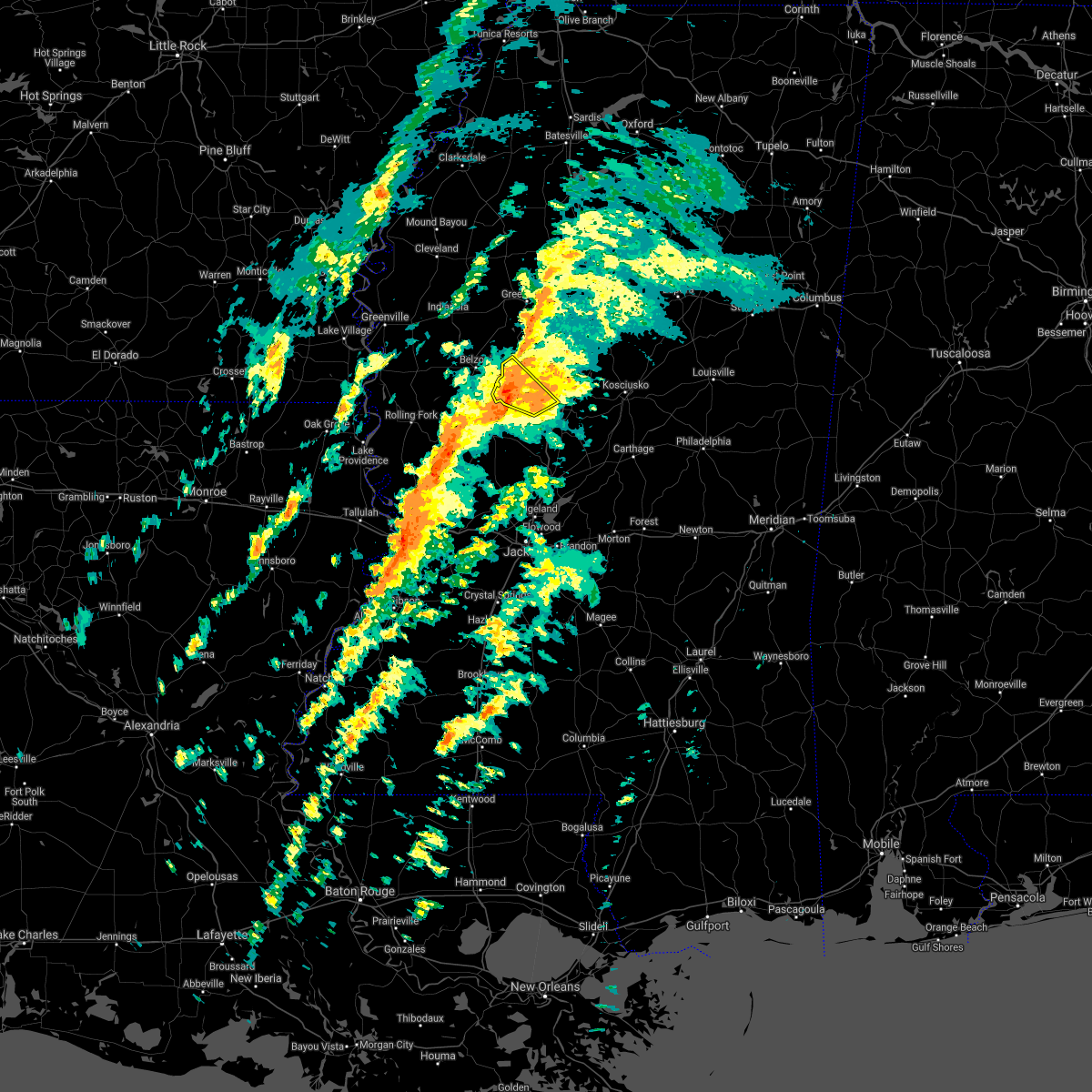 At 1241 pm cst, a severe thunderstorm was located over thornton, moving northeast at 50 mph (radar indicated). Hazards include 60 mph wind gusts. Expect damage to roofs, siding, and trees. this severe storm will be near, tolarville around 1245 pm cst. tchula, howard and brozville around 1250 pm cst. hail threat, radar indicated max hail size, <. 75 in wind threat, radar indicated max wind gust, 60 mph. At 1241 pm cst, a severe thunderstorm was located over thornton, moving northeast at 50 mph (radar indicated). Hazards include 60 mph wind gusts. Expect damage to roofs, siding, and trees. this severe storm will be near, tolarville around 1245 pm cst. tchula, howard and brozville around 1250 pm cst. hail threat, radar indicated max hail size, <. 75 in wind threat, radar indicated max wind gust, 60 mph.
|
| 2/17/2022 12:40 PM CST |
 At 1240 pm cst, a severe thunderstorm capable of producing a tornado was located over tolarville, or near thornton, moving northeast at 55 mph (radar indicated rotation). Hazards include tornado. Flying debris will be dangerous to those caught without shelter. mobile homes will be damaged or destroyed. damage to roofs, windows, and vehicles will occur. tree damage is likely. this dangerous storm will be near, tchula and howard around 1245 pm cst. lexington around 1250 pm cst. Emory around 105 pm cst. At 1240 pm cst, a severe thunderstorm capable of producing a tornado was located over tolarville, or near thornton, moving northeast at 55 mph (radar indicated rotation). Hazards include tornado. Flying debris will be dangerous to those caught without shelter. mobile homes will be damaged or destroyed. damage to roofs, windows, and vehicles will occur. tree damage is likely. this dangerous storm will be near, tchula and howard around 1245 pm cst. lexington around 1250 pm cst. Emory around 105 pm cst.
|
| 2/17/2022 12:26 PM CST |
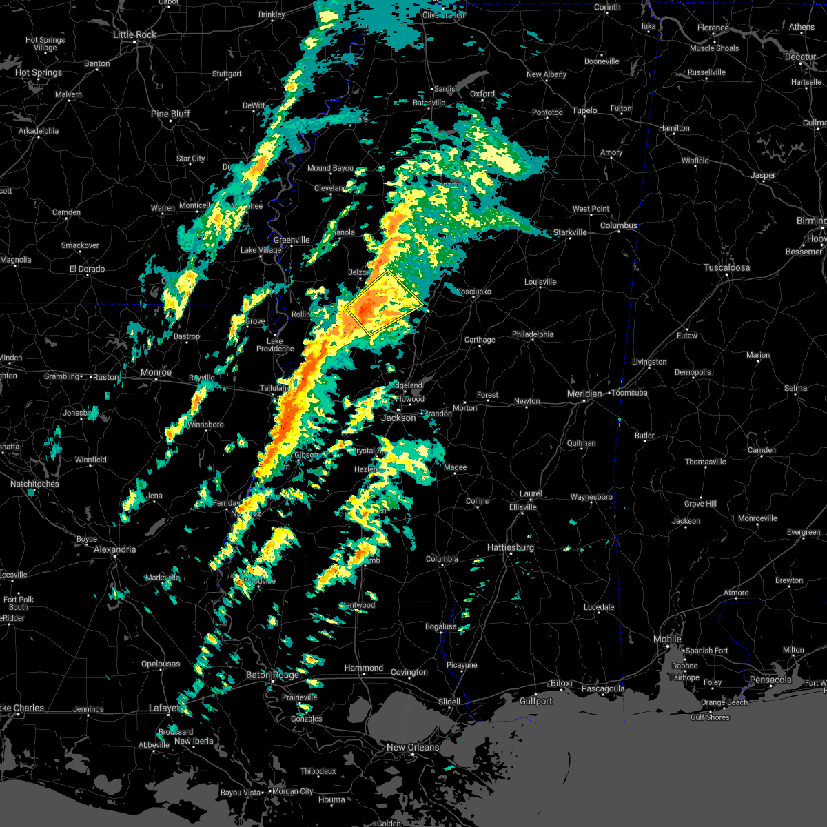 At 1226 pm cst, a severe thunderstorm was located near yazoo city, moving northeast at 55 mph (radar indicated). Hazards include 60 mph wind gusts. Expect damage to roofs, siding, and trees. this severe storm will be near, thornton around 1235 pm cst. tolarville and coxburg around 1240 pm cst. tchula, howard and brozville around 1245 pm cst. other locations impacted by this severe thunderstorm include eden and louise. hail threat, radar indicated max hail size, <. 75 in wind threat, radar indicated max wind gust, 60 mph. At 1226 pm cst, a severe thunderstorm was located near yazoo city, moving northeast at 55 mph (radar indicated). Hazards include 60 mph wind gusts. Expect damage to roofs, siding, and trees. this severe storm will be near, thornton around 1235 pm cst. tolarville and coxburg around 1240 pm cst. tchula, howard and brozville around 1245 pm cst. other locations impacted by this severe thunderstorm include eden and louise. hail threat, radar indicated max hail size, <. 75 in wind threat, radar indicated max wind gust, 60 mph.
|
| 2/17/2022 12:25 PM CST |
 At 1225 pm cst, a severe thunderstorm capable of producing a tornado was located near yazoo city, moving northeast at 55 mph (radar indicated rotation). Hazards include tornado. Flying debris will be dangerous to those caught without shelter. mobile homes will be damaged or destroyed. damage to roofs, windows, and vehicles will occur. tree damage is likely. this dangerous storm will be near, thornton around 1235 pm cst. tolarville and coxburg around 1240 pm cst. tchula and howard around 1245 pm cst. lexington around 1250 pm cst. emory around 105 pm cst. Other locations impacted by this tornadic thunderstorm include eden. At 1225 pm cst, a severe thunderstorm capable of producing a tornado was located near yazoo city, moving northeast at 55 mph (radar indicated rotation). Hazards include tornado. Flying debris will be dangerous to those caught without shelter. mobile homes will be damaged or destroyed. damage to roofs, windows, and vehicles will occur. tree damage is likely. this dangerous storm will be near, thornton around 1235 pm cst. tolarville and coxburg around 1240 pm cst. tchula and howard around 1245 pm cst. lexington around 1250 pm cst. emory around 105 pm cst. Other locations impacted by this tornadic thunderstorm include eden.
|
| 2/17/2022 12:16 PM CST |
 At 1216 pm cst, a severe thunderstorm capable of producing a tornado was located 8 miles west of yazoo city, moving northeast at 60 mph (radar indicated rotation). Hazards include tornado. Flying debris will be dangerous to those caught without shelter. mobile homes will be damaged or destroyed. damage to roofs, windows, and vehicles will occur. tree damage is likely. this dangerous storm will be near, yazoo city around 1225 pm cst. thornton around 1235 pm cst. tolarville and coxburg around 1240 pm cst. tchula and howard around 1245 pm cst. lexington around 1250 pm cst. emory around 105 pm cst. Other locations impacted by this tornadic thunderstorm include eden. At 1216 pm cst, a severe thunderstorm capable of producing a tornado was located 8 miles west of yazoo city, moving northeast at 60 mph (radar indicated rotation). Hazards include tornado. Flying debris will be dangerous to those caught without shelter. mobile homes will be damaged or destroyed. damage to roofs, windows, and vehicles will occur. tree damage is likely. this dangerous storm will be near, yazoo city around 1225 pm cst. thornton around 1235 pm cst. tolarville and coxburg around 1240 pm cst. tchula and howard around 1245 pm cst. lexington around 1250 pm cst. emory around 105 pm cst. Other locations impacted by this tornadic thunderstorm include eden.
|
| 2/17/2022 12:11 PM CST |
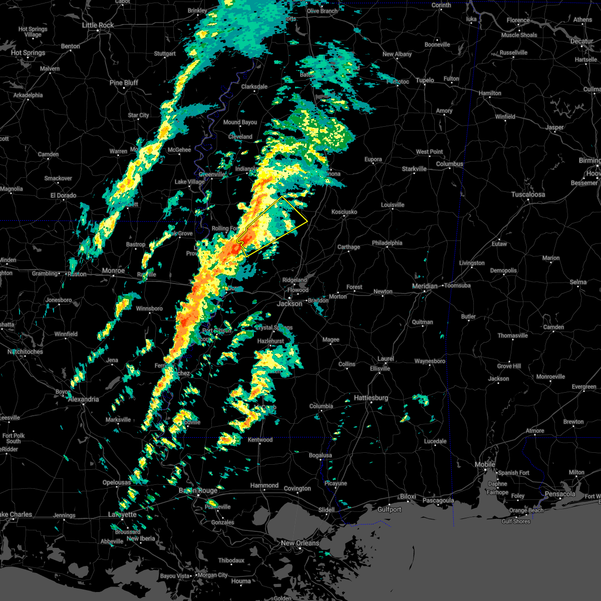 At 1210 pm cst, a severe thunderstorm was located near holly bluff, or 13 miles west of yazoo city, moving northeast at 55 mph (radar indicated). Hazards include 60 mph wind gusts. Expect damage to roofs, siding, and trees. this severe thunderstorm will be near, yazoo city around 1225 pm cst. thornton and tolarville around 1240 pm cst. howard around 1245 pm cst. tchula around 1250 pm cst. other locations impacted by this severe thunderstorm include eden and louise. hail threat, radar indicated max hail size, <. 75 in wind threat, radar indicated max wind gust, 60 mph. At 1210 pm cst, a severe thunderstorm was located near holly bluff, or 13 miles west of yazoo city, moving northeast at 55 mph (radar indicated). Hazards include 60 mph wind gusts. Expect damage to roofs, siding, and trees. this severe thunderstorm will be near, yazoo city around 1225 pm cst. thornton and tolarville around 1240 pm cst. howard around 1245 pm cst. tchula around 1250 pm cst. other locations impacted by this severe thunderstorm include eden and louise. hail threat, radar indicated max hail size, <. 75 in wind threat, radar indicated max wind gust, 60 mph.
|
| 9/1/2021 4:35 PM CDT |
 At 435 pm cdt, a severe thunderstorm was located near mcmillan, or 8 miles northwest of durant, moving south at 20 mph (radar indicated). Hazards include 60 mph wind gusts and nickel size hail. Expect damage to roofs, siding, and trees. this severe thunderstorm will be near, durant and franklin around 450 pm cdt. goodman around 510 pm cdt. pickens and cameron around 515 pm cdt. other locations impacted by this severe thunderstorm include west and sallis. hail threat, radar indicated max hail size, 0. 88 in wind threat, radar indicated max wind gust, 60 mph. At 435 pm cdt, a severe thunderstorm was located near mcmillan, or 8 miles northwest of durant, moving south at 20 mph (radar indicated). Hazards include 60 mph wind gusts and nickel size hail. Expect damage to roofs, siding, and trees. this severe thunderstorm will be near, durant and franklin around 450 pm cdt. goodman around 510 pm cdt. pickens and cameron around 515 pm cdt. other locations impacted by this severe thunderstorm include west and sallis. hail threat, radar indicated max hail size, 0. 88 in wind threat, radar indicated max wind gust, 60 mph.
|
| 6/13/2021 5:12 PM CDT |
 At 512 pm cdt, a severe thunderstorm was located near emory, or 10 miles southeast of black hawk, moving south at 25 mph (radar indicated). Hazards include 60 mph wind gusts and quarter size hail. Hail damage to vehicles is expected. expect wind damage to roofs, siding, and trees. this severe thunderstorm will be near, bowling green around 525 pm cdt. durant around 540 pm cdt. franklin around 545 pm cdt. goodman around 555 pm cdt. pickens around 600 pm cdt. Other locations impacted by this severe thunderstorm include west and cruger. At 512 pm cdt, a severe thunderstorm was located near emory, or 10 miles southeast of black hawk, moving south at 25 mph (radar indicated). Hazards include 60 mph wind gusts and quarter size hail. Hail damage to vehicles is expected. expect wind damage to roofs, siding, and trees. this severe thunderstorm will be near, bowling green around 525 pm cdt. durant around 540 pm cdt. franklin around 545 pm cdt. goodman around 555 pm cdt. pickens around 600 pm cdt. Other locations impacted by this severe thunderstorm include west and cruger.
|
| 5/4/2021 2:18 PM CDT | Couple trees down along hwy 4 in holmes county MS, 3.3 miles NNE of Tchula, MS |
| 5/4/2021 2:15 PM CDT |
 At 215 pm cdt, a severe thunderstorm was located over yazoo city, moving east at 55 mph. this is a very dangerous storm (radar indicated). Hazards include 80 mph wind gusts. Flying debris will be dangerous to those caught without shelter. mobile homes will be heavily damaged. expect considerable damage to roofs, windows, and vehicles. extensive tree damage and power outages are likely. this severe thunderstorm will remain over mainly rural areas of western holmes, northwestern yazoo, humphreys and eastern sharkey counties, including the following locations, eden, silver city, louise and cruger. a tornado watch remains in effect until 400 pm cdt for central and north central mississippi. A tornado watch also remains in effect until 600 pm cdt for central, north central and west central mississippi. At 215 pm cdt, a severe thunderstorm was located over yazoo city, moving east at 55 mph. this is a very dangerous storm (radar indicated). Hazards include 80 mph wind gusts. Flying debris will be dangerous to those caught without shelter. mobile homes will be heavily damaged. expect considerable damage to roofs, windows, and vehicles. extensive tree damage and power outages are likely. this severe thunderstorm will remain over mainly rural areas of western holmes, northwestern yazoo, humphreys and eastern sharkey counties, including the following locations, eden, silver city, louise and cruger. a tornado watch remains in effect until 400 pm cdt for central and north central mississippi. A tornado watch also remains in effect until 600 pm cdt for central, north central and west central mississippi.
|
| 5/4/2021 2:12 PM CDT |
 At 212 pm cdt, severe thunderstorms were located along a line extending from near seven pines to thornton, moving east at 65 mph (radar indicated). Hazards include 70 mph wind gusts and nickel size hail. Expect considerable tree damage. damage is likely to mobile homes, roofs, and outbuildings. severe thunderstorms will be near, black hawk around 220 pm cdt. franklin and vaiden around 230 pm cdt. bowling green around 235 pm cdt. durant, kilmichael and poplar creek around 240 pm cdt. possumneck around 245 pm cdt. hesterville around 250 pm cdt. other locations impacted by these severe thunderstorms include mccool, ethel, french camp, west and weir. A tornado watch remains in effect until 400 pm cdt for central and north central mississippi. At 212 pm cdt, severe thunderstorms were located along a line extending from near seven pines to thornton, moving east at 65 mph (radar indicated). Hazards include 70 mph wind gusts and nickel size hail. Expect considerable tree damage. damage is likely to mobile homes, roofs, and outbuildings. severe thunderstorms will be near, black hawk around 220 pm cdt. franklin and vaiden around 230 pm cdt. bowling green around 235 pm cdt. durant, kilmichael and poplar creek around 240 pm cdt. possumneck around 245 pm cdt. hesterville around 250 pm cdt. other locations impacted by these severe thunderstorms include mccool, ethel, french camp, west and weir. A tornado watch remains in effect until 400 pm cdt for central and north central mississippi.
|
| 5/4/2021 1:51 PM CDT |
 At 151 pm cdt, a severe thunderstorm was located 8 miles southwest of midnight, or 12 miles northeast of rolling fork, moving east at 45 mph. this is a very dangerous storm (radar indicated). Hazards include 80 mph wind gusts and quarter size hail. Flying debris will be dangerous to those caught without shelter. mobile homes will be heavily damaged. expect considerable damage to roofs, windows, and vehicles. extensive tree damage and power outages are likely. this severe storm will be near, midnight around 200 pm cdt. thornton around 220 pm cdt. tchula around 230 pm cdt. other locations impacted by this severe thunderstorm include eden, silver city, cary, louise and cruger. a tornado watch remains in effect until 400 pm cdt for central and north central mississippi. A tornado watch also remains in effect until 600 pm cdt for central, north central, northwestern and west central mississippi. At 151 pm cdt, a severe thunderstorm was located 8 miles southwest of midnight, or 12 miles northeast of rolling fork, moving east at 45 mph. this is a very dangerous storm (radar indicated). Hazards include 80 mph wind gusts and quarter size hail. Flying debris will be dangerous to those caught without shelter. mobile homes will be heavily damaged. expect considerable damage to roofs, windows, and vehicles. extensive tree damage and power outages are likely. this severe storm will be near, midnight around 200 pm cdt. thornton around 220 pm cdt. tchula around 230 pm cdt. other locations impacted by this severe thunderstorm include eden, silver city, cary, louise and cruger. a tornado watch remains in effect until 400 pm cdt for central and north central mississippi. A tornado watch also remains in effect until 600 pm cdt for central, north central, northwestern and west central mississippi.
|
| 5/4/2021 1:36 PM CDT |
 At 136 pm cdt, a severe thunderstorm was located over rolling fork, moving east at 45 mph. this is a very dangerous storm (radar indicated). Hazards include 80 mph wind gusts and quarter size hail. Flying debris will be dangerous to those caught without shelter. mobile homes will be heavily damaged. expect considerable damage to roofs, windows, and vehicles. extensive tree damage and power outages are likely. this severe storm will be near, anguilla and nitta yuma around 140 pm cdt. midnight around 205 pm cdt. thornton around 225 pm cdt. tchula around 235 pm cdt. other locations impacted by this severe thunderstorm include eden, silver city, cary, louise and cruger. a tornado watch remains in effect until 400 pm cdt for central and north central mississippi. A tornado watch also remains in effect until 600 pm cdt for central, north central, northwestern and west central mississippi. At 136 pm cdt, a severe thunderstorm was located over rolling fork, moving east at 45 mph. this is a very dangerous storm (radar indicated). Hazards include 80 mph wind gusts and quarter size hail. Flying debris will be dangerous to those caught without shelter. mobile homes will be heavily damaged. expect considerable damage to roofs, windows, and vehicles. extensive tree damage and power outages are likely. this severe storm will be near, anguilla and nitta yuma around 140 pm cdt. midnight around 205 pm cdt. thornton around 225 pm cdt. tchula around 235 pm cdt. other locations impacted by this severe thunderstorm include eden, silver city, cary, louise and cruger. a tornado watch remains in effect until 400 pm cdt for central and north central mississippi. A tornado watch also remains in effect until 600 pm cdt for central, north central, northwestern and west central mississippi.
|
| 5/4/2021 1:22 PM CDT |
 At 122 pm cdt, a severe thunderstorm was located 7 miles west of rolling fork, moving east at 45 mph (radar indicated). Hazards include 70 mph wind gusts and quarter size hail. Hail damage to vehicles is expected. expect considerable tree damage. wind damage is also likely to mobile homes, roofs, and outbuildings. this severe thunderstorm will be near, rolling fork around 130 pm cdt. anguilla and nitta yuma around 140 pm cdt. delta city around 145 pm cdt. midnight around 200 pm cdt. thornton around 220 pm cdt. tchula around 230 pm cdt. other locations impacted by this severe thunderstorm include eden, silver city, arcola, cary, louise and cruger. a tornado watch remains in effect until 400 pm cdt for central and north central mississippi. A tornado watch also remains in effect until 600 pm cdt for northeastern louisiana, and central, north central, northwestern and west central mississippi. At 122 pm cdt, a severe thunderstorm was located 7 miles west of rolling fork, moving east at 45 mph (radar indicated). Hazards include 70 mph wind gusts and quarter size hail. Hail damage to vehicles is expected. expect considerable tree damage. wind damage is also likely to mobile homes, roofs, and outbuildings. this severe thunderstorm will be near, rolling fork around 130 pm cdt. anguilla and nitta yuma around 140 pm cdt. delta city around 145 pm cdt. midnight around 200 pm cdt. thornton around 220 pm cdt. tchula around 230 pm cdt. other locations impacted by this severe thunderstorm include eden, silver city, arcola, cary, louise and cruger. a tornado watch remains in effect until 400 pm cdt for central and north central mississippi. A tornado watch also remains in effect until 600 pm cdt for northeastern louisiana, and central, north central, northwestern and west central mississippi.
|
| 5/2/2021 6:18 PM CDT |
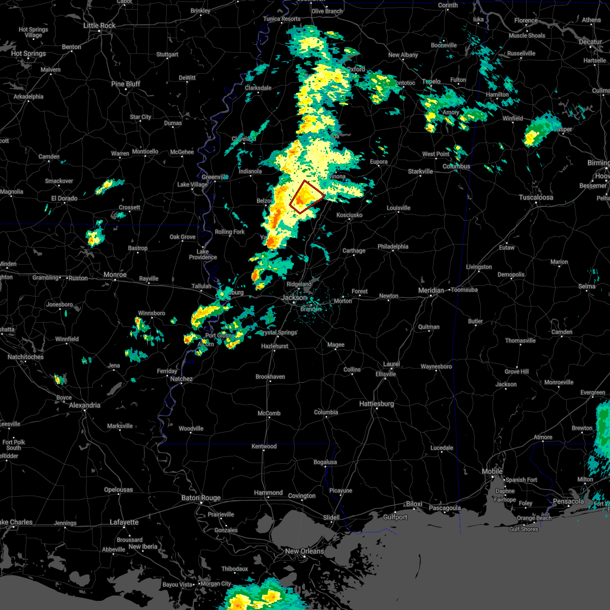 At 618 pm cdt, a confirmed tornado was located near tchula, or 11 miles southwest of black hawk, moving northeast at 30 mph (radar confirmed tornado). Hazards include damaging tornado. Flying debris will be dangerous to those caught without shelter. mobile homes will be damaged or destroyed. damage to roofs, windows, and vehicles will occur. tree damage is likely. This tornado will be near, black hawk, seven pines and emory around 640 pm cdt. At 618 pm cdt, a confirmed tornado was located near tchula, or 11 miles southwest of black hawk, moving northeast at 30 mph (radar confirmed tornado). Hazards include damaging tornado. Flying debris will be dangerous to those caught without shelter. mobile homes will be damaged or destroyed. damage to roofs, windows, and vehicles will occur. tree damage is likely. This tornado will be near, black hawk, seven pines and emory around 640 pm cdt.
|
| 5/2/2021 6:08 PM CDT |
 At 608 pm cdt, a confirmed tornado was located over howard, or 10 miles east of thornton, moving northeast at 30 mph (radar confirmed tornado). Hazards include damaging tornado. Flying debris will be dangerous to those caught without shelter. mobile homes will be damaged or destroyed. damage to roofs, windows, and vehicles will occur. tree damage is likely. This tornado will be near, black hawk and emory around 640 pm cdt. At 608 pm cdt, a confirmed tornado was located over howard, or 10 miles east of thornton, moving northeast at 30 mph (radar confirmed tornado). Hazards include damaging tornado. Flying debris will be dangerous to those caught without shelter. mobile homes will be damaged or destroyed. damage to roofs, windows, and vehicles will occur. tree damage is likely. This tornado will be near, black hawk and emory around 640 pm cdt.
|
| 5/2/2021 5:56 PM CDT |
 At 555 pm cdt, a confirmed tornado was located over tolarville, or near thornton, moving northeast at 30 mph (radar confirmed tornado). Hazards include damaging tornado. Flying debris will be dangerous to those caught without shelter. mobile homes will be damaged or destroyed. damage to roofs, windows, and vehicles will occur. tree damage is likely. this tornadic storm will be near, howard and brozville around 605 pm cdt. tchula around 610 pm cdt. lexington around 615 pm cdt. bowling green around 630 pm cdt. Black hawk and emory around 640 pm cdt. At 555 pm cdt, a confirmed tornado was located over tolarville, or near thornton, moving northeast at 30 mph (radar confirmed tornado). Hazards include damaging tornado. Flying debris will be dangerous to those caught without shelter. mobile homes will be damaged or destroyed. damage to roofs, windows, and vehicles will occur. tree damage is likely. this tornadic storm will be near, howard and brozville around 605 pm cdt. tchula around 610 pm cdt. lexington around 615 pm cdt. bowling green around 630 pm cdt. Black hawk and emory around 640 pm cdt.
|
| 4/7/2021 9:53 PM CDT |
 A severe thunderstorm warning remains in effect until 1015 pm cdt for central holmes. western carroll and southeastern leflore counties. At 952 pm cdt, severe thunderstorms were located along a line extending from near greenwood to sidon to near tchula to thornton, moving east at 50 mph. A severe thunderstorm warning remains in effect until 1015 pm cdt for central holmes. western carroll and southeastern leflore counties. At 952 pm cdt, severe thunderstorms were located along a line extending from near greenwood to sidon to near tchula to thornton, moving east at 50 mph.
|
| 4/7/2021 9:37 PM CDT |
 At 937 pm cdt, severe thunderstorms were located along a line extending from near itta bena to 6 miles south of quito to near tchula to 7 miles east of midnight, moving east at 50 mph (radar indicated). Hazards include 60 mph wind gusts. Expect damage to roofs, siding, and trees. these severe storms will be near, itta bena around 940 pm cdt. tchula, sidon and quito around 945 pm cdt. seven pines around 950 pm cdt. greenwood and black hawk around 955 pm cdt. howard around 1000 pm cdt. lexington around 1005 pm cdt. Other locations impacted by these severe thunderstorms include morgan city and cruger. At 937 pm cdt, severe thunderstorms were located along a line extending from near itta bena to 6 miles south of quito to near tchula to 7 miles east of midnight, moving east at 50 mph (radar indicated). Hazards include 60 mph wind gusts. Expect damage to roofs, siding, and trees. these severe storms will be near, itta bena around 940 pm cdt. tchula, sidon and quito around 945 pm cdt. seven pines around 950 pm cdt. greenwood and black hawk around 955 pm cdt. howard around 1000 pm cdt. lexington around 1005 pm cdt. Other locations impacted by these severe thunderstorms include morgan city and cruger.
|
| 4/7/2021 9:24 PM CDT |
 At 924 pm cdt, severe thunderstorms were located along a line extending from near moorhead to near swiftown to near belzoni to 6 miles southwest of midnight, moving east at 50 mph (radar indicated). Hazards include 60 mph wind gusts. Expect damage to roofs, siding, and trees. severe thunderstorms will be near, swiftown around 930 pm cdt. itta bena and quito around 940 pm cdt. thornton, tchula, sidon and howard around 945 pm cdt. seven pines around 950 pm cdt. greenwood and black hawk around 955 pm cdt. lexington around 1005 pm cdt. Other locations impacted by these severe thunderstorms include silver city, morgan city, cruger and louise. At 924 pm cdt, severe thunderstorms were located along a line extending from near moorhead to near swiftown to near belzoni to 6 miles southwest of midnight, moving east at 50 mph (radar indicated). Hazards include 60 mph wind gusts. Expect damage to roofs, siding, and trees. severe thunderstorms will be near, swiftown around 930 pm cdt. itta bena and quito around 940 pm cdt. thornton, tchula, sidon and howard around 945 pm cdt. seven pines around 950 pm cdt. greenwood and black hawk around 955 pm cdt. lexington around 1005 pm cdt. Other locations impacted by these severe thunderstorms include silver city, morgan city, cruger and louise.
|
| 11/27/2020 9:21 AM CST |
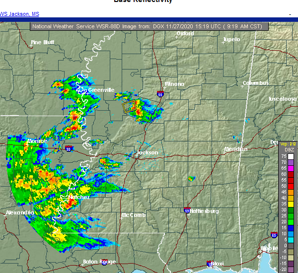 The severe thunderstorm warning for northwestern holmes and east central humphreys counties will expire at 930 am cst, the storm which prompted the warning has weakened below severe limits, and has exited the warned area. therefore, the warning will be allowed to expire. however gusty winds are still possible with this thunderstorm. The severe thunderstorm warning for northwestern holmes and east central humphreys counties will expire at 930 am cst, the storm which prompted the warning has weakened below severe limits, and has exited the warned area. therefore, the warning will be allowed to expire. however gusty winds are still possible with this thunderstorm.
|
| 11/27/2020 9:11 AM CST |
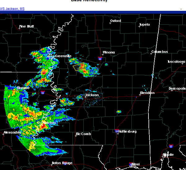 At 911 am cst, a severe thunderstorm was located near tchula, or 10 miles southwest of black hawk, moving northeast at 45 mph (radar indicated). Hazards include 60 mph wind gusts and penny size hail. Expect damage to roofs, siding, and trees. This severe thunderstorm will remain over mainly rural areas of northwestern holmes and east central humphreys counties. At 911 am cst, a severe thunderstorm was located near tchula, or 10 miles southwest of black hawk, moving northeast at 45 mph (radar indicated). Hazards include 60 mph wind gusts and penny size hail. Expect damage to roofs, siding, and trees. This severe thunderstorm will remain over mainly rural areas of northwestern holmes and east central humphreys counties.
|
| 11/27/2020 8:48 AM CST |
 At 848 am cst, a severe thunderstorm was located near belzoni, moving northeast at 40 mph (radar indicated). Hazards include 60 mph wind gusts and penny size hail. Expect damage to roofs, siding, and trees. This severe thunderstorm will be near, tchula around 905 am cst. At 848 am cst, a severe thunderstorm was located near belzoni, moving northeast at 40 mph (radar indicated). Hazards include 60 mph wind gusts and penny size hail. Expect damage to roofs, siding, and trees. This severe thunderstorm will be near, tchula around 905 am cst.
|
| 7/31/2020 3:52 PM CDT | Trees down along hwy 12 near tchul in holmes county MS, 0.9 miles WNW of Tchula, MS |
| 7/31/2020 3:42 PM CDT |
 At 341 pm cdt, a severe thunderstorm was located near tchula, or 8 miles north of thornton, moving east at 55 mph (radar indicated). Hazards include 60 mph wind gusts. Expect damage to roofs, siding, and trees. this severe thunderstorm will be near, tchula around 345 pm cdt. howard around 350 pm cdt. seven pines around 400 pm cdt. black hawk and emory around 405 pm cdt. coila around 410 pm cdt. vaiden around 420 pm cdt. kilmichael around 435 pm cdt. Other locations impacted by this severe thunderstorm include carrollton, sallis, west, morgan city and cruger. At 341 pm cdt, a severe thunderstorm was located near tchula, or 8 miles north of thornton, moving east at 55 mph (radar indicated). Hazards include 60 mph wind gusts. Expect damage to roofs, siding, and trees. this severe thunderstorm will be near, tchula around 345 pm cdt. howard around 350 pm cdt. seven pines around 400 pm cdt. black hawk and emory around 405 pm cdt. coila around 410 pm cdt. vaiden around 420 pm cdt. kilmichael around 435 pm cdt. Other locations impacted by this severe thunderstorm include carrollton, sallis, west, morgan city and cruger.
|
| 7/31/2020 3:37 PM CDT |
 At 337 pm cdt, a severe thunderstorm was located near belzoni, moving east at 55 mph (radar indicated). Hazards include 60 mph wind gusts. Expect damage to roofs, siding, and trees. this severe storm will be near, tchula around 345 pm cdt. Other locations impacted by this severe thunderstorm include silver city, morgan city and cruger. At 337 pm cdt, a severe thunderstorm was located near belzoni, moving east at 55 mph (radar indicated). Hazards include 60 mph wind gusts. Expect damage to roofs, siding, and trees. this severe storm will be near, tchula around 345 pm cdt. Other locations impacted by this severe thunderstorm include silver city, morgan city and cruger.
|
| 7/31/2020 3:29 PM CDT |
 At 328 pm cdt, a severe thunderstorm was located over belzoni, moving east at 50 mph (radar indicated). Hazards include 60 mph wind gusts. Expect damage to roofs, siding, and trees. this severe storm will be near, thornton around 340 pm cdt. tchula around 350 pm cdt. Other locations impacted by this severe thunderstorm include silver city, louise, morgan city and cruger. At 328 pm cdt, a severe thunderstorm was located over belzoni, moving east at 50 mph (radar indicated). Hazards include 60 mph wind gusts. Expect damage to roofs, siding, and trees. this severe storm will be near, thornton around 340 pm cdt. tchula around 350 pm cdt. Other locations impacted by this severe thunderstorm include silver city, louise, morgan city and cruger.
|
| 7/31/2020 3:15 PM CDT |
 At 315 pm cdt, a severe thunderstorm was located near murphy, or 9 miles east of hollandale, moving east at 50 mph (radar indicated). Hazards include 70 mph wind gusts. Expect considerable tree damage. damage is likely to mobile homes, roofs, and outbuildings. this severe storm will be near, isola around 325 pm cdt. belzoni around 330 pm cdt. swiftown around 335 pm cdt. tchula around 350 pm cdt. Other locations impacted by this severe thunderstorm include silver city, louise, morgan city and cruger. At 315 pm cdt, a severe thunderstorm was located near murphy, or 9 miles east of hollandale, moving east at 50 mph (radar indicated). Hazards include 70 mph wind gusts. Expect considerable tree damage. damage is likely to mobile homes, roofs, and outbuildings. this severe storm will be near, isola around 325 pm cdt. belzoni around 330 pm cdt. swiftown around 335 pm cdt. tchula around 350 pm cdt. Other locations impacted by this severe thunderstorm include silver city, louise, morgan city and cruger.
|
| 7/31/2020 3:00 PM CDT |
 At 300 pm cdt, a severe thunderstorm was located over hollandale, moving east at 45 mph (radar indicated). Hazards include 70 mph wind gusts. Expect considerable tree damage. damage is likely to mobile homes, roofs, and outbuildings. this severe storm will be near, darlove around 310 pm cdt. inverness and isola around 325 pm cdt. belzoni around 330 pm cdt. swiftown around 340 pm cdt. quito around 350 pm cdt. Other locations impacted by this severe thunderstorm include silver city, arcola, louise, morgan city and cruger. At 300 pm cdt, a severe thunderstorm was located over hollandale, moving east at 45 mph (radar indicated). Hazards include 70 mph wind gusts. Expect considerable tree damage. damage is likely to mobile homes, roofs, and outbuildings. this severe storm will be near, darlove around 310 pm cdt. inverness and isola around 325 pm cdt. belzoni around 330 pm cdt. swiftown around 340 pm cdt. quito around 350 pm cdt. Other locations impacted by this severe thunderstorm include silver city, arcola, louise, morgan city and cruger.
|
| 7/31/2020 2:47 PM CDT |
 At 246 pm cdt, a severe thunderstorm was located near avon, moving east at 55 mph (radar indicated). Hazards include 70 mph wind gusts. Expect considerable tree damage. damage is likely to mobile homes, roofs, and outbuildings. this severe thunderstorm will be near, hollandale and estill around 300 pm cdt. darlove around 305 pm cdt. inverness and isola around 320 pm cdt. belzoni around 325 pm cdt. swiftown around 330 pm cdt. Other locations impacted by this severe thunderstorm include silver city, arcola, louise, morgan city and cruger. At 246 pm cdt, a severe thunderstorm was located near avon, moving east at 55 mph (radar indicated). Hazards include 70 mph wind gusts. Expect considerable tree damage. damage is likely to mobile homes, roofs, and outbuildings. this severe thunderstorm will be near, hollandale and estill around 300 pm cdt. darlove around 305 pm cdt. inverness and isola around 320 pm cdt. belzoni around 325 pm cdt. swiftown around 330 pm cdt. Other locations impacted by this severe thunderstorm include silver city, arcola, louise, morgan city and cruger.
|
| 7/2/2020 2:53 PM CDT |
 At 253 pm cdt, a severe thunderstorm was located 7 miles north of lexington, or 7 miles southwest of black hawk, moving east at 10 mph (radar indicated). Hazards include 60 mph wind gusts and nickel size hail. Expect damage to roofs, siding, and trees. Locations impacted include, tchula, lexington, emory, brozville and howard. At 253 pm cdt, a severe thunderstorm was located 7 miles north of lexington, or 7 miles southwest of black hawk, moving east at 10 mph (radar indicated). Hazards include 60 mph wind gusts and nickel size hail. Expect damage to roofs, siding, and trees. Locations impacted include, tchula, lexington, emory, brozville and howard.
|
| 7/2/2020 2:19 PM CDT |
 At 219 pm cdt, a severe thunderstorm was located near tchula, or 10 miles southwest of black hawk, and is nearly stationary (radar indicated). Hazards include 60 mph wind gusts and nickel size hail. expect damage to roofs, siding, and trees At 219 pm cdt, a severe thunderstorm was located near tchula, or 10 miles southwest of black hawk, and is nearly stationary (radar indicated). Hazards include 60 mph wind gusts and nickel size hail. expect damage to roofs, siding, and trees
|
| 6/5/2020 4:54 PM CDT |
 At 454 pm cdt, severe thunderstorms were located along a line extending from near tchula to near kosciusko, moving south at 35 mph (radar indicated). Hazards include 60 mph wind gusts. Expect damage to roofs, siding, and trees. these severe storms will be near, kosciusko, thornton, tolarville and mcadams around 505 pm cdt. coxburg, smyrna and brozville around 510 pm cdt. Other locations impacted by these severe thunderstorms include silver city, mccool, ethel, sallis and west. At 454 pm cdt, severe thunderstorms were located along a line extending from near tchula to near kosciusko, moving south at 35 mph (radar indicated). Hazards include 60 mph wind gusts. Expect damage to roofs, siding, and trees. these severe storms will be near, kosciusko, thornton, tolarville and mcadams around 505 pm cdt. coxburg, smyrna and brozville around 510 pm cdt. Other locations impacted by these severe thunderstorms include silver city, mccool, ethel, sallis and west.
|
| 6/5/2020 4:43 PM CDT |
 At 442 pm cdt, severe thunderstorms were located along a line extending from 6 miles east of swiftown to near hesterville, moving south at 35 mph (radar indicated). Hazards include 60 mph wind gusts. Expect damage to roofs, siding, and trees. these severe storms will be near, hesterville around 450 pm cdt. tchula and possumneck around 455 pm cdt. howard around 500 pm cdt. kosciusko and thornton around 505 pm cdt. mcadams and tolarville around 510 pm cdt. coxburg around 515 pm cdt. newport around 520 pm cdt. Other locations impacted by these severe thunderstorms include silver city, ethel, sallis, west, mccool, morgan city and cruger. At 442 pm cdt, severe thunderstorms were located along a line extending from 6 miles east of swiftown to near hesterville, moving south at 35 mph (radar indicated). Hazards include 60 mph wind gusts. Expect damage to roofs, siding, and trees. these severe storms will be near, hesterville around 450 pm cdt. tchula and possumneck around 455 pm cdt. howard around 500 pm cdt. kosciusko and thornton around 505 pm cdt. mcadams and tolarville around 510 pm cdt. coxburg around 515 pm cdt. newport around 520 pm cdt. Other locations impacted by these severe thunderstorms include silver city, ethel, sallis, west, mccool, morgan city and cruger.
|
| 6/5/2020 4:21 PM CDT |
 At 421 pm cdt, severe thunderstorms were located along a line extending from quito to 6 miles west of kilmichael, moving south at 35 mph (radar indicated). Hazards include 60 mph wind gusts. Expect damage to roofs, siding, and trees. severe thunderstorms will be near, itta bena, sidon and quito around 425 pm cdt. swiftown around 445 pm cdt. hesterville around 450 pm cdt. possumneck around 455 pm cdt. belzoni around 500 pm cdt. durant around 505 pm cdt. thornton and mcadams around 510 pm cdt. goodman and newport around 520 pm cdt. Other locations impacted by these severe thunderstorms include silver city, ethel, carrollton, sallis, west, mccool, morgan city and cruger. At 421 pm cdt, severe thunderstorms were located along a line extending from quito to 6 miles west of kilmichael, moving south at 35 mph (radar indicated). Hazards include 60 mph wind gusts. Expect damage to roofs, siding, and trees. severe thunderstorms will be near, itta bena, sidon and quito around 425 pm cdt. swiftown around 445 pm cdt. hesterville around 450 pm cdt. possumneck around 455 pm cdt. belzoni around 500 pm cdt. durant around 505 pm cdt. thornton and mcadams around 510 pm cdt. goodman and newport around 520 pm cdt. Other locations impacted by these severe thunderstorms include silver city, ethel, carrollton, sallis, west, mccool, morgan city and cruger.
|
| 6/3/2020 7:14 PM CDT |
 At 713 pm cdt, a severe thunderstorm was located over thornton, moving southeast at 20 mph (radar indicated). Hazards include 60 mph wind gusts and quarter size hail. Hail damage to vehicles is expected. expect wind damage to roofs, siding, and trees. this severe thunderstorm will be near, howard around 730 pm cdt. tolarville around 735 pm cdt. coxburg around 740 pm cdt. brozville around 750 pm cdt. ebenezer around 800 pm cdt. Other locations impacted by this severe thunderstorm include eden and silver city. At 713 pm cdt, a severe thunderstorm was located over thornton, moving southeast at 20 mph (radar indicated). Hazards include 60 mph wind gusts and quarter size hail. Hail damage to vehicles is expected. expect wind damage to roofs, siding, and trees. this severe thunderstorm will be near, howard around 730 pm cdt. tolarville around 735 pm cdt. coxburg around 740 pm cdt. brozville around 750 pm cdt. ebenezer around 800 pm cdt. Other locations impacted by this severe thunderstorm include eden and silver city.
|
| 6/3/2020 7:09 PM CDT |
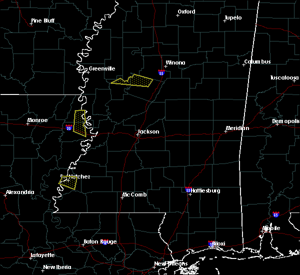 At 708 pm cdt, a severe thunderstorm was located over tchula, or 11 miles northeast of thornton, moving southeast at 10 mph (radar indicated). Hazards include 60 mph wind gusts and quarter size hail. Hail damage to vehicles is expected. expect wind damage to roofs, siding, and trees. This severe storm will be near, tchula around 715 pm cdt. At 708 pm cdt, a severe thunderstorm was located over tchula, or 11 miles northeast of thornton, moving southeast at 10 mph (radar indicated). Hazards include 60 mph wind gusts and quarter size hail. Hail damage to vehicles is expected. expect wind damage to roofs, siding, and trees. This severe storm will be near, tchula around 715 pm cdt.
|
| 6/3/2020 6:50 PM CDT |
 At 650 pm cdt, a severe thunderstorm was located 7 miles south of sidon, or 12 miles west of black hawk, moving east at 10 mph (radar indicated). Hazards include 60 mph wind gusts and quarter size hail. Hail damage to vehicles is expected. expect wind damage to roofs, siding, and trees. Locations impacted include, belzoni, tchula and cruger. At 650 pm cdt, a severe thunderstorm was located 7 miles south of sidon, or 12 miles west of black hawk, moving east at 10 mph (radar indicated). Hazards include 60 mph wind gusts and quarter size hail. Hail damage to vehicles is expected. expect wind damage to roofs, siding, and trees. Locations impacted include, belzoni, tchula and cruger.
|
| 6/3/2020 6:34 PM CDT |
 At 634 pm cdt, a severe thunderstorm was located near sidon, or 11 miles west of black hawk, moving southeast at 5 mph (radar indicated). Hazards include golf ball size hail and 60 mph wind gusts. People and animals outdoors will be injured. expect hail damage to roofs, siding, windows, and vehicles. expect wind damage to roofs, siding, and trees. Locations impacted include, belzoni, black hawk, tchula, isola, seven pines, swiftown, cruger and morgan city. At 634 pm cdt, a severe thunderstorm was located near sidon, or 11 miles west of black hawk, moving southeast at 5 mph (radar indicated). Hazards include golf ball size hail and 60 mph wind gusts. People and animals outdoors will be injured. expect hail damage to roofs, siding, windows, and vehicles. expect wind damage to roofs, siding, and trees. Locations impacted include, belzoni, black hawk, tchula, isola, seven pines, swiftown, cruger and morgan city.
|
| 6/3/2020 6:23 PM CDT |
 At 623 pm cdt, a severe thunderstorm was located near seven pines, or 9 miles west of black hawk, moving southeast at 5 mph (radar indicated). Hazards include ping pong ball size hail and 60 mph wind gusts. People and animals outdoors will be injured. expect hail damage to roofs, siding, windows, and vehicles. Expect wind damage to roofs, siding, and trees. At 623 pm cdt, a severe thunderstorm was located near seven pines, or 9 miles west of black hawk, moving southeast at 5 mph (radar indicated). Hazards include ping pong ball size hail and 60 mph wind gusts. People and animals outdoors will be injured. expect hail damage to roofs, siding, windows, and vehicles. Expect wind damage to roofs, siding, and trees.
|
| 5/27/2020 3:51 PM CDT |
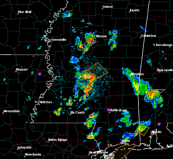 The severe thunderstorm warning for northeastern holmes county will expire at 400 pm cdt, the storm which prompted the warning has weakened below severe limits, and no longer poses an immediate threat to life or property. therefore, the warning will be allowed to expire. The severe thunderstorm warning for northeastern holmes county will expire at 400 pm cdt, the storm which prompted the warning has weakened below severe limits, and no longer poses an immediate threat to life or property. therefore, the warning will be allowed to expire.
|
| 5/27/2020 3:43 PM CDT |
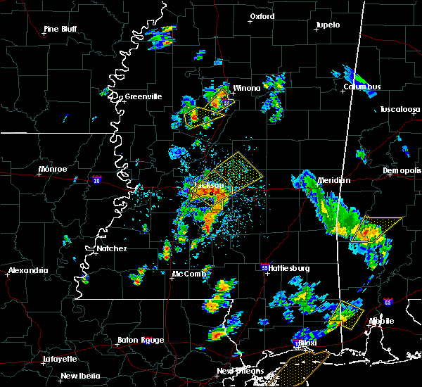 At 343 pm cdt, a severe thunderstorm was located near tchula, or 10 miles southwest of black hawk, moving northeast at 25 mph (radar indicated). Hazards include 60 mph wind gusts and quarter size hail. Hail damage to vehicles is expected. expect wind damage to roofs, siding, and trees. This severe storm will be near, emory around 415 pm cdt. At 343 pm cdt, a severe thunderstorm was located near tchula, or 10 miles southwest of black hawk, moving northeast at 25 mph (radar indicated). Hazards include 60 mph wind gusts and quarter size hail. Hail damage to vehicles is expected. expect wind damage to roofs, siding, and trees. This severe storm will be near, emory around 415 pm cdt.
|
| 5/27/2020 3:29 PM CDT |
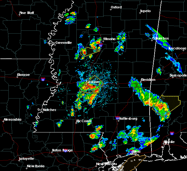 At 329 pm cdt, a severe thunderstorm was located over tchula, or 10 miles northeast of thornton, moving northeast at 30 mph (radar indicated). Hazards include ping pong ball size hail and 60 mph wind gusts. People and animals outdoors will be injured. expect hail damage to roofs, siding, windows, and vehicles. expect wind damage to roofs, siding, and trees. This severe storm will be near, emory around 400 pm cdt. At 329 pm cdt, a severe thunderstorm was located over tchula, or 10 miles northeast of thornton, moving northeast at 30 mph (radar indicated). Hazards include ping pong ball size hail and 60 mph wind gusts. People and animals outdoors will be injured. expect hail damage to roofs, siding, windows, and vehicles. expect wind damage to roofs, siding, and trees. This severe storm will be near, emory around 400 pm cdt.
|
| 5/27/2020 3:27 PM CDT | Half Dollar sized hail reported 0.4 miles NW of Tchula, MS |
| 5/27/2020 3:27 PM CDT | Ping Pong Ball sized hail reported 0.4 miles NW of Tchula, MS, corrects previous hail report from tchula. hail up to the size of ping pong balls fell at the 911 center. |
| 5/27/2020 3:22 PM CDT |
 At 322 pm cdt, a severe thunderstorm was located over tchula, or 7 miles northeast of thornton, moving northeast at 30 mph (radar indicated). Hazards include 60 mph wind gusts and quarter size hail. Hail damage to vehicles is expected. expect wind damage to roofs, siding, and trees. This severe storm will be near, emory around 400 pm cdt. At 322 pm cdt, a severe thunderstorm was located over tchula, or 7 miles northeast of thornton, moving northeast at 30 mph (radar indicated). Hazards include 60 mph wind gusts and quarter size hail. Hail damage to vehicles is expected. expect wind damage to roofs, siding, and trees. This severe storm will be near, emory around 400 pm cdt.
|
| 5/27/2020 3:17 PM CDT |
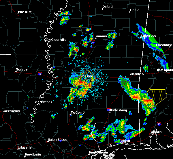 At 316 pm cdt, a severe thunderstorm was located over tchula, or 7 miles northeast of thornton, moving northeast at 30 mph (radar indicated). Hazards include 60 mph wind gusts and quarter size hail. Hail damage to vehicles is expected. expect wind damage to roofs, siding, and trees. This severe thunderstorm will be near, emory around 355 pm cdt. At 316 pm cdt, a severe thunderstorm was located over tchula, or 7 miles northeast of thornton, moving northeast at 30 mph (radar indicated). Hazards include 60 mph wind gusts and quarter size hail. Hail damage to vehicles is expected. expect wind damage to roofs, siding, and trees. This severe thunderstorm will be near, emory around 355 pm cdt.
|
| 4/12/2020 10:15 PM CDT |
 At 1015 pm cdt, severe thunderstorms were located along a line extending from 6 miles south of black hawk to ebenezer to near flora, moving east at 55 mph (radar indicated). Hazards include 60 mph wind gusts. Expect damage to roofs, siding, and trees. these severe storms will be near, franklin, ebenezer and brozville around 1020 pm cdt. pickens, emory and bowling green around 1025 pm cdt. durant and goodman around 1030 pm cdt. Other locations impacted by these severe thunderstorms include eden, satartia, west and bentonia. At 1015 pm cdt, severe thunderstorms were located along a line extending from 6 miles south of black hawk to ebenezer to near flora, moving east at 55 mph (radar indicated). Hazards include 60 mph wind gusts. Expect damage to roofs, siding, and trees. these severe storms will be near, franklin, ebenezer and brozville around 1020 pm cdt. pickens, emory and bowling green around 1025 pm cdt. durant and goodman around 1030 pm cdt. Other locations impacted by these severe thunderstorms include eden, satartia, west and bentonia.
|
| 4/12/2020 9:44 PM CDT |
 At 944 pm cdt, severe thunderstorms were located along a line extending from near isola to near midnight to near valley park, moving east at 55 mph (radar indicated). Hazards include 60 mph wind gusts. Expect damage to roofs, siding, and trees. severe thunderstorms will be near, belzoni and midnight around 950 pm cdt. yazoo city around 955 pm cdt. thornton around 1000 pm cdt. tchula, phoenix and tolarville around 1005 pm cdt. coxburg around 1010 pm cdt. ebenezer and brozville around 1015 pm cdt. franklin and emory around 1020 pm cdt. goodman, pickens and bowling green around 1025 pm cdt. Other locations impacted by these severe thunderstorms include silver city, west, eden, satartia, louise, bentonia and cruger. At 944 pm cdt, severe thunderstorms were located along a line extending from near isola to near midnight to near valley park, moving east at 55 mph (radar indicated). Hazards include 60 mph wind gusts. Expect damage to roofs, siding, and trees. severe thunderstorms will be near, belzoni and midnight around 950 pm cdt. yazoo city around 955 pm cdt. thornton around 1000 pm cdt. tchula, phoenix and tolarville around 1005 pm cdt. coxburg around 1010 pm cdt. ebenezer and brozville around 1015 pm cdt. franklin and emory around 1020 pm cdt. goodman, pickens and bowling green around 1025 pm cdt. Other locations impacted by these severe thunderstorms include silver city, west, eden, satartia, louise, bentonia and cruger.
|
| 4/12/2020 5:58 PM CDT |
 At 557 pm cdt, a severe thunderstorm was located near thornton, moving northeast at 65 mph (radar indicated). Hazards include 60 mph wind gusts. Expect damage to roofs, siding, and trees. this severe thunderstorm will be near, tchula around 605 pm cdt. black hawk and seven pines around 620 pm cdt. coila around 625 pm cdt. north carrollton around 630 pm cdt. other locations impacted by this severe thunderstorm include morgan city, cruger and carrollton. A tornado watch remains in effect until 800 pm cdt for central and north central mississippi. At 557 pm cdt, a severe thunderstorm was located near thornton, moving northeast at 65 mph (radar indicated). Hazards include 60 mph wind gusts. Expect damage to roofs, siding, and trees. this severe thunderstorm will be near, tchula around 605 pm cdt. black hawk and seven pines around 620 pm cdt. coila around 625 pm cdt. north carrollton around 630 pm cdt. other locations impacted by this severe thunderstorm include morgan city, cruger and carrollton. A tornado watch remains in effect until 800 pm cdt for central and north central mississippi.
|
| 4/12/2020 3:27 PM CDT |
 At 327 pm cdt, a severe thunderstorm was located near yazoo city, moving northeast at 75 mph (radar indicated). Hazards include 60 mph wind gusts and quarter size hail. Hail damage to vehicles is expected. expect wind damage to roofs, siding, and trees. this severe thunderstorm will be near, thornton and coxburg around 340 pm cdt. tolarville, brozville and howard around 345 pm cdt. franklin and lexington around 350 pm cdt. bowling green around 355 pm cdt. emory around 400 pm cdt. other locations impacted by this severe thunderstorm include eden and west. A tornado watch remains in effect until 800 pm cdt for central, north central and west central mississippi. At 327 pm cdt, a severe thunderstorm was located near yazoo city, moving northeast at 75 mph (radar indicated). Hazards include 60 mph wind gusts and quarter size hail. Hail damage to vehicles is expected. expect wind damage to roofs, siding, and trees. this severe thunderstorm will be near, thornton and coxburg around 340 pm cdt. tolarville, brozville and howard around 345 pm cdt. franklin and lexington around 350 pm cdt. bowling green around 355 pm cdt. emory around 400 pm cdt. other locations impacted by this severe thunderstorm include eden and west. A tornado watch remains in effect until 800 pm cdt for central, north central and west central mississippi.
|
| 4/8/2020 3:08 PM CDT |
 At 308 pm cdt, a severe thunderstorm was located near murphy, or 9 miles west of belzoni, moving east at 45 mph (radar indicated). Hazards include 60 mph wind gusts and quarter size hail. Hail damage to vehicles is expected. expect wind damage to roofs, siding, and trees. this severe thunderstorm will be near, belzoni around 320 pm cdt. thornton around 335 pm cdt. tchula around 340 pm cdt. howard and tolarville around 345 pm cdt. brozville around 350 pm cdt. lexington around 355 pm cdt. franklin around 400 pm cdt. bowling green around 405 pm cdt. Other locations impacted by this severe thunderstorm include silver city. At 308 pm cdt, a severe thunderstorm was located near murphy, or 9 miles west of belzoni, moving east at 45 mph (radar indicated). Hazards include 60 mph wind gusts and quarter size hail. Hail damage to vehicles is expected. expect wind damage to roofs, siding, and trees. this severe thunderstorm will be near, belzoni around 320 pm cdt. thornton around 335 pm cdt. tchula around 340 pm cdt. howard and tolarville around 345 pm cdt. brozville around 350 pm cdt. lexington around 355 pm cdt. franklin around 400 pm cdt. bowling green around 405 pm cdt. Other locations impacted by this severe thunderstorm include silver city.
|
| 1/11/2020 6:03 AM CST |
 At 603 am cst, severe thunderstorms were located along a line extending from near tchula to near valley park, moving east at 25 mph (radar indicated). Hazards include 60 mph wind gusts and quarter size hail. Hail damage to vehicles is expected. expect wind damage to roofs, siding, and trees. these severe storms will be near, tchula around 615 am cst. howard around 620 am cst. other locations impacted by these severe thunderstorms include eden, satartia, silver city and louise. A tornado watch remains in effect until 900 am cst for central, north central and west central mississippi. At 603 am cst, severe thunderstorms were located along a line extending from near tchula to near valley park, moving east at 25 mph (radar indicated). Hazards include 60 mph wind gusts and quarter size hail. Hail damage to vehicles is expected. expect wind damage to roofs, siding, and trees. these severe storms will be near, tchula around 615 am cst. howard around 620 am cst. other locations impacted by these severe thunderstorms include eden, satartia, silver city and louise. A tornado watch remains in effect until 900 am cst for central, north central and west central mississippi.
|
| 1/11/2020 5:28 AM CST |
 At 528 am cst, severe thunderstorms were located along a line extending from near belzoni to alsatia, moving east at 25 mph (radar indicated). Hazards include 60 mph wind gusts and quarter size hail. Hail damage to vehicles is expected. expect wind damage to roofs, siding, and trees. severe thunderstorms will be near, belzoni around 535 am cst. valley park around 610 am cst. tchula and howard around 615 am cst. other locations impacted by these severe thunderstorms include eden, satartia, silver city, cary and louise. a tornado watch remains in effect until 700 am cst for north central and northwestern mississippi. A tornado watch also remains in effect until 900 am cst for northeastern louisiana, and central, north central and west central mississippi. At 528 am cst, severe thunderstorms were located along a line extending from near belzoni to alsatia, moving east at 25 mph (radar indicated). Hazards include 60 mph wind gusts and quarter size hail. Hail damage to vehicles is expected. expect wind damage to roofs, siding, and trees. severe thunderstorms will be near, belzoni around 535 am cst. valley park around 610 am cst. tchula and howard around 615 am cst. other locations impacted by these severe thunderstorms include eden, satartia, silver city, cary and louise. a tornado watch remains in effect until 700 am cst for north central and northwestern mississippi. A tornado watch also remains in effect until 900 am cst for northeastern louisiana, and central, north central and west central mississippi.
|
| 12/16/2019 3:39 PM CST |
 At 339 pm cst, a severe thunderstorm was located over belzoni, moving northeast at 55 mph (radar indicated). Hazards include 60 mph wind gusts. Expect damage to roofs, siding, and trees. this severe storm will be near, swiftown around 350 pm cst. sidon around 405 pm cst. other locations impacted by this severe thunderstorm include silver city, west, morgan city and cruger. A tornado watch remains in effect until 600 pm cst for central, north central, northwestern and west central mississippi. At 339 pm cst, a severe thunderstorm was located over belzoni, moving northeast at 55 mph (radar indicated). Hazards include 60 mph wind gusts. Expect damage to roofs, siding, and trees. this severe storm will be near, swiftown around 350 pm cst. sidon around 405 pm cst. other locations impacted by this severe thunderstorm include silver city, west, morgan city and cruger. A tornado watch remains in effect until 600 pm cst for central, north central, northwestern and west central mississippi.
|
| 12/16/2019 3:25 PM CST |
 At 325 pm cst, a severe thunderstorm was located over murphy, or 8 miles southeast of hollandale, moving northeast at 55 mph (radar indicated). Hazards include 60 mph wind gusts. Expect damage to roofs, siding, and trees. this severe thunderstorm will be near, midnight around 335 pm cst. isola around 340 pm cst. belzoni around 345 pm cst. swiftown around 350 pm cst. tchula around 355 pm cst. sidon around 405 pm cst. other locations impacted by this severe thunderstorm include silver city, louise, west, morgan city and cruger. A tornado watch remains in effect until 600 pm cst for central, north central, northwestern and west central mississippi. At 325 pm cst, a severe thunderstorm was located over murphy, or 8 miles southeast of hollandale, moving northeast at 55 mph (radar indicated). Hazards include 60 mph wind gusts. Expect damage to roofs, siding, and trees. this severe thunderstorm will be near, midnight around 335 pm cst. isola around 340 pm cst. belzoni around 345 pm cst. swiftown around 350 pm cst. tchula around 355 pm cst. sidon around 405 pm cst. other locations impacted by this severe thunderstorm include silver city, louise, west, morgan city and cruger. A tornado watch remains in effect until 600 pm cst for central, north central, northwestern and west central mississippi.
|
| 11/26/2019 7:48 PM CST |
 At 748 pm cst, a severe thunderstorm capable of producing a tornado was located over midnight, or 12 miles southwest of belzoni, moving northeast at 40 mph (radar indicated rotation). Hazards include tornado. Flying debris will be dangerous to those caught without shelter. mobile homes will be damaged or destroyed. damage to roofs, windows, and vehicles will occur. tree damage is likely. this dangerous storm will be near, belzoni around 805 pm cst. thornton and tchula around 815 pm cst. Other locations impacted by this tornadic thunderstorm include silver city and louise. At 748 pm cst, a severe thunderstorm capable of producing a tornado was located over midnight, or 12 miles southwest of belzoni, moving northeast at 40 mph (radar indicated rotation). Hazards include tornado. Flying debris will be dangerous to those caught without shelter. mobile homes will be damaged or destroyed. damage to roofs, windows, and vehicles will occur. tree damage is likely. this dangerous storm will be near, belzoni around 805 pm cst. thornton and tchula around 815 pm cst. Other locations impacted by this tornadic thunderstorm include silver city and louise.
|
| 11/26/2019 7:41 PM CST |
 At 741 pm cst, a severe thunderstorm capable of producing a tornado was located near straight bayou, or 13 miles northeast of rolling fork, moving northeast at 40 mph (radar indicated rotation). Hazards include tornado. Flying debris will be dangerous to those caught without shelter. mobile homes will be damaged or destroyed. damage to roofs, windows, and vehicles will occur. tree damage is likely. this dangerous storm will be near, midnight around 750 pm cst. belzoni around 805 pm cst. thornton around 810 pm cst. tchula around 815 pm cst. Other locations impacted by this tornadic thunderstorm include silver city and louise. At 741 pm cst, a severe thunderstorm capable of producing a tornado was located near straight bayou, or 13 miles northeast of rolling fork, moving northeast at 40 mph (radar indicated rotation). Hazards include tornado. Flying debris will be dangerous to those caught without shelter. mobile homes will be damaged or destroyed. damage to roofs, windows, and vehicles will occur. tree damage is likely. this dangerous storm will be near, midnight around 750 pm cst. belzoni around 805 pm cst. thornton around 810 pm cst. tchula around 815 pm cst. Other locations impacted by this tornadic thunderstorm include silver city and louise.
|
| 11/26/2019 7:33 PM CST |
 At 732 pm cst, a severe thunderstorm capable of producing a tornado was located near anguilla, or 8 miles northeast of rolling fork, moving northeast at 55 mph (radar indicated rotation). Hazards include tornado. Flying debris will be dangerous to those caught without shelter. mobile homes will be damaged or destroyed. damage to roofs, windows, and vehicles will occur. tree damage is likely. this dangerous storm will be near, midnight around 745 pm cst. belzoni around 755 pm cst. thornton around 800 pm cst. tchula around 810 pm cst. Other locations impacted by this tornadic thunderstorm include silver city and louise. At 732 pm cst, a severe thunderstorm capable of producing a tornado was located near anguilla, or 8 miles northeast of rolling fork, moving northeast at 55 mph (radar indicated rotation). Hazards include tornado. Flying debris will be dangerous to those caught without shelter. mobile homes will be damaged or destroyed. damage to roofs, windows, and vehicles will occur. tree damage is likely. this dangerous storm will be near, midnight around 745 pm cst. belzoni around 755 pm cst. thornton around 800 pm cst. tchula around 810 pm cst. Other locations impacted by this tornadic thunderstorm include silver city and louise.
|
| 10/21/2019 8:54 AM CDT |
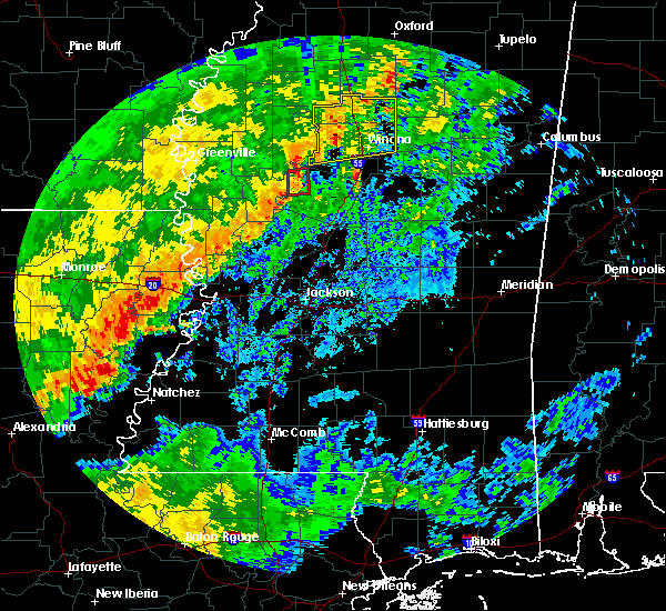 The tornado warning for northwestern holmes county will expire at 900 am cdt, the storm which prompted the warning has weakened below severe limits, and no longer appears capable of producing a tornado. therefore, the warning will be allowed to expire. a severe thunderstorm watch remains in effect until 100 pm cdt for central and north central mississippi. The tornado warning for northwestern holmes county will expire at 900 am cdt, the storm which prompted the warning has weakened below severe limits, and no longer appears capable of producing a tornado. therefore, the warning will be allowed to expire. a severe thunderstorm watch remains in effect until 100 pm cdt for central and north central mississippi.
|
| 10/21/2019 8:46 AM CDT |
 At 846 am cdt, a severe thunderstorm capable of producing a tornado was located over tchula, or 10 miles northeast of thornton, moving east at 45 mph (radar indicated rotation). Hazards include tornado. Flying debris will be dangerous to those caught without shelter. mobile homes will be damaged or destroyed. damage to roofs, windows, and vehicles will occur. tree damage is likely. This tornadic thunderstorm will remain over mainly rural areas of northwestern holmes county, including the following locations, cruger. At 846 am cdt, a severe thunderstorm capable of producing a tornado was located over tchula, or 10 miles northeast of thornton, moving east at 45 mph (radar indicated rotation). Hazards include tornado. Flying debris will be dangerous to those caught without shelter. mobile homes will be damaged or destroyed. damage to roofs, windows, and vehicles will occur. tree damage is likely. This tornadic thunderstorm will remain over mainly rural areas of northwestern holmes county, including the following locations, cruger.
|
| 10/21/2019 8:39 AM CDT |
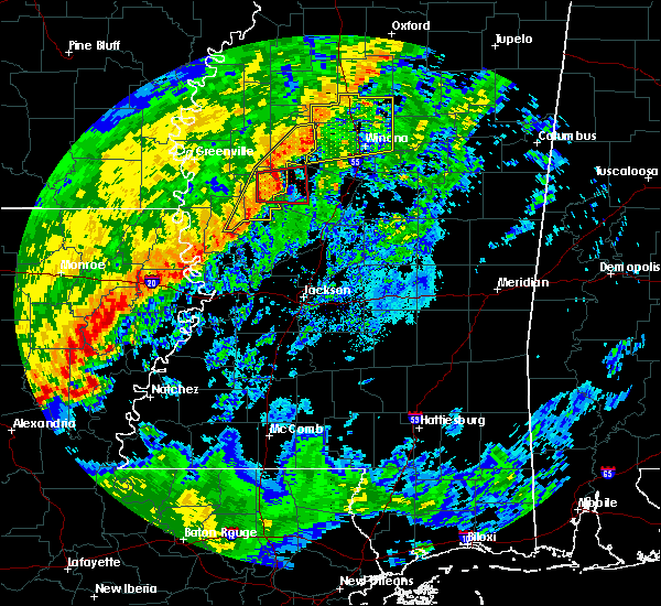 At 839 am cdt, a severe thunderstorm capable of producing a tornado was located near tchula, or 8 miles north of thornton, moving east at 45 mph (radar indicated rotation). Hazards include tornado. Flying debris will be dangerous to those caught without shelter. mobile homes will be damaged or destroyed. damage to roofs, windows, and vehicles will occur. tree damage is likely. this dangerous storm will be near, tchula around 845 am cdt. Other locations impacted by this tornadic thunderstorm include cruger. At 839 am cdt, a severe thunderstorm capable of producing a tornado was located near tchula, or 8 miles north of thornton, moving east at 45 mph (radar indicated rotation). Hazards include tornado. Flying debris will be dangerous to those caught without shelter. mobile homes will be damaged or destroyed. damage to roofs, windows, and vehicles will occur. tree damage is likely. this dangerous storm will be near, tchula around 845 am cdt. Other locations impacted by this tornadic thunderstorm include cruger.
|
| 10/21/2019 8:29 AM CDT |
 At 829 am cdt, a severe thunderstorm capable of producing a tornado was located over belzoni, moving east at 40 mph (radar indicated rotation). Hazards include tornado. Flying debris will be dangerous to those caught without shelter. mobile homes will be damaged or destroyed. damage to roofs, windows, and vehicles will occur. tree damage is likely. this dangerous storm will be near, thornton around 840 am cdt. tchula and howard around 850 am cdt. Other locations impacted by this tornadic thunderstorm include silver city and cruger. At 829 am cdt, a severe thunderstorm capable of producing a tornado was located over belzoni, moving east at 40 mph (radar indicated rotation). Hazards include tornado. Flying debris will be dangerous to those caught without shelter. mobile homes will be damaged or destroyed. damage to roofs, windows, and vehicles will occur. tree damage is likely. this dangerous storm will be near, thornton around 840 am cdt. tchula and howard around 850 am cdt. Other locations impacted by this tornadic thunderstorm include silver city and cruger.
|
| 10/21/2019 8:15 AM CDT |
 At 814 am cdt, a severe thunderstorm capable of producing a tornado was located near murphy, or 7 miles west of belzoni, moving east at 45 mph (radar indicated rotation). Hazards include tornado. Flying debris will be dangerous to those caught without shelter. mobile homes will be damaged or destroyed. damage to roofs, windows, and vehicles will occur. tree damage is likely. this dangerous storm will be near, belzoni around 825 am cdt. thornton around 835 am cdt. tchula and howard around 845 am cdt. Other locations impacted by this tornadic thunderstorm include silver city and cruger. At 814 am cdt, a severe thunderstorm capable of producing a tornado was located near murphy, or 7 miles west of belzoni, moving east at 45 mph (radar indicated rotation). Hazards include tornado. Flying debris will be dangerous to those caught without shelter. mobile homes will be damaged or destroyed. damage to roofs, windows, and vehicles will occur. tree damage is likely. this dangerous storm will be near, belzoni around 825 am cdt. thornton around 835 am cdt. tchula and howard around 845 am cdt. Other locations impacted by this tornadic thunderstorm include silver city and cruger.
|
| 7/16/2019 4:06 PM CDT |
 The severe thunderstorm warning for west central holmes and southern humphreys counties will expire at 415 pm cdt, the storm which prompted the warning has weakened below severe limits, and no longer poses an immediate threat to life or property. therefore, the warning will be allowed to expire. however gusty winds are still possible with this thunderstorm. The severe thunderstorm warning for west central holmes and southern humphreys counties will expire at 415 pm cdt, the storm which prompted the warning has weakened below severe limits, and no longer poses an immediate threat to life or property. therefore, the warning will be allowed to expire. however gusty winds are still possible with this thunderstorm.
|
| 7/16/2019 3:55 PM CDT |
 At 355 pm cdt, a severe thunderstorm was located near thornton, moving east at 45 mph (radar indicated). Hazards include 60 mph wind gusts. Expect damage to roofs, siding, and trees. this severe storm will be near, thornton around 400 pm cdt. tolarville around 410 pm cdt. tchula and howard around 415 pm cdt. Other locations impacted by this severe thunderstorm include silver city. At 355 pm cdt, a severe thunderstorm was located near thornton, moving east at 45 mph (radar indicated). Hazards include 60 mph wind gusts. Expect damage to roofs, siding, and trees. this severe storm will be near, thornton around 400 pm cdt. tolarville around 410 pm cdt. tchula and howard around 415 pm cdt. Other locations impacted by this severe thunderstorm include silver city.
|
| 7/16/2019 3:37 PM CDT |
 At 336 pm cdt, a severe thunderstorm was located near midnight, or 14 miles southwest of belzoni, moving east at 40 mph (radar indicated). Hazards include 60 mph wind gusts. Expect damage to roofs, siding, and trees. this severe thunderstorm will be near, midnight around 340 pm cdt. thornton around 405 pm cdt. tolarville around 410 pm cdt. tchula and howard around 415 pm cdt. Other locations impacted by this severe thunderstorm include silver city, louise and cruger. At 336 pm cdt, a severe thunderstorm was located near midnight, or 14 miles southwest of belzoni, moving east at 40 mph (radar indicated). Hazards include 60 mph wind gusts. Expect damage to roofs, siding, and trees. this severe thunderstorm will be near, midnight around 340 pm cdt. thornton around 405 pm cdt. tolarville around 410 pm cdt. tchula and howard around 415 pm cdt. Other locations impacted by this severe thunderstorm include silver city, louise and cruger.
|
| 7/7/2019 1:43 PM CDT |
 At 143 pm cdt, severe thunderstorms were located along a line extending from near swiftown to near yazoo city to near redwood, moving southeast at 20 mph (radar indicated). Hazards include 60 mph wind gusts. Expect damage to roofs, siding, and trees. these severe storms will be near, yazoo city and tinsley around 150 pm cdt. benton and little yazoo around 205 pm cdt. myrleville around 215 pm cdt. thornton around 220 pm cdt. Other locations impacted by these severe thunderstorms include eden, satartia, silver city and bentonia. At 143 pm cdt, severe thunderstorms were located along a line extending from near swiftown to near yazoo city to near redwood, moving southeast at 20 mph (radar indicated). Hazards include 60 mph wind gusts. Expect damage to roofs, siding, and trees. these severe storms will be near, yazoo city and tinsley around 150 pm cdt. benton and little yazoo around 205 pm cdt. myrleville around 215 pm cdt. thornton around 220 pm cdt. Other locations impacted by these severe thunderstorms include eden, satartia, silver city and bentonia.
|
| 7/7/2019 1:28 PM CDT |
 At 128 pm cdt, severe thunderstorms were located along a line extending from near swiftown to near yazoo city to near valley park, moving southeast at 20 mph (radar indicated). Hazards include 60 mph wind gusts. Expect damage to roofs, siding, and trees. severe thunderstorms will be near, yazoo city around 135 pm cdt. tinsley around 145 pm cdt. benton around 200 pm cdt. oak ridge and little yazoo around 205 pm cdt. thornton and myrleville around 215 pm cdt. youngton around 225 pm cdt. Other locations impacted by these severe thunderstorms include eden, satartia, silver city and bentonia. At 128 pm cdt, severe thunderstorms were located along a line extending from near swiftown to near yazoo city to near valley park, moving southeast at 20 mph (radar indicated). Hazards include 60 mph wind gusts. Expect damage to roofs, siding, and trees. severe thunderstorms will be near, yazoo city around 135 pm cdt. tinsley around 145 pm cdt. benton around 200 pm cdt. oak ridge and little yazoo around 205 pm cdt. thornton and myrleville around 215 pm cdt. youngton around 225 pm cdt. Other locations impacted by these severe thunderstorms include eden, satartia, silver city and bentonia.
|
| 6/23/2019 7:17 PM CDT |
 At 717 pm cdt, a severe thunderstorm was located near tchula, or 10 miles southwest of black hawk, moving north at 30 mph (radar indicated). Hazards include 60 mph wind gusts and penny size hail. Expect damage to roofs, siding, and trees. This severe thunderstorm will remain over mainly rural areas of northwestern holmes county, including the following locations, cruger. At 717 pm cdt, a severe thunderstorm was located near tchula, or 10 miles southwest of black hawk, moving north at 30 mph (radar indicated). Hazards include 60 mph wind gusts and penny size hail. Expect damage to roofs, siding, and trees. This severe thunderstorm will remain over mainly rural areas of northwestern holmes county, including the following locations, cruger.
|
| 6/23/2019 7:12 PM CDT | A tree was blown down on highway 49 and had to be cleared from the roadway. another large limb was blown down as wel in holmes county MS, 1.2 miles SSE of Tchula, MS |
| 6/23/2019 6:49 PM CDT |
 At 649 pm cdt, a severe thunderstorm was located over tolarville, or near thornton, moving north at 30 mph (radar indicated). Hazards include 60 mph wind gusts and quarter size hail. Hail damage to vehicles is expected. expect wind damage to roofs, siding, and trees. this severe thunderstorm will be near, howard around 700 pm cdt. tchula around 705 pm cdt. Other locations impacted by this severe thunderstorm include cruger. At 649 pm cdt, a severe thunderstorm was located over tolarville, or near thornton, moving north at 30 mph (radar indicated). Hazards include 60 mph wind gusts and quarter size hail. Hail damage to vehicles is expected. expect wind damage to roofs, siding, and trees. this severe thunderstorm will be near, howard around 700 pm cdt. tchula around 705 pm cdt. Other locations impacted by this severe thunderstorm include cruger.
|
| 6/19/2019 11:16 PM CDT |
 At 1115 pm cdt, severe thunderstorms were located along a line extending from 6 miles northeast of minter city to near sidon to near midnight, moving east at 50 mph (radar indicated). Hazards include 70 mph wind gusts and quarter size hail. Hail damage to vehicles is expected. expect considerable tree damage. wind damage is also likely to mobile homes, roofs, and outbuildings. severe thunderstorms will be near, greenwood and seven pines around 1120 pm cdt. leflore and malmaison around 1125 pm cdt. thornton, holcomb and coila around 1130 pm cdt. north carrollton around 1135 pm cdt. grenada, tchula, howard, bew springs and tolarville around 1140 pm cdt. winona, vaiden and brozville around 1145 pm cdt. lexington and elliott around 1150 pm cdt. franklin around 1155 pm cdt. Other locations impacted by these severe thunderstorms include walthall, carrollton, sallis and west. At 1115 pm cdt, severe thunderstorms were located along a line extending from 6 miles northeast of minter city to near sidon to near midnight, moving east at 50 mph (radar indicated). Hazards include 70 mph wind gusts and quarter size hail. Hail damage to vehicles is expected. expect considerable tree damage. wind damage is also likely to mobile homes, roofs, and outbuildings. severe thunderstorms will be near, greenwood and seven pines around 1120 pm cdt. leflore and malmaison around 1125 pm cdt. thornton, holcomb and coila around 1130 pm cdt. north carrollton around 1135 pm cdt. grenada, tchula, howard, bew springs and tolarville around 1140 pm cdt. winona, vaiden and brozville around 1145 pm cdt. lexington and elliott around 1150 pm cdt. franklin around 1155 pm cdt. Other locations impacted by these severe thunderstorms include walthall, carrollton, sallis and west.
|
| 5/8/2019 9:12 PM CDT |
 At 911 pm cdt, severe thunderstorms were located along a line extending from holcomb to near north carrollton to coxburg, moving east at 45 mph (radar indicated). Hazards include 60 mph wind gusts. Expect damage to roofs, siding, and trees. these severe thunderstorms will remain over mainly rural areas of western holmes, central leflore and eastern humphreys counties, including the following locations, silver city, louise, morgan city and cruger. A tornado watch remains in effect until midnight cdt for central and north central mississippi. At 911 pm cdt, severe thunderstorms were located along a line extending from holcomb to near north carrollton to coxburg, moving east at 45 mph (radar indicated). Hazards include 60 mph wind gusts. Expect damage to roofs, siding, and trees. these severe thunderstorms will remain over mainly rural areas of western holmes, central leflore and eastern humphreys counties, including the following locations, silver city, louise, morgan city and cruger. A tornado watch remains in effect until midnight cdt for central and north central mississippi.
|
| 5/8/2019 8:59 PM CDT |
 A severe thunderstorm warning remains in effect until 930 pm cdt for western holmes. leflore and central humphreys counties. at 859 pm cdt, severe thunderstorms were located along a line extending from near minter city to near malmaison to thornton, moving east at 45 mph. hazard. 60 mph wind gusts. A severe thunderstorm warning remains in effect until 930 pm cdt for western holmes. leflore and central humphreys counties. at 859 pm cdt, severe thunderstorms were located along a line extending from near minter city to near malmaison to thornton, moving east at 45 mph. hazard. 60 mph wind gusts.
|
| 5/8/2019 8:51 PM CDT |
 At 851 pm cdt, severe thunderstorms were located along a line extending from near minter city to near greenwood to near thornton, moving east at 60 mph (radar indicated). Hazards include 60 mph wind gusts. Expect damage to roofs, siding, and trees. these severe storms will be near, greenwood and minter city around 855 pm cdt. tchula and howard around 905 pm cdt. other locations impacted by these severe thunderstorms include silver city, louise, schlater, morgan city and cruger. A tornado watch remains in effect until midnight cdt for central, north central and northwestern mississippi. At 851 pm cdt, severe thunderstorms were located along a line extending from near minter city to near greenwood to near thornton, moving east at 60 mph (radar indicated). Hazards include 60 mph wind gusts. Expect damage to roofs, siding, and trees. these severe storms will be near, greenwood and minter city around 855 pm cdt. tchula and howard around 905 pm cdt. other locations impacted by these severe thunderstorms include silver city, louise, schlater, morgan city and cruger. A tornado watch remains in effect until midnight cdt for central, north central and northwestern mississippi.
|
| 5/8/2019 8:38 PM CDT |
 At 838 pm cdt, severe thunderstorms were located along a line extending from near ruleville to near quito to near midnight, moving northeast at 45 mph (radar indicated). Hazards include 60 mph wind gusts. Expect damage to roofs, siding, and trees. these severe storms will be near, ruleville, itta bena and quito around 845 pm cdt. sidon around 850 pm cdt. greenwood, minter city and sunnyside around 855 pm cdt. thornton around 900 pm cdt. tolarville and coxburg around 905 pm cdt. tchula and howard around 910 pm cdt. other locations impacted by these severe thunderstorms include silver city, louise, doddsville, schlater, morgan city and cruger. A tornado watch remains in effect until midnight cdt for central, north central, northwestern and west central mississippi. At 838 pm cdt, severe thunderstorms were located along a line extending from near ruleville to near quito to near midnight, moving northeast at 45 mph (radar indicated). Hazards include 60 mph wind gusts. Expect damage to roofs, siding, and trees. these severe storms will be near, ruleville, itta bena and quito around 845 pm cdt. sidon around 850 pm cdt. greenwood, minter city and sunnyside around 855 pm cdt. thornton around 900 pm cdt. tolarville and coxburg around 905 pm cdt. tchula and howard around 910 pm cdt. other locations impacted by these severe thunderstorms include silver city, louise, doddsville, schlater, morgan city and cruger. A tornado watch remains in effect until midnight cdt for central, north central, northwestern and west central mississippi.
|
| 5/8/2019 8:11 PM CDT |
 At 810 pm cdt, severe thunderstorms were located along a line extending from shaw to darlove to rolling fork, moving east at 45 mph (radar indicated). Hazards include 60 mph wind gusts. Expect damage to roofs, siding, and trees. severe thunderstorms will be near, inverness and isola around 825 pm cdt. ruleville and blaine around 830 pm cdt. moorhead and midnight around 835 pm cdt. minter city and sunnyside around 850 pm cdt. thornton and money around 855 pm cdt. greenwood and coxburg around 900 pm cdt. tchula and howard around 905 pm cdt. A tornado watch remains in effect until midnight cdt for central, north central, northwestern and west central mississippi. At 810 pm cdt, severe thunderstorms were located along a line extending from shaw to darlove to rolling fork, moving east at 45 mph (radar indicated). Hazards include 60 mph wind gusts. Expect damage to roofs, siding, and trees. severe thunderstorms will be near, inverness and isola around 825 pm cdt. ruleville and blaine around 830 pm cdt. moorhead and midnight around 835 pm cdt. minter city and sunnyside around 850 pm cdt. thornton and money around 855 pm cdt. greenwood and coxburg around 900 pm cdt. tchula and howard around 905 pm cdt. A tornado watch remains in effect until midnight cdt for central, north central, northwestern and west central mississippi.
|
| 4/25/2019 4:54 AM CDT |
 At 454 am cdt, severe thunderstorms were located along a line extending from quito to near tchula to near thornton, moving east at 40 mph (radar indicated). Hazards include 60 mph wind gusts and penny size hail. Expect damage to roofs, siding, and trees. these severe storms will be near, sidon around 500 am cdt. greenwood, brozville and seven pines around 510 am cdt. black hawk, franklin, lexington, emory and coila around 515 am cdt. Other locations impacted by these severe thunderstorms include west, morgan city and cruger. At 454 am cdt, severe thunderstorms were located along a line extending from quito to near tchula to near thornton, moving east at 40 mph (radar indicated). Hazards include 60 mph wind gusts and penny size hail. Expect damage to roofs, siding, and trees. these severe storms will be near, sidon around 500 am cdt. greenwood, brozville and seven pines around 510 am cdt. black hawk, franklin, lexington, emory and coila around 515 am cdt. Other locations impacted by these severe thunderstorms include west, morgan city and cruger.
|
| 4/25/2019 4:33 AM CDT |
 At 433 am cdt, a severe thunderstorm was located over belzoni, moving northeast at 50 mph (radar indicated). Hazards include 60 mph wind gusts and penny size hail. Expect damage to roofs, siding, and trees. this severe thunderstorm will be near, swiftown around 440 am cdt. tchula around 450 am cdt. sidon around 500 am cdt. black hawk and seven pines around 505 am cdt. coila around 510 am cdt. Other locations impacted by this severe thunderstorm include silver city, west, morgan city and cruger. At 433 am cdt, a severe thunderstorm was located over belzoni, moving northeast at 50 mph (radar indicated). Hazards include 60 mph wind gusts and penny size hail. Expect damage to roofs, siding, and trees. this severe thunderstorm will be near, swiftown around 440 am cdt. tchula around 450 am cdt. sidon around 500 am cdt. black hawk and seven pines around 505 am cdt. coila around 510 am cdt. Other locations impacted by this severe thunderstorm include silver city, west, morgan city and cruger.
|
| 4/7/2019 1:16 PM CDT |
 At 116 pm cdt, a severe thunderstorm was located near lexington, or 12 miles south of black hawk, moving northeast at 30 mph (radar indicated). Hazards include golf ball size hail and 60 mph wind gusts. People and animals outdoors will be injured. expect hail damage to roofs, siding, windows, and vehicles. expect wind damage to roofs, siding, and trees. This severe storm will be near, emory around 140 pm cdt. At 116 pm cdt, a severe thunderstorm was located near lexington, or 12 miles south of black hawk, moving northeast at 30 mph (radar indicated). Hazards include golf ball size hail and 60 mph wind gusts. People and animals outdoors will be injured. expect hail damage to roofs, siding, windows, and vehicles. expect wind damage to roofs, siding, and trees. This severe storm will be near, emory around 140 pm cdt.
|
| 4/7/2019 1:09 PM CDT |
 At 109 pm cdt, a severe thunderstorm was located over howard, or 9 miles northeast of thornton, moving northeast at 20 mph (radar indicated). Hazards include golf ball size hail and 60 mph wind gusts. People and animals outdoors will be injured. expect hail damage to roofs, siding, windows, and vehicles. expect wind damage to roofs, siding, and trees. this severe storm will be near, lexington around 120 pm cdt. Emory around 145 pm cdt. At 109 pm cdt, a severe thunderstorm was located over howard, or 9 miles northeast of thornton, moving northeast at 20 mph (radar indicated). Hazards include golf ball size hail and 60 mph wind gusts. People and animals outdoors will be injured. expect hail damage to roofs, siding, windows, and vehicles. expect wind damage to roofs, siding, and trees. this severe storm will be near, lexington around 120 pm cdt. Emory around 145 pm cdt.
|
| 4/7/2019 1:00 PM CDT |
 At 100 pm cdt, a severe thunderstorm was located over howard, or 7 miles east of thornton, moving northeast at 20 mph (radar indicated). Hazards include 60 mph wind gusts and quarter size hail. Hail damage to vehicles is expected. expect wind damage to roofs, siding, and trees. this severe thunderstorm will be near, lexington around 120 pm cdt. Emory around 145 pm cdt. At 100 pm cdt, a severe thunderstorm was located over howard, or 7 miles east of thornton, moving northeast at 20 mph (radar indicated). Hazards include 60 mph wind gusts and quarter size hail. Hail damage to vehicles is expected. expect wind damage to roofs, siding, and trees. this severe thunderstorm will be near, lexington around 120 pm cdt. Emory around 145 pm cdt.
|
| 4/6/2019 9:48 PM CDT |
 At 948 pm cdt, a severe thunderstorm was located near thornton, moving northeast at 45 mph (radar indicated). Hazards include 60 mph wind gusts and quarter size hail. Hail damage to vehicles is expected. expect wind damage to roofs, siding, and trees. this severe storm will be near, tchula around 955 pm cdt. black hawk, sidon and seven pines around 1015 pm cdt. Other locations impacted by this severe thunderstorm include morgan city and cruger. At 948 pm cdt, a severe thunderstorm was located near thornton, moving northeast at 45 mph (radar indicated). Hazards include 60 mph wind gusts and quarter size hail. Hail damage to vehicles is expected. expect wind damage to roofs, siding, and trees. this severe storm will be near, tchula around 955 pm cdt. black hawk, sidon and seven pines around 1015 pm cdt. Other locations impacted by this severe thunderstorm include morgan city and cruger.
|
| 4/6/2019 9:29 PM CDT |
 At 929 pm cdt, a severe thunderstorm was located near belzoni, moving north at 55 mph (radar indicated). Hazards include 60 mph wind gusts and quarter size hail. Hail damage to vehicles is expected. expect wind damage to roofs, siding, and trees. this severe thunderstorm will be near, isola around 935 pm cdt. swiftown around 945 pm cdt. moorhead around 950 pm cdt. quito around 955 pm cdt. itta bena around 1000 pm cdt. Other locations impacted by this severe thunderstorm include silver city, schlater, morgan city and cruger. At 929 pm cdt, a severe thunderstorm was located near belzoni, moving north at 55 mph (radar indicated). Hazards include 60 mph wind gusts and quarter size hail. Hail damage to vehicles is expected. expect wind damage to roofs, siding, and trees. this severe thunderstorm will be near, isola around 935 pm cdt. swiftown around 945 pm cdt. moorhead around 950 pm cdt. quito around 955 pm cdt. itta bena around 1000 pm cdt. Other locations impacted by this severe thunderstorm include silver city, schlater, morgan city and cruger.
|
| 12/27/2018 10:44 AM CST |
 At 1044 am cst, a severe thunderstorm was located 7 miles southwest of coxburg, or 7 miles northeast of yazoo city, moving northeast at 55 mph (radar indicated). Hazards include 60 mph wind gusts. Expect damage to roofs, siding, and trees. this severe thunderstorm will be near, coxburg around 1050 am cst. tolarville around 1055 am cst. brozville, ebenezer and howard around 1100 am cst. franklin and lexington around 1105 am cst. durant and bowling green around 1115 am cst. emory around 1120 am cst. other locations impacted by this severe thunderstorm include eden and west. A tornado watch remains in effect until 600 pm cst for central mississippi. At 1044 am cst, a severe thunderstorm was located 7 miles southwest of coxburg, or 7 miles northeast of yazoo city, moving northeast at 55 mph (radar indicated). Hazards include 60 mph wind gusts. Expect damage to roofs, siding, and trees. this severe thunderstorm will be near, coxburg around 1050 am cst. tolarville around 1055 am cst. brozville, ebenezer and howard around 1100 am cst. franklin and lexington around 1105 am cst. durant and bowling green around 1115 am cst. emory around 1120 am cst. other locations impacted by this severe thunderstorm include eden and west. A tornado watch remains in effect until 600 pm cst for central mississippi.
|
| 11/1/2018 3:01 AM CDT |
 At 301 am cdt, severe thunderstorms were located along a line extending from near money to near tchula, moving northeast at 45 mph (radar indicated). Hazards include 60 mph wind gusts. Expect damage to roofs, siding, and trees. these severe storms will be near, avalon and money around 305 am cdt. leflore around 310 am cdt. black hawk, holcomb and seven pines around 315 am cdt. emory around 320 am cdt. grenada, coila and bew springs around 325 am cdt. north carrollton around 330 am cdt. other locations impacted by these severe thunderstorms include cruger and carrollton. A tornado watch remains in effect until 700 am cdt for central and north central mississippi. At 301 am cdt, severe thunderstorms were located along a line extending from near money to near tchula, moving northeast at 45 mph (radar indicated). Hazards include 60 mph wind gusts. Expect damage to roofs, siding, and trees. these severe storms will be near, avalon and money around 305 am cdt. leflore around 310 am cdt. black hawk, holcomb and seven pines around 315 am cdt. emory around 320 am cdt. grenada, coila and bew springs around 325 am cdt. north carrollton around 330 am cdt. other locations impacted by these severe thunderstorms include cruger and carrollton. A tornado watch remains in effect until 700 am cdt for central and north central mississippi.
|
| 11/1/2018 2:37 AM CDT |
 At 237 am cdt, severe thunderstorms were located along a line extending from near itta bena to near thornton, moving northeast at 45 mph (radar indicated). Hazards include 60 mph wind gusts. Expect damage to roofs, siding, and trees. severe thunderstorms will be near, itta bena around 240 am cdt. howard around 250 am cdt. tchula and money around 255 am cdt. avalon around 300 am cdt. leflore around 305 am cdt. seven pines around 310 am cdt. black hawk, holcomb and emory around 315 am cdt. coila and bew springs around 320 am cdt. other locations impacted by these severe thunderstorms include carrollton, schlater, morgan city and cruger. A tornado watch remains in effect until 700 am cdt for central and north central mississippi. At 237 am cdt, severe thunderstorms were located along a line extending from near itta bena to near thornton, moving northeast at 45 mph (radar indicated). Hazards include 60 mph wind gusts. Expect damage to roofs, siding, and trees. severe thunderstorms will be near, itta bena around 240 am cdt. howard around 250 am cdt. tchula and money around 255 am cdt. avalon around 300 am cdt. leflore around 305 am cdt. seven pines around 310 am cdt. black hawk, holcomb and emory around 315 am cdt. coila and bew springs around 320 am cdt. other locations impacted by these severe thunderstorms include carrollton, schlater, morgan city and cruger. A tornado watch remains in effect until 700 am cdt for central and north central mississippi.
|
| 8/20/2018 8:10 PM CDT |
 The severe thunderstorm warning for holmes, western carroll, southeastern leflore and northeastern yazoo counties will expire at 815 pm cdt, the storms which prompted the warning have moved out of the area. therefore, the warning will be allowed to expire. The severe thunderstorm warning for holmes, western carroll, southeastern leflore and northeastern yazoo counties will expire at 815 pm cdt, the storms which prompted the warning have moved out of the area. therefore, the warning will be allowed to expire.
|
| 8/20/2018 7:57 PM CDT |
 At 757 pm cdt, severe thunderstorms were located along a line extending from near greenwood to near seven pines to near coxburg, moving east at 40 mph (radar indicated). Hazards include 60 mph wind gusts. Expect damage to roofs, siding, and trees. these severe storms will be near, avalon around 805 pm cdt. black hawk, teoc, malmaison and coila around 810 pm cdt. franklin around 815 pm cdt. Other locations impacted by these severe thunderstorms include eden and cruger. At 757 pm cdt, severe thunderstorms were located along a line extending from near greenwood to near seven pines to near coxburg, moving east at 40 mph (radar indicated). Hazards include 60 mph wind gusts. Expect damage to roofs, siding, and trees. these severe storms will be near, avalon around 805 pm cdt. black hawk, teoc, malmaison and coila around 810 pm cdt. franklin around 815 pm cdt. Other locations impacted by these severe thunderstorms include eden and cruger.
|
| 8/20/2018 7:45 PM CDT |
 At 745 pm cdt, severe thunderstorms were located along a line extending from near itta bena to 8 miles north of tchula to 7 miles northeast of yazoo city, moving east at 40 mph (radar indicated). Hazards include 60 mph wind gusts. Expect damage to roofs, siding, and trees. these severe storms will be near, sidon around 750 pm cdt. greenwood, coxburg, money and tolarville around 755 pm cdt. seven pines around 800 pm cdt. black hawk, teoc, ebenezer, avalon and brozville around 805 pm cdt. malmaison and coila around 810 pm cdt. franklin around 815 pm cdt. Other locations impacted by these severe thunderstorms include eden, silver city, schlater, morgan city and cruger. At 745 pm cdt, severe thunderstorms were located along a line extending from near itta bena to 8 miles north of tchula to 7 miles northeast of yazoo city, moving east at 40 mph (radar indicated). Hazards include 60 mph wind gusts. Expect damage to roofs, siding, and trees. these severe storms will be near, sidon around 750 pm cdt. greenwood, coxburg, money and tolarville around 755 pm cdt. seven pines around 800 pm cdt. black hawk, teoc, ebenezer, avalon and brozville around 805 pm cdt. malmaison and coila around 810 pm cdt. franklin around 815 pm cdt. Other locations impacted by these severe thunderstorms include eden, silver city, schlater, morgan city and cruger.
|
| 8/20/2018 7:18 PM CDT |
 The national weather service in jackson has issued a * severe thunderstorm warning for. holmes county in central mississippi. southern sunflower county in northwestern mississippi. western carroll county in north central mississippi. Leflore county in north central mississippi. The national weather service in jackson has issued a * severe thunderstorm warning for. holmes county in central mississippi. southern sunflower county in northwestern mississippi. western carroll county in north central mississippi. Leflore county in north central mississippi.
|
| 7/21/2018 5:32 AM CDT |
 At 532 am cdt, severe thunderstorms were located along a line extending from near mcmillan to 7 miles southwest of coxburg, moving southeast at 60 mph (radar indicated). Hazards include 60 mph wind gusts. Expect damage to roofs, siding, and trees. these severe storms will be near, durant around 535 am cdt. goodman and pickens around 540 am cdt. Other locations impacted by these severe thunderstorms include west. At 532 am cdt, severe thunderstorms were located along a line extending from near mcmillan to 7 miles southwest of coxburg, moving southeast at 60 mph (radar indicated). Hazards include 60 mph wind gusts. Expect damage to roofs, siding, and trees. these severe storms will be near, durant around 535 am cdt. goodman and pickens around 540 am cdt. Other locations impacted by these severe thunderstorms include west.
|
| 7/21/2018 5:19 AM CDT |
 At 519 am cdt, severe thunderstorms were located along a line extending from near tchula to 6 miles south of belzoni, moving southeast at 65 mph (radar indicated). Hazards include 60 mph wind gusts. Expect damage to roofs, siding, and trees. these severe storms will be near, lexington around 525 am cdt. franklin and brozville around 530 am cdt. ebenezer around 535 am cdt. goodman and pickens around 540 am cdt. Other locations impacted by these severe thunderstorms include silver city, west and cruger. At 519 am cdt, severe thunderstorms were located along a line extending from near tchula to 6 miles south of belzoni, moving southeast at 65 mph (radar indicated). Hazards include 60 mph wind gusts. Expect damage to roofs, siding, and trees. these severe storms will be near, lexington around 525 am cdt. franklin and brozville around 530 am cdt. ebenezer around 535 am cdt. goodman and pickens around 540 am cdt. Other locations impacted by these severe thunderstorms include silver city, west and cruger.
|
| 7/21/2018 5:07 AM CDT |
 At 507 am cdt, severe thunderstorms were located along a line extending from sidon to near swiftown, moving southeast at 55 mph (radar indicated). Hazards include 60 mph wind gusts. Expect damage to roofs, siding, and trees. these severe storms will be near, belzoni around 515 am cdt. black hawk around 520 am cdt. thornton and emory around 525 am cdt. lexington around 530 am cdt. coxburg, bowling green and tolarville around 535 am cdt. durant and franklin around 540 am cdt. goodman around 545 am cdt. Other locations impacted by these severe thunderstorms include silver city, west and cruger. At 507 am cdt, severe thunderstorms were located along a line extending from sidon to near swiftown, moving southeast at 55 mph (radar indicated). Hazards include 60 mph wind gusts. Expect damage to roofs, siding, and trees. these severe storms will be near, belzoni around 515 am cdt. black hawk around 520 am cdt. thornton and emory around 525 am cdt. lexington around 530 am cdt. coxburg, bowling green and tolarville around 535 am cdt. durant and franklin around 540 am cdt. goodman around 545 am cdt. Other locations impacted by these severe thunderstorms include silver city, west and cruger.
|
| 7/21/2018 4:56 AM CDT |
 At 455 am cdt, severe thunderstorms were located along a line extending from greenwood to near inverness, moving southeast at 60 mph (radar indicated). Hazards include 60 mph wind gusts. Expect damage to roofs, siding, and trees. severe thunderstorms will be near, belzoni around 510 am cdt. black hawk around 515 am cdt. emory around 520 am cdt. thornton, lexington, bowling green and howard around 525 am cdt. coxburg and tolarville around 530 am cdt. durant, goodman and ebenezer around 535 am cdt. Other locations impacted by these severe thunderstorms include silver city, west and cruger. At 455 am cdt, severe thunderstorms were located along a line extending from greenwood to near inverness, moving southeast at 60 mph (radar indicated). Hazards include 60 mph wind gusts. Expect damage to roofs, siding, and trees. severe thunderstorms will be near, belzoni around 510 am cdt. black hawk around 515 am cdt. emory around 520 am cdt. thornton, lexington, bowling green and howard around 525 am cdt. coxburg and tolarville around 530 am cdt. durant, goodman and ebenezer around 535 am cdt. Other locations impacted by these severe thunderstorms include silver city, west and cruger.
|
| 7/20/2018 2:01 PM CDT |
 At 201 pm cdt, a severe thunderstorm was located over howard, or 10 miles east of thornton, moving southeast at 30 mph (radar indicated). Hazards include 60 mph wind gusts and quarter size hail. Hail damage to vehicles is expected. expect wind damage to roofs, siding, and trees. this severe storm will be near, lexington and coxburg around 205 pm cdt. brozville around 210 pm cdt. Franklin around 220 pm cdt. At 201 pm cdt, a severe thunderstorm was located over howard, or 10 miles east of thornton, moving southeast at 30 mph (radar indicated). Hazards include 60 mph wind gusts and quarter size hail. Hail damage to vehicles is expected. expect wind damage to roofs, siding, and trees. this severe storm will be near, lexington and coxburg around 205 pm cdt. brozville around 210 pm cdt. Franklin around 220 pm cdt.
|
| 7/20/2018 1:50 PM CDT |
 A severe thunderstorm warning remains in effect until 230 pm cdt for holmes county. at 150 pm cdt, a severe thunderstorm was located over tchula, or 9 miles northeast of thornton, moving southeast at 30 mph. hazard. 60 mph wind gusts and quarter size hail. source. Radar indicated. A severe thunderstorm warning remains in effect until 230 pm cdt for holmes county. at 150 pm cdt, a severe thunderstorm was located over tchula, or 9 miles northeast of thornton, moving southeast at 30 mph. hazard. 60 mph wind gusts and quarter size hail. source. Radar indicated.
|
| 7/20/2018 1:48 PM CDT | Power line dow in holmes county MS, 0.4 miles NW of Tchula, MS |
| 7/20/2018 1:48 PM CDT | Power line dow in holmes county MS, 0.4 miles NW of Tchula, MS |
| 7/20/2018 1:31 PM CDT |
 At 131 pm cdt, a severe thunderstorm was located near quito, or 9 miles south of itta bena, moving southeast at 30 mph (radar indicated). Hazards include 60 mph wind gusts and quarter size hail. Hail damage to vehicles is expected. expect wind damage to roofs, siding, and trees. this severe thunderstorm will be near, tchula around 155 pm cdt. howard around 205 pm cdt. lexington around 215 pm cdt. brozville around 220 pm cdt. franklin around 225 pm cdt. Other locations impacted by this severe thunderstorm include cruger. At 131 pm cdt, a severe thunderstorm was located near quito, or 9 miles south of itta bena, moving southeast at 30 mph (radar indicated). Hazards include 60 mph wind gusts and quarter size hail. Hail damage to vehicles is expected. expect wind damage to roofs, siding, and trees. this severe thunderstorm will be near, tchula around 155 pm cdt. howard around 205 pm cdt. lexington around 215 pm cdt. brozville around 220 pm cdt. franklin around 225 pm cdt. Other locations impacted by this severe thunderstorm include cruger.
|
| 7/20/2018 12:42 AM CDT |
 At 1226 am cdt, a severe thunderstorm was located near panther burn, or 8 miles southwest of hollandale, moving south at 25 mph (radar indicated). Hazards include 60 mph wind gusts and quarter size hail. Hail damage to vehicles is expected. expect wind damage to roofs, siding, and trees. this severe storm will be near, panther burn around 1230 am cdt. glen allan around 1235 am cdt. nitta yuma around 1240 am cdt. Other locations impacted by this severe thunderstorm include silver city. At 1226 am cdt, a severe thunderstorm was located near panther burn, or 8 miles southwest of hollandale, moving south at 25 mph (radar indicated). Hazards include 60 mph wind gusts and quarter size hail. Hail damage to vehicles is expected. expect wind damage to roofs, siding, and trees. this severe storm will be near, panther burn around 1230 am cdt. glen allan around 1235 am cdt. nitta yuma around 1240 am cdt. Other locations impacted by this severe thunderstorm include silver city.
|
| 7/20/2018 12:26 AM CDT |
 At 1226 am cdt, a severe thunderstorm was located near panther burn, or 8 miles southwest of hollandale, moving south at 25 mph (radar indicated). Hazards include 60 mph wind gusts and quarter size hail. Hail damage to vehicles is expected. expect wind damage to roofs, siding, and trees. this severe storm will be near, panther burn around 1230 am cdt. glen allan around 1235 am cdt. nitta yuma around 1240 am cdt. Other locations impacted by this severe thunderstorm include silver city. At 1226 am cdt, a severe thunderstorm was located near panther burn, or 8 miles southwest of hollandale, moving south at 25 mph (radar indicated). Hazards include 60 mph wind gusts and quarter size hail. Hail damage to vehicles is expected. expect wind damage to roofs, siding, and trees. this severe storm will be near, panther burn around 1230 am cdt. glen allan around 1235 am cdt. nitta yuma around 1240 am cdt. Other locations impacted by this severe thunderstorm include silver city.
|
| 7/19/2018 11:39 PM CDT |
 At 1139 pm cdt, a severe thunderstorm was located near greenville, moving south at 25 mph (radar indicated). Hazards include 70 mph wind gusts and quarter size hail. Hail damage to vehicles is expected. expect considerable tree damage. wind damage is also likely to mobile homes, roofs, and outbuildings. this severe thunderstorm will be near, wayside around 1155 pm cdt. avon and estill around 1205 am cdt. hollandale around 1215 am cdt. panther burn around 1230 am cdt. glen allan and nitta yuma around 1235 am cdt. Other locations impacted by this severe thunderstorm include silver city and cruger. At 1139 pm cdt, a severe thunderstorm was located near greenville, moving south at 25 mph (radar indicated). Hazards include 70 mph wind gusts and quarter size hail. Hail damage to vehicles is expected. expect considerable tree damage. wind damage is also likely to mobile homes, roofs, and outbuildings. this severe thunderstorm will be near, wayside around 1155 pm cdt. avon and estill around 1205 am cdt. hollandale around 1215 am cdt. panther burn around 1230 am cdt. glen allan and nitta yuma around 1235 am cdt. Other locations impacted by this severe thunderstorm include silver city and cruger.
|
| 6/3/2018 2:31 AM CDT |
 The national weather service in jackson has issued a * severe thunderstorm warning for. central holmes county in central mississippi. southwestern carroll county in north central mississippi. southeastern leflore county in north central mississippi. Until 330 am cdt. The national weather service in jackson has issued a * severe thunderstorm warning for. central holmes county in central mississippi. southwestern carroll county in north central mississippi. southeastern leflore county in north central mississippi. Until 330 am cdt.
|
| 5/30/2018 2:40 PM CDT |
 At 240 pm cdt, a severe thunderstorm was located near tchula, or 10 miles northeast of belzoni, moving east at 10 mph (radar indicated). Hazards include 60 mph wind gusts and quarter size hail. Hail damage to vehicles is expected. expect wind damage to roofs, siding, and trees. this severe thunderstorm will be near, tchula around 315 pm cdt. Other locations impacted by this severe thunderstorm include cruger. At 240 pm cdt, a severe thunderstorm was located near tchula, or 10 miles northeast of belzoni, moving east at 10 mph (radar indicated). Hazards include 60 mph wind gusts and quarter size hail. Hail damage to vehicles is expected. expect wind damage to roofs, siding, and trees. this severe thunderstorm will be near, tchula around 315 pm cdt. Other locations impacted by this severe thunderstorm include cruger.
|
| 5/23/2018 5:21 PM CDT |
 At 520 pm cdt, a severe thunderstorm was located near emory, or 7 miles south of black hawk, and is nearly stationary (radar indicated). Hazards include 60 mph wind gusts and quarter size hail. Hail damage to vehicles is expected. expect wind damage to roofs, siding, and trees. this severe thunderstorm will be near, emory around 555 pm cdt. bowling green around 600 pm cdt. Other locations impacted by this severe thunderstorm include cruger. At 520 pm cdt, a severe thunderstorm was located near emory, or 7 miles south of black hawk, and is nearly stationary (radar indicated). Hazards include 60 mph wind gusts and quarter size hail. Hail damage to vehicles is expected. expect wind damage to roofs, siding, and trees. this severe thunderstorm will be near, emory around 555 pm cdt. bowling green around 600 pm cdt. Other locations impacted by this severe thunderstorm include cruger.
|
| 4/3/2018 8:04 PM CDT |
 At 804 pm cdt, severe thunderstorms were located along a line extending from near black hawk to near flora, moving east at 50 mph (radar indicated). Hazards include 70 mph wind gusts. Expect considerable tree damage. damage is likely to mobile homes, roofs, and outbuildings. Locations impacted include, yazoo city, durant, thornton, benton, franklin, tchula, lexington, goodman, pickens, coxburg, tolarville, brozville, emory, howard, phoenix, ebenezer, bowling green, vaughan, myrleville and tinsley. At 804 pm cdt, severe thunderstorms were located along a line extending from near black hawk to near flora, moving east at 50 mph (radar indicated). Hazards include 70 mph wind gusts. Expect considerable tree damage. damage is likely to mobile homes, roofs, and outbuildings. Locations impacted include, yazoo city, durant, thornton, benton, franklin, tchula, lexington, goodman, pickens, coxburg, tolarville, brozville, emory, howard, phoenix, ebenezer, bowling green, vaughan, myrleville and tinsley.
|
| 4/3/2018 7:53 PM CDT |
 At 753 pm cdt, severe thunderstorms were located along a line extending from tchula to near satartia, moving east at 50 mph (radar indicated). Hazards include 70 mph wind gusts. Expect considerable tree damage. damage is likely to mobile homes, roofs, and outbuildings. Locations impacted include, yazoo city, durant, belzoni, thornton, benton, franklin, tchula, lexington, goodman, pickens, coxburg, tolarville, brozville, emory, howard, phoenix, ebenezer, bowling green, vaughan and myrleville. At 753 pm cdt, severe thunderstorms were located along a line extending from tchula to near satartia, moving east at 50 mph (radar indicated). Hazards include 70 mph wind gusts. Expect considerable tree damage. damage is likely to mobile homes, roofs, and outbuildings. Locations impacted include, yazoo city, durant, belzoni, thornton, benton, franklin, tchula, lexington, goodman, pickens, coxburg, tolarville, brozville, emory, howard, phoenix, ebenezer, bowling green, vaughan and myrleville.
|
| 4/3/2018 7:20 PM CDT |
 At 720 pm cdt, severe thunderstorms were located along a line extending from near indianola to near valley park, moving east at 50 mph (radar indicated). Hazards include 70 mph wind gusts. Expect considerable tree damage. Damage is likely to mobile homes, roofs, and outbuildings. At 720 pm cdt, severe thunderstorms were located along a line extending from near indianola to near valley park, moving east at 50 mph (radar indicated). Hazards include 70 mph wind gusts. Expect considerable tree damage. Damage is likely to mobile homes, roofs, and outbuildings.
|
| 3/28/2018 7:12 PM CDT |
 At 711 pm cdt, a severe thunderstorm capable of producing a tornado was located over howard, or 7 miles northeast of thornton, moving northeast at 45 mph (radar indicated rotation). Hazards include tornado. Flying debris will be dangerous to those caught without shelter. mobile homes will be damaged or destroyed. damage to roofs, windows, and vehicles will occur. tree damage is likely. this dangerous storm will be near, lexington around 720 pm cdt. emory and bowling green around 735 pm cdt. Other locations impacted by this tornadic thunderstorm include west and cruger. At 711 pm cdt, a severe thunderstorm capable of producing a tornado was located over howard, or 7 miles northeast of thornton, moving northeast at 45 mph (radar indicated rotation). Hazards include tornado. Flying debris will be dangerous to those caught without shelter. mobile homes will be damaged or destroyed. damage to roofs, windows, and vehicles will occur. tree damage is likely. this dangerous storm will be near, lexington around 720 pm cdt. emory and bowling green around 735 pm cdt. Other locations impacted by this tornadic thunderstorm include west and cruger.
|
| 3/28/2018 6:49 PM CDT |
 At 649 pm cdt, a severe thunderstorm capable of producing a tornado was located near midnight, or 9 miles west of thornton, moving northeast at 45 mph (radar indicated rotation). Hazards include tornado. Flying debris will be dangerous to those caught without shelter. mobile homes will be damaged or destroyed. damage to roofs, windows, and vehicles will occur. tree damage is likely. this dangerous storm will be near, thornton around 705 pm cdt. tolarville around 710 pm cdt. tchula and howard around 715 pm cdt. lexington around 725 pm cdt. emory around 740 pm cdt. Other locations impacted by this tornadic thunderstorm include eden, west and cruger. At 649 pm cdt, a severe thunderstorm capable of producing a tornado was located near midnight, or 9 miles west of thornton, moving northeast at 45 mph (radar indicated rotation). Hazards include tornado. Flying debris will be dangerous to those caught without shelter. mobile homes will be damaged or destroyed. damage to roofs, windows, and vehicles will occur. tree damage is likely. this dangerous storm will be near, thornton around 705 pm cdt. tolarville around 710 pm cdt. tchula and howard around 715 pm cdt. lexington around 725 pm cdt. emory around 740 pm cdt. Other locations impacted by this tornadic thunderstorm include eden, west and cruger.
|
| 3/11/2018 12:27 AM CDT |
 At 1127 pm cst, a severe thunderstorm was located over tchula, or 9 miles northeast of thornton, moving southeast at 25 mph (radar indicated). Hazards include 60 mph wind gusts and nickel size hail. Expect damage to roofs, siding, and trees. this severe thunderstorm will be near, howard around 1135 pm cst. lexington around 1155 pm cst. bowling green around 1205 am cst. Durant around 1220 am cst. At 1127 pm cst, a severe thunderstorm was located over tchula, or 9 miles northeast of thornton, moving southeast at 25 mph (radar indicated). Hazards include 60 mph wind gusts and nickel size hail. Expect damage to roofs, siding, and trees. this severe thunderstorm will be near, howard around 1135 pm cst. lexington around 1155 pm cst. bowling green around 1205 am cst. Durant around 1220 am cst.
|
| 3/10/2018 9:32 PM CDT |
 At 832 pm cst, a severe thunderstorm was located over tchula, or 11 miles northeast of thornton, moving east at 35 mph (radar indicated). Hazards include 60 mph wind gusts and quarter size hail. Hail damage to vehicles is expected. expect wind damage to roofs, siding, and trees. this severe thunderstorm will be near, lexington around 850 pm cst. bowling green around 900 pm cst. Durant around 910 pm cst. At 832 pm cst, a severe thunderstorm was located over tchula, or 11 miles northeast of thornton, moving east at 35 mph (radar indicated). Hazards include 60 mph wind gusts and quarter size hail. Hail damage to vehicles is expected. expect wind damage to roofs, siding, and trees. this severe thunderstorm will be near, lexington around 850 pm cst. bowling green around 900 pm cst. Durant around 910 pm cst.
|
| 7/8/2017 9:52 AM CDT |
 At 952 am cdt, a severe thunderstorm was located over tolarville, or near thornton, moving southeast at 35 mph (radar indicated). Hazards include 60 mph wind gusts and quarter size hail. Hail damage to vehicles is expected. expect wind damage to roofs, siding, and trees. this severe thunderstorm will be near, coxburg and brozville around 1000 am cdt. ebenezer around 1010 am cdt. pickens around 1020 am cdt. vaughan around 1025 am cdt. Other locations impacted by this severe thunderstorm include eden. At 952 am cdt, a severe thunderstorm was located over tolarville, or near thornton, moving southeast at 35 mph (radar indicated). Hazards include 60 mph wind gusts and quarter size hail. Hail damage to vehicles is expected. expect wind damage to roofs, siding, and trees. this severe thunderstorm will be near, coxburg and brozville around 1000 am cdt. ebenezer around 1010 am cdt. pickens around 1020 am cdt. vaughan around 1025 am cdt. Other locations impacted by this severe thunderstorm include eden.
|
| 6/22/2017 2:55 PM CDT |
 At 255 pm cdt, a severe thunderstorm was located near belzoni, moving north at 45 mph (radar indicated). Hazards include 60 mph wind gusts. Expect damage to roofs, siding, and trees. this severe thunderstorm will be near, swiftown around 310 pm cdt. quito around 325 pm cdt. itta bena around 330 pm cdt. money around 345 pm cdt. sunnyside around 350 pm cdt. minter city around 355 pm cdt. other locations impacted by this severe thunderstorm include silver city, doddsville, schlater, morgan city and cruger. A tornado watch remains in effect until 1000 pm cdt for central, north central and northwestern mississippi. At 255 pm cdt, a severe thunderstorm was located near belzoni, moving north at 45 mph (radar indicated). Hazards include 60 mph wind gusts. Expect damage to roofs, siding, and trees. this severe thunderstorm will be near, swiftown around 310 pm cdt. quito around 325 pm cdt. itta bena around 330 pm cdt. money around 345 pm cdt. sunnyside around 350 pm cdt. minter city around 355 pm cdt. other locations impacted by this severe thunderstorm include silver city, doddsville, schlater, morgan city and cruger. A tornado watch remains in effect until 1000 pm cdt for central, north central and northwestern mississippi.
|
| 6/16/2017 6:25 PM CDT | Numerous trees and power lines down across the west portion of the count in holmes county MS, 0.4 miles NW of Tchula, MS |
| 6/16/2017 6:00 PM CDT |
 At 600 pm cdt, a severe thunderstorm was located over swiftown, or 9 miles northeast of belzoni, moving southeast at 25 mph (radar indicated). Hazards include 60 mph wind gusts and quarter size hail. Hail damage to vehicles is expected. expect wind damage to roofs, siding, and trees. this severe thunderstorm will be near, belzoni around 610 pm cdt. tchula around 625 pm cdt. thornton and howard around 635 pm cdt. Other locations impacted by this severe thunderstorm include silver city, morgan city and cruger. At 600 pm cdt, a severe thunderstorm was located over swiftown, or 9 miles northeast of belzoni, moving southeast at 25 mph (radar indicated). Hazards include 60 mph wind gusts and quarter size hail. Hail damage to vehicles is expected. expect wind damage to roofs, siding, and trees. this severe thunderstorm will be near, belzoni around 610 pm cdt. tchula around 625 pm cdt. thornton and howard around 635 pm cdt. Other locations impacted by this severe thunderstorm include silver city, morgan city and cruger.
|
| 6/16/2017 3:20 PM CDT |
 At 320 pm cdt, a severe thunderstorm was located near lexington, or 9 miles south of black hawk, moving east at 30 mph (radar indicated). Hazards include 60 mph wind gusts and quarter size hail. Hail damage to vehicles is expected. expect wind damage to roofs, siding, and trees. this severe thunderstorm will be near, emory and bowling green around 335 pm cdt. vaiden around 355 pm cdt. Other locations impacted by this severe thunderstorm include west. At 320 pm cdt, a severe thunderstorm was located near lexington, or 9 miles south of black hawk, moving east at 30 mph (radar indicated). Hazards include 60 mph wind gusts and quarter size hail. Hail damage to vehicles is expected. expect wind damage to roofs, siding, and trees. this severe thunderstorm will be near, emory and bowling green around 335 pm cdt. vaiden around 355 pm cdt. Other locations impacted by this severe thunderstorm include west.
|
| 5/19/2017 6:48 PM CDT |
 At 648 pm cdt, a severe thunderstorm was located near tchula, or 8 miles north of thornton, moving north at 20 mph (radar indicated). Hazards include 60 mph wind gusts and quarter size hail. Hail damage to vehicles is expected. expect wind damage to roofs, siding, and trees. this severe thunderstorm will be near, sidon, quito and seven pines around 730 pm cdt. greenwood around 745 pm cdt. Other locations impacted by this severe thunderstorm include morgan city and cruger. At 648 pm cdt, a severe thunderstorm was located near tchula, or 8 miles north of thornton, moving north at 20 mph (radar indicated). Hazards include 60 mph wind gusts and quarter size hail. Hail damage to vehicles is expected. expect wind damage to roofs, siding, and trees. this severe thunderstorm will be near, sidon, quito and seven pines around 730 pm cdt. greenwood around 745 pm cdt. Other locations impacted by this severe thunderstorm include morgan city and cruger.
|
| 4/30/2017 9:09 AM CDT |
 At 909 am cdt, a severe thunderstorm was located near swiftown, or 12 miles northeast of belzoni, moving northeast at 45 mph (radar indicated). Hazards include 60 mph wind gusts. expect damage to roofs, siding, and trees At 909 am cdt, a severe thunderstorm was located near swiftown, or 12 miles northeast of belzoni, moving northeast at 45 mph (radar indicated). Hazards include 60 mph wind gusts. expect damage to roofs, siding, and trees
|
| 4/30/2017 8:51 AM CDT |
 At 851 am cdt, a severe thunderstorm capable of producing a tornado was located near thornton, moving northeast at 40 mph (radar indicated rotation). Hazards include tornado. Flying debris will be dangerous to those caught without shelter. mobile homes will be damaged or destroyed. damage to roofs, windows, and vehicles will occur. tree damage is likely. this dangerous storm will be near, thornton around 855 am cdt. howard around 905 am cdt. tchula around 910 am cdt. Other locations impacted by this tornadic thunderstorm include eden and silver city. At 851 am cdt, a severe thunderstorm capable of producing a tornado was located near thornton, moving northeast at 40 mph (radar indicated rotation). Hazards include tornado. Flying debris will be dangerous to those caught without shelter. mobile homes will be damaged or destroyed. damage to roofs, windows, and vehicles will occur. tree damage is likely. this dangerous storm will be near, thornton around 855 am cdt. howard around 905 am cdt. tchula around 910 am cdt. Other locations impacted by this tornadic thunderstorm include eden and silver city.
|
| 4/30/2017 8:38 AM CDT |
 At 837 am cdt, a severe thunderstorm capable of producing a tornado was located 7 miles southeast of midnight, or 8 miles northwest of yazoo city, moving northeast at 35 mph (radar indicated rotation). Hazards include tornado. Flying debris will be dangerous to those caught without shelter. mobile homes will be damaged or destroyed. damage to roofs, windows, and vehicles will occur. tree damage is likely. this dangerous storm will be near, thornton around 900 am cdt. howard around 910 am cdt. tchula around 915 am cdt. Other locations impacted by this tornadic thunderstorm include eden, silver city and louise. At 837 am cdt, a severe thunderstorm capable of producing a tornado was located 7 miles southeast of midnight, or 8 miles northwest of yazoo city, moving northeast at 35 mph (radar indicated rotation). Hazards include tornado. Flying debris will be dangerous to those caught without shelter. mobile homes will be damaged or destroyed. damage to roofs, windows, and vehicles will occur. tree damage is likely. this dangerous storm will be near, thornton around 900 am cdt. howard around 910 am cdt. tchula around 915 am cdt. Other locations impacted by this tornadic thunderstorm include eden, silver city and louise.
|
| 4/30/2017 8:20 AM CDT |
 At 820 am cdt, a severe thunderstorm capable of producing a tornado was located 7 miles east of holly bluff, or 10 miles west of yazoo city, moving northeast at 40 mph (radar indicated rotation). Hazards include tornado. Flying debris will be dangerous to those caught without shelter. mobile homes will be damaged or destroyed. damage to roofs, windows, and vehicles will occur. tree damage is likely. this dangerous storm will be near, yazoo city around 835 am cdt. thornton and tolarville around 855 am cdt. tchula and howard around 905 am cdt. Other locations impacted by this tornadic thunderstorm include eden, silver city and louise. At 820 am cdt, a severe thunderstorm capable of producing a tornado was located 7 miles east of holly bluff, or 10 miles west of yazoo city, moving northeast at 40 mph (radar indicated rotation). Hazards include tornado. Flying debris will be dangerous to those caught without shelter. mobile homes will be damaged or destroyed. damage to roofs, windows, and vehicles will occur. tree damage is likely. this dangerous storm will be near, yazoo city around 835 am cdt. thornton and tolarville around 855 am cdt. tchula and howard around 905 am cdt. Other locations impacted by this tornadic thunderstorm include eden, silver city and louise.
|
| 4/26/2017 8:57 PM CDT |
 The severe thunderstorm warning for western holmes. central leflore and eastern humphreys counties will expire at 900 pm cdt. the storm which prompted the warning has moved out of the area. therefore the warning will be allowed to expire. A tornado watch remains in effect until 1100 pm cdt for central, north central and west central mississippi. The severe thunderstorm warning for western holmes. central leflore and eastern humphreys counties will expire at 900 pm cdt. the storm which prompted the warning has moved out of the area. therefore the warning will be allowed to expire. A tornado watch remains in effect until 1100 pm cdt for central, north central and west central mississippi.
|
| 4/26/2017 8:42 PM CDT |
 At 841 pm cdt, a severe thunderstorm was located near greenwood, moving northeast at 55 mph (radar indicated). Hazards include 60 mph wind gusts and quarter size hail. Hail damage to vehicles is expected. expect wind damage to roofs, siding, and trees. A tornado watch remains in effect until 1100 pm cdt for central, north central and west central mississippi. At 841 pm cdt, a severe thunderstorm was located near greenwood, moving northeast at 55 mph (radar indicated). Hazards include 60 mph wind gusts and quarter size hail. Hail damage to vehicles is expected. expect wind damage to roofs, siding, and trees. A tornado watch remains in effect until 1100 pm cdt for central, north central and west central mississippi.
|
| 4/26/2017 7:58 PM CDT |
 At 758 pm cdt, a severe thunderstorm was located over murphy, or 7 miles east of hollandale, moving northeast at 55 mph (radar indicated). Hazards include 60 mph wind gusts and quarter size hail. Hail damage to vehicles is expected. expect wind damage to roofs, siding, and trees. this severe thunderstorm will be near, isola around 810 pm cdt. belzoni and inverness around 815 pm cdt. swiftown around 820 pm cdt. quito around 835 pm cdt. sidon around 840 pm cdt. greenwood around 845 pm cdt. other locations impacted by this severe thunderstorm include silver city, doddsville, schlater, morgan city, cruger and louise. A tornado watch remains in effect until 1100 pm cdt for central, north central, northwestern and west central mississippi. At 758 pm cdt, a severe thunderstorm was located over murphy, or 7 miles east of hollandale, moving northeast at 55 mph (radar indicated). Hazards include 60 mph wind gusts and quarter size hail. Hail damage to vehicles is expected. expect wind damage to roofs, siding, and trees. this severe thunderstorm will be near, isola around 810 pm cdt. belzoni and inverness around 815 pm cdt. swiftown around 820 pm cdt. quito around 835 pm cdt. sidon around 840 pm cdt. greenwood around 845 pm cdt. other locations impacted by this severe thunderstorm include silver city, doddsville, schlater, morgan city, cruger and louise. A tornado watch remains in effect until 1100 pm cdt for central, north central, northwestern and west central mississippi.
|
| 11/29/2016 9:58 PM CST |
 At 958 pm cst, a severe thunderstorm was located near belzoni, moving northeast at 45 mph (radar indicated). Hazards include 60 mph wind gusts and quarter size hail. Hail damage to vehicles is expected. expect wind damage to roofs, siding, and trees. this severe thunderstorm will be near, tchula around 1015 pm cst. other locations impacted by this severe thunderstorm include cruger. A tornado watch remains in effect until 500 am cst for north central and central mississippi. At 958 pm cst, a severe thunderstorm was located near belzoni, moving northeast at 45 mph (radar indicated). Hazards include 60 mph wind gusts and quarter size hail. Hail damage to vehicles is expected. expect wind damage to roofs, siding, and trees. this severe thunderstorm will be near, tchula around 1015 pm cst. other locations impacted by this severe thunderstorm include cruger. A tornado watch remains in effect until 500 am cst for north central and central mississippi.
|
| 11/29/2016 4:00 PM CST | Quarter sized hail reported 0.4 miles NW of Tchula, MS |
| 11/29/2016 3:54 PM CST |
 At 354 pm cst, a severe thunderstorm was located near tchula, or near thornton, moving northeast at 35 mph (radar indicated). Hazards include 60 mph wind gusts and half dollar size hail. Hail damage to vehicles is expected. expect wind damage to roofs, siding, and trees. this severe storm will be near, tchula and howard around 400 pm cst. A tornado watch remains in effect until 900 pm cst for north central and central mississippi. At 354 pm cst, a severe thunderstorm was located near tchula, or near thornton, moving northeast at 35 mph (radar indicated). Hazards include 60 mph wind gusts and half dollar size hail. Hail damage to vehicles is expected. expect wind damage to roofs, siding, and trees. this severe storm will be near, tchula and howard around 400 pm cst. A tornado watch remains in effect until 900 pm cst for north central and central mississippi.
|
| 11/29/2016 3:30 PM CST |
 At 329 pm cst, a severe thunderstorm was located near midnight, or near belzoni, moving northeast at 40 mph (radar indicated). Hazards include 60 mph wind gusts and half dollar size hail. Hail damage to vehicles is expected. expect wind damage to roofs, siding, and trees. this severe thunderstorm will be near, thornton around 340 pm cst. howard around 350 pm cst. tchula around 355 pm cst. emory around 415 pm cst. other locations impacted by this severe thunderstorm include silver city and cruger. A tornado watch remains in effect until 900 pm cst for north central and central mississippi. At 329 pm cst, a severe thunderstorm was located near midnight, or near belzoni, moving northeast at 40 mph (radar indicated). Hazards include 60 mph wind gusts and half dollar size hail. Hail damage to vehicles is expected. expect wind damage to roofs, siding, and trees. this severe thunderstorm will be near, thornton around 340 pm cst. howard around 350 pm cst. tchula around 355 pm cst. emory around 415 pm cst. other locations impacted by this severe thunderstorm include silver city and cruger. A tornado watch remains in effect until 900 pm cst for north central and central mississippi.
|
| 11/28/2016 2:57 PM CST |
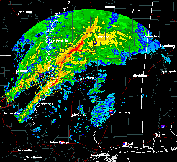 At 257 pm cst, severe thunderstorms were located along a line extending from malmaison to near thornton, moving east at 65 mph (radar indicated). Hazards include 60 mph wind gusts. Expect damage to roofs. siding. and trees. these severe storms will be near, north carrollton, malmaison and teoc around 300 pm cst. jefferson and tchula around 305 pm cst. other locations impacted by these severe thunderstorms include carrollton. A tornado watch remains in effect until 900 pm cst for north central and central mississippi. At 257 pm cst, severe thunderstorms were located along a line extending from malmaison to near thornton, moving east at 65 mph (radar indicated). Hazards include 60 mph wind gusts. Expect damage to roofs. siding. and trees. these severe storms will be near, north carrollton, malmaison and teoc around 300 pm cst. jefferson and tchula around 305 pm cst. other locations impacted by these severe thunderstorms include carrollton. A tornado watch remains in effect until 900 pm cst for north central and central mississippi.
|
| 11/28/2016 2:37 PM CST |
 At 236 pm cst, severe thunderstorms were located along a line extending from near greenwood to 6 miles west of belzoni, moving east at 65 mph (radar indicated). Hazards include 60 mph wind gusts. Expect damage to roofs. siding. and trees. these severe storms will be near, greenwood around 240 pm cst. teoc and malmaison around 245 pm cst. north carrollton and swiftown around 250 pm cst. jefferson and tchula around 255 pm cst. seven pines around 305 pm cst. black hawk around 310 pm cst. emory and coila around 315 pm cst. Other locations impacted by these severe thunderstorms include cruger, carrollton, morgan city and silver city. At 236 pm cst, severe thunderstorms were located along a line extending from near greenwood to 6 miles west of belzoni, moving east at 65 mph (radar indicated). Hazards include 60 mph wind gusts. Expect damage to roofs. siding. and trees. these severe storms will be near, greenwood around 240 pm cst. teoc and malmaison around 245 pm cst. north carrollton and swiftown around 250 pm cst. jefferson and tchula around 255 pm cst. seven pines around 305 pm cst. black hawk around 310 pm cst. emory and coila around 315 pm cst. Other locations impacted by these severe thunderstorms include cruger, carrollton, morgan city and silver city.
|
| 11/28/2016 2:20 PM CST |
 At 219 pm cst, severe thunderstorms were located along a line extending from near moorhead to near panther burn, moving east at 65 mph (radar indicated). Hazards include 60 mph wind gusts. Expect damage to roofs. siding. and trees. severe thunderstorms will be near, itta bena and quito around 225 pm cst. greenwood and isola around 235 pm cst. belzoni and teoc around 240 pm cst. malmaison and swiftown around 245 pm cst. jefferson and north carrollton around 250 pm cst. tchula around 255 pm cst. seven pines around 305 pm cst. black hawk and coila around 310 pm cst. Other locations impacted by these severe thunderstorms include silver city, cruger, carrollton and morgan city. At 219 pm cst, severe thunderstorms were located along a line extending from near moorhead to near panther burn, moving east at 65 mph (radar indicated). Hazards include 60 mph wind gusts. Expect damage to roofs. siding. and trees. severe thunderstorms will be near, itta bena and quito around 225 pm cst. greenwood and isola around 235 pm cst. belzoni and teoc around 240 pm cst. malmaison and swiftown around 245 pm cst. jefferson and north carrollton around 250 pm cst. tchula around 255 pm cst. seven pines around 305 pm cst. black hawk and coila around 310 pm cst. Other locations impacted by these severe thunderstorms include silver city, cruger, carrollton and morgan city.
|
| 8/6/2016 4:44 PM CDT |
 At 444 pm cdt, a severe thunderstorm was located over howard, or 10 miles east of thornton, moving southeast at 15 mph (radar indicated). Hazards include 60 mph wind gusts. Expect damage to roofs. siding. and trees. this severe storm will be near, brozville around 500 pm cdt. lexington around 505 pm cdt. Franklin around 515 pm cdt. At 444 pm cdt, a severe thunderstorm was located over howard, or 10 miles east of thornton, moving southeast at 15 mph (radar indicated). Hazards include 60 mph wind gusts. Expect damage to roofs. siding. and trees. this severe storm will be near, brozville around 500 pm cdt. lexington around 505 pm cdt. Franklin around 515 pm cdt.
|
| 8/6/2016 4:15 PM CDT |
 At 415 pm cdt, a severe thunderstorm was located over tchula, or 7 miles northeast of thornton, moving southeast at 15 mph (radar indicated). Hazards include 60 mph wind gusts. Expect damage to roofs. siding. and trees. this severe thunderstorm will be near, tchula around 420 pm cdt. howard around 435 pm cdt. tolarville around 440 pm cdt. lexington and brozville around 505 pm cdt. Franklin around 515 pm cdt. At 415 pm cdt, a severe thunderstorm was located over tchula, or 7 miles northeast of thornton, moving southeast at 15 mph (radar indicated). Hazards include 60 mph wind gusts. Expect damage to roofs. siding. and trees. this severe thunderstorm will be near, tchula around 420 pm cdt. howard around 435 pm cdt. tolarville around 440 pm cdt. lexington and brozville around 505 pm cdt. Franklin around 515 pm cdt.
|
| 7/14/2016 9:55 PM CDT |
 The severe thunderstorm warning for grenada, carroll, leflore and holmes counties will expire at 1000 pm cdt, the storms which prompted the warning have weakened below severe limits, and no longer pose an immediate threat to life or property. a severe thunderstorm watch remains in effect until 100 am cdt for north central and central mississippi. The severe thunderstorm warning for grenada, carroll, leflore and holmes counties will expire at 1000 pm cdt, the storms which prompted the warning have weakened below severe limits, and no longer pose an immediate threat to life or property. a severe thunderstorm watch remains in effect until 100 am cdt for north central and central mississippi.
|
| 7/14/2016 9:01 PM CDT |
 At 901 pm cdt, severe thunderstorms were located along a line extending from near dublin to near murphy, moving east at 40 mph (radar indicated). Hazards include 70 mph wind gusts. Expect considerable tree damage. damage is likely to mobile homes, roofs, and outbuildings. severe thunderstorms will be near, thornton around 925 pm cdt. tolarville, coxburg and howard around 935 pm cdt. brozville around 940 pm cdt. lexington and ebenezer around 945 pm cdt. franklin around 950 pm cdt. goodman around 955 pm cdt. durant around 1000 pm cdt. Other locations impacted by these severe thunderstorms include schlater, cruger, carrollton, morgan city and west. At 901 pm cdt, severe thunderstorms were located along a line extending from near dublin to near murphy, moving east at 40 mph (radar indicated). Hazards include 70 mph wind gusts. Expect considerable tree damage. damage is likely to mobile homes, roofs, and outbuildings. severe thunderstorms will be near, thornton around 925 pm cdt. tolarville, coxburg and howard around 935 pm cdt. brozville around 940 pm cdt. lexington and ebenezer around 945 pm cdt. franklin around 950 pm cdt. goodman around 955 pm cdt. durant around 1000 pm cdt. Other locations impacted by these severe thunderstorms include schlater, cruger, carrollton, morgan city and west.
|
| 6/17/2016 7:06 PM CDT |
 At 705 pm cdt, severe thunderstorms were located along a line extending from near brozville to near howard to swiftown, moving southeast at 35 mph (radar indicated). Hazards include 60 mph wind gusts and quarter size hail. Hail damage to vehicles is expected. expect wind damage to roofs, siding, and trees. these severe storms will be near, howard around 710 pm cdt. tolarville around 715 pm cdt. Other locations impacted by these severe thunderstorms include cruger and morgan city. At 705 pm cdt, severe thunderstorms were located along a line extending from near brozville to near howard to swiftown, moving southeast at 35 mph (radar indicated). Hazards include 60 mph wind gusts and quarter size hail. Hail damage to vehicles is expected. expect wind damage to roofs, siding, and trees. these severe storms will be near, howard around 710 pm cdt. tolarville around 715 pm cdt. Other locations impacted by these severe thunderstorms include cruger and morgan city.
|
| 6/17/2016 6:42 PM CDT |
 At 642 pm cdt, a severe thunderstorm was located 7 miles southwest of sidon, or 12 miles south of itta bena, moving south at 15 mph (radar indicated). Hazards include 60 mph wind gusts and quarter size hail. Hail damage to vehicles is expected. expect wind damage to roofs, siding, and trees. this severe storm will be near, tchula and howard around 730 pm cdt. Other locations impacted by this severe thunderstorm include cruger and morgan city. At 642 pm cdt, a severe thunderstorm was located 7 miles southwest of sidon, or 12 miles south of itta bena, moving south at 15 mph (radar indicated). Hazards include 60 mph wind gusts and quarter size hail. Hail damage to vehicles is expected. expect wind damage to roofs, siding, and trees. this severe storm will be near, tchula and howard around 730 pm cdt. Other locations impacted by this severe thunderstorm include cruger and morgan city.
|
| 6/17/2016 6:17 PM CDT |
 The national weather service in jackson has issued a * severe thunderstorm warning for. northeastern humphreys county in central mississippi. southern leflore county in north central mississippi. northwestern holmes county in central mississippi. Until 730 pm cdt. The national weather service in jackson has issued a * severe thunderstorm warning for. northeastern humphreys county in central mississippi. southern leflore county in north central mississippi. northwestern holmes county in central mississippi. Until 730 pm cdt.
|
| 6/17/2016 5:49 PM CDT |
 At 549 pm cdt, severe thunderstorms were located along a line extending from 6 miles northeast of tchula to near goodman, moving southeast at 25 mph (radar indicated). Hazards include 60 mph wind gusts and quarter size hail. Hail damage to vehicles is expected. expect wind damage to roofs, siding, and trees. these severe storms will be near, franklin and goodman around 555 pm cdt. lexington and pickens around 600 pm cdt. Other locations impacted by these severe thunderstorms include cruger and west. At 549 pm cdt, severe thunderstorms were located along a line extending from 6 miles northeast of tchula to near goodman, moving southeast at 25 mph (radar indicated). Hazards include 60 mph wind gusts and quarter size hail. Hail damage to vehicles is expected. expect wind damage to roofs, siding, and trees. these severe storms will be near, franklin and goodman around 555 pm cdt. lexington and pickens around 600 pm cdt. Other locations impacted by these severe thunderstorms include cruger and west.
|
| 6/17/2016 5:31 PM CDT |
 At 531 pm cdt, severe thunderstorms were located along a line extending from near sidon to near franklin to near newport, moving southeast at 25 mph (radar indicated). Hazards include 60 mph wind gusts and quarter size hail. Hail damage to vehicles is expected. expect wind damage to roofs, siding, and trees. these severe storms will be near, durant and franklin around 535 pm cdt. goodman, newport and mcadams around 540 pm cdt. tchula and pickens around 545 pm cdt. lexington around 600 pm cdt. Other locations impacted by these severe thunderstorms include sallis, cruger and west. At 531 pm cdt, severe thunderstorms were located along a line extending from near sidon to near franklin to near newport, moving southeast at 25 mph (radar indicated). Hazards include 60 mph wind gusts and quarter size hail. Hail damage to vehicles is expected. expect wind damage to roofs, siding, and trees. these severe storms will be near, durant and franklin around 535 pm cdt. goodman, newport and mcadams around 540 pm cdt. tchula and pickens around 545 pm cdt. lexington around 600 pm cdt. Other locations impacted by these severe thunderstorms include sallis, cruger and west.
|
| 6/17/2016 5:20 PM CDT |
 At 520 pm cdt, severe thunderstorms were located along a line extending from near sidon to mcmillan to near newport, moving southeast at 15 mph (radar indicated). Hazards include 60 mph wind gusts and quarter size hail. Hail damage to vehicles is expected. expect wind damage to roofs, siding, and trees. these severe storms will be near, bowling green around 525 pm cdt. franklin and mcadams around 530 pm cdt. newport around 535 pm cdt. durant around 540 pm cdt. tchula around 555 pm cdt. goodman around 600 pm cdt. Other locations impacted by these severe thunderstorms include cruger, sallis, ethel and west. At 520 pm cdt, severe thunderstorms were located along a line extending from near sidon to mcmillan to near newport, moving southeast at 15 mph (radar indicated). Hazards include 60 mph wind gusts and quarter size hail. Hail damage to vehicles is expected. expect wind damage to roofs, siding, and trees. these severe storms will be near, bowling green around 525 pm cdt. franklin and mcadams around 530 pm cdt. newport around 535 pm cdt. durant around 540 pm cdt. tchula around 555 pm cdt. goodman around 600 pm cdt. Other locations impacted by these severe thunderstorms include cruger, sallis, ethel and west.
|
| 6/17/2016 4:46 PM CDT |
 At 446 pm cdt, severe thunderstorms were located along a line extending from near emory to 6 miles southwest of vaiden to near hesterville, moving southeast at 55 mph (radar indicated). Hazards include 60 mph wind gusts and quarter size hail. Hail damage to vehicles is expected. expect wind damage to roofs, siding, and trees. severe thunderstorms will be near, hesterville around 500 pm cdt. possumneck around 505 pm cdt. kosciusko around 510 pm cdt. mcadams around 515 pm cdt. zama and smyrna around 525 pm cdt. Other locations impacted by these severe thunderstorms include cruger, sallis, ethel and west. At 446 pm cdt, severe thunderstorms were located along a line extending from near emory to 6 miles southwest of vaiden to near hesterville, moving southeast at 55 mph (radar indicated). Hazards include 60 mph wind gusts and quarter size hail. Hail damage to vehicles is expected. expect wind damage to roofs, siding, and trees. severe thunderstorms will be near, hesterville around 500 pm cdt. possumneck around 505 pm cdt. kosciusko around 510 pm cdt. mcadams around 515 pm cdt. zama and smyrna around 525 pm cdt. Other locations impacted by these severe thunderstorms include cruger, sallis, ethel and west.
|
| 4/11/2016 4:08 PM CDT |
 At 408 pm cdt, a severe thunderstorm was located near tchula, or 9 miles southwest of black hawk, moving east at 60 mph (radar indicated). Hazards include 60 mph wind gusts and quarter size hail. Hail damage to vehicles is expected. expect wind damage to roofs, siding, and trees. This severe thunderstorm will remain over mainly rural areas of central holmes county, including the following locations: cruger. At 408 pm cdt, a severe thunderstorm was located near tchula, or 9 miles southwest of black hawk, moving east at 60 mph (radar indicated). Hazards include 60 mph wind gusts and quarter size hail. Hail damage to vehicles is expected. expect wind damage to roofs, siding, and trees. This severe thunderstorm will remain over mainly rural areas of central holmes county, including the following locations: cruger.
|
| 4/11/2016 3:50 PM CDT |
 At 349 pm cdt, a severe thunderstorm was located over belzoni, moving east at 60 mph (radar indicated). Hazards include 60 mph wind gusts and quarter size hail. Hail damage to vehicles is expected. expect wind damage to roofs, siding, and trees. this severe thunderstorm will be near, tchula and howard around 405 pm cdt. Other locations impacted by this severe thunderstorm include silver city and cruger. At 349 pm cdt, a severe thunderstorm was located over belzoni, moving east at 60 mph (radar indicated). Hazards include 60 mph wind gusts and quarter size hail. Hail damage to vehicles is expected. expect wind damage to roofs, siding, and trees. this severe thunderstorm will be near, tchula and howard around 405 pm cdt. Other locations impacted by this severe thunderstorm include silver city and cruger.
|
| 4/11/2016 3:24 PM CDT |
 At 323 pm cdt, a severe thunderstorm was located near howard, or 11 miles east of thornton, moving east at 50 mph (radar indicated). Hazards include 60 mph wind gusts and quarter size hail. Hail damage to vehicles is expected. expect wind damage to roofs, siding, and trees. this severe thunderstorm will be near, bowling green and emory around 340 pm cdt. durant around 345 pm cdt. Other locations impacted by this severe thunderstorm include west. At 323 pm cdt, a severe thunderstorm was located near howard, or 11 miles east of thornton, moving east at 50 mph (radar indicated). Hazards include 60 mph wind gusts and quarter size hail. Hail damage to vehicles is expected. expect wind damage to roofs, siding, and trees. this severe thunderstorm will be near, bowling green and emory around 340 pm cdt. durant around 345 pm cdt. Other locations impacted by this severe thunderstorm include west.
|
| 3/10/2016 11:11 AM CST |
 At 1111 am cst, severe thunderstorms were located along a line extending from near coxburg to near myrleville, moving northeast at 55 mph (radar indicated). Hazards include 60 mph wind gusts. Expect damage to roofs. siding and trees. these severe storms will be near, thornton and coxburg around 1115 am cst. tolarville, brozville and ebenezer around 1120 am cst. vaughan and howard around 1125 am cst. lexington around 1130 am cst. pickens and bowling green around 1135 am cst. franklin, goodman and emory around 1140 am cst. durant around 1150 am cst. Other locations impacted by these severe thunderstorms include eden and west. At 1111 am cst, severe thunderstorms were located along a line extending from near coxburg to near myrleville, moving northeast at 55 mph (radar indicated). Hazards include 60 mph wind gusts. Expect damage to roofs. siding and trees. these severe storms will be near, thornton and coxburg around 1115 am cst. tolarville, brozville and ebenezer around 1120 am cst. vaughan and howard around 1125 am cst. lexington around 1130 am cst. pickens and bowling green around 1135 am cst. franklin, goodman and emory around 1140 am cst. durant around 1150 am cst. Other locations impacted by these severe thunderstorms include eden and west.
|
| 3/10/2016 10:56 AM CST |
 At 1055 am cst, severe thunderstorms were located along a line extending from near yazoo city to 6 miles south of little yazoo, moving northeast at 55 mph (radar indicated). Hazards include 60 mph wind gusts. Expect damage to roofs. siding and trees. severe thunderstorms will be near, yazoo city around 1100 am cst. myrleville around 1105 am cst. thornton, benton and coxburg around 1115 am cst. tolarville, brozville and vaughan around 1120 am cst. howard around 1125 am cst. lexington, pickens and ebenezer around 1130 am cst. franklin and goodman around 1135 am cst. emory and bowling green around 1140 am cst. Other locations impacted by these severe thunderstorms include eden, bentonia and west. At 1055 am cst, severe thunderstorms were located along a line extending from near yazoo city to 6 miles south of little yazoo, moving northeast at 55 mph (radar indicated). Hazards include 60 mph wind gusts. Expect damage to roofs. siding and trees. severe thunderstorms will be near, yazoo city around 1100 am cst. myrleville around 1105 am cst. thornton, benton and coxburg around 1115 am cst. tolarville, brozville and vaughan around 1120 am cst. howard around 1125 am cst. lexington, pickens and ebenezer around 1130 am cst. franklin and goodman around 1135 am cst. emory and bowling green around 1140 am cst. Other locations impacted by these severe thunderstorms include eden, bentonia and west.
|
| 3/3/2016 3:27 PM CST |
 At 326 pm cst, a severe thunderstorm was located near swiftown, or 7 miles southeast of moorhead, moving east at 45 mph (radar indicated). Hazards include 60 mph wind gusts and quarter size hail. Hail damage to vehicles is expected. expect wind damage to roofs, siding and trees. this severe storm will be near, quito around 335 pm cst. sidon around 340 pm cst. seven pines around 350 pm cst. Other locations impacted by this severe thunderstorm include cruger and morgan city. At 326 pm cst, a severe thunderstorm was located near swiftown, or 7 miles southeast of moorhead, moving east at 45 mph (radar indicated). Hazards include 60 mph wind gusts and quarter size hail. Hail damage to vehicles is expected. expect wind damage to roofs, siding and trees. this severe storm will be near, quito around 335 pm cst. sidon around 340 pm cst. seven pines around 350 pm cst. Other locations impacted by this severe thunderstorm include cruger and morgan city.
|
| 3/3/2016 3:13 PM CST |
 At 313 pm cst, a severe thunderstorm was located near indianola, moving east at 45 mph (radar indicated). Hazards include 60 mph wind gusts and quarter size hail. Hail damage to vehicles is expected. expect wind damage to roofs, siding and trees. this severe thunderstorm will be near, swiftown around 330 pm cst. quito around 335 pm cst. sidon around 340 pm cst. seven pines around 350 pm cst. Other locations impacted by this severe thunderstorm include cruger and morgan city. At 313 pm cst, a severe thunderstorm was located near indianola, moving east at 45 mph (radar indicated). Hazards include 60 mph wind gusts and quarter size hail. Hail damage to vehicles is expected. expect wind damage to roofs, siding and trees. this severe thunderstorm will be near, swiftown around 330 pm cst. quito around 335 pm cst. sidon around 340 pm cst. seven pines around 350 pm cst. Other locations impacted by this severe thunderstorm include cruger and morgan city.
|
| 12/28/2015 5:10 AM CST |
 At 510 am cst, severe thunderstorms were located along a line extending from 6 miles east of swiftown to near canton, moving northeast at 40 mph (radar indicated). Hazards include 60 mph wind gusts. Expect damage to roofs. siding and trees. severe thunderstorms will be near, sharon around 520 am cst. farmhaven around 530 am cst. camden and cameron around 535 am cst. thomastown around 555 am cst. other locations impacted by these severe thunderstorms include sallis and west. A tornado watch remains in effect until 800 am cst for north central mississippi. At 510 am cst, severe thunderstorms were located along a line extending from 6 miles east of swiftown to near canton, moving northeast at 40 mph (radar indicated). Hazards include 60 mph wind gusts. Expect damage to roofs. siding and trees. severe thunderstorms will be near, sharon around 520 am cst. farmhaven around 530 am cst. camden and cameron around 535 am cst. thomastown around 555 am cst. other locations impacted by these severe thunderstorms include sallis and west. A tornado watch remains in effect until 800 am cst for north central mississippi.
|
| 12/28/2015 4:47 AM CST |
 At 447 am cst, severe thunderstorms were located along a line extending from near swiftown to flora, moving northeast at 35 mph (radar indicated). Hazards include 60 mph wind gusts. Expect damage to roofs. siding and trees. these severe storms will be near, myrleville around 500 am cst. vaughan around 515 am cst. other locations impacted by these severe thunderstorms include eden, silver city and bentonia. A tornado watch remains in effect until 800 am cst for north central mississippi. At 447 am cst, severe thunderstorms were located along a line extending from near swiftown to flora, moving northeast at 35 mph (radar indicated). Hazards include 60 mph wind gusts. Expect damage to roofs. siding and trees. these severe storms will be near, myrleville around 500 am cst. vaughan around 515 am cst. other locations impacted by these severe thunderstorms include eden, silver city and bentonia. A tornado watch remains in effect until 800 am cst for north central mississippi.
|
| 12/28/2015 4:10 AM CST |
 At 410 am cst, severe thunderstorms were located along a line extending from midnight to raymond, moving northeast at 40 mph (radar indicated). Hazards include 60 mph wind gusts. Expect damage to roofs. siding and trees. severe thunderstorms will be near, midnight around 415 am cst. belzoni around 430 am cst. thornton around 435 am cst. tchula and howard around 445 am cst. other locations impacted by these severe thunderstorms include eden, silver city, bentonia, satartia and louise. a tornado watch remains in effect until 500 am cst for northwestern mississippi. A tornado watch also remains in effect until 800 am cst for north central mississippi. At 410 am cst, severe thunderstorms were located along a line extending from midnight to raymond, moving northeast at 40 mph (radar indicated). Hazards include 60 mph wind gusts. Expect damage to roofs. siding and trees. severe thunderstorms will be near, midnight around 415 am cst. belzoni around 430 am cst. thornton around 435 am cst. tchula and howard around 445 am cst. other locations impacted by these severe thunderstorms include eden, silver city, bentonia, satartia and louise. a tornado watch remains in effect until 500 am cst for northwestern mississippi. A tornado watch also remains in effect until 800 am cst for north central mississippi.
|
| 7/7/2015 8:05 PM CDT |
 The severe thunderstorm warning for central holmes county will expire at 815 pm cdt, the storm which prompted the warning has weakened below severe limits, and no longer pose an immediate threat to life or property. therefore the warning will be allowed to expire. The severe thunderstorm warning for central holmes county will expire at 815 pm cdt, the storm which prompted the warning has weakened below severe limits, and no longer pose an immediate threat to life or property. therefore the warning will be allowed to expire.
|
| 7/7/2015 7:45 PM CDT |
 At 745 pm cdt, a severe thunderstorm was located near seven pines, or 7 miles southwest of black hawk, moving northeast at 25 mph (radar indicated). Hazards include 60 mph wind gusts and quarter size hail. Hail damage to vehicles is expected. expect wind damage to roofs, siding and trees. This severe thunderstorm will remain over mainly rural areas of central holmes county. At 745 pm cdt, a severe thunderstorm was located near seven pines, or 7 miles southwest of black hawk, moving northeast at 25 mph (radar indicated). Hazards include 60 mph wind gusts and quarter size hail. Hail damage to vehicles is expected. expect wind damage to roofs, siding and trees. This severe thunderstorm will remain over mainly rural areas of central holmes county.
|
| 7/7/2015 7:25 PM CDT |
 At 725 pm cdt, a severe thunderstorm was located over tolarville, or near thornton, moving northeast at 25 mph (radar indicated). Hazards include 60 mph wind gusts and quarter size hail. Hail damage to vehicles is expected. expect wind damage to roofs, siding and trees. this severe thunderstorm will be near, brozville around 730 pm cdt. howard around 740 pm cdt. Tchula around 750 pm cdt. At 725 pm cdt, a severe thunderstorm was located over tolarville, or near thornton, moving northeast at 25 mph (radar indicated). Hazards include 60 mph wind gusts and quarter size hail. Hail damage to vehicles is expected. expect wind damage to roofs, siding and trees. this severe thunderstorm will be near, brozville around 730 pm cdt. howard around 740 pm cdt. Tchula around 750 pm cdt.
|
| 6/24/2015 4:22 PM CDT |
 At 422 pm cdt, a severe thunderstorm was located over bowling green, or near durant, moving south at 10 mph (radar indicated). Hazards include 60 mph wind gusts and quarter size hail. Hail damage to vehicles is expected. Expect wind damage to roofs, siding and trees. At 422 pm cdt, a severe thunderstorm was located over bowling green, or near durant, moving south at 10 mph (radar indicated). Hazards include 60 mph wind gusts and quarter size hail. Hail damage to vehicles is expected. Expect wind damage to roofs, siding and trees.
|
| 6/9/2015 4:31 AM CDT | At 430 am cdt, severe thunderstorms were located along a line extending from near lexington to near thornton, moving south at 20 mph (radar indicated). Hazards include 60 mph wind gusts and nickel size hail. Expect damage to roofs. siding and trees. severe thunderstorms will be near, howard around 440 am cdt. thornton around 445 am cdt. lexington around 450 am cdt. brozville and tolarville around 500 am cdt. franklin and coxburg around 510 am cdt. ebenezer around 515 am cdt. yazoo city around 525 am cdt. Other locations impacted by these severe thunderstorms include eden. |
| 5/24/2015 5:30 PM CDT | At 529 pm cdt, severe thunderstorms were located along a line extending from near itta bena to near sidon to near lexington, moving north at 45 mph (radar indicated). Hazards include 60 mph wind gusts and penny size hail. Expect damage to roofs. siding and trees. these severe storms will be near, itta bena, sidon and quito around 535 pm cdt. greenwood around 545 pm cdt. black hawk, sunnyside and teoc around 550 pm cdt. money, minter city and coila around 555 pm cdt. avalon and malmaison around 600 pm cdt. other locations impacted by these severe thunderstorms include schlater, cruger, carrollton and morgan city. A tornado watch remains in effect until 800 pm cdt for central mississippi. |
| 5/24/2015 5:15 PM CDT | Trees downed in the tchula area in holmes county MS, 0.4 miles NW of Tchula, MS |
| 5/24/2015 5:06 PM CDT | At 506 pm cdt, severe thunderstorms were located along a line extending from near isola to near tolarville to near midway, moving north at 65 mph (radar indicated). Hazards include 60 mph wind gusts and quarter size hail. Hail damage to vehicles is expected. expect wind damage to roofs, siding and trees. severe thunderstorms will be near, howard and swiftown around 510 pm cdt. tchula around 515 pm cdt. franklin around 520 pm cdt. itta bena, lexington and seven pines around 525 pm cdt. sidon and bowling green around 530 pm cdt. greenwood, black hawk, emory and sunnyside around 535 pm cdt. teoc, minter city, coila and malmaison around 540 pm cdt. avalon around 545 pm cdt. other locations impacted by these severe thunderstorms include schlater, eden, cruger, carrollton, morgan city and west. A tornado watch remains in effect until 800 pm cdt for northwestern mississippi. |
| 4/25/2015 1:16 AM CDT | At 115 am cdt, severe thunderstorms were located along a line extending from black hawk to 6 miles south of midnight, moving east at 50 mph (radar indicated). Hazards include 60 mph wind gusts and quarter size hail. Hail damage to vehicles is expected. expect wind damage to roofs, siding and trees. severe thunderstorms will be near, emory around 125 am cdt. coxburg and tolarville around 135 am cdt. ebenezer and brozville around 145 am cdt. franklin around 150 am cdt. goodman around 200 am cdt. other locations impacted by these severe thunderstorms include cruger and west. a tornado watch remains in effect until 400 am cdt for central mississippi. a tornado watch also remains in effect until 800 am cdt for central mississippi. 1. 00in. |
| 4/24/2015 11:16 PM CDT | At 1115 pm cdt, severe thunderstorms were located along a line extending from near howard to near thornton, moving east at 45 mph (radar indicated). Hazards include 60 mph wind gusts and quarter size hail. Hail damage to vehicles is expected. expect wind damage to roofs, siding and trees. severe thunderstorms will be near, brozville around 1130 pm cdt. lexington and emory around 1135 pm cdt. bowling green around 1145 pm cdt. durant around 1150 pm cdt. possumneck around 1155 pm cdt. hesterville around 1205 am cdt. other locations impacted by these severe thunderstorms include west. 1. 00in. |
| 4/19/2015 10:07 PM CDT | At 1007 pm cdt, a severe thunderstorm was located near belzoni, moving northeast at 70 mph (radar indicated). Hazards include ping pong ball size hail and 60 mph wind gusts. People and animals outdoors will be injured. expect hail damage to roofs, siding, windows and vehicles. expect wind damage to roofs, siding and trees. this severe storm will be near, belzoni around 1010 pm cdt. swiftown around 1015 pm cdt. other locations impacted by this severe thunderstorm include morgan city, cruger and silver city. a tornado watch remains in effect until 300 am cdt for northwestern mississippi. 1. 50in. |
| 4/19/2015 9:50 PM CDT | At 950 pm cdt, a severe thunderstorm was located over nitta yuma, or 8 miles south of hollandale, moving northeast at 75 mph (radar indicated). Hazards include ping pong ball size hail and 60 mph wind gusts. People and animals outdoors will be injured. expect hail damage to roofs, siding, windows and vehicles. expect wind damage to roofs, siding and trees. this severe thunderstorm will be near, murphy and midnight around 1000 pm cdt. isola around 1005 pm cdt. belzoni around 1010 pm cdt. swiftown around 1015 pm cdt. other locations impacted by this severe thunderstorm include morgan city, silver city and cruger. a tornado watch remains in effect until 300 am cdt for northwestern mississippi. 1. 50in. |
| 3/31/2015 5:55 PM CDT | A severe thunderstorm warning remains in effect until 630 pm cdt for central humphreys and west central holmes counties. at 554 pm cdt. a severe thunderstorm was located over belzoni. moving southeast at 35 mph. hazard. golf ball size hail and 60 mph wind gusts. source. Radar indicated. |
| 3/31/2015 5:47 PM CDT | A severe thunderstorm warning remains in effect until 630 pm cdt for humphreys and west central holmes counties. at 547 pm cdt. a severe thunderstorm was located near belzoni. moving southeast at 35 mph. hazard. golf ball size hail and 60 mph wind gusts. source. Radar indicated. |
| 3/31/2015 5:34 PM CDT | The national weather service in jackson has issued a * severe thunderstorm warning for. humphreys county in central mississippi. northwestern holmes county in central mississippi. until 630 pm cdt * at 533 pm cdt. a severe thunderstorm was located near isola. Or. |
| 7/2/2014 2:55 PM CDT | One tree down on a house and another down across the railroa in holmes county MS, 0.4 miles NW of Tchula, MS |
| 12/21/2013 6:55 PM CST | Numerous trees down on various county road in holmes county MS, 0.4 miles NW of Tchula, MS |
| 6/12/2012 3:30 AM CDT | Report of a powerline down on highway 4 in holmes county MS, 1.8 miles S of Tchula, MS |
| 1/1/0001 12:00 AM | A few trees and large limbs were blown down around the mileston community in holmes county MS, 5.7 miles NNE of Tchula, MS |
Hail Maps for Tchula, MS
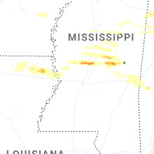
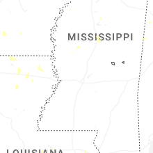
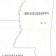
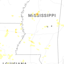

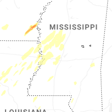


Connect with Interactive Hail Maps